
King City Zoning Code
ARTICLE V
- DEVELOPMENT STANDARDS
DIVISION 2. - WATERSHED OVERLAY DISTRICTS[8]
Editor's note—Ord. No. 2024-09, § 1(Exh. B), adopted Aug. 5, 2024, repealed the former Div. 2, §§ 32-271—32-285, and enacted a new Div. 2 as set out herein. The former Div. 2 pertained to similar subject matter [or X] and derived from Ord. No. 8.13-85, art. V, § 8(A)—(I), 8(K)—(N), adopted Sept. 7, 1993; Ord. No. 8.14-85, § 1, adopted Nov. 1, 1993; Ord. No. 2024-01, adopted Jan. 2, 2024.
Cross reference— Floods, ch. 14; watershed regulations for subdivisions, § 26-236 et seq.
Sec. 32-241. - Table of area, height and placement regulations.
The table of area, height and placement regulations shall be as follows:
Footnotes
1 15 feet from edge of right-of-way where abutting a street.
2 Additional height above the specified limits for every foot or fraction thereof of building height specified if one additional foot of front, side, and rear setback is provided. However, in no case shall a building exceed three stories above ground level.
3 Minimal lot sizes permitted only where public water and sewer are available. If a septic tank waste disposal system is used, the minimum lot size shall be determined by the county health department.
4 20-foot setback where abutting a property line; 30 feet where abutting a street. Normally, rear yard setback is measured from the property line to the edge of the principal building, excluding a roof overhang. However, if a patio or deck is provided, the backyard setback shall be measured from the property line to these facilities.
5 In the B-1 and B-2 districts where a lot abuts a residential district, a ten-foot minimum setback shall be provided along this common boundary. This provision applies to either a side yard or rear yard, or both. In the B-1 district where a side yard fronts on a street, a five-foot setback shall be provided for a sidewalk. Whenever a side or rear yard is provided, either voluntarily or required by this chapter, it shall not be less than ten feet in width. If the state building codes require a larger setback, it shall supersede the setback requirements specified in this chapter.
6 In the B-1 district, a three-foot setback shall be provided for a sidewalk.
7 Any one-family, detached dwelling in the R-MF-A, R-MF-C, R-MF-T, R-MH, R-MH-1, R-MH-2, B-2 or O-I districts shall meet the dimensional requirements of the R-15 residential district.
8 In the B-2 business district, the front yard setback from the right-of-way shall be increased from 30 feet to 40 feet on South Main Street from New U.S. 52 to Old U.S. 52 (King Street).
9 Setback distance shall be measured from the property line to the principal building. If a loading dock is attached to the principal building, the setback shall be measured from the loading dock to the property line.
10 Setback distance for: Thoroughfare streets, 50 feet; collector streets, 40 feet; all other streets 30 feet.
11 Side yard setbacks shall be 30 feet from right-of-way when abutting a street.
12 All minimum lot areas shall not include any easements, street rights-of-way, or utility easements.
(Ord. No. 8-85, art. IV, § 1, 9-23-85; Ord. No. 8.2-85, § 4, 4-7-86; Ord. of 5-2-06; Ord. No. 5-2.1-06, 3-2-20; Ord. No. 2024-01, 1-2-24)
Sec. 32-242. - Additional requirements for certain types of uses.
Because of the complex nature of certain types of land use, additional development standards are needed to ensure they will be compatible with neighboring land uses. Sections 32-243—32-284 will detail these additional standards.
(Ord. No. 8-85, art. IV, § 2, 9-23-85; Ord. No. 2024-01, 1-2-24)
Sec. 32-243. - Development plan.
A development plan shall be prepared and sealed by an architect, engineer or surveyor licensed in the state for shopping centers, multifamily developments, planned unit developments (PUD), mobile home parks and industrial parks, and business-related districts. The development plan shall show the following information, if applicable:
(1)
Location, arrangement, and dimensions of truck loading and unloading spaces and docks. (see section 32-392)
(2)
Location, arrangement and dimensions of automobile parking spaces, width of aisles, width of bays, angle parking and sidewalk layouts. (see section 32-359)
(3)
Location and dimensions of vehicular entrances, exits and drives. (see section 32-321)
(4)
Specific drainage systems, as they relate to the site and adjoining properties. (per state guidelines)
(5)
Location and materials of walls and fences. (see section 32-259)
(6)
Ground cover, topography, slopes, banks, and ditches. (per state and best management practices)
(7)
The location and general exterior dimensions of main and accessory buildings.
(8)
Architectural plans for proposed buildings. (per state technical codes)
(9)
The location, dimensions, and arrangements of areas to be devoted to planting, lawns, trees and other plants. (see sections 32-254 and 32-259)
(10)
The plans for proposed utility layouts, including sanitary sewers, storm sewers, water distribution lines, natural gas, telephone and electric service (all utilities shall be constructed per the city's construction standards, if applicable).
(11)
An analysis of anticipated traffic volume on larger projects or if deemed necessary by the approving board, city engineer, or NCDOT.
(12)
Sediment control plan. (per state guidelines)
(13)
Evidence that the state department of transportation has been made aware of the proposed development and that the developer will coordinate for the development with this agency.
(14)
Plans for refuse disposal equipment and method of refuse disposal such as compactors or dumpsters. (see section 32-254)
(15)
Delineation of areas to be constructed in phases and sequential order.
(Ord. No. 8-85, art. IV, § 3, 9-23-85; Ord. No. 2024-01, 1-2-24)
Sec. 32-244. - Retail/shopping centers.
(a)
Definitions. The following words, terms, and phrases, when used in this section, shall have the meanings ascribed to them in this subsection, except where the context clearly indicates a different meaning:
Retail/shopping center means two or more commercial operations located in one or more buildings on a single tract of land, whether or not the shopping center is subdivided or held in single ownership or a single retail structure in excess of 50,000 gross square feet. Retail/shopping centers with less than 21,000 square feet in combined floor space or under 50,000 square feet on a single structure shall not be required to comply with this section but must meet the requirements of the B-2 district and section 32-254.
(b)
Site area. Retail/shopping centers with two or more principal buildings containing more than 21,000 square feet or one structure containing more than 50,000 square feet in floor space shall be located on a site at least nine acres in size.
(c)
Permitted uses. The following permitted principal and accessory uses are allowed within a PD-RC:
(1)
Any of the following office uses such as:
a.
Office/business establishments.
b.
Financial.
c.
Government.
d.
Medical and professional.
(2)
Any of the following primarily retail stores including such uses as or similar to:
a.
Book and magazine stores with exception of adult entertainment.
b.
Cameras, videos, and the like.
c.
Clothing and apparel stores.
d.
Craft, flowers, notions, gift stores.
e.
Drug store.
f.
Hardware and home improvement store.
g.
Jewelry shop.
h.
Sporting goods store.
i.
Toy and cards store.
j.
Furniture store.
k.
Food store.
(3)
Department stores.
(4)
Service establishments such as or similar to:
a.
Beauty and barber shops.
b.
Dry cleaning and laundry stores.
c.
Health and physical fitness centers.
d.
Restaurants.
e.
Shoe sales and repair.
f.
Theaters.
g.
Hotels.
h.
Service stations w/without restaurants.
(5)
Uses that are not permitted in this district are:
a.
Repair shops w/outdoor storage areas.
b.
Modular/manufactured home sales office and/or lot.
c.
New/used car lots.
d.
Pet kennels.
e.
Freestanding car wash facilities.
f.
Tractor trailer refueling stations.
(d)
Design standards. It is the intent of this district to provide for the proper grouping and development of commercial facilities and to provide: (i) a safe means of public interaction at the proposed development with proper attention given to site access, vehicle circulation, and pedestrian ways, (ii) adequate public utilities and fire suppression capabilities, (iii) compatible architectural styling to complement surrounding commercial and residential character and, (iv) protect property values in surrounding neighborhoods. It is further intended that a PD-RC shall provide a broad range of facilities and services appropriate to the general need of the area served to these ends.
(e)
Plan review requirements. Shall be as follows and as set forth in this section. Proposed plans shall be submitted in the following manner: (i) first page shall show the overall project with any phasing, outparcels, landscaping, and notes/calculations, (ii) second page shall show existing and proposed topo's and stormwater management layouts, (iii) third page shall show proposed utilities, street, and sidewalk layouts and any details associated with the project. Additional pages are allowed but shall not exceed five in total. Pages shall not exceed 24 inches by 36 inches in size and one copy shall be submitted in PDF format. The following items shall be shown on the appropriate pages as follows:
(1)
Location, arrangement and dimensions of truck loading and unloading spaces and docks.
(2)
Location, arrangement and dimensions of automobile parking spaces, width of aisles, width of bays, angle parking and sidewalk layouts.
(3)
Location and dimensions of vehicular entrances, exits and drives.
(4)
Specific drainage systems, as they relate to the site and adjoining properties.
(5)
Location and materials of walls and fences.
(6)
Ground cover, topography, slopes, banks and ditches both existing and proposed.
(7)
The location and general exterior dimensions of main and accessory buildings.
(8)
Architectural plans for proposed building(s). Developer shall submit for review, by the City of King Community Appearance Committee, exterior elevations of proposed buildings for the project. No less than two exterior schemes shall be submitted for a recommendation by the committee. This recommendation shall precede any public hearings by the planning board and city council. Proposed schemes shall be rendered in color and include all exterior elevations, proposed landscaping associated with and adjacent to the building(s), and proposed signage. Developer shall then submit approved architectural scheme as part of the proposed retail center submittal package.
(9)
The location, dimensions and arrangements of areas to be devoted to planting, lawns, trees and other plants.
(10)
The plans for proposed utility layouts, including sanitary sewers, storm sewers, water distribution lines, natural gas, telephone and electric service (all utilities shall be constructed to the city council standards, if applicable).
(11)
An analysis of anticipated traffic volume.
(12)
Sediment control plan.
(13)
Evidence that the state department of transportation has been made aware of the proposed development and that the developer will coordinate for the development with this agency.
(14)
Plans for refuse disposal equipment and method of refuse disposal such as compactors or dumpsters.
(15)
Delineation of areas to be constructed in phases and sequential order.
(16)
Any requirement or condition listed in this section shall appear on the proposed site plan either by illustration or by a general note.
(f)
Perimeter yard setbacks.
(1)
Minimum front yard. Each PD-RC shall have a building setback from all public or private street rights-of-way of at least 100 feet. A strip at least 25 feet deep shall be maintained as a buffer planted with shrubs and trees as well as grass and/or a ground cover along the frontage.
(2)
Minimum side yard. Each PD-RC shall have a minimum side yard at least 50 feet measured from side property line to the face of structure. See section 32-259.
(3)
Minimum rear yard. Each PD-RC shall have a minimum rear yard at least 50 feet in depth measured from property line to face of structure. See section 32-259.
(4)
Separation from residential districts. When any side(s) of a PD-RC parcel is located adjacent to a residential zoning district (R-R, R-20, R-15, R-MF-C, or R-MF-T) an additional 25 feet shall be added to the minimum front, side, or rear setback requirements in addition to the requirements in section 32-259.
(g)
Maximum height limitations. Maximum height shall not exceed 35 feet or three stories, exclusive of chimneys, flagpoles, communication masts and aerials. Additional height may be permissible with the addition of appropriate fire suppression apparatus supplied by the developer/owner and approved by the city council.
(h)
Watershed requirements. See section 32-282. The city has a WS-IV watershed overlay district. Certain development restriction may apply. In no case shall the site be developed at more than 80 percent impervious coverage when outside of the watershed.
(i)
Stormwater management. It shall be required that an adequate method for managing stormwater runoff shall be developed. Whenever possible, stormwater management systems, parking layout and the location of curbs and gutters should be planned simultaneously. Any enclosed portion of a system should be designed to manage stormwater not just to dispose of it or disperse it. No stormwater runoff shall be allowed within pedestrian ways or pedestrian easement areas. A state approved plan and permit shall be submitted to the city engineer's office when obtained.
(j)
Ingress/egress.
(1)
There should be one primary access way from the PD-RC district property to a public right-of-way. One or more secondary access ways may be permitted by the city if additional access points are recommended by the city engineer or traffic consultant in order to insure orderly and safe traffic movement within the district and between the district and adjoining areas. The recommendation of the city engineer or traffic consultant must be approved by the city council.
(2)
The applicant/developer shall install such traffic control devices as recommended by the city engineer, traffic consultant or the state highway engineer both within the district and at any places where PD-RC traffic, arteries, roads, streets or ways intersect a public or private right-of-way. The cost of installing the traffic control devices shall be paid by the applicant/developer. The developer shall maintain all traffic control devices within the district which are located on the PD-RC property.
(3)
There shall be no parking areas contiguous to the right-of-way margin or any area used for vehicular traffic such that a vehicle is required to back or maneuver into the PD-RC traffic system while entering or leaving a parking space.
(4)
The applicant must submit a PD-RC internal traffic flow plan and an internal parking area traffic flow plan for approval.
(5)
Access ways shall be not less than 30 feet nor more than 40 feet in width at their intersection with the property line. Access ways shall be installed with curb and gutter per the city's construction manual.
(6)
The location and design of access ways shall be such that traffic congestion is reduced as much as possible and traffic hazards are eliminated.
(7)
Regulatory and street signage, both internally and externally of the project, shall be as required by NCDOT or the City of King sign standards. Signs shall be installed at the developer's expense.
(8)
Driveway to public street intersections shall have a concrete apron(s) installed on the driveway side. The apron shall be the width of the drive × 12 feet in depth × six inches in thickness.
(k)
Parking/sidewalks/loading. For the planned development retail center (PD-RC) district, off-street parking shall be provided as follows:
(1)
Principal building. One space for each 500 square feet of gross floor area and one space for each employee on the largest shift.
(2)
Tenant spaces. One space for each 200 gross square feet.
(3)
Tenant space restaurants. One space for each four seats and one space for every two employees.
(4)
No space designated as required off-street parking space for the general public shall be used as off-street loading space, display area, or maneuvering room for vehicles being loaded or unloaded.
(5)
Parking spaces shall be a minimum nine feet by 20 feet. Aisles shall not be less than 26 feet.
(6)
Parking areas shall be so arranged that linear landscaped dividers are installed in lieu of a single space. A maximum of 12 linear spaces will be allowed before a landscaped divider is placed.
(7)
Parking areas shall be maintained free from potholes, debris, or any other type of hazardous conditions that would endanger the public.
Sidewalks. Pedestrian access may be provided at any suitable locations within the district, but shall, where practicable, be separated from vehicular access points in order to reduce congestion, marginal friction, and hazards, except where signalization is used in such a manner as to control pedestrian and vehicular movements safely. Sidewalks shall be a minimum five feet in width and shall be installed on at least one side of all public and private streets in the proposed development unless council deems more would be needed for safe pedestrian movement.
Loading. Each shop or store in excess of 50 feet deep shall have access to a rear or side entrance that is within a reasonable distance and is accessible to a loading area and service drive. Service drives shall be a minimum of 26 feet in width and shall be in addition to and not a part of the drives or circulation system used by vehicles of shoppers. Loading and delivery zones shall be clearly marked. Outdoor display areas shall be so marked and no outdoor storage shall cover or otherwise hinder the designated parking space(s) or fire lanes of the project.
(l)
Lighting requirements. All parking areas and access ways shall be floodlighted in accordance accepted industry standards. All outside lighting shall be arranged and shielded to prevent glare or reflection, nuisance, inconvenience or hazardous interference of any kind on adjoining lots or residential areas, or areas traveled by motor vehicles, and shall provide security for customers. The height limit of any light shall be 35 feet. A lighting plan shall be shown on sheet 3 of the project proposal. Street lighting shall be the responsibility of the developer and installed per the city's construction manual requirements.
(m)
Fire protection. Fire hydrants shall be required at locations approved by the fire chief. No portion of a building shall be farther than 250 feet nor closer than 50 feet to a fire hydrant. Hydrants shall be protected from traffic in accordance with the requirements of the town and shall be marked and painted as required by the town and the fire department. The developer shall mark and maintain fire lanes. Parking shall not be permitted in the fire lanes. A paved fire lane 12 feet in width shall encircle the buildings and shall be in addition to the required service drives. Fire lane placement shall be at the recommendation of the fire chief. The fire lane may be permitted along the rear or side of a satellite building upon recommendation of the fire chief and approval of the council. Upon recommendation of the fire chief and the approval of the council, other alternative means of providing emergency vehicle access may be authorized.
(n)
Solid waste disposal. A plan for solid waste storage, collection and disposal shall be shown on the development plan. If dumpster sites are used, they must be screened and enclosed on each side by a decorative treated wood fence or eight-inch brick and/or painted block at least eight feet in height, and having a gate opening of at least ten feet. Each dumpster shall be placed on a minimum six inches thick by ten feet long by 15 feet wide reinforced concrete pad. If a decorative treated wood fence is used it must have corner post of a minimum eight-inch by eight-inch set in concrete and a minimum 5/4 -inch treated decking board or similar for fencing material.
(o)
Utilities. Retail/shopping centers shall be located where city water and sanitary sewer are available. Areas where water or sewer upgrades are required, to accommodate the development, shall be performed at the expense of the developer. No cost shall be encumbered by the city. Site utility improvements shall be designed and installed per the city's construction manual. Prior to construction and installation the city engineer shall approve all utility construction documents. All necessary state approvals shall be the responsibility of the developer. All utilities shall be installed underground when possible. See also chapter 29, utilities.
(p)
Signage. A uniform shopping center signage criteria plan shall be submitted to the city for approval. The purpose of this plan is to define and specify all exterior signage for the retail/shopping center. This plan will set forth guidelines and design concepts for a coordinated and complementary graphic image for the entire shopping center.
(1)
Shopping center site identification sign. One freestanding shopping center site identification sign shall be permitted at the access or entranceway. The shopping center identification site sign shall not exceed 120 square feet. The sign and the supporting structure shall not exceed 20 feet in height from the undisturbed ground area. The sign can also accommodate up to an additional 100 square feet for sublet spaces sign area(s).
(2)
Secondary access way or entranceway shopping center identification signs. A secondary access or entranceway shopping center site identification sign may be permitted with the approval of the council. The secondary shopping center site identification sign shall not exceed 60 square feet, and the sign and structure supporting it shall not exceed 12 feet from the undisturbed ground surface.
(3)
Location of identification signs. Both the primary and secondary PD-RC site identification signs must be located such as not to block or interfere with the ability of motor vehicle operators to observe the traffic while the operators are entering or exiting the retail area.
(4)
Lighting of PD-RC identification signs. All PD-RC site identification signs shall be internally lit or indirectly lighted such that the light is retained on the sign and does not interfere with traffic or neighboring property owners. No neon or animated signs shall be allowed.
(5)
Directory locator sign. Directory locator signs may be located at the entrances to parking lots. The signs shall be no more than 24 square feet in size and no more than eight feet in height.
(6)
Directional signs. Directional signs for pedestrian and vehicle traffic shall be located as needed within the PD-RC development. No directional sign shall exceed six square feet in size and be over three feet in height. Direction signs shall not block sight triangles.
(7)
Exterior wall signs. Exterior wall signs shall be permitted and shall be of the same layout and design as the entire signage plan for the PD-RC. Such signs may occupy up to ten percent of the display area of the facade of individual shops, but in no case shall an individual store's sign display exceed 90 square feet. Signs shall be mounted securely to the front vertical surface of the store/shop. No projecting or hanging sign are allowed.
(8)
Sign materials. Signs shall be constructed of or a mixture of masonry, concrete, steel, and/or aluminum. No wood products allowed.
(9)
Physical address numbers. Each building or tenant space shall have their physical address posted on or near the front entrance. Numbers shall be a minimum of six inches and be of a contrasting color to the background on which they are mounted.
(q)
Vacancies in building(s). Abandoned buildings and blighted sites cause negative visual and fiscal concerns for the community. Therefore in order to minimize these instances upon the community, and in addition to this and other applicable codes and ordinances, the following shall apply to vacated building(s) or development reviewed under this section:
(1)
Exterior surfaces. All exterior surfaces, including, but not limited to, doors, door and window frames, cornices, porches, and trim shall be maintained in good repair. Exterior surfaces shall be maintained free from holes, breaks, loose or rotting materials, and graffiti; and shall be maintained weatherproof and properly surface coated to protect against deterioration. Windows which may be covered to protect against breakage shall be painted to match the exterior color scheme.
(2)
Grounds. All landscaped and parking/paved areas as submitted and approved by council shall be maintained and kept free from trash, junk/debris, unlicensed or inoperable vehicles, and other such materials and equipment which, by its appearance, location or use, makes it incompatible with the principle use or other uses in the immediate neighborhood. All driveway(s), parking, loading, and outside storage areas shall be maintained as per the approved plans. All fencing, walls, lighting, signs, storage structures, and other improvements or appurtenances as per the approved plans shall be maintained in a safe, working order and in good appearance and free of graffiti.
(3)
Storage. No outdoor storage is permitted on a vacant site; no outdoor sales lots of any kind shall be allowed without first obtaining a temporary zoning permit and any other applicable permits that may be required.
(r)
Satellite business lot(s) requirements. The following requirements shall only apply to PD-RC outparcels. A plan showing the proposed site improvements that are specific to each outparcel shall be submitted and approved at the building permit phase:
(1)
Dimensional standards. At least 1.5 acres of gross area within the lot lines is required.
(2)
Signs. One freestanding sign shall be permitted per lot, which sign shall not exceed 60 square feet in area. The maximum height for both the structure and the sign shall be twelve feet from the undisturbed ground surface. Mounted signs shall be allowed on three sides only with a maximum sign area of all signs not to exceed 120 square feet. No projecting or hanging signs are allowed.
(3)
Lot coverage. The maximum lot coverage per parcel is 70 percent, which shall include building, parking and driveway areas. The remaining 30 percent shall be left in a landscaped state.
(4)
Number of buildings. One freestanding building is allowed per lot. Except for gas station/restaurant combinations, which have one building with a party wall dividing the two business.
(5)
Parking. Parking requirements for each use shall be one space for each 200 gross square feet of building area. Restaurants shall be one space for each four seats and one space for each two employees. Hotels shall have one space for each room rented and one space for every two employees. In addition it shall have three oversized parking space areas for larger commercial vehicles. Parking spaces shall be a minimum nine feet by 20 feet and aisle widths shall be a minimum 26 feet.
(6)
Architectural control and review. The exterior of all buildings and signs must be compatible with the retail/shopping center architectural theme. The developer/owner of the outparcel shall submit for review, by the City of King Community Appearance Committee, exterior elevations of proposed building for the project. Proposed scheme(s) shall be rendered in color and include all exterior elevations, proposed landscaping associated with and adjacent to the building, and proposed signage.
(7)
Dumpsters and deliveries. Dumpster location shall be shown on the proposed site plan. If dumpster sites are used, they must be screened and enclosed on each side by a decorative treated wood fence or eight-inch brick and/or painted block at least eight feet in height, and having a gate opening of at least ten feet. Each dumpster shall be placed on a minimum six-inch thick by ten feet long by 15 feet wide reinforced concrete pad. If a decorative treated wood fence is used it must have corner post of a minimum eight-inch by eight-inch set in concrete and a minimum 5/4 -inch treated decking boards or similar for fencing material.
(8)
Lighting standards. All exterior lighting shall shine within the site and be directed such that it does not interfere with neighboring businesses/properties and traffic.
(9)
Minimum front yard. Each satellite business lot shall have a minimum front yard of 35 feet. This area shall be maintained as a buffer planted with ground cover along this frontage.
(10)
Minimum side yard. Each lot shall have a minimum side yard of 15 feet. A strip of at least ten feet shall be maintained as a vegetated buffer.
(11)
Minimum rear yard. Each lot shall have a minimum rear yard of 15 feet. A strip of at least ten feet shall be maintained as a vegetated buffer.
(Ord. No. 8-85, art. IV, § 4, 9-23-85; Ord. of 5-2-06; Ord. No. 2024-01, 1-2-24)
Sec. 32-245. - Residential multifamily apartments (R-MF-A).
(a)
Definitions. The following words, terms and phrases, when used in this section, shall have the meanings ascribed to them in this subsection, except where the context clearly indicates a different meaning:
Apartment. Two or more dwelling units in single ownership where the units are rented or leased. The development shall consist of one or more multifamily buildings on a single tract of land, and shall have no more than 16 units per building.
(b)
Open space. A minimum of 15 percent of the gross acreage shall be reserved as natural vegetative space, grass areas or buffer areas.
(c)
Recreation facilities. Multifamily projects shall provide recreational space based on the number of dwelling units per development as established in the following table:
The term "recreational facility" is defined as, but not limited to, a building, enclosed structure or facility for use by the residents of the development for recreational activities, such as clubhouse, swimming pools, tennis courts, playground-equipped areas, picnic tables/shelters and/or basketball courts. These areas shall be furnished by the developer and maintained by the owner of the development.
(d)
Spacing between circulation system and buildings. Automobile parking spaces and drives shall not be located closer than ten feet to the front, side or rear of any building.
(e)
Building relationships. No building shall be located closer than as specified by the state building code, volume 1, but in no case shall any building be located closer than 20 feet to an adjacent building.
(f)
Courtyard. Any group of buildings forming a courtyard shall have at least 25 percent of the perimeter of such courtyard open for access by emergency vehicles.
(g)
Buffering. Adequate landscaping and buffering shall be included to buffer the development from its adjacent land uses, lots, or public rights-of-way per section 32-259.
(h)
Perimeter requirement. No building shall be erected, reconstructed, altered or moved nearer the exterior project property lines than 20 feet or the applicable district yard requirements, whichever is greater. If a deck or patio is provided, the setback shall be measured from property line to these facilities instead of from the property line to the permanent structure.
(i)
Solid waste disposal. A plan for solid waste storage, collection and disposal shall be submitted to the city and approval obtained prior to issuance of a zoning permit. If dumpster sites are used they must be screened and enclosed by a decorative fence of at least eight feet in height and having a gate of at least ten feet. Each dumpster shall be placed on a six-inch by ten-foot by 15-foot reinforced concrete pad.
(j)
Streets. Streets shall either be public or private. However, all streets shall be paved and built to the minimum construction standards of the state department of transportation, division of highways, or the city street standards, whichever is more stringent. When streets are private, a covenant shall be agreed upon between the city and the developer/owner of the project for the maintenance of streets and parking areas within the project. A copy of this proposed covenant shall be submitted to the city for review during the conditional use review phase.
(k)
Street signs. Where streets which access the development are public or private, signs shall be placed to identify the street names, directional information and regulatory information.
(l)
Utilities. All developments shall provide underground utilities, including electricity, telephone, cable, gas, water and sewer. All installation of utilities and maintenance of utilities shall be in accordance with the requirements of the city and/or related utility regulation.
(m)
Fire protection. A plan shall be submitted to the planning department and to the fire department for review of fire suppression systems, including hydrants, fire lanes and sprinkler systems.
(n)
Watershed requirements. See article V, division 2, of this chapter.
(Ord. No. 2024-01, 1-2-24)
Sec. 32-246. - Residential multifamily condominiums (R-MF-C).
(a)
Definitions. The following words, terms and phrases, when used in this section, shall have the meanings ascribed to them in this subsection, except where the context clearly indicates a different meaning:
Condominium. The single ownership of a dwelling unit that is not rented or leased where the dwelling unit consists of an enclosed space consisting of one or more rooms occupying all or part of a floor in a building, provided the dwelling unit has a direct exit to a thoroughfare or to a given common space leading to a thoroughfare, and shall include accessory spaces and areas, such as garage space, storage space, balcony, terrace or patio.
(b)
Open space. A minimum of 12 percent of the gross acreage shall be reserved as natural vegetative space, grass areas or buffer areas.
(c)
Recreation facilities. Multifamily projects shall provide recreational space based on the number of dwelling units per development as established in the following table:
The term "recreational facility" is defined as, but not limited to, a building, enclosed structure or facility for use by the residents of the development for recreational activities, such as clubhouse, swimming pools, tennis courts, playground-equipped areas, picnic tables/shelters and/or basketball courts. These areas shall be furnished by the developer and maintained by the owner of the development.
(d)
Spacing between circulation system and buildings. Automobile parking spaces and drives shall not be located closer than ten feet to the front, side or rear of any building.
(e)
Building relationships. No building shall be located closer than as specified by the state building code, volume 1, but in no case shall any building be located closer than 20 feet to an adjacent building.
(f)
Courtyard. Any group of buildings forming a courtyard shall have at least 25 percent of the perimeter of such courtyard open for access by emergency vehicles.
(g)
Buffering. Adequate landscaping and buffering shall be included to buffer the development from its adjacent land uses, lots, or public rights-of-way per section 32-259.
(h)
Perimeter requirement. No building shall be erected, reconstructed, altered or moved nearer the exterior project property line than 20 feet or the applicable district yard requirements, whichever is greater. If a deck or patio is provided, the setback shall be measured from property line to these facilities instead of from the property line to the permanent structure.
(i)
Solid waste disposal. A plan for solid waste storage, collection and disposal shall be submitted to the city and approval obtained prior to issuance of a zoning permit. If dumpster sites are used they must be screened and enclosed by a decorative fence of at least eight feet in height and having a gate of at least ten feet. Each dumpster shall be placed on a six-inch by ten-foot by 15-foot reinforced concrete pad.
(j)
Streets. Streets shall either be public or private. However, all streets shall be paved and built to the minimum construction standards of the state department of transportation, division of highways, or the city street standards, whichever is more stringent. When streets are private, a covenant shall be agreed upon between the city and the developer/condominium owners association of the project for the maintenance of streets and parking areas within the project. A copy of this proposed covenant shall be submitted to the city for review during the conditional use review phase.
(k)
Street signs. Where streets which access the development are public or private, signs shall be placed to identify the street names, directional information, and regulatory information. Signs shall be constructed and placed per the city sign standards. Cost and placement of signage shall be responsibilities of the developer.
(l)
Utilities. All developments shall provide underground utilities, including electricity, telephone, cable, gas, water and sewer. All installation of utilities and maintenance of utilities shall be in accordance with the requirements of the city and/or related utility regulation.
(m)
Fire protection. A plan shall be submitted to the planning department and to the fire department for review of fire suppression systems, including hydrants, fire lanes and sprinkler systems.
(n)
Watershed requirements. See article V, division 2, of this chapter.
(Ord. No. 2024-01, 1-2-24)
Sec. 32-247. - Residential multifamily townhouses (R-MF-T).
(a)
Definitions. The following words, terms and phrases, when used in this section, shall have the meanings ascribed to them in this subsection, except where the context clearly indicates a different meaning:
Townhouse. A dwelling unit under single ownership not leased or rented, where two dwelling units are joined side by side and separated by party walls, with no unit being located above or below another unit.
(b)
Open space. A minimum of ten percent of the gross acreage shall be reserved as natural vegetative space, grass areas or buffer areas.
(c)
Recreation facilities. Multifamily projects shall provide recreational space based on the number of dwelling units per development as established in the following table:
The term "recreational facility" is defined as, but not limited to, a building, enclosed structure or facility for use by the residents of the development for recreational activities, such as clubhouse, swimming pools, tennis courts, playground-equipped areas, picnic tables/shelters and/or basketball courts. These areas shall be furnished by the developer and maintained by the owner of the development.
(d)
Spacing between circulation system and buildings. Automobile parking spaces and drives shall not be located closer than ten feet to the front, side or rear of any building.
(e)
Building relationships. No building shall be located closer than as specified by the state building code, volume 1, but in no case shall any building be located closer than 20 feet to an adjacent building.
(f)
Courtyard. Any group of buildings forming a courtyard shall have at least 25 percent of the perimeter of such courtyard open for access by emergency vehicles.
(g)
Buffering. Adequate landscaping and buffering shall be included to buffer the development from its adjacent land uses, lots, or public rights-of-way per section 32-259.
(h)
Perimeter requirements. No building shall be erected, reconstructed, altered or moved nearer the exterior project property line than 20 feet or the applicable district yard requirements, whichever is greater. If a deck or patio is provided, the setback shall be measured from property line to these facilities instead of from the property line to the permanent structure.
(i)
Solid waste disposal. A plan for solid waste storage, collection and disposal shall be submitted to the city and approval obtained prior to issuance of a zoning permit. If dumpster sites are used they must be screened and enclosed by a decorative fence of at least eight feet in height, and having a gate of at least ten feet. Each dumpster shall be placed on a six-inch by ten-foot by 15-foot reinforced concrete pad.
(j)
Streets. Streets shall either be public or private. However, all streets shall be paved and built to the minimum construction standards of the state department of transportation, division of highways, or the city street standards, whichever is more stringent. When streets are private, a covenant shall be agreed upon between the city and the developer/homeowners association of the project for the maintenance of streets and parking areas within the project. A copy of this proposed covenant shall be submitted to the city for review during the conditional use review phase.
(k)
Street signs. Where streets which access the development are public or private, signs shall be placed to identify the street names, directional information, and regulatory information. Signs shall be constructed and placed per the city sign standards. Cost and placement of signage shall be responsibilities of the developer.
(l)
Utilities. All developments shall provide underground utilities, including electricity, telephone, cable, gas, water and sewer. All installation of utilities and maintenance of utilities shall be in accordance with the requirements of the city and/or related utility regulation.
(m)
Fire protection. A plan shall be submitted to the planning department and to the fire department for review of fire suppression systems, including hydrants, fire lanes and sprinkler systems.
(n)
Watershed requirements. See article V, division 2, of this chapter.
(Ord. No. 2024-01, 1-2-24)
Sec. 32-248. - Planned unit development (PUD).
(a)
Definitions. The following words, terms and phrases, when used in this section, shall have the meanings ascribed to them in this subsection, except where the context clearly indicates a different meaning:
Planned unit development (PUD). That when a tract of land is under unified control and contains at least 15 acres, the developer may be allowed to deviate from the strict application of use, setback, height, and minimum lot size requirements of zoning districts in order to permit a creative approach to the development of residential and commercial land. In exchange for the flexibility, the developer must have a site plan approved by the governing board and comply with the other requirements of a special use permit. This approach is a voluntary alternative, and it is not mandatory for the development of any parcel of land. Land developed in this manner shall be in keeping with the city's comprehensive plan and shall be, if approved, and over-lay district of one or more of the districts listed in section (b).
(b)
Location. Planned unit developments are permitted in the R-R, R-20, R-15, R-MF-A, R-MF-C, R-MF-T, B-2, and L-I districts.
(c)
Permitted uses. All the permitted and special uses in the zoning district where the PUD is located are allowed (see exception below). In addition, one, two-family and multifamily residential uses are be permitted. Commercial and office space will be permitted if they are primarily for the convenience and service of the residents of the development and represent no more than 20 percent of the total development acreage.
(1)
Exceptions. Any use that would be detrimental to the adjoining properties with regards to safety, health, and welfare.
(d)
Dimensional requirements. The dimensional requirements of section 32-248 are waived except for the following:
(1)
No structure shall be in excess of 35 feet (three stories) in height.
(2)
A ten-foot side yard setback shall be maintained on all single-family dwelling units. A 20 feet separation shall be maintained between multi-family buildings.
(3)
A 20-foot setback shall be required around the entire perimeter of the PUD or as set forth in section 32-259, buffering.
(e)
Single and multi-family dwelling units. shall be designed per chapter 26 for single-family and sections 32-245, 32-246, or 32-247 for multi-family.
(f)
Commercial areas. if used in the design, shall be of similar architectural design theme. See sections 32-244 and 32-254.
(g)
Conveyance and maintenance of common open space. A common open space shown on the final development plan shall be conveyed in accordance with one of the following methods:
(1)
By dedication to the city and maintained as common open space; or
(2)
By leasing or conveying title (including beneficial ownership) to a corporation, association, or other legal entity.
The city has the right to accept or reject the dedication of any common open space. The developer shall file in the county register of deed's office legal documents restricting the use of common open space for the designated purposes. The city shall review and approve these documents before they are submitted to the office of the register of deeds.
(h)
Circulation facilities. The arrangement of public and common ways for pedestrians and vehicular circulation in relation to other existing or planned streets in the area, together with provisions for street improvements, shall be in compliance with standards set forth in other chapters of the ordinances, city construction manual, or per state requirements. PUD's with more than 100 single-family and multi-family lots shall have two means of ingress/egress to a city or NCDOT collector street. The governing board may deviate from these standards if the proposed changes or alterations are consistent with the spirit and intent of this section.
(i)
Utilities. All planned unit developments shall provide underground utilities. All installation of utilities and maintenance of utilities shall be in accordance with the requirements and regulations of the city, public utilities companies, or the state. Public water and sanitary sewer systems shall be required.
(j)
PUD review. It is the intent of this section that review under applicable codes and ordinances be carried out as an integral part of the review of a planned unit development. The city govern board shall review all technical requirements for a PUD and then make a ruling on the proposal. The applicant is required to show proof and present evidence that they have met the requirements of the ordinances prior to the granting of the special use permit. Permits once issued are good for 12 months from the date of approval as long as work is progressing on the project. Expired permits or plan amendments can be renewed/approved pending review by the governing board. Single-family areas approved in the PUD will need to be reviewed by the planning board prior to construction documents being submitted for compliance with chapter 26.
(Ord. No. 8-85, art. IV, § 6, 9-23-85; Ord. No. 2024-01, 1-2-24)
Sec. 32-249. - Manufactured home park.
(a)
Definitions. The following words, terms, and phrases, when used in this section, shall have the meanings ascribed to them in this subsection, except where the context clearly indicates a different meaning:
Manufactured home park. Any site or tract of land where two or more manufactured homes are located that are utilized as dwelling units and a rental fee is paid to the landowner or park operator.
(b)
Compliance with section. All manufactured home parks existing on September 23, 1985, are not required to comply with this section. However, before any existing park can add additional manufactured home sites, or a new park constructed, all requirements of this section shall be met.
(c)
Manufactured home space. Each manufactured home shall occupy a designated space having at least 5,000 square feet, and a width of at least 50 feet, exclusive of common driveways.
(d)
Streets. Each manufactured home shall abut a paved street, at least 25 feet in width, exclusive of any required parking space. This street shall be built according to the minimum construction standards of the state department of transportation, division of highways or the city's construction manual. It may be a public street maintained by the state or local government, or a private street maintained by the park owner.
(e)
Parking spaces. Two off-street parking spaces shall be provided for each manufactured home. They shall comply with the same standards specified in subsection (d) of this section for streets. Required parking spaces may be included within the 5,000 square feet required for each manufactured home space.
(f)
Recreation area. The recreational space requirement specified in section 32-245(c) for multifamily units shall apply equally to manufactured home parks.
(g)
Spacing. No manufactured home or other structures within a manufactured home park shall be closer to each other than 25 feet, except that storage or other auxiliary structures for the exclusive use of the manufactured home may be closer to that manufactured home than 25 feet.
(h)
Spacing from exterior boundary. No manufactured home shall be located closer than 30 feet to the exterior boundary of the park or a bounding street or highway right-of-way. Buildings used for laundry or recreation purposes shall be located no closer than 40 feet to the exterior boundary of the park or the right-of-way of a boundary street or highway. Buffering of perimeter shall be per section 32-259.
(i)
Flood prevention. Manufactured home parks shall be located on ground not susceptible to flooding and graded so as to prevent any water from ponding or accumulating on the premises. See chapter 14, floods.
(j)
Lighting. All manufactured home parks shall be adequately lighted.
(k)
Tiedowns. All manufactured homes shall have tiedowns which comply with state regulations for manufactured homes.
(l)
Underpinning. All units shall be underpinned (skirted) by a solid and vented material. Underpinning must be maintained at all times.
(m)
Water. An adequate and safe supply of water shall be readily available at each manufactured home park space and for fire protection. Each manufactured home park shall obtain water from a public water supply. Parks that turn over water supply systems to the city shall provide construction documents per the city's construction manual to the city for approval prior to installation of such systems.
(n)
Sanitary sewer. Each manufactured home park shall be connected to a public sewage system. Parks that turn over sanitary sewer systems to the city shall provide construction documents per the city's construction manual to the city for approval prior to installation of such systems.
(o)
Electricity. Each manufactured home located in a manufactured home park shall be provided with electricity sufficient enough to safely meet the maximum anticipated requirements of a manufactured home.
(p)
Solid waste disposal. The solid waste disposal system shall be approved by the governing board before any zoning permit shall be issued. See section 32-254(k).
(q)
Concrete pads. Each manufactured home shall be provided with a minimum ten feet by ten feet concrete pad at the front entrance along with a sidewalk out to the parking space for the unit.
(r)
Manufactured home density. Any manufactured home park shall not exceed an overall density (units per acre) of five dwelling units per acre. Parks that exceed 100 units shall provide a second means of ingress/egress to city or state collector street. Parks within the city's WS-IV watershed shall be limited to an overall of three dwelling unit per acre.
(Ord. No. 8-85, art. IV, § 7, 9-23-85; Ord. No. 8.11-85, § 1, 9-3-91; Ord. No. 2024-01, 1-2-24)
Sec. 32-250. - Residential manufactured homes, single-section (R-MH-1).
(a)
Single-section manufactured homes on individual lots must be located in a residential area where 70 percent of the surrounding dwellings within 1,500 feet of the center of the subject tract are of a like manufactured housing use.
(b)
The manufactured home shall have a minimum width of 14 feet.
(c)
The towing apparatus, wheels, axles and transporting lights shall be removed.
(d)
The manufactured home shall be oriented parallel or within a ten-degree deflection of being parallel to the lot frontage. Any request to vary this requirement shall be made to the board of adjustment.
(e)
The home shall have a continuous, permanent masonry foundation or masonry curtain wall installed under the perimeter of the manufactured home and be constructed in accordance with the state building code, being unpierced except for required ventilation and access.
(f)
The exterior appearance of the home shall consist of a siding that is made of one or more of the following: Vinyl, aluminum, wood, press board, stucco, and brick or stone.
(g)
The main roof of each manufactured home shall be a gable or hip roof of at least three in 12 or greater and covered with a material that is residential in appearance, including but not limited to approved wood, asphalt composition or fiberglass shingles, but excluding corrugated aluminum, corrugated fiberglass or metal roofs. All roof structures shall provide an eave projection of no less than six inches and no greater than 30 inches.
(h)
Stairs, porches, entrance platforms, ramps and other means of entrance and exit to and from the manufactured home shall be installed or constructed in compliance with the standards of the state building code, attached firmly to the primary structure and anchored securely to the ground. Wood stairs shall only be used in conjunction with a porch or entrance platform with a minimum of 20 square feet. It is the intent to prohibit the use of wood stairs only at any entrance to a manufactured home.
(i)
All driveways and utilities shall meet the requirements of the state or city construction standards manual.
(Ord. No. 2024-01, 1-2-24)
Sec. 32-251. - Residential manufactured homes, multisectional (R-MH-2).
(a)
Multisectional manufactured homes on individual lots must be located in a residential area where 30 percent of the surrounding dwellings within 2,000 feet of the center of the subject tract are of a like manufactured housing use.
(b)
The manufactured home shall have a minimum width of 28 feet.
(c)
The towing apparatus, wheels, axles and transporting lights shall be removed.
(d)
The manufactured home shall be oriented parallel or within a ten-degree deflection of being parallel to the lot frontage. Any request to vary this requirement shall be made to the board of adjustment.
(e)
The home shall have a continuous, permanent masonry foundation or masonry curtain wall installed under the perimeter of the manufactured home and be constructed in accordance with the state building code, being unpierced except for required ventilation and access.
(f)
The exterior appearance of the home shall consist of a siding that is made of one or more of the following: Vinyl, aluminum, wood, press board, stucco, and brick or stone.
(g)
The main roof of each manufactured home shall be a gable or hip roof of at least three in 12 or greater and covered with a material that is residential in appearance, including but not limited to approved wood, asphalt composition or fiberglass shingles, but excluding corrugated aluminum, corrugated fiberglass or metal roofs. All roof structures shall provide an eave projection of no less than six inches and no greater than 30 inches.
(h)
Stairs, porches, entrance platforms, ramps and other means of entrance and exit to and from the manufactured home shall be installed or constructed in compliance with the standards of the state building code, attached firmly to the primary structure and anchored securely to the ground. Wood stairs shall only be used in conjunction with a porch or entrance platform with a minimum of 20 square feet. It is the intent to prohibit the use of wood stairs only at any entrance to a manufactured home.
(i)
All driveways and utilities shall meet the requirements of the state or city construction standards manual.
(Ord. No. 2024-01, 1-2-24)
Sec. 32-252. - Industrial park.
(a)
Definitions. The following words, terms, and phrases, when used in this section, shall have the meanings ascribed to them in this subsection, except where the context clearly indicates a different meaning:
Industrial park. Two or more principal industrial buildings on a single lot, whether or not the site will be subdivided or maintained in single ownership. Parks shall be approved as a special use permit and the requirements listed below. Parks shall not typically be located near residential districts and shall be located near main thoroughfares and interstates.
(b)
Site area. Minimal lot area shall be a minimum of ten acres.
(c)
Perimeter yards. Lot requirements for the industrial buildings shall be waivered, but the perimeter setbacks shall comply with the setback requirements of the zoning district where the industrial park is located. See section 32-241.
(d)
Buffering. A buffer approved by the governing board shall be provided per the requirements of section 32-259.
(e)
Solid waste disposal. A plan for solid waste storage, collection and disposal shall be submitted to the governing board per section 32-254(k).
(f)
Utilities. Industrial parks shall be located where public water and sewer are available. See chapter 29, utilities.
(g)
Fire protection. Fire hydrants shall be required at locations approved by the fire chief. No portion of a building shall be farther than 250 feet nor closer than 50 feet to a fire hydrant. Hydrants shall be protected from traffic in accordance with the requirements of the city and shall be marked and painted as required by the fire department. The developer shall mark and maintain fire lanes. Parking shall not be permitted in the fire lanes. A paved fire lane 12 feet in width shall encircle the buildings and shall be in addition to the required service drives. Fire lane placement shall be at the recommendation of the fire chief. Upon recommendation of the fire chief and the approval of the council, other alternative means of providing emergency vehicle access may be authorized.
(h)
Watershed requirements. See section 32-271 through 32-284.
(i)
Ingress/egress. There shall be one primary access way from the park property to a public right-of-way. One or more secondary access ways may be required by the city, if additional access points are recommended by the city engineer or traffic consultant, in order to insure orderly and safe traffic movement within the park and adjoining areas. Any additional recommendation from the city's engineer or NCDOT such as traffic control devices shall be installed at the developer's expense.
(Ord. No. 8-85, art. IV, § 8, 9-23-85; Ord. No. 2024-01, 1-2-24)
Sec. 32-253. - Medical complex.
(a)
Definitions. The following words, terms, and phrases, when used in this section, shall have the meanings ascribed to them in this subsection, except where the context clearly indicates a different meaning:
Medical complex means two or more medical facilities located on a single tract under unified development control even if lots are later subdivided and sold to individual property owners and related medical services such as hospitals, clinics, out-patient treatment centers, and nursing home facilities. Medical complexes shall be approved as a special use permit and the requirements listed below.
(b)
Buffering. A buffer approved by the govern board shall be provided on all exterior property lines per section 32-259.
(c)
Perimeter yards. No building shall violate the setback requirements of the underlying zoning district where it is located.
(d)
Signage and parking. Each facility shall within the complex comply with the sign and off-street parking requirements as specified in the zoning requirements in articles VII - parking and IX - signs of this chapter.
(e)
Site area. This complex shall be located on a site at least ten acres or larger in size.
(f)
Solid waste management. A plan for solid waste collection and disposal shall be submitted and approved by the governing board prior to the issuance of special use permit.
(g)
Ingress/egress. There shall be one primary access way from the park property to a public right-of-way. One or more secondary access ways may be required by the city, if additional access points are recommended by the city engineer or traffic consultant, in order to insure orderly and safe traffic movement within the park and adjoining areas. Any additional recommendation from the city's engineer or NCDOT such as traffic control devices shall be installed at the developer's expense.
(h)
Utilities. Industrial parks shall be located where public water and sewer are available. See chapter 29, utilities.
(i)
Fire protection. Fire hydrants shall be required at locations approved by the fire chief. No portion of a building shall be farther than 250 feet nor closer than 50 feet to a fire hydrant. Hydrants shall be protected from traffic in accordance with the requirements of the city and shall be marked and painted as required by the fire department. The developer shall mark and maintain fire lanes. Parking shall not be permitted in the fire lanes. A paved fire lane 12 feet in width shall encircle the buildings and shall be in addition to the required service drives. Fire lane placement shall be at the recommendation of the fire chief. Upon recommendation of the fire chief and the approval of the council, other alternative means of providing emergency vehicle access may be authorized.
(j)
Watershed requirements. See sections 32-271—32-284.
(Ord. No. 8.15-85, § 9, 4-4-91; Ord. No. 2024-01, 1-2-24)
Sec. 32-254. - Business-related districts (included in all districts).
(a)
Definition. Business-related districts shall be those in which capital, time, attention, labor and intelligence have been invested for gain or profit for private, public or charitable benefit, purposes and use.
(b)
Site area. Minimum lot area shall be determined by the zoning district where the business use is located (see table in section 32-241).
(c)
Perimeter requirements. Building setbacks shall be determined by the zoning district where the business use is located (see table in section 32-241).
(d)
Buffering. A buffer as defined in section 32-8, shall be installed per section 32-259.
(e)
Landscaping. When a business-related use abuts a public or private street or an adjacent parking lot, a five-foot landscaped area shall be constructed. Landscaped areas shall not extend into public rights-of-way.
(f)
Ingress/egress. Every business-related use shall have a defined entrance/exit apron constructed of at least a 16-foot by six-inch-deep reinforced concrete that extends the width of the entrance/exit when connecting to a city or state street.
(g)
Parking lots. Any required parking lot shall be paved and permanently maintained with asphalt, concrete, or similar material of sufficient thickness and consistency to support anticipated traffic volumes and weights, when the required parking space total exceeds ten spaces. (See article VII - parking of this chapter.)
(h)
Auto sales, new or used. Any parcel used for the sale of new vehicles, used vehicles, or recreational vehicles shall have all outside required parking and vehicle display areas paved and permanently maintained with asphalt or concrete.
(i)
Open storage. Open storage in any business-related district shall not be located within the required setback or buffer area. The storage must be located at least 20 feet from the public right-of-way and shall be screened on all sides from abutting properties and from public view by a chainlink with slats, decorative wood or vinyl fence or masonry wall. Within any outside storage area, material shall be stacked no higher than the height of the screening. Screen height shall be based on what is being screened but in no case shall the screen be less than six feet in height.
(j)
Lighting. Lighting from a business-related use shall not have a direct beam of light from outdoor fixtures, signs or vehicles maneuvering on the site that will shine into any abutting property located in a residential zoning district or an abutting residential use. The height limit of any light shall be 35 feet.
(k)
Solid waste disposal. A plan for solid waste storage, collection and disposal shall be submitted to the city and approval obtained prior to issuance of a zoning permit. If dumpster sites are used, they must be screened and enclosed on each side by a decorative fence at least eight feet in height, and having a gate opening of at least ten feet. Gates shall be closed at all time except during use. Each dumpster shall be placed on a minimum six-inch thick by ten-foot by 15-foot reinforced concrete pad.
(l)
Utilities. All development shall provide underground utilities, including electricity, telephone, cable, gas, water, stormwater, and sewer when possible. All installation of utilities and maintenance of utilities shall be in accordance with the requirements of the city and/or related utility regulations.
(m)
Fire protection. A plan shall be submitted to the fire department for review of fire suppression systems, including hydrants, fire lanes and sprinkler and hood systems.
(n)
Watershed requirements. See article V, section 32-271 through 32-284 of this chapter.
(Ord. No. 2024-01, 1-2-24)
Sec. 32-255. - Adult establishment.[6]
Adult establishments shall comply with the following regulations:
(1)
Adult establishments shall not be located within the following areas:
a.
Within 1,000 feet of any public or private school;
b.
Within 1,000 feet of any child care center;
c.
Within 500 feet of any church, chapel or other publicly recognized place of worship;
d.
Within 500 feet of any park or building used by the public and owned by a public entity;
e.
Within 500 feet of any residential zoning district; or
f.
Within 1,000 feet of any other adult establishment.
(2)
The distance for the separation from the protected uses and adult uses shall be measured from the closest property line of the building occupied by an adult establishment to the nearest property line of the protected use.
(3)
No more than one adult establishment shall be located within the same structure.
(4)
No adult establishment shall be located in any temporary or portable structure.
(5)
No nonconforming structure shall be converted for use as an adult business.
(6)
No residence, apartment, living quarters or manufactured home shall be located on the parcel where an adult business is located.
(7)
No other principal or accessory use may occupy the same building, structure or property within any adult establishment.
(8)
The entire exterior grounds, including the parking lot and landscaped areas, shall be lighted in such a manner that all areas are clearly visible at all times.
(9)
Any exterior signage shall conform to the requirements of article IX, signs, of this chapter and shall not contain depictions of specified sexual activities, specified anatomical areas or sexually oriented devices.
(10)
No loudspeakers or sound equipment shall be used by an adult establishment for the amplification of sound to a level audible beyond the walls of the building in which the business is located.
(11)
No adult establishments shall be operated in any manner that permits the observation of any persons or material depicting, describing or related to specified sexual activities, specified anatomical areas or sexually oriented devices inside the premises from any location outside the building or area of such establishment. This shall apply to any display, decorating, sign, show window or other opening.
(12)
The adult establishment shall not conduct or sponsor any special events, promotions, festivals, concerts or similar activities which would create a demand for parking spaces beyond the number of spaces required for the business.
(13)
The traffic generated by the adult establishment shall not overload the capacity of the surrounding street system and shall not create a hazard to public safety, as determined by the public works and police departments.
(14)
The board of adjustment may require any other condition to ameliorate the impact of the adult establishment to its surrounding uses.
(Ord. No. 2024-01, 1-2-24)
State Law reference— G.S. 160D-902; G.S. 14-202.10.
Sec. 32-256. - Communications towers.
Construction and placement of communication, radio, TV, microwave or other telecommunication towers may be permitted as set forth in section 32-198; provided that all of the following conditions are met:
(1)
To encourage future shared use of commercial communication towers, the tower owner must demonstrate that the tower will support a specified number of antennas, and must file a letter of intent with the city to lease the space to other users in good faith. In turn, the owner may charge users a proportionate share of capital, financing and operating costs, plus the cost of installation equipment so that the transmissions do not interfere with one another.
(2)
No new commercial communication tower may be established if there is a technically suitable collocation space available on another communication tower within the geographic area that the proposed tower is to serve. Collocation applications shall be reviewed and processed on an expedited basis. If collocation is not possible, a written statement from an appropriate engineer must be submitted to the planning department stating the reasons why collocation is impossible.
(3)
The exterior appearance of the entire facility and associated buildings must be aesthetically compatible with surrounding land uses. If not camouflaged, towers shall be of a coloration that will blend with the surroundings. Example: Brown/green/gray.
(4)
Radio, TV or other electromagnetic transmission or reception on other properties will not be disturbed as determined by all applicable federal regulations.
(5)
No advertising signs or logos are permitted on any communication tower or antenna.
(6)
The governing board may require the applicant to apply to the Federal Aviation Administration (FAA) for compliance with FAA standards for a dual lighting system rather than a red and white marking pattern, when such a marking pattern is determined to be aesthetically blighting due to the visibility of the tower. To the extent possible, tower lighting shall be located and directed to avoid flashing or shining into the interior spaces of dwellings.
(7)
Without regard to the environmental health effects of radio frequency emissions, the use will not be injurious to property or improvements in any affected area.
(8)
Without regard to the environmental health effects of radio frequency emissions, the governing board may require that all antennae be appropriately buffered to safeguard surrounding property; provided that, such buffering will not interfere with the transmission and/or reception capabilities of any antennae located on the tower.
(9)
The governing board may require any other condition to ameliorate the impact of the tower on adjacent properties and uses. Such conditions include but are not limited to:
a.
Height of a tower.
b.
Construction type of tower.
c.
Collocation of the antennae and facilities of different parties on a single tower.
(10)
The base of a tower and each guy anchor are surrounded by a fence or wall at least eight feet in height, unless the tower and all guy anchors are mounted entirely on a building over eight feet in height.
(11)
The owners of the property, and their agents, heirs or assigns shall be responsible for the installation, preservation, maintenance and removal of all obsolete or unused facilities within six months of cessation of operations at the site.
(12)
No equipment, mobile or immobile, not used in direct support of the transmission or relay facility shall be stored or parked on the site unless repairs to the facility are being made.
(13)
No more than one communication tower shall be constructed on a single tract of land. A communication tower shall be placed 200 feet from all property lines that are adjacent to residential use districts. Setback requirements for towers located in the B-2 business district shall have minimum setbacks of 100 percent of the tower's height. Towers located in the L-I light industrial and H-I heavy industrial districts shall have a minimum setback of 30 percent of the tower's height.
(14)
The maximum permitted height for a new tower is 199 feet unless located on an accessory use, in which the maximum height of the tower shall be 50 feet. A tower that is constructed must be of the monopole type, unless the applicant can show this type of construction would be harmful to the surrounding properties due to structural concerns.
(15)
Applications for collocation and minor modifications to existing installations shall receive expedited review. Minor modifications include:
a.
Adding not more than ten percent or the height of one additional antennae array on the tower (with a 20-foot separation from the nearest existing antennae).
b.
Adding not more than 20 feet in width or the width of the support structure at the level of the new appurtenance.
c.
Adding not more than 2,500 square feet to the existing equipment compound.
(16)
Towers located within the city's R-O-W's shall get an encroachment agreement from the city prior to construction of the tower.
(Ord. No. 2015-04, 11-2-15; Ord. No. 2024-01, 1-2-24)
Sec. 32-257. - Communications towers as accessory use.[7]
Construction and placement of communications, radio, TV, microwave, or other telecommunication towers as an accessory use may be permitted as set forth in section 32-198 provided that all of the following conditions are met:
(1)
Towers that are accessory uses to residential or business districts shall be located in the rear of any primary structure. Setback requirements for towers located in the R-R, R-20, R-15 and R-MH residential districts shall have minimum setbacks of 75 percent of the tower's height. Towers located in the O-I, B-1, B-2, L-I and H-I districts shall have minimum setback requirements of 50 percent of the tower's height.
(2)
New towers shall not exceed 90 feet in height. Those provisions relating to minor modifications set forth in section 32-256 are incorporated herein by reference. Towers under 35 feet are not regulated.
(3)
The planning board may require any other condition to ameliorate the impact of the tower on adjacent properties and uses.
(4)
Towers that are constructed and used as an accessory use in a residential district shall be in harmony with adjacent land uses.
(Ord. No. 2015-04, 11-2-15; Ord. No. 2024-01, 1-2-24; Ord. No. 2024-03, § 1(Exh. A), 3-4-24)
State Law reference— G.S. 160D-905.
Sec. 32-258. - Incidental home occupations.
Incidental home occupations may be permitted as set forth in section 32-206 provided they comply with the following standards:
(1)
The profession must be carried on by a family member residing on the premises.
(2)
The use of the dwelling unit for the home occupation shall be clearly incidental and subordinate to its use for residential purposes by its occupants. Up to 25 percent of the floor area may be used in the operation of the home occupation.
(3)
There shall be no change in the outside appearances of the building or premises or other visible evidence of the operation of such home occupation. One sign, that does not exceed two square feet in area is permitted if it is nonilluminated and is mounted flat against the wall of the principal building.
(4)
No equipment or process shall be used in such home occupation that creates noise, vibration, glare, fumes, dust or electrical interference that is not customarily created by residential use.
(5)
No delivery of supplies and/or materials used with the home occupation may be made by any commercial vehicle other than what is customary to the character of the district.
(6)
No display or storage of products shall be visible from the street or the abutting property owners.
(7)
No traffic shall be generated by such home occupation in greater volumes than would normally be expected in a residential neighborhood. Any need for parking generated by the operation of such home occupation shall be off the street and not in the required front yard.
(8)
Instruction in music, dancing or tutoring of academic subjects shall be limited to four students at one time.
(9)
Commercial vehicles associated with the home occupation shall be limited to a gross vehicle weight of 10,000 pounds.
Sec. 32-259. - Buffering and screening requirements.
(a)
Purpose. The provisions of this section are intended to:
(1)
Protect and enhance the visual appearance and natural beauty of the City of King and it's extraterritorial jurisdiction (ETJ) by encouraging the preservation of existing trees and vegetation and requiring the planting of new trees and vegetation when existing ones are removed due to development;
(2)
Protect property values by providing a transition between dissimilar land uses and/or zoning districts and minimizing the impacts of development on the adjoining property owners;
(3)
Provide ecological benefits including: Reduced stormwater runoff, decreased erosion, improved water quality, air quality benefits, creation of shade for cooling, and the protection of wildlife habitats; and
(4)
Provide provisions necessary to safeguard the public health, safety and welfare of the citizens and residents of the City of King.
(b)
Applicability. Buffering and screening requirements shall be applied to the following situations:
(1)
Along the perimeter of dissimilar zoning districts and/or land uses;
(2)
Around open storage, mechanical equipment and dumpsters;
(3)
Along and within parking areas; and
(4)
Along creeks and perennial streams.
Exceptions. Buffers and/or screening shall not apply to residential single-family residences, unless approved as a platted subdivision.
(c)
Definitions.
(1)
Berm. An earthen mound designed to provide visual interest, screen undesirable views and/or decrease noise.
(2)
Buffer strip. Open space, landscaped areas, fences, walls, berms, or any combination thereof used to physically separate or screen one use or property from another so as to visually shield or block noise, lights, or other nuisances.
(3)
Caliper. The diameter of a tree trunk measured six inches above grade for trees less than or equal to four inches and 12 inches above grade for trees greater than four inches.
(4)
Canopy trees. Any locally adapted tree variety expected to reach a height in excess of 30 feet at maturity.
(5)
Deciduous. Plants/trees that lose their leaves in the fall.
(6)
Evergreen. Plants/trees that retain their foliage throughout the year.
(7)
Fencing. An artificially constructed barrier of any material or combination of materials erected to enclose, protect, screen, or separate areas from potential noise, glare, trash, odor, visual disorder, or other detrimental effects.
(8)
Groundcover. Shall consist of grass, turf, sod, ivy, bedding plants, low spreading vines, pebbles/brick chips, wood chips, bark, mulch, pine straw, and similar materials shall be used to delineate planting beds, but in no instance shall such materials be for the purpose of sidewalks, parking areas, or driveways.
(9)
Landscape plan. A component of a development plan on which is shown: Proposed landscape species (such as number, spacing, size at time of planting, and plant details); proposals for protection of existing vegetation during and after construction; proposed treatment of hard and soft surfaces; proposed decorative features; grade changes; buffers and screening devices; proposed ways to minimize the potentials for negative impacts upon public senses and protecting the community environment; and any other information that can reasonably be required in order that an informed decision can be made by the approving authority. Plans shall be prepared by a North Carolina licensed professional in the areas of landscaping.
(10)
Ornamental trees. Shall be defined as any deciduous or evergreen tree that has a particular ornamental characteristic and tends to have a mature height less than that of a canopy type of tree. Ornamental trees shall be a minimum of 1½ inches in caliper or six feet in height at the time of installation.
(11)
Planting(s). The introduction or retention of hedges, plantings, natural vegetative covers or berms for the purpose of beautifying and enhancing property, controlling soil erosion and air temperature, reducing glare or noise, and screening/buffering between adjoining uses. Such areas shall be free from concrete, asphalt, stone, gravel, brick, or other paving material, aside from those areas that are constructed for walkways and/or trails.
(12)
Screening. A method of visually shielding or obscuring one abutting or nearby structure or use from another by fencing, walls, berms, or densely planted vegetation.
(13)
Shrub. A woody plant, smaller than a tree, consisting of several small stems from the ground or small branches near the ground, may be deciduous or evergreen. Plant should reach a height at maturity between 12 inches and four feet.
(14)
Understory tree. A locally adapted tree variety not expected to reach a height in excess of 30 feet or less than ten feet at maturity.
(d)
Affected properties.
New development. All new commercial and residential developments, buildings, structures, and parking areas shall comply with the minimum landscape requirements set forth herein.
Exemptions. The construction of any public street or utility service line, whether public or private; agricultural uses of land, with or without accessory structures, for the purpose of agriculture, raising of crops, animals, or forestry and the like; single-family residential homes and/or accessory structures on a single lot of record; temporary uses that have a short-term duration that do not materially affect the area's natural environment.
(e)
Responsibility of requirements. All of the required buffer/screening shall be the responsibility of the developer and/or owner of the land. Buffers/screening shall be installed per the following guidelines:
(1)
Buffers/screening shall be installed per the governing body's requirements as approved during the conditional/special use approval process or in their entirety prior to a certificate of occupancy being issued.
(2)
If all buffers/screening is not completed, then an acceptable form of surety may be approved by the city. Before incomplete items are allowed to be bonded, a detailed itemized list of work, including pricing, must be submitted to the city. The amount of surety shall be the estimated cost of the improvements plus a minimum of a 25 percent contingency, as approved by the city.
(f)
General buffer/screening specifications.
(1)
All planted materials shall be healthy, living plants. The use of artificial plants to satisfy the requirements set forth herein shall be prohibited.
(2)
All plant materials used to satisfy requirements set forth herein shall be suitable for the climate characteristics of the City of King. The recommended plant list in subsection (m) lists species of plants that are suitable for the climate of the City of King.
(3)
Existing trees may be counted toward requirements for canopy/understory trees provided such trees are a minimum of three inches in caliper, in good condition, and located in the approximate area as required herein.
(4)
Ornamental trees may be substituted on a 1:1 ratio for canopy/understory trees where tree installation is required in close proximity to overhead utility lines.
(g)
Buffer/screening plan. A buffer/screening plan shall be submitted, when required, per the requirements of section 32-243, or as required by the governing body during site plan approval as specified in section 32-578.
(h)
Required buffer/screening types and distances.
(1)
The following buffering/screening requirements shall be used when a proposed use is adjacent to like and/or dissimilar uses as determined by its zoning district. If the subject property is adjacent to multiple zoning districts then the level of buffering shall be as specified in table 32-259.1.
Table 32-259.1
Level of Buffering by Zoning District*
* Also includes all conditional use districts.
** Buffer types may be applied by governing board at the time of approval as a subdivision or rezoning.
(2)
The following table shall be used to determine the level of buffer/screening widths and type of plantings based on the zoning district. See diagrams H-1 through H-3.
Diagrams are for illustrative purposes and variations are permitted.
Table 32-259.2
Required Buffer Levels
* Wall/fence shall be a minimum of eight feet in height. Wall/fence shall be adequatly supported for a 90 MPH wind zone.
** Minimum berm height shall be four feet along 60 percent of the 100 linear feet of buffer with a minium of two feet in height at any given point.
*** Governing body may add, delete, or resize trees and/or shrubs based on proposed plantings and/or topography concerns.
(i)
Buffer types; descriptions and intents.
(1)
Level 1, 1A, 1B - shall be the least restrictive of the buffers and is intended for use when buffers are needed between similar residential uses. Examples would be between R-20 and R-MF-T. This buffer level shall consist of mainly understory trees/evergreens and shrubs. Options include the use of walls or fences and berms.
(2)
Level 2, 2A, 2B - shall be the moderately restrictive level of buffers and is intended for use when buffers are needed between rural residential and multifamily uses or residential and light commercial uses. Examples would be R-15 abutting R-MF-A or R-20 abutting O-I. This buffer level shall consist mainly of larger types of understory trees/evergreens and shrubs. Options include the use of walls or fences and berms.
(3)
Level 3, 3A, 3B - shall be the most stringent of the buffer levels and is intended for use when buffers are needed between dissimilar uses such as residential abutting commercial or industrial land uses. Examples would be R-20 or R-15 abutting L-I or H-I. This buffer level shall consist of canopy trees/evergreens, understory trees/evergreens and shrubs. Options include the use of walls or fences and berms.
(j)
Plant material requirements.
(1)
All plant materials shall meet or exceed size and shape relationships specified in the latest addition of the American Standard for Nursery Stock published by the American Association of Nurserymen®. In any case plant materials should be selected which are appropriate to soil and site conditions. It is recommended that species be selected which are resistant to heat, drought, insects, and disease and which require little maintenance. Trees and shrubs may be evergreen, deciduous, or any combination thereof. It should be noted that existing plant materials meeting these minimum requirements may be counted towards the total requirements. The exact placement of required plants shall be at the discretion of the designer/owner but should also meet the intent of the buffer level for which it is intended. All buffer areas shall be seeded or planted with grass or other suitable groundcover.
(2)
Trees.
a.
Deciduous canopy trees shall have a minimum size of two-inch caliper at time of planting. They shall be planted at least 18 feet apart.
b.
Evergreen canopy trees shall have a minimum height of eight feet at the time of planting and be spaced a minimum of 15 feet apart.
c.
Deciduous understory trees with single stems shall have at a minimum size of one-inch caliper and a minimum height of eight feet at the time of planting. Multi-stemmed deciduous understory trees shall have a minimum height of eight feet at the time of planting and spaced a minimum of 12 feet apart.
d.
Evergreen understory trees shall have a minimum height of six feet at the time of planting and be a minimum of ten feet apart.
(3)
Shrubs.
a.
Shall be cold hardy and heat tolerant.
b.
Upright shrubs shall be a minimum of 15 inch in height at time of planting. They shall not be planted closer than three feet on center unless they are of a species that can be clustered. Shrubs shall not be planted closer than three feet from the base of the tree and no closer than six feet from the base of existing trees.
c.
When planted as a hedge, the minimum spacing for 24-inch high deciduous shrubs shall be 36-inch on center.
d.
When more than ten shrubs are required to be planted within the buffer, a mix of species shall be provided.
(k)
Location, installation and maintenance of buffer/screens.
(1)
Buffers shall be located on the outer perimeter of a lot or parcel, extending along the lot line for its entire length unless otherwise approved differently. Buffers/screens shall never interfere with site lines, rights-of-way, or utilities or encroach onto adjacent lots.
(2)
Unless otherwise stated, the owner of any property where a buffer/screen is required shall be responsible for the maintenance of all plant materials, fences, walls and berms. Maintenance responsibilities shall include the replacement of required plant materials that are dead and/or dying, annual pruning and shaping, and watering when necessary. Buffer areas shall be kept clean and free of litter, weeds and debris.
(3)
Fences.
a.
All fencing shall be constructed out of corrosion, resistant wood, vinyl, or metal. Fencing shall have the finished side facing the abutting property when applicable.
b.
All razor wire, concertina wire, barbed wire, and similar fencing materials shall be prohibited in all residential districts and in sites adjacent to residential.
c.
Uncoated chain link fencing shall not be within residential zoning districts or when abutting residential zoning districts. Chain link fencing using slats shall only be used in commercially zoned districts or when commercial abuts commercial or industrial.
d.
Fencing shall be a minimum of eight feet in height. It shall be designed to a 90 miles per hour wind zone and be braced/constructed as such.
e.
All fencing shall essentially be opaque when used as a screening method.
(4)
Walls.
a.
Walls shall be constructed out of one or a combination of the following materials: Stucco over concrete block, exposed aggregate concrete, brick, stone, or architectural block. No walls of exposed, plain, or painted only concrete block shall be permitted.
b.
Walls shall not be less than eight feet in height. Walls shall be essentially opaque when used as a screening method.
c.
Walls shall be designed to a 90 miles per hour wind zone and be braced/constructed as such.
(5)
Berms.
a.
Berms shall have side slopes of not less than three feet horizontal for each one foot vertical and a minimum crown width of two feet. The minimum height for any given point of berm is two feet and at least 60 percent of the berm's entire length shall not be less than four feet in height.
b.
Berms shall be constructed of compacted earth and designed so as to not impede the flow of stormwater or create ponding.
c.
Any berm shall be substantially covered in planted materials. No berm shall be vegetated entirely with turf grass or groundcover.
(l)
Buffer/screens on slopes.
(1)
Where the area containing the buffer slopes up or sits above the adjacent property more than ten feet, the buffer will not need to be higher than a level 2, 2A, or 2B, no matter what the abutting zoning district. See diagram L-1.
(2)
Where a buffer would abut a retaining wall of more than eight feet in height then the level of buffer shall not exceed a level 1, 1A, or 1B. See diagram L-2.
(m)
Approved plant list.
(1)
Canopy trees (large, maturing trees).
• Sugar Maple, Ginkgo, Southern Magnolia (evergreen), Red Oak, Bald Cypress, Lacebark Elm, Japanese Pagoda, Red Maple, River Birch, Green Ash, Willow Oak, Japanese Zelkova, Eastern or Carolina Hemlock (evergreen), White Oaks, White Pine (evergreen), and Norway Spruce (evergreen).
(2)
Understory trees (smaller trees).
• Japanese Maple, Dogwood, American Hornbeam, Washington Hawthorne, American Holly (evergreen), Saucer Magnolia, Bradford or Cleveland Pear, Wax Myrtle (evergreen), Leyland Cyprus (evergreen), Crape Myrtle, Yoshino Cherry, Flowering Crabapple, Carolina Cherry Laurel (evergreen), Frazer Photinia (evergreen).
(3)
Shrubs.
• Glossy Abelia, Japanese Aucuba, Glenn Dale Azalea, Wintergreen Barberry, Japanese Boxwood, Flowering Quince, Border Forsythia, Dwarf Horned Holly, Japanese Holly, Bottlebrush Buckeye, Purple Beautyberry, Daylily, Oakleaf Hydrangea, Winter Jasmine, and Virginia Sweetspire.
• (Hedge type) English Laurel, Frazer Photinia (red tip), Glossy Privet, Southern Wax Myrtle, Thorny Elegance.
For species not listed above, owner can submit a materials list of recommended plants for review and approval. List shall include species, recommended planting zones, and a brief summary of the plants characteristics.

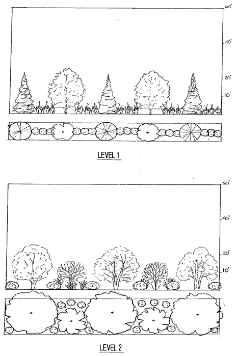
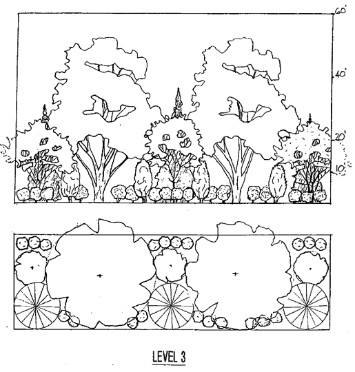


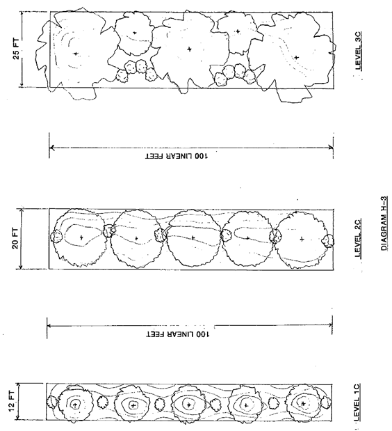
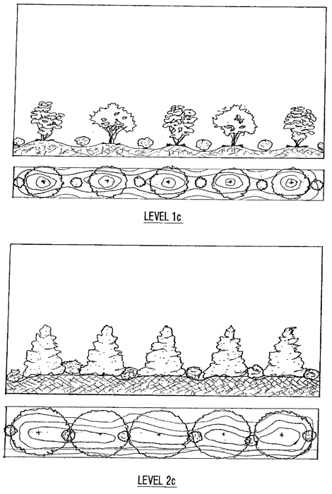
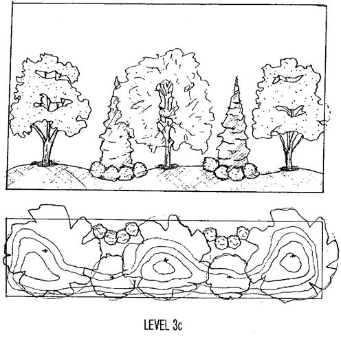
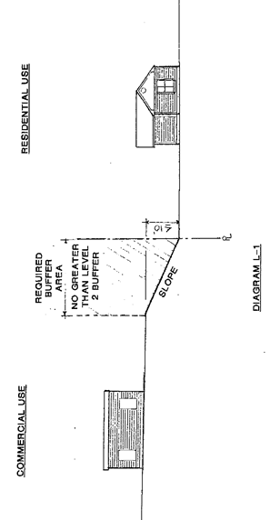
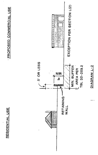
(Ord. No. 2013-03, 3-4-13)
Sec. 32-260. - Solar energy systems.
(a)
Purpose. Solar energy is a clean, readily available and renewable energy source. This section establishes regulations to facilitate the installation and construction of solar energy systems (SES) so that systems are safe, effective, and efficient, as well as harmonious with the character of the adjacent area where located. The provisions of this section apply to the placement, construction and use of "solar energy systems" for profit or for a use as an accessory use as defined in this chapter.
(1)
An SES established prior to the effective date of this chapter shall be exempt.
a.
Exception. Modification to an existing SES that increases the SES area by more than five percent of the original footprint of changes the solar panel type shall be subject to this chapter.
(2)
Maintenance and repair are not subject to this section.
(3)
This chapter does not supersede regulations from local, state, or federal agencies.
(b)
Accessory SES. The following standards shall apply to the development of accessory solar energy systems. Solar energy conversion is an allowed accessory use in all zoning districts pursuant to the standards in this section.
(1)
District classifications.
a.
Residential properties. As used in this subsection residential properties include those zoned R-R, R-20, R-15, R-MF-A, R-MF-C, R-MF-T, R-MH, R-MH-1, and R-MH-2.
b.
Nonresidential properties. As used in this subsection, all properties not zoned in the residential classifications above shall be classified as nonresidential property.
(2)
Freestanding solar energy systems.
a.
Setbacks.
1.
Front. SES shall not be located within a front yard.
i.
Front yard, as used in this section, is the space between the principal building on the lot and any street rights-of-way.
2.
Side and rear. Ten feet from all property lines and other structures.
3.
Easements, utilities, rights-of-way. No portion of any SES shall extend into any easement, right-of-way or public way, regardless of above stated exceptions and regulations for setback and yard requirements.
b.
Location.
1.
Systems shall be located on the same lot as the building being served. Where there is no principal building, the system is not allowed.
2.
Freestanding SESs are not permitted on nonresidential properties.
c.
Height. Ten feet in height maximum in side and rear yards. The height shall be measured from the grade at system base to the highest peak, including the highest position of any adjustable system.
(3)
Residential attached solar energy systems are permitted to be located on the roof or attached to a building, subject to all of the following:
a.
In the case of wall/roof mounting, no part of the system shall project more than five feet from the building.
b.
No part of the system shall extend more than 50 percent into any required side or rear setback. No part of the system shall extend into any required front setback.
c.
No portion of any SES shall extend into any easement, right-of-way or public way, regardless of the above-stated exceptions and regulations for setback and yard requirements.
d.
Systems shall not exceed the maximum height in the zone for the structure to which it is attached. See section 32-241.
e.
The building must have a conforming principal use.
f.
Roof attached systems may be mounted on principal and accessory building roofs, provided they conform to the maximum height standards established in the zone. Additionally, systems shall be mounted parallel to the pitch of the roof and be no higher than six inches from the roof surface. A system or a portion of a system not visible from abutting street rights-of-way is exempt from the flush mount requirement, but no part of the system shall project higher than five feet from the roof surface.
(4)
Nonresidential attached solar energy systems are permitted on the roof of, or attached to a nonresidential building, subject to all of the following:
a.
For wall mounting, no part of the system shall project more than five feet from the wall.
b.
For roof mounting, no part of the system shall project more than ten feet from the roof.
c.
No part of the system shall extend more than 50 percent into any required side or rear setback. No part of the system shall extend more than 20 percent into any required front setback.
d.
No part of the system shall exceed the maximum height permitted in the zone, for the structure to which it is attached.
e.
The building must have a conforming principal use.
(c)
SES as a stand-alone use.
(1)
Purpose. Solar energy is a clean, readily available and renewable energy source. This section establishes regulations to facilitate the installation and construction of solar energy systems (SES) so that systems are safe, effective, and efficient, as well as harmonious with the character of the adjacent area where located. The provisions of this section apply to the placement and construction of "solar energy systems" as a primary use.
(2)
Applicability. SES as a primary use are allowed by the issuance of a special exception permit by the board of adjustments in districts zoned B-2, L-I, and H-I.
(3)
Site plan. A site plan shall be submitted to the zoning administrator demonstrating compliance with setback and height limitations, applicable zoning district requirements such as lot coverage and applicable solar requirements per this chapter.
a.
Parcel line setbacks. Dimensional requirements and setbacks to SES equipment, excluding any security fencing, poles, and wires necessary to connect to facilities of the electric utility, must comply with the underlying zoning district requirements in section 32-241. However:
1.
Sight distance. Ground-mounted SES must also not impair sight distance for safe access to or from the property or other properties in the vicinity.
2.
Buffering/screening. Primary use SESs are subject to buffering and screening requirements in section 32-259.
3.
Height. The height of systems will be measured from the highest natural grade below each solar panel. Height limitations exclude utility poles and any antennas constructed for the project.
i.
Ground-mounted systems shall be limited to 20 feet maximum height.
(4)
Visibility.
a.
Public signage (i.e., advertising, educational, and the like) as permitted by local signage ordinance, including appropriate or required security and safety signage. See section 32-433.
b.
If lighting is provided at site, lighting shall be shielded and downcast such that the light does not spill onto the adjacent parcel or the night sky. Motion sensor control is preferred.
(5)
Appearance. The property owner of any SES shall maintain such system in a safe and attractive manner, including replacement of defective parts, painting, cleaning, and other acts that may be required for the maintenance and upkeep of the function and appearance of such a system. The owner shall also maintain the ground upon which the system is located in an orderly manner, such that is free of debris, tall grass and weeds, and any associated structures remain quality in appearance.
(6)
Decommissioning.
a.
A decommissioning plan signed by the party responsible for decommissioning and the landowner (if different) addressing the following shall be submitted with the permit application:
1.
Defined conditions upon which decommissioning will be initiated (i.e., end of land lease, no power production for 12 months, and the like).
2.
Removal of all non-utility owned equipment, conduit, structures, fencing, roads, and foundations.
3.
Restoration of property to condition prior to development of the SES.
4.
The time frame for completion of decommissioning activities.
5.
Description of any agreement (e.g., lease) with the landowner regarding decommissioning.
6.
The party currently responsible for decommissioning.
7.
Plans for updating this decommissioning plan.
b.
Before final electrical inspection, provide evidence that the decommissioning plan was recorded with the City of King Planning Department.
(Ord. No. 2016-03, 5-2-16; Ord. No. 2024-01, 1-2-24)
Sec. 32-261. - Electronic gaming.
These standards shall apply to all electronic gaming, internet sweepstakes, NFT trading, skill based gaming, video sweepstakes, and internet café businesses. Where permitted, the following shall apply:
(1)
No such establishment shall be located within 1,000 feet measured in a straight line from property line to property line of a church, public or private elementary or secondary school, child day care center or nursery school, public park, establishment with an on-premises ABC license, private residence, or residentially zoned property.
(2)
No such establishment shall be located or operate within 1,000 feet, measured in a straight line from property line to property line, from any other such establishment.
(3)
No enclosed parking area shall be permitted.
(4)
Days/hours of operation: Businesses engaging in electronic gaming operations activities may operate from 8:00 a.m. until 12:00 midnight each day, seven days per week.
(5)
The maximum number of machines/terminals/computers for any electronic gaming operations business is 20.
(6)
All applicable permits must be issued to the applicant prior to the opening of business. If food or beverage is served, the establishment must meet the requirements of the Stokes County Health Department, including any and all necessary permits and/or licenses.
(7)
No alcoholic beverages shall be possessed or consumed on the premises.
(Ord. No. 2025-12, § 1(Exh. A), 10-6-25)
Sec. 32-271. - Authority and enactment.
The Legislature of the State of North Carolina has, in chapter 160A, article 8, section 174, General Ordinance Making Power; and in chapter 143, article 21, Water and Air Resources, authorized local governments to adopt regulations designed to promote the public health, safety, and general welfare of its citizenry. In addition, G.S. 160D-926 and G.S. 143-214.5 specifically authorize local governments to enact and enforce water supply watershed management regulations. The King City Council hereby ordains and enacts into law the following articles as the Water Supply Watershed Protection Ordinance of the City of King, NC.
(Ord. No. 2024-09, § 1(Exh. B), 8-5-24)
Sec. 32-272. - General definitions.
Agricultural use means the use of waters for stock watering, irrigation, and other farm purposes.
Best management practices (BMP) means a structural or nonstructural management-based practice used singularly or in combination to reduce nonpoint source inputs to receiving waters in order to achieve water quality protection goals.
Buffer means an area of natural or planted vegetation through which stormwater runoff flows in a diffuse manner so that the runoff does not become channelized and which provides for infiltration of the runoff and filtering of pollutants. The buffer is measured landward from the normal pool elevation of impounded structures and from the bank of each side of streams or rivers.
Building means any structure having a roof supported by columns or by walls, and intended for shelter, housing or enclosure of persons, animals, or property. The connection of two buildings by means of an open porch, breezeway, passageway, carport, or other such open structure, with or without a roof, shall not be deemed to make them one building.
Built-upon area means built-upon area means impervious surface and partially impervious surface to the extent that the partially impervious surface does not allow water to infiltrate through the surface and into the subsoil. "Built-upon area" does not include a slatted deck; the water area of a swimming pool; a surface of number 57 stone, as designated by the American Society for Testing and Materials, laid at least four inches thick over a geotextile fabric; a trail as defined in G.S. 113A-85 that is either unpaved or paved as long as the pavement is porous with a hydraulic conductivity greater than 0.001 centimeters per second (1.41 inches per hour); or landscaping material, including, but not limited to, gravel, mulch, sand, and vegetation, placed on areas that receive pedestrian or bicycle traffic or on portions of driveways and parking areas that will not be compacted by the weight of a vehicle, such as the area between sections of pavement that support the weight of a vehicle (except as exempted by state law).
Cluster Development means cluster development means the grouping of buildings in order to conserve land resources and provide for innovation in the design of the project including minimizing stormwater runoff impacts. This term includes nonresidential development as well as single-family residential and multifamily developments. For the purpose of this division, planned unit developments (PUD's) and mixed-use development are considered as cluster development.
Common plan of development/PUD means a site with multiple lots where there is a single development plan for all of the lots, usually represented by a master plan or a set of declarations of restrict covenants.
Critical area means the area adjacent to a water supply intake or reservoir where risk associated with pollution is greater than from the remaining portions of the watershed. The critical area is defined as extending either one-half mile from the normal pool elevation of the reservoir in which the intake is located or to the ridge line of the watershed (whichever comes first); or one-half mile upstream from the intake located directly in the stream or river (run-of-the-river), or the ridge line of the watershed (whichever comes first). Local governments may extend the critical area as needed. Major landmarks such as highways or property lines may be used to delineate the outer boundary of the critical area if these landmarks are immediately adjacent to the appropriate outer boundary of one-half mile.
Customary home occupations means any use conducted entirely within a dwelling and carried on by the occupants thereof, which use is clearly incidental and secondary to the use of the dwelling for residential purposes and does not change the character thereof. Provided further that no mechanical equipment is installed or used except as is normally used for domestic or professional purposes. No home occupation shall be conducted in any accessory building except for the storage and service of a vehicle that is driven off site, such as a service repair truck, delivery truck, etc. See also section 32-258.
Development means any land disturbing activity which adds to or changes the amount or nature of impervious or partially impervious cover on a land area, or which otherwise decreases the infiltration of precipitation into the soil.
Dwelling unit means a building, or portion thereof, providing complete and permanent living facilities for one or more persons.
Existing development means those projects that are built or that have established a vested right under North Carolina zoning law as of the effective date of this division which was September of 1993.
Existing lot means a lot which is part of a subdivision, a plat of which has been recorded in the Office of the Register of Deeds prior to the adoption of this division, or a lot described by metes and bounds, description of which has been so recorded prior to the adoption of this division.
Family means one or more persons occupying a single dwelling unit, provided that unless all members are related by blood or marriage or adoption, no such family shall contain over five persons, but further provided that domestic servants employed or living on the premises may be housed on the premises without being counted as a family or families.
Family subdivision means a division of a tract of land: (a) to convey the resulting parcels, with the exception of parcels retained by the grantor, to a relative or relatives as a gift or for nominal consideration, but only if no more than one parcel is conveyed by the grantor from the tract to any one relative; or (b) to divide land from a common ancestor among tenants in common, all of whom inherited by intestacy or by will.
Industrial development means any non-residential development that requires an NPDES permit for an industrial discharge and/or requires the use or storage of any hazardous material for the purpose of manufacturing, assembling, finishing, cleaning, or developing any product or commodity.
Landfill means a facility for the disposal of solid waste on land in a sanitary manner in accordance with Chapter 130A Article 9 of the N.C. General Statutes. For the purpose of this division, this term does not include composting facilities.
Lot means a parcel of land that can be transferred separate from other parcels of land.
Major variance means a variance that is not a minor variance as defined in this division.
Minor variance means a variance from the minimum statewide watershed protection rules that results in a relaxation, by a factor of up to five percent of any buffer, density, or built-upon area requirement under the high-density option; or that results in a relaxation, by a factor of up to ten percent, of any management requirement under the low-density option. For variances to a vegetated setback requirement, the percent variation shall be calculated using the footprint of built-upon area proposed to encroach with the vegetated setback divided by the total area of vegetated setback within the project.
Nonconforming existing lot means a lot described by a plat or a deed that was recorded prior to the effective date of local watershed protection regulations (or their amendments) that does not meet the minimum lot size or other development requirements of the statewide watershed protection rules.
Non-residential development means all development other than residential development, agriculture and silviculture.
Perennial waterbody means a natural or man-made basin, including lakes, ponds, and reservoirs, that stores surface water permanently at depths sufficient to preclude the growth of non-hydrophilic rooted plants.
Plat means a map or plan of a parcel of land which is to be, or has been, subdivided.
Protected area means the area adjoining and upstream of the critical area of WS-IV watersheds. The boundaries of the protected area are defined as within five miles of and draining to the normal pool elevation of the reservoir or to the ridgeline of the watershed; or within ten miles upstream and draining to the intake located directly in the stream or river or to the ridgeline of the watershed.
Qualified individual means a person certified to perform stream determinations by completing and passing the Surface Water Identification Training and Certification (SWITC) course offered by the N.C. Div. of Water Resources at N.C. State University.
Residential development means buildings constructed for human habitation such as attached and detached single-family dwellings, apartment complexes, condominiums, townhouses, cottages, etc. and their associated outbuildings such as garages, storage buildings, gazebos, etc. and customary home occupations.
Residuals means any solid or semi-solid waste generated from a wastewater treatment plant, water treatment plant or air pollution control facility permitted under the authority of the Environmental Management Commission.
Single-family residential means any development where: 1) no building contains more than one dwelling unit, 2) every dwelling unit is on a separate lot, and 3) where no lot contains more than one dwelling unit.
Stormwater control measure (SCM) means a permanent structural device that is designed, constructed, and maintained to remove pollutants from stormwater runoff by promoting settling or filtration; or to mimic the natural hydrologic cycle by promoting infiltration, evapo-transpiration, post filtration discharge, reuse of stormwater, or a combination there of.
Street (road) means a right-of-way for vehicular traffic which affords the principal means of access to subject and/or abutting properties.
Structure means anything constructed or erected, including but not limited to buildings, which requires location on the land or attachment to something having permanent location on the land.
Subdivider means any person, firm, corporation, or official who subdivides or develops any land deemed to be a subdivision as herein defined.
Subdivision means all divisions of a tract or parcel of land into two or more lots, building sites, or other divisions for the purpose of sale or building development (whether immediate or future) and shall include all division of land involving the dedication of a new street or a change in existing streets; except those exempt from subdivision regulation by GS 160D-802(a)(1) through (a)(5).
Surface waters means all waters of the state as defined in NCGS 143-212 except underground waters.
Toxic substance means any substance or combination of substances (including disease causing agents), which after discharge and upon exposure, ingestion, inhalation, or assimilation into any organism, either directly from the environment or indirectly by ingestion through food chains, has the potential to cause death, disease, behavioral abnormalities, cancer, genetic mutations, physiological malfunctions (including malfunctions or suppression in reproduction or growth), or physical deformities in such organisms or their off spring or other adverse health effects.
Variance means a permission to develop or use property granted by the watershed review board relaxing or waiving a water supply watershed management requirement adopted by the environmental management commission that is incorporated into this division.
Vested right means the right to undertake and complete the development and use of property under the terms and conditions of an approved site-specific development plan or an approved phased development plan. Refer to the North Carolina General Statutes Section 160D-108 for more information.
Water dependent structure means any structure for which the use requires access to or proximity to or citing within surface waters to fulfill its basic purpose, such as boat ramps, boat houses, docks, and bulkheads. Ancillary facilities such as restaurants, outlets for boat supplies, parking lots and commercial boat storage areas are not water dependent structures.
Watershed means the entire land area contributing surface drainage to a specific point (e.g. the water supply intake) or alternatively, the geographic region within which water drains to a particular river, stream, or body of water.
Watershed administrator means an official or designated person of the City of King responsible for administration and enforcement of this division.
Watershed review board means the planning board shall function as the watershed review board when controlling development within the watershed. In certain situation the King City Council may serve as the watershed review board.
(Ord. No. 2024-09, § 1(Exh. B), 8-5-24)
Cross reference— Definitions generally, § 1-2.
Sec. 32-273. - Jurisdiction.
The provisions of this division shall apply within the areas designated as a water supply watershed by the N.C. Environmental Management Commission and shall be defined and established on a water supply watershed protection map of the City of King, North Carolina which is adopted simultaneously herewith. The watershed map and all explanatory matter contained thereon accompanies and is hereby made a part of this division. This division shall be permanently kept on file in the City Clerk's office of the City of King, NC.
(Ord. No. 2024-09, § 1(Exh. B), 8-5-24)
Sec. 32-274. - Exceptions to applicability.
(a)
Nothing contained herein shall repeal, modify, or amend any federal or state law or regulation, or any ordinance or regulation pertaining thereto except any ordinance which these regulations specifically replace; nor shall any provision of this division amend, modify, or restrict any other provisions of the Code of Ordinances of the City of King; however, the adoption of this division shall and does amend any and all ordinances, resolutions, and regulations in effect in the City of King at the time of the adoption of this division that may be construed to impair or reduce the effectiveness of this division or to conflict with any of its provisions.
(b)
It is not intended that these regulations interfere with any easement, covenants, or other agreements between parties. However, if the provisions of these regulations impose greater restrictions or higher standards for the use of a building or land, then the provisions of these regulations shall control.
(c)
Existing development, as defined in this division, is not subject to the requirements of this division.
(d)
Expansions to existing development must meet the requirements of this division, except single-family residential development or unless expansion is part of common plan of development. In an expansion, the built-upon area of the existing development is not required to be included in the density calculations. Where there is a net increase of built upon area, only the area of net increase is subject to this division. Where existing development is being replaced with new built upon area, and there is net increase of built upon area, only areas of net increase shall be subject to this division.
(e)
If a nonconforming existing lot is not contiguous to any other lot owned by the same party, then that lot shall not be subject to the development restrictions of this division if it is developed for single-family residential purposes. Local governments may require the combination of contiguous nonconforming lots of record owned by same party to establish a lot or lots that meet requirements in section 32-241 of this division.
(f)
Any lot or parcel created as part of a family subdivision after the effective date of these rules shall be exempt from these rules if it is developed for one single-family detached residence and if it is exempt from local subdivision regulation.
(g)
Any lot or parcel created as part of any other type of subdivision that is exempt from a local subdivision ordinance shall be subject to the land use requirements (including impervious surface requirements) of these rules, except that such a lot or parcel must meet the minimum buffer requirements to the maximum extent practicable.
(h)
An applicant may exceed the density limits in section 32-286 if all the following circumstances apply:
(1)
The property was developed prior to the effective date of the local water supply watershed program. (9-7-1993)
(2)
The property has not been combined with additional lots after January 1, 2021.
(3)
The current use of the property is nonresidential.
(4)
In the sole discretion, and at the voluntary election, of the property owner, the stormwater from all the existing and new built-upon area on the property is treated in accordance with all applicable local government, state, and federal laws and regulations.
(5)
The remaining vegetated buffers on the property are preserved in accordance with the requirements of this division.
(Ord. No. 2024-09, § 1(Exh. B), 8-5-24)
Sec. 32-275. - Public health, in general.
No activity, situation, structure, or land use shall be allowed within the watershed which poses a threat to water quality and the public health, safety, and welfare of the citizens within the jurisdiction of the City of King.
(Ord. No. 2024-09, § 1(Exh. B), 8-5-24)
Sec. 32-276. - Criminal penalties.
Any person violating any provisions of this division shall be guilty of a misdemeanor and, upon conviction, shall be punished in accordance with NCGS 14-4. The maximum fine for each offense shall not exceed $500.00. Each day that the violation continues shall constitute a separate offense.
(Ord. No. 2024-09, § 1(Exh. B), 8-5-24)
Sec. 32-277. - Remedies.
(a)
If any subdivision, development and/or land use is found to be in violation of this division, the City of King City Council may, in addition to all other remedies available either in law or in equity, institute a civil penalty in the amount of $500.00, action or proceedings to restrain, correct, or abate the violation; to prevent occupancy of the building, structure, or land; or to prevent any illegal act, conduct, business, or use in or about the premises. In addition, the N.C. Environmental Management Commission may assess civil penalties in accordance with G.S. 143-215.6A. Each day that the violation continues shall constitute a separate offense.
(b)
If the watershed administrator finds that any of the provisions of this division are being violated, he shall follow the requirements as listed in section 32-47.
(Ord. No. 2024-09, § 1(Exh. B), 8-5-24)
Sec. 32-278. - Abatement.
(a)
The watershed administrator shall monitor land use activities within the watershed areas to identify situations that may pose a threat to water quality.
(b)
The watershed administrator shall report all findings to the watershed review board. The watershed administrator may consult with any public agency or official and request recommendations. The watershed administrator may also coordinate with local inspections department since local governments can abate most threatening nuisances. See section 32-47.
(c)
Where the watershed review board finds a threat to water quality and the public health, safety and welfare, the board shall institute any appropriate action or proceeding to restrain, correct or abate the condition and/or violation.
(Ord. No. 2024-09, § 1(Exh. B), 8-5-24)
Sec. 32-279. - Severability.
Should any section or provision of this division be declared invalid or unconstitutional by any court of competent jurisdiction, the declaration shall not affect the validity of this division as a whole or any part thereof that is not specifically declared to be invalid or unconstitutional.
(Ord. No. 2024-09, § 1(Exh. B), 8-5-24)
Sec. 32-280. - Effective date.
This division shall take effect and be in force on September 7, 1993. This division was amended to the new NC Water and Air Resources/N.C. Environmental Management Commission on August 5, 2024.
(Ord. No. 2024-09, § 1(Exh. B), 8-5-24)
Sec. 32-281. - General provisions.
(a)
No subdivision plat of land within the water supply watershed shall be filed or recorded by the Register of Deeds until it has been approved in accordance with the provisions of this article. Likewise, the Clerk of Superior Court shall not order or direct the recording of a plat if the recording of such plat would conflict with this article.
(b)
The approval of a plat by itself does not constitute or effect the acceptance by the city or the public of the dedication of any street or other ground, easement, right-of-way, public utility line, or other public facility shown on the plat and shall not be construed to do so.
(c)
All subdivisions shall conform with the mapping requirements contained in GS 47-30.
(d)
All subdivisions of land within the jurisdiction of the City of King after the effective date of this division shall require a plat to be prepared, approved, and recorded pursuant to this division and those requirements set forth in chapter 26 of the codified ordinances.
(e)
All 10/70 provision request shall be reviewed and a recommendation made by the watershed review board prior to the city council's review and approval/approval with conditions/denial of the request.
(Ord. No. 2024-09, § 1(Exh. B), 8-5-24)
Sec. 32-282. - Subdivision application and review procedures.
(a)
All proposed non-residential subdivisions shall be reviewed prior to recording with the register of deeds by submitting a vicinity map to the watershed administrator to determine whether or not the property is located within the designated water supply watershed. Subdivisions that are not within the designated watershed area shall not be subject to the provisions of this division and may be recorded provided the watershed administrator initials the vicinity map. Subdivisions within a WS-IV watershed are subject to the provisions of this division only when an erosion and sedimentation plan is required under the provisions of state law or approved local program unless another stormwater program applies. Local government should always be aware that other post construction requirements may apply even when water supply watershed protection requirements do not. Subdivisions within the designated watershed area shall comply with the provisions of this article and all other state and local requirements that may apply.
(b)
Subdivision applications shall be filed with the watershed administrator. The application shall follow the requirements set forth in chapter 26, section 26-12.
(c)
The watershed administrator, watershed review board, or the governing board shall review the completed application and shall either approve, approve conditionally, or disapprove each application. The watershed administrator shall take final action within 60 days of submission of the application. The watershed administrator may provide public agencies an opportunity to review and make recommendations. However, the failure of the agencies to submit their comments and recommendations shall not delay action within the prescribed time limit. Said public agencies may include, but are not limited to, the following:
(1)
The NCDOT district highway engineer with regard to proposed streets and highways.
(2)
The Health Department director with regard to proposed private water system or sewer systems normally approved by Health Department.
(3)
The state division of water resources with regard to proposed sewer systems normally approved by the division.
(4)
The state division of energy, mineral and land resources with regard to engineered storm water controls or storm water management in general.
(5)
Local government entities responsible for proposed sewer and/or water systems.
(6)
Any other agency or official designated by the watershed administrator or watershed review board.
(d)
If the watershed administrator approves the application, such approval shall be indicated on both copies of the plat by the following certificate and signed by the watershed administrator:
Certificate of Approval for Recording
I certify that the plat shown hereon complies with the City of King's Watershed Protection Ordinance and is approved by the watershed administrator for recording in the Register of Deeds office.
NOTICE: This property is located within a Water Supply Watershed - development restrictions may apply.
(e)
If the watershed administrator, watershed review board, or governing board disapproves or approves conditionally the application, the reasons for such action shall be stated in writing for the applicant and may be entered on the application. The subdivider may make changes and submit a revised plan which shall constitute a separate request for the purpose of review and approval.
(f)
As a condition for approval, all subdivision plats shall comply with the requirements for recording of the county register of deeds and chapter 26 of the city's codified ordinances.
(g)
The plat shall be recorded within 30 days of approval. The subdivider shall provide the watershed administrator with evidence the plat has been recorded with the register of deeds within five working days of recordation by a paper copy or by a PDF copy.
(Ord. No. 2024-09, § 1(Exh. B), 8-5-24)
Sec. 32-283. - Subdivision standards and required improvements.
(a)
All lots shall provide adequate building space in accordance with the development standards contained in section 32-241. Lots smaller than the minimum required for non-residential or residential lots may be developed using built-upon area criteria in accordance with section 32-287.
(b)
For the purpose of calculating built-upon area, total project area shall include total acreage in the tract on which the project is to be developed.
(c)
Storm water drainage facilities. The application shall be accompanied by a description of the proposed method of providing storm water drainage. The subdivider shall provide a drainage system that diverts stormwater runoff away from surface waters, incorporates storm water control measures to minimize water quality impacts, and meets any state or local requirements.
(d)
Erosion and sedimentation control. The application shall, where required, be accompanied by the Sedimentation and Erosion Control Plan approval by the local agency administering a Sedimentation and Erosion Control Ordinance approved by the N.C. Division of Energy, Mineral and Land Resources and/or N.C. Division of Energy, Mineral, and Land Resources.
(e)
Roads constructed in critical areas and watershed vegetated conveyance areas. Where possible, roads should be located outside of critical areas and watershed vegetated conveyance areas. Roads constructed within these areas shall be designed and constructed to minimize their impact on water quality.
(Ord. No. 2024-09, § 1(Exh. B), 8-5-24)
Sec. 32-284. - Construction procedures.
(a)
No construction or installation of improvements shall commence in a proposed development project until construction documents have been submitted and approved by the city. The applicant/developer must submit three complete sets of drawings to the city for review. One set will be returned with a stamp of approved, approved with comments, or correct and resubmit and a review fee and comment sheet.
(b)
No building or other permits shall be issued for erection of a structure on any lot not on record at the time of adoption of this division until all requirements of this division have been met. The applicant/developer, prior to commencing any work within the project, shall make arrangements with the city to provide for adequate inspection(s) of any improvements installed.
(Ord. No. 2024-09, § 1(Exh. B), 8-5-24)
Sec. 32-285. - Penalties for transferring lots in unapproved non-residential subdivisions.
Any person who, being the owner or agent of the owner of any land located within the jurisdiction of the City of King, thereafter subdivides their land in violation of this division or transfers or sells land by reference to, exhibition of, or any other use of a plat showing a subdivision of the land before the plat has been properly approved under this division and recorded in the office of the register of deeds, shall be guilty of a misdemeanor. The description by metes and bounds in the instrument of transfer or other document used in the process of selling or transferring land shall not exempt the transaction from this penalty. The City of King may bring an action for injunction of any illegal subdivision, transfer, conveyance, or sale of land, and the court shall, upon appropriate findings, issue an injunction and order requiring the offending party to comply with this division.
(Ord. No. 2024-09, § 1(Exh. B), 8-5-24)
Sec. 32-286. - Establishment of watershed areas.
The purpose of this article is to list and describe the watershed areas herein adopted. For purposes of this division the City of King is hereby divided into the following area, as appropriate:
WS-IV-PA (Protected Area) Overlay District. This overlay district applies to all zoning districts listed in sections 32-161 and 32-164.
(Ord. No. 2024-09, § 1(Exh. B), 8-5-24)
Sec. 32-287. - Watershed areas; allowed and not allowed uses.
Notes:
a.
Permitted pursuant to 15A NCAC 02B .0104.
b.
Except non-process industrial discharges are allowed.
c.
Only allowed if specified in 15A NCAC 02B .0104.
d.
Not allowed if activity(ies) has/have adverse impact on human health.
e.
Where no other practical alternative exists.
f.
In a WS-I watersheds and Critical Areas of WS-II, WS-III, and WS-IV watersheds, agricultural activities conducted after 1/1/1993 shall maintain a minimum 10- foot vegetated setback or equivalent control as determined by Soil and Water Conservation Commission along all perennial waters indicated on most recent version of USGS 1:24000 scale (7.5 minute) topographic maps or as determined by local government studies.
g.
Subject to Forest Practice Guidelines Related to Water Quality (02 NCAC 60C .0100 to .0209) Effective 4/1/2018.
h.
See density requirements in 15A NCAC 02B .0624.
i.
See different allowed and not allowed in this table.
j.
Watershed shall remain undeveloped except for following uses when they cannot be avoided: Power transmission lines, restricted access roads, and structures associated with water withdrawal, treatment, and distribution of WS-I waters. Built upon area shall be designed and located to minimize stormwater runoff impact to receiving waters.
k.
Non-Point Source pollution shall not have adverse impact, as defined in 15A NCAC 02H .1002, on use as water supply or any other designated use.
l.
Deemed permitted, as defined in 15A NCAC 02T .0103 and permitted under 15A NCAC 2H .0217.
(Ord. No. 2024-09, § 1(Exh. B), 8-5-24)
Sec. 32-288. - Watershed areas; density and built-upon limits.
(a)
Project density. The following maximum allowable project densities and minimum lot sizes shall apply to a project according to the classification of the water supply watershed where it is located, its relative location in the watershed, its project density, and the type of development:
(1)
Low density development.
WS-IV Critical Area:
a.
Single-family detached residential — One d.u. per one-half acre or one d.u. per 20,000 square foot lot excluding 24 percent built upon area 24 to 50 percent built upon area roadway right-of way or 24 percent built upon area.
b.
Non-residential and all other residential — 24 percent built-upon area.
WS-IV Protected Area:
a.
Single-family detached residential — One d.u. per one-half acre or one d.u. per 20,000 square foot lot excluding roadway right-of way or 24 percent built upon; or three d.u.'s per acre or 36 percent built upon area without curb and gutter street system.
b.
Non-residential and all other residential — 24 percent built-upon area; or 36 percent built-upon area without curb and gutter street system.
(2)
High density development (10/70 provision, requires approval by the city).
WS-IV Critical Area:
a.
All types — 24 percent to 50 percent built-upon area.
WS-IV Protected Area:
a.
All types — 24 percent to 70 percent built-upon.
(b)
Calculation of project density. The following requirements shall apply to the calculation of project density:
(1)
Project density shall be calculated as the total built-upon area divided by the total tract/lot area.
(2)
A project with "existing development," as defined in this article, may use the calculation method in subsection (b)(1) of this section or may calculate project density as the difference of total built-upon area minus existing built-upon area divided by the difference of total project area minus existing built-upon area.
(3)
Expansions to existing development shall be subject to 15A NCAC 02B .0624 except as excluded in Rule15A NCAC 02B .0622(1)(d).
(4)
Where there is a net increase of built-upon area, only the area of net increase shall be subject to density and built-upon area limits.
(5)
Where existing development is being replaced with new built-upon area, and there is a net increase of built-upon area, only the area of net increase shall be subject to density and built-upon area limits.
(6)
Total project area shall exclude the following:
a.
Areas below the Normal High-Water Line (NHWL); and
b.
Areas defined as "coastal wetlands" pursuant to 15A NCAC 07H .0205, herein incorporated by reference, including subsequent amendments and editions, and available at no cost at http://reports.oah.state.nc.us/ncac.asp, as measured landward from the NHWL.
(7)
Projects under a common plan of development/PUD's shall be considered as a single project for purposes of density calculation except that on a case-by-case basis, local governments may allow projects to be considered to have both high- and low-density areas based on one or more of the following criteria:
a.
Natural drainage area boundaries;
b.
Variations in land use throughout the project; or
c.
Construction phasing.
(c)
Low density projects. In addition to complying with the project density requirements of subsection (a) of this Rule, low density projects shall comply with the following:
(1)
Vegetated conveyances. Stormwater runoff from the project shall be released to vegetated areas as dispersed flow or transported by vegetated conveyances to the maximum extent practicable. In determining whether this criteria has been met, the local government shall take into account site-specific factors such as topography and site layout as well as protection of water quality. Vegetated conveyances shall be maintained in perpetuity to ensure that they function as designed. Vegetated conveyances that meet the following criteria shall be deemed to satisfy the requirements of this sub-item:
a.
Side slopes shall be no steeper than 3:1 (horizontal to vertical) unless it is demonstrated to the local government that the soils and vegetation will remain stable in perpetuity based on engineering calculations and on-site soil investigation; and
b.
The conveyance shall be designed so that it does not erode during the peak flow from the ten-year storm event as demonstrated by engineering calculations.
(2)
Curb outlet systems. In lieu of vegetated conveyances, low density projects shall have the option to use curb and gutter with outlets to convey stormwater to grassed swales or vegetated areas. Requirements for these curb outlet systems shall be as follows:
a.
The curb outlets shall be located such that the swale or vegetated area can carry the peak flow from the ten-year storm and at a non-erosive velocity;
b.
The longitudinal slope of the swale or vegetated area shall not exceed five percent except where not practical due to physical constraints. In these cases, devices to slow the rate of runoff and encourage infiltration to reduce pollutant delivery shall be provided;
c.
The swale's cross section shall be trapezoidal with a minimum bottom width of two feet;
d.
The side slopes of the swale or vegetated area shall be no steeper than 3:1 (horizontal to vertical);
e.
The minimum length of the swale or vegetated area shall be 100 feet; and
f.
Low density projects may use treatment swales designed in accordance with 15A NCAC 02H .1061 in lieu of the requirements specified in subsections a. through e. of this subsection.
(d)
High density projects. In addition to complying with the project density requirements of subsections (a) and (e) of this Rule, high density projects shall comply with the following:
(1)
Stormwater control measures (SCMs) shall be designed, constructed, and maintained so that the project achieves either "runoff treatment" or "runoff volume match" as those terms are defined in 15A NCAC 02B .0621;
(2)
For high density projects designed to achieve runoff treatment, the required storm depth shall be one inch. Applicants shall have the option to design projects to achieve runoff volume match in lieu of runoff treatment;
(3)
Stormwater runoff from off-site areas and existing development, shall not be required to be treated in the SCM. Runoff from off-site areas or existing development that is not bypassed shall be included in sizing of on-site SCMs;
(4)
SCMs shall meet the relevant minimum design criteria set forth in 15A NCAC 02H .1050 through .1062; and
(5)
Stormwater outlets shall be designed so that they do not cause erosion downslope of the discharge point during the peak flow from the ten-year storm event as shown by engineering calculations.
(e)
Option for implementing project density. Local governments shall have the following options in place of or in addition to the requirements of item (A) above, as appropriate:
(1)
10/70 option. Outside of WS-I watersheds and the critical areas of WS-II, WS-III, and WS-IV watersheds, local governments may regulate new development under the "10/70 option" in accordance with the following requirements:
a.
A maximum of ten percent of the land area of a water supply watershed outside of the critical area and within a local government's planning jurisdiction may be developed with new development projects and expansions of existing development of up to 70 percent built-upon area;
b.
In water supply watersheds classified on or before August 3, 1992, the beginning amount of acreage available under this option shall be based on a local government's jurisdiction as delineated on July 1, 1993. In water supply watersheds classified after August 3, 1992, the beginning amount of acreage available under this option shall be based on a local government's jurisdiction as delineated on the date the water supply watershed classification became effective. The acreage within the critical area shall not be counted towards the allowable 10/70 option acreage;
c.
Projects that are covered under the 10/70 option shall comply with the low-density requirements set forth in subsection (c) above unless the local government allows high density development, in which case the local government may require these projects to comply with the high-density requirements set forth in subsection (d);
d.
The maximum built-upon area allowed on any given new development project shall be 70 percent;
e.
A local government having jurisdiction within a designated water supply watershed may transfer, in whole or in part, its right to the 10/70 land area to another local government within the same water supply watershed upon submittal of a joint resolution and approval by the commission; and
f.
When the water supply watershed is composed of public lands, such as National Forest land, local governments may count the public land acreage within the watershed outside of the critical area in calculating the acreage allowed under this provision; and
g.
All 10/70 provision request shall be reviewed by the watershed review board and a recommendation made and forwarded to the King City Council for review and action on the request. Applications for the 10/70 provision shall be submitted to the watershed administrator by the deadlines stated. Each application shall be submitted with a site plan map for review by the watershed administrator for review and comments. Once the watershed administrator approves the site plan and application, he shall place the request on the watershed review board's agenda for a recommendation to the city council. The city council shall then hear the request and act on it in the form of approval, approved with conditions, or denial.
(Ord. No. 2024-09, § 1(Exh. B), 8-5-24)
Sec. 32-289. - Cluster development.
Cluster development is allowed in all watershed areas under the following conditions:
(1)
Minimum lot sizes are not applicable to single-family cluster development projects; however, the total number of lots shall not exceed the number of lots allowed for single-family detached developments in section 32-286 and minimum setbacks and lot widths maybe be applied. Density or built-upon area for the project shall not exceed that allowed for the critical area, balance of watershed or protected area, whichever applies.
(2)
All built-upon area shall be designed and located to minimize stormwater runoff impact to the receiving waters and minimize concentrated stormwater flow, maximize the use of sheet flow through vegetated areas, and maximize the flow length through vegetated areas.
(3)
Areas of concentrated density development shall be located in upland areas and as far as practicable from surface waters and drainageways.
(4)
The remainder of the tract shall remain in a vegetated or natural state. The title to the open space area shall be conveyed to an incorporated homeowner's association for management; to a local government for preservation as a park or open space; or to a conservation organization for preservation in a permanent easement.
(5)
Cluster developments that meet the applicable low-density requirements shall transport stormwater runoff by vegetated conveyances to the maximum extent practicable.
(Ord. No. 2024-09, § 1(Exh. B), 8-5-24)
Sec. 32-290. - Vegetated setbacks required.
A vegetated setback is an area of natural vegetation that is adjacent to surface waters, allowing stormwater runoff to flow in a diffused manner to protect surface waters from degradation due to developmental activities. Thus, the following setback requirements are as follows:
(1)
A minimum 100-foot vegetative setback is required for all new development activities that exceed the low-density option (10/70 provision); otherwise, a minimum 30-foot vegetative setback for development activities is required along all perennial waters indicated on the most recent versions of U.S.G.S. 1:24,000 (7.5 minute) scale topographic maps or as determined by local government studies. Desirable artificial streambank or shoreline stabilization is permitted.
(2)
Where USGS topographic maps do not distinguish between perennial and intermittent streams, an on-site stream determination may be performed by an individual qualified to perform such stream determinations and approved by the city engineer.
(3)
No new development is allowed in the buffer except for water dependent structures, other structures such as flag poles, signs and security lights which result in only diminutive increases in impervious area and public projects such as road crossings and greenways where no practical alternative exists. These activities should minimize built-upon surface area, direct runoff away from the surface waters and maximize the utilization of stormwater best management practices. Any such development must obtain a zoning permit from the watershed review board.
(Ord. No. 2024-09, § 1(Exh. B), 8-5-24)
Sec. 32-291. - Application of regulations.
(a)
No building or land shall hereafter be used, and no development shall take place except in conformity with the regulations herein specified for the watershed area in which it is located.
(b)
No area required for the purpose of complying with the provisions of this division shall be included in the area required for another building.
(c)
Every residential building hereafter erected, moved or structurally altered shall be located on a lot which conforms to the regulations specified herein, except as permitted in section 32-287.
(d)
If a use or class of use is not specifically indicated as being allowed in a watershed area, such use or class of use is prohibited.
(Ord. No. 2024-09, § 1(Exh. B), 8-5-24)
Sec. 32-292. - Rules governing the interpretation of watershed area boundaries.
Where uncertainty exists as to the boundaries of the watershed areas, as shown on the watershed map, the following rules shall apply:
(1)
Where area boundaries are indicated as approximately following either street, alley, railroad or highway lines or centerlines thereof, such lines shall be construed to be said boundaries.
(2)
Where area boundaries are indicated as approximately following lot lines, such lot lines shall be construed to be said boundaries. However, a surveyed plat prepared by a registered land surveyor may be submitted to the city as evidence that one or more properties along these boundaries do not lie within the watershed area.
(3)
Where the watershed area boundaries lie at a scaled distance more than two feet from any parallel lot line, the location of watershed area boundaries shall be determined by use of the scale appearing on the watershed map. Any ambiguities should be resolved in favor of locating built-upon surface area in the least environmentally sensitive area of the project.
(4)
Where the watershed area boundaries lie at a scaled distance of 25 feet or less from any parallel lot line, the location of watershed area boundaries shall be construed to be the lot line.
(5)
Where other uncertainty exists, the watershed administrator shall interpret the watershed map as to location of such boundaries. This decision may be appealed to the Watershed Review Board.
(Ord. No. 2024-09, § 1(Exh. B), 8-5-24)
Sec. 32-293. - Existing development.
Existing development, as defined in this division, may be continued and maintained subject to the provisions provided herein. Expansions of structures classified as existing development must meet the requirements of this division, however, the built-upon area of the existing development is not required to be included in the built-upon area calculations. Please see section 32-288(b), Calculation of Project Density. This section deals with all existing development as defined in the EMC rules. All existing development, whether or not it meets the statewide minimum standards, is exempt from the provisions of this division.
(1)
Uses of land. This category consists of existing development where such use of the land would not be permitted if it were new development. Such uses may be continued except as follows:
a.
Such use of land shall be changed only to an allowed use.
b.
When such use of land has been changed to an allowed use, it shall not thereafter revert to any prohibited use.
c.
When such use ceases for a period of at least one year, it shall not be reestablished.
(2)
Reconstruction of buildings or built-upon areas. Any existing building or built-upon area not in conformance with the restrictions of this chapter that has been damaged or removed may be repaired and/or reconstructed, except that there are no restrictions on single-family residential development, provided:
a.
Repair or reconstruction is initiated within 12 months and completed within two years of such damage.
b.
The total amount of space devoted to built-upon area may not be increased unless stormwater control that equals or exceeds the previous development is provided.
(Ord. No. 2024-09, § 1(Exh. B), 8-5-24)
Sec. 32-294. - Watershed protection permit (non-residential).
Requirements for obtaining a watershed protection permit are as follows:
(1)
Except for single-family residential development, no building or built-upon area shall be erected, moved, enlarged, or structurally altered, nor shall any building permit be issued nor shall any change in the use of any building or land be made until a watershed protection permit has been issued by the watershed administrator. No watershed protection permit shall be issued except in conformity with the provisions of this division. See section 32-282.
(Ord. No. 2024-09, § 1(Exh. B), 8-5-24)
Sec. 32-295. - Building permit required.
No permit required under the North Carolina State Building Code shall be issued for any activity for which a watershed protection permit is required until that permit has been issued.
(Ord. No. 2024-09, § 1(Exh. B), 8-5-24)
Sec. 32-296. - Watershed occupancy permit.
The watershed administrator shall issue a watershed occupancy permit (WSOP) certifying that all requirements of this division have been met prior to the occupancy or use of a building hereafter erected, altered, or moved and/or prior to the change of use of any building or land. The occupancy permit or certificate of occupancy (CO) shall serve as the WSOP and marked under zoning.
(Ord. No. 2024-09, § 1(Exh. B), 8-5-24)
Sec. 32-297. - Watershed administrator and duties.
The City of King shall appoint a watershed administrator, who shall be duly sworn in. It shall be the duty of the watershed administrator to administer and enforce the provisions of this division as follows:
(1)
The watershed administrator shall issue watershed protection permits and watershed occupancy permits as prescribed herein. A record of all permits shall be kept on file and shall be available for public inspection during regular office hours of the city.
(2)
The watershed administrator shall serve as secretary to the watershed review board.
(3)
The watershed administrator is granted the authority to administer and enforce the provisions of this division, exercising in the fulfillment of his responsibility the full police power of the City of King. The watershed administrator, or his duly authorized representative, may enter any building, structure, or premises, as provided by law, to perform any duty imposed upon him by this division.
(4)
The watershed administrator shall keep records of all amendments to the local water supply watershed protection ordinance and shall provide copies of all amendments upon adoption to the NC Stormwater Branch of the Division of Energy, Mineral, and Land Resources.
(5)
The watershed administrator shall keep records of the jurisdiction's use of the provision that a maximum of ten percent of the non-critical area of the WS-IV watershed may be developed with new development at a maximum of 70 percent built-upon surface area. Records for each watershed shall include the total acres of non-critical watershed area, total acres eligible to be developed under this option, total acres approved for this development option, and individual records for each project with the following information: Location, number of developed acres, type of land use and stormwater management plan (if applicable).
(6)
The watershed administrator shall keep a record of variances to the local water supply watershed protection ordinance.
(7)
The watershed administrator is responsible for ensuring that stormwater control measures are inspected at least once a year and shall keep a record of SCM inspections.
(Ord. No. 2024-09, § 1(Exh. B), 8-5-24)
Sec. 32-298. - Appeal from the watershed administrator.
Any order, decision, or determination made by the watershed administrator may be appealed to and decided by the watershed review board (WRB). An appeal from a decision of the watershed administrator must be submitted to the watershed review board within 30 calendar days from the date the order, interpretation, decision, or determination is issued. All appeals must be made in writing stating the reasons for the appeal. Following submission of an appeal, the watershed administrator shall transmit to the WRB all papers constituting the record upon which the action appealed from was taken.
An appeal stays all proceedings in furtherance of the action appealed, unless the officer from whom the appeal is taken certifies to the WRB after the notice of appeal has been filed with him, that by reason of facts stated in the certificate of approval for recording, a stay would in his opinion cause imminent peril to life or property. In such a case, proceedings shall not be stayed otherwise than by a restraining order which may be granted by the WRB or by a court of record on application of notice of the officer from whom the appeal is taken and upon due cause shown.
All appeals of watershed administrator decisions shall follow the procedures for appeals of administrative decisions in G.S. 160D-405 and section 32-128 of this chapter.
(Ord. No. 2024-09, § 1(Exh. B), 8-5-24)
Sec. 32-299. - Changes and amendments to the watershed protection ordinance.
Any amendments made to this division shall be made per the following guidelines:
(1)
The City Council of King may, on its own motion or on petition, after public notice and hearing, amend, supplement, change or modify the watershed regulations and restrictions as described herein.
(2)
No action shall be taken until the proposal has been submitted to the watershed review board for review and recommendations. If no recommendation has been received from the watershed review board within 45 days after submission of the proposal to the watershed review board, the City Council of King may proceed as though a favorable report had been received.
(3)
Under no circumstances shall the City Council of King adopt such amendments, supplements or changes that would cause this division to violate the watershed protection rules as adopted by the N.C. Environmental Management Commission. All amendments must be filed with the N.C. Division of Energy, Mineral, and Land Resources.
(Ord. No. 2024-09, § 1(Exh. B), 8-5-24)
Sec. 32-300. - Public notice and hearing required.
Before adopting or amending this chapter, the City Council of King shall hold a public hearing on the proposed changes. Notice of the public hearing shall be given once a week for two successive calendar weeks in a newspaper having general circulation in the area. The notice shall be published for the first time not less than ten nor more than 25 days before the date for the hearing.
(Ord. No. 2024-09, § 1(Exh. B), 8-5-24)