
Lebanon City Zoning Code
ARTICLE 2
- Land Use Zones
Chapter 16.05 - RESIDENTIAL LAND USE ZONES[1]
Editor's note— Ord. No. 3036, § 3(Exh. A), adopted June 11, 2025, amended Ch. 16.05 in its entirety, in effect repealing and reenacting said Ch. 16.05 to read as set out herein. The former Ch. 16.05, §§ 16.05.010—16.05.180, pertained to similar subject matter and derived from Ord. 2766 § 1 (part), adopted 2008; Ord. No. 2801, Exh. A, adopted July 14, 2010; Ord. No. 2919, § 2(Exh. A, II), adopted Aug. 8, 2018; Ord. No. 2957, § 3(Exh. A), adopted May 12, 2021; Ord. No. 3016, § 2(Exh. A), adopted Dec. 13, 2023.
16.03.010 - Introduction.
A.
Background. This chapter is intended to be used in conjunction with the land use standards in the following chapters. This chapter provides specific examples of uses that fall under each general land use type. By providing examples of specific uses, and not an exhaustive list, the city has flexibility in determining similar uses, which should be helpful as community values, technology, and consumer needs and demands change.
B.
Purpose.
1.
This chapter classifies land uses and activities into land use types on the basis of common functional, product, or physical characteristics, and degree of impacts to surrounding properties and neighborhoods.
2.
Section 16.03.080 contains a listing of basic submittal requirements for commercial, industrial, public use, and multifamily development applications.
C.
Determination of Uses and Authorization of Similar Uses.
1.
Uses. Uses are assigned to the land use type whose description most closely describes the nature of the primary use.
2.
Multiple Uses. Developments may have more than one primary use. Developments may also have one or more accessory uses.
3.
Authorization of Similar Uses. The planning official may permit in a particular zone a use not listed in this code, provided the use is of the same general type as the uses permitted there by this code, and that the use is not specifically listed in another zone. The decision of the planning official may be appealed to the planning commission.
4.
Interpretation of Use Type. When a use's type is not clearly identifiable, the planning official determines the applicable use type. The following criteria are considered to determine what land use type the use best fits within, and whether the activities constitute primary uses or accessory uses:
a.
Building code occupancy status;
b.
Description of the activity(ies) in relationship to the characteristics of each use land use type;
c.
Relative amount of site or floor space and equipment devoted to the activity;
d.
Relative amounts of sales from each activity;
e.
Relative number of employees in each activity;
f.
Customer type for each activity;
g.
Hours of operation;
h.
Building and site arrangement;
i.
Type of vehicles and relative number of vehicle trips associated with the activity;
j.
Impacts to adjacent properties and neighborhoods;
k.
Signage;
l.
How the use advertises itself;
m.
Whether the activity would function independently of the other activities on the site.
5.
Accessory Uses. Accessory uses are allowed by right in conjunction with the use unless stated otherwise in the regulations. Also, unless otherwise stated, they are subject to the same regulations as the primary use. However, accessory structures may not be placed on a lot or parcel without an approved primary use and structure in place, or both uses/structures must be constructed concurrently.
6.
Examples of Uses. The "examples" section of a land use type provides a list of examples of uses that are included in the land use type. The names of uses on the lists are generic. They are based on the common meaning of the terms and not on what a specific use may call itself. It is important to keep in mind that these lists of examples are not exhaustive, but are instead illustrative. (See following List of Land Use Examples, Section 16.03.020)
7.
Exceptions and Exclusions. The "exceptions and exclusions" subsection of a use type provides a list of examples of uses that are excluded in the land use type. The list of exceptions and exclusions is not exhaustive.
D.
Types of Uses. The following are the major land use types listed in this chapter: residential uses, commercial uses, industrial uses, public uses (institutional and civic) and other uses.
E.
Impact Classifications (Class I, II and III).
1.
All land use types are further divided into three subcategories by the degree of impacts that the uses could reasonably be expected to exert on the surrounding properties and neighborhood.
2.
Generally speaking, residential land uses have fewer and less serious impacts than commercial uses, and commercial land uses have fewer and less serious impacts than industrial land uses. However, some industrial uses could have lower impacts than some commercial uses, and so on. Public land uses (civic and institutional) and other land uses vary widely in their impacts.
3.
Accordingly, all land uses are divided into classes of impacts within their own unique category: residential uses, commercial uses, industrial uses, public uses and other uses:
a.
Class I Impacts. Class I Impacts are the least significant impacts. Development with Class I Impacts would have minimal adverse project impacts. The range and scale of the impacts would be limited to the subject property and the immediately adjacent properties. The adverse project impacts would include factors 1 that could impact the health, safety, and welfare of the citizens within this area surrounding the subject property. Such impacts would generally require the least amount of mitigation if any, and would normally require minimal evaluation during the planning review and permitting processes in order to protect the interests of the public.
b.
Class II Impacts. Class II Impacts are potentially more significant than Class I, but less so than Class III. The range and scale of the impacts would be limited to the subject property and the immediately adjacent properties, and the immediately surrounding neighborhood. The adverse project impacts would include factors 1 that could impact the health, safety, and welfare of the citizens within this area surrounding the subject property. Accordingly impact mitigation and due diligence during the review and permitting processes would be more significant than for Class I Impacts.
c.
Class III Impacts. Class III Impacts are the most significant impacts. Development with Class III Impacts could be expected to have measurable adverse project impacts. The range and scale of the impacts would generally not be limited to just the subject property and the immediately adjacent properties, and the immediately surrounding neighborhood. The range of impact could be expected to extend beyond the surrounding neighborhood, and may include area wide or substantial infrastructure system impacts. The adverse project impacts would include factors 1 that could impact the health, safety, and welfare of the citizens within this area surrounding the subject property. Such impacts and their mitigation would generally involve formal public involvement (public hearing) during the planning review and permitting processes in order to protect the interests of adjacent properties, surrounding neighborhood(s), and the general public.
4.
Actual determination of the appropriate level of mitigation, review process and public involvement requires identification of specific land uses and their impacts in specific zones. The land use tables in Chapters 16.05 through 16.11 are the results of this analysis.
(Ord. 2766 § 1 (part), 2008)
1. Such factors could include the size of a building, the size of the site, number of employees and/or patrons, traffic volumes and impacts, the use and storage of various substances and chemicals (types and quantities), as well as externalities such as noise and emissions.
16.03.020 - Alphabetical list of land use examples.
(This list of examples is not exhaustive, but is instead illustrative.)
Key: [R] = Residential Uses (see Section 16.03.030); [C] = Commercial Uses (see Section 16.03.040); [I] = Industrial Uses (see Section 16.03.050); [P] = Public Uses: Institutional and Civic (see Section 16.03.060); [O] = Other Uses (see Section 16.03.070)
"Adult" materials and entertainment facility [C]
Accessory dwellings [R]
Accessory structures (with a permitted use) [R]
Agriculture: Examples include noncommercial breeding or raising of fowl or other animals (excluding swine, all feedlots and dairies); riding stables; riding academies; kennels or other animal boarding places; farming, truck gardening, forestry, tree farming; and wholesale plant nurseries. [O]
Alignment shop [C]
Amusement parks [C]
Animal grooming [C]
Apartments (four or more units) [R]
Armory [O]
Arts and crafts [C]
Assembly of light machinery, equipment, appliances and other electrical items [I]
Assisted living facilities (ALF) [R]
Auditoriums [C]
Auto and truck salvage and wrecking [I]
Auto body shop [C]
Auto detailing [C]
Auto repair [C]
Auto sales [C]
Auto upholstery shop [C]
Banks [C]
Batting cages [C]
Bed and breakfasts [R]
Boarding house or facility [R]
Boat launching areas [P]
Boat rental facilities
Botanical gardens [P]
Breweries, distilleries and wineries (less than five thousand sq. ft.) [C]
Breweries, distilleries and wineries (greater than five thousand sq. ft.) [I]
Building materials (sales)
Building, heating, plumbing or electrical contractor shops [I]
Bus barns (commercial or industrial) [I]
Bus barns (public) [P]
Call centers [C]
Car washes [C]
Catering establishments [C]
Cemeteries [P]
Child day care, not in a home [child care center, family child care. Facilities that provide care and supervision of minor children for periods of less than twenty-four hours. "Family child care providers" provide care for not more than twelve children in a home. See applicable ORS for certification requirements.] [C]
City maintenance shops [P]
City offices and facilities [P]
Cold storage plants, including frozen food lockers [I]
Colleges, universities, community colleges, and adult education facilities [P]
Commercial centers [C]
Community centers [P]
Community development center [P]
Concrete batching and asphalt mixing [I]
Condominiums [R]
Cottage clusters [R]
Daycare programs and facilities [not in a home P]
Distribution centers [I]
Dormitories [R]
Drive-in theatres [C]
Dry cleaners [C]
Duplexes [R]
Educational, arts and training facilities [C]
Electric motor repair [I]
Electrical supplies (sale of) [I]
Energy production (except photovoltaics and solar collectors) [I]
Entertainment, indoor continuous activities like theaters, health clubs, gyms, membership clubs, bowling alleys, skate rinks, and game arcades; pool halls, indoor firing ranges [C]
Exhibition and meeting areas [C]
Exterminators [I]
Fairgrounds [C]
Family child care in a home [facilities that provide care and supervision of minor children for periods of less than twenty-four hours. "Family child care providers" provide care for not more than twelve children in a home. See ORS for certification requirements.] [R]
Filling (gas) stations [C]
Financial institutions (with drive-up) [C]
Financial institutions (without drive-up) [C]
Florists [C]
Food and beverage sales with drive-up [C]
Food and beverage sales without drive-up [C]
Forestry (See agriculture) [O]
Fuel oil distributors
Fuel storage and/or distribution yards (solid, liquid or gas) [I]
Gas (filling) stations [C]
Golf courses [C]
Golf driving ranges [C]
Hair, tanning and personal care services [C]
Hazardous-waste collection sites [I]
Heavy truck servicing and repair [I]
Homeless shelters when operated by a public or non-profit agency [P]
Home occupations [R]
Hospice facilities [R]
Hospitals and large medical complexes [P]
Hotels [C]
Hotels, restaurants, and other services that are part of a truck stop are considered accessory to the truck stop [I]
Houseboats [R]
Household moving and general freight storage and warehouse [I]
Janitorial, caretaker and building maintenance services [I]
Laundromats [C]
Laundry drop-off facilities [C]
Laundry, dry-cleaning, and carpet cleaning plants [I]
Libraries [P]
Liquor stores (OLCC license) [C]
Locksmith [C]
Lodges [C]
Lumber mills, pulp and paper mills, and other wood products manufacturing [I]
Machine shops [I]
Mail order houses [I]
Major post offices [I]
Manufacture or assembly of heavy machinery, equipment, vehicles, appliances, and other electrical items (discharge permits required) [I]
Manufacture (light) or assembly (light) of instruments, including musical instruments, precision items [I]
Manufacture or assembly of machinery, equipment, vehicles, appliances, and other electrical items (no discharge permits required) [I]
Manufactured home parks [R]
Manufactured housing [R]
Marinas [C]
Medical, optical and dental labs [C]
Miniature golf facilities [C]
Mining: no new uses are allowed [O]
Mini-marts [C]
Mini-storage units [C]
Mobile home storage yard [I]
Mortuaries/funeral homes [C]
Motels [C]
Movie production facilities [I]
Movie theater, theaters [C]
Municipal courts [P]
Museums [P]
Nursery schools [P]
Nursing and convalescent homes [R]
Offices — government and utilities [C]
Offices — lenders, brokerage houses, or real estate agencies, data processing [C]
Offices — medical, optical and dental clinics [C]
Offices — professional services like lawyers, accountants, engineers or architects [C]
Offices — tax preparers, accountants, legal, financial services [C]
Outdoor amphitheaters [C]
Parcel receiving and distribution services and warehouse [I]
Parcel service stores [C]
Parking (public and commercial) [C]
Parks [P]
Photocopy and blueprint services [C]
Photofinishing laboratories [I]
Photographic studios [C]
Plumbing supplies (sale of) [I]
Portable sanitary collection equipment storage and pumping [I]
Preschools [P]
Printing, publishing and lithography [I]
Printing, quick facilities [C]
Processing of food and related products [I]
Production (commercial scale, not artisan) of chemical, rubber, leather, clay, plastic, stone, or glass materials or products [I]
Production of artwork and toys [I]
Production of prefabricated structures, including mobile/manufactured/modular homes [I]
Production or fabrication of metals or metal products including enameling and galvanizing [I]
Public safety facilities, including fire/emergency medical services, police stations, and emergency communication broadcast facilities [P]
Public squares, plazas [P]
Publicly-owned swimming pools [P]
Quick lubrication services [C]
Race tracks (auto, horse, dog, bikes, motor cycles, boat, etc.) [C]
Racket sport facilities [C]
Rail lines and utility corridors: this land use type includes railroad tracks and lines for the movement of trains. The land may be owned or leased by the railroad. The land use type also includes public or private passageways, including easements, for the express purpose of transmitting or transporting electricity, gas, oil, water, sewage, communication signals, or other similar services on a regional level. Examples include rail trunk and feeder lines; regional electrical transmission lines; and regional gas and oil pipelines [O]
Railroad yards [I]
Recreational vehicle parks [C]
Reclaimed/recycled building materials [I]
Recycling drop-off [C]
Recycling operations [I]
Religious meeting facilities or related facilities — churches, temples, synagogues, congregational halls, meetings halls, mosques, ashrams, sanctuaries, meditation and retreat centers [P]
Religious schools (higher education), and seminaries [P]
Repair of appliances [C]
Repair of scientific or professional instruments repair shops (light, and not auto related): TVs, bicycles, clocks, watches, shoes, guns and office equipment [I]
Research and development laboratories [I]
Restaurants, cafes, delicatessens with drive-up [C]
Restaurants, cafes, delicatessens without drive-up [C]
Retirement center apartments [R]
Rooming house or facility [R]
RV repair shops [C]
Sale and storage of landscaping materials [I]
Sale or rental of machinery, equipment, heavy trucks, special trade tools, welding supplies, machine parts, electrical supplies, janitorial supplies, restaurant equipment, and store fixtures [I]
Sales offices [I]
Sales or leasing of consumer vehicles including passenger vehicles, motorcycles, light and medium trucks, and other recreational vehicles [C]
Sales, repair, storage, salvage or wrecking of heavy machinery, metal [I]
Schools — public and private, secular or parochial (K-12) providing state mandated basic education [P]
Senior centers [P]
Senior living facilities (SLF) [R]
Separate warehouses used by retail stores such as furniture and appliance stores [I]
Shelters for short term or emergency housing (e.g., homeless shelters) when operated by a public or nonprofit agency [P]
Shopping malls [C]
Sign manufacturing [I]
Single-family houses [R]
Skate board and BMX parks [P]
Social service facilities [P]
Soup kitchens [P]
Sports arenas or complexes [C]
State regulated special residential units (group living homes or facilities): alternative or post incarceration facilities; drug and alcohol treatment residential programs; group homes for the physically, mentally or emotionally challenged [R]
Stockpiling of sand, gravel or other aggregate materials [I]
Stores [bldg. foot print = fifteen thousand square feet or less] selling, leasing, or renting consumer, home, and business goods including art, art supplies, bicycles, clothing, dry goods, electronic equipment, fabric, gifts, groceries, hardware, antiques, jewelry, pets, pet food, pharmaceuticals, printed material, stationery, books and videos [C]
Stores [bldg foot print = greater than fifteen thousand square feet or less] selling, leasing, or renting consumer, home, and business goods including art and crafts, art supplies, bicycles, clothing, dry goods, electronic equipment, fabric, gifts, groceries, hardware, antiques, jewelry, pets, pet food, pharmaceuticals, printed material, stationery, and videos [C]
Stores selling, leasing, or renting furniture, appliances, garden supplies, home improvements, household products, plants [C]
Surplus food distribution centers [P]
Tailors and seamstresses [C]
Taverns and bars [C]
Taxidermists [C]
Theme parks [C]
Tire re-treading or recapping [I]
Tire sales and mounting facilities [C]
Tool repair [I]
Towing and vehicle storage [I]
Town or row houses [R]
Trade schools [C]
Transit centers [P]
Transmission or muffler shops [C]
Treatment plants and facilities (water, sewage) [P]
Triplexes [R]
Truck freight terminal and warehouse [I]
Truck stop [I]
TV and radio studios and/or stations [C]
Upholstery shops [C]
Utility offices [P]
Utility substations [P]
Vehicle repair shops [C]
Veterinarian clinics/offices, and indoor kennels limited to convalescing, with no boarding or breeding [C]
Vocational training for the physically or mentally challenged [P]
Warehouses [off-site or separate] used by retail stores like furniture and appliance stores [I]
Waste composting [I]
Waste transfer stations [I]
Water towers and reservoirs [P]
Weaving or production of textiles or apparel [I]
Welding shops [I]
Wholesalers of food, clothing, auto parts, building hardware and office supplies [I]
Wireless communication facilities. Towers and antennas may be self-supporting, guyed, or mounted on poles or buildings. Examples include broadcast towers, communication/cell towers, and point to point microwave towers [O]
Woodworking, including cabinet makers [I]
Wrecking yards (or "junk" yards) [I]
Youth club facilities [P]
Zero lot line homes [R]
(Ord. 2766 § 1 (part), 2008)
(Ord. No. 2801, Exh. A, 7-14-2010; Ord. No. 3041, § 2(Exh. A), 11-12-2025)
16.03.030 - Residential uses.
* Child care center, family child care. Facilities that provide care and supervision of minor children for periods of less than twenty-four hours. "Family child care providers" provide care for not more than twelve children in a home. See applicable ORS for certification requirements.
D.
Group Living.
1.
Characteristics. Group living is characterized by the residential occupancy of a structure by a group of people who do not meet the definition of household living. The size of the group will generally be larger than the average size of a household. Uses where tenancy may be arranged for a shorter period are not considered residential. Generally, group living structures have a common eating area for residents. The residents may or may not receive any combination of care, training, or treatment, as long as they also reside at the site. Group living may include the state definition of residential facility.
2.
Accessory Uses. Accessory uses commonly found are recreational facilities, active open space, parking of autos for the occupants and staff, and parking of vehicles for the facility.
E.
Household Living.
1.
Characteristics. Household living is characterized by the residential occupancy of a dwelling unit by a household. Apartment complexes that have accessory services such as food service, dining rooms, and housekeeping are included as household living. Single room occupancy (SRO) housing, that do not have totally self-contained dwelling units are also included if at least two-thirds of the units are rented on a monthly basis. SROs may have a common food preparation area, but meals are prepared individually by the residents. In addition, residential homes as defined by the state of Oregon are included in the household living land use type.
2.
Accessory Uses. Accessory uses commonly found are recreational activities, raising of pets, hobbies, and parking of the occupants' vehicles. Home occupations, accessory dwelling units, and bed and breakfast facilities are accessory uses that are subject to additional regulations.
(Ord. 2766 § 1 (part), 2008)
16.03.040 - Commercial uses.
* Child care center, family child care. Facilities that provide care and supervision of minor children for periods of less than twenty-four hours. "Family child care providers" provide care for not more than twelve children in a home. See applicable ORS for certification requirements. [See Family Child Care in a Home — a Class I Residential Use]
D.
Commercial Outdoor Recreation.
1.
Characteristics. Commercial outdoor recreation uses are large, generally commercial uses that provide continuous recreation or entertainment oriented activities. They generally take place outdoors. They may take place in a number of structures which are arranged together in an outdoor setting.
2.
Accessory Uses. Accessory uses may include concessions, restaurants, parking, caretaker's quarters and maintenance facilities.
3.
Exceptions and Exclusions.
a.
Parking facilities that are accessory to a use, but which charge the public to park for occasional events nearby, are not considered commercial parking facilities;
b.
Parking facilities that are accessory to a primary use are not considered commercial parking uses, even if the operator leases the facility to the primary use or charges a fee to the individuals who park in the facility;
c.
Public transit park-and-ride facilities are classified as basic utilities.
E.
Major Event Entertainment.
1.
Characteristics. Major event entertainment uses are characterized by activities and structures that draw large numbers of people to specific events or shows. Activities are generally of a spectator nature.
2.
Accessory Uses. May include restaurants, bars, concessions, parking and maintenance facilities.
F.
Commercial Educational Services.
1.
Characteristics. Commercial educational service uses are characterized by activities conducted in an office setting and generally focusing on serving students with supplemental education, enrichment and/or tutoring.
2.
Accessory Uses. Accessory uses may include incidental retail (e.g., sale of instructional materials), parking, or other amenities primarily for the use of employees and customers.
G.
Office Uses.
1.
Characteristics. Office uses are characterized by activities conducted in an office setting and generally focusing on business, government, professional, medical or financial services.
2.
Accessory Uses. Accessory uses may include cafeterias, health facilities, parking, or other amenities primarily for the use of employees in the firm or building.
H.
Retail Sales and Service.
1.
Characteristics. Retail sales and service firms are involved in the sale, lease or rent of new or used products to the general public. They may also provide personal services or entertainment, or provide product repair or services for consumer and business goods.
2.
Accessory Uses. Accessory uses may include offices, storage of goods, manufacture or repackaging of goods for on-site sale, and parking.
I.
Self-Service Storage Facilities.
1.
Characteristics. Self-service storage uses provide separate storage areas for individual or business uses. The storage areas are designed to allow private or secured access by the tenant for storing personal property.
2.
Accessory Uses. Accessory uses may include security and leasing offices. One caretaker dwelling may be allowed per site as an accessory use. For open air facilities with no permanent primary use structure or structure intended for occupancy, a recreational vehicle may be authorized as a caretaker dwelling as a temporary use, subject to a temporary use permit. Use of the storage areas for sales, service and repair operations, or manufacturing is not considered accessory to the self-service storage use. The rental of trucks or equipment is not considered accessory to a self-service storage use.
(Ord. 2766 § 1 (part), 2008)
(Ord. No. 2801, Exh. A, 7-14-2010; Ord. No. 3016, § 2(Exh. A), 12-13-2023)
16.03.050 - Industrial uses.
D.
Industrial Service.
1.
Characteristics. Industrial service firms are engaged in the repair or servicing of industrial, business or consumer machinery, equipment, products or by-products. Firms that service consumer goods do so by mainly providing centralized services for separate retail outlets. Contractors and building maintenance services and similar uses perform services off-site. Few customers, especially the general public, come to the site.
2.
Accessory Uses. Accessory uses may include offices, parking, indoor and outdoor storage, rail spur or lead lines and docks.
E.
Manufacturing and Production.
1.
Characteristics. Manufacturing and production firms are involved in the manufacturing, processing, fabrication, packaging, or assembly of industrial products. Natural, man-made, raw, secondary, or partially completed materials may be used. Products may be finished or semi-finished and are generally made for the wholesale market, for transfer to other plants, or to order for firms or consumers. Goods are generally not displayed or sold on-site, but if so, they are a subordinate part of sales. Relatively few customers come to the manufacturing site.
2.
Accessory Uses. Accessory uses may include offices, cafeterias, parking, employee facilities, warehouses, storage yards, rail spur or lead lines, docks, repair facilities, or truck fleets. Living quarters for one caretaker per site are allowed. Other living quarters are subject to the regulations for residential uses.
3.
Exceptions and Exclusions. The city does not permit the following manufacturing and production activities and enterprises within the city limits: commercial feed lots, rendering plants, slaughter houses and meat packing plants.
F.
Warehouse, Freight Movement and Distribution.
1.
Characteristics. Warehouse, freight movement, and distribution involve the storage, or movement of goods for themselves or other firms. Goods are generally delivered to other firms or the final consumer, except for some will-call pickups. There is little on-site sales activity with the customer present.
2.
Accessory Uses. Accessory uses may include offices, truck fleet parking and maintenance areas, rail spur or lead lines, docks, and repackaging of goods. Accessory uses may also include offices, cafeterias, and other employee facilities. Living quarters for one caretaker per site are allowed. Other living quarters are subject to the regulations for residential uses.
G.
Waste-Related.
1.
Characteristics. Waste-related uses are characterized by uses that receive solid or liquid wastes from others for disposal on the site or for transfer to another location, uses that collect sanitary wastes, or uses that manufacture or produce goods or energy from the biological decomposition of organic material. Waste-related uses also include uses that receive hazardous wastes from others and are subject to the regulations of state law regarding hazardous waste management.
2.
Accessory Uses. Accessory uses may include recycling of materials, offices, and repackaging and transshipment of by-products.
H.
Wholesale Sales.
1.
Characteristics. Wholesale sales firms are involved in the sale, lease, or rent of products primarily intended for industrial, institutional, or commercial businesses. The uses emphasize on-site sales or order taking and often include display areas. Products may be picked-up on-site or delivered to the customer.
2.
Accessory Uses. Accessory uses may include offices, product repair, warehouses, indoor and outdoor storage, parking, minor fabrication services and repackaging of goods.
(Ord. 2766 § 1 (part), 2008)
16.03.060 - Public uses (institutional and civic).
* Daycare use also does not include care given by a "family daycare" provider as defined by state law if the care is given to twelve or fewer children at any one time including the children of the provider. Family daycare is care regularly given in the family living unit. See applicable ORS for certification requirements.
D.
Basic Utilities.
1.
Characteristics. Basic utilities are infrastructure services which need to be located in or near the area where the service is provided. Basic utility uses generally do not have regular employees at the site. Services may be public or privately provided. All public safety facilities are basic utilities.
2.
Accessory Uses. Accessory uses may include offices, parking; control, monitoring, data or transmission equipment; indoor and outdoor storage, emergency power generation, and holding cells within a police station.
E.
Colleges.
1.
Characteristics. This land use type includes colleges and other institutions of higher learning which offer courses of general or specialized study leading to a degree. They are certified by the state board of higher education or by a recognized accrediting agency. Colleges tend to be in campus-like settings or on multiple blocks, though they may be contained in a single building.
2.
Accessory Uses. Accessory uses include offices, housing and services for students, food service, laboratories, student centers, bookstores, health and sports facilities, theaters, meeting areas, parking, maintenance facilities and support commercial.
3.
Exceptions and Exclusions. Business and trade schools are classified as commercial uses.
F.
Community Services.
1.
Characteristics. Community services are uses of a public, nonprofit, or charitable nature generally providing a local service to people of the community. Generally, they provide the service on the site or have employees at the site on a regular basis. The service is ongoing, not just for special events. City government offices, such as administrative offices and maintenance facilities, provide a variety of public services. Community centers or facilities that have membership provisions are open to the general public to join at any time, (for instance, any senior citizen could join a senior center). The use may also provide special counseling, education, or training of a public, nonprofit or charitable nature.
2.
Accessory Uses. Accessory uses may include offices; meeting areas; food preparation areas; parking; health and therapy areas; daycare uses; and athletic facilities.
G.
Daycare.
1.
Characteristics. Daycare use includes day or evening care of two or more children outside of the children's homes, for a fee. Daycare uses also include the daytime care of teenagers or adults who need assistance or supervision.
2.
Accessory Uses. Accessory uses include offices, play areas and parking.
3.
Exceptions and Exclusions. Daycare use does not include care given by the parents, guardians, or relatives of the children, or by babysitters. Daycare use also does not include care given by a "family daycare" provider as defined by state law if the care is given to twelve or fewer children at any one time including the children of the provider. Family daycare is care regularly given in the family living quarters of the provider's home, and is regulated as a home occupation.
H.
Medical Centers.
1.
Characteristics. Medical centers includes uses providing medical or surgical care to patients and offering overnight care. Medical centers tend to be on multiple blocks or in campus settings.
2.
Accessory Uses. Accessory uses include out-patient clinics, offices, laboratories, teaching facilities, meeting areas, cafeterias, parking, maintenance facilities, and housing facilities for staff or trainees.
3.
Exceptions and Exclusions.
a.
Uses that provide exclusive care and planned treatment or training for psychiatric, alcohol, or drug problems, where patients are residents of the program, are classified in the group living land use type.
b.
Medical clinics that provide care where patients are generally not kept overnight are classified as office.
c.
Stand alone medical, optical and dental care offices are classified as retail sales and service.
I.
Parks and Open Areas.
1.
Characteristics. Parks and open areas are uses of land focusing on natural areas, large areas consisting mostly of vegetative landscaping or outdoor recreation, community gardens or public squares. Lands tend to have few structures.
2.
Accessory Uses. Accessory uses may include club houses, maintenance facilities, concessions, caretaker's quarters and parking.
J.
Religious Institutions and Places of Worship.
1.
Characteristics. Religious institutions are intended to primarily provide meeting areas for religious activities and related gatherings.
2.
Accessory Uses. Accessory uses include worship day school facilities, parking, caretaker's housing, one transitional housing unit, and group living facilities such as convents and monasteries, and Daycare services/facilities when operated by the religious institution. Religious schools, when accessory to a religious institution, are different than a school as a primary use.
K.
Schools.
1.
Characteristics. This land use type includes public and private schools, secular or parochial, at the primary, elementary, middle, junior high, or high school level that provide state mandated basic education.
2.
Accessory Uses. Accessory uses include play areas, cafeterias, recreational and sport facilities, auditoriums, and before- or after-school daycare.
3.
Exceptions and Exclusions.
a.
Preschools are classified as daycare uses.
b.
Business and trade schools are classified as retail sales and service.
(Ord. 2766 § 1 (part), 2008)
(Ord. No. 3016, § 2(Exh. A), 12-13-2023; Ord. No. 3041, § 2(Exh. A), 11-12-2025)
16.03.070 - Other uses.
D.
Agriculture Clarifications, Exceptions and Exclusions.
1.
Forestry, Timber Growing and/or Harvesting. Forestry and all related activities are considered agricultural land uses, involve commercial activity, and are regulated as an "Other Land Use." Any commercial activity relating to the growing and harvesting of forest tree species (or timber) is governed by the application and review procedures specified in the Land Use Chapters (16.05-16.10): see Tables 16.05-6, 16.06-6, 16.07-6, 16.08-6, 16.09-6 and 16.10-6.
2.
Plant nurseries that are oriented to retail sales are classified as commercial.
3.
When kennels are limited to boarding, with no breeding, the city may determine the use type is agriculture or retail sales and service.
4.
The city does not permit the following activities and enterprises within the city limits: the breeding, raising and/or keeping of swine, commercial feed lots, dairies, and auction yards for livestock, rendering plants, slaughter houses and meat packing plants.
E.
Wireless Communication Facilities Exceptions and Exclusions.
1.
Receive-only antennae are not included in this land use type.
2.
Radio and television studios are classified in the office land use type.
3.
Wireless communication facilities that are public safety facilities are classified as basic utilities.
F.
Rail Lines and Utility Corridors Exceptions and Exclusions.
1.
Railroad lead and spur lines for delivery of rail cars to sites or for unloading of rail cars on specific sites are classified as accessory to the primary use of the site.
2.
Rail lines and utility corridors that are located within motor vehicle rights-of-way are not included.
3.
Railroad yards are classified in the railroad yards land use type of industrial service.
(Ord. 2766 § 1 (part), 2008)
16.03.080 - Application submittal requirements for commercial, industrial, public, and multifamily developments.
All of the following information is, or may be (as determined by the planning official), required for commercial, industrial, public, and multifamily development application submittals.
A.
General Submittal Requirements. Such applications shall contain all of the information required for a quasi-judicial hearing as per the requirements of Chapter 16.20, and as required by the planning official shall provide:
1.
Public Facilities and Services Impact Study. The impact study shall quantify and assess the effect of the development on public facilities and services. The applicant shall consult the city regarding the scope of the study, including impacts to the transportation system, including pedestrian ways and bikeways, the drainage system, the parks system, the water system and the sewer system. For each evaluated public facility system and type of impact, the study shall propose mitigation measures necessary to maintain city standards and to minimize the impact of the development on the public at large, public facilities systems, and affected private property.
2.
Traffic Impact Study. If required and determined by the planning official in consultation with the city engineer and/or appropriate road authority, traffic impact studies shall conform to the standards and procedures of this code (Chapter 16.12, Section 12.010).
3.
Dedication of Real Property. In situations where this code requires the dedication of real property to the city, the city shall include written findings that the required property dedication is directly related to the nature of the development and roughly proportional to the projected impacts of the development in order to mitigate the impacts on public facilities and services.
4.
Other Agency Permits (See Section 16.03.080(C)).
B.
Specific Submittal Information Requirements. In addition to the general submittal requirements noted above (Section 16.03.080(A)) an applicant shall provide the following additional information, as deemed applicable by the planning official. Redevelopment may trigger requirements similar to but proportional in scope to any and all of those listed below.
1.
Site Analysis Map (Existing Conditions). The professional quality scaled map shall contain at least the following:
a.
The subject property and the surrounding property to a distance (at least three hundred feet) sufficient to determine the location of the development in the city, and the relationship between the subject property and adjacent properties and development. The subject property boundaries, dimensions and gross area shall be identified;
b.
Topographic contour lines at two-foot intervals for slopes of less than ten percent, and five-foot intervals for steeper slopes;
c.
Identification of slopes greater than fifteen percent;
d.
The location and width of all public utilities, public and private streets, drives, sidewalks, pathways, rights-of-way, and easements on the subject property and adjoining the subject property;
e.
Existing land uses;
f.
Identified or potential natural hazard areas, including any areas identified as subject to a one hundred-year flood, areas subject to high water table, ponding, unstable soils, and areas mapped by the city, county, or state as having a potential for geologic hazards;
g.
Mapped, identified, or known natural resource areas, including marsh and wetland areas, streams, designated and/or functioning riparian areas, and wildlife habitat identified by the city or any natural resource regulatory agencies as requiring protection;
h.
Site features, including existing structures, pavement, large rock outcroppings, canals and ditches;
i.
Locally, state- or federally-designated historic and cultural resources on the subject property and adjacent parcels or lots;
j.
The location, size and species of trees and other vegetation having a caliper (diameter) of (twelve to eighteen inches) or greater at four feet above existing grade;
k.
North arrow, scale, names and addresses of all persons listed as owners of record of the subject property;
l.
Name and address and professional certification (stamp) of project designer, engineer, surveyor, and/or planner, if applicable;
m.
Any other relevant and essential information or site details that support and enhance the decision making process of the review body.
2.
Proposed Development Site Plan. The site plan shall contain the following information:
a.
The proposed development site, including boundaries, dimensions and gross area;
b.
Features identified on the existing site analysis maps that are proposed to remain on the site;
c.
Features identified on the existing site map, if any, which are proposed to be removed or modified by the development;
d.
The location and dimensions of all proposed public and private streets, drives, rights-of-way, and easements, including proposed fire lanes;
e.
The location and dimensions of all existing and proposed structures, utilities, pavement and other improvements on the site. Setback dimensions for all existing and proposed buildings shall be provided on the site plan;
f.
Transportation Elements.
i.
Off-street parking facilities design for both motor vehicles and bicycles. Such required plans shall, include ingress and egress points, striping plan, number of spaces, and type of bicycle parking facilities, and proper drainage.
ii.
Internal circulation plans for motor vehicles, bicycles and pedestrians for new commercial, industrial, office, and multifamily residential developments. Such required plans shall include:
(A)
Techniques for achieving efficient access and circulation such as the clustering of buildings, construction of hard surface walk and bike ways, landscaping, accessways and/or similar techniques,
(B)
Connections of the site's internal pedestrian and bicycle circulation system with those of existing or planned external pedestrian and bicycle circulation systems;
iii.
The location and dimensions of entrances and exits to the site for vehicular, pedestrian, and bicycle access,
iv.
The location and dimensions of all parking and vehicle circulation areas (show striping for parking stalls and wheel stops),
v.
Locations and dimensions of all ADA accessible parking and circulation routes,
vi.
Pedestrian and bicycle circulation areas, including sidewalks, internal pathways, pathway connections to adjacent properties, and any bicycle lanes or trails,
vii.
Any vehicle access support facilities, such as reader boards, speakers, key entries, or other interactive points;
g.
Access to loading and service areas for waste disposal, recycling, loading and delivery;
h.
Outdoor recreation spaces, common areas, plazas, outdoor seating, street furniture and similar improvements;
i.
Location, type, height and illumination area (extent) of outdoor lighting;
j.
Location of mail boxes;
k.
Name and address of project designer, if applicable;
l.
Locations of bus stops and other public or private transportation facilities;
m.
Locations, sizes and types of signs;
n.
Locations of existing and proposed fire hydrants.
3.
Architectural Drawings. Architectural drawings showing one or all of the following shall be required for new buildings and major remodels:
a.
Building elevations (as determined by the planning official) with building height and width dimensions;
b.
Roof pitches;
c.
Building materials, colors and type;
d.
Floor plans;
e.
The name of the architect or designer.
4.
Preliminary Grading Plan.
a.
A preliminary grading plan prepared by an Oregon licensed engineer shall be required for development sites one-half acre or larger.
b.
The preliminary grading plan shall show the location and extent to which grading will take place, indicating general changes to contour lines, slope ratios, slope stabilization proposals, and location and height of retaining walls, if proposed.
c.
The development of a site is not permitted to adversely impact the historic surface drainage patterns of adjacent properties.
d.
Surface water detention and treatment plans may also be required in accordance with Sections 16.16.040(F) and 16.16.040(G) of this code.
5.
Landscape Plan. A landscape plan shall be required and shall include at least the following:
a.
The location, size, and species of the existing and proposed plant materials (at time of planting and at time of maturity);
b.
The location and height of existing and proposed fences, buffering or screening materials;
c.
The location of existing and proposed terraces, retaining walls, decks, patios, shelters and play-areas;
d.
Existing and proposed building and pavement outlines;
e.
Specifications for soil at time of planting, irrigation if plantings are not drought-tolerant (may be automatic or other approved method of irrigation) and anticipated planting schedule;
f.
An arborist's report may be required for sites with mature trees that are to be protected and retained under the provisions of Chapter 16.15 (Landscape, Street Trees, Fences and Walls) of this code;
g.
Other information as deemed appropriate by the planning official.
6.
Signage Detail Drawings. Detailed signage drawings shall be required in conformance with the city's sign standards (LDC Chapter 16.18), and shall include design features, methods of construction, as well as proposed illumination.
7.
Deed and Use Restrictions and Other Encumbrances. Copies of all existing and proposed restrictions or covenants, including those for access control.
8.
Traffic Impact Analysis Study. When required, shall be prepared in accordance with the provisions of this code (Chapter 16.12, Section 16.12.010).
9.
Narrative. Letter or narrative report documenting compliance with the applicable decision criteria.
10.
Phasing Plan. A phasing plan shall be submitted when development is proposed to take place in phases, and shall include appropriate staging plans.
11.
Other Information. As determined by the planning official, the city may require studies or exhibits prepared by qualified professionals to address specific site features or project impacts (e.g., noise, environmental features, natural hazards, etc.), in conformance with this code.
C.
Other Agency Permits. Other agencies may require permits that are not regulated by the city. Such agencies may include, but are not limited to, the following: Oregon Department of Transportation (ODOT), Linn County road department, Oregon Division of State Lands, U.S. Army Corps of Engineers, and Oregon Department of Environmental Quality. The city may require as conditions of approval the demonstration that other agencies with jurisdiction grant the necessary permits before development may take place. Applicants should exercise due diligence in meeting other agency requirements.
(Ord. 2766 § 1 (part), 2008)
16.04.010 - Classification of land use zones.
A.
Background. Every parcel, lot, and tract of land within the city limits of the city of Lebanon is designated with a land use zone. The use of land is limited to the uses allowed by the applicable land use zone and/or overlay zone. The applicable land use zones and overlay zone(s) are determined based on the land use zoning map and the provisions of this chapter, which shall be consistent with the city of Lebanon comprehensive plan, as indicated in Table 16.04-1.
B.
Land Use Zones and Comprehensive Plan Map Designations. As noted in Section 16.02.030(G) of Chapter 16.02 of this development code, when the city annexes property into the city limits it also assigns the city zoning map classification that corresponds to the comprehensive plan map designation.
C.
Land Use Zone Titles. The Lebanon land use zone map and this development code, in conformity with the city of Lebanon 2004 Comprehensive Plan, establishes the following ten land use zones, and six overlay zones.
1.
Residential Zones.
a.
Residential low density zone (Z-RL);
b.
Residential mixed density zone (Z-RM);
c.
Residential high density zone (Z-RH).
2.
Mixed-Use Zones.
a.
Mixed-use zone (Z-MU);
b.
Neighborhood mixed-use zone (Z-NMU).
3.
Commercial Zones.
a.
Neighborhood commercial zone (Z-NCM);
b.
Central business commercial zone (Z-CCM);
c.
Highway commercial zone (Z-HCM).
4.
Industrial Zone.
a.
Industrial zone (Z-IND).
5.
Public Use Zone.
a.
Public use zone (Z-PU).
6.
Overlay Zones.
a.
Airport overlay zones (AP-OZs);
b.
Riparian overlay zone (RP-OZ);
c.
Special transportation area overlay zone (STA-OZ);
d.
Limited use overlay zone (LU-OZ);
e.
Steep slope development overlay zone (SSD-OZ);
f.
Floodplain overlay zone (FP-OZ).
Table 16.04-1: Land Use Zones and Comprehensive Plan Map Designations
D.
Annexation and Zoning of Land. Property annexed into the city shall be assigned a city zoning designation that is consistent with the property's comprehensive plan map designation (see Table 16.04-1). For the standards, procedures, and requirements related to annexation see Chapter 16.26 of this code, and for comprehensive plan map and zoning map amendments see Chapter 16.27 of this code.
(Ord. 2766 § 1 (part), 2008)
16.04.020 - Land use zone boundaries.
A.
Official Zoning Map. As noted in Section 16.02.030(G) of Chapter 16.02 of this development code, boundaries of land use zones established by this code are shown on the official zoning map on file in the community development office. The official zoning map and all amendments and other matters entered on the official zoning map are a part of this code and have the same legal effect as if fully set out herein.
B.
Boundary Lines. Unless otherwise specified, zone boundaries are section lines, subdivision lines, lot lines, center lines of street or railroad right-of-way or such lines extended except where a boundary line clearly divides a lot, then the boundary line shall be determined by use of the scale designated on the zoning map. Where a boundary line divides a lot, the boundary line shall be considered as the lot line for purposes of determining area and setback requirements for each zone.
C.
Resolving Uncertainties in Boundary Line Locations. Where due to the scale, lack of scale, lack of detail or illegibility of the city zoning map, or due to any other reason, there is uncertainty, contradiction or conflict as to the intended location of a district boundary line, the boundary line shall be determined by the planning official in accordance with all of the following criteria:
1.
Rights-of-Way. Boundaries indicated as approximately following the center lines of streets, highways, railroad tracks, alleys, irrigation canals, bridges, or other right-of-way shall be construed to follow such center lines. Whenever any public right-of-way is lawfully vacated, the lands formerly within the vacated right-of-way shall automatically be subject to the same land use district designation that is applicable to lands abutting the vacated areas.
2.
Parcel, Lot and Tract. Boundaries indicated as approximately following the boundaries of a parcel, lot, or tract shall be construed as following such boundaries.
3.
Jurisdiction Boundary. Boundaries indicated as approximately following a city or county boundary, or the urban growth boundary, shall be construed as following said boundary.
4.
Natural Features. Boundaries indicated as approximately following a river, stream, drainage channel, drainage basin, topographic contour or other changeable natural feature not corresponding to any feature listed in subsections (C)(1) through (3) immediately above, shall be construed as following such feature, except that the location may be corrected administratively through a code interpretation procedure, in accordance with Chapter 16.25.
(Ord. 2766 § 1 (part), 2008)
16.04.030 - Applicability of land use standards.
Each lot, tract, and parcel of land or portion thereof within the land use zone boundaries designated and marked on the zoning map, is classified, zoned and limited to the uses hereinafter specified and defined for the applicable land use zone.
(Ord. 2766 § 1 (part), 2008)
16.05.010 - Background.
A.
This chapter contains all of the standards for the residential low density zone (Z-RL), the residential mixed density zone (Z-RM), and the residential high density zone (Z-RH). The standards are intended to be applied to all reviews in the residential zones.
B.
The creation of a lot or parcel through the subdivision or partition process is an outright permitted action in the residential use zones subject to the provisions of Chapter 16.22 and any other applicable requirements in this code (e.g., Community Development Standards, Chapters 16.12 through 16.19).
(Ord. No. 3036, § 3(Exh. A), 6-11-2025)
16.05.020 - Purpose.
A.
The residential zones are intended to promote the livability, stability and improvement of the city's neighborhoods.
B.
Three zones are provided:
1.
The residential low density zone (Z-RL) is intended primarily for household living at lower densities including limited low density multifamily use, with parks, schools, places of worship, and other supportive services that are at an appropriate neighborhood scale.
2.
The residential mixed density zone (Z-RM) is intended to accommodate a wider variety of housing types and more intensive land use than the RL zone.
3.
The residential high density zone (Z-RH) is intended to primarily provide areas suitable and desirable for multifamily dwellings at higher densities, with provisions for associated public service uses, in close proximity to the downtown area of the city.
C.
This chapter provides standards for land use and development in each of the three zones, based on the following principles:
1.
Promote the orderly expansion and improvement of neighborhoods.
2.
Make efficient use of land and public services and implement the comprehensive plan.
3.
Designate land for the range of housing types and densities needed by the community, including owner-occupied and rental housing.
4.
Provide flexible lot standards that encourage compatibility between land uses, efficiency in site design, and environmental compatibility.
5.
Provide for compatible building and site design at an appropriate neighborhood scale.
6.
Provide standards that are in character with the landforms and architecture existing in the community.
7.
Apply the minimum amount of regulation necessary to ensure compatibility with existing residences, schools, parks, transportation facilities, and neighborhood services.
8.
Reduce reliance on the automobile for neighborhood travel and provide options for walking, bicycling.
9.
Provide direct and convenient access to schools, parks and neighborhood services.
(Ord. No. 3036, § 3(Exh. A), 6-11-2025)
16.05.030 - Introduction.
A.
Impact Classifications.
1.
As noted in Chapter 16.03, all land use types are further divided into three subcategories by the degree of impacts or off-site impacts that the uses could reasonably be expected to exert on the surrounding properties and neighborhood.
2.
Please see Section 16.03.010.E of Chapter 16.03 for the details of this impact classification system.
B.
Key to Procedures, Standards and Conditions of Approval.
1.
Outright Permitted Uses with Site Review and Building Permit. "OP" means the use is permitted outright and a building permit is issued after a site review determines that all setbacks and other lot and building site requirements are satisfied.
2.
Permitted Uses with Ministerial Review. "MR" approval is gained through a ministerial review process (see Chapter 16.20).
3.
Permitted with Administrative Review. "AR" means the use is permitted through an administrative review process that takes into account all applicable requirements (see Chapter 16.20).
4.
Permitted with Conditional Use Approval. "CU" means the use is permitted with a conditional use approval (Chapter 16.21).
5.
Site Reviews. The processing of a variety of land use applications may also include detailed site reviews (site plan reviews). These requirements are addressed in LDC Chapters 16.20 through 16.23 (Article 4 of this code).
6.
Decision Criteria and/or Additional Conditions of Approval. The standards and review processes outlined in this code in Article 3: Community Development and Use Standards and in Article 4: Land Use and Development Review/Approval Requirements and Procedures, as well as applicable overlay zones (Chapter 16.11) may set additional decision criteria and/or conditions of approval.
7.
Not Permitted. The code provisions are also intended to make it more difficult to place incompatible uses near one another; an "N" designation means the use is not permitted.
a.
Existing Uses. The "not permitted" ("N") designation is not retroactive and does not impact existing uses.
b.
No New Uses. The "not permitted" ("N") designation indicates that no new uses of this type are allowed on a property to which this designation applies.
C.
Enabling Variety in Housing. This development code is designed to make it easier to mix compatible uses, and provide a greater variety of housing than is typically allowed under more conventional zoning.
D.
Statutes and Regulations. This chapter addresses relevant parts of State urban planning statutes and regulations regarding needed housing, including clear and objective standards for housing, manufactured housing, residential homes and facilities, and bed and breakfast inns, and transportation planning rule implementation (i.e., site design provisions).
E.
References for Further Details. For a more detailed listing of residential land uses, please see Section 16.03.030 in Chapter 16.03, and Chapter 16.32 (Glossary and Definitions).
F.
Residential Zone Land Use Reviews. All applications for development in residential land use zones for projects that are not deemed major land use actions are subject to:
1.
The appropriate review process indicated in Tables 16.05-2 through 16.05-6, and
2.
May also be subject to:
a.
Site reviews (e.g., to determine that all setbacks and other lot and building site requirements are satisfied).
b.
Standards noted and the review processes outlined in this code in Article 3: Community Development and Use Standards and in Article 4: Land Use and Development Review/Decision Requirements and Procedures,
c.
Applicable overlay zones (Chapter 16.11) may set additional conditions of approval.
G.
Process for Basic Review of Applications and Impact Mitigation for Projects Deemed Major Land Use Actions thus Requiring a Planned Development Reviews.
1.
For purposes of this chapter, if a proposed development in a residential use zone is deemed a major land use action according to Table 16.05-1 on the following page, it shall be processed as a planned development.
2.
See Chapter 16.23 for the details of the process for planned development reviews.
Table 16.05-1: Characteristics of Major Land Use Actions in a Residential Zone
(Projects in a Residential Zone Requiring a Planned Development Review)
Note: Acreage refers to the size of the area being developed, not the total parcel or lot size.
* Mixed-Use Development: Mixed-use development is the co-location of various types of uses within a single building, complex or site. For example, mixed-use development could include residential with commercial, or with public or institutional uses, or multifamily with single-family dwellings. Mixed-use development could be "vertical" (e.g., housing above ground floor commercial), and/or "horizontal" (housing in one or more buildings, and commercial or other uses in other buildings on a site, or multifamily dwellings and single-family dwellings on a site), or both vertical and horizontal mixed-use on a mixed-use site.
(Ord. No. 3036, § 3(Exh. A), 6-11-2025)
16.05.040 - Residential uses allowed in the residential zones.
Table 16.05-2: Residential Land Uses Allowed in Residential Zones
(Ord. No. 3036, § 3(Exh. A), 6-11-2025)
16.05.050 - Commercial uses allowed in the residential zones.
Table 16.05-3: Commercial Land Uses Allowed in Residential Zones
(See Section 16.03.040 of Chapter 16.03 for further details and listings regarding commercial uses)
(Ord. No. 3036, § 3(Exh. A), 6-11-2025)
16.05.060 - Industrial uses allowed in the residential zones.
Table 16.05-4: Industrial Land Uses Allowed in Residential Zones
(See Section 16.03.050 of Chapter 16.03 for further details and listings regarding industrial uses)
(Ord. No. 3036, § 3(Exh. A), 6-11-2025)
16.05.070 - Public uses allowed in the residential zones.
Table 16.05-5: Public Uses (Civic or Institutional) Allowed in Residential Zones
(See Section 16.03.060 of Chapter 16.03 for further details and listings regarding public uses)
(Ord. No. 3036, § 3(Exh. A), 6-11-2025; Ord. No. 3041, § 2(Exh. A), 11-12-2025)
16.05.080 - Other land uses allowed in the residential zones.
Table 16.05-6: Other Uses Allowed in Residential Zones
(See Section 16.03.070 of Chapter 16.03 for further details and listings regarding other uses)
(Ord. No. 3036, § 3(Exh. A), 6-11-2025)
16.05.090 - Residential zones—Development standards.
The development standards in Tables 16.05-7 through 16.05-9 apply to all uses, structures, buildings, and development, and major remodels, in the Residential Zones.
Table 16.05-7: Development Standards for Residential Zones
Minimum Lot Area and Lot Width
For flag lots, width is measured at the front building line.
* Lot area must conform to the standards above. Lot dimensions may be reduced for flag lots.
Table 16.05-8: Development Standards for Residential Zones—Building/Structure Height
Table 16.05-9: Development Standards for Residential Zones
Lot Coverage and Minimum Setbacks
Lot Coverage (two options)
1. If front one yard setback (street or street side) is fifteen feet, then the other can be less than fifteen feet but not less than ten feet. For irregularly shaped lots, the average setback for street and street side yards shall be seven and one-half feet with no setback less than five feet.
2. For duplexes, the rear setback may be reduced to fifteen feet if on-site parking above the required minimum parking is provided.
3. For small lot single-unit, the rear yard setback may be reduced to ten feet, and a street side setback may be reduced ten feet.
4. For cottage clusters, all front, rear and side street setbacks may be reduced to ten feet.
A. Select collectors and arterial streets have greater front yard setbacks.
B. Accessory structures less than or equal to twenty feet high: five feet rear and side yard setback.
C. All garage doors and vehicle access openings shall be set back at least twenty feet from the closest adjacent property line or sidewalk.
(Ord. No. 3036, § 3(Exh. A), 6-11-2025)
16.05.100 - Setback yards—Exceptions, reverse frontage lots, flag lots.
A.
Residential Yard Setbacks—Purpose. Residential setback yards provide space for private yards and building separation for fire protection/security, building maintenance, sunlight and air circulation. The standards also encourage the orientation of buildings to provide street visibility for public safety and neighborhood security.
B.
Setback Yards and Exceptions for Select Architectural Features. Architectural features, such as eaves, chimneys, bay windows, overhangs, and similar architectural features, as well as porches, decks and similar structures not exceeding thirty inches in height may encroach into the setback yards by no more than thirty-six inches, provided that a setback of not less than thirty-six inches is preserved, all applicable building and fire codes are met, and the clear vision standards in Section 16.12.030.H are met.
C.
Setback Yards and Exceptions for Fences and Walls. Walls and fences built on property lines are subject to the height standards in Table 16.05-8 and the provisions of clear vision standards in Section 16.12.030.H, and 16.15.060, Fences and Walls. However, using a ministerial review process, the city's planning official may grant a variance to height limitations and set back requirements on fences and walls, if such variations do not infringe upon the clear vision triangle requirements at intersections of streets or at the intersections of driveways and streets.
D.
Setback Yards—Flag Lots.
1.
The front yard of a flag lot shall conform to one of the following two options:
a.
Parallel to the street from which access is taken, or
b.
Parallel to the flag pole from which access is taken.
2.
The applicant for a building permit may choose either Option 1 or Option 2, except as otherwise prescribed by conditions of a partition or subdivision approval (Note: The city may impose such conditions.)
(Ord. No. 3036, § 3(Exh. A), 6-11-2025)
16.05.110 - Residential zones—Lot coverage and impervious surfaces.
A.
Lot Coverage Calculation. The maximum allowable lot coverage shall be as provided in Table 16.05-9. Lot coverage is calculated as the percentage of a lot or parcel covered by buildings or structures (as defined by the foundation plan area) and other structures with surfaces greater than thirty-six inches above the finished grade, not including decks without roofs. It does not include paved surface-level developments such as driveways, parking pads, and patios.
B.
Impervious Surface Calculation. Impervious surfaces are calculated as the percentage of a lot or parcel covered by the foundation plan area (lot coverage) and other nonpermeable surface-level development (e.g., asphalt, concrete, and similar impervious paving). It does not include planted areas, and other areas allowing stormwater infiltration, as approved by the city.
(Ord. No. 3036, § 3(Exh. A), 6-11-2025)
16.05.120 - Building height—Measurement and exceptions.
Building heights shall conform to the standards in Table 16.05-8, and subsections A and B, below:
A.
Building Height Measurement. As per the International Building Code adopted by the State of Oregon, the height of a building is the vertical distance from grade plane to the average height of the highest roof surface. A grade plane is a reference plane representing the average of finished ground level adjoining the building at exterior walls. Where the finished ground level slopes away from the exterior walls, the reference plane shall be established by the lowest points within the area between the building and the lot line or, where the lot line is more than six feet from the building, between the building and a point six feet from the building.
B.
Exceptions from Maximum Building Height Standards. Chimneys, bell towers, steeples, roof equipment, flag poles, and similar features not for human occupancy may exceed the maximum building heights in a given zone by ten feet, provided that all applicable fire and building codes are met. Other exceptions may be granted through the variance process (Chapter 16.29).
(Ord. No. 3036, § 3(Exh. A), 6-11-2025)
16.05.130 - Residential zones special use standards.
The above sections of this chapter provide standards for specific land uses and building types within the residential zone. The standards in this section supplement the afore mentioned standards. This section applies to the following uses and building types, as specified below:
Accessory dwellings;
Accessory structures;
Cottage clusters;
Group living (residential care homes and facilities);
Manufactured dwelling parks;
Multiple-family housing;
Tiny homes;
Zero-lot line housing (not common wall).
A.
Accessory Dwelling (Attached, Separate Cottage, Tiny Home or Above Detached Garage).
1.
An accessory dwelling is defined as a complete separate residential unit, including facilities for cooking and sanitation, provided either as a separate structure on the same lot or as part of a primary single-unit residence. A tiny home may be considered an accessory dwelling subject to the standards in this subsection (16.05.130.A) and subsection 16.05.130.G. Development of an accessory dwelling must comply with all applicable lot development standards including required yards (setbacks), off-street parking and lot coverage, but not minimum lot size. Development of an attached accessory dwelling shall not reduce the floor area of the primary residence.
2.
Accessory dwellings shall conform to all of the following standards:
a.
Floor Area. Accessory dwellings shall not exceed one thousand square feet of floor area, or forty percent of the primary unit, whichever is smaller. The unit can be a detached cottage, a unit attached to a garage, an addition to an existing home, or in a portion of an existing house.
b.
Exempt from Lot Size. Accessory dwellings are exempt from the lot size standards of the residential zone.
c.
Utility Connections. Accessory dwellings may have the same water and sewer connections as the primary unit.
d.
One Unit. A maximum of one accessory dwelling unit is allowed per lot. Construction of an accessory dwelling may result in a maximum of two residential units on a single lot, one primary residence and one accessory dwelling
e.
Building Height. The building height of detached accessory dwellings (i.e., separate cottages) shall not exceed twenty-five feet in the RL zone nor thirty feet in the RM and RH zones.
f.
Setback Standards. Shall conform to all setback standards applicable to dwellings in the zone. Rear yard and side street setbacks may be ten feet. Rear and side yard setbacks for existing accessory structures that are converted to an ADU may be no less than five feet.
g.
Parking Standards. Accessory dwellings shall have no off street parking requirement.
B.
Accessory Structures Subject to Special Requirements. Accessory structures shall be subject to the same requirements as the principal uses within each land use zone, except as otherwise provided below:
1.
Accessory structures may not be placed on a lot or parcel without an approved primary use and structure in place, or both uses/structures must be constructed concurrently.
2.
Accessory structures involving nonconforming uses and structures are subject to the requirements of Chapter 16.30 (Nonconforming Uses and Developments).
3.
In a residential zone, a side and/or rear yard may be reduced to three feet for an accessory structure erected more than sixty feet from streets other than an alley.
4.
In any residential zone, the rear yard of a corner lot may be reduced to eight feet for an accessory structure and its projections erected more than twenty-five feet from streets.
5.
Fences shall be considered as accessory structures and are subject to the requirements of Table 16.05-8.
6.
Patios and decks not exceeding thirty inches in height from grade and open to the sky are not considered accessory structures.
7.
An accessory structure shall not occupy more than thirty-five percent of a required yard nor exceed a height of fourteen feet unless permitted below in Table 16.05-10.
C.
Types of Residential Accessory Structures.
1.
Accessory structures shall be detached from the primary residence and shall not become additional permanent living area.
2.
Subject to the restrictions and limitations specified, the following types of accessory structures shall be permitted in zones where Residential use types are permitted:
Table 16.05-10: Type of Accessory Structures
D.
Group Living (Residential Care Homes and Facilities). Residential care homes are residential treatment or training homes or adult foster homes licensed by the State of Oregon. They may provide residential care alone, or in conjunction with treatment and/or training, for five or fewer individuals ("homes") or six to fifteen individuals ("facilities") who need not be related. Staff persons required to meet state licensing requirements are not counted in the number of facility residents and need not be related to each other or the residents. Residential care homes and facilities shall comply with the following standards:
1.
Licensing. All residential care homes and facilities shall be duly licensed by the State of Oregon.
2.
Parking. Parking in accordance with Chapter 16.14.
E.
Manufactured Dwelling Parks. Manufactured dwelling parks (not including recreational vehicles) are permitted on parcels of one acre or larger, subject to compliance with subsections 1 through 5, below:
1.
Permitted Uses. Single-unit residences, tiny homes, manufactured dwelling park manager's office, home occupations, and accessory structures that are necessary for the operation and maintenance of the manufactured dwelling park (e.g., landscape maintenance). Unless stated otherwise, the term "dwelling" in this subsection (16.05.130.E) refers to manufactured dwellings, and prefabricated dwellings.
2.
Space. The minimum size pad or space for each dwelling is two thousand five hundred square feet or one thousand two hundred square feet for tiny homes, provided that the overall density of the park does not exceed twelve units per acre. Each space shall be at least thirty feet wide and forty feet long.
3.
Setbacks and Building Separation. The minimum setback between park structures and abutting properties is five feet. The minimum setback between park structures and public street right-of-way is fifteen feet. At least a ten-foot separation shall be provided between all dwellings. Dwellings shall be placed a minimum of fourteen feet apart where flammable or combustible fuel is stored between units. Park structures shall be placed no closer than five feet to a park street or sidewalk/pathway. An accessory structure shall not be located closer than six feet to any other structure or dwelling, except that a double carport or garage may be built which serves two dwellings. When a double carport/garage is built, the carport/garage shall be separated from all adjacent structures by at least three feet.
4.
Perimeter Landscaping. When manufactured dwellings are oriented with their back or side yards facing a public right-of-way, installation of fencing and planting of a ten-foot wide landscape buffer between the right-of-way and a manufactured dwelling park is required.
5.
Dwelling Design. Dwellings in parks shall meet the following design standards:
a.
The dwelling shall have a pitched roof with a slope not less than three feet in height for each twelve feet in width (fourteen degrees); and
b.
Exception. Subsections a, above, does not apply to manufactured dwelling parks that existed within the city prior to the effective date of this code.
c.
For tiny home dwelling standards, refer to Subsection 16.05.130.G.
F.
Cottage Clusters. Cottage clusters shall meet the standards of this section in addition to any other applicable zoning or development standards. Wherever these standards conflict with requirements in other sections, the standards of this section shall take precedence.
1.
Building Separation. Cottages shall be separated by a minimum distance of six feet. The minimum distance between all other structures, including accessory structures, shall be in accordance with building code requirements.
2.
Maximum unit size. The maximum floor area for a cottage within a cottage cluster is nine hundred square feet.
3.
Building Height. The maximum building height for all structures is twenty-five feet.
4.
Cottage Orientation. Cottages must be clustered around a common courtyard, meaning they abut the associated common courtyard or are directly connected to it by a pedestrian path, and must meet the following standards:
a.
Each cottage within a cluster must either abut the common courtyard or must be directly connected to it by a pedestrian path.
b.
A minimum of fifty percent of cottages within a cluster must be oriented to the common courtyard and must:
i.
Have a main entrance facing the common courtyard;
ii.
Be within ten feet from the common courtyard, measured from the façade of the cottage to the nearest edge of the common courtyard; and
iii.
Be connected to the common courtyard by a pedestrian path.
c.
Cottages within twenty feet of a street property line may have their entrances facing the street. Such street-facing cottages shall count toward the minimum fifty percent orientation requirement in subsection 5.b of this section.
d.
Cottages not facing the common courtyard, or the street must have their main entrances facing a pedestrian path that is directly connected to the common courtyard.
5.
Common Courtyard Design Standards. Each cottage cluster must share a common courtyard in order to provide a sense of openness and community of residents. Common courtyards must meet the following standards:
a.
An individual common courtyard must be a single, contiguous piece.
b.
Cottages must abut the common courtyard on at least two sides of the courtyard.
c.
An individual common courtyard must contain a minimum of one hundred fifty square feet per cottage within the associated cluster (as defined in subsection 5).
d.
The common courtyard must be a minimum of twenty feet wide at its narrowest dimension.
e.
The common courtyard shall be developed with a mix of landscaping, lawn area, pedestrian paths, and/or paved courtyard area, and my also include recreational amenities. Impervious elements of the common courtyard shall not exceed seventy-five percent of the total common courtyard areas.
f.
Pedestrian paths must be included in a common courtyard. Paths that are contiguous to a courtyard shall count toward the courtyard's minimum dimension and area. Parking areas, required setbacks, and driveways do not qualify as part of a common courtyard.
Figure 16.05-1: Cottage Clusters—Example of Common Courtyard Design Standards
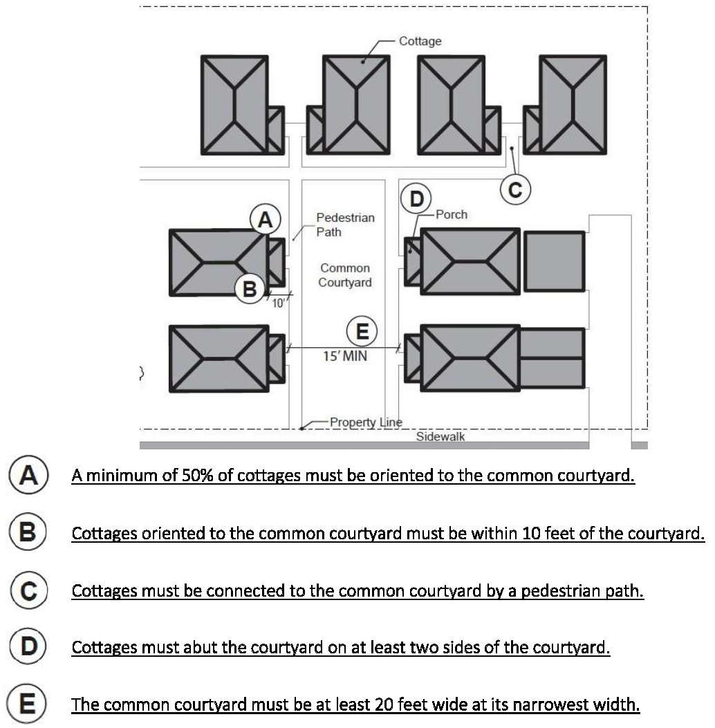
6.
Community Buildings. Cottage cluster projects may include community buildings for the shared use of residents that provide space for accessory uses such as community meeting rooms, exercise rooms, day care, or community eating areas. Community buildings must meet the following standards:
a.
Each cottage cluster is permitted one community building, which shall count towards the maximum average floor area, pursuant to subsection 3.
b.
The community building must not exceed one thousand four hundred square feet in floor area.
7.
Pedestrian Access.
a.
An accessible pedestrian path must be provided that connects the main entrance of each cottage to the following:
i.
The common courtyard;
ii.
Shared parking areas;
iii.
Community buildings; and
iv.
Sidewalks in public rights-of-way abutting the site or rights-of-way if there are no sidewalks.
b.
The pedestrian path must be all-weather hard-surfaced and a minimum of four feet wide.
8.
Parking Design.
a.
Clustered parking. Off-street parking may be provided with individual cottages or arranged in clusters, subject to the following standards:
i.
Cottage cluster projects with fewer than sixteen cottages are permitted parking clusters of not more than five contiguous spaces.
ii.
Cottage cluster projects with sixteen cottages or more are permitted parking clusters of not more than eight contiguous spaces.
iii.
Parking clusters must be separated from other spaces by at least four feet of landscaping.
iv.
Clustered parking areas may be covered.
9.
Parking location and access.
a.
Off-street parking spaces and vehicle maneuvering areas shall not be located:
i.
Within twenty feet of any street property line, except alley property lines;
ii.
Between a street property line and the front façade of cottages located closest to the street property line. This standard does not apply to alleys.
b.
Off-street parking spaces shall not be located within ten feet of any other property line, except alley property lines. Driveways and drive aisles are permitted within ten feet of other property lines.
10.
Screening. Landscaping, fencing, or walls at least three feet tall shall separate clustered parking areas and parking structures from common courtyards and public streets.
11.
Accessory Structures. Accessory structures must not exceed four hundred square feet in floor area.
12.
Existing Structures. On a lot or parcel to be used for a cottage cluster project, an existing detached single-unit dwelling or duplex on the same lot at the time of proposed development of the cottage cluster may remain within the cottage cluster project area under the following conditions:
a.
The existing dwelling may be nonconforming with respect to the requirements of this code.
b.
The existing dwelling may be expanded up to the maximum height in subsection 4; however, existing dwellings that exceed the maximum height and/or footprint of this code may not be expanded.
c.
The floor area of the existing dwelling shall not count towards the maximum average floor area of the cottage cluster.
13.
The existing dwelling shall be excluded from the calculation of orientation toward the common courtyard, per subsection 5.a.
Figure 16.05-2: Cottage Clusters Parking, Screening, Landscape, etc.
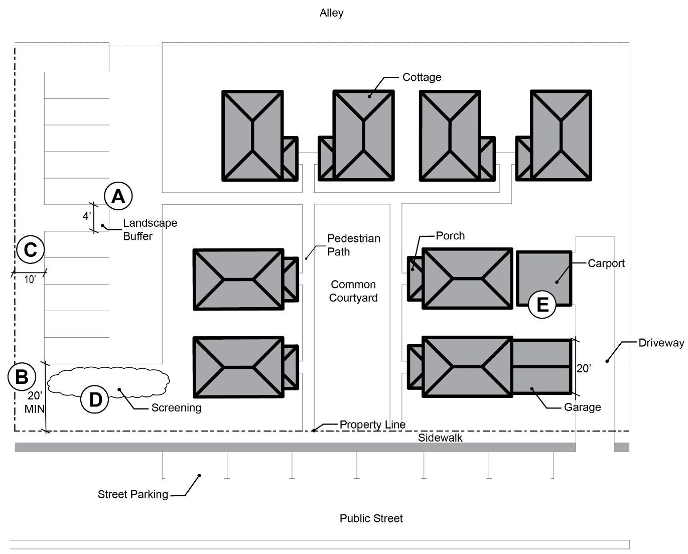
G.
Tiny Homes. Tiny homes shall meet the standards of this section in addition to any other applicable zoning or development standards. Wherever these standards conflict with requirements in other sections, the standards of this section shall take precedence.
1.
Tiny homes are allowed as accessory dwellings, in cottage clusters, and in manufactured dwelling parks, subject to their respective standards.
2.
Tiny homes may or may not be on wheels.
3.
Tiny homes shall be on a hard, all-weather surfaced slab or foundation.
4.
Tiny homes shall have a pitched roof with a slope not less than three feet in height for each twelve feet in width (fourteen degrees).
5.
Tiny homes on a chassis or wheels shall provide skirting around the perimeter of the support structure.
6.
Each tiny home must be connected to water and sewer services.
(Ord. No. 3036, § 3(Exh. A), 6-11-2025)
16.05.140 - Site area standards for multifamily housing.
Where multifamily housing is allowed, it shall conform to all of the following standards, which are intended to promote livability for residents and compatibility with nearby uses.
A.
The minimum site area per dwelling unit shall be as described in Table 16.05-11 for all multiple-family dwellings and condominiums as defined in Chapter 16.32 (Glossary).
Table 16.05-11: Site Area per Dwelling Unit
B.
Affordable Housing Bonuses.
1.
Affordable Housing. As defined by the U.S. Housing and Urban Development Department (HUD), a household should pay no more than thirty percent of its gross monthly income for housing. Means housing affordable to a certain percentage of the population earning a specified level of income and spending no more than thirty percent of their income on housing expenses. Affordable housing is housing that requires no more than thirty percent of the monthly income of a household that has income at or below eighty percent of the area median. Affordable housing thus means housing (including necessary and essential utilities) for which persons or families pay thirty percent or less of their gross income.
2.
Density Bonus. Proposals with the following maximum densities are eligible for corresponding density increases:
a.
For property with existing maximum density of sixteen or fewer units per acre, two hundred percent of the existing density; or
b.
For property with existing maximum density of seventeen or more units per acre and forty-five or fewer units per acre, one hundred fifty percent of the existing density; or
c.
For property with existing maximum density of forty-six or more units per acre, one hundred twenty-five percent of the existing density.
3.
Height Bonus.
a.
For property with existing maximum density of sixteen or fewer units per acre, twelve additional feet; or
b.
For property with existing maximum density of seventeen or more units per acre and forty-five or fewer units per acre, twenty-four additional feet; or
c.
For property with existing maximum density of forty-six or more units per acre, thirty-six additional feet.
4.
Parking Bonus. Development proposals where a minimum number of proposed affordable units reflect the percentages in Table 16.05-12 are eligible for a corresponding reduction in off street parking.
Table 16.05-12: Parking Bonus
5.
Open Space Bonus. The amount of required open space may be reduced pursuant to Table 16.05-13.
Table 16.05-13: Open Space Bonus
6.
Lot Coverage Bonus. The lot coverage percentage may be increased pursuant to Table 16.05-14.
Table 16.05-14: Lot Coverage Bonus
7.
The developer is required to enter into a legally enforceable, assignable contract with a local, regional and/or state housing agency who will assume all responsibility for identifying, placing and managing the qualifying household. In the circumstance of off-site units, the developer will provide agency determined equivalent rent payments and the agency will assume all other responsibilities.
8.
Affordable housing bonuses are subject to approval by the planning official and/or planning commission. Developments qualifying for the above bonuses must comply with all other applicable development and improvement standards and codes required by the City of Lebanon and the requirements of the underlying zone.
9.
Exceptions. The city may reduce proposed increases in density or height as allowed in subsections B.2 and B.3 where necessary to address health, safety or habitability issues, including fire safety, or to comply with a protective measure adopted pursuant to a statewide land use planning goal provided the city adopts findings supported by substantial evidence demonstrating the necessity of this reduction.
(Ord. No. 3036, § 3(Exh. A), 6-11-2025)
16.05.150 - Open space and site design requirements for multifamily housing.
A.
Recreation and Open Space Areas. In multiple family developments, a portion of the land not covered by buildings and parking shall be of adequate size and shape and in the proper location to be functional for outdoor recreation and relaxation. The standards are also intended to ensure that project open space is an integral part of the overall development design, not merely leftover space. For larger developments there should be a variety of open space activity areas.
B.
Open Space Design. Required open space shall be designed and arranged to offer the maximum benefits to the occupants of the development as well as provide visual appeal and building separation.
C.
Basic Requirements for Open Space, Site Design and Screening.
1.
These provisions shall apply to all new projects and to an addition or remodeling of existing structures that creates additional dwelling units.
2.
A minimum of twenty-five percent of the project development area (or equivalent as described below) shall be developed as permanent open area.
3.
The minimum open area shall be landscaped and permanently maintained in accordance with the provisions of Chapter 16.15.
4.
Trash receptacles shall be oriented away from residences, and shall be screened with an evergreen hedge or solid fence or wall and shall not be located in required yard setbacks or open space. Receptacles must be accessible to trash pick-up trucks.
5.
Decorative design elements such as fountains, pools, benches, sculptures, planters, and similar elements may be placed within the open area.
6.
Open Space Designation. Areas provided to satisfy the minimum useable open space requirement shall be so designated (including area calculation) on the development site plan and shall be reserved as open space.
D.
General Allocation of Open Space. Open space may be allocated as follows:
1.
Private Open Space. Space designed for the exclusive use of individual dwelling units such as patio areas and balconies.
2.
Children's Play Areas. An area designated for the recreation of children. Such areas may include sand boxes, bark chip areas, areas containing play structures, hard surface courts, and wading pools.
3.
Common Open Space. Open space, exclusive of private open space and children's play areas, that is available for use by all of the residents of the development.
4.
At least fifty percent of the open space must be usable outdoor space.
5.
Driveways and parking areas shall not be included in the open space calculation.
E.
Common Open Space.
1.
The minimum required common open space is one thousand square feet inclusive of children's play areas.
2.
Areas designated as common open space shall be at least five hundred square feet in size with no horizontal dimension less than twenty feet.
3.
At least twenty-five percent of all open space shall be in one area whose the length shall not exceed the width by more than two and one-half times unless the minimum dimension is thirty feet or a different ratio is required for a particular type of developed sport court or field.
4.
All remaining open space is subject to the minimum standards noted here, but could be located in a required setback area or yard.
5.
The open space shall be functional and shall include one or more of the following uses:
a.
Developed Recreation Areas.
i.
Swimming pools, spas, and adjacent patios and decks
ii.
Developed and equipped recreation areas, such as a fitness center
iii.
Sport courts (tennis, handball, volleyball, basketball, etc.)
iv.
Community centers (e.g., social hall with amenities)
b.
Food service(s).
c.
Ornamental gardens.
d.
Sheltered recreation areas.
e.
Lawn or hard surface areas in which user amenities such as trees, shrubs, pathways, covered picnic tables, benches, and drinking fountains have been placed.
f.
Bonus. The developed recreational areas described in 5(a) above shall earn a bonus in overall reduction of required open space at a 4:1 ratio, resulting in a four square foot reduction for each square foot of developed recreation space.
6.
Developments shall provide a mix of passive and active recreational uses from the above list if the open space can accommodate more than one use.
7.
Developed recreation areas may count towards fifty percent of the common open space requirement.
8.
Not more than twenty percent of the common open space requirement shall be on land with slopes greater than fifteen percent, and/or on delineated sustained wetlands.
9.
Required yard setback areas may be applied toward the minimum useable open space requirement. Active, noise-generating activities as well as developed or improved recreation areas shall not be allowed in any required yard setback areas and shall be centrally located.
F.
Children's play areas (does not apply to senior living facilities.)
1.
Multiple family developments larger than eight units (excluding studio units) shall designate one or more children's play areas.
2.
Children's play areas shall be placed within open view of the units they are intended to serve. More than one play area may be needed in larger developments.
3.
No horizontal dimension of a children's play area shall be less than twenty feet.
4.
At least a minimum of one five hundred-square-foot children's play area shall be provided.
5.
Placement of children's play areas shall not be allowed in any required yard setback and shall be centrally located.
6.
Children's play areas fulfill part of the common open space area but do not count toward any of the other open space requirements. At least ten percent of all required open space or five hundred square feet (whichever is greater) shall be devoted to children's play areas.
7.
Any and all playground equipment must comply with the International Play Equipment Manufactures Association (IPEMA) standards.
G.
Private Open Space.
1.
In multiple family developments, private open space, if it is designated as fulfilling part of the overall open space requirement, shall meet the following standards:
a.
At-Grade Dwellings. Dwellings located at finished grade, or within five feet of finished grade, shall provide a minimum of ninety-six square feet of private open space per unit, with no dimension less than eight feet. Private open space for at-grade dwellings may be provided within interior courtyards.
b.
Above-Grade Dwellings. Dwellings located more than five feet from finished grade shall provide a minimum of eighty square feet of private open space per dwelling unit (such as a yard, deck or porch), with no dimension less than eight feet. Private open space for units located more than five feet above grade may be provided individually, as with a balcony.
2.
Orientation of Private Open Space. Private open space areas shall be oriented toward other open space areas and away from trash receptacles, parking and drives to the greatest extent practicable.
3.
Privacy Requirements. Private open space shall be physically and visually separated from other adjacent private space.
4.
All private open space shall be directly accessible from the dwelling unit through a doorway, and may not be part of an accessway, but could be adjacent to an accessway.
5.
Private open space of at least eighty square feet with a minimum dimension of eight feet may be included as part of the required open space and be given credit for two square feet of open area for each one square feet so provided, not to exceed two hundred square feet of total open space credit per dwelling unit.
Figure 16.05-1: Examples of Multiple-Family Open Space
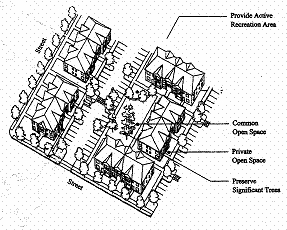
(Ord. No. 3036, § 3(Exh. A), 6-11-2025)
16.05.160 - Zero-lot line housing.
A.
Introduction. Zero-lot line houses are subject to the same standards as nonattached single-family housing provided the requirements of 16.05.160(B) and (C) are met.
B.
Any residential dwelling unit or accessory structure may be located on the interior property line where the proposed building does not have openings or windows in the wall facing the adjacent building.
C.
For interior property lines where no setback is proposed, a maintenance easement must be recorded on the abutting property deed or plat. The width of the easement shall be five feet. This easement is not revocable without city approval through an administrative procedure pursuant to Section 16.20.040.
D.
The interior setback for attached housing units shall be zero where the units adjoin; all other setbacks shall conform to this code.
(Ord. No. 3036, § 3(Exh. A), 6-11-2025)
16.06.010 - Background.
A.
This chapter contains all of the standards for the mixed-use zone (Z-MU). The standards are intended to be applied to all reviews in the mixed-use zone.
B.
The creation of a lot or parcel through the subdivision or partition process is an outright permitted action in the mixed-use zone subject to the provisions of Chapter 16.22 and any other applicable requirements in this Code (e.g., Community Development Standards, Chapters 16.12 through 16.19).
(Ord. 2766 § 1 (part), 2008; Ord. No. 3036, § 3(Exh. A), 6-11-2025)
16.06.020 - Purpose.
A.
The purpose of the mixed-use zone is to provide lands that possess potential for several types of land use or combinations of different land uses. The intent of this designation is to achieve an environment in which different land uses can co-exist by providing building groupings for privacy, usable and attractive open spaces, and safe circulation, thus promoting the general well being of the residents, businesses, and other occupants. Effective mixed-use zones not only allow the co-location of various types of uses, but they also promote compatible architectural design and connectivity of buildings to streets and paths. Residential mixed-use encourages planners and developers to look beyond the traditional subdivision design and think about new and efficient utilization of land. Such innovative designs can provide residents access to commercial services as well as amenities such as parks, trails, and open spaces, and hence promote community-friendly development 1 that is highly compatible with surrounding uses and promotes a sense of community.
B.
Mixed-use lands are open to all types of development including residential, commercial, and light (Class I and II impacts) industrial land uses.
C.
The mixed-use zone is intended to:
1.
Promote efficient use of land and urban services.
2.
Create a mixture of land uses that encourages employment and housing options in close proximity to one another.
3.
Encourage pedestrian-oriented development in all mixed-use areas.
4.
Provide connections to and appropriate transitions between residential areas and commercial areas.
5.
Promote independence of movement, especially for the young and the elderly who can conveniently walk, cycle, or ride transit.
6.
Promote safety in commercial areas, through the around-the-clock presence of people.
7.
Provide opportunities for the development of support services and amenities in neighborhoods so as to encourage those who choose to work at home, home occupations and the further decentralization and diversification of the local economy.
8.
Encourage reduction in auto use, especially by shortening trips between residences and jobs/services/recreation.
9.
Encourage the development of a variety of housing choices.
(Ord. 2766 § 1 (part), 2008; Ord. No. 3036, § 3(Exh. A), 6-11-2025)
1 Lebanon's approach to community friendly development includes principles that combine sound local and regional planning techniques with a variety of elements from several different perspectives. Such principles focus on creating a built environment suitable for the needs of a diverse population through a variety of uses scaled for the pedestrian, and capable of accommodating the automobile and mass transit. See Chapter 7 of Lebanon's Comprehensive Plan for additional details.
16.06.030 - Introduction.
A.
Impact Classifications.
1.
As noted in Chapter 16.03, all land use types are further divided into three subcategories by the degree of impacts or off-site impacts that the uses could reasonably be expected to exert on the surrounding properties and neighborhood.
2.
Please see Section 16.03.010.E of Chapter 16.03 (pages 2 and 3) for the details of this impact classification system.
B.
Key to Procedures, Standards and Conditions of Approval.
1.
Outright Permitted Uses with Site Review and Building Permit. "OP" means the use is permitted outright and a building permit is issued after a site review determines that all setbacks and other lot and building site requirements are satisfied.
2.
Permitted Uses with Ministerial Review. "MR" approval is gained through a ministerial review process (see Chapter 16.20).
3.
Permitted with Administrative Review. "AR" means the use is permitted through an administrative review process that takes into account all applicable requirements (see Chapter 16.20).
4.
Permitted with Conditional Use Approval. "CU" means the use is permitted with a conditional use approval (Chapter 21).
5.
Site Reviews. The processing of a variety of land use applications may also include detailed site reviews (site plan reviews). These requirements are addressed in LDC Chapters 16.21 through 16.24 (Article 4).
6.
Decision Criteria and/or Additional Conditions of Approval. The standards and review processes outlined in this Code in Article 3: Community Development and Use Standards and in Article 4: Land Use and Development Review/Approval Requirements and Procedures, as well as applicable overlay zones (Chapter 16.11) may set additional decision criteria and/or conditions of approval.
7.
Not Permitted. The code provisions are also intended to make it more difficult to place incompatible uses near one another; an "N" designation means the use is not permitted.
a.
Existing Uses. The "not permitted" ("N") designation is not retroactive and does not impact existing uses.
b.
No New Uses. The "not permitted" ("N") designation indicates that no new uses of this type are allowed on a property to which this designation applies.
(Ord. 2766 § 1 (part), 2008; Ord. No. 3036, § 3(Exh. A), 6-11-2025)
16.06.040 - Process for review of mixed-use land use applications.
A.
Mixed-Use Land Uses. All applications for development in the mixed-use zone for projects that are not deemed major land use actions are subject to:
1.
The appropriate review process indicated in Tables 16.06-2 through 16.06-6, and
2.
May also be subject to:
a.
Site reviews (e.g., to determine that all setbacks and other lot and building site requirements are satisfied).
b.
The standards noted and review processes outlined in this Code in Article 3: Community Development and Use Standards and in Article 4: Land Use and Development Review/Decision Requirements and Procedures.
c.
Applicable overlay zones (Chapter 16.11) may set additional conditions of approval.
B.
Process for Basic Review of Applications and Impact Mitigation for Projects Deemed Major Land Use Actions thus Requiring Planned Development Reviews.
1.
For purposes of this chapter, if a proposed development in a mixed-use zone is deemed a major land use action according to Table 16.06-1 on the following page, it shall be processed as a planned development.
2.
See Chapter 16.23 for the details of the process for planned development reviews.
Table 16.06-1: Characteristics of Major Land Use Actions in the Mixed-Use Zone
(Projects in the Mixed-Use Zone Requiring a Planned Development Review)
Note: Acreage refers to the size of the area being developed, not the total parcel or lot size.
* Mixed-Use Development: Mixed-use development is the co-location of various types of uses within a single building, complex or site. For example, mixed-use development could include residential with commercial, or with public or institutional uses, or multifamily with single-family dwellings. Mixed-use development could be "vertical" (e.g., housing above ground floor commercial), and/or "horizontal" (housing in one or more buildings, and commercial or other uses in other buildings on a site, or multifamily dwellings and single-family dwellings on a site), or both vertical and horizontal mixed-use on a mixed-use site.
(Ord. 2766 § 1 (part), 2008; Ord. No. 3036, § 3(Exh. A), 6-11-2025)
16.06.050 - Residential uses allowed in the mixed-use zone.
16.06.060 - Commercial uses allowed in the mixed-use zone.
16.06.070 - Industrial uses allowed in the mixed-use zone.
Table 16.06-4: Industrial Land Uses Allowed in the Mixed-Use Zone
(See Section 16.03.050 of Chapter 16.03 for further details and listings industrial uses)
(Ord. 2766 § 1 (part), 2008; Ord. No. 3036, § 3(Exh. A), 6-11-2025)
16.06.080 - Public uses allowed in the mixed-use zone.
Table 16.06-5: Public (Civic or Institutional) Land Uses Allowed in the Mixed-Use Zone
(See Section 16.03.060 of Chapter 16.03 for further details and listings regarding public uses)
(Ord. 2766 § 1 (part), 2008; Ord. No. 3016, § 2(Exh. A), 12-13-2023; Ord. No. 3036, § 3(Exh. A), 6-11-2025; Ord. No. 3041, § 2(Exh. A), 11-12-2025)
16.06.090 - Other land uses allowed in the mixed-use zone.
Table 16.06-6: Other Land Uses Allowed in the Mixed-Use Zone
(See Section 16.03.070 of Chapter 16.03 for further details and listings regarding other uses)
(Ord. 2766 § 1 (part), 2008; Ord. No. 3036, § 3(Exh. A), 6-11-2025)
16.06.100 - Mixed-use zone development standards.
A.
Development Standards for Mixed-Use. The development standards in Table 16.06-7 apply to all uses, structures, buildings, and development, and major remodels, in the mixed-use zone (Z-MU).
Table 16.06-7: Development Standards for Mixed-Use
B.
Utilization of Appropriate Development Standards for the Different Types of Land Use Requests Permissible in the Mixed-Use Zone
1.
Mixed development lands are open to a variety of development types including residential uses, many commercial uses, light (Class I and II impacts) industrial uses, and public uses (see Tables 16.06-2 through 16.06-6).
2.
The mixed-use zone includes development standards applicable for all development in this zone.
3.
In addition, the development standards applicable to other types of land uses shall be utilized in setting the conditions of approval:
a.
For residential uses in the mixed-use zone, see the standards in Chapter 16.05.
b.
For commercial uses in the mixed-use zone, see the standards in Chapter 16.08.
c.
For industrial uses in the mixed-use zone, see the standards in Chapter 16.09.
d.
For public uses in the mixed-use zone, see the standards in Chapter 16.10.
4.
The conditional use review (Chapter 16.21), and/or review of planned developments (Chapter 16.23) may set additional conditions of approval.
C.
Expansion of Existing Commercial, Industrial and Public Facilities in the Mixed-Use Zone. Additions to existing structures or the construction of new buildings, that do not result in more than a ten percent increase in the existing building or improvement square footage, shall be subject to the following requirements:
1.
If the establishment of the new use requires a conditional use, then the expansion identified in this section shall be subject to an administrative review.
2.
If the establishment of the new use requires an administrative review, then the expansion identified in this section shall be subject to a ministerial review.
3.
This section does not alter requirements for facilities approved by the planned development process.
(Ord. 2766 § 1 (part), 2008; Ord. No. 2801, Exh. A, 7-14-2010; Ord. No. 3036, § 3(Exh. A), 6-11-2025)
16.06.110 - Special development standards for certain uses.
Where permitted by the development code, the following standards shall apply for gas (filling) stations in the mixed-use zone:
A.
General Standards.
1.
Parcel Size. No gas (filling) station shall be located on a parcel containing less than twelve thousand square feet in area.
2.
Location. There are no location standards required for the commercial and industrial zones. In mixed-use and neighborhood mixed-use zones, fueling stations may be located at intersections of the following type of major intersections:
a.
At the intersection of two minor and/or principal arterials.
b.
At the intersection of an arterial (minor or principal) and a collector.
3.
Canopy lighting. Lighting fixtures installed within the fueling island canopy shall not extend below the canopy ceiling. The lighting fixtures, illumination intensity and direction shall comply with LDC 16.19.050 (Exterior Lighting).
(Ord. No. 2975, Exh. A, 12-8-2021; Ord. No. 3036, § 3(Exh. A), 6-11-2025)
16.07.010 - Background.
A.
This chapter contains all of the standards for the neighborhood mixed-use zone (Z-NMU). The standards are intended to be applied to all reviews in the neighborhood mixed-use zone.
B.
The creation of a lot or parcel through the subdivision or partition process is an outright permitted action in the mixed-use zone subject to the provisions of Chapter 16.23 and any other applicable requirements in this Code (e.g., Community Development Standards, Chapters 16.12 through 16.19).
(Ord. 2766 § 1 (part), 2008; Ord. No. 3036, § 3(Exh. A), 6-11-2025)
16.07.020 - Purpose and implementation.
A.
Purpose.
1.
To provide lands suitable for primarily residential uses, with flexibility to allow neighborhood commercial services, in a transition area between commercial and residential areas.
2.
Commercial, light industrial, and "other" land uses shall not occupy more than five thousand square feet in any single structure. However, such building size restrictions do not apply to allowed residential uses and public uses (civic and institutional).
3.
The types of businesses envisioned in this area include coffee shops, delis, bakeries, small offices, or day care facilities. Essentially, the neighborhood mixed-use zone is a blending of commercial and residential uses to create a transition zone between such uses. Specifically, the neighborhood mixed-use zone combines elements of the neighborhood commercial (Z-NCM) and mixed density residential (Z-RM) zones.
4.
The neighborhood mixed-use zone is intended to:
a.
Provide a buffer or transition between commercial development and residential areas.
b.
Provide effective connectivity for pedestrians and bicyclists between residential areas and commercial areas.
c.
Encourage pedestrian-oriented development.
d.
Promote efficient use of land and urban services.
e.
Promote independence of movement, especially for the young and the elderly who can conveniently walk, cycle, or ride transit.
f.
Create a mixture of land uses that encourages employment and housing options in close proximity to one another.
g.
Provide opportunities for the development of support services and amenities in neighborhoods so as to encourage those who choose to work at home, home occupations and the further decentralization and diversification of the local economy.
h.
Encourage reduction in auto use, especially by shortening trips between residences and jobs/services/recreation.
i.
Encourage the development of a variety of housing choices.
B.
Implementation. As noted in Chapter 4 of the 2004 Lebanon Comprehensive Plan, "[t]he new 2004 category of neighborhood mixed-use is a category to which property can be redesignated by future comprehensive plan map amendments. However, this comprehensive plan does not assign any land to this new designation." Given the transitional nature of this zone, any redesignation of parcels to C-NMU (and subsequently Z-NMU) must not only be consistent with the purposes of this zone, the land proposed for redesignation must also be adjacent to both commercial and residential areas.
(Ord. 2766 § 1 (part), 2008; Ord. No. 3036, § 3(Exh. A), 6-11-2025)
16.07.030 - Introduction.
A.
Impact Classifications.
1.
As noted in Chapter 16.03, all land use types are further divided into three subcategories by the degree of impacts or off-site impacts that the uses could reasonably be expected to exert on the surrounding properties and neighborhood.
2.
Please see Section 16.03.010.E of Chapter 16.03 for the details of this impact classification system.
B.
Key to Procedures, Standards and Conditions of Approval.
1.
Outright Permitted Uses with Site Review and Building Permit. "OP" means the use is permitted outright and a building permit is issued after a site review determines that all setbacks and other lot and building site requirements are satisfied.
2.
Permitted Uses with Ministerial Review. "MR" approval is gained through a ministerial review process (see Chapter 16.20).
3.
Permitted with Administrative Review. "AR" means the use is permitted through an administrative review process that takes into account all applicable requirements (see Chapter 16.20).
4.
Permitted with Conditional Use Approval. "CU" means the use is permitted with a conditional use approval (Chapter 16.21).
5.
Site Reviews. The processing of a variety of land use applications may also include detailed site reviews (site plan reviews). These requirements are addressed in LDC Chapters 16.21 through 16.24 (Article 4).
6.
Decision Criteria and/or Additional Conditions of Approval. The standards and review processes outlined in this Code in Article 3: Community Development and Use Standards and in Article 4: Land Use and Development Review/Decision Requirements and Procedures, as well as applicable overlay zones (Chapter 16.11) may set additional decision criteria and/or conditions of approval.
7.
Not Permitted. The code provisions are also intended to make it more difficult to place incompatible uses near one another; an "N" designation means the use is not permitted.
a.
Existing Uses. The "not permitted" ("N") designation is not retroactive and does not impact existing uses.
b.
No New Uses. The "not permitted" ("N") designation indicates that no new uses of this type are allowed on a property to which this designation applies.
(Ord. 2766 § 1 (part), 2008; Ord. No. 3036, § 3(Exh. A), 6-11-2025)
16.07.040 - Process for review of neighborhood mixed-use land use applications.
A.
Neighborhood Mixed-Use Zone Reviews. All applications for residential, commercial, industrial, public, and other uses in the neighborhood mixed-use zone (Z-NMU) that are not deemed major land use actions are subject to:
1.
The appropriate review process indicated in Tables 16.07-2 through 16.07-6, and
2.
May also be subject to:
a.
Site reviews (e.g., to determine that all setbacks and other lot and building site requirements are satisfied).
b.
Standards noted and the review processes outlined in this Code in Article 3: Community Development and Use Standards and in Article 4: Land Use and Development Review/Decision Requirements and Procedures,
c.
Applicable overlay zones (Chapter 16.11) may set additional conditions of approval.
B.
Process for Basic Review of Applications and Impact Mitigation for Projects Deemed Major Land Use Actions thus Requiring Planned Development Reviews.
1.
For purposes of this chapter, if a proposed development in a mixed-use zone is deemed a major land use action according to Table 16.07-1 on the following page, it shall be processed as a planned development.
2.
See Chapter 16.23 for the details of the process for planned development reviews.
Table 16.07-1: Characteristics of Major Land Use Actions in the Neighborhood Mixed-Use
Zone
(Projects in the Neighborhood Mixed-Use Zone Requiring a Planned Development Review)
Note: Acreage refers to the size of the area being developed, not the total lot or parcel or lot size.
* Mixed-Use Development: mixed-use development is the co-location of various types of uses within a single building, complex or site. For example, mixed-use development could include residential with commercial, or with public or institutional uses). Mixed-use development could be "vertical" (e.g., housing above ground floor commercial), and/or "horizontal" (housing in one or more buildings, and commercial or other uses in other buildings on a site), or both vertical and horizontal mixed-use on a mixed-use site.
(Ord. 2766 § 1 (part), 2008; Ord. No. 3036, § 3(Exh. A), 6-11-2025)
16.07.050 - Residential uses allowed in the neighborhood mixed-use zone (Z-NMU).
16.07.060 - Commercial uses allowed in the neighborhood mixed-use zone (Z-NMU).
Table 16.07-3: Commercial Land Uses Allowed in the Neighborhood Mixed-Use Zone
(See Section 16.03.040 of Chapter 16.03 for further details and listings regarding commercial uses)
Commercial activity shall not occupy more than five thousand square feet in any single structure.
(Ord. 2766 § 1 (part), 2008; Ord. No. 2975, Exh. A, 12-8-2021; Ord. No. 3016, § 2(Exh. A), 12-13-2023; Ord. No. 3036, § 3(Exh. A), 6-11-2025)
16.07.070 - Industrial uses allowed in the neighborhood mixed-use zone (Z-NMU).
Table 16.07-4: Industrial Land Uses Allowed in the Neighborhood Mixed-Use Zone
(See Section 16.03.050 of Chapter 16.03 for further details and listings regarding industrial uses)
Industrial activity shall not occupy more than five thousand square feet in any single structure.
(Ord. 2766 § 1 (part), 2008; Ord. No. 3036, § 3(Exh. A), 6-11-2025)
16.07.080 - Public uses allowed in the neighborhood mixed-use zone (Z-NMU).
Table 16.07-5: Public Uses (Civic or Institutional) Allowed in the Neighborhood Mixed-Use Zone
(See Section 16.03.060 of Chapter 16.03 for further details and listings regarding public uses)
(Ord. 2766 § 1 (part), 2008; Ord. No. 3016, § 2(Exh. A), 12-13-2023; Ord. No. 3036, § 3(Exh. A), 6-11-2025; Ord. No. 3041, § 2(Exh. A), 11-12-2025)
16.07.090 - Other land uses allowed in the neighborhood mixed-use zone (Z-NMU).
Table 16.07-6: Other Uses Allowed in the Neighborhood Mixed-Use Zone
(See Section 16.03.070 of Chapter 16.03 for further details and listings regarding other uses)
(Ord. 2766 § 1 (part), 2008; Ord. No. 3036, § 3(Exh. A), 6-11-2025)
16.07.100 - Neighborhood mixed-use zone development standards.
A.
Development Standards for the Neighborhood Mixed-Use Zone. The development standards in Table 16.07-7 apply to all uses, structures, buildings, and development, and major remodels, in the neighborhood mixed-use zone (Z-NMU).
Table 16.07-7: Development Standards for Neighborhood Mixed-Use Zone
B.
Utilization of Appropriate Development Standards for the Different Types of Land Use Requests Permissible in the Neighborhood Mixed-Use Zone. Neighborhood mixed-use lands are open to a variety of development types including residential, limited light commercial, limited public uses, and limited very light (select Class I) industrial land uses, subject to the following standards.
1.
Non-residential development is required to utilize site designs that minimize adverse impacts to adjacent residential properties.
2.
The neighborhood mixed-use zone includes development standards applicable for all development in this zone.
3.
In addition, the development standards applicable to other types of land uses shall be utilized in setting the conditions of approval:
a.
For residential uses in the mixed-use zone, see the standards in Chapter 16.05.
b.
For commercial uses in the mixed-use zone, see the standards in Chapter 16.08.
c.
For industrial uses in the mixed-use zone, see the standards in Chapter 16.09.
d.
For public uses in the mixed-use zone, see the standards in Chapter 16.10.
4.
The conditional use review (Chapter 16.21), subdivision review (Chapter 16.22), and/or review of planned developments (Chapter 16.23) may set additional conditions of approval.
(Ord. 2766 § 1 (part), 2008; Ord. No. 3036, § 3(Exh. A), 6-11-2025)
16.07.110 - Special development standards for certain uses.
Where permitted by the development code, the following standards shall apply for gas (filling) stations in the mixed-use zone:
A.
General Standards.
1.
Parcel Size. No gas (filling) station shall be located on a parcel containing less than 12,000 square feet in area.
2.
Location. There are no location standards required for the commercial and industrial zones. In mixed-use and neighborhood mixed-use zones, fueling stations may be located at intersections of the following type of major intersections:
a.
At the intersection of two minor and/or principal arterials.
b.
At the intersection of an arterial (minor or principal) and a collector.
3.
Canopy lighting. Lighting fixtures installed within the fueling island canopy shall not extend below the canopy ceiling. The lighting fixtures, illumination intensity and direction shall comply with LDC 16.19.050 (Exterior Lighting).
(Ord. No. 2975, Exh. A, 12-8-2021; Ord. No. 3036, § 3(Exh. A), 6-11-2025)
16.08.010 - Background.
A.
This chapter contains all of the standards for the neighborhood commercial zone (Z-NCM), central business commercial zone (Z-CCM), and highway commercial zone (Z-HCM). The standards are intended to be applied to all reviews in the commercial zones. For a more detailed listing of commercial land uses, please see Section 16.03.040 in Chapter 16.03, and Chapter 16.32 (Glossary and Definitions).
B.
The creation of a lot or parcel through the subdivision or partition process is an outright permitted action in the commercial use zones subject to the provisions of Chapter 16.22 and any other applicable requirements in this code (e.g., Community development standards, Chapters 16.12 through 16.19).
(Ord. 2766 § 1 (part), 2008; Ord. No. 3036, § 3(Exh. A), 6-11-2025)
16.08.020 - Purpose.
A.
Central Business and Highway Commercial Zones. Commercial districts are centers of business and civic life. This chapter describes the three commercial districts that are designed to accommodate the range of commercial land uses in the community. The central business commercial zone (Z-CCM) is focused on "downtown" area, or the commercial and civic the core of the community (generally that area south of Rose Street, north of Oak Street, primarily east of or adjacent to Forth Street, and primarily west of or adjacent to Park Street). The highway commercial zone (Z-HCM) regulations apply to those commercial areas outside of the central business area, generally located along or in close proximity to arterial streets. These commercial zones are intended to:
1.
To preserve and enhance areas within the commercial core of the community for concentrated retail sales and businesses that will serve the pedestrian shopper.
2.
Promote efficient use of land and urban services.
3.
Create a mixture of land uses that encourages employment and housing options in close proximity to one another.
4.
Provide formal and informal community gathering places and opportunities for social activities.
5.
Provide connections and appropriate transitions between residential areas and commercial areas;
6.
Encourage and nurture pedestrian oriented shopping and activity in the downtown (central business commercial zone), and accommodate automobile dependent uses, as well as pedestrian oriented uses, with appropriate standards in the highway commercial zone.
7.
Provide for visitor accommodations and tourist amenities.
8.
Encourage full utilization of downtown infrastructure (including parking) and other amenities.
B.
Neighborhood Commercial Zone.
1.
The neighborhood commercial zone (Z-NCM) is the third commercial zone. It is intended to enhance the livability of residential areas by providing for small neighborhood shopping clusters to serve the frequent recurring needs of neighborhood residents.
2.
The comprehensive plan map does not currently designate any unannexed areas as earmarked for neighborhood commercial development. However, it is also intended by the comprehensive plan that the neighborhood commercial zone "…is for small neighborhood shopping clusters in any residential zone."
3.
Establishing a Z-NCM designation in an existing residential zone is a conditionally permitted activity. In this case, amending the zoning designation to establish Z-NCM zoning on such a property would require a zoning map amendment, but would not necessitate a comprehensive plan map amendment as such a use (Z-NCM) is permitted in any residential area according to the comprehensive plan (see Table 4-2 of Chapter 4 in the city of Lebanon 2004 Comprehensive Plan).
(Ord. 2766 § 1 (part), 2008; Ord. No. 3036, § 3(Exh. A), 6-11-2025)
16.08.030 - Introduction.
A.
Impact Classifications.
1.
As noted in Chapter 16.03, all land use types are further divided into three subcategories by the degree of impacts or off-site impacts that the uses could reasonably be expected to exert on the surrounding properties and neighborhood.
2.
Please see Section 16.03.010.E of Chapter 16.03 for the details of this impact classification system.
B.
Key to Procedures, Standards and Conditions of Approval.
1.
Outright Permitted Uses with Site Review and Building Permit. "OP" means the use is permitted outright and a building permit is issued after a site review determines that all setbacks and other lot and building site requirements are satisfied.
2.
Permitted Uses with Ministerial Review. "MR" approval is gained through a ministerial review process (see Chapter 16.20).
3.
Permitted with Administrative Review. "AR" means the use is permitted through an administrative review process that takes into account all applicable requirements (see Chapter 16.20).
4.
Permitted with Conditional Use Approval. "CU" means the use is permitted with a conditional use approval (Chapter 16.21).
5.
Site Reviews. The processing of a variety of land use applications may also include detailed site reviews (site plan reviews). These requirements are addressed in LDC Chapters 16.21 through 16.24 (Article 4).
6.
Decision Criteria and/or Additional Conditions of Approval. The standards and review processes outlined in this Code in Article 3: Community Development and Use Standards and in Article 4: Land Use and Development Review/Decision Requirements and Procedures, as well as applicable overlay zones (Chapter 16.11) may set additional decision criteria and/or conditions of approval.
7.
Not Permitted. The code provisions are also intended to make it more difficult to place incompatible uses near one another; an "N" designation means the use is not permitted.
a.
Existing Uses. The "not permitted" ("N") designation is not retroactive and does not impact existing uses.
b.
Of this type are allowed on a no new uses. The "not permitted" ("N") designation indicates that no new uses property to which this designation applies.
(Ord. 2766 § 1 (part), 2008; Ord. No. 3036, § 3(Exh. A), 6-11-2025)
16.08.040 - Process for review of commercial zone land use applications.
A.
Commercial Zone Land Use Reviews. All applications for development in commercial land use zones for projects that are not deemed major land use actions are subject to:
1.
The appropriate review process indicated in Tables 16.08-2 through 16.08-6, and
2.
May also be subject to:
a.
Site reviews (e.g., to determine that all setbacks and other lot and building site requirements are satisfied).
b.
The standards and review processes outlined in this Code in Article 3: Community Development and Use Standards and in Article 4: Land Use and Development Review/Decision Requirements and Procedures,
c.
Applicable overlay zones (Chapter 16.11) may set additional conditions of approval.
B.
Process for Basic Review of Applications and Impact Mitigation for Projects Deemed Major Land Use Actions thus Requiring Planned Development Reviews.
1.
For purposes of this chapter, if a proposed development in a commercial use zone is deemed a major land use action according to Table 16.08-1 on the following page, it shall be processed as a planned development.
2.
See Chapter 16.23 for the details of the process for planned development reviews.
Table 16.08-1: Characteristics of Major Land Use Actions in a Commercial Land Use Zone
(Projects in a commercial zone requiring a planned development review)
Note: Acreage refers to the size of the area being developed, not the total lot or parcel size.
* Mixed-Use Development: Mixed-use development is the co-location of various types of uses within a single building, complex or site. For example, mixed-use development could include residential with commercial, or with public or institutional uses, or multifamily with single-family dwellings). Mixed-use development could be "vertical" (e.g., housing above ground floor commercial), and/or "horizontal" (housing in one or more buildings, and commercial or other uses in other buildings on a site, or multifamily dwellings and single-family dwellings on a site), or both vertical and horizontal mixed-use on a mixed-use site.
(Ord. 2766 § 1 (part), 2008; Ord. No. 3036, § 3(Exh. A), 6-11-2025)
16.08.050 - Residential uses allowed in the commercial zones.
Table 16.08-2: Residential Land Uses Allowed in Commercial Zones
(Ord. 2766 § 1 (part), 2008; Ord. No. 3036, § 3(Exh. A), 6-11-2025)
16.08.060 - Commercial uses allowed in the commercial zones.
16.08.070 - Industrial uses allowed in the commercial zones.
Table 16.08-4: Industrial Land Uses Allowed in Commercial Zones
(See Section 16.03.050 of Chapter 16.03 for further details and listings industrial uses)
(Ord. 2766 § 1 (part), 2008; Ord. No. 3036, § 3(Exh. A), 6-11-2025)
16.08.080 - Public uses allowed in the commercial zones.
Table 16.08-5: Public (Civic or Institutional) Land Uses Allowed in Commercial Zones
(See Section 16.03.060 of Chapter 16.03 for further details and listings regarding public uses)
(Ord. 2766 § 1 (part), 2008; Ord. No. 3016, § 2(Exh. A), 12-13-2023; Ord. No. 3036, § 3(Exh. A), 6-11-2025; Ord. No. 3041, § 2(Exh. A), 11-12-2025)
16.08.090 - Other land uses allowed in the commercial zones.
Table 16.08-6: Other Land Uses Allowed in Commercial Zones
(See Section 16.03.070 of Chapter 16.03 for further details and listings regarding other uses)
(Ord. 2766 § 1 (part), 2008; Ord. No. 3036, § 3(Exh. A), 6-11-2025)
16.08.100 - Special development standards for commercial land uses.
A.
Lot and Building Characteristics. The development standards in Table 16.08-7 apply to all new structures, buildings, and development, and major remodels, in the commercial districts.
Table 16.08-7: Development Standards for Commercial Uses
* As noted in Table 16.13-1, alleys in commercial areas (Z-CCM and Z-HCM) have no required setback, unless abutting a residential zone.
B.
Drive-Through Service and Walk-Up Windows. Where permitted by the development code, the following standards shall apply for drive-through service and walk-up windows:
1.
Drive-Through Service.
a.
Circulation. The overall circulation plan for a site shall not cause traffic congestion on surrounding streets and shall minimize potential nuisances to nearby residential property caused by vehicles and use of the order board.
b.
Access and Window Location. Wherever feasible, drive-through lanes shall be accessed from the rear of a site, and run along the interior side property line.
c.
Vehicle Stacking. All drive through lanes shall provide a minimum of 80-feet of stacking as measured from the drive-up window to the entrance of the drive-through lane.
d.
Setbacks. Where a drive-through lane will be located between a building and a roadway, a minimum ten-foot, landscaped setback shall be required from the roadway right-of-way to the drive-through lane.
e.
Screening. The drive-through lane shall be screened by a combination of plantings, berms, and/or low retaining walls at least four feet in height.
f.
Operation. Specific design and operational conditions may be imposed with approval of the drive-through facility. These may include, but are not limited to, additional vehicle stacking, increase in screening height, regulating the hours of operation and other measures, to reduce potential impacts on surrounding properties.
2.
Walk-Up Window.
a.
Circulation. The service window shall be so located as not to interfere with pedestrian traffic along the adjacent sidewalk and vehicle traffic entering or exiting the site or adjacent properties.
b.
Setback. There shall be a minimum two-foot setback between a service window and an adjacent property boundary.
c.
Surfacing. The area where patrons place orders and receive ordered items shall be surfaced in concrete, brick, stone or other suitable surface material.
d.
Noise. The use of a loudspeaker shall be prohibited.
e.
Operation. Specific design and operational conditions may be imposed with approval of the walk-up facility. These may include, but are not limited to, regulating the hours of operation, screening or buffering and other measures to reduce potential impacts on surrounding properties.
3.
Automated teller machines, kiosks, and similar apparatus are exempt from these regulations provided their location does not interfere with pedestrian and vehicle access.
C.
Sidewalk Cafe Tables. Sidewalk café tables provide the opportunity for restaurants and cafes in the central business commercial (Z-CCM) zone to use the sidewalk immediately adjacent to their business for the purpose of providing outdoor seating. Such use shall be in conformance with the provisions set forth in the City of Lebanon Municipal Code.
D.
Limitations on Use.
1.
Highway Commercial Zone (Z-HCM). Unless specifically allowed or otherwise modified by other provisions of this Code, the following regulations regarding outdoor displays shall apply.
a.
All business, service, repair, processing, storage, or merchandise display shall be conducted wholly within an enclosed building, except for the following: off-street parking or loading; drive-in or walk-up windows; displays or nursery plants, shrubs or trees and associated nursery supplies such as irrigation equipment; displays of new or used automobiles, trailers, trucks, motorcycles, bicycles, agricultural machinery, boats or other mobile equipment; and, displays of lumber and building materials as part of a permitted retail activity.
b.
Other retail activities not identified in item a. above may display merchandise under one of the following options.
i.
Items are only displayed during regular business hours and then removed or stored indoors during nonbusiness hours.
ii.
Items may be continuously displayed provided the display area occupies no more than ten percent of the building square footage of the subject business.
c.
Outdoor display of merchandise identified in items a. and b. above shall continuously be subject to the following limitations.
i.
Shall be prohibited in required parking, driveway and vehicle maneuvering areas.
ii.
Shall be prohibited in all landscaped areas, including landscaped parking areas.
iii.
Shall not interfere with pedestrian access to the building or to adjacent buildings.
iv.
Shall not violate clear vision provisions at all intersections.
v.
Shall not violate any fire, life and safety access requirements.
vi.
Shall not violate building code requirements.
E.
Food Pod Regulations.
1.
Purpose. The purpose of these regulations is to establish criteria for the placement of food pods in the City of Lebanon. Food pods provide the community a wider choice of eating and drinking options. Food pods shall comply with all applicable city, county and state standards.
2.
Definitions.
Food Preparation Unit. A food preparation unit is a facility for the preparation of food for consumption by patrons from a mobile kitchen source such as a food truck, food cart, trailer, or similar facility. Food preparation unit is also inclusive of any kitchen facility operated from a permanent or temporary structure within a food pod. A food preparation unit is not inclusive of brick and mortar restaurants operated outside of a food pod.
Food Pod. A legal site and/or address with more than one food preparation unit operating on the site. For reference, food pod may also be referred to as a pod throughout this code.
3.
Site Design. Site design standards for food pods:
a.
Food preparation units, designated walkways, and paths of travel for food preparation unit maneuvering throughout the site shall be located on a paved or concrete surface. Food pod amenities, except for restroom facilities, may be located on a gravel or landscaped surface.
b.
Food preparation units shall not occupy pedestrian walkways or required landscaping. Transactions between customer and the food preparation unit within the pod shall not occur on any public right-of-way, or access to public right-of-way.
c.
Food pods shall not obstruct bicycle or vehicle parking required for the operation of the pod, or for any existing use operating on the same property.
d.
Food preparation units and/or objects associated with the units shall not occupy fire lanes or other emergency vehicle access areas.
e.
Front yard setbacks for food pods shall adhere to the front and street-side setbacks within the zone which the pod is operating, but under no circumstances shall the setback be less than five feet. Rear and/or side yard setbacks for food preparation units and amenities shall be the same as the zone which it is located.
f.
Units shall not be located or oriented in a way that requires customers to queue in a driveway.
g.
Uses shall not create tripping hazards in pedestrian and vehicular circulation areas with items including, but not limited to, cords, hoses, pipes, cables or similar materials.
h.
Where more than one unit is located on a site, units shall be separated by a minimum of six feet, unless a more restrictive regulation from a local or state agency, including the Lebanon Fire District is required.
i.
Food preparation units and amenities shall not be located in the designated vision clearance areas.
j.
Fences shall be constructed in compliance with Chapter 16.15 of the Lebanon Development Code.
4.
Standards for amenities within a food pod:
a.
All food pods which provide seating for customers shall have restrooms available. Restrooms must have handwashing facilities with hot and cold running water, soap, and hand drying materials or devices. Restrooms must either be on-site, on an adjacent parcel, or within a 0.025 mile walk from the pod site, with a signed agreement to allow pod clientele to utilize the restroom facilities. On-site restrooms shall be screened from view of the public right-of-way and abutting residentially zoned properties.
b.
Required restrooms shall be available during pod operating hours.
c.
All food preparation units and customer amenities within a pod shall be served by a minimum five-foot wide hard surfaced, ADA compliant, walkway.
d.
Waste and recycling receptacles shall be provided for customer and business waste. Receptacles shall be screened from view of the right-of-way and abutting residentially zoned properties and serviceable by the applicable waste-hauler.
e.
Storage structures accessory to food preparation units shall be less than one hundred twenty square feet in size and no greater than fifteen feet in height. Storage structures shall be set back a minimum of twenty feet from public rights-of-way. Setbacks for the accessory structures in the side and rear yards shall meet the minimum standards for accessory structures within the zone which the pod is operating.
f.
Structures used to provide shelter to customers may be membrane structures such as tents or canopies or permanent structures.
i.
Structures providing shelter and/or cover to patrons shall not exceed the following standards without adjustment or variance approval:
1.
Cover two hundred square feet or less in area.
2.
Have a maximum of fifty percent of the structure enclosed with walls or sides. Membrane structures may be fully enclosed.
3.
Are fifteen feet in height or less, as measured to the highest point.
ii.
Structures shall comply with all local and state agency regulations, including but not limited to Lebanon Fire District, and building regulations, and obtain all necessary permits and inspections prior to use of structure.
5.
Individual Food Preparation Unit Design Standards. All food units operating within a pod shall be subject to the design standards listed below:
a.
Units shall enclose or screen from view of the right-of-way and abutting residentially zoned property all accessory items not used by customers, including but not limited to, tanks, barrels, or other accessory items.
b.
Food units shall not be missing siding or roofing.
c.
Food units shall be kept in good repair and maintained in a safe and clean condition.
d.
Food units shall maintain all required licenses and comply with all appropriate state and/or local agency regulations, including but not limited to, the Lebanon Fire District, and Linn County Health.
e.
If provided, cart awnings shall have seven feet of clearance between the ground and awning for safe pedestrian circulation.
f.
Food units shall not exceed fifteen feet in height without adjustment or variance approval.
6.
Utilities.
a.
Wastewater shall be addressed in one of the following two ways:
i.
Units shall connect to the sanitary sewer consistent with applicable state plumbing codes and will include an approved grease interceptor for the disposal of fats, oils and grease. Indirect discharge or leakage draining into the storm water system is prohibited.
ii.
Units shall connect to individual or community wastewater holding tanks. Tanks shall be owned and serviced by an Oregon Department of Environmental Quality licensed pumper. A copy of the contract shall be provided to the city before any units are located on-site. Holding tanks shall be screened from view of the right-of-way by fully sight obscuring fencing. Indirect discharge or leakage draining into the storm water system is prohibited.
b.
Potable water shall be addressed in one of the following two ways:
i.
Units shall connect to a permanent water source in conformance with applicable state plumbing codes.
ii.
Units shall be connected to a potable water tank consistent with Section 5-3 of the Oregon Health Authority's Food Sanitation Rules.
c.
Units and amenities shall connect to a permanent power source. Power connections may not be connected by overhead wires to the individual units. Generators are prohibited in pods.
d.
All utilities shall be placed or otherwise screened, covered, or hidden from view of the right-of-way as to minimize visual impacts and prevent tripping hazards or other unsafe conditions.
7.
Parking. Food pods must provide a minimum of two parking space per approved mobile food preparation unit, when the food cart pod is located in a zone that is subject to parking requirements as stipulated in Chapter 16.14 of the Lebanon Development Code.
8.
Signage.
a.
Signage on individual units shall be limited to signs on the face of the unit.
b.
Freestanding menu boards may be utilized be each individual unit within the pod. The freestanding menu boards shall be located directly adjacent to the unit's ordering window.
c.
Signage for the pod site are subject to provisions of Chapter 16.18 of the Lebanon Development Code.
9.
Lighting. Food pods shall have lighting to ensure safe environment for customers and employees that complies with the following:
a.
At minimum, areas to be occupied by customers shall be illuminated when units operate during hours of darkness.
b.
No direct light source shall be visible from the property line.
c.
Lighting fixtures shall be oriented and/or shielded to prevent glare on abutting properties.
10.
Food Pod and Unit Licensing.
a.
All food preparation units operating within the food pod must first obtain all required local, county, state and other regulatory agency approval, including the Lebanon Fire District, prior to operating within the pod. It is the responsibility of the food pod operator to ensure all units operating within the pod have obtained the appropriate licensure prior to the placement of the unit within the pod.
(Ord. 2766 § 1 (part), 2008; Ord. No. 2837, § 2(Exh. A), 8-8-2012; Ord. No. 2838, § 2(Exh. A), 8-8-2012; Ord. No. 2936, §§ 2, 3(Exh. A), 11-13-2019; Ord. No. 3036, § 3(Exh. A), 6-11-2025)
16.09.010 - Background.
A.
This chapter contains all of the standards for the industrial zone (Z-IND). The standards are intended to be applied to all reviews in the industrial zone.
B.
The creation of a lot or parcel through the subdivision or partition process is an outright permitted action in the industrial zone subject to the provisions of Chapter 16.22 and any other applicable requirements in this code (e.g., Community Development Standards, Chapters 16.12 through 16.19).
(Ord. 2766 § 1 (part), 2008)
16.09.020 - Purpose.
A.
The purpose of the industrial zone is to provide lands suitable for manufacturing and related activities, warehousing and similar activities. The intent of this designation is to achieve an environment that provides for land use compatibility while providing a high-quality environment for businesses and employees.
B.
The industrial zone is intended to guide the orderly development of industrial areas based on the following objectives:
1.
Provide for the creation of jobs;
2.
Provide for efficient use of land and public services;
3.
Provide appropriately zoned land with a range of parcel sizes for industry;
4.
Provide transportation options for employees and customers;
5.
Locate business services close to major employment centers;
6.
Ensure compatibility between industrial uses and nearby commercial and residential areas;
7.
Provide appropriate design standards to accommodate a range of industrial users;
8.
Provide attractive locations for business to locate;
9.
Accommodate mixed-use development where appropriate in the industrial zone.
(Ord. 2766 § 1 (part), 2008)
16.09.030 - Introduction.
A.
Impact Classifications.
1.
As noted in Chapter 16.03, all land use types are further divided into three subcategories by the degree of impacts or off-site impacts that the uses could reasonably be expected to exert on the surrounding properties and neighborhood.
2.
Please see Section 16.03.010(E) of Chapter 16.03 for the details of this impact classification system.
B.
Key to Procedures, Standards and Conditions of Approval.
1.
Outright Permitted Uses with Site Review and Building Permit. "OP" means the use is permitted outright and a building permit is issued after a site review determines that all setbacks and other lot and building site requirements are satisfied.
2.
Permitted Uses with Ministerial Review. "MR" approval is gained through a ministerial review process (see Chapter 16.20).
3.
Permitted with Administrative Review. "AR" means the use is permitted through an administrative review process that takes into account all applicable requirements (see Chapter 16.20).
4.
Permitted with Conditional Use Approval. "CU" means the use is permitted with a conditional use approval (Chapter 16.21).
5.
Site Reviews. The processing of a variety of land use applications may also include detailed site reviews (site plan reviews). These requirements are addressed in LDC Chapters 16.21 through 16.24 (Article 4).
6.
Decision Criteria and/or Additional Conditions of Approval. The standards and review processes outlined in this code in Article 3: Community Development and Use Standards and in Article 4: Land Use and Development Review/Decision Requirements and Procedures, as well as applicable overlay zones (Chapter 16.11) may set additional decision criteria and/or conditions of approval.
7.
Not Permitted. The code provisions are also intended to make it more difficult to place incompatible uses near one another; an "N" designation means the use is not permitted.
a.
Existing Uses. The "not permitted" ("N") designation is not retroactive and does not impact existing uses.
b.
No New Uses. The "not permitted" ("N") designation indicates that no new uses of this type are allowed on a property to which this designation applies.
(Ord. 2766 § 1 (part), 2008)
16.09.040 - Process for review of industrial zone land use applications.
A.
Industrial Zone Land Use Reviews. All applications for development in industrial land use zones for projects that are not deemed major land use actions are subject to:
1.
The appropriate review process indicated in Tables 16.09-2 through 16.09-6; and
2.
May also be subject to:
a.
Site reviews (e.g., to determine that all setbacks and other lot and building site requirements are satisfied);
b.
The standards and review processes outlined in this code in Article 3: Community Development and Use Standards and in Article 4: Land Use and Development Review/Decision Requirements and Procedures;
c.
Applicable overlay zones (Chapter 16.11) may set additional conditions of approval;
3.
An industrial use application that would ordinarily be processed as an outright permitted use (OP) or ministerial review (MR), if determined by the planning official to require discretionary decision-making in order to meet development standards established in this code, will automatically be processed as an administrative review (AR). Administrative reviews may be referred (or subsequently appealed) to the planning commission (See Chapter 16.20).
B.
Process for Basic Review of Applications and Impact Mitigation for Projects Deemed Major Land Use Actions thus Requiring Planned Development Reviews.
1.
For purposes of this chapter, if a proposed development in an industrial use zone is deemed a major land use action according to Table 16.09-1, it shall be processed as a planned development.
2.
See Chapter 16.23 for the details of the process for planned development reviews.
Table 16.09-1: Characteristics of Major Land Use Actions in an Industrial Land Use
Zone
(Projects in a Industrial Zone Requiring a Planned Development Review)
Note: Acreage refers to the size of the area being developed, not the total lot or parcel size.
(Ord. 2766 § 1 (part), 2008)
16.09.050 - Residential uses allowed in the industrial zone.
Table 16.09-2: Residential Land Uses Allowed in the Industrial Zone
(Ord. 2766 § 1 (part), 2008)
16.09.060 - Commercial uses allowed in the industrial zone.
16.09.070 - Industrial uses allowed in the industrial zone.
Table 16.09-4: Industrial Land Uses Allowed in the Industrial Zone
(See Section 16.03.050 of Chapter 16.03 for further details and listings industrial uses)
(Ord. 2766 § 1 (part), 2008)
1 As noted in Section 16.09.040(A)(3) an industrial use application that would ordinarily be processed as an outright permitted use (OP) or ministerial review (MR) that the planning official determines requires discretionary decision making in order to meet development standards established in this code will automatically be processed as an administrative review (AR). Administrative reviews, if necessary, may be referred or appealed to the planning commission (See Chapter 16.20).
16.09.080 - Public uses allowed in the industrial zone.
Table 16.09-5: Public (Civic or Institutional) Land Uses Allowed in the Industrial Zone
(See Section 16.03.060 of Chapter 16.03 for further details and listings regarding public uses)
(Ord. 2766 § 1 (part), 2008)
(Ord. No. 2839, § 2(Exh. A), 8-8-2012; Ord. No. 3016, § 2(Exh. A), 12-13-2023; Ord. No. 3041, § 2(Exh. A), 11-12-2025)
16.09.090 - Other land uses allowed in the industrial zone.
Table 16.09-6: Other Land Uses Allowed in the Industrial Zone
(See Section 16.03.070 of Chapter 16.03 for further details and listings regarding other uses)
(Ord. 2766 § 1 (part), 2008)
16.09.100 - Limitations on use.
The following limitations shall apply, unless specifically exempted by other sections of this code:
A.
All service, repair, fabrication or processing shall be conducted wholly within an enclosed building unless otherwise specified by the planning commission. In making these decisions the planning commission shall use the decision criteria and process (including conditions of approval) listed in Section 16.21.060(B) (Chapter 16.21 Conditional Uses).
B.
Open storage of materials or products may be allowed when natural or artificial screening can be provided to obscure from view at "eye-level" (a height of six feet above ground level) from the property line. Storage shall not be permitted in required yards.
C.
All uses shall meet all applicable standards and regulations of the Oregon State Board of Health, the Oregon Department of Environmental Quality, and any other public agency having jurisdiction over the property. Prior to the final approval of a land use application, evidence shall be submitted to the city indicating that the proposed activity has been approved by all appropriate regulatory agencies.
(Ord. 2766 § 1 (part), 2008)
16.09.110 - Industrial site standards.
A.
Industrial Zone Setback Yards and Industrial Buffers.
1.
Background. This section is intended to provide flexibility in development. The standards ensure compliance with fire and building codes, separation between industrial zone uses and adjacent residential areas, and pedestrian connections through large developments.
2.
Purpose. Setback yards and buffers provide separation between industrial and non-industrial uses for fire protection/security, building maintenance, sunlight and air circulation, noise buffering, and visual separation.
3.
Applicability. The setback yard and buffer standards in subsections (A)(4) and (A)(5) of this section are minimum standards that apply to buildings, accessory structures, parking areas, mechanical equipment and other development. In granting conditional use approval, the hearing authority may increase the standard yards and/or buffers consistent with the criteria in Chapter 16.21. The hearing authority may also decrease the standard yards and/or buffers through the conditional use review process, provided that all applicable building and fire safety codes are met.
4.
Yard Setbacks. The following setbacks shall apply in Z-IND zone yards, unless specifically exempted by other sections of this code:
a.
Front yards and street side yards shall be twenty feet unless otherwise specified by the planning commission;
b.
Other side yard setbacks between adjacent industrial uses may be zero feet;
c.
As noted in Table 16.13-1, Alleys in Industrial Areas (Z-IND) have no required setback, unless abutting a residential zone. In such cases, the setback shall be twenty feet unless otherwise specified by the planning commission. Also see subsection "d" immediately following;
d.
Where the lot abuts a residential zone, the side and/or rear yard setback shall be at least twenty feet plus one foot horizontally for every vertical foot of height of building of the abutting wall to a maximum setback of fifty feet;
e.
Five foot setback with buffering are required for parking lots, except for adjacent residential zone in which case the setback shall be at least ten feet.
5.
Buffering and Other Yard Requirements.
a.
Buffering. The review authority body may require landscaping, fences, walls or other buffering that exceed the landscaping standards in Chapter 16.15 when it finds through site design review, conditional use (CU) review (Chapter 16.21), and/or planned development review (Chapter 16.23), as applicable, that more or different buffering is necessary to mitigate adverse noise, light, glare, and/or aesthetic impacts to adjacent properties.
b.
Landscaping. Yards shall be landscaped as provided in Chapter 16.15 (Landscaping).
c.
Pedestrian and Bicycle Access. The review authority may require the construction of pedestrian and bicycle accessways through required buffers to ensure pedestrian connections within large developments, between multiple development phases, or connecting to public sidewalks, walkways, or multi-use pathways. The design of accessways shall conform to the provisions of Chapter 16.12.
B.
Industrial Zone Site Layout and Design.
1.
Background. This section is intended to provide flexibility in development while providing for compatibility of industrial uses.
2.
Development Compatibility. Industrial uses and developments shall be oriented on the site to minimize adverse impacts to (e.g., noise, glare, smoke, dust, exhaust, vibration, etc.) and to provide compatibility with adjacent uses to the maximum extent practicable. The following standards shall apply to all development in the industrial zone:
a.
Mechanical equipment, lights, emissions, shipping/receiving areas, and other components of an industrial use that are outside enclosed buildings, shall be located away from residential areas, hospitals, schools, parks and other non-industrial areas to the maximum extent practicable;
b.
The city may require a landscape buffer, or other visual or sound barrier (fence, wall, landscaping, or combination thereof), to mitigate adverse impacts that cannot be avoided, as provided in Chapter 16.15 and Chapters 16.21 and 16.23.
3.
Industrial Zone Building and Structure Height.
a.
There are no building height restrictions in the industrial zone, with the exception of wireless communication facilities (WCFs).
b.
In the industrial zone, the maximum permissible height for a WCF is one hundred fifty feet, and does not require a variance (see Table 16.17.040-1 in Chapter 16.17).
4.
Fences. Industrial uses are subject to the fencing requirements of the RM zone with the following exceptions:
a.
Where an eight-foot fence is allowed, a ten-foot fence may be permitted.
b.
Security fencing material (e.g., barbed wire) may be placed on the upper two-feet of a fence, provided that portion of the fence below the security material is at least six-feet in height.
(Ord. 2766 § 1 (part), 2008)
(Ord. No. 2801, Exh. A, 7-14-2010)
16.09.120 - Wind energy systems (WES).
A wind energy system (WES) shall be allowed as an accessory use for an existing or proposed activity within the industrial zone, subject to the following standards:
A.
Parcel Size. No wind energy system shall be located on a parcel containing less than one-acre in area.
B.
Number. Only one wind energy system shall be allowed per parcel.
C.
Location. Subject to the setback requirements noted in this section, the WES make be located on an existing structure (e.g., building roof) or a separate, free-standing structure.
D.
Capacity. The maximum design capacity for a one wind energy system shall be one hundred kilowatts (kW).
E.
Separation. The minimum distance between the ground or structure and any part of a rotor blade shall be at least twenty feet.
F.
Design Requirements. Wind energy systems shall have automatic braking, governing, or feathering system to prevent uncontrolled rotation, overspeeding, and excessive pressure on the support structure, rotor blades, and turbine components.
G.
Noise. Noise produced by small wind energy systems shall comply with applicable noise regulations in the Lebanon Municipal Code.
H.
Setback. The WES shall comply with setback provisions in Lebanon Development Code Section 16.09.110.4. For the purpose of this requirement, WES height shall be the vertical distance from the ground to the tip of a wind generator blade when the tip is at its highest point.
I.
Security. Support structures for freestanding systems shall not have a ladder rung (or peg) within twelve feet of the adjacent grade.
J.
Engineering Report. The property owner shall submit a report prepared by an Oregon licensed professional engineer attesting to the fact that the structure to which the system will be mounted is or will be sufficiently strong to support the system and to withstand the wind, vibratory, and other loads to which it would be subjected as a result of mounting the system on it. This report is subject to approval by the building official prior to the mounting of the system.
(Ord. No. 2846, § 2(Exh. A), 8-14-2013)
16.10.010 - Background.
A.
This chapter contains all of the standards for the public use zone (Z-PU). The standards are intended to be applied to all reviews in the public use zone.
B.
The creation of a lot or parcel through the subdivision or partition process is an outright permitted action in the public use zone subject to the provisions of Chapter 16.22 and any other applicable requirements in this code (e.g., Community Development Standards, Chapters 16.12 through 16.19).
(Ord. 2766 § 1 (part), 2008; Ord. No. 3036, § 3(Exh. A), 6-11-2025)
16.10.020 - Purpose.
To provide lands suitable for a variety of public uses such as schools and community centers, parks, city facilities, and facilities for meetings and events. The public use zone is intended to:
A.
Provide areas for buildings and facilities that are (1) owned by federal, state, or local governments, public utilities, special districts, or nonprofit organizations, and (2) are occupied and utilized in such a manner that provide governmental or public services.
B.
Provide for school sites, public park and recreational facilities, natural areas, trails, wetlands, and similar types of open space owned and managed by a local government or special district.
(Ord. 2766 § 1 (part), 2008; Ord. No. 3036, § 3(Exh. A), 6-11-2025)
16.10.030 - Introduction.
A.
Impact Classifications.
1.
As noted in Chapter 16.03, all land use types are further divided into three subcategories by the degree of impacts or off-site impacts that the uses could reasonably be expected to exert on the surrounding properties and neighborhood.
2.
Please see Section 16.03.010.E of Chapter 16.03 for the details of this impact classification system.
B.
Key to Procedures, Standards and Conditions of Approval.
1.
Outright Permitted Uses with Site Review and Building Permit. "OP" means the use is permitted outright and a building permit is issued after a site review determines that all setbacks and other lot and building site requirements are satisfied.
2.
Permitted Uses with Ministerial Review. "MR" approval is gained through a ministerial review process (see Chapter 16.20).
3.
Permitted with Administrative Review. "AR" means the use is permitted through an administrative review process that takes into account all applicable requirements (see Chapter 16.20).
4.
Permitted with Conditional Use Approval. "CU" means the use is permitted with a conditional use approval (Chapter 16.21).
5.
Site Reviews. The processing of a variety of land use applications may also include detailed site reviews (site plan reviews). These requirements are addressed in LDC Chapters 16.21 through 16.24 (Article 4).
6.
Decision Criteria and/or Additional Conditions of Approval. The standards and review processes outlined in this code in Article 3: Community Development and Use Standards and in Article 4: Land Use and Development Review/Decision Requirements and Procedures, as well as applicable overlay zones (Chapter 16.11) may set additional decision criteria and/or conditions of approval.
7.
Not Permitted. The code provisions are also intended to make it more difficult to place incompatible uses near one another; an "N" designation means the use is not permitted.
a.
Existing Uses. The "not permitted" ("N") designation is not retroactive and does not impact existing uses.
b.
No New Uses. The "not permitted" ("N") designation indicates that no new uses of this type are allowed on a property to which this designation applies.
(Ord. 2766 § 1 (part), 2008; Ord. No. 3036, § 3(Exh. A), 6-11-2025)
16.10.040 - Process for review of public use land use applications.
A.
Public Use Zone Land Use Reviews. All applications for development in the public land use zone for projects that are not deemed major land use actions are subject to:
1.
The appropriate review process indicated in Tables 16.10-2 through 16.10-6, and
2.
May also be subject to:
a.
Site reviews (e.g., to determine that all setbacks and other lot and building site requirements are satisfied).
b.
The standards and review processes outlined in this code in Article 3: Community Development and Use Standards and in Article 4: Land Use and Development Review/Decision Requirements and Procedures.
c.
Applicable overlay zones (in Chapter 16.11) may set additional conditions of approval.
B.
Process for Basic Review of Applications and Impact Mitigation for Projects Deemed Major Land Use Actions thus Requiring Planned Development Reviews.
1.
For purposes of this chapter, if a proposed development in a mixed-use zone is deemed a major land use action according to Table 16.10-1, it shall be processed as a planned development.
2.
See Chapter 16.24 for the details of the process for planned development reviews and impact mitigation reviews.
Table 16.10-1: Characteristics of Major Land Use Actions in the Public Use Land Use Zone
(Projects in the Public Use Zone Requiring a Planned Development Review)
Note: Acreage refers to the size of the area being developed, not the total lot or parcel size.
(Ord. 2766 § 1 (part), 2008; Ord. No. 3036, § 3(Exh. A), 6-11-2025)
16.10.050 - Residential uses allowed in the public use zone (Z-PU).
Table 16.10-2: Residential Land Uses Allowed in the Public Use Zone
(Ord. 2766 § 1 (part), 2008; Ord. No. 3036, § 3(Exh. A), 6-11-2025)
16.10.060 - Commercial uses allowed in the public use zone (Z-PU).
Table 16.10-3: Commercial Land Uses Allowed in the Public Use Zone
(See Section 16.03.040 of Chapter 16.03 for further details and listings regarding commercial uses)
(Ord. 2766 § 1 (part), 2008; Ord. No. 3016, § 2(Exh. A), 12-13-2023; Ord. No. 3036, § 3(Exh. A), 6-11-2025)
16.10.070 - Industrial uses allowed in the public use zone (Z-PU).
Table 16.10-4: Industrial Land Uses Allowed in the Public Use Zone
(See Section 16.03.050 of Chapter 16.03 for further details and listings regarding industrial uses)
(Ord. 2766 § 1 (part), 2008; Ord. No. 3036, § 3(Exh. A), 6-11-2025)
16.10.080 - Public uses allowed in the public use zone (Z-PU).
Table 16.10-5: Public Uses (Civic or Institutional) Allowed in the Public Use Zone
(See Section 16.03.060 of Chapter 16.03 for further details and listings regarding public uses)
(Ord. 2766 § 1 (part), 2008; Ord. No. 2801, Exh. A, 7-14-2010; Ord. No. 3016, § 2(Exh. A), 12-13-2023; Ord. No. 3036, § 3(Exh. A), 6-11-2025; Ord. No. 3041, § 2(Exh. A), 11-12-2025)
16.10.090 - Other land uses allowed in the public use zone (Z-PU).
Table 16.10-6: Other Uses Allowed in the Public Use Zone
(See Section 16.03.070 of Chapter 16.03 for further details and listings regarding other uses)
(Ord. 2766 § 1 (part), 2008; Ord. No. 3036, § 3(Exh. A), 6-11-2025)
16.10.100 - Public use zone development standards.
The development standards in Table 16.10-7 apply to all uses, structures, buildings, and development, and major remodels, in the public use zone (Z-PU).
Table 16.10-7: Development Standards for Public Use
(Ord. 2766 § 1 (part), 2008; Ord. No. 3036, § 3(Exh. A), 6-11-2025)
16.11.010 - Overview.
A.
Background and Purpose.
1.
An Overlay zone is an area where additional requirements are superimposed upon those of the base or underlying zone. An overlay zone addresses special land use circumstances or environmental safeguards unique to the property or properties. Properties within an overlay zone are subject to the requirements and regulations of both the base zone and the overlay zone. Where the standards of the overlay and base zone are different or in conflict, the more restrictive standards shall apply.
2.
The Lebanon Development Code contains several overlay zones, including the following: airport; riparian protection; special transportation area, steep slopes, limited use, and flood plains.
B.
Introduction.
1.
Overlay Zone Impact Classifications.
a.
The impact classifications for the overlay zones are significantly different than those discussed in Chapter 16.03, and applied in Chapters 16.05 through 16.11.
b.
The land uses are divided into impact classifications by the degree of impacts that the uses could reasonably be expected to exert on the overlay zones, or rather the attributes or values that the overlay zones are designed to protect.
c.
Class I Impacts. The impacts or latent conflicts of the land use are so minimal that the land use can be conducted without special mitigation measures beyond those standards of the existing base zone.
d.
Class II Impacts. The impacts or latent conflicts of the land use are significant enough to warrant special mitigation measures as prescribed by the standards of the overlay zone.
e.
Class III Impacts. The impacts or latent conflicts of the land use are substantial and warrant significant mitigation as described by the standards of the overlay zone.
2.
Key to Procedures, Standards and Conditions of Approval.
a.
Outright Permitted Uses with Site Review and Building Permit. "OP" means the use is permitted outright and a building permit is issued after a site review determines that all setbacks and other lot and building site requirements are satisfied.
b.
Permitted Uses with Ministerial Review. "MR" approval is gained through a ministerial review process.
c.
Permitted with Administrative Review. "AR" means the use is permitted through an administrative review process that takes into account all applicable requirements.
d.
Permitted with Conditional Use Approval. "CU" means the use is permitted with a conditional use approval (Chapter 16.21).
e.
Site Reviews. The processing of a variety of land use applications may also include detailed site reviews (site plan reviews). These requirements are addressed in LDC Chapters 16.21 through 16.24 (Article 4).
f.
Decision Criteria and/or Additional Conditions of Approval. The standards and review processes outlined in this code in Article 3: Community Development and Use Standards and in Article 4: Land Use and Development Review/Decision Requirements and Procedures, as well as applicable overlay zones (Chapter 16.11) may set additional decision criteria and/or conditions of approval.
g.
Not Permitted. The code provisions are also intended to make it more difficult to place incompatible uses near one another; an "N" designation means the use is not permitted.
i.
Existing Uses. The "not permitted" ("N") designation is not retroactive and does not impact existing uses.
ii.
No New Uses. The "not permitted" ("N") designation indicates that no new uses of this type are allowed on a property to which this designation applies.
(Ord. 2766 § 1 (part), 2008; Ord. No. 3036, § 3(Exh. A), 6-11-2025)
16.11.020 - Airport overlay zones (AP-OZs).
A.
Introduction to and Purpose of City's Airport Overlay Zones. The sponsor of the Lebanon airport is the Oregon Department of Aviation. For applicable Oregon Revised Statutes (ORS) and Oregon Administrative Rules (OARs), see the Oregon Department of Aviation.
As shown in Table 16.11.020-1, the City of Lebanon has two primary airport overlay zones: the airport control zone (AC-OZ), and the airport safety zone (AS-OZ). Each primary airport overlay zone is comprised of two or more subzones or areas.
1.
Airport Control Zone (AC-OZ).
a.
The AC zone is composed of the airport noise impact zone (AN-OZ) and the airport use zone (AU-OZ) (see Table 16.11.020-1 and Figure 16.11.020-1).
b.
The primary purpose of this zone is to promote safe and viable use of the airport by establishing criteria for compatibility of land uses.
2.
Airport Safety Zone (AS-OZ).
a.
The airport safety zone (AS-OZ) is composed of the "imaginary" direct impact area, and the airport's "imaginary" surfaces and zones, including approach surfaces, transitional surfaces, horizontal surfaces, conical surfaces, and runway protection zones (see Table 16.11.020-1 and Figure 16.11.020-2).
b.
The primary purpose of this zone is to promote aviation safety by prohibiting structures, trees, and other objects of natural growth from penetrating airport imaginary surfaces as defined in applicable OARs.
Table 16.11.020-1: Overview of the Airport Overlay Zones
3.
Overall Purpose. The overall purpose of these two overlay zones is to encourage and support the continued safe operation and vitality of this public use airport in the Lebanon area. This is to be accomplished by establishing compatibility and safety standards to promote air navigational safety and to reduce potential safety hazards for persons living, working or recreating near such a public use airport. These standards will restrict incompatible land uses and airspace obstructions around the airport in an effort to maintain the airport's maximum benefit. Specific use limitations apply to the overlaying AC-OZ, the AS-OZ, and/or their subcomponents. Any uses permitted outright or by conditional use in the underlying zone are allowed except as provided for in 16.11.020.F. Incompatible uses may include the height of trees, buildings, structures or other items and uses that would be subject to frequent aircraft over-flight or might intrude into areas used by aircraft.
4.
Application of Provisions. The provisions of this section shall only apply as stipulated to the areas located within the Lebanon City Limits and under the specified airport overlay zone: the airport control overlay zone (AC-OZ), and the airport safety overlay zone (AS-OZ), and/or their subcomponents. In any land use zone subject to the AC-OZ and/or AS-OZ, the requirements and standards of this section shall apply as stipulated in addition to those specified in the ordinance for the underlying land use zone. If a conflict in regulations or standards occurs, the more restrictive provisions shall govern.
5.
Aviation-Related Definitions. See aviation-related definitions section in the Glossary, Chapter 16.32, of this development code.
B.
Location and Description of the Lebanon Airport and its Zones.
1.
Location. The state's public use airport in the City of Lebanon is currently located one mile west of the downtown area at 44ºº31′47″N, 122ºº55′46″W. It has an elevation—three hundred forty-four feet. The single runway is on a north-south axis; it is two thousand eight hundred seventy-seven feet long and fifty feet wide, with an asphalt surface (see Figure 16.11.020-1).
2.
Airport Use Subzone (AU-OZ). The use zone of the Lebanon Airport is identical to the property line of the airport (see Figure 16.11.020-1).
3.
Airport Noise Impact Subzone (AN-OZ). The perimeter of this boundary (see Figure 16.11.020-1) shall be one thousand five hundred feet from the edge of the runway, or within established noise contour boundaries exceeding on a daily average fifty-five LDN noise contour as established by valid scientific studies by the Oregon Department of Aviation.
4.
Airport Direct Impact Area. The area located within five thousand feet edge of the airport's runway(s), excluding lands within the runway protection zone and approach surface (see Figure 16.11.020-2).
5.
Description of Runway Protection Zone and Imaginary Surfaces: Primary, Approach, Transitional, Horizontal and Conical Surfaces. The Lebanon Airport is currently classified as a utility airport and is designed to handle only visual approaches; it has the following "imaginary" surfaces:
a.
Primary Surface. A rectangular shape centered longitudinally on the runway with dimensions of two hundred fifty feet wide by three thousand two hundred seventy-seven feet long. The primary surface extends two hundred feet beyond each end of the runway's hard surface (see Figure 16.11.020-2).
b.
Runway Protection Zone (RPZ). A trapezoidal shaped area at each end of the primary surface with dimensions of two hundred fifty feet wide at the end of the runway by one thousand feet long, with a width of four hundred fifty feet at the far end of the trapezoid, with an upward approach slope at a 20:1 ratio, one-foot vertical for each twenty feet horizontal (see Figure 16.11.020-2).
c.
Approach Surfaces. A trapezoidal shaped visual approach surface at each end of the primary surface by five thousand feet long, with a width of one thousand two hundred fifty feet at the far end of the trapezoid, with an upward approach slope at a 20:1 ratio, one-foot vertical for each twenty feet horizontal (see Figure 16.11.020-2).
d.
Transitional Surface. A surface that extends upward and outward from each side of the primary surface at ninety degree angles to the runway centerline and the runway centerline extended at a slope of seven feet horizontally for each foot vertically from the sides of the primary and approach surfaces to the point of intersection with the horizontal and conical surfaces (see Figure 16.11.020-3).
e.
Horizontal Surface. A horizontal plane one hundred fifty feet above the established airport elevation, the perimeter of which is constructed by swinging arcs of specified radii from the center of each end of the primary surface of each runway of each airport and connecting the adjacent arcs by lines tangent to those arcs. The radius of each arc is five thousand feet for all runways designated as utility (see Figure 16.11.020-3).
f.
Conical Surface. A surface that extends outward and upward from the periphery of the horizontal surface at a slope of 20:1 for a horizontal distance of four thousand feet and a vertical height of three hundred fifty feet above the airport elevation (see Figure 16.11.020-3).
6.
Inclusion of Airport Overlay Zones on City's Official Zoning Map. The Lebanon Airport's elevation, the airport noise impact zone, and the location and dimensions of the runway, primary surface, runway protection zone, approach surface, horizontal surface, conical surface, transitional surface, and airport use zone shall be delineated and subject to the airport overlay zones as described herein, and shall be made part of the official zoning map (see Figures 16.11.020-1 through 16.11.020-3). All lands, waters and airspace, or portions thereof, that are located within these boundaries or surfaces are subject to the requirements of the airport overlay zones as applicable.
Figure 16.11.020-1: Lebanon Airport's Airport Control Overlay Zone (AC-OZ)
Showing the Runway, Airport Noise Impact Subzone, and Airport Use Subzone
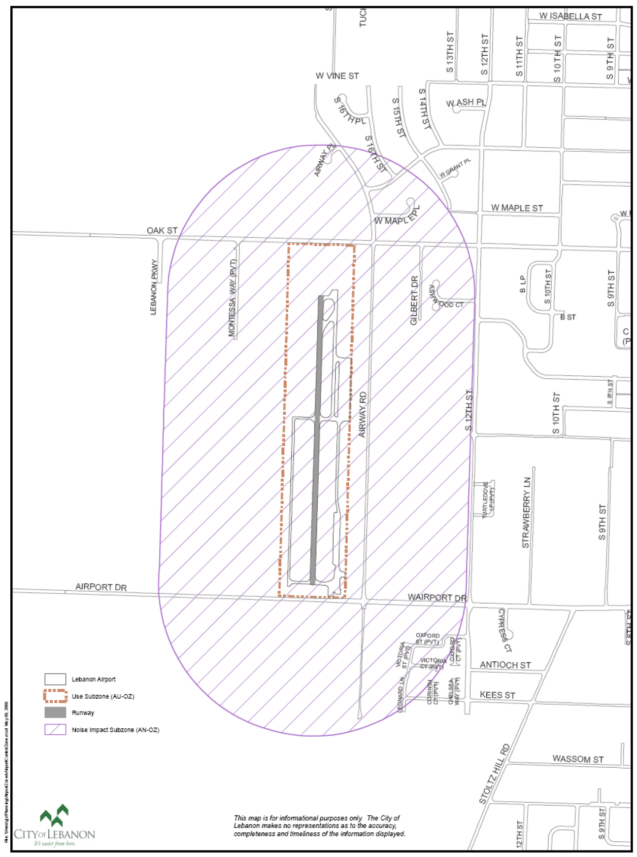
Figure 16.11.020-2: Lebanon Airport's Airport Safety Zone (AS-OZ)
Showing the Runway, Primary Surface, Airport Direct Impact Area, Runway Protection
Zone, Approach Surfaces
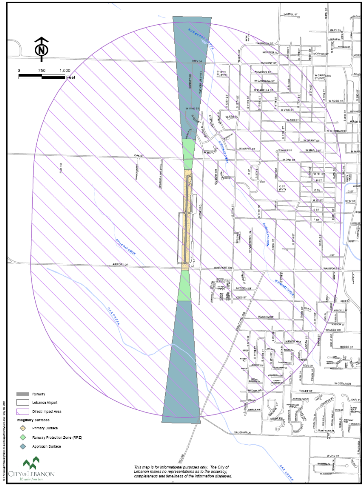
Figure 16.11.020-3: Lebanon Airport's Airport Safety Zone (AS-OZ)
Showing the Runway, Primary Surface, Transitional Surfaces, Horizontal Surface, and
Conical Surface
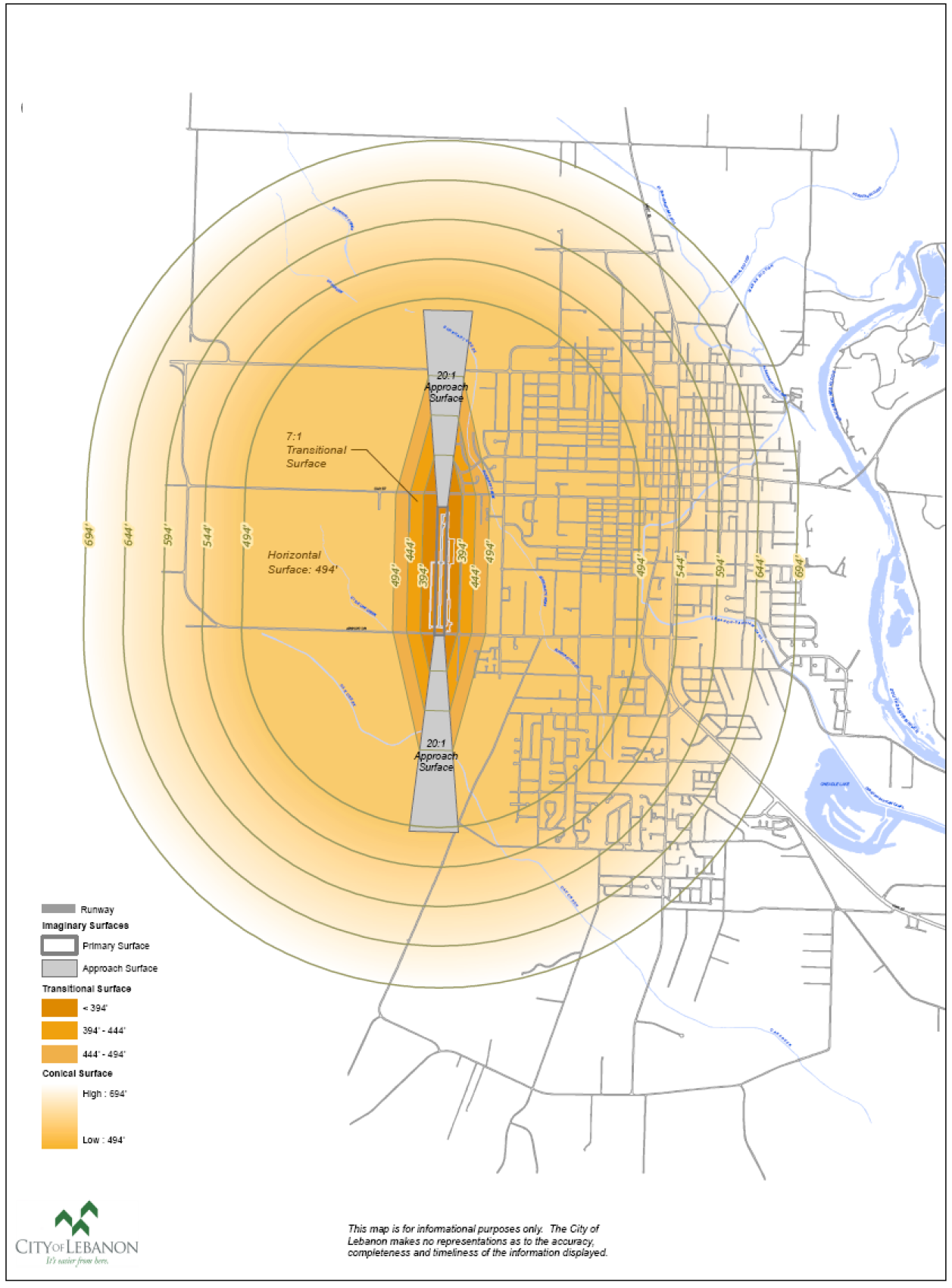
C.
Notification of Land Use and Permit Applications. Within the described overlay zones and/or their subcomponents, except as otherwise provided herein, written notice of applications for land use or limited land use decisions, including comprehensive plan or zoning amendments, shall be provided to the airport sponsor in the same manner as notice is provided to property owners entitled by law to written notice of land use or limited land use applications. At the time of adoption of this code, the airport sponsor is the Oregon Department of Aviation. Hereafter in this code, the sponsor will be referenced as the Oregon Department of Aviation for administrative convenience, but the provisions of this code apply as to any lawful successor-in-interest to the Oregon Department of Aviation. Notices are subject to the following provisions and exceptions.
1.
Notice Requirements. Notice shall be provided to the airport sponsor (the Oregon Department of Aviation) when the property, or a portion thereof, that is subject to the land use or limited land use application is located within one thousand five hundred from feet from both sides and ends of a runway (the AC overlay zone area, or noise impact boundary and airport use zone) and/or five thousand feet from both sides and ends of a runway (the AS overlay zone that includes the airport direct impact area as well as the runway protection zone and approach surface).
a.
Notice of land use and limited land use applications shall be provided within the following timelines:
i.
Notice of land use or limited land use applications involving public hearings shall be provided prior to the public hearing at the same time that written notice of such applications is provided to property owners entitled to such notice.
ii.
Notice of land use or limited land use applications not involving public hearings shall be provided at least twenty days prior to entry of the initial decision on the land use or limited land use application.
b.
Notice of the decision on a land use or limited land use application shall be provided to the airport sponsor (Oregon Department of Aviation) within the same timelines that such notice is provided to parties to a land use or limited land use proceeding.
2.
Notice of Water Impoundment. A person submitting a land use application or limited land use application that will result in a water impoundment larger than one-fourth acre within ten thousand feet of an airport shall provide notice of the application to the Oregon Department of Aviation.
3.
Exceptions. Notices required under subsections a. and b. directly above of this section need not be provided to the airport sponsor (Oregon Department of Aviation) where the land use or limited land use application meets all of the following criteria:
a.
Allows structures of less than thirty-five feet in height;
b.
Involves property located entirely outside the approach surface and transition surface;
c.
Does not involve industrial, mining or similar uses that emit smoke, dust or steam; sanitary landfills or water impoundments; or radio, radiotelephone, television or similar transmission facilities or electrical transmission lines; and
d.
Does not involve wetland mitigation, enhancement, restoration or creation.
D.
Height Limitations on Allowed Uses in Underlying Zones, and Trimming of Trees. All uses permitted by the underlying zone shall comply with the height limitations in this section. When height limitations of the underlying zone are more restrictive than those of the airport overlay zones, the underlying zone height limitations shall control.
1.
Except as provided in subsections (2) and (3) immediately following, no structure or tree, plant or other object of natural growth shall penetrate an airport imaginary surface.
2.
For areas within Airport Imaginary Surfaces but outside the approach and transition surfaces, where the terrain is at higher elevations than the airport imaginary surfaces such that existing structures and permitted development penetrate or would penetrate the airport imaginary surfaces, the city may authorize structures up to thirty-five feet in height.
3.
Other height exceptions or variances may be permitted when supported in writing by the airport sponsor (Oregon Department of Aviation) and the FAA. Applications for height variances shall follow the procedures for other variances and shall be subject to such conditions and terms as recommended by the department of aviation and the FAA.
4.
Trimming Trees. The airport sponsor (Oregon Department of Aviation), or its agents, shall be permitted (at times and under stipulations mutually agreed to in writing by property owners and the airport sponsor or its agents) to enter onto private property to reduce the height of trees that exceed the height limitations herein established. The airport sponsor, and/or its agents shall be responsible for all such work and legally liable for any claims of damage caused by such work.
E.
Application Procedures for Land Use Review. An applicant seeking a land use or limited land use approval in an area within the airport overlay zones shall provide the following information in addition to any other information required in the permit application:
1.
A map or drawing showing the location of the property in relation to the airport imaginary surfaces. The city's community development division shall provide the applicant with appropriate base maps upon which to locate the property.
2.
Elevation profiles and a site plan, both drawn to scale, including the location and height of all existing and proposed structures, measured in feet above mean sea level.
3.
And, additionally, if a height variance is requested, letters of support from the airport sponsor (Oregon Department of Aviation) and the FAA as well. The letter(s) shall include specific references to the particular variance and proposed findings for approval.
F.
Land Use Compatibility Requirements.
1.
Overview. Applications for land use or building permits for properties within the boundaries of the AC overlay zone and/or the airport imaginary surfaces stipulated below in this subsection shall comply with the requirements of this section as provided herein. When compatibility issues arise, the planning official or hearings body shall take reasonable steps to eliminate or minimize the incompatibility by choosing the most compatible location, design, or conditions for the boundary or use (see applicable ORS and OARs). Decisions on compatibility shall further the state's policy established by applicable ORS: In recognition of the importance of the network of airports to the economy of the state and the safety and recreation of its citizens, the policy of the State of Oregon is to encourage and support the continued operation and vitality of Oregon's airports. To further these ends, the planning official or hearings body may impose reasonable conditions for new uses at the airport to ensure compatibility with existing and planned land uses surrounding the airport (applicable ORS and OARs). In addition, the planning official or hearings body may impose reasonable conditions to protect the public safety (see applicable ORS and OARs). "Compatible," as used in this section, is not intended as an absolute term meaning no interference or adverse impacts of any type with surrounding land uses (see applicable ORS and OARs).
2.
Noise. Within airport noise impact zone (AN-OZ), land uses shall be established consistent with the levels identified in applicable ORS and OARs.
a.
Applicants for any subdivision or partition approval or other land use approval or building permit affecting land within airport noise impact boundaries, shall sign and file with the City of Lebanon and record in the Linn County Book of Records, a Declaration of Anticipated Noise declaring that the applicant and his successors will not now, or in the future complain about or otherwise contest or challenge the allowed airport activities at the adjacent airport (The city may provide a model declaration based on a state template).
b.
In areas where the noise level is anticipated to be at or above fifty-five average day-night sound level (Ldn), prior to issuance of a building permit for construction of a noise sensitive land use (real property normally used for sleeping or as a school, church, hospital, public library or similar use), the permit applicant shall be required to demonstrate that a noise abatement strategy will be incorporated into the building design that will achieve an indoor noise level equal to or less than fifty-five Ldn (Note: FAA Order 5100.38A, Chapter 7, provides that interior noise levels should not exceed forty-five decibels in all habitable zones).
3.
Outdoor Lighting. No new or expanded industrial, commercial or recreational use shall project lighting directly onto an existing runway or taxiway or into existing airport approach surfaces except where necessary for safe and convenient air travel. Lighting for these uses shall incorporate shielding in their designs to reflect light away from airport approach surfaces (see applicable ORS and OARs). No use shall imitate airport lighting or impede the ability of pilots to distinguish between airport lighting and other lighting.
4.
Glare. No glare producing material, including, but not limited to unpainted metal or reflective glass, shall be used on the exterior of structures located within an approach surface and/or the AC zone lands where glare could impede a pilot's vision.
5.
Industrial Emissions. No new industrial, mining or similar use, or expansion of an existing industrial, mining or similar use, shall, as part of its regular operations, cause emissions of smoke, dust or steam that could obscure visibility within airport approach surfaces, except upon demonstration, supported by substantial evidence, that mitigation measures imposed as approval conditions will reduce the potential for safety risk or incompatibility with airport operations to an insignificant level. The review authority shall impose such conditions as necessary to ensure that the use does not obscure visibility.
6.
Communications Facilities and Electrical Interference. No use shall cause or create electrical interference with navigational signals or radio communications between an airport and aircraft. Proposals for the location of new or expanded radio, radiotelephone, and television transmission facilities and electrical transmission lines within the AC overlay zone shall be coordinated with the department of aviation and the FAA prior to approval. Review and approval of all radio, radiotelephone, and television transmission facilities and electrical transmission lines on property located under the airport's imaginary surfaces shall be coordinated with the state's department of aviation (see applicable ORS and OARs).
7.
Use Prohibitions in the Runway Protection Zone (RPZ). Notwithstanding the underlying zone, the following uses are prohibited in the RPZ (see applicable ORS and OARs):
a.
New residential development.
b.
New public assembly facilities.
8.
Restrictions on Housing Densities Beyond the Outer Edge of the Airport's RPZ. The areas located directly beyond Lebanon State Airport's RPZ are critical zones where aviation related accidents will most likely occur. To minimize the risks of damage or injury to persons and properties on the ground from potential aviation related accidents, the following densities on housing development are established in portions of the approach surface (see Section 16.11.020.B.5.a), the trapezoidal shaped area encompassed by "imaginary" extensions north and south of the runway protection zones (see Figure 16.11.020-4):
a.
Two dwelling units per acre within five hundred feet of the outer edge of the airport's RPZ.
b.
Two dwelling units per acre within five hundred to one thousand five hundred feet of the outer edge of the RPZ.
c.
Four units per acre within one thousand five hundred to three thousand feet of the outer edge of the RPZ.
9.
Sanitary Landfills. No sanitary landfills shall be permitted within five thousand feet of the airport runway if it is to be used by only piston-type aircraft, or within ten thousand feet of the airport runway if it will be used by turbojet aircraft.
10.
Dimensional Standards.
a.
Minimum lot size and setbacks shall be those indicated in the underlying zone with which the AC zone or AS zone is combined.
b.
Where an area is covered by more than one height limitation, the more restrictive shall prevail.
Figure 16.11.020-4: Lebanon Airport's Restrictions on Housing Densities
Beyond the Outer Edge of the Airport's RPZ
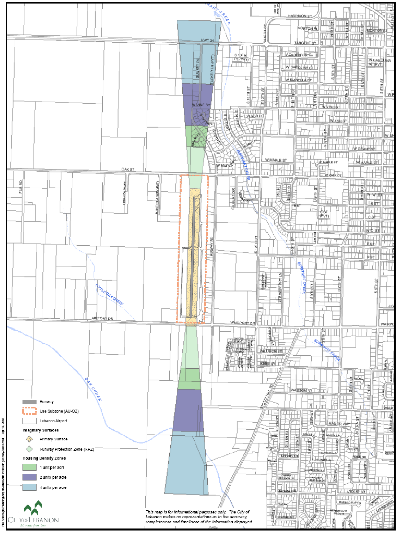
G.
Uses Permitted Outright in the Airport's Use Zone (AU-OZ). The following uses and activities are permitted outright in the airport's use zone (see applicable ORS and OARs):
1.
Customary and Usual Aviation-Related Activities. Includes but is not limited to takeoffs and landings; aircraft hangars and tie-downs; construction and maintenance of airport facilities; fixed based operator facilities; a residence for an airport caretaker or security officer; and other activities incidental to the normal operation of an airport. Except as provided in this [chapter], "customary and usual aviation-related activities" do not include: (1) residential, and (2) nonaviation related commercial, industrial, manufacturing and other uses.
2.
Air Passenger and Air Freight Services and Facilities. Such services and facilities must be at levels consistent with the classification and needs identified in the Oregon Department of Aviation Airport System Plan, as determined by the airport sponsor.
3.
Emergency Medical Flight Services. Includes activities, aircraft, accessory structures, and other facilities necessary to support emergency transportation for medical purposes. Emergency medical flight services do not allow the establishment of hospitals, medical offices, medical labs, medical equipment sales, and other similar uses in the AU-OZ.
4.
Law Enforcement and Firefighting Activities. Includes aircraft and ground-based activities, facilities and accessory structures necessary to support federal, state or local law enforcement or land management agencies engaged in law enforcement or firefighting activities. Law enforcement and firefighting activities include transport of personnel, aerial observation, and transport of equipment, water, fire retardant and supplies.
5.
Search and Rescue Operations. Includes aircraft and ground based activities that promote the orderly and efficient conduct of search or rescue related activities.
6.
Flight Instruction Activities, Facilities and Accessory Structures. Includes such facilities and services as are located at airport sites that provide education and training directly related to aeronautical activities. Flight instruction includes ground training and aeronautic skills training, but does not include schools for flight attendants, ticket agents or similar personnel.
7.
Aircraft Service, Maintenance and Training. Includes activities, facilities and accessory structures provided to teach aircraft service and maintenance skills and to maintain, service, refuel or repair aircraft or aircraft components. "Aircraft service, maintenance and training" includes the construction and assembly of aircraft and aircraft components for personal use, but does not include activities, structures or facilities for the manufacturing of aircraft or aircraft-related products for sale to the public.
8.
Aircraft Rental. Includes activities, facilities and accessory structures that support the provision of aircraft for rent or lease to the public.
9.
Aircraft Sales and the Sale of Aeronautic Equipment and Supplies. Includes activities, facilities and accessory structures for the storage, display, demonstration and sales of aircraft and aeronautic equipment and supplies to the public but not including activities, facilities or structures for the manufacturing of aircraft or aircraft-related products for sale to the public.
10.
Crop Dusting Activities. Includes activities, facilities and structures accessory to crop dusting operations. Crop dusting activities include, but are not limited to, aerial application of chemicals, seed, fertilizer, defoliant and other chemicals or products used in a commercial agricultural, forestry or rangeland management setting.
11.
Agricultural and Forestry Activities. Includes activities, facilities and accessory structures that qualify as a "farm use" as defined in applicable ORS or "farming practice" as defined in applicable ORS.
H.
Uses Permitted in the Use Zone (AU-OZ) of the Airport Subject to the Acceptance of the Airport Sponsor. In addition to the uses allowed in the underlying zone, the following uses and activities and their associated facilities and accessory structures are permitted in the use zone of the Lebanon Airport upon demonstration of acceptance by the airport sponsor (Oregon Department of Aviation) (see applicable ORS and OARs).
1.
Aeronautic Recreational and Sporting Activities. Includes activities, facilities and accessory structures at airports that support recreational usage of aircraft and sporting activities that require the use of aircraft or other devices used and intended for use in flight. Aeronautic recreation and sporting activities authorized under this paragraph include, but are not limited to: fly-ins; glider flights; hot air ballooning; ultralight aircraft flights; displays of aircraft; aeronautic flight skills contests; and gyrocopter flights, but do not include flights carrying parachutists or parachute drops (including all forms of skydiving).
2.
Flights Carrying Parachutists, and Parachute Drops onto an Airport. Flights carrying parachutists, and parachute drops (including all forms of skydiving) onto an airport, may be permitted but only upon demonstration that the parachutist business has secured approval to use a drop zone that is at least ten contiguous acres. The configuration of the drop zone shall roughly approximate a square or a circle and may contain structures, trees, or other obstacles only if the remainder of the drop zone provides adequate areas for parachutists to land safely.
I.
Conditional Uses and Additional Requirements.
1.
Conditional Uses in Underlying Zone(s) and in the Airport's Use Zone (AU-OZ). Within the airport's use zone any uses permitted conditionally in the underlying zone(s) with which the AC zone is combined shall be allowed conditionally except as provided in Section 16.11.020.F (land use compatibility requirements) or as outright permitted uses (Section 16.11.020.G). Applications may be subject to review under the provisions of Chapter 16.21 of this code, as well as the provisions directly below.
2.
Additional Requirements Within the AC Zone (AC-OZ). As a condition of approval of any conditional use proposed within the AC zone (AC-OZ), the planning official or hearings body may require:
a.
An increase in required setbacks.
b.
Additional off-street parking and loading facilities and building standards.
c.
Limitations on signs or lighting, hours of operation, points of ingress and egress and building heights.
d.
Additional landscaping, screening and other improvements.
e.
Use of glare-resistant materials in construction or other methods likely to reduce operating hazards.
f.
Other conditions considered necessary to achieve compliance with this code and applicable policies of the comprehensive plan and state law.
J.
Nonconforming Uses.
1.
These regulations shall not be construed to require the removal, lowering or alteration of any structure not conforming to these regulations. These regulations shall not require any change in the construction, alteration or intended use of any structure, the construction or alteration of which was begun prior to the effective date of this overlay zone.
2.
No land use or limited land use approval or other permit shall be granted that would allow a nonconforming use or structure to become a greater hazard to air navigation than it was on the effective date of the airport overlay zones described this section.
K.
Variances.
1.
Any person desiring to erect or increase the height of any structure or use not in accordance with the provisions of this code may apply for a variance (see Chapter 16.29 of this code).
2.
Application for variance must be accompanied by a determination from the Oregon Department of Aviation and the Federal Aviation Administration (FAA) as to the effect of the proposal on the safe and efficient use of navigable airspace.
3.
Any variance granted may be conditioned so as to require the owner of the structure to install, operate and maintain obstruction markers, at the owner's expense.
L.
Permanent Water Impoundments within Approach Surfaces and the Airport's Direct Impact Zone.
1.
Any use or activity that would result in the establishment or expansion of a permanent water impoundment shall comply with the requirements of this section (see applicable ORS and OARs).
2.
New or expanded permanent water impoundments of one-quarter acre in size or larger shall be prohibited:
a.
Within an approach surface and within five thousand feet from the end of a runway; or
b.
On land owned by the airport sponsor (Oregon Department of Aviation) that is necessary for airport operations.
3.
New or expanded permanent water impoundments of one-quarter acre in size or larger shall be prohibited within five thousand feet from the end or edge of a runway, pending a valid and ODA approved bird strike study.
M.
Air Navigation Easement within Approach Surfaces and the AC Overlay Zone.
1.
State Department of Aviation Requirements. The state department of aviation, in response to notification by the City of Lebanon of land use actions within the AC overlay zone (AC-OZ) or the approach surfaces, may request in writing that the owners of properties that are the subjects of such applications submit an air navigation easement to the state department of aviation and the City of Lebanon as part of the review process.
2.
Land Use Applications that Could Require an Air Navigation Easement. Applications subject to this provision include land use or limited land use decisions for:
a.
Building permits.
b.
New residential, commercial, industrial, institutional or recreational buildings or structures intended for habitation or occupancy by humans or animals.
c.
Expansions of such buildings or structures by the lesser of fifty percent or one thousand square feet.
3.
Acceptable Air Navigation Easement Form and Filing Requirements.
a.
The air navigation easement shall be in a form acceptable to the airport sponsor (Oregon Department of Aviation).
b.
This easement shall be signed and recorded in the deed records of Linn County with copies on file with the airport sponsor and the City of Lebanon.
Table 16.11.020-2: Summary of Special Uses and Regulations in the Airport Overlay Zones
(Ord. 2766 § 1 (part), 2008; Ord. No. 2957, § 3(Exh. A), 5-12-2021; Ord. No. 3036, § 3(Exh. A), 6-11-2025)
16.11.030 - Riparian protection overlay zone (RIP-OZ).
A.
Purpose. The primary purposes for the creation of the riparian protection overlay zone (RIP-OZ) along the South Santiam River, Oak Creek, and Cheadle Lake corridors are to: maintain and enhance water quality; prevent property damage during floods and storms; limit development activity in designated riparian corridors; protect native plant species; maintain and enhance fish and wildlife habitats; preserve and where appropriate enhance public access to and from these water corridors; maintain viewsheds; and conserve scenic and recreational values of riparian areas.
B.
Establishment of the Riparian Corridor Overlay Zone Boundary. The riparian protection overlay zone (RIP-OZ) consists of two component areas: the area within the channel banks, and the protective overlay zone.
1.
Two Components. The two components of the riparian protection overlay zone (RIP-OZ) are defined as:
a.
Top of Bank and Bankfull Stage. The area within the channel limits of a water feature or water body (from top of one bank to top of the opposite bank) listed in subsection B.1.b immediately. For a given stream, river, or channel the top of bank is the same as the "bankfull stage." The "bankfull stage" is defined as the stage or elevation at which water overflows the natural banks of streams or other waters of the state and begins to inundate the upland.
b.
Minimum Overlay Zone From Top of Bank. The overlay zones measured horizontally upland from the top of bank are noted in Table 16.11.030-1 as follows:
Table 16.11.030-1: Minimum Overlay Zone From Top of Bank
In Cubic Feet Per Second (CFS)
c.
State or Federal Laws that Regulate Protected Lands, Water, Wetland, or Habitat Areas. The provisions of the riparian protection sub-zone do not exempt persons or property from state or federal laws that regulate protected lands, water, wetland, or habitat areas. In addition to the restrictions and requirements of this chapter, all proposed development activities within any jurisdictional wetland are also subject to state and federal agency standards and approval.
2.
Development Within the Minimum Overlay Zones Developed Prior to 1998. Areas developed prior to adoption of the ordinance originally codified with these provisions in 1998 are acknowledged as pre-existing conditions and are allowed to be maintained in their status at the time of adoption of said ordinance.
3.
Development Defined. For the purposes of this section of Chapter 16.11, "development" means buildings and any other development requiring a building permit, or any alteration of the RIP-OZ by grading or construction of an impervious surface, including paved or gravel parking areas, or installation of human made materials or devices.
C.
Limitations on Use. In addition to the requirements of the primary zone, the following limitations and exceptions shall apply:
1.
Vegetation. The removal of native vegetation or the planting of nonnative vegetation within the RIP-OZ is prohibited, except for the following uses after planning official approval using the standards of Chapter 16.15:
a.
Replacement of vegetation with native riparian species as is necessary for restoration activities.
b.
Removal of nonnative vegetation and replacement with native plant species, or the removal of invasive species as defined by Lebanon Municipal Code Chapter 8.13.
c.
For the development of water-related or water-dependent uses, provided they are designed and constructed to minimize impact on the existing riparian vegetation.
d.
Removal of emergent in-channel vegetation which has the potential to cause flooding.
e.
Removal of excess debris deposited by a flood event.
f.
Removal of trees demonstrated to be a potential hazard to property or human life.
g.
In-channel erosion or flood control measures that have been approved by the Oregon Department of State Lands (DSL), the U.S. Army Corps of Engineers or another state or federal regulatory agency.
h.
The planning official may, upon receipt of a landscape plan, approve new vegetation and other landscape changes with the RIP-OZ, upon reasonable assurance of the protection of existing native riparian vegetation, and the river bank as well as existing viewsheds and rights of public access.
2.
Building, Paving and Grading Activities. Within the RIP-OZ, the placement of structures or impervious surfaces, including grading and the placement of fill, is prohibited except as is stated below. Exceptions to the RIP-OZ restrictions may be made for the following uses, providing they are designed and constructed to minimize adverse impacts to the riparian area:
a.
Replacement of existing structures with structures located on the original building footprint that does not disturb additional riparian surface areas.
b.
Streets, roads, and paths which are included in the city's facility plans or are deemed necessary by the city.
c.
Water-related and water-dependent uses, including the drainage facilities, water and sewer utilities, flood control projects, and drainage pumps.
d.
Routine maintenance or replacement of existing public facilities projects and public emergencies, including emergency repairs to public facilities.
e.
In-channel erosion or flood control measures that have been approved by the Oregon Department of State Lands (DSL), the U.S. Army Corps of Engineers or any other state or federal regulatory agency.
3.
Land Divisions and Property Line Adjustments. Land divisions and property line adjustments which result in parcels that cannot be developed in conformance with riparian protection overlay zone (RIP-OZ) regulations shall be prohibited.
4.
Site Maintenance. The limitations imposed by this section do not preclude the routine maintenance of existing site improvements including lawns, natural and planted vegetation and landscaping, and structures. Maintenance trimming of existing trees shall be kept at a minimum and under no circumstances can trimming maintenance be so severe as to compromise the tree's health, longevity, and resource functions. The planting of new vegetation within the RIP-OZ shall be in accordance with Section 16.11.030.C.1 of this Chapter.
5.
Hazardous Tree Removals. Hazardous trees are those that pose an obvious and immediate health, safety, or welfare threat to persons or property. Hazardous tree removal, except in emergency circumstances, is required to be reviewed by city staff. Any trees removed are required to be replaced by like native species or alternate approved native species.
D.
Procedures. The procedures for reviewing any development within the riparian protection overlay zone are as follows:
1.
Review by the Planning Official. Any proposed development; placement of human-made structures/devices or native vegetation removal proposal within the RIP-OZ shall be submitted to the planning official. Depending on the action requested, the planning official will process the application as an administrative review or refer the proposal to the planning commission for a public hearing and decision (see Chapter 16.20 for review provisions).
2.
Basic Submittal Requirements. The applicant shall be responsible for the preparation of a map showing the precise location of the top-of-bank, one-hundred-year flood elevation, wetland edge (if present), riparian setback, significant vegetation, site improvements or other relevant primary features. The specific information to be indicated on the map will differ according to application type, and therefore the specific information to be provided by the applicant will be identified by the planning official.
3.
Supplemental Submittal Requirements. At the time of application the planning official may request that the applicant submit supplemental information, which may include the following:
a.
Grading Site Plan. The grading plan shall include information on terrain, drainage, location of proposed and existing structures, and finished elevations.
b.
Vegetation Report. This report shall consist of a survey of existing native vegetation and proposed alterations. Where the removal of native vegetation is proposed, measures for re-vegetation and enhancement with native plant species will be included. The city shall have and maintain a list of native vegetation species.
E.
Hardship Variances. For any existing lot or parcel demonstrated to have been rendered not buildable by application of this chapter and/or when a riparian corridor (RIP-OZ) map error has been verified, the property owner may apply for a hardship variance for waiver of land development restrictions and prohibitions. A decision regarding hardship variances will follow the procedures and standards of Chapter 16.29, Variances.
F.
Restoration and Enhancement Exceptions. Permanent alteration of the riparian area by placement of structures or impervious surfaces may be permitted by the planning official upon demonstration that equal or better protection for the remaining on-site riparian protection overlay zone area will be ensured through restoration of riparian areas, enhanced buffer treatment or similar measures. In no case shall such alterations occupy more than fifty percent of the width of the riparian area measured from the upland edge of the corridor.
G.
Appeals. Planning official and planning commission decisions can be appealed pursuant to the procedures described in Chapter 16.20 of this code.
(Ord. 2766 § 1 (part), 2008; Ord. No. 3036, § 3(Exh. A), 6-11-2025)
16.11.040 - Steep slope development overlay zone (SSD-OZ).
A.
Purpose. Steep slope development overlay zone (SSD-OZ) ensures that development in areas with steep slopes (equal to or greater than fifteen percent):
1.
Minimizes the potential for earth movement and resultant hazards to life and property.
2.
Protects water quality by minimizing soil erosion and siltation.
3.
Retains and protects natural vegetation, natural water features and drainageways, scenic quality and open space by minimizing vegetation removal in sloped areas.
4.
Assures the compatibility of new development with surrounding areas.
5.
Encourages site and building design that is consistent with the natural topography in order to minimize the cost of providing public infrastructure.
6.
Provides for adequate access for emergency services; and otherwise protects the public health and safety.
B.
Applicability.
1.
The steep slope development overlay zone shall apply in residential zones within the city limits and the city's UGA to areas where the percent of slope is fifteen percent or greater.
2.
Development is prohibited on slopes of equal to or greater than thirty percent unless the planning commission finds that adverse project impacts can be effectively mitigated.
3.
All proposed development on hillsides with a slope equal to or greater than fifteen percent shall be accompanied by detailed site specific investigation and report prepared by an engineering geologist registered in the State of Oregon. This report shall address the physical nature of the site, the impacts of the proposed development and its suitability as presented. See Section 16.11.040.F below for the reports that are required where the buildable portion of the land to be developed exceeds fifteen percent average slope.
4.
The creation of a lot or parcel through the subdivision or partition process on a site with slope(s) equal to or greater than thirty percent, may only be approved if (a) it is demonstrated to be buildable according to a detailed site specific report prepared by an engineering geologist registered in the State of Oregon as noted above, and (b) the lot or parcel meets or exceeds the minimum lot size and frontage requirements for lots and parcels on slopes greater than fifteen percent (see Table 16.11.040-1).
5.
All grading, retaining wall design, drainage, and erosion control plans for development on Hillside Lands shall be designed by a geotechnical expert (see Section 16.11.030.6 below). All cuts, grading or fills shall conform to Chapter 70 of the Uniform Building Code. Erosion control measures on the development site shall be required to minimize the solids in runoff from disturbed areas.
C.
Review.
1.
Proposed development within a steep slope development overlay zone, as determined by the planning official, may be reviewed as a:
a.
Separate administrative review procedure submitted concurrently with the applicable application for the basic land use request (e.g., a conditional use, property line adjustment, a partition, subdivision plan, or planned development); or,
b.
Part of the review process for the basic land use request (e.g., a conditional use, property line adjustment, a partition, subdivision plan, or planned development).
c.
The applicant may request that the proposed steep slope development review process be consolidated with the basic land use request and review process (as noted in Section 16.11.040.C.1.b immediately above).
2.
If a proposed development within a steep slope development overlay zone is processed as a separate administrative review (as per Section 16.11.040.C.1.a immediately above), the decision and conditions of approval will be separate from but in addition to those of the basic land use request process, decision and conditions of approval. Such a separate administrative review shall also require a separate fee.
3.
If a proposed development within a steep slope development overlay zone is processed as a consolidated part of the review process for the basic land use request (as per Section 16.11.040.C.1.b above), the decision and conditions of approval will be part of the basic land use decision and conditions of approval. Such a consolidated review shall not require a separate fee.
4.
A complete application together with all required materials shall be submitted to the planning official prior to the appropriate review of the request as specified in Chapter 16.20 of this code.
D.
Development Density Options.
1.
Options. A developer has three options for the development of steeply sloped land. The first option, Option "A", is designed to correlate minimum lot sizes to the average slope of the development area. The second option, Option "B", is designed to allow for a density transfer bonus to stimulate development on those portions of the development area where the slope of the land is less than fifteen percent. The third option could be a combination of Options "A" and "B" as proposed by the applicant and approved by the review authority.
2.
Calculations. All of the calculations noted below as required for the three options, must be performed and certified by a certified professional surveyor.
3.
Option "A"—Average Slope—Minimum Lot Size.
a.
Residential Low Density Zone Development Standards. The site development standards and requirements of the residential low density zone (Z-RL) shall apply, with the exception of the minimum lot size and duplex standards.
b.
Determination of Minimum Lot Size on Steep Slopes—Three Step Process. Determination of minimum lot size where the slope is fifteen percent or greater is a three step process.
i.
Step "A-1." Determine the area of the parcel where the slope of the land is: (1) less than fifteen percent, (2) from fifteen percent to less than thirty percent, (3) thirty percent or greater.
Use the following formula to determine the percent of slope:
(V/H) × 100 = % slope
V = Vertical distance between contours (elevation change)
H = Horizontal distance between contours
Indicate the portions of the development area that are less than fifteen percent; from fifteen percent to less than thirty percent; and thirty percent or greater, then use a planimeter to determine the land area of each category.
ii.
Step "A-2." Determine the average slope of the portion of the development area where the slope of land is from fifteen percent to less than thirty percent by using the following formula:
S = 0.00229 I × (L / A)
Where:
S = Average percent of slope for the area where the slope ranges from fifteen percent to less than thirty percent.
I = Contour interval, (not greater than ten feet).
L = Summation of length of the contour lines within the area where the slope is from fifteen percent to less than thirty percent.
A = Area in acres of the portion of the parcel where the slope is from fifteen percent to less than thirty percent.
iii.
Step "A-3." Determine the minimum lot size for the portion of the development area where the slope of the land is greater than fifteen percent by using Table 16.11.040-1.
Table 16.11.040-1: Minimum Lot Size and
Frontage on Slopes Greater Than Fifteen Percent
4.
Option "B" Density Transfer Bonus.
a.
Density Transfers and the Preservation of Natural Slopes. In order to promote the preservation of natural slopes greater than fifteen percent, and encourage solar access, development density transfer is encouraged when dividing land. The density transfer is only feasible where there are sizable portions of the development area which have slopes less than fifteen percent.
b.
Determination of the Density Transfer Bonus on Steep Slopes—Four Step Process. Determination of the density transfer bonus is a three step process:
i.
Step "B-1." Determine the area of the parcel where the average slope of the land is:
(A)
Less than fifteen percent.
(B)
From fifteen percent to less than thirty percent.
(C)
Thirty percent or greater.
ii.
Step "B-2." Determine the average slope of the area of the parcel where the average slope of the land is from fifteen percent to less than thirty percent by using the formula identified in Option "A," Step "A-2";
iii.
Step "B-3." Determine the number of potential lots for the total development area which could have been permitted, for the portion of the parcel where the average slope is greater than fifteen percent, if the average slope option had been considered by using Table 16.11.040-1 in Option "A," Step "A-3";
iv.
Step "B-4." Multiply the number of potential lots by 1.2 to determine the density that may be transferred to those sections of the development area where the slopes are less than fifteen percent. In no case shall the density of the developed portion of the site exceed eight dwelling units per developable acre, (i.e., excluding streets and open space). Land of greater than fifteen percent average slope subject to density transfer provisions shall be maintained as permanent open space or dedicated for park use. Modification of standards as stated in Section 16.11.040.H of this chapter may be applied to the entire development area.
E.
Street Grade Standards.
1.
Hillside Contouring. Streets shall be contoured in hillside areas to minimize environmental and scenic disruption.
2.
Street Grades.
a.
As noted in Table 16.13.030-2 (Chapter 16.13 of this code) and in the Lebanon Transportation System Plan, the following maximum street grades are the adopted standards of the city (also duplicated in Table 16.11.040-2 below).
Table 16.11.040-2: Maximum Street Grades
b.
Street grades should be less than the fifteen percent maximum local street standard specified in Chapter 16.13, and other relevant sections of this code, except where topographical conditions make it impractical to be less than the fifteen percent maximum standard, subject to the following conditions with approval of the city engineer:
i.
Except for lots, parcels and roads created prior to the adoption of the 1980 Comprehensive Plan and the 1980 Zoning Ordinance, no new driveways or intersections shall be permitted where street grades exceed fifteen percent:
ii.
No new street with a grade of fifteen percent shall be permitted for a distance of more than two hundred feet.
iii.
In no case shall a new street grade exceed fifteen percent.
iv.
New street grades must be approved by the Lebanon Fire District, as per adopted fire code standards.
F.
Reports Required. Where the buildable portion of the land to be developed exceeds fifteen percent average slope, the following reports shall be required and their conclusions applied in order to prevent or mitigate possible hazards to life and property and adverse impacts on the natural environment, consistent with the purpose of this steep slope development overlay zone (SSD-OZ).
1.
Geotechnical Evaluations.
a.
This evaluation shall include data regarding the geology of the site, the nature, distribution, and strength of existing soils, conclusions and recommendations for grading procedures, design criteria for corrective measures, and options and recommendations to maintain soil and slope stability and minimize erosion of the site to be developed in a manner imposing the minimum variance from the natural conditions.
b.
The investigation and report shall be prepared by a civil engineering geologist or a geotechnical engineer certified by the State of Oregon.
c.
Geotechnical Report Standards. To be accepted, a geotechnical evaluation shall:
i.
Be a stamped engineering geologic report that meets or exceeds the standards for such investigations according to the Oregon State Board of Geologist Examiners and implementing the newest technology available (e.g., LIDAR data and "bare earth modeling"). The Oregon State Board of Geologic Examiners Guidelines for Preparing Engineering Geologic Reports in Oregon can be obtained from the Oregon State Board of Geologist Examiners' (see the Board's webpage). The latest edition shall be used.
ii.
Include a comprehensive engineering geological/geotechnical engineering investigation and report for the site:
(A)
The investigation must appropriately include field data of surface and subsurface earth from statistically representative appropriate sampling, such as bore holes, with special concern in identified potential land slide areas and areas of historic or proposed fill. It is expected that the investigation must also include an evaluation of seasonal hydrogeology.
(B)
The report must include an evaluation of all data and recommend design criteria and standards for construction of each type of improvement proposed. In the professional practice of engineering geology and geotechnical engineering, it is expected that the report will evaluate the types and frequency of sampling, hydrogeologic effects on lands and improvements, erosion prevention/storm water management, and structural/geologic stability.
iii.
Independent Review. If needed, as determined by the city, the applicant shall pay for an independent verification analysis and review of the applicant's investigation and report. Such an independent review shall be performed by a geotechnical expert (civil engineering geologist or a geotechnical engineer certified by the State of Oregon) selected by the city.
2.
Grading Plan Report. This plan shall include the following information:
a.
Existing and proposed details and contours (five-foot intervals) of property.
b.
Details of terrain and area drainage.
c.
Location of any existing buildings or structures on the property where the work is to be performed, the location of any existing buildings or structures on land of adjacent owners which are within one hundred feet of the property or which may be affected by the proposed grading operations, and proposed or approximate locations of structures relative to adjacent topography.
d.
The direction of drainage flow and the approximate grade of all streets with the final determination to be made in accordance with Section 16.11.040.F.5 of this chapter.
e.
Limiting dimensions, elevations, or finished contours to be achieved by the grading, including all cut and fill slopes, proposed drainage channels, and related construction.
f.
Detailed plans and locations of all surface and subsurface drainage devices, walls, dams, sediment basins, storage reservoirs, and other protective devices to be constructed with, or as a part of, the proposed work, together with a map showing drainage areas, the complete drainage network, including outfall lines and natural drainageways which may be affected by the proposed development, and the estimated run-off of the area served by the drains.
g.
A schedule showing when each stage of the project will be completed, including the total area of soil surface which is to be disturbed during each stage, and estimated starting and completion dates; the schedule shall be drawn up to limit to the shortest possible period the time that soil is exposed and unprotected.
i.
In no event shall the existing "natural" vegetative ground cover be destroyed, removed, or disturbed more than fifteen days prior to grading or construction of required improvements.
ii.
Within fifteen days of grading or other pre-development activity that removes or significantly disturbs ground cover vegetation, exposed soil shall either be built upon (e.g., covered with gravel, a slab foundation or other construction), landscaped (e.g., seeded or planted with ground cover) or otherwise protected.
h.
The grading plan shall be prepared by a geotechnical expert (civil engineering geologist or a geotechnical engineer certified by the State of Oregon).
3.
Tree Removal Plans and Tree Felling Permits.
a.
Tree removal on slopes equal to or greater than fifteen percent for development (not including forestry) shall require the submittal of a tree removal plan and require a tree felling permit (an administrative review process).
b.
A tree removal plan and tree felling permit is needed for each lot. All trees proposed to be removed on a lot may be included on the same tree removal plan and tree felling permit application, or the developer may chose to submit multiple applications for each lot.
c.
Development shall be designed to preserve the maximum number of trees on a site, and shall be shown as part of the tree removal plan.
d.
The development shall follow the standards for fuel reduction if the development is located in wildfire lands (see Section 16.11.030.7 below), and documentation shall be shown as part of the tree removal plan.
e.
When justified by findings of fact, the review authority may approve the removal of trees for one or more of the following conditions:
i.
The tree(s) is (are) located within the building envelope.
ii.
The tree(s) is (are) located within the wildfire defense plan envelope and compromises the efficacy of the fire defense plan (see Section 16.11.040.G below).
iii.
The tree(s) is (are) located within a proposed street, driveway, or parking area.
iv.
The tree(s) is (are) located within a water, sewer, or other public utility easement.
v.
The tree(s) is (are) determined by a certified arborist to be dead or diseased, or it constitutes an unacceptable hazard to life or property when evaluated by the standards in Section 16.11.040.G below.
vi.
The tree(s) is (are) located within or adjacent to areas of cuts or fills that are deemed threatening to the life of the tree, as determined by a landscape professional.
f.
Forestry, Timber Growing and/or Harvesting. Any commercial activity relating to the growing and harvesting of forest tree species (or timber) shall be governed by the application and review procedures specified in the Land Use Chapters (16.05 through 16.10). Forestry is considered an agricultural land use and is regulated as an "other land use" (see Tables 16.05-6, 16.06-6, 16.07-6, 16.08-6, 16.09-6, and 16.10-6, and See Glossary.)
4.
Vegetation and Development Plan Report. A proposed development plan shall be submitted, depicting building envelopes for each lot, including driveway approaches and all other associated impervious surface areas.
a.
In accordance with the provisions of Chapter 16.15 of this code, the applicant shall specify whether trees will be felled under (1) one tree felling permit (a separate administrative review process), (2) as part of the subdivision construction process, or (3) by separate tree felling permit (a separate administrative review process) for each individual lot prior to the issuance of a building permit.
b.
The plan shall be based upon the findings of the required reports in this section and the lot coverage standards of the applicable land use zone. Building envelopes shall be specified in covenants, conditions, and restrictions recorded with the subdivision plat.
5.
Verification of Slope and Grade Percentages. Prior to acceptance of the final plat, all streets shall be cross-sectioned and their center-lines staked in the field, to determine the accuracy of preliminary slope and grade percentages. If there are significant differences between preliminary and final grade and slope determinations, (e.g., density or street gradients exceed the limits set forth in this chapter) the tentative plan shall be modified to reflect the revised information and resubmitted.
G.
Urban-Wildland Interface Fire Protection Requirements. Additional fire protection requirements may be required in hillside development areas that are considered vegetated areas subject to wildfires as determined by the fire marshal.
1.
The developer in such areas shall specify in the recorded covenants, conditions and restrictions that a wildfire defense plan for each lot, approved by the fire marshal, will be required prior to the issuance of a building permit.
2.
All buildings located in or adjacent to vegetated areas subject to wildfires shall have a Class A or B roofing in accordance with the Oregon State Structural Specialty Code.
3.
The Oregon Fire Code, as adopted by the Lebanon Fire District, references the International Urban-Wildland Interface Code as a useful guide for use by the fire code official in the interface area. All development proposals shall demonstrate compliance with the International Wildland-Urban Interface Code.
H.
Modification of Transportation Standards for Steep Slope Development. The review authority may modify without a variance the following transportation related standards as they apply to an entire steep slope development area, within the following prescribed limits:
1.
The reduction of public right-of-way, pavement width, and/or requirements for the installation of sidewalks as specified in Chapter 16.13 of this code, may be allowed if provisions are made to provide off-street parking in addition to that required in Chapter 16.14 (Off-Street Parking).
2.
The review authority may require combinations of collective private driveways, shared parking areas and on-street parallel parking bays where topography, special traffic, building, grading, or other circumstances necessitate additional regulation to minimize land and soil disturbance and minimize impervious surface areas.
3.
Other development standards may not be modified under the provisions of this subsection.
(Ord. 2766 § 1 (part), 2008; Ord. No. 3036, § 3(Exh. A), 6-11-2025)
16.11.050 - Special transportation area overlay zone (STA-OZ).
A.
Purpose. The primary objective of managing state highway facilities in a special transportation area overlay zone (STA-OZ) is to provide access to community activities, businesses, and residences, as well as to accommodate pedestrian movement along the highway in a downtown central business district.
B.
Designated Boundaries. The City of Lebanon's Special Transportation District Overlay Zone is primarily located in the core of the downtown area, and focuses on portions of Highway 20. The STA boundaries established by the Oregon Transportation Commission (OTC) are as follows:
1.
Tangent Drive between the railroad and Second Street.
2.
Second Street south of Morton.
3.
Morton west of US-20.
4.
Main Street (US-20) between Rose and Oak (but not US-20 between Morton and Rose).
5.
Park Street between Rose and Oak.
C.
Characteristics and Requirements of the STA-OZ.
1.
Existing Public Street Spacing and Development Pattern. An STA accommodates the existing public street system and compact development pattern. Specific access management conditions for the designated STA on Highway 20 include the following provisions:
a.
Minimum spacing for public road approaches is either the current block spacing or the spacing parameters established in the transportation systems plan (TSP) and implemented in the city's land use ordinance(s) and comprehensive plan.
b.
Public road connections are preferred over private driveways, and in the STA, driveways accessing the state highway are discouraged. Proposals for new driveways accessing the state highway with approval by ODOT.
c.
Minimum spacing for driveways, where they are allowed and where land use patterns permit, is one hundred seventy-five feet or mid-block if the current block spacing is less than three hundred fifty feet.
2.
Need for Local Access. The designation of an STA in the City of Lebanon recognizes that the need for local access outweighs the consideration of maintaining highway mobility, except on designated freight highways (U.S. 20 and 34) where accessibility and mobility needs are balanced.
(Ord. 2766 § 1 (part), 2008; Ord. No. 3036, § 3(Exh. A), 6-11-2025)
16.11.060 - Limited use overlay zone (LU-OZ).
A.
Purpose. The limited use overlay zone may only be applied when a zoning map amendment is requested by an applicant. The purpose of the limited use overlay zone is to reduce the list of permitted uses in a land use zone to those that are suitable for a particular location. Land use zones permit a number of uses that may be considered compatible in terms of the type and intensity of activity on adjacent properties. However, on a particular property certain permitted uses may conflict with adjacent land uses. Rather than deny appropriate permitted uses because the proposed land use zone would permit an objectionable use, the limited use overlay can be used to identify the appropriate uses and require a conditional use permit for other uses normally permitted in the zone. It is the intent that the maximum number of acceptable uses be permitted so that the use of the property is not unnecessarily limited.
B.
Requirements. When the limited use overlay zone is applied, the uses permitted in the underlying land use zone shall be limited to those permitted uses specifically referenced in the ordinance adopting the limited use overlay zone. Until the overlay zone has been removed or amended, the only permitted uses in the zone shall be those specifically referenced in the adopting ordinance. Uses that would otherwise be permitted may only be allowed if a conditional use permit is approved.
C.
Procedures.
1.
The limited use overlay zone is applied at the time the underlying zone is being changed (zoning map amendment, see Chapter 16.27).
2.
Notice of a zoning map amendment shall include a statement that the planning commission may impose a LU-OZ as a condition of zone amendment.
D.
Criteria. The ordinance adopting the overlay zone shall include findings showing that:
1.
No zone has a list of permitted uses where all uses would be appropriate.
2.
The proposed zone is the best suited to accommodate the desired uses.
3.
It is necessary to limit the uses permitted in the proposed zone.
4.
The maximum number of acceptable uses in the zone have been identified and will be permitted.
E.
Adoption. The ordinance adopting the overlay zone shall by section reference, or by name, identify those permitted uses in the zone that will remain permitted uses. A permitted use description may be segmented to require a conditional use for distinct uses that may not be compatible.
F.
Official Zoning Map. The official zoning map shall be amended to show an "-(LU-OZ)" suffix on any parcel where the limited use overlay zone has been applied.
G.
Development Provisions. Development of property located within the LU-OZ shall comply with all applicable procedures or development requirements contained in this development code. Compliance with these provisions is not waived, altered or otherwise modified by the LU-OZ designation.
H.
Recording of Limited Use Overlay Zone (LU-OZ). Any ordinance adopting a limited use overlay zone designation shall be recorded in the deed and mortgage records of Linn County.
(Ord. 2766 § 1 (part), 2008; Ord. No. 3036, § 3(Exh. A), 6-11-2025)
16.11.070 - Floodplain overlay zone (FP-OZ).
A.
Authority. The State of Oregon has in ORS 197.175 delegated the responsibility to local governmental units to adopt floodplain management regulations designed to promote the public health, safety, and general welfare of its citizenry.
B.
Findings of Fact.
1.
The flood hazard areas in the City of Lebanon are subject to periodic inundation which may result in loss of life and property, health and safety hazards, disruption of commerce and governmental services, extraordinary public expenditures for flood protection and relief, and impairment of the tax base, all of which adversely affect the public health, safety, and general welfare.
2.
These flood losses may be caused by the cumulative effect of obstructions in special flood hazard areas which increase flood heights and velocities, and when inadequately anchored, cause damage in other areas. Uses that are inadequately floodproofed, elevated, or otherwise protected from flood damage also contribute to flood loss.
C.
Purpose. It is the purpose of this [chapter] to promote public health, safety, and general welfare, and to minimize public and private losses due to flooding in flood hazard areas by provisions designed to:
1.
Protect human life and health;
2.
Minimize expenditure of public money for costly flood control projects;
3.
Minimize the need for rescue and relief efforts associated with flooding and generally undertaken at the expense of the general public; minimize prolonged business interruptions;
4.
Minimize damage to public facilities and utilities such as water and gas mains, electric, telephone and sewer lines, and streets and bridges located in special flood hazard areas;
5.
Help maintain a stable tax base by providing for the sound use and development of flood hazed areas so as to minimize blight areas caused by flooding;
6.
Notify potential buyers that the property is in a special flood hazard area;
7.
Notify those who occupy special flood hazard areas that they assume responsibility for their actions; and
8.
Participate in and maintain eligibility for flood insurance and disaster relief.
D.
Methods of Reducing Flood Losses. In order to accomplish its purpose, this title includes methods and provisions for:
1.
Restricting or prohibiting development which is dangerous to health, safety, and property due to water or erosion hazards, or which result in damaging increases in erosion or in flood heights or velocities;
2.
Requiring that development vulnerable to floods, including facilities which serve such uses, be protected against flood damage at the time of initial construction;
3.
Controlling the alteration of natural floodplains, stream channels, and natural protective barriers, which help accommodate or channel flood waters;
4.
Controlling filling, grading, dredging, and other development which may increase flood damage; and
5.
Preventing or regulating the construction of flood barriers which will unnaturally divert flood waters or may increase flood hazards in other areas.
E.
Unless specifically defined below, words or phrases used in this title shall be interpreted so as to give the meaning they have in common usage.
Appeal. A request for a review of the interpretation of any provision of this [chapter] or a request for a variance.
Area of Shallow Flooding. A designated zone AO, AH, AR/AO or AR/AH on a community's flood insurance rate map (FIRM) with a one percent or greater annual chance of flooding to an average depth of one to three feet where a clearly defined channel does not exist, where the path of flooding is unpredictable, and where velocity flow may be evident. Such flooding is characterized by ponding or sheet flow.
Area of Special Flood Hazard. The land in the floodplain within a community subject to a one percent or greater chance of flooding in any given year. It is shown on the flood insurance rate map (FIRM) as zone A, AO, AH, A1-30, AE, A99, AR. "Special flood hazard area" is synonymous in meaning and definition with the phrase "area of special flood hazard."
Base Flood. The flood having a one percent chance of being equaled or exceeded in any given year.
Base Flood Elevation (BFE). The elevation to which floodwater is anticipated to rise during the base flood.
Basement. Any area of the building having its floor subgrade (below ground level) on all sides.
Below-Grade Crawl Space. Means an enclosed area below the base flood elevation in which the interior grade is not more than two feet below the lowest adjacent exterior grade and the height, measured from the interior grade of the crawlspace to the top of the crawlspace foundation, does not exceed four feet at any point.
Building. See "structure."
Critical Facility. Means a facility for which even a slight chance of flooding might be too great. Critical facilities include, but are not limited to schools, nursing homes, hospitals, police, fire and emergency response installations, installations which produce, use, or store hazardous materials or hazardous waste.
Development. Any man-made change to improved or unimproved real estate, including, but not limited to buildings or other structures, mining, dredging, filling, grading, paving, excavation or drilling operations or storage of equipment or materials.
Elevated Building. Means for insurance purposes, a nonbasement building which has its lowest elevated floor raised above ground level by foundation walls, shear walls, post, piers, pilings, or columns.
Flood or Flooding.
1.
A general and temporary condition of partial or complete inundation of normally dry land areas from:
a.
The overflow of inland or tidal waters.
b.
The unusual and rapid accumulation or runoff of surface waters from any source.
c.
Mudslides (i.e., mudflows) which are proximately caused by flooding as defined in subsection 1.b of this definition and are akin to a river of liquid and flowing mud on the surfaces of normally dry land areas, as when earth is carried by a current of water and deposited along the path of the current.
2.
The collapse or subsidence of land along the shore of a lake or other body of water as a result of erosion or undermining caused by waves or currents of water exceeding anticipated cyclical levels or suddenly caused by an unusually high water level in a natural body of water, accompanied by a severe storm, or by an unanticipated force of nature, such as flash flood or an abnormal tidal surge, or by some similarly unusual and unforeseeable event which results in flooding as defined in subsection 1.a of this definition.
Flood Elevation Study. An examination, evaluation and determination of flood hazards and, if appropriate, corresponding water surface elevations, or an examination, evaluation and determination of mudslide (i.e., mudflow) and/or flood-related erosion hazards.
Flood Insurance Rate Map (FIRM). The official map of a community, on which the Federal Insurance Administrator has delineated both the special hazard areas and the risk premium zones applicable to the community. A FIRM that has been made available digitally is called a digital flood insurance rate map (DFIRM).
Flood Insurance Study (FIS). See "flood elevation study."
Flood Proofing. Any combination of structural and nonstructural additions, changes, or adjustments to structures which reduce or eliminate risk of flood damage to real estate or improved real property, water and sanitary facilities, structures, and their contents.
Floodplain or Flood Prone Area. Any land area susceptible to being inundated by water from any source. See "flood or flooding."
Floodplain Administrator. The community official designated by title to administer and enforce the floodplain management regulations.
Floodplain Management. The operation of an overall program of corrective and preventive measures for reducing flood damage, including, but not limited to emergency preparedness plans, flood control works, and floodplain management regulations.
Floodplain Management Regulations. Zoning ordinances, subdivision regulations, building codes, health regulations, special purpose ordinances (such as floodplain ordinance, grading ordinance and erosion control ordinance) and other application of police power. The term describes such state or local regulations, in any combination thereof, which provide standards for the purpose of flood damage prevention and reduction.
Floodway. The channel of a river or other watercourse and the adjacent land areas that must be reserved in order to discharge the base flood without cumulatively increasing the water surface elevation more than a designated height. Also referred to as "regulatory floodway."
Functionally Dependent Use. A use which cannot perform its intended purpose unless it is located or carried out in close proximity to water. The term includes only docking facilities, port facilities that are necessary for the loading and unloading of cargo or passengers, and ship building and ship repair facilities, and does not include long term storage or related manufacturing facilities.
Hazardous Material. The Oregon Department of Environmental Quality defines hazardous materials to include any of the following:
1.
Hazardous waste as defined in ORS 466.005;
2.
Radioactive waste as defined in ORS 469.300, radioactive material identified by the energy facility siting council under ORS 469.605 and radioactive substances defined in ORS 453.005
3.
Communicable disease agents as regulated by the health division under ORS Chapter 431 and 433.010 to 433.045 and 433.106 to 433.990;
4.
Hazardous substances designated by the United States Environmental Protection Agency (EPA) under Section 311 of the Federal Water Pollution Control Act, P.L. 92-500, as amended;
5.
Substances listed by the United States EPA in Section 40 of the Code of Federal Regulations, Part 302, Table 302.4 (list of Hazardous Substances and Reportable Quantities) and amendments;
6.
Material regulated as a chemical agent under ORS 465.550;
7.
Material used as a weapon of mass destruction, or biological weapon;
8.
Pesticide residue;
9.
Dry cleaning solvent as defined by ORS 465.200(9).
Highest Adjacent Grade. The highest natural elevation of the ground surface prior to construction next to the proposed walls of a structure.
Historic Structure. Any structure that is:
1.
Listed individually in the National Register of Historic Places (a listing maintained by the department of interior) or preliminarily determined by the Secretary of the Interior as meeting the requirements for individual listing on the National Register;
2.
Certified or preliminarily determined by the Secretary of the Interior as contributing to the historical significance of a registered historic district or a district preliminarily determined by the Secretary to qualify as a registered historic district;
3.
Individually listed on a state inventory of historic places in states with historic preservation programs which have been approved by the Secretary of Interior; or
4.
Individually listed on a local inventory of historic places in communities with historic preservation programs that have been certified either:
a.
By an approved state program as determined by the Secretary of the Interior or
b.
Directly by the Secretary of the Interior in states without approved programs.
Letter of Map Change (LOMC). Means an official FEMA determination, by letter, to amend or revise effective flood insurance rate maps and flood insurance studies. The following are categories of LOMCs:
1.
Conditional Letter of Map Amendment (CLOMA). A CLOMA is FEMA's comment on a proposed structure or group of structures that would, upon construction, be located on existing natural ground above the base (one-percent-cannual-chane) flood elevation on a portion of a legally defined parcel of land that is partially inundated by the base flood.
2.
Conditional Letter of Map Revision (CLOMR). A CLOMR is FEMA's comment on a proposed project that would, upon construction, affect the hydrologic or hydraulic characteristics of a flooding source and thus result in the modification of the existing regulatory floodway, the effective base flood elevations, or the special flood hazard area.
3.
Conditional Letter of Map Revision Based on Fill (CLOMR-F). A CLOMR-F is FEMA's comment on a proposed project that would, upon construction, result in a modification of the special flood hazard area through the placement of fill outside the existing regulatory floodway.
4.
Letter of Map Amendment (LOMA). An official amendment, by letter, to the flood insurance rate maps (FIRMs) based on technical data showing that an existing structure, parcel of land or portion of a parcel of land that is naturally high ground, (i.e., has not been elevated by fill) above the base flood, that was inadvertently included in the special flood hazard area.
5.
Letter of Map Revision (LOMR). A LOMR is FEMA's modification to an effective flood insurance rate map (FIRM), or flood boundary and floodway map (FBFM), or both. LOMRs are generally based on the implementation of physical measures that affect the hydrologic or hydraulic characteristics of a flooding source and thus result in the modification of the existing regulatory floodway, the effective base flood elevations, or the SFHA. The LMOR officially revises the FIRM or FBFM, and sometimes the flood insurance study (FIS) report, and, when appropriate, includes a description of the modifications. The LOMR is generally accompanied by an annotated copy of the affected portions of the FIRM, FBFM, or FIS report.
6.
Letter of Map Revision Based on Fill (LOMR-F). A LOMR-F is FEMA's modification of the special flood hazard area shown on the flood insurance rate map (FIRM) based on the placement of fill outside the existing regulatory floodway.
7.
PMR. A PMR is FEMA's physical revision and republication of an effective flood insurance rate map (FIRM) or flood insurance study (FIS) report. PMRs are generally based on physical measures that affect the hydrologic or hydraulic characteristics of a flooding source and thus result in the modification of the existing regulatory floodway, the effective baes flood elevations, or the special flood hazard area.
Lowest Floor. The lowest floor of the lowest enclosed area (including basement). An unfinished or flood resistant enclosure, usable solely for parking of vehicles, building access or storage in an area other than a basement area is not considered a building's lowest floor, provided that such enclosure is not built so as to render the structure in violation of the applicable nonelevation design requirements of this [chapter].
Manufactured Dwelling. Includes residential trailers, mobile homes, and manufactured homes.
1.
Residential Trailer. a structure constructed for movement on the public highways that has sleeping, cooking and plumbing facilities, that is intended for human occupancy, is being used for residential purposes and was constructed before January 1, 1962.
2.
Mobile Home. a structure constructed for movement on the public highways that has sleeping, cooking and plumbing facilities, that is intended for human occupancy that is being used for residential purposes and was constructed between January 1, 1962 and June 15, 1976, and met the construction requirements of Oregon mobile home law in effect at the time of construction.
3.
Manufactured Home. a structure constructed for movement on the public highways that has sleeping, cooking and plumbing facilities, that is intended for human occupancy that is being used for residential purposes and was constructed on or after June 15, 1976 in accordance with federal safety standards regulations in effect at the time of construction.
Manufactured Dwelling Park or Subdivision. A parcel (or contiguous parcels) of land divided into two or more manufactured dwelling lots for rent or sale.
Mean Sea Level. For purposes of the National Flood Insurance Program, the National Geodetic Vertical Datum (NGVD) of 1929 or other datum, to which base flood elevations shown on a community's flood insurance rate map are referenced.
New Construction. For floodplain management purposes, "new construction" means structures for which the "start of construction" commenced on or after the effective date of a floodplain management regulation adopted by the City of Lebanon and includes any subsequent improvements to such structures.
Recreational Vehicle. A vehicle which is:
1.
Built on a single chassis;
2.
Four hundred square feet or less when measured at the largest horizontal projection;
3.
Designed to be self-propelled or permanently towable by a light duty truck; and
4.
Designed primarily not for use as a permanent dwelling but as temporary living quarters for recreational, camping, travel, or seasonal use.
Regulatory Floodway. See "floodway."
Sheet Flow Area. See "area of shallow flooding."
Special Flood Hazard Area. See "area of special flood hazard" for this definition.
Start of Construction. Includes substantial improvement and means the date the building permit was issued, provided the actual start of construction, repair, reconstruction, rehabilitation, addition, placement, or other improvement was within one hundred eighty days from the date of the permit. The actual start means either the first placement of permanent construction of a structure on a site, such as the pouring of slab or footings, the installation of piles, the construction of columns, or any work beyond the stage of excavation; or the placement of a manufactured dwelling on a foundation. Permanent construction does not include land preparation, such as clearing, grading, and filling; nor does it include the installation of streets and/or walkways; nor does it include excavation for a basement, footings, piers, or foundations or the erection of temporary forms; nor does it include the installation on the property of accessory buildings, such as garages or sheds not occupied as dwelling units or not part of the main structure. For a substantial improvement, the actual start of construction means the first alteration of any wall, ceiling, floor, or other structural part of a building, whether or not that alteration affects the external dimensions of the building.
Structure. For floodplain management purposes, a walled and roofed building, including a gas or liquid storage tank, that is principally above ground, as well as a manufactured dwelling.
Substantial Damage. Damage of any origin sustained by a structure whereby the cost of restoring the structure to its before damaged condition would equal or exceed fifty percent of the market value of the structure before the damage occurred.
Substantial Improvement. Any reconstruction, rehabilitation, addition, or other improvement of a structure, the cost of which equals or exceeds fifty percent of the market value of the structure before the "start of construction" of the improvement. This term includes structures which have incurred "substantial damage," regardless of the actual repair work performed. The term does not, however, include either:
1.
Any project for improvement of a structure to correct existing violations of state or local health, sanitary, or safety code specifications which have been identified by the local code enforcement official and which are the minimum necessary to assure safe living conditions; or
2.
Any alteration of a "historic structure," provided that the alteration will not preclude the structure's continued designation as a "historic structure."
Variance. A grant of relief by the City of Lebanon from the terms of a flood plain management regulation.
Violation. The failure of a structure or other development to be fully compliant with the community's floodplain management regulations. A structure or other development without the elevation certificate, other certifications, or other evidence of compliance required in this [chapter] is presumed to be in violation until such time as that documentation is provided.
Water Dependent. Means a structure for commerce or industry which cannot exist in any other location and is dependent on the water by reason of intrinsic nature of its operations.
Water Surface Elevation. The height, in relation to the National Geodetic Vertical Datum (NGVD) of 1929, or other datum, of floods of various magnitudes and frequencies in the floodplains of coastal or riverine areas.
F.
Applicability. This title shall apply to all special flood hazard areas within the jurisdiction of the City of Lebanon.
G.
Basis for Establishing the Special Flood Hazard Areas. The special flood hazard areas identified by the Federal Insurance Administrator in a scientific and engineering report entitled "The Flood Insurance Study (FIS) for Linn County, Oregon and Incorporated Areas," dated July 31, 2019, with accompanying flood insurance rate maps (FIRMs): 41043CIND0B, 41043C0565G, 41043C0566G, 41043C0567G, 41043C0568G, 41043C0569G, 41043C0588G, and 41043C0590G are hereby adopted by reference and declared to be a part of this [chapter]. The FIS and FIRM panels are on file at Lebanon City Hall.
H.
Coordination with State of Oregon Specialty Codes. Pursuant to the requirement established in ORS 455 that the City of Lebanon administers and enforces the State of Oregon Specialty Codes, the City of Lebanon does hereby acknowledge that the Oregon Specialty Codes contain certain provisions that apply to the design and construction of buildings and structures located in special flood hazard areas. Therefore, this [chapter] is intended to be administered and enforced in conjunction with the Oregon Specialty Codes.
I.
Compliance and Penalties for Noncompliance.
1.
Compliance. All development within special flood hazard areas is subject to the terms of this [chapter] and required to comply with its provisions and all other applicable regulations.
2.
Penalties for Noncompliance. No structure or land shall hereafter be constructed, located, extended, converted, or altered without full compliance with the terms of this [chapter] and other applicable regulations. Violations of the provisions of this [chapter] by failure to comply with any of its requirements (including violations of conditions and safeguards established in connection with conditions) shall constitute a violation. Any person who violates or fails to comply with the requirements of this title shall be subject to a fine, and in addition shall pay all costs and expenses incurred by the city in the case. Each day that a violation is permitted to exist constitutes a separate violation. Nothing contained in this section shall prevent the city from taking such lawful action as is necessary to prevent or remedy any violation.
J.
Abrogation and Severability.
1.
Abrogation. This title is not intended to repeal, abrogate, or impair any existing easements, covenants, or deed restrictions. However, where this chapter and another ordinance, easement, covenant, or deed restriction conflict or overlap, whichever imposes the more stringent restrictions shall prevail.
2.
Severability. This title and the various parts thereof are hereby declared to be severable. If any section clause, sentence, or phrase of the Ordinance is held to be invalid or unconstitutional by any court of competent jurisdiction, then said holding shall in no way effect the validity of the remaining portions of this title.
K.
Interpretation. In the interpretation and application of this title, all provisions shall be:
1.
Considered as minimum requirements;
2.
Liberally construed in favor of the governing body; and
3.
Deemed neither to limit nor repeal any other powers granted under state statutes.
L.
Warning and Disclaimer of Liability.
1.
Warning. The degree of flood protection required by this [chapter] is considered reasonable for regulatory purposes and is based on scientific and engineering considerations. Larger floods can and will occur on rare occasions. Flood heights may be increased by man-made or natural causes. This ordinance does not imply that land outside the areas of special flood hazards or uses permitted within such areas will be free from flooding or flood damages.
2.
Disclaimer of Liability. This title shall not create liability on the part of the City of Lebanon, any officer or employee thereof, or the Federal Insurance Administrator for any flood damages that result from reliance on this [chapter] or any administrative decision lawfully made hereunder.
M.
Administration.
1.
Designation of the Floodplain Administrator. The community development director and their designee are hereby appointed to administer, implement, and enforce this title by granting or denying development permits in accordance with its provisions. The floodplain administrator may delegate authority to implement these provisions.
2.
Duties and Responsibilities of Administrator. Duties of the floodplain administrator, or their designee, shall include, but not be limited to those duties set forth in Sections 16.11.070.M.1 through 16.11.070.M.5.
3.
Permit Review. The floodplain administrator shall review all development permits to determine that:
a.
The permit requirements of this title have been satisfied;
b.
All other required local, state, and federal permits have been obtained and approved;
c.
Review all development permits to determine if the proposed development is located in a floodway. If located in the floodway assure that the floodway provisions of this title in Section 16.11.070.V.4 are met;
d.
Review all development permits to determine if the proposed development is located in an area where base flood elevation (BFE) data is available either through the flood insurance study (FIS) or from another authoritative source. If BFE data is not available then ensure compliance with the provisions of Section 16.11.070.T;
e.
Provide to building officials the base flood elevation (BFE) applicable to any building requiring a development permit;
f.
Review all development permit applications to determine if the proposed development qualifies as a substantial improvement as defined in Section 16.11.070.E;
g.
Review all development permits to determine if the proposed development activity is a watercourse alteration. If a watercourse alteration is proposed, ensure compliance with the provisions in Section 16.11.070.P.1; and
h.
Review all development permits to determine if the proposed development activity includes the placement of fill or excavation.
4.
Information to be Obtained and Maintained. The following information shall be obtained and maintained and shall be made available for public inspection as needed:
a.
Obtain, record, and maintain the actual elevation (in relation to mean sea level) of the lowest floor (including basements) and all attendant utilities of all new or substantially improved structures where base flood elevation (BFE) data is provided through the flood insurance study (FIS), flood insurance rate map (FIRM), or obtained in accordance with Section 16.11.070.T;
b.
Obtain and record the elevation (in relation to mean sea level) of the natural grade of the building site for a structure prior to the start of construction and the placement of any fill and ensure that the requirements of Sections 16.11.070.V.4, and 16.11.070.M.3.b are adhered to;
c.
Upon placement of the lowest floor of a structure (including basement) but prior to further vertical construction, obtain documentation, prepared and sealed by a professional licensed surveyor or engineer, certifying the elevation (in relation to mean sea level) of the lowest floor (including basement);
d.
Where base flood elevation data are utilized, obtain as-built certification of the elevation (in relation to mean sea level) of the lowest floor (including basement) prepared and sealed by a professional licensed surveyor or engineer, prior to the final inspection;
e.
Maintain all elevation certificates (EC) submitted to the City of Lebanon;
f.
Obtain, record, and maintain the elevation (in relation to mean sea level) to which the structure and all attendant utilities were floodproofed for all new or substantially improved floodproofed structures where allowed under this [chapter] and where base flood elevation (BFE) data is provided through the FIS, FIRM, or obtained in accordance with Section 16.11.070.T;
g.
Maintain all floodproofing certificates required under this title;
h.
Record and maintain all variance actions, including justification for their issuance;
i.
Obtain and maintain all hydrologic and hydraulic analyses performed as required under Section 16.11.070.V.4;
j.
Record and maintain all substantial improvement and substantial damage calculations and determinations as required under Section 16.11.070.M.5.d;
k.
Maintain for public inspection all records pertaining to the provisions of this title.
5.
Requirement to Notify Other Entities and Submit New Technical Data.
a.
Community Boundary Alterations. The floodplain administrator shall notify the Federal Insurance Administrator in writing whenever the boundaries of the community have been modified by annexation or the community has otherwise assumed authority or no longer has authority to adopt and enforce floodplain management regulations for a particular area, to ensure that all flood hazard boundary maps (FHBM) and flood insurance rate maps (FIRM) accurately represent the community's boundaries. Include within such notification a copy of a map of the community suitable for reproduction, clearly delineating the new corporate limits or new area for which the community has assumed or relinquished floodplain management regulatory authority.
b.
Watercourse Alterations. Notify adjacent communities, the department of land conservation and development, and other appropriate state and federal agencies, prior to any alteration or relocation of a watercourse, and submit evidence of such notification to the Federal Insurance Administration. This notification shall be provided by the applicant to the Federal Insurance Administration as a letter of map revision (LOMR) along with either:
i.
A proposed maintenance plan to assure the flood carrying capacity within the altered or relocated portion of the watercourse is maintained; or
ii.
Certification by a registered professional engineer that the project has been designed to retain its flood carrying capacity without periodic maintenance.
The applicant shall be required to submit a conditional letter of map revision (CLOMR) when required under Section 16.11.070.M.5.c. Ensure compliance with all applicable requirements in Sections 16.11.070.M.5.c and 16.11.070.P.1.
c.
Requirement to Submit New Technical Data. A community's base flood elevations may increase or decrease resulting from physical changes affecting flooding conditions. As soon as practicable, but not later than six months after the date such information becomes available, a community shall notify the Federal Insurance Administrator of the changes by submitting technical or scientific data in accordance with Section 44 of the Code of Federal Regulations (CFR), Sub-Section 65.3. The community may require the applicant to submit such data and review fees required for compliance with this section through the applicable FEMA Letter of Map Change (LOMC) process.
The floodplain administrator shall require a conditional letter of map revision prior to the issuance of a floodplain development permit for:
i.
Proposed floodway encroachments that increase the base flood elevation; and
ii.
Proposed development which increases the base flood elevation by more than one foot in areas where FEMA has provided base flood elevations but no floodway.
An applicant shall notify FEMA within six months of project completion when an applicant has obtained a conditional letter of map revision (CLOMR) from FEMA. This notification to FEMA shall be provided as a letter of map revision (LOMR).
The applicant shall be responsible for preparing all technical data to support CLOMR/LOMR applications and paying any processing or application fees associated with the CLOMR/LOMR.
The floodplain administrator shall be under no obligation to sign the community acknowledgement form, which is part of the CLOMR/LOMR application, until the applicant demonstrates that the project will or has met the requirements of this code and all applicable state and federal permits.
d.
Substantial Improvement and Substantial Damage Assessments and Determinations. Conduct substantial improvement (SI) (as defined in Section 16.11.070.E) reviews for all structural development proposal applications and maintain a record of SI calculations within permit files in accordance with Section 16.11.070.M.4. Conduct substantial damage (SD) (as defined in Section 16.11.070.E) assessments when structures are damaged due to a natural hazard event or other causes. Make SD determinations whenever structures within the special flood hazard area (as established in Section 16.11.070.G) are damaged to the extent that the cost of restoring the structure to its before damaged condition would equal or exceed fifty percent of the market value of the structure before the damage occurred.
N.
Establishment of Development Permit.
1.
Floodplain Development Permit Required. A development permit shall be obtained before construction or development begins within any area horizontally within the special flood hazard area established in Section 16.11.070.G. The development permit shall be required for all structures, including manufactured dwellings, and for all other development, as defined in Section 16.11.070.E, including fill and other development activities.
2.
Application for a Permit. Application for a development permit may be made on forms furnished by the floodplain administrator and may include, but not be limited to, plans in duplicate drawn to scale showing the nature, location, dimensions, and elevations of the area in question; existing or proposed structures, fill, storage of materials, drainage facilities, and the location of the foregoing. Specifically the following information is required:
a.
In riverine flood zones, the proposed elevation (in relation to mean sea level), of the lowest floor (including basement) and all attendant utilities of all new and substantially improved structures; in accordance with the requirements of Section 16.11.070.M.4;
b.
Proposed elevation in relation to mean sea level to which any nonresidential structure will be floodproofed;
c.
Certification by a registered professional engineer or architect licensed in the State of Oregon that the floodproofing methods proposed for any nonresidential structure meet the floodproofing criteria for nonresidential structures in Section 16.11.070.V.3.c;
d.
Description of the extent to which any watercourse will be altered or relocated;
e.
Base flood elevation data for subdivision proposals or other development when required per Sections 16.11.070.M.3 and 16.11.070.S;
f.
Substantial improvement calculation for any improvement, addition, reconstruction, renovation, or rehabilitation of an existing structure; and
g.
The amount and location of any fill or excavation activities proposed.
O.
Variance Procedure. The issuance of a variance is for floodplain management purposes only. Flood insurance premium rates are determined by federal statute according to actuarial risk and will not be modified by the granting of a variance
1.
Conditions for Variances.
a.
Generally, variances may be issued for new construction and substantial improvements to be erected on a lot of one-half acre or less in size contiguous to and surrounded by lots with existing structures constructed below the base flood level, in conformance with the provisions of Sections 16.11.070.O.1.c, e, and 16.11.070.O.2. As the lot size increases beyond one-half acre, the technical justification required for issuing a variance increases.
b.
Variances shall only be issued upon a determination that the variance is the minimum necessary, considering the flood hazard, to afford relief.
c.
Variances shall not be issued within any floodway if any increase in flood levels during the base flood discharge would result.
d.
Variances shall only be issued upon:
i.
A showing of good and sufficient cause;
ii.
A determination that failure to grant the variance would result in exceptional hardship to the applicant;
iii.
A determination that the granting of a variance will not result in increased flood heights, additional threats to public safety, extraordinary public expense, create nuisances, cause fraud on or victimization of the public, or conflict with existing laws or ordinances.
e.
Variances may be issued by a community for new construction and substantial improvements and for other development necessary for the conduct of a functionally dependent use provided that the criteria of section 4.4.1(B) though (D) are met, and the structure or other development is protected by methods that minimize flood damages during the base flood and create no additional threats to public safety.
2.
Variance Notification. Any applicant to whom a variance is granted shall be given written notice that the issuance of a variance to construct a structure below the base flood elevation will result in increased premium rates for flood insurance and that such construction below the base flood elevation increases risks to life and property. Such notification and a record of all variance actions, including justification for their issuance shall be maintained in accordance with Section 16.11.070.M.4.
P.
Provisions for Flood Hazard Reduction. In all special hazard areas, the following standards shall be adhered to:
1.
Alteration of Watercourses. Require that the flood carrying capacity within the altered or relocated portion of said watercourse is maintained. Require that maintenance is provided within the altered or relocated portion of said watercourse to ensure that the flood carrying capacity is not diminished. Require compliance with Sections 16.11.070.M.5.b, c.
2.
Anchoring.
a.
All new construction and substantial improvements shall be anchored to prevent flotation, collapse, or lateral movement of the structure resulting from hydrodynamic and hydrostatic loads, including the effects of buoyancy.
b.
All manufactured dwellings shall be anchored per Section 16.11.070.V.3.d.
3.
Construction Materials and Methods.
a.
All new construction and substantial improvements shall be constructed with materials and utility equipment resistant to flood damage.
b.
All new construction and substantial improvements shall be constructed using methods and practices that minimize flood damage.
Q.
Utilities and Equipment.
1.
Water Supply, Sanitary Sewer, and On-Site Waste Disposal Systems.
a.
All new and replacement water supply systems shall be designed to minimize or eliminate infiltration of flood waters into the system.
b.
New and replacement sanitary sewage systems shall be designed to minimize or eliminate infiltration of flood waters into the systems and discharge from the systems into flood waters.
c.
On-site waste disposal systems shall be located to avoid impairment to them or contamination from them during flooding consistent with the Oregon Department of Environmental Quality.
2.
Electrical, Mechanical, Plumbing and Other Equipment. Electrical, heating, ventilating, air-conditioning, plumbing, duct systems, and other equipment and service facilities shall be elevated at or above the base flood level or shall be designed and installed to prevent water from entering or accumulating within the components and to resist hydrostatic and hydrodynamic loads and stresses, including the effects of buoyancy, during conditions of flooding. In addition, electrical, heating, ventilating, air-conditioning, plumbing, duct systems, and other equipment and service facilities shall, if replaced as part of a substantial improvement, meet all the requirements of this section.
R.
Tanks.
1.
Underground tanks shall be anchored to prevent flotation, collapse and lateral movement under conditions of the base flood.
2.
Above-ground tanks shall be installed at or above the base flood level or shall be anchored to prevent flotation, collapse, and lateral movement under conditions of the base flood.
S.
Subdivision Proposals and Other Proposed Developments.
1.
All new subdivision proposals and other proposed new developments (including proposals for manufactured dwelling parks and subdivisions) greater than fifty lots or five acres, whichever is the lesser, shall include within such proposals, base flood elevation data.
2.
All new subdivision proposals and other proposed new developments (including proposals for manufactured dwelling parks and subdivisions) shall:
a.
Be consistent with the need to minimize flood damage.
b.
Have public utilities and facilities such as sewer, gas, electrical, and water systems located and constructed to minimize or eliminate flood damage.
c.
Have adequate drainage provided to reduce exposure to flood hazards.
T.
Use of Other Base Flood Data. When base flood elevation data has not been provided in accordance with Section 16.11.070.G the local floodplain administrator shall obtain, review, and reasonably utilize any base flood elevation data available from a federal, state, or other source, in order to administer Section 16.11.070.P. All new subdivision proposals and other proposed new developments (including proposals for manufactured dwelling parks and subdivisions) must meet the requirements of Section 16.11.070.S.
Base flood elevations shall be determined for development proposals that are five acres or more in size or are fifty lots of more, whichever is lesser in any A zone that does not have an established base flood elevation. Development proposals located within a riverine unnumbered A zone shall be reasonably safe from flooding, the test of reasonableness includes use of historical data, high water marks, FEMA provided base level engineering data, and photographs of past flooding, where available. Failure to elevate at least two feet above grade in these zones may result in higher insurance rates.
U.
Structures Located in Multiple or Partial Flood Zones. In coordination with the State of Oregon Specialty Codes:
1.
When a structure is located in multiple flood zones on the community's flood insurance rate maps (FIRM) the provisions for the more restrictive flood zone shall apply.
When a structure is partially located in a special flood hazard area, the entire structure shall meet the requirements for new construction and substantial improvements.
V.
Specific Standards for Riverine Flood Zones. These specific standards shall apply to all new construction and substantial improvements in addition to the general standards contained in Section 16.11.070.P of this title.
1.
Flood Openings. All new construction and substantial improvements with fully enclosed areas below the lowest floor (excluding basements) are subject to the following requirements. Enclosed areas below the base flood elevation, including crawl spaces shall:
a.
Be designed to automatically equalize hydrostatic flood forces on walls by allowing for the entry and exit of floodwaters;
b.
Be used solely for parking, storage, or building access;
c.
Be certified by a registered professional engineer or architect or meet or exceed all of the following minimum criteria:
i.
A minimum of two openings;
ii.
The total net area of nonengineered openings shall be not less than one square inch for each square foot of enclosed area, where the enclosed area is measured on the exterior of the enclosure walls;
iii.
The bottom of all openings shall be no higher than one foot above grade;
iv.
Openings may be equipped with screens, louvers, valves, or other coverings or devices provided that they shall allow the automatic flow of floodwater into and out of the enclosed areas and shall be accounted for in the determination of the net open area; and
v.
All additional higher standards for flood openings in the State of Oregon Residential Specialty Codes Section R322.2.2 shall be complied with when applicable.
2.
Garages.
a.
Attached garages may be constructed with the garage floor slab below the base flood elevation (BFE) in riverine flood zones, if the following requirements are met:
i.
If located within a floodway the proposed garage must comply with the requirements of Section 16.11.070.V.4;
ii.
The floors are at or above grade on not less than one side;
iii.
The garage is used solely for parking, building access, and/or storage;
iv.
The garage is constructed with flood openings in compliance with Section 16.11.070.V.1 to equalize hydrostatic flood forces on exterior walls by allowing for the automatic entry and exit of floodwater.
v.
The portions of the garage constructed below the BFE are constructed with materials resistant to flood damage;
vi.
The garage is constructed in compliance with the standards in Section 16.11.070.P; and
vii.
The garage is constructed with electrical, and other service facilities located and installed so as to prevent water from entering or accumulating within the components during conditions of the base flood.
b.
Detached garages must be constructed in compliance with the standards for appurtenant structures in Section 16.11.070.V.3.f or nonresidential structures in Section 16.11.070.V.3.c depending on the square footage of the garage.
3.
For Riverine Special Flood Hazard Areas with Base Flood Elevations. In addition to the general standards listed in Section 16.11.070.P the following specific standards shall apply in Riverine (noncoastal) special flood hazard areas with base flood elevations (BFE): Zones A1-A30, AH, and AE.
a.
Before Regulatory Floodway. In areas where a regulatory floodway has not been designated, no new construction, substantial improvement, or other development (including fill) shall be permitted within zones A1-30 and AE on the community's flood insurance rate map (FIRM), unless it is demonstrated that the cumulative effect of the proposed development, when combined with all other existing and anticipated development, will not increase the water surface elevation of the base flood more than one foot at any point within the community.
b.
Residential Construction.
i.
New construction and substantial improvement of any residential structure shall have the lowest floor, including basement, elevated at or above the base flood elevation (BFE).
ii.
Enclosed areas below the lowest floor shall comply with the flood opening requirements in Section 16.11.070.V.1.
c.
Nonresidential Construction.
i.
New construction and substantial improvement of any commercial, industrial, or other nonresidential structure shall:
(A)
Have the lowest floor, including basement elevated at or above the base flood elevation (BFE); or, together with attendant utility and sanitary facilities;
(B)
Be floodproofed so that below the base flood level the structure is watertight with walls substantially impermeable to the passage of water;
(C)
Have structural components capable of resisting hydrostatic and hydrodynamic loads and effects of buoyancy.
(D)
Be certified by a registered professional engineer or architect that the design and methods of construction are in accordance with accepted standards of practice for meeting provisions of this section based on their development and/or review of the structural design, specifications and plans. Such certifications shall be provided to the floodplain administrator as set forth Section 16.11.070.M.4.
ii.
Nonresidential structures that are elevated, not floodproofed, shall comply with the standards for enclosed areas below the lowest floor in Section 16.11.070.V.1.
iii.
Applicants floodproofing nonresidential buildings shall be notified that flood insurance premiums will be based on rates that are one foot below the floodproofed level (e.g. a building floodproofed to the base flood level will be rated as one foot below.
d.
Manufactured Dwellings.
i.
New or substantially improved manufactured dwellings supported on solid foundation walls shall be constructed with flood openings that comply with Section 16.11.070.V.1;
ii.
The bottom of the longitudinal chassis frame beam shall be at or above base flood elevation;
iii.
New or substantially improved manufactured dwellings shall be anchored to prevent flotation, collapse, and lateral movement during the base flood. Anchoring methods may include, but are not limited to, use of over-the-top or frame ties to ground anchors (Reference FEMA's "Manufactured Home Installation in Flood Hazard Areas" guidebook for additional techniques), and;
iv.
Electrical crossover connections shall be a minimum of twelve inches above base flood elevation (BFE).
e.
Recreational Vehicles. Recreational vehicles placed on sites are required to:
i.
Be on the site for fewer than one hundred eighty consecutive days,
ii.
Be fully licensed and ready for highway use, on its wheels or jacking system, is attached to the site only by quick disconnect type utilities and security devices, and has no permanently attached additions; or
iii.
Meet the requirements of Section 16.11.070.V.3.d, including the anchoring and elevation requirements for manufactured dwellings.
f.
Appurtenant (Accessory) Structures. Relief from elevation or floodproofing requirements for residential and nonresidential structures in Riverine (noncoastal) flood zones may be granted for appurtenant structures that meet the following requirements:
i.
Appurtenant structures located partially or entirely within the floodway must comply with requirements for development within a floodway found in Section 16.11.070.V.4.
ii.
Appurtenant structures must only be used for parking, access, and/or storage and shall not be used for human habitation;
iii.
In compliance with State of Oregon Specialty Codes, appurtenant structures on properties that are zoned residential are limited to one-story structures less than two hundred square feet, or four hundred square feet if the property is greater than two acres in area and the proposed appurtenant structure will be located a minimum of twenty feet from all property lines. Appurtenant structures on properties that are zoned as nonresidential are limited in size to one hundred twenty square feet.
iv.
The portions of the appurtenant structure located below the base flood elevation must be built using flood resistant materials;
v.
The appurtenant structure must be adequately anchored to prevent flotation, collapse, and lateral movement of the structure resulting from hydrodynamic and hydrostatic loads, including the effects of buoyancy, during conditions of the base flood.
vi.
The appurtenant structure must be designed and constructed to equalize hydrostatic flood forces on exterior walls and comply with the requirements for flood openings in Section 16.11.070.V.1;
vii.
Appurtenant structures shall be located and constructed to have low damage potential;
viii.
Appurtenant structures shall not be used to store toxic material, oil, or gasoline, or any priority persistent pollutant identified by the Oregon Department of Environmental Quality unless confined in a tank installed incompliance with Section 16.11.070.R;
ix.
Appurtenant structures shall be constructed with electrical, mechanical, and other service facilities located and installed so as to prevent water from entering or accumulating within the components during conditions of the base flood.
g.
Below Grade Crawl Spaces.
i.
The building must be designed and adequately anchored to resist flotation, collapse, and lateral movement of the structure resulting from hydrodynamic and hydrostatic loads, including the effects of buoyancy. Hydrostatic loads and the effects of buoyancy can usually be addressed through the required flood openings stated in Section 16.11.070.V.1. Because of hydrodynamic loads, crawlspace construction is not allowed in areas with flood velocities greater than five feet per second unless the design is reviewed by a qualified design professional, such as a registered architect or professional engineer. Other types of foundations are recommended for these areas.
ii.
The crawlspace is an enclosed area below the base flood elevation (BFE) and, as such, must have openings that equalize hydrostatic pressures by allowing the automatic entry and exit of floodwaters. The bottom of each flood vent opening can be no more than one foot above the lowest adjacent exterior grade.
iii.
Portions of the building below the BFE must be constructed with materials resistant to flood damage. This includes not only the foundation walls of the crawlspace used to elevate the building, but also any joists, insulation, or other materials that extend below the BFE. The recommended construction practice is to elevate the bottom of joists and all insulation above BFE.
iv.
Any building utility systems within the crawlspace must be elevated above BFE or designed so that floodwaters cannot enter or accumulate within the system components during flood conditions. Ductwork, in particular, must either be placed above the BFE or sealed from floodwaters.
v.
The interior grade of a crawlspace below the BFE must not be more than two feet below the lowest adjacent exterior grade.
vi.
The height of the below-grade crawlspace, measured from the interior grade of the crawlspace to the top of the crawlspace foundation wall must not exceed four feet at any point. The height limitation is the maximum allowable unsupported wall height according to the engineering analyses and building code requirements for flood hazard areas.
vii.
There must be an adequate drainage system that removes floodwaters from the interior area of the crawlspace. The enclosed area should be drained within a reasonable time after a flood event. The type of drainage system will vary because of the site gradient and other drainage characteristics, such as soil types. Possible options include natural drainage through porous, well-drained soils and drainage systems such as perforated pipes, drainage tiles or gravel or crushed stone drainage by gravity or mechanical means.
viii.
The velocity of floodwaters at the site shall not exceed five feet per second for any crawlspace. For velocities in excess of five feet per second, other foundation types should be used.
4.
Floodways. Located within the special flood hazard areas established in Section 16.11.070.G are areas designated as floodways. Since the floodway is an extremely hazardous area due to the velocity of the floodwaters which carry debris, potential projectiles, and erosion potential, the following provisions apply:
a.
Prohibit encroachments, including fill, new construction, substantial improvements, and other development within the adopted regulatory floodway unless:
i.
Certification by a registered professional civil engineer is provided demonstrating through hydrologic and hydraulic analyses, performed in accordance with standard engineering practices and FEMA Region X engineering guidance, that the proposed encroachment shall not result in any increase in flood levels within the community during the occurrence of the base flood discharge; or
ii.
A community may permit encroachments within the adopted regulatory floodway that would result in an increase in base flood elevations, provided that a conditional letter of map revision (CLOMR) is applied for and approved by the Federal Insurance Administrator, and the requirements for such revision as established under Volume 44 of the Code of Federal Regulations, Section 65.12 are fulfilled.
b.
If the requirements of Section 16.11.070.V.4.a are satisfied, all new construction, substantial improvements, and other development shall comply with all other applicable flood hazard reduction provisions of Section 16.11.070.P.
5.
Standards for Shallow Flooding Areas. Shallow flooding areas appear on FIRMs as AO zones with depth designations or as AH zones with base flood elevations. For AO zones the base flood depths range from one to three feet above ground where a clearly defined channel does not exist, or where the path of flooding is unpredictable and where velocity flow may be evident. Such flooding is usually characterized as sheet flow. For both AO and AH zones, adequate drainage paths are required around structures on slopes to guide floodwaters around and away from proposed structures.
a.
Standards for AH Zones. Development within AH Zones must comply with the standards in Sections 16.11.070.P, V, and V.5.
b.
Standards for AO Zones. In AO zones, the following provisions apply in addition to the requirements in Sections 16.11.070.P, and 16.11.070.V.5:
i.
New construction and substantial improvement of residential structures and manufactured dwellings within AO zones shall have the lowest floor, including basement, elevated above the highest grade adjacent to the building, at minimum to or above the depth number specified on the flood insurance rate maps (FIRM) (at least two feet if no depth number is specified). For manufactured dwellings the lowest floor is considered to be the bottom of the longitudinal chassis frame beam.
ii.
New construction and substantial improvements of nonresidential structures within AO zones shall either:
(A)
Have the lowest floor (including basement) elevated above the highest adjacent grade of the building site, at minimum to or above the depth number specified on the flood insurance rate maps (FIRMS) (at least two feet if no depth number is specified); or
(B)
Together with attendant utility and sanitary facilities, be completely floodproofed to or above the depth number specified on the FIRM or a minimum of two feet above the highest adjacent grade if no depth number is specified, so that any space below that level is watertight with walls substantially impermeable to the passage of water and with structural components having the capability of resisting hydrostatic and hydrodynamic loads and the effects of buoyancy. If this method is used, compliance shall be certified by a registered professional engineer or architect as stated in Section 16.11.070.V.3.c.i.4.
iii.
Recreational vehicles placed on sites within AO zones on the community's flood insurance rate maps (FIRM) shall either:
(A)
Be on the site for fewer than one hundred eighty consecutive days, and
(B)
Be fully licensed and ready for highway use, on its wheels or jacking system, is attached to the site only by quick disconnect type utilities and security devices, and has no permanently attached additions; or
(C)
Meet the elevation requirements of Section 16.11.070.V.5.b, and the anchoring and other requirements for manufactured dwellings of Section 16.11.070.V.3.d.
iv.
In AO zones, new and substantially improved appurtenant structures must comply with the standards in Section 16.11.070.V.3.f.
v.
In AO zones, enclosed areas beneath elevated structures shall comply with the requirements in Section 16.11.070.V.1.
(Ord. 2766 § 1 (part), 2008; Ord. No. 2801, Exh. A, 7-14-2010; Ord. No. 2941, § 1, 1-8-2020; Ord. No. 3036, § 3(Exh. A), 6-11-2025)
16.11.080 - Bioscience and technology overlay zone (BST-OZ).
A.
Purpose. The establishment of the Western University of Health Sciences adjacent to the Lebanon Community Hospital created an opportunity to foster research, development, and manufacturing in the field of biological sciences. The purpose of the bioscience and technology overlay zone (BST-OZ) is to provide necessary land use guidelines, not only for site development, but also as a means to encourage the location of bioscience firms within the community.
B.
Location of Overlay Zone. The bioscience and technology overlay zone shall include the following properties, as well as other properties that may be included through future amendments to the overlay zone:
1.
With the exception of the Pioneer School, all mixed-use (Z-MU) zoned property located south of Reeves Parkway, west of North Santiam Highway and situated north of Mary Street.
2.
Mixed-use zoned land located north of Reeves Parkway and west of Fifth Street.
3.
Lebanon Community Hospital campus, including hospital property located adjacent to Industrial Way.
4.
A parcel of land directly south of Mullins Drive/Twin Oaks Drive, east of Second Street and west of North Santiam Highway/North Main Street.
5.
Industrial-zoned land located at the south-east intersection of Reeves Parkway and Hansard Street.
C.
Permitted Uses. The intent of the overlay zone is to focus on scientific research and technological applications related to the biological sciences. Recognizing the constantly evolving nature of this field, uses are not specifically defined, but intended to include those technological applications that use biological systems, living organisms, or derivatives thereof, to make or modify products or processes for a specific use. Therefore, examples of uses permitted in the zone include, but are not limited to, the following:
1.
Medical, biological and related engineering research.
2.
Medical education, such as colleges, universities and similar training and research facilities.
3.
Development and production of medical devices.
4.
Medical diagnostics.
5.
Therapeutics.
6.
Pharmaceuticals.
7.
Bio-agricultural products.
8.
Medical software.
9.
Related engineering and technology activities.
10.
Research services, including labs and associated staff in support of bioscience activities.
11.
Other scientific and technological activities of a similar nature.
D.
Development of Land. As an overlay zone, the BST-OZ provides a landowner additional development opportunities but does not require a landowner establish uses unique to the BST-OZ. Depending on whether or not a master plan governs a property, available development options include the following:
1.
Master Plan. Property within an approved master plan may continue to develop consistent with the approved plan, including any subsequent approved modifications to the plan.
2.
Underlying Zoning. Property located outside of an approved master plan may continue to develop with uses identified in the underlying zone. For example, residential development may occur on property zoned residential mixed density (Z-RM).
3.
Overlay Zone. All property within the BST-OZ may develop for uses identified in Section 16.11.080.C, subject to the following provisions:
a.
Establishment of a use identified in Section 16.11.080.C, shall be subject to a ministerial review.
b.
Development requirements shall conform to the applicable provisions within the industrial (Z-IND) zone (Chapter 16.09).
c.
The maximum building height is fifty-feet.
d.
For property located within an approved master plan, the improvements shall not be altered or modified in a manner that the community development manager finds would negatively affect the street plan and pedestrian access. Revisions to approved street or pedestrian access plans shall require a modification to the adopted master plan.
e.
Approval of a ministerial review shall not exempt a development from compliance with underlying deed restrictions or covenants.
(Ord. No. 2822, § 2(Exh. A), 7-13-2011; Ord. No. 3036, § 3(Exh. A), 6-11-2025)