
Lee County Unincorporated
City Zoning Code
City Zoning Code
Appendix J
DESCRIPTION OF HARLEM HEIGHTS, CHARLESTON PARK, AND THE FORT MYERS/LEE COUNTY ENTERPRISE ZONE1
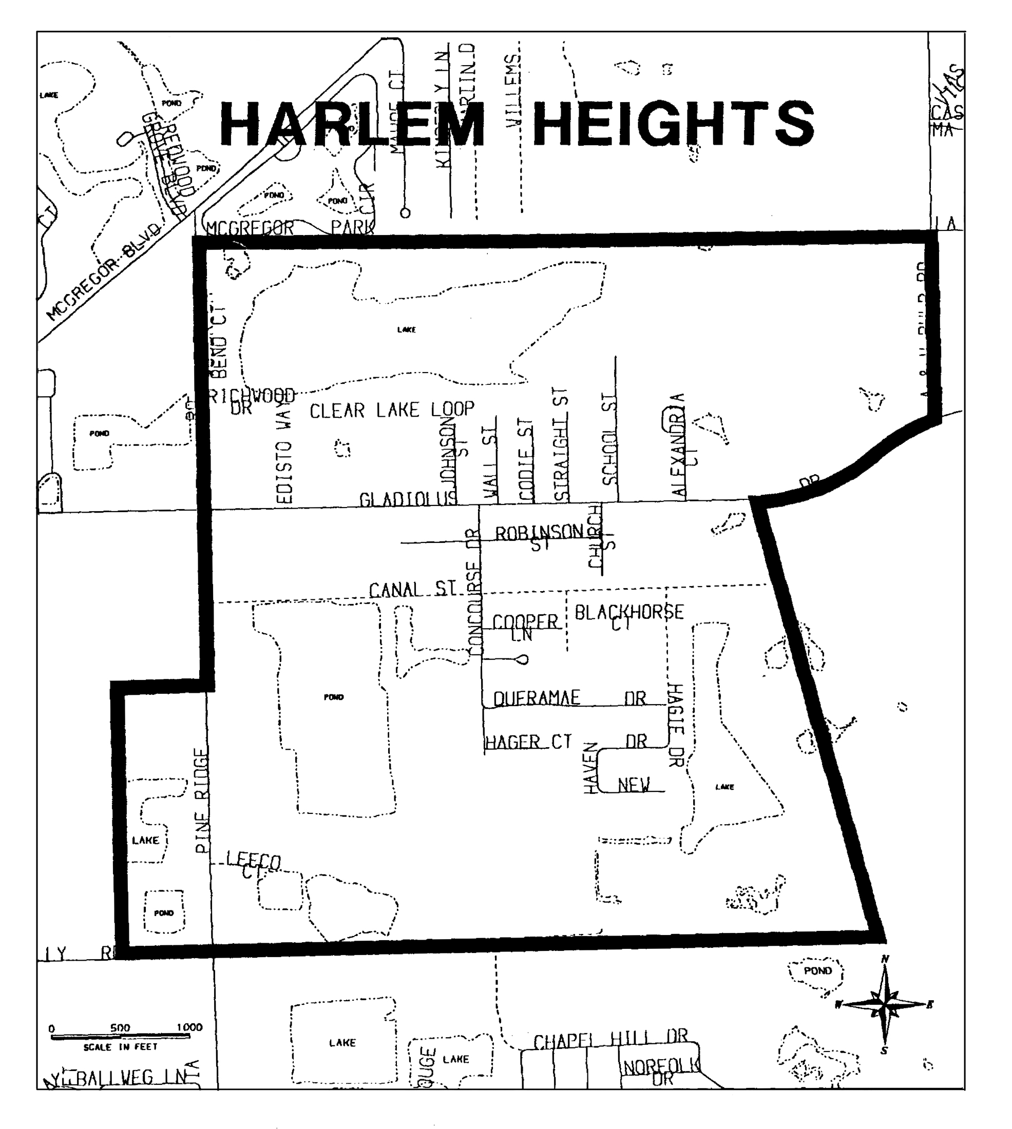
HARLEM HEIGHTS
Beginning at the northeast corner of section 32, Township 45, Range 24; thence west along the north section line of said section to the northeast corner of section 31, Township 45, Range 24; thence west along the north section line of said section approximately 50 feet to the western right-of-way boundary of Pine Ridge Road; thence south along the western right-of-way boundary of Pine Ridge Road approximately 3,320 feet; thence west 660 feet; thence south 1,980 feet to the south section line of said section; thence east 660 feet to the southeast corner of said section; thence east 4,850 feet along south section line of section 32, Township 45, Range 24 to the eastern boundary of a slough generally known as Cow Slough; thence in a northwesterly direction along the eastern boundary of Cow Slough approximately 3,340 feet to the southern right-of-way boundary of Gladiolus Drive; thence in a northeasterly direction along the southern boundary of Gladiolus Drive approximately 1,350 feet to the east section line of said section; thence north along the east section line of said section approximately 1,440 feet to the northeast corner of said section, the Point of Beginning.
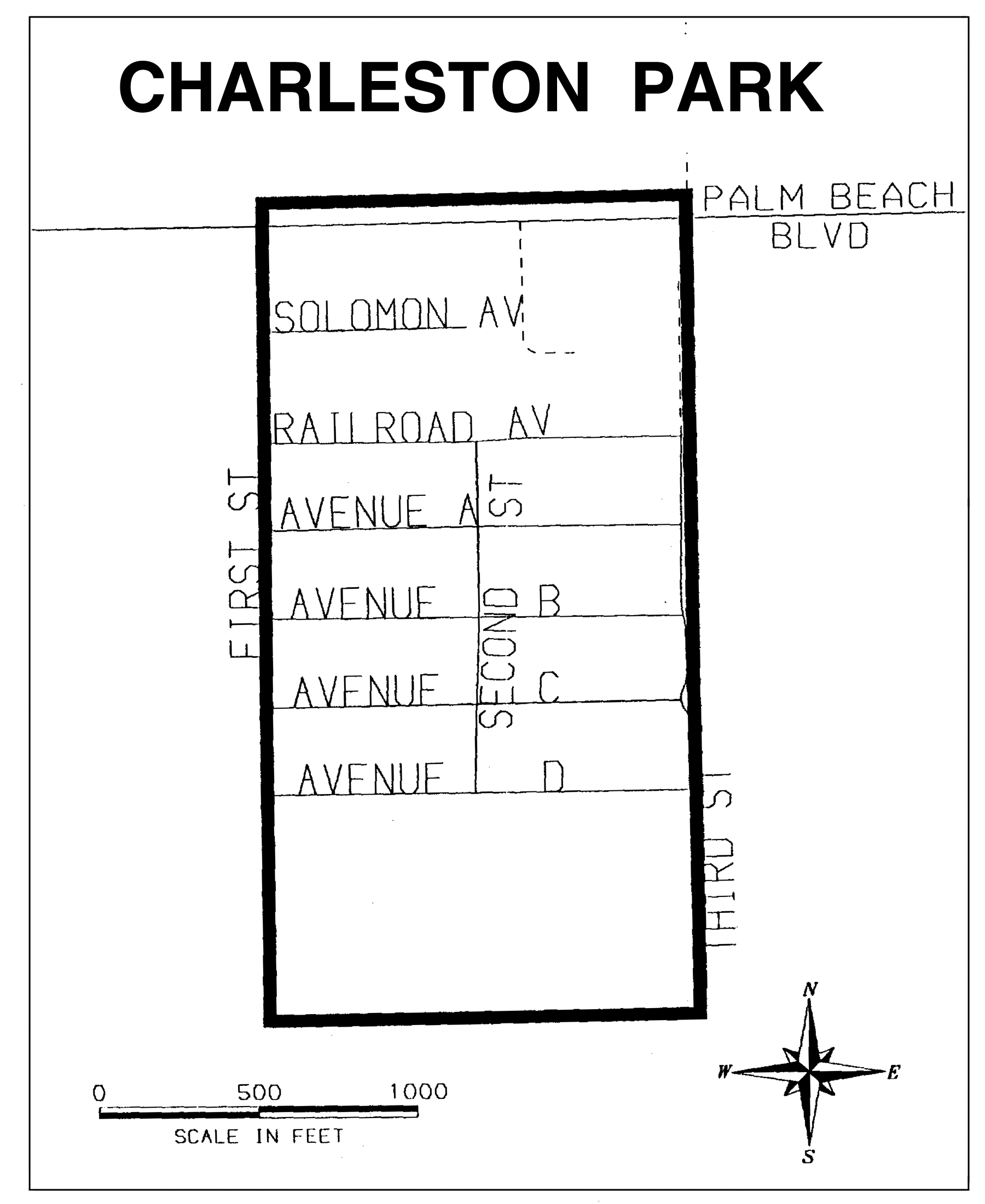
CHARLESTON PARK
The portion of Census Tract 303, section 25, Township 43 South, Range 25 East (illustrated on page two attached) and generally bound as follows: beginning at the intersection of State Road 80 and First Street proceed southward on First Street past the intersection of First Street and Avenue D to where First Street dead ends. Proceed from this point directly eastward to where Third Street dead ends. From this aforementioned location proceed northward to the intersection of Railroad Avenue and Third Street. From this point proceed directly northward to State Road 80. From this point proceed eastward to the intersection of State Road 80 and First Street, the point of beginning. The streets to be included in the Charleston Park Target area in their entirety are as follows: First Street, Second Street, Third Street, Solomon Avenue, Avenue A, Avenue B, Avenue C, Avenue D, Charleston Park Drive and the section of State Road 80 mentioned above.
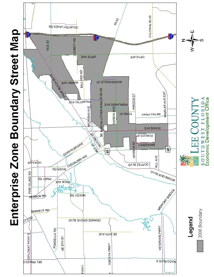
FORT MYERS/LEE COUNTY ENTERPRISE ZONE (formerly the Dunbar Enterprise Zone)
The Fort Myers/Lee County Enterprise Zone Program Area includes the entire geographic area of Census Block Groups Numbered: 001001, 003013, 003014, 003023, 003024, 004011, 004012, 004013, 005022, 005025, 005026, 005043, 006001, 006002, 006003, 006004, 007002, 007003, 011001, 011002, 0011003, 011004, 011005, 007004, 005021, 005024, 003022, 005023, 005042, 005041, and the nonresidential portion of Census Block Group 012011.
(Ord. No. 11-08, § 12, 8-9-2011)
(Ord. No. 06-24, § 2, 11-14-2006)
Editor's note— Printed herein is Appendix J to the Land Development Code, being Ordinance No. 95-22, § 2, adopted November 1, 1995, as amended Ordinance No. 06-24, § 2, adopted November 14, 2006. Other amendments are indicated by parenthetical history notes following amended provisions. The absence of a history note indicates that the provision remains unchanged from the original. Obvious misspellings and punctuation errors have been corrected without notation. For stylistic purposes, a uniform system of headings, catchlines and expression of numbers in text has been used. Additions made for clarity are indicated by brackets.