
Maple Grove City Zoning Code
ARTICLE VII
SPECIAL DISTRICTS
Sec. 36-553. - Uses allowed.
This article sets forth the uses allowed in the various special districts. If a use is not shown as a permitted, conditional or accessory use, it shall not be permitted.
(Code 2003, § 36-591)
Sec. 36-585. - Purpose.
The purpose of the PUD Planned Unit Development District is to provide for the integration and coordination of land parcels as well as the combination of varying types of residential, commercial and industrial uses.
(Code 1984, § 375:102(1); Code 2003, § 36-611)
Sec. 36-586. - Permitted, accessory and conditional uses.
All permitted, permitted accessory, or conditional uses contained in articles IV, V and VI of this chapter shall be treated as permitted uses within a PUD district to eliminate the overlapping procedural requirements of individual conditional use provisions.
(Code 1984, § 375:102(2); Code 2003, § 36-612)
Sec. 36-587. - Special procedures.
The establishment of a PUD Planned Unit Development District shall be subject to the amendment and procedure requirements as outlined in article II, division 4 of this chapter, plus the procedures and conditions imposed by article II, division 2 of this chapter. The establishment of, or amendment to, a PUD Planned Unit Development District in the gravel mining area (GMA) on land depicted on the gravel mining area special area plan map shall be subject to the procedural requirements as outlined in section 36-62, and conformance with the gravel mining area special area plan, the GMA development framework and the gravel mining area alternative urban area-wide review.
(Code 1984, § 375:102(3); Code 2003, § 36-613)
Sec. 36-608. - Purpose.
The FF Freeway Frontage District is meant to provide for the development of land near and adjacent to the freeways. In particular, the district is intended to implement the city's comprehensive plan, doing so by allowing for a mixture of land uses and by establishing stringent standards for the development of that land. The district is meant to promote large-scale development in a manner similar to a planned unit development, taking full advantage of the benefits of the city's freeway locations. It is also a goal of the FF district that a pleasant, attractive, and aesthetically pleasing environment be developed.
(Code 1984, § 375:103(1); Code 2003, § 36-631)
Sec. 36-609. - Uses.
(a)
Permitted uses.
(1)
Development within the FF district may include business and residential uses, but the primary land uses shall be office and industrial activities. Retail and personal service uses not customarily housed in offices shall provide service to the building or mixed use project in which they are located. Buildings used solely for retail or personal service uses not customarily housed in offices shall be permitted only in mixed use projects. The mix, location, and relationship of these uses shall conform with the land use plan, the purpose statement in section 36-608 and the specific findings of the city council. In addition, the applicant shall demonstrate to the satisfaction of the city that the proposed lot sizes and land uses and their mix and location are compatible and complementary both internally and with adjacent land uses. The developer may also be required to execute a development agreement as determined by the city, which agreement may include requirements such as, but not limited to, requirements set forth in section 36-610(a)(4).
(2)
Essential services are permitted.
(3)
Cannabis microbusinesses, cannabis manufacturers, cannabis testing facility, cannabis delivery services, lower-potency hemp edible manufacturers, medical cannabis combination businesses, and cannabis retail as part of a cannabis microbusiness subject to the cannabis business buffer and cannabis business retail limit.
(b)
Permitted accessory uses. Permitted accessory uses are as follows:
(1)
Private antennas and towers in compliance with chapter 8, article V.
(2)
Geothermal systems in compliance with section 36-807.
(3)
Solar electric and solar thermal systems on a building or in rear yards screened from view in compliance with section 36-807.
(4)
Wind energy conversion systems if under 100 feet in height or attached to a building in compliance with section 36-807.
(c)
Prohibited uses. Some land uses are not compatible with the purpose statement and the activities planned for the FF district area. For this reason, the following uses are prohibited:
(1)
Detached and attached single-family residences.
(2)
Developments wherein the buildings proposed have more than 25 percent of the land area in residential uses or a residential density greater than 22 dwelling units per acre. For purposes of this subsection, the term "development" shall mean the area involved in the application for a mixed use project.
(3)
Open sales lots, including, but not limited to, cars, trucks, recreational vehicles, mobile homes, trailers, machinery, lumber, building materials and similar items.
(4)
Truck terminals and truck stops.
(5)
Outside storage.
(6)
Mini-storage facilities.
(7)
Retail or personal service uses not customarily housed in offices, which occupy more than 20 percent, in aggregate, of the floor area of the building or mixed use project in which they are located, or are on a lot immediately adjacent to residential zoning.
(8)
Other uses deemed by the zoning administrator, subject to the right of appeal to the city council, to be similar to those set forth in this subsection or inconsistent with the purpose statement set forth in section 36-608 and the plans referred to therein.
(Code 1984, § 375:103(2); Code 2003, § 36-632; Ord. No. 09-11, § 2, 10-5-2009; Ord. No. 24-07, § 1(36-632), 6-3-2024; Ord. No. 24-22, § 2, 12-2-2024)
Sec. 36-610. - Procedure for review and approval of development.
(a)
Mixed use projects. The application procedures and applicable general requirements outlined in article II, division 2 of this chapter, pertaining to planned unit developments, and article II, division 3 of this chapter, shall apply to the FF district, subject to any exceptions, modifications or additions set forth in this division.
(1)
The application procedures shall include submittal and approval of a general concept plan, development stage plan, and site plan.
(2)
If the land is not within the FF district at the time of application, it shall be considered for rezoning in accordance with article II, division 4 of this chapter. Rezoning and plan review and approval may be done concurrently.
(3)
Fees as established by the city council for planned unit developments and site plans as set forth in the city fee schedule shall be paid.
(4)
Where a mixed use project contains both residential and nonresidential elements, the city may require the construction of any or all nonresidential elements before the construction of any residential element.
(b)
Single-use projects. The application procedures for a single-use project shall include submittal and approval of a site plan for any lot measuring five acres or more in size zoned FF and not part of a mixed use project, or for any FF district lot of record less than five acres in size on November 6, 1985.
(1)
The site plan review required in article II, division 3 of this chapter shall include review of the proposed land use for compatibility with adjacent and nearby property.
(2)
Except as may otherwise be provided in this section, all requirements of this division shall apply to a single-use project.
(3)
Fees as established by the city council for planned unit developments and site plans as set forth in the city fee schedule shall be paid.
(Code 1984, § 375:103(3); Code 2003, § 36-633)
Sec. 36-611. - Lot and building requirements; standards for specific uses.
(a)
Scale and size.
(1)
Except as otherwise specifically set forth in this division, a mixed use project within the FF district shall contain a minimum of 15 acres. The proposed land uses in such a project and their mix, location and relationship as discussed in section 36-604(a) may require varying lot sizes within the project, none of which lots shall be less than five acres in size.
(2)
Lots of less than five acres within a mixed use project may be permitted only when the applicant has demonstrated satisfactorily that:
a.
The lot is at least three acres in size and will be the site of a use that complements and enhances existing and planned businesses;
b.
The complementary use is compatible with existing and planned land uses; and
c.
The primary business of the proposed complementary use will serve business activities within the FF district.
(3)
Single-use projects shall be located on a minimum lot size of five acres or on a lot of record less than five acres in size on or prior to November 6, 1985.
(4)
The minimum building size for lots of record existing on November 6, 1985, shall be determined by using the following formula:
Lot acreage / 5 × 20,000 square feet
For lots created after November 6, 1985, the minimum floor area of buildings shall be 20,000 square feet.
(b)
Landscaping.
(1)
A landscaping plan shall be submitted in accordance with section 36-791.
(2)
Mixed use projects shall have a unified landscaping scheme.
(3)
Underground sprinkling is required with all landscaping.
(4)
On each lot, the maximum area of impervious surface shall be as follows:
(c)
Building exteriors; buffers and screening.
(1)
Except for trim and accessories, building exteriors shall be brick, stone, or glass, or any combination thereof.
a.
Exteriors of buildings in the FF district for which a building permit had been issued as of November 6, 1985, are exempt from this requirement, as are additions to any such buildings.
b.
The city council may establish a design review committee for reviewal of and recommendations on building design and exterior materials.
(2)
Buffers approved by the city shall be provided between nonresidential and residential uses.
(3)
Loading docks and garage entrances and exits shall be screened so as to minimize visibility from any public street.
(d)
Lot coverage. Maximum building coverage shall be 30 percent of the lot.
(e)
Parking. Parking shall be regulated by article IX of this chapter, except as otherwise specifically set forth in this division.
(f)
Setbacks.
(1)
Front yard setbacks shall be 50 feet or one-half the total building height, whichever is greater. In the case of lots of record existing on November 6, 1985, the minimum building setback shall be 30 feet.
(2)
Unless otherwise provided, no parking or parking aisle shall be allowed within 30 feet of any public right-of-way, nor shall any driveway or road unless it provides direct access to and from the public street. In the case of lots of record existing on November 6, 1985, the minimum parking and parking aisle setback shall be 20 feet.
(3)
No parking, parking aisle, driveway, or road shall be or be allowed within 40 feet of any side or rear property line that abuts any residentially zoned property. No building or portion thereof shall be or be allowed within 100 feet of any residentially zoned property.
(4)
All parking, driveway and road surfaces located on the front side of the principal building on a lot shall be separated from the building by a ten-foot-wide green space containing landscaping such as trees, shrubs, living ground cover and flowers.
(5)
If the city allows setbacks of less than the 30 feet required in subsection (f)(2) of this section, additional green space as required in subsection (f)(4) of this section must be provided in the ratio of 1.5 feet of width for every one foot of setback reduction. No setback reduction pursuant to this subsection (f)(5) shall exceed five feet.
(6)
The provisions of subsections (f)(4) and (5) of this section shall not apply to lots of record existing on November 6, 1985.
(g)
Freeway visibility. Development plans for land adjacent to the freeway shall include both building elevation and vista drawings. Compatibility of buildings shall be considered in siting of neighboring buildings.
(h)
Sexually oriented businesses. In addition to the standards otherwise set forth in this section, a sexually oriented business must also comply with the following standards:
(1)
The business must be properly and currently licensed pursuant to the provisions of chapter 10, article XIV.
(2)
The business or premises shall not be located within 750 feet of any premises currently licensed in accordance with chapter 10, articles VIII and XIV, or chapter 4, or within 750 feet of any licensed day care facility, private residence, house of worship, school, playground, park, library, or other community recreational center or facility, or any other sexually oriented business. Measurements shall be made on a straight line, without regard to intervening structures or objects, from the nearest point of the lot containing or to contain the sexually oriented business to the nearest point of the lot containing one of the uses mentioned.
(3)
No sexually oriented business may be located in or on any building, premises, or lot already containing a sexually oriented business.
(i)
Pawnshops. In addition to the standards otherwise set forth in this section, a pawnshop must also comply with the following standards:
(1)
The business must be properly and currently licensed pursuant to the provisions of chapter 10, article VIII.
(2)
The business or premises shall not be located within 750 feet of any premises currently licensed in accordance with chapter 10, articles VIII, IX, and XIV, or chapter 4, or within 750 feet of any licensed day care facility, private residence, house of worship, school, playground, park, library, or other community recreational center or facility, or any other pawnshop. Measurements shall be made in a straight line, without regard to intervening structures or objects, from the nearest point of the lot containing or to contain the pawnshop business to the nearest point of the lot containing one of the uses mentioned.
(3)
No pawnshop may be located in or on any building, premises, or lot already containing a pawnshop.
(Code 1984, § 375:103(4); Code 2003, § 36-634; Ord. No. 07-25, § 1, 11-19-2007)
Sec. 36-612. - Exceptions for platted lots of record.
For lots of record platted before November 6, 1985, the requirement for general concept plans, development stage plans, and final plans under this division is waived. The site plan review required in article II, division 3 of this chapter, however, shall include review of the proposed land use for compatibility with adjacent and nearby property. All other requirements shall apply, including, but not limited to, those set forth in article II, division 2 of this chapter, pertaining to planned unit developments.
(Code 1984, § 375:103(5); Code 2003, § 36-635)
Sec. 36-643. - Purpose.
(a)
This division regulates development in the flood hazard areas of the city. These flood hazard areas are subject to periodic inundation, which may result in loss of life and property, health and safety hazards, disruption of commerce and governmental services, extraordinary public expenditures for flood protection and relief, and impairment of the tax base. It is the purpose of this division to promote the public health, safety and general welfare by minimizing these losses and disruptions.
(b)
National Flood Insurance Program compliance. This division is adopted to comply with the rules and regulations of the National Flood Insurance Program codified as 44 CFR 59—78, as amended, so as to maintain the community's eligibility in the National Flood Insurance Program.
(c)
This division is also intended to preserve the natural characteristics and functions of watercourses and floodplains in order to moderate flood and stormwater impacts, improve water quality, reduce soil erosion, protect aquatic and riparian habitat, provide recreational opportunities, provide aesthetic benefits and enhance community and economic development.
(Code 2003, § 36-651; Ord. No. 16-15, § 1(exh. A), 11-7-2016)
Sec. 36-644. - General provisions; definitions.
(a)
How to use this division. This division adopts the floodplain maps applicable to the city and includes three floodplain districts: floodway, flood fringe, and general floodplain.
(1)
Where floodway and flood fringe districts are delineated on the floodplain maps, the standards in sections 36-646 and 36-647 will apply, depending on the location of a property.
(2)
Locations are considered to fall within the general floodplain district where floodway and flood fringe districts are not delineated on the floodplain maps. Within the general floodplain district, the floodway district standards in section 36-646 apply unless the floodway boundary is determined, according to the process outlined in section 36-648. Once the floodway boundary is determined, the flood fringe district standards in section 36-647 may apply outside the floodway.
(b)
Lands to which division applies.
(1)
This division applies to all lands within the jurisdiction of the city shown on the official zoning map and/or the attachments to the map as being located within the boundaries of the floodway, flood fringe, or general floodplain districts.
(2)
The floodway, flood fringe and general floodplain districts are overlay districts that are superimposed on all existing zoning districts. The standards imposed in the overlay districts are in addition to any other requirements in this division. In case of a conflict, the more restrictive standards will apply.
(c)
Incorporation of maps by reference. The following maps together with all attached material are hereby adopted by reference and declared to be a part of the official zoning map and this division. The attached material includes the Flood Insurance Study for Hennepin County, Minnesota, and Incorporated Areas, dated November 4, 2016, and the flood insurance rate map panels enumerated below, dated November 4, 2016, all prepared by the Federal Emergency Management Agency. These materials are on file with the city engineering department. Effective flood insurance rate map panels:
(1)
27053C0044F.
(2)
27053C0063F.
(3)
27053C0064F.
(4)
27053C0068F.
(5)
27053C0069F.
(6)
27053C0157F.
(7)
27053C0159F.
(8)
27053C0176F.
(9)
27053C0178F.
(10)
27053C0180F.
(11)
27053C0182F.
(12)
27053C0183F.
(13)
27053C0184F.
(d)
Regulatory flood protection elevation. The regulatory flood protection elevation (RFPE) is an elevation no lower than one foot above the elevation of the regional flood, plus any increases in flood elevation caused by encroachments on the floodplain that result from designation of a floodway.
(e)
Interpretation. The boundaries of the zoning districts are determined by scaling distances on the flood insurance rate map.
(1)
Where a conflict exists between the floodplain limits illustrated on the official zoning map and actual field conditions, the flood elevations shall be the governing factor. The zoning administrator must interpret the boundary location based on the ground elevations that existed on the site on the date of the first National Flood Insurance Program map showing the area within the regulatory floodplain, and other available technical data.
(2)
Persons contesting the location of the district boundaries will be given a reasonable opportunity to present their case to the planning commission and to submit technical evidence.
(f)
Abrogation and greater restrictions. It is not intended by this division to repeal, abrogate or impair any existing easements, covenants or other private agreements. However, where this division imposes greater restrictions, the provisions of this division prevail. All other divisions inconsistent with this division are hereby repealed to the extent of the inconsistency only.
(g)
Warning and disclaimer of liability. This division does not imply that areas outside the floodplain districts or land uses permitted within such districts will be free from flooding or flood damages. This division does not create liability on the part of the city or its officers or employees for any flood damages that result from reliance on this division or any administrative decision lawfully made hereunder.
(h)
Definitions. The following words, terms and phrases, when used in this division, shall have the meanings ascribed to them in this subsection, except where the context clearly indicates a different meaning:
Accessory use or structure means a use or structure on the same lot with, and of a nature customarily incidental and subordinate to, the principal use or structure.
Base flood elevation means the elevation of the regional flood. The term "base flood elevation" is used in the flood insurance survey.
Basement means any area of a structure, including crawl spaces, having its floor or base subgrade (below ground level) on all four sides, regardless of the depth of excavation below ground level.
Conditional use means a specific type of structure or land use listed in the official control that may be allowed but only after an in-depth review procedure and with appropriate conditions or restrictions as provided in the official zoning controls or building codes and upon a finding that:
(1)
Certain conditions as detailed in the zoning division exist.
(2)
The structure and/or land use conform to the comprehensive land use plan if one exists and are compatible with the existing neighborhood.
Critical facilities means facilities necessary to a community's public health and safety, those that store or produce highly volatile, toxic or water-reactive materials, and those that house occupants that may be insufficiently mobile to avoid loss of life or injury. Examples of critical facilities include hospitals, correctional facilities, schools, day care facilities, nursing homes, fire and police stations, wastewater treatment facilities, public electric utilities, water plants, fuel storage facilities, and waste handling and storage facilities.
Development means any human-made change to improved or unimproved real estate, including buildings or other structures, mining, dredging, filling, grading, paving, excavation or drilling operations, or storage of equipment or materials.
Equal degree of encroachment means a method of determining the location of floodway boundaries so that floodplain lands on both sides of a stream are capable of conveying a proportionate share of flood flows.
Farm fence means a fence as defined by Minn. Stats. § 344.02, subd. 1(a) through (d). An open-type fence of posts and wire is not considered to be a structure under this division. Fences that have the potential to obstruct flood flows, such as chain link fences and rigid walls, are regulated as structures under this division.
Flood means a temporary increase in the flow or stage of a stream or in the stage of a wetland or lake that results in the inundation of normally dry areas.
Flood frequency means the frequency for which it is expected that a specific flood stage or discharge may be equaled or exceeded.
Flood fringe means the portion of the special flood hazard area (one percent annual chance flood) located outside of the floodway. Flood fringe is synonymous with the term "floodway fringe" used in the flood insurance study for the county.
Floodprone area means any land susceptible to being inundated by water from any source (see Flood).
Floodplain means the beds proper and the areas adjoining a wetland, lake or watercourse which have been or hereafter may be covered by the regional flood.
Floodproofing means a combination of structural provisions, changes, or adjustments to properties and structures subject to flooding, primarily for the reduction or elimination of flood damages.
Floodway means the bed of a wetland or lake and the channel of a watercourse and those portions of the adjoining floodplain which are reasonably required to carry or store the regional flood discharge.
Lowest floor means the lowest floor of the lowest enclosed area (including basement). An unfinished or flood-resistant enclosure, used solely for parking of vehicles, building access, or storage in an area other than a basement area, is not considered a building's lowest floor; provided, that such enclosure is not built so as to render the structure in violation of the applicable non-elevation design requirements of 44 CFR 60.3.
Manufactured home means a structure, transportable in one or more sections, which is built on a permanent chassis and is designed for use with or without a permanent foundation when attached to the required utilities. The term "manufactured home" does not include the term "recreational vehicle."
New construction means structures, including additions and improvements, and placement of manufactured homes, for which the start of construction commenced on or after the effective date of the ordinance from which this division is derived.
100-year floodplain means lands inundated by the regional flood (see Regional flood).
Obstruction means any dam, wall, wharf, embankment, levee, dike, pile, abutment, projection, excavation, channel modification, culvert, building, wire, fence, stockpile, refuse, fill, structure, or matter in, along, across, or projecting into any channel, watercourse, or regulatory floodplain which may impede, retard, or change the direction of the flow of water, either in itself or by catching or collecting debris carried by such water.
Principal use or structure means all uses or structures that are not accessory uses or structures.
Reach means a hydraulic engineering term to describe a longitudinal segment of a stream or river influenced by a natural or human-made obstruction. In an urban area, the segment of a stream or river between two consecutive bridge crossings would most typically constitute a reach.
Recreational vehicle means a vehicle that is built on a single chassis, is 400 square feet or less when measured at the largest horizontal projection, is designed to be self-propelled or permanently towable by a light duty truck, and is designed primarily not for use as a permanent dwelling but as temporary living quarters for recreational, camping, travel or seasonal use. For the purposes of this division, the term recreational vehicle is synonymous with the term "travel trailer/travel vehicle."
Regional flood means a flood which is representative of large floods known to have occurred generally in the state and reasonably characteristic of what can be expected to occur on an average frequency in the magnitude of the one percent chance or 100-year recurrence interval. The term "regional flood" is synonymous with the term "base flood" used in a flood insurance study.
Regulatory flood protection elevation (RFPE) means an elevation not less than one foot above the elevation of the regional flood, plus any increases in flood elevation caused by encroachments on the floodplain that result from designation of a floodway.
Repetitive loss means flood-related damages sustained by a structure on two separate occasions during a ten-year period for which the cost of repairs at the time of each such flood event on the average equals or exceeds 25 percent of the market value of the structure before the damage occurred.
Special flood hazard area, for flood insurance purposes, is synonymous with the term "100-year floodplain."
Start of construction includes substantial improvement, and means the actual start of construction, repair, reconstruction, rehabilitation, addition, placement or other improvement that occurred before the permit's expiration date. The actual start is either the first placement of permanent construction of a structure on a site, such as the pouring of slab or footings, the installation of piles, the construction of columns, or any work beyond the stage of excavation; or the placement of a manufactured home on a foundation. Permanent construction does not include land preparation, such as clearing, grading and filling; nor does it include the installation of streets and/or walkways; nor does it include excavation for a basement, footings, piers, foundations, or the erection of temporary forms; nor does it include the installation on the property of accessory buildings, such as garages or sheds not occupied as dwelling units or not part of the main structure. For a substantial improvement, the term "actual start of construction" means the first alteration of any wall, ceiling, floor, or other structural part of a building, whether or not that alteration affects the external dimensions of the building.
Structure means anything constructed or erected on the ground or attached to the ground or on-site utilities, including, but not limited to, buildings, factories, sheds, detached garages, cabins, manufactured homes, recreational vehicles not meeting the exemption criteria specified in section 36-651(b)(2) and other similar items.
Substantial damage means damage of any origin sustained by a structure where the cost of restoring the structure to its before damaged condition would equal or exceed 50 percent of the market value of the structure before the damage occurred.
Substantial improvement, within any consecutive 365-day period, means any reconstruction, rehabilitation (including normal maintenance and repair), repair after damage, addition, or other improvement of a structure, the cost of which equals or exceeds 50 percent of the market value of the structure before the start of construction of the improvement. The term "substantial improvement" includes structures that have incurred substantial damage, regardless of the actual repair work performed. The term "substantial improvement" does not, however, include either:
(1)
Any project for improvement of a structure to correct existing violations of state or local health, sanitary, or safety code specifications which have been identified by the local code enforcement official and which are the minimum necessary to ensure safe living conditions.
(2)
Any alteration of a historic structure, provided that the alteration will not preclude the structure's continued designation as a historic structure. For the purpose of this division, the term "historic structure" is as defined in 44 CFR 59.1.
(i)
Annexations. The flood insurance rate map panels adopted by reference into subsection (c) of this section, may include floodplain areas that lie outside of the corporate boundaries of the city at the time of adoption of the ordinance from which this division is derived. If any of these floodplain land areas are annexed into the city after the date of adoption of the ordinance from which this division is derived, the newly annexed floodplain lands will be subject to the provisions of this division immediately upon the date of annexation.
(j)
Detachments. The flood insurance rate map panels adopted by reference into subsection (c) of this section, will include floodplain areas that lie inside the corporate boundaries of municipalities at the time of adoption of the ordinance from which this division is derived. If any of these floodplain land areas are detached from a municipality and come under the jurisdiction of the city after the date of adoption of the ordinance from which this division is derived, the newly detached floodplain lands will be subject to the provisions of this division immediately upon the date of detachment.
(Code 2003, § 36-652; Ord. No. 16-15, § 1(exh. A), 11-7-2016)
Sec. 36-645. - Establishment of zoning districts.
(a)
Districts.
(1)
Floodway district. The floodway district includes those areas within Zone AE that have a floodway delineated as shown on the flood insurance rate map adopted in section 36-644(c). For lakes, wetlands and other basins within Zone AE that do not have a floodway delineated, the floodway district also includes those areas that are at or below the ordinary high-water level as defined in Minn. Stats. § 103G.005, subd. 14.
(2)
Flood fringe district. The flood fringe district includes areas within Zone AE that have a floodway delineated on the flood insurance rate map adopted in section 36-644(c), but are located outside of the floodway. For lakes, wetlands and other basins within Zone AE that do not have a floodway delineated, the flood fringe district also includes those areas below the one percent annual chance (100-year) flood elevation but above the ordinary high-water level as defined in Minn. Stats. § 103G.005, subd. 14.
(3)
General floodplain district. The general floodplain district includes those areas within Zone A that do not have a delineated floodway as shown on the flood insurance rate map adopted in section 36-644(c).
(b)
Applicability. Within the floodplain districts established in this division, the use, size, type and location of development must comply with the terms of this division and other applicable regulations. In no case shall floodplain development adversely affect the efficiency or unduly restrict the capacity of the channels or floodways of any tributaries to the main stream, drainage ditches, or any other drainage facilities or systems. All uses not listed as permitted uses or conditional uses in sections 36-646, 36-647 and 36-648 are prohibited. In addition, critical facilities, as defined in section 36-644(h)(5), are prohibited in all floodplain districts.
(Code 2003, § 36-653; Ord. No. 16-15, § 1(exh. A), 11-7-2016)
Sec. 36-646. - FW Floodway District.
(a)
Permitted uses. The following uses, subject to the standards set forth in subsection (b) of this section, are permitted uses if otherwise allowed in the underlying zoning district or any applicable overlay district:
(1)
General farming, pasture, grazing, outdoor plant nurseries, horticulture, truck farming, forestry, sod farming, and wild crop harvesting.
(2)
Industrial-commercial loading areas, parking areas, and airport landing strips.
(3)
Open space uses, including, but not limited to, private and public golf courses, tennis courts, driving ranges, archery ranges, picnic grounds, boat launching ramps, swimming areas, parks, wildlife and nature preserves, game farms, fish hatcheries, shooting preserves, hunting and fishing areas, and single or multiple purpose recreational trails.
(4)
Residential lawns, gardens, parking areas and play areas.
(5)
Railroads, streets, bridges, utility transmission lines and pipelines, provided that the department of natural resources' area hydrologist is notified at least ten days prior to issuance of any permit.
(b)
Standards for floodway permitted uses.
(1)
The use must have a low flood damage potential.
(2)
The use must not obstruct flood flows or cause any increase in flood elevations and must not involve structures, obstructions, or storage of materials or equipment.
(3)
Any facility that will be used by employees or the general public must be designed with a flood warning system that provides adequate time for evacuation if the area is inundated to a depth and velocity such that the depth (in feet) multiplied by the velocity (in feet per second) would exceed a product of four upon occurrence of the regional (one percent chance) flood.
(c)
Conditional uses. The following uses may be allowed as conditional uses following the standards and procedures set forth in section 36-652(d) and further subject to the standards set forth in subsection (d) of this section, if otherwise allowed in the underlying zoning district or any applicable overlay district:
(1)
Structures accessory to the uses listed in subsection (b) of this section and the uses listed in this subsection.
(2)
Extraction and storage of sand, gravel and other materials.
(3)
Marinas, boat rentals, docks, piers, wharves, and water control structures.
(4)
Storage yards for equipment, machinery or materials.
(5)
Placement of fill or construction of fences that obstruct flood flows. Farm fences, as defined in section 36-644(h)(8), are permitted uses.
(6)
Travel-ready recreational vehicles meeting the exception standards in section 36-651(b).
(7)
Levees or dikes intended to protect agricultural crops for a frequency flood event equal to or less than the ten-year frequency flood event.
(d)
Standards for floodway conditional uses.
(1)
All uses. A conditional use must not cause any increase in the stage of the one percent chance or regional flood or cause an increase in flood damages in the reach or reaches affected.
(2)
Fill; storage of materials and equipment.
a.
The storage or processing of materials that are, in time of flooding, flammable, explosive, or potentially injurious to human, animal or plant life is prohibited.
b.
Fill, dredge spoil, and other similar materials deposited or stored in the floodplain must be protected from erosion by vegetative cover, mulching, riprap or other acceptable method. Permanent sand and gravel operations and similar uses must be covered by a long-term site development plan.
c.
Temporary placement of fill, other materials, or equipment which would cause an increase to the stage of the one percent chance or regional flood may only be allowed if the (city engineer) has approved a plan that ensures removal of the materials from the floodway based upon the flood warning time available.
(3)
Accessory structures. Accessory structures, as identified in subsection (c)(1) of this section, may be permitted, provided that:
a.
Structures are not intended for human habitation;
b.
Structures will have a low flood damage potential;
c.
Structures will be constructed and placed so as to offer a minimal obstruction to the flow of floodwaters;
d.
Service utilities, such as electrical and heating equipment, within these structures must be elevated to or above the regulatory flood protection elevation or properly floodproofed;
e.
Structures must be elevated on fill or structurally dry floodproofed in accordance with the FP1 or FP2 floodproofing classifications in the state building code. All floodproofed structures must be adequately anchored to prevent flotation, collapse or lateral movement and designed to equalize hydrostatic flood forces on exterior walls.
f.
As an alternative, an accessory structure may be internally/wet floodproofed to the FP3 or FP4 floodproofing classifications in the state building code, provided the accessory structure constitutes a minimal investment and does not exceed 576 square feet in size. Designs for meeting this requirement must either be certified by a registered professional engineer or meet or exceed the following criteria:
1.
To allow for the equalization of hydrostatic pressure, there must be a minimum of two automatic openings in the outside walls of the structure, with a total net area of not less than one square inch for every square foot of enclosed area subject to flooding; and
2.
There must be openings on at least two sides of the structure and the bottom of all openings must be no higher than one foot above the lowest adjacent grade to the structure. Using human intervention to open a garage door prior to flooding will not satisfy this requirement for automatic openings.
(4)
Structural works for flood control that will change the course, current or cross section of protected wetlands or public waters are subject to the provisions of Minn. Stats. § 103G.245.
(5)
A levee, dike or floodwall constructed in the floodway must not cause an increase to the one percent chance or regional flood. The technical analysis must assume equal conveyance or storage loss on both sides of a stream.
(6)
Floodway developments must not adversely affect the hydraulic capacity of the channel and adjoining floodplain of any tributary watercourse or drainage system.
(Code 2003, § 36-654; Ord. No. 16-15, § 1(exh. A), 11-7-2016)
Sec. 36-647. - FLDF Flood Fringe District.
(a)
Permitted uses. Permitted uses are those uses of land or structures allowed in the underlying zoning districts that comply with the standards in subsection (b) of this section. If no pre-existing, underlying zoning districts exist, then any residential or nonresidential structure or use of a structure or land is a permitted use provided it does not constitute a public nuisance.
(b)
Standards for flood fringe permitted uses.
(1)
All structures. All structures, including accessory structures, must be elevated on fill so that the lowest floor, as defined, is at or above the regulatory flood protection elevation. The finished fill elevation for structures must be no lower than one foot below the regulatory flood protection elevation and the fill must extend at the same elevation at least 15 feet beyond the outside limits of the structure.
(2)
Accessory structures. As an alternative to the fill requirements of subsection (b)(1) above, structures accessory to the uses identified in subsection (a) of this section may be permitted to be internally/wet floodproofed to the FP3 or FP4 floodproofing classifications in the state building code, provided that:
a.
The accessory structure constitutes a minimal investment, does not exceed 576 square feet in size, and is only used for parking and storage.
b.
All portions of floodproofed accessory structures below the regulatory flood protection elevation must:
1.
Be adequately anchored to prevent flotation, collapse or lateral movement and designed to equalize hydrostatic flood forces on exterior walls;
2.
Be constructed with materials resistant to flood damage; and
3.
Have all service utilities be watertight or elevated to above the regulatory flood protection elevation.
c.
Designs for meeting this requirement must either be certified by a registered professional engineer or meet or exceed the following criteria:
1.
To allow for the equalization of hydrostatic pressure, there must be a minimum of two automatic openings in the outside walls of the structure, with a total net area of not less than one square inch for every square foot of enclosed area subject to flooding; and
2.
There must be openings on at least two sides of the structure and the bottom of all openings must be no higher than one foot above the lowest adjacent grade to the structure. Using human intervention to open a garage door prior to flooding will not satisfy this requirement for automatic openings.
(3)
The cumulative placement of fill or similar material on a parcel must not exceed 1,000 cubic yards, unless the fill is specifically intended to elevate a structure in accordance with subsection (b)(1) of this section, or if allowed as a conditional use under subsections (b)(4) through (11) of this section.
(4)
The storage of any materials or equipment must be elevated on fill to the regulatory flood protection elevation.
(5)
All service utilities, including ductwork, must be elevated or watertight to prevent infiltration of floodwaters.
(6)
The storage or processing of materials that are, in time of flooding, flammable, explosive, or potentially injurious to human, animal or plant life is prohibited.
(7)
All fill must be properly compacted and the slopes must be properly protected by the use of riprap, vegetative cover or other acceptable method.
(8)
All new principal structures must have vehicular access at or above an elevation not more than two feet below the regulatory flood protection elevation, or must have a flood warning/emergency evacuation plan acceptable to the city engineer.
(9)
Accessory uses such as yards, railroad tracks, and parking lots may be at an elevation lower than the regulatory flood protection elevation. However, any facilities used by employees or the general public must be designed with a flood warning system that provides adequate time for evacuation if the area is inundated to a depth and velocity such that the depth (in feet) multiplied by the velocity (in feet per second) would exceed a product of four upon occurrence of the regional (one percent chance) flood.
(10)
Interference with normal manufacturing/industrial plant operations must be minimized, especially along streams having protracted flood durations. In considering permit applications, due consideration must be given to the needs of industries with operations that require a floodplain location.
(11)
Manufactured homes and recreational vehicles must meet the standards of section 36-651.
(c)
Conditional uses. The following uses and activities may be allowed as conditional uses, if allowed in the underlying zoning district or any applicable overlay district, following the procedures in section 36-652(d):
(1)
Any structure that is not elevated on fill or floodproofed in accordance with subsections (b)(1) and (2) of this section.
(2)
Storage of any material or equipment below the regulatory flood protection elevation.
(3)
The cumulative placement of more than 1,000 cubic yards of fill when the fill is not being used to elevate a structure in accordance with subsection (b)(1) of this section.
(d)
Standards for flood fringe conditional uses.
(1)
The standards listed in subsections (b)(4) through (10) of this section apply to all conditional uses.
(2)
Basements, as defined by section 36-644(h), are subject to the following:
a.
Residential basement construction is not allowed below the regulatory flood protection elevation.
b.
Nonresidential basements may be allowed below the regulatory flood protection elevation provided the basement is structurally dry floodproofed in accordance with subsection (d)(3) of this section.
(3)
All areas of nonresidential structures, including basements, to be placed below the regulatory flood protection elevation must be floodproofed in accordance with the structurally dry floodproofing classifications in the state building code. Structurally dry floodproofing must meet the FP1 or FP2 floodproofing classification in the state building code, which requires making the structure watertight with the walls substantially impermeable to the passage of water and with structural components capable of resisting hydrostatic and hydrodynamic loads and the effects of buoyancy.
(4)
The placement of more than 1,000 cubic yards of fill or other similar material on a parcel (other than for the purpose of elevating a structure to the regulatory flood protection elevation) must comply with an approved erosion/sedimentation control plan.
a.
The plan must clearly specify methods to be used to stabilize the fill on-site for a flood event at a minimum of the regional (one percent chance) flood event.
b.
The plan must be prepared and certified by a registered professional engineer or other qualified individual acceptable to the city engineer.
c.
The plan may incorporate alternative procedures for removal of the material from the floodplain if adequate flood warning time exists.
(e)
Storage. Storage of materials and equipment below the regulatory flood protection elevation must comply with an approved emergency plan providing for removal of such materials within the time available after a flood warning.
(Code 2003, § 36-655; Ord. No. 16-15, § 1(exh. A), 11-7-2016)
Sec. 36-648. - GF General Floodplain District.
(a)
Permitted uses.
(1)
The uses listed in section 36-646(a), floodway district permitted uses, are permitted uses.
(2)
All other uses are subject to the floodway/flood fringe evaluation criteria specified in subsection (b) of this section. Section 36-646 applies if the proposed use is determined to be in the floodway district. Section 36-647 applies if the proposed use is determined to be in the flood fringe district.
(b)
Procedures for floodway and flood fringe determinations.
(1)
Upon receipt of an application for a permit or other approval within the general floodplain district, the zoning administrator must obtain, review and reasonably utilize any regional flood elevation and floodway data available from a federal, state, or other source.
(2)
If regional flood elevation and floodway data are not readily available, the applicant must furnish additional information, as needed, to determine the regulatory flood protection elevation and whether the proposed use would fall within the floodway or flood fringe district. Information must be consistent with accepted hydrological and hydraulic engineering standards and the standards in subsection (b)(3) of this section.
(3)
The determination of floodway and flood fringe must include the following components, as applicable:
a.
Estimate the peak discharge of the regional (one percent chance) flood.
b.
Calculate the water surface profile of the regional flood based upon a hydraulic analysis of the stream channel and overbank areas.
c.
Compute the floodway necessary to convey or store the regional flood without increasing flood stages more than 0.5 foot. A lesser stage increase than 0.5 foot is required if, as a result of the stage increase, increased flood damages would result. An equal degree of encroachment on both sides of the stream within reach must be assumed in computing floodway boundaries.
(4)
The city engineer will review the submitted information and assess the technical evaluation and the recommended floodway and/or flood fringe district boundary. The assessment must include the cumulative effects of previous floodway encroachments. The zoning administrator may seek technical assistance from a designated engineer or other expert person or agency, including the department of natural resources. Based on this assessment, the city engineer may approve or deny the application.
(5)
Once the floodway and flood fringe district boundaries have been determined, the zoning administrator must process the permit application consistent with the applicable provisions of sections 36-646 and 36-647.
(Code 2003, § 36-656; Ord. No. 16-15, § 1(exh. A), 11-7-2016)
Sec. 36-649. - Land development standards.
(a)
Generally. Recognizing that floodprone areas may exist outside of the designated floodplain districts, the requirements of this section apply to all land within the city.
(b)
Subdivisions. No land may be subdivided which is unsuitable for reasons of flooding or inadequate drainage, water supply or sewage treatment facilities. Manufactured home parks and recreational vehicle parks or campgrounds are considered subdivisions under this division.
(1)
All lots within the floodplain districts must be able to contain a building site outside of the floodway district at or above the regulatory flood protection elevation.
(2)
All subdivisions must have road access both to the subdivision and to the individual building sites no lower than two feet below the regulatory flood protection elevation, unless a flood warning emergency plan for the safe evacuation of all vehicles and people during the regional (one percent chance) flood has been approved by the city engineer. The plan must be prepared by a registered engineer or other qualified individual and must demonstrate that adequate time and personnel exist to carry out the evacuation.
(3)
For all subdivisions in the floodplain, the floodway and flood fringe district boundaries, the regulatory flood protection elevation and the required elevation of all access roads must be clearly labeled on all required subdivision drawings and platting documents.
(4)
In the general floodplain district, applicants must provide the information required in section 36-648(b) to determine the regional flood elevation, the floodway and flood fringe district boundaries and the regulatory flood protection elevation for the subdivision site.
(5)
If a subdivision proposal or other proposed new development is in a floodprone area, any such proposal must be reviewed to ensure that:
a.
All such proposals are consistent with the need to minimize flood damage within the floodprone area;
b.
All public utilities and facilities, such as sewer, gas, electrical, and water systems are located and constructed to minimize or eliminate flood damage; and
c.
Adequate drainage is provided to reduce exposure of flood hazard.
(c)
Building sites. If a proposed building site is in a floodprone area, all new construction and substantial improvements (including the placement of manufactured homes) must be:
(1)
Designed (or modified) and adequately anchored to prevent floatation, collapse, or lateral movement of the structure resulting from hydrodynamic and hydrostatic loads, including the effects of buoyancy;
(2)
Constructed with materials and utility equipment resistant to flood damage;
(3)
Constructed by methods and practices that minimize flood damage; and
(4)
Constructed with electrical, heating, ventilation, plumbing and air conditioning equipment and other service facilities that are designed or located so as to prevent water from entering or accumulating within the components during conditions of flooding.
(Code 2003, § 36-657; Ord. No. 16-15, § 1(exh. A), 11-7-2016)
Sec. 36-650. - Public utilities, railroads, roads and bridges.
(a)
Public utilities. All public utilities and facilities such as gas, electrical, sewer and water supply systems to be located in the floodplain must be floodproofed in accordance with the state building code or elevated to the regulatory flood protection elevation.
(b)
Public transportation facilities. Railroad tracks, roads and bridges to be located within the floodplain must comply with sections 36-646 and 36-647. These transportation facilities must be elevated to the regulatory flood protection elevation where failure or interruption of these facilities would result in danger to the public health or safety or where such facilities are essential to the orderly functioning of the area. Minor or auxiliary roads or railroads may be constructed at a lower elevation where failure or interruption of transportation services would not endanger the public health or safety.
(c)
On-site water supply and sewage treatment systems. Where public utilities are not provided:
(1)
On-site water supply systems must be designed to minimize or eliminate infiltration of floodwaters into the systems and are subject to the provisions in Minn. Rules 4725.4350; and
(2)
New or replacement on-site sewage treatment systems must be designed to minimize or eliminate infiltration of floodwaters into the systems and discharges from the systems into floodwaters; they must not be subject to impairment or contamination during times of flooding and are subject to the provisions in Minn. Rules 7080.2270.
(Code 2003, § 36-658; Ord. No. 16-15, § 1(exh. A), 11-7-2016)
Sec. 36-651. - Manufactured homes, manufactured home parks and recreational vehicles.
(a)
Manufactured homes. New manufactured home parks and expansions to existing manufactured home parks are prohibited in any floodplain district. For existing manufactured home parks or lots of record, the following requirements apply:
(1)
Placement or replacement of manufactured home units is prohibited in the floodway district.
(2)
If allowed in the flood fringe district, placement or replacement of manufactured home units is subject to the requirements of section 36-647 and the following standards:
a.
New and replacement manufactured homes must be elevated in compliance with section 36-647 and must be securely anchored to an adequately anchored foundation system that resists flotation, collapse and lateral movement. Methods of anchoring may include, but are not limited to, use of over-the-top or frame ties to ground anchors. This requirement is in addition to applicable state or local anchoring requirements for resisting wind forces.
b.
New or replacement manufactured homes in existing manufactured home parks must meet the vehicular access requirements for subdivisions in section 36-649(b)(2).
(b)
Recreational vehicles. New recreational vehicle parks or campgrounds and expansions to existing recreational vehicle parks or campgrounds are prohibited in any floodplain district. Placement of recreational vehicles in existing recreational vehicle parks or campgrounds in the floodplain must meet the exemption criteria below or be treated as new structures meeting the requirements of this division.
(1)
Recreational vehicles are exempt from the provisions of this division if they are placed in any of the following areas and meet the criteria listed in subsection (b)(2) of this section:
a.
Individual lots or parcels of record.
b.
Existing commercial recreational vehicle parks or campgrounds.
c.
Existing condominium-type associations.
(2)
Criteria for exempt recreational vehicles.
a.
The vehicle must have a current license required for highway use.
b.
The vehicle must be highway ready, meaning on wheels or the internal jacking system, attached to the site only by quick-disconnect type utilities commonly used in campgrounds and recreational vehicle parks.
c.
No permanent structural type additions may be attached to the vehicle.
d.
The vehicle and associated use must be permissible in any pre-existing, underlying zoning district.
e.
Accessory structures are not permitted within the floodway district. Any accessory structure in the flood fringe district must be constructed of flood-resistant materials and be securely anchored, meeting the requirements applicable to manufactured homes in this subsection (b)(2).
f.
An accessory structure must constitute a minimal investment.
(c)
Exemptions. Recreational vehicles that are exempt in subsection (b)(2) of this section lose this exemption when development occurs on the site that exceeds a minimal investment for an accessory structure such as a garage or storage building. The recreational vehicle and all accessory structures will then be treated as new structures subject to the elevation and floodproofing requirements of section 36-647. No development or improvement on the parcel or attachment to the recreational vehicle is allowed that would hinder the removal of the vehicle should flooding occur.
(Code 2003, § 36-659; Ord. No. 16-15, § 1(exh. A), 11-7-2016)
Sec. 36-652. - Administration.
(a)
Zoning administrator. A zoning administrator or other official designated by the city council must administer and enforce this division.
(b)
Permit requirements.
(1)
Permit required. A permit must be obtained from the city engineer prior to conducting the following activities below the regulatory flood protection elevation:
a.
The erection, addition, modification, rehabilitation or alteration of any building, structure or portion thereof. Normal maintenance and repair also requires a permit if such work, separately or in conjunction with other planned work, constitutes a substantial improvement as defined in this division.
b.
The use or change of use of a building, structure or land.
c.
The construction of a dam, fence, or on-site septic system, although a permit is not required for a farm fence as defined in this division.
d.
The change or extension of a nonconforming use.
e.
The repair of a structure that has been damaged by flood, fire, tornado, or any other source.
f.
The placement of fill, excavation of materials, or the storage of materials or equipment within the floodplain.
g.
Relocation or alteration of a watercourse (including new or replacement culverts and bridges), unless a public waters work permit has been applied for.
h.
Any other type of "development" as that term is defined in this division.
(2)
Application for permit. Permit applications must be submitted to the zoning administrator on forms provided by the zoning administrator. The permit application must include the following as applicable:
a.
A site plan showing all pertinent dimensions, existing or proposed buildings, structures, and significant natural features having an influence on the permit.
b.
Location of fill or storage of materials in relation to the stream channel.
c.
Copies of any required municipal, county, state or federal permits or approvals.
d.
Other relevant information requested by the zoning administrator as necessary to properly evaluate the permit application.
(3)
Certificate of zoning compliance for a new, altered or nonconforming use. No building, land or structure may be occupied or used in any manner until a certificate of zoning compliance has been issued by the zoning administrator stating that the use of the building or land conforms to the requirements of this division.
(4)
Certification. The applicant is required to submit certification by a registered professional engineer, registered architect or registered land surveyor that the finished fill and building elevations were accomplished in compliance with the provisions of this division. Floodproofing measures must be certified by a registered professional engineer or registered architect.
(5)
Record of first floor elevation. The zoning administrator must maintain a record of the elevation of the lowest floor (including basement) of all new structures and alterations or additions to existing structures in the floodplain. The zoning administrator must also maintain a record of the elevation to which structures and alterations or additions to structures are floodproofed.
(6)
Notifications for watercourse alterations. Before authorizing any alteration or relocation of a river or stream, the zoning administrator must notify adjacent communities. If the applicant has applied for a permit to work in public waters pursuant to Minn. Stats. § 103G.245, this will suffice as adequate notice. A copy of the notification must also be submitted to the Chicago regional office of the Federal Emergency Management Agency (FEMA).
(7)
Notification to FEMA when physical changes increase or decrease base flood elevations. As soon as is practicable, but not later than six months after the date such supporting information becomes available, the zoning administrator must notify the Chicago regional office of FEMA of the changes by submitting a copy of the relevant technical or scientific data.
(c)
Variances.
(1)
Variance applications. An application for a variance to the provisions of this division will be processed and reviewed in accordance with applicable state statutes and article II, division 5 of this chapter.
(2)
Adherence to state floodplain management standards. A variance must not allow a use that is not allowed in that district; permit a lower degree of flood protection than the regulatory flood protection elevation for the particular area, or permit standards lower than those required by state law.
(3)
Additional variance criteria. The following additional variance criteria of the Federal Emergency Management Agency must be satisfied to the extent allowed by state law:
a.
Variances must not be issued within any designated regulatory floodway if any increase in flood levels during the base flood discharge would result.
b.
Variances may only be issued upon:
1.
A showing of good and sufficient cause;
2.
A determination that failure to grant the variance would result in exceptional hardship to the applicant; and
3.
A determination that the granting of a variance will not result in increased flood heights, additional threats to public safety, extraordinary public expense, create nuisances, cause fraud on or victimization of the public, or conflict with existing local laws or divisions.
c.
Variances may only be issued upon a determination that the variance is the minimum necessary, considering the flood hazard, to afford relief.
(4)
Flood insurance notice. The zoning administrator must notify the applicant for a variance that:
a.
The issuance of a variance to construct a structure below the base flood level will result in increased premium rates for flood insurance up to amounts as high as $25.00 for $100.00 of insurance coverage; and
b.
Such construction below the base or regional flood level increases risks to life and property.
Such notification must be maintained with a record of all variance actions.
(5)
General considerations. The council may consider the following factors in granting variances and imposing conditions on variances and conditional uses in floodplains:
a.
The potential danger to life and property due to increased flood heights or velocities caused by encroachments;
b.
The danger that materials may be swept onto other lands or downstream to the injury of others;
c.
The proposed water supply and sanitation systems, if any, and the ability of these systems to minimize the potential for disease, contamination and unsanitary conditions;
d.
The susceptibility of any proposed use and its contents to flood damage and the effect of such damage on the individual owner;
e.
The importance of the services to be provided by the proposed use to the community;
f.
The requirements of the facility for a waterfront location;
g.
The availability of viable alternative locations for the proposed use that are not subject to flooding;
h.
The compatibility of the proposed use with existing development and development anticipated in the foreseeable future;
i.
The relationship of the proposed use to the comprehensive land use plan and flood plain management program for the area;
j.
The safety of access to the property in times of flood for ordinary and emergency vehicles;
k.
The expected heights, velocity, duration, rate of rise and sediment transport of the floodwaters expected at the site.
(6)
Submittal of hearing notices to the state department of natural resources (DNR). The city engineer must submit hearing notices for proposed variances to the DNR sufficiently in advance to provide at least ten days' notice of the hearing. The notice may be sent by electronic mail or U.S. mail to the respective DNR area hydrologist.
(7)
Submittal of final decisions to the DNR. A copy of all decisions granting variances must be forwarded to the DNR within ten days of such action. The notice may be sent by electronic mail or U.S. mail to the respective DNR area hydrologist.
(8)
Recordkeeping. The zoning administrator must maintain a record of all variance actions, including justification for their issuance, and must report such variances in an annual or biennial report to the administrator of the National Flood Insurance Program, when requested by the Federal Emergency Management Agency.
(d)
Conditional uses.
(1)
Administrative review. An application for a conditional use permit under the provisions of this division will be processed and reviewed in accordance with section 36-646.
(2)
Factors used in decision-making. In passing upon conditional use applications, all relevant factors specified in sections 36-109(a) and 36-134(b) and (c) must be considered, and those factors identified in subsection (c)(5) of this section.
(3)
Conditions attached to conditional use permits. The city council may attach such conditions to the granting of conditional use permits as it deems necessary to fulfill the purposes of this division. Such conditions may include, but are not limited to, the following:
a.
Modification of waste treatment and water supply facilities.
b.
Limitations on period of use, occupancy and operation.
c.
Imposition of operational controls, sureties and deed restrictions.
d.
Requirements for construction of channel modifications, compensatory storage, dikes, levees, and other protective measures.
e.
Floodproofing measures, in accordance with the state building code and this division. The applicant must submit a plan or document certified by a registered professional engineer or architect that the floodproofing measures are consistent with the regulatory flood protection elevation and associated flood factors for the particular area.
(4)
Submittal of hearing notices to the department of natural resources (DNR). The city engineer must submit hearing notices for proposed conditional uses to the DNR sufficiently in advance to provide at least ten days' notice of the hearing. The notice may be sent by electronic mail or U.S. mail to the respective DNR area hydrologist.
(5)
Submittal of final decisions to the DNR. A copy of all decisions granting conditional uses must be forwarded to the DNR within ten days of such action. The notice may be sent by electronic mail or U.S. mail to the respective DNR area hydrologist.
(Code 2003, § 36-660; Ord. No. 16-15, § 1(exh. A), 11-7-2016)
Sec. 36-653. - Nonconformities.
(a)
Continuance of nonconformities. A use, structure or occupancy of land which was lawful before the passage or amendment of this division but which is not in conformity with the provisions of this division may be continued subject to the following conditions. Historic structures, as defined in section 36-644(h) of subsection (2) for the term "substantial improvement," are subject to the provisions of subsections (a)(1) through (6) of this section.
(1)
A nonconforming use, structure or occupancy must not be expanded, changed, enlarged or altered in a way that increases its flood damage potential or degree of obstruction to flood flows except as provided in subsection (a)(2) of this section. Expansion or enlargement of uses, structures or occupancies within the floodway district is prohibited.
(2)
Any addition or structural alteration to a nonconforming structure or nonconforming use that would result in increasing its flood damage potential must be protected to the regulatory flood protection elevation in accordance with any of the elevation on fill or floodproofing techniques (i.e., FP1 through FP4 floodproofing classifications) allowable in the state building code, except as further restricted in subsections (a)(3) and (7) of this section.
(3)
If the cost of all previous and proposed alterations and additions exceeds 50 percent of the market value of any nonconforming structure, that shall be considered substantial improvement, and the entire structure must meet the standards of sections 36-646 or 36-647 for new structures, depending upon whether the structure is in the floodway or flood fringe district, respectively. The cost of all structural alterations and additions must include all costs such as construction materials and a reasonable cost placed on all human effort or labor.
(4)
If any nonconforming use, or any use of a nonconforming structure, is discontinued for more than one year, any future use of the premises must conform to this division. The assessor must notify the zoning administrator in writing of instances of nonconformities that have been discontinued for a period of more than one year.
(5)
If any nonconformity is substantially damaged, as defined in section 36-644(h), it may not be reconstructed except in conformity with the provisions of this division. The applicable provisions for establishing new uses or new structures in section 36-646 or 36-647 will apply depending upon whether the use or structure is in the floodway or flood fringe, respectively.
(6)
If any nonconforming use or structure experiences a repetitive loss, as defined in section 36-644(h), it must not be reconstructed except in conformity with the provisions of this division.
(7)
Any substantial improvement, as defined in section 36-644(h), to a nonconforming structure requires that the existing structure and any additions must meet the requirements of section 36-646 or 36-647 for new structures, depending upon whether the structure is in the floodway or flood fringe district.
(Code 2003, § 36-661; Ord. No. 16-15, § 1(exh. A), 11-7-2016)
Sec. 36-654. - Penalties and enforcement.
(a)
Violation constitutes a misdemeanor. Violation of the provisions of this division or failure to comply with any of its requirements (including violations of conditions and safeguards established in connection with grants of variances or conditional uses) shall be punished as provided in section 1-13.
(b)
Other lawful action. Nothing in this division restricts the city from taking such other lawful action as is necessary to prevent or remedy any violation. If the responsible party does not appropriately respond to the zoning administrator within the specified period of time, each additional day that lapses will constitute an additional violation of this division and will be prosecuted accordingly.
(c)
Enforcement. Violations of the provisions of this division will be investigated and resolved in accordance with the provisions of section 36-644. In responding to a suspected division violation, the zoning administrator and the city engineer may utilize the full array of enforcement actions available to it, including, but not limited to, prosecution and fines, injunctions, after-the-fact permits, orders for corrective measures or a request to the National Flood Insurance Program for denial of flood insurance availability to the guilty party. The city must act in good faith to enforce these official controls and to correct division violations to the extent possible so as not to jeopardize its eligibility in the National Flood Insurance Program.
(Code 2003, § 36-662; Ord. No. 16-15, § 1(exh. A), 11-7-2016)
Sec. 36-655. - Amendments.
(a)
Floodplain designation; restrictions on removal. The floodplain designation on the official zoning map must not be removed from floodplain areas unless it can be shown that the designation is in error or that the area has been filled to or above the elevation of the regulatory flood protection elevation and is contiguous to lands outside the floodplain. Special exceptions to this rule may be permitted by the commissioner of the department of natural resources (DNR) if the commissioner determines that, through other measures, lands are adequately protected for the intended use.
(b)
Amendments require DNR approval. All amendments to this division must be submitted to and approved by the commissioner of the department of natural resources (DNR) prior to adoption. The commissioner must approve the amendment prior to community approval.
(c)
Map revisions require division amendments. The floodplain district regulations must be amended to incorporate any revisions by the Federal Emergency Management Agency to the floodplain maps adopted in section 36-644(c).
(Code 2003, § 36-663; Ord. No. 16-15, § 1(exh. A), 11-7-2016)
Sec. 36-684. - Statutory authority; general policy.
(a)
This division is adopted pursuant to the authorization and policies contained in Minn. Stats. ch. 103G, Minn. Rules 6120.2500—6120.3900, and the planning and zoning enabling legislation in Minn. Stats. ch. 462.
(b)
The uncontrolled use of shorelands of the city affects the public health, safety and general welfare not only by contributing to pollution of public waters, but also by impairing the local tax base. Therefore, it is in the best interests of the public health, safety and welfare to provide for the wise subdivision, use and development of shorelands of public waters. The legislature of the state has delegated responsibility to local governments of the state to regulate the subdivision, use and development of the shorelands of public waters and thus preserve and enhance the quality of surface waters, conserve the economic and natural environmental values of shorelands, and provide for the wise use of waters and related land resources. This responsibility is recognized by the city.
(Code 1984, § 375:108(1); Code 2003, § 36-691)
Sec. 36-685. - Applicability; compliance.
(a)
The provisions of this division shall apply to the shorelands of the public water bodies as classified in section 36-687. Pursuant to Minn. Rules 6120.2500—6120.3900, no lake, pond, or flowage less than ten acres in size will be regulated. A body of water created by a private user where there was no previous shoreland shall be exempt from this division.
(b)
The use of any shoreland of public waters, the size and shape of lots, the use, size, type and location of structures on lots, the installation and maintenance of water supply and waste treatment systems, the grading and filling of any shoreland area, the cutting of shoreland vegetation, and the subdivision of land shall be in full compliance with the terms of this division and other applicable regulations, such as, but not limited to, chapter 34, article III, and chapter 14, article III.
(c)
The S Shoreland District shall be applied to and superimposed upon all zoning districts as contained in this chapter as existing or amended by the text of this chapter and the zoning map. The regulations and requirements imposed by the S Shoreland District shall be in addition to those established for districts which jointly apply. Under the joint application of districts, the more restrictive requirements shall apply.
(d)
It is not intended by this division to repeal, abrogate, or impair any existing easements, covenants, or deed restrictions. However, where this division imposes greater restrictions, the provisions of this division shall prevail.
(Code 1984, § 375:108(2); Code 2003, § 36-692)
Sec. 36-686. - Administration.
(a)
Permits. Pursuant to other provisions of this Code, permits may be required for the construction of structures, the installation and/or alteration of sewage treatment systems, and those grading and filling activities not exempted by section this chapter. A permit authorizing an addition to an existing structure shall stipulate that an identified nonconforming sewage treatment system, as described in section 36-689, shall be reconstructed or replaced in accordance with the provisions of this division.
(b)
Certificate of occupancy. A certificate of occupancy shall be required for each activity requiring a permit as specified in subsection (a) of this section. The certificate shall specify that the use of land conforms to the requirements of this division. Any use, arrangement or construction at variance with that authorized by permit shall be deemed a violation of this division.
(c)
Variances. Variances may only be granted in accordance with this chapter, including, but not limited to, article II, division 5 of this chapter. No variance may circumvent the general purposes and intent of this chapter, and conditions may be imposed in the granting of a variance to ensure compliance and to protect adjacent properties and the public interest.
(1)
The city council shall decide requests for variances under this division in accordance with article II, division 5 of this chapter. In addition, the council shall also consider the characteristics of development on adjacent properties, and no variance shall be granted which the council determines will or has a tendency to:
a.
Result in the placement of an artificial obstruction which will restrict the passage of stormwater and floodwater in such a manner as to increase the height of flooding, except obstructions approved by the appropriate watershed district in conjunction with sound floodplain management;
b.
Result in incompatible land uses or which would be detrimental to the protection of surface water and groundwater supplies;
c.
Be not in keeping with land use plans and planning objectives for the city or which will increase or cause danger to life or property; or
d.
Be inconsistent with the objectives of encouraging land uses compatible with the preservation of the natural land forms, vegetation and the marshes and wetlands within the city.
(2)
No variance shall be granted unless the applicant has submitted a shoreland impact plan as required and set forth in subsection (d) of this section. In granting any variance, the council may attach such conditions as it deems necessary to ensure compliance with the policy and intent of this chapter.
(3)
For existing developments, the application for variance must clearly demonstrate whether public sewer or a conforming sewage treatment system is present for the intended use of the property. The variance, if issued, must require connection to available public sewer as contemplated in chapter 34, article III, or, if no public sewer is available, reconstruction of a nonconforming sewage treatment system pursuant to sections 36-688(h) and 36-689(3), as well as applicable provisions of chapter 34, article III.
(d)
Shoreland impact plan. Landowners or developers desiring to develop land or construct any dwelling or any other artificial obstruction on land located within any shoreland district within the city shall first submit a conditional use permit application as regulated by article II, division 4 of this chapter, and a plan of development, referred to in this division as a "shoreland impact plan," which shall set forth proposed provisions for sediment control, water management maintenance of landscaped features, and any additional matters intended to improve or maintain the quality of environment. In addition, the shoreland impact plan shall be provided as otherwise required under this division.
(1)
Such a shoreland impact plan shall set forth proposed changes requested by the applicant and affirmatively disclose what, if any, change will be made in the natural condition of the earth, including loss or change of earth ground cover, destruction of trees, grade changes, and its effect, if any, upon lakes, streams, watercourses and marshes.
(2)
The shore impact plan shall minimize tree removal, ground cover change, loss of natural vegetation, and grade changes as much as possible, and shall affirmatively provide for the relocation or replanting of as many trees as possible which are proposed to be removed.
(3)
The shore impact plan shall show and specify, among other requirements herein:
a.
Total diameter inches and species composition of trees at least eight DBH inches to be preserved;
b.
Total number of diameter inches of trees at least eight DBH inches to be removed;
c.
Limits of tree clearing, tree protection zones and fencing; and
d.
Location of all underground utilities.
(4)
The shore impact plan shall specify the methods to be used to preserve all remaining trees and their root systems.
(5)
The shore impact plan shall include such other information as the community development director deems necessary.
(6)
The purpose of the shoreland impact plan shall be to eliminate as much as possible potential pollution, erosion and siltation. The shore impact plan shall include stormwater best management practices from the state stormwater manual.
(7)
No conditional use permit shall be required for the development of permitted uses or permitted accessory uses contained within the R-A, R-1, R-2 or R-3 district, provided that, where appropriate, all such uses are serviced with public sanitary sewer.
(e)
State review requirements. No approval of any development or construction in the shoreland district can occur until any environmental review program or process required by the state environmental quality board, such as, but not limited to, the preparation of an environmental assessment worksheet or environmental impact statement, is complete.
(f)
Notification to state of public hearings. Copies of all notices of any public hearings to consider variances, amendments, or conditional uses under this division must be sent to the commissioner or the commissioner's designated representative and postmarked at least ten days before the hearings. Notices of hearings to consider proposed subdivisions/plats must include copies of the subdivision/plat.
(g)
Notification to state of approved amendments, plats, variances and conditional uses. A copy of approved amendments and subdivisions/plats, and final decisions granting variances or conditional uses under local shoreland management controls, must be sent to the commissioner or the commissioner's designated representative and postmarked within ten days of final action. In addition, when a variance is approved after the state department of natural resources has formally recommended denial in the hearing record, the notification of the approved variance required in this subsection shall also include the city council's summary of the public records/testimony and the findings of facts and conclusions which supported the issuance of the variance.
(h)
Responsibility of owner to obtain required approvals. The granting of any permit, variance, or subdivision approval under provisions of this division shall in no way affect the owner's capability or responsibility to obtain the approval required by any other statute or ordinance or legislation of any state agency or subdivision thereof. Approval may be expressly given in conjunction with other permits applied for, but no approval shall be implied from the grant of such permits or from the necessity to apply for a permit as described in this section.
(i)
Penalties. Any person who shall violate any of the provisions of this division or any shoreland impact plan approved thereunder shall be guilty of an offense punishable as a misdemeanor each day or portion thereof that the violation continues. In addition, any and all permits and approvals extended by the city in connection with the property on which the violation occurs may be suspended or revoked after notice and an opportunity to be heard, and the city may also deny a certificate of occupancy or pursue injunctive relief and/or damages. Pursuit of any one of these remedies does not waive the city's right to pursue any or all of these remedies. In addition, a person violating section 36-687(c) shall provide a cash escrow to the city in an amount of up to 150 percent of the replacement and restoration costs to ensure compliance.
(Code 1984, § 375:108(3); Code 2003, § 36-693; Ord. No. 19-04, § 1, 3-18-2019)
Sec. 36-687. - Shoreland classification system.
(a)
The public waters of the city have been classified as provided in this section consistent with the criteria found in Minn. Rules 6120.3300 and the protected waters inventory map for the county. Other surface waters affected by this division, generally having less than ten acres, are classified as wetland systems and thus are regulated under the provisions of article VII, division 7 of this chapter.
(b)
The surface waters affected by this division and which require controlled development of their shoreland (shoreland district) are identified in this section and include any and all navigable inlets, channels, bays, and waterways, whether naturally created or human-made, sharing the water of a body of water identified in subsection (c) of this section.
(c)
The shoreland area for the following water bodies shall be as defined in section 36-3 and as shown on the official zoning map:
(1)
Natural environment lakes.
(2)
Recreational development lakes.
(3)
General development lakes.
(4)
Tributary streams. Elm Creek, Rush Creek, and those water flowages identified by the commissioner and shown on the map referred to in subsection (a) of this section and in section 36-184.
(Code 1984, § 375:108(4); Code 2003, § 36-694)
Sec. 36-688. - Lot size, setbacks and improvement requirements; conditional uses.
(a)
Minimum lot area and dimensions. The following charts set forth the minimum lot area requirements of each respective classification stated in section 36-687:
(1)
Minimum lot size above normal high-water mark.
*Platted lots existing September 30, 1976, shall be exempt from this requirement.
(2)
Lot width* (measured at building line).
*Platted lots existing September 30, 1976, shall be exempt from this requirement.
(3)
Residential subdivisions with dwelling unit densities exceeding those stated in subsections (a)(1) and (2) of this section will not be allowed.
(4)
Only land above the ordinary high-water level of public waters can be used to meet lot area standards, and lot width standards must be met at both the ordinary high-water level and at the building line. The sewered lot area dimensions in subsections (a)(1) and (2) of this section can only be used if publicly owned sewer system service is available to the property.
(5)
Subdivisions of duplexes, triplexes, and quads on natural environment lakes must also meet the following standards:
a.
Each building must be set back at least 200 feet from the ordinary high-water level;
b.
Each building must be connected to public sewer and water;
c.
Watercraft docking facilities for each lot must be centralized in one location and serve all dwelling units in the building; and
d.
No more than 25 percent of a lake's shoreline can be in duplex, triplex, or quad developments.
(6)
Lots intended as controlled accesses to public waters or as recreation areas for use by owners of non-riparian lots within subdivisions shall require a conditional use permit and must meet or exceed the following standards:
a.
They must meet the width and size requirements for residential lots and be suitable for the intended use.
b.
Persons desiring to plat or develop such lots shall submit with a subdivision or other development application a proposed docking, launching and/or mooring plan, which plan shall set forth therein all such facilities to be used by the landowners within the proposed development.
1.
Such plan shall set forth the location and size of the proposed docking, launching and/or mooring facilities to be used by the landowners within the proposed development.
2.
No such facility shall be constructed upon waters or lakes or upon land contiguous thereto when the usage of such facilities is to be by the owner of land which land has been developed or platted subsequent to July 7, 1976, without the facilities having been approved by the city council.
3.
The city council shall, when considering approval of any such docking, launching and/or mooring facilities for usage on waters or lakes within the city, approve only such facilities which centralize the docking, launching and/or mooring or watercraft owned or used by landowners within the development.
4.
The city council shall, before granting approval of any such facilities, consider the watercraft use density of the area and shall make a finding that the approval of such facilities does not disproportionately increase average watercraft use density found on other shoreland properties in the area.
5.
This subsection b shall not apply to a riparian single-family lot separately owned and not subject to a public walkway or trail easement adjacent to the shoreline.
c.
If docking, mooring, or over-water storage of more than six watercraft is to be allowed at a controlled access lot, then the frontage of the lot as measured at the ordinary high-water level, and keeping the same lot depth, must be increased by the percent of the requirements for riparian residential lots for each watercraft beyond six, consistent with the following table:
Controlled Access Lot Frontage Requirements
d.
Such lots must be jointly owned by all purchasers of lots in the subdivision or by all purchasers of non-riparian lots in the subdivision who are provided riparian access rights on the access lots.
e.
Covenants or other equally effective legal instruments must be developed that specify which lot owners have authority to use the access lot and what activities are allowed.
1.
The activities may include watercraft launching, loading, storage, beaching, mooring, or docking. They must also include other outdoor recreational activities that do not significantly conflict with general public use of the public water or the enjoyment of normal property rights by adjacent property owners. Examples of the nonsignificant conflict activities include swimming, sunbathing, or picnicking.
2.
The covenants must limit the total number of vehicles allowed to be parked and the total number of watercraft allowed to be continuously moored, docked, or stored over water, and must require centralization of all common facilities and activities in the most suitable locations on the lot to minimize topographic and vegetation alterations. They must also require all parking areas, storage buildings, and other facilities to be screened by vegetation or topography as much as practical from view from the public water, assuming summer, leaf-on conditions.
(b)
Setbacks. When more than one setback applies to a site, structures and facilities must be located to meet all setbacks. Where structures exist on the adjoining lots on both sides of a proposed building site, structure setbacks may be altered without a variance to conform to the adjoining setbacks from the ordinary high-water level, provided the proposed building site is not located in a shore impact zone or in a bluff impact zone. Otherwise, structures shall be located as follows:
(1)
The setback from the normal high-water mark shall be as follows:
*Not applicable to piers, docks, approved shoreland district lakeshore setback area fences, and properties abutting those portions of tributary streams that are not navigable by watercraft or utilized or planned to be utilized by the city for public trail or park purposes.
a.
Water-oriented accessory structures may be set back less than 75 feet from the normal high-water mark if the slope conditions along the entire width of the property, between the normal high-water mark and a point 75 feet from the ordinary high-water mark, are 4:1 or steeper over a minimum horizontal distance of 16 feet; provided, however, that the structures shall be placed at the toe of the 4:1 slope and at a point as far back as possible from of the ordinary high-water mark taking into account the allowable structure size, but at no point closer than 25 feet from the ordinary high-water mark.
b.
Water-oriented accessory structures located less than 75 feet from the ordinary high-water mark shall not be greater than ten feet in height and 100 square feet in area and shall be screened as much as practical from view from the public water, utilizing vegetation, topography or color treatment (assuming summer leaf-on conditions), subject to the review and approval of the city.
(2)
Front yard and side yard setbacks shall conform with the regulations for the zoning district in which the property is located.
(3)
Structures and accessory facilities, except stairways and landings, must not be placed within bluff impact zones, and no structure shall be placed within 30 feet of the top of a bluff.
(4)
Structures must be placed in accordance with any floodplain and wetland regulations applicable to the site. The following structures, improvements, materials and uses are prohibited and will not be approved in shoreland setback areas unless otherwise specifically allowed pursuant to some other provision of this Code:
a.
Houses, runs and pens for animals.
b.
Ice or fish houses.
c.
Storage sheds or buildings.
d.
Fences, except as provided in section 36-790(g).
e.
Decks or platforms, the main surface of which at any one point is more than six inches above the surface of the ground.
f.
Open storage, debris or junk.
g.
Boat storage or launching facilities, except as an integral part of a dock or pier that otherwise complies with the terms of this Code. Boat storage or launching facilities may not be enclosed and must be exposed to the elements from all directions.
h.
Stairways, except those meeting the following design specifications:
1.
Stairways shall be of wood, open stairway construction, stained or painted in earth tones, or otherwise treated so as to blend with the natural surroundings of the setback area.
2.
Stairways and landings may either be constructed above the ground on posts or pilings or installed directly into the ground or hillside wherever reasonably possible, provided they are designed and built in a manner that ensures control of soil erosion.
3.
Steps shall be no wider than three feet. Wider stairways may be used for commercial properties and public open space recreational properties.
4.
Landings shall be no wider or deeper than double the width of the steps and must not exceed 32 square feet in area. Landings larger than 32 square feet may be used for commercial properties and public open space recreational properties.
5.
Stairways shall be built in compliance with the city's building code.
6.
Canopies or roofs are not allowed on stairways or landings.
7.
Stairways and landings must be located in the most visually inconspicuous portions of lots, as viewed from the surface of the public water, assuming summer, leaf-on conditions, whenever practical.
8.
Facilities such as ramps, lifts, or mobility paths for persons with physical disabilities are also allowed for achieving access to shore areas, provided that the dimensional and performance standards of subsections (b)(4)h1 through 7 of this section are complied with in addition to the requirements of Minn. Rules ch. 1340.
i.
Any concrete, blacktop, or other such nonporous walkway, driveway, or double-track vehicle access having a total width of more than five feet, except that this prohibition shall not apply to public improvements.
j.
Gazebos, screen houses, and pump houses.
k.
Any other structure, improvement, material or use that does not provide the property owner with access to and from lake waters, or that would tend to pollute or otherwise make dangerous the waters of a rising lake as debris or otherwise, or might otherwise be a threat to the public's health, safety or welfare.
l.
Wind energy conversion systems.
m.
Photovoltaic or solar thermal systems not on a building.
(5)
For lakes, ponds or flowages, no structure shall be placed in violation of article VII, division 4 of this chapter.
(6)
Regulations for shoreland district lakeshore setback fences are set forth in section 36-790(g).
(7)
Additions for decks, uncovered porches or patios shall be subject to the following setbacks:
a.
All decks, uncovered porches or patios added to homes built after the adoption of the ordinance from which this division is derived (March 20, 1975) shall comply with setback requirements in this subsection (b) of this section.
b.
All decks, uncovered porches or patios that may encroach into required setback areas, if added to homes built before March 20, 1975, will be considered subject to the following:
1.
Deck encroachments lakeward beyond the existing building line will be considered only after all other alternative locations and designs have been evaluated and found to be impractical.
2.
The maximum allowable deck, uncovered porch, or patio lakeward of the building line shall not exceed 15 percent of the structure's existing setback. The minimum setback, however, for any deck, uncovered porch or patio shall be no less than 50 percent of the required setback distance for each lake class (natural environment, recreational development and general development) and tributary streams.
3.
Any deck, uncovered porch or patio that is constructed closer than the required setback from the normal ordinary water elevation shall be constructed of wood and be stained or painted in earth tones, or otherwise treated so as to blend with the natural surroundings of the setback area.
4.
Decks, porches or patios shall not be screened in or roofed under any circumstances.
(8)
Except as provided in section 36-8 and articles III and IV of this chapter, all structures in residential districts must not exceed 30 feet in height. The limitation contained in this subsection (8) does not apply to churches, nonresidential agricultural structures, or multiple dwellings, but their height may be subject to limitations set forth in articles III and IV of this chapter.
(9)
The zoning administrator must evaluate possible soil erosion impacts and development visibility from public waters before issuing a permit for construction of sewage treatment systems, roads, driveways, structures, or other improvements on steep slopes. When determined necessary, conditions must be attached to issued permits to prevent erosion and to preserve existing vegetation screening of structures, vehicles, and other facilities as viewed from the surface of public waters, assuming summer, leaf-on vegetation. No structure shall be placed in any area which will require grading and/or filling which will result in impairment of public waters by reason of erosion and sedimentation, violate provisions of statewide standards and criteria for management of floodplain areas of the state, or result in impairment of fish or aquatic life.
(10)
The terms of this subsections (a) and (b) of this section shall not apply to property owned by the city or any other political subdivision or public governmental body where the city council finds that a proposed use, although not in compliance with such provisions, will preserve the natural features of a site's amenities, or will be an enhancement to the public function of a site or the public facility on the site, and will not diminish the storage capacity of the affected waters.
(11)
Unless otherwise provided, any structure, improvement, material or use for which a permit or other review or permission is not already required elsewhere in this Code shall require a permit from the zoning administrator prior to the placement or construction thereof in any setback area required by this section. Application for such a permit shall be made in writing by the property owner and delivered to the city's community development department.
a.
The application shall include a description of the proposed structure, improvement, material or use in sufficient detail so as to enable the zoning administrator to assess compliance with this division or lack thereof.
b.
The zoning administrator may request such additional information from the applicant as is necessary to review the application and may require the applicant to modify the proposal as a condition to receiving a permit or may refuse to issue a permit if the proposal is contrary to this division.
(c)
Alterations of vegetation and topography. Alterations of vegetation and topography will be regulated to prevent erosion into public waters, fix nutrients, preserve shoreland aesthetics, preserve historic values, prevent bank slumping, and protect fish and wildlife habitat.
(1)
Vegetation alterations.
a.
Vegetation alteration necessary for the construction of structures, public trails, sewage treatment systems, roads and parking areas regulated by subsection (d) of this section are exempt from the vegetation alteration standards that follow.
b.
Removal or alteration of vegetation, except for agricultural uses as regulated in subsection (f)(2) of this section, is allowed subject to the following standards:
1.
Intensive vegetation clearing within the shore and bluff impact zones and on steep slopes is not allowed.
2.
Within the bluff impact zone and the shore impact zone, it shall be unlawful for any person to remove from privately owned land any tree eight inches in diameter at breast height (DBH) or larger without immediately replacing any such tree in the manner required herein, unless removal is authorized by the shore impact plan.
3.
In shore impact and bluff impact zones and on steep slopes, limited clearing of trees and shrubs and cutting, pruning and trimming of trees is allowed to provide a view to the water from the principal dwelling site and to accommodate the placement, if allowed, of stairways and landings, picnic areas, access paths, livestock watering areas, beach and watercraft access areas, and permitted structures or facilities, provided that the screening of structures, vehicles, or other facilities as viewed from the water, assuming summer leaf-on conditions, is not substantially reduced.
4.
The provisions of subsections (c)(1)b.1, 2 and 3 of this section are not meant to limit the removal of trees, limbs, or branches that are dead, diseased, or pose safety hazards, nor are they meant to prevent normal and ordinary lawn maintenance.
5.
Removal of invasive plant species, or noxious weeds as described in section 20-326, shall be allowed to be removed after the submittal and approval of a shore impact plan as described in section 36-686(d).
6.
Natural vegetation shall be restored insofar as feasible after any construction project.
7.
The city may require methods to protect the existing vegetation and root zones during construction or land disturbance.
c.
In addition to any other penalty, any removal or alteration that occurs without city approval or is otherwise not allowed under this division shall be subject to the tree conservation fee established by the city council. In addition, the person violating this section shall be required to enter into a restoration agreement, drafted by the city, that shall provide for, among other things, restoration in compliance with this division, the escrow and penalty under section 36-686(i) and this section, a shore impact plan and other conditions required by the city.
d.
Tree replacement standards. Any tree removal or alteration that occurs without city approval, is not allowed to be removed under this division or is otherwise required to be replaced shall be replaced under the following standards:
1.
Replacement shall occur in either of the following methods as directed by the city:
(i)
Replanting of trees on the parcel from which the trees are removed.
(ii)
Planting of non-invasive and non-noxious deep-rooted plants creating soil stabilization within the shore impact and/or bluff impact zone of the property in which the tree is removed. The density of the planting shall be a minimum of one planting per 2.25 square feet and the depth of the plantings shall be a minimum of ten feet as measured perpendicular from the shoreline. The replacement ratio of 25 square feet of deep-rooted plantings shall be equivalent to one inch of replacement tree.
2.
Standards for tree replacement shall comply with the standards listed in section 36-718.
3.
Any replanting shall be done with trees of the species of the affected or as otherwise directed by city staff. At planting, the trunks of deciduous trees shall be at 2½ inches in diameter as measured six inches above the ground. Coniferous trees shall be at least five feet in height.
4.
A coniferous tree replacement shall be counted at a ratio of one inch DBH for every two feet in height of the coniferous tree.
5.
Replacement trees shall be identified as such until they are eight inches in DBH, shall be considered at least eight inches in DBH regardless of size and shall be treated accordingly for purposes of this division.
(2)
Topographic alterations; grading and filling.
a.
Grading, filling and excavations necessary for construction of structures, driveways and sewage treatment systems under validly issued permits do not require the issuance of a separate grading and filling permit unless otherwise required pursuant to any other section of this Code, such as, but not limited to, chapter 14, article III. However, the grading and filling standards in this section must be incorporated into the issuance of permits for construction of structures, driveways and sewage treatment systems.
b.
Public roads and parking areas are regulated by subsection (d) of this section.
c.
Notwithstanding subsections (c)(1)a and b of this section, a grading and filling permit will be required for:
1.
The movement of more than ten cubic yards of material on steep slopes or within shore or bluff impact zones.
2.
The movement of more than 50 cubic yards of material outside of steep slopes and shore and bluff impact zones.
d.
The following considerations and conditions must be adhered to during the issuance of construction permits, grading and filling permits, conditional use permits, variances and subdivision approvals:
1.
The provisions of article VII, division 7 of this chapter shall be applicable.
2.
Alterations must be designed and conducted in a manner that ensures only the smallest amount of bare ground is exposed for the shortest time possible.
3.
Mulches or similar materials must be used, where necessary, for temporary bare soil coverage, and a permanent vegetation cover such as sod must be established as soon as possible.
4.
Methods to minimize soil erosion and to trap sediments before they reach any surface water feature must be used.
5.
Altered areas must be stabilized to acceptable erosion control standards consistent with the field office technical guides of the local soil and water conservation districts and the United States Soil Conservation Service.
6.
Fill or excavated material must not be placed in a manner that creates an unstable slope.
7.
Plans to place fill or excavated material on steep slopes must be reviewed by the city engineer for continued slope stability and must not create finished slopes of more than four to one.
8.
Fill shall not restrict a floodway or destroy the storage capacity of a floodplain.
9.
Fill or excavated material must not be placed in bluff impact zones or in areas lower in elevation than the normal high-water mark.
10.
Any alterations below the ordinary high-water level of public waters must first be authorized by the commissioner under Minn. Stats. § 103G.245.
11.
No grading or filling shall be permitted within 20 feet of the normal high-water mark of a water body. Notwithstanding this restriction, grading or filling in connection with the following improvements may be made within the 20 feet so long as any permit required for the improvement has first been issued: beaches, landscaping for slope stabilization, erosion protection, installation of public or private utilities, and public improvements.
12.
Alterations of topography must only be allowed if they are accessory to permitted or conditional uses and do not adversely affect adjacent or nearby properties.
13.
Placement of natural rock riprap, including associated grading of the shoreline and placement of a filter blanket, is permitted if the finished slope does not exceed four feet horizontal to one foot vertical, the landward extent of the riprap is within ten feet of the ordinary high-water level, and the height of the riprap above the ordinary high-water level does not exceed three feet. Such riprap shall not be permitted solely for decorative purposes.
e.
Connections to public waters shall be subject to the following:
1.
Any work which will change or diminish the course, current, or cross section of a public water must be approved by the state department of natural resources and city before the work is begun. This includes construction of channels and ditches, lagooning, dredging of the lake bottom for the removal of muck, silt or weeds, and filling in the lakebed, including low-lying marsh areas. Approval shall be construed to mean the issuance of a conditional use permit by the city and the issuance by the commissioner of natural resources of a permit pursuant to Minn. Stats. § 103G.315 and other related statutes.
2.
Excavation on shorelands where the intended purpose is connection to a public water, such as boat slips, canals, lagoons, and harbors, shall require a permit from the city engineer prior to commencement of construction. Such permit shall be obtained only after the state commissioner of natural resources has approved the proposed connection to public waters. Approval will be given only if the proposed work is consistent with applicable state regulations for work in beds of public waters.
(d)
Placement and design of roads, driveways, and parking areas.
(1)
Public and private roads and parking areas must be designed to take advantage of natural vegetation and topography to achieve maximum screening from view from public waters. Documentation must be provided by an architect, landscape architect, or civil engineer, any one of which must be registered with the state, that all roads and parking areas are designed and constructed to minimize and control erosion to public waters consistent with the field office technical guides of the local soil and water conservation district or other applicable technical materials. Parking areas of more than four spaces shall be screened in accordance with a landscaping plan submitted and approved by the city council.
(2)
Roads, driveways, and parking areas must meet structure setbacks and must not be placed within bluff and shore impact zones when other reasonable and feasible placement alternatives exist. If no alternatives exist, they may be placed within these areas, and must be designed to minimize adverse impacts.
(3)
Public and private watercraft access ramps, approach roads, and access-related parking areas may be placed within shore impact zones provided the vegetative screening and erosion control conditions of this section are met. For private facilities, the grading and filling provisions of subsection (c)(2) of this section must be met.
(4)
This subsection (d) does not apply to public trails.
(e)
Stormwater management.
(1)
General standards.
a.
When possible, existing natural drainageways, wetlands, and vegetated soil surfaces must be used to convey, store, filter, and retain stormwater runoff before discharge to public waters.
b.
Development must be planned and conducted in a manner that will minimize the extent of disturbed areas, runoff velocities, and erosion potential, and reduce and delay runoff volumes. Disturbed areas must be stabilized and protected as soon as possible and facilities or methods used to retain sediment on the site.
c.
When development density, topographic features, and soil and vegetation conditions are not sufficient to adequately handle stormwater runoff using natural features and vegetation, various types of constructed facilities such as diversions, settling basins, skimming devices, dikes, waterways, and ponds may be used.
(2)
Specific standards.
a.
Impervious surface coverage of lots must not exceed 30 percent of the lot area, unless there is provided mitigating stormwater infrastructure acceptable to and approved by the commissioner and all other authorities having jurisdiction over stormwater management for the lot.
b.
When constructed facilities are used for stormwater management, documentation must be provided by a civil engineer registered with the state that they are designed and installed consistent with the latest current city stormwater management plan.
c.
New constructed stormwater outfalls to public waters must provide for filtering or settling of suspended solids and skimming of surface debris before discharge.
(f)
Special provisions for commercial, industrial, and agricultural uses.
(1)
Commercial and industrial uses. Surface water oriented commercial uses and industrial uses with similar needs are prohibited. Commercial uses and industrial uses without water-oriented needs must be located on lots or parcels without public waters frontage, or, if located on lots or parcels with public waters frontage, must either be set back double the normal ordinary high-water level setback or be substantially screened, blended, or camouflaged from view from the water by vegetation, topography, or architecture, assuming summer, leaf-on conditions.
(2)
Agriculture uses.
a.
General cultivation farming, grazing, nurseries, horticulture, truck farming, sod farming, and wild crop harvesting are permitted uses if steep slopes and shore and bluff impact zones are maintained in permanent vegetation or operated under an approved conservation plan (resource management systems) consistent with the field office technical guides of the local soil and water conservation districts or the United States Soil Conservation Service. The shore impact zone for parcels with permitted agricultural land uses is equal to a line parallel to and 50 feet from the ordinary high-water level.
b.
Modifications or expansions to existing feedlots that are located within 300 feet of the ordinary high-water level or within a bluff impact zone are allowed if they do not further encroach into the existing ordinary high-water level setback or encroach on bluff impact zones.
(g)
Conditional uses. Conditional uses allowable within shoreland areas shall be subject to the review and approval procedures, and criteria and conditions for review of conditional uses, established community-wide. The following additional evaluation criteria and conditions apply within shoreland areas and are in addition to the requirements of article II, division 4 of this chapter:
(1)
A thorough evaluation of the water body and the topographic, vegetation, and soils conditions on the site must be made to ensure:
a.
Soil erosion or other possible pollution of public waters, both during and after construction, is prevented;
b.
The visibility of structures and other facilities as viewed from public waters is limited;
c.
The site is adequate for water supply and on-site sewage treatment if public sewer or water are not available; and
d.
The types, uses, and numbers of watercraft that the project will generate are compatible in relation to the suitability of public waters to safely accommodate these watercraft.
(2)
The city council, upon consideration of the criteria listed in subsection (g)(1) of this section and the purposes of this chapter, shall attach such conditions to the issuance of conditional use permits as it deems necessary to fulfill the purposes of this chapter. Such conditions may include, but are not limited to, the following:
a.
Increased setbacks from the ordinary high-water level;
b.
Limitations on the natural vegetation to be removed or the requirement that additional vegetation be planted;
c.
Special provisions for the location, design, and use of structures, sewage treatment systems, watercraft launching and docking areas, and vehicle parking areas; and
d.
Connection to public sewer and water if available.
(h)
Water supply and sewage treatment.
(1)
Any public or private supply of water for domestic purposes must meet or exceed standards for water quality of the state department of health and the state pollution control agency.
(2)
Any premises used for human occupancy shall be provided with an adequate method of sewage disposal to be maintained in accordance with acceptable practices and as follows:
a.
Public sanitary sewer collection and treatment facilities must be used where available and where feasible.
b.
All private sewage treatment systems in the S Shoreland District must meet or exceed the state pollution control agency's standards for individual sewage treatment systems contained in the document titled "Individual Sewage Treatment Systems Standards, chapter 7080," a copy of which is hereby adopted by reference and declared to be a part of this chapter.
c.
Placement of septic tank soil absorption systems/on-site sewage treatment systems shall be subject to the following setback requirements where soil conditions are adequate and where public sewer is not available:
1.
On natural environment lakes, at least 150 feet from the normal high-water mark;
2.
On recreational development lakes, at least 75 feet from the normal high-water mark;
3.
On general development lakes and tributary streams, at least 50 feet from the normal high-water mark.
d.
A septic tank/drainfield system shall be the only acceptable system for installation where public sewer is not available unless it can be demonstrated that this system is not feasible on the particular lot in question and it can be demonstrated that the system being proposed as an alternative will not cause a pollution problem.
e.
No person shall install, alter, repair or extend any individual sewage disposal system without first obtaining a permit therefor from the director of fire and building inspection services for the specific installation, alteration, repair or extension.
f.
Location and installation of a septic and soil absorption system (where public sewer is not available) shall be such that, with reasonable maintenance, it will function in a sanitary manner and will not create a nuisance, endanger the quality of any domestic water supply, or pollute or contaminate any waters of the state. If the determination of a site's suitability cannot be made with publicly available existing information, it shall then be the responsibility of the applicant to provide sufficient soil borings and percolation tests from on-site field investigations. In determining a suitable location for the system, consideration shall be given to the following:
1.
The size and shape of the lot;
2.
Slope of natural and finished grade;
3.
Soil conditions, properties, and permeability;
4.
High groundwater elevation;
5.
Geology;
6.
Proximity to existing or future water supplies;
7.
Depth to the highest known or calculated groundwater table or bedrock;
8.
Accessibility for maintenance;
9.
The existence of lowlands, local surface depressions, and rock outcrops; and
10.
Possible expansion of the system.
g.
Soil absorption systems shall not be allowed in the following areas for disposal of domestic sewage:
1.
Low swampy areas or areas subject to recurrent flooding;
2.
Areas where the highest known groundwater table, bedrock or impervious soils conditions are within four feet of the bottom of the system; and
3.
Areas where ground slope will create a danger of seepage of the effluent onto the surface of the ground.
h.
Nonconforming sewage treatment systems shall be regulated and upgrading in accordance with section 36-689(3).
(Code 1984, § 375:108(5); Code 2003, § 36-695; Ord. No. 08-07, § 1, 5-5-2008; Ord. No. 09-11, § 2, 10-5-2009; Ord. No. 19-04, § 1, 3-18-2019)
Sec. 36-689. - Nonconformities.
Nonconforming lots, structures, and uses shall be governed by the provisions of section 36-6. In addition, the following standards will also apply in shoreland areas. Where there is a conflict between this section and section 36-6, the conflict shall be resolved in such a manner that will tend to eliminate or bring into compliance the nonconformity.
(1)
Construction on nonconforming lots.
a.
A variance from setback requirements must be obtained before any use, sewage treatment system, or building permit is issued for a lot. In evaluating any proposed variance, the city council shall consider sewage treatment and water supply capabilities or constraints of the lot and shall deny the variance if adequate facilities cannot be provided.
b.
If, in a group of two or more contiguous lots under the same ownership, any individual lot does not meet the requirements of section 36-688(a) and (b), the lot must not be considered as a separate parcel of land for the purposes of sale or development. The lot must be combined with one or more contiguous lots so they equal one or more parcels of land, each meeting the requirements of section 36-688(a) and (b) as much as possible.
(2)
Outside dimensions, additions or expansions. All additions or expansions to the outside dimensions of an existing nonconforming structure must meet the setback, height, and other requirements of section 36-688. Any deviation from these requirements must be authorized by a variance pursuant to article II, division 5 of this chapter and section 36-686(c).
(3)
Nonconforming sewage treatment systems.
a.
A sewage treatment system not meeting the requirements of section 36-688(h) must be upgraded, at a minimum, at any time a permit or variance of any type is required for any improvement on, or use of, the property. For the purposes of this provision, a sewage treatment system shall not be considered nonconforming if the only deficiency is the sewage treatment system's improper setback from the ordinary high-water level. However, sanitary facilities shall be discontinued when there is evidence of septic tank effluent percolating from the ground flowing directly into a lake or stream, or other indications of system failure.
b.
The city intends to identify nonconforming sewage treatment systems in the S Shoreland District. Any nonconforming system identified by this program shall be upgraded or replaced within a reasonable period of time, which will not exceed two years from notice of such identification. Sewage systems installed according to all applicable local shoreland management standards adopted under Minn. Stats. §§ 103F.201—103F.221, and their predecessors, in effect at the time of installation, may be considered as conforming unless they are determined to be failing, except that systems using cesspools, leaching pits, seepage pits, or other deep disposal methods, or systems with less soil treatment area separation above groundwater than required by the state pollution control agency's chapter 7080 for design of on-site sewage treatment systems, shall be considered nonconforming.
(Code 1984, § 375:108(6); Code 2003, § 36-696)
Sec. 36-690. - Subdivision and platting.
The subdivision and platting requirements of chapter 30 shall apply to land in the S Shoreland District. In addition, the following requirements shall also apply:
(1)
Each lot created through subdivision must be suitable in its natural state for the proposed use with minimal alteration. Suitability analysis shall include, but not be limited to, near-shore aquatic conditions unsuitable for water-based recreation, important fish and wildlife habitat, or any other feature of the natural land likely to be harmful to the health, safety, or welfare of future residents of the proposed subdivision or of the community.
(2)
Subdivisions must conform to all ordinances and controls of the city.
(3)
Sufficient information must be submitted by the applicant for the city to make a determination of land suitability. Such information shall include, but not be limited to, the following:
a.
The surface water features required in Minn. Stats. § 505.03 to be shown on plats, obtained from United States Geological Survey quadrangle topographic maps or more accurate sources;
b.
Information regarding extent of anticipated vegetation and topographic alterations, and near-shore aquatic conditions, including depths, types of bottom sediments, and aquatic vegetation;
c.
Location of 100-year floodplain areas and floodway districts from existing adopted maps or data; and
d.
A line or contour representing the ordinary high-water level, the toe and the top of bluffs, and the minimum building setback distances from the top of the bluff and the lake or stream.
(4)
Easements shall be dedicated over natural drainage or ponding areas for management of stormwater and significant wetlands.
(5)
Lots intended as controlled accesses to public waters or for recreational use areas for use by nonriparian lots within a subdivision must meet or exceed the sizing criteria in section 36-688(a)(6).
(Code 1984, § 375:108(7); Code 2003, § 36-697)
Sec. 36-691. - Planned unit developments.
(a)
Allowed developments. Planned unit developments are allowed in the S district for new projects on undeveloped land, redevelopment of previously built sites, or conversions of existing buildings and land.
(b)
Review and approval. Planned unit developments must be processed pursuant to article II, divisions 2 and 4 of this chapter.
(c)
Required information. The applicant for a PUD must submit the following documents prior to final action being taken on the application request:
(1)
A site plan and/or plat for the project showing locations of property boundaries, surface water features, existing and proposed structures and other facilities, land alterations, sewage treatment and water supply systems (where public systems are not available), and topographic contours at two-foot intervals or less. When a PUD is a combined commercial and residential development, the site plan and/or plat must indicate and distinguish which buildings and portions of the project are residential, commercial, or a combination of the two.
(2)
A property owners' association agreement (for residential PUDs) with mandatory membership, all in accordance with the requirements of subsection (f) of this section.
(3)
Deed restrictions, covenants, permanent easements or other instruments that:
a.
Properly address future vegetative and topographic alterations, construction of additional buildings, beaching of watercraft, and construction of commercial buildings in residential PUDs; and
b.
Ensure the long-term preservation and maintenance of open space in accordance with the criteria and analysis specified in subsection (f) of this section.
(4)
When necessary, a master plan/drawing describing the project and the floor plan for all commercial structures to be occupied.
(5)
Those additional documents as requested by the city that are necessary to explain how the PUD will be designed and will function.
(d)
Determination of suitable area. Proposed new planned unit developments or expansions to existing planned unit developments must be evaluated using the following procedures and standards to determine the suitable area for the dwelling unit/dwelling site density evaluation under subsection (e) of this section:
(1)
The project parcel must be divided into tiers by locating one or more lines approximately parallel to a line that identifies the ordinary high-water level at the following intervals, proceeding landward:
Shoreland Tier Dimensions
(2)
The suitable area within each tier is calculated by excluding from the tier area all wetlands, bluffs, or land below the ordinary high-water level of public waters. This suitable area and the proposed project are then subjected to either the residential or commercial planned unit development density evaluation steps to arrive at an allowable number of dwelling units or sites.
(e)
Dwelling unit/dwelling site density evaluation. The procedures for determining the base density of a PUD and density increase multipliers are as follows. Allowable densities may be transferred from any tier to any other tier further from the water body, but must not be transferred to any other tier closer to the water body.
(1)
Residential PUD base density evaluation. The suitable area within each tier is divided by the single residential lot size standard for lakes. Proposed locations and numbers of dwelling units or sites for the residential planned unit developments are then compared with the tier, density, and suitability analyses in this section and the design criteria in subsection (f) of this section.
(2)
Commercial PUD base density evaluation.
a.
Determine the average inside living area size of dwelling units or sites within each tier, including both existing and proposed units and sites. Computation of inside living area sizes need not include decks, patios, stoops, steps, garages, or porches and basements, unless they are habitable space.
b.
Select the appropriate floor area ratio from the following table:
Commercial Planned Unit Development Floor Area Ratios*
*For average unit floor areas less than shown, use the floor area ratios listed for 200 square feet. For areas greater than shown, use the ratios listed for 1,500 square feet. For recreational camping areas, use the ratios listed at 400 square feet. Manufactured home sites in recreational camping areas shall use a ratio equal to the size of the manufactured home or, if unknown, the ratio listed for 1,000 square feet.
c.
Multiply the suitable area within each tier by the floor area ratio to yield total floor area for each tier allowed to be used for dwelling units or sites.
d.
Divide the total floor area by tier, computed under subsection (e)(2)c of this section by the average inside living area size determined under subsection (e)(2)a of this section. This yields a base number of dwelling units and sites for each tier.
e.
Proposed locations and numbers of dwelling units or sites for the commercial planned unit development are then compared with the tier, density and suitability analyses in this section and the design criteria in subsection (f) of this section.
(3)
Density increase multipliers.
a.
Increases to the dwelling unit or dwelling site base densities determined under subsection (e)(1) or (2) of this section are allowable if the dimensional standards in section 36-688 are met or exceeded and the design criteria in subsection (f) of this section are satisfied. The allowable density increases under subsection (e)(3)b of this section will only be allowed if structure setbacks from the ordinary high-water level are increased to at least 50 percent greater than the minimum setback, or the impact on the water body is reduced an equivalent amount through vegetative management, topography, or additional means acceptable to the city and the setback is at least 25 percent greater than the minimum setback.
b.
Allowable dwelling unit or dwelling site density increases for residential or commercial planned unit developments are as follows:
(f)
Maintenance and design criteria.
(1)
Maintenance and administration requirements.
a.
Before final approval of a planned unit development, adequate provisions must be developed for preservation and maintenance in perpetuity of open spaces and for the continued existence and functioning of the development.
b.
Deed restrictions, covenants, permanent easements, public dedication and acceptance, or other equally effective and permanent means must be provided to ensure long-term preservation and maintenance of open space. The instruments must include all of the following protections:
1.
Commercial uses prohibited (for residential PUDs);
2.
Vegetation and topographic alterations other than routine maintenance prohibited;
3.
Construction of additional buildings or storage of vehicles and other materials prohibited; and
4.
Uncontrolled beaching of watercraft prohibited.
c.
Unless an equally effective alternative community framework is established, when applicable, all residential planned unit developments must use an owners' association with the following features:
1.
Membership must be mandatory for each dwelling unit or site purchaser and any successive purchasers;
2.
Each member must pay a pro rata share of the association's expenses, and unpaid assessments can become liens on units or sites;
3.
Assessments must be adjustable to accommodate changing conditions; and
4.
The association must be responsible for insurance, taxes, and maintenance of all commonly owned property and facilities.
(2)
Open space. Planned unit developments must contain open space meeting all of the following criteria:
a.
At least 50 percent of the total project area must be preserved as open space.
b.
Dwelling units or sites, road rights-of-way, or land covered by road surfaces, parking areas, or structures, except water-oriented accessory structures or facilities, are developed areas and shall not be included in the computation of minimum open space.
c.
Open space must include areas with physical characteristics unsuitable for development in their natural state, and areas containing significant historic sites or unplatted cemeteries.
d.
Open space may include outdoor recreational facilities for use by owners of dwelling units or sites, by guests staying in commercial dwelling units or sites, and by the general public.
e.
Open space may include subsurface sewage treatment systems if the use of the space is restricted to avoid adverse impacts on the systems.
f.
Open space must not include commercial facilities or uses.
g.
The appearance of open space areas, including topography, vegetation, and allowable uses, must be preserved by use of restrictive covenants, permanent easements, public dedication and acceptance, or other equally effective and permanent means.
h.
The shore impact zone, based on normal structure setbacks, must be included as open space. For residential PUDs, at least 50 percent of the shore impact zone area of existing developments or at least 70 percent of the shore impact zone area of new developments must be preserved in its natural or existing state. For commercial PUDs, at least 50 percent of the shore impact zone must be preserved in its natural state.
(3)
Erosion control and stormwater management. Erosion control and stormwater management plans must be developed and the PUD must:
a.
Be designed, and the construction managed, to minimize the likelihood of serious erosion occurring either during or after construction. This must be accomplished by limiting the amount and length of time of bare ground exposure.
1.
Temporary ground covers, sediment entrapment facilities, vegetated buffer strips, or other appropriate techniques must be used to minimize erosion impacts on surface water features.
2.
Erosion control plans approved by a soil and water conservation district may be required if project size and site physical characteristics warrants.
b.
Be designed and constructed to effectively manage reasonably expected quantities and qualities of stormwater runoff. Impervious surface coverage within any tier must not exceed 25 percent of the tier area, except that for commercial PUDs 35 percent impervious surface coverage may be allowed in the first tier of general development lakes with an approved stormwater management plan and consistency with section 36-688(c).
(4)
Centralization and design of facilities and structures. Centralization and design of facilities and structures must be done according to the following standards:
a.
Planned unit developments must be connected to publicly owned water supply and sewer systems, if available. On-site water supply and sewage treatment systems must be centralized and designed and installed to meet or exceed applicable standards or rules of the state department of health and section 36-688(b) and (h). On-site sewage treatment systems must be located on the most suitable areas of the development, and sufficient lawn area free of limiting factors must be provided for a replacement soil treatment system for each sewage system.
b.
Dwelling units or sites must be clustered into one or more groups and located on suitable areas of the development. They must be designed and located to meet or exceed the following dimensional standards for the relevant shoreland classification: setback from the ordinary high-water level, elevation above the surface water features, and maximum height. Setbacks from the ordinary high-water level must be increased in accordance with subsection (e)(3) of this section for developments with density increases.
c.
Shore recreation facilities, including, but not limited to, swimming areas, docks, and watercraft mooring areas and launching ramps, must be centralized and located in areas suitable for them.
1.
Evaluation of suitability must include consideration of land slope, water depth, vegetation, soils, depth to groundwater and bedrock, or other relevant factors.
2.
The number of spaces provided for continuous beaching, mooring, or docking of watercraft must not exceed one for each allowable dwelling unit or site in the first tier (notwithstanding existing mooring sites in an existing commercially used harbor).
3.
Launching ramp facilities, including a small dock for loading and unloading equipment, may be provided for use by occupants of dwelling units or sites located in other tiers.
d.
Structures, parking areas, and other facilities must be treated to reduce visibility as viewed from public waters and adjacent shorelands by vegetation, topography, increased setbacks, color, or other means acceptable to the city, assuming summer, leaf-on conditions. Vegetative and topographic screening must be preserved, if existing, or may be required to be provided.
e.
Accessory structures and facilities must meet the required principal structure setback and must be centralized.
f.
Water-oriented accessory structures and facilities may be allowed if they meet or exceed design standards contained in section 36-688(b) and are centralized.
(5)
Conversion of existing uses and facilities. Existing land uses and facilities may be converted to residential planned unit developments if all of the following standards are met:
a.
Proposed conversions must be initially evaluated using the same procedures for residential planned unit developments involving all new construction. Inconsistencies between existing features of the development and these standards must be identified.
b.
Deficiencies involving water supply and sewage treatment, structure color, impervious coverage, open space, and shore recreation facilities must be corrected as part of the conversion or as specified in the conditional use permit.
c.
Shore and bluff impact zone deficiencies must be evaluated and reasonable improvements made as part of the conversion. These improvements must include, where applicable, the following:
1.
Removal of extraneous buildings, docks, or other facilities that no longer need to be located in shore or bluff impact zones;
2.
Remedial measures to correct erosion sites and improve vegetative cover and screening of buildings and other facilities as viewed from the water; and
3.
If existing dwelling units are located in shore or bluff impact zones, conditions attached to approvals of conversions that preclude exterior expansions in any dimension or substantial alterations. The conditions must also provide for future relocation of dwelling units, where feasible, to other locations, meeting all setback and elevation requirements when they are rebuilt or replaced.
(6)
Densities. Existing dwelling unit or dwelling site densities that exceed standards in subsection (e) of this section may be allowed to continue but must not be allowed to be increased, either at the time of conversion or in the future. Efforts must be made during the conversion to limit impacts of high densities by requiring seasonal use, improving vegetative screening, centralizing shore recreation facilities, installing new sewage treatment systems, or other means.
(Code 1984, § 375:108(8); Code 2003, § 36-698)
Sec. 36-711. - Purpose.
The intent of this division is, through the preservation, protection, maintenance and management of the community's existing forest resource, including, but not limited to, individual or significant trees having ecological, cultural and/or historical significance, and the planting of trees to:
(1)
Aid in the stabilization of soil by the prevention of erosion and sedimentation;
(2)
Reduce stormwater runoff and the costs associated therewith and replenish groundwater supplies;
(3)
Aid in the removal of carbon dioxide and generation of oxygen in the atmosphere;
(4)
Provide a buffer and screen against noise pollution;
(5)
Provide protection against severe weather;
(6)
Aid in the control of drainage and restoration of denuded soil subsequent to construction or grading;
(7)
Provide a haven for birds which in turn assist in the control of insects;
(8)
Provide habitat for wildlife;
(9)
Protect and increase property values;
(10)
Conserve and enhance the city's physical and aesthetic environment; and
(11)
Generally protect and enhance the quality of life and the general welfare of the city.
(Code 1984, § 375:109(1); Code 2003, § 36-721)
Sec. 36-712. - Penalties.
(a)
Any person who shall violate any of the provisions of this division or any forest management plan approved thereunder shall be guilty of an offense punishable as a misdemeanor each day or portion thereof that the violation continues. In addition, any and all permits and approvals extended by the city in connection with the property on which the violation occurs may be suspended or revoked after notice and an opportunity to be heard, and the city may also deny a certificate of occupancy or pursue injunctive relief and/or damages. Pursuit of any one of these remedies does not waive the city's right to pursue any or all of these remedies.
(b)
In addition to any other penalty, any removal of a tree eight inches in diameter at breast height (DBH) or larger that occurs without city approval or is otherwise not allowed under this division may be subject to a charge that is twice the tree conservation fee per DBH inch removed as provided for in the fee schedule or other charge as determined by the city council.
(c)
In addition, the person violating this section may be required to enter into a restoration agreement that shall provide for, among other things, restoration in compliance with this division, the penalty under this section, a restoration plan and required performance agreement under section 36-720(3) or other conditions as determined by the city council.
(d)
Except for extreme cases as determined by the director of community and economic development, existing single-family detached properties shall be excluded from this section and be subject to the provisions in section 36-721 for any unauthorized removal.
(Code 1984, § 375:109(12); Code 2003, § 36-722; Ord. No. 21-09, § 1(exh. A), 7-19-2021)
Sec. 36-713. - Waiver of requirements during emergencies.
In case of emergencies involving, but not limited to, tornadoes, windstorms, floods, freezes or other natural disasters, the requirements of this division may be waived by the mayor or, in the absence of the mayor, the acting mayor, or the city administrator.
(Code 1984, § 375:109(13); Code 2003, § 36-723; Ord. No. 06-31, § 1, 12-4-2006; Ord. No. 21-09, § 1(exh. A), 7-19-2021)
Sec. 36-714. - Development of technical specifications and guidelines.
The arbor committee, appointed by the city council pursuant to chapter 2, article IV, division 3, shall assist the community development department in the development and maintenance of technical specifications and guidelines for its use in the administration of this division. This includes, but is not limited to, advice as to the kinds and species of trees unsuitable or undesirable for planting, such as noxious trees, and advising as to the areas and conditions under which suitable and desirable trees should be planted.
(Code 1984, § 375:109(11); Code 2003, § 36-724)
Sec. 36-715. - Applicability; right of entry.
(a)
The T Tree Preservation District (T zone) shall be applied to and superimposed upon any residential, commercial, or industrial district contained in this chapter. The regulations and requirements imposed by the T zone shall be in addition to floodplain, shoreland, and wetland regulations and requirements, and those established for the district wherein property is located, which regulations and requirements will all jointly apply to the property. Under the joint application of districts, the more restrictive requirements shall apply.
(b)
The areas affected by the terms of the T zone within the city shall be identified in a map adopted by the city council as a T zone map. The map shall be incorporated by reference as though fully set forth in this section. The legal descriptions of the T zone area are on file with the city clerk. In addition, the city may, based upon guidelines recommended by the arbor committee and approved by the city council, designate any tree for preservation because of any unique physical characteristic or growth process, or some historical or cultural significance. Such trees shall be known as landmark trees, and a list of such trees shall also be maintained in the office of the city clerk and shall be a part of this division as if fully set forth in this section.
(c)
The T zone designations may be reviewed annually to ensure all designations are correct. Areas may be added deleted as changes and plantings occur. Existing T zones may be rezoned by the city council. Employees and representatives of the city may enter upon private property to inspect and identify trees in furtherance of the provisions of section 36-711 and this section after having given notice to the owner/occupant. Notice will be adequate if made in person or, if in writing, stating date and time of the anticipated entry upon the property and identifying the city and the ordinance pursuant to which the entry is being made. Such notice, if not personal notice, shall be mailed by certified mail addressed to the owner/occupant at the address last shown on the county tax records in city offices and mailed in the United States mail at least four days prior to the anticipated entry. Failure of the addressee to receive such notice does not invalidate the notice or the entry.
(Code 1984, § 375:109(2); Code 2003, § 36-725; Ord. No. 21-09, § 1(exh. A), 7-19-2021)
Sec. 36-716. - Restrictions for properties not undergoing development (pre-development requirements).
(a)
For purposes of tree removal on land within a T zone not in the process of being subdivided or developed, it shall be unlawful for any person to remove from privately owned land any tree eight inches in diameter at breast height (DBH) or larger in excess of the rate of 32 inches DBH per acre of T zone on the property in any calendar year outside of the bluff impact zone and the shore impact zone without immediately replacing any such tree pursuant to the appropriate ratio set forth in section 36-718 unless provided otherwise in a previously approved forest management plan approved by the city as set forth in section 36-717. Existing single-family detached lots are considered to be in the post-development stage and are subject to the requirements of section 36-721.
(b)
For trees in a T zone that are also within the bluff impact zone and the shore impact zone, the regulations of this division and division 5 of this article shall apply. The community development director shall determine how the standards shall be applied in the case of conflicting regulations.
(Code 1984, § 375:109(3); Code 2003, § 36-726; Ord. No. 21-09, § 1(exh. A), 7-19-2021)
Sec. 36-717. - Forest management plan.
(a)
Application. Any person desiring approval of a forest management plan as an alternative to the requirements of section 36-716 shall submit a written application to the city's community and economic development department prepared by a certified arborist, landscape architect or other natural resource professional approved by the community and economic development director and the arbor committee. This application shall include the following information:
(1)
Name and address of applicant.
(2)
Status of applicant with respect to the land.
(3)
Written consent of the owner of the land, if applicant is not the owner.
(4)
Name of person preparing any map, drawing or diagram submitted with the application.
(5)
Location of the property, including a street address and legal description.
(6)
Measure and map of the parcel of land, specifically designating all forested areas, the existing and proposed use of such areas, and actual dimensions of the areas.
(7)
Location of all proposed or existing structures, roads, utilities, and driveways on the site.
(8)
A written narrative describing the activities to be undertaken, the reasons for developing the plan, specific actions proposed by the forest management plan, and how those actions and activities will benefit the forest as an urban amenity, rather than their value for lumber or some other economic purpose. Specific examples of such benefit include, but are not limited to, better forest management (thinning or removal of certain tree species), improved wildlife habitat, recreation use, outdoor education, trails, and energy conservation.
(b)
Additional requirements. The community development director may, in addition, require the applicant for approval of a forest management plan to supply:
(1)
A site plan specifying the methods to be used to preserve all remaining trees and their root systems.
(2)
Such other information as the community development director deems necessary for review of the proposed plan.
(c)
Review; action by council; termination; revocation. Upon receipt of the application, representatives of the city shall visit and inspect the site and adjoining lands. Prior to voting upon a forest management plan, the city shall solicit the opinion of a forester. If the city council determines that the plan will not destroy any designated or proposed landmark tree; will preserve positive attributes relative to stabilization of soil, water quality, and drainage; and will be for the good of the forest, it may approve the forest management plan by a majority vote. If the council determines otherwise, the application shall be denied.
(1)
If the city council denies a forest management plan, it shall set forth in writing the reasons for denial.
(2)
An approved forest management plan shall remain in effect until a request to develop all or part of the property in the plan is filed with the city, which event shall automatically terminate the plan, or until the applicant, or the applicant's heirs, successors, or assigns, and the city agree to terminate the plan.
(3)
The city council may, after notice and an opportunity to be heard, revoke an approved forest management plan if it determines, through inspection or otherwise, that such plan is not being followed. Upon such revocation, the basic restrictions of this division shall apply to the affected property as if no forest management plan had ever been approved for that property, and those restrictions shall continue to apply unless a new forest management plan for the property is approved at some time in the future.
(d)
Request for amendment. Any request for amendment of an approved forest management plan shall be processed and reviewed as if it were an initial application for such a plan, unless one or more application requirements in subsections (a) and (b) of this section are specifically waived by the city council by a majority vote.
(Code 1984, § 375:109(8); Code 2003, § 36-727; Ord. No. 21-09, § 1(exh. A), 7-19-2021)
Sec. 36-718. - Tree preservation standards associated with site development.
Unless provided otherwise in an approved forest management plan set forth in section 36-717, the conditions following the submission requirements in this section shall apply to removal of trees having a trunk diameter of eight inches or more DBH.
(1)
Application. Any person desiring to develop all or part of any property within a T zone shall submit an application (subdivision, site plan, planned unit development, among others) to the city's community and economic development department together with a filing fee as set forth in the city fee schedule. Accompanying the appropriate application shall be the following:
a.
Tree inventory. Tree inventory shall include the species, diameter, condition and location of all trees at least eight DBH inches and shall be prepared by a forester, natural resources specialist, certified arborist, landscape architect or another qualified individual. Such qualified individual shall require approval by the community development director.
b.
Tree preservation plan. The tree preservation plan shall show and specify:
1.
Total diameter inches and species composition of trees at least eight DBH inches to be preserved;
2.
Total number of diameter inches of trees at least eight DBH inches to be removed;
3.
Limits of tree clearing, tree protection zones and fencing;
4.
Location, size and species of replacement trees required in section 36-719;
5.
Construction staging areas for parking and material storage including concrete washout areas;
6.
Location of all underground utilities;
7.
Dripline analysis showing the approximate location of the dripline from each tree. If a clear dripline cannot be established, the analysis shall estimate the dripline using a 1½-foot radius for the dripline for each inch of tree diameter;
8.
Root cutting with a vibratory plow, trencher or other device approved by the director of community and economic development must be conducted along the limits of clearing adjacent to tree preservation areas and a root cutting detail shall be provided;
9.
Grading in the dripline shall be no more than one-third the radius of the estimated dripline or the tree shall be counted as removed in the plan. The grading shall be only on one side of the tree.
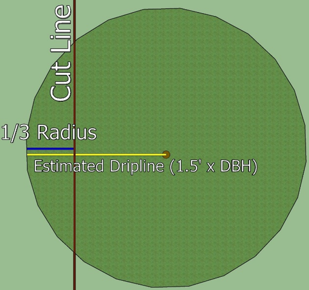
10.
Fencing detail for any fencing required under section 36-720.
11.
Signage details for any required signage under section 36-720.
12.
All tree removal shall be accounted for with the initial plan and include proposed grading for all lots in a development.
13.
For single-family detached residential property, trees within 20 feet of the building pad may be preserved but shall not count as preserved on the retention schedule.
c.
Sequencing plan. The sequencing plan shall show the following sequencing schedule:
1.
Root cutting;
2.
Installation of tree protection fence and signage;
3.
Grading.
(2)
Standards of preservation during development. Development means part of a development proposal under review such as, but not limited to, a planned unit development or subdivision review.
(3)
Replacement table for planned unit developments. The replacement for planned unit developments has a replacement ratio that gets higher as removal gets higher and puts a limit on removal. The intent is to limit removal and provide more replacement with more removal.
The replacement ratio shall apply to the entire replacement. For example, removal in a residential PUD of 60 percent would have a 3:1 replacement ratio, 61 percent removal would trigger at 4:1 replacement ratio.
(4)
Density bonus and transfer for residential development. As an incentive to retain trees, density bonuses can be considered for preservation. Density bonuses are based on the percentage of trees retained over 50 percent and apply to the area of a project that is in a T zone. Density bonuses for T zone preservation can be in addition to any density bonuses in the PUD section.
a.
For each net acre, or portion thereof, above 50 percent of the T zone area that is preserved, a density bonus may be considered. Wetland and floodplain areas will not count toward the calculated area of preservation as these areas already have protections.
b.
The density bonus shall be based on two times the maximum density of the underlying land use guiding in the comprehensive plan.
c.
At least 55 percent of the inches must be retained before the density bonus shall apply.
d.
To calculate the total number of units allowed on a site, the bonus units would be added to the number of units using the base density multiplied by the net acres of the site for the particular land use category. The base densities are as follows and are based on historical averages for these land uses:
1.
Low-medium density: 2.5 units per acre.
2.
Medium density: 6.75 units per acre.
3.
High density: 18 units per acre.
4.
Mixed use high density: 22 units per acre.
e.
Example table for a low-medium density guided site:
f.
The additional units can be transferred to the remainder of the site or an alternative site subject to city approval.
g.
The city may consider flexibility with regard to unit types and lot sizes to accommodate the greater amount of open space that would occur with greater tree preservation. For example, smaller single-family lots or more attached housing in the low-medium residential areas could be considered.
h.
For sites that have both T zone areas and non-T zone areas, density bonuses shall be calculated independently from each other. Open space preservation bonuses would only be gained if open space was created in the non-T zone area above what is required by code.
i.
The maximum density in low-medium residential guided land may not be exceeded.
(5)
Standards of preservation when not connected with a development review. This section shall govern the development of individual vacant lots and/or new construction in a T zone in which removal was not previously accounted for through some other review process such as, but not limited to, planned unit development or subdivision review. Note that existing homes proposing additions, or other such improvements, will be subject to the requirements of section 36-721.
a.
Single-family detached and two-family dwellings. The builder shall be responsible for working with the community development department for the protection of the trees to be preserved on a particular lot.
1.
The building pad shall include an area from the front lot line to a line 85 feet behind the front lot line.
2.
The building pad shall extend across the entire width of the lot.
3.
The builder shall be required to replace trees removed from within the building pad on a basis of one-half inch of replacement for each DBH inch of removal.
4.
Trees protected within the building pad may count toward replacement at a ratio of two inches of replacement for every DBH inch of trees protected.
5.
If trees are removed from the area outside the building pad, they shall be replaced at a ratio of two inches of replacement for each DBH inch removed.
b.
Other development types.
c.
Trees removed in excess of the removal limit above shall be replaced at a ratio of two inches of replacement for each DBH inch removed.
(6)
Standards of preservation in all other circumstances. Whenever trees are removed under any circumstances other than those identified in subsections (2) and (5) of this section, preservation and replacement ratios set forth in subsection (5) of this section shall apply.
(Code 1984, § 375:109(4); Code 2003, § 36-728; Ord. No. 21-09, § 1(exh. A), 7-19-2021)
Sec. 36-719. - Replacement standards.
(a)
As shown on a tree preservation plan required in section 36-718(1)b, replacement shall occur in the following order:
(1)
In the area from which the trees are removed. For single-family residential developments, or other types of development as determined by the city council, the area shall be common areas, outlots or other lots other than private, individually owned lots.
(2)
If this is not desirable for the health or survival of the replacement trees, the trees shall be replanted elsewhere within the T zone from which the trees were removed. For single-family residential developments, or other types of development as determined by the city council, the area shall be common areas, outlots or other lots other than private, individually owned lots.
(3)
If this is also undesirable for the health or survival of the replacement trees, then the replanting may occur outside of the designated T zone but shall occur within the development. For single-family residential developments, or other types of development as determined by the city council, the area shall be common areas, outlots or other lots other than private, individually owned lots.
(4)
If this is not desirable for the health or survival of the replacement trees, then the landowner shall consult and work with the city to determine a better alternative planting location for the replacement trees.
(5)
Otherwise, at the discretion of the city council, the tree conservation fee shall be paid to the city in an amount as is set forth by the city council in the adopted fee schedule. Funds received by the tree conservation fee will be maintained within a separate account and used to replant trees on public lands or within forest preservation lands.
(b)
Any replanting shall be done with overstory trees of the primary species of the affected forest. No more than 20 percent of the replacement trees shall be composed of any one genus. At planting, the trunks of deciduous trees shall be at least 2½ inches DBH. Coniferous trees shall be at least five feet in height.
(c)
Replacement trees shall be identified as such until they are eight inches in DBH, shall be considered at least eight inches in DBH regardless of size and shall be treated accordingly for purposes of this division.
(d)
A coniferous tree replacement shall be counted at a ratio of one inch DBH for every two feet in height of the coniferous tree.
(e)
If any replanting is to occur outside the limits of the T zone, the parcel on which the replanting occurs shall be rezoned so as to be governed by the provisions of the T zone.
(f)
Any replacement tree required to be planted by section 36-718 shall be in addition to trees required to be planted on any residential lot, including single-family detached, two-family, or any lot needing to comply with the requirements of section 36-805.
(Code 2003, § 36-729; Ord. No. 21-09, § 1(exh. A), 7-19-2021)
Sec. 36-720. - Requirements before and during construction.
(a)
Tree protection and preservation standards.
(1)
Trees designated for preservation shall be protected by a highly visible fence or other temporary structure deemed acceptable by the city. The protection area shall be defined by the projection of the tree dripline downward to the ground. If less protection is necessary due to the proximity of building structures or infrastructure, such reduced protection area shall require approval by the city prior to any construction activity taking place.
(2)
The location and means of tree protection shall require inspection and approval by the city prior to any construction activity taking place, including any grading work on the site. The city shall also inspect the construction site during construction. The tree protection shall remain in place until the city has conducted an inspection of the lot and has approved the removal of the fencing.
(3)
No equipment, chemicals, soil deposits or construction materials shall be placed within a protective barrier.
(4)
Any landscaping activity subsequent to the removal of the barriers shall be accomplished with hand labor.
(5)
If, during construction, activities take place in areas designated for preservation in violation of the above standards, trees in the impacted area may be deemed removed and subject to the penalties in section 36-712 and any necessary replacement requirements.
(6)
Any tunneling under trees for utilities should be a minimum of two feet underground from the top of the tunnel to minimize root loss.
(b)
Site signage.
(1)
Prior to any tree being removed pursuant to section 36-718(2) or (3), the property owner shall cause to be posted on the perimeter of the site involved in the development, subdivision, excavation or construction activity signs readily visible to and understandable by the public identifying the trees and activity on the site as being subject to the provisions of T zone regulations of the city.
(2)
Such signs will be provided by the city, shall be placed in proximity to planned entrances to the development and shall remain in place until the activity has passed final approval by the city departments monitoring it.
(3)
In addition, the property owner shall securely attach signs to the tree protection fence required under section 36-720 every 50 feet of protection fencing or portion thereof. Such signs will be provided by the city.
(4)
All site activity that would impact trees shall cease if signage and/or fencing are not in place, until the signage and fencing are deemed adequate by the monitoring city departments.
(c)
Performance guarantee.
(1)
Based upon the replacement trees identified in section 36-719, and prior to any construction activity taking place, the applicant shall submit a cash escrow, letter of credit or other surety acceptable to the city in the amount of 100 percent of the cost of the replacement trees proposed for the project area. Such surety shall remain in force for two full growing seasons following installation of the replacement trees to guarantee survival. At the end of the second growing season or subsequent two-year period, the city shall review the project area in coordination with the applicant and shall make a determination to:
a.
Refund the appropriate performance surety; or
b.
Require the planting of new trees to replace the replacement trees which did not survive the initial or subsequent two full growing seasons or subsequent periods until such time as the replacement trees have survived two full growing seasons.
(2)
For purposes of this section, all trees shall be alive and in satisfactory growing condition at the end of two full growing seasons. The growing season shall include the period May 1 through September 30. The two-year guarantee period for plant materials installed after the growing season ends shall commence the following year.
(d)
Survey of trees prior to issuance of building permit. Prior to the issuance of a building permit by the city for a lot within a development subject to the requirements of this section, the applicant for such building permit shall provide a certified survey of the lot or lots for which the building permit is to be issued identifying the location, size and species of all trees eight inches DBH or larger in size. Such survey shall indicate trees that are to be removed, those that are to be saved and any required replacement trees. Diagrams of protective fencing shall be shown on the survey consistent with section 36-720. If required by the city, a tree replacement plan shall be provided complying with the provisions of this section.
(e)
Survey of trees prior to approval of occupancy. Prior to the city approving final occupancy for any structure contained within a T zone, the applicant for such occupancy shall provide a certified survey of the lot verifying the information required in subsection (e) of this section. If the city determines that additional tree inches are removed after the completion of site improvements based on the survey, the city shall require additional tree replacement.
(f)
Further requirements during subdivision are set forth in chapter 30 and include, but are not limited to, section 30-38(3)m.
(Code 2003, § 36-730; Ord. No. 21-09, § 1(exh. A), 7-19-2021)
Sec. 36-721. - Tree preservation standards after site development.
(a)
For all development types, except for single-family detached homes, the tree preservation plan associated with that development shall govern and additional tree removal shall be compared with the removal in the original approval. Any required replacement shall be subject to the requirements of this chapter.
(b)
For single-family detached homes, after a certificate of occupancy has been granted, additional removal of trees eight inches in diameter at breast height (DBH) shall require the replacement of one tree for each tree removed. Replacement trees shall meet the requirements of section 36-719.
(Code 2003, § 36-731; Ord. No. 21-09, § 1(exh. A), 7-19-2021)
Sec. 36-722. - Exceptions.
The provisions of this division shall not apply to:
(1)
The removal of trees from commercial nurseries or horticultural properties, such as tree farms, orchards or commercial forests. This exception shall not be interpreted to include lumber harvesting incidental to imminent development of the land.
(2)
The removal of trees on public rights-of-way conducted by or on behalf of a federal, state, county, municipal, or other governmental agency in pursuance of its lawful activities or functions in the construction or improvement of public rights-of-way.
(3)
The removal of trees deemed to be diseased, dying, or dead. The determination shall be made by a certified arborist, landscape architect or other natural resource professional.
(4)
The removal of any tree which has become or threatens to become a danger to human life or property.
(5)
The removal of any tree by a public utility when such tree has the reasonable potential of endangering the facilities operated by the utility.
(Code 2003, § 36-732; Ord. No. 21-09, § 1(exh. A), 7-19-2021)
Sec. 36-743. - Findings; intent.
(a)
Wetlands help maintain water quality, serve to minimize flooding and erosion, serve as sources of food and habitat for a variety of fish and wildlife, and are an integral part of the community's natural landscape, providing the aesthetic benefits of open space and a natural separation of land uses. It is the intent of this division to establish a policy of sound stewardship through coordination of regulations that strive toward zero degradation and no net loss of the wetlands by conserving, protecting, and enhancing these environmentally sensitive resources. In addition, it is the intent of the city to promote the restoration of degraded wetlands where feasible and practical. It is the city's intent that the use of sound planning policies should strive to first avoid alteration to wetlands. Where alteration of wetlands cannot be avoided, then wetland loss shall be mitigated.
(b)
The primary goal of this division is to avoid wetland impact by careful design of development proposals. An applicant for a wetland alteration has the obligation to demonstrate, to the city's satisfaction, that reasonable alternatives to the action have been explored. The city must find that the alternatives are inappropriate or that a wetland enhancement would result for the city to approve the wetland alteration. Mitigation should always result in an improvement to the wetland function and value. The wetland function and value will include improvement of water quality, maintaining the hydrological balance and provision of wildlife habitat.
(Code 1984, § 375:111(1); Code 2003, § 36-751; Ord. No. 22-07, § 1, 4-18-2022)
Sec. 36-744. - Purpose.
The purpose of this division is to ensure the protection of the general health, safety and welfare of the residents and the protection of the wetland resources of the city, now and in the future, through preservation and conservation of wetlands and sound management of development by:
(1)
Establishment of wetland regulations that are coordinated with flood protection and water quality programs.
(2)
Requiring sound management practices that will protect, conserve, maintain, enhance, and improve the present quality of wetlands within the community.
(3)
Requiring sound management designed to maintain and improve water quality in streams and lakes with its attendant increase in recreational use and value.
(4)
Protecting and enhancing the scenic value of the wetland.
(5)
Restricting and controlling the harmful effects of land development which adversely affect wetlands, which harmful effects include, but are not limited to:
a.
Improper erosion control practices.
b.
Rapid runoff from developed areas.
c.
Pollution from gas, oil, salt, fertilizer, sand, silt, and other materials.
d.
Dumping of waste in wetlands.
e.
Unrestricted placement of structures within wetland areas.
f.
Lack of a buffer strip to protect the perimeter of the wetland.
(6)
Allowing only development that is planned to be compatible with wetland protection and enhancement.
(7)
Providing standards for the alteration of wetlands when permitted by the city.
(8)
Mitigating impact of development adjacent to wetland areas.
(9)
Educating and informing the public regarding the function of wetlands and the impact of urbanization upon wetlands.
(10)
Obtaining protective easements over or acquiring fee title to wetlands as opportunities occur.
(Code 1984, § 375:111(2); Code 2003, § 36-752)
Sec. 36-745. - Applicability.
(a)
The W Wetland Systems District shall be applied to and superimposed upon all residential, business, mixed use, or industrial districts provided for in this chapter existing or amended by the text of this chapter and the zoning map. The regulations and requirements imposed by the W Wetland Systems District shall be in addition to those of floodplain and shoreland districts and those established for the districts which jointly apply. Under the joint application of districts, the more restrictive requirements shall apply.
(b)
The wetland systems district within the city applies to areas defined in Minn. Rules 8420.0111, subpt. 72, and any subsequent updates and to any required buffer strip located on the upland immediately adjacent to a wetland a treatment pond, or a watercourse related to a wetland.
(Code 1984, § 375:111(3); Code 2003, § 36-753; Ord. No. 22-07, § 1, 4-18-2022)
Sec. 36-746. - Permitted activities.
The following operations and uses are permitted in the wetland systems district as a matter of right, subject to any other applicable code, ordinance or law:
(1)
Conservation of soil, vegetation, water, fish and wildlife.
(2)
Scientific research and educational activities that teach principles of ecology and conservation.
(3)
Leisure activities such as hiking, nature studies, canoeing, boating and horseback riding, including facilities such as trails or docks which allow such activities.
(4)
Essential services, streets, and trails.
(5)
Other uses deemed by the zoning administrator to be similar to those set forth in this section and consistent with the purposes and intent of this section set forth in sections 36-743 and 36-744.
(Code 1984, § 375:111(4); Code 2003, § 36-754)
Sec. 36-747. - Accessory uses.
Permitted accessory uses in the wetland systems district are private antennas and towers in compliance with chapter 8, article V.
(Code 1984, § 375:111(5); Code 2003, § 36-755)
Sec. 36-748. - Prohibited activities.
Unless found to be in compliance with the Minnesota Wetland Conservation Act of 1991, Minn. Stats. ch. 354, and Minn. Rules 8420, including subsequent updates, wetlands must not be impacted unless replaced by restoring or creating wetland areas of at least equal public value. It shall be unlawful for any person to drain or fill wetlands, wholly or partially, and/or excavate in the permanently and semi-permanently flooded areas of type 3, 4, or 5 wetlands, or in any wetland type if the excavation results in filling, drainage, or conversion to non-wetland.
(Code 1984, § 375:111(6); Code 2003, § 36-756; Ord. No. 22-07, § 1, 4-18-2022)
Sec. 36-749. - Wetland alterations.
Filling or alteration of wetlands which cannot be avoided if reasonable development is to occur may take place upon approval of the technical evaluation panel as regulated by article II, division 4 of this chapter.
(Code 1984, § 375:111(7); Code 2003, § 36-757; Ord. No. 22-07, § 1, 4-18-2022)
Sec. 36-750. - Development regulations.
(a)
Any wetland impact requiring mitigation shall be on a basis of a minimum of two acres of mitigation for every acre of wetland alteration. Mitigation shall conform to the credit and replacement criteria of the Minnesota Wetland Conservation Act of 1991, Minn. Stats. ch. 354.
(b)
Mitigation shall create high value wetlands.
(c)
Mitigation shall be accomplished in a manner which allows the greatest probability of the wetland flora establishing itself in the newly created wetland.
(d)
Mitigation shall occur in conformance with a mitigation plan approved in conjunction with a conditional use permit pursuant to the provisions of article II, division 4 of this chapter.
(e)
Created wetland slopes should be a maximum of 10:1, with an average of 15:1.
(f)
Wetland soils shall be placed in all mitigation areas or seeding and/or planting shall be done.
(g)
Prior to the revegetation of a development site, sedimentation basins capable of accepting runoff from storms of up to a 100-year frequency shall be established on the development site. Any required permanent treatment facilities shall be located outside the wetland.
(h)
Mitigation shall occur prior to or concurrent with wetland alteration.
(i)
Buffer strips in excess of those imposed by the Wetland Conservation Act of 1991, Minn. Stats. ch. 354, shall not be required adjacent to mitigation areas.
(Code 1984, § 375:111(8); Code 2003, § 36-758; Ord. No. 22-07, § 1, 4-18-2022)
Sec. 36-751. - Wetland ranking.
In determining whether a wetland is of protect, manage preserve, manage flexible, or manage restore classification, the state department of natural resources' Minnesota Routine Assessment Method (MnRAM) for evaluating wetland functions or equivalent shall be used.
(Code 1984, § 375:111(9); Code 2003, § 36-759; Ord. No. 04-05, § 1, 2-2-2004; Ord. No. 22-07, § 1, 4-18-2022)
Sec. 36-752. - Wetland buffers.
All development commenced after June 16, 1993, shall maintain a buffer strip in the upland adjacent to the wetland or watercourse as designated below. Buffer strip vegetation shall be established and maintained in accordance with the following requirements:
(1)
Plant species shall be selected from mixes approved by the state board of water and soil resources or an equal approved by the city.
(2)
Buffer strips shall be identified by permanent monumentation acceptable to the city. A monument is required wherever a buffer strip intersects a lot line, on bends in the buffer, or every 200 feet, whichever is less.
(3)
Buffer strips shall be required according to the following table:
Total applicable building setback from the edge of a wetland shall conform to the building setback requirement of the zoning district in addition to the buffer width required by this section.
(4)
Water quality ponding may encroach into the required wetland buffer, provided that the amount of buffer encroached upon does not exceed 50 percent of the buffer or 50 percent of the pond area required.
(5)
Buffer flexibility for properties zoned commercial or industrial: The minimum buffer width may be reduced to ten feet provided all of the following conditions are met:
a.
The average buffer width provision per the city classification is met.
b.
All stormwater from the project area is treated to current standards prior to discharge into wetlands.
(6)
Due to differences in watershed district standards, the city council may approve different buffer strip minimums as long as buffer distances comply with corresponding watershed requirements.
(Code 1984, § 375:111(10); Code 2003, § 36-760; Ord. No. 22-07, § 1, 4-18-2022)
Sec. 36-753. - Exemptions.
(a)
Those properties developed under a conditional use permit issued in keeping with the standards of the W Wetland Systems District shall be subject to the conditions of that permit notwithstanding any changes to wetland standards imposed by this division. This exemption would allow the continued use of wetland areas included in residential lots under previous rules.
(b)
The alteration of any wetland which is crucial to the accomplishment of the city's comprehensive plan may occur. However, such alteration is subject to all of the mitigation requirements of this division.
(c)
A replacement plan (mitigation) for wetlands is not required for those activities and situations which are exempt pursuant to Minn. Stats. § 103G.2241 or Minn. Rules ch. 8420.
(d)
Buffers shall not be required for roadways aligned either adjacent to or across wetlands and which are subject to the Minnesota Wetland Conservation Act of 1991, Minn. Stats. ch. 354, requirements.
(Code 1984, § 375:111(11); Code 2003, § 36-761; Ord. No. 22-07, § 1, 4-18-2022)