
Marathon City Zoning Code
CHAPTER 107
GENERAL DEVELOPMENT STANDARDS
ARTICLE 107-1 BUILDING PERMIT ALLOCATION SYSTEM (BPAS)
The purpose and intent of this chapter is to manage the rate of new development to protect the quality of life for residents and retain the predominately small scale character of development in the City by: enhancing and protecting natural resources; assuring that growth proceeds in an orderly manner and does not exceed the availability of public facilities and services; by establishing a building permit allocation system that encourages the development of affordable workforce housing; by directing the rate and location of new growth to further discourage deterioration of public facility service levels, by limiting environmental degradation and potential land use conflicts; by encourages encouraging appropriate in-fill development; by promoting the upgrading upgrade, expansion, or redevelopment of existing small-size businesses hotel/motel establishments; and supporting long-term owner occupancy of market rate dwelling units to stabilize residential neighborhoods.
ARTICLE 107-7 SIGNS
Editor's note(s)—Ord. No. 2022-02, § 2 Exh. A, adopted March 8, 2022, repealed the former Div. 7., §§ 107.58—107.62, and enacted a new Div. 7 as set out herein. The former Div. 7 pertained to similar subject matter [or and derived from Ord. No. 2014-11, § 2, 8-12-2014.
ARTICLE 107-8 LANDSCAPING
Editor's note(s) - Ord. No. 2023-19, adopted September 12, 2023, amended Sec. 107.72 in its entirety. Former Sec. 107.72 was renumbered as Sec. 107.73 by Ord. No. 2023-19.
ARTICLE 107-12 FLOODPLAIN MANAGEMENT
Editor's note(s)—Ord. No. 2018-05, § 2, adopted August 14, 2018, repealed the former Article 12, §§ 107.98—107.102.5, and enacted a new Article 12 as set out herein. The former Article 12 pertained to similar subject matter and derived from Ord. No. 2012-01, § 3, adopted January 24, 2012
ARTICLE 107-15 OUTDOOR LIGHTING
Appendix A Examples of Acceptable / Unacceptable Lighting Fixtures
2012-07
2009-18
2010-12
2018-10
2024-12
2008-29
2009-09
2010-13
2011-08
2009-10
2009-08
2009-07
2023-22
2023-12
2009-12
2024-10
2019-13
2022-02
2022-24
2023-19
2014-014
2018-05
2021-06
2024-08
2024-04
Sec 107.01 Administration
The administration of the building permit allocation program is the responsibility of the Planning Director or his or her designee. Council shall evaluate the program on an as needed basis, but no less frequently than every two (2) years. This evaluation shall include an assessment of the need for specific annual allocations and all other aspects of the program. The program shall run on a semi-annual basis except for the allocation of Transient Residential Units (TRUs), which may take place every two (2) months [e.g., six (6) times a year]. The existence of any particular allocation pool herein does not confer the right to develop a parcel of land for any purpose, nor create a vested property right.
Sec 107.02 Numerical Limits Of Allocation
- Residential Dwelling Units and Transient Residential Units.
- The annual issuance of Market Rate and Affordable BPAS allocations shall be limited to 30 dwelling units to be distributed as follows: Eighty percent Market and 20 percent Affordable. The annual market to Affordable ratio may vary, but it shall not exceed the annual unit restriction for any continuous, sequential five-year period, i.e., no more than 150 allocations may be issued for any given five-year period.
- The number of TRU allocations that may be issued shall be limited to 200 [100 TRUs authorized by the Governor and Cabinet on January 18, 2012 sitting as the Administration Commission, and 100 TRUs the City may choose to allocate at its discretion from the Administrative Relief and/or Residential BPAS pools].
- If any part of the 30-unit annual Market Rate and Affordable BPAS allocations remain unused, then such excess allocations shall be transferred to the Administrative Relief or Affordable pools in accordance with Subsection 107.06E.
- For the purpose of administration of this article, the Council shall, by resolution, establish an annual allocation quantity for each category of dwelling unit (including TRUs) allocations and may make certain numerical adjustments among the categories from time to time.
- Except as provided for in Subsection 107.02A.2., no dwelling unit allocations shall be available for the development of new hotel or motel units.
- Commercial Floor Area. The annual issuance of allocations shall be limited to 25,000 square feet of commercial floor area for the next continuous, sequential ten-year allocation periods, to not exceed a total of 250,000 square feet during the next ten (10) years.
Sec 107.03 Establishment Of Allocation Equivalency Factor
Council creates the following allocation equivalencies:
Table 107.03.1
Allocation Equivalency Factors
| Type of Dwelling Unit | Allocation Equivalency Factor | Note(s): |
| Single or two-family | 1.00 | (3) |
| Community Workforce | 1.00 | (1) & (4) |
| Multi-family | 1.00 | (3) |
| Dormitory | 1.00 | (2) |
| Group Home (per dwelling unit) | 1.00 | (4) & (5) |
Footnotes:
(1) Limited to up to two (2) bedrooms unless an additional bedroom is approved as a variance by the Council. If such variance is approved, the total square footage shall not exceed the maximum square footage for the applicable equivalency factor
(2) A dormitory is limited to a maximum of 2000 square feet of climate controlled space.
(3) Dwelling units utilizing affordable housing allocations are subject to a maximum size of 1800 square feet of habitable space
(4) Minimum size shall be greater than 375 square feet of habitable space
(5) Each housekeeping unit comprising a group home which meets the definition of a dwelling unit, as established in Chapter 110, shall require an allocation
Sec 107.04 Establishment Of Allocation Pools
For the purpose of administration of this article, Council hereby creates the following described allocation pools:
- Dwelling Units.
- Market Rate.
- Owner-occupied Pool. For each respective allocation period in the market pool, one (1) allocation will be issued to each owner-occupier applicant, in order of their ranking and controlling date and time, if sufficient allocations are available.
- General Market Pool. For each respective allocation period in the general market pool, allocations will be issued to each applicant, in order of their ranking and controlling date and time, if sufficient allocations are available. One (1) application per allocation period will receive the application score; however, in the case of subsequent applications, filed by the same applicant during the same allocation period, five (5) points shall be deducted from the total application score.
- Affordable.
- General Affordable Pool. For each respective allocation period in the general affordable pool, allocations will be issued to each applicant, in order of their ranking and controlling date and time, if sufficient allocations are available.
- Community Workforce Pool. For each respective allocation period in the community workforce pool, allocations will be issued in order of their controlling date and time, if sufficient allocations are available.
- TBR Affordable Pool. For each respective allocation period in the TBR affordable pool, allocations will be issued in order of their controlling date and time, if sufficient allocations are available.
- Early Evacuation Pool. The City thereby, shall establish a new limited category to be known as the "Affordable - Early Evacuation Pool" which will provide workforce-affordable building permit allocations for the Workforce-Affordable Housing Initiative. These allocations are in addition to the maximum allocations identified in Rules 28-18, Florida Administrative Code. The City shall be responsible for the management, distribution, and enforcement of requirements associated with the early evacuation affordable allocations. At any time, through a public hearing process prescribed in Chapter 102, Article 2 of the Land Development Regulations, the City may allocate early evacuation allocations. The City of Marathon shall ensure adherence to these requirements through implementation of the policies of this objective.
- Transient Residential Units.
- For each respective allocation period in the transient residential unit pool, allocations will be issued to each applicant in order of their ranking and controlling date and time, if sufficient allocations are available. If the City chooses to allocate at TRUs from the Administrative Relief and/or Residential BPAS pools, such allocations may be awarded subject to compliance with the applicable provisions of Sections 107.06, 107.07, and 107.10.
- Market Rate.
- Commercial Floor Area.
- For each respective allocation period in the commercial floor area pool, allocations will be issued in order of their ranking and controlling date and time, if sufficient allocations are available.
- If the amount of floor area represented in the allocation applications is equal to or less than the available allocation, the Director may recommend to Council that all of the allocation applications be granted allocation awards.
- If the total amount of floor area represented in the allocation applications is greater than the available floor area, the Director shall submit an evaluation report to the Council indicating the evaluation rankings and identifying those applications whose ranking puts them within the allocation, and those applications whose ranking puts them outside of the allocation.
- Administrative Relief Pool.
- The BPAS Administrative Relief Pool is hereby created. At the recommendation of the Planning Director and at the discretion of the City Council, a percentage not to exceed fifty (50) percent of the annual dwelling unit allocations described in Section 107.02 above may be distributed to the Administrative Relief Pool based upon the potential number of applicants for administrative relief in any given year.
- [Distribution of allocations.] BPAS administrative relief allocations are distributed by the Council at their discretion following a request from an applicant, and subject to a finding through the administrative relief process that all of the following conditions for eligibility exist:
- Conditions for Eligibility.
- That the applicant has applied for an allocation, but has not received an allocation for residential development during four (4) consecutive years in the BPAS, during which the ownership has not changed and the application has not been withdrawn. The start of the first year is the closing date of the BPAS allocation period during which the BPAS application first became eligible for a BPAS allocation award;
- That conditions described in Section 107.04 C.3. below have been met;
- That the issuance of an allocation, pursuant to the recommendation of the Planning Director, is the most appropriate option for the use of the property and will not adversely affect the public interest or the purposes of the Plan;
- That allocations are available in the BPAS administrative relief pool; and that the requested allocation and the resulting building permit would be proper and in accordance with all of the ordinances and regulations of the City of Marathon.
- Conditions for Eligibility.
- Procedures for Provision of Administrative Relief Allocation.
- On a semi-annual basis, at the closing of each BPAS bi-annual allocation period, and approximately one (1) year prior to the four (4) year anniversary of any uninterrupted BPAS application as described in Section 107.04 1.(a) above, City staff, in coordination with the City of Marathon Land Acquisition Advisory Committee, will make a determination for each application on the BPAS allocation waiting list as to whether:
- It will be eligible to apply for administrative relief within approximately one (1) year, and
- The property in question is either environmentally sensitive, of interest to the City for some other public purpose, such as workforce housing, or of no current public interest.
- City staff will confirm the environmental characteristics of all properties that will become eligible for administrative relief within one (1) year through a review of the BPAS application, available GIS aerial photography and map layers, and on-site visits.
- Any property that:
- Has a KEPWEP score higher than 5.5;
- Is on the most current version of the USFWS Injunction list; and/or
- Is on the Florida Forever Acquisition list; and/or
- Exhibits habitats including mangroves, salt marsh and buttonwood, or hardwood hammock;
shall be put on a list of properties considered as environmentally sensitive and of potential interest for acquisition for conservation purposes.- The City shall provide the list of environmentally sensitive properties to the Florida Department of Environmental Protection, Division of State Lands (Florida Forever), the Monroe County Land Authority, and other land acquisition agencies deemed appropriate by the Planning Director, thereby giving those agencies an opportunity to initiate acquisition procedures if deemed appropriate; and
- Any properties that another acquisition agency declines an interest to purchase, will be placed on a list for suggested acquisition at the time that the property actually becomes eligible for Administrative Relief.
- Any properties that are considered of potential value for another public purpose will be placed on a list for suggested acquisition at the time that it actually becomes eligible for administrative relief.
- Any properties that are not deemed environmentally sensitive and which would not be recommended for purchase for some other public purpose will be put on a list of properties that would be recommended to receive a BPAS allocation from the Administrative Relief Pool at the time that the property actually becomes eligible for Administrative Relief.
- Any property that:
- On a semi-annual basis, at the closing of each BPAS bi-annual allocation period, and approximately one (1) year prior to the four (4) year anniversary of any uninterrupted BPAS application as described in Section 107.04 1.(a) above, City staff, in coordination with the City of Marathon Land Acquisition Advisory Committee, will make a determination for each application on the BPAS allocation waiting list as to whether:
- Notification of eligibility. Within 30 days of the finalization of evaluation rankings by the City Council, any applicant determined to be eligible for administrative relief pursuant to subsection (3)(a) of this section shall be notified of the applicant's eligibility for administrative relief by certified mail, return receipt requested.
- Application. An application for administrative relief shall be made on a form prescribed by the Planning Director no earlier than the conclusion of the fourth year in BPAS allocation process and no later than 180 days following the close of the allocation period when deemed eligible.
- Public Hearing. Upon receipt of an application for administrative relief, the City shall notice and hold a public hearing at which the applicant will be given an opportunity to be heard. The City Council may review the relevant application material, applicable evaluation ranking, hear testimony from the applicant, city staff and others as may be necessary in its deliberations.
- Actions by City Council. In making a determination in review of an application for administrative relief, the City Council may:
- Offer to purchase the property at its fair market value as its preferred action if the property is considered environmentally sensitive; or
- Grant the applicant an allocation award for all or a number of dwelling units requested in the next succeeding allocation period or extended pro rata over several succeeding quarterly allocation periods as the preferred action for buildable properties not meeting any of the criteria in subsection (f)(1) of this section; or
- Suggest or provide such other relief as may be necessary and appropriate.
- Limit of Allocation under Administrative Relief. The number of allocations that may be awarded under administrative relief in any allocation period shall be no more than the number available in the Administrative Relief Pool at the close of the BPAS allocation period.
Sec 107.05 General Provisions
- Level of Service Requirement. The number of years over which allocations may be granted for a given application shall be based on the size of the application and the availability of infrastructure.
- Except as provided in Subsection 107.07(J), allocations are site specific and may not be transferred from one (1) application to another. Allocations may be transferred with the conveyance of a lot.
- Exemptions. The following classes of permits and approvals are not subject to all or a portion of the restrictions of the Building Permit Allocation System:
- Building permits for additions, remodeling, or demolition or reconstruction of existing dwelling units.
- Publicly owned facilities are exempted from the allocation system for commercial floor area, provided that such shall not be placed in hammocks or environmentally sensitive areas with the exception of the following: fill may be placed in wetlands, subject to ACOE and DEP approvals, as needed for the siting of necessary public facilities when it can be demonstrated, pursuant to the requirements of the Plan, that the siting will serve a legitimate public purpose.
- Upon request and recommendation for exemption by the Director, Council may approve, at a public hearing, the issuance of allocations for perpetually income deed-restricted dwelling units needed to meet the quantified objectives for affordable housing, as set forth in the Housing Element of the Comprehensive Land Use Plan.
- Such dwelling units issued under this provision will not increase the total affordable dwelling allocations available for issuance during the allocation period.
- Criteria for issuance of such allocations: An affordable residential dwelling allocation(s) may be issued if the proposed site meets all of the following criteria:
- The use shall be an allowed use in the land use and zoning districts which apply to the site; and
- The site is listed as scarified or disturbed based upon the City of Marathon Habitat Maps.
- Eligibility.
- To apply for allocations, a development must have completed all steps otherwise necessary to apply for and receive a building permit including habitat assessment (if required by the City Biologist), other agency approvals or letters of coordination and the requisite construction plans, zoning and subdivision approvals.
- In order to qualify for issuance of an allocation, revised construction plans, if required by the Building Official, which meet the requirements of the most recent version of the Florida Building Code and the City of Marathon Land Development Regulations, must be received by the Building Department no later than 60 days after notification of award.
- Proof of ownership, in the form of a copy of the Monroe County Property Appraiser record card or a copy of the recorded warranty deed, which has been certified as true and correct by the Monroe County Clerk of the Court, must be supplied at the time of application.
- For purposes of this program, the applicant is the owner of record of the lot for which the permit is sought and is presently in physical possession of the lot.
- For purposes of this program, an applicant, or entity in which the applicant holds an interest, his or her spouse and unemancipated children under the age of 18, shall be considered the same applicant.
Sec 107.06 Limitations
In addition to the limitations herein, an allocation is subject to the specific provisions for each allocation pool as follows:
- Market Rate Owner-occupied Allocation Pool.
- Allocations will be issued only in the owner occupant applicant's name.
- Eligibility for this pool is limited to one (1) per lifetime per applicant.
- The applicant shall have personally resided or have been employed within the City of Marathon during the two (2) years immediately prior to applying for an allocation from this pool.
- The applicant shall occupy the unit for a minimum of two (2) years from the date of issuance of the Certificate of Occupancy. Upon finding of good cause, as established in Chapter 110 "Definitions" the City Manager or his/her designee, may waive the minimum occupancy requirements and the applicant may sell the property during the two-year minimum occupancy period. However, at the time of closing, the applicant shall only receive up to the "SLE" as calculated using the indexed formula, as established in Subsection 7., below and the City of Marathon shall receive the difference between the "SLE" and the "ONP" to be used for affordable housing.
- The applicant shall occupy the dwelling unit for at least nine (9) months of each year. Occupancy by children or other immediate family members or dependents of Applicant shall be considered occupancy by Applicant.
- Proof of Homestead Exemption, issued by the Monroe County Property Appraiser's office, must be supplied to the Planning Department within one (1) year of the issuance of Certificate of Occupancy for the dwelling unit.
- Prior to the issuance of the building permit for any dwelling unit developed under this provision, the applicant shall, on a form supplied by the City, record in the official records of Monroe County, a deed restriction running with the land, which limits the occupancy of the dwelling unit to the stated applicant(s) for a minimum of two (2) consecutive years after the date of issuance of the Certificate of Occupancy.
- The deed restriction shall also include the provision for a shared limited equity factor based upon the following indexed formula:
OWNERS' NET PROCEEDS ("ONP"), at time of closing, multiplied by INDEX equals SHARED LIMITED EQUITY (SLE); or "ONP" x "INDEX" = "SLE"
Where:
"ONP" is the Owner's Net Proceeds for the dwelling unit.
"INDEX" shall be percentage of increase (or decrease) for all expenditures as listed in the Consumer Price Index for All Urban Consumers (CPI-U) as published by the U.S. Department of Labor, Bureau of Labor Statistics or any successor thereto, for the period of time that includes December 31 of the year in question as compared to the household median income reported for the period of time that includes December 31 of the previous year.
"SLE" is Shared Limited Equity.
- General Market Rate Pool.
- For purposes of this program, an applicant or entity in which the applicant holds an interest, his or her spouse and un-emancipated children under the age of 18, shall be considered the same applicant.
- Development of multi-family dwellings shall provide for employee housing pursuant to the requirements of the LDRs or development agreements as approved by the Council.
- General Affordable Pool.
- Lot size for development of a single-family residence is subject to the zoning district of the subject parcel.
- Single-family and multi-family dwelling units are limited to a maximum of 1,800 square feet of habitable space.
- The maximum rental or sales price for the dwelling unit shall meet the requirements as established for affordable housing in Chapter 104 "Specific Use Regulations" and Chapter 110 "Definitions". If the dwelling unit is designated for employee housing, as defined in Chapter 110, the use of the dwelling is restricted to households that derive at least 70 percent of their household income from gainful employment in Monroe County. Eligibility of a potential renter of the employee housing shall be determined by the Department at the time the potential renter applies to occupy the dwelling unit.
- The Department shall review the lease agreement, annual verification from business, letter of employment or occupational license of an occupant for the dwelling unit on an annual basis to ensure that, rent for the unit does not exceed the affordable rent standard established for affordable housing in Chapter 110 "Definitions"; the occupant is gainfully employed in Monroe County; and the employee housing is occupied by employees meeting the income limitations as established for "Affordable Housing" in Chapter 104 and as defined in Article 110 "Definitions". Annual income qualification, lease or employment verification, as applicable, by the City, or its designee, shall be limited to rental and employee housing dwelling units. Income verification for owner occupied dwellings shall be performed and approved by the City or its designee prior to the sales closing and occupancy of the dwelling unit.
- Prior to the issuance of the building permit for any dwelling unit developed under this provision, the applicant shall, on a form supplied by the City, record in the official records of Monroe County, a deed restriction running with the land which limits the occupancy of the dwelling unit to households meeting the income and occupancy restrictions established for "Affordable Housing" in Chapter 104, and as defined in Chapter 110 "Definitions".
- Affordable Community Workforce Pool.
- Shall be limited to the development of community workforce units (CWUs) as established in Chapter 104 and defined in Chapter 110 "Definitions".
- The unit is not to be sold as a condominium and may not be used for vacation rental purposes. The maximum rental price for the dwelling unit shall meet the requirements as established for "Affordable Housing" in Chapter 104, and as defined in Chapter 110 "Definitions." Occupancy of the dwelling unit is restricted to households that derive at least 70 percent of their household income from gainful employment in Monroe County.
- Prior to the issuance of the building permit for any dwelling unit developed under this provision, the applicant shall, on a form supplied by the City, record in the official records of Monroe County, a deed restriction running with the land which limits the occupancy of the dwelling unit to households meeting the restrictions established for "Affordable Housing" in Chapter 104 and as defined in Chapter 110 "Definitions."
- The Council may grant all, some, or none of the available allocations to a given development application based on the Council's determination of the proposed application's ability to meet the City's affordable housing objectives. Allocations may be granted for a single or for a multi-year period at the discretion of the Council, subject to the provisions of Section 107.10 "Banking or Borrowing of Allocations."
- Eligibility of a potential renter of community workforce dwelling unit shall be determined by the Department at the time the potential renter applies to occupy the dwelling unit.
- The Department shall review the lease agreement, annual verification from business, letter of employment or occupational license of an occupant for the dwelling unit on an annual basis to ensure that, rent for the unit does not exceed the affordable rent standard established for affordable housing in Chapter 110 "Definitions"; the occupant is gainfully employed in Monroe County; the employee housing is occupied by employees meeting the income limitations as established for "Affordable Housing" in Chapter 104, and as defined in Chapter 110 "Definitions."
- TBR Affordable Pool.
- Lot size for development of a single-family residence is subject to the zoning district of the subject parcel.
- Single-family and multi-family dwelling units are limited to a maximum of 1,800 square feet of habitable space.
- The maximum rental or sales price for the affordable dwelling unit shall meet the requirements as established for affordable housing in Chapter 104 "Specific Use Regulations" and Chapter 110 "Definitions". If the affordable dwelling unit is designated for employee housing, as defined in Chapter 110, the use of the dwelling is restricted to households that derive at least 70 percent of their household income from gainful employment in Monroe County. Eligibility of a potential renter of the employee housing shall be determined by the Department at the time the potential renter applies to occupy the dwelling unit.
- The Department shall review the lease agreement, annual verification from business, letter of employment or occupational license of an occupant for the dwelling unit on an annual basis to ensure that, rent for the unit does not exceed the affordable rent standard established for affordable housing in Chapter 110 "Definitions"; the occupant is gainfully employed in Monroe County; and the employee housing is occupied by employees meeting the income limitations as established for "Affordable Housing" in Chapter 104 and as defined in Article 110 "Definitions". Annual income qualification, lease or employment verification, as applicable, by the City, or its designee, shall be limited to rental and employee-housing dwelling units. Income verification for owner-occupied dwellings shall be performed and approved by the City or its designee prior to the sales closing and occupancy of the dwelling unit.
- Prior to the issuance of the building permit for any dwelling unit developed under this provision, the applicant shall, on a form supplied by the City, record in the official records of Monroe County a deed restriction running with the land which limits the occupancy of the affordable dwelling unit to households meeting the income and occupancy restrictions established for "Affordable Housing" in Chapter 104, and as defined in Chapter 110 "Definitions".
- Affordable—Early Evacuation Pool. Early Evacuation residential units built under this program shall:
- Be multifamily structures;
- Be rental units;
- Require, at a minimum, adherence to the latest edition of the Florida Building Code as published by the Florida Building Commission;
- Not be placed in the V-Zone or within the Coastal Barrier Resource Systems;
- Require on-site property management;
- Comply with habitat and other applicable locational criteria and densities for multifamily affordable housing units;
- Shall not be placed in any habitat defined as mangroves, saltmarsh and buttonwood, hardwood hammock, or fresh water wetlands (disturbed categories excepted);
- Incorporate sustainable and resilient design principles into the overall site design;
- Ensure accessibility to employment centers and amenities;
- Require deed-restrictions ensuring:
- The property remains workforce-affordable housing in perpetuity;
- Tenants evacuate during the period in which transient units are required to evacuate;
- Rental agreements contain a separate disclosure requiring renters to acknowledge that failure to adhere to the evacuation requirement could result in severe penalties, including eviction, to the resident;
- Onsite property managers are formally trained in evacuation procedures.
- Commercial Floor Area Pool.
- Allocations are only available for properties within the MU and I land use districts.
- An individual entity or organization may have only two (2) active applications per site in the annual allocation period.
- There shall be no limit on the number of separate projects for which applications may be submitted by an individual, entity or organization.
- The amount of nonresidential floor area to be allocated shall be limited to a maximum of 25,000 square feet for any one (1) site.
- Development of structures to be devoted to nonresidential use in all commercial zoning districts shall provide for employee housing pursuant to the requirements of the LDRs or development agreements as approved by the Council.
- Transient Unit Pool.
- TRUs provided by the state to the City may only be used for the development of single-room hotel/motel units. TRUs which the City is able to borrow forward may be allocated for any type of transient residential unit allowed under the LDRs. No TRU allocated by the City may be converted from a transient use to a non-transient use.
- TRUs may not be allocated to property on offshore islands, designated on the COBRA (Coastal Barrier Resources System) maps, or that lie exclusively (100 percent) in a Coastal High Hazard Area.
- The property proposed for development/redevelopment using TRUs must be developed or scarified, and development of the TRUs shall not result in the elimination of environmentally sensitive habitats described in the LDRs (Table 106.16.1, Classes I or II).
- The property proposed for development/redevelopment using TRUs must provide workforce housing in accordance with Section 104.25 of the LDRs for all TRUs awarded by the City.
- The property proposed for development/redevelopment using TRUs shall not have outstanding code compliance cases, open fines, or liens at the time of application.
- The property subject to development/redevelopment must have existing TRUs — existing, purchased, or vested on or before December 31, 2012 — at a ratio of four (4) TRUs (existing, purchased, or vested) for every one (1) TRUs allocated by the City. After January 1, 2013, if the 100 TRUs granted by the State are not allocated, the City may by Resolution issue up to one (1) City TRU to three (3) private TRUs in possession to provide greater stimulus for the development or redevelopment of hotel/motel projects.
- The property proposed for development/redevelopment using TRUs must obtain Conditional Use approval or enter into a Development Agreement with the City for the proposed project prior to December 31, 2012 comply with Section 107.05 of the LDRs, and commence construction of the project in accordance with Section 107.07.I. of the LDRs.
- Only one (1) allocation application per person per annual allocation period may be submitted.
- No more than 25 TRUs, or 25 percent of the total proposed project TRUs, whichever is less, shall be allocated to any person.
- The recipient of a TRU allocation shall spend a minimum of $40,000.00 in construction costs on the development/redevelopment of the project per TRU awarded, and shall provide the City with and irrevocable bond or letter of credit in the amount of $10,000.00 for each TRU allocated by the City. After January 1, 2013, if all of the TRUs granted by the state are not allocated, the City may by Resolution adjust these values within a range of $25,000.00 to $40,000.00 by a Resolution of the City Council in order to provide greater stimulus for the for the development or redevelopment of hotel/motel projects. The bond shall be released by the City upon completion of the project, the return of unused TRUs upon the completion of the project, or the loss of all allocations for failure to comply with the applicable provisions of Chapter 107 of the LDRs. The bond or letter of credit shall automatically be forfeited to the City upon the allocation recipient's failure to adhere to the construction and inspection timelines in Section 107.07.I. of the LDRs (Section 6-54 of the Code).
- An applicant seeking an award of TRU allocations must demonstrate the financial capability to undertake and complete the development/redevelopment project using TRUs prior to issuance of a building permit. Such evidence may be in the form of an executed construction loan, construction contract, letter of credit, etc.
- TRUs may not be used for any other purpose than the development/redevelopment of hotel or motel rooms.
- Upon allocation TRUs may not be redistributed, sold or transferred from the approved project location, or converted into a permanent residential dwelling unit.
- Any person developing/redeveloping property using TRUs shall first use non-City allocated TRUs towards completion of the approved project. Once a TRU has been assigned (if privately held) or allocated by the City to a particular project it may not be conveyed, sold, re-distributed, or transferred to another property.
- All projects using City issued TRUs shall commence construction within 90 days of receipt of a building permit for the project, and be completed within 18 months of commencement of construction.
- Failure to comply with any of the requirements of this section or applicable provisions of Chapter 107 of the LDRs, or failure to use any City allocated TRU, shall result in the loss of the allocation and it shall revert automatically to the City without any further notice or hearing. Thereafter, the City may elect to re-allocate the TRU in its sole discretion in accordance with this chapter.
Sec 107.07 Applications
- Applications for allocations shall be on a form provided by the City. Complete applications must be submitted to the City no later than the allocation process deadline as periodically established by the Department. No allocation application shall be awarded an allocation by the City that does not comply with all applicable provisions of this Chapter and the LDRs.
- A processing fee, as may be established by resolution of the Council, shall accompany each BPAS application.
- Each dwelling unit, commercial floor area, or transient unit request must obtain an allocation; however, allocation requests within a development under common ownership shall be combined and treated as a single application. Each separate lot shall be treated as separate applications.
- An application for an allocation must include other applicable permits and approvals, i.e., Army Corps of Engineers, Department of Environmental Protection, and Department of Health. The City may permit evidence of compliance with the requirements of other jurisdictional entities to be demonstrated by "coordination letters" in lieu of approvals or permits.
- The Director shall establish the application submittal requirements for allocation requests, which will include information necessary for the Council to determine whether the proposed application meets the established objectives of the BPAS.
- The Director or his or her designee, if applicable, shall assign each application a score in accordance with the criteria established in Section 107.09 "Scoring System."
- The Council shall hold a public hearing and, if applicable, shall approve or amend the assigned score; and based upon the recommendation of the Director, Council shall establish a ranking for each development application based upon the application score and controlling date and time. The Council shall finalize the evaluation rankings within 60 days following initial receipt of the Director's evaluation ranking, report and recommendations.
- Temporary procedure. This temporary procedure, having been duly extended by ordinance for an additional two-year period, shall sunset on September 1, 2013.
- Upon establishment of a ranking for each BPAS applicant as defined in this section, the Director or his designee shall contact BPAS applicants in sequence starting from the highest ranked applicant on the ranking list to determine readiness to build. Readiness to build shall only be determined as a written stated willingness by the applicant that they will accept the BPAS allocation and will pick up a building permit within the 90 days specified in this section.
- Applicants who indicate that they are willing to build shall be issued a notice of allocation as further defined in this section. No more than 15 allocations shall be made in all categories per BPAS period, unless otherwise specified by the Council as provided for elsewhere in this section. In no case shall more than one (1) BPAS allocation per year be issued for properties which are in part or whole designated as Hardwood Hammock, Palm Hammock, Cactus Hammock or Beach/Berm on the City of Marathon Existing Conditions Maps or as determined by the City Biologist or private habitat survey. This standard shall apply to applicants and allocations as outlined in Section 107.09 C.
- BPAS applicants who elect to accept a BPAS allocation under this temporary procedure will be required to strictly adhere to the provisions of Section 6-54, Application procedure for permits under allocation system, City of Marathon, Code of Ordinances. Failure to comply with this section of the Code will result in the immediate and irreversible revocation of the building permit and the BPAS allocation will be offered to the next available BPAS applicant who is ready to build. No permit extensions will be allowed under the temporary procedures unless substantial construction with approved inspections has already occurred and the permit holder can demonstrate a hardship under the provisions of Subsection 6-54(f).
- Applicants who indicate that they are not prepared to proceed shall retain their relative rank in the BPAS ranking after those applicants who have indicated that they are willing to build and are issued a notice of BPAS allocation award are removed from the list.
- As in the normal BPAS ranking process, BPAS applicants will be re-ranked in future BPAS allocation periods based on existing criteria in this section and the receipt of new or removal of old applicants. Otherwise, this temporary procedure shall apply for all BPAS allocation periods during which the procedure is in effect.
- For any period in which an applicant chooses to defer his or her acceptance of an allocation, that length of time will be subtracted from the total time in the BPAS allocation system for purposes of determining administrative relief.
- The planning process for Land Development Regulation amendments, zone changes, specific plans, and other legislative acts may proceed unaffected by the regulations of this Article. The approval of any such legislative act is not a commitment on the part of the City that the proposal will ultimately receive allocations.
- Within 90 days of receipt of notice of the granting of an allocation award by Council, the applicant must pick up the associated building permit pursuant to the requirements of Chapter 6 of the City Code, unless subject to the provisions of Section 107.10 "Banking or Borrowing of Allocations."
- Within 90 days of receipt of notice of the granting of an allocation award, the allocation may be transferred to another property on the allocation waiting list if:
- The property from which the allocation is being transferred (the "donor property") is owned by the same person as the property receiving the allocation (the "recipient property").
- The recipient property has been scored identically or greater in each category under Section 107.09 of this Chapter except for any applicable "perseverance points".
- The donor property takes the place of the recipient property on the allocation waiting list, and is rescored with the applicable "perseverance points" and date and time of submission of the recipient property.
- The property owner executes a waiver of administrative relief form with respect to the donor property.
- Revisions to applications.
- Prior to issuance of the building permit.
- A permit holder of an individually owned single lot may make a one-time substitution of plans prior to the issuance of the building permit.
- A permit holder of multiple permits for separate lots under the same ownership may make a one-time substitution of one (1) set of plans, prior to the issuance of the building permit for one (1) lot only, regardless of the number of permits held or lots owned.
- No revisions shall be made to any aspect of the proposed development which formed the basis for the evaluation review, determination of points and allocation rankings, unless such revision would have the effect of either maintaining or increasing the points originally awarded.
- After the issuance of a certificate of occupancy or final inspection. No revision shall be made to any aspect of the completed development which formed the basis for the evaluation, review, determination of points and allocation rankings, unless such revisions are accomplished pursuant to a new building permit and unless such revisions would have the net effect of either maintaining or increasing the points originally awarded.
- Prior to issuance of the building permit.
- Withdrawal of application. An applicant may elect to withdraw a BPAS application without prejudice at any time up to the date of evaluation and ranking. Resubmitted applications shall be considered "new" and shall meet all the requirements of this Article, including payment of appropriate fees and receipt of a new controlling date.
Sec 107.08 Allocation Waiting List
- An allocation waiting list shall be established and maintained as a public record by the Department and may be separated into one (1) or more categorical waiting lists for such categories as commercial floor area; owner-occupied and general market rate; general affordable; and commercial workforce dwelling unit applications.
- Within each such category on the allocation waiting list, the total points assigned and approved, and the date and time upon which the Director accepted an application as complete shall determine the relative position of eligible applications.
- With the exception of development under Section 107.10 "Banking or Borrowing of Allocations", an allocation may only be issued if there is one available in the appropriate allocation category.
- Notice of the allocation hearing shall be mailed (by registered return receipt) to each applicant on the allocation waiting list pursuant to the requirements of Article 4, Chapter 102, "Notice of Public Meetings and Hearings."
- An allocation issued for a permit, or a building permit issued pursuant to an allocation, which expires or is subsequently returned, abandoned, or otherwise voided, may be rolled over into the following year's allocation. Any excess market rate dwelling unit allocations may be rolled over into the next year's allocations provided that at least one-half (1/2) of the unallocated market rate allocations are rolled over into affordable dwelling unit allocations. If the number of unallocated market rate allocations is odd, the odd numbered allocation shall rollover to an affordable allocation.
Sec 107.09 BPAS Scoring System
- Purpose. This Section establishes the BPAS scoring system and related procedures for all allocation pools excluding TRUs, which shall be allocated by the City Council in accordance with the applicable provisions of this Chapter.
- Evaluation Criteria. The Department shall evaluate and assign an initial numerical score to each application, based upon the assumption that the development shall be within the area of the parcel that provides the greatest number of points, in accordance with the scoring criteria established in this section. Should an alternate location on a parcel be desired for construction, a new assessment by the City must be performed.
- Dwelling Units.
Environmentally Sensitive Areas1
Minor Category (0—4 points)
Applications that propose development within the following areas will not receive any points:Perseverance PointsPoint Assignment:
Criteria:
* High quality hammock;
* Unscarified beach/berm;
* Saltmarsh/buttonwood wetlands;
* Palm hammock;
* Known habitat of a documented threatened/endangered species;
* Within 100 feet of any known nesting area for marine turtles;
* Within a probable or potential habitat of a threatened/endangered species; and
* Within the habitat of a wide-ranging threatened/endangered species or a species of special concern.
* Offshore Island (COBRA)
1
Application proposes development on parcels containing moderate quality hammock as determined by a city biologist-approved habitat assessment.
2
Application proposes development on parcels containing low quality hammock as determined by a city biologist-approved habitat assessment.
3
Application proposes development on parcels that contain disturbed beach berm, with no known threatened or endangered species.
4
Application proposes development on parcels that are classified as scarified or disturbed w/exotics, with no known, probable or wide-ranging threatened or endangered species.
Minor Category (0—4 points)
Points are intended to accrue to an application based upon years spent in the Building Permit Allocation System without receiving an allocation award:*If, after gaining a perseverance point or points, an application should be revised for any reason, the perseverance point(s) gained shall be retained; however, a new controlling date shall be established. All eligible applications shall be awarded perseverance points retroactively from November 13, 2007.Point Assignment: Criteria: 1 A point shall be awarded on the anniversary of the controlling date for each year that the application remains in the allocation system.
FEMA "AE" Zone
Moderate Category (5—9 points)
Applications that propose development in "AE" zones may receive the following points:"VE" ZonePoint Assignment: Criteria: 9 An application which proposes a development within a "AE" zone on the FEMA flood insurance rate map.
Moderate Category (5—9 points)
Applications that propose development in "VE" zones may receive the following points:Extinguish Development RightsPoint Assignment: Criteria: 5 An application which proposes a development within a "VE" zone on the FEMA flood insurance rate map.
Moderate Category (5—9 points)
Applications that extinguish development rights may receive the following points:Local ResidencyPoint Assignment: Criteria: 5 Voluntarily reduces the allocated density of the parcel of land proposed for development by between 50 and 66 percent. 5 Aggregates a contiguous vacant, legally platted, buildable RM, RM-1, RM-2 or R-MH lot together with the parcel proposed for development. 7 Voluntarily reduces the allocated density of the parcel of land proposed for development by between 67 and 75 percent. 8 Voluntarily reduces the allocated density of the parcel of land proposed for development by greater than 75 percent.
Moderate Category (5—9 points)
Applicants who live or work in the City of Marathon limits may receive the following points for every two (2) years of continuous residency or employment within the City of Marathon limits:*In order to be considered for this point the applicant must reside a minimum of nine (9) months per year in the City of Marathon. Such residency or employment shall be for no less than two (2) years immediately prior to the date of the application. Proof of residency is required to be produced at the time of application. Such proof may include utility statements or leases.Point Assignment: Criteria: 1 Applicant is submitted by a local resident for owner occupancy.* Applicant lives or is currently employed at business, government office or other employer within the city limits of Marathon. The maximum points available in this category are nine (9).
Lot Dedication or Cash-in-Lieu of Dedication
Minor Category (0—4 points)
Applicants that dedicate buildable lots or cash-in-lieu of dedication may receive the following points:*An applicant may dedicate up to two (2) lots to obtain the maximum allowable points under the Minor Category.Point Assignment: Criteria: 2 Donation of a cash fee to the City of Marathon, for the purposes of land acquisition. The required fee shall not be less than the average of the appraised value of an acre of Conservation (C) land in the City. 2 An application which includes the dedication to City of one (1) vacant, legally platted buildable lot, or at least one (1) acre of unplatted buildable land, located within a conservation area or areas proposed for acquisition by governmental agencies for the purposes of conservation and resource protection.* 4 An application which includes the dedication to the City or agencies or appropriate 501 (c) (3) nonprofit organizations as approved by Council of a vacant, legally platted, buildable lot **which is not environmentally sensitive as determined by the city biologist.***
**To be used for the purposes of perpetually income deed-restricted affordable housing
***An applicant may dedicate a maximum of one (1) lot to obtain the maximum points under this category.
Lot Dedication or Cash-in-Lieu of Dedication
Moderate Category (5—9 points)
Applicants that dedicate buildable lots or cash in lieu of dedication may receive the following points:*An applicant may dedicate a maximum of one (1) lot to obtain the maximum allowable points under the Moderate Category.Point Assignment: Criteria: 5 Donation of a cash fee to the City of Marathon, for the purposes of affordable housing. The required fee shall be established by the Council. 6 An application which includes the dedication to the City or agencies or appropriate 501 (c) (3) nonprofit organizations as approved by Council of a legally platted, buildable lot * within the City containing one (1) or more existing affordable dwelling units.**
**To be used for the purposes of perpetually income deed-restricted affordable housing
Provision of Affordable Housing with a Market Rate Development
Moderate Category (5—9 points)
Applications that provide affordable housing** may receive the following points:**To be used for perpetually income deed restricted affordable housingPoint Assignment: Criteria: 5 An application which proposes one to three (1—3) dwelling units which meets the definition of affordable housing and restricts the dwelling unit to a household with a gross annual income limit as defined in Chapter 104 and Chapter 110. 7 An application which proposes four to six (4—6) dwelling units which meets the definition of affordable housing and restricts the dwelling unit to a household with a gross annual income limit as defined in Chapter 104 and Chapter 110. 9 An application which proposes seven (7) or more dwelling units which meets the definition of affordable housing and restricts the dwelling unit to a household with a gross annual income limit as defined in Chapter 104 and Chapter 110.
Water and Energy Conservation
Moderate Category (5—9 points)
Applications that propose water and energy conservation may receive the following points:Structural Integrity of ConstructionPoint Assignment: Criteria: 7 Application which proposes one of the following: Primary Source Cistern of 12,500 gallons or Secondary Source Cistern of 2,500 gallons. Cistern must be connected to irrigation system. 5 Energy Performance Index of 70 or lower 5 HVAC Energy Rating of 12 or greater. 5 Application which proposes one of the following: Solar Hot Water Heater, Photovoltaic Panels, Heat Recovery Unit, or Wind Generator. 5 Application which proposes strategic landscape plan and maintenance schedule comprised of native vegetation and xeriscaping techniques that utilizes 75% of required open space, in addition to any landscape buffer requirements.
Moderate Category (5—9 points)
Applications that propose high standards of structural integrity may receive the following points:Scarified Lot without An Existing Paved or Unpaved Road or UtilitiesPoint Assignment: Criteria: 5 Application which proposes a minimum peak wind speed of 155 mph or greater. 5 Application which proposes a dwelling unit with the first habitable floor at least 13 inches above the Base Flood Elevation (BFE).
Moderate Category (5—9 points)
Applications that propose development on a scarified lot may receive the following points:Scarified Lot with Existing Paved or Unpaved Road or UtilitiesPoint Assignment: Criteria: 5 Application which proposes a dwelling unit on a scarified lot outside of a legally platted, recorded subdivision. 9 Application which proposes a dwelling unit on a scarified lot within a legally platted, recorded subdivision.
Major Category (10—20 points)
Applications that propose development on a scarified lot may receive the following points:Infill Lot with Existing Paved Roads, Water and Electric ServicePoint Assignment: Criteria: 12 Application which proposes a dwelling unit on a scarified lot outside of a legally platted, recorded subdivision, but the lot or parcel proposed for development is served by existing infrastructure, which includes potable water, electricity and roadways which are paved, as determined by the Public Works Department. 13 Application which proposes a dwelling unit on a scarified lot within a legally platted, recorded subdivision, but the lot or parcel proposed for development is served by existing infrastructure, which includes potable water, electricity and roadways which are paved, as determined by the Public Works Department.
Major Category (10—20 points)
Applications that propose development on an infill lot may receive the following points:Point Assignment: Criteria: 15 Application which proposes a dwelling unit within a legally platted, recorded subdivision on lot(s) located adjacent to U.S. 1 served by existing infrastructure, including potable water, electricity, and roadways which the Public Works Department determines is paved. - Commercial Floor Area.
Environmentally Sensitive Areas1
Minor Category (0—4 points)
Applications that propose development within the following areas will not receive any points:Perseverance PointsPoint Assignment:
Criteria:
1 As determined by the City Biologist
* High quality hammock;
* Unscarified beach/berm;
* Saltmarsh/buttonwood wetlands;
* Palm hammock;
* Known habitat of a documented threatened/endangered species;
* Within 100 feet of any known nesting area for marine turtles;
* Within a probable or potential habitat of a threatened/endangered species; and
* Within the habitat of a wide-ranging threatened/endangered species or a species of special concern.
* Offshore Island (COBRA)
1
Application proposes development on parcels containing moderate quality hammock as determined by a City biologist-approved habitat assessment.
2
Application proposes development on parcels containing low quality hammock as determined by a City biologist-approved habitat assessment.
3
Application proposes development on parcels that contain disturbed beach berm, with no known threatened or endangered species.
4
Application proposes development on parcels that are classified as scarified or disturbed w/exotics, with no known, probable or wide-ranging threatened or endangered species.
Minor Category (0—4 points)
Points are intended to accrue to an application based upon years spent in the Building Permit Allocation System without receiving an allocation award:*If, after gaining a perseverance point or points, an application should be revised for any reason, the perseverance point(s) gained shall be retained; however, a new controlling date shall be established. All eligible applications shall be awarded perseverance points retroactively from November 13, 2007.Point Assignment: Criteria: 1 A point shall be awarded on the anniversary of the controlling date for each year that the application remains in the allocation system.
FEMA "AE" Zone
Moderate Category (5—9 points)
Applications that propose development in "AE" zones may receive the following points:FEMA "VE" ZonePoint Assignment: Criteria: 9 An application which proposes a development within a "AE" zone on the FEMA flood insurance rate map.
Moderate Category (5—9 points)
Applications that propose development in "VE" zones may receive the following points:Extinguish Development RightsPoint Assignment: Criteria: 5 An application which proposes a development within a "VE" zone on the FEMA flood insurance rate map.
Moderate Category (5—9 points)
Applications that extinguish development rights may receive the following points:Local Business OwnerPoint Assignment: Criteria: 5 Voluntarily reduces the allocated intensity of the parcel of land proposed for development to 23 percent or less. Additional Requirements: A legally binding restrictive covenant running in favor of the City that limits the floor area ration of the property to a maximum of 23 percent for a period of 20 years shall be approved by the Council and recorded prior to the issuance of any building permit pursuant to an allocation award.
Moderate Category (5—9 points)
Applicants who live in Monroe County and own a business in the City of Marathon limits may receive the following points for every two (2) years of continuous business ownership within the City of Marathon limits immediately prior to applying:*In order to be considered for this point the applicant must reside a minimum of nine (9) months per year in Monroe County. Proof of residency is required to be produced at the time of application. Such proof may include utility statements or leases.Point Assignment: Criteria: 1 Application is submitted by a local resident business owner.* Applicant currently lives in Monroe County and owns a business within the city limits of Marathon. The maximum points available in this category are nine (9).
Lot Dedication or Cash-in-Lieu of Dedication
Minor Category (0—4 points)
Applicants that dedicate buildable lots or cash-in-lieu of dedication may receive the following points:*An applicant may dedicate up to two (2) lots to obtain the maximum allowable points under the Minor Category.Point Assignment: Criteria: 2 Donation of a cash fee to the City of Marathon, for the purposes of land acquisition. The required fee shall not be less than the average of the appraised value of an acre of Conservation (C) land in the City. 2 An application which includes the dedication to the City of one (1) vacant, legally platted buildable lot or at least one (1) acre of unplatted buildable land located within the City of a conservation area or areas proposed for acquisition by governmental agencies for the purposes of conservation and resource protection.* 4 An application which includes the dedication to the City or agencies or appropriate 501 (c) (3) nonprofit organizations as approved by Council of a vacant, legally platted, buildable lot, **within the City, which is not environmentally sensitive as determined by the City biologist.***
**To be used for the purposes of perpetually income deed-restricted affordable housing
***An applicant may dedicate a maximum of one (1) lot to obtain the maximum allowable points under the Minor Category.
Lot Dedication or Cash-in-Lieu of Dedication
Moderate Category (5—9 points)
Applicants that dedicate buildable lots or cash in lieu of dedication may receive the following points:*An applicant may dedicate a maximum of one (1) lot to obtain the maximum allowable points under the Moderate Category.Point Assignment: Criteria: 5 Donation of a cash fee to the City of Marathon, for the purposes of affordable housing. The required fee shall be established by the Council. 6 An application which includes the dedication to the City or agencies or appropriate 501 (c)(3) nonprofit organizations as approved by Council of a legally platted, buildable lot *within the City containing one or more existing affordable dwelling units.**
**To be used for the purposes of perpetually income deed-restricted affordable housing
Provision of Affordable Housing with a Non-Residential Development
Moderate Category (5—9 points)
Applications that provide affordable housing may receive the following points:**To be used for the purposes of perpetually income deed-restricted affordable housingPoint Assignment: Criteria: 5 An application which proposes one to three (1—3) dwelling units which meets the definition of affordable housing and restricts the dwelling unit to a household with a gross annual income limit as defined in Chapter 104 and Chapter 110. 7 An application which proposes four to six (4—6) dwelling units which meets the definition of affordable housing and restricts the dwelling unit to a household with a gross annual income limit as defined in Chapter 104 and Chapter 110. 9 An application which proposes seven (7) or more dwelling units which meets the definition of affordable housing and restricts the dwelling unit to a household with a gross annual income limit as defined in Chapter 104 and Chapter 110.
Water and Energy Conservation
Moderate Category (5—9 points)
Applications that propose water and energy conservation may receive the following points:Structural Integrity of ConstructionPoint Assignment: Criteria: 7 Application which proposes one of the following: Primary Source Cistern of 12,500 gallons or Secondary Source Cistern of 2,500 gallons. Cistern must be connected to irrigation system. 5 Energy Performance Index of 70 or lower 5 HVAC Energy Rating of 12 or greater. 5 Application which proposes one of the following: Solar Hot Water Heater, Photovoltaic Panels, Heat Recovery Unit, or Wind Generator. 5 Application which proposes strategic landscape plan and maintenance schedule comprised of native vegetation and xeriscaping techniques that utilizes 75% of required open space, in addition to any landscape buffer requirements.
Moderate Category (5—9 points)
Applications that propose high standards of structural integrity may receive the following points:Transportation ImpactsPoint Assignment: Criteria: 5 Application which proposes a minimum peak wind speed of 155 mph or greater. 5 Application which proposes a structure with the first habitable floor at least 13 inches above the Base Flood Elevation (BFE) or dry floodproofed at least 13 inches above BFE.
Moderate Category (5—9 points)Scarified Lot without An Existing Paved or Unpaved Road or UtilitiesPoint Assignment: Criteria: 5 The development's parking lot is connected to an adjacent nonresidential parking lot; or the applicant records a driveway easement in favor of the public to connect the applicant's parking lot to an adjacent, nonresidential parking lot; or the development does not propose an additional driveway onto US Highway 1. Additional Requirements: Properties with no access to US Highway 1 are only eligible to receive these points if direct access is to a State Road or City collector road as designated in the Comprehensive Plan.
Moderate Category (5—9 points)
Applications that propose development on a scarified lot may receive the following points:Scarified Lot with Existing Paved or Unpaved Road or UtilitiesPoint Assignment: Criteria: 5 Application which proposes nonresidential development on a scarified lot outside of a legally platted, recorded subdivision. 9 Application which proposes nonresidential development on a scarified lot within a legally platted, recorded subdivision.
Major Category (10—20 points)
Applications that propose development on a scarified lot may receive the following points:Infill Lot with Existing Paved Roads, Water and Electric ServicePoint Assignment: Criteria: 12 Application which proposes nonresidential development on a scarified lot outside of a legally platted, recorded subdivision, but the lot or parcel proposed for development is served by existing infrastructure, which includes potable water, electricity and roadways which are paved, as determined by the Public Works Department. 13 Application which proposes nonresidential development on a scarified lot within a legally platted, recorded subdivision, but the lot or parcel proposed for development is served by existing infrastructure, which includes potable water, electricity and roadways which are paved, as determined by the Public Works Department.
Major Category (10—20 points)
Applications that propose development on an infill lot may receive the following points:Point Assignment: Criteria: 15 Application which proposes non residential development within a legally platted, recorded subdivision on lot(s) located adjacent to U.S. 1 served by existing infrastructure, including potable water, electricity, and roadways which the Public Works Department determines is paved. - Points Cumulative. All points are assessed cumulatively.
- Identical Rankings. If two (2) or more allocation applications receive an identical evaluation ranking and both (or all) cannot be granted allocation awards within the allocation period, the Council shall award the allocation to the completed application first submitted, based on the controlling date and time of the application.
- Dwelling Units.
- Limits to Hammock BPAS Allocations. In no case shall more than one (1) BPAS allocation per year be issued for properties which are in part or whole designated as Hardwood Hammock, Palm Hammock, Cactus Hammock, or Beach/Berm on the City of Marathon Existing Conditions Maps or as determined by the City Biologist or private habitat survey. This standard shall apply to applicants and allocations which are approved as part of the Temporary Procedure outlined in Section 107.07 G.
- Changes in BPAS Score. Upon review of the allocation applications and evaluation worksheets, the City Council may adjust the points awarded for meeting particular criteria, adjust the rankings as a result of changes in points awarded, or make such other changes as may be appropriate and justified. The basis for the Council changes shall be specified in the form of a motion to adopt the allocation rankings and may include the following:
- An error in the designation of the application's size classification.
- A mistake in the application of one (1) or more of the evaluation criteria.
- A misinterpretation of the applicability of an evaluation criterion.
Sec 107.10 Borrowing And Banking Of Allocations
- Applicability.
- Banking of Allocations. For applications for multi-unit development projects which require phased construction development, the process of extending the period of issuance of allocations in this Section is referenced as "Banking of Allocations". The maximum period of banking is five (5) years, pursuant to the allocation limits set forth in Section 107.02 "Numerical Limits of Allocations." Council shall determine at a hearing upon reasonable notice to the public, as provided in Article 4, Chapter 102, "Notice of Public Meetings and Hearings," whether or not banking, as requested, is appropriate.
- Borrowing Allocations. For applications for multi-unit or transient unit development projects which require allocations in excess of those available in a given allocation period, the process of issuing future allocations shall be referenced as "Borrowing of Allocations."
- The Council may, after a hearing held upon reasonable notice to the public, as provided in Article 4, Chapter 102 "Notice of Public Meetings and Hearings", borrow allocations and subtract this number from subsequent years' allocations.
- The Council shall specify the allocation year from which the allocations are borrowed and shall not borrow from any year beyond five (5) years.
- Such borrowed allocations shall be subject to all other provisions of this chapter.
- Eligibility. Banking or borrowing of allocations will be permitted in the following circumstances only:
- The Director shall approve an application for banking of allocations for multi-family dwelling units if the number of units to be banked corresponds to that found in an entire building or buildings in the application, and if the allocations are proposed to be used within the same allocation year as the initial award of allocation.
- Council may approve a banking plan for multifamily or multiple single-family dwelling units for the purpose of banking beyond the end of an allocation year, upon a finding that building configuration, site constraints, or infrastructure phasing reasonably require that a larger increment of the development be built at one time.
- Council may approve a request for borrowing of allocations for multifamily or multiple single-family dwelling units upon a finding that the proposed development will meet the quantified objectives for affordable housing, as set forth in the Housing Element of the Comprehensive Land Use Plan.
- The Council may approve a request for borrowing of Transient Residential Unit allocations following an application process and a determination by Council that borrowing allocations is necessary to the viability of the project in question. In no case shall the Council allocate more than one-half of the market rate administrative relief allocations available in a given BPAS allocation period, borrow forward more than four (4) periods (two (2) years), or borrow more than 25 TRUs for any single project.
- Applications.
- An application for banking allocations within the same allocation year shall be submitted to the Director within ten (10) days after the allocations are granted and shall include the number of allocations being banked and the reason(s) for doing so.
- Application for borrowing of allocations beyond the same allocation year shall be made at or before the time of the allocation application.
- The application shall set forth a borrowing or banking plan, which includes the total number of dwelling units in the development, the number of allocations sought to be borrowed or banked. In the case of banking, the application shall include the time period during which the validity of allocations is proposed for extension, and the reason for the request.
- Unless specifically waived, abated or rebated by Council, a nonrefundable fee shall be assessed in conjunction with each approved multi-year banking plan to cover the cost of the City administering banking plans. The fee shall be set by Council by resolution and shall be based upon the number of dwelling units in the approved banking plan. The fee shall be payable on a pro-rata (per unit) basis at the time of distribution of allocations to the banking plan. Failure to pay any installment of the fee within 30 days of distribution of allocations to the banking plan shall cause a forfeiture of such allocations.
- Banking and Borrowing Criteria. Requests for borrowing allocations or for banking of allocations beyond the end of the allocation year of the application shall be subject to the following conditions:
- All borrowed allocations are subject to and shall comply with all of the criteria and limitation in Section 107.06 of the LDRs.
- Banking plans will be approved only for a number of units, which correspond to that found in an entire building or buildings in the development.
- The Council, may, upon a show of "good cause", as established in Chapter 110 "Definitions", approve an extension of up to one (1) year to an existing banking plan, to allow use of the banked allocations. The holder of the allocations may not acquire further allocations during the period of such extension.
- Surrendered or forfeited allocations distributed to an applicant or an approved banking plan shall be made available for redistribution in accordance with the applicable provisions of this Ordinance.
- The annual reports to Council pertaining to the administration of the BPAS shall include information regarding the number of banked allocations approved in the current year, used in the current year, and the total number of banked allocations by individual application.
Sec 107.11 Transitional Provision
Effective 5:00 p.m. on March 13, 2007, no further applications shall be accepted for the ROGO system.
- Applicants in the ROGO system shall be re-evaluated based upon the BPAS and shall retain their existing controlling date and time.
- Applicants in the ROGO system may make a one-time withdrawal and resubmission, while retaining their controlling date and time.
- Points accrued for categories in the ROGO system, which are not included within the BPAS system, may be retained and carried forward by the applicant, if approved by the Director upon a showing of "good cause".
Sec 107.12 Appeal
A party aggrieved by the decision of the City Manager on such issue may, within 15 days of the date of the decision, apply to the PC for a review of said decision pursuant to the provisions of Article 17 "Appeals" of Chapter 102.
Sec 107.13 Purpose And Intent
The purpose of this Article is to provide for the transfer of existing lawfully established dwelling units, transient units, and commercial floor area from their existing locations to other locations in the City. Through the transfer of building rights, it is the intent of this Article to reduce and reallocate excess densities; provide alternatives to BPAS through the use of existing building rights; eliminate uses which are inconsistent with these regulations and the Comprehensive Plan; encourage the redevelopment and revitalization of the City's existing commercial centers; to preserve and protect environmentally sensitive lands; protect existing affordable housing; provide incentives for the creation of additional affordable housing and recognition of private property rights.
Sec 107.14 Types Of Transfers
Transfer of building rights is limited to the following activities:
- Transferring lawfully established commercial floor area from one (1) site to another site.
- Transferring a lawfully established transient unit from one (1) site to another site.
- Transferring a lawfully established dwelling unit from one (1) site to another, more specifically:
- Removing a market rate dwelling unit from one (1) site and rebuilding on another site as a market rate or deed-restricted affordable dwelling unit.
- Removing a deed-restricted affordable dwelling unit; a dwelling unit that is subsidized by or constructed with public money (including, but not limited to, the Monroe County Land Authority, SHIP, HOME, CDBG, etc.); or a permanent RV from one (1) site and rebuilding as a deed-restricted affordable dwelling unit on another site.
Sec 107.15 Site Criteria
- Sending Site Criteria.
- The parcel must have a documented building right.
- The sending site shall not have any open permits or active code violations.
- All bonds, assessments, back city taxes, fees and liens (other than mortgages) affecting the parcel shall be paid in full prior to recordation of the warranty deed for the transfer of the building rights.
- Receiving Site Criteria. The parcel must:
- Be classified by the City Biologist as not more environmentally sensitive than the sending site, as scored using the BPAS scoring criteria, established in Article 1 of this Chapter applicable to the type of use;
- Be zoned to allow the requested use; and
- Meet all provisions of the LDRs and the Comprehensive Plan relating to the type and magnitude of the proposed development.
Sec 107.16 Transfer Process
- The developer of a receiving site is encouraged to schedule a concept meeting with staff prior to submission of an application for transfer. The purpose of the meeting is to discuss the development and/or redevelopment of the sending and receiving sites and to understand any limitations that may be imposed upon the sending and receiving sites.
- The developer of a receiving site shall make application for the approval of the transfer of the building right(s) on a form provided by the City, and provide such information requested by the City to approve the transfer. At a minimum, the information shall include the following:
- Identification of the sending and receiving sites;
- Proof of ownership of the receiving site and the building right(s) from the sending site; and
- A description of the proposed development or redevelopment of the sending and receiving sites.
- The City will review the application to determine:
- Compliance with the receiving site criteria;
- If the proposed use of the receiving site can be permitted as of right or requires conditional use approval. Development plans and approvals for the receiving site shall be subsequently processed as provided in the Comprehensive Plan and the LDRs according the magnitude and type of the development proposed for the site; and
- The validity of the sending site building right(s) (e.g. the building right(s) have a valid "Determination of Building Right" issued by the City as per Article 23 "Verification of Building Right" of Chapter 102 and the right(s) has not been previously transferred).
- Upon approval, the City will issue the receiving site a TBR permit using a unique identifier number for tracking and monitoring by the City. This permit may include conditions of approval.
Sec 107.17 General Provisions
In addition to the affordable housing requirements of Section 107.18, below, the transfer of building rights shall be subject to the following:
- Deed of Transfer. Prior to the issuance of a building permit authorizing the development of the TBR on the receiving site, a deed of transfer shall be recorded in the chain of title of the sending site containing a covenant prohibiting the further use of the building right(s) utilized;
- Warranty Deed. A warranty deed shall be recorded in the chain of title of the receiving site evidencing the transfer of the building right; however, all bonds, assessments, back City taxes, fees and liens (other than mortgages) affecting the parcel shall be paid in full prior to recordation of the warranty deed for the transfer of the building right; and
- Sending or Affordable Housing Site Compliance. Prior to issuance of a Certificate of Occupancy on the receiving site, the sending site and, if applicable, the Affordable Housing Site, must be brought into compliance with the requirements of the Code and any conditions of approval required by the TBR permit must be met. These conditions may include, but are not limited to:
- Bringing the sending site and, if applicable, the Affordable Housing Site, into compliance with landscaping, bufferyards, waste treatment, stormwater, and access requirements;
- In the case of a nontransient dwelling unit, the structure containing the building right to be transferred may be demolished and a cash-in-lieu payment pursuant to Subsection 107.18 B. hereof shall be made to the City, or must obtain a BPAS allocation to either continue use of the existing structure on the sending site or, if demolished, to rebuild the structure on the sending site or, if applicable, the Affordable Housing Site; and
- The owner of such structure(s) shall upgrade the roof, electric and plumbing of any structure to meet the most recent requirements of the Florida Building Code, and must provide storm shutters that comply with the Florida Building Code. If the structure is rebuilt, the Certificate of Occupancy for such structure must be obtained prior to issuance of the Certificate of Occupancy on the receiving site.
- Environmental Mitigation.
- For parcels which contain tropical hardwood hammocks, palm hammocks or high quality wetlands, as determined by the City Biologist, from which less than all building rights have been transferred, the following will be required:
- A restrictive covenant shall be recorded with the Monroe County Clerk of the Court, at the applicant's expense, restricting transfer of building rights back to the parcel; and
- The sending site shall be restored pursuant to a restoration plan approved by the City Biologist. The restoration shall be certified as completed by the City Biologist within six (6) months from the approval of the transfer.
- For parcels which contain tropical hardwood hammocks, palm hammocks or high quality wetlands, as determined by the City Biologist, from which all building rights have been transferred, the following will be required:
- A Grant of Conservation Easement shall be recorded with the Monroe County Clerk of the Court, at the applicant's expense, permanently restricting the sending site as open space; and
- The sending site shall be restored pursuant to a restoration plan approved by the City Biologist. The restoration shall be certified as completed by the City Biologist within six (6) months from the approval of the transfer.
- For parcels which contain tropical hardwood hammocks, palm hammocks or high quality wetlands, as determined by the City Biologist, from which less than all building rights have been transferred, the following will be required:
- Allocation Availability. The City will endeavor to make available to applicants hereunder affordable housing BPAS allocations for purposes of meeting the affordable housing requirements of this Article. The City, however, shall have no obligation to make such allocations available to any particular application hereunder, and shall have no liability to any applicant hereunder or any third party if additional affordable housing BPAS allocations have not been authorized by the State Department of Community Affairs or are otherwise not available.
- Duration of Right to Use. After its transfer, the right to use the TBR would extend only for the period in which the owner of the receiving site must complete the conditions of development. The Director may approve an additional transfer should the development not occur. The additional transfer shall document the original sending site in the Deed of Transfer to ensure compliance with the provisions of this Article.
Sec 107.18 Affordable Housing Requirements
An applicant proposing to transfer any non-transient dwelling unit building right must comply with one (1) of the following "Affordable Housing" requirements:
- Replacement. For each non-transient dwelling unit building right transferred as market rate, the applicant may choose to reconstruct or rehabilitate not less than 30 percent of an affordable deed restricted dwelling unit on the sending site, the receiving site or some other acceptable site in the City (the "Affordable Housing Site"). In the event of reconstruction, this shall include, but is not limited to, bringing the sending site or the Affordable Housing Site, as the case may be, into compliance with all setbacks, stormwater, flood elevation, landscaping, bufferyards, and open space.
- Building code, and fire code requirements. In the event of rehabilitation, this shall include, but is not limited to; bringing the sending site and any of its remaining structures into compliance with all stormwater, landscaping, building code (but only as to roof, electric, plumbing and storm shutters), and fire code requirements.
- Affordable Housing Program Fund. In lieu of Subsection A. above, the applicant may choose, for each dwelling unit building right transferred as market rate, to make a cash payment to the City's affordable housing program fund in an amount not less than 10 percent (to be reviewed at least annually and which may be adjusted from time to time by majority Resolution of the City Council) of the affordable housing cash-in-lieu payment per building right then in effect, as amended from time to time by Resolution of the Council (e.g. in 2006, one (1) building unit equals $200,000 payment to affordable housing fund).
- Land Donation. In lieu of the foregoing, the applicant may choose to donate a buildable parcel located in the City suitable for the development of affordable housing with a value that meets the minimum requirements of Subsections A. and B. above, such parcel to be acceptable to the City in its reasonable discretion.
- Alternative Compliance. The applicant may choose, with the City's consent, some combination of the above Subsections.
Sec 107.19 General
A property owner may apply to the City for verification and documentation of residential development rights. All development rights established in Table103.15.2 may be transferable in whole or in part from one (1) parcel of land to any other, subject to the limitations of this Article.
- Sender Site Criteria.
- The sender site density may be transferred, in whole or in part, only from areas identified as Class I habitat type, pursuant to Table 106.16.1 and as identified on the City of Marathon Habitat and Species maps, subject to groundtruthing by the City Biologist.
- Such sending areas shall be designated as conservation areas on the City of Marathon Habitat Maps and shall be protected as conservation management areas through a Grant of Conservation Easement, pursuant to the requirements of Article 8 "Conservation Management Areas" and Article 9 "Management Plans" of Chapter 106 of these LDRs.
- No application for determination of development right shall be accept if the sender site has any open permits or active code violations.
- All bonds, assessments, back City taxes, fees and liens (other than mortgages) affecting the parcel shall be paid in full prior to recordation of the warranty deed for the transfer of the development rights.
- Receiver Site Criteria.
- The receiver site shall be evaluated for its viability as an area of increased development. Factors include infrastructure, environmental suitability and the land uses of the surrounding areas.
- Receiver sites shall be limited to Class II or Class III habitat pursuant to Table 106.16.1 and as identified on the City of Marathon Habitat and Species Maps, subject to groundtruthing by the City Biologist.
- Development of the receiver site is subject to the limitations of the zoning district.
Sec 107.20 Application And Determination Process
The City will review the application and pertinent material in order to verify the amount of residential density associated with the site. Upon determination of the development right(s), a unique identifier number shall be assigned for the site for tracking and monitoring and the City shall issue the owner a "Determination of Development Right" stating the amount of approved residential density available.
Sec 107.21 Transfer Process
- The developer of a receiver site is encouraged to schedule a concept meeting with staff prior to submission of an application for transfer. The purpose of the meeting is to discuss the development and/or redevelopment of the sender and receiver sites and to understand any limitations that may be imposed upon the sender and receiver sites.
- The developer of a receiver site shall make application for the approval of the transfer of the development right(s) on a form provided by the City, and provide such information requested by the City to approve the transfer. At a minimum, the information shall include the following:
- Identification of the sender and receiver sites;
- Proof of ownership of the receiver site and the development right(s) from the sending site; and
- A description of the proposed development or redevelopment of the receiver site.
- The City will review the application to determine:
- Compliance with the receiving site criteria;
- If the proposed use of the receiving site can be permitted as of right or requires conditional use approval. Development plans and approvals for the receiving site shall be subsequently processed as provided in the Comprehensive Plan and the LDRs according the magnitude and type of the development proposed for the site; and
- The validity of the sending site development right(s) (e.g. the development right(s) have a valid "Determination of Development Right" issued by the City as per this Chapter and the right(s) has not been previously transferred).
- Upon approval, the City will issue the receiving site a TDR permit using a unique identifier number for tracking and monitoring by the City. This permit may include conditions of approval.
Sec 107.22 Additional Provisions
In addition to the sender and receiver criteria requirements established Section 107.21, above, the transfer of development rights shall be subject to the following:
- Deed of Transfer. Prior to the issuance of a building permit authorizing the development of the TDR on the receiver site, a deed of transfer shall be recorded in the chain of title of the sender site containing a covenant prohibiting the further use of the development right(s) utilized; and
- Warranty Deed. A warranty deed shall be recorded in the chain of title of the receiver site evidencing the transfer of the development right(s).
Sec 107.23 Purpose And Intent
The purpose and intent of the following Sections is to provide incentives to encourage the production of quality housing for affordable workforce citizen segments of the community. This article implements the Housing Element of the City of Marathon Plan.
Sec 107.24 Eligibility For Density Bonus And Incentives
In order to be eligible for a density bonus and other incentives as provided by this Article, a proposed residential development project shall consist of five (5) or more units.
Sec 107.25 Concept Meeting Required
Developers seeking the incentives offered by this article are required to submit a written proposal and project plans for review during a concept meeting to the Department prior to making a formal development application.
Sec 107.26 Bonus And Incentives
Eligible residential development projects shall be granted the following incentives:
- Density Bonus. For projects providing dwelling units that meet the affordability classifications described in Article 1, "Affordable Housing" of Chapter 104 and as defined in Chapter 110 "Definitions", the City may grant a density bonus of up to 25 units per acre, subject to the limitations of the zoning district of the project.
- Waiver of Fees. In addition to the Density Bonus above, the Council may waive or rebate any fees associated with the development of the affordable units.
Sec 107.27 Limitation Imposed By Development Agreement Or Other Restrictions
No density bonus shall be granted that would exceed the densities established or fixed by the Plan, development agreements or site plans. In such cases, the City may grant other incentives of equivalent financial value.
Sec 107.28 Term Of Affordability
The affordable dwelling units shall be rented or sold exclusively to their intended households as provided in Article 1, "Affordable Housing" of Chapter 104, and defined in Chapter 110, "Definitions," in perpetuity or as allowed by law, for a minimum period of 50 years ("reservation period"). The appropriate compliance mechanism(s) shall be determined by the Director and be specified in the conditions of approval for the development.
Sec 107.29 Affordability
- Rental Units. During the reservation period, affordable dwelling units shall be affordable at a rent that does not exceed 30 percent of the household's income category (very low, low, median, moderate, or middle), divided by 12, but in no case shall the household income exceed 160 percent of the County Median Income.
- Owner-Occupied.
- An applicant shall agree to, and the City shall ensure that, the initial occupant of the units shall be a household earning no more than 160 percent of County Median Income.
- Upon resale, the reseller of the unit shall agree to, and the City shall ensure that, the occupant of the units shall be a household earning no more than 160 percent of County Median Income.
- Contact the Department for further information on resale limitations.
Sec 107.30 Design Of Affordable Units
The exterior of affordable units shall be visually indistinguishable from the market rate units in the development in terms of overall design, execution, and use of materials. Affordable units may be smaller than the market rate units but shall be proportionally comparable in bedroom count to the market rate units in the development. An affordable unit shall not exceed 1,800 square feet of habitable space. It is strongly encouraged that affordable dwelling units not be clustered, unless subject to the environmental clustering requirements of Chapter 106, "Natural and Historic Resource Protection", but shall be interspersed within the upland portion of the development.
Sec 107.31 Expiration
Any density bonus and/or incentive granted under this Article shall expire if the associated building permit is not issued within 12 months of the Council approval date. The Council may extend the validity of density bonuses and incentives for up to 24 months at any one (1) time prior to the date of expiration.
Sec 107.32 Principal Building On Lot
- Except in commercial and industrial districts, or as provided in these regulations, only one (1) principal building and its customary accessory buildings may be erected on any lot of record. Any dwelling shall be deemed to be the principal building on the lot upon which it is located. An addition to any building shall not be construed as a principal building.
- Housing developments of two (2) or more single- or multiple-family dwellings constructed on a lot under single ownership, not subdivided in the customary streets and lots, and which shall not be so subdivided, may be developed in any R-M, R-MH, or R-H district, provided that:
- Maximum percent of lot coverage shall not exceed that which is required for the district in which the project is located.
- Setback requirements shall be met in accordance with the district in which such housing is permitted.
Sec 107.33 Permitted Building Area
The principal building on any lot or parcel of land shall be erected within the area bounded by the building lines established by setback requirements. Accessory buildings may be erected within any building line established for the principal building or as may be otherwise provided in the LDRs.
Sec 107.34 Setback Encroachment Prohibited
The minimum setbacks required by these regulations shall not be encroached upon, except in accordance with Sections 107.35 and 107.36, below.
Sec 107.35 Measurement And Allowable Projections
- Measurement. In measuring a setback, the horizontal distance between the lot line and the further most project of the principal building shall be used. Every required front setback from a street shall be measured at right angles 90 degrees from the property line.
- Allowable Projections.
- Every part of a required setback shall be open from its lowest point to the sky, unobstructed, except that certain building features and structures are allowed to project into required setbacks, provided that such structures do not require the placement of fill for foundations or for frame adjustments pursuant to the administrative variance approval criteria established in Article 20, Chapter 102 "Variance." No building features or structures shall encroach across adjacent property lines or result in the creation of or diversion of stormwater runoff that adversely affects adjacent properties.
- Generally, porches, decks, patios, open or closed fire escapes, outside stairways, or balconies shall not extend into any required setback. However, ramps required to provide handicap accessibility for dwelling units in the residential zoning districts may encroach up to 25 percent of the required setback through a request for an administrative variance pursuant to Article 20, Chapter 102.
- Gasoline pump canopies may be allowed to extend within ten (10) feet of the property line.
- Underground waste treatment systems and utilities may be installed within the setback.
Sec 107.36 Exception To Setback
- Side Yard.
- For parcels in the MU districts, and for duplexes and multi-unit, affordable dwellings in certain residential zoning districts, the required interior side yard setbacks may be reduced through the conditional use process established in Article 13, Chapter 102.
- Driveways, which may include a turnaround area; walkways not to exceed five (5) feet wide and landscape features such as, but not limited to; decorative fountains and landscape lighting may be allowed provided that:
- All accessory structures in the front yard setback shall maintain the required side setback;
- Must be detached from principal structure and be nonenclosed;
- Must maintain all required bufferyard and landscape street treatments of Article 8 "Landscaping" of this Chapter;
- The open space requirements of Article 9 of this Chapter are met;
- Shall be located within existing cleared areas before encroaching into areas of native vegetation;
- All new impervious area is subject to the stormwater management requirements established in Article 11 of this Chapter.
- Accessory stairs and platforms to elevate mechanical, plumbing and electrical equipment. Accessory structures, limited to stairs and platforms, may be permitted within a required side yard setback on a parcel developed exclusively with a residential use if the following provisions are met:
- The accessory structure is required to elevate mechanical, plumbing and electrical equipment at or above required flood elevations;
- The accessory structures are situated at least two (2) feet from the side yard property line; and
- The accessory structures must be constructed to avoid any off-site discharge of stormwater from the subject parcel in accordance with Article 11 of this Chapter; and
- In no event shall the total combined area of all accessory structures occupy more than 80 percent (80%) of the required side yard setback area.
- The accessory structure is required to elevate mechanical, plumbing and electrical equipment at or above required flood elevations;
- Small Lots. In all residentially zoned districts, for parcels 4,500 square feet or less in size, the front and rear setback requirements are reduced to ten (10) feet each.
- Front Yard. In all residentially zoned districts, driveways, which may include a turnaround area; walkways not to exceed five (5) feet wide and landscape features such as, but not limited to, decorative fountains and landscape lighting may be allowed provided that:
- All accessory structures in the front yard setback shall maintain the required side setback;
- Must be detached from principal structure and be nonenclosed;
- Must maintain all required bufferyard and landscape street treatments of Article 8 "Landscaping" of this Chapter;
- The open space requirements of Article 9 of this Chapter are met;
- Shall be located within existing cleared areas before encroaching into areas of native vegetation;
- All new impervious area is subject to the stormwater management requirements established in Article 11 of this Chapter.
- Rear Yard. For landlocked residential parcels an exception to the rear yard setback may be allowed for detached accessory structures provided that:
- The entire parcel is brought into compliance with the stormwater management requirements established in Article 11 of this Chapter;
- A minimum five-foot setback from each property line in the rear setback is maintained;
- Must maintain all required bufferyard and landscape street treatments of Article 8 "Landscaping" of this Chapter;
- The open space requirements of Article 9 of this Chapter are met;
- Shall be located within existing cleared areas before encroaching into areas of native vegetation.
- Accessory stairs and platforms to elevate mechanical, plumbing and electrical equipment. Accessory structures, limited to stairs and platforms, may be permitted within a required rear setback on a parcel developed exclusively with a residential use if the following provisions are met:
- The accessory structure is required to elevate mechanical, plumbing and electrical equipment at or above required flood elevations;
- The accessory structures are situated at least five (5) feet from the rear yard property line; and
- Maximum shoreline setbacks are to be maintained and, in no event shall a shoreline setback be less than ten (10) feet from mean high water;
- The accessory structures must be constructed to avoid any off-site discharge of stormwater from the subject parcel in accordance with Article 11 of the Chapter; and
- In no event shall the total combined area of all accessory structures occupy more than 60 percent (60%) of the required rear yard setback area.
Sec 107.37 Fences
Fences shall be allowed within the front setback in all zoning districts pursuant to the criteria established in Article 10 "Fences, Walls and Hedges" and the limitations of Sections 106.05 F. and 106.53 G. of Chapter 106, "Natural and Historic Resource Protection".
Sec 107.38 Retaining Walls
Nothing in these regulations shall be construed to prohibit or to prevent the erection of a retaining wall on any property provided that such retaining wall does not adversely affect the natural flow of surface water or create any other adverse affect upon adjacent or adjoining properties. However, any application for a retaining wall shall be subject to the approval of the Building Official before the issuance of a permit.
Sec 107.39 Trash Facilities
Multiple-family developments containing more than ten (10) dwelling units in total and all commercial, mixed-use, and industrial developments 5,000 square feet or greater shall provide dumpsters and recycling collection bins.
- Location. All dumpsters and recycling bins shall be located within designated areas in the principle building or within a rear or interior side setback.
- Screening. All dumpsters and recycling bins shall be fully enclosed and screened as follows:
- Screening may be achieved by designating an enclosed space for trash facilities within a principal building or within an accessory structure.
- Where trash storage areas are not enclosed within a principal building or accessory structure, they must be completely screened on all sides, with an opaque, lockable gate on one (1) side. Screening shall be constructed of masonry walls or wood fencing up to a height of six (6) feet.
Sec 107.40 Maximum Height
- Unless provided for elsewhere in the LDRs, the maximum height of any structure permitted for maintenance, repair, expansion or new construction within the City of Marathon shall be 42 feet (in Datum NAVD88) feet as measured from the unimproved grade directly adjacent to the structure or from the crown of the roadway, whichever is greater. No structure, except for deed restricted affordable housing, shall exceed three (3) stories whether a story is utilized for building entry, parking, storage, habitation or a valid commercial or industrial use. The purpose of this provision is to allow some flexibility in meeting the City's Floodplain regulations and revised FEMA Floodplain Maps. Nonconforming structures may be repaired, maintained or expanded as long as any alterations to the structure does not increase the nonconformity.
- Building height shall be measured to the highest point of the roof. The height measurement shall be to the roof peak for structures with pitched roofs and the roof slab for structures with flat roofs.
Figure 107.40.1 Building Height Measurement
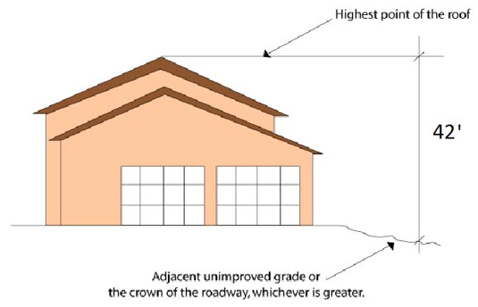
Sec 107.41 Height--Exceptions To Limits
The following structures may be erected above the height limits of this Code: minor decorative architectural features as determined by the Director, mechanical equipment, skylights, flagpoles, air conditioner units, plumbing stacks, church steeples, ham radio antennas, and antenna supporting structures. Except for architectural features, all such structures shall be screened from view; screening is allowed only to the minimum height necessary.
Sec 107.42 Flag Poles
Notwithstanding the maximum height standards in Section 107.40, above, flag poles shall not exceed 20 feet in height in a residential district and 30 feet in height in a commercial or industrial districts.
Sec 107.43 No Obstruction To Vision For Traffic Safety
Sight triangles shall be clear of obstructions that would prohibit a driver's view of potentially conflicting vehicles as illustrated in Figure 107.43.1; therefore, in order to minimize accidents caused by obstruction to vision at road intersections and driveways, the following regulations shall apply in all districts:
- Road Intersections.
- All corner building sites located in use districts that require a front and side yard shall maintain a clear sight triangle at the intersection of the street rights-of-way for the purpose of traffic safety.
- In clear sight distance at intersections within the area formed by the rights-of-way lines of intersecting roads and a straight line connecting points on such rights-of-way lines, there shall be a clear space with no obstruction to vision between the height of three (3) feet and a height of ten (10) feet above the average grade of each road as measured at the centerline that is consistent with criteria outlined in the Florida Department of Transportation's Manual of Uniform Minimum Standards for Design, Construction and Maintenance for Streets and Highways.
- Driveways. Sight distance is also required at driveways to allow the drivers of stopped vehicles a sufficient view of the intersecting street. There shall be a clear space with no obstruction to vision between the height of three (3) feet and a height of eight (8) feet at the intersection of the driveway and the road right-of-way.
- Clear Sight Triangle Requirements.
- At a minimum, the angle of this triangle shall be formed by the intersecting street rights-of-way and the sides of the triangle as measured along the property lines from said angle 20 feet in length; the third side of such triangle shall be a straight line connecting the ends of the two (2) aforementioned lines, as illustrated in Figure 107.43.1, below.
- The City may alter the clear sight triangle. Such alteration is contingent on unusual site topography, proposed site design features, and other unique circumstances pertaining solely to the site and surrounding properties. The City shall make written findings that the alteration does not constitute a traffic or pedestrian safety hazard.
- Street lights, power poles, traffic signs, or similar street fixtures less than one-foot wide or other objects above ten (10) feet in height above the adjacent street elevation shall be allowed in the clear sight triangle unless the City determines that, individually or cumulatively, they would pose a public safety hazard. The Director may authorize other objects in the clear sight triangle which do not comply with this standard upon determining that they would not pose a risk to public safety.
- Trees, either existing or newly planted, shall be permitted in the clear space, provided that foliage is cut away within the prescribed heights.
- The requirements of this Section shall not be deemed to prohibit any necessary retaining wall.
Figure 107.43.1 Clear Sight Visibility Triangle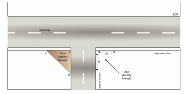 Distance from "A" to "B" is the length of leg of the site triangle along the minor road. This distance is measured from the driver's eye in the stopped vehicle to the center of the nearest lane on the major road for vehicles approaching from the left, and to the center of the nearest lane for vehicles approaching from the right.
Distance from "A" to "C" is the length of the leg of the sight triangle along the major road measured from the center of the minor road entrance lane.
Distance from "A" to "B" is the length of leg of the site triangle along the minor road. This distance is measured from the driver's eye in the stopped vehicle to the center of the nearest lane on the major road for vehicles approaching from the left, and to the center of the nearest lane for vehicles approaching from the right.
Distance from "A" to "C" is the length of the leg of the sight triangle along the major road measured from the center of the minor road entrance lane.
Sec 107.44 Purpose
The purpose of this article is to provide adequate parking for all uses allowed in these LDRs, provide standards to reduce traffic congestion, encourage shared parking and other creative methods to provide parking and loading facilities in proportion to the parking demand for each use in order to ensure functionally adequate, aesthetically pleasing and secure off-street parking and loading facilities.
Sec 107.45 Applicability
Unless specifically exempted, every use of a building or land hereafter established shall provide the minimum parking and loading spaces as required by this article, in addition to the Florida Accessibility Code and the Fair Housing Act. Changes in use, changes in intensity of use, and building expansions shall comply with all applicable parking requirements. Re-striping or re-paving of such spaces shall comply with the Florida Accessibility Code and The Fair Housing Act. Except as noted, the requirements of this article are minimums. Where nonconforming on-site parking has been found to be inadequate by causing a recurring hazard or nuisance off-site, the owner shall be responsible for increasing the number of parking spaces or decreasing the need for parking spaces by limiting the amount, kind or intensity of use.
Sec 107.46 Parking Schedule
In all zoning districts, unless otherwise provided herein, the minimum parking shall be provided in accordance with Table 107.46.1 "Parking Schedule." Mixed-use Development (MUD) within all the MU districts may be eligible for reduced parking requirements pursuant to this Article and as shown in Chapter 105.
- Parking Schedule.
Table 107.46.1
Parking ScheduleUses
Minimum Parking Spaces Required
Residential Uses
Single and Two-Family, attached and detached
2 per dwelling unit
Multiple-family Dwelling
One-bedroom units
Two or more bedroom units1.5 per dwelling unit, plus 1 per 10 bedrooms
2 per dwelling unit, plus 1 per 10 bedroomsRooming house or dormitory
1 per 2 beds
Assisted living facility
1 per 2 persons of licensed capacity
Mobile home park
2 per unit space, plus 1 per 350 sf of GFA of office or other public buildings
Live-aboard marina
1.5 per slip
Nursing home
1 per 4 beds
Community residential homes
1 per 3 persons of licensed capacity, plus one per employee
Vacation rental unit
At least 1 per unit, 2 if single or two family home
Public and Civic Uses
Auditorium or amphitheater
1 per 3 seats of maximum seating capacity in the principal area of assembly
Child Care Center, Adult Day Care
1 per 4 persons of licensed capacity
Elementary or middle school
1 space per employee plus 1 space per 40 students
Fire station
1 per person on duty on the largest shift, plus 2 visitor spaces
High school
1 space per employee plus one space per 3 students of design capacity
Hospital
1 per bed
Library, museum, art gallery
1 per 400 sq ft of gross floor area
Medical or dental office/medical clinic
1 per 200 sq ft GFA
Mortuary or funeral home
1 per 4 persons of licensed capacity, plus 1 per funeral vehicle, plus 1 per employee
Place of assembly/civic organizations
1 per 3 seats of maximum seating capacity in the principal area of assembly
Place of worship
1 per 5 seats of maximum seating capacity in the principal area of assembly plus 1 per 50 square feet of gross floor area without principal area of assembly
Marina
1 per 5 dry slips and/or 1 per 2 wet slips, plus required parking for accessory uses (Live-aboard residential uses are subject to additional parking)
Public boat ramps
As approved by the Director
Commercial Uses
Arcade
1 per 500 sq ft GFA
Banks and financial institutions
1 per 400 sq ft GFA, plus required stacking space
Barber or beauty shop
2 per operator's chair
Bar, cocktail lounge, tavern, and nightclub
10 per 1,000 sq ft GFA
Bowling establishments
2 per lane, plus required parking for accessory uses
Business and non-medical professional offices including governmental offices
1 per 350 sq ft GFA
Car wash
1 per service bay, plus three stacking spaces
Convenience store, with or without fuel sales
1 per fueling position, plus 2 per working bay, plus 1 per 200 sq ft of sales area
Restaurant
1 per 3 seats, plus required stacking spaces, plus 1 per every 2 employees on the largest shift
Golf course
20 spaces per 9 holes, plus 1 space per employee, plus 50% of the spaces otherwise required for any accessory uses (e.g. bars, restaurants, etc.)
Spa, gym or fitness center
3 per 1,000 sq ft GFA
Movie theaters
1 per 3 seats
Personal service-oriented uses, not otherwise specified
1 per 400 sq ft GFA
Retail Sales and Service
3 per 1,000 sf of GFA, plus 1 per employee at the largest shift
RV Park/Campground
1 per RV or tent space, plus 1 per employee
Hotel or Motel
1 per every 3 employees, plus 1 per guest room, required parking for accessory uses
Entertainment and recreation, not otherwise specified
1 per 4 persons of maximum capacity
Self-service storage facilities
1 per employee, plus 2 for visitors
Vehicle sales and rental (including sales of boats)
1 per 2,000 sf ft of display area whether indoors or outdoors, plus 1 per 500 sq ft devoted to servicing vehicles or boats
Vehicle repair
1 per 200 sq ft GFA
Industrial Uses
Industrial uses (other than warehousing)
1 per 1,000 sq ft, plus 1 per company vehicle operating from the premises, plus 1 per 250 sq ft of accessory retail or wholesale use
Warehousing, Storage and Distribution
1 per 1,000 sq ft GFA
Waste-related services
1 per employee
- Unlisted Uses.
- For uses not listed in Table 107.46.1, but which are similar in nature, as determined by the Director, the parking requirements of the similar listed use shall be required.
- For uses not listed or which are not similar in nature to those in Table 107.46.1, pursuant to Subsection B.1., above, the number of required spaces shall be based on a study prepared by a professional engineer that addresses:
- Type of use or uses and estimated total number of trips generated during peak conditions;
- Estimated parking duration per vehicle trip (turnover rates); and
- Estimated number of employees; one (1) space to be provided for each two (2) employees based on the shift of maximum employment.
Sec 107.47 Mixed-Use Development Parking Requirements
- Nonresidential Uses. The parking requirement shall be one (1) parking space for each 500 square feet, or fraction thereof, of gross floor area not in residential uses. Notwithstanding the foregoing, when the gross floor area of the proposed buildings or structures and proposed addition to existing buildings or structures is less than 5,000 square feet, the adequacy of the proposed parking shall be reviewed to: (1) reduce the parking spaces required to a minimum of one (1) parking space for each 350 square feet, or fraction thereof, if the Director finds that:
- The proposed use requires less than one (1) parking space per 500 square feet;
- That there are off-premises parking spaces available on nearby public streets or land permanently committed to parking;
- The proposed uses will allow the shared use of parking spaces;
- Parking areas on adjacent lots should be connected to allow traffic flow; or
- Shared parking or conjunctive use parking may be allowed as defined in Section 107.50 "Shared Parking".
- Residential Uses. The parking requirement for residential units shall be as follows:
- One (1) space per efficiency unit.
- One (1) space per one (1) bedroom apartment.
- One and one half (1 1/2) spaces per two (2) bedroom apartment.
- Two (2) spaces per three (3) bedroom dwelling unit, plus one and one half (1 1/2) spaces for every additional two (2) bedrooms.
Sec 107.48 Bicycle Parking
Bicycle parking shall be provided by all educational facilities (as well as vocational, business, or technical schools), multiple-family dwellings, commercial, institutional and industrial uses and all facilities that have a bike path adjacent to the development.
- Type of Facility. Bicycle parking spaces are comprised of Class I, Class II or Class III facilities.
- Class I: Bicycle lockers are generally rectangular enclosures, each holding one (1) or two (2) bicycles.
- Class II: Bicycle parking racks which allow all three 93) major components of the bicycle, back wheel, frame and front wheel, to be locked, without removal of the front wheel.
- Class III: Stands and racks such as hitching posts, rails and inverted "U" racks. Common properties in a Class III facility include its support of the bicycle with or without the front wheel removed, its attractiveness and post or pipe dimensions which allow the use of the popular U-locks. Class III facilities are recommended for short-term parking, although, in combination with shelter, they may be adequate for long-term storage.
- Number of Spaces.
- A minimum of one (1) bicycle parking space shall be provided for every ten (10) required vehicular spaces or two (2) spaces for each public and employee entrance, whichever is greater. The City may require additional spaces for educational facilities, libraries and recreational facilities.
- The Director may reduce bike rack parking facilities for patrons when it is demonstrated that bicycle activity will not occur at that location.
- The Director may require additional spaces when it is determined that the use or its location will generate a high volume of bicycle activity. Such a determination will include, but not be limited to the following uses:
- Park/playfield;
- Marina;
- Library/museum/arboretum;
- Elementary/secondary school;
- Sports club; or
- Retail/industrial businesses (when located along US-1).
- For multiple-family dwellings, a minimum of 25 percent of the required spaces shall be Class I bicycle lockers or sheltered Class II or III facilities to provide for long-term storage.
- For nonresidential developments, a minimum of 25 percent of the required spaces shall be Class I bicycle lockers or sheltered Class II or III facilities.
- A minimum of one (1) bicycle parking space shall be provided for every ten (10) required vehicular spaces or two (2) spaces for each public and employee entrance, whichever is greater. The City may require additional spaces for educational facilities, libraries and recreational facilities.
- Location of Facilities.
- All bicycle parking facilities shall be located (within 100 feet of the building entrance) and shall be separated from automobile parking by a physical barrier or by a minimum of five (5) feet.
- Bicycle parking facilities shall be located on the same lot or parcel of land as the use for which such facilities are required and as close to the public and employee entrances as possible without interfering with the flow of pedestrian and vehicular traffic.
- For nonresidential developments, any sheltered spaces required shall be connected to the building where possible without interfering with the flow of pedestrian and vehicular traffic.
- Surfacing. The minimum parking area shall be provided with a hard-surface, all-weather pavement of asphalt or concrete, and shall be so graded and drained as to provide for the adequate runoff and disposal of surface water. Supplemental parking may be on alternative surfaces.
- Access to Facilities. Convenient access to bicycle parking facilities shall be provided and shall minimize travel distances from adjoining sidewalks and pathways to the bicycle parking facilities. Where access is via a sidewalk or pathway, curb ramps shall be installed as appropriate.
Sec 107.49 Signage And Marking
All required parking areas shall be striped or marked to show parking spaces and driving aisles. Spaces for motorcycles, persons with disabilities, and bicycles shall be clearly marked. Parking lot signage and marking shall conform with FDOT's Manual of Uniform Minimum Standards for Design, Construction and Maintenance for Streets and Highways, the Manual of Uniform Traffic Control Devices and the Americans with Disabilities Act and shall contain no commercial messages.
Sec 107.50 Shared Parking
The City may recommend approval for a reduction in the number of required parking spaces for a mixed-use project or for uses which are located adjacent to one another and which have different peak parking demands and operating hours. In determining whether to approve a reduction for shared parking, the following shall be considered:
- The application for shared parking shall include a description of the use, a site plan, a trip generation report and a parking study. The parking study shall include the characteristics of each use, peak parking demand, hours of operation and potential improvements in access, design, open space preservation and circulation.
- The minimum number of parking spaces for a mixed-use development or where shared parking strategies are proposed shall be determined by a study prepared by a professional engineer following the procedures of the "Urban Land Institute Shared Parking Report", "ITE Shared Parking Guidelines", Florida Department of Transportation's, "Walkable Communities", April 1995 or other City approved procedures. A formal parking study may be waived for small developments where there is established experience with the land use mix and its impact is expected to be minimal. If standard rates are not available or limited, the applicant may collect data at similar sites to establish local parking demand rates. If the shared parking plan assumes use of an existing parking facility, then field surveys shall be conducted to determine actual parking accumulation. If possible, these surveys should consider the seasonal peak period for the combination of land uses involved. The applicant shall determine the minimum number of parking spaces required for shared parking arrangements or mixed-use developments by the following example procedures:
Step 1: Determine the number of parking spaces that should be provided for each individual use and then sum the results.
Step 2: Based on the hourly variation in parking demand, determine the peak parking demand for the combined demand of all the uses in the development. Standardized data such as from the ULI, FDOT "Walkable Communities" or ITE reports should be used to estimate hourly variations. Field studies can also be performed on similar land uses within the jurisdiction to establish the hourly variation patterns. This analysis may be needed for both weekdays and weekends, depending on the type of uses involved, and may need to consider seasonal peak periods.
Step 3: Compare the calculations of the two (2) steps above, and the lesser of the two (2) peak parking demands shall be used as the minimum number of parking spaces that need to be provided. - All shared parking shall be located in an area providing reasonable access to all uses which the parking is intended to serve. For parking located across US1 from the use, the development shall include a signalized walkway.
- In cases where the uses for which shared parking is requested are located on lots under different ownership, a cross-parking easement shall be recorded in the public record.
- A minimum number of spaces are provided to meet the requirements of the use with the single greatest parking demand.
Sec 107.51 Parking Reductions Or Increases
Applicants for site plan review may vary from the off-street parking schedule in Table 107.52.1 by demonstrating reduced or increased parking demand. The provision of on-street parking may justify a reduction in off-street parking. In all cases, the applicant shall provide sufficient documentation to the Technical Review Committee to clearly establish that minimum and maximum parking needs shall be accommodated. Where inadequate on-site parking causes a recurring traffic hazard or a nuisance off-site, the owner shall be responsible for increasing the number of parking spaces or decreasing the need for parking spaces.
Sec 107.52 Parking Area Design Standards
- Parking Lot Layout. Parking lots may be in different configurations with regard to the angle of the space with the direction of travel of traffic in the aisles. Parallel parking has a zero angle while perpendicular parking has a 90-degree angle. Angled parking is generally laid out at 45 or 60-degree angles.
- Minimum Parking Stall and Aisle Dimensions.
- Parking spaces shall have a minimum width of nine (9) feet except where otherwise provided in this Article;
- The other dimensions of parking spaces and the aisles providing access to such spaces shall meet the dimensional requirements provided in Table 107.52.1 and illustrated in Figure 107.52.1, below.
Table 107.52.1
Minimum Parking Stall and Aisle DimensionsA
B
C
D
Parking Angle
Stall Width (ft)
Stall Depth (ft)
Aisle Width 1-Way
Aisle Width 2-Way
0
10.0
22.0
13.0
22.0
45
9.0
18.1
13.0
22.0
60
9.0
19.8
18.0
22.0
90
9.0
18.0
20.0
24.0
Figure 107.52.1
Minimum Parking Stall and Aisle Dimensions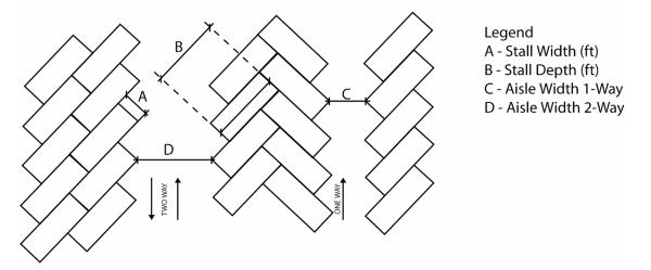
- Other Space Sizes. Parallel spaces shall be a minimum of 22 feet long by ten (10) feet wide. A line of parallel parking spaces will not require marking in 20-foot intervals unless the parking is to be metered.
- Conformance with Americans with Disabilities Act. The design of all parking areas shall conform to current standards under the Americans with Disabilities Act (ADA). Handicap spaces shall be 18 feet long, plus an additional three (3) feet of drive aisle indicator lines (for a minimum total of 21 feet) and 12 feet wide. It will have a five-foot access aisle. Two (2) adjacent handicap spaces may share an access aisle. One (1) handicap space shall be required for every 25 parking spaces required under Tables 107.46.1 and 107.37.2 and Sections 107.46 and 107.43.
- Wheel Stop Requirement. Parking wheel stops are required if the parking space is adjacent to a sidewalk, planting island or if no curb is provided at the end of the space.
Sec 107.53 Location Of Off-Street Parking
- No parking space or vehicle overhang shall encroach upon the required landscape or sidewalk area, or the right-of-way of any public road, street, alley or walkway.
- There shall be no off-street parking in the front setbacks of residential districts except as normally exists in driveways.
- Parking spaces for all uses shall be located on the same parcel as the principal building, except where parking is provided on another parcel under the same ownership or management as the principal use, and meets the following criteria:
- Parking areas for residential and nonresidential uses shall be provided not more than 300 feet from the principal building, as measured along the nearest pedestrian walkway.
- Pedestrians shall not be required to cross US 1, unless a signalized walkway is provided.
- If the formula for determining the number of off-street parking spaces results in a fraction, the number of parking spaces shall be rounded to the nearest whole number with fractions of .50 or greater rounding up and below .50 rounding down.
- The applicant for a building permit who proposes to use another parcel for off-street parking in order to meet the requirements of these regulations shall submit evidence of a restrictive covenant running with the land to be used for off-street parking purposes stating that such land shall not be encroached upon, used, sold, leased or conveyed for any other purpose until such time as the principal building ceases to be required to provide such off-street parking facilities.
- Any off-street parking lot serving any use other than dwellings of three (3) units per building or less shall meet the following off-street parking lot requirements:
- Screening. The parking area shall be screened from the street with an M-Medium Density buffer in accordance with Article 8 in this Chapter.
- Surfacing. Off-street parking areas shall be provided with a hard-surface, all-weather pavement of such as asphalt, pavers or concrete, and shall be so graded and drained as to provide for the adequate runoff and disposal of surface water. The use of pervious parking materials is encouraged. The City may authorize a portion of the parking to be stabilized. Alternative surfaces may be proposed pending approval of the City. Supplemental parking shall be stabilized. All requests for nonstandard parking facilities shall be accompanied by sufficient documentation for the City to clearly establish the expected usage and suitability of the stabilized or alternative surface.
Sec 107.54 Outdoor Lighting
Where lighting is to be provided for the parking area, it shall be designed to provide safe, convenient and efficient ingress and egress for pedestrians and vehicles. All outdoor lighting shall be designed such that light levels and uniformity ratios are at least in compliance with the minimum standards proscribed by the Illuminating Engineering Society of North America (IESNA). Lighting design shall be consistent and coordinated for the entire site and shall be designed to meet the following standards:
- Mounting heights for exterior luminaries shall not exceed 35 feet in height within a parking lot and 18 feet within adjacent nonvehicular pedestrian areas (with the height being measured from the finished grade to the bottom of the luminous opening of the luminary).
- All acceptable outdoor luminaries shall employ IESNA "semicutoff", "cutoff" or "full cutoff" light distribution designations and shall be either partially shielded fixtures or fully shielded fixtures to reduce glare or spillage.
- All lighting, regardless of location, shall be designed to prevent direct glare, light spillage and hazardous interference with automotive, bicycle and pedestrian traffic on adjacent streets and properties.
- Parking areas adjacent to marine turtle nesting habitats shall comply with the lighting requirements of Chapter 62B-55 FAC.
- Mercury vapor fixtures shall not be permitted as a component of parking area lighting design.
- Maximum maintained illumination levels measured at finished grade on adjoining property within 25 feet of the property line of the project in question shall be no more than 1.0 footcandles (fc) if the adjoining property is zoned commercial and no more than 0.5 fc when the adjoining property is zoned residential or is an existing residential use within 100 feet of the property line.
- Photometric lighting plans showing maintained light levels at and out to at least 30 feet beyond property lines and with data points calculated on no greater than a ten-foot by ten-foot grid, and including fixture catalog numbers are required with site plan review and subject to approval. Manufacturer's cut sheets for the specified fixtures are also required for site plan review.
- Any deviation(s) from these standards shall be noted at the time of preliminary site plan review along with a statement explaining the purpose of and reason for the deviation(s). The City shall make a determination whether to accept such deviation(s).
Sec 107.55 Off-Street Parking Landscape Requirements
Parking facilities shall meet the landscaping requirements of Article 8 of this Chapter.
Sec 107.56 Off-Street Loading Requirements
- Every hospital, institution, commercial or industrial building or similar use having a floor area of 20,000 square feet or more, and requiring the receipt or distribution by vehicle of materials or merchandise, shall have a minimum of one (1) permanent off-street loading space for each 20,000 square feet of gross floor area or fraction thereof. The loading area shall be located immediately adjacent to the principal building.
- Retail operations, wholesale operations and industrial operations with a gross floor area of less than 20,000 square feet shall provide sufficient space for loading and unloading operations in order that the free movement of vehicles and pedestrians over a sidewalk, street or alley shall not be impaired.
- Every off-street loading and unloading space shall have direct access to a public street or alley, and shall have the following minimum dimensions: length, 30 feet; width, 12 feet; height, 14 feet of unobstructed vertical clearance.
- Any loading space located within 100 feet of areas zoned for residential use shall be screened and operated as necessary to reduce noise and visual impacts. Noise mitigation measures may include architectural or structural barriers, beams, walls, or restrictions on the hours of operation.
Sec 107.57 Off-Street Stacking Requirements
In addition to meeting the minimum off-street parking standards, drive-through facilities shall provide a minimum of five (5) stacking spaces for each drive-through lane. Such spaces shall be designed so as to not create conflicts between pedestrian or vehicular circulation on the site or on any abutting street.
Sec 107.58 Purpose And Intent
The purposes of this chapter are to promote the public health, safety and general welfare through reasonable, consistent, content neutral and non-discriminatory sign standards. The sign standards of this chapter are intended to meet the statutory requirement of F.S. § 163.3202(f), for City land development regulations that regulate signage. The sign regulations are especially intended to address the secondary effects of signage that may adversely impact aesthetics and safety. They are not intended to censor speech or to regulate viewpoints, but to serve substantial governmental interests and, in some cases, compelling governmental interests such as traffic safety and warning signs of threats to bodily injury or death.
Marathon is uniquely situated at the southernmost area of Florida in an historic and environmentally sensitive area. It is a designated Florida Area of Critical State Concern, and its major transportation corridor is U.S. Route 1, also designated the Florida Keys Scenic Highway and a Federal Scenic Highway Corridor. The economic base of the City is heavily dependent on visitors from all over the nation and the world. In order to preserve and promote the City of Marathon as a desirable place to live, work and play, a pleasing, visually attractive and safe environment is very important. The regulation of signs contributes significantly to achieving these ends.
It is further the purpose and intent of the sign regulations to:
- Facilitate the implementation of goals, objectives and policies set forth in the comprehensive plan relating to sign control, community character and scenic resources and protection of areas from incompatible uses;
- Promote and maintain convenience, safety, property values and aesthetics by establishing a set of standards for the erection, placement, use and maintenance of signs that will grant equal protection and fairness to all property owners in the City;
- Provide a simple set of regulations that will minimize intricacies and facilitate efficiency of permitting functions and thus assist the regulated public;
- Encourage signs that help to visually organize the activities of the City, and lend order and meaning to business identification and make it easier for the public to locate and identify their destinations;
- Regulate the size, number and location of signs so that their purpose can be served without unduly interfering with motorists and causing unsafe conditions;
- Promote the general welfare, including enhancement of property values and scenic resources, so as to create a more attractive business climate and make the City a more desirable place in which to visit, trade, work and live;
- Improve pedestrian and traffic safety by regulating signs so as not to interfere with, distract, or obstruct the vision of motorists, bicyclists or pedestrians;
- Provide standards regarding the non-content based aspects of signs which are consistent with state and federal law;
- Assure that the benefits derived from the expenditure of public funds for the improvement and beautification of streets, sidewalks, public parks, public right-of-way, and other public places and spaces, are protected by exercising reasonable controls over the physical characteristics and structural design of signs;
- Be fair in that everyone receives equal and adequate exposure to the public and no one is allowed to visually dominate his neighbor;
- Authorize the use of signs in commercial and industrial areas that are:
- Compatible with their surroundings;
- Appropriate to the type of activity to which they pertain;
- An expression of the identity of the individual proprietors and the community as a whole; and
- Large enough to sufficiently convey a message about the owners or occupants of a particular premises, the commodities, products or devices available on such premises, or the business activities conducted on such premises, yet small enough to prevent excessive, overpowering advertising which would have a detrimental effect on the character and appearance of commercial and industrial areas, or which could unduly distract the motoring public, causing unsafe motoring conditions;
- Limit the number, type and size of signs in noncommercial areas to protect the character and appearance of noncommercial areas.
Sec 107.59 Definitions
The following words, terms and phrases, when used in this chapter, shall have the meanings ascribed to them in this section, except where the context clearly indicates a different meaning:
Area of a sign. Refer to Section 107.62(1).
Banner means any suspended sign made of any flexible material such as, but not limited to, cloth, plastic or paper whether or not imprinted with words or characters.
Billboard means any sign that is required to be registered with the Florida Department of Transportation (FDOT) pursuant to F.S. ch. 479 and exceeds the size limitations set forth in Section 107.61 of this chapter.
Changeable copy sign means a sign with the capability of content change by means of manual or remote input, including the following types:
- Manually activated. Changeable sign whose message copy can be changed manually on a display surface.
- Electronic message center means an electronically activated changeable copy sign whose variable message capability can be electronically programmed.
- Digital signs. (See below).
Clear sight triangle means a triangular-shaped area at any driveway connection to a public street and at all street intersections in which nothing is allowed to be erected, placed, planted or allowed to grow in such a manner as to limit or obstruct the sight of motorists entering or leaving the driveway or street intersection. Also referred to as clear vision triangle.
Copy means the text or graphic representations of a sign that depict the name of an establishment, products, services or other messages, whether in permanent or removable form.
Digital sign means any digital display using technologies such as LCD, LED, projection and e-paper to display digital images.
Erect means, in the context of this chapter, to build, construct, attach, hang, place, suspend, affix or paint a sign.
Facade means the face of a building or structure is most nearly parallel with the right-of-way line under consideration, including related architectural elements such as awnings, parapets and mansard roofs but excluding signs attached to a building that are not otherwise incorporated into such architectural elements.
Face of sign means the planes of a sign on which copy could be placed, including trim and background.
Flag means a piece of light weight, flexible material such as cloth or plastic with one side attached to a pole and the other end flying freely.
Frontage, business means the horizontal linear distance measured along the facade of an individual business. Also referred to as "business frontage."
Frontage, property means the distance measured along a public or private right-of-way or easement including canals, shorelines and runways that affords vehicular access to the property between the points of intersection of the side lot lines with such right-of-way or easement. Where a street or highway is divided, a parcel of land in the median of the street or highway shall be considered to have a frontage on each side. All parcels that abut U.S. 1 shall be considered to have a frontage on such roads regardless of whether a curb cut exists. Also referred to as "property frontage."
Government sign means any temporary or permanent sign erected by or on the order of a public official or quasi-public entity at the federal, state or local government level in the performance of any duty.
Ground-mounted sign means any sign that is mounted on or supported by an upright or brace in or upon the ground, such upright or brace being directly attached in or upon the ground and independent of any other structure. Signs affixed to fences shall be considered ground-mounted signs.
Illuminated sign means any sign that is illuminated by artificial light, either from an interior or exterior source, including outline, reflective or phosphorescent light, whether or not the source of light is directly affixed as part of the sign and includes, but is not limited to, digital signs.
Interior property information sign means signs located entirely on the property to which the sign pertains, are not readily visible from public rights-of-way, and which direct persons to prohibited or permitted activities, or conditions on the property.
Licensed sign contractor means any person holding a valid certificate of competency in sign erection issued by the county.
Off-premises commercial advertising means a non accessory billboard or sign which directs attention to a business, commodity, service, or attraction that is sold, offered or existing elsewhere than upon the same lot where such sign is displayed.
Off-premises sign means a non accessory billboard or sign that displays offsite commercial advertising. When in the right-of-way of or visible from U.S. 1, off-premises signs are required to be registered with the Florida Department of Transportation (FDOT) pursuant to F.S. Ch. 479.
Pennant means a series of small flag-like pieces of cloth or similar type of material attached and strung between two or more points.
Permanent sign means a sign which is intended to be and is so constructed as to be of lasting and enduring condition, remaining unchanged in character, condition (beyond normal wear and tear) and position and in a permanent manner affixed to the ground, wall or building.
Plane means any surface such as a rectangle, square, triangle, circle or sphere that is capable of carrying items of information; any area enclosed by an imaginary line describing a rectangle, square, triangle or circle which includes freestanding letters, numbers or symbols.
Portable sign means any sign or sign structure that is not permanently attached to the ground or to any other permanent structure or which is specifically designed to be transported. This definition shall include, but not be limited to, trailer signs, A-frame signs, and sandwich board signs.
Posted property sign means a sign for the purpose of warnings or prohibitions related to the property on which it is posted. State statutes may establish requirements for these signs.
Premises means any parcel of land owned, leased or controlled by the person actively engaged in business and so connected with the business as to form a contiguous component or integral part of it; or owned, leased or controlled by a person for living accommodations.
Rotating sign (or revolving sign) means a sign that revolves or turns or has external sign elements that revolve or turn. Such sign may be power-driven or propelled by the force of wind or air. Rotating signs include multi-prism or tri-vision signs with a series of triangular sections that rotate and stop to show multiple images or messages in the same area at different times.
Sign means any object, device, display or structure, or part thereof, situated outdoors or indoors that is used to advertise, identify, display, direct or attract attention to an object, person, institution, organization, business, product service event or location and by any means, including words, letters, figures, designs, symbols, fixtures, colors or projected images. Signs do not include:
- Merchandise that is not otherwise incorporated into a sign structure;
- Models or products incorporated in a window display;
- Works of art that do not contain advertising messages and in no way identify a product, use or service; or
- Scoreboards located on athletic fields.
Sign structure means any structure that supports, has supported or is capable of supporting a sign, including decorative cover.
Special event sign means a temporary sign erected by a nonprofit organization or organizations, holding a valid City public assembly permit, with a purpose to advertise a special event.
Temporary sign means any sign not permanently installed on property which is intended to be displayed for a limited period of time. A sign with an intended use for a period of time related to an event shall be deemed a temporary sign.
Vehicle sign means a sign mounted or painted on any vehicle, trailer, floating device, barge, raft, or boat, whether licensed or unlicensed, for the primary purpose of advertising commercial products or services, conveying commercial messages or directing people to a business or commercial activity.
Wall-mounted sign means any sign mounted on or painted on and parallel to the facade or wall of a building.
Window sign means any sign mounted to or painted on, or visible through a window for display to the public.
Sec 107.60 Applicability
- Generally. This chapter shall apply to the erection, construction or alteration of any sign, unless exempted as provided herein. The procedure for variances is set forth in Section 107.62. The procedure for amendments to the text of this chapter is set forth in Article 7 "Land Development Regulation Text Amendments" of Chapter 102.
- Activities Not Affected. The following activities shall not be subject to regulation under this chapter. However, such activities shall nevertheless comply with the City building code and other applicable regulations of the county, state and federal governments.
- Changing of the copy of a lawfully existing sign, whether manual or automatic, unless the change of copy changes the function of or purpose of the sign which as a result requires adherence to a different time, manner or location regulation as provided herein, or changes the style type, size or color not in compliance with this chapter;
- Works of art that do not contain advertising messages, and which in no way identify a product, use, or service;
- Maintenance of lawfully existing signs and sign structures that does not involve structural enlargement, reconstruction, or additions. Replacement of the damaged or deteriorated plastic face of a sign shall be considered maintenance. The necessity to obtain a building permit for maintenance work shall be governed by Chapter 6;
- Any sign not visible from a public street, sidewalk or right-of-way or from a navigable waterway or body of water; except that the foregoing does not exempt a sign for a commercial use that is visible from an abutting residential use.
Sec 107.61 Prohibited Signs
The following types of signs shall not be erected or operated on any property in the City limits:
- Off-premises signs; excluding off-premise signs identifying lawfully-established off-premises businesses as permitted in Section 107.623, visible from a designated scenic highway, unless and until the applicant provides documentation from the Florida Department of Transportation (FDOT) that the sign is permitted by or that a permit is not necessary from the FDOT;
- Those erected in a clear sight triangle; or at any location where, by reason of the position, shape or color, they may interfere with or obstruct the view of any authorized traffic sign, signal or device;
- Discontinued temporary signs that no longer correctly direct or exhort any person; or advertise a bona fide business, lessor, owner, product or activity conducted or available on the premises indicated on such sign;
- Rotating signs, excluding electronic message centers and automatic changing signs whose operations shall be governed by Section 107.623;
- Signs that emit smoke, vapor, particles, odor or sounds;
- Signs using a video, digital means, or motion picture source in such a manner as to permit or allow the images or audio to be visible or audible from any public street, sidewalk or navigable waterway, including but not limited to vehicles displaying electronic signs;
- Vehicle signs parked on any public property, including public rights-of-way, navigable waterways and beaches, or on private property so as to be clearly visible from any public right-of-way. This restriction is not intended to prohibit incidental signage on a functional, licensed vehicle which is displayed in a manner to primarily identify the vehicle with the business it serves. Such vehicles shall only park in a lawful parking space. Vehicle signs may not be an attachment that extends or protrudes from the vehicle. However, commercial vehicles that provide delivery services, including taxies, shall be allowed an attached non-illuminated roof sign that identifies the delivery business. Such sign shall only be allowed on the vehicle while doing business and shall be no larger than 24 inches long, 12 inches tall and ten (10) inches wide, including the base;
- Portable signs, except for temporary signs as permitted in Section 107.622 and A-frame signs as permitted in Section 107.623;
- Any sign that is affixed to any wall or structure and extends more than 24 inches perpendicularly from the plane of the building wall;
- Any sign attached to a building and projecting above the facade of a building, or any sign mounted on top of a flat roof or on top of any horizontal awning;
- Signs that cause radio or television or other communication, electrical, magnetic interference;
- Signs erected, constructed or maintained that obstruct any firefighting equipment, window, door or opening used as a means of ingress or egress or for firefighting purposes;
- Signs, except posted property signs, that are erected or maintained upon trees or painted or drawn upon rocks or other natural features or tacked, nailed or attached in any way to utility poles;
- Signs on public property or road rights-of-way including, but not limited to, signs placed on any curb, sidewalk, post, pole, hydrant, bridge, tree or other surface located on public property or over or across any public or private street except as may otherwise expressly be authorized by this chapter;
- Unshielded illuminated devices that produce glare or are a hazard or a nuisance to motorists or occupants of adjacent properties, or signs containing mirrors;
- Flashing signs;
- Floodlights or beacon lights, except when required by the Federal Aviation Administration;
- Signs attached to a seaway, dock, buoy, tie pole or pier, or in or upon any body of water other than warning signs, safety signs, or government regulatory signs;
- Signs that are an imitation of traffic control device signs and which are adjacent to the right-of-way of any road, street or highway; and
- Dangerous signs.
No person shall allow any sign that is in a dangerous or defective condition to be maintained on any premises owned or controlled by such person. Any such sign shall be removed or repaired by the owner of the sign or the owner of the premises, or as otherwise provided for in this chapter.
Sec 107.62 Sign Permits
- Generally. Except for temporary signs and signs specifically provided by this chapter, it shall be unlawful for any person or business to construct, alter or maintain a sign structure, as defined in the building code, without first obtaining a building permit from the City in accordance with the provisions of the building code and applicable law. Permit fees for a building permit shall be paid in accordance with applicable City fee schedules.
- Sign Permit Decision and Appeal.
- A building permit for a sign shall be either approved, approved with any condition specifically described and set forth in the City code of ordinances, or disapproved, and the decision shall be reduced to writing within 30 calendar days following a complete application and payment of applicable fees. Any governmental declaration of emergency due to natural or manmade hazard events affecting the City shall extend the time frame for a decision until the City Council by resolution establishes an alternative emergency time frame. Whenever required by state statute, the explanation for a denial of a sign permit shall include a citation to the applicable portions of an ordinance, rule, statute, or other legal authority for the denial of the permit: in the event that the applicant fails to receive a statutorily required explanation, the applicant shall submit a written request for the explanation to the Building Official via certified mail.
- A decision of approval with conditions or a denial shall be a final decision of the City if the applicant chooses not to seek reconsideration, by writing, within ten (10) calendar days of the denial. The applicant may seek no more than one reconsideration. A decision of reconsideration shall be rendered within 20 calendar days of receipt of the written application for reconsideration.
- A written appeal of the final sign permit decision or reconsideration shall be taken to the Planning Commission within 30 calendar days from the rendering of the building permit decision or reconsideration.
- Administrative Sign Area Variance. The Planning Director is authorized to grant administrative variances to the maximum area per face requirements set forth in Section 107.623 for ground-mounted signs that accommodate more than a single user (i.e. tenant, business, organization).
- Application. An application shall be submitted to the Planning Department on a form approved by the Department.
- Standards. The Planning Director shall grant an administrative variance to the maximum area per face requirements for ground-mounted signs that accommodate more than a single user only if the applicant demonstrates that all of the following standards are met:
- The granting of the administrative variance shall not be materially detrimental to other property owners in the immediate vicinity;
- The administrative variance shall be the minimum necessary to provide relief to the applicant;
- Each user shall be permitted only a single identification sign per each face/side of the ground-mounted sign;
- The area of each user's identification sign shall not exceed 100 square feet per each face/side of the ground-mounted sign;
- The total maximum area per face for the ground-mounted sign shall not exceed 400 square feet in area unless a variance is granted by the Planning Commission in accordance with Section 107.62(e);
- The total face area for the ground-mounted sign shall not exceed 800 square feet on double-sided signs unless a variance is granted by the Planning Commission in accordance with Section 107.62(e);
- Such a ground-mounted sign shall not be constructed within 40 linear feet of another ground-mounted sign; and
- The sign shall be designed in accordance with the size of lettering guidelines set forth in Section 107.627.
- Procedures. The Planning Director shall determine within 15 calendar days if an application is complete. The Planning Director shall make a preliminary determination of whether an application complies with the standards of Section 107.62(d)(2) within 60 days of the Planning Department's receipt of a complete application and payment of applicable fees. If the Planning Director determines preliminarily that the application complies with the standards, the Planning Department shall provide public notification in accordance with Section 107.62(d)(4). If the Planning Director determines that the application does not comply with the standards, the Planning Director shall issue a written decision of denial to the applicant with an explanation of reasons for the denial.
- Surrounding property owner notification of application. Only after preliminarily determining that an application for a variance complies with the standards, the Planning Director shall provide written notice by regular mail to owners of real property located within 600 feet of the property that is the subject of the application. The notice shall provide a brief description of the proposed administrative variance and indicate where the application may be examined. The cost of providing notice shall be borne by the applicant.
- Decision by the Planning Director. After 30 calendar days of the date in which the written notification was sent per Section 107.62(d)(4), the Planning Director shall review all public responses to the application. Upon a finding that the application has or has not complied with the requirements and standards of this section, the Planning Director shall issue a written administrative variance decision.
- Public hearing by the Planning Commission. If requested in writing by the applicant, or an adversely affected owner or resident of real property located in the City during the required 30-day notification period, a public hearing by the Planning Commission shall be scheduled on the application. All costs of the public hearing shall be the responsibility of the applicant for the administrative variance. The public hearing shall be conducted and noticed in accordance with the procedures set forth in Article 4, "Notice of Public Meetings and Hearings" of Chapter 102.
- Variances Granted by the Planning Commission. The Planning Commission is authorized to grant variances to this chapter.
- Application. An application shall be submitted to the Planning Department on a form approved by the Department.
- Standards. The Planning Commission shall grant a variance only if the applicant demonstrates that all of the following standards are met:
- The literal interpretation and strict application of the provision and requirements of this chapter would cause undue and unnecessary hardship to the sign owner because of unique or unusual conditions pertaining to the specific building or parcel or property in question;
- The granting of the requested variance would not be materially detrimental to the property owners in the immediate vicinity;
- The unusual conditions applying to the specific property do not apply generally to other properties in the City;
- The granting of the variance will not be contrary to the general objective of this chapter of moderating the size, number and obtrusive placement of signs and the reduction of clutter;
- The variance is not requested solely on the basis of economic hardship of the sign user;
- The variance shall be the minimum necessary to provide relief to the applicant; and
- The variance shall not permit a sign expressly prohibited by this chapter.
- Procedures. The Planning Director shall determine within 15 calendar days if an application is complete. Within 60 calendar days of the Planning Department's receipt of a complete application and payment of applicable fees, the Planning Department shall schedule the application for review and decision by the Planning Commission. The Planning Director shall review the entire application and all public responses thereto and prepare a staff report with recommendations for the Planning Commission. The application shall be heard at a regularly scheduled meeting of the Planning Commission. Notice, posting and hearing requirements shall be in accordance with the procedures set forth in Article 4, "Notice of Public Meetings and Hearings" of Chapter 102.
- Decision by the Planning Commission. Within 30 calendar days of the date of the public hearing, upon a finding that the application has or has not complied with the requirements and standards of this section, the Planning Commission shall issue a written variance decision. If the variance is denied, the written decision shall provide reasons for the denial.
Sec 107.621 General Provisions For Signs
The requirements of this section shall apply to all signs whether or not a permit is required, unless otherwise noted below:
- Measurements.
- Measurement of sign area.
- The sign area shall be measured from the outside edges of the sign or sign frame, whichever is greater, excluding the area of the supporting structures, provided that the supporting structures are not used for advertising purposes and are of an area equal to or less than the permitted sign area. In the case of wall-mounted signs without border or frame, the surface area shall include such reasonable and proportionate space as would be required if a border or frame were used.
- When a single sign structure is used to support two (2) or more signs, or unconnected elements of a single sign, the surface area shall comprise the square footage within the perimeter of a regular geometric form enclosing the outer edges of all the separate signs or sign elements. However, undecorated space of up to 12 inches between separate sign panels may be excluded from the sign area measurement where necessary to provide structural support members or to provide visual separation between sign panels.
- Where signs are installed back-to-back, both faces shall be counted as sign area.
- Measurement of sign height. The height of a sign shall be considered to be the vertical distance measured from the top of the structure to the finished ground elevation of the site at the base of the sign. In no event shall excess fill be used to raise a sign.
- Measurement of sign area.
- Consent of Property Owner and Responsibility. No sign requiring a permit may be displayed without the consent of the party or parties with legal title to the property on which the sign is mounted or displayed. The sign owner(s), the property owner(s) of the property on which the sign is placed and the sign contractor shall each be held responsible for adherence to this chapter and Chapter 6. In order for a sign application to be approved, the property owner must grant access to the property for inspection purposes, for the life of the sign.
- City Sign Number. All signs for which a permit is required by this chapter shall not be erected, displayed, rebuilt, repaired, the copy changed, painted or otherwise maintained until and unless the City sign permit number is painted or otherwise affixed to the sign or sign structure in such a manner as to be plainly visible from grade.
- Location Restrictions.
- Clear sight triangle. No sign shall be erected that would impair visibility at a street intersection or driveway entrance.
- Clearance from high-voltage power lines. Signs shall be located in such a way that they maintain a clearance of ten feet to all overhead electrical conductors and a three (3) foot clearance on all secondary voltage service drops.
- Setbacks from property lines. The minimum setback for signs shall be five (5) feet, setbacks shall be measured from the property line to the farthest extension of the sign, including any overhangs, guy wires and supports.
- Scenic corridor buffer yard. Where a scenic corridor buffer yard is required, ground-mounted signs shall only be erected in the immediate vicinity of a driveway.
- Fences. The authorized ground-mounted sign not requiring a permit may be placed on a fence regardless of setbacks provided the sign does not extend above the fence or project more than four (4) inches outward from the fence.
- Structure Design, Engineering and Construction.
- Compliance with Florida Building Code. All signs shall comply with the appropriate detailed provisions of the Florida Building Code relating to design, structural members and connections.
- Licensed contractor. Signs shall only be erected by entities authorized by Chapter 6.
- Structure design. All signs that contain more than 40 square feet in area or are erected over 20 feet in height shall be designed by an engineer registered in the state. Structural drawings shall be prepared by the engineer and submitted prior to a permit being issued. Wind load calculations shall be contained in the engineering drawings. The building official may set wind load requirements greater than the Florida Building Code if deemed necessary to protect the health, safety and welfare of the public or property owners surrounding the sign. The building official may request wind load calculations for signs of less than 40 square feet in area prior to issuing a permit.
- Supports and braces. Supports and braces shall be adequate for wind loading. Wire or cable supports shall have a safety factor of four (4) times the required strength. All metal, wire cable supports and braces and all bolts used to attach signs to a bracket or brackets and signs to the supporting building or structure shall be of galvanized steel or of an equivalent corrosive-resistant material. All such sign supports shall be an integral part of the sign.
- Sign anchoring. No sign shall be suspended by chains or other devices that will allow the sign to swing due to wind action. Signs shall be anchored to prevent any lateral movement that would cause wear on supporting members or connections.
- Double-faced signs. Double-faced signs with opposing faces may not have an interior angle greater than 45.
- Electric Signs, Digital Signs and Illuminated Signs.
- All electric signs shall require a permit and shall be Underwriter's Laboratory approved or certified by a sign electrician specialty contractor or licensed master sign contractor, or an electrical contractor, that the sign meets the standards established by the National Electrical Code, current edition. All electric signs shall be erected and installed by an entity authorized to do so by Chapter 6 and shall be in conformance with the National Electrical Code, current edition. The provision of electrical power to a power source or connection of a sign to existing electrical service shall be by an entity authorized by Chapter 6.
- Artificial light used to illuminate any sign from outside the boundaries of such sign shall be screened in a manner that prevents the light source from being visible from any right-of-way or adjacent property.
- Electronic message centers and digital signs shall comply with the following:
- Electronic message centers and digital signs shall contain static, motionless messages only;
- Displaying any form of motion, or the optical illusion of movement, video or varying light intensity is prohibited;
- Each message on a digital sign must be individually complete and shall not continue on a subsequently displayed message;
- Audio mechanisms, producing sounds, messages or music are prohibited.
- Brightness. Digital signs shall not operate at brightness levels of more than 0.3 foot candles above ambient light, as measured using a foot candle meter at a pre-set distance. This requirement is based on levels established by the Illuminating Engineering Society of North America (IESNA) for Light Emitting Diode (LED) signage as amended from time to time.
- Each digital sign must have a light sensing device that will adjust the display brightness in real-time as ambient light conditions change so that at no time a sign shall exceed a brightness level of three-tenths (0.3) footcandles above ambient light.
- Malfunction. Digital signage shall have a default mechanism installed to either turn the display off or only show black on the display in the event of a malfunction.
- Maintenance. All signs for which a permit is required by this chapter, including their braces, supports, guys and anchors, shall be maintained so as to present a neat, clean appearance. Painted areas and sign surfaces shall be kept in good condition, and illumination, if provided, shall be maintained in safe and good working order.
- Discontinued Signs. Beginning January 1, 2022, discontinued signs shall be regulated as follows:
- Sign structures that remain vacant, unoccupied, or devoid of any message, or display a message pertaining to a time, event or purpose that no longer applies shall be deemed to be discontinued.
- A nonconforming sign deemed discontinued shall immediately terminate the right to maintain such sign.
- Within 60 days after a sign structure has been discontinued, it shall be the responsibility of the property owner to remove the discontinued sign and conceal any and all damage to any other structure resulting from removal of the sign. ON A CASE BY CASE BASIS
- Removal of a discontinued sign shall include all sign support components, angle irons, poles and other remnants of the discontinued sign that are not currently in use or proposed for immediate reuse as evidenced by a sign permit application.
- Sign Programs for Special Identification Signs.
- Community business directory signs. The City may work with FDOT District 6 and local communities to develop a sign program that promotes businesses within specific communities throughout Marathon through the use of centrally located multiple user business identification signs on U.S. 1.
- Community identification signs. The City may work with FDOT District 6 to develop a sign program that identifies specific communities throughout Marathon. The City shall coordinate with local communities to incorporate a theme which promotes the unique character of the local community.
- Off-premises special feature identification signs. The City may work with FDOT District 6 to develop a sign program that identifies special features, tourist sites and business districts. The City shall coordinate with local communities to select appropriate landmarks to be identified.
- Substitution of Noncommercial Speech for Commercial Speech. Any sign erected pursuant to the provisions of this code may, at the option of the applicant, contain either a noncommercial message unrelated to the business located on the premises where the sign is erected, or a commercial message related to the business and located on the business premises pursuant to the following regulations:
- The noncommercial message may occupy the entire sign face or portion thereof.
- The sign face may be changed from commercial to noncommercial messages as frequently as desired by the owner of the sign, provided:
- The size and design criteria conform to the applicable portions of this code;
- The sign is allowed by this code;
- The sign conforms to the requirements of the applicable zoning designation; and
- The appropriate permits are obtained.
- For the purpose of this sign code, noncommercial messages shall never be deemed off-premises signs.
- Viewpoint Neutrality. Notwithstanding anything contained in the chapter to the contrary, no sign or sign structure shall be subject to any limitation based upon the viewpoint of the message contained on such sign or displayed on such sign structure.
Sec 107.622 Temporary Signs
Subject to any applicable provisions within Section 107.621 (general provisions for signs), temporary signs that meet the criteria and limitations set forth below shall be allowed, and shall not require a sign permit unless specifically required below.
- A temporary government sign shall not require a sign permit and shall be allowed in all zoning districts on public property and public rights-of-way.
- A temporary sign displayed on a window surface must be displayed on the inside of the window surface, shall cover no more than 50 percent of the window surface, and shall not be illuminated.
- Temporary signs on residentially zoned property utilized for residential or institutional uses shall be permitted subject to the following limitations:
- No more than four temporary sign(s) not exceeding six square feet. (Note: If more than one sign is allowed, the square footage should be cumulative)
- These temporary signs shall not be illuminated and shall contain only static messages.
- Signs shall not exceed three feet in height.
- Signs shall not be utilized for more than 60 days per year.
- Temporary signs on non residentially zoned property shall be allowed subject to the following limitations:
- No more than three temporary sign(s) not exceeding 12 square feet. (Note: If more than one sign is allowed, the square footage should be cumulative).
- These temporary signs shall not be illuminated and shall contain only static messages.
- Signs shall not exceed six feet in height.
- Signs shall not be utilized for more than 60 days per year.
- One Pennant, flutter sign, wind activated banner, streamer, balloon, or other fixed aerial signage used for commercial advertising per business.
Sec 107.623 Permanent Signs
- Generally the following signs shall not require a permit but must comply with Section 107.621 and additional standards of this subsection, unless otherwise provided below:
- Bench Signs. Bench signs shall be allowed, upon approval of the City Council, at any designated bus stops subject to the following limitations:
- Benches in residential areas shall not have signs, except a bench donor sign containing the donor's logo or symbol, not exceeding two inches by 16 inches in size;
- Benches in commercial areas shall be allowed to have signs on the back rest not to exceed a total of six square feet; and
- Bench signs shall be limited to one per designated bus stop.
- Business Affiliation and Law Enforcement Signs. Signs displayed upon the premises denoting professional and trade associations with which the occupant is affiliated, and including, but not limited to, forms of payment accepted by the occupant, and other signs pertaining to public safety and law enforcement, provided the total of such signs does not exceed four square feet;
- Business Information Signs. Signs providing information to customers related to the conduct of the business, provided that such signs are posted on or near the entrance doors and the total of such signs does not exceed six square feet;
- Commemorative Plaques. Signs of recognized historical nature, provided no plaque exceeds 16 square feet per face.
- Directional Signs.
- Flags.
- Each business frontage shall be allowed to display two flags containing any commercial graphic, symbol, logo or other advertising message, provided that no such flag shall exceed 50 square feet in size. Flag poles must comply with side and rear yard setbacks. In no instance shall a flag extend beyond the property line.
- For each parcel and development site in residential use, two flagpoles may be installed and no more than two flags displayed on a flagpole. Flag poles must comply with side and rear yard setbacks. In no instance shall a flag extend beyond the property line. For each principal structure on a parcel in residential use, up to two flag brackets or stanchions may be attached or placed for the display of flags.
- Where a scenic corridor or major street buffer yard is required, flagpoles shall only be erected in the immediate vicinity of a driveway.
- Hospitals or Other Emergency Facilities. In addition to other signage allowed under this chapter, hospitals or other emergency medical facilities, excluding individual medical offices, shall be allowed one additional illuminated ground-mounted or wall-mounted sign not exceeding 32 square feet per face to identify each emergency entrance.
- Interior Property Information Signs as defined in Section 107.59
- Memorial Signs or Tablets. Signs including, but not limited to, names of buildings and date of erection when cut into any masonry surface or when constructed of bronze or other noncombustible materials, provided the total of such signs does not exceed eight square feet. Signs recognizing persons or points of historic interest may be placed on any parcel, if applicable to the parcel, but shall not exceed four square feet.
- Nameplates. Signs bearing only property numbers, street addresses, mailbox numbers, estate names, the occupation of the occupant or names of occupants of the premises, provided the signs do not exceed two square feet per sign face.
- Posted Property Signs. Posted property signs provided they individually do not exceed 1.5 square feet in area per sign and not exceeding four in number per lot, or of such number, spacing, and size as is required per state statutes. Such signs shall not be illuminated, nor shall they project over any public right-of-way.
- Window Signs. Window signs that collectively cover 50 percent or less of the window glass surface area. Note: The abovementioned business information and business affiliation signs shall be excluded from the computation of the window sign area.
- Bench Signs. Bench signs shall be allowed, upon approval of the City Council, at any designated bus stops subject to the following limitations:
- Permanent signs in residential areas and areas of low intensity (C-NA, C-OI, PR, RL, RL-C, RM, R-MH, RH) shall require a permit and are restricted as follows:
- Commercial and other nonresidential uses. Commercial and other nonresidential uses within the land use (zoning) districts, C-NA, C-OI, PR, RL, RL-C, RM, R-MH, RH, which are adjacent to U.S. 1 shall be regulated pursuant to Section 107.623D below. Unless otherwise provided for in this chapter, all other commercial and nonresidential uses in these land use (zoning) districts shall be allowed one ground-mounted sign and wall-mounted signage which shall be limited as follows:
- The ground-mounted sign shall be limited to 32 square feet in area per face and eight feet in height; and
- Wall-mounted signage shall be limited to a total of 32 square feet.
- Residential subdivision or condominium sign.
- One permanent, wall-mounted or ground-mounted sign, for identification of the subdivision or residential development only, may be granted a permit at each main entrance into such subdivision or development from each abutting street.
- The following limitations shall apply:
- The subdivision or development shall have a homeowner's association or similar entity that will be responsible for permits and maintenance of the signs;
- The face of each sign shall not exceed 32 square feet;
- The maximum permitted height shall be eight feet; and
- The sign may incorporate, or be incorporated into, accessory entrance structural features such as a project wall or landscaping.
- Institutional Uses and Private Parks. Institutional uses, private parks and similar uses shall be allowed one ground-mounted sign and wall-mounted signage that shall be limited as follows:
- The ground-mounted sign shall be limited to 32 square feet in area per face (a maximum of 64 square feet for all faces) and eight feet in height;
- Wall-mounted signage shall be limited to a total of 32 square feet; and
- An additional 16 square feet in area per face may be added to the ground-mounted sign for the exclusive use of a changeable copy sign.
- Electronic Message Centers and Automatic Changing Signs. Electronic message centers and automatic changing signs shall be prohibited in residential areas and areas of low intensity (C-NA, C-OI, PR, RL, RL-C, RM, R-MH, RH).
- Commercial and other nonresidential uses. Commercial and other nonresidential uses within the land use (zoning) districts, C-NA, C-OI, PR, RL, RL-C, RM, R-MH, RH, which are adjacent to U.S. 1 shall be regulated pursuant to Section 107.623D below. Unless otherwise provided for in this chapter, all other commercial and nonresidential uses in these land use (zoning) districts shall be allowed one ground-mounted sign and wall-mounted signage which shall be limited as follows:
- Permanent signs in commercial/nonresidential areas (A, I-G, I-M, MU, MU-M) shall require a permit and whose size and number shall be permitted based on the amount of property frontage and business frontage as follows:
- Ground-mounted single-tenant/occupant signs. Every developed parcel of land with a commercial or other nonresidential use shall be allowed the following ground-mounted signage:
- One illuminated or non-illuminated, ground-mounted sign of a height not more than 24 feet shall be allowed for each frontage as indicated in the following table:
Permitted Size of Nonresidential Signs per Property Frontage
Street Frontage (linear feet)
Maximum Area Per Face (square feet)
Total Face Area (square feet)
Frontage on U.S. 1 or a frontage road adjacent to U.S. 1:
1 ft. to 150 ft.
75 sq. ft.
150 sq. ft.
151 ft. to 300 ft
100 sq. ft.
200 sq. ft.
Over 301 ft. or more
200 sq. ft.
400 sq. ft.
Frontage on city roads, shorelines or runways:
1 ft. to 150 ft.
40 sq. ft.
80 sq. ft.
151 ft. to 300 ft.
60 sq. ft.
120 sq. ft.
Over 301 ft. or more
80 sq. ft.
160 sq. ft.
- Parcels that are on a corner of two public streets shall be allowed either:
- One ground-mounted sign for each property frontage; or
- One ground-mounted sign with exposure to both streets with up 1.5 times the maximum amount of area allowed on any one property frontage.
- Where a street or highway is divided, which results in a parcel of land in the median of the street or highway then the property shall be considered to have a frontage on each side.
- Service stations, convenience stores, marinas, or other facilities dispensing fuel to the public shall be allowed to add to each authorized ground-mounted sign, an additional 40 square feet or 20 square feet per face of signage for the exclusive use of a changeable copy sign.
- A school, church, day-care center or other similar use shall be allowed to add an additional 64 square feet or 32 square feet per face of signage to the ground-mounted or wall-mounted sign for the exclusive use of a changeable copy sign.
- Individual charter boats shall be allowed a ground-mounted sign at the charter boat's dock slip, provided the sign does not exceed a total of 40 square feet and there is no more than one fish replica. Signs allowed under this provision shall be exempt from shoreline setback requirements.
- Drive-through or carry-out services shall be allowed up to two ground-mounted signs per lane not viewable from any right-of-way and provided that the total sign area is limited to a maximum of 40 square feet.
- Any parcel that does not have a ground-mounted sign as defined in Section 107.59 shall be allowed a single A-frame sign in place of the ground-mounted sign. Such A-frame signs shall meet all of the following standards:
- The sign shall be of A-frame-type construction, with only two sign faces that are joined at the top;
- The sign shall be portable and not permanently affixed to the ground;
- The sign shall be located on the private parcel of land on which the business is also located. The sign may not be located on a public right-of-way or walkway;
- The sign shall not be located in a clear sight triangle;
- The sign shall not be illuminated or electric and shall not have any electric devices attached thereto; and
- The sign shall be stored indoors during tropical storm/hurricane watches and warnings and other severe weather advisories;
- Ground-mounted multi-tenant/occupant signs. Every developed parcel of land with greater than one commercial or other nonresidential use shall be allowed additional ground-mounted signage area if granted an administrative variance pursuant to Section 107.62.
- One illuminated or non-illuminated, ground-mounted sign of a height not more than 24 feet shall be allowed for each frontage as indicated in the following table:
- Wall-mounted signs.
- Signs painted or attached to the surface of awnings, parapets, mansards and similar roof and building elements shall be considered wall-mounted signs for purposes of determining compliance with the requirements of this chapter.
- Wall-mounted signs shall not extend above the facade of a building or project outward more than 24 inches from the facade or wall to which it is attached.
- Each individual business frontage shall be allowed wall-mounted signage equal in area to two square feet times the length of the individual business frontage.
- A commercial or other nonresidential building located on a corner of two public streets shall be allowed wall-mounted signage on the wall not considered to be the front (i.e., a side street) equal in area to one square foot times the length of such wall.
- The side of a commercial or other nonresidential building not on a corner of two public streets shall be allowed wall-mounted signage on the side walls equal in area to one-half square foot times the length of the side of the building.
- If the rear of a commercial or other nonresidential building faces a public street or public parking lot, a wall-mounted sign up to a maximum of eight square feet shall be allowed per individual business.
- On a multistory commercial or other nonresidential building, wall-mounted signage shall be permitted for each additional floor as outlined in Subsection B.2.c. of this section.
- Theaters, museums, auditoriums and fairgrounds and similar uses providing regular shows shall be permitted an additional 50 square feet of a changeable copy wall-mounted sign. Along the wall adjacent to the ticket windows, a theater may display, without requiring a sign permit, one poster up to 12 square feet for each movie being shown.
- Drive-through or carry-out services shall be allowed one wall-mounted not viewable from any right-of-way and provided that the sign is limited to a maximum of 40 square feet.
- Canopy signs. One sign per business entrance shall be allowed to be erected underneath, and extending downward from, a canopy along the front of a building, provided:
- The sign does not exceed eight square feet per face;
- The sign is permanently attached and does not swing;
- The sign is perpendicular to the facade of the building; and
- The sign is located above a walkway.
- Ground-mounted single-tenant/occupant signs. Every developed parcel of land with a commercial or other nonresidential use shall be allowed the following ground-mounted signage:
- Off-premises signs. Any nonresidential, lawfully-established business located on U.S. 1 shall be allowed to dedicate any portion of its allowance for one ground-mounted sign to another nonresidential, lawfully-established business not located on U.S. 1. The side street intersecting U.S. 1 used to access the other nonresidential business shall be located within one-half mile of the property on U.S. 1 providing the off premises signage. Such off-premises signage shall be limited to one sign face per direction on U.S. 1. Off-premises advertising is also subject to Subsections(c)1 and (c)2 of this section and to regulations pursuant to F.S. Ch. 479.
A permit must be obtained from the Florida Department of Transportation (FDOT) Outdoor Advertising office for any off-premises sign that is within 600 feet of the nearest edge of the U.S. 1 right-of-way and/or is visible from U.S. 1. New permits will not be issued for off-premises signs visible from a designated scenic highway (Rule 14-10(4)(c) Florida Administrative Code). The Building Department shall not issue any building permit for an off-premises sign until the applicant provides documentation from the FDOT indicating that a proposed off-premises sign is permitted by the FDOT or that a permit is not necessary from the FDOT. It is the responsibility of the applicant to obtain all federal, state and local permits for any off-premises sign.
Sec 107.624 Government Signs
- Signs required or provided at the direction of City, county, state or federal government shall be allowed on public right-of-way without a sign permit but shall comply with the City building code and other applicable regulations of the county, state or federal government. Such signs may include:
- The erection of government signs in the right-of-way of U.S. 1 as are otherwise allowable pursuant to state or federal law. Examples of government signs shall include, but not be limited to, "Welcome to Marathon," "Thank You for Visiting Marathon," and signs that identify recognized communities or municipalities; and
- Traffic control signs erected by the City, county, state or federal government.
- Any sign erected by or at the direction of the federal, state, or county government as required by statute. Such signs shall not reduce the authorized size or number of signs otherwise allowed by this chapter. All signs allowed pursuant to this paragraph shall be the minimum necessary to comply with the applicable law.
Sec 107.625 Nonconforming Signs
Lawfully established signs which become non-compliant and or nonconforming to the current regulations as a result of any amendment to this chapter may continue only as follows:
- For nonconforming ground-mounted signs, changes of type style, size or color changes may be performed, provided that a permit is obtained in compliance with the requirements of this chapter.
- No permit shall be issued for repair or reconstruction of any nonconforming sign structure where such work would be more than 50 percent of the replacement cost of the sign, unless the sign is brought into compliance with the requirements of this chapter. Neither shall the cumulative costs of repair or reconstruction exceed 50 percent of the replacement cost of any nonconforming sign. The Planning Department shall maintain an independently verified schedule of the replacement cost of signs.
- Determinations of nonconforming signs shall be made such that ground-mounted signs are treated separately from wall-mounted and all other signage. For example, where both the ground-mounted and wall-mounted signs of a particular parcel are nonconforming, the change of type style, size or color of copy of a wall-mounted sign shall not require that the ground-mounted signage be brought into compliance. However, where a sign other than a ground-mounted sign is required to be brought into compliance, all of the signs of an establishment other than the ground-mounted signs shall be brought into full compliance with this chapter.
- Signs that cannot comply with the requirements of this chapter may be allowed to continue if designated as a historical or cultural landmark pursuant to Article 5, "Historic Structures and Sites" of Chapter 106. The specific conditions under which a designated sign is allowed to continue shall be set forth in the resolution of the City Council.
Sec 107.626 Penalties
Penalties for violation of this chapter shall be as provided in Chapter 10 of the City Code.
Sec 107.627 Severability
- Generally. It is the declared legislative intent of the City that if any part, section, subsection, paragraph, subparagraph, sentence, phrase, clause, term, or word of this sign code is declared unconstitutional by the final and valid judgment or decree of any court of competent jurisdiction, this declaration of unconstitutionality or invalidity shall not affect any other part, section, subsection, paragraph, subparagraph, sentence, phrase, clause, term, or word of this code.
- Severability where less speech results. This subsection shall not be interpreted to limit the effect of Subsection(a) above, or any other applicable severability provisions in the land development code or any adopting ordinance. The City specifically intends that severability shall be applied to these sign regulations even if the result would be to allow less speech in the City, whether by subjecting currently exempt signs to permitting or by some other means.
- Severability of provisions pertaining to prohibited signs. This subsection shall not be interpreted to limit the effect of Subsection(a) above, or any other applicable severability provisions in the land development code or any adopting ordinance. The City specifically intends that severability shall be applied to prohibited signs and prohibited sign locations, so that each of the prohibited sign types listed in that section shall continue to be prohibited irrespective of whether another sign prohibition is declared unconstitutional or invalid.
- Severability of prohibition on off-premises signs. This subsection shall not be interpreted to limit the effect of Subsection(a) above, or any other applicable severability provisions in the land development code or any adopting ordinance. If any or all of the sign code, or any other provision of the City's land development code is declared unconstitutional or invalid by the final and valid judgment of any court of competent jurisdiction, the City specifically intends that that declaration shall not affect the prohibition on off-premises signs.
Sec 107.63 Purpose And Intent
It is the purpose and intent of these regulations to establish minimum standards for the design, layout, installation and continued maintenance of landscaping. The overall character of the landscape of the City development shall be based on the enhancement of the pedestrian quality of the environment through landscape vegetation and the promotion of local and regional qualities through preservation of existing vegetation, use of native species, energy conservation, aesthetics, privacy and the use of Low Impact Development strategies. It is furthermore, the purpose and intent of these regulations to promote energy efficiency and water conservation through the use of site adapted and appropriate, native plants and efficient landscape irrigation systems and watering practices, which may, in turn, result in long-term reductions in the use of fertilizers, pesticides, energy, maintenance, and the associated costs for the citizens of the City.
Sec 107.64 General Criteria
- Existing Vegetation. All areas of the site shall be appropriately landscaped except those areas to be maintained in their natural condition.
- The developer or builder may elect to selectively remove dead or non-native vegetation from such natural areas.
- All development shall be planned and sited to preserve existing trees and vegetation to the greatest extent practicable.
- Temporary Construction Fencing/Tree Barricades. Temporary construction fencing shall be installed according to Section 106.08.D for all existing trees and vegetation to be preserved prior to any site work. Such fencing shall be maintained intact throughout the construction period.
- Site Soils.
- Proper soil management techniques shall be used to provide viable, high-quality plant growing and living conditions for all vegetative materials. All planting soils shall include amendments to improve permeability, drainage, water retention, and provide proper nutrients.
- All plantings shall be in accordance with the rules and guidelines of the Florida Keys Exotic Invasive Task Force.
- Irrigation. Sufficient irrigation, as acceptable to the Director in accordance with the landscape plan design of the area, and the requirements of the plant material to be used, shall be supplied to all landscaped areas, pursuant to the requirements of Section 107.69. When required, irrigation systems shall be installed to provide coverage to target areas, they shall be installed in such a manner as to minimize spray upon public sidewalks, streets, adjacent properties and impervious surfaces. Irrigation systems, compatible with Florida Friendly Landscaping principles, shall be required. This may preclude permanent irrigation entirely, or may include the use of low volume, low pressure, subsurface irrigation systems, and other such methods which encourage water conservation. All automatic lawn or landscape irrigation systems shall be equipped with and operate a moisture sensor or approved automatic switch which overrides the irrigation cycle when adequate rainfall has occurred.
- Mangroves.
- Authority. Mangrove trimming and removal requires a permit from the Florida Department of Environmental Protection.
- Standards for Trimming. Mangrove trimming shall be performed in accordance with Fla. Stat. §§ 403.9321—403.9334.
- Supervision. All mangrove trimming or removal shall be directly supervised by a person certified by Florida DEP or a registered landscape architect.
- Landscaping for Energy Conservation: When preparing a landscape plan, consideration shall be given to the proper selection and placement of trees and plant species near buildings to minimize building heating and cooling requirements. When located appropriately, trees and plants of adequate size, quality, canopy, and form can decrease energy consumption in buildings. With appropriate design and planning, landscape materials can cast shade, channel winds, and reduce moisture near buildings. For example, plants that cast shadows over east- and west-facing walls during the summer can greatly reduce the heat load on a building.
Sec 107.65 Site Interior Landscaping
- Percentage Required. A minimum of 25 percent of the total developed area of any parcel or property shall be devoted to landscape. Landscape planting for paved areas and tree credit and replacement criteria shall comply with the minimum requirements of the City Land Development Regulations. Parking area landscaping (Sec. 107.66) is considered part of site interior landscaping.
- Low Impact Development (LID) Design Requirement: All site interior landscaping shall be incorporated into and be an integral component of the overall stormwater management of a site; the two shall be designed to compliment one another in order to provide maximum environmental benefit by mimicking the natural water cycle and natural site drainage features, providing effective rainfall retention, pollutant removal and water infiltration. Such design practices may include, but not be limited to: vegetated filter strips, planter boxes, bioretention areas (raingardens/ bioswales), rain barrels and cisterns, dry and wet retention basins, infiltration systems and dry wells, pervious materials, constructed wetlands or a combination thereof. This standard shall apply to all development in the City, including single-family residential.
Sec 107.66 Parking Area Landscaping
- Parking Area Design. Parking areas shall be landscaped as follows:
- With large and medium trees that will provide a minimum of 50 percent tree canopy coverage of the paved parking areas within 15 years as demonstrated by a canopy coverage study conducted by a registered landscape architect and submitted to the City Biologist for review
- With interior landscaped islands containing trees at an average of every seven (7) parking spaces not to exceed a maximum of ten (10) parking spaces without a treed island.
- Interior landscape islands shall comply with the design requirements listed in Table 107.66.1; shall comply with Section 107.68 and Table 107.70.4
- Interior landscape islands shall contain at least one (1) large tree and shall comply with Section 107.68 and Table 107.70.4.
- With linear landscaped islands containing trees between head-to-head parking spaces.
- Linear landscape islands shall comply with the design requirements listed in Table 107.66.1; shall comply with Section 107.68 and Table 107.70.4.
- Linear landscape islands shall contain at least one (1) large tree for every 30 linear feet and shall comply with Section 107.68 and Table 107.70.4.
- Terminal Island Required: A terminal island shall be provided at the end of each parking area rank adjacent to the travel lanes or parking aisle serving the parking rank.
- Terminal landscape islands shall comply with the design requirements listed in Table 107.66.1; shall comply with Section 107.68 and Table 107.70.4.
- Terminal islands shall contain at least one (1) large tree and shall comply with Section 107.68 and Table 107.70.4.
- Perimeter Islands Required: Screening shall be provided at the perimeter of all parking areas.
- Perimeter landscape islands shall comply with the design requirements listed in Table 107.66.1; shall comply with Section 107.68 and Table 107.70.4.A
- In addition to the above, the following options shall be utilized in designing perimeter parking landscaping:
- Option 1: A continuous shrub hedge, installed at a minimum height at installation of four (4) feet from existing grade at the adjacent pavement.
- Option 2: A continuous shrub hedge and berm combination shall be a minimum height at installation of four (4) feet in height from existing grade at the adjacent pavement. This option shall be utilized only when integral to the site's stormwater management system and as part of the LID requirement in Section 107.65.C.
- Option 3: A continuous shrub hedge and swale combination shall be a minimum height at installation of four (4) feet from existing grade at the adjacent pavement. This option shall be utilized only when integral to the site's stormwater management system and as part of the LID requirement in Section 107.65.C.
- Walls or fences consistent with the architectural character of the surrounding buildings may be used with the above screening options provided they are in combination with landscape planting that enhances the character of the structures, is continuous and allows for pedestrian connectivity to and from the site and any adjacent right of ways
- Exception: when the above requirements coincide with the installment of a Project boundary buffer or Streetscape treatment type, the Project boundary buffer and/or Streetscape Treatment type may be counted toward the required perimeter screening of a parking area in 1-4, above. Nothing in this exception shall preclude the application of principles cited in Section 107.64.F, 107.65.B.
- Substitutions of the parking area minimum landscape materials may be permitted if it can be shown that the intent of 107.66.A.1 is not diminished. All substitutions shall be prescribed from Table 107.66.1
Table 107.66.1
Site Interior Landscape Element Design RequirementsIsland Type Width Length Minimum Plantings Landscape Buffer Possible Substitutes Substitute Equivalents Option 1 Option 2 Terminal 12 feet 18 feet 1 Large tree None N/A N/A Linear 8 feet varies 1 Large tree every 30 feet 30% Large trees 2 Medium Trees 6 Medium Palms Interior 9 feet 18 feet 1 Large tree 50% Large trees 2 Medium Trees N/A Perimeter 10 feet varies 1 Large tree every 30 feet 30% Large trees 2 Medium Trees 6 Medium Palms - In addition to the requirements listed in table 107.66.1, all parking area landscape island types shall be planted with a combination of shrubs and groundcovers installed in a manner to protect tree planting areas from uninhibited access and soil compaction while providing strategic pedestrian circulation through and between parking ranks and landscape islands.
- All parking area landscape island types shall be designed and maintained in order to provide a 'clear zone' between approximately three (3) and seven (7) feet above adjacent parking area grade.
- All landscape island dimensions and area calculations are to be taken from inside of curb faces or edge of pavement, whichever is less. An exception may be considered for adjacent pervious areas that are specifically designed to be accessed by a tree's root system; such areas shall be shown during design to have a direct sub surface connection, this may include installation of structural soils, root paths or a combination thereof to achieve a sustainable path for a tree's root system.
- Protection: All landscaped island areas adjacent to parking ranks and spaces shall be protected from vehicle encroachment by curbing and/or wheel stops.
- All lighting shall be designed and installed so as to avoid conflicts with landscape. Lighting should be designed to be below the height of the bottom of the proposed mature tree canopy.
- Preservation of Existing Trees: The Director, at the time of final site plan approval, may reduce the frequency or number of landscape islands, may eliminate the requirement for a linear landscape island between head-to-head parking rows or approve reduced widths of landscape islands for the purpose of preservation of existing tree canopy and tree clusters in order to maintain a 50 percent tree canopy coverage of the parking area within 15 years as demonstrated by the canopy coverage study.
Figure 107.66.1 Parking Screening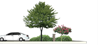
Sec 107.67 Foundation Planting Requirements
For all nonresidential and multi-family buildings, a landscape area shall be provided around all freestanding buildings. The landscape area shall be a minimum of five (5) feet wide and be located within ten (10) feet from the structure/facade. At a minimum, there shall be a combination of two (2) medium and five (5) small shrubs and one (1) medium tree, or one (1) large palm or two (2) medium palms for every 15 feet of cumulative facade perimeter. The cumulative minimum plantings may be grouped along select building facades when installation of landscape relates to building orientation and promotes energy efficiency, active or passive cooling, wind protection or reduction of heat island effects. Attention shall also be given to arrival areas, entrances, pedestrian walks, seating areas, and courtyards of all buildings. A planting approach shall use two (2) or three (3) layered plantings to enhance and announce the building entry. When the foundation planting requirements coincide with perimeter parking required in Section 107.66.A.5, the perimeter parking may be counted toward the required foundation planting requirements of this Section. Nothing in this exception shall preclude the application of principles cited in Section 107.64.F, 107.65.B.
Sec 107.68 Plant Material Specifications And Plant List
- General. The following specifications shall be utilized for all landscape materials on the project site.
- The quality of plant material shall meet or exceed Florida Number One as defined in "Grades and Standards for Nursery Plants," Part 1 and Part 2" published by the State of Florida, Department of Agriculture and Consumer Services, 1998 or current edition.
- All plant materials must be suitable to the South Florida area, specifically the Florida Keys' climate and soil conditions. All plant species shall be either native species, or non-invasive non-native species. Species that meet the "drought tolerant" or "very drought tolerant" categories of "Waterwise" by South Florida Water Management District shall comprise 75 percent of the required trees of each project. Florida-Friendly Landscape techniques, as required in Subsection 107.69 D. of this chapter, shall be utilized to minimize water consumption.
- Trees.
- All required trees must meet the minimum ranges for spacing, caliper, height and canopy spread as listed in Table 107.70.4 at time of planting. A minimum of 75 percent of required trees shall be from Table 107.68.1
- Large trees shall not be planted closer than 3.5 feet from any permanent hardscape or building. Large trees shall be provided a minimum of 300 square feet of immediately accessible soil area for root growth. Up to twenty five percent (25%) of this planned soil area for root growth can be shared with another tree's planned soil area for root growth. See 107.66.F
- Medium trees shall not be planted closer than 2 feet from any permanent hardscape or building. Medium trees shall be provided a minimum of 150 square feet of immediately accessible soil area for root growth. Up to twenty five percent (25%) of this planned soil area for root growth can be shared with another tree's planned soil area for root growth. See 107.66.F
- Shrubs and Groundcovers. Plant materials utilized to provide a continuous screen of shrubs must be a minimum of 24 inches above grade upon planting. See 107.66.A.6. All plant materials utilized for this screening must attain at least 50 percent visual blockage within two (2) years. A minimum of 75 percent of required shrubs and groundcovers shall be from Table 107.68.1.
- Mulch. Natural mulch shall be used in all planting areas. The use of cypress mulch is discouraged. The Department may allow substitutions of other mulch types on a case by case basis.
Table 107.68.1
Native Plant Materials
| SCIENTIFIC NAME | COMMON NAME |
| LARGE TREES | |
| Bursera simaruba | Gumbo Limbo |
| Clusia rosea | Pitch Apple |
| Conocarpus erectus | Buttonwood |
| Coccoloba uvifera | Sea Grape |
| Ficus citrifolia | Short Leaf Fig |
| Lysiloma latisiliquum | Lysiloma |
| Mastichodendrom foetidissimum | Mastic |
| Piscidia piscipula | Jamaican Dogwood |
| Simarouba glauca | Paradise Tree |
| Swietenia mahagoni | Mahogany |
| MEDIUM TREES | |
| Amyris elemifera | Torchwood |
| Ardisia escallonoides | Marlberry |
| Bourreria suculenta | Strongbark |
| Canella winterana | Cinnamon Bark |
| Conocarpus erectus 'sericeus' | Silver Buttonwood |
| Chrysophyllum oliviforme | Satinleaf |
| Coccoloba diversifolia | Pigeon Plum |
| Cordia sebestena | Orange Geiger |
| Guapira discolor | Blolly |
| Guaiacum sanctum | Lignum Vitae |
| Krugiodendrom ferreum | Black Ironwood |
| Myrcianthes fragrans | Simpson Stopper |
| LARGE SHRUBS | |
| Acacia choriophylla | Cinnecord |
| Capparis cynophallophora | Jamaican Caper |
| Calyptranthes pallens | Spicewood |
| Citharexylum spinosum | Fiddlewood |
| Conocarpus erectus 'sericeus' | Silver Buttonwood |
| Eugenia axillaris | White Stopper |
| Eugenia confusa | Red Berry Stopper |
| Eugenia foetida | Spanish Stopper |
| Eugenia rhombea | Red Stopper |
| Foresteriera segregata | Florida Privet |
| Genipa clusifolia | Seven Year Apple |
| Gymnanthes lucida | Crabwood |
| Rapanea punctata | Myrsine |
| Schaefferia frutescens | Florida Boxwood |
| MEDIUM SHRUBS | |
| Brysonima lucida | Locust Berry |
| Chrysobalanus icaco | Cocoplum |
| Duranta repens | Golden Dew Drop |
| Erithalis fruticosa | Black Torch |
| Hamelia patens | Firebush |
| Pithecellobium keyense | Florida Keys Blackbead |
| Psychotria nervosa | Wild Coffee |
| Randia aculeata | Indigo Berry |
| Suriana maritima | Bay Cedar |
| SMALL SHRUBS | |
| Argusia gnaphalodes | Sea Lavender |
| Callicarpa americana | Beauty Berry |
| Chiococca alba | Snowberry |
| Jacquinia keyensis | Joewood |
| Lantana involucrata | White Lantana |
| Psychotria ligustrifolia | Dwf. Wild Coffee |
| Savia bahamensis | Maiden Bush |
| Senna mexicana 'chapmanii' | Bahama Cassia |
| Serenoa repens | Saw Palmetto |
| Sophora tomentosa | Necklace Pod |
| GROUNDCOVER | |
| Arachis glabrata | Perennial Peanut |
| Asclepias tuberosa | Butterfly Weed |
| Borrichia arborescens | Sea Ox-Eye Daisy |
| Coreopsis leavenworthii | Tickseed |
| Crinum americanum | Swamp Lily |
| Ernodia littoralis | Golden Creeper |
| Flaveria linearis | Yellowtop |
| Gaillardia puchella | Blanket Flower |
| Helianthus debilis | Dune Sunflower |
| Hymenocallis latifolia | Spider Lily |
| Ipomea pes-caprae | Goatsfoot |
| Lantana depressa | Pineland Lantana |
| Muhlenbergia capillaris | Muhly Grass |
| Nephrolepis exaltata | Sword Fern |
| Salvia coccinea | Native Salvia |
| Scaevola plumieri | Inkberry |
| Scuteleria havanensis | Havana Skullcap |
| Sesuvium portulacastrum | Sea Purslane |
| Spartina patens | Cordgrass |
| Stachytarpheta jamaicensis | Porterweed |
| Tripsacum floridanum | Dwarf Fakahatchee |
| Uniola paniculata | Sea Oats |
| Zamia pumila | Coontie |
| LARGE PALMS | |
| Roystonea elata | Royal Palm |
| MEDIUM PALMS | |
| Sabal palmetto | Palmetto |
| SMALL PALMS | |
| Coccothrinax argentata | Silver Palm |
| Pseudophoenix sargentii | Buccaneer Palm |
| Thrinax radiata | Thatch Palm |
| Thrinax morrisii | Keys Thatch Palm |
| Note: This list is not complete and is to be used as a representative sampling of the required native planting material. For a complete list, contact the City Biologist. | |
Table 107.68.2
Approved Non-Native Plant Materials
| SCIENTIFIC NAME | COMMON NAME |
| LARGE TREES | |
| Bulnesia arborea | Verawood |
| Cassia fistula | Golden Shower |
| Cananga odorata | Ylang Ylang |
| Jacaranda mimosifolia | Jacaranda |
| Mangifera indica | Mango |
| Tamarindus indica | Tamarind |
| MEDIUM TREES | |
| Caeselpinia pulcherrima | Dwarf Poinciana |
| Senna surattensis | Glaucous Cassia |
| LARGE SHRUBS | |
| Citrus aurantifolia | Key Lime |
| Clusia guttifera | Small Leaf Clusia |
| MEDIUM SHRUBS | |
| Acalypha hispida | Chenillle Plant |
| Acalypha wilkesiana | Copperleaf |
| Codiaeum varigatum | Croton |
| Galphimia gracilis | Thryallis |
| SMALL SHRUBS | |
| Bougainvillea speciosa | Bougainvillea |
| Cariss macrocarpa 'Emerald Blanket' | Emerald Blanket Carissa |
| Clerodendron thomsoniae | Bleeding Heart |
| Hamelia patens 'Compacta' | Dwarf Firebush |
| Pandora jasminoides | Bower Vine |
| Plumbago auriculata | Leadwort |
| Zamia furfuracea | Cardboard Palm |
| GROUNDCOVER | |
| Crossandra infundibuliformis | Crossandra |
| Euphorbia millii | Crown of Thorns |
| Ficus microcarpa 'Green Island' | Green Island Ficus |
| Lantana camara | Lantana |
| Microsorum scolopendrium | Wart Fern |
| Nephrolepis falcata | Macho Fern |
| Pentas lanceolata | Star Flower |
| Philodendron 'Burle Marx' | Burle Marx Philodendron |
| Ruellia brittonia | Ruellia |
| Russelia equisetiformis | Firecracker |
| LARGE PALMS | |
| Bismarkia nobilis | Bismark Palm |
| Cocus nucifera | Coconut |
| Phoenix canariensis | Canary Date Palm |
| Phoenix dactylifera 'Medjool' | Medjool Date Palm |
| MEDIUM PALMS | |
| Veitchii montgomeryana | Montgomery Palm |
| Wodyetia bifurcata | Foxtail Palm |
| SMALL PALMS | |
| Dypsis cabadae | Cabada Palm |
| Ptychosperma elegans | Alexander Palm |
| Note: This list is not complete and is to be used as a representative sampling of the required native planting material. For a complete list, contact the City Biologist. | |
Sec 107.69 Landscape Plans
- Planting Plan. Site designs and landscape construction documents shall be prepared in accordance with the requirements of all applicable Florida Statutes. All landscape and irrigation system designs shall be consistent with the standards required under 373.228 Florida Statutes. A copy of the planting plan shall be submitted to the Department for final review.
- Drawing Requirements. Planting drawings shall indicate all existing and proposed landscape buffers, easements, utilities, right-of-ways, structures, and overhead lines associated with the parcel. All multi-family and non-residential landscape plans shall be prepared by a landscape architect licensed to practice in the State of Florida, or by persons authorized by Chapter 481, Florida Statutes, to prepare landscape plans or drawings.
- Natural Vegetation. The preservation and utilization of a site's native trees, understory, and other vegetation shall be incorporated into the overall site development and planting plans to the greatest extent practicable.
- Florida Friendly Landscapes. The following tables lists those principles that shall be utilized in the preparation, review, evaluation, and approval of all required landscape plans. These principles shall only be required to apply to new construction or substantial improvements, as applicable.
Table 107.69.1
Florida Friendly | Non-Residential | Residential |
1. Site Planning and Design: | R | R |
| a. The Site Plan shall consider natural drainage features to minimize runoff. The use of pervious surfaces and areas is preferred. Therefore impervious surfaces and materials within the landscaped area shall be limited to borders, sidewalks, stepping stones, and other similar elements of design and shall not exceed 15 percent of the landscaped area. Use of pervious paving materials is strongly encouraged and relative imperviousness will be considered. | R | R |
| b. Site plans shall identify all vegetated areas to be preserved, including but not limited to water resource and wetland buffers adjoining all waters of the state. Such buffers should be native, or if previously disturbed, constructed in accordance with USDA-NRCS conservation practices. Water resource and wetland buffers shall comply with Section 106.28 in order to protect water bodies from nonpoint source pollution generated by up gradient development. | R | R |
| c. All invasive exotic plant species shall be noted on the Site Plan and be removed from each site prior to the beginning of construction. For purposes of determining plant species to remove, refer to Department of Agriculture and Consumer Services "Noxious Weeds" rule Chapter 5B-57, F.A.C. and the Florida Keys Exotic Invasive Task Force rules and guidelines. | R | R |
| d. Gravel, river rock, shell and similar materials shall not be used as a major landscape ground cover or mulch as they increase the need for herbicide use, have no habitat value, reflect rather than absorb heat, do not produce oxygen like plants and the runoff from crushed gravel results in high turbidity in near shore waters, resulting in layers of silt, which can kill off sea grass, corals and marine life. In no case may the use of these materials exceed 30 percent of the total pervious site area. | R | R |
| e. The solar orientation of the property and its relationship to other properties should be considered as this may produce different microclimate exposures (e.g., sun vs. shade, southern vs. northern exposure, surrounded by heat-reflective surfaces, etc). When preparing a landscape plan, consideration should be given to the proper selection and placement of tree species near buildings to minimize building heating and cooling requirements. When located appropriately, trees of adequate size, quality, canopy, and form can decrease energy consumption in buildings in the summer by reducing heat absorption and in the water by allowing for passive solar heating and providing protection from the wind. Maximum cooling savings will result when deciduous trees are planted to shade the eastern and/or western wall and windows of buildings. To shade the roof or wall of a one-family residential structure, for example, trees that will mature to a medium-to-large size should be planted within thirty (30) feet of the structure. Smaller trees can also be planted closer to the house and used to shade walls and window areas. | R | R |
| f. The Landscape Construction Documents shall be drawn to scale and include property boundaries, north arrow, graphic scale, and date. They shall also include, but not be limited to the following: | R | R |
| i. Location of all underground and above ground utilities and boxes including overhead utilities; | R | R |
| ii. Existing and proposed trees, shrubs, ground covers and turf areas within the developed landscape area; | R | R |
| iii. Plants by botanical and common name, where applicable cultivar name, plant spacing, quantities of plant for each type, planted sizes including notation of field grown or container size, and mature height and spread of each plant; | R | O |
| iv. Existing and proposed property lines, streets, street names and public utilities; | R | R |
| v. Existing and proposed hardscape features such as driveways, patios, and sidewalks as necessary as well as existing or proposed nonorganic mulched areas; | R | O |
| vi. Existing and proposed structures such as pools, fountains, fences and retaining walls; | R | R |
| vii. Existing and proposed buildings; | R | R |
| viii. Tabulation of the total square footage(s) of the various landscape hydrozones on the plan. If more than one (1) water meter serves the site, the total hydrozone square footages of all the various hydrozones must be identified with each Point of Connection (POC) and meter providing water service. | R | O |
| g. Irrigation plans must be designed to recognize differential irrigation requirements of the landscape as described in this article. It is suggested that As-Built construction documents be submitted prior to issuance of the Certificate of Occupancy, with a copy delivered to the property owner. This will help to prevent later damage from digging by utility workers or the property owner and assist the owner with understanding the system design. The irrigation plan shall include the following: | R | R |
| i. Irrigation point(s) of connection and design capacity; | R | R |
| ii. Water service pressure at irrigation POCs; | R | R |
| iii. Water meter size; | R | R |
| iv. Reduced-pressure-principle backflow-prevention devices for each irrigation POC on potable water systems; | R | R |
| v. Major components of the irrigation system shall include, but not be limited to; pumps, filters, valves, mainline pipes, lateral pipes, controllers, tubing, and pipe sizes; | R | R |
| vi. Precipitation rate expressed in inches per hour for each valve circuit. The preparer must attach to the Project Data Sheet the calculations for deriving precipitation rates for each irrigation valve circuit; | R | O |
| vii. Total flow rate (flow velocity not to exceed five (5) feet per second) in gallons per minute (gpm) and operating pressure (psi) for each individual overhead and bubbler circuit, and gallons per hour (gph) and operating pressure for low-flow point irrigation circuit; | R | R |
| viii. elements: Separate symbols for all irrigation equipment. For each irrigation head type the legend shall show coverage patterns, precipitation rates, operation pressure requirements, gallons required and associated time periods, brand and model names, and pressure compensating devices (if applicable). A general description of all other equipment, including brand name and model number, sizes, special features, and materials. For all specified equipment for low-flow systems the legend shall contain recommended operating pressure, brand name and model names, precipitation rates, distribution patterns, and spacing of emitters or drip tubing; | R | R |
| ix. The same requirements for use of a recycled water irrigation system shall apply. Reclaimed water, grey water, or other nonpotable water shall be used for irrigation provided an acceptable source for that water is available and identified by the City; | R | R |
| x. Identify location of the rain shut-off devices and any soil moisture sensors; | R | R |
| xi. The irrigation system must clearly account for any slopes over ten (10%) percent and any elevation differences over five (5) feet. If the irrigation plan does not clearly show design for these situations, a grading plan may be required which shall indicate all finish grades by either spot elevations or contours or both along with drainage patterns within the developed irrigated area. | R | O |
| 2. Soils: | ||
| a. Analysis: When required, as determined by the City Biologist, a soil analysis shall provide the following information, at a minimum: | R | O |
| i. Determination of soil texture, indicating the percentage of organic matter; | R | O |
| ii. Measurement of pH of the soil, and total soluble salts; and | R | O |
| iii. Estimated soil infiltration rate. | R | O |
| b. Use of Existing Top Soil: Existing horticulturally suitable topsoil shall be stockpiled and re-spread during final site grading. Any new soil required shall be similar to the existing soil in pH, texture, permeability, and other characteristics, unless a Soil Analysis provides evidence that either soil amendment is needed or a different soil type is required. The use of solid waste compost as a soil amendment is encouraged where it is appropriate. | R | O |
| 3. Land Clearing Standards and Preservation of Native Vegetation: | ||
| a. Unless otherwise approved by the City, clearing of a site shall preserve all native vegetation. | R | R |
| b. Vegetation which is set aside for preservation shall be protected from all on-site construction. Protective barriers shall be installed along the perimeter of all preserve areas. Protective barriers shall be constructed at such intervals to prevent machinery from passing between them. | R | R |
| c. No equipment or materials shall be permitted to be stored within the set-aside areas, and dumping of excess soil, liquids, or any other construction debris within the preservation areas is prohibited. | R | R |
| d. Removal or re-grading of soils within preservation areas is prohibited. | R | R |
| e. Any damaged vegetation within the set-aside areas shall be replaced with vegetation equivalent to the vegetation destroyed before any certificates of occupancy or other approvals may be issued. | R | R |
| 4. Appropriate Plant Selection, Location, and Arrangement: | ||
| a. Appropriate Plant Selection: Plant selection should be based on the plant's adaptability to the existing conditions present within the planted area and the Keys native plant communities. Plant species that are drought tolerant are preferred. For purposes of determining prohibited and controlled plant species refer to the Department of Agriculture and Consumer Services rule, Chapter 5B-57 Florida Administrative Code. Plants named in this rule may not be used except as allowed in Chapter 5B-57. | R | R |
| b. Location: Plants shall be grouped in accordance with their respective water and maintenance needs. Plants with similar water and cultural (soil, climate, sun, and light) requirements shall be grouped together. Where natural conditions are such that irrigation is not required, the presence of site appropriate plants shall not be considered a high water use hydrozone. | R | R |
| c. Arrangement: The combined size of all high water use hydrozones shall be limited to 30 percent of the total planted area including turf. In planted areas irrigated with recycled water, the allowable size of all high water use zones shall be increased to not more than 60 percent of the total planted area including turf. These high water use limits do not apply to planted areas requiring large amounts of turf for their primary functions, e.g., ballfields and playgrounds; soil moisture sensors shall be installed in these areas. | R | O |
| 5. Turf Areas: | ||
| a. Type and Location: The type of turf shall be selected from c.1, below and the location of turf areas shall be chosen in the same manner as with all the other plantings. Irrigated turf areas, as opposed to non-irrigated turf areas, are considered to be a high water use hydrozone. Irrigated turf shall not be treated as a fill-in material but rather as a planned element of the landscape. Turf shall be placed so that it can be irrigated using separate zones. | R | R |
| b. Arrangement. While turf areas provide many practical benefits in a landscape, how and where it is used can result in a significant reduction in water use. Irrigated turf grass areas shall be consolidated and limited to those areas on the site that receive pedestrian traffic, provide for recreation use, provide cover for waste treatment drainfields and required drainfield reserve areas, or provide soil erosion control such as on slopes or in swales; and where turfgrass is used as a design unifier, or other similar practical use. | R | O |
| c. No turf grass that requires mowing shall be allowed on slopes greater than 4:1. For turf areas (where a planting plan is required), areas shall be identified on the plan by biological and common name and by variety and by the square footage covered by the turf. 1. Turf Types Appropriate for the Keys St. Augustine Bermuda Zoysia Bahia | R | R |
| 6. Efficient Irrigation: | ||
| a. Design Guidelines: An irrigation system shall be designed and constructed in accordance with the Site Planning and Design Requirements of this Article. All irrigation installations after the effective date of this ordinance shall meet the irrigation standards identified per 373.228 F.S. These include: | ||
| i. Irrigation systems shall be designed to meet the needs of the plants in the landscape (not the other way around). | R | R |
| ii. Whenever feasible, irrigation systems shall be designed to separately serve turf and non-turf areas. | R | R |
| iii. The irrigation system plans and specifications shall identify the materials to be used and the construction methods. | R | R |
| iv. The design shall consider soil, slope, and other site characteristics in order to minimize water waste, including overspray, the watering of impervious surfaces and other non-vegetated areas, and off-site runoff. | R | O |
| v. The system shall be designed to minimize free flow conditions in case of damage or other mechanical failure. | R | O |
| vi. The system shall be designed to use the lowest quality water feasible. | R | O |
| vii. Rain switches or other approved devices, such as soil moisture sensors, to prevent unnecessary irrigation, shall be incorporated. (Section 373.62, F.S.) | R | R |
| viii. A recommended seasonal operating schedule and average precipitation rates for each irrigation zone for both establishment and maintenance conditions shall be provided. | R | O |
| ix. Control systems shall provide the following minimum capabilities: | ||
| i. Ability to be programmed in minutes, by day of week, season and time of day, | R | R |
| ii. Ability to accommodate multiple start times and programs | R | R |
| iii. Automatic shut off after adequate rainfall, | R | R |
| iv. Ability to maintain time during power outages for a minimum of three days | R | O |
| v. Operational flexibility to meet applicable year-round water conservation requirements and temporary water shortage restrictions. | R | O |
| x. Recommended maintenance activities and schedules shall be included. | R | O |
| xi. Precipitation rates for sprinklers and all other emitters in the same zone shall be matched, except that microirrigation emitters may be specified to meet the requirements of individual plants. | R | O |
| xii. Irrigation systems shall be designed to maximize uniformity, considering factors such as: | R | R |
| i. Emitter types. | R | R |
| ii. Head spacing. | R | R |
| iii. Sprinkler pattern. | R | R |
| iv. Water pressure at the emitter. | R | R |
| xiii. Irrigation systems with main lines larger than two inches or designed to supply more than seventy gallons per minute shall incorporate a means to measure irrigation water use, at a minimum of ninety-five percent accuracy across the flow range. | R | O |
| xiv. Irrigation system plans and specifications shall require the system installer to conduct final testing and adjustments to achieve design specifications prior to completion of the system and acceptance by the owner or owner's representative. | R | O |
| xv. Irrigation system plans and specifications shall require that the installer provide property owners and users with the following post-construction documentation, including as-constructed drawings, recommended maintenance activities and schedules, operational schedule, design precipitation rates, instructions on adjusting the system to apply less water after the landscape is established, maintenance schedule, water source, water shut-off method, and the manufacturer's operational guide for their irrigation controller. To the extent feasible, similar information should be made available for subsequent property transfers. | R | O |
| b. Arrangement: The irrigation system shall be designed to correlate to the organization of plants into zones as described in this Article. The water use zones shall be shown on the Irrigation Plan (where plan is required). All plants (including turf) require watering during plant establishment. Temporary irrigation systems may be installed to facilitate establishment of plants and turf. Irrigation must be conducted in accordance with WMD restrictions. | R | O |
| c. Rain Water Collection: Whenever feasible, the installation of rainwater catchment systems such as cisterns or rain barrels to reduce dependency on the use of potable water for outdoor irrigation and to reduce stormwater treatment volumes shall be required. | R | O |
| d. Check Valves: Check valves may be required to be installed in irrigation heads prevent low head drainage and puddling, when the head exceeds eight (8) feet above the POC. | R | O |
| e. Precipitation Rate: Nozzle precipitation rates for all heads within each valve circuit must be matched. | R | O |
| f. Irrigated areas shall not be less than 4 feet wide, except when next to contiguous property or when using micro or drip irrigation. | R | O |
| g. Pressure Regulating Valves: A pressure-regulating valve shall be installed and maintained if static service pressure exceeds 80 pounds per square inch. The pressure-regulating valve shall be located between the meter and the first point of water use, or first point of division in the pipe, and set at not more than 50 pounds per square inch when measured at the most elevated fixture in the structure served. This requirement may be waived if satisfactory evidence is provided that high pressure is necessary in the design and that no water will be wasted as a result of high-pressure operation. [Rationale: The purpose of this requirement is twofold, to protect against system failure during pressure surges, and to avoid wasted water due to operation of the system significantly above commonly used design values.] | R | O |
| 7. Yard Waste Management, Composting and Use of Mulches: | ||
| a. Yard Waste Management: In no case shall grass clippings, vegetative material, and/or vegetative debris be washed, swept, or blown off into stormwater drains, ditches, conveyances, water bodies, wetlands, or sidewalks or roadways. Any material that is accidentally so deposited shall be immediately removed to the maximum extent practicable. Yard wastes shall not be stored by shorelines, in ditches or swales, or near storm drains. [Rationale: Yard wastes release nutrients as they decompose which may pollute the receiving water. Improper disposal of yard wastes can also contribute to flooding by causing stormwater runoff to backup in drainage systems. In addition, improper disposal may lead to spreading of invasive plants to new areas.] | R | R |
| b. Composting: Shredded yard clippings and leaves should be used for mulch or be composted for use as fertilizer. Diseased organic material should not be stored, composted or used as mulch and should be properly disposed of to avoid spreading disease. | R | R |
| c. Use of Mulches: | ||
| i. Composting of organic yard wastes provide many benefits and their use is strongly encouraged. The resulting materials are excellent soil amendments and conditioners. Other recycled organic solid waste products are also available and should be used when appropriate. | R | R |
| ii. Grass clippings are a benefit to lawns by replacing nutrients drawn from the soil and as mulch that helps retain moisture lessening the need to irrigate. Grass clippings should be left on the lawn. Mulching mowers are recommended, because the grass clippings are chopped very finely by special blade and shroud configurations. | R | R |
| iii. If a conventional mower equipped with a side discharge chute is used, the following practices should be employed. When mowing near the shoreline, direct the chute away from the waterbody. When mowing upland areas, direct the chute back onto the yard, not onto the road or driveway. | R | R |
| iv. Other mulches (except grass clippings) can be applied and maintained at appropriate depths in planting beds to assist soils in retaining moisture, reducing weed growth, and preventing erosion. These mulches can also be used in places where conditions aren't adequate for or conducive to growing quality turf or ground covers. Mulches are typically wood bark chips, wood grindings, pine straws, nut shells, and shredded landscape clippings. | R | R |
| v. A layer of organic mulch three (3) inches deep shall be specified on the planting plans in plant beds and around individual trees in turfgrass areas. Use of a byproduct or recycled mulch is recommended. Mulch is not required in annual beds. | R | O |
| vi. Mulch rings should extend to at least three (3) feet around freestanding trees and shrubs. | R | O |
| vii. All mulch should be renewed periodically. | R | O |
| viii. Mulches should be kept at least six (6) inches away from any portion of a building or structure. Mulches should be kept two to four (2—4) inches away from all tree trunks and certain types of shrubs and ground covers. | R | R |
| ix. Plastic or other impervious materials shall not be used under mulched areas. | R | O |
| 8. Installation and Maintenance: All planting, excluding private residences, shall be installed according to accepted commercial planting procedures and executed by a qualified and licensed landscape contractor using the quality and type of materials recommended by the City Biologist and stated herein. | R | O |
- Exemptions: Exempted from the provisions of Table 107.69.1, if applicable, are the following:
- Golf courses and specialized athletic fields; [Rationale: These have specialized needs not addressed in the general references, and are usually managed by highly trained professionals]
- Any development that is governed by an approved, final site plan or a valid building permit issued prior to the effective date of this Ordinance, is exempted from retrofitting or meeting the specific provisions of Table 107.69.1. However, no existing development is exempted from meeting the provisions affecting management, maintenance, or the education of maintenance personnel of this Ordinance.
- Rights-of-way for public utilities, including electrical transmission and distribution lines, and natural gas pipelines.
- Conditional exemption may be granted by the City Biologist for individual projects if the applicant can, in writing, define the areas of exemption and demonstrate acceptable reasons for the requested exemption.
Sec 107.70 Landscape Buffer Requirements
- Project Boundary Buffers.
- General Provisions.
- Project Boundary Buffers shall be located along the outer perimeter of the parcel to be developed extending inward from the parcel boundaries. The project Boundary Buffer shall be applied to the sides and back of the property. The TRC has the authority to approve the placement of a buffer at an adequate distance from the parcel boundary when it can be shown that a conflict exists with an existing utility easement.
- Buffers on residential developments shall be designated as common areas and shall not be included within lots.
- Buffers on nonresidential sites may be included within lots and counted toward setback requirements.
- No structures are permitted in buffers except fire hydrants, concrete valve markers, underground utility markers, switches, bus shelters or benches, incidental signs not exceeding two (2) square feet in area, and screening.
- No parking is permitted within a buffer zone.
- Buffer areas may include portions of the stormwater management system if the applicant demonstrates that the character and intent of the buffer is not diminished. At a minimum, the buffer shall include all of the required plantings at the normal grade of the site at the property line.
- Pedestrian access through a buffer to adjacent uses may be permitted.
- Utility lines may cross the buffer provided that the amount of buffer compromised is minimized while maintaining the specified number of plantings required in Table 107.70.2.
- Trails within a buffer may be permitted provided the character and intent of the buffer is not diminished.
- Required Project Boundary Buffers.
- Minimum buffers types (i.e. low medium high) required on property boundaries between zoning districts are shown in Table 107.70.1. For the purpose of prescribing appropriate Project Boundary Buffers from the City of Marathon Landscape Design Manual, the following shall apply to Table 107.70.1
- H= H Type Buffer= H2, H4, H5, or H6
- M= M Type Buffer= M2, M3, or M5
- L= Low Type Buffer= L1, or L3
- H= H Type Buffer= H2, H4, H5, or H6
- Minimum width and planting quantities for required project boundary buffers are shown in Table 107.70.2. Substitution of plant materials may be allowed pursuant to Table 107.70.3 provided the character and intent of the buffer is not diminished. General arrangement of plant material within buffers shall be required to substantially comply with the latest edition of the City of Marathon Landscape Design Manual, adopted herein by reference.
- The TRC may reduce the required buffer width by up to 50 percent where it can be shown by the applicant that the reduction is warranted by unique site features or characteristics. This would include, but is not limited to, situations where the buffer would be located adjacent to a waterbody or open space area or if a permanent buffer exists on the adjacent property.
- The following additional buffering shall be provided where off-street loading exists:
- Loading bay areas shall be screened from any residential district.
- In the MU land use districts, off-street loading shall be screened from US1.
Table 107.70.1
Project Boundary Buffer StandardsTable 107.70.2Zoning District of Subject Property
Zoning District of Adjacent Property
A
C-NA
C-OI
I-G
I-M
MU
MU-M
PR
P
R-MH
RH
RM
RM-1
RL
RLC
A
N/A
H
H
H
H
H
H
H
H
H
H
H
H
H
H
C-NA
H
N/A
M
H
H
H
H
H
H
H
H
H
H
H
H
C-OI
H
M
N/A
H
H
H
H
H
H
H
H
H
H
H
H
I-G
H
H
H
N/A
L
H
H
H
H
H
H
H
H
H
H
I-M
H
H
H
H
N/A
M
M
H
H
H
H
H
H
H
H
MU
H
H
H
H
M
N/A
L
M
M
M
M
H
H
H
H
MU-M
H
H
H
H
M
L
N/A
M
L
M
M
H
H
H
H
PR
H
H
H
H
H
M
M
N/A
L
M
M
H
H
H
H
P
H
H
H
H
H
M
L
L
N/A
M
M
H
H
H
H
R-MH
H
H
H
H
H
M
M
M
M
N/A
M
M
H
H
H
R-H
H
H
H
H
H
M
M
M
M
M
N/A
M
L
L
L
RM
H
H
H
H
H
H
H
H
H
M
M
N/A
M
M
L
RM-1
H
H
H
H
H
H
H
H
H
H
H
M
N/A
M
L
RL
H
H
H
H
H
H
H
H
H
H
H
M
M
N/A
L
RL-C
H
H
H
H
H
H
H
H
H
H
H
H
L
L
N/A
Project Boundary Buffer Minimum Width and Planting RequirementsBuffer Type Buffer Width Large Tree Qty
Medium Tree Qty Large Shrub Qty Medium Shrub Qty Small Shrub Qty Ground Cover Qty Large Palm Qty Medium Palm Qty L1 10' 0 5 4 8 26 48 L2 10' 0 4 0 9 24 72 L3 10' 3 4 0 6 18 60 L4 10' 0 4 0 6 24 42 M1 15' 2 2 6 6 25 92 M2 15' 3 4 6 6 29 28 M3 15' 3 4 0 12 18 80 M4 15' 0 3 0 10 29 48 M5 15' 0 0 6 17 28 30 9 H1 20' 3 0 0 12 42 74 H2 20' 3 2 9 10 15 54 H3 20' 2 2 0 6 36 108 H4 20' 2 4 9 16 32 27 3 H5 20' 3 4 9 16 34 27 H6 20' 0 3 10 12 24 50
Table 107.70.3
Landscape Buffer SubstitutesBuffer Type Landscape Buffer Possible Substitutes Tree and Palm Substitute Equivalents Option 1 Option 2 L1 40% Medium Trees 1 Medium Tree=1 Large Palm 1 Medium Tree=3 Medium Palms L2 None N/A N/A L3 50% Medium Trees 1 Medium Tree=1 Large Palm 1 Medium Tree=3 Medium Palms L4 50% Medium Trees 1 Medium Tree=1 Large Palm 1 Medium Tree=3 Medium Palms M1 None N/A N/A M2 50% Medium Trees 1 Medium Tree=1 Large Palm 1 Medium Tree=3 Medium Palms M3 50% Medium Trees 1 Medium Tree=1 Large Palm 1 Medium Tree=3 Medium Palms M4 None N/A N/A M5 30% Large Shrubs 2 Large Shrubs=3 Medium Palms 1 Large Shrub=3 Small Palms H1 None N/A N/A H2 50% Medium Trees 1 Medium Tree=1 Large Palm 1 Medium Tree=3 Medium Palms H3 None N/A N/A H4 30% Large Trees 1 Large Tree=1 Large Palm 1 Large Tree=3 Medium Palms H5 50% Medium Trees 1 Medium Tree=1 Large Palm 1 Medium Tree=3 Medium Palms H6 30% Medium Trees 1 Medium Tree=1 Large Palm 1 Medium Tree=3 Medium Palms
Table 107.70.4
Landscape Material Installation SpecificationsMATERIAL TYPE MINIMUM SPACING INSTALL CALIPER INSTALL HEIGHT CANOPY SPREAD LARGE TREES 20'-40' 4" 12'-14' 8'-10' MEDIUM TREES 15'-40' 2 1/2" 10'-12' 6'-8' LARGE SHRUBS 10'-15' NA 8'-10' 4'-6' MEDIUM SHRUBS 5'-10' NA 24"-36" 24"-36" SMALL SHRUBS 3'-5' NA 24"-36" 24"-36"
- Minimum buffers types (i.e. low medium high) required on property boundaries between zoning districts are shown in Table 107.70.1. For the purpose of prescribing appropriate Project Boundary Buffers from the City of Marathon Landscape Design Manual, the following shall apply to Table 107.70.1
- Project Boundary Buffer Standards.
- Examples of appropriate species for planting in buffers are listed in Table 107.68.1 and 107.68.2
- Plant materials and installation shall meet the requirements of Section 107.68, Section 107.69 and meet the minimum ranges for spacing, caliper, height and canopy spread as listed in Table 107.70.4
- The required planting shall generally be spaced or grouped to provide a natural appearance. The required planting shall be evenly spaced to provide a natural appearance.
- The plant materials specified in Table 107.70.2 represent the minimum materials required per 100 linear feet of buffer; the total quantity of materials required shall be determined by dividing the actual length of the buffer.
- Large trees shall be planted no closer than four (4) feet from any property line.
- Shrubs should be selected that provide a variety of heights at maturity.
- Where screening is required or proposed in conjunction with a project boundary buffer (side and rear buffers) it shall consist of one (1) of the following:
- A six-foot tall masonry wall;
- A six-foot tall opaque fence, such as vinyl or wood (no chain-link);
- Existing dense vegetation not invasive, at least six (6) feet in height; or
- A berm three (3) feet in height, located entirely within the dense buffer and planted with materials that at maturity shall reach a combined minimum height of six (6) feet.
- The location of the wall, fence or berm within the buffer strip shall be subject to TRC determination.
- Pedestrian connections through walls or fences that can provide access to adjacent neighborhoods or other uses are encouraged.
- Walls and fences shall be landscaped along the entire exterior side so that one-third (1/3) or more of the vertical face of the fence or wall is screened by plantings. The applicant shall be required to demonstrate provision for access and maintenance of landscaping at the time of landscape or planting approval.
- Walls and fences more than 60 feet long shall have varying wall alignments, use appropriate scale/massing for planted materials, and include decorative features and sound absorbing or scattering materials.
- When a berm is used to form a visual screen in lieu of or in conjunction with a hedge or wall, such berm shall have a stabilized slope of one to three (1:3) rise/run and shall be completely covered with shrubs, sod or other landscape quality living ground cover.
- Existing non-invasive vegetation may be used to fulfill buffering and screening requirements where such existing natural vegetation is of sufficient height or can be augmented to reach a sufficient height and opacity to provide an effective visual and acoustical buffer giving consideration to the existing and proposed uses.
- General Provisions.
- Measurements.
- Driveway widths (measured at the inside edge of the buffer) shall not be counted in the calculation of the plant material required.
- All buffers shall be measured from the future right-of-way line determined during the site plan review, unless additional public utility easement is required between the right-of-way line and the buffer to provide utility clearance.
Sec 107.71 Streetscape Treatment Types
Streetscape treatments encompass the organization of outdoor space and all elements creating that space, including trees and vegetation, parking areas, hardscape structures such as fences, walls, furniture, and sidewalks, and the correct orientation and proper scale of building facades. Streetscape treatment shall be applied to the front setback, in particular those fronting a street or road.
The following streetscape treatment types shall apply throughout the City:
- Type 1: (A, MU, MU-M, P, PR zoning districts). It is the expressed intent of Streetscape Treatment Type 1 to provide an environment which mitigates the impacts of automobile-oriented areas in order to make them more livable. This includes reduction of visual clutter, including signage and location of auto parking areas, and the provision of landscaping to enhance and soften the environment through the provision of screening, shade, and buffers. It shall apply to all parcels along US 1, with the exception of the Old Town area.
- The landscape treatment area shall be prescribed from the buffer types found in Table 107.70.2. The buffer type and minimum width shall be determined by average depth of the property or parcel being developed, redeveloped or substantially improved and shall be prescribed from Table 107.71.1.
- Minimum width and planting quantities for required Streetscape Treatment Types are shown in Table 107.70.2. Substitution of plant materials may be allowed pursuant to Table 107.70.3 provided the character and intent of the streetscape treatment is not diminished. A single substitution is permitted per 100 linear feet. General arrangement of plant material within buffers shall be required to substantially comply with the latest edition of the City of Marathon Landscape Design Manual, adopted herein by reference.
- Plant materials and installation shall meet the requirements of Section 107.68, Section 107.69, Section 107.70.A.3 and shall meet the minimum ranges for spacing, caliper, height and canopy spread listed in Table 107.70.4
Table 107.71.1Average Lot Depth Streetscape Buffer width <101 feet L-Low >101-299 feet M-Medium >300 feet H-High - Large and medium trees shall be placed in compliance with Section 107.66.A.1, wherever applicable.
- Plantings within utility easements shall be consistent with any such easement agreement dictating type and height of such plantings at maturity. Plantings of shrubs and small trees may be located within the utility easement upon agreement and approval of FKAA and FKEC only. When the utility easement is narrow, the plantings shall be placed on the road side of the easement. In such instances the planting area shall be a minimum width of five (5) feet between the back of the curb and the sidewalk, in accordance with the Florida Department of Transportation's Manual of Uniform Minimum Standards for Design, Construction and Maintenance for Streets and Highways, latest edition, incorporated in Rule 14-15.002, F.A.C.
- Parking spaces shall not be placed on the front of parking lots abutting US1.
- All parking not located to the rear of buildings shall be screened from the right-of-way by a landscaped buffer along US1.
- Parcels which propose drive-thru windows shall be sited so as to locate such windows to the side or rear of buildings and that the drive isles for those windows be predominantly to the side and rear also.
- Type 2: (MU, MU-M). Detailed design of the streetscape shall be accomplished in concert with the architectural design, specific use standards, streetscape design, and special parking requirements. It shall be applied to the Old Town area along US 1 only.
- Parking Standards.
- Parking lots shall be located at the rear or side of street-front uses and shall be screened from the streets, sidewalk, and open spaces by low walls, fences, or low berms in combination with plantings to achieve at least a three-foot high visual screen. Walls or fences must be softened through use of vegetation.
- Parking lots and parking garages shall not abut street intersections, be adjacent to squares or parks, or occupy lots that terminate at a vista, except when specifically designed to incorporate massing, scale, and detail that contributes to the adjoining public space.
- Adjacent parking lots shall have vehicular connections and shared street access wherever possible.
- Land Use Standards.
- All open spaces, including public, conservation, and community spaces, shall be a focal element around which other land uses are organized.
- Provisions for alternative transportation shall be included in the overall design including specific accommodations for integration of mass transit facilities.
- Development shall be divided into an interconnected grid system.
- Appropriate locations for all pedestrian/bicycle access ways shall encourage a continuous system of access. Proposed pedestrian/bicycle access shall connect to existing pedestrian/bicycle access in appropriate manner.
- Required Tree Plantings.
- Native canopy street trees shall be required along both sides of US1. Spacing is determined by species type. Unless the planting of the canopy tree will interfere with the water views when traveling along US1, street trees shall be spaced an average of 40 feet on center. Examples of appropriate canopy trees are identified in Table 107.68.1.
- All planting shall be coordinated with existing and planned utilities and their infrastructure in such a way as to not interfere with those utilities.
- Street trees shall be planted between the street and the sidewalk whenever space permits to protect pedestrians and calm traffic. In such instances the planting area shall be a minimum width of five (5) feet between the back of the curb and the sidewalk, in accordance with the Florida Department of Transportation's Manual of Uniform Minimum Standards for Design, Construction and Maintenance for Streets and Highways, latest edition, incorporated in Rule 14-15.002, F.A.C.
- Parking Standards.
- Type 3: (All zoning districts on other City streets).
- All multi-family and nonresidential developments shall be required to provide a Low type buffer prescribed from the buffer types found in Table 107.70.2 along the entire street frontage:
- Minimum width and planting quantities for required Streetscape Treatment Types are shown in Table 107.70.2. Substitution of plant materials may be allowed pursuant to Table 107.70.3 provided the character and intent of the streetscape treatment is not diminished. A single substitution is permitted per 100 linear feet. General arrangement of plant material within buffers shall be required to substantially comply with the latest edition of the City of Marathon Landscape Design Manual, adopted herein by reference.
- Plant materials and installation shall meet the requirements of Section 107.68, Section 107.69, Section 107.70.A.3 and shall meet the minimum ranges for spacing, caliper, height and canopy spread listed in Table 107.70.4
- All single- and two-family residential uses shall be required to comply with Section 107.69.C-E., when applicable and Section 107.72.
- Utility allocations shall be designed to provide utilities' required separation between trees and utility facilities.
- Street trees shall be planted between the street and the sidewalk whenever space permits to protect pedestrians and calm traffic. In such instances the planting area shall be a minimum width of five (5) feet between the back of the curb and the sidewalk, in accordance with the Florida Department of Transportation's Manual of Uniform Minimum Standards for Design, Construction and Maintenance for Streets and Highways, latest edition, incorporated in Rule 14-15.002, F.A.C.
- For streets without curbing, all street trees shall be planted no further than ten (10) feet from the back of right-of-way.
- All multi-family and nonresidential developments shall be required to provide a Low type buffer prescribed from the buffer types found in Table 107.70.2 along the entire street frontage:
Sec 107.72 Residential Requirements
- Notwithstanding the requirements in Section 107.71.C above, all new and substantially improved residential development, as defined in Section 107.100, shall comply with the following standards:
- All one-family detached lots that are twelve thousand (12,000) square feet or larger shall be planted as follows:
- Plant a minimum of four (4) large trees and three (3) medium trees or palms per lot.
- At least two (2) of the large trees shall be planted on the south and/or west and/or east side and within twenty (20) feet, where feasible, of the residential structure.
- At least one (1) of the required large trees and one (1) of the medium trees shall be located in the front yard or, in the case of a corner lot, in the front or side yard facing the street. This shade tree may also count toward fulfillment of the landscaping for energy conservation requirement in b., above, if located in accordance with such requirement.
- All one-family detached lots that are seven thousand, five hundred (7,500) square feet or larger but less than twelve thousand (12,000) square feet shall be planted as follows:
- Plant a minimum of three (3) large trees and three (3) medium trees or palms per lot.
- At least one (1) of the large trees shall be planted on the south and/or west and/or east side and within twenty (20) feet, where feasible, of the residential structure.
- At least one (1) of the required large trees shall be located in the front yard or, in the case of a corner lot, in the front or side yard facing the street. This large tree may also count toward fulfillment of the landscaping for energy conservation requirement in b., above, if located in accordance with such requirement.
- All one-family detached lots that are larger than four thousand, five hundred (4,500) square feet but less than seven thousand, five hundred (7,500) square feet shall be planted as follows:
- Plant a minimum of three (3) large trees and two (2) medium trees or palms per lot.
- At least one (1) of the large trees shall be planted on the south and/or west and/or east side and within twenty (20) feet, where feasible, of the residential structure.
- At least one (1) of the required large or medium trees shall be located in the front yard or, in the case of a corner lot, in the front or side yard facing the street. This large tree may also count toward fulfillment of the landscaping for energy conservation requirement in b., above, if located in accordance with such requirement.
- All one-family detached lots that are four thousand, five hundred (4,500) square feet or less in size shall be planted as follows:
- Plant a minimum of two (2) large trees and two (2) medium trees or palms per lot.
- At least one (1) of the required large or medium trees shall be located in the front yard or, in the case of a corner lot, in the front or side yard facing the street.
- Townhouses, One-Family Attached and Duplex Dwellings, Arranged side-by side shall be planted as follows:
- Plant a minimum of one and one-half (1.5) large trees and one (1) medium tree per dwelling unit located on individual lots and/or common open space to best fulfill the objectives and design guidelines of this section.
- Townhouses, One-Family Attached and Duplex Dwellings, Arranged over-under shall be planted as follows:
- Plant a minimum of two (2) large trees and one and one-half (1.5) medium trees per dwelling unit located in common open space to best fulfill the objectives and design guidelines of this section. Fractional amounts shall be rounded up.
- All one-family detached lots that are twelve thousand (12,000) square feet or larger shall be planted as follows:
- An existing native tree, equal or exceeding four (4) inches diameter at breast height (dbh) located on an individual lot within twenty (20) feet of a dwelling unit may be counted forward fulfillment of the requirement for a tree on that lot, provided that the size (dbh), genus, condition, and location of each tree to be counted toward the fulfillment of this requirement is shown on the landscape plan. The site and landscape plan must also demonstrate that a minimum of seventy percent (70%) of the critical root zone of such tree will remain undisturbed. The Critical Root Zone ("CRZ") of a tree shall be determined by the drip line of the canopy.
- When a project boundary buffer as required by Section 107.70 Landscape Buffer Requirements, is located on a single-family detached lot, the following shall apply:
- If less than twenty percent (20%) of the area of the lot is occupied by the buffer strip, none of the trees required by Section 107.72 may be located in the buffer strip.
- If more than twenty percent (20%) of the area of the lot is occupied by the buffer strip, one (1) of the large trees or two (2) of the medium trees required by Section 107.72, Residential Requirements, may be located in the buffer strip and may also count toward fulfillment of the boundary buffer requirement.
Sec 107.73 Alternative Compliance
- The provisions of this article shall be liberally construed to effectively carry out the purpose and the intent of the Plan and of this article in the interest of the health, safety and welfare of the residents of the City.
- An applicant may submit a landscape or planting plan which varies from the strict application of the requirements of this article in order to accommodate unique site features, or characteristics, the preservation of water views or to utilize innovative design.
- An alternative compliance landscape or planting plan may be approved only upon a finding that it fulfills the purpose and intent of the Plan and of this article as well as or more effectively than would adherence to the strict requirements.
- In evaluating proposed alternative compliance landscape or planting plans, considerations shall be given to proposals which preserve existing native vegetation and use Florida Friendly and other low water use landscape design principles and where the design ensures the maximum preservation of existing vegetation on the site.
Sec 107.73 Purpose
This article implements the open space policies contained in the Future Land Use, and the Conservation and Coastal Elements of the City of Marathon Comprehensive Plan and provides for open space areas designed to protect and enhance natural resources, promote pedestrian connectivity and enhance recreational opportunities.
Sec 107.74 Minimum Open Space Requirement
Open space shall be provided on at least 20 percent of a development and shall be delineated on all site plans and plats. Within environmentally sensitive parcels, as described in Chapter 106 "Natural and Historic Resource Protection", open space shall be provided pursuant to the zoning of the parcel and is subject to the open space requirements of Table 106.16.1 "Open Space Requirements by Habitat Type".
Sec 107.75 Primary Open Space Areas
When land development involves a parcel that contains any of the conservation areas listed in subsection A., the open space requirements shall first be fulfilled with these areas and the required buffers. When the minimum requirement is not fulfilled with conservation areas, the requirements shall then be fulfilled with Natural Areas as listed in Subsection B.
- Conservation Areas and Associated Buffers.
- Wetlands;
- Surface waters within private ownership;
- Listed species habitat.
- Natural Areas. Native habitat or areas that potentially could be utilized to enhance or restore natural features on or adjacent to the development site. This open space shall be useable to the extent consistent with the character and protection of the resource.
Sec 107.76 Secondary Open Space Areas
After conservation areas and associated buffers and other natural areas have been set aside as open space, any remaining required open space may then be fulfilled with the qualifying areas listed in this article, based upon the type of development.
- Residential Developments. Within residential developments, the following areas shall be credited toward open space requirements:
- Community Green Spaces. Pervious open spaces designed as active or passive recreation areas intended primarily for recreational or pedestrian use, such as community fields, greens, and pervious areas of plazas or squares. Pedestrian amenities and other minor structures that enhance the open space may be permitted within these qualifying open space areas.
- Pedestrian Trails. Paved or mulched pedestrian trails located within a qualifying open space may be counted towards the required open space area.
- Stormwater Management Areas. Stormwater management areas that are designed consistent with Section 107.78, "Requirements for Stormwater Management Areas used as Open Space" and Section 107.79, "Access to Open Space" may be considered as credit for up to one-half (1/2) of the required open space.
- Nonresidential Developments. Within nonresidential developments, the following areas shall be credited toward open space requirements:
- Community Green Spaces. Pervious open spaces designed as active or passive recreation areas intended primarily for recreational or pedestrian use, such as community fields, greens, and pervious areas of plazas or squares. Pedestrian amenities and other minor structures that enhance the open space may be permitted within these qualifying open space areas.
- Landscaped areas. Landscaped areas with a minimum area of 500 square feet and a minimum width of 20 feet containing native species canopy and understory trees, shrubs, and groundcovers consistent with xeriscape principles.
- Stormwater Management Areas. All portions of stormwater management areas that are designed consistent with Section 107.78, "Requirements for Stormwater Management Areas used as Open Space" and Section 107.79, "Access to Open Space" may be considered as credit for the required open space.
- Quality Mixed-Use Developments. All Community Green Spaces, Pedestrian Trails, Landscaped Areas as described above, as well as buffers, squares, parks, plazas, and all portions of stormwater management areas that are designed consistent with Section 107.78, "Requirements for Stormwater Management Areas used as Open Space" and Section 107.79, "Access to Open Space" shall be credited toward the required open space.
Sec 107.77 Designation Of Open Space Areas
- Prior to submitting a site plan or as part of the concept meeting, when applicable, an applicant shall consult with staff to identify the most appropriate portion of the development site to be designated as open space.
- In addition to the specific standards and priorities set forth in this article, the following goals shall guide the designation of open space:
- Open space areas shall be useable and contiguous to the extent consistent with the character and protection of the resource.
- Open spaces should be contiguous to greenways, trails, public parks, or other open spaces on adjoining parcels in order to promote the creation of larger open spaces with greater usability, resource protection, and connectivity.
Sec 107.78 Requirements For Stormwater Management Areas Used As Open Space
Stormwater management systems shall be designed in accordance with Article 11 "Stormwater Management" of this Chapter and must complement and be integrated with the other required open space areas. In addition to the design requirements of Article 11 for stormwater management areas, the following criteria shall apply in order to be considered as credit toward the open space requirement:
- Stormwater management facilities shall be designed to provide a greater biological diversity, enhanced stormwater treatment, and a variety of hydrologic conditions by incorporating the following design features:
- Provide staged elevations within the treatment volume of the basin. The initial tier, or forbay, should be designed to capture the majority of the sediments. Additionally, baffles, islands, berms, channels and other similar measures may be incorporated to maximize the contact of the stormwater with the surfaces of the basin.
- At a minimum, one (1) tree shall be planted for every 50 linear feet, or fraction of, of basin perimeter. Within the basin bottom, a variety of native trees shall be provided at an average of one (1) tree every 50 feet on center. Spacing of trees may be closer when trees are planted in groups. Certified apparently weed free sod shall be used.
- Retention/detention basins are encouraged to be designed with irregular shorelines to increase the overall length of shoreline.
- A five-foot wide maintained pedestrian path shall be provided around the perimeter of the basin and be connected to pedestrian paths in other open spaces. No clearing, mowing or removal of native, non-invasive vegetation shall take place interior to this path. As an alternative, a designed landscape plan may be approved by the TRC that would provide greater or equal biological diversity and enhanced stormwater treatment.
- Stormwater facilities designated as open space shall be managed to maintain no invasive non-native plants.
Sec 107.79 Access To Open Space
- Required open space shall be accessible from the development. Access to the open space areas shall be provided in the form of pedestrian paths that connect the open space to the transportation network, the mowed path around stormwater facilities, and open spaces on adjacent developments. These pedestrian paths shall be shown clearly on the site plan, maintained, and marked formally at entrances with explanatory signs describing their function and purpose.
- For purposes of this section, the following factors shall be considered in determining whether the open space is useable and accessible:
- Areas useable for passive recreation such as walking, picnicking, wildlife viewing and similar activities shall be considered accessible for purposes of this requirement;
- Wet and natural areas that are not directly or easily accessible may be considered to meet the requirements of this Section if they can be viewed easily from adjacent land areas that are also part of the stormwater or open space system;
- A periodic lack of public access due to significant rainfall shall not disqualify such areas from counting toward the required open space percentage.
- Basins that require fencing, as defined in Chapter 110, shall not be counted toward the required open space for a development. For basins that do not require fencing, decorative fencing may be added as an aesthetic feature, provided that it does not preclude access to the open space.
Sec 107.80 Protection And Maintenance Of Open Space Areas
- All open space areas shall be maintained and remain undeveloped.
- All open space areas shall be defined in detail on the site plan and delineated on plats. It shall be a condition of all development approval that such open spaces shall remain as shown on the site plan or plat, shall remain useable and accessible as required by this article, and shall be maintained accordingly. Any failure to abide by this condition shall be deemed a violation of the site plan or plat.
- All conservation areas including those that contribute towards the required open space shall be identified and protected in accordance with Article 8 "Conservation Management Areas", Chapter 106 of the LDRs.
- Where deemed necessary to ensure the protection or accessibility of the required open space, the approval of the development may be conditioned on the open space being protected by easements, restrictive covenants, or other legally enforceable instruments that run with the land. All such restrictions shall be recorded in the public records of Monroe County.
- A responsible entity, which may include the owner, a property owner's association, the City, another public agency or a nonprofit organization, shall be designated to be responsible for maintaining the open space in a manner that is consistent with all applicable City requirements and the purpose for which it was created.
- Any conditions necessary for stormwater facilities to meet open space requirements shall be incorporated into the stormwater maintenance plan. The responsible entity is required to inform the acting maintenance contractors of these conditions.
Sec 107.81 Alternative Compliance
- The provisions of this article shall be liberally construed to effectively carry out the purpose and the intent of the Comprehensive Plan and of this article in the interest of the health, safety and welfare of the residents of the City.
- An applicant may submit an open space plan which varies from the strict application of the requirements of this article in order to accommodate unique site features or characteristics, to provide specialized open space amenities, or to take advantage of innovative design. In no event, however, shall there be variation from the requirement to provide a minimum of 20 percent of the development site as open space area.
- An alternative compliance open space plan may be approved on a case-by-case basis by the Director, only upon a finding that it fulfills the purpose and intent of the Comprehensive Plan and of this article as well as or more effectively than would adherence to the strict requirements.
- In evaluating proposed alternative compliance landscape or planting plans, considerations shall be given to proposals which preserve native vegetation and use xeriscape and other low water use landscape design principles and where the design ensures preservation of the maximum existing vegetation on the site.
Sec 107.82 Applicability
The following regulations apply to the installation of fences, walls, and hedges. Temporary construction fencing is exempt from these regulations. Unless otherwise provided in the LDRs, the requirements of fences, walls, hedges and screening for all nonresidential shall be consistent with the design guidelines in Article 8 "Landscaping", Chapter 107.
- Location. No fence, wall, hedge, or other structure shall be installed or maintained within 36 inches of any fire hydrant and no closer than 12 inches to any utility (e.g., street lights) or utility cabinet.
- Fence Height Measurement. Unless otherwise provided herein, the maximum fence height shall be measured from the crown of the road or the unimproved grade of the property, whichever is lower.
Figure 107.82.1
Typical Example of Fence Height Measurement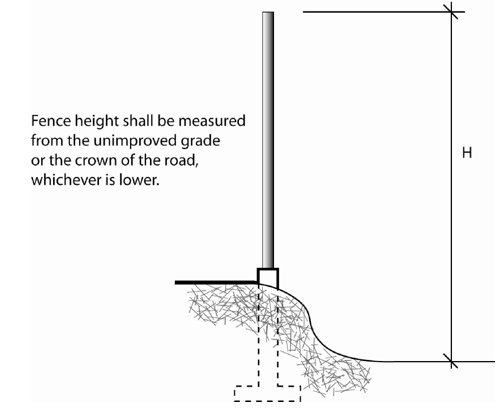
Sec 107.83 Regulations By Zoning District
The following regulations shall apply on developed lots:
- Residential Zoning Districts. Fences, walls, or hedges on a property with a single-family home, or duplex residential zoning, including Conservation-Native Area (C-NA), Conservation-Offshore Island (C-OI), Residential Low-Conservation (RL-C), Residential Low (RL), Residential Medium (RM), Residential Medium-1 (RM-1), Residential Medium-2 (RM-2), Residential-Mobile Home (R-MH), or Residential High (RH), shall be limited to a height of 48 inches within 15 feet of the street frontage property line, and to six (6) feet in height beyond 15 feet from the front property line for parcels in excess of 4,500 square feet. For parcels 4,500 square feet or less the fence limitations shall be subject to a setback reduction to ten (10) feet from the street frontage property line.
- Commercial, Public, Parks and Recreation Zoning. Fencing on any property with a commercial (MU or MU-M), Public (P), or Parks and Recreation (PR) zoning designation shall comply with the following regulations:
- Any open or solid decorative fence, wall, or hedge eight (8) feet or less in height may be installed in any location up to the required street frontage landscape setback identified in Table 103.15.2, subject to the appropriate clear sight triangle. Any fence, wall, or hedge greater than eight (8) feet in height shall comply with all required building setbacks.
- Vinyl-clad, chain-link fencing may be installed at the rear of buildings if not visible from public areas on- or off-site, or any public right-of-way (e.g., vinyl-clad chain-link shall not be used along a street-side property line). If chain-link fencing is used, a five-foot wide area outside the fence shall be landscaped, subject to the appropriate site triangle, with at least three (3) shade trees, two (2) understory trees, and 13 shrubs for every 100 feet or part thereof of fencing. A minimum of 80 percent of the vegetation shall be native.
- Screening for outdoor storage shall be installed in compliance with Article 1, Chapter 104, "Outdoor Storage".
- Industrial Zoning. Fencing for any property with an industrial (I-G or I-M) zoning designation shall comply with the following requirements:
- Any open or solid decorative fence, or hedge 12 feet or less in height may be installed in any location up to the required front building setback line identified in Table 103.15.2. Any fence, wall, or hedge eight (8) feet or less in height may be installed in any location up to the required street frontage landscape setback line. Any fence, wall, or hedge exceeding 12 feet in height shall comply with all required building setbacks.
- Vinyl-clad chain-link fencing may be installed along any interior side property line.
- In the Industrial zoning districts, galvanized chain-link fencing shall be permitted along any interior side or rear property line only where no landscape buffer is required.
- Screening for outdoor storage shall be installed in compliance with Article 1, Chapter 104 "Outdoor Storage".
- Airport Zoning. Fencing for any property with an Airport (A), zoning designation shall comply with the following requirements:
- Any open or solid decorative fence, solid fence, wall, or hedge 12 feet or less in height may be installed in any location on the property. Any fence, wall, or hedge exceeding 12 feet in height shall comply with all required building setbacks.
- Vinyl-clad chain-link fencing may be installed along any interior side property line.
- Nothing in these regulations regarding fences shall limit any requirement of the state or federal government regarding the necessary security of an airport facility.
- Screening for outdoor storage shall be installed in compliance with Article 1, Chapter 104 "Outdoor Storage".
Sec 107.84 Regulations For Specific Types Of Fences.
The following regulations shall apply in all zoning districts:
- Fences on Corner Parcels. No fence, wall, hedge, or other visual obstruction over 24 inches in height shall be constructed where traffic visibility will be impeded, i.e., in that portion of a street corner that is located within the triangle formed by the intersecting curb lines and a line connecting the points drawn 30 feet away from their point of intersection on the lines.
- Traffic Safety Visibility Area Exemption. This requirement shall not apply to: official warning signs or signals; public utility poles and cabinets; trees trimmed (to the trunk) to a line at least six (6) feet above the elevation of the intersection; and saplings or plant species with open growth habits and not planted in the form of a hedge, which are so planted and trimmed as to leave, at all seasons, a clear and unobstructed cross-view.
- Razor or Barbed Wire Fences. Razor, barbed or similar type fences or walls shall be prohibited on or adjacent to residentially zoned property or on developed nonresidential parcels when visible from adjacent properties, public areas, or public rights-of-way. Razor or barbed wire fences not visible from public areas or public rights-of-way shall require approval by the Director. A sign shall be installed on the outside of any fence or area containing razor or barbed wire that clearly communicates the existence of the razor or barbed wire.
- Fences on Undeveloped Parcels. Any fence up to six (6) feet in height shall be permitted on undeveloped parcels, subject to the limitations of Sections 106.05 and 106.53 of Chapter 106, "Natural and Historic Resource Protection".
- Fences in the Street Side Yard. The following restrictions shall apply to street side yard fences on corner lots where the rear property line of the corner lot abuts the side property line of an adjacent parcel:
- When the rear property line of the corner lot is within 15 feet of the driveway of the abutting lot, a six-foot high fence may be installed in the street side yard of the corner lot not less than ten (10) feet from the side property line for that portion of the fence within the rear yard setback.
- When the rear property line of the corner lot is not within 15 feet of the driveway of the abutting lot, a six-foot high fence may be installed in the street side yard of the corner lot not less than ten (10) feet from the adjacent curb face.
- When the rear property line of a corner lot abuts the rear property line of another corner lot, a six-foot high fence may be installed in the street side yard of both lots not less than ten (10) feet from the adjacent curb face.
- Golf-course, Tennis Court or Park Interface Fencing. On property containing or abutting a park, tennis court, golf course or driving range, the Director may authorize the installation of protective netting exceeding the height limit for fences identified in this Section. An Administrative Variance application shall be submitted for Department review prior to installation and a public notice provided. The Director, when reviewing the location, height, and design of the netting, shall take into account reasonable concerns regarding both safety and aesthetics.
- Entry Gate and Entry Columns. An entry gate and entry columns are permitted in all zoning districts and are may exceed the allowable height of the fencing on adjacent fence panels by a maximum of 18 inches. Lighting fixtures may be placed on top of the entry column in excess of the height limitation.
Sec 107.85 Screening
The following screening requirements are intended to establish a visual barrier between different types of land uses and between uses that have the potential to be visually intrusive to adjacent properties and/or public rights-of-way. Screening for outdoor storage shall comply with Article 1, Chapter 104, "Outdoor Storage".
- Screening between Residential and Nonresidential Uses. Wherever new nonresidential development will abut a residential use or vacant land in a residential zoning district, the developer of the new development shall construct a six-foot high solid masonry wall along the property line abutting the residential use where parking or drive-aisle(s) are proposed to be located within 20 feet of the residential property line. Otherwise, a solid wall or wooden fence shall be required. It shall be the responsibility of the nonresidential property owner to maintain any wall required by this section.
- Ground-mounted Mechanical Equipment. In all nonresidential zoning districts, ground-mounted mechanical equipment shall be screened from view, except where the equipment is located in the loading or service area of an industrial building. Screening shall be accomplished with landscaping or architectural features compatible with other structures on the site in terms of material, color, shape, and size.
- Roof-mounted Mechanical Equipment. The installation of any roof-mounted mechanical equipment, such as cooling equipment, and solar collectors shall comply with the following regulations:
- No cooling equipment, except solar collectors and their necessary supply and return lines shall be mounted on the roof of any residential structure. Should the Director determine that there is no feasible alternative to mounting heating or cooling equipment on the roof, the equipment shall be mounted on the rear roof. Decorative screening that is architecturally compatible with the existing structure and roof line may be required to mitigate offensive views from surrounding properties. This section shall not prohibit the replacement of existing roof-mounted cooling equipment.
- Cooling equipment mounted on the roof of any building occupied for commercial purposes shall be placed below a parapet wall or shall be placed behind decorative screening that is architecturally compatible with the existing structure and roof line.
- Roof-mounted solar collectors in any zoning district shall comply with the following regulations:
- Roof-mounted solar collectors shall be nonreflective and placed in the location least visible from the street and adjacent properties, without significantly reducing the operating efficiency of the collectors.
- Any roof-mounted solar collector visible from an existing or future public right-of-way shall be framed with decorative wood or metal, painted to match the roof color. Wall and ground-mounted collectors shall be screened from public view when not architecturally integrated into the building design.
- Roof-mounted collectors shall be installed at the same angle or as close as possible to the pitch of the roof. Any system installed so that any part projects more than ten (10) inches above the surface of the roof shall be mounted on the rear roof elevation opposite the nearest public right-of-way to mitigate offensive views from surrounding properties or streets.
- All supply, return, or connecting pipes and hardware shall be screened, installed in attic space, or painted to match the surface on which they are mounted.
Sec 107.86 Alternative Compliance
- The provisions of this article shall be liberally construed to effectively carry out the purpose and the intent of the Plan and of this article in the interest of the health, safety and welfare of the residents of the City.
- An applicant may submit a fencing or screening plan which varies from the strict application of the requirements of this article in order to accommodate unique site features, or characteristics, the preservation of water views or to utilize innovative design.
- An alternative compliance fencing or screening plan may be approved only upon a finding that it fulfills the purpose and intent of the Plan and of this article as well as or more effectively than would adherence to the strict requirements.
- In evaluating proposed alternative compliance fencing or screening plans, considerations shall be given to proposals which preserve existing native vegetation and use xeriscape and other low water use landscape design principles and where the design ensures the maximum preservation of existing vegetation on the site.
Sec 107.87 Purpose And Intent
It is the intent and purpose of this article to implement the goals, objectives, and policies of the Comprehensive Plan of the City of Marathon by providing standards for the design, construction, and operation of stormwater management systems in conformance with the best overall management practices for the control of runoff volume and treatment of stormwater runoff for the protection of surface water and groundwater quality, and for the control and prevention of erosion, sedimentation, and flooding. It is further the intent of this article to provide flexibility in meeting the design standards in an effort to encourage the construction of stormwater management systems that are an amenity to the development.
Sec 107.88 Standards
- Permit Required. No person shall initiate any construction activity, or construct or modify a stormwater management system, without complying with the provisions of this article.
- Supplemental Standards. All stormwater management systems must be designed and implemented to meet the performance criteria outlined in this article and the BMP according to the Generic Permit under NPDES. In addition, the following documents are incorporated herein as part of the LDRs by reference, for supplemental standards and methodologies for use in designing, implementing and maintaining erosion and sediment control and surface water systems to meet the intent of this article:
- Chapter 40E-4, Florida Administrative Code (F.A.C.), South Florida Water Management District (SFWMD), Environmental Resource and Works of the District Permits;
- Chapter 62-4, F.A.C., Department of Environmental Protection, Permits;
- Chapter 62-25, F.A.C., Department of Environmental Protection, Regulations of Stormwater Discharge;
- Chapter 62-302.700, F.A.C., Department of Environmental Protection, Special Protection, Outstanding Florida Waters, Outstanding Natural Resource Waters;
- Chapter 62-621, F.A.C., Department of Environmental Protection, Generic Permits;
- Chapter 62-624, F.A.C., Department of Environmental Protection, Municipal Separate Storm Sewer Systems;
- Chapter 8, Article V, "Hazardous Waste" and Chapter 106 Article 4, "Open Water, Surface Waters and Wetlands", Code of Ordinances, City of Marathon, Florida;
- City of Marathon Stormwater Management Master Plan;
- The Florida Stormwater, Erosion and Sedimentation Control Inspector's Manual, State of Florida Department of Environmental Protection;
- Florida Development Manual: A Guide to Sound Land and Water Management, and Drainage Manual, State of Florida Department of Transportation; and
- A Policy on Geometric Design of Highways and Streets, American Association of State Highway and Transportation Officials (AASHTO).
- Alternate Methods. Innovative approaches to stormwater management shall be encouraged and the concurrent control of erosion, sedimentation, flooding, and water quality shall be mandatory. For sites containing or in close proximity to wetlands, stormwater management facilities should be designed to mimic pre-development hydrologic conditions.
- For all projects, the stormwater management system shall be designed to, at a minimum, to retain the minimum runoff required by the SFWMD. The site shall be designed to either contain the 25-year 72-hour storm event or discharge into an injection well.
- All stormwater management systems should be designed to provide treatment of the stormwater runoff prior to discharging to the aquifer and to preclude the formation of solution pipe sinkholes in the system. In addition, the following minimum design features are required:
- Stormwater basin depth should be as shallow as possible with a horizontal bottom;
- Maximum stormwater basin depth of eight (8) feet; and
- More stringent requirements shall apply for some industrial and commercial sites. Stormwater discharge facilities which receive stormwater from areas which are a potential source of oil and grease contamination in concentrations exceeding applicable water quality standards shall include a baffle, skimmer, grease trap or other mechanism suitable for preventing oil and grease from leaving the stormwater discharge facility in concentrations that would cause or contribute to violations of applicable water quality standards in the receiving waters.
- Compliance. All stormwater management systems in the City of Marathon shall be designed and maintained in accordance with the provisions of this article and the BMP according to the Generic Permit under NPDES.
- General Engineering and Environmental Standards.
- No stormwater management system shall cause water to become a health hazard as determined by the City Engineer, the Environmental Protection Department and/or the Health Department.
- All storage volumes in detention or retention systems shall account for the seasonal high water table, tidal fluctuations or normal pool elevations.
- Runoff from off-site areas which drain to or across a site proposed for development shall be accommodated.
- Retention basins shall recover the capacity for the given volume of stormwater within 72 hours following the storm event.
- Reasonable maintenance access to all stormwater management facilities must be provided.
- All storm pipe must be designed to convey a 25-year, 24-hour storm event. Safe conveyance of all flow in excess of storm sewer capacity must also be included in the design.
- Wet detention systems shall be designed to provide for drawdown of half of the specified treatment volume between 60 and 72 hours following the storm event for which they are designed to accommodate.
- Utilization of other best management practices must not adversely affect the ability of the wetlands stormwater management system to meet the requirements of this Section.
- Rainfall volumes shall be taken from the SFWMD "Basis of Review".
Sec 107.89 Relationship To Project Design
- General. Stormwater areas shall be designed in the context of the site design for the entire subdivision or other development. Careful consideration shall be given to the layout of basins and stormwater management areas to optimize treatment, aesthetics, and groupings of trees. Basins and stormwater management systems shall be designed to blend into public open spaces and shall resemble natural areas to the greatest extent possible. The following design standards and principles shall apply to stormwater management areas:
- All stormwater areas shall be designed in accordance with the standards and principles set forth in Subsection B. below;
- Permanently wet retention and detention structures shall be fenced or shall not have side slopes that are steeper than 4H:1V out to a depth of five (5) feet below the control elevation.
- General Design Criteria.
- When possible, the inflow and outflow locations of stormwater structures and retention areas must be located to provide for optimal treatment. Flow paths and mixing within basins shall be maximized.
- Erosive velocities shall be reduced through the use of adequate controls.
- Fenced Basins. All fences must be a minimum height of six (6) feet and have a ten-foot wide gate that allows easy access for maintenance equipment.
Sec 107.90 Water Quality Criteria
All stormwater management systems must be designed to meet the water quality criteria required by the FDEP/SFWMD permit.
Sec 107.91 Erosion And Sedimentation Control
- The erosion and sedimentation control plan shall be prepared by a registered civil engineer and conform to the general standards of the Florida Department of Environmental Protection Erosion and Sedimentation Control Manual.
- The development and implementation of an erosion and sedimentation control system is essential to minimizing the adverse impacts of soil erosion and sediment transport. The system shall be designed according to the following principles:
- The development plan must be compatible with the existing topography, soils, waterways, and natural vegetation of the site.
- The smallest possible area shall be exposed for the shortest possible time during construction.
- On-site control measures shall be applied to reduce erosion. Stockpiling and storage of materials shall not be located in a manner to impede flow or cause materials to be eroded by stormwater runoff.
- The erosion and sedimentation control plan shall identify permanent stormwater conveyance structures, final stabilized conditions of the site, provisions for removing temporary control measures, stabilization of the site when temporary measures are removed, and maintenance requirements for any permanent measures. All sedimentation control structures to be used during construction shall be installed prior to any soil disturbance or site preparation in anticipation of construction activity and shall be maintained in an effective condition until such time as the completion of the permanent system or other erosion control measures can assure adequate erosion and sediment control.
- All stormwater management facilities shall be stabilized with either grass or sand-based sod. When used, sod shall be certified apparently weed-free sod.
- All dry basin bottoms must be seeded or sodded. Side slopes shall be 4H:1V or flatter.
- During construction, provisions shall be made to minimize disturbance to and compaction of soils in the basin bottom.
Figure 107.91.1
Silt Control Fence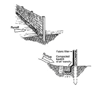
Sec 107.92 Special Criteria For Systems Within New Residential Subdivisions
Within a private residential subdivision, the homeowners must provide routine maintenance and associated landscape management responsibilities for the stormwater management system within the residential subdivision; and shall provide reasonable maintenance access to all stormwater management facilities.
Sec 107.93 Plan Review
The following information, plans and supporting data must be included with the applicant's final development plan:
- Aerial Photograph. An aerial photograph delineating the project area and the watershed boundaries in which the project is located.
- Map. A map of the project that shows the following information:
- Project boundary;
- Existing topography of the project with the existing drainage patterns clearly established;
- Additional off-site topographical information may be needed to adequately identify drainage patterns. At a minimum topography shall be included up to 50 feet outside the boundary of the project except where the project is bounded by water;
- The drainage boundary of the area of any lands outside the project limits contributing runoff to the project for both pre-development and post development;
- Existing FEMA flood lines;
- A plan of the proposed land use and land cover, including acreage and percentage of impervious surfaces;
- Description of vegetative cover, locations of any wetlands, surface waters or other known conservation areas;
- Proposed construction phases;
- Rights-of-way, common areas, and/or easement locations;
- Location of existing and proposed stormwater retention and/or detention facilities, including size, design capacity, 100-year flood elevation, side slopes, depth of pond, retained and/or detained runoff volumes, and treatment volumes;
- Detailed grading plan with sufficient spot elevations to determine the direction of flow;
- Certified erosion and sedimentation control plan. See Section 107.91 for requirements; and
- Stormwater Pollution Prevention Plan (SWPPP). A SWPPP should be submitted for all projects. This plan shall be included in the erosion and sedimentation control plan.
- Calculations. All hydrologic and hydraulic calculations shall be certified and must include:
- A description of the proposed stormwater management plan;
- Hydrologic and hydraulic model input and output for pre-development and post development conditions;
- Pipe-sizing calculations; and
- Calculations used to size all treatment facilities;
- Operation and Maintenance Authority. A statement designating the entity that will be responsible for the operation and maintenance of the stormwater management system. A copy of the restrictive covenants for the establishment of a homeowners' association must be submitted, if applicable. The restrictive covenants shall contain a statement indicating that, upon the homeowners' association's written request, City of Marathon will inspect the stormwater management system prior to the developer transferring responsibility for the maintenance of the system to the association.
- Certification Statement. A statement, certified by the engineer responsible for the design that will read as follows:
- Maintenance Plan. A proposed maintenance plan for the stormwater management system. This plan, along with the estimated annual maintenance costs, shall be incorporated into the restrictive covenants required by this chapter.
- Easements. Off-site easements for stormwater management facilities will be required when the discharge is into any man-made facility for which City of Marathon does not have either drainage easements or rights-of-way.
- Other Agency Approval. Prior to the issuance of a construction permit, a copy of all other applicable state, water management district, or City permits must be submitted.
Sec 107.94 Inspections
The City may inspect during the construction activities of all approved stormwater management systems. Any duly authorized representative of the City at any reasonable time may enter and inspect property on which a stormwater management system is located, in order to determine compliance of proposed or constructed stormwater management systems with this Chapter or any applicable City ordinances, or consistency with any development application or development approval. The duly authorized representative of the City may collect water quality samples and obtain other information necessary to determine compliance of the stormwater management system. No person shall refuse reasonable entry or access to any authorized representative of the City who requests entry for purposes of inspection and who presents appropriate credentials.
Sec 107.95 Maintenance
All stormwater management systems require periodic maintenance. The entity designated in the application will be responsible for implementing the maintenance plan. If a system is not functioning as designed, the owner or permittee will be responsible for taking corrective measures to ensure the applicable criteria of this Chapter are met.
Sec 107.96 Enforcement
This Chapter shall be enforced in accordance with procedures outlined in Chapter 109, "Violations, Penalties, and Enforcement."
Sec 107.97 Article To Be Liberally Construed
This article shall be liberally construed in order to effectively carry out the purposes hereof, which are deemed to be in the best interest of the public health, safety, and welfare of the citizens and residents of City of Marathon, Florida.
Sec 107.98 General
- Title. These regulations shall be known as the Floodplain Management Ordinance of the City of Marathon, hereinafter referred to as "this ordinance."
- Scope. The provisions of this ordinance shall apply to all development that is wholly within or partially within any flood hazard area, including but not limited to the subdivision of land; filling, grading, and other site improvements and utility installations; construction, alteration, remodeling, enlargement, improvement, replacement, repair, relocation or demolition of buildings, structures, and facilities that are exempt from the Florida Building Code; placement, installation, or replacement of manufactured homes and manufactured buildings; installation or replacement of tanks; placement of recreational vehicles; installation of swimming pools; and any other development.
- Intent. The purposes of this ordinance and the flood load and flood resistant construction requirements of the Florida Building Code are to establish minimum requirements to safeguard the public health, safety, and general welfare and to minimize public and private losses due to flooding through regulation of development in flood hazard areas to:
- Minimize unnecessary disruption of commerce, access and public service during times of flooding;
- Require the use of appropriate construction practices in order to prevent or minimize future flood damage;
- Manage filling, grading, dredging, mining, paving, excavation, drilling operations, storage of equipment or materials, and other development which may increase flood damage or erosion potential;
- Manage the alteration of flood hazard areas and shorelines to minimize the impact of development on the natural and beneficial functions of the floodplain;
- Minimize damage to public and private facilities and utilities;
- Help maintain a stable tax base by providing for the sound use and development of flood hazard areas;
- Minimize the need for future expenditure of public funds for flood control projects and response to and recovery from flood events; and
- Meet the requirements of the National Flood Insurance Program for community participation as set forth in Title 44 Code of Federal Regulations, Section 59.22.
- Coordination with the Florida Building Code. This ordinance is intended to be administered and enforced in conjunction with the Florida Building Code. Where cited, ASCE 24 refers to the edition of the standard that is referenced by the Florida Building Code.
- Warning. The degree of flood protection required by this ordinance and the Florida Building Code, as amended by this community, is considered the minimum reasonable for regulatory purposes and is based on scientific and engineering considerations. Larger floods can and will occur. Flood heights may be increased by man-made or natural causes. This ordinance does not imply that land outside of mapped special flood hazard areas, or that uses permitted within such flood hazard areas, will be free from flooding or flood damage. The flood hazard areas and base flood elevations contained in the Flood Insurance Study and shown on Flood Insurance Rate Maps and the requirements of Title 44 Code of Federal Regulations, Sections 59 and 60 may be revised by the Federal Emergency Management Agency, requiring this community to revise these regulations to remain eligible for participation in the National Flood Insurance Program. No guaranty of vested use, existing use, or future use is implied or expressed by compliance with this ordinance.
- Disclaimer of Liability. This ordinance shall not create liability on the part of the City Council of the City of Marathon or by any officer or employee thereof for any flood damage that results from reliance on this ordinance or any administrative decision lawfully made thereunder.
Sec 107.99 Applicability
- General. Where there is a conflict between a general requirement and a specific requirement, the specific requirement shall be applicable.
- Areas to which this ordinance applies. This ordinance shall apply to all flood hazard areas within the City of Marathon, as established in Section 107.99.C of this chapter.
- Basis for establishing flood hazard areas and Species Focus Areas and Real Estate Numbers.
- The Flood Insurance Study for Monroe County, Florida and Incorporated Areas dated February 18, 2005, and all subsequent amendments and revisions, and the accompanying Flood Insurance Rate Maps (FIRM), and all subsequent amendments and revisions to such maps, are adopted by reference as a part of this ordinance and shall serve as the minimum basis for establishing flood hazard areas. Studies and maps that establish flood hazard areas are on file at City Hall, 9805 Overseas Highway, Marathon, FL 33050.
- The Species Focus Area Maps (SFAMs) and the real estate numbers of parcels (RE List) that are within the SFAMs identified by the U.S. Fish and Wildlife Service in accordance with the Biological Opinion, dated April 30, 2010, as amended, for the City of Marathon, and any subsequent revisions there to, are hereby declared to be a part of this ordinance. The SFAMs and RE list are on file at the city hall.
- Submission of additional data to establish flood hazard areas. To establish flood hazard areas and base flood elevations, pursuant to Section 107.102.1 of this chapter the Floodplain Administrator may require submission of additional data. Where field surveyed topography prepared by a Florida licensed professional surveyor or digital topography accepted by the community indicates that ground elevations:
- Are below the closest applicable base flood elevation, even in areas not delineated as a special flood hazard area on a FIRM, the area shall be considered as flood hazard area and subject to the requirements of this ordinance and, as applicable, the requirements of the Florida Building Code.
- Are above the closest applicable base flood elevation, the area shall be regulated as special flood hazard area unless the applicant obtains a Letter of Map Change that removes the area from the special flood hazard area.
- Other laws. The provisions of this ordinance shall not be deemed to nullify any provisions of local, state or federal law.
- Abrogation and greater restrictions. This ordinance supersedes any ordinance in effect for management of development in flood hazard areas. However, it is not intended to repeal or abrogate any existing ordinances including but not limited to land development regulations, zoning ordinances, stormwater management regulations, or the Florida Building Code. In the event of a conflict between this ordinance and any other ordinance, the more restrictive shall govern. This ordinance shall not impair any deed restriction, covenant or easement, but any land that is subject to such interests shall also be governed by this ordinance.
- Interpretation. In the interpretation and application of this ordinance, all provisions shall be:
- Considered as minimum requirements;
- Liberally construed in favor of the governing body; and
- Deemed neither to limit nor repeal any other powers granted under state statutes.
Sec 107.100 Duties And Powers Of The Floodplain Administrator
- Designation. The City Manager is designated as the Floodplain Administrator. The Floodplain Administrator may delegate performance of certain duties to other employees, particularly the Building Official and the Certified Floodplain Manager.
- General. The Floodplain Administrator is authorized and directed to administer and enforce the provisions of this ordinance. The Floodplain Administrator shall have the authority to render interpretations of this ordinance consistent with the intent and purpose of this ordinance and may establish policies and procedures in order to clarify the application of its provisions. Such interpretations, policies, and procedures shall not have the effect of waiving requirements specifically provided in this ordinance without the granting of a variance pursuant to Section 107.102.3 of this ordinance.
- Applications and permits. The Floodplain Administrator, in coordination with other pertinent offices of the community, shall:
- Review applications and plans to determine whether proposed new development will be located in flood hazard areas;
- Review applications for modification of any existing development in flood hazard areas for compliance with the requirements of this ordinance;
- Interpret flood hazard area boundaries where such interpretation is necessary to determine the exact location of boundaries; a person contesting the determination shall have the opportunity to appeal the interpretation;
- Provide available flood elevation and flood hazard information;
- Determine whether additional flood hazard data shall be obtained from other sources or shall be developed by an applicant;
- Review applications to determine whether proposed development will be reasonably safe from flooding;
- Issue development permits for development other than buildings and structures that are subject to the Florida Building Code, including buildings, structures and facilities exempt from the Florida Building Code, when compliance with this ordinance is demonstrated, or disapprove the same in the event of noncompliance; and
- Coordinate with and provide comments to the Building Official to assure that applications, plan reviews, and inspections for buildings and structures in flood hazard areas comply with the applicable provisions of this ordinance.
- Substantial improvement and substantial damage determinations. For applications for building permits to improve buildings and structures, including alterations, movement, enlargement, replacement, repair, change of occupancy, additions, rehabilitations, renovations, substantial improvements, repairs of substantial damage, and any other improvement of or work on such buildings and structures, the Floodplain Administrator, in coordination with the Building Official, shall:
- Estimate the market value, or require the applicant to obtain an appraisal of the market value prepared by a qualified independent appraiser, of the building or structure before the start of construction of the proposed work; in the case of repair, the market value of the building or structure shall be the market value before the damage occurred and before any repairs are made;
- Compare the cost to perform the improvement, the cost to repair a damaged building to its pre-damaged condition, or the combined costs of improvements and repairs, if applicable, to the market value of the building or structure;
- Determine and document whether the proposed work constitutes substantial improvement or repair of substantial damage; the determination requires evaluation of previous permits issued for improvements and repairs as specified in the definition of "substantial improvement"; and
- Notify the applicant if it is determined that the work constitutes substantial improvement or repair of substantial damage and that compliance with the flood resistant construction requirements of the Florida Building Code and this ordinance is required.
- Modifications of the strict application of the requirements of the Florida Building Code. The Floodplain Administrator shall review requests submitted to the Building Official that seek approval to modify the strict application of the flood load and flood resistant construction requirements of the Florida Building Code to determine whether such requests require the granting of a variance pursuant to Section 107.102.3 of this ordinance.
- Notices and orders. The Floodplain Administrator shall coordinate with appropriate local agencies for the issuance of all necessary notices or orders to ensure compliance with this ordinance.
- Inspections. The Floodplain Administrator shall make the required inspections as specified in Section 107.102.2 of this chapter for development that is not subject to the Florida Building Code, including buildings, structures and facilities exempt from the Florida Building Code. The Floodplain Administrator shall inspect flood hazard areas to determine if development is undertaken without issuance of a permit.
- Other duties of the Floodplain Administrator. The Floodplain Administrator shall have other duties, including but not limited to:
- Establish, in coordination with the Building Official, procedures for administering and documenting determinations of substantial improvement and substantial damage made pursuant to Section 107.100.D of this chapter;
- Require applicants who submit hydrologic and hydraulic engineering analyses to support permit applications to submit to FEMA the data and information necessary to maintain the Flood Insurance Rate Maps if the analyses propose to change base flood elevations or flood hazard area boundaries; such submissions shall be made within six (6) months of such data becoming available;
- Review required design certifications and documentation of elevations specified by this ordinance and the Florida Building Code to determine that such certifications and documentations are complete;
- Notify the Federal Emergency Management Agency when the corporate boundaries of the City of Marathon are modified; and
- Advise applicants for new buildings and structures, including substantial improvements, that are located in any unit of the Coastal Barrier Resources System established by the Coastal Barrier Resources Act (Pub. L. 97-348) and the Coastal Barrier Improvement Act of 1990 (Pub. L. 101-591) that federal flood insurance is not available on such construction; areas subject to this limitation are identified on Flood Insurance Rate Maps as "Coastal Barrier Resource System Areas" and "Otherwise Protected Areas."
- Floodplain management records. Regardless of any limitation on the period required for retention of public records, the Floodplain Administrator shall maintain and permanently keep and make available for public inspection all records that are necessary for the administration of this ordinance and the flood resistant construction requirements of the Florida Building Code, including Flood Insurance Rate Maps; Letters of Map Change; records of issuance of permits and denial of permits; determinations of whether proposed work constitutes substantial improvement or repair of substantial damage; required design certifications and documentation of elevations specified by the Florida Building Code and this ordinance; documentation related to appeals and variances, including justification for issuance or denial; and records of enforcement actions taken pursuant to this ordinance and the flood resistant construction requirements of the Florida Building Code. These records shall be available for public inspection at City Hall, 9805 Overseas Highway, Marathon, FL 33050.
Sec 107.101 Permits
- Permits required. Any owner or owner's authorized agent (hereinafter "applicant") who intends to undertake any development activity within the scope of this ordinance, including buildings, structures and facilities exempt from the Florida Building Code, which is wholly within or partially within any flood hazard area shall first make application to the Floodplain Administrator, and the Building Official if applicable, and shall obtain the required permit(s) and approval(s). No such permit or approval shall be issued until compliance with the requirements of this ordinance and all other applicable codes and regulations has been satisfied.
- Development permits. Development permits shall be issued pursuant to this ordinance for any development activities not subject to the requirements of the Florida Building Code, including buildings, structures and facilities exempt from the Florida Building Code. Depending on the nature and extent of proposed development that includes a building or structure, the Floodplain Administrator may determine that a development permit is required in addition to a building permit.
- Buildings, structures and facilities exempt from the Florida Building Code. Pursuant to the requirements of federal regulation for participation in the National Flood Insurance Program (44 C.F.R. Sections 59 and 60), development permits shall be required for the following buildings, structures and facilities that are exempt from the Florida Building Code and any further exemptions provided by law, which are subject to the requirements of this ordinance:
- Railroads and ancillary facilities associated with the railroad.
- Nonresidential farm buildings on farms, as provided in Fla. Stat. § 604.50.
- Temporary buildings or sheds used exclusively for construction purposes.
- Mobile or modular structures used as temporary offices.
- Those structures or facilities of electric utilities, as defined in Fla. Stat. § 366.02, which are directly involved in the generation, transmission, or distribution of electricity.
- Chickees constructed by the Miccosukee Tribe of Indians of Florida or the Seminole Tribe of Florida. As used in this paragraph, the term "chickee" means an open-sided wooden hut that has a thatched roof of palm or palmetto or other traditional materials, and that does not incorporate any electrical, plumbing, or other non-wood features.
- Family mausoleums not exceeding 250 square feet in area which are prefabricated and assembled on site or preassembled and delivered on site and have walls, roofs, and a floor constructed of granite, marble, or reinforced concrete.
- Temporary housing provided by the Department of Corrections to any prisoner in the state correctional system.
- Structures identified in Fla. Stat. § 553.73(10)(k), are not exempt from the Florida Building Code if such structures are located in flood hazard areas established on Flood Insurance Rate Maps.
- Application for a permit or approval. To obtain a development permit the applicant shall first file an application in writing on a form furnished by the community. The information provided shall:
- Identify and describe the development to be covered by the permit or approval.
- Describe the land on which the proposed development is to be conducted by legal description, street address or similar description that will readily identify and definitively locate the site.
- Indicate the use and occupancy for which the proposed development is intended.
- Be accompanied by a site plan or construction documents as specified in Section 107.102.1 of this chapter.
- State the valuation of the proposed work.
- Be signed by the applicant or the applicant's authorized agent.
- Give such other data and information as required by the Floodplain Administrator.
- For projects proposing to enclose areas under elevated buildings, include signed Declaration of Land Restriction (Nonconversion Agreement); the agreement shall be recorded on the property deed prior to issuance of the Certificate of Occupancy.
- Validity of permit or approval. The issuance of a development permit pursuant to this ordinance shall not be construed to be a permit for, or approval of, any violation of this ordinance, the Florida Building Codes, or any other ordinance of this community. The issuance of permits based on submitted applications, construction documents, and information shall not prevent the Floodplain Administrator from requiring the correction of errors and omissions.
- Expiration. A development permit shall become invalid unless the work authorized by such permit is commenced within 180 days after its issuance, or if the work authorized is suspended or abandoned for a period of 180 days after the work commences. Extensions for periods of not more than 180 days each shall be requested in writing and justifiable cause shall be demonstrated.
- Suspension or revocation. The Floodplain Administrator is authorized to suspend or revoke a development permit if the permit was issued in error, on the basis of incorrect, inaccurate or incomplete information, or in violation of this ordinance or any other ordinance, regulation or requirement of this community.
- Other permits required. Floodplain development permits and building permits shall include a condition that all other applicable state or federal permits be obtained before commencement of the permitted development, including but not limited to the following:
- The South Florida Water Management District; Fla. Stat. § 373.036.
- Florida Department of Economic Opportunity, Fla. Stat. § 380.05, Areas of Critical State Concern, and Fla. Stat. ch. 553, Part IV, Florida Building Code.
- Florida Department of Health for onsite sewage treatment and disposal systems; Fla. Stat. § 381.0065 and Chapter 64E-6, F.A.C.
- Florida Department of Environmental Protection for activities subject to the Joint Coastal Permit; Fla. Stat. § 161.055.
- Florida Department of Environmental Protection for activities that affect wetlands and alter surface water flows, in conjunction with the U.S. Army Corps of Engineers; Section 404 of the Clean Water Act.
- Federal permits and approvals.
Sec 107.102 Protection Of Endangered Species
- Applications with Determination of Unsuitable Habitat. Upon receipt of a floodplain development permit application for a property that is determined to be on the SFAMs and the RE list as containing unsuitable habitat, the Floodplain Administrator shall place a letter in the floodplain development permit file that indicates:
- The name of the city official that made the determination;
- The date of the determination; and
- The date of the SFAM and RE list used to make the determination.
- Species Assessment Guides and Acceptance Form. The Species Assessment Guide for the City of Marathon provided by the U.S. Fish and Service (Service), dated December 23, 2011, and any subsequent revisions there to, is hereby declared to be a part of this ordinance. The Species Assessment Guide is on file at the city hall.
- The City of Marathon shall use the Species Assessment Guide to determine whether the applicant for a floodplain development permit application must seek technical assistance by the Service. For applications that require such assistance, the City of Marathon shall provide copies of the applications to the Service for review on a weekly basis.
- Based on the Service's technical assistance, the City of Marathon shall condition the floodplain development permit to incorporate the Service's recommendations to avoid and/or to minimize possible impacts on Federally listed threatened and endangered species and their habitat.
- The City shall maintain an Acceptance Form of the Service's recommendations in the permit file. The Acceptance Form shall be signed by the permit applicant and the building official.
- The City shall use the Species Assessment Guides (SAGs) for properties that exist within the boundaries of a completed Habitat Conservation Plan and which are subject to the SFAMs. The Real Estate folio number list which accompanies the SFAMs will be utilized in combination to determine if a development permit application must be provided to the Service for technical assistance in order to meet the full requirements of the FEMA-FWS Settlement.
- Avoiding Impacts on Federally Listed Species. All proposed development shall meet the conditions attached to floodplain development permits in accordance with Section 105.2(2) to avoid possible impacts to Federally threatened and endangered species and their habitat.
Sec 107.102.1 Site Plans And Construction Documents
- Information for development in flood hazard areas. The site plan or construction documents for any development subject to the requirements of this ordinance shall be drawn to scale and shall include, as applicable to the proposed development:
- Delineation of flood hazard areas, flood zone(s), base flood elevation(s), and ground elevations if necessary for review of the proposed development.
- Location of the proposed activity and proposed structures, and locations of existing buildings and structures; in coastal high hazard areas, new buildings shall be located landward of the reach of mean high tide.
- Location, extent, amount, and proposed final grades of any filling, grading, or excavation.
- Where the placement of fill is proposed, the amount, type, and source of fill material; compaction specifications; a description of the intended purpose of the fill areas; and evidence that the proposed fill areas are the minimum necessary to achieve the intended purpose.
- Extent of any proposed alteration of sand dunes or mangrove stands, provided such alteration is approved by the Florida Department of Environmental Protection.
- Existing and proposed alignment of any proposed alteration of a watercourse.
- Additional analyses and certifications. For activities that propose to alter sand dunes or mangrove stands in coastal high hazard areas (Zone V), an engineering analysis signed and sealed by a Florida licenses engineer that demonstrates that the proposed alteration will not increase the potential for flood damage shall be submitted with the site plan and construction documents.
- Submission of additional data. When additional hydrologic, hydraulic or other engineering data, studies, and additional analyses are submitted to support an application, the applicant has the right to seek a Letter of Map Change from FEMA to change the base flood elevations or change boundaries of flood hazard areas shown on FIRMs, and to submit such data to FEMA for such purposes. The analyses shall be prepared by a Florida licensed engineer in a format required by FEMA. Submittal requirements and processing fees shall be the responsibility of the applicant.
Sec 107.102.2 Inspections
- General. Development for which a development permit is required shall be subject to inspection.
- Development other than buildings and structures. The Floodplain Administrator shall inspect all development to determine compliance with the requirements of this ordinance and the conditions of issued development permits.
- Buildings, structures and facilities exempt from the Florida Building Code. The Floodplain Administrator shall inspect buildings, structures and facilities exempt from the Florida Building Code to determine compliance with the requirements of this ordinance and the conditions of issued development permits.
- Buildings, structures and facilities exempt from the Florida Building Code, lowest floor inspection. Upon placement of the lowest floor, including basement, and prior to further vertical construction, the owner of a building, structure or facility exempt from the Florida Building Code, or the owner's authorized agent, shall submit to the Floodplain Administrator the certification of elevation of the lowest floor prepared and sealed by a Florida licensed professional surveyor.
- Buildings, structures and facilities exempt from the Florida Building Code, final inspection. As part of the final inspection, the owner or owner's authorized agent shall submit to the Floodplain Administrator a final certification of elevation of the lowest floor or final documentation of the height of the lowest floor above the highest adjacent grade; such certifications and documentations shall be prepared as specified in Section 107.102.2.D of this chapter.
- Manufactured homes. The Floodplain Administrator shall inspect manufactured homes that are installed or replaced in flood hazard areas to determine compliance with the requirements of this ordinance and the conditions of the issued permit. Upon placement of a manufactured home, certification of the elevation of the lowest floor shall be submitted to the Floodplain Administrator.
Sec 107.102.3 Variances And Appeals
- General. The Planning Commission shall hear and decide on requests for appeals and requests for variances from the strict application of this ordinance. Pursuant to Fla. Stat. § 553.73(5), the Planning Commission shall hear and decide on requests for appeals and requests for variances from the strict application of the flood resistant construction requirements of the Florida Building Code. This section does not apply to Section 3109 of the Florida Building Code, Building.
- Appeals. The Planning Commission shall hear and decide appeals when it is alleged there is an error in any requirement, decision, or determination made by the Floodplain Administrator in the administration and enforcement of this ordinance. Any person aggrieved by the decision may appeal such decision to the Circuit Court, as provided by Florida Statutes.
- Limitations on authority to grant variances. The Planning Commission shall base its decisions on variances on technical justifications submitted by applicants, the considerations for issuance in Section 107.102.3.F of this ordinance, the conditions of issuance set forth in Section 107.102.3.G of this ordinance, and the comments and recommendations of the Floodplain Administrator and the Building Official. The Planning Commission has the right to attach such conditions as it deems necessary to further the purposes and objectives of this ordinance.
- Historic buildings. A variance is authorized to be issued for the repair, improvement, or rehabilitation of a historic building that is determined eligible for the exception to the flood resistant construction requirements of the Florida Building Code, Existing Building, Chapter 12 Historic Buildings, upon a determination that the proposed repair, improvement, or rehabilitation will not preclude the building's continued designation as a historic building and the variance is the minimum necessary to preserve the historic character and design of the building. If the proposed work precludes the building's continued designation as a historic building, a variance shall not be granted and the building and any repair, improvement, and rehabilitation shall be subject to the requirements of the Florida Building Code.
- Functionally dependent uses. A variance is authorized to be issued for the construction or substantial improvement necessary for the conduct of a functionally dependent use, as defined in this ordinance, is the minimum necessary considering the flood hazard, and all due consideration has been given to use of methods and materials that minimize flood damage during occurrence of the base flood.
- Considerations for issuance of variances. In reviewing requests for variances, the Planning Commission shall consider all technical evaluations, all relevant factors, all other applicable provisions of the Florida Building Code, this ordinance, and the following:
- The danger that materials and debris may be swept onto other lands resulting in further injury or damage;
- The danger to life and property due to flooding or erosion damage;
- The susceptibility of the proposed development, including contents, to flood damage and the effect of such damage on current and future owners;
- The importance of the services provided by the proposed development to the community;
- The availability of alternate locations for the proposed development that are subject to lower risk of flooding or erosion;
- The compatibility of the proposed development with existing and anticipated development;
- The relationship of the proposed development to the comprehensive plan and floodplain management program for the area;
- The safety of access to the property in times of flooding for ordinary and emergency vehicles;
- The expected heights, velocity, duration, rate of rise and debris and sediment transport of the floodwaters and the effects of wave action, if applicable, expected at the site; and
- The costs of providing governmental services during and after flood conditions including maintenance and repair of public utilities and facilities such as sewer, gas, electrical and water systems, streets and bridges.
- Conditions for issuance of variances. Variances shall be issued only upon:
- Submission by the applicant, of a showing of good and sufficient cause that the unique characteristics of the size, configuration, or topography of the site limit compliance with any provision of this ordinance or the required elevation standards;
- Determination by the Planning Commission that:
- Failure to grant the variance would result in exceptional hardship due to the physical characteristics of the land that render the lot undevelopable; increased costs to satisfy the requirements or inconvenience do not constitute hardship;
- The granting of a variance will not result in increased flood heights, additional threats to public safety, extraordinary public expense, nor create nuisances, cause fraud on or victimization of the public or conflict with existing local laws and ordinances; and
- The variance is the minimum necessary, considering the flood hazard, to afford relief;
- Receipt of a signed statement by the applicant that the variance, if granted, shall be recorded in the Office of the Clerk of the Court in such a manner that it appears in the chain of title of the affected parcel of land; and
- If the request is for a variance to allow construction of the lowest floor of a new building, or substantial improvement of a building, below the required elevation, a copy in the record of a written notice from the Floodplain Administrator to the applicant for the variance, specifying the difference between the base flood elevation and the proposed elevation of the lowest floor, stating that the cost of federal flood insurance will be commensurate with the increased risk resulting from the reduced floor elevation (up to amounts as high as $25.00 for $100.00 of insurance coverage), and stating that construction below the base flood elevation increases risks to life and property.
Sec 107.102.4 Violations
- Violations. Any development that is not within the scope of the Florida Building Code but that is regulated by this ordinance that is performed without an issued permit, that is in conflict with an issued permit, or that does not fully comply with this ordinance or the conditions established by grants of variance, shall be deemed a violation of this ordinance and punishable as a non-criminal violation. A building or structure without the documentation of elevation of the lowest floor, other required design certifications, or other evidence of compliance required by this ordinance or the Florida Building Code is presumed to be a violation until such time as that documentation is provided.
- Authority. For development that is not within the scope of the Florida Building Code but that is regulated by this ordinance and that is determined to be a violation, the Floodplain Administrator is authorized to serve notices of violation or stop work orders to owners of the property involved, to the owner's agent, or to the person or persons performing the work. Nothing herein contained shall prevent the Floodplain Administrator from taking such other lawful actions as are necessary to prevent or remedy any violation.
- Unlawful continuance; fine. Any person who shall continue any work after having been served with a notice of violation or a stop work order, except such work as that person is directed to perform to remove or remedy a violation or unsafe condition, shall be fined not more than $500.00, and in addition, shall pay all costs and expenses involved in the case. Each day such violation continues shall be considered a separate offense.
Sec 107.102.5 Buildings And Structures
Design and construction of buildings, structures and facilities exempt from the Florida Building Code. Pursuant to Section 107.101.C of this ordinance, buildings, structures, and facilities that are exempt from the Florida Building Code, including substantial improvement or repair of substantial damage of such buildings, structures and facilities, shall be designed and constructed in accordance with the flood load and flood resistant construction requirements of ASCE 24. Structures exempt from the Florida Building Code that are not walled and roofed buildings shall comply with the requirements of Section 107.102.11 of this ordinance.
Sec 107.102.6 Subdivisions
- Minimum requirements. Subdivision proposals, including proposals for manufactured home parks and subdivisions, shall be reviewed to determine that:
- Such proposals are consistent with the need to minimize flood damage and will be reasonably safe from flooding;
- All public utilities and facilities such as sewer, gas, electric, communications, and water systems are located and constructed to minimize or eliminate flood damage; and
- Adequate drainage is provided to reduce exposure to flood hazards; in Zones AH and AO, adequate drainage paths shall be provided to guide floodwaters around and away from proposed structures.
- Subdivision plats. Where any portion of proposed subdivisions, including manufactured home parks and subdivisions, lies within a flood hazard area, the following shall be required:
- Delineation of flood hazard areas and flood zones, and design flood elevations, as appropriate, shall be shown on preliminary plats; and
- Compliance with the site improvement and utilities requirements of Section 107.102.7 of this chapter.
Sec 107.102.7 Site Improvements, Utilities And Limitations
- Minimum requirements. All proposed new development shall be reviewed to determine that:
- Such proposals are consistent with the need to minimize flood damage and will be reasonably safe from flooding;
- All public utilities and facilities such as sewer, gas, electric, communications, and water systems are located and constructed to minimize or eliminate flood damage; and
- Adequate drainage is provided to reduce exposure to flood hazards; in Zones AH and AO, adequate drainage paths shall be provided to guide floodwaters around and away from proposed structures.
- Sanitary sewage facilities. All new and replacement sanitary sewage facilities, private sewage treatment plants (including all pumping stations and collector systems), and on-site waste disposal systems shall be designed in accordance with the standards for onsite sewage treatment and disposal systems in Chapter 64E-6, F.A.C. and ASCE 24 Chapter 7 to minimize or eliminate infiltration of floodwaters into the facilities and discharge from the facilities into flood waters, and impairment of the facilities and systems.
- Water supply facilities. All new and replacement water supply facilities shall be designed in accordance with the water well construction standards in Chapter 62-532.500, F.A.C. and ASCE 24 Chapter 7 to minimize or eliminate infiltration of floodwaters into the systems.
- Limitations on placement of fill. Subject to the limitations of this ordinance, fill shall be designed to be stable under conditions of flooding including rapid rise and rapid drawdown of floodwaters, prolonged inundation, and protection against flood-related erosion and scour. In addition to these requirements, if intended to support buildings and structures (Zone A only), fill shall comply with the requirements of the Florida Building Code.
- Limitations on sites in coastal high hazard areas (Zone V). In coastal high hazard areas, alteration of sand dunes and mangrove stands shall be permitted only if such alteration is approved by the Florida Department of Environmental Protection and only if the engineering analysis required by Section 107.102.1.B of this chapter demonstrates that the proposed alteration will not increase the potential for flood damage. Construction or restoration of dunes under or around elevated buildings and structures shall comply with Section 107.102.11.F(3) of this chapter.
Sec 107.102.8 Manufactured Homes
- General; limitation. All manufactured homes installed in flood hazard areas shall be installed by an installer that is licensed pursuant to Fla. Stat. § 320.8249, and shall comply with the requirements of Chapter 15C-1, F.A.C. and the requirements of this ordinance. Unless located in a manufactured home park or subdivision, new installations of manufactured homes are not permitted. New installations are not permitted in coastal high hazard areas (Zone V) under any circumstance.
- Foundations. All new manufactured homes and replacement manufactured homes installed in flood hazard areas shall be installed on permanent, reinforced foundations that:
- In flood hazard areas (Zone A) other than coastal high hazard areas, are designed in accordance with the foundation requirements of the Florida Building Code, Residential Section R322.2 and this ordinance.
- In coastal high hazard areas (Zone V), are designed in accordance with the foundation requirements of the Florida Building Code, Residential Section R322.3 and this ordinance.
- Anchoring. All new manufactured homes and replacement manufactured homes shall be installed using methods and practices which minimize flood damage and shall be securely anchored to an adequately anchored foundation system to resist flotation, collapse or lateral movement. Methods of anchoring include, but are not limited to, use of over-the-top or frame ties to ground anchors. This anchoring requirement is in addition to applicable state and local anchoring requirements for wind resistance.
- Elevation. All manufactured homes that are placed, replaced, or substantially improved in flood hazard areas shall be elevated such that the bottom of the frame is at or above the elevation required, as applicable to the flood hazard area, in the Florida Building Code, Residential Section R322.2 (Zone A) or R322.3 (Zone V and Coastal A Zone).
- Enclosures. Enclosed areas below elevated manufactured homes shall comply with the requirements of the Florida Building Code, Residential Section R322.2 or R322.3 for such enclosed areas, as applicable to the flood hazard area.
- Utility equipment. Utility equipment that serves manufactured homes, including electric, heating, ventilation, plumbing, and air conditioning equipment and other service facilities, shall comply with the requirements of the Florida Building Code, Residential Section R322, as applicable to the flood hazard area.
Sec 107.102.9 Recreational Vehicles And Park Trailers
- Temporary placement. Recreational vehicles and park trailers placed temporarily in flood hazard areas shall:
- Be on the site for fewer than 180 consecutive days; and
- Be fully licensed and ready for highway use, which means the recreational vehicle or park model is on wheels or jacking system, is attached to the site only by quick-disconnect type utilities and security devices, and has no permanent attachments such as additions, rooms, stairs, decks and porches.
- Permanent placement. Recreational vehicles and park trailers that do not meet the limitations in Section 107.102.9.A of this ordinance for temporary placement shall meet the requirements of Section 107.102.8 of this ordinance for manufactured homes.
Sec 107.102.10 Tanks
- Underground tanks. Underground tanks in flood hazard areas shall be anchored to prevent flotation, collapse or lateral movement resulting from hydrodynamic and hydrostatic loads during conditions of the design flood, including the effects of buoyancy assuming the tank is empty.
- Above-ground tanks, not elevated. Above-ground tanks that do not meet the elevation requirements of Section 107.102.10.C of this chapter shall:
- Be permitted in flood hazard areas (Zone A) other than coastal high hazard areas, provided the tanks are anchored or otherwise designed and constructed to prevent flotation, collapse or lateral movement resulting from hydrodynamic and hydrostatic loads during conditions of the design flood, including the effects of buoyancy assuming the tank is empty and the effects of flood-borne debris.
- Not be permitted in coastal high hazard areas (Zone V).
- Above-ground tanks, elevated. Above-ground tanks in flood hazard areas shall be elevated to or above the design flood elevation and attached to a supporting structure that is designed to prevent flotation, collapse or lateral movement during conditions of the design flood. Tank-supporting structures shall meet the foundation requirements of the applicable flood hazard area.
- Tank inlets and vents. Tank inlets, fill openings, outlets and vents shall be:
- At or above the design flood elevation or fitted with covers designed to prevent the inflow of floodwater or outflow of the contents of the tanks during conditions of the design flood; and
- Anchored to prevent lateral movement resulting from hydrodynamic and hydrostatic loads, including the effects of buoyancy, during conditions of the design flood.
Sec 107.102.11 Other Development
- General requirements for other development. All development, including man-made changes to improved or unimproved real estate for which specific provisions are not specified in this ordinance or the Florida Building Code, shall:
- Be located and constructed to minimize flood damage;
- Be anchored to prevent flotation, collapse or lateral movement resulting from hydrostatic loads, including the effects of buoyancy, during conditions of the design flood;
- Be constructed of flood damage-resistant materials; and
- Have mechanical, plumbing, and electrical systems above the design flood elevation or meet the requirements of ASCE 24, except that minimum electric service required to address life safety and electric code requirements is permitted below the design flood elevation provided it conforms to the provisions of the electrical part of building code for wet locations.
- Detached accessory structures in coastal high hazard areas (Zone V). In coastal high hazard areas, detached garages are not permitted. Detached accessory structures used only for storage that are 100 square feet or less in area are permitted below the base flood elevation provided the structures comply with Section 107.102.11.A of this chapter.
- Concrete slabs used as parking pads, enclosure floors, landings, decks, walkways, patios and similar nonstructural uses in coastal high hazard areas (Zone V). In coastal high hazard areas, concrete slabs used as parking pads, enclosure floors, landings, decks, walkways, patios and similar nonstructural uses are permitted beneath or adjacent to buildings and structures provided the concrete slabs are designed and constructed to be:
- Structurally independent of the foundation system of the building or structure;
- Frangible and not reinforced, so as to minimize debris during flooding that is capable of causing significant damage to any structure; and
- Have a maximum slab thickness of not more than four (4) inches.
- Decks and patios in coastal high hazard areas (Zone V). In addition to the requirements of the Florida Building Code, in coastal high hazard areas decks and patios shall be located, designed, and constructed in compliance with the following:
- A deck that is structurally attached to a building or structure shall have the bottom of the lowest horizontal structural member at or above the design flood elevation and any supporting members that extend below the design flood elevation shall comply with the foundation requirements that apply to the building or structure, which shall be designed to accommodate any increased loads resulting from the attached deck.
- A deck or patio that is located below the design flood elevation shall be structurally independent from buildings or structures and their foundation systems, and shall be designed and constructed either to remain intact and in place during design flood conditions or to break apart into small pieces to minimize debris during flooding that is capable of causing structural damage to the building or structure or to adjacent buildings and structures.
- A deck or patio that has a vertical thickness of more than 12 inches or that is constructed with more than the minimum amount of fill necessary for site drainage shall not be approved unless an analysis prepared by a qualified registered design professional demonstrates no harmful diversion of floodwaters or wave runup and wave reflection that would increase damage to the building or structure or to adjacent buildings and structures.
- A deck or patio that has a vertical thickness of 12 inches or less and that is at natural grade or on nonstructural fill material that is similar to and compatible with local soils and is the minimum amount necessary for site drainage may be approved without requiring analysis of the impact on diversion of floodwaters or wave runup and wave reflection.
- Other development in coastal high hazard areas (Zone V). In coastal high hazard areas, development activities other than buildings and structures shall be permitted only if also authorized by the appropriate federal, state or local authority; if located outside the footprint of, and not structurally attached to, buildings and structures; and if analyses prepared by qualified registered design professionals demonstrate no harmful diversion of floodwaters or wave runup and wave reflection that would increase damage to adjacent buildings and structures. Such other development activities include but are not limited to:
- Bulkheads, seawalls, retaining walls, revetments, and similar erosion control structures;
- Solid fences and privacy walls, and fences prone to trapping debris, unless designed and constructed to fail under flood conditions less than the design flood or otherwise function to avoid obstruction of floodwaters; and
- On-site sewage treatment and disposal systems defined in 64E-6.002, F.A.C., as filled systems or mound systems.
- Nonstructural fill in coastal high hazard areas (Zone V). In coastal high hazard areas:
- Minor grading and the placement of minor quantities of nonstructural fill shall be permitted for landscaping and for drainage purposes under and around buildings.
- Nonstructural fill with finished slopes that are steeper than one (1) unit vertical to five (5) units horizontal shall be permitted only if an analysis prepared by a qualified registered design professional demonstrates no harmful diversion of floodwaters or wave runup and wave reflection that would increase damage to adjacent buildings and structures.
- Where authorized by the Florida Department of Environmental Protection or applicable local approval, sand dune construction and restoration of sand dunes under or around elevated buildings are permitted without additional engineering analysis or certification of the diversion of floodwater or wave runup and wave reflection if the scale and location of the dune work is consistent with local beach-dune morphology and the vertical clearance is maintained between the top of the sand dune and the lowest horizontal structural member of the building.
Sec 107.103 Purpose And Intent
The purposes of this article are to implement the City of Marathon Comprehensive Plan's adopted level of service standards for roads, potable water, sanitary sewer, parks, solid waste, and stormwater management.
Sec 107.104 Requirements For Concurrency
No final development order shall be approved, except for the development that is defined as exempt or vested pursuant to this chapter, unless it is determined that the necessary public facilities will be available concurrent with the impacts of the proposed development. The burden of meeting this concurrency requirement will be on the applicant requesting a final development order. No Certificate of Occupancy will be granted until all facilities and services, including stormwater, are in place and it is demonstrated that roadway levels of service are not degraded below adopted LOS. The criteria for determining whether the public facilities affected by the development will be available based on the level of service standards adopted for each public facility are as follows:
- Potable water, Sanitary Sewer, Solid Waste, Roads and Stormwater Management Facilities.
- The necessary facilities and services are in place at the time a development permit is issued;
- A development permit is issued subject to the condition that the necessary facilities will be in place when the impacts of development occur;
- The necessary facilities are under construction at the time a development permit is issued and will be in place when the impacts of development occur; or
- The necessary facilities and services are guaranteed in an enforceable development agreement that includes the provisions in Subsections 1., 2. or 3. above. An enforceable development agreement may include, but is not limited to: (1) development agreements pursuant to Fla. Stat. § 163.3220; or (2) an agreement or development order issued pursuant to Fla. Stat. ch. 380. Any such agreement must guarantee that the necessary facilities and services will be in place when the impacts of development occur.
- Parks and Recreational Facilities. In addition to meeting one (1) of the criteria defined under Subsection A., above, the requirement for concurrency may be met if:
- At the time the development permit is issued, the necessary facilities and services are the subject of a binding executed contract which provides for the commencement of actual construction of the required facilities or the provision of services within one (1) year of the issuance of the development permit;
- The necessary facilities and services are guaranteed in an enforceable development agreement which requires commencement of construction of the facilities within one (1) year of the issuance of the applicable development permit. Such enforceable development agreements may include, but are not limited to; development agreements pursuant to Fla. Stat. § 163.3220, or an agreement or development order issued pursuant to Fla. Stat. ch. 380; or
- The payment of fees in lieu of dedication of land, to be used for the acquisition of lands for parks, conservation or open space, in a amount determined by the City. However, the facilities to correct the deficiency in LOS must be in place or under construction not more than one (1) year after the issuance of a Certificate of Occupancy; and the improvement is included in the Capital Improvement Schedule; or that such an improvement is required through an enforceable development.
Table 107.104.1
Level of Service Standards
Facilities | Level of Service Standards |
Wastewater | The City, shall at a minimum, adopt the current level of service standards as provided in federal and state regulations. The current LOS standards are as follows: |
Potable Water | Residential LOS: 66.5 gal/capita/day. |
Solid Waste | Residential Disposal Quantity: 5.44 pounds/capita/day |
Surface Water | 1. Post development runoff shall not exceed the predevelopment runoff rate for a 25-year storm event, up to and including an event with a 24-hour duration. |
Recreation and Open Space | 4.42 acres per 1,000 population. |
Roadways | U.S. 1 shall be maintained within five (5%) of LOS C |
Sec 107.105 Information And Methodology
- The information and methodology to be used by the City as the basis for concurrency determinations are as follows:
- The maximum service volume of each public facility affected by the proposed development based on the adopted level of service standards.
- The existing demand on each public facility affected by the proposed development.
- Any reservation of capacity on each affected public facility for approved development.
- Proposed development impacts (the projected or estimated portion of the capacity of the affected public facility to be used by the proposed development).
- The necessary public facilities will be deemed available concurrent with the impacts of the proposed development if the sum of proposed development impacts when added to the existing demand and the capacity reservation is less than the maximum service volume on the affected facilities.
- For the purposes of making concurrency determinations, affected roadway segments are all those wholly or partially located within one-half (1/2) mile of the project's entrances/exits, or to the nearest intersecting major street, whichever is greater.
Sec 107.106 Preliminary Certificate Of Level Of Service Compliance
- An applicant must apply for a preliminary Certificate of Level of Service Compliance (CLSC) no later than the time of application for preliminary site plan approval. The preliminary application for CLSC shall be submitted with an application for preliminary site plan approval. The applicant shall submit, with the preliminary application:
- Documentation supporting any assertion of de minimis impact (minimal).
- If the applicant is not asserting de minimis impacts, the appropriate traffic documentation including impacts to affected roadway facilities as defined in Section 107.104 shall be included in the application.
- The City will review the application and supporting traffic documentation for completeness and correctness within the timeframes of the applicable TRC cycle in order to ensure that the information submitted is sufficient to accept the application and continue its review. If the application is determined to be incomplete or incorrect, the applicant will be notified within the applicable TRC review period and advised of the deficiencies required to be addressed in a new or revised application.
- If the application is determined to be complete, an assessment of whether the concurrency requirements are met for each public facility affected by the proposed development will be provided by the TRC with its review of the preliminary site plan.
- Based on this assessment by TRC, the Director will issue a preliminary CLSC determination within five (5) working days of TRC action on the preliminary site plan. The preliminary CLSC determination will indicate if the proposed developments' impacts are considered de minimis impacts or if the requirements for concurrency will be met, subject to any limitations indicated by the public facility provider, based on the preliminary site plan.
- The CLSC will also indicate any additional information or items that are required to be submitted with final plan application. Projects determined to have de minimis impacts shall not be required to meet roadway concurrency requirements, or if the requirements will not be met based on the preliminary site plan, the preliminary CLSC will indicate what deficiencies will have to be addressed in the final site plan in order for a final CLSC to be issued. A preliminary CLSC is valid for 180 days from the date of assessment by the TRC. If there are changes to a proposed development's timing, the proposed density or intensity increases, or if the preliminary CLSC expires, then an amended CLSC must be obtained through the appropriate TRC process. An amended preliminary CLSC is valid for 180 days from the date of reassessment by the TRC.
Sec 107.107 Concurrency Reservations
- Mixed-use Development. For projects associated with a mixed-use development (MUD) the preliminary CLSC may be issued for time periods established by the phasing schedule associated with an approved preliminary site plan. The phasing schedule shall specify, as a percentage, that portion of the project that will be completed at the end of each calendar year. The applicant shall demonstrate that LOS standards can be met for each of the time frames established with the approved preliminary site plan. In no instance, may the CLSC for a MUD be valid for greater than a ten-year time frame.
- Affordable Housing Developments. For affordable housing developments, as defined in Chapter 110 of the LDRs, the preliminary CLSC may be issued for time periods established by the phasing schedule associated with an approved preliminary site plan. The applicant shall demonstrate that LOS standards can be met for the each of the time frames established with the approved preliminary site plan. In no instance, may the CLSC for an affordable housing project be valid for greater than a five-year time frame.
Sec 107.108 Final Certificate Of Level Of Service Compliance
- The preliminary CLSC determination issued by the Director may be submitted with an application for final development order or plat approval as the basis for a final CLSC which shall be issued by the Director provided all of the following conditions are met:
- The final development order is submitted and determined to be complete by the TRC prior to the expiration date of a valid preliminary CLSC;
- Any conditions identified in the preliminary CLSC are adequately addressed and are contained in the final development order application;
- The intensities and densities requested for the final development order approval do not exceed those approved for the preliminary plan, unless the applicant has applied for and been issued an amended preliminary CLSC addressing the impacts of the increased densities or intensities requested and finding that adequate capacity will be available for each affected public facility. In order to obtain an amended preliminary CLSC, the applicant must submit the proposed increases in densities or intensities and relevant information to the TRC for an amended preliminary CLSC to be issued. The amended preliminary CLSC approval must be obtained by the applicant prior to application for final approval by the TRC. If the TRC determines that revised preliminary review is not required, an amended preliminary CLSC is not required for final development order approval;
- The final CLSC shall be valid for a period of one (1) year from date of issuance by the TRC, unless otherwise specified for a phased MUD or affordable housing after which it shall be void unless construction has commenced prior to expiration of the one-year period, or other period specified for a phased MUD or affordable housing project, or an extension of no more than one (1) year has been granted by the Director for "good cause" (as defined in Chapter 110) shown by the applicant. Any such extension will be issued only if no imminent or existing public facility deficiencies exist at the time of the application for extension; and
- Denial of an extension by the Director may be appealed in accordance with the LDRs. Provided that construction has commenced within the allowable period, the project shall have reserved capacity for a period of no more than two (2) years from commencement of construction. After that two-year period, or any period otherwise specified in the final CLSC, the public facility capacity required to accommodate the impacts of the un-constructed portions of the development may be made available to other proposed developments applying for CLSCs. Allocation of this capacity will be based on a management plan approved by the City Council to address any deficiencies or imminent deficiencies identified in the annual concurrency status report prepared pursuant to the Plan.
Sec 107.109 Development Orders Requiring Certificate
The following development orders and permits are subject to a determination that the proposed development will not cause levels of service to fall below the City's adopted standards for roads, potable water, sanitary sewer, stormwater management, parks, and solid waste:
- An application for a final development order issued by the Council, where the proposed final development order would authorize any change in the density, intensity, location, land uses, capacity, size, or other aspects of the proposed development that could be expected to result in additional impacts on public facilities; or
- Other permits for developments which do not undergo review by the TRC, which will affect one (1) or more of the public facilities that are subject to concurrency. Concurrency determinations for such permits will be limited to those public facilities which the TRC or Public Works Department determines will be impacted by the proposed activity.
Sec 107.110 Exemptions From Requirement For Certificate
Issuance of the following development approval shall be exempt from the requirements for obtaining a determination of capacity and a certificate of level of service compliance:
- Projects determined to be vested from pertinent concurrency requirements pursuant to Chapter 102 Article 19, "Vested Rights";
- A demolition permit;
- A permit for a temporary use;
- Individual single-family or duplex residences and accessory building permits on existing lots of record. Although exempt from the requirement to apply for a CLCS of this article, the Director shall conduct a determination of capacity prior to administrative approval to assure the necessary public facilities and services are available;
- A facility which by state or federal law is not subject to the concurrency requirements of local land development regulations;
- Additions to existing single-family or duplex residential structures;
- Ancillary facilities to existing residential structures including pools, screen enclosures, and utility sheds; and
- Permits to bring existing structures into code compliance, including re-roofs.
Sec 107.111 Denial Of Certificate
If it is determined that the requirements for concurrency cannot be met for any public facility impacted for a proposed development, an initial CLSC denial notice identifying the facilities that were determined not to be concurrent, the level of service deficiency and the impact assessment that was the basis for that determination will be issued by the concurrency management official and provided to the applicant.
- Request for Reconsideration. Upon receipt of an initial CLSC denial notice, the applicant may submit a request for reconsideration of initial CLSC denial to the Director with a proposed alternative impact assessment demonstrating that impacts will not violate concurrency management requirements. Any such request for reconsideration and the accompanying documentation shall be submitted within 45 working days of the issuance of the initial CLSC denial notice and reviewed by the concurrency management official and approved or denied within 45 working days of the receipt of the request for reconsideration.
- Proposal to Address Denial. Upon receipt of an initial CLSC denial notice, the applicant may submit a proposal to address an initial CLSC denial to the concurrency management official. Such proposal will identify proposed options to remedy the deficiency or deficiencies identified by the City as the basis for the initial CLSC denial. These options may include:
- Modification of the density, intensity, or timing of the proposed development with identification of how the modifications will remedy the deficiency that was the basis for the initial CLSC denial;
- Measures to mitigate the deficiency, including an action plan to reduce the impacts of the proposed development on the affected public facilities that were determined not to be concurrent; such action plans may include special demand management measures to be incorporated as conditions of the final development order; or
- Proposed improvements to the affected public facility that will be sufficient to offset the impacts of the proposed development resulting in the failure to meet concurrency. Such improvements may be included by the applicant as part of a development agreement or proposed as an amendment to the comprehensive plan in the form of projects to be included in the capital improvement program of the comprehensive plan or amendments to adopted level of service standards;
- Response to Proposal. The Director shall respond to the proposal within 45 working days of receipt with an indication of whether the proposal, if implemented, would allow the proposed development to meet the concurrency requirement. If the proposal would require further action by the TRC or by the City Council, the applicant will be informed of the process to be followed to apply for such approval. In addition, the Director shall provide information on CLSC denials and proposals to address denials in the annual concurrency status report.
Sec 107.112 Appeals
Any person with legal standing who wishes to challenge a final CLSC may do so in accordance with the procedures outlined in Chapter 102 Article 17, "Appeals".
Sec 107.113 Enforcement
A violation of this Chapter shall be punishable by up to a $500 fine and / or imprisonment for up to 60 days, consistent with Florida Statutes and shall be prosecuted in the same manner as misdemeanors are prosecuted in a court having jurisdiction of misdemeanors. In addition to or in lieu of any prosecution, the City shall have the power to sue in civil court to enforce the provisions of this Chapter. Violations of this Chapter may also be referred to the City of Marathon Code Compliance Board for enforcement in accordance with Fla. Stat. ch. 162, and Chapter 10 of the City of Marathon Code of Ordinances, which relate to the Code Compliance Board.
Sec 107.114 Purpose And Intent
It is the purpose of this article to provide criteria for the management of access onto public streets in the City of Marathon. It is not the intent of this article to conflict with or duplicate the access management permitting program for state highways as outlined in the FDOT Access Management Classification System and Standards as established in Chapter 14-97, Florida Administrative Code, for connections to the state highway system. It is further the purpose of this Chapter to implement the following policies contained in the transportation element of the Plan.
Sec 107.115 Concept Meeting And Traffic Study
The applicant is strongly encouraged to schedule and attend a Concept Meeting with the Director and the Public Works Director prior to undertaking a traffic study, or at a minimum, before the formal submission of the study to the City for review. This informal meeting will provide assistance and guidance to the applicant regarding the appropriate and acceptable methods of conducting a traffic study in the City.
Sec 107.116 Connection Classifications
The design standards for construction will be based on the classification, as determined by the City.
- Class I. Residential driveway or sidewalk, low volume traffic generator: Provides access to a single-family dwelling, a duplex or a multiple-family dwelling of four (4) units or less.
- Class II. Minor nonresidential driveway, medium volume traffic generator: Provides access to property being used for other than nominal residential uses (estimated ADT less than or equal to 249).
- Class III. Major commercial driveway, high volume traffic generator: Provides access to facilities which generate high traffic volumes such as shopping centers, schools, apartment or condominium complexes, etc. (estimated ADT greater than or equal to 250).
- Class IV. Public/private roads: All new public or private streets or roads.
Sec 107.117 Permit Required
A permit shall also be required from the City prior to constructing or modifying, as defined below, any connection to the City-wide road system, except state highways. A Right-of-Way connection permit shall be required for each of the following:
- All new connections onto a road, regardless of whether the development served by the connection is new or existing;
- All modifications to existing driveways, desired by the property owner, that will result in a change in the driveway's dimensions, location, profile, or the movement of vehicular or pedestrian traffic or in the manner in which stormwater is routed at the connection; or changes in or replacement of storm drain pipes;
- All modifications to the driveway required by the City due to changes on-site that affect the safe and efficient operation of traffic at the connection, or paving of an existing driveway;
- All new private roads, or modifications to private roads desired by the property owner;
- All sidewalk or bikeway connections to the City-wide road system;
- All development that will increase the traffic by 25 percent or more.
Sec 107.118 Filing Of Permit Application
An application for a connection permit shall be filed with the Building Department for all connections on the City road system.
Sec 107.119 Required Information
The following information is required for all connections:
- Location. The property shall be identified clearly enough to allow the proposed site to be located in the field.
- Identification of Property Owner and Applicant. Complete names, addresses and telephone numbers of the property owner and the applicant shall be given on the application.
- Property Use. The proposed land use, along with the number of units or square footage. Additionally, for new private roads the estimated ADT and vehicles per hour shall be included.
- Site Plan. Applicants for Class II, III, and IV connections for shall also submit a development plan for the entire development. The plan should include the following information as determined necessary by the Director:
- Street address, connection dimensions, including distance from property lines, location of street centerline and right-of-way line, proposed driveway surface, adjacent upstream and downstream drainage pipes or structures and the size, elevation and grade of the proposed pipe;
- Existing highway pavement widths and median widths, including pavement markings and signage;
- Proposed and/or existing driveway approaches including the proposed turning radii and widths, driveway angle to highway, distance between double drives, distance from driveway to property lines and intersecting right-of-way and other dimensions as appropriate;
- Design profile along the centerline of the driveway;
- Typical cross section of the driveway showing the proposed pavement design;
- Proposed and existing drainage pipe, or other drains, including pipe size and type of material. Also include significant existing and proposed grading or contouring that affects the natural drainage pattern or runoff toward the roadway and the driveway connection, drainage calculations and pertinent data;
- Existing or proposed retaining walls, poles, sidewalks, bikepaths, drainage structures, utilities, and any other physical features which may affect the driveway location;
- The location of all existing and proposed buildings that may be served by the connection;
- All parking and interior drives that may impact the connection;
- Distance from the proposed connection to intersecting roads, streets, median crossovers, and adjacent existing connections within 300 feet on both sides of the road;
- Distance from the right-of-way line to gasoline pumps;
- The location of all trees, within the road right-of-way, specifying those trees that must be removed to construct the connection and provide adequate sight distance;
- All parcels intended to use the connection;
- Traffic control devices and lighting;
- The actual sight distance from the connection along the public street in the direction(s) of approaching traffic;
- Topographic and Boundary Survey. The topography shall extend a distance of 50 feet outside the property boundary except where water borders the property.
- Additional Traffic Data. The following additional traffic data may be required by the Director and City engineer for Class III and Class IV connections and may be required for Class II:
- Vehicle turning movement data for present conditions and future conditions when fully developed;
- Amount and type of traffic that will be generated by the proposed development;
- Traffic signal warrant analysis and signal design if appropriate.
Sec 107.120 Connection Design Requirements
- Location of Connections. All connections shall be located at a point along the frontage that will provide acceptable sight distance, as determined by the Manual of Uniform Minimum Standards for Design, Construction and Maintenance for Streets and Highways, and avoid any unreasonable interference with the free and safe movement of traffic.
- Existing or proposed roadway features, such as median openings, turning lanes, intersections, drainage, traffic signals, pedestrian traffic and utilities shall be considered in accordance with guidelines in the Manual of Uniform Minimum Standards for Design, Construction and Maintenance for Streets and Highways in determining the location of driveways;
- In the interest of public safety and/or in an effort to maintain the level of service of the road, the City has the authority to restrict the placement of a connection to a particular location along the frontage, or to require alternative access to other public roads, if available, where direct access to a road may be unsafe or cause improper traffic operations;
- No connection shall be allowed within the radius return of intersecting roadways.
- Operational Characteristics of Connections. All connections should be constructed so that all entering and exiting movements can be accomplished with minimum disruption to traffic flow on the intersecting roadway. For developments having drive-in services, the service area should be far enough from the roadway to ensure adequate vehicle storage space within the property limits. No connection shall be constructed along acceleration or deceleration lanes and tapers, unless access is unreasonably denied and the connection can be designed to function safely and efficiently.
- Spacing Requirements. Connection spacing shall be subject to the approval of the City.
- Number of Connections. The minimum number of connections should be allowed that will adequately serve the needs of the proposed land use. There shall be no more than two (2) connections to any single property. Additional connections may be permitted when one (1) or two (2) connections will not provide adequate access due to topographic or safety conditions. Additional connections may be permitted only upon submittal of an approved traffic engineering study that indicates additional connections are warranted and do not cause operational concerns.
- Widths of Connections. The actual width of the connection shall be subject to internal and external traffic flow considerations. Consideration should be given to the number of lanes, driveway geometrics, internal obstructions, and traffic safety. In no case shall a Class I connection be less than 12 feet with a 25-foot radius. All other classifications shall be a minimum width of 24 feet for two-way connections. The maximum width of any connection shall be based on a maximum lane width of 15 feet.
- Length of Connections. The length of connections shall be subject to providing for an uninterrupted traffic flow on the public street. This will require that the entering vehicles not be confronted with maneuvering vehicles at the immediate point of entry, thus requiring other entering vehicles to stop in the through traffic flow. The length, therefore, will be subject to the anticipated required stacking length of entering vehicles during the peak period. Class III connections should provide a minimum length of 100 feet.
- Joint Connections and Frontage Roads. Joint connections or frontage roads should be given consideration and promotion where there are several adjacent developments with limited frontage, where there is probability of such developments, and when the City determines such features are necessary and feasible in promoting the safe and efficient operation of the road.
- Grades. The profiles of all connections shall be constructed in accordance with Indexes 515 and 516 of the Roadway and Traffic Design Standards.
Sec 107.121 Traffic Control Devices
The installation of regulatory signs and pavement markings at Class II, III and IV connections shall be required in order to provide for safe and efficient movement of traffic. All traffic control devices shall be installed in accordance with the City of Marathon standards, the Manual on Uniform Traffic Control Devices (MUTCD), and FDOT roadway and traffic design standards.
Sec 107.122 Expiration Of Permit
A permit shall expire within six (6) months of the date of issuance, if construction of the connection has not commenced. Incomplete construction may also cause permits to be considered null and void and subject to removal of partially constructed access if not completed within the six-month period.
Sec 107.123 Use Of Permitted Access
Construction required for permit approval shall be completed prior to approval by the City for public use and related building occupancy.
Sec 107.124 Variances
Variances from certain design requirements may be granted by the City in writing and in advance of construction.
- Design requirements such as driveway width, radius, angle edge clearance, corner clearance; spacing and island dimensions may be granted variances.
- A variance for existing development may be considered when connections are reconstructed as a part of redevelopment and where compliance with these standards will place extreme hardship on the property owner.
- Variances may also be granted if the resulting connection will result in an improved condition, such as landscaping or stormwater management, without sacrificing the safety and efficiency of the traffic operations.
Sec 107.125 Definitions
The following words, terms and phrases when used in this division, shall have the meanings ascribed to them in this section, except where the context clearly indicates a different meaning:
Ambient light means light not originating from the site, such as moonlight.
Artificial light or artificial lighting means the light emanating from any manmade device. "Bug" type bulb means any yellow light bulb specifically designed to reduce the attraction of insects to the light.
Cumulatively illuminated means illuminated by numerous artificial light sources.
Direct light means light emitted directly from the lamp, off of the reflector or reflector diffuser, or through the refractor or diffuser lens, of a luminaire.
Fixture means the assembly that houses the lamp or lamps and can include all or some of the following parts: A housing, a mounting bracket or pole socket, a lamp holder, a ballast, a reflector or mirror, and/or a refractor or lens.
Flood or spot light means any light fixture or lamp that incorporates a reflector or a refractor to concentrate the light output into a directed beam.
Full cutoff fixture means a luminaire that does not emit any light, either directly or by reflection or diffusion, above a horizontal plane running through the lowest part of the luminaire's feature containing the lamp or lamps that produces the actual light, including any attached reflectors or diffusers.
Glare means light emitting from a luminaire that interferes with visibility.
Ground-level barrier means any vegetation, natural feature or artificial structure rising from the ground which prevents lighting from shining directly onto other properties.
Hatchling means any species of marine turtle, within or outside of a nest, that has recently hatched from an egg.
Indirect light means direct light that has been reflected or has scattered off of other surfaces.
Lamp means the component of a luminaire that produces the actual light.
Landscaping lighting means lighting used to emphasize or draw attention to a landscape feature.
Light trespass means light from an artificial light source that is intruding into an area where it does not belong, such as an adjoining or nearby property, or the beach.
Luminaire means a complete lighting system, including a lamp or lamps and a fixture.
Marine turtle means any marine-dwelling reptile of the families Cheloniidae or Dermochelyidae found in state waters or using the beach as nesting habitat, including the species: Caretta caretta (loggerhead), Chelonia mydas (green), Dermochelys coriacea (leatherback), Eretmochelys imbricata (hawksbill), and Lepidochelys kempi (Kemp's ridley).
Marine turtle nesting season means the period from April 15 through October 31 of each year.
Nest means an area where marine turtle eggs have been naturally deposited or subsequently relocated.
Outdoor lighting means the nighttime illumination of an outside area or object by any fixed luminaire. Vehicle lights and flashlights are not included in this definition.
Pathway lighting means lighting used to illuminate a walkway or pathway.
Point source of light means any artificial light or lighting that directly radiates visible light.
Pole-mounted lighting means any luminaire set on a base or a pole which raises the source of light off of the ground.
Recessed luminaire means a luminaire recessed into an outdoor ceiling or canopy so that its bottom is flush with the underside of the structure.
Skyglow means illumination of the sky from artificial sources.
Tinted glass means any glass treated to achieve an industry-approved, inside-to-outside light transmittance value of 45 percent or less. Such transmittance is limited to the visible spectrum (400 to 700 nanometers) and is measured as the percentage of light that is transmitted through the glass.
Unshielded lighting means any artificial light emitted, either directly or by reflection or diffusion, above a horizontal plane running through the lowest part of the luminaire's full cutoff feature. See Appendix A.
Wallpacks means luminaires placed along the outer walls of buildings.
Sec 107.126 Outdoor Lighting Generally
- Purpose and intent. The purpose of this section is to set outdoor lighting standards that will minimize glare, light trespass, and skyglow; conserve energy while maintaining nighttime safety, security and productivity; protect the privacy of residents; minimize disturbance of wildlife; enhance the ambiance of the community; and ensure optimal viewing of night skies.
It is the intent of this section that all luminaires in the city be brought into compliance with the standards of this section in accordance with the timetable established in subsection (d).
To encourage the replacement of nonconforming outdoor lights, the issuance of a development permit, solely for outdoor lights, does not trigger compliance with code requirements unrelated to outdoor lighting.
Further, the issuance of a development permit for any purpose other than outdoor lighting will not require the replacement or removal of existing nonconforming outdoor lighting as a condition of authorizing such development permit, except in accordance with the timetable in subsection (d). - Applicability. New or replacement luminaires and new construction must comply with the standards of Section107.126(b). Existing luminaires shall comply with the timetable in Section107.126(d).
- All land uses. A development permit is required to add or replace outdoor lights.
- All exterior lighting shall be designed and installed to prevent glare and light trespass. Light shall not be allowed to cause glare affecting motorists, bicyclists, or other users of roads, driveways and bicycle paths. Light shall not trespass over property lines.
- Full cutoff fixtures must be used. All outdoor lighting, including display, sign, building, parking lot, and aesthetic lighting, must use full cutoff fixtures, which shine light downward.
- Functional equivalents allowed. Lights that are properly installed within or under an architectural space or feature (such as under a porch roof or a roof overhang) shall be considered a functional equivalent to a full cutoff fixture and need not use full cutoff fixtures.
- The illustrations contained in Appendix A to this section are intended to provide examples of fixtures that comply and that do not comply with these standards and are part of these regulations.
- Mercury vapor lighting is prohibited. High- or low- pressure sodium lighting or other energy efficient and less environmentally hazardous types of lighting are permitted and encouraged. The City Council may approve, by resolution, new lighting technologies as they become available.
- In residential settings, motion-detecting security lighting is permitted and encouraged in order to maximize safety, minimize overall illumination, and conserve energy.
- Unshielded pole-mounted lighting is prohibited.
- All commercial parking lot lighting shall also comply with the provisions of Section 107.54.
- Exemptions. The following are exempt from the requirements of this section:
- All temporary emergency lighting needed by the police or fire departments or other emergency services, as well as all vehicular luminaires.
- Lighting for public streets, roads, and rights-of-way.
- All hazard warning luminaires required by federal or state regulatory agencies are exempt from the requirements of this subsection. Unless otherwise mandated, all luminaires used must be yellow/amber and must be shown to be as close as possible to the federally or state required minimum lumen output requirement for the specific task.
- Existing nonconforming luminaires.
- Any lawfully existing luminaire, with the exception of unshielded pole lighting (except as described in subsection (d)(4) below), that currently exists at the time of this division that is not in conformance with the standards set forth in Section107.126(b) shall be replaced within one (1) year of the effective date of this ordinance. Lights that are properly installed within or under an architectural space or feature (such as a porch roof, roof overhang, eave or similar architectural feature) shall be permitted to remain until such time as they are either replaced or relocated.
- Any luminaire that replaces a lawfully existing luminaire, or any lawfully existing luminaire that is moved, must meet the standards of Section 107.126(b) at the time of its replacement or relocation.
- All lawfully existing unshielded pole-mounted lighting (except as described in subsection (d)(4) below) shall be strictly prohibited.
- Notwithstanding the above provisions of this section, a pole light where the fixture has an opaque cover, cap or top constructed as part of the fixture assembly shall be permitted to remain until such time as it is replaced or relocated.
- Prohibition of luminaires causing glare to motorists, cyclists and adjacent properties. Notwithstanding any other provision of this division of the Code, all luminaires that direct light toward streets, shared use paths or parking lots that cause glare to motorists or cyclists, or that direct light towards adjacent properties that cause glare to the occupants of such properties, shall be either shielded or redirected so that the luminaires do not continue to cause a potential hazard.
Sec 107.127 Interpretation
- Where any of the provisions of this section appear to be in conflict with state laws preempting local authority, they shall not take effect until such time as the preemption is withdrawn.
- Where any of the provisions appear to be in conflict with another provision of this division or another provision of this Land Development Regulations, the provision providing the greatest protection against glare, light trespass and sky glow shall apply.