
Marietta City Zoning Code
DIVISION 712
SUPPLEMENTARY USE REGULATIONS1
Cross reference— Application of district regulations, div. 704; district standards and permitted uses, div. 708.
712.01 - Special land use permits.
A.
Within each zoning district's standards, certain property uses may be allowed provided they obtain a Special Land Use Permit (SLUP) from City Council. This additional review is necessary due to the increased possibility that such uses may have a negative impact on surrounding properties and their value. The City retains its right to subject certain uses to greater scrutiny to determine if they are appropriate or if additional safeguards may mitigate potentially harmful effects on neighboring properties. Table B below denotes those uses which are permitted only after issuance of a Special Land Use Permit, permitted zoning districts and issuing entity.
_____
TABLE B. SPECIAL LAND USE PERMITS
B.
Reserved.
C.
All applications for Special Land Use Permits heard by City Council shall be advertised in the same manner as applications for rezoning and public hearings will be held thereon in the same manner.
D.
The issuing board may grant Special Land Use Permits for any given period of time at their own discretion.
E.
The issuing board shall consider, at a minimum, the following in its determination of whether or not to grant a Special Land Use Permit:
1.
Whether or not there will be a significant adverse effect on the neighborhood or area in which the proposed use will be located.
2.
Whether or not the use is compatible with the neighborhood.
3.
Whether or not the proposed use will constitute a nuisance as defined by state law.
4.
Whether or not property values of surrounding property will be adversely affected.
5.
Whether or not adequate provisions are made for parking and traffic considerations.
6.
Whether or not the site or intensity of the use is appropriate.
7.
Whether or not adequate provisions are made regarding hours of operation.
8.
The location or proximity of other similar uses (whether conforming or nonconforming).
9.
Whether or not adequate controls and limits are placed upon commercial deliveries.
10.
Whether or not adequate landscaping plans are incorporated to ensure appropriate transition.
11.
Whether or not the public health, safety and welfare of the surrounding neighborhoods will be adversely affected.
(Ord. No. 6728, 9/8/2004, § 4; Ord. No. 6851, 9/14/2005, § 2; Ord. No. 7032, 4/11/2007, § 1; Ord. No. 7232, 9/10/2008, § 5; Ord. No. 7671, 8/14/2013, § 7; Ord. No. 7881, 6/8/2016, § 7; Ord. No. 7961, 6/14/2017, § 12; Ord. No. 8199, 12/9/2020, § 17; Ord. No. 8229, 7/14/2021, § 8; Ord. No. 8251, 1/12/2022, § 16; Ord. No. 8302, 9/14/2022, § 9)
Cross reference— Special land use permit necessary, § 704.06.
712.02 - Community residences.
A.
Intent and Purpose. The Fair Housing Amendment Act (1988) states that local zoning regulations may not prohibit community residences and requires that municipalities provide "reasonable accommodation" of such uses. The City of Marietta regulates community residences using criteria based upon the actual use of the facility and the number of individuals utilizing its services. This provides individuals with opportunities for normalization instead of institutionalization thereby reducing social costs and fostering personal growth and responsibility while also allowing the City to maintain viable neighborhoods based primarily upon similar single family or planned multi family dwellings.
B.
Group Homes. Group homes are defined throughout the entirety of this section as dwellings shared by individuals who live together as a single housekeeping unit and in a long-term family-like environment in which staff persons provide care, education and participation in community activities for the residents with the primary goal of enabling the residents to live as independently as possible in order to reach their maximum potential. This use shall also apply to homes for the handicapped; however, the term "handicapped" shall not include current illegal use of or addiction to a controlled substance or alcohol, nor shall it include any person whose residency in the home would constitute a direct threat to the health and safety of other individuals. The term "group home for the handicapped" shall not include alcohol or drug treatment centers, work release facilities for convicts or ex-convicts, or other housing serving as an alternative to incarceration.
1.
Group homes with 3 or fewer residents, exclusive of resident staff, are permitted uses within the R-1, R-2, R-3, R-4, RA-4, RA-6, RA-8, and PRD-SF zoning districts, provided:
a)
The structure meets all aspects of the Standard Housing Code including minimum dwelling space requirements.
b)
The operator of the group home obtains certification from the appropriate state licensing body.
c)
No other such facility or halfway house is located within 1,000 feet as measured from property line to property line.
2.
Group homes with more than 3 residents, exclusive of resident staff, may be permitted within the R-1, R-2, R-3, R-4, RA-4, RA-6, RA-8, and PRD-SF zoning districts only if granted a Special Land Use Permit (SLUP) after a public hearing before City Council.
3.
Group homes are considered permitted uses by right in RM and RHR zoning districts, subject to those standards set forth therein.
C.
Halfway Houses. Halfway houses are temporary residential living arrangements for persons leaving an institutional setting and in need of a supportive living arrangement in order to readjust to living outside the institution. These are persons who are receiving therapy and counseling from support staff who are present when residents are present, for the following purposes:
•
To help them recuperate from the effects of drug or alcohol addiction;
•
To help them reenter society while housed under supervision or while under the constraints of alternatives to imprisonment including, but not limited to, prerelease, work release, or probationary programs; or
•
To help persons with family or school adjustment problems that require specialized attention and care in order to achieve personal independence.
1.
Halfway houses may be permitted within OI, RM, and RHR zoning districts only if granted a Special Land Use Permit (SLUP) from City Council and are limited to 1 bed per 250 gross square feet of heated building space.
a)
The structure meets all aspects of the Standard Housing Code including minimum dwelling space requirements.
b)
The operator obtains certification from the appropriate state licensing body.
c)
No other such facility is located within 1,000 feet as measured from property line to property line.
(Ord. No. 7513, 1/12/2011, § 5; Ord. No. 7881, 6/8/2016, §§ 8, 9; Ord. No. 7961, 6/14/2017, § 13; Ord. No. 8229, 7/14/2021, § 1)
712.03 - Extended stay facilities.
A.
"Extended stay hotels or motels" shall be defined as any hotel or motel in which 50% or greater of all guest rooms have facilities for both the storage, refrigeration, and preparation of food, and/or which are advertised, designed, or utilized for weekly or monthly occupancy.
B.
A special land use permit must be obtained for the construction and operation of extended stay hotels and motels and may only be permitted in OS, OHR, and RRC zoning districts; furthermore, extended stay hotels and motels shall comply with the following restrictions:
1.
All guest rooms which have facilities for both the storage and preparation of food and have less than 300 square feet of floor area are limited to a maximum of 2 persons per such room; however, for all such guest rooms greater than 300 square feet, one additional person shall be allowable per each additional 75 square feet of floor area up to and including a maximum of 4 persons.
2.
Minimum lot size for extended stay hotels is 2 acres.
3.
No more than 10% of individual guests shall register, reside in, or occupy any room or rooms within the same licensed facility for more than a 90-day period.
[3.1]
An indoor or fenced outdoor active recreation area shall be provided. The size of each recreation area shall be calculated at a ratio of 5 square feet per room with a minimum provision of 750 square feet. All recreation areas must be approved by the Planning and Zoning Director prior to development to ensure that all applicable safety specifications and standards are met.
4.
No permanent business license shall be issued for the conduct of any business from any guest room of the facility.
5.
No hotel or motel under this section is to be converted to or used as an apartment or condominium without prior approval of City Council. Any hotel or motel converted to such use must meet all applicable state and local codes including zoning standards.
6.
No hotel or motel or other structure can be converted to an extended stay facility without meeting all of the rules and regulations contained within Section 712.03 and must obtain a special land use permit from City Council, as mentioned in Section 712.01.
7.
Extended stay hotels/motels must have a landscape plan submitted, approved, and constructed prior to issuance of a business license.
8.
Extended stay hotels/motels must have a minimum of 25% of the lot area dedicated to either active or passive open space. The open space shall include active recreation, such as a children's playground area, and/or passive recreation, such as greenspace and walking paths.
9.
Each guest room must be protected with a sprinkler system approved by the fire marshal or their designee.
10.
Each guest room having a stove-top unit or other type burner unit shall be required to also include a maximum 60 minute automatic power off timer for each such unit.
11.
A hard-wired smoke detector shall be provided and installed in each guest room.
12.
No outside storage or permanent parking of equipment or vehicles shall be allowed.
13.
All such facilities shall provide a 50-foot undisturbed buffer from any property zoned for multifamily residential purposes and/or a 100-foot undisturbed buffer from any property zoned for single family residential purposes.
14.
No building may be placed within 300 feet of any residentially zoned property, inclusive of the required buffer.
15.
These restrictions shall apply to all facilities permitted or expanded after September 8, 2004.
16.
All extended stay facilities shall have a maximum density of 75 guest units per gross acre of development.
(Ord. No. 6728, 9/8/2004, § 5)
712.04 - Home occupations.
A.
Intent and Purpose. Certain occupational uses termed "home occupations" are allowed in dwelling units on the basis that such uses are incidental to the use of the premises as a residence. They have special regulations that apply to ensure that home occupations will not be a detriment to the character and livability of the surrounding neighborhood. The regulations ensure that the accessory home occupation remains subordinate to the residential use and the residential viability of the dwelling is maintained. The regulations recognize that many types of jobs can be done in a home with little or no effect on the surrounding neighborhood and, as such, may be permitted provided such uses:
1.
Are incidental to the use of the premises as a residence;
2.
Are conducted within the bona fide residence of the principal practitioner;
3.
Are compatible with residential uses;
4.
Are limited in extent and do not detract from the residential character of the neighborhood.
B.
Definition of Accessory Home Occupations. There are 2 types of home occupations, Type A and Type B. Permit requirements and uses allowed in each type vary and are allowed only if they comply with all of the requirements of this ordinance. Deviation from any standard requires a variance approval from City Council.
1.
In Type A home occupations resident(s) use their home as a place of work, home office or business mailing address. Employees or customers are prohibited from coming to the site. Examples include artists, crafts people, writers and consultants.
2.
In Type B home occupations resident(s) use their home for work, home office or business mailing address which requires or results in either an employee or consultant or agent or subcontractor or customer coming to the site. Examples are counseling, tutoring, and certain office uses. Type B home occupations must obtain a special land use permit from City Council due to their greater possible impact on the surrounding neighborhood as a result of individuals and visitors from outside the neighborhood coming to the property.
C.
General Provisions and Prohibited Uses. All home occupations shall meet the following:
1.
A home occupation shall be incidental and accessory to the use of a dwelling as a residence. No more than 750 square feet, 25% of the floor space of the dwelling unit, whichever is less (including attached garages), may be used for the occupation.
2.
There shall be no exterior evidence of the home occupation or alteration of the residence and/or accessory buildings to accommodate the home occupation. Internal or external changes which will make the dwelling appear less residential in nature or function are prohibited. Examples of such prohibited alterations include construction of parking lots, paving of required setbacks, or adding commercial-like exterior lighting. Any alteration or addition which expands the floor area of the principal structure dedicated to the home occupation use shall void the existing business license and require a new business license be obtained, subject to property compliance verification by the Department of Development Services. For Type B home occupations a new public hearing must be held for the rights associated with the special land use permit to be reestablished.
3.
There shall be no outside operations or exterior storage of inventory or materials to be used in conjunction with a home occupation.
4.
Off-site employees of the resident shall not congregate on the premises for any purpose concerning the home occupation nor park their personal vehicles at the location.
5.
No article, product or service used or sold in connection with such activity shall be other than those normally found on the premises.
6.
No more than 1 vehicle associated with the home occupation may be parked at the site. Such vehicle is limited to 1½-ton carrying capacity and must be used exclusively by the resident and parked on a valid improved surface.
7.
No use or activity may create noise, dust, glare, vibration, smoke, smell, electrical interference or any fire hazard.
8.
All home occupations shall be subject to periodic inspections by the Department of Development Services.
9.
Any type of repair or assembly of vehicles or equipment with internal combustion engines (such as autos, motorcycles, marine engines, lawn mowers, chain saws and other small engines) or of large appliances (such as washing machines, dryers, and refrigerators) or any other work related to automobiles and their parts is prohibited.
10.
Group instruction, assembly or activity shall be prohibited.
11.
Accessory home occupations may not serve as headquarters or dispatch centers where employees come to the site and are dispatched to other locations.
12.
The Department of Development Services must approve all business licenses which shall be recertified annually.
D.
Specific Criteria for Type A Home Occupations. In addition to the general criteria established in Subsection C., Type A home occupations are subject to the following restrictions:
1.
No clients, nonresident employees or customers are allowed on the premises.
2.
Pickups from and deliveries to the site in regard to the business shall be restricted to vehicles which have no more than 2 axles and shall be restricted to no more than 2 pickups or deliveries per day between the hours of 8:00 a.m. and 6:00 p.m.
3.
No signage regarding the home occupation is permitted on the property.
4.
No advertisement shall be placed in any media (including flyers soliciting business) containing the address of the property.
E.
Specific Criteria for Type B Home Occupations. In addition to the general criteria established in Subsection C., Type B home occupations are subject to the following restrictions:
1.
A Special Land Use Permit must be obtained from City Council following a public hearing, which shall follow the same procedures and fees set forth in Division 720. City Council shall consider the desires of the immediate neighborhood, the nature of the proposed business, the availability of parking, traffic generation and any other issue that may detract from the residential character of the area and property values.
2.
No Type B home occupation may be established in districts zoned for multifamily residential purposes.
3.
No more than one Type B home occupation per dwelling is permitted.
4.
Uses that may be permitted as Type B home occupations include those in which only the occupants of the dwelling and 1 additional employee or consultant or agent or subcontractor shall be authorized to work on the premises. Visitation by clients in conjunction with a home occupation shall be limited to 2 per week; provided however, that the following exception is made for purposes of meeting overriding public goals of education:
Tutoring or the instruction of music, dance, arts and crafts and similar subjects, limited to 2 students in home at 1 time.
5.
The following uses are specifically prohibited as Type B home occupations (list not all-inclusive): auto sales or auto repair; restaurants or any preparation of food or drink; animal hospitals; veterinary clinics; kennels or the keeping of animals; funeral homes; retail or wholesale shops; personal service establishments; special events facilities; lodging services; or day care.
6.
Customers may visit the site only between the hours of 8:00 a.m. and 8:00 p.m.
7.
The applicant for any proposed Type B home occupation must provide city staff with a copy of the most recent recorded protective covenants applicable to the subject property. The applicant must submit a copy of the request to the homeowner's association, if any, and must provide a copy of the response, if any, to the city staff. The burden of proof shall be upon the applicant to show that the proposed use is allowed by the protective covenants; and
8.
If the proposed use clearly violates the subdivision covenants, staff shall have the authority to deny the application. The applicant may appeal the denial to City Council at the next regularly scheduled meeting, but such an appeal shall not require a public hearing. If Staff's decision is affirmed by City Council, the matter shall be concluded. If City Council reverses staff's decision, the matter would be placed on a subsequent City Council agenda for a full public hearing.
(Ord. No. 7032, 4/11/2007, § 2; Ord. No. 7119, 12/12/2007, § 1)
712.05 - AICUZ, Air Installation Compatible Use Zone Overlay District.
A.
Intent and Purpose. The Air Installation Compatible Use Zone (AICUZ) Overlay District is established to contribute to the safe operation of Dobbins Air Reserve Base (ARB), to facilitate orderly development around the airfield, to protect property values, and to control and minimize noise and potential accident impacts on the surrounding areas of the City of Marietta. The AICUZ Overlay District promotes development patterns which are appropriate for the airfield vicinity and protect the public's safety and welfare by limiting land uses near the airport which require or generate large concentrations of individuals. The boundaries, recommendations and regulations contained herein are taken directly from studies conducted at Dobbins ARB by the United States Air Force, and specifically the Air Installation Compatible Use Zone Study for Dobbins Air Reserve Base, Georgia, dated October 2011 (hereby referenced and on file in the City Clerk's office).
For all proposed development(s) and/or redevelopment(s) within any zone of the AICUZ Overlay District, the Director of the Department of Development Services, or his designee, shall be responsible for determining whether a particular use is compatible within a specific zone. The Board of Zoning Appeals shall have jurisdiction to hear any appeal of a decision or determination made by the Director, or his designee.
B.
Applicability.
1.
Properties subject to the AICUZ Overlay District shall be referenced on maps maintained by the Marietta Department of Development Services.
2.
The AICUZ Overlay District regulates and recommends uses for the affected properties within the accident potential and noise zones, which were determined by the 2011 Air Installation Compatible Use Zone (AICUZ) Study for Dobbins ARB and shall be considered complementary of any other zoning district standards.
3.
Properties located within the AICUZ Overlay District, which were developed prior to the adoption of this ordinance, are considered "grandfathered" and fully protected from new or revised AICUZ regulations that were not in effect prior to that date. This "grandfathered" status conveys upon such properties the right to construct or reconstruct a building on the same building footprint, or to make structural alterations to the existing building, as long as neither the area nor the height of the building is increased. All other City Codes, including, but not limited to, building, fire, zoning and other development standards would be required to be met.
4.
Properties located within the AICUZ Overlay District that are proposed for development after the adoption of this ordinance are subject to the rules set by this section. For the purpose of this section, "development" shall be defined as follows:
a)
The construction, reconstruction, structural alteration, relocation, or enlargement of any buildings;
b)
Any clearing, grading, or other movement of land for which permission is required.
5.
The Department of Development Services shall notify any person submitting an application for a building permit, rezoning, special land use permit or variance, or any other permit issued by the City of Marietta, if the property in question is within the AICUZ Overlay District.
6.
However, no development shall be permitted in any portion of the AICUZ Overlay District that may:
a)
Involve fire or explosive, toxic, corrosive or other hazardous materials.
b)
Release any air-borne substances such as steam, dust, and smoke, which would impair visibility or otherwise interfere with the operation of aircraft.
c)
Produce light emissions, which would either directly or indirectly (reflective) interfere with pilot vision.
d)
Produce electrical emissions which would interfere with aircraft communications systems or navigational equipment.
e)
Be designed so as to attract birds or waterfowl.
C.
Accident Potential and Noise Zones Three primary determinants are used in promoting compatibility between the airfield and nearby areas: accident potential to land users, hazards to operations from land uses (height, obstructions, etc.), and aircraft noise. The AICUZ Overlay District establishes use restrictions, recommended noise reduction measures, and height limitations as necessary to produce compatible land uses in each of these areas.
1.
Clear Zones (CZ): This is an area starting at the end of the runway and extending outward 3,000 feet by 3,000 feet (the runway centerline is the midpoint for the width), presenting the greatest accident risk of all the designated accident potential zones; thereby, extra protection is required. CZ includes all lands encompassed within the area designated CZ on the Official Zoning Map of the City of Marietta. The placing of structures, buildings, or electric transmission lines located above ground in the clear zones is subject to FAA review and approval.
2.
Accident Potential I Zones (APZ I): This is an area extending outward from the CZ an additional 5,000 feet by 3,000 feet (the runway centerline is the midpoint for the width) presenting a risk of aircraft accident less than the CZ but greater than APZ II; thereby, extra protection is required. APZ I includes all land encompassed within the area designated APZ I on the Official Zoning Map of the City of Marietta.
3.
Accident Potential II Zones (APZ II): This is an area extending outward from APZ I an additional 7,000 feet by 3,000 feet (the runway centerline is the midpoint for the width) presenting a risk of accident less than both the CZ and APZ I, but a measurable risk nonetheless; thereby, extra protection is required. APZ II includes all lands encompassed within the area designated APZ II on the Official Zoning Map of the City of Marietta.
4.
Noise Zones: The noise environment of the AICUZ Overlay District is depicted as contours with day-night sound levels (DNL) in excess of 65 decibels. Land use guidelines are based on the compatibility of various land uses with the listed noise exposure ranges. (All AICUZ Overlay District noise guidelines are on file in the City Clerk's office, in the "Guidelines for Construction in Marietta's AICUZ Overlay District.")
D.
Permitted Uses The AICUZ Overlay District establishes use restrictions, recommended noise reduction measures, and height limitations, as necessary, to produce compatible land uses in each of the 3 accident potential and noise zones identified above (see recommended land uses in Section 3.4, Land Use Compatibility Guideline and Table 3-1 of the 2011 Air Institution Compatible Use Zone (AICUZ) Study). No new or proposed development (as defined in Subsection 712.05B.4.) shall be approved unless in accordance with the requirements of this section and those of the underlying zoning classification, except as otherwise approved by the Board of Zoning Appeals (see Subsection 712.05F.).
E.
Height Restrictions. Height restrictions are necessary to ensure that buildings and structures in the vicinity of Dobbins will not impair flight safety. A series of imaginary surfaces surrounding the airfield is defined by the Federal Aviation Regulation (FAR) Part 77, "Objects Affecting Navigable Airspace." Any object or structure which would penetrate any of these imaginary surfaces is considered by the Federal Aviation Authority (FAA) to be an obstruction to air navigation. Appendix D of the Air Installation Compatible Use Zone (AICUZ) Study for Dobbins ARB (October 2011) provides detailed criteria for determining whether an object or structure constitutes an obstruction.
F.
Permits. Any building permit submitted for properties within the AICUZ Overlay District shall be reviewed by the Department of Development Services to determine whether it meets the standards set forth in this section. Those applications which do not meet these criteria shall be required to seek a variance from the Board of Zoning Appeals (see paragraph G).
1.
No permit shall be granted by the city that would allow the establishment of a flight hazard not authorized by this section or permit a non-conforming structure, or natural growth to become higher, or become a greater hazard to air navigation or become less compatible than it was on the effective date of this section.
2.
Before any existing structure within any portion of the AICUZ Overlay District may be altered in such a manner as to increase its base height, a letter from Dobbins Air Reserve Base is required. The letter should state that Dobbins ARB does not object to the violation of the height limit.
3.
No new or proposed development, as defined in Subsection 712.05B.4., shall be approved unless in accordance with the requirements of this section and those of the underlying zoning classification. Conflicts between uses permitted in the underlying zoning classification, but not recommended by the Land Use Compatibility Guidelines (Section 3.4, Land Use Compatibility Guideline and Table 3-1 of the 2011 Air Institution Compatible Use Zone (AICUZ) Study), may be reconciled by a decision of the Board of Zoning Appeals.
G.
Variances. Any person desiring to erect any structure, increase the height of any structure, permit natural growth, or use property not in accordance with the regulations prescribed in this section may apply for a variance from the Board of Zoning Appeals. Said application must include an official response from the Commander of Dobbins ARB, or his designee, which sets forth the facility's recommendation as to the variance request.
(Ord. No. 7664, 6/12/2013, § 1)
712.06 - Adult establishments.
A.
Adult establishments are subject to the regulations in Marietta Municipal Code Chapter 8-20-190.
B.
It shall be unlawful to establish, operate, or cause to be operated an adult establishment within the central business district of the city per map on file with the Planning and Zoning Office, within the Downtown Marietta Historic District per map on file with the Planning and Zoning Office, or within any zoning category other than Community Retail Commercial (CRC), Regional Retail Commercial (RRC), Light Industrial (LI), or Heavy Industrial (HI) per the Official Zoning Map.
(Ord. No. 8302, 9/14/2022, § 10)
Editor's note— Ord. No. 8302, § 10, adopted Sept. 14, 2022, amended the title of § 712.06 to read as herein set out. The former § 712.06 title pertained to adult entertainment.
712.07 - Telecommunication towers and infrastructure.
Telecommunication towers may be permitted in RRC, CRC, HI, LI, OS, OHR and CBD zoning districts pursuant to those additional restrictions listed herein.
A.
General Requirements.
1.
A Special Land Use Permit granted by City Council shall be required for the construction of all new telecommunications towers within the City limits after the following factors are considered:
a)
The proposed height of the tower;
b)
Proximity to residential structures and residential district boundaries;
c)
Nature of uses on adjacent and nearby properties;
d)
Surrounding topography, tree coverage and foliage;
e)
Design of the tower, with particular reference to design characteristics which have the effect of reducing or eliminating visual obtrusiveness.
2.
All permit applications submitted to the Department of Development Services shall include a complete inventory of the applicant's existing towers and receivers/transmitters located within Cobb County, including each asset's location, height and co-location usage or capabilities. The Department of Development Services shall utilize such information to promote co-location alternatives for other applicants.
3.
All applicants must demonstrate that no existing tower or structure can accommodate the proposed antenna(s). Evidence of an engineering nature shall be documented by the submission of a certification by a qualified engineer. Such evidence may consist of the following:
a)
No existing towers or structures are located within the geographic area required to meet applicant's engineering requirements.
b)
No existing structure is of sufficient height to meet the applicant's engineering requirements.
c)
No existing tower or structure has sufficient structural strength to support applicant's proposed antenna(s) and related equipment.
d)
Applicant's proposed antenna(s) would cause electromagnetic interference with the antenna(s) on the existing tower or structure.
e)
The fees or costs required to share the existing tower or structure or to adapt the existing tower or structure for shared use are unreasonable. Costs exceeding new tower development are presumed unreasonable.
f)
Such other limiting factor(s) as may be demonstrated by the applicant.
4.
At the time of filing the application for a tower, the applicant shall provide a site plan and information regarding tower location, accessory structures, neighboring uses and proposed landscaping. Documentation must be submitted and certified by a qualified engineer delineating coverage and propagation zones, tower design and co-location capabilities. If an application is deemed incomplete, an applicant will be notified by the Department of Development Services within 30 days. Any timeframes of review are delayed or tolled until the applicant resubmits the application materials. The applicant shall be notified by the Department of Development Services within 10 days if the resubmittal is incomplete.
5.
In granting a Special Land Use Permit, the City Council may impose additional conditions to the extent determined necessary to minimize adverse effects on adjoining properties, however, no conditions shall be added that:
a.
Require that any collocation to the tower be subject to a review that is more extensive than the current collocation approval process as provided in 712.07(C).
b.
Require that existing wireless infrastructure be removed, unless the infrastructure is abandoned and owned by the applicant.
c.
Require that an antenna or other wireless equipment be placed on publicly owned land as an alternative to the location proposed by the applicant.
6.
City Council will make a formal decision in writing to approve or deny an application for a Special Land Use Permit for a new tower within 150 days.
B.
Standards.
1.
All towers must be set back a distance of twice (x2) the full height of the tower from any residentially zoned property or structure used for residential purposes. This condition shall not apply in areas zoned Central Business District.
2.
All towers shall be separated from each other by a distance of at least 1,000 feet.
3.
All new self-supporting towers which do not incorporate approved alternative design features must be designed and built in a manner that allows at least 2 other entities to co-locate on the structure.
4.
All towers and their related structures shall maximize the use of building materials, colors, textures, screening and landscaping that effectively blend the tower facilities within the surrounding natural setting and built environment. Towers shall be painted so as to reduce their visual obtrusiveness, subject to any applicable standards of the Federal Aviation Administration (FAA).
5.
Any tower which directly abuts a residentially zoned property shall have a minimum 50' landscaped buffer with a solid fence or wall no less than 6 feet in height.
6.
All landscaping plans shall be prepared by a registered landscape architect. For each 30 linear feet of perimeter fencing, no less than 2 trees and 2 shrubs shall be installed. The remainder of the property shall be landscaped in accordance with City standards (see standards set forth in Section 712.08).
7.
Towers shall be enclosed by security fencing not less than 6 feet in height and shall be equipped with an appropriate anti-climbing device; provided, however, that such requirements may be waived for alternative design mounting structures.
8.
All towers shall be monopole designed except those located in heavy industrial districts that are greater than 150 feet in height.
9.
All towers must meet or exceed current standards and regulations of the Federal Communications Commission (FCC) and FAA.
10.
Subsequent to Council approval, but prior to the issuance of any building permits, compliance with Section 106 of the Natural Historic Preservation Act, shall be demonstrated.
11.
Tower heights shall be measured from the existing ground base level to the highest point on the tower or other structure, even if said highest point is an antenna, in accordance with Table C:
TABLE C. MAXIMUM
TELECOMMUNICATION
TOWER HEIGHTS
* Refers to the number of separate entities co-locating on the same structure.
C.
Streamlined Approval of Additions to Existing Structures (Substantial Change) and Alternative Structures. An applicant may apply for streamlined approval to modify an existing tower or structure by the addition of transmitting and/or receiving antennas or panels, if such modifications are considered a substantial change(s); or for the construction of an alternative structure. City Council will review all applications and make their decision based upon the information submitted.
1.
The applicant shall provide a site plan and information as listed on a City application including:
a.
Location of the structure(s);
b.
Elevations or a rendering of the structure(s);
c.
Any accessory structure(s); and
d.
All proposed landscaping.
2.
If an application is deemed incomplete, an applicant will be notified by the Department of Development Services within 30 days. Any timeframes of review are delayed or tolled until the applicant resubmits the application materials. The applicant shall be notified by the Department of Development Services within 10 days if the resubmittal is incomplete.
3.
Applicants will be notified of a formal decision in writing to approve or deny an application within 90 days.
4.
After submission of an application to the Department of Development Services, City Council may consider streamlined approval of the addition of transmitting and/or receiving whip antennas and panels to an acceptable structure when such modifications are determined to be a substantial change(s). Such acceptable structures include buildings, signs, light poles, water towers, and other freestanding nonresidential structures. Antennas attached to existing acceptable structures, along with supporting electrical and mechanical equipment, shall be of a color identical to, or closely compatible with, that of the supporting structure. If the request for a substantial change to modify an existing tower or acceptable structure by the addition of transmitting and/or receiving whip antennas and panels is approved, either as is or as amended by City Council, the proposed antennas and/or panels shall be approved as per the motion; and with the understanding that all necessary building permits must be obtained. Applicants will be notified of a formal decision in writing to approve or deny an application within 90 days. If the request is not approved, it shall be referred back to the Department of Development Services for modification and resubmission by the applicant.
5.
After submission of an application to the Department of Development Services, City Council may consider streamlined approval for the construction of an alternative mounting structures such as fake trees, clock towers, bell steeples, light standards, and similar alternative mounting structures, provided such alternative structure is determined to satisfy such factors set forth in subsection A. These structures shall also be exempt from the additional separation and setback requirements pertaining to towers. If the request to approve construction of the alternative structure is approved, either as is or as amended by City Council, the proposed structure shall be approved as per the motion. Applicants will be notified of a formal decision in writing to approve or deny an application within 90 days. If the request is not approved, it shall be referred back to the Department of Development Services for modification and resubmission by the applicant.
D.
Administrative Approval. For eligible facilities, an applicant may request administrative approval of modifications to an existing tower or base station that is deemed to not be a substantial change, as defined in this code.
1.
The applicant shall provide a site plan and information as listed on a city application regarding location of the structure(s); elevations or a rendering of the structure(s) including any proposed changes; any accessory structure(s); and all proposed landscaping. If an application is deemed incomplete, an applicant will be notified by the Department of Development Services within 10 days. Any timeframes of review are delayed or tolled until the applicant resubmits the application materials.
2.
After submission of an application to the Department of Development Services, and a determination of eligibility has been made, the Director of Development Services will review all applications and make their decision based upon the information submitted.
3.
The Development Services Director may administratively waive district setback requirements by up to 50% to accommodate the placement of such additional buildings or other supporting equipment in order to encourage the shared use of existing infrastructure.
4.
The addition of antennas to an existing structure are exempted from all setback requirements which pertain to residentially zoned or used properties.
5.
Once the request has been confirmed to not be a substantial change, as defined in this code, a decision shall be made by the Development Services Director within 60 days, subject to Federal law and FCC rule changes.
E.
Removal of Antennas and/or Towers. All towers shall be maintained in compliance with standards contained in applicable building and technical codes so as to ensure the structural integrity of such towers. If upon inspection by the Department of Public Works such tower is determined not to comply with the code standards and to constitute a danger to persons or property, then upon written notice by certified mail, return receipt requested, or by personal service being provided to the owner of the tower, the owner shall have 30 days to bring such tower into compliance. The owner of the tower may appeal the determination by the Department of Public Works by filing a written appeal to the City Manager within 10 days of the receipt of the notice of noncompliance by the owner. The City Manager shall hold a hearing within 5 days of receiving said written appeal. In the event such tower is not brought into compliance within 30 days, the City may petition the municipal court for an order removing such antenna and/or tower and may petition the court for a lien upon the property for the costs of removal.
F.
Exceptions.
1.
Antennas or towers located on publicly owned property or owned by governmental bodies shall be exempt from the requirements of this ordinance, provided a license or lease authorizing such antenna or tower has been approved by the appropriate governing body. Further, subject to State law, any rental or license fee required to renew or extend the term of a lease shall not exceed the fair market value for rental or use of a similarly situated facility.
2.
A tower under 70 feet in height owned and operated by a federally licensed amateur radio station operator shall be exempted from these requirements. However, the owner or operator of such tower shall be required to comply with all applicable local, State and Federal codes.
3.
Any existing or previously approved tower or antenna shall be considered "grandfathered" and will not be required to meet any additional requirements of this ordinance other than those in place prior.
G.
Definitions:
Base station: A structure or equipment at a fixed location that enables FCC-licensed or authorized wireless communications between user equipment and a communications network. The term does not encompass a tower as defined herein or any equipment associated with a tower. Base Station includes, without limitation:
1.
Equipment associated with wireless communications services such as private, broadcast, and public safety services, as well as unlicensed wireless services and fixed wireless services such as microwave backhaul.
2.
Radio transceivers, antennas, coaxial or fiber-optic cable, regular and backup power supplies, and comparable equipment, regardless of technological configuration (including distributed antenna systems ("DAS") and small-cell networks).
3.
Any structure other than a tower that, at the time the relevant application is filed with the City of Marietta under this section, supports or houses equipment described in paragraphs 1., 2. that has been reviewed and approved under the applicable zoning or siting process, or under another State or local regulatory review process, even if the structure was not built for the sole or primary purpose of providing that support. The term does not include any structure that, at the time the relevant application is filed with the City of Marietta under this section, does not support or house equipment described in 1., 2. of this definition.
Collocation: The mounting or installation of transmission equipment on an eligible support structure for the purpose of transmitting and/or receiving radio frequency signals for communications purposes.
Eligible facilities request: Any request for modification of an existing tower or base station that does not substantially change the physical dimensions of such tower or base station, involving:
1.
Collocation of new transmission equipment;
2.
Removal of transmission equipment; or
3.
Replacement of transmission equipment.
Eligible support structure: Any tower or base station as defined in this section, provided that it is existing at the time the relevant application is filed with the City of Marietta under this section.
Substantial change: A modification substantially changes the physical dimensions of an eligible support structure if it meets any of the following criteria:
1.
For towers other than towers in the public rights-of-way, it increases the height of the tower by more than 10% or by the height of 1 additional antenna array with separation from the nearest existing antenna not to exceed 20 feet, whichever is greater. For other eligible support structures, it increases the height of the structure by more than 10% or more than 10 feet, whichever is greater. (Changes in height will be measured from the top of the original support structure or tower);
2.
For towers other than towers in the public rights-of-way, it involves adding an appurtenance to the body of the tower that would protrude from the edge of the tower more than 20 feet, or more than the width of the tower structure at the level of the appurtenance, whichever is greater; for other eligible support structures, it involves adding an appurtenance to the body of the structure that would protrude from the edge of the structure by more than 6 feet;
3.
For any eligible support structure, it involves installation of more than the standard number of new equipment cabinets for the technology involved, but not to exceed 4 cabinets; or, for towers in the public rights-of-way and base stations, it involves installation of any new equipment cabinets on the ground if there are no pre-existing ground cabinets associated with the structure, or else involves installation of ground cabinets that are more than 10% larger in height or overall volume than any other ground cabinets associated with the structure;
4.
It entails any excavation or deployment outside the current site;
5.
It would defeat the concealment elements of the eligible support structure; or
6.
It does not comply with conditions associated with the siting approval of the construction or modification of the eligible support structure or base station equipment, provided however that this limitation does not apply to any modification that is non-compliant only in a manner that would not exceed the thresholds identified in paragraphs 1.—4. of this section.
Tower. Any structure built for the sole or primary purpose of supporting any FCC-licensed or authorized antennas and their associated facilities, including structures that are constructed for wireless communications services including, but not limited to, private, broadcast, and public safety services, as well as unlicensed wireless services and fixed wireless services such as microwave backhaul, and the associated site.
Transmission equipment. Equipment that facilitates transmission for any FCC-licensed or authorized wireless communication service, including, but not limited to, radio transceivers, antennas, coaxial or fiber-optic cable, and regular and backup power supply. The term includes equipment associated with wireless communications services including, but not limited to, private, broadcast, and public safety services, as well as unlicensed wireless services and fixed wireless services such as microwave backhaul.
(Ord. No. 7763, 10/8/2014, § 1; Ord. No. 7816, 6/10/2015, § 1)
712.08 - Tree protection and landscaping.
A.
Intent and Purpose. The purpose of these standards is to facilitate the preservation and/or replacement of trees as part of the land development process within the municipal boundaries of the City of Marietta. Benefits derived from tree protection and replanting include: Improved control of soil erosion, moderation of storm water runoff and improved water quality, interception of airborne particulate matter and the reduction of some air pollutants, enhanced habitat for desirable wildlife, reduction of noise and glare, climate moderation, increased property values and aesthetic/scenic amenities.
B.
Applicability. These regulations shall apply to all real property in the City now and in the future. For additions to existing projects, all areas undergoing land disturbance shall meet the regulations specified under this section. For redevelopment projects exceeding thresholds specified under Section 706.03, the entire site shall meet the regulations specified under this section. In accordance with Division 728 (Platting Procedures), all preliminary plats and subdivision improvement plans must contain a tree protection plan which meets the standards set forth in this section. Exempt from these standards are:
1.
Any singular residential lot occupied by not more than 1 dwelling structure containing (in aggregate) not more than 2 dwelling units, except for properties developed under Section 712.11, Residential Infill Development Overlay District, or residential developments with required tree plans which have been approved by the Mayor and City Council.
2.
The plantings of public and private plant nurseries, tree farms or botanical gardens which are for sale to the general public.
3.
Any property undergoing renovation or for which an application for a building permit for renovation has been submitted to the City prior to the adoption of this ordinance.
4.
Any property zoned Central Business District.
5.
Area devoted to recreational fields/ball fields, parks, and lakes.
6.
Tree loss on private property due to a government or utility project
C.
Definitions.
1.
Buildable area. The portion of a lot which is not located within any minimum required yard, landscape strip/area, or buffer; that portion of a lot wherein a building may be located.
2.
Buffer. A natural undisturbed portion of a lot which is set aside to achieve a visual and noise barrier between land uses. A buffer is achieved with natural vegetation, except for approved access and utility crossings, and must be replanted when sparsely vegetated subject to the approval of the Department of Development Services. See Section 710.05 for regulations addressing buffers.
3.
Caliper. American Association of Nurseryman standard for trunk measurement of nursery stock. Caliper of the trunk shall be taken 6 inches above the ground for up to and including 4-inch caliper size, and 12 inches above the ground for larger sizes.
4.
Canopy drip line. The vertical line extending from the outer surface of a tree's branch tips down to the ground containing the tree's critical root zone (see Figure A).
5.
DBH. Diameter-at-breast-height is a standard measure of tree size and is a tree trunk diameter measured 4½ feet above the ground. If a tree splits into multiple trunks below 4½ feet, then the trunk is measured at the point directly beneath the split.
6.
Density unit. A unit of measurement used to prescribe and calculate required tree coverage on a site. Unit measurements are based upon tree size and are not equal to individual tree counts.
7.
DFD. Density factor deficit is the unit value that cannot be provided for on site, or the difference between the SDF and the summation of the RDF and EDF.
8.
EDF. Existing density factor (EDF) is the density of existing trees to be preserved on a site. The EDF is calculated by converting the diameter of individual trees to density units.
9.
Evergreen tree. A tree than has leaves in all seasons.
10.
Hardwood tree. Trees with broad, flat leaves as opposed to coniferous or needled trees. Wood hardness varies among hardwood species and some are actually softer than some softwoods.
11.
Improved accessway. A private driveway that provides primary access into the interior of a development.
12.
Land disturbance permit. An official authorization issued by the Department of Public Works, allowing defoliation or alteration of the site, or the commencement of any land disturbing activities.
13.
Protected zone. All lands that fall outside the buildable area of a parcel, all areas of a parcel required to remain in open space, and/or all areas required as landscaping strips and/or buffers according to provisions of the City of Marietta Tree Protection Ordinance.
14.
Private street. A local street, including, but not limited to, a cul-de-sac or loop design, which has only 1 point of intersection with an existing city or state road or with a proposed road having more than 1 access point.
15.
Public street. A publicly-owned right-of-way intended for general public use to provide means of access for vehicles and pedestrians to abutting properties.
16.
RDF. Replacement density factor (RDF) is the density of new trees necessary to meet the minimum site density factor.
17.
Revegetation. The replacement of trees or landscape plant materials into the minimum required landscape areas.
18.
SDF. Site density factor (SDF) is the minimum tree density required to be maintained on a developed site.
19.
Specimen tree. Any tree which has been determined to be of a high value because of its species, size, age, or other arboreal criteria [see Subsection (D)(4)(d)].
20.
Tree. Any self-supporting woody plant, usually having a single woody trunk and a potential DBH of at least 2 inches.
D.
Tree preservation and replacement. A tree protection and landscaping plan shall be submitted with all other permit drawings as part of the building permit process on any non-exempt parcel of land. Land disturbing activity includes any activity which may result in soil erosion from water or wind and the movement of sediments into state waters or onto lands within the state, including, but not limited to, clearing, dredging, grading, excavating, transporting, and filling of land, excluding agricultural practices. The intent of these standards is to provide the necessary information to facilitate development project design, plan review, and enforcement processes in order that the provisions of the ordinance are administered in the most effective manner.
1.
No land disturbance permit shall be issued for projects/lots until the landscaping plans have been reviewed and approved by the Department of Development Services. All tree protection measures shall be installed prior to land disturbance and no land disturbance permit shall be issued for full site development without it being determined that the proposed development is in compliance with the provisions of these regulations. The tree protection and landscape plan may either be a separate drawing or part of the overall landscape plan, but shall include the following information:
a)
The name of the project.
b)
The name of the owner and/or developer, including 24-hour contact.
c)
The location of proposed building(s) and corresponding dimensions.
d)
Spatial limits of land disturbance, clearing, grading and trenching.
e)
All required undisturbed buffers, landscape strips and parking islands.
f)
The location of all specimen trees or stands of specimen trees with an indication whether they are to be retained or removed; accurate locations are required when the preservation of a specimen tree is questionable, or when a site design alteration is feasible.
g)
The location of all hardwood and softwood trees with a DBH greater than 3 inches to be counted toward counting density requirements. Sampling methods may be used to determine existing tree densities for large forested areas subject to prior approval of the City Arborist.
h)
Areas of tree protection and revegetation and all relevant tree density calculations.
i)
The specific name and location of all materials to be planted or maintained on the site.
j)
Procedures and schedules for the implementation, installation and maintenance of tree protection measures, including, but not limited to, detailed drawings of protective tree fencing (both active and passive) including signage and erosion control measures. Tree protection fencing must be shown around the canopy drip line of any tree or stands of trees proposed to be saved for tree density credit on the site. Tree protection fencing must be indicated on the erosion control plans and grading plans, as well as the tree protection and landscape plans so as to ensure that tree protection areas are not disturbed.
k)
Planting and staking specifications.
l)
The location of any utilities, easements, or signs.
2.
Grading for future site development shall be considered and regulated as timbering and mining unless site development plans are submitted and approved as per City platting regulations. Applications for tree cutting, clearing or clearing and grubbing shall be in accordance with current land disturbance permit plan review procedures and shall meet the following standards:
a)
The exterior boundary of the site shall have an undisturbed 50-foot buffer area. This buffer area shall remain undisturbed except for improved perpendicular access points, which may be no wider than 24 feet. Sites over 2 acres in size must retain a minimum of 50% of those trees with a DBH greater than 6 inches (inclusive of the required buffer).
b)
Submitted plans shall include the following information:
1)
Owner's name and address.
2)
Closed property boundary showing bearing and distances of all property lines.
3)
Limits of land disturbance activity.
4)
Location of tree protection fencing. Tree protection fencing must be shown around the canopy drip line of any tree or stands of trees proposed to be saved for tree density credit on the site. Tree protection fencing must be indicated on the erosion control plans and grading plans, as well as the tree protection and landscape plans so as to ensure that tree protection areas are not disturbed.
5)
Twenty-four-hour emergency contact name and phone number.
6)
Location of and detail for the truck exit (crushed stone pad).
7)
Delineation and labeling of all required buffer zones.
8)
Documentation of all existing trees with a DBH greater than 6 inches.
c)
All timber harvesting activities shall be in accordance with the U.S. Clean Water Act, Section 404 and Recommended Best Management Practices for Forestry in Georgia.
3.
Tree loss on any nonexempt parcel shall not be considered an exemption from this section. Trees shall not be removed without prior authorization of the Department of Development Services staff, unless loss occurred due to sudden weather conditions which create an imminent hazard condition. Dead, dying, diseased, infested or otherwise hazardous trees may be removed only after a Notification of Tree Removal form has been submitted and the condition of the tree(s) is verified by City staff prior to removal. A decision on the Notification of Tree Removal shall be issued as soon as possible but no later than 10 business days from receipt of all required documents. The following procedures shall be observed:
a)
If the location of the tree(s) satisfies a specific requirement, such as trees required in vehicle use areas or buffers, trees must be replaced in such a way as to meet the minimum standards for that requirement. If this cannot be achieved, all such variance requests must be submitted to City Council for consideration.
b)
If the removed tree satisfies the site density factor (SDF) only and not a specific location requirement, the following options are available:
1)
Replace the tree(s) with a tree of equal size; however a 3-inch caliper tree shall be the maximum diameter tree required to be planted, regardless of the size of the tree removed. Replacement trees must be appropriate for the location on the site according to the approved species list. NOTE—This option is only available if a Notification of Tree Removal has been submitted and approved prior to the tree's removal.
2)
Provide a tree survey, complete with density calculations, for the entire site. If the density remaining on the site after the removal does not meet the minimum SDF, replacement will be necessary.
3)
Payment into the City of Marietta Tree Replacement Fund according to Section 712.08(M) for the loss in the removed tree's density.
4.
The Site Density Factor (SDF) is the minimum tree density required to be maintained on a developed site (see Table D). This density requirement must be achieved whether or not a site had trees prior to development. The required unit density may be achieved by counting existing trees to be preserved, planting new trees, or some combination of the two.
TABLE D. MINIMUM TREE
DENSITY CALCULATIONS
a)
Existing density factor (EDF) is the density of existing trees to be preserved on a site. The EDF is calculated by converting the diameter of individual trees to density units using Table E.
TABLE E. DENSITY CREDIT
FOR EXISTING TREES
b)
Replacement density factor (RDF) is the density of new trees to be planted on a site. Calculate the RDF by subtracting the EDF from the SDF. The density units given for each caliper size of replacement (new) trees is shown in Table F. Any number or combination of transplantable size trees can be used so long as their total density units will equal or exceed the RDF.
DENSITY CREDIT
FOR PLANTED TREES
c)
For additions to existing projects, the tree density requirements are calculated as noted above for only those areas in which new land disturbance is taking place. This density may be achieved using one of the following methods:
1)
Calculate the area of any new land disturbance and add replacement trees based on that area (existing trees elsewhere on the site may not be counted with this option);
2)
Base density requirements on the total site area and count any existing trees on the site (subject to all restrictions noted elsewhere in these standards).
Ex: Sample Tree Density Calculation
(1)
A 2.2 acre site has a site density factor (SDF) of 2.2 x 17 = 37.4
(2)
The existing density factor (EDF) of trees to be preserved is calculated by converting the diameter of individual trees slated for preservation to density units as follows (all existing trees are assumed to be hardwoods):
(3)
Replacement density factor (RDF) calculates the minimum density of new trees to be planted by subtracting the EDF from the SDF:
RDF = 37.4 - 29.8 = 7.6 units required
(4)
Tables F-1 and F-2 are used to determine the RDF as follows:
d)
Specimen trees warrant special consideration and encouragement for preservation. In order to encourage the preservation of specimen trees and the incorporation of these trees into the design of projects, additional density credit will be given for specimen trees that are successfully protected during the land disturbance and construction process [Subsections (I)(3) and (I)(4)]. Credit for any specimen tree thus saved shall be calculated at twice the assigned unit value shown in Table D. The following criteria are used by the Department of Development Services to identify specimen trees. Both size and condition criteria must be met for a tree to qualify. In order to obtain double density credit for specimen trees, a certified arborist must provide written verification that the tree(s) meets the following criteria prior to the issuance of a land disturbance permit. However, failure to continuously protect any specimen tree(s) during the construction process may result in the loss of the additional tree density credit, thereby rendering the previously approved tree protection and landscape plan void, and a new plan will have to be submitted for review and approval by the Department of Development Services.
E.
Methods of Tree Protection.
1.
The protective zone for designated tree save areas shall include no less than the total area beneath the canopy drip line of the tree(s).
2.
Construction site activities such as material storage, concrete washout, burnhole placement, etc., may not encroach into designated tree protective zones. Any such activity within the designated tree protective zones may render the previously approved tree protection and landscape plan void, and a new plan will have to be submitted for review and approval by the Department of Development Services.
3.
No disturbance shall occur within the protective zone of specimen trees or stands of trees without prior approval by the Department of Development Services.
4.
The use of tree save islands and stands is encouraged over the protection of individual (non-specimen) trees scattered throughout a site. This will facilitate ease in overall site organization, increase the effectiveness of protection measures and prevent pathology.
5.
Layout of the project site utility and grading plans should accommodate the required tree protective zones, which is defined as the area beneath the canopy drip line (See Figure A). Utilities must be placed between tree protective zones or incorporate those techniques described in Subsections (I)(3) and (I)(4).
F.
Protective Barriers.
1.
Prior to any land disturbance, active tree protective fencing shall be installed so that it surrounds the critical root zones of all protected tree zones, which is defined as the area beneath the canopy drip line (See Figure A).
2.
Active protective tree fences must be at least 4 feet high and may be either a wood and post construction or orange polyethylene laminar safety fencing.
3.
Passive forms of tree protection may be utilized to delineate tree save areas which are remote from areas of land disturbance. These areas must be completely surrounded with continuous rope or flagging (heavy mill, minimum 4 inches wide).
4.
All tree protection zones (both active and passive) should be designated as such with "tree save area" signs posted visibly on all sides of the fenced area. These signs are intended to inform subcontractors of the tree protection process. Signs requesting subcontractor cooperation and compliance with tree protection standards are recommended for site entrances although the developer shall be held responsible for any violations found.
5.
All specimen trees or stands of trees, or otherwise designated tree protective zones must be protected from the sedimentation of erosion control. Silt screening must be placed along the outer uphill edge of tree protective zones at the land disturbance interface and shall be backed by 12 gauge 2-inch by 4-inch wire mesh fencing in areas of steep slope.
6.
All erosion control must comply with Article 7-8-12 of this section. All tree fencing and erosion control barriers must be installed prior to and maintained throughout the land disturbance process and building construction and may not be removed until landscaping is installed.
G.
Vehicle Use Areas.
1.
Parking lots: Interior landscaping of parking lots shall contain planter islands located so as to relieve the expanse of parking, provide shading and channel water runoff.
a)
A maximum of 12 parking spaces in a row shall be permitted without a planter island.
b)
Planter islands shall have a minimum of 125 square feet in area and shall contain at least 1 non-pine species tree having at installation a minimum caliper of 2 inches and 10 feet in height. This requirement may be waived in those instances in which facing parking rows are separated by a continuous island at least 5 feet in width containing at least 1 small or medium canopy tree every 20 feet. The remaining area shall be landscaped with appropriate materials.
c)
Encroachment: Landscaped areas shall require protection from vehicular encroachment. Car stops shall be required should any tree trunk be placed within 2 feet of a curb. Car stops shall be required in all instances where parking is adjacent to a landscaped area and curbing is not provided, to prevent damage to any trees by automobiles.
2.
Planted strip/border area: The intent of the planted border areas is to create tree-lined roadways that improve the quality of the built environment for pedestrians and motorists alike. All trees in planted borders must be classified as "Road Frontage Street" trees in Table G-2. Border areas are required on both sides of the roadway where applicable. Pine species are excluded from parking islands and along streets or accessways. The remainder of the planted area shall be landscaped with appropriate materials.
a)
Each area of the site which abuts any roadway, including public streets, private streets or improved accessways providing access to the interior of a development must provide a planted border parallel to the roadway as described below. Alleyways are excluded from any planted border requirements.
TABLE G-1. REQUIREMENTS FOR PLANTED STRIP/BORDER AREAS
b)
Street trees for individual lots within residential subdivisions shall be required based on total lineal road frontage as described above. Trees must be planted as close to the 10-foot landscape strip/border as possible but in no case shall trees located outside the front setback (or major side setback in case of comer lots) to be counted as street trees. Parcels used for purposes other than residential lots (common areas, detention areas, community clubhouses, etc.) shall follow the regulations for planted border areas. Trees must be medium or large canopy only and a minimum of 3-inch caliper.
c)
Street tree requirements for small lot subdivisions and townhouse subdivisions:
i.
One street tree per road frontage shall be required for individual lots within residential subdivisions that are developed for single-family attached homes (i.e. duplexes, townhouses, etc.) and/or single-family detached homes on smaller lots. "Small lot" shall be defined as a residential parcel with a minimum lot size of less than 7,500 square feet.
ii.
Street trees shall be planted no more than 2 feet from the public right-of-way or 5 feet from the back of curb or edge of sidewalk when coincident with the right-of-way. The intent is to create a planted strip/border area. In no case shall trees located outside the front yard setback (or major side yard setback in case of comer lots) be counted as street trees. Street trees on small lots shall be of a species listed in Table G-2 in the Tree Species Selection list and a minimum of 2½-inch caliper. Tree species not included on the list may be used when approved by staff in writing.
iii.
Large canopy trees may be used if there is more than 25 feet from the center of the tree to the closest portion of the house and at least 600 square feet of plantable area. Otherwise, all trees on small lots must be planted at least 10 feet from any structure.
iv.
Parcels used for purposes other than residential lots (common areas, detention areas, community clubhouses, etc.) shall follow the regulations in Table G-1 above for planted strip/border areas.
d)
Landscaped border areas may be interrupted to provide perpendicular vehicular and/or pedestrian ingress and egress, maximum 24 feet wide. Driveway or accessway interruptions shall be excluded from the calculations of total lineal feet to determine the number of trees required.
3.
In those instances where trees are planted closer than 5 feet from a public street or sidewalk, either concrete or HDPE (high density polyurethane plastic) root barriers may be required to be installed at the discretion of the Director of Public Works. These root barriers must be a minimum of 30 inches deep, but depending upon the size, location and specie of tree to be planted, the Director of Public works may require the root barrier to be 36 inches to 42 inches deep. Other methods or types of root barriers, i.e. biobarriers, may be considered at the discretion of the Director of Public Works.
4.
The Board of Zoning Appeals shall not issue, and are not granted the authority to issue, variances to any of the regulations relating to vehicle use areas as contained in this paragraph; all such variance requests must be submitted to City Council for consideration.
H.
Encroachment. Most trees can tolerate only a small percentage of critical root zone loss. If encroachment is anticipated within the critical root zones of specimen trees, stands of trees, or otherwise designated protected tree zones, the following preventative measures shall be employed:
1.
Clearing activities: Roots often fuse and tangle among trees. The removal of trees adjacent to tree save areas can cause inadvertent damage to the protected trees. Wherever possible, it is advisable to cut minimum 2-foot deep trenches (e.g. with a ditch-witch) along the limits of land disturbance, so as to cut, rather than tear, roots. Trenching may be required for the protection of specimen trees.
2.
Soil compaction: Where compaction might occur due to traffic or materials storage, the tree protective zone must first be mulched with a minimum 4-inch layer of processed pine bark or wood chips, or a 6-inch layer of pine straw.
3.
Trenching: The installation of utilities through a protective zone should occur by way of tunneling rather than trenching.
4.
Grade changes: Moderate fill can be tolerated within a tree's critical root zone with the prior installation of an aeration system. A decrease in grade is best accomplished through the use of retaining walls or terracing.
5.
When irreparable damage has occurred to trees within the tree protective zones, the trees must be removed and replaced with new trees of comparable unit value.
I.
Remediation. Remedial site reclamation and tree care procedures shall be implemented when encroachment within protective zones has caused damage to either the tree or the trees' growing site and the damage is reparable. If encroachment is anticipated, these horticultural practices should be employed as preemptive measures to improve tree survival.
1.
Once a tree has been damaged, it is advisable to delay pruning until the deadwood becomes evident (1—3 years). Pruning for deadwood removal is then recommended. The removal of live plant tissue from a damaged tree can accelerate decline. Pruning of root severed trees may reduce the possibility of windthrow. Trees which have not been affected by construction activities can be pruned for maintenance of the tree's health, appearance and safety.
2.
Fertilizer applications will enhance the vigor of trees stressed by site disturbances, thereby promoting root development.
3.
A tree's adequate root development, and ultimately its chances for survival, is improved with reclamation of the growing site. Whenever possible, the soil should be brought back to its natural grade. Compacted soils within the critical root zones of trees should be aerated. The air exchange, nutrient, and water holding capacities of soils can be improved with soil amendments. A 4- to 6-inch layer of mulch material, such as pine bark or wood chips, spread within the critical root zones of trees on construction sites, is extremely beneficial.
4.
The availability of water to trees on construction sites should be monitored. If grade changes or excessive rain cause the accumulation of water near trees, steps must be taken to improve drainage. Conversely, if grade changes or prolonged periods without rain cause a drought situation, then irrigation may be necessary.
J.
Revegetation.
1.
The replacement of trees must occur if the EDF does not meet the calculated SDF. The quantity of replacement trees must be sufficient so as to produce a total site density factor which meets the requirements established in Subsection (D)(4). (Note: The terms 'unit' and 'tree' are not interchangeable.)
2.
Species selected for replacement must be quality specimens and ecologically compatible with the site. Table G-2 lists those species of trees generally acceptable for credit in density calculations based upon use or need. The Department of Development Services has information on trees and may accept alternatives to those listed in Table G-2. Pine species may only be planted in buffer or screening areas to the rear of the principal use and are specifically excluded from parking islands and along rights-of-way. No more than 50% of all new trees may be pine species, regardless of their planting location.
3.
Any portion of the subject property which is within a utility power easement is required to meet the height standards of the controlling entity. These areas may be required by the City to have additional vegetation installed to compensate for these restrictions, subject to approval from the Department of Development Services.
4.
All trees and landscaping shall be installed in a sound workmanlike manner and according to accepted planting procedures with quality materials as provided in literature from the Georgia Forestry Commission or the Georgia Extension Service. All landscaping shall be completed within 6 months after the date of the issuance of the certificate of occupancy; however any required fencing shall be installed prior to issuance of the certificate of occupancy. Should the landscaping not be completed in this period, it shall be deemed a violation of this section.
5.
The owner, occupant, tenant or agent, shall be jointly responsible for the maintenance of all landscaping. Landscaping shall be maintained in a good condition so as to present a healthy, neat and orderly appearance at least equal to the original installation. Any dead vegetation and landscaping material or any damaged nonliving landscaping materials shall be promptly replaced.
K.
General Landscaping Requirements. Beyond tree protection and revegetation, the extent of permissible impervious surfaces and required landscaping are regulated through the standards of the controlling zoning district. Landscaping may include grass, hedges and trees as well as natural features. All site plans submitted for new construction or renovations to an existing building according to Section 712.08(B) must contain a separate landscape plan which includes the following information:
1.
The name of the project.
2.
The name of the owner and/or developer.
3.
The location of proposed building(s) and corresponding dimensions.
4.
Spatial limits of land disturbance, clearing, grading and trenching.
5.
All required undisturbed buffers, landscape strips and parking islands.
6.
The location and listing of all specimen trees or stands of specimen trees.
7.
Areas of tree protection and revegetation and all relevant tree density calculations.
8.
The specific name and location of all materials to be planted or maintained on the site.
9.
Procedures and schedules for the implementation, installation and maintenance of tree protection measures including, but not limited to, detail drawings of protective tree fencing (both active and passive) including signage and erosion control measures.
10.
Planting and staking specifications.
11.
The percentage of the total lot containing impervious surfaces.
12.
The percentage of the total lot which shall remain undisturbed.
13.
The percentage of the total lot devoted to landscaping.
14.
The location of any utilities, easements, or signs.
L.
Acceptable Tree Species. Table G denotes those species of trees which may be incorporated for full credit towards the tree replacement requirements of Subsection (D). Other trees may be approved on a case-by-case basis provided they are large growing and ecologically compatible with the site. Revegetation plans containing at least 10 new trees must incorporate at least 3 separate tree species with no single tree species accounting for more than 50% of all newly-planted trees. Pine trees can be utilized for screening and buffer areas only. All planting and replanting plans are subject to approval through the Department of Development Services.
TABLE G-2. TREE SPECIES SELECTION LIST
TABLE G-2. SMALL LOT TREE SPECIES SELECTION LIST
M.
Alternative Compliance.
1.
The intent of the tree protection and landscaping ordinance is to insure that a minimum density of trees is maintained on all developed sites. Occasionally, this intent cannot be met because a project site will not bear the required density of trees. To provide an alternative in such cases, contributing to the City of Marietta Tree Replacement Fund according to the Tree Replacement Fund requirements is acceptable (see Section 4-2). The following standards have been established for administering the alternative compliance method:
a)
The Department of Development Services must review and approve all requests for alternative compliance. In no instance shall more than 75% of the required density units be met through alternative compliance. Documentation from a certified Arborist or licensed Landscape Architect must be provided to assure that as many trees as can reasonably be expected to survive must be planted on the site in question.
b)
The land disturbance permit will only be issued after the Department of Development Services has approved the request for alternative compliance and received the necessary documentation and/or funds.
2.
Tree Replacement Fund. As an alternative method of compliance, the City of Marietta will accept donations that will be used for the purposes of purchasing, planting and maintaining trees on public property. Funds may be used for the purchase of forested greenspace. Funds may also be used for the creation of landscape plans involving the planting of trees on public property. Calculations for donations shall be based on 2-inch caliper replacement trees, the value of which is identified in the City of Marietta Fee Schedule. This value shall represent the average size and cost of materials, labor and guarantee for trees planted within the City limits. To determine the appropriate contribution, first calculate the density factor deficit (DFD) or unit value that cannot be planted on the site. Divide the DFD by 0.4 (the unit value of a 2-inch caliper replacement tree) and multiply by the value identified in the City of Marietta Fee Schedule.
Ex.: A 2.2 acre site has a required Site Density Factor (SDF) of 37.4, an existing density factor (EDF) of 21.4 and can only accommodate a replacement density factor (RDF) of 9.0.Determine the density factor deficit (DFD) using the formula: DFD = SDF - EDF - Approved RDFIn this example, DFD = 37.4 - 21.4 - 9.0 = 7Determine the acceptable contribution amount as follows:7÷0.4 X $(value) = $(contribution)
3.
Fund Administration. The City of Marietta Tree Replacement Fund will be administered by the Department of Development Services. A quarterly report shall be submitted to the City Manager showing the amounts collected, amounts spent, and the types and locations of trees planted. The report will be made available to the Mayor and City Council upon their request.
N.
Interior Landscaping of Vehicle Use Areas. If sufficient cause is demonstrated that the required trees within the 10-foot landscape strip or within planter islands cannot be met, then the plan must show a method of alternative compliance. Sufficient cause is deemed to be when enforcing any of the requirements for the 10-foot landscape strip and/or the planter islands would violate any state or federal law, any ordinance of the City of Marietta, or zoning stipulation specific to the applicant. Should the placement of the trees within the 10-foot landscape strip and/or within the planter islands conflict with any existing above- or below-ground utilities, the Director of Development Services is hereby authorized to grant an administrative variance to allow one of the following solutions:
1.
Specific trees conflicting with existing utilities may be relocated elsewhere within the 10-foot landscape strip, so long as the proposed location will not create potential crowding issues.
2.
Specific trees conflicting with existing utilities may be relocated elsewhere on the site but within the front setback.
3.
Specific trees conflicting with utilities that cannot be relocated elsewhere on a property, as determined by the Director of Development Services, may be considered for removal; however, every effort will be made to maintain trees as intended by this ordinance.
4.
Full canopied tree species conflicting with existing above-ground utilities may be substituted for a fastigiated variety listed in Table G-2.
5.
Medium or large canopied street trees planted in townhome or small lot subdivisions may be substituted with a tree listed in Table G-2, Small Lot Tree Species Selection List. Requests to replace street trees within an established subdivision zoned PRD-SF, PRD-MF, or MXD must be presented for consideration to the Director of Development Services as a revised tree plan by the Homeowners Association.
6.
Payment into the Tree Replacement Fund for the appropriate size of tree (according to Table G-1) using calculations specified under Section M.2.
O.
Enforcement, Violations and Penalties. Enforcement of the provisions of this section shall be the responsibility of the Department of Development Services. If, after inspection of a project by the administrator or their designee, the plan materials installed on the site do not comply with the approved plan, the applicant and property owner shall be notified of such deficiencies in writing. If the administrator deems the deviations from the approved plan acceptable, they will so note, and the applicant, property owner, and/or representative will be required to submit a revised plan within 10 days showing the actual plantings. If, after inspection, the administrator or their designee determines the site does not comply with the approved plan and further determines it to be unacceptable, the applicant and property owner shall be notified in writing by the Department of Development Services of said violations, and given 10 days in which to correct all violations. Failure to make such corrections shall be a violation of this section.
P.
Appeal. The Board of Zoning Appeals shall have the authority and duty to consider and act upon any application submitted for adjustment of standards provided herein, unless otherwise noted. In addition, the Board of Zoning Appeals shall have the power to hear and decide appeals from the decision of the Development Services Director.
Figure A. Critical Root Zone For Tree Protection.
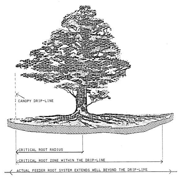
(Ord. No. 6005, 7/14/99, § 1; Ord. No. 6119, 4/12/2000, § 1; Ord. No. 6631, 3/10/2004, § 1; Ord. No. 6738, 10/13/2004, § 1; Ord. No. 6937, 7/12/2006, §§ 1—3; Ord. No. 6992, 12/13/2006, § 1; Ord. No. 7031, 4/11/2007, § 1; Ord. No. 7470, 6/9/2010, § 2; Ord. No. 7528, 4/13/2011, § 1; Ord. No. 7614, 11/14/2012, § 1; Ord. No. 8271, 4/13/2022, § 1; Ord. No. 8341, 7/13/2023, § 1; Ord. No. 8448, 4/9/2025, § 4)
712.09 - Commercial Corridor Design Overlay District.
A.
Intent and Purpose. The Commercial Corridor Design Overlay District is established to enhance the quality and compatibility of development, to establish consistent architectural and design guidelines, to encourage the most appropriate use of land, and to promote safe and efficient movement of traffic. The district is deemed necessary to enhance the aesthetic and visual character of lands adjacent to main commercial corridors in and around Downtown Marietta. All applicable developments proposed within this District shall be subject to procedures, standards, and guidelines specified in the following sections, in addition to those standards pertaining to the particular zoning district in which the development occurs. In particular, the purpose of the Commercial Corridor Design Overlay District is to better articulate positive visual experiences in Marietta's downtown area; to provide for the continued safe and efficient utilization of roads; to promote pedestrian mobility and safety; and to provide for the preservation of historically significant structures. This will be accomplished through evaluation of all applicable developments within the districts by City staff. Staff shall use the point system of specific criteria as described later in this section. It is the purpose of such review to determine whether the proposed plan meets the guidelines and other criteria of this section.
B.
Delineation of District.
1.
The Commercial Corridor Design Overlay District shall include:
a.
The rights-of-way and all parcels lying in whole or in part within 750 feet of rights-of- way line of any road designated as part of the Commercial Corridor Design Overlay District. The boundary of the Commercial Corridor Design Overlay District shall not project beyond the designated terminating point.
b.
Roads that are designated as part of the Commercial Corridor Design Overlay District include Whitlock Avenue from Lindley Avenue to the westernmost intersection of Manning Road, Fairground Street from Birney Street to South Cobb Drive, Powder Springs Road from the South Marietta Parkway to the intersection of Laurel Springs Lane and Longwood Drive, Roswell Street from Haynes Street to US 41, Atlanta Street from Waverly Way to South Cobb Drive, and the North Marietta Parkway from Kennesaw Avenue to Whitlock Avenue, and South Marietta Parkway from Whitlock Avenue to Powder Springs Street.
c.
The boundary of this district shall be shown on the Official Zoning Map of the City of Marietta.
d.
If the proposed development will not be visible from the principal thoroughfare of the overlay district once the project is completed, the Director of Development Services has the administrative authority to waive the requirements of the Commercial Corridor Design Overlay District. Parcels of land directly abutting roads designated as part of the Commercial Corridor Design Overlay Ordinance listed in subsection 712.09.B.1.b. and development that incorporate mixed-use components listed in subsections 712.09.F.1. and 712.09.G.1. are not eligible for waiver of design review requirements.
C.
Relationship to Existing Zoning Districts. In all existing zoning districts located within the Commercial Corridor Design Overlay District the regulations for the zoning district, other zoning codes, and the overlay district shall apply. In cases where there is a conflict between the regulations of the Commercial Corridor Design Overlay District and other sections of the zoning ordinance the Commercial Corridor Design Overlay District shall take precedence.
D.
Developments Exempt from the Commercial Corridor Design Overlay District. The following activities or uses shall be exempt from the Commercial Corridor Design Overlay requirements and development review, although they may be reviewed under separate administrative procedures where noted in this section or in other sections of the Marietta Municipal Code.
1.
Nonconforming Structures. If a nonconforming structure is to be retained then the structure shall not be rebuilt, altered, or repaired if such construction would exceed 50% of its replacement cost. If rebuilding, alteration, or repair of a nonconforming structure exceeds 50% of the replacement cost, then the building shall be required to conform to all provisions of the Commercial Corridor Design Overlay District Ordinance.
2.
Single Family Residences on Individual Lots. All single-family structures located on single-family detached residentially zoned lots are exempt from this chapter but shall comply with the provisions set forth in other sections of the Marietta Municipal Code. Compliance with these provisions shall be verified through the building permit process. Any single-family residential structure that is altered for commercial use shall comply with the provisions set forth in this section.
3.
Downtown Marietta Historic District. Properties that are contained within the Marietta Historic District as identified on the Official Historic Map of Marietta are exempt from this section but shall comply with Article 7-8-8 of the Marietta Municipal Code.
E.
Design Plan Administrative Review.
1.
As part of the site planning process, administrative design review by staff is required to confirm that submitted documents conform to the requirements of this article. A checklist containing mandatory and optional elements of sections 712.09.F.1., 712.09.F.2., 712.09.F.3., 712.09.G.1., 712.09.G.2., and 712.09.G.3. shall be used with a minimum score required to determine compliance with the code.
2.
The design review plan must contain the mandatory elements located in each subsection of the Design and Development Guidelines listed below. In addition, developments shall attain 50% of the possible point totals located in the Optional Elements categories of the Design and Development Guidelines listed below. Within the Optional Elements categories, items that are not applicable to a particular application shall not be considered in the base points for calculating percentages.
F.
Design and development guidelines—Tier A. The general purpose of the Tier A design overlay is to encourage private development to display some of the basic features of a pedestrian-oriented downtown commercial corridor. Overlay conditions are intended to promote a continuous street front experience that engages the pedestrian and generates visual interest.
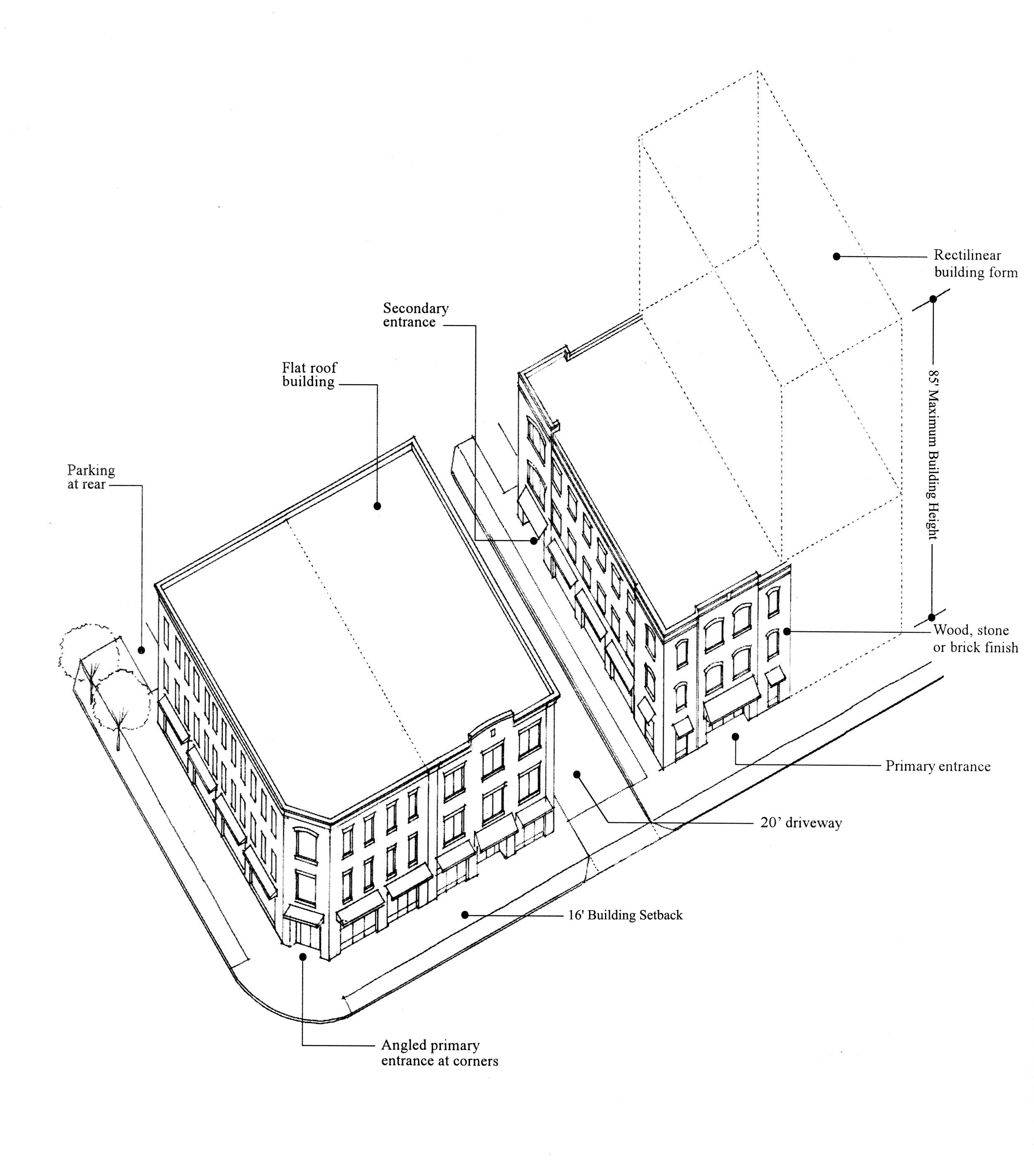
1.
Land Use Patterns.
a.
Optional Elements. 30 points maximum/15 points for approval (Note: These optional standards in Section 712.09F.1.a. only apply for developments which incorporate mixed uses. This section is not applicable to single use developments).
i.
Provide for a mix of uses and pedestrian oriented uses within each development or building. Store front shops, retail, office, professional services, townhomes, and condominiums are permitted uses within the Commercial Corridor Design Overlay District when they are mixed together within a building or development. (+10)
ii.
Within a mixed-use building the ground level of buildings facing a right-of-way shall have a mix of the following uses: (+10)
1)
Retail.
2)
Restaurants.
3)
Cultural activities.
4)
Entertainment.
5)
Professional and general business offices.
6)
Other service establishment similar to those listed above.
iii.
Within a mixed-use building all floors, excluding the ground floor of buildings facing a right-of-way, shall have a mix of the following uses: (+10)
1)
Office uses.
2)
Residential units.
b.
Mandatory Elements.
i.
The maximum floor area ratio for developments that do not include residential components is the standard stipulated in the underlying zoning district.
ii.
The maximum floor area ratio for mixed-use developments containing residential and commercial or office components within the same development is 2.0. In order for a development to be considered a mixed-use project it must meet all provisions set forth in the Commercial Corridor Design Overlay District Ordinance Section F.1.
iii.
Projects that do not meet the abovementioned criteria for mixed-use developments shall be allowed only the permitted uses stipulated in the underlying zoning district. For example, individuals cannot build an exclusively residential development on a parcel zoned for commercial or office use.
iv.
Developments that incorporate a mixture of residential and commercial or office uses shall have at least 30% of the floor area dedicated to residential use.
v.
Developments that incorporate a mixture of residential and commercial or office uses shall have at least 20% of the floor area dedicated to commercial or office use.
vi.
Residential units are not allowed on the ground floor of any mixed-use development in a building that is fronting any streets listed in subsection 712.09.B.1.b. The intent of this is to ensure the commercial character of the corridors.
vii.
The maximum number of residential units on a lot shall be 1 unit for each 1,742 square feet of lot area.
viii.
Ninety-five percent of all residential units within a development shall be owner-occupied units.
ix.
The minimum floor area for individual residential units shall be as follows:
1)
Six hundred fifty square feet for 1-bedroom units.
2)
Eight hundred square feet for 2-bedroom units.
3)
One thousand square feet for 3-bedroom units.
x.
When fronting a street listed in subsection 712.09.B.1.b, the frontage of the first floor of parking structures or garages shall be dedicated to commercial use, excluding ingress and egress. Also, when the upper stories of parking garages are visible from streets listed in subsection 712.09.B.1.b techniques and designs shall be used that disguise the appearance of the parking garage or structure and the have an exterior finish and facades shall be made of wood, masonry, stone, or a combination of these.
xi.
Commercial and office uses shall be designed and operated so that neighboring residents are not exposed to offensive noise, especially from late-night activity. No amplified music shall be audible to neighboring residents. Common walls between residential and nonresidential uses shall be constructed to minimize the transmission of noise and vibration.
xii.
All outdoor lighting associated with commercial uses shall be designed so as not to adversely impact surrounding residential uses, while also providing a sufficient level of illumination for access and security purposes. Such lighting shall not blink, flash, oscillate, or be of unusually high brightness. Also, parking areas shall be illuminated so as to provide appropriate visibility and security during hours of darkness.
xiii.
All storage and work performed within the overlay district shall be conducted within a permanent opaque building that needs to conform to all provisions of the building design section of the commercial Corridor Design Overlay Ordinance.
xiv.
Loading or service areas including refuse and recycling must be out of public view and must not front onto the primary street.
xv.
No commercial use shall be designated or operated so as to expose residents to offensive odors, dust, electrical interference, and/or vibration.
xvi.
Residential, commercial, and office uses in a mixed-use development shall provide combined and private bulk sanitation service for the entire development.
xvii.
Electric and communications transformers shall be screened from public view through below grade installation, a hedge, or similar measure.
xviii.
All other mechanical equipment must be behind or on top of the building and screened from public view through use of a parapet wall or through landscaping.
xix.
Automobile oriented developments are prohibited including the following:
1)
Automobile, trailer and boat sales.
2)
Automobile parts and tire stores.
3)
Automotive repair and maintenance facilities.
4)
Automotive service stations.
5)
Uses similar in nature to those listed above.
2.
Site Design.
a.
Optional Elements. 225 points maximum /112 points for approval.
i.
Where a building is on a corner lot or has frontage on 2 abutting streets, the design of the structure should have an angled entrance located at the street corner. (+15)
 |
ii.
In order to create a sense of enclosure and defined space, buildings shall be arranged so that they frame and define the fronting streets giving deliberate form to streets and sidewalk areas. Defining the street is done by ensuring that neighboring buildings, when the neighboring building meets the standards set forth in the Commercial Corridor Design Overlay District, are setback a similar distance visually from the right-of-way, where applicable. (+15)
iii.
As a method to maximize greenspace in the corridor, adjacent property owners should coordinate greenspace between lots so that smaller segments of greenspace can be combined to create large open space areas. (+30)
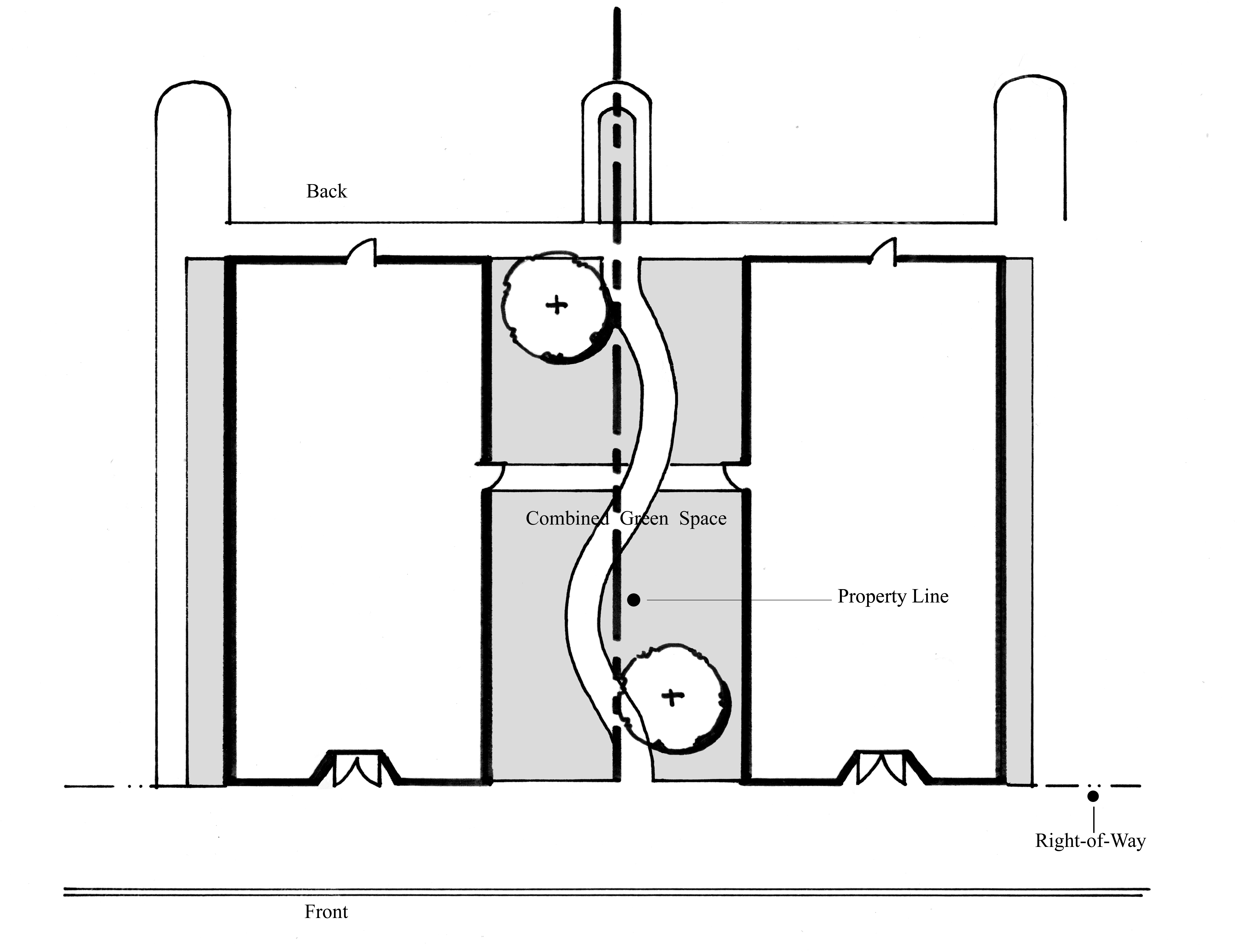
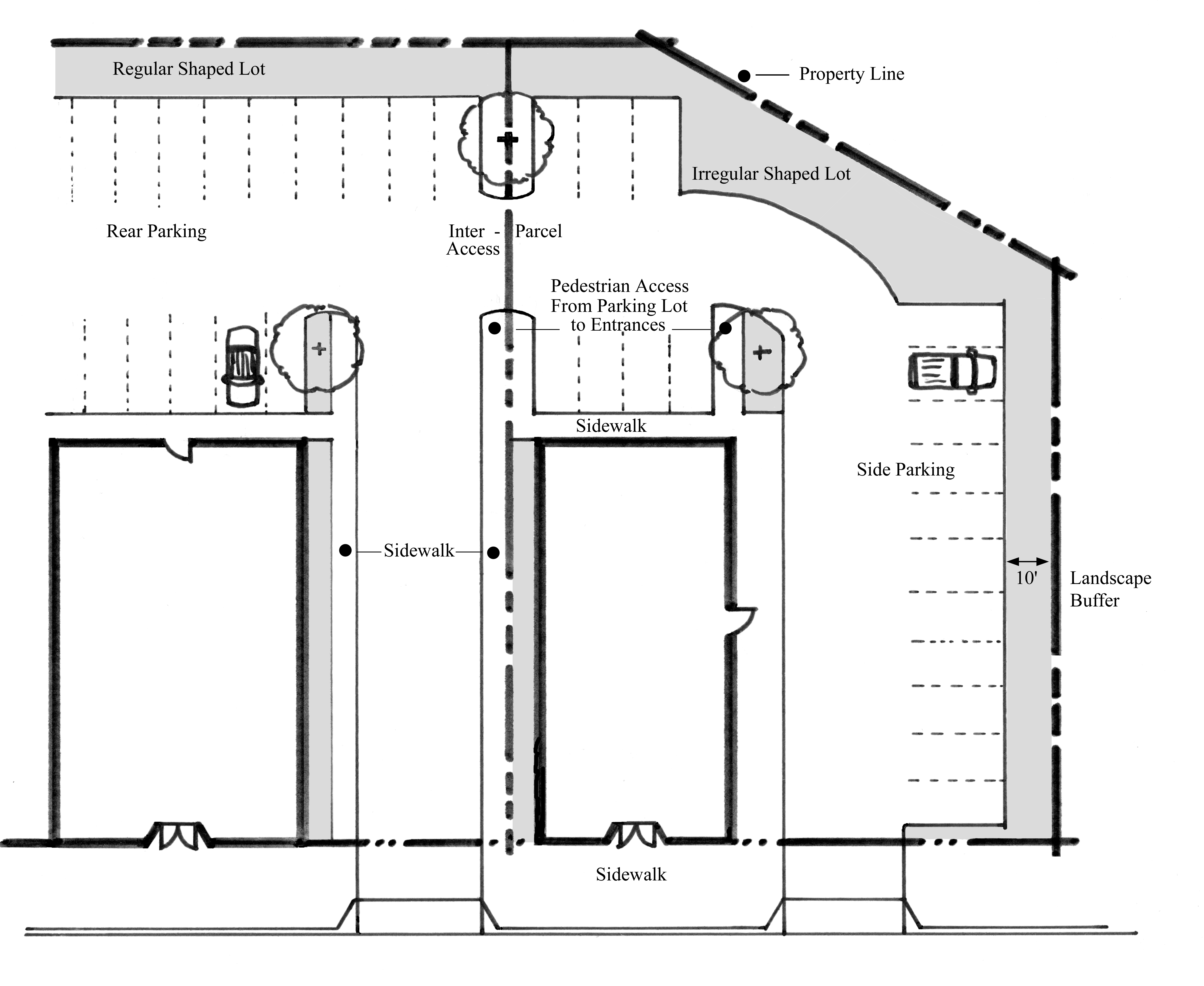
iv.
Preserve specimen trees and/or significant tree stands as a method to produce shade and reduce the heat island effect. (+15)
v.
One curb cut is allowed per property. For every 500 feet of road frontage, an additional curb cut is allowed. The purpose of this provision is to ensure efficient and effective traffic flow. The Director of the Public Works Department may waive this condition based on site conditions. (+30)
vi.
Parking shall be located in the rear yard of properties. If rear yard parking is not possible due to irregularly shaped parcels, then parking in the side yard shall also be permitted. (+20)
vii.
Parking in the front yard of properties or directly between a building and the primary public right-of-way. (-20)
viii.
Access parking through rear of the property (alleys), where possible. (+5)
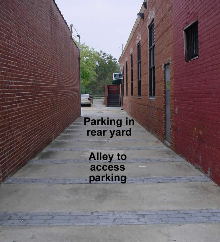 |
ix.
One non-pine shade tree shall be planted every 10 parking spaces. (+15)
x.
Provide pedestrian walkways through parking areas to the sidewalk/main entrance. (+15)
xi.
Create inter-parcel access between adjacent lots to increase mobility options for vehicles and pedestrians. (In some cases, the ability to provide interparcel access may not be successfully achieved due to conflicts with the neighboring property or property owner, and not by physical or topographical issues. In such cases, installing a driveway to the neighboring property and providing a recorded easement that will allow interparcel access to the neighboring property in the future is sufficient to achieve the points. (+30)
xii.
Enter into a shared parking agreement (access easement) with adjacent uses. In addition, properties with shared parking agreement receive a 10% reduction in the required number of parking spaces. (+30)
xiii.
Provide bicycle parking facilities. (+5)
xiv.
Outdoor dining areas and public art are encouraged at building fronts, where applicable. Outdoor dining facilities are to be located on private property except for those properly licensed in accordance with the "Outdoor Cafe Ordinance," Marietta Code Chapter 8-39. (+15)
b)
Mandatory Elements.
i.
Sixteen-foot maximum front setback from the building to the property line along any public street. If part of the building must be setback from the sidewalk, treat these portions of the building as a plaza or courtyard. No more than 25% of a building frontage may be designed as a plaza or courtyard.
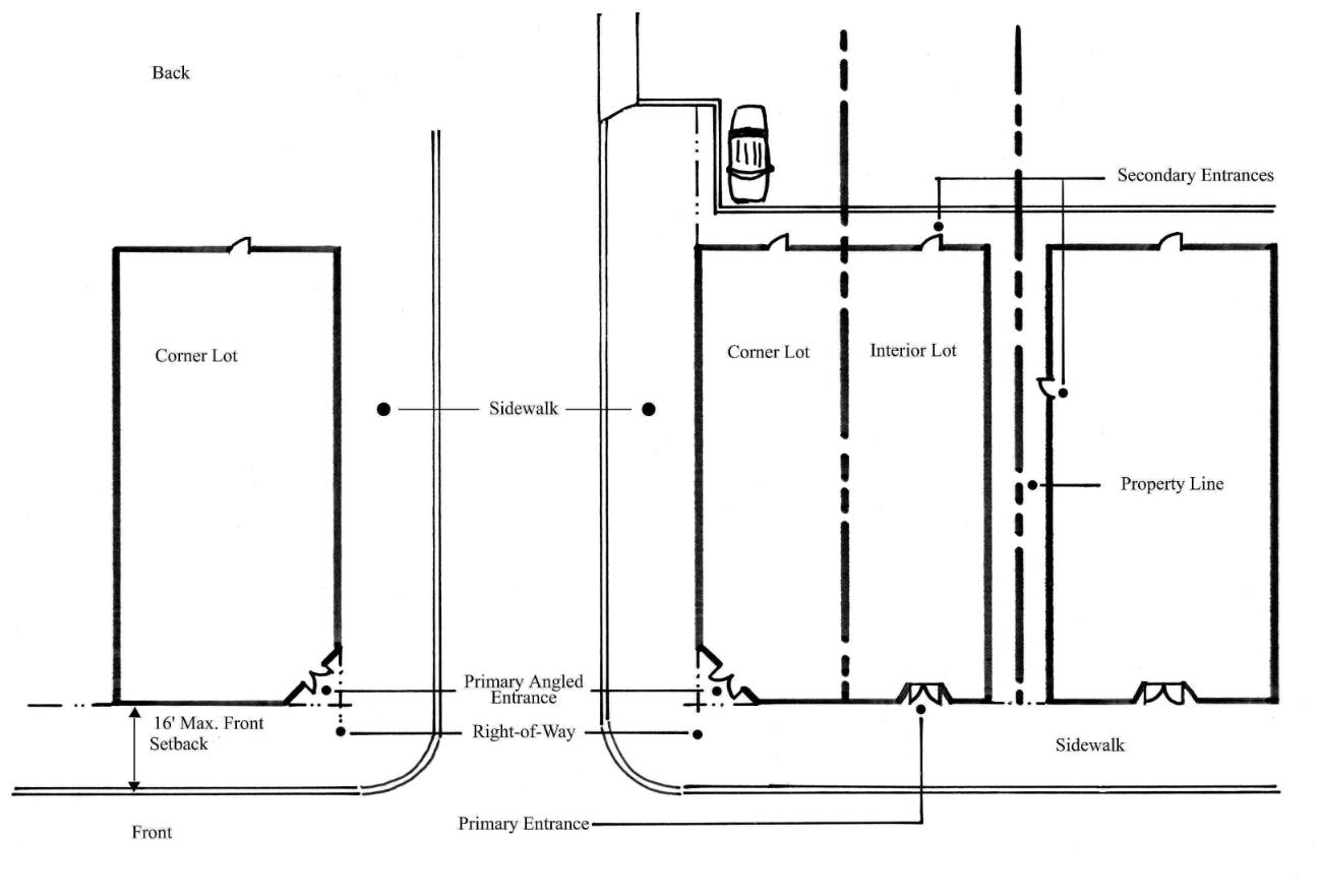
ii.
Ten-foot minimum building setback is required between a building and the side or rear property lines and between the building and a public right-of-way. No setbacks are required between buildings within the same development.
iii.
If parking occurs within the side or rear yard of a property, a landscaped buffer of 10 feet shall be required to separate the parking facility from the adjacent parcel. The buffer shall contain a screening fence, or wall not less than 6 feet in height and made of wood, stone, or brick and may overlap the building setback. Landscaping shall not be required in the areas designated for inter-parcel access when a shared parking agreement is in effect between adjacent property owners.
iv.
Any buffer required by the underlying zoning district for the separation of uses shall not be required in Tier A.
v.
Five percent minimum open space per lot if the property is a mixed-use development.
vi.
Ninety-five percent minimum open space per lot if the property is a mixed-use development.
vii.
Drive-through uses shall comply with the following design standards:
1)
A drive-through facility shall be limited to 1 driveway crossing of a pedestrian route, but shall not be limited in the number of service windows, bays, or lanes within the site provided the minimum floor area ratio of the district is met. However, if an applicant can demonstrate that construction of a single joint use driveway is constrained by the size of the parcel, by unusual topographic or otherwise site considerations such that the project as a whole would be uneconomic and would otherwise be built, or if the return routing to such a joint use driveway would require drive lane to be constructed parallel to and within 15 feet of a major pedestrian route that could otherwise be avoided, then a drive-through use may have separate ingress and egress driveways crossing a pedestrian route.
2)
The drive-through service window, all queuing lanes shall be located a practicable from any right-of-way route.
3)
If a drive-through facility is within fifty feet of a pedestrian route and queuing lanes and service windows, bays, or lanes would otherwise be visible from the pedestrian route, landscaping shall be installed to screen the service windows, bays, or lanes.
4)
Pedestrian circulation within the site shall be well marked, both for the operator of a vehicle and for the pedestrian and shall comply with the requirements of the Americans with Disabilities Act.
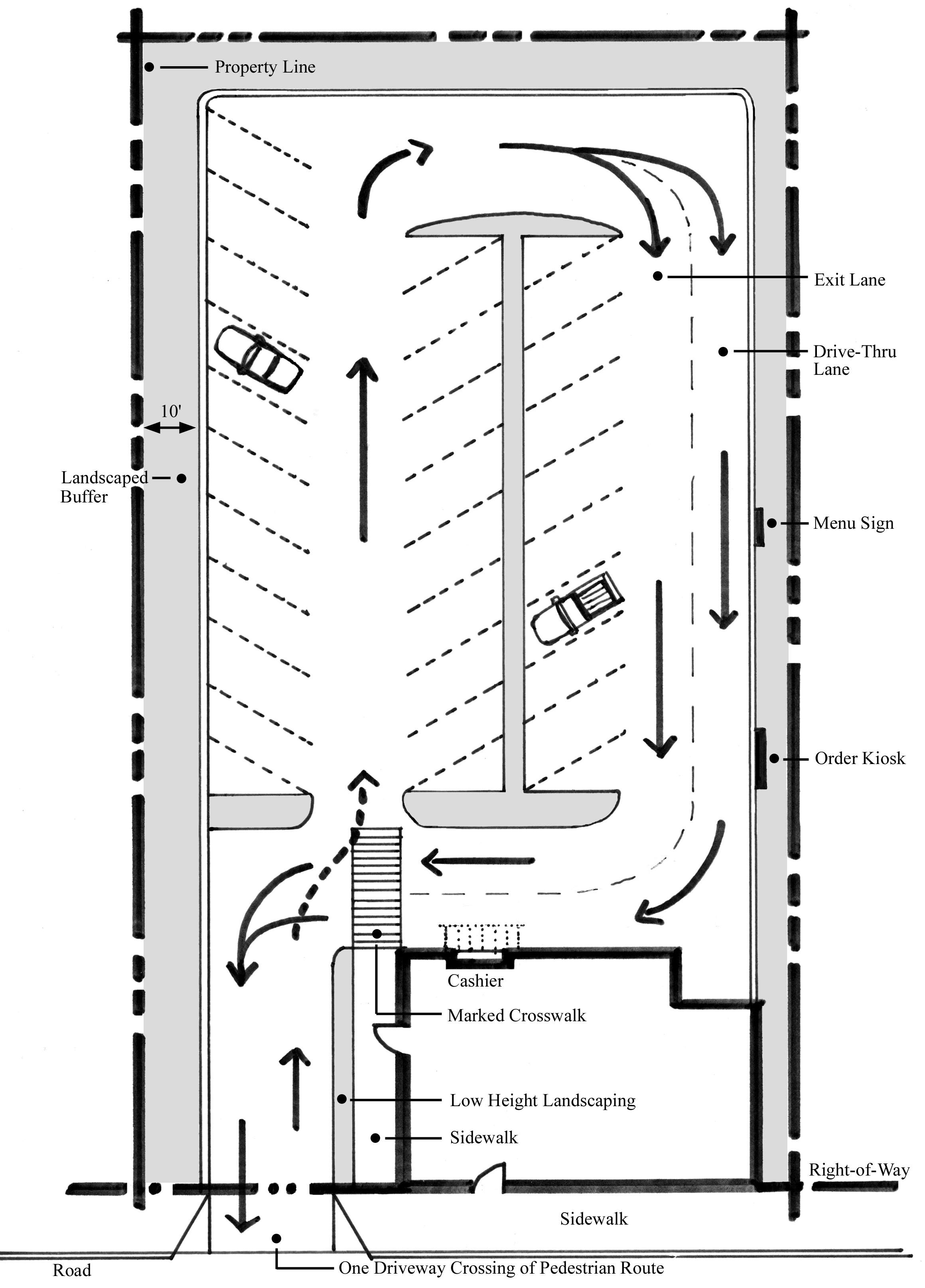
viii.
Parking facing a right-of-way or improved accessway shall meet the requirements of Section 712.08.G of the Tree Protection and Landscaping Ordinance.
ix.
Any building abutting a public right-of-way shall be oriented to the street. The primary entry or entries for all ground-floor units abutting the street shall open directly onto the street right-of-way, not to the interior of the site or to a parking lot. Secondary entrances may face parking lots or other interior site areas.
x.
Acceleration and deceleration lanes will not be required for properties on Roswell Street.
xi.
Any fence or wall built or erected within Tier A shall meet the requirements of Section 710.04, Fences and Walls.
3.
Building Design.
a.
Optional Elements. (185 points maximum/93 points needed for approval).
i.
Roofs should reflect the traditional character of Marietta and provide visual interest for pedestrians, which involve the following:
1)
Flat roof styles are preferred because it is the traditional style of Marietta buildings. (+25)
2)
Shed roofs (single pitch) are not preferred because they do not fit the predominant architectural style of the City. (-25)
3)
Decorative cornice lines shall be incorporated to clearly identify the top of the building. (+15)
4)
Occupied roofs, such as roof gardens, terraces, decks and balconies are encouraged. (+10)
 |
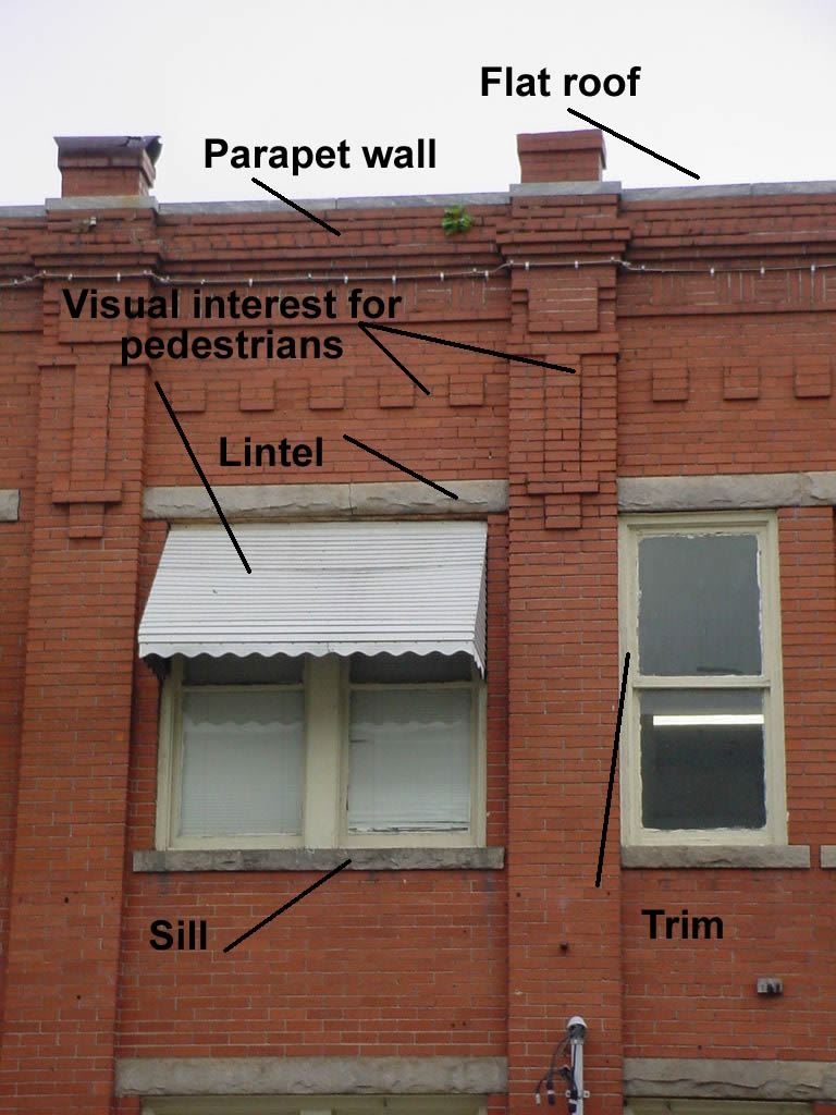 |
ii.
Building facades should reflect traditional patterns and provide visual interest for the community.
1)
Clearly delineate upper and lower facades by using cornice lines, stringcourses, canopies, awnings, fenestration, and other architectural elements to create a recognizable base, middle, and top of buildings. (+25)
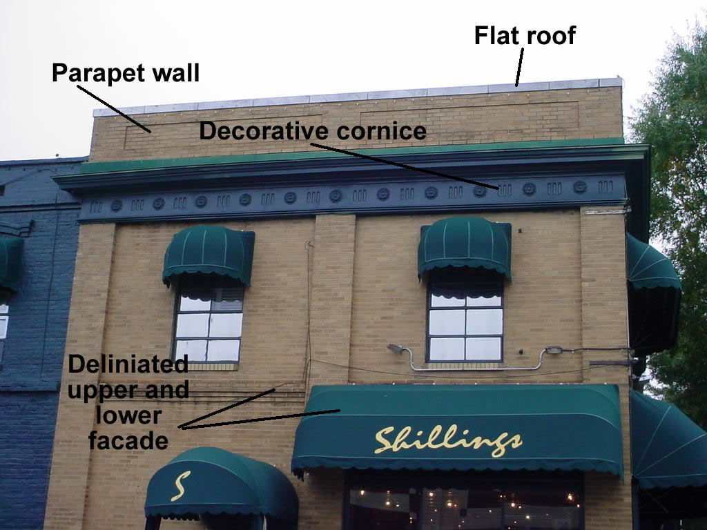 |
2)
Entryways are important to a pedestrian environment and provide a special opportunity to make a building unique while at the same time providing a highly visible customer entrance and identifiable public address. Awnings or a change in the roofline shall be used as a way to define the entry of buildings facing rights-of-way. (+15)
3)
Recessed doorways are encouraged. Doorways should not be recessed more than 5 feet from the front facade unless a courtyard, cafe, window display, or similar space is provided between the doorway and the sidewalk. (+5)
4)
Street facades shall incorporate visual interest. Developers should use bays, storefronts, entrances, columns, and other vertical elements to "break-up" the building facade. (+15)
5)
Storefronts shall incorporate display windows, transoms, and/or entrances that account for 50% of the ground level of building. (+10)
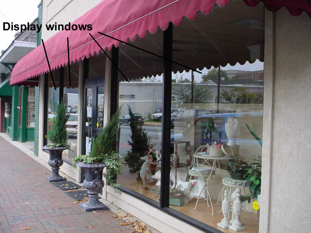 |
6)
The upper stories of all street-facing facades shall contain at least 30% opening through the use of windows, bays, porches, or other similar architectural elements. The aforementioned openings shall not to exceed 75% of the street-facing facades. (+10)
7)
Pedestrian lighting shall be used for entryways at a height of 10 feet or less. The pedestrian lighting shall also use techniques and mechanisms to reduce the glare caused by the lighting fixtures. (+5)
8)
Windows shall incorporate decorative architectural designs including the following:
a.
Sills. (+10)
b.
Trim. (+10)
c.
Lintels. (+10)
9)
Windows that do not incorporate any above-mentioned design features are discouraged. (-10)
iii.
Buildings of historic significance should be retained or preserved.
1)
New additions or alterations to historically significant buildings shall be compatible with the massing, size, scale, rooflines, materials, colors, and architectural features of the original building. (+10)
2)
New additions or alterations shall not cover, remove, or damage significant architectural elements of historically important buildings that are visible from the street such as decorative cornices, windows, doors, trim around openings, railing, storefronts, and any other historically decorative feature or facade. (+10)
3)
Demolition of historically significant buildings is strongly discouraged, where applicable. (-10)
b.
Mandatory Elements.
i.
Mechanical equipment located on rooftops shall be completely screened so no portion of the equipment is visible from the street.
ii.
Minimum building height of 2 stories or 18 feet.
iii.
Maximum building height of 85 feet.
iv.
Awnings shall be made of fabric, canvas, or fixed metal, or similar materials.
v.
Blank, windowless walls are prohibited when facing a public street.
vi.
Window frames (except glass block) shall be recessed at least 2 inches from the exterior building face.
vii.
Exterior window trim shall not be flush with the exterior wall. The window trim shall have a minimum relief of ¼ inch from the exterior wall.
viii.
Exterior finishes shall be primarily wood, masonry, stone, or a combination of these. Exterior finishes that are plain concrete block, plain concrete, corrugated predominantly metal, plywood, and sheet pressboard, and other similar materials are not allowed, as exterior finish material.
ix.
All garages, detached and attached, shall reflect the architectural style and building materials that are used for the dwelling structure and shall not front onto the primary right-of-way. Alleys shall be used to provide adequate parking and vehicular access for the dwelling units, where possible.
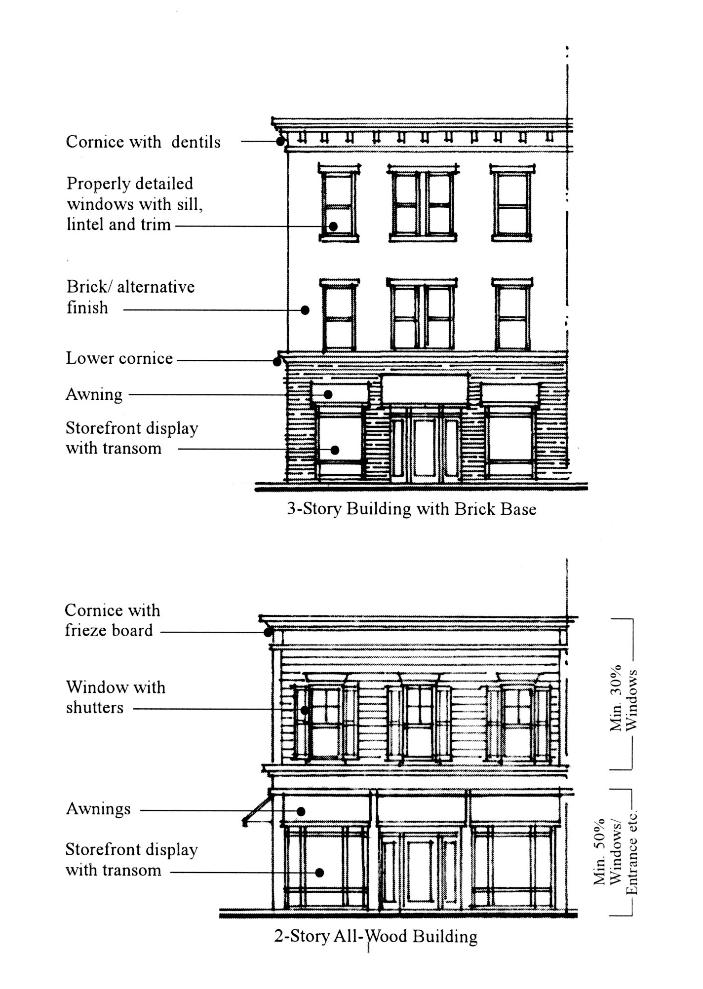

4.
Streetscape Design.
a.
Mandatory Elements.
i.
A 6-foot brick sidewalk shall be constructed that will allow for safe and efficient pedestrian flow in front of all development projects in the Tier A zone. This is imperative to ensure pedestrians feel comfortable on the sidewalk as well as important to meet the current American with Disabilities Act standards. Where applicable, a 2-foot brick separation between the curb and the sidewalk shall be installed, unless otherwise approved by the Public Works Director and the Director of Development Services.
ii.
Ten-foot-wide private landscape zone is required to be installed along property between the sidewalk and the building face. The landscape zone proposal shall be reviewed for compliance during the design review/site plan approval process. All properties zoned as CBD are exempt from the 10-foot-wide private landscape zone requirement.
1)
Trees shall be placed in the landscape zone using the following specifications:
a)
Trees shall be placed not more than 30 feet apart within the landscape zone;
b)
Where there are physical restrictions spacing of street trees shall be adjusted, provided the adjustment is the minimum needed to avoid the obstruction;
c)
Tree spacing can be adjusted so as not to block, obscure, or interfere with the operation of traffic signals, utilities, or any existing marquee, overhanging sign, awning, or other public infrastructure that was placed prior to the planting of the landscape zone, provided the adjustment is the minimum required for such avoidance;
d)
Street trees shall not be planted in a manner that will diminish adequate sight distance;
e)
No street tree shall be planted within 10 feet of a light standard or utility pole;
2)
Tree species should be selected with root growth habits that will not cause damage to sidewalks or anything contained within the public right-of-way, or such tree species should be sited away from such hard-surfaced areas. Appropriate tree species are as follows:
a)
Hornbeam, Eastern (M).
b)
Maple, Red (M).
c)
Maple, Southern Sugar (M).
d)
Oak, Willow (L).
e)
Other tree similar in nature to those listed above that is suitable to be placed in urban and pedestrian environments.
3)
Street trees shall have a DBH of 3 inches.
4)
Tree protection techniques and protective barriers shall be done in accordance with the Tree protection and landscaping, Section 712.08 of the Marietta Zoning Ordinance.
5)
Landscaping plans shall show all obstructions that may affect plant placement and installation limitations including all underground utilities.
6)
All exposed dirt areas shall be covered with bark, mulch, or other weed control measures included as part of the final landscape plan.
7)
The property owner shall ensure the upkeep, health, and aesthetics of the landscape zone through the use of proper irrigation of plant species in the landscape zone, regular maintenance of the landscape zone and replacement of items located within the landscape zone.
8)
Within the landscape zone on the main commercial provide at least 2 of the following pedestrian amenities that shall be accessible to the sidewalk:
a)
Benches;
b)
Trash receptacles;
c)
Public art;
d)
Or other similar design feature integrated into the overall design of the building or portion of the landscape zone in order to enhance the pedestrian environment.
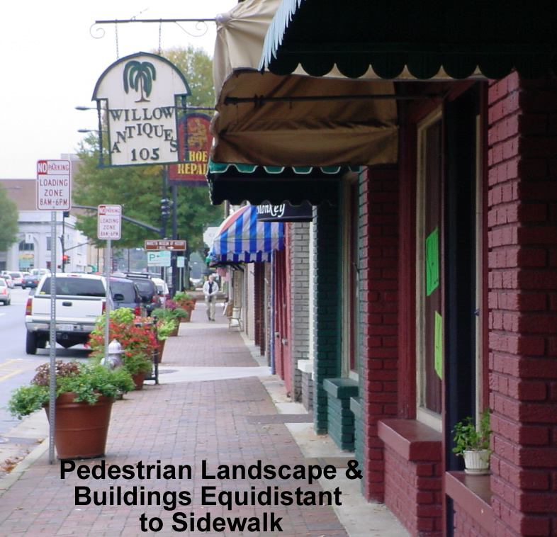 |
9)
Pedestrian lighting fixtures are required to be provided every 60 feet on the main commercial corridor within the landscape/pedestrian zone, either by the developer or when appropriate by the Marietta Board of Lights and Water. Where there are physical restrictions, spacing of lighting standards shall be adjusted, provided the adjustment is the minimum needed to avoid the obstruction. The lighting shall be a style approved by the City of Marietta staff. In addition to supplying the pedestrian lighting, a 2-foot by 2-foot dedicated easement adjacent to the public right-of-way shall be required so City staff can provide adequate upkeep to the pedestrian lighting fixtures.
 |
G.
Design and development guidelines—Tier B. The general purpose of the Tier B design overlay is to encourage private development to integrate some pedestrian design features and aesthetic improvements into automobile-oriented corridors, without diminishing the automobile-orientation of the corridors. Overlay conditions are intended to generate visual interest for both pedestrians and the operators of vehicles along the corridors.
1.
Land Use Patterns.
a.
Optional Elements. 30 points max/15 points for approval (Note: These optional standards in Section 712.09 G.1.a. only apply for developments which incorporate mixed uses. This section is not applicable to single use developments).
i.
Provide for a mix of uses within each development or building. Store front shops, retail, office, professional services, townhomes, and condominiums are permitted uses within the Commercial Corridor Design Overlay District. (+10)
 |
ii.
Within a development or building the ground level of the buildings shall have a mix of the following uses: (+10)
1)
Retail;
2)
Restaurants;
3)
Cultural activities;
4)
Entertainment;
5)
Other service establishment similar to those listed above.
iii.
Within a development or building the upper floor of the buildings shall have a mix of the following uses: (+10)
1)
Office uses;
2)
Residential units.
b.
Mandatory Elements.
i.
The maximum floor area ratio for developments that do not include residential components is the standard stipulated in the underlying zoning district.
ii.
The maximum floor area ratio for mixed-use developments containing residential and commercial or office components within the same development is 2.0. In order for a development to be considered a mixed-use project it must meet all provisions set forth in the Commercial Corridor Design Overlay District Ordinance Section G.1.
iii.
Projects that do not meet the abovementioned criteria for mixed-use developments shall be allowed only the permitted uses stipulated in the underlying zoning district. For example, individuals cannot build an exclusively residential development on a parcel zoned for commercial or office use.
iv.
Development shall that incorporate a mixture of residential and commercial or office uses shall have at least 30% of the floor area dedicated to residential use.
v.
Developments shall that incorporate a mixture of residential and commercial or office uses shall have at least 20% of the floor area dedicated to commercial or office use.
vi.
Residential units are not allowed on the ground floor of any mixed-use development in a building that is fronting any streets listed in subsection 712.09.B.1.b. The intent of this is to ensure the commercial character of the corridors.
vii.
The maximum number of residential units for on a lot shall be 1 unit for each 1,742 square feet of lot area.
viii.
Ninety-five percent of all residential units within a development shall be owner-occupied units.
ix.
The minimum floor area for individual residential units shall be as follows:
1)
Nine hundred square feet for 1-bedroom units.
2)
One thousand one hundred square feet for 2-bedroom units.
3)
One thousand four hundred square feet for 3-bedroom units.
x.
When fronting a street listed in subsection 712.09.B.1.b, the frontage of the first floor of parking structures or garages shall be dedicated to commercial use, excluding ingress and egress. Also, when the upper stories of parking garages are visible from streets listed in subsection 712.09.B.1.b, techniques and designs shall be used that disguise the appearance of the parking garage or structure and the have an exterior finish and facades shall be made of wood, masonry, stone, or a combination of these.
xi.
Commercial and office uses shall be designed and operated so that neighboring residents are not exposed to offensive noise, especially from late-night activity. No amplified music shall be audible to neighboring residents. Common walls between residential and nonresidential uses shall be constructed to minimize the transmission of noise and vibration.
xii.
All outdoor lighting associated with commercial uses shall be designed so as not to adversely impact surrounding residential uses, while also providing a sufficient level of illumination for access and security purposes. Such lighting shall not blink, flash, oscillate, or be of unusually high brightness. Also, parking areas shall be illuminated so as to provide appropriate visibility and security during hours of darkness.
xiii.
All storage and work performed within the overlay district shall be conducted within a permanent opaque building that needs to conform to all provisions of the building design section of the Commercial Corridor Design Overlay Ordinance.
xiv.
Loading or service areas including refuse and recycling must be out of public view and must not front onto the primary street.
xv.
No commercial use shall be designated or operated so as to expose residents to offensive odors, dust, electrical interference, and/or vibration.
xvi.
Residential, commercial, and office uses in a mixed-use development shall provide combined and private bulk sanitation service for the entire development.
xvii.
Electric and communications transformers shall be screened from public view through below grade installation, a hedge, or similar measure.
xviii.
All other mechanical equipment must be behind or on top of the building and screened from public view through use of a parapet wall or through landscaping.
2.
Site Design.
a.
Optional Elements.
i.
Where a building is on a comer lot or has frontage on 2 abutting streets, the design of the structure should have an angled entrance located at the street corner. (+15)
ii.
As a method to maximize greenspace in the corridor, adjacent property owners should coordinate greenspace between lots so that smaller segments of greenspace can be combined to create large open space areas. (+30)
iii.
Preserve specimen trees and/or significant tree stands as a method to produce shade and reduce the heat island effect. (+15)
iv.
One curb cut is allowed per property. For every 500 feet of road frontage an additional curb cut is allowed. The purpose of this provision is to ensure efficient and effective traffic flow. The Director of the Public Works Department may waive this condition based on site conditions. (+30)
v.
Developments with more than 1 curb cut per property. (-30)
vi.
Parking shall be located in the rear or side yard of properties. (+15)
vii.
Driveway width of 20 feet (not including curb and gutter) as a way to create a safe environment for both vehicles and pedestrians. (+5)
viii.
Provide pedestrian walkways through parking areas to the sidewalk/main entrance. (+15)
ix.
Create inter-parcel access between adjacent lots to increase mobility options for vehicles and pedestrians. (In some cases the ability to provide interparcel access may not be successfully achieved due to conflicts with the neighboring property or property owner, and not by physical or topographical issues. In such cases, installing a driveway to the neighboring property and providing a recorded easement that will allow interparcel access to the neighboring property in the future is sufficient to achieve the points.) (+35)
x.
Enter into a shared parking agreement (access easement) with adjacent uses. In addition, properties with shared parking agreement receive a 10% reduction in the required number of parking spaces. (+30)
xi.
Provide bicycle parking facilities. (+5)
xii.
Outdoor dining areas and public art are encouraged at building fronts, where applicable. Outdoor dining facilities are to be located on private property except for those properly licensed in accordance with the "Outdoor Cafe Ordinance," Marietta Code Chapter 8-39. (+15)
xiii.
Any building abutting a public right-of-way shall be oriented to the street. The primary entry or entries for all ground-floor units abutting the street shall open directly onto the street right-of-way, not to the interior of the site or to a parking lot. Secondary entrances may face parking lots or other interior site areas. (+15)
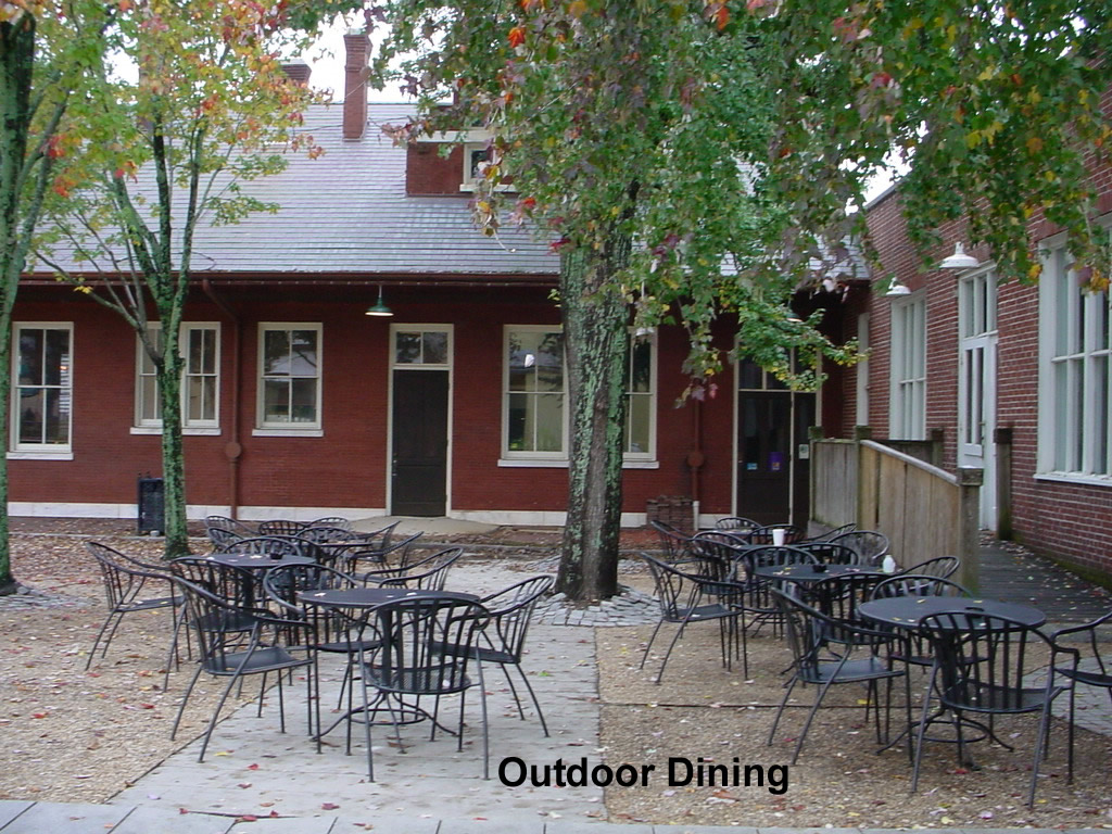
xiv.
If parking occurs within the side yard of a property, a landscaped buffer of 10 feet shall be required to separate the parking facility from the adjacent parcel. Landscaping shall not be required in the areas designated for inter-parcel access when a shared parking agreement is in effect between adjacent property owners. (+10)
xv.
Developments with a 35-foot maximum setback from the building to the property line along any public street. (+15 Bonus points—not to be included in calculation for total maximum points).
xvi.
Developments with a 10-foot maximum setback from the building to the property line along any public street. (+30 Bonus points—not to be included in calculation for total maximum points).
xvii.
Developments with a 20-foot landscape strip measured from the building or curb of the parking area to the property line along any public street, and in which large canopy street trees are to be planted. Such trees shall be planted to the specifications set forth in Section 712.09 G.4.ii. When the landscape strip is increased by 10 feet or more, i.e. from 10 feet to 20 feet, the maximum front building setback may be increased and the rear building setback may be reduced by a distance equal to the amount of increase. (+10 Bonus points—not to be included in calculation for total maximum points).
b.
Mandatory Elements.
i.
A 75-foot maximum front setback from the building to the property line along any public street. If part of the building must be setback from the sidewalk, treat these portions of the building as a plaza or courtyard. No more than 25% of a building frontage may be designed as a plaza or courtyard.
ii.
Twenty-five-foot setback is required where the rear property line directly abuts a single-family residential district. Parking may occur within the required 25-foot setback as long as a screening fence or wall not less than 6 feet in height and made of wood, stone, brick is installed in the required buffer.
iii.
Six-foot minimum side setback is required between a building and the side property lines and between the building and a public right-of-way. No side setbacks are required for buildings within the same development.
iv.
A 10% minimum open space area per lot is required for all developments.
v.
Ninety percent maximum impervious surface if the project is a mixed-use development.
vi.
Parking facing a right-of-way or improved accessway shall meet the requirements of Section 712.08 G. of the Tree Protection and Landscaping Ordinance.
vii.
Any fence or wall built or erected within Tier B shall meet the requirements of Section 710.04, Fences and Walls.
3.
Building Design.
a.
Optional Elements.
i.
Roofs should reflect the traditional character of Marietta and provide visual interest for pedestrians, which involve the following:
1)
Flat roof styles are preferred because it is the traditional style of Marietta buildings. (+25)
2)
Shed roofs (single pitch) are not preferred because they do not fit the predominant architectural style of the City. (-25)
3)
Decorative cornice lines shall be incorporated to clearly identify the top of the building. (+15)
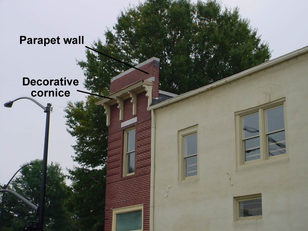 |
4)
Occupied roofs, such as roof gardens, terraces, decks and balconies are encouraged. (+10)
ii.
Building facades should reflect traditional patterns and provide visual interest for the community.
1)
Clearly delineate upper and lower facades by using cornice lines, stringcourses, canopies, awnings, fenestration, and other architectural elements to create a recognizable base, middle, and top of buildings. (+25)
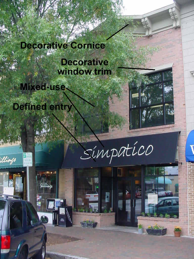 |
2)
Entryways are important to a pedestrian environment and provide a special opportunity to make a building unique while at the same time providing a highly visible customer entrance and identifiable public address. Awnings or a change in the roofline shall be used as a way to define the entry of buildings facing rights-of-way. (+15)
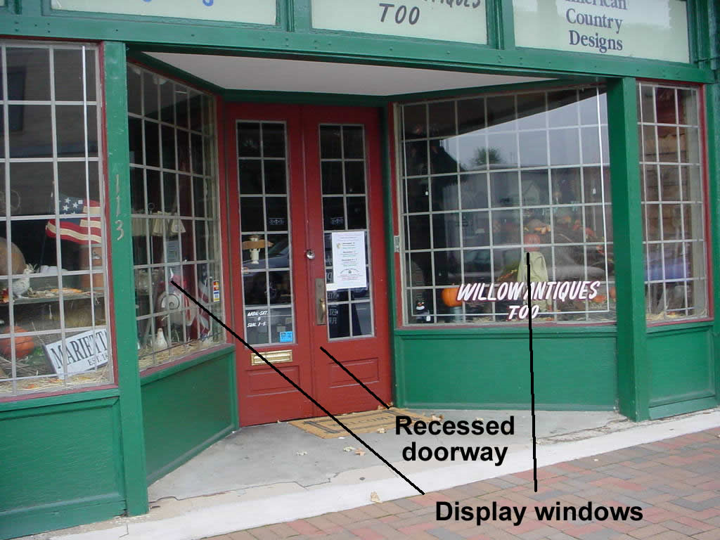 |
3)
Recessed doorways are encouraged. Doorways should not be recessed more than 5 feet from the front facade unless a courtyard, cafe, window display, or similar space is provided between the doorway and the sidewalk. (+5)
 |
4)
Street facades shall incorporate visual interest. Developers should use bays, storefronts, entrances, columns, and other vertical elements to "break-up" the building facade. (+15)
5)
Long, monotonous, or uninterrupted horizontal stretches of street-facing building facades shall be avoided. (-15)
6)
Storefronts shall incorporate display windows, transoms, and/or entrances that account for 50% of the ground level of building. (+10)
7)
The upper stories of all street-facing facades shall contain at least 30% opening through the use of windows, bays, porches, or other similar architectural elements. The aforementioned openings shall not exceed 75% of the street-facing facades. (+10)
8)
Pedestrian lighting shall be used for entryways at a height of 10 feet or less. The pedestrian lighting shall also use techniques and mechanisms to reduce the glare caused by the lighting fixtures. (+5)
 |
9)
Heavily tinted windows are discouraged. The maximum reflexivity of any window shall not exceed 13%. (-10)
10)
Windows shall incorporate decorative architectural designs including the following:
a.
Sills. (+10)
b.
Trim. (+10)
c.
Lintels. (+10)
11)
Windows that do not incorporate any abovementioned design features are discouraged. (-10)
12)
Buildings of historic significance should be retained or preserved.
a.
New additions or alterations to historically significant buildings shall be compatible with the massing, size, scale, rooflines, materials, colors, and architectural features of the original building. (+10)
b.
New additions or alterations shall not cover, remove, or damage significant architectural elements of historic buildings that are visible from the street such as decorative cornices, windows, doors, trim around openings, railing, storefronts, and any other historically decorative feature or facade. (+10)
c.
Demolition of historically significant buildings is strongly discouraged, where applicable. (-10)
b.
Mandatory Elements.
i.
Mechanical equipment located on rooftops shall be completely screened so no portion of the equipment is visible from the street.
ii.
Minimum building height of 2 stories or 18 feet.
iii.
Maximum building height of 85 feet.
iv.
Awnings shall be made of fabric, canvas, or fixed metal, or similar materials.
v.
Blank, windowless walls are prohibited when facing a public street.
vi.
Window frames (except glass block) shall be recessed at least 2 inches from the exterior building face.
vii.
Exterior window trim shall not be flush with the exterior wall. The window trim shall have a minimum relief of ¼ inch from the exterior wall.
viii.
Exterior finishes shall be primarily wood, masonry, stone, or a combination of these. Exterior finishes that are plain concrete block, plain concrete, corrugated predominantly metal, plywood, and sheet pressboard, or similar materials are not allowed.
ix.
All garages, detached and attached, shall reflect the architectural style and building materials that are used for the dwelling structure and shall not front onto the primary right-of-way. Alleys shall be used to provide adequate parking and vehicular access for the dwelling units, where possible.
4.
Streetscape Design.
a.
Mandatory Elements.
i.
A 6-foot sidewalk zone be constructed that will allow for safe and efficient pedestrian flow in front of all development projects in the Tier B zone. This is imperative to ensure pedestrians feel comfortable on the sidewalk as well as important to meet the current American with Disabilities Act standards.
ii.
Eight-foot-wide private landscape zone is required to be installed along property between the sidewalk and the building face. The landscape zone proposal shall be reviewed for compliance during the design review/site plan approval process. All properties zoned as CBD are exempt from the 8-foot-wide private landscape zone requirement.
1)
Trees shall be placed in the landscape zone using the following specifications:
a)
Trees shall be placed not more than 30 feet apart within the landscape zone;
b)
Where there are physical restrictions spacing of street trees shall be adjusted, provided the adjustment is the minimum needed to avoid the obstruction;
c)
Tree spacing can be adjusted so as not to block, obscure, or interfere with the operation of traffic signals, utilities, or any existing marquee, overhanging sign, awning, or other public infrastructure that was placed prior to the planting of the landscape zone, provided the adjustment is the minimum required for such avoidance;
d)
Street trees shall not be planted in a manner that will diminish adequate sight distance.
e)
No street tree shall be planted within 10 feet of a light standard or utility pole;
2)
Tree species should be selected with root growth habits that will not cause damage to sidewalks or anything contained within the public right-of-way, or such tree species should be sited away from such hard-surfaced areas. Appropriate tree species are as follows:
a)
Hornbeam, Eastern (M).
b)
Maple, Red (M).
c)
Maple, Southern Sugar (M).
d)
Oak, Willow (L).
e)
Other tree similar in nature to those listed above that is suitable to be placed in urban and pedestrian environments.
3)
Street trees shall have a DBH of 3 inches.
4)
Tree protection techniques and protective barriers shall be done in accordance with the Tree protection and landscaping, Section 712.08 of the Marietta Zoning Ordinance.
5)
Landscaping plans shall show all obstructions that may affect plant placement and installation limitations including all underground utilities.
6)
All exposed dirt areas shall be covered with bark, mulch, or other weed control measures included as part of the final landscape plan.
7)
The property owner shall ensure the upkeep, health, and aesthetics of the landscape zone through the use of proper irrigation of plant species in the landscape zone, regular maintenance of the landscape zone and replacement of items located within the landscape zone.
8)
Pedestrian lighting fixtures are required every 60 feet on the main commercial corridors within the landscape/pedestrian zone. Where there are physical restrictions spacing of lighting standards shall be adjusted, provided the adjustment is the minimum needed to avoid the obstruction. The lighting shall be a style approved by the City of Marietta staff. In addition to supplying the pedestrian lighting a 2-foot by 2-foot dedicated easement adjacent to the public right-of-way shall be required so City staff can provide adequate upkeep to the pedestrian lighting fixtures.
H.
Appeals. The City Council shall have the authority and duty to consider and act upon any application submitted for adjustment of standards provided herein.
(Ord. No. 6472, 12/11/2002, § 1; Ord. No. 7059, 6/13/2007, §§ 1—3; Ord. No. 7062, 7/11/2007, § 1; Ord. No. 7199, 7/9/2008, §§ 1—3; Ord. No. 8292, 7/13/2022, § 1)
712.10 - Conservation Subdivision Overlay (CSO) District.
A.
Purpose and Intent The Conservation Subdivision Overlay (CSO) District is intended to allow flexible site planning and building arrangements under a unified plan of development so that innovative land planning methods may be utilized which foster natural and cultural resource conservation. This may permit buildings to be clustered or arranged in an unconventional manner to maximize open space, create pedestrian scale and other public benefits. The CSO district is intended to:
1.
Provide for the preservation of greenspace as a nonstructural stormwater runoff and watershed protection measure.
2.
Provide a residential zoning district that permits flexibility of design in order to promote environmentally sensitive and efficient uses of the land.
3.
Preserve in perpetuity unique or sensitive natural resources such as groundwater, floodplains, wetlands, streams, steep slopes, woodlands and wildlife habitat.
4.
Permit clustering of houses and structures on less environmentally sensitive soils, which will reduce the amount of infrastructure, including paved surfaces and utility easements, necessary for residential development.
5.
Reduce erosion and sedimentation by minimizing land disturbance and removal of vegetation in residential development.
6.
Promote interconnected greenways and corridors throughout the community.
7.
Promote contiguous greenspace with adjacent jurisdictions.
8.
Encourage interaction in the community by clustering houses and orienting them closer to the street, providing public gathering places and encouraging use of parks and community facilities as focal points in the neighborhood.
9.
Encourage street designs that reduce traffic speeds and reliance on main arteries.
10.
Promote construction of convenient landscaped walking trails and bike paths both within the subdivision and connected to neighboring communities, businesses, and facilities to reduce reliance on automobiles.
11.
Conserve scenic views and reduce perceived density by maximizing the number of houses with direct access to and views of open space.
12.
Preserve important historic and archaeological sites.
B.
Definitions: The following definitions are intended for use with the Conservation Subdivision Overlay District, in addition to those expressly defined in Section 724.02 of the City of Marietta Zoning Ordinance:
1.
Impervious Surface - A man-made structure or surface which prevents the infiltration of stormwater into the ground below the structure or surface. Examples are buildings, roads, driveways, parking lots, decks, swimming pools, or paved patios.
2.
Pocket Parks - A landscaped area larger than 0.33 acres constructed for community gathering or play, or visual enhancement.
3.
Greenways - (1) A linear open space established along either a natural corridor, such as a riverfront, stream valley, or ridge line, or over land along a railroad right of way converted to recreational use, a canal, a scenic road, or other route; (2) Any natural or landscaped course for pedestrian or bicycle passage; (3) An open space connector linking parks, natural reserves, cultural features, or historic sites with each other and with populated areas; and (4) Strips or linear parks designated as a parkway or greenbelt.
4.
Perennial Streams - Streams which flows throughout the whole year as indicated on a USGS Quad map.
5.
Intermittent Streams - Streams which do not flow throughout the whole year as indicated on a USGS Quad map.
6.
USGS Quad Map - The most recently published U.S. Geological Survey 7.5 minute topographic map prepared at a scale of 1:24,000.
7.
Wetlands - Areas that are flooded or saturated by surface or groundwater often and long enough to grow vegetation adapted for life in water-saturated soil. A wetland does not have to be flooded or saturated for more than 1 week of the year in order to develop the vegetation and soil characteristics that qualify it as a wetland.
8.
Open Space - The portion of the conservation subdivision that has been set aside for permanent protection.
9.
Passive Recreation - Activities that involve relatively inactive or less energetic activities, such as walking, sitting, picnicking, card games, chess, checkers, and similar table games.
10.
Active Recreation - Leisure-time activities, usually of a formal nature and often performed with others, requiring equipment and taking place at prescribed places, sites or fields.
11.
Horticulture - The cultivation of a garden or orchard.
12.
Silviculture - The development and/or maintenance of a forest or wooded preserve.
C.
General Regulations
1.
Applicability of Regulations. The Conservation Subdivision Overlay option is available in the R-1 and R-2 zoning districts, which utilize the public sanitary sewer system. This district shall be a use by right for those properties zoned R-1 and R-2 which are located within any areas deemed environmentally sensitive by the City of Marietta Comprehensive Plan or the Department of Natural Resources, such as groundwater recharge areas, floodplain, wetlands, streams, steep slopes, woodlands and wildlife habitats, as of the date of adoption of this ordinance. Any stipulations of zoning, conditions, or special use approval of the underlying district shall be observed. All applications which are submitted for rezoning to the R-1 or R-2 zoning district shall declare their intent in writing to utilize this ordinance at the time of application and the application shall be accompanied by a concept plan, existing features and open space management plan, which meet the requirements of this ordinance.
2.
Compatibility with Other Regulations. This ordinance is not intended to modify or repeal any other ordinance, rule, regulation or provision of law. The requirements of this ordinance are in addition to the requirements of any other ordinance, rule, regulation, or provision of law, and where any provision of this ordinance imposes restrictions different from those imposed by any other ordinance, rule, regulation, or provision of law, whichever provision is more restrictive or imposes higher protective standards for human health, welfare, or the environment shall control.
3.
Severability. It is hereby declared to be the intention of this ordinance that its sections, paragraphs, sentences, clauses, and phrases are severable and if any section, paragraph, sentence, clause, or phrase of this ordinance is declared to be unconstitutional or invalid, it shall not affect any of the remaining sections, paragraphs, sentences, clauses, or phrases of this ordinance.
D.
Application and Procedures for Establishment of a Conservation Subdivision
1.
Concept Plan Required. A Concept Plan shall be submitted by the developer for review and approval in accordance with the requirements and procedures of the City of Marietta. The submittal of the Concept Plan shall constitute submittal of the preliminary plat. Fifteen copies of the Concept Plan (no mylar) shall be submitted. Said plan shall contain such information and representations required or deemed necessary by the City Council, Public Works Director or Planning and Zoning Director to permit proper review. A Concept Plan shall include all requirements listed in Section 728.05 of the City of Marietta Zoning Ordinance, Data requirements for preliminary plats, as well as architectural elevations, facades and materials used.
2.
Existing Features Map Required. Concurrent with the submission of a Concept Plan, applicant shall prepare and submit an existing features map. The purpose of the existing features map is to ensure that the important site features have been adequately identified prior to the creation of the site design, and that the proposed open space will meet the requirements of this article. The Existing Features Map shall include the following:
a.
Delineation of all streams, rivers, lakes, 100-year floodplain, wetlands, ponds and any other hydrologic features;
b.
Topographic contours of no less than 2-foot intervals;
c.
All Primary and Secondary Conservation Areas labeled by type, as described in Section G of this Article;
d.
Identification of tree resource areas and general vegetation characteristics such as tree lines, woodlands, open fields or meadows;
e.
The location and type of existing buildings and structures proposed to be retained or removed including historical or archeological features by reference to a plan or drawing.
f.
General soil types and classifications.
g.
Identification of significant wildlife habitats and scenic vistas as identified by the Georgia Department of Natural Resources and the Comprehensive Plan.
h.
Location of protected open space and any potential connections with greenspace or trails in or adjacent to the proposed development.
i.
Identify existing roads, structures and easements.
3.
Open Space Management Plan Required. An open space management plan shall be prepared and submitted for review and approval in accordance with the requirements and procedures of the Planning and Zoning Department. The Open Space Management Plan shall:
a.
Allocate responsibility and guidelines for the maintenance and operation of the Open Space and any facilities located thereon, including provisions for ongoing maintenance and for long term capital improvements;
b.
Estimate the costs and staffing requirements needed for maintenance and operation of, and insurance for, the open space and outlines the means by which such funding will be obtained or provided;
c.
Provide that any changes to the plan be approved by City Council; and
d.
Provide for enforcement of the plan.
4.
Plan Reviewed. Said plans shall be reviewed by the Public Works Department and the Department of Planning and Zoning and a determination made as to whether the proposed plan is consistent with the intent and standards of this district and whether the development of the tract serves the public welfare.
E.
Instrument of Permanent Protection Required.
1.
An instrument of permanent protection of open space, such as a conservation easement, shall be placed on the open space concurrent with the issuance of a land disturbance permit. The tract of land to be subdivided may be held in single and separate ownership or in multiple ownership. If held in multiple ownership, the site shall be developed according to a single plan with common authority and common responsibility. The deed conveying the open space shall be recorded and delivered to the homeowners association and the individual lot owners within the subdivision prior to the approval of the final plat and shall contain the following statement:
"Open space delineated on this plat is permanently protected and shall remain undeveloped and natural subject to certain exceptions contained in Section 712.10, Subsection G, of the City of Marietta Zoning Ordinance."
2.
The conveyance to the individual lot owners in the subdivision shall be accomplished within the deed, which also conveys an undivided interest in the open space to the mandatory homeowners association. The Deed conveying the open space shall contain the following language:
"The land conveyed herein shall remain permanently protected open space and shall not be cleared or developed except in accordance with those exceptions strictly outlined in Section 712.10, Subsection G of the City of Marietta Zoning Ordinance for Conservation Subdivisions."
3.
The developers deed to the mandatory homeowners association and each individual lot owner within the subdivision shall contain a statement that the undivided interest conveyed in the deed runs with the land and benefits all future lot owners within the subdivision.
F.
Homeowner's Association Required. A Mandatory Homeowner's Association shall be established with bylaws or covenants that contain, at a minimum, the following provisions:
1.
Governance of the association by the Georgia Property Owner's Association Act (O.C.G.A. § 44-3-220 et seq.) or a successor to that Act that grants lien rights to the association for maintenance expenses and tax obligations.
2.
Responsibility for insurance and taxes.
3.
Automatic compulsory membership of all lot purchasers and their successors; and compulsory assessments.
4.
Authority to ensure the collection of dues from all members.
5.
Conditions and timing of transferring control of the association from the developer to the lot owners.
6.
Guarantee that the association will not be the dissolved without the advance approval of City Council.
7.
Responsibility for the continuous maintenance of buffers, open space, facilities and recreations areas.
8.
In the event that the Homeowner's Association fails to maintain all or any portion in reasonable order and condition, the City of Marietta may assume responsibility for its maintenance and may enter the premises and take corrective action, including the provision of extended maintenance. The costs of such maintenance may be charged to the owner, Homeowner's Association, or to the individual property owners that make up the Homeowner's Association, and may include administrative costs and penalties. Such costs shall become a lien on all subdivision properties.
G.
Open Space Requirements.
1.
The open space shall remain undeveloped and natural except for the provision of recreational uses such as pocket parks, community greens, and multi-use trails for walking, running, biking and similar outdoor activities. Additional activities shall be restricted in perpetuity through the use of an approved legal instrument.
2.
The minimum restricted Open Space shall comprise at least 40% of the gross tract area.
3.
At least 75% of the open space shall be in a contiguous tract. The open space should adjoin any neighboring areas of open space, other protected areas, and nonprotected natural areas that would be candidates for inclusion as part of a future area of protected open space.
4.
The open space shall be directly accessible to the largest practicable number of lots within the subdivision. Nonadjoining lots shall be provided with safe, convenient access to the open space.
5.
The following are considered primary conservation areas and are required to be included within the open space, unless the applicant demonstrates that this provision would constitute an unusual hardship and be counter to the purposes of this article:
a.
The regulatory 100-year floodplain;
b.
Buffer zones as shown on a map filed with the City Clerk's Office.
c.
Slopes above 25% of at least 5,000 square feet contiguous area;
d.
Wetlands that meet the definition used by the Army Corps of Engineers pursuant to the Clean Water Act;
e.
Populations of endangered or threatened species, or habitat for such species; and
f.
Archaeological sites, cemeteries and burial grounds.
4.
The following are considered secondary conservation areas and should be included within the open space to the maximum extent feasible.
a.
Important historic sites and structures;
b.
Existing healthy, native forests of at least 1 acre contiguous area;
c.
Individual existing healthy trees greater than 8 inches caliper, as measured from their outermost drip line;
d.
Other significant natural features and scenic viewsheds such as ridge lines, peaks and rock outcroppings, particularly those that can be seen from public roads;
e.
Prime agricultural lands of at least 5 acres contiguous area; and,
f.
Existing trails that connect the tract to neighboring areas.
g.
Proposed pocket parks, greenways, multi-use trails and stormwater management facilities.
5.
The following items cannot be credited toward the 40% minimum open space requirement:
a.
Aboveground utility rights-of-way and small areas of impervious surface may be included within the protected open space but can not be counted towards the 40% minimum area requirement (except historic structures and existing trails may be counted);
b.
Land area devoted to public or private streets or any land that has been or is to be conveyed to a public agency via a purchase agreement for such uses as parks, schools, or other public facilities;
c.
No more than 50% of the land area devoted to proposed permanent lakes may be credited;
d.
Large areas of impervious surfaces.
6.
Permitted uses of open space. Uses of open space may include the following:
a.
Conservation of natural, archeological or historical resources;
b.
Meadows, woodlands, wetlands, wildlife corridors, game preserves, or similar conservation-oriented areas;
c.
Walking or bicycle trails, provided they are constructed of porus paving materials;
d.
Passive recreation areas;
e.
Active recreation areas, provided that they are limited to no more than 10% of the total open space and are not located within primary conservation areas. Active recreation areas in excess of this limit must be located outside of the protected open space;
f.
Agriculture, horticulture, silviculture or pasture uses, provided that all applicable best management practices are used to minimize environmental impacts, and such activities are not conducted within primary conservation areas;
g.
Nonstructural stormwater management practices;
h.
Easements for drainage, access, and underground utility lines; or
i.
Other conservation-oriented uses compatible with the purposes of this ordinance.
7.
Prohibited uses of open space:
a.
Golf courses;
b.
Roads, parking lots and impervious surfaces, except as specifically authorized in the previous sections;
c.
Agricultural and forestry activities not conducted according to accepted best management practices; and
d.
Other activities as determined by the applicant and recorded on the legal instrument providing for permanent protection.
H.
Housing Density Determination.
1.
Calculation: The maximum number of lots in the CSO is determined by dividing the area of the tract of land by the number of lots in the subdivision. Such density calculations shall include:
a.
R-1 1.0 units per acre with 40% open space.
b.
R-2 2.0 units per acre with 40% open space.
In making this calculation, the following shall not be included in the total area of the tract of land:
a.
Slopes over 25% of at least 5,000 square feet contiguous area;
b.
The 100-year floodplain;
c.
Standing bodies of water;
d.
Wetlands that meet the definition of the Army Corps of Engineers pursuant to the Clean Water Act.
2.
Yield: The maximum number of lots is based on a conventional subdivision design plan, prepared by the developer, in which the tract of land is subdivided in a manner intended to yield the highest number of lots possible. The plan does not have to meet formal requirements for a site design plan, but the design must be capable of being constructed given site features and all applicable regulations.
I.
Bulk and Area Regulations. All CSO districts shall meet the following general development standards:
1.
Minimum Tract Size: 5 acres.
2.
Minimum Lot Size: No minimum, except that each building lot shall not contain more than 20% of its area within the 100-year floodplain elevation.
3.
Accessibility: No access shall be allowed to individual lots from exterior project streets.
4.
Minimum Floor Area: Underlying zoning district determines floor area.
5.
Maximum Building Height: 35 feet.
6.
Front Setback: 15 feet.
7.
Side Setback (major): 15 feet.
8.
Side Setback (minor): 10 feet.
9.
Rear Setback: 15 feet.
10.
Maximum Impervious Surface: 60%.
11.
Minimum Open Space: 40%.
J.
Landscape and Buffer Requirements. A 10-foot landscape strip shall be required along all exterior project street frontages (not part of any building lot). Landscape entry features such as fences and walls may be allowed in the landscape strip.
(Ord. No. 6632, 3/10/2004, § 1)
712.11 - Residential Infill Development Overlay District.
A.
Purpose and Intent. It is in the public interest to maximize efficiency of the utilization of public services, infrastructure, and facilities as a means to achieve balanced growth and to provide a cost-effective method for municipal service delivery. Within the residential areas of the identified urban core of Marietta, there exists an opportunity to achieve maximum utilization of land resources that have been by-passed or under-utilized in the development of the urban area. An increase in the density normally allowed by the underlying zoning district is deemed an appropriate incentive to promote infill development and redevelopment within this urban core for single-family residential detached districts. The specific objectives of this ordinance as related to infill development and redevelopment in the identified urban core of Marietta are:
•
Accommodate growth by encouraging and facilitating new single-family housing on vacant and underutilized land, in areas that already have infrastructure, utilities, and public facilities, while addressing the needs of Marietta's residents;
•
Accommodate growth by encouraging and facilitating new single-family housing on properties currently developed as duplex units;
•
Accommodate growth by aligning zoning and land use in a manner that is consistent with trends in urban redevelopment;
•
Encourage efficient use of land and public services in the context of existing communities;
•
Provide flexibility in development standards to facilitate infill development and redevelopment;
•
Encourage construction of housing in close proximity to employment and services;
•
Promote neighborhood preservation and enhancement through redevelopment of blighted, distressed and underutilized properties.
B.
Applicability. This district implements the Infill Development Zone (IDZ). The provisions of this district apply to all residential parcels designated within the IDZ and within designated redevelopment areas. The boundary of this district shall be shown on the Official Zoning Map of the City of Marietta and all parcels contained within the zone, which meet the eligibility section below, are able to utilize the provisions set forth in this ordinance.
All land uses and development, including but not limited to buildings, driveways, parking areas, streets, buffers, tree protection/landscaping, and pedestrian/bicycle ways, shall be located and/or provided for in accordance with the provisions of the zoning ordinance and land development regulations, except as modified by this chapter.
C.
Eligibility. Properties may use the IDZ ordinance if they meet the following criteria:
•
Parcels whose gross size is 2 acres or smaller; and
•
Parcels that can and will be served by public water and sewer; and
•
Parcels that have a residential zoning designation; and
•
Parcels identified in the applicability section of this ordinance.
D.
Relationship to Existing Zoning Districts. All provisions of the City Code that would apply to a non-infill project shall also apply to infill projects unless specifically modified in this ordinance. The developer of property that falls within the area covered by this ordinance may choose to develop his/her property using these standards. If the developer chooses to use the standards set forth in this ordinance then the standards of this section shall take precedence over those of the underlying zoning designation and other sections of the zoning ordinance, unless otherwise stated herein. If the developer chooses to use the standards of the underlying zoning designation, the standards of this ordinance will not apply to his/her property.
E.
Exclusions. The following activities shall be excluded from use of the Infill Development Zone (IDZ) requirements and development review, although they may be reviewed under separate administrative procedures where noted in this section or in other sections of the Marietta Municipal Code.
•
Non-Residential Property. All non-residentially zoned lots are excluded from this ordinance but shall comply with the provisions set forth in other sections of the Marietta Municipal Code. Compliance with these provisions shall be verified through the building permit process.
•
Marietta Historic Districts. Properties that are contained within a locally designated Historic District as identified on the Official Historic Map of Marietta or the Official Zoning Map of Marietta are exempt from this ordinance but shall comply with all other Municipal Codes that pertain to this property.
F.
Permitted Uses. Permitted uses for individuals using this ordinance shall be the same as those allowed under the R-4 zoning designation.
G.
Temporary/Conditional Uses Allowed by the Director. Temporary or conditional uses for individuals using this ordinance shall be the same as those allowed under the R-4 zoning designation.
H.
Special Uses Permitted by the Board of Zoning Appeals. Special uses permitted by the Board of Zoning Appeals for individuals using this ordinance shall be the same as those allowed under the R-4 zoning designation.
I.
Special Uses Permitted by the City Council. Not applicable in this district.
J.
Accessory Structures. Accessory structures for individuals using this ordinance shall be the same as those allowed under the R-4 zoning designation.
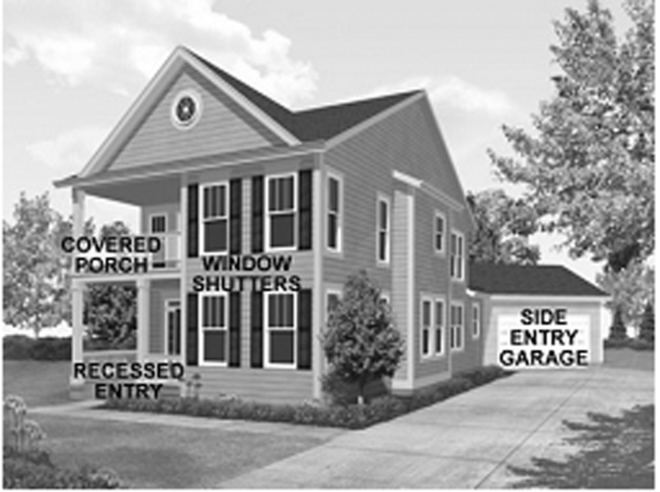
K.
Use Limitations. Use Limitations for individuals using this ordinance shall be the same as those allowed under the R-4 zoning designation.
L.
Infill Development Application Procedures. All applicants submitting for development approval through the IDZ ordinance shall follow the following procedures and standards as set forth herein.
1.
A site plan drawn to scale, supplementary data, and architectural façades, shall be submitted to the Planning and Zoning Department for review by all relevant city staff. The applicant shall also submit evidence that they have obtained property owner authorization to accompany the aforementioned documentation and shall submit evidence that all City taxes have been paid on this property. Once staff has reviewed the information and deemed this information to be complete and in compliance with the standards set forth in this ordinance, an exemption plat, if necessary, shall be recorded according to the current process for such plats.
2.
In the event that the Development Services Director determines that a proposal using the IDZ is not consistent with surrounding developments or is being proposed in an area identified for large-scale redevelopment activity, then staff has the authority to disapprove such a submittal. Within 15 days of denial, an applicant may appeal in writing this decision to the Marietta City Council. An appeal properly made shall be placed on the next available regular meeting of the Mayor and City Council.
M.
Standards.
1.
Any residentially zoned property within the IDZ that meets the conditions of paragraph C (above) is deemed a buildable lot for a single-family detached residential structure, even though the lot may have less than the minimum required area or width for any residential zone. Lots developed in this fashion shall use standards as set forth in this section.
2.
All Bulk and Area Requirements identified in paragraph N below must be met.
3.
Sidewalks: A minimum 5-foot sidewalk is required to be installed adjacent to all public and private roadways. However, the Director of Development Services and the Director of Public Works shall have the authority to:
a.
Reduce the required width of the sidewalk to a width similar to sidewalks on adjacent property, subject to Americans with Disability Act or Georgia accessibility laws.
b.
Waive the requirement for installation of the sidewalk, but donation of right-of-way may be required to allow for the construction of a sidewalk in the future.
4.
Landscaping: One tree, having a minimum DBH of 3 inches must be planted adjacent to all public and private roadways. These trees must be planted a minimum of 30 feet on center and shall be consistent with the requirements of the Tree Protection and Landscape Ordinance.
5.
For all developments containing 8 or more units, a mandatory homeowners association shall be created that will be responsible for the upkeep and maintenance of all front yards and common areas including all fencing, landscaping, amenities and buffers, and shall include architectural control oversights for the development. To meet this requirement, developed lots may be allowed to be incorporated into adjacent homeowners associations subject to approval by the HOA community.
6.
All units shall be "for sale" only; and no short-term rental shall be allowed at any time.
7.
The development shall comply with all recommendations from the City of Marietta Public Works Department with respect to hydrology, stormwater management, down-stream considerations and any donation and/or conveyance of right-of-way that is deemed necessary.
8.
Existing Structures: Eligible parcels that contain an existing residential structure have the option of retaining the structure, as long as the parcel created for the existing structure meets all bulk and area regulations listed in Paragraph N below.
N.
Bulk and Area Regulations.
O.
Adjacency to Planned Development. Property that is developed under this ordinance may be allowed to reduce Bulk and Area Regulations (Paragraph N above) when it is directly adjacent to or within 100 feet of a planned development (PRD-SF, PRD-MF, MXD) with a detailed plan that is approved by the City Council. However, all new structures must match the architecture approved in the detailed plan of that planned development. All properties must meet the bulk and area regulations as listed in Paragraph N above, except as indicated below:
P.
Architectural Standards. All new development created under the IDZ shall include a number of minor design and site planning elements to ensure quality and compatibility with general housing trends within the city. The standards are as follows:
1.
Front porches cannot be closer than 10 feet from any front property line;
2.
Building materials shall be of wood, fiber-cement siding or other siding of similar or superior quality, stone or brick and shall include 4-sided architecture; and garage doors must be decorative and architecturally similar to the house;
3.
Optimize privacy of residents and minimize infringement on the privacy of adjoining land uses through the strategic placement of windows, door entrances, porches, and similar structures, especially as it relates to accessory structures;
4.
Building orientation should maintain the integrity of the streetscape and provide direct, safe access to the street; and
5.
Buildings shall use at least 5 of the following design elements:
•
Dormers along the façades facing public streets;
•
Gables (pitch not less than 4:12) along the façades facing public streets;
•
Recessed entries along the façades facing public streets;
•
Covered porch or entries with decorative pillars or posts along the façades facing public streets;
•
Window shutters along the façades facing public streets;
•
Cupolas along the façades facing public streets;
•
Bay or bow window (minimum 12-inch projection) along the façades facing public streets;
•
Eaves (minimum 6-inch projection) along the façades facing public streets;
•
Off-sets in building face or roof (minimum 12 inches) along the façades facing public streets; and
•
Detached garages in the side or rear yard of the property that contains a similar façade to that of the primary structure or attached garages that have side or rear yard access which are not visible on the front façade of the structure.
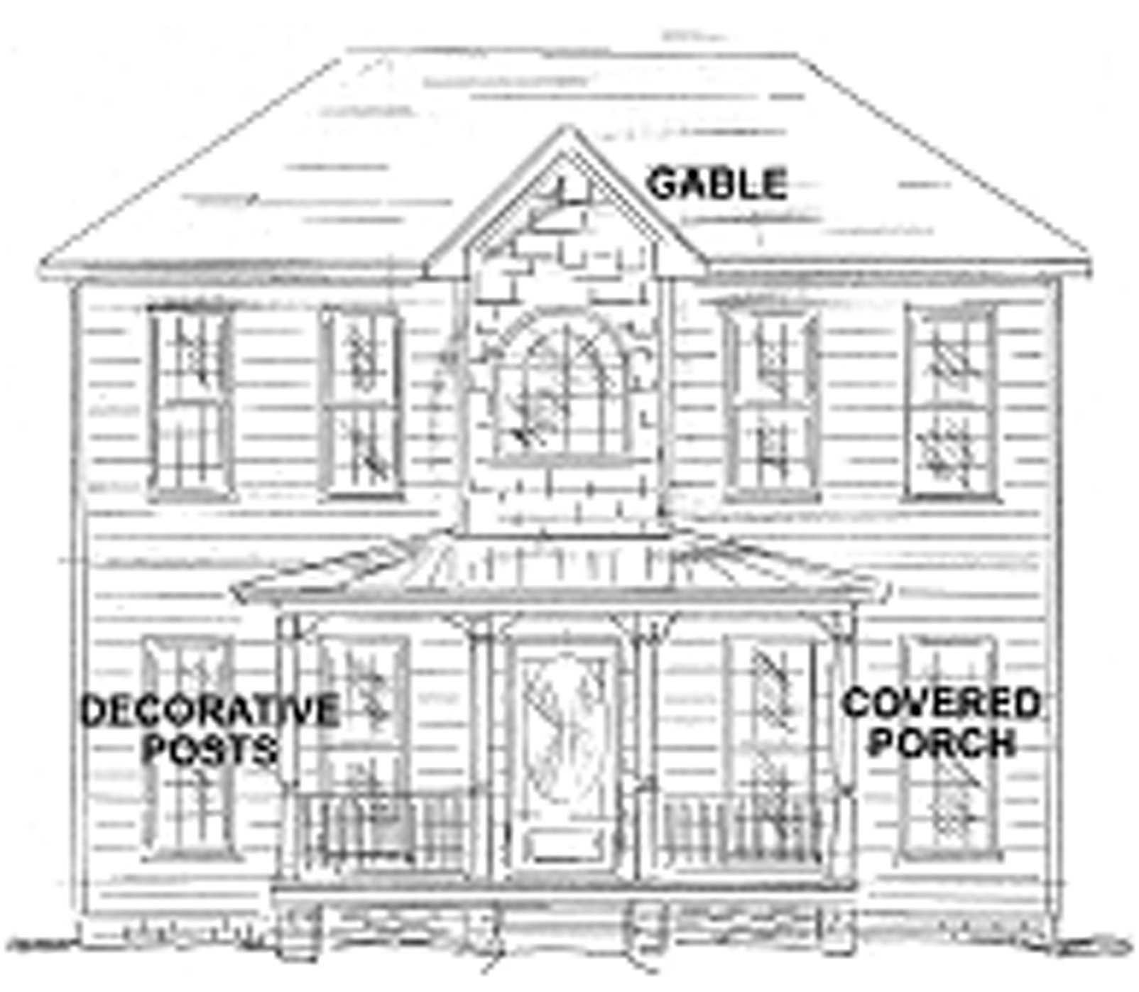
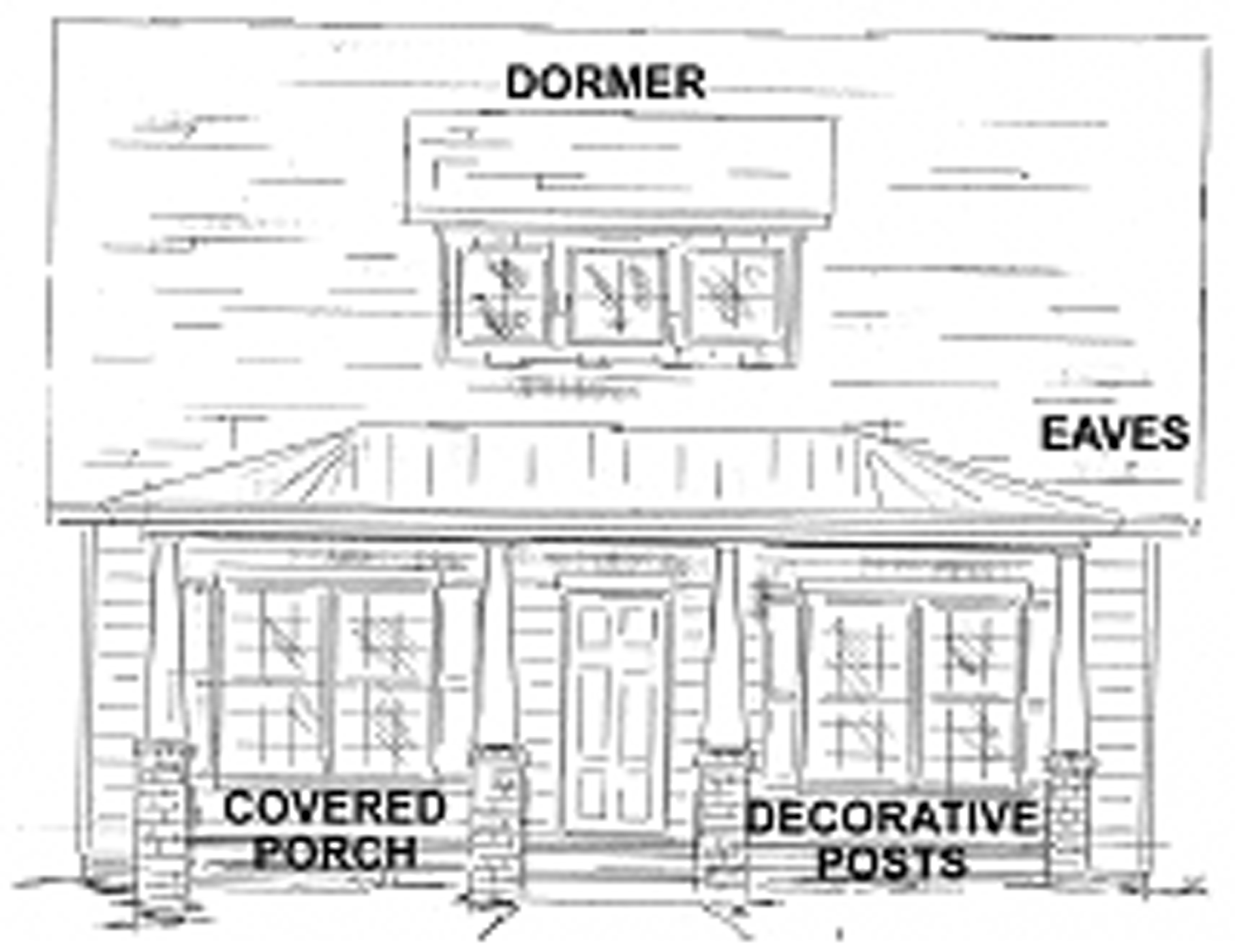
(Ord. No. 6651, 4/14/2004, § 1; Ord. No. 6991, 9/13/2006, § 1; Ord. No. 7853, § 1, 10/14/2015; Ord. No. 8168, 6-10-2020, § 1)