
Monroe County Unincorporated
City Zoning Code
City Zoning Code
CHAPTER 130
LAND USE DISTRICTS
Sec. 130-1.- Purpose.
In order to ensure that all development is consistent with the objectives and policies of this Land Development Code, it is necessary and proper to establish a series of land use districts to ensure that each permitted use is consistent with the environmental sensitivity of natural resources, is served by adequate public facilities, and is compatible with surrounding land uses. Each district establishes use and bulk regulations that control the use of land in each district consistent with this Land Development Code. All development within each land use district shall be consistent with the purposes stated for that land use district in this chapter.
(Ord. No. 006-2016, § 1(Exh. 1), 4-13-2016)
Sec. 130-2. - Land Use Districts Established.
In order to carry out and implement the goals and objectives of the Comprehensive Plan, the following land use (zoning) districts are hereby established:
(1)
Airport District (AD).
(2)
Commercial 1 District (C1).
(3)
Commercial 2 District (C2).
(4)
Conservation District (CD).
(5)
Commercial Fishing Area District (CFA).
(6)
Commercial Fishing Special Districts (CFSD).
(7)
Commercial Fishing Village District (CFV).
(8)
Destination Resort District (DR).
(9)
Industrial District (I).
(10)
Improved Subdivision District (IS).
(11)
Improved Subdivision Vacation Rental District (IS-V).
(12)
Military Facilities District (MF).
(13)
Maritime Industries District (MI).
(14)
Mainland Native Area District (MN).
(15)
Mixed Use District (MU).
(16)
Native Area District (NA).
(17)
Offshore Island District (OS).
(18)
Preservation District (P).
(19)
Park and Refuge District (PR).
(20)
Recreational Vehicle District (RV).
(21)
Suburban Commercial District (SC).
(22)
Suburban Residential District (SR).
(23)
Suburban Residential District (limited) (SR-L).
(24)
Sparsely Settled Residential District (SS).
(25)
Urban Commercial District (UC).
(26)
Urban Residential District (UR).
(27)
Urban Residential—Mobile Home District (URM).
(28)
Urban Residential Mobile Home—Limited District (URM-L).
(Ord. No. 006-2016, § 1(Exh. 1), 4-13-2016)
Sec. 130-3. - Land Use District Map.
(a)
Authority. The BOCC, upon the recommendation of the Planning Commission, shall adopt an official land use district (zoning) map that shall set out and delineate the land use districts established in section 130-2 to all land in the unincorporated areas of the county.
(b)
Effect. The official land use district (zoning) map is hereby designated, established and incorporated as a part of this chapter; and the originals thereof, which are on file at the offices of the Planning and Environmental Resources Department, shall be as much a part of this chapter as if the information contained therein were set out in full in this chapter.
(c)
Review and amendment. The official land use district (zoning) map shall be reviewed and amended to be consistent with the comprehensive plan. The official land use district (zoning) map may subsequently be amended from time to time as provided in chapter 102, article V.
(Ord. No. 006-2016, § 1(Exh. 1), 4-13-2016)
Sec. 130-27.- Purpose of the Airport District (AD).
The purpose of the AD district is to facilitate the operations of airports and their compatible uses and to prohibit the development of residential uses (excluding temporary non-emergency housing), educational uses (including but not limited to pre-K through high schools) and/or other uses that are characterized by the regular presence of large numbers of people, within the hazard areas of civil and military airports. The AD district provides classifications of property for existing or future airports and regulates both uses within the boundaries of public and private airports, and uses around, adjacent, and in the approach zones of public and private airports in order to:
(1)
Establish the control of obstructions and construction of structures affecting navigable airspace in accordance with criteria delineated in volume XI, part 77 in federal aviation regulations, Florida Department of Transportation regulations, and this LDC;
(2)
Protect airports against encroachment, to implement appropriate noise abatement strategies, and to regulate development and reduce public exposure of community activities that are not compatible with airport operations; and
(3)
Control uses within the public and private airport property boundaries.
(Ord. No. 006-2016, § 1(Exh. 1), 4-13-2016)
Sec. 130-28. - Purpose of the Commercial 1 District (C1).
The purpose of the C1 district is to establish areas for commercial retail, public, institutional and office uses designed and intended primarily to serve the needs of immediately surrounding residential areas. This district should be established at locations convenient and accessible to residential uses to reduce trips on U.S. 1.
(Ord. No. 006-2016, § 1(Exh. 1), 4-13-2016)
Sec. 130-29. - Purpose of the Commercial 2 District (C2).
The purpose of the C2 district is to designate appropriate areas for higher-intensity commercial uses intended to serve the needs of a subarea with commercial retail sales and service, public, institutional and office uses. This district should be established at discrete nodes along U.S. 1 and designed to serve the needs of both residents and visitors.
(Ord. No. 006-2016, § 1(Exh. 1), 4-13-2016)
Sec. 130-30. - Purpose of the Conservation District (CD).
The purpose of the CD district is to identify areas acquired for conservation purposes and/or subject to deed restrictions limiting the use of the property to conservation purposes.
(Ord. No. 006-2016, § 1(Exh. 1), 4-13-2016)
Sec. 130-31. - Purpose of the Commercial Fishing Area District (CFA).
The purpose of the CFA district is to establish areas suitable for uses that are essential to the commercial fishing industry, including sales and service of fishing equipment and supplies, seafood processing, fishing equipment manufacture and treatment, boat storage and residential uses.
(Ord. No. 006-2016, § 1(Exh. 1), 4-13-2016)
Sec. 130-32. - Purpose of the Commercial Fishing Special District (CFSD).
The purpose of the CFSD district is to establish areas where various aspects of commercial fishing have been traditionally carried out while prohibiting the establishment of additional commercial fishing uses that are inconsistent with the natural environment, immediate vicinity or community character of the area. Each individual sub-district has unique characteristics relating to the fishing and maritime industry of that particular location.
(Ord. No. 006-2016, § 1(Exh. 1), 4-13-2016)
Sec. 130-33. - Purpose of the Commercial Fishing Village District (CFV).
The purpose of the CFV district is to establish areas where limited commercial fishing activities, including the mooring of boats, the non-mechanized off-loading of catches, the storage of a limited number of traps, and residential uses, can be integrated.
(Ord. No. 006-2016, § 1(Exh. 1), 4-13-2016)
Sec. 130-34. - Purpose of the Destination Resort District (DR).
The purpose of the DR district is to establish areas suitable for the development of planned tourist centers providing on-site residential, recreational, commercial and entertainment facilities of a magnitude sufficient to attract visitors and tourists for tenancies of three or more days. Destination resorts are contemplated to contain:
(1)
Single-family homes as of right; or
(2)
One or more resort hotels as the principal use, to use the water-related natural resources of the Keys, and to be located on sites of at least ten gross acres where the location and character of the site and the development itself and amenities are such that off-site impacts will be reduced.
(Ord. No. 006-2016, § 1(Exh. 1), 4-13-2016)
Sec. 130-35. - Purpose of the Industrial District (I).
The purpose of the I district is to establish areas that are suitable for the development of industrial, manufacturing, warehousing, and distribution uses.
(Ord. No. 006-2016, § 1(Exh. 1), 4-13-2016)
Sec. 130-36. - Purpose of the Improved Subdivision District (IS).
The purpose of the IS district is to accommodate the legally vested residential development rights of the owners of lots in subdivisions that were lawfully established and improved prior to the adoption of this LDC. For the purpose of this section, improved lots are those that are served by a dedicated and accepted existing road of porous or nonporous material, that have an approved potable water supply, and that have sufficient uplands to accommodate the proposed use in accordance with the required setbacks. This district is not intended to be used for new land use districts of this classification within the county.
(Ord. No. 006-2016, § 1(Exh. 1), 4-13-2016)
Sec. 130-37. - Purpose of the Military Facilities District (MF).
The purpose of the MF district is to establish areas for military facilities and installations and to ensure to the maximum extent allowed by federal law that all development activity within such areas is consistent with the Monroe County Comprehensive Plan.
(Ord. No. 006-2016, § 1(Exh. 1), 4-13-2016)
Sec. 130-38. - Purpose of the Maritime Industries District (MI).
The purpose of the MI district is to establish and conserve areas suitable for maritime uses such as ship building, ship repair, other water dependent manufacturing and service uses and other uses consistent with the Monroe County Comprehensive Plan.
(Ord. No. 006-2016, § 1(Exh. 1), 4-13-2016)
Sec. 130-39. - Purpose of the Mainland Native Area District (MN).
The purpose of the MN district is to protect the undeveloped and environmentally sensitive character of lands within the county that are located on the mainland of the Florida peninsula.
(Ord. No. 006-2016, § 1(Exh. 1), 4-13-2016)
Sec. 130-40. - Purpose of the Mixed Use District (MU).
The purpose of the MU district is to establish or conserve areas of mixed uses, including commercial fishing, resorts, residential, institutional, and commercial uses, and preserve these as areas representative of the character, economy and cultural history of the Florida Keys.
(Ord. No. 006-2016, § 1(Exh. 1), 4-13-2016)
Sec. 130-41. - Purpose of the Native Area District (NA).
The purpose of the NA district is to establish areas that are undisturbed, with the exception of existing solid waste facilities, and because of their sensitive environmental character should be preserved in their natural state.
(Ord. No. 006-2016, § 1(Exh. 1), 4-13-2016)
Sec. 130-42. - Purpose of the Offshore Island District (OS).
The purpose of the OS district is to establish areas that are not connected to U.S. 1 as protected areas, while permitting low-intensity residential uses and campground spaces in upland areas.
(Ord. No. 006-2016, § 1(Exh. 1), 4-13-2016)
Sec. 130-43. - Purpose of the Preservation District (P).
The purpose of the P district is to provide for publicly owned lands held exclusively for the preservation of natural resources.
(Ord. No. 006-2016, § 1(Exh. 1), 4-13-2016)
Sec. 130-44. - Purpose of the Park and Refuge District (PR).
The purpose of the PR district is to establish and protect areas as parks, recreational areas and wildlife refuges.
(Ord. No. 006-2016, § 1(Exh. 1), 4-13-2016)
Sec. 130-45. - Purpose of the Recreational Vehicle District (RV).
The purpose of the RV districts is to establish areas suitable for the development of destination resorts for recreational vehicles and other transient units such as seasonal residential units.
(Ord. No. 006-2016, § 1(Exh. 1), 4-13-2016)
Sec. 130-46. - Purpose of the Suburban Commercial District (SC).
The purpose of the SC district is to establish areas for commercial uses designed and intended primarily to serve the needs of the immediate planning area in which they are located. This district should be established at locations convenient and accessible to residential areas to reduce trips on U.S. 1.
(Ord. No. 006-2016, § 1(Exh. 1), 4-13-2016)
Sec. 130-47. - Purpose of the Suburban Residential District (SR).
The purpose of the SR district is to establish areas of low- to medium-density residential uses characterized principally by single-family detached dwellings. This district is predominated by development; however, natural and developed open space creates an environment defined by plants, spaces and over-water views.
(Ord. No. 006-2016, § 1(Exh. 1), 4-13-2016)
Sec. 130-48. - Purpose of the Suburban Residential District (Limited) (SR-L).
The purpose of the SR-L district is to establish areas of exclusive low- to medium-density residential uses.
(Ord. No. 006-2016, § 1(Exh. 1), 4-13-2016)
Sec. 130-49. - Purpose of the Sparsely Settled Residential District (SS).
The purpose of the SS district is to establish areas of low-density residential development where the predominant character is native or open space lands.
(Ord. No. 006-2016, § 1(Exh. 1), 4-13-2016)
Sec. 130-50. - Purpose of the Urban Commercial District (UC).
The purpose of the UC district is to designate appropriate areas for high-intensity commercial uses intended to provide retail sales and service, professional services and resort activities needs at a regional or multiple planning area scale. This district should be established at discrete nodes along U.S. 1 and should be designed so as to serve the needs of both residents and visitors.
(Ord. No. 006-2016, § 1(Exh. 1), 4-13-2016)
Sec. 130-51. - Purpose of the Urban Residential District (UR).
The purpose of the UR district is to provide areas appropriate for high-density residential uses and to create areas to provide for vacation rental use of detached dwellings, duplexes, and multifamily dwellings. This district should be established at or near employment centers.
(Ord. No. 006-2016, § 1(Exh. 1), 4-13-2016)
Sec. 130-52. - Purpose of the Urban Residential - Mobile Home District (URM).
The purpose of the URM district is to recognize the existence of established mobile home parks and subdivisions, but not to create new such areas, and to provide for such areas to serve as a reservoir of affordable and moderate-cost housing in the county.
(Ord. No. 006-2016, § 1(Exh. 1), 4-13-2016)
Sec. 130-53. - Purpose of the Urban Residential Mobile Home—Limited District (URM-L).
The purpose of the URM-L district is to recognize the existence of parks and subdivisions which consist exclusively, or almost exclusively, of mobile homes, but not to create new such areas.
(Ord. No. 006-2016, § 1(Exh. 1), 4-13-2016; Ord. No. 021-2020, § 1, 7-15-2020)
Sec. 130-74.- General.
(a)
No structure or land in the county shall hereafter be developed, used or occupied unless expressly authorized in a land use district in this article.
(b)
Notwithstanding any provision of this article, all development listed as a conditional use within a master planned community of 100 or more acres in area shall be reviewed and processed as a use permitted as of right. In such cases, a pre-application conference shall be required prior to the submittal of a permit application for development approval.
(c)
Accessory uses as permitted within each land use district shall be consistent with the definition of accessory uses as set forth in section 101-1.
(Ord. No. 006-2016, § 1(Exh. 1), 4-13-2016)
Sec. 130-75. - Airport District (AD).
(a)
The following uses are permitted as of right in the Airport district:
(1)
At public airports: Public airport uses;
(2)
At private airports: Noncommercial aircraft landing, takeoff, storage, repair, maintenance and fueling, provided that;
a.
Effective landing length shall be no less than 1,800 feet;
b.
Primary surface width shall be no less than 100 feet; and
c.
Usable width shall be no less than 50 feet.
(3)
Accessory uses;
(4)
Replacement of an existing antenna-supporting structure pursuant to section 146-5(b);
(5)
Collocations on existing antenna-supporting structures, pursuant to section 146-5(c);
(6)
Satellite earth stations, as accessory uses, pursuant to section 146-5(f); and
(7)
Public infrastructure and utilities.
(b)
The following uses are permitted as minor conditional uses in the Airport district, subject to the standards and procedures set forth in chapter 110, article III:
(1)
Wastewater treatment facilities and wastewater treatment collection systems serving uses located in any land use district, provided that:
a.
The wastewater treatment facility and wastewater treatment collection systems are in compliance with all federal, state, and local requirements;
b.
The wastewater treatment facility, wastewater treatment collection systems, and accessory uses shall be screened by structures designed to:
1.
Be architecturally consistent with the character of the surrounding community;
2.
Minimize the impact of any outdoor storage, temporary or permanent; and
3.
A solid fence may be required upon determination by the Planning Director;
c.
Where a district boundary buffer is not required as set forth in chapter 114, article V, a planting bed, eight feet in width, shall be established to buffer the facility, with the following:
1.
One native canopy tree for every 25 feet of property line;
2.
One understory tree for every ten feet of property line;
3.
The required trees shall be evenly distributed throughout the planting bed; and;
4.
The planting bed shall be installed as set forth in chapter 114, article IV.
(2)
Attached wireless communications facilities, as accessory uses, pursuant to section 146-5(d); and
(3)
Stealth wireless communications facilities, as accessory uses, pursuant to section 146-5(e).
(c)
The following uses are permitted as major conditional uses in the Airport district, subject to the standards and procedures set forth in chapter 110, article III:
(1)
At private airports: Commercial aircraft operations, including fixed base operators (FBO) activities.
(d)
Airport Height Overlay Zones and Restrictions. There are hereby created and established overlay zones around and adjacent to public, private and military airports in the county. Within the AD district and overlay zones, certain height limitations are specified to prevent airspace obstruction, and the use limitations apply. Uses within the overlay zones must comply with the height standards and the limitations set forth below. An area located in more than one zone described herein is considered to be only in the zone with the more restrictive limitations.
(1)
Public Airport Height Restrictions.
a.
Primary zone. The area longitudinally centered on each runway with the same length as the runway and is 2,000 feet wide. No structure that is not a part of the landing and takeoff area is permitted in the primary zone that is of greater height than the nearest point on to the runway.
b.
Clear zone. The area extending 1,000 feet off each end of a primary surface and is the same width as the primary surface. No structure not a part of the landing and takeoff area is permitted that is a greater height than the end of the runway.
c.
Inner horizontal zone. The area extending outward from the periphery of the primary zone with an outer perimeter formed by swinging arcs of 7,500 feet radius about the centerline at the end of each primary zone and connecting adjacent arcs by lines tangent to these arcs. No structure will be permitted in the inner horizontal zone of greater height than 156 feet MSL.
d.
Conical zone. The area extending outward from the periphery of the inner horizontal zone for a distance of 7,000 feet. Height limits in the conical zone commence at 156 feet MSL at the inner boundary where it adjoins the inner horizontal zone and increases in permitted height at a rate of one foot vertically for every 20 feet of horizontal distance measured outward from the inner boundary to a height of 506 feet MSL at the outer boundary.
e.
Outer horizontal zone. The area extending outward from the outer periphery of the conical zone for a distance of 30,000 feet. The height limit within the outer horizontal zone is 506 feet MSL.
f.
Approach zone. The area longitudinally centered on each runway extended centerline, with an inner boundary 200 feet out from the end of the runway and the same width as the primary zone, then extending outward for a distance of 50,000 feet, expanding uniformly in width to 16,000 at the outer boundary. Height limits within the approach zones commence at the height of the runway end and increase at the rate of one foot vertically for every 50 feet horizontally for a distance of 25,000 feet, at which point it remains level at 506 feet MSL to the outer boundary.
g.
Transitional zone. The area within an inner boundary formed by the side of the primary zones, the first 200 feet of the clear zones and the approach zones, then extending outward at right angles to the runway centerline and extended centerline until the height matches the adjoining inner horizontal zone, conical zone, and outer horizontal zone height limit. The height limit at the inner boundary is the same as the height of the adjoining zone and increases at the rate of one foot vertically for every seven feet horizontally to the outer boundary of the transitional zone, where it again matches the height of the adjoining zone.
(2)
Private Airport Height Restrictions.
a.
The landing approach zone for private airports is a trapezoidal area increasing gradually in width from 50 feet to either side of the runway centerline, at the ends of each usable runway, to a width of 350 feet to either side of the runway centerline at a distance of 3,000 feet outward from the ends of each runway.
b.
Approach zones shall be clear of obstruction above a glide path of 20:1 from the ends of each usable runway. When the approach zone to any runway crosses a road, the glide path must pass at least 15 feet above the edge of the nearest traffic lane.
c.
No establishments or uses shall be allowed that emit smoke, gas or dust in quantities or densities sufficient to jeopardize the safe use of private airports.
d.
No development approval or building permit shall be granted for the construction of any structure to be located within a private airport district or overlay zone that, when built, would constitute an airspace obstruction height that would cause a minimum obstruction altitude, a minimum descent altitude, or a decision height to be changed or a threshold to be displaced, or to interfere with the required approach glide slope.
e.
No property owner within the private airport district or overlay shall be permitted to grow or maintain trees to heights in excess of those provided herein for structures.
(e)
All development or expansion of existing public airports shall be done in accordance with the approved Airport Master Plan and Airport Layout Plan of the airport and adopted ordinances.
(Ord. No. 006-2016, § 1(Exh. 1), 4-13-2016; Ord. No. 010-2020, § 1, 2-19-2020, eff. 6-4-2020; Ord. No. 035-2020, § 1, 10-21-2020, eff. 2-13-2021)
Sec. 130-76. - Conservation District (CD).
(a)
The following uses are permitted as of right in the Conservation district, pursuant to the standards and procedures set forth in chapter 110, article II:
(1)
Passive recreational uses;
(2)
Collocations on existing antenna-supporting structures, pursuant to section 146-5(c); and
(3)
Satellite earth stations less than two meters in diameter, as accessory uses, pursuant to section 146-5(f).
(b)
The following uses are permitted as minor conditional uses in the Conservation district, pursuant to the standards and procedures set forth in chapter 110, article III:
(1)
Satellite earth stations greater than or equal to two meters in diameter, as accessory uses, pursuant to section 146-5(f); and
(2)
Public infrastructure and utilities, provided that:
a.
The parcel(s) proposed for development shall be separated from any established residential use by a class C bufferyard. As determined by the Planning Director, the bufferyard may be required on all property lines adjacent to an established residential principal use to screen the use from view.
b.
A solid fence may be required upon determination by the Planning Director.
c.
No viable alternative exists, as indicated by the governmental agency providing the public services.
(Ord. No. 006-2016, § 1(Exh. 1), 4-13-2016; Ord. No. 010-2020, § 1, 2-19-2020, eff. 6-4-2020)
Sec. 130-77. - Commercial Fishing Area District (CFA).
(a)
The following uses are permitted as of right in the Commercial Fishing Area district:
(1)
Commercial fishing;
(2)
Accessory uses;
(3)
Replacement of an existing antenna-supporting structure pursuant to section 146-5(b);
(4)
Collocations on existing antenna-supporting structures, pursuant to section 146-5(c);
(5)
Satellite earth stations less than two meters in diameter, as accessory uses, pursuant to section 146-5(f);
(6)
Home occupations—Special use permit required; commercial fishing does not require a special use permit; and
(7)
Public infrastructure and utilities, provided that:
a.
The parcel(s) proposed for development shall be separated from any established residential use by a class C bufferyard. As determined by the Planning Director, the bufferyard may be required on all property lines adjacent to an established residential principal use to screen the use from view.
b.
A solid fence may be required upon determination by the Planning Director.
(b)
The following uses are permitted as minor conditional uses in the Commercial Fishing Area district, subject to the standards and procedures set forth in chapter 110, article III:
(1)
Attached dwellings, provided that the total floor area of residential uses in a CFA district does not exceed 25 percent of the land area in that CFA district;
(2)
Commercial retail uses of low and medium intensity, provided that the goods and services are related to or supportive of the commercial fishing industry;
(3)
Light industrial uses, including marine repair services, provided that such uses are intended only to serve the needs of the commercial fishing industry;
(4)
Attached wireless communications facilities, as accessory uses, pursuant to section 146-5(d);
(5)
Stealth wireless communications facilities, as accessory uses, pursuant to section 146-5(e); and
(6)
Satellite earth stations greater than or equal to two meters in diameter, as accessory uses, pursuant to section 146-5(f).
(c)
The following uses are permitted as major conditional uses in the Commercial Fishing Area district, subject to the standards and procedures set forth in chapter 110, article III:
(1)
Marinas and boat chartering, provided that:
a.
The parcel proposed for development has access to water at least four feet below mean sea level at mean low tide;
b.
The sale of goods and services is limited to fuel, food, boating, diving and sport fishing products;
c.
Vessels docked or stored shall not be used for live-aboard purposes, except when a permitted sewage pumpout facility is available on-site and where the waste is treated in a permitted sewage treatment facility;
d.
All outside storage areas are screened from adjacent residential uses by a solid fence, wall or hedge at least six feet in height;
e.
Each nonwaterside perimeter setback of the parcel proposed for development must have a class C bufferyard within a side yard setback of ten feet;
f.
There is no displacement of existing commercial fishing dockage or area;
g.
No less than 50 percent of the dock area shall be devoted exclusively to commercial fishing; and
h.
No less than 50 percent of the district land area shall be used for other commercial fishing activities, such as trap storage and manufacture of traps;
(2)
Restaurants, dive shops, and other commercial retail uses under 1,600 square feet per shop, provided that:
a.
There is no displacement of existing commercial fishing dockage or area;
b.
No less than 50 percent of the dock area shall be devoted exclusively to commercial fishing; and
c.
No less than 50 percent of the district land area shall be used for other commercial fishing activities, such as the storage and manufacture of traps;
(3)
Monuments, provided that:
a.
Access to U.S. 1 is by way of:
1.
An existing curb cut;
2.
A signalized intersection; or
3.
A curb cut that is separated from any other curb cut on the same side of U.S. 1 by at least 400 feet; and
b.
The use is separated from adjoining residential uses by a class H bufferyard; and
(4)
New antenna-supporting structures, pursuant to section 146-5(a).
(d)
In order to provide for the special needs of the commercial fishing industry, while ensuring general compliance with plan requirements and maintaining good environmental quality and community character, the Commercial Fishing Area district is given the following special considerations:
(1)
The Commercial Fishing Area district, under minor conditional use, may vary the requirements of the district;
(2)
Temporary uses specifically involving trap construction, maintenance and repair are hereby exempted from maximum FAR and minimum open space requirements;
(3)
Sanitary toilet facilities may be provided by using approved portable units;
(4)
Non-shoreline and shoreline setbacks may be varied by the Planning Director upon a written recommendation by the County Biologist that stormwater runoff can be appropriately controlled due to the provisions of new gutters, berms or similar devices;
(5)
The vegetated bufferyard requirements may be varied to include fences or natural vegetation except when abutting residential districts;
(6)
Lighting requirements may be reduced or waived where the Planning Director and County Biologist agree that light intrusion, either to adjoining properties or waterfront areas, will have no adverse effect on community character or habitat; and
(7)
Except for commercial retail and wholesale operations, parking requirements may be met by the provision of one parking or loading space for each individual lot of 6,000 square feet or less. Larger lots or parcels shall proportionately meet this same requirement.
(Ord. No. 006-2016, § 1(Exh. 1), 4-13-2016; Ord. No. 010-2020, § 1, 2-19-2020, eff. 6-4-2020)
Sec. 130-79. - Commercial Fishing Special District (CFSD).
The following uses are permitted in the Commercial Fishing Special Districts:
(a)
CFSD 1 (located on Big Pine).
(1)
The following uses are permitted as of right in Commercial Fishing Special District 1, subject to a limitation on traffic access so as not to interfere with U.S. 1 at the bridge ramp:
a.
Commercial fishing;
b.
Detached dwellings;
c.
Accessory uses;
d.
Collocations on existing antenna supporting structures, pursuant to section 146-5(c);
e.
Satellite earth stations less than two meters in diameter, as accessory uses, pursuant to section 146-5(f);
f.
Home occupations—Special use permit required; commercial fishing does not require a special use permit;
g.
Wastewater nutrient reduction cluster systems that serve less than ten residences; and
h.
Public infrastructure and utilities, provided that:
1.
The parcel(s) proposed for development shall be separated from any established residential use by a class C bufferyard. As determined by the Planning Director, the bufferyard may be required on all property lines adjacent to an established residential principal use to screen the use from view.
2.
A solid fence may be required upon determination by the Planning Director.
(2)
The following uses are permitted as minor conditional uses in Commercial Fishing Special District 1, subject to a limitation on traffic access so as not to interfere with U.S. 1 at the bridge ramp, and subject to the standards and procedures set forth in Chapter 110, Article III:
a.
Attached dwellings, provided that the total floor area of residential uses in Commercial Fishing Special District 1 does not exceed 25 percent of the land area in Commercial Fishing Special District 1;
b.
Commercial retail and restaurant uses of low and medium intensity, provided that the goods and services are related to or supportive of the commercial fishing industry;
c.
Light industrial uses, including marine repair services, provided that such uses are intended only to serve the needs of the commercial fishing industry; and
d.
Satellite earth stations greater than or equal to two meters in diameter, as accessory uses, pursuant to section 146-5(f).
(3)
The following uses are permitted as major conditional uses in Commercial Fishing Special District 1, subject to the standards and procedures set forth in Chapter 110, Article III:
a.
Wastewater treatment facilities and wastewater treatment collection systems serving uses located in any land use district provided that:
1.
The wastewater treatment facility and wastewater treatment collection systems are in compliance with all federal, state, and local requirements;
2.
The wastewater treatment facility, wastewater treatment collection systems and accessory uses shall be screened by structures designed to be architecturally consistent with the character of the surrounding community and shall minimize the impact of any outdoor storage, temporary or permanent; and
3.
In addition to any district boundary buffers set forth in chapter 114, article V, a planting bed, eight feet in width, to be measured perpendicular to the exterior of the screening structure shall be established with the following:
i.
One native canopy tree for every 25 linear feet of screening structure; and one understory tree for every ten linear feet of screening structure;
ii.
The required trees shall be evenly distributed throughout the planting bed;
iii.
The planting bed shall be installed as set forth in chapter 114, article IV; and
iv.
A solid fence may be required upon determination by the planning director.
(b)
CFSD 2 (located on No Name Key).
(1)
The following uses are permitted as of right in Commercial Fishing Special District 2:
a.
Commercial fishing;
b.
Detached dwellings;
c.
Accessory uses;
d.
Collocations on existing antenna supporting structures, pursuant to section 146-5(c);
e.
Satellite earth stations less than two meters in diameter, as accessory uses, pursuant to section 146-5(f);
f.
Home occupations—Special use permit required; commercial fishing does not require a special use permit;
g.
Wastewater nutrient reduction cluster systems that serve less than ten residences; and
h.
Public infrastructure and utilities, provided that:
1.
The parcel(s) proposed for development shall be separated from any established residential use by a class C bufferyard. As determined by the Planning Director, the bufferyard may be required on all property lines adjacent to an established residential principal use to screen the use from view.
2.
A solid fence may be required upon determination by the Planning Director.
(2)
The following uses are permitted as minor conditional uses in Commercial Fishing Special District 2, subject to the standards and procedures set forth in Chapter 110, Article III:
a.
Attached dwellings, provided that the structures are separated from existing detached dwellings by 100 feet or a class D bufferyard; and
b.
Satellite earth stations greater than or equal to two meters in diameter, as accessory uses, pursuant to section 146-5(f).
(3)
The following uses are permitted as major conditional uses in Commercial Fishing Special District 2, subject to the standards and procedures set forth in Chapter 110, Article III:
a.
Wastewater treatment facilities and wastewater treatment collection systems serving uses located in any land use district provided that:
1.
The wastewater treatment facility and wastewater treatment collection systems are in compliance with all federal, state, and local requirements;
2.
The wastewater treatment facility, wastewater treatment collection systems and accessory uses shall be screened by structures designed to be architecturally consistent with the character of the surrounding community and shall minimize the impact of any outdoor storage, temporary or permanent; and
3.
In addition to any district boundary buffers set forth in chapter 114, article V, a planting bed, eight feet in width, to be measured perpendicular to the exterior of the screening structure shall be established with the following:
i.
One native canopy tree for every 25 linear feet of screening structure; and one understory tree for every ten linear feet of screening structure;
ii.
The required trees shall be evenly distributed throughout the planting bed;
iii.
The planting bed shall be installed as set forth in chapter 114, article IV; and
iv.
A solid fence may be required upon determination by the planning director.
(c)
CFSD 4 (located on Long Key).
(1)
The following uses are permitted as of right in Commercial Fishing Special District 4:
a.
Commercial fishing;
b.
Accessory uses;
c.
Replacement of an existing antenna-supporting structure pursuant to section 146-5(b);
d.
Collocations on existing antenna-supporting structures, pursuant to section 146-5(c);
e.
Attached wireless communications facilities, as accessory uses, pursuant to section 146-5(d);
f.
Satellite earth stations less than two meters in diameter, as accessory uses, pursuant to section 146-5(f);
g.
Wastewater nutrient reduction cluster systems that serve less than ten residences; and
h.
Public infrastructure and utilities, provided that:
1.
The parcel(s) proposed for development shall be separated from any established residential use by a class C bufferyard. As determined by the Planning Director, the bufferyard may be required on all property lines adjacent to an established residential principal use to screen the use from view.
2.
A solid fence may be required upon determination by the Planning Director.
(2)
The following uses are permitted as minor conditional uses in Commercial Fishing Special District 4, subject to the standards and procedures set forth in Chapter 110, Article III:
a.
Stealth wireless communications facilities, as accessory uses, pursuant to section 146-5(e); and
b.
Satellite earth stations greater than or equal to two meters in diameter, as accessory uses, pursuant to section 146-5(f).
(3)
The following uses are permitted as major conditional uses in Commercial Fishing Special District 4, subject to the standards and procedures set forth in Chapter 110, Article III:
a.
New antenna-supporting structures, pursuant to section 146-5(a); and
b.
Wastewater treatment facilities and wastewater treatment collection systems serving uses located in any land use district provided that:
1.
The wastewater treatment facility and wastewater treatment collection systems are in compliance with all federal, state, and local requirements;
2.
The wastewater treatment facility, wastewater treatment collection systems and accessory uses shall be screened by structures designed to be architecturally consistent with the character of the surrounding community and shall minimize the impact of any outdoor storage, temporary or permanent; and
3.
In addition to any district boundary buffers set forth in chapter 114, article V, a planting bed, eight feet in width, to be measured perpendicular to the exterior of the screening structure shall be established with the following:
i.
One native canopy tree for every 25 linear feet of screening structure; and one understory tree for every ten linear feet of screening structure;
ii.
The required trees shall be evenly distributed throughout the planting bed;
iii.
The planting bed shall be installed as set forth in chapter 114, article IV; and
iv.
A solid fence may be required upon determination by the Planning Director.
(d)
CFSD 5 (located on Key Largo).
(1)
The following uses are permitted as of right in Commercial Fishing Special District 5:
a.
Commercial fishing;
b.
Commercial retail, limited to fish houses;
c.
Detached dwellings;
d.
Accessory uses;
e.
Institutional uses;
f.
Institutional residential uses, involving less than ten dwelling units or rooms;
g.
Public buildings and uses;
h.
Attached dwellings of less than six units, designated as employee housing as provided for in section 139-1;
i.
Commercial apartments involving less than six dwelling units;
j.
Light industrial uses, limited to marine repair services, including engine and fishing gear repair, provided that such uses are intended only to serve the needs of the commercial fishing industry;
k.
Replacement of an existing antenna-supporting structure pursuant to section 146-5(b);
l.
Collocations on existing antenna-supporting structures, pursuant to section 146-5(c);
m.
Attached wireless communications facilities, as accessory uses, pursuant to section 146-5(d);
n.
Satellite earth stations less than two meters in diameter, as accessory uses, pursuant to section 146-5(f);
o.
Home occupations—special use permit required; commercial fishing does not require a special use permit;
p.
Wastewater nutrient reduction cluster systems that serve less than ten residences; and
q.
Public infrastructure and utilities, provided that:
1.
The parcel(s) proposed for development shall be separated from any established residential use by a class C bufferyard. As determined by the Planning Director, the bufferyard may be required on all property lines adjacent to an established residential principal use to screen the use from view.
2.
A solid fence may be required upon determination by the Planning Director.
(2)
The following uses are permitted as minor conditional uses in Commercial Fishing Special District 5, subject to the standards and procedures set forth in Chapter 110, Article III:
a.
Institutional residential uses involving ten to 20 dwelling units or rooms;
b.
Commercial apartments involving six to 18 dwelling units, provided that:
1.
The hours of operation of the commercial uses are compatible with residential uses;
2.
Tourist housing uses, including vacation rental uses, of commercial apartments are prohibited;
c.
Parks;
d.
Attached and detached dwellings involving six to 18 units, designated as employee housing as provided for in section 139-1;
e.
Stealth wireless communications facilities, as accessory uses, pursuant to section 146-5(e); and
f.
Satellite earth stations greater than or equal to two meters in diameter, as accessory uses, pursuant to section 146-5(f).
(3)
The following uses are permitted as major conditional uses in Commercial Fishing Special District 5 subject to the standards and procedures set forth in Chapter 110, Article III:
a.
Marinas, provided that:
1.
The parcel proposed for development has continuous access to water of depths of at least four feet below mean sea level at mean low tide.
2.
The sale of goods and services is limited to fuel, food, boating, diving and sport fishing products.
3.
Vessels docked or stored shall not be used for live-aboard purposes, except when a permitted sewage pump-out facility is available on-site, and where the waste is treated in a permitted sewage treatment facility.
4.
All outside storage areas are screened from adjacent residential uses by a solid fence, wall or hedge at least six feet in height.
5.
Each nonwaterside perimeter setback of the parcel proposed for development must have a class C bufferyard within a side yard setback of ten feet.
6.
There is no displacement of existing commercial fishing dockage or area;
7.
No less than 50 percent of the dock area shall be devoted exclusively to commercial fishing; and
8.
No less than 50 percent of the district land area shall be used for other commercial fishing activities, such as the storage and manufacture of traps.
9.
If marina slips are leased on any basis longer than month-to-month, the marina shall lease at least 20 percent of its docking slips on a month-to-month basis, and commercial fishing boats shall be given priority for those slips.
10.
Each marina owner or operator, shall maintain a waiting list for commercial fishing boats and give them first priority at the end of each one-month leasing period.
11.
The following message shall be posted on one two-foot by four-foot sign, on the seaward end of the most visible pier or mooring, and on the landward end of each pier, at each marina:
b.
Restaurants, dive shops, and other commercial uses of less than 1,600 square feet per shop, provided that:
1.
There is no displacement of existing commercial fishing dockage or area;
2.
No less than 50 percent of the dock area shall be devoted exclusively to commercial fishing; and
3.
No less than 50 percent of the district land area shall be used for other commercial fishing activities, such as the storage and manufacture of traps. Such uses shall be considered subordinate to the existing principal commercial fishing use, and shall only be allowed so long as the principal fishing use remains and is integrated into the design of the development and would reinforce the commercial fishing industry;
c.
New antenna-supporting structures, pursuant to section 146-5(a); and
d.
Wastewater treatment facilities and wastewater treatment collection systems serving uses located in any land use district provided that:
1.
The wastewater treatment facility and wastewater treatment collection systems are in compliance with all federal, state, and local requirements;
2.
The wastewater treatment facility, wastewater treatment collection systems and accessory uses shall be screened by structures designed to be architecturally consistent with the character of the surrounding community and shall minimize the impact of any outdoor storage, temporary or permanent; and
3.
In addition to any district boundary buffers set forth in chapter 114, article V, a planting bed, eight feet in width, to be measured perpendicular to the exterior of the screening structure shall be established with the following:
i.
One native canopy tree for every 25 linear feet of screening structure; and one understory tree for every ten linear feet of screening structure;
ii.
The required trees shall be evenly distributed throughout the planting bed;
iii.
The planting bed shall be installed as set forth in chapter 114, article IV; and
iv.
A solid fence may be required upon determination by the Planning Director.
(e)
CFSD 6 (located on Boca Chica):
(1)
The following uses are permitted as of right in Commercial Fishing Special District 6:
a.
Commercial fishing;
b.
Accessory uses;
c.
Replacement of an existing antenna-supporting structure pursuant to section 146-5(b);
d.
Collocations on existing antenna-supporting structures, pursuant to section 146-5(c);
e.
Attached wireless communications facilities, as accessory uses, pursuant to section 146-5(d);
f.
Satellite earth stations less than two meters in diameter, as accessory uses, pursuant to section 146-5(f);
g.
Wastewater nutrient reduction cluster systems that serve less than ten residences; and
h.
Public infrastructure and utilities, provided that:
1.
The parcel(s) proposed for development shall be separated from any established residential use by a class C bufferyard. As determined by the Planning Director, the bufferyard may be required on all property lines adjacent to an established residential principal use to screen the use from view.
2.
A solid fence may be required upon determination by the Planning Director.
(2)
The following uses are permitted as minor conditional uses in Commercial Fishing Special District 6 subject to the standards and procedures set forth in Chapter 110, Article III:
a.
Commercial retail, low- and medium-intensity uses, provided that the goods and services are related to or supportive of the commercial fishing industry;
b.
Light industrial uses, including marine repair services, provided that such uses are intended only to serve the needs of the commercial fishing industry;
c.
Stealth wireless communications facilities, as accessory uses, pursuant to section 146-5(e); and
d.
Satellite earth stations greater than or equal to two meters in diameter, as accessory uses, pursuant to section 146-5(f).
(3)
The following uses are permitted as major conditional uses in Commercial Fishing Special District 6 subject to the standards and procedures set forth in Chapter 110, Article III:
a.
Marinas and boat chartering, provided that:
1.
The parcel proposed for development has access to water at least four feet below mean sea level at mean low tide;
2.
The sale of goods and services is limited to fuel, food, boating, diving, and sport fishing products;
3.
Vessels docked or stored shall not be used for live-aboard purposes, except when a permitted sewage pumpout facility is available on-site, and where the waste is treated in a permitted sewage treatment facility;
4.
All outside storage areas are screened from adjacent resident uses by a solid fence, wall or hedge at least six feet in height;
5.
Each nonwaterside perimeter setback of the parcel proposed for development must have a class C bufferyard within a side yard setback of ten feet;
6.
There is no displacement of existing commercial fishing dockage or area;
7.
No less than 50 percent of the dock area shall be devoted exclusively to commercial fishing; and
8.
No less than 50 percent of the district land area shall be used for other commercial fishing activities, such as the storage and manufacture of traps;
b.
Restaurants, dive shops, and other commercial uses of less than 1,600 square feet per shop, provided that:
1.
There is no displacement of existing commercial fishing dockage or area;
2.
No less than 50 percent of the dock area shall be devoted exclusively to commercial fishing; and
3.
No less than 50 percent of the district land area shall be used for other commercial fishing activities, such as the storage and manufacture of traps. Such uses shall be considered subordinate to the existing principal commercial fishing use, and shall only be allowed so long as the principal fishing use remains and is integrated into the design of the development and would reinforce the commercial fishing industry;
c.
New antenna-supporting structures, pursuant to section 146-5(a); and
d.
Wastewater treatment facilities and wastewater treatment collection systems serving uses located in any land use district provided that:
1.
The wastewater treatment facility and wastewater treatment collection systems are in compliance with all federal, state, and local requirements;
2.
The wastewater treatment facility, wastewater treatment collection systems and accessory uses shall be screened by structures designed to be architecturally consistent with the character of the surrounding community and shall minimize the impact of any outdoor storage, temporary or permanent; and
3.
In addition to any district boundary buffers set forth in chapter 114, article V, a planting bed, eight feet in width, to be measured perpendicular to the exterior of the screening structure shall be established with the following:
i.
One native canopy tree for every 25 linear feet of screening structure; and one understory tree for every ten linear feet of screening structure;
ii.
The required trees shall be evenly distributed throughout the planting bed;
iii.
The planting bed shall be installed as set forth in Chapter 114, Article IV; and
iv.
A solid fence may be required upon determination by the Planning Director.
(f)
CFSD 7 (located on Boca Chica):
(1)
The following uses are permitted as of right in Commercial Fishing Special District 7:
a.
Light and heavy industrial uses, limited to boat building, repair and storage and other maritime-oriented industrial uses;
b.
Maritime-oriented commercial retail, office, or restaurant uses, or any combination thereof, of less than 5,000 square feet of floor area;
c.
Commercial fishing;
d.
Institutional uses;
e.
Public buildings and uses;
f.
Accessory uses;
g.
Replacement of an existing antenna-supporting structure pursuant to section 146-5(b);
h.
Collocations on existing antenna-supporting structures, pursuant to section 146-5(c);
i.
Attached wireless communications facilities, as accessory uses, pursuant to section 146-5(d);
j.
Satellite earth stations less than two meters in diameter, as accessory uses, pursuant to section 146-5(f);
k.
Wastewater nutrient reduction cluster systems that serve less than ten residences; and
l.
Public infrastructure and utilities, provided that:
1.
The parcel(s) proposed for development shall be separated from any established residential use by a class C bufferyard. As determined by the Planning Director, the bufferyard may be required on all property lines adjacent to an established residential principal use to screen the use from view.
2.
A solid fence may be required upon determination by the Planning Director.
(2)
The following uses are permitted as minor conditional uses in Commercial Fishing Special District 7 subject to the standards and procedures set forth in Chapter 110, Article III:
a.
Maritime-oriented commercial retail, office, restaurant uses, or any combination thereof, of greater than 5,000 but less than 20,000 square feet of floor area;
b.
Stealth wireless communications facilities, as accessory uses, pursuant to section 146-5(e);
c.
Satellite earth stations greater than or equal to two meters in diameter, as accessory uses, pursuant to section 146-5(f); and
d.
Each nonwaterside perimeter setback of the parcel proposed for development must have a class C bufferyard within a side yard setback of ten feet.
(3)
The following uses are permitted as major conditional uses in Commercial Fishing Special District 7 subject to the standards and procedures set forth in Chapter 110, Article III:
a.
Heliports, provided that:
1.
The landing and departure approaches do not pass over established residential uses or known bird rookeries; and
2.
The use is fenced or otherwise secured from entry by unauthorized persons;
b.
New antenna-supporting structures, pursuant to section 146-5(a);
c.
Marinas and boat chartering, provided that:
1.
The parcel proposed for development has access to water at least four feet below mean sea level at mean low tide;
2.
The sale of goods and services is limited to fuel, food, boating, diving, and sport fishing products;
3.
Vessels docked or stored shall not be used for live-aboard purposes, except when a permitted sewage pumpout facility is available on-site, and where the waste is treated in a permitted sewage treatment facility;
4.
All outside storage areas are screened from adjacent resident uses by a solid fence, wall or hedge at least six feet in height;
5.
Each nonwaterside perimeter setback of the parcel proposed for development must have a class C bufferyard within a side yard setback of ten feet;
6.
There is no displacement of existing commercial fishing dockage or area;
7.
No less than 50 percent of the dock area shall be devoted exclusively to commercial fishing; and
8.
No less than 50 percent of the district land area shall be used for other commercial fishing activities, such as the storage and manufacture of traps.
d.
Restaurants, dive shops, and other commercial uses of less than 1,600 square feet per shop, provided that:
1.
There is no displacement of existing commercial fishing dockage or area;
2.
No less than 50 percent of the dock area shall be devoted exclusively to commercial fishing; and
3.
No less than 50 percent of the district land area shall be used for other commercial fishing activities, such as the storage and manufacture of traps. Such uses shall be considered subordinate to the existing principal commercial fishing use, and shall only be allowed so long as the principal fishing use remains and is integrated into the design of the development and would reinforce the commercial fishing industry.
e.
Wastewater treatment facilities and wastewater treatment collection systems serving uses located in any land use district provided that:
1.
The wastewater treatment facility and wastewater treatment collection systems are in compliance with all federal, state, and local requirements;
2.
The wastewater treatment facility, wastewater treatment collection systems and accessory uses shall be screened by structures designed to be architecturally consistent with the character of the surrounding community and shall minimize the impact of any outdoor storage, temporary or permanent; and
3.
In addition to any district boundary buffers set forth in chapter 114, article V, a planting bed, eight feet in width, to be measured perpendicular to the exterior of the screening structure shall be established with the following:
i.
One native canopy tree for every 25 linear feet of screening structure; and one understory tree for every ten linear feet of screening structure;
ii.
The required trees shall be evenly distributed throughout the planting bed;
iii.
The planting bed shall be installed as set forth in chapter 114, article IV; and
iv.
A solid fence may be required upon determination by the Planning Director.
(g)
CFSD 8 (located on Big Pine):
(1)
The following uses are permitted as of right in Commercial Fishing Special District 8:
a.
Commercial fishing, provided a class C bufferyard is provided along the boundary of CFSD 8 with any residential land use district;
b.
Detached dwellings;
c.
Accessory uses;
d.
Home occupations - special use permit required; commercial fishing does not require a special use permit;
e.
Collocations on existing antenna supporting structures, pursuant to section 146-5(c);
f.
Satellite earth stations less than two meters in diameter, as accessory uses, pursuant to section 146-5(f);
g.
Wastewater nutrient reduction cluster systems that serve less than ten residences; and
h.
Public infrastructure and utilities, provided that:
1.
The parcel(s) proposed for development shall be separated from any established residential use by a class C bufferyard. As determined by the Planning Director, the bufferyard may be required on all property lines adjacent to an established residential principal use to screen the use from view.
2.
A solid fence may be required upon determination by the Planning Director.
(2)
The following uses are permitted as minor conditional uses in Commercial Fishing Special District 8 subject to the standards and procedures set forth in Chapter 110, Article III:
a.
Attached dwellings, provided that the total floor area of residential uses in CFSD 8 does not exceed 25 percent of the land area in CFSD 8;
b.
Commercial retail and restaurant uses, of low- and medium-intensity, provided that the goods and services are related to or supportive of the commercial fishing industry, and provided a class C bufferyard is provided along the boundary of CFSD 8 with any residential land use district;
c.
Light industrial uses, including marine repair services, provided that such uses are intended only to serve the needs of the commercial fishing industry, and a class C bufferyard is provided along the boundary of CFSD 8 with any residential land use district; and
d.
Satellite earth stations greater than or equal to two meters in diameter, as accessory uses, pursuant to section 146-5(f).
(3)
The following uses are permitted as major conditional uses in Commercial Fishing Special District 8 subject to the standards and procedures set forth in Chapter 110, Article III:
a.
Marinas and boat chartering, provided that:
1.
The parcel proposed for development has access to water at least four feet below mean sea level at mean low tide;
2.
The sale of goods and services is limited to fuel, food, boating, diving, and sport fishing products;
3.
Vessels docked or stored shall not be used for live-aboard purposes, except when a permitted sewage pumpout facility is available on-site, and where the waste is treated in a permitted sewage treatment facility;
4.
All outside storage areas are screened from adjacent resident uses by a solid fence, wall or hedge at least six feet in height;
5.
Each nonwaterside perimeter setback of the parcel proposed for development must have a class C bufferyard within a side yard setback of ten feet;
6.
There is no displacement of existing commercial fishing dockage or area;
7.
No less than 50 percent of the dock area shall be devoted exclusively to commercial fishing; and
8.
No less than 50 percent of the district land area shall be used for other commercial fishing activities, such as the storage and manufacture of traps.
b.
Restaurants, dive shops, and other commercial uses under 1,600 square feet per shop, provided that:
1.
There is no displacement of existing commercial fishing dockage or area;
2.
No less than 50 percent of the dock area shall be devoted exclusively to commercial fishing; and
3.
No less than 50 percent of the district land area shall be used for other commercial fishing activities, such as the storage and manufacture of traps. Such uses shall be considered subordinate to the existing principal commercial fishing use, and shall only be allowed so long as the principal fishing use remains and is integrated into the design of the development and would reinforce the commercial fishing industry.
c.
Wastewater treatment facilities and wastewater treatment collection systems serving uses located in any land use district provided that:
1.
The wastewater treatment facility and wastewater treatment collection systems are in compliance with all federal, state, and local requirements;
2.
The wastewater treatment facility, wastewater treatment collection systems and accessory uses shall be screened by structures designed to be architecturally consistent with the character of the surrounding community and shall minimize the impact of any outdoor storage, temporary or permanent; and
3.
In addition to any district boundary buffers set forth in chapter 114, article V, a planting bed, eight feet in width, to be measured perpendicular to the exterior of the screening structure shall be established with the following:
i.
One native canopy tree for every 25 linear feet of screening structure; and one understory tree for every ten linear feet of screening structure;
ii.
The required trees shall be evenly distributed throughout the planting bed;
iii.
The planting bed shall be installed as set forth in chapter 114, article IV; and
iv.
A solid fence may be required upon determination by the Planning Director.
(h)
CFSD 12 (located on Big Pine):
(1)
The following uses are permitted as of right in Commercial Fishing Special District 12:
a.
Commercial fishing, provided the use does not involve a vessel that draws more than six feet of water;
b.
Detached dwellings;
c.
Accessory uses;
d.
Collocations on existing antenna supporting structures, pursuant to section 146-5(c);
e.
Satellite earth stations less than two meters in diameter, as accessory uses, pursuant to section 146-5(f);
f.
Home occupations special use permit required; commercial fishing does not require a special use permit;
g.
Wastewater nutrient reduction cluster systems that serve less than ten residences; and
h.
Public infrastructure and utilities, provided that:
1.
The parcel(s) proposed for development shall be separated from any established residential use by a class C bufferyard. As determined by the Planning Director, the bufferyard may be required on all property lines adjacent to an established residential principal use to screen the use from view.
2.
A solid fence may be required upon determination by the Planning Director.
(2)
The following uses are permitted as minor conditional uses in Commercial Fishing Special District 12 subject to the standards and procedures set forth in Chapter 110, Article III:
a.
Attached dwellings, provided that the structures are separated from existing detached dwellings by 100 feet or a class D bufferyard; and
b.
Satellite earth stations greater than or equal to two meters in diameter, as accessory uses, pursuant to section 146-5(f).
(3)
The following uses are permitted as major conditional uses in Commercial Fishing Special District 12, subject to the standards and procedures set forth in Chapter 110, Article III:
a.
Wastewater treatment facilities and wastewater treatment collection systems serving uses located in any land use district provided that:
1.
The wastewater treatment facility and wastewater treatment collection systems are in compliance with all federal, state, and local requirements;
2.
The wastewater treatment facility, wastewater treatment collection systems and accessory uses shall be screened by structures designed to be architecturally consistent with the character of the surrounding community and shall minimize the impact of any outdoor storage, temporary or permanent; and
3.
In addition to any district boundary buffers set forth in chapter 114, article V, a planting bed, eight feet in width, to be measured perpendicular to the exterior of the screening structure shall be established with the following:
i.
One native canopy tree for every 25 linear feet of screening structure; and one understory tree for every ten linear feet of screening structure;
ii.
The required trees shall be evenly distributed throughout the planting bed;
iii.
The planting bed shall be installed as set forth in chapter 114, article IV; and
iv.
A solid fence may be required upon determination by the Planning Director.
(i)
CFSD 13 (located on Summerland Key):
(1)
The following uses are permitted as of right in Commercial Fishing Special District 13:
a.
Commercial fishing, provided the use does not involve a vessel that draws more than six feet of water;
b.
Detached dwellings;
c.
Accessory uses;
d.
Collocations on existing antenna supporting structures, pursuant to section 146-5(c);
e.
Satellite earth stations less than two meters in diameter, as accessory uses, pursuant to section 146-5(f);
f.
Home occupations - special use permit required; commercial fishing does not require a special use permit;
g.
Wastewater nutrient reduction cluster systems that serve less than ten residences; and
h.
Public infrastructure and utilities, provided that:
1.
The parcel(s) proposed for development shall be separated from any established residential use by a class C bufferyard. As determined by the Planning Director, the bufferyard may be required on all property lines adjacent to an established residential principal use to screen the use from view.
2.
A solid fence may be required upon determination by the Planning Director.
(2)
The following uses are permitted as minor conditional uses in Commercial Fishing Special District 13 subject to the standards and procedures set forth in Chapter 110, Article III:
a.
Attached dwellings, provided that the total floor area of residential uses in CFSD 13 does not exceed 25 percent of the land area in CFSD 13;
b.
Commercial retail and restaurant uses, of low and medium intensity, provided that the goods and services are related to or supportive of the commercial fishing industry and the use does not involve a vessel that draws more than six feet of water;
c.
Light industrial uses, including marine repair services, provided that such uses are intended only to serve the needs of the commercial fishing industry, provided the use does not involve a vessel that draws more than six feet of water;
d.
Mobile homes; and
e.
Satellite earth stations greater than or equal to two meters in diameter, as accessory uses, pursuant to section 146-5(f).
(3)
The following uses are permitted as major conditional uses in Commercial Fishing Special District 13 subject to the standards and procedures set forth in Chapter 110, Article III:
a.
Marinas and boat chartering, provided that:
1.
The parcel proposed for development has access to water at least four feet below mean sea level at mean low tide;
2.
The sale of goods and services is limited to fuel, food, boating, diving, and sport fishing products;
3.
Vessels docked or stored shall not be used for live-aboard purposes, except when a permitted sewage pumpout facility is available on-site, and where the waste is treated in a permitted sewage treatment facility;
4.
All outside storage areas are screened from adjacent resident uses by a solid fence, wall or hedge at least six feet in height;
5.
Each nonwaterside perimeter setback of the parcel proposed for development must have a class C bufferyard within a side yard setback of ten feet;
6.
There is no displacement of existing commercial fishing dockage or area;
7.
No less than 50 percent of the dock area shall be devoted exclusively to commercial fishing; and
8.
No less than 50 percent of the district land area shall be used for other commercial fishing activities, such as the storage and manufacture of traps.
b.
Restaurants, dive shops, and other commercial uses under 1,600 square feet per shop, provided that:
1.
There is no displacement of existing commercial fishing dockage or area;
2.
No less than 50 percent of the dock area shall be devoted exclusively to commercial fishing; and
3.
No less than 50 percent of the district land area shall be used for other commercial fishing activities, such as the storage and manufacture of traps. Such uses shall be considered subordinate to the existing principal commercial fishing use, and shall only be allowed so long as the principal fishing use remains and is integrated into the design of the development and would reinforce the commercial fishing industry.
c.
Wastewater treatment facilities and wastewater treatment collection systems serving uses located in any land use district provided that:
1.
The wastewater treatment facility and wastewater treatment collection systems are in compliance with all federal, state, and local requirements;
2.
The wastewater treatment facility, wastewater treatment collection systems and accessory uses shall be screened by structures designed to be architecturally consistent with the character of the surrounding community and shall minimize the impact of any outdoor storage, temporary or permanent; and
3.
In addition to any district boundary buffers set forth in chapter 114, article V, a planting bed, eight feet in width, to be measured perpendicular to the exterior of the screening structure shall be established with the following:
i.
One native canopy tree for every 25 linear feet of screening structure; and one understory tree for every ten linear feet of screening structure;
ii.
The required trees shall be evenly distributed throughout the planting bed;
iii.
The planting bed shall be installed as set forth in Chapter 114, Article IV; and
iv.
A solid fence may be required upon determination by the Planning Director.
(j)
CFSD 16 (located on Conch Key):
(1)
The following uses are permitted as of right in Commercial Fishing Special District 16:
a.
Commercial fishing;
b.
Accessory uses;
c.
Mobile homes;
d.
Detached dwellings;
e.
Vacation rental use if a special vacation rental permit is obtained in accordance with section 134-1.
f.
Collocations on existing antenna supporting structures, pursuant to section 146-5(c);
g.
Satellite earth stations less than two meters in diameter, as accessory uses, pursuant to section 146-5(f);
h.
Home occupations - special use permit required; commercial fishing does not require a special use permit;
i.
Wastewater nutrient reduction cluster systems that serve less than ten residences; and
j.
Public infrastructure and utilities, provided that:
1.
The parcel(s) proposed for development shall be separated from any established residential use by a class C bufferyard. As determined by the Planning Director, the bufferyard may be required on all property lines adjacent to an established residential principal use to screen the use from view.
2.
A solid fence may be required upon determination by the Planning Director.
(2)
The following uses are permitted as minor conditional uses in Commercial Fishing Special District 16 subject to the standards and procedures set forth in Chapter 110, Article III:
a.
Attached dwellings, provided that the total floor area of residential uses in CFSD 16 does not exceed 25 percent of the land area in CFSD 16.
b.
Commercial retail and restaurant uses, of low and medium intensity, provided that the goods and services are related to or supportive of the commercial fishing industry.
c.
Light industrial uses, marine repair services, provided that such uses are intended only to serve the needs of the commercial fishing industry.
d.
Satellite earth stations greater than or equal to two meters in diameter, as accessory uses, pursuant to section 146-5(f).
(3)
The following uses are permitted as major conditional uses in Commercial Fishing Special District 16, subject to the standards and procedures set forth in chapter 110, article III:
a.
Marinas and boat chartering, provided that:
1.
The parcel proposed for development has access to water at least four feet below mean sea level at mean low tide;
2.
The sale of goods and services is limited to fuel, food, boating, diving and sport fishing products;
3.
Vessels docked or stored shall not be used for live-aboard purposes, except when a permitted sewage pumpout facility is available on-site and where the waste is treated in a permitted sewage treatment facility;
4.
All outside storage areas are screened from adjacent residential uses by a solid fence, wall or hedge at least six feet in height;
5.
Each nonwaterside perimeter setback of the parcel proposed for development must have a class C bufferyard within a side yard setback of ten feet;
6.
There is no displacement of existing commercial fishing dockage or area;
7.
No less than 50 percent of the dock area shall be devoted exclusively to commercial fishing; and
8.
No less than 50 percent of the district land area shall be used for other commercial fishing activities, such as trap storage and manufacture of traps.
b.
Restaurants, dive shops, and other commercial uses of less than 1,600 square feet of floor area, provided that:
1.
There is no displacement of existing commercial fishing dockage or area;
2.
No less than 50 percent of the dock area shall be devoted exclusively to commercial fishing; and
3.
No less than 50 percent of the district land area shall be used for other commercial fishing activities, such as the storage and manufacture of traps;
c.
New antenna-supporting structures, pursuant to section 146-5(a); and
d.
Wastewater treatment facilities and wastewater treatment collection systems serving uses located in any land use district provided that:
1.
The wastewater treatment facility and wastewater treatment collection systems are in compliance with all federal, state, and local requirements;
2.
The wastewater treatment facility, wastewater treatment collection systems and accessory uses shall be screened by structures designed to be architecturally consistent with the character of the surrounding community and shall minimize the impact of any outdoor storage, temporary or permanent; and
3.
In addition to any district boundary buffers set forth in chapter 114, article V, a planting bed, eight feet in width, to be measured perpendicular to the exterior of the screening structure shall be established with the following:
i.
One native canopy tree for every 25 linear feet of screening structure; and one understory tree for every ten linear feet of screening structure;
ii.
The required trees shall be evenly distributed throughout the planting bed;
iii.
The planting bed shall be installed as set forth in chapter 114, article IV; and
iv.
A solid fence may be required upon determination by the Planning Director.
(4)
In order to provide for the special needs of the commercial fishing industry, while ensuring general compliance with plan requirements and maintaining good environmental quality and community character, CFSD 16 is given the following special considerations:
a.
CFSD 16, under minor conditional use, may vary the requirements of the district;
b.
Temporary uses specifically involving trap construction, maintenance and repair are hereby exempted from maximum FAR and minimum open space requirements;
c.
Sanitary toilet facilities may be provided by using approved portable units;
d.
Non-shoreline and shoreline setbacks may be varied by the Planning Director upon a written recommendation by the County Biologist that stormwater runoff can be appropriately controlled due to the provisions of new gutters, berms or similar devices;
e.
The vegetated bufferyard requirements may be varied to include fences or natural vegetation except when abutting residential districts;
f.
Lighting requirements may be reduced or waived where the Planning Director and County Biologist agree that light intrusion, either to adjoining properties or waterfront areas, will have no adverse effect on community character or habitat; and
g.
Except for commercial retail and wholesale operations, parking requirements may be met by the provision of one parking or loading space for each individual lot of 6,000 square feet or less. Larger lots or parcels shall proportionately meet this same requirement.
(k)
CFSD 17 (located on Old Boca Chica Road):
(1)
The following uses are permitted as of right in Commercial Fishing Special District 17:
a.
Commercial fishing, provided the use does not involve a vessel that draws more than two feet of water and the vessels are restricted to outboard engines only;
b.
Replacement of an existing antenna-supporting structure pursuant to section 146-5(b);
c.
Collocations on existing antenna-supporting structures, pursuant to section 146-5(c);
d.
Attached wireless communications facilities, as accessory uses, pursuant to section 146-5(d);
e.
Satellite earth stations less than two meters in diameter, as accessory uses, pursuant to section 146-5(f);
f.
Home occupations - special use permit required; commercial fishing does not require a special use permit;
g.
Wastewater nutrient reduction cluster systems that serve less than ten residences; and
h.
Public infrastructure and utilities, provided that:
1.
The parcel(s) proposed for development shall be separated from any established residential use by a class C bufferyard. As determined by the Planning Director, the bufferyard may be required on all property lines adjacent to an established residential principal use to screen the use from view.
2.
A solid fence may be required upon determination by the Planning Director.
(2)
The following uses are permitted as minor conditional uses in Commercial Fishing Special District 17, subject to the standards and procedures set forth in chapter 110, article III:
a.
Detached residential dwellings, provided that the total floor area of residential uses in CFSD 17 does not exceed 25 percent of the land area in CFSD 17;
b.
Stealth wireless communications facilities, as accessory uses, pursuant to section 146-5(e); and
c.
Satellite earth stations greater than or equal to two meters in diameter, as accessory uses, pursuant to section 146-5(f);
(3)
The following uses are permitted as major conditional uses in Commercial Fishing Special District 17, subject to the standards and procedures set forth in chapter 110, article III:
a.
New antenna-supporting structures, pursuant to section 146-5(a); and
b.
Wastewater treatment facilities and wastewater treatment collection systems serving uses located in any land use district provided that:
1.
The wastewater treatment facility and wastewater treatment collection systems are in compliance with all federal, state, and local requirements;
2.
The wastewater treatment facility, wastewater treatment collection systems and accessory uses shall be screened by structures designed to be architecturally consistent with the character of the surrounding community and shall minimize the impact of any outdoor storage, temporary or permanent; and
3.
In addition to any district boundary buffers set forth in chapter 114, article V, a planting bed, eight feet in width, to be measured perpendicular to the exterior of the screening structure shall be established with the following:
i.
One native canopy tree for every 25 linear feet of screening structure; and one understory tree for every ten linear feet of screening structure;
ii.
The required trees shall be evenly distributed throughout the planting bed;
iii.
The planting bed shall be installed as set forth in chapter 114, article IV; and
iv.
A solid fence may be required upon determination by the Planning Director.
(l)
CFSD 20 (located on Little Torch Key):
(1)
The following uses are permitted as of right in Commercial Fishing Special District 20:
a.
Commercial fishing, provided the use does not involve a vessel that draws more than three (3) feet of water;
b.
Commercial retail uses, limited to wholesale sales of catch;
c.
Detached dwellings;
d.
Replacement of mobile homes existing as of July 18, 1995 (adoption of Ordinance 026-1995);
e.
Accessory uses;
f.
Replacement of docks in existence as of July 18, 1995 (adoption of Ordinance 026-1995);
g.
Home occupations - special use permit required; commercial fishing does not require a special use permit;
h.
Collocations on existing antenna supporting structures, pursuant to section 146-5(c);
i.
Satellite earth stations less than two meters in diameter, as accessory uses, pursuant to section 146-5(f);
j.
Wastewater nutrient reduction cluster systems that serve less than ten residences; and
k.
Public infrastructure and utilities, provided that:
1.
The parcel(s) proposed for development shall be separated from any established residential use by a class C bufferyard. As determined by the Planning Director, the bufferyard may be required on all property lines adjacent to an established residential principal use to screen the use from view.
2.
A solid fence may be required upon determination by the Planning Director.
(2)
The following uses are permitted as minor conditional uses in Commercial Fishing Special District 20, subject to the standards and procedures set forth in Chapter 110, Article III:
a.
Satellite earth stations greater than or equal to two meters in diameter, as accessory uses, pursuant to section 146-5(f).
(3)
The following uses are permitted as major conditional uses in Commercial Fishing Special District 20, subject to the standards and procedures set forth in Chapter 110, Article III:
a.
Wastewater treatment facilities and wastewater treatment collection systems serving uses located in any land use district provided that:
1.
The wastewater treatment facility and wastewater treatment collection systems are in compliance with all federal, state, and local requirements;
2.
The wastewater treatment facility, wastewater treatment collection systems and accessory uses shall be screened by structures designed to be architecturally consistent with the character of the surrounding community and shall minimize the impact of any outdoor storage, temporary or permanent; and
3.
In addition to any district boundary buffers set forth in chapter 114, article V, a planting bed, eight feet in width, to be measured perpendicular to the exterior of the screening structure shall be established with the following:
i.
One native canopy tree for every 25 linear feet of screening structure; and one understory tree for every ten linear feet of screening structure;
ii.
The required trees shall be evenly distributed throughout the planting bed;
iii.
The planting bed shall be installed as set forth in chapter 114, article IV; and
iv.
A solid fence may be required upon determination by the Planning Director.
(Ord. No. 006-2016, § 1(Exh. 1), 4-13-2016; Ord. No. 010-2020, § 1, 2-19-2020, eff. 6-4-2020)
Sec. 130-80. - Commercial Fishing Village District (CFV).
(a)
The following uses are permitted as of right in the commercial fishing village district:
(1)
Commercial fishing;
(2)
Detached dwellings;
(3)
Accessory uses;
(4)
Replacement of an existing antenna-supporting structure pursuant to section 146-5(b);
(5)
Collocations on existing antenna-supporting structures, pursuant to section 146-5(c);
(6)
Satellite earth stations less than two meters in diameter, as accessory uses, pursuant to section 146-5(f);
(7)
Home occupations—Special use permit required; commercial fishing does not require a special use permit; and
(8)
Public infrastructure and utilities, provided that:
a.
The parcel(s) proposed for development shall be separated from any established residential use by a class C bufferyard. As determined by the Planning Director, the bufferyard may be required on all property lines adjacent to an established residential principal use to screen the use from view.
b.
A solid fence may be required upon determination by the Planning Director.
(b)
The following uses are permitted as minor conditional uses in the commercial fishing village district, subject to the standards and procedures set forth in chapter 110, article III:
(1)
Attached dwellings, provided that the structures are separated from existing detached dwellings by 100 feet or a class D bufferyard;
(2)
Attached wireless communications facilities, as accessory uses, pursuant to section 146-5(d);
(3)
Stealth wireless communications facilities, as accessory uses, pursuant to section 146-5(e); and
(4)
Satellite earth stations greater than or equal to two meters in diameter, as accessory uses, pursuant to section 146-5(f).
(c)
In order to provide for the special needs of the commercial fishing industry, while ensuring general compliance with plan requirements and maintaining good environmental quality and community character, the CFV District is given the following special considerations:
(1)
CFV, under minor conditional use, may vary the requirements of the district;
(2)
Temporary uses specifically involving trap construction, maintenance and repair are hereby exempted from maximum FAR and minimum open space requirements;
(3)
Sanitary toilet facilities may be provided by using approved portable units;
(4)
Non-shoreline and shoreline setbacks may be varied by the Planning Director upon a written recommendation by the County Biologist that stormwater runoff can be appropriately controlled due to the provisions of new gutters, berms or similar devices;
(5)
The vegetated bufferyard requirements may be varied to include fences or natural vegetation except when abutting residential districts;
(6)
Lighting requirements may be reduced or waived where the Planning Director and County Biologist agree that light intrusion, either to adjoining properties or waterfront areas, will have no adverse effect on community character or habitat; and
(7)
Except for commercial retail and wholesale operations, parking requirements may be met by the provision of one parking or loading space for each individual lot of 6,000 square feet or less. Larger lots or parcels shall proportionately meet this same requirement.
(Ord. No. 006-2016, § 1(Exh. 1), 4-13-2016; Ord. No. 010-2020, § 1, 2-19-2020, eff. 6-4-2020)
Sec. 130-81. - Destination Resort District (DR).
(a)
The following uses are permitted as of right in the Destination Resort district:
(1)
Detached dwellings;
(2)
Vacation rental use if a special vacation rental permit is obtained under the regulations established in section 134-1;
(3)
Collocations on existing antenna-supporting structures, pursuant to section 146-5(c);
(4)
Replacement of an existing antenna-supporting structure pursuant to section 146-5(b);
(5)
Attached wireless communications facilities, as accessory uses, pursuant to section 146-5(d);
(6)
Stealth wireless communications facilities, as accessory uses, pursuant to section 146-5(e);
(7)
Satellite earth stations, as accessory uses, pursuant to section 146-5(f); and
(8)
Public infrastructure and utilities, provided that:
a.
The parcel(s) proposed for development shall be separated from any established residential use by a class C bufferyard. As determined by the Planning Director, the bufferyard may be required on all property lines adjacent to an established residential principal use to screen the use from view.
b.
A solid fence may be required upon determination by the Planning Director.
(b)
The following uses are permitted as minor conditional uses in the destination resort district, subject to the standards and procedures set forth in chapter 110, article III:
(1)
Hotels, provided that:
a.
The hotel has restaurant facilities on the premises that will accommodate no less than one-third of all hotel guests at maximum occupancy at a single serving;
b.
There are at least two satellite eating and drinking facilities, each accommodating at least 25 persons;
c.
A separate meeting/conference and entertainment area that can also function as a banquet facility;
d.
A lobby that provides 24-hour telephone and reservation service;
e.
Active and passive recreation land-based activities are available, with a minimum of tennis courts or racquetball courts, or a spa/exercise room, provided at the standards given below and at least two additional active and one additional passive recreational facility, including, but not limited to, the following:
f.
Active and passive water-oriented recreational facilities are available, a minimum of a swimming pool, or swimming areas, at the rate of seven square feet of water surface (excluding hot tubs and Jacuzzi) per hotel room (this requirement may be converted to linear feet of shoreline swimming area at a ratio of one linear foot of beach per seven square feet of required water surface);
g.
Access to U.S. 1 is by way of:
1.
An existing curb cut;
2.
A signalized intersection; or
3.
A curb cut that is separated from any other curb cut on the same side of U.S. 1 by at least 400 feet;
h.
Each hotel establishes and maintains shuttle transport services to airports and tourist attractions to accommodate ten percent of the approved floor area in guest rooms; and such housing shall be of any of the following types: dormitory, studio, one bedroom, two bedrooms and shall be in addition to the approved hotel density and shall be used exclusively by employees qualifying under the employee housing provisions elsewhere in this chapter;
i.
On-site employee housing living space is provided in an amount equal to ten percent of the approved floor area in guest rooms; and such housing shall be of any of the following types: dormitory, studio, one bedroom, two bedrooms and shall be in addition to the approved hotel density and shall be used exclusively by employees qualifying under the employee housing provisions elsewhere in this chapter; and
j.
Commercial retail is provided at a minimum of 200 square feet to include convenience retail, food sales and gifts in one or more sites, excluding restaurants as required by subsection (b)(1) of this section, and in addition one and 1.3 square feet commercial retail per each guest room greater than 150 rooms. Additional commercial retail may be provided subject to the floor area ratio limitations of this chapter. Commercial retail may consist of dive shops, boat rentals, gift shops, barber/beauty services, travel agencies, provided that there is no extension signage advertising these amenities to the general public. Water-related services and activities shall be located immediately proximate to the water unless otherwise prohibited.
(c)
The following uses are permitted as major conditional uses in the destination resort district, subject to the standards and procedures set forth in chapter 110, article III:
(1)
Marinas, provided that:
a.
There are a minimum of seven boat slips, but the total number of boats stored on-site or elsewhere for guests or employees shall be no greater than one per hotel room;
b.
The parcel for development has access to water at least four feet below mean sea level at mean low tide;
c.
The sale of goods and services is limited to fuel, food, boating, and sport fishing products;
d.
All boat storage shall be confined to wet slips or enclosed dry storage;
e.
All storage areas are screened from adjacent uses by a solid fence, wall, or hedge of at least six feet in height; and elevated racks, frames, or structures shall be enclosed on at least three sides from the ground to the highest point of the roof;
f.
Each nonwaterside perimeter setback of the parcel proposed for development must have a class C bufferyard within a side yard setback of ten feet; and
g.
Live-aboard vessels are prohibited;
(2)
Attached and detached dwellings, designated as employee housing as provided for in section 139, provided that:
a.
They are built for and occupied by employees of the destination resort facilities;
b.
The total area is no less that ten percent of the approved floor area in guest rooms of the resort/hotels within the development;
c.
The structures are designed and located so that they are visually compatible with established residential development within 250 feet of the parcel proposed for development; and
d.
The parcel proposed for development is separated from any established residential use by a class C bufferyard;
(3)
Attached dwelling units;
(4)
New antenna-supporting structures, pursuant to section 146-5(a);
(5)
Wastewater treatment facilities and wastewater treatment collection systems serving uses located in any land use district, provided that:
a.
The wastewater treatment facility and wastewater treatment collection systems are in compliance with all federal, state, and local requirements;
b.
The wastewater treatment facility, wastewater treatment collection systems and accessory uses shall be screened by structures designed to be architecturally consistent with the character of the surrounding community and shall minimize the impact of any outdoor storage, temporary or permanent; and
c.
In addition to any district boundary buffers set forth in chapter 114, article V, a planting bed, eight feet in width, to be measured perpendicular to the exterior of the screening structure shall be established with the following:
1.
One native canopy tree for every 25 linear feet of screening structure and one understory tree for every ten linear feet of screening structure;
2.
The required trees shall be evenly distributed throughout the planting bed;
3.
The planting bed shall be installed as set forth in chapter 114, article IV; and
4.
A solid fence may be required upon determination by the planning director.
(Ord. No. 006-2016, § 1(Exh. 1), 4-13-2016; Ord. No. 010-2020, § 1, 2-19-2020, eff. 6-4-2020)
Sec. 130-82. - Industrial District (I).
(a)
The following uses are permitted as of right in the Industrial district:
(1)
Restaurants of less than 5,000 square feet of floor area;
(2)
Office uses of less than 5,000 square feet of floor area;
(3)
Attached and detached dwellings involving less than six units, designated as employee housing as provided for in section 139-1;
(4)
Commercial apartments involving less than six dwelling units;
(5)
Commercial fishing;
(6)
Institutional uses;
(7)
Light industrial uses;
(8)
Public buildings and uses;
(9)
Accessory uses;
(10)
Replacement of an existing antenna-supporting structure pursuant to section 146-5(b);
(11)
Collocations on existing antenna-supporting structures, pursuant to section 146-5(c);
(12)
Attached wireless communications facilities, as accessory uses, pursuant to section 146-5(d);
(13)
Stealth wireless communications facilities, as accessory uses, pursuant to section 146-5(e);
(14)
Satellite earth stations, as accessory uses, pursuant to section 146-5(f); and
(15)
Public infrastructure and utilities, provided that:
a.
The parcel(s) proposed for development shall be separated from any established residential use by a class C bufferyard. As determined by the Planning Director, the bufferyard may be required on all property lines adjacent to an established residential principal use to screen the use from view.
b.
A solid fence may be required upon determination by the Planning Director.
(b)
The following uses are permitted as minor conditional uses in the Industrial district, subject to the standards and procedures set forth in chapter 110, article III:
(1)
Office uses of 5,000 to 20,000 square feet in floor area, provided that access to U.S. 1 is by way of:
a.
An existing curb cut;
b.
A signalized intersection; or
c.
A curb cut that is separated from any other curb cut on the same side of U.S. 1 by at least 400 feet;
(2)
Commercial apartments involving six or more dwelling units, provided that:
a.
The hours of operation of the commercial uses proposed in conjunction with the apartments are compatible with residential uses; and
b.
Access to U.S. 1 is by way of:
1.
An existing curb cut;
2.
A signalized intersection; or
3.
A curb cut that is separated from any other curb cut on the same side of U.S. 1 by at least 400 feet;
(3)
Attached and detached dwellings involving six or more units, designated as employee housing as provided for in section 139-1;
(4)
New antenna-supporting structures, pursuant to section 146-5(a); and
(5)
Wastewater treatment facilities and wastewater treatment collection systems serving uses located in another land use district land, provided that:
a.
The wastewater treatment facility and wastewater treatment collection systems are in compliance with all federal, state, and local requirements;
b.
The wastewater treatment facility, wastewater treatment collection systems, and accessory uses shall be screened by structures designed to:
1.
Be architecturally consistent with the character of the surrounding community;
2.
Minimize the impact of any outdoor storage, temporary or permanent; and
3.
A solid fence may be required upon determination by the planning director;
c.
Where a district boundary buffer is not required as set forth in chapter 114, article V, a planting bed, eight feet in width, shall be established to buffer the facility, providing the following:
1.
One native canopy tree for every 25 linear feet of fence;
2.
One understory tree for every ten linear feet of fence;
3.
The required trees shall be evenly distributed throughout the planting bed; and
4.
The planting bed shall be installed as set forth in chapter 114, article IV.
(c)
The following uses are permitted as major conditional uses in the Industrial district, subject to the standards and procedures set forth in chapter 110, article III:
(1)
Marinas, provided that:
a.
The parcel proposed for development has access to water at least four feet below mean sea level at mean low tide;
b.
The sale of goods and services is limited to fuel, food, boating, diving and sport fishing products;
c.
All outside storage areas are screened from adjacent uses by a solid fence, wall or hedge at least six feet in height; and
d.
Each nonwaterside perimeter setback of the parcel proposed for development must have a class C bufferyard within a side yard setback of ten feet;
(2)
Resource extraction, provided that:
a.
The parcel proposed for excavation is a part of a lawfully operated, active quarry on the effective date of the ordinance from which this chapter is derived;
b.
Excavation equipment is screened from view by any established residential use; and
c.
A reclamation plan is prepared and implemented in accordance with the requirements of the plan; and
(3)
Heavy industrial uses, provided that:
a.
All outside storage areas are screened from adjacent uses by a solid fence, wall or hedge at least six feet in height; and
b.
The parcel proposed for development is separated from any established residential use by a class F bufferyard.
(Ord. No. 006-2016, § 1(Exh. 1), 4-13-2016; Ord. No. 010-2020, § 1, 2-19-2020, eff. 6-4-2020)
Sec. 130-83. - Improved Subdivision District (IS).
(a)
The following uses are permitted as of right in the improved subdivision district:
(1)
In those improved subdivision districts with no subdistrict indicator, detached dwellings of all types;
(2)
IS-M: In those improved subdivision districts with an M subdistrict indicator, only detached dwellings of masonry appearance;
(3)
IS-D: In those improved subdivision districts with a D subdistrict indicator:
a.
Detached dwellings; and
b.
Duplexes;
(4)
Home occupations—Special use permit required;
(5)
Accessory uses;
(6)
Collocations on existing antenna-supporting structures, pursuant to section 146-5(c);
(7)
Satellite earth stations less than two meters in diameter, as accessory uses, pursuant to section 146-5(f);
(8)
Wastewater nutrient reduction cluster systems that serve less than ten residences; and
(9)
Public infrastructure and utilities, provided that:
a.
The parcel(s) proposed for development shall be separated from any established residential use by a class C bufferyard. As determined by the Planning Director, the bufferyard may be required on all property lines adjacent to an established residential principal use to screen the use from view.
b.
A solid fence may be required upon determination by the Planning Director.
(b)
Vacation rental use is prohibited in all IS districts and subdistricts, except in:
(1)
IS-V districts (as set forth in section 130-84); and
(2)
In gated communities that have:
a.
Controlled access; and
b.
A homeowner's or property owner's association that expressly regulates or manages vacation rental uses.
(c)
The following uses are permitted as minor conditional uses in the improved subdivision district, subject to the standards and procedures set forth in chapter 110, article III:
(1)
Parks;
(2)
Institutional uses limited to schools; and
(3)
Satellite earth stations greater than or equal to two meters in diameter, as accessory uses, pursuant to section 146-5(f).
(d)
The following uses are permitted as major conditional uses in the improved subdivision district, subject to the standards and procedures set forth in chapter 110, article III:
(1)
Stealth wireless communications facilities, as accessory uses, pursuant to section 146-5(e);
(2)
Wastewater treatment facilities and wastewater treatment collection systems serving uses located in any land use district, provided that:
a.
The wastewater treatment facility and wastewater treatment collection systems are in compliance with all federal, state, and local requirements;
b.
The wastewater treatment facility, wastewater treatment collection systems and accessory uses shall be screened by structures designed to be architecturally consistent with the character of the surrounding community and shall minimize the impact of any outdoor storage, temporary or permanent; and
c.
In addition to any district boundary buffers set forth in chapter 114, article V, a planting bed, eight feet in width, to be measured perpendicular to the exterior of the screening structure shall be established with the following:
1.
One native canopy tree for every 25 linear feet of screening structure; and one understory tree for every ten linear feet of screening structure;
2.
The required trees shall be evenly distributed throughout the planting bed;
3.
The planting bed shall be installed as set forth in chapter 114, article IV; and
4.
A solid fence may be required upon determination by the planning director.
(e)
The following lawfully established nonresidential uses in the Improved Subdivision land use district, which were rendered nonconforming by the 2010 Comprehensive Plan, but listed as permitted uses in the land development regulations that were in effect immediately prior to the institution of the 2010 Comprehensive Plan (pre-2010 LDRs, Section 9-212) and lawfully existed on such lands on January 4, 1996, which are damaged or destroyed may be permitted to be redeveloped, make substantial improvements, or be reestablished as an amendment to a major conditional use, subject to the standards and procedures set forth in chapter 110, article III:
(1)
Commercial retail, office, or any combination thereof, of low and medium intensity, of less than 2,500 square feet of floor area, provided that:
a.
The parcel of land on which the commercial retail use is to be located abuts the right-of-way of U.S. 1, or a dedicated right-of-way to serve as a frontage road for U.S. 1;
b.
The structure must be located within 200 feet of the centerline of U.S. 1;
c.
The commercial retail use does not involve the sale of petroleum products;
d.
The commercial retail use does not involve the outside storage or display of goods or merchandise;
e.
There is no direct access to U.S. 1 from the parcel of land on which the commercial retail use is to be located;
f.
The structure in which the commercial retail use is to be located is separated from the U.S. 1 right-of-way by a class C bufferyard;
g.
The structure in which the commercial retail use is to be located is separated from any existing residential structure by a class C bufferyard;
h.
No signage other than one identification sign of no more than four square feet shall be placed in any yard or on the wall of the structure in which the commercial retail use is to be located except for the yard or wall that abuts the right-of-way for U.S. 1; and
i.
The use is limited in intensity, floor area, density and to the type of use that existed on January 4, 1996, or limited to the permitted uses and/or the provisions for minor or major conditional uses allowed in the pre-1996 LDRs for this district, whichever is more restrictive.
(2)
Marinas, provided that:
a.
The parcel proposed for development has continuous access to water of depths of at least four (4) feet below mean sea level at mean low tide;
b.
The use does not involve the sale of goods or services other than private clubs, sport fishing charters, boat dockage and storage;
c.
All boat storage is limited to surface storage on trailers or skids and no boat or other equipment is stored on any elevated rack, frame or structure;
d.
Vessels docked or stored shall not be used for live-aboard purposes;
e.
All outside storage areas are screened from adjacent uses by a solid fence, wall or hedge at least six (6) feet in height; and
f.
Each nonwaterside perimeter setback of the parcel proposed for development must have a class C bufferyard within a side yard setback of ten feet; and
g.
The use is limited in intensity, floor area, density and to the type of use that existed on January 4, 1996, or limited to the permitted uses and/or the provisions for minor or major conditional uses allowed in the pre-1996 LDRs for this district, whichever is more restrictive.
(Ord. No. 006-2016, § 1(Exh. 1), 4-13-2016; Ord. No. 010-2020, § 1, 2-19-2020, eff. 6-4-2020)
Sec. 130-84. - Improved Subdivision District—Vacation Rental District (IS-V).
In addition to the as of right and conditional uses listed above in section 130-83, vacation rental uses are allowed as of right (subject to the regulations established in section 134-1) in those improved subdivision—vacation rental districts with the sub-indicator V (vacation rental). A map amendment designating a contiguous parcel as IS-V may be approved, provided that the map amendment application (and subsequent building permit applications and special vacation rental permit applications) meet the following standards, criteria and conditions:
(1)
The IS-V designation is consistent with the 2010 Comprehensive Plan and there is no legitimate public purpose for maintaining the existing designation;
(2)
The IS-V designation allowing vacation rental use does not create additional trips or other adverse traffic impacts within the remainder of the subdivision or within any adjacent IS district;
(3)
The parcel to be designated IS-V must contain sufficient area to prevent spot-zoning of individual parcels (i.e., rezonings should not result in spot-zoned IS-V districts or result in spot-zoned IS districts that are surrounded by IS-V districts). Unless the parcel to be rezoned contains the entire subdivision there will be a rebuttable presumption that spot-zoning exists, but the board of county commissioners may rebut this presumption by making specific findings supported by competent, substantial evidence that:
a.
The designation preserves, promotes and maintains the integrity of surrounding residential districts and overall zoning scheme or comprehensive plan for the future use of surrounding lands;
b.
Does not result in a small area of IS-V within a district that prohibits vacation rentals;
c.
The lots or parcels to be designated IS-V are all physically contiguous and adjacent to one another and do not result in a narrow strip or isolate pockets or spots of land that are not designated IS-V, or which prohibit vacation rentals; and
d.
The IS-V designation is not placed in a vacuum or a spot on a lot-by-lot basis without regard to neighboring properties, but is a part of an overall area that allows vacation rentals or similar compatible uses;
(4)
In addition to the requirements contained in section 114-126 (district boundaries), an IS-V district shall be separated from any established residential district that does not allow tourist housing or vacation rental uses by no less than a class C bufferyard;
(5)
Vacation rental use is compatible with established land uses in the immediate vicinity of the parcel to be designated IS-V; and
(6)
Unless a map amendment is staff generated (i.e., initiated by the county), an application for a map amendment to IS-V shall be authorized by the property owners of all lots or parcels included within the area of the proposed map amendment.
(Ord. No. 006-2016, § 1(Exh. 1), 4-13-2016)
Sec. 130-85. - Maritime Industries District (MI).
(a)
The following uses are permitted as of right in the maritime industries district:
(1)
Light industrial uses;
(2)
Commercial retail, restaurant uses, or any combination thereof, of less than 5,000 square feet of floor area;
(3)
Office uses of less than 5,000 square feet of floor area;
(4)
Heavy industrial uses;
(5)
Commercial apartments involving less than six dwelling units, but tourist housing uses, vacation rental use, of commercial apartments is prohibited;
(6)
Attached and detached dwellings involving less than six units, designated as employee housing as provided for in section 139-1;
(7)
Commercial fishing;
(8)
Institutional uses;
(9)
Public buildings and uses;
(10)
Accessory uses;
(11)
Vacation rental use of any nonconforming dwelling units if a special vacation rental permit is obtained under the regulations established in section 134-1;
(12)
Replacement of an existing antenna-supporting structure pursuant to section 146-5(b);
(13)
Collocations on existing antenna-supporting structures, pursuant to section 146-5(c);
(14)
Attached wireless communications facilities, as accessory uses, pursuant to section 146-5(d);
(15)
Stealth wireless communications facilities, as accessory uses, pursuant to section 146-5(e);
(16)
Satellite earth stations, as accessory uses, pursuant to section 146-5(f); and
(17)
Public infrastructure and utilities, provided that:
a.
The parcel(s) proposed for development shall be separated from any established residential use by a class C bufferyard. As determined by the Planning Director, the bufferyard may be required on all property lines adjacent to an established residential principal use to screen the use from view.
b.
A solid fence may be required upon determination by the Planning Director.
(b)
The following uses are permitted as minor conditional uses in the maritime industries district, subject to the standards and procedures set forth in chapter 110, article III:
(1)
Commercial apartments involving more than six dwelling units, provided that:
a.
The hours of operation of the commercial uses proposed in conjunction with the apartments are compatible with residential uses;
b.
Access to U.S. 1 is by way of:
1.
An existing curb cut;
2.
A signalized intersection; or
3.
A curb cut that is separated from any other curb cut on the same side of U.S. 1 by at least 400 feet;
c.
Tourist housing uses, including vacation rental use of commercial apartments is prohibited;
(2)
Attached and detached dwellings involving six or more units, designated as employee housing as provided for in section 139-1;
(3)
Hotels of fewer than 50 rooms, provided that one or more of the following amenities are available to guests:
1.
Swimming pool;
2.
Marina; and
3.
Tennis courts; and
(4)
New antenna-supporting structures, pursuant to section 146-5(a).
(c)
The following uses are permitted as major conditional uses in the maritime industries district, subject to the standards and procedures set forth in chapter 110, article III:
(1)
Hotels providing 50 or more rooms, provided that:
a.
The hotel has restaurant facilities on the premises;
b.
One or more of the following amenities are available to guests:
1.
Swimming pool; or
2.
Docking facilities; or
3.
Tennis courts; and
c.
Access to U.S. 1 is by way of:
1.
An existing curb cut;
2.
A signalized intersection; or
3.
A curb cut that is separated from any other curb cut on the same side of U.S. 1 by at least 400 feet;
(2)
Marinas, provided that:
a.
The parcel proposed for development has access to water at least four feet below mean sea level at mean low tide;
b.
The sale of goods and services is limited to fuel, food, boating, diving and sport fishing products;
c.
All outside storage areas are screened from adjacent uses by a solid fence, wall or hedge at least six feet in height; and
d.
Each nonwaterside perimeter setback of the parcel proposed for development must have a class C bufferyard within a side yard setback of ten feet;
(3)
Agricultural uses, limited to mariculture, provided that:
a.
The parcel proposed for development is separated from any established residential uses by at least a class C bufferyard; and
b.
All outside storage areas are screened from adjacent uses by a solid fence, wall or hedge at least six feet in height;
(4)
Wastewater treatment facilities and wastewater treatment collection systems serving uses located in any land use district, provided that:
a.
The wastewater treatment facility and wastewater treatment collection systems are in compliance with all federal, state, and local requirements;
b.
The wastewater treatment facility, wastewater treatment collection systems and accessory uses shall be screened by structures designed to be architecturally consistent with the character of the surrounding community and minimize the impact of any outdoor storage, temporary or permanent; and
c.
In addition to any district boundary buffers set forth in chapter 114, article V, a planting bed, eight feet in width, to be measured perpendicular to the exterior of the screening structure shall be established with the following:
1.
One native canopy tree for every 25 linear feet of screening structure;
2.
One understory tree for every ten linear feet of screening structure and the required trees shall be evenly distributed throughout the planting bed;
3.
The planting bed shall be installed as set forth in chapter 114, article IV; and
4.
A solid fence may be required upon determination by the planning director.
(Ord. No. 006-2016, § 1(Exh. 1), 4-13-2016; Ord. No. 010-2020, § 1, 2-19-2020, eff. 6-4-2020)
Sec. 130-86. - Military Facilities District (MF).
(a)
The following uses are permitted as of right in the military facilities district:
(1)
Detached dwellings;
(2)
Attached dwellings;
(3)
Commercial retail and restaurant uses;
(4)
Institutional uses;
(5)
Institutional residential;
(6)
Offices;
(7)
Public buildings or uses;
(8)
Airports;
(9)
Accessory uses;
(10)
Replacement of an existing antenna-supporting structure pursuant to section 146-5(b);
(11)
Collocations on existing antenna-supporting structures, pursuant to section 146-5(c);
(12)
Attached wireless communications facilities, as accessory uses, pursuant to section 146-5(d);
(13)
Satellite earth stations, as accessory uses, pursuant to section 146-5(f);
(14)
Stealth wireless communications facilities, as accessory uses, pursuant to section 146-5(e); and
(15)
Public infrastructure and utilities, provided that:
a.
The parcel(s) proposed for development shall be separated from any established residential use by a class C bufferyard. As determined by the Planning Director, the bufferyard may be required on all property lines adjacent to an established residential principal use to screen the use from view.
b.
A solid fence may be required upon determination by the Planning Director.
(b)
The following uses are permitted as major conditional uses in the military facilities district, subject to the standards and procedures set forth in chapter 110, article III:
(1)
Marinas, provided that:
a.
The parcel proposed for development has access to water at least four feet below mean sea level at mean low tide;
b.
The sale of goods and services is limited to fuel, food, boating, diving and sport fishing products; and
c.
Each nonwaterside perimeter setback of the parcel proposed for development must have a class C bufferyard within a side yard setback of ten feet;
(2)
New antenna-supporting structures, pursuant to section 146-5(a);
(Ord. No. 006-2016, § 1(Exh. 1), 4-13-2016; Ord. No. 010-2020, § 1, 2-19-2020, eff. 6-4-2020)
Sec. 130-87. - Mainland Native Area District (MN).
All development permitted in the mainland native area district shall comply with applicable rules and regulations of the Big Cypress National Preserve.
(a)
The following uses are permitted as of right in the mainland native area district:
(1)
Detached dwellings;
(2)
Beekeeping;
(3)
Accessory uses;
(4)
Home occupations—Special use permit required;
(5)
Tourist housing uses, including vacation rental uses, are prohibited;
(6)
Collocations on existing antenna-supporting structures, pursuant to section 146-5(c); and
(7)
Satellite earth stations less than two meters in diameter, as accessory uses, pursuant to section 146-5(f).
(b)
The following uses are permitted as minor conditional uses in the Mainland Native Area district, subject to the standards and procedures set forth in chapter 110, article III:
(1)
Educational and research centers, including campground spaces, provided that:
a.
No more than two camping spaces are provided per acre;
b.
No development of any kind is permitted in wetlands, except unenclosed, elevated structures on pilings or poles;
c.
No buildings are permitted, enclosed or otherwise except for buildings devoted to educational, research or sanitary purposes of no more than 1,000 square feet per acre and not more than 10,000 square feet in any single campground; and
d.
The site proposed for the center is at least five acres.
(2)
Satellite earth stations greater than or equal to two meters in diameter, as accessory uses, pursuant to section 146-5(f); and
(3)
Public infrastructure and utilities, provided that:
a.
The parcel(s) proposed for development shall be separated from any established residential use by a class C bufferyard. As determined by the Planning Director, the bufferyard may be required on all property lines adjacent to an established residential principal use to screen the use from view.
b.
A solid fence may be required upon determination by the Planning Director.
(Ord. No. 006-2016, § 1(Exh. 1), 4-13-2016; Ord. No. 010-2020, § 1, 2-19-2020, eff. 6-4-2020)
Sec. 130-88. - Mixed Use District (MU).
(a)
The following uses are permitted as of right in the mixed use district:
(1)
Detached dwellings;
(2)
Commercial retail, office, restaurant uses, or any combination thereof, of low and medium intensity, and of less than 2,500 square feet of floor area;
(3)
Institutional residential uses, involving less than ten dwelling units or rooms;
(4)
Commercial apartments involving less than six dwelling units, but tourist housing use, including vacation rental use, of commercial apartments is prohibited;
(5)
Commercial recreational uses limited to:
a.
Bowling alleys;
b.
Tennis and racquet ball courts;
c.
Miniature golf and driving ranges;
d.
Theaters;
e.
Health clubs; and
f.
Swimming pools;
(6)
Commercial fishing;
(7)
Institutional uses;
(8)
Public buildings and uses;
(9)
Home occupations—Special use permit required;
(10)
Parks;
(11)
Accessory uses;
(12)
Vacation rental use of detached dwelling units is permitted if a special vacation rental permit is obtained under the regulations established in section 134-1;
(13)
Replacement of an existing antenna-supporting structure pursuant to section 146-5(b);
(14)
Collocations on existing antenna-supporting structures, pursuant to section 146-5(c);
(15)
Attached wireless communications facilities, as accessory uses, pursuant to section 146-5(d);
(16)
Stealth wireless communications facilities, as accessory uses, pursuant to section 146-5(e);
(17)
Satellite earth stations less than two meters in diameter, as accessory uses, pursuant to section 146-5(f);
(18)
Attached and detached dwellings involving less than six units, designated as employee housing as provided for in section 139-1;
(19)
Wastewater nutrient reduction cluster systems that serve less than ten residences; and
(20)
Public infrastructure and utilities, provided that:
a.
The parcel(s) proposed for development shall be separated from any established residential use by a class C bufferyard. As determined by the Planning Director, the bufferyard may be required on all property lines adjacent to an established residential principal use to screen the use from view.
b.
A solid fence may be required upon determination by the Planning Director.
(b)
The following uses are permitted as minor conditional uses in the mixed use district, subject to the standards and procedures set forth in chapter 110, article III:
(1)
Attached dwellings, provided that:
a.
The total number of units does not exceed four; and
b.
The structures are designed and located so that they are visually compatible with established residential development within 250 feet of the parcel proposed for development;
(2)
Commercial recreation uses (indoor and outdoor), excluding amusement or sea life parks and drive-in theaters, provided that:
a.
The parcel of land proposed for development does not exceed five acres;
b.
The parcel proposed for development is separated from any established residential use by a class C bufferyard; and
c.
All outside lighting is designed and located so that light does not shine directly on any established residential use;
(3)
Commercial retail, office, restaurant uses, or any combination thereof, of low and medium intensity, and of greater than 2,500 but less than 10,000 square feet of floor area, provided that access to U.S. 1 by way of:
a.
An existing curb cut;
b.
A signalized intersection; or
c.
A curb cut that is separated from any other curb cut on the same side of U.S. 1 by at least 400 feet;
(4)
Commercial retail, office, restaurant uses, or any combination thereof, of high intensity, and of less than 2,500 square feet of floor area, provided that access to U.S. 1 is by way of:
a.
An existing curb cut;
b.
A signalized intersection; or
c.
A curb cut that is separated from any other curb cut on the same side of U.S. 1 by at least 400 feet;
(5)
Commercial apartments involving six to 18 dwelling units, provided that:
a.
The hours of operation of the commercial uses are compatible with residential uses;
b.
Access to U.S. 1 is by way of:
1.
An existing curb cut;
2.
A signalized intersection; or
3.
A curb cut that is separated from any other curb cut on the same side of U.S. 1 by at least 400 feet;
c.
Tourist housing uses, including vacation rental uses, of commercial apartments are prohibited;
(6)
Institutional residential uses involving ten or more dwelling units or rooms, providing that:
a.
The use is compatible with land use established in the immediate vicinity of the parcel proposed for development;
b.
Access to U.S. 1 is by way of:
1.
An existing curb cut;
2.
A signalized intersection; or
3.
A curb cut that is separated from any other curb cut on the same side of U.S. 1 by at least 400 feet;
c.
Tourist housing uses, including vacation rental use, of institutional dwelling units is prohibited;
(7)
Hotels of fewer than 50 rooms, provided that one or more of the following amenities is available to guests:
a.
Swimming pool; or
b.
Docking facilities; or
c.
Tennis courts;
(8)
Campgrounds and recreational vehicle parks, provided that:
a.
The parcel proposed for development has an area of at least five acres;
b.
If the use involves the sale of goods and services, other than the rental of camping sites or recreational vehicle parking spaces, such use does not exceed 1,000 square feet and is designed to serve the needs of the campground; and
c.
The parcel proposed for development is separated from all adjacent parcels of land by at least a class C bufferyard;
(9)
Light industrial uses, provided that:
a.
The parcel proposed for development is less than two acres;
b.
The parcel proposed for development is separated from any established residential use by at least a class C bufferyard; and
c.
All outside storage areas are screened from adjacent uses by a solid fence, wall or hedge at least six feet in height;
(10)
Satellite earth stations greater than or equal to two meters in diameter, as accessory uses, pursuant to section 146-5(f); and
(11)
Attached and detached dwellings involving six to 18 units, designated as employee housing as provided for in section 139-1.
(c)
The following uses are permitted as major conditional uses in the mixed use district subject to the standards and procedures set forth in chapter 110, article III:
(1)
Commercial retail, office, restaurant uses, or any combination thereof, of low and medium intensity, and of greater than 10,000 square feet in floor area, provided that access to U.S. 1 is by way of:
a.
An existing curb cut;
b.
A signalized intersection; or
c.
A curb cut that is separated from any other curb cut on the same side of U.S. 1 by at least 400 feet;
(2)
Commercial retail, office, restaurant uses, or any combination thereof, of high intensity, and of greater than 2,500 square feet in floor area, provided that access to U.S. 1 is by way of:
a.
An existing curb cut;
b.
A signalized intersection; or
c.
A curb cut that is separated from any other curb cut on the same side of U.S. 1 by at least 400 feet;
(3)
Attached dwelling units, provided that:
a.
The structures are designed and located so that they are visually compatible with established residential development within 250 feet of the parcel proposed for development; and
b.
The parcel proposed for development is separated from any established residential use by a class C bufferyard;
(4)
Marinas, provided that:
a.
The parcel proposed for development has access to water at least four feet below mean sea level at mean low tide;
b.
The sale of goods and services is limited to fuel, food, boating, diving and sport fishing products;
c.
All outside storage areas are screened from adjacent uses by a solid fence, wall or hedge at least six feet in height; and
d.
Each nonwaterside perimeter setback of the parcel proposed for development must have a class C bufferyard within a side yard setback of ten feet;
(5)
Hotels providing 50 or more rooms, provided that:
a.
The hotel has restaurant facilities on the premises;
b.
One or more of the following amenities are available to guests:
1.
Swimming pool; or
2.
Docking facilities; or
3.
Tennis courts; and
c.
Access to U.S. 1 is by way of:
1.
An existing curb cut;
2.
A signalized intersection; or
3.
A curb cut that is separated from any other curb cut on the same side of U.S. 1 by at least 400 feet; and
d.
The parcel proposed for development is separated from any established residential use by a class C bufferyard;
(6)
Heliports or seaplane ports, provided that:
a.
The heliport is associated with a governmental service facility, a law enforcement element or a medical services facility;
b.
The heliport or seaplane port is a Federal Aviation Administration certified landing facility;
c.
The landing and departure approaches do not pass over established residential uses or known bird rookeries;
d.
If there are established residential uses within 500 feet of the parcel proposed for development, the hours of operation for non-emergency aircraft shall be limited to daylight; and
e.
The use is fenced or otherwise secured from entry by unauthorized persons;
(7)
Light industrial uses, provided that:
a.
The parcel proposed for development is greater than two acres;
b.
The parcel proposed for development is separated from any established residential use by a class C bufferyard; and
c.
The use is compatible with land uses established in the immediate vicinity of the parcel proposed for development;
(8)
Commercial recreation uses (indoor and outdoor), including amusement or sea life parks and drive-in theaters, provided that:
a.
The parcel of land has an area of at least two acres;
b.
The parcel is separated from residential districts IS, SR, SR-L, SS, UR, URM, URM-L or established residential uses by at least a class E buffer; and
c.
Access to U.S. 1 is by way of:
1.
An existing curb cut;
2.
A signalized intersection; or
3.
A curb cut that is separated from any other curb cut on the same side of U.S. 1 by at least 400 feet;
(9)
Agricultural uses, limited to mariculture;
(10)
New antenna-supporting structures, pursuant to section 146-5(a);
(11)
Attached and detached dwellings involving more than 18 units, designated as employee housing as provided for in section 139-1;
(12)
Wastewater treatment facilities and wastewater treatment collection systems serving uses located in any land use district, provided that:
a.
The wastewater treatment facility and wastewater treatment collection systems are in compliance with all federal, state, and local requirements;
b.
The wastewater treatment facility, wastewater treatment collection systems and accessory uses shall be screened by structures designed to be architecturally consistent with the character of the surrounding community and shall minimize the impact of any outdoor storage, temporary or permanent; and
c.
In addition to any district boundary buffers set forth in chapter 114, article V, a planting bed, eight feet in width, to be measured perpendicular to the exterior of the screening structure shall be established with the following:
1.
One native canopy tree for every 25 linear feet of screening structure;
2.
One understory tree for every ten linear feet of screening structure and the required trees shall be evenly distributed throughout the planting bed;
3.
The planting bed shall be installed as set forth in chapter 114, article IV; and
4.
A solid fence may be required upon determination by the planning director.
(Ord. No. 006-2016, § 1(Exh. 1), 4-13-2016; Ord. No. 010-2020, § 1, 2-19-2020, eff. 6-4-2020)
Sec. 130-89. - Native Area District (NA).
(a)
The following uses are permitted as of right in the native area district:
(1)
Detached dwellings;
(2)
Beekeeping;
(3)
Home occupations—Special use permit required;
(4)
Accessory uses;
(5)
Tourist housing uses, including vacation rental uses, are prohibited;
(6)
Collocations on existing antenna-supporting structures, pursuant to section 146-5(c);
(7)
Replacement of an existing antenna-supporting structure pursuant to section 146-5(b); and
(8)
Satellite earth stations less than two meters in diameter, as accessory uses, pursuant to section 146-5(f).
(b)
The following uses are permitted as minor conditional uses in the native area district, subject to the standards and procedures set forth in chapter 110, article III:
(1)
Attached dwelling units, provided that:
a.
The total number of units does not exceed four; and
b.
The structures are designed and located so that they are visually compatible with established residential development within 250 feet of the parcel proposed for development;
(2)
Public buildings and uses, provided that:
a.
The parcel proposed for development is separated from any established residential use by a class C bufferyard; and
b.
The parcel proposed for development is at least two acres;
(3)
Agricultural uses, provided that:
a.
The use is compatible with land uses established in the immediate vicinity of the parcel proposed for development;
b.
The parcel proposed for development is separated from any established residential uses by at least a class C bufferyard; and
c.
All outside storage areas are screened from adjacent uses by a solid fence, wall of hedge of at least six feet in height;
(4)
Parks (passive);
(5)
Attached wireless communications facilities, as accessory uses, pursuant to section 146-5(d);
(6)
Stealth wireless communications facilities, as accessory uses, pursuant to section 146-5(e);
(7)
Satellite earth stations greater than or equal to two meters in diameter, as accessory uses, pursuant to section 146-5(f); and
(8)
Public infrastructure and utilities, provided that:
a.
The parcel(s) proposed for development shall be separated from any established residential use by a class C bufferyard. As determined by the Planning Director, the bufferyard may be required on all property lines adjacent to an established residential principal use to screen the use from view.
b.
A solid fence may be required upon determination by the Planning Director.
(c)
The following uses are permitted as major conditional uses in the native area district, subject to the standards and procedures set forth in chapter 110, article III:
(1)
Attached dwelling units, provided that:
a.
The structures are designed and located so that they are visually compatible with established residential development within 250 feet of the parcel proposed for development; and
b.
The parcel proposed for development is separated from any established residential use by a class C bufferyard.
(d)
The following lawfully established nonresidential uses in the Native Area land use district, which were rendered nonconforming by the 2010 Comprehensive Plan, but listed as permitted uses in the land development regulations that were in effect immediately prior to the institution of the 2010 Comprehensive Plan (pre-2010 LDR's, Section 9-209) and lawfully existed on such lands on January 4, 1996, which are damaged or destroyed may be permitted to be redeveloped, make substantial improvements, or be reestablished as an amendment to a major conditional use, subject to the standards and procedures set forth in chapter 110, article III.
(1)
Marinas, provided that:
a.
The parcel has continuous access to water of depths of at least four (4) feet below mean sea level at mean low tide;
b.
The use does not involve the sale of goods or services other than boat dockage and storage;
c.
All boat storage is limited to surface storage on trailers or skids and no boat or other equipment is stored on any elevated rack, frame or structure;
d.
Vessels docked or stored shall not be used for live-aboard purposes;
e.
All outside storage areas are screened from adjacent uses by a solid fence, wall or hedge at least six feet in height;
f.
Each nonwaterside perimeter setback of the parcel proposed for development must have a class C bufferyard within a side yard setback of ten feet; and
g.
The use is limited in intensity, floor area, density and to the type of use that existed on January 4, 1996, or limited to the permitted uses and/or the provisions for minor or major conditional uses allowed in the pre-1996 LDRs for this district, whichever is more restrictive.
(2)
Solid waste facility, provided that:
a.
The parcel of land is at least 40 acres;
b.
All landfill activity occurs no closer than 150 feet to any property line and at least a class F buffer is provided within this setback;
c.
No fill shall exceed 35 feet in height from the original grade of the property;
d.
Such operations fully comply with F.S. § 403.701 et seq.;
e.
A future reclamation plan for the landfill site is presented;
f.
The incinerator is located so that its operations do not adversely affect surrounding properties;
g.
Road access to the side from U.S. 1 is limited to traffic serving the landfill; and
h.
The use is limited in intensity, floor area, density and to the type of use that existed on January 4, 1996, or limited to the permitted uses and/or the provisions for minor or major conditional uses allowed in the pre-1996 LDRs for this district, whichever is more restrictive.
(Ord. No. 006-2016, § 1(Exh. 1), 4-13-2016; Ord. No. 010-2020, § 1, 2-19-2020, eff. 6-4-2020)
Sec. 130-90. - Offshore Island District (OS).
(a)
The following uses are permitted as of right in the offshore island district:
(1)
Detached dwellings;
(2)
Camping, for the personal use of the owner of the property on a temporary basis;
(3)
Beekeeping;
(4)
Accessory uses;
(5)
Home occupations—Special use permit required;
(6)
Tourist housing uses that were established (and held valid state public lodging establishment licenses) prior to January 1, 1996. Vacation rental use, of a dwelling unit in existence as of January 1, 2000, if a special vacation rental permit is obtained under the regulations established in section 134-1;
(7)
Collocations on existing antenna-supporting structures, pursuant to section 146-5(c); and
(8)
Satellite earth stations less than two meters in diameter, as accessory uses, pursuant to section 146-5(f).
(b)
The following is permitted as a minor conditional use in the offshore island district (OS), subject to the standards and procedures set forth in chapter 110, article III:
(1)
Satellite earth stations greater than or equal to two meters in diameter, as accessory uses, pursuant to section 146-5(f); and
(2)
Public infrastructure and utilities, provided that:
a.
The parcel(s) proposed for development shall be separated from any established residential use by a class C bufferyard. As determined by the Planning Director, the bufferyard may be required on all property lines adjacent to an established residential principal use to screen the use from view.
b.
A solid fence may be required upon determination by the Planning Director.
(Ord. No. 006-2016, § 1(Exh. 1), 4-13-2016; Ord. No. 010-2020, § 1, 2-19-2020, eff. 6-4-2020)
Sec. 130-91. - Park and Refuge District (PR).
(a)
The following uses are permitted as of right in the park and refuge district:
(1)
Parks;
(2)
Institutional uses;
(3)
Public buildings and uses;
(4)
Replacement of an existing antenna-supporting structure pursuant to section 146-5(b);
(5)
Collocations on existing antenna-supporting structures, pursuant to section 146-5(c);
(6)
Attached wireless communications facilities as accessory uses, pursuant to section 146-5(d);
(7)
Satellite earth stations, as accessory uses, pursuant to section 146-5(f); and
(8)
Public infrastructure and utilities, provided that:
a.
The parcel(s) proposed for development shall be separated from any established residential use by a class C bufferyard. As determined by the Planning Director, the bufferyard may be required on all property lines adjacent to an established residential principal use to screen the use from view.
b.
A solid fence may be required upon determination by the Planning Director.
(b)
The following uses are permitted as minor conditional uses in the park and refuge district, subject to the standards and procedures set forth in chapter 110, article III:
(1)
Campgrounds and recreational vehicle parks, provided that:
a.
The parcel proposed for development has an area of at least five acres; and
b.
The use does not involve the sale of goods and services other than rental of camping sites, recreational vehicle parking spaces or the sale of goods and services, limited to the needs of the campers, not exceeding 1,000 square feet;
(2)
Hotels of fewer than 12 rooms, provided that:
a.
The parcel proposed for development has an area of at least one acre;
b.
All signage is limited to that permitted for a residential use; and
c.
The parcel proposed for development is separated from any established residential use by at least a class D bufferyard; and
(3)
Stealth wireless communications facilities, as accessory uses, pursuant to section 146-5(e).
(c)
The following uses are permitted as major conditional uses in the park and refuge district, subject to the standards and procedures set forth in chapter 110, article III:
(1)
Marinas, provided that:
a.
The parcel proposed for development has access to water at least four feet below mean sea level at mean low tide;
b.
The use does not involve the sale of goods and services other than private clubs, sport fishing charters, boat dockage and storage;
c.
All boat storage is limited to surface storage on trailers or skids and no boats or other equipment is stored on any elevated rack, frame or structure;
d.
Vessels docked or stored shall not be used for live-aboard purposes;
e.
All outside storage areas are screened from adjacent uses by a solid fence, wall or hedge at least six feet in height; and
f.
Each nonwaterside perimeter setback of the parcel proposed for development must have a class C bufferyard within a side yard setback of ten feet.
(Ord. No. 006-2016, § 1(Exh. 1), 4-13-2016; Ord. No. 010-2020, § 1, 2-19-2020, eff. 6-4-2020)
Sec. 130-92. - Recreational Vehicle District (RV).
(a)
The following uses are permitted as of right in the recreational vehicle district:
(1)
Recreational vehicle parks. RV spaces are intended for use by traveling recreational vehicles. RV spaces may be leased, rented or occupied by a specific, individual recreational vehicle, for a term of less than 28 days, but placement of a specific, individual recreational vehicle (regardless of vehicle type or size) within a particular RV park for occupancies or tenancies of six months or more is prohibited. Recreational vehicles may be stored, but not occupied, for periods of six months or greater only in an approved RV storage area (designated on a site plan approved by the director of planning) or in another appropriate district that allows storage of recreational vehicles. RV storage areas must meet all land development regulations, floodplain management regulations and building code requirements for storage of recreational vehicles;
(2)
Commercial retail, restaurant uses, or any combination thereof, of less than 2,500 square feet of floor area;
(3)
Accessory uses;
(4)
Commercial apartments. However, there shall be no more than one commercial apartment unit per three (3) RV spaces up to ten percent (10%) of total spaces allowed or in existence;
(5)
Vacation rental use of nonconforming detached and attached dwelling units constructed prior to February 16, 2011, if a special vacation rental permit is obtained where necessary under the regulations established in section 134-1;
(6)
Replacement of an existing antenna-supporting structure pursuant to section 146-5(b);
(7)
Collocations on existing antenna-supporting structures, pursuant to section 146-5(c) "Collocations on existing supporting structure";
(8)
Satellite earth stations less than two meters in diameter, as accessory uses, pursuant to section 146-5(f) "Satellite earth stations;" and
(9)
Public infrastructure and utilities, provided that:
a.
The parcel(s) proposed for development shall be separated from any established residential use by a class C bufferyard. As determined by the Planning Director, the bufferyard may be required on all property lines adjacent to an established residential principal use to screen the use from view.
b.
A solid fence may be required upon determination by the Planning Director.
(b)
The following uses are permitted as minor conditional uses in the recreational vehicle district, subject to the standards and procedures set forth in chapter 110, article III:
(1)
Hotels providing less than 50 rooms, provided that one or more of the following amenities are available to guests:
a.
Swimming pool; or
b.
Docking facilities; or
c.
Tennis court.
(2)
Attached or detached seasonal residential units, provided that:
a.
All units within the RV land use district shall be subject to the terms and conditions of a Development Agreement as defined in sections 110-132, 110-133 and further defined below.
b.
The units meet all land development regulations, floodplain management regulations, building code, and life safety requirements for the development of transient structures;
c.
The development of seasonal residential units shall occur only in gated RV parks with a managing entity responsible for evacuation.
d.
The proposed site is subject to an approved development agreement with Monroe County detailing at a minimum:
1.
All proposed transitional recreational vehicle units;
2.
A proposed site plan;
3.
A design strategy demonstrating separation of transient unit types on the property for life safety as well as design that is consistent with community character, and any applicable Monroe County design guidelines;
4.
A statement of commitment for the park to adhere to transient evacuation regulations;
5.
A phasing plan, as appropriate, detailing timelines for project completion;
6.
Access to U.S. 1 is by way of:
i.
An existing curb cut;
ii.
A signalized intersection; or
iii.
A curb cut that is separated from any other curb cut on the same side of U.S. 1 by at least 400 feet.
(3)
Parks;
(4)
Attached wireless communications facilities, as accessory uses, pursuant to section 146-5(d) "Attached wireless communications facilities;"
(5)
Stealth wireless communications facilities, as accessory uses, pursuant to section 146-5(e) "Stealth wireless communications facilities;" and
(6)
Satellite earth stations greater than or equal to two (2) meters in diameter, as accessory uses, pursuant to section 146-5(f) "Satellite earth stations."
(c)
The following uses are permitted as major conditional uses in the recreational vehicle district, subject to the standards and procedures set forth in chapter 110, article III:
(1)
Hotels providing 50 or more rooms, provided that:
a.
The hotel has restaurant facilities on the premises;
b.
One or more of the following amenities are available to guests:
1.
Swimming pool; or
2.
Docking facilities; or
3.
Tennis courts; and
c.
Access to U.S. 1 is by way of:
1.
An existing curb cut;
2.
A signalized intersection;
3.
A curb cut that is separated from any other curb cut on the same side of U.S. 1 by at least 400 feet.
(2)
Marinas, provided that:
a.
The parcel proposed for development has access to water at least four feet below mean seas-level at mean low tide;
b.
The sale of goods and services is limited to fuel, food, boating, diving and sport fishing products;
c.
Vessels docked or stored shall not be used for live-aboard purposes;
d.
All outside storage areas are screened from adjacent uses by a solid fence, wall or hedge at least six feet in height; and
e.
The parcel proposed for development is separated from any established residential use by a class C buffer-yard.
(3)
Wastewater treatment facility and wastewater treatment collection systems(s) serving (a) use(s) located in any land use district provided that:
a.
The wastewater treatment facility and wastewater treatment collection system(s) is (are) in compliance with all federal, state, and local requirements; and
b.
The wastewater treatment facility, wastewater treatment collection system(s) and accessory uses shall be screened by structures(s) designed to be architecturally consistent with the character of the surrounding community and minimize the impact of any outdoor storage, temporary or permanent; and
c.
In addition to any district boundary buffers set forth in chapter 114, article V a planting bed, eight feet in width, to be measured perpendicular to the exterior of the screening structure shall be established with the following:
1.
One native canopy tree for every 25 linear feet of screening structure and one understory tree for every ten linear feet of screening structure; and
2.
The required trees shall be evenly distributed throughout the planting bed; and
3.
The planting bed shall be installed as set forth in chapter 114, article IV; and
4.
A solid fence may be required upon determination by the planning director.
(Ord. No. 006-2016, § 1(Exh. 1), 4-13-2016; Ord. No. 010-2020, § 1, 2-19-2020, eff. 6-4-2020)
Sec. 130-93. - Suburban Commercial District (SC).
(a)
The following uses are permitted as of right in the Suburban Commercial district:
(1)
Commercial retail, office, restaurant uses, or any combination thereof, of low and medium intensity, and of less than 2,500 square feet of floor area;
(2)
Institutional residential uses, involving less than ten dwelling units or rooms;
(3)
Commercial apartments involving less than six dwelling units;
(4)
Commercial recreation uses limited to:
a.
Bowling alleys;
b.
Tennis and racquet ball courts;
c.
Miniature golf and driving ranges;
d.
Theaters;
e.
Health clubs; and
f.
Swimming pools;
(5)
Institutional uses;
(6)
Parks;
(7)
Public buildings and uses;
(8)
Accessory uses;
(9)
Vacation rental use of nonconforming detached and attached dwelling units, if a special vacation rental permit is obtained under the regulations established in section 134-1;
(10)
Collocations on existing antenna-supporting structures, pursuant to section 146-5(c);
(11)
Attached wireless communications facilities, as accessory uses, pursuant to section 146-5(d);
(12)
Replacement of an existing antenna-supporting structure pursuant to section 146-5(b);
(13)
Stealth wireless communications facilities, as accessory uses, pursuant to section 146-5(e);
(14)
Satellite earth stations, as accessory uses, pursuant to section 146-5(f);
(15)
Attached and detached dwellings involving less than six units, designated as employee housing as provided for in section 139-1;
(16)
Wastewater nutrient reduction cluster systems that serve less than ten residences; and
(17)
Public infrastructure and utilities, provided that:
a.
The parcel(s) proposed for development shall be separated from any established residential use by a class C bufferyard. As determined by the Planning Director, the bufferyard may be required on all property lines adjacent to an established residential principal use to screen the use from view.
b.
A solid fence may be required upon determination by the Planning Director.
(b)
The following uses are permitted as minor conditional uses in the Suburban Commercial district, subject to the standards and procedures set forth in chapter 110, article III:
(1)
Commercial retail, office, restaurant uses, or any combination thereof, of low and medium intensity, and of greater than 2,500 but less than 10,000 square feet of floor area, provided that access to U.S. 1 is by way of:
a.
An existing curb cut;
b.
A signalized intersection; or
c.
A curb cut that is separated from any other curb cut on the same side of U.S. 1 by at least 400 feet;
(2)
Commercial retail, restaurant uses, or any combination thereof, of high intensity, and of less than 2,500 square feet in floor area; provided that access to U.S. 1 is by way of:
a.
An existing curb cut;
b.
A signalized intersection; or
c.
A curb cut that is separated from any other curb cut on the same side of U.S. 1 by at least 400 feet;
(3)
Institutional residential uses involving ten to 20 dwelling units or rooms, provided that:
a.
Access to U.S. 1 is by way of:
1.
An existing curb cut;
2.
A signalized intersection; or
3.
A curb cut that is separated from another curb cut on the same side of U.S. 1 by at least 400 feet;
(4)
Commercial apartments involving six to 18 dwelling units, provided that:
a.
The hours of operation of the commercial uses are compatible with residential uses;
b.
Access to U.S. 1 is by way of:
1.
An existing curb cut;
2.
A signalized intersection; or
3.
A curb cut that is separated from any other curb cut on the same side of U.S. 1 by at least 400 feet;
c.
Tourist housing uses, including vacation rental uses, of commercial apartments are prohibited;
(5)
Hotels of fewer than 25 rooms, provided that:
a.
One or more of the following amenities are available to guests:
1.
Swimming pool;
2.
Docking facilities; or
3.
Tennis courts;
(6)
Campgrounds and recreational vehicle parks, provided that:
a.
The parcel proposed for development has an area of at least five acres;
b.
If the use involves the sale of goods and services, other than the rental of camping sites or recreational vehicle parking spaces, such use does not exceed 1,000 square feet and is designed to serve the needs of the campground; and
c.
The parcel proposed for development is separated from all adjacent parcels of land by at least a class C bufferyard;
(7)
Light industrial uses, provided that:
a.
The parcel proposed for development does not have an area of greater than two acres;
b.
The parcel proposed for development is separated from any established residential use by at least a class C bufferyard; and
c.
All outside storage areas are screened from adjacent use by a solid fence, wall or hedge at least six feet in height;
(8)
Attached and detached dwellings involving six to 18 units, designated as employee housing as provided for in section 139-1; and
(9)
Commercial recreation uses (indoor and outdoor), excluding amusement or sea life parks and drive-in theaters, provided that:
a.
The parcel of land proposed for development does not exceed five acres;
b.
The parcel proposed for development is separated from any established residential use by a class C bufferyard; and
c.
All outside lighting is designed and located so that light does not shine directly on any established residential use;
(c)
The following uses are permitted as major conditional uses in the Suburban Commercial district subject to the standards and procedures set forth in Chapter 110, Article III:
(1)
Commercial retail, office, restaurant uses, or any combination thereof, of low and medium intensity, and of greater than 10,000 square feet in floor area, provided that access to U.S. 1 is by way of:
a.
An existing curb cut;
b.
A signalized intersection; or
c.
A curb cut that is separated from any other curb cut on the same side of U.S. 1 by at least 400 feet;
(2)
Commercial retail, restaurant uses, or any combination thereof, of high intensity, and greater than 2,500 square feet in floor area, provided that access to U.S. 1 is by way of:
a.
An existing curb cut;
b.
A signalized intersection; or
c.
A curb cut that is separated from any other curb cut on the same side of U.S. 1 by at least 400 feet;
(3)
Institutional residential uses involving 20 or more dwelling units or rooms; provided that:
a.
Access to U.S. 1 is by way of:
1.
An existing curb cut;
2.
A signalized intersection; or
3.
A curb cut that is separated from any other curb cut on the same side of U.S. 1 by at least 400 feet;
b.
Tourist housing uses, including vacation rental uses, of institutional residential units are prohibited;
(4)
Hotels providing 25 or more rooms, provided that:
a.
The hotel has restaurant facilities on the premises;
b.
One or more of the following amenities are available to guests:
1.
Swimming pool; or
2.
Docking facilities; or
3.
Tennis courts; and
c.
Access to U.S. 1 is by way of:
1.
An existing curb cut;
2.
A signalized intersection; or
3.
A curb cut that is separated from any other curb cut on the same side of U.S. 1 by at least 400 feet;
(5)
Marinas, provided that:
a.
The parcel proposed for development has access to water at least four feet below mean sea level at mean low tide;
b.
The sale of goods and services is limited to fuel, food, boating, diving and sport fishing products;
c.
All outside storage areas are screened from adjacent uses by a fence, wall or hedge of at least six feet in height;
d.
Any commercial fishing activities are limited to the landing of catch, mooring and docking of boats and storage of traps and other fishing equipment; and
e.
Each nonwaterside perimeter setback of the parcel proposed for development must have a class C bufferyard within a side yard setback of ten feet;
(6)
Agricultural uses, limited to mariculture, provided that:
a.
The parcel proposed for development is separated from any established residential use by at least a class C bufferyard; and
b.
All outside storage areas are screened from adjacent uses by a solid fence, wall or hedge at least six feet in height;
(7)
Heliports or seaplane ports, provided that:
a.
The helicopter is associated with a government service facility, a law enforcement element or a medical services facility;
b.
The heliport or seaplane port is a Federal Aviation Administration certified landing facility;
c.
The landing and departure approaches do not pass over established residential uses or known bird rookeries;
d.
If there are established residential uses within 500 feet of the parcel proposed for development, the hours of operation for non-emergency aircraft shall be limited to daylight; and
e.
The use is fenced or otherwise secured from entry by unauthorized persons;
(8)
New antenna-supporting structures, pursuant to section 146-5(a);
(9)
Attached and detached dwellings involving more than 18 units, designated as employee housing as provided for in section 139-1.
(Ord. No. 006-2016, § 1(Exh. 1), 4-13-2016; Ord. No. 016-2019, § 1, 5-22-2019; Ord. No. 010-2020, § 1, 2-19-2020, eff. 6-4-2020)
Sec. 130-94. - Suburban Residential District (SR).
(a)
The following uses are permitted as of right in the suburban residential district:
(1)
Detached dwellings;
(2)
Parks, excluding tennis courts and swimming pools;
(3)
Beekeeping;
(4)
Home occupations—Special use permit required;
(5)
Accessory uses;
(6)
Vacation rental use if a special vacation rental permit is obtained under the regulations established in section 134-1;
(7)
Replacement of an existing antenna-supporting structure pursuant to section 146-5(b);
(8)
Collocations on existing antenna-supporting structures, pursuant to section 146-5(c);
(9)
Satellite earth stations less than two meters in diameter, as accessory uses, pursuant to section 146-5(f);
(10)
Wastewater nutrient reduction cluster systems that serve less than ten residences; and
(11)
Public infrastructure and utilities, provided that:
a.
The parcel(s) proposed for development shall be separated from any established residential use by a class C bufferyard. As determined by the Planning Director, the bufferyard may be required on all property lines adjacent to an established residential principal use to screen the use from view.
b.
A solid fence may be required upon determination by the Planning Director.
(b)
The following uses are permitted as minor conditional uses in the suburban residential district, subject to the standards and procedures set forth in chapter 110, article III:
(1)
Attached dwelling units, provided that:
a.
The total number of units does not exceed four per building;
b.
The structures are designed and located so that they are visually compatible with established residential development within 250 feet of the parcel proposed for development; and
c.
The parcel proposed for development is separated from any established detached residential use by a class C bufferyard;
(2)
Parks, including community tennis courts and swimming pools, provided that:
a.
The parcel of land proposed for development does not exceed five acres;
b.
The parcel proposed for development is separated from any established residential use by a class C bufferyard; and
c.
All outside lighting is designed and located so that light does not shine directly on any established residential use;
(3)
Public buildings and uses, provided that:
a.
The parcel proposed for development is separated from any established residential use by a class C bufferyard; and
b.
Access to U.S. 1 is by way of:
1.
An existing curb cut;
2.
A signalized intersection; or
3.
A curb cut that is separated from any other curb cut on the same side of U.S. 1 by at least 400 feet;
(4)
Institutional uses, provided that:
a.
The parcel proposed for development is separated from any established residential uses by a class C bufferyard; and
b.
Access to U.S. 1 is by way of:
1.
An existing curb cut;
2.
A signalized intersection; or
3.
A curb cut that is separated from any other curb cut on the same side of U.S. 1 by at least 400 feet;
(5)
Stealth wireless communications facilities, as accessory uses, pursuant to section 146-5(e); and
(6)
Satellite earth stations greater than or equal to two meters in diameter, as accessory uses, pursuant to section 146-5(f).
(c)
The following uses are permitted as major conditional uses in the suburban residential district, subject to the standards and procedures set forth in chapter 110, article III:
(1)
Attached dwelling units, provided that:
a.
The structures are designed and located so that they are visually compatible with established residential development within 250 feet of the parcel proposed for development; and
b.
The parcel proposed for development is separated from any established residential use by a class C bufferyard;
(2)
Institutional residential uses, provided that:
a.
The parcel proposed for development is separated from any established residential use by a class C bufferyard; and
b.
Access to U.S. 1 is by way of:
1.
An existing curb cut;
2.
A signalized intersection; or
3.
A curb cut that is separated from any other curb cut on the same side of U.S. 1 by at least 400 feet;
(3)
Agricultural uses, provided that:
a.
The parcel proposed for development is separated from any established residential use by at least a class C bufferyard; and
b.
All outside storage areas are screened from adjacent uses by solid fence, wall or hedge at least six feet in height;
(4)
Campgrounds and recreational vehicle parks, provided that:
a.
The parcel proposed for development has an area of at least five acres;
b.
If the use involves the sale of goods and services, other than the rental of camping sites, such use does not exceed 1,000 square feet and is designed to serve the needs of the campground; and
c.
The parcel proposed for development is separated from all adjacent parcels of land by at least a class C bufferyard;
(d)
The following lawfully established nonresidential and transient uses in the suburban residential land use district, which were rendered nonconforming by the 2010 Comprehensive Plan, but listed as permitted uses in the land development regulations that were in effect immediately prior to the institution of the 2010 Comprehensive Plan (pre-2010 LDRs, Section 9-206) and lawfully existed on such lands on January 4, 1996, which are damaged or destroyed may be permitted to be redeveloped, make substantial improvements, or be reestablished as an amendment to a major conditional use, subject to the standards and procedures set forth in chapter 110, article III.
(1)
Commercial retail, office, or any combination thereof, of low and medium intensity, and of less than 2,500 square feet of floor area, provided that:
a.
The parcel of land on which the commercial retail use is to be located abuts the right-of-way of U.S. 1, or a dedicated right-of-way to serve as a frontage road for U.S. 1;
b.
The commercial retail use does not involve the sale of petroleum products;
c.
The commercial retail use does not involve the outside storage or display of goods or merchandise with the exception that outside sales and display for nurseries may be permitted with the stipulation that required open space and required bufferyards may not be used for display and sales;
d.
The structure in which the commercial retail use is to be located is separated from the U.S. 1 right-of-way by a class C bufferyard;
e.
The structure in which the commercial retail use is to be located is separated from any existing residential structure by a class C bufferyard;
f.
No signage other than one identification sign of no more than four square feet shall be placed in any yard or on the wall of the structure in which the commercial retail use is to be located except for the yard or wall that abuts the right-of-way for U.S. 1; and
g.
The use is limited in intensity, floor area, density and to the type of use that existed on January 4, 1996, or limited to the permitted uses and/or the provisions for minor or major conditional uses allowed in the pre-1996 LDRs for this district, whichever is more restrictive;
(2)
Marinas, provided that:
a.
The parcel has continuous access to water of depths of at least four (4) feet below mean sea level at mean low tide;
b.
The use does not involve the sale of goods and services other than private clubs, sport fishing charters, boat dockage and storage;
c.
All boat storage is limited to surface storage on trailers or skids and no boat or other equipment is stored on any elevated rack, frame or structure;
d.
Vessels docked or stored shall not be used for live-aboard purposes;
e.
All outside storage areas are screened from adjacent uses by a solid fence, wall or hedge at least six (6) feet in height;
f.
Each nonwaterside perimeter setback of the parcel proposed for development must have a class C bufferyard within a side yard setback of ten feet; and
g.
The use is limited in intensity, floor area, density and to the type of use that existed on January 4, 1996, or limited to the permitted uses and/or the provisions for minor or major conditional uses allowed in the pre-1996 LDR's for this district, whichever is more restrictive.
(3)
Hotels of fewer than 12 rooms, provided that:
a.
The parcel proposed for development has an area of at least two acres;
b.
All signage is limited to that permitted for a residential use;
c.
The parcel proposed for development is separated from any established residential use by at least a class C bufferyard; and
d.
The use is compatible with land uses established in the immediate vicinity of the parcel proposed for development; and
e.
The use is limited in intensity, floor area, density and to the type of use that existed on January 4, 1996, or limited to the permitted uses and/or the provisions for minor or major conditional uses allowed in the pre-1996 LDR's for this district, whichever is more restrictive.
(Ord. No. 006-2016, § 1(Exh. 1), 4-13-2016; Ord. No. 010-2020, § 1, 2-19-2020, eff. 6-4-2020)
Sec. 130-95. - Suburban Residential District (Limited) (SR-L).
(a)
The following uses are permitted as of right in the suburban residential district (limited):
(1)
Detached dwellings;
(2)
Parks;
(3)
Beekeeping;
(4)
Home occupations—Special use permit required;
(5)
Accessory uses;
(6)
Vacation rental use if a special vacation rental permit is obtained under the regulations established in section 134-1;
(7)
Replacement of an existing antenna-supporting structure pursuant to section 146-5(b);
(8)
Collocations on existing antenna-supporting structures, pursuant to section 146-5(c);
(9)
Satellite earth stations less than two meters in diameter, as accessory uses, pursuant to section 146-5(f);
(10)
Wastewater nutrient reduction cluster systems that serve less than ten residences; and
(11)
Public infrastructure and utilities, provided that:
a.
The parcel(s) proposed for development shall be separated from any established residential use by a class C bufferyard. As determined by the Planning Director, the bufferyard may be required on all property lines adjacent to an established residential principal use to screen the use from view.
b.
A solid fence may be required upon determination by the Planning Director.
(b)
The following uses are permitted as minor conditional uses in the suburban residential district (limited) (SR-L):
(1)
Stealth wireless communications facilities, as accessory uses, pursuant to section 146-5(e); and
(2)
Satellite earth stations greater than or equal to two meters in diameter, as accessory uses, pursuant to section 146-5(f).
(Ord. No. 006-2016, § 1(Exh. 1), 4-13-2016; Ord. No. 010-2020, § 1, 2-19-2020, eff. 6-4-2020)
Sec. 130-96. - Sparsely Settled Residential District (SS).
(a)
The following uses are permitted as of right in the sparsely settled residential district:
(1)
Detached dwellings;
(2)
Beekeeping;
(3)
Home occupations—Special use permit required;
(4)
Accessory uses;
(5)
Tourist housing uses, including vacation rental uses are prohibited;
(6)
Collocations on existing antenna-supporting structures, pursuant to section 146-5(c);
(7)
Satellite earth stations less than two meters in diameter, as accessory uses, pursuant to section 146-5(f);
(8)
Wastewater nutrient reduction cluster systems that serve less than ten residences; and
(9)
Public infrastructure and utilities, provided that:
a.
The parcel(s) proposed for development shall be separated from any established residential use by a class C bufferyard. As determined by the Planning Director, the bufferyard may be required on all property lines adjacent to an established residential principal use to screen the use from view.
b.
A solid fence may be required upon determination by the Planning Director.
(b)
The following uses are permitted as minor conditional uses in the sparsely settled residential district, subject to the standards and procedures set forth in chapter 110, article III:
(1)
Attached dwelling units, provided that:
a.
The total number of units does not exceed four (4); and
b.
The structures are designed and located so that they are visually compatible with established residential development within 250 feet of the parcel proposed for development;
(2)
Parks, including community tennis courts and swimming pools, provided that:
a.
The parcel of land proposed for development does not exceed five acres;
b.
The parcel proposed for development is separated from any established residential use by a class C bufferyard; and
c.
All outside lighting is designed and located so that light does not shine directly on any established residential use;
(3)
Public buildings and uses, provided that:
a.
The parcel proposed for development is separated from any established residential use by a class C bufferyard; and
b.
The parcel of land proposed for development is at least two acres;
(4)
Parks, excluding tennis courts and swimming pools;
(5)
Stealth wireless communications facilities, as accessory uses, pursuant to section 146-5(e); and
(6)
Satellite earth stations greater than or equal to two meters in diameter, as accessory uses, pursuant to section 146-5(f).
(c)
The following uses are permitted as major conditional uses in the sparsely settled residential district, subject to the standards and procedures set forth in chapter 110, article III:
(1)
Attached dwelling units, provided that:
a.
The structures are designed and located so that they are visually compatible with established residential development within 250 feet of the parcel proposed for development; and
b.
The parcel proposed for development is separated from any established residential use by a class C bufferyard; and
(2)
Agricultural uses, provided that:
a.
The use is compatible with land uses established in the immediate vicinity of the parcel proposed for development;
b.
The parcel proposed for development is separated from any established residential uses by at least a class C bufferyard; and
c.
All outside storage areas are screened from adjacent uses by a solid fence, wall or hedge at least six feet in height;
(d)
The following lawfully established nonresidential uses in the Sparsely Settled land use district, which were rendered nonconforming by the 2010 Comprehensive Plan, but listed as permitted uses in the land development regulations that were in effect immediately prior to the institution of the 2010 Comprehensive Plan (pre-2010 LDRs, Section 9-208) and lawfully existed on such lands on January 4, 1996, which are damaged or destroyed may be permitted to be redeveloped, make substantial improvements, or be reestablished as an amendment to a major conditional use, subject to the standards and procedures set forth in chapter 110, article III:
(1)
Marinas, provided that:
a.
The parcel has continuous access to water of depths of at least four (4) feet below mean sea level at mean low tide;
b.
The use does not involve the sale of goods or services other than sport fishing charters, boat dockage and storage;
c.
All boat storage is limited to surface storage on trailers or skids and no boat or other equipment is stored on any elevated rack, frame or structure;
d.
Vessels docked or stored shall not be used for live-aboard purposes;
e.
All outside storage areas are screened from adjacent uses by a solid fence, wall or hedge at least six (6) feet in height;
f.
Each nonwaterside perimeter setback of the parcel proposed for development must have a class C bufferyard within a side yard setback of ten feet; and
g.
The use is limited in intensity, floor area, density and to the type of use that existed on January 4, 1996, or limited to the permitted uses and/or the provisions for minor or major conditional uses allowed in the pre-1996 LDRs for this district, whichever is more restrictive;
(2)
Solid waste facility, provided that:
a.
The parcel of land is at least 40 upland acres;
b.
All landfill activity occurs no closer than 150 feet to any property line and at least a class F buffer is provided within this setback;
c.
No fill shall exceed 35 feet in height from the original grade of the property;
d.
Such operations fully comply with F.S. Section 403.702 et seq.;
e.
A future reclamation plan for the landfill site is presented;
f.
The incinerator is located so that its operations do not adversely affect surrounding properties;
g.
Road access to the side from U.S. 1 is limited to traffic serving the landfill; and
h.
The use is limited in intensity, floor area, density and to the type of use that existed on January 4, 1996, or limited to the permitted uses and/or the provisions for minor or major conditional uses allowed in the pre-1996 LDRs for this district, whichever is more restrictive.
(Ord. No. 006-2016, § 1(Exh. 1), 4-13-2016; Ord. No. 010-2020, § 1, 2-19-2020, eff. 6-4-2020)
Sec. 130-97. - Urban Commercial District (UC).
(a)
The following uses are permitted as of right in the urban commercial district:
(1)
Commercial retail of low- and medium-intensity, office uses, or restaurant uses, or any combination thereof of less than 5,000 square feet of floor area;
(2)
Commercial retail uses, or restaurant uses, or any combination thereof of high intensity of less than 2,500 square feet of floor area;
(3)
Institutional residential uses involving less than 20 dwelling units or rooms;
(4)
Commercial apartments involving less than six dwelling units;
(5)
Attached and detached dwellings involving less than six units, designated as employee housing;
(6)
Commercial recreation uses limited to:
a.
Bowling alleys;
b.
Tennis and racquet ball courts;
c.
Miniature golf and driving ranges;
d.
Theaters;
e.
Health clubs; and
f.
Swimming pools;
(7)
Institutional uses;
(8)
Public buildings and uses;
(9)
Accessory uses;
(10)
Vacation rental use of nonconforming detached and attached dwelling units if a special vacation rental permit is obtained under the regulations established in section 134-1;
(11)
Collocations on existing antenna-supporting structures, pursuant to section 146-5(c);
(12)
Attached wireless communications facilities, as accessory uses, pursuant to section 146-5(d);
(13)
Replacement of an existing antenna-supporting structure pursuant to section 146-5(b);
(14)
Stealth wireless communications facilities, as accessory uses, pursuant to section 146-5(e);
(15)
Satellite earth stations, as accessory uses, pursuant to section 146-5(f); and
(16)
Public infrastructure and utilities, provided that:
a.
The parcel(s) proposed for development shall be separated from any established residential use by a class C bufferyard. As determined by the Planning Director, the bufferyard may be required on all property lines adjacent to an established residential principal use to screen the use from view.
b.
A solid fence may be required upon determination by the Planning Director.
(b)
The following uses are permitted as minor conditional uses in the urban commercial district, subject to the standards and procedures set forth in chapter 110, article III:
(1)
Commercial retail of low- and medium-intensity, office uses, or restaurant uses, or any combination thereof of greater than 5,000 but less than 20,000 square feet of floor area, provided that access to U.S. 1 is by way of:
a.
An existing curb cut;
b.
A signalized intersection; or
c.
A curb cut that is separated from any other curb cut on the same side of U.S. 1 by at least 400 feet;
(2)
Commercial retail uses, or restaurant uses, or any combination thereof of high intensity of greater than 2,500 but less than 10,000 square feet of floor area, provided that access to U.S. 1 is by way of:
a.
An existing curb cut;
b.
A signalized intersection; or
c.
A curb cut that is separated from any other curb cut on the same side of U.S. 1 by at least 400 feet;
(3)
Institutional residential uses involving 20 or more dwelling units or rooms, provided that:
a.
Access to U.S. 1 is by way of:
1.
An existing curb cut;
2.
A signalized intersection; or
3.
A curb cut that is separated from any other curb cut on the same side of U.S. 1 by at least 400 feet;
(4)
Commercial apartments involving six to 18 dwelling units, provided that:
a.
The hours of operation of the commercial uses are compatible with residential uses;
b.
Access to U.S. 1 is by way of:
1.
An existing curb cut;
2.
A signalized intersection; or
3.
A curb cut that is separated from any other curb cut on the same side of U.S. 1 by at least 400 feet;
c.
Tourist housing uses, including vacation rental use, of commercial apartments is prohibited;
(5)
Attached and detached dwellings involving six (6) to 18 dwelling units, designated as employee housing;
(6)
Hotels of fewer than 50 rooms provided that:
a.
One or more of the following amenities are available to guests:
1.
Swimming pools; or
2.
Marina; or
3.
Tennis courts; and
b.
Access to U.S. 1 is by way of:
1.
An existing curb cut;
2.
A signalized intersection; or
3.
A curb cut that is separated from any other curb cut on the same side of U.S. 1 by at least 400 feet;
(7)
Parks; and
(8)
Commercial recreation uses (indoor and outdoor), excluding amusement or sea life parks and drive-in theaters, provided that:
a.
The parcel of land proposed for development does not exceed five acres;
b.
The parcel proposed for development is separated from any established residential use by a class C bufferyard; and
c.
All outside lighting is designed and located so that light does not shine directly on any established residential use;
(c)
The following uses are permitted as major conditional uses in the urban commercial district, subject to the standards and procedures set forth in chapter 110, article III:
(1)
Commercial retail of low- and medium-intensity, office uses, or restaurant uses, or any combination thereof, of greater than 20,000 square feet in floor area, provided that access to U.S. 1 is by way of:
a.
An existing curb cut;
b.
A signalized intersection; or
c.
A curb cut that is separated from any other curb cut on the same side of U.S. 1 by at least 400 feet;
(2)
Commercial retail uses, or restaurant uses, or any combination thereof of high intensity of greater than 10,000 square feet in floor area, provided that access to U.S. 1 is by way of:
a.
An existing curb cut;
b.
A signalized intersection; or
c.
A curb cut that is separated from any other curb cut on the same side of U.S. 1 by at least 400 feet;
(3)
Hotels providing 50 or more rooms, provided that:
a.
The hotel has restaurant facilities on the premises;
b.
One or more of the following amenities are available to guests:
1.
Swimming pool; or
2.
Docking facilities; or
3.
Tennis courts; and
c.
Access to U.S. 1 is by way of:
1.
An existing curb cut;
2.
A signalized intersection; or
3.
A curb cut that is separated from any other curb cut on the same side of U.S. 1 by at least 400 feet;
(4)
Marinas, provided that:
a.
The parcel proposed for development has access to water of at least four feet below mean sea level at mean low tide;
b.
The sale of goods and services is limited to fuel, food, boating, diving and sport fishing products;
c.
All outside storage areas are screened from adjacent uses by a solid fence, wall or hedge at least six feet in height;
d.
Any commercial fishing activities are limited to the landing of catch, mooring and docking of boats and storage of traps and other fishing equipment; and
e.
Each nonwaterside perimeter setback of the parcel proposed for development must have a class C bufferyard within a side yard setback of ten feet;
(5)
Commercial recreation uses including amusement or sea life parks and drive-in theaters, provided that:
a.
The parcel of land has an area of at least two acres;
b.
The parcel is separated from residential districts IS, SR, SR-L, SS, UR, URM, URM-L or established residential uses by at least a class E buffer; and
c.
Access to U.S. 1 is by way of:
1.
An existing curb cut;
2.
A signalized intersection; or
3.
A curb cut that is separated from any other curb cut on the same side of U.S. 1 by at least 400 feet;
(6)
Heliports or seaplane ports, provided that:
a.
The heliport is associated with a governmental service facility, a law enforcement element or a medical services facility;
b.
The heliport or seaplane port is a Federal Aviation Administration certified landing facility;
c.
The landing and departure approaches do not pass over established residential uses or known bird rookeries;
d.
If there are established residential uses within 500 feet of the parcel proposed for development, the hours of operation for non-emergency aircraft shall be limited to daylight; and
e.
The use is fenced or otherwise secured from entry by unauthorized persons;
(7)
Attached and detached dwellings involving more than 18 dwelling units, designated as employee housing; and
(8)
New antenna-supporting structures, pursuant to section 146-5(a).
(Ord. No. 006-2016, § 1(Exh. 1), 4-13-2016; Ord. No. 010-2020, § 1, 2-19-2020, eff. 6-4-2020)
Sec. 130-98. - Urban Residential District (UR).
(a)
The following uses are permitted as of right in the urban residential district:
(1)
Detached dwellings;
(2)
Public buildings and uses;
(3)
Home occupations—Special use permit required;
(4)
Accessory uses;
(5)
Vacation rental use if a special vacation rental permit is obtained under the regulations established in section 134-1;
(6)
Attached wireless communications facilities, as accessory uses, pursuant to section 146-5(d);
(7)
Collocations on existing antenna-supporting structures, pursuant to section 146-5(c);
(8)
Satellite earth stations less than two meters in diameter, as accessory uses, pursuant to section 146-5(f);
(9)
Wastewater nutrient reduction cluster systems that serve less than ten residences; and
(10)
Public infrastructure and utilities, provided that:
a.
The parcel(s) proposed for development shall be separated from any established residential use by a class C bufferyard. As determined by the Planning Director, the bufferyard may be required on all property lines adjacent to an established residential principal use to screen the use from view.
b.
A solid fence may be required upon determination by the Planning Director.
(b)
The following uses are permitted as minor conditional uses in the urban residential district, subject to the standards and procedures set forth in chapter 110, article III:
(1)
Attached dwelling units, provided that:
a.
Sufficient common areas for recreation are provided to serve the number of dwelling units proposed to be developed;
b.
All entryways are designed and lighted to allow safe and secure access to all structures from walks and parking areas; and
c.
Access to U.S. 1 is by way of:
1.
An existing curb cut;
2.
A signalized intersection; or
3.
A curb cut that is separated from any other curb cut on the same side of U.S. 1 by at least 400 feet;
(2)
Institutional uses, provided that access to U.S. 1 is by way of:
a.
An existing curb cut;
b.
A signalized intersection; or
c.
A curb cut that is separated from any other curb cut on the same side of U.S. 1 by at least 400 feet;
(3)
Institutional residential uses;
(4)
Parks;
(5)
Replacement of an existing antenna-supporting structure pursuant to section 146-5(b);
(6)
Stealth wireless communications facilities, as accessory uses, pursuant to section 146-5(e);
(7)
Satellite earth stations greater than or equal to two meters in diameter, as accessory uses, pursuant to section 146-5(f).
(c)
The following uses are permitted as major conditional uses in the urban residential district, subject to the standards and procedures set forth in chapter 110, article III:
(1)
Marinas, provided that:
a.
The parcel provided for development has access to water at least four feet below mean sea level at mean low tide;
b.
The sale of goods and services is limited to fuel, food, boating, diving and sport fishing products;
c.
All outside storage areas are screened from adjacent uses by a solid fence, wall or hedge at least six feet in height;
d.
Vessels docked or stored shall not be used for live-aboard purposes; and
e.
Each nonwaterside perimeter setback of the parcel proposed for development must have a class C bufferyard within a side yard setback of ten feet;
(d)
The following lawfully established nonresidential uses in the Urban Residential land use district, which were rendered nonconforming by the 2010 Comprehensive Plan, but listed as permitted uses in the land development regulations that were in effect immediately prior to the institution of the 2010 Comprehensive Plan (pre-2010 LDRs, Section 9-203) and lawfully existed on such lands on January 4, 1996, which are damaged or destroyed may be permitted to be redeveloped, make substantial improvements, or be reestablished as an amendment to a major conditional use, subject to the standards and procedures set forth in chapter 110, article III.
(1)
Marinas;
a.
The parcel has continuous access to water of depths of at least four (4) feet below mean sea level at mean low tide;
b.
The sale of goods and services is limited to fuel, food, boating, diving, and sport fishing products;
c.
All outside storage areas are screened from adjacent uses by a solid fence, wall or hedge at least six (6) feet in height;
d.
Vessels docked or stored shall not be used for live-aboard purposes; and
e.
The use is limited in intensity, floor area, density and to the type of use that existed on January 4, 1996, or limited to the permitted uses and/or the provisions for minor or major conditional uses allowed in the pre-1996 LDRs for this district, whichever is more restrictive.
(Ord. No. 006-2016, § 1(Exh. 1), 4-13-2016; Ord. No. 010-2020, § 1, 2-19-2020, eff. 6-4-2020)
Sec. 130-99. - Urban Residential—Mobile Home District (URM).
(a)
The following uses are permitted, as of right in the urban residential-mobile home district:
(1)
Mobile homes;
(2)
Detached dwellings;
(3)
Recreational vehicles in a registered RV park or park trailers commonly known as 'park models' as defined in F.S. 320.01;
(4)
Home occupations—Special use permit required;
(5)
Accessory uses;
(6)
Tourist housing uses, including vacation rental uses, are prohibited except in gated communities that have:
a.
Controlled access; and
b.
A homeowner's or property owner's association that expressly regulates or manages vacation rental uses;
(7)
Collocations on existing antenna-supporting structures, pursuant to section 146-5(c);
(8)
Satellite earth stations less than two meters in diameter, as accessory uses, pursuant to section 146-5(f);
(9)
Wastewater nutrient reduction cluster systems that serve less than ten residences; and
(10)
Public infrastructure and utilities, provided that:
a.
The parcel(s) proposed for development shall be separated from any established residential use by a class C bufferyard. As determined by the Planning Director, the bufferyard may be required on all property lines adjacent to an established residential principal use to screen the use from view.
b.
A solid fence may be required upon determination by the Planning Director.
(b)
The following are permitted as minor conditional uses in the urban residential—mobile home district (URM), subject to the standards and procedures set forth in chapter 110, article III:
(1)
Replacement of an existing antenna-supporting structure pursuant to section 146-5(b);
(2)
Stealth wireless communications facilities, as accessory uses, pursuant to section 146-5(e); and
(3)
Satellite earth stations greater than or equal to two meters in diameter, as accessory uses, pursuant to section 146-5(f).
(c)
The following uses are permitted as major conditional uses in the urban residential—mobile home district, subject to the standards and procedures set forth in chapter 110, article III:
(1)
Parks.
(d)
The following lawfully established nonresidential uses in the Urban Residential—Mobile Home land use district, which were rendered nonconforming by the 2010 Comprehensive Plan, but listed as permitted uses in the land development regulations that were in effect immediately prior to the institution of the 2010 Comprehensive Plan (pre-2010 LDR's, Section 9-204) and lawfully existed on such lands on January 4, 1996, which are damaged or destroyed may be permitted to be redeveloped, make substantial improvements, or be reestablished as an amendment to a major conditional use, subject to the standards and procedures set forth in chapter 110, article III:
(1)
Marinas, provided that:
a.
The parcel has continuous access to water of depths of at least four (4) feet below mean sea level at mean low tide;
b.
The sale of goods and services is limited to fuel, food, boating, diving, and sport fishing products;
c.
Vessels docked or stored shall not be used for live-aboard purposes;
d.
All outside storage areas are screened from adjacent uses by a solid fence, wall or hedge at least six (6) feet in height; and
e.
The use is limited in intensity, floor area, density and to the type of use that existed on January 4, 1996, or limited to the permitted uses and/or the provisions for minor or major conditional uses allowed in the pre-1996 LDR's for this district, whichever is more restrictive;
(2)
Commercial retail, office, or any combination thereof, of low and medium intensity, and of less than 2,500 square feet of floor area, provided that:
a.
The parcel of land on which the commercial retail use is to be located abuts the right-of-way of U.S. 1, or a dedicated right-of-way to serve as a frontage road for U.S. 1;
b.
The commercial retail use does not involve the sale of petroleum products;
c.
The commercial retail use does not involve the outside storage or display of goods or merchandise with the exception that outside sales and display for nurseries may be permitted with the stipulation that required open space and required bufferyards may not be used for display and sales;
d.
The structure in which the commercial retail use is to be located is separated from the U.S. 1 right-of-way by a class C bufferyard;
e.
The structure in which the commercial retail use is to be located is separated from any existing residential structure by a class C bufferyard;
f.
No signage other than one identification sign of no more than four (4) square feet shall be placed in any yard or on the wall of the structure in which the commercial retail use is to be located except for the yard or wall that abuts the right-of-way for U.S. 1; and
g.
The use is limited in intensity, floor area, density and to the type of use that existed on January 4, 1996, or limited to the permitted uses and/or the provisions for minor or major conditional uses allowed in the pre-1996 LDR's for this district, whichever is more restrictive.
(Ord. No. 006-2016, § 1(Exh. 1), 4-13-2016; Ord. No. 010-2020, § 1, 2-19-2020, eff. 6-4-2020)
Sec. 130-100. - Urban Residential Mobile Home—Limited District (URM-L).
(a)
The following uses are permitted as of right in the Urban Residential Mobile Home-Limited district:
(1)
Mobile homes;
(2)
Recreational vehicles in a registered RV park or park trailers commonly known as 'park models' as defined in F.S. 320.01;
(3)
Detached dwellings;
(4)
Home occupations—Special use permit required;
(5)
Accessory uses;
(6)
Tourist housing uses, including vacation rental uses, are prohibited except in gated communities that have:
a.
Controlled access; and
b.
A homeowner's or property owner's association that expressly regulates or manages vacation rental uses;
(7)
Collocations on existing antenna-supporting structures, pursuant to section 146-5(c);
(8)
Satellite earth stations less than two meters in diameter, as accessory uses, pursuant to section 146-5(f); and
(9)
Wastewater nutrient reduction cluster systems that serve less than ten residences.
(b)
The following uses are permitted as minor conditional uses in the urban Residential mobile home—limited district, subject to the standards and procedures set forth in chapter 110, article III:
(1)
Replacement of an existing antenna-supporting structure pursuant to section 146-5(b);
(2)
Stealth wireless communications facilities, as accessory uses, pursuant to section 146-5(e); and
(3)
Satellite earth stations greater than or equal to two meters in diameter, as accessory uses, pursuant to section 146-5(f).
(Ord. No. 006-2016, § 1(Exh. 1), 4-13-2016; Ord. No. 010-2020, § 1, 2-19-2020, eff. 6-4-2020; Ord. No. 021-2020, § 1, 7-15-2020)
Sec. 130-101. - Preservation District (P).
(a)
There are no permitted uses, including passive or active recreational activities, in the Preservation district.
(b)
Perimeter fencing is permitted conditioned on minimal clearing to construct the fence, and only where the fencing abuts developed land and contributes to the protection of the preservation area.
(Ord. No. 006-2016, § 1(Exh. 1), 4-13-2016)
Sec. 130-102. - Commercial 1 District (Cl).
(a)
The following uses are permitted as of right in the Commercial 1 district:
(1)
Commercial retail, office, restaurant uses, or any combination thereof, of low and medium intensity, and of less than 2,500 square feet of floor area;
(2)
Commercial recreation uses, limited to:
a.
Bowling alleys;
b.
Tennis and racquet ball courts;
c.
Miniature golf and driving ranges;
d.
Theaters;
e.
Health clubs; and
f.
Swimming pools;
(3)
Institutional uses (excluding institutional residential uses or any form of dwelling unit);
(4)
Public buildings and uses;
(5)
Accessory uses;
(6)
Collocations on existing antenna-supporting structures, pursuant to section 146-5(c);
(7)
Attached wireless communications facilities, as accessory uses, pursuant to section 146-5(d);
(8)
Replacement of an existing antenna-supporting structure pursuant to section 146-5(b);
(9)
Stealth wireless communications facilities, as accessory uses, pursuant to section 146-5(e);
(10)
Satellite earth stations, as accessory uses, pursuant to section 146-5(f); and
(11)
Public infrastructure and utilities, provided that:
a.
The parcel(s) proposed for development shall be separated from any established residential use by a class C bufferyard. As determined by the Planning Director, the bufferyard may be required on all property lines adjacent to an established residential principal use to screen the use from view.
b.
A solid fence may be required upon determination by the Planning Director.
(b)
The following uses are permitted as minor conditional uses in the Commercial 1 district, subject to the standards and procedures set forth in chapter 110, article III:
(1)
Commercial retail, office, restaurant uses, or any combination thereof, of low and medium intensity, and of greater than 2,500 but less than 10,000 square feet of floor area, provided that access to U.S. 1 is by way of:
a.
An existing curb cut;
b.
A signalized intersection; or
c.
A curb cut that is separated from any other curb cut on the same side of U.S. 1 by at least 400 feet;
(2)
Commercial retail, restaurant uses, or any combination thereof, of high intensity, and of less than 2,500 square feet in floor area; provided that access to U.S. 1 is by way of:
a.
An existing curb cut;
b.
A signalized intersection; or
c.
A curb cut that is separated from any other curb cut on the same side of U.S. 1 by at least 400 feet;
(3)
Parks;
(4)
Light industrial uses, provided that:
a.
The parcel proposed for development does not have an area of greater than two acres;
b.
The parcel proposed for development is separated from any established residential use by at least a class C bufferyard; and
c.
All outside storage areas are screened from adjacent uses by a solid fence, wall or hedge at least six feet in height; and
(5)
Commercial recreation uses (indoor and outdoor), excluding amusement or sea life parks and drive-in theaters, provided that:
a.
The parcel of land proposed for development does not exceed five acres;
b.
The parcel proposed for development is separated from any established residential use by a class C bufferyard; and
c.
All outside lighting is designed and located so that light does not shine directly on any established residential use.
(c)
The following uses are permitted as major conditional uses in the Commercial 1 district subject to the standards and procedures set forth in chapter 110, article III:
(1)
Commercial retail, office, restaurant uses, or any combination thereof, of low and medium intensity, and of greater than 10,000 square feet in floor area, provided that access to U.S. 1 is by way of:
a.
An existing curb cut;
b.
A signalized intersection; or
c.
A curb cut that is separated from any other curb cut on the same side of U.S. 1 by at least 400 feet;
(2)
Commercial retail, restaurant uses, or any combination thereof, of high intensity, and of greater than 2,500 square feet in floor area, provided that access to U.S. 1 is by way of:
a.
An existing curb cut;
b.
A signalized intersection; or
c.
A curb cut that is separated from any other curb cut on the same side of U.S. 1 by at least 400 feet; and
(3)
New antenna-supporting structures, pursuant to section 146-5(a).
(Ord. No. 006-2016, § 1(Exh. 1), 4-13-2016; Ord. No. 010-2020, § 1, 2-19-2020, eff. 6-4-2020)
Sec. 130-103. - Commercial 2 District (C2).
(a)
The following uses are permitted as of right in the Commercial 2 district:
(1)
Commercial retail, office, restaurant uses, or any combination thereof, of low and medium intensity, and of less than 10,000 square feet of floor area;
(2)
Commercial retail, restaurant uses, or any combination thereof, of high intensity, and of less than 5,000 square feet of floor area;
(3)
Commercial recreation uses, limited to:
a.
Bowling alleys;
b.
Tennis and racquet ball courts;
c.
Miniature golf and driving ranges;
d.
Theaters;
e.
Health clubs; and
f.
Swimming pools;
(4)
Institutional uses (excluding institutional residential uses or any form of dwelling unit);
(5)
Public buildings and uses;
(6)
Accessory uses;
(7)
Collocations on existing antenna-supporting structures, pursuant to section 146-5(c);
(8)
Attached wireless communications facilities, as accessory uses, pursuant to section 146-5(d);
(9)
Replacement of an existing antenna-supporting structure pursuant to section 146-5(b);
(10)
Stealth wireless communications facilities, as accessory uses, pursuant to section 146-5(e);
(11)
Satellite earth stations, as accessory uses, pursuant to section 146-5(f); and
(12)
Public infrastructure and utilities, provided that:
a.
The parcel(s) proposed for development shall be separated from any established residential use by a class C bufferyard. As determined by the Planning Director, the bufferyard may be required on all property lines adjacent to an established residential principal use to screen the use from view.
b.
A solid fence may be required upon determination by the Planning Director.
(b)
The following uses are permitted as minor conditional uses in the Commercial 2 district, subject to the standards and procedures set forth in chapter 110, article III:
(1)
Commercial retail, office, restaurant uses, or any combination thereof, of low and medium intensity, and of greater than 10,000 but less than 45,000 square feet of floor area, provided that access to U.S. 1 is by way of:
a.
An existing curb cut;
b.
A signalized intersection; or
c.
A curb cut that is separated from any other curb cut on the same side of U.S. 1 by at least 400 feet;
(2)
Commercial retail, restaurant uses, or any combination thereof, of high intensity, and of greater than 5,000 but less than 30,000 square feet of floor area, provided that access to U.S. 1 is by way of:
a.
An existing curb cut;
b.
A signalized intersection; or
c.
A curb cut that is separated from any other curb cut on the same side of U.S. 1 by at least 400 feet;
(3)
Parks;
(4)
Light industrial uses, provided that:
a.
The parcel proposed for development does not have an area of greater than two acres;
b.
The parcel proposed for development is separated from any established residential use by at least a class C bufferyard; and
c.
All outside storage areas are screened from adjacent uses by a solid fence, wall or hedge at least six feet in height; and
(5)
Commercial recreation uses (indoor and outdoor), excluding amusement or sea life parks and drive-in theaters, provided that:
a.
The parcel of land proposed for development does not exceed five acres;
b.
The parcel proposed for development is separated from any established residential use by a class C bufferyard; and
c.
All outside lighting is designed and located so that light does not shine directly on any established residential use.
(c)
The following uses are permitted as major conditional uses in the Commercial 2 district, subject to the standards and procedures set forth in chapter 110, article III:
(1)
Commercial retail, office, restaurant use, or any combination thereof, of low and medium intensity, and of greater than 45,000 square feet in floor area, provided that access to U.S. 1 is by way of:
a.
An existing curb cut;
b.
A signalized intersection; or
c.
A curb cut that is separated from any other curb cut on the same side of U.S. 1 by at least 400 feet;
(2)
Commercial retail, restaurant uses, or any combination thereof, of high intensity, and of greater than 30,000 square feet in floor area, provided that access to U.S. 1 is by way of:
a.
An existing curb cut;
b.
A signalized intersection; or
c.
A curb cut that is separated from any other curb cut on the same side of U.S. 1 by at least 400 feet;
(3)
Commercial recreation uses, including amusement or sea life parks and drive-in theaters, provided that:
a.
The parcel of land has an area of at least two acres;
b.
The parcel is separated from residential districts IS, SR, SR-L, SS, UR, URM, URM-L or established residential uses by at least a class E buffer; and
c.
Access to U.S. 1 is by way of:
1.
An existing curb cut;
2.
A signalized intersection; or
3.
A curb cut that is separated from any other curb cut on the same side of U.S. 1 by at least 400 feet;
(4)
Marinas, provided that:
a.
The parcel proposed for development has access to water of at least four feet below mean sea level at mean low tide;
b.
The sale of goods and services is limited to fuel, food, boating, diving and sport fishing products;
c.
All outside storage areas are screened from adjacent uses by a solid fence, wall or hedge at least six feet in height;
d.
Any commercial fishing activities are limited to the landing of catch, mooring and docking of boats and storage of traps and other fishing equipment; and
e.
Each nonwaterside perimeter setback of the parcel proposed for development must have a class C bufferyard within a side yard setback often feet;
(5)
Heliports or seaplane ports, provided that:
a.
The heliport is associated with a governmental service facility, a law enforcement element or a medical services facility;
b.
The heliport or seaplane port is a Federal Aviation Administration certified landing facility;
c.
The landing and departure approaches do not pass over established residential uses or known bird rookeries;
d.
If there are established residential uses within 500 feet of the parcel proposed for development, the hours of operation for non-emergency aircraft shall be limited to daylight; and
e.
The use is fenced or otherwise secured from entry by unauthorized persons; and
(6)
New antenna-supporting structures, pursuant to section 146-5(a).
(Ord. No. 006-2016, § 1(Exh. 1), 4-13-2016; Ord. No. 010-2020, § 1, 2-19-2020, eff. 6-4-2020)
Sec. 130-120.- Agricultural/Aquacultural Use Overlay (A).
The Agricultural/Aquacultural Use zoning overlay district provides classifications of property for existing or future agricultural/ aquacultural uses. Property identified on the Monroe County Future Land Use Map with a designation of "A" may have any land use district as its designated zoning category. The use within the overlay district shall be subject to all land development regulations of the underlying zoning district with the exception of those regulations controlling density and intensity. The use within the overlay district shall be developed with the following density and intensity regulations:
(Ord. No. 006-2016, § 1(Exh. 1), 4-13-2016)
Sec. 130-121. - Military Airports Overlay (MA).
The Military Airports zoning overlay district provides classifications of property for existing or future military airports and regulates uses around, adjacent to, and in the approach zones of military airports in order to establish the control of obstructions and construction of structures affecting navigable airspace in accordance with criteria delineated in volume XI, part 77 in Federal Aviation Regulations, Florida Department of Transportation regulations, and this chapter.
(Ord. No. 006-2016, § 1(Exh. 1), 4-13-2016)
Sec. 130-122. - Coastal Barrier Resources System Overlay District (CBRS).
(a)
Federal purpose. The purpose of the federal Coastal Barrier Resources Act (CBRA) is to discourage further development in certain undeveloped portions of coastal barriers and remove the federal incentive to develop these areas. The federal law limits new federal expenditures and financial assistance, including flood insurance. These federal public expenditure limitations have the effect of discouraging development in areas the U.S. Department of the Interior designates as coastal barriers within the Coastal Barrier Resources System (CBRS). The CBRS protects coastal areas that serve as barriers against wind and tidal forces caused by coastal storms, and serve as habitat for aquatic species.
(b)
County purpose. The county includes the federal CBRS system units, excluding OPAs, located within unincorporated Monroe County, except for the improved port property along the safe harbor entrance channel within system unit FL-57, as an overlay district. The purpose of the County's Coastal Barrier Resources System overlay district is to implement the policies of the Comprehensive Plan by discouraging the extension and expansion of specific types of public facilities, including potable water, and/or electric services and/or telephone services to undeveloped lands designated as a system unit of the CBRS.
(c)
Application. The Coastal Barrier Resources System overlay district shall be overlaid on all areas, except for the improved port property along the safe harbor entrance channel within system unit FL-57, within federally designated boundaries of a CBRS system unit on current (February 18, 2005) flood insurance rate maps approved by the Federal Emergency Management Agency, which are hereby adopted by reference and declared part of this chapter.
Within this overlay district, the transmission and/or collection lines of the following types of public facilities, including potable water, and/or electric services and/or telephone services shall be discouraged from extension or expansion to undeveloped CBRS units: potable water, electricity, and telephone. The maintenance, restoration, replacement and upgrading of existing public facilities, including potable water, and/or electric services and/or telephone services is not discouraged. The County may allow extension or expansion of these facilities and services if consistent with Comprehensive Plan Policy 101.12.2. This discouragement shall not apply to wastewater nutrient reduction cluster systems or central wastewater treatment collection systems, water distribution and sewer collection lines, pump/vacuum/lift stations, cluster systems, or small package plants/treatment facilities, which are encouraged.
For vacant property within the CBRS overlay district, it is presumed that non-CBRS lands are available for development and that development within CBRS system units can be avoided. This presumption may be rebutted only if the owner(s) of the vacant CBRS property obtains approval through the county's ROGO/NROGO/Tier system.
(d)
County public improvements. Except for wastewater systems, within undeveloped areas of the CBRS overlay district, County public tax dollars and/or county financial assistance should not be used for new public facilities, including potable water, and/or electric services and/or telephone services, unless an analysis is conducted pursuant to Policy 101.12.2, and: 216.4.2
(1)
Based on the analysis, the BOCC makes a specific finding that such new improvements are to protect the public health, safety and welfare, no reasonable alternatives exist to the proposed location, and the proposed location is approved by a supermajority of the BOCC; and/or
(2)
Such new improvements and/or financial assistance are consistent with the federal exceptions pursuant to section 6 of the CBRA.
(Ord. No. 006-2016, § 1(Exh. 1), 4-13-2016)
Sec. 130-123. - Educational Use Overlay (E).
The Educational Use zoning overlay district provides classifications of property for public educational facilities. Property identified on the Monroe County Future Land Use Map with a designation of "E" may have any land use district as its designated zoning category. The use within the overlay district shall be subject to all land development regulations of the underlying zoning district with the exception of those regulations controlling density and intensity. The use within the overlay district shall be developed with the following density and intensity regulations:
(Ord. No. 006-2016, § 1(Exh. 1), 4-13-2016)
Sec. 130-124. - Correctional Facility Overlay (CF).
The purpose of the Correctional Facility zoning overlay district is to identify compatible areas for the development of facilities for detention, confinement, treatment or rehabilitation of persons arrested or convicted for the violation of civil or criminal law. Maximum permitted densities and intensities shall be in accordance with the underlying land use (zoning) district.
(Ord. No. 006-2016, § 1(Exh. 1), 4-13-2016)
Sec. 130-125. - Institutional Use Overlay (INS).
The Institutional Use zoning overlay district provides classifications of property for institutional uses by federally tax-exempt, non-profit facilities, including, but not limited to, educational, scientific, religious, social service, cultural, health care, and recreational organizations. Property identified on the Monroe County Future Land Use Map with a designation of "INS" may have any land use district as its designated zoning category. The use within the overlay district shall be subject to all land development regulations of the underlying zoning district with the exception of those regulations controlling density and intensity. The use within the overlay district shall be developed with the following density and intensity regulations:
(Ord. No. 006-2016, § 1(Exh. 1), 4-13-2016)
Sec. 130-126. - Public Buildings/Lands Use Overlay (PB).
The Public Buildings/Lands Use zoning overlay district provides classifications of property for public buildings and grounds owned by federal, state and local governments which serve the population of the County. In order to serve the health care needs of the community, federally tax-exempt, non-profit institutional uses, limited to hospitals and their ancillary facilities, may also be permitted within the PB overlay district. Property identified in the Monroe County Comprehensive Plan as Public Buildings/Lands (PB) and identified on the Monroe County Future Land Use Map with a designation of "PB" may have any land use district as its designated zoning category. The use within the overlay district shall be subject to all land development regulations of the underlying zoning district with the exception of those regulations controlling density and intensity. The use within the overlay district shall be developed with the following density and intensity regulations:
(Ord. No. 006-2016, § 1(Exh. 1), 4-13-2016)
Sec. 130-127. - Public Facilities Use Overlay (PF).
The Public Facilities Use zoning overlay district provides classifications of property owned by public and private utilities and service providers. In order to serve the health care needs of the community, federally tax-exempt, non-profit institutional uses, limited to hospitals and their ancillary facilities, may also be permitted within the PF overlay district. Property identified in the Monroe County Comprehensive Plan as Public Facilities (PF) and identified on the Monroe County Future Land Use Map with a designation of "PF" may have any land use district as its designated zoning category. The use within the overlay district shall be subject to all land development regulations of the underlying zoning district with the exception of those regulations controlling density and intensity. The use within the overlay district shall be developed with the following density and intensity regulations:
(Ord. No. 006-2016, § 1(Exh. 1), 4-13-2016)
Sec. 130-128. - Tavernier Creek to Mile Marker 97 U.S. Highway 1 Corridor District Overlay (TC).
(a)
Purpose. The purpose of the Tavernier Creek to Mile Marker 97 U.S. Highway 1 corridor district overlay is to implement the policies of the Comprehensive Plan and Tavernier Creek to Mile Marker 97 Livable CommuniKeys Master Plan by protection of existing resources and enhancement of future development.
(b)
Application. The Tavernier Creek to Mile Marker 97 U.S. Highway 1 Corridor Development Standards and Guidelines are hereby adopted by reference and declared a part of this chapter. Within the overlay district, as designated on the Tavernier Creek to Mile Marker 97 U.S. Highway 1 District Overlay Map, uses permitted as of right and uses requiring a minor or major conditional use permit shall be reviewed based upon the Tavernier Creek to Mile Marker 97 U.S. Highway 1 Corridor Development Standards and Guidelines and approved if found in compliance with these standards and guidelines.
(c)
Amendment. The Tavernier Creek to Mile Marker 97 U.S. Highway 1 Corridor Development Standards and Guidelines may be amended by resolution of the BOCC upon recommendation of the Planning Commission and the director of planning.
(Ord. No. 006-2016, § 1(Exh. 1), 4-13-2016)
Sec. 130-129. - Tavernier Historic District Overlay (TH).
(a)
Purpose. The purpose of the Tavernier historic district overlay is to implement the policies of the Comprehensive Plan and Tavernier Creek to Mile Marker 97 Livable CommuniKeys Master Plan to protect the historic resources of the community and to encourage development that is sensitive and compatible with the historic character of the Tavernier historic district as identified through the Tavernier Creek to Mile Marker 97 Livable CommuniKeys Master Plan.
(b)
Application. The Tavernier Historic District Preservation Guidelines are hereby adopted by reference and declared part of this chapter. Within the overlay district, the county historic preservation commission shall review new development, remodeling or redevelopment of uses permitted as of right and uses requiring a minor or major conditional use permit, based on the Tavernier Historic District Preservation Guidelines.
(c)
Amendment. The Tavernier Historic District Preservation Guidelines may be amended by resolution of the BOCC upon recommendation of the Planning Commission and the Planning Director.
(Ord. No. 006-2016, § 1(Exh. 1), 4-13-2016)
Sec. 130-130. - Tier Overlay District.
(a)
Purpose. The purpose of the tier overlay district is to designate geographical areas outside of the mainland of the county, excluding the Ocean Reef planned development, into tiers to assign ROGO and NROGO points, determine the amount of clearing of upland native vegetation that may be permitted, and prioritize lands for public acquisition. The tier boundaries are to be depicted on the tier overlay district map. Lands on Big Pine Key and No Name Key shall be delineated as tier I, II, or III. Lands in the remainder of the unincorporated county, excluding the Ocean Reef planned development, shall be delineated as tier I, III, and III-A (special protection area).
(b)
Tier boundaries. Tier boundaries shall follow property lines wherever possible, except where a parcel line or distinct geographical feature, such as a canal or roadway, may be more appropriate.
(c)
Tier boundary criteria, excluding Big Pine Key and No Name Key. The tier boundaries are designated using aerial photography, data from the Florida Keys Carrying Capacity Study, the endangered species maps, property and permitting information and field evaluation. The following criteria, at a minimum, are used to evaluate upland habitats and designate boundaries between different tier overlays:
(1)
Tier I boundaries shall be delineated to include one or more of the following criteria and shall be designated tier I:
a.
Vacant lands which can be restored to connect upland native habitat patches and reduce further fragmentation of upland native habitat.
b.
Lands required to provide an undeveloped buffer, up to 500 feet in depth, if indicated as appropriate by special species studies, between natural areas and development to reduce secondary impacts. Canals or roadways, depending on width, may form a boundary that removes the need for the buffer or reduces its depth.
c.
Lands designated for acquisition by public agencies for conservation and natural resource protection.
d.
Known locations of threatened and endangered species, as defined in section 101-1, identified on the threatened and endangered plant and animal maps or the Florida Keys Carrying Capacity Study maps, or identified in on-site surveys.
e.
Conservation, native area, sparsely settled, and offshore island land use districts.
f.
Areas with minimal existing development and infrastructure.
(2)
Lands located outside of Big Pine Key and No Name Key that are not designated tier I shall be designated tier III.
a.
The following conditions shall constitute a break in pinelands or tropical hardwood hammock for calculating the one-acre minimum patch size for designation of tier III-A boundaries:
1.
U.S. Highway 1, canals and open water;
2.
Any disturbed pinelands or tropical hardwood hammock with invasive coverage of 40 percent or more;
3.
Property lines of developed lots or vacant lots with a ROGO allocation award or an issued building permit, as of September 28, 2005, located within a Land Use District that allows only one unit per lot; or
4.
Property lines of developed parcels of less than 10,000 square feet in area with a ROGO/NROGO allocation award or issued building permit, as of September 28, 2005, located within a Land Use District that allows residential development of more than one dwelling unit per parcel/lot or non-residential development.
b.
Lots designated tier III-A (Special Protection Areas) on the November 29, 2005 maps may petition the county for a rezoning to tier III if the lot meets one of the following criteria:
1.
The lot will be served by a central sewer and the wastewater collection system has an approved permit that was effective March 21, 2006 to construct the system on file from the Department of Environmental Protection; or
Such lots may be granted a score of 30 points through an administrative determination made by the county biologist, the Director of Growth Management and rendered to the State Land Planning Agency until such time as the county sponsors a zoning map change to update the Tier Three Overlay Zoning Map and it is approved by the department of community affairs.
c.
Any hammock identified in the county's data base and aerial surveys as 1.00 to 1.09 acres in area shall be verified by survey prior to its designation as tier III-A. A hammock that is deemed by survey and a field review by county biologists to fail the minimum size criteria shall have the Special Protection Area designation removed from the subject parcel.
(d)
Big Pine Key and No Name Key tier boundary criteria. The tier boundaries shall be designated using the Big Pine Key and No Name Key Habitat Conservation Plan (2005) and the adopted community master plan for Big Pine Key and No Name Key.
(e)
Tier overlay district map amendments. The tier overlay district map may be amended to reflect existing conditions in an area if warranted because of drafting or data errors or regrowth of hammock. However, the clearing of tropical hardwood hammock or pinelands that results in the reduction of the area of an upland native habitat patch to less than the one-acre minimum shall not constitute sufficient grounds for amending the designation of a tier III-A area to tier III. The tier overlay district map amendments shall be made pursuant to the procedures for map amendments to this chapter. Unlawful conditions shall not be recognized when determining existing conditions and regulatory requirements.
(f)
Request for tier I designation. Notwithstanding the provisions of section 102-158(d)(2), an applicant may submit an application to the Planning and Environmental Resources Department containing substantial and competent documentation that an area meets the tier I criteria. Applications must be received by July 1 of each year on a form approved by the Planning Director for consideration by the special magistrate at a public hearing advertised at least 15 days prior to the hearing date. Said hearing by the special magistrate shall be held prior to November 1 of each year. The Planning Director will review the documentation and any other appropriate scientific information and prepare an analysis report for the special magistrate. The special magistrate will render a written opinion to the Planning Commission and BOCC either that the application meets the criteria for designating the lands as tier I or that the documentation is insufficient to warrant a map amendment. The posting, advertising and review will follow the procedures in section 102-158(d)(5), (d)(6) and (d)(7).
(Ord. No. 006-2016, § 1(Exh. 1), 4-13-2016)
Sec. 130-131. - Rockland Key Commercial Retail Center Overlay District.
(a)
Purpose and intent. The purposes of the Rockland Key Commercial Retail Center Overlay District is to implement applicable goals, objectives, and policies of the Comprehensive Plan and to allow larger-scale commercial retail development in a non-environmentally sensitive area of the Lower Keys that primarily serves the needs of permanent residents of the Lower Keys. The intent is to protect and maintain the character of the residential areas in the Lower Keys by allowing larger-scale commercial retail development within the overlay district, a scarified area that has historically been developed with nonresidential uses.
(b)
Boundary. The Rockland Key Commercial Retail Center Overlay District shall be shown as an overlay district on the Official Land Use District Map.
(c)
Environmental protections. Prior to the construction of any commercial retail development within the overlay district, in addition to the protections afforded in the comprehensive plan and this Land Development Code, all mangrove wetlands and associated transitional/upland buffer areas will be restored and preserved in accordance with established permit conditions. On-site wetland preservation and enhancement will include the following:
(1)
Identified mangrove wetlands and associated transitional/upland buffer areas located on the property will be placed under a perpetual conservation easement to be recorded in the Public Records of Monroe County. The conservation areas within the conservation easement may in no way be altered from their permitted state (excluding restoration activities). Activities prohibited within the conservation areas include, but are not limited to:
a.
Construction or placing of buildings, roads, signs, and/or other similar infrastructure on or above the ground;
b.
Dumping or placing soil or material as landfill or dumping or placing of trash, waste, or unsightly or offensive materials;
c.
Removal or destruction of trees, shrubs, or other vegetation, excluding vegetation classified as invasive exotic;
d.
Excavation, dredging, or removal of loam, peat, gravel, soil, rock, or other material substances in such manner as to affect the surface;
e.
Surface use except for purposes that permit the land or water area to remain predominantly in its natural condition;
f.
Activities or development detrimental to drainage, flood control, water conservation, erosion control, soil conservation, or fish and wildlife habitat preservation, including but not limited to ditching, diking or fencing;
g.
Activities or development detrimental to such retention of land or water areas;
h.
Activities or development detrimental to the preservation of the structural integrity or physical appearance of sites or properties of historical, architectural, archaeological, or cultural significance; and
i.
Any land use not related to preserving the natural state of the conservation area.
(2)
A wetland restoration and preservation component that involves removal of fill material from wetlands, planting of the transitional buffer area with 100 percent native vegetation, removal of all invasive exotic vegetation, and fencing and signage at the limits of the conservation easement will be implemented in conformance with South Florida Water Management District ("SFWMD") permit requirements.
(3)
A fully-compliant SFWMD-approved stormwater management system that prevents adverse impacts to the on-site wetland restoration and preservation/conservation area shall be implemented as part of any re-development process.
(d)
Within the boundaries of the overlay district, the permitted uses in subsection (1) shall be enforced, in lieu of section 130-82, industrial district, and the maximum nonresidential land use intensities in subsection (2) shall be enforced, in lieu of section 130-164, maximum nonresidential land use intensities and district open space.
(1)
Permitted uses. Rockland Key Commercial Retail Center Overlay District Permitted Uses
a.
The following uses are permitted as of right in the overlay district:
1.
Restaurants of 5,000 square feet or less of floor area;
2.
Office uses of 5,000 square feet or less of floor area;
3.
Commercial fishing;
4.
Institutional uses;
5.
Light industrial uses;
6.
Public buildings and uses;
7.
Accessory uses;
8.
Replacement of an existing antenna-supporting structure pursuant to section 146-5(b);
9.
Collocations on existing antenna-supporting structures, pursuant to section 146-5(c);
10.
Attached wireless communications facilities, as accessory uses, pursuant to section 146-5(d);
11.
Stealth wireless communications facilities, as accessory uses, pursuant to section 146-5(e); and
12.
Satellite earth stations, as accessory uses, pursuant to section 146-5(f).
b.
The following uses are permitted as minor conditional uses in the overlay district, subject to the standards and procedures set forth in chapter 110, article III:
1.
Commercial retail uses of 10,000 square feet or less;
2.
Restaurants of 5,001 to 20,000 square feet of floor area;
3.
Office uses of 5,001 to 20,000 square feet of floor area; and
4.
New antenna-supporting structures, pursuant to section 146-5(a).
c.
The following uses are permitted as major conditional uses in the overlay district, subject to the standards and procedures set forth in chapter 110, article III:
1.
Commercial retail uses of 10,001 square feet or greater.
As set forth in section 130-82, heavy industrial uses and commercial apartments are permitted uses in the industrial district. However, these uses are not permitted within the boundary of the overlay district. All existing, lawfully established heavy industrial uses and commercial apartments within the boundary of the overlay district shall be considered nonconforming uses upon adoption of the boundary and may continue in accordance with section 102-56. However, superseding any regulations set forth in section 102-56 to the contrary, upon issuance of a building permit for commercial retail use on a parcel, any heavy industrial use or commercial apartment on that parcel shall be terminated.
(2)
Maximum nonresidential land use intensities and district open space. For the purposes of this overlay district, uses with corresponding density/ intensity thresholds shall be cumulative and utilize the floor area ratios as follows:
Rockland Key Commercial Retail Center Overlay District Maximum Nonresidential Land Use Intensities and District Open Space
(3)
Maximum floor area adjacent to U.S. 1. No building or structure shall exceed a maximum floor area of 50,000 square feet within 600 feet of the edge of the U.S. 1 right-of-way.
(4)
Maximum floor area.
a.
An individual building may contain up to 175,000 square feet of floor area only if the design of the building complies with the following design requirements:
1.
Building facades. Facades equal to or greater than 100 feet in length, measured horizontally, shall incorporate wall plane projections or recesses having a depth of at least three percent of the length of the facade and extending at least 20 percent of the length of the facade. No uninterrupted length of any facade shall exceed 40 horizontal feet.
2.
Roofs. All buildings, regardless of size, shall incorporate at least two of the following roof-related architectural features:
i.
Overhanging eaves, extending no less than three feet past the supporting walls.
ii.
Sloping roofs with an average slope greater than or equal to one foot of vertical rise for every three feet of horizontal run and less than or equal to one foot of vertical rise for every one foot of horizontal run.
iii.
Three or more roof slope planes.
iv.
A specific architectural element proposed by the applicant's architect that is acceptable to the planning director.
For any building with a flat roof and/or any building on which rooftop equipment is installed, parapets shall be incorporated to conceal the flat roof and rooftop equipment, such as HVAC units, from public view. The average height of such parapets shall not exceed 15 percent of the height of the supporting wall and such parapets shall not at any point exceed one-third of the height of the supporting wall. Such parapets shall feature three-dimensional cornice treatment.
3.
Material and/or color variation. A front building facade, regardless of the building's size, shall include at least two material types and at least two colors.
4.
Design consistency. Compatible and consistent design, materials and colors shall be utilized for all new structures within the overlay district in order to make the development as a whole more cohesive.
b.
No individual tenant space shall exceed 140,000 square feet.
c.
The cumulative total of all commercial floor area within the overlay district shall not exceed a maximum floor area of 335,000 square feet.
(5)
Required public improvements. Prior to submittal of any development application involving commercial retail use, the developer shall enter into a development agreement with the BOCC in accordance with the procedures set forth in section 110-132. The development agreement shall be contingent on:
a.
The developer dedicating to the county (or the developer dedicating to the county for long term leasing for $1.00 per year) and constructing a public facility, consisting of a minimum amount of 5,000 square feet of total floor area, which includes the following features:
1.
A 200-seat capacity community meeting room; and
2.
Restroom and kitchen facilities; and
3.
1,000 square feet of area for neighborhood-oriented services that will be made available by the County to users (i.e. hobby rooms or computer rooms).
The public facility may be utilized for meetings of non-profit, for-profit, county, or community organizations, as well as other governmental and public entities, on a first-come first serve basis. Operational fees for the facility may be charged by the County. This facility must obtain a certificate of occupancy prior to, or concurrent with, issuance of a certificate of occupancy for a building to be utilized by any commercial retail use.
b.
The developer constructing and making available for lease 10,000 sq. ft. of commercial retail floor area consisting of no fewer than four separate commercial units, each no larger than 2,500 sq. ft. for neighborhood-oriented retail and service uses such as, but not limited to animal/veterinary clinics, fitness centers, hair salons/barber shops, mail and shipping services, medical offices, professional services, or similar neighborhood-oriented uses deemed acceptable by the planning director on a first come basis.
c.
The developer providing bicycle/pedestrian paths connecting the development to the county trail system along the U.S. 1 corridor and a multi-modal transit stop for mass transit, which shall include designated areas for bicycle, scooter and motorcycle parking and an electric car charging system to limit vehicle trips. The mass transit stop shall include a covered and secure area for passengers waiting for transportation.
d.
The developer funding at least one City of Key West bus purchase for use on the Key West-Marathon route to provide better, more frequent public transit to alleviate traffic on U.S. 1 caused by commercial development.
(6)
Traffic impact statement. Prior to any development approval including a minor or major conditional use, a traffic impact statement shall be required regardless of traffic generated by development.
(7)
Required U.S. 1 improvements. Notwithstanding other provisions of the Land Development Code, if, during the conditional use permit approval process and after the traffic impact statement is complete, based on FDOT standards, improvements to U.S. 1 are warranted, the developer is responsible for the funding of designing, permitting, installing and constructing the required improvements related to the proposed development prior to the issuance of a building permit or prior to a certificate of occupancy if the applicant enters into a development agreement with the County which regulates the timing of the improvements to U.S. 1.
(8)
Sound attenuation. Habitable structures, permitted under this overlay district, shall meet noise reduction levels for high noise zones. Measures to achieve a noise reduction level of 30dB must be incorporated into design and construction of the habitable structures. This shall be the minimum sound attenuation standard. The community meeting facility required in subsection (d)(5) shall not be constructed in the most current 75 DNL area.
(9)
Areas designated native area (NA). The permitted uses provided in subsection (d)(1) shall not be permitted in any area designated as native area (NA) on the land use district map.
(10)
Affordable housing. Prior to submittal of any development application involving commercial retail use the developer shall enter into a development agreement with the BOCC in accordance with the procedures set forth in section 110-133. The development agreement shall be contingent on a mutually agreeable affordable housing requirement.
(11)
Boundary buffers. Prior to the issuance of a commercial retail use of greater than 10,000 square feet within the overlay district, the applicant shall install a class "D" bufferyard along the boundary of the overlay district adjacent to U.S. 1 and class "C" bufferyards along all other non-shoreline boundaries of the overlay district.
(12)
Hurricane preparedness. To further the goals of Monroe County to be prepared for hurricanes and to assist in the clean up afterwards, parking facilities in the overlay district shall be made available for use by Monroe County for the storage of official vehicles in advance of major storm events, if Monroe County deems such use necessary and is regulated by development agreement.
(Ord. No. 006-2016, § 1(Exh. 1), 4-13-2016)
Sec. 130-132. - Key Largo Tradewinds Community Center Overlay (TCC).
(a)
Purpose. The purpose of the Tradewinds Community Center zoning overlay district is to identify a defined geographic development focal area according to the adopted Key Largo Livable CommuniKeys Master Plan. The purpose of the Tradewinds Community Center is to retain and expand the mix of retail, public parks and affordable housing uses prevalent in this area for the encouragement of commerce, employment and recreational opportunities available at maximum convenience to the public.
(b)
Application. The maximum permitted densities and intensities shall be in accordance with the underlying land use zoning district. The use within the overlay district shall be subject to all land development regulations of the underlying zoning district, with the exception of following:
(1)
Commercial retail high intensity uses that generate more than one hundred fifty (150) trips per one thousand square feet of floor area shall be permitted.
(2)
Outdoor storage and outdoor retail sales as a principal use shall be permitted.
(Ord. No. 006-2016, § 1(Exh. 1), 4-13-2016)
Sec. 130-133. - Key Largo Downtown Community Center Overlay (DTCC).
(a)
Purpose. The purpose of this district is to identify a defined geographic development focal area according to the adopted Key Largo Livable CommuniKeys Master Plan. The purpose of the Downtown Key Largo Community Center is to retain and expand the mix of retail, tourist and public park uses prevalent in this area to encourage commerce, employment and recreational opportunities at maximum convenience to the public.
(b)
Application. The maximum permitted densities and intensities shall be in accordance with the underlying land use zoning district. The use within the overlay district shall be subject to all land development regulations of the underlying zoning district, with the exception of following:
(1)
Outdoor storage and outdoor retail sales as a principal use shall not be permitted.
(2)
Commercial retail high intensity uses that generate more than one hundred fifty (150) trips per one thousand square feet of floor area shall not be allowed.
(Ord. No. 006-2016, § 1(Exh. 1), 4-13-2016)
Sec. 130-134. - Key Largo Welcome Center Community Center Overlay (WCCC).
(a)
Purpose. The purpose of this district is to identify a defined geographic development focal area according to the adopted Key Largo Livable CommuniKeys Master Plan.
(b)
Application. The maximum permitted densities and intensities shall be in accordance with the underlying land use zoning district. The use within the overlay district shall be subject to all land development regulations of the underlying zoning district, with the exception of following:
(1)
Commercial retail high intensity uses that generate more than one hundred fifty (150) trips per one thousand square feet of floor area shall not be allowed.
(2)
Outdoor storage and outdoor retail sales as a principal use shall not be allowed.
(Ord. No. 006-2016, § 1(Exh. 1), 4-13-2016)
Sec. 130-135. - Big Pine Key Commercial Community Center Overlay (BPCCC).
(a)
Purpose. The purpose of this district is to identify a defined geographic development focal area according to the adopted Master Plan for Future Development of Big Pine Key and No Name Key. The overlay shall encourage the concentration of new nonresidential floor area and be located at the intersection of U.S. 1 and Key Deer Boulevard, Wilder Road and Chapman Street.
(b)
Application. The maximum permitted densities shall be in accordance with the underlying land use zoning district. The use within the overlay district shall be subject to all land development regulations of the underlying zoning district. The following regulations apply within this overlay:
(1)
Small individual buildings of 2,500 square feet of floor area or less fronting both U.S. 1 and Key Deer Boulevard are encouraged, with commercial uses on the lower floor and employee housing on the upper floor.
(2)
The maximum F.A.R. for nonresidential uses shall a be 0.40.
(3)
Parking lots in front of nonresidential uses are discouraged, although on-street parking may occur where appropriate.
(4)
Building front setbacks are reduced with the majority of the building facade on the required building line.
(5)
Arcades, colonnades, open porches, canopies, awnings, balconies may be permitted to encroach on the frontage.
(6)
NROGO allocation awards of floor area exceeding 2,500 square feet per site are permitted within the overlay.
(7)
The transfer of nonresidential floor area from within the Big Pine and No Name Key subarea to the overlay is encouraged.
(Ord. No. 006-2016, § 1(Exh. 1), 4-13-2016)
Sec. 130-136. - Reserved for the Lower Sugarloaf Community Center Overlay (LSCC).
(Ord. No. 006-2016, § 1(Exh. 1), 4-13-2016)
Sec. 130-137. - Reserved for the Cudjoe Community Center Overlay (CCC).
(Ord. No. 006-2016, § 1(Exh. 1), 4-13-2016)
Sec. 130-138. - Reserved for the Summerland Community Center Overlay (SCC).
(Ord. No. 006-2016, § 1(Exh. 1), 4-13-2016)
Sec. 130-139. - Reserved for the Ramrod Community Center Overlay (RCC).
(Ord. No. 006-2016, § 1(Exh. 1), 4-13-2016)
Sec. 130-140. - Safe Harbor Community Center Overlay District (SHCC).
(a)
Purpose and intent. The purpose of the Safe Harbor Community Center (SHCC) Overlay District is to implement applicable goals, objectives, and policies of the Comprehensive Plan promoting a working waterfront and public access to the marine and coastal waters and allowing for redevelopment in a non-environmentally sensitive area of the Lower Keys for hotels/motels, affordable/workforce housing, commercial retail, and restaurant uses while balancing the protection of recreational and commercial working waterfront and commercial fishing uses, and preserving and protecting coastal and natural resources and the community character. The intent is to protect and maintain the character of the Safe Harbor area while allowing redevelopment/infill within the overlay district, an area that is the result of dredge and fill which has been developed with nonresidential uses.
Furthermore, the purpose of the SHCC Overlay District is to implement the goals, strategies and action items of the Stock Island—Key Haven Livable Communikeys Plan and the Stock Island Harbor Preservation/Redevelopment and Intra-Island Corridor Enhancement Plan to encourage redevelopment that maintains and enhances the economic diversity of the community; direct future residential and commercial activities to areas most suitable in the Planning Area; preserve and increase the number of housing units available for low and very low income families; maintain affordable housing while providing for a mix of housing options; maintain and enhance the community character of a diverse and unique mixed-use community, separate from Key West; and maintain and enhance natural resources, taking care to improve and protect water quality and beautify and preserve open space; protect shoreline access for water based recreational activities; provide for all residential of the planning area a safe, efficient and viable transportation system for the movement of people and goods; provide for a safe, efficient, and viable transportation system for the movement of people and goods; preserve the working waterfront, revitalize the port area while improving the physical setting, accommodate a diversity of water-oriented activities and people, connect the port area to the surrounding community, provide access along the waterfront and to respect and reinforce the heritage and character of the community.
(b)
Boundary. The Safe Harbor Community Center Overlay District shall be shown as an overlay district on the Official Land Use District Map. The Safe Harbor Community Center Overlay District shall be comprised of that certain area bounded by Front Street to the east, Fourth Avenue to the north, Fifth Avenue to the north, Shrimp Road to the west, and Shrimp Road to the south but excluding that certain property owned by the Utility Board of the City of Key West and Florida Keys Aqueduct Authority bounded by Front Street to the east.
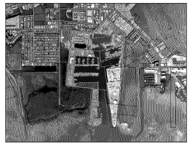
SHCC Overlay District boundaries crosshatched in red.
(c)
In accordance with Policies 101.8.5 and 101.9.2 and Section 102-57(f), lawfully established non-conforming non-residential structures which are non-conforming as to intensity within the Safe Harbor Community Center Overlay District as of the effective date of this section may be rebuilt to the preexisting use, building footprint and configuration without increase in density or intensity of use, even if 100 percent destroyed provided that they are rebuilt to the preexisting use and registered in accordance with Section 102-55.
(d)
In accordance with Sections 138-51(c) and 138-50(j)(3), NROGO allocations or transfers over 10,000 square feet shall be permitted into the Safe Harbor Community Center Overlay District.
(e)
In order to preserve and promote recreational and commercial working waterfront uses, the following criteria and incentives in furtherance of Policy 101.5.6, shall apply, and be available, to all parcels within the Safe Harbor Community Center Overlay District that are zoned Maritime Industries (MI) and have a Mixed-Use Commercial (MC) FLUM Designation as follows:
(1)
When a mixture of uses is proposed for parcels designated as MI land use (zoning) district, working waterfront and water dependent uses, such as marina, fish house/market, boat repair, boat building, boat storage, or other similar uses, but excluding transient uses, shall be preserved by maintaining a minimum of 35 percent of the upland area of the property for those uses.
To incentivize additional preservation of recreational and commercial working waterfront uses, the following shall be available:
a.
For the preservation of 36—50 percent of the upland area of property for working waterfront and water dependent uses, up to 20,000 square feet of nonresidential floor area from the NROGO bank shall be provided to the property; and
b.
For the preservation of 50 percent or more of the upland area of property for working waterfront and water dependent uses, the residential density, on the property may be developed pursuant to the maximum net density standard without the use of TDRs.
c.
If parcels do not preserve 50 percent or more of the upland are of the property for working waterfront and water dependent uses, TDRs can be utilized to attain the density between the allocated density standard up to the maximum net density standard.
d.
Deed restricted affordable dwelling units may be built up to the maximum net density without the use of TDRs.
e.
Parcels within the MI zoning district that have existing wet slips shall preserve at least 20 percent of the wet slips for vessels involved with recreational and commercial working waterfront uses, excluding live-aboard vessels solely used as a residence and not for navigation.
f.
Parcels within the MI zoning district creating new wet slips shall preserve at least 10 percent of the wet slips for vessels involved with recreational and commercial working waterfront uses, excluding live-aboard vessels solely used as a residence and not for navigation.
g.
The preservation of dockage for recreational and commercial working waterfront uses shall be documented on the final development plan and shall be a written condition of any permit approval.
h.
For permanent residential development, parcels within the MI zoning district shall be limited to commercial apartments or employee housing. Commercial apartment means an attached or detached residential dwelling unit located on the same parcel of land as a nonresidential use that is intended to serve as permanent housing for the owner or employees of that nonresidential use. The term does not include a tourist housing use or vacation rental use.
i.
The preservation of a public access walkway, and a public access boat launch if one already exists, shall be required for all parcels with direct access to the water. Consideration shall be given to security and the physical constraints of the parcel. The public access walkway shall be documented on the final development plan to link a continuous walkway and shall be a written condition of any permit approval.
(f)
Within the boundaries of the Safe Harbor Community Center Overlay District, the permitted and conditional uses in subsections (1)—(3) shall be enforced, in lieu of Section 130-85, Maritime Industries, and Section 130-88, Mixed Use; and the nonresidential land use intensities in subsection (3) shall be enforced in lieu of Section 130-164, maximum nonresidential land use intensities and district open space.
(1)
Permitted uses. The following uses are permitted as of right in the Safe Harbor Community Center (SHCC) Overlay District:
a.
Accessory uses;
b.
Attached and detached dwellings involving less than six units, designated as employee housing as provided for in Section 139-1;
c.
Attached wireless communications facilities, as accessory uses, pursuant to Section 146-5(d);
d.
Collocations on existing antenna-supporting structures, pursuant to Section 146-5(c);
e.
Commercial apartments involving less than six dwelling units, but tourist housing uses, vacation rental use, of commercial apartments is prohibited.
f.
Commercial fishing;
g.
Commercial recreational uses limited to:
1.
Bowling alleys;
2.
Tennis and racquet ball courts;
3.
Miniature golf and driving ranges;
4.
Theaters;
5.
Health clubs; and
6.
Swimming pools;
h.
Commercial retail, restaurant uses, or any combination thereof, of less than 5,000 square feet of floor area;
i.
Detached dwellings within the Mixed Use (MU) Zoning District;
j.
Institutional residential uses, involving less than ten dwelling units or rooms within the Mixed Use (MU) Zoning District;
k.
Institutional uses;
l.
Light industrial uses;
m.
Office uses of less than 5,000 square feet of floor area;
n.
Public buildings and uses;
o.
Replacement of an existing antenna-supporting structure pursuant to Section 146-5(b);
p.
Satellite earth stations, as accessory uses, pursuant to Section 146-5(f);
q.
Stealth wireless communications facilities, as accessory uses, pursuant to section 146-5(e); and
r.
Wastewater nutrient reduction cluster systems that serve less than ten residences; provided that:
1.
The wastewater treatment facility and wastewater treatment collection systems are in compliance with all federal, state, and local requirements;
2.
The wastewater treatment facility, wastewater treatment collection systems and accessory uses shall be screened by structures designed to be architecturally consistent with the character of the surrounding community and shall minimize the impact of any outdoor storage, temporary or permanent; and
3.
In addition to any district boundary buffers set forth in Chapter 114, Article V, a planting bed, eight feet in width, to be measured perpendicular to the exterior of the screening structure shall be established with the following:
i.
One native canopy tree for every 25 linear feet of screening structure;
ii.
One understory tree for every ten linear feet of screening structure and the required trees shall be evenly distributed throughout the planting bed;
iii.
The planting bed shall be installed as set forth in Chapter 114, Article IV; and
iv.
A solid fence may be required upon determination by the planning director.
(2)
The following uses are permitted as minor conditional uses in the Safe Harbor Community Center (SHCC) Overlay District, subject to the standards and procedures set forth in Chapter 110, Article III:
a.
Agricultural uses, limited to mariculture, provided that:
1.
The parcel proposed for development is separated from any established residential uses by at least a class C bufferyard;
2.
All outside storage areas are screened from adjacent uses by a solid fence, wall, or hedge at least six feet in height;
b.
Attached and detached dwellings involving six to 18 units, designated as employee housing as provided for in Section 139-1.
c.
Commercial apartments involving up to 18 dwelling units, provided that:
1.
The hours of operation of the commercial uses are compatible with residential uses;
2.
Access to U.S. 1 is by way of:
i.
An existing curb cut;
ii.
A signalized intersection; or
iii.
A curb cut that is separated from any other curb cut on the same side of U.S. 1 by at least 400 feet;
3.
Tourist housing uses, including vacation rental uses, of commercial apartments are prohibited;
d.
Commercial retail, office, restaurant uses, or any combination thereof, of low and medium intensity, of greater than 5,000 but less than 10,000 square feet or floor area, provided that access to U.S. 1 is by way of:
1.
An existing curb cut;
2.
A signalized intersection; or
3.
A curb cut that is separated from any other curb cut on the same side of U.S. 1 by at least 400 feet;
In no case shall parcels within the Maritime Industries (MI) zoning district contain more than 5,000 square feet of floor area of commercial retail.
e.
Commercial retail, office, restaurant uses, or any combination thereof, of high intensity, and of less than 5,000 square feet of floor area, provided that access to U.S. 1 is by way of:
1.
An existing curb cut;
2.
A signalized intersection; or
3.
A curb cut that is separated from any other curb cut on the same side of U.S. 1 by at least 400 feet;
In no case shall parcels within the Maritime Industries (MI) zoning district contain more than 5,000 square feet of floor area of commercial retail.
f.
Hotels of fewer than 50 rooms, provided that one or more of the following amenities is available to guests:
1.
Swimming pool;
2.
Docking facilities; or
3.
Tennis courts;
g.
New antenna-supporting structures, pursuant to Section 146-5(a).
(3)
The following uses are permitted as major conditional uses in the Safe Harbor Community Center Overlay District, subject to the standards and procedures set forth in Chapter 110, Article III:
a.
Attached and detached dwelling units involving more than 18 units, designated as employee housing as provided for in Section 139-1.
b.
Commercial retail, office, restaurant uses, or any combination thereof, of low and medium intensity, of greater than 10,000 square feet of floor area, provided that access to U.S. 1 is by way of:
1.
An existing curb cut;
2.
A signalized intersection; or
3.
A curb cut that is separated from any other curb cut on the same side of U.S. 1 by at least 400 feet;
In no case shall parcels within the Maritime Industries (MI) zoning district contain more than 5,000 square feet of floor area of commercial retail.
c.
Commercial recreation uses (indoor and outdoor), including amusement or sea life parks and drive-in theaters, provided that:
1.
The parcel of land proposed for development does not exceed five acres;
2.
The parcel proposed for development is separated from any established residential use by a class C bufferyard;
3.
All outside lighting is designed and located so that light does not shine directly on any established residential use; and
4.
The parcel is within the Mixed Use (MU) zoning district.
d.
Hotels providing 50 or more rooms, provided that:
1.
The hotel has restaurant facilities on the premises; and
2.
One or more of the following amenities is available to guests:
i.
Swimming pool; or
ii.
Docking facilities; or
iii.
Tennis courts; and
3.
Access to U.S. 1 is by way of:
i.
An existing curb cut;
ii.
A signalized intersection; or
iii.
A curb cut that is separated from any other curb cut on the same side of U.S. 1 by at least 400 feet;
e.
Marinas, provided that:
1.
The parcel proposed for development has access to water at least four feet below mean sea level at mean low tide;
2.
The sale of goods and services is limited to fuel, food, boating, diving and sport fishing products;
3.
All outside storage areas are screened from adjacent uses by a solid fence, wall, or hedge at least six feet in height; and
4.
Each nonwaterside perimeter setback of the parcel proposed for development must have a class C bufferyard within a side yard setback of no less than ten feet; and
5.
New and existing marine facilities, including marinas, with ten slips or more, or one live-aboard-slip, must provide dedicated sewage pump-out facilities or services.
f.
Wastewater treatment facilities and wastewater treatment collection systems serving uses located in any land use district, provided that:
1.
The wastewater treatment facility and wastewater treatment collection systems are in compliance with all federal, state, and local requirements;
2.
The wastewater treatment facility, wastewater treatment collection systems and accessory uses shall be screened by structures designed to be architecturally consistent with the character of the surrounding community and minimize the impact of any outdoor storage, temporary or permanent; and
3.
In addition to any district boundary buffers set forth in Chapter 114, Article V, a planting bed, eight feet in width, to be measured perpendicular to the exterior of the screening structure shall be established with the following:
i.
One native canopy tree for every 25 linear feet of screening structure;
ii.
One understory tree for every ten linear feet of screening structure and the required trees shall be evenly distributed throughout the planting bed;
iii.
The planting bed shall be installed as set forth in Chapter 114, Article IV; and
iv.
A solid fence may be required upon determination by the planning director.
(g)
Allocated Density for Residential Dwelling Units. For purposes of this overlay district, parcels shall maintain the allocated density standard for residential dwelling units based on the underlying zoning districts in which it is located, of either Mixed Use (MU) of 1 du/gross acre or Maritimes Industries (MI) of 1 du/gross acre.
(h)
Maximum Net Density for Residential Dwelling Units. For purposes of this overlay district, parcels shall maintain the maximum net density standard for residential dwelling units based on the underlying existing zoning districts in which it is located, of either Mixed Use (MU) of 12 du/buildable acre (18 du/buildable acre for affordable housing) or Maritimes Industries (MI) of 2 du/buildable acre and minimum open space shall be 0.20. Additional open space requirements may apply based on environmental protection criteria—see additional open space rations in Chapter 118. In accordance with Section 101-2(1), the most restrictive ratios for open space shall apply.
(1)
The Maximum Net Density is the maximum density allowable with the use of TDRs, or for qualifying affordable housing development. TDRs can be utilized to attain the density between the allocated density standard up to the maximum net density standard. Deed restricted affordable dwelling units may be built up to the maximum net density without the use of TDRs.
(2)
Developing under the maximum net density standard requires the transfer of density (Transferable Development Rights or TDRs) pursuant to Section 130-160.
(i)
Allocated Density for Hotel or Motel. For purposes of this overlay district, parcels shall maintain the allocated density for transient units, limited to hotel/motel uses and institutional residential uses, based on the underlying existing zoning districts in which it is located of either Mixed Use (MU) of 10 rooms or spaces/acres for hotels and 5 rooms or spaces/acres for institutional residential uses or Maritimes Industries (MI) of 10 rooms or spaces/acres for hotels. For properties designated as MI zoning that are within the I future land use category, the allocated density for hotel and institutional residential uses shall be zero (0).
(1)
Pursuant to Section 138-23, new transient units, shall not be eligible for residential ROGO allocations.
(2)
To develop transient units, units must be transferred pursuant to Section 138-22(b).
(j)
Maximum Densities for Hotel or Motel and Minimum Open Space. For purposes of this overlay district, parcels shall maintain the maximum net density for transient units, limited to hotel/motel uses and institutional residential uses, permitted under the existing zoning districts.
(k)
Maximum Nonresidential Floor Area. For the purposes of this overlay district, uses with corresponding intensity thresholds shall be cumulative and shall be in accordance with the following table:
(l)
Notwithstanding Section 138-147(a), enclosed and partially enclosed boat barns shall not count towards Floor Area Ratio within the Safe Harbor Community Center Overlay District.
(m)
Parking requirements.
(1)
General Requirements.
a.
Every use shall be provided with off-street parking in accordance with Section 114-67.
b.
Up to 20 percent of the required parking spaces for nonresidential uses may be replaced with an equivalent number of smaller parking spaces designed to accommodate motorcycles or scooters and other similar modes of transportation.
(2)
Required number of off-street parking spaces. Notwithstanding Section 114-67(e), the following number of parking spaces shall be provided for each use:
(3)
Off-site parking facilities. Notwithstanding Section 114-67(h), the following requirements shall apply to off-site parking facilities for nonresidential uses.
a.
Off-site parking facilities shall be permitted and located within the Safe Harbor Community Center Overlay District.
b.
A parking agreement shall be required in accordance with Section 114-68.
(4)
Bicycle Parking.
a.
All new and redevelopment of any residential or nonresidential structure shall require bicycle parking rack facilities.
b.
Bicycle parking rack criteria:
1.
Bicycle parking racks must be designed to accommodate a minimum of four (4) bicycles;
2.
All bicycle parking racks shall be separated from vehicular traffic by at least five feet or a physical barrier;
3.
Bicycle racks shall be located within 100 feet of the building entrance at a location that does not interfere with pedestrian traffic; and
4.
The minimum dimensions for a bicycle parking rack shall be two-foot-wide by six-foot-long stalls with a minimum aisle width of five feet. Location criteria can be modified by the Planning Director if they determine that a superior alternative exists.
(n)
Public Sidewalks. All new development and redevelopment along Fourth and Fifth Avenues shall provide public sidewalks consistent with the County standards.
(o)
Setbacks.
(1)
Front yard setback. Notwithstanding Section 131-1(a), the front yard setback for any structure on a parcel within the Safe Harbor Community Center Overlay District shall be a minimum of 10 feet.
a.
Accessory driveways and walkways. Accessory structures, limited to driveways and walkways, may be permitted within a required front yard setback provided they do not exceed six (6) inches in height as measured from grade. In no event shall the total combined area of all accessory structures occupy more than 60 percent of the out required front yard setback area.
b.
Outdoor Lighting. All outdoor lighting shall comply with Chapter 114, Article VI Outdoor Lighting. Notwithstanding, streetlights and landscape lighting may be located in the front setback. In no case shall uplighting be permitted.
c.
Signs and landscaping. Signs as permitted in Chapter 142 and landscaping may be permitted in a required front yard setback.
d.
Fences. Fences of up to six (6) feet may be permitted, provided they are not located within clear sight triangles as defined in Section 114-201 and/or according to FDOT and national AASHTO standards, whichever is more restrictive.
In addition, parcels of land that are developed with single family dwellings may incorporate entry features of greater than six (6) feet within fences, provided all of the following design criteria are met:
1.
The entry feature is defined as a continuous fence or gate, or combination thereof, located contiguous to and on both sides of the main access (driveway) to the property which is designed and intended to control and/or demarcate the access to the property. An "entry feature" includes all walls, buttresses, guy wires, integral signs and decorative features attached thereto up to a maximum width of 12 feet, or 15 percent of the lot width whichever is greater, a maximum height often 10 feet, and four (4) feet in depth or six (6) percent of the lot depth whichever is greater as measured from the front property line; and
2.
The entry feature shall not be located in any side yard setback required pursuant to Section 131-1; and
3.
The entry 1 feature shall be compatible with the existing development in the immediate vicinity, shall be in harmony with the general appearance and character of the community, and shall not be otherwise detrimental to the public welfare; and
4.
The entry feature shall be designed and arranged on the site in a manner that minimizes aural and visual impact on the adjacent structures while affording the applicant a reasonable use of the land; and
5.
The entry feature shall require a building permit for its construction and in addition to the normal building permit application requirements, the application shall include a scaled site plan and elevations for the entry feature that shows the height, width, and length of each element of the entry feature applied for, including any decorative or non-functional elements; and identification of the materials composing each element of the structure (e.g., wire, stone, chain-link, wood, etc.).
(2)
Shoreline Setback. Notwithstanding Section 118-12(c), water-dependent accessory uses, limited to waterfront dining areas, pedestrian walkways, public monuments or statues, informational kiosks, fuel or septic facilities, and water-dependent marina uses, within the Safe Harbor Community Center Overlay District lawfully established as of the effective date of this section may be redeveloped in their existing footprint in the event of involuntary substantial damage or destruction.
Water-dependent accessory structures within the Safe Harbor Community Center Overlay District shall be setback the greater of ten (10) feet or the applicable setback prescribed by Florida Department of Environmental Protection or Army Corps of Engineers regulations, whichever regulation is more restrictive, provided such uses do not involve discharge into Safe Harbor or adjacent surface waters.
(3)
Rear and side yard setbacks. Notwithstanding Section 131-1(a), the minimum required setback for any rear and side yard setback within the within the Safe Harbor Community Center Overlay District shall be reduced to a minimum of 5 feet.
(p)
Outdoor Lighting. All outdoor lighting shall comply with Chapter 114, Article IV Outdoor Lighting. Notwithstanding, streetlights and landscape lighting may be located in the front yard setback consistent with subsection (o)(1)b. In no case shall uplighting be permitted.
(q)
CBRS Restrictions. Notwithstanding the provisions of Chapter 138 or any other provision to the contrary, parcels within the Safe Harbor Community Center Overlay District which are designated within Coastal Barrier Resources System Unit FL 57 shall not be prohibited from serving as receiver sites for transient, market rate, and affordable dwelling units, provided the applicable site meets all other criteria established in Comprehensive Policy 101.6.8 8 and Section 138-22(b) for a receiver site and so long as no structure is developed or located in any portion of the parcel designated as CBRS.
(r)
Drones. The use of unmanned aerial vehicles and/or drones within the Safe Harbor Community Center Overlay District are prohibited.
(s)
District Boundary Bufferyards. Notwithstanding Section 114-26, no district boundary bufferyard shall be required for parcels within the Safe Harbor Community Center Overlay District except where a parcel within the SHCC Overlay District is adjacent to a parcel that is not within the SHCC Overlay District.
(t)
Except for the specific provisions listed in this section, all other requirements and adopted provisions of the Land Development Code shall control.
(Ord. No. 006-2016, § 1(Exh. 1), 4-13-2016; Ord. No. 016-2022, § 1, 8-17-2022)
Sec. 130-141. - Ocean Reef Overlay District.
(a)
Purpose and intent. The purposes of the Ocean Reef Overlay District are to implement applicable goals, objectives, and policies of the comprehensive plan established under Goal 112 and to allow development that primarily serves the needs of the permanent residents of the Ocean Reef master planned community, a gated 100+ acre master planned community.
The intent is to protect and maintain the character of Ocean Reef Club, Inc., and the Ocean Reef master planned community by establishing specific standards, exemptions and reductions for properties owned by Ocean Reef Club, Inc., and Golf Manor I Condominium Association, within the Ocean Reef master planned community.
(b)
Boundary. The Ocean Reef Overlay District shall be shown as an overlay district on the Official Land Use District (Zoning) Map.
(c)
Applicability. In order for a property owner to utilize the standards, exemptions and reductions established within the Ocean Reef Overlay District, the property must be owned and operated by Ocean Reef Club, Inc., or Golf Manor I Condominium Association, an amendment to the Official Land Use District (Zoning) Map shall be required, and such overlay shall be shown on the Official Land Use District (Zoning) Map.
(d)
Nonresidential development standards as provided in Policy 112.1.1. The following provisions shall control and supersede existing provisions of the Land Development Code relating to nonresidential structures and uses within the Ocean Reef Overlay District.
(1)
Nonconforming structures and uses. Notwithstanding Section 102-56, nonconforming use, Section 102-57, nonconforming structures, and Section 102-58, nonconforming accessory uses and accessory structures, the following provisions shall control:
a.
Notwithstanding subsections 5 and 6 below, lawfully established nonconforming nonresidential principal and accessory structures and uses located within the Ocean Reef Overlay District, that are destroyed, substantially damaged, or substantially improved may be repaired, restored and/or replaced, even if 100 percent destroyed, provided that they are rebuilt to preexisting use and that the nonconformity is not expanded.
b.
Notwithstanding subsections 5 and 6 below, accessory uses or structures associated with a lawfully established nonconforming nonresidential principal use may be permitted.
c.
A nonconforming nonresidential accessory use or structures may continue if its principal use or structure is destroyed, substantially damaged, or substantially improved, discontinued, or removed for redevelopment, provided that the owner is moving forward with redevelopment of a principal use or structure with active concurrent permits for redevelopment of a principal use or structure without expansion.
In the absence of an active concurrent permit for redevelopment of a principal use or structure on the parcel, the accessory structure and use may remain for up to five years from the date on which the principal use or structure is destroyed, substantially damaged, or substantially improved, discontinued, or removed for redevelopment. The Board of County Commissioners may extend the five-year time limit by resolution, if needed.
(2)
Open space. Notwithstanding Section 130-164, maximum nonresidential intensities and district open space, the following provisions shall control:
a.
Lawfully established nonresidential structures and uses, on property owned by Ocean Reef Club, Inc., may be repaired, restored and/or replaced using the previously approved open space ratio, provided stormwater management is in compliance with Land Development Code (LDC) Section 114-2(5):
1.
Lawfully existing nonresidential principal structures and uses, on property owned by Ocean Reef Club, Inc., which are nonconforming as to open space, may remain, be repaired, substantially improved, restored, or replaced without expansion provided the lawfully existing shoreline setback is-maintained.
2.
Lawfully existing nonresidential accessory structures and uses, on property owned by Ocean Reef Club, Inc., which are nonconforming as to open space, may remain, be repaired, substantially improved, restored, or replaced without expansion provided that the lawfully existing shoreline setback is maintained.
b.
Notwithstanding subsection 2(a) above, new nonresidential principal and accessory structures, on property owned by Ocean Reef Club, Inc., may be developed using the following open space standards, provided stormwater management is in compliance with Land Development Code (LDC) Section 114-2(5):
1.
New nonresidential principal and accessory structures, on properties owned by Ocean Reef Club, Inc., development shall have an open space requirement of twenty percent (20%), provided the clearing limits in Section 118-9(d) are not exceeded and development is not proposed within a wetland area identified in Section 118-4.
2.
Notwithstanding Section 130-164, nonresidential parcels designated within the Sparsely Settled (SS) zoning district and designated Residential Low (RL) on the Future Land Use Map (FLUM), with lawfully established nonresidential floor area, shall have a minimum zoning land use open space requirement of twenty percent (20%).
3.
Stormwater. The specific standards, exemptions and reductions contained within the Ocean Reef Overlay District shall govern nonresidential structures and uses, on property owned by Ocean Reef Club, Inc., within Ocean Reef master planned community provided stormwater facilities adhere to the 25-year, 72-hour South Florida Water Management District Standard, and eliminate off-property discharges and demonstrate that post development total nitrogen and total phosphorous loads are less than pre-development loads to the receiving water body (net improvement) or demonstrate a ninety five percent (95%) reduction in stormwater total nitrogen load and total phosphorus load. Treatment and disposal facilities must be designed and operated so that off-site discharges meet state water quality standards.
(4)
Development standards.
a.
Nonresidential structures and uses, on property owned by Ocean Reef Club, Inc., within Ocean Reef master planned community are exempt from the below listed Land Development Code sections related to level of service/concurrency, because the Ocean Reef Club, Inc., is responsible for providing financing, operating, and regulating of its facilities and services, as needed to serve development of its properties, within the Ocean Reef master planned community:
1.
Sec. 114-2. Adequate facilities and review procedures.
2.
Sec. 114-3. Surface water management criteria. (provided any required state or federal stormwater requirements are met and the stormwater management facilities are in place and available to serve the development no later than the issuance a certificate of occupancy).
3.
Sec. 114-6. Curbs and gutters.
4.
Sec. 114-7. Sidewalks and shared use paths.
5.
Sec. 114-8. Installation of utilities and driveways.
6.
Sec. 114-9. Water supply and sanitary sewer service.
7.
Sec. 114-10. Road and private drive name signs.
8.
Sec. 114-11. Traffic-control signs and devices.
b.
Sanitary sewer system availability shall be in place and available to serve new nonresidential development no later than the issuance of a certificate of occupancy or its functional equivalent. The Ocean Reef sanitary system must be constructed, operated, and connected to central wastewater management facilities pursuant to F.S. § 403.086(11), or the upgrade of onsite sewage treatment and disposal systems must be pursuant to F.S. § 381.0065(4)(1).
c.
Nonresidential structures and uses, on property owned by Ocean Reef Club, Inc., within Ocean Reef master planned community are exempt from the following sections contained within Chapter 114 related to development standards to maintain and implement its community character and vision:
1.
Sec. 114-66. [Parking and loading] purpose and intent.
2.
Sec. 114-67. Required off-street parking.
3.
Sec. 114-68. Parking agreements.
4.
Sec. 114-69. Required number and size of loading/unloading spaces.
5.
Sec. 114-70. Restriction on use of parking and loading spaces.
(5)
Setbacks. The following setback provisions shall control and supersede for nonresidential development and redevelopment on properties owned by Ocean Reef Club, Inc., within the Ocean Reef master planned community-except where a property line is contiguous to a residential use, in which case only the shared contiguous boundary line shall be subject to the setback requirements contained in Section 131-1.
For the purposes of this subsection, "contiguous to a residential use" shall mean all residentially used or zoned property that shares a common boundary line with the property subject to the application and shall not apply to on-site employee housing or commercial apartments. For purposes of this subsection, contiguity is broken by a canal or a public right-of-way.
a.
Front yard setback. Development and redevelopment shall comply with all front yard setback requirements contained within Sections 131-1 and 131-3, except the following allowances are permitted:
1.
The total combined area of accessory structures shall be permitted to occupy up to one hundred percent (100%) of the front yard setback within the Ocean Reef Overlay District, provided compliance with the open space requirements established in Land Development Code ("LDC") Sections 118-4, 130-162 and 130-164 is maintained and all stormwater is retained on the property; and
2.
The required front yard setback for nonresidential accessory structures, limited to driveways walkways, off-street parking, and outdoor lighting shall be zero (0) feet provided all stormwater is retained on the property and all outdoor lighting complies with Chapter 114, Article VI, outdoor lighting.
b.
Side setback. Development and redevelopment shall comply with all side yard setback requirements contained within Sections 131-1 and 131-3(d), except the following allowances are permitted:
1.
The required front yard setback for nonresidential accessory structures, limited to driveways walkways, off-street parking, and outdoor lighting shall be zero (0) feet provided all stormwater is retained on the property and all outdoor lighting complies with Chapter 114, Article VI, outdoor lighting.
c.
Rear setback. Development and redevelopment shall comply with all rear yard setback requirements contained within Sections 131-1 and 131-3(e), except the following allowances are permitted:
1.
Accessory structures, including off-street parking, shall be setback a minimum of five (5) feet from the rear property line provided all stormwater is retained on the property.
(6)
Shoreline setback. Pursuant to Policy 112.1.1, and notwithstanding Section 118-12(c), nonresidential accessory structures will be permitted in shoreline setbacks on property owned by Ocean Reef Club, Inc. within the Ocean Reef master planned community as follows:
a.
Along lawfully altered shorelines adjacent to manmade canals, channels, and basins:
1.
The combined area of all accessory structures may occupy up to ninety percent (90%) of the upland area of the required 20-foot shoreline setback.
2.
Accessory structures, including, but not limited to, pools, spas, and any screen enclosure over pools or spas shall be set back a minimum of five (5) feet from the MHW line. With the exception of docks and erosion control structures (as to which no shoreline setback applies), an accessory structure other than those listed above not exceeding 18 inches in height as measured from grade may be permitted within the 20-foot shoreline setback if the structure is-constructed to avoid any off-site discharge of stormwater from the subject parcel.
b.
Along unaltered or unlawfully altered shorelines located along natural non-dredged waterways and open water:
1.
The combined area of all accessory structures may occupy up to seventy percent (70%) of the upland area of the required 50-foot shoreline setback.
2.
Accessory structures, including, but not limited to, pools, spas, and any screen enclosure over pools or spas shall be set back a minimum often (10) feet from the MHW line or the landward extent of the mangroves, whichever is farther landward, and shall be located in upland areas. With the exception of docks and erosion control structures (as to which no shoreline setback applies), an accessory structure other than those listed above not exceeding 18 inches in height as measured from grade may be permitted within the 50-foot shoreline setback if the structure is constructed to avoid any off-site discharge of stormwater from the subject parcel.
c.
All other shoreline setback provisions for principal and accessory structures within Policy 212.2.4 shall apply.
(7)
Height. The maximum height of any structure or building shall comply with Section 131-2(a) and comprehensive plan Policy 101.5.31.
(e)
Residential development standards as provided in Policy 112.1.1. Monroe County shall exempt or minimize its development standards for lawfully established residential dwelling units within the Ocean Reef master planned community, which self-governs its internal land development in order to provide uniform development standards and architectural guidelines to protect the distinct community character within the Ocean Reef master planned community as specified in the policies below.
(1)
Open space. Notwithstanding Section 130-157, parcels designated within the Sparsely Settled (SS) zoning district, with a lawfully established residential dwelling unit, shall have a minimum land use open space requirement of fifty percent (50%).
(2)
Height. The maximum height of any structure or building shall comply with Section 131-2 and comprehensive plan Policy 101.5.31.
(Ord. No. 022-2023, § 2, 10-18-2023)
Sec. 130-143. - Tavernier Commercial Overlay District.
(a)
Purpose and intent. The purpose of the Tavernier Commercial Overlay District is to implement applicable goals, objectives, and policies of the comprehensive plan and to allow larger-scale nonresidential development in a scarified area of the Upper Keys that primarily serves the needs of permanent residents of the Upper Keys. The intent is to provide accessible nonresidential uses to permanent residents of the Upper Keys, while maintaining the character of Tavernier.
(b)
Boundary. The Tavernier Commercial Overlay District shall be shown as an overlay district on the Official Land Use District map. The Tavernier Commercial Overlay District shall be shown as the boundary of the parcels with Monroe County Parcel ID numbers 00490250-000000 and 00089490-000000, and depicted in the map below:
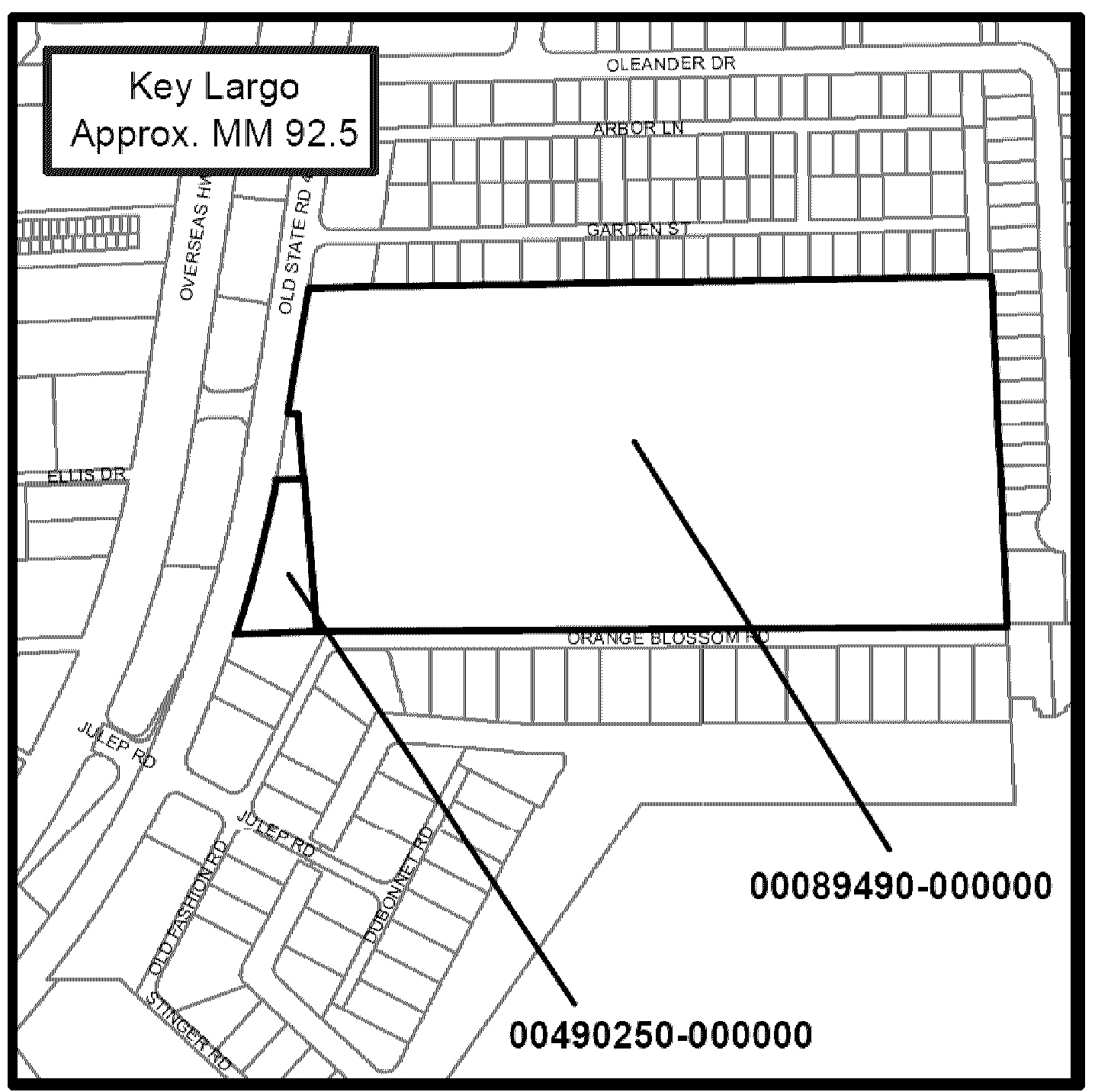
(c)
Applicability. Development within the Tavernier Commercial Overlay District shall be subject to the following standards:
(1)
An amendment to the official land use district map is required and such overlay shall be shown on the official land use district map.
(2)
The development of a single nonresidential structure that contains more than 10,000 square feet within the overlay district shall be subject to the terms and conditions of an approved development agreement as defined in sections 110-132, 110-133, and must include:
a.
Provisions for the development of 86 workforce housing dwelling units on site. The distribution of said workforce housing units (low, very low, median and moderate) provided on site shall be memorialized and provided for in the development agreement; and
b.
Preferred leasing standards for essential workers of the workforce units; and
c.
An approved site plan that includes the following in addition to all site requirements in accordance with the Land Development Code:
i.
A pedestrian walkway connecting the nonresidential parking area to the right-of-way known as Orange Blossom Road. Required lighting for the pedestrian walkway must be in compliance with Chapter 114, Article VI.
ii.
If outdoor lighting is proposed, in addition to all requirements of Chapter 114, Article VI, such lighting shall be designed and located such that the maximum illumination measured in footcandles at any exterior property line adjacent to residential uses, not included in this overlay, shall not exceed zero (0) for cutoff and noncutoff lights, with the exception of the pedestrian walkway or any lighting required for life safety, as provided by Monroe County.
d.
A traffic safety analysis completed as part of the required traffic study.
(3)
All property lines adjacent to U.S. 1 shall provide a class E scenic corridor buffer.
(4)
All development shall be permitted in accordance with the permitted and conditional use requirements of Chapter 130, Article III, permitted and conditional uses.
(5)
Industrial uses are not permitted within the overlay. Notwithstanding the preceding sentence, industrial uses determined to be lawfully nonconforming existing uses within the overlay are permitted to remain, and operate, until such time as a building permit is issued for the nonresidential structure of more than 10,000 square feet.
(d)
Maximum development potential.
(1)
There shall be no allocated or maximum net density standard available for residential market-rate or transient dwelling units.
(2)
The Tavernier Commercial Overlay District shall be limited to a maximum total development potential of:
a.
49,900 square feet of nonresidential floor area; and
b.
Eighty-six (86) deed restricted workforce housing dwelling units; and
c.
Accessory uses and structures.
(e)
NROGO allocations. .....Notwithstanding Section 138-51, the Tavernier Commercial Overlay District shall have the following NROGO allocation standards provided that the criteria set forth in subsections (f), (g) and (h) are satisfied:
(1)
Maximum allocation of nonresidential floor area. The amount of nonresidential floor area to be allocated or transferred to the Tavernier Commercial Overlay District shall be limited to a maximum of 49,900 square feet.
(2)
Maximum floor area per structure. A single nonresidential principal structure within the Tavernier Commercial Overlay District shall be permitted to receive an allocation that expands the structure to more than 10,000 square feet, but not to exceed a maximum of 49,900 square feet of nonresidential floor area.
(f)
No building permit shall be issued for a structure receiving an NROGO allocation or transfer that would expand a nonresidential structure within the overlay to more than 10,000 square feet unless and until building permits for all 86 workforce housing units have been issued.
(g)
All new residential units developed within the overlay shall be subject to the ROGO permit allocation system or transfer of ROGO exemptions of existing lawfully established permanent market rate or affordable dwelling units that have less than five years remaining on the required deed restriction pursuant to Section 138-22(b)(4)b.
(h)
Prior to the issuance of a certificate of occupancy for a nonresidential structure that is more than 10,000 square feet:
(1)
At least 50% (43) of the required 86 workforce housing units must have received a temporary certificate of occupancy; and
(2)
All required 86 workforce housing units must have received approved foundation inspections.
(i)
All other provisions of the comprehensive plan, Tavernier Livable Communikeys Plan, the Tavernier Creek to Mile Marker 97 U.S. Highway Corridor Development Standards and Guidelines and the Land Development Code apply unless expressly exempted herein.
(Ord. No. 004-2024, § 3, 2-15-2024)
Sec. 130-156.- Standards.
(a)
No structure or land in the county shall hereafter be developed, used or occupied at an intensity or density greater than the standards set out in this article. No density shall be allocated for any land designated as mangroves on the existing conditions map.
(b)
The density and intensity provisions set out in this section are intended to be applied cumulatively so that no development shall exceed the total density limits of this article. For example, if a development includes both residential and commercial development, the total gross amount of development shall not exceed the cumulated permitted intensity of the parcel proposed for development. If a proposed development is for a combination of nonresidential uses, the acreage required for each use shall be determined independently based on the floor area ratio in section 130-164 for each individual use such that no acreage shall be dedicated for more than one use.
(Ord. No. 006-2016, § 1(Exh. 1), 4-13-2016)
Sec. 130-157. - Maximum Permanent Residential Density and Minimum Required Open Space.
The maximum permanent residential density for those uses permitted by this chapter and minimum required open space shall be in accordance with the following table:
(Ord. No. 006-2016, § 1(Exh. 1), 4-13-2016; Ord. No. 005-2017, § 1, 5-17-2017; Ord. No. 042-2019, § 1, 10-16-2019; Ord. No. 003-2020, § 1, 1-22-2020, eff. 6-3-2020)
Sec. 130-160. - Transferable Development Rights (TDRs).
(a)
General and criteria. The Maximum Net Density is the maximum density allowable with the use of TDRs, and shall not exceed the maximum densities established in the Comprehensive Plan. TDRs may be utilized to attain the density between the allocated density standard up to the maximum net density standard. All residential development rights allocated or established in sections 130-157 and 130-162 (allocated density for permanent residential dwelling units or transient units) are transferable from one parcel of land to another parcel of land, provided that the sender and receiver sites meet all of the following criteria:
(1)
A sender site is the land area from which the development right(s) to be transferred is derived. In the event an applicant intends to only use part of a greater property for a transferable development right application, the additional land area not required to amass the transferable development right(s) shall not be considered part of the sender site and not subject to conservation as required in subsection (8). As part of the application required in subsection (b)(2), the applicant shall provide a boundary survey and legal description that identify the boundaries of the sender site within the greater property.
A sender site shall meet the following criteria:
a.
Located in a Tier I, II, III-A or III designated area; including any tier within the County's Military Installation Area of Impact (MIAI) Overlay; and
b.
Property has development rights to transfer.
(2)
The maximum net densities set forth in sections 130-157 and 130-162 shall not be exceeded and new development on a receiver site shall be developed in compliance with each and every requirement of this Land Development Code.
(3)
The maximum net densities set forth for the applicable future land use category in the Comprehensive Plan shall not be exceeded and new development on a receiver site shall be developed in compliance with each and every requirement of the Comprehensive Plan and the Land Development Code.
(4)
A receiver site shall meet the following criteria:
a.
The Future Land Use category and Land Use (Zoning) District must allow the requested use;
b.
Must have an adopted maximum net density standard;
c.
Includes all infrastructure (potable water, adequate wastewater treatment and disposal wastewater meeting adopted LOS, paved roads, etc.);
d.
Located within a Tier III designated area; and
e.
Is not located within a designated CBRS unit.
(5)
The assignment of transferable development rights to receiver sites on Big Pine Key, No Name Key, and North Key Largo from other areas of the County shall be prohibited, excluding the assignments of transferable development rights a) from sender sites on Big Pine Key to receiver sites on Big Pine Key; b) from sender sites on No Name Key to receivers sites on No Name Key, c) from sender sites on No Name Key to Big Pine Key and d) from sender sites within North Key Largo to receiver sites within North Key Largo.
(6)
The assignment of transferable development rights to receiver sites within Land Use (Zoning) Districts that do not have a maximum net densities is prohibited (including, but not limited to, Improved Subdivision (IS, IS-D, IS-M, or IS-V), Urban Residential Mobile Home (URM or URM-limited), Sparsely Settled (SS), Native Area (NA), Offshore Island (OS), and Mainland Native (MN).
(7)
A development right may be transferred in part, provided it is rounded to the nearest tenth (i.e. if a sender site is designated Native Area (NA) and consists only of two acres of upland, the property owner may transfer the fractional 0.50 transferable development right). However, in accordance with subsection (8), in no event shall a property owner utilize part of a sender site's acreage for a transferable development right and maintain the right to develop that acreage as the land use intensity shall be exhausted.
(8)
Prior to application for a building permit authorizing the development of a dwelling unit on a receiver site requiring a transferable development right, the sender site(s) shall be a) dedicated to the county or b) placed in a conservation easement prohibiting its future development. A conservation easement shall be reviewed and approved by the planning and environmental resources department prior to its recording in the official records of the county.
(b)
Procedure. The transfer of development rights shall be carried out as follows:
(1)
A minor conditional use permit shall be required to identify, determine the eligibility of and document the approval of the sender and receiver site, pursuant to the process set forth in section 110-69. If a single receiver site is proposed to receive transferable development rights from multiple sender sites, a conditional use permit application for each sender site shall be required. All sender and receiver sites associated with a proposed transfer of a transferable development right shall be identified at the time of application;
(2)
The minor conditional use permit application required in subsection (b)(1) shall be submitted in a form provided by the Planning and Environmental Resources Department and include the following:
a.
The names and addresses of the property owners of record for the sender site(s) and receiver site(s);
b.
The property record cards from the Monroe County Property Appraiser of the sender site(s) and receiver site(s);
c.
Written legal descriptions of the sender site(s) and receiver site(s);
d.
A copy of the affidavit of intent to transfer;
e.
Boundary surveys and legal descriptions of the sender site(s) and receiver site(s), prepared by a surveyor registered in the State of Florida, showing the boundaries of the sites, elevations, bodies of water and wetlands, total acreage, total upland acreage and total acreage by habitat;
(3)
A development order shall memorialize approval of the minor conditional use permit required in subsection (b)(1). The development order shall include language requiring a Deed of Transfer described in this subsection (below). After successfully passing all applicable appeal periods, the development order shall be recorded in the official records of the Monroe County Clerk of the Circuit Court. Such recording shall be carried out so that the document is associated with all applicable sender and receiver sites; and
(4)
Prior to issuance of a building permit authorizing the development of a dwelling unit, all or a part of which is derived from a transferred development right, a deed of transfer shall be recorded in the chain of title of the sender site (transferor parcel) containing a restrictive covenant prohibiting the development that would require use of any of the allocated density that was transferred from the parcel.
(Ord. No. 006-2016, § 1(Exh. 1), 4-13-2016)
Sec. 130-162. - Maximum Densities for Hotel/Motel, Campground, Recreational Vehicle, Seasonal and Institutional Residential Uses, and Minimum Open Space.
Maximum hotel/motel, campground, recreational vehicle, seasonal and institutional residential densities for those uses permitted by this chapter shall be in accordance with the following table:
(Ord. No. 006-2016, § 1(Exh. 1), 4-13-2016)
Sec. 130-163. - Existing Residential Dwelling Units and Transient Units.
Notwithstanding the provisions of sections 130-157 and 130-162, the owners of land upon which a lawfully established dwelling unit, mobile home, or transient unit exists shall be entitled to one dwelling unit for each type of dwelling unit in existence before January 4, 1996. Such lawfully-established dwelling unit shall not be considered nonconforming as to density. Notwithstanding the nonconforming use provisions of section 102-56, existing lawfully established residential uses, not including mobile homes and not including transient uses, shall be entitled to repair and/or replace such dwelling units with the same type of dwelling unit and shall not be considered a nonconforming use(s). Lawfully established mobile homes shall be entitled to replace such dwelling units with a detached dwelling unit and shall not be considered a nonconforming use(s).
(Ord. No. 006-2016, § 1(Exh. 1), 4-13-2016; Ord. No. 038-2019, § 1, 10-16-2019)
Sec. 130-164. - Maximum Nonresidential Land Use Intensities and District Open Space.
Maximum nonresidential land use intensities for those uses permitted by this chapter and minimum required open space shall be in accordance with the following table:
(Ord. No. 006-2016, § 1(Exh. 1), 4-13-2016; Ord. No. 031-2020, § 2, 9-16-2020)
Sec. 130-165. - Aggregation of Development.
Any development that has or is a part of a common plan or theme of development or use, including, but not limited to, an overall plan of development, common or shared amenities, utilities or facilities, shall be aggregated for the purpose of determining permitted or authorized development and compliance with each and every standard of this Land Development Code (includes clearing limits) and for the purpose of determining the appropriate form of development review.
(Ord. No. 006-2016, § 1(Exh. 1), 4-13-2016; Ord. No. 030-2016, § 1, 11-13-2016)