


Nibley City Zoning Code
19 Zoning
Regulations
19.30 Cluster Subdivisions; Special Regulations
Moved to NCC 21.10.030.
Renumbered by Ord. 18-05 on 7/19/2018
21-13
18-03
18-11
23-14
14-02
19-15
20-19
21-06
21-17
22-01
22-09
23-02
23-24
23-27
22-19
23-38
24-08
25-15
23-33
21-03
25-24
20-13
21-20
23-06
24-01
21-11
06-04
17-01
19-12
25-35
12-07
22-02
25-34
25-04
25-23
17-08
20-09
23-28
17-09
20-02
23-05
25-37
21-16
18-05
18-10
19-16
23-35
25-25
19.02.010 Short Title
This title shall be known as the ZONING ORDINANCE OF NIBLEY, UTAH.
Adopted by Ord. No Source on 6/3/1993
19.02.020 Purpose
This chapter is designed and enacted for the purpose of promoting the health, safety, morals, convenience, order, prosperity and welfare of the present and future inhabitants of the city, including, among other things, the lessening of congestion of the streets or roads, securing safety from fire and other danger, providing adequate light and air, classifying land uses and distributing land development and utilization, protecting the tax base, securing economy in governmental expenditures, fostering the city's commercial and industrial growth, protecting both residential and nonresidential development, and the implementing of policies set forth in the Nibley comprehensive plan.
Adopted by Ord. No Source on 6/3/1993
19.02.030 Interpretation And Conflicts
In their interpretation and application, the provisions of this title shall be held to be minimum requirements. Wherever the requirements of this title are at variance with any other lawfully adopted rules, regulations, ordinances, chapters, deed restrictions or covenants, the most restrictive or that imposing the highest standards shall govern.
Adopted by Ord. No Source on 6/3/1993
19.02.040 Changes And Amendments
This title, including maps, may be amended from time to time by the city council after holding a public hearing in order to correct manifest errors and to more fully carry out the policies of the General Plan. Notice of such hearing shall be given in accordance with Utah State Code. All proposed amendments shall be proposed by or submitted to the planning commission for its recommendation. Such recommendations shall be forwarded to the city council for action within thirty (30) days of the first meeting at which the planning commission considers the amendment. Failure of the planning commission to submit a recommendation within the prescribed time may be deemed a negative recommendation by such commission of the proposed change or amendment. The city council may, after considering the planning commission’s recommendation, adopt, adopt with any revision the city council considers appropriate, or reject the proposed amendment by a majority vote of its members.
Adopted by Ord. No Source on 6/3/1993
Amended by Ord. 07-17 on 11/15/2007
Amended by Ord. 21-13 on 6/10/2021
19.02.050 Prohibited Uses
All uses not permitted under the terms of this title are prohibited.
Adopted by Ord. No Source on 6/3/1993
19.02.060 Permits, Certificates And Licenses
- Building Permit Required; Exceptions:
- Required:
- The construction, alteration, repair, removal or occupancy of any structure, or of any part thereof, as provided or as restricted in this title, shall not be commenced or proceeded with except after the issuance of a written permit by the city recorder after approval of the city council.
- For buildings, structures or uses located in part or in whole within the city limits, regardless of whether or not a portion of the land is in the county, a city permit is required.
- Exempted Work: No permit shall be necessary where the erection, construction, reconstruction or alteration is minor in character, as determined by the building inspector. In addition, no permit shall be required for the following:
- One-story detached accessory buildings used as toolsheds, playhouses and similar uses, provided the projected roof area does not exceed one hundred twenty (120) square feet in an industrial, commercial or neighborhood commercial zone, or two hundred (200) square feet in a residential zone unless required by the adopted building code. Accessory building in excess of 15' in height must obtain a building permit.
- Fences shall require a fence permit from the City, but do not require a building permit unless otherwise determined by City staff.
- Movable cases, counters and partitions not over five feet nine inches (5'9") high.
- Retaining walls which are not over four feet (4') in height measured from the bottom of the footing to the top of the wall.
- Platforms, walks and driveways not more than thirty inches (30") above grade and not over any basement or story below.
- Painting, papering and similar finish work.
- Reconstruction of any building or structure damaged or destroyed partially by fire, flood, wind, earthquake or other calamity or act of God or public enemy at the discretion of the city building inspector.
- Not Exempted: Unless otherwise exempted, separate plumbing, mechanical and electrical permits will be required for the preceding exempted items.
- Required:
- Certificate Of Occupancy Required: No land shall be used or occupied, and no building hereafter structurally altered or erected shall be used or changed in use until a certificate of occupancy shall have been issued by the building inspector stating that the building or structure or the proposed use thereof, or the use of land, complies with the provisions of this title. A like certificate shall be issued for the purpose of maintaining, renewing, changing or extending a nonconforming use. A certificate of occupancy either for the whole or part of a building or structure shall be applied for coincidentally with the application for a building permit and shall be issued within ten (10) days after the erection or structural alteration of such building or structure, or part thereof, shall have been completed in conformity with the provisions of this title.
- Issuance Of Licenses And Permits By City Officials: All departments, officials and public employees of the city which are vested with the duty or authority to issue permits or licenses shall conform to the provisions of this title and shall issue no such permit or license for uses, buildings or purposes where the same would be in conflict with the provisions of this title, and any such permit or license, if issued in conflict with the provisions of this title, shall be null and void.
Adopted by Ord. No Source on 6/3/1993
Amended by Ord. 18-03 on 3/1/2018
19.02.070 Territory Annexed To City
At the time of the annexation of new territory to the city, the City Council, with a recommendation from the Planning Commission, shall classify such territory for zoning. The City shall consider the following when determining zoning for annexed territory.
- The General Plan, including the future land use map and Nibley City Master Plans,
- Surrounding land use,
- The request of the applicant, and
- Any applicable State law or regulation
Adopted by Ord. 08-01 on 1/17/2008
Amended by Ord. 18-11 on 11/15/2018
19.02.080 Administration And Enforcement
- Violations Prohibited: The city council shall not approve the construction or alteration of any building or structure, nor cause to be issued any certificate of occupancy for a change in the use of land, if such construction or alteration or change would be in violation or would involve a violation of any of the provisions of this title or any ordinance of the city or of any law of the state.
- Inspections; Order For Violations: The building inspector shall inspect or cause to be inspected all buildings in course of construction, alteration or repair, and any change in the use of land. If, in the course of such inspection or otherwise, it shall come to his attention that any use or contemplated use of land is in violation of the provisions of this title, he shall issue his written order to the person responsible therefor, ordering and directing such person to cease and desist such construction, alteration, repair or use. He shall report violations of this title to the city attorney for prosecution and make complaint thereof before the court having jurisdiction of such violation, but his failure to do so shall not legalize any violation of such provisions.
- Assistance Of Law Enforcement: The building inspector may call for the assistance of the law enforcement personnel of Cache County or of the city whenever in his opinion, such assistance is necessary in the investigation of a suspected violation of this title.
- Establish Rules And Regulations: The city council may establish reasonable rules and regulations necessary or desirable in the administration of this title. Three (3) copies of such rules and regulations shall be filed with the city recorder and such rules and regulations shall become effective when so filed.
- Fees; Collection: The city council may, by resolution, prescribe an exact payment of reasonable fees to cover the expense of examining plans, issuing building permits, inspecting uses and issuing certificates of occupancy and may determine the method of collecting such fees.
- Review By Planning Commission: The planning commission shall review all applications for building permits in areas that are not in approved subdivisions, conditional use permits, zoning changes or zoning interpretations to ensure compliance with the regulations described in this title.
Adopted by Ord. No Source on 6/3/1993
Amended by Ord. 2002 Code on 1/1/2002
19.02.090 Exaction
- An essential nexus exists between a legitimate governmental interest and each exaction; and
- Each exaction is roughly proportionate, both in nature and extent, to the impact of the proposed development.
Adopted by Ord. 07-17 on 11/15/2007
19.02.100 Vesting Ordinance
- Land Use Application Approval:
- An applicant is entitled to approval of a land use application if the application conforms to the requirements of the Nibley City zoning map and applicable land use ordinance(s) in effect when a complete application is submitted and all fees have been paid, unless:
- The governing body, on the record, finds that a compelling, countervailing public interest would be jeopardized by approving the application; or
- In the manner provided by local ordinance and before the application is submitted, the municipality has formally initiated proceedings to amend its ordinances in a manner that would prohibit approval of the application as submitted.
- Amendment proceedings are considered to be formally initiated once they have appeared as an item on the Nibley City planning commission agenda.
- Nibley City shall process an application without regard to proceedings initiated to amend the city's ordinances if:
- One hundred eighty (180) days have passed since the proceedings were initiated; and
- The proceedings have not resulted in an enactment that prohibits the approval of the application as submitted.
- An application for land use approval is considered submitted and complete when the application is provided in a form that complies with the requirements of applicable ordinances and all applicable fees have been paid.
- The continuing validity of an approval of a land use application is conditioned upon the applicant proceeding after approval to implement the approval with reasonable diligence.
- Nibley City shall not impose on a holder of an issued land use permit a requirement that is not expressed:
- In the land use permit or in documents on which the land use permit is based; or
- In Nibley City's ordinances.
- Nibley City will not withhold issuance of a certificate of occupancy because of an applicant's failure to comply with a requirement that is not expressed:
- In the building permit or in documents on which the building permit is based; or
- In Nibley City's ordinances.
- An applicant is entitled to approval of a land use application if the application conforms to the requirements of the Nibley City zoning map and applicable land use ordinance(s) in effect when a complete application is submitted and all fees have been paid, unless:
- Terms And Standards: Nibley City is bound by the terms and standards of applicable land use ordinances and shall comply with mandatory provisions of those ordinances.
Adopted by Ord. 07-17 on 11/15/2007
19.02.110 Violation; Penalty
- Nuisance: Any structure made or existing, and any use of land, in violation of any provisions of this title, is a public nuisance and may be abated by appropriate proceedings.
- Misdemeanor: Any person violating or causing or permitting the violation of any of the provisions of this title shall be guilty of a class C misdemeanor and, upon conviction thereof, shall be subject to penalty as provided in NCC 1.08, unless otherwise defined by this Chapter. Such person shall be deemed guilty of a separate offense for each and every day during which any portion of any violation of this title is committed, maintained, continued or permitted by such person, and shall be punishable as herein provided.
Adopted by Ord. No Source on 6/3/1993
Amended by Ord. 2002 Code on 1/1/2002
Amended by Ord. 23-14 on 6/22/2023
19.02.120 Public Notification Procedures
Short Title: This section shall be known as the PUBLIC NOTIFICATION PROCEDURES ORDINANCE OF NIBLEY, UTAH.
Adopted by Ord. 07-19 on 11/29/2007
Amended by Ord. 21-13 on 6/10/2021
19.04.010 Definitions
ACCESS STRIP: A strip of land which is part of a lot and provides access to the part thereof used or to be used for buildings or structures.
ACCESSORY DWELLING UNIT: A residential dwelling unit, but not a Mobile Home as defined by Utah State Code, located on the same lot as a single-family dwelling unit, in a detached building. Accessory dwelling units shall be developed in accordance with the standards set forth in NCC 19.24.250 and only in those zoning districts where the use is listed as a permitted use.
ACRE: A measurement of area equal to forty-three thousand five hundred sixty (43,560) square feet.
AG IMPLEMENT SALES AND SERVICE: A place and/or building, or portion thereof, that is used or is intended to be used for retail sale of a product(s) unique to and directly related to farm and ranch operations. This term includes feed/seed sales, irrigation equipment sales, farm machinery sales and repair, and the like.
AGRICULTURAL PRODUCTION: Commercial agriculture, animal husbandry or poultry husbandry, the production for a commercial purpose of field crops, tobacco, fruits, vegetables, timber, nursery stock, ornamental shrubs, ornamental trees, flowers, sod, or any combination of such husbandry or production. It also includes the processing, drying, storage, and marketing of agricultural products when those activities are conducted in conjunction with such husbandry or production.
AGRICULTURE: The tilling of the soil, the raising of crops, horticulture and gardening, but not including keeping or raising of domestic animals and fowl, except household pets, and not including any agricultural industry or business, such as fruit packing plants, fur farms, animal hospitals, sales of crops or animals, or similar uses.
ALLEY: A public thoroughfare less than twenty-six feet (26') wide and not intended for general traffic circulation.
ANIMAL CREMATORIUM: An establishment intended for cremation and mortuary services for animals, both domestic and agricultural.
APARTMENT: A single dwelling unit within a residential dwelling and constituting a separate housing unit, including at least a bathroom, kitchen area and living and sleeping accommodations and is owned by one of the main dwelling unit occupants.
ARBORETUM/NATURE CENTER: A public or private establishment intended for use as a botanical garden containing living collections of primarily woody plants intended at least partly for scientific study and which is an organization with a visitor center designed to educate people about nature and the environment. Also, a public or private establishment set aside for the preservation of habitat for study of birds, plants or other species of animal or vegetation.
ARTISAN SHOP: A place and/or building, or portion thereof, that is used or is intended for creating works of art and/or production of handmade craft items on a small scale, and which do not require industrial machinery for production of the items. Examples of such items include paintings, sculptures, pottery, jewelry, handblown glass, small wooden items, candles, soaps, and lotions.
ASSISTED LIVING FACILITY: Facilities that provide supervision or assistance with activities of daily living and coordination of services by outside healthcare providers for more than eight (8) unrelated persons.
AUDITORIUM: A performance space, outdoor or indoor, where the audience is located in areas surrounding a stage in order to hear and participate in a live performance.
BAIL BONDS: A business where any person or corporation acts as a surety and pledge money or property as bail for the appearance of a criminal defendant in court.
BAKERY: An establishment which produces and/or sells bread, pies, pastries, cakes, biscuits, cookies, etc., possibly serving coffee, tea or other nonalcoholic beverages to customers who wish to consume the freshly baked goods on the bakery's premises.
BANKS/FINANCIAL INSTITUTIONS: A place and/or building, or portion thereof, that is used or is intended for providing financial and banking services. This term includes banks, savings and loan institutions, and other lending institutions that do not qualify as check cashing/credit services. This term does not include automated teller machines, which are considered an accessory use to commercial enterprises.
BARN: A structure whose primary use is for the housing, shelter or breeding of livestock, poultry or other fowl, or other large animals.
BASEMENT: A story partly underground and having at least one-half (1/2) its height above the average level of the adjoining ground. Abasement shall be counted as a story, for purposes of height measurement.
BEAUTY SALON/SPA: A place where patrons go to get their hair cut, styled, highlighted or colored or is an establishment dealing with cosmetic facial and body treatments for men or women, including massages.
BED AND BREAKFAST INN: A single-family residence that offers overnight accommodations and a meal for a daily charge and which also serves as a primary residence of the operator or owner.
BLOCK: The land surrounded by streets and other rights of way other than an alley, or land which is designated or shown as a block on any recorded subdivision plat or official map or plat adopted by the city council.
BONA FIDE TEMPORARY ABSENCE: A specified time during which a property is not owner occupied. Such time shall be no more than 90 days within any 180 day period. Longer absences are allowed for military, humanitarian, or religious service.
BUILDING, ACCESSORY: A detached subordinate building incidental to and located upon the same lot occupied by the main building.
BUILDING, AGRICULTURAL ACCESSORY: A building whose primary use is for the storage of agricultural implements, equipment, fodder, etc., but not used to house agricultural or domesticated animals.
BUILDING, HEIGHT OF: The vertical distance from the grade elevation measured from center of street line running in front of the building or structure to the highest point of the roof.
BUILDING, MAIN: The principal building or one of the principal buildings upon a lot, or the building or one of the principal buildings housing the principal use of the lot.
BUILDING, PUBLIC: A building owned and operated, or owned and intended to be operated by a public agency of the United States of America, of the state of Utah, or any of its subdivisions, or of the city of Nibley.
BUILDING, SETBACK LINE: A line designating the distance which a building is set back from a street line or lot line.
BUILDING: Any structure built or erected for the support, shelter or enclosure of persons, animals, chattel or property of any kind.
BUS/TRANSIT TERMINAL: A place and/or building, or portion thereof, that is used or is intended for loading and unloading of bus passengers along with facilities for ticket sales and food service areas primarily intended for bus passengers.
BUSINESS EQUIPMENT SALES AND SERVICE: A place and/or building, or portion thereof, that is used or is intended for the sales and service of business equipment, such as personal computers, typewriters, copy machines, facsimile machines or other similar equipment.
CAR WASH: A place and/or building, or portion thereof, that is used or is intended to clean the exterior and in some cases, the interior of motor vehicles, whether self-service or automatic.
CARPORT: ACARPORT: A private garage not completely enclosed by walls and/or doors. For the purposes of this title, a carport shall be subject to all the regulations prescribed for a garage, unless otherwise provided for.
CATERING/COMMERCIAL KITCHEN: A business with a kitchen that has durable equipment designed for mass food production which provides food wholly or in part owned by the caterer for a specific event at a location other than the food establishment, on a contractual, prearranged basis to a subset of the public.
CELLAR: A story having more than one-half (1/2) its height below the average level of the adjoining ground. A cellar shall not be counted as a story for the purposes of height measurement.
CEMETERY: A place and/or building, or portion thereof, that is used or is intended for burial purposes. Accessory uses include columbariums and mausoleums when operated in conjunction with and within the boundaries of such area.
CHECK CASHING/CREDIT SERVICES: A business whose primary function is to engage in small, short term loans that are intended to cover a borrower's expenses until his or her next payday.
CHURCH/PLACES OF WORSHIP: A place and/or building, or portion thereof, that may have tax exempt status and that is primarily used or intended as a place where people can regularly assemble for religious worship and associated activities. This term includes sanctuaries, chapels, cathedrals, churches, synagogues, and temples and other on-site accessory buildings such as parsonages, friaries, convents, fellowship halls, Sunday schools, rectories, and daycare centers within the same structure. This term does not include community recreation facilities, dormitories, private educational facilities, emergency shelters, healthcare facilities, and other facilities where religious worship and associated activities are incidental to the facilities’ primary uses.
CITY COUNCIL: The governing body of the city of Nibley as established in NCC 1.10
CITY ENGINEER: The person appointed by the city of Nibley to be the city engineer.
CLUB/SERVICE ORGANIZATION/LODGE: A place and/or building, or portion thereof, that is used or is intended for large gatherings of people, which is sponsored by a civic organization (i.e., Elks, Rotary, etc.), and where there are no sleeping facilities. If there are on site sleeping facilities, such lodge will fall under the "hotel/motel" regulations.
CLUSTER SUBDIVISION: A subdivision of land in which the areas and widths of residential lots are reduced below the minimum lot area and lot width requirements of the zone in which the subdivision is located and where equivalent common open space areas are provided to compensate for such lot reduction.
COLLECTOR STREET: See definition of Street, Collector.
COLLEGE/UNIVERSITY: Any place and/or building, or portion thereof, that offers or is intended to provide secondary education. This term includes colleges, universities, community colleges, and vocational schools.
COMMON AREA: An area designed to serve two (2) or more dwelling units or separate uses with convenient access to the area.
COMMUNITY CENTER: A central social and recreational building as part of a housing development.
COMPREHENSIVE PLAN: The adopted Nibley City General Plan.
CONDITIONAL USE: A use of land for which a conditional use permit is required pursuant to NCC 19.28.
CONSTRUCTION SALES AND SERVICE: A place and/or building, or portion thereof, used or is intended for wholesale or retail sales or rental of bulk construction materials and equipment, such as roofing, lumber, bricks, component parts (trusses), HVAC components and the like. This term does not include hardware stores, concrete plants, asphalt mixing plants, or any facility that manufactures building materials and offers them for retail sale on the premises.
CONSTRUCTION STANDARDS: The standards and specifications adopted by this title.
CORRAL: A permanent fenced enclosure other than a building for the confinement of large animals on which the large animal density is greater than one large animal per ten thousand (10,000) square feet of corral area.
COVERAGE LOT: The percentage of the lot area covered by the main and accessory buildings.
CUL-DE-SAC: See definition of Street, Cul-De-Sac.
DAYCARE/PRESCHOOL, COMMERCIAL: A place and/or building, or portion thereof, that is used or is intended to provide daycare on a regular basis for more than eight (8) children at any one time and where the children do not live at the same location where the care is provided.
DUPLEX: See definition of Housing, Two-Family.
DWELLING UNIT: One or more rooms in a building, which includes all of the following as a connected, independent unit: living space, a bathroom, permanent cooking facilities, and an entrance which may be accessed independent of another dwelling unit.
DWELLING: Any building or portion thereof which is designed for use for residential purposes, except hotels, apartment hotels, boarding houses, lodging houses, tourist courts and apartment courts.
ENVIRONMENTAL IMPACT STATEMENT: A statement prepared by an engineer, geologist or other person qualified by training or experience, as determined by the planning commission, which indicates or describes the impact that the development will likely have on the natural features of the immediate area, and which describes the measures that will be taken to lessen the occurrence of adverse conditions with respect to:
- Control of erosion within the area to be developed.
- Reseeding of cuts and fills.
- Provision for potable water.
- Disposition of any geologic hazards or soil conditions which may cause injury to persons or injury or damage to improvements which may be constructed in the development, such as buildings, water and sewer lines, and streets.
- Provisions for the proper disposal of solid and liquid wastes that will likely come from the occupants of the development when it is fully developed.
- Prevention of the destruction of vegetation or else the establishing of new vegetation.
- Prevention of the accumulation of weeds and debris.
- Disposal of surface water and disposition of flood hazards.
FAMILY: One or more persons related by blood, marriage or adoption, plus domestic servants employed for service on the premises, or a group of not more than four (4) unrelated persons, living together as a single nonprofit housekeeping unit.
FARMERS' MARKET: A market, usually held out of doors, in a public space, where local merchants can sell locally grown, fresh produce and small handcrafted items to the public.
FENCE: A tangible barrier or obstruction of any material, with the purpose, intent, or effect of preventing passage or view across the fence line. It includes hedges and walls.
FINAL PLAT: A map or chart of a subdivision which has been accurately surveyed, and such survey marked on the ground so that streets, alleys, blocks, lots and other divisions thereof can be identified.
FLORAL SHOP: A retail shop that sells ornamental flowers and plants, which are primarily cut and arranged prior to sale.
FLOOD PLAIN: Land adjacent or near to a body of water which has been designated as flood plain by the U.S. Army Corps of Engineers, the Federal Emergency Management Agency or another federal agency.
FLOOR AREA: The sum of the gross horizontal areas of the several floors of a building and its accessory buildings on the same lot, excluding cellar and basement floor areas not devoted to residential use.
FLOOR-LOT AREA RATIO: The total floor area of a building divided by the area of the lot on which it is located.
FOOD TRUCK: A food truck, as defined by state law (11-56-102). Food trucks shall be permitted in any zone in which restaurants are permitted, subject to the regulations for food trucks and mobile businesses under NCC X.
FRACTIONAL NUMBERS OR MEASUREMENTS: In determining the requirements of this title, whenever a fraction of a number or a unit is one-half (1/2) or more, and whenever a fraction of a number or unit resulting from a computation is one-half (1/2) or more, said fraction shall be considered as a whole number or a unit; where the fraction is less than one-half (1/2), said fraction shall not be included in determining requirements.
FRONT LOT LINE: The property line of the lot toward which the front line of a main building faces or may face, and which abuts a public dedicated street or a right of way approved by the city council.
FRONTAGE, MINIMUM: Every building lot must have frontage on a public highway, street, public right of way, or alley or private lane.
FRONTAGE: All the property fronting on one side of the street between intersecting or intercepting streets, or between a street and a right of way, end of dead-end street, or political subdivision boundary, measured along the street line. An intercepting street shall determine only the boundary of the frontage of the side of the street which it intercepts.
FUNERAL HOME: A place and/or building, or portion thereof, used or intended for the care and preparation of human dead for burial. This term includes funeral homes, mortuaries and crematoriums.
GARAGE, PRIVATE: An enclosed space or accessory building for the storage of one or more motor vehicles; provided, that no business, occupation or service is conducted for profit therein nor space therein for more than one car is leased to a nonresident of the premises. A garage shall be considered part of a dwelling or other building if the garage and building have a roof and/or at least fifty per cent of one of its wall in common with the building, as well as interior access between the garage and building.
GARDEN CENTER/NURSERY: A retail firm that sells flowers and plants and products related to gardens as its primary business. It is open to the public, with facilities to care for and display plants.
GASOLINE SERVICE STATION: A facility which sells fuel and lubricants for motor vehicles and which also may house a small store for the sale of convenience items (snacks, beer, soda, cigarettes, etc.).
GASOLINE, WHOLESALE: A place and/or building, or portion thereof, that is used or is intended for commercial bulk storage and sales of petroleum products or any other fuel.
GOVERNMENT SERVICES: A place and/or building, or portion thereof, that is used or is intended as a governmental office or administrative facility. This term includes post offices, City office buildings, public community recreation centers, courthouses, correctional facilities and the like.
GRADE:
- The elevation of the sidewalk or center line of the nearest fronting street to the primary building, whichever is higher, at right angles to the midpoint of the fronting wall of the primary building on the lot.
- For buildings having no wall fronting the street, the average level of the sidewalk or center line of the nearest street, whichever is higher.
HALF STREETS: The portion of a street within a subdivision comprising one-half (1/2) the minimum required right of way on which improvements are constructed and in accord with one-half (1/2) of an approved typical street cross section.
HOME OCCUPATION: The use of a portion of a dwelling as an office, studio, or workroom for occupations which are conducted in the home and are incidental to the primary use as a home or residence; provided additionally that: 1) individuals who own and operate the business must also live at that residence ; 2)each home occupation may not have more than one employee who does not live at the residence report to that residence at a time; and 3) the occupation shall not use any accessory building, yard, or any space outside the main building not normally associated with residential use. Applications meeting these criteria may (as determined by the appropriate land use authority) be classified a home occupation rather than being classified by the actual activity associated with the business, with the following exceptions: 1) child daycare/preschool for more than eight (8) children at a time shall be classified as a commercial daycare rather than a home occupation; and 2) activities involving the sale, service, leasing and/or rental of motor vehicles shall not be classified as a home occupation.
HOME OFFICE: The use of a portion of a dwelling as an office for a business where: 1) no client visits are conducted and 2) no persons not living in the home are employed by the business. Home-based businesses that do not meet these requirements may still be conducted but shall be classified as a home occupation rather than a home office.
HOSPITAL: A place and/or building, or portion thereof, whether public or private, excluding federal facilities, whether organized for profit or not, that is used or is intended to provide health services, medical treatment, or nursing, rehabilitative, or preventative care to any person or individuals. This term does not include offices of private physicians or dentists.
HOTEL/MOTEL: A building that is used, intended, kept, maintained as, advertised as, or held out to the public to be a hotel, motel, inn, motor court, tourist court, public lodging house, or place where sleeping accommodations are furnished for a fee to transient guests (as defined in state law) with or without meals, excluding a bed and breakfast, as defined herein.
HOUSEHOLD PET: A domesticated animal, such as a dog, cat, bird, fish, or turtle that is traditionally recognized as a companion animal and is kept in the home for pleasure rather than for commercial purposes
HOUSING, MULTI-FAMILY: A single building situated on one lot and that contains three (3) or more separate dwelling units. Entrances to the dwelling units may be separate or combined. The units may be rented or owned as in a condominium.
HOUSING, SINGLE-FAMILY: A single building that is situated on one lot, contains one dwelling unit, and is not attached to any other dwelling unit. This term includes factory built homes, manufactured homes, and stick built homes, but excludes mobile homes.
HOUSING, SHORT-TERM RENTAL: Any dwelling or portion thereof that is available for use or is used for accommodations or lodging of guests paying a fee or other compensation for a period of less than 30 consecutive days.
HOUSING, TWO-FAMILY: A single building that is situated on one lot and that contains two (2) dwelling units. An internal accessory dwelling unit (IADU) as defined by Utah State Code shall be considered two-family housing.
IMPROVED LOT: A lot which has all of the improvements required by this title.
IMPROVEMENTS: Includes roads, streets, curbs, gutters, grading, landscaping, water and sewer systems, drainage systems and public facilities required by this title.
JUNK/SALVAGE YARD: A place and/or building, or portion thereof, that is used or is intended for collecting, selling, exchanging, storing, cleaning, packing, processing, or otherwise handling salvage materials, or for the dismantling, demolition or abandonment of motor vehicles or machinery or parts thereof.
KENNEL: The land or buildings used in the keeping of three (3) or more dogs over the age of six (6) months.
LANDSCAPING: Landscaping shall mean some combination of planted trees, shrubs, vines, ground cover, flowers or lawns. In addition, the combination or design may include rocks and such structural features as fountains, pools, art works, screens, walls, fences or benches, but such objects alone shall not qualify as landscaping.
LAUNDRY SERVICE: A business intended for laundering items for restaurants, hotels, conference centers or other similar commercial scale enterprises or for small-scale personal use of laundry or dry cleaning facilities.
LIQUOR STORE: A place and/or building, or portion thereof, that is used or is intended for retail sales of alcoholic beverages for off-site consumption. This term includes package liquor stores.
LOT AREA: For purposes of computation of lot area, all contiguous land shall be included, regardless of whether or not a portion of the land is outside the city limits.
LOT DEVELOPMENT STANDARDS: Established regulations concerning lot areas, yard setbacks, building height, lot coverage, open green space and any other special regulations deemed necessary to accomplish the purpose of this title as indicated in NCC 19.02.020.
LOT: a tract of land, regardless of any label, that is created by and shown on a subdivision plat that has been recorded in the office of the county recorder.
LOT, CORNER: A lot abutting on two (2) intersecting streets where the interior angle of intersection or interception does not exceed one hundred thirty five degrees (135°).
LOT, INTERIOR: A lot other than a corner lot.
LOT LINE ADJUSTMENT: an adjustment of boundaries between a lot and other lots or parcels.
LOW POWER RADIO SERVICE/CELL TOWER: A site where antennas and electronic communications equipment are placed to create a cell in a mobile phone or radio network.
MANUFACTURING, HEAVY: A place and/or building, or portion thereof, that is used or is intended for the manufacture, predominantly from previously prepared materials, of finished products or parts, including processing, fabrication, assembly, treatment, packaging, incidental storage, sales and distribution of such products, but excluding basic industrial processing. This term includes furniture production, apparel manufacturing, printing, publishing, and the like.
MANUFACTURING, INDUSTRIAL: A place and/or building, or portion thereof, that is used or is intended for the following or similar uses: processing or manufacture of materials or products predominantly from extracted or raw materials; storage of or manufacturing processes using flammable or explosive materials; or storage or manufacturing processes that potentially involve hazardous or commonly recognized offensive conditions. This term includes motor vehicle assembly, oil refineries, textile production, sawmills, post and pole plants, log yards, asphalt and concrete operations, primary metal processing, and the like.
MANUFACTURING, LIGHT: A place and/or building, or portion thereof, that is used or is intended for manufacturing and/or assembly of goods where no air contaminants or potentially offensive odors are emitted outside of the building or area of manufacture/assembly; no radioactive materials or hazardous substances or hazardous wastes or regulated substances are handled or produced. Such uses do not produce offensive noises outside of the building or area of manufacturing/assembly. Such uses typically have relatively small volumes of products shipped in and out, so as to not adversely impact neighboring uses (such as residential, office or commercial in mixed use zones). Typical uses include assembly of computers; testing, producing and/or packaging software; packaging of pre-made goods, etc.
MASTER STREET PLAN: The Nibley City transportation master plan.
MEAL PREPARATION & ASSEMBLY: A business which prepares and assembles individual meals to deliver to individuals and families, but not larger groups. This includes preparing, packaging and freezing such individual meals. This does not include large scale packaged food assembly.
MEDICAL/DENTAL OFFICE AND CLINIC: A place and/or building, or portion thereof, that is used for providing medical services including prevention, diagnosis, treatment, or rehabilitation. This term includes dental clinics, doctors' offices, and sports medicine facilities. This term does not include those uses as classified as a hospital.
MINERAL EXTRACTION: A business whose primary function is the extraction of valuable minerals or other geological materials from the earth, usually (but not always) from an ore body, vein or seam.
MOBILE BUSINESS: An enclosed mobile business, as defined by state law (11-56-102).MEDICAL SALES AND SERVICES: A place and/or building, or portion thereof, that is used or intended to provide for the sale of healthcare products and services. This term includes pharmacies, vision care facilities, hearing aid facilities, prosthetic facilities, etc. It also includes facilities where tests are done on clinical specimens in order to get information about the health of a patient or where medical and/or dental supplies and devices are made and/or repaired.
MOBILE HOME PARK: A place providing two (2) or more mobile home lots for lease or rent to the general public.
MOBILE HOME: A movable living unit designed to be transportable, after fabrication, on its own wheels, attached wheels or low boy, suitable for year-round occupancy. Presectionalized, modular or prefab housing not placed on a permanent foundation shall be regarded as a mobile home whether or not such units meet the city's building and housing codes. Presectionalized, modular or prefab housing which meets the city's applicable building and housing codes and which is placed on a permanent foundation is controlled by this title and other applicable ordinances the same as dwelling units constructed in the conventional manner.
MOTOR VEHICLE SALES AND SERVICE: A place and/or building, or portion thereof, that is used or is intended for sales, maintenance, service, and/or repair of vehicles and/or their components.
NATURAL WATERWAYS: Those areas, varying in width, along streams, creeks, gullies, springs or washes which are natural drainage channels as determined by the building inspector and in which areas no buildings shall be constructed.
NONCONFORMING BUILDING: A building or structure or portion thereof lawfully existing at the time any applicable zoning regulation or regulations become effective, the design, erection, use, height, area and yard dimensions of which do not conform to the provisions of such regulation or regulations.
NONCONFORMING LOT: A parcel of land in separate ownership at the time of the adoption of this title and which did not then meet the lot area or lot width requirements and whose size or shape has not been diminished or changed by sale or lease since the time of the adoption of this title.
NONCONFORMING USE: The prior lawful use of land or of a building or structure which subsequently is prohibited by zoning regulations pertaining to the zone in which the building or land is situated.
NURSING HOME: A place that provides twenty-four (24) hour services including room and board to unrelated residents who because of their mental or physical condition require nursing care.
OFFICE, CORPORATE: An establishment primarily engaged in providing internal office administration services, including off-site customer service. These may include headquarters, regional offices, administrative offices, call centers, etc. Generally, the majority of the traffic generated from corporate offices comes from employees and not the general public or customers.
OFFICES, PROFESSIONAL: A building, or portion thereof, that is used or is intended to house services involving predominantly professional, clerical, or similar operations where customers come on a regular basis. This term includes law offices, real estate offices, insurance offices, travel agencies, and the like.
OPEN GREEN SPACE: An open space suitable for relaxation or landscaping. It shall be unoccupied and unobstructed by buildings and/or hard surfaces such as asphalt, cement and packed gravel, except that such open green space may be traversed by necessary sidewalks.
OWNER: Includes the plural as well as the singular, and may mean either a natural person, firm, association, partnership, private corporation, public or quasi-public corporation or any combination thereof.
OWNER OCCUPIED: The owner(s) of the property, including a trustor or trustee of a trust that is the record owner, or an individual related to an owner of the property within and including two degrees of consanguinity residing on the property.
PARCEL: any real property that is not a lot.
PARCEL BOUNDARY ADJUSTMENT: an adjustment of parcels that are not a lot.
PARCEL OF LAND: A contiguous area of land in the possession or ownership of one person.
PARKING LOT: An open area, other than a street, used for the parking of more than four (4) automobiles and available for public use, whether free, for compensation, or as an accommodation for clients or customers, designed so that access to the parking spaces in the lot is, where possible, by means of private interior roadways or alleys and not by direct access from a public street.
PARK STRIP: The area, excluding the sidewalk, if any, between the property line and the curb or, in the absence of a curb, between the property line and the nearest edge of street paving. The closest adjacent property owner shall maintain landscaping within the park strip adjacent to their home unless otherwise maintained by an home owners association or other entity.
PARKING, COMMERCIAL: Off street parking intended to temporarily store vehicles, not accessory to any principal use, and for which a fee may be charged.
PAWNBROKER: A business which lends money for a fee or at a high interest rate and holds some of the borrower's personal goods as collateral, to be sold to the public (in a pawnshop) in the event of default.
PERSON: An individual, individuals, tenants in common, joint tenants, a corporation, partnership, firm, limited partnership or association of individuals however styled or designated.
PERSONAL INSTRUCTION SERVICES: A business which trains individuals or groups in the arts, personal defense, crafts or other subjects of a similar nature.
PEST CONTROL: A business whose primary function is the regulation or management of a species commonly known as a pest (fleas, mosquitoes, boll weevil, etc.).
PET SERVICES: An establishment in the business of sales, grooming, training, play or pet day care services of household pets. Does not include overnight boarding or animal breeding.
PLANNING COMMISSION: The planning commission of Nibley, Utah as established in NCC 3.02.
PLUMBING SERVICES: A business whose primary function is working with pipes, tubing and plumbing fixtures for drinking water systems and the drainage of waste, both residential and commercial, and which includes the sale of related parts and supplies.
PRELIMINARY PLAT: A map or plan of a proposed subdivision.
PRINTING, COMMERCIAL: A store that provides printing, copying and binding services for commercial, industrial and other large-scale businesses.
PROTECTION STRIP: A strip of land of less than the minimum depth required by the zoning title for a building lot bordering the boundary of a subdivision and a street within the subdivision for the purpose of controlling the access of property owners abutting the subdivision along the street.
PROTECTIVE SERVICES: Any place and/or building, or portion thereof, which is used or is intended for housing private protective services. This term includes private investigators, private security, social work, etc.
RECREATION/ ENTERTAINMENT, COMMERCIAL: A place and/or building, or portion thereof, that is used or is intended for fee based, indoor or outdoor recreation of all types. This term includes, but is not limited to, bowling alleys, skating rinks, billiard and pool halls, dance hall, amusement center, movie theaters, arcades, athletic clubs, equestrian facilities, indoor tennis/racquetball courts, miniature golf courses, athletic training centers, gyms, and the like.
RECREATIONAL VEHICLE: A vehicular unit, other than a mobile home, designed as a temporary dwelling for travel, recreational and vacation use, which is either self-propelled or is mounted on or pulled by another vehicle, including, but not limited to, travel trailer, camp trailer, folding tent trailer, truck camper or motor home.
RECYCLING COLLECTION FACILITY: A place and/or building, or portion thereof, that is used or is intended for collecting and/or processing recoverable materials prior to shipment to others who use those materials to manufacture new products. Typical types of recoverable materials include glass, newspaper, metal, and plastic. This term shall not include a junkyard.
REPAIR SERVICE, GENERAL: A place and/or building, or portion thereof, that is used or is intended for the repair of consumer goods such as shoes, bicycles, appliances, musical equipment, and the like. This term does not include repair of vehicles or industrial equipment.
RESEARCH AND DEVELOPMENT: A business whose primary function is to engage in the development of new products and services for commercial clients.
RESEARCH SERVICE: Businesses whose primary function is to engage in direct marketing in which a salesperson solicits to prospective customers to buy products or services, to service already existing accounts or to engage in responding to survey questions.
RESIDENTIAL/COMMERCIAL MIXED-USE: The use of both residential use(s) and commercial use(s) on the same lot or parcel. The mix of uses shall be limited to those in NCC 19.20.020. Residential and Commercial Uses shall have separate accesses and meet all requirements of the zone and use, as provided by Nibley City Code.
RESTAURANT: A place and/or building, or portion thereof, that is used or is intended for the preparation and sale of food and beverages for consumption on or off site, and where consumption of beer, wine, or other liquors, if any, is clearly secondary and subordinate to the sale of food and beverages. This term does not include a grocery or convenience store with a food service section. Such establishments may include a drive-through window, and may or may not include on site seating.
RETAIL: A place and/or building, or portion thereof, which is used or is intended for retail sale of a diverse product line. This term includes full scale grocery stores, warehouse retail outlets, comparison shopping stores, full line department stores, and the like. It also includes retail uses such as secondhand stores, copying/printing stores, services and video rental.
RIGHT OF WAY: A strip of land dedicated or acquired for use as a public thoroughfare, which normally includes streets, sidewalks and other public utilities or service areas.
ROD: A measurement of length equal to sixteen feet six inches (16'6").
SCHOOL, K-12: A place and/or building, or portion thereof, which is used or is intended for use as a preschool, elementary, middle school, junior high, or high school. This includes charter schools and private/parochial schools.
SETBACK LINE: A line running parallel to the front of the principal structure on the lot, at the setback distance.
SETBACK: The minimum allowed distance between the property line and the foundation, wall or main frame of the building.
SEXUALLY ORIENTED BUSINESS: Includes the following types of uses: adult arcades, adult bookstores/adult video stores, adult cabarets, adult motels, and adult motion picture theaters. Must conform to Nibley City's ordinance regulating this type of business.
SIGN SHOP: A business whose primary function is to engage in the commercial production and installation of custom signs, sign letters, metal plaques, wooden signs, custom decals, banners and vinyl lettering.
SIGN: Any device used for visual communication to the general public and displayed out of doors. All signs are regulated by Nibley City Code 10-12-15, Permitted Signs.
SLAUGHTERHOUSE: A building used for the killing, butchering and/or processing of animals for human consumption, except that the killing and butchering of animals for family food production is not considered a slaughterhouse.
SPORTS FACILITIES: A place, or venue, for sports, concerts or other events, consisting of courts, fields or stages and which are partly or completely surrounded by a structure designed to allow spectators to stand or sit and view the event. Examples include, but are not limited to: swimming pools, golf courses, a country club, basketball arenas and baseball stadiums.
STABLE: A detached, accessory building for the keeping of horses.
STORAGE FACILITY: A place and/or building, or portion thereof, that is divided into individual spaces and that is used or is intended as individual storage units that are rented, leased, or owned. This term includes a tract of land used to store vehicles that are not for sale or trade.
STORY, HALF: A story with at least two (2) of its sides situated in a sloping roof, the floor area of which does not exceed two-thirds (2/3) of the floor immediately below it.
STORY: The space within a building, other than a cellar, included between the surface of any floor and the surface of the ceiling next above.
STREET, COLLECTOR: A street, existing or proposed, that is the main means of access to the major street system.
STREET, CUL-DE-SAC: A minor terminal street provided with a turnaround.
STREET, MAJOR: A street, existing or proposed, which serves or is intended to serve as a major traffic way and is designated on the master street plan as a controlled-access highway, major street, parkway or other equivalent term to identify those streets comprising the basic structure of the street plan.
STREET, MARGINAL ACCESS: A minor street which is parallel to and adjacent to a limited access major street and which provides access to abutting properties and protection from through traffic.
STREET, MINOR: A street, existing or proposed, which is supplementary to a collector street and of limited continuity which serves or is intended to serve the local needs of a neighborhood.
STREET, PRIVATE: A thoroughfare within a subdivision which has been reserved by dedication unto the subdivider or lot owners to be used as private access to serve the lots platted within the subdivision and complying with the adopted street cross section standards of the city of Nibley and maintained by the subdivider or other private agency.
STREET: A thoroughfare that the city owns, including thoroughfares acquired by deed, prescriptive right dedication on an approved final plat, abandonment, or dedication by public use, which affords access to abutting property; including highways, roads, lanes, avenues and boulevards.
STRUCTURE: Anything constructed or erected, the use of which requires location on the ground, or attachment to something having location on the ground.
SUBDIVISION: Any land that is divided, resubdivided or proposed to be divided into two (2) or more lots, parcels, sites, units, plots, or other division of land for the purpose, whether immediate or future, for offer, sale, lease, or development either on the installment plan or upon any and all other plans, terms, and conditions.
TEMPORARY FOOD VENDOR: The operation of a business on a vacant lot, outside of an enclosed buildings, within a temporary or portable structure, cart, or vehicle or trailer that will be operating from a single location for more than seven consecutive days, or more than 30 days within Nibley City Boundary. These uses included food trucks, snow cone shacks, snack stands, street food vendors, etc. Temporary Food Vendors shall not operate from within a public right-of-way and must be contained on private or public property.
TEMPORARY OFFICE/MODEL HOME: A building placed on a construction site that is used by the contractor as a field office and removed when construction is complete or a residential dwelling in a residential development that is temporarily used as a sales office for other on site residential dwellings.
TRANSPORTATION SERVICES: A business whose primary function is to engage in for profit transportation of air freight (i.e., UPS, FedEx, DHL, etc.). Also includes businesses where the primary use is storage, loading, unloading or transfer of cargo from tractor trailers and/or rail stock.
USE, ACCESSORY: A use customarily incidental to and located upon the same lot occupied by the main use and devoted exclusively to the main use of the premises.
USE, CONDITIONAL: A use or occupancy of a building, or use of land, permitted only when authorized upon issuance of a conditional use permit and subject to the limitations and conditions specified therein, as provided in NCC 19.28, intended to allow compatible integration of uses which may be suitable only in certain locations within a particular zone, or only upon certain conditions and/or design criteria being achieved.
USE, EXISTING: Any use legally existing at the time of adoption of this title.
USE, PERMITTED: Any use lawfully occupying land or buildings as authorized in the zone regulations and for which no conditional use permit is required.
USE: The specific purpose for which land or a building is designed, arranged, intended or for which it is or may be occupied or maintained.
UTILITIES: Includes culinary water lines, pressure and gravity irrigation lines, sanitary and storm sewer lines, electric power, gas and telephone transmission lines, and other public uses as may be defined by the city of Nibley.
UTILITY SUBSTATION: Any aboveground device of a culinary water, irrigation, sewer, natural gas, electrical, telecommunications (excluding low power radio service/cell tower), cable television, or other public or private utility system. Excluded from this definition are: 1. Conventional utility poles, features or equipment to be placed on such a pole, light poles; and 2. Features or equipment whose primary benefit is limited to the building or land use where the feature or equipment is located.
VETERINARY CLINIC, LARGE ANIMAL: A veterinary clinic that specializes in the care and treatment of large animals and livestock. May include office space, medical labs, appurtenant facilities, and kennels and/or enclosures for animals under the immediate medical care of a veterinarian.
VETERINARY CLINIC, SMALL ANIMAL: A veterinary clinic that specializes in the care and treatment of small animals including dogs, cats, birds, and other small domesticated and semi-domesticated animals. May include office space, medical labs, appurtenant facilities, and kennels and/or enclosures for animals under the immediate medical care of a veterinarian.
WAREHOUSING: A place and/or building, or portion thereof, that is used or/is intended for the storage of goods and materials, for wholesale sales, temporary storage, and distribution. This term does not include fuel tank farms.
WAREHOUSE, RESIDENTIAL STORAGE: A storage facility containing independent, fully enclosed bays that are leased to individuals exclusively for long term storage of their household goods or personal property.
WELDING/MACHINE SHOP: A room, company or building where power driven machine tools are used with a sharp cutting tool to mechanically cut or shape the material to achieve the desired geometry or where materials are welded together by melting the separate pieces and joining them together by pressure or heat, including metal fabrication.
WIDTH OF LOT: The distance between the side lot lines measured along the front yard setback line.
YARD, FRONT: An open space on the same lot with a building between the front line of the building (exclusive of steps) and the front lot line and extending across the full width of the lot. On a corner lot, the front yard may be applied to either street.
YARD, REAR: An open unoccupied space on the same lot with a building between the rear line of the building (exclusive of steps) and the rear lot line and extending the full width of the lot. In the case of a corner lot where the building facade faces on the side street, the rear yard may be established from the side of the house to the side property line.
YARD, SIDE: An open, unoccupied space on the same lot with a building between the side line of the building (exclusive of steps) and the side lot line and extending from the front yard to the rear yard.
YARD: An open space on a lot, other than a court, unoccupied and unobstructed from the ground upward by permanently parked vehicles, buildings or structures, except as otherwise provided herein.
ZONE: The geographical area of the city within which the zoning regulations are uniform.
ZONING TITLE: The zoning title of Nibley City.
Adopted by Ord. No Source on 6/3/1993
Amended by Ord. 2002 Code on 1/1/2002
Repealed & Reenacted by Ord. 14-02 on 3/6/2014
Amended by Ord. 14-02 on 3/6/2014
Amended by Ord. 19-15 on 8/22/2019
Amended by Ord. 20-19 on 11/12/2020
Amended by Ord. 21-06 on 4/15/2021
Amended by Ord. 21-17 on 9/23/2021
Amended by Ord. 22-01 on 1/13/2022
Amended by Ord. 22-09 on 4/28/2022
Amended by Ord. 23-02 on 1/26/2023
Amended by Ord. 23-24 on 6/8/2023
Amended by Ord. 23-27 on 8/10/2023
19.06.010 Appeal Authority
The authority to hear requests for variances from the terms of the land use ordinance and appeals from decisions applying the land use ordinances shall be vested in the Nibley City administrative appeals hearing officer.
Adopted by Ord. 08-02 on 1/3/2008
19.06.020 Appointment Of Administrative Appeals Hearing Officer
The mayor shall appoint the administrative appeals hearing officer with the advice and consent of the city council. The administrative appeals hearing officer may serve until a replacement is appointed.
Adopted by Ord. 08-02 on 1/3/2008
19.06.030 Appealing Land Use Authority's Decision
- Time To Appeal: Any appeal pursuant to this section must be filed in writing with the city recorder within ten (10) calendar days of the issuance of the written decision applying the land use ordinance.
- Time For Hearing Appeal: The administrative appeals hearing officer shall hear the appeal within thirty (30) days of the date the appeal was filed and shall make a ruling on the appeal within forty five (45) days of the date the appeal was filed.
- Written Statement Setting Forth Theories Of Relief Required: The appellant shall deliver to the administrative appeals hearing officer and all other participants, five (5) business days prior to the hearing, a written statement setting forth each and every theory of relief he intends to raise at the hearing, along with a brief statement of facts in support thereof.
- Condition Precedent To Judicial Review: No person, board or officer of the city may seek judicial review of any decision applying the land use ordinance until after challenging the land use authority's decision in accordance with this section. No theory of relief may be raised in the district court unless it was timely and specifically presented to the administrative appeals hearing officer.
- Standard Of Review And Burden Of Proof On Appeal: The administrative appeals hearing officer shall, on appeal, presume that the decision applying the land use ordinance is valid and determine only whether or not the decision is arbitrary, capricious, or illegal. The burden of proof on appeal is on the appellant.
- Due Process Rights: The administrative appeals hearing officer shall respect the due process rights of each participant.
- Direct Appeal To District Court: Notwithstanding the foregoing, decisions of the city council relative to adopting or amending the general plan or any other land use ordinance may only be appealed directly to the district court.
Adopted by Ord. 08-02 on 1/3/2008
19.06.040 Variances
- The administrative appeals hearing officer may grant a variance only if:
- Literal enforcement of the ordinance would cause an unreasonable hardship for the applicant that is not necessary to carry out the general purpose of the land use ordinances;
- There are special circumstances attached to the property that do not generally apply to other properties in the same zone;
- Granting the variance is essential to the enjoyment of a substantial property right possessed by other property in the same zone;
- The variance will not substantially affect the general plan and will not be contrary to the public interest; and
- The spirit of the land use ordinance is observed and substantial justice done.
- In determining whether or not enforcement of the land use ordinance would cause unreasonable hardship under subsection A,1 of this section, the administrative appeals hearing officer may not find an unreasonable hardship unless the alleged hardship:
- Is located on or associated with the property for which the variance is sought; and
- Comes from circumstances peculiar to the property, not from conditions that are general to the neighborhood.
- In determining whether or not enforcement of the land use ordinance would cause unreasonable hardship under subsection A,1 of this section, the administrative appeals hearing officer may not find an unreasonable hardship if the hardship is self-imposed or economic.
- In determining whether or not there are special circumstances attached to the property under subsection A,2 of this section, the administrative appeals hearing officer may find that special circumstances exist only if the special circumstances:
- Relate to the hardship complained of; and
- Deprive the property of privileges granted to other properties in the same zone.
- The applicant shall bear the burden of proving that all of the conditions justifying a variance have been met.
- Variances run with the land.
- The appeal authority may not grant a use variance.
- In granting a variance, the appeal authority may impose additional requirements on the applicant that will:
- Mitigate any harmful effects of the variance; or
- Serve the purpose of the standard or requirement that is waived or modified.
Adopted by Ord. 08-02 on 1/3/2008
19.08.010 Establishment Of Zones
For the purpose of this title, the city is divided into the following zones and districts in which land uses shall be limited as specified in this title:
Agricultural zone A
Rural estate zone (R-E)
Residential zone (R-1)
Residential zone (R-1A)
Residential medium density (R-2)
Residential medium density (R-2A)
Residential zone mixed use (R-M)
Commercial zone (C)
Neighborhood commercial zone (C-N)
Industrial zone (I)
Park/School zone (P/S)
Floodplain overlay zone (FP)
Residential Planned Unit Development Overlay Zone (R-PUD)
Transfer of Development Rights Sending Overlay Zone (TDR-S)
Transfer of Development Rights Receiving Overlay Zone (TDR-R)
Classification will be determined on the basis of location, topographical features and other reasonable considerations to guide the orderly physical development and ensure neighborhood compatibility and stability of the city in accordance with the Nibley General Plan.
Adopted by Ord. No Source on 6/3/1993
Amended by Ord. 02-06 on 5/2/2002
Amended by Ord. 05-17 on 11/17/2005
Amended by Ord. 21-06 on 4/15/2021
Amended by Ord. 22-19 on 3/9/2023
19.08.020 Zoning Map; Boundaries Of Zones
The boundaries of each of the said zones are hereby established as described herein or as shown on the map entitled zoning map of Nibley or as hereafter amended, and all boundaries, notations and other data as shown on said map are made by this reference as much a part of this title as if fully described and detailed herein. The said map shall be filed in the custody of the city recorder and may be examined by the public subject to any reasonable regulations established by the city recorder.
Adopted by Ord. No Source on 6/3/1993
Amended by Ord. 2002 Code on 1/1/2002
19.08.030 Rules Applicable Where Boundaries Uncertain
- Wherever the zone boundary is indicated as being approximately upon the centerline of a street, alley or block, or along a property line, then unless otherwise definitely indicated on the map, the centerline of such street, alley or block, or such property line, shall be construed to be the boundary of such zone.
- Wherever the zone boundary is indicated as being approximately at the line of any river, irrigation canal or other waterway, or railroad right of way, or public park or other public land, or any section or quarter section line, then in such case the center of such stream, canal or waterway, or of such railroad right of way, or the boundary line of such public land or such section or quarter section line, shall be deemed to be the boundary of such zone.
- Wherever the zone boundary is indicated as being parallel to or an extension of features on the map, such parallel line or such extension shall be deemed to be the boundary of such zone. Distances not specifically designated shall be determined by the scale of the map.
- Where such zone boundaries cannot be determined by the above rules, their location may be found by the use of the scale appearing upon the map.
- Where the application of the above rules does not clarify the zone boundary location, the appeal authority shall interpret the map.
Adopted by Ord. No Source on 6/3/1993
Amended by Ord. 08-02 on 1/3/2008
19.10.010 Purpose
- Provide suitable land for agriculture, dairies and other related agricultural activities while preserving the rural and semi-rural character of the city; and
- To minimize public costs and encourage the orderly growth of the city and minimize sprawl by directing development to those areas of the city which are presently served, or will be served in the near future, with such city services as roads, water, parks and sewers. It is expected that as the city continues to grow, increasing revenues will allow areas presently zoned for agriculture to be redeveloped for residential or recreational use.
Adopted by Ord. No Source on 6/3/1993
Amended by Ord. 2002 Code on 1/1/2002
19.10.020 Use Regulations
See NCC 19.20.
Adopted by Ord. No Source on 6/3/1993
19.10.030 Space Requirements
See NCC 19.22.
Adopted by Ord. No Source on 6/3/1993
19.10.040 Animal And Fowl Unit Regulations
See NCC 19.34.
Adopted by Ord. No Source on 6/3/1993
19.12.010 Rural Estate Zone R-E
- Purpose: The major purpose of the rural estate zone is to provide and protect residential development at a low density in a semi-rural or rural environment. It is also to provide for certain rural amenities such as the keeping of livestock or the raising of crops on larger than minimum lots, in conjunction with the primary residential nature of the zone.
- Use Regulations: See NCC 19.20.
- Space Requirements: See NCC 19.22.
- Animal And Fowl Unit Regulations: See NCC 19.34.
Adopted by Ord. No Source on 6/3/1993
19.12.020 Residential Zones R-1, R-1A, R-2
- Purpose: The major purpose of the residential zones is to encourage, maintain and protect low density residential neighborhoods. Other uses which are compatible with and not detrimental to family-oriented residential neighborhoods may be allowed as a permitted use or as a conditional use.
- Use Regulations: See NCC 19.20.
- Space Requirements: See NCC 19.22.
- Animal And Fowl Unit Regulations: See NCC 19.34.
Adopted by Ord. No Source on 6/3/1993
19.12.030 Residential Zone R-2A
- Zone Established: There is hereby created an R-2A zone.
- Lot Size: Lots in subdivisions approved in areas zoned R-2A shall be a minimum of twelve thousand (12,000) square feet, but the average lot size for the entire subdivision phase and portion thereof shall average at least fourteen thousand (14,000) square feet. Storm water retention/detention areas shall be included in the calculation of average lot size.
- Lot Frontage: Lot frontage of an approved subdivision shall be one hundred feet (100') as measured at the setback line.
- Use Regulations: All other regulations, guidelines, or ordinances including, but not limited to, permitted uses, conditional uses, street and sidewalk construction and widths and setback lines shall be the same as and equal to those listed for the R-2 zone.
Adopted by Ord. No Source on 6/3/1993
19.12.040 Mixed Residential Zone R-M
- Purpose: The purpose of the Mixed Residential Zone is to provide a variety of housing types to accommodate the diverse housing preferences of the community’s existing and future residents that are supported by an appropriate provision of jobs, retail, services, open space and amenities.
- Definitions: Refer to NCC 19.04 and 19.32.020
- Zone size: The minimum total area for an R-M zoned area shall be 10 acres. The maximum total area for an R-M zoned area is 40 acres.
- Location: An R-M zone may only be approved in areas designated as high-density residential or Town Center on the Future Land
- Use Regulations: See NCC 19.20. Allowed uses in this zone may be provided either separately from or within the same building or lot as other allowed uses, if approved pursuant to an authorized site plan.
- Commercial/ Mixed-Use Requirement: For an R-M zone development, which is partially located within 200 feet of a State Highway or within 400 feet of the intersection of two arterial streets, as defined in the Transportation Master Plan, at least 10% of land must be dedicated to commercial uses. The 10% use may include the entirety of the ground floor area of buildings with commercial uses on the ground floor or horizontally separated uses where commercial uses occupy an entire building. For buildings with partial commercial uses on a floor or vertically separated uses, only the ground floor area of the portion dedicated to commercial uses may be counted. The portion of land that is apportioned as a commercial use shall include the ground floor area of commercial uses, as described above, and supportive uses, including parking and landscaping. Parking, landscaping, and other supportive uses for a mixed-use building that are required for residential uses shall not be included as part of the land apportioned as commercial use.
- For mixed commercial/residential developments that meet the requirements above, the maximum residential density shall be twelve (12) units per net developable acre with additional density allowable through transfer of development rights as described in NCC 19.48. The residential density shall be calculated based upon the entire net developable area, including any commercial or mixed-use buildings within the development.
- Any commercial portion of the project that is dedicated solely to the benefit of the residential development (i.e. lease office, exclusive gym, vending, etc.) shall not count toward the required 10% required minimum area.
- All buildings with commercial uses shall be built to the standards in Nibley City Design Standards for Commercial and Institutional Uses except for Remodeled Residential Units as stated within this chapter.
- All multi-family residential buildings which do not have a commercial use shall adhere to Multifamily Housing Architectural Design Standards of NCC 19.12.040(I).
- Commercial/ Mixed-Use Requirement: For an R-M zone development, which is partially located within 200 feet of a State Highway or within 400 feet of the intersection of two arterial streets, as defined in the Transportation Master Plan, at least 10% of land must be dedicated to commercial uses. The 10% use may include the entirety of the ground floor area of buildings with commercial uses on the ground floor or horizontally separated uses where commercial uses occupy an entire building. For buildings with partial commercial uses on a floor or vertically separated uses, only the ground floor area of the portion dedicated to commercial uses may be counted. The portion of land that is apportioned as a commercial use shall include the ground floor area of commercial uses, as described above, and supportive uses, including parking and landscaping. Parking, landscaping, and other supportive uses for a mixed-use building that are required for residential uses shall not be included as part of the land apportioned as commercial use.
- Space Requirements:
Single-Family Home Multi-Family Housing Minimum Lot Size (sq. ft.) 4,500 - Maximum Height 40' 50'(40')2 Minimum Footage 50' - Front Yard 20'(15')3 20'(15')3 Front Porches 10' 10' Side Yard 5' 10' Side Yar Porches, Deck
Overhangs5' 5' Side Yard Adjacent to streets 20'(15')3 20'(15')3 Rear Yard 15'(20')4 15'(20')4 Maximum Height 40' Accessory-Use Setback Single-Family Home Multi-Family Housing Front Yard 20' 20' Side Yard 3' 3' Side Yard Street 20' 20' Rear Yard 1' 1' Maximum Height 15' 15' - Setback and frontage requirements shall apply to each building, and not each dwelling unit.
- If located within 300 feet of an existing R-E, R-1, R-1A, R-2, R-2A zone or an existing single-family home, maximum building height is 40 feet.
- If housing unit is rear loaded, front yard and sideyard, street setback is reduced to 15’.
- If housing unit is rear loaded, rear yard setback is 20’
- Animal And Fowl Unit Regulations: See NCC 19.34.
- Density Regulation
- The maximum density of a residential development within the R-M zone shall be 10 units per net developable acre.
- Proposed Multi-family housing within 300 feet of existing single-family homes is limited to two stories in height and no more than 100 feet in building length unless otherwise buffered by an arterial roadway or 300-foot width of open space including a landscaped Buffer as defined within this chapter.
- The City may approve single family homes that do not meet the required setbacks and lot size, i.e. patio homes. These homes shall be considered ‘multi-family housing’ and shall assume the associated open space requirements of such.
- Open Space Amenities
- Each residential development within an R-M zone shall provide the following types and amounts of open space and amenities,
Minimum Open Dwelling Type Percentage of Net Developable Acres
Required to be Used for Amenities
and Open SpaceSingle-Family 20% Multi-Family or Mix of Single Family
and Multi-Family35% Minimum Amenity Number
of UnitsPark
AreaPublic
RestroomPavilion Swing
SetPlayground Sport Court/
FieldsLess than 100 1.5 Acres - - - 1 - 100-150 2.5 Acres - - 1 1 - 151-200 3.5 Acres - - 1 2 1 201-250 4.5 Acres 1 1 1 2 1 251-300 5.5 Acres 1 1 1 2 1 301-400 6.5 Acres 1 2 2 3 - 401-500 7.5 Acres 2 2 2 3 2 501+ * * * * * * - This chart does not include all potential amenities. The applicant may apply for other amenities that would benefit the development and are in support of Nibley City’s Parks and Recreation goals. Any proposed amenities not listed, must be approved by the City Council. The City Council may also allow a substitution of amenities on the table above. These substitutions may only be approved if the cost, value and use of the amenity matches or is greater than the required amenity. The burden shall be on the developer to provide justification and is subject to review and acceptance by staff prior to Council consideration. An applicant may include additional amenities beyond the requirements of this section.
- Development over 500 units must supply adequate and proportional amenities based on the table above.
- Development may be phased according to NCC 21.02.080 and the Development Agreement. The City Council may extend phasing deadlines within the development agreement based on the size of the project and proposed amenities. Public, Common or Owners’ Association-owned amenities shall be fully developed and operational in conjunction with each phase of the subdivision as a percentage of the total developed value of the subdivision (for example, if 25% of the dollar value of the development is being constructed, then a minimum of 25% of the dollar value of the built-out amenities must be developed). The determination of value, construction sequencing, and acceptance criteria shall be specified in the Development Agreement. An applicant may also provide an escrow or bond for improvements according to Nibley City Standards. Until improvements are accepted by the City for the attendant phase, no permits shall be issued for subsequent phases. Density Regulations
- All amenities designed and designated to be transferred to City ownership and maintenance must meet Nibley City Design Standards. The City must review and approve any improvements that will be owned and maintained by the City as part of the construction drawing review.
- Public and Private Park space may be combined or spread throughout the development. Each Park shall be a minimum of .25 acres. Each dwelling unit shall be within a quarter mile of a park within the development, unless otherwise approved by the City Council. Parks may be public or private. Each public park development and placement within an R-M development shall be agreed upon by the applicant and the City Council. Park space may not include alleyways, back yards, gangways, front yards, forecourts, private patios, porches, driveways, etc.; unless proper amenities and access are provided.
- All amenities shall meet any federal, state, city, or other standards that apply.
- Sports Courts/Fields: include a facility/amenity that is built for one of the following: Tennis Court, Pickleball Court, Basketball Courts, Soccer field, Volleyball pit, Baseball field, Softball field, wallball, golf course, disc golf course, or others as approved by the City Council.
- Picnic Area: Two or more picnic tables for use by 10 or more persons.
- Pavilion: A covered picnic area. Each Pavilion must be designed for use of a minimum ten or more people.
- Playground: an area provided for children to play on. Each Playground must be designed for children twelve and younger. A playground must include features to appeal to children within the above age group including some of the following: slides, monkey bars, ladders, tunnels, climbers, bridges, ramps, platforms, etc. All playground equipment must be of commercial grade. Each playground must include a minimum of 8 features.
- Public Restroom: a room or small building with toilets and sinks that is available for use by the general public. One (1) public restroom shall contain at minimum 2 individual rooms with toilets and sinks (male/female or unisex). Larger restroom facilities may be required depending on the amount of activity projected at a particular open space/park area. All restroom facilities shall be built in compliance with the Americans with Disabilities Act (ADA).
- Fee in-lieu of Open Space and Amenity Requirements
- For developments that are within ½ mile of a dedicated or master-planned City Park which is two (2) acres or greater, as identified in the Nibley City Parks, Recreation and Open Space Master Plan, a developer may pay a fee in-lieu of amenities and open space required. The fee in-lieu of amenities shall be based upon the estimated cost to construct the required amenity. The fee in-lieu of open space required shall be based upon the acreage of the open space that is not provided and shall be set by the Consolidated Fee Schedule, adopted by the City Council.
- In no case shall open space within a development that includes multi-family housing be provided at a rate that is less than 10% of the net developable acreage.
- All fees in-lieu of open space and amenity required shall supplement the improvement and maintenance of parks and recreation facilities in Nibley City.
- If the developer pays a fee-in-lieu of open space requirements, the developer may develop the commensurate additional number of housing units that the fee-in-lieu offsets. For example, if the developer pays a fee-in-lieu for one (1) acre of required open space, the development is allowed up to ten (10) additional housing units or additional density if utilizing transfer of development rights (TDR), in accordance with NCC 19.48.
- Any fee in-lieu of open space or amenities must be approved by City Council as part of a development agreement approval.
- Maintenance of Amenities
- All R-M developments must establish and maintain in perpetuity by the property owner or an Owners Association if there are open space and amenity under common ownership, or as otherwise required by federal, state or Nibley City law. The Developer shall be a member of said Owners Association while the subdivision is being developed.
- Costs: Unless otherwise agreed to by the City, at the City’s discretion and on such terms and conditions as the City may agree to, the cost and responsibility of maintaining amenities shall be borne by the fee owner of the property or Owners Association.
- Preliminary Maintenance Plan: A Preliminary Maintenance Plan shall be submitted with the preliminary plat or concept site plan for proposed maintenance of amenities within the development. This plan shall outline the following:
- The proposed ownership and responsibility for maintenance of the amenities;
- The proposed use of the amenities’ and how each parcel of amenities meets the standards listed in this Chapter;
- The size of each amenities parcel; and
- The proposed concept plan for landscaping of the amenities.
- Final Maintenance Plan: The developer shall submit a plan outlining maintenance and operations of the amenities and providing for and addressing the means for the permanent maintenance of the amenities within the proposed R-M application for the subdivision or development. The developer shall provide a final maintenance plan with the final plat or site plan and the plan shall contain the following:
- Documents and plans as listed in for the Preliminary Maintenance Plan.
- A description of the use of the amenities and how that use complies with this Chapter;
- The establishment of necessary regular and periodic operation and maintenance responsibilities for the various kinds of amenities (e.g., lawns, playing fields, meadow, pasture, wetlands, stream corridors, hillsides, clubhouse, pool, woodlands, etc.) and any private streets and other accesses;
- The estimated staffing needs, insurance requirements, and associated costs.
- The landscaping plans for parcels that will be owned by an Owners Association or by the City.
- Approval: The Final Maintenance Plan must be approved by the Administrative Land Use Authority for a Subdivision application or the specified approval authority for a site plan review application, prior to or concurrent with final plat approval for the subdivision. The Final Maintenance Plan shall be recorded against the property within the subdivision before any property or lots are sold or transferred and shall include provisions for the City's corrective action rights as set forth herein. Any changes or amendments to the Final Maintenance Plan must be approved by the Administrative Land Use Authority for a Subdivision application or the specified approval authority for a site plan review application. .
- The developer shall offer an approved letter of credit, bond or escrow for all proposed improvements as set forth in NCC 21.14.
- Failure to Maintain: The City may assume responsibility for the maintenance and operation of any portion of any amenity or common facility within an R-M development in the event the party responsible for maintaining or operating the amenity fails to do so in accordance with the terms of this Ordinance, the approved Maintenance Agreement, any Conditional Use Permits, Business Licenses or any other agreements between the City and the developer, owners, or other parties responsible for maintaining or operating amenities. If the City assumes responsibility under this paragraph, any remaining development escrow or bond funds may be forfeited, costs, fees, and liens for maintenance costs shall be assessed as described herein, and any permits, licenses or operating agreements may be revoked or suspended by the City in the City’s sole discretion. Owners shall not impede the City in its efforts to maintain the amenities.
- Corrective Action: The City may enter onto any amenity provided as part of an R-M development and take such corrective action, including extended maintenance, repairs, modifications, or the execution of additional agreements, as the City determines is necessary for the amenity to satisfy the terms of this Ordinance, the approved Maintenance Agreement, any Conditional Use Permits, Business Licenses or any other agreements between the City and the developer, owners, or other parties responsible for maintaining or operating amenities. The costs of such corrective action shall be charged to the owners and may include administrative costs, legal costs, and penalties. Such costs shall become a lien on said properties. Notice of such lien shall be filed by the City in the county recorder's office. The maintenance plan and all other documents creating or establishing any Association or conservation organization for the property shall reference the City's corrective action authority set forth herein and shall be recorded against the property before any property or lots are sold or transferred.
- Implementation and Maintenance: The developer of the subdivision shall fund implementation and maintenance of the amenities until such time as the control of the amenity is transferred to the owner listed in the maintenance plan. The developer shall address the implementation, development, maintenance and transfer procedures in the sensitive area designation plan map or master development plan, as applicable.
- Maintenance Access: The developer of the subdivision shall provide sufficient maintenance access from a dedicated right-of-way to all amenities and constrained and sensitive lands within the R-M DEVELOPMENT to allow the owner of the property to have sufficient access.
- Each residential development within an R-M zone shall provide the following types and amounts of open space and amenities,
- Multifamily Housing Architectural Design Standards
- General Design Concepts. New development shall be designed for its specific context within Nibley City. Developments shall possess a similar design theme, and the site shall be designed such that the overall development is cohesive. Building architecture, exterior materials, and colors shall coordinate.
- All facades shall include architectural treatments to provide visual interest and to differentiate individual units. These design standards shall be applicable to all sides of a building, with each façade (front, rear, and side) being required to meet the terms of this Section.
- Building Materials. The majority of each façade (51% or more of the wall area excluding windows and doors) shall be constructed of the following hard surface building materials: brick, stone, stucco, treated or split face decorative block (CMU), fiber cement siding, concrete, composite siding, vinyl siding with a minimum of 40-year warranty, or other durable building material as approved by the City Council. EIFS or untreated concrete block (CMU) may be allowed as an accent or secondary material only. The Planning Commission may approve metal as an exterior building material and as a primary material on a case-by-case basis if an applicant can show that the type of metal is of a high grade and provides architectural quality to a building.
- Vertical Separation. Buildings in excess of one (1) story in height shall exhibit architectural detailing that establishes a vertical separation between lower and upper stories. This may be accomplished by a mid-façade cornice or trim, a change in material, style or color, a façade step-back or roof pitch with dormer windows, or other methods
- Building Entrances. Building entrances shall have porches and shall be oriented toward the street or an open space area and provide connecting pedestrian access between the street, parking or open space areas.
- Variation. Multi-family housing shall be designed with architectural wall variations spaced at intervals of thirty (30) to fifty (50) feet in linear width, depending on the size of the building. The following architectural features shall be incorporated into the design of the building:
- Change in building materials;
- Building projections measuring at least twelve (12) inches in depth based on the scale of the proposed building;
- Awnings and lighting, or another architectural variation as approved on a case-by- case basis that creates visual interest.
- Garages and Parking Orientation.
- Multi-family housing, including townhomes, condominiums and apartments, shall be designed oriented toward exterior public roads with rear loading garages or parking accessed by a paved parking area or alleyway, except along Highway 165 and 89/91, as approved. Rear loading garages are required for buildings located on interior public roads with units oriented toward a public street, trail or common courtyard area Front loading garages that face a public street are not allowed for multi-family buildings.
- For single-family housing, front loading garages are allowed on interior public roads. Driveway access is limited to one driveway access each eighty (80) feet of frontage. For lots that are narrower than eighty (80) feet wide, shared driveway access or rear-loaded access is required. Residential driveway width is limited to twenty-four (24) feet wide, whether for shared or single access to single-family housing.
- Site Design Standards.
- Natural features. R-M developments shall respect and maintain natural features such as existing trees, hills, drainages, wetlands, bodies of water, or other natural features or constrained and sensitive land. The City may require the developer to identify, delineate, and describe how the development will appropriately address and obtain any required authorizations related to such features.
- A landscaping plan for the front yards shall be included. The landscaping plan shall include at least one (1) tree for every dwelling unit, and two (2) shrub of five (1) gallon size for each dwelling units. Coniferous trees shall be at least six (6) feet in height and the deciduous trees shall be at least one and a half (1.5) inches in caliper.
- Connectivity. R-M developments shall provide connectivity with the surrounding area and throughout the development. All improvements shall consider vehicle, bicycle, and pedestrian access.
- Street Design: All street designs shall comply with the General Plan and Transportation Master Plan including Nibley City’s street standards and connectivity requirements. Each development shall provide at least two working access points that provide access to an existing street right-of-way. Additional access points may be required in order to facilitate an adequate and convenient circulation system within the City. Such additional access points will be located where they will implement the City’s Transportation Master Plan, connect to existing street rights of way, or provide access for the logical development of adjacent, undeveloped properties.
- All streets are encouraged to incorporate traffic calming and beautification methods as listed in Nibley City design standards and Transportation Master Plan. This included islands, bulb-outs, roundabouts, etc. Each traffic calming measure shall be approved by the City Engineer.
- All Streets shall be dedicated public streets built to Nibley City Code and standards. Private drives shall only be built to access parking courts or garages that are located directly behind each unit.
- Private Drives/Alleyways provide vehicular access to parking and dwelling units but do not provide primary pedestrian access to units. Private Drives are intended to be used primarily for vehicular circulation and dwelling access and should be visually distinct from streets.
- Private drives shall be a minimum width of 20 ft.
- All private drives shall be perpendicular, within 10 degrees, to the street they connect to.
- Driveways that access a single dwelling unit are not considered private drives or an alleyway
- The maintenance of all private drives, including snow clearing, shall be addressed as part of the maintenance plan
- Developments shall provide a pedestrian access to the development border at intervals at a minimum of 660 feet unless expressly prohibited by conflicting with previously developed subdivisions or land use as determined by the land use authority. These access points shall be aligned with other trail systems, street right-of-way, or amenities and shall match the layout and size of the connection. A connection shall contain a minimum of eight ft (8’) trail or sidewalks on public streets that meet Nibley City standards.
- No dwelling units in an R-M development shall have driveway access to any arterial roadway as listed in Nibley’s Transportation Master Plan. Multi-family housing units may face and have frontage along arterial roadways but must have rear loading garages. Public and private parks, open space or Buffering as defined within this chapter may also be along arterial roads.
- Pedestrian circulation. R-M development shall provide a circulation map and show the following improvements to for pedestrian circulation and safety.
- Pedestrian walkways that interconnect the adjacent street(s), amenities, parking areas, building entries, adjacent sites and adjacent master planned trails where applicable. Each building located along a public road must provide a sidewalk connection from the building entrance to the public sidewalk.
- Walkways shall be hard surfaced with concrete.
- Crosswalks shall be placed where pedestrian walkways cross streets and internal roads and shall be painted or made of concrete.
- The development shall provide connections to the Nibley City trail system. These trails must be dedicated to the City and built to Nibley City standards as listed in the Trails Master Plan and Nibley City Design Standards.
- Parking: Multi-family housing shall provide 2 primary parking spaces for each unit with 2 or more bedrooms and 1.5 spaces for 1 bedroom or studio units. Primary parking must be contained in a garage, carports, driveway, or parking court. An R-M development shall provide one guest parking spot for every three units. Guest parking may be provided in parking courts or lots maintained by the property owner or owner association.
- Individual parking courts or lots shall include landscaping with grass, trees or xeriscape plants separating parking areas of no more than 20 parking spaces Each parking area of 20 or less spaces shall be physically and visually separated by a landscape area a minimum of 10 feet in width.
- Parking courts or lots shall be located in the interior of the development and located between or in the rear of buildings for multi-family developments.
- Parking Courts or lots shall be paved and built to Nibley City parking lot standards.
- Interior parking structures or garages are encouraged and shall meet Nibley City Design Standards
- Landscaping: All portions of the lot not improved with structures or other impervious surfaces shall be maintained with suitable landscaping of plants, trees, shrubs, grasses, or similar landscaping materials.
- Landscaping shall also be installed in all park strips to the same standards as other onsite landscaping. Asphalt, concrete, bricks, pavers, railroad ties, and other nonvegetative material are not allowed in the park strip area between the curb and sidewalk. Xeriscaping is permitted. The developer should plant street trees of an approved species and size along all streets. Trees should be planted at intervals of every 50 feet and must meet Nibley City Standards.
- Buffering: R-M developments shall provide buffering along Highway 89/91 or Highway 165, or along the boundary of an R-M development that is adjacent to commercial, or industrial zones. Buffering landscaping is not required if commercial or industrial zones are separated by a public street from the R-M development. Buffering shall meet the standards within this ordinance.
- Natural Landscape: All open space land dedicated to natural use must maintain its natural landscaping and plant life.
- Fences:
- Permitted Fences: Dwelling units are allowed to install and construct fences in compliance with NCC 19.24.090. Vinyl fences are only permitted in an R-M development for the purpose to mark property lines of individual dwelling units.
- Fencing to mark the boundary of the development or amenities must meet the following standards:
- Opaque fences or walls must only be 4 feet tall. Any fencing above 4 feet must be at a minimum 80% transparent.
- Fencing and walls must be constructed out of concrete, bricks, rock, or metal bars. Chain link fences are prohibited and vinyl fences are prohibited unless used to mark the property boundary of the dwelling unit. Wood may only be used in a rail or agricultural-type fencing. Other materials may be approved by the Planning Commission based on the longevity of the material and if the material will aesthetically enhance the property. Walls and fencing shall also comply with NCC 19.24.090 and other fencing setback requirements as contained within Nibley City Code.
- Approval Process
- Subdivisions within the R-M zone must complete the approval process of NCC 21.06 to ensure compliance with this section. All multifamily development that does not require a subdivision must complete the Site Plan Review Process of NCC 19.14.050.
Adopted by Ord. 21-06 on 4/15/2021
Amended by Ord. 23-38 on 12/14/2023
Amended by Ord. 24-08 on 8/22/2024
Amended by Ord. 25-15 on 7/10/2025
19.14.010 Purpose
The purpose of the commercial zone is to provide suitable areas for the location of commercial activities needed to serve the people and commerce of the city. Retail commercial activities which serve the residents of the city will be encouraged.
19.14.020 Use Regulations
See NCC 19.20
19.14.030 Space Requirements
See NCC 19.22.
19.14.040 Parking Requirements
See NCC 19.24.160.
19.14.050 Site Plan Review
- Site Plan Review and Approval Process: Any proposed development of commercial, institutional or industrial uses, including new buildings, expansion of or addition to existing buildings, or change in type use of existing buildings, must meet the requirements of design standards for commercial and institutional uses, as applicable, and the provisions of this title and other applicable standards.
- Approval Process: All proposed development described in this section are subject to the following site plan approval process. At each stage of the process, applicants shall be required to submit relevant application forms and pay applicable fees.
- Preapplication Conference: Prior to submitting a site plan application, developers shall meet with the City Planner to become acquainted with the development requirements, procedures and schedules, and to discuss potential issues with the project. At this time, developer shall present the city planner with a general site plan and inform the City Planner of plans for the development.
- Concept Presentation: Following determination of compliance at the preapplication conference, all proposals for development, redevelopment or additions to buildings greater than 10,000 sq ft shall be required to present and receive approval of a concept plan from the planning commission.
At this time, the planning commission may give preliminary input on the development concept. This input shall be based on the concept's compliance with the Nibley City general plan and all applicable state and local ordinances. - Site Plan Review: For all commercial, institutional and industrial development, including new buildings, expansion of or addition to existing buildings, or change in the type of use of existing buildings, developer is required to receive approval from the following bodies, as set forth:
- For development, redevelopment, or additions to buildings which are below 500 sq ft, the City Planner shall be the site plan approval authority.
- For development, redevelopment, or additions to buildings which are greater than 500 sq ft and less than 10,000 sq ft, the Planning Commission shall be the site plan approval authority.
- For development, redevelopment, or additions to buildings which are greater than 10,000 sq ft, the City Council shall be the site plan approval authority. Such site plans shall only be presented to the City Council after a recommendation of the Planning Commission.
- Site Plan Specifications: The site plan shall be prepared, submitted and reviewed in accordance with the Nibley City Code and Standards, as applicable, including Design Standards for Commercial and Institutional Development.
- At the time of site plan application, developer shall be required to submit the following plans, drawn to a scale not to exceed one inch equals three hundred feet (1" = 300'):
- Overall site plan, including location of buildings, open space, parking, landscaping and pedestrian and traffic circulation, all existing residences, buildings, existing streets and proposed streets within three hundred feet (300') of the site in all directions.
- Architectural renderings and elevations, demonstrating building materials and colors.
- General drainage and utility layout with topography, showing all topographic features.
- As part of the site plan application, or subdivision plat application if a plat is required, the developer shall be required to submit construction drawings that are compliant with the Nibley City Design Standards and Specifications.
- As part of the site plan application, or subdivision plat application if a plat is required, the developer shall describe the source, layout, and availability of utilities and utility connections. In particular, the developer shall describe the anticipated water requirements of the proposed development and the developer’s plan for supplying water to the site.
- As part of the site plan application, or subdivision plat application if a plat is required, the developer shall describe the road, sidewalk, stormwater, and other public improvements to be provided by the developer in accordance with NCC 21.12.
- Overall site plan, including location of buildings, open space, parking, landscaping and pedestrian and traffic circulation, all existing residences, buildings, existing streets and proposed streets within three hundred feet (300') of the site in all directions.
- Site Plan Modifications and Amendments: Except as may be provided for elsewhere in this chapter, no element of an approved site plan shall be changed or modified substantially without first obtaining approval of the proposed amendment with the same procedure of the original site plan approval. Substantial modification shall include the change in use of a structure, as defined in 19.20.020, or any modification that changes at least five percent (5%) of the total area in the approved site plan.
- Time Limitations: Developer shall have one year from the date of final site plan submittal to obtain final plan approval. Extensions of time may be granted by the planning commission and/or city council for a period of not longer than one year upon submittal of a request for extension of time, and showing of good cause prior to the expiration of the initial approval or an approved extension of time. A second time extension may be requested, and if granted, the extension can be no longer than six (6) months. No other time extensions shall be granted. Developer shall have to start the design review process over. Self-imposed and economic hardships shall not be a basis for granting an extension.
- At the time of site plan application, developer shall be required to submit the following plans, drawn to a scale not to exceed one inch equals three hundred feet (1" = 300'):
- Applicants which require a Conditional Use Permit may submit a site plan at the time they submit a conditional use permit and need not submit a separate application.
- Applicants for commercial or industrial development of a lot shall provide, construct, install, and assure all improvements required by NCC 21.12, as if the development were a subdivision, to the extent the improvements are necessitated by and roughly proportionate to the impact of the proposed development.
- Applicants for commercial or industrial development of an unsubdivided parcel shall prepare and receive approval of a subdivision plat for the parcel and shall also provide, construct, install, and assure all required improvements, in accordance with NCC Title 21, as if the development were a subdivision and regardless of whether the parcel is proposed to be divided into two or more lots. Improvements required by NCC 21.12 shall be provided to the extent the improvements are necessitated by and roughly proportionate to the impact of the proposed development. A conditional use permit, if required, and site plan may be submitted and processed concurrently with the subdivision plat.
- Approval Process: All proposed development described in this section are subject to the following site plan approval process. At each stage of the process, applicants shall be required to submit relevant application forms and pay applicable fees.
Amended by Ord. 23-33 on 10/26/2023
19.14.060 Commercial Zone Requirements
- Use Permit
- Each Commercial Development and Use shall obtain a business license from Nibley City. Commercial Uses as listed in NCC 19.20 as a conditional use shall also obtain a Conditional Use Permit before construction of new developments or operation of a business for existing commercial developments and buildings.
- Traffic and Connectivity
- Roadways and intersections shall maintain a Level of Service (LOS)
- Commercial applicants shall make any road updates, extensions, or expansions necessary, proportional to the impact of the development, to ensure adjacent roadways will maintain LOS C and comply with Nibley City Design Standards . Site plans must comply with the Transportation and Trails Master Plan.
- Applicants may be required to provide an additional vehicle access to the site for one or more of the following reasons
- There is only one vehicle access road to the site
- Allow for greater emergency access to the site
- Provide for better connectivity and enhance the safety of surrounding roadways and intersections.
- Construction access to minimize impact to existing homes and infrastructure
- Utilities
- Prior to the issuance of a business license or conditional use permit, utility lines shall be updated to comply with water, sewer and stormwater master plans within the application property and adjacent rights-of-way.
- A business license or conditional use permit shall only be granted if the City can reasonably supply water and sewer services to the applicant for their proposed use. The applicant shall be required to supply necessary water rights or shares in accordance with NCC 21.12.020.
- Applicants shall connect to service lines needed to supply the use of an application and shall be responsible for all associated costs. a. If no utility lines are available or current utility lines and services are determined to be insufficient for the proposed use by the City Engineer, the applicant shall build or install the needed infrastructure before a business license or conditional use permit may be granted.
- Each Commercial building shall be built to the standards in Nibley City Design Standards for Commercial and Institutional Uses except for Remodeled Residential Units as stated within this chapter.
- All commercial buildings shall comply with fire code and are subject to inspection of the Fire Marshall before a business license or conditional use permit is granted. New commercial buildings shall also be inspected by the Fire Marshal before a certificate of occupancy can be given. All commercial buildings shall be subject to an annual inspection by the Fire Marshal, and any license, permit, or certificate issued for a building or use may be revoked for failure to comply with fire code.
- All site plans shall be approved by the City’s Engineer and Public Works departments. All site plans shall comply with Nibley City Design Standards and all projects located in Commercial and Neighborhood Commercial Zone shall comply with Nibley City Design Standards for Commercial and Institutional Use.
- Residential Units Remodeled for Commercial Use:
- Nibley City Design Standards for Commercial and Institutional Use facade treatments shall not apply to single family homes that have been remodeled for commercial use. Such homes may be referred to as “Remodeled Residential Units.”
- Remodeled Residential Units must comply with landscaping, parking, fire code, the Americans with Disability Act (ADA) requirements, building permit requirements, inspections, site plan approvals, utility, roadway, and other required public improvements, and all other standards and requirements described within this title.
- Any business taking place in a remodeled residential unit is considered a conditional use and shall obtain a conditional use permit prior to beginning operations, regardless of the use within the building. Any change in the business or use of the Remodeled Residential Unit shall require a new conditional use permit.
- The Commercial Use shall be the primary use of the building.
- The exceptions for Remodeled Residential Units shall only apply to buildings on lots which front collector or arterial streets, as defined by the Nibley City Master Streets Plan.
- The City may require the placement of fences or walls to enhance security and mitigate aesthetic or other impacts at facilities adjacent to residential areas.
- In Commercial Zones, warehousing and storage may be allowed as part of business if it is attached to offices, retail, or other permitted or conditional use allowed within a Commercial Zone.
- All Commercial developments shall comply with landscaping code within NCC 19.24.170.
- All Commercial developments shall provide all improvements required by NCC 21.12 and this chapter.
Adopted by Ord. 21-03 on 2/25/2021
Amended by Ord. 23-33 on 10/26/2023
19.14.070 Neighborhood Commercial Zone C-N Requirements Published
- Purpose
- The neighborhood commercial zone C-N is established to provide areas in which the primary use of land is for commercial and service uses to:
- Serve the daily convenience needs of the adjacent residential neighborhoods.
- Provide economic stability.
- Enhance property values.
- Establish strategies for achieving good community design.
- Stabilize areas/zones.
- Reduce traffic congestion and promote walkable communities.
- Promote the policies of the general plan.
- This C-N zone shall be located in areas deemed appropriate and approved by the city council for services to the residents of the city. The zone will create a minimum of detriment, hazard, noise or inconvenience to surrounding residential development.
- The C-N zone shall be characterized by harmonious grouping and architectural offset of building mass of commercial stores and shops which will be architecturally designed for, and will function as, an integrated unit. Clean parking lots and attractive well maintained shops with appropriate landscaping will also be characteristic of this zone.
- Lighting will be of low intensity, low profile and fully shielded to protect the surrounding residential areas. The architectural design and character will be compatible with that of the surrounding residential environment.
- Heavy commercial uses within this zone have been excluded and are not permitted.
- The neighborhood commercial zone C-N is established to provide areas in which the primary use of land is for commercial and service uses to:
- Permitted Uses: See NCC 19.20.
- Conditional Uses:
- Regular Conditional Uses: See NCC 19.20.
- Temporary Accessory Uses: Temporary accessory uses and structures are permitted in the C-N zone, provided they are incidental to, and do not substantially alter the character of, the permitted use or structure. Such permitted accessory uses and structures include, but are not limited to, the following: Storage of materials used for construction of a building, including the contractor's temporary office, provided that such use is on the building site or immediately adjacent thereto and provided further that such shall be permitted only during construction period and thirty (30) days thereafter.
- Use Limitations: All other uses not listed are not permitted.
- Residential Units Remodeled for Commercial Use:
- Nibley City Design Standards for Commercial and Institutional Use facade treatments shall not apply to single family homes that have been remodeled for commercial use. Such homes may be referred to as “Remodeled Residential Units.”
- Remodeled Residential Units must comply with landscaping, parking, fire code, the Americans with Disability Act (ADA) requirements, building permit requirements, inspections, site plan approvals, utility, roadway, and other required public improvements, and all other standards and requirements described within this title.
- Any business taking place in a remodeled residential unit is considered a conditional use and shall obtain a conditional use permit prior to beginning operations, regardless of the use within the building. Any change in the business or use of the Remodeled Residential Unit shall require a new conditional use permit.
- Lot Coverage: No building, structure, or group of buildings with their accessory buildings shall cover more than seventy percent (70%) of the lot or parcel.
- Parking: Where possible, parking areas shall be located to the side or rear of building, On corner lots, parking shall be avoided on side yards contiguous to the street.
- Building Size: The maximum size building footprint allowed shall not exceed a total of fifteen thousand (15,000) square feet.
- Commercial Condominiums
- Commercial Condominiums, shall be a permitted use in the Neighborhood Commercial zone, as set forth herein.
- All shared or common properties, landscaping, parking lots, roadways, and other nonpublic amenities or improvements that serve the commercial condominium shall be maintained by an owners association, pursuant to duly adopted and recorded agreements.
- If a development chooses to build condominiums, they must provide sufficient parking and landscaping for each unit, consistent with current City Commercial standards at the time of the rezone application.
- Front, rear, and side setbacks shall be measured from the foundation walls of the building.
- There shall be a maximum of five commercial condominium units per acre.
- Off Street Parking, Loading, And Access:
- The requirements of design standards for commercial and institutional uses and NCC 19.24.160, "Parking Requirements", shall apply.
- The site shall be developed to provide for shared access.
- The developer/owner of a neighborhood commercial development located along a state owned highway will cause the required traffic impact study to be performed in conformance with the requirements of the Utah Department of Transportation and provide to the city a valid copy of the UDOT letter of approval.
- Applicants shall make any road updates, extensions, or expansions necessary to maintain adjacent roadways’ LOS and to comply with Nibley City Design Standards. Site plans must comply with the Transportation and Trails Master Plan.
- Signs: The requirements of design standards for commercial and institutional uses shall apply to this zone. Only monument signage will be allowed, and only in the twenty foot (20’) front yard setback.
- Fencing and Screening: Fencing and screening shall meet the requirements of design standards for commercial and institutional uses; NCC 19.22.010(E), "Fences and walls maximum height"; NCC 19.24.090, "Fence Regulations"; and NCC 19.24.170(C), "Commercial And Industrial Zones" (landscape requirements), shall be required of all fences and landscape screening in this zone.
- Storage; Displays: All materials, supplies, merchandise, or other similar matter not on display for direct sale, rental or lease to the ultimate consumer or user, not able to be stored within the commercial structure shall be stored in a completely enclosed building.
- Storage; Trash:
- No trash, garbage, used materials or wrecked, inoperable or abandoned vehicles or equipment shall be stored in an open area. All such materials shall be kept in an enclosed building(s) or structure.
- All structures built to accommodate the storage shall be constructed using a design compatible with the primary structure and meeting all the architectural design standards outlined in the design standards for commercial and institutional uses. Within a development of multiple structures, a common structure shall be constructed suitable for use by all tenants or businesses.
- Development Standards and Improvements: The development standards of the C-N zone shall conform to design standards for commercial and institutional uses, including the completion of required off-site improvements as required by NCC 21.12 and this chapter.
- Utilities
- Prior to the issuance of a business license or conditional use permit, utility lines shall be updated to comply with water, sewer and stormwater master plans within the application property and adjacent rights-of-way.
- A business license or conditional use permit shall only be granted if the City can reasonably supply water and sewer services to the applicant for their proposed use. The applicant shall be required to supply necessary water rights or shares in accordance with NCC 21.12.020.
- Applicants shall connect to service lines needed to supply the use of an application and shall be responsible for all associated costs.
- If no utility lines are available or current utility lines and services are determined to be insufficient for the proposed use by the City Engineer, the applicant shall build or install the needed infrastructure before a business license or conditional use permit may be granted.
Adopted by Ord. 21-03 on 2/25/2021
Amended by Ord. 23-33 on 10/26/2023
19.16.010 Purpose
The purpose of the industrial zone is to provide suitable areas that will accommodate the need for industry and industrial-related uses.
Adopted by Ord. No Source on 6/3/1993
19.16.020 Use Regulations
See NCC 19.20.
Adopted by Ord. No Source on 6/3/1993
19.16.030 Space Requirements
See NCC 19.22.
Adopted by Ord. No Source on 6/3/1993
19.16.050 Site Plan Review
All proposed commercial, institutional, or industrial development, including new buildings and expansion of or addition to existing buildings, or change in the type of use of existing buildings, are subject to the site plan review requirements of NCC 19.14.050
Adopted by Ord. 21-03 on 2/25/2021
19.16.040 Parking Requirements
See NCC 19.24.160.
Adopted by Ord. No Source on 6/3/1993
19.18.010 Purpose
- Control uses of land in the defined flood plain;
- Protect human life and health;
- Minimize public and private property damage;
- Protect unsuspecting buyers of property within a flood plain;
- Minimize surface and ground water pollution;
- Provide for public awareness of the flooding potential;
- Maintain a stable tax base;
- Help qualify owners of structures in a flood plain for the federally-subsidized flood insurance program; and
- Protect the general health, safety and welfare of the people of the city.
Adopted by Ord. No Source on 6/3/1993
19.18.020 Use Regulations
See NCC 19.20.
Adopted by Ord. No Source on 6/3/1993
19.18.030 Space Requirements
The space requirements for the flood plain overlay district are the same as those for the zone overlaid by the flood plain overlay district, as specified in NCC 19.22.
Adopted by Ord. No Source on 6/3/1993
19.18.040 Animal And Fowl Unit Regulations
See NCC 19.34.
Adopted by Ord. No Source on 6/3/1993
19.18.050 Conditional Use Permit Required For Structures
No permit shall be issued for any construction or use in any flood plain overlay district until a conditional use permit has been obtained in compliance with the provisions of NCC 19.28, which shall not be given until the applicant provides adequate plans and engineering certification to indicate that the proposed building, structure or use is adequately protected from the velocity and depth of flood water expected to occur on a frequency of once in one hundred (100) years and does not adversely affect other property. All buildings in the 100-year flood plain, except those legally existing on the date of the adoption of this title, shall contain no basement or cellar and have the first floor elevated above the level of flood water expected in a once in one hundred (100) year flood by placing the building on pilings, piers or similar columns. The provisions of this section shall not be construed to affect lots which are in existence on the date of the adoption of this title and are properly filed with the county, if a conditional use permit is obtained in accordance with the provisions of NCC 19.28, and the property owner signs a declaration acknowledging the likelihood of a flood occurring, and assumes all responsibility for such damage as may occur.
Adopted by Ord. No Source on 6/3/1993
19.20.010 Classification Of New And Unlisted Uses
- Use Classification
- Authority. The City Planner is authorized to render use classifications of the provisions of this title, and any rule or regulation adopted pursuant thereto, as provided in this section.
- Use Classification Request Procedure. A complete application shall be submitted to the City Planner in a form established by the administrator along with any fee established by the City's consolidated fee schedule. The application shall include at least the following information:
- The name, address and telephone number of the applicant and the applicant's agent, if any;
- The specific provision or provisions of this title for which an interpretation is requested;
- Specific facts of the situation which illustrate the need for a use classification;
- The interpretation claimed by the applicant to be correct;
- A statement explaining why the proposed use should be deemed as included within a use category allowed by the zone applicable to the property; and
- Documents, statements, and other evidence demonstrating that the proposed use will conform to all use limitations established by the zone applicable to the property.
- Any review of a new business license application shall include a use classification as determined by the City Planner and consistent with this Title. If a business license application is submitted, the applicant need not submit a separate request for a use classification.
- After the application is determined to be complete, the City Planner shall review the request and make an interpretation in accordance with the standards set forth in subsection 6 of this section.
- After making a decision, the City Planner shall give the applicant written notice of the decision.
- Standards for Use Classification interpretations. The following standards shall apply to Use Classification interpretations:
- A use classification shall be consistent with:
- The provisions of this title; and
- Any previously rendered interpretations based on similar facts.
- A use defined in NCC 19.04.010 of this title shall be interpreted as provided therein;
- Any use specifically listed as "not permitted" in the Land Use Chart for a particular zone shall not be allowed in that zone;
- No use interpretation shall allow a use in a zone unless evidence is presented demonstrating the use will conform to development standards established for the zone;
- No use interpretation shall allow a use in a particular zone unless the use is substantially similar to a use allowed in the zone;
- If a proposed use is most similar to a conditional use authorized in the zone in which it is proposed to be located, any interpretation allowing such use shall require that the use be approved only as a conditional use pursuant to NCC 19-28.
- A use classification shall be consistent with:
- Effect of approval. A use classification shall apply only to the property for which an interpretation is given. A use classification finding a use to be a permitted or conditional use in a particular zone shall be deemed to authorize only that use on the subject property. A use interpretation shall not authorize another allegedly similar use for which a separate use interpretation has not been issued.
- A use interpretation finding a particular use to be a permitted or conditional use shall not authorize the establishment of such use nor the development, construction, reconstruction, alteration, or moving of any building or structure, but shall merely authorize the preparation, filing, and processing of applications for any approvals or permits that may be required by this title or other applicable provisions of this Code.
- If the City Planner determines that the proposed use does not align with an existing use the proposed use is deemed to be a new or unlisted business use.
- Legislative Action for New or Unlisted Business Uses.
- If a Use is determined to be new or unlisted, the applicant may submit a request to the City to amend the code to approve the proposed business use within 14 calendar days of the City Planner’s determination of a new or unlisted business use. This shall follow the process of NCC 19.02.040.
- After a review and recommendation of the Planning Commission, at a regular meeting of the City Council, it shall:
- Approve or deny the proposed business use; and
- If approved, designate appropriate zones for the use.
- The City Council shall act within 60 days of the request for Legislative Review, provided that the applicant responds to information requests and attends all required hearings.
- If denied, the City shall provide written reasons for the denial and offer the applicant an opportunity to challenge the classification or denial through the administrative appeal process set forth by NCC 19.06.030.
- If approved, the City shall amend the land use ordinance that contains a list of approved or prohibited business uses to include the new use(s).
- Appeal of decision. Any person adversely affected by a use classification rendered by the City Planner or a Legislative Action rendered by the City Council may appeal to the Administrative Appeal Hearings Officer in accordance with the provisions of NCC 19.06.030.
Adopted by Ord. 09-01 on 2/5/2009
Amended by Ord. 23-27 on 8/10/2023
Amended by Ord. 25-24 on 8/21/2025
19.20.020 Land Use Chart
Nibley City Land Use Chart
Key
| P: | Permitted Use |
| NP: | Not Permitted Use |
| C: | Conditional use |
| A: | Agriculture Zone |
| R-E: | Rural Estate Zone |
| R-1: | Residential Zone R-1 |
| R-1A: | Residential Zone R-1A |
| R-2: | Residential Zone R-2 |
| R-2A: | Residential Zone R-2A |
| R-M: | Mixed Residential Zone |
| P/S: | Park/School |
| C: | Commercial Zone |
| C-N: | Neighborhood Commercial Zone |
| I: | Industrial Zone |
| Use | A | R-E | R-1 | R-1A | R-2 | R-2A | R-M | P/S | C | C-N | I |
| Residential | |||||||||||
| Assisted Living Facility/Nursing Home | NP | NP | NP | NP | NP | NP | C | NP | C | C | NP |
| Artisan Shop | C | C | C | C | C | C | C | NP | C | C | C |
| Bed and Breakfast Inn | C | C | C | C | C | C | C | NP | C | C | NP |
| Group Living Facility 1 | C | C | C | C | C | C | C | NP | C | C | NP |
| Home Occupation | C | C | C | C | C | C | C | NP | NP | NP | NP |
| Housing, Short-Term Rental4 | P | P | P | P | P | P | P | NP | P | P | NP |
| Housing, Single-Family | P | P | P | P | P | P | P | NP | C5 | C5 | NP |
| Housing, Multi-Family | NP | NP | NP | NP | NP | NP | P | NP | C5 | C5 | NP |
| Housing, Two-Family | P | P | P | P | P | P | P | NP | C5 | C5 | NP |
| Temporary Office/Model Home | P | P | P | P | P | P | P | NP | C | C | C |
| Accessory Dwelling Unit3 | P | P | P | P | P | P | P | NP | P | P | NP |
| Use | A | R-E | R-1 | R-1A | R-2 | R-2A | R-M | P/S | C | C-N | I |
| Agricultural/Animal | |||||||||||
| Ag Implement Sales and Service | C | NP | NP | NP | NP | NP | NP | NP | C | NP | C |
| Agricultural Production | P | P | P | P | P | P | P | P | C | C | C |
| Animal Crematorium | NP | NP | NP | NP | NP | NP | NP | NP | C | NP | C |
| Arboretum/Nature Center | C | C | C | C | C | C | C | C | C | C | C |
| Farmers' Market | C | C | C | C | NP | NP | C | C | C | C | C |
| Floral Shop | C | C | C | C | NP | NP | P | NP | P | P | P |
| Garden Center/Nursery | C | C | NP | NP | NP | NP | NP | NP | C | P | C |
| Pet Services | NP | NP | NP | NP | NP | NP | NP | NP | C | C | C |
| Veterinary Clinic, Large Animal | C | NP | NP | NP | NP | NP | C | NP | C | NP | C |
| Veterinary Clinic, Small Animal | C | NP | NP | NP | NP | NP | C | NP | C | C | C |
| Use | A | R-E | R-1 | R-1A | R-2 | R-2A | R-M | P/S | C | C-N | I |
| Public, Institutional, and Civic Uses | |||||||||||
| Bus/Transit Terminal | NP | NP | NP | NP | NP | NP | C | P | C | C | C |
| Cemetery | C | C | C | C | C | C | C | C | NP | C | NP |
| Church/Places of Worship | C | C | C | C | C | C | C | C | C | C | C |
| Club/Service Organization/Lodge | NP | NP | NP | NP | NP | NP | C | C | C | NP | C |
| College/University | C | NP | NP | NP | NP | NP | C | P | C | C | C |
| Government Services | C | NP | NP | NP | NP | NP | P | P | P | NP | P |
| Hospital | NP | NP | NP | NP | NP | NP | C | NP | C | NP | C |
| Public Park | P | P | P | P | P | P | P | P | P | P | P |
| Private Park | P | P | P | P | P | P | P | P | P | P | P |
| Utility Substation | C | C | C | C | C | C | C | C | C | C | C |
| School | C | C | C | C | C | C | C | P | P | C | P |
| Use | A | R-E | R-1 | R-1A | R-2 | R-2A | R-M | P/S | C | C-N | I |
| Commercial | |||||||||||
| Auditorium | NP | NP | NP | NP | NP | NP | C | P | C | C | C |
| Bail Bonds/Pawnbroker | NP | NP | NP | NP | NP | NP | NP | NP | C | NP | C |
| Bakery | NP | NP | NP | NP | NP | NP | P | NP | P | P | P |
| Banks/Financial Institutions | NP | NP | NP | NP | NP | NP | P | NP | P | P | P |
| Beauty Salon/Spa | NP | NP | NP | NP | NP | NP | C | NP | P | P | P |
| Business Equipment Sales and Service | NP | NP | NP | NP | NP | NP | C | NP | C | C | C |
| Car Wash | NP | NP | NP | NP | NP | NP | NP | NP | P | P | P |
| Catering/Commercial Kitchen | C | C | C | C | C | C | C | NP | C | C | C |
| Check Cashing/Credit Services | NP | NP | NP | NP | NP | NP | NP | NP | C | NP | C |
| Construction Sales and Service | C | NP | NP | NP | NP | NP | NP | NP | C | C | C |
| Daycare/Preschool, Commercial | NP | NP | NP | NP | NP | NP | P | P | P | P | P |
| Funeral Home | NP | NP | NP | NP | NP | NP | NP | NP | P | P | P |
| Gasoline Service Station | NP | NP | NP | NP | NP | NP | C | NP | P | P | P |
| Gasoline, Wholesale | NP | NP | NP | NP | NP | NP | NP | NP | NP | NP | C |
| Hotel/Motel | NP | NP | NP | NP | NP | NP | C | NP | C | C | C |
| Laundry Service | NP | NP | NP | NP | NP | NP | C | NP | C | C | C |
| Liquor Store | NP | NP | NP | NP | NP | NP | NP | NP | C | NP | C |
| Low Power Radio Service/Cell Tower | C | NP | NP | NP | NP | NP | C | NP | C | NP | C |
| Meal Preparation & Assembly | C | C | C | C | C | C | C | NP | C | C | P |
| Medical/Dental Offices and Clinic | NP | NP | NP | NP | NP | NP | P | NP | P | P | P |
| Medical Sales and Service | NP | NP | NP | NP | NP | NP | P | NP | P | P | P |
| Personal Instruction Services | C | C | C | C | C | C | C | C | C | C | C |
| Motor Vehicle Sales and Service | NP | NP | NP | NP | NP | NP | NP | NP | C | C | C |
| Office, Corporate | C | NP | NP | NP | NP | NP | C | NP | C | C | C |
| Offices, Professional | NP | NP | NP | NP | NP | NP | P | NP | P | P | P |
| Parking, Commercial | NP | NP | NP | NP | NP | NP | NP | NP | C | NP | C |
| Plumbing Services | NP | NP | NP | NP | NP | NP | C | NP | P | C | P |
| Printing/Copying, Commercial | NP | NP | NP | NP | NP | NP | P | NP | P | P | P |
| Protective Services | NP | NP | NP | NP | NP | NP | C | NP | C | NP | C |
| Recreation/Entertainment, Commercial | NP | NP | NP | NP | NP | NP | C | C | C | C | C |
| Restaurant | NP | NP | NP | NP | NP | NP | C | C | P | P | P |
| Retail | NP | NP | NP | NP | NP | NP | P | NP | P | P | P |
| Repair Service, General | C | NP | NP | NP | NP | NP | C | NP | C | C | C |
| Research and Development | C | NP | NP | NP | NP | NP | C | NP | C | NP | C |
| Research Service | NP | NP | NP | NP | NP | NP | C | NP | C | NP | C |
| Sexually Oriented Business | NP | NP | NP | NP | NP | NP | NP | NP | NP | NP | C |
| Transportation Services | NP | NP | NP | NP | NP | NP | NP | NP | C | NP | C |
| Use | A | R-E | R-1 | R-1A | R-2 | R-2A | R-M | P/S | C | C-N | I |
| Industrial | |||||||||||
| Junk/Salvage Yard | NP | NP | NP | NP | NP | NP | NP | NP | NP | NP | C |
| Manufacturing, Heavy | NP | NP | NP | NP | NP | NP | NP | NP | NP | NP | C |
| Manufacturing, Industrial | NP | NP | NP | NP | NP | NP | NP | NP | NP | NP | NP |
| Manufacturing, Light | NP | NP | NP | NP | NP | NP | NP | NP | C | NP | C |
| Mineral Extraction | NP | NP | NP | NP | NP | NP | NP | NP | NP | NP | C |
| Pest Control | NP | NP | NP | NP | NP | NP | NP | NP | NP | NP | C |
| Recycling Collection Facility | NP | NP | NP | NP | NP | NP | NP | NP | NP | NP | C |
| Sign Shop | NP | NP | NP | NP | NP | NP | NP | NP | NP | NP | C |
| Sports Facilities | NP | NP | NP | NP | NP | NP | C | C | C | NP | C |
| Storage Facility | NP | NP | NP | NP | NP | NP | NP | NP | NP | NP | C |
| Warehousing | NP | NP | NP | NP | NP | NP | NP | NP | NP | NP | C |
| Warehousing, Residential Storage | NP | NP | NP | NP | NP | NP | NP | NP | NP | NP | C |
| Welding/Machine Shop | NP | NP | NP | NP | NP | NP | NP | NP | NP | NP | C |
Notes
1. Group living facilities are governed by NCC 19.42
2. Any land use not listed is not permitted
3. Accessory dwelling units are governed by NCC 19.24.250
4. Short-term rental housing is governed by NCC 19.24.260
5. Housing is only allowed within the Town Center Area as described in NCC 19.32.030(B), in Neighborhood Commercial and Commercial areas within a mixed-use residential/commercial project, as described in NCC 19.20.030.
Adopted by Ord. 09-01 on 2/5/2009
Amended by Ord. 09-05 on 4/23/2009
Amended by Ord. 09-15 on 11/5/2009
Amended by Ord. 11-01 on 1/6/2011
Amended by Ord. 14-02 on 3/6/2014
Amended by Ord. 20-19 on 11/12/2020
Amended by Ord. 20-13 on 12/10/2020
Amended by Ord. 21-06 on 4/15/2021
Amended by Ord. 21-20 on 12/16/2021
Amended by Ord. 22-01 on 1/13/2022
Amended by Ord. 22-09 on 4/28/2022
Amended by Ord. 23-06 on 2/9/2023
Amended by Ord. 23-27 on 8/10/2023
Amended by Ord. 24-01 on 2/22/2024
19.20.030 Mixed Use
- Any mix of permitted or conditional uses listed in this section is allowed within the same lot or parcel, whether within the same building or in a permitted accessory building, provided that all setbacks and other applicable standards of this Title are adhered to for each use. Buildings containing mixed uses shall comply with the most restrictive standard among the standards applicable to the uses within the building.
- Within the Town Center Area, as described in NCC 19.32.030(B), housing is allowed within Commercial and Neighborhood Commercial Zones as part of a mixed use development. Within such developments, at least 50% of land must be dedicated to commercial uses. The 50% use may include the entirety of the ground floor area of buildings with commercial uses on the ground floor or horizontally separated uses where commercial uses occupy an entire building. For buildings with partial commercial uses on a floor or vertically separated uses, only the ground floor area of the portion dedicated to commercial uses may be counted. The portion of land that is apportioned as a commercial use shall include the ground floor area of commercial uses, as described above, and supportive uses, including parking and landscaping Parking, landscaping, and other supportive uses for a mixed-use building that are required for residential uses shall not be included as part of the land apportioned as commercial use. The maximum residential density shall be ten (10) units per net developable acre with additional density allowable through transfer of development rights as described in NCC 19.48 The residential density shall be calculated based upon the entire net developable area, including any commercial or mixed-use buildings within the development.
- All buildings with commercial uses shall be built to the standards in Nibley City Design Standards for Commercial and Institutional Uses except for Remodeled Residential Units as stated within this chapter.
- All multi-family residential buildings which do not have a commercial use shall adhere to Multifamily Housing Architectural Design Standards of NCC 19.12.040(I).
Adopted by Ord. 23-27 on 8/10/2023
Amended by Ord. 25-15 on 7/10/2025
19.22.010 Space Requirements Chart
| A | R-E | R-1 | R-1A | R-2 | R-2A | C | C-N | I | ||
| A. | Minimum lot area | 5 acres | 2 acres | 1 acre | 3/4 acre | 1/2 acre | 12,000 sq. ft. (10) See note 9 | -- | 1/4 acre | -- |
| Minimum lot width1 | 200 | 200 | 200 | 150 | 100 | 100 | -- | 100 | -- | |
| B. | Setback principal building | |||||||||
| Front yard | 30(35)3 | 30(35)3 | 30(35)3 | 30(35)3 | 30(35)3 | 30(35)3 | 20 | 20 | 50 | |
| Side yard, interior | 153 | 15 | 10 | 10 | 10 | 10 | 0(10)3 | 10(20*)11 | 0(50)4 | |
| Side yard, street | 25(35)3 | 25(35)3 | 25(35)3 | 25(35)3 | 25(35)3 | 25(35)3 | 20 | 20 | 25(35)3 | |
| Rear yard | 30 | 30 | 30 | 30 | 25 | 25 | 0(10)3 (30)11 | 5(20*)11 | 0(50)4 | |
| C. | Setback accessory buildings | |||||||||
| Front yard | 30(35)3 | 30(35)3 | 30(35)3 | 30(35)3 | 30(35)3 | 30(35)3 | 20 | 20 | 50 | |
| Side yard, interior | 10(3)5, 13 | 10(3)5, 13 | 10(3)5, 13 | 10(3)5, 13 | 10(3)5, 13 | 10(3)5, 13 | 0(10)4 | 0(10)4 | 0(10)4 | |
| Side yard, street | 25(35)3 | 25(35)3 | 25(35)3 | 25(35)3 | 25(35)3 | 25(35)3 | 20 | 20 | 25(35)3 | |
| Rear yard | 1(10)6, 13 | 1(10)6, 13 | 1(10)6, 13 | 1(10)6, 13 | 1(10)6, 13 | 1(10)6, 13 | 0(10)4 | 0(10)4 | 1(10)4 | |
| D. | Setback accessory dwelling units | |||||||||
| Front yard | 30(35)3 | 30(35)3 | 30(35)3 | 30(35)3 | 30(35)3 | 30(35)3 | 20 | 20 | 50 | |
| Side yard, interior | 10 | 10 | 10 | 10 | 10 | 10 | 10 | 10 | 10 | |
| Side yard, street | 25(35)3 | 25(35)3 | 25(35)3 | 25(35)3 | 25(35)3 | 25(35)3 | 20 | 20 | 25(35)3 | |
| Rear yard | 10(20)14 | 10(20)14 | 10(20)14 | 10(20)14 | 10(20)14 | 10(20)14 | 10(20)14 | 10(20)14 | 10(20)14 | |
| E. | Height maximum | |||||||||
| Principal buildings | 40 | 40 | 40 | 40 | 40 | 40 | 40 | 3512 | 50(70)10 | |
| Accessory buildings | 20(30)15 | 20(30)15 | 20(30)15 | 20(30)15 | 20(30)15 | 20(30)15 | 20(30)15 | 20(30)15 | 20(30)15 | |
| Accessory Dwelling Units | 3012 | 3012 | 3012 | 3012 | 3012 | 3012 | 3012 | 3012 | 3012 | |
| F. | Fences and walls maximum height | |||||||||
| Front yard, property line to setback line | 4 | 4 | 4 | 4 | 4 | 4 | 4 | 4 | 4 | |
| Rear yard | 7(8)8 | 7(8)8 | 7(8)8 | 7(8)8 | 7(8)8 | 7(8)8 | 7(8)8 | 7(8)8 | 7(8)8 | |
| Side yard | 7(8)8 | 7(8)8 | 7(8)8 | 7(8)8 | 7(8)8 | 7(8)8 | 7(8)8 | 7(8)8 | 7(8)8 | |
| Corner lots | See NCC 19.24.090(B) | |||||||||
Notes:
- Minimum lot width is measured at setback line.
- All measurements are in feet unless otherwise specified.
- Greater distance required where yard faces arterial road.
- Greater distance required where property line is adjacent to residential zone or residential dwelling unit.
- Lesser distance allowed where accessory building is at least 10 feet behind the rear of main building and not less than 10 feet from any dwelling unit on adjacent property.
- Greater distance required where rear yard faces side yard of adjacent property.
- Principal use is defined as a dwelling unit in R-E, R-1 and R-2.
- 8 foot height allowed for a transparent fence, e.g., chainlink, as defined in NCC 19.24.090.
- The average lot size for the entire subdivision phase and portion thereof shall average at least fourteen thousand (14,000) sq. ft.
- Greater maximum height allowed if building is at a minimum of 300' from a residential zone.
- When abutting a residential zone or existing residential dwelling unit, minimum setback is 30 feet for commercial zones and 20 feet for neighborhood commercial zones. The minimum setback shall be increased one additional foot for every additional one foot in height of the building in a commercial zone.
- Limited to two stories
- Accessory buildings greater than 15 feet in height shall have 10 feet minimum side yard, interior or rear yard setback.
- Greater distance required when accessory dwelling unit is two (2) stories.
- Greater height allowed for lots which have a legal acreage of 0.75 acre or greater.
Amended by Ord. 21-03 on 2/25/2021
Amended by Ord. 21-11 on 7/8/2021
Amended by Ord. 24-01 on 2/22/2024
19.24.010 Intent And Effect
The intent of this chapter is to accumulate under one heading, regulations which apply to two (2) or more zones, rather than to repeat them several times. The regulations hereinafter set forth in this chapter qualify or supplement, as the case may be, the zone regulations appearing elsewhere in this title.
Adopted by Ord. No Source on 6/3/1993
19.24.020 Lots In Separate Ownership; Nonconforming Lots
On any lot held under separate ownership from adjacent lots, and of record at the time of passage of this title, the area requirement may be waived by the appeal authority to the extent that a single-family dwelling will be permitted; provided, that where on site sewage disposal is required, approval shall be first obtained from the state health department.
Adopted by Ord. No Source on 6/3/1993
Amended by Ord. 08-02 on 1/3/2008
19.24.030 Yard Space For One Building Only
No required yard or other open space around an existing building or which is hereinafter provided around any building which is needed to comply with the provisions of this title shall be considered as providing a yard or open space for any other building; nor shall any yard or other required open space on an adjoining lot be considered as providing a yard or open space on a lot whereon a building is to be erected or established.
Adopted by Ord. No Source on 6/3/1993
19.24.040 Every Dwelling On A Lot
Every dwelling shall be located and maintained on a "lot", as defined in NCC 19.04.010; such lot shall have the required frontage on an existing or dedicated public street or on a right of way which has been approved by the city council.
Adopted by Ord. No Source on 6/3/1993
19.24.050 Yards Unobstructed; Exceptions
Every part of a required yard shall be open to the sky and unobstructed except for accessory buildings in a rear yard, and except for the ordinary projections of skylights, sills, belt courses, roof eaves, cornices and other ornamental features which may extend into the required yard not more than eighteen inches (18").
Adopted by Ord. No Source on 6/3/1993
19.24.060 Accessory Buildings
- Definitions: For the purpose of this section, the following will be used as definitions:
- ACCESSORY BUILDINGS: An "accessory building" for both residential and nonresidential development is defined as a building that:
- Is detached from the principal building, and
- Is clearly a supplementary use to the principal building, and
- Is not intended for human habitation.
Examples include storage buildings, residential greenhouses, detached garages, etc. Attached accessory buildings must comply with all setbacks and zoning regulations of the principal structure.
- ACCESSORY STRUCTURES: A structure that does not provide shelter from the elements. Examples include swimming pools and pool screening and decking, barbecue pits, decks, etc. Not included in this definition and not regulated by this section are driveways, fences, walls, birdbaths, decorative ponds, and at grade patios.
- DETACHED GARAGE/CARPORT/STRUCTURE: Any garage or structure that is not attached as defined in 19.04.010 shall be considered detached and an accessory building and shall be subject to the provisions of this section:
- ACCESSORY BUILDINGS: An "accessory building" for both residential and nonresidential development is defined as a building that:
- General Requirements:
- A zoning clearance permit and a building permit is required for accessory buildings greater than one hundred twenty (120) square feet in industrial, commercial or neighborhood commercial zone; or two hundred (200) square feet in a residential zone. A permit may be required for accessory buildings under the size stated above if improvements of the structure require further review from Nibley City Building Inspector as stated in the adopted building code. Accessory building in excess of 15' in height must obtain a building permit.
- All accessory buildings, regardless of size, shall comply with all the setback requirements found in NCC 19.22.010. Setbacks shall be measured from the roof footprint or outermost section of the building, including any roof overhangs, porches or other features of the building. In no case shall any portion of the building be located within 1 ft of an adjacent lot.
- The total square footage of all accessory buildings shall not occupy more than twenty five percent (25%) of the rear yard.
- Accessory buildings must be anchored to a concrete slab, or other methods approved by the building inspector.
- Accessory buildings shall not be built within the minimum front yard setback area of the principal building.
- No accessory building or use shall be constructed or developed on a lot prior to construction of the principal building.
- Size Restrictions: In order to preserve the residential character, the following shall serve as size restrictions on accessory buildings located in residential zones in Nibley City. Height restrictions are governed by NCC 19.22.
Lot Size Maximum
Square
FootageMaximum
Building
Height (Feet)0 - 14,000 square feet 1,000 20 0.33 - 0.49 acre 1,200 20 0.5 - 0.74 acre 1,500 20 0.75 - 0.99 acre 3,000 30 1.0 - 1.99 acre 5,000 30 2.0 acres and above No Limit 30 - Use Regulations: The following uses are prohibited in accessory buildings:
- Living space, except for permitted Accessory Dwelling Units governed by Section 19.24.250.
- Hazardous chemical storage.
- Supplemental Regulations:
- Carports: Detached or attached carports shall be located in either the side or rear yard. An attached carport is considered part of the building it is attached to and must comply with all setbacks and other zoning regulations applicable to the property that apply to the building the carport is attached to. Detached carports must comply with all setbacks and other zoning regulations for accessory buildings of the zoning district of the property. Accessory Structures: All accessory structures (i.e., structures that do not offer shelter from the weather such as barbecue pits, decks, swimming pools, residential doghouses, etc.) are required to comply with the location criteria and setback regulations as identified for accessory buildings.
- Prohibited Accessory Buildings And Structures: The following accessory buildings and structures are prohibited in all zones:
- Tents (when used longer than a 2 week period unless approved by the planning commission).
- Trailers and mobile homes (when used as an accessory building).
- Nonconforming Uses: All other accessory buildings and structures not in compliance at the time of the adoption hereof are hereby vested or grandfathered and notwithstanding the nonconforming chapter of this title may be allowed to continue to exist.
Adopted by Ord. 08-12 on 7/17/2008
Amended by Ord. 18-03 on 3/1/2018
Amended by Ord. 21-11 on 7/8/2021
Amended by Ord. 23-02 on 1/26/2023
Amended by Ord. 24-01 on 2/22/2024
19.24.070 Height Regulations, Additional
No dwelling unit shall be erected to a height of less than ten feet (10') or one story above grade level, whichever is greater.
Adopted by Ord. No Source on 6/3/1993
19.24.080 Public Buildings, Additional Height Allowed
Public buildings and churches may be erected to any height, provided the building is set back from required building setback lines a distance of at least one and one-half feet (11/2') for each additional foot of building height above the maximum height otherwise permitted in the zone in which the building is located.
Adopted by Ord. No Source on 6/3/1993
19.24.090 Fence Regulations
- Definitions
- Fence: A tangible barrier or obstruction, with the purpose, intent, or effect of obstructing passage or view. Includes wooden posts, wire, iron, aluminum, vinyl, shrubs, bushes, hedges, walls, chain-link, rails, and any other material used as a boundary, means of protection, privacy screening, enclosure, or confinement.
- Opaque Fence: A Fence, including any gates, that permits direct vision through less than 75% of any one section/panel including posts. Examples include vinyl, wood, cement, brick or blocks.
- Public Trail: A corridor of property designated by the City for the purposes of non-motorized transportation, such as hiking, walking, jogging, running, horseback riding, cycling, or other similar uses, including any trails identified in the City’s Active Transportation Plan or in a recorded subdivision plat, whether now constructed or planned for future construction.
- Transparent/Open Fences: A Fence, including any gates, that permits direct vision through at least 75% of any one section/panel fence including posts. Examples include chain link, hog wire, metal rod, and some post and rail fences.
- General Requirement
- Front Yards: No fence shall be erected in any front yard setback area to a height in excess of four feet (4') with the exception of the following:
- As allowed under section C.
- Agricultural fencing on properties that are 0.5 acre or larger. Such fencing is limited to five feet (5’) in height and must meet the transparent/open fence definition of Section A.
- Back and side yards: No fence shall be erected or maintained in any side or rear yard to a height in excess of seven feet (7') for an opaque fence, and eight feet (8') for a transparent fence, subject to the limitations identified herein for fences bordering Public Trails, Streets and Corner lots.
- Under all circumstances, no structure or landscaping element may interfere with property address identification. Landscaping elements exclude varieties of trees approved by the City Planner or Planning Department. Any conflicts between this Chapter and NCC 19.22.010, NCC 19.24.230, and any other provision of the Nibley City Code shall be governed by the more restrictive or limiting provision.
- Front Yards: No fence shall be erected in any front yard setback area to a height in excess of four feet (4') with the exception of the following:
- Corner Lots and sight distance:
- Corner Lot Restrictions:
- No fences in excess of four feet (4’) shall be placed on any corner lot within a triangular area formed by the intersecting points of the street 40 feet from the intersection of the streets or roadway, except trees pruned appropriately to permit automobile drivers an unobstructed view; and
- All erected fences on corner lots shall adhere to minimum intersection sight distance standards of the American Association of State Highway and Transportation Officials (AASHTO).
- Driveways: Fencing in the street side or rear yards within ten feet (10’) of a driveway shall not exceed four feet (4’) for a distance of fifteen feet back from the intersection of driveway and sidewalk, or driveway and property line where no sidewalk exists.
- This section shall apply to all fences as defined herein; other obstructions shall comply with NCC 19.24.110.
- Corner Lot Restrictions:
- Fencing or landscaping elements along Public Trails and Public Streets: All fences or landscaping elements adjacent to Public Trails or Public Streets, shall be limited to the following:
- Fencing or hedges that may exceed five feet (5') but not be more than six feet (6') in height:
- Any other fencing or landscaping elements that meet the transparent/open fence definition contained within this chapter.
- Fencing or hedges that may not exceed five feet (5') in height:
- Any Opaque Fences.
- Fencing types and materials may be combined so long as non-permitted elements do not exceed five feet (5') in height.
- Nothing in this subsection shall be interpreted to limit the height of fences or hedges that are adjacent to a street as identified in subsection (E) below.
- Public Trails located in Public or Private Parks, within or adjacent to a private street right-of-way, or located adjacent to existing railroad tracks are excluded from the fence regulations, conditions and provisions of this subsection.
- If a fence is subject to more than one provision in this ordinance then the more controlling or narrow provision shall apply.
- Fencing or hedges that may exceed five feet (5') but not be more than six feet (6') in height:
- Elevation Changes: Where there is a difference in the elevation on either side of a fence or a wall, the height of the fence shall be determined by the difference between the top of the fence and the average of two points that are perpendicularly ten feet (10') on either side of the fence.
- Fences installed adjacent to a street shall have the finished side facing the street. All gates that adjoin public property or public easements shall open inward (toward the property owner's yard).
- Fences shall not be built within one foot (1') of a sidewalk or the projected location of a future sidewalk.
- All fences in rear yards shall provide access for emergency purposes, which access shall be at least four feet wide.
- A permit is required to build a fence. Nibley City staff shall have the authority to review and grant applications for fences. A fence permit shall be valid for two years from the day it is issued. An inspection of the completed fence may be conducted to ensure adherence to the approved fence permit specifications. Citizens disagreeing with City staff decisions may appeal those decisions to the Nibley City Planning Commission within (10) calendar days after approval or denial of a permit.
- A permit is not required for a repair to a fence to its prior location, height and opacity.
Repealed & Reenacted by Ord. 06-04 on 6/15/2006
Amended by Ord. 17-01 on 1/5/2017
Amended by Ord. 19-12 on 8/22/2019
Amended by Ord. 25-35 on 1/29/2026
19.24.100 Effect Of Street Plan
Wherever a front or side yard is required for a building which abuts on a proposed street which has not been constructed but which has been designated by the planning commission as a future street, the depth of such front or side yard shall be measured from the planned street lines.
Adopted by Ord. No Source on 6/3/1993
19.24.110 Clear View Of Intersecting Streets
In all zones, no obstruction to public or private street views in excess of two feet in height above road grade shall be placed on any corner lot within a triangular area formed by the streets at property line and a line connecting them at points 25 feet from the intersection of the street right-of-way lines, except a reasonable number of trees pruned appropriately to permit automobile drivers an unobstructed view.
Amended by Ord. 06-04 on 6/15/2006
19.24.120 Storage Of Junk And Debris In Residential Zones
No yard or other open space surrounding an existing building in any residential zone or which is hereafter provided around any building in any residential zone, shall be used for the storage of junk, debris or inoperable vehicles; and no land shall be used for such purposes, except as specially permitted herein or allowed by conditional use permit.
Adopted by Ord. No Source on 6/3/1993
19.24.130 Slaughterhouses, Mink Farms And Rendering Plants
Slaughterhouses, mink farms and rendering plants are prohibited within the corporate limits of the city.
Adopted by Ord. No Source on 6/3/1993
19.24.140 Lighting
- Exterior Lighting: No spotlight or floodlight shall be installed in any way which will permit the direct rays of such light to penetrate into any adjoining residential zone or onto any adjoining property used for residential purposes.
- Lights Not To Constitute Traffic Hazard: No light, sign or other advertising structure as regulated by this title shall be erected at the intersection of any street in such a manner as to obstruct free and clear vision; or at any location where, by reason of the position, shape or color, it may interfere with, obstruct the view of or be confused with any authorized traffic sign, signal or device; or which makes use of the words "stop", "look", "drive in", "danger" or any other word, phrase, symbol or character in such manner as to interfere with, mislead or confuse traffic.
Adopted by Ord. No Source on 6/3/1993
19.24.150 Permitted Signs
- Applicability: The signs described in this section shall be allowed as indicated in the city. Any sign not specifically permitted by this section is prohibited.
- Definitions:
AWNING SIGN: A roofed structure, constructed of fabric, metal or other appropriate materials placed so as to extend outward from the building, providing a protective shield for doors, windows and other openings in the building, with supports extending back to the building, supported entirely by the building.
BILLBOARD/OFF PREMISES SIGN: An advertising sign on premises other than that occupied by the business referred to in the sign.
BILLBOARD/ON PREMISES SIGN: An advertising sign located on the premises occupied by the business referred to in the sign.
BUSINESS SIGN: A sign identifying a commercial or industrial business on the same premises as the sign by name and/or logo. Business sign types are ground, monument, nameplate, projecting, roof, wall and billboard/on-premises signs. Business signs must be removed when a company goes out of business.
ELECTRONIC MESSAGE DISPLAY (EMD): A sign or portion thereof capable of displaying words, symbols, figures or images that can be electronically or mechanically changed by remote or automatic means. See subsection L of this section for further EMD regulations.
FLATSIGN: A sign erected parallel to and attached to the outside of a building and extending not more than twenty four inches (24") from such wall with messages or copy on the face side only. Sign proportion and design should be aesthetically pleasing. Signs flat against buildings or other structures will be allowed to extend two feet (2') above the roof lines or parapet walls of the building. When a building has more than one level, the wall on which the sign is installed will govern.
IDENTIFICATION SIGN: A sign displayed to indicate the name or nature of buildings or uses, other than commercial or industrial uses, located upon the same premises as the sign, i.e., schools, hospitals, churches, etc.
MAXIMUM HEIGHT: The distance from the ground supporting the sign to the highest point of the sign area. A landscape berm or other structure erected to support the sign shall be measured as part of the height. If the street to which the sign is oriented is higher than the grade at the base of the sign, then the street elevation shall be used in determining the permitted height. A roof-like structure may be added that extends beyond the maximum sign area, provided that no advertising is contained therein and that it does not increase the height more than 25%.
MONUMENT SIGN: On-premises or identification signs, the entire bottom of which is in contact with or closer than three feet (3') to the ground. Maximum height shall be five feet (5') and be incorporated into some form of landscape design scheme or planter box.
NAMEPLATE SIGN: A sign indicating the name and/or occupation of a person or persons residing on the same premises or legally occupying the same premises, or indicating a home occupation legally existing on the same premises as the sign. Nameplate signs shall be attached to the house or building to which they pertain.
PORTABLE OR A-FRAME SIGN: Any sign that is not permanently attached to the ground or a building, designated to be transported on wheels or other means, signs converted to A-frame or T-frame or signs attached to, painted on or supported by stationary vehicles or trailers, which are visible from a public street and have the express purpose of advertising a business, product or service. Such signs are expressly prohibited.
PROJECT SIGN: A permanent sign identifying an area of distinct character under multiple ownership such as a residential neighborhood, shopping center or business park. All project signs are subject to design review.
PROJECTING SIGN: A sign attached to a building or other structure and extending in whole or in part more than twenty four inches (24") beyond any wall of the building or structure. The sign may not project above the roof line or tallest part of the structure.
PROPERTY SIGN: A sign related to the property upon which it is located and offering such property for sale or lease, or announcing improvements to the site during construction of the project. Property signs may also be used to warn against trespassers.
PUBLIC NECESSITY SIGNS: A sign informing the public of any danger or hazard existing on or adjacent to the premises on which the sign is located.
SERVICE SIGN: A sign which is incidental to a use lawfully occupying the property upon which it is located, and which sign is necessary to provide information to the public, such as direction to parking lots, location of restrooms, sale of agricultural products produced on the premises, and may bear, as an incidental part of the sign, the name, address or trademark of the persons furnishing such sign to the owner of the premises.
SIGN AREA: The area comprising the message portion of a sign, not including the supporting structure. When computing the area of sign background, only the face or faces, from one direction at one time, shall be considered. It is computed by measuring the area enclosed by straight lines drawn around the extremities of the text or graphics.
STREET BANNER SIGN: A fabric sign suspended across a city street or hanging from a building or other fixture at the side of or adjacent to the road right of way. The banner may advertise a state-, county- or city-sponsored event. Approval must be granted by the city before installation.
TEMPORARY SIGN: Any sign, banner, pennant, balloon or advertising display constructed of paper, cloth, canvas, light fabric, cardboard, wallboard or other light materials, with or without light frames, intended to be displayed outdoors for short periods of time. Examples include political signs, grand openings, garage sales, school activities, chuck wagon breakfasts or other city sponsored events. Temporary signs must be removed within twenty four (24) hours of the event for which it is erected. Gas filled balloons (unmanned) must be securely tethered and must not exceed fifteen feet (15') in height at the end of the tether.
WALL SIGN: A sign that is either painted on a wall or its facing, or is painted in such a way that it gives the visual appearance of being painted on a wall or facing by not having a frame or separation from the wall or facing. - Construction Standards: All signs hereinafter erected in the city shall comply with the current standards of the electrical code, the building code, and all provisions of this title.
- Illumination: All signs shall be illuminated as indicated in the table of permitted signs set forth in subsection P of this section. The source of indirect lighting shall not be visible from the street. In no case shall direct rays of light be permitted to penetrate a property in a residential zone.
- Maintenance:
- All signs shall be maintained in a neat and presentable condition. Those signs damaged by conditions of weather or by accident shall be repaired within a reasonable time, or shall be replaced or removed. In the event of a dispute as to a "reasonable time" for repair, replacement or removal, the planning commission shall have authority to set a final deadline if mutual agreement is not reached with the sign owner.
- The removal of signs shall be at the owner's expense.
- Sign Requiring Building Permit: Where a building permit is required, no sign shall be erected without first obtaining the necessary building permit. The application for a permit for the construction, modification or remodeling of sign shall include a plot plan and site plan and shall meet the same document requirements as a commercial or manufacturing building. Included on the plot plan will be details of how the sign is to be firmly anchored or attached to the building or ground.
- Unsafe Signs: Any sign or portion thereof declared unsafe by the building inspector must be restored to a safe condition within thirty (30) days of mailing or otherwise giving notice of the unsafe condition or shall be removed within the same thirty (30) day period.
- Signs Not To Constitute A Traffic Hazard: No sign shall be erected at the intersection of any streets in such a manner as to obstruct free and clear vision; or at any location where, by reason of the position, shape or color, it may interfere with, obstruct the view of, or be confused with any authorized traffic sign, signal or device.
- Sign Setback: All sign bases, foundations or supporting apparatus shall be set back from the property line by at least ten feet (10').
- Business Signs In Residential Zones: Non-home occupation businesses located in residential zones by conditional use permit may erect an unlighted business sign of maximum height of six feet (6*) and maximum area of six (6) square feet. Home occupation businesses are limited to a nameplate sign.
- Design Review: The Planning Commission shall (a) review and approve or disapprove the design of all signs to be located on premises along State Highway 89/91 and (b) review and approve or disapprove other signs requiring design review by this ordinance.
- Electronic Message Displays (EMDs):
- Permit Required: Prior to construction of an EMD, the applicant shall obtain an EMD Sign Permit for the sign, which shall only be issued after review of the Planning Commission. A nonrefundable fee as listed on the current approved Consolidated Fee Schedule shall accompany each EMD Sign Permit application to compensate the City for permit review and administration of this ordinance. Government-operated changeable message signs are exempt from this title.
- No off-premise advertising permitted. Advertising copy may only advertise business on the same property or within the same project as the sign itself.
- Permitted Zones: EMDs shall only be permitted in the Neighborhood Commercial (C-N), Commercial and Industrial zones along Highway 89/91 and Highway 165.
- In no case shall an EMD be permitted within 300 feet of a residential zone.
- EMDs shall be prohibited along Highway 165.
- Where an EMD is permitted in a residential zone, such as a public school, all electronic displays shall be shut off between the hours of 10:00 p.m. and 6:00 a.m.
- In no case shall a sexually oriented business, as defined in NCC 2.14, be permitted to have an EMD.
- Transitions
- Prohibited Transitions
- Scrolling or Travel
- Any text or graphic that "moves" or "has the appearance of movement" not specified in this section.
- Permitted Transitions
- Dissolve, shall not exceed 2 seconds between individual scenes, messages, or advertisements.
- Fade shall be between one and two seconds between individual scenes, messages, or advertisements.
- Prohibited Transitions
- Frame Effects
- Prohibited Effects
- Flashing & Blinking (a strobe effect)
- Starburst
- Video
- New frame effects not identified herein
- After sunset, no sign shall utilize a white background for greater than or equal to 10% of the sign area
- Permitted Effect(s)
- Static image
- Prohibited Effects
- Dwell Time
- Each scene, message, or advertisement displayed on an EMD shall remain "on" and static for at least four (4) seconds.
- Sign Brightness/Intensity: All EMDs are required to comply with the following standards:
- EMD Sign Illumination Standards: Photocell technology is required to be properly installed for all EMDs to allow for automatic dimming of the intensity of the sign illumination and accommodate varying light conditions.
- EMD Illumination Measurement Criteria: The illuminance of an EMD shall be measured with an illuminance (light intensity) meter set to measure foot candles accurate to at least 0.01 foot candles. Illuminance shall be measured with the EMD off, and again with the EMD displaying a white image for a full color-capable EMD, or a solid message for a single-color EMD. All measurements shall be taken perpendicular to the face of the EMD at the distance determined by the total square footage of the EMD as set forth by the following formula.
Measurement Distance = Ten times the square root of the Sign Area
For example, a sign with an area of 25 square feet shall be measured at a distance of 50 feet. - EMD Illumination Limits: The nighttime difference between the off and solid-message measurements using the EMD Measurement Criteria shall not exceed 0.1 footcandles.
- Dimming Capabilities: All permitted EMDs shall be equipped with a sensor or other device that automatically determines the ambient illumination and programmed to automatically dim according to ambient light conditions, or that can be adjusted to comply with the nighttime footcandle limitation.
- The applicant shall be required to submit written certification that the light intensity shall not exceed the maximum levels specified in the above table and photocell dimming prior to the issuance of an EMD Sign Permit.
- All EMDs are subject to inspection by City staff to determine compliance with the illuminance standards set forth above. Failure to comply with the illuminance standards set forth above will result in revocation of the EMD sign permit.
- Sign Type/Area
EMDs shall not solely consist of the entire sign area and the permitted size of an EMD shall not be more than:- Monument signs: 66% of the permitted free-standing sign area of a monument sign; and shall not exceed twenty (20) square feet in area.
- Pole Signs: Shall not exceed fifty (50) square feet in area.
- No other sign type shall be permitted to have an EMD.
- Table Of Permitted Signs:
Type Of
SignMaximum Size In Feet Maximum Height (Feet) Permitted Zones Conditional Use Zones Lighting Type Building Permit Required Awning 4ft x 1 ft (1) 12 C, I None Indirect Yes Billboard/ off premises None None Billboard/
on premises96 sq. ft. per side 18 None C, I Indirect Yes EMD, Pole Sign 50 sq. ft. per side 10 (min)
18 (max)None C, I (3) Projection Yes (4)
EMD, Monument Sign 20 sq. ft. per side 5 None C-N, C, I (3) Projection Yes (4) Flat and wall 10% of face - 5% of side 2 ft. above roof C, I None Indirect, flood, neon Yes Identification 3ft x 4ft 8 All Indirect, flood Yes (2) Monument, w/o EMD 20 sq. ft. 5 None A, R-E, R, C-N, C, I, R-2 Indirect Yes (2) Nameplate 3 sq. ft. 5 All None None No Project 160 sq. ft. per side 10 C, I None Indirect, flood, neon Yes Project - Residential 40 sq. ft. per side 10 C, I None Indirect, flood, neon Yes Projecting 14 sq. ft. 18 C, I None Indirect, flood, neon Yes Property 32 sq. ft. 10 All None None No Public necessity 6 sq. ft. 5 All None None No Service 16 sq. ft. 6 None All Indirect Yes (2) Street banner 120 sq. ft. None C, I None None No Temporary 30 sq. ft. 6 All None None No Notes:
(1) Width not to exceed windows, doors or other openings being sheltered.
(2) Building permit not required if sign is not electrically illuminated.
(3) Allowed only along Highway 89/91 and 165.
(4) EMD Sign Permit also required. - Exemptions: The following shall be exempt from the provisions of this chapter:
- Official notices authorized by a court, public body or public safety official.
- Directional, warning or information signs authorized by a government.
- Memorial plaques, building identification signs and building cornerstones when cut or carved into a masonry surface or when made an integral part of the building or structure.
- The flag of a government or noncommercial institution, such as a school, and business identification flags.
- Religious symbols and seasonal decorations provided that no traffic hazard is created.
- Works of art containing no form of advertising.
- Street address signs and combination nameplate and street address signs that contain no advertising copy and which do not exceed six (6) square feet in area.
- Signs oriented only to the property on which they are located and which are not visible from the public right of way.
- Signs in the display windows of a business which are incorporated in a display of merchandise.
- Prohibited Signs:
- Nonpermitted signs or posters that are visible from a public way and are affixed to walls, buildings, trees, poles, fences, bridges or other structures.
- Signs placed on any street right of way, sidewalk, pole, bridge or tree, unless specifically permitted herein.
- Banners, pennants, strings of lights, ribbons, streamers, balloons or similar devices that call attention rather than contribute to the business decor except as may be specifically permitted by this section.
- Portable signs except those allowed as temporary signs.
- Signs whose lighting, location or appearance would cause such signs to have the appearance of traffic safety signs and lights, or municipal vehicle warnings.
- Any sign attached to or placed on a vehicle or trailer that is parked on public or private property or driven on public streets, except for signs meeting the following:
- The primary purpose of such a vehicle or trailer is not the display of signs.
- The signs are magnetic, decals or painted upon an integral part of the vehicle or equipment.
- The vehicle or trailer is in operating condition, currently registered and licensed to operate on public streets, and actively used or available for use in the daily function of the business to which such signs relate.
- Roof signs.
- Animated signs.
- Strobe lights and flashing lights.
- Any sort of sign used to advertise or display any visually communicated message by letter or by picture, of any kind, on any seating bench, or in direct connection with any bench unless authorized by the regional public transportation system authority as permitted from the City Planner.
Adopted by Ord. 11-05 on 5/5/2011
Repealed & Reenacted by Ord. 12-07 on 4/18/2013
Amended by Ord. 22-02 on 1/27/2022
Amended by Ord. 25-34 on 12/4/2025
19.24.160 Parking Requirements
- General Requirements: Except as herein provided, no building or structure shall be erected or expanded by greater than 10% of the overall building square footage unless there shall be provided on the lot or parcel, off street vehicle parking which meets or exceeds the standards of this section.
- Minimum Parking Requirements: In all districts, the following minimum parking requirements shall apply:
Use Minimum Vehicular Parking Spaces Minimum Bicycle Parking Spaces Churches, theaters, meeting rooms, places of public assembly 1 space per 5 fixed seas; 20 inches of bench shall be considered 1 seat and 1 space per 50 square feet of floor area for moveable seats under maximum seating arrangement. 1 space per 50 fixed seats. Food establishments without Drive-through 6 spaces per 1,000 square feet. 1 space per 2,000 square feet. Food establishments with Drive-through 5 spaces per 1,000 square feet. 1 space per 2,000 square feet. Hospital 1 space per bed. 1 space per 20,000 square feet. Assisted Living or Nursing Homes 1 space per each 2 beds. 1 space per 2,000 square feet. Professional, Corporate or General Offices 3 spaces per 1,000 square feet of examination treatment, office and waiting rooms. 1 space per 2,000 square feet. School, College 0.25 spaces per student. Parking spaces provided for the school may be considered as parking for the public assembly areas. 1 space per 20 students. School, Elementary or Middle 1 per teacher and employee. Parking spaces provided for the school may be considered as parking for the public assembly areas. 1 space per 20 students. Daycare 0.2 spaces per child. - Hotel or Bed & Breakfast 1 space per room. 1 space per 20 rooms. Short Term Rental 1 space per 4 occupants. - Motor Vehicle Sales & Service 3 spaces per 1,000 square feet. 1 space per 20,000 square feet. Residential, Single Family 3 off-street spaces - Residential, Two Family2 4 off-street spaces - Other Retail Stores, Businesses Selling or Catering to the Public, Recreational Places of Assembly 3 spaces per 1,000 square feet. 1 space per 2,000 square feet. - For uses not listed, the appropriate approval authority shall assign minimum parking requirements based upon the most comparable use(s) described in the chart or the applicant may submit an alternative parking plan, as described in this section, for review.
- This applies to single family residential properties with an accessory dwelling unit and two-family residential properties.
- An Alternative Parking Plan is a proposal to vehicle parking needs by means other than providing parking spaces on-site in accordance with the ratios established in this chapter. Applicants who wish to deviate from the minimum off-street parking requirements shall secure approval of an Alternative Parking Plan from the relevant approval authority for the site plan or subdivision.
- Plan Contents. An alternative parking plan shall detail the type of alternative proposed and the rationale for such a proposal, based upon findings of a parking study. Plans shall be prepared by a professional licensed by the State of Utah.
- A parking study shall include estimates of parking demand based on recommendations of the latest edition of the Institute of Traffic Engineers (ITE) Parking Generation Manual, or other acceptable estimates as approved by the City Engineer, and should include other reliable data collected from uses or combinations of uses that are the same as or comparable with the proposed use and from a comparable context of urbanity. Comparability will be determined by density, scale, bulk, area, type of activity, location, or parameters of the use that may be estimated to parking requirements. Recommended parking for a development which includes a mix of uses may estimate peak parking demand taking into account shared parking. The study shall document the source of data used, and methods used to develop the recommendations.
- Based upon review of the parking study, the City Engineer shall recommend the minimum off-street parking for the proposed application to the relevant approval authority.
- Location Of Parking Space: Parking space as required shall be provided off street on the same lot with the main building, or in the case of nonresidential buildings, may be located not farther than five hundred feet (500') therefrom. Parking spaces required for all uses other than dwellings shall be so located that parking or departing vehicles shall not back onto a public street but onto a private roadway or alley.
- Maximum Yard Area To Be Used For Parking And Vehicle Access Lanes: For all uses permitted in a residential zone, none of the front yard area required by the respective zones shall be used for parking but shall be left in open green space, except that access across and over the required front yard is allowed to the side or rear yards. In the case of multiple-family dwellings and nonresidential uses in a residential zone, not more than fifty percent (50%) of the required side and rear yards shall be used for parking or vehicular access lanes. In such cases where it is deemed necessary to utilize more than fifty percent (50%) of the required side and rear yards and where such use is approved by the appeal authority, any yard area used in excess of said limits shall be provided in an equivalent amount of land area elsewhere on the same lot as the building as open green space, patios, play areas or courts.
- Parking Lot Standards: Unless otherwise specified, every parcel of land hereafter used as a public parking area shall be paved with an asphalt or concrete surface and shall have appropriate bumper guards or curbs where needed, as determined by the building inspector, to protect adjacent property owners or persons using a sidewalk. Catch basins and drains shall be provided to collect surface drainage of all paved areas at a minimum rate of one inch (1") an hour rainfall. Surface drainage is not allowable across pedestrian walkways.
- Landscaping Required Of Parking Lots: All parking lots located in front yards adjoining residential property or residential zones shall maintain the following landscaped areas, except that parking lots existing prior to the adoption of this title may be continued and maintained but not enlarged:
- Required Width of Landscaping Adjacent to Property Line1 Greater distance required when abutting residential zone
Zone Front Yard Side yard Side yard, street Rear yard Industrial (I) 30 5(20)1 20 0(20)1 Other zones 10 0(10)1 10 0(10)1
- Required Width of Landscaping Adjacent to Property Line
- Off Street Parking Requirements:
- Each parking space shall encompass not less than one hundred eighty (180) square feet of net area. Each parking space shall be not less than nine feet (9') wide, the width being measured at a right angle for the side lines of the parking space.
- All off street parking spaces and associated access lanes shall be effectively screened on any side adjoining any property in a residential zone by a wall or fence not less than four feet (4') nor more than seven feet (7') high, except that some type of hedgerow shrubs may be used in place of a wall or fence; provided, that the hedge is continuous along adjoining property and at maturity is not less than five feet (5') nor more than seven feet (7') high. Hedgerow shrubs shall be maintained and replaced where necessary in order that the hedge may become an effective screen from bordering property within a maximum five (5) year period. Front and side yards and corner lot fences or plantings shall maintain height requirements of their respective zones.
- Computation Of Parking Requirements: When measurements determining number of required parking spaces result in a fractional space, any fraction up to one-half (1/2) shall be disregarded, and fractions including one-half (1/2) and over shall require one parking space.
- Off Street Truck Loading Space: On the same premises with every building or use involved in the receipt or distribution by vehicles of materials or merchandise, there shall be provided and maintained on the lot, adequate space for standing, loading and unloading services in order to avoid undue interference with public use of streets or alleys. All such loading areas or berths shall be so located that no vehicle loading or unloading merchandise or materials shall be parked in any required front yard or in any street or alley or other public way.
- Business Requiring Automobile Access: Service stations, roadside stands, parking lots and all other businesses requiring motor vehicle access shall meet the following standards:
- Access shall be by not more than two (2) roadways on any street;
- Said roadways shall not be closer to each other than twenty feet (20');
- Each of said roadways shall not be more than thirty four feet (34') in width;
- No roadway shall be closer than twenty feet (20') to the point of intersection of two (2) property lines or at any street corner; and
- A curb, hedge or fence of not more than two feet (2') in height shall be provided by the owner to limit access to the permitted roadways.
- Location Of Gasoline Pumps: Gasoline pumps shall be set back at least twenty feet (20') from any property line bordering a street; provided, that a pump island parallel to an adjoining street may be located not less than fifteen feet (15') from the property line bordering said street.
- Bicycle Parking Standards
- Required bicycle parking shall be provided on site within 100 feet of the building entrance, in a publicly visible location. When placed curbside, spaces shall be at least 2 feet from the curb face.
- Bike racks shall be designed to support the weight of the bike without putting pressure on the wheels and allow cyclists to lock both the frame and one wheel with a standard U-lock.
Adopted by Ord. No Source on 6/3/1993
Amended by Ord. 2002 Code on 1/1/2002
Amended by Ord. 08-02 on 1/3/2008
Amended by Ord. 22-01 on 1/13/2022
Amended by Ord. 25-04 on 2/20/2025
Amended by Ord. 25-23 on 9/10/2025
19.24.170 Landscaping
- Landscaping Requirements:
- Purpose: The purpose of the landscaping requirements in this section shall be to enhance and create pleasant and attractive surroundings, and contribute to the relief of heat, noise and glare through the proper placement of plants, trees and other supportive materials.
- Yard Requirements For Residential Zones: At least sixty percent (60%) of the area contained within a required front or side yard adjacent to a street in any residential zone shall be landscaped. Park strip landscaping is required, but shall not count toward the required percentage of landscaping for each property. Landscaping shall be installed no more than two (2) years from the date of Certificate of Occupancy.
- Scope Of Requirements: Where landscaping is required, such landscaping shall comply with the following requirements:.
- Turf grass shall be limited to no more than 50% of front and sideyard landscaped area in new residential developments. Turf grass less than eight (8) feet in width is not allowed. Turf grass limitations do not apply to small residential lots with less than 250 square feet of landscaped area.
- Maintenance: Required landscaped areas shall be maintained in a neat, clean, orderly and healthful condition.
- Landscaping in Public Street Rights Of Way:
- Purpose: The purpose of landscaping of public street rights of way is to enhance the beauty of neighborhoods and streets and to reduce the glare, heat and noise reflected from paved roadways.
- All landscaping taking place in rights-of-way shall comply with NCC 13.12: Nibley City Public Ways and Property-Streetscape of Public Rights-Of-Way code.
- Turf grass is not allowed in park strips in new development.
- Turf grass less than 8-ft in width is not allowed in new development.
- Commercial, Neighborhood Commercial And Industrial:
- Percentage Of Gross Area: Landscaping shall be required on twenty percent (20%) of the gross area of a lot or site located in the commercial zone. Landscaping shall be required on ten percent (10%) of the gross area of an industrial zone lot or site. Gross area is interpreted as the total site area remaining after any right of way dedication.
- Setback: The minimum building and principal use setback from any street right of way shall be twenty feet (20') in commercial zones and fifty feet (50') in industrial zones. Parking shall not be allowed within this minimum setback area. Such areas shall be permanently landscaped except for approved access drives.
- Tree Ratio: A mixture of evergreen and deciduous trees shall be planted at the ratio of one tree for each three hundred (300) square feet of the net landscape area. Trees shall have a minimum caliper of 1.25 inches. All trees must be planted according to Nibley City Public Works Design Standards. The trees planted in the City's public street rights-of-way or other parts of the development may count toward the total number of trees planted in the City rights-of-way must comply with Nibley City Public Ways and Property Streetscape of Public Rights-Of-Way Code.
- Adjacent To Residential Zones: All setbacks adjacent to the rear yard or side yard of an existing or proposed residential use shall be permanently landscaped. Setback areas adjacent to residential areas may be increased by the planning commission if, in their opinion, it is necessary to protect the atmosphere and integrity of the residential neighborhood.
- Irrigation: All landscaped areas shall be provided with an irrigation system, capable of complete coverage of the areas and designed to minimize runoff and other wasting of water. Such system shall be maintained in a fully operational condition. All landscaping shall be maintained in a healthy, neat and orderly condition, free of weeds and litter. All paved areas, walls or fences shall be in good repair without broken parts, holes, potholes or litter.
- Type Of Landscaping: All landscaped areas may be landscaped with a mixture of ground cover, grass, shrubs or trees, and may include sculptures, patios or fountains.
- Lawn limitation: In new commercial, industrial, institutional, and multi-family development common area landscapes, turf grass shall not exceed 20% of the total landscaped area, outside of active recreation areas.
- Plans And Designs For Approval: All landscaping plans and designs shall be submitted to the planning commission with other required plot plans for approval.
- Screening Requirements: Where landscaped screening is required for other than residential use, said screening shall consist of evergreen shrubs, closely spaced and maintained at substantially the specified height of said required screening. When not otherwise specified, natural screening shall be maintained at a height of from four feet (4') to seven feet (7').
- Plot Plan Required: Where landscaping is required for other than residential uses, a plot plan showing the proposed landscape development, plant materials, watering system and use of the property shall be submitted to the planning commission. The same plot plan used to show parking layout or other requirements for the issuance of a building permit may be used to show landscaping, providing all proposed landscaping is detailed adequately on said plot plan. The planning commission may disapprove such plans if they determine that they are not consistent with the requirements and purposes of this title.
- Conflicting Provisions: If requirements of this section are in conflict with other requirements of this title, the provisions of this section shall apply.
- The City may deny occupancy or conditional use permits to any commercial or industrial development that does not comply with this chapter.
Adopted by Ord. No Source on 6/3/1993
Amended by Ord. 8-97 on 2/5/1998
Amended by Ord. 17-08 on 4/20/2017
Amended by Ord. 20-09 on 5/14/2020
Amended by Ord. 23-28 on 8/10/2023
19.24.180 Public Utility Substation
- Lot Area: Each public utility substation in a residential zone shall be located on a lot not less than two thousand (2,000) square feet in area.
- Yards: Each public utility substation in a residential zone shall be provided with a yard on each of the four (4) sides of the building not less than five feet (5') in width, except that for such stations located on lots fronting on a street abutted by one or more residential lots, the front yard, side yards and rear yard shall equal those required for a single-family residence in the same zone.
- Street Access: Each public utility substation in a residential zone shall be located on a lot which has adequate access from a street, alley or easement.
- Location To Be Approved: The location of a public utility substation in a residential zone shall be subject to approval by the planning commission.
Adopted by Ord. No Source on 6/3/1993
19.24.190 Pollution Prevention
Any use which emits or discharges gases, fumes, dust, glare, noise or other pollutants into the atmosphere in amounts which exceed the standards as prescribed by the Utah state air conservation board or the board of health and any use which emits or discharges liquids or solid material onto the soil or water in amounts which result in pollutants entering ground water in amounts exceeding the standards prescribed by the Utah state water pollution control board or the board of health, shall be prohibited.
Adopted by Ord. No Source on 6/3/1993
19.24.200 Water And Sewage Requirements
In all cases, where a proposed building or proposed use will involve the use of sewage facilities, and a public sewer is not available, and in all cases where a proposed supply of piped culinary water under pressure is not available, the sewage disposal and the domestic culinary water supply shall comply with requirements of the county board of health and/or state board of health and the application for a building or use permit shall be accompanied by a certificate of approval from said board of health. Building permits shall not be issued by the building inspector or city official unless private water supply and private sewage disposal is approved in accordance with the above requirements.
Adopted by Ord. No Source on 6/3/1993
19.24.210 Buildings Prohibited In Natural Waterways
No buildings shall be constructed in natural waterways.
Adopted by Ord. No Source on 6/3/1993
19.24.220 Water Stock Or Water Right Contribution
- Contribution Of Water Right Or Water Stock: Each owner or developer of real property consisting of one acre or more shall contribute one share of water stock per acre to be developed to the city as a condition precedent to the city's authorization for the development of the owner's or developer's real property for residential, industrial or commercial purposes. In addition, the city shall have the first right of refusal to purchase all other water shares or stock owned by the real property owner or developer and which are appurtenant to such real property, which stock is in excess of those that are required to be contributed to the city as provided above. If the required water shares, water rights or irrigation company shares have historically been available for the property they shall be dedicated to the city. If shares/rights are not connected nor have been historically connected to the real property, the city council may approve the transfer of acceptable equivalent water right or water shares to the city. The required contribution of water stock or shares or water right shall relate to each one acre of real property proposed for development, or fraction thereof, and shall be prorated in each instance when less than one acre is proposed for development. (For example, a development of 2.75 acres would require the contribution of 2.75 shares or water rights.)
- Property Not In A Subdivision: Anyone proposing the building of a home in an area not included in a platted subdivision shall contribute the equivalent shares or rights on a prorated basis for the entire acreage of the proposed building lot. If the proposed development anticipates a remainder parcel or agricultural property in excess of the residential uses and that land or remainder parcel meets the requirements for future developable land, the city shall only require those shares associated with the residential development consistent with the lot size of the zone in which the property is located; for instance, if one house is being built on a ten (10) acre parcel in the R-2 zone the builder would convey only one-half (1/2) share (for 1/2 acre). Water shares/rights on remaining land will be subject to review at the time that future development occurs. The city council may approve exceptions in cases where the property owner certifies that it is their intent to irrigate their lot using irrigation water. A partial conveyance to account for indoor water usage and outside watering adjacent to the residence shall be the minimum requirement.
- Waiver If Conditions Are Met: The city council may waive a portion of the requirements of this section if the owner or developer of any existing or future development submits plans for, and constructs, a secondary water system which makes irrigation water available for use by all lots in the development. To qualify for a waiver, the developer or owner must submit plans for and construct a secondary water system acceptable to the city council and also make adequate provision for the secondary system and the water related to it to be transferred to the city, and made a part of any future secondary water system built and operated by or for the city, if it is feasible to incorporate the developer's system into the municipal system. The city council, in consultation with the city engineer shall determine the appropriate portion of water to be allocated to outside watering and the corresponding portion for indoor usage. The portion in excess of outdoor usage shall be dedicated to the city. If the developer's system cannot be incorporated into the municipal system, it shall remain privately operated by or for the owners within the development. To be acceptable to the city council, the system shall be built according to the specifications provided by the city's engineer or other advisors.
- Definitions: For this section:
DEVELOPMENT: Building a house or a traditional subdivision development where the land use is changing from primarily agriculture in nature to residential. It shall also mean that all of the property on which a house or other development is being proposed shall be counted in the total when determining the water share/right to be dedicated. It shall also mean any property being proposed for any commercial or light industrial development.
WATER RIGHT: Any right granted or adjudicated to certain property by the state engineer or court. To be determined sufficient for this section the right must equal three (3) acre feet per acre.
WATER SHARES OR WATER STOCK: Any share or stock in an irrigation company. - Waiver Of Dedication Of Water Shares Or Rights; Irrigation: The city council may waive the requirement of dedication of water shares or water rights if the property proposed for development, or a portion of the property, has not historically had water rights and water shares appurtenant to it and is of such a nature or configuration that houses or other structures or landscaping may not be built thereon. Water shares or water rights shall be required for all property if the proposed area for development does not fulfill the above criteria.
At the request of the property owner, the city shall enter into a lease agreement to lease back to the property owner an appropriate amount of water shares to irrigate all property not intended to be irrigated with city culinary water. The cost of the lease shall be equal to the assessment from the irrigation company. The lease shall be for a period not to exceed twenty (20) years and may be renewed indefinitely in intervals not to exceed ten (10) years after the expiration of the original lease agreement. It is the intent of the city that properties be irrigated and maintained in an aesthetically pleasant manner. - Water Shares Leased: The mayor may enter into lease agreements to lease water shares owned by Nibley City. Such leases shall be on a year to year basis and shall be for an amount at least equal to the amount of the annual assessment received from the irrigation company. These leases are exclusive of those in subsection E of this section.
- Voting; Ownership Of Water Company Shares: The mayor or his designee shall be authorized to exercise the vote corresponding to the ownership of water company shares at annual meetings of the irrigation companies or other times that may be required.
Adopted by Ord. 05-14 on 8/18/2005
19.24.230 Preserving Safety And Maintenance Of Conveyance
- Conveyance as used in this Ordinance includes surface water runoff and drainage, drainage ditches and irrigation waterways, whether surface or subsurface, and includes open canals or ditches as well as piped waterways.
- Rights-of-Way or Right-of-Way as used in this Ordinance shall refer to land dedicated to the City, for use by the public, if the City chooses, as open space, park space or trails; and for the use of the irrigation company and City for conveying of irrigation and stormwater and for the maintenance and repairs of the Conveyance or other infrastructure along the Conveyance.
- Easement, as used in this ordinance, shall refer to legal and permanent access along an irrigation conveyance or canal on private land for the use of the irrigation company or City for conveying of irrigation and storm water and for the maintenance and repairs of the Conveyance or other infrastructure along the Conveyance.
- Irrigation companies shall have the right of access to irrigation Conveyance structures, fixtures, features, channels, and pipes as allowed by state law, and as permitted by the Easements and Rights-of-Way of such companies.
- Primary Canals and Waterways shall be defined for the purposes of the ordinance as all waterways designated by the US Army Corps of Engineers as subject to their regulation, canals designated by canal companies as critical to their ability to deliver water to their customers through filing and delineation in the City GIS, and other natural and constructed canals and structures determined by the City Public Works Director to be critical to the performance of storm drainage systems, including sub-water collection and drainage. The database of Canals and Waterways shall be maintained by the City Public Works Director as a City GIS. Designation of a waterway not so designated by Federal listing or by the Irrigation Company operating the facility under this section may be appealed to the City Council.
- Rights-of-Way shall be acknowledged as to the applicable irrigation company and dedicated to the City with all new subdivisions as follows:
- Applicants shall provide on all subdivisions where an open Primary Canal or Waterway traverses the subdivision a Right-of-Way of 15’ from top of each bank to be identified on the preliminary plat and final plat.
- Each new subdivision shall dedicate Rights-of-Way to the City, for use by the public if the City chooses, along open Conveyances. The company that is responsible for the maintenance of the Conveyance shall also have access to the Right-of-Way in order to render service or maintenance to the Conveyance.
- For subdivisions that require open space, public space, or conservation space; the dedicated right-of-way’s acreage along open irrigation conveyances shall count toward the development’s total open space, public space or conservation space as required by zoning and subdivision code.
- In industrial, commercial, and commercial neighborhood zones, the dedicated right-of-way acreage along open irrigation conveyances, if landscaped, shall count towards the percentage of landscaped area as required by Nibley City code as approved by the Planning Commission.
- Piped conveyances shall be provided with dedicated 20’ (twenty foot) access easement in favor of the City and any applicable irrigation company extending 10’ (ten feet) on either side of the centerline of the pipe for any portion of the conveyance that has been piped. The easement permits access by the entitie(s) responsible for operation and maintenance of the conveyances. Pipe easements shall run with the land, and do not imply or provide right of public access.
- So far as possible, all dedicated Rights-of-Way shall be directly accessible from another public Right-of-Way and shall provide unobstructed access for service equipment.
- Alignment(s) of all Rights-of-Way relative to the Conveyance alignment(s) shall be coordinated with the City and Conveyance company.
- Irrigation structures such as boxes, bridges, trash racks, or similar structures or appurtenances which are wider than the open channel or piped Conveyance shall be provided with dedicated Right-of-Way no less than 15’ around the entire maximum footprint of the structure, but not less than the width of the Right-of-Way of the Conveyance upon which the structure is placed.
- Setbacks to protect access to Conveyance structures, fixtures, features, channels, or pipes shall be established on all new construction for emergency and maintenance activities, and to provide safety to structures near waterways.
- Open Conveyances shall be provided a setback of fifteen-feet (15’) measured from the top of the inside bank of the canal for a conveyance on level ground, from the top of the cut slope on the uphill side for a canal cut into a slope, or from the toe of the canal bank slope on the downhill side, whichever is greater. Piped Conveyances shall be provided a 10’ setback measured from the center of the pipe.
- Setbacks shall apply to all primary and accessory structures, fences, decks or similar features that would otherwise hinder maintenance or emergency access to the Conveyance corridor regardless of whether a permit is required. Agricultural fences and fences required to define the boundary of public access on trails enabled by this ordinance are exempted from this requirement subject to acceptance of the fence placement and design by the City Public Works Director or their designee.
The City will not require permits for existing fences or structures or permanent improvements within the fifteen-foot (15’) setback if such were legal under Nibley City Ordinances when such structures were constructed. - Nibley City will not issue building, fence, grading or other permits that would limit, hinder, infringe or encroach upon any established irrigation Easement, Right-of-Way or setback by deed, use or otherwise for access to or maintenance of the canals and waterways within the City.
- If these setback requirements conflict with other City Ordinances, agreements, franchise or other document governing setbacks provisions, the greater setback requirement shall prevail.
- For changes in land use, including but not limited to building permits, new subdivisions, rezones, annexations, and development the City may require Preliminary Plats or other applications/petitions to be submitted to irrigation companies who may be impacted by the subdivision for review, comment and/or approval.
- The City adopts the following conditions and requirements with respect to any land use change, development, or improvement that may impact any NBFI irrigation Conveyance structures, fixtures, features, channels, pipes, or access routes and which, at the discretion of the City Manager, in consultation with the Mayor, may be applied to and required for other irrigation Conveyance structures, fixtures, features, channels, pipes, or access routes within the City prior to any land use change, development or improvement:
- Authorization for New Storm Water Inlet Structures and Outlet Structures. No new or additional Storm Water Inlet Structures and Outlet Structures and no increases in the flow of such inlets or outlets beyond the Current Discharge as defined by an Agreement between the City and NBFI shall be created or maintained except in conformance with the following procedure.
- The City, a landowner, or a developer may at any time contact NBFI to evaluate the potential for new Inlet Structures and Outlet Structures, or the potential for an increase in the capacity of any existing Inlet Structure or Outlet Structure.
- The City, a landowner, or a developer shall provide a written request to NBFI for each additional Storm Water Inlet Structure or Outlet Structure and for increases in flow beyond the Current Discharge or any previously approved increase for existing Inlet Structures or Outlet Structures. The request shall be accompanied by the following:
- Drawings in both digital and printed copy showing the location, size, and design specifications of each Inlet Structure or Outlet Structure proposed to be added or increased.
- Drawings showing the drainage area to be served by the Inlet Structure.
- Expected occurrences that will cause Storm Water inflow into the irrigation Conveyance, including an estimate of the time of year during which maximum inflows are expected, subject to subsection I,1,b,4 below.
- An estimate of the maximum inflow to be expected from the area to be served by the Inlet Structure (with the understanding that the maximum flow may not exceed the flow allowed by Current Design Standards). This rate is determined by completing a hydrologic analysis based on soil types to determine the runoff rates prior to any land use change, development or improvement for sites greater than 1 acre, or by assuming a historical runoff rate of 0.1 CFS per acre for sites smaller than 1 acre.
- Written disclosure of whether the Storm Water discharge to the irrigation Conveyance is expected to contain any Pollutant regulated under the Utah Clean Water Act and implementing regulations thereof.
- Certification that the City, landowner or developer has complied and will comply with all applicable requirements of the Utah Water Quality Act and associated regulations.
- Any additional documentation or information reasonably requested by NBFI.
- Any objections of any kind by NBFI to a new proposed Inlet Structure, Outlet Structure, or the enlargement of either, shall be given by written notice within sixty (60) days after receipt by NBFI of the written request for the same from the City, landowner or developer. NBFI shall have the right to refuse such approval only if, as demonstrated by empirical data:
- in the case of a new Inlet Structure or enlargement of an existing Inlet Structure, water inflow into the Conveyance from such inlet will exceed the maximum flow allowed by Current Design Standards into the Conveyance from the drainage area to be served by such inlet;
- the inflows are found by a City-County Health Department or other State, County or federal agency to be physically harmful to animals, crops of any kind, or any other beneficial use of the water; or
- the proposed Inlet Structure or Outlet Structure will diminish the ability to utilize all of the water to which NBFI is entitled under its water rights, hinder water deliveries, or alter, damage or obstruct, diversion structures, measuring devices, or regulating headgates on the Conveyance.
- If NBFI does not provide written objections within sixty (60) days after receipt of the City’s, landowner’s, or developer’s written request, NBFI shall be deemed to have approved the additional Inlet Structure, Outlet Structure, or increase in capacity of either.
- If the request for additional Inlet Structures, Outlet Structures or increase in capacity of an inlet or outlet is not agreed to, NBFI shall work with the City, landowner or developer in an attempt to reach an equitable resolution in order to provide for the same.
- If the additional Inlet Structure, Outlet Structure or increase in flow is formally approved or deemed approved as provided herein, the City shall allow commencement of construction or modification only after a written Agreement has been agreed-to, signed by the City, landowner or developer and NBFI.
- The City shall require, as a condition to any land use change, development or improvement approval, that infrastructure (such as fencing or other improvements) be installed by a landowner or developer as part of a land development project, when reasonably determined by the City to be necessary.
- Landowners or developers of any land within the City must include with their plans and specifications a storm water plan that provides for all storm water to be handled at the site of such land use change, development, or improvement except as may be otherwise approved by the City and NBFI.
- Trash Racks. The City shall require landowners or developers to install, in connection with City-approved land use changes, development plans, or improvements, trash racks and inlet grates, to the design standard set by the City and NBFI, on all Inlet Structures so as to prevent clogging of the headgates, screens and pipelines situated within the Conveyance.
- Authorization for New Storm Water Inlet Structures and Outlet Structures. No new or additional Storm Water Inlet Structures and Outlet Structures and no increases in the flow of such inlets or outlets beyond the Current Discharge as defined by an Agreement between the City and NBFI shall be created or maintained except in conformance with the following procedure.
- If any landowner or developer of any land proposes any piping of an open Conveyance such as a canal or ditch, the construction of bridges or retaining walls, fences within the setback, the installation of culverts, or any other action which may in any way affect a Conveyance or access to the Conveyance, the City shall require that the plans and specifications be delivered to the irrigation company, and that the irrigation company consent to the same, in writing, prior to the approval by the City of such land development, which consent or the basis for denying such consent shall be given by the irrigation company within sixty (60) days after receipt of the request for approval. If the irrigation company does not provide a written objection within sixty days after receipt of the request, the request will be deemed to have been approved
- Alteration of irrigation Conveyance structures, fixtures, features, channels, or pipes, including grading, modification, contouring or removal of vegetation or soil of banks of canals or other irrigation Conveyance Easements or Rights-of-Way, shall be done only by the irrigation company, or pursuant to a written permit issued by the irrigation company.
- Vested rights in the established irrigation Easements or Rights-of-Way for both Conveyance of water and for access and maintenance of the irrigation structures or channels or pipes shall be protected against all encroachments and no improvements shall be erected that interfere with the same and the City shall issue no permits for improvements that interfere with the same.
- Conditions to use of canals for storm water discharge and Conveyance:
- The right to convey storm water in the canal extends to all times of the year and is not affected by the fact that during the irrigation season the irrigation company is operating the canal for the transportation and delivery of irrigation water to the irrigation company’s shareholders, subject to the following:
- The use of the canal by the City extends only so far as the canal exists in its present state, and only to the extent of such rights as the irrigation company shall have in the canal. The irrigation company cannot authorize the City to expand the canal capacity in order to convey additional stormwater beyond that stormwater already authorized and agreed to between the irrigation company and the City.
- At all times, the Conveyance of irrigation water under water rights owned by the irrigation company shall have first priority in terms of the use and capacity of the canal.
- In evaluating the capacity of the canal as part of the City’s Storm Water management program, the capacity shall be measured at the most restrictive location on the canal.
- The right to convey storm water in the canal extends to all times of the year and is not affected by the fact that during the irrigation season the irrigation company is operating the canal for the transportation and delivery of irrigation water to the irrigation company’s shareholders, subject to the following:
- A civil action for damages or declaratory relief to require a party to comply with this ordinance may be brought by the City or any person injured by another’s actions in violation of this ordinance. Such civil action may be brought independent of any criminal action.
- If the Land Use Authority decision with respect to any land use application adversely affects an applicant, a board or officer of the City, or any other person or organization adversely affected by the Land Use Authority’s decision under this Ordinance, the affected person or organization may file an appeal with the City’s Appeal Authority only as provided in NCC 19.06.030, Appealing Land Use Authority’s Decision.
- It is unlawful for any person to place any pole, board or other obstruction whatsoever, or any trash, yard waste or other waste material, other than irrigation water, in any Conveyance structure, channel, or pipe for any purpose, or in any manner to interfere with the free and unobstructed flow of water in such Conveyance structure, channel, or pipe. Violation of this provision constitutes a Class B misdemeanor under this Ordinance.
- It shall be unlawful to willfully or maliciously alter, break, or injure any dam, irrigation Conveyance structures, fixtures, features, channels, pipes, or to dig away the bank or banks of any ditch, canal, toe of side slop or reservoir within the Nibley City boundaries. Violation of this provision constitutes a Class B misdemeanor under this Ordinance.
- Whenever any irrigation company has an Easement or Right-of-Way for any irrigation Conveyance, it shall be unlawful for any person to place or maintain in place any obstruction, or to change the water flow by fence or otherwise, along or across or in any irrigation Conveyance structures, fixtures, features, channels, or pipes, without first receiving a written permit for the change from the irrigation company. Violation of this provision constitutes a Class B misdemeanor under this Ordinance.
- Any person who in any way unlawfully interferes with, injures, destroys, or removes any dam, head gate, weir, casing, valve, cap, pump or other appliance for the diversion, apportionment, measurement, or regulation of water, or who interferes with any person authorized to apportion water while in the discharge of his or her duties, is guilty of a class B misdemeanor under this Ordinance.
- It shall be unlawful for any person to place or cause to be placed in the Easement, Right-of-Way, channel, bed or bank of any river, stream, wash or other natural drain or within or upon any storm drain, flood control channel, reservoir, detention basin, debris basin, or other property over which the City or irrigation company has an interest, matter of any kind that may operate to impede, retard or change the normal direction of the flow of flood, storm or other waters, or that may catch or collect debris carried by such waters, or that may be carried downstream by such waters to the damage and detriment of adjacent private or public property, or that may degrade the quality of the water, without first obtaining a written permit for such placement from the City and irrigation company. Violation of this provision constitutes a Class B Misdemeanor under this Ordinance.
- In the event any person violates any of the provisions of this Ordinance and the City takes action to correct the violation in order to protect the health, safety or welfare of its residents or to protect public or private property, the violator shall pay all reasonable costs and expenses incurred by the City (including but not limited to reasonable charges for use of City equipment and employees plus ten percent (10%) overhead) when invoiced by the City. Failure to pay within thirty (30) days of invoice shall cause the amount due to bear interest at eighteen percent (18%) per annum from the invoice date until paid, plus attorney fees and costs incurred by the City in collecting the same.
Adopted by Ord. 17-09 on 8/3/2017
19.24.240 Outdoor Lighting Standards
- The purpose of this Section is to provide for adequate and appropriate site lighting that increases nighttime visibility, adds aesthetic quality, and improves safety. These standards are designed to enhance night vision while mitigating glare and light pollution. All exterior lighting shall be designed and located to minimize glare, light trespass, skyglow and energy waste.
- DEFINITIONS: For the purpose of this chapter, certain words, phrases and terms used herein shall have the meanings assigned to them by this section:
- ARCHITECTURAL LIGHTING: Lighting of building surfaces, landscape features, statues and similar items for the purpose of decoration, accents, or ornamentation; or lighting that does not contribute to the safety or security of residents, guests, employees or customers on a property.
- DIRECT ILLUMINATION: Illumination resulting from light emitted directly from a luminaire. This does not include light reflected from other surfaces, such as the ground or building faces.
- FLOODLIGHT: A luminaire designed to "flood" an area with light; A specific form of luminaire designed to direct its output in a specific direction. Such luminaires are often designated by the manufacturer and are commonly used in residential outdoor lighting.
- FULL CUTOFF LUMINAIRE: An outdoor luminaire designed so that the installed luminaire emits no light above the horizontal plane. Full cutoff luminaires must be shielded in and of themselves. Surrounding structures, like canopies, are not to be considered when determining if the luminaire is full cutoff. Full cutoff luminaires must be appropriately mounted so that the shielding prevents direct illumination from escaping above the horizontal and all direct illumination is directed downward.
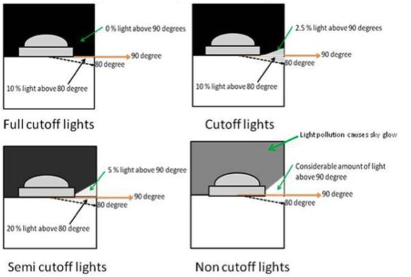
- INTERNALLY ILLUMINATED: As it relates to signs, any sign which has a light source entirely enclosed within the sign and not directly visible to the eye.
- LIGHT POLLUTION: Any adverse effect of manmade light. Often used to denote "sky glow" from cities, but also includes glare, light trespass, visual clutter and other adverse effects of lighting.
- LIGHT SOURCE: The part of a luminaire that produces light, e.g., the bulb.
- LIGHT TRESPASS: Light falling where it is not wanted or needed. Spill light falling over property lines that illuminates adjacent grounds or buildings in an objectionable manner.
- LUMINAIRE: A complete lighting unit consisting of a light source such as a lamp or lamps, together with the parts designed to position the light source and connect it to the power supply. It may also include parts to protect the light source or the ballast or to distribute the light. A lampholder itself is not a luminaire. Includes light fixtures, lamps, reflectors, and other similar devices.
- OUTDOOR LUMINAIRE: A luminaire used for lighting the exterior of structures, parking lots, pathways, service canopies, recreational areas, signs or other similar outdoor lighting uses.
- RECREATIONAL LIGHTING: Lighting used to illuminate sports fields, ball courts, playgrounds or similar outdoor recreational facilities.
- SECURITY LIGHTS: Lighting designed to illuminate a property or grounds for the purpose of visual security.
- TOWER: Any monopole, antenna or the like that exceeds eighteen feet (18') in height.
- UNSHIELDED LUMINAIRE: A luminaire that allows direct illumination to be emitted above the horizontal either directly or indirectly from the luminaire; Any luminaire that is not a full cutoff luminaire.
- Use of Luminaires.
- All outdoor luminaires must be full cutoff luminaires unless otherwise specified within this section. No unshielded luminaires are permitted. All outdoor luminaires shall have the light source downcast and fully shielded from view with the following exceptions:
- If the luminaires are less than one thousand (1,000) lumens per luminaire (equal to one sixty (60) watt incandescent lamp) provided the luminaire has an opaque top or is under a solid overhang;
- Floodlights with external shielding of the light source and is angled down toward the ground at thirty (30) degrees or less;
- Temporary lighting needed by emergency services;
- Lighting for the United States of America and State of Utah flags;
- The lighting of telecommunication towers to meet Federal Aviation Administration regulations;
- Lighting associated with an approved and permitted exterior sign;
- Luminaires used only for recreational lighting when all reasonable measures have been taken to minimize the lighting of surrounding properties. Any adjacent luminaires surrounding the recreational facility, such as lighting for sidewalks, are not exempt.
- Exterior emergency exit lighting.
- Motion sensing luminaires that are on for less than five minutes at a time, and are not used for extended lighting beyond the five-minute increments.
- Lighting for private or public outdoor events. Lighting must be turned off by 12:00 a.m. and property may not have lighting on more than twice a week. Lighting for private or public outdoor events must comply with all other standards set forth in any other applicable section of this or any other chapter.
- Holiday Lighting: Any decorative lighting put up on a temporary time period for the celebration of a special event or holiday.
- All outdoor luminaires must be full cutoff luminaires unless otherwise specified within this section. No unshielded luminaires are permitted. All outdoor luminaires shall have the light source downcast and fully shielded from view with the following exceptions:
- Standards.
- Height and Location.
- Luminaire height and location shall be designed to illuminate the site only. Light cut-offs are required to prevent spillover of direct light.
- Luminaires and supporting structures shall be placed on the same property as intended to light.
- Parking areas and exterior freestanding luminaires shall be no taller than thirty-two (32) feet, including the pole and base. When a parking area is adjacent to a residential zone, freestanding luminaires on the perimeter closest to the residential zone shall be no taller than eighteen (18) feet.
- Freestanding luminaires on private property in residential zones shall be no taller than twelve (12) feet.
- Luminaires for public street lights and recreational lighting are exempt from height regulations.
- Soffit and canopy luminaires shall be recessed or flush mounted to the bottom surface of the structure.
- Luminaires for lighting private streets and allyways shall be mounted between eight (8’) to sixteen (16’) feet above grade to provide continuous illumination of all street sidewalks and shall reflect the architectural design and characteristics of the surrounding area.
- Exterior building luminaires affixed to buildings on street-front elevations shall be mounted between 6’ and 14’ above adjacent grade.
- Visual Characteristics.
- All public areas shall be lighted with average minimum and maximum levels as follows:
- Minimum (for low or non-pedestrian and vehicular traffic areas) of 0.5 foot candles;
- Moderate (for moderate or high volume pedestrian areas) of 1-2 foot candles; and
- Maximum (for high volume pedestrian areas and building entries) of 4 foot candles.
- Lighting shall be provided at consistent levels, with gradual transitions between maximum and minimum levels of lighting and between lit areas and unlit areas. Highly contrasting pools of light and dark areas shall be avoided.
- Architectural lighting is not permitted, except as approved through design review for highlighting signature landscape features, signs or building elements. Architectural lighting shall be designed to only light the feature, shall not trespass onto any adjacent property, and shall be limited in use from 7:00 a.m.- to 12:00 a.m.
- HID or fluorescent tube lights (except compact fluorescent bulbs) are not permitted as exterior building lights.
- All public areas shall be lighted with average minimum and maximum levels as follows:
- Height and Location.
- New Structures
- Commercial, Neighborhood Commercial, Institutional, and Industrial buildings must submit a lighting plan with their building permit application with sufficient detail to determine compliance with lighting standards.
- Details needed include lighting information for parking lots, signs, walkways, luminaires over doorways, or architectural lighting.
- All new residential structures must comply with standards within this chapter.
- Commercial, Neighborhood Commercial, Institutional, and Industrial buildings must submit a lighting plan with their building permit application with sufficient detail to determine compliance with lighting standards.
- Compliance of Existing Nonconforming Luminaires.
- Compliance: All outdoor luminaires installed after the effective date hereof in all zones in the city shall conform to the requirements established by this chapter. This chapter does not apply to indoor lighting. However, Light Trespass from interior lighting that negatively impacts adjacent properties is also prohibited.
- Nonconforming Uses: All existing outdoor luminaires that do not meet the requirements of this chapter and are not exempted by this chapter shall be considered a nonconforming use. The city will encourage property owners to voluntarily bring nonconforming luminaires into compliance with this chapter. Where appropriate, the city may also provide technical assistance and expertise to homeowners in bringing their outdoor luminaires into compliance with this chapter.
- Modifications; Compliance Through Building Permit Process: The city may require outdoor luminaires to be brought into compliance through the building permit process if substantial modifications are made to the exterior of the building or if the footprint of the structure is enlarged.
- Conflicts: Should this chapter be found to conflict with other ordinances of the city, the more restrictive shall apply.
- Violations:
- The following constitute violations of this chapter:
- The installation, maintenance or operation of any luminaire not in compliance with the provisions of this chapter if such luminaire is installed after this chapter is formally adopted.
- The alteration of outdoor luminaires after a certificate of occupancy has been issued without the review and approval of the building inspector when such alteration does not conform to the provisions of this chapter.
- Failure to shield, correct or remove lighting that is installed, operated, maintained or altered in violation of this chapter.
- The following constitute violations of this chapter:
- Penalties:
- Violations and Legal actions. If, after investigation, the City Planner finds that any provision of this chapter is being violated, the City Planner or designee shall give notice by hand delivery or by certified mail, return receipt requested, of such violation to the owner and/or occupant of such premises, demanding that the violation be abated within 30 days of the date of hand delivery or of the date of mailing of the notice. The planning department staff shall be available to assist in working with the violator to correct said violation. If the violation is not abated within the 30-day period, the City Planner or designee may institute actions and proceedings, either legal or equitable, to enjoin, restrain or abate any violations of this chapter and to collect penalties for such violations.
- Penalties. A violation of this chapter, or any provision thereof, shall be punishable by a Infractions as defined in NCC 1.08, and each day of violation after the expiration of the 30-day period shall constitute a separate offense for the purpose of calculating the fine
Adopted by Ord. 20-02 on 3/12/2020
19.24.250 Accessory Dwelling Unit Standards
- Purpose
- This chapter establishes approval criteria and outlines processing procedures for accessory dwelling units.
- The purpose of this chapter is to provide opportunities to develop affordable moderate-income housing by allowing accessory dwelling units in zoning districts specified in this title, to establish the conditions under which accessory dwelling units are regulated under this chapter, and to set forth criteria and standards to be required of accessory dwelling units when this chapter is applicable.
- All Accessory Dwelling Units shall comply with the standards and provisions of this title. Accessory dwelling units that existed prior to the adoption of this ordinance, that have not received formal approval, shall be considered illegal until approved in compliance with these provisions, and the City may deny any land use or building approval requested by an owner of property that has an illegal accessory dwelling unit.
- Application
- Persons shall make application for an accessory dwelling unit on forms prepared by Nibley City. No accessory dwelling unit application shall be processed without the submission of the application, all supporting materials as required by this chapter, and the processing fee. Incomplete applications shall not be processed under any circumstances.
- Supporting Materials. The accessory dwelling unit application shall be submitted with the materials listed herein.
- Floor Plan: A floor plan of the accessory dwelling unit shall be provided
- Parking Plans: A parking plan shall be submitted showing the location of dedicated off-street parking for the accessory dwelling unit and the primary residence
- Fire Extinguisher(s): Evidence of a fire extinguisher in the accessory dwelling unit shall be provided.
- Fee: The processing fee as required by the consolidated fee schedule as approved by the City council shall be paid in full.
- A building permit is required for all new or remodeled accessory dwelling units.
- A certificate of occupancy is required prior to occupancy of any accessory dwelling unit to ensure compliance with fire, building and health codes.
- Notification must be sent to abutting property owners with an opportunity to comment to Nibley City Staff within a period of fourteen (14) days from the date of notification.
- Approval Criteria
- Proposed accessory dwelling units in compliance with the following criteria to ensure the health and safety of occupants.
- Fire, building, and health codes. The design and size of the accessory dwelling unit shall conform to all applicable standards in the fire, building, and health codes. All necessary permits shall indicate the area to be designated for accessory dwelling unit use.
- Separate addresses and mailboxes shall be placed on all accessory dwelling units regulated by this chapter as required for public safety purposes.
- Parking: Off-street parking shall be provided per NCC 19.24.160.
- One Accessory Dwelling Unit: Only one accessory dwelling unit shall be allowed for each single-family dwelling. Accessory dwelling units are not allowed on lots that contain a two-family dwelling.
- No accessory dwelling unit shall be built on a registered wetland or flood plain.
- The use of an accessory dwelling unit shall be limited to residential uses. With the exception of a home occupation, no commercial or industrial uses are permitted within an accessory dwelling unit.
- Impact Fees: Accessory dwelling units that install a separate water or sewer meter shall be subject to 100% of the impact fee of a multi-family dwelling units. Accessory dwelling unites that do not install a separate water or sewer meter shall be subject to 50% of the impact fee of a multi-family dwelling units as set forth in the latest associated Impact Fee Ordinance adjustment.
- Owners may petition the City for a rebate of impact fees for accessory dwelling units which provide rent that is considered affordable, as described below. The maximum rebate amount shall be set at 33 1/3% annually of the total collected impact fee for a period of three (3) years. City Staff shall determine if documentation of rent collected is acceptable. If documentation is not provided within 30 days of each anniversary of the issuance of the certificate of occupancy, the rebate shall be forfeited for that year. The rebate shall be non-transferrable.
- The unit’s rent is considered affordable to a household of four (4) earning 50% of the area median income of the Logan, UT-ID Metropolitan Statistical Area (MSA), according to income limits set by the US Department of Housing and Urban Development (HUD) for a period of three (3) years.
The rent limit shall be set using the following calculation: HUD annual 4-person 50% AMI Income Limit * 0.3 (30 %) – $150 (for utility expenses)
- The unit’s rent is considered affordable to a household of four (4) earning 50% of the area median income of the Logan, UT-ID Metropolitan Statistical Area (MSA), according to income limits set by the US Department of Housing and Urban Development (HUD) for a period of three (3) years.
- Owners may petition the City for a rebate of impact fees for accessory dwelling units which provide rent that is considered affordable, as described below. The maximum rebate amount shall be set at 33 1/3% annually of the total collected impact fee for a period of three (3) years. City Staff shall determine if documentation of rent collected is acceptable. If documentation is not provided within 30 days of each anniversary of the issuance of the certificate of occupancy, the rebate shall be forfeited for that year. The rebate shall be non-transferrable.
- Size, Height and Zoning
- Accessory dwelling units shall have the following requirements:
- Shall have the minimum floor area of 300 sq. ft. and a maximum floor area of 1,200 sq. ft. Garage, shop or other space not associated with the living area shall not be counted toward these limits.
- Accessory dwelling units shall have the following requirements:
- Owners of the property where the accessory dwelling unit use has been approved shall be responsible for their property’s compliance with the city’s ordinances and conditions of approval. Owners who fail to maintain or violate the city’s ordinances regulating accessory dwelling unit use or conditions upon which approval was contingent may have the permit revoked. Notice of violation shall be given to the owner of the residence containing the accessory apartment use providing 14 days to correct a violation before the permit is revoked. Persons aggrieved by the revocation of their permit may use the appeal process to have their grievances heard.
Adopted by Ord. 20-13 on 12/10/2020
Amended by Ord. 21-20 on 12/16/2021
Amended by Ord. 22-01 on 1/13/2022
Amended by Ord. 23-05 on 3/9/2023
Amended by Ord. 24-01 on 2/22/2024
Amended by Ord. 25-04 on 2/20/2025
Amended by Ord. 25-23 on 9/10/2025
Amended by Ord. 25-37 on 1/8/2026
19.24.260 Short-Term Rental Housing
- Short-term rental housing shall require a business license, which shall be renewed annually. A short-term rental in which the primary homeowner lives at the residence shall be require a home occupation business license. A short-term rental which does not house the primary homeowner shall require a commercial business license.
- During the time of business license application, the applicant for a short-term rental shall provide the City with the following information:
- Maximum occupancy of the short-term rental.
- Number of bedrooms within the home and number of bedrooms that the short-term rental will occupy.
- A certificate from the Fire Marshall to insure the home meets residential fire standards.
- A site plan which shows off-street parking areas in relation to the home and parking for the primary residence which meets the requirements of this chapter.
- Short-term rentals are only allowed within a permanent, residential structure. Short term rental of accessory structures or spaces for camping, within recreational vehicles, or other locations outside of a permanent residential structure shall only be permitted in licensed RV parks or campgrounds. This restriction does not apply to use of private property for non-commercial camping.
- All short-term rentals shall be inspected by the Fire Marshal annually to insure each home meets residential fire standards. The same residential standards apply whether the short-term rental requires a commercial or home occupation business license.
- Only one Short-term rental shall be allowed for each property.
- Off-street parking shall be provided in accordance with NCC 19.24.160.
- For short-term rentals, which are incidental to a permanent residence, this parking shall be provided in addition to the required parking for the primary dwelling unit and shall not obstruct access to the parking of the primary dwelling unit. Parking surfaces shall be constructed of a hard surface, such as concrete, asphalt, or gravel.
- Each host of a short-term rental shall inform short-term rental tenants about NCC 9.06.040: Disturbing the Peace, NCC 11.02.040: Parking Regulations, and any other applicable City ordinances. The record owner of the property shall be held responsible for any nuisance or noise violations at the short-term rental location. Two or more violations within the previous twelve-month period may be grounds for denial or revocation of a business license.
Adopted by Ord. 21-20 on 12/16/2021
Amended by Ord. 25-04 on 2/20/2025
19.24.270 Single-Family Limit
A single dwelling unit shall have no more than four (4) persons per unit who are unrelated by blood, marriage or adoption.
Adopted by Ord. 23-24 on 6/8/2023
19.24.280 Mobile Business And Food Trucks
- Location.
- Mobile businesses are permitted in any zone in which a similar, non-mobile use is listed as a conditional or permitted use, and food trucks are permitted in any zone in which restaurants are listed as a permitted or conditional use, subject to the regulations set forth in this section. A conditional use permit is not required for mobile businesses and food trucks. Mobile businesses and food trucks are not permitted to operate open to the public in any other zone.
- Mobile businesses and food trucks are not permitted to operate or store their vehicles upon any public right-of-way.
- Mobile businesses and food trucks shall be required to provide a site plan showing culinary water facilities and connections, wastewater facilities, connections and management, parking, access, and other details required for site plans for similar uses if the mobile business or food truck operates on the same private lot or parcel for ten (10) hours or more per week.
- Licensure and Approval.
- A mobile business or food truck shall obtain, for each truck, a business license from the city if the operator does not hold a current business license from another political subdivision in Utah. A mobile business or food truck may operate without a business license at events on private property that are not open to the public.
- A mobile business or food truck shall obtain or provide proof of a current health department permit, if required for the business.
- A mobile business or food truck shall obtain or provide proof of passing a fire safety inspection, if required for the business.
- Nothing herein waives any requirement regarding special event or mass gathering permits.
Adopted by Ord. 23-27 on 8/10/2023
19.26.010 Continuation Of Use
The lawful use of any building, structure or land existing at the time of the passage of this title may be continued and maintained, though such use does not conform with the provisions of this title, subject to the controls and restrictions placed thereon elsewhere in this chapter.
Adopted by Ord. No Source on 6/3/1993
19.26.020 Unsafe Structures
Any structure or portion thereof declared unsafe by the building inspector may be restored to a safe condition, subject to the restrictions in this chapter.
Adopted by Ord. No Source on 6/3/1993
19.26.030 Alterations; Reconstruction
A nonconforming building or structure may not be reconstructed nor shall such building or structure be structurally altered during its life to an extent exceeding one and one-half (11/2) times the replacement costs of the building or structure unless it is changed to a conforming use.
Adopted by Ord. No Source on 6/3/1993
19.26.040 Extension Or Addition
No extension or addition shall be made to any structure containing a nonconforming use. However, a nonconforming use may be extended to include the entire floor area of the existing building in which it was conducted at the time the use became nonconforming. Additions or extensions may be made to a residential building which is nonconforming as to height, area or yard regulations, provided said addition conforms to all the requirements for the district in which it is located and does not increase the number of dwelling units or occupancy of the building. No nonconforming use of land shall be expanded or extended or increased in intensity of use, or accessory buildings constructed.
Adopted by Ord. No Source on 6/3/1993
19.26.050 Restoration
A nonconforming building or structure which is damaged or partially destroyed by fire, flood, wind, earthquake or other calamity or act of God, or the public enemy, to the extent of not more than one and one-half (11/2) times its replacement cost at the time, may be restored and the occupancy or use of such building, structure or part thereof, which existed at the time of such partial destruction, may be continued or resumed; provided, that such restoration is started within a period of one year and is diligently prosecuted to completion. In the event such damage or destruction exceeds one and one-half (11/2) times the replacement costs of such nonconforming building or structure, no repairs or reconstruction, except in the case of dwelling structures, shall be made unless every portion of the building or structure shall be made to conform to all regulations for new buildings in the zone in which it is located.
Adopted by Ord. No Source on 6/3/1993
Amended by Ord. 2002 Code on 1/1/2002
19.26.060 Moving Nonconforming Buildings
No nonconforming building or structure shall be moved in whole or in part to any other location on the lot, unless every portion of such building or structure is made to conform to all the regulations of the zone in which it is located.
Adopted by Ord. No Source on 6/3/1993
19.26.070 Change Of Use
The nonconforming use of a building or structure may not be changed except to a conforming use. Where such change is made to a conforming use, the use shall not thereafter be changed back to a nonconforming use.
Adopted by Ord. No Source on 6/3/1993
19.26.080 Nonconforming Buildings; Abandonment By Nonuse
The nonconforming use of a building or structure or portion thereof shall be deemed abandoned by nonuse during a continuous period of one year. If a nonconforming use of any such building or structure or portion thereof has been or shall be abandoned, the same shall not thereafter be occupied or used except for a use which conforms to the use regulations of the zone in which it is located. By permit of the appeal authority as provided herein, the use of a nonconforming building or structure may be changed to a use which is permitted in the same zone use.
Adopted by Ord. No Source on 6/3/1993
Amended by Ord. 08-02 on 1/3/2008
19.26.090 Nonconforming Use Of Land; Abandonment By Nonuse
If a nonconforming use of land has been or shall be abandoned for a period of one year or more, such land shall not thereafter be used or occupied except for a use which conforms to the use regulations of the zone in which the use is located.
Adopted by Ord. No Source on 6/3/1993
19.28.010 Purpose And Intent
The purpose and intent of conditional uses is to allow in certain areas compatible integration of uses which are related to the permitted uses of the zone upon certain conditions that substantially mitigate the reasonably anticipated detrimental effects of the proposed uses.
Adopted by Ord. No Source on 6/3/1993
19.28.020 Conditional Use Permit
A conditional use permit shall be required for all uses listed as conditional uses in NCC 19.20. A conditional use permit may be revoked by the Planning Commission or City Council for failure to comply with the conditions imposed with the original approval of the permit as follows:
- The Planning Commission is the land use authority for Conditional Use Permits, but may appoint staff to review and approve conditional use permit application according to NCC 3.02.040.
- Application: Application for a conditional use permit shall be made to the City.
- Proposed Use: The applicant shall provide sufficient detail of the proposed use to allow the City to properly classify the use and gauge the proposed impact the use.
- Plans Required: Detailed location, site and any applicable building plans shall accompany the complete application forms provided by the city.
- Consideration By the City: The application, together with all pertinent information, shall be considered by the Planning Commission at its next regularly scheduled meeting according to application deadlines as adopted by the Planning Commission, or be reviewed by staff within a timely fashion.
- Public Hearing: The planning commission chair or City Manager may call a special public hearing on any application after adequate notice if it is deemed by the planning commission chair or the City Manager to be in the public interest. If a public hearing is deemed in the public interest, it shall be the responsibility of the applicant to pay a fee as set by the City Council to cover the costs incurred in advertising and notifying residents and neighbors. All property owners within three hundred feet (300') of the applicant's property must be notified by mail at least ten (10) days before the public hearing.
Adopted by Ord. No Source on 6/3/1993
Amended by Ord. 21-13 on 6/10/2021
19.28.030 Review Procedure
- The Planning Commission is the land use authority for Conditional Use Permits, but may appoint staff to review and approve conditional use permit application according to NCC 3.02.040.
- Application: Application for a conditional use permit shall be made to the City.
- Proposed Use: The applicant shall provide sufficient detail of the proposed use to allow the City to properly classify the use and gauge the proposed impact the use.
- Plans Required: Detailed location, site and any applicable building plans shall accompany the complete application forms provided by the city.
- Consideration By the City: The application, together with all pertinent information, shall be considered by the Planning Commission at its next regularly scheduled meeting according to application deadlines as adopted by the Planning Commission, or be reviewed by staff within a timely fashion.
- Public Hearing: The planning commission may call a special public hearing on any application after adequate notice if it is deemed by the planning commission or staff to be in the public interest. If a public hearing is deemed in the public interest, it shall be the responsibility of the applicant to pay a fee as set by the City Council to cover the costs incurred in advertising and notifying residents and neighbors. All property owners within three hundred feet (300') of the applicant's property must be notified by mail at least ten (10) days before the public hearing.
Adopted by Ord. No Source on 6/3/1993
19.28.040 Determination
Approval of a conditional use permit shall be granted in accordance with this chapter. The basis for the approval and all associated conditions shall be made on the record and in a written decision.
Adopted by Ord. No Source on 6/3/1993
19.28.050 Basis For Issuance Of Conditional Use Permit
- A conditional use permit shall be approved if reasonable conditions are imposed to mitigate the reasonably anticipated detrimental effects of the proposed use in accordance with applicable standards. If the reasonably anticipated detrimental effects of a proposed conditional use cannot be substantially mitigated by the proposal or the imposition of reasonable conditions to achieve compliance with applicable standards, then the conditional use may be denied. Substantial mitigation shall not mean complete elimination of all detrimental effects.
- The granting of a conditional use permit shall not exempt the application from other relevant provisions of this or other ordinances of the Nibley City, or other state, federal, fire or building standards. All proposed uses shall comply with the regulations and conditions specified in this title for such use.
- The City shall consider the following, plus other adopted standards in order to mitigate any detrimental effects of a conditional use application.
- Additional Standards for Conditional Uses for Residential Zones:
- All Conditional Uses within Residential Zones shall comply with all conditions set forth in this Title applicable to all conditional uses, Nibley City Code, Nibley City Design Standards and Specifications, and any applicable state or federal law
- Traffic and Connectivity
- Roadways and intersections shall maintain a Level of Service (LOS) C. Conditional Use Applicants shall be required to make any road updates in order to ensure the roadway will maintain LOS C.
- Site plans must comply with the Transportation and Trails Master Plan.
- Applicant may be required to limit noise associated with the conditional use that emanates beyond their property boundaries to less than 50 dBA.
- Applicant may be required to limit light associated with the conditional use that emanates beyond their property boundaries to less than 0.01 foot-candles.
- Parking
- Applicant shall provide off-street parking for the proposed use. Parking may be contained in a driveway, RV pad, or parking lot
- Applicant may be required to provide off-street accommodation for delivery and pickup of materials and supplies associated with the Conditional Use.
- Other Parking requirement shall comply with NCC 19.24.160.
- Hours of operation: Conditional Uses shall not operate, or cause outside disturbance from 10:00 p.m. to 7:00 a.m.
- Additional Standards for Conditional Uses in all Zones
- All Conditional Use Application shall comply with underlying zoning requirements as listed in this Title.
- Traffic and Connectivity
- Roadways and intersections shall maintain a Level of Service (LOS) C. Conditional Use Applicants shall be required to make any road updates in order to ensure the roadway will maintain LOS C.
- Site plans must comply with the Transportation and Trails Master Plan.
- Applicants may be required to provide an additional vehicle access to the site for one or more of the following reasons
- There is only one vehicle access road to the site
- Allow for greater emergency access to the site
- Provide for better connectivity and enhance the safety of surrounding roadways and intersections.
- Construction access to minimize impact to existing homes and infrastructure
- Utilities
- Utility lines shall be updated to comply with water, sewer and stormwater master plans within the application property and adjacent rights-of-way.
- A conditional use permit shall only be granted if the City can reasonably supply water and sewer services to the applicant for their proposed use. The City may require an applicant to turn over water shares or water rights in order to allow the City to provide long term water service to the site.
- Applicants shall connect to service lines needed to supply the use of an application. If no utility lines are available or current utility lines and services are determined to be insufficient for the proposed use by the City Engineer, the applicant shall build or provided plans for the needed infrastructure before a conditional use permit may be granted.
- All buildings shall comply with fire code and are subject to inspection of the Fire Marshall before a business license and conditional use permit is given. New buildings shall be inspected by the Fire Marshal before Occupancy can be given and inspection must be passed annually thereafter.
- Hours of Operation: The city may put limits of hours of operation from 7:00 a.m. to 10:00 p.m. on a conditional use application to mitigate noise and traffic to nearby residential zones.
- All site plans shall be approved by the City’s Engineer and Public Works departments. All site plans shall comply with Nibley City Design Standards and all projects located in Commercial and Neighborhood Commercial Zone shall comply with Nibley City Design Standards for Commercial and Institutional Use.
- The City may require the placement of fences or walls to enhance security and mitigate aesthetic or other impacts at facilities adjacent to residential areas.
- In Commercial Zones, warehousing and storage may be allowed as part of business if it is attached to offices or retail.
- Additional Standards for Conditional Uses for Residential Zones:
- The proposed use shall not lead to the deterioration of the environment of the general area, nor will produce conditions or noises or emit pollutants of such type or of such a quantity so as to detrimentally effect, to any appreciable degree, public and private properties, including the operation of existing uses thereon, or the health and safety of persons in the immediate vicinity of the community or area as a whole.
- The City may charge a conditional use applicant the cost of engineering, legal, or other professional review of the application.
Adopted by Ord. No Source on 6/3/1993
Amended by Ord. 21-16 on 9/23/2021
Amended by Ord. 21-20 on 12/16/2021
19.28.060 Appeal
- Authority; Time Limit: The decision of the planning commission may be appealed to the City Council by filing such appeal within fifteen (15) days after the date of the notice of decision sent the applicant.
- Decision Final: The City Council may uphold or reverse the decision of the planning commission and impose any additional conditions that it may deem necessary in granting an appeal. The decision of the City Council shall be final.
Adopted by Ord. No Source on 6/3/1993
19.28.070 Building Permit
Upon receipt of a conditional use permit, the developer shall take such permit to the building inspector who will review the permit and conditions attached. Based on this review and compliance with any other items that might develop in the pursuance of his duties, the building inspector may approve an application for a building permit and shall ensure that development is undertaken and completed in compliance with said permit and conditions pertaining thereto.
Adopted by Ord. No Source on 6/3/1993
19.28.080 Expiration Of Permit
Unless there is substantial action, meaning completion of sixty percent (60%) of the proposed development, under a conditional use permit within a period of one year of its issuance, as determined by the planning commission, the conditional use permit shall expire. The planning commission may grant a maximum extension of six (6) months under exceptional circumstances.
Adopted by Ord. No Source on 6/3/1993
19.32.010 Purpose And Intent
Intent: This section provides enabling authority and standards for the review and approval of applications for Residential Planned Unit Developments (R-PUD’s). The intent of this ordinance is to achieve local economic development goals, provide a diversity of housing options, create walkable neighborhoods, and protect air, water and open space resources by providing an alternative to traditional subdivision design; by encouraging innovation and offering flexibility in design of residential developments with an emphasis on the permanent preservation and creation of a variety of amenities for the enjoyment and benefit of the citizens of Nibley.
Purpose: An R-PUD is an overlay rezone. That is, applicants apply for the overlay to be applied, allowing them to receive the density outlined herein in exchange for public amenities, all while retaining the original zoning of the property. The Planning Commission and City Council may approve, deny or approve the R-PUD with conditions, and no applicant has any entitlement to the approval of an R-PUD.
Adopted by Ord. 18-10 on 5/23/2019
Amended by Ord. 23-38 on 12/14/2023
19.32.020 Definitions And Standards
- Amenity: Natural or man-made feature which enhances the development. These include features such as picnic areas, walking paths/trails outside of required sidewalks, playgrounds, sports fields, club houses, swimming pools, splash pads, etc.
- Buffer: A landscape and planted area along a public right-of-way, street, or neighboring development, a buffer must be at least thirty (30’) feet wide. Buffers must be landscaped, at the sole cost of the developer, and shall provide for every hundred (100) linear feet of buffer six trees and fifteen (15) shrubs. Tree and shrub species must be approved by the City’s arborist or the City’s Park Director. Trees and shrubs shall be planted within thirty (30) feet of the right-of-way or R-PUD boundary where required. Irrigation system shall be installed by the developer and shall be designed and installed to Nibley City Standards. Buffer areas shall be owned and maintained by an Owners Association.
- Condominium: A multiple-unit dwelling containing individually-owned dwelling units and jointly- owned shared areas and facilities, which dwelling, or development is subject to the provisions of state and local laws.
- Constrained and Sensitive Land: Land which is generally unbuildable without engineered ground modifications, or which contains features including, but not limited to Federal, State, or municipally designated wetlands, water bodies, floodplains, slopes greater than 20%, faults, canals, and other geologically or environmentally sensitive features that require mitigation, special insurance, or permits from government authorities to allow development. This land may be used as amenities if it complies fully with conditions within this chapter for qualification of amenities.
- Dwelling Unit: Any building or portion thereof which is designed for or occupied by one family for living, sleeping, and/or eating purposes. A dwelling unit may include up to two (2) persons per unit to whom rooms are rented in addition to a family related by blood, marriage or adoption, but if the number of such additional persons exceeds two (2) or if they use or are furnished separate cooking facilities, whether temporary or permanent, such additional persons shall be considered a separate dwelling unit.
- Meadows: Land vegetated with native species of grasses, trees, forbs, and flowers, either undisturbed or constructed, that can be sustained without supplemental irrigation. Actively used pasture and agricultural land are not considered Meadows under this definition.
- Net Developable Land: Net Developable land shall include the total area of the proposed development minus land that is required by Nibley City Ordinance to be dedicated to the City, including, but not limited to:
- Public access rights-of-way, including roadways and sidewalks
- Land required to be dedicated along waterways
- Preservation lands with infrastructure installed to City standards by the developer as part of the development process (public and private parks, trails, etc.)
- Constrained and Sensitive Land, as defined herein
- Easements, lands dedicated to the City for preservation space but without public rights of access, and other utility or general rights-of-way without public access.
- Constrained and Sensitive Land, land dedicated along waterways, and other natural landscape or open space land may be considered net developable land when calculating for density if such land can be enhanced with trails, public access, picnic areas, park amenities, or other improvements.
- Open Space: Any space in an R-PUD that does not contain any structures or amenities, except for park amenities, as defined herein. All Open Space must be completely landscaped with sod, trees, xeriscape, gardens or agricultural use. Natural features such as wetlands, meadows, tree stands and constrained, and sensitive lands may also be considered Open Space. Buildings, streets, parking lots, private yards, and landscaping within the rights-of-way for streets shall not be counted as Open Space.
- Patio Home: A detached, single-family unit situated on a reduced-size lot and with reduced setbacks.
- Private Parks: A tract of land presently owned or controlled and used by a private entity or group and to which only members of that private entity or group have access or use rights. Private Parks must contain at least one amenity as defined herein. Private Parks must contain one (1) tree for every 1,000 sq. ft. and 60% of the area must be planted with sod. Sod and tree requirement may be altered for approved club houses, sport courts/fields, swimming pools, splash pads, covered pavilions or other approved recreation uses.
- Owners’ Association: A community association which is organized within a development in which individual owners share common interest and responsibilities for open space, landscaping, or facilities.
- Public Park: A publicly-owned tract of land landscaped and developed for the general public. Public Parks, as defined for R-PUD, must contain at least one amenity as defined herein. Public Parks must contain one (1) tree for every 1,000 sq. ft. and 60% of the area must be planted with sod. All landscaping must meet Nibley City Standards. Sod and tree requirement may be altered for approved, sport courts/fields, swimming pools, splash pads, covered pavilions or other approved recreation uses. Public Parks shall be placed on the border of each development so that it may easily be accessed by the community as a whole. Each public park must contain a public bathroom.
- Single Family Dwelling Unit: A dwelling unit owned in fee and located on an individual lot and which is not attached to any other dwelling unit by any means.
- Town Center Area: The area as labeled on R-PUD Application Map as "Town Center Area."
- Townhome: A dwelling unit, with a private entrance, which is part of a structure whose dwelling units are attached horizontally in a linear arrangement and having a totally exposed front and rear wall to be used for access, light, and ventilation. Each townhome unit must be on its own parcel.
- Tree Stand: A group or cluster of trees within a geographic location that are occurring naturally or artificially.
- Waterway: Surface water runoff and drainage, drainage ditches and irrigation waterways, whether surface or subsurface and natural waterways including creeks, streams, springs, rivers, ponds, and wetlands.
- Planned Unit Development: For the purpose of this chapter "residential planned unit development” (R-PUD) means an integrated design for the development of residential uses to allow flexibility and initiative in site and building design and location, in accordance with an approved plan and imposed general requirements, as specified by this chapter.
Adopted by Ord. 18-10 on 5/23/2019
Amended by Ord. 19-16 on 10/10/2019
19.32.030 Use Regulations
- An R-PUD may be applied for by following the steps listed in 19.32.070 (A) on properties designated on the R-PUD Application Map in NCC 19.32.030(B). These areas keep their base zoning, with that zoning’s standards, conditions, and restrictions, unless the City Council approves the use of the R-PUD through an R-PUD application process. R-PUDs are prohibited in all other areas. The City Council, with a recommendation from the Planning Commission, may make changes to what parcels are labeled on the R-PUD Application Map by following proper ordinance change procedures.
- R-PUD Application Map
.png)
- The following are permitted uses in an R-PUD:
- Single Family and Townhome dwelling units may be permitted uses, as defined within this ordinance.
- Within the Town Center, Single Family, Patio Homes, Townhomes and Condominiums may be permitted uses, as defined within this ordinance.
- All other uses not defined within this chapter shall comply with the underlying zone, lot size, and the Land Use Chart in NCC 19.20, unless otherwise specified within this ordinance.
- Any uses not specifically permitted or conditionally permitted are prohibited.
- Animal Use: All animal uses shall be in accordance with Nibley City Code.
- Up to 30% of the Net Developable Area may be approved for neighborhood commercial use as part of an R-PUD. These uses shall comply with Nibley’s City’s Neighborhood Commercial Zone Use Chart and standards as listed in NCC 19.14.050. These parcels shall be labeled on the plat as Neighborhood Commercial.
- When calculating density for dwelling units, any Neighborhood Commercial area shall be subtracted from the Net Developable Area of the R-PUD.
- At no time shall the Planning Commission or City Council approve an R-PUD overlay application if the total possible percentage of R-PUD overlay areas exceed 15% of Nibley City’s total land area.
Adopted by Ord. 18-10 on 5/23/2019
Amended by Ord. 19-16 on 10/10/2019
19.32.040 Area And Density Regulations
- Minimum development size: The minimum total area for an R-PUD shall be 20 acres
- Housing Types: Only single-family homes and town homes are allowed in the R-PUD in residential areas, except as allowed in the Town-Center Area. The density shall be based on Net Developable Acres of the development as follows:
- Equal to or less than 7 units per Net Developable Acre a. Single Family Home R-PUD must contain a minimum of 50 units.
- A Mix of Single Family and Townhomes: Equal to or less than 5 units per Net Developable Acre. Up to 60% of dwelling units can be townhomes. a. A Mix of Single Family and Townhomes R-PUD must contain a minimum of 120 units.
- Town-Center: The area as marked on R-PUD Application Map in NCC 19.32.030 (B) as Town- Center Area shall have the following Housing Requirements.
- Single Family Home Development and Mix of Single Family and Townhome Development shall be governed by NCC 19.32.040 (A).
- A Mix of Single Family, Townhomes and Condominiums: Equal to or less than 7 units per Net Developable Acre. Up to 40% of the units can be condominiums, and a minimum of 40% of homes must be single family homes.
- Housing of a proposed R-PUD adjacent to existing single-family homes is limited to two stories in height and no more than 100 feet in building length unless otherwise buffered by an arterial roadway or 300-foot width of open space including a landscaped Buffer as defined within this chapter.
- The City may approve single family homes that do not meet the required setbacks and lot size, i.e. patio homes. These homes shall not be counted toward the single-family home requirements contained in this section and shall be counted toward the number of townhomes.
Adopted by Ord. 18-10 on 5/23/2019
Adopted by Ord. 19-16 on 10/10/2019
Amended by Ord. 22-19 on 3/9/2023
Amended by Ord. 25-15 on 7/10/2025
19.32.050 Open Space Amenities
- Each R-PUD shall provide the following types and amounts of open space and amenities:
Minimum Open Space Requirement Dwelling Type Percentage of Net
Developable Acres
Required to be Used for
Amenities and
Open SpaceSingle Family 20% A Mix of Single Family,
Townhomes and
Condominiums35% Minimum Amenity Number
of UnitsPark
AreaPublic
RestroomPavilion Swing
SetPlayground Less Than 100 1.5 Acres - - - 1 100-150 2.5 Acres - - 1 1 151-200 3.5 Acres - - 1 2 201-250 4.5 Acres 1 1 1 2 251-300 5.5 Acres 1 1 1 2 301-400 6.5 Acres 1 2 2 3 401-500 7.5 Acres 2 2 2 3 501+ * * * * * - This chart does not include all potential amenities. The applicant may apply for other amenities that would benefit the R-PUD and are in support of Nibley City’s Parks and Recreation goals. Any proposed amenities not listed, must be approved by the City Council. The City Council may also allow a substitution of amenities on the table above. These substitutions may only be approved if the cost, value and use of the amenity matches or is greater than the required amenity. The burden shall be on the developer to provide justification and is subject to review and acceptance by staff prior to Council consideration. An applicant may include additional amenities beyond the requirements of this section.
- Development over 500 units must supply adequate and proportional amenities based on the table above.
- Development may be phased according to NCC 21.02.080 and the Development Agreement. The City Council may extend phasing deadlines within the development agreement based on the size of the project and proposed amenities. Public and Owners’ Association-owned amenities shall be fully developed and operational in conjunction with each phase of the subdivision as a percentage of the total developed value of the subdivision (for example, if 25% of the dollar value of the development is being constructed, then a minimum of 25% of the dollar value of the built-out amenities must be developed). The determination of value, construction sequencing, and acceptance criteria shall be specified in the Development Agreement. An applicant may also provide an escrow or bond for improvements according to Nibley City Standards. Until improvements are accepted by the City for the attendant phase, no permits shall be issued for subsequent phases.
- All amenities designed and designated to be transferred to City ownership and maintenance must meet Nibley City Design Standards. The City must review and approve any improvements that will be owned and maintained by the City as part of the construction drawing review.
- Public and Private Park space may be combined or spread throughout the development. Each Park shall be a minimum of .25 acres. Each dwelling unit shall be within a quarter mile of a park within the development, unless otherwise approved by the City Council. Parks may be public or private. Each public park development and placement within an R-PUD shall be agreed upon by the applicant and the City Council. Park space may not include alleyways, back yards, gangways, front yards, forecourts, private patios, porches, driveways, etc.; unless proper amenities and access are provided.
- All amenities shall meet any federal, state, city, or other standards that apply.
- Sports Courts/Fields: include a facility/amenity that is built for one of the following: Tennis Court, Pickleball Court, Basketball Courts, Soccer field, Volleyball pit, Baseball field, Softball field, wallball, golf course, disc golf course, or others as approved by the City Council.
- Picnic Area: Two or more picnic tables for use by 10 or more persons.
- Pavilion: A covered picnic area. Each Pavilion must be designed for use of a minimum ten or more people.
- Playground: an area provided for children to play on. Each Playground must be designed for children twelve and younger. A playground must include features to appeal to children within the above age group including some of the following: slides, monkey bars, ladders, tunnels, climbers, bridges, ramps, platforms, etc. All playground equipment must be of commercial grade. Each playground must include a minimum of 8 features.
- Public Restroom: a room or small building with toilets and sinks that is available for use by the general public. One (1) public restroom shall contain at minimum 2 individual rooms with toilets and sinks (male/female or unisex). Larger restroom facilities may be required depending on the amount of activity projected at a particular open space/park area. All restroom facilities shall be built in compliance with the Americans with Disabilities Act (ADA).
- Maintenance of Amenities
- All R-PUDs must establish and maintain in perpetuity an Owners Association if there are open space and amenity under common ownership, or as otherwise required by federal, state or Nibley City law. The Developer shall be a member of said Owners Association while the subdivision is being developed.
- Costs: Unless otherwise agreed to by the City, the cost and responsibility of maintaining amenities shall be borne by the fee owner of the property that is part of the R-PUD or Owners Association.
- Preliminary Maintenance Plan: A Preliminary Maintenance Plan shall be submitted with the preliminary plat for proposed maintenance of amenities within the development. This plan shall outline the following:
- The proposed ownership and responsibility for maintenance of the amenities;
- The proposed use of the amenities’ and how each parcel of amenities meets the standards listed in this Chapter;
- The size of each amenities parcel; and
- The proposed concept plan for landscaping of the amenities.
- Final Maintenance Plan: The developer shall submit a plan outlining maintenance and operations of the amenities and providing for and addressing the means for the permanent maintenance of the amenities within the proposed R-PUD application for the subdivision. The developer shall provide a final maintenance plan with the final plat and the plan shall contain the following:
- Documents and plans as listed in for the Preliminary Maintenance Plan.
- A description of the use of the amenities and how that use complies with this Chapter;
- The establishment of necessary regular and periodic operation and maintenance responsibilities for the various kinds of amenities (e.g., lawns, playing fields, meadow, pasture, wetlands, stream corridors, hillsides, clubhouse, pool, woodlands, etc.);
- The estimated staffing needs, insurance requirements, and associated costs.
- The landscaping plans for parcels that will be owned by an Owners Association or by the City.
- Approval: The Final Maintenance Plan must be approved by the Administrative Land Use Authority prior to or concurrent with final plat approval for the subdivision. The Final Maintenance Plan shall be recorded against the property within the subdivision before any property or lots are sold or transferred and shall include provisions for the City's corrective action rights as set forth herein. Any changes or amendments to the Final Maintenance Plan must be approved by the Administrative Land Use Authority.
- The developer shall offer an approved letter of credit, bond or escrow for all proposed improvements as set forth in NCC 21.14.
- Failure to Maintain: The City may assume responsibility for the maintenance and operation of any portion of any amenity or common facility within an R-PUD in the event the party responsible for maintaining or operating the amenity fails to do so in accordance with the terms of this Ordinance, the approved Maintenance Agreement, any Conditional Use Permits, Business Licenses or any other agreements between the City and the developer, owners, or other parties responsible for maintaining or operating amenities. If the City assumes responsibility under this paragraph, any remaining development escrow or bond funds may be forfeited, costs, fees, and liens for maintenance costs shall be assessed as described herein, and any permits, licenses or operating agreements may be revoked or suspended by the City in the City’s sole discretion. Owners shall not impede the City in its efforts to maintain the amenities.
- Corrective Action: The City may enter onto any amenity provided as part of an R-PUD and take such corrective action, including extended maintenance, repairs, modifications, or the execution of additional agreements, as the City determines is necessary for the amenity to satisfy the terms of this Ordinance, the approved Maintenance Agreement, any Conditional Use Permits, Business Licenses or any other agreements between the City and the developer, owners, or other parties responsible for maintaining or operating amenities. The costs of such corrective action shall be charged to the owners and may include administrative costs, legal costs, and penalties. Such costs shall become a lien on said properties. Notice of such lien shall be filed by the City in the county recorder's office. The maintenance plan and all other documents creating or establishing any Association or conservation organization for the property shall reference the City's corrective action authority set forth herein and shall be recorded against the property before any property or lots are sold or transferred.
- Implementation and Maintenance: The developer of the subdivision shall fund implementation and maintenance of the amenities until such time as the control of the amenity is transferred to the owner listed in the maintenance plan. The developer shall address the implementation, development, maintenance and transfer procedures in the sensitive area designation plan map or master development plan, as applicable.
- Maintenance Access: The developer of the subdivision shall provide sufficient maintenance access from a dedicated right-of-way to all amenities and constrained and sensitive lands within the R-PUD to allow the owner of the property to have sufficient access.
- Fee in-lieu of Open Space and Amenity Requirements
- For developments that are within ½ mile of a dedicated or master-planned City Park which is two (2) acres or greater, as identified in the Nibley City Parks, Recreation and Open Space Master Plan, a developer may pay a fee in-lieu of amenities and open space required. The fee in-lieu of amenities shall be based upon the estimated cost to construct the required amenity. The fee in-lieu of open space required shall be based upon the acreage of the open space that is not provided and shall be set by the Consolidated Fee Schedule, adopted by the City Council.
- In no case shall open space within a development that includes multi-family housing be provided at a rate that is less than 10% of the net developable acreage.
- All fees in-lieu of open space and amenity required shall supplement the improvement and maintenance of parks and recreation facilities in Nibley City.
- If the developer pays a fee-in-lieu of open space requirements, the developer may develop the commensurate additional number of housing units that the fee-in-lieu offsets. For example, if the developer pays a fee-in-lieu for one (1) acre of required open space, the development is allowed up to seven (7) additional housing units or additional density if utilizing transfer of development rights (TDR), in accordance with NCC 19.48.
- Any fee in-lieu of open space or amenities must be approved by City Council as part of a development agreement approval.
Adopted by Ord. 18-10 on 5/23/2019
Amended by Ord. 19-16 on 10/10/2019
Amended by Ord. 23-38 on 12/14/2023
Amended by Ord. 25-15 on 7/10/2025
19.32.060 General Requirements
- The R-PUD should be compatible with surrounding land uses, building types and physical features of the site. Specific requirements are included below:
- Determination of Net Developable Land:
- In calculating what portion of the project is considered developable, areas designated as constrained and sensitive land may not be included in the project size.
- If the constrained and sensitive land, property along waterways or other natural landscapes may reasonably be turned into a publicly-accessible amenity, it may be re-included in the project size.
- Net Developable Land must comply with the definition within this chapter.
- Site Development Standards: The following shall serve as the setback/site development standards for each proposed R-PUD.
Single-Family Home Townhome Patio Home Condo Minimum Lot Size (sq. ft.) 4,500 - - - Minimum Frontage 50' - - - Primary-Use Setbacks Front Yard 20'(15')3 20'(15')3 20'(15')3 30'(15')3 Front Porches 10' 10' 10' 10' Side Yard 5' 10' 0' 10' Side Yard Porches, Deck,
Overhangs5' 5' 0' 5' Side Yard Adjacent
to Streets20'(15')3 20'(15')3 20'(15')3 50'(15')3 Rear Yard 15'(20')4 15'(20')4 15'(20')4 15'(20')4 Maximum Height 40' 40' 40' 40' Accessory -Use Setbacks Single-Family Home Townhome Patio Home Condo Front Yard 20' 20' 20' 20' Side Yard 3' 3' 3' 3' Side Yard Street 20' 20' 20' 20' Rear Yard 1' 1' 1' 1' Maximum Height 15' 15' 15' 15' - Setback and frontage requirements shall apply to each building, and not each dwelling unit
- All other setbacks shall comply with Nibley City Code.
- If housing unit is rear loaded, front yard and sideyard, street setback is reduced to 15’
- If housing unit is rear loaded, rear yard setback is 20’.
- All buildings and landscaping shall comply with NCC 19.24.110 Clear View of Intersecting Streets as amended.
- Signs: Any signs proposed for the development, other than traditional street signs, must conform to Nibley City Code.
- All property developed as Townhomes or Condominiums, must be subject to covenants, conditions and restrictions and must be subject to and governed by an owner’s associations in compliance with Utah Code Annotated Title 57.
- In addition, each owner’s association must have a governing board made up of property owners within the R-PUD, but general administration and maintenance of the development may be handled with a property manager. Any R-PUD that contains townhome must have onsite management, outside professional management or onsite point of contact.
- Amenities and Open Space: Maintenance and ownership of amenities and Open space may be provided for under one of the following options as approved by the City Council in the City Council’s discretion. The City may require any Amenities or Open Space within the R-PUD to be dedicated to Nibley City in order to fulfill goals listed in the Parks, Trails, and Recreation and Open Space Master Plan, or to further public good and advance goals within the General Plan or other Master Plans of the Nibley City:
- Dedication of the land to Nibley City as a public park or parkway system; or
- Granting to the city a permanent amenities easement on and over the said private amenities to guarantee that the amenities remain perpetually in recreation use, with ownership and maintenance being the responsibility of a homeowners' association established with articles of association and bylaws; or
- Adoption of covenants, conditions, and restrictions and creation of an owners’ association that provides for the payment of common expenses for the upkeep of common areas and facilities.
- Bond: For each phase, the developer shall be required to provide guarantees as set forth in NCC 21.14.
- Subsequent Subdivision: If the R-PUD is to be subsequently divided either as a subdivision into phase development parcels or separately owned and operated units, such division boundaries shall be indicated on the development plan and preliminary subdivision approval concurrently obtained in the case of a subdivision.
- Subdivision Regulations: Any part of an R-PUD that is proposed as a subdivision is subject to the provisions of the subdivision title and the standards, conditions, and restrictions of the base zoning, unless superseded by the provisions of this ordinance.
Adopted by Ord. 18-10 on 5/23/2019
Amended by Ord. 19-16 on 10/10/2019
Amended by Ord. 25-15 on 7/10/2025
19.32.070 Approval Process
- An R-PUD is an overlay zone. That is, developers apply for the overlay to be applied, allowing them to receive the density bonuses outlined herein in exchange for public amenities, all while retaining the original zoning of the property. The City Council, with a recommendation from the Planning Commission, may approve, deny or approve with conditions as a legislative action and no applicant has any entitlement to the approval of an R-PUD.
- Application Submission: An application for an R-PUD shall be submitted to the City with all required documents, maps, plats and plans as listed below.
- Procedure:
- An R-PUD shall go through the following process to gain approval:
- Development Committee: An applicant shall have a preliminary meeting with a development committee composed of applicable City staff, and other elected and appointed official as appointed by the Mayor and approved by the City Council. Overlay Zone Application: Applicants shall submit an R-PUD Overlay Zone and preliminary plat application with the following:
- A complete development plan application that is duly signed by the property owner or the owner's representative and that includes a legal description of the property and a nonrefundable application fee.
- A vicinity map showing the approximate location of the subject parcel in relation to other major areas of the city.
- A general description of the proposed development, together with a map indicating the general development pattern, land uses, densities, intensities, open spaces, parks and recreation, and how the project is coordinating with existing and planned trails, sidewalks and pedestrian walkways and any other important elements within or adjacent to the project.
- Preliminary Maintenance Plan as defined within this Chapter
- Sufficient detail to indicate how the proposed development complies with the development standards for residential and nonresidential uses according to Nibley City Code and Design Standards.
- A description of architectural design standards that will apply to all buildings within the development plan.
- A data table showing the total number of lots/units. Existing and proposed infrastructure including proposed roadways, utility locations and capacities and the estimated impacts of the proposed development plan on all public utilities including culinary water, secondary water, wastewater, transportation, storm drainage, fire protection, solid waste, parks and recreation demands of the proposed project.
- Existing physical characteristics of the site including all constrained and sensitive land
- Identify how environmental issues, if any, will be protected or mitigated, i.e., wetlands, historical sites, endangered plants and animals.
- Conceptual information relating to storm drainage including 100-year 24- hour drainage flows, 10-year 24-hour stormwater flows and proposed storm drainage facilities.
- Major street layout that meets Nibley City standards.
- A general description of controlling entities and methods such as the use of CC&Rs, Owners Associations, architectural or design review committees or associations proposed to ensure that internal compatibility related to issues such as site design and architecture will be maintained over the life of the project.
- A list of property owners’ names and addresses within three hundred feet (300') of the subject property and stamped and pre-addressed envelopes (return address to be left blank) for all property owners within three hundred feet (300') of the propose development.
- A list of land adjacent in the same ownership.
- An electronic file of all submitted plans in PDF format or other electronic format determined by city staff. Such other information shall be included as may be necessary to determine that the contemplated arrangement of uses makes it desirable to apply regulations and requirements differing from those ordinarily applicable under this title.
- Preliminary Plat: A preliminary plat that complies with Nibley City Subdivision Code and all other applicable code for the subdivision.
- Approval with Development Agreement:
- Before an R-PUD Overlay Zone can be approved, the City Council and applicant must enter into a development agreement which shall be recorded on title to the real property that is the subject of the development and which shall be binding upon and shall run with that property. The R-PUD Overlay Zone and development agreement may be approved at the same time, provided that the R-PUD Overlay Zone shall not be final or take effect until the development agreement is recorded. The development agreement must include the following provisions:
- That the development must be developed in a way that is substantially similar to the site plan and proposed amenity improvements and open space.
- That the preliminary site plan and all supporting documentation shall be attached to the development agreement.
- That any development of the proposed real property shall not exceed the number of units as listed on the preliminary plat.
- The applicant shall provide the necessary documentation to establish that any holders of interests that are superior on title to the development agreement, including, but not limited to, liens, mortgages, deeds of trust, and other similar devices have been made subordinate to the development agreement.
- Signing and recording of the development agreement, and the subordination to the development agreement of any superior interests on title, must be accomplished before an R-PUD Overlay Zone may be approved.
- Before an R-PUD Overlay Zone can be approved, the City Council and applicant must enter into a development agreement which shall be recorded on title to the real property that is the subject of the development and which shall be binding upon and shall run with that property. The R-PUD Overlay Zone and development agreement may be approved at the same time, provided that the R-PUD Overlay Zone shall not be final or take effect until the development agreement is recorded. The development agreement must include the following provisions:
- Final Subdivision Approval: Once the overlay zone and development agreement have been approved and recorded, an applicant may apply for final plat approval. An applicant shall provide the following:
- An applicant shall follow the standards as listed in NCC §21 for Final Plat approval of a subdivision.
- An applicant must submit all construction and civil engineering drawings and detailed plans for all amenities for the proposed phase of the development. These shall include landscape drawings and details. The City Engineer shall review and ensure all plans meet Nibley City standards.
- A maintenance plan and ownership plan for all improvements, amenities, and open space that complies with the terms of this chapter.
- The Administrative Land Use Authority shall approve, approve with conditions, or deny the final plat application base on the standards listed within Nibley City Code, Design Standards, and the applicant’s compliance with the Development Agreement.
- Development Committee: An applicant shall have a preliminary meeting with a development committee composed of applicable City staff, and other elected and appointed official as appointed by the Mayor and approved by the City Council. Overlay Zone Application: Applicants shall submit an R-PUD Overlay Zone and preliminary plat application with the following:
- An R-PUD shall go through the following process to gain approval:
- R-PUD Considerations: In approving with conditions, denying or approving an R-PUD proposal, the Planning Commission and City Council shall consider the following in addition to all other considerations required by law:
- Design of Buildings: The architectural design of buildings and their relationship on the site and their relationship to development beyond the boundaries of the development.
- Streets and Parking: Which streets shall be public, and which shall be private, the entrances and exits to the development, and the provisions for internal and external traffic circulation and off-street parking.
- Type, Size, and Location of Amenities.
- Landscaping and Screening: The landscaping and screening as related to the several uses within the development and as a means of its integration into its surroundings.
- Signs: The size, location, design and nature of signs, if any, and the intensity and direction or area of floodlighting.
- Ability to Complete Project: The demonstrated ability of the proponents of the R-PUD to financially carry out the proposed project under total or phase development proposals within the time limit established.
- Criteria for Issuing Conditional Use Permit: Criteria used in NCC 19.28 of this title.
- Revisions: In the event an approved development plans require revision by the developer, the development plans, and its revision shall be approved by the Nibley City Council with the recommendation of the Planning Commission. In the event revision is for a final site plan, all property owners in the development shall be notified in writing by the Planning Commission that a revision has been submitted and will be considered by the Planning Commission.
- Building Permit Issuance: The building inspector shall not issue any permit for the proposed building or use within the project unless such building or use is in accordance with the approved development plan and any conditions imposed, including completion of amenities. Time Limit: Unless there is substantial action leading toward completion of a R-PUD or an approved phase thereof within three years from the date of approval, such approval shall expire unless after reconsideration of the progress of the project an extension is approved by the City Council.
Adopted by Ord. 18-10 on 5/23/2019
Amended by Ord. 19-16 on 10/10/2019
Amended by Ord. 23-38 on 12/14/2023
19.32.080 Development Standards
These standards are intended to create R-PUD developments that will establish permanent neighborhoods and provide a sense of community. To meet the intent of this section, the following provisions shall be applied to all new multi-family residential and mixed-use developments. For exterior remodels, these standards shall be required. Commercial areas of an R-PUD must comply with Nibley City Commercial design standards for commercial developments.
- Townhome, Patio Homes, and Condominium Architectural Standards
- General Design Concepts. New development shall be designed for its specific context within Nibley City. Developments shall possess a similar design theme, and the site shall be designed such that the overall development is cohesive. Building architecture, exterior materials, and colors shall coordinate.
- All facades shall include architectural treatments to provide visual interest and to differentiate individual units. These design standards shall be applicable to all sides of a building, with each façade (front, rear, and side) being required to meet the terms of this Section.
- Building Materials. The majority of each façade (51% or more of the wall area excluding windows and doors) shall be constructed of the following hard surface building materials: brick, stone, stucco, treated or split face decorative block (CMU), fiber cement siding, concrete, composite siding, or other durable building material as approved by the City Council. EIFS or untreated concrete block (CMU) may be allowed as an accent or secondary material only. The Planning Commission may approve metal as an exterior building material and as a primary material on a case-by-case basis if an applicant can show that the type of metal is of a high grade and provides architectural quality to a building.
- Vertical Separation. Buildings in excess of one (1) story in height shall exhibit architectural detailing that establishes a vertical separation between lower and upper stories. This may be accomplished by a mid-façade cornice or trim, a change in material, style or color, a façade step-back or roof pitch with dormer windows, or other methods.
- Building Length: Building length shall not exceed 150 feet.
- Building Entrances. Building entrances shall have porches and shall be oriented toward the street or an open space area and provide connecting pedestrian access between the street, parking or open space areas.
- Variation. Townhome dwellings units shall be designed with architectural wall variations spaced at intervals of thirty (30) to fifty (50) feet in linear width, depending on the size of the building. The following architectural features shall be incorporated into the design of the building:
- Change in building materials;
- Building projections measuring at least twelve (12) inches in depth based on the scale of the proposed building;
- Awnings and lighting, or another architectural variation as approved on a case-by- case basis that creates visual interest.
- Garages. Townhomes shall be designed oriented toward exterior public roads with rear loading garages accessed by a paved parking area or alleyway, except along Highway 165 and 89/91 as approved. Rear loading garages are highly encouraged for townhomes located on interior project roads with units oriented toward a road or common courtyard area. Front loading garages may be allowed for townhomes that do not have any portion of the building adjacent to a current or planned public road or street outside of the development. Multiple unit structures shall have garages incorporated into the primary structure. At least fifty percent (50%) of units shall contain a two-car garage. Detached garages are prohibited in R-PUDs
Adopted by Ord. 18-10 on 5/23/2019
Amended by Ord. 19-16 on 10/10/2019
Amended by Ord. 22-19 on 3/9/2023
Amended by Ord. 25-15 on 7/10/2025
19.34.010 Intent
The intent of these regulations is to protect and preserve Nibley City's rural heritage while allowing multiple land uses, including agricultural and residential, within city boundaries.
Adopted by Ord. 09-12 on 9/3/2009
Amended by Ord. 21-16 on 9/23/2021
Amended by Ord. 23-35 on 12/14/2023
19.34.020 Household Pets
- Dogs and cats are permitted, according to the following table.
Dogs and Cats Animals Accessory and
Secondary
DwellingsResidential Lots
Less than .25 Acre or
Multifamily UnitsResidential Lots
Greater than or Equal
to .25 and Less
than .75 AcreResidential Lots
Greater than or Equal
to .75 AcresAgricultural Lots
Greater than or Equal
to 5.0 AcresDogs 1 2 2 2(3)1 3 Cats 1 2 3 4 4 - A kennel license which meets the requirements of 9.02.050, may be approved by designated Nibley City Staff for a third dog for lots with a single dwelling unit greater than or equal to .75 acre.
- A residential lot with a two-family housing unit or with a single-family housing unit and an accessory or secondary dwelling may have 3 total dogs without a kennel license.
- Animals of the same species less than six (6) months old of permitted household pets that are parented on premises shall not be counted or regulated.
- Service animals are not subject to the above restrictions.
- Other household pets not listed, which are legal per State and Federal Laws, are permitted if such animals are housed at all times within the primary dwelling unit.
- All other animals not specifically permitted are prohibited.
Adopted by Ord. 09-12 on 9/3/2009
Amended by Ord. 23-24 on 6/8/2023
Amended by Ord. 23-35 on 12/14/2023
19.34.030 Small Animals
- The following animals are permitted at a maximum rate of one hundred (100) small animal points per acre. Small animal points are assigned according to the following table:
Small Animal Points Animals Residential Lots
Greater than .10 Acre
and Less than .25 AcreResidential Lots
Greater than or Equal to
.25 Acre and Less than
.75 AcreResidential Lots
Greater than or Equal to
.75 AcreAgricultural Lots
Greater than or
Equal to 5.0 AcreRooster - - 105 50 Turkey - 30 30 10 Goose - 30 30 10 Rabbits 10 5 5 5 Ducks 10 5 5 5 Hen Chickens 10 5 5 5 Pigeons 10 2 2 2 Game Birds (Quail, Pheasants) 10 2 2 2 - Animals of the same species less than six (6) months old of permitted small animals that are parented on premises shall not be counted or regulated.
Adopted by Ord. 09-12 on 9/3/2009
Amended by Ord. 21-16 on 9/23/2021
Amended by Ord. 23-24 on 6/8/2023
Amended by Ord. 23-35 on 12/14/2023
19.34.040 Large Animals
- The following animals are permitted at a rate of one hundred (100) large animal points per acre. Large animal points are assigned according to the following table:
Large Animal Points Animals Residential Lots
Less than .5 AcreResidential Lots
Zoned R-E, R-1, R-1A, or R-2,
Excluding R-PUD Overlay Zones, Greater than or Equal to .5 Acre and Less than .75 AcreResidential Lots
Zoned R-E, R-1, R-1A, or R-2,
Excluding R-PUD Overlay Zones, Greater than or Equal to .75 AcreAgricultural Lots
Greater than or
Equal to 5.0 AcreHorse, pony, mule, or donkey - 50 50 25 Stallion - - - 25 Cattle: cow, heifer, or steer - 50 50 25 Cattle: bull - - - 25 Bison or buffalo or yak - - - 50 Caribou, reindeer - - - 50 Camel - - - 25 Pig2 - - 50 25 Ostrich - - 50 25 Llama or alpaca - 50 25 12 Emu - 50 25 12 Miniature horse, donkey, cow1 - 50 25 12 Sheep 25 25 15 7 Goat: Female or wether 25 25 15 7 Goat: Billy - - - 25 - A miniature horse, donkey or cow must measure no taller than 42 inches in height. Larger horses, donkeys and cows shall be allotted the points of a horse, donkey or cow above.
- For lots greater than 0.75 acres, animals of the same species less than twelve (12) months old of permitted large animals, with the exception of pigs, that are parented on premises shall not be counted or regulated. Pigs that are less than three (3) months old that are parented on premises shall not be counted or regulated.
- Second Animal Allotment: on parcels greater than or equal to 0.5 acre, the first animal shall be counted according to the regular points allotment as specified in this section, and a second large animal shall be allowed to be counted at half of the regular points allotted, for companionship and to reduce the likelihood of a single large animal becoming a nuisance. Any subsequent large animals shall be counted at the regular points allotted, as specified in this section.
Adopted by Ord. 09-12 on 9/3/2009
Amended by Ord. 21-16 on 9/23/2021
Amended by Ord. 23-35 on 12/14/2023
19.34.050 Combining Adjacent Parcels For Animal Occupancy
- A resident may combine the total amount of adjacent parcels they own or occupy, including vacant parcels, for calculating the number of large, medium, and small animals they are allowed to keep on their combined properties.
- Adjacent parcels, including vacant parcels, must be owned or occupied by the same resident to be eligible for combining. Proof of lease or other entitlement may be required for occupants of property other than the record title holder.
- Property being combined for calculation of permitted animals shall be limited to vacant property with no dwelling units and property containing a maximum of one single-family dwelling unit and one accessory dwelling unit or one two-family dwelling unit.
Adopted by Ord. 09-12 on 9/3/2009
Amended by Ord. 21-16 on 9/23/2021
Amended by Ord. 23-35 on 12/14/2023
19.34.060 Vacant Parcel Allowance For Animal Occupancy
- A vacant parcel, with no dwelling unit, is allowed an additional 25 small animal points and an additional 25 large animal points. For the purposes of regulating animals based upon lot size within this section, a vacant parcel that is 0.5 acre or larger shall be counted and regulated with an additional 0.25 acre to the subject parcel. For example, a vacant parcel that is 0.6 acre shall be regulated the same as a 0.85 acre parcel that contains a dwelling unit for the purposes of this section.
Adopted by Ord. 09-12 on 9/3/2009
Amended by Ord. 21-16 on 9/23/2021
Amended by Ord. 23-35 on 12/14/2023
19.34.070 Commercial And Industrial Parcels
Parcels which are zoned Commercial (C), Neighborhood Commercial (C-N) or Industrial (I), are subject to the same animal land use restrictions as a residential parcel.
Adopted by Ord. 09-12 on 9/3/2009
Amended by Ord. 21-16 on 9/23/2021
Amended by Ord. 23-35 on 12/14/2023
19.34.080 Keeping Of Bees
The keeping of bees is allowed under the guidelines listed in Utah Agricultural Code, Title 4 Chapter 11, Utah Bee Inspection Act and all other applicable State and Federal Regulations.
Adopted by Ord. 09-12 on 9/3/2009
Amended by Ord. 21-16 on 9/23/2021
Amended by Ord. 23-35 on 12/14/2023
19.34.090 Required Setbacks For Animal Land Uses
| Street Line, Public/Private | Dwelling Unit; Same Lot | Dwelling Unit; Adjacent Lot | Lot Line | |
| Barns, stables, coops, beehives, and other accommodations for non-household pets (more than 50 square feet) | 50 feet | 20 feet | 50 feet | 20 feet |
| Barns, stables, coops, beehives, and other accommodations for non-household pets (less than 50 square feet) | 50 feet | 10 feet | 35 feet | 10 feet |
| Manure piles, manure pits | 150 feet | 100 feet | 100 feet | 20 feet |
Adopted by Ord. 09-12 on 9/3/2009
Amended by Ord. 21-16 on 9/23/2021
Amended by Ord. 23-35 on 12/14/2023
19.34.100 Surface Drainage
Surface drainage from barns, corrals, stables, coops and other similar buildings shall not be permitted to drain into a waterway that drains into a natural stream or canal.
Adopted by Ord. 09-12 on 9/3/2009
Amended by Ord. 21-16 on 9/23/2021
Amended by Ord. 23-35 on 12/14/2023
19.34.110 Restraint Of Livestock And Pets
All livestock and pets shall be so restrained that they shall not damage or destroy adjacent property and must comply with the Nibley City animal control, nuisance and noise regulations, including those listed in NCC 9.02, "Animal Control".
Adopted by Ord. 23-14 on 6/22/2023
Amended by Ord. 23-35 on 12/14/2023
19.34.120 Creation And Continuation Of Nonconforming Uses
- Established animal land uses that are impacted by an ordinance change, including rezoning, to a more restrictive animal land use regulation shall be allowed to continue as a legally nonconforming land use (sometimes known as a "grandfathered" land use), with these additional provisions:
- The established animal land use must have been a legal land use that conformed to the previous, less restrictive regulations.
- The burden of proving the established animal land use rests on the landowner.
- The legally nonconforming animal land use will be lost if it is interrupted for more than twelve (12) continuous months. A legally nonconforming use is associated with the property on which it is established.
- An increased intensity of non-animal land uses, including subdivision of property and new building construction, on lots with legally nonconforming animal land uses shall not be allowed.
- Agricultural areas are established to provide areas where the growing of crops and the raising of livestock can be encouraged and supported within the city.
Adopted by Ord. 23-35 on 12/14/2023
19.38.010 Purpose
The purpose of this chapter is to establish a policy that reasonably governs the location of sexually oriented businesses in order to avoid adverse secondary effects which may result from the operation of such businesses. This chapter shall be construed to protect the governmental interests recognized by this chapter in a manner consistent with protections provided by the United States constitution and the Utah constitution.
Adopted by Ord. 08-06 on 4/17/2008
19.38.020 Definitions
Terms involving sexually oriented businesses shall have the meaning set forth in NCC 5.14.
Adopted by Ord. 08-06 on 4/17/2008
19.38.030 Zoning And Location Requirements
- No sexually oriented business shall be located:
- Within one thousand feet (1,000') of any public or private school, public building, public or private recreation facilities, daycare centers, public park, hospital, public library, or religious institution;
- Within seven hundred fifty feet (750') of any residential use or any residential zoning boundary;
- Within seven hundred fifty feet (750') of any other sexually oriented business, except outcall services; or
- Within seven hundred fifty feet (750') of any alcohol sales.
- No church, public park, public library, or school shall be established closer than one thousand feet (1,000') from any already existing sexually oriented business.
Adopted by Ord. 08-06 on 4/17/2008
19.42.010 Purpose And Applicability
- Purpose: It is the purpose of this chapter to:
- Comply with Utah Code §§ 10-9a-516 through 520;
- Avoid discrimination in housing against any person regardless of their age or disability in compliance with the Utah fair housing act and the federal fair housing act as interpreted by the courts having jurisdiction in Utah.
- Applicability: This chapter shall be deemed to govern any facility, residence or other circumstance that meets the definition of a residential facility as set forth in this chapter.
- Limitations: Only such residential facilities as are specifically authorized in this chapter and in this title as permitted or conditional uses shall be allowed. All other residential facilities are prohibited.
Adopted by Ord. 09-04 on 4/23/2009
19.42.020 Terms Defined
ADULT DAYCARE FACILITY: Any building or structure furnishing care, supervision, and guidance for three (3) or more adults unaccompanied by guardians for periods of less than twenty four (24) hours per day.
BOARDING SCHOOL: A private school that:
- Uses a regionally accredited education program;
- Provides a residence to the school's students:
- For the purpose of enabling the school's students to attend classes at the school; and
- As an ancillary service to educating the students at the school;
- Has the primary purpose of providing the school's students with an education (a course of study for one or more of grades kindergarten through twelfth grade); and
- Does not provide treatment or services of a residential treatment facility unless on a limited basis, as described within Utah Code § 62A-2-101(2)
BUILDING, PUBLIC: For purposes of this chapter only, a public building is a building owned and operated, or owned and intended to be operated by the city, a public agency of the United States Of America, the state of Utah, or any of its political subdivisions. The use of a public building, with immunity, is nontransferable and terminates if the structure is devoted to a use other than as a public building with immunity. A public building referred to as with immunity under the provisions of this title includes:
- Properties owned by the state of Utah or the United States government which are outside of the jurisdiction of the city zoning authority as provided under Utah Code § 10-9a-304, 1953, as amended; and
- The ownership or use of a building which is immune from the city zoning authority under the supremacy clause of the United States constitution.
DAY TREATMENT: Specialized treatment that is provided to:
- A client less than twenty four (24) hours a day; and
- Four (4) or more persons who:
- Are unrelated to the owner or provider; and
- Have emotional, psychological, developmental, physical, or behavioral dysfunctions, impairments, or chemical dependencies.
DISABILITY: A physical or mental impairment which substantially limits one or more of a person's major life activities, including a person having a record of such an impairment, or being regarded as having such an impairment. "Disability" does not include current illegal use of, or addiction to, any federally controlled substance, as defined in section 102 of the controlled substances act, 21 USC 802, or successor law. As used in this definition:
- "Physical or mental impairment" includes:
- Any physiological disorder or condition, cosmetic disfigurement, or anatomical loss affecting one or more of the following body systems: neurological; musculoskeletal;
- Special sense organs; respiratory, including speech organs;
- Cardiovascular; reproductive; digestive; genitourinary; hemic and lymphatic; skin; and endocrine; or
- Any mental or psychological disorder, such as mental retardation, organic brain syndrome, emotional or mental illness, and specific learning disabilities. The term physical or mental impairment includes, but is not limited to, such diseases and conditions as orthopedic, visual, speech and hearing impairments, cerebral palsy, autism, epilepsy, muscular dystrophy, multiple sclerosis, cancer, heart disease, diabetes, human immunodeficiency virus infection, mental retardation, emotional illness, drug addiction (other than addiction caused by current, illegal use of a controlled substance) and alcoholism.
- "Major life activities" means functions such as caring for oneself, performing manual tasks, walking, seeing, hearing, speaking, breathing, learning and working.
- "Has a record of such an impairment" means a person who has a history of, or has been misclassified as having, a mental or physical impairment that substantially limits one or more major life activities.
- "Is regarded as having an impairment" means a person who:
- Has a physical or mental impairment that does not substantially limit one or more major life activities but that is treated by another person as constituting such a limitation;
- Has a physical or mental impairment that substantially limits one or more major life activities only as a result of the attitudes of others toward such impairment; or
- Has none of the impairments defined in subsection A of this definition but is treated by another person as having such an impairment.
DOMESTIC VIOLENCE TREATMENT PROGRAM: A nonresidential program designed to provide psychological treatment and educational services to perpetrators and victims of domestic violence.
DWELLING: Any building, or portion thereof, that has one or more dwelling units occupied as, or designed or intended for occupancy as, a residence by one or more families, but not including hotels, motels, boarding houses, or other facilities offering transient lodging facilities.
DWELLING UNIT: One or more rooms in a dwelling designed for or occupied as separate living quarters which provide sleeping and sanitary facilities and which includes one but not more than one kitchen or set of fixed cooking facilities, other than hot plates or other portable cooking units, all for exclusive use by a single family maintaining a household.
ELDERLY PERSON: A person who is sixty five (65) years or older, who desires or needs to live with other elderly persons in a group setting, but who is capable of living independently.
FAMILY: One individual, or two (2) or more persons related by blood, marriage, or adoption, living together in a single dwelling unit and maintaining a common household. A family may include four (4), but not more than four (4), nonrelated persons living with the residing family. The term "family" shall not be construed to mean a group of nonrelated individuals, a fraternity, club or institutional group.
FOSTER HOME: A temporary residential living environment for the care of:
- Fewer than four (4) foster children in the home of a licensed or certified foster parent; or
- Four (4) or more children in the home of a licensed or certified foster parent if the children are siblings.
OUTPATIENT TREATMENT: Individual, family, or group therapy or counseling designed to improve and enhance social or psychological functioning for those whose physical and emotional status allows them to continue functioning in their usual living environment.
REASONABLE ACCOMMODATION: A change in a rule, policy, practice, or service necessary to afford a person with a disability equal opportunity to use and enjoy a dwelling. As used in this definition:
- "Reasonable" means a requested accommodation will not undermine the legitimate purposes of existing zoning regulations notwithstanding the benefit that the accommodation would provide to a person with a disability.
- "Necessary" means the applicant must show that, but for the accommodation, one or more persons with a disability likely will be denied an equal opportunity to enjoy housing of their choice.
- "Equal opportunity" means achieving equal results as between a person with a disability and a nondisabled person.
RESIDENCE: A dwelling unit where an individual is actually living at a given point in time and intends to remain, and not a place of temporary sojourn or transient visit.
RESIDENTIAL FACILITY: A general term for the following types of facilities as defined within this chapter:
- Residential facility for elderly persons.
- Residential facility for persons with a disability.
RESIDENTIAL FACILITY FOR ELDERLY PERSONS: A single-family or multiple-family dwelling unit that meets the requirements of Utah Code §§ 10-9a-516 to 519, as amended.
RESIDENTIAL FACILITY FOR PERSONS WITH A DISABILITY: A residence in which more than one person with a disability resides and which is licensed or certified by:
- The Utah department of human services under Utah Code § 62A-2-101, et seq., as amended, or
- The Utah department of health under Utah Code § 26-21-3, et seq., as amended.
Treatment is not a necessary component of a residential facility for persons with a disability, but may be provided upon request. Any treatment provided shall be clearly ancillary to the use of the facility as a residence.
RESIDENTIAL SUPPORT:
- Arranging for or providing the necessities of life as a protective service to individuals or families who are disabled or who are experiencing a dislocation or emergency that prevents them from providing these services for themselves or their families.
- "Residential support" includes providing a supervised living environment for persons with:
- Dysfunctions or impairments that are:
- Emotional;
- Psychological;
- Developmental; or
- Behavioral.
- Chemical dependencies.
- Dysfunctions or impairments that are:
- Treatment is not a necessary component of residential support.
- "Residential support" does not include residential services that are performed:
- Exclusively under contract with the division of services for people with disabilities; and
- In a facility that serves less than four (4) individuals.
RESIDENTIAL TREATMENT FACILITY: A twenty four (24) hour group living environment that offers room or board and specialized treatment, behavior modification, rehabilitation, discipline, emotional growth, or habilitation services for persons with emotional, psychological, developmental, or behavioral dysfunctions, impairments, or chemical dependencies. The individuals served within a residential treatment facility may be classified as disabled, but as treatment is the primary reason for residing in the facility, the facility does not qualify as a residential facility for persons with a disability. Residential treatment does not include a boarding school or foster home.
SECURE TREATMENT: A twenty four (24) hour specialized residential treatment or care for persons whose current functioning is such that they cannot live independently or in a less restrictive environment. Secure treatment differs from residential treatment to the extent that it requires intensive supervision, locked doors, and other security measures that are imposed on residents with neither their consent nor control.
SHELTER FOR THE HOMELESS: Charitable lodging or sleeping rooms provided on a temporary basis (usually on a daily basis) to those members of society lacking other safe, sanitary or affordable shelter. A shelter for the homeless may also include kitchen and cafeteria facilities.
SOCIAL DETOXIFICATION: Short term residential services for persons who are experiencing or have recently experienced drug or alcohol intoxication, that are provided outside of a healthcare facility licensed under Utah Code 26-21, health care facility licensing and inspection act, and that include:
- Room and board for persons who are unrelated to the owner or manager of the facility;
- Specialized rehabilitation to acquire sobriety; and
- Aftercare services.
SUBSTANCE ABUSE TREATMENT PROGRAM: A program:
- Designed to provide:
- Specialized drug or alcohol treatment;
- Rehabilitation; or
- Habilitation services; and
- That provides the treatment or services to persons with:
- A diagnosed substance abuse disorder; or
- Chemical dependency disorder.
THERAPEUTIC SCHOOL: A residential group living facility:
- For four (4) or more individuals that are not related to:
- The owner of the facility; or
- The primary service provider of the facility;
- That serves students who have a history of failing to function:
- At home;
- In a public school; or
- In a nonresidential private school; and
- That offers:
- Room and board; and
- An academic education integrated with:
- Specialized structure and supervision; or
- Services or treatment related to:
(1) A disability:
(2) Emotional development;
(3) Behavioral development;
(4) Familial development; or
(5) Social development.
YOUTH PROGRAM:
- A nonresidential program designed to provide behavioral, substance abuse, or mental health services to minors that:
- Serves adjudicated or nonadjudicated youth;
- Charges a fee for its services;
- May or may not provide host homes or other arrangements for overnight accommodation of the youth;
- May or may not provide all or part of its services in the outdoors;
- May or may not limit or censor access to parents or guardians; and
- Prohibits or restricts a minor's ability to leave the program at any time of the minor's own free will.
- "Youth program" does not include recreational programs such as Boy Scouts, Girl Scouts, 4-H, and other such organizations.
Adopted by Ord. 09-04 on 4/23/2009
19.42.030 Use Regulations
- Use Table: Residential facilities for persons with a disability or residential facilities for elderly persons shall be regulated in accordance with table 1.0 of this section.
TABLE 1.0
PERMITTED/CONDITIONAL/NOT PERMITTED
USES FOR GROUP LIVING FACILITIESUse Zone A R-E R-1 R-1A R-2 R-2A C C-N I Adult daycare NP NP NP NP NP NP C NP C Boarding school NP NP NP NP NP NP C NP C Day treatment NP NP NP NP NP NP C NP C Domestic violence treatment program NP NP NP NP NP NP C NP C Foster home P P P P P P P P P Outpatient treatment NP NP NP NP NP NP C NP C Residential facility for elderly persons: Family or 1 - 4 unrelated persons P P P C C C NP NP NP 5 - 6 unrelated persons P P P C C NP NP NP NP 7 - 8 unrelated persons P P P C NP NP NP NP NP Residential facility for persons with a disability: Family or 1 - 4 unrelated persons P P P C C C NP NP NP 5 - 6 unrelated persons P P P C C NP NP NP NP 7 - 8 unrelated persons P P P C NP NP NP NP NP Residential support: Family or 1 - 4 unrelated persons P P P P C C NP NP NP 5 - 6 unrelated persons C C C C NP NP NP NP NP 7 - 8 unrelated persons C C C C NP NP NP NP NP Residential treatment: Family or 1 - 4 unrelated persons P P P P P P NP NP NP 5 - 6 unrelated persons C C C C NP NP NP NP NP 7 - 8 unrelated persons C C C C NP NP NP NP NP Secure treatment NP NP NP NP NP NP C NP C Social detoxification NP NP NP NP NP NP C NP C Substance abuse treatment program NP NP NP NP NP NP C NP C Therapeutic school NP NP NP NP NP NP C NP C Youth program NP NP NP NP NP NP C NP C - Termination: A use permitted by this chapter is nontransferable and shall terminate if any of the following occur:
- A facility is devoted to a use other than a residential facility for elderly persons or a residential facility for persons with a disability;
- The facility fails to comply with the requirements of the issued permits, this chapter, or other Nibley City ordinances; or
- The license or certification issued by the department of human services or department of health terminates or is revoked.
Adopted by Ord. 09-04 on 4/23/2009
19.42.040 Residential Facility Development Standards
- Residential Facility Design Standards: Any newly constructed or remodeled residential facility in an agricultural zone or within one thousand feet (1,000') of an agricultural zone shall comply with the following design standards:
- The residential facility shall comply with all building, safety and health regulations; the Americans with disabilities act; fire regulations; and all applicable state code standards and licensing requirements. Additionally, residential facilities shall comply with all standards set forth by any other local, state or federal agency for the operation of a residential facility.
- All setbacks shall be according to the requirements of the zone in which the facility sits.
- In order for new construction to reflect the design and character of the existing neighborhood, the following standards shall be met:
- The roof design of the proposed or remodeled structure shall be a pitched roof of the same slope as the most common roof slope of the homes within the surrounding area of the proposed building; and
- The type of exterior materials shall be of traditional home finished materials of brick, siding, rock, stucco, etc. The use of these materials shall be applied in such a manner as to blend in with the neighborhood where the building is located and not draw undue attention to the building because of the materials, their color, and/or their combination being uncharacteristic of the other buildings in the neighborhood.
- An existing structure may not be utilized as a residential facility unless no structural or landscaping alterations that change the structure's residential character are required for the residential facility to operate. Any alterations to the structure, landscape or site will require the approval of the appropriate land use authority and must be completed in compliance with this section.
- Parking Standards: The residential facility shall be required to provide sufficient parking for the intended use as provided below:
- Each facility shall be subject to minimum site development standards applicable to a dwelling unit in the zone in which the facility is located; and
- The minimum number of parking spaces required shall be the same as the number required for a dwelling with similar occupancy density in the same zone.
- If it is determined by the land use authority that more parking is needed to accommodate the facilities, Nibley City may require additional parking.
- Number Of Occupants: Pursuant to the definition of "family" in NCC 19.04.010, not more than four (4) unrelated persons shall occupy a residential facility for elderly persons or any residential facility for persons with a disability established in a dwelling unit unless a reasonable accommodation is granted in conformance with this chapter.
- In no case shall more than eight (8) unrelated persons occupy a residential facility for elderly persons or any residential facility for persons with a disability.
- Applicants wishing to provide these services for more than eight (8) unrelated persons shall develop the project as an assisted living facility, and shall be required to conform to the Nibley City land use code.
- Distance From Schools And Other Residential Facilities:
- No residential facility for elderly persons or residential facility for persons with a disability shall be located within three-fourths (3/4) mile of another structure so classified.
- No residential facility for elderly persons or residential facility for persons where persons are receiving treatment for substance abuse or chemical dependency related illnesses shall be located within five hundred feet (500') of a school.
- Licenses And Certification: Prior to operation in Nibley City, the person or entity licensed or certified by the department of human services or the department of health to establish and operate the residential facility shall:
- Provide a copy of the license issued or the completed application for a license by the department of human services or the department of health to the zoning administrator.
- Certify, in a sworn affidavit, that no person will be placed or remain in the facility whose prior or current behavior, actions and/or criminal incidents or convictions, have demonstrated that such person is or may be a substantial risk or direct threat to the health or safety of other individuals, or whose said behavior, actions and/or incidents or convictions have resulted in or may result in substantial physical damage to the property of others.
- Residential facility for persons with a disability:
- Certify, in a sworn affidavit, that all current residents/clients qualify and that all future residents/clients will qualify prior to admission to the facility as persons with a disability as defined within the Americans with disabilities act.
- Residential facility for elderly persons:
- Certify, in a sworn affidavit, that all current residents/clients qualify and that all future residents/clients will qualify prior to admission to the facility as persons with a disability as defined within this chapter;
- Certify, in a sworn affidavit, compliance with all relevant state code requirements.
Adopted by Ord. 09-04 on 4/23/2009
19.42.050 Reasonable Accommodation
- Reasonable Accommodation Required: None of the foregoing conditions shall be interpreted to limit reasonable accommodations necessary to allow the establishment or occupancy of a residential facility for person(s) with a disability.
- Application: Any person or entity who wishes to request a reasonable accommodation shall make application to the Nibley City planning commission. Said applications shall specifically articulate, in writing, the following:
- The name, mailing address and phone number of the applicant;
- The nature and extent of the disability;
- An exact statement of the ordinance from which the applicant needs a reasonable accommodation;
- The applicant's proposed reasonable accommodation(s);
- A statement detailing why a reasonable accommodation is reasonable and necessary in order to afford handicapped persons equal opportunity to use and enjoy housing; and
- The physical address of the property where the applicant intends on living.
- Decision: The land use authority shall render a decision on each application for a reasonable accommodation within ninety (90) days. The decision shall be based on evidence of record demonstrating all of the following:
- The requested accommodation will not undermine the legitimate purposes of existing zoning regulations notwithstanding the benefit that the accommodation would provide to a person with a disability.
- That but for the accommodation, one or more persons with a disability will be denied an equal opportunity to enjoy housing within the community.
- That equal rights will be achieved as between the person with a disability requesting the accommodation and a nondisabled person.
- Appeal: Any person adversely affected by a final decision of the land use authority may appeal that decision in compliance with NCC 19.06.030.
Adopted by Ord. 09-04 on 4/23/2009
19.44.010 Purpose
The purposes of this ordinance are:
- To ensure that all telecommunications facilities comply with Federal, State, County and City regulations;
- To regulate telecommunications services, antennas and support structures, and related electronic equipment and equipment enclosures;
- To provide for the orderly establishment of telecommunications facilities in the City;
- To minimize the number of antenna support structures and/or utility towers by encouraging the co-location of multiple antennas on a single structure, and by encouraging the location of antennas on pre-existing support structures;
- To establish siting, appearance and safety standards that will help mitigate potential impacts related to the construction, use and maintenance of telecommunications facilities;
- To comply with the Telecommunications Act of 1996 by establishing regulations that:
- Do not unreasonably discriminate among providers of functionally equivalent services;
- Do not prohibit or have the effect of prohibiting the provision of telecommunications services;
- Are not based on any claimed environmental effects of radio frequency emissions to the extent that such facilities comply with the Federal Communication Commission's regulations concerning such emissions; and
- Ensure that all utility facilities/structures are located, installed, buffered/screened, and maintained in a manner that will minimize the impact of such facilities/ structures on nearby landowners and will not adversely affect the rural, agricultural, small town character and scenic beauty of Nibley City.
19.44.020 Definitions
The following definitions apply to regulations on telecommunication facilities, including utility towers used for telecommunications facilities.
- Ancillary Support Building - A building which is associated with and subordinate to a utility tower, necessary for the normal function of the utility tower and located on the same site as the utility tower.
- Antenna - Any system of wires, poles, rods, arms, reflecting discs or similar devices of various sizes, materials, and shapes including but not limited to solid or wire-mesh dish, home, spherical or bar configurations used for wireless transmission. Types of antennas include, but are not limited to the following.
- Wall Mounted Antenna. Any antenna mounted directly to the fascia or outside walls of a structure, existing parapet walls, penthouses, or mechanical equipment rooms, with no portion of the antenna extending above the roofline of such structures.
- Roof Mounted Antenna. An antenna mounted directly to the roof of a building, mechanical penthouse or parapet enclosure wall, which is on the rooftop of a building.
- Top-hat Antenna. Spatial array of antennas, generally located on a freestanding structure, where the visible width of antennas and antenna mounting structures are more than two (2) feet in width as viewed looking directly at the structure.
- Antenna Support Structure – A structure which may also be called a utility tower, the principal purpose of which is for location of antennas. Types of antenna support structures may include:
- Monopole. A standing antenna support structure placed directly on the ground to support one or more antennas.
- Lattice Tower. A multiple sided, open steel frame structure used to support one or more antennas.
- Guyed Tower. A communications tower that is supported, in whole or part, by guy wires and ground anchors.
- Co-Location – A telecommunications facility that includes a single antenna support structure, but more than one telecommunications provider’s antennas and telecommunication equipment.
- Cell on Wheels (COW) – A mobile temporary telecommunications facility located in a trailer.
- Equipment Enclosure – A structure, shelter, cabinet, or vault used to house and protect the electronic equipment necessary for processing wireless communication signals and other telecommunication equipment.
- Non-Stealth Design – Any antenna or equipment enclosures not camouflaged in a manner to blend with surrounding land uses, features or architecture. Non-stealth design does not conceal the intended use of the telecommunications facility. A monopole with equipment enclosures above ground and unscreened would be considered non-stealth.
- Stealth Design – Antennas, antenna support structures and telecommunication equipment enclosures camouflaged or designed to blend with surrounding land uses, features, and architecture, thus minimizing the aesthetic impact on adjacent uses, thereby concealing the intended use and appearance of the telecommunications facility such as heavy landscaping, or installing telecommunications equipment within existing buildings, behind vegetative screening, or placing equipment enclosures underground, thus preserving or striving to maintain the rural aesthetics. A flush wall mount antenna that is painted the same color as the background and located on a building where the telecommunications equipment is located inside the building would be one example of stealth design. Other examples of stealth design include, but not limited to roof mount antennas, utility pole antennas, light or flagpoles, artificial rocks or trees.
- Telecommunications Equipment – Equipment used in a telecommunications facility other than the Antenna, Antenna Support Structure, or Equipment Enclosures. Telecommunications equipment may include, but is not limited to electronic equipment necessary for processing wireless communication signals, air conditioning, backup power supplies, and emergency generators.
- Telecommunications Facility – An unmanned commercial structure, which consists of antennas, antenna support structures, telecommunications equipment, equipment enclosures as defined herein, that transmits and/or receives voice and/or data communications through radio signals such as, but not limited to "cellular' or "PCS" (Personal Communications System) communications and paging systems.
- Utility Structure and Related Facilities – May include a building/structure that is constructed so as to provide assistance, benefit, aid, directly or indirectly to a service such as electrical power, light and forms of communication; including telephone, telegraph, fiber optic signals, cellular service for other analog and digital signals, radio and television signals to name a few. This list is not intended to be all-inclusive.
- Telecommunications Tower – A structure typically higher than its surroundings used to support and/or hold telecommunications facilities including; telephone, telegraph, fiber optic signals, cellular services for both analog and digital signals, radio and television signals to name a few. This list is not intended to be all-inclusive.
19.44.030 Submissions Requirements For Conditional Use Telecommunications Facilities
- Telecommunications Master Plan & Site Justification Study Required. For all new telecommunication facilities or structures, the applicant shall submit a Telecommunications Master Plan along with a completed application, and a Site Justification Study for each proposed telecommunications facility or structure. A Site Justification Study and Telecommunications Master Plan shall be submitted to the Planning Department, which will provide a review of the proposed project to ensure that the provisions of the Nibley City Code are being met. The Planning Commission shall perform the required Conditional Use Permit review for all telecommunications facility applications. Any conflicts shall be submitted to the Commission. Said Planning Commission shall review, take public comment and render a decision by 1) approving the application, 2) approving the application with conditions, or 3) denying the application. The applicant shall request in written form what, if any, information submitted with application is to be kept confidential from public review. Except for the requirements of NCC 19.44.050(A)?, non-commercial telecommunication facilities and structures owned and managed by a licensed Amateur Radio Operator are exempted from this Chapter.
- Telecommunications Master Plan Requirements. Each company submitting an application for a Conditional Use Permit review shall complete a Telecommunications Master Plan. The Telecommunications Master Plan shall:
- Show where the applicant's proposed, existing, and future telecommunication facilities are within five miles of Nibley City. The Telecommunications Master Plan may be amended as needed by the carrier for future site applications.
- Show the number of possible co-locations that can be obtained on the proposed cell tower.
- Contain a copy of the applicant's current FCC license to the Nibley City Planning Department.
- Include an initial indication of where the road or access will be located to their proposed site. Prior to approval of a building permit, the applicant shall provide City Staff with a copy of recorded road easement(s) to the proposed site.
- Include a signed agreement, stating that the applicant will:
- Encourage co-location with other users, provided all safety, structural, and technological requirements are met. This agreement shall also state that any future owners or operators will allow co-location on the tower;
- Restore site to its former condition. (See NCC 19.44.060 Non-Maintained or Abandoned Facilities),
- Include a security program or system that addresses unauthorized access and vandalism.
- Indicate the latitude and longitude of proposed telecommunications facility including any proposed tower location.
- Site Justification Study Requirements. A Site Justification Study shall be completed for each telecommunications facility site. The Study shall include the following:
- Rationale
- An applicant proposing to erect a new telecommunications facility shall provide documentary evidence that a legitimate attempt has been made to locate the new telecommunications facility on existing buildings or structures or as a co-location on an existing antenna support structure. Such evidence shall include a radio frequency engineering analysis of the potential suitability of existing buildings or structures or co-location sites in the radio frequency coverage area for the proposed telecommunications facility. Efforts to secure such locations may be documented through correspondence between the applicant and the property owner(s) of the existing buildings, structures or co-location sites.
- The Site Justification Study shall also include a description of the elevations, vegetation, and rock formations in the area, a description of the telecommunications facilities proposed to be placed on the site with technical reasons for their design and the efforts made to minimize impacts on the activities found on the land. The applicant shall provide City Staff with propagation information for the proposed site. The applicant shall demonstrate that the telecommunications facility complies with the Nibley City General Plan, as well as the required setback, and landscaping requirements of the zoning district in which they are proposed to be located.
- Co-location. The Study shall also examine the potential for co-location at existing or the proposed site. If co-location is not possible at an existing site or if the proposed new site is not available for co-location then the applicant shall include a written explanation of why co-location is not possible.
- Equipment Enclosures. The Study must include a detailed written explanation and analysis, not limited to fiscal reasons alone, of the potential for the equipment enclosures to be either:
- Located in an existing building or
- Designed whereby the incorporation of stealth design technology or other visual screening is utilized that readily conceals the appearance of the equipment enclosures.
- Visual Analysis. On all new sites, applicant shall submit a detailed twenty-four by thirty-six inch (24”x 36”) surveyed map, not more than one (1) inch equals one hundred (100) feet, which includes;
- The topography of the area (2 ft. elevations) in which tower and/or telecommunication facilities can be located while continuing to communicate with sister tower(s).
- Delineation of where telecommunication facilities can be placed so as to minimize:
- The placement of structures from being placed on slopes of thirty percent or greater; and
- The intrusion of equipment enclosures from being silhouetted against the sky as seen from a public road; and
- Graphical illustration of the coverage of the proposed telecommunication facility.
- Rationale
Once a site is located by the applicant and City Staff the applicant shall provide an illustration which includes photo simulation(s), field mock up(s) or other techniques, which illustrate all possible visual impacts of the proposed telecommunication facility. The analysis should consider views from public areas (streets, parks, etc.) and from private residences. The applicant(s) shall identify all reasonable mitigation measures consistent with the technical aspects and requirements of the proposed facility to ensure that hill cuts for roads are minimized and, the telecommunication facility can be hidden as best as possible to preserve the rural character of the City. All costs associated with this requirement are to be borne by the applicant.
19.44.040 Development Standards
- Construction Standards, Building Codes and Safety Standards. To ensure the structural integrity of telecommunications facilities, the owner of a telecommunication facility shall ensure that it is constructed and maintained in compliance with standards contained in applicable local building codes and the applicable standards for such telecommunications facilities, as amended from time to time. Non-commercial telecommunications facilities and structures owned and operated by a licensed Amateur Radio Operator are not exempt from subsection A.
- General Requirements:
- Height shall be minimized as much as reasonably possible. Height of the telecommunication facilities shall be measured from the existing grade to the top of the antenna support structure, or to the highest point of any portion of the telecommunications facility, whichever is greater. If the proposed site is a roof mount or wall mount the City may request that the study verify that the existing or proposed screening will screen telecommunications facility from view.
- Monopoles are allowed only in the Industrial or Commercial zones.
- Guyed and Lattice Towers are only allowed in an Agricultural zone.
- Setbacks.
- In order to ensure public safety from falling ice, debris, tools or materials, the minimum distance from the base of any tower to any property line, residential property, accessory apartment, occupied business or institutional structure and/or parking area, or public recreation area shall be equal to 100 percent of the height of the tower in all zones.
- Monopoles and Guyed Towers shall be setback a minimum of 1 ½ feet (one and one-half feet) for every foot of pole height from the nearest property line.
- Any associated mechanical or electrical equipment shall be completely screened from view from public right-of-ways and adjacent properties, with a solid screen and landscaping.
- Antennas mounted to the sides of a monopole may only be allowed in the case of a co-location in accordance with NCC 19.44.030(C,2).
- Signs, Flags and Lights. All commercial or public service signs, flags, lights, floodlights, and attachments other than those required for emergency identifications, communications operations, structural stability, or as required for flight visibility by the FAA or FCC shall be prohibited on any antenna or antenna structure. This prohibition shall include the attachment to the antenna or tower of any flag, decorative sign, streamers, pennants, ribbons, spinners or waving, fluttering, or revolving devices, but not including weather devices. Security lighting for on-ground facilities and equipment shall be shielded so that no light rays are emitted by the installed fixtures at angles above the horizontal plane and have no more than 1 candlepower. It must be controlled by motion sensor. If signage is required consistent with this standard, such signage shall comply with the requirements of NCC 19.24.150, Sign Regulations.
- Access Roads. Shall be limited to twenty (20) feet in clear width except where safety considerations require otherwise, and they shall have gravel or other non-paved surface, unless they are a grass surface upon which a small truck can access the site. Existing roads shall, whenever possible, be upgraded the minimum amount necessary.
- Security. The following measures shall be required in order to ensure the safety of the tower property:
- Signage.
- Signs reading “No Trespassing” shall be posted at locations around the property, including, but not limited to, the fencing immediately around the tower, on both sides of the access road, and on each side of the outer boundaries of the property. Signs shall also include the name and number of who to contact in case of an emergency.
- Warning signs shall be limited to non-illuminated warning and equipment identification signs. Allowed signage shall be classified as “On-Site Informational Signs” and regulated as such in accordance with the City’s Sign Ordinance.
- Fencing. Security fencing eight feet in height shall surround the tower, equipment shelter and any guy wires. The fencing may include a locked gate across the access road. The Planning Commission may requiring additional reasonable fencing, if the property is adjacent to or located within five hundred feet (500’) of a residential zone.
- Signage.
- Landscaping. The following minimum landscaping requirements shall apply to all tower properties.
- An evergreen screen shall be planted around all sides of the security fencing, except for that portion necessary for the locked fence across the access road. The screen may consist of hedges or planted trees and shall extend a minimum of five feet (5’) from the fence outward towards the remainder of the property.
- The remainder of the property not covered by the evergreen screen shall be kept and maintained in good condition. The applicant shall, as part of the conditional use process, present a plan demonstrating how the property will be landscaped, maintained and screened from adjoining uses. Landscaping may include: a mix of grass, trees and bushes, xeriscaping or active farming.
- The Planning Commission may require reasonable additional landscaping requirements, if the property is adjacent to or located within five hundred feet (500’) of a residential zone.
- The applicant shall, as part of the conditional use permit approval process, submit a detailed maintenance plan demonstrating how the landscaped area shall be kept in good condition.
- Intent to Use. All applicants who apply to build only a tower shall provide at least one (1) letter of intent from a telecommunications company, which will locate on the tower.
19.44.050 Non-Maintained Or Abandoned Facilities
19.46.010 Flag Lot Requirements
- A flag lot is defined as a lot not fronting, or abutting, or with insufficient frontage along a public or private roadway, per the underlying zone, and where access to the roadway is limited to a narrow, private right-of-way or easement.
- Each unit shall have both a “front” and “rear” yard on opposite sides of the unit, with setback requirements per underlying zone.
(See diagram)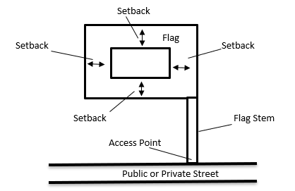
- Each unit shall have both a “front” and “rear” yard on opposite sides of the unit, with setback requirements per underlying zone.
- Existing Flag Lots: The Nibley City Planning Commission shall provide zoning clearance before a property owner can obtain a building permit from the Nibley City building inspector for an existing flag lot outside of an approved subdivision. Building permits for principal structures to be built upon a flag lot may be approved provided the following conditions are met:
- Fire protection: Each flag lot shall meet the following standards for access and address identification.
- The stem or access drive must be composed of a paved driving surface of not less than twenty feet (20’) in width with six inches (6”) minimum crushed gravel base and an eight-foot (8’) swale on one side, and a two-foot (2’) buffer on the opposite side of the swale, or a minimum of five-foot (5’). swale on each side. The Planning Commission may approve zoning clearance for a building permit for existing flag lots that existing access does not meet the full thirty-foot (30’) width if the applicant can provide proper fire access. All flag lots access shall also conform with Nibley City driveway standards.
- The driving surface shall be paved entirely from the point where the stem of the flag lot meets the publicly dedicated road to the point where the stem of the flag lot meets the flag portion of the lot, except in the case of the R-E zone, where the driving surface shall be paved from the public right-of-way or private road and remain paved within one hundred feet (100’) of any adjacent home and one hundred and fifty feet (150’) from the point where the stem of the flag lot meets the public right-of-way or private road or up to the stem of the flag lot where it meets the flag portion of the lot.
- Address of the flag lot shall be placed at the access point of each flag lot so that the address can be clearly identified from the street. The City shall install each sign and shall charge the property owner through the building permit or invoice.
- A turnaround, per the international fire code, is required to be constructed at the end of the access to the home. Prior to the Planning Commission’s approval of the building permit or subdivision application, the applicant shall submit plans for the access and turnaround to the fire marshal and shall receive the fire marshal’s approval for the access and turnaround.
- A fire hydrant and water line shall be placed at the access point or within the flag lot based on international fire code standards.
- If, in the opinion of the fire marshal, fire hydrants are vulnerable to vehicular damage, appropriate crash posts shall be required. No obstruction shall exist within a three foot (3') working area of each fire hydrant. Required crash posts shall be constructed according to Nibley City Engineering and Design Standards.
- The fire hydrant, water line and access road or driveway shall be located within a public utility easement of at least twenty feet (20') in width, such that emergency and utility service vehicles and personnel have unimpeded access to the improvements.
- Owners of a flag lot shall grant to Nibley City a permanent, recorded easement along the full width of the access, allowing for emergency vehicle access and for City inspection.
- All associated stormwater shall be retained on individual flag lots and in accordance with Nibley City stormwater design standards or stormwater plans for flag lots must be approved by the Nibley City Public Works Director.
- A stormwater pollution prevention plan shall be submitted, demonstrating how any dust, erosion or sediment problems which may result will be eliminated.
- Fire protection: Each flag lot shall meet the following standards for access and address identification.
- New Flag Lots: The creation of flag lots shall only be approved by the planning commission if the flag lot meets the conditions of this ordinance. The creation of a flag lot must be approved by the Planning Commission in connection with the preliminary plat approval before final plat approval of a subdivision. The Final Plat of a subdivision containing a flag lot shall be approved by the Administrative Land Use Authority if the flag lot and final plat conform to all City requirements. Creation of a flag lot must meet the following standards:
- Shall only be allowed for single-family detached units located in residential zones.
- Shall be created as part of a legal submission arising from an application under NCC 21.
- Flag lots shall only be allowed as part of a legal subdivision of three lots or less.
- Flag lot creation shall only be allowed in a subdivision where the parcel that is being subdivided is limited for future development by its overall size, frontage, severe topography, or land use in the adjacent parcels.
- A subdivision that can reasonably supply frontage for each lot shall not be granted the creation of a new flag lot.
- The creation of a flag lot shall not be approved in places where they would prohibit future public infrastructure connections as contained in the City’s General and Master Plans, including public roads, trails waterlines, sewer lines, stormwater facilities, etc.
- The flag lot owner owns and is responsible to maintain the stem portion of the flag lot as defined above.
- The flag lot must comply with all other conditions and requirements as listed in this chapter and within Nibley City ordinances.
- The flag portion of the lot shall meet the size requirement of the underlying zone, regardless of the size of the flag stem portion of the lot.
- All other requirements of the underlying zone, which may be outlined in Nibley City Code or in the Nibley City Design Standards & Specifications, including, but not limited to maximum grade, building height, setback, etc., shall be observed.
- Setback shall be calculated from the point where the stem of the flag lot meets the flag portion of the lot. Setbacks shall comply with the underlying zone.
- The address of the flag lot shall represent the location of the access point and the street it connects to, not the actual location of the flag portion of the lot.
- All accesses to flag lots, regardless of the underlying zone, shall be maintained as private accesses and the responsibility for maintenance of the same shall lie with those property owners who utilize said access to access their respective properties.
- All utilities running the length of the flag stem which service the home on the flag lot, shall be owned and maintained by the owner(s) of the flag lot.
- Approved flag lot accesses shall be for single lot access. The Planning Commission may consider at most a second access off the stem, if both flag lot owners have entered into a formal maintenance agreement over the access road. Two-lot access roads are not required to meet the private road access standards in NCC 21.14.050. Both flag lots must be connected to Nibley City’s required utilities including sewer. Each lot must have their own utility lines that meet Nibley City Design Standards.
- All of the required improvements as required by Nibley City design standards and code shall be installed at the property owner's expense.
Amended by Ord. 23-38 on 12/14/2023
Amended by Ord. 25-25 on 7/31/2025
19.48.010 Definitions
Agritourism: tourist related activities that support agriculture such as tours, events, farm to table restaurants, fruit and vegetable stands, etc.
Conservation Easement: an easement, covenant, restriction, or condition in a deed, will, or other instrument signed by or on behalf of the record owner of the underlying real property for the purpose of preserving and maintaining land or water areas predominantly in a natural, scenic, or open condition, or for recreational, agricultural, cultural, wildlife habitat or other use or condition consistent with the protection of open land.
Constrained and Sensitive Land: Land which is generally unbuildable without engineered ground modifications, or which contains features including, but not limited to Federal, State, or municipally designated wetlands, water bodies, floodplains, slopes greater than 20%, faults, canals, and other geologically or environmentally sensitive features that require mitigation, special insurance, or permits from government authorities to allow development.
Deed of Severance: an instrument executed by a property owner and Nibley City by which theoretical developments rights are severed from a Sending Property. A Deed of Severance may be combined with a Conservation Easement. A Deed of Severance shall be in substantially the same form as shown in Exhibit A.
Deed of Transfer: by the owner of a theoretical development right transferring development rights from a sending area to a receiving property. A Deed of Transfer shall be in substantially the same form as shown in Exhibit B.
Determination of Eligibility: a process performed by the City Planner or designee that determines the number of transferrable development rights possible to be eligible for transfer from a Sending Property.
Development Rights: the right of the owner of a parcel of land, under land development regulations in Part 3 of this Title as of date ordinance becomes effective or upon annexation, whichever is later, to place that parcel and the structures thereon to a particular use or to develop that land and the structures thereon to a particular area, density, bulk, or height.
Net Developable Land: Net Developable land shall include the total area of the proposed development minus land that is required by Nibley City Ordinance to be dedicated to the City, including, but not limited to:
- Public access rights-of-way, including roadways and sidewalks
- Land required to be dedicated along waterways
- Preservation lands with infrastructure installed to City standards by the developer as part of the development process (public and private parks, trails, etc.)
- Constrained and Sensitive Land, as defined herein
- Easements, lands dedicated to the City for preservation space but without public rights of access, and other utility or general rights-of-way without public access.
- Constrained and Sensitive Land, land dedicated along waterways, and other natural landscape or open space land may be considered net developable land when calculating for density if such land can be enhanced with trails, public access, picnic areas, park amenities, or other improvements.
Receiving Area: an overlay zoning district established by Nibley City designated as an area in which purchased development rights may be used.
Receiving Property: a lot or parcel within a receiving area and within which development rights are increased pursuant to a transfer of development rights affixed to the property.
Sending Area: one or more areas identified by this ordinance and rezoned with the Transfer of Development Rights Sending Overlay Zone as an area from which development rights are authorized to be severed and transferred to a receiving area.
Sending Property: a lot or parcel within a sending area from which development rights are authorized to be severed.
Severance of Development Rights: the process by which development rights from a sending property are severed pursuant to this ordinance.
Transfer of Development Rights: the process by which development rights from a sending property are affixed to one or more receiving properties.
Transferable Development Rights (TDRs): all or that portion of development rights that are transferred or are transferable.
Transfer of Development Rights Certificate or TDR Certificate: a certificate issued by the Nibley City Planner or designee that indicates a number of Transferable Development Rights that have been authorized for a Sending Property, which may be transferred to a Receiving Property.
19.48.020 Transfer Of Development Rights Sending Overlay
The Transfer of Development Rights Sending Overlay Zone is intended to preserve areas in Nibley City that have an agricultural or natural open space use. This intent is accomplished through a voluntary program called Transfer of Development Rights (TDR). This TDR program creates new theoretical development rights and allows for the transfer of those development rights in accordance with provisions contained in this Overlay zone. These provisions are intended to shift development potential and/or rights to areas that are more appropriate for residential development.
- The purposes of this Transfer of Development Rights Program, or TDR Program, include, but are not limited to:
- Protect and enhance private property rights by enabling the transfer of potential development rights.
- Maintain the rural heritage of Nibley City.
- Promote the public health, safety, and general welfare of Nibley City by establishing procedures, methods, and standards for the transfer of development rights.
- Establish a procedure enabling Nibley City and its landowners to voluntarily sever development rights from a sending property.
- Establish procedures for the formal transferring of development rights from a sending property, tracking those, and then to establish the use of those transferred development rights on a receiving property.
- Establish certain incentives for attaching development rights to receiving properties.
- Preserve open space, scenic views, agricultural, riparian and critical/sensitive lands.
- Protect lands, resources and structures of aesthetic, architectural, recreational, and historic significance.
- Assist in shaping the character and direction of the development of Nibley City.
- Permitted Uses within Sending Areas after a Deed of Severance and conservation easement is recorded. Uses not listed are not allowed:
- Agricultural and horticultural uses, including grazing of animals in compliance with NCC 19.34 Animal Land Use Regulations, raising crops, wholesale nurseries, and associated buildings that are specifically needed to support active, viable, and permitted agricultural and horticultural operations. Wholesale nurseries must obtain an operating permit and business license from the City and must comply with all fencing and maintenance requirements of this ordinance.
- Public rights of way and easements, including quasi-public utility easements.
- Commercial horse riding, training and boarding stables.
- Silviculture, in keeping with established standards for selective harvesting and sustained yield forestry
- One (1) single-family dwelling and one Accessory Dwelling Unit on parcels with 20 or more acres.
- Municipal facilities required for local service and/or recreation needs.
- Water supply and sewage disposal systems, and stormwater detention areas designed, landscaped, and available for use as an integral part of the conserved land.
- The creation and Transfer of Development Rights in accordance with this chapter
- Restoration, maintenance, enhancement of native vegetation.
- Publicly accessible recreational lands and facilities including trails, parks and natural lands.
- Agritourism
- Conservation of open land in its natural state, e.g., meadows, tree stands, wetlands, forestland.
- Conditional uses within Sending Areas:
- Home Occupations as per the definition in 19.04 for existing and permitted residences.
- Seasonal fruit, vegetable, tree, and hay retail sales in structures of less than 500 square feet when at least some of the products being sold are raised on the premises. Subject to having access, parking, and any utility needs approved by the City.
- Sending Areas Identified.
- Sending Areas are property that have been zoned with the Transfer of Development Rights Sending Overlay Zone, which overlay zone confers special rights and obligations as set forth in this chapter in addition to the underlying zoning regulations. Once a Deed of Severance and conservation easement is recorded, no uses other those expressly permitted herein are permitted, regardless of the underlying zoning. The Transfer of Development Rights Sending Overlay Zone may be applied to agricultural lands and open spaces as shown on the Official Zoning Map of Nibley City and parcels that dedicate trail easements that are shown on the Nibley City Trails Master Plan. Trail easements that are included as a requirement of a development project shall not be considered as potential sending areas. For agricultural parcels, Sending Areas shall be no smaller than ten (10) acres. For planned City parks or areas of historical significance, Sending Areas shall be no smaller than five (5) acres.
- A property owner may apply to have their property be designated as a Sending Area and rezoned to receive the Transfer of Development Rights Sending Overlay Zone through the City’s rezoning process set forth in 19.02.
- Where a property is partially contained within a Sending Area, only the portion of the property contained within the Sending Area may be used for the purposes of determining transferable development rights (TDRs).
- A Deed of Severance and a Conservation Easement shall be recorded on the Sending Area property from which potential development rights were severed, and the property can thereafter only be used as outlined in this section. The conservation easement requires the formal commitment from a non-profit, Land Trust, or the City for long term management of the sending property. All applicable fees, including stewardship fees, for the transfer must be paid prior to recording the Deed of Severance and Conservation Easement.
- Any landowner within the Transfer of Development Rights Sending Overlay Zone may apply to have potential development rights calculated and created for their property based on formulas contained herein. The entire property shall be submitted for calculation of potential development rights at the time of application with the City.
- All Sending Areas and property within the Transfer of Development Rights Sending Overlay Zone are eligible for a determination of potential development rights, provided that properties owned by the State or Federal agencies and existing conservation subdivisions shall not be eligible for TDR credits or severance of potential development rights.
- Determination of Transferable Development Rights.
- The City Planner or designee shall establish and maintain a system for monitoring the determination, severance, ownership, assignment, and transfer of development rights.
- The record owner of property within the Transfer of Development Rights Sending Overlay Zone shall file a Determination of Eligibility Application, with an associated fee, to determine the number of development rights available to be severed from a sending property shall be filed with the City.
- The following information shall accompany the application:
- A map that includes the following:
- The boundary map of the subject property.
- A legal description including the acreage of the property.
- Current zoning.
- Use of the property.
- Title policy or title documentation.
- Existing water rights needed to continue the current use on the property. Total water rights available to the property.
- Applicable fees.
- For agricultural parcels, commitment to farming by the owner or a lease for 10 years
- Annexation status, if applicable
- Slope and floodplain mapping
- A map that includes the following:
- Nibley City shall determine the number of development rights using the following formula, and rounded to the nearest whole number:
- TDRs = A x B for agricultural property or TDR = A x OSA for open space properties
- Where TDR means Transferrable Development Rights, A means the total area (acres) of the property, B means the allowable potential development rights on an agricultural property, OSA means the allowable potential development rights on an open space property.
- For parcels without public access including agricultural parcels, the per acre potential development units to transfer shall be 3.
- For parcels with public access, including trails and planned parks, the per acre potential development units to transfer shall be 5. If only a trail easement is dedicated, it shall be eligible for a minimum of 1 credit regardless of area of the dedicated easement. All parcels participating in the TDR program which include trail(s) identified in the Nibley City Trails Master Plan shall provide a minimum 20’ wide public trail easement(s) from property line to property line. Unimproved park areas identified in the Nibley City Parks Master Plan shall be eligible for the 5 credit per acre transfer ratio. Proposed park, trail or other publicly accessible open space areas not identified in the Parks Master Plan must be approved by Nibley City Council in order to receive the 5 credit per acre transfer ratio.
- Severance of Development Rights.
- Any proposed severance of development rights may be initiated only upon application (Eligibility Application) to the City by the record owners of the sending properties. Once an Eligibility Application/determination is completed, a TDR Certificate shall be issued. The issuance of a TDR Certificate alone does not constitute a severance of development rights, and no development rights can be transferred solely on the basis of a TDR Certificate.
- Nibley City may not require property owners to sever development rights as a condition of the development of any property.
- A severance of development rights occurs after the owner of the sending property receives a signed TDR Certificate with the number of allotted TDRs from the City and records a Deed of Severance. The Deed of Severance must transfer development rights to one or more parties, which may include the grantor, and may, but is not required to, affix development rights to one or more receiving properties.
- The Deed of Severance must be executed by the property owners of the development rights being severed, and by any lien holders of such property.
- No Deed of Severance may be recorded under this ordinance unless the Deed of Severance contains a copy of the TDR Certificate signed by the City indicating the number of TDRs being severed.
- The Deed of Severance must contain a Conservation Easement, both of which shall run with the land and must assure that the prohibitions against the use and development of the sending property will bind the landowner and every successor in interest to the landowner. Such conservation easements shall include a legally binding commitment letter from a non-profit, local Land Trust, or the City.
- Any land affected by streets identified in the Nibley City Transportation Master Plan shall be dedicated as public rights of way, with the proper width and dimensions as part of the recording of the Deed of Severance for all sending zone properties.
- The Deed of Severance and Conservation Easement shall be recorded in the office of the Cache County Recorder. Upon recordation of the Deed of Severance:
- The TDRs are severed from the sending property.
- The conservation easement shall be in compliance with the permitted uses in the Transfer of Development Rights Sending Overlay.
- The Deed of Severance shall be in a form substantially similar to the Deed of Severance attached as an exhibit to this ordinance and must otherwise comply with the requirements of this ordinance. Any changes to the deed attached as an exhibit in a particular case shall be in a form that is approved by the Nibley City Attorney.
19.48.030 Transfer Of Development Rights Receiving Overlay
The creation of the Transfer of Development Rights Receiving Overlay Zone and designation of Receiving Properties is intended to preserve the areas in Nibley to retain its rural heritage by designating areas that could receive density that is transferred from a Sending area.
This TDR program creates development rights and allows for the transfer of development rights in accordance with provisions contained in the Overlay. These provisions are intended to shift existing development potential or rights to areas that are more appropriate for residential development.
- Permitted Uses in Receiving Areas are limited to those uses which are permitted in the underlying zoning districts or as modified in below.
- Permitted Uses that include written additional standards – such standards shall still apply.
- Receiving Areas Identified.
- Receiving areas shall be designated on the official Zoning Map of Nibley City and shall function as overlay zones, such that all the provisions of the underlying zone shall apply, unless altered by the provisions of the overlay.
- Where a property is partially contained within a Receiving Area, only the portion of the property contained within the Receiving Area may be used for the purposes of applying transferable development rights (TDRs).
- A property owner may apply to have their property be designated as a Receiving Area and rezoned to receive the Transfer of Development Rights Receiving Overlay Zone through the City’s rezoning process set forth in 19.02.
- The City Council may designate additional areas as a Receiving Area through the City’s rezoning process. The Zoning Map should be updated upon designation. For future receiving area designations, the Planning Commission and City Council, in accordance with City Code, shall consider the ability of the property, utilities, nearby roadway networks, transportation system capacities and options, and other land use characteristics to accommodate additional density on the property.
- A receiving property that brings TDR credits to their property may only use the development rights permitted in accordance with the existing zoning regulations applicable to the receiving property and as shown in the table below:
Base Zone Base Density Receiving Area
Allowable Density IncreaseR-1, R-1A, R-2, R-2A Zones As per zone Up to 50% increase over the existing
zone requirementsR-PUD eligible areas 7 units per net
developable acreUp to 15 units per net developable
acreR-M eligible areas 10 units per net
developable acreUp to 20 units per net developable
acreResidential/Commercial mixed
use Projects within C or C-N zonesAs per existing zone Up to 15 units per developable acre
Commercial mixed use developments within a TDR receiving overlay zone and a Commercial or Neighborhood Commercial zone must include a minimum of 50% of land for commercial uses. The 50% use may include the entirety of the ground floor area of buildings with commercial uses on the ground floor or horizontally separated uses where commercial uses occupy an entire. For buildings with partial commercial uses on a floor or vertically separated uses, only the ground floor area of the portion dedicated to commercial uses may be counted. The portion of land that is apportioned as a commercial use shall include the ground floor area of commercial uses, as described above, and supportive uses, including parking and landscaping. Parking for a mixed-use building that is required for residential uses shall not be included as part of the land apportioned as commercial use. The residential density shall be calculated based upon the area that is dedicated to residential uses, including any mixed-use buildings. Any residential uses along 4400 South or Highway 89/91 shall be setback at least 500 feet from each right-of-way. Properties designated as receiving areas and with proof of transferred development credits, as shown in City and County records, shall be vested in the density of the underlying zone plus the additional development credits up to the limits shown in “e” above. Properties designated as receiving areas that are within R-PUD or R-M eligible areas shall be vested in the density of the R-PUD or R-M zoning designation plus additional development credits up to the limits shown in “e” above. Transfer of Development Rights to Receiving Properties shall comply with the following
- Any proposed transfer of development rights may be initiated only upon completing an Eligibility application by the owners of the sending properties, holders of a TDR Certificate, or owners of the receiving properties.
- Nibley City may not require property owners to transfer or receive a transfer of development rights as a condition of the development of any property, however no increases in density beyond what the existing zone allows shall be given without proof of transferrable development credits from a sending property.
- The record owner of receiving property within the Transfer of Development Rights Receiving Overlay Zone shall file an application for a determination of eligibility to determine the number of transferrable residential development rights available to be transferred and affixed to one or more receiving properties in compliance with this ordinance. Such application shall include:
- A completed determination of eligibility application and TDR Certificate from the sending property.
- A tax map, plat or site plan outlining the boundaries of the property for each lot, tract or parcel as described in the deed.
- The existing zoning of the property.
- A title policy or other title documentation for the receiving property including a legal description of the receiving property.
- A copy of a survey plat of the proposed receiving parcel prepared by a surveyor licensed in the State of Utah.
- Water shares or rights necessary to support the new project as provided in NCC 21.12.020.
- A statement of the number of residential development rights proposed to be transferred and affixed as residential development rights to one or more receiving properties, and calculations upon which the number is based.
- All applicable fees.
- A signed conservation easement agreement covering the sending property with a certified Land Trust, non-profit organization or Nibley City
- Any additional information required by Nibley City, shown in the application, as necessary to determine the number of residential development rights that qualify for transfer.
- The City shall provide a written statement of the maximum number of TDRs available to be transferred and affixed to one or more receiving properties.
- A transfer of development rights occurs when the owner of the development rights records a Deed of Transfer against the receiving property in the land records of Cache County.
- The Deed of Transfer shall be executed by the sending area property owners of the development rights being transferred, and any lien holders of such property owners, and shall identify the development rights being severed, and the sending properties and/or the receiving properties, as applicable.
- No Deed of Transfer may be recorded among the land records of Cache County unless the Deed of Transfer contains a copy of the signed TDR Certificate by the City Planner indicating the number of residential development rights being transferred and/or affixed to one or more receiving properties.
- Upon recordation of the Deed of Transfer, the transferable development rights are conveyed to one or more parties and/or are affixed to one or more receiving properties stated in the Deed of Transfer.
- The Deed of Transfer shall be in a form substantially similar to the Deed of Transfer attached as exhibit “C” to this ordinance and shall otherwise comply with the requirements of this ordinance and any changes to the deed attached as an exhibit in a particular case shall be in a form that is approved by the Nibley City Attorney.
- Any transfer of development rights to a receiving property pursuant to this ordinance only authorizes an increase in maximum residential density over the base density as per the table in “d” above.
- The existing zoning district regulations may be reduced/modified in terms of the following table:
R-M Eligible Areas R-PUD Eligible Areas R-1 R-1A R-2 Minimum lot area1
(Single Family)24,500 sq. ft. 4,500 sq. ft. 14,000 sq. ft. 12,000 sq. ft. 10,000 sq. ft. Minimum Lot width3 50' 50' 100' 80' 70' Minimum front yard
setback (principal use)47' 7' 20' 12' Minimum garage front
setback520' 20' 25' 22' Minimum side yard,
interior setback5' 10' 8' Minimum side yard,
street setback15' 20' 15' Minimum rear yard
setback610' 20' 15' Parking 10% parking
minimum reduction10% parking minimum reduction Unit Types
& Unit SplitNot applicable A minimum of 25% percent of the units
must be single-family detached.
Remaining units may be flexible attached
and/or multi-family unitsNot applicable
1Lot bonus increase is only granted a maximum per table in 19.48.030 C 5 and it is expected that each development will have a variety of lot sizes and not all lots will be the minimum size.
2Two-family housing is permitted per Nibley City Code 19.20. Minimum lot size per two-family home is 9,000 sq. ft or minimum area per zone in TDR ordinance, whichever is greater
3Lot width is measured at the front yard setback line.
4The building home setback includes the front of the home, living spaces, and porches, but not garages.
5The garage is intended to be setback further than the home.
6Minimum alley or rear loaded setbacks are 5’ if garage is located on the rear and is accessed from the alley. - Developments in R-PUD eligible areas – housing types may include flexible attached units with building lengths no greater than 150’. Projects with bonified TDR credits, shall, when the application meets all City standards, be approved after appropriate administrative processing for a subdivision or conditional use.
- Proposals for use of TDR credits within the R-PUD eligible areas as currently shown in NCC 19.32.030, shall become administrative and not require the rezone process in order to apply TDR credits to the project in order to allow for density which is greater than 50% greater than the underlying residential zoning designation. R-PUD projects shall follow the development standards and approval process of NCC 19.32, except as provided in this chapter.
Exhibit A
When Recorded, return to: Nibley City Attn: City Planner 455 West 3200 South Nibley, UT 84660 Affected Parcel No(s). __________ Deed of Severance and Conservation Easement
This Deed of Severance and Conservation Easement (“Deed”) is made this ____________, 20__, by and between _____________________(“Grantor”) and Nibley City, a Utah municipal corporation (“Holder”). RECITALS
WHEREAS Grantor is the sole owner in fee simple of certain real property, which is more particularly described in Exhibit A, attached hereto and incorporated by this reference (“Property”);
WHEREAS Grantor desires to sever the development rights from the Property, which rights may be transferred to other receiving property within Nibley City pursuant to Chapter 19.48 of the Nibley Municipal Code TDR Program;
WHEREAS Grantor desires to convey and dedicate a conservation easement created pursuant to Utah Code Ann. §57-18-1 et. seq. on the Property to Holder; and
WHEREAS Holder desires to accept the dedication of conservation easement to further the stated goals of the TDR Program; NOW, THEREFORE, Grantor and Holder, for and in consideration of the foregoing do hereby agree as follows: Severance of Transferable Development Rights
The development rights associated with the Property are hereby severed and converted to Transferable Development Rights (TDRs). The TDRs severed from the Property are eligible to transfer to other places within Nibley City consistent with the TDR Program and are evidenced by that certain Certificate of Transferable Development Rights No. . Further development of the Property is prohibited except as in accordance with the TDR Program. Conservation Easement
In consideration of the TDRs granted and the severance of the development rights from the Property, Grantor does hereby grant and convey, pursuant to and in accordance with Utah Code Ann. § 57-18-1 et. seq., in perpetuity, to Holder, its assigns and successors in interest, a conservation easement in said real property of the Grantor of the nature and character and to the extent hereinafter expressed, to be and to constitute a servitude upon said real property of the Grantor, which estate, interest, easement and servitude will result from the covenants and restrictions set out below and hereby imposed upon the use of said property of said Grantor, and to that end and for the purpose of accomplishing the intent of the parties hereto, said Grantor covenants on behalf of itself, its heirs, successors and assigns, with Holder and its assigns to do and refrain from doing, severally and collectively, upon the Grantor's said property, the various acts hereinafter mentioned. Grantor commits by this easement to _________ use for a period of at least ten years via a lease or continued ownership. A non-profit organization, land trust, or the City hereby commits to long term management of the Property in accordance with the Nibley City TDR Program and the rights, limitations, and restrictions set forth in this Deed. Grantor and/or developer has provided evidence of commitment by said entity and payment of any associated fees. The managing entity is:
Name:
Entity Type:
Physical Address: Signature of Managing Entity: _______________________________________________
Name and Title of Signer: ___________________________________________________
The restrictions hereby imposed upon the use of said property of the Grantor, and the acts which said Grantor so covenants to do and refrain from doing upon its said property in connection therewith are and shall be as follows:
- The easement property herein described shall be kept in a manner consistent with the TDR Program.
- Except as allowed by the TDR Program, there shall be on or in the easement property no fillings, excavating, removal of topsoil, sand, gravel, rock, minerals, or other materials nor any building of roads or change in the topography of the land in any manner, other than that caused by the forces of nature, or as reserved hereafter.
- Herbicides and pesticides can be sprayed, when it is necessary for the raising of crops. Fencing will be allowed where necessary for farming operations or confining livestock.
- No power lines with voltage in excess of 12kV m ay be erected, nor any interest in the easement property shall be granted for this purpose. The Grantor reserves the right and easement on the real property to maintain and repair existing telephone, electric, water wells, or other utility lines or mains needed to provide for the needs of the Grantor, its successors or assigns. The area needed to repair said facility shall be the minimum necessary to accomplish the task as agreed upon in writing by the Grantor and Grantee. Upon completion, the area shall be restored to its previous state or as near as practical.
- The land shall at all times be kept free of garbage, trash, and inoperable machinery; and no other unsightly material shall be allowed to accumulate or be stored thereon.
- Each and every other activity or construction which might reasonably endanger the natural, agricultural, or scenic state of the easement property is forbidden.
- Nibley City reserves the right to periodically inspect said property for violations of the easement property, and if upon sixty (60) days advance written notice the Grantor has not eliminated said violations, Nibley City may remove or eliminate, at the expense of the landowner, any violation by Grantor of the easement. A Nibley City authorized representative may enter upon said lands for the purpose of inspection. Said easement is not a public easement.
- Nibley City reserves the right to post or clearly mark the boundaries of said easement.
The conservation easement granted hereunder and the covenants heretofore made are subject to the following rights of the Grantor which are expressly reserved hereunder.
- Except as expressly limited herein, the Grantor reserves for itself, its heirs, successors and assigns, all rights as owner of the easement property, including the right to use the easement property for all ownership purposes not inconsistent with this easement or the TDR Program, including agricultural uses or other uses allow ed by the TDR Program.
- The right to build structures for agricultural use and occupancy subject to following applicable rules of the TDR Program, building codes, and setback regulations.
- The lands of the Grantor, herein above referred to and to which the provisions of this instrument apply, are situated in Nibley City, Cache County of Utah, the State of Utah, and are more particularly described as follows:
- See Attached "Exhibit A: Property Description".
TO HAVE AND TO HOLD unto Nibley City and its assigns forever. The covenants agreed to and the restrictions imposed, as aforesaid, shall be binding upon the grantor, its heirs, successors, and assigns, and each of them, and shall constitute a servitude upon the above described land. IN WITNESS WHEREOF, the Grantor has hereunto set hand on the day and year first above written, Signed and acknowledged in the presence of the notary public below: ____________________________________________________ Printed Name of Grantor ____________________________________________________ _______________________ Signature of Grantor Date CACHE COUNTY, STATE OF UTAH Before me, a notary public in and/or said county and state, personally appeared the above-named Grantor, who acknowledged that he/she did sign the forgoing instrument and that the same is his/her free act and deed whereof I hereunto set my hand and official seal this ______ day ___________, _____. ____________________________________________________ Notary Public Attachment A: PROPERTY LEGAL DESCRIPTION
______________________________________________________________________________________________________________________________________________
TRANSFERABLE DEVELOPMENT RIGHTS CERTIFICATE Certificate of Transferable Development Rights TDR Certificate Number: # ________ This document certifies that:
- Owners of real property located in Nibley, Utah, have filed a Determination of Eligibility Application with the Nibley City Community Development Department to determine whether the property is eligible for the creation of Transferable Development Rights.
- The Nibley City Planner has determined that the property is eligible for the creation of Transferable Development Rights in accordance with Chapter 19.48 of the Nibley City Municipal Code.
- The Nibley City Planner has determined the number of Transferable Development Rights that the property is eligible for in accordance with Chapter 19.48 of the Nibley City Municipal Code.
- The owners of the property have signed a Deed of Severance and a Conservation Easement or trail easement has been established with ________________.
- This Certificate represents the creation of Transferable Development Rights that will become valid and enforceable in accordance with Chapter 19.48 of the Nibley City Municipal Code upon the lawful and proper recordation of the Deed of Severance and Conservation Easement.
- The following number of Transferable Development Rights are created and severed from the property identified by the Parcel ID Number below and further described by the attached legal description.
- The Transferable Development Rights represented by this Certificate are eligible to be transferred to Receiving Areas in Nibley City in accordance with Chapter 19.48 of the Nibley Municipal Code.
Transferable Development Rights granted: __________
Property from which Transferable Development Rights originated (Cache County Parcel ID Number): _______________
____________________________________________________ _______________________
Signature of City Planner Date
Property Legal Description:
______________________________________________________________________________________________________________________________________________
Exhibit B
DEED OF TRANSFER Deed of Transfer When Recorded, return to: Nibley City Planner 455 West 3200 South Nibley, UT 84660 Affected Parcel No.: _________________ Deed of Transfer Number: _______________ Name(s) of Owners: ____________________________________________ This document certifies that:
- Owners are the holders of a Certificate of Transferable Development Rights (TDR Certificate) No. _____________, which evidences transferable development rights (TDRs) eligible for transfer to a receiving property consistent with Nibley City pursuant to Chapter 19.48 of the Nibley City Municipal Code.
- Owners have filed a Determination of Eligibility Application with the Nibley City Com m unity Development Department to determine whether the TDRs are eligible to be transferred to receiving property within Nibley City.
- The Nibley City Planner has determined, in accordance with Chapter 19.48 of the Nibley City Municipal Code, that (number) TDRs are eligible to be transferred to property located at ____________________, County Parcel No(s). _______________ (Receiving Property).
- This Certificate represents the transfer of TDRs that will become valid and enforceable in accordance with Chapter 19.48 of the Nibley City Municipal Cod e upon the lawful and proper recordation of this Deed of Transfer.
- Up on recordation of this Deed of Transfer, the TDRs associated with TDR Certificate No. ____ shall be extinguished. Holder of the TDR Certificate shall surrender the TDR Certificate before this Deed of Transfer is issued. Transferable Development Rights: ______________________ Cache County Parcel ID Number: _______________________ ____________________________________________________ _______________________ Signature of City Planner Date
Property Legal Description:
Amended by Ord. 25-15 on 7/10/2025