
North Las Vegas City Zoning Code
CHAPTER 17
16 - ZONE DISTRICTS
Sections:
17.16.010 - Official zoning map.
The boundaries of the following zones are established as shown on a map entitled "Zoning Map of North Las Vegas, Nevada," that has been recommended and approved by the North Las Vegas City Council and is made a part of this Code.
(Ord. No. 2591, § 1, 6-15-2011, eff. 10-1-2011)
17.16.020 - Interpretation of district boundaries.
Where uncertainty exists with respect to any of the boundaries of the districts as shown on the zoning map, the following rules shall apply:
A.
Where district boundaries are indicated as approximately following the centerlines of street, highway, or railroad rights-of-way or such lines extended, such centerlines or such lines extended shall be construed to be such boundaries.
B.
Where district boundaries are indicated as approximately following the corporate limit line of the City, such corporate limit line shall be construed to be such boundaries.
C.
Where district boundaries are indicated as approximately following property lines or such lines extended, such property lines or such lines extended shall be construed to be such boundaries.
D.
Where district boundaries are indicated as approximately following the centerline of drainageways, such centerlines or such lines extended shall be construed to be such boundaries.
E.
No district boundary line shall hereinafter be established to divide one lot into two or more districts.
(Ord. No. 2591, § 1, 6-15-2011, eff. 10-1-2011)
17.16.030 - Classification of annexed territory.
In the event that territory is annexed into the City, it shall be classified with the same zoning classification that was in effect on said property prior to annexation or the nearest comparable classification.
(Ord. No. 2591, § 1, 6-15-2011, eff. 10-1-2011)
17.16.040 - Establishment of districts and purpose statements.
A.
Establishment of Districts. For the purposes of this Code, the City is hereby divided into the base zone districts listed in Table 17.16-1 and overlay zone districts listed in Table 17.16-2.
B.
Compliance with District Standards. No development shall occur except in accordance with the zone district regulations of this chapter, the use regulations of Chapter 17.20 (Use Regulations), and all other applicable regulations of this Code. No land, building, structure, or premises shall be used for any purpose or in any manner other than that which is permitted in the district in which it is located.
C.
Relationship of Overlay Districts to Base Districts.
1.
Overlay districts are established in Table 17.16-2 in addition to the base districts established in Table 17.16.1. Where land is classified into an overlay district as well as a base zone district, the regulations governing development in the overlay district shall apply in addition to the regulations governing the underlying base district. In the event of an express conflict between the standards of the overlay zoning district and the base district, the standards governing the overlay district shall control.
2.
In some instances, land may be classified into multiple overlay districts as well as a base-zoning district. In the event of an express conflict between the standards of the multiple overlay districts, the most restrictive standard shall apply.
D.
Obsolete Districts. The districts identified as obsolete districts in Table 17.16-1 are maintained in this Code to minimize the creation of nonconformities. These districts shall continue to apply in areas of the City so mapped as of the adoption of this Code. Applications for future amendments to the "Zoning Map of North Las Vegas, Nevada" to designate any of the districts identified as obsolete on the zoning map shall be prohibited.
E.
Purpose Statements for Residential Districts.
1.
Open Land District (O-L). The purpose of the Open Land (O-L) district is to provide for the development of single-family detached dwellings and directly-related complementary uses at a very low-density. Secondary agricultural activities are also allowed. The district is intended to be strictly residential in character with a minimum of disturbances due to traffic or overcrowding. This district is established for those vast areas within the City that are not fully developable due to lack of utilities and services. As utilities and services become available, reclassification of lands within the district is anticipated in accordance with the city's master plan.
2.
Ranch Estates District (R-E). The purpose of the Ranch Estates (R-E) district is to provide for the development of single-family detached dwellings and directly-related complementary uses at a low-density. The district is intended to be strictly residential in character with a minimum of disturbances due to traffic or overcrowding.
3.
Ranch Estates Limited District (R-EL). The purpose of the Ranch Estates Limited (R-EL) district is to provide for the development of single-family detached dwellings and directly-related complementary uses at a low-density. The district is intended to be strictly residential in character with a minimum of disturbances due to traffic or overcrowding.
4.
Single-Family Low Density Residential District (R-1). The purpose of the Single-Family Low Density (R-1) district is to provide for the development of single-family detached dwellings, along with directly related complementary uses, at a moderately low density of 4.5 to 6.0 dwelling units per acre. The district is intended to be strictly residential in character with a minimum of disturbances due to traffic or overcrowding. The R-1 district is designed to implement the single-family low land use category of the North Las Vegas Comprehensive Plan and allow for the economical use of land while creating an attractive, functional, and safe residential environment.
5.
Single-Family Compact Lot Residential District (R-CL). The purpose of the Single-Family Compact Lot Residential (R-CL) district is to provide for the development of single-family detached dwellings and directly-related complementary uses at a density of 7.99 units per acre or less. The district is intended to be strictly residential in character with a minimum of disturbances due to traffic or overcrowding.
6.
Single-Family Medium Density Residential District (R-2). The purpose of the Single-Family Medium Density Residential (R-2) district is to provide for moderate density housing in attached single-family and multi-family structures or a combination thereof, along with directly related complementary uses, at a density of 6.01 to 13.0 dwelling units per acre. The R-2 district is designed to implement the single-family medium land use category of the North Las Vegas Comprehensive Plan and allow for the economical use of land while creating an attractive, functional, and safe residential environment.
7.
Multi-Family Residential District (R-3). The purpose of the Multi-Family Residential (R-3) district is to provide for high density (approximately 25 dwelling units per acre) housing in multifamily structures and directly related complementary uses. The R-3 district is designed to allow highly economical use of land while creating an attractive, functional, and safe residential environment.
8.
High Density Residential District (R-4). The purpose of the High Density Residential (R-4) district is to provide for very high-density (up to 50 dwelling units per acre) housing in multiple-family structures and directly-related complementary uses. The R-4 district is designed to allow highly economical use of land located near designated rapid transit nodes or redevelopment areas while creating an attractive, functional, and safe residential environment.
F.
Purpose Statements for Business Districts.
1.
Professional Office Commercial District (C-P). The purpose of the Professional Office Commercial (C-P) district is to provide for development of certain low intensity businesses, such as professional offices that are in harmony and compatible with the surrounding and adjacent residential neighborhood. These uses should generate light vehicular traffic and minimal disruption to traffic flow.
2.
Neighborhood Commercial District (C-1). The purpose of the Neighborhood Commercial (C-1) district is to provide goods and services for the convenience of the residents of the adjacent neighborhood and accessible by walking from the adjacent neighborhoods. The uses allowed in this district should provide goods and services on a neighborhood market scale that are compatible with the residential character of the surrounding neighborhood.
3.
General Commercial District (C-2). The purpose of the General Commercial (C-2) district is to provide for the development of intense retail and services that will serve as major community cores. These areas can only be developed where arterial streets can accommodate the very heavy traffic generated by such development. Due to the nature of these areas, proximity to higher density residential districts is appropriate.
4.
Business Park Industrial District (M-1). The purpose of the M-1 Business Park Industrial (M-1) district is to accommodate light industrial uses, offices, and warehousing in a comprehensively planned and attractive setting while minimizing the amount of non-industrial uses (e.g., retail, religious institutions, and banks).
5.
General Industrial District (M-2). The purpose of the General Industrial (M-2) district is to provide for the development of uses that, because of the nature of their operation, appearance, traffic generation, or emission, would not be compatible with land uses in most other zone districts, but which, nevertheless, are necessary and desirable activities in the City. The provision for non-industrial uses (e.g., retail, religious institutions, and banks) is limited in this district.
G.
Purpose Statements for the Redevelopment Area District and Subdistricts.
1.
Redevelopment Area District (R-A).
a.
The purpose of the Redevelopment Area District is to further the goals of the North Las Vegas Downtown Master Plan and Investment Strategy, including:
(i)
Make Downtown North Las Vegas a local and regional destination with a unique identity;
(ii)
Brand and market Downtown with a unique sense of place and distinct themes (i.e. naming streets after local heroes, identifying sub-areas or districts, creating signage and wayfinding, etc.);
(iii)
Address traffic problems through a combination of demand management, access management, and circulation improvements;
(iv)
Make the Downtown safe and inviting for pedestrians and bicyclists;
(v)
Improve pedestrian, bicycle, and auto access into the Downtown core from residential neighborhoods;
(vi)
Celebrate the cultural past and present of the area - incorporating music and art to reestablish a cultural center;
(vii)
Retain and support existing residents and local businesses;
(viii)
Improve Downtown's economic vitality with programs, incentives, and public-private partnerships to attract new business and investment;
(ix)
Create a family-friendly environment with excellent schools, parks, and public open spaces; and
(x)
Connect existing and new development through coordination, design standards, and improvements to the public realm.
b.
In addition, it shall be the purpose of this section to:
(i)
Designate areas for intensification of the retail and service uses along Lake Mead Boulevard and along Las Vegas Boulevard North;
(ii)
Designate areas for intensification of casino, hotel and entertainment uses along Las Vegas Boulevard North and along Lake Mead Boulevard, west of Las Vegas Boulevard North;
(iii)
Designate medium high and high-density residential areas as buffers between retail/service, offices and casino/hotel/entertainment uses and adjacent stable neighborhoods; and
(iv)
Coordinate the streetscape design elements of public rights-of-way and other public and semi-public properties with private development activities within the redevelopment area.
2.
Redevelopment Area Subdistricts.
a.
The R-A District shall be divided into the following subdistricts:
(i)
Medium Density Residential Subdistrict (R-A/R-2). The purpose of the Medium Density Residential (R-A/R-2) Subdistrict is to provide single-family and medium-density multifamily development that supports the nonresidential development of the redevelopment district and is compatible with the stated purpose of the redevelopment district.
(ii)
Medium-High Density Residential Subdistrict (R-A/R-3). The purpose of the Medium-High Density Residential (R-A/R-3) Subdistrict is to provide for higher density multi-family housing that supports the nonresidential development of the redevelopment district and is compatible with the stated purpose of the redevelopment district.
(iii)
High Density Residential Subdistrict (R-A/R-4). The purpose of the High Density Residential (R-A/R-4) subdistrict is to provide for very high-density (up to fifty (50) dwelling units per acre) housing in multiple-family structures and directly-related complementary uses within the redevelopment area. The R-A/R-4 district is designed to allow highly economical use of land located near designated rapid transit nodes or redevelopment areas while creating an attractive, functional, and safe residential environment.
(iv)
Downtown Core Subdistrict (R-A/DC). The purpose of the Downtown Core (R-A/DC) subdistrict is to promote pedestrian-friendly, high-intensity development within Downtown North Las Vegas that includes a mixture of commercial, office, entertainment, public, and residential uses.
(v)
Public/Semi-Public Subdistrict (R-A/PSP). The purpose of the Public/Semi-Public (R-A/PSP) subdistrict is to provide an area for essential public and semi-public uses that will complement a vital redevelopment area and its retail and office subdistricts.
b.
The boundaries of the above subdistricts are established as shown on a map entitled "Zoning Map of North Las Vegas, Nevada," as identified in Section 17.16.010.
c.
Where uncertainty exists with respect to any of the boundaries of the subdistricts as shown on the zoning map, the boundaries shall be interpreted according to the rules of Section 17.16.020.
H.
Purpose Statements for Special Purpose Districts.
1.
Public/Semi-Public District (PSP). The purpose of the Public/Semi-Public District (PSP) district is to provide an area primarily for those uses grouped under the heading "Public and Institutional Uses" in Table 17.20-1 in locations where they can provide efficient and convenient services to the public.
2.
Planned Unit Development District (PUD).
a.
General Purpose. The purpose of the Planned Unit Development (PUD) district is to serve as an alternative to conventional zoning and development approaches and processes in a manner consistent with the purposes of NRS 278A.020 in order to:
(i)
Enhance the City's public health, safety, and general welfare as North Las Vegas increasingly urbanizes;
(ii)
Encourage innovations in residential, commercial, and industrial development so that greater opportunities for better housing of all types and design, recreation, shopping, and employment may extend to all citizens and residents of North Las Vegas;
(iii)
Provide for necessary commercial and industrial facilities to be conveniently located near housing;
(iv)
Reflect changes in the technology of land development so that resulting economies may be made available to those who need homes and to encourage more efficient use of land and public and private services;
(v)
Reflect changes in the technology of land development;
(vi)
Encourage a more creative approach in the utilization of land in order to accomplish a more efficient, aesthetic, and desirable development that may be characterized by special features of the geography, topography, size, or shape of a particular property;
(vii)
Provide a compatible, stable, developed environment in harmony with that of the surrounding area; and
(viii)
Insure that increased flexibility of substantive regulations be administered in such a way as to encourage the disposition of proposals for land development without undue delay.
The preceding purposes shall be balanced so that each PUD shall consist of a harmonious selection of uses and groupings of buildings, parking areas, circulation and open spaces, and shall be designed as an integrated unit, in such manner as to constitute a safe, efficient, and convenient urban area development.
b.
Integrated Design. The PUD shall consist of a harmonious selection of uses and groupings of buildings, parking areas, circulation, and open spaces, and shall be designed as an integrated unit, in such manner as to constitute a safe, efficient, and convenient urban area development.
c.
PUD Subtypes. The PUD district may be established throughout the City pursuant to the procedure and guidelines set forth in this Code. However, there is herein established a PUD subtype called a Planned Infill Development (PID) district. The purpose and intent of the PID district is the same as that for the overall PUD district but is tailored to the unique situation of infill development in the mature neighborhoods of North Las Vegas. Furthermore, the specific purpose of the PID district is to:
(i)
Accommodate growth by encouraging and facilitating new development/redevelopment on vacant and/or underutilized land in areas that already have infrastructure, utilities, and public facilities;
(ii)
Encourage efficient use of land and public services within the context and character of existing neighborhoods;
(iii)
Provide flexibility in development standards to facilitate infill development and redevelopment; and
(iv)
Promote neighborhood preservation and enhancement through redevelopment of blighted, distressed, and/or underutilized properties.
3.
Planned Community District (PCD).
a.
The purpose of the Planned Community (PCD) district is to permit and encourage the development of comprehensively planned communities if:
(i)
The property has a minimum of one hundred (100) contiguous gross acres of land under one ownership or control that was not previously owned by the U.S. Department of Interior, Bureau of Land Management;
(ii)
The property was previously owned by the U.S. Department of Interior, Bureau of Land Management, and is a minimum of five hundred (500) contiguous acres if the land is under one ownership or control; or
(iii)
The applicant requests permission from City Council to make an application under the PCD regulations.
b.
The goal of the PCD district is to ensure orderly planning of large areas of land and to create efficient, desirable and stable developments offering a combination of planned land uses. This district is designed to provide for flexibility in the zoning of large-scale planned communities.
c.
In order for property to qualify for PCD district zoning, the master developer must demonstrate the potential for achievement of the following specific objectives during the planning and development process:
(i)
Ensure orderly planning for the development of large unsubdivided parcels of the City in a manner consistent with the City's comprehensive plan;
(ii)
Ensure adequate provision of open space, recreational facilities and other community amenities;
(iii)
Provide for an orderly and creative arrangement of land uses with respect to each other, to the entire master planned community and to all adjacent land;
(iv)
Provide for a variety of housing types, employment opportunities, and commercial services to achieve a balanced community for families of a wide variety of ages, sizes and levels of income;
(v)
Provide for a planned and integrated transportation system for pedestrian and vehicular traffic that will include provisions for transportation and roadways, bicycle and/or equestrian paths, pedestrian walkways, and other similar transportation facilities;
(vi)
Encourage sensitive site planning and design with enhanced landscaping and other site amenities; and
(vii)
Encourage high-quality structures in terms of community design standards, materials, and layout.
4.
Mixed Use Development District (MUD). The Mixed Use Development (MUD) district is intended to:
a.
Allow the mixing of residential and non-residential uses on the same site and/or within the same building to create economic and social vitality within new and existing neighborhoods;
b.
Decrease automobile dependency by encouraging alternative forms of transportation, such as walking, bicycling, and transit;
c.
Create vibrant, safe, pedestrian-friendly neighborhoods with a focus on convenience, interconnectivity, and accessibility for the benefit of residents, workers, and visitors;
d.
Promote excellence and innovation in architecture, urban design, and site planning; and
e.
Enhance quality of life in the City by increasing choices available in terms of housing, transportation, and access to recreation, shopping, and employment.
I.
Purpose Statements for Overlay Districts.
1.
Industrial - Apex Overlay District (I-A). The purpose of the I-A Overlay District is to regulate the development and occupancy of lands within the boundaries shown on the Boundaries of the I-A Overlay District Map (Map 1) in Section 17.16.050.F in order to (1) promote the economic development of the City by accommodating land uses that would be inappropriate if located closer to residential areas, (2) promote the orderly and appropriate development of lands in a manner that is compatible with the mission of Nellis Air Force Base, (3) further ensure the safety of the working and travelling public in light of the risks associated with overflights of aircraft carrying live ordnance from Nellis Air Force Base, and (4) prevent the use of land for water-intensive industries.
2.
Floodway Overlay District (F-1). The Floodway Overlay (F-1) district is intended to allow unimpeded passage of water during a flood through those areas of the City identified as the floodway by the Federal Insurance Administration of the National Flood Insurance Program of the U.S. Federal Emergency Management Agency (FEMA) and shown as such on the FEMA Flood Insurance Rate Map for the City. The purpose of these regulations is to promote the public health, safety, and general welfare, and to minimize public and private losses because of flood conditions. Since the floodway is an extremely hazardous area because of the velocity of flood waters that carry debris and erosion potential, development is closely regulated.
3.
Floodplain Overlay District (F-2). The Floodplain Overlay (F-2) district is intended to regulate the nature of permitted development in the 100-year floodplain as identified by the Federal Insurance Administration of the National Flood Insurance Program of the U.S. Federal Emergency Management Agency (FEMA) and shown as "A" zones on the City's flood insurance rate maps, so as to lessen property damage and hazards resulting from such events.
4.
Gaming Enterprise Overlay District (GED). The Gaming Enterprise Overlay (GED) district is intended to regulate the nature of unrestricted gambling licenses (casinos) located within the City and to comply with applicable state statutes.
5.
Air Terminal Environs Overlay (AE). The Air Terminal Environs Overlay (AE) district is an overlay zone established to provide for a range of uses compatible with air terminal noise exposure areas and to prohibit the development of incompatible uses that are detrimental to the public health, safety, and welfare within the air terminal environs. The regulations for the air terminal environs overlay district are supplementary to the regulations of the underlying zone districts, and the regulations of the air terminal environs overlay district shall control if there is a conflict.
6.
R-E Ranch Estates Rural Preservation Overlay District. The purpose of the R-E Ranch Estates Rural Preservation Overlay District is to regulate the development of lands within the boundaries shown on the Zoning Map of North Las Vegas, Nevada, preserving the density and rural character unique to the rural neighborhoods. The overlay district also provides guidance on new development or redevelopment that would maintain the rural character of the designated rural neighborhoods. Characteristics of rural neighborhoods may contain some or all of the following:
a.
Populated by residents with common interests in more open-space lifestyles than experienced in urban neighborhoods;
b.
Custom-built homes;
c.
No mandatory conditions, covenants, and restrictions (CC&R's) on lots or homeowners associations;
d.
Suitable for keeping and riding horses in a rural residential setting;
e.
Residential lots large enough to park boats, horse trailers, and other recreational vehicles behind the front setback line and having enough rear-yard area to construct accessory buildings, stables, tack houses, and other horse-related out-buildings;
f.
Residential densities low enough to allow substantially more physical separation between neighboring dwellings than typically found in urbanized areas; and/or
g.
Modified pavement sections with few public streetlights and sidewalks.
7.
The purpose of the UA Urban Agriculture Overlay District is to designate suitable land within the City for urban farming and associated support activities in order to: facilitate the production of locally grown fruits and vegetables to increase food access, food security, and improve community health and nutrition; reduce food transportation costs, enhance the environment, and increase air quality; provide the community with educational opportunities and training related to gardening, food preparation, nutrition, and conservation; encourage research and development of innovative desert farming practices that reduce water usage, promote renewable energy, and increase crop yields; enable the sale of locally grown produce to the community through Farm Stands and Farmers' Markets; and promote economic development through local, agriculture-based entrepreneurship and employment opportunities.
J.
Purpose Statements for Obsolete Districts.
1.
General Service Commercial District (C-3). The purpose of the General Service Commercial (C-3) district is to provide for intensive, retail or service operations that generally require large amounts of land for their success. These services should be located in concentrated service areas with good accessibility for the public but should be carefully buffered from other uses and visibly buffered from arterial streets.
2.
Heavy Industrial District (M-3). The purpose of the Heavy Industrial (M-3) district is to provide for the development of intense activities that, because of the nature of their operation, appearance, traffic generation, or emission, would not be compatible with most land uses in other zone districts, but which, nevertheless, are necessary activities in the city.
(Ord. No. 2591, § 1, 6-15-2011, eff. 10-1-2011; Ord. No. 2706, §§ 1—3, 2-18-2015; Ord. No. 3176, §§ 1, 2, 6-21-2023)
17.16.050 - District-specific regulations.
A.
Business Park Industrial District (M-1) and General Industrial District (M-2).
1.
Within the M-1 and M-2 district, all use types permitted in the M-1 and M-2 districts under the following use categories, identified in Table 17.20-1, shall be subject to the standards established in Subsection 3 below.
a.
Animal Care,
b.
Eating and Drinking Establishments,
c.
Indoor Recreation and Entertainment,
d.
Retail Sales and Service, and
e.
Vehicle Sales and Service.
2.
Exemptions. The following use types shall be exempt from the standards established in Subsection 3. below:
a.
Sexually Oriented Business; and
b.
Automobile Impound Yard.
3.
Locational Standards. The permitted use types that are subject to these standards shall only be permitted in areas designated as Employment, Mixed Use Commercial, or Mixed Use Employment in the Comprehensive Master Plan.
B.
Redevelopment Area District (R-A). In order ensure the coordinated and uniform development of the R-A district, the following requirements shall apply to all site plan and special use permit reviews within the R-A district.
1.
Submission and Review of Plans.
a.
Plans and specifications for design elements subject to review pursuant to this shall be submitted as part of the site plan approval process and Subsection 3 of this section.
b.
The Director and the redevelopment manager, in their review of all proposed projects, will work to promote a development that displays a uniformly high quality of design and architectural character throughout.
2.
Traffic Impact Analysis.
a.
For all major site plan applications, as defined in Section 17.12.070.H, a traffic impact analysis shall be submitted for City review and approval.
b.
For minor site plan applications, submittal of a traffic impact analysis shall be at the discretion of the City traffic engineer based on property location, existing access, proposed use, and similar considerations. The level of detail of the submittal for a minor site plan traffic impact analysis shall be determined by the City traffic engineer.
c.
For major site plans, a traffic impact analysis report based upon the proposed development and surrounding uses shall be submitted containing, at a minimum, the standards contained in the traffic impact analysis guidelines as established by the regional transportation Commission and available from the City traffic engineer.
C.
Planned Unit Development District (PUD)/Planned Infill Development District (PID).
1.
Ownership. The tract shall be a development of land under unified control at the time of application and planned and scheduled to be developed as a whole.
2.
Conformance with the North Las Vegas Comprehensive Master Plan. The land uses and design of the proposed PUD and PID shall be consistent with the master plan.
3.
Applicability of PUD and PID.
a.
Applicants may apply for a PUD district for any properties in North Las Vegas pursuant to the requirements of Section 17.12.070.D.
b.
Applications for a PUD on properties that are bordered by existing development on a minimum of two sides and do not exceed ten (10) gross acres may be eligible for a PID district (a subtype of the PUD) and standards pursuant to this section.
4.
Size Regulations.
a.
The minimum total PUD shall be no less than five acres unless the applicant can show that the minimum PUD requirements should be waived because the waiver would be in the public interest and that one or more of the following conditions exists:
(i)
Unusual physical features of the property itself or of the surrounding area are such that development under the standard provisions of this Code would not be appropriate in order to conserve a physical or terrain feature of importance to the neighborhood or community; or
(ii)
The property is adjacent to or across the street from property that has been developed under the provisions of this section and will contribute to the amenities of the area.
b.
There shall be no minimum size requirements for a PID.
c.
In no case shall a PUD or PID be used as a method of circumventing the requirements of this Code or for the development of a single structure that will contain a single use.
d.
Developments that are one hundred (100) acres or larger shall be required to apply for the PCD district.
5.
Review Procedure. PUD or PID districts shall be subject to the Planned Unit Development review procedure established in Section 17.12.070.D.
6.
Phasing of Development.
a.
Any PUD or PID plan proposed to be constructed in phases shall include full details relating thereto, and the City Council may approve or modify such details, where necessary, on any PUD or PID application.
b.
The phasing shall include the time for beginning and completion of each phase. Such timing may be modified by the City on the showing of good cause by the developer.
c.
The landowner or developer shall make such easements, covenants, and other arrangements and shall furnish such financial guarantees as may be determined by the City to be reasonably required to assure performance in accordance with the plan and to protect the public.
7.
General Development Standards for all PUDs and PIDs. The following standards shall apply to all PUDs and PIDs.
a.
Use Regulations.
(i)
Allowed Principal Uses.
(1)
Development of a PUD or PID may consist of any land use category, use type, or combination of such listed as an allowed use for PUDs in Table 17.20-1 and as identified in accordance with the approved PUD or PID.
(2)
A PUD or PID that only involves one housing type such as all detached or all attached units shall not be considered inconsistent with the stated purposes and objectives of this section and shall not be the sole basis for denial or approval.
(ii)
Allowed Accessory Uses. Development within a PUD or PID may include accessory uses as regulated in Section 17.20.030.
(iii)
Property in Floodplains. Any property located in a PUD or PID and any F-1 or F-2 overlay district shall comply with the regulations of the applicable overlay district.
b.
Residential Density in PUDs.
(i)
Residential development in a PUD or PID may provide for a variety of housing types allowed in any one of the basic residential zoning districts. The total number of dwelling units and the resulting density allowed in a PUD shall be consistent with the land use plan of the City's master plan.
(ii)
In determining the reasonableness of the densities in a PUD or PID, the Planning Commission and City Council shall consider increased efficiency in the provision of public facilities and services based, in part, upon:
(1)
The location, amount, and proposed use of common open space;
(2)
The location, lot size, design and type of dwelling units; and
(3)
The physical characteristics of the site.
c.
Lot Development Standards.
(i)
All lots must comply with the City's subdivision ordinance, codified in Title 16 of the North Las Vegas Municipal Code, in all respects not specifically noted in this section or as approved through waivers.
(ii)
All building setbacks including permitted encroachments from all property lines shall be as established at the time of the PUD or PID approval.
(iii)
No more than one principally permitted building may be placed on one platted or recorded residential lot in any PUD or PID.
(iv)
Building height and lot size shall be established as part of the PUD or PID approval.
d.
Architectural Style and Appearance. PUDs and PIDs shall be subject to the architectural requirements of Section 17.24, Development Standards.
e.
Landscaping and Fencing. PUDs and PIDs shall be subject to the requirements of Section 17.24.060, Landscaping, and Section 17.24.070, Screening, Walls, and Fences.
f.
Open Space Requirements. PUDs and PIDs shall be subject to the open space requirements of Section 17.24.020, Open Space and Parks.
g.
Street Frontage Relationship. In order to promote a pedestrian-friendly development and a street frontage that helps create a neighborhood identity, building setbacks for commercial developments in PUDs and PIDs shall be minimized to:
(i)
Encourage the location of pedestrian activities, plazas, pathways, and similar uses between the building and the street;
(ii)
Create a well-defined streetscape to allow for the safe movement of pedestrians. To the maximum extent practicable, parking and drive-through passageways shall be located to the side and rear of all buildings; and
(iii)
Provide site development features that are visible and pedestrian accessible from the street. These features could include plazas, open space areas, employee lunch and recreational areas, architectural focal points, and accent lighting.
h.
Street Utilities, Services, and Public Facilities.
(i)
All utilities, including electricity and telephone, shall be installed underground.
(ii)
The uniqueness of each proposal for a PUD or a PID may allow specifications and standards for streets, utilities, and services to be subject to minor modifications of the specifications and standards established in this Code and other City ordinances governing their construction. The City may, therefore, waive or modify the specifications or standards where it is found that they are not required in the interests of the residents of the PUD or PID or the City. The plans and profiles of all streets, utilities, and services shall be reviewed, modified if necessary, and approved by the City prior to the final approval of the PUD or PID. All PUDs or PIDs shall be served by public or City water and sewer systems.
i.
Additional Standards. Development within a PUD or PID shall conform to all conditions and standards agreed upon by the applicant and the City at time of PUD approval.
8.
Additional Standards for PID Districts.
a.
Development Standards. Development in the PID district shall comply with the development standards established for the R-A district in Chapter 17.24, if located within the R-A district or shall comply with the infill development standards established in that section.
b.
Neighborhood Compatibility Standards. Development within a PID district shall comply with the following neighborhood compatibility standards to ensure the proposed uses and structure fit with the established built context of North Las Vegas and the neighborhoods surrounding the proposed PID district.
(i)
Connectivity.
(1)
To the maximum extent possible, streets shall be designed to continue the existing street patterns of surrounding developments.
(2)
Access points to the PID district shall align with existing access points to adjacent developments.
(3)
Internal trails, paths, drainage basins, and open space shall be designed to connect with external trails, paths, drainage basins, and open spaces to accommodate regional linkages unless otherwise determined to be physically impractical.
(ii)
Relationship to Adjacent Developments.
(1)
An applicant shall coordinate the proposed development with surrounding planning and development efforts on adjacent properties.
(2)
Development along the perimeter of a PID shall consider the following features to create continuity between the proposed development and adjacent neighborhoods.
(a)
Building setbacks,
(b)
Placement and setbacks of structures,
(c)
Location of pedestrian/vehicular facilities,
(d)
Building height step backs, and
(e)
Spacing from adjoining buildings.
(f)
Lot sizes and lot widths.
(3)
Where the Planning Commission and City Council determine that the architectural styles and features of surrounding developments provide a historical, traditional, or cultural context and/or character that should be preserved, structures along the perimeter of the PID district shall reflect the established character or context. The following building design features shall be considered when the surrounding context and/or character is to be preserved:
(a)
Scale;
(b)
Massing;
(c)
Proportion;
(d)
Spacing and location of windows, doorways, and other features;
(e)
Roof style;
(f)
Facade proportions and orientation;
(g)
Location of entries;
(h)
Surface material, finish, color, and texture of surrounding development; and
(i)
Style of architecture.
D.
Planned Community Development District (PCD).
1.
Review Procedure. The PCD district shall be subject to the review procedure established in Section 17.12.070(E).
2.
Phasing of Development.
a.
Any PCD plan proposed to be constructed in phases shall include full details relating thereto, and the City Council may approve or modify such details, where necessary, on any PCD proposal.
b.
The phasing shall include the time for beginning and completion of each phase. Such timing may be modified by the City on the showing of good cause by the developer.
c.
The landowner or developer shall make such easements, covenants, and other arrangements and shall furnish such financial guarantees as may be determined by the City to be reasonably required to assure performance in accordance with the plan and to protect the public.
3.
Use Regulations.
a.
Allowed Principal Uses. Development of the PCD district may consist of any land use category, use type, or combination of such listed as an allowed use for PCD districts in Table 17.20-1 and as identified in accordance with the master development plan and master development agreement approved as part of PCD district review procedure.
b.
Allowed Accessory Uses. Development within the PCD district may include accessory uses as regulated in Section 17.20.030 with any modification approved as part of the PCD master development plan and master development agreement.
c.
Property in Floodplains. Any property located in a PCD district and any F-1 or F-2 overlay district shall comply with the regulations of the applicable overlay district.
d.
Conformance with the North Las Vegas Comprehensive Master Plan. The land uses and design of the proposed PCD shall be consistent with the master plan.
4.
Development Standards. The following development standards shall apply to all development and redevelopment in the PCD district. At the City's discretion, some or all of these development standards, or their applicability to the proposed development may be authorized in an agreement between the property owner and/or developer and the City as authorized by NRS 278.0201. Consistent with the provisions of NRS 278.0201(2), unless the agreement otherwise provides, the ordinances, resolutions or regulations applicable to that land and governing the permitted uses of that land, density and standards for design, improvements and construction are those in effect at the time the agreement is made.
a.
Open Space Requirements.
(i)
PCDs shall be subject to the open space requirements of Section 17.24.020.
(ii)
The open space requirements shall not be waived as part of the PCD master development plan and master development agreement.
b.
Architectural Style and Appearance. PCDs shall be subject to the architectural requirements of Section 17.24.
c.
Street Utilities, Services, and Public Facilities.
(i)
All utilities, including electricity and telephone, shall be installed underground.
(ii)
The uniqueness of each proposal for a PCD may allow specifications and standards for streets, utilities, and services to be subject to minor modifications of the specifications and standards established in this Code and other City ordinances governing their construction. The City may, therefore, waive or modify the specifications or standards where it is found that they are not required in the interests of the residents of the PCD or the City. The plans and profiles of all streets, utilities, and services shall be reviewed, modified if necessary, and approved by the City prior to the final approval of the PCD. All PCDs shall be served by public or community water and sewer systems.
E.
Mixed Use Development District (MUD).
1.
Applicability and Location.
a.
The City encourages new development and redevelopment projects that contain a mix of complementary and internally or externally connected uses (e.g., retail, offices, and residential uses) with a variety of densities and active public spaces. The design of mixed use areas should emphasize pedestrian comfort, safety, and connectivity.
b.
Mixed use projects shall be integrated in a vertical or horizontal manner. Vertical mixed use projects incorporate different land uses within the same building (e.g., residential and/or office above retail uses). Horizontal mixed use projects incorporate different land uses within adjacent buildings on the same site. Both types of mixed use projects are encouraged and allowed in the City of North Las Vegas.
c.
The MUD district may be generally applied within any of the following land use categories designated in the Comprehensive Master Plan:
(i)
Downtown Business District, in accordance with the City of North Las Vegas Downtown Master Plan and Investment Strategy;
(ii)
Mixed Use Neighborhood;
(iii)
Mixed Use Commercial; and
(iv)
Mixed Use Employment.
d.
Proposed mixed use projects shall also comply with at least one of the following locational criteria:
(i)
The development contributes to the revitalization or redevelopment of specific site(s) and/or neighborhood(s) within a designated redevelopment area.
(ii)
The development constitutes infill development on vacant or underutilized parcels.
(iii)
The development site is located within one-quarter mile of an existing or future bus rapid transit (BRT) or light rail transit (LRT) stop.
(iv)
The development is located adjacent to and directly accessible from an existing or planned segment of the regional trail system or other City-planned trail facilities.
(v)
The development is located within one-quarter mile of Cheyenne Avenue between Pecos Road and Decatur Boulevard and features employment-based uses (e.g., light industrial, office, supportive commercial, professional services, etc.) as a primary component.
2.
Mixed Use Sub-Districts. The Mixed Use Development district (MUD) is further divided into three distinct sub-districts. Each sub-district corresponds to a particular size and intensity of development, and development standards and design criteria are provided herein to achieve a desired urban form in each sub-district. Densities shall be in compliance with the Comprehensive Master Plan. The appropriate sub-district for any given site shall be determined by the scale and intended character of the proposed project. The three sub-districts are as follows:
a.
Mixed Use Neighborhood (MUD-N). Neighborhood centers shall be oriented to pedestrians, with a strong emphasis on connectivity both internally and to surrounding areas. Neighborhood centers should range from one to ten (10) acres in size and provide a low- to moderately-concentrated mix of low-rise to mid-rise (up to five stories or sixty (60) feet) residential, commercial, employment, and recreational uses. Buildings shall be oriented to the street, and streetscapes shall include pedestrian-friendly amenities such as wider sidewalks, enhanced landscaping, pedestrian-scale lighting, and street furnishings. Where applicable, these developments shall also provide direct access to transit stops and/or trail systems.
b.
Mixed Use Commercial (MUD-C). Community centers shall provide a mix of complementary retail, commercial, and/or office uses serving a larger market area as well as a variety of medium and higher density residential development. Commercial centers should be developed on sites ranging from ten (10) to forty (40) acres in size and provide a highly concentrated mix of low-rise to high-rise (up to ten (10) stories or one hundred 120 feet) residential, commercial, office, and recreational uses. Where applicable, the commercial component should include restaurants, general retail, and other uses that promote both daytime and nighttime activity. Community centers must be within one-quarter mile of a major transportation corridors or transit routes.
c.
Mixed Use Employment (MUD-E). Regional centers shall be planned and built as major retail centers of the City and/or regional destinations featuring large-scale development that can only be supported by large populations. Regional centers are ideal locations for major retail development, hotels, restaurants, conference centers, arts/cultural centers, sports facilities, and other entertainment venues. Where applicable, regional centers shall provide direct access to mass transit, and parking shall be provided in parking structures.
3.
Ownership. All MUD district development shall be under unified control at the time of application.
4.
Phasing of Development. All MUD district development shall be planned and scheduled to be developed as a whole unless phasing of development is approved as part of the MUD district approval under the following provisions.
a.
Any MUD district proposed to be constructed in phases shall include the full details relating thereto as part of the application and review procedure. Such details shall include a time schedule for the completion of each phase.
b.
For horizontal mixed use, no portion of the commercial component shall be occupied prior to completion of at least fifty (50) percent of the residential component.
c.
For all mixed use projects, no "on sale" establishment shall be occupied prior to completion of at least fifty (50) percent of the commercial component.
d.
For all mixed use projects, required open space shall be completed according to a phasing plan approved with the MUD district.
5.
Development Standards. The site development standards for the MUD district are established in Section 17.24.110.
6.
Open Space Requirements. MUD districts shall be subject to the open space requirements of Section 17.24.020.
7.
Permitted Land Uses. Principal, accessory, and temporary uses permitted within the MUD district are established in Table 17.20-1.
8.
General Requirements.
a.
Mix of Uses.
(i)
All mixed use development shall include a minimum of two different land use classifications identified in Section 17.20.010.B, that may include residential uses, public and institutional uses, commercial and office uses, and industrial and related uses.
(ii)
No single land use classification should occupy more than seventy-five (75) percent of a site, with primary consideration given to variables such as location, site design, and compatibility with adjacent development.
(iii)
When horizontal mixed uses are proposed, the applicant shall be required to demonstrate a mixture and integration of the land use classifications on the site. Using roadways, waterways drainage channels, and other features to separate land use classifications and prevent their integration in a MUD shall be prohibited. Pedestrian priority areas shall not be considered a barrier. The complete separation of land use classifications shall not be permitted as part of a MUD district.
(iv)
To create and maintain active and interesting pedestrian areas, commercial buildings located within horizontal mixed use development shall include a minimum of two individual uses per six hundred (600) lineal feet. Each retail use shall have a separate entrance.
(v)
Mixed use buildings with residential uses planned for the second story and higher floors shall have retail, commercial, or office uses on the ground floor. Lobby areas serving upper story residential uses may also be located on the ground floor, provided that such lobby areas occupy no more than fifty (50) percent of the available first floor space. All nonresidential ground floor uses shall be compatible with residential uses.
(vi)
To facilitate pedestrian movements throughout a mixed-use development, one pedestrian connection shall be provided through or adjacent to buildings, walls, or a series of structures that would otherwise cause a pedestrian to walk more than four hundred (400) feet along the same façade.
b.
Site Design.
(i)
The mixed use design guidelines set forth in Section 17.24.110 shall be used to evaluate the overall design and functional integration of all major components of mixed use development, including building locations, street layout, parking, transit access, pedestrian areas, etc.
(ii)
To the greatest extent practicable, buildings and uses shall be clustered on the site to promote walkability and linked trips.
c.
Pedestrian Priority Areas. Pedestrian priority areas are areas within a mixed use development where primary design consideration and preference shall be given to pedestrians rather than vehicles. All pedestrian priority areas shall meet or exceed the design guidelines contained in Section 17.24.110.
(i)
All mixed use development shall include at least one pedestrian priority area. Additional pedestrian priority areas may be required based on site design variables such as the number and location(s) of residential and nonresidential components.
(ii)
For horizontal mixed use projects, pedestrian priority area(s) shall be located between all residential and nonresidential areas or uses and shall be designed to integrate the different types of land uses.
(iii)
For vertical mixed use projects, the entire site shall be considered a pedestrian priority area and all streetscapes shall be designed for walkability. All vertical mixed use buildings shall have primary entrances opening onto a street or public square.
(iv)
Pedestrian priority areas shall provide multiple, direct pedestrian connections to perimeter sidewalks, preferably in conjunction with a pocket park or other public area.
(v)
Crosswalks may be included within pedestrian priority areas.
(vi)
All pedestrian priority areas shall be landscaped in a manner that supports and encourages pedestrian activities. Tree wells with grates, planting beds with sitting edges, and the use of large decorative pots are encouraged. Exposed decomposed granite groundcovers shall be prohibited within pedestrian priority areas and all at-grade landscaped areas shall be completely enclosed by ornamental fencing, unless the area is intended for pets, in which case a thirty-six-inch opening would be allowed.
d.
Landscaping.
(i)
The general landscaping requirements and preferred plant materials established in Section 17.24.060, Landscaping, shall apply generally to all mixed use development. If the proposed landscape area is identified on the preliminary development plan as a pedestrian priority area, the area shall also comply with Section 17.16.050.D.8.c.
(ii)
Landscaping and/or fencing shall be provided according to a plan approved by the City, based on variables such as location, site design, and compatibility with adjacent development. The landscaping plan shall include a detailed planting list with sizes at both planting time and maturity. The use of turf shall be limited to public gathering spaces such as parks, neighborhood nodes, etc.
e.
Streets, Utilities, and Public Services.
(i)
All mixed use development shall comply with the specifications and standards for streets, utilities, and services established by Municipal Code. The public works department may allow modifications to the specifications and standards; in cases where the developer proposes to improve upon those specifications and standards in a manner that is beneficial to the City or the residents of the mixed use development.
(ii)
All mixed use development shall be served by public water and sewer systems, and all utilities shall be installed underground.
f.
Parking. The parking requirements established in Section 17.24040, Parking and Loading, shall apply to all mixed use development except as provided herein.
(i)
The total number of parking spaces required for a mixed use project may be reduced by twenty (20) percent under the following provisions:
(1)
The reduction shall be justified by a parking impact study, prepared by the applicant, and submitted for review prior to the Planning Commission meeting. The parking impact study shall be subject to review and modification by the City's traffic engineer;
(2)
The reduction is justified by estimated peak usage for the site, existing pedestrian or bicycle accessibility from adjacent neighborhoods, availability of transit service, availability of on-street parking, etc.;
(3)
Under no circumstances shall the total parking reduction for any mixed use development exceed twenty (20) percent. Separate parking calculations shall be made for residential and nonresidential uses within horizontal mixed use projects.
(ii)
Mixed use developments located within one-quarter mile of a planned or existing bus rapid transit (BRT) or light rail transit (LRT) stop may be eligible for a maximum parking reduction of up to twenty-five (25) percent pursuant to Section 17.24.040.I.2.
(iii)
Parking for nonresidential uses may be used to fulfill the guest parking requirements for residential uses. Such shared parking shall be conveniently distributed throughout the site, and a minimum of one space for every five hundred (500) square feet of gross leasable area of ground floor non-residential floor area shall be maintained.
(iv)
Tandem parking may be permitted within multi-level parking structures, provided that each set of tandem parking spaces is assigned to a specific residential unit and not shared between different units or uses.
F.
Industrial - Apex Overlay District (I-A).
1.
Applicability. The I-A Overlay District shall be applicable to those lands shown on the following Boundaries of I-A Overlay District Map (Map 1), and the boundaries of the I-A Overlay District as shown on that map shall be reflected on the map entitled "Zoning Map of North Las Vegas, Nevada," that has been recommended and certified by the North Las Vegas City Council with the signature of the mayor affixed thereto and is made a part of this title. It is intended that the regulation contained herein apply to all future development within the Industrial-Apex Overlay District including any such development that may be part of, or included in, and development agreement. All text amendments or other changes made to this Overlay will be notified to Nellis Air Force Base and all property owners at least forty (40) days prior to the date of the first public hearing.
2.
Relationship to Base Zone Districts. These regulations supplement those regulations applicable in the underlying base zone district designations applicable to all lands in the I-A Overlay District. Unless otherwise modified, waived, or clarified by the I-A Overlay District, all regulations applicable to the underlying base zone districts shall continue to apply, but in the event of a conflict between provisions of the underlying zone district and the provisions of this I-A Overlay District, the provisions of the overlay district shall govern.
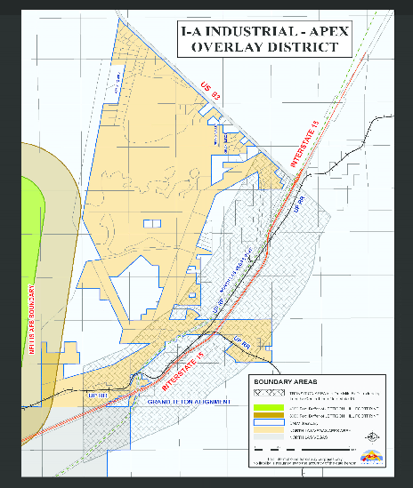
Map 1: Boundaries of the I-A Overlay District
3.
Permitted Use Regulations. Land within the I-A Overlay District may be used only for those permitted, special, and conditional uses shown in Table 17.16.-3 below, all of which uses are subject to the additional restrictions in subsections a through d below.
a.
Subareas. For purposes of regulating permitted and conditional land uses, the I-A Overlay District is hereby divided into two sub-areas: (1) the Transition Area (TA), and (2) Other Areas. The boundaries of the Transition Area are shown on Map 1, and Other Areas include all lands within the boundaries of the I-A Overlay District that are not within the Transition Area.
b.
Restrictions on Residential Use. No lands or structures shall be used for residential occupancy except for (a) accessory dwelling units for watchmen required to provide security for Permitted and Special Uses listed as primary uses in Table 17.16.-3, or (b) emergency personnel required to reside on the site.
c.
Restrictions on Occupancy.
(i)
General Limitation. Because of risks associated with overflights of aircraft carrying live ordnance from Nellis Air Force Base, any preliminary development plan, final development plan, site plan review or use of lands within the Transition Area shall not result in a gathering of individuals within the area of a land use application that would result in occupancy with an average of more than fifty (50) persons per acre at any time. All acreages used to meet the fifty (50) persons per acre requirement may not be further subdivided without ensuring that the existing parcel and each created parcel shall comply with the above requirement. Furthermore, any amendment to an approved preliminary development plan, final development plan, or site plan review shall require the applicant to demonstrate compliance with the above requirement to the City.
(ii)
Calculation of Persons on the Property. For purposes of determining compliance with subsection c.(i) above, the occupancy of property shall be calculated as follows:
(1)
Determine the square footage of the building(s).
(2)
Determine the number of off-street parking spaces required for the building(s) pursuant to Section 17.24.040.E. If the building(s) include two or more uses listed separately in Section 17.24.040.E, determine the separate parking space requirement for each use.
(3)
Multiply the number of required off-street parking spaces by the applicable average vehicle occupancy rate from the following list. If the building(s) include uses from two or more of these categories, apply the occupancy factor separately for each use.
(a)
Medical, Dental, or Health Clinic = 1.7 persons per vehicle;
(b)
Retail Sales and Service Uses listed in Table 17.16-3, or Vehicle Sales and Service Uses listed in Table = 1.5 persons per vehicle;
(c)
Eating and Drinking Establishments listed in Table 17.16-3 = 2.0 persons per vehicle; and
(d)
Any other use permitted, special, or conditional use listed in Table 17.16-3 = 1.2 persons per vehicle.
(iii)
Example.
100,000 sq. ft. of office/warehouse (10% office/90% warehouse)
6 acre lot
Office parking (1 per 500 sf) = 10,000 sf/500 sf = 20 spaces
Warehouse parking (1 per 1000 sf) = 90,000 sf/1,000 sf = 90 spaces
Total parking required = 110 spaces
20 spaces × 1.2 = 24 people
90 spaces × 1.2 = 108 people
24 people + 108 people = 132 persons occupancy
Occupancy = 132 people/6 acres = 22 persons per acre
d.
Restrictions Based on Electromagnetic or Radio Interference. No permitted, special, conditional, or accessory use shall be allowed that create any the following conditions:
(i)
Use of equipment or facilities that generate electromagnetic or radio waves that create interference with radio communications or guidance systems operated by Nellis Air Force Base
(ii)
Difficulty for pilots to distinguish between airport lights and other lights
(iii)
Impairs visibility in the vicinity of Nellis Air Force Base
(iv)
Endangers the landing, taking off, or maneuvering of aircraft
Any use that may create any of the aforementioned conditions must obtain written approval from Nellis Air Force Base prior to any approval from the City of North Las Vegas. Nellis Air Force Base shall respond within forty (40) days of notification of an application that may cause interference, no response will be interpreted as an approval from Nellis Air Force Base. Any equipment and facilities shall be operated in compliance with any conditions stated by Nellis Air Force Base in connection with its approval or conditional approval.
e.
Table of Permitted and Special Uses. Table 17.16-3 sets forth permitted, special, and conditional uses in each subarea of the I-A Overlay District, as well as accessory and temporary uses and structures. Unless otherwise noted, each permitted, special or conditional use is subject to the same conditions applicable to that use in the M-2 zone district, or if the use is not currently allowed in the M-2 zone district, then the use shall be subject to the conditions applicable to the use in the most similar zone district or overlay district as determined by the Director.
4.
Dimensional Standards. The dimensional standards set forth in Section 17.24.010, Site Dimension Standards, that are applicable to the M-2 zone district shall apply to all lands in the I-A Overlay District except as modified in Table 17.16-4:
5.
Development Standards. All development shall comply with all regulations in this Section H.4., and with all other regulations otherwise applicable under the North Las Vegas Code or state or federal law, unless otherwise noted.
a.
Natural Resources.
(i)
Floodplains. All property shall comply with requirements contained in any F-1 or F-2 floodplain overlay district applicable to the property.
(ii)
Drainage Channels. All development shall comply with those regulations regarding development in, on, or near drainage channels applicable to the M-2 zone district.
b.
Parking and Loading. All development shall comply with those regulations regarding parking and loading otherwise applicable to lands in the M-2 zone district, including but not limited to requirements in Sections 17.24.040, Parking and Loading, 17.24.120, Commercial Design Standards, and 17.24.130, Industrial Design Standards. The standards in Table 17.16-5 shall supersede numerical requirements for off-street parking in Section 17.24.040, but other standards related to parking areas in that section shall continue to apply.
c.
Mobility and Circulation.
(i)
Director's Approval Required. All drive accesses shall be approved by the Director of Public Works for width and location. Developments that may not be able to meet the requirements of subsections (ii) through (vii) of this section, and are requesting deviations from the standards, shall submit to the Director of Public Works a report certified by a professional engineer addressing the following site conditions, both present and future:
(1)
Traffic volumes,
(2)
Turning movements,
(3)
Traffic controls,
(4)
Site design,
(5)
Site distances,
(6)
Location and alignment of other access points, and
(7)
Site distribution.
Based upon the above data, the Director of Public Works shall determine whether a deviation from the requirement standards is justified and, if so, what alternative requirements will be necessary.
(ii)
Shared Drive Access. The City encourages sharing access drives between separate parcels. Some of the following standards may be relaxed if shown during the site design review process that more efficient design can be accomplished without jeopardizing the public's health, safety and welfare.
(iii)
Drive Access Required. All off-street parking spaces shall have access from a drive access and not directly from the public street. Access drives shall not be less than twenty-four (24) feet in width for two-way traffic or less than twelve (12) feet in width for one-way traffic. Access roads that are designated/required Fire Department apparatus access roads shall be a minimum of twenty-four (24) feet in clear width.
(iv)
Distance from Intersection. Driveway access distances from street intersections shall be subject to the minimum dimensions shown in Table 17-16.6, unless otherwise approved by the Director of Public Works as part of an approved site plan.
(v)
Drive Access Spacing. Drive accesses to a public street shall be located as measured from inside of drive to inside of drive according to the distances shown in Table 17.16-7, unless otherwise approved by the Director of Public Works as part of an approved site plan.
(vi)
Bus Turn Outs. Bus turn outs and shelters shall be required where deemed necessary by the City traffic engineer based on the impacts of the property where the bus turnout is required. If shelters are provided they shall be installed outside of the sidewalk area. Required turnouts may encroach into the perimeter landscape area. Bus turn outs must meet the uniform standard drawings, Clark County area as adopted by the City of North Las Vegas. Bus shelters must integrate into the design of the development and landscaping, and be installed outside of the sidewalk so that pedestrian movement is not impeded.
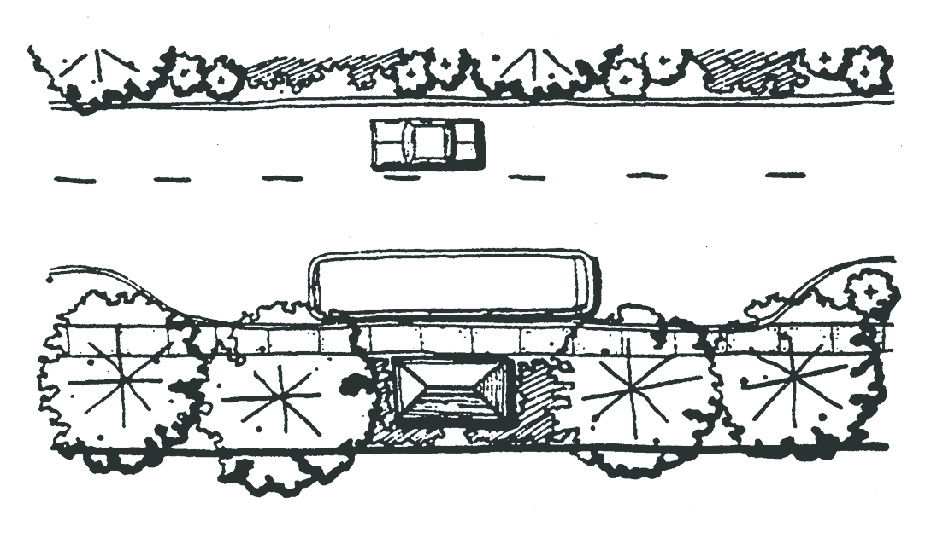
Figure 17.16.050- A: Bus Turn-Outs
(vii)
Sidewalks. All development shall install sidewalks as required by standards of the department of public works.
d.
Landscaping. All installed landscaping shall comply with the requirements of this section.
(i)
Landscaping Plan. A landscaping plan shall be submitted in conjunction with any required site plan prior to the issuance of a building permit and shall be reviewed and approved, denied or modified in conjunction with said site plan.
(ii)
Preferred Plant Material—Water Conservation Measures. Required landscaping shall contain live, drought tolerant plant materials. Installation of landscaping that requires irrigation for more than one year after planting is not required. Landscaping that requires irrigation for more than one year after planting may be replaced with species that do not require continuing irrigation or with re-establishment of native plants.
(iii)
Required Plantings and Groundcover; General Requirements. All development shall provide the landscaping along public and private rights-of-way as shown in Table 17.16-8:
(iv)
Trees and Utility Lines. No tree whose mature height exceeds fifteen (15) feet shall be planted under an electric utility line.
(v)
Nonvegetative Ground Covers. Nonvegetative ground covers including, but not limited to, rocks and small stones, crushed rock, cinders, and bark shall cover the ground surface of the landscaped area. Areas covered by such nonvegetative ground covers shall be broken up as much as possible by living plant materials.
(vi)
Installation Prior to Occupancy Permit. A certificate of compliance with the requirements of this section shall be signed by the property owner and/or landscape contractor and submitted to the City Building Department prior to issuance of any certificate of occupancy.
(vii)
Maintenance. All landscaped areas and material shall be maintained in a living, growing condition, and shall be kept neat, clean, uncluttered and in a weed-free condition. Dead plant material shall be replaced with plant material of equal size and maturity. No landscaped area shall be used for the parking of vehicles or the storage or display of materials, supplies or merchandise. Failure to maintain landscaping shall be cause for revocation of a business license and/or revocation of special use approval, or may result in enforcement or penalties otherwise available to the City.
6.
Screening, Walls, and Fences. Requirements for screening walls and fences vary depending on whether the site is a "Less Visible Site" or a "More Visible Site" as defined in Section 17.32.030 Definition of Terms.
a.
Fences and Walls.
(i)
No persons, firm or corporation shall construct, or cause to be constructed or erected within the City any fence or wall without first securing a building permit for the fence or wall.
(ii)
Every fence and/or wall shall be constructed in a substantial, workmanlike manner and of substantial material reasonably suited for the purpose for which the fence or wall is proposed to be used.
(iii)
Fences and screen walls shall not exceed twelve (12) feet in overall height.
(iv)
All perimeter walls, retaining walls, and screen walls shall be sealed by a method approved by the division of building safety to prevent the leaching or transmission of mineral deposits through the wall.
(v)
All fences and walls shall be located entirely upon the private property of the persons, firms or corporations constructing, or causing the construction of, such fence or wall unless the owner of the adjoining property agrees, in writing, that such fence or wall may be erected on the division line of the respective properties.
(vi)
On corner, no fence, wall, or planting in excess of thirty (30) inches above the street centerline grade shall be permitted within a triangular area defined as follows: beginning at the intersection of the projected curbing lines of two intersecting streets, thence fifteen (15) feet along one curbline, thence diagonally to a point fifteen (15) feet from the point of beginning, and at the intersection of each driveway or alley with a street, a triangular area where corners are defined by two points on the right-of-way line, fifteen (15) feet on each side of the centerline of the driveway or alley and a point on said centerline ten (10) feet outside right-of-way.
(vii)
Any fence or wall constructed so as to have only one elevation "finished," which shall be defined as not having its supporting members significantly visible or as having its decorative side visible, shall be erected such that the finished or decorative elevation of the fence or wall is exposed to the adjacent property. Exempt from this requirement are all internal common property line (i.e., rear and/or side yards that abut other rear and/or side yards) walls.
(viii)
On more visible sites, any required or constructed perimeter walls, exposed retaining walls, end walls, return walls and common area walls shall be buffer walls.
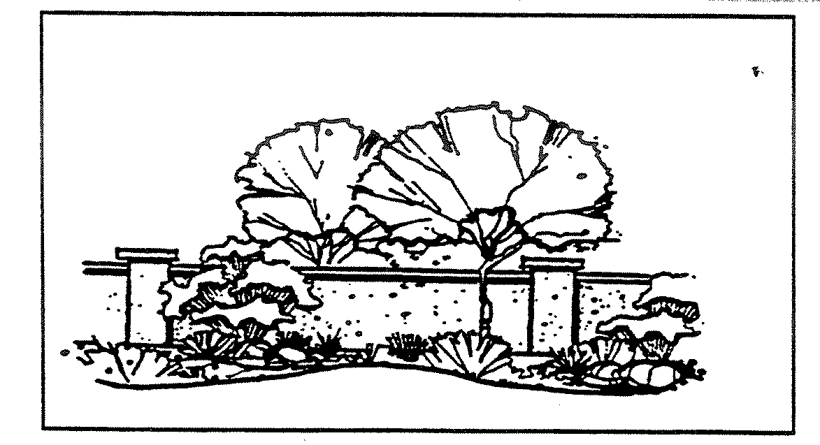
Figure 17.16.050- B: Buffer Wall
(ix)
Fences and/or screen walls may be located atop retaining walls provided that: (a) the retaining wall is appropriately engineered to support the fence or screen wall, and (b) the overall height of any screen wall shall not exceed twelve (12) feet, measured from the top of the retaining wall.
(x)
On less visible sites, the use of barbed wire, not to exceed three strands of barbed wire on top of a wall or fence shall be permitted, provided the lowest barbed strand is at least six feet above grade and the highest strand does not exceed the maximum height allowed for a fence or wall. Furthermore, barbed wire shall be located entirely upon the private property of the persons, firms, or corporation constructing the barbed wire, and shall not protrude out or over the property line or into any right-of-way.
b.
Screening.
(i)
Parking Areas. On more visible sites, all vehicle parking areas abutting public or private right-of-way shall be screened with a buffer wall or landscaped berm a minimum of three feet high.
(ii)
Utility Areas. On more visible sites, all utility substations, wells or storage facilities shall be screened from view from adjacent property and rights-of-way by a buffer wall.
(iii)
Outdoor Storage Yards.
(1)
The portion of a site within five hundred (500) feet of I-15, US 93 or SR 604, all materials, supplies, merchandise, equipment or similar items not on display for direct sale, rental or lease to the ultimate consumer or user, shall be stored within the confines of a one hundred (100) percent opaque buffer wall, not less than eight feet tall, except as noted in subsections (2) and (3) below.
(2)
When a boundary of a storage yard abuts a natural barrier (e.g., a hillside) that creates a change in elevation of more than eight feet between the finished grade of the storage yard and the finished grade of adjacent properties, the planning director may waive or amend the screening requirements to mitigate the visual impact of the storage yard on adjacent properties and/or rights-of-way.
(3)
When a boundary of a storage yard abuts a manmade barrier (e.g., a building) that provides a substantial barrier between the storage yard and the adjacent property, screening is not required. However, any portion of the storage yard that is visible from any right-of-way or property not developed as a storage yard shall be screened in accordance with the provisions of this section.
(iv)
Refuse Collection Areas.
(1)
Refuse collection areas and dumpsters of sufficient size and number for the needs of the development shall be provided and shall be located away from street frontages.
(2)
On more visible sites, refuse collection areas and dumpsters shall be screened from view from rights-of-way, sidewalks and abutting properties with buffer walls.
(3)
On less visible sites, refuse collection areas and dumpsters shall be placed within an enclosed area.
(v)
Mechanical Equipment. On more visible sites, screening shall be required for all mechanical equipment such as air conditioners, pumps and motors, propane tanks and other storage tanks, satellite dishes and other communications equipment, but shall not be required for solar panels, wind energy generators, or communications towers or antenna. Specific requirements in subsections (1) through (4) below shall apply as applicable:
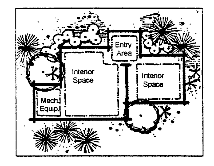
Figure 17.16.050- C: Location of Mechanical Equipment
(1)
On more visible sites, all ground mounted mechanical and electrical service equipment, as well as ground or surface mounted equipment such as valves, gas, electric and water meters, shall be screened from public view with Buffer Walls or materials that match the finish and design of principal structures on the site.
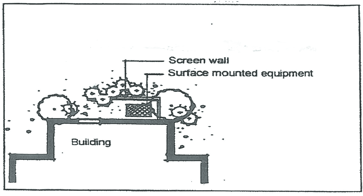
Figure 17.16.050- D: Screening Ground-Mounted Equipment
(2)
On more visible sites, all rooftop mechanical and electrical equipment shall be: (a) painted to match the façade color of the primary building, (b) screened to the height of the tallest equipment, or (c) integrated with the building so that the equipment itself is not visible from ground level. This requirement shall apply to equipment related to non-industrial portions of each building (such as office, administration, dining, or customer service areas, but shall not apply to portions of the building(s) containing industrial manufacturing, production, or processing activities.
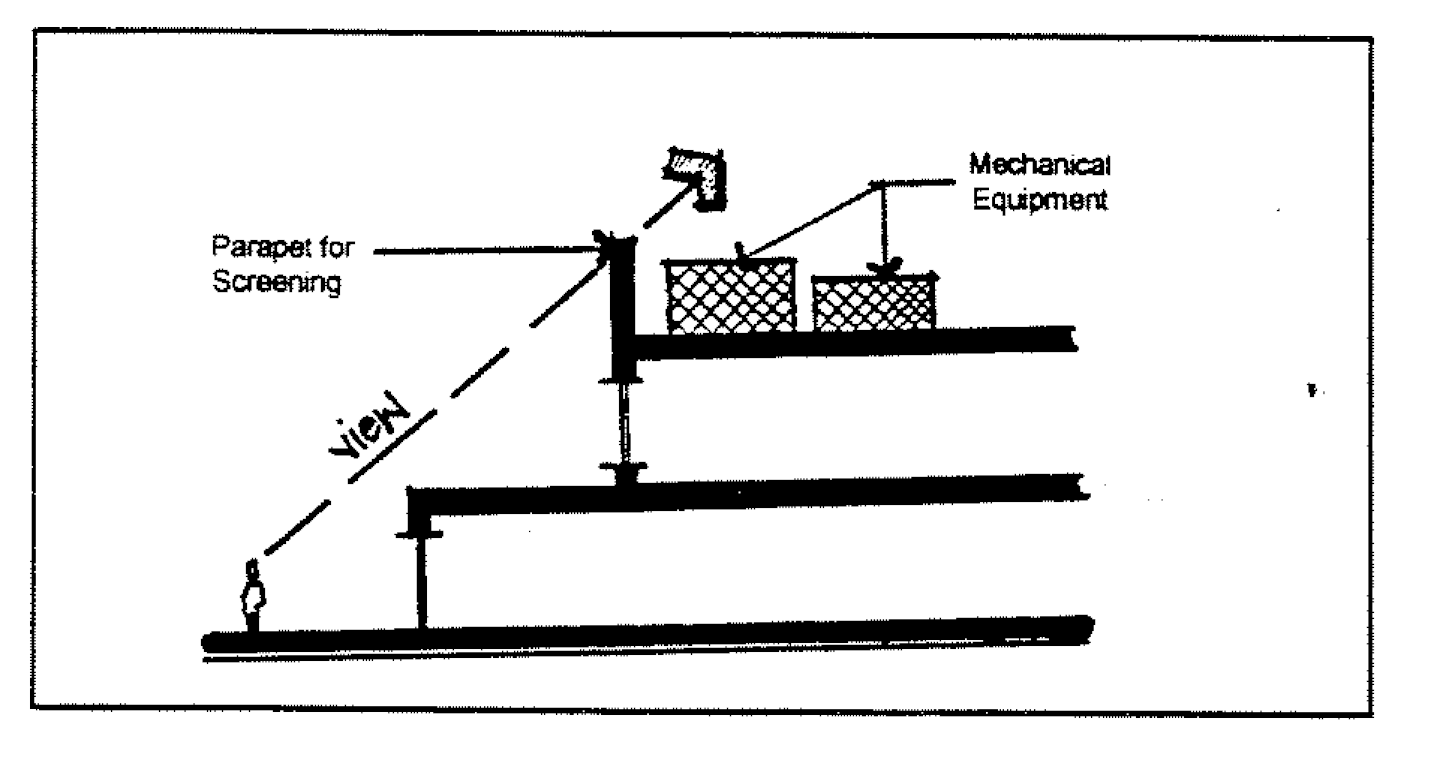
Figure 17.16.050- E: Screening Roof-Mounted Mechanical Equipment
(3)
On more visible sites, no mechanical equipment shall be mounted on or attached to any sloped roof, except for solar panels and related equipment. Solar panel equipment (with the exception of the solar collection cells) shall: (a) match the roof in color and appearance, and (b) solar panels shall be mounted directly to the roof plane and be integral to the roof design.
(4)
On more visible sites with large grade differences from neighboring properties, where reasonable height parapet or screen walls are insufficient to provide screening, views from above shall be screened to the greatest extent practicable through the additional use of alternative methods such as painting equipment to blend with the roof surface.
(vi)
Building Service Areas. On more visible sites, service and loading zones should be located to the rear, side or to an internal location where visibility from public streets will be minimized. Such areas shall be screened by the use of buffer walls, landscaping, berms, or other techniques that will serve as both a visual and a noise barrier.
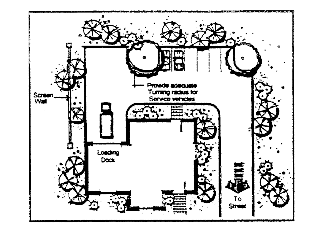
Figure 17.16.050- F: Location and Screening of Service and Loading Areas
(vii)
Significant Differences in Intensity or Character. On more visible sites, where a proposed development is significantly different in intensity or character from an existing adjacent development and is likely to create adverse impacts on the existing adjacent use that could be mitigated through the use of screening, the applicant may be required to install one or more forms of screening identified in subsections 5.(i) through 5.(vi) above.
(viii)
Prohibited Materials. Unless otherwise approved as part of an overall development plan, corrugated metal, plastic, or slats inserted into chain link fencing shall not be considered to be acceptable for use for either required or voluntary screening or perimeter walls. Untextured or unfinished concrete block (CMU) walls are only permitted for use on screening or perimeter walls on less visible sites.
(ix)
Maintenance. Every fence or wall shall be maintained in a condition of reasonable repair by the property owner and shall not be allowed to become and remain in a condition of disrepair, damage or unsightliness, or constitute a public or private nuisance. Any such fence or wall that is or has become dangerous to the public safety, health or welfare, or has become unsightly through improper maintenance or neglect is a public nuisance
7.
Exterior Lighting. On more visible sites, appropriate levels of lighting shall be provided to create adequate visibility and safety at night. A detailed photometric lighting plan prepared by a licensed electrical engineer shall be submitted at the time of application and shall include, but not be limited to, types and styles of lighting fixtures, location of lighting fixtures and a photometric lighting plan. The lighting plan shall demonstrate compliance with the following requirements.
a.
Exterior lighting shall be of low intensity and shielded so that light will not spill out onto surrounding properties or project above the horizontal plane.
b.
Light shall not exceed 1.0 footcandles at the property line.
c.
The height of light fixtures should be in proportion to the building mass and in no instance shall light poles be more than fifty (50) feet in height.
d.
Wall mounted lights shall be directed downward. Soffit mounted light fixtures should be recessed in the soffit or otherwise fully shielded from view from any property line.
8.
Design Standards.
a.
Site Planning and Development.
(i)
Site Grading. On more visible sites that contain slopes of five percent or more, the development of the site should reflect, rather than obscure, the natural topography of the site through the use of various techniques such as smooth transition of grades at the property lines, blending of cut and fill slopes, and terracing.
(1)
Where sloping is to be used for topographic transitions at the property edges, slopes should not exceed three to one (3:1).
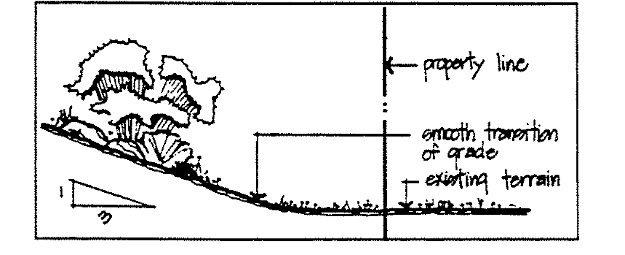
Figure 17.16.050- G: Transition Slope
(2)
Cut and fill slopes shall be rounded where they meet natural grade so that they blend with the natural slope.
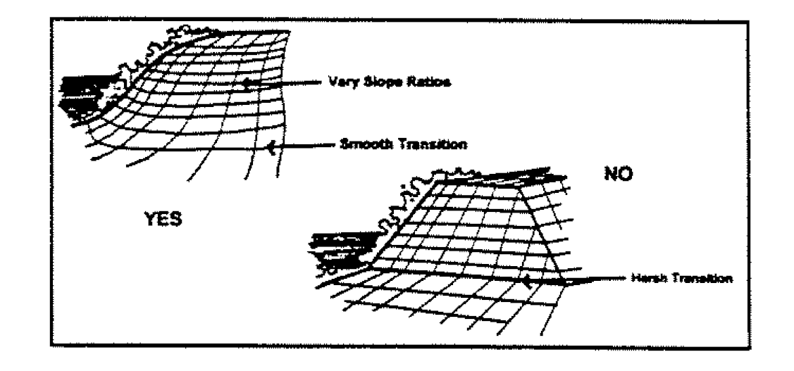
Figure 17.16.050- H: Rounding Cut-and-Fill Slopes
(ii)
Natural Features. Where feasible, and when geotechnical conditions are favorable, natural features such as washes and existing vegetation should be retained in their natural state to the greatest extent possible and integrated into the design of the site.
(iii)
Drainage. In order to provide a more natural appearance and to provide for the stabilization of natural channels when geotechnical conditions are favorable, drainage ways shall be lined with natural materials such as grass, soil, gravel or rock or other materials allowed by the Clark County regional flood control district hydrologic criteria and drainage design manual as adopted by the City of North Las Vegas. The use of plain concrete for lining of drainageways is not encouraged and is permitted only as part of a flood control or stormwater management plan.
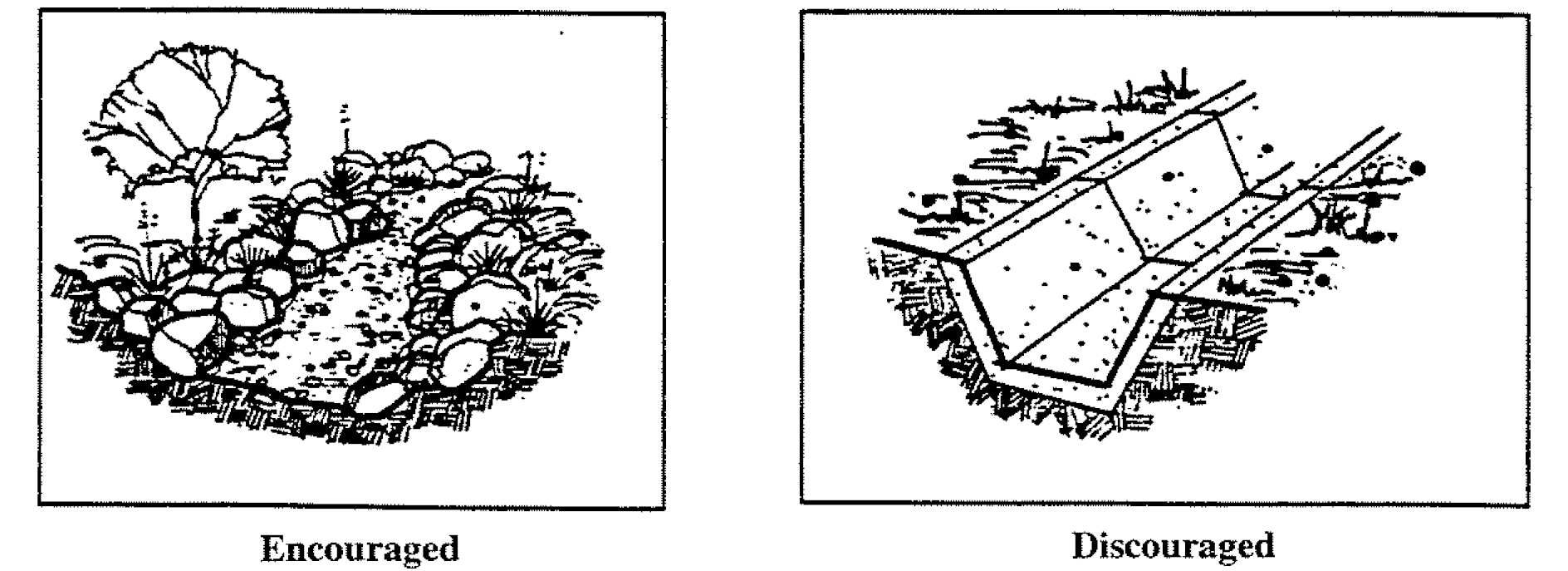
Figure 17.16.050- I: Lined Drainage Ways
(1)
Flood control structures such as weirs, drop structures, etc., if utilized as part of the drainage way design, shall be faced with large natural rocks of an appropriate size.
(2)
When geotechnical conditions are favorable, on-site detention of storm water is encouraged as a means of reducing stormwater runoff. Areas such as common areas and existing washes should be explored for this type of use. When detention basins are utilized, they must be integrated into the overall landscaping and site development plan of the proposed project.
b.
Architectural Character and Materials. The purpose of these guidelines is not to dictate a particular architectural style for industrial development in the City of North Las Vegas, but to provide a set of guidelines and standards by which development can be compatible with its surroundings and help to further the overall vision of development that has been established by the City.
(i)
Height, Bulk and Scale.
(1)
Box-like or single, monolithic forms that are not relieved by articulation of facades are not desirable for nonmanufacturing or non-warehouse type buildings such as offices and commercial uses. The perceived height and bulk of these type buildings shall be reduced by dividing the building mass into smaller scale components. Buildings must incorporate jogs, offsets or other architectural features to reduce the visual length of long walls. Building surfaces over two stories high or fifty (50) feet in length must be relieved with a change of wall plane that provides strong shadow and visual interest. Variations in massing and a variety and/or variation in rooflines are strongly encouraged.
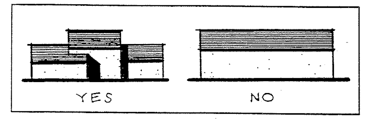
Figure 17.16.050- J: Variation in Roof Lines
(2)
On more visible sites for manufacturing and warehouse type buildings, the length and height of walls must be relieved through the use of changes in color, materials and/or relief such as the inclusion of beltlines, pilasters, pop outs etc.
(ii)
Exterior Materials and Finishes.
(1)
Buildings shall be finished in earth tone or neutral colors indigenous to the Las Vegas Valley and its surrounds. Black and bright colors are not acceptable except as trim or accent colors. Fluorescent colors are not acceptable.
(2)
Concrete, clay tile, architectural metal or materials similar in appearance to concrete or clay tile should be used on all sloped roofs. Asphalt, fiberglass and wood shingles and shakes are not acceptable.
(3)
On more visible sites, highly reflective, shiny or mirror-like materials and unplastered exposed standard concrete and standard concrete masonry units should not be used except as accents if deemed appropriate.
(4)
Restraint should be used in the number of different materials and colors selected. Simplicity of patterns is desired.
(5)
On more visible sites, stone, stucco, colored or exposed aggregate or textured finish concrete, decorative block and brick are the preferred materials for building exteriors. Simulated materials and building systems that provide a look that is similar to the preferred materials may also be acceptable.
(iii)
Coherent Design.
(1)
On more visible sites, all sides of a principal building shall have a consistent level of detailing and finish when viewed from public rights-of-way.
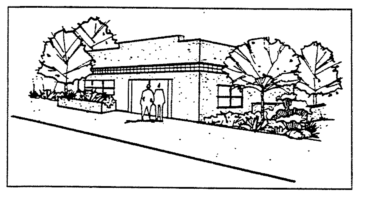
Figure 17.16.050- K: Consistent Level of Detailing
(2)
On more visible sites, accessory structures shall take on the character of the main building, using the same colors, materials and style.
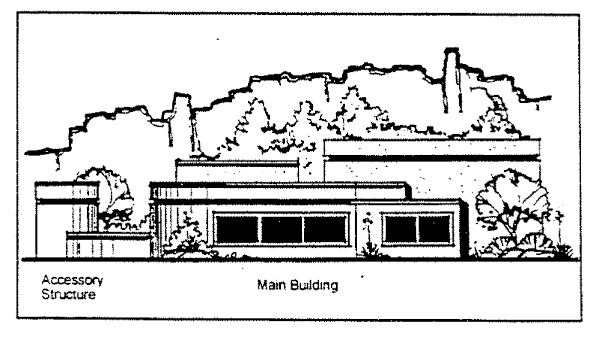
Figure 17.16.050- L: Similar Character of Main and Accessory Structures
(3)
On more visible sites any building design that utilizes a flat roof shall incorporate a parapet wall and/or cornice element on all sides of the roof.
(iv)
Building Façade. On more visible sites, the building design shall incorporate patterns and materials that provide visual interest. Flat, plain building walls are not desirable and are strongly discouraged. This shall be accomplished through the use of changes in color, materials and/or relief such as the inclusion of beltlines, pilasters, pop outs etc.
(1)
There should be a contrast in size of solid area to window area. In general there should be more wall than window. Office or retail portions of the building shall incorporate features such as windows, awnings, and arcades into each façade that faces a public street. With the exception of exterior walls for manufacturing and warehousing areas of buildings, features such as windows, awnings and arcades must total at least sixty (60) percent of the length of any façade that abuts a public street.
(2)
In order to provide visual interest and reduce energy consumption, windows and large areas of glass should be recessed in shadow or otherwise contrast with the building façade.
9.
Other Standards and Requirements. Unless specifically waived or modified by a standard, criteria, or requirement specifically applicable to the I-A Overlay District all other standards, criteria, and requirements applicable to similar uses in the M-2 zone district under the North Las Vegas Zoning Ordinance remain applicable.
G.
Floodway Overlay District (F-1).
1.
Permitted Uses. Those permitted principal, conditional, special, accessory, and temporary uses that are allowed in the underlying zoning district shall be allowed in the F-1 district only if a technical evaluation demonstrates that encroachments fill, new construction, substantial improvements, or other development shall not result in any increase in flood levels during the occurrence of the base flood discharge.
2.
Nonconforming Uses. Nonconforming uses in the F-1 district shall not be expanded but may be modified, altered, or repaired to incorporate flood-proofing measures, providing such measures do not raise the level of the 100-year flood.
H.
Floodplain Overlay District (F-2).
1.
Permitted Uses. Those permitted principal, conditional, special, accessory, and temporary uses that are allowed in the underlying zoning district shall be allowed in the F-2 district provided that such uses comply with the restrictions of Section 17.20.020, Use Specific Standards.
2.
Standards for Flood Hazard Reduction. Development in all floodway and floodplain areas shall conform to the standards of the City's drainage control uniform regulations as referenced in Chapter 15.40 of the North Las Vegas Municipal Code.
I.
Gaming Enterprise Overlay District (GED).
1.
Purpose. The purpose of the Gaming Enterprise District (GED) is to establish specific criteria (Section 17.12.070.M) for identifying areas suitable for the potential expansion of gaming activities and resort hotel uses as well as areas needing additional protection and buffering from the associated impacts of such activities and uses, including but not limited to residential, schools and churches (religious institutions). The Gaming Enterprise District (GED) is also intended to comply with Chapter 463 of NRS, as amended, by seeking to ensure adequate roads, water, sanitation, utilities, and related services are provided to areas where non-restricted gaming establishments are proposed.
2.
If the City has established one or more Gaming Enterprise Districts, the City shall make available for public inspection a map that shows the location of each Gaming Enterprise District.
a.
The City shall update the map at least once every four months.
b.
The map is a public record that is subject to the provisions of Chapter 239 of NRS.
3.
Land Use Regulations. Land use regulations shall be those of the base district with which the GED district is combined providing, however, that no new casino or expanded casino with a non-restricted gaming shall be approved unless they comply with the special use permit requirements, hotel requirements per NRS, or Title 5 provisions as applicable.
4.
Property Development Regulations. Property development regulations shall be those of the base district with which the GED district is combined unless modified by a separate, approved land use application.
J.
Air Terminal Environs Overlay District (AE). The airport environs overlay district encompasses eight subzones around Nellis Air Force Base and North Las Vegas Airport. The accompanying Air Terminal Environs Overlay Districts Map is hereby adopted and incorporated into the Official Zoning Map of the City of North Las Vegas.
1.
Subzones.
a.
There are eight subzones of the AE overlay district. The first subzone (AE-RP) is a clear zone to protect runways. The subzones are as follows:
b.
The AE overlay district is shown on the air terminal environs overlay district map.
c.
The types of uses permitted and mitigation measures required differ for each subzone of the AE overlay district as shown in Table 17.16-10 of this section. Where a proposed use is located in two subzones of the AE overlay district, the use shall conform to the requirements of both subzones, except where a proposed use is located in two noise exposure subzones in which case the use shall conform to the more restrictive of the two subzones.
d.
The AE overlay district noise attenuation construction regulations and land use restrictions delineated in Table 17.16-10 of this section are required in addition to the regulations required for all underlying zoning districts.
2.
Property Development Standards. Property shall be developed in accordance with the development standards applicable to the underlying zoning district. In addition, uses requiring noise attenuated construction, as indicated by Table 17.16-10 shall be developed in accordance with the noise attenuated construction standards of Title 15 of the North Las Vegas Municipal Code.
Additionally, a noise disclosure form shall be recorded against the land by the developer of any residential property. The developer shall provide to the initial occupant a copy of the noise disclosure form; and a copy of the Air Terminal Environs Overlay Districts Map highlighting the location of the project.
3.
Permitted Uses and Land Use Compatibility. Table 17.16-3 indicates principally permitted uses, special uses, conditional uses, uses permitted subject to noise attenuated construction, and uses prohibited in each of the six subzones of the AE overlay district.
a.
Use Categories and Use Types. Use categories and use types are established in Section 17.20.010 and defined further in Chapter 17.32, Definitions.
b.
Uses Permitted.
(i)
In the AE overlay district, land may be used and buildings and structures may be erected, maintained, and used if they are arranged, intended, or designed pursuant to the underlying zoning district and indicated by a "Y" or a conditional "Y" in the applicable subzone column of Table 17.16-10 in the AE overlay district.
(ii)
Cells marked with a "25" are land uses and related structures that shall provided a noise level reduction of twenty-five (25) decibels, outdoor to indoor, is incorporated into the design and construction of the structure.
(iii)
Cells marked with a "30" are land uses and related structures that shall provided a noise level reduction of thirty (30) decibels, outdoor to indoor, is incorporated into the design and construction of the structure.
c.
Uses Conditionally Permitted. All uses permitted subject to a use permit in the underlying district and indicated by a "Y" or conditional "Y[#]" in the applicable subzone column of Table 17.16-10.
d.
Uses Prohibited. All uses prohibited in the underlying zoning district, or indicated by an "N" in the applicable subzone column of Table 17.16-10.
The Jettison Hill Area as depicted on the Air Terminal Environs Overlay Districts Map is designated as a military operations area. Land uses of a non-military nature are prohibited in this area.
e.
Exceptions.
(i)
Uses permitted in the R-E, R-EL, R-1, R-CL, R-2, R-3, and R-4 residential districts established prior to the effective date of the Code shall be allowed, and buildings and structures for such uses shall be allowed without regard to the additional standards of this chapter, except to the extent that noise attenuated construction is required in Table 17.16-10. Additionally, notwithstanding the overlay district adopted hereby, any use approved in any zoning district prior to the effective date of the Code shall be allowed and buildings and structures for such a use shall also be allowed without regard to the additional standards of this chapter, provided that all conditions imposed on such aforementioned approval are complied with, except to the extent the conditions may be modified by the City Council to authorize a change in location, size, appearance, or construction completion date of buildings or structures; this exception does not preclude the imposition of additional conditions, including but not limited to the requirements of this Code, if any extension of time is granted to the aforementioned approval.
(ii)
Prior to the issuance of a building permit for any building or structure in an AE-RP subzone, it shall be conclusively established that such building or structure is permitted pursuant to this section.
f.
Unlisted Use Types (New Section). If an application is submitted for a use type that is not listed in Table 17.16-10, the Director is authorized to consult with appropriate City staff and assign appropriate restrictions based on the applicable subzone.
K.
Airport Protection Height Limits.
1.
Limits to Construction Height. Except as otherwise provided, no structure shall be permitted to be erected, altered, or maintained that would constitute a "Hazard to Air navigation" as defined by the FAA; would result in an increase to minimum flight altitudes during any phase of flight; or would otherwise be determined to pose a significant negative impact on airport or aircraft operations. However, nothing in this 17.16.050.K. shall prohibit the construction, alteration or maintenance of any structure to a height up to thirty-five (35) feet above ground or in any district created by this title which has received all necessary airspace approvals.
2.
Notices of Construction or Alteration. Any person shall notify the FAA Regional Office forty-five (45) days prior to construction, or the date an application is to be filed, whichever is earlier, on a form acceptable to the FAA, of any proposed construction or alteration that exceeds any of the following standards:
a.
Two hundred (200) feet above the ground;
b.
The plane of an imaginary surface extending outward and upward at a slope of one hundred (100) to one for a horizontal distance of twenty thousand (20,000) feet from the nearest point of the nearest runway of any airport subject to the provisions of this Code;
c.
For highways, railroads, and other travelways for mobile objects; if construction or alteration is of greater height than the standards set forth in subsection (4)(b) of this section. The height shall be adjusted upward for the appropriate travelway as follows:
d.
When requested by the FAA, any construction or alteration that would be in an instrument approach area, and available information indicates the might exceed any FAA obstruction standard.
3.
Construction or Alteration Not Requiring Notice. Notice to the FAA is not required for construction or alteration of any of the following:
a.
Any object that would be shielded by existing structures of a permanent and substantial character or by natural terrain or topographical features of equal or greater height, and would be located in the congested area of the City, town, or settlement where it is evident beyond all reasonable doubt that the structure so shielded will not adversely affect safety in air navigation;
b.
Any antenna structure of twenty (20) feet or less in height except one that would increase the height of another antenna structure;
c.
Any air navigation facility, airport visual approach or landing aid, aircraft arresting device, or meteorological device of a type approved by the administrator of the affected airport, the location and height of which is fixed by functional purpose;
d.
Any construction or alteration for which notice is required by any other FAA regulation.
4.
Use Restrictions. Notwithstanding any other provisions of this section, no use may be made of land or water in such a manner as to create a "Hazard to Air navigation" as defined by the FAA; create an increase in minimum flight or approach procedure altitudes as determined by the FAA; create electrical interference with navigation signals or radio communication between the airport and aircraft; make it difficult for pilots to distinguish between airport lights and others; result in glare in the eyes of the pilots using the air terminal; impair visibility in the vicinity of the air terminal; create bird strike hazards; or otherwise endanger or interfere with the landing, takeoff, or maneuvering of aircraft intending to use the airport.
5.
Nonconforming Uses. The regulations prescribed by this section shall not be construed to require the removal, lowering, or other change or alteration of any structure not conforming to the regulations as of the effective date of this section, or otherwise interfere with the continuance of a nonconforming use. Nothing contained in this section shall require any change in the construction, alteration, or intended use of any structure, the construction or alteration of which was begun prior to the effective date of this section, and is diligently prosecuted.
6.
Marking and Lighting. Notwithstanding the preceding provisions of this section, the owner of any existing nonconforming structure may be required to install, operate, and maintain thereon such markers and lights as may be deemed necessary by the administrator of the affected airport to indicate to the operators of aircraft in the vicinity of the airport the presence of such airport obstruction.
7.
Existing Uses. No permit shall be granted that would allow the establishment or creation of an obstruction or permit a nonconforming use, structure, or vegetation to become a greater hazard to air navigation than it was on the effective date of this section or any amendments thereto, or than it is when application for a permit is made.
L.
Ranch Estates Rural Preservation Overlay District (R-E).
1.
Relationship to Underlying Base Districts. These regulations supplement those regulations applicable in the underlying base zone district designations applicable to all lands in the R-E Ranch Estates Rural Preservation Overlay District. All regulations applicable to the underlying base zone districts shall continue to apply, but in the event of a conflict between provisions of the underlying zone district and the provisions of this R-E Ranch Estates Rural Preservation Overlay District, the provisions of the overlay district shall govern.
2.
Permitted Uses. Those uses listed with the R-E, Ranch Estates District shall apply. Uses requiring a special use permit must demonstrate compatibility with the purpose and requirements of the R-E Ranch Estates Rural Preservation Overlay District.
3.
Development Regulations. The intent of this section is to preserve the rural character of the designated rural neighborhoods by not requiring sidewalks, streetlights, curbs, or gutters on residential streets. The Director of Public Works shall retain the authority to modify these standards where conditions require.
a.
All streets shall conform to the adopted Master Plan of Streets and Highways. Intersections with designated rural roads with modified street sections shall comply with Public Works' specifications. For streets not listed on the adopted Master Plan of Streets and Highways, unless full dedication was accepted prior to adoption of this title, the right-of-way on each residential street shall be maintain at forty-eight (48) feet in width, and the improvements therein shall be as follows:
(i)
Each street shall have a pavement width of a minimum thirty-two (32) feet as measured sixteen (16) feet respectively on either side of the centerline of the right-of-way.
(ii)
The remaining right-of-way on either side shall be unpaved, except where joined by residential driveways, and shall be reserved for equestrian and trail use.
(iii)
Sidewalks shall not be required in the remaining right-of-way.
(iv)
Streetlights shall not be required.
b.
Connectivity and accessibility between trail systems within rural neighborhoods and consideration for trail-head sites is encouraged. If provided, trail-heads shall be located in a manner that will direct vehicular traffic onto arterial streets rather than imposing on rural neighborhood streets.
c.
New residential dwelling units shall comply with Section 17.24.090, Residential and Two-Family Design Standards. However, provisions related to off-site improvements shall not apply.
4.
Amendments. An application to establish or amend the R-E Ranch Estates Rural Preservation Overlay District may be initiated by a property owner or authorized agent, or by the City. For applications not initiated by the City, and if the properties to be added or removed are not under single ownership, all individual owners must join the application before submittal to the City. The applicant shall comply with the following standards.
a.
Each application shall be in accordance with the purposes of the R-E Ranch Estates Rural Preservation Overlay District.
b.
All applications must show the limits of the R-E Ranch Estates Rural Preservation Overlay District.
c.
An amendment shall not segment, divide, or create a non-R-E Ranch Estates Rural Preservation Overlay District island within the R-E Ranch Estates Rural Preservation Overlay District.
d.
The applicant shall demonstrate that any amendment will mitigate any potential significant adverse impacts to the R-E Ranch Estates Rural Preservation Overlay District to the maximum practical extent.
e.
Applicants are required to hold a neighborhood meeting prior to a public hearing by the Planning Commission. The applicant shall comply with the notification standards used for property reclassification.
f.
A public hearing shall be required and must following the requirements for property reclassification.
M.
Urban Agricultural Overlay District (UA).
a.
Urban Agricultural Overlay District (UA).
1.
Relationship to Underlying Base Districts. These regulations supplement those regulations applicable in the underlying base zone district designations applicable to all lands in the UA Urban Agricultural Overlay District. All regulations applicable to the underlying base zone districts shall continue to apply, but in the event of a conflict between provisions of the underlying zone district and the provisions of this UA Urban Agricultural Overlay District, the provisions of the overlay district shall govern.
2.
Size Regulations. The minimum UA Urban Agricultural Overlay District shall be no less than one acre.
3.
Table of Permitted Uses. Table 17.16-12 sets forth permitted, special, and conditional uses in the UA Overlay District, as well as accessory uses and structures as authorized by NRS 278.02075:
4.
Use Specific Standards. Additional Requirements for Table 17.16-12
a.
Community Garden. Community gardens shall comply with the standards in subsection 17.20.020.C.8, with the exception that the structures in Table 17.16-12 are permitted.
b.
Container Farm. Container farms shall only be permitted within the M-1, M-2, M-3, C-2, and C-3 Districts. Container farms shall be painted and maintained in good condition, subject to City design standards.
c.
Farmer's Market. Farmer's markets shall comply with Section 5.18, with the exception that Farmer's Markets shall be permitted in any base district with the following additional conditions:
i.
The Designated Site Coordinator shall provide demonstrate compliance with the parking requirements within Section 5.18. All parking shall be provided in a paved off-street parking area.
ii.
The hours of operation shall be limited to 7:00 am to 7:00 pm within any residential district.
d.
Farm Stand. Farm stands are accessory uses to the urban farm and shall comply with the following requirements:
i.
Hours of operation are restricted to a three-day period once a week—7:00 am to 7:00 pm.
ii.
Any structure for the farm stand shall be less than two hundred (200) square feet in size.
iii.
The farm stand shall be located within the same overlay district as the urban farm it is accessory to.
iv.
Other outside vendors of any type are prohibited.
e.
High Tunnels, also called Hoop Houses. High tunnels and other flexible plastic or fabric covered structures shall not be located beneath power lines or in areas where large loads such as tree branches or other overhead obstacles could fall and shall be screened from the street and any adjacent residential uses per Section 17.24.070
f.
Urban Agricultural Activity. In addition to the regulations in Section 17.24.080 any visible artificial lighting used for indoor agriculture shall be diffused and not cause glare or spill over to adjacent properties. Light bulbs and light-emitting diodes shall not be permitted in view of adjacent properties or public rights-of-way.
g.
Compost and Fertilizer Storage. Compost and fertilizer storage shall be limited to fifty (50) cubic feet per half (½) acre. Composting shall be conducted in a manner that controls odor, prevents infestation, and minimizes run-off into waterways and onto adjacent properties.
h.
Storage of Equipment and Supplies. Any equipment or supplies needed for farm and garden operations shall be fully enclosed or otherwise effectively screened from the street and any adjacent residential uses per Section 17.24.070. Motorized equipment shall be limited to home garden or light equipment.
i.
Rules of Operation. The urban farm shall have an established set of operating rules addressing the governance of the site, hours of operation, and maintenance and security requirements and responsibilities. Hours of operation shall be limited to 7:00 am—9:00 pm, daily.
j.
Designated Site Coordinator. Each urban farm shall have a Designated Site Coordinator to act as a liaison with the City and their name and telephone number shall be provided with the business license division.
k.
Restrictions.
(i)
The keeping of animals is prohibited.
(ii)
The cultivation of plants regulated by law (e.g., tobacco, marijuana, etc.) are prohibited.
l.
Other standards.
(i)
The site shall be designed and maintained so that water and fertilizer are entirely contained on-site and will not drain onto adjacent properties or rights-of-way.
(ii)
Benches, bike racks, raised/accessible garden beds, picnic tables, produce stands, low tunnels, and instructional spaces may be permitted.
5.
Parking Requirements. All parking for the urban faming use shall be contained within the overlay area and all parking areas shall comply with subsection 17.24.040 K.10. The minimum on-site parking is required for the following:
a.
Community gardens shall provide one parking space per garden plot (See Section 17.24.040-4).
b.
Urban farms shall provide a minimum of one parking space for each one thousand (1,000) square feet of cultivated area.
c.
For farmers' markets, there shall be at least one parking space for the market operator and each vendor, plus customer parking spaces of at least two spaces for each vendor (See subsection 5.18.080 J.).
d.
Farm stands shall provide a minimum of two spaces in addition to the spaces used by the urban farm.
6.
Dimensional Standards.
a.
Setbacks.
(i)
Structures. All structures shall be setback twenty (20) feet for front, interior side, corner side/other ROW, and rear yard.
(ii)
High Tunnels. High tunnel structures shall maintain a minimum setback of fifty (50) feet from any arterial or collector ROW.
(iii)
Garden Beds. Minimum setbacks shall be five feet for front, interior side, corner side/other ROW, and rear yard.
(iv)
Compost and fertilizer storage. Minimum setback shall be twenty (20) feet for front; five for interior side, corner side/other ROW, and rear yard; and fifty (50) feet from any residential dwelling.
b.
Maximum Structure Height. Maximum structure shall not exceed seventeen (17) feet.
(Ord. No. 2591, § 1, 6-15-2011, eff. 10-1-2011; Ord. No. 2647, §§ 1—3, 2-5-2014; Ord. No. 2669, § 3(a), 6-18-2014; Ord. No. 2685, § 3(1), 8-6-2014; Ord. No. 2714, § 4, 6-17-2015; Ord. No. 2760, §§ 1, 2, 6-15-2016; Ord. No. 2849, § 1, 12-20-2017; Ord. No. 2947, §§ 1—4, 2-6-2019; Ord. No. 3048, § 23, 1-20-2021; Ord. No. 3090, § 1, 9-15-2021; Ord. No. 3176, § 2, 6-21-2023)