
North Las Vegas City Zoning Code
CHAPTER 17
24 - DEVELOPMENT STANDARDS
Sections:
17.24.010 - Site Dimensional Standards.
A.
Site Dimensional Standards for Residential Zone Districts. The following sections establish the basic district density and site dimensional standards for the O-L, R-E, R-EL, R-1, R-2, R-3, R-4, and R-CL districts.
1.
Lot Area, Lot Width, Common Open Space, and Density Requirements.
a.
Table 17.24.010-1, Lot Area, Lot Width, and Density Requirement for Residential Zone Districts establishes the lot area, lot width, and density requirements for the residential zone districts.
b.
For single-family dwellings, only one single-family dwelling may be permitted per individual lot in all residential districts unless otherwise permitted as an accessory use.
2.
Building Setback and Height Requirements.
a.
Table 17.24.010-2, Building Setback and Height Requirements for Residential Zone Districts establishes the building setback and height requirements for the residential districts.
3.
Additional Building Setback Requirements in Residential Zone Districts.
a.
Setback Requirements for Institutions. Use types that are within the "institutions" use category in Table 17.20-1, Permitted Use Table shall be subject to the setback requirements of Table 17.24.010-3, Building Setback Requirements for Institutions, in all residential districts.
b.
Parking in the Front or Corner Side/Other R-O-W Yards. For multiple-family dwellings in the R-3 and R-4 districts, parking of motor vehicles shall be prohibited within the required front or corner side/other r-o-w setbacks unless such parking is screened from public view by a three and one-half-foot earth berm, except as prohibited in Section 17.24.060, Landscaping, block wall, or an equivalent method as determined by the City.
c.
Additional Accessory Building Requirements in the R-2, R-3, and R-4 Districts. Buildings that are accessory to a multiple-family dwelling in the R-2, R-3, or R-4 district shall be subject to the following:
i.
The City may require common walls for accessory buildings on the same lot where common walls will eliminate unsightly and hazardous areas. Accessory buildings on the same lot shall otherwise be separated by a distance of not less than ten (10) feet.
ii.
Exteriors of accessory buildings shall have an exterior finish compatible with the main structure. Compatibility shall be determined by the City based on type and use of building materials.
d.
Building Separation Requirements in the R-2, R-3, and R-4 Districts. When two or more principal buildings are located on a single lot, the minimum separation between any two principal buildings shall be twenty (20) feet.
B.
Site Dimensional Standards for Business Zone Districts and the PSP District. The following sections establish the basic district density and site dimensional standards for the C-P, C-1, C-2, C-3 (Obsolete), M-1, M-2, M-3 (Obsolete), and PSP districts.
1.
Lot Area, Lot Width, Common Open Space, and Density Requirements.
a.
Unless otherwise specified, the minimum lot area, lot width, and maximum floor area ratios are determined by the ability to meet building area, parking, landscaping, setbacks, and other applicable standards.
b.
The minimum lot width for lots in the C-P, M-1, M-2, and M-3 districts is one hundred (100) feet.
c.
The minimum lot width for lots in the C-1, C-2, and C-3 districts is one hundred (100) feet unless the lot is a corner lot in which case the minimum lot width shall be one hundred fifty (150) feet.
2.
Building Setback and Height Requirements.
a.
Table 17.24.010-4, Building Setback and Height Requirements for Business and PSP Zone Districts, establishes the building setback and height requirements for the business zone and PSP districts.
C.
Site Dimensional Standards for the R-A Redevelopment Area District.
1.
Lot Area, Lot Width, Common Open Space, and Density Requirements.
a.
Table 17.24.010-5 establishes the lot area, lot width, and density requirements for certain R-A zone subdistricts.
b.
The minimum lot width for lots in the C-P, M-1, M-2, and M-3 districts is one hundred (100) feet.
c.
The minimum lot width for lots in the R-A/DC and R-A/PSP subdistricts is one hundred (100) feet unless the lot is a corner lot in which case the minimum lot width shall be one hundred fifty (150) feet.
d.
Unless otherwise specified, the minimum lot area, lot width, and maximum floor area ratios are determined by the ability to meet building area, parking, landscaping, setbacks, and other applicable standards.
2.
Building Setback and Height Requirements.
a.
Table 17.24.010-6 establishes the building setback and height requirements for the R-A zone subdistricts.
3.
Additional Building Setback Requirements in the R-A/R-2, R-A/R-3, and R-A/R-4 Subdistricts.
a.
Setback Requirements for Institutions. Use types that are within the "institutions" use category in Table 17.20-1 shall be subject to the setback requirements of Table 17.24.010-7 in the R-A/R-2, R-A/R-3, and R-A/R-4 subdistricts.
b.
Parking in the Front or Corner Side/Other R-O-W Yards. For multiple-family dwellings in the R-A/R-2, R-A/R-3 and R-A/R-4 subdistricts, parking of motor vehicles shall be prohibited within the required front or corner side/other r-o-w setbacks unless such parking is screened from public view by a three and one-half-foot earth berm, except as prohibited in Section 17.24.060, Landscaping, block wall, or an equivalent method as determined by the City.
c.
Additional Accessory Building Requirements in the R-2, R-3, and R-4 Districts. Buildings that are accessory to a multiple-family dwelling in the R-A/R-2, R-A/R-3 and R-A/R-4 subdistricts shall be subject to the following:
i.
The City may require common walls for accessory buildings on the same lot where common walls will eliminate unsightly and hazardous areas. Accessory buildings on the same lot shall otherwise be separated by a distance of not less than ten (10) feet.
ii.
Exteriors of accessory buildings shall have an exterior finish compatible to the main structure. Compatibility shall be determined by the City based on type and use of building materials.
d.
Building Separation Requirements in the R-A/R-2, R-A/R-3 and R-A/R-4 Subdistricts. When two or more principal buildings are located on a single lot, the minimum separation between any two principal buildings shall be twenty (20) feet.
D.
Site Dimensional Standards for the MUD Mixed Use Development District. Table 17.24.010-8, Site Dimensional Standards for the MUD Mixed Use Development District, establishes the basic site dimensional standards for the MUD district. All other standards shall be reviewed and approved as part of the MUD approval subject to Section 17.12.070.F.
E.
Measurements, Computations, and Exceptions.
1.
Distance Measurements. Unless otherwise expressly stated, distances specified in this Code are to be measured as the length of an imaginary straight line joining those points.
2.
Lot-Area Measurements.
a.
Lot-Area Measurements.
i.
The area of a lot includes the total horizontal surface area within the lot's boundaries. For nonconforming lots, see Section 17.20.050.
ii.
For lots that have frontage along a private street, the lot area shall be interpreted to include only the area within the lot lines separating the lot from the private street, and not the centerline of said private street.
b.
Reductions in Lot Area Prohibited. No lot shall be reduced in area so that lot area per dwelling unit, lot width, yards, building area, or other requirements of this Code are not maintained.
3.
Lot-Width Measurements. Lot width is the distance between the side lot lines measured at the point of the front setback line.
4.
Setbacks and Yards.
a.
Measurements.
i.
Setbacks refer to the unobstructed, unoccupied open area (yards) between the closest point of a structure and the property line of the lot on which the structure is located.
ii.
For any type of irregular lot not addressed in these provisions, the Director shall determine the location of the front, side, and rear yard after taking the following into consideration:
(A)
The orientation of any existing structures;
(B)
The front, side, and rear yard locations of adjoining lots;
(C)
The use and function of adjoining lots;
(D)
The functional classification of the adjacent streets;
(E)
The location of access points onto the property; and
(F)
The presence or location of any public easements.
b.
Yard Areas Nontransferable. No yard provided around any building or building site for the purpose of complying with provisions of this Code shall be considered as providing a yard for any other building or site.
c.
Front-Yard and Corner Side/Other R-O-W Setbacks.
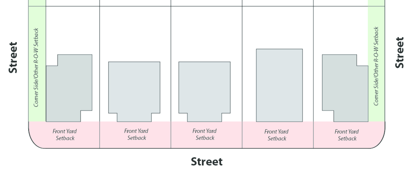
i.
Front-Yard Setback and Streets. The front yard shall be the yard located between the front façade of a building and the street (front lot line) on which the building faces unless otherwise provided in 17.24.010.E.4.a(ii). See Figure 17.24.010-A.
ii.
Measurement. The front-yard setback shall extend the full width of the lot and shall be measured from the street right-of-way line.
iii.
Corner Side/Other R-O-W Setbacks. When a lot has multiple street frontages, the minimum setbacks from all lot lines, except the front lot line, that abuts a street shall meet the corner side/other right-of-way (r-o-w) setback requirements for the applicable district. See Figure 17.24.010-A.
17.24.010-A: Identification of setback areas
iv.
Cul-de-Sac or Curved-Street Lot. For a cul-de-sac lot or a lot abutting a curved street, the front-yard setback shall follow the curve of the front lot line. See Figure 17.24.010-B.
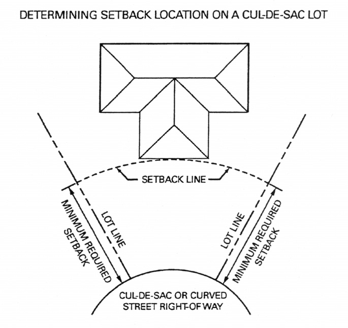
Fig. 17.24.010-B Cul-de-sac setback measurement
d.
Side-Yard Setback. The side-yard setback shall extend from the required front-yard setback line to the required rear-yard setback line and shall be measured from the side lot line. If no street or rear-yard setback is required, the setback shall extend the full depth of the lot. See Figure17.24.010-C.
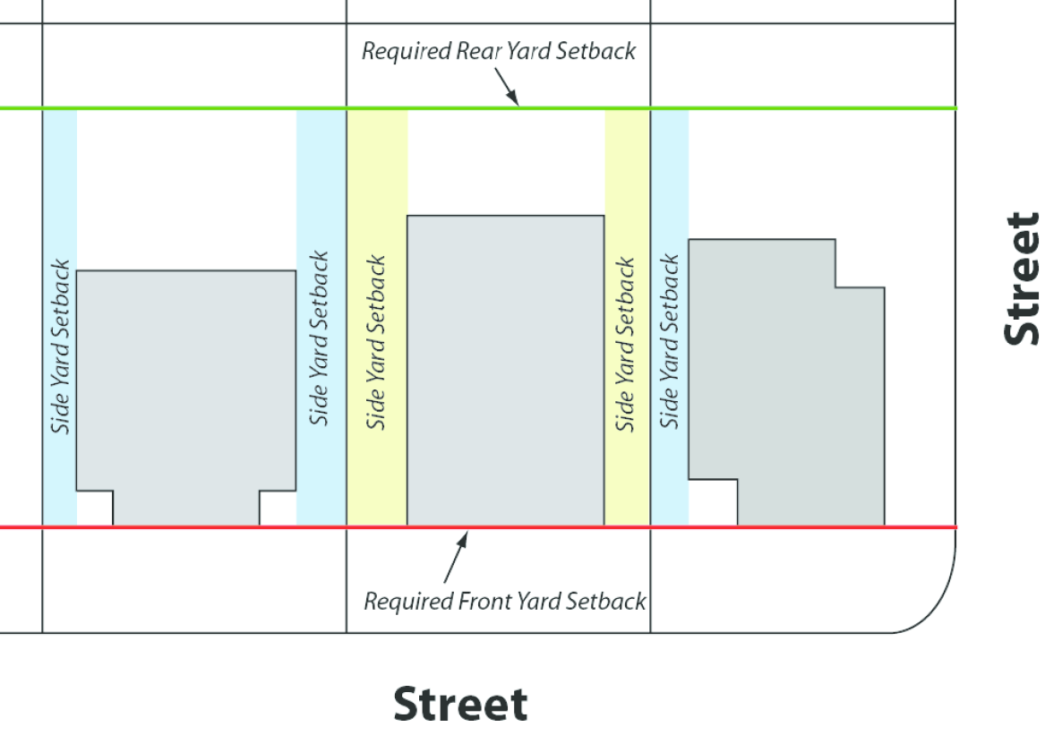
Fig. 17.24.010-C: Side and rear yard setbacks
e.
Rear-Yard Setback.
i.
The rear-yard setback shall extend the full width of the lot and shall be measured from the rear lot line.
ii.
For lots where the rear lot line is curved or irregular, the rear yard setback shall follow the curve of the rear lot line.
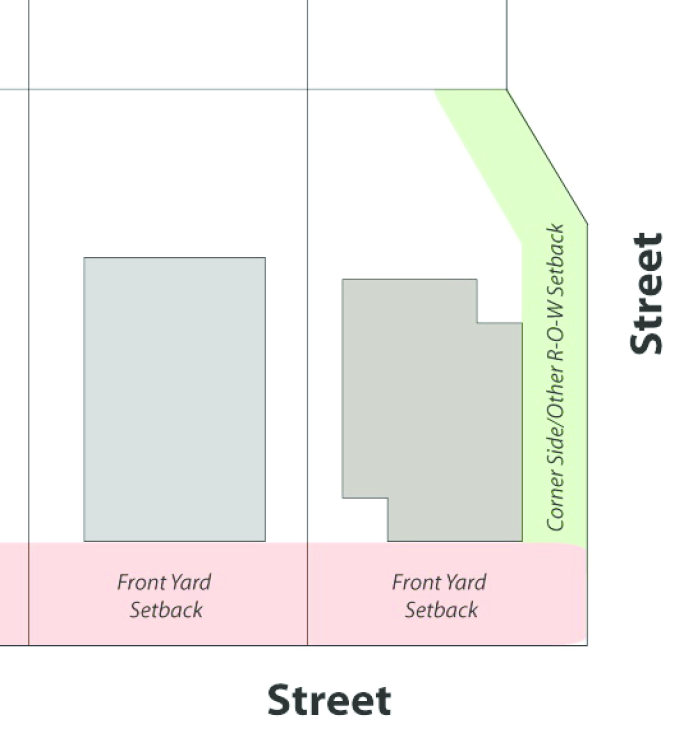
Fig. 17.24.010-D: Irregular lot line with setback
f.
Permitted Encroachments into Required Setbacks (Consolidated and Expanded from Current Districts). The following features may be located within required setbacks to the extent indicated:
i.
Sidewalks and landscaping as allowed in Section 17.24.060, Landscaping, and Section 17.24.050, Mobility and Circulation;
ii.
Fences and walls as allowed in Section 17.24.070, Screening, Walls, and Fences;
iii.
Canopies or covered patios or breezeways attached to the main building may extend into a required rear or side yard provided that portions of such structures extending into the yard:
(A)
Shall not exceed twelve (12) feet in height or project closer than five feet to a side or rear lot line, measured to the supporting posts with a maximum two-foot overhang.
(B)
Shall be entirely open on at least three sides except for necessary supporting columns; except that a breezeway connecting a main building and an accessory building shall be open on two sides.
(C)
Shall not exceed thirty-three (33) percent of the yard area for the required rear or side yard.
iv.
Other permitted encroachments as allowed in Table 17.24.010-9, Permitted Encroachments in Residential Districts and R-A Subdistricts.
g.
Modification of Setbacks in the R-A District. Setbacks established in the R-A district may be modified with the approval of a special use permit processed according to the requirements of Section 17.12.070.K., Variances. In modifying setbacks, the following conditions shall be shown to exist:
i.
The specific modification will not be detrimental to or endanger public health, safety, morals, comfort, or general welfare;
ii.
The specific proposed modification will not be injurious to the use and enjoyment of other property in the immediate vicinity for the purposes already permitted, and will not substantially diminish and impair property values within the immediate vicinity;
iii.
The establishment of the specific proposed modification will not impede the normal and orderly development and improvement of the surrounding property for uses permitted in the zone in which such property is located;
iv.
Adequate measures have been or will be taken to minimize the impacts of any modification; and
v.
The modification will not impair implementation of the goals and objectives of the North Las Vegas Downtown Master Plan Investment Strategy.
5.
Height Measurement, Encroachments, Limitations and Exceptions.
a.
Height Measurement. The height of a building shall be measured as the vertical distance from floor to the:
i.
The highest point of a flat roof (See Figure 17.24.010-E.);
ii.
The deck line of a mansard roof (See Figure 17.24.010-E.); or
iii.
The mean height between the eaves and ridge on gable, hip, or gambrel roofs (See Figure 17.24.010-E.).
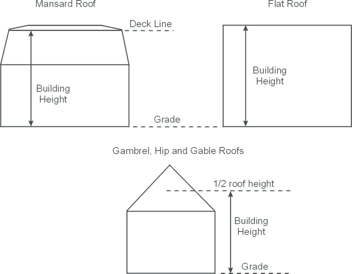
Fig. 17.24.010-E Roof measurement for various roof styles
b.
Appurtenances Exceptions. Maximum height requirements shall not apply to church spires, belfries, cupolas and domes; monuments; chimneys and smokestacks; flagpoles; public and private-utility facilities; transmission towers of commercial and private radio-broadcasting stations; television antennae; parapet walls extending no more than four feet above the limiting height of the building except as hereinafter provided; and solar-energy collectors and equipment used for the mounting or operation of such collectors.
c.
Public Building Exceptions. Places of public assembly in religious institutions, schools, and other permitted public and semi-public buildings may exceed the maximum height requirements in the applicable district provided each one foot by which the height of such building exceeds the maximum height otherwise permitted in the district, its side and rear yards shall be increased in width or depth by an additional foot over the side and rear yards required for the highest building otherwise permitted in the district.
d.
Towers and Monument Exceptions. Towers and monuments, cooling towers, gas holders or other structures, where the manufacturing process requires a greater height, along with storage silos are exempt from the maximum height requirements of the Code provided that any structure above the height otherwise permitted in the district shall occupy no more than twenty-five (25) percent of the lot area and shall be set back a minimum of twenty-five (25) feet from every lot line.
(Ord. No. 2591, § 1, 6-15-2011, eff. 10-1-2011; Ord. No. 2706, §§ 8—11, 2-18-2015; Ord. No. 2859, § 1, 1-17-2018; Ord. No. 3048, § 11, 1-20-2021; Ord. No. 3131, § 2, 7-20-2022)
17.24.020 - Open Space and Parks.
A.
Purpose. This section is intended to ensure that open space and natural areas throughout the City are considered and protected during the development review process in accordance with the Southern Nevada Regional Policy Plan and City of North Las Vegas Comprehensive Plan, as well as to ensure that citizens have adequate open space and that new developments provide the parks and open space areas necessitated by that development. Open space serves numerous purposes, including preservation of natural areas and resources, preservation of scenic resources, greater resident access to open areas and recreation, reducing the heat island effect, enhancing stormwater quality, providing public health benefits, and improving of the quality of new development.
B.
Public Park and Open Space Dedication.
1.
Purpose. This subsection is intended to provide land for park and open space demand generated by new residential subdivisions. Particular emphasis should be placed on providing a diversity of parks that serve residents of all ages and abilities and that are accessible from a variety of locations within the community. Where no suitable land is available, based on subsection 17.24.020.B.4., Characteristics of Land to be Dedicated, the City may substitute the Residential Construction Tax in Chapter 15.52 of the North Las Vegas Municipal Code (NLVMC)
2.
Applicability. Any person offering a preliminary or final plat for development of any area zoned and to be used for single-family, duplex, or multifamily residential purposes in the City shall be required to dedicate for open space a portion of land per individual unit, or pay the Residential Construction Tax pursuant to NLVMC Chapter 15.52, based on the demand for open space created by the development.
3.
Amount of Land to be Dedicated. The minimum amount of land to be dedicated shall be determined based upon a finding by the City Council that the land being dedicated is reasonably related to the impacts upon the City's parks and recreation system that will be generated by the residents and users of the subject development.
a.
The amount of land dedicated shall not be less than two and one-half acres of park land per one thousand (1,000) ultimate residents of the subdivision. The following formula may be used as a general guideline for determining the amount of land to be dedicated:
Figure 17.24.020-A: Example calculation for land dedication
b.
The City finds that the following chart represents the average number of persons per unit by density category:
c.
The developer shall submit with each subdivision plat for residential development information concerning the number of units and appropriate demographics. Should the developer fail to do so, the City shall assume the highest density allowed in the residential district.
4.
Characteristics of Land to be Dedicated. Except as otherwise required by the City at the time of preliminary plat approval, all dedications of land under this section shall meet the following criteria.
a.
Locational Criteria. To the maximum extent feasible, where significant natural and scenic resource assets exist on a property, the subdivider, developer, or owner shall give priority to their preservation through public land dedication. In reviewing the proposed location of public land dedication areas, the Director shall use all applicable plans, maps, and reports to determine whether significant resources exist on a proposed site that should be protected, with priority being given to the following areas (that are not listed in a particular order):
i.
Wetlands, natural drainage channels, washes, and arroyos;
ii.
Native desert habitat and vegetation;
iii.
Wildlife habitat and migration corridors;
iv.
Tree or native plant retention areas;
v.
Trails that are open to the public;
vi.
Areas that provide access to public lands; and
vii.
Natural hillsides and exposed slopes of fifteen (15) percent or greater.
viii.
The Director shall have the final authority to approve the type, configuration, and location of sites proposed for public dedication.
b.
Public Parks and Trails. The location and size of public parks and trails within the City shall be determined by the North Las Vegas Parks and Recreation Facilities Master Plan or other appropriate plan. Trails that are open to the public may be counted towards parks and open space dedication requirements.
c.
Number of Parcels. The dedicated park land shall form a single parcel of land, except where the City determines that two or more parcels would be in the best interest of the public, given the type and distribution of open spaces needed to adequately serve the proposed development or mitigate impacts. In such cases, the City may require that such parcels be connected by a dedicated strip of land at least thirty (30) feet in width.
d.
Usability. At least fifty (50) percent of the dedicated land required by this Code shall be suitable for passive, active, or recreational open space. No part of such fifty (50) percent to be used for passive, active, or recreational open space shall be within any wash, drainage way, or floodway of the City, except for trails.
e.
Location Outside of Subdivision. At the discretion of the City, the dedicated park land may be located outside of the residential development in order to comply with the Comprehensive Plan, to add property to existing park land, or to combine land dedication efforts with those of other developments.
f.
Access. Public access to dedicated park land shall be provided either by adjoining public street frontage or, if required by the Director, by a public access easement at least thirty (30) feet wide that connects the dedicated land to a public street or right-of-way, unless the land being dedicated is a sensitive environmental area to which access should be restricted for preservation purposes. Gradients adjacent to existing and proposed streets shall allow for ADA compliant access to the dedicated land. Public access to greenway/greenbelt dedications only shall be at least twenty (20) feet wide.
g.
Areas Not Eligible. Lands within the following areas shall not be included in or counted towards public open space dedication requirements:
i.
Private yards, required setbacks, or required landscape buffer areas, even if they contain sidewalks;
ii.
Public or private streets, rights-of-way, easements, or sidewalks; open parking areas and driveways for dwellings;
iii.
Land covered by structures not intended solely for recreational or interpretive uses; and
iv.
Bureau of Land Management managed lands.
C.
Private Common Open Space.
1.
Purpose. Private common open space is private open land area set aside for the exclusive use and enjoyment of a development's residents, employees, or users. Goals and requirements for common open space complement this Code's requirements for dedicated parks, and serve similar purposes.
2.
Applicability.
a.
Residential Development. All residential development in the City shall be required to set aside private open space as required in Table 17.24.020-2, Residential Open Space Requirements, below.
b.
Multifamily Development. Multifamily development shall provide open space as required in Table 17.24.020-2. A minimum of seventy-five (75) percent of the open space shall be usable for recreation. Landscaping outside of perimeter walls is excluded from open space calculations.
i.
Recreation space and facilities shall be sufficient for the development's population and shall be tailored to their intended clientele.
ii.
Each dwelling unit shall be not more than three hundred (300) feet from the nearest useable open space measured in a straight line from the front door.
iii.
No more than fifty (50) percent of the total open space requirement may be counted within structures and no more than fifty (50) percent may be provided on rooftops.
iv.
Driveways, parking areas, ornamental landscaped areas (having a width of less than twenty (20) feet), and required side or front yards shall not be considered open space, except in the case of interior townhouse units where the unit is less than twenty (20) feet in width, in which case the minimum width of the common open space area shall be the width of the lot.
c.
Mixed-Use Development. Mixed-use development shall provide open space as follows:
d.
Commercial Development. Commercial developments of five acres in size or greater shall provide a minimum of fifty (50) square feet of plaza space for each one acre of land. Such plaza spaces shall be in addition to any such spaces provided by individual tenants with a minimum area of two hundred fifty (250) square feet or businesses for the use of their customers.
Fig. 17.24.020-A: Plaza space
e.
Industrial Development. Industrial developments are encouraged to provide open spaces and plazas as part of their overall development plans.
3.
Standards.
a.
Minimum Dimensions.
i.
In all residential and mixed-use developments, private common open space having a minimum area of four hundred (400) square feet and a minimum width of twenty (20) feet, may be counted towards private common open space requirements.
ii.
In all commercial and industrial developments, every individual pedestrian open space or plaza shall have a minimum area of two hundred fifty (250) square feet.
iii.
If a vegetated roof is open to residents and amenitized, it may be counted toward the private common open space requirements.
b.
Locational Criteria.
i.
Natural and Scenic Areas in All Districts. To the maximum extent feasible, where significant natural and scenic resource assets exist on a property, the developer or owner shall give priority to their preservation as private common open space. In reviewing the proposed location of private common open space areas, the Director shall use all applicable plans, maps, and reports to determine whether significant resources exist on a proposed site that should be protected, with priority being given to the following areas (that are not listed in a particular order):
(A)
Wetlands, natural drainage channels, washes, and arroyos;
(B)
Native desert habitat and vegetation;
(C)
Wildlife habitat and migration corridors;
(D)
Tree or native plant retention areas;
(E)
Trails that are open to the public;
(F)
Areas that provide access to public lands;
(G)
Hillsides and exposed slopes of fifteen (15) percent or greater;
(H)
On-site stormwater detention facilities where the design accommodates recreational use by residents and has been approved by the Director; and
(I)
The City shall have the final authority to approve the type, configuration, and location of sites proposed for public dedication.
ii.
Areas Not Appropriate for Private Common Open Space. Lands within the following areas shall not be included in or counted towards required private common open space set-aside areas:
(A)
Land identified for or dedicated to the public park and open space requirement;
(B)
Private open space less than twenty (20) feet wide; if the private open space is more than twenty (20) feet wide, the entire open space may be counted toward the required set-aside;
(C)
Required landscape buffer areas - even if they contain sidewalks - and required parking lot landscaping;
(D)
Public or private streets, or rights-of-way;
(E)
Easements (paved or unpaved); unless the easement is at least twenty (20) feet wide and developed as an approved walkway or bike path as described in Section 17.24.050.H.1. or is landscaped in accordance with Section 17.24.060;
(F)
Sidewalks; open parking areas, and driveways for dwellings; and
(G)
Land covered by structures not intended solely for recreational, interpretive, or scientific uses.
iii.
Mixed-Use, Commercial, and Industrial Pedestrian Open Spaces and Plazas. In addition to the preservation of natural and scenic areas, mixed-use and commercial development may provide private common open space through on-site pedestrian open space and plazas. The following standards shall apply to pedestrian open spaces in mixed-use and commercial development. They are encouraged in industrial development.
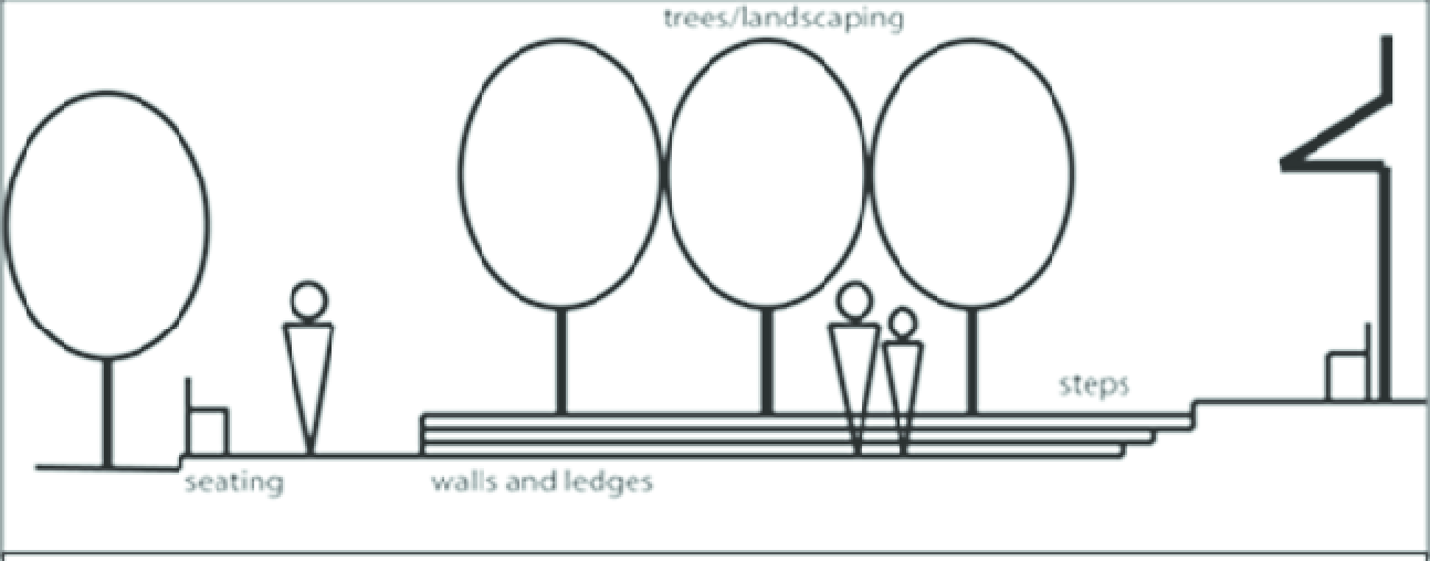
Fig. 17.24.020-B: Elements of public plaza design
(A)
Pedestrian open spaces and plazas shall be integral to the overall design of the proposed development and shall be located in such a manner to be convenient and readily accessible.
(B)
Site amenities, including but not limited to benches, pergolas, landscaped arbors, artwork and water features shall be incorporated into the design of each pedestrian open space/plaza. See Fig. 17.24.020-B.
(C)
Any pedestrian open space/plaza that abuts a blank wall shall include a minimum three-foot wide landscaped area next to the wall to soften and screen the wall and increase pedestrian comfort and interest. Landscaping for the above purpose shall reach a minimum height at maturity of five feet. Landscaping plans shall take into consideration site-specific geotechnical recommendations that may require additional protection to prevent infiltration of water into unsuitable soils. If landscaping is determined to be impractical because of soils conditions, one or more of the following options may be used so long as a minimum planter depth of three feet is maintained:
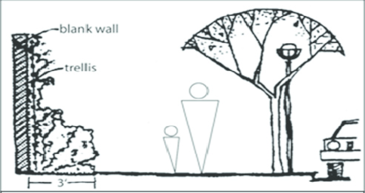
Fig. 17.24.020-C: Screening blank walls in pedestrian plazas
(1)
Landscaping may be relocated throughout the pedestrian plaza so long as the overall amount of required landscaping is not reduced.
(2)
Above-ground planters may be utilized so long as they are designed and constructed in such a manner to prevent drainage onto any sidewalk. The height of the planter shall not exceed two feet six inches. The height of the planter may be included in measuring the minimum height of the required landscaping.
(3)
Other methods as approved by the City (i.e., cutoff walls, moisture barriers etc.).
c.
Use of Natural and Scenic Common Open Space Areas. Natural and scenic private common open space areas shall not be disturbed, developed, or improved with any structures or buildings, except for the limited purposes allowed below:
i.
Facilities for active recreation (equipment for such uses shall be indicated on the site and/or subdivision landscape/amenity plan provided by the developer);
ii.
Common open space areas may include passive recreational and educational purposes approved by the City, including but not limited to walking, biking, picnicking, fishing, preservation of natural areas and scenic resources, parks, environmental education, and wildlife habitat protection; and
iii.
Clearing of underbrush and debris, and the provision of walks, trails, fences, restrooms and similar features are allowed.
d.
Private Common Open Space for Infill Projects.
i.
Where an infill site is configured or sized so as to not permit the provision of private common open space to meet the standards of this section, the City may allow the substitution of developed sidewalk areas/streetscape for other types of private common open space, including:
(A)
Public plazas or fountains;
(B)
Tree wells and urban landscaping such as shrubs, live groundcover, planters, and hardscape (e.g., decorative fencing, arbors, patterned paving);
(C)
Street furnishings, including but not limited to waste receptacles, bicycle racks, drinking fountains, or shelters for persons utilizing public transit.
ii.
New developments are exempt from the open space requirements of this Section if:
(A)
They contain fewer than five thousand (5,000) square feet of gross floor area; or
(B)
They lie within five hundred (500) feet of an improved public park, plaza, or other open space and are connected by a continuous sidewalk meeting the Americans with Disabilities Act.
4.
Ownership. All private common open space areas shall be owned jointly or in common by the owners of the development or held in other ownership forms approved by the City attorney.
5.
No Fee-In-Lieu. The payment of fees-in-lieu of the set-aside of land for private common open space uses is prohibited.
6.
Private Open Space Maintenance.
a.
The owner of the private open space land shall be responsible for maintenance.
b.
For the purposes of this subsection, "maintenance" includes control of noxious weeds, reseeding as needed to prevent erosion, restriction of use as necessary to allow revegetation, irrigation when appropriate, and the establishment and enforcement of reasonable rules for the protection of the open space.
(Ord. No. 2591, § 1, 6-15-2011, eff. 10-1-2011; Ord. No. 2706, §§ 12, 13, 2-18-2015; Ord. No. 2873, §§ 1, 2, 3-21-2018; Ord. No. 3196, § 5, 12-20-2023)
17.24.030 - Natural Resources.
A.
Stormwater Control and Drainage Features.
1.
When geotechnical conditions are favorable, and particularly in the case of parks, common areas, and existing washes, on-site detention of stormwater may be required as a means of reducing stormwater runoff. Areas such as common areas and existing washes should be explored for this type of use. When detention basins are utilized, they must be integrated into the overall landscaping and site development plan of the proposed project.
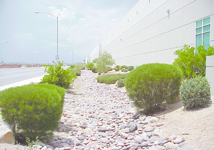
Fig. 17.24.030-A: Drainage swale enhanced with natural materials and landscaping.
2.
Natural ponding areas should be retained as much as possible or, if necessary, enlarged or modified as directed by the Director of Public Works, subject to City subdivision requirements for stormwater runoff control.
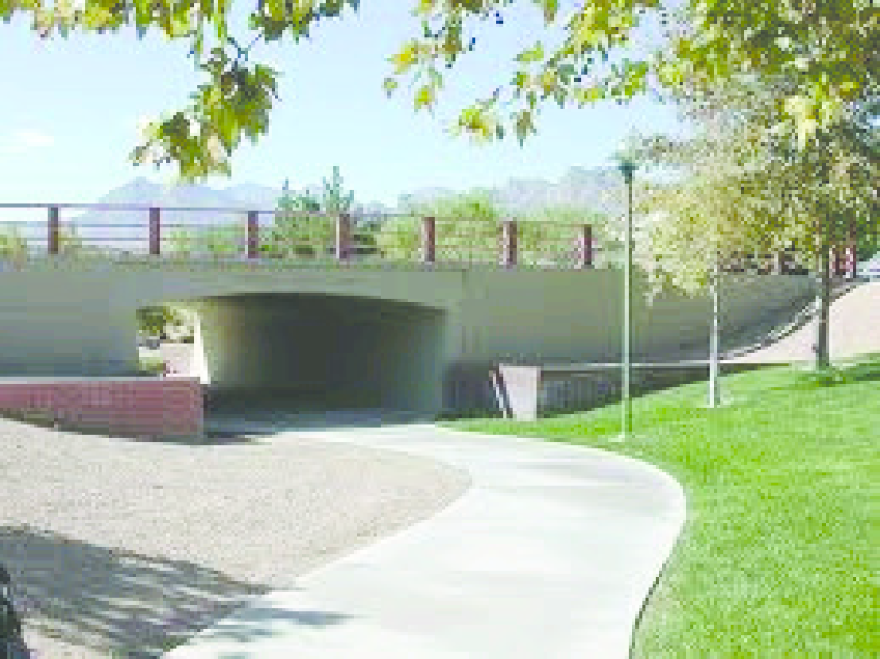
Fig. 17.24.030-B: Natural features such as washes integrated into development for
use as open space.
3.
In order to provide a more natural appearance and to provide for the stabilization of natural channels when the City determines geotechnical conditions are favorable, drainage ways shall be lined with natural materials such as grass, soil, gravel or rock or other materials allowed by the Clark County Regional Flood Control District Hydrologic Criteria and Drainage Design Manual as adopted by the City of North Las Vegas. The use of smooth or plain concrete for lining of drainageways is discouraged and is permitted only as part of a flood control or stormwater management plan approved jointly by the Department of Public Works and the Planning and Zoning Department.
4.
Where feasible, and when geotechnical conditions are favorable as determined by the City, natural features such as washes shall be retained in their natural state and integrated into the design of the site to the maximum extent possible. The area around the channel or wash that is to be retained in its natural state, improved as a non-concrete channel, or improved with a combination of natural materials and stamped concrete, may be counted toward the requirements for open space within the subdivision or planned unit development upon the review and approval of the City. Development shall be setback a minimum of thirty (30) feet from any major wash designed by the City for protection in a natural state.
5.
Flood control structures such as weirs, drop structures, etc., if utilized as part of the drainage way design, shall be faced with large natural rocks of an appropriate size to be approved by the Planning and Zoning Department and the department of public works.
6.
The area of any existing channel, pond, or wash that is retained in its natural state, improved as a nonconcrete channel, or improved with a combination of natural materials and other materials such as patterned concrete, may be counted toward the requirements for open space within the proposed development upon the review and approval of the City.
7.
Applicants are strongly encouraged to incorporate bicycle and pedestrian paths, and landscaping, along drainage channels and washes as described in Section 17.24.050, Mobility and Circulation.
B.
Steep Slope Development.
1.
Purpose and Intent. Development occurring on hillsides and steep slopes can result in adverse effects by destruction of natural scenic beauty and unsightly developments, increased soil erosion, fire, and flood hazards, property damage from extensive soils slippage and subsidence, or traffic circulation problems. These standards are intended to regulate all types of development in certain hillside areas as a means of preventing such adverse effects.
2.
Applicability. Except where exempted below, the standards in this section shall apply to development when any portion of the lot contains naturally-occurring slopes of twenty (20) percent or greater, and in the opinion of the Director of Public Works, needs protection (based on the intent of this section).
3.
Exemptions. The standards in this subsection shall not apply to the following:
a.
Man-Made Slopes. Pre-existing or post-development man-made slopes less than twenty (20) percent.
b.
Sites with Limited Benefit. If, in the opinion of the Director of Public Works, the area of a lot comprised of slopes twenty (20) percent or greater is so small that there is no meaningful benefit from the application of this subsection, the Director may waive the applicability of this section. If an applicant disagrees with the Director's decision, the applicant may appeal the decision to the Planning Commission.
4.
Standards. Development on lots subject to these standards shall comply with the following standards:
a.
Lots with Slopes of Thirty (30) Percent or Greater.
i.
Development on natural slopes of thirty (30) percent or greater is prohibited.
ii.
Slope areas of thirty (30) percent or greater may be credited towards private common open space set-aside requirements in Section 17.24.020.C if approved by the City.
b.
Minimum Lot Size. Lots subject to the standards of this section containing natural slopes of twenty (20) percent or greater shall be a minimum of one acre, shall maintain a minimum street frontage of one hundred fifty (150) linear feet, and a minimum side yard setback equivalent to at least twenty-five (25) percent of the lot's street frontage, regardless of the standards in the applicable base or overlay district. For lots on a cul-de-sac or curvilinear street, the street frontage shall be measured at the edge of the front setback. Lots shall not be mass graded to avoid this section. See Figure 17.24.030-C.
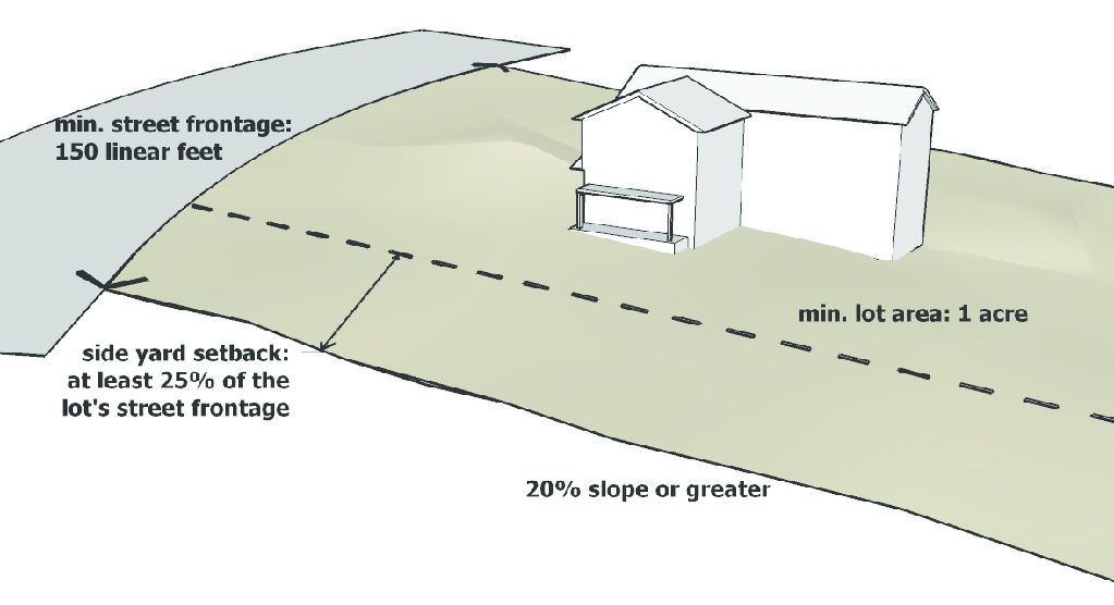
Fig. 17.24.030-C: Minimum lot size with slope
c.
Critical Lot Plan Required. Prior to this issuance of a building permit, a Critical Lot Plan showing slope stabilization on steep slopes over twenty (20) percent shall be submitted to the City.
d.
Cut and Fill.
i.
Cut and fill shall be minimized by following existing contours.
ii.
In cases where fill is used in areas with natural slopes ranging from fourteen (14) percent to nineteen and ninety-nine hundredths (19.99) percent, a geotechnical report shall be required prior to issuance of a building permit to ensure that proper fill and grading techniques were used.
e.
Retaining Walls. Retaining walls on lots subject to the standards of this subsection shall be provided in accordance with the standards in Section 17.24.070, Fences, Walls, and Screening.
f.
Maximum Slopes for Streets and Driveways, Streets shall not exceed the maximum permitted grades for streets in the subdivision regulations. The maximum slope permitted on a driveway shall be fourteen (14) percent and shall have landings at the top and bottom to prevent vehicles from scraping pavement. The maximum permitted grades for streets shall be in accordance with the "A Policy on Geometric Design of Highways and Streets" and "Uniform Standard Drawings for Public Works' Construction, Offsite Improvements, Clark County Area, Nevada." However, streets may be permitted to cross a slope of thirty (30) percent or less for a short distance as determined by the City.
C.
Site Grading. On sites that contain slopes between five and fifteen (15) percent, the development of the site should reflect, rather than obscure, the natural topography of the site through the use of various techniques such as smooth transition of grades at the property lines, blending of cut and fill slopes, and terracing.
1.
Where sloping is to be used for topographic transitions at the property edges, slopes should not exceed three to one and shall be landscaped with approved materials in accordance with Section 17.24.060, Landscaping, to achieve a minimum ground coverage of sixty (60) percent (not including trees). The sixty (60) percent coverage shall be reached within two years of the time a final building inspection is approved.
2.
Cut and fill slopes shall be rounded where they meet natural grade so that they blend with the natural slope. See Fig. 17.24.030-D.
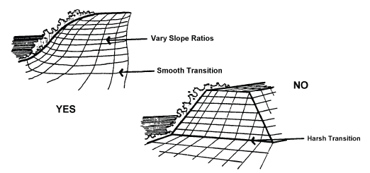
Fig. 17.24.030-D: Rounding cuts and fills where they meet natural grade to blend with
the natural topography.
3.
All slopes shall be designed and constructed in accordance with applicable North Las Vegas ordinances and the approved site-specific geotechnical investigation report.
D.
Vegetation Preservation. Preservation of existing trees and vegetation sequesters greenhouse gases such as carbon dioxide and provides more shade than establishing new trees. The following vegetation protection standards shall apply to all multifamily, mixed-use, commercial, and industrial developments greater than one acre and all single and two-family residential projects of more than five dwelling units.
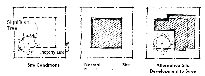
Fig. 17.24.030-E: One illustration of how sensitive site design can help to preserve
natural features.
1.
Significant Trees. All development shall comply with the following standards during the site preparation, construction, and landscaping processes.
i.
Significant trees, as defined by this section, shall be identified on site plans with dimensions and preserved to the maximum extent feasible.
ii.
A "significant tree" is a tree that has reached seventy-five (75) percent or greater of the mature dimensions of a typical specimen of the species. (For example, a typical mature honey mesquite measures twenty (20) feet tall and has a twelve-inch caliper. A "significant" honey mesquite tree would therefore be a tree measuring fifteen (15) feet or taller in height with a caliper of eight inches or more.) The City shall prepare and maintain a list of the mature dimensions of all typical local protected species. Where the City determines that tree of such dimensions is diseased or dying, or is a noxious invasive species, it shall not be considered significant.
iii.
A preserved significant tree, except for palm trees, shall be counted toward landscape requirements at a ratio of two inches of caliper credit per every one inch of caliper of the preserved tree. For example, a preserved significant tree with a fifteen-inch caliper will receive thirty (30) inches of caliper in credit.
iv.
All necessary measures, including but not limited to dripline fencing, shall be taken during construction to avoid damage to above and below-ground portions of a significant tree or compaction of soils above the root system.
v.
Significant trees shall not be altered in a way that would harm them, such as through topping or cutting or any other practice that does not conform with the International Society of Arboriculture standards.
vi.
It is the responsibility of the property owner to preserve and maintain any significant tree. Where a significant tree is not preserved or not maintained, it shall be replaced at a ratio of two replacement trees for every one inch in caliper of the significant tree either on the subject property or off-site as permitted by the City.
2.
Non-significant Trees.
a.
Preservation of non-significant trees of a protected species with dimensions equal to or greater than the minimum dimensions required for new landscaping trees is encouraged.
b.
Every such preserved non-significant tree of a protected species may be counted toward landscaping minimums at a ratio of one tree credit per one and one-half inches of diameter of preserved non-significant tree. Preserved non-significant trees smaller than three inches in diameter shall be awarded one tree credit.
3.
Native Vegetation. Native vegetation within twenty-five (25) feet of the defined bank of a wash shall be preserved unless the City approves an alternative naturalized landscaping/drainage plan. that preserves significant desirable native vegetation.
(Ord. No. 2591, § 1, 6-15-2011, eff. 10-1-2011)
17.24.040 - Parking and Loading.
A.
Purpose. The purpose of this section is to regulate the amount and location of vehicle parking and maneuvering areas in order to promote a more efficient use of land, enhance urban form, encourage the use of alternative modes of transportation, provide for better pedestrian movement, and protect air and water quality. The provisions of this section are intended to:
1.
Prevent and alleviate the congestion of public streets;
2.
Encourage the incorporation of alternative modes of transportation by emphasizing pedestrian circulation and establishing requirements for bicycle parking;
3.
Promote greater safety of passage between highway and land;
4.
Minimize the detrimental effects of vehicular use areas on adjacent properties;
5.
Encourage the reduction of impervious surfaces through effective design and the use of shared parking where practical to reduce the heat island effect;
6.
Promote the health, safety, and public welfare by establishing minimum requirements for off-street parking and loading areas; and
7.
Limit parking to encourage more compact, walkable developments.
B.
Applicability.
1.
New Development.
a.
The requirements of this section shall apply to all new development where there is the construction of a new structure (excluding accessory structures), establishment of a new land use, or an enlargement of an existing structure.
b.
Existing parking, loading, and stacking spaces may not be reduced below the minimum requirements established within this section.
2.
Expansions and Enlargements.
a.
The parking and loading requirements of this section shall apply when an existing structure is expanded or enlarged. In the case of such expansions and enlargements, additional off-street parking and loading spaces are required to serve only the enlarged or expanded area.
b.
The expansion or enlargement of existing structures in the R-A district shall be exempt from the above requirement if the total expansion is less than five thousand (5,000) square feet or does not expand the square footage of the structure more than twenty-five (25) percent, whichever is less.
3.
Change of Use. The parking and loading requirements of this section shall be provided for any change of use that would result in a requirement for more parking and loading spaces than the existing use unless otherwise provided for in Section 17.24.040.I, Reduction in the Number of Required Parking Spaces.
4.
Parking for Nonconforming Uses. Parking requirements related to nonconforming uses shall be subject to the provisions of Section 17.20.050.C, General Standards.
5.
Infill Development.
a.
Commercial development within the R-A district boundaries or within a PID may reduce the amount of parking required in Table 17.24.040-4, Minimum Off-Street Parking Standards, by twenty-five (25) percent subject to Section 17.24.040 (J), Alternative Parking Options. Additional reductions may be requested through Section 17.12.070.L, Waivers.
b.
For residential development within the R-A district, the minimum off-street parking requirements of Table 17.24.040-4, Minimum Off-Street Parking Standards, may be reduced by twenty-five (25) percent.
c.
Where there is on-street parking immediately in front of any lot or parcel in the R-A district, the minimum off-street parking requirement of this section shall be reduced by one space for each on-street parking space located entirely or partially between two lines formed by the extension (without turning) of the side lot lines of the lot or parcel into the street right-of-way.
C.
General Standards for Off-Street Parking, Stacking, and Loading Areas.
1.
Location. Except as otherwise expressly provided in this Code, required off-street parking, loading, and vehicle stacking spaces shall be located on the same lot as the principal use.
2.
Parking Accessory to a Residential Use.
a.
Residential garages shall be utilized primarily for the parking of automobiles, recreational vehicles, and no more than one commercial use vehicle.
b.
In the absence of a garage, the commercial use vehicle shall be parked in an adequately sized, paved, off-street parking space that meets the requirements of this Code.
c.
Not more than one-half of the front yard area shall be used for parking or surfaced with hardscape. The front yard area is the entire area from the front of the house to the front property line.
3.
Setbacks.
a.
Generally. Parking lots, parking spaces, vehicle stacking spaces, and loading spaces shall be subject to the setbacks established in Section 17.24.010, Site Dimensional Standards, or this subsection, unless otherwise expressly stated in this Code.
b.
Parking of Motor Homes or Recreational Vehicles in Residential Setbacks.
(i)
A motor home, vehicle (not including a commercial use vehicle) or recreational vehicle shall be parked on a paved surface. Parking areas shall be paved with concrete, brick, pavers or other similar materials.
(ii)
No more than three vehicles of any kind may be parked upon the property. Furthermore, no more than one motor home, or one recreational vehicle may be parked upon the property.
(iii)
No parked vehicle of any kind may be utilized for storage of items for personal property.
(iv)
Motor homes or recreational vehicles shall only be parked in the rear yard, side yard, or in the corner side yard.
(v)
Access to the vehicle parking area shall be provided on concrete, brick, pavers, decomposed granite, or other similar materials. Furthermore, access shall only be allowed from rolled curbing, unless otherwise approved by the Department of Public Works.
(vi)
Access shall not be allowed over any utility box, unless otherwise allowed by the Utilities Department.
(vii)
A minimum six foot high wall with decorative gates shall be provided to screen the parking of the motor home, vehicle or recreational vehicle.
4.
Use of Required Parking Areas for Parking Only. Required accessory off-street parking spaces in any district shall not be utilized for open storage, sale, or rental of goods, or storage of inoperable vehicles, unless otherwise permitted in the Municipal Code.
5.
Property Access Standards.
a.
Shared Driveways.
i.
The City encourages the use of shared driveways between separate parcels. Some of the following standards may be relaxed if the applicant demonstrates that a more efficient design can be accomplished without jeopardizing the public's health, safety, and welfare, as part of the site plan review process.
ii.
All driveways shall be approved by the Director of Public Works for width and location. Developments which may not be able to meet the requirements of subsections (b) through (e) of this section, and are requesting deviations from the standards, shall submit to the Director of Public Works a report certified by a professional engineer addressing the following site conditions, both present and future prior to submittal to Planning Commission:
(A)
Traffic volumes,
(B)
Turning movements,
(C)
Traffic controls,
(D)
Site design,
(E)
Site distances,
(F)
Location and alignment of other access points, and
(G)
Site distribution.
iii.
Based upon the above data, the Director of Public Works shall determine whether a deviation from the requirement standards is justified and, if so, what alternative requirements will be necessary.
b.
Driveway Access Required.
i.
All nonresidential off-street parking spaces shall have access from a driveway and not directly from a public street.
ii.
Nonresidential driveways shall have a minimum width as specified by Clark County Standard Drawings as adopted by City of North Las Vegas unless otherwise approved by the Director of Public Works.
iii.
Residential driveways shall have a minimum width of ten (10) feet.
c.
Driveway Distances from Intersection. All driveways shall be set back from intersections as established in the Clark County Area Uniform Standard Drawings for Public Works Construction, unless otherwise approved by the Director of Public Works.
d.
Driveway Spacing.
i.
Driveways shall be separated from other driveways as established in Table 17.24.040-1, Driveway Spacing, and as measured from the inside curb or pavement edge of the driveway.
ii.
Driveways associated with single-family dwelling, two-family dwellings, and townhouse clusters shall be exempt from requirements of this subsection.
iii.
The driveway separation distances established in Table 17.24.040-2, Driveway Spacing, may be reduced only if approved by the Director of Public Works as part of an approved site plan.
e.
Number of Driveways.
i.
Single-family residences on a right-of-way width of forty-eight (48) feet or less (which may include sidewalks) and a split garage condition, may have two driveway access points along the street face, with the following driveway widths:
(A)
Such driveways shall be limited in width to a maximum of ten (10) feet each on lots with a minimum width of fifty (50) feet.
(B)
Such driveways shall be limited in width to a maximum of one twenty-foot and one ten-foot wide driveway on lots with a minimum width of sixty (60) feet.
ii.
All other single-family uses shall be limited to one driveway per street face, except on properties abutting arterial streets in which case circular driveways or driveways facilitating the turning of automobiles on-site, shall be required.
iii.
Any driveway located between the home and curb-cut apron shall be attached to a functional garage and shall be removed upon full conversion of the garage into living area.
6.
Garages and Carports.
a.
Garage Required for Single-Family Dwellings.
i.
Except as provided in subsection iii. below, the off-street parking spaces required for a single-family dwelling shall be furnished within an enclosed garage located on the same parcel as the dwelling.
ii.
Garages shall comply with Section 17.24.090.F.1.c and may be configured as a standard garage, split garage, or offset garage under the following provisions:
(A)
A standard two-car garage configuration shall have a minimum unobstructed open space with dimensions of twenty (20) feet by twenty (20) feet, except for two-foot protrusions into this space by utility systems and storage units.
(B)
Split garages or offset garages shall have a minimum unobstructed open space with dimensions of ten (10) feet by twenty (20) feet provided at least two such spaces are provided per residence and the total garage square footage is a minimum of four hundred (400) square feet. Such spaces shall be unobstructed except for two-foot protrusions into this space by utility systems.
iii.
Exemptions to these requirements shall apply in the following instances:
(A)
Except for model homes, a dwelling for which a building permit was acquired prior to February 4, 1998, shall be exempt; provided, however, that a garage existing prior to this date shall not be converted for other use unless the provisions of this subsection i. above will have been met. A garage established with a model home, whose space is used for sales and display purposes, shall revert to use as a garage when the model home is sold for habitation.
(B)
A single-family home and an attached garage of no less than eighteen (18) feet by eighteen (18) feet of unobstructed space, except for two-foot protrusions into this space by utility systems and storage units, that are patterned after model homes, the plans of which were submitted for building plan check prior to March 20, 1998, shall be exempt, provided, however, the homes are to be located within a subdivision the tentative map of which was approved by or pending approval on February 4, 1998.
(C)
Mobile/manufactured homes that are located on a lot within an approved mobile home park shall be exempt from the requirements of this subsection i. above.
(D)
Infill sites south of Craig Road may also be exempt from the garage requirement provided three other single family homes within a three hundred (300) foot radius of the subject site were not originally constructed with carports or garages. However, such infill sites are required to provide off-street parking with minimum dimensions of eighteen (18) feet width by twenty (20) feet in length for two vehicles.
(E)
Tiny House.
b.
Carport Dimensions. Where carports are required to cover parking spaces, the following requirements shall be met:
i.
The carport must cover a space that measures at least nine feet by nineteen (19) feet, measured from the inside face of the support structure to the opposite support structure.
ii.
The carport roof shall cover the entire nineteen-foot length of the spaces.
iii.
The carport structure shall not extend into a right-of-way or over a fire lane.
c.
Other Uses. Except as otherwise required, off-street parking provided for other uses need not be furnished within an enclosed garage or other structure.
7.
Internal Sidewalks and Pedestrian Access.
a.
Where a sidewalk exists in a public right-of-way adjacent to the site, or is required to be constructed as part of the development approval through any adjacent parking lot, a pedestrian connection shall be constructed from the building to the sidewalk. See Figure 17.24.040-B.
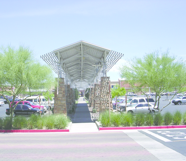
Fig.17.24.040-B: Sidewalk through a parking lot with required landscaping.
b.
The pedestrian connection shall have a minimum width of five feet.
c.
All pedestrian walkways located within a site (internal pedestrian circulation) shall be physically separated from the drive lanes and driveways. Additionally all sidewalks and crosswalks shall be constructed of an impervious surface and shall be visually distinct from the driving surface by use of pavers, concrete, bricks, speed tables or colored or stamped concrete. See Figure 17.23.040-C.
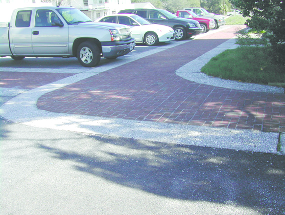
Fig. 17.24.040-C: Change in paving materials to distinguish pedestrian walkway
d.
Sidewalks, at least eight feet in width, shall be provided along any façade featuring a customer entrance, and along any façade abutting public parking areas. At all times, such sidewalks shall maintain a clear pedestrian passage equal to the width of the sidewalk. Additionally, such sidewalks shall connect all customer entrances and to other internal sidewalks.
e.
Where a pedestrian walkway directly abuts a driveway or street, the walkway shall be raised a minimum of six inches above the street or driveway and curbed along the edge of the driveway or street. Alternatively, a walkway abutting a driveway at the same grade may be permitted if the walkway is protected from vehicles by a row of decorative metal, concrete bollards, or other suitable barrier with adequate minimum spacing to protect pedestrians.
f.
Sidewalks that abut ninety-degree parking spaces must be a minimum of eight feet in width in instances where vehicle wheel stops are not used between the parking space and the sidewalk curb, and five feet in width when vehicle wheel stops are installed. Additionally, in commercial areas, such sidewalks shall be located at least three feet from the façade of the building to provide planting beds for foundation landscaping.
D.
Parking Location, Layout, and Design.
1.
Parking Space and Drive Aisle Dimensions. Table 17.24.040-3, Dimensional Standards for Parking Spaces and Aisles, establishes the minimum parking spaces standards based on the angle of parking and/or parking space type.
2.
Circulation Between Bays. Except in the case of dwellings with one to four dwelling units or townhouse clusters, parking areas shall be designed so that circulation between parking bays occurs within the designated parking lot and does not depend upon a public street or alley.
3.
Surfacing.
a.
All areas intended to be utilized for parking spaces and driveways shall be paved with concrete, asphaltic concrete, or other permitted materials (See Section 17.24.040 K.10.) to control dust and drainage. All proposed parking areas and driveway improvements shall require a grading and drainage plan approved in accordance with provisions adopted by the City.
b.
The loading area, aisles, and access drives shall be paved so as to provide a durable, dustless surface and shall be so graded and drained so as to dispose of surface water without damage to private or public properties, streets or alleys.
c.
Tracked vehicles may be parked or stored on a gravel or aggregate parking surface on lots in the M-2 district. Such parking surface shall only be used for the parking and storage of such tracked vehicles and may not be used for a driveway, parking, or storage space for other vehicle types.
4.
Section Design. Parking lot section design shall be determined by a soils report conducted by a registered professional engineer. The soils report shall be based on a soil analysis such as R values or CBR values determined by soil testing. The report shall be submitted to the building and safety division for their approval. Under no circumstances shall a parking lot section fail to meet the minimum standards as adopted by the City.
5.
Striping. Except for single-family dwellings, all parking stalls shall be marked with painted lines that have a minimum width of four inches.
6.
Lighting. All lighting within a parking area shall be subject to the provisions of Section 17.24.080, Exterior Lighting.
7.
Signs. All signs shall comply with Section 17.24.0150 Signs, and the site distance requirements of Section 17.24.070.A.3., Sight Visibility Zone.
8.
Protruding Vehicles. All on-site parking spaces that abut property lines or sidewalks shall be designed and constructed such that parked vehicles shall not protrude over property lines or into pedestrian walkways.
E.
Off-Street Parking Standards.
1.
Purpose. Off-street parking and loading spaces for each use shall be provided in accordance with the standards established in this section in order to:
a.
Relieve traffic congestion in the streets,
b.
Minimize any detrimental effects of off-street parking areas on adjacent lands,
c.
Ensure the proper and uniform development of parking areas throughout the City
d.
Prevent the establishment of excessive amounts of off-street surface parking, and
e.
Encourage appropriate infill and reinvestment within established areas.
2.
Computation of Required Off-Street Parking Spaces.
a.
Fractions. When measurements of the number of required parking spaces result in fractions, the space standard shall be rounded upward to the next highest whole number.
b.
Different Use Areas. Except as provided for in this section, parking shall be calculated separately for each different use area in a building or on a site, including all accessory uses.
c.
Combinations of Uses. If the City determines that a proposed use represents a combination of uses listed in Table 17.24.040-4, Minimum Off-Street Parking Standards, the minimum and maximum parking space standards shall be those that would apply if the two (or more) uses were developed separately, unless the Director determines that a lower standard would be adequate because of differences in peak operating hours.
d.
On-Street Parking. Except as permitted elsewhere in this code, on-street parking, shall not be used to satisfy the off-street parking standards of this subsection.
e.
Parking Based on Seating. When the standards use seating as a unit of measurement, all calculations shall be based on the occupant load of the areas used for seating.
f.
Parking Based on Floor Area. Except as provided for in this section, when the standards use amount of square footage in buildings as a unit of measurement, all calculations shall be based on gross floor area minus ten (10) percent except as may hereinafter be modified.
g.
Parking Based on Occupants. Except as provided for in this section, when the standards use the number of occupants as a unit of measurement, all calculations shall be based on the maximum fire-rated capacity.
h.
Determination by Director.
i.
Parking standards for uses not specifically listed in Table 17.24.040-4, Minimum Off-Street Parking Standards, shall be determined by the City based on the standards for the closest comparable use or by reference to the most recent version of standard parking resources published by the National Parking Association, the American Planning Association, and the Institute of Transportation Engineers.
ii.
The City may alternately require the submittal of a parking demand study that justifies estimates of parking demand based on the recommendations of the Institute of Traffic Engineers (ITE), and includes relevant data collected from uses or combinations of uses that are the same or comparable to the proposed use in terms of density, scale, bulk, area, type of activity, and location.
3.
Off-Street Parking Spaces Required.
a.
Minimum Number of Spaces Required. Unless otherwise expressly stated in this section, off-street parking spaces shall be provided in accordance with Table 17.24.040-4, Minimum Off-Street Parking Standards:
b.
Off-Street Parking Standards for Selected Service and Industrial Uses. Uses that reference this subsection in Table 17.24.040-4, Minimum Off-Street Parking Standards, shall provide the minimum number of spaces identified in Table 17.24.040-5, Off-Street Parking Standards for Selected Industrial Uses:
c.
Uses with Variable Parking Demand Characteristics. Uses that reference this subsection in Table 17.24.040-4, Minimum Off-Street Parking Standards, have widely varying parking demand characteristics, making it difficult to establish a single off-street parking standard. Upon receiving a development application for a use subject to this subsection, the City shall apply the off-street parking standard specified for the listed use that is deemed most similar to the proposed use or establish minimum off-street parking standards on the basis of a parking study prepared by an engineer licensed in the State of Nevada. Such a study shall include estimates of parking demand based on recommendations of the Institute of Traffic Engineers (ITE), or other acceptable estimates as approved by the Director, and should include other reliable data collected from uses or combinations of uses that are the same as or comparable with the proposed use. Comparability will be determined by density, scale, bulk, area, type of activity, and location. The study shall document the source of data used to develop the recommendations.
F.
Handicapped Parking Spaces.
1.
Handicapped parking spaces shall be designed in accordance with City and federal standards adopted by the City of North Las Vegas, Federal Register, dated August 4, 1982, Subpart C, Section 1190.31, "Accessible Building and Facilities; New Construction."
2.
The minimum number of accessible spaces to be provided is established as a portion of the total number of off-street parking spaces provided, spaces reserved for persons with disabilities are counted toward fulfilling off-street parking requirements.
G.
Bicycle Facilities. The intent is to provide bicycle access to employment, commercial and community destinations by providing safe and adequate parking facilities that meet the demands of the use, reduces hazards to pedestrians and enhances the visual environment.
1.
Where required, bicycle parking facilities that consist of permanently anchored bicycle racks shall be located in a convenient, highly visible and well lighted area within fifty (50) feet of a building entrance and within view of pedestrian traffic.
2.
Table 17.24.040-5.1, Bicycle Parking Requirements for Multi-Family Residential, Business and PSP Zone Districts, states the parking requirements for all districts within the City. When bicycle parking spaces are required, the applicant shall provide a minimum of two bicycle parking spaces but in no case shall an applicant be required to provide bicycle parking spaces for more than ten (10) bicycles.
3.
Bicycle Parking Facility Design and Location.
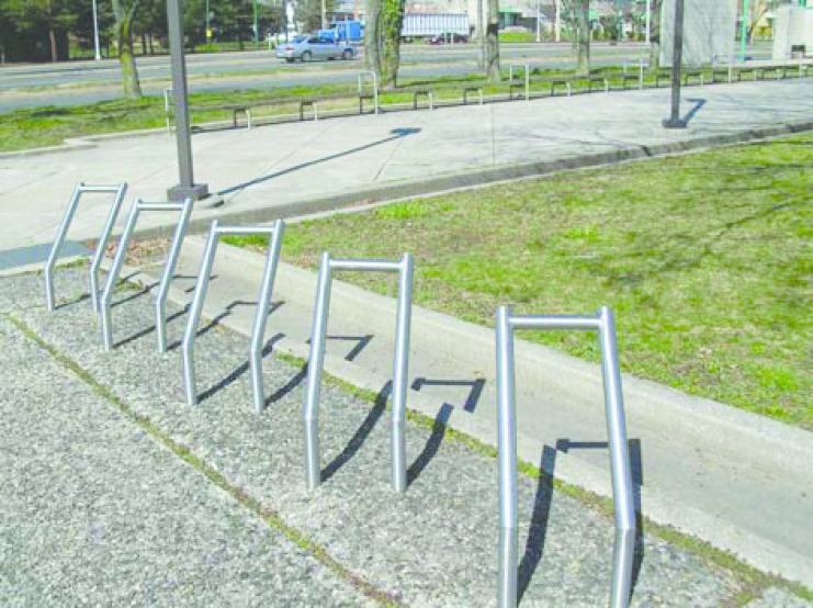
Fig. 17.24.040-D: Bicycle parking facilities
a.
Bicycle parking facilities shall include a rack or other device designated for bicycles that enable bicycles to be secured.
b.
The racks and storage facilities shall be located so they do not interfere with pedestrian traffic and shall be protected from potential damage by motor vehicles.
c.
Bicycle parking shall not be within any required landscape.
d.
All bicycle parking spaces provided shall be on a hard and stable surface.
e.
All bicycle parking facilities shall be securely anchored to the surface so they cannot be easily removed and shall be of sufficient strength to resist vandalism and theft.
f.
Bicycle parking facilities should be shaded or covered.
g.
When multiple bicycle parking facilities are installed together in sequence, they should be installed at least three feet apart and located in a configuration that provides space for parked bicycles to be aligned parallel to each other.
h.
An inverted U, post and loop, or "A" type of bicycle rack is preferred as shown in Figure 17.24.040-D. Proposed alternatives may also be considered if able to meet the characteristics listed above.
H.
Cross-Access. All non-residential development shall be designed to allow for cross-access to adjacent properties to encourage shared parking and shared access points on public or private streets. A minimum distance of one hundred (100) feet shall be required between a cross-access way and an intersection or driveway entrance. When cross-access is deemed impractical by the City on the basis of topography, the presence of natural features, or vehicular safety factors, this requirement may be waived provided that appropriate bicycle and pedestrian connections are provided between adjacent developments or land uses. A cross access easement must be recorded prior to issuance of a Certificate of Occupancy for the development.
I.
Reduction of Parking Spaces.
1.
A permitted, conditional, or special use that does not meet the parking requirements of this section may be converted to another permitted use without full compliance with the required number of parking spaces provided:
a.
The applicant provides the maximum amount of parking spaces possible without being required to remove or partially remove a structure.
b.
If a structure or a portion of a structure is voluntarily removed, the resulting area shall be used to provide the additional parking spaces necessary towards fulfilling the minimum requirements of Table 17.24.040-4.
2.
Reduction of Parking Spaces near Transit Stops.
a.
The City may authorize a waiver to allow a reduction in parking spaces of up to twenty-five (25) percent for multi-family dwelling developments or multi-family components of MUD/PUD or PID within one quarter mile of a planned or existing bus rapid transit (BRT) or light rail transit (LRT) stop, provided:
i.
The waiver is applied for in conjunction with a site plan review;
ii.
A parking analysis and transportation demand management plan is submitted to the traffic engineer in conjunction with the waiver request for the traffic engineer's recommendation;
iii.
The reduction in the number of parking spaces shall not exceed twenty-five (25) percent of the total number of parking spaces required for the proposed use; and
iv.
Final action will be by the Planning Commission.
b.
Where a BRT or LRT stop is planned but does not exist or is not approved for construction at the time of an application, the above waiver for a reduction in the number of parking spaces shall not be authorized. Applicants may, however, submit an alternative site plan that illustrates the future removal and reuse of parking areas upon the construction of a BRT or LRT stop. Such alternative site plan shall be subject to the applicable site plan review procedure.
c.
Where transit service is planned but not yet available, the multiple-family dwelling development shall provide adequate interim parking in areas that may be subsequently redeveloped with buildings when transit service becomes available. Interim parking may also be allowed off-site, pursuant to Section 17.24.040.J.3. All such areas shall be identified during the pre-development conference and on the approved site plan.
J.
Alternative Parking Options. The Planning Commission shall be authorized to approve an alternative parking plan that proposes alternatives to providing the number of off-street parking spaces required by Table 17.24.040-4, Minimum Off-Street Parking Standards, in accordance with the standards listed below. Nothing in this subsection shall limit the use of one or more of the following off-street parking alternatives by a single use. A parking analysis shall accompany all plans, prepared by a licensed engineer qualified to perform the work.
1.
Reserved.
2.
Reduction with Transportation Demand Management. The minimum parking requirement may be reduced by up to twenty-five (25) percent when the applicant can demonstrate in a parking-traffic study prepared by a traffic engineer or other qualified transportation professional and acceptable to the City that both of the following conditions have been met:
a.
The use of alternative modes of transportation, including transit, bicycles, walking, and/or the special characteristics of the customer, client, employee, or resident population will reduce expected vehicular use and parking space demands for the use, as compared to the Institute of Transportation Engineers vehicle trip generation rates and minimum City requirement as established in Table 17.24.040-4, Minimum Off-Street Parking Standards.
b.
A transportation demand management (TDM) plan has been approved by the City. The TDM plan must include facts and/or projections (i.e., type of development, proximity to transit, anticipated number of employees and/or patrons, and the minimum-parking requirements) and indicate the types of transportation demand management activities that will be instituted to reduce single occupant vehicle use and reduce traffic congestion. Such TDM plan shall comply with the following:
i.
Transportation Demand Management Activities. The TDM plan must provide a minimum of three of the following transportation demand management activities in order to qualify for a reduction in otherwise required minimum off-street parking requirements:
(A)
Establish a development-specific website that provides multimodal transportation information such as real-time travel/traffic information, bus routes, bus schedules and maps, and alternative commute log (bicycle, pedestrian, carpool, vanpool, etc.).
(B)
Disclose in writing to all employees transportation information and educational materials.
(C)
Coordinate the formation of, but not limited to, carpooling, vanpooling, ridesharing, guaranteed ride home, teleworking, and/or shuttle service programs.
(D)
Create a Preferential Parking Management Plan that specifically marks spaces for each registered carpool and/or vanpool vehicle, located near building entrances or in other preferential locations.
(E)
Institute off-peak work schedules, allowing employees to arrive and depart at times other than the peak morning commute period. The peak morning commute period is defined as 7:00—9:00 a.m. and the peak evening commute period is defined as 5:00—7:00 p.m.
(F)
Establish an office location within the development, staffed by the transportation coordinator that makes transportation and ridesharing information available to employees, residents, and nonresidents.
(G)
Alternative transportation demand management activities may be approved by the Planning Director and Public Works Directors as a means of complying with the parking reduction incentive provisions of this subsection.
ii.
Transportation Program Manager/Coordinator.
(A)
The applicant must appoint a program coordinator to oversee transportation demand management activities.
(B)
The program coordinator must be a qualified or trained TDM professional by the Regional Transportation Commission of Southern Nevada.
(C)
The transportation coordinator must be appointed prior to issuance of a building permit or certificate of occupancy for the buildings to be served by the transportation demand management program.
iii.
TDM Annual Report. The program coordinator must provide a report on a biannual basis to the Public Works Director that details the implementation strategies for the TDM plan as approved by the appropriate decision-making body for the subject entitlement application. The report may include the following:
(A)
A description of the transportation management activities efforts;
(B)
A list of current tenants and number of employees for each tenant;
(C)
A parking-reduction analysis based on employee and/or resident use of ridership programs or alternative transportation options;
(D)
Changes to the TDM plan to increase ridership; and
(E)
A employee transportation survey.
iv.
Recordation. A copy of the approved TDM plan shall be recorded with the Clark County Recorder's Office. Recordation of the TDM plan must take place prior to issuance of a building permit for the development to be served by the plan. The TDM plan shall be recorded against the property, and the applicant and/or successors of interest shall be responsible for the plan in perpetuity on the property.
v.
Enforcement. In the event that: (1) the program coordinator fails to submit a report to the Public Work Director in a timely fashion not to exceed sixty (60) days after the annual report deadline, or (2) the applicant no longer implements the program, the TDM plan shall be considered terminated and the required off-street parking spaces must be provided in accordance with requirements in this section.
vi.
Amendments. Amendments to the TDM plan may be approved by the Planning Director and/or Public Works Director in accordance with the same process required for the initial approval.
3.
Shared Parking. Requests for shared parking shall comply with the following standards:
a.
Proximity to Use. Shared parking spaces shall be located within five hundred (500) linear feet of the primary entrance of all uses served as measured along the shortest legal, practical walking route. This route may include crossing a right-of-way provided it uses a legal crosswalk. Such distance shall not apply if a remote parking shuttle bus service is provided and approved as part of a PUD, MUD or major SPR. Shared parking spaces shall not be separated from the use they serve by an arterial or collector street with a right-of-way greater than eighty (80) feet. In addition, adequate and safe pedestrian access must be provided from and to the shared parking areas.
b.
Same or More Intensive Use. A shared parking area shall be located on a site with the same or more intensive zone district classification than required for the primary uses served.
c.
Shared Parking for Public Transit. Where located within five hundred (500) feet of a transit stop, the City may approve a shared parking area between a use or uses and the Regional Transportation Commission of Southern Nevada (i.e., park-and-ride facility).
d.
Shared Parking Request. Applicants requesting to use shared parking as a means of satisfying the off-street parking standards must submit a shared parking request that justifies the feasibility of shared parking. Justification shall include information on the size and type of the proposed development, the composition of tenants, the anticipated rate of parking turnover, and the anticipated peak parking and traffic loads for all uses that will be sharing off-street parking spaces.
i.
The maximum reduction in the number of parking spaces required for all uses sharing the parking area shall be fifty (50) percent unless the shared parking includes parking associated with a religious institution or school, in which case the maximum reduction may be eighty (80) percent.
ii.
Directional signage that complies with the standards of this title shall be added to direct the public to the shared parking spaces. It is preferable for the employees of an establishment to use these spaces.
e.
Agreement. A shared parking plan shall be enforced through a written agreement among all owners of record. An attested copy of the agreement between the owners of record must be recorded. Recordation of the agreement shall take place prior to issuance of a building permit for any use to be served by the shared parking area.
f.
Revocation. A shared parking agreement may be revoked by the effected property owners only if all required off-street parking spaces will be provided in accordance with the requirements of Table 17.24.040-4, Minimum Off-Street Parking Standards.
4.
Off-Site Parking. All off-street parking areas for any use shall be provided on the same lot as the use it serves. However, parking may be allowed on another lot where there are practical difficulties in the location of the parking area or if public safety or public convenience, or both, are better served by a remote location. Off-site parking for uses shall comply with the following standards:
a.
Same Ownership. The parking area is located on land under the same ownership as the use it serves, or a recorded easement in perpetuity that has been established for the use of an off-site location for parking and filed with the County Clerk.
b.
Distance Between Off-Site Parking Area and the Proposed Use.
i.
Off-site parking for multiple-family dwellings shall not be located more than two hundred (200) feet from any normally used entrance of the principal use served.
ii.
Off-site parking for nonresidential or mixed uses shall not be located more than three hundred (300) feet from any normally used entrance of the principal use served.
iii.
The above distances shall be measured along the shortest legal, practical walking route. This route may include crossing a right-of-way provided it uses a legal crosswalk.
c.
No Undue Hazard. The off-site parking area shall be convenient to use without causing unreasonable:
i.
Hazard to pedestrians,
ii.
Hazard to vehicular traffic,
iii.
Traffic congestion,
iv.
Interference with commercial activity or convenient access to other parking areas in the vicinity,
v.
Detriment to the appropriate use of business lands in the vicinity, or
vi.
Detriment to any abutting residential neighborhood.
5.
Deferred Parking. An applicant may submit a request to defer the construction of up to twenty (20) percent of the required number of parking spaces specified in Table 17.24.040-4, Minimum Off-Street Parking Standards, if the request complies with the following standards:
a.
Reserve Parking Plan. The request is accompanied by a Reserve Parking Plan identifying:
i.
The amount of off-street parking being deferred; and
ii.
The location of the area to be reserved for future parking, if needed.
b.
Parking Demand Study. Adequate assurance is provided that within sixteen (16) months after the initial certificate of occupancy is issued for the proposed development, the applicant will submit a Parking Demand Study to the planning department that demonstrates the parking demand for the development and the adequacy of existing parking spaces. If the study indicates that the existing parking is adequate, then the construction of the remaining number of parking spaces shall not be required. If the study indicates additional parking is required, it shall be provided consistent with the Reserve Parking Plan and the standards of this section.
c.
Limitations on Reserve Areas. Areas reserved for future parking shall be brought to the finished grade and shall not be used for buildings, storage, loading, or other purposes.
d.
Landscape Required. If ultimately developed for off-street parking purposes, areas reserved for future parking shall be landscaped appropriately and shall comply with all relevant landscape standards of this Code.
6.
Parking Structures. The off-street parking required by this section may be located in a parking structure, whether on the same or on a different lot than the uses which it serves. Such structure shall be subject to the following:
a.
Ground floor parking provided in a parking structure shall be landscaped and screened, to the maximum extent feasible, from surrounding uses and from public view as required by Section 17.24.060.G., Parking Lot Landscaping and Layout. In addition, for uses located on the same lot as the structure, the conditions required for shared parking shall apply. For uses located on a different lot as the structure, the conditions required for off-site parking shall apply.
b.
Parking structures with ground floors that are not completely wrapped with commercial, office, institutional, public uses, or civic uses on the side facing an intersection (except sides abutting alleys) shall not:
i.
Abut street intersections or public/civic use areas,
ii.
Be adjacent to public squares, or
iii.
Occupy sites that are the terminus of a street vista.
c.
Design.
i.
Parking structures shall be constructed of materials of similar quality and shall be compatible in appearance with adjacent buildings and shall contain lighting sufficient for security as approved by the City.
ii.
Façades of parking structures not occupied by commercial, office, institutional, public uses, or civic uses shall be articulated through the use of three or more of the following architectural features.
(A)
Windows or window-shaped openings with decorative mesh or similar features as approved by the City;
(B)
Masonry columns;
(C)
Decorative wall insets or projections;
(D)
Awnings;
(E)
Changes in color or texture of materials;
(F)
Approved public art;
(G)
Integrated landscape planters; or
(H)
Other similar features approved by the City.
iii.
Vehicle entries to off-street parking structures shall be integrated into the placement and design of adjacent buildings or oriented away from the primary street frontage. At a minimum, parking structures shall have user vehicles access from locations that minimize conflicts with pedestrian circulation.
7.
Preferential Parking. Commercial and institutional uses with twenty (20) or more parking spaces should designate at least five percent of the parking spaces for carpool, vanpool parking, and hybrid/alternative fuel vehicles. These preferential parking spaces shall be located closer to the primary building or employee entrance than other employee parking with the exception of handicap parking.
8.
Tandem Parking. An off-street parking program utilizing limited tandem parking for commercial uses may be permitted in the R-A district with approval by the City. Such parking shall comply with the following standards:
a.
The development served shall provide seventy-five (75) or more parking spaces;
b.
No more than thirty (30) percent of the total number of spaces shall be designated as tandem; and
c.
A valet parking attendant must be on duty during hours of operation.
9.
On-Street Parking. The use of on-street parking to meet a portion of the minimum off-street parking requirements is permitted if it complies with the following:
a.
Adequate on-street or structured parking exists within five hundred (500) linear feet from the primary entrance of the proposed use as measured along the shortest legal, practical walking route. This route may include crossing a right-of-way provided it uses a legal crosswalk;
b.
The proposed development is located within the R-A district or is approved as part of an MUD, PUD, PCD, or PID district;
c.
No more than twenty-five (25) percent of the off-street parking space requirement is met through the use of on-street parking; and
d.
There is no negative impact to existing or planned traffic circulation patterns.
10.
Alternative Materials. The use of pervious or semi-pervious parking area surfacing materials, including but not limited to mulch, ring and grid systems filled with material appropriate to a desert environment, permeable concrete or asphalt, porous or grid pavers, or recycled materials such as glass, rubber, brick, block and concrete may be approved for the required vehicular surface area on a lot provided that such areas are properly maintained. Where possible, such materials should be used in areas proximate to and in combination with on-site stormwater control devices.
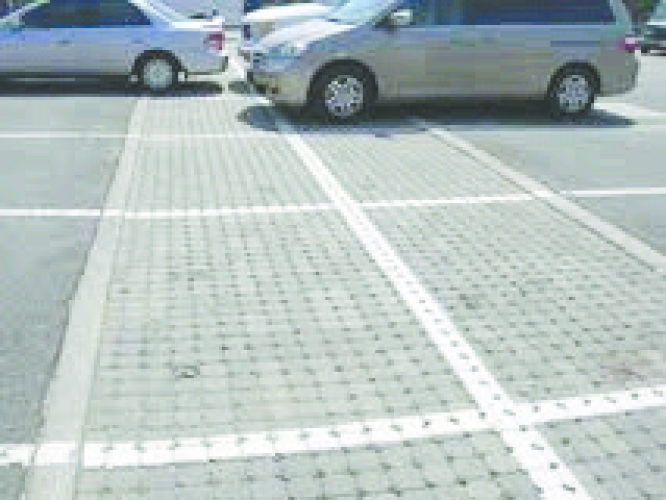
Fig. 17.24.040-E: Pervious pavement
K.
Vehicle Stacking Requirements. The following standards shall apply to businesses that contain a drive-through establishment, regardless if the drive-through is part of another use (e.g., restaurant or financial institution) or if it is a stand-alone use (e.g., automatic teller machine).
1.
General Standards.
a.
Audible electronic devices such as loudspeakers, automobile service order devices, and similar instruments shall not be located within fifty (50) feet of any residential property line and shall be subject to Section 8.28.020.K. of the Municipal Code.
b.
No service shall be rendered, deliveries made, or sales conducted within the required front yard or corner side yard; customers served in vehicles shall be parked to the sides and/or rear of the principal building.
c.
All drive-through areas, including but not limited to menu boards, stacking lanes, trash receptacles, loudspeakers, drive up windows, and other objects associated with the drive-through area shall be located in the side or rear yard of a property to the maximum extent feasible, and shall not cross, interfere with, or impede any public right-of-way.
2.
Stacking Space and Lane Requirements.
a.
The number of required stacking spaces shall be as provided for in Table 17.24.040-6, Stacking Space Requirements. See Figure 17.24.040-F for an illustration of stacking spaces:
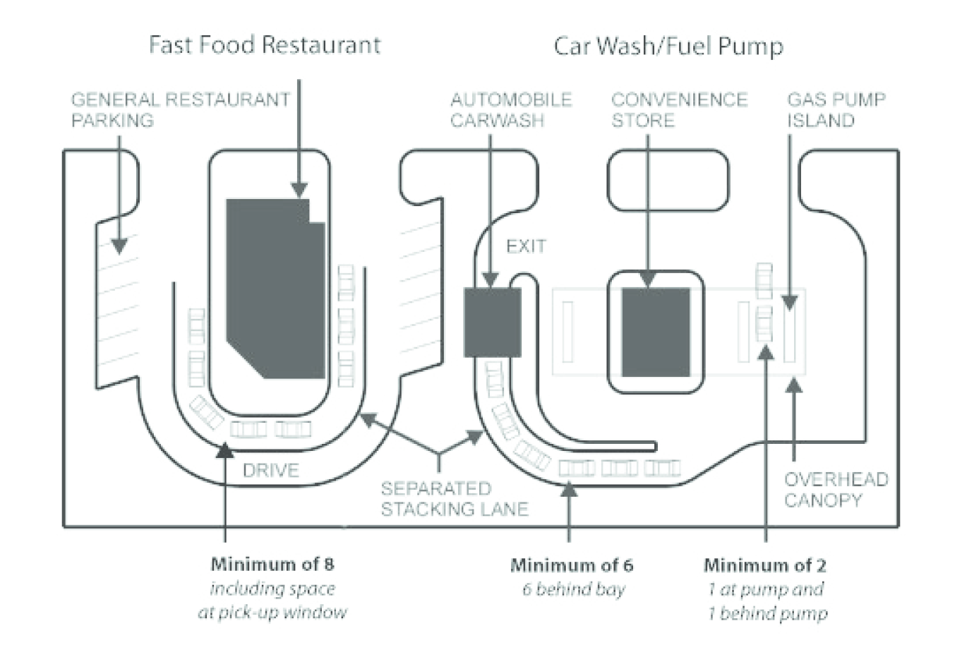
Fig. 17.24.040-F Stacking lanes
b.
Stacking lanes shall be provided for any use having a drive-through establishment and shall apply comply with the following standards:
i.
Drive-through stacking lanes shall have a minimum width of ten (10) feet.
ii.
When stacking lanes are separated from other stacking lanes, bypass lanes, or from other site areas, the separation shall be by means of a raised concrete median, concrete curb, or landscaping.
iii.
Stacking lanes shall be set back ten (10) feet from property line.
L.
Off-Street Loading Facilities. Where required, all off-street loading facilities shall conform to the following standards:
1.
Applicability.
a.
Any use within the following use categories (See Table 17.20-1) that has a building with a gross floor area of fifteen thousand (15,000) square feet or more shall be subject to the off-street loading requirements of this section:
i.
Transportation,
ii.
Eating and drinking establishments,
iii.
Indoor recreation and entertainment,
iv.
Offices (over one hundred thousand (100,000) square feet of floor area),
v.
Retail sales and service,
vi.
Tourism,
vii.
Vehicle sales and services,
viii.
Industrial services, and
ix.
Other uses.
b.
In addition to the above use category, any college, university, community center or meeting hall, hospital, museum, library, or school shall also be subject to the requirements of this section.
c.
Table 17.24.040-7, Off-Street Loading Berth Requirements establishes the minimum number of loading berths required for a use based on the total floor area dedicated to the specified use.
2.
Design of Off-Street Loading Facilities.
a.
All loading berths shall be at least twelve (12) feet in width and have a clearance of fourteen (14) feet in height, exclusive of aisle and maneuvering areas.
b.
Loading berths may occupy all or any part of any required yard space, except front and corner side yards, and shall be set back a minimum of fifty (50) feet from any residential zone district.
c.
Sufficient room for turning and maneuvering vehicles shall be provided on the site so that vehicles shall cross a property line only by driving forward.
d.
Each loading berth shall be accessible from a street or alley or from an aisle or drive connecting with a street or alley.
e.
Bumper rails shall be provided at locations where needed for safety or to protect property.
f.
If the loading area is illuminated, lighting shall be deflected away from abutting residential sites so as to not cause annoying glare and all lighting shall be subject to the provisions of Section 17.24.080.
g.
No regular repair work or servicing of vehicles shall be conducted in a loading area.
h.
Off-street loading facilities shall be located on the same site with the use for which the berths are required.
i.
If more than one use is located on a site, the number of loading berths provided shall be equal to the sum of the requirements prescribed in this section for each use. If more than one use is located on a site and the gross floor area of each use is less than the minimum for which loading berths are required but the aggregate gross floor area is greater than the fifteen thousand (15,000) square feet, off-street loading berths shall be provided as if the aggregate gross floor area were used for the use requiring the greatest number of loading berths.
j.
Off-street loading facilities for a single use shall not be considered as providing required off-street loading facilities for any other use.
k.
At the time of initial occupancy, major alterations or enlargement of a site, or of completion of construction of a structure, or of a major alteration or enlargement of a structure, there shall be provided off-street loading berth requirements. The number of loading berths provided for a major alteration or enlargement of a site or structure shall be in addition to the number of berths existing prior to the alteration or enlargement.
l.
Space allocated to any off-street loading berth shall not be used to satisfy the space requirements for any off-street parking facility.
M.
Maintenance. It shall be the joint and separate responsibility of the lessee and owner of the principal use, uses, or building to maintain in a neat and adequate manner, the parking space, access ways, striping, landscaping and required fences.
(Ord. No. 2591, § 1, 6-15-2011, eff. 10-1-2011; Ord. No. 2706, §§ 14—16, 2-18-2015; Ord. No. 2850, § 2, 12-20-2017; Ord. No. 3048, §§ 12—16, 1-20-2021; Ord. No. 3131, §§ 3—5, 7-20-2022; Ord. No. 3196, §§ 6, 10, 12-20-2023)
17.24.050 - Mobility and Circulation.
A.
Purpose.The purpose of this section is to:
1.
Support the creation of a highly connected transportation system within North Las Vegas in order to provide choices for drivers, bicyclists, and pedestrians;
2.
Increase effectiveness of local service delivery; promote walking and bicycling; connect neighborhoods to each other and to local destinations such as employment, schools, parks, and shopping centers;
3.
Reduce vehicle miles of travel and travel times; improve air quality; improve emergency response times;
4.
Mitigate the traffic impacts of new development, and free up arterial capacity to better serve regional long-distance travel needs.
5.
These standards attempt to avoid the creation of large, isolated tracts without routes for through traffic or pedestrian and bicycle connections.
B.
Traffic Impact Mitigation.
1.
Applicability of Traffic Impact Analysis Requirement. The transportation system for new development shall be capable of supporting the proposed development in addition to the existing and future uses in the area. Evaluation of system capacity shall be undertaken through a Traffic Impact Analysis (TIA), that shall consider the following factors without limitation: street capacity and level of service; vehicle access and loading; on-street parking impacts; the availability of transit service and connections to transit; impacts on adjacent neighborhoods; and traffic safety including pedestrian safety. A TIA shall be required with any land use application that meets one or more of the following:
a.
Trip generation during any peak hour is expected to exceed two hundred fifty (250) trips per day or more than one hundred (100) trips during any one-hour peak period, based on traffic generation estimates of the Institute of Transportation Engineers' Trip Generation Manual (or any successor publication); or
b.
A TIA is required by the Planning Commission or City Council as a condition of any land use application approved pursuant to the requirements of this Code; or
c.
The City requires a TIA for:
i.
Any project that proposes access to a street with Level of Service "D" or below;
ii.
Any application for a major site plan review;
iii.
Any case where the previous TIA for the property is more than two years old;
iv.
Any case where increased land use intensity will result in increased traffic generation; or
v.
Any case in which the Director determines that a TIA should be required because of other traffic concerns that may be affected by the proposed development.
C.
Traffic Impact Analysis and Development Review Process.
1.
A scoping meeting between the developer and the Director shall be required prior to the start of the TIA in order to determine the parameters of the study. This may be conducted as part of a pre-application meeting. The Director shall define the TIA study for as limited a vicinity as is feasible to make adequate traffic determinations for the project.
2.
If required, the TIA shall be submitted with the applicable development application.
3.
When access points are not defined or a site plan is not available at the time the TIA is prepared, additional studies may be required when a site plan becomes available or the access points are defined.
D.
Traffic Mitigation Measures. The applicant shall, as part of the TIA, recommend measures to minimize and mitigate the anticipated impacts and determine the adequacy of the development's planned access points. Mitigation measures shall be acceptable to the Director and may include, without limitation: an access management plan; transportation demand management measures; street improvements on or off the site; placement of pedestrian, bicycle, or transit facilities on or off the site; traffic signals or other capital improvement projects such as traffic calming infrastructure or capacity improvements.
E.
Streets and Vehicular Circulation (for Residential and Mixed Use Developments).
1.
Circulation Plan Required.
a.
Except for new detached and attached single-family residential uses with fewer than five dwellings, all new residential or mixed-use developments in the City shall require a circulation plan.
b.
The circulation plan shall address street and pedestrian connectivity, emergency and service vehicle access, parking movements, accommodation of loading operations, turning radii, traffic calming measures where future "cut-through" traffic is likely, and similar issues.
c.
The Director may waive the requirement for a circulation plan for infill development or on a case-by-case basis in the event that a new development is expected to have no impact upon circulation or proposes no change in existing circulation patterns. This provision shall not be construed to exempt development that includes additional parking, driveways, or substantial modifications to the existing pedestrian network.
d.
A circulation plan shall be submitted with a preliminary development plan, site plan, master development plan, tentative map, or building permit application, as appropriate.
2.
Internal Street Connectivity.
a.
Circulation plans for development on lots in the R-A districts shall provide for multiple connections to the existing City street network wherever possible. See Figure 17.24.050-A.
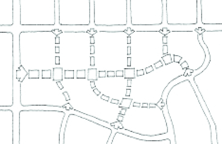
Fig. 17.24.050-A: Street Connectivity
b.
Except for lots within the R-A district downtown, circulation plans prepared for all new development shall maintain internal street connectivity through the use of a connectivity index, in accordance with the following standards.
c.
All development shall achieve a connectivity index score in accordance with Table 17.24.050-1, Minimum Connectivity Index Score:
d.
The connectivity index for a development shall be calculated by dividing its links by its nodes. Nodes (shown as stars in Figure 17.24.050-B, Connectivity Index) exist at street intersections and cul-de-sac heads within the development. Links (shown as circles in Figure 17.24.050-B, Connectivity Index) are stretches of road that connect nodes.
Fig. 17.24.050-B: Connectivity Index
e.
The required connectivity index standard may be reduced by the Director if the applicant demonstrates it is impossible or impracticable to achieve due to topographic conditions, natural features, or adjacent existing development and street patterns.
f.
For purposes of calculating the index for a development, street stub-outs are considered as links. Temporary dead-end streets internal to a development, private streets in gated sections, or alleys shall not be counted as links. One link beyond every node that exists in the development and provides access to the street network shall be included in the index calculation. Temporary dead end streets terminating at the perimeter of a development shall be counted as a link. In no case shall a temporary dead end street terminating at a point internal to the development be counted as a link. Pedestrian connections to an external trail system or perimeter sidewalk shall be counted as ½ of a link.
g.
Gated streets, or sections of neighborhoods with gated private streets, and culs-de-sac, are permitted provided the development achieves and maintains the minimum connectivity index score.
h.
Culs-de-Sac and Dead-End Streets Discouraged.
i.
Permanent culs-de-sac and dead-end streets should be used primarily when topography, the presence of natural features, and/or vehicular safety factors make a vehicular connection impractical.
ii.
All permanent dead-end streets shall be developed as culs-de-sac.
iii.
All culs-de-sac shall conform to the requirements of the City's adopted codes.
iv.
Whenever cul-de-sac streets are created, at least one 15-foot-wide pedestrian access and public utility easement that complies with the CPTED principles in Section 17.24.060.D shall be provided, to the maximum extent practicable, between each cul-de-sac head or street turnaround and the sidewalk system of the closest adjacent street or pedestrian sidewalk or pathway. See Figure 17.24.050-C.
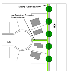
Fig. 17.24.050-C: Pedestrian
accessways
3.
External Street Connectivity. In addition to the internal street connectivity requirements, circulation plans for all new development shall maintain external street connectivity in accordance with the following standards:
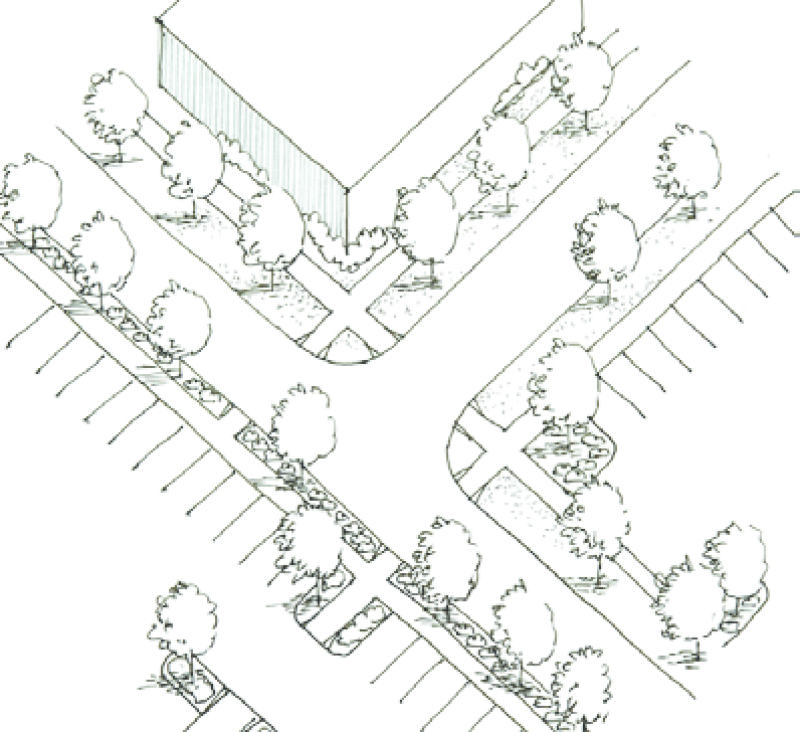
Fig. 17.24.050-D: Sidewalk connections are required
a.
The arrangement of streets in a development shall provide for the alignment and continuation of existing or proposed streets into adjoining lands specifically in those cases in which the adjoining lands are undeveloped and intended for future development or in which the adjoining lands are developed and include opportunities for such connections. Traffic calming measures shall be integrated into the development to mitigate the impact of potential future "cut-through" traffic per City's Traffic Calming Policy.
b.
Street rights-of-way shall be extended to or along adjoining property boundaries such that a roadway connection or street stub shall be provided for development at least every one thousand five hundred (1,500) feet for each direction (north, south, east, and west) in which development abuts vacant lands. Such street stubs shall not be required to abut adjacent development lacking existing or planned street connections, floodplains, wetlands, riparian buffers, slopes exceeding thirty (30) percent, or other unique site conditions preventing a street connection in the opinion of the City.
c.
Street and sidewalk connections shall be made between neighborhood commercial centers and adjacent residential neighborhoods. Residential streets affected by external street connectivity requirements may be candidates for traffic calming treatments upon the recommendation of the City. See Figure 17.24.050-D.
d.
Shared commercial/residential connections with arterials shall be located on the commercial property to the extent possible.
e.
At all locations where streets terminate with no street connection, but a future connection is planned or accommodated, a sign shall be installed, by the developer, at the location with the words "STREET TO BE EXTENDED BY THE AUTHORITY OF THE CITY OF NORTH LAS VEGAS" to inform property owners.
f.
The final map and the deeds for all residential dwellings shall identify all stub streets and include a notation that all street stubs are intended for connection with future streets on adjoining undeveloped property.
F.
Lot Layout and Traffic Calming.
1.
Where land adjacent to the boundary of a proposed residential subdivision or PUD, or directly across a local or collector street from a proposed residential subdivision or PUD is developed with single-story detached homes, the row of homes in the proposed subdivision adjacent to that boundary or local or collector street shall be developed with single-story detached residential units.
2.
Homes fronting sixty (60) feet or greater rights-of-way shall be prohibited. However, an exception may be granted for homes to front a sixty-foot right-of-way if supported by a traffic study and one or both of the following conditions exist: a) existing homes or existing lots are already fronting the right-of-way directly in front of the proposed development, and/or b) garages to each home are accessed directly from an alley with no individual driveway to the sixty-foot right-of-way.
3.
For developments that are approved with homes fronting a sixty-foot right-of-way the street must be constructed using the modified sixty-foot street section with off-set sidewalk or other street geometrics as approved by the Director of Public Works.
4.
In cases where homes fronting a sixty-foot right-of-way are approved, or small-lot development options are used, or where the Director of Public Works determines that high traffic speeds or roadway design may create risks to public safety, additional traffic calming, may be required, subject to review and approval by the Director of Public Works.
5.
Acceptable traffic calming devices are described in the City of North Las Vegas Neighborhood Traffic Calming Measures, and include but are not limited to:
a.
A roundabout circle that limits traffic to twenty (20) to thirty (30) m.p.h.
b.
A two-lane narrowing that limits traffic to thirty (30) to thirty-five (35) m.p.h.
c.
A narrowing that limits traffic to twenty (20) to twenty-five (25) m.p.h.
d.
A single-lane angled narrowing that limits traffic to twelve (12) to fifteen (15) m.p.h.
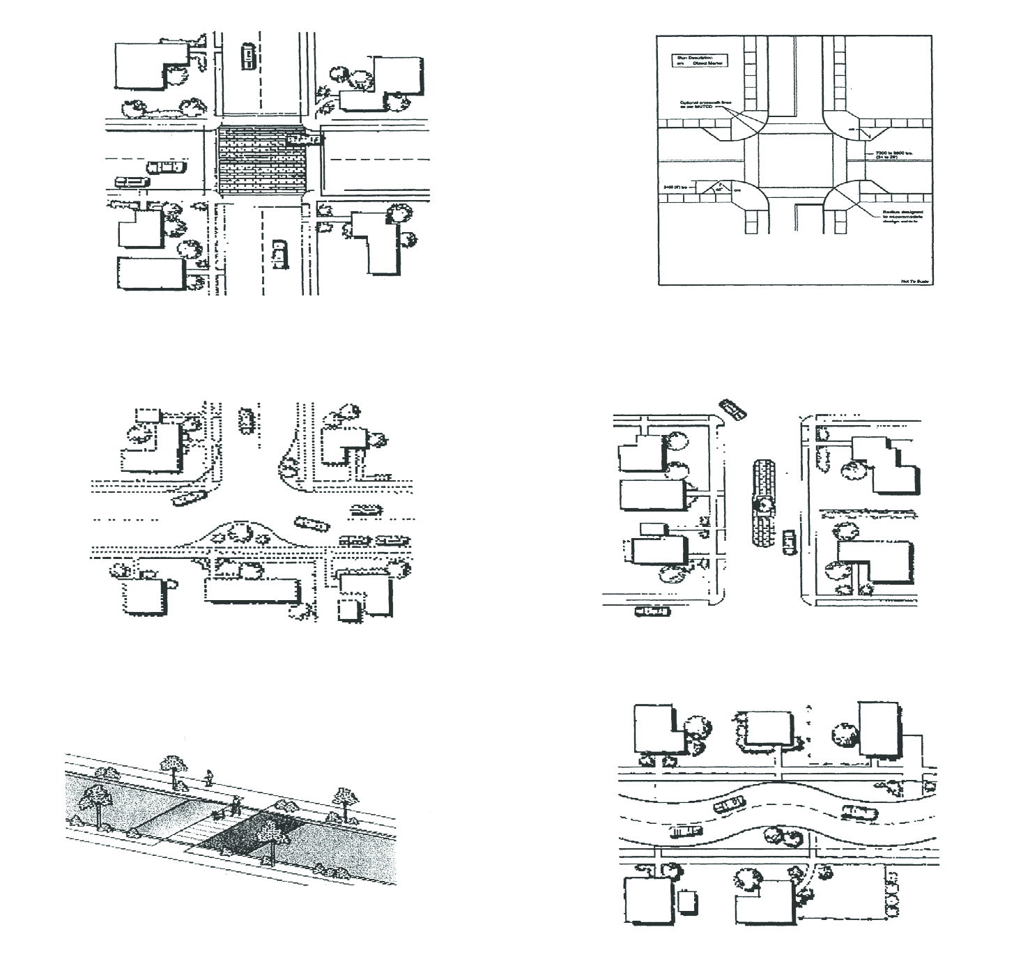
Fig. 17.24.050-E: Traffic calming
G.
Perimeter Sidewalks. Five-foot wide sidewalks are required along all perimeter streets. Sidewalks that serve as part of an indentified trail shall be eight feet in width. Sidewalks within the downtown should comply with the guidelines of the Downtown Master Plan & Investment Strategy. Sidewalks along arterial streets with a right-of-way eighty (80) feet or wider must be separated from the back of the street curb by a minimum of five feet, except in bus turn out areas. Sidewalks must be placed within the perimeter landscape area outside of the right-of-way. If landscaping is prohibited next to the perimeter block wall because of site-specific geotechnical recommendations, the sidewalk shall be placed next to the block wall. Landscaping would then be required between the sidewalk and the back of street curb. Maintenance of any sidewalk located outside of the right-of-way shall be the responsibility of the homeowner's association, the developer, or another method as determined by agreement with the city.
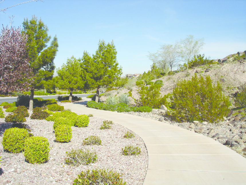
Fig. 17.24.050-F: Sidewalk and perimeter landscape area
H.
Public Transportation. Provision of bus turn-outs and shelters shall be required where deemed necessary by the City of North Las Vegas traffic engineer. If shelters are provided they shall be installed outside of the sidewalk area. Required turnouts may encroach into the perimeter landscape area. Bus turn outs must meet the uniform standard drawings, as adopted by the City of North Las Vegas.
I.
Bicycle and Pedestrian Linkages and Circulation. The following standards are designed to reduce dependency on the automobile, reduce the number of daily trips by single occupancy vehicles, and preserve the capacity of existing roadways. Consideration must be given to alternative transportation modes, bicycle and pedestrian ways, and paths, and shall be included in site planning.
1.
Bicycle and Pedestrian Path Connections.
a.
Design for Connectivity. Provisions shall be made in all developments to encourage the use of bicycle and pedestrian travel through the integration of bicycle and pedestrian paths, trails and/or bicycle lanes, and pathways along drainage and utility easements that connect to parks, open spaces, schools, public transit, and shopping areas. Within new residential subdivisions, bicycle and pedestrian paths, trails, and/or bicycle lanes shall also connect to collector and minor arterial streets.
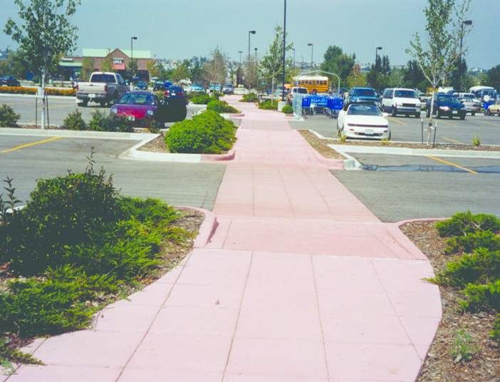
Fig. 17.24.050-G: Pedestrian connection
b.
Connections to Existing Facilities. Bicycle and pedestrian paths shall connect to existing facilities on adjoining projects and/or to paths, trails, and routes as shown in the city master plan as adopted by the City of North Las Vegas.
c.
Easements and Rights-of-Way. Easements and/or rights-of-way shall be provided for bicycle/pedestrian paths between and within developments as necessary to provide pedestrian and bicycle linkages between developments, unless the applicant can demonstrate that to do so would be infeasible.
d.
Drainage and Utility Easements.
i.
Drainage and utility easements shall be a minimum of twenty (20) feet wide and shall also be used to the maximum extent practicable to serve as pedestrian and bicycle linkages and/or park or open space areas within and between developments.
ii.
In residential subdivisions, drainage and utility easements shall be utilized to the maximum extent practicable to serve as pedestrian and bicycle linkages and/or park or open space areas within, and between, developments.
(A)
Utility and drainage easements that traverse between two or more interior streets, or that connect an interior street to a collector or arterial street, shall be landscaped and shall include sidewalks, asphalt or concrete bicycle paths and appropriate lighting for pedestrian safety. Landscaping materials shall be of a low water usage, drought tolerant variety.
(B)
Other utility and drainage easements shall be enhanced, as deemed necessary by the City to provide pedestrian and bicycle linkages between developments. Enhancements may include, but not be limited to, landscaping, sidewalks and/or bicycle paths, and lighting.
(C)
In order to preserve the integrity of the primary purpose of such easements, the use and design of such easements for the purpose of providing pedestrian/bicycle linkages and open space must meet with the approval of the city.
iii.
In mixed-use, commercial, and industrial developments, applicants are strongly encouraged to incorporate bicycle and pedestrian paths along drainage channels and washes. If maintenance roads for a channel are required, consideration should be given to designing them to accommodate maintenance vehicles, bicyclists and pedestrians. The design shall be approved by the city.
e.
Perimeter Connections. A continuous and direct internal pedestrian walkway shall be provided from the perimeter public sidewalk to the principal building entrance. Pedestrian walkways or sidewalks shall connect all primary building entrances and must be provided along any façade featuring an entrance that exits into a parking area or travel lane. Pedestrian walkways shall also connect all on-site common areas, parking areas, open space, and recreational facilities. The walkway must be distinguished from driving surfaces through the use of special pavers, bricks, patterned and colored concrete, or other methods approved by the City to enhance pedestrian safety and the attractiveness of the walkway.
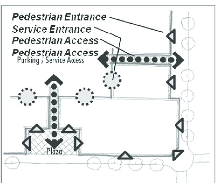
Fig. 17.24.050-H: Pedestrian access from rear parking lots
f.
Bicycle Parking. Adequate bicycle parking facilities shall be provided for each mixed-use, commercial, or industrial development as provided in Section 17.24.040, Parking and Loading.
g.
Gated Communities. Bicycle and pedestrian facilities located within gated private communities shall be maintained by the private community through a homeowner's association or other method as approved by the City.
2.
Design Standards.
a.
Bicycle paths and lanes constructed within the right-of-way must be in accordance with the City-wide Trails and Bikeways Master Plan and the bicycle/ pedestrian element of the regional transportation plan of the regional transportation Commission as adopted by the City of North Las Vegas.
b.
All internal walkways and trails shall have a minimum width of five feet and shall be comprised of concrete or brick/masonry pavers. Sidewalks located within required pedestrian priority areas shall have a minimum width of nine feet.
c.
All multi-use paths (used by bicycles and pedestrians) shall have a minimum width of ten (10) feet and shall be comprised of concrete or asphalt, per the City-wide Trails and Bikeways Master Plan.
d.
Drainage and utility easements may be used as pedestrian connections pursuant to Section 17.24.060, Landscaping.
3.
Trail Linkages.
a.
Trail linkages shall be incorporated into the design of all new developments. Trail linkages shall be located and designed so as to provide public access along drainage channels, to connect residences and businesses to open space and the City's trail system, and to promote pedestrian and bicycle movement between residential areas and employment/business areas.
b.
All development mapping shall be required to demonstrate that the design of the proposed development includes open space and trail linkages.
c.
Trails shall be constructed at the time of development in accordance with City standards and specifications.
(Ord. No. 2591, § 1, 6-15-2011, eff. 10-1-2011; Ord. No. 2706, §§ 17—19, 2-18-2015)
17.24.060 - Landscaping.
A.
Generally. Landscaping requirements as set forth in this title have been established to:
1.
Encourage quality development within the City,
2.
Provide a smooth transition between adjoining properties;
3.
Screen service yards, parking lots, and other areas that tend to be unsightly;
4.
Facilitate the buffering of one land use from other land uses;
5.
Encourage harmonious relationships between buildings that are part of one development and buildings located on abutting properties;
6.
Provide visual open space and passive recreational areas to serve the needs of the residents of the City;
7.
Soften the effect of development;
8.
Improve erosion and stormwater runoff control;
9.
Reduce the particulate matter in the air;
10.
Encourage a sense of commitment to the City and its residents on the part of developers;
11.
Provide for the health, safety and general welfare of the residents of the City; and
12.
Promote principles of Crime Prevention Through Environmental Design (CPTED).
B.
Landscaping Required.
1.
Landscaped Areas.
a.
All exposed ground areas surrounding or within a principal or accessory use, including adjacent, unpaved street rights-of-way, that are not devoted to drives, parking lots, sidewalks, patios or other such uses shall be landscaped. See Figure 17.24.060-A.
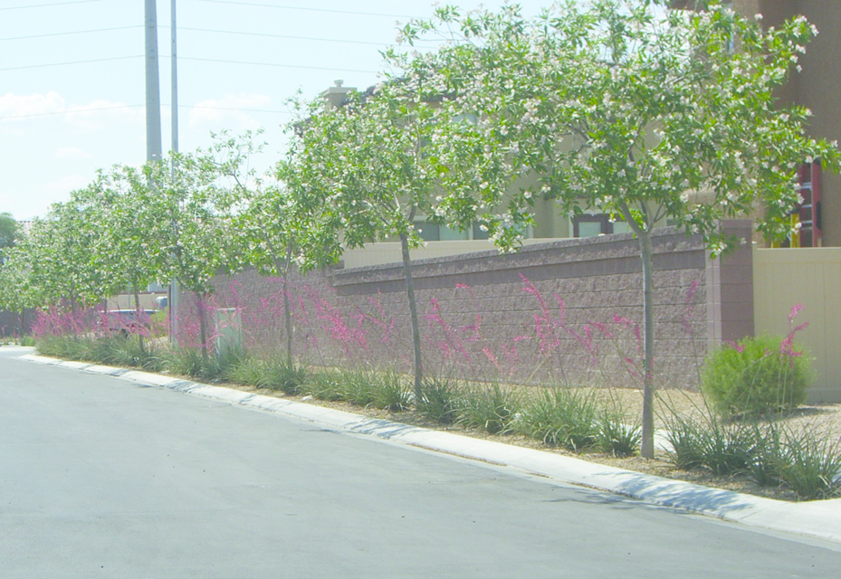
Fig. 17.24.060-A: All exposed ground areas shall be landscaped
b.
All required landscaping shall provide a minimum ground coverage of fifty (50) percent, excluding trees, within two years of planting. Landscaping for commercial and industrial uses must reach fifty (50) percent coverage within two years of the issuance of a certificate of occupancy. See Figure 17.24.060-B.
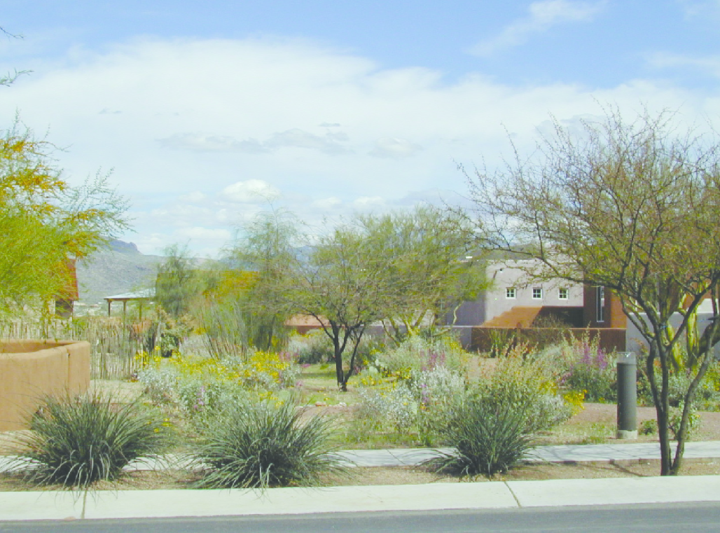
Fig. 17.24.060-B: Landscaping coverage
c.
Non-vegetative groundcovers shall cover the ground surface in landscaped areas. Materials include, but are not limited to, rocks and small stones, crushed rock, cinders and bark. Areas covered by such non-vegetative groundcovers shall be broken up as much as possible by living plant materials. See Figure 17.24.060-C.
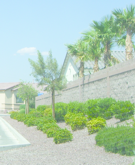
Fig. 17.24.060-C: Non-vegetative groundcover
2.
Visibility of Landscaping. When possible, areas of any particular site allocated to landscaping shall be located on that site in such a way so as to provide substantial benefit to the general public as well as to the site itself.
3.
Areas Excluded From Landscaping Calculation.
a.
Landscaping in Public Rights-of-Way. Landscaping in public rights-of-way may be used to satisfy the minimum landscaping requirements for infill development as set forth in this section but shall not be used to satisfy the minimum landscaping requirements for other types of development unless specifically provided for herein. An encroachment permit and maintenance agreement issued by the Director of Public Works shall be required for all landscape within public right-of-way.
4.
Parking and Storage Prohibited. No landscaped area shall be used for the parking of vehicles or the storage or display of materials, supplies, or merchandise.
5.
Landscaping Plan Required. A landscaping plan shall be submitted in conjunction with any required site plan prior to the issuance of a building permit.
6.
Maintenance and Irrigation.
a.
Maintenance. Trees, shrubs, fences, walls, irrigation improvements, and other landscape features depicted on plans approved by the City shall be considered elements of the project in the same manner as parking, building materials, and other details are elements of the plan. The land owner, successors in interest or agent, if any, shall be jointly and severally responsible for the following:
i.
Regular maintenance of all landscaping and irrigation improvements in good condition and in a way that presents a healthy, neat, and orderly appearance. All landscaping shall be maintained free from disease, pests, weeds, and litter. This maintenance shall include weeding, watering, fertilizing, pruning, mowing, edging, mulching or other maintenance, as needed and in accordance with acceptable horticultural practices.
ii.
The repair or replacement of required landscape structures (e.g., walls, fences) to a structurally sound condition.
iii.
The regular maintenance, repair or replacement, where necessary, of any landscaping required by this section.
b.
Irrigation. Landscaped areas shall be irrigated as necessary to maintain required plant materials in good and healthy condition. Irrigation plans shall be submitted with development plans and shall contain all construction details for an automatic system. Where irrigation is required and irrigation plans have been approved by the City, a property owner is prohibited from reducing irrigation volume or discontinuing irrigation without City approval. A back-flow prevention device shall be provided in accordance with Nevada Administrative Code Chapter 445A.
c.
Traffic Sight Visibility. Landscaping shall be maintained so that it will not interfere with traffic sight distance, street signs, or traffic signs/lights.
7.
Materials.
a.
Due to the desert characteristics of the valley, water conservation is required through the use of drought-tolerant plants and turf where allowed. Landscaping materials shall comply with the requirements of the SNWA Water Smart Landscapes Plant List.
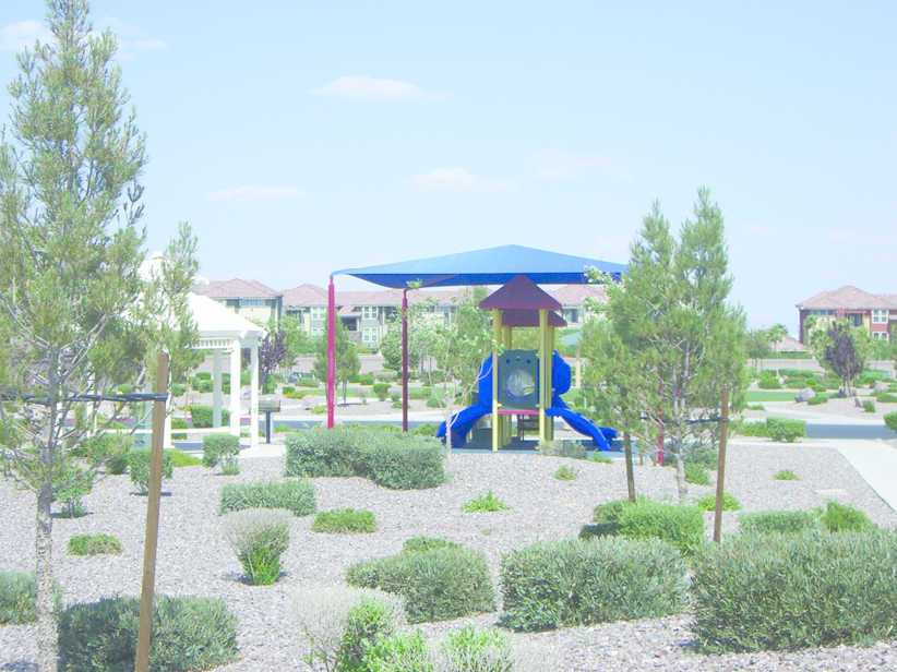
Fig. 17.24.060-D: Drought-tolerant plants and turf are required
b.
For the purposes of this section, a thirty-six (36)-inch box tree shall be considered to have a two and one-half inch caliper, and a twenty-four (24)-inch box tree shall be considered to have a one and one-half inch caliper.
c.
Plants and shrubs must be a minimum of five gallon size at time of planting. Groundcovers must be a minimum of one gallon size at time of planting.
d.
If conifers are used to satisfy the requirement for trees of one and one-half inch caliper measured six inches above root ball, they shall be a minimum of six to eight feet tall.
e.
No tree whose mature height exceeds fifteen (15) feet shall be planted under an electric utility line.
f.
In an effort to conserve limited water resources, the provision of drought-tolerant landscaping is encouraged. See Figures 17.24.060-D and E.
Fig. 17.24.060-E: Drought-tolerant landscaping used instead of turf grass
g.
No person shall impose private covenants, conditions, deed clauses, or other agreements that require the installation of turf or prevent the utilization of water efficient landscaping, provided such landscaping receives appropriate architectural review approval. No person shall prohibit landscaping materials and designs solely on the basis that they make use of water-efficient landscaping.
h.
Deep-rooted trees shall not be located within five feet of any underground drainage facility or wet utility line unless protected by a root barrier.
i.
The use of turf shall be limited as follows:
j.
The use of turf is not permitted in landscape areas along a public street frontage.
k.
The turf limitations contained in this section are intended to increase the use of water efficient vegetation. Landscaping shall be designed, and landscaping materials shall be chosen and installed, so as to ensure that within two years of normal growth, at least fifty (50) percent of the area covered by non-turf landscaping will consist of water-efficient vegetation.
l.
The use of plant material with high pollen production is prohibited. This includes pigweed, canyon ragweed, juniper, privet, mulberry, olive (all fruit producing species), Russian Thistle, Johnson grass, salt cedar, and any plant on the Nevada State Department of Agriculture Noxious Plant List.
8.
Subdivision Design.
a.
Subdivision entries shall incorporate enhanced landscape treatments and are encouraged to provide project signage. Special paving treatment may be used, subject to review and approval by the City.
b.
Primary residential entries shall not have more than two identification monuments or signs. Monuments shall not exceed six feet in height. Materials should be architecturally compatible with the representative neighborhood.
c.
Publicly visible fences and gates shall be consistent with a neighborhood's architectural character and submitted as part of any development plan.
d.
Lighting shall be designed with sensitivity to both vehicles and pedestrians.
e.
Landscaping is required in alley ways and is in addition to open space requirements.
C.
Landscaping Requirements for Single-Family Residential.
1.
Requirements for Individual Lots.
a.
Each residential lot shall have a minimum of two trees planted between the sidewalk and the front of each house at the time the house is constructed. Trees shall be sized at 24-inch box (minimum one and one-half inch caliper measured at six inches above the top of the root ball) at the time of installation. Palm trees shall be a minimum of nine feet in height at time of planting. Evergreen trees shall be a minimum of six feet in height at time of planting.
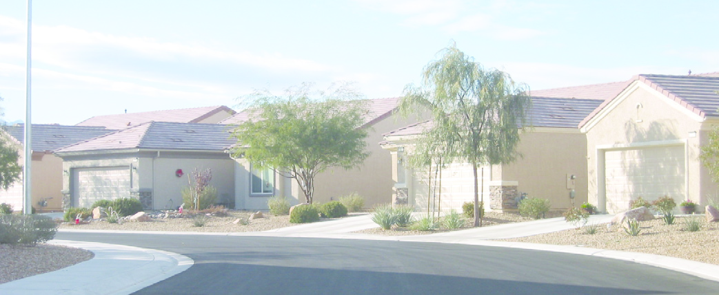
Fig. 17.24.060-F: Residential landscaping
b.
Each residential lot shall be provided with an in-ground irrigation system for front and street side yards.
c.
Front and street side yard landscaping (for those portions of street side yards not enclosed by walls), of oasis, desert, or drought-tolerant type, shall be provided for each residential lot. There shall be a minimum of one and a half five-gallon shrubs per fifty (50) square feet of front and corner side yard area (not including driveway area and areas behind rear yard walls). The use of drought-tolerant type landscaping is strongly encouraged.
d.
Gas and electrical meters shall be screened where possible. Electrical transformers, if not flush with the sidewalk shall be located to the back of sidewalk, and shall straddle the side property lines.
2.
Maintenance.
a.
Developers are responsible for installation of landscape along all roads (exterior and interior), entries, parks, recreation facilities and open spaces.
b.
A Home Owners Association (HOA) or Landscape Maintenance Association (LMA) is responsible for maintenance of landscape and irrigation. All common areas shall be maintained by the HOA.
D.
CPTED Principles. The application of Crime Prevention Through Environmental Design principles are designed to enhance the overall safety of the community. The following CPTED guidelines shall be considered in reviewing landscaping plans:
1.
Guidelines to Promote Natural Surveillance (the ability to see and be seen).
a.
Plantings located close to windows and doors should either be limited in height or trimmed to promote natural surveillance and discourage hiding places.
b.
The mature shape and height of all plantings should be taken into consideration when selecting those plantings to ensure that they do not interfere with lighting or natural surveillance.
c.
Tree canopies should be trimmed up to a height of seven feet to maintain natural surveillance.
d.
Trees should not be allowed to interfere with lighting.
e.
Plantings in side yards should be maintained to support sight-lines in the area.
f.
Where there are existing plantings that create a hiding space in front of a wall, the lower section of the plant should be trimmed to permit visual surveillance.
2.
Guidelines to Promote Natural Access Control (directing people to proper entrances while discouraging access to unauthorized areas).
a.
Trees should be located so as not to provide roof access.
b.
Barrier plants, with needles or thorny foliage, should be used to discourage access to windows or restricted areas.
c.
Barrier plants should be used to discourage unauthorized access over walls.
d.
Plantings such as a landscape trellis and vines should be used to discourage graffiti.
e.
A landscape buffer should be considered to separate streets and sidewalks from block walls.
f.
Pathways should be lined with landscape beds where possible to encourage users to stay on the path and define property lines.
g.
Decomposed granite may be allowed when appropriate for pathways in secluded areas in order to alert residents to the presence of others.
3.
Guidelines to Promote Territorial Reinforcement (making a clear distinction between private and public space).
a.
Landscape can be used to help define main entryways.
b.
Landscape can be used to distinguish private property from public property.
E.
Perimeter Landscaping.
1.
General Requirements.
a.
Perimeter landscaping shall be provided for all new development. The applicability of this section is described in Table 17.24.060-2, Perimeter Landscaping Requirements, below.
b.
Perimeter landscape area shall be measured from the back of curb to the interior side of the perimeter wall adjacent to all streets.
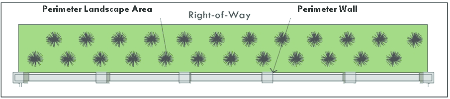
Fig. 17.24.060-H: Perimeter landscape area
c.
The perimeter landscaping shall be planted with drought-resistant and water efficient plant materials from the SNWA Water Smart Landscapes Plant List.
d.
The developer shall provide perimeter landscaping plans that must be approved by the City prior to recording the final map. The plan shall feature a consistent framework of hardscape and softscape design, materials and colors. Final landscaping plans must be stamped by a landscape architect, architect or landscape contractor registered in the State of Nevada.
2.
Requirements by Use.
a.
Single-Family/Two Family Requirements.
i.
The width of the perimeter landscape area shall conform to the following table.
ii.
Where a sidewalk is required in a perimeter landscape area, it shall be centered between two approximately equal strips of landscaping. Sidewalks within perimeter landscape areas shall be designed to run in a straight course, not in a curvilinear course.
iii.
Perimeter landscape areas shall be maintained by a homeowners' association.
b.
Multifamily.
i.
Perimeter landscape areas adjacent to arterial streets (one hundred (100) feet or greater width) shall be at least twenty (20) feet in width. Perimeter landscape areas adjacent to collector streets (sixty- to ninety-nine-foot ROW) shall be at least fifteen (15) feet in width. Off-set pathways or sidewalks are included as part of the required landscape area measurement and shall be centered in the landscape area. The developer shall provide preliminary peripheral landscaping plans at the time of application.
ii.
Buffer yards not less than ten (10) feet in width shall be planted and maintained with twenty-four (24) inch box trees. See Figure 17.24.060-I.
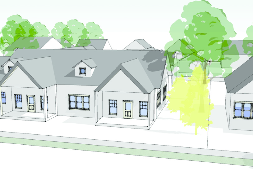
Fig. 17.24.060-I: Landscaped buffer yard located adjacent to abutting properties
iii.
Streetscape plans shall be provided as a component of all multifamily development proposals. Street trees and street median landscaping shall be provided pursuant to Section 17.24.060.F.5., Street Trees. As part of the streetscape plan, bike lanes and trails shall be installed as identified in the comprehensive plan or other adopted plan, as determined by the traffic engineer, or as deemed necessary to create linkages between neighborhoods, and from neighborhoods to local service areas. Bike lanes and trails shall be installed within street rights-of-way unless other locations are determined to be more suitable by the City.
c.
Mixed-Use.
i.
The width of perimeter landscaping areas shall be consistent with adjacent neighborhoods but must be a minimum width of fifteen (15) feet, including sidewalks. See Figure 17.24.060-J.
ii.
Where mixed-use development abuts a lower density residential neighborhood a transitional landscape buffer with a minimum width of twenty (20) feet, including sidewalks, shall be planted.
iii.
Sidewalks shall either be provided within the perimeter landscape area or adjacent to mixed-use structures. Sidewalks shall not be provided abutting a curb.
iv.
The transitional landscape buffer shall be planted with twenty-four-inch box trees (minimum one and one-half inch caliper measured at six inches above the top of the root ball) at the time of planting, at a maximum spacing of twenty (20) feet on center.
d.
Commercial.
i.
Perimeter landscape areas adjacent to any street shall be at least fifteen (15) feet in width, including sidewalks, unless otherwise specified by a sub-area plan.
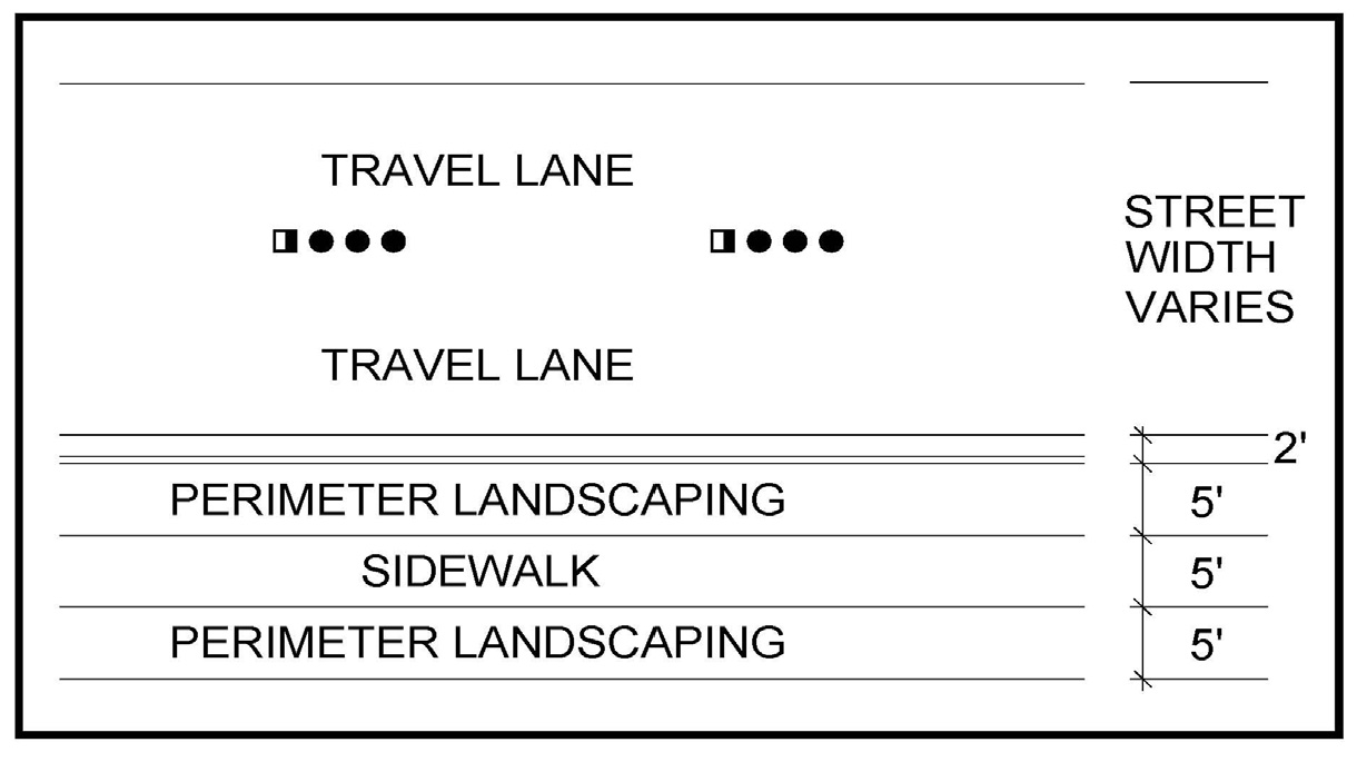
Fig. 17.24.060- J: Commercial and mixed-use perimeter landscaping
ii.
Sidewalks shall either be provided within the perimeter landscape area or adjacent to commercial structures. Sidewalks shall not be provided adjacent to a street.
iii.
Shrubs or vines should be planted immediately adjacent to any solid wall to soften the effect of the wall and to deter graffiti.
iv.
Where new development abuts areas of open space, a soft, transitional landscaped edge shall be used to create a gradual, more natural transition between the open space and the new development.
v.
Where commercial development abuts residential property, in addition to a solid masonry wall, a landscaped buffer area with a minimum width of twenty (20) feet shall be planted with twenty-four (24) inch box trees
e.
Industrial.
i.
Perimeter landscape areas adjacent to any street shall be at least ten (10) feet in width.
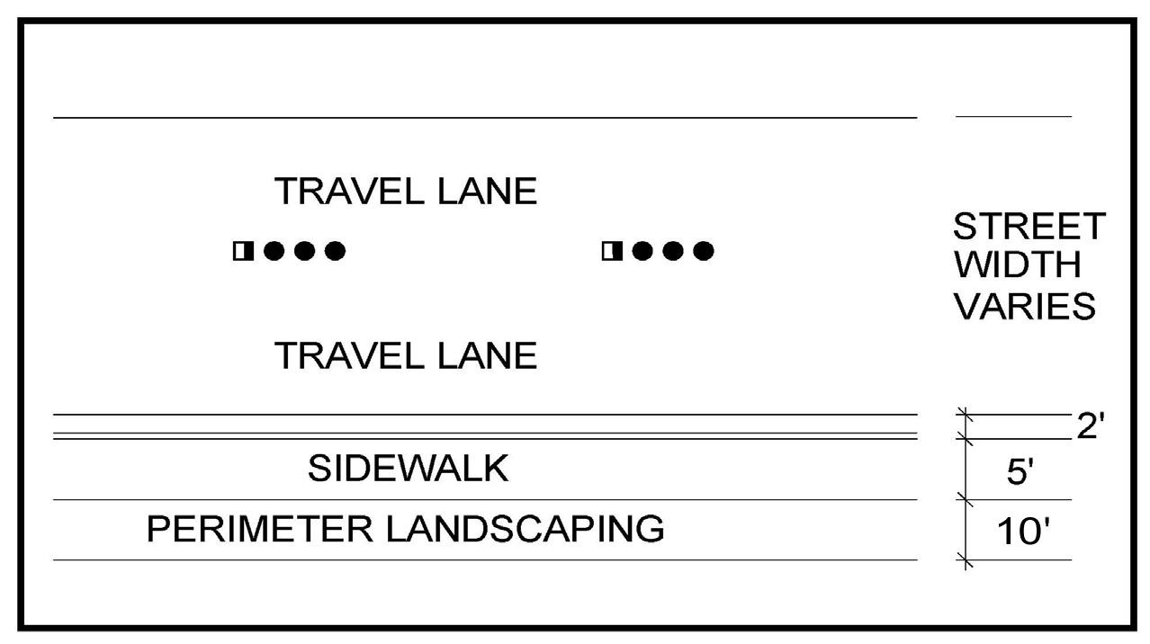
Fig. 17.24.060- K: Industrial perimeter landscaping
ii.
Where new development adjoins areas of open space, a soft, transitional landscaped edge shall be used to create a gradual, more natural transition between the open space and the new development.
iii.
In addition to a solid masonry wall, a landscaped buffer area with a minimum width of twenty (20) feet shall be planted and maintained with twenty-four (24) inches box trees at a maximum spacing of twenty (20) feet on center adjacent to any abutting residential property.
3.
Perimeter Landscaping Maintenance.
a.
All landscaping within sight visibility restriction areas shall be maintained to ensure a height no taller than twenty-four (24) inches above the adjacent street centerline when fully mature.
b.
Maintenance of the perimeter landscaping shall be the responsibility of the property owner, developer, homeowner's association, or other similar organization as approved by the City.
4.
Street Trees. Street trees shall be planted along all collector and arterial streets in accordance with any corridor or specific area plans as adopted by the City, or of a type as approved by the City.
a.
Street trees shall be sized at twenty-four-inch box and shall be planted at twenty (20) feet on center at the time of installation. Trees may be clustered along the right-of-way, however the maximum separation allowed is fifty (50) feet.
b.
Palm trees shall be a minimum of ten (10) brown trunk feet in height, at time of planting.
5.
Street Medians.
a.
All street medians that are required to be landscaped shall be landscaped using a mix of trees, plants and shrubs to achieve a minimum ground coverage of fifty (50) percent within two years of planting.
b.
Median trees shall be planted at intervals of twenty-five (25) feet or in accordance with any corridor or specific area plans as adopted by the City, or of a type as approved by the City. Median trees shall meet the specifications of Section 17.24.060.F.5., Street Trees, above.
c.
In-ground irrigation systems shall be installed in all median landscape areas.
F.
Parking Lot Landscaping and Layout.
1.
Any area of a surface parking lot that abuts a public street shall be screened by perimeter landscaping and/or a decorative masonry wall with a minimum height of three feet above the finished grade of the parking lot where it abuts the landscaping. See Figure 17.24.060-L.
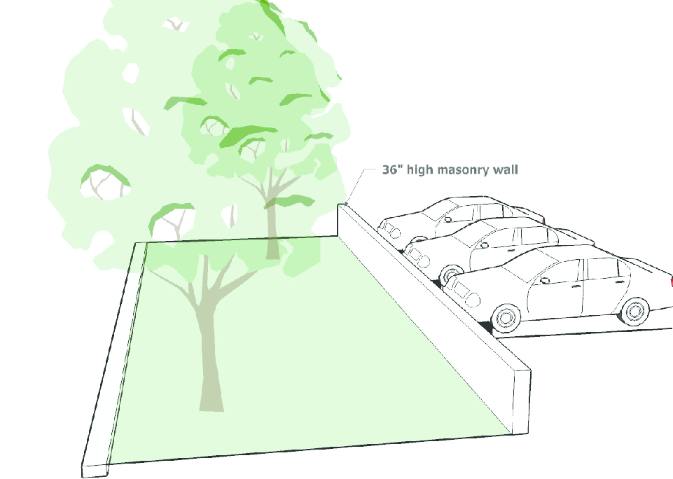
Fig. 17.24.060-L: Parking lot perimeter landscaping
2.
To produce a shade canopy within areas of surface parking, landscape diamonds shall be provided. Each diamond shall contain a twenty-four-inch box tree and shall be spaced for each four parking spaces within a parking row. See Figure 17.24.060-M.
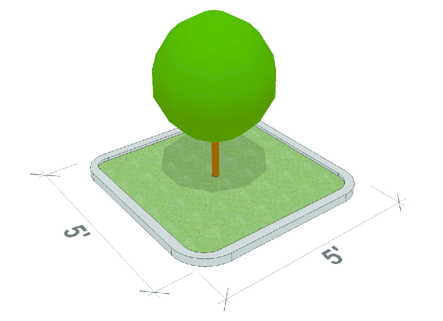
Fig. 17.24.060-M: Landscape diamond
3.
Landscape islands with a minimum width of six feet shall be installed at the ends of all parking rows. See Figure 17.24.060-N.
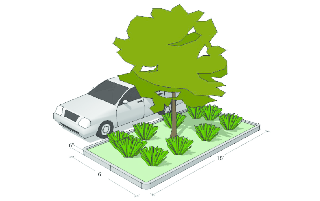
Fig. 17.24.060-N: Landscape island
G.
Transit Stop Landscaping and Amenities. Where transit stops are provided as part of an overall development or other approval from the City, the following landscaping shall be provided as approved by the Regional Transportation Commission:
1.
A minimum of three, three-inch caliper trees planted either in concrete planters in the ground or protected by tree grates;
2.
An area of hardscape with a minimum width of six feet around each of the planters, connected to the transit stop; and
3.
Elements to enhance pedestrian comfort such as seating, drinking fountains, and public artwork.
H.
Drainage and Utility Easements.
1.
Plain concrete drainage channels in any type of development that do not incorporate bicycle and pedestrian paths or maintenance roads must be buffered by a minimum ten-foot landscape area on each side of the channel.
2.
The area of any such paths and/or landscape areas along drainage channels and washes shall be counted toward buffer requirements and may be counted toward the open space requirements of the development if in conformance with Section 17.24.020.
I.
Foundation Landscaping. Landscaping plans shall take into consideration site-specific geotechnical considerations that may require additional protection to prevent infiltration of water into unsuitable soils. If foundation landscaping is determined to be impractical because of soils conditions, one or more of the following options may be used so long as a minimum planter depth of six feet is maintained:
1.
Landscaping may be transposed with the sidewalk, so long as access points to the sidewalk are maintained at a ratio of one per every two abutting parking stalls.
2.
Above-ground planters and/or decorative pots may be utilized so long as they are designed and constructed in such a manner to prevent drainage onto any sidewalk.
3.
Landscaped diamonds containing a twenty-four-inch box tree, with pedestrian grates or groundcovers, may be utilized at a ratio of one diamond per every three abutting parking stalls.
4.
A colonnade or similar architectural element may be utilized to provide a minimum eight feet of shading.
5.
Other methods as approved by the Director (i.e., cutoff walls, moisture barriers, etc.).
J.
Infill Development.
1.
All infill projects shall provide landscaping as an integral part of project design. Landscaping shall be located throughout the site to accomplish the following objectives:
a.
Preserve and enhance the identity of the site;
b.
Buffer environmentally sensitive areas;
c.
Shade, as possible, parking areas and walkways;
d.
Connect the site to surrounding development;
e.
Create attractive streetscapes and common areas.
2.
Infill Landscaping Plan. All applicants for infill projects shall submit a landscape plan, prepared by a certified landscape architect, with the development application. The plan shall meet the objectives of Section 17.24.060.H.1. and shall identify and locate existing and proposed: trees, shrubs, and groundcover; natural features; and other landscape elements. Where existing plantings are to be retained, the plans shall include proposed methods of protection during construction.
3.
General Standards for Infill Development Landscaping.
a.
Infill development is exempt from perimeter landscaping except as follows:
i.
Site perimeter landscaping along side or rear lot lines shall only be required when the lot lines occur between a residential and a non-residential use of property.
(A)
If the primary structure on either side of the lot line contains a mixed-use no site perimeter landscaping shall be required.
(B)
Where site perimeter landscaping is required, the applicant may choose to substitute for any planting requirement an opaque fence or wall constructed of one of the primary materials used on the façade of the primary structure. If the applicant chooses to provide planted materials for any required site perimeter landscaping on a side or rear lot line, the required width of any planting area shall be reduced to four feet.
ii.
In-lieu of front perimeter landscaping in the R-A district, landscaping and/or pedestrian amenities (described below) may be installed in the front setback. However, where a sidewalk and planting strip exist on adjacent property, the new sidewalk and planting strip shall match the adjacent sidewalk and planting strip in configuration and alignment unless the Director determines that, for the convenience of the public, a new configuration and alignment are preferable. Where a planting strip between a public street and sidewalk exists on a site or one will be created as part of the development plan, the area shall be landscaped with at least one street tree per thirty (30) lineal feet, on center.
iii.
Acceptable pedestrian amenities include:
(A)
A public outdoor seating plaza adjacent to or visible and accessible from the street, with a minimum useable area of three hundred (300) square feet. See Figure 17.24.060-O.
(B)
Sidewalk planters between sidewalk and building.
(C)
Public art including but not limited to sculptures, fountains, clocks, or murals with a value equal to or greater than one percent of construction value of the structure.
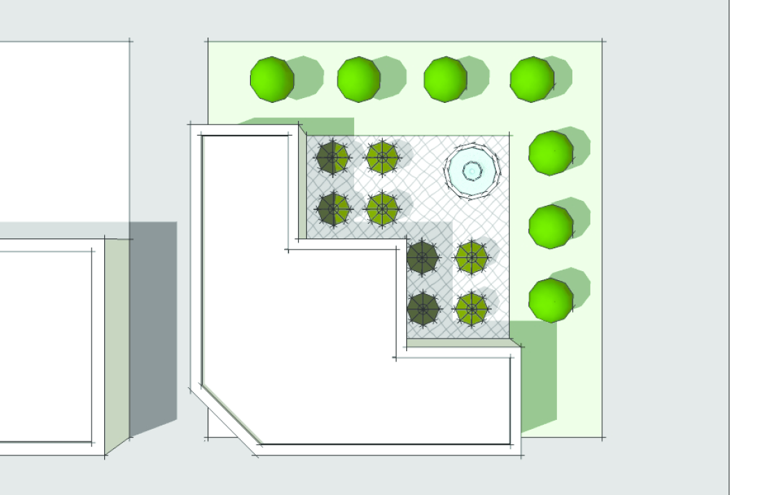
Fig. 17.24.060-O: Pedestrian plaza
b.
Infill development is exempt from the district landscaping requirements set forth in Section 17.24.060.C. Areas of infill development lots that are not covered by structures or drives, parking lots, sidewalks, patios or other such uses should be landscaped with the materials identified in Section 17.24.060.C.4., or be designed as public open space amenities as described in Section 17.24.020.C., Private Common Open Space.
c.
The use of berms is prohibited.
4.
Parking Lot Landscaping for Infill Development.
a.
Vehicular use areas that include drive aisles, turn lanes, or parking areas on infill lots shall maintain a minimum perimeter planting strip with an average width of four feet as measured from the outer edge of the vehicular use area.
b.
The planting strip between vehicular use areas and rights-of-way shall contain a continuous hedge composed of a row of evergreen shrubs with a minimum planting height of thirty (30) inches and a maximum on-center spacing of three feet.
c.
The minimum planting strip width may be reduced to a minimum width of two feet through the provision of a decorative masonry wall or ornamental metal fence constructed in accordance with the standards in Section 17.24.070, Screening, Walls, and Fences.
K.
Installation Prior to Occupancy Permit. All landscaping materials and equipment as provided for on the approved landscape plan for any residential, business or industrial development, or in the case of phased development, for the particular phase, shall be installed prior to the issuance of any occupancy permit or Certificate of Completion.
(Ord. No. 2591, § 1, 6-15-2011, eff. 10-1-2011; Ord. No. 2706, §§ 20, 21, 2-18-2015; Ord. No. 3048, §§ 17, 18, 1-20-2021; Ord. No. 3136, § 2, 10-5-2022)
17.24.070 - Screening, walls, and fences.
A.
Walls and Fences Generally.
1.
Locations. All fences and/or walls shall be located entirely upon the private property of the persons, firms, or corporations constructing, or causing the construction of, such fence and/or wall unless the owner of the adjoining property agrees, in writing, that such fence and/or wall may be erected on the division line of the respective properties.
2.
Construction, Maintenance and Height Measurement.
a.
Fences and/or Walls.
i.
Every fence and/or wall shall be constructed in a substantial, workmanlike manner and of substantial material reasonably suited for the purpose for which the fence and/or wall is proposed to be used.
ii.
Every fence and/or wall shall be maintained in a condition of reasonable repair and shall not be allowed to become and remain in a condition of disrepair, damage or unsightliness, or constitute a nuisance, public or private. Any fence and/or wall that is, or has become, dangerous to the public safety, health or welfare, or has become unsightly through improper maintenance or neglect is a public nuisance, and City shall commence proper proceedings for the abatement the fence and/or wall.
iii.
Chain link or wire fences, wherever permitted, shall be constructed in such a manner that no barbed ends shall be at the top, except in industrial districts, and shall be constructed of at least eleven-gauge wire or its comparable.
iv.
On corner lots in all districts, no fence or wall in excess of twenty-four (24) inches above the street centerline grade shall be permitted within a triangular area defined as follows: beginning at the intersection of the projected curbing lines of two intersecting streets, thence fifteen (15) feet along one curbline, thence diagonally to a point fifteen (15) feet from the point of beginning, and at the intersection of each driveway or alley with a street, a triangular area where corners are defined by two points on the right-of-way line, fifteen (15) feet on each side of the centerline of the driveway or alley and a point on said centerline ten (10) feet outside right-of-way.
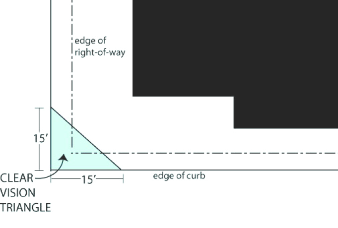
Fig. 17.24.070-A: Clear vision triangle for fences and walls
b.
Masonry Walls. The following shall apply regardless of zoning district:
i.
For walls up to three feet high and within a rear yard setback area there are no restrictions;
ii.
For walls up to three feet high and visible from a street, common element, sidewalk, or other publicly-accessible area, the wall shall be decorative;
iii.
For walls three feet and higher, the current building code adopted by the City shall apply;
iv.
The portion of all retaining and screen walls below grade shall be sealed by a method approved by the Division of Building Safety to prevent the leaching or transmission of mineral deposits through the wall.
c.
Measuring Fence and Wall Height.
i.
All retaining wall heights shall be the effective height above the finished grade measured on the exposed side of the wall.
ii.
The height of the fence or wall shall be the total effective height above the finished grade, measured from the property with the highest elevation.
iii.
On property lines, the height may be measured from the finished grade of either side when the abutting property owners are in joint agreement, with such agreement submitted in writing as part of the building permit application packet.
iv.
No retaining wall within four feet of any sidewalk shall exceed three feet in height.
v.
Fences and/or screen walls may be located atop retaining walls provided:
(A)
The overall height of any combination fence/screen wall and retaining wall shall not exceed twelve (12) feet. Any wall greater than nine feet in overall height shall be separated from the back-of-sidewalk by a minimum five feet of landscaping; and
(B)
The retaining wall is appropriately engineered to support said fence or screen wall.
d.
Fence and Wall Height Deviation Requests. Property owners, contractors, or developers wishing to construct a fence or wall in any district that would deviate from the height requirements of this title may apply for a variance. A variance may only be approved by the Planning Commission in accordance with the requirements set forth in Section 17.12.070.K., Variances.
3.
Residential Fences and Walls. The following standards shall apply to all residential uses:
a.
Fences and walls, excluding retaining walls, shall not exceed eight feet in height unless otherwise specified herein.
b.
No fence or wall shall be allowed in any residential front yard that exceeds forty-eight (48) inches in height. Twenty-five (25) percent of any front yard fence or wall shall be open above thirty-six (36) inches. All wall sections visible from the street, sidewalk, adjacent properties, or common areas shall be decorative. For this section the front yard is the entire area from the front of the house to the front property line.
c.
In those instances where a fence or wall is erected as an enclosure that restricts access from the front to the rear yard, a gate, an identifiably collapsible section of fence, or other such means of recognizable ingress shall be installed, shall remain unobstructed, and shall be a minimum three feet in width. The location of such ingress points shall be positioned at any point paralleling the front lot line between the side lot property line and the principal structure. Side yard walls higher than forty-eight (48) inches shall not extend beyond the plane of the front wall of the house. In such cases that it is deemed necessary and/or desirable, such walls shall be decorative on both sides, unless otherwise approved by the Planning Commission.
4.
Commercial and Industrial Fences and Walls.
a.
Fences and walls in office and commercial uses shall not exceed ten (10) feet in height. Perimeter fences and walls abutting residential districts shall be a minimum of six feet but not be greater than eight feet in height, as measured from the residential side of the property line.
b.
Fences and walls in industrial uses shall not exceed twelve (12) feet in overall height. Perimeter fences and walls abutting residential districts shall be a minimum of six feet but not be greater than eight feet in height, as measured from the residential side of the property line.
5.
Mixed Use. Perimeter walls, berms, or fences, if used, shall be installed to a height of not less than three feet, six inches, nor greater than ten (10) feet (except as permitted elsewhere in this code).
6.
Finished Side Toward Adjacent Property. Any fence or wall constructed so as to have only one elevation "finished," that shall be defined as not having its supporting members significantly visible or as having its decorative side visible, shall be erected such that the finished or decorative elevation of the fence or wall is exposed to the adjacent property.
B.
Perimeter Walls/Fences. Perimeter wall/fences, if provided, shall comply with the following criteria:
1.
General Requirements.
a.
Connectivity. All perimeter commercial and residential walls shall incorporate openings to provide street or pedestrian access at average intervals of five hundred (500) feet. Intervals may be varied at the City's direction to accommodate adjacent streets, transit stops, trails, and commercial or residential developments.
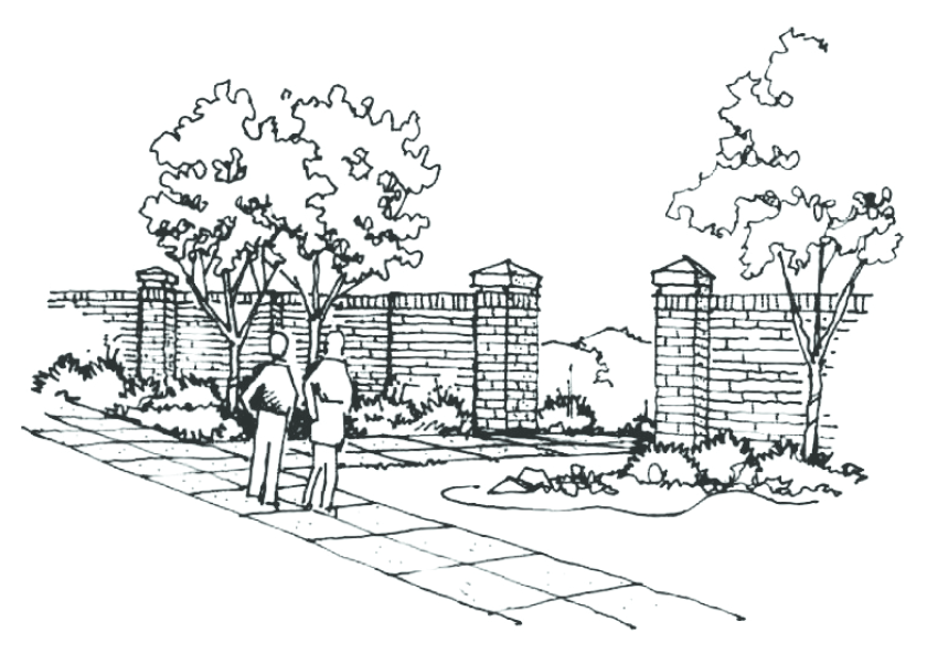
Fig. 17.24.070-B: Pedestrian access opening in a perimeter wall
b.
Design.
i.
To achieve design continuity, perimeter walls shall match the design of existing abutting walls. In such cases the established wall design shall be continued, at a minimum, until the next street intersection. In cases where the Director determines an existing wall is considered to be of unacceptable design, the design shall not be carried beyond the property line. The space between the discontinued wall design and any other wall design shall be filled with a landscaped area designed to create a transition between wall designs.
ii.
Perimeter walls, end walls, return walls, and common area walls exposed to right-of-way and pedestrian priority areas, if provided, shall be decorative and shall be installed by the developer.
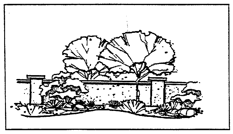
Fig. 17.24.070-C: Decorative perimeter screening walls
iii.
In residential districts, perimeter walls must include design elements such that twenty (20) percent of the wall façade must be contrasting with the other eighty (80) percent by use of different colors, materials, or architectural design.
iv.
Perimeter wall/fences around residential subdivisions or residential PUDs shall meet the following standards:
(A)
The maximum length of continuous, unbroken, and uninterrupted fence plane along an arterial or collector street shall be five hundred (500) feet. A break in the plane of a fence or wall may be achieved by one of the following:
(1)
A break in the length of the wall or fence that is at least twenty-five (25) feet long (measured parallel to the street), at least four feet deep (measured perpendicular to the street) and may encroach into the perimeter landscaping;
(2)
A change to a fence that is not more than fifty (50) percent opaque, such as an open rail or wrought iron fence, that is offset from the primary fence or wall plane by at least four feet, and that extends for no less than twenty-five (25) feet.
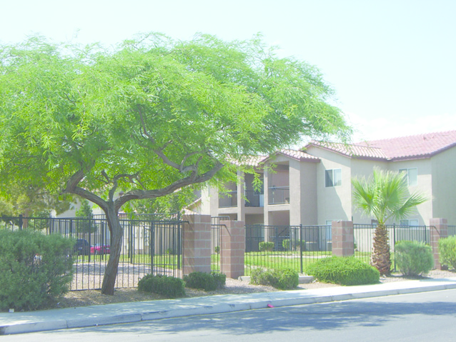
Fig. 17.24.070-D: Open style perimeter fence
(3)
A planting pocket a minimum of four feet deep and twenty-five (25) feet wide;
(4)
Fencing or landscaping less than four feet in height; or
(5)
A non-fenced opening.
v.
In commercial and industrial districts, walls along arterial and collector streets shall have wall sections interrupted by masonry columns with minimum width and depth of sixteen (16) inches at least once every one hundred (100) feet of horizontal distance along the street frontage.
c.
Fences and Walls along Parks, Trails, and Natural Areas.
i.
Where perimeter walls around any lot, subdivision, or PUD run along a designated park, trail, or natural area on the subject property or an adjacent property, the wall design shall:
(A)
Permit views into the park, trail, or natural area from all portions of the frontage that are not included in the side or rear yard of a private lot or development parcel; and
(B)
Permit views from the park, trail, or natural area into those portions of the adjacent development that are not included in the side or rear yard of a private lot or development parcel.
ii.
Along those sections of the wall or fence where views must be permitted pursuant to subsection a above, all portions of the fence between two feet above grade to the top of the fence or wall shall be at least seventy-five (75) percent open. The open fence percentage requirement shall be measured for each ten (10) feet of horizontal fence length (i.e., no more than twenty-five (25) percent of any ten-foot horizontal section of fence may be constructed of materials that block the required views.) View-permitting portions of the fence may not be constructed of chain-link or wire.
d.
Location.
i.
Perimeter walls shall be installed at the rear of the required landscape setback area.
ii.
No perimeter wall along any street shall directly abut the rear of the curb.
e.
Materials.
i.
In residential and multifamily districts, the use of plastic, vinyl, woodguard style, and similar materials shall not be permitted as part, or in whole, for the construction of any perimeter walls, end walls, or common area walls within any development. However, should plastic, vinyl, woodguard style or similar materials for fencing be used on common property lines or as return walls, such fencing shall comply with the following:
(A)
The proposed material shall be engineered to withstand the effects of solar radiation and contain an appropriate level of UV inhibitors to maintain its appearance, color and structure for a minimum of twenty (20) years;
(B)
The proposed material shall be engineered to resist the long term effects of wind, dryness and freezing temperatures for a minimum of twenty (20) years;
(C)
The proposed materials shall be installed according to all manufacturer's specifications and building code requirements in effect at the time of installation;
(D)
All fencing shall be compatible for pool installations;
(E)
The posts and/or all connections shall not be attached to the homes unless approved by the Building Safety Division.
ii.
Unless otherwise approved as part of an overall development plan, the following materials shall not be considered to be acceptable for use for screening or perimeter walls:
(A)
Chain-link or open wire fencing (except as temporary construction fencing);
(B)
Razor wire or barbed wire;
(C)
Corrugated metal;
(D)
Bright colored plastic;
(E)
Untextured or unfinished concrete or block (CMU) walls.
C.
Retaining Walls.
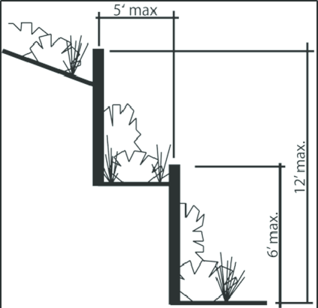
Fig. 17.24.070- E: Retaining Wall Design
1.
Where retaining walls are used, they shall not exceed six feet in height and shall be decorative. In instances where the topographic conditions justify additional retaining walls, providing there is a minimum planting area of five feet between the walls.
2.
All exposed sides of all retaining walls shall be decorative and shall match the design of any applicable screen wall.
3.
In cases where the wall is split into multiple sections, a minimum of five five-gallon shrubs for each twenty (20) feet of linear planting area shall be planted in the area between the walls and at the base of the lowest wall.
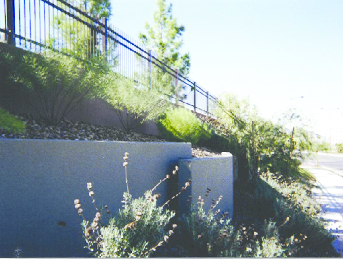
Fig. 17.24.070-F: Retaining wall plantings
D.
Transitional Screening.
1.
Purpose. The purpose of this section is to establish general development standards for transitional screening between uses of differing character, density, or intensity. The transitional screening standards are intended to assure compatibility of uses, minimize deterioration of properties and property values, and to enhance to the health and safety of the residents of North Las Vegas.
2.
Use of Transitional Screening. Unless otherwise determined by the Planning Commission, a decorative masonry screen wall of no more than eight feet in height above grade shall be constructed and maintained between uses of differing intensity or character. This may include between existing and/or future:
a.
Single-family and multifamily developments;
b.
Multifamily and multifamily developments, when the difference is ten (10) density units per acre or greater;
c.
Residential and nonresidential developments;
d.
Differing nonresidential use categories;
e.
Parking areas subject to general public view if not specified elsewhere in this title;
f.
Rear and/or side lot areas and public rights-of-way.
3.
Transitional Screening for Infill. Transitional screening may not be required for residential infill development and may be reduced or waived for multifamily, mixed-use, or commercial development where the City finds the design, height, location of uses, massing, and landscaping of the infill project mitigates potential adverse impacts and promotes compatibility with surrounding structures and the character of the neighborhood
4.
Location of Screen Walls. Screening shall be located adjacent to interior property lines on the constructing party's property, unless both property owners are in agreement to install screening on the property line.
5.
Exceptions. In lieu of screen walls, the City encourages and may require alternative methods for screening uses of differing character, density, or intensity. Alternative methods may include:
a.
Open space with landscaping;
b.
Arterial or collector streets with landscaping;
c.
Landscaped earth berms (particularly with parking lots);
d.
Lower screen walls with landscaping (particularly with parking lots);
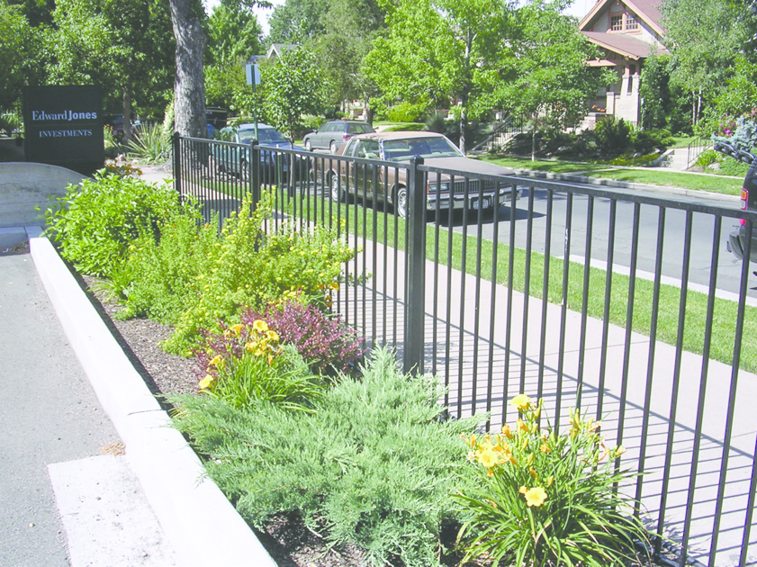
Fig. 17.24.070-G: Parking lot screening wall with landscaping
e.
Other screening approved by the Planning Commission. Alternative methods of screening shall be implemented when it is in the best interest of the affected properties and deemed by the Commission to provide more acceptable screening than provided by a screen wall.
E.
Screening.
1.
Utility Screening. All utility substations, wells, or storage facilities shall be screened from view from adjacent property and rights-of-way by a wall at least eight feet in height or landscape screen. If said areas are visible from adjacent streets, sidewalks, common areas, and/or publicly-accessible areas, all screen walls shall be decorative.
2.
Outdoor Storage Yards.
a.
Except as otherwise provided below, all materials, supplies, merchandise, equipment, or similar items not on display for direct sale, rental or lease to the ultimate consumer or user, shall be stored within the confines of a one hundred (100) percent opaque wall, or opaque landscaping screen not less than eight feet tall, in order to block views of said items from neighboring property and rights-of-way.
b.
Screening Exceptions.
i.
When a boundary of a storage yard abuts a natural barrier (e.g., a hillside) that creates a change in elevation of more than eight feet between the finished grade of the storage yard and the finished grade of adjacent properties, the Director may waive or amend the screening requirements to mitigate the visual impact of the storage yard on adjacent properties and/or rights-of-way.
ii.
When a boundary of a storage yard abuts a manmade barrier (e.g., a building) that provides a substantial barrier between the storage yard and the adjacent property, screening is not required. However, any portion of the storage yard that is visible from any right-of-way or property not developed as a storage yard shall be screened in accordance with the provisions of this section.
3.
Layout and Screening of Building Services and Mechanical Equipment.
a.
Layout of Service Areas and Loading Zones. Service and loading zones shall be located to the rear, side, or to an internal location where visibility from public streets and views from neighboring buildings and properties will be minimized. Such areas shall be screened by the use of decorative walls and/or dense landscaping that will serve as both a visual and a noise barrier.
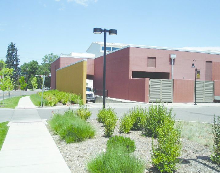
Fig. 17.24.070-H: Loading area screening
b.
Roof Access Equipment. Exposed ladders and roof access equipment and drainage spouts, when visible from a perimeter right-of-way or residential properties, shall be incorporated into the architectural form and layout of proposed building(s) to reduce the need for screening.
c.
Screening of Uses and Equipment. In all districts, the following uses and equipment, when visible from a perimeter rights-of-way or adjacent property, shall be screened: trash and refuse collection areas, mechanical equipment such as air conditioners, pumps and motors, propane tanks and other storage tanks, electrical equipment such as switching equipment and transformers, valves, vents.
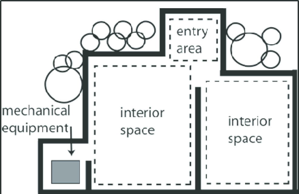
Fig. 17.24.070-I: Mechanical and electrical equipment incorporated into site layout
d.
Ground Mounted Equipment.
i.
Ground mounted mechanical and electrical equipment, satellite dishes, and any other communications equipment shall be concealed from view of public streets and neighboring residential properties adjacent to the use at street level within one hundred (100) feet of the property boundary. This requirement shall not apply to solar panels or wind energy generators.
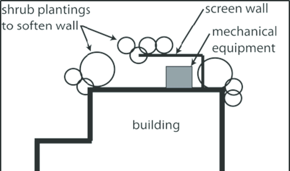
Fig. 17.24.070-J: Screened ground mounted and electrical equipment
ii.
Communication antennas shall be of a design, and installed in such a manner, as to blend in with the architecture and design of the building on which they are mounted. In the initial design stage of a development project, consideration shall be given to incorporating mechanical and electrical equipment into the architectural form and layout of the proposed building to reduce the need for screening.
iii.
Ground level mechanical and electrical service equipment shall be screened from public rights-of-way with materials architecturally compatible with the finishes and character of the principle structures within the development. All ground level mechanical and electrical equipment (including satellite dishes) shall be screened to the height of the tallest equipment and/or integrated with the building design.
iv.
Small ground mounted equipment such as valves, gas, electric and water meters, but not including solar energy equipment, shall be screened by the appropriate use of shrubs and landscaping design.
e.
Roof-Mounted Equipment.
i.
The following equipment may be roof-mounted: solar panels, wind energy generating equipment, satellite dishes one meter or less in diameter, solar hot water tanks, or air conditioning units for multifamily structures. No other mechanical equipment shall be mounted on or attached to any high sloped roof.
ii.
Solar panels shall be mounted directly to the roof plane and be integral to the roof design.
iii.
Air conditioning units on multifamily structures shall be screened by a parapet wall.
iv.
On sites with large grade differentials, where reasonable height parapet or screen walls are insufficient to provide screening, views from above shall be screened to the maximum extent practicable through the additional use of alternative methods such as painting equipment to blend with roof materials.

Fig. 17.24.070-L: Roof mounted mechanical equipment screened by parapets or walls
4.
Refuse Collection Areas.
a.
Refuse collection areas and dumpsters shall be located away from all street fronts, primary driveway entrances, and pedestrian priority areas. They shall be screened from view from rights-of-way, sidewalks, and abutting properties.
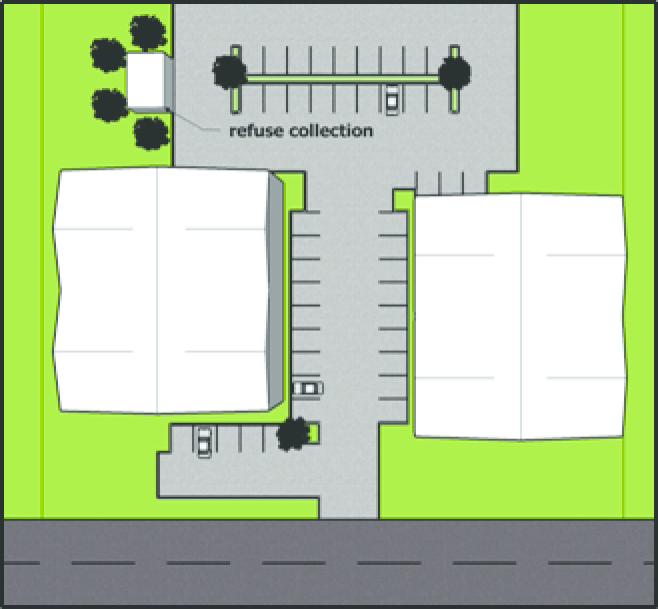
Fig. 17.24.070-M: Location of refuse collection areas
b.
Refuse collection areas and dumpsters shall be enclosed by decorative walls finished in the same manner as the main structures within the development and shall follow the same design theme and use similar materials to those used in the main structures. All such enclosures shall have solid metal gates and roofs or other type of approved screening device that covers the top of the enclosure. Refuse collection area enclosures in industrial districts are only required to be decorative and have a roof or other type of approved screening device if visible from a public way.
c.
No existing storage of trash or garbage is permissible in commercial or industrial districts except in the principal building, or accessory building enclosed by walls and roof or in closed containers completely screened from eye-level view from public streets and adjacent property. Such screening shall be in the form of solid walls, berms, or evergreen trees and shrubs. If walls are used, they shall have the same exterior finish and color as the principal building on the site.
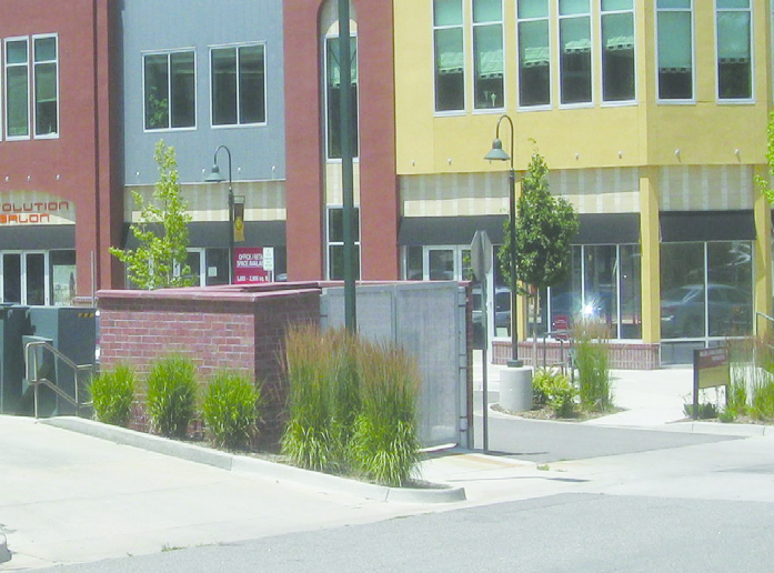
Fig. 17.24.070-N: Dumpster screening
(Ord. No. 2591, § 1, 6-15-2011, eff. 10-1-2011; Ord. No. 3048, §§ 19, 20, 1-20-2021; Ord. No. 3131, § 6, 7-20-2022)
17.24.080 - Exterior lighting.
A.
General Standards. The general standards of this paragraph apply to any lighting used to illuminate an off-street parking area, sign, or other structure, and pedestrian areas such as pedestrian connections, trails, and open spaces.
1.
Lighting Levels.
a.
Appropriate levels of lighting shall be provided to create adequate visibility and safety at night.
b.
Any light or combination of lights that cause light on a public street, other than lights specifically intended for that purpose, shall not exceed one footcandle (meter reading) as measured from the centerline of the street.
c.
Light shall not exceed one-half foot candles at the property line of any adjacent residential property.
d.
The amount of light produced by exterior light sources should be reduced to that necessary to maintain a minimum comfort level for safety and security purposes. In parking lots, a minimum foot candle of one and maximum of five required.
e.
Warm lighting colors are encouraged. The blue-white colors of fluorescent and mercury vapor lamps shall be prohibited.
f.
Lighting shall be of a level sufficient to provide for security and safety and shall be of a type, and installed in such a manner that it does not cause glare or light spillover of more than 0.5 footcandles on abutting residences.
2.
Light Shielding.
a.
Lighting shall be arranged so as to deflect light away from any adjoining residential zone or from the public streets.
b.
Exterior lighting shall have full-cutoff shielding so that light will not spill out onto surrounding properties or project above the horizontal plane.
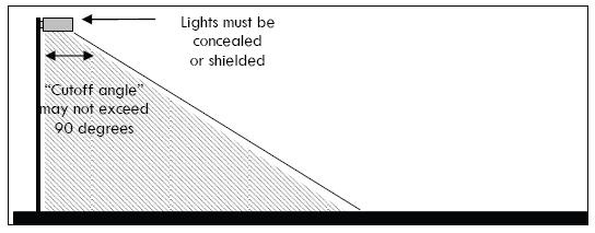
Fig. 17.24.080-A: Full-cutoff shielding
c.
Bare incandescent light bulbs shall not be permitted in view of adjacent property or public right-of-way. Wall mounted lights shall be directed downward. Soffit or canopy mounted light fixtures should be recessed in the soffit or otherwise fully shielded. Ground mounted or other upward directional lighting will be permitted only where some form of shielding or light baffling is provided to create a soft, uniform light quality and minimize light spillage beyond the wall or sign being illuminated.
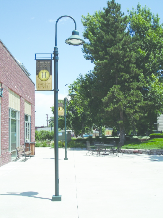
Fig. 17.24.080-B: Lighting proportional to building size
3.
Lighting Design.
a.
The height of light fixtures should be in proportion to the building mass and in no instance shall light poles be more than twenty (20) feet in height from a finished surface such as a street or sidewalk within commercial or multi-family developments or thirty (30) feet in height within industrial developments and C-2, zoned developments.
b.
Lighting fixtures should be located to eliminate glare into windows adjacent to parking areas.
c.
Lighting fixtures shall be compatible with the architectural character of the proposed development.
d.
Lighting shall be integrated with landscaping (with the exception of those that are located within loading or storage areas).
e.
Along walkways, low level lighting (i.e., below eye level) that directs light downward onto the ground surface is encouraged. The design of the fixtures shall be compatible with the overall design of the development and shatterproof lamp coverings shall be used. The fixtures shall be placed to minimize glare and shall be located as to not present hazards for pedestrians or vehicles.
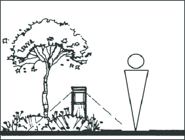
Fig. 17.24.080-C: Lighting integrated with landscaping
B.
Lighting Plan Required. A detailed lighting plan prepared by a licensed electrical engineer shall be submitted with the building permit application for all multi-family residential, commercial, industrial, or mixed-use developments. The lighting plan shall include, but is not limited to, types and styles of lighting fixtures, location of lighting fixtures, and a photometric lighting plan.
C.
Residential Entrance Sign Lighting. Residential project entrance sign lighting shall be by external source projected onto the sign, and the source shall be shielded to prevent glare on surrounding properties and streets. Internally lit signs, and signs with flashing or moving lights or messages are prohibited.
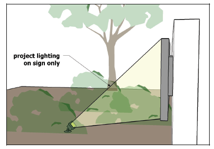
Fig. 17.24.080-D: Entrance sign lighting ground mounted and shielded
D.
CPTED Principles. The application of Crime Prevention Through Environmental Design principles are designed to enhance the overall safety of the community. The following CPTED guidelines are encouraged within all developments:
1.
Transitional lighting in exterior areas going to and from all buildings or uses along walkways.
2.
Lighting fixtures indoors and outside, to increase visibility, especially in areas with limited activity.
3.
Each luminaire or any other exterior lighting device designed for security lighting shall be protected by weather and vandal-resistant coverings.
4.
Lighting fixtures, including those controlled by motion sensors or photoelectric cells to discourage access by unauthorized persons after dark.
5.
Lighting fixtures should enhance natural access control without disturbing adjacent property owners or legitimate users of the property.
(Ord. No. 2591, § 1, 6-15-2011, eff. 10-1-2011)
17.24.090 - Residential and two-family design standards.
A.
Purpose. The purpose of these standards is to
1.
Protect the character of established single- and two-family residential neighborhoods;
2.
Promote appropriate residential infill and redevelopment within established neighborhoods;
3.
Encourage a variety of housing choices for North Las Vegas residents; and
4.
Enhance the quality, character, and livability of future neighborhoods.
B.
Applicability. These standards and guidelines shall apply to all newly created single-family subdivisions, areas of single-family or two-family housing or tiny houses, within planned unit developments (PUDs), new two-family dwellings, and all new individual tiny houses or single-family dwellings constructed within the City of North Las Vegas, manufactured housing that will not be affixed to a lot within a mobile home park, and permitted small lot residential development options. Exemptions to these requirements shall apply in the following instances:
1.
A single-family or two-family dwelling patterned after a model home, the plans of which were submitted for building plan check prior to the date of adoption of the ordinance codified in this section, shall be exempt; provided, however, the home is to be located within a subdivision, the tentative map of which was approved by or pending approval on the date of adoption of the ordinance codified in this section.
2.
A single-family or two-family dwelling for which plans were submitted for building plan check prior to the adoption date of this Code shall be exempt.
C.
Solar-Oriented Subdivisions and Single-Family Dwelling Units.
1.
Applicability. The requirements of this section shall apply to subdivisions with more than twenty-five (25) single-family residential lots within North Las Vegas.
2.
Definition: Solar-Oriented Lot (will be moved to definition section). A "solar-oriented lot" shall mean a lot with its longest lot line dimension oriented to within thirty (30) degrees of a true east-west line.
3.
Standards. All developments with single-family lots subject to this section are encouraged to comply with the following requirements:
a.
Solar-Oriented Residential Lots. In subdivisions subject to these provisions, at least twenty (20) percent of lots shall be solar-oriented. The City may reduce the number of lots required to be solar-oriented in an infill subdivision upon a finding that the existing street pattern in the area should be maintained to assure compatibility with the character of the surrounding neighborhood. The City may consider a waiver to this requirement where a developer will install solar collection systems on an equal number of homes.
b.
House Orientation. The long axis of all dwelling units on solar-oriented lots shall be oriented so that the long axis faces within twenty (20) degrees of true south.
c.
Street Layout. Where, as determined by the City, topographic, environmental, and soil conditions, and existing street configurations permit, the predominant pattern of new streets in subdivisions subject to this section shall be oriented within thirty (30) degrees of east-west orientation.
d.
Site Features. No site features shall be constructed on any lot in a new subdivision subject to this section that would block solar access sunlight twenty-five (25) percent or more of the time on any day of the year from the south facing roof of the dwelling.
4.
Modifications. Where existing street, parcel dimensions and size, and development patterns; or unusual topographic, environmental, soil, and similar conditions exist that, as determined by the City, make compliance with these provisions either physically or economically infeasible, the City may modify the standards in this sections. However, the modifications shall be the minimum necessary and shall maintain overall solar access in the subdivision.
D.
Architectural Character and Materials.
1.
Home Models and Design.
a.
Number of Models Required. All residential development shall be designed to incorporate a mix of home models based on the size of the total development as follows:
i.
One to fifteen (15) units: one model;
ii.
Sixteen (16) to seventy-five (75) units: two models;
iii.
Seventy-six (76) to one hundred (100) units: three models,
iv.
One hundred one (101) to one hundred fifty (150) units: four models,
v.
One hundred fifty (150) or more units: five models.
b.
Model Design.
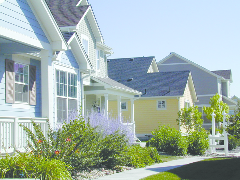
Fig. 17.24.090-A: Mix of home models
i.
At least three distinct elevation styles shall be offered for each model. Various models and elevations shall be interspersed throughout a development.
ii.
Each model must be offered with a porch, balcony, or courtyard option. Any dwelling that is not placed on an at-grade slab foundation and is elevated above ground in any manner shall include in its design a covered porch or other architectural feature on the front elevation that will effectively reduce the vertical effect of the raised structure. The minimum width of such porch or architectural feature shall be seventy-five (75) percent of the width of the front elevation.
iii.
No more than one identical elevation may occur consecutively or directory across the street.
c.
Garage Placement.
i.
For developments consisting of seventy-six (76) or more lots, no more than seventy-five (75) percent of lots shall have a primary structure with a front-facing garage door meeting the minimum setback requirements; the remainder shall have garage doors that are side-facing; detached and located in the rear yard; recessed an additional six feet from the front plane of the home; or other alternative.
Fig. 17.24.090-B: Options for garage orientation
ii.
No more than two houses with the same garage design shall be adjacent to each other.
d.
All single-family dwellings shall contain a minimum of one thousand two hundred (1,200) square feet.
2.
Garages. All developments with garages must also comply with the following requirements:
a.
All attached garages shall cumulatively be no larger than fifty (50) percent of the total gross area of the principal dwelling.
b.
Garages shall have a "pop-out" or other architectural feature from the garage wall plane. The door shall be recessed.
Fig. 17.24.090-C: Recessing the garage door behind the front of the house
c.
Garages shall have varying door patterns, varying colors and/or possibly two single doors instead of one. The use of garage doors with fixed glass is encouraged.
d.
Where three-car garages are allowed, the third car stall shall be provided as: a tandem; the garages can be separated with two stalls having front access and a third stall being side loaded; or the third stall shall be recessed five feet from the front plane of the garage.
e.
Side loaded garages shall contain a minimum of one window, with a minimum size of twenty (20) square feet, in the garage wall facing the street.
Fig. 17.24.090-D: Garages located along alley
f.
Detached garages shall be architecturally compatible and consistent in materials, design, and colors with the main house.
3.
Elevations and Trim.
a.
All dwellings shall have stucco, stone, or brick exteriors. Materials such as simulated stone, fiber cement board or brick may be permitted upon review and approval by staff. Metal may be used only for grill work and doors; and wood may be used only for doors, fascias, and trims.
Within the Ranch Estates Rural Preservation Overlay District, logs, adobe, or similar materials may also be used as exterior materials, subject to review and approval by staff.
b.
The body and trim finish and roof materials of dwellings shall be beige, tans and earth tone, warm pastel or neutral colors indigenous to the Las Vegas Valley and its surrounds, or from the southwest region. A variety of complimentary and contrasting colors for both the exteriors and roofs of dwellings shall be used and shall be interspersed throughout a development. At least three different exterior paint schemes shall be prepared and available within each development.
c.
Concrete or clay tile, standing seam metal, or other Class A Type roofing materials of a similar appearance to concrete or clay tile, shall be used on all sloped roofs. Several styles and colors of roofing materials should be offered and should be interspersed throughout a development. Any area of a roof that utilizes a flat roof design shall incorporate a parapet wall or cornice element on all sides of the area.
d.
Elevations shall incorporate varied wall planes or roof forms when the second story portion of the side and/or rear face collector or arterial streets, parks, trails or public open space.
e.
At least fifty (50) percent of the second story of two-story homes shall be set back a minimum of three feet or forward a minimum of two feet over the garage.
f.
At a minimum, the front of each house shall have recessed windows, entrance doors, or pop-outs or other architectural detailing for windows, entrance doors, sliding glass doors and garage doors. In addition, the rear or side elevation of any dwelling, when the rear or side elevation faces a street, public park, or private open space shall have recessed windows, pop-outs or other architectural detailing for windows, doors, or sliding glass doors. Window treatments may also include additional, trim, mullions, shutters or pot shelves.
g.
Overhanging eaves with a minimum width of twelve (12) inches shall be incorporated into the design of dwellings as a means of reducing heat build up from the sun and adding protection to the side walls of the dwelling.
4.
Guest Houses/Casitas/Accessory Dwelling Units/Tiny Houses.
a.
Guest houses/casitas/accessory dwelling units/tiny houses shall be architecturally compatible and consistent in materials, design and colors with the main house. An accessory building containing a guest house/casita/accessory dwelling unit/tiny house and/or a detached garage is allowed to be located in the rear yard of the principal dwelling.
b.
Additionally, a guest house/casita built at the front of the site shall meet the following standards:
i.
The guest house/casita may not block fifty (50) percent or more of the facade of the principal structure.
ii.
Access to the guest house/casita shall not be visible from the right-of-way and access stairways shall be integrated into the design of the structure.
E.
Manufactured Housing. Manufactured housing that will not be affixed to a lot in a mobile home park shall also meet the following standards.
1.
The manufactured home shall be permanently affixed to a residential lot.
2.
The manufactured home shall have been manufactured within the six years immediately preceding the date on which it is affixed to the residential lot.
3.
The manufactured home shall have exterior siding and roofing that conforms to the standards as found in this section.
4.
The manufactured home shall consist of more than one section and shall have a minimum width and depth of twenty (20) feet.
5.
The manufactured home shall contain a minimum of one thousand two hundred (1,200) square feet of living area.
6.
Any manufactured home that is not placed on an at-grade slab foundation and is elevated above ground in any manner, shall have the area between the bottom of the manufactured home structure and the ground masked by a permanent method to include, but not be limited to, continuation to grade of the material as used on the side of the manufactured home, installation of solid masonry such as decorative block, stone or brick, or simulated materials upon review and approval by staff, that produce a masonry type finish. The use of standard concrete masonry units is not permitted. In addition, an elevated manufactured home shall include in its design a covered porch or other architectural feature on the front elevation that will effectively reduce the vertical affect of the raised structure. The minimum width of such porch or architectural feature shall seventy-five (75) percent of the width of the front elevation.
7.
A two-car garage is required.
F.
Parking and Vehicular and Pedestrian Circulation. In addition to meeting the standards in Sections 17.24.040, Parking and Loading, and 17.24.050, Mobility and Circulation, residential and two-family developments shall comply with the following standards. In case of a conflict, the standards below shall apply.
1.
Parking is prohibited in alleys and front yard areas (except driveways) and shall be enforced by the Home Owners Association.
2.
Alleys that do not intersect with internal roadways must terminate in a cul-de-sac according to City standards.
3.
Streets designed with no parking on both sides, including cluster development houses having driveways less than eighteen (18) feet, shall provide two off-street parking spaces for every house with a five-foot driveway. Streets designed with parking on only one side, including cluster development houses having driveways less than eighteen (18) feet, shall provide one off-street parking space for every house with a five foot driveway. The off-street parking spaces shall be located within two hundred fifty (250) feet of each house. The measurement of this distance shall be by way of sidewalks and trails. This provision does not apply if streets are designed for parking on both sides.
4.
In areas with Type I and Type II lots, guest parking areas containing at least ten (10) percent of the number of required residential off-street parking spaces shall be provided. Required guest parking spaces shall be grouped and dispersed throughout the small lot development the so that no more than five guest parking spaces are located in each group. Any guest parking areas located adjacent to the street frontage of the development, or along any boundary line adjacent to or directly across a local or collector street from any non-small lot option development shall provide screening pursuant to Section 17.24.060, Landscaping.
5.
Any outside storage is prohibited in the streets, driveways and front yards and shall be enforced by the Home Owners Association.
G.
Residential Design Incentive System.
1.
Purpose. The purpose of the residential design incentive system is to provide an opportunity for a greater degree of flexibility in allowable densities in order to promote development that places a strong emphasis on high-quality site and building design, variety of housing types, and public amenities. More specifically, the system creates an incentive for developments to achieve the City's goals related to increasing amenities in neighborhoods such as open space and trails, a broader mix of housing prices to meet varying needs, improving pedestrian mobility and neighborhood connectivity, and fostering a greater sense of community cohesion.
2.
Applicability. The residential design incentive system is applicable to development in the R-1 and R-2 Residential Districts.
3.
Review Procedure. Residential density increases shall be awarded in accordance with the review procedures established in Section 17.12.070.G., Procedure for Residential Design Incentive System Development Approval.
4.
Residential Design Incentive System Process.
a.
Step 1: Earning the Minimum Point Values. In order to qualify for the residential design incentive system, the development proposal must demonstrate that it has successfully achieved a minimum value within each category of criteria. The minimum values, listed in Table 17.24.090-2, Minimum Required Points by Category and Residential Zoning District, vary accordingly to the applicable zoning district. A minimum number of criteria are required from each category to ensure developments achieve a range of quality design objectives in accordance with the goals and policies of the North Las Vegas Comprehensive Master Plan.
b.
Step 2: Increasing Density towards the Maximum Allowable Density. Once the minimum value of criteria is earned for each respective category, additional increases up to the maximum allowable density within the given residential category, and how they are earned, is at the discretion of the developer. The developer may choose the number and combination of additional criteria (each with an associated du/ac density point value) to incorporate to further increase the density within the allowable range. Table 17.24.090-3, Maximum Allowable Density Incentive by Residential Category, illustrates the remaining discretionary points for each category after the minimum qualifying density points are earned.
5.
Site Design Criteria and Design Incentive Point Values.
a.
The residential design incentive system is designed to allow the developer flexibility in selecting the most appropriate design elements to incorporate in the development proposal. The design incentive criteria are organized into three general categories:
i.
Category 1: Building and Site Design,
ii.
Category 2: Site Amenities, and
iii.
Category 3: Mix of Housing Types.
b.
Each criterion within the three categories has an associated density point value expressed in dwelling units per acre (du/ac).
c.
The residential design incentive point values are earned based upon the successful incorporation of various criteria.
d.
The associated residential design incentive point value for any given criteria also varies by the base-zoning district.
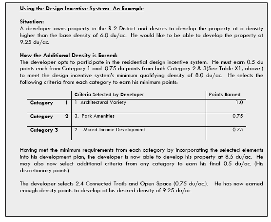
(Ord. No. 2591, § 1, 6-15-2011, eff. 10-1-2011; Ord. No. 2706, §§ 22—25, 2-18-2015; Ord. No. 2782, § 1, 1-18-2017; Ord. No. 3196, §§ 7, 8, 12-20-2023)
17.24.100 - Multifamily Design Standards.
A.
Purposes. In addition to the general purposes listed in Chapter 17.24 Development Standards, the specific purposes of the multifamily development standards are to promote improved design and enhanced site planning of multifamily development; encourage sensitive design and planning of multifamily housing units that enhances compatibility among different residential densities and types; and addresses development Vand design issues from a community, neighborhood and site perspective. Unless otherwise specified, the term "multifamily development standards" applies to all multifamily development within the City of North Las Vegas.
B.
Intended Character.
1.
Multifamily complexes are expected to make a positive contribution to their surrounding area through distinctive, human scale architecture that draws upon the forms, colors and textures of both the architecture of the past and the natural environment of the Las Vegas Valley, the surrounding community and the Southwest region to generate a harmonious architectural character. It shall also contribute by providing such amenities as public open space and landscaped peripheries with street furniture and bus turn outs.
2.
Multifamily housing complexes shall blend into the residential character of North Las Vegas. Multifamily developments shall set and follow visual themes intended to establish community identity and to blend with their surroundings.
3.
Multifamily housing shall be designed to lessen the impact on surrounding single-family residential development. The developer is responsible for enhancing compatibility among different residential densities by creating buffering. Transitional yards and screening such as shrubs, berms and walls for separation between residential structures and abutting residential properties or streets. Buffering may be achieved through the use of a variety of development options.
C.
Site Planning.
1.
Multifamily developments shall be located on arterial or collector streets.
2.
A second point of ingress-egress shall be provided as required by the North Las Vegas Fire Department.
3.
No vehicular access entering or leaving the property shall be permitted from multifamily developments onto any street classified as a local street serving single-family residences, with the exception of restricted emergency vehicle access if required.
4.
No multifamily structure exceeding one story or twenty (20) feet in height shall be constructed within fifty (50) feet of an adjacent single-family residential property line.
D.
Architectural Character and Materials.
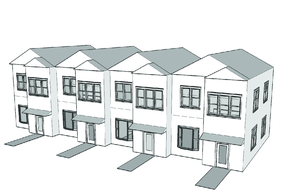
Fig. 17.24.100-A: Changes in facade and roofline
1.
Building Design.
a.
Box-like or single, monolithic forms that are not relieved by variations in massing or articulation of façades shall not be permitted. The perceived height and bulk of buildings shall be reduced by dividing the building mass into smaller scale components. Buildings must incorporate jogs, offsets or other architectural features to reduce the visual length of long walls. Variety and/or variation of roof lines is required to reduce the apparent size of multifamily buildings and provide visual interest. Windows and large areas of glass shall be recessed in shadow.
b.
Height and bulk standards for principal structures shall be implemented as deemed necessary to complement the surrounding area. Privacy of nearby single-family residents shall be considered through screening and setback requirements.
i.
Additional height restrictions and limitations on the number of units in structures closest to single-family residences may be employed as transitional elements between single-family and multifamily developments as deemed necessary by staff and/or the Planning Commission.
ii.
Multifamily complex recreation and parking areas are to be spaced away from or buffered by dense landscaping from single-family resident's backyards to ensure privacy.
iii.
Deviations in topography that create substantial differences in finished grades shall be treated with design solutions (e.g., extra setbacks or landscaping) that will mitigate the effect of multi-family residential development dominating adjacent single-family residential developments.
iv.
Multifamily structures should be arranged in a sensitive manner to both protect and preserve existing scenic views and protect neighbor's privacy from visual incursions. Accordingly, appropriate increases in setbacks and screening shall be provided where deemed necessary.
c.
Buildings shall be finished in earth tone or neutral colors indigenous to the Las Vegas Valley and its surrounds. Black and bright colors are not acceptable except as trim or accent colors.
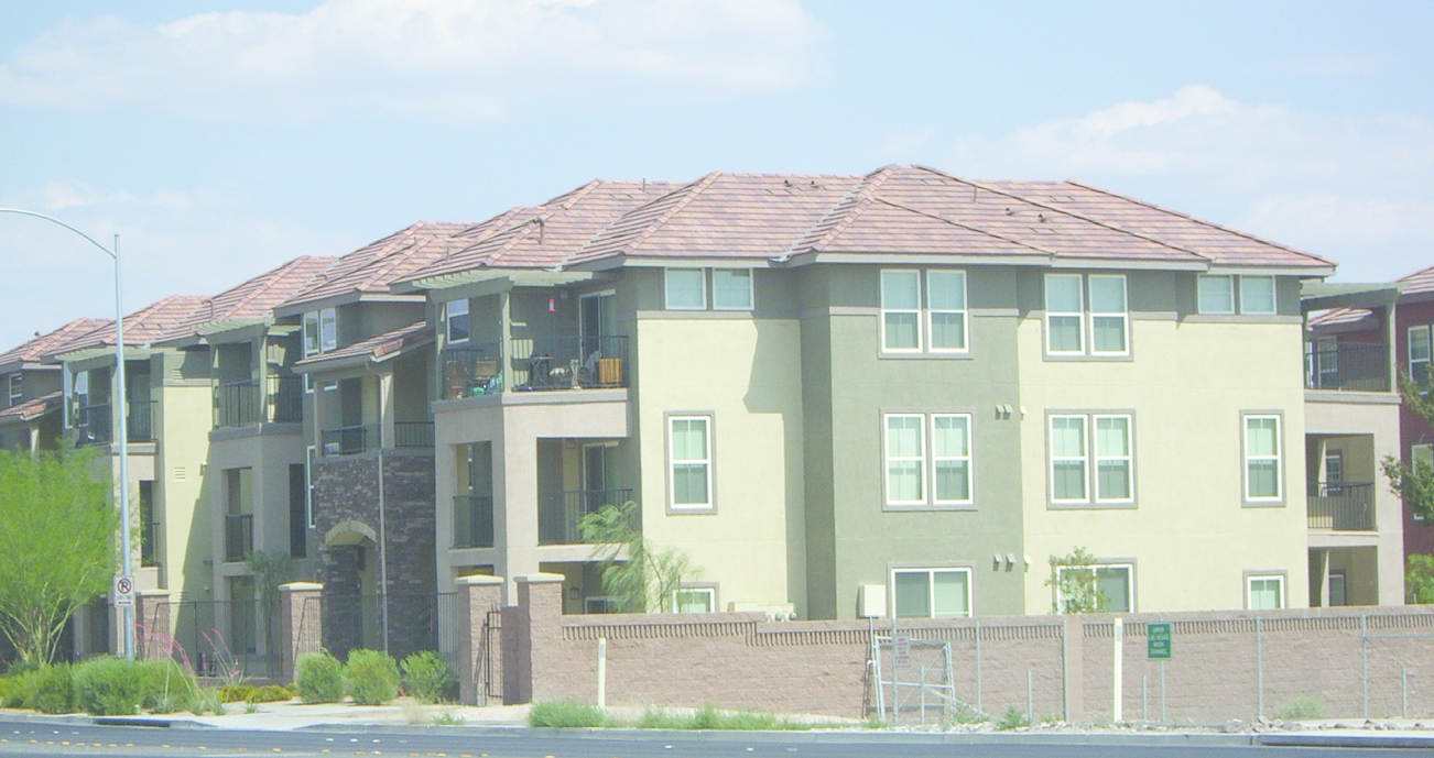
Fig. 17.24.100-B: Earth tone and indigenous colors
d.
Concrete or clay tile shall be used on all sloped roofs. Any building design that utilizes a flat roof shall incorporate a parapet wall and cornice element on all sides of the roof.
e.
The use of building materials similar to those in predominant use on the street or in the neighborhood of the proposed new project is strongly encouraged, unless a material found in the neighborhood has otherwise been determined to be unacceptable.
i.
Stone, stucco, colored or exposed aggregate or textured finish concrete, and brick shall be used for building exteriors.
ii.
Slump stone, split face block, and/or other concrete masonry units shall only be used as accent materials on principal structures.
iii.
Highly reflective, shiny or mirror-like materials, and unplastered exposed standard concrete and standard concrete masonry units are not acceptable.
f.
Internal privacy is to be promoted by limiting entry points to individual units and by allocating private, sheltered outdoor space.
i.
External entrance balconies and stairways shall be integrated into the building design.
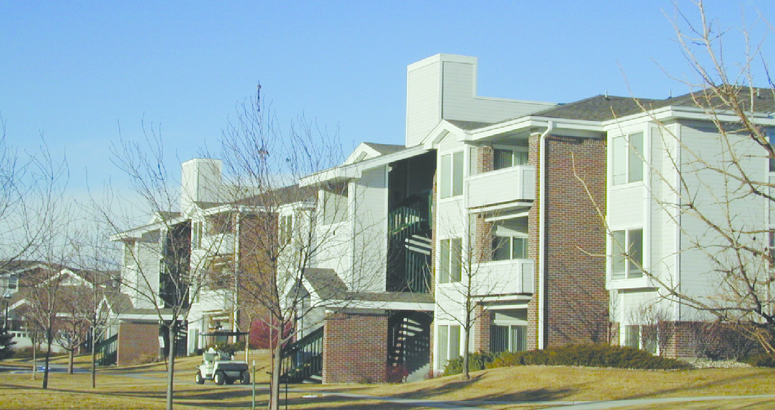
Fig. 17.24.100-C: Integrated design for external staircases.
ii.
Individual private open space areas or patios, and balconies are required for each dwelling unit. Balconies, other than those permitted in this section, must serve individual dwelling units and shall not be accessed from the ground by stairways. The minimum size of a ground level private open space area or patio shall be eighty (80) square feet. The minimum size of an upper story balcony shall be forty (40) square feet.
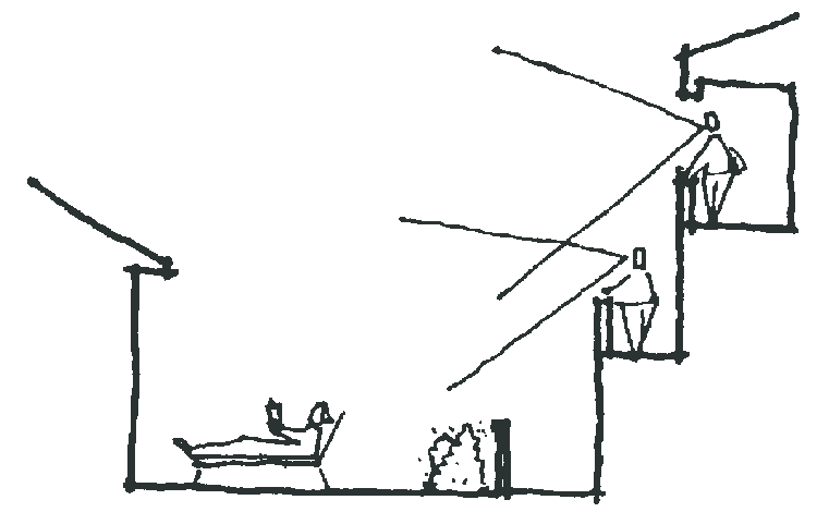
Fig. 17.24-100-D: Windows and decks that overlook neighboring residential properties
and intrude on privacy are not acceptable
iii.
Not more than four dwelling units may be entered from a single hall, landing area or walkway. Exceptions to limited entry areas may be made for elevator buildings, congregate care, or other arrangements for residents with special needs requiring common entry.
g.
Access to common facilities is required within convenient distance from each dwelling unit.
i.
Household-related services or amenities, such as storage, laundry, and trash, shall be maintained within a three hundred-foot walking distance of each dwelling unit's primary entrance.
ii.
A minimum of fifty (50) percent of the development's open space amenities shall be accessible within three hundred (300) feet walking distance of any unit's primary entrance; however, highly trafficked areas such as swimming pools or recreation buildings may be located centrally, at any distance.
h.
Multifamily developments shall be designed to comply with the following:
i.
Groupings of multifamily structures including variations in roof lines and floor plates, and clustering shall be used to soften the effects of buildings and contribute to residential scale.
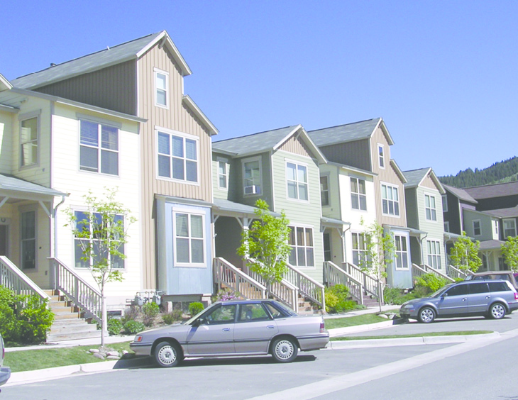
Fig. 17.24.100-E: Multifamily structure with multiple design elements
ii.
Structures containing more units shall be grouped more closely around amenity areas. Less dense buildings shall be located toward the site's perimeter to take advantage of open areas provided by landscaped buffers along the perimeter.
iii.
Clusters with buildings containing one hundred (100) or more units shall be arranged around an open space or recreational amenity and separated from other groupings by distances of seventy-five (75) feet or more.
iv.
Developments with three hundred (300) or more units shall include separate "village cluster" architectural themes for each two hundred (200) units or portion thereof. A village cluster theme shall be designed to visually distinguish each required cluster from other required clusters on the same property through one or more of the following techniques.
(A)
The use of significantly different building models. Building models differ significantly from each other when:
(1)
Maximum height differs by at least two occupied floors; or
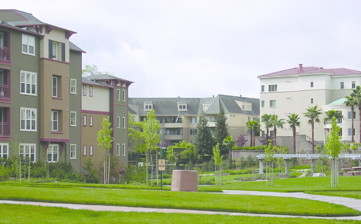
Fig. 17.24.100-F: Village clusters
(2)
Roof pitch differs by an increment of at least three-to-one (3:1) (for example, a roof pitch of 2:1 is significantly different than a roof pitch or 6:1, but not significantly different than a roof pitch of 3:1); or
(3)
The pattern of façade windows to opaque wall area differs by at least twenty (20) percent (for example, a building with twenty (20) percent façade window area is significantly different from one with forty (40) percent window area, but not significantly different from a building with thirty (30) percent window area); or
(4)
The treatment of the façades differs and the two façade colors are significantly different. Differing color or materials alone do not create a significant difference - both are required; or
(5)
Balcony enclosures, patio enclosures, and building entry locations differ significantly from one building to the other.
v.
No two adjacent village clusters may use the same building model, regardless of changes in orientation or façade materials, regardless of compliance with the standards in subsections D.1.h.i. through D.1.h.iv. above.
vi.
Building walls containing windows shall be separated from opposing windows in the same, or any other, residential development by a distance of not less than twenty (20) feet. Windows should be staggered so that they do not align with windows in adjacent buildings.
vii.
All buildings within a development shall be separated by a distance of not less than twenty (20) feet and shall be offset along wall planes a minimum of ten (10) feet from any adjacent building.
i.
Multifamily structures built on higher ground, adjacent to existing residential development, shall incorporate additional setbacks and/or screening in their design as separation from down-slope residences.
i.
Hillside sites shall employ special design treatment for multifamily housing. Distant views, as a special amenity, require careful engineering to provide safe access while not detracting from others' use or privacy.
ii.
Structures may be built into hillsides to reduce obstruction of ridgeline views from below; however, no structure shall exceed two stories or twenty-five (25) feet in height from average natural grade on sites of ten (10) percent slope or greater.
iii.
Line of site and view analysis from any single-family residential property that is located at a lower elevation (five feet or more), along with mitigation of adverse impacts, shall be provided by the developer. In the alternative, dense landscaping shall be installed at appropriate locations to obscure view angles into residential properties within six hundred (600) feet. Also, additional setbacks may be required as determined to be necessary by the line of site analysis.
E.
Parking Areas, Garages, and Carports. Multifamily development parking lots shall be strategically located and spaced as elements of the site design. Tenant and visitor parking shall be placed conveniently to the units served. Alternate transportation modes, bicycle and pedestrian ways, and consideration of easy access to public transportation shall be included in site planning for parking areas.
1.
Ample parking space shall be provided in compliance with code requirements. Features shall include flexible parking for guests and at recreational facilities, and bicycle path alternatives.
2.
Well landscaped small area parking lots are required. Individual parking lots delineated by buildings, walkways or landscaping not less than twenty (20) feet wide shall contain spaces for eighty (80) or fewer vehicles.
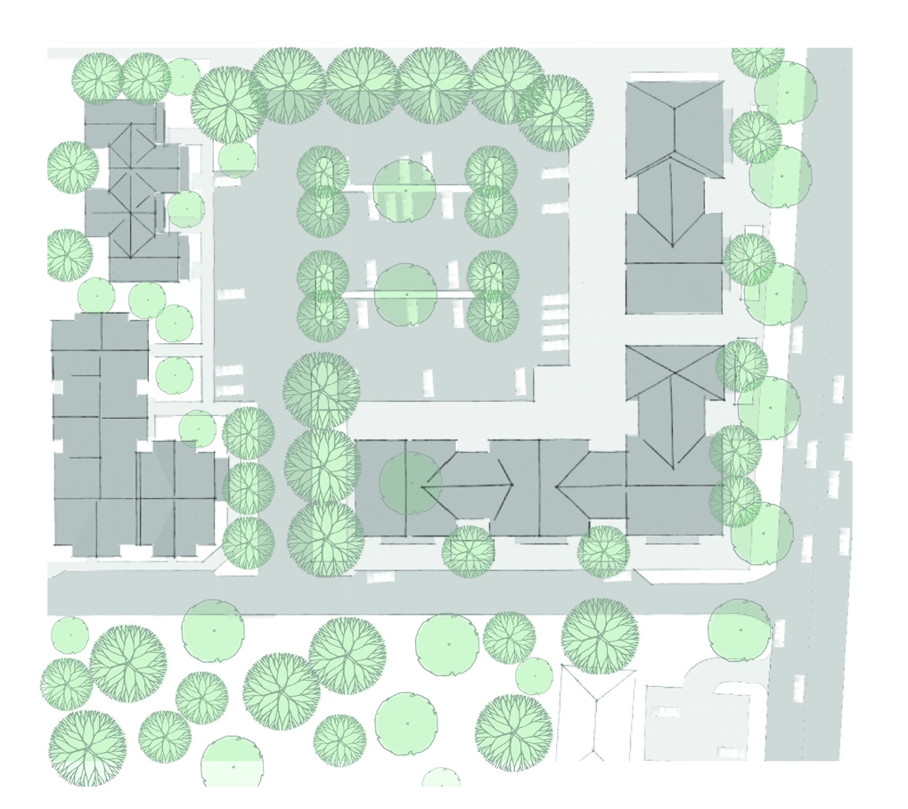
Fig. 17.24.100-G: Landscaped parking lot with walkways
3.
One required parking space per dwelling unit shall be located within one hundred fifty (150) feet of the unit to be served.
4.
Twenty-five (25) percent of guest parking spaces shall be provided within three hundred (300) feet walking distance of units to be served.
5.
A minimum of one covered parking space shall be provided for each dwelling unit. To the maximum extent practicable, parking garages and carports should not be located between the front or primary façade of a multi-family building and the street frontage adjacent to the front lot line. Instead, they should be internalized within building groups so as not to be directly visible from the street frontage. Where parking garages and carports must be located between such building façade and street frontage, they shall meet the following standards:
a.
Detached garages and carports shall incorporate compatible materials, scale, colors, architectural details, and roof slopes as the primary multi-family buildings, except that flat and shed roofs are prohibited.
b.
No more than six garage doors may appear on any multi-family principal building elevation containing entry doors. No more than four garage doors may be grouped together without a change in wall plane of twelve (12) inches at least twenty (20) feet (measured horizontally) in length.
c.
To the maximum extent practicable, freestanding parking structures (detached garages or carports) that are visible from perimeter public streets shall be sited perpendicular to the perimeter street in order to reduce visual impacts on the streetscape.
d.
End walls, rear walls or portions thereof of detached garages over forty (40) feet in length that are visible from perimeter street shall be articulated or punctuated through the use of two or more of the following options:
i.
Three, one hundred (100) square foot trellis structures spaced along the rear wall, planted with an approved vine or creeping plant to cover the structure at maturity;
ii.
Change in wall plane of at least twelve (12) inches every twenty (20) feet; or
iii.
Vertical change in material or masonry pattern; or
iv.
One roof dormer for each twenty (20) feet of length.
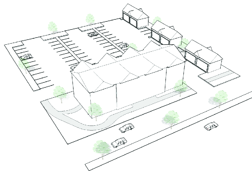
Fig. 17.24.100-H: Multi-family detached garages with roof dormers
e.
Where attached garages are provided, landscaped islands, peninsulas, or a tree(s) in a self-watering planter or container shall be provided between every two units' garage doors. Required islands or peninsulas shall have minimum dimensions of three feet wide by three feet in length. Self-watering planters shall be a minimum of thirty (30) inches in diameter.
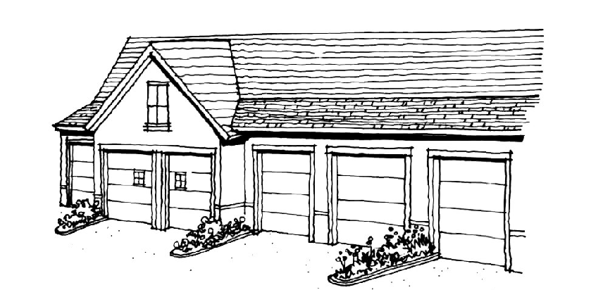
Fig. 17.24.100-I: Landscaped peninsulas between garage doors
F.
Entry Signage. Entry signage shall be integrated into the project design and landscaping. Freestanding project identification signs shall be of a monument type, not to exceed one hundred (100) square feet in area and six feet in height, and shall be permitted only at the primary entrance(s) to multifamily developments.
(Ord. No. 2591, § 1, 6-15-2011, eff. 10-1-2011)
17.24.110 - Mixed-use design guidelines.
A.
Purpose. Mixed-use is a type of development that combines residential, commercial, and/or office uses into one development or building. In addition to the general purposes listed in Section 17.16.040.H., the specific purposes of the mixed-use design guidelines are to promote walkability, connectivity, the creation of active neighborhood centers, excellence in site design and planning, and to ensure the compatibility of buildings and uses within all Mixed-Use Development (MUD) districts.
B.
Applicability. Given the desire for flexibility and innovation in designing mixed-use developments and the different characteristics of each development site, the design guidelines set forth herein shall be used by the City to evaluate the overall design excellence and functional integration of the mixed-use projects on a case-by-case basis. All new buildings and structures located within a Mixed-Use Development (MUD) district shall comply with the applicable provisions herein unless an equal or better standard is proposed by the developer and approved by the City. In addition, no existing building or structure located within a Mixed-Use Development (MUD) district shall be moved or substantially enlarged, and no previously developed site shall be substantially enlarged, unless in compliance with all applicable provisions herein.
C.
Site Design.
1.
Compatibility with Surrounding Development. Mixed-use development shall be designed to complement and enhance surrounding residential and non-residential neighborhoods. The developer shall implement buffering and/or screening measures (e.g., landscaping, setbacks, etc.) designed to ensure compatibility between mixed-use projects and abutting properties or streets. The buffer areas and/or screening shall be designed to accommodate convenient, reasonably direct pedestrian connections between mixed-use projects and surrounding neighborhoods.
2.
Compact Development. Buildings and uses that comprise a mixed-use project shall be clustered to promote linked trips. The term "linked trips" means that a person can park their vehicle in one location and then safely and conveniently walk between multiple destinations on a single site or to more than one site within close proximity.
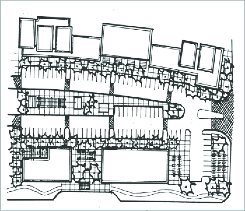
Fig. 17.24.110-A: Mixed-use development with clustered buildings, pedestrian walkways,
and building entrances oriented for pedestrian safety.
3.
Street Grid and Blocks.
a.
The preferred development pattern for mixed-use is a traditional grid pattern delineated by intersecting streets, drive aisles, and/or landscaped pedestrian corridors. Each block within the grid shall generally maintain a maximum block length of four hundred (400) feet and a maximum block perimeter of one thousand six hundred (1,600) lineal feet. The number of intersections shall be minimized along arterial streets.
b.
Along arterial streets and/or where adequate circulation for vehicles is provided and additional street connections are deemed unnecessary, the preferred grid pattern for mixed-use development shall be maintained by incorporating landscaped pedestrian corridors at appropriate locations in lieu of full street improvements.
c.
Mixed-use development shall incorporate pedestrian connections and pedestrian priority areas, as described in Section 17.24.110.D.5., below.
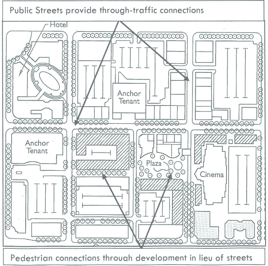
Fig. 17.24.100-B: Mixed-use development pattern with vehicular and pedestrian connections.
d.
Where required by the City of North Las Vegas traffic engineer, the block grid used within mixed-use development shall align with planned and existing streets surrounding the site.
4.
Vehicle Circulation and Parking. In addition to the general standards of Section 17.24.040, Parking and Loading, and Section 17.24.050, Mobility and Circulation, the following standards shall apply to mixed-use developments. Where the provisions conflict, the standards of this section shall supersede.
a.
On-street parking is encouraged along streets and driveways where it provides an additional buffer between moving traffic and pedestrian areas.
b.
Angled parking may be used to create a main street environment along internal streets and driveways within mixed-use development. Surface parking lots shall be screened by buildings and/or landscaping.
5.
Pedestrian Priority Areas. In addition to the general bicycle and pedestrian linkage and circulation standards of Section 17.24.050, Mobility and Circulation, the following standards shall apply to create areas designed primarily for pedestrian use in mixed-use developments.
a.
A fifteen-foot Pedestrian Priority Area is required between the building and all streets and drive aisles. The fifteen-foot minimum building setback may be expanded up to an additional ten (10) feet to provide enhanced building entrances, outdoor dining areas, courtyards, pedestrian arcades, and/or landscaping.
b.
The Pedestrian Priority Area shall include trees and landscaping and may include public signs, public art, street lighting, street furniture, and other pedestrian-oriented amenities, as appropriate.
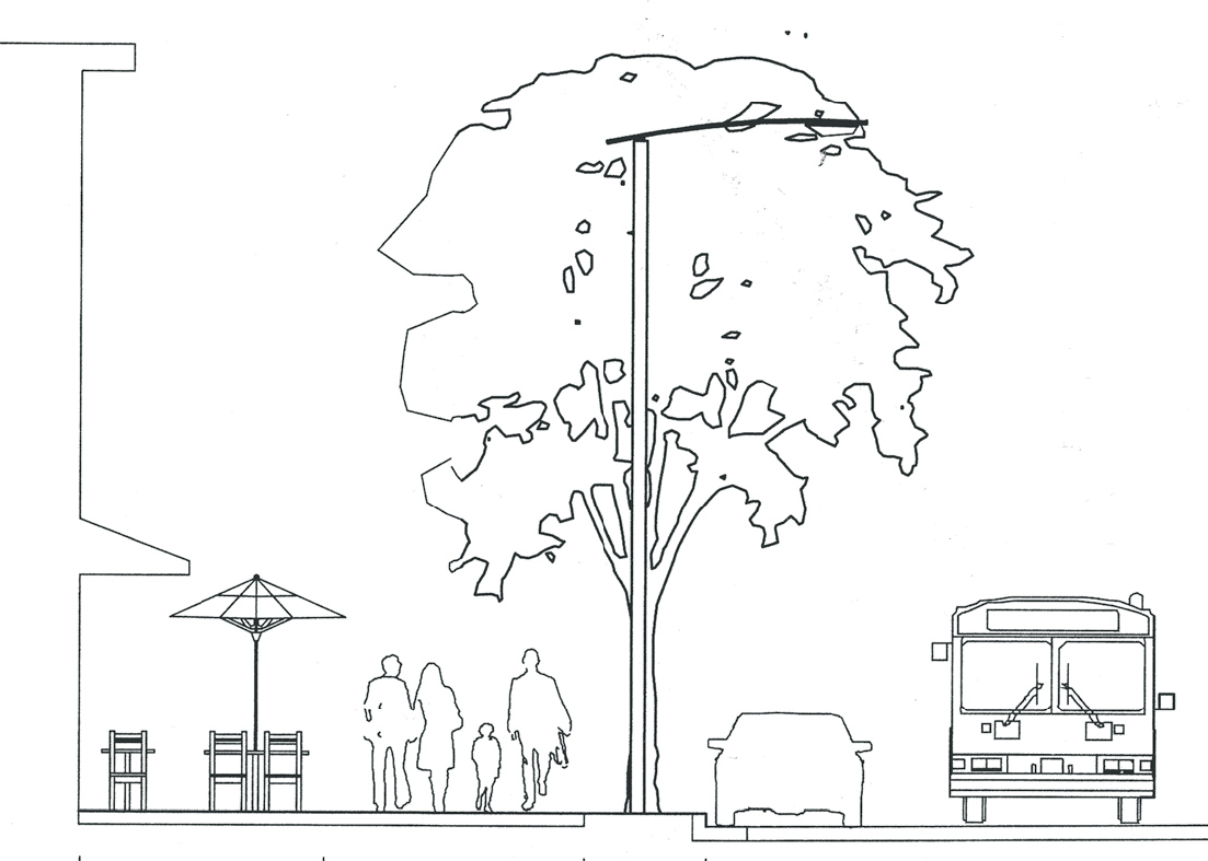
Fig. 17.24.100-C: Pedestrian Priority Area between building and street
c.
Where feasible, parking shall be provided along streets and drive aisles adjacent to Pedestrian Priority areas as an additional buffer between moving traffic and the pedestrian realm. Parallel or angled parking is preferred in order to create a pedestrian-friendly "Main Street" environment for pedestrian priority areas.
d.
The Pedestrian Priority Area may include bus shelters, shade structures, bicycle racks, directional signs and public information kiosks, benches or other street furniture, pedestrian scale lighting (twelve-foot maximum height for street lights), drinking water fountains, public art, and other amenities consistent with the intended purpose of a Pedestrian Priority Area. A minimum of four such features shall be provided for every four hundred (400) linear feet. The use of pervious surfaces, which may include decorative pavers, within Pedestrian Priority Zones is required. Impervious surfaces may be used with City approval.
e.
Shade trees of an approved variety (See Section 17.24.060, Landscaping.) shall be planted and maintained within a six-foot area adjacent to all streets within Pedestrian Priority Areas. All trees shall be a minimum of twenty-four-inch box at the time of planting and shall be planted at minimum intervals of twenty (20) feet on center. Palm trees shall be a minimum of fifteen (15) feet in height, as measured from ground to base of fronds, at time of planting. Root guards shall be required adjacent to public improvements.
f.
Landscaping and other required elements and amenities within Pedestrian Priority Areas shall be provided by the property owner and/or developer and maintained by the property owner and/or lessee. Design features such as decorative tree grates, seat walls, raised planter boxes and/or decorative pots are required within pedestrian priority areas in order to protect plants from being trampled.
6.
Open Space. In addition to the general open space standards of Section 17.24.020, Open Space and Parks, the following standards shall apply to mixed-use developments.
a.
All required open space shall be useable for leisure and/or recreation. Steep slopes, and required landscape setbacks shall not be counted toward the minimum open space requirement.
b.
The minimum open space requirement may include public uses not listed in Section 17.24.020, Open Space and Parks, when approved as part of the mixed-use development based size, location, accessibility, and quality of design.
c.
The design and layout of required plazas and other public gathering spaces should contribute to the overall sense of place and help attract pedestrian users to the development. Required plazas and other public gathering spaces shall be designed as integral parts of the pedestrian circulation system for each site. Water features and shade structures are strongly encouraged.
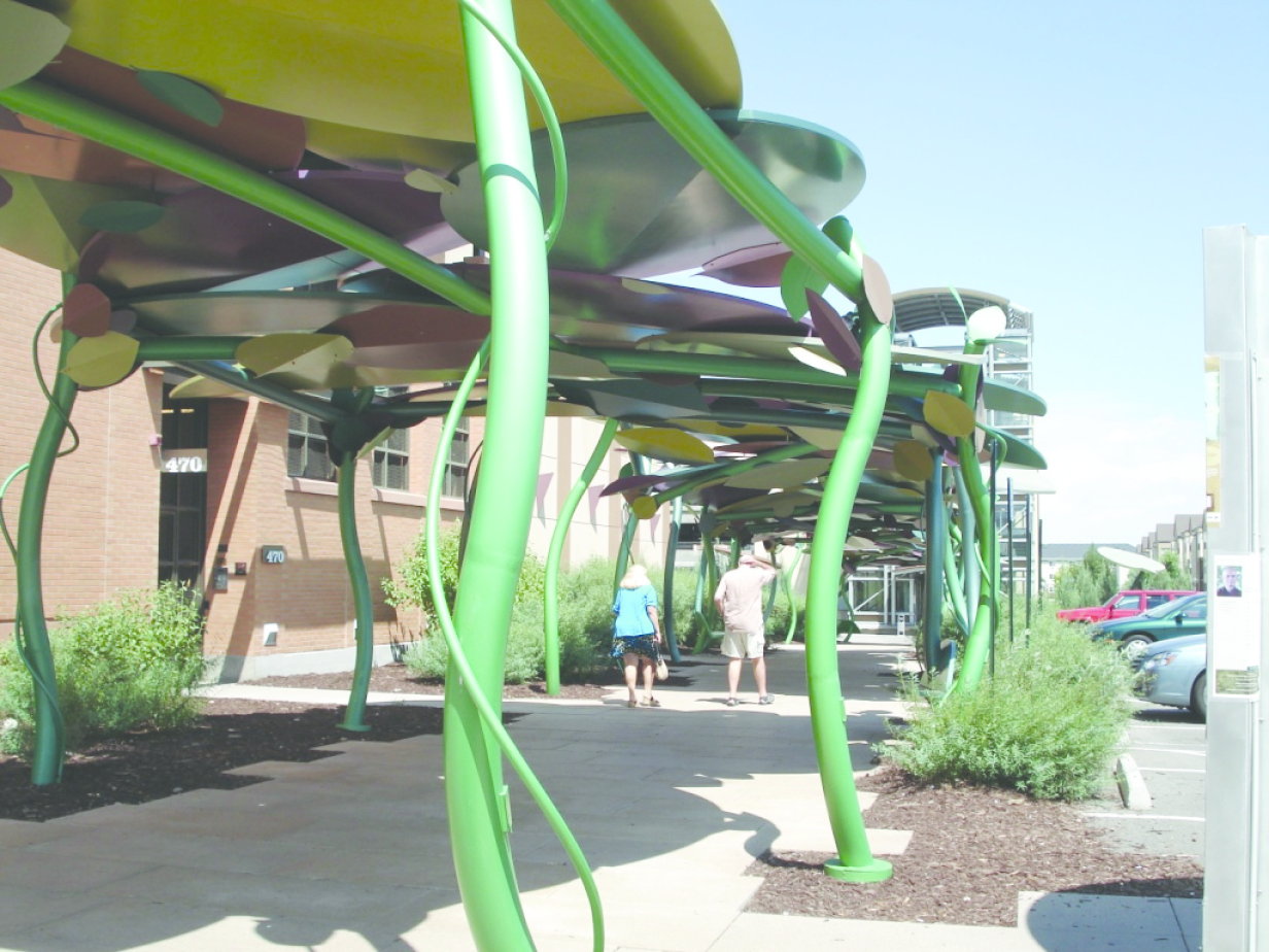
Fig. 17.24.110-D: Pedestrian shade structures
d.
Where feasible, restaurants should front onto plazas and use the public area of the plaza for outdoor seating and/or dining.
e.
Street corners shall be developed with building entrances, public plazas, small parks, or other similar features that create visual interest and pedestrian activity.
f.
To increase pedestrian comfort and interest, sidewalks and pedestrian plazas that abut blank walls shall be located at least six feet from the wall to provide planting beds for landscaping and trees. If planting beds are determined to be impractical because of soils conditions, above ground planters may be used, provided that they are designed and constructed to prevent drainage onto any sidewalk.
7.
Lighting. In addition to the general lighting standards of Section 17.24.080 Exterior Lighting, the following standards shall apply to mixed-use developments.
a.
Mixed-use developments located adjacent to one another or within the same general area or district shall use complementary lighting fixtures along streets, sidewalks, and pathways. Lighting fixtures within all pedestrian-oriented areas shall be compatible with the architectural character of the development and shall be scaled to the pedestrian with heights generally no more than twelve (12) feet.
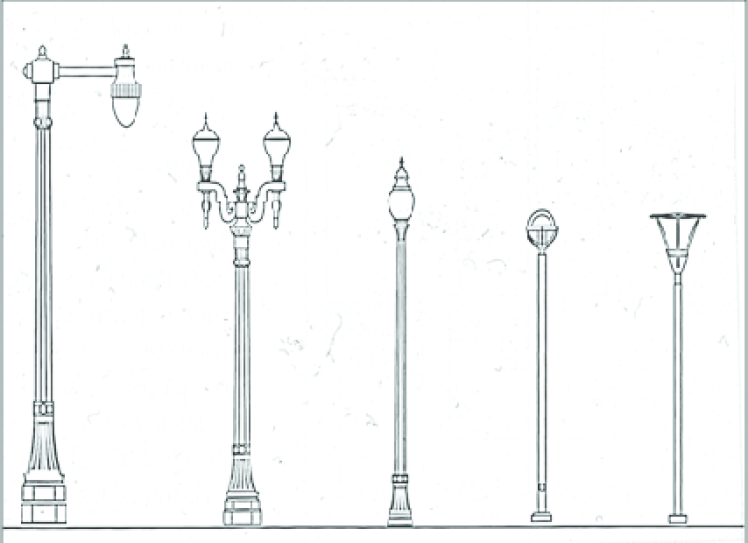
Fig. 17.24.110-E: Pedestrian scale lighting fixtures
b.
In non-pedestrian areas, light poles shall not exceed twenty (20) feet in height. Public street lighting maintained by the City of North Las Vegas shall comply with all Title 16 requirements.
8.
Signage. In addition to the requirements found in Section 17.24.0150, Signs, the following criteria shall be used in the design and placement of signs within mixed-use developments:
a.
All signs shall be designed as an integral element of the building's architecture. Wall and blade signs should not interfere with architectural details or disrupt the rhythm of windows.
b.
Signage should make a positive contribution to the overall visual character of the streetscape. Signs should be appropriately sized with the scale of the building, and materials and colors used in the construction of all signs must be compatible with the overall character and design of the site.
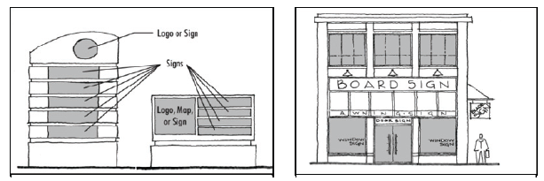
Fig. 17.24.110-F: Signage should be carefully design and integrated into the design
scheme of the site and should be located at major intersections and/or at neighborhood
entry points.
c.
Within Pedestrian Priority Areas, the height, size, and placement of all signs must be scaled and oriented to the pedestrian.
d.
All freestanding signs shall be monument-type with a maximum height of eight feet. The structural bases of freestanding signs shall be integrated into the landscaping of the site and screened with landscaping materials.
e.
Exterior wall and building signs for single story buildings shall be installed in the area above the first floor windows and below the roof.
f.
Exterior wall and building signs for multi-story buildings shall be installed in the area above the first floor windows and the bottom of the second floor window line.
D.
Architectural Design.
1.
Building Orientation.
a.
Within mixed-use development, buildings should be oriented to the street with inviting and detailed elevations to strengthen the desired image for the area. Only active building elevations and public access shall face the street.
b.
The main entrance of each primary structure shall face the street frontage, except on corner lots where the main entrance may face either of the streets or be oriented to the corner.
Fig. 17.24.110-G: Building orientation to the street
c.
The placement and orientation of buildings along a frontage should create interesting and significant public spaces and help establish a design theme for the streetscape.
d.
Where feasible, buildings should be designed and located to create a Main Street environment by fronting along the street or internal circulation routes.
e.
Commercial and mixed-use buildings should be sited and designed to attract and captivate the pedestrian user. Effective methods of building placement and orientation include
i.
Orienting the front doors of all businesses to streets or pedestrian features;
ii.
Providing a primary building entrance for ground floor uses along each building façade;
iii.
If a building has frontage on more than one public street, providing a single building entrance on the corner;
iv.
Using the area between the right-of-way and building to create a plaza court, planter area, bicycle parking, or other pedestrian amenity;
v.
Avoiding excessive setbacks that create gaps or voids along the street's architectural edge;
vi.
Providing building frontages with pedestrian-oriented architectural elements (e.g., arcades, awnings, porches, etc.) along the ground floor.
f.
Corner and mid-block pad buildings shall be oriented to the street and public sidewalk and shall meet the following requirements:
i.
Drive-through windows, driveways, and parking areas shall be designed such that buildings are not isolated from the connecting walkways.
ii.
Service windows and stacking lanes for drive-through businesses should be oriented away from public streets and shall be screened from the right-of-way by landscaping or other approved method.
g.
Loading, delivery service, and trash collection areas shall be designed and located to minimize their visibility, circulation conflicts, and adverse noise impacts. These areas shall not be located in required setback areas.
2.
Massing, Scale, and Building Form.
a.
Mixed-use structures that are designed to accommodate commercial uses shall be a minimum of two stories tall.
Fig. 17.24.110-H: Mix of architectural elements and accents
b.
Building design throughout mixed-use projects shall promote visual interest and diversity through the use of building articulation and massing changes. The following architectural elements should be incorporated into mixed-use buildings: varied roof heights, recessed windows and/or entrances, canopies, awnings, porticos, arcades, arches, outdoor patios, display windows, tile work and/or moldings, articulated cornice lines, integrated planter boxes or wing walls that incorporate landscaping and sitting areas, offsets or reveals used to express architectural or structural bays, and/or accent materials such as stone veneer, iron work, etc.
c.
Appropriately scaled accent features shall be used to add visual interest and diversity to building façades. Accent features may include balconies, decorative tile, awnings, canopies, window boxes, eaves, porches, plant shelves, stoops, chimneys, shutters, planters, pilasters, etc.
d.
The following architectural features are also encouraged for mixed-use buildings:
i.
Building design with a visually distinct base, middle, and cap;
ii.
Upper-story elements (balconies, windows, terraces) that overlook the street;
iii.
Reasonably direct access to the second story to encourage multi-level commercial or office use; and
iv.
Separate entrances for residential uses.
e.
The perceived height and bulk of buildings shall be relieved by variations in massing and/or articulation of façades to reduce the visual length of long walls. Variation of roof lines may also be used to reduce the apparent size of mixed-use buildings and provide visual interest. Building surfaces over two stories high or fifty (50) feet in length must be relieved with a change of wall plane that provides strong shadow and visual interest.
f.
Mixed-use development shall incorporate building height transitions from the maximum building height to a lower height to achieve compatibility with existing or planned development on adjacent properties. Compatibility refers to the characteristics of different land uses that allow them to be harmoniously located near or adjacent to each other with minimal impacts.
Fig. 17.24.110-I: Building height transitions used to ensure compatibility on adjacent
parcels
g.
Additional building façade setbacks are required for buildings over six stories or seventy-five (75) feet in height. Building façade setbacks with a minimum width of twenty (20) feet shall occur from the 4th to 6th story along arterial streets (one hundred (100) feet in width), 3rd to 6th story along collectors (eighty (80) feet in width), and 2nd to 6th story along sixty-foot streets.
3.
Exterior Materials and Finishes.
a.
All exterior materials and finishes used within a mixed-use development should support a unified theme or image. In general, buildings are encouraged to be finished in earth tone or neutral colors indigenous to the Las Vegas Valley and its surrounds.
b.
Black and bright colors shall not be used except as trim or accent colors. Fluorescent colors shall not be used.
c.
Concrete or clay tile shall be used on all sloped roofs. Architectural metal roofing may be used as an accent but shall not be used as the primary material for large expanses of roof. Asphalt, fiberglass and wood shingles and shakes are prohibited.
d.
Stone, stucco, colored or exposed aggregate, textured finish concrete, decorative block, and/or brick shall be used for all building exteriors. Simulated materials and building systems that provide an appearance similar to the preferred materials may also be acceptable.
e.
Highly reflective, shiny or mirror-like materials, unplastered or exposed standard concrete, and/or standard concrete masonry units shall not be used except as accents.
f.
All sides of a building shall be coherently designed and treated. A consistent level of detailing and finish is required for all sides of a building.
Fig. 17.24.110-J: A consistent level of detail and finish is required around all sides
of a building
g.
Any building design that utilizes a flat roof shall incorporate a parapet wall and/or cornice element on all sides of the roof.
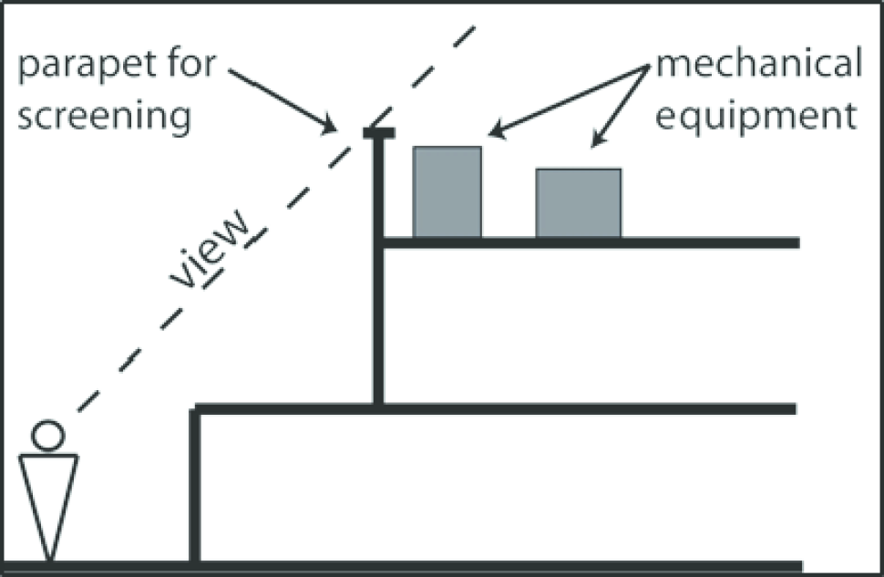
Fig. 17.24.110-K: Mechanical and electrical equipment mounted on flat roofs must be
screened so that an individual within 100 feet of the building will be unable to view
it.
4.
Building Façade.
Fig. 17.24.110-L: Pedestrian-oriented building facade
a.
For visual interest, all mixed-use buildings shall incorporate patterns, changes in color, materials, and/or relief such as beltlines, pilasters, pop outs, etc.
b.
Within Pedestrian Priority Areas, at least fifty (50) percent of the total ground floor building frontage facing a primary sidewalk shall incorporate the following elements: windows with clear glass, recessed or projecting entries, residential stoops, outdoor dining areas, or other gathering spaces. The total ground floor frontage shall be calculated by multiplying the length of the building frontage along the front sidewalk and the average first floor height.
c.
Street level building façades shall incorporate single and double height windows and general access entrances to create visual interest and encourage window shopping.
d.
Primary entries shall be clearly visible from the street and accentuated from the overall building façade by
i.
Differentiated roof, awning, or portico;
ii.
Trim details to accentuate the opening;
iii.
Project or recess entries from the surrounding building façade;
iv.
Detailed doors and doorways with transoms, sidelights, trim details, and/or framing;
Fig. 17.24.110-M: Recessed windows help to reduce solar gain and reflection of glare.
v.
Windows within doorways equivalent in size to fifty (50) percent of door surface area; and
vi.
Decorative nighttime lighting.
e.
Secondary entrances shall have minor architectural detailing that adds visual interest to that portion of the façade.
f.
Doors at storefronts with windows should match the materials, design, and character of the display window framing. Doors may be flanked by columns, distinctive lighting fixtures, or other details. Storefront, transom, display windows, and doors should encompass fifty (50) percent minimum of the front of a building wall area.
g.
All windows should be detailed with architectural elements such as projecting sills, pop-outs, lintels, etc. Large glazed areas should be divided into smaller parts by using mullions to express individual windows or groupings of windows. False fronts or windows in areas facing a public way are prohibited.
Fig. 17.24.110-N: All windows on a building should be related in design.
h.
Arcades may be used to enhance building façades and provide additional building space over the sidewalk up to the sixth story. Arcades shall have a consistent depth with those of neighboring buildings with a minimum depth of eight feet.
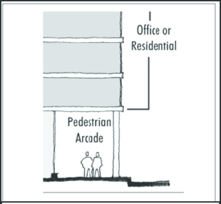
Fig. 17.24.110-O: Arcades should be integral to the building design and consistent
in form and material with the building characteristics.
5.
Big Box Retail. Freestanding big box buildings are discouraged within mixed-use development. Where used, large format buildings should be designed to fit into the preferred block sizes and the compact pedestrian-oriented development pattern. The preferred design would integrate large format retail buildings into the site by wrapping them with storefront buildings. Alternatively, large format buildings should feature activated storefront windows along sidewalks, inviting pedestrian entrances oriented to public sidewalks, and canopies or arcades over entrances and windows.
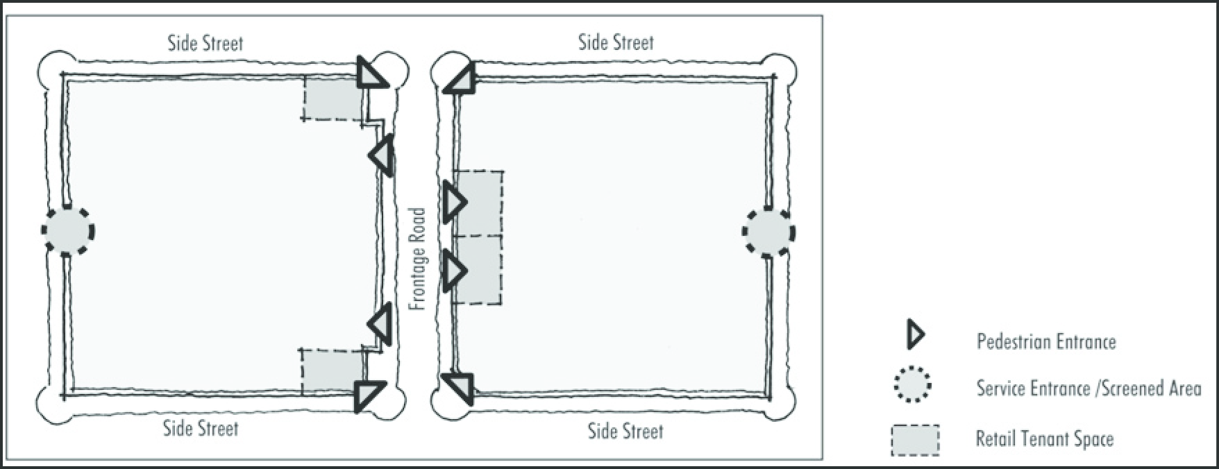
Fig. 17.24.110-P: Large format retail buildings should be designed to fit within small
block sizes and include activate storefront windows along sidewalks
(Ord. No. 2591, § 1, 6-15-2011, eff. 10-1-2011)
17.24.120 - Commercial design standards.
A.
Purposes. In addition to the general purposes listed in Section 17.24.010, Site Dimensional Standards, the specific purposes of the commercial development standards are to promote improved design and enhanced site planning of commercial development; encourage sensitive design and planning of commercial development that enhances compatibility between the built environment and the natural environment; promote design and site planning that furthers the goals of the City of North Las Vegas comprehensive plan; promote design and site planning that advances the vision of the City of North Las Vegas; and promote commercial development that enhances the quality of life for the citizens of North Las Vegas.
B.
Applicability. New commercial building or structure shall be erected unless in conformity with all applicable provisions of these regulations. No existing commercial building or structure shall be moved or substantially enlarged, nor any previously developed site shall be substantially enlarged unless in conformance with all applicable provisions of these regulations to the maximum extent practicable.
C.
Site Planning and Development. The siting of buildings and development of a site must respond to the maximum extent possible to specific site conditions and opportunities such as nonrectangular lots, location on intersections, unusual topography, vegetation, views or other natural features.
1.
Building Placement and Orientation.
a.
In order to develop and maintain a strong street edge, buildings shall be located at the front of the site. A single drive-thru lane, additional landscaping, or single row of parking may be located between the building and perimeter landscaping.
b.
Building placement on sites must consider interconnected walkways and parking drives between buildings on the site and those of adjacent development that encourages and provides for safe and efficient movement of pedestrians, bicycles, and vehicles within the site and between the site and adjacent development.
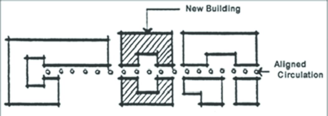
Fig. 17.24.120-A: Building placement designed to encourage good circulation
2.
Pedestrian Open Spaces and Plazas. Outdoor pedestrian open spaces and plazas provide shade, opportunities for rest and relief from traffic and noise as well as areas for additional outdoor activities such as vending and dining. Commercial developments must provide pedestrian open spaces and plazas relative to the size of the development, as specified in Section 17.24.020, Open Space and Parks, and must include designs for such areas in the site plan. Such areas shall be interspersed throughout the development.
D.
Architectural Character and Materials. The purpose of these guidelines is not to dictate a particular architectural style for commercial development in the City of North Las Vegas, but to provide a set of guidelines and standards by which commercial development can be compatible with its surroundings and help to further the overall vision of development that has been established by the City.
1.
Height, Bulk, and Scale.
a.
Box-like or single, monolithic forms that are not relieved by variations in massing or articulation of façades are not acceptable. The perceived height and bulk of buildings shall be reduced by dividing the building mass into smaller scale components. Buildings must incorporate jogs, offsets or other architectural features to reduce the visual length of long walls. Variety and/or variation of roof lines is required to reduce the apparent size of commercial buildings and provide visual interest. Building surfaces over two stories high or fifty (50) feet in length must be relieved with a change of wall plane that provides strong shadow and visual interest.
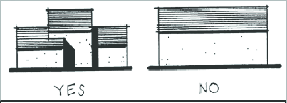
Fig. 17.24.120-B: Perceived height and bulk shall be reduced by dividing the building
mass into smaller scale components.
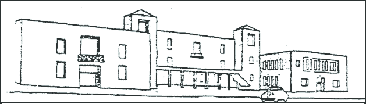
Fig. 17.24.120-C: A recessed courtyard is an effective way of dividing building mass
into smaller parts.
b.
Buildings shall be compatible with the scale of development allowed by the applicable land uses for the surrounding area as established at the time of application, and shall be sited and designed to provide a sensitive transition to nearby, less intensive, areas.
c.
Projects on the edges of zoning districts shall be developed in a manner that minimizes the adverse impacts resulting from incongruous height, bulk, and scale of large buildings. Alternatives to mitigate such impacts include, but are not limited to, careful siting and design, additional building setbacks or stepping back of upper floors, and the actual physical reduction of the height, bulk, and scale of a project.
Fig. 17.24.120-D: Stepping back upper floors to reduce the negative impacts of incongruous
height, bulk, and scale of larger buildings.
2.
Exterior Materials and Finishes.
a.
Buildings shall be finished in earth tone or neutral colors indigenous to the Las Vegas Valley and its surrounds. Black and bright colors are not acceptable except as trim or accent colors. Fluorescent colors are not acceptable.
b.
Concrete or clay tile should be used on all pitched roofs. Architectural metal roofing may also be acceptable. Asphalt, fiberglass and wood shingles and shakes are not acceptable.
c.
Stone, stucco, colored or exposed aggregate or textured finish concrete, decorative block and brick are the preferred materials for building exteriors. Simulated materials and building systems that provide a look that is similar to the preferred materials may also be acceptable.
d.
Highly reflective, shiny, or mirror-like materials and unplastered exposed standard concrete and standard concrete masonry units should not be used except as accents if deemed appropriate.
e.
Restraint should be used in the number of different materials and colors selected. Simplicity of patterns is desired.
3.
Coherent Design.
a.
All sides of a building shall be coherently designed and treated. A consistent level of detailing and finish is required for all sides of a building.
Fig. 17.24.120-E: Carrying the same level of detail and finish around all sides of
a building provided for a more consistent design, and higher quality of development.
b.
Accessory structures shall take on the character of the main building, using the same colors, materials and style.
Fig. 17.24.120-F: Accessory structures must take on the character of the main building
using similar design and materials.
c.
Any building design that utilizes a flat roof shall incorporate a parapet wall and/or cornice element on all sides of the roof.
4.
Building Façade. The building design shall incorporate patterns and materials that provide visual interest. Flat, plain building walls are not acceptable. This shall be accomplished through the use of changes in color, materials and/or relief such as the inclusion of beltlines, pilasters, pop outs etc.
a.
There should be a contrast in the size of solid area to window area. In general there should be more wall than window. Features such as windows, awnings and arcades must total at least sixty (60) percent of the length of any façade that abuts a public street.
b.
Windows and large areas of glass should be recessed in shadow or otherwise contrast with the building façade. Large glazed areas should be divided into smaller parts by using mullions to express individual windows or groupings of windows.

Fig. 17.24.120-G: Recessed windows help to reduce solar gain and reflection of glare.
E.
Signs. In addition to the requirements found in Section 17.24.150, Signs, the following criteria shall be used in the design of signs for commercial projects to which this section is applicable.
1.
Signs shall be an integral design element of a building's architecture, compatible with the site's overall character and building design.
2.
Materials and colors used in the construction of freestanding post or monument signs shall be compatible to those used in the construction of the primary buildings.
3.
Freestanding pylon and monument signs shall be integrated into the landscaping of the site. The structural bases of these signs shall be screened with landscaping materials.
4.
An overall sign plan for the proposed development shall be submitted with the overall development plan for review and approval by the planning and development services staff.
5.
Wall signs that interfere with architectural details or disrupt the rhythm of windows are not acceptable.
a.
Exterior wall and building signs for single story buildings shall be installed in the area above the first floor windows and below the roof.
b.
Exterior wall and building signs for multistory buildings shall be installed in the area above the first floor windows and the bottom of the second floor window line.
Fig. 17.24.120-H: Proper placement, size and design of signs does much to enhance
the overall appearance of a development project.
6.
Only monument type freestanding signs shall be installed in commercial areas that are located across the street from residential areas.
F.
Standards for Specific Land Uses. In addition to the above guidelines, the following specific land uses shall also comply with the requirements as found in Section 17.20.020 whether or not the use is considered to be a principally permitted use or special use within the zoning district applied for:
1.
Convenience food store with or without gas pumps;
2.
Automobile service facilities;
3.
Automobile, boat and recreational vehicle sales and outdoor display;
4.
Automobile repair facilities, including boat and recreational vehicle repair;
5.
Automobile service stations;
6.
Automobile washing establishments (self-service);
7.
Automobile washing establishments (drive through or non-self-service);
8.
Fast food restaurants.
G.
Exterior Displays. All materials, supplies, merchandise or similar items on display for direct sale, rental or lease to the ultimate consumer or user may be displayed beyond the confines of a building. Merchandise that is offered for sale may be displayed beyond the confines of a building in any general commercial service commercial zone, but the area occupied by such outdoor display shall not constitute a greater number of square feet than ten (10) percent of the ground floor area of the building housing the special use, unless such merchandise is a type customarily displayed outdoors such as automobiles or garden supplies.
(Ord. No. 2591, § 1, 6-15-2011, eff. 10-1-2011)
17.24.130 - Industrial design standards.
A.
Purpose. In addition to the general purposes listed in Section 17.24.010, Site Dimensional Standards, the specific purposes of the industrial development standards are to:
1.
Promote improved design and enhanced site planning of industrial development;
2.
Encourage sensitive design and planning of industrial development that enhances compatibility between the built environment and the natural environment;
3.
Promote design and site planning that furthers the goals of the City of North Las Vegas comprehensive plan;
4.
Promote design and site planning that advances the vision of the City of North Las Vegas; and
5.
Promote industrial development that enhances the quality of life for the citizens of North Las Vegas.
B.
Applicability. No new buildings or structures within an industrial zone shall be erected unless in conformity with all applicable provisions of these regulations. And no existing building or structure within an industrial zone shall be moved or substantially enlarged, and no previously developed site shall be substantially enlarged unless in conformance with all applicable provisions of these regulations to the maximum extent practical.
C.
Uses of Land.
D.
Site Planning and Development.
1.
Whenever possible nonmanufacturing or non-warehouse type buildings such as offices, should be oriented to the corner and to the street fronts and should make a strong tie to the building lines of each street.
2.
Building placement on sites must consider interconnected walkways and parking drives between buildings on the site and those of adjacent development that encourages and provides for safe and efficient movement of pedestrians, bicycles and vehicles within the site and between the site and adjacent development.
3.
Open Spaces and Plazas. Outdoor open spaces and plazas provide shade and opportunities for rest and relief for workers. Industrial developments are encouraged to provide open spaces and plazas as part of their overall development plans.
4.
Loading, and Storage Areas. Loading and storage areas shall be screened by buildings, decorative walls and/or landscaping. Any area of a loading and/or storage area that abuts a public street shall be screened by decorative walls or landscape screen with a minimum height of six feet above the finished grade at the rear of the setback area. Any area of a loading or storage area that abuts a public street shall be set back from the property line a minimum of ten (10) feet.
E.
Architectural Character and Materials. The purpose of these guidelines is not to dictate a particular architectural style for industrial development in the City of North Las Vegas, but to provide a set of guidelines and standards by which industrial development can be compatible with its surroundings and help to further the overall vision of development that has been established by the City.
1.
Height, Bulk and Scale.
a.
For nonmanufacturing or non-warehouse type buildings such as offices, box-like or single, monolithic forms that are not relieved by articulation of façades are not desirable. The perceived height and bulk of these type buildings shall be reduced by dividing the building mass into smaller scale components. Buildings must incorporate jogs, offsets or other architectural features to reduce the visual length of long walls. Building surfaces over two stories high or fifty (50) feet in length must be relieved with a change of wall plane that provides strong shadow and visual interest. Variations in massing and a variety and/or variation in rooflines is strongly encouraged.
i.
For manufacturing and warehouse type buildings, the length and height of walls must be relieved through the use of changes in color, materials and/or relief such as the inclusion of beltlines, pilasters, pop outs etc.
Fig. 17.24.130-A: Perceived height and bulk shall be reduced by dividing building
mass into smaller scale components.
b.
Buildings shall be compatible with the scale of development allowed by the applicable land uses for the surrounding area as established at the time of application, and shall be sited and designed to provide a sensitive transition to nearby, less intensive, areas.
c.
Projects on the edges of zoning districts shall be developed in a manner that minimizes the adverse impacts resulting from incongruous height, bulk and scale of large buildings. Alternatives to mitigate such impacts include, but are not limited to, careful siting and design, additional building setbacks or stepping back of upper floors, and the actual physical reduction of the height, bulk and scale of a project.
2.
Exterior Materials and Finishes.
a.
Buildings shall be finished in earth tone or neutral colors indigenous to the Las Vegas Valley and its surrounds. Black and bright colors are not acceptable except as trim or accent colors. Fluorescent colors are not acceptable.
b.
Concrete, clay tile, architectural metal or materials similar in appearance to concrete or clay tile should be used on all pitched roofs. Asphalt, fiberglass and wood shingles and shakes are not acceptable.
c.
Stone, stucco, colored or exposed aggregate, textured finish concrete, precast textured concrete panels, or decorative block and brick are the preferred materials for building exteriors. Simulated materials and building systems that provide a look that is similar to the preferred materials may also be acceptable. Architectural metal or standing seam metal panels may be acceptable for portions of the exterior, but cannot be the principal exterior material.
d.
Highly reflective, shiny or mirror-like materials, corrugated metal and unplastered exposed standard concrete and standard concrete masonry units should not be used except as accents if deemed appropriate.
e.
Restraint should be used in the number of different materials and colors selected. Simplicity of patterns is desired.
3.
Coherent Design.
a.
All sides of a building shall be coherently designed and treated. A consistent level of detailing and finish is required for all sides of a building.
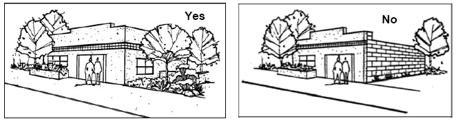
Fig. 17.24.130-B: Carrying the same level of detail and finish around all sides of
a building provided for a more consistent design, and higher quality of development.
b.
Accessory structures shall take on the character of the main building, using the same colors, materials and style.
c.
Any building design that utilizes a flat roof shall incorporate a parapet wall and/or cornice element on all sides of the roof.
4.
Building Façade. The building design shall incorporate patterns and materials that provide visual interest. Flat, plain building walls are not desirable and are strongly discouraged. This shall be accomplished through the use of changes in color, materials and/or relief such as the inclusion of beltlines, pilasters, pop outs etc.
a.
There should be a contrast in the size of solid area to window area. In general there should be more wall than window. With the exception of exterior walls for manufacturing and warehousing areas of buildings, features such as windows, awnings and arcades must total at least sixty (60) percent of the length of any façade that abuts a public street.
b.
Windows and large areas of glass should be recessed in shadow or otherwise contrast with the building façade. Large glazed areas should be divided into smaller parts by using mullions to express individual windows or groupings of windows.

Fig. 17.24.130-C: Recessed windows help to reduce solar gain and reflection of glare.
F.
Signs. In addition to the requirements found in Section 17.24.150, Signs, the following criteria shall be used in the design of signs for industrial projects to which this section is applicable.
1.
Signs shall be an integral design element of a building's architecture, compatible with the site's overall character and building design.
2.
Materials and colors used in the construction of freestanding post or monument signs shall be compatible to those used in the construction of the primary buildings.
3.
Freestanding pylon and monument signs shall be integrated into the landscaping of the site. The structural bases of these signs shall be screened with landscaping materials.
4.
An overall sign plan for the proposed development shall be submitted with the overall development plan for review and approval by the planning and development services staff.
5.
Wall signs that interfere with architectural details or disrupt the rhythm of windows are not acceptable.
a.
Exterior wall and building signs for single story buildings shall be installed in the area above the first floor windows and below the roof.
b.
Exterior wall and building signs for multistory buildings shall be installed in the area above the first floor windows and the bottom of the second floor window line.
6.
Only monument type freestanding post signs shall be installed in industrial areas that are located across the street from residential areas.
(Ord. No. 2591, § 1, 6-15-2011, eff. 10-1-2011; Ord. No. 3048, § 21, 1-20-2021)
17.24.140 - Sustainability.
A.
Purpose. This section is intended to promote sustainable development within the City of North Las Vegas by:
1.
Removing regulatory barriers, creating incentives, and incorporating standards for providing open space beyond the baseline code requirements;
2.
Encouraging local production of food; promoting safety, walkability, and excellence in urban design;
3.
Encouraging alternative energy sources;
4.
Promoting alternative means of transportation like bicycling and walking that can improve community health while helping reduce air pollution;
5.
Protecting trees that absorb greenhouse gases and reduce storm water runoff and pollutants; and
6.
Encouraging water-efficient landscaping and protecting water resources.
B.
Menu of Sustainability Options. This section sets forth a range of options for sustainability to enhance other mandatory sustainability-related requirements integrated throughout this Code. All development within the City is recommended to follow the sustainable site and building design options from Table 17.24.140-1, Menu of Sustainability Options.
C.
Solar Shading and Reflectance. Given the climate in North Las Vegas, solar shading and reflectance is an important and cost effective way to reduce both the urban heat island effect and energy used to cool building interiors.
1.
Shading devices such as roof overhangs, arcades, awnings, porches, screens, shutters, and trellises should be incorporated into the architectural design of buildings in order to protect windows, doors, and other openings from solar heat gain. Designers should address the different exposures of a building so that shading devices produce a cooling benefit and energy conservation.
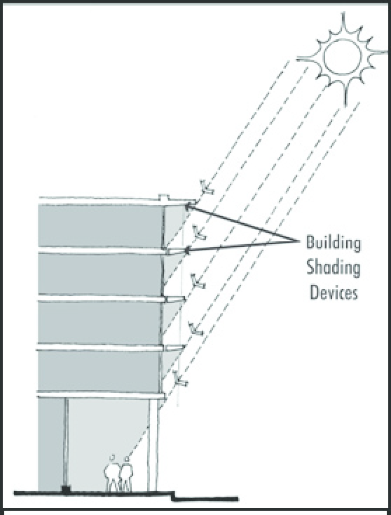
Fig. 17.24.140-A: Shading devices as architectural elements
2.
Awnings or canopies should be incorporated on all commercial and mixed-use building frontages where other shading devices are not used and shall be designed to provide consistent and continuous pedestrian protection from the elements. Awnings and canopies should have a minimum depth of six feet. Awnings and canopies shall provide a vertical clearance of eight feet and may encroach upon the right-of-way above the sidewalk.
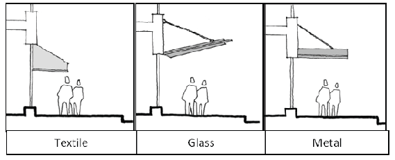
Fig. 17.24.140-B: Variety of awning options for commercial and mixed-use buildings
3.
For all multifamily, mixed-use, commercial, and industrial development, and residential subdivisions of greater than five dwelling units, the following minimum solar reflectance standards are recommended:
a.
Roofs should be constructed with light colored materials with a solar reflectance index not less than twenty-five (25).
b.
At least fifty (50) percent of all hardscape (parking, plazas, non-vegetated landscaping, etc.) should be constructed with light colored materials with a solar reflectance index not less than twenty-five (25).
D.
Alternative Energy System Standards.
1.
Solar Array Standards. All solar arrays shall comply with the following requirements:
a.
Setbacks, Location, and Height.
i.
A solar array shall not be located in the front yard between the principal structure and the public right-of-way.
ii.
A solar array shall be located a minimum of three feet from all property lines and other structures.
iii.
An accessory solar array in any residential district shall not exceed the greater of one-half the footprint of the principal structure or six hundred (600) square feet, whichever is greater. The size of accessory arrays in mixed-use and non-residential districts shall not exceed one-half of the footprint of the principal structure.
iv.
There shall be no size limits on solar arrays as a primary use on a site. However, the maximum lot coverage of any solar array shall not exceed eighty (80) percent.
v.
A freestanding solar array shall not exceed twenty (20) feet in height.
b.
Code Compliance. Solar arrays shall comply with all applicable building and electrical codes contained in the North Las Vegas Building Code.
c.
Solar Easements. A property owner who has installed or intends to install a solar array shall be responsible for negotiating with other property owners in the vicinity for any necessary solar easement and shall record the easement with the County Recorder.
2.
Solar Collection Standards.
a.
Setbacks, Location, and Height.
i.
A solar collection system shall be located a minimum of three feet from all property lines and other structures, except the structure on which it is mounted.
ii.
A solar collection system shall not extend more than twelve (12) feet above the roofline or the maximum height permitted in the zoning district in which it is located, whichever is less.
iii.
A solar collection system may be located on an accessory structure.
b.
Solar Easements. A property owner who has installed or intends to install a solar collection system shall be responsible for negotiating with other property owners in the vicinity for any necessary solar easement and shall record the easement with the County Recorder.
3.
Small Wind Energy System Standards. Small wind energy systems and all associated components shall comply with all applicable building codes and the following requirements:
a.
Setback.
i.
Small wind energy systems shall not be located in the front yard between the principle structure and public right-of-way.
ii.
The base of the tower shall be set back from all property lines, public rights-of-way, and public utility lines a distance equal to the total extended height (e.g., if on a roof, roof height + tower height) plus five feet. A tower may be allowed closer to a property line than its total extended height through the conditional use permitting process if the abutting property owner(s) grants written permission and the installation poses no interference with public utility lines or public road and rail rights-of-way. Guy wires and other support devices shall be setback at least five feet from all property lines.
b.
Tower Height. The maximum height of any small wind energy system shall be the maximum height allowed in the zone district plus fifty (50) feet.
c.
Sound. Sound produced by the turbine under normal operating conditions, as measured at the property line of any adjacent property, shall not exceed fifty-five (55) dBA for any period of time. The fifty-five (55) dBA sound level may be exceeded during short-term events out of the owner's control such as utility outages and/or severe wind storms.
d.
Appearance, Color, and Finish. The turbine and tower shall remain painted or finished in the color that was originally applied by the manufacturer. Bright, luminescent, or neon colors as determined by the City are prohibited
e.
Clearance. The blade tip or vane of any small wind energy system shall have a minimum ground clearance of fifteen (15) feet as measured at the lowest point of the arc of the blades.
f.
Signage Prohibited. All signs on a wind generator, tower, building, or other structure associated with a small wind energy system visible from any public road, other than the manufacturer's or installer's identification, appropriate warning signs, or owner identification, shall be prohibited.
g.
Lighting. No illumination of the turbine or tower shall be allowed unless required by the FAA.
h.
Access. Any climbing foot pegs or rungs below twelve (12) feet of a freestanding tower shall be removed to prevent unauthorized climbing. For lattice or guyed towers, sheets of metal or wood or similar barriers shall be fastened to the bottom tower section such that it cannot readily be climbed.
i.
Compliance with FAA Regulations. No small wind energy system shall be constructed, altered, or maintained that is determined to be a "Hazard to air navigation" as determined by the FAA or other federal agency.
j.
Utility Notification. No small wind energy system shall be installed until evidence has been submitted to the City that the relevant electric utility company has been informed of the customer's intent to install an interconnected customer-owned generator. Off-grid systems shall be exempt from this requirement.
k.
Abandonment. If a wind turbine is inoperable for six consecutive months the owner shall be notified that they must, within six months of receiving the notice, restore their system to operating condition. If the owner(s) fails to restore their system to operating condition within the six-month time frame, then the owner shall be required, at his expense, to remove the wind turbine and tower for safety reasons. If the owner(s) fails to remove the wind turbine from the tower, the City may pursue legal action to have the wind generator removed at the owner's expense.
4.
Geoexchange System Standards. All geoexchange system shall comply with all of the following requirements:
a.
Closed System. A geoexchange system shall be "closed-loop", meaning it shall be designed so that it does not remove or introduce any fluid into the ground, groundwater, or any body of water.
b.
Loop Configuration. A geoexchange system may be of vertical or horizontal loop configuration so long as it does not penetrate any aquifer. The loop may be placed into a pond or other body of surface water provided that the entire body of water is under the ownership and control of the property owner.
c.
Antifreeze. To avoid possible contamination in the event of a system failure, the use of antifreeze is discouraged within a geoexchange system, and shall be limited to glycol or another similar ecologically benign substance.
5.
Geothermal Direct Heat System Standards. All geothermal direct heat system shall comply with all of the following requirements:
a.
Proof of Permits Required. A building permit for a geothermal direct heat system shall not be issued by the City until the applicant submits proof that all required local, regional, state, and federal permits (for drilling of wells, etc.) have been secured.
b.
Performance. No heat, vibration, steam, or other emissions from a geothermal direct heat system shall be detectable on nearby commercial or residential property, nor shall the steam create an impediment to visibility within any airport approach or departure zone.
E.
Private Restrictions Prohibited. Any person(s) or association(s) - regardless of date of establishment - is prohibited from imposing private covenants, conditions, restrictions, deed clauses, or other agreements between the parties, that prevent person(s) from installing and using alternative energy systems.
(Ord. No. 2591, § 1, 6-15-2011, eff. 10-1-2011)
17.24.150 - Signs.
A.
Purpose and Intent.
1.
The purpose of this section is to coordinate the type, placement and physical dimensions of signs within the different land use districts; to recognize the commercial communication requirements of all sectors of the business community; to encourage the innovative use of signage design; to promote both renovation and proper maintenance; and to guarantee equal treatment under the law through accurate recordkeeping and consistent enforcement.
2.
No sign shall be permitted as a main or accessory use except in accordance with the provisions of this code.
3.
This title is not intended to regulate official traffic or government signs; signs not intended to be viewed from a public right-of-way; product dispensers; scoreboards on athletic fields; flags of any nation, government, or noncommercial organizations; gravestones; barber poles; religious symbols; commemorative plaques; the display of street numbers; or any display or construction not defined herein as a sign.
4.
The primary intent of this section shall be to regulate signs of a commercial nature intended to be viewed from any vehicular right-of-way.
B.
Permit Required.
1.
A sign shall not be erected, installed, repaired or moved unless a permit for such has been obtained from the building department, except the following signs that are exempt from the permit requirement:
a.
Construction, real estate (up to thirty-two (32) square feet in size) or political signs;
b.
Holiday or special events decorations provided such signs be removed ten (10) days following such event;
c.
Nameplates of two square feet or less;
d.
Maintenance of a manual or automatic changeable copy sign.
2.
All sign locations for signs requiring a permit shall be approved in conjunction with an approved site plan or unified sign plan.
3.
All signs shall be properly maintained. Exposed surfaces shall be clean and painted if paint is required. Defective or damaged parts shall be replaced. Substantially damaged or deteriorated signs shall be regulated per Section 203 of the 1985 Uniform Building Code or most recently adopted Uniform Building Code, and Section 17.20.050, Nonconforming Uses and Structures.
C.
General Provisions Applicable to All Districts.
1.
Exempt Signs and Displays.
a.
Official notices of any court, public body or officer;
b.
Directional, warning or informational signs or structures either required by law or established by local authority;
c.
Permanent lettering attached to a motor vehicle when indicating its primary purpose;
d.
Signs or displays located within a building area that will not be visible from any existing or proposed public street or highway.
e.
Signs used by churches, synagogues, or civic organizations;
f.
Casino
2.
Prohibited Signs.
a.
Abandoned signs and/or sign structure.
i.
Abandoned signs and/or sign structures must be removed from the property within 15 days of notification by the City that the sign needs to be removed.
ii.
Signs in disrepair must either be repaired or removed with fifteen (15) days of notification by the City that the sign needs to be repaired or removed.
b.
Displays containing statements, words or pictures of an obscene, indecent or immoral nature, misleading, erroneous or false information and advertising;
c.
Illumination of such brilliance and/or position that would be hazardous to vehicular traffic or a nuisance to adjacent property;
d.
The use of a semi-tractor trailer or other vehicle for advertising purposes, parked in a stationary position on a public or private property, is prohibited.
3.
Prohibited Sign and Display Locations. No display shall be located or placed in any of the following locations:
a.
Within the existing or proposed rights-of-way of any road, street, highway, or overhanging public right-of-way without an encroachment permit from the Director of Public Works;
b.
Within any stream or drainage channel;
c.
Above or upon a roof;
d.
No sign shall be so erected as to interfere with any traffic control device or to prevent a traveler from obtaining a clear view of approaching traffic or traffic signals;
e.
Signs not permanently attached to a building or the ground, such as mobile signs, portable signs, sandwich signs, or other movable objects, (unless approved as a Temporary Special Event Sign) and temporary, portable or mobile commercial signs, such as those temporarily attached to vehicles or vehicle trailers parked on public or private property;
f.
Signs supported in whole or in part from any public utility installations, any tree, traffic control device, or any other type of sign placed on public or private property not expressly permitted or exempted are prohibited in the City.
4.
Joint Use of Signs. When an abutting group of parcels of land is developed for uses that share common facilities, such as, without limitation, off-street parking or driveways, the group of parcels shall be considered as a single parcel in applying the sign regulations for a directory sign.
D.
Signs Permitted in All Districts.
1.
All signs not requiring permits; in Section 17.24.150.B
2.
One construction sign for each street frontage of a construction site, not to exceed thirty-two (32) square feet in area in a residential zone or sixty-four (64) square feet in area in all other such zones. Such signs may be erected thirty (30) days prior to beginning of construction and shall be removed five days following completion of construction;
3.
One nameplate sign per occupancy, not to exceed two square feet in area, advertising the service or profession at that premises, except that home occupations may not provide on-site advertising;
E.
Freestanding Signs. Freestanding signs may be allowed in all zoning districts subject to the following provisions herein:
1.
Sign Area.
a.
No sign shall exceed the following:
b.
Businesses complexes or shopping centers may have one directory sign per arterial street. The sign area permitted for shopping or business complexes (of two or more businesses) where frontage is combined for purposes of determining sign area must be allocated between the businesses, as reflected in a unified sign plan for freestanding signs submitted for administrative approval, by the Community Development Department, before sign permit applications are submitted for any business within the complex.
2.
Number of Signs. In single-family residential districts, one subdivision identification sign at each entrance to a subdivision, on each side of the roadway entering the subdivision may be permitted if incorporated into a decorative landscaped entry feature. In multifamily districts, one per driveway entrance, on each side of a major entry driveway may be permitted if incorporated into a decorative landscaped entry feature. Each freestanding pad in a multiple-business commercial or industrial development shall be entitled to one sign.
3.
Spacing. Freestanding signs shall maintain a minimum spacing of one hundred fifty (150) feet, on streets with a right-of-way of eighty (80) feet or more, and two hundred (200) feet on streets with a right-of-way width less than eighty (80) feet. The spacing may be reduced to comply with 17.24.150.E.2. (Number of signs).
4.
Sign Height.
a.
The maximum overall height shall not exceed the following:
b.
Sign heights for commercial and industrial developments adjacent to residential areas is as follows:
c.
Any sign located within twenty-five (25) feet of property used for a single-family residential use, or that has a recorded subdivision map for single-family residential use, shall be a monument sign and be limited to a height of eight feet. Such signs shall be non-illuminated, or the illumination shall be oriented so as not to have direct illumination toward the single-family residential property.
d.
Any sign located within one hundred (100) feet of property used for a single-family residential use, or that has a recorded subdivision map for single-family residential use, shall be limited in height to not exceed one-third of the distance of the nearest edge of the sign to the nearest point on any property used for single-family residential or has a recorded subdivision map for single-family residential use, and shall not exceed the maximum height as described in Table 17.24.150-2. Such signs shall be non-illuminated, or the illumination shall be oriented so as not to have direct illumination toward the single-family residential property.
e.
Signs located along Interstate 15 may be established at a greater height, not to exceed sixty (60) feet, if they meet the following conditions:
i.
No such sign shall be located more than one thousand five hundred (1,500) feet from the center of the Craig Road interchange, the Cheyenne Avenue interchange, Hollywood Boulevard interchange, Lamb Boulevard interchange, or the CC-215 interchange.
ii.
Such signs shall only be for commercial or industrial uses located in commercial and industrial districts;
iii.
Such signs shall not be located in a redevelopment area; and
iv.
Each sign shall only identify, by name or symbol, establishments located on-site.
5.
Setback. The minimum setback of a freestanding sign shall be two feet, for signs at a height of eight feet or less (providing that such sign is located outside of any sight visibility zone), and ten (10) feet from the front lot line for signs at a height exceeding eight feet. Signs shall be a minimum of five feet from any side lot line.
6.
Sight Visibility Zones at Intersections. No visual obstructions may be maintained above the height of twenty-four (24) inches within the area at street intersections or intersections of a driveway and a street, depicted in the Uniform Standard Clark County Area Drawings, available in the Public Works Department.
7.
Design Guidelines. All freestanding with structural poles or columns, other than directional or regulatory signs, shall comply with the following design guidelines:
a.
Such signs shall utilize a decorative cover to conceal the poles or columns. Each cover shall be at least as wide as twenty-five (25) percent of the sign width.
b.
The decorative cover on such signs shall utilize, or be complementary to, distinctive architectural features or elements, if any, used on the principal buildings on the same site.
c.
The decorative cover shall utilize materials, colors, textures or finishes that are complementary or similar to the materials, colors, textures or finishes utilized on the façade of the principal buildings on the same site.
8.
Freestanding Sign Landscaping. Freestanding signs shall only be erected in landscaped areas.
9.
Directional and Informational Signs. Two directional signs per entry/exit, limited to ten (10) square feet in area and six feet in height, and setback a minimum of two feet from the front lot line (providing such signs are located outside of the sight visibility zone). Such signs may, in addition to directional copy, such as "ENTRANCE", "EXIT", or directional arrows, include business identification or logo. There shall be no limit on the number of directional signs permitted within a development strictly for on-site circulation.
10.
Manually Changed Copy Signage. Manually Changed copy signage is permitted, subject to the following:
a.
Manually-changed message boards shall not exceed fifty (50) percent of the sign area on any sign;
b.
Signs are typically limited to display price for gas sales, theater movie listings, and other similar or appropriate signage.
11.
Electronic Message Center. Electronic Message Center signage is permitted, subject to the following:

Fig. 17.24.150-A: lower sign shows a typical example of an Electronic Message Center
sign.
a.
The electronic message center component of a sign shall not exceed thirty (30) percent of the sign's total sign area;
b.
Brightness - Lamp size may not exceed fifty-four (54) watts of incandescent lighting for daytime use. An automatic dimmer must be installed to reduce nighttime wattage to a maximum of thirty (30) watts. LED's (light emitting diodes) and magnetic discs may be used, provided that light intensity is not greater than allowed for incandescent lighting;
c.
Special effects such as flashing, strobing, or simulated moving graphics are not allowed;
d.
Signs shall be factory certified not to exceed a maximum illumination of fifty-four (54) watts during daylight hours and a maximum illumination of thirty (30) watts between dusk to dawn;
e.
Electronic message centers are prohibited with two hundred (200) feet of a building containing a residential dwelling unit or a residential zoning district. This minimum distance requirement may be reduced with approval of a special use permit. In considering a reduction in the separation requirement, it must be determined that views of the sign will be obscured by an intervening building or other feature or adequate protection is in place to protect nearby residential areas from possible adverse effects;
f.
Electronic message centers are prohibited within fifty (50) feet of an electronic graphic display sign and within two hundred fifty (250) feet of another electronic message center.
12.
Electronic Graphic Display. Electronic Graphic Display is permitted, subject to the following:
a.
The electronic graphic display's shall not exceed a maximum area of one hundred twenty-five (125) square feet and/or fifty (50) percent of the sign area on any sign;
b.
Orientation - The sign face must be oriented away from residential uses and districts;
c.
Electronic graphic displays are prohibited within two hundred (200) feet of a building containing a residential dwelling unit or a residential zoning district. This minimum distance requirement may be reduced with approval of a special use permit. In considering a reduction in the separation requirement, it must be determined that views of the sign will be obscured by an intervening building or other feature or adequate protection is in place to protect nearby residential areas from possible adverse effects;

Fig. 17.24.150-B: Center signs shows a typical example of an Electronic Graphic Display
sign.
d.
An electronic graphic display is prohibited within fifty (50) feet of an electronic message center and within two hundred fifty (250) feet of another electronic graphic display sign;
e.
Off-premise advertising shall be prohibited and advertising messages and displays shall be limited to advertisements for tenants within the commercial center or business;
f.
The electronic graphic display unit shall not change more than once every eight seconds, except changes to correct hour-and-minute or temperature information (if used), may change no more often than once every three seconds;
g.
Images and messages displayed must be static with the exception of transitions. The transition from one display to another shall be made within two seconds, and may include dissolve, fade, framing, scrolling, or other transition effects that do not have the appearance of animated text or images;
h.
Flashing, strobing, or varying of light intensity shall be prohibited;
i.
The use of audio speakers shall be prohibited;
j.
The images and messages displayed must be complete in themselves, without continuation in content to the next image or message. However, this does not preclude a business from displaying consecutive advertisements provided each advertisement is complete without leading viewers to wait for a continuation or ending of the advertisement within the next display;
k.
Every line of copy and graphics shown within a static display must be at least twelve (12) inches in height;
l.
The electronic graphic display unit shall be designed and equipped to freeze the device in one position if a malfunction occurs. If a partial or incomplete message freezes or remains static on the sign due to a technical malfunction or a portion of the display face malfunctions, the sign's illumination must be turned off until the sign is repaired;
m.
Brightness - Electronic graphic display signs may not exceed a maximum illumination of five thousand (5,000) nits (candelas per square meter) during daylight hours or more than five hundred (500) nits during nighttime hours (between dusk and dawn), as measured from the sign's face at maximum brightness. Signs shall be factory-certified to not exceed a maximum illumination of five thousand (5,000) nits during daylight hours and a maximum illumination of five hundred (500) nits between dusk to dawn. Signs shall be equipped with an automatic dimmer device to reduce nighttime wattage to a maximum of five hundred (500) nits.
F.
Wall Signs. Wall signs shall be permitted in all districts, subject to the following:
1.
Wall signs for address numerals shall not be included in the calculation of the permitted wall sign area.
2.
Wall signs for multi-family residential uses, and for nonresidential uses in a residential zone (including, but not limited to, schools and religious facilities), shall cover not more than ten (10) percent of the area of the building elevation upon which the sign is to be placed.
3.
Wall signs for commercial and industrial uses shall cover not more than fifteen (15) percent of the area of the building elevation upon which the sign is to be placed. Corporate logos, emblems, or text on overhead canopies for gas stations, banks or similar uses shall cover not more than twenty (20) percent of the area of the elevation of the canopy on which the sign is to be placed; corporate colors and embellishments shall not cover more than an additional fifty (50) percent of the area of the elevation of the canopy.
G.
Deviations from Standards.
1.
Deviations from the freestanding or wall sign requirements may be approved by the Planning Commission subject to a special use permit and provided the Commission finds the following:
a.
That upon the granting of the deviation, the proposed sign will substantially meet the intent of these requirements.
b.
That the granting of the request will have no material detrimental effect upon the health, safety or general welfare.
c.
That there are special circumstances or conditions applicable to the property referred to in the application that do not prevail on other property within the area.
d.
That the granting of such application will not detrimentally affect the health or safety of persons residing or working in the neighborhood and will not be materially detrimental to the public welfare or injurious to property or improvements of the neighborhood.
2.
When reviewing an application for a deviation, the following evidence or criteria may not be considered by the Planning Commission when establishing the merits of a waiver request:
a.
The financial situation of the applicant or costs of land, infrastructure, site or building improvements, or general development;
b.
Any circumstances created knowingly or unknowingly by the current or previous owner(s) of the property.
H.
Applicability. A sign approved by a waiver, variance, special use permit, PUD, or sign plan is not subject to the provisions contained in this chapter, so long as the sign continues to comply with the originally approved height and area.
I.
Off-Premises Advertising Signs or Structures.
1.
Purpose. The intent of the provisions governing off-premises advertising signs is to promote and protect the public health, safety and welfare, maintain the City's aesthetic environment by regulating development, location and design, enhance the City's ability to attract sources of economic development, improve pedestrian and vehicular safety, and minimize possible adverse effects on property from the off-premises advertising signs, including the unreasonable distraction of operators of motor vehicles by such signs or structures.
2.
Off-Premises Advertising Signs or Structures Prohibited; Limited Exceptions. Any new construction or use of off-premises advertising signs or structures is hereby prohibited, except as delineated herein. The City shall not issue any building or other land use permit allowing the use, construction or reconstruction of any off-premises advertising sign or structure, except under the following limited circumstances:
a.
The off-premises advertising sign and/or structure qualifies as legal non-conforming sign pursuant to NLVMC Section 17.24.150.J.;
b.
For the partial reconstruction of damaged or deteriorated legally non-conforming off-premises advertising signs pursuant to NLVMC Section 17.24.150.J.;
c.
Pursuant to the relocation provision as provided specifically herein NLVMC Section 17.24.150.I.3.;
d.
Existing legally non-conforming off-premise advertising sign may be converted to a digital display subject to NLVMC Section 17.24.150.I.4.;
e.
Adjustments and modifications of legally non-conforming off-premise advertising signs may be permitted subject to NLVMC Section 17.24.150.I.5.;
f.
The off-premises advertising sign and/or structure qualifies as a City communication sign pursuant to NLVMC Section 17.24.150.I.7.
3.
Relocation required by operation of NRS §278.0215. Provided that, and only upon the circumstance pursuant to which the City requires the removal of a legally non-conforming advertising sign or structure, and such action triggers a City requirement to pay "just compensation" pursuant to NRS §278.0215, an applicant may request relocation of the legally non-conforming advertising structure. The location must be within three hundred (300) feet of Interstate 15 edge of right-of-way, upon property zoned M-2 and C-2, and at least seven hundred fifty (750) feet away from another off-premise advertising sign or structure. Such request shall be in the form of an application for a special use permit, and such process is to be governed by NLVMC §17.12.070, except that such application shall be acted upon by the City Council without a hearing before the Planning Commission.
4.
Digital Display Off-Premise Sign Conversion.
a.
The owner of an existing legally non-conforming off-premise advertising sign structure may convert the sign to a digital display subject to the following conditions:
i.
Permitted only when the sign is within three hundred (300) feet of Interstate 15 edge of right-of-way, and upon property zoned for non-residential uses;
ii.
The sign structure may only be relocated as provided in NLVMC §17.24.150(I)(6);
iii.
Must display messages a minimum six (6) seconds and messages cannot travel, flash or contain motion;
iv.
The transition from one static display to another must be instantaneous without any special effects or movement;
v.
Consecutive signs facing the same direction of travel shall not display sequential messages;
vi.
Consecutive signs facing the same direction of travel shall not display messages at the same rate of synchronization;
vii.
Every line of copy and graphics in a digital display must be at least 15 inches in height, with the exception of any symbol designating a federal or state registration of an intellectual property right;
viii.
Off-premise digital sign face shall not exceed six hundred seventy-two (672) square feet in size;
ix.
If NDOT approval is required, it must be received prior to permit issuance;
x.
Digital displays are prohibited within two hundred fifty (250) feet of an existing building containing a residential dwelling unit or an existing developed residential district. For purposes of this section, "developed residential district" means a parcel of land zoned for residential use in which construction for at least one residential unit has begun on the date the applicant applied for a building permit.
Exception: This distance separation may be waived if the applicant can demonstrate the illuminated sign face is angled so that no dwelling unit is located at an angle greater than twenty (20) degrees measured from the center of the front plane of the illuminated sign face.
xi.
Digital display must conform to the following luminance standards:
(A)
Signs shall not exceed a maximum illumination of five thousand (5,000) nits (candelas per square meter) during daylight hours or more than five hundred (500) nits during nighttime hours (between dusk and dawn), as measured from the sign's face at maximum brightness;
(B)
Signs shall be factory-certified to not exceed a maximum illumination of five thousand (5,000) nits during daylight hours and a maximum illumination of five hundred (500) nits between dusk to dawn;
(C)
Signs shall be equipped with an automatic dimmer device to reduce nighttime wattage to a maximum of five hundred (500) nits;
(D)
Signs shall not interfere with any traffic control devices;
(E)
Sign display must immobilize in the event of a screen malfunction.
5.
Adjustments or Modifications.
a.
The owner of an existing legally non-conforming off-premise advertising sign structure may make adjustments and/or modifications to a sign subject to the following conditions:
i.
Adjustments may only be made when the construction of a noise abatement or highway improvement project decrease the visibility of the sign;
ii.
The sign structure may only be relocated as provided in NLVMC §17.24.150(I)(6);
iii.
Adjustments may only be made to the height or angle of the sign. Adjustments:
(A)
Shall restore the visibility of the sign to the same or comparable visibility as before the construction of a noise abatement or highway improvement project;
(B)
Shall not be more than forty-five (45) feet above the noise abatement or highway improvement project, measured from the tallest point of the noise abatement or highway improvement project to the top of the sign and may not be more than sixty-five (65) feet from the existing grade at the base of the sign to the top of the sign.
iv.
The sign structure must be located within three hundred (300) feet of Interstate 15 edge of right-of-way or a highway improvement project.
6.
Relocation.
a.
The owner of an existing legally non-conforming off-premise advertising sign structure may relocate an off-premise advertising sign subject to the following conditions:
i.
The off-premise advertising sign structure is relocated upon the same property;
ii.
The parcel has a zoning designation of M-2, General Industrial District;
iii.
The off-premise advertising sign structure must be at least seven hundred fifty (750) feet away from another off-premise advertising sign;
iv.
The off-premise advertising sign structure shall not be located within three hundred (300) feet of property developed or zoned for residential;
v.
The face of the off-premise advertising sign structure does not exceed six hundred seventy-two (672) square feet in size;
vi.
The height of the off-premise advertising sign structure does not exceed its current height;
vii.
If NDOT approval is required, it must be received prior to permit issuance.
7.
City Communication Sign.
a.
A City communication sign is permitted, subject to the following conditions:
i.
The City communication sign shall be subject to approval of a license agreement between the City and the sign owner. The license agreement:
(A)
Shall include terms for the development of the sign and, at a minimum, include terms providing the City a percentage of the royalties generated from the sponsorship of the sign as consideration of the license agreement;
(B)
Shall include, but not limited to terms of sign design, operations, message duration, brightness, graphics, location, spacing, height and size in accordance with this Code;
(C)
May include other terms and conditions acceptable to the City and sign owner.
ii.
The City communication sign shall match the décor and architecture of the City and/or showcase elements of the immediate area as determined by the City;
iii.
The City communication sign shall be allowed in all zoning districts.
J.
Nonconforming Signs.
1.
Scope of provisions. The following provisions specifically govern the status of non-conforming signs, notwithstanding any other "non-conforming uses and structures" language found at NLVMC 17.20.050.
2.
Existing signs or sign structures which do not conform to the specific provisions in this chapter may be considered "legally non-conforming" and continue to exist without conforming to the current code provided that:
a.
Such signs or structures are properly maintained and do not endanger the public;
b.
The sign or structure pre-existed an adopted ordinance regulating that sign or structure; and
c.
There exists a valid sign permit and/ or other proper land use approval authorizing the sign or structure.
3.
A legal nonconforming sign or structure shall lose its legal non-conforming status and must conform to all current code requirements for the use to continue if:
a.
Such sign or structure is relocated, replaced, or the sign or structure is reconstructed without a validly-issued building permit. Regarding reconstruction, provided that the sign or structure is damaged, and the cost to partially reconstruct such sign or structure is less than fifty (50) percent of its material value, the sign does not lose its legal nonconforming status, and the City may issue a building permit for the partial reconstruction of such sign or structure. However, if a legal nonconforming sign or structure is destroyed, damaged or deteriorates in excess of fifty (50) percent of its material value, the City shall not issue such building permit and the sign or structure loses its legally non-conforming status. For purposes of this subsection (a), the term "material value" is defined as it is at Nevada Revised Statutes Section 278.0215(7)(c).
b.
The structure or size of the sign is altered in any way except towards compliance with the code. This does not refer to change of panels, normal maintenance, digital conversion, or adjustments to height or angle of the sign; or
c.
When the sign, display or structure has been abandoned or the use has been discontinued for a period of six consecutive months.
K.
Subdivision Development Sale Signs.
1.
Subdivision development sale signs are subject to the provisions and limitations contained in this section.
2.
For each separately identified residential subdivision or master planned community, one on-site temporary subdivision development sale sign is permitted per arterial or collector street fronted by the subdivision, with a maximum of two such signs per subdivision. In addition all such signs must comply with the following:
a.
The application must be accompanied by a plot or location plan that clearly depicts the location of the proposed sign; a description, drawing or picture of the proposed sign and a description of the means by which it will be secured; and written authorization for the placement of the sign from the owner of the property on which the sign is to be located or from the owner's duly authorized agent.
b.
Approval valid for twenty-four (24) months or until the last unit or lot is sold, whichever occurs first. At that time, the sign(s) must be removed unless an extension of time has been obtained. The property owner and the applicant, if the latter is not the property owner, shall each be responsible for the maintenance and removal of the sign(s).
c.
The maximum size of any one sign shall not exceed three hundred (300) square feet.
d.
The height of the sign shall not exceed twelve (12) feet above the height of the nearest property line wall. If the sign is not located behind a property line wall, then the height of the sign must not exceed eighteen (18) feet and the distance from the bottom of the sign to the ground must not exceed eight feet.
e.
Any such sign must be set back at least ten (10) feet from any public right-of-way and must be set back from any street intersection in a manner that does not unsafely restrict sight distances, subject to the review and approval by the North Las Vegas Traffic Engineer.
f.
The sign must be no closer than fifty (50) feet to any other on-premises sign, off-premises sign or subdivision development sale sign.
g.
The sign must be a freestanding sign that is firmly secured in the ground, as subject to review and approval of a building permit.
L.
Subdivision Directional Signs. Subdivision directional signs are not considered "on-premises" signs or "off-premises" signs and are permitted in accordance with the provisions of this chapter. For the purpose of this chapter, subdivision directional signs shall be allowed for the sale or lease of dwellings.
1.
A maximum of eight subdivision development directional signs are permitted for each separately identified residential subdivision or master planned community. Signs for two separately identified residential subdivisions mounted on the same sign structure shall be counted as two signs.
2.
A maximum of three such signs may be up to one hundred twenty-eight (128) square feet in size. A maximum of three such signs may be up to ninety-six (96) square feet in size. All other such signs shall not exceed forty (40) square feet in size. An embellishment, not to exceed twenty (20) percent of the surface area of a sign, may be added.
3.
Subdivision development directional signs are permitted only in accordance with the following:
a.
The height of any such sign must not exceed fourteen (14) feet, except that any such sign that exceeds forty (40) square feet in size, as authorized by this chapter, may be permitted to a maximum height of twenty-two (22) feet.
b.
The distance from the bottom of any sign to the ground must not exceed eight feet.
c.
Any such sign must be set back at least ten (10) feet from any public right-of-way and must be set back from any street intersection in a manner that does not unsafely restrict sight distances, subject to the review and approval by the North Las Vegas Traffic Engineer.
d.
No such sign may be located on any lot that has been developed for residential or commercial use or within one hundred fifty (150) feet of any existing residence. However, a sign may be located one hundred (100) feet from a residence with written consent of all landowners and renters within one hundred fifty (150) feet of the sign.
e.
No such sign may be closer than one hundred (100) feet to any other such sign or to any on-premises or off-premises sign.
f.
No such sign shall be located more than four miles from the subdivision to which it is providing direction.
g.
Each such sign must be a pole sign that is firmly secured in the ground, as approved by the building official.
h.
The name, address and telephone number of the permit holder and the permit number must be securely affixed to a pole of each sign.
i.
A building permit is required for each sign. The application must be accompanied by a plot plan that shows where the sign will be placed on the property and a master location plan that indicates where all other subdivision development directional signs (not including weekend directional signs) for the subdivision will be placed; a description, drawing or picture of the proposed sign and a description of the means by which it will be secured; and written authorization for the placement of the sign from the owner of the property on which the approved sign is to be located or from the owner's duly authorized agent.
j.
The application shall be valid for twenty-four (24) months or until the last unit or lot is sold or leased, whichever occurs first. At that time, the sign must be removed unless an extension of time has been obtained.
M.
Weekend Directional Signs. Weekend directional signs shall be permitted in accordance with the following provisions:
1.
Weekend directional signs, as defined in this section, shall be used to direct traffic to residential projects only and shall not be employed for nonresidential purposes of any kind.
2.
No weekend directional sign shall be installed unless it has been approved as a part of a master weekend directional sign plan. An application and sign map shall be presented for each development for which weekend directional signs are to be employed. The application and map must be in a form and include such exhibits as specified by the Community Development Department. The map must indicate the approximate location on each street of each sign to be installed and must include a statement that at the time of installation no sign is to be installed in violation of the spacing requirements of this chapter or cause any already-in-place weekend directional sign to be in violation of the spacing requirements. The application shall state the name and mailing address of the party to be notified in the event of any violations of this chapter. A master weekend directional sign application shall be issued for all signs shown on the approved plan.
3.
Weekend directional signs may be placed along any major or secondary street. No weekend directional sign shall block or overhang any sidewalk or other established pedestrian walkway. No sign shall be placed within twenty-five (25) feet of a street intersection or driveway. In order to place weekend directional signs on private property, written authorization from the owner of the property or the owner's duly authorized agent is required.
4.
Weekend directional signs that are not part of an approved application; that are placed within twenty-five (25) feet of a street intersection or driveway; that block or overhang sidewalks and other public pedestrian walkways; or that are left remaining after the time limitations set forth in this subsection may be impounded immediately. Signs may be recovered only after payment of the following fees:
5.
A maximum of seventy (70) weekend directional signs may be permitted per subdivision and/or master planned community; provided, however, that no such sign shall be installed unless it has been approved as a part of a master weekend directional sign plan.
6.
The maximum size of weekend directional signs shall be six square feet. Such signs shall be made of plastic or shall be of some other weather-resistant material approved by the Director and shall be attached to a single metal stake. Signs mounted on wooden stakes are prohibited.
7.
The maximum height of weekend directional signs shall be forty-eight (48) inches above the nearest street curb, except that within fifty (50) feet of any street intersection or driveway opening the maximum height shall be thirty-two (32) inches above the nearest street curb. Where no curb exists, the maximum height of weekend directional signs shall be measured from the edge of the adjacent road or street.
8.
The maximum distance for placement of any weekend directional sign from its respective project shall be four miles. Such four-mile distance shall be measured along a radial line whose axis shall be located at a single point on the subject property, such point to be determined by the applicant. The minimum spacing between weekend directional signs shall be one hundred (100) feet for signs of the same project, and no sign shall be installed closer than ten (10) feet to any other project's weekend directional sign, except that two signs may be installed side-by-side for each required turning movement at each intersection or driveway where traffic is being directed to turn.
9.
No weekend directional sign shall be installed before 6:00 p.m. on Friday, and all signs shall be removed by 6:00 a.m. on Monday (6:00 a.m. on Tuesday due to a holiday on Monday).
N.
Removal of Signs.
1.
The City of North Las Vegas is authorized to remove the following types of signs with no prior notice. The signs may be removed or impounded by an authorized City of North Las Vegas employee or its agent.
a.
Within the existing or proposed rights-of-way of any road, street, highway, or overhanging public right-of-way without an encroachment permit from the Director of Public Works.
b.
Within any stream or drainage channel.
c.
Signs erected so as to interfere with any traffic control device or to prevent a traveler from obtaining a clear view of approaching traffic or traffic signals.
d.
Signs not permanently attached to a building or the ground, such as mobile signs, portable signs, sandwich signs, or other movable objects without a permit. Temporary, portable or mobile commercial signs on public or private property.
e.
Signs supported in whole or in part from any public utility installation, any tree, traffic control device, or any other type of sign placed on public or private property not expressly permitted or exempted are prohibited in the City.
f.
Signs removed by order of the City manager or a City enforcement official and replaced in an illegal manner or location without a permit.
g.
Signs found to be unsafe and of immediate peril to persons or property on public or private property.
2.
Thereafter, within seventy-two (72) hours, notice shall be sent by first-class mail to the sign company, the property owner and the beneficial user of the sign, if such user can reasonably be identified, informing them of the action taken and that the sign may be reclaimed. The City shall have the right to recover from the owner or installer of such a sign the full costs of removal and storage of such sign. The City shall certify such removal and storage and charge the owner or installer of the sign for such removal and storage, payable within ten (10) days after receipt of a statement of charges. Removal and storage charges are:
3.
Any sign placed on private property in violation of this section may also be removed by the City of North Las Vegas, or its agents, provided that the owner of the property and the beneficial user of the sign, if such user can reasonably be identified, have been either served personally or by first-class mail and order to abate ten (10) days in advance of the pending removal action. The notice shall provide a statement informing the owner or responsible party of the right to appeal as provided in Title 8, Chapter 8.32 of this code. Such notice shall be valid for a period of one year from the date of the notice. If a sign advertising the same product is placed on the same property within one year of the date of the notice, it is subject to immediate removal by virtue of the prior notice.
4.
It is presumed that the person or entity whose identity is represented on the sign is the person responsible for installing the sign, which presumption may be rebutted by affidavit of the entity or person to whom the charges are presented.
O.
Temporary Special Event and Coming-Soon Signs. Temporary special event or civic event signs may be approved by the Director for a limited time period as a means of publicizing special events such as grand openings. Such signs shall be limited by the following provisions:
1.
Approval of a temporary sign application is required.
2.
Approval allows the holder to display a maximum of two temporary event signs on the parcel where the event is to occur. Up to four temporary special event sign approvals may be issued to the same business license holder on the same parcel in any one calendar year and the total of all temporary sign displays shall not exceed sixty (60) days in any one calendar year.
3.
Special event signs may include balloons, inflated devices, pennants, portable signs, streamers, searchlights, and other attention-gaining devices as approved by the Director.
4.
Coming-Soon signs are permitted as a means of promoting the future opening or development of a new business. Such signs are restricted to a maximum size of sixty-four (64) square feet, if located on the ground, or a maximum size of forty-five (45) square feet if attached as a banner to the building. Such signs may not be placed upon property more than sixty (60) days prior to construction or start of the business.
5.
All temporary signs must be set back from any street intersection or otherwise located in order not to create a sight restriction.
P.
Temporary Real Estate Signs. Temporary Real Estate Signs are allowed in all zoning districts subject to the following provisions:
1.
General Provisions.
a.
All signs must be located on the parcel or development offered for sale, rental or lease;
b.
Signs shall be non-illuminated;
c.
Shall be removed within five days following the sale, rental, or lease of the lot or development;
d.
A maximum of one sign shall be permitted per street frontage or building;
e.
Sign shall be setback a minimum of ten (10) feet from the front lot line and five feet from the side lot line.
2.
Sign Area.
a.
Single-family Residential Developments - Sixteen (16) square feet
b.
Multi-family / Commercial / Industrial Developments - Sixty-four (64) square feet for freestanding signs or ten (10) percent of the area of the building elevation upon which the sign is to be placed up to a maximum of three hundred (300) square feet
3.
Sign Height.
a.
Single-family Residential Developments - Six feet.
b.
Multi-family / Commercial / Industrial Developments - Eighteen (18) feet.
(Ord. No. 2591, § 1, 6-15-2011, eff. 10-1-2011; Ord. No. 2738, § 1, 12-2-2015; Ord. No. 2939, §§ 1—3, 12-5-2018)
17.24.160 - Political Signs.
A.
Portable Political Signs.
1.
Portable political signs are permitted in any land use district subject to the provisions and limitations contained in this chapter provided a fee of one hundred twenty-five dollars ($125.00) per candidate, issue or ballot question is first remitted to the City of North Las Vegas City Clerk's Office, regardless of the number of signs placed. The purpose of the fee is to provide the City with the name and pertinent information about the campaign manager or party responsible for repair of damaged or hazardous signs and to monitor and remove all unclaimed signs following the election. Signs placed within the North Las Vegas City limits without first submitting the proper fee shall be removed and impounded until the said fee is paid in full.
2.
Portable political signs may be placed on private property only.
3.
No portable political sign may be placed at any location where it may interfere or be confused with a traffic control signal or sign, or obstruct the vision of traffic.
4.
No portable political sign may be placed on any:
a.
Public property or right-of-way within the City;
b.
Utility pole or device; or
c.
Semi-tractor trailer parked in a stationary position on private property, other than and excluding semi-tractor trailers bearing characters, designs, figures, letters, marks, words, or other symbols identifying the nature of the owner's business, activity, or service and parked or stored temporarily in the course of the owner's activities.
5.
Portable political signs that do not exceed one hundred twenty-eight (128) square feet in size are permitted within a commercial or industrial zoning district.
6.
Portable political signs placed in any residential zoning district may not exceed thirty-two (32) square feet in size.
7.
The person or persons placing or causing the placement of any portable political sign, including the person whose candidacy the sign supports, the owner of such sign, and the owner of the property upon which the sign is located are jointly and severally responsible for removing the sign.
8.
All portable political signs must be removed within fifteen (15) days after the election to which they pertain.
(Ord. No. 2591, § 1, 6-15-2011, eff. 10-1-2011; Ord. No. 2689, § 1, 11-19-2014)
17.24.170 - Signs in the downtown redevelopment area.
A.
Purpose and Intent. The purpose of this section is to coordinate the type, placement and physical dimensions of signs within the downtown redevelopment area of the City, recognizing that due to the concentrated commercial nature of the area, some sign provisions may be more restrictive and/or more relaxed than in other areas of the City. All the provisions of Section 17.24.150 also apply in the downtown redevelopment area. When a conflict with this section occurs, Section 17.24.170 shall apply.
B.
Prohibited Signs.
1.
Signs made of paper, cloth or any matter of similar material, except when located inside a building as part of a window sign meeting all other provisions of this section.
2.
Signs not permanently attached to a building or the ground, such as mobile signs, portable signs, sandwich signs or other movable objects (unless approved as a Temporary Special Event Sign). Temporary, portable or mobile commercial signs, such as those temporarily attached to vehicles or vehicle trailers parked on public or private property;
3.
Signs attached to or on top of any freestanding wall or fence, except required directional signs;
4.
Abandoned signs and signs in disrepair must either be repaired or removed from the property within thirty (30) days of notification by the City that the sign needs repair or removal;
5.
Any sign not exempted or permitted by this section;
6.
Signs supported in whole or in part from any public utility installation or on any tree, except for those special event signs in the right-of-way approved by the City Council;
7.
Aerial signs displayed on tethered balloons (unless approved as a Temporary Special Event Sign);
8.
Any sign on public property or within the existing or proposed rights-of-way of any road, street, highway or overhanging any public right-of-way without an encroachment permit from the Director of Public Works, or, in the case of a designated state highway, from the Nevada Department of Transportation and the Director of Public Works;
C.
Signs Exempt from Permit Requirements.
1.
Bulletin boards not exceeding twelve (12) square feet in area for civic, public, charitable or religious institutions when located on the premises thereof;
2.
Signs within buildings and not visible from any existing or proposed right-of-way;
3.
Address numbers, "no trespassing," "no parking" and other similar warning signs located on the site to which the sign is appurtenant to and not exceeding four square feet in area. Such signs must be professionally manufactured and installed;
4.
Memorial signs on tablets, names of buildings and dates of erection, when cut in any masonry surface or when constructed of bronze or other noncombustible material.
D.
Signs Exempt from this Section. Signs for casinos with nonrestricted gaming licenses are exempt from restrictions and regulations of this title, except that such signs are subject to permit and inspection requirements to ensure public health and safety in regard to their installation, maintenance, and operation.
E.
Construction, Installation, Maintenance and Colors.
1.
All signage shall be professionally constructed and/or painted, and installed by a licensed, bonded sign contractor;
2.
No signage shall incorporate the use of day-glow or fluorescent colors;
3.
All signs, including real estate signs, must be adequately maintained or removed from the property. Once notified by the City that maintenance of an existing sign is required, the tenant, or property owner in the absence of a tenant, shall be required to repair or remove such sign within thirty (30) days.
F.
Window Signs.
1.
Window displays of merchandise and/or products are not considered window signage. On the ground level, window sign coverage may not exceed twenty-five (25) percent of the total translucent or transparent window or door area visible from the exterior of the building. On the second level, coverage may not exceed ten (10) percent per window. Window signs are prohibited in windows above the second story level. Window signs are prohibited from being made with the use of chalk, felt pen, tempera, grease pencil or similar medium. Paper or paint may be used inside the window provided the sign appears to have been professionally rendered, but no paper or paint may be applied outside the window. Neon light signs will count toward the total window signage allowance.
2.
Total window coverage is allowed two or four times a year as described pursuant to subsection Q, "Temporary and Special Events Signs," of this section.
G.
Awning and Canopy Signs.
1.
Signs on awning valances identifying a business name may not exceed a height of six inches.
2.
Signs hanging under a canopy surface shall be small pedestrian-oriented signs of not more than four and one-half square feet in area.
H.
Highrise Building Identification Signs. Highrise building identification signs may be attached to the exterior walls of buildings three or more stories in height, provided the sign is affixed in the area between the top floor of the structure and the roof line. Such signs may display only the name of the building or its major occupant and any associated logos. The total area allowed for such signs shall not exceed one square foot per linear foot of the building wall to which the sign is attached, and the area may not be accumulated from one side of the building for application to another side of the building.
I.
Temporary and Special Events Signs.
1.
Signs and Decorations in the Right-of-Way.
a.
Temporary signage and decorations of a noncommercial nature are allowed by Redevelopment Agency approval to be attached to utility poles in the right-of-way provided the signs and/or decorations are sponsored by the City or an incorporated civic or charitable organization to celebrate a recognized holiday or special event of community-wide interest. In addition, applicants seeking to attach signage or decorations to private utility poles, such as power or phone poles, must submit documentation to the City from the appropriate utility company authorizing such placement.
b.
Permits for temporary special events signs in the right-of-way shall be subject to the review and approval of the City to ensure that the decorations will be mounted in a manner in conformance with the lateral wind resistance requirements of the International Building Code. Issuance of such permits shall be subject to the applicant obtaining an encroachment permit from the City or Nevada Department of Transportation (NDOT) if the right-of-way is a designated state highway. Permit issuance also shall be conditional upon the applicant obtaining liability insurance in an amount deemed sufficient by the Redevelopment Agency or NDOT to adequately protect the City or the state should a mishap occur that causes damage or loss to life or property as a result of the decorations being placed in the right-of-way. The Redevelopment Agency and/or NDOT also shall determine the duration of the display.
c.
Signage or decorations placed in the right-of-way shall be installed and removed by a licensed and bonded sign contractor, but the sponsoring organization shall be responsible for ensuring that signage and/or decorations are removed within the timelines approved by the Redevelopment Agency or NDOT. Decorations in the right-of-way that cannot be considered signage shall be subject to plan review for structural integrity.
J.
Enforcement.
1.
Abandoned signs and signs that are constructed, placed or maintained in violation of this section of the code are declared to be a public nuisance and injurious to neighboring property and to the health and welfare of residents. The City shall remove or cause to be removed any such sign(s) if the sign has not been removed or brought into conformance within thirty (30) days of receipt of notice to correct or remove. The notice shall set forth the conditions of the sign that make it in violation of the sign code and shall be sent by certified or registered mail to the owner of the sign, if known, at his or her last known address; or to the owner of the property as shown on the last tax assessment roll; or to the occupant of the property. If the sign is not brought into compliance with the code or removed within thirty (30) days, the City shall remove it and place it in storage for thirty (30) days, during which time the sign may be recovered by the owner upon payment of the removal and storage costs. If not claimed in thirty (30) days, the sign is declared abandoned, title vests in the City, and the City shall bill the owner for removal, storage and disposal costs. If costs are not paid by the owner within ninety (90) days, the costs shall be assessed as a tax lien against the property. If the assessment is recorded, it shall be collected at the same time and in the same manner as ordinary county property taxes, and shall be subject to the same penalties and same procedures for sale in case of delinquency as provided for the collection of ordinary county property taxes. Persons having an interest in the sign or the property may appeal to the redevelopment agency the determination by the City that the sign is in violation of the code and his or her order to remove or correct same.
2.
The following types of signs may be removed by the City with no prior notice:
a.
Signs removed by order of a City Code Enforcement Officer and replaced in an illegal manner or location without a permit;
b.
Signs found to be unsafe and of immediate peril to persons or property;
c.
Signs erected upon public property in violation of the provisions of this section;
d.
Signs not permanently attached to a building or the ground, such as mobile signs, portable signs, sandwich signs (unless approved as a Temporary Special Event Sign) or other movable objects.
(Ord. No. 2591, § 1, 6-15-2011, eff. 10-1-2011)
17.24.180 - Projects of regional significance.
A.
Determination of Projects of Regional Significance. Determination of whether site specific projects meets the criteria established under the definition of projects of regional significance shall be made at the earliest stage feasible by the planning and zoning department. Specifically, such determination should be made at the time of application of a zoning map amendment, a tentative map, master plan development, planned unit development, special use permit, or any other development request that requires review at a public meeting.
B.
Assessment of Impacts and Referral of Projects of Regional Significance. If it is determined that the threshold criteria for a site specific projects of regional significance, as defined in Chapter 17.12.020, is met, the Planning and Development Department shall immediately notify the affected jurisdiction(s) (affected local government) and provide the affected local government with copies of any application materials, as well as an impact assessment that includes at a minimum:
1.
The number of vehicle trips that the project will generate, estimated by applying to the proposed project the average trip rates for the peak days and hours established by the Institute of Transportation Engineers or its successor.
2.
The estimated number of additional pupils for each elementary school, junior high or middle school, and high school that the project will cause to be enrolled in local schools.
3.
The distance from the site on which the project will be located to the nearest facilities from which fire-fighting, police and emergency services are provided, including, without limitation, facilities that are planned, but not yet constructed, and facilities that have been included in a plan for capital improvements prepared by the appropriate local government pursuant to NRS 278.0226.
4.
A brief statement setting forth the anticipated effect of the project on housing, mass transit, open space and recreation.
5.
In addition, all notification requirements that relate to distance from proposed sites shall be interpreted to apply to property owners in adjacent jurisdictions.
C.
Comment by Affected Local Government. Upon receipt of the referral, the affected local government shall have fifteen (15) calendar days within which to provide comments (mitigation comments) to the project local government. The mitigation comments may propose ways in which the affected local government believes any negative impacts of the project on the affected local government can be mitigated.
D.
Mitigation by Project Local Government or Proposing Agency. The Planning Department, within its discretion, shall give consideration to the mitigation comments and require mitigation of potential negative impacts on the affected local government to the maximum practical extent. Maximum practical extent means that, under the circumstances, reasonable efforts have been undertaken to comply with the regulations, that the cost of compliance clearly outweighs the potential benefits to the public or would unreasonably burden the proposed project, and reasonable steps have been undertaken to minimize any potential harm or adverse impacts resulting from noncompliance with the regulations. The planning department shall make written findings of the way in which the mitigation comments were addressed and include such within the staff report for each project.
E.
Adjacent Jurisdictions. In addition, all local regulatory provisions that relate to separations of certain types of land uses from others shall be interpreted to apply to land uses in adjacent jurisdictions.
(Ord. No. 2591, § 1, 6-15-2011, eff. 10-1-2011)