
Pine Mountain City Zoning Code
ARTICLE 2
- USE OF LAND AND STRUCTURES
Article 2 defines the zoning districts in Harris County and identifies the specific uses to which land and structures may be put in the various zoning districts, including certain uses or structures for which special approval is required in order to be allowed. In addition, this Article identifies specific uses within each zoning district to which restrictions may apply, which are presented in Article 3 of this Development Code.
Sec. 201.- Zoning districts; established.
For the purposes of this Development Code, the County is hereby divided into zoning districts, as follows:
Agricultural Zoning Districts.
A-1 General Agricultural and Forestry District
Residential Zoning Districts.
R-R Rural Residential District
R-1 Low-Density Residential
R-2 Medium-Density Residential District
R-3 High-Density Residential District
MHU-1 Manufactured Housing Unit District—Parks
MHU-2 Manufactured Housing Unit District—Subdivisions
Apartment/Office Zoning Districts.
A/O Apartment and Office Building
Commercial Zoning Districts.
C-1 Central Commercial District
C-3 Neighborhood Commercial District
C-4 Highway Commercial District
Industrial Zoning Districts.
M-1 General Manufacturing District
M-2 Heavy Manufacturing and Sexually Oriented Establishment District
Planned Unit Development (PUD) Districts.
PRD Planned Residential Development
PCD Planned Commercial Development
PMD Planned Manufacturing Development
CUPD Community Unit Planned Development
CORD Commercial Outdoor Recreation Development [Floating District]
Inactive Zoning Districts.
Resort Resort District
Sec. 202. - Official zoning map.
The unincorporated area of Harris County, Georgia is hereby divided into zoning districts, as shown on the Official Zoning Map of Harris County, Georgia which, together with all explanatory matter thereon, and accompanying pages, is hereby adopted by reference and declared to be a part of this Development Code.
Sec. 204. - Uses allowed in each zoning district.
This Section identifies the uses that are allowed by right or by special use approval in each of the zoning districts and uses to which certain restrictions apply.
202.01 - Official zoning map.
(a)
The Official Zoning Map of Harris County, Georgia is hereby adopted and identified as that map or series of maps, adopted by the Board of Commissioners, that show the precise location and boundaries of the zoning districts and that is certified by the County Clerk of Harris County, Georgia.
(b)
A certified copy of the Official Zoning Map shall be kept in the Community Development, where it shall be available for public inspection.
(c)
The Official Zoning Map may be amended from time to time pursuant to the provisions of this Code.
202.02 - Amendments to the official zoning map.
(a)
The Official Zoning Map may be amended from time to time by the Board of Commissioners, but no amendment shall become effective unless it shall have been proposed by or shall have first been submitted to the Planning Commission for review and recommendation in conformity with the procedures set forth in this Development Code.
(b)
Changes made in district boundaries or other matters portrayed on the zoning maps shall be entered on said maps promptly after such change has been approved by the governing authority together with an entry on the maps showing the date and ordinance number such action was approved. No amendment to this ordinance which involves matters portrayed on the zoning maps shall become effective until such change and entry has been made on said maps.
202.03 - Replacement of the official zoning map.
In the event that the Official Zoning Map becomes damaged, destroyed, lost or difficult to interpret because of the nature or number of changes and additions, the Board of Commissioners may, by resolution, adopt a new Official Zoning Map which shall supersede the prior Official Zoning Map. The new Official Zoning Map may correct drafting or other errors or omissions in the prior Official Zoning Map, but no such correction shall have the effect of amending the original Official Zoning Map.
202.04 - Interpretation of zoning district boundaries.
Where uncertainty exists with respect to the location and boundaries shown on the Official Zoning Map, the following rules shall apply:
(a)
Where a zoning district boundary line is shown as following or approximately following the center line of a street, a county road, a state highway, an alley, or railroad right-of-way or such lines extended, then such lines shall be construed to be the zoning district boundary lines.
(b)
Where a zoning district boundary line is shown as approximately following a corporate limits line, a militia district line, a land lot line, a lot line or such lines extended, then such lines shall be construed to be the zoning district boundary lines.
(c)
Where a zoning district boundary line is shown as following or approximately following shorelines, then such lines shall be construed to follow such shorelines. In the event of change in the shoreline, the zoning district boundary lines shall be construed as moving with the actual shoreline. Where a zoning district boundary line is shown as following or approximately following the center lines of streams, rivers, canals, lakes or other bodies of water, then such lines shall be construed to be the zoning district boundary lines.
(d)
Distances not specifically indicated on the zoning map shall be determined by the scale of the map. Where a zoning district boundary line is shown as being set back from a street, a county road, a state highway, an interstate highway or a railroad right-of-way and approximately parallel thereto, then such zoning district boundary line shall be construed as being at the scaled distance from the center line of the street, county road, state highway, interstate highway or railroad right-of-way and as being parallel thereto.
(e)
Where a zoning district boundary line divides a lot, the location of the district boundary line shall be the scaled distance from the lot lines. In this situation, the requirements of the zoning district in which the greater portion of the lot lies shall apply to the balance if the lot except that such extension shall not include any part of a lot that lies more than 50 feet beyond the zoning district boundary line.
(f)
In the case of a through lot fronting on two approximately parallel streets that is divided by a zoning district boundary line paralleling the streets, the restrictions of the zoning district in which each frontage of the through lot lies shall apply to that portion of the through lot.
(g)
When the application of the aforementioned rules leaves a reasonable doubt as to the boundaries between two districts, the regulations of the more restrictive district shall govern the entire parcel in question, unless otherwise determined by the board of zoning adjustment.
202.05 - Special conditions of previous zoning approvals retained.
All special conditions and special stipulations imposed as conditions of zoning approval of property prior to adoption of the Official Zoning Map are hereby retained and reaffirmed and shall continue in full force and effect until such time as the property is rezoned or the prior zoning action of the Board of Commissioners is amended through the zoning approval process established by this Development Code.
203.01 - General.
(a)
Zoning Districts. All lands in the incorporated area of Harris County, Georgia are included in one or another of the zoning districts established by this Development Code.
(b)
Inactive Zoning Districts. Inactive districts, which have use and development standards that apply to existing parcels zoned in these classifications, are addressed in Article 15 of this Development Code. No additional parcels will be rezoned to any inactive district classification.
(c)
Conformity with Zoning District Regulations. Except for individual nonconformities addressed in Article 1 of this Development Code:
(1)
No property shall be used except in accordance with its zoning designation on the Official Zoning Map, application conditions of zoning approval for the property, and all applicable provisions of this Development Code.
(2)
The regulations set by this Development Code within each zoning district shall be minimum regulations and shall apply uniformly, and to each class or kind or structure or land, except when modifications are provided in this Development Code.
(d)
Lot and Building Standards. Unless otherwise specified in this Development Code, principal uses and lots shall conform to the requirements in Article 4.
(e)
Allowed Uses. Unless otherwise specified in this Development Code, see Section 204 for allowed principal uses, accessory uses, temporary uses, and restrictions that apply to particular uses.
203.02 - Agricultural zoning districts; purpose.
(a)
A-1 General Agricultural and Forestry District: The objective of this district is to encourage and promote agricultural and forestry uses in the rural areas of the County.
203.03 - Residential zoning districts, including planned developments; purpose.
(a)
R-R Rural Residential District. The objective of this district is to preserve the natural resources and environmentally sensitive areas and encourage and promote agricultural and forestry uses in the rural areas of the County while providing for very low density residential use.
(b)
R-1 Low-Density Residential District. The objective of this district is to preserve land areas for single dwelling unit structures and to promote residential areas with low densities. These areas are intended to be geographically defined and protected from the encroachment of uses not performing a function necessary to a residential environment. Environmentally sensitive resources should be protected and integration of such resources into residential development design is encouraged.
(c)
R-2 Medium-Density Residential District. The objective of this district is to provide and preserve land areas for single dwelling unit structures and low-density multiple dwelling unit structures, not to exceed two dwelling units per structure, which will achieve an overall medium density of residential development. Natural resources and environmentally sensitive areas should be protected and integration of such resources into residential development design is encouraged. R-2 districts should be located in areas with good proximity to central community facilities and in areas where a stable transition from one district or density or development to another is desirable.
(d)
R-3 High-Density Residential District. The objective of this district is to promote and encourage the development of multi-dwelling unit structures in areas served by facilities and services necessary to result in efficient, but not overcrowded, high-density residential development. Intensities of land development should be limited to avoid congestion of building and traffic and to provide adequate open space for a healthful and tasteful environment. Nonresidential uses should be limited to those necessary to directly serve residents in high-density residential districts. Natural resources and environmentally sensitive areas should be protected and integration of such resources into residential development design is encouraged
(e)
MHU-1 Manufactured Home Unit District—Parks. The objective of this district is to provide areas within the County for the placement of manufactured housing units in parks which are designed for the placement of manufactured housing units.
(f)
MHU-2 Manufactured Home Unit District—Subdivisions. The objective of this district is to provide areas within the County for placement of manufactured housing units in concentrated locations and for proper management of land development. The district shall permit subdivisions designed for the placement of manufactured housing units and single-family residences.
(g)
PRD—Planned Residential Development. The intent of this district is to encourage development in areas of the County that have the required infrastructure and are capable of supporting the residential, recreational, and commercial features. A PRD is a planned development with residential principal land uses and commercial secondary uses, as detailed in Section 506 of this Development Code. Natural resources and environmentally sensitive areas should be protected and integration of such resources into residential development design is encouraged
203.04 - Apartment/office zoning district; purpose.
(a)
A/O Apartment/Office: The purpose of this district is to create an environment especially suited to a group of professional, general administrative and general sales offices, together with high-density residential uses and required infrastructure to support the proposed action.
203.05 - Commercial zoning districts, including planned developments; purpose.
(a)
C-1 Central Business [Commercial] District. The objective of this district is to provide and preserve a central area of intensive commercial, financial, professional, governmental and cultural activities scaled to pedestrian needs. Uses which do not require a central location and create hazards in the performance of centralized functions are discouraged.
(b)
C-3 Neighborhood Commercial District. The objective of this district is to encourage small-scale retail developments that provide goods and services to meet the daily needs and the convenience of residential neighborhood residents. It is intended that neighborhood shopping areas be developed as units with adequate off-street parking and access controls and with appropriate buffers to protect and preserve surrounding residential development.
(c)
C-4 Highway Commercial District. The objective of this district is to provide areas for the development of commercial establishments which cater specifically to motor vehicle needs. It is also the intent of this district to provide adequate land areas in terms of width and depth to meet the needs of commercial development where access is dependent on vehicular trade. In certain instances where the objectives of this district can be met, manufacturing activities where products are sold on the premises only may be permitted. The location and development of these commercial activities shall be encouraged so as to minimize traffic hazards and interference with adjacent uses. This district also allows live-work units.
(d)
PCD—Planned Commercial Development. A planned development whose primary or principal land use is commercial. Residential and CORD District uses are permitted, provided they are secondary to the commercial use of the development, as detailed in Article 5 of this Development Code.
(e)
CORD—Commercial Outdoor Recreation Development District. The objective of this district is to provide areas for private recreational facilities and activities, which does not include seasonal hunting rights between consenting parties.
203.06 - Mixed use zoning districts; purpose.
(a)
Community Unit Planned Development. A planned development that requires a mix of uses which may include, low-, medium-, and high-density residential, various commercial uses, offices, and commercial outdoor recreation in areas that can physically and environmentally accommodate such development, and where sufficient transportation infrastructure, utility infrastructure, and governmental services are either planned or readily available to support the development. Natural resources and environmentally sensitive areas should be protected and integration of such resources into residential development design is encouraged.
203.07 - Industrial zoning districts; purpose.
(a)
M-1 General Manufacturing District. The objective of this district is to provide areas for the development of light manufacturing and assembly plants and their related activities. It is also the intent of this district that noise, odor, dust and glare associated with uses permitted in this district be confined with buildings so as to minimize the effects upon adjacent development and uses. It is also the intent of this district that traffic generated by uses permitted including raw materials, finished products and employees, be minimal but that transportation facilities and routes be easily accessible.
(b)
M-2 Heavy Manufacturing District and Sexually Oriented Establishment District. The objective of this district is to provide areas which are suitable for manufacturing uses which might produce objectionable characteristics as a part of their normal operational activities but to minimize their effects upon surrounding development through strict adherence to performance standards and by review of manufacturing uses which produce abnormal objectional characteristics and to provide areas which are suitable for sexually oriented establishment uses which studies have shown might produce objectionable characteristics through adverse secondary effects into the surrounding community.
(c)
PMD—Planned Manufacturing Development. A planned development with the primary or principal land use being manufacturing. Residential, commercial, and CORD District uses are permitted, provided they are secondary to the manufacturing use of the development, as detailed in Article 5 of this Development Code.
204.01 - Principal uses.
(a)
A principal use is the specific, primary purpose for which land or a building is used.
(b)
Principal uses that are allowed by right or allowed only by special use approval in each zoning district are shown on the following Table 2-1.
(c)
In Planned Unit Developments (PUDs), uses that are allowed are established through approval of the planned development and are not indicated in the Use Tables. The allowed uses will correspond with uses allowed in the various zoning districts under which the PUD is developed. See the Subdivisions and Planned Developments Article (Article 5) of this Development Code for details on allowed uses in each type of planned development,
204.02 - Accessory and temporary uses.
(a)
An accessory use is a use that is permitted on a property in conjunction with a principal use. An accessory use is incidental to the principal use and would not exist independent of the principal use.
(b)
A temporary use is a use having a specific duration or the end of which is related to a specific action, usually lasting for only a few days or months at a time.
(c)
Accessory uses and temporary uses that are allowed in conjunction with a principal use are shown on Table 2-2.
(d)
See 204.01(c) for accessory or temporary uses in a planned development.
204.03 - Special uses.
Principal and accessory uses that are Special Uses may be granted subject to special use approval procedures as set forth in the Procedures and Permits Article of this Development Code.
204.04 - Restrictions on particular uses.
(a)
Restrictions that apply to certain principal uses and to certain zoning districts are referenced on Table 2-1 and Table 2-2 and are contained in Article 3.
(b)
The restrictions also apply to special uses unless specifically waived or modified as a stipulation of special use approval.
(c)
The provisions of Article 3 that apply to development in general, may not be indicated in either of the two tables.
204.05 - Prohibited uses.
(a)
Any principal use not specifically permitted by the applicable zoning district, whether by right or with approval as a Special Use, is specifically prohibited, as indicated in Table 2-1.
(b)
Any accessory use not specifically permitted by the applicable zoning district, whether by right or with approval as a Special Use, is specifically prohibited, as indicated in Table 2-2.
204.06 - Interpretation of uses.
Some degree of interpretation will occasionally be required. It is not possible to list each and every variation or name of a given use.
(a)
In addition to other generally accepted references and resources, the North American Industrial Classification System (NAICS), published by the U.S. Department of Commerce (2017 edition or later edition), may be referred to in order to interpret the definition of uses listed on Table 2-1 and Table 2-2 and to identify similar uses that may be allowed along with each listed use. The NAICS classification number is shown on the tables for each applicable use for reference and interpretation only; the NAICS is not adopted as part of this Development Code.
(b)
The NAICS assigns classification numbers to businesses and industries based on the primary business activity in which the company is engaged. While business activity usually corresponds to land use type, and therefore can be easily assigned to appropriate zoning districts, there are exceptions. Some businesses may be primarily engaged in a certain industry—such as telecommunications, for instance, like AT&T—but individual locations host notably different activities. For a company like AT&T, for instance, different facilities may include retail stores for telephones, offices for administrative functions, satellite and exchange switching stations, and repair and installation staging lots where heavy equipment vehicles, telephone poles, wire spools and materials are stored. As a result, interpretation is occasionally needed for an individual use, regardless of the business activity in which the parent company is engaged.
(1)
The NAICS classification number is shown on the use tables for each applicable use for reference and interpretation only; the NAICS is not adopted as part of this Development Code.
(2)
If no NAICS classification number is shown on the table, there is no corresponding category to the land use listed. The use may be residential in nature (there are no NAICS categories for residences) or may be a land use activity not generally recognized as a business activity or industry type.
(c)
In all cases of uncertainty, the determination of whether or not a particular use is allowed in a particular zoning district shall reflect the purpose of the zoning district as stated in this Article, both the common and dictionary definitions of the use, and the array of listed uses that are allowed in the district as to their character and intensity.
204.07 - Use tables.
The following tables list the uses allowed by right and by special use approval in each zoning district, as described herein:
(a)
An "A" means that the use is allowed in the zoning district without any qualifications, except wherever such qualifications may be indicated in this Development Code. Such indication will also be noted in the righthand column of the table of uses.
(b)
An "SU" means that the use is allowed only by special use approval. A listed special use is one that may be granted only when certain conditions are met in accordance with the special use process described in Article 8 of this Ordinance. Additional restrictions may also apply, as noted in the righthand column of the table of uses.
(c)
A blank space indicates that the use is not allowed in any district and is specifically prohibited.
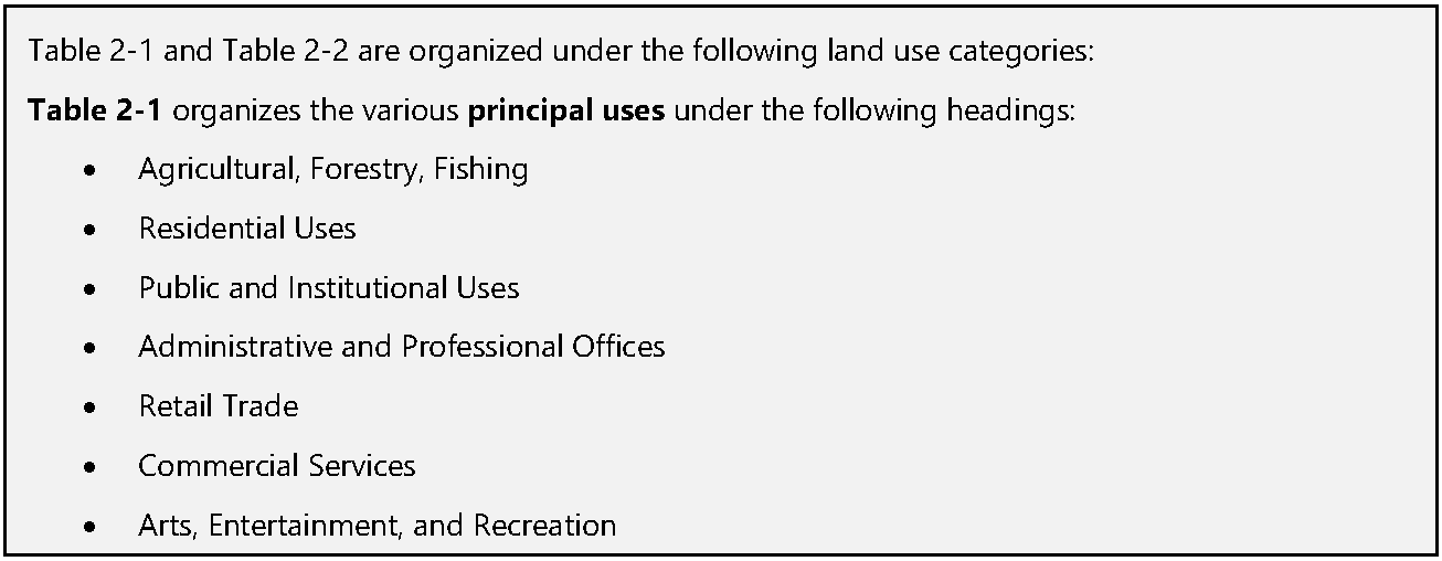
Table 2-1 Principal Use Table
(Ord. No. 05-23, 12-5-2023)
Table 2-2 Accessory and Temporary Use Table
(Ord. No. 05-23, 12-5-2023)