
Portage City Zoning Code
DIVISION 4
ZONING DISTRICTS AND DISTRICT REGULATIONS
Subdivision 2. - R-1A, R-1B, R-1C, and R-1D One-Family Residential Districts[6]
Editor's note—Ord. No. 19-04, adopted Oct. 15, 2019, amended the title of subdivision 2 from "R-1A, R-1B, R-1C, R-1D and R-1E One-Family Residential Districts" to "R-1A, R-1B, R-1C, and R-1D One-Family Residential Districts," as set out herein.
Subdivision 9. - City Centre Mixed Use (CC-MU) District[7]
Editor's note—Ord. No. O-5-2025, adopted June 16, 2025, set out provisions intended for use as Subdivision 17 §§ 42-476—42-491. Inasmuch as there were already provisions so designated, said section has been codified herein as Subdivision 9 §§ 42-320—42-42-335 at the discretion of the editor.
Subdivision 11. - PD Planned Development District[8]
State Law reference— Planned unit developments, MCL 125.584b, MSA 5.2934(2).
Subdivision 13. - CPD Commercial Planned Development District[9]
State Law reference— Planned unit developments, MCL 125.584b, MSA 5.2934(2).
Sec. 42-160.- Districts established.
For the purpose of this article, the city is hereby divided into the following districts:
(Ord. No. 03-01 (Exh. A, § 42-410), 2-18-2003; Ord. No. 19-04, 10-15-2019)
State Law reference— Zoning districts authorized, MCL 125.581.
Sec. 42-161. - Zoning map.
A.
The boundaries of the districts listed in section 42-160 are hereby established as shown on the zoning map, which, with all notations, references and other information shown thereon, shall be a part of this article as if fully described in this article.
B.
The zoning map shall be identified by the signature of the mayor attested by the city clerk, and bear the seal of the city under the following words: "This is to certify that this is the official Zoning Map referred to in Section 42-161 of the Zoning Code of the City (include date of adoption)."
C.
If, in accordance with this article, changes are made in district boundaries or other matter portrayed on the zoning map, together with an entry on the map as follows: "On (date), by official action of Council the following change(s) were made (brief description with reference number to Council proceedings)."
D.
Two copies of the official zoning map are to be maintained and kept up to date, one in the office of the department of community development and one in the office of the city clerk, which copy shall be accessible to the public. The zoning map and any adopted amending ordinances shall be considered as evidence of the current adopted zoning status of lands, buildings and other structures in the city.
(Ord. No. 03-01 (Exh. A, § 42-411), 2-18-2003)
Sec. 42-162. - Interpretation of district boundaries.
A.
Where uncertainty exists with respect to the boundaries of the various districts as shown on the zoning map, the following rules shall apply.
1.
Boundaries indicated as approximately following the centerlines of streets, highways or alleys shall be construed to follow such centerlines.
2.
Boundaries indicated as approximately following platted lot lines shall be construed to follow such lot lines.
3.
Boundaries indicated as approximately following city limits shall be construed as following city limits.
4.
Boundaries indicated as following railroad lines shall be construed to be midway between the main tracks.
5.
Boundaries indicated as following shorelines shall be construed to follow such shorelines and, in the event of a change in a shoreline, shall be construed as moving with the actual shoreline. Boundaries indicated as approximately following the centerlines of streams, rivers, canals, lakes or other bodies of water shall be construed to follow such centerlines.
6.
Boundaries indicated as parallel to or extensions of features mentioned in subsections 1 through 5 of this section shall be so construed.
B.
The scale of the map shall be used to determine distances not specifically indicated on the zoning map.
C.
Where physical or natural features existing on the ground are at variance with those shown on the zoning map, or in other circumstances not covered by subsection A.1 through 6 of this section, the director shall interpret the district boundaries.
(Ord. No. 03-01 (Exh. A, § 42-412), 2-18-2003; Ord. No. 10-04, 2-9-2010)
Sec. 42-163. - Zoning of annexed areas.
Whenever any area is annexed to the city, one of the following conditions shall apply:
A.
Land that is zoned previous to annexation shall be classified as being in whichever district established by this article that most closely conforms with the zoning that existed prior to annexation, such classification to be recommended by the planning commission to the council. The council shall approve the classification by resolution.
B.
Land not zoned prior to annexation shall be classified into whichever district established by this article that most closely conforms with the existing use of the annexed area, or, in the case of vacant land, in accordance with the master plan. The planning commission shall recommend the appropriate zoning district for such area within three months after the matter is referred to it by the council.
(Ord. No. 03-01 (Exh. A, § 42-413), 2-18-2003)
Sec. 42-164. - Zoning of vacated areas.
Whenever a street, alley or other public way in the city has been vacated by action of the council, and when the lands within the boundaries thereof attach to and become a part of lands adjoining such street, alley or public way, such lands formerly within such vacated street, alley or public way shall automatically, and without further action of the council, thenceforth acquire and be subject to the same zoning regulations as are applicable to lands to which the vacated streets, alleys or public ways are attached, and the vacated streets, alleys or public ways shall be used for the same use as is permitted under this article for such adjoining lands.
(Ord. No. 03-01 (Exh. A, § 42-414), 2-18-2003)
Sec. 42-180.- Intent.
The R-1A through R-1D one-family residential districts are designed to be the most restrictive of the residential districts. The intent is to provide for an environment of predominantly low-density single-unit dwellings along with other residentially related facilities that serve the residents in the district. Further, the intent of these regulations is to protect residential neighborhoods from incompatible land uses and associated effects.
(Ord. No. 03-01 (Exh. A, § 42-420), 2-18-2003; Ord. No. 19-04, 10-15-2019)
Sec. 42-181. - Principal permitted uses.
In a one-family residential district (R-1A through R-1D), no building or land shall be used, and no building shall be erected, except for one or more of the following specified uses, unless otherwise provided in this article:
A.
One-family detached dwellings, including home occupations in accordance with the provisions of section 42-129.
B.
Publicly owned and operated libraries, parks, parkways and recreational facilities.
C.
Family child care homes.
D.
Adult foster care family homes.
E.
General agriculture and farms on land separately owned outside the boundaries of platted property having an area not less than ten acres. A general agricultural use of land operating and in existence on November 23, 1989, and land contiguous with and owned by a person operating such adjoining parcel on November 23, 1989, shall not be subject to the conditions imposed by this subsection and shall be considered conforming for all purposes under this article.
F.
Specialized agriculture on land separately owned outside the boundaries of platted property having an area of not less than five acres, but not including retail sales on the premises.
1.
The site shall be so located as to have at least one property line abutting a major thoroughfare designated in the major thoroughfare plan, and all ingress to and egress from the site shall be directly onto such major thoroughfare or marginal access drive thereof.
2.
A specialized agricultural use of land operating and in existence on November 23, 1989, and land contiguous with and owned by a person operating such adjoining parcel on November 23, 1989, shall not be subject to the conditions imposed by this subsection and shall be considered conforming for all purposes under this article.
G.
Accessory buildings and uses, in accordance with the provisions of section 42-121.
H.
Temporary sales office or model home incidental and necessary for the sale or rental of real property in a new subdivision or housing project. In any case, the temporary office or model home shall be removed when 50 percent or more of the lots or units have been sold or leased.
I.
Accessory dwelling units, in accordance with the provisions of section 42-184.
(Ord. No. 03-01 (Exh. A, § 42-421), 2-18-2003; Ord. No. 09-03, 4-14-2009; Ord. No. 19-04, 10-15-2019; Ord. No. O-7-2023, 12-5-2023)
Sec. 42-182. - Special land uses.
The following uses may be allowed in a one-family residential district (R-1A through R-1D), subject to the conditions imposed in this section for each use, and subject further, to the review and approval of the planning commission in accordance with the provisions of division 5, subdivision 1 of this article:
A.
Religious institutions.
1.
The main building of a religious institution, not including the height exceptions of section 42-123.C may exceed the maximum height allowed in this district, provided that the front, side and rear yard setbacks are increased above the minimum required setback by one foot for each one foot of building height over the maximum height allowed.
2.
The site shall be located to have at least one property line abutting a major thoroughfare, as designated on the major thoroughfare plan. All ingress to and egress from the site shall be directly onto such major thoroughfare or a marginal access service drive thereof.
3.
Existing religious institutions and religious institution lands purchased before December 14, 1965, and not meeting the requirements of this subsection shall not be prevented from constructing and/or expanding their facilities and, for the purposes of this article, shall be considered a conforming use or building.
B.
Utility and public service buildings and uses, without storage yards, when operating requirements necessitate the locating of the building within the district in order to serve the immediate vicinity.
C.
Cemeteries, provided that the site shall be located to have at least one property line abutting a major thoroughfare, as designated on the major thoroughfare plan. All ingress to and egress from the site shall be directly onto such major thoroughfare or a marginal access service drive thereof.
D.
Day care centers, not including dormitories.
1.
A minimum of 150 square feet of outdoor play area for each child cared for shall be provided and maintained, except in no case shall the play area shall have less than 5,000 square feet. The play area shall be screened from any adjoining residential district lot.
2.
Lots containing these uses must be located adjacent to an R-1T, RM-1, RM-2 district or OS-1, OTR, B-1, B-2, B-3, or CPD district and not located in the interior part of any one-family residential district.
E.
Swimming pool clubs.
1.
For purposes of this subsection, a swimming pool club shall only include those that are incorporated as private clubs or organizations maintaining and operating swimming pools with a specified limitation of members, either by subdivisions or other specified areas, for the exclusive use of members and their guests.
2.
The proposed site shall have one property line abutting a major thoroughfare as designated on the major thoroughfare plan, and the site shall be so planned as to provide ingress and egress directly onto or from the major thoroughfare. The planning commission may allow access from any other public street provided that a majority of the members live within one mile of the facility.
3.
Front, side and rear setbacks shall be at least 80 feet, except on those sides adjacent to nonresidential districts, and shall be landscaped in trees, shrubs, grass and terrace areas.
4.
No parking or structures shall be permitted in the setbacks required by 3, above, except for required entrance drives and those walls and/or fences used to screen the use from adjacent residential districts.
5.
The swimming pool area shall be provided with a protective fence six feet in height, and entry shall be through a controlled gate.
6.
Sufficient off-street parking shall be provided to accommodate not less than one-half of the member families and/or individuals. Bylaws of the organization shall be provided with the application for the special land use to compute off-street parking requirements. The planning commission may reduce parking requirements to a number the commission deems sufficient when a majority of the members live within one mile of the facility.
F.
Private noncommercial recreational areas and institutional or community recreational centers.
1.
The proposed site shall have one property line abutting a major thoroughfare as designated on the major thoroughfare plan, and the site shall be so planned as to provide ingress and egress directly onto or from such major thoroughfare. The planning commission may allow access from any other public street provided that a majority of the members live within one mile of the facility.
2.
Front, side and rear setbacks shall be at least 80 feet, except on those sides adjacent to nonresidential districts, and shall be landscaped in trees, shrubs, grass and terrace areas. Sufficient off-street parking shall be provided to accommodate not less than one-half of the member families and/or individuals. Bylaws of the organization shall be provided with the application for the special land use to compute off-street parking requirements.
3.
When the planning commission finds that travel to the facility would be safe and convenient, the requirement for frontage on a major thoroughfare may be waived and the off-street parking requirements reduced to a number the commission deemed sufficient.
G.
Golf courses.
1.
The site shall be so planned as to provide all ingress and egress directly onto or from a major thoroughfare, as designated on the major thoroughfare plan.
2.
All main and accessory buildings and structures shall be setback at least 200 feet from any property line abutting a residential district. The planning commission may reduce this setback where topographic conditions or existing vegetation would screen the buildings from view.
3.
Swimming pools, if provided, shall have a protective fence six feet in height, and entry shall be through a controlled gate.
H.
Bed and breakfast establishments.
1.
Bed and breakfast establishments shall be located in a one-family residence existing at the date of the adoption of this article.
2.
The property on which the use is located shall be at least 500 feet from the property line of any other bed and breakfast establishment.
3.
The site shall be so located as to have one property line abutting a major or collector thoroughfare as designated on the major thoroughfare plan. All ingress to and egress from the site shall be directly onto such major thoroughfare or marginal access service drive thereof. The planning commission may allow access from a local street when it finds that no adverse effects on the surrounding area would result.
4.
No exterior alterations to the main building are permitted for additional sleeping accommodations and all accommodations must be within the main building.
5.
There shall be no more than one kitchen or other similar area in the main building and all cooking appliances must be located in the allowable cooking area.
6.
All food shall be served on the premises and be for the consumption of the innkeeper and guests only.
7.
The bed and breakfast establishment must be the innkeeper's principal residence.
8.
The maximum stay of any guest is 14 days on any single occasion. A guest register is required to be maintained showing the arrival and departure dates of guests and must be made available for inspection by the director or his representative.
9.
One wall sign and one freestanding sign are permitted. No sign shall be illuminated or animated, or exceed 16 square feet in area. The freestanding sign shall be no more than ten feet in height and placed at least ten feet from any property line.
I.
Group child care homes.
1.
The lot containing the group child care home shall not be located closer than 1,500 feet to any lot occupied by any of the following uses. This distance shall be measured as a traveled distance along public streets, but not including an alley. Nor shall the lot containing the group child care home be located less than 500 feet to any lot occupied by any of the following uses, as measured form the nearest property lines of each use.
a.
Another licensed group child care home.
b.
An adult foster care small group home or large group home.
c.
A facility offering substance abuse treatment and rehabilitation service.
d.
A community correction center, resident home, halfway house or similar jurisdiction administered by the Michigan Department of Corrections or other state or federal agency.
2.
If the lot occupied by the group child care home is located between the distances noted in [subsection] 1, above, the planning commission shall make a finding that the proximity of the uses will not result in excessive noise, traffic or other disturbances which may adversely affect abutting or nearby residential uses.
3.
The planning commission may require up to a six-foot high screening fence completely enclosing the area where children play or congregate in order to mitigate and/or avoid possible adverse impacts on surrounding property and to improve safety.
4.
The group child care home shall be maintained in a manner visibly characteristic of the surrounding neighborhood. No signs advertising the child care home are permitted.
5.
No more than one nonresident employee, whether compensated or not, in addition to the operator, shall be permitted for a group child care home, unless required by the state as part of the approval of the license.
6.
Off-street parking shall be provided for the group child care operator and nonresident employee(s). Tow client parking spaces shall also be provided.
7.
A revocation or refusal to renew a license or certificate of registration of a group child care home shall cause the revocation of the special land use permit.
J.
Public, parochial and other private elementary, intermediate and/or high schools offering courses in general education.
1.
All ingress to and egress from the site shall be directly onto a major thoroughfare, as designated on the major thoroughfare plan.
2.
Main and accessory buildings shall be set back a minimum of 80 feet from any property line.
(Ord. No. 03-01 (Exh. A, § 42-422), 2-18-2003; Ord. No. 09-03, 4-14-2009; Ord. No. 19-04, 10-15-2019)
State Law reference— Special uses authorized, MCL 125.584a.
Sec. 42-183. - Site development requirements.
A.
Lot, yard and building requirements shall be governed by the requirements of division 4, subdivision 10 of this article.
B.
Parking, signs, landscaping, and lighting shall be governed by the requirements of division 6 of this article.
C.
Site plan review shall be governed by the requirements of division 5, subdivision 2 of this article.
(Ord. No. 03-01 (Exh. A, § 42-423), 2-18-2003)
Sec. 42-184. - Accessory dwelling units.
It is the intent of this section to allow for accessory dwelling units (ADU's) upon properties within one family residential zoning districts to allow homeowners to have a supplemental source of income with a long-term tenant, as well as other nontangible benefits to older residents, such as companionship or a live-in caretaker. It is recognized that ADUs provide an opportunity for affordable housing for family members to reside nearby with independence. It is further recognized that appropriate limitations are necessary so that ADUs are compatible and harmonious within residential neighborhoods.
A.
The following provisions shall apply to all ADUs:
1.
An ADU may only be established on a parcel with a single family dwelling on it and located in a one family residential district.
2.
Not more than one ADU may be established on a single parcel or zoning lot.
3.
Not less than 150 square feet of sleeping area shall be provided per occupant of the ADU, and no more than two bedrooms.
4.
An ADU shall not be smaller than 500 square feet and no larger than 900 square feet, but in no circumstances shall it exceed the total square footage of the principal dwelling.
5.
An ADU shall be furnished with its own kitchen, full bathroom, and sleeping area.
6.
The principal residence and ADU shall share the same vehicular access to the parcel.
7.
Short term rentals (30 days or less) shall not be permitted for either the ADU or principal residence.
8.
An ADU must have its own means of egress from the exterior or from a common hallway within a single building.
9.
At least one on-premise dedicated improved surface parking space shall be provided for the ADU.
10.
The ADU cannot be sold separately from the primary dwelling, which shall be addressed pursuant to subsection 3 of this section.
11.
Lot coverage maximums of the underlying zoning district shall apply.
12.
The property owner shall live in either the ADU or principal residence, which shall be addressed pursuant to subsection 3 of this section.
13.
The ADU shall be connected to public sewer and water supply systems, or to private facilities for potable water and disposal of sewage approved by the city.
13.
The ADU unit shall comply with all applicable building, electrical, plumbing, fire, energy and other similar codes which are or may be adopted by the city, and with applicable federal or state standards or regulations for construction. Appropriate evidence of compliance with these standards or regulations shall be provided to the building inspector. The following life/safety aspects apply:
a.
All attached ADUs shall have smoke detectors and carbon monoxide detectors interconnected with those in the principal dwelling; if separate, the common wall separating the ADU from the principal dwelling shall consist of a 1-hour fire-rated wall.
b.
ADU occupants shall have access to utility shut-off elements, including electricity, gas, and water.
14.
Shall be subject to the minimum front and side yard setbacks of the underlying zoning district. The rear yard setback shall meet the minimum side yard setback for the underlying zoning district.
15.
Prior to occupancy of the ADU, the community development department shall issue a certificate of occupancy indicating compliance with all applicable requirements and inspections.
B.
The following provisions shall apply to detached ADUs:
1.
The maximum height shall not exceed the height of the principal dwelling, except after a public hearing the height may be increased if the planning commission determines harmonious relationships and to minimize conflicts between adjacent uses. The commission shall consider the proposed characteristics of the building in relation to existing land uses and to future land uses as shown in the comprehensive plan. The commission may attach requirements to such accessory building and use when it deems necessary to avoid or mitigate adverse impacts on surrounding properties.
2.
Mobile homes, shipping containers, trailers on wheels, tree houses, or any other unit not on a permanent foundation shall not be considered an ADU.
3.
Shall be firmly attached to a permanent continuous foundation which complies with applicable provisions of the adopted building code.
4.
Exterior design of an ADU shall be compatible with existing residences. Consistent with primary dwelling and in harmony with the character and scale of the surrounding neighborhood.
C.
Applications for an ADU shall be made to the department of community development and shall consist of the following but not limited to:
1.
Plot plan (scaled drawings) showing the following:
a.
Location of all existing and proposed structures on the property.
b.
Setbacks of the proposed ADU from all property lines and structures.
c.
Designated parking area for the ADU and principal residence.
d.
Elevation drawings, where necessary.
2.
Floor plan, elevations, and building plans showing the following:
a.
Kitchen, bathroom, sleeping area, entry stairs, and gross square footage;
b.
Connecting wall or floor to the principal residence, where necessary;
c.
Elevations including windows, doors, porches, walls, and other exterior features.
3.
A Deed Restriction by the owner of record acknowledging the following:
a.
One of the two dwelling units will be occupied by the property owner,
b.
The ADU cannot be sold separate from the principal residential unit.
4.
An affidavit by the owner of record indicating the following:
a.
Which of the two dwelling units will be occupied by the owner of record.
b.
All ADU standards of the City of Portage shall be adhered to.
(Ord. No. O-7-2023, 12-5-2023)
Sec. 42-200.- Intent.
The R-1T attached residential district is designed to encourage a moderate density residential environment that can serve as a zone of transition between major or collector thoroughfares and adjacent, less intensive development.
(Ord. No. 03-01 (Exh. A, § 42-430), 2-18-2003)
Sec. 42-201. - Principal permitted uses.
In an attached residential district, R-1T, no building or land shall be used, and no building shall be erected, except for one or more of the following specified uses, unless otherwise provided in this article:
A.
One-family detached dwellings, including home occupations in accordance with the provisions of section 42-129.
B.
Publicly owned and operated libraries, parks, parkways and recreational facilities.
C.
Family child care homes.
D.
Adult foster care family homes.
E.
Public, parochial and other private elementary, intermediate and/or high schools offering courses in general education.
F.
General agriculture and farms on land separately owned outside the boundaries of platted property having an area not less than five acres.
G.
Specialized agriculture on land separately owned outside the boundaries of platted property having an area of not less than five acres, but not including retail sales on the premises and subject to the conditions of section 42-181.F.
H.
Religious institutions, subject to the provisions of section 42-182.A.
I.
Utility and public service buildings and uses, without storage yards, when operating requirements necessitate the locating of the building within the district in order to serve the immediate vicinity.
J.
Day care centers, not including dormitories, subject to the provisions of section 42-182.D.
K.
Swimming pool clubs, subject to the provisions of section 42-182.E.
L.
Private noncommercial recreational areas and institutional or community recreational centers, subject to the provisions of section 42-182.F, except that the bylaws of the organization shall be provided with the application for the site plan approval.
M.
Golf courses, subject to the provisions of section 42-182.G.
N.
Bed and breakfast establishments, subject to the provisions of section 42-182.H.
O.
Group child care homes, subject to the provisions of section 42-182.I.
P.
Adult foster care small group home.
Q.
Two-family dwellings, including home occupations in accordance with the provisions of section 42-129.
R.
One-family attached dwellings, including home occupations in accordance with the provisions of section 42-129.
S.
Accessory buildings and uses, in accordance with the provisions of section 42-121.
(Ord. No. 03-01 (Exh. A, § 42-431), 2-18-2003; Ord. No. 09-03, 4-14-2009)
Sec. 42-202. - Conditions and requirements for one-family attached dwellings.
One-family attached dwellings may be built in an R-1T, attached residential district only as part of a development for which site plan approval is obtained and shall meet the following conditions:
A.
A minimum of 6,000 square feet of lot area per attached dwelling unit shall be required. The area for computing density shall be the total site area exclusive of any dedicated right-of-way of either interior or boundary roads.
B.
Unless the planning commission approves a different ratio, the lot width to depth ratio shall be not greater than two to one as measured at the right-of-way line.
C.
In a platted or site condominium one-family attached development, each building shall be erected on a separate lot of at least 6,000 square feet per dwelling unit and have a minimum lot width of 40 feet.
D.
Dwelling units may be attached to each other by one or more of the following methods:
1.
A common party wall which does not have over 80 percent of its area in common with an abutting dwelling wall;
2.
By means of an architectural wall detail which does not form interior room space; or
3.
Through a common party wall in only the garage portion of an abutting structure.
E.
No side yard setbacks shall be required for units that are attached by a common party wall or an architectural wall detail.
F.
Not more than four units shall be connected, and all units shall have independent first floor entryways.
G.
The maximum horizontal dimension across any elevation of an accessory building shall be 40 feet.
H.
At least a one-car garage, enclosed on all sides, shall be provided for each dwelling unit.
I.
A landscaping plan to buffer the development from abutting land uses shall be submitted by the developer, with emphasis on natural buffering as opposed to walls and fences.
J.
The development shall have at least one property line abutting a major or collector thoroughfare, as defined in the major thoroughfare plan.
K.
There shall be no access to or from a one-family attached dwelling development through property zoned for other one-family residential use.
L.
The development shall be served by public water supply and public sanitary sewer collection systems.
M.
Principal or accessory uses which are primarily designed to benefit residents of attached dwellings shall be located entirely in an R-1T district.
(Ord. No. 03-01 (Exh. A, § 42-432), 2-18-2003)
Sec. 42-203. - Special land uses.
The following uses may be allowed in a an attached residential district, R-1T, subject to the conditions imposed in this section for each use, and subject further, to the review and approval of the planning commission in accordance with the provisions of division 5, subdivision 1 of this article:
A.
Cemeteries.
(Ord. No. 03-01 (Exh. A, § 42-433), 2-18-2003)
State Law reference— Special uses authorized, MCL 125.584a.
Sec. 42-204. - Site development requirements.
A.
Lot, yard and building requirements shall be governed by the requirements of division 4, subdivision 10 of this article.
B.
One-family detached dwellings shall be subject to the minimum lot area, yard, floor area and other applicable requirements set forth in the R-1A, one-family residential district for the same type of dwelling.
C.
Parking, signs, landscaping, and lighting shall be governed by the requirements of division 6 of this article.
D.
Site plan review shall be governed by the requirements of division 5, subdivision 2 of this article.
E.
For the purpose of side yard regulations, a two-family dwelling or one-family attached dwelling is considered one building occupying one lot.
(Ord. No. 03-01 (Exh. A, § 42-434), 2-18-2003)
Sec. 42-220.- Intent.
RM-1 and RM-2 multifamily residential districts are designed to provide sites for multifamily dwelling structures and related uses, which will generally serve as a transition between nonresidential districts and lower density one-family districts.
(Ord. No. 03-01 (Exh. A, § 42-440), 2-18-2003)
Sec. 42-221. - Principal permitted uses.
In an RM-1 and RM-2 multifamily residential district, no building or land shall be used, and no building shall be erected, except for one or more of the following specified uses, unless otherwise provided in this article:
A.
One-family detached dwellings, including home occupations in accordance with the provisions of section 42-129.
B.
Two-family dwellings, including home occupations in accordance with the provisions of section 42-129.
C.
One-family attached dwellings, including home occupations in accordance with the provisions of section 42-129, and subject to the provisions of section 42-202.
D.
Multiple-family residential dwellings.
E.
Publicly owned and operated libraries, parks, parkways and recreational facilities.
F.
Cemeteries.
G.
Family child care homes and adult foster care family homes.
H.
General agriculture and farms on land separately owned outside the boundaries of platted property having an area not less than five acres.
I.
Specialized agriculture on land separately owned outside the boundaries of platted property having an area of not less than five acres, but not including retail sales on the premises and subject to the provisions of section 42-181.F.
J.
Religious institutions, including facilities normally incidental thereto, subject to the provisions of section 42-182.A.
K.
Utility and public service buildings and uses, without storage yards, when operating requirements necessitate the locating of the building within the district in order to serve the immediate vicinity.
L.
Day care centers, not including dormitories, subject to the provisions of section 42-182.D.
M.
Swimming pool clubs, subject to the provisions of section 42-182.E, except that the bylaws of the organization shall be provided with the application for the site plan approval.
N.
Private noncommercial recreational areas and institutional or community recreational centers, subject to the provisions of section 42-182.F, except that the bylaws of the organization shall be provided with the application for the site plan approval.
O.
Golf courses, subject to the provisions of section 42-182.G.
P.
Public and private colleges, universities and other institutions of higher learning.
Q.
Bed and breakfast establishments, subject to the provisions of section 42-182.H.
R.
Group day care homes, subject to the provisions of section 42-182.I.
S.
Adult foster care small group home.
T.
Senior adult housing facility.
U.
Personal service establishments, including barbershops, beauty shops and health salons, accessory to the uses permitted in this section.
V.
Accessory buildings and uses, in accordance with the provisions of section 42-121.
(Ord. No. 03-01 (Exh. A, § 42-441), 2-18-2003; Ord. No. 01-06, 2-14-2006; Ord. No. 09-03, 4-14-2009; Ord. No. 16-11, 10-18-2016)
Sec. 42-222. - Special land uses.
The following uses may be allowed in a multi-family residential district (RM-1 and RM-2), subject to the conditions imposed in this section for each use, and subject further, to the review and approval of the planning commission in accordance with the provisions of division 5, subdivision 1 of this article:
A.
Congregate care, assisted living, and convalescent homes.
1.
The minimum floor area per dwelling unit requirements specified in section 42-350(A), Schedule of Regulations, and number of units per acre specified in section 42-350(B)(7) Footnotes to Schedule of Regulations, shall not apply to assisted living and convalescent care facilities.
2.
The minimum lot area shall be equal to the area required for the main building plus 1,500 square feet of lot area per resident bed.
B.
Adult foster care large group homes.
1.
The site shall be so located as to have one property line abutting a major or collector thoroughfare as designated on the major thoroughfare plan. All ingress to and egress from the site shall be directly onto such major thoroughfare or marginal access service drive thereof. The planning commission may allow access from a local street when it finds that no adverse effects on the surrounding area would result.
2.
The parking area shall be screened in accordance with section 42-572, Parking Lot and Building Landscaping.
C.
Accessory uses designed primarily to benefit residents of multifamily dwellings, housing for the elderly or convalescent homes provided they are located entirely in an RM-1 and/or an RM-2 district.
D.
Public, parochial and other private elementary, intermediate and/or high schools offering courses in general education.
(Ord. No. 03-01 (Exh. A, § 42-442), 2-18-2003; Ord. No. 16-11, 10-18-2016)
State Law reference— Special uses authorized, MCL 125.584a.
Sec. 42-223. - Site development requirements.
A.
Lot, yard and building requirements shall be governed by the requirements of division 4, subdivision 10 of this article.
B.
One-family detached dwellings shall be subject to the minimum lot area, yard, floor area and other applicable requirements set forth in the R-1A, one-family residential district for the same type of dwelling.
C.
Parking, signs, landscaping, and lighting shall be governed by the requirements of division 6 of this article.
D.
Site plan review shall be governed by the requirements of division 5, subdivision 2 of this article.
(Ord. No. 03-01 (Exh. A, § 42-443), 2-18-2003)
Sec. 42-240.- Intent.
The OS-1 office service district is designed to accommodate office and institutional land use activities and are planned to serve as transitional areas between residential districts and commercial districts and between major thoroughfares and residential districts.
(Ord. No. 03-01 (Exh. A, § 42-450), 2-18-2003)
Sec. 42-241. - Principal permitted uses.
In the OS-1 office service district no building or land shall be used, and no building shall be erected, except for one or more of the following specified uses, unless otherwise provided in this article:
A.
Office buildings for any of the following occupations: executive, administrative, professional, accounting, writing, clerical, stenographic, drafting and sales.
B.
Medical offices, including clinics.
C.
Banks, credit unions, savings and loan associations and similar uses.
D.
Art studios, photographic studios and interior decorating studios.
E.
Publicly owned buildings, exchanges and public utility offices, not including storage yards, transformer stations, substations or gas regulator stations.
F.
Personal service establishments that perform services on-premises.
G.
A specialized agricultural use of land operating and in existence on the effective date (insert date) of this amendment, and land contiguous with and owned by a person operating such adjoining parcel on the effective date of this amendment, shall be considered conforming for all purposes under this article.
H.
Accessory uses customarily related to the uses permitted in this section, such as but not limited to pharmacies or apothecary stores limited to such items as corrective garments, bandages or optical services.
(Ord. No. 03-01 (Exh. A, § 42-451), 2-18-2003; Ord. No. 14-08, 7-22-2014, eff. 8-14-2014)
Sec. 42-242. - Special land uses.
The following uses may be allowed in the OS-1 office service district, subject to the conditions imposed in this section and section 42-243 for each use, and subject further, to the review and approval of the planning commission in accordance with the provisions of division 5, subdivision 1 of this article:
A.
Institutional uses, as listed below:
1.
Public, parochial and other private elementary, intermediate and/or high schools offering courses in general education.
2.
Public and private colleges, universities and other institutions of higher learning.
3.
Religious institutions.
4.
Private noncommercial recreational uses and institutional or community recreational centers.
5.
Facilities for human care such as sanatoriums and rest and convalescent homes.
B.
Vocational, trade and/or business schools, provided that all activities shall be conducted in completely enclosed buildings.
C.
Funeral home establishments, funeral services, mortuaries and mortuary services, subject to the following:
1.
Adequate assembly area shall be provided off-street for vehicles to be used in funeral processions, and the assembly area shall be provided in addition to any required off-street parking area.
2.
A caretaker's residence may be provided within the main building of funeral/mortuary establishments.
3.
Notwithstanding section 42-243.A.1, a local street may be utilized with planning commission approval when no adverse impact to the surrounding area would result.
D.
General hospitals, except those for criminals and those solely for the treatment of persons who are mentally ill or have a contagious disease.
1.
Hospitals shall have a minimum site area of ten acres.
2.
The proposed site shall have at least one property line abutting a major thoroughfare, as designated on the major thoroughfare plan. All ingress and egress to and from the site shall be directly from a major thoroughfare, as designated on the major thoroughfare plan.
3.
There shall be no maximum height restrictions, however, the minimum setback for any main or accessory building shall be at least 100 feet for all structures of a height of 30 feet or less. For every one foot above 30 feet, the minimum setback distance shall be increased by no less than two feet.
4.
Ambulance and delivery areas shall be screened from all view from any adjoining residential district or use. Screening shall be with walls six feet in height, which shall be further subject to the requirements of section 42-573.
E.
Work/live accommodations in accordance with the provisions of section 42-137.
F.
Offices having laboratory-and technology-related uses when meeting the following standards:
1.
When all operations are conducted and completely contained within the building.
2.
No outdoor storage.
3.
Must contain related offices as an adjunct use.
4.
Shall not emit any noise, light, vibrations, odors or other deleterious impacts towards adjacent property lines.
5.
Shall not have access directly onto a residential street.
6.
Loading facilities shall not face a residential zoning district without proper screening as required by code, including section 42-573 conflicting use screening.
7.
All hazardous materials, waste and wastewater associated with the use shall be handled and disposed of in a manner that is not dangerous to the health and safety of the abutting areas.
8.
The use and size of delivery vehicles shall be consistent with those typically found in an office, laboratory, or technology use.
(Ord. No. 03-01 (Exh. A, § 42-452), 2-18-2003; Ord. No. 11-13, 8-23-2011; Ord. No. 21-22-B, 4-26-2022; Ord. No. 22-02, 4-26-2022)
State Law reference— Special uses authorized, MCL 125.584a, MSA 5.2934(1).
Sec. 42-243. - Site development requirements.
A.
All special land uses shall:
1.
Have at least one property line abutting a major or collector thoroughfare as designated on the major thoroughfare plan. Ingress and egress to and from the site shall be directly from that thoroughfare or a marginal access service drive thereof.
2.
Maintain a building setback of 30 feet from all property lines; and the off-street parking area shall be set back 15 feet and screened from any residential district front, side or rear yard in an abutting residential district. Funeral home establishments, funeral services, mortuaries and mortuary services shall be exempt from this requirement.
B.
The outdoor storage of goods or materials is prohibited.
C.
Warehousing or the indoor storage of goods or materials, beyond that normally incidental to the uses permitted in this district, is prohibited.
D.
Lot, yard and building requirements shall be governed by the requirements of division 4, subdivision 10 of this article.
E.
Parking, signs, landscaping, and lighting shall be governed by the requirements of division 6 of this article.
F.
Site plan review shall be governed by the requirements of division 5, subdivision 2 of this article.
(Ord. No. 03-01 (Exh. A, § 42-453), 2-18-2003)
Sec. 42-260.- B-1 local business district.
A.
Intent: The B-1 local business district is designed for low intensity uses providing convenience shopping and service needs of persons residing in neighboring residential areas or to provide a transitional zone between differing zoning districts and/or along major thoroughfares. In order to discourage strip and/or spot zoning and promote concentrations of local business uses, these districts should be spaced at least one mile apart and have access from one or more major thoroughfares. It is the further intent to preclude a local business activity that could normally be classified as local business but with characteristics that could create a nuisance such as noise, excessive truck or car traffic, noxious odors or other hazards that may negatively affect and/or endanger nearby residents.
B.
Principal permitted uses: In a B-1 local business district, no building or land shall be used, and no building shall be erected, except for one or more of the following specified uses, unless otherwise provided in this article:
1.
Any principal permitted use in the OS-1 office service district.
2.
Retail businesses supplying commodities on-premises directly to consumers with a GLA of 10,000 square feet or less.
3.
Key shops and film drops within parking lots, provided that the use shall not interfere with normal, planned circulation flow traffic.
4.
Restaurants, 1,500 square feet UFA or less, excluding drive-in and/or drive-through services or those whose primary use is the service of alcoholic beverages.
5.
Dry cleaning retail establishments, but not including central dry cleaning plants serving more than one retail establishment.
6.
Religious institutions.
7.
A specialized agricultural use of land operating and in existence on the effective date (insert date) of this amendment, and land contiguous with and owned by a person operating such adjoining parcel on the effective date of this amendment, shall be considered conforming for all purposes under this article.
8.
Accessory buildings and uses customarily found in connection with the uses in this district.
C.
Special land uses: The following uses may be allowed in the B-1 local business district, subject to the conditions imposed in this section for each use, and subject further, to the review and approval of the planning commission in accordance with the provisions of division 5, subdivision 1 of this article:
1.
Retail businesses supplying commodities on-premises directly to consumers with a GLA of greater than 10,000 square feet and up to 20,000 square feet.
2.
Funeral home establishments, funeral services, mortuaries and mortuary services, subject to the following:
a.
Adequate assembly area shall be provided off-street for vehicles to be used in funeral processions, and the assembly area shall be provided in addition to any required off-street parking area.
b.
A caretaker's residence may be provided within the main building of funeral/mortuary establishments.
3.
Small animal veterinary hospitals or clinics, subject to the following:
a.
Buildings housing this use shall be freestanding and not connected to any other building containing any other use.
b.
The part of the lot shall not abut a residential district or use lot line.
Editor's note—At the instruction of the city, the word "not" was inserted into subsection b above. Apparently, such word was inadvertently omitted when the subsection was printed.
c.
No boarding of animals shall be permitted.
d.
No services shall be provided to large animals, such as horses, cows, and other similar size animals.
e.
No cremations or crematory facilities shall be operated on the premises.
4.
Publicly owned buildings.
5.
Public utility buildings.
6.
Telephone exchange buildings.
7.
Electrical substations.
8.
Gas regulator stations with service yards (but without storage yards).
9.
Water and sewage pumping stations.
10.
Work/live accommodations in accordance with the provisions of section 42-137.
D.
B-1 district site development requirements:
1.
All business establishments in this district shall be retail or service establishments dealing directly with consumer.
2.
All goods produced on the premises shall be sold at retail on the premises where produced.
3.
All business servicing or processing, except for off-street loading or parking, shall be conducted in a completely enclosed main building.
4.
Lot, yard and building requirements shall be governed by the requirements of division 4, subdivision 10 of this article.
5.
Parking, signs, landscaping, and lighting shall be governed by the requirements of division 6 of this article.
6.
Site plan review shall be governed by the requirements of division 5, subdivision 2 of this article.
(Ord. No. 03-01 (Exh. A, § 42-460), 2-18-2003; Ord. No. 01-06, 2-14-2006; Ord. No. 11-13, 8-23-2011; Ord. No. 14-08, 7-22-2014, eff. 8-14-2014)
Sec. 42-261. - B-2 community business district.
A.
Intent: The B-2 community business district is designed to cater to the needs of a larger consumer population than is served by the B-1 local business districts, and are generally characterized by an integrated or planned cluster of establishments served by a common parking area and generating large volumes of vehicular and pedestrian traffic.
B.
Principal permitted uses: In a B-2 community business district, no building or land shall be used, and no building shall be erected, except for one or more of the following specified uses, unless otherwise provided in this article:
1.
Any principal permitted use in the B-1 local business district, except that retail businesses shall not be restricted by floor area.
2.
Private clubs, fraternal organizations and lodge halls.
3.
Restaurants or other places serving food or beverages, including drive through restaurants, but excluding drive-in restaurants.
4.
Theaters, assembly halls, concert halls or similar places of assembly when conducted completely in enclosed buildings.
5.
Business schools and colleges or private schools.
6.
Service establishments of an office, showroom or workshop nature for contractor, repair, and service establishments that require retail adjuncts.
7.
General agriculture.
8.
Specialized agriculture. A specialized agricultural use of land operating and in existence on November 23, 1989, and land contiguous with and owned by a person operating such adjoining parcel on November 23, 1989, shall be considered conforming for all purposes under this article.
9.
Religious institutions.
10.
Accessory buildings and uses customarily found in connection with the uses in this district.
11.
Brewpubs and microbrewers, subject to the following requirements,
a.
Brewery production shall not exceed 18,000 barrels per year.
b.
No outdoor storage of any kind shall be permitted.
c.
The use shall also include a restaurant having a minimum seating occupancy of 50 persons serving food for consumption on premises. These uses do not include those for the exclusive production and/or service of alcoholic beverages.
d.
An off-street loading space shall be required in the rear yard, as approved by the director.
C.
Special land uses: The following uses may be allowed in the B-2 community business district, subject to the conditions imposed in this section for each use, and subject further, to the review and approval of the planning commission in accordance with the provisions of division 5, subdivision 1 of this article:
1.
Open air businesses.
a.
If an open air business is provided on the same lot as another use permitted in this district, they shall be located at the end (shortest side of the building) of the main building(s) on that lot, in the district, except that the area shall not be on the street side of a building.
b.
The recreational space shall be fenced on all sides with a chain link, wire, wrought iron, split rail, or other similar fence designs and height as determined by the Director to provide adequate safety and aesthetic purposes.
2.
Auto repair.
a.
The minimum lot size shall be 30,000 square feet, with a minimum width of 150 feet.
b.
All services shall be performed within a completely enclosed building.
c.
No service bay shall open to or face any public street.
d.
Not less than 20 percent of the ground area of the site shall be landscaped as a green area pursuant to an approved site plan.
e.
In locations where the use abuts a residential district, the planning commission may require additional screening or landscaping to minimize any potential adverse effects, such as noise, dust, odor, etc.
f.
No auto collision/body shop activities shall be permitted.
g.
When located within an integrated or planned cluster of establishments served by a common parking area, the use shall be located on the periphery in such a manner as not to create vehicular circulation obstructions or pedestrian movement conflicts and shall be designed so as to integrate the use with the site plan and architecture of the cluster of establishments. No additional curb openings onto a public street shall be permitted.
h.
No outside storage of parts and/or materials shall be allowed.
i.
No overnight outdoor storage/parking of automobiles that have been or are awaiting service or parts is permitted.
3.
Automatic carwashes.
a.
All services shall be performed within a completely enclosed building, except that exterior vacuum devices customary and incidental to carwashes are permitted provided they are located at least 100 feet from a residential district or use lot line.
b.
Stacking space, exclusive of required parking and maneuvering areas, shall be provided on-site as set forth in section 42-523 so as to prevent conflicts with adjacent streets.
c.
When located within an integrated or planned cluster of establishments served by a common parking area, the use shall be located on the periphery so as not to create vehicular circulation obstructions or pedestrian movement conflicts. No additional curb openings onto a public street shall be permitted.
4.
Vehicle dealerships, licensed by the state as a new vehicle dealer, for the sale of new motor vehicles, including accessory uses when related and incidental thereto, such as service areas and areas for the sale of used motor vehicles.
a.
The minimum lot size shall be five acres, with a minimum frontage of 400 feet on a public street.
b.
There shall be no additional curb openings onto a public street if suitable access is available by any other means, or if located within an integrated or planned cluster of establishments served by a common access and maneuvering lanes.
c.
When located within an integrated or planned cluster of establishments served by a common parking area, the use shall be located on the periphery in such a manner as not to create vehicular circulation obstructions or pedestrian movement conflicts and shall be designed so as to integrate the use with the site and architecture of the cluster of establishments.
d.
The site shall have at least one property line abutting a major thoroughfare, as designated on the major thoroughfare plan. All ingress to and egress from the site shall be directly onto such major thoroughfare, marginal service drive thereof, or private streets serving the integrated or planned cluster of establishments.
e.
All vehicles that have been prepared for sale and are ready for sale shall be located in vehicle display areas, which shall be of asphalt, concrete or other hard surface and shall be graded and drained as to dispose of all surface water accumulated within the area.
f.
Vehicle display areas shall meet the requirements of section 42-572.A, except the requirements for the continuous screen of subparagraph 3 of that section. Except for that necessary for security purposes, site lighting used to illuminate vehicle display areas shall be extinguished between the hours of 11:00 p.m. and 9:00 a.m.
g.
Not less than 20 percent of the ground area of the site, excluding roadway easements and rights-of-way shall be landscaped. A maximum of five percent of the landscaped area may consist of permanent decorative landscape material such as cobblestone, brick, exposed aggregate, paving blocks or similar material.
h.
Activities permitted at auto repair and auto collision/body shops as defined in section 42-112 may be permitted when conducted completely within the building, with no outside storage of parts and/or materials.
i.
No service bay shall open to or face any public street.
j.
Vehicle storage areas, not to be construed as the vehicle display areas, may be located outside of the building when the storage area is completely screened from view on all sides with an opaque screen at the time of planting and/or installation as required in section 42-572.A. Illumination of storage areas is permitted subject to the requirements of division 6, subdivision 4.
k.
Maximum lot coverage shall not exceed 25 percent of the lot.
l.
The sale and/or storage of trailers, recreational vehicles or boats is prohibited.
5.
Bowling alleys, billiard halls, indoor archery ranges, indoor tennis courts, indoor skating rinks or similar forms of indoor commercial recreation when located at least 100 feet from a residential district or use lot line.
6.
Drive-in establishments within an integrated or planned cluster of establishments served by common parking areas subject to the following:
a.
Vehicular entry and exit to the drive-in establishment shall be from a marginal access road or private access serving the integrated or planned cluster of establishments. Separate and direct ingress or egress to a public street shall not be permitted unless the applicant can demonstrate substantial need in accordance with article 3, access management, including sections 66-84 and 66-93.
b.
A setback of not less than 300 feet must be maintained from a residential district boundary for the entire drive-in establishment including building, structures, service ordering, serving areas and required parking and associated vehicle maneuvering lanes.
c.
Safe, convenient, uncongested, and well-defined vehicular and pedestrian circulation shall be provided within the site. Drives and sidewalks and other circulation routes shall be designed to promote safe and efficient traffic/pedestrian operations within the site and at ingress/egress points.
7.
Work/live accommodations in accordance with the provisions of section 42-137.
8.
[Reserved.]
D.
B-2 district site development requirements:
1.
All business establishments in this district shall be retail or service establishments dealing directly with consumer.
2.
All goods produced on the premises shall be sold at retail on the premises where produced.
3.
Unless otherwise permitted in this district, all business servicing or processing, except for off-street loading or parking, shall be conducted in a completely enclosed building.
4.
Lot, yard and building requirements shall be governed by the requirements of division 4, subdivision 10 of this article.
5.
Parking, signs, landscaping, and lighting shall be governed by the requirements of division 6 of this article.
6.
Site plan review shall be governed by the requirements of division 5, subdivision 2 of this article.
(Ord. No. 03-01 (Exh. A, § 42-461), 2-18-2003; Ord. No. 08-05, 7-22-2008; Ord. No. 11-13, 8-23-2011; Ord. No. 15-03, 4-28-2015; Ord. No. 18-04, 4-24-2018; Ord. No. O-4-2023, 8-8-2023)
Sec. 42-262. - B-3 general business district.
A.
Intent: The B-3 general business district is designed to provide sites for more diversified businesses and are often located to serve pass by traffic. Locations for the B-3 district are thus typically mapped along major traffic arteries and/or adjacent to B-2 community business districts.
B.
Principal permitted uses: In a B-3 general business district, no building or land shall be used, and no building shall be erected, except for one or more of the following specified uses, unless otherwise provided in this article:
1.
Any principal permitted use in the b-1 local business district, or uses permitted subject to special conditions.
2.
Any principal permitted use in the B-2 community business district, or uses permitted subject to special conditions.
3.
Automatic and self-service carwashes, when completely enclosed in a building.
4.
Auto repair subject to the following:
a.
When conducted completely within the building.
b.
Vehicles awaiting repair and/or inoperable vehicles (as defined in Chapter 24, Section 24-111) shall not be located outdoors for more than 14 days. All other vehicles shall not be located outdoors for more than 90 days.
c.
Outdoor storage of auto parts and other material, excluding used tires, shall not be permitted unless enclosed by an opaque screening fence or masonry wall not less than six feet in height and located in the rear yard. The enclosure shall be equipped with an opaque gate that is the same height as the screening fence or masonry wall. The fence or wall shall meet the requirements of section 42-576B. The height of the material stored outdoors cannot extend beyond the top of the screening enclosure.
5.
Social or recreational buildings or properties.
6.
Bus passenger stations.
7.
Governmental offices or other governmental uses, public utility offices, exchanges, transformer stations, pump stations and service yards, not including outdoor storage.
8.
Boardinghouses.
9.
Religious institutions.
10.
Motels, hotels.
11.
Dry cleaning plant or facility serving not more than ten retail dry cleaning establishments, provided that there is located on the premises a retail dry cleaning establishment dealing directly with the consumer.
12.
General agriculture.
13.
Specialized agriculture. A specialized agricultural use of land operating and in existence on November 23, 1989, and land contiguous with and owned by a person operating such adjoining parcel on November 23, 1989, shall be considered conforming for all purposes under this article.
14.
Accessory buildings and uses customarily found in connection with the uses in this district.
15.
Drive-through establishments and drive-in establishments.
16.
The following marijuana businesses: Medical marijuana provisioning center as defined by the Medical Facilities Licensing Act, MCL 333.27101 et seq. (Medical Facilities Act) and marijuana retailer as defined by the Michigan Regulation and Taxation of Act MCL 333.27951 et seq. (Adult Use Act).
a.
A Medical marijuana provisioning center or marijuana retailer shall not be located:
i.
Adjacent to or abutting a residential zoning district; and
ii.
Within 1,000 feet from the real property, located either in the City of Portage or an adjacent municipality, comprising a public or private elementary, charter vocational or secondary school or a public or private college, junior college or university, a public library, child daycare center, a substance abuse treatment facility, a park or a playground, public or private youth center, public swimming pool, video arcade facility, recreational facility, religious institution or housing facility owned by a public housing authority; and
iii.
Except as provided in section 42-262(B)(16)(g), within 1,000 feet of any other medical marijuana provisioning center or marijuana retailer located within the city.
b.
Determination of whether a proposed medical marijuana provisioning center or marijuana retailer will be located consistent with the provisions of subsection a. above will be made as follows:
i.
Whether a proposed medical marijuana provisioning center or marijuana retailer will be adjacent to or abutting a residential district will be determined by the location of the boundary lines for the zoning lot to be occupied by the medical marijuana provisioning center or marijuana retailer as those lines existed on December 31, 2017, as shown on the records of the city in existence on that date.
ii.
Measurements for purposes of subsections 42-262(B)(16)(a)(ii) and (iii) above shall be made from the boundary of the zoning lot to be occupied by the medical marijuana provisioning center or marijuana retailer to the nearest point of the zoning lot occupied by any of the uses listed in subsection 42-262(B)(16)(a)(ii), or to the nearest point of the zoning lot occupied by another medical marijuana provisioning center or marijuana retailer using an uninterrupted straight line without regard to intervening structures or objects and using the boundary lines of the zoning lots as they existed on December 31, 2017, as shown on the records of the city in existence on that date.
iii.
"Zoning lot" is defined in section 42-112 of this Code.
c.
Buildings or structures for the distribution, and sale of marijuana and marijuana-infused products by a medical marijuana provisioning center or marijuana retailer shall comply with all State of Michigan Construction Codes (building, electrical, plumbing, and mechanical) in regard to occupancy classification, building design, construction and fire suppression. Medical marijuana provisioning centers and marijuana retailers shall not be located within greenhouses and similar buildings.
d.
All medical marijuana provisioning centers and marijuana retailers must be at a fixed location. Mobile medical marijuana provisioning centers and marijuana retailers are prohibited. Sale or transfer of marijuana products by internet or mail order, consignment, or at wholesale by a medical marijuana provisioning center or marijuana retailer is prohibited. This provision shall not be construed to prohibit sale or transfer of marijuana products as otherwise expressly authorized by the Medical Facilities Act or the Adult-Use Act, nor to prohibit home delivery of marijuana products as may be permitted by law. Drive through windows and other contactless delivery methods may be authorized subject to all applicable zoning and building code regulations.
e.
No marijuana or marijuana-infused products may be used or consumed on the premises of a medical marijuana provisioning center or marijuana retailer.
f.
The activities and operations of a medical marijuana provisioning center or marijuana retailer shall be indoors within a building and out of public view.
g.
A medical marijuana provisioning center and a marijuana retailer may be located in a B-3 zone at the same location consistent with the Adult-Use Act and rules. The medical marijuana provisioning center or marijuana retailer located at the same location shall be partitioned from each other, have a separate entrance, and have a separate HVAC system for the portion of the building occupied by each marijuana business. If a medical marijuana provisioning center or marijuana retailer is located in a multi-tenant building with any other activity or business, the medical marijuana provisioning center or marijuana retailer shall be partitioned from any other activity or business, have a separate entrance, and have a separate HVAC system for the portion of the building occupied by the medical marijuana provisioning center or marijuana retailer.
h.
The business and operations of all medical marijuana provisioning centers and marijuana retailers shall comply at all times with applicable state laws and regulations, and this Code.
17.
Brewpubs and microbrewers, subject to the following requirements,
a.
Brewery production shall not exceed 18,000 barrels per year.
b.
No outdoor storage of any kind shall be permitted.
c.
The use shall also include a restaurant having a minimum seating occupancy of 50 persons serving food for consumption on premises. These uses do not include those for the exclusive production and/or service of alcoholic beverages.
d.
An off-street loading space shall be required in the rear yard, as approved by the director.
C.
Special land uses: The following uses may be allowed in the B-3 general business district, subject to the conditions imposed in this section for each use, and subject further, to the review and approval of the planning commission in accordance with the provisions of division 5, subdivision 1 of this article:
1.
Vehicle dealerships, licensed by the state, for the sale and rental of new or used motor vehicles and/or recreational vehicles, including accessory uses when related and incidental thereto subject to the following:
a.
All vehicles that have been prepared for sale and are ready for sale shall be located in vehicle display areas, which shall be of asphalt, concrete or other hard surface and shall be graded and drained as to dispose of all surface water accumulated within the area.
b.
Ingress and egress to and from the outdoor sales area shall be at least 60 feet from the intersection of any two streets.
c.
Auto repair activities are permitted subject to the following:
i.
When conducted completely within the building.
ii.
Vehicles awaiting repair and/or inoperable vehicles (as defined in chapter 24, section 24-111) shall not be located outdoors for more than 14 days. All other vehicles shall not be stored outdoors for more than 90 days.
iii.
Outdoor storage of auto parts and other material, excluding used tires, shall not be permitted unless enclosed by an opaque screening fence or masonry wall not less than six feet in height and located in the rear yard. The enclosure shall be equipped with an opaque gate that is the same height as the screening fence or masonry wall. The fence or wall shall meet the requirements of section 42-576B. The height of the material stored outdoors cannot extend beyond the top of the screening enclosure.
2.
Open front stores.
a.
A setback of at least 60 feet from the right-of-way line of any existing or proposed street must be maintained.
b.
Ingress and egress to and from the site shall be at least 60 feet from the intersection of any two streets.
c.
A completely obscuring fence or wall six feet in height, as measured from the surface of the ground shall be provided when abutting or adjacent a residential, OS-1, or OTR district. The fence or wall shall meet the requirements of section 42-576.B.
3.
Veterinary hospitals or clinics.
a.
The site shall be located so that all abutting or adjacent property is in a B-1, B-2, B-3, OS-1, I-1 or I-2 district.
b.
All activities shall be conducted in a totally enclosed main building.
4.
Vehicle fueling stations subject to the following:
a.
The zoning lot does not abut or is not located within 300 feet of the following:
i.
A residential zoning district;
ii.
Land designated for residential use in a PD, planned development district;
iii.
Child day care facility;
iv.
Public/private school; or
v.
Religious institution.
For the purpose of this subsection, "abut" means a zoning lot which borders upon the subject lot at any point. Any vehicle fueling station existing as of the date of the adoption of this amendment and not meeting the requirements of this subsection 4(a) shall not be prevented from reconstructing and/or expanding its facilities; provided however that a vehicle fueling station, whether or not it has reconstructed and/or expanded its facilities, which has been abandoned for any reason for the period of not less than 90 days, shall thereafter comply with the locational requirements of subsection 4(a). For purposes of determining whether such use is abandoned, the requirements and conditions contained in section 42-133(5) shall apply.
b.
Outside storage or display shall be adjacent to the building wall or the pump islands, and shall be displayed in a manner that does not create vehicular, pedestrian or emergency access hazards.
c.
Any vehicle fueling station existing as of the date of the adoption of this amendment shall comply with subsection 4(b) whenever a building permit is required for a structural alteration, addition or repair to a building when the estimated expense of such construction exceeds 25 percent of the appraised replacement cost of the entire building or structure, exclusive of the foundation, prior to its improvement (as determined by the department of community development).
5.
[Reserved.]
6.
Offices and showrooms for building, plumbing, electrical or mechanical contractors.
a.
No fabricating of materials shall take place on the site.
b.
There shall be no exterior storage of equipment or materials or supplies, including portable construction offices, on the site.
7.
Kennels or animal shelters, subject to the following:
a.
The facility shall have a minimum lot size of two acres for the first 75 animals and one additional acre for each 25 animals over 75.
b.
The facility, including runs and exercise areas, must be a minimum of 500 feet from a residential district boundary and dwelling, whichever is closer.
c.
The facility shall have frontage on a major thoroughfare as designated in the comprehensive plan. All ingress to and egress from the site shall be directly onto such major thoroughfare.
d.
All runs shall be located inside the building.
e.
Outside exercise areas shall be enclosed by at least three sides of the building. In no case, shall the outside exercise area face a front or side yard. Fencing of exercise areas shall be sufficient to contain the animals.
f.
All kennel areas, runs, cages, and/or exercise areas shall be maintained to create a safe and suitable environment for animals, including the daily elimination of animal waste.
g.
Animals shall be kept inside the building between the hours of 9:00 p.m. and 7:00 a.m.
h.
The planning commission may require screening up to six feet in height in order to mitigate and/or avoid possible adverse impacts on surrounding property.
i.
Noise levels shall comply with the provisions in chapter 24, article 4 (Noise) of the city's Code of Ordinances.
j.
One parking space for each eight runs of cages, whichever is greater, plus one per employee on the largest working shift shall be provided on site.
k.
Notwithstanding any provision in this zoning code to the contrary, kennels and animal shelters shall not be a principal permitted use or special land use in any district other than the B-3.
8.
[Reserved.]
9.
Work/live accommodations in accordance with the provisions of section 42-137.
10.
Offices having laboratory-and technology-related uses when meeting the following standards:
a.
When all operations are conducted and completely contained within the building.
b.
No outdoor storage.
c.
Must contain related offices as an adjunct use.
d.
Shall not emit any noise, light, vibrations, odors or other deleterious impacts towards adjacent property lines.
e.
Shall not have access directly onto a residential street.
f.
Loading facilities shall not face a residential zoning district or residential use.
g.
All hazardous materials, waste and wastewater associated with the use shall be handled and disposed of in a manner that is not dangerous to the health and safety of the abutting areas.
D.
B-3 district site development requirements.
1.
Lot, yard and building requirements shall be governed by the requirements of division 4, subdivision 10 of this article.
2.
Parking, signs, landscaping, and lighting shall be governed by the requirements of division 6 of this article.
3.
Site plan review shall be governed by the requirements of division 5, subdivision 2 of this article.
(Ord. No. 03-01 (Exh. A, § 42-462), 2-18-2003; Ord. No. 08-05, 7-22-2008; Ord. No. 11-13, 8-23-2011; Ord. No. 15-03, 4-28-2015; Ord. No. 18-02, 2-27-2018; Ord. No. 18-04, 4-24-2018; Ord. No. 19/20-05, 5-26-2020; Ord. No. 22-03, 5-24-2022; Ord. No. O-3-2023(2), 5-23-2023; Ord. No. O-4-2023, 8-8-2023)
Sec. 42-280.- I-1 light industrial district.
A.
Intent: The I-1 light industrial district is designed to primarily accommodate wholesale and warehouse activities and industrial operations whose external physical effects are restricted to the area of the district and in no manner affect in a detrimental way any of the surrounding districts. The I-1 district is structured to permit, along with uses specified in this district, the manufacturing, compounding, processing, packaging, assembly and/or treatment of finished or semi-finished products from previously prepared material. It is the intent of this district to not permit the processing of raw materials for shipment in bulk form to be used in an industrial operation at another location.
B.
Principal permitted uses: In an I-1 light industrial district, no building or land shall be used, and no building shall be erected, except for one or more of the following specified uses, unless otherwise provided in this article:
1.
Any principal permitted use or special land use existing as of the date of the adoption of this article and not meeting the requirements of this subsection shall not be prevented from constructing and/or expanding their facilities and, for the purpose of this article, therefore, shall not be considered nonconforming.
2.
The manufacture, compounding, processing, packaging or treatment of such products as bakery goods, candy, cosmetics, pharmaceuticals, toiletries, food products, hardware and cutlery, and tool, die, gauge and machine shops.
3.
The manufacture, compounding, assembling or treatment of articles or merchandise from the following previously prepared materials: bone, canvas, cellophane, cloth, cork, elastomers, feathers, felt, fiber, fur, glass, hair, horn, leather, paper, plastics, rubber, precious or semiprecious metals or stones, sheetmetal, shell, textiles, tobacco, wax, wire, wood (excluding saw and planing mills) and yarns.
4.
The manufacture of pottery and figurines or other similar ceramic products using only previously pulverized clay and kilns fired only by electricity or gas.
5.
The manufacture of musical instruments, toys, novelties and metal or rubber stamps or other small molded rubber products.
6.
The manufacture or assembly of electrical appliances, electronic instruments and devices.
7.
Experimental, film or testing laboratories.
8.
The manufacture and repair of electric or neon signs and light sheet metal products, including heating and ventilating equipment, cornices, eaves and the like.
9.
Central dry cleaning plants or laundries, provided that such plants shall not deal directly with consumers at retail.
10.
All public utilities, including buildings, necessary structures, storage yards and other related uses, including such uses as electric and gas service buildings and yards; public utility buildings, telephone exchange buildings, electrical transformer stations and substations and gas regulator stations; water supply and sewage disposal plants; water and gas tank holders; railroad transfer and storage tracks; and railroad rights-of-way.
11.
Warehouse, storage and transfer buildings.
12.
Railroad and truck terminal freight facilities.
13.
Offices for building, plumbing, electrical, mechanical or environmental contractors.
14.
Storage facilities for building materials, sand, gravel, stone and lumber, and the storage of contractor's equipment and supplies.
15.
Trade or industrial schools.
16.
Veterinary clinics and incidental facilities.
17.
Accessory structures and uses customarily incidental to the uses permitted in this section.
18.
General agriculture.
19.
Specialized agriculture. A specialized agricultural use of land operating and in existence on November 23, 1989, and land contiguous with and owned by a person operating such adjoining parcel on November 23, 1989, shall be considered conforming for all purposes under this article.
20.
Auto repair subject to the following:
a.
All repair activities are conducted completely within the building.
b.
Vehicles awaiting repair and/or inoperable vehicles (as defined in chapter 24, section 24-111) shall not be located outdoors for more than 14 days. All other vehicles shall not be located outdoors for more than 90 days.
21.
The following marijuana businesses: Medical marijuana class A, B, and C grow facilities, stacked class C grow facilities, and medical marijuana processor facilities as those facilities are defined by the Medical Facilities Licensing Act, MCL 333.27101 et seq. (Medical Facilities Act), and marijuana class A, B, and C grow establishments, stacked class C grow facilities, marijuana processor establishments, and marijuana microbusinesses as those establishments are defined by the Michigan Regulation and Taxation of Act MCL 333.27951 et seq. (Adult-Use Act). A medical marijuana provisioning center and marijuana retailer may also be permitted in this district if combined with a medical marijuana grow facility, marijuana grow establishment, medical marijuana processor facility, marijuana processor establishment, or a combination thereof as provided in section 42-280 (B)(21)(g).
a.
All marijuana businesses permitted by this section shall not be located:
i.
Adjacent to or abutting a residential zoning district; and
ii.
Within 1,000 feet from the real property, located either in the city or an adjacent municipality, comprising a public or private elementary, vocational, charter, or secondary school or a public or private college, junior college or university, a public library, a child daycare center, a substance abuse treatment facility, park or a playground, public or private youth center, public swimming pool, video arcade facility or recreation facility or religious institution or housing facility owned by a public housing authority; and
iii.
Except as provided in section 42-280(B)(21)(g), within 1,000 feet of any other marijuana business permitted by this section or section 42-281(7).
b.
Determination of whether a proposed marijuana business permitted by this section will be located consistent with the provisions of subsection a. above will be made as follows:
i.
Whether a proposed marijuana business permitted by this section will be adjacent to or abutting a residential district will be determined by the location of the boundary lines for the zoning lot to be occupied by the marijuana business as those lines existed on December 31, 2017, as shown on the records of the city in existence on that date.
ii.
Measurements for purposes of subsections 42-280 (B)(21)(a)(ii) and (iii) above shall be made from the boundary of the zoning lot to be occupied by a marijuana business permitted by this section to the nearest point of the zoning lot occupied by any of the uses listed in 43280 (B)(21)(a)(ii), or to the nearest point of the zoning lot occupied by another marijuana business permitted by this section or section 42-281(7) using an uninterrupted straight line without regard to intervening structures or objects, and the boundary lines of the zoning lots as they existed on December 31, 2017 as shown on the records of the city in existence on that date.
iii.
"Zoning lot" is defined in section 42-112 of this Code.
c.
Buildings or structures for the growing, production, processing, distribution, or sale of marijuana shall comply with all State of Michigan Construction Codes (building, electrical, plumbing, and mechanical) in regard to occupancy classification, building design, construction and fire suppression.
d.
All marijuana businesses permitted by this section must be at a fixed location. Mobile facilities are prohibited. Sale or transfer of marijuana products by internet or mail order, consignment, or at wholesale is prohibited. This provision shall not be construed to prohibit sale or transfer of marijuana products as otherwise expressly authorized by the Medical Facilities Act or the Adult-Use Act, nor to prohibit home delivery of marijuana products as may be permitted by law. Drive through windows and other contactless delivery methods may be authorized for a medical marijuana provisioning center and marijuana retailer, if such marijuana business is permitted in this zoning district, subject to all applicable zoning and building code regulations.
e.
No marijuana or marijuana infused products may be used or consumed on the premises of a marijuana business permitted by this section.
f.
Marijuana businesses permitted by this section shall conduct the activities of the marijuana business, including, without limitation, the cultivating, growing, processing, manufacturing, storage or sale and distribution of marijuana and marijuana infused products, and all materials used in connection with the cultivating, growing, processing, and distribution of marijuana and marijuana infused products indoors and out of public view.
g.
Medical marijuana grow facilities, marijuana grow establishments, medical marijuana processor facilities, marijuana processor establishments, medical provisioning centers, and marijuana retailers may be located as separate businesses at the same location in any combination, except that a medical marijuana provisioning center and marijuana retailer are only allowed in this district if combined with a medical marijuana grow facility, marijuana grow establishment, medical marijuana processor facility, marijuana processor establishment, or a combination thereof. Each marijuana business that is located in the same location shall be partitioned from any other marijuana business in that location, have a separate entrance, and have a separate HVAC system for the portion of the building occupied by the marijuana business. No more than one marijuana microbusiness shall be allowed on a single zoning lot or at the same location as another marijuana business permitted by this section, and no more than one marijuana business permitted by this section shall be allowed in a multi-tenant building with any other activity or business. If a marijuana business permitted by this section is located in a multi-tenant building with any other activity or business, the medical marijuana business shall be partitioned from any other activity or business, have a separate entrance, and have a separate HVAC system for the portion of the building occupied by the marijuana business.
h.
The business and operations of all marijuana businesses permitted by this section shall comply at all times with applicable state law and regulations, and this Code.
22.
The following marihuana businesses: Medical marihuana secure transporter and medical marihuana safety compliance facilities as those facilities are defined by the Medical Marihuana Facilities Licensing Act, MCL 333.27101 et seq. (Medical Facilities Act), and marihuana secure transporter and marihuana safety compliance establishments as those establishments are defined by the Michigan Regulation and Taxation of Marihuana Act MCL 333.27951 et seq. (Adult-Use Act).
a.
A medical marihuana or marihuana secure transporter or safety compliance facility shall not be located:
i.
Adjacent to or abutting a residential zoning district; and
ii.
Within 1,000 feet from the real property, located either in the city or an adjacent municipality, comprising a public or private elementary, vocational, charter, or secondary school or a public or private college, junior college or university, a public library, a child day care center, a substance abuse treatment facility, park or a playground, public or private youth center, public swimming pool, video arcade facility or recreation facility or religious institution or housing facility owned by a public housing authority; and
b.
Determination of whether a proposed medical marihuana or marihuana secure transporter or safety compliance facility will be located consistent with the provisions of subsection a. above will be made as follows:
i.
Whether a proposed medical marihuana or marihuana secure transporter or safety compliance facility will be adjacent to or abutting a residential district will be determined by the location of the boundary lines for the zoning lot to be occupied by the medical marihuana or marihuana secure transporter or safety compliance facility as those lines existed on December 31, 2017 as shown on the records of the city in existence on that date.
ii.
Measurements for purposes of subsections 42-280 (B)(22)(a)(ii) above shall be made from the boundary of the zoning lot to be occupied by the medical marihuana or marihuana secure transporter or safety compliance facility to the nearest point of the zoning lot occupied by any of the uses listed in 42-280 (B)(22)(a)(ii) using an uninterrupted straight line without regard to intervening structures or objects, and the boundary lines of the zoning lots as they existed on December 31, 2017 as shown on the records of the City of Portage in existence on that date.
iii.
"Zoning lot" is defined in section 42-112 of this Code of Ordinances.
c.
Buildings or structures in connection with the transport and storage of marihuana and marihuana infused products or for safety compliance facilities shall comply with all State of Michigan Construction Codes (building, electrical, plumbing and mechanical) in regard to occupancy classification, building design, construction and fire suppression.
d.
All medical marihuana and marihuana secure transporters and safety compliance facilities must be at a fixed location. Mobile facilities and drive through operations are prohibited. Sale or transfer of marihuana products by internet or mail order, consignment, or at wholesale is prohibited. This provision shall not be construed to prohibit sale or transfer of marihuana products as otherwise expressly authorized by the Medical Facilities Act or the Adult-Use Act, nor to prohibit home delivery of marihuana products as may be permitted by law.
e.
No marihuana or marihuana infused products may be used or consumed on the premises of a medical marihuana or marihuana secure transporter or safety compliance facility.
f.
No more than one medical marihuana or marihuana secure transporter or safety compliance facility shall be allowed on a single zoning lot or at the same location, and no more than one medical marihuana or marihuana secure transporter or safety compliance facility shall be allowed in a multi-tenant building. If a medical marihuana or marihuana secure transporter or safety compliance facility is located in a multi-tenant building with any other activity or business, the medical marihuana or marihuana secure transporter or safety compliance facility shall be partitioned from any other activity or business, have a separate entrance, and have a separate HVAC system for the portion of the building occupied by the medical marihuana or marihuana secure transporter or safety compliance facility.
g.
The business and operations of all medical marihuana and marihuana secure transporter and safety compliance facilities shall comply at all times with applicable state law and regulations, and this Code of Ordinances.
h.
This amendment to section 42-280(B)(22) of chapter 42, article 4, division 4, zoning districts and district regulations, shall only take effect if chapter 14 article 12, is amended to allow marihuana establishments under the Adult-Use Act.
23.
Micro brewer.
a.
Brewery production in total shall be less than 60,000 barrels per year.
b.
The use may also include an accessory tasting room.
C.
Special land uses: The following uses may be allowed in an I-1 light industrial district, subject to the conditions imposed in this section for each use, and subject further, to the review and approval of the planning commission in accordance with the provisions of division 5, subdivision 1 of this article:
1.
Vehicle fueling stations subject to the following:
a.
The zoning lot does not abut or is not located within 300 feet of the following:
i.
A residential zoning district;
ii.
Land designated for residential use in a PD, planned development district;
iii.
Child day care facility;
iv.
Public/private school; or
v.
Religious institution.
For the purpose of this subsection, "abut" means a zoning lot which borders upon the subject lot at any point. Any vehicle fueling station existing as of the date of the adoption of this amendment and not meeting the requirements of this subsection 1(a) shall not be prevented from reconstructing and/or expanding its facilities and, for the purpose of this subsection shall be considered conforming.
b.
Outside storage or display shall be adjacent to the building wall or the pump islands, and shall be displayed in a manner that does not create vehicular, pedestrian or emergency access hazards.
c.
Any vehicle fueling station existing as of the date of the adoption of this amendment shall comply with subsection 1(b) whenever a building permit is required for a structural alteration, addition or repair to a building when the estimated expense of such construction exceeds 25 percent of the appraised replacement cost of the entire building or structure, exclusive of the foundation, prior to its improvement (as determined by the department of community development).
2.
Auto collision/body shops subject to the following:
a.
The zoning lot does not abut a single family residential zoning district or land designated for residential use in a PD, planned development district. Any auto collision/body shop existing as of the date of the adoption of this amendment and not meeting the requirements of this subsection 2(a) shall not be prevented from reconstructing and/or expanding its facilities and, for the purpose of this subsection shall be considered conforming;
b.
Vehicles awaiting repair and visible from a public street are enclosed by an opaque fence or wall at least six-feet in height. The fence or wall shall meet the requirements of section 42-576B. Any auto collision/body shop existing as of the date of the adoption of this amendment shall comply with subsection 2(b) whenever a building permit is required for a structural alteration, addition or repair to a building when the estimated expense of such construction exceeds 25 percent of the appraised replacement cost of the entire building or structure, exclusive of the foundation, prior to its improvement (as determined by the department of community development).
3.
Automobile or other machinery assembly plants.
4.
Painting and varnishing shops, and undercoating shops.
5.
Lumber and planing mills.
6.
Metal plating, buffing and polishing, subject to appropriate measures to control the type of process to prevent noxious results and nuisances.
7.
Warehouse, wholesale/retail outlets which, because of the nature of their operations, the size of their buildings or some other peculiarity, in the opinion of the planning commission, are equally or better suited for a location in an I-1 district, with access to a major thoroughfare, which access shall, in the opinion of the commission, be sufficient for the amount of traffic volume generated by the wholesale/retail outlet, and shall not disturb other light industrial developments in the district.
8.
Heliports and airports: To ensure that facilities are consistent with the public interest and safety and that impacts on surrounding land uses are minimized, these facilities shall, in addition to complying with all federal and state standards and requirements, comply with the following:
a.
Adequate provision shall be made for reasonable and safe vehicular and pedestrian access to the facility.
b.
The surfaces used for landing and other air operations shall be constructed and maintained to ensure that dust, dirt or other matter will not be blown onto adjacent property by aircraft operations.
c.
All provisions of building, fire and health codes shall be met.
d.
Appropriate provision shall be made for off-street parking.
e.
In addition to the site plan required by division 5, subdivision 1 of this article, a detailed plan of the facility must be submitted showing the layout of the aircraft landing and parking areas, fire suppression equipment, and access, auto parking areas, fences, landscaping, lights, walkways adjacent to streets, and other details which relate to development standards, as well as an approach/departure flight path site plan showing proposed flight path locations, slopes and other necessary details.
f.
Any condition of approval set forth in any federal or state approval shall be included as a condition by the planning commission.
g.
The facility shall be located at least 1,000 feet from any adjacent property line.
h.
Hours of operation may be restricted by the planning commission to prevent disturbances to off-site residences and property.
9.
Outdoor theatres: Outdoor theatres shall be subject to the following conditions:
a.
The proposed internal design shall receive approval from the director as the adequacy of drainage, light and other technical aspects.
b.
Ingress and egress shall be from a major thoroughfare as defined in the major thoroughfare plan.
c.
All vehicles waiting to enter the facility shall be provided with off-street waiting space. No vehicle shall wait or stand with a dedicated right-of-way.
d.
The area shall be laid out so as to prevent stage, movie screen or other activity area from being viewed from residential areas or adjacent major thoroughfares. All lighting used to illuminate the area shall be so installed as to be confined within and directed onto the premises of the outdoor theatre site and comply with the requirements of division 6, subdivision 4.
10.
Other uses similar to, and not more objectionable than, the uses permitted in this section, which will not be injurious or have an adverse effect on adjacent areas, and may, therefore, be permitted subject to such conditions, restrictions and safeguards as may be deemed necessary in the interest of public health, safety and welfare.
11.
Accessory structures and uses customarily incidental to the uses permitted in this section.
D.
Site development requirements.
1.
Lot, yard and building requirements shall be governed by the requirements of division 4, subdivision 10 of this article.
2.
Parking, signs, landscaping, and lighting shall be governed by the requirements of division 6 of this article.
3.
Site plan review shall be governed by the requirements of division 5, subdivision 2 of this article.
4.
That portion of the land used for open storage facilities for materials or equipment shall be totally obscured by a wall on those sides abutting a more restrictive zoning district, and on any front yard abutting a public thoroughfare, except as otherwise provided in section 42-573.
a.
In an I-1 district, the extent of such wall may be determined by the planning commission on the basis of use. Such wall shall be not less than six feet in height; and may, depending upon land use, be required to be higher; and shall be subject, further, to the requirements of section 42-573.
b.
A chain link fence with a dense evergreen shrub planting shall be considered an obscuring wall. The height thereof shall be determined in the same manner as the wall height as set forth in subsection a, above.
(Ord. No. 03-01 (Exh. A, § 42-470), 2-18-2003; Ord. No. 15-03, 4-28-2015; Ord. No. 18-02, 2-27-2018; Ord. No. 18-04, 4-24-2018; Ord. No. 19/20-05, 5-26-2020; Ord. No. O-3-2023(2), 5-23-2023)
Sec. 42-281. - I-2 heavy industrial district.
A.
Intent: The I-2 heavy industrial district is designed primarily for manufacturing, assembling and fabrication activities, including large scale or specialized industrial operations, whose external effects will be felt to some degree by surrounding districts. The I-2 district is structured to permit the manufacturing, processing and compounding of semi finished or finished products from raw material as well as from previously prepared material.
B.
Principal permitted uses: In an I-2 heavy industrial district, no building or land shall be used, and no building shall be erected, except for one or more of the following specified uses, unless otherwise provided in this article:
1.
Any principal permitted use in an I-1 light industrial district.
2.
Heating and electric power generating plants, and all necessary uses.
3.
Any production, processing, cleaning, servicing, testing, repair or storage of materials, goods or products which is not injurious (to the point of constituting a nuisance) to the occupants of adjacent premises by reason of the emission or creation of noise, vibration, smoke, dust or particulate matter, toxic or noxious materials, odors, fire or explosive hazards, glare or heat.
4.
Accessory structures and uses customarily incidental to the uses permitted in this section.
5.
General agriculture.
6.
Specialized agriculture. A specialized agricultural use of land operating and in existence on November 23, 1989, and land contiguous with and owned by a person operating such adjoining parcel on November 23, 1989, shall be considered conforming for all purposes under this article.
7.
The following marijuana businesses: Medical marijuana class A, B, and C grow facilities, medical marijuana stacked class C grow facilities, and Medical marijuana processor facilities as those facilities are defined by the Medical Facilities Licensing Act, MCL 333.27101 et seq. (Medical Facilities Act), and marijuana class A, B, and C grow establishments, marijuana processor establishments, and marijuana microbusinesses, as those establishments are defined by the Michigan Regulation and Taxation of Act MCL 333.27951 et seq. (Adult-Use Act). A medical marijuana provisioning center and marijuana retailer may also be permitted in this district if combined with a medical marijuana grow facility, marijuana grow establishment, medical marijuana processor facility, marijuana processor establishment, or a combination thereof as provided in section 42-281 (B)(7)(g).
a.
All marijuana businesses permitted by this section shall not be located:
i.
Adjacent to or abutting a residential zoning district; and
ii.
Within 1,000 feet from the real property, located either in the City of Portage or an adjacent municipality, comprising a public or private elementary, vocational. charter, or secondary school or a public or private college, junior college or university, a public library, a child day care center a substance abuse treatment facility, park, or a playground, public or private youth center, public swimming pool, video arcade facility or recreation facility or religious institution or housing facility owned by a public housing authority; and
iii.
Except as provided in section 42-281(B)(7)(g), within 1,000 feet of any other medical marijuana or marijuana business permitted by this section or section 42-281(21).
b.
Determination of whether a proposed medical marijuana or marijuana business permitted by this section will be located consistent with the provisions of subsection a. above will be made as follows:
i.
Whether a proposed medical marijuana or marijuana business permitted by this section will be adjacent to or abutting a residential district will be determined by the location of the boundary lines for the zoning lot to be occupied by the medical marijuana or marijuana business as those lines existed on December 31, 2017, as shown on the records of the city in existence on that date.
ii.
Measurements for purposes of subsections 42-281(B)(7)(a)(ii) and (iii) above shall be made from the boundary of the zoning lot to be occupied by the medical marijuana or marijuana business permitted by this section to the nearest point of the zoning lot occupied by any of the uses listed in 42-281 (B)(7)(a)(ii), or to the nearest point of the zoning lot occupied by another Medical marijuana or marijuana business permitted by this section or section 42-280(22) using an uninterrupted straight line without regard to intervening structures or objects, and the boundaries of the zoning lots as they existed on December 31, 2017 as shown on the records of the city in existence on that date.
iii.
"Zoning lot" is defined in section 42-112 of this Code.
c.
Buildings or structures for the growing, production, processing, distribution, or sale of marijuana shall comply with all State of Michigan Construction Codes (building, electrical, plumbing, and mechanical) in regard to occupancy classification, building design, construction and fire suppression.
d.
All marijuana businesses permitted by this section must be at a fixed location. Mobile facilities are prohibited. Sale or transfer of marijuana products by internet or mail order, consignment, or at wholesale is prohibited. This provision shall not be construed to prohibit sale or transfer of marijuana products as otherwise expressly authorized by the Medical Facilities Act or the Adult-Use Act, nor to prohibit home delivery of marijuana products as may be permitted by law. Drive through windows and other contactless delivery methods may be authorized for a medical marijuana provisioning center and marijuana retailer, if such marijuana business is permitted in this zoning district, subject to all applicable zoning and building code regulations.
e.
No marijuana or marijuana infused products may be used or consumed on the premises of a marijuana business permitted by this section.
f.
Marijuana businesses permitted by this section shall conduct the activities of the business, including, without limitation, the cultivating, growing, processing, manufacturing, storage, sale or distribution of marijuana and marijuana infused products, and all materials used in connection with the cultivating, growing, processing and sale or distribution of marijuana and marijuana infused products indoors and out of public view.
g.
Medical marijuana grow facilities, marijuana grow establishments, medical marijuana processor facilities, marijuana processor establishments medical provisioning centers, and marijuana retailers may be located as separate businesses at the same location in any combination, except that a medical marijuana provisioning center and marijuana retailer are only permitted in this district if combined with a medical marijuana grow facility, marijuana grow establishment, medical marijuana processor facility, marijuana processor establishment, or a combination thereof. Each marijuana business that is located in the same location shall be partitioned from any other marijuana business in that location, have a separate entrance, and have a separate HVAC system for the portion of the building occupied by the marijuana business. No more than one medical marijuana microbusiness shall be allowed on a single zoning lot or at the same location as another marijuana business allowed by this section, and no more than one marijuana business permitted by this section shall be allowed in a multi-tenant building with any other activity or business. If a marijuana business permitted by this section is located in a multi-tenant building with any other activity or business, the marijuana business shall be partitioned from any other activity or business, have a separate entrance, and have a separate HVAC system for the portion of the building occupied by the marijuana business.
h.
The business and operations of all medical marijuana businesses permitted by this section shall comply at all times with applicable state law and regulations, and this Code.
8.
The following marihuana businesses: Medical marihuana secure transporter and safety compliance facilities as those facilities are defined by the Medical Marihuana Facilities Licensing Act, MCL 333.27101 et seq. (Medical Facilities Act), and marihuana secure transporter and marihuana safety compliance establishments as those establishments are defined by the Michigan Regulation and Taxation of Marihuana Act MCL 333.27951 et seq. (Adult-Use Act).
a.
A medical marihuana or marihuana secure transporter or safety compliance facility shall not be located:
i.
Adjacent to or abutting a residential zoning district; and
ii.
Within 1,000 feet from the real property, located either in the City of Portage or an adjacent municipality, comprising a public or private elementary, vocational, charter, or secondary school or a public or private college, junior college or university, a public library, a child day care center a substance abuse treatment facility, park or a playground, public or private youth center, public swimming pool, video arcade facility or recreation facility or religious institution or housing facility owned by a public housing authority;
b.
Determination of whether a proposed medical marihuana or marihuana secure transporter or safety compliance facility will be located consistent with the provisions of subsection a. above will be made as follows:
i.
Whether a proposed medical marihuana or marihuana secure transporter or safety compliance facility will be adjacent to or abutting a residential district will be determined by the location of the boundary lines for the zoning lot to be occupied by the medical marihuana or marihuana secure transporter or safety compliance facility as those lines existed on December 31, 2017 as shown on the records of the city in existence on that date.
ii.
Measurements for purposes of subsections 42-281 (B)(8)(a)(ii) above shall be made from the boundary of the zoning lot to be occupied by the medical marihuana or marihuana secure transporter or safety compliance facility to the nearest point of the zoning lot occupied by any of the uses listed in 42-281 (B)(8)(a)(ii) using an uninterrupted straight line without regard to intervening structures or objects, and the boundary lines for those zoning lots as they existed on December 31, 2017 as shown on the records of the city in existence on that date.
iii.
"Zoning lot" is defined in section 42-112 of this Code of Ordinances.
c.
Buildings or structures in connection with the transport and storage of marihuana and marihuana-infused products or for safety compliance facilities shall comply with all State of Michigan Construction Codes (building, electrical, plumbing and mechanical) in regard to occupancy classification, building design, construction and fire suppression.
d.
All medical marihuana or marihuana secured transporters or safety compliance facilities must be at a fixed location. Mobile facilities and drive through operations are prohibited. Sale or transfer of marihuana products by internet or mail order, consignment, or at wholesale is prohibited. This provision shall not be construed to prohibit sale or transfer of marihuana products as otherwise expressly authorized by the Medical Facilities Act or the Adult-Use Act, nor to prohibit home delivery of marihuana products as may be permitted by law.
e.
No marihuana or marihuana-infused products may be used or consumed on the premises of a medical marihuana secure transporter or safety compliance facility.
f.
No more than one medical marihuana or marihuana secure transporter or safety compliance facility shall be allowed on a single zoning lot or at the same location, and no more than one medical marihuana or marihuana secure transporter or safety compliance facility shall be allowed in a multi-tenant building. If a medical marihuana or marihuana secure transporter or safety compliance facility is located in a multi-tenant building with any other activity or business, the medical marihuana or marihuana secure transporter or safety compliance facility shall be partitioned from any other activity or business, have a separate entrance, and have a separate HVAC system for the portion of the building occupied by the medical marihuana or marihuana secure transporter or safety compliance facility.
g.
The business and operations of all medical marihuana and marihuana secure transporter and safety compliance facilities shall comply at all times with applicable state law and regulations, and this Code of Ordinances.
h.
This amendment to section 42-281(B)(8) of chapter 42, article 4, division 4, zoning districts and district regulations, shall only take effect if chapter 14 article 12, is amended to allow marihuana establishments under the Adult-Use Act.
C.
Special land uses: The following uses may be allowed in an I-2 heavy industrial district, subject to the conditions imposed in this section for each use, and subject further, to the review and approval of the planning commission in accordance with the provisions of division 5, subdivision 1 of this article:
1.
Warehouses or wholesale/retail outlets which, because of the nature of their operations, the size of their buildings or some other peculiarity, in the opinion of the planning commission, are equally or better suited for location in an I-2 district. Such uses shall be located on the periphery of such district, with access to a major thoroughfare, which access shall, in the opinion of the commission, be sufficient for the amount of traffic volume generated by the warehouse or wholesale/retail outlet and shall not disturb other heavy industrial developments in the district.
2.
Recycling facilities subject to the following:
a.
Access shall be from a major thoroughfare or local industrial street.
b.
That portion of the land used for open storage facilities for materials or equipment shall be totally obscured by a wall on those sides abutting a more restrictive zoning district, and on any front yard abutting a public thoroughfare. The extent of such wall may be determined by the planning commission on the basis of use. Such wall shall be not less than six feet in height; and may, depending upon land use, be required to be higher; and shall be subject, further, to the requirements of section 42-573. There shall be no stacking of any material above the height of the fence, except that movable equipment used on the site may exceed the fence height.
3.
Industrial agriculture on 40 acres of land, subject to the following conditions:
a.
All structures, confined feeding areas, holding pens or growing facilities shall be set back at least 1,000 feet from any lot with an existing church, school, recreational area or public building.
b.
All structures, confined lots or growing facilities shall be set back 1,000 feet from any area zoned residential.
c.
A complete assessment of environmental impacts, including but not limited to air, water, groundwater and land, shall be provided by the property owner. This environmental assessment shall address the environmental impacts of the proposed industrial agricultural activity and the impacts of the activity on surrounding properties.
4.
Junkyards, provided that such junkyards are entirely enclosed within a building or within an eight-foot obscuring wall, and provided further that one property line abuts a railroad right-of-way. There shall be no outdoor burning on the site, and all industrial processes involving the use of equipment for cutting, compressing or packaging shall be conducted within a completely enclosed building. There shall be no stacking of any material above the height of the fence, except that movable equipment used on the site may exceed the fence height.
5.
Heliports and airports: To ensure that facilities are consistent with the public interest and safety and that impacts on surrounding land uses are minimized, these facilities shall, in addition to complying with all federal and state standards and requirements, comply with the following:
a.
Adequate provision shall be made for reasonable and safe vehicular and pedestrian access to the facility.
b.
The surfaces used for landing and other air operations shall be constructed and maintained to ensure that dust, dirt or other matter will not be blown onto adjacent property by aircraft operations.
c.
All provisions of building, fire and health codes shall be met.
d.
Appropriate provision shall be made for off-street parking.
e.
In addition to the site plan required by division 5, subdivision 1 of this article, a detailed plan of the facility must be submitted showing the layout of the aircraft landing and parking areas, fire suppression equipment, and access, auto parking areas, fences, landscaping, lights, walkways adjacent to streets, and other details which relate to development standards, as well as an approach/departure flight path site plan showing proposed flight path locations, slopes and other necessary details.
f.
Any condition of approval set forth in any federal or state approval shall be included as a condition by the planning commission.
g.
The facility shall be located at least 1,000 feet from any adjacent property line.
h.
Hours of operation may be restricted by the planning commission to prevent disturbances to off-site residences and property.
6.
Outdoor theatres: Outdoor theatres shall be subject to the following conditions:
a.
The proposed internal design shall receive approval from the director as the adequacy of drainage, light and other technical aspects.
b.
Ingress and egress shall be from a major thoroughfare as defined in the major thoroughfare plan.
c.
All vehicles waiting to enter the facility shall be provided with off-street waiting space. No vehicle shall wait or stand with a dedicated right-of-way.
d.
The area shall be laid out so as to prevent stage, movie screen or other activity area from being viewed from residential areas or adjacent major thoroughfares. All lighting used to illuminate the area shall be so installed as to be confined within and directed onto the premises of the outdoor theatre site and comply with the requirements of division 6, subdivision 4.
7.
Auto collision/body shops subject to the following:
a.
The zoning lot does not abut a single family residential zoning district or land designated for residential use in a PD, planned development district. Any auto collision/body shop existing as of the date of the adoption of this amendment and not meeting the requirements of this subsection 7(a) shall not be prevented from reconstructing and/or expanding its facilities and, for the purpose of this subsection shall be considered conforming;
b.
Vehicles awaiting repair and visible from a public street are enclosed by an opaque fence or wall at least six-feet in height. The fence or wall shall meet the requirements of section 42-576B. Any auto collision/body shop existing as of the date of the adoption of this amendment shall comply with subsection 7(b) whenever a building permit is required for a structural alteration, addition or repair to a building when the estimated expense of such construction exceeds 25 percent of the appraised replacement cost of the entire building or structure, exclusive of the foundation, prior to its improvement (as determined by the department of community development).
D.
Site development requirements:
1.
Lot, yard and building requirements shall be governed by the requirements of division 4, subdivision 10 of this article.
2.
Parking, signs, landscaping, and lighting shall be governed by the requirements of division 6 of this article.
3.
Site plan review shall be governed by the requirements of division 5, subdivision 2 of this article.
(Ord. No. 03-01 (Exh. A, § 42-471), 2-18-03; Ord. No. 15-03, 4-28-2015; Ord. No. 18-02, 2-27-2018; Ord. No. 19/20-05, 5-26-2020; Ord. No. O-3-2023(2), 5-23-2023)
Sec. 42-300.- Intent.
A.
A manufactured home community district may be established by amendments to the official zoning map in accordance with the procedures, requirements and limitations set forth in the Zoning Act and this article. Manufactured home communities, with accessory uses permitted in this subdivision, may be established subject to the requirements and limitations set forth in the Manufactured Home Commission Act (MCL 125.2301 et seq., MSA 19.855(101) et seq.), rules promulgated by the state manufactured home commission and this article.
B.
It is intended that a manufactured home community district and development serve as a zone of transition and be so located, designed and improved as to provide a desirable residential environment, protection from potentially adverse neighboring influences, protection for adjacent properties, access for vehicular traffic without traversing local streets in adjoining residential neighborhoods, and accessibility to public facilities, places of employment and facilities for meeting commercial and service needs equivalent to that of other forms of residential development.
(Ord. No. 03-01 (Exh. A, § 42-480), 2-18-2003)
Sec. 42-301. - Principal permitted uses.
In the MHC manufactured home community district no building or land shall be used, and no building shall be erected, except for one or more of the following specified uses, unless otherwise provided in this article:
A.
Manufactured home communities, subject to all of the requirements of this subdivision.
B.
Commercial and service facilities within the manufactured home community, including laundry facilities and sales office facilities, provided that such facilities are intended to serve only persons residing within the development and are designed, located and improved so as to protect the character of the community and the surrounding neighborhood.
C.
Outdoor vehicle storage areas for recreational vehicles, provided that such areas are intended to serve only persons residing within the manufactured home community and are designed, located and improved so as to protect the character of the community and the surrounding neighborhood.
D.
Accessory structures and uses customarily incidental to the uses permitted in this district.
(Ord. No. 03-01 (Exh. A, § 42-481), 2-18-2003)
Sec. 42-302. - Special land uses.
The following uses may be allowed in the MHC manufactured home community district, subject to the conditions imposed in this section and section 42-303 for each use, and subject further, to the review and approval of the planning commission in accordance with the provisions of division 5, subdivision 1 of this article:
A.
None.
(Ord. No. 03-01 (Exh. A, § 42-482), 2-18-2003)
Sec. 42-303. - Site development requirements.
A.
Review and approval of preliminary plan.
1.
A preliminary plan, showing the location, layout and general design and a general description of the project shall be prepared in accordance with the applicable requirements of Public Act No. 96 of 1987 (MCL 125.2301 et seq., MSA 19.855(101) et seq.), rules of the state manufactured home commission and the following requirements:
a.
Five copies of the preliminary plans shall be submitted to the department of community development for distribution to the department of transportation and utilities department, fire department and department of streets and equipment.
b.
The preliminary plans shall exhibit all necessary information and details to determine compliance with the rules promulgated by the state manufactured home commission and applicable state departments and agencies for the development of manufactured home parks, as well as to determine compliance with this article, with local fire ordinances and building codes.
2.
The preliminary plan shall be at a scale of at least 100 feet to the inch and show:
a.
The scale and north arrow;
b.
The site location on a vicinity map which illustrates the site in relation to the surrounding area within one-half mile;
c.
The total acreage to the nearest tenth of an acre;
d.
The name and address of the owner, developer and engineer/site planner who prepared the plan;
e.
Property and lot lines with dimensions;
f.
Setback lines;
g.
Topography at two-foot contours, showing present and proposed contours (United States Geological Survey data shall be used);
h.
Existing and proposed utilities, including water, sewer, storm drains, electric and gas utilities;
i.
Building locations and dimensions;
j.
Manufactured home pads/sites;
k.
The recreation area plan, if the developer intends to provide such recreation area;
l.
The required open space area, with dimensions and total area;
m.
A landscape plan showing walks, fences and screening;
n.
Parking spaces and access drives with dimensions; and
o.
All public and private rights-of-way and easements bounding and intersecting the area and an indication of which are proposed to be continued, created, relocated and/or abandoned.
3.
Preliminary plans submitted to the city shall be subject to review and approval by the planning commission. the commission shall approve, modify or disapprove the preliminary plans within 60 days of the date of submission of such plans to the department of community development. If the plans are not approved, modified or disapproved within the 60 days, the preliminary plans shall be deemed approved.
B.
Site area and dimensions.
1.
A minimum of ten acres shall be required for the development of a manufactured home community.
2.
The site shall comprise a single tract and be so dimensioned as to facilitate efficient design and management. However, minimum width of the site for portions used for general vehicle entrances and exits only shall be 60 feet. For portions containing lots for dwellings and buildings generally open to occupants, minimum dimensions shall be 200 feet.
3.
These limitations shall not apply where expansion of an existing manufactured home development is concerned and where such expansion will not increase variation from requirements applying to a manufactured home community as set forth in this subdivision.
C.
Location.
1.
A manufactured home community district shall have at least 60 feet of frontage on a major or collector thoroughfare as shown on the master thoroughfare plan of the city. All ingress and egress to and from the development shall be onto the major or collector thoroughfare.
2.
Inasmuch as the manufactured home community district is intended to serve as a zone of transition between nonresidential districts and residential districts, the manufactured home community district shall have at least one property line abutting an, I-1 light industrial or I-2 heavy industrial district.
D.
All manufactured home park developments shall comply with the applicable requirements of Public Act No. 96 of 1987 (MCL 125.2301 et seq., MSA 19.855(101) et seq.) and the rules promulgated by the state manufactured home commission.
(Ord. No. 03-01 (Exh. A, § 42-483), 2-18-2003)
Sec. 42-320.- Statement of purpose and instructions.
The purpose of the City Centre Mixed Use (CC-MU) District is to create clear and simple regulations on the design of new mixed-use development or redevelopment in the City Centre Subarea. Specifically, these regulations encourage a pedestrian friendly and walkable character; permit a mixture of land uses; encourage streets that serve the needs of pedestrians, bicycles, and motorized vehicle traffic equitably; encourage places for informal social activity and recreation in the City Centre Subarea; and encourage building frontages that define the public space of streets. With proper physical form, a building can accommodate a wide range of uses without generating undue impact on neighboring properties or the centre as a whole.
The City Centre Mixed Use (CC-MU) District is commonly referred to as "CC-MU" throughout this subdivision.
It is further the purpose of the CC-MU district to:
1.
Create a core area that establishes the traditional physical form of a downtown mixed use civic center.
2.
Create a unique walkable mixed-use district including residential, retail, entertainment, office, and other compatible uses.
3.
Promote the orderly development, redevelopment, and continued maintenance of a mixed use district.
4.
Encourage shared parking areas throughout the Centre area rather than requiring each individual property owner to provide physical parking space on their property.
5.
Create quantitative and qualitative building design guidelines that ensure new development is compatible with the recommended building quality standards in this section.
6.
Ensure buildings create a solid street wall that helps to define streets as public spaces.
7.
Ensure that permitted uses complement each other in terms of character and location, and to ensure that uses in the CC-MU district do not have an adverse impact on the overall economic and social vitality of the Centre, street capacity, public utilities or services, or the overall image and function of the district.
8.
Lessen automobile-oriented development to achieve a more walkable, character of the City Centre area.
9.
Encourage harmonious residential infill and adaptive reuse of noteworthy buildings to provide a mix of housing types, unit sizes, and compatible uses within walking the City Centre area.
10.
Encourage a variety of housing options in the City Centre area.
11.
Create a new zoning district to guide development that achieves the purpose of this district.
(Ord. No. O-5-2025, 6-16-2025)
Sec. 42-321. - Instructions.
A.
Application of requirements. The provisions of this article are activated by "shall" or "must" when required, "should" or "encouraged" when recommended, and "may" when optional.
B.
Conflict. Wherever there is, or appears to be, a conflict between the regulations of this article and other sections of this chapter (as applied to a particular development), the requirements specifically set forth in this article shall prevail. For development standards not addressed in this article, the other applicable sections of this chapter shall be used as the requirement.
(Ord. No. O-5-2025, 6-16-2025)
Sec. 42-322. - Approval process.
A.
Site plan approval. Site plan approval shall be required in accordance with the requirements of article 4, division 5, subdivision 2 of this chapter, and shall follow the procedures established therein and submit elevation designs of the building with material list/samples and exterior color template (architectural renderings may also be needed).
B.
Special land use approval. Any development that contains a use requiring special land use approval shall be reviewed following the procedures and review criteria of article 4, division 5, subdivision 1.
(Ord. No. O-5-2025, 6-16-2025)
Sec. 42-323. - Existing development in the CC-MU district.
A.
Expansions of developed sites.
1.
Whenever a building expansion of greater than 50 percent of the floor area is proposed, the improved area shall comply with the requirements of this section. However, any new building area or site improvements should result in the site being more compliant and shall not result in the site being less compliant with the requirement of this subdivision.
2.
More than 50 percent of existing condition. Whenever a building or site improvement expansion of greater than 50 percent of the existing condition is proposed, measured by square footage, or other relevant measure, the improved area shall comply with the requirements of this article.
3.
Expansions measured cumulatively. For the purposes of determining compliance with this section, expansions shall be measured cumulatively, with the baseline being the building area and improved site area that existed at the date of adoption of the ordinance from which this subdivision is derived.
B.
Redevelopment. Redevelopment of existing buildings shall comply with the following requirements, in addition to the requirements of subsection 42-323 above.
1.
Whenever 50 percent or less of the existing building will be demolished or replaced, measured by square footage, the development activity need not comply with the requirements of this article. However, any site layout or building design changes that may occur as a result of the development activity should result in the site being more compliant with the requirements of this article.
2.
Whenever more than 50 percent of an existing building will be demolished or replaced, measured by square footage, the development activity shall comply with all of the requirements of this article.
3.
Renovated areas measured cumulatively. For the purposes of determining compliance with this section, renovations shall be measured cumulatively, with the baseline being the building area and improved site area that existed at the date of adoption of the ordinance from which this subdivision is derived. For acts of god section 42-323.D.5.b. shall apply.
C.
Change in use. Change in use of the existing building and/or site shall comply with the following requirement, in addition to the requirements of the sections listed within this article.
1.
For the purpose of determining compliance with this section, a change in use that is more intensive than the previous lawful existing use shall render the need to conform to this article.
D.
Non-Conforming lots, buildings, structures and uses in the CC-MU district.
1.
General requirements.
a.
It is the intent of this article to permit nonconforming lots, buildings, structures or uses to continue until they are removed, but not to encourage their indefinite existence.
b.
It is recognized that there exist, within the districts established by this article, lots, buildings, structures and uses of land and structures which were lawful before this article was adopted or amended, which would be prohibited, regulated or restricted under this article or future amendments thereto. Nonconformities are declared by this article to be incompatible with permitted uses in the districts involved.
c.
It is further the intent of this article that nonconformities shall not be enlarged upon, expanded or extended or used as grounds for adding other structures or uses prohibited elsewhere in the same district.
d.
The following are declared to be an extension or enlargement of a nonconformity and are hereby prohibited:
i.
Attachment on a nonconforming structure, building, or use of additional signs intended to be seen from off the premises.
ii.
The addition of other uses to an existing nonconforming use of a nature that would be prohibited generally in the district involved.
e.
To avoid undue hardship, nothing in this article shall be deemed to require a change in the plans, construction or designated use of a building on which actual construction was lawfully begun prior to December 14, 1965, or prior to the effective date of amendment of this article, and upon which actual building construction has been diligently carried on. As used in this section, the term "actual construction" includes the placing of construction materials in a permanent position and fastening them in a permanent manner. Where demolition or removal of an existing building has been substantially begun preparatory to rebuilding, such demolition or removal shall also be deemed to be actual construction, provided that work is diligently carried on until completion of the building involved.
2.
Nonconforming lots.
a.
Any nonconforming lot existing and of record on December 14, 1965, may be used for any principal permitted use or special land use, after approval in accordance with division 5, subdivision 1 in the district in which it is located, provided that any specific lot area requirements for a special land use are satisfied.
b.
Except as noted in division 4, subdivision 10, schedule of regulations, any use established on a nonconforming lot shall meet all other requirements of division 4, subdivision 10, schedule of regulations, other than lot area and width, of the district in which it is located. Yard requirement variances may be applied for through the zoning board of appeals.
c.
If there exists two or more nonconforming lots or combinations of nonconforming lots and portions of lots with continuous frontage and in single ownership, the lands involved shall be considered to be an undivided parcel for the purposes of this article.
d.
No division of a nonconforming parcel shall be made which leaves remaining any lot with a width or area below the requirements stated in this article.
3.
Nonconforming uses.
a.
No nonconforming use shall be enlarged, increased or extended to occupy a greater area of land than was occupied at the time it became nonconforming.
b.
No nonconforming use shall be moved in whole or in part to any other portion of the lot or parcel occupied by the use.
c.
A nonconforming use may be extended throughout any part of a building manifestly arranged or designed for the use, but no nonconforming use shall be extended to occupy any land outside the building.
d.
Changes to a nonconforming use in business or industrial districts.
i.
If no structural alterations are made, a nonconforming use may be changed to another nonconforming use of the same or a more conforming nature; To determine that the use is the same or more conforming the zoning board of appeals shall find that:
(a)
The proposed use is equally appropriate or more appropriate to the district in terms of intensity of use, operational characteristics, parking requirements, or other similar factors, than the existing nonconforming use;
(b)
The request will not unreasonably extend the duration of the nonconforming use, and
(c)
The proposed use will not adversely affect neighboring properties.
ii.
In permitting the change, the board may require appropriate conditions and safeguards in accordance with the purpose and intent of this article.
f.
In any district where a nonconforming use is hereafter changed to a more conforming use, it shall not thereafter be changed to a less conforming use.
g.
Except for seasonal uses, if a nonconforming use is abandoned for any reason for a period of not less than 180 days, any subsequent use shall conform to the requirements of this article. A nonconforming use shall be considered abandoned if a combination of the following conditions exists that is deemed by the director to constitute an intent on the part of the property owner to abandon the nonconforming use:
i.
Utilities and other public services, such as water, gas and electricity to the property, have been discontinued;
ii.
The property, buildings, and grounds, have fallen into disrepair;
iii.
Sign structures or other indications of the existence of the nonconforming use have been removed;
iv.
Removal of equipment or fixtures that are necessary for the operation of the nonconforming use; or
v.
Other actions, which constitute an intention of the part of the property owner or lessee to abandon the nonconforming use.
vi.
Failure to institute procedures to rebuild facilities and buildings necessary to conduct the nonconforming use, such as submission of building plans for a building permit, within 180 days from the time the use is discontinued shall also be considered as an intent to abandon the nonconforming use.
h.
There may be a change of tenancy, ownership or management of any existing nonconforming use, provided that there is no change in the nature or character of the nonconforming use.
i.
Any time a nonconforming use is superseded by a use permitted in the district in which it is located, the use shall thereafter conform to the regulations of the district in which it is located, and a nonconforming use may not thereafter be resumed.
j.
Any use for which a special land use or use variance is granted shall not be deemed a nonconforming use, but shall without further action be deemed a conforming use in the district.
5.
Nonconforming buildings and structures.
a.
No nonconforming building or structure may be enlarged or altered in a way that increases its nonconformity.
b.
Should a nonconforming building or structure be destroyed by an act of God or the public enemy to an extent of more than 60 percent of its replacement cost, exclusive of the foundation, it shall be reconstructed in conformity with the provisions of this article unless it is reconstructed to its original location within 24 months of the date destroyed.
c.
Should a nonconforming building or structure be moved any distance for any reason, it shall thereafter conform to the regulations of the district in which it is located after it is moved.
d.
The intentional removal or destruction of the nonconforming portion of a building or structure by the property owner or his/her agent shall eliminate the nonconforming status of the building or structure.
e.
Nothing in this article shall be deemed to prevent the strengthening or restoring to a safe condition of any building or part thereof declared to be unsafe by an official charged with protecting the public safety, upon order of such official, provided that the area of the building as it existed on December 14, 1965, or at the time of amendment of this article is not increased.
(Ord. No. O-5-2025, 6-16-2025)
Sec. 42-324. - Waiver of requirements.
A.
Purpose and limitations. The planning commission may grant a waiver from certain use and dimensional requirements contained in this article. Regulations that may be altered through the waiver process are described in the various sections of this article, along with the specific parameters by which the regulation may be altered.
1.
Waivers are separate and distinct from dimensional variances in that they are limited in their bounds and are intended to permit reasonable use of property where the strict application of the requirements of this article would not further the public purpose, and a relaxed or altered dimensional standard will still meet the intent and purpose of the CC-MU district.
2.
Whenever a regulation may be altered through the waiver process, specific bounds are listed within which the waiver must be maintained. If an alteration to a dimensional requirement is requested that is greater than that listed in this article, the applicant must obtain a variance following the procedures and review standards section 42-622.B.
B.
Application and review procedures. The applicant shall clearly identify all requested waivers on the application and site plan. The reviewing authority shall evaluate the requested waivers and approve, approve with conditions, or deny the waiver request. In evaluating a waiver request, the reviewing authority shall take into account the following considerations:
1.
Dimensional requirements.
a.
Approval of the waiver will not result in development that is incompatible with, or will negatively impact, existing or potential future development in the vicinity of the property to be developed.
b.
The requested waiver is consistent with the intent and purpose of this article.
c.
The waiver will result in a superior development when compared with what could be achieved through the strict application of the requirements of this article.
d.
A lesser waiver will not accomplish the same purpose as the requested waiver.
e.
The waiver will not negatively impact the potential of adjacent parcels to develop according to the requirements of this article.
2.
Legal nonconforming use requirements.
a.
Approval of minor site or building modifications where the change is only incidental to the operation of the use.
b.
The requested waiver is consistent with the intent and purpose of this article.
c.
The waiver will not negatively impact adjacent properties, the public health, safety, or the general welfare of the surrounding neighborhood.
(Ord. No. O-5-2025, 6-16-2025)
Sec. 42-325. - Permitted use table.
The following uses are or may be permitted in the CC-MU district. For uses that are similar to those uses listed below as permitted, but are not expressly identified, the director of community development (or their designee) may permit such use.
Key:
Principal Permitted Use: P
Special Land Use: S
Use Not Permitted: [-]
(Ord. No. O-5-2025, 6-16-2025)
Sec. 42-326. - Supplementary design and land use standards.
A.
Microbrewers, brewpubs, wineries, and distilleries, subject to the following requirements,
1.
Brewery production shall not exceed 18,000 barrels per year.
2.
No outdoor storage of any kind shall be permitted.
3.
The use shall also include a seating or tasting area having a minimum seating occupancy of 25 persons serving food for consumption on premises. These uses do not include those for the exclusive production and/or service of alcoholic beverages.
4.
An off-street loading space shall be required in the rear yard, as approved by the director.
5.
Temporary food vendors and food trucks are permitted, with city approval, within 150 feet of the property line provided parking requirements are met. Vehicles shall not be parked in one place for a period of more than 24-hours.
B.
Religious institutions.
1.
The main building of a religious institution, not including the height exceptions of section 42-123.C may exceed the maximum height allowed in this district, provided that the front, side and rear yard setbacks are increased above the minimum required setback by one foot for each one foot of building height over the maximum height allowed.
2.
The site shall be located to have at least one property line abutting a major thoroughfare, as designated on the major thoroughfare plan. All ingress to and egress from the site shall be directly onto such major thoroughfare or a marginal access service drive thereof.
3.
Existing religious institutions and religious institution lands purchased before December 14, 1965, and not meeting the requirements of this subsection shall not be prevented from constructing and/or expanding their facilities and, for the purposes of this article, shall be considered a conforming use or building.
C.
Utility and public service buildings. Without storage yards, when operating requirements necessitate the locating of the building within the district in order to serve the immediate vicinity.
D.
Day care centers, not including dormitories.
1.
A minimum of 150 square feet of outdoor play area for each child cared for shall be provided and maintained, except in no case shall the play area shall have less than 5,000 square feet. The play area shall be screened from any adjoining residential district lot.
2.
Lots containing these uses must be located adjacent to an R-1T, RM-1, RM-2 district or OS-1, OTR, CC-MU, B-1, B-2, B-3, or CPD district and not located in the interior part of any one-family residential district.
E.
Private clubs and lodge halls.
1.
The proposed site shall have one property line abutting a major thoroughfare as designated on the major thoroughfare plan, and the site shall be so planned as to provide ingress and egress directly onto or from such major thoroughfare. The planning commission may allow access from any other public street provided that a majority of the members live within one mile of the facility.
2.
Front, side and rear setbacks shall be at least 80 feet, except on those sides adjacent to nonresidential districts, and shall be landscaped in trees, shrubs, grass and terrace areas. Sufficient off-street parking shall be provided to accommodate not less than one-half of the member families and/or individuals. Bylaws of the organization shall be provided with the application for the special land use to compute off-street parking requirements.
3.
When the planning commission finds that travel to the facility would be safe and convenient, the requirement for frontage on a major thoroughfare may be waived and the off-street parking requirements reduced to a number the commission deemed sufficient.
(Ord. No. O-5-2025, 6-16-2025)
Sec. 42-327. - Dimension and design standards.
The following dimensional and design standards regulate the physical characteristics of development in the CC-MU district. The standards are broken into sections addressing a specific development characteristic: Blocks and streets, lot requirements, and building requirements.
(Ord. No. O-5-2025, 6-16-2025)
Sec. 42-328.A. - Purpose of dimension and design standards.
The purpose of the development design standards in this article is to establish design standards applicable to new commercial and office development located inside the CC-MU district to improve and enhance the visual and functional impact of new development in the city, and therefore, to enhance the public health, safety, and welfare. The intent of these regulations is to provide specific design guidelines that achieve the following:
1.
Encourage development and redevelopment that protects and enhances the traditional downtown character, fits within the traditional urban form and creates a character that reinforces a sense of community identity.
2.
Encourage a form of development that will achieve the physical qualities necessary to maintain and enhance the economic vitality of the various business districts, maintain the desired character of the city, prevent the creation of blight and protect property values.
3.
Promote the preservation and renovation of structures, and ensure new buildings are compatible with, and enhance the character of, the city's cultural, social, economic, and architectural heritage.
4.
Establish an integrated pedestrian system to encourage a walkable pedestrian environment.
5.
Encourage quality development to provide employment and diversify the tax base.
6.
Ensure that new development services the anticipated increased population and is designed to complement the community character.
7.
Encourage new development of existing areas.
8.
Implement recommendations of the city current and future plans. For example, city's master plan, parks and recreation plan, et al.
(Ord. No. O-5-2025, 6-16-2025)
Sec. 42-328.B. - Site layout.
A.
Physical features and site relationships. All development in the CC-MU district shall minimize its impact on the natural environment and adjacent properties. Site design should preserve and incorporate any natural features unique to the site. Specifically:
1.
Topography and grading. Site improvements should be designed to minimize changes to existing topography. Topography and existing vegetation should be utilized for screening, buffering, and transition of uses and developments. Grading should be blended with the contours of adjacent properties.
2.
Existing site features. The design should retain and incorporate existing natural site amenities such as, creeks, wetlands, views, trees, natural ground forms, and similar features into the overall site design.
3.
Building orientation. The design should be sensitive to the existing terrain, existing buildings in the surrounding area in terms of size, design, and orientation of buildings. Outdoor spaces should be sensitive to views, climate, and the nature of outdoor activities that could occur in association with the project.
4.
Building design. The design of buildings should neither impair nor interfere with the development or enjoyment of other properties in the area. Through site planning and design, projects proposed near dissimilar land uses should carefully address potential negative impacts on existing uses. These impacts may include, but are not limited to, traffic, parking, circulation and safety issues, light and glare, noise, odors, dust control, and security concerns.
5.
Distance between buildings. In a development in which there is more than one building, the distance between buildings should be limited. Covered walks, arcades, landscaping and/or special paving should be provided to connect buildings with each other and with the street. A variety in building size and massing should be encouraged provided that architectural and spatial consistency can be maintained through the use of proportion, height, materials and design.
B.
Streetscape and pedestrian orientation. Developments shall create a walkable, pedestrian scale. Site and building design shall address pedestrian needs and include creative approaches to improving pedestrian interest, access, and enjoyment.
1.
Spatial gaps and interruptions caused by parking or other non-pedestrian elements, such as building gaps, driveways, and service entries shall be avoided. Continuous pedestrian activity is strongly encouraged.
2.
Pedestrian spaces, such as covered walkways, courtyards, and plazas are encouraged to be provided and are accessible and visible from the street. The design shall encourage the development of open and attractive passageways between buildings and adjoining developments.
3.
Solid, blank walls and other "dead" or dull spaces at street level are to be avoided. Visually interesting building facades should be maintained and/or established to engage pedestrian interest. Outdoor seating and dining areas are encouraged.
4.
Decorative outdoor lighting and sidewalk design shall be consistent and uniform.
5.
Intersections, crosswalks, and main building entries should be emphasized by a change in sidewalk color, texture, or material. The use of paint striping to accentuate these areas is discouraged.
6.
Rear façades of both new and existing buildings must be designed to permit public access from parking lots whenever appropriate.
7.
Vehicular cross-access between properties shall be provided to minimize the number of curbs cut openings onto public streets. Generally, vehicular access shall be limited, with no more than one access per street frontage.
C.
Pedestrian and vehicular circulation. Developments shall be conveniently accessible to both pedestrians and automobiles. On-site circulation patterns shall be designed to adequately accommodate all types of traffic. Potential negative impacts of pedestrian and vehicular circulation on adjacent property must be minimized and mitigated.
1.
Pedestrian circulation patterns shall be safe, clearly defined, and direct. Unintentional pedestrian routes, which provide unsafe "shortcuts" and tend to damage landscape areas, shall be discouraged by providing appropriately located pedestrian routes along with pedestrian friendly barriers such as decorative fencing, feature walls, or landscaping to protect appropriate pedestrian routes.
2.
Pedestrian access routes shall be buffered from the street, vehicular traffic, and parking areas through the use of greenspace and landscaping where possible. Pedestrian amenities such as benches, pergolas, gazebos, and water features along pedestrian access routes are strongly encouraged.
3.
Pedestrian access to building entrances from public sidewalks and parking areas shall be provided. The pedestrian access routes shall be designed to separate pedestrian and vehicular traffic, and shall not detract from the design of the building and adjacent properties. Pedestrian circulations shall take precedence over vehicular circulation.
4.
Pedestrian linkages between adjacent uses shall be provided and emphasized. Distinct pedestrian access routes leading to primary buildings or structures from parking areas in large commercial developments, such as shopping centers or multi-use developments are encouraged.
5.
Bicycle parking shall be located in highly visible areas and be designed to permit users to lock bicycles to the parking rack. An internal bike circulation system is encouraged for large developments and shopping centers.
6.
Developments should consolidate access driveways to lessen walking distances between buildings and conflicts with vehicles. Alleys should also be used to achieve this.
(Ord. No. O-5-2025, 6-16-2025)
Sec. 42-328.C. - Building scale and relationships.
The following building design standards are applicable to all buildings. Refer also to section 42-331.B and section 42-331.C for design standards applicable to mixed use and single story retail buildings:
1.
Scale. Building and site design shall be compatible with the architecture, mixture of uses, and compact layout of a traditional downtown.
a.
Scale. Buildings should be designed with a walkable downtown setting. When building transitions are deemed necessary and architecturally appropriate, such transitions shall be well articulated and defined.
b.
Human scale design. All building designs should be based on a human scale instead of incorporating overly large or exaggerated design elements oriented towards high-speed vehicular traffic. Wall insets, offsets, balconies, entries, and window projections are examples of building elements that shall be used.
c.
Mass and proportion. The mass and proportion of structures should be similar to structures on adjacent lots and on the opposite side of the street as long as those buildings comply with design standards identified in this ordinance. Larger buildings may be broken up with varying building lines and rooflines to provide a series of smaller scale sections, which are individually similar in mass and proportion to surrounding structures.
d.
Residential density. Residential density in the CC-MU district shall be determined by building height, setbacks and parking requirements. There is no minimum dwelling unit size provided units are consistent with Michigan Building Code.
2.
Relationships to neighboring development. The site design and building features of the proposed development shall be consistent with the design standards set forth in section 42-331.
a.
Compatibility with the area. Architectural design shall be compatible with the developing character of the area. Design compatibility shall include complementary building style, form, size, color and materials.
b.
Compatibility within the site. Multiple buildings on the same site shall be designed to create a cohesive visual relationship between the buildings.
c.
Public spaces. Buildings shall be located to provide functional outdoor and public spaces that enhance the use of the building and the neighboring buildings or properties.
(Ord. No. O-5-2025, 6-16-2025)
Sec. 42-328.D. - Lot requirements.
The following requirements apply to the development of lots in the CC-MU district. For the purposes of determining compliance with these regulations, lots that are assembled under one ownership may be considered a single lot.
1.
Lot width and area. The minimum lot width in the CC-MU district is 50 feet, and the minimum lot area is 5,000 square feet.
2.
Setbacks. Buildings in the CC-MU district shall comply with the following minimum and maximum setback requirements. When there is a minimum and a maximum requirement for a setback, the building must be located in the build-to area that is created by the minimum and maximum setback requirement.
| SETBACK | CC-MU | |
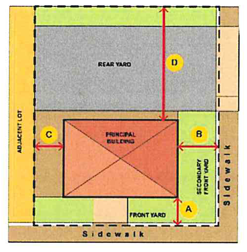 | ||
| MIN. | MAX. | |
| Primary Front Yard-A | 0 ft. | 5 ft. |
| Secondary Front Yard-B | 0 ft. | 10 ft. |
| Side Yard-C | ||
| Adjacent to CC zoning district | 0 ft. | - |
| Adjacent to any non-CC zoning district | 5 ft. | - |
| Rear Yard-D | ||
| Adjacent to CC zoning district | 5 ft. | - |
| Adjacent to any non-CC zoning district | 10 ft. | - |
a.
Primary vs. secondary front yards. When a lot is located on a corner lot, the primary front yard setback shall be measured from the right-of-way line of the street having higher pedestrian importance or intensity (e.g. traffic volume, number of lanes, etc.). Any lot line that borders on a street shall be considered a front yard; or along a main access drive if no street is present.
i.
The applicant shall identify primary and secondary front yards on any site plan for approval by the reviewing authority. In reviewing an applicant's designation of primary and secondary front yards, the reviewing authority shall consider the following:
(a)
Every lot shall have at least one primary front yard.
(b)
A lot may have more than one primary or secondary front yard.
(c)
Where a lot does not border a street, a main access drive shall be identified as its primary front yard.
(d)
The yard facing a minor street or main access drive (not alley) may be considered a primary or a secondary front yard.
b.
Waiver. The maximum setback requirements may be increased by up to 50 percent following the waiver procedures in section 42-324.
3.
Required building frontage. In order to maintain a pedestrian scale environment, it is important that buildings maintain a minimum frontage within the front setback area. This prevents buildings from being spaced too far apart, which creates gaps in the street wall. Building frontage is defined as the width of the building in the build-to area divided by the lot width at the front property line. By way of example, a building that is 70 feet wide in the build-to area located on a lot that is 100 feet wide would have a building frontage of 70 percent.
a.
Waiver. The frontage requirements may be altered by the planning commission if the applicant can demonstrate that, in addition to the review considerations in section 42-324 if it meets the following:
i.
The building is designed consistent with the intent of the frontage requirements; and that
ii.
Reasonable development potential exists on adjacent lots or on the same lot in the future to fill in the street wall over time.
(Ord. No. O-5-2025, 6-16-2025)
Sec. 42-329. - Building and frontage design.
Buildings in the CC-MU district shall comply with the following requirements, in addition to any applicable requirements of section 42-326 and section 42-331. The requirements of this section and section 42-331 are intended to be complimentary; however, in any instance where there is an apparent conflict, the provisions of this section shall prevail.
1.
Private frontage. The private frontage is the area between the right-of-way or main access drive (not alley) and the principal building façade and must contain architectural elements consistent with one of the following four frontages types. Each frontage is designed to be consistent with some or all of the uses permitted in the CC-MU district.
Note that the following table includes specific dimensional requirements for each of the frontages. Unless otherwise noted, the dimensional requirements are in addition to any other dimensional requirement of this article.
Shopfront Illustration: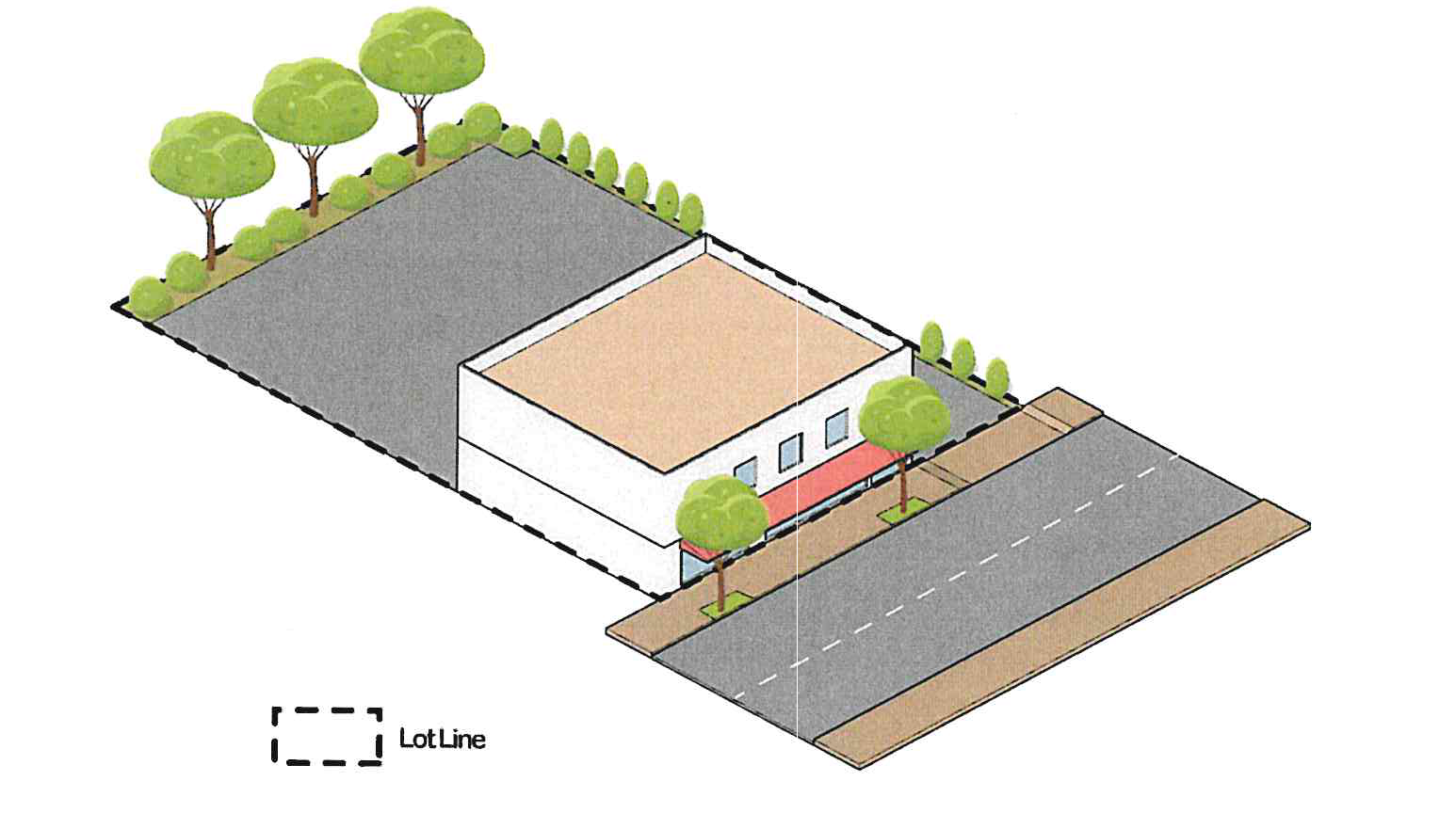
Courtyard Illustration: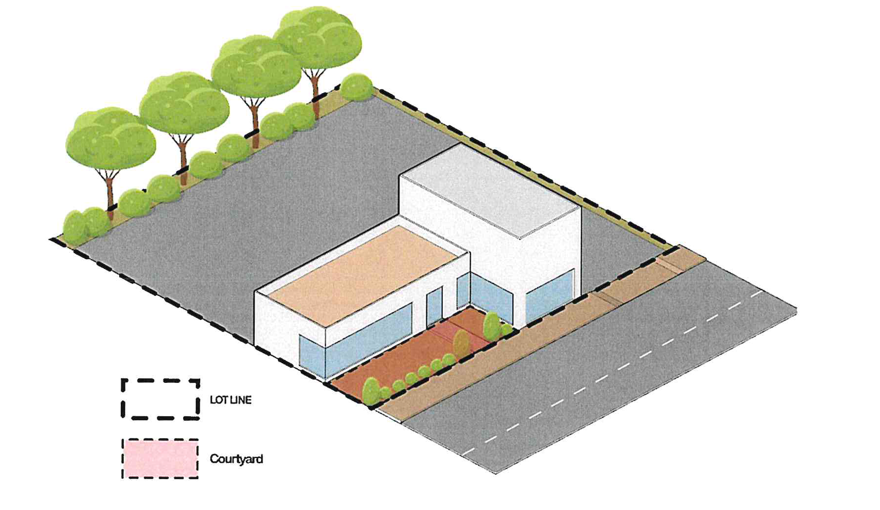
Stoop Illustration: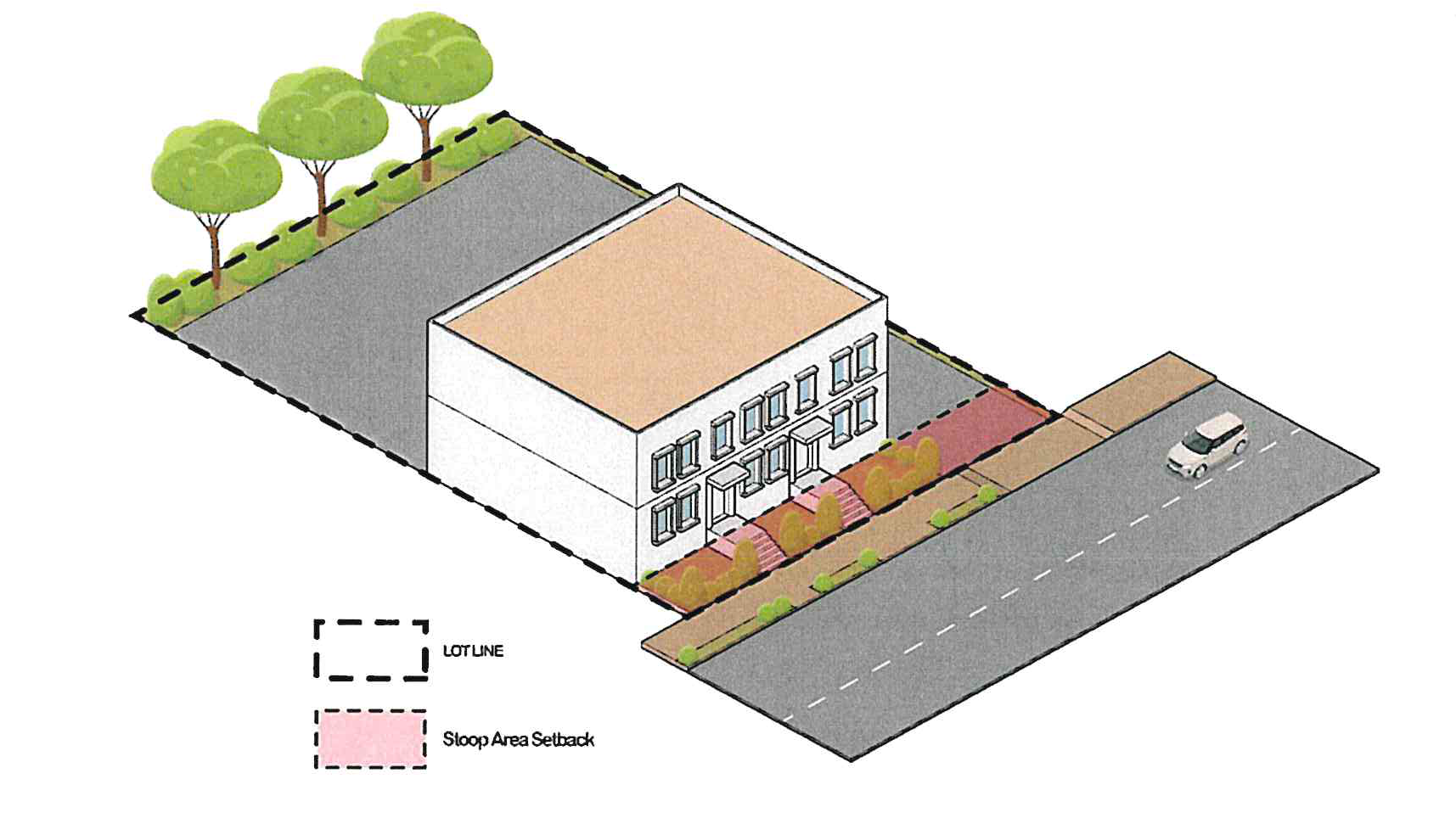
Lawn Illustration: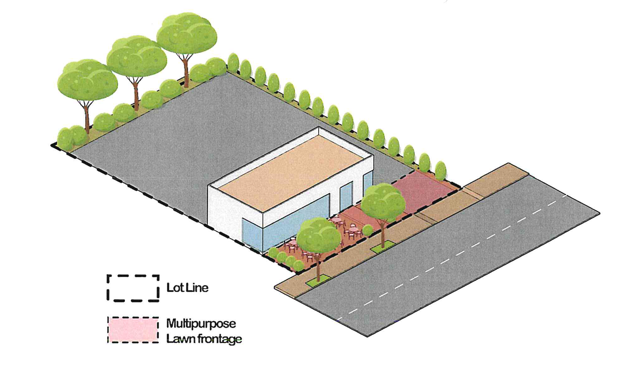
Sec. 42-330. - Building design.
Building design shall complement the intended small-town character and architectural heritage of the community. The design shall consider the adaptive reuse of the building. Building design shall incorporate a clear and well-articulated design concept, and architectural detailing that creates a positive and visually consistent image shall be encouraged.
1.
Building height.
a.
See Section 42-123 for height exceptions.
2.
Base, middle, and cap. All buildings shall incorporate a base, middle, and cap, as is applicable.
a.
Base. The base shall include an entryway with transparent windows and a horizontal molding or reveal placed between the first and second stories or over the second story.
b.
Middle. The middle shall include windows having a symmetrical, matching, or pattern design and may include balconies.
c.
Cap. The cap includes the area from the top floor to the roof of the building and shall include a cornice or roof overhang. Changes in roof height between facades or bays shall be required to include a terminating vertical break.
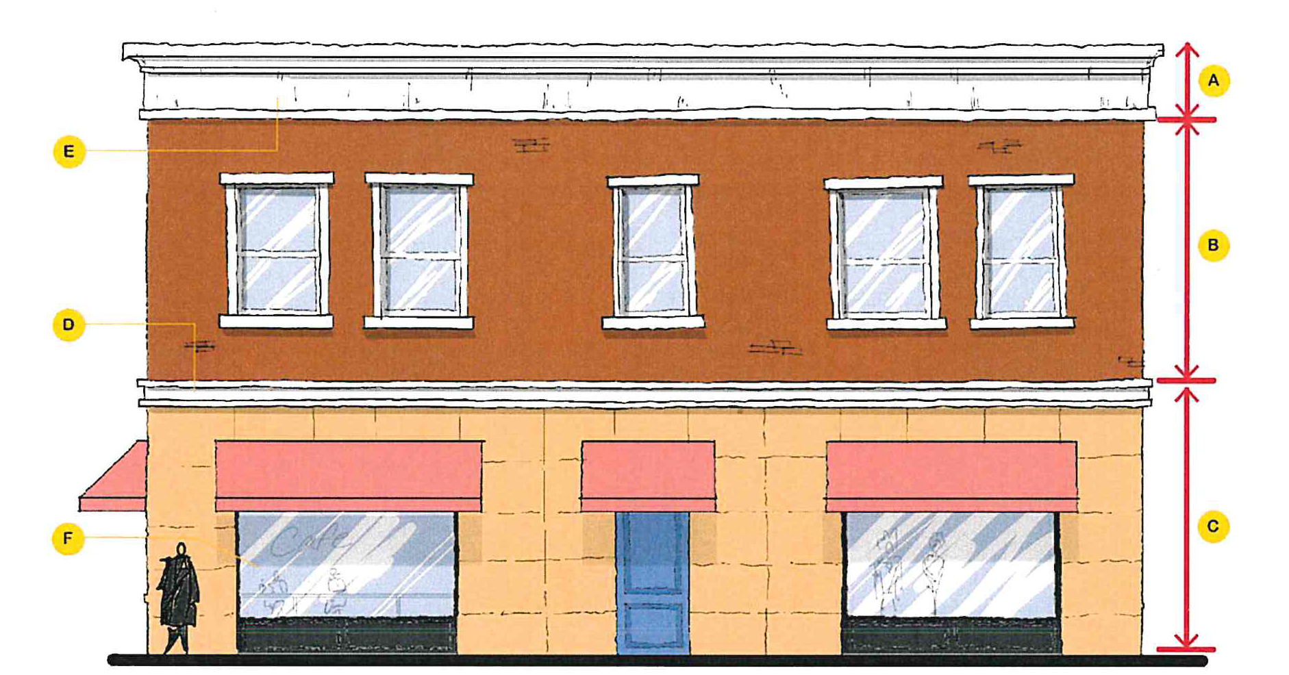
Figure 1: A) Cap of the building. B) Middle includes the windows and balconies of
this second-floor unit. C) The base encompasses the first floor and the street-front
of this buildings with primary entrances to units above and or units on the first
floor. D) Horizontal molding to separate the base and the middle. E) Deep protruding
cornice and molding.
Figure 1: A regular 2-story building with a base, middle and a cap. The horizontal molding or reveal (A) can be considered as base with entrances located in between and the windows of the first floor sitting between the horizontal band and the "middle (B)" which visually separates the first floor and the second floor. The cap (C) is the thick molding on the roof running along the perimeter of the building.
3.
Alignment. Windowsills, moldings, and cornices shall align with those of adjacent buildings. The bottom and top line defining the edge of the windows (the "windowsill alignment") shall not vary more than two feet from the alignment of surrounding buildings as long as the surrounding buildings comply with design standards identified in his ordinance. If the adjoining buildings have windowsill alignments that vary by more than two feet from one another, the proposed building shall align with one of the adjoining buildings. This requirement may be waived per section 42-324.
4.
Ground floor design.
a.
Building entrance(s). All buildings shall have their principal entrance open onto a street, sidewalk, or public space. The principal building entrance shall not open onto a parking lot, although a secondary or subordinate entrance may be provided to a parking lot.
b.
Entryway alignment.
i.
Nonresidential ground-floor uses. First floor of building shall have the principal entrance grade align with the elevation of the adjacent sidewalk. Sunken terraces or stairways to a basement shall not constitute principal entrances for the purposes of this section. It is not the intent of this section to preclude the use of below or above grade entryways, provided that such entryways are not principal entrances. Main entrances to buildings shall incorporate features such as canopies, roof overhangs, recessed entranceways, or other similar features to provide protection from the elements. In addition, long blank walls along the sidewalk leading to the entrance should be avoided.
ii.
Residential ground-floor uses. First-floor of building (including principal entrance) may be raised up to three feet above the grade of the adjacent sidewalk. This is intended to create greater privacy for first floor residential uses by elevating windows above the view of passing pedestrians.
5.
Encroachments. The following building elements may encroach into a public right-of-way or setback area:
a.
Balconies. Balconies on upper stories may encroach up to eight feet into any required setback area and up to four feet into any right-of-way area.
b.
Stoops. Unenclosed and uncovered front stoops may encroach up to five feet into a front yard setback area, provided that the stoop maintains a minimum setback of five feet from any right-of- way line.
c.
Awnings.
i.
Ground-story awnings may encroach up to six feet (B in diagram) from the face of the building into the setback or right-of-way area, but may not interfere with street lighting or trees.
ii.
Awnings shall have at least eight feet (C in diagram) above grade of sidewalk from the bottom of the awning or any support structure, and no higher than 12 feet (A in diagram) to the highest point of the canopy.
iii.
Awnings shall be constructed out of fabric, and may not be internally illuminated. Metal or other materials may be used for awnings if a waiver is approved per section 42-324.
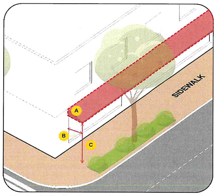
Figure 2. A. Awning projection to be reduced to accommodate streetlights and street
trees, 12 feet. B. Maximum Encroachment, six feet. C. Minimum clear Height, eight
feet.
d.
Bay windows. Bay windows on the ground story may encroach up to three feet into any setback area, but shall not encroach into the right-of-way. On upper floors, they may encroach up to three feet into any setback or right-of-way.
e.
Eaves. Roof eaves may encroach up to three feet into any setback or right-of-way area.
6.
Service areas. All service areas, including utility access, above ground equipment shall be screened from any public view per section 42-575. Dumpsters shall be located in the rear or nonrequired side yards and shall be screened from view of any public right-of-way with a solid wall, fence or live landscape material of at least six feet high per section 42-574.
7.
Mechanical and utility equipment. Mechanical equipment, electrical and gas meter and service components, and similar utility devices (whether ground level, wall mounted, or roof mounted) shall be screened on all sides by a wall, fence, or live landscape material and not face primary street. Exterior screening materials shall be the same as the predominant exterior materials of the principal building.
8.
Front façade design. All building façade that are visible from a public street, main access drive, or public space such as a plaza or square shall conform to the following design criteria:
a.
Blank walls are prohibited on the front façade.
b.
Encourage architectural features, details and ornaments such as archways, colonnades, cornices, contrasting bases, contrasting masonry courses, water tables, molding pilasters, columns, and corbelling, contrasting bands of color, stone or accent features.
c.
Windows. Large window openings shall be provided at ground level with transparent, nonreflective, minimally tinted glass. Window shapes should be rectangular, square or Palladian (mostly rectangular with a semi-circular top). Circular, octagonal, or diamond shaped windows may be allowed as accent features or when part of a specific architectural style. Windows above the ground floor should have a height to width ratio of at least 2:1, or have a ratio that complements the architectural style.
d.
Ground floor façade transparency.
i.
All buildings with first floor nonresidential uses shall maintain transparency for at least 70 percent of the first-floor facade area between two and eight feet above grade level. Doors and windows may be included.
ii.
All windows shall use transparent, non-reflective glass.
iii.
Areas of solid wall shall not exceed a length of 20 feet, unless otherwise specified.
e.
Recessed entrances encouraged. Doors are encouraged to be recessed into the face of the building to create a sense of entry and to add variety to the streetscape.
9.
Rear or side wall design. All sides of a building shall be similar in detail and material to present a cohesive appearance to the front façade.
10.
Building materials. The selection of materials shall enhance the architectural ambiance of the area and herein.
a.
All building elevations.
b.
Prohibited materials. Prohibited materials include, but are not limited to: vinyl, Exterior Insulation and Finishing Systems (EIFS), painted or scored concrete masonry units (CMU), dark-tinted, reflective, or mirrored glass, and exposed neon, except as permitted with a waiver by the planning commission who shall determine consistency with the intent of building design standards.
c.
Material or color changes. Material or color changes shall only occur at a change of plane. Material changes at the outside corners of buildings shall be integrated into the overall architectural design of the building as a corner treatment. Inconsistent adornment and frequent changes in material or color shall be avoided.
i.
Building material colors. The community development director, or designee, shall review building colors as a part of site plan approval.
(a)
For new construction, a color palette showing primary and accent colors of exterior finish materials shall be provided.
(b)
For building additions or renovations, exterior finish materials and colors shall be consistent or compatible with existing finish materials/colors.
(c)
As part of review, samples of building materials may be required.
d.
Soffits and other architectural elements. Soffits and other architectural elements visible to the public shall utilize materials compatible with other exterior materials on the building.
e.
Accessory buildings. Accessory buildings that are part of a new development shall incorporate the same materials and colors as are utilized in the primary structure. Accessory buildings that are connected to an existing site should incorporate a unifying element(s) with the existing principal building. The structure should meet the requirements listed in section 42-121.
f.
Stylized or prototype buildings. Building design such that the building itself is an advertisement shall not be permitted. Building architecture shall not be of a design which intends to advertise a particular corporate or franchise style.
(Ord. No. O-5-2025, 6-16-2025)
Sec. 42-331. - Design standards for specific uses and buildings.
A.
Multi-family residential.
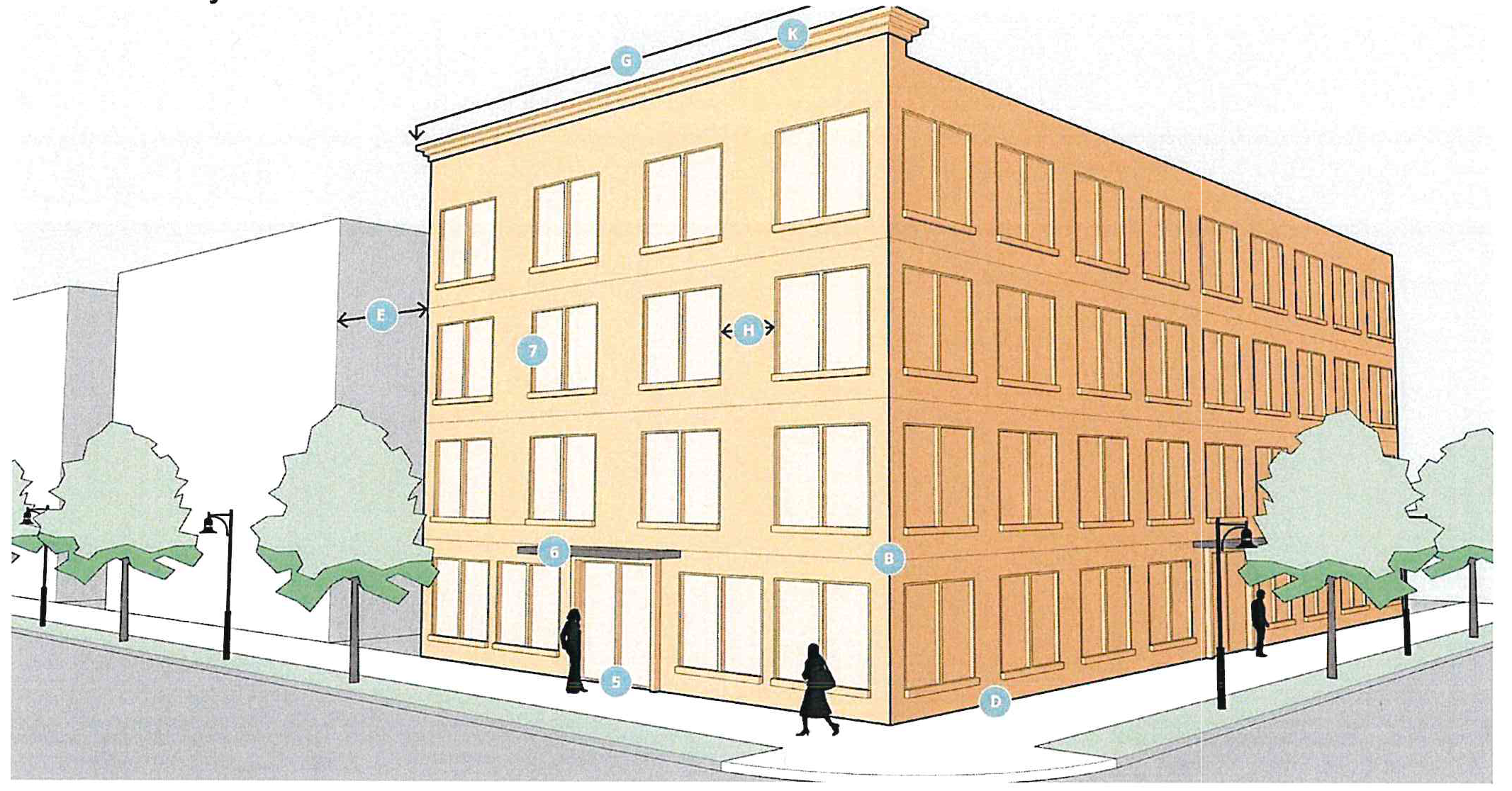
*0 feet where connected to adjacent building or 15 feet where separation between buildings is provided.
General design notes:
1.
All exterior building walls are designed with attention to detail and quality of material especially when facing streets and public accesses. There are no blank or unarticulated façade.
2.
Pattern of solids and voids generated by the vertical and horizontal alignment of similarly-sized windows and doors. Distance between façade breaks, bay widths, and spacing of windows and doors consistent with scale and rhythm of adjacent buildings.
3.
Primary building entrances open onto a street, main access drive, sidewalk, or public space. Secondary entrances may be provided from a parking lot. Corner buildings have at least one entrance addressing each street frontage.
4.
All architectural features, including awnings, overhangs, roof projections, window accents, and the like are compatible with the style, materials, and colors of the building.
5.
Primary building entrances at grade for accessibility.
6.
Building entrances clearly defined by recessing the entrance, or utilizing elements such as lintels, pediments, pilasters, columns, awnings, overhangs, or solar shades.
7.
Windows and doors shall be into the facade wall, to appear as if they were "punched" through the building façade.
8.
Ground floor may contain interior lobby, vestibule, and similar areas and, amenities, such as mail rooms, fitness centers, and community rooms. Ground floor apartments are allowed.
9.
In larger developments with more than one multifamily building, buildings shall be arranged and clustered to maximize opportunities for shared circulation and parking. The location and design of buildings and uses (including community amenities and open space) shall be designed for pedestrian access. Internal setbacks between all buildings shall be based on the provision of adequate light, ventilation, parking, and all other applicable building codes.
B.
Mixed-Use Building.
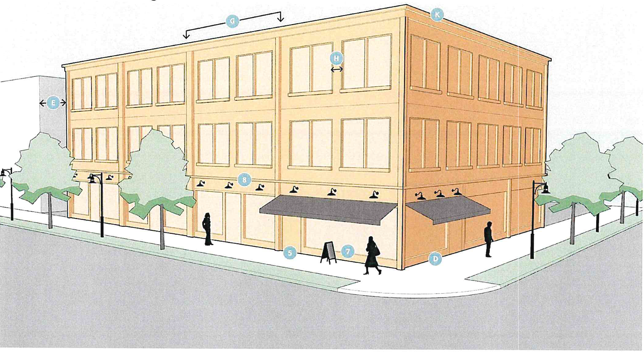
*0 feet where connected to adjacent building or 15 feet where separation between buildings is provided.
General design notes:
1.
All exterior building walls are of equal importance. All visible façade designed with attention to detail and quality of material. There are no blank or unarticulated façade, unless façade is not visible from public right-of-way, residential zoning district, or parking lot.
2.
Pattern of solids and voids generated by the vertical and horizontal alignment of similarly-sized windows and doors. Distance between façade breaks, bay widths, and spacing of windows and doors consistent with scale and rhythm of adjacent buildings.
3.
Primary building entrances open onto a street, main access drive, sidewalk, or public space. Secondary entrances may be provided from a parking lot. Corner buildings should have at least one entrance addressing each street frontage.
4.
Primary building entrances at grade for accessibility.
5.
Building entrances clearly defined by recessing the entrance, or utilizing elements such as lintels, pediments, pilasters, columns, awnings, overhangs, or solar shades.
6.
Entablatures, sign bands, cornices, or a similar horizontal expression line define the transition of ground floor storefronts and the second floor of all mixed-use buildings.
7.
Windows and doors recessed into the facade wall, to appear as if they were "punched" through the building façade. Storefronts need not meet this standard.
8.
Windows above the first floor are vertical in proportion, with a height to width ratio of at least 2:1, or have a ratio that complements the architectural style.
9.
Non-storefront windows shall have decorative sills and/or hoods. Full and segmented arches are allowed atop rectangular windows on upper stories.
10.
All architectural features, including awnings, overhangs, roof projections, window accents, and similar are compatible with the style, materials, and colors of the building.
11.
Buildings with multiple storefronts are unified in storefront design treatment, such as the design of windows and door openings, materials, and colors.
12.
Pedestrian pass-through connects the front of the building to rear parking or alleys.
C.
Single story commercial building.
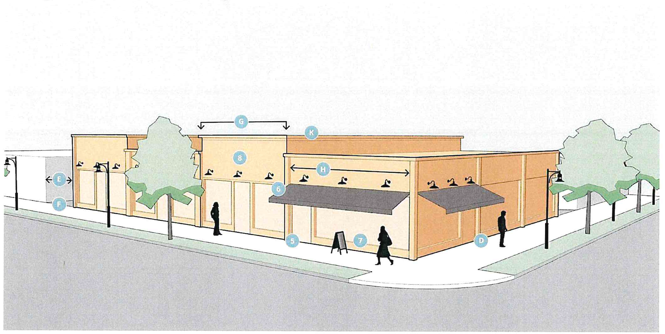
*0 feet where connected to adjacent building or 15 feet where separation between buildings is provided.
General design notes:
1.
All exterior building walls are of equal importance. All visible façades designed with attention to detail and quality of material. There are no blank or unarticulated façades, unless façade is not visible from public right-of-way, residential zoning district, or parking lot.
2.
Pattern of solids and voids generated by the vertical and horizontal alignment of similarly-sized windows and doors. Distance between façade breaks, bay widths, and spacing of windows and doors consistent with scale and rhythm of adjacent buildings.
3.
Primary building entrances open onto a street, main access drive, sidewalk, or public space. Secondary entrances may be provided from a parking lot. Corner buildings should have at least one entrance addressing each street frontage.
4.
Primary building entrances at grade for accessibility.
5.
Building entrances clearly defined by recessing the entrance, or utilizing elements such as lintels, pediments, pilasters, columns, awnings, overhangs, or solar shades.
6.
Entablatures, sign bands, cornices, or a similar horizontal expression line define the transition of ground floor storefronts and the second floor of all mixed-use buildings.
7.
Windows and doors recessed into the facade wall, to appear as if they were "punched" through the building façade. Storefronts need not meet this standard.
8.
Windows above the first floor are vertical in proportion, with a height to width ratio of at least 2:1, or have a ratio that complements the architectural style.
9.
Non-storefront windows shall have decorative sills and/or hoods. Full and segmented arches are allowed atop rectangular windows on upper stories.
10.
All architectural features, including awnings, overhangs, roof projections, window accents, and similar are compatible with the style, materials, and colors of the building.
11.
Buildings with multiple storefronts are unified in storefront design treatment, such as the design of windows and door openings, materials, and colors.
12.
Pedestrian pass-through connects the front of the building to rear parking or alleys.
(Ord. No. O-5-2025, 6-16-2025)
Sec. 42-332.A. - Signs.
All signs shall be architecturally integrated and complement their surroundings in terms of size, shape, color, texture, and lighting. Signs shall complement the overall design of the building and shall not be designed to be in visual competition with other signs in the area.
1.
Materials and color. Signs should incorporate the same building materials and color used in the primary structure and should be in scale and style with the architecture of the principal building. Lettering should be selected that is consistent with the building.
2.
Overall sign plan. All development shall have a sign plan which anticipates future development. New building design shall provide logical sign areas, allowing flexibility for new and additional users. Design shall provide for convenient and attractive replacement of signs. Buildings with multiple tenants shall include all tenants in the sign plan.
3.
Neon lettering and outlines. Neon, and similar outlines lights signs are prohibited, with the exception of open and closed signs that are included in a site plan approval.
4.
For each zoning lot, there is permitted one freestanding accessory sign, up to 50 square feet in area per side, for lots 125 feet or less in width, to be increased at a ratio of one square foot per each two and one-half; feet of lot frontage in excess of the initial 125 feet, up to a lot 300 feet wide. A zoning lot having in excess of 320 feet of frontage may have one additional sign based upon the same ratio of one square foot of sign area for each two and one-half; feet of lot frontage over the initial 320 feet of frontage. The maximum size for any one sign is 120 square feet.
5.
When multiple-use zoning lots are involved, for each additional use on the zoning lot beyond the initial use, 15 square feet of sign area is permitted, the total area of freestanding signs not to exceed 50 percent over the sign size originally permitted for the lot.
6.
For a lot with frontages on more than one street, each frontage may be treated as a separate frontage for the purpose of establishing permitted freestanding sign area and number.
7.
Freestanding signs. For a corner lot, the distance between permitted freestanding signs shall be not less than 100 feet, as measured along the property lines, but in no case shall there be a distance of less than 70 feet between such signs. Each such sign shall be oriented to the street frontage it serves. If one freestanding sign is used, then the percentage of freestanding sign area permitted on one street frontage may be increased 100 percent to a maximum of 120 square feet in area per side, provided that such sign is located not more than 25 feet from both street frontages.
8.
Where a zoning lot is permitted to have more than one freestanding accessory sign under this section, the distance between such freestanding signs shall not be less than 300 feet.
9.
Signs may not exceed 15 feet in height.
10.
Signs must be at least ten feet from any property line.
11.
Wall signs. For each use on a zoning lot, there are permitted wall signs, the combined area of which shall not exceed 15 percent of the total area of the wall to which the signs are attached. The total shall not exceed 100 square feet per street frontage. If no freestanding sign is used, the percentage of total wall area for wall signs may be increased by 33 percent per street frontage. Lots with dual frontages may not combine permissible signs for one frontage with another frontage for the purpose of placing a combined area of sign area on one frontage.
12.
Additional area for wall signs. In addition to the wall signage permitted in subsection 11 above, the permitted wall sign area may be increased if the criteria listed below is satisfied:
•
For buildings with wall frontage at the main building entrance that exceeds 99 lineal feet:
•
For buildings with wall frontage at the main building entrance that exceeds 299 feet from a public or private street:
13.
Canopy or awning signs. Sign copy may comprise up to 35 percent of the total exterior surface of a canopy or awning. Canopies or awnings with back-lit graphics or other kinds of internal illumination are prohibited.
(Ord. No. O-5-2025, 6-16-2025)
Sec. 42-332.B. - Screening (fences and walls).
The impact of those elements of a site, which have an adverse effect on the subject site and surrounding sites, should be minimized.
1.
The intent of this section is to provide some protection and delineation between residential and nonresidential uses from any adverse external effects and negative impacts from nonresidential development. A screen and buffer required by this section is intended to limit visual contact between uses and to create a strong impression of spatial separation.
2.
Screening materials.
a.
Screening materials shall consist of shrubs, fences or a combination thereof and be opaque in all seasons of the year from the ground to a height of at least four feet.
b.
Screening fences shall not be constructed of corrugated metal, corrugated fiberglass, sheet metal, chain link or wire mesh. If a long stretch of screening is required, options should be combined or alternated, or plant materials should be varied.
c.
Other creative options, such as changes in elevation, existing vegetation, or plant materials within a buffer area, are encouraged, but the applicant must demonstrate that comparable or superior screening will be provided.
3.
Existing screening.
a.
For the purposes of subsections [a.], [b.], and [c.] above, the planning commission may approve screening consisting of existing vegetation, planted vegetation and topographic characteristics of the land or a combination thereof if it satisfies the intent and purpose of this subdivision concerning opaque screening.
b.
The planning commission shall consider the characteristics of the land and vegetation present, the adequacy of the screening proposed, and other factors which impact upon adjoining residential and park uses.
c.
The planning commission on approving the use of existing topographical characteristics of the land or existing and/or planted vegetation may condition such approval on the planting of new vegetation in the number, size and type to satisfy the intent and purpose of this section.
4.
Additional landscaping.
a.
The planning commission may increase the height of the separation screening and/or require additional landscaping as part of the site plan review under division 5, subdivision 2 if the minimum requirements of subsection 2. would not adequately protect existing or future abutting residential uses.
b.
In deciding whether the requirements of subsection 2. protect abutting residential uses, the planning commission may consider factors which include, but are not limited to, the topography of the land, the type(s) of use(s) involved, the materials and vegetation to be utilized and the distance between structures and uses.
(Ord. No. O-5-2025, 6-16-2025)
Sec. 42-333.A. - Street design.
A.
Street design guidelines.
1.
Travel. Two-way streets are encouraged in the CC-MU district. One-way streets are not permitted, excepting alleys.
2.
Curb radius. The curb radius at the intersection of two streets should be the minimum necessary to permit vehicle circulation. A smaller curb radius shortens the distance that pedestrians must travel to cross the street, and leads to a safer pedestrian environment by reducing the speed at which cars can travel around corners. It is recommended that the curb radius not exceed 30 feet at the intersection of any two streets.
3.
Sidewalks at driveway crossings. When a sidewalk crosses a vehicle driveway, the driveway shall retain the elevation of the sidewalk. The appearance of the sidewalk shall be maintained across the driveway to indicate that the sidewalk is a part of the pedestrian zone and that pedestrians have the right-of-way.
4.
Pedestrian zone. The pedestrian zone is considered to be the area in between the curb and the edge of the right-of-way, frontage, or building facade, and includes area for sidewalks, landscape plantings, street furniture, public transit facility, and other pedestrian-scale uses and amenities. The treatment of the pedestrian zone determines the character of the street, and the quality of the public realm within the right-of-way. Streets are the most common public space in the city, and must be designed to be welcoming and accommodating for pedestrians as well as motorized traffic.
As shown in figure 3 below, the pedestrian zone in the CC-MU district should contain four distinct areas:
a.
Edge area that allows car doors to open freely and accommodates parking meters, streetlights;
b.
Furnishings area that accommodates amenities such as landscaping, planters, and sidewalk furniture;
c.
Walkway area where pedestrians walk;
d.
Frontage area adjacent to the building.
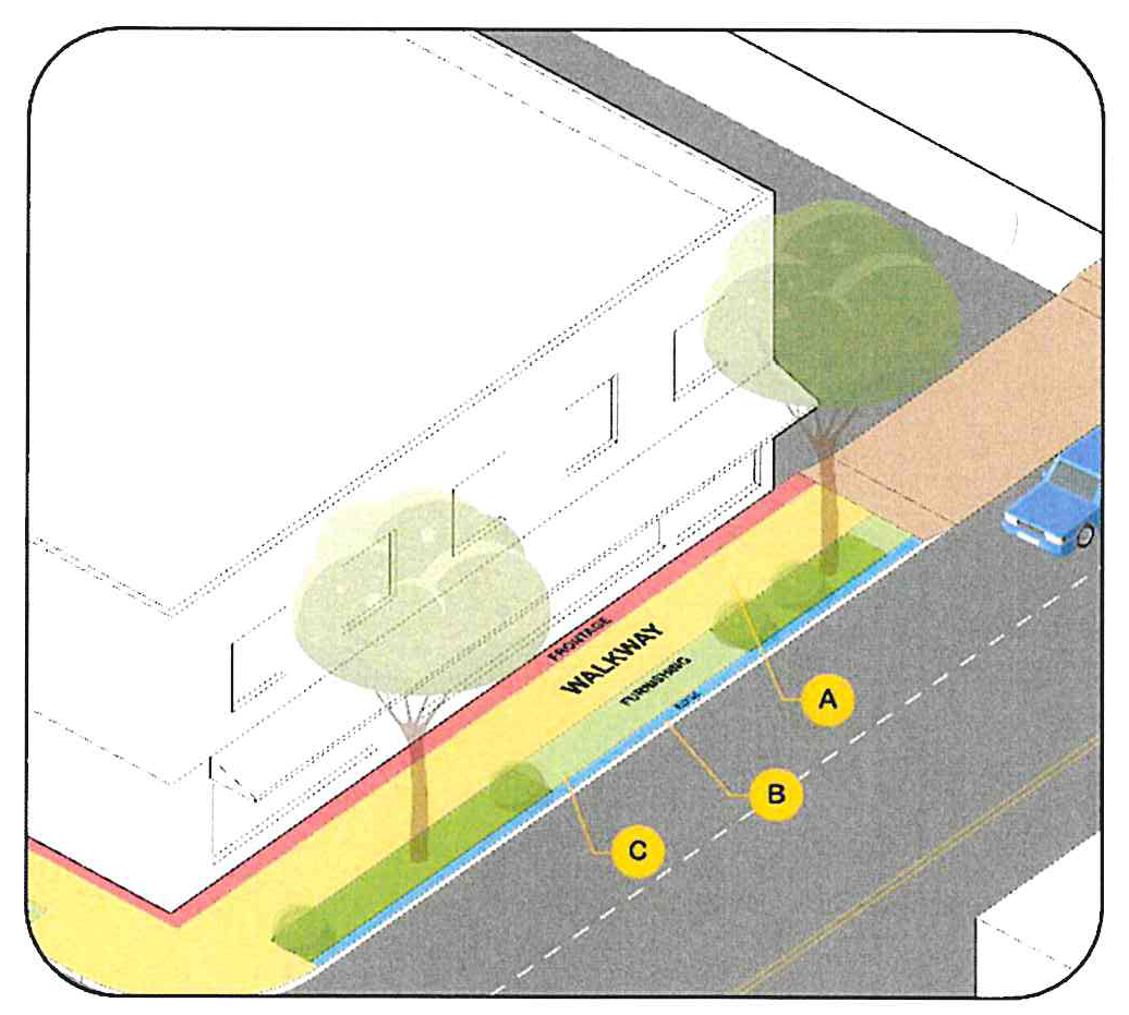
Figure 3. A- min 5 -feet. B- min 1.5 feet. C- min 5 feet
2.
The following design requirements and recommendations are intended to create an inviting public space alongside city streets:
a.
Pedestrian zone width. The pedestrian zone should have a minimum width of ten feet. A lesser width may be appropriate in constrained areas.
b.
Edge/curb area. The edge/curb area should have a minimum width of 1.5 feet, normally contained within the right-of-way, and should remain clear of obstructions to permit the doors of parked cars to open freely. Streetscape elements such as parking meters, streetlights, traffic control signs, and tree grates may be located in the edge area. The edge area may be paved, or if a tree lawn is combined, it may be combined with the furnishings area and landscaped.
c.
Furnishings area. The furnishings area accommodates amenities such as street trees, planters, public transit facilities, and sidewalk furniture. The furnishings area can be paved (with street trees located in tree grates), or it may be landscaped with a street lawn. Outdoor eating areas, sidewalk cafes, or other similar uses associated with a use in a directly adjacent building may be located in the furnishings area. The furnishings area should have a minimum width of five feet.
d.
Walkway area. The walkway area is the basic sidewalk area where pedestrians walk. The walkway area must maintain a five-foot-wide clear path free of obstructions at all times to permit free pedestrian travel. No permanent structures or uses may be located in the walkway area.
e.
Frontage area. The frontage area is the portion of the pedestrian zone adjacent to the edge of the right-of-way or main access drive. The frontage area is an optional area and may be used for street furniture or other uses accessory to the use in the adjacent building. When a building is constructed at the lot line, the frontage area should have a minimum width of two feet to accommodate opening doors and window shopping.
f.
Access management and driveways. Driveway consolidation is required when feasible to share access between properties. Additionally, driveways providing access to parcels and parking lots are encouraged to be accessed from minor streets.
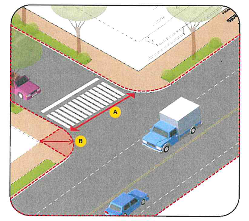
Figure 4. B-It is recommended that the radius be less than 30-feet. A-Least possible
distance recommended for increased pedestrian safety.
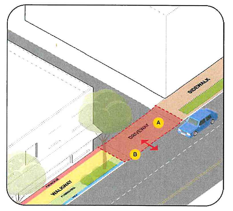
Figure 5. A-Shared driveway access between properties is encouraged. B-Driveways should
emulate the material of sidewalk for continuity and should be at the same level as
the travel lanes.
(Ord. No. O-5-2025, 6-16-2025)
Sec. 42-333.B. - Parking.
The following parking requirements are applicable in the CC-MU, and replace any similar requirements set forth in division 6, subdivision 1, off street parking:
1.
Minimum parking required. All new development or expansions of existing sites shall provide off-street parking spaces for the use according to the following requirements. The parking spaces shall be provided within 500 feet of the building.
a.
Residential uses. One parking spaces per residential dwelling unit.
b.
Nonresidential uses. One parking space per 500 square feet of nonresidential building space.
c.
Waiver. The minimum parking requirements may be reduced by the planning commission per section 42-520.
2.
Parking lot layout. Off-street parking lot layout, maintenance, and construction shall comply with all of the requirements of article 4, division 6, subdivision 1.
3.
Parking lot access. Multiple entrances to parking lots must be consolidated in the CC-MU district. Where feasible, shared cross access between parcels shall be provided.
a.
All parking spaces shall be set back a minimum of five feet from any property line or access drive.
b.
Loading space must be consistent with section 42-522.
(Ord. No. O-5-2025, 6-16-2025)
Sec. 42-334.A. - Outdoor amenity space.
Any development or redevelopment of a building with more than 20,000 square feet of floor area, or one acre in total lot size, in the CC-MU district shall provide outdoor amenity space. The outdoor amenity space shall have a minimum area of two percent of the gross floor area of the building. The size and disposition of the amenity space shall be proportionate to the size and scale of the development, and any amenity space used to satisfy this requirement shall be adjacent to or visible and accessible from a public right-of-way. The emphasis of the amenity space requirement is on the quality rather than the quantity of the space.
(Ord. No. O-5-2025, 6-16-2025)
Sec. 42-334.B. - Temporary outdoor retail sales.
Outdoor retail sales are permitted in the CC-MU district and subject to the following requirements:
1.
No permit required. Temporary or moveable outdoor retail sales activity or displays accessory to a principal use in the CC-MU district are permitted, subject to the following requirements:
a.
Area. The total of all outdoor sales display areas on the site shall not exceed 0.75 square feet per linear foot of building frontage in the build-to zone.
b.
Location. Outdoor sales areas may be located in the build-to zone, in an area adjacent to and not extending farther than 20 feet from the rear of the building, and/or in the right-of-way. Outdoor sales in the right-of-way shall be located in the frontage or furnishings area of the pedestrian zone directly adjacent to the building containing the use to which it is accessory. A minimum six-foot wide clear pedestrian pathway on the sidewalk shall be maintained at all times.
c.
Time. The outdoor sales display shall only be set out during business hours.
2.
Permit required. A permit from community development director or his/her designee is required for outdoor sales that exceed the area limitations in subsection a., above; for special outdoor sales events that will be located anywhere besides the frontage or furnishings area of the pedestrian zone; or for times outside of normal business hours. The permit will specify the permitted size and duration for the outdoor sales event.
(Ord. No. O-5-2025, 6-16-2025)
Sec. 42-334.C. - Outdoor storage.
Limited outdoor storage of merchandise, materials, or equipment is permitted in the rear yard if it is screened per section 42-574 or where located inside a building. In no case shall materials or merchandise being stored outdoors exceed a height of six feet.
(Ord. No. O-5-2025, 6-16-2025)
Sec. 42-335. - Definitions used in this subdivision.
This division provides definitions for terms that are used in this subdivision that are technical in nature or that might not otherwise reflect a common usage of the term. Where a definition in this section conflicts with a definition provided in section 42-112, the definition presented in this section shall prevail for the purposes of administering the CC-MU district requirements. If a term is not defined in this section, the planning and development director shall determine the correct definition of the term.
Balcony means an open portion of an upper floor that extends beyond or indents into a building's exterior wall.
Block means the aggregate of private lots, pedestrian pass-throughs, rear lanes and alleys, the perimeter of which abuts perimeter or internal streets.
Block perimeter means the linear distance around a block measured along the right-of-way line or road easement.
Buffer means an area of land, including landscaping, walls, and fences located between land uses of different characters and which is intended to mitigate negative impacts of the more intense land use on the less intense land use.
Build-to area means an area at the front of the lot in which a front building facade must be located.
Floorplate means the total indoor floor area of any given story of a building, measured to the exterior of the wall or balcony.
Frontage lot line means the lot line that coincides with the public right-of-way, main access drive, or edge of a space dedicated for public use. Building facades parallel to frontage lines define public space and are therefore subject to a higher level of regulation than the elevations that face other lot lines.
Habitable space means building space that involves human presence with direct view of the enfronting streets or public or private open space. Habitable space does not include parking garages, storage facilities, warehouses, and display windows separated from retail activity.
Tree lawn means a grassed or landscaped area located between the sidewalk and the curb of the street or main access drive intended to accommodate street tree plantings.
(Ord. No. O-5-2025, 6-16-2025)
Sec. 42-350.- Schedule of regulations.
A.
Schedule of regulations: The following schedule sets forth regulations regarding building height, bulk, density and area for the zoning districts as indicated. Numbers in parentheses are footnotes and apply as explained.
B.
Footnotes to Schedule of regulations:
(1)
See subsections D and E regarding flexibility allowances.
(2)
A residential lot that was legally recorded as part of a plat on December 14, 1965, and which was a buildable lot under the Zoning Code at the time of recording, shall be deemed a buildable lot even though it may have less area and/or width than the minimum zoning lot size per unit set forth in this subdivision. If such lot size dimensions are less than required in this subdivision, then the minimum yard setback applying to that dimension may be reduced to, but may not be less than, the following:
a.
For lots with less than the required lot width, side yard setback shall not be less than five feet;
b.
For non-lakefront lots with less than the required area, setbacks shall not be less than the following:
i.
Thirty feet to the rear line;
ii.
Fifteen feet from the street line abutting on the long side of a corner lot, provided that detached accessory buildings erected not less than 60 feet from the front street line may be erected not less than three feet from the side line, and provided further that a detached accessory building erected on a corner lot may be erected not closer than 15 feet to the side line of the street other than that upon which the dwelling on that lot is faced; and
iii.
Twenty-five feet from the front line, provided that when 25 percent or more of all the frontage on the same side of the street between two intersecting streets has been built up with permanent dwellings, the average setback of the dwellings shall be the minimum setback line between the intersecting streets.
c.
For lakefront lots with less than the required area, setbacks shall not be less than the following:
i.
Forty feet to the rear lot line.
ii.
Twenty feet from front lot line.
(3)
R-1A, R-1B, R-1C, and R-1D one-family residential districts. The number of stories and maximum height of any residential structure on lots of 80 feet or more in width shall not exceed three stories and 40 feet in height.
(4)
The side yard facing the street shall not be less than the minimum front yard of the district in which it is located, unless otherwise permitted in this article.
(5)
The following minimum floor area requirements apply to each residence hereafter erected. Any structure existing as of the date of the adoption of this article on February 18, 2003 and not meeting the requirements of this subsection shall not be prevented from being reconstructed and, for the purpose of this article, therefore, shall not be considered nonconforming.
The total square footage for a tri-level or bi-level shall equal at least the minimum square footage requirement for a two-story residence in the same district.
(6)
(a)
Developments are subject to the approval of the planning commission, after a public hearing, regarding modifications with respect to height regulations, and subject, further, to review by the council and approval thereof. In approving an increase in structural height, the commission and council shall require that all yards shall be at least equal in their depth to the height of the structure. The commission and council shall further determine that the topography, natural features or other land use characteristics, including the distance of the proposed structure from other uses, adequately mitigate adverse impacts on any adjoining or surrounding uses.
(b)
The height of any structure in an RM-1 or RM-2 multifamily residential district shall be no greater than 30 feet and two stories when the zoning lot abuts a single-family residential zoning district, except, after a public hearing, which may be held prior to site plan approval, the height of the structure may be increased to no more than 35 feet and three stories if the planning commission determines that the topography, natural features or other land use characteristics, including the distance of the proposed structure from the residential district and residential structures therein, adequately mitigate adverse impacts upon any adjacent single-family residential zone or use. The height of a structure under this provision may be increased beyond the maximum height stated in this subsection only if the regulations and procedures of subsection (6)(a) of this section are followed.
(c)
In all other districts, the height of any structure shall be no greater than 30 feet and two stories when the zoning lot abuts a single-family residential zoning district, except, after a public hearing, which may be held prior to site plan approval, the height and number of stories of the structure may be increased to the height normally allowed in the zoning district if the planning commission determines that the topography, natural features or other land use characteristics, including the distance of the proposed structure from the residential district and residential structures therein, adequately mitigate adverse impacts upon any adjacent single-family residential zone or use. The height of a structure under this provision may be increased beyond the height normally allowed within the district only if the requirements and procedures of subsection (6)(a) of this section are followed.
(d)
Structures in existence on the effective date of the ordinance codified in this subsection which violate subsection (6)(b) or (6)(c) of this section shall be conforming structures pursuant to this Code for all purposes, except that an increase in height of such structures can only be obtained by planning commission approval using the procedures set forth in subsection (6)(b) or (6)(c) of this section.
(7)
(a)
In an RM-1 multifamily residential district, the total number of rooms of 80 square feet or more (not including kitchen, dining and sanitary facilities) shall not be more than the square footage of the entire parcel divided by 1,400, excluding wetlands and/or floodplains as defined in subsection (7)(b) of this subsection. In an RM-2 multifamily residential district, the total number of rooms of 80 square feet or more (not including kitchen, dining and sanitary facilities) shall not be more than the square footage of the entire parcel divided by 2,800, excluding wetlands and/or floodplains as defined in subsection (7)(b) of this subsection. The area used for computing density shall be the total site area exclusive of any dedicated public right-of-way of either interior or abutting roads. For the purpose of computing the permitted number of dwelling units per acre in an RM-1 or RM-2 district, the following room assignments shall control:
One-bedroom unit = 2 rooms.
Two-bedroom unit = 3 rooms.
Three-bedroom unit = 5 rooms.
Four-bedroom unit = 7 rooms.
All units shall have at least one living room and one bedroom, except that not more than ten percent of the units may be of an efficiency apartment type. Plans showing one-, two- or three-bedroom units and including a den, library or other extra room shall count such extra room as a bedroom for the purpose of computing density.
(b)
In an RM-1 or RM-2 multifamily residential district containing wetlands as defined by section 30301 of the Natural Resources and Environmental Protection Act (MCL 324.30301, MSA 13A.30301) or floodplains as defined by the 100-year flood zones under division 4, subdivision 9, the total number of rooms of 80 square feet or more (not including kitchen, dining or sanitary facilities) shall not be more than the total square footage of the wetland and/or floodplain divided by 5,600 in the RM-1 multifamily residential district and divided by 11,200 in the RM-2 multifamily residential district.
(c)
Notwithstanding subsection (7)(b) of this section, in no event shall the development upon part of any parcel exceed an average density of 125 percent of the allowable density as expressed in subsection (7)(a) of this section per developed acre.
(8)
In an RM-1, RM-2 or R-1T attached residential district, front, side or rear yards need not refer to spacing between buildings for a planned development for two or more buildings on the same parcel. In such cases, the minimum distance between two buildings shall be regulated according to the length and height of each such building, and in no instance shall such distance be less than 30 feet, as provided in the formula in this subsection. In a platted RM-1, RM-2 or R-1T development, the minimum distance between a building and interior side yard shall be not less than 15 feet and shall, in addition, continue to be regulated according to the length and height of buildings or parcels adjoining that interior side yard, according to the formula in this subsection. Areas devoted to off-street parking, drives or maneuvering lanes shall not cover more than 30 percent of the area of any required yard or any required minimum distance between buildings. The formula for regulating the required minimum distance between two buildings is as follows:
S = L A + L B + 2(H + H B )/6
For the purposes of such formula:
S =
The required minimum horizontal distance between any wall of building A and any wall
of building B or the vertical prolongation of either.
L
A
=
The total length of building A. The total length of building A is the length of that
portion of a wall of building A from which, when viewed directly from above, the lines
drawn perpendicular to building A will intersect any wall of building B.
L
B
=
The total length of building B. The total length of building B is the length of that
portion of a wall of building B from which, when viewed directly from above, the lines
drawn perpendicular to building B will intersect any wall of building A.
H
A
=
The height of building A. The height of building A at any given level is the height
above natural grade level of any portion of a wall along the length of building A.
Natural grade level is the mean level of the ground immediately adjoining the portion
of the wall along the total length of the building.
H
B
=
The height of building B. The height of building B at any given level is the height
above natural grade level of any portion of a wall along the length of building B.
Natural grade level is the mean level of the ground immediately adjoining the portion
of the wall along the total length of the building.
(9)
Off-street parking may occupy a portion of the required front yard after approval of the parking plan layout and points of ingress and egress by the commission, provided that there is maintained a minimum unobstructed and landscaped setback of ten feet between the nearest point of the off-street parking area, exclusive of access driveways, and the nearest right-of-way line as indicated on the major thoroughfare plan.
(10)
No side yards are required along the interior side lot lines of the district, except as otherwise specified in the building code of the city (article 8, division 2 of this chapter), provided that if walls of structures facing such interior side lot lines contain windows or other openings, side yards of not less than ten feet shall be provided. On a corner lot which borders on a residential district, there shall be provided a setback of 27 feet on the side or residential street. On an exterior side yard abutting a residential district, there shall be provided a setback of 15 feet in width.
(11)
Off-street loading space shall be provided in the rear yard in the ratio of at least one space per each establishment and shall be provided in addition to any required off-street parking area. Off-street loading space shall further meet the requirements of division 6, subdivision 1.
(12)
The minimum land area requirements are as follows:
a.
Minimum project area. The project area shall not be less than a ten-acre tract of land, which at the time of filing for approval as a unified form of land development is designated by its owner or developer as a tract to be used, developed or built upon as a unit under single ownership or control. This tract may include more than one lot of record recorded with the county register of deeds if the lots or parcels are contiguous. The council may approve a minimum project area of less than ten acres, upon application of the owner or developer, upon the finding by the council that the proposed development fulfills the intent of the district.
b.
Minimum lot area. A lot or parcel intended for development within the project area shall not be less than two acres and must have a minimum width of 150 feet. The lot or parcel intended for development with the project shall be considered a zoning lot as defined by this article.
(13)
Off-street parking may occupy a portion of the side yard and rear yard only after approval of the parking layout and points of ingress and egress, provided that there is maintained a minimum unobstructed and landscaped setback of 25 feet between the nearest point of the off-street parking area, exclusive of access drives, and the nearest property line. Off-street parking is not permitted in the front yard.
(14)
No building, structure or use, including off-street parking, in this district shall be located closer than 50 feet to a residential district boundary.
(15)
No building shall be closer than 20 feet to the outer perimeter of the district when the adjacent property is zoned I-1, I-2, CPD, B-2 or B-3. In all other cases, no building shall be closer than 75 feet to the outer perimeter of the district. No building shall be located closer than 30 feet to a property line that abuts a private street.
(16)
Minimum lot area. A lot or parcel intended for development shall not be less than ten acres and must have a minimum width of 150 feet at the street right-of-way line. The lot or parcel intended for development shall be considered a zoning lot as defined by this article. The council may approve a minimum lot or parcel area of less than ten acres, upon application of the owner or developer, upon the finding by the council that the proposed development fulfills the intent of the district.
(17)
The front yard setback may be penetrated to within 50 feet of the road right-of-way with either parking or that portion of the use housing only offices. All yards abutting on a public street shall be considered as front yards for setback purposes.
(18)
In an industrial park setting, the minimum front yard setback shall be 30 feet when the yard abuts a local street internal to the industrial park setting.
(19)
Side yards as indicated shall be required when abutting a residential district. Interior side yards shall be equal to at least one-half the height of the structure, provided that in no instance shall the interior side yard be less than 12 feet. Notwithstanding any provision of this article, no structure in this district shall be located closer than 75 feet to a residential district boundary.
(20)
The lot coverage of 30 percent applies to both conforming and nonconforming lots in the R-1A, R-1B, R-1C and R-1D Districts. An increase in lot coverage to 30 percent may be permitted for lots in the R-1T, RM-1 and RM-2, OTR, B-1 and CPD districts that meet the minimum area and width requirements for the zoning district in which it is located, subject to review and approval by the director of transportation and utilities to ensure storm water drainage and related impacts are properly addressed.
D.
Averaging of lot sizes. This section is intended to permit the subdivider or developer to vary his lot sizes and lot widths so as to average the minimum size of lot per unit as required in section 42-160.A for each one-family residential district. If this option is selected, the following conditions shall be met:
(1)
In meeting the average minimum lot size, the subdivision shall be so designed as not to create lots having an area or width greater than ten percent below that area or width required in section 42-160.A, and shall not create an attendant increase in the number of lots.
(2)
The technique of averaging minimum lot size is acceptable only in those instances wherein the entire preliminary plat, which has received council approval, is carried through a final plat and is then recorded in its totality. Recording of portions of a preliminary plat are not acceptable under is option.
(3)
All computations showing lot area and the average resulting through such technique shall be indicated on the print of the preliminary plat.
E.
Subdivision and open space plans. This section is intended to permit one-family residential subdivisions to be planned as a comprehensive unit, allowing, therefore, certain modifications to the standards as outlined in section 42-160.A to be made in one-family residential districts according to the following:
(1)
The lot area in a one-family residential district with water and sewers may be reduced up to 20 percent. In an R-1A one-family residential district, this reduction may be accomplished in part by reducing lot widths up to ten feet. These lot area reductions shall be permitted provided that the dwelling unit density shall be no greater than if the land area to be subdivided were developed in the minimum square foot lot areas as required for each one-family residential district under section 42-160.A.
(2)
Rear yards may be reduced to 30 feet when the lots border on land dedicated for park, recreation and/or open space purposes, provided that the width of such dedicated land is not less than 100 feet measured at the point at which it abuts the rear yard of the adjacent lot.
(3)
For each square foot of land gained under the provisions of subsection (1) of this section within a residential subdivision through the reduction of lot size below the minimum requirements as outlined in section 42-160.A, at least equal amounts of land shall be dedicated to the common use of the lot owners of the subdivision in a manner approved by the city.
(4)
The area to be dedicated for subdivision open space purposes shall not be less than four contiguous acres and shall be in a location and shape approved by the planning commission. At least 50 percent of the required open space shall be developed for recreational use, and no more than 25 percent of the required open space shall be wetlands or bodies of water or lie within a 100-year floodplain.
(5)
In approving the application of the subdivision open space plan technique, the planning commission must be cognizant of the following objectives:
a.
To provide a more desirable living environment by preserving the natural character of open fields, stands of trees, brooks, hills and similar natural assets;
b.
To encourage developers to use a more creative approach in the development of residential areas, thereby designing safety into the street pattern; and
c.
To encourage a more efficient and desirable use of open area while recognizing a reduction in development costs and by allowing the developer to bypass natural obstacles in the site.
(6)
The plan for reduced lot sizes shall only be permitted if it is mutually agreeable to the council and the subdivider or developer.
(7)
The plan for reduced lot sizes shall be started within six months after having received approval of the final plat and shall be completed in a reasonable time. Failure to start within such time shall void all previous approval.
(8)
The developer or subdivider shall dedicate and develop the total park, open space or recreational area, as provided in this section, at the time of filing of the final plat on all or any portion of the plat. In lieu of completion of the recreational area with the first phase, and with the specific consent of the council, the proprietor shall deposit with the city a true copy of an acceptable agreement showing that the proprietor has deposited with a bank or other agent acceptable to the city cash, a certified check, an irrevocable letter of credit or a surety bond in an amount estimated by the director of parks and recreation as sufficient to secure to the city the satisfactory construction and installation of the required improvements, if any, as agreed between the city council and subdivider or developer, in an amount representing 125 percent of the estimated construction costs of completion of the required improvements. Also, the recreational area must be dedicated in perpetuity for public or common use with the recordation of the first phase and access from a public street or other public property must be provided.
(9)
The modifications permitted under this subsection shall not be applied in conjunction with the modifications permitted under section 42-160.A.
(Ord. No. 03-01 (Exh. A, § 42-410.0), 2-18-2003; Ord. No. 01-06, 2-14-2006; Ord. No. 19-04, 10-15-2019; Ord. No. O-6-2024, § 1, 7-9-2024)
State Law reference— Zoning districts authorized, MCL 125.581, MSA 5.2931; height, bulk and area regulations authorized, MCL 125.582, MSA 5.2932; density limits authorized, MCL 125.583, MSA 5.2993.
Sec. 42-370.- Intent.
The city, confronted with increasing urbanization, changes in the technology of land development, and a growing demand for housing, has developed this planned development district with the intent to encourage:
A.
The variety and flexibility in land development that is necessary to meet those changes in technology and demand and that will be consistent with the best interests of the city; and
B.
The more efficient use of those public facilities required in connection with the residential development.
(Ord. No. 03-01 (Exh. A, § 42-411.0), 2-18-2003)
Sec. 42-371. - Definitions.
The following words, terms and phrases, when used in the planned development district, shall have the meanings ascribed to them in this section, except where the context clearly indicates a different meaning:
Common open space: A parcel of land or an area of water, or a combination of land and water, within the site designated for a planned development, designed and intended for the use or enjoyment of residents of the planned development. Common open space may contain such complementary structures or improvements as are necessary and appropriate for the benefit and enjoyment of residents of the planned development.
Final plan: The plan for development of a planned development or divisible geographic section thereof, approved subsequent to the approval of the tentative plan by the planning commission and council under this article.
Landowner: The legal or beneficial owner of all land proposed to be included in a planned development. The holder of an option or a contract to purchase, or other persons having an enforceable proprietary interest in such land, shall be deemed to be a landowner for the purposes of this article.
One-family attached residential dwelling: A dwelling that is attached by means of one or more of the following:
a.
Through a common party wall which does not have over 50 percent of its area in common with an abutting dwelling wall;
b.
Reserved.
c.
Through a common party wall in only the garage portion of an abutting structure. In this case, no other common party wall relationship is permitted, and not more than four units shall be attached in this manner.
Plan: Any or all of the plan stages of a planned development, including the tentative plan and the final plan.
Planned development: An area of land, controlled by a landowner, to be developed as a single entity.
Single ownership: The proprietary interest of a single landowner.
Tentative plan: A plan submitted for approval to the planning commission and council prior to the submission of a final plan.
(Ord. No. 03-01 (Exh. A, § 42-411.1), 2-18-2003; Ord. No. O-9-2024, 10-22-2024)
Sec. 42-372. - Applicability of subdivision.
This subdivision applies to any tract of land proposed to be developed, which tract is under single ownership, for which an application for a planned development is made as provided in this subdivision.
(Ord. No. 03-01 (Exh. A, § 42-411.2), 2-18-2003)
Sec. 42-373. - Principal permitted uses.
Uses permitted in a PD planned development district are limited to:
A.
Dwelling units in detached, semidetached, attached or multi-storied structures, or any combination thereof.
B.
Nonresidential uses of a religious, cultural, recreational, office or commercial character, the extent of which shall not exceed the amounts specified in section 42-374.
(Ord. No. 03-01 (Exh. A, § 42-411.3), 2-18-2003)
Sec. 42-374. - Site development requirements.
A.
Design standards:
1.
Housing types: The plan may provide for a variety of housing types.
2.
Nonresidential uses. A maximum of 20 percent of the total area may be used for nonresidential uses, including access roads and parking associated with such nonresidential uses.
3.
Compliance with subdivision regulations; water and sewer service; pedestrian ways. Each proposal for a planned development concerning the specifications for the width and surfacing of streets and highways, alleys and ways for public utilities, curbs, gutters, streetlights, public parks and playgrounds, school grounds, storm water drainage and other improvements shall be subject to the specifications established in the subdivision regulations (article 5 of this chapter.)
B.
Specific requirements of a planned development are as follows:
1.
Water supply and sewage collection. The planned development shall be served by the city water supply system and sewage collection system.
2.
Pedestrian circulation. The pedestrian circulation system and its related walkways shall be insulated as completely and as reasonably as possible from the vehicular street system in order to provide separation of pedestrian and vehicular movement. This shall include, when deemed to be necessary, a pedestrian underpass or overpass in the vicinity of schools, playgrounds, local shopping areas, nonresidential areas and other neighborhood uses which generate a considerable amount of pedestrian traffic.
C.
Non-applicability of other zoning regulations; mixture of housing types: The applicant for a planned development must demonstrate that the proposed plan cannot be developed under other sections of this article or provide for a mixture of at least two of the following three housing types: one-family attached or detached, two-family or multifamily.
D.
Density:
a.
The overall density in a proposed planned development shall not exceed seven units per acre.
b.
In the event of a proposed phase development, no one phase shall exceed a density of 12 units per acre.
c.
The density of phases developed at any given time, including phases already developed, shall not exceed seven units per acre.
d.
In one-family residential areas of a planned development, the average lot size shall be not less than 6,500 square feet, with a minimum of 5,000 square feet.
E.
Setbacks:
a.
Perimeter setback requirements. In a planned development that abuts property and that permits developments of less intensity than permitted by the planned development, a peripheral transition area shall be incorporated in the planned development that provides development similar in density to that existing or permitted on the abutting land.
b.
Internal setbacks for multifamily residential structures. Internal setbacks for multifamily residential structures shall adhere to the requirements set forth in division 4, subdivision 10.
c.
Internal setbacks for duplex and one-family residential structures. Internal setbacks for duplex and one-family residential structures shall be based on the provision of adequate light, ventilation and parking.
F.
Height of buildings: The height of particular buildings shall not be a basis for approval or denial of a plan, provided that any structure in excess of 45 feet shall be designed to be consistent with the reasonable enjoyment of neighboring property, the entire planned development and the efficiency of existing public services.
G.
Off-street parking: Parking shall be conveniently accessible to all dwelling units and other uses, and shall be provided pursuant to the minimum requirements of division 6, subdivision 1. Screening of parking and service areas is required through ample use of trees, shrubs, earth berms, hedges and screening walls.
H.
Screening: When nonresidential uses or structures in a planned development abut residential structures, appropriate screening of all parking and loading areas shall be provided as follows:
a.
A solid masonry or stockade fence with a maximum height of six feet; or
b.
Densely planted mature shrubbery having a minimum height, at the time of planting, of six feet.
I.
Common open space: The amount and location of common open space shall be consistent with the declared function of the common open space as set forth in the application for the planned development, and there shall be such provisions for the ownership and maintenance of the common open space as are reasonable to ensure its continuity and conservation.
J.
Accessory structures: Accessory structures, buildings and uses shall be subject to the regulations contained in section 42-121.
(Ord. No. 03-01 (Exh. A, § 42-411.4), 2-18-2003)
Sec. 42-375. - Plan review and approval (PD, planned development).
A.
Administrative rules; forms: The planning commission may make written general rules regarding general procedures and forms of applications relating to this subdivision as it may determine, provided that they are not inconsistent with this article.
B.
Filing of application for approval of tentative plan; fee: An application for approval of a tentative plan shall be executed by or on behalf of the landowner and filed with the department of community development. A filing fee as set forth by resolution of the council, payable to the city, shall be submitted to the department. Such filing fee shall be used to defray the costs of the public hearing and the administrative review of the proposed plan.
C.
Contents of application for approval of tentative plan: Application for approval of a tentative plan shall include the following:
1.
A statement of purpose and objectives;
2.
A general plan of development, including a designation of proposed land uses by relative intensity and proportion of land area intended for each land use;
3.
A program of development outlining the proposed stages of development;
4.
The time schedule;
5.
A statement demonstrating the independence of each stage and the integration of the proposed development into the proposed or existing development pattern;
6.
The general location and size of the area involved and the nature of the landowner's interest in the land proposed to be developed;
7.
The density of land use to be allocated to parts of the area to be developed;
8.
The location, function, ownership and manner of maintenance of common open space;
9.
The use, approximate height, bulk and location of buildings and other structures;
10.
The feasibility of proposals for the disposition of sanitary waste and storm water;
11.
The substance of covenants, grants of easements or other restrictions to be imposed upon the use of the land, buildings and structures, including proposed easements for public utilities;
12.
The provisions for parking vehicles, the location and width of proposed streets and public ways, and the relationship of proposed streets and other public facilities in proximity to the proposed planned development;
13.
The required modifications in the regulations otherwise applicable to the subject property;
14.
In the case of plans which call for development over a period of years, a schedule showing the time within which application for final approval of all parts of the planned development are intended to be filed; and
15.
The proposed conditions and form of performance bonds or irrevocable bank letters of credit to ensure the proper implementation of the plan.
D.
Review of tentative plan by planning commission: A public hearing shall be held by the planning commission on the tentative plan for a planned development and a report and recommendation thereof submitted to the council.
E.
Action by council on tentative plan: The council shall hold a public hearing based on the tentative plan. The tentative plan may be accepted, modified or rejected by the council, after a report and recommendation from the planning commission. If agreement is reached with the landowner or his designee on required modifications, the tentative plan shall be approved.
F.
Rezoning of subject land: Approval by the council, after a public hearing and recommendation of the planning commission, of a tentative plan shall constitute the rezoning of the subject land to a PD planned development district.
G.
Time limit for submission of final plan:
1.
Approval by the council, after a public hearing and recommendation of the planning commission, of a tentative plan shall qualify an area for application for approval of a final plan and development as a planned development under this article for two years.
2.
If no final plan is accepted for development within such time, the council may extend the designation for not to exceed a two-year period, or immediately initiate rezoning proceedings to redesignate the property to the zoning classification previously existing or the zoning classification which would be deemed suitable for the property.
H.
Standards for final plan: A final plan for development of the planned development or divisible geographic section thereof shall be submitted to the planning commission for recommendation and to council for approval. The application for approval of a final plan shall include such drawings, specifications, covenants, easements and conditions and form of bonds as were set forth by resolution at the time of tentative approval. In accordance with the schedule proposed in the application for tentative approval, the landowner may elect to have final approval of only a geographic section of the land included in the plan. The final plan shall be in substantial compliance with the previously approved tentative plan and shall not:
1.
Vary, by more than ten percent, the proposed gross residential density or intensity of use;
2.
Involve a reduction of the area set aside for common open space;
3.
Increase, by more than ten percent, the floor area proposed for nonresidential use; or
4.
Increase, by more than five percent, the total ground area covered by buildings.
I.
Variations from approved tentative plan: If a plan submitted for final approval varies from the tentative plan by more than the limits set forth in subsection H of this section or in other important regards, the council may request either modification of the submission or that the plan be considered as an application for tentative approval. However, modifications in the location or design of streets or facilities for water and for disposal of storm water and sanitary sewage shall not necessitate submission of a new request for planned development zoning.
J.
Time limit for commencing development: After a final plan is approved by the council, development of the planned development or divisible geographic section thereof shall begin within 12 months of approval of the final plan. If development is not begun within such time, the final plan must be resubmitted for reapproval. At the lapse of each 12 months period, the council, before reapproval, may require modification of the final plan to meet new or previously undetected conditions affecting the project area.
K.
Development in sections:
1.
The council, after either the favorable or unfavorable recommendation of the planning commission, may approve divisible geographic sections of the entire parcel to be developed as a planned development; shall, in such cases, specify reasonable periods within which development of each section must be commenced; and may permit in each section deviations from the number of dwelling units per acre established for the entire planned development.
2.
Such deviations, however, shall be adjusted in other sections of the development so that the number of dwelling units per acre authorized for the entire planned development is not affected.
3.
The period of the entire development and the commencement date for each section thereof may be modified from time to time by the council upon the showing of good cause by the landowner, provided that in no case shall any extension of time exceed 12 months.
4.
The landowner shall make such easements, covenants and other arrangements and shall furnish such performance bonds or irrevocable bank letters of credit as may be determined by the council to be reasonably required to ensure performance in accordance with the plan and to protect the public interest in the event of abandonment of such plan before completion.
L.
Authority to waive or modify specifications: The council, however, may waive or modify the specifications otherwise applicable for a particular public facility or standard for planned development where it finds, on the basis of evidence supplied by the landowner, that such specifications are not in the best interests of the residents of the planned development and that the modifications of such specifications are not inconsistent with the interests of the entire city.
M.
Previously existing uses:
1.
Previously existing residential uses in an area designated for planned development shall not be considered nonconforming uses.
2.
All other previously existing uses shall be considered nonconforming unless those uses are incorporated as a part of the planned development plan.
(Ord. No. 03-01 (Exh. A, § 42-411.5), 2-18-2003; Ord. No. 19-04, 10-15-2019)
Sec. 42-390.- Intent.
A.
The OTR office technology research district is designed to provide for a community of production and research and development facilities, rather than for a single research structure, and to exclude therefrom incongruous uses. The OTR district is further designed to ensure compatibility between the production, research and development operations therein and the activities and character of the community in which the operations are located.
B.
The district is further intended to permit the design and development of larger land areas in a campus setting submitted as a unified form of land development. The land areas are intended to be designed with suitable open space and landscaping, and be harmonious and compatible with the environment and adjacent residential and/or nonresidential areas.
(Ord. No. 03-01 (Exh. A, § 42-412.0), 2-18-2003)
Sec. 42-391. - Principal permitted uses.
Permitted uses: In an OTR office technology research planned development district, no building or land shall be used, and no building shall be erected, except for one or more of the following specified uses, unless otherwise provided in this article:
A.
Establishments whose primary activity is conducting basic research, design, and pilot or experimental product development.
B.
High and advanced technology, research and development uses, laboratories, including university-based research and facilities used for testing and analysis of products or uses. These uses may include, but need not be limited to, those related to computer software and hardware design, telecommunications, biotechnology, agricultural technology, pharmaceutical production, and other similar fields of research and development.
C.
Pilot plant, when subordinate to a research facility and located on the same site, which emphasizes product development over high volume production.
D.
Technical training schools and facilities.
E.
Vocational, trade and/or business schools, provided that all activities shall be conducted in completely enclosed buildings.
F.
Office buildings, corporate headquarters, regional offices, and data processing facilities. These uses may include, but need not be limited to, those related to banks and other financial institutions, data processing and management centers, insurance companies, health-related industries, direct sales/telemarketing, and professional services, including engineers, architects and other consulting businesses.
G.
Medical facilities, offices, clinics, laboratories and related activities.
H.
Accessory buildings and uses customarily found in connection with the uses in this district.
(Ord. No. 03-01 (Exh. A, § 42-412.1), 2-18-2003)
Sec. 42-392. - Special land uses.
Special land uses: The following uses may be allowed in an OTR office technology research district as part of a unified form of land development plan (conceptual plan) submitted under section 42-394, subject to the conditions imposed in this section for each use, and subject further, to the review and approval of the planning commission in accordance with the provisions of division 5, subdivision 1 of this article:
A.
Health and fitness clubs.
B.
Restaurants, except those of a drive-in or drive through, provided that these uses shall have access only from the streets within the OTR district area, rather than direct access from adjacent streets.
C.
Hospitals, subject to the requirements of section 42-242.D.
D.
Accessory towers and antennas.
(Ord. No. 03-01 (Exh. A, § 42-412.2), 2-18-2003)
State Law reference— Special uses authorized, MCL 125.584a, MSA 5.2934(1).
Sec. 42-393. - Site development requirements.
A.
Except as otherwise noted in this section, parking, signs, landscaping, and lighting shall be governed by the requirements of division 6 of this article.
B.
Site plan review shall be governed by the requirements of division 5, subdivision 2 of this article.
C.
Lot, yard and building requirements shall be governed by the requirements of division 4, subdivision 10 of this article.
D.
All uses in the OTR district shall be connected to municipal water and sewer utilities.
E.
All telephone, electric, television and similar communication services distributed by wire or cable shall be placed underground to serve the use and development.
(Ord. No. 03-01 (Exh. A, § 42-412.3), 2-18-2003)
Sec. 42-394. - Plan review and approval (OTR, office technology and research).
A.
Development of land in the OTR district shall be permitted subject to an approved unified form of land development plan (conceptual plan) and an approved site plan or subdivision plan (specific plan) as required by this section.
B.
Unified form of land development plan (conceptual plan): Prior to development of any land zoned OTR district, the owner or developer of the tract of land to be developed shall submit a conceptual plan to the department of community development. This conceptual plan shall include the following information:
1.
A statement of purpose and objectives.
2.
A general plan of development, including the proposed and special land uses by relative intensity and proportion of land area intended for each use.
3.
A map or maps containing the date and north arrow, to be drawn at a minimum acceptable scale of one inch equals 100 feet.
4.
The name of the development, legal description, and names and addresses of the landowner and developer.
5.
All contiguous holdings of the landowner, accompanied by an affidavit of ownership which includes the date of acquisition and liber and page of the conveyance as recorded by the county register of deeds.
6.
Property lines and existing land uses of adjacent tracts of land.
7.
The location, width and names of existing streets, and public and private easements.
8.
The location of existing sewers, water mains, storm drains and other underground facilities within or adjacent to the property.
9.
The topography, drawn as contours with an interval of not more than two feet. Elevations must be based on United States Geological Survey data.
10.
The use, approximate height, bulk and location of buildings and other structures.
11.
A program of development outlining the proposed stages of development, including the time schedule.
12.
A statement demonstrating the independence of each development stage and the integration of the proposed development into the proposed or existing development pattern.
13.
The location, function, ownership and manner of maintenance of common open space.
14.
The preliminary proposals for the distribution of water and the disposition of sanitary waste and storm water.
15.
The provisions for parking vehicles, the location and width of proposed streets and public ways, and the relationship of proposed streets and other public facilities in proximity to the proposed development.
16.
The substance of covenants, grants of easements or other restrictions to be imposed upon the use of the land, buildings and structures, including proposed easements for public utilities.
17.
An inventory of natural features and characteristics, including bodies of water, floodplains, wetlands, soils, groves of trees, and historical, archeological and similar irreplaceable assets.
C.
Review by planning commission: The project review and public hearing shall be conducted by the planning commission on the conceptual plan pursuant to the Zoning Act, and a report and recommendation thereof submitted to the council.
D.
Action by council: After receipt of the planning commission report and recommendation, the council shall hold a public hearing on the conceptual plan pursuant to the Zoning Act. The conceptual plan may be approved, approved with conditions, modified or rejected by the council.
E.
Time limit for submission of specific plan: The approved conceptual plan shall be effective for a period not to exceed two years. If no specific plan is received for development during this two-year period, conceptual plan approval shall expire. The council may, after receipt of a written request from the applicant before the expiration of the two-year period, grant an additional one-year extension of the conceptual plan.
F.
Time limit for commencing construction: Conceptual plan approval shall expire if construction pursuant to an approved specific plan is not started within two years from the previous specific site plan approval.
G.
Resubmission: If the conceptual plan expires or if modifications are needed, the plan must be resubmitted in the same manner as provided for review and approval of the original conceptual plan.
H.
Development plan (specific plan):
a.
Required; conformance with conceptual plan. Subsequent to approval of the conceptual plan, development of an individual lot or parcel as a specific plan shall be permitted pursuant to an approved site plan subject to the requirements specified in division 5, subdivision 2, Site Plan Review. the specific plan shall be in substantial conformance with the approved conceptual plan.
b.
Time limit for commencing construction. After a specific plan is approved pursuant to division 5, subdivision 2, site plan review, development shall commence within 12 months of approval of the specific plan. If development is not begun within this period, the specific plan must be resubmitted for approval per division 5, subdivision 2, site plan review.
c.
Resubmission. If the specific plan expires or if modifications are needed, the plan must be resubmitted in the same manner as provided for the review and approval of the original specific plan.
I.
Standards for review of conceptual plan: In making their respective determinations, the planning commission and the council shall consider the following standards and objectives in reviewing the conceptual plan for development in the OTR district:
1.
The buildings and structures are of a size and location that achieve economy and efficiency in the use of the land, natural resources and energy, and in the providing of public services and utilities.
2.
The buildings and structures are compatible with and mutually supportive of each other.
3.
The buildings and structures are of a unified architectural and structural character.
4.
The plan incorporates techniques that encourage innovation in land use and variety in design size, layout and type of buildings and structures constructed. The plan incorporates useful open space in an appropriate amount and location.
5.
The landscaping is of a common unifying theme that provides integration of the sites within the development.
6.
The common drives, parking areas and service areas are designed and sized in a definite relationship to the types and sizes of uses to be located in the development. The development provides an attractive, comfortable and convenient environment for patrons and others who desire to use the development.
7.
It is designed and will be constructed in such a way as to be compatible with the environment and with neighboring uses, especially residential areas.
8.
The transitions between the various sites and structures within the development are of a type, nature and size that enhance the ease and safety of vehicular and pedestrian traffic flow and are consistent with the character of the development.
9.
The public services and facilities affected by the conceptual plan are capable of accommodating the increased service and facility loads caused by the development.
10.
The conceptual plan considers the natural environment and conserves natural resources and energy.
J.
Authority to waive or modify standards: The council may waive or modify the standards and requirements of this section for a conceptual plan on the basis of evidence submitted by the developer that:
1.
A requirement is inconsistent with the planned development as a whole;
2.
The objectives of the standard or requirement can be satisfactorily met without strict adherence to it;
3.
The waiver or modification will not be detrimental to the public welfare or injurious to other surrounding property; and
4.
Because of the particulars of the facilities proposed in the plan, it would be unreasonable to require strict adherence.
(Ord. No. 03-01 (Exh. A, § 42-412.4), 2-18-2003; Ord. No. 19-04, 10-15-2019)
Sec. 42-410.- Intent.
A.
The city, planning for continued growth and realizing that the demand for commercial land development is desirable, intends in the CPD commercial planned development district to encourage flexibility in commercial land development to meet these changes and new opportunities.
B.
The district is intended to encourage office, retail and service uses in one or more buildings in a planned manner that are compatible with and mutually supportive of each other.
C.
It is intended that the district provide an attractive, comfortable and convenient environment for patrons of the development and that the development be designed and constructed in such a way as to be compatible with the environment and with neighboring uses, especially residential areas.
D.
It is further intended that this district be located in areas within the community which are designated in the comprehensive plan for intensive or general commercial use.
(Ord. No. 03-01 (Exh. A, § 42-413.0), 2-18-2003)
Sec. 42-411. - Definitions.
The following words, terms and phrases, when used in this subdivision, shall have the meanings ascribed to them in this section, except where the context clearly indicates a different meaning:
A.
Approved proposal of development: A developer's time schedule approved by the council, concerning the submission of specific plans for construction.
B.
Conceptual plan or plan: A document which can be recorded with the county register of deeds that contains at a minimum all those items required by section 42-414 B.4.
C.
Developer and owner: The legal or beneficial owner of all land proposed to be included in the conceptual plan. The holder of an option or a contract purchase or other persons having an enforceable proprietary interest in such land are included.
D.
Development: That which is to be included and done as part of a conceptual plan.
E.
Open space: An area of land or water or a combination of land and water within the development which has no buildings or structures upon it, except such complementary structures or improvements as are necessary and appropriate to the intent of the open space. Open space does not include areas designated as parking, loading or storage areas, or sidewalks.
(Ord. No. 03-01 (Exh. A, § 42-413.1), 2-18-2003)
Sec. 42-412. - Principal permitted uses.
In the commercial planned development district, no building, structure or premises, except as otherwise provided in this article, shall be erected, altered or used, except for one or more of the following uses:
A.
Any principal permitted use allowed in the OS-1 district.
B.
Any principal permitted use allowed in the B-1 district.
C.
Any principal permitted use allowed in the B-2 district.
D.
Any special land use allowed in the B-2 district.
E.
Any principal permitted use allowed in the B-3 district.
F.
Work/live accommodations in accordance with the provisions of section 42-137.
G.
Accessory uses: Accessory uses are permitted in the CPD commercial planned development district, including but not limited to the following:
1.
Satellite dishes, antennas and communication devices if not being used in connection with a radio or television station.
2.
Accessory uses permitted in section 42-121, Accessory buildings and uses.
(Ord. No. 03-01 (Exh. A, § 42-413.2), 2-18-2003; Ord. No. 11-13, 8-23-2011)
Sec. 42-412.1. - Special land uses
The following uses may be allowed in the CPD, Commercial Planned Development District, subject to the conditions imposed in this section for each use, and subject further, to the review and approval of the planning commission in accordance with the provisions of Division 5, Subdivision 1 of this article:
A.
Veterinary hospitals or clinics
a.
Buildings housing this use shall be freestanding and not connected to any other building containing any other use.
b.
No commercial boarding or kenneling of animals shall be permitted.
c.
An outdoor area associated with the care of patrons' animals is permitted, subject to the following:
i.
the outdoor area shall not be located in any front yard adjacent to a public street, unless otherwise approved by the director;
ii.
the outdoor area shall not be located adjacent to a residential district; and,
iii.
the outdoor area must be screened from view with a minimum six-foot tall oblique fence or wall. The fence must be constructed of the same or similar material as the building.
d.
No cremations or crematory facilities shall be operated on the premises.
B.
Reserved.
(Ord. No. 21-04, 12-7-2021)
Sec. 42-413. - Site development requirements.
A.
Signs: Freestanding, wall and other signs are permitted in the CPD commercial planned development district and shall fulfill the requirements of division 6, subdivision 2, Signs.
B.
Off-street parking and loading: Off-street parking and loading shall be provided in the CPD commercial planned development district pursuant to the minimum requirements of division 6, subdivision 1, Off-Street Parking and Loading.
C.
Utilities:
1.
All uses in the CPD commercial planned development district must be connected to municipal water and sewer utilities.
2.
All telephone, electric, television and similar services distributed by wire and cable shall be placed underground to serve the individual uses and the development.
D.
Landscaping and screening: The development shall be designed to fulfill the minimum requirements of division 6, subdivision 3, Landscaping and Screening. Additional landscaping may be required to ensure compatibility within the plan and with neighboring uses.
(Ord. No. 03-01 (Exh. A, § 42-413.3), 2-18-2003)
Sec. 42-414. - Plan review and approval (commercial planned development).
A.
Standards for review of conceptual plan: In making their respective determinations, the planning commission and the council shall consider the following standards and objectives in reviewing the conceptual plan for development in the CPD commercial planned development district:
1.
The buildings and structures are of a size and location which achieve economy and efficiency in the use of the land, natural resources and energy, and in the providing of public services and utilities.
2.
The buildings and structures are compatible with and mutually supportive of each other.
3.
The buildings and structures are of a unified architectural and structural character.
4.
The plan incorporates techniques which encourage innovation in land use and variety in design size, layout and type of buildings and structures constructed. The plan incorporates useful open space in an appropriate amount and location.
5.
The landscaping is of a common unifying theme which provides integration of the sites within the development.
6.
The common drives, parking areas and service areas are designed and sized in a definite relationship to the types and sizes of uses to be located in the development. The development provides an attractive, comfortable and convenient environment for patrons and others who desire to use the development.
7.
It is designed and will be constructed in such a way as to be compatible with the environment and with neighboring uses, especially residential areas.
8.
The transitions between the various sites and structures within the development are of a type, nature and size which enhance the ease and safety of vehicular and pedestrian traffic flow and are also consistent with the character of the development.
9.
The public services and facilities affected by the conceptual plan are capable of accommodating the increased service and facility loads caused by the development.
10.
The conceptual plan considers the natural environment and conserves natural resources and energy.
B.
Procedure for plan review: Development of land zoned CPD commercial planned development shall be permitted subject to an approved unified form of land development plan (conceptual plan) and an approved site plan (specific plan) as follows:
1.
Conceptual plan required; contents: Prior to development of any land zoned CPD commercial planned development, the owner or developer of the tract of land to be developed shall submit a conceptual plan to the department of community development.
2.
This conceptual plan shall be reviewed by the department of community development to ensure that it is in compliance with the requirements of the district as well as the overall intent of the district as set forth in the standards stated in this subdivision.
3.
The owner or developer may request an informal meeting with the director of community development to investigate the procedures, standards and objectives of this subdivision with reference to commercial planned development.
4.
The conceptual plan shall include the following information:
a.
A statement of purpose and objectives.
b.
A general plan of development, including the proposed uses by relative intensity and proportion of land use area intended for each use.
c.
A map or maps containing the date and north arrow, to be drawn at a minimum acceptable scale of one inch equals 100 feet.
d.
The name of the development, legal description, and names and addresses of the landowner and developer.
e.
All continuous holdings of the landowner, accompanied by an affidavit of ownership which includes the date of acquisition and liber and page of the conveyance as recorded by the county register of deeds.
f.
Property lines of adjacent tracts of land.
g.
The location, width and names of existing streets, and public and private easements.
h.
The location of existing sewers, water mains, storm drains and other underground facilities within or adjacent to the property.
i.
The topography drawn as contours with an interval of not more than two feet. Elevations must be based on United States Geological Survey data.
j.
The use, height and setbacks (location) of the buildings and other structures, including an elevation drawing of each side of the building.
k.
A program of development outlining the proposed stages of development, including the time schedule, and screening, landscaping and buffering proposals.
l.
A statement demonstrating the independence of each development stage and the integration of the proposed development into the proposed or existing development pattern.
m.
The location, function, ownership and manner of maintenance of common open space and the preliminary landscape proposal for the development.
n.
The preliminary proposals for the distribution of water and the disposition of sanitary waste and storm water.
o.
The assessment of traffic issues and impacts, and provisions for parking vehicles, the location and width of proposed streets and public ways, and the relationship of proposed streets and other public facilities in proximity to the proposed development.
p.
The substance of covenants, grants of easements or other restrictions to be imposed upon the use of land, buildings and structures, including proposed easements for public utilities.
q.
An inventory of natural features and characteristics, including bodies of water, floodplains, wetlands, soils, groves of trees, and historical, archeological and similar irreplaceable assets.
C.
Review by planning commission: Review of the conceptual plan and public hearing shall be conducted by the planning commission on the conceptual plan pursuant to the requirements of the Zoning Act, and a recommendation thereof submitted to the council.
D.
Action by council:
1.
After receipt of the planning commission recommendation, the council shall hold a public hearing on the conceptual plan pursuant to the requirements of the Zoning Act.
2.
The council may make modifications to the conceptual plan which are deemed appropriate and consistent with the requirements and objectives stated in this subdivision and are related to the standards established.
3.
The conceptual plan may be approved with conditions, modified or rejected by the council.
E.
Impact statements: After a conceptual plan is submitted, the developer may be required to provide impact statements which address the environmental, economic and fiscal impact of the proposed development. The impact statements shall contain such information as the city may prescribe.
F.
Expiration of conceptual plan:
1.
Time limit for submission of specific plan: If a specific plan is not received at the time required by an approved program of development or two years after the approval of the conceptual plan pursuant to this section, whichever is less, conceptual plan approval shall expire.
2.
The council may, after receipt of a written request from the developer before the expiration of the time period, grant up to a two-year extension of the conceptual plan or modify the approved program of development.
3.
Time limit for commencing construction. Conceptual plan approval shall also expire if construction pursuant to an approved specific plan is not commenced within two years from the previous specific site plan approval.
4.
Resubmission. If the conceptual plan expires or if modifications are needed, a plan must be resubmitted pursuant to the requirements of this section in the same manner as provided for review and approval of the original conceptual plan.
G.
Authority to waive or modify standards: The council may waive or modify the standards and requirements of this section for a conceptual plan on the basis of evidence submitted by the developer that:
1.
A requirement is inconsistent with the planned development as a whole;
2.
The objectives of the standard or requirement can be satisfactorily met without strict adherence to it;
3.
The waiver or modification will not be detrimental to the public welfare or injurious to other surrounding property; and
4.
Because of the particulars of the facilities proposed in the plan, it would be unreasonable to require strict adherence.
H.
Site plan conformance with conceptual plan: Subsequent to approval of the conceptual plan pursuant to this subdivision, development of an individual lot or parcel as a specific plan shall be permitted pursuant to an approved site plan, subject to the requirements specified in division 5, subdivision 2, Site Plan Review. The specific plan shall be in substantial conformance with the approved conceptual plan.
I.
Time limit for commencing development: After a specific plan is approved pursuant to division 5, subdivision 2, site plan review, development shall commence within 12 months of approval of the specific plan. If development is not begun within this time period, the specific plan must be resubmitted for approval in accordance with the requirements of division 5, subdivision 2, site plan review.
J.
Resubmission: If the specific plan expires or if modifications are needed, the plan must be resubmitted in the same manner as provided for the review and approval of the original specific plan.
(Ord. No. 03-01 (Exh. A, § 42-413.4), 2-18-2003; Ord. No. 19-04, 10-15-2019)
Sec. 42-430.- Intent.
The P-1 vehicular parking district is intended to permit the establishment of areas to be used solely for off-street parking of private passenger vehicles as a use incidental to a principal use. A P-1 district will generally be provided by petition or request to serve a use district which has developed without adequate off-street parking facilities. The P-1 district is also intended to serve as a zone of transition between residential and non-residential districts.
(Ord. No. 03-01 (Exh. A, § 42-414.0), 2-18-2003)
Sec. 42-431. - Principal permitted uses.
In the P-1 vehicular parking district no building or land shall be used, and no building shall be erected, except for the following specified use, unless otherwise provided in this article:
A.
Off-street vehicular parking areas.
(Ord. No. 03-01 (Exh. A, § 42-414.1), 2-18-2003)
Sec. 42-432. - Special land uses.
The following uses may be allowed in the P-1 vehicular parking district, subject to the conditions imposed in this section and section 42-433 for each use, and subject further, to the review and approval of the planning commission in accordance with the provisions of division 5, subdivision 1 of this article:
A.
None.
(Ord. No. 03-01 (Exh. A, § 42-414.2), 2-18-2003)
Sec. 42-433. - Site development requirements.
A.
A parking area shall be accessory to, and for use in connection with, one or more businesses or industrial establishments located in adjoining business or industrial districts, or in connection with one or more existing professional or institutional office buildings or institutions.
B.
A parking area shall be contiguous to an RM-1 multifamily residential, B-1 local business, B-2 community business, B-3 general business, OS-1 office service, OTR office technology research, I-1 light industrial or I-2 heavy industrial districts. A parking area may be approved when adjacent to these districts, or on the end of a block where the parking areas front on a street that is perpendicular to that street servicing the district. There may be a private driveway or public street or alley between the P-1 district and any of the districts listed in this subparagraph.
C.
A parking area shall be used solely for parking of private passenger vehicles for periods of less than one day and shall not be used as an off-street loading area.
D.
No commercial repair work or service of any kind, or sale or display thereof, shall be conducted in the parking area.
E.
No signs of any kind, other than signs designating entrances, exits and conditions of use, shall be maintained on such a parking area.
F.
One building, not exceeding 15 feet in height, for use as a shelter or for attendants, may be erected upon the premises.
G.
An application for P-1 district rezoning shall include a dimensional layout of the area showing the intended parking plan.
H.
Parking areas shall comply with the applicable requirements of section 42-572.
I.
Where a P-1 district is contiguous to a residential district which has a common frontage on the same block with residential structures, or wherein no residential structures have been yet erected, there shall be a setback equal to the required residential setback for such residential district, or a minimum of 25 feet, whichever is greater. Any required landscaping or screening shall be located at the setback line.
J.
Lot, yard and building requirements shall be governed by the requirements of division 4, subdivision 10 of this article.
K.
Signs, landscaping/screening, and lighting shall be governed by the requirements of division 6 of this article.
L.
Site plan review shall be governed by the requirements of division 5, subdivision 2 of this article.
(Ord. No. 03-01 (Exh. A, § 42-414.3), 2-18-2003)
Sec. 42-434.- Intent.
A.
The intent of the city centre area - mixed use floating district is to:
1.
Support the goals and objectives of the planning commission-approved city centre area plan, a sub area plan for central portage, which envisions an urban, small-scale, pedestrian-friendly, governmental and business center with a cultural identity and including enhanced residential opportunities. Development and redevelopment activities that occur in the city centre area should strengthen the city centre as a "place" with a variety of land use activities, open/green space, pedestrian interconnections and gathering places attractive to people.
2.
Permit greater flexibility and, consequently, more creative and imaginative design for development and the efficient use of land in response to market trends than is available under conventional zoning districts.
3.
Protect and enhance access to existing natural resources including Portage Creek and public park, recreation and open space in the city centre area.
4.
Encourage multifamily residential development in the city centre area.
B.
The district is further intended to be a specialized floating district that is not mapped on the City of Portage Zoning Map when adopted. The area eligible for the floating district is land identified in the 2008 City of Portage Planning Commission-approved City Centre Area Plan, Detailed Plan Area. On a future date, the floating district will be fixed in location within the City Centre Area Plan, Detailed Plan Area at the request of the applicant as approved by city council.
(Ord. No. 11-15, 8-23-2011)
Sec. 42-435. - Qualifying conditions.
A.
Applications for city centre area - mixed use floating district must fulfill the following qualifying conditions:
1.
The application shall be for a project that is:
a.
Located entirely within the Portage Planning Commission-approved 2008 City Centre Area Plan, Detailed Plan Area, as may be amended; and
b.
In an area zoned OS-1, office service; B-1, local business; B-2, community business; B-3, general business; or CPD, commercial planned development.
2.
The application shall be for a project that consists of contiguous lots under single ownership or control of the applicant comprising a zoning lot.
3.
In the event that the application for the proposed city centre area - mixed use floating district includes more than one lot not in the same ownership, an agreement signed by the owners of all property included in the project application indicating the intent to develop the project in common shall be submitted. The property comprising the development project shall be considered a zoning lot for the purposes of this section.
B.
Where a city centre area - mixed use floating district development project conceptual plan and development plan have been approved pursuant to this subdivision, the regulations contained in this section and the underlying district requirements shall apply to all development projects and where there are inconsistencies, the regulations contained in this section shall apply.
(Ord. No. 11-15, 8-23-2011)
Sec. 42-436. - Principal permitted uses.
In an approved development project within a city centre area - mixed use floating district, no building or land shall be used, and no building shall be erected, except for one or more of the following specified uses unless otherwise provided in this article:
A.
Any principal permitted use in the OS-1, office service district and special land uses subject to the same conditions.
B.
Any principal permitted use in the B-1, local business district and special land uses subject to the same conditions.
C.
Any principal permitted use allowed in the B-2, community business district, excluding restaurants that provide drive-in or drive-through services.
D.
Public transit facilities.
E.
Motels, hotels.
F.
Brewpubs and micro brewers.
1.
Brewery production shall not exceed 18,000 barrels per year.
2.
No outdoor storage of any kind shall be permitted.
3.
The use shall also include a restaurant having a minimum seating occupancy of 50 persons serving food for consumption on premises. These uses do not include those for the exclusive production and/or service of alcoholic beverages.
4.
An off-street loading space shall be required in the rear yard, as approved by the planning commission.
G.
Multiple family residential dwellings.
1.
Dwelling units must fulfill the requirements of the RM-1, multifamily residential district.
2.
Dwelling units must be located in a story above the first story in the same building occupied by a principal permitted use or uses listed in A. through F. above.
(Ord. No. 11-15, 8-23-2011; Ord. No. 18-04, 4-24-2018)
Sec. 42-437. - Site development incentives and standards.
A.
Minimum lot area, building height, lot coverage, residential density/minimum floor area per unit and mixed use requirements.
1.
A zoning lot intended for development shall not be less than ten acres. Upon application by the owner or developer, the city council, with the recommendation of the planning commission, may approve an area for development that is less than ten acres, upon finding by the city council that the proposed development fulfills the intent of this subdivision.
2.
The maximum building/structure height and number of stories shall not be regulated provided that any building or structure in excess of 35 feet shall be designed and located to be consistent with the reasonable enjoyment of nearby land uses internal to the project area, existing land uses surrounding the project area, and the capacity of the public infrastructure to deliver necessary public services.
3.
Maximum lot coverage in the city centre area - mixed use floating district shall be determined on the basis of the zoning lot, open space, building, off-street parking and loading, landscaping and screening, setbacks and other requirements specified in this article.
4.
In a mixed use development, residential density and minimum floor area per unit shall be established pursuant to section 42-350 A. and B. footnote (7) for dwelling units in the RM-1, multifamily residential district.
5.
Permitted office and commercial uses may occupy any number of total floors within the building provided that:
a.
No permitted commercial or office use shall be located on the same floor as a permitted residential use.
b.
No floor may be used for a permitted commercial or office purpose that is located above a floor used for permitted residential purposes.
c.
In a building where there is mixed commercial/office use and residential use, there shall be provided a separate, private pedestrian entrance for the residential use.
B.
Use requirements. All permitted uses must be conducted in completely enclosed buildings except for accessory off-street parking and off-street loading areas, automated teller machines and approved outdoor seating and similar areas associated with a permitted use, or as determined by the planning commission.
C.
Building setbacks/perimeter setbacks.
1.
Front. A majority of the front building wall (façade) must abut the front lot line or be located within ten feet of the front lot line for buildings located on the perimeter of the development project area adjacent to a public street.
2.
Side. The side yard building setback must comply with section 42-350 B. footnote (10).
3.
Rear. The rear yard building setback must comply with section 42-350 B. footnote (15).
4.
Perimeter setbacks. For a development project that abuts adjacent property that permits residential uses, or uses of less intensity than proposed in the development project, a peripheral transition area shall be incorporated within the development project consistent with the provisions established in section 42-570 through section 42-578 of this article.
5.
The above-noted setbacks may be modified where strict adherence would serve no practical purpose or where the overall intent of the city centre area - mixed use floating district would be better served by allowing a greater or lesser setback.
6.
In addition to providing for adequate light and air, setbacks (yards) may also be required where access to land, natural resources including Portage Creek or to public park, recreation or open space or other uses beyond the building would be desirable and where it can be found that such exterior setbacks would be in keeping with the intent and purpose of the district. Where it is determined that such exterior setbacks are desirable, this area shall be developed as pedestrian plazas or courts and made an integral part of the site. Wherever such open yards shall be created, they shall be physically connected, when possible, to adjacent open yards and shall be designed and constructed so as to be in harmony of appearance and function with the connecting open yards within the development project or adjacent property.
D.
Building design/development project design.
1.
Architectural design and building wall materials within the development project must be of a unified character, compatible and mutually supportive and complimentary to existing buildings within the development project and to the existing buildings in the surrounding area. It is not intended that contrasts in architectural design and use of building wall materials are to be discouraged, but care shall be taken so that any such contrasts do not adversely affect the stability and value of the surrounding area.
2.
Elevation drawings of each side of each building in the development project must be submitted.
3.
Exterior building walls shall be primarily of brick or stone, which may include other materials complementary to brick or stone. A report and recommendation by the professional design or architectural consultant of the developer may be requested by the planning commission as a part of its review of alternative materials. Alternative building wall materials may be approved if all of the following conditions are satisfied:
a.
The selected building wall materials and material combinations will be consistent with and enhance the building design concept.
b.
The building wall materials and material combinations will be complementary to existing or proposed buildings within the site and the surrounding area.
c.
The use of the selected building wall materials and material combinations will not detract from the future development in the district of bricks and stone buildings, augmented by materials complementary to brick and stone.
d.
The request is accompanied by a written design statement describing how the selected building wall materials will satisfy the above requirements.
4.
A minimum of 60 percent of the front building wall (façade) between no more than three feet and not less than eight feet in height as measured from the adjacent grade is the clear window/view of indoor space standard. This front building wall area must consist of clear windows that allow views of indoor space or product display areas, and subject to the following:
a.
The bottom of any window or product display window used to satisfy the clear windows/view of indoor space standard may not be more than three feet above the average grade or elevation of the adjacent sidewalk.
b.
Product display windows used to satisfy the clear windows/view of indoor space standard must have a minimum height of four feet and be internally illuminated.
c.
Signs placed in the front building wall (façade) windows or within three feet of the window may not cover more than ten percent of the window opening.
5.
Each building must have a primary entrance door facing a public sidewalk. An entrance at building corners may be used to satisfy this requirement.
6.
A building entrance may include doors to individual businesses, lobby entrances, entrances to pedestrian-oriented plazas or courtyard entrances to a cluster of businesses.
7.
When an awning or canopy is incorporated into a building, the following requirements must be met:
a.
Awnings must be canvas cloth or equivalent (glossy or reflective materials are prohibited).
b.
Minimum height as measured from grade to the bottom edge of the awning or canopy shall not be less than nine feet.
8.
Appropriate pedestrian amenities are encouraged and may include street trees, outdoor seating, bus stops, refuse containers, newspaper vending machines, mailboxes, sidewalk displays, public art and other similar amenities.
9.
Architectural amenities within the development project are strongly encouraged and may include pedestrian walkways, brick or other approved decorative paving, coordinated pedestrian scale lighting, landscaping and major architectural features at entranceways and focal points of the development project (e.g., arch, gateway, bell tower, fountain).
E.
Projections into right-of-way. An awning, canopy or marquee may extend over a public sidewalk located in a public right-of-way subject to the following:
1.
Does not project more than eight feet over the public sidewalk.
2.
Is at least three feet from the curb or edge of road of a public street.
3.
Is at least nine feet in height as measured at its lowest point above the sidewalk.
4.
A permit and maintenance/indemnification agreement are required.
F.
Open space/common area. A minimum of ten percent of the gross site area of the development project shall be devoted to permanent open space/common area accessible to the public and shall be maintained by the owner of the development project.
G.
Off-street parking and loading. The following provisions shall apply in the district:
1.
Off-street parking must be provided and designed for permitted uses in accordance with division 6, subdivision 1, off-street parking and loading. The applicant may request a reduction or waiver of parking standards based on submittal of a parking impact study that may include, among others, estimated peak use, reductions due to pedestrian accessibility, availability of transit service, likelihood of car pool use and adjacent on-street parking. The parking study shall be subject to review by the planning commission and the city council.
2.
Off-street parking must be located in the side or rear yard.
3.
Off-street parking facilities may be shared between two or more adjacent zoning lots and not meet the minimum combined number of parking spaces for each use if the applicant(s) demonstrates the peak parking needs do not overlap, per an approved development plan.
4.
A loading area must be provided in the rear yard in accordance with division 6, subdivision 1, off-street parking and loading.
H.
Signs. Signage is permitted and shall fulfill the sign requirements established in section 42-554, CCA, city centre [area] floating district.
I.
Site lighting.
1.
Site lighting must comply with division 6, subdivision 4, lighting standards.
2.
Freestanding, pole-mounted light fixtures must be consistent with the "Shepard's hook" style of light fixture.
J.
Municipal utilities. All uses in the city centre area - mixed use floating district shall be connected to municipal water and sewer utilities.
K.
Other utilities. All telephone, electric, television and similar communication services distributed by wire or cable shall be placed underground to serve the use and development project.
(Ord. No. 11-15, 8-23-2011)
Sec. 42-438. - Development project review and approval (CCA, city center area).
A.
Development of land in the city centre area - mixed use floating district shall be permitted subject to an approved unified form of land development (conceptual plan) and an approved site plan or subdivision plan (specific plan) as required by this section.
B.
Unified form of land development plan (conceptual plan). The owner or developer of the tract of land to be developed shall submit a conceptual plan to the department of community development. This conceptual plan shall include the following information:
1.
A statement of purpose and objectives.
2.
A general plan of development, including the proposed and special land uses by relative intensity and proportion of land area intended for each use.
3.
A map or maps containing the date and north arrow, to be drawn at a minimum acceptable scale of one inch equals 100 feet.
4.
The name of the development, legal description, and names and addresses of the landowner and developer.
5.
All contiguous holdings of the landowner, accompanied by an affidavit of ownership which includes the date of acquisition and liber and page of the conveyance as recorded by the county register of deeds. If a zoning lot in a development project application for conceptual plan approval includes less than the entire zoning lot owned by the applicant, the following shall be provided by the applicant:
a.
The anticipated relationship between the development project and any existing use on the remaining lot or parcel, and
b.
The future development and access to the remaining lot or parcel.
6.
Property lines and existing land uses of adjacent tracts of land.
7.
The location, width and names of existing streets, and public and private easements.
8.
The location of existing sewers, water mains, storm drains and other underground facilities within or adjacent to the property.
9.
The topography, drawn as contours with an interval of not more than two feet. Elevations must be based on North American Vertical Datum 88 (NAVD88).
10.
The use, approximate height, density, bulk and location of buildings and other structures, including an elevation drawing of each side of the building.
11.
A program of development outlining the proposed stages of development, including the time schedule.
12.
A statement demonstrating the independence of any development phase and the integration of the proposed development project into the proposed or existing development pattern.
13.
The location, function, ownership and manner of maintenance of common open space.
14.
The preliminary proposals for the distribution of water and the disposition of sanitary waste and storm water.
15.
The provisions for parking vehicles, the location and width of proposed streets and public ways, and the relationship of proposed streets and other public facilities in proximity to the proposed development.
16.
The substance of covenants, grants of easements or other restrictions to be imposed upon the use of the land, buildings and structures, including proposed easements for public utilities.
17.
An inventory of natural features and characteristics, including bodies of water, floodplains, wetlands, soils, groves of trees, and historical, archeological and similar irreplaceable assets.
C.
Review by planning commission. The development project review and public hearing shall be conducted by the planning commission on the conceptual plan pursuant to the Zoning Act, and a report and recommendation thereof submitted to city council.
D.
Action by city council. After receipt of the planning commission report and recommendation, city council shall hold a public hearing on the conceptual plan pursuant to the Zoning Act. The conceptual plan may be approved, approved with conditions, modified or rejected by the council. If the conceptual plan is approved or approved with conditions, the city centre area - mixed use floating district shall be fixed to the zoning map to show the extent of the floating district. The record of the approval including the approved conceptual plan and related documents shall be filed in the office of the city clerk.
E.
Time limit for submission of specific plan. The approved conceptual plan shall be effective for a period not to exceed two years. If no specific plan for development is received during this two-year period or if no specific plan is received during any four-year period after the initial specific plan had been submitted, conceptual plan approval shall expire. City council may, after receipt of a written request from the applicant before the expiration of the two-year period, grant an additional one-year extension of the conceptual plan.
F.
Time limit for commencing construction. Conceptual plan approval shall expire if construction pursuant to an approved specific plan is not started within two years from the previous specific site plan approval.
G.
Resubmission. If the conceptual plan expires or if modifications are needed, the conceptual plan must be resubmitted in the same manner as provided for review and approval of the original conceptual plan.
H.
Development plan (specific plan):
1.
Subsequent to approval of the conceptual plan, development of an individual lot or parcel, or multiple lots or parcels as a development phase, a specific plan shall be submitted pursuant to the requirements specified in division 5, subdivision 2, site plan review. The specific plan shall be in substantial conformance with the approved conceptual plan.
2.
Time limit for commencing construction. After the specific plan is approved pursuant to division 5, subdivision 2, site plan review, development shall commence within 12 months of approval of the specific plan. If development is not begun within this period, the specific plan must be resubmitted for approval per division 5, subdivision 2, site plan review.
3.
Resubmission. If the specific plan expires or if modifications are needed, the specific plan must be resubmitted in the same manner as provided for the review and approval of the original specific plan.
I.
Standards for review of conceptual plan. In making their respective determinations, the planning commission and city council shall consider the following standards and objectives in reviewing the conceptual plan for development in the city centre area - mixed use floating district:
1.
The buildings and structures are of a size and location that achieve economy and efficiency in the use of the land, natural resources and energy, and in the providing of public services and utilities.
2.
The buildings and structures are compatible with and mutually supportive of each other.
3.
The buildings and structures are of a unified architectural and structural character.
4.
The plan incorporates techniques that encourage innovation in land use and variety in design size, layout and type of buildings and structures constructed. The plan incorporates useful open space in an appropriate amount and location.
5.
The landscaping is of a common unifying theme that provides integration of the sites within the development.
6.
The common drives, parking areas and service areas are designed and sized in a definite relationship to the types and sizes of uses to be located in the development.
7.
The plan is designed and will be constructed in such a way as to mitigate to the extent practical the impacts associated with the existing railroad, be compatible with the environment and with neighboring uses, especially residential areas.
8.
The transitions between the various sites and structures within the development project are of a type, nature and size that enhance the ease and safety of vehicular and pedestrian traffic flow and are consistent with the character of the development.
9.
The public services and facilities affected by the conceptual plan are capable of accommodating the increased service and facility loads caused by the development project.
10.
The conceptual plan considers the natural environment, conserves natural resources and energy and enhances access to existing natural resources including Portage Creek and public park, recreation and open space. The conceptual plan provides an attractive, comfortable and convenient setting for residents who inhabit the development and for patrons and others who desire to visit and use the development within the city centre area.
J.
Authority to waive or modify standards. City council may waive or modify the site development incentives and standards specified in this subdivision for a conceptual plan on the basis of evidence submitted by the developer that:
1.
A requirement is inconsistent with the development project as a whole;
2.
The objectives of the standard or requirement can be satisfactorily met without strict adherence to it;
3.
The waiver or modification will not be detrimental to the public welfare or injurious to other surrounding property; and
4.
Because of the particulars of the facilities proposed in the development project, it would be unreasonable to require strict adherence.
(Ord. No. 11-15, 8-23-2011; Ord. No. 19-04, 10-15-2019)
Sec. 42-439.- Intent.
A.
The intent of the commercial corridor mixed use (CCMU) floating district is to allow residential uses together with office and business uses in a mixed use development, which is high quality, convenient and attractive to residents, consumers and visitors. The CCMU district encourages greater flexibility and more creative and imaginative design in the new development or redevelopment of land areas with a mix of different types of land uses within a single project area resulting in a more efficient use of land than is available under conventional zoning districts. The CCMU district is further intended to:
1.
Foster a sustainable, more compact form of development that provides for residential uses to be within walking or biking distance of nonresidential destinations, promotes mixed uses, maintains an efficient infrastructure, and preserves open space and natural areas;
2.
Provide roadway and pedestrian connections between residential and nonresidential areas internal to the development and to adjacent land uses;
3.
Encourage a reduction in off-street parking facilities through the use of shared parking facilities;
4.
Promote the health and well-being of residents by encouraging physical activity and promoting alternate transportation modes; and
5.
Facilitate a development pattern that is consistent in intensity with the uses permitted in the existing, underlying office or business district and with the land use objectives in the Portage Comprehensive Plan.
(Ord. No. 11-14, 8-23-2011)
Sec. 42-440. - Applicability of subdivision.
A.
An application for a CCMU district may be submitted for any tract of land in which not less than 50 percent of the tract of land is zoned B-1, local business; B-2, community business; B-3, general business; CPD, commercial planned development; or OS-1, office service, or any combination of such districts. On a future date, the district will be fixed in location at the request of the applicant as approved by city council.
B.
With the greater intensity of building development and mix of uses, the CCMU district is suitable only for tracts of land located along major thoroughfares and identified as a primary commercial node, secondary commercial node or commercial corridor in the Portage Comprehensive Plan or situated abutting to a designated primary or secondary commercial node or commercial corridor.
C.
The CCMU district is not intended to replace or modify the underlying office or business zoning district, but is intended as a development alternative to foster community growth and development.
D.
The CCMU district cannot be applied in the City Centre Area, Detailed Plan Area as identified in the Planning Commission-approved City Centre Area Plan.
E.
The application and use of the CCMU district shall be for a project area that consists of one or more contiguous lots under single ownership or control comprising a zoning lot. In the event that an application for a proposed CCMU district includes more than one lot not under the same ownership, an agreement signed by the owners of all property shall be included in the application indicating the intent to develop the property as a single project area. The property comprising the development project shall be considered a zoning lot for the purposes of this section.
(Ord. No. 11-14, 8-23-2011)
Sec. 42-441. - Permitted land uses.
A.
Permitted uses shall provide an orderly, compatible and functional development pattern, be harmonious with existing land uses and be consistent with the Portage Comprehensive Plan. A plan for the project area shall consist of mix of residential, office and business uses as specified in this chapter.
B.
Principal permitted uses. In an approved CCMU district and project area, no building or land shall be used, and no building shall be erected, except for one or more the following specified uses unless otherwise permitted by the article:
1.
Principal permitted uses and special land uses subject to the same conditions allowed in the underlying business or office zoning district; and
2.
The following specified residential uses:
a.
One-family detached dwellings.
b.
Child daycare centers.
c.
One-family attached dwellings.
d.
Two-family dwellings.
e.
Multifamily residential dwellings.
(Ord. No. 11-14, 8-23-2011)
Sec. 42-442. - Site development incentives and standards.
A.
Project area. The zoning lot intended for development shall be not less than five acres. Upon application by the owner or developer, the city council, with the recommendation of the planning commission, may approve an area for development that is less than five acres, upon finding by the city council that the proposed development fulfills the intent of this subdivision.
B.
Building height and number of stories. The maximum height of buildings and structures shall be determined pursuant to the maximum building height for the underlying zoning district in section 42-350 A. and B. footnote (6).
C.
Mixed use buildings. Permitted uses in the underlying zoning district may occupy any number of total floors within a building provided that:
1.
No permitted non-residential use shall be located on the same floor in the same building as a permitted residential use.
2.
No floor may be used by a permitted non-residential use that is located above a floor that is occupied by a permitted residential use.
3.
In a building where there is an office use and/or business use and residential use, there shall be provided a separate, private pedestrian entrance for the residential use.
D.
Lot coverage.
1.
Maximum lot coverage in the CCMU district shall be determined on the basis of the zoning lot, open space, building, off-street parking and loading, landscaping and screening, setbacks and other requirements specified in this article.
2.
A maximum of 20 percent of the total project area may be used for residential uses, including access roads and parking associated with such residential uses.
E.
Residential dwelling unit standards and requirements.
1.
Minimum land area for each one-family residential units shall be 7,800 sq. ft.
2.
Minimum land area for one-family attached or a two-family dwelling unit shall be 6,000 sq. ft. per unit.
3.
Multifamily residential density and minimum floor area per unit shall be established pursuant to section 42-350 A. and B.(7) for dwelling unit in the RM-1, multifamily residential district. Density shall be based on the entire project area. No more than 18 units are permitted per each freestanding multifamily residential building.
F.
Use requirements. All permitted uses must be conducted in completely enclosed buildings except for accessory off-street parking and off-street loading areas, automated teller machines, open market areas and approved outdoor seating and similar areas associated with a permitted non-residential or a residential use, or as determined by the planning commission.
G.
Building setbacks/perimeter setbacks.
1.
Front (external). The minimum front yard setback for buildings located on the perimeter of the project area adjacent to a public street shall be equal to the average setback for existing buildings located between two intersecting streets or 500 feet in either direction of the project area, whichever is less.
2.
Front (internal). A majority of the front building wall (façade) must be setback a minimum of 25 feet from any internal street or maneuvering lane.
3.
Internal setbacks for multifamily residential structures shall meet the requirements set forth in division 4, subdivision 10.
4.
Internal setbacks for one-family detached dwellings, one-family attached dwellings and two-family dwellings shall be based on the provision of adequate light and ventilation and vehicular parking.
5.
Perimeter setbacks. It is the intent of the CCMU district to incorporate adjacent residential and nonresidential land uses into the project area by providing roadway and/or pedestrian connections. For a project area that abuts adjacent property that permits residential uses, or uses of less intensity than proposed in the project area, a peripheral transition area consisting of increased setbacks, landscaping/screening or other similar measures may be required.
6.
The above specified setbacks may be modified where strict adherence would serve no practical purpose, or where the overall intent of the CCMU would be better served by allowing a greater or lesser setback.
7.
In addition to providing for adequate light and air, setbacks (yards) may also be required where access to land, natural resources including Portage Creek or a public park, recreation or open space, or other uses beyond the building and associated site improvements, would be desirable and where it can be found that such exterior setbacks would be in keeping with the intent and purpose of this subdivision. Where it is determined that such setbacks are desirable, the area of the setbacks shall be developed as pedestrian plazas, courts and open areas, and made an integral part of the project area.
H.
Building design/development project design.
1.
Architectural design and building wall materials within the project area must be of a unified character, compatible and mutually supportive and complimentary to existing buildings within the development project and to the existing buildings in the surrounding area. It is not intended that contrasts in architectural design and use of building wall materials are to be discouraged, but care shall be taken so that any such contrasts do not adversely affect the quality and value of the surrounding area.
2.
Elevation drawings of each side of each building in the project area must be submitted.
3.
Each building must have a primary entrance door facing a public sidewalk or as otherwise approved by the planning commission. An entrance at building corners may be used to satisfy this requirement.
4.
A building entrance may include doors to individual offices or businesses, lobby entrances, entrances to pedestrian-oriented plazas, or courtyard entrances to a cluster of office or business uses.
5.
Architectural amenities within the project area are strongly encouraged and may include pedestrian walkways, brick or other approved decorative paving, coordinated pedestrian-scale lighting, landscaping and major architectural features at entranceways.
6.
Open space/common areas accessible to the public as gathering places that may include focal points such as a plaza, arch, gateway, bell tower or fountain and are connected by pedestrian walkways are strongly encouraged.
7.
Appropriate pedestrian amenities are encouraged and may include street trees, outdoor seating, bus stops, refuse containers, newspaper vending machines, mailboxes, sidewalk displays, public art and other similar amenities.
I.
Vehicular parking. The following provisions shall apply in the district:
1.
Off-street parking must be provided and designed for permitted uses in accordance with division 6, subdivision 1, off-street parking and loading. The applicant may request a reduction or waiver of parking standards based on submittal of a parking impact study that may include, among others, estimated peak use, reductions due to pedestrian accessibility, availability of transit service, likelihood of car pool use and adjacent on-street parking. The parking study shall be subject to review by the planning commission and the city council.
2.
Off-street parking facilities may be shared between two or more adjacent uses and not meet the minimum combined number of parking spaces for each use if the applicant(s) demonstrates the peak parking needs do not overlap, per an approved planned project area plan.
J.
Signs. Signage is permitted and shall fulfill the sign requirements established in division 6, subdivision 2, signs applicable to the underlying office or business zoning district.
K.
Site lighting. Site lighting must comply with division 6, subdivision 4, lighting standards.
L.
Municipal utilities. All uses in the CCMU shall be connected to municipal water and sewer utilities.
M.
Other utilities. All telephone, electric, television and similar communication services distributed by wire or cable shall be placed underground to serve the use and development project.
N.
Where a plan has been approved for a project area pursuant to this subdivision, the regulations imposed for approval of the project area shall apply.
O.
If a lot or parcel in an application for a CCMU district includes less than the entire lot or parcel owned by the applicant, an explanation shall be provided by the applicant regarding:
1.
The anticipated relationship between the development project and any existing use on the remaining lot or parcel, and
2.
The future development and access to the remaining portions of the lot or parcel.
(Ord. No. 11-14, 8-23-2011)
Sec. 42-443. - Development project review and approval (CCMU, commercial corridor mixed use).
A.
Development of land in the CCMU district shall be permitted subject to an approved unified form of land development (conceptual plan) and an approved site plan or subdivision plan (specific plan) as required by this section.
B.
Unified form of land development (conceptual plan). The owner or developer of the tract of land to be developed shall submit a conceptual plan to the department of community development. This conceptual plan shall include the following information:
1.
A statement of purpose and objectives.
2.
A general plan of development, including the proposed and special land uses by relative intensity and proportion of land area intended for each use.
3.
A map or maps containing the date and north arrow, to be drawn at a minimum acceptable scale of one inch equals 100 feet.
4.
The name of the development, legal description, and names and addresses of the landowner and developer.
5.
All contiguous holdings of the landowner, accompanied by an affidavit of ownership which includes the date of acquisition and liber and page of the conveyance as recorded by the county register of deeds. If a zoning lot in a development project application for conceptual plan approval includes less than the entire zoning lot owned by the applicant, the following shall be provided by the applicant:
i.
The anticipated relationship between the development project and any existing use on the remaining lot or parcel, and
ii.
The future development and access to the remaining lot or parcel.
6.
Property lines and existing land uses of adjacent tracts of land.
7.
The location, width and names of existing streets, and public and private easements.
8.
The location of existing sewers, water mains, storm drains and other underground facilities within or adjacent to the property.
9.
The topography, drawn as contours with an interval of not more than two feet. Elevations must be based on North American Vertical Datum 88 (NAVD88).
10.
The use, approximate height, density, bulk and location of buildings and other structures.
11.
A program of development outlining the proposed stages of development, including the time schedule.
12.
A statement demonstrating the independence of any development phase and the integration of the proposed development project into the proposed or existing development pattern.
13.
The location, function, ownership and manner of maintenance of common open space.
14.
The preliminary proposals for the distribution of water and the disposition of sanitary waste and storm water.
15.
The provisions for parking vehicles, the location and width of proposed streets and public ways, and the relationship of proposed streets and other public facilities in proximity to the proposed development.
16.
The substance of covenants, grants of easements or other restrictions to be imposed upon the use of the land, buildings and structures, including proposed easements for public utilities.
17.
An inventory of natural features and characteristics, including bodies of water, floodplains, wetlands, soils, groves of trees, and historical, archeological and similar irreplaceable assets.
C.
Review by planning commission. The development project review and public hearing shall be conducted by the planning commission on the conceptual plan pursuant to the Zoning Act, and a report and recommendation thereof submitted to city council.
D.
Action by city council. After receipt of the planning commission report and recommendation, city council shall hold a public hearing on the conceptual plan pursuant to the Zoning Act. The conceptual plan may be approved, approved with conditions, modified or rejected by the council. If the conceptual plan is approved or approved with conditions, the CCMU shall be fixed to the zoning map to show the extent of the district. The record of the approval including the approved conceptual plan and related documents shall be filed in the office of the city clerk.
E.
Time limit for submission of specific plan. The approved conceptual plan shall be effective for a period not to exceed two years. If no specific plan for development is received during this two-year period or if no specific plan is received during any four-year period after the initial specific plan had been submitted, conceptual plan approval shall expire. City council may, after receipt of a written request from the applicant before the expiration of the two-year period, grant an additional one-year extension of the conceptual plan.
F.
Time limit for commencing construction. Conceptual plan approval shall expire if construction pursuant to an approved specific plan is not started within two years from the previous specific site plan approval.
G.
Resubmission. If the conceptual plan expires or if modifications are needed, the conceptual plan must be resubmitted in the same manner as provided for review and approval of the original conceptual plan.
H.
Development plan (specific plan):
1.
Subsequent to approval of the conceptual plan, development of an individual lot or parcel, or multiple lots or parcels as a development phase, a specific plan shall be submitted pursuant to the requirements specified in division 5, subdivision 2, site plan review. The specific plan shall be in substantial conformance with the approved conceptual plan.
2.
Time limit for commencing construction. After the specific plan is approved pursuant to division 5, subdivision 2, site plan review, development shall commence within 12 months of approval of the specific plan. If development is not begun within this period, the specific plan must be resubmitted for approval per division 5, subdivision 2, site plan review.
3.
Resubmission. If the specific plan expires or if modifications are needed, the specific plan must be resubmitted in the same manner as provided for the review and approval of the original specific plan.
I.
Standards for review of conceptual plan. In making their respective determinations, the planning commission and city council shall consider the following standards and objectives in reviewing the conceptual plan for development in the CCMU:
1.
The buildings and structures are of a size and location that achieve economy and efficiency in the use of the land, natural resources and energy, and in the providing of public services and utilities.
2.
The buildings and structures are compatible with and mutually supportive of each other.
3.
The buildings and structures are of a unified architectural and structural character.
4.
The plan incorporates techniques that encourage innovation in land use and variety in design size, layout and type of buildings and structures constructed. The plan incorporates useful open space in an appropriate amount and location.
5.
The landscaping is of a common unifying theme that provides integration of the sites within the development.
6.
The common drives, parking areas and service areas are designed and sized in a definite relationship to the types and sizes of uses to be located in the development.
7.
The conceptual plan provides an attractive, comfortable and convenient setting for residents who inhabit the development and for patrons and others who desire to visit and use the development.
8.
The plan is designed and will be constructed in such a way as to be compatible with the environment and with neighboring uses, especially residential areas.
9.
The transitions between the various sites and structures within the development project are of a type, nature and size that enhance the ease and safety of vehicular and pedestrian traffic flow and are consistent with the character of the development.
10.
The public services and facilities affected by the conceptual plan are capable of accommodating the increased service and facility loads caused by the development project.
11.
The conceptual plan considers the natural environment, conserves natural resources and energy and enhances access to existing natural resources including Portage Creek and public park, recreation and open space.
J.
Authority to waive or modify standards. City council may waive or modify the site development incentives and standards specified in section 42-437 for a conceptual plan on the basis of evidence submitted by the developer that:
1.
A requirement is inconsistent with the development project as a whole;
2.
The objectives of the standard or requirement can be satisfactorily met without strict adherence to it;
3.
The waiver or modification will not be detrimental to the public welfare or injurious to other surrounding property; and
4.
Because of the particulars of the facilities proposed in the development project, it would be unreasonable to require strict adherence.
(Ord. No. 11-14, 8-23-2011; Ord. No. 19-04, 10-15-2019)
Sec. 42-444.- Statement of purpose and instructions.
The purpose of the Lake Center (LC) District is to create clear and simple regulations on the design of new mixed-use development or redevelopment in the Lake Center District along Portage Road. Specifically, these regulations encourage a pedestrian friendly and walkable character; permit a mixture of land uses; encourage streets that serve the needs of pedestrians, bicycles, and motorized vehicle traffic equitably; encourage places for informal social activity and recreation in the corridor area; and encourage building frontages that define the public space of streets. With proper physical form, a building can accommodate a wide range of uses without generating undue impact on neighboring properties or the corridor as a whole.
The Lake Center (LC) District is commonly referred to as "LC" throughout this subdivision.
It is further the purpose of the LC district to:
1.
Create a core corridor area that establishes the traditional physical form of a neighborhood commercial corridor.
2.
Create a unique walkable mixed-use district including residential, retail, entertainment, office, and other compatible uses.
3.
Promote the orderly development, redevelopment, and continued maintenance of Portage's Lake Center business district.
4.
Encourage shared parking areas throughout the corridor rather than requiring each individual property owner to provide physical parking space on their property.
5.
Create quantitative and qualitative building design guidelines that ensure new development is compatible with the recommended building quality standards in this section.
6.
Ensure buildings create a solid street wall that helps to define streets as public spaces.
7.
Ensure that permitted uses complement each other in terms of character and location, and to ensure that uses in the LC district do not have an adverse impact on the overall economic and social vitality of the corridor area, street capacity, public utilities or services, or the overall image and function of the district.
8.
Lessen automobile-oriented development to achieve a more walkable, character of the corridor area.
9.
Encourage harmonious residential infill and adaptive reuse of noteworthy buildings to provide a mix of housing types, unit sizes, and compatible uses within walking distance of Portage's Lake Center area.
10.
Encourage a variety of housing options in the corridor area.
11.
Create a new zoning district to guide development that achieves the purpose of this district.
(Ord. No. O-10-2024, 1-7-2025)
Sec. 42-445. - Instructions.
A.
Application of requirements. The provisions of this article are activated by "shall" or "must" when required, "should" or "encouraged" when recommended, and "may" when optional.
B.
Applicability to sub-areas. The regulations herein shall apply to both the corridor core, and the corridor edge, and the corridor business sub-areas of the LC district unless specifically noted otherwise herein.
C.
Conflict. Wherever there is, or appears to be, a conflict between the regulations of this article and other sections of this chapter (as applied to a particular development), the requirements specifically set forth in this article shall prevail. For development standards not addressed in this article, the other applicable sections of this chapter shall be used as the requirement.
(Ord. No. O-10-2024, 1-7-2025)
Sec. 42-446. - Lake center (LC) district sub-areas.
The Lake Center (LC) district is comprised of three subareas: core, edge, and business as shown on the City of Portage zoning map. The core is the smallest subarea, is located in the 'isthmus' between Austin and West Lakes, and consists of the most specific site and building standards as being the center of the Portage Road corridor. The edge is the northern subarea, establishes the north point of entry into the corridor, is the largest subarea, and generally allows larger buildings. Lastly, the business subarea is the southern subarea, is mostly commercial/ industrial in nature, and has three separated areas. Although, each subarea consists of unique site and building standards, they collectively help achieve the purpose of the LC district.
(Ord. No. O-10-2024, 1-7-2025)
Sec. 42-447. - Approval process.
A.
Site plan approval. Site plan approval shall be required in accordance with the requirements of article 4, division 5 subdivision 2 of this chapter, and shall follow the procedures established therein and submit elevation designs of the building with material list/samples and exterior color template (architectural renderings may also be needed).
B.
Special land use approval. Any development that contains a use requiring special land use approval shall be reviewed following the procedures and review criteria of article 4, division 5, subdivision 1.
(Ord. No. O-10-2024, 1-7-2025)
Sec. 42-448. - Existing development in the LC district.
A.
Expansions of developed sites.
1.
Whenever a building expansion of greater than fifty 50 percent of the floor area is proposed, the improved area shall comply with the requirements of this section. However, any new building area or site improvements should result in the site being more compliant and shall not result in the site being less compliant with the requirement of this subdivision.
2.
More than 50 percent of existing condition: Whenever a building or site improvement expansion of greater than 50 percent of the existing condition is proposed, measured by square footage, or other relevant measure, the improved area shall comply with the requirements of this article.
3.
Expansions measured cumulatively: For the purposes of determining compliance with this section, expansions shall be measured cumulatively, with the baseline being the building area and improved site area that existed at the date of adoption of this chapter.
B.
Redevelopment. Redevelopment of existing buildings shall comply with the following requirements, in addition to the requirements of subsection 42-448.A, above.
1.
Whenever 50 percent or less of the existing building will be demolished or replaced, measured by square footage, the development activity need not comply with the requirements of this article. However, any site layout or building design changes that may occur as a result of the development activity should result in the site being more compliant with the requirements of this article.
2.
Whenever more than 50 percent of an existing building will be demolished or replaced, measured by square footage, the development activity shall comply with all of the requirements of this article.
3.
Renovated areas measured cumulatively: For the purposes of determining compliance with this section, renovations shall be measured cumulatively, with the baseline being the building area and improved site area that existed at the date of adoption of this chapter. For acts of God section 42-448.D.4.b. shall apply.
C.
Change in use. Change in use of the existing building and/or site shall comply with the following requirement, in addition to the requirements of the sections listed within this article.
1.
For the purpose of determining compliance with this section, a change in use that is more intensive than the previous lawful existing use shall render the need to conform to this article.
D.
Non-conforming lots, buildings, structures and uses in the LC district.
1.
General requirements.
a.
It is the intent of this article to permit nonconforming lots, buildings, structures or uses to continue until they are removed, but not to encourage their indefinite existence.
b.
It is recognized that there exist, within the districts established by this article, lots, buildings, structures and uses of land and structures which were lawful before this article was adopted or amended, which would be prohibited, regulated or restricted under this article or future amendments thereto. Nonconformities are declared by this article to be incompatible with permitted uses in the districts involved.
c.
It is further the intent of this article that nonconformities shall not be enlarged upon, expanded or extended or used as grounds for adding other structures or uses prohibited elsewhere in the same district.
d.
The following are declared to be an extension or enlargement of a nonconformity and are hereby prohibited:
i.
Attachment on a nonconforming structure, building, or use of additional signs intended to be seen from off the premises.
ii.
The addition of other uses to an existing nonconforming use of a nature that would be prohibited generally in the district involved.
e.
To avoid undue hardship, nothing in this article shall be deemed to require a change in the plans, construction or designated use of a building on which actual construction was lawfully begun prior to December 14, 1965, or prior to the effective date of amendment of this article, and upon which actual building construction has been diligently carried on. As used in this section, the term "actual construction" includes the placing of construction materials in a permanent position and fastening them in a permanent manner. Where demolition or removal of an existing building has been substantially begun preparatory to rebuilding, such demolition or removal shall also be deemed to be actual construction, provided that work is diligently carried on until completion of the building involved.
2.
Nonconforming lots.
a.
Any nonconforming lot existing and of record on December 14, 1965, may be used for any principal permitted use or special land use, (after approval in accordance with division 5, subdivision 1) in the district in which it is located, provided that any specific lot area requirements for a special land use are satisfied.
b.
Except as noted in division 4, subdivision 10, schedule of regulations, any use established on a nonconforming lot shall meet all other requirements of division 4, subdivision 10, schedule of regulations, other than lot area and width, of the district in which it is located. Yard requirement variances may be applied for through the zoning board of appeals.
c.
If there exists two or more nonconforming lots or combinations of nonconforming lots and portions of lots with continuous frontage and in single ownership, the lands involved shall be considered to be an undivided parcel for the purposes of this article.
d.
No division of a nonconforming parcel shall be made which leaves remaining any lot with a width or area below the requirements stated in this article.
3.
Nonconforming uses.
a.
No nonconforming use shall be enlarged, increased or extended to occupy a greater area of land than was occupied at the time it became nonconforming.
b.
No nonconforming use shall be moved in whole or in part to any other portion of the lot or parcel occupied by the use.
c.
A nonconforming use may be extended throughout any part of a building manifestly arranged or designed for the use, but no nonconforming use shall be extended to occupy any land outside the building.
d.
Changes to a nonconforming use in business or industrial districts.
i.
If no structural alterations are made, a nonconforming use may be changed to another nonconforming use of the same or a more conforming nature; To determine that the use is the same or more conforming the zoning board of appeals shall find that:
(a)
The proposed use is equally appropriate or more appropriate to the district in terms of intensity of use, operational characteristics, parking requirements, or other similar factors, than the existing nonconforming use;
(b)
The request will not unreasonably extend the duration of the nonconforming use, and
(c)
The proposed use will not adversely affect neighboring properties.
ii.
In permitting the change, the board may require appropriate conditions and safeguards in accordance with the purpose and intent of this article.
e.
In any district where a nonconforming use is hereafter changed to a more conforming use, it shall not thereafter be changed to a less conforming use.
f.
Except for seasonal uses, if a nonconforming use is abandoned for any reason for a period of not less than 180 days, any subsequent use shall conform to the requirements of this article. A nonconforming use shall be considered abandoned if a combination of the following conditions exists that is deemed by the director to constitute an intent on the part of the property owner to abandon the nonconforming use:
i.
Utilities and other public services, such as water, gas and electricity to the property, have been discontinued;
ii.
The property, buildings, and grounds, have fallen into disrepair;
iii.
Sign structures or other indications of the existence of the nonconforming use have been removed;
iv.
Removal of equipment or fixtures that are necessary for the operation of the nonconforming use; or
v.
Other actions, which constitute an intention of the part of the property owner or lessee to abandon the nonconforming use.
vi.
Failure to institute procedures to rebuild facilities and buildings necessary to conduct the nonconforming use, such as submission of building plans for a building permit, within 180 days from the time the use is discontinued shall also be considered as an intent to abandon the nonconforming use.
g.
There may be a change of tenancy, ownership or management of any existing nonconforming use, provided that there is no change in the nature or character of the nonconforming use.
h.
Any time a nonconforming use is superseded by a use permitted in the district in which it is located, the use shall thereafter conform to the regulations of the district in which it is located, and a nonconforming use may not thereafter be resumed.
i.
Any use for which a special land use or use variance is granted shall not be deemed a nonconforming use, but shall without further action be deemed a conforming use in the district.
4.
Nonconforming buildings and structures.
a.
No nonconforming building or structure may be enlarged or altered in a way that increases its nonconformity.
b.
Should a nonconforming building or structure be destroyed by an act of God or the public enemy to an extent of more than 60 percent of its replacement cost, exclusive of the foundation, it shall be reconstructed in conformity with the provisions of this article unless it is reconstructed to its original location within 24 months of the date destroyed.
c.
Should a nonconforming building or structure be moved any distance for any reason, it shall thereafter conform to the regulations of the district in which it is located after it is moved.
d.
The intentional removal or destruction of the nonconforming portion of a building or structure by the property owner or his/her agent shall eliminate the nonconforming status of the building or structure.
e.
Nothing in this article shall be deemed to prevent the strengthening or restoring to a safe condition of any building or part thereof declared to be unsafe by an official charged with protecting the public safety, upon order of such official, provided that the area of the building as it existed on December 14, 1965, or at the time of amendment of this article is not increased.
(Ord. No. O-10-2024, 1-7-2025)
Sec. 42-449. - Waiver of requirements.
A.
Purpose and limitations. The planning commission may grant a waiver from certain use and dimensional requirements contained in this article. Regulations that may be altered through the waiver process are described in the various sections of this article, along with the specific parameters by which the regulation may be altered.
1.
Waivers are separate and distinct from dimensional variances in that they are limited in their bounds and are intended to permit reasonable use of property where the strict application of the requirements of this article would not further the public purpose, and a relaxed or altered dimensional standard will still meet the intent and purpose of the LC district.
2.
Whenever a regulation may be altered through the waiver process, specific bounds are listed within which the waiver must be maintained. If an alteration to a dimensional requirement is requested that is greater than that listed in this article, the applicant must obtain a variance following the procedures and review standards section 42-622.B.
B.
Application and review procedures. The applicant shall clearly identify all requested waivers on the application and site plan. The reviewing authority shall evaluate the requested waivers and approve, approve with conditions, or deny the waiver request. In evaluating a waiver request, the reviewing authority shall take into account the following considerations:
1.
Dimensional requirements.
a.
Approval of the waiver will not result in development that is incompatible with, or will negatively impact, existing or potential future development in the vicinity of the property to be developed.
b.
The requested waiver is consistent with the intent and purpose of this article.
c.
The waiver will result in a superior development when compared with what could be achieved through the strict application of the requirements of this article.
d.
A lesser waiver will not accomplish the same purpose as the requested waiver.
e.
The waiver will not negatively impact the potential of adjacent parcels to develop according to the requirements of this article.
2.
Legal nonconforming use requirements.
a.
Approval of minor site or building modifications where the change is only incidental to the operation of the use.
b.
The requested waiver is consistent with the intent and purpose of this article.
c.
The waiver will not negatively impact adjacent properties, the public health, safety, or the general welfare of the surrounding neighborhood.
(Ord. No. O-10-2024, 1-7-2025)
Sec. 42-450. - Permitted use table.
The following uses are or may be permitted in the LC district. For uses that are similar to those uses listed below as permitted, but are not expressly identified, the director of community development (or their designee) may permit such use.
(Ord. No. O-10-2024, 1-7-2025)
Sec. 42-451. - Supplementary design and land use standards.
A.
Veterinary clinics, subject to the following:
1.
Buildings housing this use shall be freestanding and not connected to any other building containing any other use.
2.
The part of the lot shall not abut a residential district or use lot line.
3.
No boarding of animals for reasons other than medical procedures or recovery shall be permitted.
4.
No services shall be provided to large animals, such as horses, cows, and other similar size animals.
5.
No cremations or crematory facilities shall be operated on the premises.
B.
Microbrewers, brewpubs, wineries, and distilleries, subject to the following requirements,
1.
Brewery production shall not exceed 18,000 barrels per year.
2.
No outdoor storage of any kind shall be permitted.
3.
The use shall also include a seating or tasting area having a minimum seating occupancy of 25 persons serving food for consumption on premises. These uses do not include those for the exclusive production and/or service of alcoholic beverages.
4.
An off-street loading space shall be required in the rear yard, as approved by the director.
5.
Temporary food vendors and food trucks are permitted, with City approval, within 150 feet of the property line provided parking requirements are met. Vehicles shall not be parked in one place for a period of more than 24 hours.
C.
Religious institutions.
1.
The main building of a religious institution, not including the height exceptions of section 42-123.C may exceed the maximum height allowed in this district, provided that the front, side and rear yard setbacks are increased above the minimum required setback by one foot for each one foot of building height over the maximum height allowed.
2.
The site shall be located to have at least one property line abutting a major thoroughfare, as designated on the major thoroughfare plan. All ingress to and egress from the site shall be directly onto such major thoroughfare or a marginal access service drive thereof.
3.
Existing religious institutions and religious institution lands purchased before December 14, 1965, and not meeting the requirements of this subsection shall not be prevented from constructing and/or expanding their facilities and, for the purposes of this article, shall be considered a conforming use or building.
D.
Utility and public service buildings. Without storage yards, when operating requirements necessitate the locating of the building within the district in order to serve the immediate vicinity.
E.
Day care centers, not including dormitories.
1.
A minimum of 150 square feet of outdoor play area for each child cared for shall be provided and maintained, except in no case shall the play area shall have less than 5,000 square feet. The play area shall be screened from any adjoining residential district lot.
2.
Lots containing these uses must be located adjacent to an R-1T, RM-1, RM-2 district or OS-1, OTR, LC, B-1, B-2, B-3, or CPD district and not located in the interior part of any one-family residential district.
F.
Private clubs and lodge halls.
1.
The proposed site shall have one property line abutting a major thoroughfare as designated on the major thoroughfare plan, and the site shall be so planned as to provide ingress and egress directly onto or from such major thoroughfare. The planning commission may allow access from any other public street provided that a majority of the members live within one mile of the facility.
2.
Front, side and rear setbacks shall be at least 80 feet, except on those sides adjacent to nonresidential districts, and shall be landscaped in trees, shrubs, grass and terrace areas. Sufficient off-street parking shall be provided to accommodate not less than one-half of the member families and/or individuals. Bylaws of the organization shall be provided with the application for the special land use to compute off-street parking requirements.
3.
When the planning commission finds that travel to the facility would be safe and convenient, the requirement for frontage on a major thoroughfare may be waived and the off-street parking requirements reduced to a number the commission deemed sufficient.
G.
Bed and breakfast establishments.
1.
Bed and breakfast establishments shall be located in a one-family residence existing at the date of the adoption of this article.
2.
The property on which the use is located shall be at least 500 feet from the property line of any other bed and breakfast establishment.
3.
The site shall be so located as to have one property line abutting a major or collector thoroughfare as designated on the major thoroughfare plan. All ingress to and egress from the site shall be directly on to such major thoroughfare or marginal access service drive thereof. The planning commission may allow access from a local street when it finds that no adverse effects on the surrounding area would result.
4.
No exterior alterations to the main building are permitted for additional sleeping accommodations and all accommodations must be within the main building.
5.
There shall be no more than one kitchen or other similar area in the main building and all cooking appliances must be located in the allowable cooking area.
6.
All food shall be served on the premises and be for the consumption of the innkeeper and guests only.
7.
The bed and breakfast establishment must be the innkeeper's principal residence.
8.
The maximum stay of any guest is 14 days on any single occasion. A guest register is required to be maintained showing the arrival and departure dates of guests and must be made available for inspection by the director or his representative.
9.
One wall sign and one freestanding sign are permitted. No sign shall be illuminated or animated, or exceed 16 square feet in area. The freestanding sign shall be no more than ten feet in height and placed at least ten feet from any property line.
H.
Warehouses, wholesale/retail outlets under 20,000 sq. ft.
1.
Due to the nature of their operations, the size of their buildings, or some other peculiarity, warehouses and wholesale/retail outlets are equally or better suited to be located in an I-1 district with access to a major thoroughfare. Planning commission shall find that the thoroughfare is sufficient for the amount of traffic volume generated by the wholesale retail outlet and not disturb other developments in the district.
(Ord. No. O-10-2024, 1-7-2025)
Sec. 42-452. - Dimension and design standards.
The following dimensional and design standards regulate the physical characteristics of development in the LC district. The standards are broken into sections addressing a specific development characteristic: blocks and streets, lot requirements, and building requirements.
(Ord. No. O-10-2024, 1-7-2025)
Sec. 42-452.A. - Purpose of dimension and design standards.
The purpose of the development design standards in this article is to establish design standards applicable to new commercial and office development located inside the Lake Center district to improve and enhance the visual and functional impact of new development in the City of Portage, and therefore, to enhance the public health, safety, and welfare. The intent of these regulations is to provide specific design guidelines that achieve the following:
1.
Encourage development and redevelopment that protects and enhances the traditional small-town character, fits within the traditional urban form and creates a character that reinforces a sense of community identity.
2.
Encourage a form of development that will achieve the physical qualities necessary to maintain and enhance the economic vitality of the various business districts, maintain the desired character of the city, prevent the creation of blight and protect property values.
3.
Promote the preservation and renovation of structures, and ensure new buildings are compatible with, and enhance the character of, the city's cultural, social, economic, and architectural heritage.
4.
Establish an integrated pedestrian system to encourage a walkable pedestrian environment.
5.
Encourage quality development to provide employment and diversify the tax base.
6.
Ensure that new development services the anticipated increased population and is designed to complement the community character.
7.
Encourage new development of existing areas.
8.
Implement recommendations of the City of Portage's current and future plans. For example, city's master plan, parks and recreation plan, et al.
(Ord. No. O-10-2024, 1-7-2025)
Sec. 42-452.B. - Site layout.
A.
Physical features and site relationships. All development in the LC district shall minimize its impact on the natural environment and adjacent properties. Site design should preserve and incorporate any natural features unique to the site. Specifically:
1.
Topography and grading. Site improvements should be designed to minimize changes to existing topography. Topography and existing vegetation should be utilized for screening, buffering, and transition of uses and developments. Grading should be blended with the contours of adjacent properties.
2.
Existing site features. The design should retain and incorporate existing natural site amenities such as, creeks, wetlands, views, trees, natural ground forms, and similar features into the overall site design.
3.
Building orientation. The design should be sensitive to the existing terrain, existing buildings in the surrounding area in terms of size, design, and orientation of buildings. Outdoor spaces should be sensitive to views, climate, and the nature of outdoor activities that could occur in association with the project.
4.
Building design. The design of buildings should neither impair nor interfere with the development or enjoyment of other properties in the area. Through site planning and design, projects proposed near dissimilar land uses should carefully address potential negative impacts on existing uses. These impacts may include, but are not limited to, traffic, parking, circulation and safety issues, light and glare, noise, odors, dust control, and security concerns.
5.
Distance between buildings. In a development in which there is more than one building, the distance between buildings should be limited. Covered walks, arcades, landscaping and/or special paving should be provided to connect buildings with each other and with the street. A variety in building size and massing should be encouraged provided that architectural and spatial consistency can be maintained through the use of proportion, height, materials and design.
B.
Streetscape and pedestrian orientation. Developments shall create a walkable, pedestrian scale. Site and building design shall address pedestrian needs and include creative approaches to improving pedestrian interest, access, and enjoyment.
1.
Spatial gaps and interruptions caused by parking or other non-pedestrian elements, such as building gaps, driveways, and service entries shall be avoided. Continuous pedestrian activity is strongly encouraged.
2.
Pedestrian spaces, such as covered walkways, courtyards, and plazas are encouraged to be provided and are accessible and visible from the street. The design shall encourage the development of open and attractive passageways between buildings and adjoining developments.
3.
Solid, blank walls and other "dead" or dull spaces at street level are to be avoided. Visually interesting building facades should be maintained and/or established to engage pedestrian interest. Outdoor seating and dining areas are encouraged.
4.
Decorative outdoor lighting and sidewalk design shall be consistent and uniform.
5.
Intersections, crosswalks, and main building entries should be emphasized by a change in sidewalk color, texture, or material. The use of paint striping to accentuate these areas is discouraged.
6.
Rear façades of both new and existing buildings must be designed to permit public access from parking lots whenever appropriate.
7.
Vehicular cross-access between properties shall be provided to minimize the number of curbs cut openings onto public streets. Generally, vehicular access shall be limited, with no more than one access per street frontage.
C.
Pedestrian and vehicular circulation. Developments shall be conveniently accessible to both pedestrians and automobiles. On-site circulation patterns shall be designed to adequately accommodate all types of traffic. Potential negative impacts of pedestrian and vehicular circulation on adjacent property must be minimized and mitigated.
1.
Pedestrian circulation patterns shall be safe, clearly defined, and direct. Unintentional pedestrian routes, which provide unsafe "shortcuts" and tend to damage landscape areas, shall be discouraged by providing appropriately located pedestrian routes along with pedestrian friendly barriers such as decorative fencing, feature walls, or landscaping to protect appropriate pedestrian routes.
2.
Pedestrian access routes shall be buffered from the street, vehicular traffic, and parking areas through the use of greenspace and landscaping where possible. Pedestrian amenities such as benches, pergolas, gazebos, and water features along pedestrian access routes are strongly encouraged.
3.
Pedestrian access to building entrances from public sidewalks and parking areas shall be provided. The pedestrian access routes shall be designed to separate pedestrian and vehicular traffic, and shall not detract from the design of the building and adjacent properties. Pedestrian circulations shall take precedence over vehicular circulation.
4.
Pedestrian linkages between adjacent uses shall be provided and emphasized. Distinct pedestrian access routes leading to primary buildings or structures from parking areas in large commercial developments, such as shopping centers or multi-use developments are encouraged.
5.
Bicycle parking shall be located in highly visible areas and be designed to permit users to lock bicycles to the parking rack. An internal bike circulation system is encouraged for large developments and shopping centers.
6.
Developments should consolidate access driveways to lessen walking distances between buildings and conflicts with vehicles. Alleys should also be used to achieve this.
(Ord. No. O-10-2024, 1-7-2025)
Sec. 42-452.C. - Building scale and relationships.
The following building design standards are applicable to all buildings. Refer also to section 42-455.B and section 42-455.C. for design standards applicable to mixed use and single story retail buildings:
1.
Scale. Building and site design shall be compatible with the architecture, mixture of uses, and compact layout of a traditional small town.
a.
Scale. Buildings should be designed with a walkable village setting. When building transitions are deemed necessary and architecturally appropriate, such transitions shall be well articulated and defined.
b.
Human scale design. All building designs should be based on a human scale instead of incorporating overly large or exaggerated design elements oriented towards high-speed vehicular traffic. Wall insets, offsets, balconies, entries, and window projections are examples of building elements that shall be used.
c.
Mass and proportion. The mass and proportion of structures should be similar to structures on adjacent lots and on the opposite side of the street as long as those buildings comply with design standards identified in this ordinance. Larger buildings may be broken up with varying building lines and rooflines to provide a series of smaller scale sections, which are individually similar in mass and proportion to surrounding structures.
d.
Residential density. Residential density in the LC district shall be determined by building height, setbacks and parking requirements. There is no minimum dwelling unit size provided units are consistent with Michigan Building Code.
2.
Relationships to neighboring development. The site design and building features of the proposed development shall be consistent with the design standards set forth in section 42-455
a.
Compatibility with the area. Architectural design shall be compatible with the developing character of the area. Design compatibility shall include complementary building style, form, size, color and materials.
b.
Compatibility within the site. Multiple buildings on the same site shall be designed to create a cohesive visual relationship between the buildings.
c.
Public spaces. Buildings shall be located to provide functional outdoor and public spaces that enhance the use of the building and the neighboring buildings or properties.
(Ord. No. O-10-2024, 1-7-2025)
Sec. 42-452.D. - Lot requirements.
The following requirements apply to the development of lots in the LC district. For the purposes of determining compliance with these regulations, lots that are assembled under one ownership may be considered a single lot.
1.
Lot width and area. The minimum lot width in the LC district is 50 feet, and the minimum lot area is 5,000 square feet.
2.
Setbacks. Buildings in the LC district shall comply with the following minimum and maximum setback requirements. When there is a minimum and a maximum requirement for a setback, the building must be located in the build-to area that is created by the minimum and maximum setback requirement.
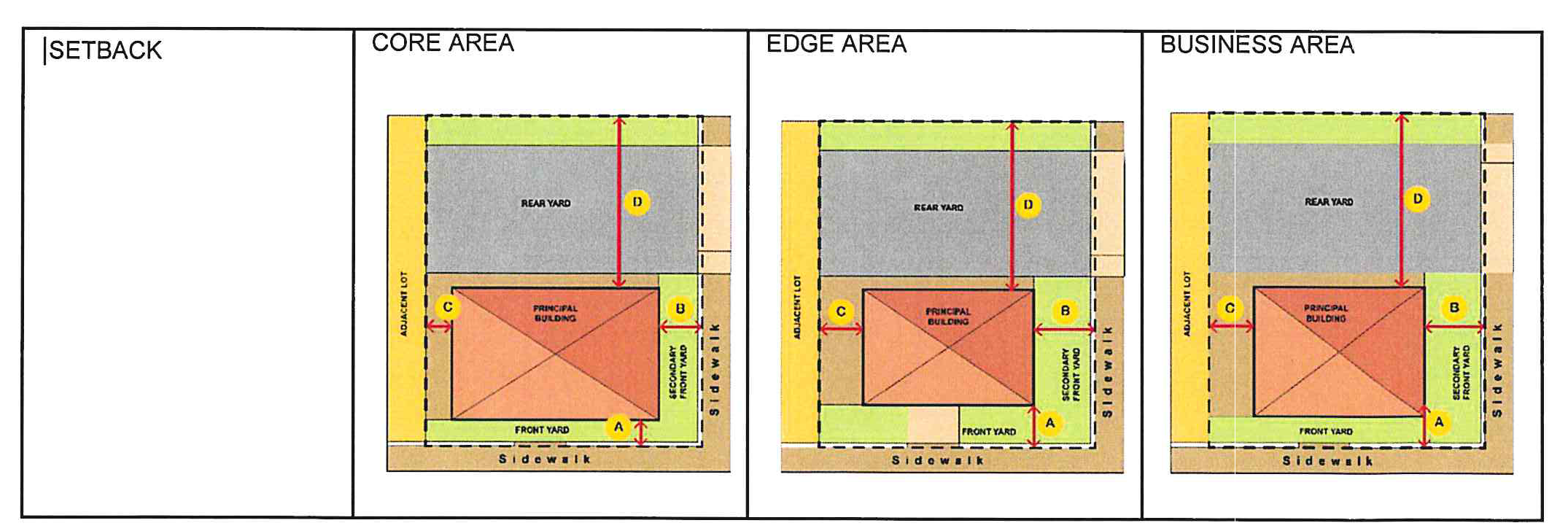
a.
Primary vs. secondary front yards. When a lot is located on a corner lot, the primary front yard setback shall be measured from the right-of-way line of the street having higher pedestrian importance or intensity (e.g. traffic volume, number of lanes, etc.). Any lot line that borders on a street shall be considered a front yard.
i.
The applicant shall identify primary and secondary front yards on any site plan for approval by the reviewing authority. In reviewing an applicant's designation of primary and secondary front yards, the reviewing authority shall consider the following:
(a)
Every lot shall have at least one primary front yard.
(b)
A lot may have more than one primary or secondary front yard.
(c)
Yards along Portage Road shall always be designated a primary front yard whenever a lot has sufficient developable frontage on Portage Road.
(d)
The yard facing a minor street may be considered a primary or a secondary front yard.
b.
Waiver. The maximum setback requirements may be increased by up to 50 percent following the waiver procedures in section 42-449.
3.
Required building frontage. In order to maintain a pedestrian scale environment, it is important that buildings maintain a minimum frontage within the front setback area. This prevents buildings from being spaced too far apart, which creates gaps in the street wall. Building frontage is defined as the width of the building in the build-to area divided by the lot width at the front property line. By way of example, a building that is 70 feet wide in the build-to area located on a lot that is 100 feet wide would have a building frontage of 70 percent (70/100 = 70%).
a.
Waiver. The frontage requirements may be altered by the planning commission if the applicant can demonstrate that, in addition to the review considerations in section 42-449 if meets the following:
i.
The building is designed consistent with the intent of the frontage requirements; and that
ii.
Reasonable development potential exists on adjacent lots or on the same lot in the future to fill in the street wall over time.
(Ord. No. O-10-2024, 1-7-2025)
Sec. 42-453. - Building and frontage design.
Buildings in the LC district shall comply with the following requirements, in addition to any applicable requirements of section 42-451 and section 42-455. The requirements of this section and section 42-455. are intended to be complimentary; however, in any instance where there is an apparent conflict, the provisions of this section shall prevail.
1.
Private frontage. The private frontage is the area between the right-of-way and the principal building façade and must contain architectural elements consistent with one of the following four frontages types. Each frontage is designed to be consistent with some or all of the uses permitted in the LC district.
Note that the following table includes specific dimensional requirements for each of the frontages. Unless otherwise noted, the dimensional requirements are in addition to any other dimensional requirement of this article.
Shopfront Illustration:
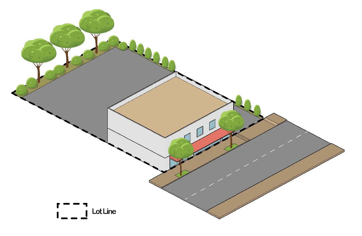
Courtyard Illustration:
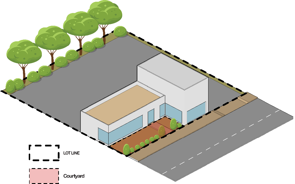
Stoop Illustration:
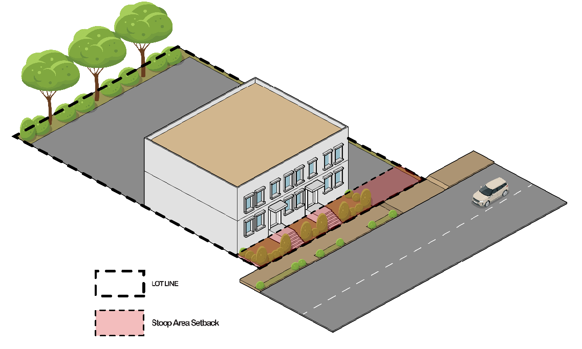
Lawn Illustration:
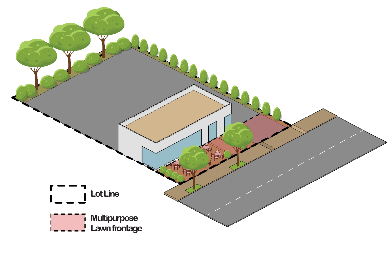
Sec. 42-454. - Building design.
Building design shall complement the intended small-town character and architectural heritage of the community. The design shall consider the adaptive reuse of the building. Building design shall incorporate a clear and well-articulated design concept, and architectural detailing that creates a positive and visually consistent image shall be encouraged.
1.
Building height.
a.
See section 42-123 for height exceptions.
2.
Base, middle, and cap. All buildings shall incorporate a base, middle, and cap, as is applicable.
a.
Base. The base shall include an entryway with transparent windows and a horizontal molding or reveal placed between the first and second stories or over the second story.
b.
Middle. The middle shall include windows having a symmetrical, matching, or pattern design and may include balconies.
c.
Cap. The cap includes the area from the top floor to the roof of the building and shall include a cornice or roof overhang. Changes in roof height between facades or bays shall be required to include a terminating vertical break.
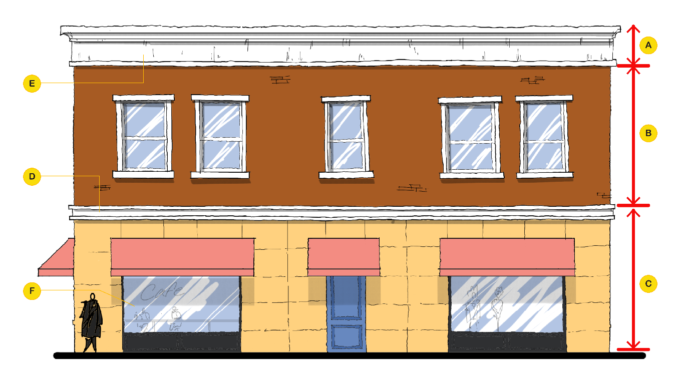
Figure 1: A- Cap of the building. B- Middle includes the windows and balconies of
this second floor units. C- The base encompasses the first floor and the street-front
of this buildings with primary entrances to units above and or units on the first
floor. D- Horizontal molding to separate the base and the middle. E- Deep protruding
cornice and molding.
Figure 1: A regular 2 story building with a base, middle and a cap. The horizontal molding or reveal (A) can be considered as base with entrances located in between and the windows of the first floor sitting between the horizontal band and the "middle (B)" which visually separates the first floor and the second floor. The Cap (C) is the thick molding on the roof running along the perimeter of the building.
3.
Alignment. Windowsills, moldings, and cornices shall align with those of adjacent buildings. The bottom and top line defining the edge of the windows (the "windowsill alignment") shall not vary more than two feet from the alignment of surrounding buildings as long as the surrounding buildings comply with design standards identified in his ordinance. If the adjoining buildings have windowsill alignments that vary by more than two feet from one another, the proposed building shall align with one of the adjoining buildings. This requirement may be waived per section 42-449.
4.
Ground floor design.
a.
Building entrance(s). All buildings shall have their principal entrance or entrances open onto a street, sidewalk, or public space. The principal building entrance shall not open onto a parking lot, although a secondary or subordinate entrance may be provided to a parking lot.
b.
Entryway alignment.
i.
Nonresidential ground-floor uses. First floor of building shall have the principal entrance grade align with the elevation of the adjacent sidewalk. Sunken terraces or stairways to a basement shall not constitute principal entrances for the purposes of this section. It is not the intent of this section to preclude the use of below or above grade entryways, provided that such entryways are not principal entrances. Main entrances to buildings shall incorporate features such as canopies, roof overhangs, recessed entranceways, or other similar features to provide protection from the elements. In addition, long blank walls along the sidewalk leading to the entrance should be avoided.
ii.
Residential ground-floor uses. First-floor of building (including principal entrance) in the edge and business areas may be raised up to three feet above the grade of the adjacent sidewalk. This is intended to create greater privacy for first floor residential uses by elevating windows above the view of passing pedestrians.
5.
Encroachments. The following building elements may encroach into a public right-of-way or setback area:
a.
Balconies. Balconies on upper stories may encroach up to eight feet into any required setback area and up to four feet into any right-of-way area.
b.
Stoops. Unenclosed and uncovered front stoops may encroach up to five feet into a front yard setback area, provided that the stoop maintains a minimum setback of five feet from any right-of- way line.
c.
Awnings.
i.
Ground-story awnings may encroach up to six feet (Figure 2.B, below) from the face of the building into the setback or right-of-way area, but may not interfere with street lighting or trees.
ii.
Awnings shall have at least eight feet (Figure 2.C, below) above grade of sidewalk from the bottom of the awning or any support structure, and no higher than 12 feet (Figure 2.A, below) to the highest point of the canopy.
iii.
Awnings shall be constructed out of fabric, and may not be internally illuminated. Metal or other materials may be used for awnings if a waiver is approved per section 42-449.
d.
Bay windows. Bay windows on the ground story may encroach up to three feet into any setback area, but shall not encroach into the right-of-way. On upper floors, they may encroach up to three feet into any setback or right-of-way.
e.
Eaves. Roof eaves may encroach up to three feet into any setback or right-of-way area.
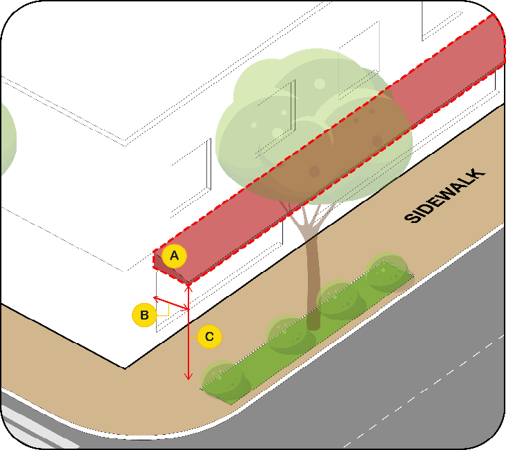
Figure 2. A. Awning projection to be reduced to accommodate streetlights and street
trees., 12 Ft. B. Maximum Encroachment 6 Ft. C. Minimum clear Height, 8 FT.
6.
Service areas. All service areas, including utility access, above ground equipment shall be screened from any public view per section 42-575. Dumpsters shall be located in the rear or non-required side yards and shall be screened from view of any public right-of-way with a solid wall, fence or live landscape material of at least six feet high per section 42-574.
7.
Mechanical and utility equipment. Mechanical equipment, electrical and gas meter and service components, and similar utility devices (whether ground level, wall mounted, or roof mounted) shall be screened from view of any public right-of-way or adjacent residential district or use by a wall, fence, or live landscape material and not face primary street. Exterior screening materials shall be the same as the predominant exterior materials of the principal building.
8.
Front façade design. All building façade that are visible from a public street or public space such as a plaza or square shall conform to the following design criteria:
a.
Blank walls are prohibited on the front façade.
b.
Encourage architectural features, details and ornaments such as archways, colonnades, cornices, contrasting bases, contrasting masonry courses, water tables, molding pilasters, columns, and corbelling, contrasting bands of color, stone or accent features.
c.
Windows. Large window openings shall be provided at ground level with transparent, nonreflective, minimally tinted glass. Window shapes should be rectangular, square or Palladian (mostly rectangular with a semi-circular top). Circular, octagonal, or diamond shaped windows may be allowed as accent features or when part of a specific architectural style. Windows above the ground floor should have a height to width ratio of at least 2:1, or have a ratio that complements the architectural style.
d.
Ground floor facade transparency.
i.
All buildings with first floor nonresidential uses shall maintain transparency for at least 70 percent of the first-floor facade area between two and eight feet above grade level. Doors and windows may be included.
ii.
All windows shall use transparent, non-reflective glass.
iii.
Areas of solid wall shall not exceed a length of 20 feet, unless otherwise specified.
e.
Recessed entrances encouraged. Doors are encouraged to be recessed into the face of the building to create a sense of entry and to add variety to the streetscape.
9.
Rear or side wall design. All sides of a building shall be similar in detail and material to present a cohesive appearance to the front façade.
10.
Building materials. The selection of materials shall enhance the architectural ambiance of the area and shall reinforce the permanency of the structure and the development as set forth herein.
i.
Prohibited materials. Prohibited materials include, but are not limited to: vinyl, exterior insulation and finishing systems (EIFS), painted or scored concrete masonry units (CMU), dark-tinted, reflective, or mirrored glass, and exposed neon, except as permitted with a waiver by the planning commission who shall determine consistency with the intent of building design standards.
c.
Material or color changes. Material or color changes shall only occur at a change of plane. Material changes at the outside corners of buildings shall be integrated into the overall architectural design of the building as a corner treatment. Inconsistent adornment and frequent changes in material or color shall be avoided.
i.
Building material colors. The community development director, or designee, shall review building colors as a part of site plan approval.
(a)
For new construction, a color palette showing primary and accent colors of exterior finish materials shall be provided.
(b)
For building additions or renovations, exterior finish materials and colors shall be consistent or compatible with existing finish materials/colors.
(c)
As part of review, samples of building materials may be required.
d.
Soffits and other architectural elements. Soffits and other architectural elements visible to the public shall utilize materials compatible with other exterior materials on the building.
e.
Accessory buildings. Accessory buildings that are part of a new development shall incorporate the same materials and colors as are utilized in the primary structure. Accessory buildings that are connected to an existing site should incorporate a unifying element(s) with the existing principal building. The structure should meet the requirements listed in section 42-121.
f.
Stylized or prototype buildings. Building design such that the building itself is an advertisement shall not be permitted. Building architecture shall not be of a design which intends to advertise a particular corporate or franchise style.
(Ord. No. O-10-2024, 1-7-2025)
Sec. 42-455. - Design standards for specific uses and buildings.
A.
Multi-family residential.
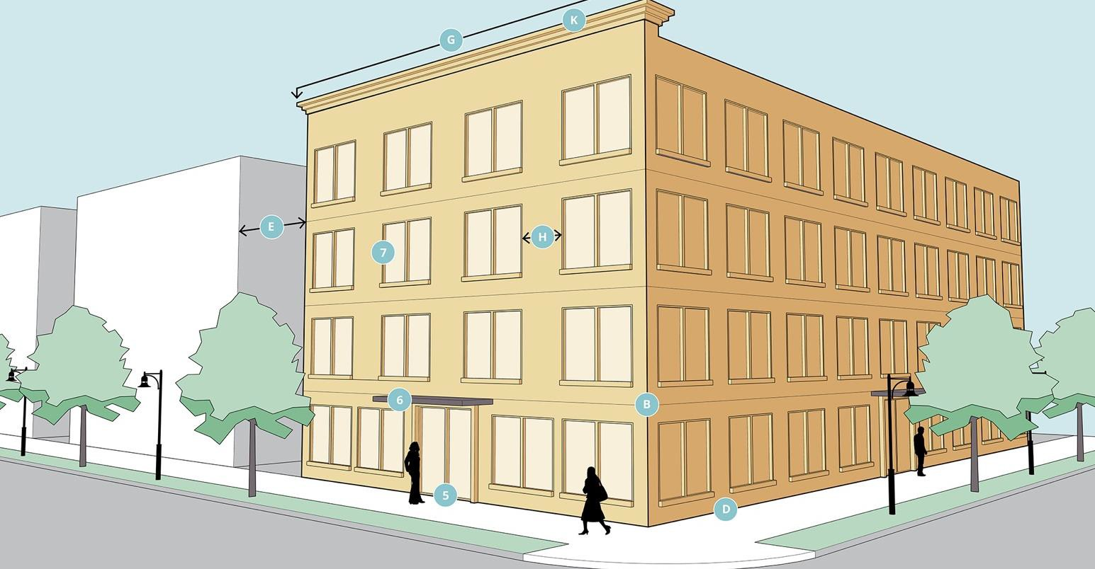
*0 feet where connected to adjacent building or 15 feet where separation between buildings is provided.
General design notes:
1.
All exterior building walls are designed with attention to detail and quality of material especially when facing streets and public accesses. There are no blank or unarticulated façades.
2.
Pattern of solids and voids generated by the vertical and horizontal alignment of similarly-sized windows and doors. Distance between façade breaks, bay widths, and spacing of windows and doors consistent with scale and rhythm of adjacent buildings.
3.
Primary building entrances open onto a street, sidewalk, or public space. Secondary entrances may be provided from a parking lot. Corner buildings have at least one entrance addressing each street frontage.
4.
All architectural features, including awnings, overhangs, roof projections, window accents, and the like are compatible with the style, materials, and colors of the building.
5.
Primary building entrances at grade for accessibility, see figure A, multi-family residential.
6.
Building entrances clearly defined by recessing the entrance, or utilizing elements such as lintels, pediments, pilasters, columns, awnings, overhangs, or solar shades, see figure A, multi-family residential.
7.
Windows and doors shall be into the facade wall, to appear as if they were "punched" through the building façade, see figure A, multi-family residential.
8.
Ground floor may contain interior lobby, vestibule, and similar areas and, amenities, such as mail rooms, fitness centers, and community rooms. Ground floor apartments are allowed in the edge and business areas only.
9.
In larger developments with more than one multifamily building, buildings shall be arranged and clustered to maximize opportunities for shared circulation and parking. The location and design of buildings and uses (including community amenities and open space) shall be designed for pedestrian access. Internal setbacks between all buildings shall be based on the provision of adequate light, ventilation, parking, and all other applicable building codes.
B.
Mixed-use building.
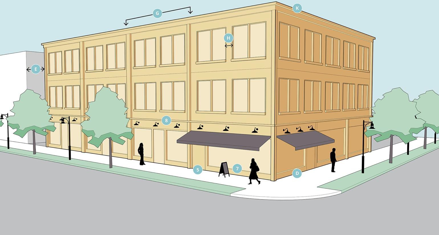
*0 feet where connected to adjacent building or 15 feet where separation between buildings is provided.
**Maximum of two-stories in LC core area.
General design notes:
1.
All exterior building walls are of equal importance. All visible façades designed with attention to detail and quality of material. There are no blank or unarticulated façades, unless façade is not visible from public right-of-way, residential zoning district, or parking lot.
2.
Pattern of solids and voids generated by the vertical and horizontal alignment of similarly-sized windows and doors. Distance between façade breaks, bay widths, and spacing of windows and doors consistent with scale and rhythm of adjacent buildings.
3.
Primary building entrances open onto a street, sidewalk, or public space. Secondary entrances may be provided from a parking lot. Corner buildings should have at least one entrance addressing each street frontage.
4.
Primary building entrances at grade for accessibility.
5.
Building entrances clearly defined by recessing the entrance, or utilizing elements such as lintels, pediments, pilasters, columns, awnings, overhangs, or solar shades.
6.
Entablatures, sign bands, cornices, or a similar horizontal expression line define the transition of ground floor storefronts and the second floor of all mixed-use buildings.
7.
Windows and doors recessed into the facade wall, to appear as if they were "punched" through the building façade. Storefronts need not meet this standard.
8.
Windows above the first floor are vertical in proportion, with a height to width ratio of at least 2:1, or have a ratio that complements the architectural.
9.
(Core only) non-storefront windows shall have decorative sills and/or hoods. Full and segmented arches are allowed atop rectangular windows on upper stories.
10.
All architectural features, including awnings, overhangs, roof projections, window accents, and similar are compatible with the style, materials, and colors of the building.
11.
Buildings with multiple storefronts are unified in storefront design treatment, such as the design of windows and door openings, materials, and colors.
12.
Pedestrian pass-through connects the front of the building to rear parking or alleys.
C.
Single story commercial building.
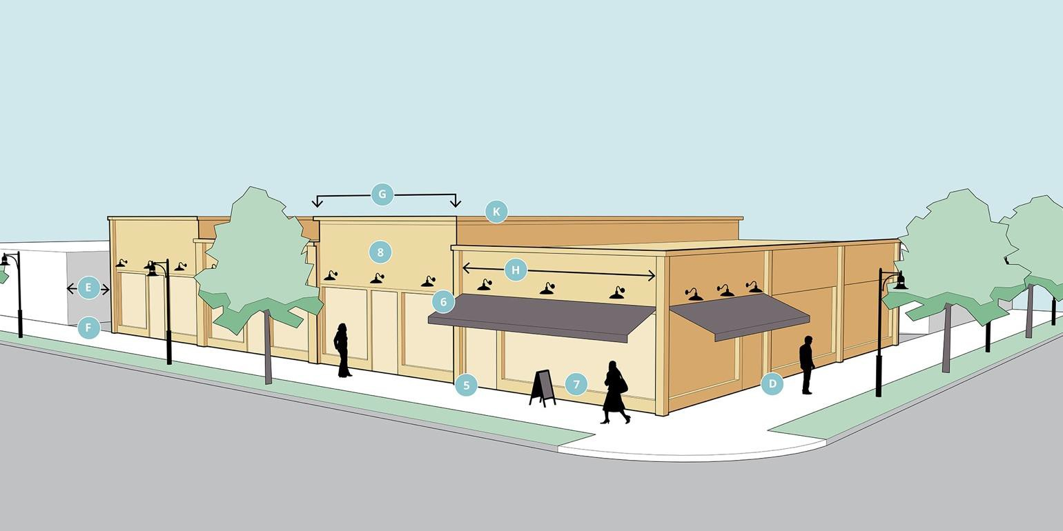
*0 feet where connected to adjacent building or 15 feet where separation between buildings is provided.
General Design Notes:
1.
All exterior building walls are of equal importance. All visible façades designed with attention to detail and quality of material. There are no blank or unarticulated façades, unless façade is not visible from public right-of- way, residential zoning district, or parking lot.
2.
Pattern of solids and voids generated by the vertical and horizontal alignment of similarly-sized windows and doors. Distance between façade breaks, bay widths, and spacing of windows and doors consistent with scale and rhythm of adjacent buildings.
3.
Primary building entrances open onto a street, sidewalk, or public space. Secondary entrances may be provided from a parking lot. Corner buildings should have at least one entrance addressing each street frontage.
4.
Primary building entrances at grade for accessibility.
5.
Building entrances clearly defined by recessing the entrance, or utilizing elements such as lintels, pediments, pilasters, columns, awnings, overhangs, or solar shades.
6.
Entablatures, sign bands, cornices, or a similar horizontal expression line define the transition of ground floor storefronts and the second floor of all mixed-use buildings.
7.
Windows and doors recessed into the facade wall, to appear as if they were "punched" through the building façade. Storefronts need not meet this standard.
8.
Windows above the first floor are vertical in proportion, with a height to width ratio of at least 2:1, or have a ratio that complements the architectural.
9.
(Core only) non-storefront windows shall have decorative sills and/or hoods. Full and segmented arches are allowed atop rectangular windows on upper stories.
10.
All architectural features, including awnings, overhangs, roof projections, window accents, and similar are compatible with the style, materials, and colors of the building.
11.
Buildings with multiple storefronts are unified in storefront design treatment, such as the design of windows and door openings, materials, and colors.
12.
Pedestrian pass-through connects the front of the building to rear parking or alleys.
D.
Attached single-family.
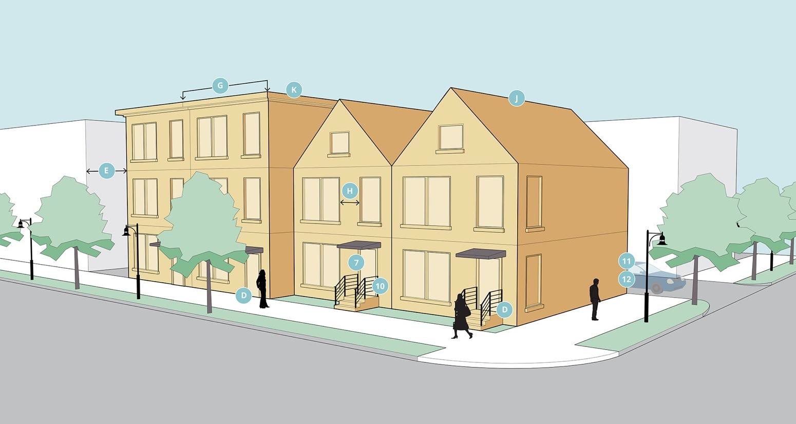
*0 feet where connected to adjacent building or ten feet where separation between buildings is provided.
General design notes:
1.
All four facades are of equal importance. All visible façades designed with attention to detail and quality of material. There are no blank or unarticulated façades.
2.
Pattern of solids and voids generated by the vertical and horizontal alignment of similarly- sized windows and doors.
3.
Distance between façade breaks, bay widths, and spacing of windows and doors consistent with scale and rhythm of adjacent buildings.
4.
Windows and doors recessed into the facade wall, to appear as if they were "punched" through the building façade. Exceptions shall be approved by the community development director, or designee, where integrated into architectural design.
5.
Primary building entrances open onto a street, sidewalk, or public space. Secondary entrances may be provided from a garage or parking lot.
6.
All architectural features, including decorative railings and posts, overhangs, roof projections, window accents, and the like, are compatible in style, materials, and colors to the primary building.
7.
Each entrance to a unit shall consist of a porch, stoop, or similar and designed with railings, spindles, columns, etc. Entrances may be shared between units when stacked or horizontally attached.
8.
Garages are permitted in only the rear of the ground floor of individual units. No garage or individual unit driveway shall front onto a public street, except alleys.
9.
Shared parking lots may be located in a side or rear yard.
(Ord. No. O-10-2024, 1-7-2025)
Sec. 42-456.A. - Signs.
All signs shall be architecturally integrated and complement their surroundings in terms of size, shape, color, texture, and lighting. Signs shall complement the overall design of the building and shall not be designed to be in visual competition with other signs in the area.
1.
Materials and color. Signs should incorporate the same building materials and color used in the primary structure and should be in scale and style with the architecture of the principal building. Lettering should be selected that is consistent with the building.
2.
Overall sign plan. All development shall have a sign plan which anticipates future development. New building design shall provide logical sign areas, allowing flexibility for new and additional users. Design shall provide for convenient and attractive replacement of signs. Buildings with multiple tenants shall include all tenants in the sign plan.
3.
Neon lettering and outlines. Neon, and similar outlines lights signs are prohibited, with the exception of open and closed signs that are included in a site plan approval.
4.
For each zoning lot, there is permitted one freestanding accessory sign, up to 50 square feet in area per side, for lots 125 feet or less in width, to be increased at a ratio of one square foot per each two and one-half feet of lot frontage in excess of the initial 125 feet, up to a lot 300 feet wide. A zoning lot having in excess of 320 feet of frontage may have one additional sign based upon the same ratio of one square foot of sign area for each two and one-half feet of lot frontage over the initial 320 feet of frontage. The maximum size for any one sign is 120 square feet.
5.
When multiple-use zoning lots are involved, for each additional use on the zoning lot beyond the initial use, 15 square feet of sign area is permitted, the total area of freestanding signs not to exceed 50 percent over the sign size originally permitted for the lot.
6.
For a lot with frontages on more than one street, each frontage may be treated as a separate frontage for the purpose of establishing permitted freestanding sign area and number.
7.
Freestanding signs. For a corner lot, the distance between permitted freestanding signs shall be not less than 100 feet, as measured along the property lines, but in no case shall there be a distance of less than 70 feet between such signs. Each such sign shall be oriented to the street frontage it serves. If one freestanding sign is used, then the percentage of freestanding sign area permitted on one street frontage may be increased 100 percent to a maximum of 120 square feet in area per side, provided that such sign is located not more than 25 feet from both street frontages.
8.
Where a zoning lot is permitted to have more than one freestanding accessory sign under this section, the distance between such freestanding signs shall not be less than 300 feet.
9.
Signs may not exceed 15 feet in height.
10.
Signs must be at least ten feet from any property line.
11.
Wall signs. For each use on a zoning lot, there are permitted wall signs, the combined area of which shall not exceed 15 percent of the total area of the wall to which the signs are attached. The total shall not exceed 100 square feet per street frontage. If no freestanding sign is used, the percentage of total wall area for wall signs may be increased by 33 percent per street frontage. Lots with dual frontages may not combine permissible signs for one frontage with another frontage for the purpose of placing a combined area of sign area on one frontage.
12.
Additional area for wall signs. In addition to the wall signage permitted in subsection 11 above, the permitted wall sign area may be increased if the criteria listed below is satisfied:
•
For buildings with wall frontage at the main building entrance that exceeds 99 lineal feet:
•
For buildings with wall frontage at the main building entrance that exceeds 99 lineal feet and with a setback greater than 299 feet from a public or private street:
13.
Canopy or awning signs. Sign copy may comprise up to 35 percent of the total exterior surface of a canopy or awning. Canopies or awnings with back-lit graphics or other kinds of internal illumination are prohibited.
(Ord. No. O-10-2024, 1-7-2025)
Sec. 42-456.B. - Screening (fences and walls).
The impact of those elements of a site, which have an adverse effect on the subject site and surrounding sites, should be minimized.
1.
The intent of this section is to protect neighboring residential and park properties from any adverse external effects and negative impacts of nonresidential development. A screen and buffer required by this section is intended to limit visual contact between uses and to create a strong impression of spatial separation.
2.
Screening materials.
a.
Screening materials shall consist of evergreen trees and shrubs, walls, fences and berms or a combination thereof and be opaque in all seasons of the year from the ground to a height of at least six feet.
b.
Screening fences shall not be constructed of corrugated metal, corrugated fiberglass, sheet metal, chain link or wire mesh. If a long stretch of screening is required, options should be combined or alternated, or plant materials should be varied.
c.
Other creative options, such as changes in elevation, existing vegetation, or plant materials within a buffer area, are encouraged, but the applicant must demonstrate that comparable or superior screening will be provided.
3.
Except as provided in subsection 7, below, a zoning lot that contains a parking lot, office, commercial, industrial use or any combination thereof which abuts a public park facility or a residential district or use shall be separated by screening as specified in subsection 2, above, between it and all abutting areas of such park or residential district or use. In addition to the above screening, there shall be required a landscaped green strip of at least ten feet in width and one tree for each 30 feet or fraction thereof of land adjacent to the parking lot and use.
4.
An industrial or research park development, or combination thereof abutting a public park facility or a residential district or use must have as separation screening an earth berm with a minimum height of eight feet. The berm shall meet the requirements of section 42-576.I in regards to slope and erosion control. The berm shall also be landscaped with at least one tree and five shrubs per 30 lineal feet.
5.
Non-residential uses with a minimum zoning lot area of three acres abutting a public park or land principally used or zoned for residential purposes shall have a separation screening and earth berm with a minimum height of six feet. The berm shall meet the requirements of section 42-576(I) material standards in regards to slope and erosion control. The berm shall also be landscaped with at least one tree and five shrubs per 30 lineal feet.
6.
Existing screening.
a.
For the purposes of subsections 2, 3, and 4, above, the planning commission may approve screening consisting of existing vegetation, planted vegetation and topographic characteristics of the land or a combination thereof if it satisfies the intent and purpose of this subdivision concerning opaque screening.
b.
The planning commission shall consider the characteristics of the land and vegetation present, the adequacy of the screening proposed, and other factors which impact upon adjoining residential and park uses.
c.
The planning commission on approving the use of existing topographical characteristics of the land or existing and/or planted vegetation may condition such approval on the planting of new vegetation in the number, size and type to satisfy the intent and purpose of this section.
7.
Additional landscaping.
a.
The planning commission may increase the height of the separation screening and/or require additional landscaping as part of the site plan review under division 5, subdivision 2 if the minimum requirements of subsection 2 would not adequately protect existing or future abutting residential uses.
b.
In deciding whether the requirements of subsection 2 protect abutting residential uses, the planning commission may consider factors which include, but are not limited to, the topography of the land, the type(s) of use(s) involved, the materials and vegetation to be utilized and the distance between structures and uses.
(Ord. No. O-10-2024, 1-7-2025)
Sec. 42-457.A. - Street design.
A.
Street design guidelines.
1.
Travel. Two-way streets are encouraged in the LC district. One-way streets are not permitted, excepting alleys.
2.
Curb radius. The curb radius at the intersection of two streets should be the minimum necessary to permit vehicle circulation. A smaller curb radius shortens the distance that pedestrians must travel to cross the street, and leads to a safer pedestrian environment by reducing the speed at which cars can travel around corners. It is recommended that the curb radius not exceed 30 feet at the intersection of any two streets.
3.
Sidewalks at driveway crossings. When a sidewalk crosses a vehicle driveway, the driveway shall retain the elevation of the sidewalk. The appearance of the sidewalk shall be maintained across the driveway to indicate that the sidewalk is a part of the pedestrian zone and that pedestrians have the right-of-way.
4.
Pedestrian zone. The pedestrian zone is considered to be the area in between the curb and the edge of the right-of-way, frontage, or building facade, and includes area for sidewalks, landscape plantings, street furniture, public transit facility, and other pedestrian-scale uses and amenities. The treatment of the pedestrian zone determines the character of the street, and the quality of the public realm within the right-of-way. Streets are the most common public space in the city, and must be designed to be welcoming and accommodating for pedestrians as well as motorized traffic.
As shown in figure 3 below, the pedestrian zone in the LC district should contain four distinct areas:
a.
Edge area that allows car doors to open freely and accommodates parking meters, streetlights;
b.
Furnishings area that accommodates amenities such as landscaping, planters, and sidewalk furniture;
c.
Walkway area where pedestrians walk;
d.
Frontage area adjacent to the building.
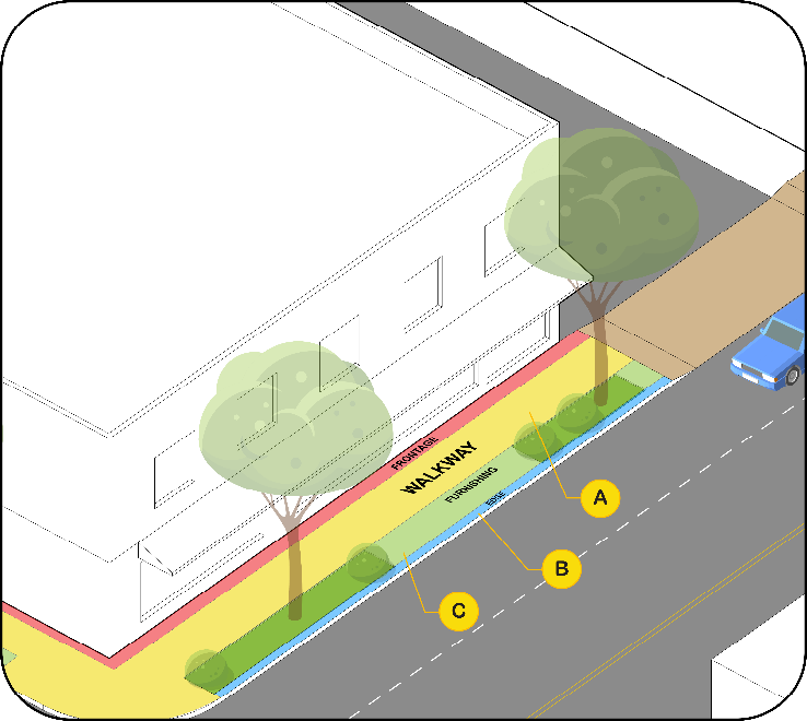
Figure 3. A-min 5 -feet. B-min 1.5 feet. C- min 5 feet
2.
The following design requirements and recommendations are intended to create an inviting public space alongside city streets:
a.
Pedestrian zone width. The pedestrian zone should have a minimum width of ten feet. A lesser width may be appropriate in constrained areas.
b.
Edge/Curb area. The edge/curb area should have a minimum width of 1.5 feet, normally contained within the right-of-way, and should remain clear of obstructions to permit the doors of parked cars to open freely. Streetscape elements such as parking meters, streetlights, traffic control signs, and tree grates may be located in the edge area. The edge area may be paved, or if a tree lawn is combined, it may be combined with the furnishings area and landscaped.
c.
Furnishings area. The furnishings area accommodates amenities such as street trees, planters, public transit facilities, and sidewalk furniture. The furnishings area can be paved (with street trees located in tree grates), or it may be landscaped with a street lawn. Outdoor eating areas, sidewalk cafes, or other similar uses associated with a use in a directly adjacent building may be located in the furnishings area. The furnishings area should have a minimum width of five feet.
d.
Walkway area. The walkway area is the basic sidewalk area where pedestrians walk. The walkway area must maintain a five-foot-wide clear path free of obstructions at all times to permit free pedestrian travel. No permanent structures or uses may be located in the walkway area.
e.
Frontage area. The frontage area is the portion of the pedestrian zone adjacent to the edge of the right-of-way. The frontage area is an optional area and may be used for street furniture or other uses accessory to the use in the adjacent building. When a building is constructed at the lot line, the frontage area should have a minimum width of two feet to accommodate opening doors and window shopping; in the LC-Edge and LC- Business area, the frontage area can be in the required setback.
f.
Access management and driveways. Driveway consolidation is required when feasible to share access between properties. Additionally, driveways providing access to parcels and parking lots are encouraged to be accessed from minor streets.
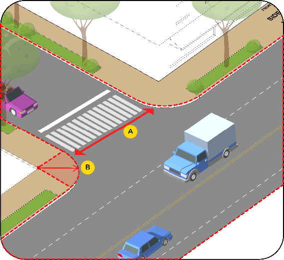
Figure 4. B-It is recommended that the radius be less than 30-feet. A- Least possible
distance recommended for increased pedestrian safety.
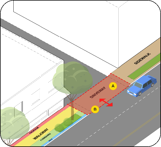
Figure 5. A-Shared driveway access between properties is encouraged. B-Driveways should
emulate the material of sidewalk for continuity and should be at the same level as
the travel lanes.
(Ord. No. O-10-2024, 1-7-2025)
Sec. 42-457.B. - Parking.
The following parking requirements are applicable in the LC, and replace any similar requirements set forth in division 6, subdivision 1, off street parking:
1.
Minimum parking required. All new development or expansions of existing sites shall provide off-street parking spaces for the use according to the following requirements. The parking spaces shall be provided within 500 feet of the building.
a.
Residential uses. One parking spaces per residential dwelling unit.
b.
Nonresidential uses. One parking space per 500 square feet of nonresidential building space.
c.
Waiver. The minimum parking requirements may be reduced by the planning commission per section 42-520.
2.
Parking lot layout. Off-street parking lot layout, maintenance, and construction shall comply with all of the requirements of article 4, division 6, subdivision 1.
3.
Parking lot access. Multiple entrances to parking lots must be consolidated in the core area of the LC district. Where feasible, shared cross access between parcels shall be provided.
a.
Setback Portage Road: All parking spaces shall comply with the maximum setback of the core, edge and business areas.
b.
Setback from cross streets: All parking spaces shall be set back a minimum of five feet from any cross street.
c.
Loading space must be consistent with section 42.522.
(Ord. No. O-10-2024, 1-7-2025)
Sec. 42-458.A. - Outdoor amenity space.
Any development or redevelopment of a building with more than 20,000 square feet of floor area, or one acre in total lot size, in the LC district shall provide outdoor amenity space. The outdoor amenity space shall have a minimum area of two percent of the gross floor area of the building. The size and disposition of the amenity space shall be proportionate to the size and scale of the development, and any amenity space used to satisfy this requirement shall be adjacent to or visible and accessible from a public right-of-way. The emphasis of the amenity space requirement is on the quality rather than the quantity of the space.
(Ord. No. O-10-2024, 1-7-2025)
Sec. 42-458.B. - Temporary outdoor retail sales.
Outdoor retail sales are permitted in the core and edge subareas subject to the following requirements:
1.
No permit required. Temporary or moveable outdoor retail sales activity or displays accessory to a principal use in the LC district are permitted, subject to the following requirements:
a.
Area. The total of all outdoor sales display areas on the site shall not exceed 0.75 square feet per linear foot of building frontage in the build-to zone.
b.
Location. Outdoor sales areas may be located in the build-to zone, in an area adjacent to and not extending farther than 20 feet from the rear of the building, and/or in the right-of-way. Outdoor sales in the right-of-way shall be located in the frontage or furnishings area of the pedestrian zone directly adjacent to the building containing the use to which it is accessory. A minimum six-foot wide clear pedestrian pathway on the sidewalk shall be maintained at all times.
c.
Time. The outdoor sales display shall only be set out during business hours.
2.
Permit required. A permit from community development director or his/her designee is required for outdoor sales that exceed the area limitations in subsection (a), above; for special outdoor sales events that will be located anywhere besides the frontage or furnishings area of the pedestrian zone; or for times outside of normal business hours. The permit will specify the permitted size and duration for the outdoor sales event.
(Ord. No. O-10-2024, 1-7-2025)
Sec. 42-458.C. - Outdoor storage.
In the core and edge subareas, limited outdoor storage of merchandise, materials, or equipment is permitted in the rear yard if it is not visible from public ROW. In no case shall materials or merchandise being stored outdoors exceed a height of six feet.
(Ord. No. O-10-2024, 1-7-2025)
Sec. 42-459. - Definitions used in this article.
This division provides definitions for terms that are used in this article that are technical in nature or that might not otherwise reflect a common usage of the term. Where a definition in this section conflicts with a definition provided in section 42-112, the definition presented in this section shall prevail for the purposes of administering the LC district requirements. If a term is not defined in this section, the planning and development director shall determine the correct definition of the term.
Balcony means an open portion of an upper floor that extends beyond or indents into a building's exterior wall.
Block means the aggregate of private lots, pedestrian pass-throughs, rear lanes and alleys, the perimeter of which abuts perimeter or internal streets.
Block perimeter means the linear distance around a block measured along the right-of-way line or road easement.
Buffer means an area of land, including landscaping, walls, and fences located between land uses of different characters and which is intended to mitigate negative impacts of the more intense land use on the less intense land use.
Build-to area means an area at the front of the lot in which a front building facade must be located.
Floorplate means the total indoor floor area of any given story of a building, measured to the exterior of the wall or balcony.
Frontage lot line means the lot line that coincides with the public right-of-way or edge of a space dedicated for public use. Building facades parallel to frontage lines define public space and are therefore subject to a higher level of regulation than the elevations that face other lot lines.
Habitable space means building space that involves human presence with direct view of the enfronting streets or public or private open space. Habitable space does not include parking garages, storage facilities, warehouses, and display windows separated from retail activity.
Liner shop or liner building means a building or part of a building with habitable space specifically designed to enfront a public space while masking a function without the capacity to monitor public space such as a parking garage, storage facility, or large building exceeding the building width limitations of this article.
Tree lawn means a grassed or landscaped area located between the sidewalk and the curb of the street intended to accommodate street tree plantings.
(Ord. No. O-10-2024, 1-7-2025)