
Severance City Zoning Code
ARTICLE 6
Zoning Districts
Division 1 - Rural Residential
Residential Density Transition Area.
All proposed residential developments located adjacent to or abutting a differing zone district and/or development pattern shall provide an area of transitional residential densities with complimentary lot sizes and residential product types to create a cohesive neighborhood design. All transition areas shall be approved through the platting and/or site plan review process.
(Ord. No. 2023-05, §1)
Sec. 16.6.10.1. - Intent.
(a)
The intent of the rural residential land use category is to provide low-density, single-family residential development within the Town's outer fringe. The current land is predominantly rural and agricultural, with some existing residential subdivision developments that are consistent with the future vision of the Comprehensive Plan. These areas may have centralized water but are not served by central sewer. Typically, the existing roadway network is limited to rural roads spaced in one (1)-mile intervals that correspond to section lines. Rural residential development in this Planning area is intended to be large-lot residential subdivisions with a predetermined number of acres per lot combined with the limitations of infrastructure that may be accessible or obtainable. The Rural Residential Zoning includes two (2) sub-zoning categories as outlined below. Further detail on these sub-zonings is outlined in Section 16.6.10.15.
(b)
Rural residential agricultural may be within or outside the rural residential area. Agricultural (Ag) residential development is intended to be large-lot residential subdivisions with an agricultural component that is either associated with each lot or a select number of lots or is a stand-alone agricultural parcel. As with rural residential development, Ag residential is limited by the accessibility or obtainability of infrastructure. However, the number of acres per lot is relative to the agricultural land use component rather than a predetermined quantity of acres per lot. (See Ag Residential Design Option).
(c)
Rural residential conservation may be within the rural residential area. Conservation residential development focuses on large percentages of dedicated open space, agricultural or conservation easement land area that complements a subdivision of rural subdivision lots. The breakdown of densities, open space and design requirements is further described in Section 16.6.10.16.
(Ord. 2021-08 §2)
Sec. 16.6.10.2. - Density.
(a)
Gross minimum density: two and one-half (2.5) acres per dwelling unit (i.e., 50 acres / 2.5 = 20 lots).
(1)
Density can be higher if open space and/or remaining land is managed.
(2)
Final lot count may be limited by infrastructure or geographic constraints.
(b)
Minimum lot sizes: one and one-quarter (1.25) acres due to septic limitations.
(1)
Diversity and flexibility of lot sizes is highly encouraged.
(Ord. 2021-08 §2; Ord. No. 2023-05, §2)
Sec. 16.6.10.3. - Land uses.
(a)
Uses by right:
(1)
Single-family residential.
(2)
Accessory dwelling.
(3)
Home-based business, in compliance with Article 9 (Supplemental Regulations) of this chapter.
(4)
Parks.
(5)
Schools.
(b)
Encouraged Uses:
(1)
Agriculture commercial (Type II).
(2)
Golf courses.
(3)
Churches.
(4)
Outdoor recreation.
(5)
Agriculture hobby (Type I) noncommercial, focused (management Plan template).
(c)
Uses requiring additional review. Note: Land uses not identified may be considered with additional review to be determined by Planning Staff at pre-application meeting. See Section 16.3.4 of this chapter.
(Ord. 2021-08 §2; Ord. 2025-02 §2)
Sec. 16.6.10.5. - Management plans.
(a)
Each project in the rural residential district shall have a management Plan addressing the following:
(1)
HOA protective covenants for architectural control.
(2)
Fencing.
(3)
Irrigation system, including sources of water.
(4)
Stormwater facilities.
(5)
Roads.
(6)
Trails.
(7)
Common areas.
(8)
Privately owned open space.
(9)
Landscape maintenance fund.
(10)
Managed individual wastewater treatment systems.
(11)
Peak season design and annual water requirements (if using agricultural water source).
(12)
Livestock management Plan (if applicable).
(b)
Livestock management Plans shall address the following:
(1)
Perimeter fencing and containment areas.
(2)
Gates.
(3)
Lighting.
(4)
Landscaping.
(5)
Barn or outbuilding materials and construction.
(6)
Maintenance of pasture areas.
(7)
Treatment of manure.
(8)
Storage of feed, trailers, equipment, etc.
(c)
In addition to the written livestock management Plan, a plot Plan is required indicating locations and types of fencing, barns and outbuildings, corrals, pastures, arenas and any other information deemed necessary by the Planning department.
(d)
Examples of management Plans and plot Plans are available in the Planning department.
(Ord. 2021-08 §2)
Sec. 16.6.10.6. - Standards.
(a)
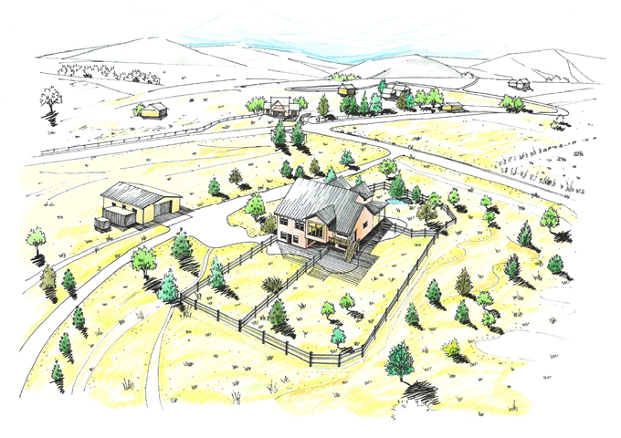
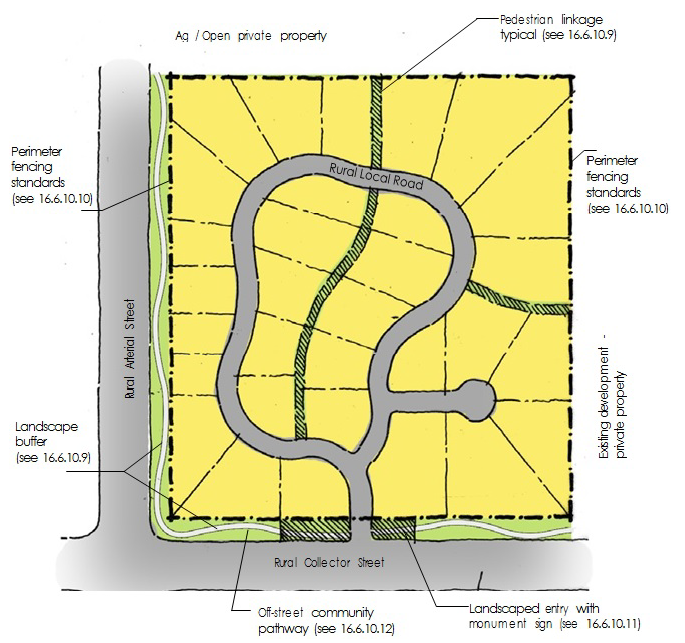
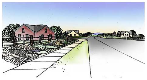
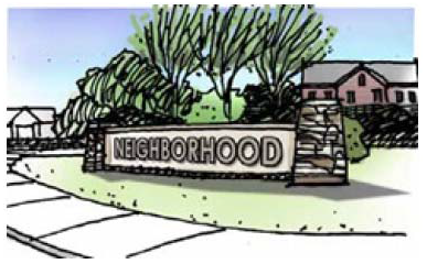
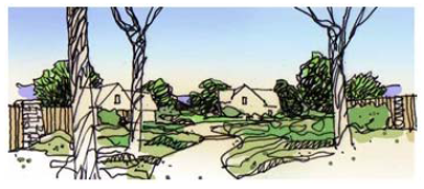
Typical subdivision layout. Subdivisions in the rural residential area shall be designed with an internal rural roadway system to serve lots within the subdivision. Each lot shall have frontage onto a roadway. The perimeters adjacent to major roadways shall be landscaped and shall provide pathways for pedestrian linkages. Fencing shall be open and visually interesting along the perimeter street frontage. The main entrance to the subdivision will typically have a monument sign and landscaping. Open space and drainage corridors within the subdivision will provide opportunities for pedestrian linkage to adjacent subdivisions. Each subdivision proposal should reflect the Comprehensive Plan.
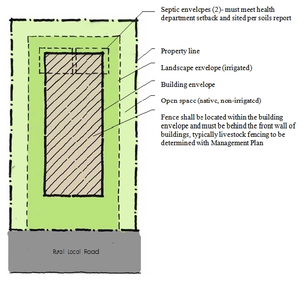
(b)
Typical single-family lot layout. The vision for a typical single-family lot is to create a buildable area and identify septic envelopes and open/landscape areas. Just outside of the building envelope is a landscape envelope, intended to be Planted with irrigated turf and Plantings. The area between the landscape envelope and the property line consists of native, non-irrigated landscaping in order to create a feeling of openness and uniformity between lots. Fencing shall be reviewed and approved by the HOA/Metro District and the Town.
(c)
For previously approved subdivisions within the boundaries of the rural residential land use zone that are not governed by building envelopes, the minimum setback shall be as follows:
Notes:
1.
Building and landscape envelopes are intended to be conceptual and may vary. Envelopes shall be established on the site Plan, approved by the Architectural Review Committee (ARC) and submitted with the initial building permit application for each lot. Modification to any approved building envelope shall require HOA and Town Planning Department approvals.
2.
Minimum side and rear setback to any improvement, including irrigated turf, shall be twenty-five (25) feet. (Trees and shrubs with drip irrigation are excluded).
3.
Final location of septic envelopes shall be identified on plot Plan; location and size shall be determined by health department and soils analysis.
4.
Maximum amount of irrigated area—twenty-five thousand (25,000) square feet.
5.
Ag/livestock fencing may vary per management Plan.
(Ord. 2021-08 §2)
Sec. 16.6.10.7. - Street standards—Severance Transportation Master Plan.
Reserved.
(Ord. 2021-08 §2)
Sec. 16.6.10.8. - HOA documents and architectural standards.
(a)
Review of architecture shall be by developer's covenants, design guidelines, homeowner's association or Metro District. Building permit applications must be accompanied by a letter from said entity stating architectural approval.
(b)
Covenants will be recorded with the subdivision plat.
(Ord. 2021-08 §2)
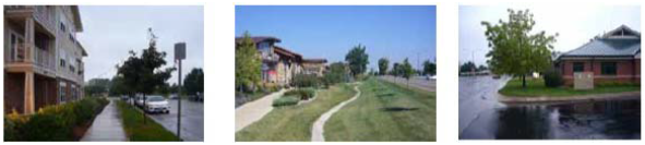
Sec. 16.6.10.9. - Edges/landscape.
The perimeter treatment adjacent to major roadways should include a landscape buffer of varying width with a minimum width of twenty (20) feet. A developer-installed fence should be placed inside the property line within an easement on each lot or tract. The landscape should be complementary to the rural character of the surrounding area. The use of shade trees is encouraged along greenbelt community pathways.
(Ord. 2021-08 §2)
Sec. 16.6.10.10. - Fencing.
(a)
Fencing along shall be of a rural character. The treatment should be consistent within the entire development. Fencing located along collector or arterial roads shall be open rail/open character, wood and set back from the right-of-way a minimum of twenty (20) feet. Fencing shall be made visually interesting and shall avoid creating a "tunnel" effect. Style of fencing for neighborhood should strive for consistency with surroundings and intended design. Compliance with this standard may be accomplished by integrating architectural elements such as brick or stone columns and incorporating articulation or openings into the design. Varying the alignment or setback of the fence and softening the appearance of fence lines with Plantings or similar techniques is also encouraged. Privacy fences should not be used. For agriculture uses, T-post fences, wire fences and electric fences are allowed as per the management Plan.
(b)
Perimeters not associated with major roadways shall be fenced by the developer with T-post and wire fencing or better. Internal common areas, including pedestrian connectivity pathways and drainage conveyance channels, shall be fenced by the developer using materials consistent with the development. Management and maintenance of all fencing shall be addressed in the developer's management Plan.
(Ord. 2021-08 §2)
Sec. 16.6.10.11. - Entries and signage.
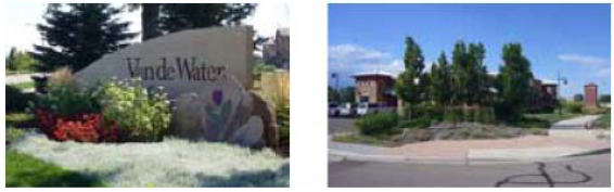
Entry signs and entry features should be a visual and attractive focal point for the development. The type and size of signs should be appropriate for the size of the subdivision. Rural character is highly encouraged.
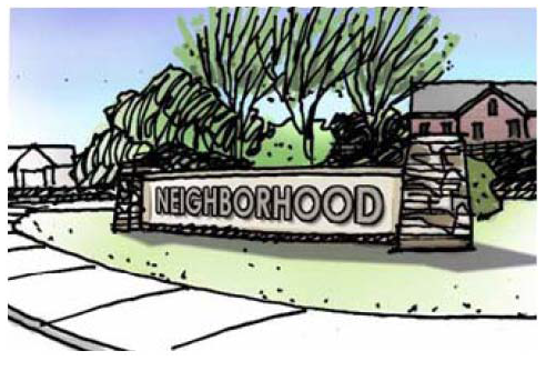
(Ord. 2021-08 §2)
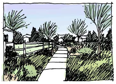
Sec. 16.6.10.12. - Connectivity.
Pedestrian connectivity within and adjacent to the subdivision is highly encouraged. Each development shall provide a combination of trails, sidewalks or widened streets to accomplish connectivity. Off-street pedestrian linkage can be accomplished with the use of open greenways and drainage conveyance corridors with meandering trails or paths. Refer to Typical Subdivision Layout for examples. Each subdivision must contain a twenty (20)-foot minimum perimeter landscape buffer with a minimum six (6)-foot-wide community pathway. Where a subdivision either borders or includes portions of the Great Western Trail the developer will be required to pave the trail with a minimum ten (10)-foot concrete cross section for the entirety of the trail within or adjacent to the property. Sidewalks adjacent to all school sites and parks require a minimum width of five (5) feet or wider. Projects shall connect to Severance trail network whether that be through newly dedicated neighborhood trails or connections to a previously establish Severance trail network
(Ord. 2021-08 §2)
Sec. 16.6.10.13. - Lighting.
All lighting within the Rural Residential Zoning District shall comply with the Dark Skies Ordinance Lighting Zone 1 requirements.
(Ord. 2021-08 §2)
Sec. 16.6.10.14. - Managed individual wastewater treatment system standards.
(a)
Design. Prior to submitting for a managed individual wastewater treatment system permit with the county Department of Public Health and Environment, each owner shall submit his or her design Plans to the Town for review and approval.
(1)
All systems must be designed and installed in accordance with all applicable county individual sewage disposal system regulations and the Colorado Department of Public Health and Environment guidelines. The county Department of Public Health and Environment has final approval of all managed individual wastewater treatment system designs.
(2)
All systems must be designed to meet the minimum requirements of the development's managed individual wastewater treatment system design as described in the Town's Environmental Management Handbook.
(3)
All managed individual wastewater treatment systems shall be designed for site-specific conditions, including but not limited to maximum seasonal high groundwater, poor soils and shallow bedrock.
(4)
Once the managed individual wastewater treatment system has been approved by the Town, the permit application may be submitted to the county Department of Public Health and Environment.
(5)
Activities such as landscaping (i.e. the Planting of shrubs and trees) and construction (i.e. auxiliary structures, dirt mounds, etc.) are expressly prohibited in the designated leach field sites. These areas should be maintained through the use of grass.
(b)
Inspection:
(1)
Prior to backfilling the installed managed individual wastewater treatment system and after final inspection and approval by the county, each owner shall notify the Town in writing and submit to the Town a copy of such county approval.
(Ord. 2021-08 §2)
Sec. 16.6.10.15. - Rural residential agriculture sub-zoning.
The rural residential agricultural sub-zoning is intended to allow private property owners to annex existing agricultural operations into the Town and continue operations. The process for receiving the rural residential agricultural sub-zoning is the same as any other zoning request and may either come through the annexation process or a rezoning of an existing annexed property. The following are characteristics of the Ag residential design option:
(1)
Agriculture component retained.
(2)
Served by domestic water.
(3)
Joint access points to and from county roads to reduce driveways where practical. (Existing agricultural accesses permitted in Weld County may be maintained if no further subdivision is taking place).
(5)
No HOA required.
(6)
No interior fencing required.
(7)
Density:
a.
Minimum lot size (septic): Ten (10) acres.
b.
Gross density: one (1) dwelling unit per fifteen (15) acres.
(8)
Perimeter treatment:
a.
Fencing to be addressed on fencing Plan.
b.
Road right-of-way: same as rural residential.
c.
Connectivity to adjacent subdivisions not required.
d.
Landscaping that can be native.
(9)
Management Plans should address the following:
a.
Agricultural operations.
b.
Roadway connections.
c.
Maintenance.
d.
Stormwater management report, including release rates and water quality (only required if subdivided or changed from historical usage).
e.
Livestock management Plan.
f.
Road/dust mitigation.
g.
Fencing.
(Ord. 2021-08 §2)
Sec. 16.6.10.16. - Rural residential conservation sub-zoning.
The rural residential conservation sub-zoning is intended to allow private property owners to annex large, existing agricultural or open lands into the Town with a restriction on a portion of the property that conserves the land as farmland or open space in perpetuity. As an incentive to the property owner, the owner will be allowed to develop the unencumbered lands into a greater number of lots with more diverse sizes than the rural residential agriculture sub-zoning.
The following are characteristics of the Ag residential design option:
(1)
Conservation component retained (conservation easement, dedicated open space, agricultural operation).
(2)
Served by domestic water
(3)
Joint access points to and from county roads to reduce driveways where practical
(4)
Reserved.
(5)
HOA (required) on developed lands with provisions for management and maintenance of private lots, improvements, common areas, livestock, infrastructure and other elements of the developed areas (HOA not required on the conservation land)
(6)
No interior fencing required (Fencing along public roadways may be required adjacent to residential lots.)
(7)
Density: defined by the following example and based on percentage of open space
EXAMPLE: Minimum initial land size = sixty (60) acres (gross). A minimum of sixty percent (60%) (thirty-six [36] acres) shall be perpetually conserved, and on the remaining land (twenty-four [24] acres), two (2) lots will be allowed. If a farmstead already exists, it can be platted as a third lot. With each additional ten (10) acres of contiguous land, sixty percent (60%) (six [6] acres) shall adjoin the original conserved land, and one (1) additional lot shall be allowed. Once platted and developed, no future plats of the initial land that increase the number of lots or reduce the amount of the conserved land will be allowed.
Examples:
70 acres X 60% = 42 acres conserved and 3 lots on 28 acres
80 acres X 60% = 48 acres conserved and 4 lots on 32 acres
100 acres X 60% = 60 acres conserved and 6 lots on 40 acres
120 acres X 60% = 72 acres conserved and 8 lots on 48 acres
160 acres X 60% = 96 acres conserved and 12 lots on 64 acres
180 acres X 60% = 108 acres conserved and 14 lots on 72 acres
(Any single home or farmstead can be platted as one [1] additional lot.)
Conservation land shall be contiguous and available for large areas of farming or rural open space. Lots may be clustered or scattered. Minimum lot size = three (3) acres. Diversity of lot sizes is encouraged. Any grouping of lots using a shared access and exceeding four (4) lots shall have an internal roadway designed and shall be built to rural residential specifications of the Town. Groups of two (2), three (3) or four (4) lots shall have a hard-surface shared-access pad connected to the perimeter public roadway. Each shared-access pad shall be concrete measuring forty (40) feet' wide x one hundred (100)' feet long x six (6)" inches thick, with private drives serving individual lots from the shared-access pad. Any shared-access pad shall be owned and maintained by the HOA. Driveways serving individual lots shall be contained within the lot and shall be owned and maintained by the lot owner. Single lot access to the roadways will be discouraged.
(8)
Perimeter treatment:
a.
Fencing adjacent to right-of-way shall be addressed in fencing Plan. Criteria and maintenance responsibilities shall be described in the HOA documents.
b.
Road right-of-way: Right-o- way dedication shall adhere to the Severance Transportation Master Plan. Maintenance of public roadways shall be the responsibility of the Town.
c.
Road cross section may be modified at Staff discretion based on proposed number of lots and anticipated traffic. Letter from licensed traffic engineer shall be required in cases in which proposed changes differ from transportation Plan. A minimum dirt road cross section of thirty-two (32) feet will be required adjacent to proposed residential lots for any rural residential conservation development.
d.
Connectivity to adjacent subdivisions or undeveloped lands shall be reviewed on a case-by-case basis.
e.
Landscaping between the fencing (if applicable) or property line of any lot (excluding conservation lots) and the public roadway shall be native, drought-tolerant grasses. Management and maintenance responsibilities of these areas shall be described in the HOA documents.
(9)
Management Plans or other HOA documents shall address the following:
a.
Conservation method.
b.
Land uses.
c.
Roadway connections, including public and adjacent property roads.
d.
Private and common land management and maintenance.
e.
Stormwater management report, including detention on any lot (if applicable), release rates and water quality.
f.
Livestock management Plan (if applicable).
g.
Maintenance of public roads.
h.
Fencing.
i.
Architectural design review (required) for any improvements, including but not limited to homes, outbuildings, livestock corrals or paddocks, internal or perimeter fencing, play equipment, storage facilities, etc.
j.
Inclusion of Windsor-Severance Fire District as a review agency for any proposed improvements to evaluate emergency access, fire sprinkler requirements or other site and/or building requirements.
(Ord. 2021-08 §2)
Sec. 16.6.10.17. - Parking standards.
The number of required parking spaces shall be based on the requirements Section 16.9.40.
(Ord. 2021-08 §2)
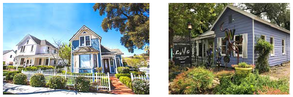
Sec. 16.6.20.1. - Intent.
(a)
The suburban perimeter residential land use category has a predominance of lower density housing that has access to public water, sewer, streets and open spaces. This district is meant for residential homes and excludes large industries and other large intense uses. Home businesses, civic organizations and some types of commercial and agricultural uses are allowed but will be limited in size and density. The main purpose of this district is to meet a wide range of housing choices, and to provide neighborhoods that invite walking to gathering places, services and conveniences that are integrated into the rest of the community by a pattern of streets, blocks and other linkages.
(b)
The Comprehensive Plan can be fulfilled by encouraging creativity. For example, new neighborhoods are typically designed with meandering streets with a diversity of product. Neighborhood edges adjacent to major roadways include landscaping, meandering pathways and attractive entry features. Pedestrian connections to the Severance Greenway are encouraged as a part of the roadway system or in greenbelt corridors. Additionally, the suburban perimeter also acts as a transitional land use between the lower density rural residential land uses and the more urbanized Town core.
(2018-08 §2)
Sec. 16.6.20.2. - Density.
(a)
Generally.
(1)
Gross minimum density: two (2) dwelling units per acre.
(2)
Maximum density: determined by market.
(3)
Minimum lot sizes: six thousand (6,000) square feet (see typical single-family lot layout).
a.
Six thousand (6,000) square feet for single-family detached.
b.
Four thousand (4,000) square feet for single-family attached (duplex units).
c.
One thousand and four hundred (1,400) square feet for townhomes.
d.
One thousand and six hundred (1,600) square feet for multi-family.
(4)
Building height not to exceed two (2) stories without additional review.
(b)
Floorplan diversity. Development Plans shall include a diversity of lot sizes and floorplans. On projects of one hundred fifty (150) acres or less, a minimum of four (4) lot sizes is required. On projects of one hundred fifty (150) acres or more, a minimum of six (6) lot sizes is required. This may be met through additional housing types outlined in the following subsection (c).
(c)
Product diversity. A mix of permitted housing types shall be included in any individual development plan, as defined in this Article, to the extent reasonably feasible, depending on the size of the parcel. To promote such variety, the following minimum standards shall be met:
(1)
The following minimum number of housing types is required on any project development plan:
a.
A minimum of two (2) housing types is required on any project development plan containing less than one hundred and fifty (150) acres, including such plans that are part of a phased overall development.
b.
A minimum of three (3) housing types is required on any project development plan containing one hundred and fifty (150) acres or more.
(2)
Housing types.
a.
Single-family attached dwellings.
1.
Duplex units.
2.
Townhome units.
b.
Alley loaded design.
c.
Patio home design.
d.
Multi-family dwellings, by additional review.
(d)
Open space/parks and connectivity requirements. (See Section 16.12.250).
(2018-08 §2; Ord. No. 2023-05, §3)
Sec. 16.6.20.3. - Land uses.
(a)
Uses by right:
(1)
Residential uses.
(2)
Accessory dwelling.
(3)
Home-based business, in compliance with Article 9 (Supplemental Regulations) of this chapter.
(4)
Neighborhood parks.
(5)
Schools.
(6)
Outdoor recreation.
(b)
Encouraged Uses.
(1)
Bed and breakfast establishments.
(2)
Churches.
(3)
Childcare centers.
(4)
Adult day/respite centers.
(5)
Long-term care facilities.
(6)
Office, financial, medical services and clinics.
(7)
Neighborhood shopping centers.
(8)
Golf courses.
(c)
Uses requiring additional review:
(1)
Workshops/small custom industry.
Note: Land uses not identified may be considered with additional review to be determined by Planning Staff at pre-application meeting. See Section 16.3.4.3 of this chapter.
(2018-08 §2; Ord. 2025-01 §1, 1-14-25; Ord. 2025-02 §3)
Sec. 16.6.20.6. - Standards.
(a)
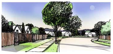
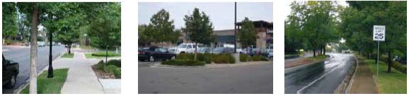
Typical subdivision layout. Each subdivision proposal should address the appropriate elements of the Comprehensive Plan, as suggested by the following. Subdivisions in the suburban perimeter shall be designed with an internal urban roadway system to serve lots within the subdivision. Streets shall be designed with a curved, linear pattern; grid streets should be avoided. Each lot shall have frontage onto a roadway. The edges adjacent to major roadways shall be landscaped and shall provide community pathways for pedestrian linkages. Landscape buffers adjacent to major roadways should vary in width, and perimeter fencing shall be visually interesting. The main entrance to the subdivision typically will have appropriately scaled monument sign and landscaping. Open space, drainage corridors and roadways within the subdivision can provide opportunities for pedestrian linkage to adjacent subdivisions, the Town Core and the Severance Greenway.
Note: Roadway Plans must identify collector roadways and adhere to requirements set forth in Transportation Master Plan.
1.
The spacing and frequency of connector streets are to be determined with each application. Connector streets shall connect neighborhoods to perimeter arterial streets and adjacent properties. Please refer to the Severance Transportation Plan.
2.
Limited driveway access and parking to connector streets may be allowed in specific locations. Traffic study may determine the need for a higher-volume street design.
3.
Internal street design should incorporate the following whenever possible:
a.
Three-way intersections.
b.
The use of curves (non-grid) or modified grid.
c.
View corridors.
d.
Focal points.
(b)
Typical single-family lot layout. Each lot in the suburban perimeter will identify a buildable area (building envelope) and setbacks in order to achieve an appropriate building coverage/landscape ratio. The minimum lot size shall be six thousand (6,000) square feet, and diversity of lot sizes is highly encouraged. An overall fence Plan shall be reviewed by the Town and administered by the HOA or Metro District.
For uses other than single family, setbacks are case by case and at the discretion of the Planning Commission and Town Council. Setbacks will be considered and approved through the platting process and indicated on the recorded plat.
(2018-08 §2)
Sec. 16.6.20.7. - Street standards—Refer to Severance Transportation Master Plan.
Reserved.
(2018-08 §2)
Sec. 16.6.20.8. - HOA/Metro documents and architectural standards.
(a)
Review of architecture shall be by developer's covenants, design guidelines, homeowner's association or Metro District. Building permit applications must be accompanied by a letter from said entity stating architectural approval.
(b)
Covenants will be recorded with the subdivision plat.
(c)
A management Plan for common areas shall be submitted to the Town for review.
(2018-08 §2)
Sec. 16.6.20.9. - Edges/landscape.
The perimeter treatment adjacent to roadways should include a landscape buffer that of varying width with a minimum width of twenty (20) feet. A meandering community pathway that is a minimum of ten (10) feet wide shall be located within the buffer. (See Section 16.6.20.7, Street Standards). The use of shade trees is encouraged along greenbelt community pathways.
(2018-08 §2)
Sec. 16.6.20.10. - Fencing.
(a)
Lots adjoining greenbelts shall have common area fencing. Common area fencing shall be "articulated" with fence columns, fence details, varying depths of greenbelts, etc.
(b)
All subdivisions shall submit master fence Plans that will include fence locations, details and criteria, including:
(1)
Perimeter fence/common area fencing, all perimeter fencing shall be wood unless otherwise approved by Board.
(2)
Encourage fence height is six (6) feet. Maximum fence height eight (8) feet along arterial and connector streets by variance.
(3)
Fence amenities/columns/walls.
(4)
Rear and side yard fencing (private).
(5)
Side and front-yard fencing visible from right-of-way/greenbelt/common areas.
(6)
Master fence Plan, which shall show where in a subdivision each type of fence shall be located.
(7)
Terminations of common area fencing (encouraged to have a column/fence amenity).
(8)
Fencing ornamented with details that shall be uniform throughout the development (standard dog-eared privacy fence not allowed).
(9)
All common area fencing and private fencing that is visible from right-of-way/greenbelt/common areas shall have a common fence color, as identified on the master fence Plan.
(2018-08 §2)
Sec. 16.6.20.11. - Entries and signage.
Entries shall contain the following features:
(1)
Located adjacent to arterial/connector street intersections or primary access to the project.
(2)
Appropriately scaled monument/signage at primary access to identify the project.
(3)
Adequate landscaping on both sides of primary project access to create an enhanced entry experience.
(4)
Access to subdivisions that is limited to main entry roads adjoining arterial or collector roads.
The number accesses may vary, depending on size and location of development and results from traffic impact study. Driveways shall not have access directly onto adjacent county roads. The entries to the development should provide a focal point with signage and landscaping.
(2018-08 §2)
Sec. 16.6.20.12. - Connectivity.
Pedestrian connectivity within and adjacent to the subdivision is required. Each development shall provide a combination of trails and sidewalks within the subdivision to provide connections to the Severance Greenway and trail corridor. Off-street pedestrian linkage can be accomplished by the use of open greenway/corridors with meandering trails or paths. Refer to Typical Subdivision Layout for example. Each subdivision adjacent to arterial streets must contain a perimeter landscape buffer with an off-street community path that is a minimum of six (6) feet wide. Where a subdivision either borders or includes portions of the Great Western Trail the developer will be required to pave the trail with a minimum ten (10) feet concrete cross section for the entirety of the trail within or adjacent to the property. Sidewalks adjacent to all school sites and parks require a minimum width of five (5) feet or wider.
(2018-08 §2)
Sec. 16.6.20.13. - Lighting.
All lighting within the Suburban Perimeter Zoning District shall comply with the Dark Skies Ordinance Lighting Zone 2 requirements.
(2018-08 §2)
Sec. 16.6.20.14. - Parking standards.
The number of required parking spaces shall be based on the requirements in Section 16.9.40.
(2018-08 §2)
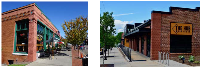
Sec. 16.6.30.1. - Intent.
(a)
The Town core will be the heart of the community and will continue to include a diversity of uses. It is desirable to encourage a variety of commercial, retail, service, restaurant, entertainment and other uses interspersed with residential homes, lofts and apartments.
(b)
The vision of the Town core is to develop/redevelop into a vibrant and somewhat eclectic place for residents and visitors to live, shop, work, dine, recreate and gather while supporting a theme reminiscent of a charming and active small Town. To achieve this, the Town recognizes the importance of allowing the market to direct development with minimal regulatory and/or design constraints. Concurrently, property owners and developers must recognize the importance of supporting the overall theme of the Town core area and employ design elements, materials and site Planning techniques that reinforce this vision. All participants need to acknowledge that the Town core area will continue to be a dynamic place where uses may change and properties may be altered to reflect changes in the marketplace and in response to the growth of the community that coincide with the Comprehensive Plan.
(Ord. 2021-08 §2)
Sec. 16.6.30.2. - Density.
(a)
Density shall not exceed fifteen (15) units per acre.
(b)
Building height shall not exceed three (3) stories without additional review.
(c)
Setbacks shall adhere to the standards as follows:
(1)
Single-family residential dwellings shall match the criteria set forth in the suburban perimeter Section of this Code.
(2)
Multi-family residential dwellings shall match the criteria set forth in the multi-family design and development standards of this Code.
(3)
Non-residential commercial and office uses shall match the criteria set forth in the non-residential commercial and office design and development standards of this Code.
(4)
Instances where setback criteria are not explicitly stated or for all other uses not identified in this Section, setback criteria shall be determined through the platting and/or site plan review process.
(Ord. 2021-08 §2; Ord. No. 2023-05, §4)
Sec. 16.6.30.3. - Uses.
(a)
Uses by right.
(1)
Residential land uses:
a.
Single-family dwellings, attached or detached.
b.
Accessory dwelling.
c.
Multi-family dwellings.
(2)
Public, quasi-public, other land uses:
a.
Community gardens.
b.
Farmer's markets.
c.
Fire stations.
d.
Municipal use facilities.
e.
Museums.
f.
Parks and open spaces.
g.
Parks and playgrounds—neighborhood.
h.
Outdoor amphitheaters.
i.
Public or other nonprofit recreational use facilities.
j.
Public utility main lines and substations.
k.
Rest stops.
l.
Schools (all types).
(b)
Encouraged Uses.
(1)
Residential or mixed uses:
a.
Senior housing.
b.
Bed and breakfast establishments.
c.
Family-care, day care and elderly day care homes.
d.
Flex buildings (start as residential and shift to commercial over time).
e.
Long-term care facilities.
f.
Mixed-use buildings (residential, commercial, office, workshops, etc.).
g.
Live/work units and buildings.
(2)
Commercial, retail or service land uses:
a.
Administrative, office and research facilities.
b.
Appliance sales and service facilities.
c.
Automobile service and repair—minor facilities.
d.
Banks and financial institutions.
e.
Bars/taverns/microbreweries.
f.
Business offices (contractors, electronic repair, small engine, motorcycle).
g.
Car/motor vehicle washes.
h.
Child day care centers.
i.
Commercial and retail businesses, indoor sales and service.
j.
Entertainment facilities, commercial theaters, etc.
k.
Equipment (small) rental establishments without outdoor sales.
l.
Gasoline/fueling stations.
m.
Greenhouses, whether public or private.
n.
Grocery stores.
o.
[Reserved.]
p.
Home based business, in compliance with Article 9 (Supplemental Regulations) of this chapter.
q.
Hospitals.
r.
Hotels/motels (no room limit).
s.
Inns (up to twelve [12] rooms).
t.
Laundromats and dry cleaning retail outlets.
u.
Medical and dental offices and clinics.
v.
Movie theaters.
w.
Office buildings.
x.
Parking lots and parking garages (as principal use).
y.
Passenger terminals or park-n-rides.
z.
Personal and business service shops.
aa.
Professional offices.
bb.
Push carts (sidewalk vending).
cc.
Restaurants.
dd.
Retail sales stores.
ee.
Vehicle sales facilities, including sales of automobiles, motorcycles, RVs, boats and trucks.
ff.
Veterinary clinics.
gg.
Workshops and custom small industries, including art studios with/without sales.
hh.
Workshops and custom small industries, including art studios with/without sales.
(3)
Public, quasi-public, other land uses:
a.
Accessory buildings and uses incidental to the principal use.
b.
Clubs and lodges.
c.
Conference/convention centers.
d.
Religious institutions.
(c)
Uses requiring additional review.
(1)
Residential land uses:
a.
Boarding and rooming houses.
b.
Group homes.
c.
Safe houses for adults or children with up to eight (8) persons.
d.
Single-room occupancy Boarding houses.
e.
Two-family (duplex) dwellings.
f.
Zero-lot-line single- or two-family dwellings.
(2)
Commercial, retail or service land uses:
a.
Agricultural uses (ranching, farming, grazing, etc.).
b.
Automobile service and repair—major facilities.
c.
Cremation facilities.
d.
Dry cleaning Plants.
e.
Equipment rental (heavy) establishments with outdoor sales.
f.
Fireworks sales—temporary.
g.
Kennels small animal.
h.
Mini-storage facilities—enclosed.
i.
Recycling processing and sales Facilities (including biofuel).
j.
Retail and supply yard establishments with outdoor storage.
k.
Roadside or temporary retail stands/tents.
l.
Farm implement, heavy equipment, and mobile/manufactured home sales facilities.
m.
Storage facilities for outdoor storage of RVs, boats, trailers, etc.
n.
Truck depots.
o.
Truck maintenance facilities.
(3)
Public, quasi-public, other land uses:
a.
Alternative power generation facilities.
b.
Bus shelters.
c.
Cemeteries.
d.
Wireless telecommunications facilities.
(4)
Industrial land uses:
a.
Heavy industrial facilities.
(c)
Open space/parks and connectivity requirements (see section 16.12.250).
Note: Land uses not identified may be considered with additional review to be determined by Planning Staff at pre-application meeting. See Section 16.3.40 of this Code.
(Ord. 2021-08 §2; Ord. 2025-01 §2; Ord. 2025-02 §4)
Sec. 16.6.30.4. - Design standards.
The following design standards including applicable Corridor Plan standards shall apply within the Town core.
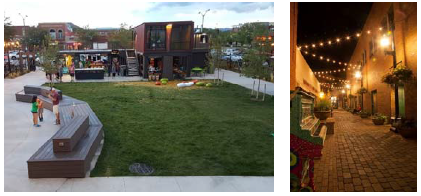
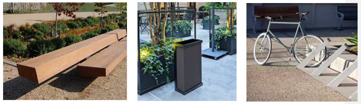
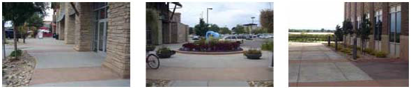
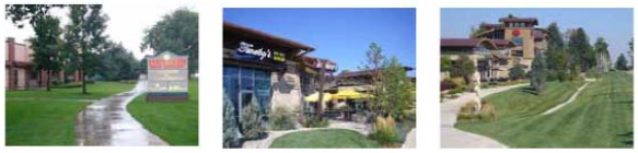
Plazas and outdoor gathering spaces are encouraged. Pedestrian walks and spaces shall be provided as necessary to ensure that projects are easily navigated and enjoyable for the pedestrian. Site amenities, such as seating, outdoor dining, trash receptacles and bike racks for public use, shall be required.
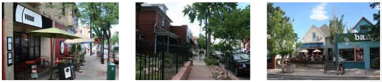
Varied setbacks to buildings are encouraged to create interest along the streetscape. Gathering spaces, outdoor dining, patios, etc., are encouraged. Buildings on the south side of the road are encouraged to be set back from the right-of-way to reduce shading on the public sidewalk and street.
Sidewalk Plantings, outdoor seating and activity on the public sidewalk is encouraged. A minimum of a four (4)-foot clear walkway needs to be maintained. Sidewalks adjacent to all school sites and parks require a minimum width of five (5) feet or wider. Street trees are encouraged. Creative pedestrian-scale signage and displays of art are encouraged.
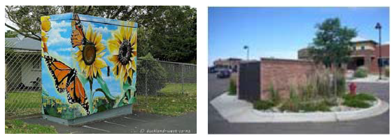
Utility pedestals and trash enclosures shall be buffered with landscaping. Trash enclosures shall be located in locations that have the least impact on views from the public right-of-way as practical. Trash enclosures shall be masonry with steel gates to match building architecture.
(Ord. 2021-08 §2)
Sec. 16.6.30.5. - Parking standards.
The number of required parking spaces shall be based on the requirements in Section 16.9.40.
(Ord. 2021-08 §2)
Sec. 16.6.30.6. - Street standards—Refer to the Town of Severance Transportation Plan.
Reserved.
(Ord. 2021-08 §2)
Sec. 16.6.30.7. - Architectural standards.
The following shall be the architectural standards for the Town core:
Creative and unique architectural and site design are encouraged.
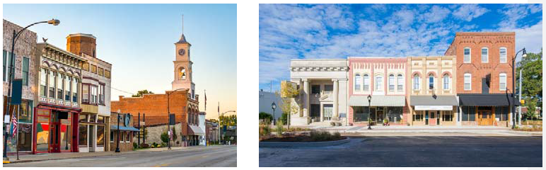
Where there are large windows and/or entries facing the public right-of-way, awnings are encouraged.
Architecture that is reflective of the regional character of urban buildings is encouraged, including red or tan brick, sandstone, awnings, etc. Varied building heights, styles, colors and building details are encouraged.
Residential-scale buildings that have the appearance of a historic home that has been renovated for commercial use are encouraged. These types of building are strongly recommended on the south side of the street and at the edges of the urban core to act as a transition to adjacent land uses.
In the southern part of the Town core, it is expected that the buildings will be adjacent to the public right-of-way with parking behind or beside the building.
In the Town core, it is expected that deliveries, utilities and some parking will be behind the buildings and accessed by alleys. The transition from the Town core to surrounding land uses needs to be addressed carefully on an as-needed basis.
Architectural design of homes should reflect early twentieth (20 th ) century traditional, dominated by porches, steeper roofs, mixed materials, etc.
New residential development in the Town core should have detached sidewalks with a minimum six (6)-foot tree lawn. Alleys are encouraged and may be gravel, not paved.
(Ord. 2021-08 §2)
Sec. 16.6.30.8. - Edges/landscape/connectivity.
Edges of commercial developments shall have high-quality landscaping. Berms, meandering walks, a mix of irrigated turf, shrub beds, ornamental trees, evergreen trees and shade trees are encouraged. The ends of parking bays shall have landscape islands, which shall be strategically placed to ensure that there are no more than twenty (20) contiguous parking spaces. Parking lot landscaping shall be review by Town Staff, be appropriate depending on proposed land use and adhere to any Corridor Plan standards.
Parking lots shall be buffered from view from the public right-of-way with practical landscaping.
Entryways and areas visible from public streets shall have some type of landscape component. Examples could include window boxes, hanging baskets, large pots and Planting beds.
Where a subdivision either borders or includes portions of the Great Western Trail the developer will be required to pave the trail with a minimum ten (10) foot concrete cross section for the entirety of the trail within or adjacent to the property.
(Ord. 2021-08 §2)
Sec. 16.6.30.9. - Fencing.
Front-yard fencing in the Town core shall be open wood picket or wrought iron and shall not exceed forty-two (42) inches in height. Brick or stone columns are encouraged. Privacy fencing between users or to screen users shall be allowed per review and approval as a part of a final plat or site Plan approval. Privacy fencing shall not exceed six (6) feet in height and shall be minimized and placed so that the visual impact to surrounding uses and the public right-of-way is minimized. Landscape buffering in place of or associated with privacy fencing is encouraged. Privacy fencing, if located adjacent to the public right-of-way, shall be separated from the public right-of-way by a landscaped buffer.
(Ord. 2021-08 §2)
Sec. 16.6.30.10. - Entries and signage.
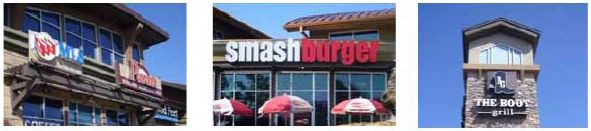
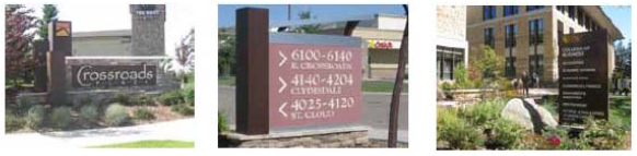
Entries to commercial areas shall be identified by high-quality, ground-mounted signs and/or monumentation. Landscaping shall identify entries with enhanced Plantings as shown (flower beds, ornamental trees, etc.). Signage shall be designed to be appropriate to the scale of the development and in conformance with 16.9.30.
(Ord. 2021-08 §2)
Sec. 16.6.30.11. - Lighting.
Lighting shall be consistent with the architecture and should consist of pedestrian-scale cut-off lighting so that no light spills beyond the boundary of the project. Parking lots, pedestrian ways and building entries shall be appropriately lit. All lighting within the Town Core Zoning District shall comply with the Dark Skies Ordinance Lighting Zone 3 requirements. Neighboring uses shall be considered through the review process.
(Ord. 2021-08 §2)
Sec. 16.6.40.1. - Intent.
(a)
The development nodes (see the end of Section 16.6.40.4 for locations and descriptions) are surrounding key intersections in areas within the Town GMA but outside the Town core area. These development nodes are important to the future economic vitality of the community and have the potential to be served by urban infrastructure, which may offer the opportunity for higher intensity land uses. The development node zoning includes one (1) sub-zoning as outlined below, allowing for more specific industrial uses and intending to be contemplated at the time of annexation and zoning:
(1)
Development Node Industrial Sub-zoning (Sections 16.6.40.4) is intended for more industrial land uses and will include separate requirements intended to provide adequate mitigation to potential impacts.
(b)
It is recognized that the development node areas are not presently served with full urban infrastructure, and it could take several years for this infrastructure to reach each node. However, it is desirable to promote development of these areas and, therefore, development of these areas could occur in stages. The Town expects that future development within these development nodes would be a collective vision created through collaboration between the landowner/developer and the Town, incorporating the guiding principles of the Severance: HomeTown Vision Comprehensive Plan. The Town shall adhere to these guiding principles while evaluating the development proposals within the development nodes.
(c)
Ultimately, the uses, development patterns and standards presented in this division are expected to result in development that is suitable to the location, aesthetically complementary to the overall vision of the Town, economically viable, and conforming to the Comprehensive Plan. Until the marketplace, combined with appropriate levels of infrastructure, supports the full implementation of this division, flexibility and real-time assessments will guide the review and approval of developments within the development node areas.
(Ord. 2021-08 §2)
Sec. 16.6.40.2. - Density.
(a)
Density in residential areas is encouraged to be a minimum of eight (8) units per acre.
(b)
Building height shall not exceed three (3) stories without additional review.
(c)
Setbacks shall adhere to the standards set forth by the following:
(1)
Single-family residential dwellings shall match the criteria set forth in the suburban perimeter Section of this Code.
(2)
Multi-family residential dwellings shall match the criteria set forth in the multi-family design and development standards of this Code.
(3)
Non-residential commercial and office uses shall match the criteria set forth in the non-residential commercial and office design and development standards of this Code.
(4)
Instances where setback criteria are not explicitly stated or for all other uses not identified in this Section, setback criteria shall be determined through the platting and/or site plan review process.
(Ord. 2021-08 §2; Ord. No. 2023-05, §5)
Sec. 16.6.40.3. - Uses.
(a)
Uses by right.
(1)
Residential land uses:
a.
Bed and breakfast establishments.
b.
Family-care, day care and elderly day care homes.
c.
Flex buildings (that start as residential and shift to commercial over time).
d.
Long-term care facilities.
e.
Multi-family dwellings (four [4] or more units).
f.
Multi-family dwellings (less than four [4] units).
g.
Senior housing.
(2)
Mixed land uses:
a.
Live/work units and buildings.
b.
Mixed-use buildings (residential, commercial, office, workshops, etc.).
(3)
Public, quasi-public, other land uses:
a.
Community gardens.
b.
Farmer's markets.
c.
Fire stations.
d.
Municipal use facilities.
e.
Museums.
f.
Parks and open spaces.
g.
Parks and playgrounds—neighborhood.
h.
Outdoor amphitheaters.
i.
Public or other nonprofit recreational use facilities.
j.
Public utility main lines and substations.
k.
Rest stops.
l.
Schools, public and private.
(b)
Encouraged Uses.
(1)
Commercial, retail or service land uses:
a.
Administrative, office and research facilities.
b.
Appliance sales and service facilities.
c.
Automobile service and repair (minor) facilities.
d.
Banks and financial institutions.
e.
Bars/taverns/microbreweries.
f.
Business offices (for contractors, electronic repair, small engine, motorcycle).
g.
Car/motor vehicle washes.
h.
Child day care centers.
i.
Commercial and retail businesses with indoor sales and service.
j.
Entertainment facilities, commercial theaters, etc.
k.
Equipment (small) rental establishments without outdoor sales.
l.
Gasoline/fueling stations.
m.
Greenhouses, whether public or private.
n.
Grocery stores.
p.
Hospitals.
q.
Hotels/motels (no room limit).
r.
Inns (no room limit).
s.
Laundromats and dry-cleaning retail outlets.
t.
Medical and dental offices and clinics.
u.
Movie theaters.
v.
Office buildings.
w.
Parking lots and parking garages (principal use).
x.
Passenger terminals or park-n-rides.
u.
Personal and business service shops.
z.
Professional offices.
aa.
Restaurants.
cc.
Retail sales—general stores.
dd.
Retail sales buildings.
ff.
Vehicle sales businesses, including automobiles, motorcycles, RVs, boats and trucks.
gg.
Veterinary clinics for small animals with no outside kennels.
hh.
Veterinary hospitals for large animals.
(2)
Public, quasi-public, other land uses:
a.
Accessory buildings and uses incidental to the principal use.
b.
Clubs and lodges.
c.
Reserved.
d.
Conference/convention centers.
e.
Religious assembly facilities.
(c)
Uses requiring additional review.
(1)
Residential land uses:
a.
Boarding and rooming houses.
b.
Group homes.
c.
Safe houses for adults or children with up to eight (8) persons.
d.
Single-family detached dwellings.
e.
Single-room occupancy Boarding houses.
f.
Two-family (duplex) dwellings.
g.
Zero-lot-line single- or two-family dwellings.
(2)
Commercial, retail or service land uses:
a.
Agricultural uses (ranching, farming, grazing, etc.).
b.
Automobile service and repair (major) facilities.
c.
Cremation facilities.
d.
Dry cleaning Plants.
e.
Equipment rental (heavy) establishments with outdoor sales.
f.
Kennels for small animals.
g.
Roadside or temporary retail stands/tents.
h.
Sales of farm implements, heavy equipment, mobile/manufactured homes.
(3)
Public, quasi-public, other land uses:
a.
Alternative power generation facilities.
b.
Bus shelters.
c.
Wireless telecommunications facilities (no antenna).
(c)
Open spaces/parks and connectivity requirements (see section 16.12.250).
Note: Land uses not identified may be considered with additional review to be determined by Planning Staff at pre-application meeting. See Section 16.3.40 of this Code.
(Ord. 2021-08 §2)
Sec. 16.6.40.4. - Development node industrial sub-zoning.
Development node industrial sub-zoning is contemplated and approved at the time of annexation for a specific property. Upon approval of an annexation and zoning with this designation, the following land uses become allowed rather than by additional review. The following list of uses is not necessarily comprehensive, and during the annexation and zoning process, additional uses may be included by annexation agreement. Additional standards for setbacks, landscaping, fencing and infrastructure are outlined as follows. Any other requirements are determined through development review.
(1)
Industrial land uses:
a.
Laboratory and/or research facilities.
b.
Light industrial facilities.
c.
Manufacturing Plants, including assembly, sales and service of commodities.
d.
Warehouse, distribution and wholesale use facilities.
e.
Workshops and custom small industry facilities, including art studios with/without sales.
f.
Storage facilities (both indoor and outdoor).
g.
Retail supply yards and storage facilities.
h.
Recycling facilities (including biofuel) processing and sales facilities.
i.
Truck depots and truck maintenance facilities.
j.
Solar facilities (see Section 16.11.160, Solar Facility).
(2)
Architectural Standards:
a.
Architectural standards within the development node industrial zone shall mimic the materials and type shown for standard development node uses such as commercial (see Section 16.6.40.5). In some cases, with Town Council approval, architectural requirements may be waived.
(3)
Landscape Requirements:
a.
For uses that do not already have specific setback requirements (such as oil and gas or solar), a boundary with a dissimilar land use is required at a minimum to incorporate a landscaped setback of twenty (20) feet. Setback design will be dependent on-site constraints and proposed use intensity.
(4)
Parking requirements:
a.
Parking requirements shall meet the standard of the parking table in Section 16.6.40.5. Parking is required to be screened and, where possible, shall be located away from the frontage of major roadways.
(5)
Lighting and sound: Industrial land uses that abut residential development will be required to submit both a lighting Plan (photometric) and sound study for proposed operations. Plans will be reviewed, and additional setbacks or requirements may be added to minimize impacts on neighboring properties. All lighting within the Development Node Zoning District shall comply with the Dark Skies Ordinance Lighting Zone 3 requirements.
(Ord. 2021-08 §2)
Sec. 16.6.40.5. - Design standards.
The following shall be the design standards for the development nodes:
Plazas and outdoor gathering spaces are encouraged. Mountain views will be preserved when applicable.
Creative and appropriately scaled building signage is encouraged.
Varied setbacks to buildings are encouraged to create interest along the streetscape. Gathering spaces, outdoor dining, patios, etc., are encouraged. Buildings on the south side of the road are encouraged to be set back from the right-of-way to reduce shading on the public sidewalk and street.
Sidewalk Plantings, outdoor seating and activity on the public sidewalk is encouraged. A minimum of four (4) feet clear walkway needs to be maintained.
Street trees and dissection of large parking lots with landscaping are encouraged.
Condensed and creative pedestrian-scale signage is encouraged within projects.
Pedestrian walks and spaces shall be provided as necessary to ensure that projects are easily navigated and enjoyable for the pedestrian. Sidewalks adjacent to all school sites and parks require a minimum width of five (5) feet or wider.
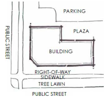
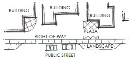
Public Street Orientation Diagram
In areas where a state highway or arterial street is not present, buildings shall be oriented toward the public right-of-way to keep parking lots behind the buildings.
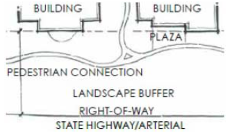
State Highway/Arterial Orientation Diagram
Where property abuts a state highway or arterial street, large landscape buffers are required. Delivery areas and trash enclosures shall be screened from the public right-of-way.
On-Street Parking Diagram
In areas where the right-of-way is narrow, on-street parking, a variety of building setbacks and building edges articulated toward the street are encouraged.
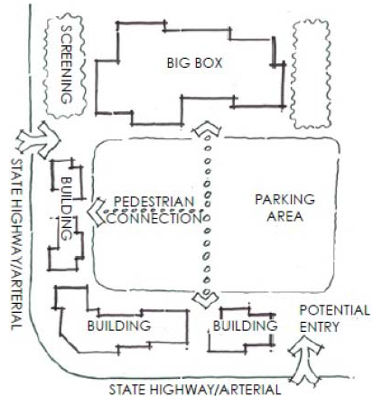
Big Box Orientation Diagram
Big box retailers shall be oriented away from the right-of-way with frontage buildings to screen parking.
Buildings that back to the public right-of-way, parking lots, utility pedestals and trash enclosures shall be buffered with landscaping. Trash enclosures shall be located in places that have the least impact on views from the public right-of-way, as practical. Trash enclosures shall be masonry with steel gates to match building architecture.
(Ord. 2021-08 §2)
Sec. 16.6.40.5.1. - Parking standards.
The number of required parking spaces shall be based on the requirements in Section 16.9.40.
(Ord. 2021-08 §2)
Sec. 16.6.40.6. - Street standards.
Street standards within the development nodes that are not a state highway shall comply with the standards set forth in the Severance Transportation Master Plan.
(Ord. 2021-08 §2)
Sec. 16.6.40.7. - Description of nodes.
(a)
Corner of Colorado Highway 14 and Colorado Highway 257. This intersection of two (2) busy state highways has high traffic counts, good access into the north end of Fort Collins on Highway 14, south on Colorado Highway 257 to Severance and Windsor and east on Highway 14 to Ault and Highway 85. The landowner/developer shall meet with the Town and the Colorado Department of Transportation to determine allowable access points onto state highways located within the development nodes.
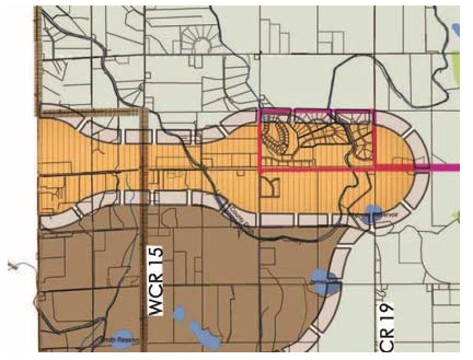
Corner of Colorado Highway 14 and Colorado Highway 257
(b)
Corner of Colorado Highway 257 and Weld County Road 74 (Harmony Road). The west side of this intersection is in the Town of Windsor GMA. The east side at the intersection is in the Town of Severance GMA. The properties adjacent to this intersection are within the boundaries of an intergovernmental agreement with the Town of Windsor that further defines the land uses, etc. This intersection has high traffic counts, with Highway 257 being a key transportation link between Severance and Windsor and to Highway 14 to the north. Harmony Road is quickly becoming a very busy thoroughfare that becomes a key street in the Town core area of Severance. To the east, it connects to Eaton, and to the west, it is becoming a heavily developed corridor through Timnath and Fort Collins with an important link to Interstate 25. The majority of the traffic from the Severance area going to Fort Collins or Interstate 25 will utilize the Harmony Corridor. The landowner/developer shall meet with the Town, the Town of Windsor, the county and the Colorado Department of Transportation to determine allowable access points onto state highways and county roads located with the development node.
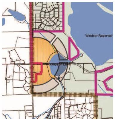
Corner of Colorado Highway 257 and Weld County Road 74 (Harmony Road)
(c)
Colorado Highway 392 Corridor (north side). The Highway 392 corridor development node is intended to be primarily commercial and industrial with surrounding higher intensity residential land uses. This corridor is governed by a land use and revenue sharing intergovernmental agreement between the Town of Severance and the Town of Windsor. Commercial and industrial land is a required use for a portion of the corridor. The landowner/developer shall meet with the Town, the Town of Windsor and the Colorado Department of Transportation to determine allowable access points onto Highway 392 within the development node.
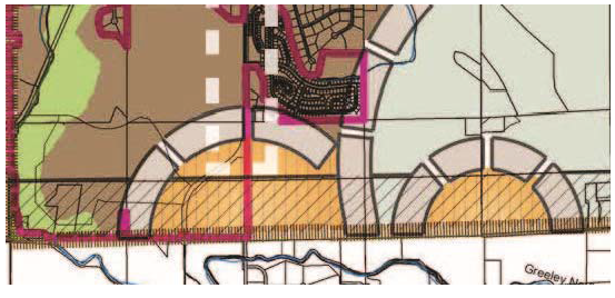
Colorado Highway 392 Corridor (north side)
(Ord. 2021-08 §2)
Sec. 16.6.40.8. - Architectural standards.
The following shall be the architectural standards for the development nodes in addition to Corridor Plan standards where appropriate:
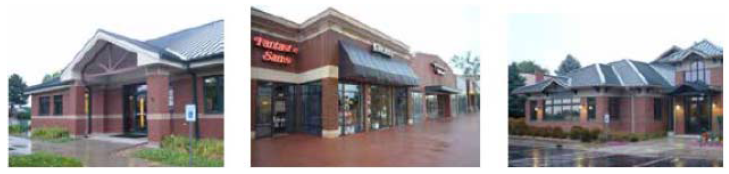
Creative and unique architecture and site design are encouraged.
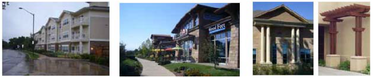
Distinctive architectural feature elements that create focal points and destination backdrops are encouraged.
Architecture that is reflective of the regional character of urban buildings is encouraged, including red or tan brick, sandstone, exaggerated roof overhangs, awnings, etc.
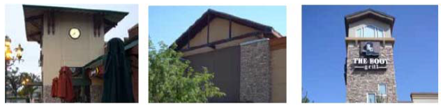
Varied building heights, styles, colors and building details are encouraged.
In the development nodes, it is expected that deliveries, utilities and some parking will be behind the buildings and accessed by alleys. The screening of these facilities and transition from the development nodes to surrounding land uses need to be addressed carefully on an as-needed basis.
(Ord. 2021-08 §2)
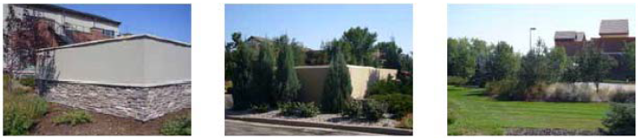
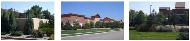
Sec. 16.6.40.9. - Edges/landscape.
Edges of commercial development shall have high-quality landscaping. Berms, meandering walks, a mix of irrigated turf, shrub beds, ornamental trees, evergreen trees and shade trees are encouraged. Parking lots are required to have landscaping per industry standards. The ends of parking bays shall have landscape islands, which shall be strategically placed to ensure that there are no more than twenty (20) contiguous parking spaces.
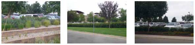
Parking lots shall be buffered from view from the public right-of-way with practical landscaping.
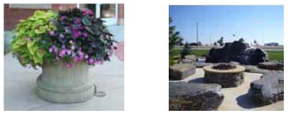
Entryways and areas visible from public streets shall have some type of landscape component.
Examples include water features, fire pits, window boxes, hanging baskets, large pots and Planting beds.
(Ord. 2021-08 §2)
Sec. 16.6.40.10. - Fencing.
Front-yard fencing in the development nodes shall be open wood picket or wrought iron and shall not to exceed forty-two (42) inches in height. Brick or stone columns are encouraged. Privacy fencing between users or to screen users shall be allowed per review and approval as a part of a final plat or site Plan approval. Privacy fencing shall not exceed six (6) feet in height and shall be minimized and placed so that the visual impact to surrounding uses and the public right-of-way is minimized. Landscape buffering in place of or associated with privacy fencing is encouraged. Privacy fencing, if located adjacent to the public right-of-way, shall be separated from the public right-of-way by a landscaped buffer.
(Ord. 2021-08 §2)
Sec. 16.6.40.11. - Entries and signage.
Entries to commercial areas shall be identified by high-quality, ground-mounted signs and/or monumentation. Landscaping shall identify entries with enhanced Plantings as shown (flower beds, ornamental trees, etc.). Signage shall be designed to be appropriate to the scale of the development.
(Ord. 2021-08 §2)
Sec. 16.6.40.12. - Lighting.
Lighting shall be consistent with the architecture and should consist of pedestrian-scale cut-off lighting so that no light spills beyond the boundary of the project. Parking lots, pedestrian ways and building entries shall be appropriately lit.
Note: The Town of Severance would like to thank Fort Collins, Loveland, Niwot, Highlands, Erie, Frisco, Carbondale, Aspen and Basalt for image examples used in this Code.
(Ord. 2021-08 §2)
Sec. 16.6.40.13. - Utility services.
The following is a list of utility services that are available at each development node:
(1)
Corner of Colorado Highway 14 and Colorado Highway 257: This intersection has a localized sanitary sewer Plant and is served by North Weld County Water District with potable water.
(2)
Corner of Colorado Highway 257 and Weld County Road 74 (Harmony Road): This intersection has Planned sanitary sewer provided by the Town of Windsor and is served with potable water from North Weld County Water District. Although sanitary sewer is Planned for this area, it is recognized by the Town that limited commercial and industrial uses may still occur prior to the extension of centralized sanitary sewer facilities.
(3)
Highway 392 Corridor (north side): This area will be served by the Town for sanitary sewer and by the North Weld County Water District for potable water.
(Ord. 2021-08 §2)