
Sopchoppy City Zoning Code
ARTICLE III
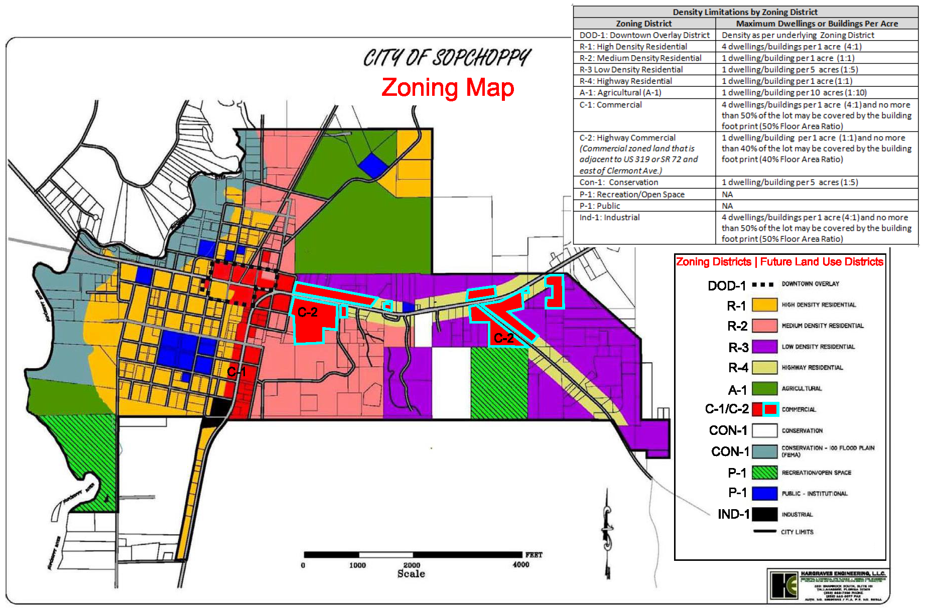
- ZONING DISTRICTS ESTABLISHED; ZONING MAP
Sec. 119-83. - Zoning districts established.
In order to carry out the purpose and intent of this chapter, the city is hereby divided into zoning districts and shall be identified as follows:
(Ord. No. 91-1, § 150, 3-11-1991; Ord. No. 2014-03, § 1(Exh. A), 4-14-2014)
Sec. 119-84. - Official zoning map.
The location and boundaries of zoning districts are hereby established and shown on the official zoning map entitled "Official Zoning Map of the City of Sopchoppy" which together with all explanatory matter herein, is hereby adopted by reference and declared to be a part of this chapter. In the case of inconsistencies with the most recently adopted comprehensive plan, including the future land use element and future land use map, the comprehensive plan shall prevail in regard to application for a development order pursuant to F.S. § 163.3194(1)(b).
(Ord. No. 91-1, § 160, 3-11-1991)
Sec. 119-85. - Rules for interpretation of district boundaries.
Where uncertainty exists to the boundaries of any zoning district showing on the official zoning map, the following provisions shall apply:
(1)
Boundaries indicated as approximately following the centerlines of streets, highways, alleys, or other public rights-of-way shall be construed to follow such centerlines.
(2)
Boundaries indicated as approximately following platted lot lines shall be construed as following such lot lines.
(3)
Boundaries indicated as approximately following city limits shall be construed as following city limits.
(4)
Boundaries indicated as approximately following railroad lines shall be construed to be midway between the main tracks.
(5)
Boundaries indicated as approximately following the centerlines of streams, rivers, or other bodies of water shall be construed to follow such centerlines.
(6)
Where a district boundary line divides a lot held in single and separate ownership on March 11, 1991, the use regulation applicable to the less restricted district shall extend over the portion of the lot in the more restricted district a distance of not more than 50 feet beyond the district boundary line.
(Ord. No. 91-1, § 170, 3-11-1991)