
American Fork City Zoning Code
CHAPTER 17
4 REGULATIONS WITHIN ZONE DISTRICTS
2019-05-32
2024-06-28
2020-10-54
2025-01-04
2019-10-65
2023-08-32
2024-03-10
2024-05-24
2024-05-23
2018-11-52
2019-09-62
2020-09-48
2022-09-40
2021-02-13
2023-03-12
2024-04-18
Sec 17.4.101 RA-5 Residential-Agricultural Zone
- Intent. The RA-5 residential-agricultural zone covers certain fringe areas of the city where residential areas may be integrated with the raising of livestock for family food production and for the pleasure of the people who reside on the premises.
- Permitted uses. The following buildings, structures, and uses of land shall be permitted upon compliance with requirements set forth in this code:
- One-family dwellings. Conventional construction and manufactured housing, subject to the provisions of Section 17.5.129. Also, customary residential accessory buildings and structures.
- The raising, care and keeping of livestock and fowl and associated barns, sheds, corrals, pastures, paddocks, coops, hutches and similar facilities for the care and keeping of livestock and fowl, all subject to of the following criteria:
- All livestock and fowl shall be housed and maintained within a designated livestock management area as defined by this title.
- The number of animals kept on any lot or parcel shall not exceed one animal unit for each ten thousand square feet of livestock management area.
- All corrals, stalls, pens, and paddocks for the enclosure of livestock; all barns, stables, coops, sheds, hutches or similar buildings used for the housing or confinement of livestock and fowl; and all water troughs and areas used for the feeding of livestock shall be located not closer than seventy-five feet from an existing dwelling or other occupied structure located on an adjacent lot or fifty feet from such dwelling or structure on the same lot.
- The growing of field crops and fruit.
- Sheds and other buildings for the storage of agricultural machinery and produce actually used on or produced from the parcel on which those structures are located. Also, barns, corrals, pens and sheds for the care and keeping of the animals or fowl permitted under subsection 2. above.
- Public utility lines and buildings.
- Public agency parks and playgrounds.
- Household pets.
- Fences, walls and hedges.
- Accessory apartments subject to the requirements of Section 17.5.134 of this code.
- Conditional uses. The following buildings, structures, and uses of land shall be permitted upon compliance with the applicable requirements of this code and after approval has been given by the designated review agency.
- Home occupations subject to the provisions of Section 17.5.123 of this code.
- Residential facility subject to the provisions of Chapter 17.15 of this code.
- Temporary uses, subject to the provisions of Section 17.5.122 of this code.
- Foster care homes containing not more than two non-related foster care occupants.
- Low power radio service antenna facilities, subject to the provisions of Section 17.6.112 of this code.
- Lot area, width and depth requirements. The minimum area, width and depth requirements for a zoning lot within the zone shall be as follows:
Use Minimum Area Minimum Width (in ft.) Depth of Lot (in ft.) One-family dwellings 5 acres 250 250 Churches 2 acres 250 none - Location requirements.
- Main buildings. All dwellings and other main buildings and structures shall be set back in accordance with the following:
- Front setback. All dwellings and other main buildings shall be setback not less than fifty feet from the front lot line which abuts on any existing or proposed public street, except that a portion of a dwelling may project up to five feet into the required front setback area, provided that the width of the projecting portion shall not exceed thirty percent of the width of the dwelling.
- Side setback—Interior lots. All dwellings and other main buildings including any attached garage or similar structure shall be set back not less than twenty feet from either side lot line.
- Side setback—Corner lots—Side abutting a street. All dwellings and other main buildings shall be set back not less than twenty feet from the side lot line which abuts on any existing or proposed public street.
- Rear setback—Interior lots. All dwellings and other main buildings and structures shall be set back not less than twenty-five feet from the rear lot line, except that a portion of a dwelling may project up to five feet into the required rear setback area, provided that the width of the projecting portion shall not exceed fifty percent of the total width of the dwelling.
- Rear setback—Corner lots. All dwellings and other main buildings shall be set back not less than twenty-five feet from the rear lot line, except as follows: (i) a portion of a dwelling may project up to five feet into the required rear setback area, provided that the width of the projecting portion shall not exceed fifty percent of the total width of the dwelling, or (ii) where a garage is attached to the rear of the dwelling, the required rear setback for said garage may be reduced to not less than twelve feet, as measured from the rear lot line to the closest part of the garage, or (iii) a portion of a dwelling may project up to fifteen feet into the required rear setback area, provided that the width of the projecting portion shall not exceed fifty percent of the total width of the dwelling and the rear area of the corner lot abuts a side setback of an adjacent lot.
- Main buildings. All dwellings and other main buildings and structures shall be set back in accordance with the following:
- Dwelling requirements.
- Height of dwellings. The maximum height of any dwelling shall be thirty-six feet, measured in accordance with the criteria set forth under Section 17.5.130, as may be modified by the following:
- Chimneys, flag poles, television antennas, and similar ancillary structures not used for human occupancy shall be excluded in determining height.
- The building inspector may approve a dwelling having a greater maximum height, provided, that the dwelling will be set back from all appurtenant lot lines a distance of two feet for each additional foot of dwelling height.
- Size of dwelling. Each dwelling shall have a minimum building footprint area of not less than one thousand five hundred square feet, not including any portion of the footprint area occupied solely by a garage, carport, porch, breeze way or similar area not used as a living area.
- Width of dwelling. The minimum width of a dwelling shall be twenty feet, as measured from the outside wall at the narrowest point of the first story, exclusive of any garage, porch, shed or similar area not considered as living area. The width shall be considered the lesser of the two primary dimensions.
- Height of dwellings. The maximum height of any dwelling shall be thirty-six feet, measured in accordance with the criteria set forth under Section 17.5.130, as may be modified by the following:
- Special provisions. Special provisions shall apply in this zone in order to protect its essential characteristics.
- The space required around buildings and structures shall be kept free from refuse and debris.
- All buildings used for human occupancy shall be connected to a public water supply or an approved private water supply, and shall be constructed in accordance with the adopted building, plumbing, electrical, fire prevention and similar codes.
- All buildings used for human occupancy shall be connected to a public sewer collection system or an approved private sewage disposal system, and shall be constructed in accordance with the adopted building, plumbing, electrical, fire prevention and similar codes.
- All buildings and uses within this zone shall comply with all applicable supplementary development standards as set forth in this code.
(Ord. No. 03-05-11; Ord. No. 04-02-01; Ord. No. 2015-04-25, pt. I, § 1, 4-14-2015; Ord. No. 2015-11-72, pt. I, § 1, 11-10-2015; Ord. No. 2016-06-31, pt. I, § 2, 6-14-2016; Ord. No. 2017-09-48, § 2, 9-12-2017)
Amended by Ord. 2019-05-32 on 5/28/2019
Amended by Ord. 2024-06-28 on 6/11/2024
Sec 17.4.102 RA-1 Residential-Agricultural Zone
- Intent. The RA-1 residential-agricultural zone covers certain fringe areas of the city where residential areas may be integrated with the raising of livestock for family food production and for the pleasure of the people who reside on the premises.
- Permitted uses. The following buildings, structures, and uses of land shall be permitted upon compliance with requirements set forth in this code:
- One-family dwellings. Conventional construction and manufactured housing), subject to the provisions of Section 17.5.129. Also customary residential accessory buildings and structures.
- The raising, care and keeping of livestock and fowl and associated, barns, sheds, corrals, pastures, paddocks, coops, hutches and similar facilities for the care and keeping of livestock and fowl, all subject to the following criteria.
- All livestock and fowl shall be housed and maintained within a designated livestock management area as defined by this title.
- The number of animals kept on any lot or parcel shall not exceed one animal unit for each ten thousand square feet of livestock management area.
- All corrals, stalls, pens, and paddocks for the enclosure of livestock; all barns, stables, coops, sheds, hutches or similar buildings used for the housing or confinement of livestock and fowl; and all water troughs and areas used for the feeding of livestock shall be located not closer than seventy-five feet from an existing dwelling or other occupied structure located on an adjacent lot or fifty feet from such dwelling or structure on the same lot.
- The growing of field crops and fruit.
- Sheds and other buildings for the storage of agricultural machinery and produce actually used on or produced from the parcel on which those structures are located. Also barns, corrals, pens and sheds for the care and keeping of the animals or fowl permitted under subsection 2. above.
- Public utility lines and buildings.
- Public agency parks and playgrounds.
- Accessory signs in accordance with the applicable provisions of Section 17.5.128.
- Public and parochial schools and grounds.
- Public buildings and grounds, not including storage yards or repair shops.
- Hospitals.
- Churches, not including temporary revival tents or buildings.
- Household pets.
- Accessory apartments subject to the requirements of Section 17.5.134 of this code.
- Conditional uses. The following buildings, structures, and uses of land shall be permitted upon compliance with the applicable requirements of this code and after approval has been given by the designated review agency.
- Home occupations subject to the provisions of Section 17.5.123 of this code.
- Residential facility subject to the standards and conditions set forth under Chapter 17.15.
- Pre-schools and child care nurseries - quasi-public, subject to the standards and conditions set forth under Section 17.6.111.
- Pre-schools and child-care nurseries - residential, subject to the following:
- The number of children in attendance shall not exceed ten at any one time.
- The use and facilities appurtenant thereto shall comply with and shall have been approved as a home occupation; and
- The submission of copies of permits or approvals from the state department of human services or other recognized approval agency or evidence of imminent approval by such agency (when such approval is required by state law or regulation).
- Fences, walls, and hedges.
- Planned unit developments and residential condominium projects subject to the provisions contained in Section 17.7.501 of this code.
- Temporary uses subject to the provisions of Section 17.5.122 of this code.
- Historic building conservation projects subject to the applicable provisions of Section 17.7.801 of said development code.
- Foster care homes, containing not more than two non-related foster care occupants.
- Low power radio service antenna facilities, subject to the provisions of Section 17.6.112 of this code.
- Private home/charter schools, subject to the provisions of Section 17.6.113.
- Senior housing projects, subject to the provisions of Section 17.7.506.
- Lot area, width and depth requirements. The minimum area, width and depth requirements for a zoning lot within the zone shall be as follows:
Use Minimum Area Minimum width (in ft.) Depth of Lot (in ft.) One-family dwellings 1 acre 150 100 Churches 2 acres 250 none - Location requirements.
- Main buildings. All dwellings and other main buildings and structures shall be set back in accordance with the following:
- Front setback. All dwellings and other main buildings shall be setback not less than thirty feet from the front lot line which abuts on any existing or proposed public street, except that a portion of a dwelling may project up to five feet into the required front setback area, provided that the width of the projecting portion shall not exceed thirty percent of the width of the dwelling.
- Side setback–Interior lots. All dwellings and other main buildings including any attached garage or similar structure shall be set back not less than eight feet from either side lot line and the combined total distance of the two side setbacks shall be not less than eighteen feet, except that where a garage or carport is attached to the side of a dwelling, the minimum required setback for such garage or carport may be reduced to not less than six feet, as measured from the lot line to the closest part of the building, and the combined required distance of the two side setbacks shall be not less than fourteen feet.
- Side setback–Corner lots–Side abutting a street. All dwellings and other main buildings shall be set back not less than twenty feet from the side lot line which abuts on any existing or proposed public street.
- Rear setback–Interior lots. All dwellings and other main buildings and structures shall be set back not less than twenty-five feet from the rear lot line, except that a portion of a dwelling may project up to five feet into the required rear setback area, provided that the width of the projecting portion shall not exceed fifty percent of the total width of the dwelling.
- Rear setback–Corner lots. All dwellings and other main buildings shall be set back not less than twenty-five feet from the rear lot line, except as follows: (i) a portion of a dwelling may project up to five feet into the required rear setback area, provided that the width of the projecting portion shall not exceed fifty percent of the total width of the dwelling, or (ii) where a garage is attached to the rear of the dwelling, the required rear setback for said garage may be reduced to not less than twelve feet, as measured from the rear lot line to the closest part of the garage, or (iii) a portion of a dwelling may project up to fifteen feet into the required rear setback area, provided that the width of the projecting portion shall not exceed fifty percent of the total width of the dwelling and the rear area of the corner lot abuts a side setback of an adjacent lot.
- Main buildings. All dwellings and other main buildings and structures shall be set back in accordance with the following:
- Dwelling requirements.
- Height of dwellings. The maximum height of any dwelling shall be thirty-six feet, measured in accordance with the criteria set forth under Section 17.5.130, as may be modified by the following:
- Chimneys, flag poles, television antennas, and similar ancillary structures not used for human occupancy shall be excluded in determining height.
- The building inspector may approve a dwelling having a greater maximum height, provided, that the dwelling will be set back from all appurtenant lot lines (or footprint lot boundaries where applicable) a distance two feet for each additional foot of dwelling height.
- Size of dwelling. Each dwelling shall have a minimum building footprint area of not less than nine hundred square feet, not including any portion of the footprint area occupied solely by a garage, carport, porch, breezeway or similar area not used as a living area.
- Width of dwelling. The minimum width of a dwelling shall be twenty feet, as measured from the outside wall at the narrowest point of the first story, exclusive of any garage, porch, shed or similar area not considered as living area. The width shall be considered the lesser of the two primary dimensions.
- Corner clearance for driveways. Any driveway providing access to a corner lot shall adhere to the standards as set forth in Figure 17.5.110-B, entitled "Minimum Standards for Corner Clearance of Residential Driveways."
- Height of dwellings. The maximum height of any dwelling shall be thirty-six feet, measured in accordance with the criteria set forth under Section 17.5.130, as may be modified by the following:
- Special provisions. Special provisions shall apply in this zone in order to protect its essential characteristics.
- The space required around buildings and structures shall be kept free from refuse and debris.
- All buildings used for human occupancy shall be furnished with a public water supply and shall be constructed in accordance with the adopted building, plumbing, electrical, fire prevention and similar codes.
- All buildings and uses within this zone shall comply with all applicable supplementary development standards as set forth in this code.
- At least seventy percent of the area contained within a required front yard or side yard adjacent to a street shall be landscaped.
(Ord. No. 82-2-4; Ord. No. 88-06-02; Ord. No. 91-06-07; Ord. No. 92-12-48; Ord. No. 94-08-31; Ord. No. 99-09-26; Ord. No. 4-01-2-4-B; Ord. No. 2000-12-40; Ord. No. 01-04-20; Ord. No. 01-06-32; Ord. No. 03-05-17; Ord. No. 04-02-01; Ord. No. 2008-12-46; Ord. No. 10-16-79; Ord. No. 2014-01-02, § 1, 1-14-2014; Ord. No. 2015-04-25, pt. I, § 1, 4-14-2015; Ord. No. 2015-11-72, pt. I, § 2, 11-10-2015; Ord. No. 2016-06-31, pt. I, § 2, 6-14-2016; Ord. No. 2017-09-48, § 3, 9-12-2017)
Amended by Ord. 2019-05-32 on 5/28/2019
Amended by Ord. 2024-06-28 on 6/11/2024
Sec 17.4.201 R-1-20,000 Residential Zone
- Intent. The R-1-20,000 residential zone is established to provide areas for the encouragement of an environment for family life. Typical uses within the zone are one-family detached housing on large lots (twenty thousand square feet) together with a commingling of parks, playgrounds, trail areas, schools, churches, and other community facilities designed to serve the residents of the city. The zone is characterized by spacious lots, uncrowded buildings, and quiet residential conditions. The zone is consistent with and intended to facilitate implementation of the areas designated on the general plan as very low density residential (two dwelling units per acre). Owners and developers of property within this zone should bear in mind that primacy is given to residential development and maintain their properties in recognition thereof. The specific regulations necessary for the accomplishment of the intent of the zone are hereinafter set forth.
- Permitted uses. The following buildings, structures, and uses of land shall be permitted upon compliance with the applicable requirements of this code:
- One-family dwellings (conventional construction and manufactured housing), subject to the provisions of Section 17.5.129.
- Customary residential accessory buildings and structures.
- The growing of crops in the field.
- Sheds used for storage of equipment used in connection with agricultural activities on the premises.
- Utility lines.
- Accessory signs in accordance with the applicable provisions of Section 17.5.128.
- Public and parochial schools and grounds.
- Public agency parks and playgrounds.
- Public buildings and grounds, not including storage yards and repair shops.
- Churches.
- Customary household pets, but not including kennels.
- Fences, walls, and hedges, subject to the requirements of Section 17.5.115 of this code.
- Accessory apartments subject to the requirements of Section 17.5.134 of this code.
- Conditional uses. The following buildings, structures, and uses of land shall be permitted upon compliance with the applicable requirements of this code and after approval has been given by the designated review agency.
- Home occupations, subject to the provisions of Section 17.5.123 of this code.
- Residential facility subject to the provisions of Chapter 17.15 of this code.
- Temporary uses, subject to the provisions of Section 17.5.122 of this code.
- Historic building conservation projects, subject to the applicable provisions of Section 17.7.801 of this code.
- Pre-schools and child care nurseries - quasi-public, subject to the standards and conditions set forth under Section 17.6.111.
- Pre-schools and child-care nurseries - residential, subject to the following:
- The number of children in attendance shall not exceed ten at any one time.
- The use and facilities appurtenant thereto shall comply with and shall have been approved as a home occupation.
- The submission of copies of permits or approvals from the state department of human services or other recognized approval agency or evidence of imminent approval by such agency (when such approval is required by state law or regulation).
- Foster care homes containing not more than two non-related foster care occupants.
- Planned unit development developments and residential condominium projects, subject to the applicable provisions of Section 17.7.501 of this code.
- Senior housing projects, subject to the provisions of Section 17.7.506 of this code.
- Low power radio service antenna facilities, subject to the provisions of Section 17.6.112 of this code.
- Private home/charter schools, subject to the provisions of Section 17.6.113.
- Lot area, width and depth requirements. The minimum area, width and depth requirements for a zoning lot shall be as follows:
Use Minimum Area (in sq. ft.) Minimum Width (in ft.) Minimum Depth of Lot (in ft.) One-family dwellings 20,000 115 110 Churches 2 acres 250 none - Location requirements.
- Main buildings. All dwellings and other main buildings and structures shall be set back in accordance with the following:
- Front setback. All dwellings and other main buildings shall be setback not less than thirty feet from the front lot line which abuts on any existing or proposed public street, except that a portion of a dwelling may project up to five feet into the required front setback area, provided that the width of the projecting portion shall not exceed thirty percent of the width of the dwelling.
- Side setback—Interior lots. All dwellings and other main buildings including any attached garage or similar structure shall be set back not less than eight feet from either side lot line and the combined total distance of the two side setbacks shall be not less than eighteen feet.
- Side setback—Corner lots—Side abutting a street. All dwellings and other main buildings shall be set back not less than twenty feet from the side lot line which abuts on any existing or proposed public street.
- Rear setback—Interior lots. All dwellings and other main buildings and structures shall be set back not less than twenty-five feet from the rear lot line, except that a portion of a dwelling may project up to five feet into the required rear setback area, provided that the width of the projecting portion shall not exceed fifty percent of the total width of the dwelling.
- Rear setback—Corner lots. All dwellings and other main buildings shall be set back not less than twenty-five feet from the rear lot line, except as follows: (i) a portion of a dwelling may project up to five feet into the required rear setback area, provided that the width of the projecting portion shall not exceed fifty percent of the total width of the dwelling, or (ii) where a garage is attached to the rear of the dwelling, the required rear setback for said garage may be reduced to not less than twelve feet, as measured from the rear lot line to the closest part of the garage, or (iii) a portion of a dwelling may project up to fifteen feet into the required rear setback area, provided that the width of the projecting portion shall not exceed fifty percent of the total width of the dwelling and the rear area of the corner lot abuts a side setback of an adjacent lot.
- Main buildings. All dwellings and other main buildings and structures shall be set back in accordance with the following:
- Dwelling requirements.
- Height of dwellings. The maximum height of any dwelling shall be thirty-six feet, measured in accordance with the criteria set forth under Section 17.5.130, as may be modified by the following:
- Chimneys, flag poles, television antennas, and similar ancillary structures not used for human occupancy shall be excluded in determining height.
- The building inspector may approve a dwelling having a greater maximum height, provided, that the dwelling will be set back from all appurtenant lot lines (or footprint lot boundaries where applicable) a distance two feet for each additional foot of dwelling height.
- Size of dwelling. Each dwelling shall have a minimum building footprint area of not less than one thousand two hundred square feet, not including any portion of the footprint area occupied solely by a garage, carport, porch, breezeway or similar area not used as a living area.
- Width of dwelling. The minimum width of a dwelling shall be twenty feet, as measured from the outside wall at the narrowest point of the first story, exclusive of any garage, porch, shed or similar area not considered as living area. The width shall be considered the lesser of the two primary dimensions.
- Corner clearance for driveways. Any driveway providing access to a corner lot shall adhere to the standards as set forth in Figure 17.5.110-B, entitled "Minimum Standards for Corner Clearance of Residential Driveways."
- Height of dwellings. The maximum height of any dwelling shall be thirty-six feet, measured in accordance with the criteria set forth under Section 17.5.130, as may be modified by the following:
- Utility requirements. All dwellings and other structures used for human occupancy shall be served by the city's culinary water and sanitary sewer system.
- Special provisions.
- Not less than two off-street parking spaces shall be required for each dwelling unit. Each off-street parking space shall be not less than ten × twenty feet per space and shall not be located within any portion of a front or side setback area adjacent to a street.
- All buildings and uses within this zone shall comply with all applicable supplementary development standards as set forth in this code.
(Ord. No. 05-05-18; Ord. No. 2008-12-46; Ord. No. 2014-01-02, § 1, 1-14-2014; Ord. No. 2015-04-25, pt. I, § 1, 4-14-2015; Ord. No. 2015-11-72, pt. I, § 2, 11-10-2015; Ord. No. 2016-06-31, pt. I, § 2, 6-14-2016; Ord. No. 2017-09-48, § 4, 9-12-2017)
Amended by Ord. 2019-05-32 on 5/28/2019
Amended by Ord. 2024-06-28 on 6/11/2024
Sec 17.4.202 R-1-15,000 Residential Zone
- Intent. The R1-15,000 residential zone is established to provide areas for the encouragement of an environment for family life. Typical uses within the zone are one-family detached housing together with a co-mingling of parks, playgrounds, schools, churches, and other community facilities designed to serve the residents of the city. The zone is characterized by spacious lots, uncrowded buildings, and quiet residential conditions. Owners and developers of property within this zone should bear in mind that primacy is given to residential development and maintain their properties in recognition thereof. The specific regulations necessary for the accomplishment of the intent of the zone are hereinafter set forth.
- Permitted uses. The following buildings, structures, and uses of land shall be permitted upon compliance with the applicable requirements of this code:
- One-family dwellings (conventional construction and manufactured housing), subject to the provisions of Section 17.5.129.
- Customary residential accessory buildings and structures.
- The growing of crops in the field.
- Sheds used for storage of equipment used in connection with agricultural activities on the premises.
- Utility lines.
- Accessory signs in accordance with the applicable provisions of Section 17.5.128.
- Public and parochial schools and grounds.
- Public agency parks and playgrounds.
- Public buildings and grounds, not including storage yards and repair shops.
- Churches.
- Customary household pets, but not including kennels.
- Fences, walls, and hedges subject to the requirements of Section 17.5.115 of this code.
- Accessory apartments subject to the requirements of Section 17.5.134 of this code.
- Conditional uses. The following buildings, structures, and uses of land shall be permitted upon compliance with the applicable requirements of this code and after approval has been given by the designated review agency.
- Home occupations subject to the provisions of Section 17.5.123 of this code.
- Residential facility subject to Chapter 17.15 of this code.
- Temporary uses, subject to the provisions of Section 17.5.122 of this code.
- Historic building conservation projects, subject to the applicable provisions of Section 17.7.801 of this code.
- Pre-schools and child care nurseries - quasi-public, subject to the standards and conditions set forth under Section 17.6.111. Also,
- Pre-schools and child-care nurseries - residential, subject to the following:
- The number of children in attendance shall not exceed ten at any one time;
- The use and facilities appurtenant thereto shall comply with and shall have been approved as a home occupation; and
- The submission of copies of permits or approvals from the state department of human services or other recognized approval agency or evidence of imminent approval by such agency (when such approval is required by state law or regulation).
- Foster care homes containing not more than two non-related foster care occupants.
- Low power radio service antenna facilities, subject to the provisions of Section 17.6.112 of this code.
- Private home/charter schools, subject to the provisions of Section 17.6.113.
- Senior housing projects, subject to the provisions of Section 17.7.506.
- Lot area, width and depth requirements. The minimum area, width and depth requirements for a zoning lot shall be as follows:
Use Minimum Area (in sq. ft.) Minimum Width (in ft.) Minimum Depth of Lot (in ft.) One-family dwellings 15,000 105 110 Churches 2 acres 250 none - Location requirements.
- Main buildings. All dwellings and other main buildings and structures shall be set back in accordance with the following:
- Front setback. All dwellings and other main buildings shall be setback not less than thirty feet from the front lot line which abuts on any existing or proposed public street, except that a portion of a dwelling may project up to five feet into the required front setback area, provided that the width of the projecting portion shall not exceed thirty percent of the width of the dwelling.
- Side setback—Interior lots. All dwellings and other main buildings including any attached garage or similar structure shall be set back not less than eight feet from either side lot line and the combined total distance of the two side setbacks shall be not less than eighteen feet, except that where a garage or carport is attached to the side of a dwelling, the minimum required setback for such garage or carport may be reduced to not less than six feet, as measured from the lot line to the closest part of the building, and the combined required distance of the two side setbacks shall be not less than fourteen feet.
- Side setback—Corner lots—Side abutting a street. All dwellings and other main buildings shall be set back not less than twenty feet from the side lot line which abuts on any existing or proposed public street.
- Rear setback—Interior lots. All dwellings and other main buildings and structures shall be set back not less than twenty-five feet from the rear lot line, except that a portion of a dwelling may project up to five feet into the required rear setback area, provided that the width of the projecting portion shall not exceed fifty percent of the total width of the dwelling.
- Rear setback—Corner lots. All dwellings and other main buildings shall be set back not less than twenty-five feet from the rear lot line, except as follows: (i) a portion of a dwelling may project up to five feet into the required rear setback area, provided that the width of the projecting portion shall not exceed fifty percent of the total width of the dwelling, or (ii) where a garage is attached to the rear of the dwelling, the required rear setback for said garage may be reduced to not less than twelve feet, as measured from the rear lot line to the closest part of the garage, or (iii) a portion of a dwelling may project up to fifteen feet into the required rear setback area, provided that the width of the projecting portion shall not exceed fifty percent of the total width of the dwelling and the rear area of the corner lot abuts a side setback of an adjacent lot.
- Main buildings. All dwellings and other main buildings and structures shall be set back in accordance with the following:
- Dwelling requirements.
- Height of dwellings. The maximum height of any dwelling shall be thirty-six feet, measured in accordance with the criteria set forth under Section 17.5.130, as may be modified by the following:
- Chimneys, flag poles, television antennas, and similar ancillary structures not used for human occupancy shall be excluded in determining height.
- The building inspector may approve a dwelling having a greater maximum height, provided, that the dwelling will be set back from all appurtenant lot lines (or footprint lot boundaries where applicable) a distance two feet for each additional foot of dwelling height.
- Size of dwelling. Each dwelling shall have a minimum building footprint area of not less than nine hundred square feet, not including any portion of the footprint area occupied solely by a garage, carport, porch, breezeway or similar area not used as a living area.
- Width of dwelling. The minimum width of a dwelling shall be twenty feet, as measured from the outside wall at the narrowest point of the first story, exclusive of any garage, porch, shed or similar area not considered as living area. The width shall be considered the lesser of the two primary dimensions.
- Corner clearance for driveways. Any driveway providing access to a corner lot shall adhere to the standards as set forth in Figure 17.5.110-B, entitled "Minimum Standards for Corner Clearance of Residential Driveways."
- Height of dwellings. The maximum height of any dwelling shall be thirty-six feet, measured in accordance with the criteria set forth under Section 17.5.130, as may be modified by the following:
- Utility requirements. All dwellings and other structures used for human occupancy shall be served by the city's culinary water and sanitary sewer system.
- Special provisions.
- Not less than two off-street parking spaces shall be required for each dwelling unit. Each off-street parking space shall be not less than ten × twenty feet per space and shall not be located within any portion of a front or side setback area adjacent to a street.
- All buildings and uses within this zone shall comply with all applicable supplementary development standards as set forth in this code.
(Ord. No. 93-06-12; Ord. No. 94-08-31; Ord. No. 99-09-26; Ord. No. 01-06-32; Ord. No. 2000-12-40; Ord. No. 03-05-17; Ord. No. 04-02-01; Ord. No. 2008-12-46; Ord. No. 2014-01-02, § 1, 1-14-2014; Ord. No. 2015-04-25, pt. I, § 1, 4-14-2015; Ord. No. 2015-11-72, pt. I, § 2, 11-10-2015; Ord. No. 2016-06-31, pt. I, § 2, 6-14-2016; Ord. No. 2017-09-48, § 5, 9-12-2017)
Amended by Ord. 2019-05-32 on 5/28/2019
Amended by Ord. 2024-06-28 on 6/11/2024
Sec 17.4.203 R-1-12,000 Residential Zone
- Intent. The R-1-12,000 residential zone is established to provide areas for the encouragement of an environment for family life. Typical uses within the zone are one-family detached housing on moderately large lots (twelve thousand square feet) together with a commingling of parks, playgrounds, trail areas, schools, churches, and other community facilities designed to serve the residents of the city. The zone is characterized by spacious lots, uncrowded buildings, and quiet residential conditions.
The zone is consistent with and intended to facilitate implementation of the areas designated on the general plan as low density residential (three dwelling units per acre). Owners and developers of property within this zone should bear in mind that primacy is given to residential development and maintain their properties in recognition thereof.
The specific regulations necessary for the accomplishment of the intent of the zone are hereinafter set forth. - Permitted uses. The following buildings, structures, and uses of land shall be permitted upon compliance with the applicable requirements of this code:
- One-family dwellings (conventional construction and manufactured housing), subject to the provisions of Section 17.5.129.
- Customary residential accessory buildings and structures.
- The growing of crops in the field.
- Sheds used for storage of equipment used in connection with agricultural activities on the premises.
- Utility lines.
- Accessory signs in accordance with the applicable provisions of Section 17.5.128.
- Public and parochial schools and grounds.
- Public agency parks and playgrounds.
- Public buildings and grounds, not including storage yards and repair shops.
- Churches.
- Customary household pets, but not including kennels.
- Fences, walls, and hedges, subject to the requirements of Section 17.5.115 of this code.
- Accessory apartments subject to the requirements of Section 17.5.134 of this code.
- Conditional uses. The following buildings, structures, and uses of land shall be permitted upon compliance with the applicable requirements of this code and after approval has been given by the designated review agency.
- Home occupations, subject to the provisions of Section 17.5.123 of this code.
- Residential facility, subject to the provisions of Chapter 17.15 of this code.
- Temporary uses, subject to the provisions of Section 17.5.122 of this code.
- Historic building conservation projects, subject to the applicable provisions of Section 17.7.801 of this code.
- Pre-schools and child care nurseries - quasi-public, subject to the standards and conditions set forth under Section 17.6.111.
- Pre-schools and child-care nurseries - residential, subject to the following:
- The number of children in attendance shall not exceed ten at any one time;
- The use and facilities appurtenant thereto shall comply with and shall have been approved as a home occupation; and
- The submission of copies of permits or approvals from the state department of human services or other recognized approval agency or evidence of imminent approval by such agency (when such approval is required by state law or regulation).
- Foster care homes containing not more than two non-related foster care occupants.
- Planned unit development developments and residential condominium projects, subject to the applicable provisions of Section 17.7.501 of this code.
- Senior housing projects, subject to the provisions of Section 17.7.506 of this code.
- Low power radio service antenna facilities, subject to the provisions of Section 17.6.112 of this code.
- Private home/charter schools, subject to the provisions of Section 17.6.113.
- Lot area, width and depth requirements. The minimum area, width and depth requirements for a zoning lot shall be as follows:
Use Minimum Area (in sq. ft.) Minimum Width (in ft.) Minimum Depth of Lot (in ft.) One-family dwellings 12,000 100 100 Churches 2 acres 250 none - Location requirements.
- Main building. All dwellings and other main buildings and structures shall be set back in accordance with the following:
- Front setback. All dwellings and other main buildings shall be setback not less than thirty feet from the front lot line which abuts on any existing or proposed public street, except that a portion of a dwelling may project up to five feet into the required front setback area, provided that the width of the projecting portion shall not exceed thirty percent of the width of the dwelling.
- Side setback—Interior lots. All dwellings and other main buildings including any attached garage or similar structure shall be set back not less than eight feet from either side lot line and the combined total distance of the two side setbacks shall be not less than eighteen feet.
- Side setback—Corner lots—Side abutting a street. All dwellings and other main buildings shall be set back not less than twenty feet from the side lot line which abuts on any existing or proposed public street.
- Rear setback—Interior lots. All dwellings and other main buildings and structures shall be set back not less than twenty-five feet from the rear lot line, except that a portion of a dwelling may project up to five feet into the required rear setback area, provided that the width of the projecting portion shall not exceed fifty percent of the total width of the dwelling.
- Rear setback—Corner lots. All dwellings and other main buildings shall be set back not less than twenty-five feet from the rear lot line, except as follows: (i) a portion of a dwelling may project up to five feet into the required rear setback area, provided that the width of the projecting portion shall not exceed fifty percent of the total width of the dwelling, or (ii) where a garage is attached to the rear of the dwelling, the required rear setback for said garage may be reduced to not less than twelve feet, as measured from the rear lot line to the closest part of the garage, or (iii) a portion of a dwelling may project up to fifteen feet into the required rear setback area, provided that the width of the projecting portion shall not exceed fifty percent of the total width of the dwelling and the rear area of the corner lot abuts a side setback of an adjacent lot.
- Main building. All dwellings and other main buildings and structures shall be set back in accordance with the following:
- Dwelling requirements.
- Height of dwellings. The maximum height of any dwelling shall be thirty-six feet, measured in accordance with the criteria set forth under Section 17.5.130, as may be modified by the following:
- Chimneys, flag poles, television antennas, and similar ancillary structures not used for human occupancy shall be excluded in determining height.
- The building inspector may approve a dwelling having a greater maximum height, provided, that the dwelling will be set back from all appurtenant lot lines (or footprint lot boundaries where applicable) a distance two feet for each additional foot of dwelling height.
- Size of dwelling. Each dwelling shall have a minimum building footprint area of not less than one thousand two hundred square feet, not including any portion of the footprint area occupied solely by a garage, carport, porch, breezeway or similar area not used as a living area.
- Width of dwelling. The minimum width of a dwelling shall be twenty feet, as measured from the outside wall at the narrowest point of the first story, exclusive of any garage, porch, shed or similar area not considered as living area. The width shall be considered the lesser of the two primary dimensions.
- Corner clearance for driveways. Any driveway providing access to a corner lot shall adhere to the standards as set forth in Figure 17.5.110-B, entitled "Minimum Standards for Corner Clearance of Residential Driveways."
- Height of dwellings. The maximum height of any dwelling shall be thirty-six feet, measured in accordance with the criteria set forth under Section 17.5.130, as may be modified by the following:
- Utility requirements. All dwellings and other structures used for human occupancy shall be served by the city's culinary water and sanitary sewer system.
- Special provisions.
- Not less than two off-street parking spaces shall be required for each dwelling unit. Each off-street parking space shall be not less than ten × twenty feet per space and shall not be located within any portion of a front or side setback area adjacent to a street.
- All buildings and uses within this zone shall comply with all applicable supplementary development standards as set forth in this code.
(Ord. No. 05-05-18; Ord. No. 2014-01-02, § 1, 1-14-2014; Ord. No. 2015-04-25, pt. I, § 1, 4-14-2015; Ord. No. 2015-11-72, pt. I, § 2, 11-10-2015; Ord. No. 2016-06-31, pt. I, § 2, 6-14-2016; Ord. No. 2017-09-48, § 6, 9-12-2017)
Amended by Ord. 2019-05-32 on 5/28/2019
Amended by Ord. 2024-06-28 on 6/11/2024
Sec 17.4.204 R-1-9000 Residential Zone
- Intent. The R-1-9000 residential zone has been established for the purpose of providing a place where one family detached dwellings on spacious individual lots can be constructed having attractively landscaped yards and a favorable environment for family life. Uses such as high density apartment houses and commercial and industrial uses are not permitted in this zone.
- Permitted uses. The following buildings, structures, and uses of land shall be permitted upon compliance with the applicable requirements of this code:
- One-family dwellings (conventional construction and manufactured housing), subject to the provisions of Section 17.5.129.
- Customary residential accessory buildings and structures.
- The growing of crops in the field.
- Sheds used for storage of equipment used in connection with agricultural activities on the premises.
- Utility lines.
- Accessory signs in accordance with the applicable provisions of Section 17.5.128.
- Public and parochial schools and grounds.
- Public agency parks and playgrounds.
- Public buildings and grounds, not including storage yards and repair shops.
- Churches.
- Customary household pets, but not including kennels.
- Fences, walls, and hedges subject to the requirements of Section 17.5.115 of this code.
- Accessory apartments subject to the requirements of Section 17.5.134 of this code.
- Conditional uses. The following buildings, structures, and uses of land shall be permitted upon compliance with the applicable requirements of this code and after approval has been given by the designated review agency.
- Home occupations subject to the provisions of Section 17.5.123 of this code.
- Residential facility subject to the provisions of Chapter 17.15 of this code.
- Temporary uses, subject to the provisions of Section 17.5.122 of this code.
- Historic building conservation projects, subject to the applicable provisions of 17.7.801 of this code.
- Pre-schools and child care nurseries - quasi-public, subject to the standards and conditions set forth under Section 17.6.111.
- Pre-schools and child-care nurseries - residential, subject to the following:
- The number of children in attendance shall not exceed ten at any one time;
- The use and facilities appurtenant thereto shall comply with and shall have been approved as a home occupation; and
- The submission of copies of permits or approvals from the state department of human services or other recognized approval agency or evidence of imminent approval by such agency (when such approval is required by state law or regulation).
- Foster care homes containing not more than two non-related foster care occupants.
- Planned unit developments and residential condominium projects subject to the applicable provisions of Section 17.7.501 of this code.
- Low power radio service antenna facilities, subject to the provisions of Section 17.6.112 of this code.
- Private home/charter schools, subject to the provisions of Section 17.6.113.
- Senior housing projects, subject to the provisions of Section 17.7.506.
- Lot area, width and depth requirements. The minimum area, width and depth requirements for a zoning lot within the zone shall be as follows:
Use Minimum Are (in sq. ft.) Minimum Width (at minimum setback line) Depth of Lot (in feet) One-family dwellings 9,000 90 100 Churches 2 acres 250 none - Location requirements.
- Main buildings. All dwellings and other main buildings and structures shall be set back in accordance with the following:
- Front setback. All dwellings and other main buildings shall be setback not less than thirty feet from the front lot line which abuts on any existing or proposed public street, except that a portion of a dwelling may project up to five feet into the required front setback area, provided that the width of the projecting portion shall not exceed thirty percent of the width of the dwelling.
- Side setback—Interior lots. All dwellings and other main buildings including any attached garage or similar structure shall be set back not less than eight feet from either side lot line and the combined total distance of the two side setbacks shall be not less than eighteen feet, except that where a garage or carport is attached to the side of a dwelling, the minimum required setback for such garage or carport may be reduced to not less than six feet, as measured from the lot line to the closest part of the building, and the combined required distance of the two side setbacks shall be not less than fourteen feet.
- Side setback—Corner lots—Side abutting a street. All dwellings and other main buildings shall be set back not less than twenty feet from the side lot line which abuts on any existing or proposed public street.
- Rear setback—Interior lots. Dwellings and other main buildings and structures shall be set back not less than twenty-five feet from the rear lot line, except that a portion of a dwelling may project up to five feet into the required rear setback area, provided that the width of the projecting portion shall not exceed fifty percent of the total width of the dwelling.
- Rear setback—Corner lots. All dwellings and other main buildings shall be set back not less than twenty-five feet from the rear lot line, except as follows: (i) a portion of a dwelling may project up to five feet into the required rear setback area, provided that the width of the projecting portion shall not exceed fifty percent of the total width of the dwelling, or (ii) where a garage is attached to the rear of the dwelling, the required rear setback for said garage may be reduced to not less than twelve feet, as measured from the rear lot line to the closest part of the garage, or (iii) a portion of a dwelling may project up to fifteen feet into the required rear setback area, provided that the width of the projecting portion shall not exceed fifty percent of the total width of the dwelling and the rear area of the corner lot abuts a side setback of an adjacent lot.
- Main buildings. All dwellings and other main buildings and structures shall be set back in accordance with the following:
- Dwelling requirements.
- Height of dwellings. The maximum height of any dwelling shall be thirty-six feet, measured in accordance with the criteria set forth under Section 17.5.130, as may be modified by the following:
- Chimneys, flag poles, television antennas, and similar ancillary structures not used for human occupancy shall be excluded in determining height.
- The building inspector may approve a dwelling having a greater maximum height, provided, that the dwelling will be set back from all appurtenant lot lines (or footprint lot boundaries where applicable) a distance two feet for each additional foot of dwelling height.
- Size of dwelling. Each dwelling shall have a minimum building footprint area of not less than nine hundred square feet, not including any portion of the footprint area occupied solely by a garage, carport, porch, breezeway or similar area not used as a living area.
- Width of dwelling. The minimum width of a dwelling shall be twenty feet, as measured from the outside wall at the narrowest point of the first story, exclusive of any garage, porch, shed or similar area not considered as living area. The width shall be considered the lesser of the two primary dimensions.
- Corner clearance for driveways. Any driveway providing access to a corner lot shall adhere to the standards as set forth in Figure 17.5.110-B, entitled "Minimum Standards for Corner Clearance of Residential Driveways."
- Height of dwellings. The maximum height of any dwelling shall be thirty-six feet, measured in accordance with the criteria set forth under Section 17.5.130, as may be modified by the following:
- Special provisions. Special provisions shall apply in this zone in order to protect its essential characteristics.
- The space required around buildings and structures shall be kept free from refuse and debris.
- All buildings used for human occupancy shall be furnished with a public water supply and shall be constructed in accordance with the adopted building, plumbing, electrical, fire prevention, and similar codes.
- All buildings and uses within this zone shall comply with all applicable supplementary development standards as set forth in this code.
- At least seventy percent of the area contained within a required front yard or side yard adjacent to a street shall be landscaped.
(Ord. No. 94-08-31; Ord. No. 01-06-32; Ord. No. 2000-12-40; Ord. No. 03-05-17; Ord. No. 04-02-01; Ord. No. 2014-01-02, § 1, 1-14-2014; Ord. No. 2015-04-25, pt. I, § 1, 4-14-2015; Ord. No. 2015-11-72, pt. I, § 2, 11-10-2015; Ord. No. 2016-06-31, pt. I, § 2, 6-14-2016; Ord. No. 2017-09-48, § 7, 9-12-2017)
Amended by Ord. 2019-05-32 on 5/28/2019
Amended by Ord. 2024-06-28 on 6/11/2024
Sec 17.4.205 R-1-7500 Residential Zone
- Intent. The R-1-7500 residential zone has been established for the purpose of providing a place where one family detached dwellings on spacious individual lots can be constructed having attractively landscaped yards and a favorable environment for family life. Somewhat smaller lots and dwellings than in the R-1-9000 zone are characteristic of this zone. Uses such as high density apartment houses and commercial and industrial uses are not permitted in this zone.
- Permitted uses. The following buildings, structures and uses of land shall be permitted upon compliance with requirements set forth in this code.
- One-family dwellings (conventional construction and manufactured housing), subject to the provisions of Section 17.5.129.
- Customary residential accessory buildings and structures.
- The growing of field crops and fruit.
- Machinery sheds used for storage equipment used in connection with agricultural activities performed on the premises.
- Utility lines.
- Accessory signs in accordance with the applicable provisions of Section 17.5.128.
- Public and parochial schools and grounds.
- Public agency parks and playgrounds.
- Public buildings and grounds not including storage yards and repair shops.
- Hospitals.
- Churches, not including temporary revival tents or buildings.
- Household pets.
- Fences, walls and hedges.
- Accessory apartments subject to the requirements of Section 17.5.134 of this code.
- Conditional uses. The following buildings, structures, and uses of land shall be permitted upon compliance with the applicable requirements of this code and after approval has been given by the designated review agency.
- Home occupation subject to provision of Section 17.5.123 of this code.
- Residential facility, subject to the provisions of Chapter 17.15 of this code.
- Temporary uses subject to the provisions of Section 17.5.122 of this code.
- Planned unit developments and residential condominium projects subject to the applicable provisions of Section 17.7.401.
- Historic building conservation projects, subject to the applicable provisions of Section 17.7.701 of this code.
- Pre-schools and child care nurseries - quasi-public, subject to the standards and conditions set forth under Section 17.6.111.
- Pre-schools and child-care nurseries - residential, subject to the following:
- The number of children in attendance shall not exceed ten at any one time;
- The use and facilities appurtenant thereto shall comply with and shall have been approved as a home occupation; and
- The submission of copies of permits or approvals from the state department of human services or other recognized approval agency or evidence of imminent approval by such agency (when such approval is required by state law or regulation).
- Foster care homes, containing not more than two non-related foster care occupants.
- Low power radio service antenna facilities, subject to the provisions of Section 17.6.112 of this code.
- Private home/charter schools, subject to the provisions of Section 17.6.113.
- Senior housing projects, subject to the provisions of Section 17.7.506.
- Lot area, width and depth requirements. The minimum area, width and depth requirements for a zoning lot within the zone shall be as follows:
Use Minimum Area (in sq. ft.) Minimum Width (at minimum setback line) Depth of Lot (in ft.) One-family dwellings 7,500 75 100 Churches 2 acres 250 none - Location requirements.
- Main buildings. All dwellings and other main buildings and structures shall be set back in accordance with the following:
- Front setback. All dwellings and other main buildings shall be setback not less than thirty feet from the front lot line which abuts on any existing or proposed public street, except that a portion of a dwelling may project up to five feet into the required front setback area, provided that the width of the projecting portion shall not exceed thirty percent of the width of the dwelling.
- Side setback—Interior lots. All dwellings and other main buildings including any attached garage or similar structure shall be set back not less than eight feet from either side lot line and the combined total distance of the two side setbacks shall be not less than eighteen feet, except that where a garage or carport is attached to the side of a dwelling, the minimum required setback for such garage or carport may be reduced to not less than six feet, as measured from the lot line to the closest part of the building, and the combined required distance of the two side setbacks shall be not less than fourteen feet.
- Side setback—Corner lots—Side abutting a street. All dwellings and other main buildings shall be set back not less than twenty feet from the side lot line which abuts on any existing or proposed public street.
- Rear setback—Interior lots. All dwellings and other main buildings and structures shall be set back not less than twenty-five feet from the rear lot line, except that a portion of a dwelling may project up to five feet into the required rear setback area, provided that the width of the projecting portion shall not exceed fifty percent of the total width of the dwelling.
- Rear setback—Corner lots. All dwellings and other main buildings shall be set back not less than twenty-five feet from the rear lot line, except as follows: (i) a portion of a dwelling may project up to five feet into the required rear setback area, provided that the width of the projecting portion shall not exceed fifty percent of the total width of the dwelling, or (ii) where a garage is attached to the rear of the dwelling, the required rear setback for said garage may be reduced to not less than twelve feet, as measured from the rear lot line to the closest part of the garage, or (iii) a portion of a dwelling may project up to fifteen feet into the required rear setback area, provided that the width of the projecting portion shall not exceed fifty percent of the total width of the dwelling and the rear area of the corner lot abuts a side setback of an adjacent lot.
- Main buildings. All dwellings and other main buildings and structures shall be set back in accordance with the following:
- Dwelling requirements.
- Height of dwellings. The maximum height of any dwelling shall be thirty-six feet, measured in accordance with the criteria set forth under Section 17.5.130, as may be modified by the following:
- Chimneys, flag poles, television antennas, and similar ancillary structures not used for human occupancy shall be excluded in determining height.
- The building inspector may approve a dwelling having a greater maximum height, provided, that the dwelling will be set back from all appurtenant lot lines (or footprint lot boundaries where applicable) a distance two feet for each additional foot of dwelling height.
- Size of dwelling. Each dwelling shall have a minimum building footprint area of not less than nine hundred square feet, not including any portion of the footprint area occupied solely by a garage, carport, porch, breezeway or similar area not used as a living area.
- Width of dwelling. The minimum width of a dwelling shall be twenty feet, as measured from the outside wall at the narrowest point of the first story, exclusive of any garage, porch, shed or similar area not considered as living area. The width shall be considered the lesser of the two primary dimensions.
- Corner clearance for driveways. Any driveway providing access to a corner lot shall adhere to the standards as set forth in Figure 17.5.110-B, entitled "Minimum Standards for Corner Clearance of Residential Driveways."
- Height of dwellings. The maximum height of any dwelling shall be thirty-six feet, measured in accordance with the criteria set forth under Section 17.5.130, as may be modified by the following:
- Special provisions. Special provisions shall apply in this zone in order to protect its essential characteristics.
- The space required around buildings and structures shall be kept free from refuse and debris.
- All buildings used for human occupancy shall be furnished with a public water supply and shall be constructed in accordance with the adopted building, plumbing, electrical, fire prevention and similar codes.
- All buildings and uses within this zone shall comply with all applicable supplementary development standards as set forth in this code.
- At least seventy percent of the area contained within a required front yard or side yard adjacent to a street shall be landscaped.
(Ord. No. 2000-12-40; Ord. No. 01-06-32; Ord. No. 03-05-17; Ord. No. 2014-01-02, § 1, 1-14-2014; Ord. No. 2015-04-25, pt. I, § 1, 4-14-2015; Ord. No. 2015-11-72, pt. I, § 2, 11-10-2015; Ord. No. 2016-06-31, pt. I, § 2, 6-14-2016; Ord. No. 2017-09-48, § 8, 9-12-2017)
Amended by Ord. 2019-05-32 on 5/28/2019
Amended by Ord. 2024-06-28 on 6/11/2024
Sec 17.4.206 R-2-7,500 And R-2-7,500 (O) Residential Zone
- Intent. The R-2-7,500 residential zone has been established for the purpose of providing a place where one and two-family dwellings on individual lots can be constructed having attractively landscaped yards and a favorable environment for family life. The R-2-7,500 Overlay (O) is established to provide additional development options for those wishing to live on separate, smaller lots; with densities as permitted under the "two-family dwelling" option as found in the zone, but without the requirement of a common wall between residences. Somewhat smaller lots and dwellings are characteristic of this zone than are characteristic of the R-1-7,500 residential zone. Duplexes and other types of two-family dwellings are also characteristic of this zone as are planned unit developments. High density apartment houses and commercial and industrial uses are not permitted in this zone.
- Permitted uses. The following buildings, structures, and uses of land shall be permitted upon compliance with requirements set forth in this code.
- One-family dwellings (conventional construction and manufactured housing) and two-family dwellings (conventional construction only), all subject to the provisions of Section 17.5.129.
- Customary residential accessory buildings and structures.
- The growing of field crops and fruit.
- Machinery sheds used for storing equipment and supplies used in connection with agricultural and construction activities performed on the premises.
- Utility lines.
- Accessory signs in accordance with the applicable provisions of Section 17.5.128.
- Public and parochial schools and grounds.
- Public agency parks and playgrounds.
- Public buildings and grounds not including storage yards and repair shops.
- Hospitals.
- Churches, not including temporary revival tents or buildings.
- Household pets.
- Fences, walls, and hedges.
- Accessory apartments subject to the requirements of Section 17.5.134 of this code.
- Conditional uses. The following buildings, structures, and uses of land shall be permitted upon compliance with the applicable requirements of this code and after approval has been given by the designated review agency.
- Home occupations subject to provision of Section 17.5.123 of this code.
- Temporary uses subject to the provisions of Section 17.5.122 of this code.
- Planned unit developments and residential condominium projects subject to the applicable provisions of Section 17.7.501 of this code.
- Residential facility, subject to the standards and conditions set forth under Chapter 17.15 of this code.
- Pre-schools and child care nurseries - quasi-public, subject to the standards and conditions set forth under Section 17.6.111.
- Pre-schools and child-care nurseries - residential, subject to the following:
- The number of children in attendance shall not exceed ten at any one time.
- The use and facilities appurtenant thereto shall comply with and shall have been approved as a home occupation; and
- The submission of copies of permits or approvals from the state department of human services or other recognized approval agency or evidence of imminent approval by such agency (when such approval is required by state law or regulation).
- Foster care homes, containing not more than two non-related foster care occupants.
- Low power radio service antenna facilities, subject to the provisions of Section 17.6.112 of this code.
- Private home/charter schools, subject to the provisions of Section 17.6.113.
- Senior housing projects, subject to the provisions of Section 17.7.506.
- Lot area, width and depth requirements. The minimum area, width and depth requirements for a zoning lot shall be as follows:
Use Minimum Area (in sq. ft.) Minimum Width (at minimum setback line) Depth of Lot (in ft.) One-family dwellings 7,500 75 100 One-family dwellings in the *R-2-7,500 (O) 6,000 *2 acres minimum project size 45 100 Two-family dwellings 12,000 90 100 Churches 2 acres 250 none - Location requirements.
- Main buildings. All dwellings and other main buildings and structures shall be set back in accordance with the following:
- Front setback. All dwellings and other main buildings shall be setback not less than thirty feet from the front lot line which abuts on any existing or proposed public street, except that a portion of a dwelling may project up to five feet into the required front setback area, provided that the width of the projecting portion shall not exceed thirty percent of the width of the dwelling.
- Side setback—Interior lots. All dwellings and other main buildings including any attached garage or similar structure shall be set back not less than eight feet from either side lot line and the combined total distance of the two side setbacks shall be not less than eighteen feet, except that where a garage or carport is attached to the side of a dwelling, the minimum required setback for such garage or carport may be reduced to not less than six feet, as measured from the lot line to the closest part of the building, and the combined required distance of the two side setbacks shall be not less than fourteen feet. All dwellings and other main buildings in the R-2-7,500 (O), including any attached garage or similar structures shall be set back not less than six feet from either side lot line and the combined total distance of the two side setbacks shall be not less than fourteen feet.
- Side setback—Corner lots—Side abutting a street. All dwellings and other main buildings shall be set back not less than twenty feet from the side lot line which abuts on any existing or proposed public street.
- Rear setback—Interior lots. All dwellings and other main buildings and structures shall be set back not less than twenty-five feet from the rear lot line, except that a portion of a dwelling may project up to five feet into the required rear setback area, provided that the width of the projecting portion shall not exceed fifty percent of the total width of the dwelling.
- Rear setback—Corner lots. All dwellings and other main buildings shall be set back not less than twenty-five feet from the rear lot line, except as follows: (i) a portion of a dwelling may project up to five feet into the required rear setback area, provided that the width of the projecting portion shall not exceed fifty percent of the total width of the dwelling, or (ii) where a garage is attached to the rear of the dwelling, the required rear setback for said garage may be reduced to not less than twelve feet, as measured from the rear lot line to the closest part of the garage, or (iii) a portion of a dwelling may project up to fifteen feet into the required rear setback area, provided that the width of the projecting portion shall not exceed fifty percent of the total width of the dwelling and the rear area of the corner lot abuts a side setback of an adjacent lot.
- Main buildings. All dwellings and other main buildings and structures shall be set back in accordance with the following:
- Building requirements.
- Height of dwellings. The maximum height of any dwelling shall be thirty-six feet, measured in accordance with the criteria set forth under Section 17.5.130, as may be modified by the following:
- Chimneys, flag poles, television antennas, and similar ancillary structures not used for human occupancy shall be excluded in determining height.
- The building inspector may approve a dwelling having a greater maximum height, provided, that the dwelling will be set back from all appurtenant lot lines (or footprint lot boundaries where applicable) a distance two feet for each additional foot of dwelling height.
- Size of dwelling. Each dwelling shall have a minimum building footprint area of not less than nine hundred square feet for a one-family dwelling or one thousand five hundred square feet for a two-family dwelling, not including any portion of the footprint area occupied solely by a garage, carport, porch, breezeway or similar area not used as a living area.
- Width of dwelling. The minimum width of a dwelling shall be twenty feet, as measured from the outside wall at the narrowest point of the first story, exclusive of any garage, porch, shed or similar area not considered as living area. The width shall be considered the lesser of the two primary dimensions.
- Corner clearance for driveways. Any driveway providing access to a corner lot shall adhere to the standards as set forth in Figure 17.5.110-B, entitled "Minimum Standards for Corner Clearance of Residential Driveways."
- Height of dwellings. The maximum height of any dwelling shall be thirty-six feet, measured in accordance with the criteria set forth under Section 17.5.130, as may be modified by the following:
- Special provisions. Special provisions shall apply in this zone in order to protect its essential characteristics.
- The space required around buildings and structures shall be kept free from refuse and debris.
- All buildings used for human occupancy shall be furnished with a public water supply and shall be constructed in accordance with the adopted building, plumbing, electrical, fire prevention and similar codes.
- All buildings and uses within this zone shall comply with all applicable supplementary development standards as set forth in this code.
- At least seventy percent of the area contained within a required front yard or side yard adjacent to a street shall be landscaped.
(Ord. No. 88-06-02; Ord. No. 91-06-07; Ord. No. 2000-12-40; Ord. No. 03-05-17; Ord. No. 04-02-01; Ord. No. 2008-12-46; Ord. No. 2014-01-02, § 1, 1-14-2014; Ord. No. 2015-04-25, pt. I, § 1, 4-14-2015; Ord. No. 2015-11-72, pt. I, § 2, 11-10-2015; Ord. No. 2016-06-31, pt. I, § 2, 6-14-2016; Ord. No. 2017-03-13, pt. I, §§ 1—3, 1-14-2017; Ord. No. 2017-09-48, § 9, 9-12-2017)
Amended by Ord. 2019-05-32 on 5/28/2019
Amended by Ord. 2024-06-28 on 6/11/2024
Sec 17.4.207 PR-2.0 Planned Residential Zone
- Legislative intent. The PR-2.0 planned residential zone is established to provide residential areas within the city for the encouragement of an environment for family life. Typical uses within the zone are a combination of one-family detached housing units and also attached housing units located in a coordinated design setting, together with a commingling of parks, playgrounds, schools, churches, and other private and community facilities designed to serve the residents of the city. The zone is characterized by dwellings interspersed with significant amounts of park and open space area at densities generally comparable to the R-1-20,000 zone (approximately two dwelling units per acre), but with increased design flexibility to more adequately accommodate natural constraints to development (wetlands, flood areas, drainage channels etc.), facilitate the preservation of open space and encourage innovative designs.
The zone is consistent with and intended to facilitate implementation of the areas designated on the general plan as very low density residential (two dwelling units per acre). Owners and developers of property within this zone should bear in mind that primacy is given to residential development and maintain their properties in recognition thereof.
The specific regulations necessary for the accomplishment of the intent of the zone are hereinafter set forth. - Permitted uses. The following buildings, structures, and uses of land shall be permitted upon compliance with the applicable requirements of this code:
- The production of crops and fruits in the field.
- Buildings and other structures for the storage and keeping of agricultural products and machinery.
- One-family dwellings when located upon a lot within an approved planned unit development, subject to conformance with the terms of approval of the planned unit development and the applicable requirements of this zone.
- Public agency parks and playgrounds.
- Customary residential accessory structures which are an integral part of and incidental to an approved dwelling.
- Customary household pets, but not including kennels.
- Fences, walls, and hedges, subject to the requirements of Section 17.5.115 of this code.
- Accessory apartments subject to the requirements of Section 17.5.134 of this code.
- Conditional uses. The following buildings, structures and uses of land may be permitted upon compliance with the standards and conditions set forth in this code and after approval has been given by the designated review body:
- Any conditional use permitted within the R-1-20,000 residential zone, subject to all requirements applicable to such use as set forth therein.
- Planned unit developments, including flexible lot projects, conservation subdivision projects, and low density-attached housing projects, all subject to the provisions of Sections 17.7.501, 17.7.502, 17.7.503 and 17.7.504, as applicable.
- One-family dwellings when located on an existing "lot of record," subject to compliance with the provisions of Section 17.1.508 and conformance with the other applicable requirements for dwellings of this zone.
- Water, sewer and utility transmission lines and facilities required as an incidental part of a flexible design subdivision, planned residential development or other approved development project in the zone and, subject to the approval of a site plan by the city council.
- Location requirements. All buildings within a planned unit development shall be located in conformance with the designated setbacks set forth on the approved development plan. For structures located outside the boundary of an approved plan or in instances where no setback has been established, all structures shall conform with the setback requirements within the R-1-20,000 zone.
- Dwelling requirements.
- Height of dwellings. The maximum height of any dwelling shall be thirty-six feet, measured in accordance with the criteria set forth under Section 17.5.130, as may be modified by the following:
- Chimneys, flag poles, television antennas, and similar ancillary structures not used for human occupancy shall be excluded in determining height.
- The building inspector may approve a dwelling having a greater maximum height, provided, that the dwelling will be set back from all appurtenant lot lines (or footprint lot boundaries where applicable) a distance two feet for each additional foot of dwelling height.
- Size of dwelling. Each dwelling shall have a minimum building footprint area of not less than one thousand two hundred square feet, not including any portion of the footprint area occupied solely by a garage, carport, porch, breezeway or similar area not used as a living area.
- Width of dwelling. The minimum width of a dwelling shall be twenty feet, as measured from the outside wall at the narrowest point of the first story, exclusive of any garage, porch, shed or similar area not considered as living area. The width shall be considered the lesser of the two primary dimensions.
- Corner clearance for driveways. Any driveway providing access to a corner lot shall adhere to the standards as set forth in Figure 17.5.110-B, entitled "Minimum Standards for Corner Clearance of Residential Driveways." established pursuant to Section 17.5.110.
- Height of dwellings. The maximum height of any dwelling shall be thirty-six feet, measured in accordance with the criteria set forth under Section 17.5.130, as may be modified by the following:
- Utility requirements. All dwellings and other structures used for human occupancy shall be served by the city's culinary water and sanitary sewer system.
- Special provisions.
- Not less than two off-street parking spaces shall be required for each dwelling unit. Each off-street parking space shall be not less than ten × twenty feet per space and shall not be located within any portion of a front or side setback area adjacent to a street.
- All buildings and uses within this zone shall comply with all applicable supplementary development standards as set forth in this code.
(Ord. No. 05-05-18; Ord. No. 2014-01-02, § 1, 1-14-2014; Ord. No. 2016-06-31, pt. I, § 2, 6-14-2016)
Sec 17.4.208 PR-2.3 Planned Residential Zone
- Legislative intent. The PR-2.3 planned residential zone is established to provide residential areas within the city for the encouragement of an environment for family life. Typical uses within the zone are a combination of one-family detached housing units and also attached housing units located in a coordinated design setting, together with a commingling of parks, playgrounds, schools, churches, and other private and community facilities designed to serve the residents of the city. The zone is characterized by dwellings interspersed with significant amounts of park and open space area at densities generally comparable to the R-1-15,000 zone (approximately 2.3 dwelling units per acre), but with increased design flexibility to more adequately accommodate natural constraints to development (wetlands, flood areas, drainage channels etc.) facilitate the preservation of open space and encourage innovative designs.
The zone is consistent with and intended to facilitate implementation of the areas designated on the general plan as low density residential (three dwelling units per acre). Owners and developers of property within this zone should bear in mind that primacy is given to residential development and maintain their properties in recognition thereof.
The specific regulations necessary for the accomplishment of the intent of the zone are hereinafter set forth. - Permitted uses. The following buildings, structures, and uses of land shall be permitted upon compliance with the applicable requirements of this code:
- The production of crops and fruits in the field.
- Buildings and other structures for the storage and keeping of agricultural products and machinery.
- One-family dwellings when located upon a lot within an approved planned unit development, subject to conformance with the terms of approval of the planned unit development and the applicable requirements of this zone.
- Public agency parks and playgrounds.
- Customary residential accessory structures which are an integral part of and incidental to an approved dwelling.
- Customary household pets, but not including kennels.
- Fences, walls, and hedges, subject to the requirements of Section 17.5.115 of this code.
- Accessory apartments subject to the requirements of Section 17.5.134 of this code.
- Conditional uses. The following buildings, structures and uses of land may be permitted upon compliance with the standards and conditions set forth in this code and after approval has been given by the designated review body:
- Any conditional use permitted within the R-1-15,000 residential zone, subject to all requirements applicable to such use as set forth therein.
- Planned unit developments, including flexible lot projects, conservation subdivision projects, and low density-attached housing projects, all subject to the provisions of Sections 17.7.501, 17.7.502, 17.7.503 and 17.7.504, as applicable.
- One-family dwellings when located on an existing "lot of record," subject to compliance with the provisions of Section 17.1.508 and conformance with the other applicable requirements for dwellings of this zone.
- Water, sewer and utility transmission lines and facilities required as an incidental part of a flexible design subdivision, planned residential development or other approved development project in the zone and, subject to the approval of a site plan by the city council.
- Location requirements. All buildings within a planned unit development shall be located in conformance with the designated setbacks set forth on the approved development plan. For structures located outside the boundary of an approved plan or in instances where no setback has been established, all structures shall conform with the setback requirements within the R-1-15,000 zone.
- Dwelling requirements.
- Height of dwellings. The maximum height of any dwelling shall be thirty-six feet, measured in accordance with the criteria set forth under Section 17.5.130, as may be modified by the following:
- Chimneys, flag poles, television antennas, and similar ancillary structures not used for human occupancy shall be excluded in determining height.
- The building inspector may approve a dwelling having a greater maximum height, provided, that the dwelling will be set back from all appurtenant lot lines (or footprint lot boundaries where applicable) a distance two feet for each additional foot of dwelling height.
- Size of dwelling. Each dwelling shall have a minimum building footprint area of not less than one thousand two hundred square feet, not including any portion of the footprint area occupied solely by a garage, carport, porch, breezeway or similar area not used as a living area.
- Width of dwelling. The minimum width of a dwelling shall be twenty feet, as measured from the outside wall at the narrowest point of the first story, exclusive of any garage, porch, shed or similar area not considered as living area. The width shall be considered the lesser of the two primary dimensions.
- Corner clearance for driveways. Any driveway providing access to a corner lot shall adhere to the standards as set forth in Figure 17.5.110-B, entitled "Minimum Standards for Corner Clearance of Residential Driveways."
- Height of dwellings. The maximum height of any dwelling shall be thirty-six feet, measured in accordance with the criteria set forth under Section 17.5.130, as may be modified by the following:
- Utility requirements. All dwellings and other structures used for human occupancy shall be served by the city's culinary water and sanitary sewer system.
- Special provisions.
- Not less than two off-street parking spaces shall be required for each dwelling unit. Each off-street parking space shall be not less than ten × twenty feet per space and shall not be located within any portion of a front or side setback area adjacent to a street.
- All buildings and uses within this zone shall comply with all applicable supplementary development standards as set forth in this code.
(Ord. No. 05-05-18; Ord. No. 2014-01-02, § 1, 1-14-2014; Ord. No. 2016-06-31, pt. I, § 2, 6-14-2016)
Sec 17.4.209 PR-3.0 Planned Residential Zone
- Legislative intent. The PR-3.0 planned residential zone is established to provide areas within the city providing an environment suitable for family life. Typical uses within the zone are a combination of one-family detached housing units and also attached housing units located in a coordinated design setting, together with a commingling of parks, playgrounds, schools, churches, and other community facilities designed to serve the residents of the city. The zone is characterized by dwellings interspersed with significant amounts of park and open space area, at densities greater than within the PR-2.0 and R-1-20,000 zones. The permitted density is generally comparable to the R-1-12,000 zone (approximately three dwelling units per acre), but with increased design flexibility to more adequately accommodate natural constraints to development (wetlands, flood areas, drainage channels etc.), facilitate the preservation of open space and encourage innovative designs.
The zone is consistent with, and intended to facilitate implementation of, those areas designated on the general plan as low density residential (three dwelling units per acre). Owners and developers of property within this zone should bear in mind that primacy is given to residential development and maintain their properties in recognition thereof.
The specific regulations necessary for the accomplishment of the intent of the zone are hereinafter set forth. - Permitted uses. The following buildings, structures, and uses of land shall be permitted upon compliance with the applicable requirements of this code:
- The production of crops and fruits in the field.
- Buildings and other structures for the storage and keeping of agricultural products and machinery.
- One-family dwellings when located upon a lot within an approved planned unit development, subject to conformance with the terms of approval of the planned unit development and the applicable requirements of this zone.
- Public agency parks and playgrounds.
- Customary residential accessory structures which are an integral part of and incidental to an approved dwelling.
- Customary household pets, but not including kennels.
- Fences, walls, and hedges, subject to the requirements of Section 17.5.115 of this code.
- Accessory apartments subject to the requirements of Section 17.5.134 of this code.
- Conditional uses. The following buildings, structures and uses of land may be permitted upon compliance with the standards and conditions set forth in this code and after approval has been given by the designated review body:
- Any conditional use permitted within the R-1-12,000 residential zone, subject to all requirements applicable to such use as set forth therein.
- Planned unit developments, including flexible lot projects, conservation subdivision projects, and low density-attached housing projects, all subject to the provisions of Sections 17.7.501, 17.7.502, 17.7.503 and 17.7.504, as applicable.
- One-family dwellings when located on an existing "lot of record," subject to compliance with the provisions of Section 17.1.508 and conformance with the other applicable requirements for dwellings of this zone.
- Water, sewer and utility transmission lines and facilities required as an incidental part of a planned unit development or other approved development project in the zone and, subject to the approval of a site plan by the city council.
- Location requirements. All buildings within a planned unit development shall be located in conformance with the designated setbacks set forth on the approved development plan. For structures located outside the boundary of an approved plan or in instances where no setback has been established, all structures shall conform with the setback requirements within the R-1-12,000 zone.
- Dwelling requirements.
- Height of dwellings. The maximum height of any dwelling shall be thirty-six feet, measured in accordance with the criteria set forth under Section 17.5.130, as may be modified by the following:
- Chimneys, flag poles, television antennas, and similar ancillary structures not used for human occupancy shall be excluded in determining height.
- The building inspector may approve a dwelling having a greater maximum height, provided, that the dwelling will be set back from all appurtenant lot lines (or footprint lot boundaries where applicable) a distance two feet for each additional foot of dwelling height.
- Size of dwelling. Each dwelling shall have a minimum building footprint area of not less than one thousand two hundred square feet, not including any portion of the footprint area occupied solely by a garage, carport, porch, breezeway or similar area not used as a living area.
- Width of dwelling. The minimum width of a dwelling shall be twenty feet, as measured from the outside wall at the narrowest point of the first story, exclusive of any garage, porch, shed or similar area not considered as living area. The width shall be considered the lesser of the two primary dimensions.
- Corner clearance for driveways. Any driveway providing access to a corner lot shall adhere to the standards as set forth in Figure 17.5.110-B, entitled "Minimum Standards for Corner Clearance of Residential Driveways."
- Height of dwellings. The maximum height of any dwelling shall be thirty-six feet, measured in accordance with the criteria set forth under Section 17.5.130, as may be modified by the following:
- Utility requirements. All dwellings and other structures used for human occupancy shall be served by the city's culinary water and sanitary sewer system.
- Special provisions.
- Not less than two off-street parking spaces shall be required for each dwelling unit. Each off-street parking space shall be not less than ten × twenty feet per space and shall not be located within any portion of a front or side setback area adjacent to a street.
- All buildings and uses within this zone shall comply with all applicable supplementary development standards as set forth in this code.
(Ord. No. 05-05-18; Ord. No. 2014-01-02, § 1, 1-14-2014; Ord. No. 2016-06-31, pt. I, § 2, 6-14-2016)
Sec 17.4.301 R-3-7500 Residential Zone
- Intent. The R-3-7500 residential zone has been established for the purpose of providing a place where one-, two-, three- and four-family dwellings and planned unit developments can be constructed. Higher density apartment houses and commercial and industrial uses are not permitted.
- Permitted uses. The following buildings, structures and uses of land shall be permitted upon compliance with requirements set forth in this code.
- One-family dwellings (conventional construction and manufactured housing) and two-, three- and four-family dwellings (conventional construction only), all subject to the provisions of Section 17.5.129.
- Customary residential accessory buildings and structures.
- The growing of field crops and fruit.
- Machinery sheds used for storage equipment used in connection with agricultural activities performed on the premises.
- Utility lines.
- Home occupation subject to provision of Section 17.5.123 of this code.
- Accessory signs in accordance with the applicable provisions of Section 17.5.128.
- Public and parochial schools and grounds.
- Public agency parks and playgrounds.
- Public buildings and grounds not including storage yards and repair shops.
- Hospitals.
- Churches, not including temporary revival tents or buildings.
- Household pets.
- Fences, walls and hedges.
- Accessory apartments subject to the requirements of Section 17.5.134 of this code.
- Conditional uses. The following buildings, structures, and uses of land shall be permitted upon compliance with the applicable requirements of this code and after approval has been given by the designated review agency.
- Temporary uses subject to the provisions of Section 17.5.122 of this code.
- Planned unit developments and residential condominium projects subject to the applicable provisions of Section 17.7.501 of this code.
- Mobile home parks subject to the applicable provisions of Section 17.7.508 of this code.
- Residential facility, subject to the standards and conditions set forth under Chapter 17.15 of this Code.
- Historic building conservation projects, subject to the applicable provisions of Section 17.7.801 of this code.
- Pre-schools - child-care nurseries, subject to the approval of a site plan in accordance with the provisions of Section 17.6.111.
- Rest homes, subject to the approval of a site plan in accordance with the provisions of Section 17.6.101.
- Foster care homes, containing not more than two non-related foster care occupants.
- Low power radio service antenna facilities, subject to the provisions of Section 17.6.112 of this code.
- Private home/charter schools, subject to the provisions of Section 17.6.113.
- Senior housing projects, subject to the provisions of Section 17.7.506.
- Lot area, width and depth requirements. The minimum area, width and depth requirements for a zoning lot within the zone shall be as follows:
Use Minimum Area (in sq. ft.) Minimum Width (at minimum setback line) Depth of Lot (in ft.) One-family dwellings 7,500 75 100 Two-family dwellings 12,200 90 100 Three-family dwellings 17,000 100 100 Four-family dwellings 20,000 110 100 Churches 2 acres 250 none - Location requirements.
- Main buildings. All dwellings and other main buildings and structures shall be set back in accordance with the following:
- Front setback. All dwellings and other main buildings shall be setback not less than thirty feet from the front lot line which abuts on any existing or proposed public street, except that a portion of a dwelling may project up to five feet into the required front setback area, provided that the width of the projecting portion shall not exceed thirty percent of the width of the dwelling.
- Side setback—Interior lots. All dwellings and other main buildings including any attached garage or similar structure shall be set back not less than eight feet from either side lot line and the combined total distance of the two side setbacks shall be not less than eighteen feet, except that where a garage or carport is attached to the side of a dwelling, the minimum required setback for such garage or carport may be reduced to not less than six feet, as measured from the lot line to the closest part of the building, and the combined required distance of the two side setbacks shall be not less than fourteen feet.
- Side setback—Corner lots—Side abutting a street. All dwellings and other main buildings shall be set back not less than twenty feet from the side lot line which abuts on any existing or proposed public street.
- Rear setback—Interior lots. All dwellings and other main buildings and structures shall be set back not less than twenty-five feet from the rear lot line, except that a portion of a dwelling may project up to five feet into the required rear setback area, provided that the width of the projecting portion shall not exceed fifty percent of the total width of the dwelling.
- Rear setback—Corner lots. All dwellings and other main buildings shall be set back not less than twenty-five feet from the rear lot line, except as follows: (i) a portion of a dwelling may project up to five feet into the required rear setback area, provided that the width of the projecting portion shall not exceed fifty percent of the total width of the dwelling, or (ii) where a garage is attached to the rear of the dwelling, the required rear setback for said garage may be reduced to not less than twelve feet, as measured from the rear lot line to the closest part of the garage, or (iii) a portion of a dwelling may project up to fifteen feet into the required rear setback area, provided that the width of the projecting portion shall not exceed fifty percent of the total width of the dwelling and the rear area of the corner lot abuts a side setback of an adjacent lot.
- Main buildings. All dwellings and other main buildings and structures shall be set back in accordance with the following:
- Building requirements.
- Height of dwellings. The maximum height of any dwelling shall be thirty-six feet, measured in accordance with the criteria set forth under Section 17.5.130, as may be modified by the following:
- Chimneys, flag poles, television antennas, and similar ancillary structures not used for human occupancy shall be excluded in determining height.
- The building inspector may approve a dwelling having a greater maximum height, provided, that the dwelling will be set back from all appurtenant lot lines (or footprint lot boundaries where applicable) a distance two feet for each additional foot of dwelling height.
- Size of dwelling. Each dwelling shall have a total living area of not less than seven hundred fifty square feet for each dwelling unit in the building. Each dwelling unit shall contain not less than six hundred square feet of living area.
- Width of dwelling. The minimum width of a dwelling shall be twenty feet, as measured from the outside wall at the narrowest point of the first story, exclusive of any garage, porch, shed or similar area not considered as living area. The width shall be considered the lesser of the two primary dimensions.
- Corner clearance for driveways. Any driveway providing access to a corner lot shall adhere to the standards as set forth in Figure 17.5.110-B, entitled "Minimum Standards for Corner Clearance of Residential Driveways."
- Height of dwellings. The maximum height of any dwelling shall be thirty-six feet, measured in accordance with the criteria set forth under Section 17.5.130, as may be modified by the following:
- Special provisions. Special provisions shall apply in this zone in order to protect its essential characteristics.
- The space required around buildings and structures shall be kept free from refuse and debris.
- All buildings used for human occupancy shall be furnished with a public water supply and shall be constructed in accordance with the adopted building, plumbing, electrical, fire prevention and similar codes.
- All buildings and uses within this zone shall comply with all applicable supplementary development standards as set forth in this code.
- At least seventy percent of the area contained within a required front yard or side yard adjacent to a street shall be landscaped.
- Planting plans shall be required in connection with four-family and other multiple dwellings as set forth in Section 17.5.121.
(Ord. No. 07-05-17; Ord. No. 01-04-19; Ord. No. 01-06-32; Ord. No. 2000-12-40; Ord. No. 03-05-17; Ord. No. 04-02-01; Ord. No. 2008-12-46; Ord. No. 2014-01-02, § 1, 1-14-2014; Ord. No. 2015-04-25, pt. I, § 1, 4-14-2015; Ord. No. 2015-11-72, pt. I, § 2, 11-10-2015; Ord. No. 2016-06-31, pt. I, § 2, 6-14-2016; Ord. No. 2017-09-48, § 10, 9-12-2017)
Amended by Ord. 2019-05-32 on 5/28/2019
Amended by Ord. 2024-06-28 on 6/11/2024
Sec 17.4.302 R-4-7500 Residential Zone
- Intent. The R-4-7500 residential zone has been established for the purpose of providing a place where apartment houses can be constructed on individual lots as well as one-, two-, three-, and four-family dwellings and planned unit developments. Commercial and industrial uses are not permitted.
- Permitted uses. The following buildings, structures, and uses of land shall be permitted upon compliance with requirements set forth in this code.
- One-family dwellings (conventional construction and manufactured housing), and two-family dwellings (conventional construction only), all subject to the provisions of Section 17.5.129.
- Multiple family dwellings (more than three dwelling units) - conventional construction only, all subject to the provisions of Section 17.5.129. Provided however, that no structure shall contain more than twelve dwelling units.
- Customary residential accessory buildings and structures.
- The growing of field crops and fruit.
- Machinery sheds used for storing equipment and supplies used in connection with agricultural and construction activities performed on the premises.
- Utility lines.
- Home occupations subject to provisions of Section 17.5.123 of this code.
- Accessory signs in accordance with the applicable provisions of Section 17.5.128.
- Public and parochial schools and grounds.
- Public agency and parks and playgrounds.
- Public buildings and grounds not including storage yards, repair shops, or hospitals.
- Churches; not including temporary revival tents or buildings.
- Household pets.
- Fences, walls, and hedges.
- Accessory apartments subject to the requirements of Section 17.5.134 of this code.
- Conditional uses. The following buildings, structures, and uses of land shall be permitted upon compliance with the applicable requirements of this code and after approval has been given by the designated review agency.
- Temporary uses, subject to the provisions of Section 17.5.122 of this code.
- Planned unit developments and residential condominium projects, subject to the applicable provisions of Section 17.7.401 of the Code.
- Mobile home parks, subject to the applicable provisions of Section 17.6.103 of this code.
- Residential facility, subject to the standards and conditions set forth under Chapter 17.15 of this Code.
- Historic building conservation projects, subject to the applicable provisions of Section 17.7.701 of this code.
- Pre-schools - Child care nurseries subject to the approval of a site plan in accordance with the provisions of Section 17.6.111.
- Rest homes, subject to the approval of a site plan in accordance with the provisions of Section 17.6.101.
- Foster care homes, containing not more than two non-related foster care occupants.
- Low power radio service antenna facilities, subject to the provisions of Section 17.6.112 of this code.
- Private home/charter schools, subject to the provisions of Section 17.6.113.
- Senior housing projects, subject to the provisions of Section 17.7.506.
- Lot area, depth and width requirements. The minimum area, width and depth requirements for a zoning lot within the zone shall be as follows:
Use Minimum Area (in sq. ft.) Minimum Width (at minimum setback line) Depth of Lot (in ft.) One-family dwellings 7,500 75 100 Two-family dwellings 12,000 90 100 Three-family dwellings 17,000 100 100 Four-family dwellings 20,000 110 100 Multiple family dwellings 20,000 for first four units, plus 3,000 sq. ft. for each unit above four. 110 ft. for first four units plus 10 ft. for each unit above four. 100 Churches 2 acres 250 none - Location requirements.
- Main buildings. All dwellings and other main buildings and structures shall be set back in accordance with the following:
- Front setback. All dwellings and other main buildings shall be setback not less than thirty feet from the front lot line which abuts on any existing or proposed public street, except that a portion of a dwelling may project up to five feet into the required front setback area, provided that the width of the projecting portion shall not exceed thirty percent of the width of the dwelling.
- Side setback—Interior lots. All dwellings and other main buildings including any attached garage or similar structure shall be set back not less than eight feet from either side lot line and the combined total distance of the two side setbacks shall be not less than eighteen feet, except that where a garage or carport is attached to the side of a dwelling, the minimum required setback for such garage or carport may be reduced to not less than six feet, as measured from the lot line to the closest part of the building, and the combined required distance of the two side setbacks shall be not less than fourteen feet.
- Side setback—Corner lots—Side abutting a street. All dwellings and other main buildings shall be set back not less than twenty feet from the side lot line which abuts on any existing or proposed public street.
- Rear setback—Interior lots. All dwellings and other main buildings and structures shall be set back not less than twenty-five feet from the rear lot line, except that a portion of a dwelling may project up to five feet into the required rear setback area, provided that the width of the projecting portion shall not exceed fifty percent of the total width of the dwelling.
- Rear setback—Corner lots. All dwellings and other main buildings shall be set back not less than twenty-five feet from the rear lot line, except as follows: (i) a portion of a dwelling may project up to five feet into the required rear setback area, provided that the width of the projecting portion shall not exceed fifty percent of the total width of the dwelling, or (ii) where a garage is attached to the rear of the dwelling, the required rear setback for said garage may be reduced to not less than twelve feet, as measured from the rear lot line to the closest part of the garage, or (iii) a portion of a dwelling may project up to fifteen feet into the required rear setback area, provided that the width of the projecting portion shall not exceed fifty percent of the total width of the dwelling and the rear area of the corner lot abuts a side setback of an adjacent lot.
- Main buildings. All dwellings and other main buildings and structures shall be set back in accordance with the following:
- Building requirements.
- Height of dwellings. The maximum height of any dwelling shall be thirty-six feet, measured in accordance with the criteria set forth under Section 17.5.130, as may be modified by the following:
- Chimneys, flag poles, television antennas, and similar ancillary structures not used for human occupancy shall be excluded in determining height.
- The building inspector may approve a dwelling having a greater maximum height, provided, that the dwelling will be set back from all appurtenant lot lines (or footprint lot boundaries where applicable) a distance two feet for each additional foot of dwelling height.
- Size of dwelling. Each dwelling shall have a total living area of not less than seven hundred fifty square feet for each dwelling unit in the building. Each dwelling unit shall contain not less than six hundred square feet of living area.
- Width of dwelling. The minimum width of a dwelling shall be twenty feet, as measured from the outside wall at the narrowest point of the first story, exclusive of any garage, porch, shed or similar area not considered as living area. The width shall be considered the lesser of the two primary dimensions.
- Corner clearance for driveways. Any driveway providing access to a corner lot shall adhere to the standards as set forth in Figure 17.5.110-B, entitled "Minimum Standards for Corner Clearance of Residential Driveways."
- Height of dwellings. The maximum height of any dwelling shall be thirty-six feet, measured in accordance with the criteria set forth under Section 17.5.130, as may be modified by the following:
- Special provisions. Special provisions shall apply in this zone in order to protect its essential characteristics.
- The space required around buildings and structures shall be kept free from refuse and debris.
- All buildings used for human occupancy shall be furnished with a public water supply and shall be constructed in accordance with the adopted building, plumbing, electrical, fire prevention and similar codes.
- All buildings and uses within this zone shall comply with all applicable supplementary development standards as set forth in this code.
- At least seventy percent of the area contained within a required front yard or side yard adjacent to a street shall be landscaped.
- Planting plans shall be required in connection with four-family and other multiple dwellings as set forth in Section 17.5.121.
- Prior to the issuance of a building permit for any residential structure containing five or more dwelling units, a site plan shall be submitted to and approved in accordance with the provisions of Section 17.6.101.
(Ord. No. 01-04-19; Ord. No. 01-06-32; Ord. No. 2000-12-40; Ord. No. 03-05-17; Ord. No. 04-02-01; Ord. No. 10-16-79; Ord. No. 2008-12-46; Ord. No. 2014-01-02, § 1, 1-14-2014; Ord. No. 2015-04-25, pt. I, § 1, 4-14-2015; Ord. No. 2015-11-72, pt. I, § 2, 11-10-2015; Ord. No. 2016-06-31, pt. I, § 2, 6-14-2016; Ord. No. 2017-09-48, § 11, 9-12-2017)
Amended by Ord. 2019-05-32 on 5/28/2019
Amended by Ord. 2024-06-28 on 6/11/2024
Sec 17.4.401 CC-1 Central Commercial Zone
- Intent. The intent in establishing the CC-1 central commercial zone is to provide a place where retail and service uses can be constructed and maintained which will serve the needs of the citizens of American Fork City and surrounding areas. It is the further intent in establishing this zone to maintain the central business district as the "heart of the city" allowing residential units to be located therein while maintaining street level commercial uses. The uses characteristic of this zone are retail stores, banks, office buildings, theaters, hotels, a wide variety of specialty shops, restaurants, and higher density residential uses. Conversely, uses which tend to create business dead spots, cause undue scattering of business and generally tend to thwart the use of the land for its primary purposes shall be excluded from the zone.
- Permitted uses. The following buildings, structures, and uses of land shall be permitted upon compliance with the requirements set forth in this code.
- Multi-family residential dwellings when located above or adjacent to a permitted commercial/non-residential establishment. There shall be no maximum density for residential units within the zone. Ground or main level residential uses shall be prohibited along any buildings abutting a right-of-way. Provision of required off-street parking stalls shall determine the number and subsequent density of residential units.
- Hotels and motels.
- General retail stores and shops providing goods and services for sale at retail in the customary manner, provided that all storage and sales activity shall be contained within a building.
- Office buildings, medical clinics.
- Restaurants and fast food with sit-down and/or take-out. Fast food with drive through service shall not be permitted along Main Street, with the exception of drive through only establishments.
- Personal service establishments, such as barber and beauty shops, photographic studios, shoe repair, laundries (commercial and self-service), reception centers, and similar establishments.
- Automotive service establishments, including gasoline stations, car washes, parking lots, and minor automotive repair establishments.
- Public parks and buildings.
- Establishments of the sale of hardware, lumber, plumbing and heating equipment and similar building products provided that there shall be no outside storage or display.
- Recreational enterprises including bowling alleys, recreation centers, motion picture theaters (indoor only), athletic clubs, private clubs, and fraternal lodges.
- Funeral homes.
- Accessory signs in accordance with the applicable provisions of Section 17.5.128.
- Check Cashing and similar businesses subject to the provisions of Section 17.6.114 of this code and Section 5.30 of the city code.
- Permitted accessory uses. Accessory uses and structures shall be permitted in the CC-1 zone provided they are incidental to, and do not substantially alter the character of the permitted principle use or structure. such permitted accessory uses and structures include, but are not limited to buildings such as garages, carports, equipment storage buildings, and supply storage buildings which are customarily used in conjunction with and incidental to a principle use or structure permitted in the CC-1 zone.
- Ancillary commercial structures subject to the conditions set forth under Section 17.6.105.
- Pre-schools and day care nurseries, subject to approval of a site plan in accordance with the provisions of Section 17.6.101
- Other uses similar to the foregoing which are determined by the planning commission to be similar to and in harmony with the intent of the zone, but not including self service storage facilities (mini-warehouse).
- Low power radio service antenna facilities, subject to the provisions of Section 17.6.112 of this code.
- Specialty schools, subject to the approval of a site plan in accordance with the provisions of Section 17.6.101.
- Area, width, and location requirements. There shall be no area, width, and location requirements for buildings and structures constructed in accordance with the building code except that an area sufficient to accommodate parking, loading, unloading and vehicular access shall be provided and maintained.
- Special provisions.
- All material, merchandise, and equipment (except vehicles in running order) shall be stored within an enclosed building.
- All display, sales and repair activities shall be conducted within a fully enclosed building, except those activities that are customarily and appropriately conducted in the open, including but not limited to automobile sales lots and automobile service stations, temporary sales of Christmas trees, and nursery stock, shall be permitted outside a building unless otherwise prohibited under the terms of this code.
- No dust, odor, smoke, vibration, or intermittent light, glare, or noise shall be permitted which is discernible beyond the premises except for normal traffic movement.
- All off-street parking shall be hard-surfaced. Parking areas shall be located toward the interior of properties. Parking areas shall not front any right-of-way and must be located in a project’s interior.
- All buildings abutting a street shall have at least one entrance facing onto said street, with a maximum building setback range of 10’-15’ from said street, with the exception of gasoline service stations (see #7 below). At least fifty percent of any wall area that faces a street or other public space shall contain display areas, windows, or doorways. Windows must allow views into working areas or lobbies, pedestrian entrances or display areas. Walls facing side streets must contain at least twenty-five percent of the wall space in windows, display areas, or doors. Blank walls (i.e., walls without any doors or windows) are prohibited. A variety of compatible exterior materials (minimum 4), colors and design shall be used on all buildings. Architectural style shall consider historical precedent and material used within the downtown area and compliment that precedent.
- All buildings and uses within this zone shall comply with all applicable supplementary development standards as set forth in this code.
- All gasoline service station pumps shall be set back at least twenty feet from all property lines.
- Prior to the issuance of a building permit for any development within the zone, a site plan shall be submitted to and approved by the planning commission. Said site plan shall be prepared and approved in accordance with the provisions of Section 17.6.101.
- As a means of mitigating safety hazards or adverse visual impacts the city may require, as a condition of site plan approval, the installation of landscape features. Where landscaping is required, the site plan shall, in addition to all other plan elements, contain a landscape plan showing the location, type and initial size of all planting materials and other landscape features, and the location of the proposed sprinkler system.
(Ord. No. 08-01-05)
Amended by Ord. 2020-10-54 on 10/13/2020
Amended by Ord. 2025-01-04 on 1/28/2025
Sec 17.4.402 GC-1 General Commercial Zone
- Intent. The intent in establishing the GC-1 general commercial zone is to provide a place for wholesaling and retailing activities and services, along with the fabrication and processing of goods and material where no fumes, glare, dust, noise, smoke or vibration are emitted beyond the premises. While primacy is given to wholesaling and retailing activities, motels and vacation vehicle courts are also characteristic of the uses of this zone.
- Permitted and conditional uses. The following buildings, structures and use of land shall be permitted upon compliance with requirements set forth in this code.
- Any use permitted in the CC-1 central commercial zone, except for residential uses, subject to the same conditions and standards.
- Auction houses.
- Manufacturing, compounding and processing when a part of and incidental to a permitted primary use provided no noise, fumes, glare, dust, smoke or vibration is emitted beyond the premises.
- Plumbing shops, carpenter shops, hardware and retail lumber yards.
- Pasturing of animals.
- Recreational vehicle courts subject to the provisions of Section 17.6.103 of this code.
- Reserved.
- Welding and sheet metal shops.
- Accessory buildings.
- Tire recapping establishments.
- Fences, walls and hedges, subject to conditions as set forth in Section 17.5.115.
- Other uses similar to the foregoing uses which are interpreted by the planning commission to be in harmony with the intent of the zone.
- Non-accessory signs-billboards when situated within one hundred feet of the right-of-way of Interstate Highway 15 and subject to the conditions set forth in Section 17.6.115 of this code.
- Ancillary commercial structures subject to the conditions set forth under Section 17.6.105.
- Reserved.
- Low power radio service antenna facilities, subject to the provisions of Section 17.6.112 of this code.
- Specialty schools, subject to the approval of a site plan in accordance with the provisions of Section 17.6.101.
- Check cashing and similar businesses subject to the provisions of Section 17.6.114 of this code and Chapter 5.30 of the city code.
- Body art establishments subject to the provisions of Section 17.6.116 of this code and the provisions of Ordinance 2009-08-30.
- Lot area, lot width and building location requirements.
- Lot area and width. There shall be no minimum lot area or width requirements except that an area sufficient to accommodate the structure, landscaped areas, minimum setback, required off-street parking, loading and unloading, and vehicular ingress and egress shall be provided and maintained.
- Location requirements. Buildings shall be set back from the lot lines as follows:
- Front setback. All buildings shall be set back not less than thirty feet, provided that where it is proposed that the front setback area is to be used for off-street parking the minimum front setback area shall be increased to forty feet.
- Side and Rear setback.
- When abutting a street: Same as required for front setback.
- When abutting a residential zone, the Land Use Authority may require a setback of up to thirty (30) feet.
- Interior side and rear: There shall be no minimum side or rear setback requirement, except that any proposed structure shall be located outside of easements along an interior side or rear property line.
- Rear setback. Same as required under side setback - interior side.
- Special provisions.
- All material, equipment (except vehicles in running order), and merchandise shall be stored within an enclosed building or within an enclosed fence or wall of not less than six feet in height provided that there shall be no areas or enclosure requirement for automobile sales or storage lots for vehicles in running order in the GC-1 general commercial zone. All display, sales and repair activities shall be conducted within a fully enclosed building, except those activities that are customarily and appropriately conducted in the open, including but not limited to automobile sales lots and automobile service stations, temporary sales of Christmas trees and nursery stock, shall be permitted outside a building unless otherwise prohibited under the terms of this code.
- The entire lot shall be kept free from refuse, debris and junk.
- No noise, fumes, smoke, dust vibration or intermittent light shall be emitted from the premises which is deleterious to surrounding property values.
- All buildings and uses within the zone shall comply with all applicable supplementary development standards as set forth in this code.
- All off-street parking shall be hard-surfaced.
- Prior to the issuance of a building permit for any development within the zone, site plan shall be submitted to and approved by the planning commission. Said site plan shall be prepared and approved in accordance with the provisions of Section 17.6.101.
- As a means of mitigating safety hazards or adverse visual impacts the city may require, as a condition of site plan approval, the installation of landscape features. Where landscaping is required, the site plan shall, in addition to all other plan elements, contain a landscape plan showing the location, type and initial size of all planting materials and other landscape features, and the location of the proposed sprinkler system.
(Ord. No. 08-01-05; Ord. No. 08-02-16; Ord. No. 2009-08-30, 8-11-2009)
Amended by Ord. 2019-10-65 on 10/22/2019
Amended by Ord. 2023-08-32 on 8/22/2023
Sec 17.4.403 CC-2 Central Commercial Zone
- Intent. It is the intent of this zone to: (1) facilitate the orderly development of property within and adjacent to the built-up central business area of the city for commercial purposes but to do so in a manner to minimize the adverse impacts of such commercial activity on existing residents and residential uses in the zone area and, (2) encourage and facilitate the preservation and restoration of homes in the zone area having unique historic significance.
The zone is to be applied to the existing built-up areas within and adjacent to the existing central commercial areas of the city which were initially developed for residential purposes, but which have more recently experienced a trend toward conversion in use for office and commercial purposes.
The zone is characterized by a mixture of relatively small commercial structures and existing residences converted for office and retail and service commercial purposes and located in pleasant landscaped settings, interspersed with older residential structures, still occupied as dwellings. Many of the dwellings and converted dwellings qualify for historic building status. - Permitted and conditional uses. The following buildings, structures and uses of land shall be permitted upon compliance with the requirements set forth in this code:
- Residential structures, provided that said structure existed as a residence prior to the effective date of this chapter. Also, customary residential accessory structures (i.e. swimming pools, detached garages, private greenhouses etc.) when appurtenant to and on the same lot as a residence.
- Home occupations, when conducted as an incidental part of a residence permitted pursuant to paragraph 1 above, and subject to the provisions of Section 17.5.123.
- General retail stores and shops providing goods and services for sale at retail in the customary manner.
- Office buildings, medical clinics.
- Commercial recreation enterprises including movie theaters, bowling alleys, recreation centers, athletic clubs, etc.
- Accessory signs in accordance with the provisions of Section 17.5.128.
- Historic building conservation projects, subject to the applicable provisions of Section 17.7.801 of this code.
- Specialty schools subject to the approval of a site plan in accordance with the provisions of section 17.6.101.
- Pre-schools and day-care nurseries subject to approval of a site plan in accordance with the provisions of section 17.6.111.
- Residential facility for handicapped persons, when occupying a residential structure constructed prior to the classification of the property into the CC-2 zone and subject to the standards and conditions set forth under Section 17.6.107.
- Residential facilities for elderly persons and residential health care facilities (small scale), when occupying a residential structure constructed prior to the classification of the property into the CC-2 zone and subject to the standards and conditions set forth in Section 17.6.108.
- Youth group housing facilities, when occupying a residential structure constructed prior to the zoning of the property into the CC-2 zone and subject to the standards and conditions set forth in Section 17.6.109.
- Check cashing and similar businesses subject to the provisions of Section 17.6.114 of this code and Chapter 5.30 of the city code.
- Personal service establishments, such as barber and beauty shops, photographic studios, shoe repair, laundries (commercial and self-service), and reception centers.
- Lot area and width requirements.
- Lot occupied by a dwelling structure. Same as required for residential structures in the R-4-7500 zone.
- Lot occupied by an office and commercial structure. There shall be no minimum lot area or width requirements except that an area sufficient to accommodate the structure, landscaped areas, minimum setback, required off-street parking, loading and unloading, vehicular ingress and egress shall be provided and maintained.
- Location requirements. Buildings shall be set back from the lot lines as follows:
- Front setback. All buildings shall be set back not less than thirty (30) feet.
- Side and Rear setback.
- When abutting a street. Same as required for the R-4-7500 zone.
- Interior side and Rear. There shall be no minimum interior side or rear setback requirement, except that any proposed structure shall be located outside of easements along an interior side or rear property line.
- Except, when abutting a residential zone, a setback equivalent to the height of the proposed structure shall be required (for example, a thirty-foot (30') tall building shall have a thirty-foot (30') setback requirement.
- Special provisions.
- No portion of any front setback area shall be devoted to off-street parking. All portions of the required front setback area not required for access to off-street parking facilities shall be landscaped. No portion of the front setback area shall be used for merchandise display.
- Any proposal to construct a new commercial structure or any enlargement thereof shall require the submission of and approval of a site plan as set forth under Section 17.6.101.
- Any proposal to convert an existing residential structure to commercial purposes shall require the submission and approval of a site plan by the planning commission in accordance with the provisions of Section 17.6.101.
- No structure which has been occupied as a commercial establishment shall be occupied as a residence without first having a site plan approved by the planning commission. Before granting approval of a site plan the commission shall make a determination that the proposed structure conforms to all of the provisions of the R-4-7500 zone relating to residential structures, including, but not limited to the setback, landscaping and off-street parking provisions.
- Existing residential structures proposed to be occupied for commercial purposes shall first be made to conform to the applicable provisions of the building code, electrical code, plumbing code, fire code and other applicable codes for commercial structures.
- Existing residential structures may be enlarged or improved to provide more living space, provided that such enlargement will comply with the setback and other requirements of the zone, and that the planning commission, upon review of the proposed site plan and architectural drawings determines that the character of any such enlargement is consistent with the design and construction of the original building.
- All residential structures proposed for enlargement, all residential structures proposed for conversion to commercial or other non-residential purposes and all new commercial or other non-residential uses shall conform to the off-street parking requirements of this code.
(Ord. No. 08-01-05; Ord. No. 2009-01-06)
Amended by Ord. 2019-10-65 on 10/22/2019
Amended by Ord. 2024-03-10 on 3/12/2024
Amended by Ord. 2024-05-24 on 5/28/2024
Sec 17.4.404 GC-2 Planned Commercial Zone
- Intent. The intent in establishing the GC-2 planned commercial zone is to provide an area in which a congruous mixture of retail and wholesale commercial, warehousing and related uses may be located in a coordinated design environment.
The zone is generally located along major transportation arteries in the fringe areas of the city where land ownership is in relatively large blocks permitting integrated design and development and the sharing of amenities and facilities.
It is intended that the zone also function as a transition zone. - Permitted uses. Uses within this zone shall be limited to planned commercial projects which are designed, approved, constructed and maintained in accordance with the applicable provisions of Section 17.7.601 of this code.
Sec 17.4.405 SC-1 Planned Shopping Center Zone
- Intent. The intent in establishing the SC-1 planned shopping center zone is to provide a way whereby residents in the surrounding areas can obtain daily household goods and services with maximum convenience and safety. The zone should be located adjacent to the residential uses. The zone shall be characterized by a harmonious grouping of retail and service stores and shops which are architecturally designed as an integrated unit. Lighting shall be of a relatively low intensity and should be shielded to protect surrounding residential areas. Developers and owners of the stores and shops within the center should bear in mind that the privileges of providing the goods and services carries with it a corresponding responsibility to develop and maintain the facilities in harmony with the aesthetic qualities of the surrounding area.
- Permitted uses. Uses within this zone shall be limited to uses permitted in shopping center developments which are constructed and maintained in accordance with the applicable provisions of Section 17.7.602 of this code and to temporary uses subject to the provisions of Section 17.5.122.
- Special provisions. Special provisions shall apply in this zone in order to protect its essential characteristics.
- The space required around buildings and structures shall be kept free from refuse and debris.
- All buildings used for human occupancy shall be furnished with a public water supply and shall be constructed in accordance with the adopted building, plumbing, electrical, fire prevention and similar codes.
- All buildings and uses within this zone shall comply with all applicable supplementary development standards as set forth in this code.
Sec 17.4.406 PO-1 Professional Office Zone
- Intent. The PO-1 professional office zone is established to provide an area which will accommodate the community's hospital and related buildings housing various health care uses; nursing homes and similar structures providing assisted care residential facilities; and a mixture of offices and related facilities for professional persons. Also, limited amounts of housing under planned conditions would be permitted within the zone.
- Permitted and conditional uses. The following buildings, structures, and uses of land shall be permitted upon compliance with requirements set forth in this code.
- Hospitals (human care) and appurtenant structures and facilities.
- Hospitals (small animal care only), no outside runs.
- Medical clinics and laboratories.
- Office buildings for professional persons.
- Prescription pharmacy when constructed as an integral part of a medical clinic or medical office complex; provided that the said business shall occupy not more than fifteen percent of the floor area of the clinic or office complex to which it applies.
- Nursing homes and assisted living facilities.
- Congregate living unit projects when included and operated as an integral part of a project which also includes nursing home or assisted living facilities.
- Combined office and housing projects, subject to the applicable provisions of Section 17.7 of this code.
- Accessory monument signs in accordance with the applicable provisions of Section 17.5.128).
- Low power radio service antenna facilities, subject to the provisions of Section 17.6.112 of this code.
- Specialty schools, subject to the approval of a site plan in accordance with the provisions of Section 17.6.101.
- Area and width requirements. Area and width requirements shall be as follows:
Main Use Minimum Area Minimum Width Hospitals (animal care) medical clinics, lab-oratories, office buildings 12,000 sq. ft. 95 feet - Approval procedure.
- Any proposed hospital, clinic, office, nursing home, assisted living facility, congregate living unit project, laboratory, or other facility which occupies a site area of more than twenty thousand square feet or which contains more than one main building shall be considered as a combined office and housing project and subject to all requirements relating thereto (See Section 17.7.603).
- Any such facility containing less than twenty thousand square feet shall require approval of a site plan in accordance with the provisions of Section 17.6.101.
- Location requirements.
- Front setback.
- Main buildings. All main buildings and structures shall be set back not less than thirty feet from the front lot line.
- Accessory buildings. All accessory buildings shall be set back not less than twelve feet to the rear of the closest rear wall line of the main building and not less than twelve feet from any side wall of the main building. Accessory buildings which are located twelve feet or closer to a main building shall be considered as part of the main building. Where no main building exists on a lot, a detached accessory building shall be set back not less than sixty feet from the front lot line.
- Side setback—Interior lots.
- Main buildings. All main buildings shall be set back not less than eight feet from either side lot line, and the combined total distance of the two side setbacks shall be not less than eighteen feet.
- Accessory buildings. All accessory buildings shall be set back not less than five feet from the lot line, except that no minimum side setback shall be required when all the following conditions are met:
- The accessory building is located more than twelve feet from an existing dwelling on the same or an adjacent lot.
- The accessory building contains no openings on the side contiguous to the lot line.
- No drainage from the roof will be discharged onto an adjacent lot.
- The accessory building shall have fire resistive walls rated at one hour or more.
- The building will not be placed on land designated as a utility easement.
- When abutting a residential zone, a setback distance for any new structure equivalent to the height of the proposed structure shall be required.
- Side setback—Corner lot.
- Side abutting on a street. All main and accessory buildings shall be set back not less than twenty feet from the side lot line which abuts on a street.
- Interior side. Same as required for interior lots.
- When abutting a residential zone, a setback distance for any new structure equivalent to the height of the proposed structure shall be required.
- Rear setback—Interior lots.
- Main buildings. All main buildings shall be set back not less than thirty feet from the rear lot line.
- Accessory buildings. Same as required under side setback - interior lots.
- When abutting a residential zone, a setback distance for any new structure equivalent to the height of the proposed structure shall be required.
- Rear setback—Corner lots.
- Main buildings. All main buildings shall be set back not less than ten feet from the rear lot line.
- Accessory buildings. All accessory buildings shall be set back not less than five feet from the rear lot line, except that no minimum rear setback shall be required when all the following conditions are met:
- The accessory building is located more than twelve feet from an existing dwelling on the same or an adjacent lot.
- The accessory building contains no openings on the side contiguous to the lot line.
- No drainage from the roof will be discharged onto an adjacent lot.
- The accessory building shall have fire resistive walls rated at one hour or more.
- The building will not be placed on land designated as a utility easement.
- The accessory building will be set back not less than fifty feet from the side lot line abutting the street.
- When abutting a residential zone, a setback distance for any new structure equivalent to the height of the proposed structure shall be required.
- Front setback.
- Height of buildings. The maximum height of any building (measured from finished grade to the square of the building) shall be thirty feet or three stories, whichever is the higher. Where the ground or the square of the building is uneven in height, the average elevation thereof shall apply. Roofs above the square, chimneys, flag poles, television antennas, church towers, and similar structures not used for human occupancy are excluded in determining height.
(Ord. No. 01-05-23; Ord. No. 07-05-17)
Amended by Ord. 2024-05-23 on 5/28/2024
Sec 17.4.407 PC Planned Community Zone
- Legislative intent.
- The purpose and intent of this zone is to address the needs of a growing population and the rising cost of land by allowing for greater density. The zone is created in recognition of the fact that higher densities can only provide a safe and desirable quality of life if pedestrian-oriented design standards are observed. This zone enables subdivision design that supports a walkable community by providing a high level of amenity, respect for the natural environment, and allowing for a greater choice in housing types and designs. The zone shall stress neighborhood-centered design, architectural creativity and innovation, use the natural features of the landscape to their greatest advantage, provide for more efficient land use, and reduce the impact of development on the natural environment and neighborhood.
- This title is structured flexibly so as to provide the developer latitude and creativity of design within certain minimum guidelines.
- The PC planned community zone is established to provide a location within the city which provides for the coordinated planning and development of large areas containing a mixture of uses (residential, retail, office, light manufacturing, public buildings and facilities) and varying residential densities, lot sizes and housing styles located in a coordinated design setting, together with a commingling of parks and open space areas, playgrounds, schools, churches and other private and community facilities designed to serve the needs of a diverse population within the planned community area and the city.
- Development within the PC zone is characterized by:
- Extensive clustering of residential and other urban uses.
- The use of innovative designs concepts which will provide both a variety to the living environment and a sense of community and neighborhood for the residents.
- Coordination of design within the project area and the surrounding territory which effectively accommodates the physical and man-caused constraints to development within and adjacent to the project area (i.e., steep slopes, water bodies, wetland areas flood areas drainage channels, etc.).
- The availability of unique and extensive community amenities and facilities.
- The PC planned community zone is consistent with and intended to facilitate implementation of the areas designated on the general plan as planned community. The specific regulations necessary for the accomplishment of the intent of the zone are hereinafter set forth.
- Permitted uses. The following buildings, structures and uses of land shall be permitted upon compliance with the applicable requirements of this code:
- Any use permitted within the R-1-12,000 residential zone, subject to the applicable requirements for such use as set forth therein.
- Conditional uses. The following buildings, structures and uses of land shall be permitted upon compliance with the applicable requirements of this code and after approval has been given by the designated review agency(ies).
- Planned residential developments, in accordance with the provisions of the PR-3 zone and PR-2 planned residential zones.
- Planned business and research park projects, subject to the applicable provisions of Section 17.7.702.
- Planned shopping center projects, subject to the provisions of Section 17.7.602.
- Planned community development projects, subject to the applicable provisions of Section 17.7.507.
Sec 17.4.501 (Reserved)
Editor's note—Ord. No. 2011-03-04, § 2, adopted March 8, 2011, repealed § 17.4.501 which pertained to the BP-1 business and research park zone.
Sec 17.4.502 PI-1 And PI-1(O) Planned Industrial Zone
- Intent. The intent in establishing the PI-1 planned industrial zone, including the PI-1(O) limited access overlay alternative, is to provide for places within the city where office buildings, research establishments, and the manufacturing, fabrication, processing and storage of light weight and non-bulky products can be constructed and maintained in attractive and landscaped settings. This zone shall be characterized by a production center consisting of an individual building or harmonious grouping of buildings located and designed as an integrated unit around a central landscaped open space or building which are surrounded by landscaped open space. Developers and owners of buildings and attendant facilities (parking areas, storm water control basins, etc) should bear in mind that the privilege of occupying the buildings within this zone carries with it the corresponding responsibility to develop and maintain the buildings and facilities in harmony with the aesthetic qualities of city parks.
- Permitted uses. Uses within this zone shall be limited to planned industrial parks which are constructed and maintained in accordance with applicable provisions of Section 17.7.701 of this code.
- Special provisions. Special provisions shall apply in this zone in order to protect its essential characteristics.
- The space required around buildings shall be kept free from refuse and debris.
- Landscaping shall be maintained commensurate with standards of city parks.
- All buildings and uses within the zone shall comply with the terms of the approved site plan and all applicable supplementary development standards as set forth in this code.
(Ord. No. 2010-12-25, § 2, 12-14-2010)
Sec 17.4.503 I-1 Industrial Zone
- Intent. The I-1 light industrial zone has been established for the purpose of providing a place where firms engaged in the light manufacturing, processing, warehousing and fabrication of goods and materials can locate with minimum conflict or deleterious effect on surrounding properties and uses and with a high degree of protection from encroachment of residential, retail commercial and other incompatible uses. It is also intended in this zone to promote the economic well-being of the people and broaden the tax base.
The zone is characterized by a mixture of industrial establishments, with ready access to major transportation routes, and served by adequate streets, power, water and other utilities and facilities. Some of the territory designated will consist of open land intended for future industrial development. This land will continue to be used for agriculture or other open land uses, until its industrial potential is realized.
Representative of the uses within the zone are structures utilized for light manufacturing, fabrication, processing, storage, warehousing and wholesale distribution, under conditions which limit the generation of noise, vibration, smoke, odor, dust, fumes, or hazard from explosion. Residential and retail commercial developments and other activities which would be inconsistent with the use of the land for industrial purposes are not permitted in the zone.
The specific requirements necessary for the accomplishment of the purposes of the zone are hereinafter set forth. - Permitted and conditional uses. The following buildings, structures and uses of land shall be permitted upon compliance with the standards and requirements set forth in this code:
- Structures and areas used for the manufacturing, compounding, processing fabrication and warehousing of goods and materials, subject to the following conditions and exclusions:
- None of the activities carried out on the premises shall produce any noxious odor or any fumes, smoke, noise, vapor, vibration, glare or similar condition which is harmful to persons or which is readily discernible beyond the boundary of the zone or create an adverse visual impact readily discernible from the public roads.
- Notwithstanding paragraph a. above the following uses are specifically excluded from the zone:
- Automobile wrecking and salvage yards.
- Junk storage or solid waste disposal sites.
- Livestock and feed yards.
- Bio-diesel production facilities.
- Plant nurseries and greenhouses.
- Animal hospitals and veterinary clinics.
- Accessory advertising signs subject to the conditions of Section 17.5.128.
- Non-accessory advertising signs-billboards when situated within one hundred feet of the right-of-way of Interstate Highway 15 and subject to the conditions of Section 17.6.115.
- Caretaker dwellings.
- Truck terminals.
- Parking lots.
- Planned industrial parks subject to the applicable provisions of section 17.7.701.
- Office buildings when incidental to other permitted uses.
- Office/warehouse projects.
- Self service storage facilities (mini-warehouse), subject to compliance with the standards and criteria for design and operation of such uses set forth under Section 17.6.110 of this code.
- Low power radio service antenna facilities, subject to the provisions of Section 17.6.112 of this code.
- Wholesale warehouse.
- Outside storage.
- Vehicle impound yards.
- Sexually oriented businesses.
- Structures and areas used for the manufacturing, compounding, processing fabrication and warehousing of goods and materials, subject to the following conditions and exclusions:
- Area requirements. There shall be no minimum area requirements except that an area sufficient to accommodate location requirements, off-street parking, loading and unloading and vehicular access shall be provided and maintained.
- Width requirements. Each zoning lot shall have a minimum width of eighty feet, measured from the front property line.
- Access requirements. Each zoning lot shall abut upon and have access to a designated city collector or arterial road or upon a private travelway which is connected directly to a collector or arterial road. Primary access through a residential zone shall not be permitted. The distance of said abutting side shall be not less than the minimum width required in the zone.
- Location requirements. Buildings shall be set back from the lot lines as follows:
- Front setback. All buildings shall be set back not less than thirty feet, provided that, where it is proposed that the front setback area be used for off-street parking, the minimum front setback shall be increased to forty feet.
- Side setback.
- Side abutting street. Same as required for front setback.
- Interior side. All buildings shall be set back not less than ten feet from the side lot line. Notwithstanding the setback requirements of this paragraph, no portion of a building shall occupy any portion of a lot designated as a public utility easement.
- Rear setback. Same as required under side setback - interior side.
- Parking and loading requirements. Each lot or parcel shall provide parking and access facilities which are designed and constructed in accordance with city standards for the proposed use.
- Site plan approval required. Prior to commencing operation or construction of any industrial building or the establishment of any industrial use or buildings, a site plan shall be submitted to and approved in accordance with the provisions of Section 17.6.101.
- Special provisions.
- Uses within buildings. All uses shall be conducted entirely within a fully enclosed building, except those uses deemed by the city to be customarily and appropriately conducted in the open.
- Outside storage. No portion of a designated off-street parking area shall be used for the storage of materials or vehicles. All materials and vehicles used in the conduct of the business activity shall be stored within an enclosed building or within an area designated for such use as shown on the approved site plan.
- Outside storage areas. All outside storage areas shall be enclosed with a fence or wall of not less than six feet in height.
- Maintenance of premises. The yards around buildings shall be kept free of debris, refuse, weeds and other flammable material which may constitute a fire hazard.
- Landscaping required. As a means of mitigating potential safety hazards or significant adverse visual impacts, the city may require, as a condition of site plan approval, the installation of landscape features and/or peripheral landscape screens. When landscaping is required the site plan shall, in addition to all other plan elements, contain a landscape plan showing the location, types and initial sizes of all plantings materials and other landscape features, and the location of required sprinkler systems.
- Disposal of surface water. The site plan and improvements shall provide for the efficient removal and proper disposal of surface water generated by the use.
(Ord. No. 86-03-06; Ord. No. 90-06-07; Ord. No. 2009-03-13, § 1, 3-10-2009; Ord. No. 96-05-21; Ord. No. 04-04-14; Ord. No. 09-08-23; Ord. No. 08-02-16; Ord. No. 2013-05-17, § 2, 5-14-2013)
Sec 17.4.601 PF Public Facilities Zone
- Intent. The PF public facilities zone is established to provide areas for the location and establishment of facilities owned and maintained by public and quasi public entities and which utilize relatively large areas of land. It is the intent of this zone district provide for effective regulation in the placement and construction of major public systems and facilities within the city in order to ensure that said facilities will be consistent with the purposes of the general plan and be located, constructed and maintained in a manner that will further the interest of the city and its residents and facilitate the implementation of the Sections 10-9-106 and 10-9-305, Utah Code Annotated, 1953, as amended.
- Permitted and conditional uses. The following buildings, structures, and uses of land shall be permitted upon compliance with applicable requirements of the code:
- Schools.
- Parks.
- Electric substations.
- Municipal buildings and public works buildings and facilities.
- Water reservoirs and storage tanks.
- Major electric transmission lines (above forty-five KV capacity).
- Cemeteries.
- Approval procedure. Approval for the placement of the zone district and for the location and layout of uses within this zone shall be obtained from the city council, following recommendation of the planning commission in the manner required for an amendment of the development code.
To facilitate evaluation of the potential impact from the zoning of the property and the placement of proposed use(s) thereon, the planning commission and/or the city council may require the submittal of a site plan showing the area proposed to be included in the zone district, the proposed placement of major building and facilities to be located on the site and provisions intended to minimize adverse impacts resulting from the construction or operation of said use.
Sec 17.4.602 S-1 Special Institutional Zone
- Intent. The S-1 special institutional zone has been established as a district in which the primary use of land is for the location of buildings, structures, and related facilities for the education and housing and care of persons residing in or attending the state training school. The objective in establishing the S-1 zone is to coordinate and facilitate the design, construction and maintenance of building, utilities, services, and facilities of the institution with the needs and requirements of the territory surrounding the project and with the needs and requirements of the city as a whole.
The zone is characterized by a harmonious grouping of buildings situated in attractively landscaped settings among expansive lawns, open space, and well maintained trees, shrubs and other plantings.
Representative of the uses in this zone are instructional and administrative buildings, living accommodations for students, patients, residents and employees; recreational facilities, parks, playgrounds, utilities and other service buildings incidental to the purposes of the institution.
In order to accomplish the objectives and purposes of this title and to promote the characteristics of this zone, the following regulations shall apply in the S-1 institutional zone. - Permitted uses. The following buildings, structures and uses of land shall be permitted in the S-1 institutional zone:
- Academic and vocational buildings and structures housing the training, recreational, administrative and service activities of the institution.
- Dwellings for the housing of residents, patients and employees of the institution.
- Churches, parks, playgrounds, museums, aquariums, botanical gardens.
- Accessory buildings and structures incidental and auxiliary to permitted primary buildings and uses.
- Low power radio service antenna facilities, subject to the provisions of Section 17.6.112 of this code.
- Area requirements. No single S-1 institutional zone shall contain less than thirty acres.
- Location requirements. All buildings shall be set back a distance of at least thirty feet from any public street, provided that the portion of any building having a height greater than thirty feet shall be set back an additional distance of one foot for every one foot of height above thirty feet. All buildings shall be located apart from each other a distance of at least the average height of the two adjacent buildings.
- Height requirement of buildings. No portion of a building shall exceed a height equal to the distance of the closest public street.
- Special requirements.
- Prior to construction of any building or structure, a site plan shall be submitted to, and approved in accordance with the provisions of Section 17.6.101. Said plan shall be prepared in accordance with city standards.
(Ord. No. 05-05-18)
Sec 17.4.603 HFO-1 Highway Frontage Overlay Zone
- Legislative intent. The HFO-1 highway frontage overlay zone has been established for the purpose of setting forth certain special requirements for residential development of properties which front upon certain arterial and major collector streets. The intent in establishing the special conditions is to increase the safety of the occupants and visitors to those structures which abut upon the adjacent major arterial and collector and also to pedestrians and the occupants of the motor vehicles traveling on the adjacent public streets.
- Permitted uses. Uses permitted in the highway frontage overlay zone shall be the same as permitted in the underlaying zone except that all lots and structures constructed within the zone shall conform with the standards hereinafter set forth. To the extent that the provisions set forth to this highway frontage overlay zone conflict with those of the underlying zone district, the provisions of the HFO-1 zone shall supersede those of the underlying zone.
- Development of subdivisions in HFO-1 zone areas. The design and improvement of properties which are adjacent to an arterial or collector street located within the HFO-1 zone which are proposed for development as a subdivision or similar development project shall accommodate the adjacent arterial or collector road using one of the following access treatment options:
- Where lots are proposed to abut upon the adjacent arterial or collector street.
- Width of lot. Each lot which fronts upon the adjacent arterial or collector street shall have a lot width of not less than one hundred ten feet, as measured at the front lot line.
- Depth of lot. Each lot which abuts upon the adjacent arterial or collector street shall have a depth of not less than one hundred twenty feet as measured along a line between the front lot line and rear lot line at their closest point.
- Setback from arterial or collector streets. Each dwelling or other accessory building located upon a lot which fronts upon or has direct vehicular access to the adjacent arterial or collector street shall be set back a distance of not less than forty feet from the property line adjacent to the street.
In the instance of corner lots where the side yard abuts upon the adjacent arterial or collector street the setback shall be as set forth above, except that the required side setback distance may be reduced to not less than thirty feet where there is no direct vehicular access from the lot to the adjacent arterial or collector street.
All front and side setback lines shall be shown and noted on the final subdivision plat. - Vehicular access. Vehicular ingress and egress from the lot shall be by forward motion only. The design of each lot site plan shall be such as to require and accommodate vehicular access by forward motion only through the use of a circular drives or similar design alternatives.
- Subdivision plan to accommodate street cross-section. Any proposed subdivision plan shall include the street cross section as set forth on Exhibit A-1 below.
- Where lots are proposed to back upon the adjacent arterial or collector street.
- Rear setback. The minimum rear setback for each dwelling or other main building located on a lot which backs upon the adjacent arterial or collector shall be thirty-five feet as measured from the rear property line. Such setback line shall be shown and noted on the final plat of the subdivision.
- Barrier wall along rear lot line required. In addition to all other public improvements, the subdivider shall install a continuous barrier wall having a height not less than six feet and located along the rear property line and side property line (where applicable) of the lots which abut upon the adjacent arterial or collector street. The design, material, method of construction and other particulars relating to the wall structure shall be as determined by the city at the time of development and the cost thereof shall be considered as a subdivision improvement.
- Side setback on corner lots. In the instance of corner lots where the side yard abuts upon the adjacent arterial or collector street, the side setback shall be as set forth for side yards under paragraph 1.c. above, except that the minimum required side setback distance may be further reduced to not less than twenty feet where the barrier wall required pursuant to paragraph b. above is extended along the side property line adjacent to the arterial or collector street to the front setback line (typically thirty feet) of said lot.
- Openings in wall not permitted. There shall be no openings in the wall or access to the street right-of-way from rear yard or side yard where applicable, of any lot which abuts upon the adjacent arterial or collector street.
- Subdivision plan to accommodate street cross-section. Any proposed subdivision plan shall include the street cross-section as set forth on Exhibit A-2 below. The developer shall be responsible for construction of all street improvements required under the street cross-section and for the installation of the water supply lines and placement of topsoil within the planter areas. Additional landscaping of the planter areas and the maintenance of landscaping therein will be the responsibility of the city.
- Where lots are proposed to abut upon a frontage road which parallels the adjacent arterial or collector street.
- Subdivision plan to accommodate street cross-section. Any proposed subdivision plan shall include the street cross-section as set forth on Exhibit A-3 below. The developer shall be responsible for construction of all street improvements required under the cross-section and for the installation of the water supply lines and placement of the topsoil within the planter area. Additional landscaping of the planter area and the maintenance of landscaping therein will be the responsibility of the city.

- Frontage road to provide access to abutting properties only. The frontage road shall provide access only to abutting properties. Any street which intersects with the frontage road and also provides access to lots not fronting upon the frontage road shall also connect directly with the adjacent arterial or collector street (see below for illustration).
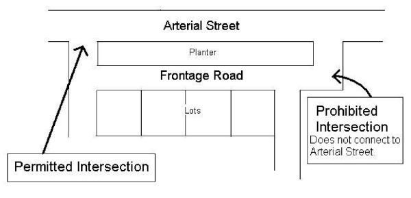
- Subdivision plan to accommodate street cross-section. Any proposed subdivision plan shall include the street cross-section as set forth on Exhibit A-3 below. The developer shall be responsible for construction of all street improvements required under the cross-section and for the installation of the water supply lines and placement of the topsoil within the planter area. Additional landscaping of the planter area and the maintenance of landscaping therein will be the responsibility of the city.
- Where lots are proposed to abut upon the adjacent arterial or collector street.
- City may specify frontage design; transition between alternative required. The city may require any of the access treatments set forth under paragraph C. as a condition of subdivision approval. The city may approve changes from one type of access treatment to another for adjacent developments provided that the plans and improvements provide a safe and convenient transition from one type to another, as determined by the city.
- Lots not in subdivisions. Requests for building permits on parcels not included in an approved subdivision shall conform to the standards set forth under paragraph C.1. above unless, in the opinion of the zoning administrator, the character of existing adjacent development or other physical limitation, make one of the other access treatment alternatives more appropriate.
Any applicant aggrieved by a decision of the zoning administrator in the enforcement of this paragraph may appeal such decision to the planning commission who shall have the authority to override or modify the determination of the zoning administrator.
HFO-1 Zone Area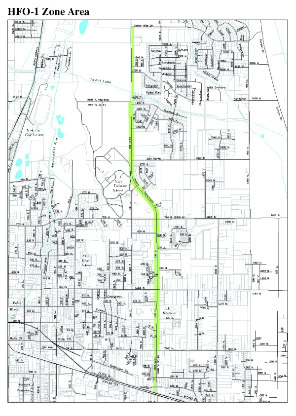
Sec 17.4.604 SP Shoreline Preservation Zone
- Legislative intent. The SP shoreline preservation zone covers the riparian area adjacent to Utah Lake. This area is subject to periodic flooding and a very high water table (when not actually inundated). Experience has shown this area to be generally unsuited for general development and environmentally fragile; its preservation is of importance to the city. Uses which tend to produce a hazardous condition or otherwise degrade or militate against the preservation of the shoreline are not permitted. Accordingly, uses within the zone are limited to uses which will not significantly degrade the environment of the lake shore area or require a significant commitment of public resources for protection during times when the area is inundated with flood waters.
Typical uses within the zone are a combination of natural areas, public and private open space areas, golf courses, camping and similar open recreation areas, boat launch ramps and harbor facilities. Also, the zone is designated as a TDR-S zone (transfer of development rights sending zone).
The specific regulations necessary for the accomplishment of the intent of the zone are hereinafter set forth. - Permitted uses. The following buildings, structures, and uses of land shall be permitted upon compliance with the applicable requirements of this code:
- The production of crops in the field and similar agricultural activities and grazing of livestock, but not including feed yards.
- Conditional uses. The following buildings, structures, and uses of land shall be permitted upon compliance with the applicable requirements of this code and after approval has been given by the designated review agency.
- Golf courses, and appurtenant facilities (parking lots, etc.), but not including club houses or other appurtenant facilities used for human occupancy., subject to approval of a development plan in accordance with the provisions of Section 17.6.101.
- Camping and picnic areas, and appurtenant facilities (parking areas, etc.) but not including recreation vehicle courts or structures used for human occupancy, subject to approval of a development plan in accordance with the provisions of Section 17.6.101.
- Open space areas appurtenant to a PUD or similar large scale development project.
- A transfer of development right - sending area (TDR-S), subject to the provisions of Section 17.4.605.
(Ord. No. 05-05-18)
Sec 17.4.605 Transferable Development Rights Overlay Zone
- Legislative intent. The intent and purpose in establishing the TDR overlay zone are to:
- Promote the preservation of agricultural lands, rural open space, scenic vistas, and natural features for the benefit of the citizens of the city.
- Discourage development in areas deemed hazardous.
- Provide compensation to the owners of property from which development rights are transferred.
- Provide a method whereby development rights may be transferred from sending sites to receiving sites in order to accomplish the purposes set forth in subsections 1., 2. and 3. above.
- Applicability. The procedures and requirements of this chapter shall apply to the creation and transfer of development rights from sending sites to receiving sites within the city.
- TDR overlay zone established; sending and receiving sub-zones delineated.
- The parcels of real property which may be preserved and protected by the transfer of development rights from such parcels are those located within a designated sending area. Those parcels of real property which are suitable for using development rights transferred from sending sites are those parcels located within a designated receiving area.
- To more adequately implement the objectives of the zone and facilitate the administration thereof, there is hereby adopted a transfer of development rights eligibility map (TDR eligibility map), which map shall constitute an overlay zone within the city. The boundaries of the TDR eligibility map may be amended from time to time.
- The TDR eligibility map is further delineated into two sub zones, as follows:
- TDR-sending area sub-zone. The specific areas within the city eligible for designation as a development rights sending site shall be those areas shown on the TDR eligibility map and designated as TDR-S.
- TDR-receiving area sub-zone. The specific areas within the city eligible for designation as a development rights receiving site shall be those areas shown on the TDR eligibility map and designated as TDR-R.
- Transferable development rights; creation of sending sites.
- In order to be eligible to transfer one or more development rights from a parcel of property (sending site), such property shall be located within a TDR-S sub-zone, as shown on the TDR eligibility map. An area may be designated as a TDR-S sub-zone by action of the city or upon request of the owner of such property, pursuant to rezoning procedures set forth in Title VI of this code.
- The number of development rights attached to a particular sending site shall be determined and transferred by applying the following rules:
- Within the SP shoreline preservation zone, the total number of development rights which may be created for a sending site shall be one dwelling unit for each five acres. This shall be construed as the base density for the SP shoreline preservation zone.
- Within all zones except the SP shoreline preservation zone:
- The total number of development rights which may be created for a sending site shall be equal to one-half of the site's base zone density, as established pursuant to the terms of the underlying zone.
- The number of development rights to be transferred at any one time may be determined by the sending site owner, so long as the total number of rights transferred does not exceed the total number of development rights associated with the sending site.
- The number of development rights applicable to a sending site shall be as determined by the city, in accordance with the criteria set forth under subsection 2. above. A certificate showing the number of development rights appurtenant to a sending site shall be issued by the city, subject to the prior request of the owner.
- Development rights shall be created and transferred only by means of documents, including a conservation easement, which meet the requirements of this section. No transferable development rights certificate shall be issued, and no development rights shall be transferred, unless and until a conservation easement is recorded among the land records of Utah County, Utah, on the property from which such development rights originate.
- The transfer of any development rights from a sending site shall be evidenced by a notice recorded among the land records of Utah County, Utah, in a form approved by the city council, after receiving a recommendation from the planning commission. Such notice shall indicate;
- The total number of development rights which may be transferred from the sending site;
- The number of development rights actually transferred at the time the notice is recorded;
- The number of development rights remaining; and
- Notice to any potential buyer of the sending site that: (i) some or all of the development rights appurtenant to the parcel may have been transferred from the property; and (ii) the buyer should contact American Fork City officials to determine the number of development rights, if any, remaining on the sending site.
- Upon completion of action to transfer some or all of the development rights from a parcel within the TDR-S sub-zone:
- A copy of the TDR eligibility map (or such other map as the city may maintain for that purpose) shall be prepared showing the boundary of the sending site, with an indication that the parcel(s) therein constitute a site from which some or all of the development rights have been transferred.
- Such indication shall include a notation of the total number of development rights which have been transferred from the property, the number remaining, if any, and the location of the receiving zone to which said development rights have been transferred.
- Transferable development rights—Receiving sites.
- In order to be eligible to transfer one or more development rights to a parcel of property, such property shall be located within a TDR-R sub-zone, as shown on the TDR eligibility map. An area may be designated as a TDR-R sub-zone by action of the city or upon request of the owner of such property, pursuant to rezoning procedures set forth in this code.
- The city council, after receiving a recommendation from the planning commission, may approve a subdivision or a site plan for a receiving site at a density which equals the base zone density of the receiving site plus the number of development rights which will be transferred to such site. Notwithstanding the foregoing, the development density of a receiving site shall not be increased above thirty percent of the maximum density of the underlying zone or the development density recommended for such site by the general plan, whichever is less.
- The maximum number of development rights eligible for transfer to a receiving site shall be as determined by the city, in accordance with the criteria set forth under subsection 2. above. A certificate showing the number of development rights appurtenant to a receiving site shall be issued by the city, subject to receipt of a request from the owner.
- Upon completion of action to transfer development rights to the receiving site within the TDR-R sub-zone:
- A copy of the TDR eligibility map (or such other map as the city may maintain for that purpose) shall be prepared showing the boundary of the receiving site, with an indication that the parcel(s) therein constitute a site to which development rights have been transferred.
- Such indication shall include a notation of the total number of development rights which have been transferred to the receiving parcel, and the location of the sending site from which said development rights have been transferred.
- A certificate shall be issued to the property owner by the city recorder indicating the total number of development rights which may be transferred to the property.
- Development approval procedures.
- A request to utilize development rights on a receiving site shall be in the form of a PUD development plan submitted in accordance with regulations contained in chapter of this code.
- The city council, after receiving a recommendation from the planning commission, shall approve a request to utilize development rights on a receiving site if the request:
- Does not exceed the density limitations permitted by subsection E.2. above;
- Is in accordance with the provisions of this chapter;
- Conforms with the large scale development, subdivision, site plan or other applicable regulation of this code;
- Is consistent with other recommendations of the American Fork General Plan; and
- Achieves a desirable development compatible with both site conditions and surrounding existing and proposed future development.
- A final plan for a PUD, subdivision or a site plan which uses transferred development rights shall contain a statement setting forth the development proposed, the zoning classification of the property, the number of development rights used, and a notation of the recordation of the conveyance required by subsection B.6.b. above.
- Development standards.
- The following development standards shall be applicable to receiving sites.
- Each development in a TDR-R Overlay zone shall conform to the development standards and permitted uses as required by the underlying zone, except as may be modified by the provisions of this section. In such case, the standards of this section shall apply.
- If density proposed on a receiving site exceeds the density permitted by the underlying zone, the planning commission may recommend a development project design which may be at variance with the specific standards for such project as set forth in the development code, subject to a determination that the proposed plan:
- Has a design which: (A) provides a range of housing types; (B) takes advantage of existing topography and other natural features; (C) achieves a mutually compatible relationship between the proposed development and adjoining land uses; and (D) implements the policies set forth in the general plan; and
- Make findings regarding the matters set forth in subsection (i).
- The following development standards shall be applicable to sending sites.
- The uses permitted on a sending site shall be those uses allowed by the underlying zone, subject to the zone requirements applicable to the site, except as may be diminished by the transfer of the development rights therefrom.
- The total number of dwelling units which may be constructed on a sending site shall be the number of units allowed by the underlying zone upon the property, minus all development rights transferred therefrom.
- The following development standards shall be applicable to receiving sites.
- Conservation easement required.
- A conservation easement shall be established on each sending site from which development rights are transferred.
- In the SP shoreline protection zone and in situations where all development rights attached to a sending site are transferred, the easement shall cover the entire sending site.
- If only a portion of the development rights attached to a sending site are transferred, the easement shall include an area equal in amount to the combined lot area for the number of development rights transferred.
- The conservation easement required by this section shall be in a recordable form approved by the city attorney and shall meet the requirements of Section 57-18-1 et seq. of the Utah Code. The conservation easement shall also include the following terms.
- The holder of the easement shall be American Fork City, another governmental entity, or a charitable organization which:
- Qualifies as being tax exempt under Section 501(c)(3) of the Revenue Code; and
- Is organized in whole or in part for the purpose of accepting and managing conservation easements.
- The easement shall require that the easement area shall be maintained as it exists when the easement is created, including natural area, wildlife preserves, trails, or other identified environmental or open land resources. Notwithstanding the foregoing, the city council, after receiving a recommendation from the planning commission, may approve the construction of improvements within the easement area upon a finding that such improvements will be in harmony with the purposes of the easement and intent of this chapter.
- The easement shall include a reference to the extinguishment of the development rights transferred from the sending site. If additional rights are transferred after the recordation of a conservation easement, the easement shall be amended to reflect the extinguishment of those additional rights and shall be recorded thereafter.
- All parties who have declared an interest in the property, recorded on the books of the Utah County Recorder, must consent to the granting of a conservation easement.
- The holder of the easement shall be American Fork City, another governmental entity, or a charitable organization which:
- If the holder of a conservation easement proposes to transfer the easement to another entity, the recipient of any transferred interest shall meet the requirements of this section.
- A conservation easement shall be established on each sending site from which development rights are transferred.
- Definitions. For purposes of determining compliance with this Section 17.4.605 the following definitions shall apply:
- The term "development rights" shall mean the potential for the improvement of a legally established parcel of real property, existing as a result of the zone classification of the of the parcel. One development right shall be equal to the authority to establish and maintain one dwelling unit.
- The term "transfer of development rights" shall mean the conveyance of one or more development rights, by deed, easement or other legal instrument to another parcel of land in accordance with the requirements of this Section 17.4.605 of this code.
- The term" receiving area" shall mean the geographic area designated on the TDR eligibility map as a TDR receiving area sub-zone (TDR-R) within which one or more receiving sites may be located.
- The term" sending area" shall mean the geographic area designated on the TDR eligibility map as a TDR sending area sub-zone (TDR-S) within which one or more sending sites may be located.
- The term "receiving site" shall mean a legally created parcel of real property, situated within the geographic area designated on the TDR eligibility map as a TDR receiving area sub-zone, to which development rights are transferred in accordance with the requirements of Section 17.4.605 of this code.
- The term "sending site" shall mean a legally created parcel of real property, situated within the geographic area designated on the TDR eligibility map as a TDR sending area sub-zone, from which development rights are transferred in accordance with the requirements of Section 17.4.605 of this code.
- The term "transfer of development rights eligibility map" shall mean that certain map, as adopted by the city, delineating those areas of the city within which development rights may be transferred from one site to another.
- The term "base density" shall mean the maximum number of dwelling units permitted by the underlying zone applicable to a specific sending or receiving site.
(Ord. No. 05-05-18)
Sec 17.4.606 M-1 Marina Zone
- Intent. The intent in establishing the marina zone is to promote and provide for the development of private facilities and activities which augment, enhance, and are consistent, compatible and congruent with the American Fork Marina and its facilities and activities in the area located adjacent to or in the vicinity of the Utah Lake shoreline and containing but not limited to the area compromising the American Fork Marina.
The zone is generally located adjacent to the Utah Lake shoreline in locations where adequate transportation routes are available, where existing residential development is minimal to reduce adverse impacts, and where land ownership is in relatively large blocks permitting flexibility in design and development and the preservation of portions of the project area considered unsuited for development. - Permitted uses. Uses within this zone shall be limited to marina facility support projects which are designed, approved, constructed and maintained in accordance with the applicable provisions of Section 17.7.804 of this code.
(Ord. No. 07-01-04)
Sec 17.4.607 Utah Lake Shoreline Protection Overlay Zone
- Purpose and intent. The Utah Lake Master Plan, adopted by the Utah Lake Commission on June 26, 2009, lists among its high priority goals Land Use Goal 4: "Shoreline, open space, critical lands, and wetland areas are acquired, expanded, and/or protected for public use, preservation of natural resources, and potential mitigation purposes."
Objective L-1.2 under Land Use Goal 4 is the development of a model shoreline protection ordinance to achieve the purposes of acquiring and protecting the shoreline of Utah Lake and its natural resources. The purposes and intent of this ordinance include:- Protecting the shoreline of Utah Lake;
- Protecting natural and cultural resources and features adjacent to the lake;
- Providing for and protecting public ownership and access to the lake; and
- Providing a corridor for a non-motorized trail around Utah Lake.
- Preserving and improving the use and water quality of Utah Lake.
This section also creates a buffer between the lake shore and adjacent development for recreational access, safety, invasive species management, and resource protection.
- Applicability. The Utah Lake Shoreline Protection Overlay Zone applies to all lands lying at and below the four thousand four hundred ninety-five foot contour (one hundred year flood limit). The overlay zone buffer area extends fifty feet above the settlement boundary (lakeshore).
- Relationship to other regulations. The requirements of this overlay zone shall apply in addition to the applicable regulations for each underlying zoning district. In the event that regulations imposed by this section conflict with regulations of an underlying zoning district, the most restrictive regulations shall apply.
All development within the shoreline protection overlay zone shall also comply with all applicable state and federal regulations. Documentation of compliance with applicable state and federal regulations shall be required prior to development approvals. - Permitted uses. The permitted uses are those uses allowed by the underlying zoning districts. All uses within the shoreline protection overlay zone shall also comply with the standards set forth in this section
- Definitions.
Cultural and historical resources. Human artifacts and remains older than fifty years that are identified by the state historic preservation office (SHPO) as cultural and historic resources under state law.
Habitat. the place or environment where a plant or animal naturally or normally lives and grows.
Overlay zone buffer. A strip of land at least fifty feet in width between Utah Lake and adjacent development, measured from the settlement boundary line to the edge of a development parcel of property. The buffer area may not be included within any development parcel.
Riparian area. An area adjacent to surface water bodies such as streams and lakes that is characterized by periodic inundation and hydrophilic (water-loving) vegetative types.
Settlement boundary. The Utah Division of Forestry, Fire, and State Lands boundary between sovereign lands and adjoining property. Also referred to as the "lakeshore" in this section.
Wetland. Land that has been determined by the Army Corps of Engineers to be regulated or jurisdictional wetlands under the federal Clean Water Act. - Site features mapping.
- Site features map required. Concurrent with the submission of any development application, the applicant shall prepare and submit a site features map. The purpose of the site features map is to identify and locate site features to facilitate creation of a site development design that mitigates impacts to the natural and cultural features of the development area, and reduces risks associated with flooding, high groundwater, unstable soils, wave, and lake ice action. The site features map shall identify and locate the following features in and immediately adjacent to the development area:
- Property boundaries;
- Settlement boundary (lakeshore);
- Streams, rivers, lakes, tributaries, wetlands, and other hydrologic features;
- Riparian areas;
- Known habitat of endangered, threatened, or state sensitive species;
- Topographic contours at five feet or closer intervals;
- Limits of all floodplains;
- Water supply protection areas;
- General vegetation characteristics, including significant stands of trees;
- General soil types;
- Existing and planned public and recreational access and uses;
- Cultural and historical resources;
- Existing roads and structures; and
- Potential connections with existing trails and public open space areas.
- Lake buffer. Within the shoreline protection overlay zone, all development that abuts on the sovereign lands of Utah Lake must provide a buffer, a minimum of fifty feet in width, between the settlement boundary and the property lines of the nearest development parcels. No permanent structures are allowed in the buffer area except recreational, flood control, and lake-related facilities. Ownership and management of the buffer area shall be determined on a case-by-case basis, but all required buffer areas shall be open for public access.
- Site features map required. Concurrent with the submission of any development application, the applicant shall prepare and submit a site features map. The purpose of the site features map is to identify and locate site features to facilitate creation of a site development design that mitigates impacts to the natural and cultural features of the development area, and reduces risks associated with flooding, high groundwater, unstable soils, wave, and lake ice action. The site features map shall identify and locate the following features in and immediately adjacent to the development area:
- Concept plan.
- Concept plan of proposed development.
- Applicants shall submit a concept plan for the development of the subject parcel that reflects the characteristics of the site as detailed in the site features map. The concept plan shall be prepared at the same scale as the site features map.
- A concept plan may be a draft plan, which does not include engineering details, but shall be drawn to scale and indicate the following:
- Proposed locations of any new roadways;
- Proposed building envelopes;
- Existing and proposed features and amenities, including common areas, trails, etc.; and
- Boundaries of the areas identified on the site features map, showing the extent to which development is proposed to encroach into mapped site feature areas.
- Development on the subject parcel shall be configured so as to avoid undue impacts to site features identified in the site features map, including riparian areas, known habitat of threatened, endangered, and sensitive species, wetlands, public access locations, existing or planned trails and trail corridors, significant stands of trees or significant individual trees, cultural and historic resources, high groundwater areas, secondary stream/slough corridors, and water supply protection areas.
- Development design approach.
- Applicants shall demonstrate that their concept plan is consistent with the following approach and principles for designing a development project in sensitive areas:
- Identify site features. Identify those areas of the development parcel containing or supporting important natural resources, features, and functions as described in subsection F. above.
- Locate building envelopes. To the maximum extent feasible, building envelopes shall be located to protect important site features. The location of building envelopes shall also reflect the design objectives identified herein.
- Align trails. Proposed trails shall be identified where access to designated public trails and open space is appropriate.
- Identify lot lines. Lot lines for building parcels shall be identified. The placement of the lot lines shall give consideration to the important site features, and shall conform to the natural features of the landscape to the greatest extent possible, e.g., lines of boundary trees, streams, habitat areas, etc.
- Applicants shall demonstrate that their concept plan is consistent with the following approach and principles for designing a development project in sensitive areas:
- Site plan standards.
- All development shall, whenever possible, preserve important site features in their natural condition. The planning commission and/or city council may request an advisory opinion from the Utah Lake Commission to assist in determining the value of the natural features on a site, the boundaries of those natural systems, and the relative importance of preserving the integrity and function of the natural resources present on the site.
- To the extent practical, the boundaries of site features should be contiguous within the parcel and adjacent to existing undeveloped land on adjoining parcels to form a continuous, integrated natural system. Particular attention shall be paid to maintaining and expanding existing or planned natural resource areas and trail networks.
- Access points to designated public trails and open areas shall be clearly identified on plans and posted with permanent signage approved by the planning commission and/or city council.
- Site features should be treated as fixed determinants of road and lot configuration rather than malleable elements that can be changed to allow for a preferred development scheme.
- Significant trees, boundary trees, wetlands, streams, and other important site features should be incorporated along the edges of individual lots or along a path or roadway, rather than transected by lot lines or a roadway.
- The planning commission and/or city council may require a setback from the edge of the designated natural features depending on the type of natural resource and its characteristics.
- The planning commission and/or city council shall determine if fencing is necessary to protect the functions and values of the site features.
- Phasing plan.
- When a development will not utilize the entire parcel and there is potential for future development of the parcel, the application for preliminary review shall include a phasing plan showing the potential future utilization and interim management plans for the balance of the parcel not being developed.
- The phasing plan is a sketch plan with no engineering details, intended to be conceptual in nature, and to demonstrate that the current development proposal will not compromise important conservation values or the long term development of the parcel.
- This plan shall show the relationship of the proposed development area to the balance of the parcel and to adjacent land. This plan shall analyze the conservation and development potential of the remaining area of the parcel and shall show, in general terms, the potential street network, open space areas, and development areas in a manner that demonstrates that both the proposed development and the future development can occur so that it conforms to the requirements herein and preserves the significant natural resource values of the entire parcel.
- Concept plan of proposed development.
- Design standards. The following design standards are intended to improve the character and aesthetic qualities of developments in the shoreline protection overlay zone, and to minimize impacts on important natural and other site features. Variations from these standards may be granted by the planning commission and/or city council provided that the overall intent of this section is achieved by the alternative design.
- Building sites.
- The location and orientation of building sites shall be designed to maintain the natural topography and drainage patterns, to preserve important natural features in their natural condition, to minimize disturbance of natural vegetated cover, and to minimize grading, cut-and-fill, and soil removal to minimize negative impacts on the natural resources of the site as identified by the site features map and/or site inventory.
- All building construction must comply with the floodplain regulations of American Fork City.
- A building envelope shall be identified for each site, where appropriate. Future construction shall be limited to the identified building envelopes. Building envelopes should be set back as far as possible from significant site features, consistent with other design parameters of this section, to augment and protect the integrity of natural site features.
- Buildings should be grouped into clusters, which should be located to minimize negative impacts on the natural resources of the site and conflicts between incompatible uses.
- Building envelopes shall, to the extent possible, conform to the natural contours of the site and be delineated to minimize negative impacts on the natural resources of the site, as identified by the site features map and/or site inventory.
- If agricultural uses are being maintained, buildings shall be configured in a manner that maximizes the usable area remaining for such agricultural uses.
- Disturbance/alterations.
- Alterations to identified significant natural site features shall only be permitted to address public safety issues as determined by the city.
- No topsoil or vegetation shall be removed from designated open spaces unless needed to address a public safety issue as determined by the city.
- Stream and wetland crossings shall be eliminated whenever possible.
- All ground cover areas disturbed in the construction process shall be revegetated with appropriate native species.
- Lighting.
- Exterior lighting shall be directed downward and fitted with an opaque shield. Light levels shall not exceed one-foot candle at the property line.
- Building sites.
- Ownership of open lands. The ownership and responsibility for maintenance of the required buffer area and other areas left undeveloped to protect natural resources and avoid hazards should be decided on a case-by-case basis. In general, areas planned to be open for use by the general public should be in public ownership, but other arrangements may be appropriate. Options for ownership and maintenance include:
- Public ownership. American Fork City may, but is not be required to, accept any portion or portions of a buffer or open land, provided that:
- The land shall be freely accessible to the public;
- The city agrees to and has access to maintain such lands;
- The land is in an acceptable condition to the city at the time of transfer with regard to size, shape, location, and improvement; and
- The developer or property owner provides funding for at least one year of maintenance as identified in the maintenance plan.
- Undivided ownership. Unless otherwise approved by the city, the underlying fee ownership of the land may remain in single ownership and may be owned and maintained by one of the following entities: land trust, conservation organization, governmental entity, or private individual.
- Owners' association. Land may be held in common ownership by an owners' association, subject to all of the provisions for owners' associations set forth in state regulations and the city's subdivision regulations. In addition, the following requirements shall be met:
- A description of the organization of the proposed association, including its bylaws, and all documents governing ownership, maintenance, and use restrictions for natural resource land, shall be submitted by the developer with the final plat/site plan application.
- The association shall be responsible for maintenance and insurance of the natural resource land.
- Written notice of any proposed transfer of natural resource land by the association or the assumption of maintenance for the natural resource land must be given to all members of the association and to the city no less than thirty days prior to such event.
- The association shall have adequate staff to administer, maintain, and operate such natural resource land.
- At the discretion of the planning commission and/or city council, an applicant may be required to prepare a brochure detailing the location and use restrictions of the designated open space, and provided to all purchasers of property within the subdivision.
- Public ownership. American Fork City may, but is not be required to, accept any portion or portions of a buffer or open land, provided that:
- Maintenance of open lands. In general, the responsibility for maintenance of required buffer areas and lands left open to protect natural resources and avoid hazards should lie with the owner(s) of the land. The following provisions should be addressed in a maintenance plan agreement that accompanies the final development approval that results in the creation of open lands:
- Area boundaries. Area boundaries of the designated open lands shall be clearly identified:
- Boundaries shall be clearly delineated on plans including plats.
- Boundaries shall be clearly marked and identified as "No Disturbance" areas, except in areas identified for permitted uses, prior to commencing construction activities, including tree cutting, site clearing and grading; temporary markings are acceptable.
- Boundaries shall be clearly and permanently marked in the field with signage approved by the planning commission and/or city council to identify the area as protected open land.
- Costs. Unless otherwise agreed to by the city, the cost, and responsibility of maintaining open land shall be borne by the owner of the underlying fee of the land.
- Plan. The developer shall submit a maintenance plan providing for and addressing the means for permanent maintenance of the open land with the final application for the development approval. The maintenance plan shall provide the following:
- The plan shall identify land ownership.
- The plan shall establish necessary regular and periodic operation and maintenance responsibilities for the various kinds of resources present on the land.
- The plan shall estimate staffing needs, insurance requirements, and associated costs; and define the means for funding the maintenance of the land, and operation of any common facilities on an on-going basis. Such funding plan shall include the means for funding long-term capital improvements as well as regular yearly operating and maintenance costs.
- At the city's discretion, the applicant may be required to escrow sufficient funds for the maintenance and operation costs of common facilities for up to one year.
- Approval. The maintenance plan must be approved by the city concurrent with final development approval. The maintenance plan shall be recorded against the property and shall include provisions for the city's corrective action rights, as set forth herein. Any changes or amendments to the maintenance plan shall be approved by the city.
- Failure to maintain. In the event that the organization established to maintain the open land, or any successor organization thereto, fails to maintain all or any portion thereof in reasonable order and condition, the city may assume responsibility, as a right but not an obligation, for maintenance, in which case any escrow funds may be forfeited and any permits may be revoked or suspended.
- Corrective action. The city may enter the premises and take corrective action, including extended maintenance. The costs of such corrective action may be charged to the property owner and may include administrative costs and penalties. Such costs shall become a lien on the land. Notice of such lien shall be filed by the city in the county recorder's office. The maintenance plan and all other documents creating or establishing any association or conservation organization for the property shall reference the city's corrective action authority set forth herein and shall be recorded against the land.
- Area boundaries. Area boundaries of the designated open lands shall be clearly identified:
- Shoreline trail.
- Trail corridor.
- The Utah Lake Master Plan identifies development and maintenance of the Utah Lake Trail as a high priority goal. The trail would provide a non-motorized route that circumnavigates Utah Lake, and provides access to lakeshore recreation facilities as well as connectivity among the communities that abut the lake.
- American Fork City has identified the Utah Lake Trail as a component of its trails master plan, and has identified a preferred alignment for the trail on its trails map. The preferred location of the trail is as close to the lakeshore as possible, however the exact location of the Utah Lake trail through the city is flexible, and its ultimate location will depend on such factors as topography, natural features, the location of recreational and educational features, and land ownership.
- Trail construction and dedication.
- The location of the Utah Lake Trail and responsibility for the construction of the trail will be determined as a part of the review process as applications for development are submitted to the city. In the alternative, the city may independently decide to acquire land for construction and maintenance of the Utah Lake Trail in advance of receiving development applications.
- Whether constructed by a developer or by the city, the Utah Lake Trail shall be in the ownership of American Fork City as a public facility. Maintenance of the Utah Lake Trail shall be performed by the city or pursuant to a contract or development agreement.
- As development occurs in the vicinity of existing trail segments, the trail should be brought up to current standards.
- Trail standards.
- American Fork City adopts the current trail design standards developed by the Mountainland Association of Governments (MAG) for the Utah Lake Shoreline Trail for use in the city.
- Trail corridor.
(Ord. No. 2011-04-10, 4-12-2011)
Editor's note—Prior to the reenactment of § 17.4.607 by Ord. No. 2011-04-10, said section was repealed in its entirety by Ord. No. 2011-03-04, § 3, adopted March 8, 2011. The former § 17.4.607 pertained to the FPO flood plain overlay zone. 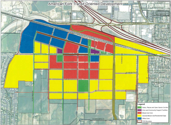
This code was developed using the Template Form-Based Code for Centers & Corridors along the Wasatch Front
Sec 1 General Provisions
- Authority
- The adoption of this Title is authorized under Section 10-9a-501 of the Utah Code.
- This Title was adopted and may be amended by vote of the City Council, after recommendations by the Planning Commission, in accordance with the provisions of Chapter 10-9a-503 of the Utah Code, or any successor provision.
- This Title is adopted as one of the instruments of implementing the public purposes and objectives of the Land Use Element of the General Plan. This Title is declared to be in accord with the Land Use Element of the General Plan.
- This Title was adopted to promote the health, safety and general welfare of the City and its residents. as detailed in Section 10-9a-102 of the Utah Code.
- Provisions
- Provisions of this Title are activated by "must", "shall", "is" or "are" when required, "should" when recommended, and "may" when optional.
- Italicized terms used throughout this Title have the meaning set forth in Section 8. Those terms not defined in Section 8 are accorded their commonly accepted meanings.
- Text in this Chapter, including text contained in tables, takes precedence over diagrams and illustrations, in case of conflict.
- Applicability
- The provisions of this Chapter apply to the Transit-Oriented Development (TOD) Regulatory Area approved under Section 17.4.608 of the American Fork City Municipal Code.
- To the extent the provisions of this Chapter conflict with the provisions of any other portion of the city ordinance, the provisions of this Chapter shall take precedence, except as to Local Health and Safety Codes and Local, State, and National Building Codes.
- Components of this Chapter
- The TOD Regulatory Area is governed by four levels of plans: development area plans, district framework plans, block plans, and lot plans.
- Development area plans establish character district boundaries, primary thoroughfares, general locations for schools, major civic institutions, regional open space, and special districts.
- Development area plans are prepared by city staff and all affected entities.
- The City Council has approval authority over development area plans, after review and recommendation from Planning Commission, in accordance with Table 1A - Approval Authority.
- Each character district shall include a district framework plan.
- Development area plans are regulated by Section 3 of this Chapter.
- District framework plans establish block type boundaries, sub-district assignments, secondary thoroughfares, and district level open space.
- District framework plans are prepared by the landowner, their agents or designee, in consultation with city staff and all affected municipal entities.
- Block plans may be submitted concurrently with district framework plans.
- The City Council has approval authority over district framework plans, after review and recommendation from Planning Commission, in accordance with Table 1A - Approval Authority.
- District framework plans must be consistent with the governing development area plan.
- District framework plans are regulated by Section 4 of this Chapter.
- Block plans establish lot type boundaries, minor thoroughfares, and civic special districts.
- Block plans are prepared by the landowner, their agents or designee, in consultation with city staff.
- Multiple block plans may be submitted concurrently.
- The Zoning Clearance Officer or designated representative has approval authority over block plans in accordance with Table 1A - Approval Authority.
- Each character district includes multiple block plans.
- Block plans must be consistent with the approved district framework plan.
- Block plans are regulated by Section 5 of this Chapter.
- Lot plans pertain to individual lots and establish building placement, form, materials, sitework, landscaping, and other elements required for permitting.
- This Chapter does not supersede building and life safety codes, adherence to which are also required for permitting.
- Lot plans are prepared by the landowner.
- The Zoning Clearance Officer or designated representative has approval authority over lot plans in accordance with Table 1A - Approval Authority.
- Each lot plan must be consistent with the approved block plan.
- Lot plans are governed by Section 6 of this Chapter.
- Public space standards regulate thoroughfares, civic spaces, public planting, public lighting, utilities, and other elements of the public realm within the TOD Regulatory Area.
- Public space standards apply to: development area plans, district framework plans, and block plans; plans prepared for civic special districts; plans prepared for the construction or maintenance of thoroughfares and utilities by the landowner, utility provider, or Public Works Department.
- Provisions of the Utah Code and the City Code may apply in addition to public space standards.
- The Zoning Clearance Officer or designated representative has approval authority over elements regulated by public space standards.
- Development applicants must submit preliminary construction drawings to City Staff.
- Entities managing private open space and thoroughfares must submit design and preliminary construction drawings to City Staff.
- Entities constructing public Civic Spaces and thoroughfares must submit design and preliminary construction drawings to City Staff.
- Public space standards apply to each Section of this Chapter for new construction, maintenance, and redevelopment.
- Public space standards are regulated by Section 7 of this Chapter.
- Description of Character Districts
- Character districts established in the development area plan are identified as the following:
- Business District: a high intensity, regional mixed-use settlement pattern in both size and intensity, situated adjacent to regional transportation crossroads, including existing and future transit, and will support significant office and retail uses as well as government and other civic institutions of regional importance. No residential uses will be present in this district, as the focus is on office and supportive retail uses.
- Transit Core: a high intensity, regional mixed-use settlement pattern in both size and intensity, situated adjacent to regional transportation crossroads, including existing and future transit, and will support significant residential, office, entertainment, hospitality, and retail uses as well as government and other civic institutions of local importance. A walkable village-like setting comprised of mixed-use development will focus on the station area. It is the place where business, residential and main street environments intersect.
- West Neighborhood: a moderate to low intensity mixed-use settlement pattern principally residential in use, that consists of a small mixed-use nodes and residential uses, usually situated along or adjacent to regional thoroughfares, adjacent to urbanized areas, and/or sub-urban areas lacking an urban center.
- Garden District: a moderate to low intensity mixed-use settlement pattern principally residential in use, that consists of a small mixed-use nodes and residential uses, usually situated along or adjacent to regional thoroughfares, adjacent to urbanized areas, and/or sub-urban areas lacking an urban center.
- East Neighborhood: a low intensity, primarily residential settlement pattern and minimal mixed-use. It is small and separate preserving the existing homes and neighborhood structure east of 700 West.
- Character districts established in the development area plan are identified as the following:
- Description of Block Types
- Block types established within the character districts are limited to the following types:
- BT-6: The highest intensity mixed-use and most urban area that supports principally retail shops, offices and supportive services along with some high-density residential units. Open space in the form of plazas and squares is common.
- BT-5: A high intensity mixed-use area that supports principally retail shops, offices and supportive services along with some high-density residential units. Open space in the form of plazas is common.
- BT-4: A moderately high intensity mixed-use area characterized by both small retail shops and professional offices along a main street and mid-density to high-density residential units adjacent to apartments and townhouses. Open space in the form of plazas, greens, and playgrounds are common.
- BT-3: A moderate intensity mixed-use area characterized mainly by residential units with home businesses, corner shops, and a small amount of retail and office uses. Dwelling units include small apartment buildings, townhouses, duplexes and small single-family houses. Open space in the form of a green or playground is common.
- BT-2: A low-intensity primarily single-use area characterized mainly by residential development with some home businesses and corner shops. Dwelling units include some small apartment houses, duplexes, small and large single-family houses. Open space in the form of a green or playground is common.
- BT-1: A primarily single-use area characterized by low-density residential and rural units, including small and large single-family houses, homesteads, and small agricultural properties.
- Block types established within the character districts are limited to the following types:
- Process
- Application review and approval authority for plans submitted under this Chapter is specified in Table 1A – Approval Authority.
- Application requirements for Development Area Plans are specified in Section 3.
- Application requirements for District Framework Plans are specified in Section 4.
- Application requirements for Block Plans are specified in Section 5.
- Application requirements for Lot Plans are specified in Section 6.
TABLE 1A - APPROVAL AUTHORITY REVIEW AUTHORITY ROLES ZONING
CLEARANCE
OFFICERPLANNING
COMMISSIONCITY
COUNCILa. ADMINSTRATIVE Verification of Zoning Compliance A Interpretation A b. APPLICATION REVIEW TOD Code R A Development Area Plan R A District Framework Plan R A Block Plan A Lot Plan A c. SPECIAL PERMITS Conditional Use Permit A Temporary Use Permit A d. LEGISLATIVE Code Amendments R A Development Agreements A Zoning Reclassification R A Zoning Text Amendment R A
A - Approve, Approve with Conditions, or Deny
R - Review and Recommendation
Amended by Ord. 2018-11-52 on 11/27/2018
Sec 2 Transit-Oriented Development (TOD) Zone
- Instructions
- The Transit-Oriented Development (TOD) Zone maps and regulates land subject to the provisions of this Chapter.
- The TOD Zone is available for land identified by the city which shall be included within the defined regulatory area.
- A zoning change to the TOD Zone is subject to approval by the City Council, after review and recommendations by the Planning Commission.
- Once the City Council approves a zoning change to the TOD Zone, the parcels become part of the TOD regulatory area and are mapped on the Zoning Map and Future Land Use Map.
- Within the TOD regulatory area, this Chapter is the exclusive and mandatory zoning regulation, and its provisions must be applied in their entirety.
- The landowner, their agents, or designee of a property/properties within the TOD regulatory area must prepare and/or conform with the following plans to guide future development:
- Development Area Plan (Section 3)
- District Framework Plan (Section 4)
- Block Plans (Section 5)
- Lot Plans (Section 6)
- Modifications
- Modifications of a TOD regulatory area require approval from the City Council after review and recommendations by the Planning Commission.
- Modifications of a TOD regulatory area require approval from the City Council after review and recommendations by the Planning Commission.
Amended by Ord. 2018-11-52 on 11/27/2018
Sec 3 Development Area Plan
- Instructions
- Within the TOD regulatory area, city staff shall prepare a development area plan to guide future development.
- City staff may consult with Utah Transit Authority and the local school district for input and feedback in the preparation of a development area plan.
- City Council may approve, approve with conditions, or deny a submitted development area plan, after recommendations by the Planning Commission.
- Once approved, a development area plan must be mapped on the Zoning map. As necessary, the Land Use and Transportation Elements of the General Plan must be updated to incorporate elements of the development area plan.
- A development area plan must assign all land within the TOD regulatory area to districts, thoroughfares, and open space.
- A development area plan submitted for approval must demonstrate compliance with:
- District standards
- Transportation network standards
- Special requirements, if any
- Municipal General Plan
- Submission Requirements
- A development area plan submittal must include the following exhibits:
- Exhibit 1: Boundary Map, including:
- Name and ownership of the properties,
- Acreage of the properties,
- Existing land use of all properties within 500 feet of the development area plan boundaries
- Exhibit 2: District Boundary Map, including:
- boundaries and IDs, pedestrian sheds, and a data table including types, acreages, approximate DUs, and pedestrian shed types and acreage for each district.
- Exhibit 3: Thoroughfare Network Plan, including:
- Existing, new, and modified thoroughfares as required in Section 3.04, including the Right-of-Way width, number of vehicular lanes, and thoroughfare type.
- Existing, new, and relocated major utility easements.
- Exhibit 1: Boundary Map, including:
- All exhibits must include:
- North arrow, graphic scale, and date.
- Existing land use of all properties within 500 feet of the development area plan boundaries.
- All documents must be submitted digitally in portable document format (PDF).
- A development area plan submittal must include the following exhibits:
- District Standards
- District boundaries must not overlap.
- Districts must be sized according to pedestrian shed requirements:
- Radius: 1,320 feet
- Walking time: 5 minutes
- Minimum acreage: 60 acres
- Maximum acreage: 175 acres
- A minimum of 65% of the district must be within the pedestrian shed.
- Transportation Network Standards
- Development area plans must map a major thoroughfares network consisting of all thoroughfares included in the City's transportation master plan.
- The major thoroughfare network must include the following future thoroughfares:
- Modifications to existing thoroughfares,
- New thoroughfares of 4 vehicular lanes or larger,
- New thoroughfares connecting the districts,
- New thoroughfares must meet the requirements of Section 7.
- Properties adjacent to any thoroughfares, identified by the Development Area Plan, must meet the requirements of Thoroughfare Design and Construction Plans document as generated by American Fork City.
- All thoroughfares must connect to other thoroughfares, including to existing and future thoroughfares on adjacent properties, forming a network.
- Development area plans must map existing and future major utility easements for utilities with a continuous easement outside of districts or traversing more than one district.
- Major utility easements should be assigned to thoroughfare rights-of-way.
- Future major utility easements should avoid entering districts.
- Elements of the transportation network that traverse districts may be modified within districts provided transportation network connectivity is maintained.
- Plan Key
- The plan key is an information tool used to guide the various stages of the planning, design and regulatory process.
- Plan Keys shall associate the different regulatory steps with their direct applicability to placemaking elements of their representative step.
- Each district is assigned a representative plan key which identifies its respective assignments of sub-districts, block types, and lot types (refer to Table 3A - Plan Keys).
- All document submittals shall include its representative plan key which will assist in demonstrating compliance to the regulatory step being undertaken.
TABLE 3A - PLAN KEYS
| DT: DISTRICT TYPE (Development Area Plan) | DISTRICT TYPE | ||||||||
| ST: SUB-DISTRICT TYPE (District Framework Plan) | Sub-District Type | ||||||||
| Sub-District Type | |||||||||
| Sub-District Type | |||||||||
| Sub-District Type | |||||||||
| BT: BLOCK TYPE (District Framework Plan & Block Plan) | BT-1 | ||||||||
| BT-2 | |||||||||
| BT-3 | |||||||||
| BT-4 | |||||||||
| BT-5 | |||||||||
| BT-6 | |||||||||
| LT: LOT TYPE (Block Plan & Lot Plan) | LT-1 | LT-2 | LT-3 | LT-4 | LT-5 | LT-6 | LT-7 | LT-8 | LT-9 |
| DT | Business District | ||||||||
| ST | Neighborhood Edge | ||||||||
| General Mixed-Use | |||||||||
| Office Core | |||||||||
| Mixed-Use | |||||||||
| BT | BT-1 | ||||||||
| BT-2 | |||||||||
| BT-3 | |||||||||
| BT-4 | |||||||||
| BT-5 | |||||||||
| BT-6 | |||||||||
| LT | LT-1 | LT-2 | LT-3 | LT-4 | LT-5 | LT-6 | LT-7 | LT-8 | LT-9 |
| DT | Transit Care | ||||||||
| ST | Neighborhood Edge | ||||||||
| General Mixed-Use | |||||||||
| Office Core | |||||||||
| Mixed-Use | |||||||||
| BT | BT-1 | ||||||||
| BT-2 | |||||||||
| BT-3 | |||||||||
| BT-4 | |||||||||
| BT-5 | |||||||||
| BT-6 | |||||||||
| LT | LT-1 | LT-2 | LT-3 | LT-4 | LT-5 | LT-6 | LT-7 | LT-8 | LT-9 |
| DT | West Neighborhood | ||||||||
| ST | Neighborhood Edge | ||||||||
| General Mixed-Use | |||||||||
| Office Core | |||||||||
| Mixed-Use | |||||||||
| BT | BT-1 | ||||||||
| BT-2 | |||||||||
| BT-3 | |||||||||
| BT-4 | |||||||||
| BT-5 | |||||||||
| BT-6 | |||||||||
| LT | LT-1 | LT-2 | LT-3 | LT-4 | LT-5 | LT-6 | LT-7 | LT-8 | LT-9 |
| DT | East Neighborhood | ||||||||
| ST | Neighborhood Edge | ||||||||
| General Mixed-Use | |||||||||
| Office Core | |||||||||
| Mixed-Use | |||||||||
| BT | BT-1 | ||||||||
| BT-2 | |||||||||
| BT-3 | |||||||||
| BT-4 | |||||||||
| BT-5 | |||||||||
| BT-6 | |||||||||
| LT | LT-1 | LT-2 | LT-3 | LT-4 | LT-5 | LT-6 | LT-7 | LT-8 | LT-9 |
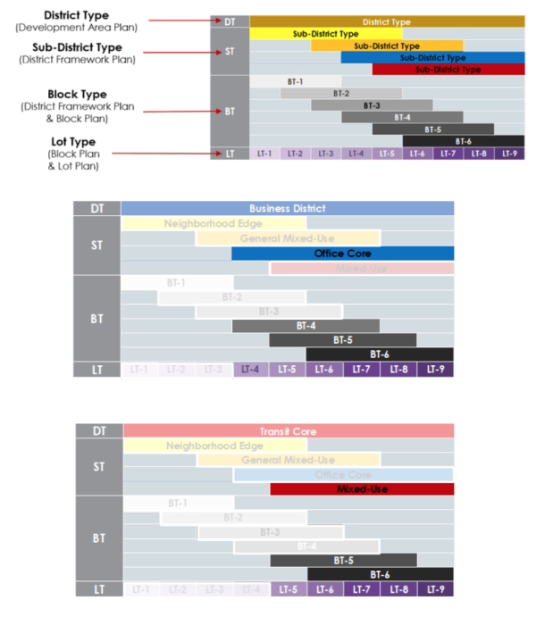
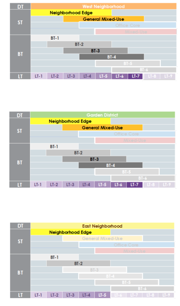
- TABLE 3B - DEVELOPMENT AREA PLAN
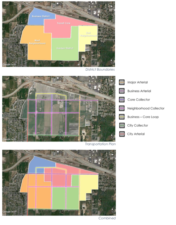
Amended by Ord. 2018-11-52 on 11/27/2018
Sec 4 District Framework Plans
- Instructions
- Within character districts a landowner is subject to a district framework plan in accordance with Section 4. The landowner, their agents, or designee must prepare a district framework plan to guide future development.
- A district framework plan must be prepared in a manner consistent with a governing development area plan.
- The landowner, their agents, or designee must consult with American Fork City, all affected municipal entities, transit authority, and the local school district for input and feedback in the preparation of a district framework plan.
- A district framework plan is subject to approval by the City Council, after review and recommendation by the Planning Commission.
- District framework plans shall expire 24 months after approval if not acted upon further through the submittal of a block plan. Time extensions may be granted by the City Council upon request.
- A district framework plan must show conformance with Table 4A - Operational Overlays.
- A district framework plan must assign land within the character district to sub-districts, block types, and thoroughfares. Regional open space and thoroughfares, located adjacent to and outside of the subject character district, must also be assigned when applicable.
- A district framework plan submitted for approval must demonstrate compliance with:
- Block type standards (subsection C)
- Sub-district standards (subsection D)
- Transportation network standards (subsection E)
- Special requirements, if any (subsection F)
- Phasing standards (subsection G)
- Operational Overlay (subsection H)
- Within character districts a landowner is subject to a district framework plan in accordance with Section 4. The landowner, their agents, or designee must prepare a district framework plan to guide future development.
- Submission Requirements
- A district framework plan submittal must include the following exhibits:
- Exhibit 1: Legal Description, including a legal description of the property.
- Exhibit 2: Boundary Survey.
- Exhibit 3: Development Area Plan, including the governing development area plan, where appropriate, and indicating the character district subject to this district framework plan.
- Exhibit 4: Boundary Map, including:
- Name and ownership of the property or properties,
- Acreage of the property or properties,
- Boundary of the property or properties with dimensions,
- Existing land use of all properties within 500 feet of the character district boundaries.
- Exhibit 5: Constraints Map, including:
- Portions of the property or properties currently designated as flood plain and wetlands, water bodies, and other sensitive lands. If future action is to be taken to modify or mitigate these constraints, this map should be updated to reflect any changes.
- Exhibit 6: District Framework Plan, including:
- Block type boundaries and IDs and a data table including block type assignment, net acreage and gross acreage of each block type.
- Civic district boundaries, and a data table including types, acreages, and any assigned uses.
- A data table including the gross acreage and net acreage of the district, net acres of developable land and total acreage assigned to thoroughfares.
- A data table indicating the total aggregated gross acreage of each block type and civic district (e.g. 50.03 acres of BT-2) and percentage of the gross character district acreage (e.g. BT-2 is 20% of the gross character district acreage).
- Exhibit 7: Transportation Network Plan, including:
- A key showing the thoroughfare network of the governing development area plan and the transportation master plan.
- Existing, new, and modified thoroughfares as required in Section 7.
- New and modified intersections, identifying the type.
- Existing, new, and relocated major utility easements.
- A data table including all thoroughfares within the character district, indicating ownership, Right-of-Way width, number of vehicular lanes, thoroughfare type, and transportation provisions.
- Exhibit 8: Thoroughfare Naming Plan, including:
- Names for each thoroughfare within the character district in accordance with the City's street naming ordinance.
- Exhibit 9: Bicycle Network Plan, including:
- Existing and new bicycle networks.
- Exhibit 10: Traffic Study, including:
- Street system within the applicable character district,
- Adjacent streets outside of character district,
- Connecting streets to other character districts (if applicable)
- Exhibit 11: Civic District Plan, including:
- Regional open space network,
- Trail network,
- Schools,
- Public safety facilities,
- Any additional civic districts.
- Exhibit 12: Thoroughfare Assemblies, including:
- Thoroughfare assemblies for new and modified existing thoroughfares, in compliance with Section 7.
- Exhibit 13: Intersection Assemblies, including:
- Intersection assemblies for all new or modified intersections, in compliance with Section 7.
- Exhibit 14: Phasing Plan, including:
- Phase boundaries, acreages, and sequence for each phase as required in Section 5.09.
- Exhibit 15: Detailed Architectural Standards providing for architectural regulation in addition to those required by Section 6.
- Exhibit 16: Special Requirements, including:
- A graphic depiction of special requirements according to subsection G.
- All exhibits must include:
- North arrow, graphic scale, and date.
- Existing land use of all properties within 500 feet of the character district boundaries. Exhibits 12 - 15 may exclude this item.
- All documents must be submitted digitally in portable document format (PDF) and hard copy format, including both a submission booklet at 11' x 17' and each exhibit at 24' x 36'.
- Application forms and fees must be submitted according to the Municipality Fee Schedule.
- A plan identifying the funding and phasing according to unit absorption for all civic open spaces must be submitted as an addendum to the required exhibits.
- A district framework plan submittal must include the following exhibits:
- Block Type Standards
- Each block defined by the thoroughfare network grid must be assigned a single block type.
- Block type assignments are limited by character district according to Table 4B - Block Type & Sub-District Assignments and Table 4D - Block type Location.
- The percentage of each block type is calculated as the sum of the gross block type area for each block type designation divided by the gross acreage of the character district.
- Blocks containing civic districts may exceed 15 acres.
- Sub-District Standards
- Each block defined by the thoroughfare network grid must be assigned to a sub-district.
- Sub-district assignments are limited by character district according to Table 4B - Block Type & Sub-District Assignments.
- Sub-districts identify allowable uses by general category according to Table 4C - Sub- District & Permitted Uses.
- Uses that are not identified by Sub-District are considered prohibited.
- Transportation Network Standards
- District framework plans must map existing and planned thoroughfares including the following:
- The major thoroughfare network as mapped in the development area plan,
- The minor thoroughfare network as represented in the district framework plan Table 4A - Operational Overlays.
- Existing thoroughfares not mapped on the major thoroughfare network.
- District framework plans must map a future minor thoroughfare network, consisting of the following:
- Modifications to existing thoroughfares,
- New thoroughfares,
- Modifications to existing intersections,
- New intersections.
- The thoroughfare network must be configured as a grid creating blocks according to the following:
- Blocks must be sized according to Table 4D - Block Characteristics.
- Blocks must be shaped according to Table 4D - Block Characteristics.
- The thoroughfare network may deviate from these requirements to accommodate natural conditions, to intersect major thoroughfares at right angles, at character district boundaries and outside of the pedestrian shed.
- Thoroughfares and intersections must be configured according to the following:
- All thoroughfares must connect to other thoroughfares, forming a network,
- New thoroughfares must connect wherever possible to thoroughfares outside of a character district,
- Thoroughfare assemblies and intersection assemblies must be included for each mapped thoroughfare and intersection in accordance with the American Fork City Public Improvement Specifications, Standards, and Drawings.
- Minor thoroughfare assemblies (external to blocks) may be proposed, but must (at a minimum) meet the following:
- 32 feet of asphalt on a two-way thoroughfare;
- Proposed thoroughfare must accommodate drainage;
- Proposed thoroughfare must accommodate pedestrians.
- District framework plans must map a future bicycle network, consistent with the governing development area plan, indicating the following:
- Existing and future bicycle facilities and network,
- Bicycle lanes, routes and trails connecting to the existing bicycle network, regional open space, existing and future trail networks, schools, and civic districts.
- District framework plans must map existing and future major utility easements for utilities
with a continuous easement traversing more than the subject district.
- Major utility easements should be assigned to thoroughfare rights-of-way.
- Future major utility easements should avoid entering districts when possible.
- District framework plans must map existing and planned thoroughfares including the following:
- Civic Districts Standards
- Land designated civic district is reserved for public open space and civic buildings.
- A district framework plan must assign civic districts in the amount required in Table 4B - Block Type & Sub-District Assignments.
- A designation of civic open space (CS) may be applied to any civic district, restricting its use to those civic space types specified in Table 7D - Civic Open Space Types, and associated structures.
- Civic open space must be publicly accessible.
- Civic open space less than 5 contiguous acres will not be managed by the City; a
management authority will need to be assigned in coordination with the City.
- Open space maintenance shall comply with Section 12.12 of the American Fork City Code.
- No more than 20% of the land area of a character district may be assigned to civic open space.
- A district framework plan may designate civic districts reserved for school sites and other buildings of civic importance, to be used as civic open space temporarily.
- Designation of civic building (CB) may be applied to any civic district, or portion thereof, less than 2 acres in area, restricting its use to those civic building types specified in Table 7D - Civic Open Space Types.
- Special Requirements
- A district framework plan must demonstrate compliance with any special requirements designated in the development area plan.
- A district framework plan may designate the following special requirements:
- A mandatory connection requiring block plans provide a vehicular or pedestrian thoroughfare along a provided trajectory.
- A mandatory zoning restriction requiring block plans assign a specified category for lots along an edge of a block type.
- Operational Overlay
- A district framework plan must demonstrate general compliance with Table 4A - Operational Overlays.
- A district framework plan shall illustrate the minor thoroughfares network and must demonstrate how it will maintain connectivity of pedestrian and vehicular thoroughfares to all properties adjacent to the proposed district framework plan. Minor thoroughfares shall also provide for the future extension of public thoroughfares to all adjacent properties.
- A district framework plan must demonstrate general compliance with Table 4A - Operational Overlays.
Table 4A - OPERATIONAL OVERLAYS
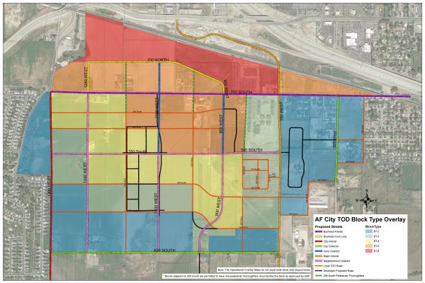
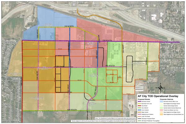
Table 4B - BLOCK TYPE AND SUB-DISTRICT ASSIGNMENTS
| District | Block Type Percentages | Civic Open Spaces | ||||||
| BT-1 | BT-2 | BT-3 | BT-4 | BT-5 | BT-6 | |||
| Business District | ||||||||
| Neighborhood Edge | ED-R | N/A | N/A | N/A | N/A | N/A | N/A | N/A |
| General Mixed-Use | MU-G | N/A | N/A | N/A | N/A | N/A | N/A | N/A |
| Office Core | OF-C | N/A | N/A | N/A | 0-20% | 15-30% | 20-50% | 5-10% |
| Mixed-Use | MU-C | N/A | N/A | N/A | N/A | N/A | N/A | N/A |
| Transit Core | ||||||||
| Neighborhood Edge | ED-R | N/A | N/A | N/A | N/A | N/A | N/A | N/A |
| General Mixed-Use | MU-G | N/A | N/A | N/A | N/A | N/A | N/A | N/A |
| Office Core | OF-C | N/A | N/A | N/A | N/A | N/A | N/A | N/A |
| Mixed-Use | MU-C | N/A | N/A | N/A | N/A | 30-60% | 0-50% | 5-10% |
| West Neighborhood | ||||||||
| Neighborhood Edge | ED-R | 0-40% | 10-60% | N/A | N/A | N/A | N/A | 10-20% |
| General Mixed-Use | MU-G | N/A | 20-50% | 10-40% | 0-25% | N/A | N/A | 10-20% |
| Office Core | OF-C | N/A | N/A | N/A | N/A | N/A | N/A | N/A |
| Mixed-Use | MU-C | N/A | N/A | N/A | N/A | N/A | N/A | N/A |
| Garden District | ||||||||
| Neighborhood Edge | ED-R | 20-40% | 10-40% | 0-25% | N/A | N/A | N/A | 10-20% |
| General Mixed-Use | MU-G | N/A | 20-50% | 10-40% | 0-25% | N/A | N/A | 10-20% |
| Office Core | OF-C | N/A | N/A | N/A | N/A | N/A | N/A | N/A |
| Mixed-Use | MU-C | N/A | N/A | N/A | N/A | N/A | N/A | N/A |
| East Neighborhood | ||||||||
| Neighborhood Edge | ED-R | 0-60% | 40-100% | N/A | N/A | N/A | N/A | 10-20% |
| General Mixed-Use | MU-G | N/A | N/A | N/A | N/A | N/A | N/A | N/A |
| Office Core | OF-C | N/A | N/A | N/A | N/A | N/A | N/A | N/A |
| Mixed-Use | MU-C | N/A | N/A | N/A | N/A | N/A | N/A | N/A |
Table 4C - SUB-DISTRICT AND PERMITTED USES
| SUB-DISTRICT | ||||
| PERMITTED USES | ED-R | MU-G | OF-C | MU-C |
| A. Residential | ||||
| Mixed Use | X | X | ||
| Multi-Family | X | X | ||
| Single Family: Attached | X | X | X | |
| Single Family: Detached | X | |||
| Senior Housing | X | X | X | |
| Work/Live Unit | X | X | ||
| Accessory Dwelling Unit | X | X | ||
| Dormitory | X | X | ||
| B. Lodging | ||||
| Hotel (no room limit) | X | X | ||
| Inn (up to 12 rooms) | X | X | ||
| Bed & Breakfast (up to 5 rooms) | X | |||
| C. Business | ||||
| Office Building | X | X | ||
| Home Occupation | X | X | ||
| D. Retail | ||||
| Open Market | X | X | ||
| Neighborhood Retail | X | X | X | |
| Display Gallery | X | X | ||
| Restaurant | X | X | X | |
| Food Truck | X | X | X | X |
| Drive-Through | X | X | ||
| Kiosk | X | X | X | |
| Push Cart | X | X | X | |
| E. Automotive | ||||
| Gas Station | X | |||
| Automobile Service | ||||
| Drive-Through | X | |||
| F. Civil Support | ||||
| Assembly | X | X | X | X |
| Cemetery | X | X | ||
| Funeral Home | X | X | ||
| Hospital | X | X | X | |
| Medical Clinic | X | X | X | |
| Library | X | X | ||
| Museum | X | X | X | |
| Post Office | X | X | X | |
| Public Safety | X | X | X | X |
| Laboratory | X | |||
| Transit Stop/Station | X | X | X | X |
| G. Education | ||||
| College | X | X | ||
| Trade School | X | X | X | |
| High School | X | X | ||
| Junior High School | X | X | ||
| Elementary School | X | X | X | |
| Child Care Center | X | X | X | X |
| Charter School | X | X | X | |
| H. Infrastructure | ||||
| Parking Lot | X | X | X | |
| Parking Structure | X | X | X | |
| Utility & Infrastructure | X | X | X | X |
| Open Space | X | X | X | X |
Table 4D - BLOCK TYPE LOCATION
| BLOCK TYPE | LOCATION | ADJACENCIES |
| BT-1 | BT-1 Should be located towards the edge of character districts, within or outside of the pedestrian shed. | BT-1 may be located adjacent to existing single-family residentially zoned properties |
| BT-2 | BT-2 should be located towards the edge of character districts, within or outside of the pedestrian shed | BT-2 may be located adjacent to existing single-family residentially zoned properties. Where this occurs a special requirement map must assign LT-2 and/or LT-3 at adjacent edges |
| BT-3 | BT-3 should be located within pedestrian sheds. | BT-3 may be located adjacent to existing single-family residentially zoned properties. Where this occurs a special requirement map must assign LT-3 at adjacent edges. |
| BT-4 | BT-4 should be located within pedestrian sheds, along major thoroughfares. | BT-4 should not be located adjacent to existing single family residentially zoned properties |
| BT-5 | BT-5 should be located within pedestrian sheds, along major thoroughfares or at the edge of the pedestrian shed, along major thoroughfares. | BT-5 must not be located adjacent to existing single family residentially zoned properties. |
| BT-6 | BT-6 should be located within pedestrian sheds, along major thoroughfares or at the edge of the pedestrian shed, along major thoroughfares. | BT-6 must not be located adjacent to existing single family residentially zoned properties. |
Table 4E - BLOCK CHARACTERISTICS
| CHARACTER DISTRICTS | Block Size (net acres) | Block Shape |
| Business District | 4 acre min.
8 acre max.
12 acre for sensitive lands | Orthogonal or Rhomboidal |
| Transit Core | 4 acre min.
8 acre max.
12 acre for sensitive lands | Orthogonal or Rhomboidal |
| West Neighborhood | 4 acre min.
8 acre max.
12 acre for sensitive lands | 40% min. Orthogonal or Rhomboidal |
| Garden District | 6 acre min.
10 acre max.
12 acre for sensitive lands | 40% min. Orthogonal or Rhomboidal |
| East Neighborhood | 6 acre min.
10 acre max.
12 acre for sensitive lands | 50% min. Orthogonal or Rhomboidal |
Amended by Ord. 2018-11-52 on 11/27/2018
Amended by Ord. 2019-09-62 on 9/24/2019
Amended by Ord. 2020-09-48 on 9/8/2020
Sec 5 Block Plans
- Instructions
- Within a character district, the landowner, their agents, or designee of a mapped block type must prepare a block plan to guide future development.
- A block plan must be prepared in a manner consistent with the governing district framework plan.
- A block plan may be submitted concurrently with a district framework plan.
- A block plan may contain one or more adjacent block types within a single district framework plan.
- The landowner, their agents, or designee must consult with American Fork City and all affected municipal entities for input and feedback in the preparation of a block plan.
- Block plans are submitted in two stages: Preliminary Block Plan and Final Block Plan. Preliminary and final block plans are subject to approval by the Zoning Clearance Officer or designated representative, in consultation with city staff.
- Block plans shall expire 24 months after approval if not acted upon further through the submittal of a Lot Plan. Time extensions may be granted by the city upon request.
- A block plan must assign all land within the block type to thoroughfares, lot types, and civic space.
- A block plan submitted for approval must demonstrate compliance with:
- Transportation network standards (subsection C),
- Easement standards (subsection D),
- Lot type standards (subsection E),
- Civic district standards (subsection F),
- Platting standards (subsection G),
- Special requirements, if any (subsection H),
- Phasing standards (subsection I).
- Within a character district, the landowner, their agents, or designee of a mapped block type must prepare a block plan to guide future development.
- Submission Requirements
- Block plans must be submitted in two stages: Preliminary Block Plan and Final Block Plan.
- Preliminary Block Plan submittals must include the following exhibits:
- Exhibit 1: Legal Description, including a legal description of the property.
- Exhibit 2: Boundary Survey and Preliminary Title Report.
- Exhibit 3: District Framework Plan, including the governing district framework plan, indicating the block type or block types being submitted, and civic districts.
- Exhibit 4: Boundary Map, including:
- Name and ownership of the property,
- Acreage of the property,
- Boundary of the property with dimensions,
- Existing land use of all properties within 500 feet of the block type boundary.
- Exhibit 5: Block Plan, including:
- Buildable lots including lot type assignments, lot width at frontages, lot IDs, and net lot area, both graphically and in a data table,
- Civic district boundaries, their types, acreages, and anticipated use,
- A data table including the gross acreage and net acreage of the block type, net acres of developable land and total acreage assigned to thoroughfares and alleys,
- A data table indicating the total aggregated gross acreage of each lot type and civic district (e.g. 2.12 acres of LT-4) and percentage of the gross block type acreage (e.g. LT-4 is 34% of the gross block type acreage).
- Exhibit 6: Principal Frontage Plan, indicating the principal frontage and secondary frontages for each buildable lot.
- Exhibit 7: Transportation Network Plan, including:
- A key showing the thoroughfare network of the governing district framework plan and the transportation master plan.
- Existing, new, and modified thoroughfares and alleys as required in Section 7, including centerline radius, and a data table indicating ownership, Right-of-Way width, number of vehicular lanes, thoroughfare type, and transportation provisions.
- New and modified intersections, identifying the type.
- Any public transportation stops or ways, bicycle ways, and trails within and adjacent to the block plan area.
- Exhibit 8: Utilities Plan, including:
- General location of wet and dry utility runs and easements,
- General location of transformers and other above ground utilities,
- General location of street lights,
- General location of fire hydrants,
- Easements required for snow storage in alleys.
- Exhibit 9: Thoroughfare Naming Plan, including:
- Names for each thoroughfare within the block type in accordance with the City's street naming ordinance.
- Exhibit 10: Thoroughfare Assemblies, including:
- Thoroughfare assemblies for new and modified existing thoroughfares, in compliance with the American Fork City Public Improvement Specifications, Standards, and Drawings.
- Exhibit 11: Intersection Assemblies, including:
- Intersection assemblies for new and modified existing intersections, in compliance with the American Fork City Public Improvement Specifications, Standards, and Drawings.
- Exhibit 12: Phasing Plan, including:
- Phase boundaries, acreages, and sequence for each phase as required in subsection I.
- Exhibit 13: Preliminary Civic Open Space Plan, for each civic district assigned as civic open space, in compliance with Section 7, including:
- Location and materials for landscaping, walkways, trails, paving, water features, and lighting,
- Location of proposed structures, including landscape follies,
- Intended use of all open spaces,
- Ownership and maintenance responsibility.
- Exhibit 14: Special Requirements, including:
- A graphic depiction of special requirements according to subsection H.
- All exhibits must include:
- North arrow, graphic scale, and date.
- Existing land use of all properties within 500 feet of the block plan boundaries. Exhibits 9 through 13 may exclude this item.
- Final Block Plan submittals must include:
- All exhibits required for preliminary block plan submittals,
- Engineering drawings, including:
- All proposed drainage facilities,
- Thoroughfare and alley cross-sections, grading, construction, and trajectories,
- Transportation related signs and signals,
- Above and below ground utility details,
- Site grading,
- Lot and road addresses and addresses for each intersection.
- All documents must be submitted digitally in portable document format (PDF) and hard copy format, including both a submission booklet at 11' x 17' and each exhibit at 24' x 36'.
- Application forms and fees must be submitted according to the Municipality Fee Schedule.
- A plan identifying the funding, construction, phasing, and timing for all civic open spaces must be submitted as an addendum to the required exhibits.
- Transportation Network Standards
- A block plan must include a thoroughfare network plan mapping the following:
- Adjacent thoroughfares mapped in the district framework plan,
- Modifications to existing thoroughfares, if any,
- A local thoroughfare network consisting of all new thoroughfares within the block plan.
- The thoroughfare network plan must map thoroughfares and intersections as follows:
- All thoroughfares must connect to other thoroughfares with intersections, forming a network.
- Close-ended streets (cul-de-sacs) may only be permitted within BT-1 and BT-2, and only within BT-3 and BT-4 located at the edge of a character district or adjacent to natural or man-made boundaries that limit vehicular connectivity.
- Close-ended streets should provide a pedestrian path from the end of the close-ended street (when permissible), completing the pedestrian network.
- Use of close-ended streets shall not conflict with Table 4A - Operational Overlay.
- New thoroughfares must connect wherever possible to thoroughfares outside of the block plan,
- The right-of-way (ROW) width of new thoroughfares is limited to those specified in Table 5A - Thoroughfare Network Requirements,
- Intersection types are limited to those specified in Table 5A - Thoroughfare Network Requirements.
- All thoroughfares must connect to other thoroughfares with intersections, forming a network.
- The thoroughfare network plan must be configured to define blocks with sub-block faces sized according to Table 5A - Thoroughfare Network Requirements.
- Local thoroughfare assemblies (internal to blocks) may be proposed, but must (at a minimum) meet the following:
- 32 feet of asphalt on a two-way thoroughfare;
- 26 feet of asphalt on a one-way thoroughfare;
- Proposed thoroughfare must accommodate drainage;
- Proposed thoroughfare must accommodate pedestrians.
- Thoroughfare assemblies and intersection assemblies must be included for each mapped thoroughfare and intersection in accordance with Section 7.
- Alley and rear lane easements along the rear of lots, providing access to lots and utility easements, must be included in all blocks where required in Table 5A - Thoroughfare Network Requirements.
- Alley and rear lane easements must be accessed by a minimum of two points along the edge of the block or sub-block.
- Alley easements must be in accordance with the American Fork City Public Improvements Specifications, Standards, and Drawings.
- Rear lane easements must be in accordance with the American Fork City Public Improvements Specifications, Standards, and Drawings.
- Alleys and rear lanes shall be private and will be maintained by private management (i.e. Homeowners Associations).
- Aside from rear lanes and alleys private thoroughfares are not allowed.
- A block plan must include a thoroughfare network plan mapping the following:
- Easement Standards
- Snow Storage Easements
- A block plan that includes alley or rear lanes must include a snow storage easement in each block, configured as generally illustrated and sized as specified in Table 5B - Snow Storage.
- Snow storage easements are required at all alleys and rear lanes.
- Snow storage easements may be larger than the areas required in Table 5B - Snow Storage.
- Snow storage areas may be established either through easement or HOA ownership.
- Snow storage easements must be located with sufficient space for vehicular access to garages.
- Snow storage easements must be located to allow easy access for snowplows.
- Utility Easements
- A block plan must map all utility locations and easements in accordance with Section 7.
- Blocks without alley or rear lane easements may have dry utility easements along rear property lines when possible or along secondary frontages if necessary.
- Snow Storage Easements
- Lot Type Assignments
- A block plan must identify a lot type assignment to each lot. Lots must be assigned one lot type.
- Lot type assignments are limited by block type according to Table 5C - Block Type to Lot Type Assignments.
- The percentage of each lot type is calculated as the sum of the gross lot area for each lot in the lot type divided by the total acreage of the block type.
- Block types under 6 gross acres may deviate from lot type assignment percentages as determined by the Planning Department.
- Transitioning of lot types between higher and lower lot types, for providing transitions in intensity, must occur sequentially (i.e. LT-4 to LT-5 to LT-6).
- Transitions between lot types should occur at rear lot lines, private rear lanes, and along public thoroughfares, not across public thoroughfares.
- Civic District Standards
- Land designated civic district is reserved for public open space and civic buildings.
- A block plan must assign civic districts according to Table 5C - Block Type to Lot Type Assignments.
- The percentage of civic districts is calculated as the sum of the gross lot area for each civic district divided by the total acreage of the block type.
- Civic districts assigned in the district framework plan within the block type count towards the requirements of Table 5C - Block Type to Lot Type Assignments. Civic districts assigned in the district framework plan shall meet the percentage ranges permitted in Table 5C - Block Type to Lot Type Assignments.
- A designation of civic open space (CS) may be applied to any civic district, restricting its use to those civic open space types specified in Table 7D - Civic Open Space Types, and associated structures. Civic open space must be publicly accessible.
- Civic open space less than 5 contiguous acres will not be managed by the City; a management authority will need to be assigned in coordination with the City.
- Open space maintenance shall comply with Section 12.12 of the American Fork City Code.
- A block plan may designate civic districts reserved for school sites and other buildings of civic importance, to be used as civic open space temporarily.
- A designation of civic building (CB) may be applied to any civic district, or portion thereof, less than 2 acres in area, restricting its use to those civic building types specified in Table 7D - Civic Open Space Types.
- Public planting and public lighting within civic districts must be configured according to Section 7.
- Platting Standards
- All land assigned to lot types within a block plan must be subdivided into lots.
- Lots must have frontages on a minimum of one vehicular or pedestrian thoroughfare except lots with frontages on civic districts with access to alleys or rear lanes.
- All lots adjacent to a major thoroughfare, as identified by the development area plan, shall have a setback in compliance with the standard detail for any major thoroughfare.
- Block plans must designate primary and secondary frontage locations for all lots.
- Lots must be platted within the following widths as measured along their principal frontage:
LT-1 LT-2 LT-3 LT-4 LT-5 LT-6 LT-7 LT-8 LT-9 100 feet min. 88 feet to 176 feet 66 feet to 132 feet 36 feet to 88 feet 22 feet to 78 feet 16 feet to 100 feet 16 feet to 200 feet 16 feet to 240 feet 16 feet to 260 feet
- Special Requirements
- A block plan may assign any of the following special requirements:
- A mandatory retail frontage designation requires and a recommended retail frontage designation advises that a building provide a shopfront at the first building level along the entire length of its private frontage. The shopfront may be combined with an awning, or gallery frontage.
- A mandatory gallery frontage designation requires and a recommended gallery frontage designation advises that a building provide a gallery frontage along the entire length of its private frontage.
- A mandatory porchfront designation requires and a recommended porchfront designation advises that a building provide a porch in the private frontage.
- A build-to line requires the placement of the building facade along the line. Forecourts may recess a building entrance from the build-to line.
- A coordinated frontage designation requires that the private frontage be coordinated with the public frontage as a single, coherent landscape and paving design.
- A mandatory terminated vista designation requires and a recommended terminated vista designation advises that the building be provided with architectural articulation of a type and character that responds visually to its axial location, as approved by the Planning Department.
- A cross block passage designation requires that a minimum 8-foot-wide pedestrian access be reserved between buildings.
- A block plan may assign any of the following special requirements:
- Phasing Standards
- Block plans must include a phasing plan indicating the order and unit absorption threshold for each phase.
- Phase boundaries must occur along rear lot lines and perpendicular to thoroughfare trajectories.
- Phase numbers must be formatted as sub-phase numbers of the district framework plan in the format - district framework plan phase - block plan phase. (i.e. Phase 4-1, 4-2, 4-3, etc.)
Table 5A - THOROUGHFARE NETWORK REQUIREMENTS
| BLOCK TYPE | ALLEYS | THOROUGHFARES | INTERSECTIONS | SUB-BLOCK PERIMETER |
| BT-1 | rear lanes optional | 52 foot ROW | T, Y, 4W, SI, TN | no maximum |
| BT-2 | rear lanes optional | 52 foot ROW | T, Y, 4W, SI, TN | 2,400 foot max. |
| BT-3 | rear lanes and alleys optional | 52 foot ROW | T, Y, 4W, SI, TN | 2,000 foot max. |
| BT-4 | rear lanes or alleys required** | 52 foot ROW 66 foot ROW 88 foot ROW | T, Y, 4W, SI, TN, SA | 1,800 foot max. * |
| BT-5 | alleys required | 52 foot ROW 66 foot ROW 88 foot ROW | T, Y, 4W, SI, TN, SA | 1,800 foot max. * |
| BT-6 | alleys required | 52 foot ROW 66 foot ROW 88 foot ROW | T, Y, 4W, SI, TN, SA | 1,800 foot max. * |
* Sub-blocks with a perimeter greater than 1,600 feet must include a minimum 11 foot-wide pedestrian passage traversing the block at mid-block or to connect civic spaces.
** In BT-4 rear lanes and alleys may be omitted where all lots have a minimum principal frontage greater than 60 feet.
Table 5B - SNOW STORAGE
| BT-1 | n/a | BT-4 | 100 sq. ft. min |
| BT-2 | n/a | BT-5 | 150 sq. ft. min |
| BT-3 | 100 sq. ft. min | BT-6 | 150 sq. ft. min |
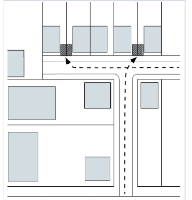
Table 5C - BLOCK TO LOT ASSIGNMENTS
| Block Type | Lot Type Percentages | ||||||||
| LT-1 | LT-2 | LT-3 | LT-4 | LT-5 | LT-6 | LT-7 | LT-8 | LT-9 | |
| BT-1 | 40-80% | 0-30% | 10-30% | n/a | n/a | n/a | n/a | n/a | n/a |
| BT-2 | n/a | 40-60% | 20-50% | 0-20% | 0-10% | n/a | n/a | n/a | n/a |
| BT-3 | n/a | n/a | 0-40% | 10-40% | 30-50% | 0-5% | n/a | n/a | n/a |
| BT-4 | n/a | n/a | n/a | 0-20% | 20-50% | 10-30% | 0-20% | n/a | n/a |
| BT-5 | n/a | n/a | n/a | n/a | n/a | 0-40% | 20-50% | 10-50% | n/a |
| BT-6 | n/a | n/a | n/a | n/a | n/a | n/a | 10-30% | 20-40% | 10-40% |
Amended by Ord. 2018-11-52 on 11/27/2018
Amended by Ord. 2022-09-40 on 9/13/2022
Sec 6 Lot Plans
- Instructions
- Within character districts, the landowner, their agents, or designee of a mapped lot must prepare a lot plan detailing future site plan and building development.
- A lot plan must be prepared in a manner consistent with the governing block plan.
- This Section sets forth the standards applicable to the development and modification of buildings and other elements of the built environment within private lots.
- The Zoning Clearance Officer or designated representative, in consultation with city staff, may approve, approve with conditions, or deny a lot plan.
- Lot plans submitted for approval must demonstrate compliance with:
- Nonconformities (subsection C)
- Lot standards (subsection D)
- Building use standards (subsection E)
- Parking and loading standards (subsection F)
- Building form standards (subsection G)
- Architectural standards (subsection H)
- Signage standards (subsection I)
- Landscape standards (subsection J)
- Fencing Standards (subsection K)
- Lot plans shall expire 12 months after approval if not acted upon further.
- Within character districts, the landowner, their agents, or designee of a mapped lot must prepare a lot plan detailing future site plan and building development.
- Submission Requirements
- Lot plan submittals must include the following exhibits:
- Exhibit 1: Legal Description, including a legal description of the property.
- Exhibit 2: Boundary Survey and Preliminary Title Report.
- Exhibit 3: Lot Location and Context, including the governing district framework plan, and block plan, indicating:
- Lot size,
- Lot type,
- Gross lot area in acres,
- Net lot area in acres,
- Width of the principal frontage (lot width),
- Block type and block type ID the lot is within,
- Character district the lot is within.
- Exhibit 4: Lot Configuration including:
- Boundary of the lot with dimensions in feet, indicating both net and gross lot dimensions,
- Location of the principal frontage,
- Location of any secondary frontages,
- Location and dimensions of the first lot layer,
- Location and dimensions of the second lot layer,
- Location of the third lot layer.
- Exhibit 5: Building Use (subsection E), including:
- For multiple uses on a single lot, plans illustrating the location and extent of each use on the lot, including common areas. For vertically mixed uses, the location and extent of each use must be depicted for each floor,
- A data table describing the permitted density, including the lot type, gross lot area, maximum permitted density per acre, and the resulting maximum DUs permitted on the lot,
- A data table describing the proposed density and use, including the area in square feet and DUs allocated to each use and a row including the total DUs and building area in square feet. For vertically mixed uses, each floor must be listed individually,
- For multiple buildings on a single lot, the above data tables must include a key to the building ID where each use is located, coordinated with Exhibit 7.
- For buildings within the Mixed use Core sub-district, all buildings abutting 200 South shall have an equivalent of 100% ground floor area designated for office and/or retail use (Table 6E-Building Use). For all buildings within project areas abutting streets other than 200 South, an equivalent of 25% ground floor area shall be designated for office and/or retail use (Table 6E-Building Use). The 25% equivalent may be satisfied collectively in one building, or dispersed throughout the project area in various buildings. Delivery of the office/retail use shall occur no later than at completion of 75% build-out of any residential portions of the project area.
- Exhibit 6: Parking and Loading (subsection F), including:
- Location of on-street parking stalls included in the provided parking calculation,
- Location of off-street parking stalls, including stall dimensions, aisle dimensions, and distance of the parking area, from lot boundaries,
- Location and dimensions of driveways, including openings in buildings or street screens to provide vehicular access,
- A data table describing the required parking, with each use on a separate line, area in square footage, required parking ratio, and total required stalls per each use, and a row including the total required stalls,
- For lots employing shared parking, include a completed shared parking Table 6F - Parking Requirements. For shared parking stalls provided by an off-site facility, include information pertaining to the facility being used for required parking fulfilment.
- Exhibit 7: Building Form (subsection G), including:
- Location of building footprints, including open areas with permanent roofing, dimensioned and including the area of each footprint in square feet, location of the principal entrance to each building, and a building ID where there are multiple buildings on a single lot,
- Dimensions of the setbacks - front, side, rear, and secondary - for each building on the lot,
- Building height, for each building, indicating the location of each finished floor above sidewalk grade. For buildings enfronting thoroughfares, the facade along the thoroughfares must be used for dimensioning,
- Frontage configuration, depicting the location and type of private frontages, encroachment types and depths, surface treatment, and intended use of private frontages for nonresidential uses.
- A data table describing building placement, including total lot coverage and frontage buildout, as well as setbacks for each building,
- A data table describing building height, including the elevation of each finished floor above sidewalk grade for each building.
- Exhibit 8: Architecture, illustrating compliance with subsection H.
- Exhibit 9: Signage (subsection I), including:
- Location of each sign on buildings and the lot,
- Dimensions and design of each sign,
- A data table describing the characteristics of each sign, including the type, width, height, area, materials, and type of illumination,
- Addresses for buildings and units, location and configuration of each address sign.
- Exhibit 10: Landscape (subsection J), including:
- Landscape plan illustrating all surface treatments and plants on the lot, keyed to a data table describing the type of plant material and paving, and demonstrating compliance.
- All exhibits must include:
- North arrow, graphic scale, and date.
- All documents must be submitted digitally in portable document format (PDF) and hard copy format, including both a submission booklet at 11' x 17' and each exhibit at 24' x 36'.
- Application forms and fees must be submitted according to the Municipality Fee Schedule.
- Lot plan submittals must include the following exhibits:
- Nonconformities
- The provisions in this Section are applicable to the extent permitted under Utah law.
- Existing buildings and appurtenances that do not conform to the provisions of this Section may continue in such use until a substantial modification is requested or the use of the building changes, at which time the Zoning Clearance Officer or designated representative, in consultation with city staff, will determine the provisions of this Section that apply. Substantial modifications and nonconformities exclude the following:
- Modifications made within a three-year period of the adoption of this Chapter.
- Interior modifications to a single-family residence retaining its existing use.
- The temporary or illegal use of property is not sufficient to establish or create rights in the continuation of a nonconformity.
- The existence of a nonconformity may not be used as a reason to add new uses, structures, or site improvements that are not allowed by the regulations of the applicable lot type.
- Where buildings exist on adjacent lots, the Zoning Clearance Officer or designated representative, in consultation with city staff, may request that a proposed building match the setbacks and heights of adjacent buildings rather than the provisions of this Section. Approved deviations from the Chapter will not be considered nonconformities.
- Lot Standards
- Lot Layers
- Lots are divided into regulatory lot layers.
- Each lot may contain one or more principal and secondary frontage, according to the governing block plan. If a lot has not been assigned principal and secondary frontages, they will be assigned by the Planning Department.
- The first lot layer contains the private frontage, configured according to subsection F.
- The second lot layer is set at varying depths (depending upon lot type) between the first lot layer and the third lot layer. The second lot layer pertains only to the principal frontage. Parking may be located in the second lot layer.
- The third lot layer may contain outbuildings and parking, covered or uncovered, configured according to subsection E.
- Lot Aggregation and Subdivision
- All lots, existing, subdivided, or assembled must not exceed the following lot widths as measured along their principal frontage:
LT-1 LT-2 LT-3 LT-4 LT-5 LT-6 LT-7 LT-8 LT-9 100 feet min. 88 feet to 176 feet 66 feet to 132 feet 36 feet to 88 feet 22 feet to 78 feet 16 feet to 100 feet 16 feet to 200 feet 16 feet to 240 feet 16 feet to 260 feet - Lots assembled into one parcel that encompass more than one lot type are assigned the lower of the lot types unless City Council has approved otherwise.
- Where lots are assembled into one ownership, the side and rear setbacks between assembled lots may be eliminated.
- Lot line adjustments may be required (as per state code).
- All lots, existing, subdivided, or assembled must not exceed the following lot widths as measured along their principal frontage:
- Lot Layers
- Building Use Standards
- Density
- The maximum density of each lot is calculated in terms of development units (DU) per gross lot area where one development unit (DU) equals one residential unit or 1,100 square feet of non-residential. Gross lot area is calculated as the net lot area plus the area of adjacent thoroughfares, alleys and passages between lot lines and centerlines.
- Maximum density is limited to the following ratios per each lot type except where a minimum density must be achieved as set forth in c. below:
LT-1 LT-2 LT-3 LT-4 LT-5 LT-6 LT-7 LT-8 LT-9 2 DU's per gross acre 4 DU's per gross acre 8 DU's per gross acre 14 DU's per gross acre 20 DU's per gross acre 30 DU's per gross acre 42 DU's per gross acre 50 DU's per gross acre 65 DU's per gross acre - Where a project is located in the Transit Core-Mixed Use Core, a project must achieve a minimum density of 55 units per gross acre.
- Maximum density of each lot may not be less than one DU. Fractional remainders are rounded downwards in one-half unit increments.
- Accessory Dwelling Units (ADUs)
- An ADU is permissible as per Section 17.5.134 of the American Fork City Code.
- Permitted Functions
- Building use is limited to the allowable building functions and intensity restrictions according to Table 6E - Building Use.
- Permitted commercial functions other than office, lodging, educational, and civic support are limited to the ground floor of buildings. Buildings accessed by a lightwell frontage in LT-6, LT-7, and LT-8 may be permitted a commercial function in the basement level in addition to the area located on the ground floor. Mezzanine levels are considered ground floor levels for this purpose.
- Required Use - Mixed Use Core
- For buildings within the Mixed Use Core sub-district, all buildings abutting 200 South shall have an equivalent of 100% ground floor area designated for office and/or retail use (Table 6E-Building Use). For all buildings within project areas abutting streets other than 200 South, an equivalent of 25% ground floor area shall be designated for office and/or retail use (Table 6E-Building Use). The 25% equivalent may be satisfied collectively in one building, or dispersed throughout the project area in various buildings. Delivery of the office/retail use shall occur no later than at completion of 75% build-out of any residential portions of the project area.
- For buildings within the Mixed Use Core sub-district, all buildings abutting 200 South shall have an equivalent of 100% ground floor area designated for office and/or retail use (Table 6E-Building Use). For all buildings within project areas abutting streets other than 200 South, an equivalent of 25% ground floor area shall be designated for office and/or retail use (Table 6E-Building Use). The 25% equivalent may be satisfied collectively in one building, or dispersed throughout the project area in various buildings. Delivery of the office/retail use shall occur no later than at completion of 75% build-out of any residential portions of the project area.
- Density
- Parking and Loading Standards
- Required Parking
- Parking requirements are determined by function according to Table 6F - Parking Requirements.
- Liner buildings less than 30 feet deep and no more than two stories are exempt from minimum parking requirements.
- Non-residential parking shall require a ratio of one (1) space per 350 square feet of enclosed non-residential space.
- Multi-family residential parking shall require 1.5 spaces per dwelling.
- Residential, other than multi-family, shall require 2 spaces per dwelling.
- Food truck parking and vending shall be permitted to vend on city designated streets in accordance with subsection E of the American Fork City Code.
- Required parking may be fulfilled in the following locations:
- Parking spaces provided within the lot; all single family residential required parking must be provided within the lot,
- Parking spaces provided on-street corresponding to lot frontages, except in LT-1, LT-2 and LT-3,
- Parking spaces leased from a private or public parking facility within 500 feet of the lot, including a non-adjoining shared parking facility,
- Parking spaces in a shared parking facility between adjoining lots. Shared parking facilities are subject to a recorded covenant specifying funding, maintenance, insurance, and management.
- Parking requirements are determined by function according to Table 6F - Parking Requirements.
- Off-Street Parking Access
- Parking must be accessed by alleys or rear lanes where available,
- Single-family residential uses may access parking from either primary or secondary frontages.
- Where alley or rear lane access is unavailable, parking may be accessed by driveways according to the following:
- From the secondary frontage.
- From the principal frontage in LT-1, LT-2 and LT-3.
- From the principal frontage in LT-4 for lots at least 45 feet wide.
- From the principal frontage in LT-5 and LT-6 for lots at least 60 feet wide.
- Pedestrian access to parking lots and parking structures must be directly from a frontage, except for underground parking levels.
- Off-Street Parking Location
- Off-street parking must be located within the third lot layer and according to Table 6C - Garage Types and Table 6D - Private Frontages: Automobile.
- Off-Street Parking Physical Requirements
- Subsection F,4 is not applicable to single-family residential functions.
- A minimum of one bicycle rack space must be provided within the principal or secondary frontage for every twenty vehicular parking spaces.
- Curbing may be omitted in parking lots in coordination with the City Engineer.
- Parking lots must be masked from all frontages by a building or streetscreen.
- Streetscreens should be a minimum of 4 feet in height and have openings no larger than necessary to allow automobile and pedestrian access.
- Parking lots may not be used for the sale, repair, or dismantling of any vehicle or equipment, or for storage of materials or supplies.
- Parking must comply with applicable regulations related to lighting, paving, and drainage.
- Tandem parking may be used to fulfill parking requirements for multi-family housing or where operated by a valet parking service.
- Parking facilities on adjoining lots should share access points, drive-ways and parking subject to a recorded covenant.
- Ingress vehicular control devices must be located so as to provide a minimum driveway of 20 feet in length between the building facade and dispenser.
- Parking structures must include liner buildings along the principal frontage where they are located within 40 feet of the principal frontage line.
- Parking Structures
- Where above ground structured parking is located at the perimeter of a building with frontage along a street; it shall be screened in such a way that cars on all parking levels are completely screened from pedestrian view from all adjacent public streets. Architectural screens shall be used to articulate the façade, hide parked vehicles, and shield lighting.
- When parking structures are located at corners, corner architectural elements shall be incorporated such as corner entrance, signage and glazing.
- Parking structures and adjacent sidewalks shall be designed so pedestrians are clearly visible to entering and exiting automobiles.
- All structured parking will be allowed to apply for the following parking reductions:
- Non-residential: 20% overall reduction,
- Single family - attached: 0.5 spaces per unit,
- Multi-family residential: 0.5 spaces per unit.
- Required Parking
- Building Form Standards
- Building - Lot Relationship
- The establishment of building type to lot type relationship is identified in Table 6E - Building Type - Lot Type.
- Building Placement
- Lot coverage by buildings must not exceed the maximum percentages of net lot area according to Table 6A - Building Form.
- The number of buildings permitted on one lot is limited according to Table 6A - Building Form.
- A principal building must be designated on each lot.
- The facade of the principal building must be built parallel to a principal frontage lot line or to the tangent of a curved principal frontage lot line, except where a build-to-line requires otherwise.
- The facade of the principal building must occupy a minimum percentage of the principal frontage width within the first lot layer, as specified in Table 6A - Building Form as frontage buildout. Chimneys, porches, and similar non-structural building elements do not count towards the frontage buildout.
- The principal entrance in LT-7, LT-8 and LT-9 must be on a frontage line. Forecourts and recessed stoops as specified in subsection H, that recess the principal entrance from the frontage line are permitted.
- Building Setback
- Buildings must be setback from the boundaries of their lots according to Table 6A - Building Form.
- The rear setback for outbuildings is a minimum of 15 feet measured from the centerline of the alley or the rear lot line in the absence of an alley, except at corner lots where the rear setback for outbuildings is a minimum of 0 feet. Where garages are setback less than 15 feet measured from the centerline of the alley at corner lots, access to the garage may not be provided along the elevation facing the alley.
- Front setback requirements may be modified by the Zoning Clearance Officer or designated representative, in consultation with city staff, to accommodate slopes over ten percent.
- Building Height
- Building height is measured in stories for each above-ground level according to the following:
- Stories are measured from finished floor to finished ceiling,
- Stories above the ground floor are limited to 14 feet. Stories may be combined to exceed 14 feet, counted as multiple stories, subject to approval from the Zoning Clearance Officer or designated representative, in consultation with city staff,
- Ground floor height exceeding 18 feet is counted as 2 stories,
- Ground floor height may not exceed 30 feet subject to approval from the Zoning Clearance Officer or designated representative, in consultation with city staff,
- Ground floor height for commercial uses must be a minimum of 14 feet.
- Building height is limited according to Table 6A - Building Form.
- Unfinished attics do not count towards building height. Finished attics count towards building height as a half story.
- Raised basements greater than 3 feet above grade at the principal frontage are counted as a story.
- Residential and lodging uses should have a first-floor level raised a minimum of 18 inches from average sidewalk grade at the principal frontage.
- Height limits for masts, belfries, clock towers, chimney flues, water tanks, elevator bulkheads, or other non-habitable structures are determined by the Zoning Clearance Officer or designated representative, in consultation with city staff.
- For free standing parking structures, maximum height is measured in feet according to Table 6A - Building Form. Story heights and limits do not apply.
- For parking structures in LT-7, LT-8 and LT-9 attached to a building or buildings for at least 50% of their perimeter, height may exceed the maximum for parking structures provided they not exceed the eave height of the attached building or buildings.
- Building height is measured in stories for each above-ground level according to the following:
- Private Frontage Location
- The private frontage is located in the first lot layer and must be configured according to Table 6B - Private Frontages.
- Each building must be assigned a private frontage type according to subsection G,6 and Table 6B - Private Frontages.
- Lots fronting two or more thoroughfares or passages have private frontages along each. Prescriptions for the first lot layer pertain to all frontages.
- Balconies, bay windows, and chimneys may encroach into the first lot layer up to 60% of the depth in LT-4 and LT-5 and 100% in LT-6, LT-7, LT-8, and LT-9 for all uses.
- Private Frontage Configuration
- Private frontages must be configured according to Table 6B - Private Frontages.
- Building access must meet the following requirements by ground floor function:
- Lodging functions in LT-7, LT-8 and LT-9 should be accessed from walkway grade. Lodging functions in LT-4, LT-5, and LT-6 should be raised a minimum of 18 inches from walkway grade.
- Office, educational, and civil support functions in LT-7, LT-8 and LT-9 should be accessed from walkway grade. Office uses in LT-4, LT-5, and LT-6 should be raised a minimum of 18 inches from walkway grade.
- Retail functions must be accessed from walkway grade.
- Ground floor entrances to retail, commercial and lodging functions must be illuminated.
- Loading docks and service areas may be permitted in LT-7, LT-8 and LT-9 at secondary frontages.
- Where a portion of a frontage in LT-7, LT-8 or LT-9 does not contain a building facade, a streetscreen must be built parallel with the facade of the adjacent building.
- Streetscreens should be a minimum of 4 feet in height and have openings no larger than necessary to allow automobile and pedestrian access.
- Non-residential buildings may utilize the public frontage for seating, serving, displays of merchandise, and other business-related activities provided a minimum six foot contiguous clear path is maintained within the public frontage, private frontage, or a combination of both.
- Where a special requirements plan specifies a coordinated frontage, the private frontage must be coordinated with the public frontage as a single, coherent landscape and paving design.
- Private Frontage Assignments and Encroachments
- Private frontage type is limited by lot type according to Table 6B - Private Frontages, and the following use-based restrictions:
- Single family residential functions may be assigned common yard, porch and fence, terrace, lightwell, or stoop frontages.
- Multi-family residential functions may be assigned terrace, lightwell, forecourt, stoop, or gallery frontages.
- Lodging functions in LT-7, LT-8, and LT-9 may be assigned terrace, forecourt, stoop, or gallery frontages.
- Lodging functions in LT-4, LT-5, and LT-6 may be assigned common yard, porch and fence, terrace or lightwell frontages.
- Office, educational, and civil support functions in LT-6, LT-7, LT-8, and LT-9 may be assigned terrace, forecourt, stoop, or gallery frontages.
- Office, educational, and civil support functions in LT-3, LT-4, and LT-5 may be assigned common yard, porch and fence, terrace or lightwell frontages.
- Retail functions must be assigned shopfront frontages.
- Shopfronts in LT-5 and LT-6 may combine a shopfront with a terrace frontage.
- Shopfronts in LT-7, LT-8, and LT9 may be combined with a terrace, lightwell, forecourt, or gallery frontage.
- Frontage encroachments are limited according to Table 6B - Private Frontages.
- Private frontages with elements that encroach into the public frontage must maintain a minimum six-foot contiguous clear path within the public frontage, private frontage, or a combination of both.
- Balconies, bay windows, and chimneys may encroach into the first lot layer up to 60% in LT-45 / LT-5 and 100% in LT-6 / LT-7 and LT-8 / LT-9 for all uses.
- Private frontage type is limited by lot type according to Table 6B - Private Frontages, and the following use-based restrictions:
- Public Frontage: Automobile
- Public Frontage: Automobile opportunities are limited by building type according to Table 6C - Garage Types and Table 6D - Private Frontage: Automobile.
- Garage entrances should be minimized when reasonably possible within the front elevation of buildings by varying garage orientation and setbacks based on building type, lot size and architectural style.
- The scale, shape, character, material, panel pattern, window type and color of the door shall correlate with the architectural style of the home.
- To incorporate the door into the collective design of the home, the garage door shall be inset within the garage door opening as appropriate to the architectural style. Garage orientations include but are not limited to recessed, tuck under, flush, swing-in, split tandem, detached rear yard, side-entry, alley-loaded, etc.
- Minimum lot width for accommodating a two-car (parallel park) garage shall be 22 feet.
- Building - Lot Relationship
- Architectural Standards
- Architectural styles must tie to regional precedent (what has been used historically) and natural context (ability to play to climate and geography).
- Use exterior materials in an authentic manner, consistent with the architectural style, and their historic appearance/ placement on the building.
- No more than three wall materials shall be visible on any exterior wall (excluding the foundation and trim work).
- Heavier (load bearing) materials must be closer to the base of the building.
- Change of materials shall occur naturally (according to style) rather than indiscriminately.
- Materials must wrap outside corners; termination of materials must occur at inside corners.
- Consistent use of materials must occur on all building facades.
- Colors for all exterior materials (siding, trim, brick, stone, mortar, stucco, etc.) must be selected appropriate to the building's architectural style and to local precedent.
- Streetscreens, where required, should be constructed of a material matching the adjacent building facade, a hedge, masonry or stone wall, wrought iron or decorative metal fence no less than 4 feet in height.
- Building mechanical equipment and refuse storage must not be located along frontages.
- Clotheslines must not be located along frontages.
- All openings, including porches, galleries, doors and windows, except for shopfronts, must be square or vertical in proportion.
- Doors and windows that operate as sliders are prohibited along frontages, except at shopfronts.
- Glazed openings above the first story may not exceed 60% of the total building wall area and 80% in LT-8 and LT-9, with each facade being calculated independently.
- Photo voltaic (PV) systems along frontages must be flexible panel type or building integrated photo voltaic (BIPV), attached directly to the roofing material, PV roofing shingles, or other conducting system that applies directly to roofing material or sheathing with less than one half inch average vertical dimension or integrated into building shading devices.
- Signage Standards
- All permanent signage must be configured as specified in Table 6G - Signage Standards.
- Temporary signage may be permitted in accordance with the Municipality Sign Code.
- Signage can only be used for business on premises. No off-site advertising is allowed.
- Billboards are prohibited.
- Residential Functions
- One address number, no more than 6 inches measured vertically, may be attached to the building in proximity to the principal entrance or at a mailbox.
- Entrances to buildings including multi-family housing may install one directory sign, no more than 4 square feet, at each entry.
- Non-residential Functions
- All illuminated signage must be externally illuminated, except signage within the shopfront glazing.
- Monument signs must be separated by a minimum distance of 100 feet.
- Marquee signs may be located only above the principal entrance of a building and may encroach into the public frontage to within two feet of the curb.
- Sidewalk signs must be located adjacent to the principal entrance of business or within the verge. Sidewalk signs must be removed from the sidewalk at the close of business each day.
- Landscape Standards
- All planting in the private frontage and private lots must consist of species as specified in Table 7F - Public Planting.
- For residential lots, one walkway no wider than 5 feet providing access to the principal entrance is permitted at all frontages.
- Non-residential functions in LT-7, LT-8, and LT-9, may pave any portion of the private frontage.
- Common yard and porch & fence frontages must be landscaped as follows:
- A minimum of one tree must be planted in the private frontage for every 20 feet of frontage line, calculated as the frontage width divided by 20. Remainders over one half are rounded up. Tree location is at the owner's discretion.
- Approved ground cover may be considered for use in place of turf grass.
- Stoop and forecourt frontages must be landscaped as follows:
- Trees and shrubs are not required in the private frontage. Trees planted in the private frontage should match the species of trees in the public frontage.
- Landscaping, where installed, shall consist of durable species tolerant of soil compaction.
- Paving, where installed, must match the public frontage.
- Shopfront, gallery, terrace, lightwell, common entry, forecourt, and vehicular forecourt frontages must be landscaped as follows:
- Trees and shrubs are required in the private frontage.
- Landscaping, where installed, must consist of durable species tolerant of soil compaction.
- The private frontage must be paved to match the public frontage.
- Parking lots must be landscaped as follows:
- One tree must be planted for every 15 spaces.
- Landscaped areas should be placed lower than paving, not mounded up. See subsection F,4 for curbing requirements.
- Fencing Standards
- When fencing is to be installed on residential lots in LT-1, LT-2, LT-3, LT-4, and LT-5 the following screening requirements shall be used:
- A solid fence, wall, or hedge along side property lines within the second and third lot layers, no greater than 6 feet in height.
- A solid fence, wall, or hedge along rear property lines where there is no alley or rear lane, no greater than 6 feet in height.
- A solid fence, wall, or hedge may be aligned a maximum of 20 feet from the rear property line along the rear yard where there is an alley or rear lane, no greater than 6 feet in height. The area in front of the fence should be used for parking, refuse storage, and utilities.
- Chain link fencing is prohibited.
- When fencing is to be installed on residential lots in LT-6, LT-7, LT-8 and LT-9 the following screening requirements shall be used:
- A solid wall or hedge along side property lines within the second and third lot layers, no greater than 6 feet in height .
- A solid wall or hedge along rear property lines where there is no alley or rear lane, no greater than 6 feet in height.
- A solid wall or hedge may be aligned a maximum of 20 feet from the rear property line along the rear yard where there is an alley or rear lane, a minimum of 6 feet in height and maximum of 8 feet in height. The area in front of the fence should be used for parking, refuse storage, and utilities.
- Chain link fencing is prohibited.
- When fencing is to be installed on residential lots in LT-1, LT-2, LT-3, LT-4, and LT-5 the following screening requirements shall be used:
TABLE 6A - LT-1 BUILDING FORM
| BUILDING CONFIGURATION | |
| Number of Bldgs per lot | 1+ outbuilding |
| Height - Principal Building | 2 stories max. |
| Height - Outbuilding | 1 stories max. |
| Height - Structured Parking | not applicable |
| Lot Coverage | 40% max. |
| Lot Frontage | 100 ft. min. |
| Second Lot Layer | 10 feet |
| SETBACKS - PRINCIPLE BUILDING | |
| (a) Front Setback Principle | 30 ft. min. |
| (b) Front Setback Secondary | 20 ft. min. |
| (c) Side Setback | 20 ft. min. |
| (d) Rear Setback | 20 ft. min.* |
| Frontage Buildout | n/a |
| SETBACKS - OUTBUILDING | |
| (e) Front Setback | 20 ft. min. in addition to the principal building setback |
| (f) Side Setback | 20 ft. min. |
| (g) Rear Setback | 20 ft. min. |
"N" stands for any Stories above those shown up to the maximum. Refer to metrics for exact minimums and maximums.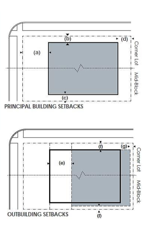 TABLE 6A - LT-2 BUILDING FORM
| BUILDING CONFIGURATION | |
| Number of Bldgs per Lot | 1+ outbuilding |
| Height - Principal Building | 2 stories max. |
| Height - Outbuilding | 2 stories max. |
| Height - Structured Parking | not applicable |
| Lot Coverage | 50% max. |
| Lot Frontage | 88 ft. - 176 ft. |
| Second Lot Layer | 12 feet |
| SETBACKS - PRINCIPAL BUILDING | |
| (a) Front Setback Principal | 24 ft min., 36 ft. max. |
| (b) Front Setback Secondary | 12 ft. min. |
| (c) Side Setback | 12 ft. min. |
| (d) Rear Setback | 15 ft. min. |
| Frontage Buildout | 40% min. at setback |
| SETBACKS - OUTBUILDING | |
| (e) Front Setback | 20 ft. min. in addition to the principal building setback |
| (f) Side Setback | 3 ft. min. or 8 ft. min. at corner lots |
| (g) Rear Setback | 15 ft. min. |
"N" stands for any Stories above those shown, up to the maximum. Refer to metrics for exact minimums and maximums.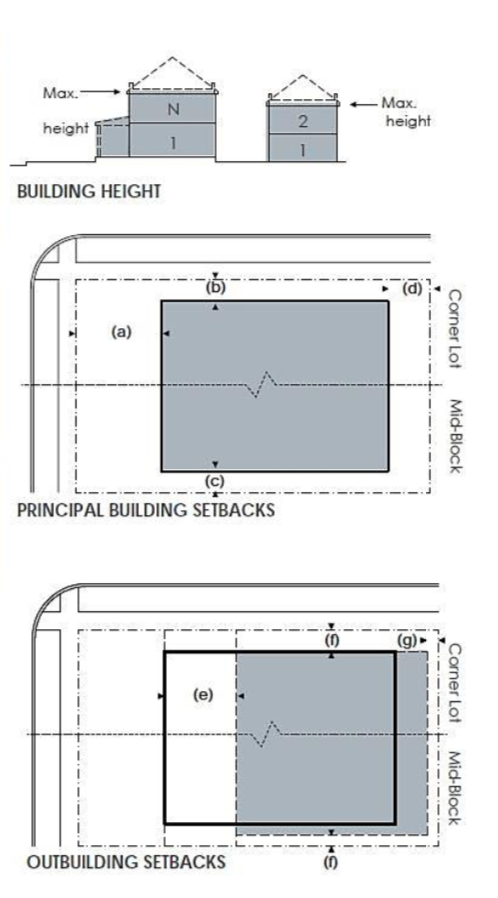
TABLE 6A - LT-3 BUILDING FORM
| BUILDING CONFIGURATION | |
| Number of Bldgs per Lot | 1+ outbuilding |
| Height - Principal Building | 2 stories max. |
| Height - Outbuilding | 2 stories max. |
| Height - Structured Parking | not applicable |
| Lot Coverage | 60% max. |
| Lot Frontage | 66 ft. - 132 ft. |
| Second Lot Layer | 12 feet |
| SETBACKS - PRINCIPAL BUILDING | |
| (a) Front Setback Principal | 18 ft. min., 28 ft. max. |
| (b) Front Setback Secondary | 10 ft. min. |
| (c) Side Setback | 10 ft. min. |
| (d) Rear Setback | 12 ft. min. |
| Frontage Buildout | 40% min. at setback |
| SETBACKS - OUTBUILDING | |
| (e) Front Setbacks | 20 ft. m in. in addition to the principal building setback. |
| (f) Side Setback | 3 ft. min. or 8 ft. min. at corner lots |
| (g) Rear Setback | 12 ft. min. |
"N" stands for any Stories above those shown up to the maximum. Refer to metrics for exact minimums and maximums.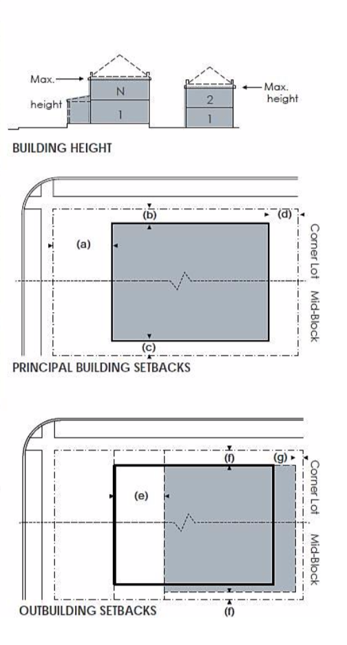
TABLE 6A - LT-4 BUILDING FORM
| BUILDING CONFIGURATION | |
| Number of Bldgs per Lot | 2+ outbuilding |
| Height - Principal Building | 3 stories max. |
| Height - Outbuilding | 2 stories max. |
| Height - Structured Parking | not applicable |
| Lot Coverage | 60% max. |
| Lot Frontage | 36 ft. - 88 ft. |
| Second Lot Layer | 16 ft. |
| SETBACKS - PRINCIPAL BUILDING | |
| (a) Front Setback Principal | 10 ft. min. 20 ft. max. |
| (b) Front Setback Secondary | 2 ft. min. 18 ft. max. |
| (c) Side Setback | 0 ft. min. |
| (d) Rear Setback | 10 ft. min. |
| Frontage Buildout | 60% min. at setback |
| SETBACKS - OUTBUILDING | |
| (e) Front Setbacks | 20 ft. min. in addition to the principal building setbacks |
| (f) Side Setback | 0 ft. min. or 3 ft. min. at corner lots |
| (g) Rear Setback | 10 ft. min. |
"N" stands for any Stories above those shown up to the maximum. Refer to metrics for exact minimums and maximums.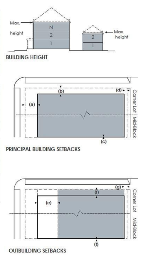
TABLE 6A - LT-5 BUILDING FORM
| BUILDING CONFIGURATION | |
| Number of Bldgs per Lot | limited by max. density |
| Height - Principal Building | 3.5 stories max. |
| Height - Outbuilding | 2 stories max. |
| Height - Structured Parking | 40 foot max. |
| Lot Coverage | 70% max. |
| Lot Frontage | 22 ft. - 78 ft. |
| Second Lot Layer | 20 feet |
| SETBACKS - PRINCIPAL BUILDING | |
| (a) Front Setback Principal | 4 ft. min. 14 ft. max. |
| (b) Front Setback Secondary | 2 ft. min. 14 ft. max. |
| (c) Side Setback | 0 ft. min. |
| (d) Rear Setback | 5 ft. min. |
| Frontage Buildout | 60% min at setback |
| SETBACKS - OUTBUILDING | |
| (e) Front Setback | 20 ft. min. in addition to the principal building setbacks |
| (f) Side Setbacks | 0 ft. min. or 3 ft. min. at corner lots |
| (g) Rear Setbacks | 5 ft. min. |
"N" stands for any Stories above those shown up to the maximum. Refer to metrics for exact minimums and maximums.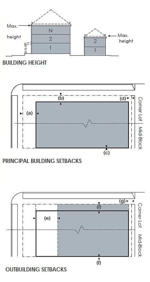
TABLE 6A - LT-6 BUILDING FORM
| BUILDING CONFIGURATION | |
| Number of Bldgs per Lot | limited by max. density |
| Height - Principal Building | 2 stories min., 4 stories max. |
| Height - Outbuilding | 2 stories max. |
| Height - Structured Parking | 40 foot max. |
| Lot Coverage | 70% max. |
| Lot Frontage | 16 ft. - 100 ft. |
| Second Lot Layer | 20 feet |
| SETBACKS - PRINCIPAL BUILDING | |
| (a) Front Setback Principal | 0 ft. min. 12 ft. max. |
| (b) Front Setback Secondary | 0 ft. min. 12 ft. max. |
| (c) Side Setback | 0 ft. min. 12 ft. max. |
| (d) Rear Setback | 3 foot min. |
| Frontage Buildout | 70% min. at setback |
| SETBACKS - OUTBUILDING | |
| (e) Front Setback | 40 ft. max. from rear lot line |
| (f) Side Setback | 0 ft. min. or 2 ft. min. at corner lot |
| (g) Rear Setback | 3 foot min. |
"N" stands for any Stories above those shown up to the maximum. Refer to metrics for exact minimums and maximums.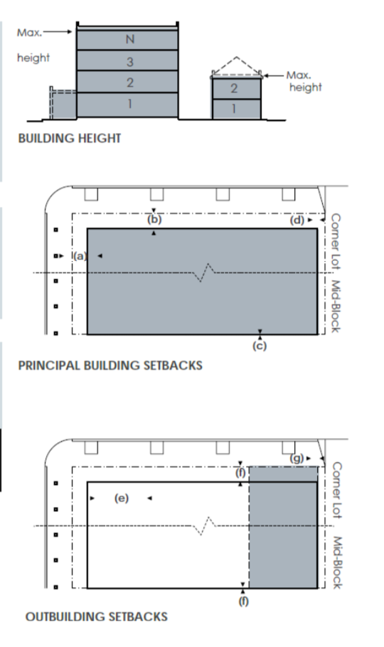
TABLE 6A - LT-7 BUILDING FORM
| BUILDING CONFIGURATION | |
| Number of Bldgs per lot | limited by max. density |
| Height - Principal Building | 2 stories min., 5 stories max. |
| Height - Outbuilding | 3 stories max. |
| Height - Structured Parking | 60 foot max. |
| Lot Coverage | 80% max. |
| Lot Frontage | 16 ft. - 200 ft. |
| Second Lot Layer | 20 feet |
| SETBACKS - PRINCIPAL BUILDING | |
| (a) Front Setback Principal | 0 ft. min. 8 ft. max. |
| (b) Front Setbacks Secondary | 0 ft. min. 8 ft. max. |
| (c) Side Setback | 0 ft. min. 8 ft. max. |
| (d) Rear Setback | 3 foot min. |
| Frontage Buildout | 70% min. at setback |
| SETBACKS - OUTBUILDING | |
| (e) Front Setback | 40 ft. max. from rear lot line |
| (f) Side Setback | 0 ft. min. or 2 ft. min. at corner lots |
| (g) Rear Setback | 5 foot min. |
"N" stands for any Stories above those shown up to the maximum. Refer to metrics for exact minimums and maximums.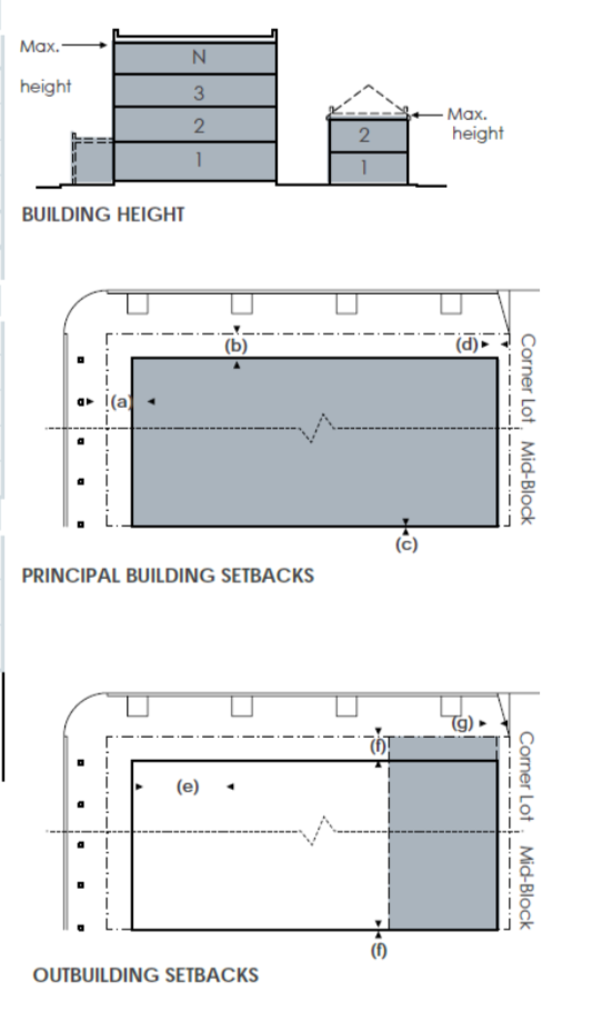
TABLE 6A - LT-8 BUILDING FORM
| BUILDING CONFIGURATION | |
| Number of Bldgs per lot | limited by max. density |
| Height - Principal Building | 3 stories min., 7 stories max. |
| Height - Outbuilding | n/a |
| Height - Structured Parking | 60 ft. max. |
| Lot Coverage | 100% max. |
| Lot Frontage | 16 ft. - 240 ft. |
| Second Lot Layer | 20 feet |
| BUILDING SETBACKS | |
| (a) Front Setback Principal | 0 ft. min. 8 ft. max. |
| (b) Front Setback Secondary | 0 ft. min. 8 ft. max. |
| (c) Side Setback | 0 ft. min. 24 ft. max. |
| (d) Rear Setback | 5 foot min. |
| Frontage Buildout | 80% min. at setback |
"N" stands for any Stories above those shown up to the maximum. Refer to metrics for exact minimums and maximums.
TABLE 6A - LT-9 BUILDING FORM
| BUILDING CONFIGURATION | |
| Number of Bldgs per lot | limited by max. density |
| Height - Principal Building | 4 stories min., 10 stories max. |
| Height - Outbuilding | n/a |
| Height - Structured Parking | 60 ft. max. |
| Lot Coverage | 100% max. |
| Lot Frontage | 16 ft. - 260 ft. |
| Second Lot Layer | 20 feet |
| BUILDING SETBACKS | |
| (a) Front Setback Principal | 0 ft. min. 8 ft. max. |
| (b) Front Setback Secondary | 0 ft. min. 8 ft. max. |
| (c) Side Setback | 0 ft. min. 8 ft. max. |
| (d) Rear Setback | 5 foot min. |
| Frontage Buildout | 80% min. at setback |
"N" stands for any Stories above those shown up to the maximum. Refer to metrics for exact minimums and maximums.
TABLE 6B - PRIVATE FRONTAGES
| SECTION | PLAN | FIRST LOT LAYER REGULATIONS | |
| COMMON YARD | |||
 |  | Lot Type Permitted Elements Permitted Encroachments Surface Treatment Special Requirements | LT-1, LT-2, LT-3 |
| Fences, hedges and masonry walls, 4 ft. max. in height, outdoor furnishing within the porch. | |||
| Porch 6 ft to 16 ft in depth | |||
| Ground cover, turf grass, trees (all shapes) | |||
| Fences, hedges and walls must be parallel with the facade of principal building (i.e. not along the front lot line) | |||
| PORCH AND FENCE | |||
 |  | Lot Type Permitted Elements Permitted Encroachments Surface Treatment Special Requirements | LT-1, LT-2, LT-3, LT-4 |
| Hedges and masonry walls, 8 ft. max. in height, out-door furnishing within the porch. | |||
| Porch 6 ft. minimum in depth maximum depth up to 100 % of setbacks in T4 and 16 ft maximum in T3 | |||
| Ground cover, turf grass, trees (all shapes), flower garden, vegetable garden, small shrub | |||
| Hedges and masonry walls may be along frontage lines or parallel with the facade of the principal building | |||
| LIGHTWELL | |||
 |  | Lot Type Permitted Elements Permitted Encroachments Surface Treatment Special Requirements | LT-5, LT-6, LT-7 |
| Stoops providing access to above grade units, stairs providing access to below grade units or storage, outdoor furnishing and business-related signs | |||
| Lightwells should encroach 100% of setback, no less than 6 ft, for a minimum of 50% of the frontage width. | |||
| Paving: concrete, brick, or natural stone | |||
| Ramps for wheelchair access and stairs providing access to below grade units or storage may be located within first layer | |||
| TERRACE | |||
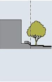 | 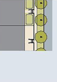 | Lot Type Permitted Elements Permitted Encroachments Surface Treatment Special Requirements | LT-5, LT-6, LT-7, LT-8, LT-9 |
| Outdoor furnishings and business-related signs. | |||
| Terraces should encroach 100% of setback, no less than 6 ft. for a minimum of 80% of the frontage width. | |||
| Paving: concrete, brick, or natural stone, ground cover, small shrubs, flower garden, vegetable garden. | |||
| Ramps for wheelchair access and stairs providing access to the terrace may be located within first layer. Terraces must be raised a minimum of 18" from average sidewalk grade. | |||
| STOOP | |||
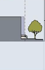 | 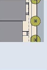 | Lot Type | LT-4, LT-5, LT-6, LT-7, LT-8, LT-9 |
| Hedges and metal fences along the frontage line, 4 feet max. height. | |||
| Stoops up to 100% of setback depth. | |||
| Paved in coordination with the public frontage, may be landscaped if the front setback exceeds 6 feet. | |||
| Stoops may be recessed into the building facade where a front setback is less and 6 feet | |||
| SHOPFRONT | |||
 |  | Lot Type Permitted Elements Permitted Encroachments Surface Special Requirements | LT-5, LT-6, LT-7, LT-8, LT-9 |
| Awnings, display windows, tables and other elements related to the business. | |||
| Awnings may encroach 100% of the private frontage and into the public frontage to within two feet of the curb and must project horizontally from the facade a minimum of 10 feet. Display windows may encroach up to 2 feet. | |||
| Paved in coordination with the public frontage. | |||
| Shopfronts are restricted to non residential functions. Shopfronts must be glazed with clear glass for no less than 70% of the ground floor facade at frontages. Awnings may be fixed or movable and must span a minimum of 80% of the shopfront width of each individual tenant. | |||
| GALLERY | |||
 |  | Lot Type Permitted Element Permitted Encroachments Surface Special Requirements | LT-7, LT-8, LT-9 |
| Elements permitted for shopfronts. | |||
| Galleries should encroach into the public frontage to within two feet of the curb. Display windows may encroach up to 1 foot | |||
| Paved in coordination with the public frontage. | |||
| May be combined with a shopfront. Galleries must provide a minimum vertical clearance of 10 feet and project horizontally from the facade a minimum of 10 feet. | |||
| FORECOURT | |||
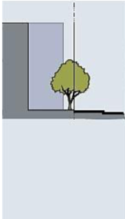 | 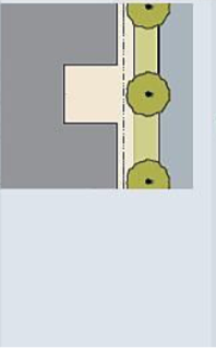 | Lot Type Permitted Elements Permitted Encroachments Surface Treatment Special Requirements | LT-6, LT-7, LT-8, LT-9 |
| Hedges, masonry walls, and metal fences, 8 feet max.in height, outdoor furnishing and business-related signs. | |||
| May recess from the frontage line a maximum of 15 ft. with a maximum width of 30ft. Width of the forecourt counts towards frontage buildout. | |||
| Paved in coordination with the public frontage or with pervious materials. Trees, small shrubs, flower garden. | |||
| May be combined with terrace, lightwell, stoop, shopfront, or gallery. Hedges, walls and fences must be located along the frontage line. Forecourts must provide access to the primary principal building entrance. | |||
| COMMON ENTRY | |||
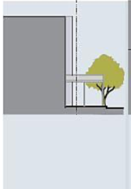 | 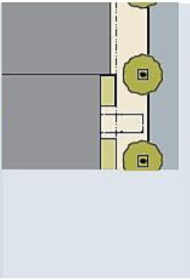 | Lot Type Permitted Elements Permitted Encroachments Surface Treatment Special Requirements | LT-7, LT-8, LT-9 |
| Canopies providing cover at the building entrance. Canopies may encroach 100% of the private frontage and into the public frontage to within two feet of the curb and must project horizontally from the facade a minimum of 10 feet. | |||
| Paved in coordination with the public frontage. | |||
| Canopies should be fixed and should be no wider than 12 ft. | |||
| VEHICULAR FORECOURT | |||
 |  | Lot Type Special | LT-6, lT-7, LT-8, LT-9 |
| Hedges, masonry walls, and metal fences, 8 feet max. in height, outdoor furnishing and business-related signs. | |||
| May recess from the frontage line a maximum of 40 ft. with a maximum width of 40 ft. Width of the forecourt counts towards frontage buildout. | |||
| Elements permitted for forecourts. | |||
| May be combined with terrace, lightwell, stoop, shopfront, or gallery. Hedges, walls and fences must be located along the frontage line. Forecourts must provide access to the main building entrance. Driveways are limited to 20 ft. in width. Portions of the driveway in the public frontage shall be limited to 12 ft. in width, paved in coordination with the public frontage. | |||
TABLE 6C - GARAGE TYPES
| GARAGE TYPES | REQUIREMENTS | EXAMPLE |
| Forward |
|  |
| Flush |
|  |
| Recessed: Shallow |
|  |
| Recessed: Mid |
|  |
| Recessed: Deep |
|  |
| Swing-In |
|  |
| Split |
|  |
| Tandem |
|  |
| Detached Rear Yard |
|  |
| Alley |
|  |
| Side-Entry |
|  |
TABLE 6D - PRIVATE FRONTAGES (AUTO)
| LOT TYPE | FRONTAGE TYPE: AUTOMOBILE | ||||||||||
| Forward | Flush | Recessed: Shallow | Recessed: Mid | Recessed: Deep | Swing-In | Split | Tandem | Detached Rear Yard | Rear Lane/Alley | Side-Entry | |
 |  |  |  |  |  |  |  |  |  |  | |
| LT-1 | X | X | X | X | X | X | X | X | X | X | |
| LT-2 | X | X | X | X | X | X | X | X | X | X | |
| LT-3 | X | X | X | X | X | X | X | X | X | ||
| LT-4 | X | X | X | X | X | X | |||||
| LT-5 | X | X | X | X | X | X | |||||
| LT-6 | X | X | X | ||||||||
| LT-7 | X | X | |||||||||
| LT-8 | X | X | |||||||||
| LT-9 | X | X | |||||||||
TABLE 6E - BUILDING USE
| LOT TYPE | LT-1 | LT-2 | LT-3 | LT-4 | LT-5 | LT-6 | LT-7 | LT-8 | LT-9 |
| A. Residential | |||||||||
| Mixed-Use | X | X | X | X | X | ||||
| Multi-Family | X | X | X | X | X | X | |||
| Single Family: Attached | X | X | X | X | X | ||||
| Single Family: Detached | X | X | X | ||||||
| Senior Housing | X | X | X | X | X | X | |||
| Accessory Dwelling Unit | X | X | X | X | X | X | |||
| Work/Live Unit | X | X | X | X | |||||
| Dormitory | X | X | X | X | X | X | |||
| B. Lodging | |||||||||
| Hotel (no room limit) | X | X | X | X | |||||
| Inn (up to 12 rooms) | X | X | X | ||||||
| Bed & Breakfast (up to 5 rooms) | X | X | |||||||
| C. Office | |||||||||
| Office Building | X | X | X | X | X | ||||
| Home Occupation | X | X | X | X | X | X | |||
| D. Retail | |||||||||
| Open Market | X | X | X | X | X | X | |||
| Retail | X | X | X | X | |||||
| Display Gallery | X | X | X | X | X | X | |||
| Restaurant | X | X | X | X | X | X | |||
| Food Truck | X | X | X | X | X | X | |||
| Drive-through | X | X | X | X | X | X | |||
| Kiosk | X | X | X | X | |||||
| Push Cart | X | X | X | X | |||||
| E. Automotive | |||||||||
| Gas Station | X | X | X | X | |||||
| Automobile Service | X | X | X | X | |||||
| Drive-through | X | X | X | X | X | X | |||
| F. Civil Support | |||||||||
| Assembly | X | X | X | X | X | X | X | X | X |
| Cemetery | X | X | X | ||||||
| Funeral Home | X | X | X | X | X | X | |||
| Hospital | X | X | X | X | |||||
| Medical Clinic | X | X | X | X | |||||
| Library | X | X | X | X | X | X | |||
| Museum | X | X | X | X | X | X | |||
| Post Office | X | X | X | X | |||||
| Public Safety | X | X | X | X | X | X | |||
| Laboratory | X | X | X | X | |||||
| Transit Station | X | X | X | X | X | X | X | X | X |
| G. Education | |||||||||
| College | X | X | X | X | X | X | |||
| Trade School | X | X | X | X | |||||
| High School | X | X | X | ||||||
| Junior High School | X | X | X | ||||||
| Elementary School | X | X | X | ||||||
| Childcare Center | X | X | X | X | |||||
| Charter School | X | X | X | X | |||||
| H. Infrastructure | |||||||||
| Parking Lot | X | X | X | X | X | X | X | ||
| Parking Structure | X | X | X | X | X | ||||
| Utility & Infrastructure | X | X | X | X | X | X | X | X | X |
| Open Space | X | X | X | X | X | X | X | X | X |
TABLE 6F - PARKING REQUIREMENTS
| MINIMUM REQUIRED OFF-STREET PARKING | |||||||||
| LT-1 | LT-2 | LT-3 | LT-4 | LT-5 | LT-6 | LT-7 | LT-8 | LT-9 | |
| RESIDENTIAL | 2.0/dwelling | 2.0/dwelling | 2.0/dwelling | 2.0/dwelling | 2.0/dwelling | 1.5/dwelling | 1.5/dwelling | 1.5/dwelling | 1.5/dwelling |
| ADU | 1.0 | 1.0 | 1.0 | 1.0 | 1.0 | 1.0 | 1.0 | 1.0 | 1.0 |
| LODGING | 1.0/bedroom | 1.0/bedroom | 1.0/bedroom | 1.0/bedroom | 1.0/bedroom | 1.0/bedroom | 1.0/bedroom | 1.0/bedroom | 1.0/bedroom |
| OFFICE | N/A | 4.0/1,000 sqft. | 4.0/1,000 sqft. | 3.0/1,000 sqft. | .3.0/1,000 sqft. | 2.0/1,000 sqft. | 2.0/1,500 sqft. | ||
| RETAIL | N/A | 4.0/1,000 sqft. | 4.0/1,000 sqft. | 3.0/1,000 sqft. | 3.0/1,000 sqft. | 2.0/1,000 sqft. | 2.0/1,500 sqft. | ||
| CIVIC | As per local code | ||||||||
| OTHER | As per local code | ||||||||
TABLE 6G - SIGNAGE STANDARDS
| SIGNAGE TYPE | SPECIFICATION | |
| ADDRESS SIGN | ||
 | Lot Types | LT-1, LT-2, LT-3, LT-4, LT-5, LT-6, LT-7, LT-8, LT-9 |
| Quantity | 1 per address | |
| Area | 2 sqft. max. | |
| Width | 24 inch max. | |
| Height | 12 inch max. | |
| Depth/Projection | 3 inch max. | |
| Clearance | 4.5 ft min. | |
| Apex | N/A | |
| Letter Height | 6 inch max. | |
| AWNING AND SIGN | ||
 | Lot Types | LT-6, LT-7, LT-8, LT-9 |
| Quantity | 1 per window | |
| Area | N/A | |
| Width | Width of awning | |
| Height | N/A | |
| Depth/Projection | 4 foot min. | |
| Clearance | 8 foot max. | |
| Apex | N/A | |
| Letter Height | 5 inch min./ 10 inch max. | |
| BAND SIGN | ||
 | Lot Types | LT-7, LT-8, LT-9 |
| Quantity | 1 per building facade | |
| Area | 1.5 sqft. per linear foot | |
| Width | 90% of width of facade max. | |
| Height | 3 foot max. | |
| Depth/ Projection | 7 inch max. | |
| Clearance | 7 foot max. | |
| Apex | N/A | |
| Letter Height | 18 inch max. | |
| BANNER | ||
 | Note: | Banner signs may be installed on City owned lighting fixtures with a time-limited permit. Size restrictions are determined by the City according to the light fixture. |
| BLADE (SHINGLE) SIGN | ||
 | Lot Types | LT-4, LT-5, LT-6, LT-7, LT-8, LT-9 |
| Quantity | 1 per business | |
| Area | 4 sqft. | |
| Width | 4 foot max. | |
| Height | 4 foot max. | |
| Depth/Projection | 4 foot max. | |
| Clearance | 8 foot min. | |
| Apex | N/A | |
| Letter Height | 8 inch max. | |
| BUILDING BANNER | ||
 | Lot Types | LT-7, LT-8, LT-9 |
| Quantity | 2 per building facade | |
| Area | 48 sqft. max. | |
| Width | 2 foot max. | |
| Height | 24 foot max. | |
| Depth/Projection | 3 foot max. | |
| Clearance | 12 foot min. | |
| Apex | N/A | |
| Letter Height | N/A | |
| BUILDING SIGN | ||
 | Lot Types | LT-7, LT-8, LT-9 |
| Quantity | 1 per building | |
| Area | 1.5 sqft. per liner foot | |
| Width | 80% building width max. | |
| Height | 3 foot max. | |
| Depth/Projection | 6 inch max. | |
| Clearance | 12 foot min. | |
| Apex | N/A | |
| Letter Height | 24 inch max. | |
| Corner Sign | ||
 | Lot Types | LT-7, LT-8, LT-9 |
| Quantity | 1 per building at corner lots | |
| Area | 72 foot max. | |
| Width | 3 foot max. | |
| Height | 24 foot max. | |
| Depth/Projection | 4 foot max. | |
| Clearance | 12 foot max. | |
| Apex | N/A | |
| Letter Height | N/A | |
| Hanging Sign | ||
 | Lot Types | LT-7, LT-8, LT-9 |
| Quantity | 1 per vehicular entrance | |
| Area | N/A | |
| Width | 90% entrance width max. | |
| Height | 2 foot max. | |
| Depth/Projection | 0 foot max. projection | |
| Clearance | 8 foot min. | |
| Apex | N/A | |
| Letter Height | 18 inch max. | |
| KIOSK | ||
 | Lot Types | LT-5, LT-6, LT-7, LT-8, LT-9 |
| Quantity | 1 per block face | |
| Area | 24 sqft. max. | |
| Width | 4 foot max. | |
| Height | 8 foot max. | |
| Depth/Projection | 2 foot max depth | |
| Clearance | N/A | |
| Apex | 8 foot max. | |
| Letter Height | 12 inch max with sign, 18 inch max. to identify sign | |
| MARQEE AND SIGN | ||
 | Lot Types | LT-7, LT-8, LT-9 |
| Quantity | 1 per building | |
| Area | N/A | |
| Width | Width of entrance plus 4 feet o. c. | |
| Height | 50% story height max. | |
| Depth/Projection | 4 foot min. / 10 foot max. | |
| Clearance | N/A | |
| Apex | N/A | |
| Letter Height | 3 foot min. | |
| MONUMENT SIGN | ||
 | Lot Types | LT-1, LT-2, LT-3, LT-4, LT-5 |
| Quantity | 1 per vehicular entrance | |
| Area | Sign - 36 sqft. max. | |
| Width | Sign - 6 foot max. | |
| Height | Sign - 6 foot max. | |
| Depth/Projection | N/A | |
| Clearance | N/A | |
| Apex | Sign - 8 foot max. | |
| Letter Height | N/A | |
| NAME PLATE SIGN | ||
 | Lot Type | LT-4, LT-5. LT-6, LT-7, LT-8, LT-9 |
| Quantity | 3 sqft. max. | |
| Area | 18 inch max. | |
| Width | 2 foot max. | |
| Height | 3 inch max. | |
| Depth/Projection | 3 inch max. | |
| Clearance | 4 foot max. | |
| Apex | 7 foot max. | |
| Letter Height | N/A | |
| OUTDOOR DISPLAY/CASE | ||
 | Lot Type | LT-6, LT-7, LT-8, L-9 |
| Quantity | 1 per business | |
| Area | 6 sqft. max. | |
| Width | 3.5 foot max. | |
| Height | 3.5 foot max. | |
| Depth/Projection | 5 inch max. | |
| Clearance | 4 foot max. | |
| Apex | N/A | |
| Letter Height | N/A | |
| SIDEWALK SIGN | ||
 | Lot Type | LT-6, LT-7, LT-8, LT-9 |
| Quantity | 1 per business | |
| Area | 8 sqft. max. | |
| Width | 26 inch max. | |
| Height | 42 inch max. | |
| Depth/Projection | N/A | |
| Clearance | N/A | |
| Apex | 42 inch max. | |
| Letter Height | N/A | |
| WAYFINDING | ||
 | Notes: | Wayfinding signs are permitted on private property and on private non residential properties consisting of multiple buildings. Where on private lots wayfinding signs should be sized for pedestrian scale and legibility. Consult with the Planning Department. |
| WINDOW SIGN | ||
 | Lot Types | LT-6, LT-7, LT-8, LT-9 |
| Quantity | 1 per window | |
| Area | 25% of glass max. | |
| Width | Varies | |
| Height | Varies | |
| Depth/Projection | N/A | |
| Clearance | 4 feet | |
| Apex | N/A | |
| Letter Height | 8 inch max. | |
| YARD SIGN | ||
 | Lot Types | LT-1, LT-2, LT-3, LT-4, LT-5 |
| Quantity | 1 per lot max. | |
| Area | 6 sqft. max. | |
| Width | 3 foot max. (not counting post) | |
| Height | 2 foot max. (not counting post) | |
| Depth/Projection | N/A | |
| Clearance | 3 foot to sign edge min. | |
| Apex | 6 foot to top of post max. | |
| Letter Height | 8 inch max | |
Amended by Ord. 2018-11-52 on 11/27/2018
Amended by Ord. 2021-02-13 on 2/23/2021
Amended by Ord. 2023-03-12 on 3/14/2023
Amended by Ord. 2024-04-18 on 4/30/2024
Sec 7 Public Space Standards
- Instructions
- This Section establishes design standards for public spaces and thoroughfares for land regulated by this Code.
- The design standards set forth in this Section may be used as criteria for the planning approval process and are sanctioned through their respective city departments including Planning, Public Works and Parks & Recreation.
- Provisions of this Code, when in conflict, take precedence over those of other codes, ordinances, regulations and standards for Planning, Public Works and Parks & Recreation, except the Local Health and Safety Codes and Local, State, and National Building Codes.
- Additional licenses, agreements, and permits may be required as maintained and administered in the office of the respective City department.
- While lot types do not apply to civic districts or thoroughfares, lot types are specified in the Tables and provisions of this Article, requiring that the design of civic districts and thoroughfares must be considered in relation to the sub-districts of adjacent private lots.
- The average lot type along all edges of a civic district determines the lot type that applies.
- Where the lot type of private lots on both sides of a thoroughfare are the same, the design of the thoroughfare should be adjusted to match the lot type of adjacent lots.
- Where civic districts meet a thoroughfare, the design of the thoroughfare should be adjusted to match the lot type that applies to the civic district.
- Preliminary design drawings and final construction drawings for civic spaces, civic buildings, thoroughfares, and utilities require approval from the Zoning Clearance Officer or designated representative, in consultation with city staff.
- Thoroughfare and utility plans submitted for approval must demonstrate compliance with:
- Thoroughfare standards (subsection B)
- Easement standards (subsection C)
- Civic district plans submitted for approval must demonstrate compliance with:
- Civic district standards (subsection D)
- Thoroughfare Standards
- The primary function of thoroughfares is to provide access to lots and open spaces. In accordance with the intent of this Code, thoroughfares must be designed to support several modes of transportation: motor vehicles, non-motor vehicles such as bicycles, public transportation, and pedestrians.
- All thoroughfares must terminate at other thoroughfares in intersections, forming a network.
- Close-ended streets (cul-de-sacs) may be permitted within BT-1 and BT-2, and within BT-3 and BT-4 located at the edge of a district or adjacent to natural or man- made boundaries that limit vehicular connectivity.
- Close-ended streets should provide a pedestrian path from the end of the close- ended street (when permissible), completing the pedestrian network.
- Use of close-ended streets shall not conflict with Table 4A - Operational Overlay.
- All thoroughfares must be configured in accordance with the American Fork City Public Improvement Specifications, Standards, and Drawings section of the American Fork Standards Drawings and Specifications.
- Thoroughfare assemblies consist of a transportation way and public frontage assemblies, and are regulated by the following:
- Thoroughfare assemblies must be configured by lot type and thoroughfare assembly type according to the American Fork City Public Improvement Specifications, Standards, and Drawings and must be mapped on a thoroughfare network plan.
- Parking lanes are not required along thoroughfares adjacent to LT-1, LT-2, and regional open space.
- Thoroughfare assemblies must include public frontages configured according to subsection B,7. Existing thoroughfares, with a right-of-way exceeding the width of the thoroughfare assembly should assign excess right-of-way to the public frontage.
- The transportation way may include vehicular lanes, parking lanes, medians, slip lanes, and transportation provisions.
- Elements of the transportation way must be configured and sized according to the American Fork City Public Improvement Specifications, Standards, and Drawings.
- Medians may include civic districts and should be designed to generally match the public planting of adjacent public frontages.
- Parking lanes must be in accordance with the standard details contained in the American Fork City Public Improvement Specifications, Standards, and Drawings.
- Existing thoroughfares may be painted temporarily to comply with new configurations required by the thoroughfare network plan, including the addition of any transportation provisions.
- Alley easements include one vehicular lane, as shown in the American Fork City Public Improvement Specifications, Standards, and Drawings. The entire right-of- way should be paved. Alley assemblies do not include transportation ways or public frontages. Alleys may be located in LT-6, LT-7, LT-8, LT-9 zones.
- Rear lane easements include one vehicular lane, as shown in the American Fork City Public Improvement Specifications, Standards, and Drawings. Only the vehicular lane and driveways should be paved. Rear lanes do not include transportation ways or public frontages. Rear lanes may be located in LT-4, LT-5, LT- 6, LT-7, LT-8 and LT-9 zones.
- Thoroughfare assemblies must be configured by lot type and thoroughfare assembly type according to the American Fork City Public Improvement Specifications, Standards, and Drawings and must be mapped on a thoroughfare network plan.
- All intersections must be configured as intersection assemblies and must be designed in accordance with subsection B,6.
- Intersection assemblies consist of public frontage assemblies, transportation ways and civic districts. Elements of the intersection assembly must be configured according to the character of the lot type of adjacent lots and the character of intersecting thoroughfares. Intersection assemblies are regulated as follows:
- Intersection assemblies are configured by lot type and intersection assembly type according to the American Fork City Public Improvement Specifications, Standards, and Drawings.
- Intersection assemblies must include public frontages configured according to subsection B,7.
- Public frontages at intersections should provide transition for variations in width of planters and walkways between intersecting thoroughfares.
- Public frontages at intersections must include curb cuts and other features to facilitate the transition to pedestrian crossings.
- Curb return radii at intersections is calculated as the effective turning radius.
- Curb return radii must be configured and sized by thoroughfare network type according to the American Fork City Public Improvement Specifications, Standards, and Drawings.
- Bulb-outs accommodate pedestrian crossing at thoroughfares and in conjunction with angled parking lanes are subject to approval by the City Engineer.
- Transportation ways may include vehicular lanes configured and sized according to intersecting thoroughfares. Turn lanes may be provided within the parking lane and median of intersecting thoroughfares.
- Intersection assemblies should include pedestrian crossings configured according to the American Fork City Public Improvement Specifications, Standards, and Drawings.
- Intersection assemblies may include civic districts.
- Public frontage assemblies consist of planters, walkways, curbs, verges, public planting and public lighting. Elements of the public frontage assembly that pass from one lot type to another must be adjusted to the character of the lot type of adjacent lots. Public frontage assemblies are regulated as follows:
- Public frontage assemblies must be assigned according to the American Fork City Public Improvement Specifications, Standards, and Drawings.
- Public frontage assemblies must be configured according to the American Fork City Public Improvement Specifications, Standards, and Drawings. Assemblies including a walkway or planter should specify a minimum width.
- Public frontage types A and B are available along thoroughfares adjacent to LT-1, LT-2, and regional open space.
- Public frontage assemblies must assign a verge, providing allowable locations for public infrastructure and public furniture outside of pedestrian and vehicular access ways.
- Public frontage assemblies may include public planting and public lighting, configured according to the American Fork City Public Improvement Specifications, Standards, and Drawings. Spacing may be adjusted to accommodate specific site conditions.
- Public frontages in LT-7, LT-8 and LT-9 within thoroughfare assemblies 52 feet wide and commercial streets 66 feet wide or less may exclude public planting.
- At retail frontages, the spacing of trees may be irregular to avoid visually obscuring shopfronts.
- At gallery frontages public planting is not required and public lighting may be provided within the gallery.
- Easement Standards
- Utility easements should be located as generally illustrated in the American Fork City Public Improvement Specifications, Standards, and Drawings.
- Electric transformers should not be located in public frontages, the principal frontage of private lots, or at terminated vistas.
- Wet utilities must be located within the transportation way of thoroughfares. Access requirements for wet utilities must not encroach into the public frontage.
- Fire hydrants must be spaced a maximum of 500 feet along thoroughfares.
- Fire hydrants should be located adjacent to alley or rear lane entrances.
- Dry utilities should be located within alleys or rear lanes where available.
- Electric transformers and utility meters should be located as generally illustrated in the American Fork City Public Improvement Specifications, Standards, and Drawings.
- Where alleys or rear lanes are offset across a thoroughfare, easements should be jogged along secondary frontages or under the sidewalk or transportation way as indicated the American Fork City Public Improvement Specifications, Standards, and Drawings.
- Where alleys or rear lanes are not available, dry utilities may be located in the transportation way or in the public frontage under sidewalks.
- Access requirements for dry utilities must not encroach into the planter.
- Electric transformers should be located in an easement within the secondary frontage of a lot.
- Wet utilities and dry utilities traversing an open parking lot should be located within one parking aisle.
- Wet utilities and dry utilities traversing a civic district should be located within an area no wider than 24 feet and have a linear trajectory parallel with one edge of the civic district boundary.
- Alley and rear lane easement configurations are specified in subsection B. Pre-approved alley and rear lane assemblies are included in this Section.
- Pedestrian access easements in the form of pedestrian trails, paths, and passages must be configured as follows:
- A minimum 6-foot walkway must be provided.
- Pedestrian access ways providing bicycle access must include a bicycle trail according to the American Fork City Public Improvement Specifications, Standards, and Drawings.
- Public planting and public lighting must be configured according to public frontage standards in subsection E.
- Pre-approved pedestrian access easements are included in this Section.
- Civic District Standards
- Civic districts identified as civic space must be generally designed as described in Table 7C - Civic Open Space Types.
- Civic buildings are not subject to the requirements of building plan standards, the particulars of their design are determined in consultation with the city staff.
- Parking requirements for civic districts are determined by the city staff.
- Planting and landscaping in civic districts, are regulated by subsection E.
- Lighting in civic districts, must meet the type, height, and spacing requirements in Table 7H - Public Lighting.
- Landscape Standards
- Trees in public frontages must be a minimum height of ten (10) feet or one and one half (1.5) inches in caliper when planted.
- Trees in public frontages must provide, at maturity, a minimum vertical clearance of 8 feet at walkways, 13.5 feet at driveways and transportation ways, and 15 feet for loading areas.
- Parking lots must be landscaped as follows:
- One tree must be planted for every 25 spaces.
- Landscaped areas should be placed lower than paving, not mounded up.
- Parking lots consisting of less than 25 spaces are exempt from landscaping requirements.
- Landscaping shall be fully installed prior to the issuance of a certificate of occupancy.
- If seasonal conditions preclude the complete installation, a bond or warranty, in accordance with Section 17.9.200 of the American Fork City Code, must be provided.
- Complete installation is required within nine months of the issuance of the temporary certificate of occupancy permit or the cash escrow or letter of credit may be forfeited.
Table 7A - THOROUGHFARE ASSEMBLY TYPES
| THOROUGHFARE TYPE | ST | Neighborhood Edge | DESCRIPTION | ||||||||
| General Mixed-Use | |||||||||||
| Office Core | |||||||||||
| Mixed-Use | |||||||||||
| BT | BT-1 | ||||||||||
| BT-2 | |||||||||||
| BT-3 | |||||||||||
| BT-4 | |||||||||||
| BT-5 | |||||||||||
| BT-6 | |||||||||||
| LT | LT-1 | LT-2 | LT-3 | LT-4 | LT-5 | LT-6 | LT-7 | LT-8 | LT-9 | ||
| ROAD (RD) | X | X | X | A local, slow-movement thoroughfare suitable for low density environments. Roads tend to be rural in character, at times without curbs or striping. | |||||||
| STREET (ST) | X | X | X | X | A local, slow-movement thoroughfare suitable for general urban areas. Streets are urban in character, and flexible in the types of public frontage they support. | ||||||
| DRIVE (DR) | X | X | X | X | X | A thoroughfare along the boundary between an urbanized and a natural condition, usually along a waterfront, a park, or a promontory. One side of a drive has the urban character of a street or boulevard, while the other has the qualities of a road or parkway. | |||||
| AVENUE (AV) | X | X | X | X | X | A limited distance, free-movement thoroughfare connecting civic locations within an urbanized area. Unlike a boulevard, its length is finite and its axis is terminated. An avenue may be conceived as an elongated square. | |||||
| COMMERCIAL STREET (CS) | X | X | X | A local, slow moving thoroughfare suitable for high-intensity urban areas. commercial streets are urban in character, supporting parallel or angled parking on both sides and narrow lanes appropriate for a commercial environment. | |||||||
| BOULEVARD (BV) | X | X | X | X | X | A long-distance, free movement thoroughfare traversing an urbanized area. A boulevard often includes a wide median and a wide public frontage and therefore a wide right-of-way. Slip lanes are often provided to separate public frontages from the higher speed lanes. | |||||
| REAR LANE | X | X | X | X | X | A vehicular access way located to the rear of a lot providing access to parking and outbuildings as well as easements for utilities. Rear lanes are paved as lightly as possible to driveway standards with drainage by inverter crown at the center | |||||
| ALLEY | X | X | X | A narrow service access to the rear of more urban building providing service and parking areas and utility easements. Alleys, as they are used by trucks and must accommodate dumpsters, should be paved from building face to building face, with drainage by inverted crown at the center. | |||||||
TABLE 7B - THOROUGHFARE ASSEMBLY - SPECIFIC
| Context | Movement | Vehicular Lanes | Parking Lanes | Median | Striping | |||
| Total # | Width | Total # | Width | |||||
| RD | LT-1 | two-way | 2-4 | 12 ft. | 0 | n/a | No | Optional |
| LT-2 | two-way | 2 | 12 ft. | 0 | n/a | No | Optional | |
| LT-3 | two-way | 2 | 11 ft. | 1-2 | 8 ft. | No | Required | |
| ST | LT-4 | one-way or two way | 2 | 11 ft. 1-way 10 ft. 2-way | 0-2 | 8 ft. | No | Optional |
| LT-5 | one-way or two way | 2 | 11 ft. 1-way 10 ft. 2-way | 1-2 | 8 ft. | No | Required | |
| LT-6 | one-way or two way | 2-4 | 11 ft. 1-way 10 ft. 2-way | 2 | 8 ft., 18 ft. parallel | No | Required | |
| LT-7 | one-way or two way | 2-4 | 11 ft. 1-way 10 ft. 2-way | 2 | 8 ft., 18 ft. parallel | No | Required | |
| DR | LT-5 | one-way or two way | 2-4 | 11 ft. 1-way 10 ft. 2-way | 0-1 | 8 ft. | No | Optional |
| LT-6 | one-way or two way | 1-2 | 11 ft. 1-way 10 ft. 2-way | 1-2 | 8 ft. | No | Required | |
| LT-7 | one-way or two way | 1-2 | 10 ft. | 2 | 8 ft., 18 ft. parallel | No | Required | |
| LT-8 | one-way or two way | 1-4 | 10 ft. | 2 | 8 ft., 18 ft. parallel | No | Required | |
| LT-9 | one-way or two way | 1-4 | 10 ft. | 2 | 8 ft., 18 ft. parallel | No | Required | |
| AV | LT-5 | two-way | 2 | 10 ft. | 0-2 | 8 ft. | Optional | Required |
| LT-6 | two-way | 2-4 | 10 ft. | 2 | 8 ft. | Optional | Required | |
| LT-7 | two-way | 2-4 | 10 ft. | 2 | 8 ft., 18 ft. parallel | Optional | Required | |
| LT-8 | two-way | 2-4 | 10 ft. | 2 | 8 ft., 18 ft. parallel | Optional | Required | |
| LT-9 | two-way | 2-4 | 10 ft. | 2 | 8 ft., 18 ft. parallel | Optional | Required | |
| CS | LT-7 | two-way | 2 | 11 ft. | 2 | 8 ft., 18 ft. parallel | Optional | Required |
| LT-8 | two-way | 2-4 | 11 ft. | 2 | 8 ft., 18 ft. parallel | No | Required | |
| LT-9 | two-way | 2-4 | 11 ft. | 2 | 8 ft., 18 ft. parallel | No | Required | |
| BV | LT-5 | two-way | 2 | 11 ft. | 2 | 8 ft. | Optional 30 ft. min. | Required |
| LT-6 | two-way | 2-4 optional slip lanes | 11 ft. | 2 | 8 ft. | Optional 30 ft. min. | Required | |
| LT-7 | two-way | 2-4 optional slip lanes | 11 ft. | 2 | 8 ft., 18 ft. parallel | Optional 12 ft. min. | Required | |
| LT-8 | two-way | 2-4 optional slip lanes | 11 ft. | 2 | 8 ft., 18 ft. parallel | Optional 12 ft. min. | Required | |
| LT-9 | two-way | 2-4 optional slip lanes | 11 ft. | 2 | 8 ft., 18 ft. parallel | Optional 12 ft. min. | Required | |
TABLE 7C - INTERSECTION ASSEMBLY TYPES
| INTERSECTION TYPE | ST | Neighborhood Edge | DESCRIPTION | ILLUSTRATION | ||||||||
| General Mixed-Use | ||||||||||||
| Office Core | ||||||||||||
| Mixed-Use | ||||||||||||
| BT | BT-1 | |||||||||||
| BT-2 | ||||||||||||
| BT-3 | ||||||||||||
| BT-4 | ||||||||||||
| BT-5 | ||||||||||||
| BT-6 | ||||||||||||
| LT | LT-1 | LT-2 | LT-3 | LT-4 | LT-5 | LT-6 | LT-7 | LT-8 | LT-9 | |||
| T-INTERSECTION (T) | X | X | X | X | X | X | X | X | X | A standard intersection between two thoroughfares where one is terminated, intersection cause |  | |
| Y-INTERSECTION (Y)* | X | X | X | X | X | X | X | X | X |  | ||
| 4-WAY INTERSECTION (4W) | X | X | X | X | X | X | X | X | X |  | ||
| STAGGERED INTERSECTION (SI) | X | X | X | X | X | X | X | X | X |  | ||
| TURBINE (TN) | X | X | X | X | X | X |  | |||||
| TRAFFIC CIRCLE (TC) | X | X | X |  | ||||||||
| SQUARE-ABOUT (SA) | X | X | X | X | X | X | X |  | ||||
| AROUND ABOUT (RA) | X | X | X | X | X |  | ||||||
| ELONGATED ROUND-ABOUT (EA) | X | X | X | X |  | |||||||
TABLE 7D - CIVIC OPEN SPACE TYPES
| CIVIC OPEN SPACE TYPE | PLAZA (PL) | ENTRANCE PARK (EP) |
| DIAGRAM |  |  |
| DESCRIPTION | Available for civic purposes and commercial activities. Spatially defined by building frontages. Design consists primarily of hardscape elements with optional trees. Typically located at intersections of important streets. Programmed with passive uses and serves as a point of respite. | Formal delineation of a residential community entrance through landscaping and monumentation. It provides passive uses and creates neighborhood identity. |
| SERVICE AREA | 1/4 to 1/2 mile radius | 1/4 - 1/2 mile radius |
| SIZE | Up to 2 acres | Up to 2 acres |
| FRONTAGE | Building | Building |
| TYPICAL FACILITIES | Recreation, accessory structures, water fountains, paths and trails | Recreation, accessory structures, water fountains, paths and trails |
| DISPOSITION AND USAGE | Formal, Passive | Formal, Passive |
| CIVIC OPEN SPACE TYPE | POCKET PARK (PP) | NEIGHBORHOOD PARK (NP) |
| DIAGRAM |  |  |
| DESCRIPTION | Small and frequent, generally with passive recreation that ensures walkable green space access for everyone. May contain specialized facilities that serve a concentrated or limited population or group such as tots, pets, or senior citizens. | The neighborhood park remains the basic unit of the park system and serves as the recreational and social focus of the neighborhood. The focus is on informal active and passive recreation. The park should be centrally located within the neighborhood. Frequently these parks are developed adjacent to civic uses such as an elementary school. |
| SERVICE AREA | 1/4 mile radius | 1/4 to 1/2 mile radius |
| SIZE | 2,500 sqft. to 1 acre | 3 - 10 acres |
| FRONTAGE | Building | Building |
| TYPICAL FACILITIES | Tot lots, formal and informal seating, gazebos, barbecue equipment, picnic benches, crochet lawns, water features, small play areas, gardens | Recreation, accessory structure, water fountains, paths and trails |
| DISPOSITION AND USAGE | Formal, Informal, Active or Passive | Formal, Active |
| CIVIC OPEN SPACE TYPE | COMMUNITY PARK (CP) | SCHOOL PARK (SP) |
| DIAGRAM |  |  |
| DESCRIPTION | The focus of this park classification is on meeting community based recreational needs, as well as preserving unique landscapes and open spaces. They allow group activities and offer other recreational opportunities not feasible at the neighborhood level. They should be developed for both active and passive recreation activities and serve two or more neighborhoods. Regardless of size, parks will be deemed Community Parks if they provide restroom facilities, parking lots, or other amenities that would serve patrons who travel to the park | School site that can be classified as fulfilling specific public space requirements for other classes of parks such as neighborhood, community, sports complex, and special use. Joint-use agreement required. |
| SERVICE AREA | 1/2 to 2 mile radius | 1/2 mile radius |
| SIZE | 10 to 20 acres | 5 to 8 acres |
| FRONTAGE | Building | Building |
| TYPICAL FACILITIES | Recreation, accessory structures, water fountains, paths and trails | Recreation, accessory structure, water fountains, paths and trails |
| DISPOSITION AND USAGE | Formal, Informal, Active, or Passive | Formal, Informal, Active, or Passive |
| CIVIC OPEN SPACE TYPE | SPECIAL USE (SU) | COMMUNITY GARDEN (CG) |
| DIAGRAM |  |  |
| DESCRIPTION | Covers a broad range of parks and recreation facilities oriented toward single purpose use. Special uses generally fall into three categories: Historic/Cultural/Social Sites (ex. historic downtown areas, performing arts parks, arboretums, ornamental gardens, indoor theaters, churches, public buildings and amphitheaters.) Recreation facilities (i.e. either specialized or single-purpose facilities) fall into this category, for example community centers, senior centers, hockey arenas, marinas, golf courses, an aquatic parks, Frequently community buildings and recreational facilities are located within neighborhood parks and community parks | Space programmed specifically for gardening. Located in the center of a neighborhood to provide convenient and safe access. Often included in pocket parks or neighborhood parks. They are valued assets in urban areas, where residential yards are rare. |
| SERVICE AREA | Varies | 1/4 to 1/2 mile radius |
| SIZE | Varies | 1.5 to 6 acres |
| FRONTAGE | Varies | Building |
| TYPICAL FACILITIES | Tot lots, formal and informal seating, gazebos, barbecue equipment, picnic benches, crochet lawns, water features, small play areas, and gardens | Recreation, accessory structure, water fountains, paths and trails |
| DISPOSITION AND USAGE | Formal, Informal, Active, or Passive | Informal, Passive |
| CIVIC OPEN SPACE TYPE | GREENWAY (GW) | WATERWAY/CHANNEL (WC) |
| DIAGRAM |  |  |
| DESCRIPTION | The space is located around or within a natural resource area (stream; wetlands) but is user based in function. Uses include nature viewing and study, modal sport recreation, and also function as connections within the larger park system allowing uninterrupted pedestrian movement. Corridor width 25-200 feet with 50 feet a standard minimum. | Linear space defined by a waterway. The space serves asa a pedestrian connection, recreational opportunity, and property value creation (waterfront property). It can serve as a secondary connection to a greenway or a parkway. |
| SERVICE AREA | Varies | Varies |
| SIZE | Varies | Varies |
| FRONTAGE | Varies | Varies |
| TYPICAL FACILITIES | Recreation, accessory structure, water fountains, paths and trails | Recreation, accessory structure, water fountains, paths and trails |
| DISPOSITION AND USAGE | Formal, Passive | Formal, Passive |
| CIVIC OPEN SPACE TYPE | PARKWAY/BOULEVARD (PB) | TREELAWN (TL) |
| DIAGRAM |  |  |
| DESCRIPTION | Urban streets that provide comfortable and safe pedestrian and cyclist connections. May include landscaped center median, large shade trees, on or off-street bikeways and seating. | Open space within a public right-of-way that allows for passive use, bus stops, shade trees and ornamental landscaping. (Only the portion of a tree lawn that exceeds the city standard of 6 feet in width may be applied towards open space. |
| SERVICE AREA | Varies | Varies |
| SIZE | Varies | Varies |
| FRONTAGE | Varies | Varies |
| TYPICAL FACILITIES | These include drinking fountains scenic view posts, fitness stations, and direction..... | |
| DISPOSITION AND USAGE | Formal, Informal, Active or Passive | Formal, Informal, Active or Passive |
| CIVIC OPEN SPACE TYPE | CONNECTOR TRAIL (CT) | PASEO (PS) |
| DIAGRAM |  |  |
| DESCRIPTION | A connector trail is a linear public open space type that accommodates two or more users on the same, undivided trail providing connections. Trail users could include pedestrians, bicyclists, skaters, etc. A connector trail frequently provides an important place for active recreation and creates a connection to regional paths and biking trails. Connector trails within greenways or neighborhood parks shall be naturally disposed with low impact paving materials so there is minimal impact to the existing natural environment and/or landscaping. | Linear pedestrian corridor that is defined by homes fronting the space. Often includes passive activities as well as tot lots, community gardens, and neighborhood games. |
| SERVICE AREA | Varies | Varies |
| SIZE | Varies | Varies |
| FRONTAGE | Varies | Varies |
| TYPICAL FACILITIES | These include drinking fountains, scenic view posts, fitness stations, and directional signs, and may be spread along the trail or grouped in a trailhead area. | Recreation, accessory structure, water fountains, paths and trails |
| DISPOSITION AND USAGE | Formal, Informal, Active, or Passive | Formal, Informal, Passive |
| CIVIC OPEN SPACE TYPE | LINEAR PARK (LP) | CLOSE (CL) |
| DIAGRAM |  |  |
| DESCRIPTION | As the name suggests, a linear park is substantially longer than it is wide, and is typically used to activate underutilized corridors such as disused railroad beds, canals, streams, extended defensive walls, highways, or power lines. | A Close is a close-ended street that incorporates open space in the form of a green, playground, tennis court, or other amenity, creating a place with high value for both the adjacent homes and neighborhood. Where close-ended streets are desired, the submitter should consider the benefits of a Close over a cul-de-sac. |
| SERVICE AREA | 1/8 to 1/4 mile radius | 1/8 to 1/4 mile radius |
| SIZE | Varies | .05 to .10 acres |
| FRONTAGE | Varies | Building |
| TYPICAL FACILITIES | Paths, pet facilities, seating, green infrastructure | Recreation, seating, lawns, pet facilities |
| DISPOSITION AND USAGE | Formal, Informal, Active, or Passive | Formal, Informal, Active, or Passive |
| CIVIC OPEN SPACE TYPE | SQUARE (SQ) | GREEN (GR) |
| DIAGRAM |  |  |
| DESCRIPTION | A public space, seldom larger than a block at the intersection of important streets, and circumscribed spatially by building frontages. Its landscape consisting of paths, lawns, trees, and civic buildings all formally disposed, and requiring substantial maintenance. Often understood as the heart or center of a neighborhood or district. | A green is a public space similar to a square but more informal and with more green space. While most recreation in greens is passive, they typically include enough open area to support smaller scale active recreation. |
| SERVICE AREA | 1/8 to 1/4 mile radius | 1/2 mile radius |
| SIZE | 0.5 to 2 acres | 2 to 5 acres |
| FRONTAGE | Building | Building |
| TYPICAL FACILITIES | Paths, seating, lawns | Paths, pet facilities, lawns |
| DISPOSITION AND USAGE | Formal, Passive | Formal, Informal, Active, or Passive |
TABLE 7E - OPEN SPACE & BLOCK TYPE RELATIONSHIPS
| BT-1 | BT-2 | BT-3 | BT-4 | BT-5 | BT-6 | |
Square (SQ) | X | X | X | X | ||
Plaza (PL) | X | X | X | |||
Green (GR) | X | X | X | X | ||
Entrance Park (EP) | X | X | X | X | ||
Pocket Park (PP) | X | X | X | X | ||
LINEAR PARK (LP) | X | X | X | X | X | X |
Close (CL) | X | X | X | |||
Neighborhood Park (NP) | X | X | X | X | ||
Community Park (CP) | X | X | X | |||
School Park (SP) | X | X | X | X | ||
Special Use (SU) | X | X | X | X | X | X |
Waterfront Green (WG) | X | X | X | X | X | X |
Community Garden (CG) | X | X | X | |||
Greenway (GW) | X | X | X | X | ||
Waterway/Channel (WC) | X | X | X | X | X | X |
Parkway (Boulevard) (PB) | X | X | X | X | ||
Tree Lawns (TL) | X | X | X | |||
Connector Trail (CT) | X | X | X | X | ||
Paseo (PS) | X | X | X | X |
TABLE 7F - PUBLIC PLANTING
| SPECIFIC NAME (BOTANICAL) | TYPE | SIZE (HEIGHT x SPREAD) | LOT TPE | CIVIC | PATTERN | PRODUCE - COLOR IN BLOOM | SPECIAL INSTRUCTIONS | |
| Large Shade Trees> 50 ft | Bloodgood London Plane Tree (Platanus acerifolia 'Bloodgood') |  | 60' x 60' | LT-2, LT-3, LT-4, LT-5, LT-6 | PK | Allee Regular Clustered | 1/3" berry / N/A | Tolerates salt, yellow fall color |
| Bur Oak * (Quercus macrocarpa) |  | 60' x 60' | All | PK, SQ | Allee Regular | Nut / N/A | Tolerant of urban conditions, soil adaptable | |
| Sycamore Maple * (Acer pseudoplatanus |  | 60' x 40' | All | PK, SQ | Allee Regular Clustered | Samara / N/A | Tolerates alkaline and salt conditions | |
| Silver Linden * (Tilia Tomentosa) |  | 60' x 40' | All | PK, SQ | Allee Regular Clustered | N/A Yellow green | Green leaf surface, silver underside. Tolerant of heat/drought | |
| Espresso Kentucky Coffee Tree (Gymnocladusdioica 'Espresso') |  | 60' x 40' | LT-2, LT-3, LT-4, LT-5, LT-6 | PK | Allee Regular Clustered | 1/3' berry / N/A | Tolerates wide range of conditions/salt | |
| Cinnamon Green Ash * (Fraxinus pennsylvanica |  | 60' x 30' | ALL | PK, SQ | Allee Regular Clustered | Samara / N/A | Tolerate high pH, salt, urban conditions. Nice red-orange fall color | |
| Emerald Queen Norway Maple * (Acer platanoides 'Emerald Queen') |  | 50' x 40' | LT-5, LT-6, LT-7, LT-8 | PK, GR, SQ, PZ, PG | Allee Regular Clustered | Samara / N/A | Tolerant of urban conditions, soil adaptable | |
| Accolade Hybrid Elm (Ulmus x 'Accolade') |  | 50' x 40' | All | PK, SQ, GR | Allee Regular | Samara / N/A | Pollution/salt/drought tolerant | |
| Crimson King Maple (Acer platanoides 'Crimson King') |  | 50' x 40' | All | PK, GR, SQ, PZ, PG | Allee Regular Clustered | Samara / N/A | Well adapted to extremes in soils, Withstands hot, dry conditions | |
| Magyar Maidenhair * (Ginko biloba 'Magyar') male species only |  | 50' x 30' | All | PK, GR, SQ, PZ, PG | Regular Clustered | N/A / N/A | Tolerates high pH, salt, urban conditions. Excellent yellow fall color | |
| Catalpa (catalpa speciosa) Podless only |  | 50' x 30' | All | PK, GR, SQ | Allee Regular Clustered | White | Attractive flower, withstands dry, alkaline conditions | |
| Austrian Pine (Pinus nigra) |  | 50' x 30' | LT-2, LT-3, LT-4, LT-5, LT-6 | PK, PG | Clustered | Cone | Can withstand urban conditions and alkaline soils | |
| Scotch Pine (Pinus sylvestris) |  | 50' x 30' | LT-2, LT-3, LT-4, LT-5, LT-6 | PK, PG | Clustered | Cone | Can withstand urban conditions and alkaline soils | |
| Cottonwood (Populus sargentii cottonless variety) cottonless variety |  | 80' x 50' | LT-2 | PK | Regular | N/A / N/A | Great fall color. Tolerant or poor soils/salt/drought | |
| Globe Willow (Salix matsudana umbraculifera) |  | 50' x 40' | LT-2, LT-3, LT-4 | PK, GR, PG | Allee Regular Clustered | N/A / N/A | Prefers wet conditions. Salt tolerant | |
| English Columnar Oak (Quercus robur 'Fastigiata') |  | 60' x 15' | LT-2, LT-3, LT-4, LT-5, LT-6, LT-7 | PK, GR, SQ, PZ, PG | Allee Regular Clustered | Acron / Red | Prefers well drained soil and alkaline conditions | |
| Medium Shade Trees 30 ft to 45 ft | Queen Elizabeth Hedge Maple (Acer Campestre 'Queen Elizabeth') |  | 45' x 45' | LT-5, LT-6, LT-7, LT-8 | PK, GR | N/A / N/A | N/A / N/A | Pollution/salt/drought tolerant |
| Rocky Mountain Juniper (Juniperus scopulorum) |  | 40' x 15' | LT-2, LT-3, LT-4 | PK, GR | Regular Clustered | Cone / N/A | Drought tolerant, Native | |
| Shangri-la Maidenhair Tree * (Ginko biloba 'Shangri-la') |  | 45' x 25' | All | PK, GR, SQ, PZ, PG | Regular Clustered | Seed / N/A | Males should be planted, Excellent yellow color | |
| Armstrong Maple * (Acer freemanii) |  | 45' x 15' | All | PK, SQ, PG | Allee Regular Clustered | Samara / N/A | Distinctly upright, soil adaptable | |
| Common Hackberry * (Celtis occidentalis) |  | 40' x 30' | LT-2, LT-3, LT-4, LT-5, LT-6 | PK, GR | Regular Clustered | 1/3' berry / N/A | Tolerates drought/pollution/poor soils/salt | |
| Little Leaf Linden * (Tilia cordata) |  | 40' x 25' | All | PK, GR, SQ, PZ, PG | Allee Regular Clustered | N/A / Yellow green | Tolerant of urban conditions, soil adaptable | |
| Sensation Box Elder * (Acer negundo 'Sensation') |  | 30' x 30' | All | PK, GR, SQ, PZ, PG | Allee Regular Clustered | Samara / N/A | Tolerant of urban conditions/poor soils/salt | |
| Thornless Honeylocust * (Gleditsia triacanthos var. inermis) |  | 30' x 25' | LT-2, LT-3, LT-4, LT-5, LT-6 | PK, GR, PG | Regular Clustered | Samara / N/A | Brilliant red fall color | |
| Gambel Oak (Quercus gambelii) |  | 25' x 20' | LT-2, LT-3, LT-4 | PK | Clustered | Acorns / N/A | Native, Great red fall color | |
| Big Tooth Maple (Acer grandidentatum) |  | 30' x 20' | LT-2, LT-3, LT-4 | PK | Clustered | Samara / N/A | Great red fall color. Required well drained soil. | |
| Sky Rocket Juniper (Juniperus scopulorum 'Skyrocket') |  | 20' x 3' | LT-2, LT-3, LT-4, LT-5, LT-6 | PK, GR, SQ, PZ, PG | Allee Regular Clustered | Cones / N/A | Drought tolerant. Withstands alkaline conditions. | |
| Frontier Elm * (Ulmus x 'frontier') |  | 30' x 25' | All | PK, GR, SQ, PZ, PG | Allee Regular Clustered | N/A / N/A | Resistant to Dutch Elm disease | |
| Small Shade Trees < 25 ft | Service Berry (Amelanchia sp.) |  | 25' x 20' | All | PK, GR, SQ, PZ, PG | Regular Clustered | Nut / White | Cream white fragrant flower, tolerates poor soils |
| Tatarian Maple * (Acer Tataricum) |  | 25' x 20' | All | PK, GR, SQ, PZ, PG | Clustered | Samara / N/A | Tolerates cold, drought, high pH soil. Excellent red fall color | |
| Lavalle Hawthorn * (Crataegus x lavallei) |  | 25' x 20' | All | PK, GR, SQ, PZ, PG | Clustered | 1/2" berry (persistent white) | Bronzy or coppery-red fall color with bright red persistent berries into winter | |
| Canada Red Chokecherry (Prunus virginiana 'Canada Red') |  | 25' x 20' | All | PK, GR, SQ, PZ, PG | Allee Regular Clustered | 1/3" berry white | Soil adaptable, tolerant of urban conditions, very attractive foliage | |
| Amur Maackia (Maackia amurensis) |  | 20' x 20' | All | PK, GR, SQ, PZ, PG | Allee Regular Clustered | 1/3" berry white | Bronzy or coppery-red fall color with bright red persistent berries into winter | |
| Flowering Plum (Prunus cerasifera 'Thundercloud') |  | 20' x 15' | All | PK, GR, SQ, PZ, PG | Allee Regular Clustered | N/A / pink flowers | Purple leaf. Tolerant of urban conditions | |
| Crabapple (Malus 'Indian Magic') |  | 20' x 20' | All | PK, GR, SQ, PZ, PG | Allee Regular Clustered | Orange berry / deep pink blossoms | Persistent fruit. Tolerant of urban conditions | |
| Crabapple (Malus 'Prairifire') |  | 20' x 20' | All | PK, GR, SQ, PZ, PG | Allee Regular Clustered | Red berry / red blossoms | Persistent fruit. Tolerant of urban conditions. | |
| Hedge | Karl Foerster Feather Reed Grass (Calamagrostis x acutiflora 'Karl Foerster') | 4' | All | PK, GR, SQ, PZ, PG | Formal Massing | Seed heads / White/gold | Very attractive as a hedge in formal massings | |
| Blue Mist Spirea (Caryopteris x clandonenesis) | 3 - 5' | All | PK, GR, SQ, PZ, PG | Formal Massing | N/A / Blue/purple | Flowers in summer/early fall | ||
| Rubber Rabbit Brush (Chrysothamnus nauseosus) | 4' | LT-2, LT-3, LT-4, LT-5, LT-6 | PK, GR, SQ, PZ, PG | Informal Grouping | N/A / Yellow | Yellow fall cover; seeds and cover for birds | ||
| Red Osier Dogwood (Cornus sericea) | 8 - 15' | LT-2, LT-3, LT-4, LT-5, LT-7 | PK, GR, SQ, PZ, PG | Informal Grouping | White berries / White | Attractive winter red twigs | ||
| Hedge Cotoneaster (Cotoneaster lucida) | 4 - 6' | LT-2, LT-3, LT-4, LT-5, LT-8 | PK, GR, SQ, PZ, PG | Informal Grouping | Black berries / White | Dark green lustrous leaves in summer | ||
| Mormon Tea (Ephedra nevadensis) | 2 - 4' | LT-2, LT-3, LT-4, LT-5, LT-9 | PK, GR, SQ, PZ, PG | Informal Grouping | N/A / N/A | Drought tolerant, evergreen | ||
| Forsythia (Forsythia) | 4 - 6' | All | PK, GR, SQ, PZ, PG | Formal Massing | N/A / Yellow | Early spring flowers are powerful in large massings | ||
| Rose of Sharron (Hibiscus syriacus) | 6 - 12' | All | PK, GR, SQ, PZ, PG | Formal Massing | N/A / White/pink/purple/blue | Showy flowers in summer | ||
| Utah Honeysuckle (Lonicera utahensis) | 3 x 5' | LT-2, LT-3, LT-4, LT-5, LT-6 | PK, GR, SQ, PZ, PG | Formal Massing | Small red berries / white | Traditional pioneer plant | ||
| Maiden Hair Grass (Miscanthus sinensis) | 6' | All | PK, GR, SQ, PZ, PG | Formal Massing | Seed heads / Bronze/Purple | Very attractive as a hedge in formal massings | ||
| Heavy Metal Switch Grass (Panicum virgatum 'Heavy Metal') | 5' | All | PK, GR, SQ, PZ, PG | Formal Massing | Seed heads / gold | Upright / stiff habit | ||
| Mock Orange (Philadelphus coronarius) | 8' | All | PK, GR, SQ, PZ, PG | Formal Massing | N/A / White | Traditional pioneer plant, fragrant flowers | ||
| Purple Leaf Sand Cherry (Prunus x cistena) | 6 - 12' | All | PK, GR, SQ, PZ, PG | Formal Massing | N/A / White | Red/purple leaves | ||
| Squawbush Sumac (Rhus trilobata) | 4 - 6' | LT-2, LT-3, LT-4, LT-5, LT-6 | PK, GR, SQ, PZ, PG | Informal Grouping | Small red pubescent berries / White | Excellent red fall color | ||
| Golden Currant (Ribes aureum) | 3' | LT-2, LT-3, LT-4, LT-5, LT-6 | PK, GR, SQ, PZ, PG | Formal Massing | Yellow springs berries / Yellow | Red fall color; fruit for birds | ||
| Wild Rose (Rosa woodsii) | 2 - 6' | LT-2, LT-3, LT-4, LT-5, LT-6 | PK, GR, SQ, PZ, PG | Informal Grouping | Rosechips / Pink/magenta | Drought tolerant | ||
| Sutherland Gold Elderberry (Sambucus racemosa 'Sutherland Gold') | 8' | All | PK, GR, SQ, PZ, PG | Formal Massing | Red/black berries / White | Edible fruit, attractive yellow foiliage | ||
| Snow Berry (Symphoricarpas alba) | 3' | LT-2, LT-3, LT-4, LT-5, LT-6 | PK, GR, SQ, PZ, PG | Informal Grouping | White berries / White | Snowy white berries | ||
| Amur Maple (Acer ginnala) | 10 - 20' | All | PK, GR, SQ, PZ, PG | Formal Massing | Samara / N/A | Excellent red fall color | ||
| Utah Serviceberry (Amelanchier utahensis) | 6 - 15' | LT-2, LT-3, LT-4, LT-5, LT-6 | PK, GR, SQ, PZ, PG | Informal Grouping | Red/purple/black pome / White | Important food for wildlife | ||
| Boxwood (Buxus sempervirens) | 2 - 4' | All | PK, GR, SQ, PZ, PG | Formal Massing | N/A / N/A | Evergreen shrub | ||
| River Birch (Betula occidentalis 'font clump') | 15 - 20' | LT-2, LT-3, LT-4 | PK | Informal Grouping | Catkin / N/A | Wet conditions. Attractive red bark | ||
| Hicks Yew (Taxus x media) | 4 - 10' | All | PK, GR, SQ, PZ, PG | Formal Massing | N/A / N/A | Evergreen shrub | ||
| American Cranberry Bush Viburnum (Viburnum trilobum 'Bailey Compact') | 4' | All | PK, GR, SQ, PZ, PG | Formal Massing | N/A / N/A | Rounded formal habit | ||
| Ground Cover | Bugleweed (Ajuga) | 4" | All | PK, GR, SQ, PZ, PG | Formal Massing | N/A / Blue/purple | Many cultivars are well adapted to region | |
| Basket of Gold (Alyssum) | 8 - 12" | All | PK, GR, SQ, PZ, PG | Informal Grouping | N/A / Yellow flower | Early spring bloomer | ||
| Compinkie Rockcress (Arabis alpina 'Compinkie') | 6" | All | PK, GR, SQ, PZ, PG | Informal Grouping | N/A / Deep rose | Evergreen foliage | ||
| Kinnikinnik (Arctostaphylos uva ursi) | 6 - 8" | All | PK, GR, SQ, PZ, PG | Informal Grouping | Red berries / N/A | Evergreen, excellent red fall color | ||
| Rockcress (Aubrieta) | 4 - 6" | All | PK, GR, SQ, PZ, PG | Formal Massing | N/A / Magenta | Drought tolerant once established | ||
| Chocolate Flower (Berlandiera lyrata) | 18" | LT-2, LT-3, LT-4, LT-5, LT-6 | PK, GR, SQ, PZ, PG | Informal Grouping | N/A / Yellow | Fragrant, chocolate aroma | ||
| Poppy Mallow (Callirhoe involucrata) | 2 - 4" | LT-2, LT-3, LT-4, LT-5, LT-6 | PK, GR, SQ, PZ, PG | Informal Grouping | N/A / Magenta | Aggressive spreader. Attractive when paired with Berlandiera | ||
| Snow in Summer (Cerastium arvense) | 4 - 6" | All | PK, GR, SQ, PZ, PG | Formal Massing | N/A / White | |||
| Dwarf Tickseed (Coreopsis 'nana') | 6 - 8" | All | PK, GR, SQ, PZ, PG | Formal Massing | N/A / Gold | Late spring bloomer | ||
| Hardy Ice Plant (Delosperma) | 4 - 6" | All | PK, GR, SQ, PZ, PG | Informal Grouping | N/A / Varies | |||
| Yarrow (Achillea millefolium) | 2' x 2' | LT-2, LT-3, LT-4, LT-5, LT-6 | PK, GR, PG | Informal Grouping | N/A / Yellow flowers | Drought tolerant | ||
| Sulphur Flower (Eriogonum umbrellatum aureun) | 5" | All | PK, GR, SQ, PZ, PG | Informal Grouping | N/A / Yellow | Summer bloomer | ||
| Goblin Blanket Flower (Gaillardia 'Goblin') | 12" | All | PK, GR, SQ, PZ, PG | Informal Grouping | N/A / Yellow/red | Heavy reseeder | ||
| Mountain Boxwood (Pachistima myrsinides) | 8" | LT-2, LT-3, LT-4, LT-5, LT-6 | PK | Informal Grouping | N/A / N/A | Evergreen | ||
| Sedum (Sedum) | 4 - 12" | All | PK, GR, SQ, PZ, PG | Informal Grouping | N/A / Varies | Many cultivars are well adapted to the region | ||
| Scarlet Globemallow (Sphaeralcea coccinea) | 6 - 12" | All | PK, GR, SQ, PZ, PG | Informal Grouping | N/A / N/A | Slow growing creeping form | ||
| Lambs Ear (Stachys Byzantine 'Helen Von Stein') | 8 - 10" | LT-2, LT-3, LT-4, LT-5, LT-6 | PK, GR, SQ, PZ, PG | Informal Grouping | N/A / Rose-purple | Evergreen | ||
| Small Shrub | Silvermound Sage (Artemesia schmidtiana) | 10 - 12" | LT-2, LT-3, LT-4, LT-5, LT-6 | PK, GR, SQ, PZ, PG | Formal Massing | N/A / N/A | Uniform mounding shape | |
| Black Sage (Artemisia nova) | 18" | LT-2, LT-3, LT-4 | PK, PG | Informal Grouping | N/A / N/A | Drought tolerant once established | ||
| Creeping Potentilla (Potentilla neumanniana) | 12" | All | PK, GR, SQ, PZ, PG | Formal Massing | N/A / Yellow | |||
| Dwarf Mugo Pine (Pinus mugo mops) | 3' x 3' | LT-2, LT-3, LT-4, LT-5, LT-6 | PK, GR, SQ, PZ, PG | Formal Massing | Cone / N/A | Evergreen | ||
| Perennial | Blue Flax (Linum lewisii) | 15" | All | PK, GR, SQ, PZ, PG | Formal Massing | N/A / Blue | Heavy reseeder |
TABLE 7G - TREE PLANTING PATTERNS
| Regular | Naturalistic/Clustered | |
| A. ARRANGEMENT Opportunistic arrangement is not illustrated. |  |  |
| Single | Varied | |
| B. TYPEMIX |  |  |
| Single | Alternating | |
| C. SEQUENCE |  |  |
| Regular | Irregular | |
| D. SPACING |  |  |
TABLE 7H - PUBLIC LIGHTING
| TYPE | HEIGHT | SPACING | ||
DOUBLE COLUMN | LT-1 | |||
| LT-2 | ||||
| LT-3 | ||||
| LT-4 | ||||
| LT-5 | ||||
| LT-6 | ||||
| LT-7 | X | 12-16 ft. | 75 ft. on center min. | |
| LT-8 | X | 12-16 ft. | 75 ft. on center min. | |
| LT-9 | X | 14-18 ft. | 100 ft. on center min. | |
COLUMN | LT-1 | |||
| LT-2 | ||||
| LT-3 | ||||
| LT-4 | ||||
| LT-5 | X | 10-14 ft. | 150 ft. on center min. | |
| LT-6 | X | 10-14 ft. | 150 ft. on center min. | |
| LT-7 | X | 12-16 ft. | 75 ft. on center min. | |
| LT-8 | X | 12-16 ft. | 75 ft. on center min. | |
| LT-9 | X | 14-18 ft. | 75 ft. on center min. | |
POST | LT-1 | |||
| LT-2 | ||||
| LT-3 | X | 8-10 ft. | 300 ft. on center min. | |
| LT-4 | X | 10-14 ft. | 150 ft on center min. | |
| LT-5 | X | 10-14 ft. | 150 ft. on center min. | |
| LT-6 | ||||
| LT-7 | ||||
| LT-8 | ||||
| LT-9 | ||||
PIPE | LT-1 | |||
| LT-2 | X | 6-8 ft. | at intersection | |
| LT-3 | X | 6-8 ft. | 300 ft. on center min. | |
| LT-4 | X | 6-8 ft. | 300 ft. on center min. | |
| LT-5 | ||||
| LT-6 | ||||
| LT-7 | ||||
| LT-8 | ||||
| LT-9 | ||||
BOLLARD | LT-1 | |||
| LT-2 | ||||
| LT-3 | ||||
| LT-4 | ||||
| LT-5 | X | 3 ft. max. | 20 ft. on center min. | |
| LT-6 | X | 3 ft. max. | 20 ft. on center min. | |
| LT-7 | X | 3 ft. max. | 20 ft. on center min. | |
| LT-8 | X | 3 ft. max. | 20 ft. on center min. | |
| LT-9 | X | 3 ft. max. | 20 ft. on center min. | |
Amended by Ord. 2018-11-52 on 11/27/2018
Sec 8 Definitions
This Section provides definitions for terms in this Chapter that are technical in nature or that otherwise may not reflect common usage. If a term is not defined in this Section, the DRC will determine the correct definition. Items in italics refer to other terms defined in this Section.
Accessory Dwelling Units (ADU): An apartment sharing ownership and utility connections with the principal building of a single family or two-family residence, limited to 1,100 square feet net area. Accessory units may be located within an outbuilding or as part of the principal building; accessory units either integrated or attached to the principal buildings are functionally separated from the principal building in such a manner as to facilitate renting. Accessory units may be rented provided approval of a conditional use permit and business license.
Affordable Housing: housing in which mortgage, amortization, taxes, insurance, and condominium or association fees, if any, constitute no more than 28 percent of gross household income for a household of the size which may occupy a unit. In the case of dwelling units for rent, housing that is affordable means rent and utilities constitute no more than 30 percent of gross annual household income for a household of the size that may occupy a unit.
Allee: a regularly spaced and aligned row of trees usually planted along a thoroughfare or path.
Alley: a thoroughfare or access easement, designated to be a means of vehicular access to the rear or side of properties; an Alley may connect to a vehicular driveway located to the rear of lots providing access to outbuildings, service areas and parking.
Attic: the interior part of a building contained within a pitched roof structure.
Avenue (AV): A limited distance, free-movement thoroughfare connecting civic locations within an urbanized area. Unlike a boulevard, its length is finite and its axis is terminated. An avenue may be conceived as an elongated square.
Awning: a fixed or movable shading structure, cantilevered or otherwise entirely supported from a building, used to protect outdoor spaces from sun, rain, and other natural conditions. Awnings are typically used to cover outdoor seating for restaurants and cafes.
Bed and Breakfast: an owner-occupied lodging type offering up to 5 bedrooms, permitted to serve breakfast in the mornings to guests.
Bicycle Lane, Conventional (BLC): a dedicated lane for cycling within a thoroughfare, demarcated by striping.
Bicycle Lane with Bicycle Box (BLX): a dedicated lane for cycling within a thoroughfare, demarcated by striping, often painted over its entire width for visibility. At traffic signals a space of 10 feet in depth is provided for bicycles in front of the vehicular stop bar and behind the crosswalk to allow greater visibility of the bicyclist.
Bicycle Lane, Shoulder (BLS): a wide paved shoulder along a rural road providing a path for bicycles outside of vehicular travel lanes.
Bicycle Route (BR): a thoroughfare suitable for the shared use of bicycles and automobiles moving at low speeds.
Bicycle Trail (BTR): a bicycle way independent of a vehicular thoroughfare.
Blade Sign: a sign made from rigid material mounted perpendicular to a building wall with one side attached or supported by a device extending from a building wall.
Block: the aggregate of private lots, civic districts, passages, alleys and rear lanes, circumscribed by thoroughfares.
Block Face: the aggregate of all the principal frontages on one side of a block.
Block Perimeter: the length measurement of a line on a plan drawing circumscribing a single block along thoroughfare rights of way.
Block Plan: a subdivision plat for an area defined as a block type in a previously approved community plan. A block type plan defines lots, assigns transect sub-districts to lots and defines all infrastructure, utilities, grading and other aspects detailing future construction.
BT-1 (Block Type 1): a low intensity block consisting of largely rural properties and homes on large lots with some home occupation.
BT-2 (Block Type 2): a mixed intensity block characterized mainly by low-density residential development with some multi-family housing and work-at-home elements.
BT-3 (Block Type 3): a mixed intensity block characterized mainly by mid-density residential with some multi-unit residential, mixed-use, businesses and work-at-home elements.
BT-4 (Block Type 4): a mixed-use block characterized mainly by mid to high density multi-unit residential, small shops and professional offices, and mixed-uses.
BT-5 (Block Type 5): a highly intensive mixed-use block that supports principally shops, offices and supportive services along with some high-density multi-unit residential.
BT-6 (Block Type 6): a high intensity mixed-use block that supports principally shops, offices and supportive services along with high-density multi-unit residential.
Boulevard (BV): A long-distance, free-movement thoroughfare traversing an urbanized area. A boulevard often includes a wide median and a wide public frontage and therefore a wide right- of-way. Slip lanes are often provided to separate public frontages from the higher speed lanes.
Build-to line: a line drawn within the first lot layer in a special requirements plan that designates where a building facade must be placed. The build-to line takes precedent over setback requirements.
Building Height: the vertical extent of a building measured in stories.
Bulb-out: a curb extension typically occurring at intersections, extending the line of curb into a vehicular lane.
Bus Rapid Transit (BRT): a rubber tire vehicular transportation system with its own right-of-way or dedicated lane along its route, providing service that is faster than a regular bus.
Business District (BD): an area comprised of primarily office buildings and warehouses with a small amount or retail. This area allows some large parking lots, generally buffered from main streets.
Character District: a regulatory boundary mapped on a development area plan which is identified by its size, intensity, sub-districts, thoroughfare standards, and civic open space.
Civic: the term defining not-for-profit organizations dedicated to arts, culture, education, recreation, government, municipal government, and transit.
Civic Building: a building operated by one or more civic organizations.
Civic District: a designation for sites dedicated for civic buildings and civic open space.
Civic Open Space: an outdoor area that provides a public realm at all scales of urbanism, from rural to urban and from region to the block. To be effective it must be specialized in function, appropriate in context and location, proximate to pedestrian routes, and adjacent to meaningful destinations. Types include parks, greens, squares, plazas, and playgrounds.
Commercial: the term collectively defining workplace, office, retail, and lodging functions.
Commercial Street (CS): a local, slow-movement thoroughfare suitable for high-intensity urban areas. Commercial streets are urban in character, supporting parallel or angled parking on both sides and narrow lanes appropriate for a commercial environment.
Common Destination: an area of focused community activity, usually defining the approximate center of a pedestrian shed. It may include without limitation one or more of the following: a civic space, a civic building, a commercial center, a commercial street, or a transit station, and may act as the social center of a neighborhood.
Common Yard: a planted private frontage, visually continuous with adjacent yards, wherein the facade is set back from the frontage line.
Coordinated Frontage: a coherent landscape and paving design of the public frontage and private frontage.
Corner Lot: a lot or parcel of land abutting two (2) or more thoroughfares at their intersection, or two (2) parts of the same thoroughfare forming an interior angle of less than one hundred thirty- five (135) degrees.
Corridor: a continuous trajectory.
Cross Block Passage: a publicly accessible way providing pedestrian access through a block connecting to two or more thoroughfares.
Curb: the edge of the vehicular pavement that may be raised, usually incorporates the drainage system.
Curb Return Radius: the curved edge of a thoroughfare at an intersection, measured at the inside edge of the vehicular tracking along the curb.
Design Speed: the velocity at which a thoroughfare tends to be driven without the constraints of signage or enforcement.
Development Area Plan: a future land use plan required by this Section that guides future development and provides the City a basis for future transportation and capital facilities projections.
Development Units (DUs): entitlement rights assigned within an assigned district. A development unit is equivalent to a single residential unit or 1,100 non-residential square feet.
District Framework Plan: a set of documents defining details of future construction within a district.
Drive (DR): a thoroughfare along the boundary between an urbanized and a natural condition or civic district, usually along a waterfront, park, or promontory. One side has the urban character of a street or boulevard, while the other has the qualities of a road, with naturalistic planting and rural details.
Driveway: a vehicular access way within a private lot connecting a garage to a thoroughfare. Driveways are built to a lesser standard than public thoroughfares. The cost of a rear lane should be offset by that of the driveway it replaces.
Effective Turning Radius: the measurement of the inside edge of the vehicular tracking taking parking lanes into account.
Elevation: an architectural drawing consisting of a flattened image of a building along a particular plane.
Encroach: to break the plane of a vertical or horizontal regulatory limit with a structural element, so that it extends into a setback, into the public frontage, or above a height limit.
Encroachment: any structural element that infringes upon required setbacks.
Facade: the elevation of a building that is set along a frontage line.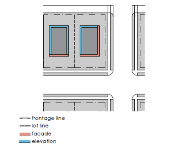
Fence: a permeable metal or wooden wall, independent of a building.
Folly: a garden building, built primarily for visual effect, suggesting through its appearance some other purpose.
Forecourt: a private frontage wherein a portion of the facade is close to the frontage line and the central portion is set back.
Front Setback: the distance from the frontage line to the point where a building may be constructed. This area must be maintained clear of permanent structures with the exception of encroachments.
Frontage: the area between a building facade and the vehicular lanes, inclusive of its built and planted components. Frontage is divided into private frontage and public frontage.
Private Frontage: the privately held layer between the frontage line and the principal building facade.
Public Frontage: the area of a thoroughfare assembly between the curb of the vehicular lanes and the frontage line.
Public Frontage Assembly: the result of assembling the walkway, planter, verge, and public furniture within a thoroughfare assembly.
Frontage Buildout: the percentage of the lot width that is occupied by the building facade within the first lot layer.
Frontage Encroachment: a structural element that encroaches into the frontage.
Frontage Line: a lot line along a public frontage.
Fronting: an element placed or existing along a frontage.
Function: the use or uses accommodated by a building and its lot.
Gallery: a private frontage wherein the facade is aligned close to the frontage line with an attached cantilevered shed or lightweight colonnade overlapping the sidewalk.
Green: a civic open space type for unstructured recreation, spatially defined by landscaping rather than building frontages.
Grid: a web of interconnecting thoroughfares. A regular grid consists of sets of parallel thoroughfares intersecting orthogonally. An irregular grid consists of parallel or non-parallel thoroughfares with frequent but nonorthogonal intersections.
Gross Lot Area: the area of a lot including the net lot area and portions of street rights-of-way and other required dedications and easements up to their centerline.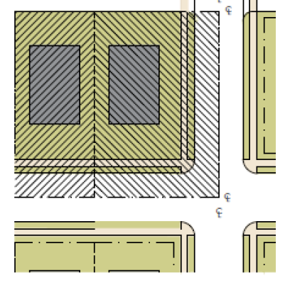
Height: See building height.
Highway (HW): a rural and suburban thoroughfare of long distance and high vehicular speed and capacity. A highway should be relatively free of intersections, driveways, and adjacent buildings. This type is allocated to the more rural lot types (LT-1, LT-2, and LT-3).
Hollywood Drive: a residential driveway constructed of two parallel strips of pavement each 2 ft. wide with a planting area in between. An alternative to the conventional continuous-surface parking pad, the Hollywood Drive provides more green area and better permeability but is more difficult to build. In the event of front-loaded garages, access may be by means of a Hollywood Drive to salvage a nearly continuous common lawn.
Home Occupation: non-retail commercial enterprises permitted under the Restricted office category.
Inclusive Housing: a conception that housing within a neighborhood should fulfill a broad range of needs and desires, including residential typologies ranging in character from urban to rural, and in price from affordable to expensive. Inclusive housing accommodates demographic segments from single person households to retirees, with families in between.
Inn: a type of lodging building function that is owner-occupied, offering 5 to 12 bedrooms, permitted to serve breakfast in the mornings to guests.
Intersection: a thoroughfare junction where two or more thoroughfares meet or cross and the preferred location for pedestrian crossings. Intersections are characterized by a high level of activity and shared use and should be multimodal and deserving of special design treatments.
Intersection Assembly: the result of coordinating the public frontage elements assembled with the transportation way, public transportation and bicycle network elements at intersections.
Intersection, T: an intersection between two thoroughfares where one is terminated. T-Intersections cause the least vehicle to vehicle and vehicle to pedestrian conflict points. Urban T-Intersections provide opportunities for terminated vistas. Intersection, Y: an intersection between three thoroughfare segments without right angles. Y-Intersections in areas of steep topography are also called switchbacks, providing access to grade changes without excessive intersection grading. Turning may be difficult in some situations where angles are acute.
 Intersection, 4W (4-way): a standard intersection between two continuous thoroughfares at or near right angles.
 Intersection, SI (Staggered): an intersection where one continuous thoroughfare is intersected by two terminating thoroughfares in close proximity. Staggered intersections provide a high number of terminated vistas and are well suited at commercial streets where traffic movement is slow and a high degree of spatial enclosure is desired.
 Intersection, TN (Turbine): An intersection between three or four terminating thoroughfare segments creating open space or a civic district at the center. Turbine intersections are versatile, providing opportunities for squares, greens, or playgrounds, and additional on-street parking.
 Intersection, TC (Traffic Circle): A free-movement intersection between two or more thoroughfares. Traffic circles allow vehicles to negotiate complex intersections safely without coming to a complete stop. For this reason, traffic circles are not appropriate in places with moderate to high pedestrian activity.
 Intersection, SA (Square About): A free or near free-movement intersection between four or more thoroughfares in an urban context. Unlike traffic circles, square-abouts require slow speeds and are therefore pedestrian friendly. They also allow for spatial enclosure by buildings.
 Intersection, RA (Round About): A very large traffic circle intersecting multiple urban thoroughfares with a pedestrian accessible civic district at the center in a circular, oblong, or elliptical shape. Round-abouts may require traffic control by timed or on-demand signalization to ensure safety at pedestrian crossings.
 Intersection, EA (Elongated Round About): A civic district including civic space and civic buildings well suited for the intersection of more than four thoroughfares in very urban environments. Elongated round-abouts intersect the highest number of thoroughfares due to their size and are well suited to highly trafficked thoroughfares such as boulevards.
Intensity: the magnitude of development permitted within a given block type.
Layer: See lot layer.
Lightwell: A private frontage type that is a below-grade entrance or recess designed to allow light into basements.
Liner Building: a building specifically designed to mask a parking lot or a parking structure along a frontage.
Live-Work: a mixed-use unit consisting of a commercial and residential function. The commercial function may be anywhere in the unit. It is intended to be occupied by a business operator who lives in the same structure that contains the commercial activity or industry. See Work-Live.
Lodging: a building function available for daily and weekly renting of bedrooms.
Lot: a parcel of land accommodating a building or buildings under single ownership.
Lot Coverage: the maximum area of a lot which may be occupied by buildings and other roofed structures. Lot coverage is expressed as a ratio.
Lot Layer: a range of depth of a lot within which certain elements are permitted.
First Lot Layer: the area of a lot comprised of the distance between the front property line and the required setback including the private frontage.
Second Lot Layer: that portion of the lot behind the first layer which includes the portion of the principal building that enfronts the thoroughfare.
Third Lot Layer: that portion of the lot that is not within the first and second layer.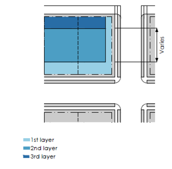
Lot Line: the boundary that legally and geometrically demarcates a lot.
Lot Occupation: category for the area of a lot that may contain buildings, regulated in terms of width and coverage metrics.
Lot Width: the length of the principal frontage line of a lot.
Main Civic Space: an outdoor gathering place for a community. The main civic space is often, but not always, associated with an important civic building.
Manufacturing: premises available for the creation, assemblage and/or repair of artifacts, using table-mounted electrical machinery or artisanal equipment, and including their retail sale.
Maximum Density: the maximum number of housing units permitted per acre of gross lot area on a single lot including adjustments for other functions.
Minor Thoroughfare Network: a network of thoroughfares within districts that is secondary to the thoroughfare network.
Mixed-Use: multiple functions within the same building through superimposition or adjacency, or in multiple buildings by adjacency.
Mixed-Use Corridor: a corridor within primarily mixed-use buildings along its length.
Neighborhood: the fundamental human habitat; a community sustaining a full range of ordinary human needs. In its ideal form, the neighborhood is a compact walkable urban pattern with a balanced range of living, working, shopping, recreational, and educational program.
Net Lot Area: the area of a lot within the frontage lines, excluding any portions of street rights-of- way or other required dedications.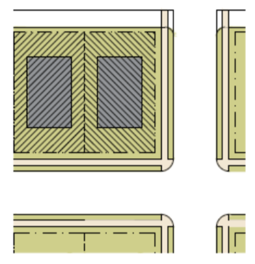 Nonconformity: an existing function, structure, lot or site improvement that is in compliance with the zoning regulations that were applicable to it when it was established, and for which all required permits were issued, but which does not conform in whole or in part to the regulations of this Section. Such nonconformity is legal and may continue except as regulated by this Section.
Off-street Parking: a parking area located within a lot, generally to the rear of a building frontage, masking it from the public space.
Office: premises available for the transaction of general business but excluding retail, artisanal and manufacturing uses.
On-street Parking: single line of parking located along the curb line of a thoroughfare accessible directly from a moving lane.
Open Space: land intended to remain undeveloped; it may be for civic space.
Open Space Corridor: a continuous corridor of open space.
Outbuilding: a building other than the principal building, usually located toward the rear of the same lot as a principal building, and sometimes connected to the principal building by a thin building wing.
Park: a civic open space type that is a natural preserve available for unstructured recreation.
Parking Lane: A vehicular lane designated and used for parking motor vehicles.
Parking Structure: a building containing one or more stories of vehicular parking above or below grade.
Parkway (PW): a highway designed in conjunction with naturalistic landscaping, including a variable-width median. A parkway should include a wide right-of-way landscaped on both sides of vehicular lanes.
Passage (PS): a pedestrian connector, open or roofed, that passes between buildings to provide shortcuts through long blocks and connect rear parking areas to frontages.
Path (PT): a pedestrian way traversing a park or rural area, with landscape matching the contiguous open space, ideally connecting directly with the urban sidewalk network.
Pedestrian Crossing: an area designated for pedestrians when traversing a thoroughfare. Pedestrian crossings may be striped and indicated by signage.
Pedestrian Shed: an area that is centered on a common destination, defining the structure of a district. Its size is related to average walking distances for the applicable district. A pedestrian shed that is an average 1/4 mile radius or 1,320 feet, which represents a 5-minute walk at an average pace. This is the distance that most persons will walk rather than drive, providing the environment is pedestrian-friendly.
Planter: the element of the public frontage which accommodates street trees, whether continuous or individual.
Playground: a civic open space type designed and equipped for the recreation of children.
Plaza: a civic open space type designed for civic purposes and commercial activities in the more urban transect sub-districts, generally paved and spatially defined by building frontages.
Porch: An open-air room appended to a building, with floor and roof but no walls on the sides facing frontages.
Principal Building: the main building on a lot, usually located toward the frontage.
Principal Entrance: the main point of access for pedestrians into a building.
Principal Frontage: the private frontage designated to bear the address and principal entrance to the building, and the measure of minimum lot width.
Public Furniture: signage, public lighting, benches, refuse containers, newspaper dispensers, and other publicly managed vertical elements within the public frontage.
Public Infrastructure: cumulatively the infrastructure elements serving individual lots and public spaces, including water, sewer, storm water, electrical power, telecom, cable, fiber-optic cable, and similar elements.
Public Lighting: lighting that is owned and maintained by the City, usually along thoroughfares and in public spaces.
Public Planting: planting that is owned and maintained by the City, usually along thoroughfares and in public spaces.
Public Realm: those parts of the urban fabric that are held in common such as plazas, squares, parks, thoroughfares and civic buildings.
Public Space: land, including thoroughfares, that is owned and maintained by the City where public access is permitted. Time limits and other restrictions may limit access to some public spaces.
Public Space Standards: a set of requirements defining the character of public spaces.
Rear Alley (RA): a vehicular way located to the rear of lots providing access to service areas, parking, and outbuildings and containing utility easements. Rear alleys should be paved from building face to building face, with drainage by inverted crown at the center or with roll-over curbs at the edges.
Rear Lane (RL): a vehicular way located to the rear of lots providing access to service areas, parking, and outbuildings and containing utility easements. Rear lanes may be paved lightly to driveway standards. The streetscape consists of gravel or landscaped edges, no raised curb, with drainage by inverted crown, french drain, or by percolation.
Rear Setback: the distance from the rear lot line to the point where a building may be constructed. This area must be maintained clear of permanent structures with the exception of permitted encroachments.
Regional Infrastructure: infrastructural elements that traverse long distances, including high- voltage power lines, oil and natural gas pipelines, fiber-optic trunk lines, and other similar elements.
Regional Open Space: open space that is scaled and programmed to serve residents outside of the immediately surrounding districts.
Required Parking: the number of parking spaces needed to accommodate a building or buildings on a single lot according to the intensity of its function.
Residential: characterizing premises available for long-term human dwelling.
Retail: characterizing premises available for the sale of merchandise and food service.
Retail Frontage: a frontage designated on a regulating plan that requires or recommends the provision of a shopfront, encouraging the ground level to be available for retail use.
Road (RD): a local, rural and suburban thoroughfare of low-to-moderate vehicular speed and capacity. Roads tend to be rural in character without curbs or striping.
Secondary Frontage: on corner lots, the private frontage that is not the principal frontage. As it affects the public realm, its first layer is regulated.
Sensitive Lands: natural features that include, but not be limited to, canyons and slopes in excess of 30%, ridge lines, streams or other natural water features, wetlands and geologically sensitive areas.
Setback: the area of a lot measured from the lot line to a building façade or elevation that is maintained clear of permanent structures, with the exception of permitted encroachments.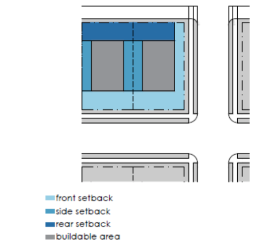 Shared Parking Factor: a ratio or percentage applied to the required parking for mixed-use buildings or multiple buildings on a lot or block reducing the total required parking by accounting for parking spaces that are available to more than one function.
Shared Vehicular Lane with Sharrow (SL): a bicycle facility consisting of signage and painting indicating that motor vehicles and bicycles have equal, shared access to a vehicular lane.
Shopfront: a private frontage conventional for retail use with substantial glazing wherein the facade is aligned close to the frontage line with the building entrance at sidewalk grade.
Sidewalk: the paved section of the public frontage dedicated exclusively to pedestrian activity.
Sign: any identification, description, illustration, or device, illuminated or non-illuminated, that is visible from a public right-of-way or is located on private property and visible to the public and which directs attention to a product, place, activity, person, institution, business, message or solicitation, including any permanently installed or situated merchandise, with the exception of window displays, and any letter, numeral, character, figure, emblem, painting, banner, pennant, placard, or temporary sign designed to advertise, identify or convey information.
Sign Band: a wall area of a non-residential building built along the entire width of a principal or secondary frontage allocated for the placement of a sign above a shopfront or at the cornice.
Slip Lane: an outer vehicular lane or lanes of a thoroughfare, designed for slow speeds and separated from inner lanes that carry higher speed traffic.
Special Requirements: provisions of this Section that modify or extend requirements as designated on a regulating plan or other map for those provisions.
Square: a civic open space type designed for unstructured recreation and civic purposes, spatially defined by building frontages and consisting of paths, lawns and trees, formally disposed.
Stoop: a private frontage wherein the facade is aligned close to the frontage line with the first story elevated from the sidewalk for privacy, with an exterior stair and landing at the entrance.
Story: a habitable level within a building by which height is measured, excluding an attic or raised basement.
Street (ST): a local urban thoroughfare of low speed and capacity.
Streetscreen: a freestanding wall or hedge built along the frontage line, or coplanar with a facade.
Sub-block: A subdivided portion of a block that is typically bounded by thoroughfares. Sub-blocks can take either an orthogonal or rhomboidal form:
Orthogonal: Intersecting or lying at right angles
Rhomboidal: Adjacent sides are of unequal lengths and angles are non-right angled
Substantial Modification: alteration to a building that is valued at more than 50% of the replacement cost of the entire building, if new.
Swale: a low or slightly depressed natural area for drainage.
Target Speed: the desirable velocity at which vehicles should travel on a thoroughfare.
Terrace: A frontage wherein the facade is set back from the frontage line with an elevated terrace within the entire private frontage.
Terminated Vista: a location at the axial conclusion of a thoroughfare.
Thoroughfare: a way for use by vehicular, bicycle, and pedestrian traffic providing access to lots and open spaces. Thoroughfares provide the major part of the public open space as well as moving lanes for vehicles. A thoroughfare is endowed with two attributes: capacity and character.
Thoroughfare Assembly: the result of the public frontage elements assembled with the transportation way, public transportation and bicycle network elements within a right-of-way.
Thoroughfare Network: an interconnected network of vehicular, pedestrian and bicycle mobility.
Transect: a cross-section of the environment showing a range of different habitats. The rural-urban transect of the human environment describes the physical form and character of a place, according to the density and intensity of its land use.
Transit Based Community: a zone and/or district designed to regulate development to achieve specific measures of urban form based on organizing principles that are human scaled, neighborhood based and transit oriented.
Transportation Provision: modes of travel that include bicycles and transit.
Transportation Way: the portion of the thoroughfare dedicated to modes of travel that include motor vehicles, bicycles and transit.
Turning Radius: the curved edge of a thoroughfare at an intersection, measured at the inside edge of the vehicular tracking. The smaller the turning radius, the smaller the pedestrian crossing distance and the more slowly the vehicle is forced to make the turn.
Urbanized: generally, developed.
Utilities, Dry: elements of public infrastructure that do not convey liquids.
Utilities, Wet: elements of public infrastructure that convey liquids.
Vehicular Lane: the portion of a thoroughfare which is occupied by motor vehicles, usually the moving lanes and parking lanes.
Verge: the portion of a public frontage that contains the public furniture.
Walkway: the portion of the thoroughfare dedicated exclusively to pedestrian activity. The walkway includes sidewalks and the planting areas of the streetscape.
Work-Live: a mixed-use unit consisting of a commercial and residential function. It typically has a substantial commercial component that may accommodate employees and walk-in trade. The unit is intended to function predominantly as work space with incidental residential accommodations that meet basic habitability requirements. See Live-Work.
Zoning Clearance Officer: The director of the planning department is recognized as the zone clearance officer. The zone clearance officer is responsible for the duties outlined in this TOD Code as well as those set forth under Section 17.2.402 of the American Fork City Code.
Amended by Ord. 2018-11-52 on 11/27/2018