
Bladen County Unincorporated
City Zoning Code
City Zoning Code
ARTICLE 8
ZONING DISTRICTS AND TABLE OF USES
8.1 - PURPOSE
8.1.1.
In order to promote public health, safety and general welfare, all property within the planning and zoning jurisdiction of Bladen County is hereby divided into districts with the designations and purposes listed in Sections 8.2 through 8.8. In the creation of the respective districts, careful consideration is given to the suitability of each district for the regulations applied thereto, and the necessary, proper, and comprehensive groupings and arrangements of various uses and densities of population in accordance with a well-considered comprehensive plan for the physical development of the area. Districts detailed here include the following:
(a)
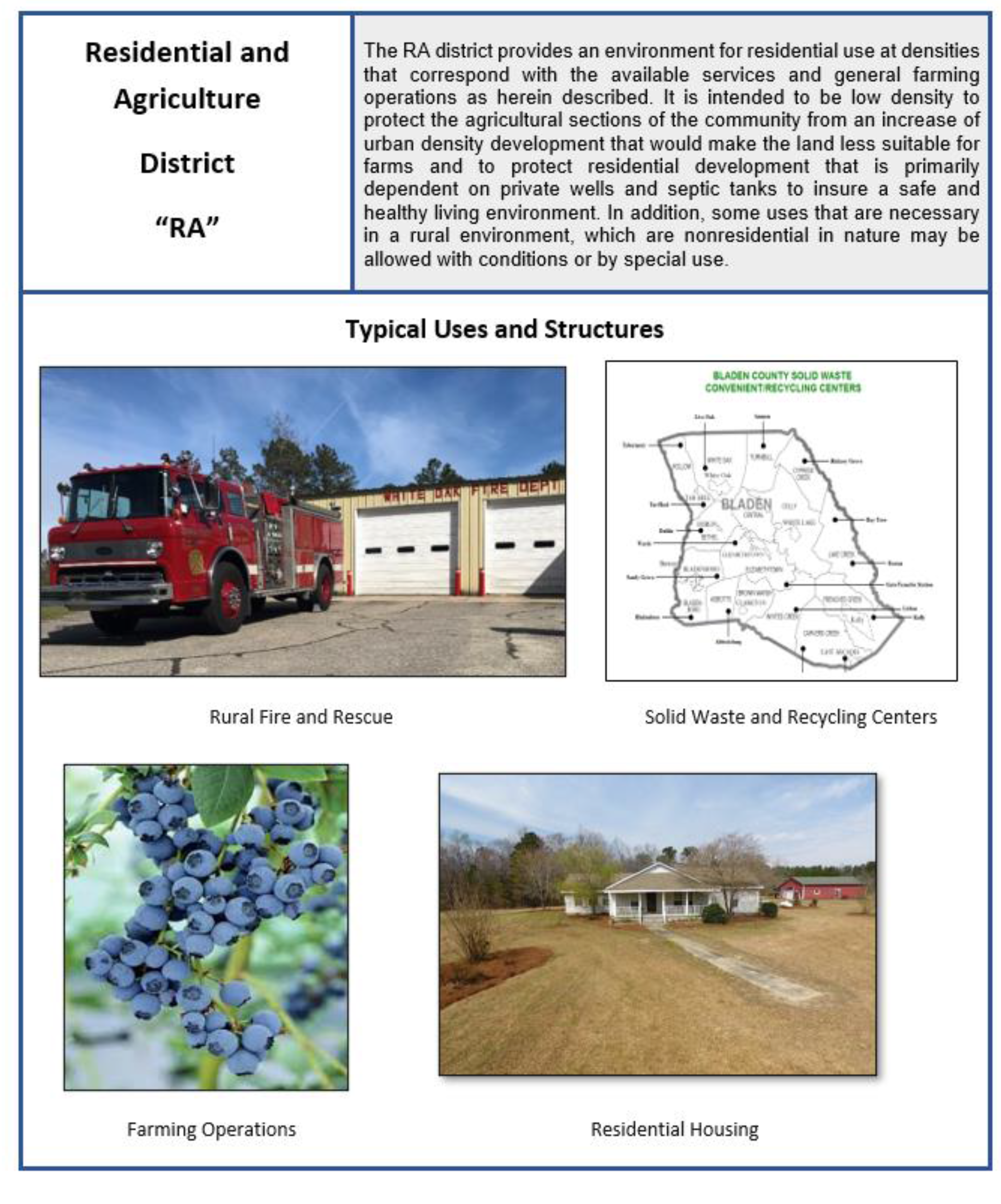
RA—Residential and Agriculture District.
(b)
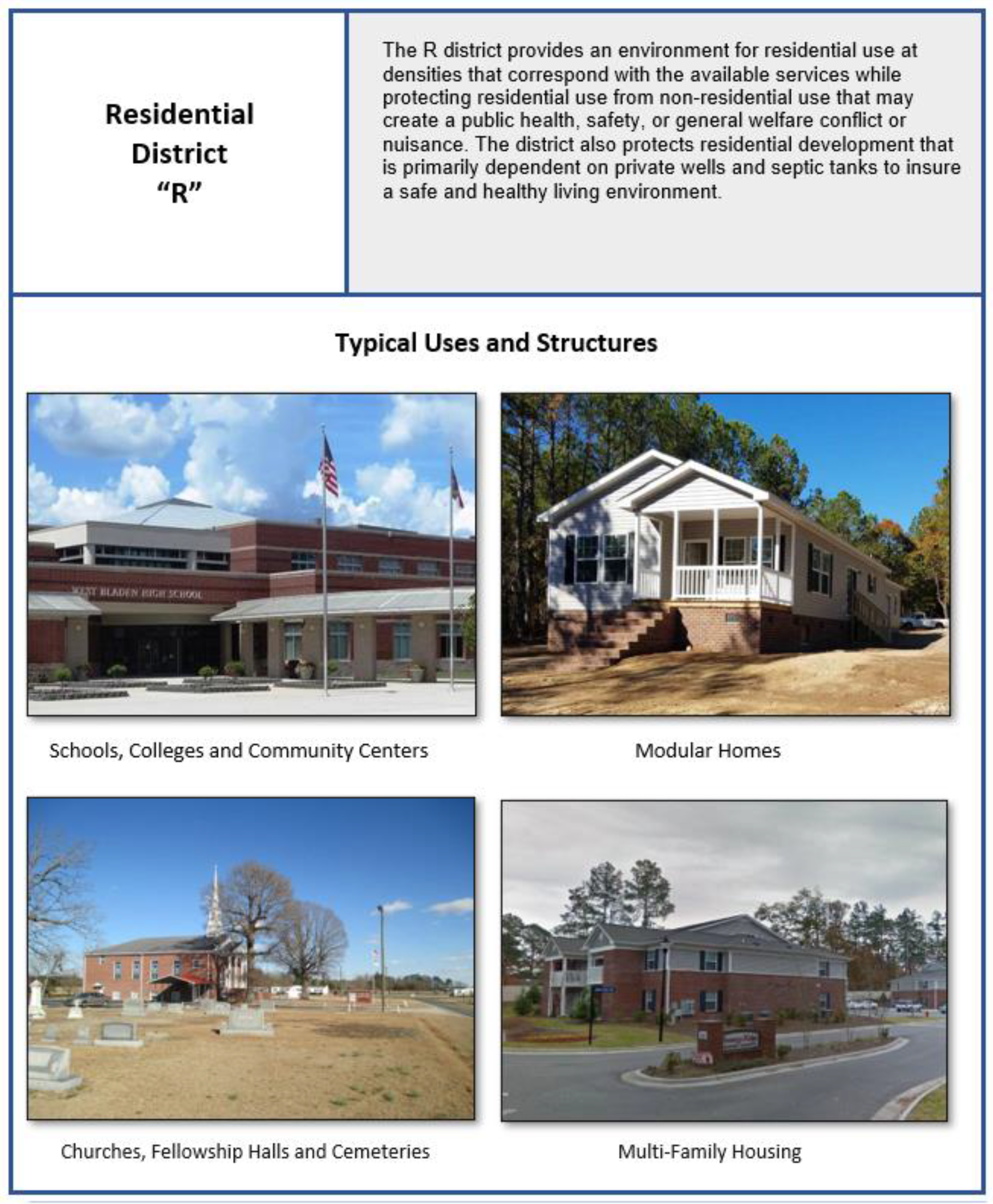
R—Residential District.
(c)
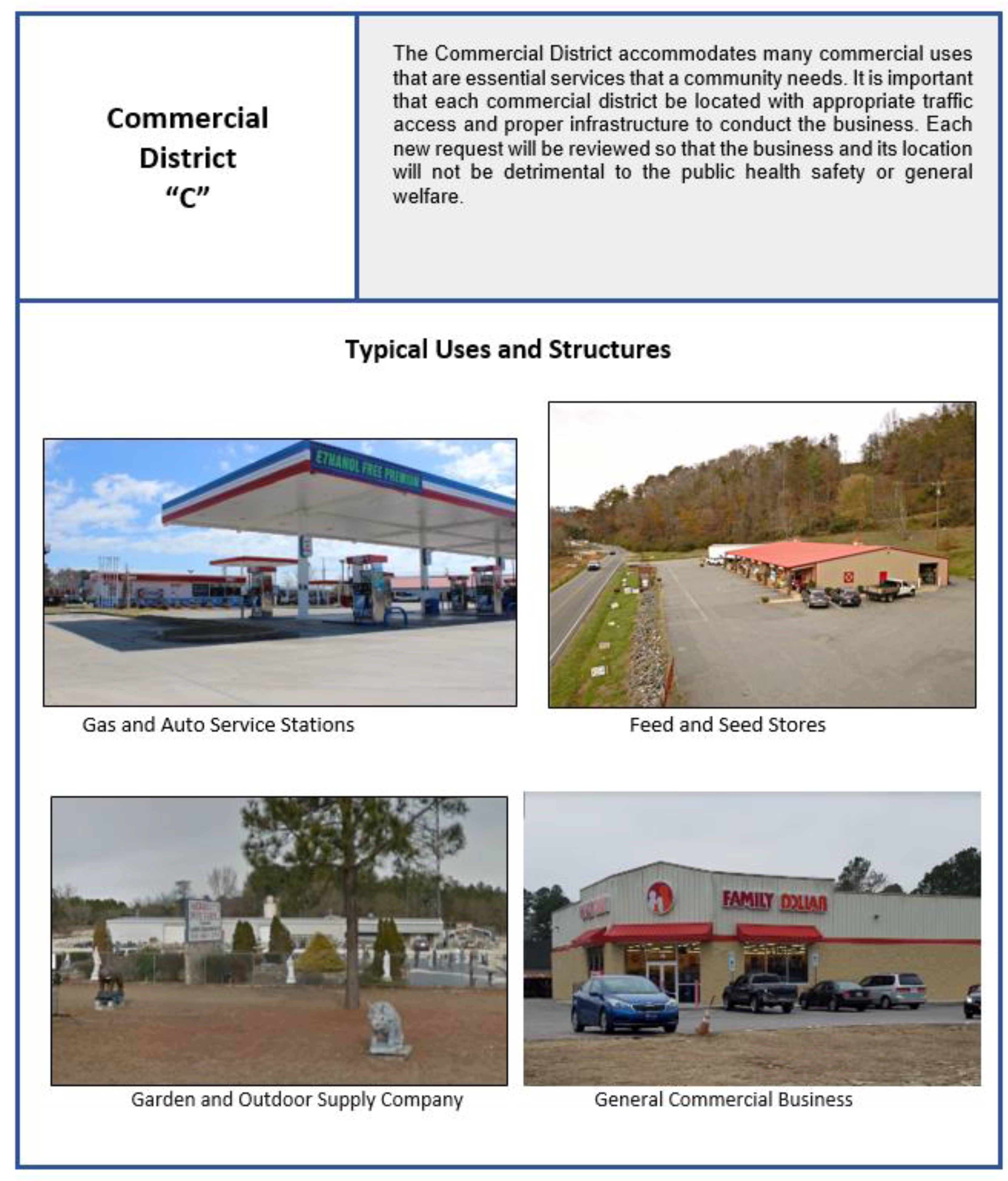
C—Commercial District.
(d)
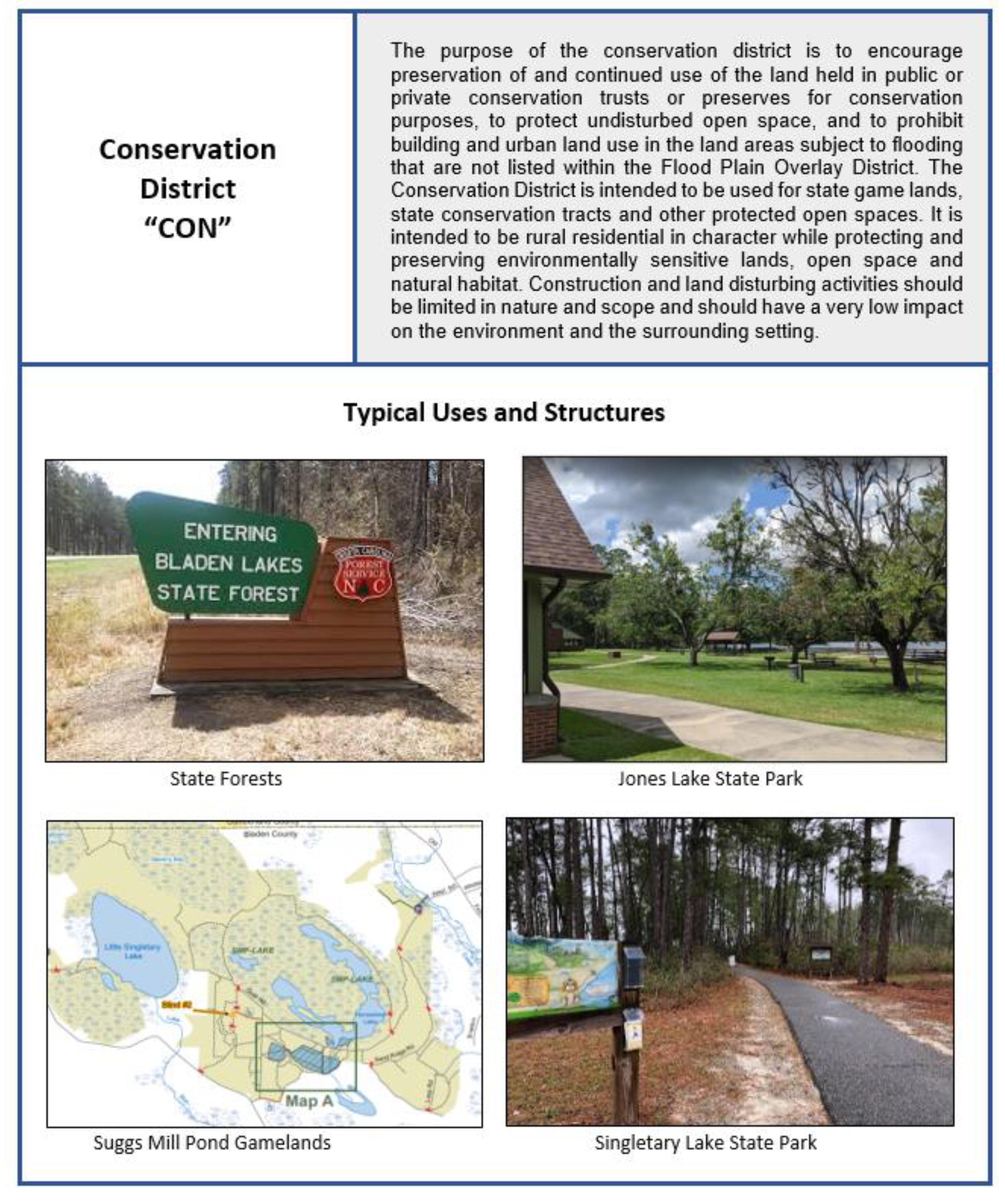
CON—Conservation District.
(e)
I—Industrial District.
(f)
AO—Airport Overlay District.
(g)
FPO—Flood Plain Overlay District.
(h)
WSW—Water Supply Watershed Overlay District.
8.1.2.
Uniformity Within Districts. Except as authorized by the foregoing, all regulations shall be uniform for each class or kind of building throughout each district, but the regulations in one district may differ from those in other districts.
State Law reference— G.S. 160D-703(c)
8.1.3.
Standards Applicable Regardless of District. This zoning ordinance also includes development standards that apply uniformly jurisdiction-wide rather than being applicable only in particular zoning districts.
State Law reference— G.S. 160D-703(d)
8.2 - RESIDENTIAL AND AGRICULTURE DISTRICT
(a)
District Description and Dimensional Standards.
(b)
Minimum lot areas may change for uses in the RA District which are permitted with conditions. Refer to Section 11.4.
(c)
Parking and Loading: (Refer to Article 10) Refer also to Section 11.4. if a use with conditions.
(d)
Signs: (Refer to Article 10).
(e)
General Provisions: (Refer to Article 10).
8.3. - RESIDENTIAL DISTRICT
(a)
District Description and Dimensional Standards.
(b)
Minimum lot areas may change for uses in the R District which are permitted with conditions. Refer to Section 11.4.
(c)
Parking and Loading: (Refer to Article 10) Refer also to Section 11.4. if a use with conditions.
(e)
Signs: (Refer to Article 10).
(f)
General Provisions: (Refer to Article 10).
8.4 - COMMERCIAL DISTRICT
(a)
District Description and Dimensional Standards.
(b)
Minimum lot areas for uses in the C District which are permitted with conditions remain as stated above.
(c)
Parking and Loading: (Refer to Article 10) Refer also to Section 11.4. if a use with conditions.
(d)
Signs: (Refer to Article 10).
(e)
General Provisions: (Refer to Article 10).
8.5 - CONSERVATION DISTRICT
(a)
District Description and Dimensional Standards.
(b)
Development Guidelines. In order to reduce the impact of development on the existing natural environment, and provide an increased degree of flexibility, the following guidelines apply to all activities within a CON district: 1) If development is anticipated to occur, the plan for such development should prioritize the preservation of natural habitat and sensitive environmental features such as large stands of trees, wetlands, watercourses, marshes, and tidal areas. 2) The use of Low Impact Design, stormwater Best Management Practices (BMPs) and other alternative construction principles is strongly encouraged. 3) All site clearing and preparation, and construction activities should avoid removing existing trees and disturbing existing vegetation to the extent possible.
(c)
Minimum lot areas may change for uses in the CON District which are permitted with conditions. Refer to Section 11.4.
(d)
Parking and Loading: (Refer to Article 10) Refer also to Section 11.4. if a use with conditions.
(e)
Signs: (Refer to Article 10).
(f)
General Provisions: (Refer to Article 10).
8.6 - INDUSTRIAL DISTRICT
(a)
District Description and Dimensional Standards.

(b)
Development Guidelines.
(1)
Additional building height is allowed to exceed 50 feet up to 80 feet, when all building setbacks are increased 20 feet for every 10 feet in building height.
(2)
Complete fencing with vegetative screening if the abutting land is in a residential district. The fence shall be a minimum of 6 feet.
(c)
Minimum lot areas for uses in the I District which are permitted with conditions remain as stated above.
(d)
Parking and Loading: (Refer to Article 10) Refer also to Section 11.4. if a use with conditions.
(e)
Signs: (Refer to Article 10).
(f)
General Provisions: (Refer to Article 10).
8.7 - AIRPORT OVERLAY DISTRICT
(a)
Intent. It is hereby found that an obstruction has a potential for endangering the lives and property of users of Bladen County Airports, and property or occupants of land in its vicinity; that an obstruction may affect existing or future instrument approaches of Bladen County Airports; and that an obstruction may reduce the size of areas available for landing, take-off and maneuvering of aircrafts, thus tending to destroy or impair the unity of Bladen County Airports and the public investment therein.
Further, it is the intent and purpose of this section to promote the public health, safety, and general welfare by regulating and restricting the development of structures for human occupancy within an area surrounding airports within Bladen County to protect residents from harmful noise. Therefore, the Airport Overlay District is established, which includes Height restriction and Noise restriction zones within the overlay (see section 11 for definition of Overlay District).
(b)
Permitted Principal Uses and Structures.
(1)
Shall be the same as those in the underlying zoning districts with the exception of the provisions in Section 8.6(g). Noise Restrictions and the following:
No use may be made to land or water within any zone established by this section in such a manner as to create electrical interference with navigational signals or radio communication between the airport and aircraft, make it difficult for pilots to distinguish between airport lights and others, result in glare in the eyes of pilots using the airport, impair visibility in the vicinity of the airport or otherwise in any way create a hazard or endanger the landing, takeoff, or maneuvering of aircraft to use the airport.
(c)
Permitted Accessory Uses and Structures. Shall be the same as those in the underlying zoning districts with the exception of the provisions in Section 8.6(b) and 8.6(g).
(d)
Preexisting Uses (Also see Article 14, Nonconforming Situations).
(1)
Marking and lighting. Notwithstanding the preceding provision of this Section, the owner of any existing nonconforming structure or tree is hereby required to permit the installation, operation, and maintenance thereon of such markers and lights as shall be deemed necessary by the Airport Commission, to indicate to the operators of aircraft in the vicinity of the airport, the presence of such airport hazards. Such markers and lights shall be installed, operated, and maintained at the expense of the Airport Commission if the requirement is in the vicinity of the airport.
(e)
Dimensional Requirements. Shall be the same as those in the underlying zoning districts with the exception of the provisions of any part of this section.
(f)
Height Restriction Zones. In order to carry out the provisions of this section, certain zones, which include all of the land lying within the approach zones, transitional zones, horizontal zones, and conical zones as they apply to a particular airport are established and defined on the Zoning Map. An area located in more than one (1) of the following zones is considered to be only in the zone with the more restrictive height limitation. Nothing in this Section shall be construed as prohibiting the growth, construction, or maintenance of any tree or structure to a height that is below the limitations set forth in this Section. The various zones are hereby established and defined as follows:
(1)
Approach zone a (precision instrument runway). The inner edge of this approach zone coincides with the width of the primary surface and is 1,000 feet wide. The approach zone expands outward uniformly to a width of 16,000 feet at a horizontal distance of 50,000 feet from the primary surface. Its centerline is the continuation of the centerline of the runway.
a.
Height Restricted Area. Slopes fifty (50) feet outward for each foot upward beginning at the end of and at the same elevation as the primary surface and extending to a horizontal distance of 10,000 feet along the extended runway centerline; thence slopes upward forty (40) feet horizontally for each foot vertically to an additional horizontal distance of 40,000 feet along the extended runway centerline.
(2)
Approach zone b (runway larger than utility with a visibility minimum as low as ¾ mile non-precision instrument). The inner edge of this approach zone coincides with the width of the primary surface and is 1,000 feet wide. The approach zone expands outward uniformly to a width of 4,000 feet at a horizontal distance of 10,000 feet from the primary surface. Its centerline is the continuation of the centerline of the runway.
a.
Height Restricted Area. Slopes upward thirty-four (34) feet horizontally for each foot vertically beginning at the end of and at the same elevation as the primary surface and extending to a horizontal distance of 10,000 feet along the extended runway centerline.
(3)
Transitional zones. These zones are hereby established as the area beneath the transitional surfaces. These surfaces extend outward and upward beginning 500 feet each side of the runway centerline at a slope of 7:1 to the primary surface. The runway centerline extended at a slope of seven (7) feet horizontally for each foot vertically from the sides of the primary and approach surfaces to where they intersect the horizontal and conical surfaces. Transitional zones for those portions of the precision approach zones, which project through and beyond the limits of the conical surface, extend a distance of 5,000 feet measured horizontally from the edge of the approach zones and at 90-degree angles to the extended runway centerline.
a.
Height Restricted Area. Slopes seven (7) feet outward for each foot upward beginning at the sides of and at the same elevation as the primary surface and the approach surface, and extending to a height of 150 feet above the airport elevation. In addition to the foregoing, there are established height limits sloping seven (7) feet outward for each foot upward beginning at the sides of and the same elevation as the approach surface, and extending to where they intersect the conical surface. Where the precision instrument runway approach zone projects beyond the conical zone, there are established height limits sloping seven (7) feet outward for each foot upward beginning at the sides of and the same elevation as the approach surface and extending a horizontal distance of 5,000 feet measured at 90 degree angles to the extended runway centerline from the edge of the approach surface.
(4)
Horizontal zone. The horizontal zone is hereby established by swinging arcs of 10,000 feet radii from the center of each end of the primary surface of each runway, and connecting the adjacent arcs by drawing lines tangent to those arcs. The horizontal zone does not include the approach and transitional zones.
a.
Height Restricted Area. One hundred and fifty (150) feet above the airport elevation or a height of 283 feet above mean sea level.
(5)
Conical zone. The conical zone is hereby established as the area that commences at the periphery of the horizontal zone and extends outward there from a horizontal distance of 4,000 feet at a slope of 20:1. The conical zone does not include the precision instrument approach zones and the transitional zones.
a.
Height Restricted Area. Slopes upward and outward twenty (20) feet horizontally for each foot vertically beginning at the periphery of the horizontal zone and at one hundred and fifty (150) feet above the airport elevation and extending to a height of 350 feet above the airport elevation, or an elevation of 483 feet above sea level.
(g)
Noise Restriction Zones. In order to carry out the provisions of this section, certain Noise zones are created, which include an area abutting and completely surrounding any airport in Bladen County in which aircraft noise may occasionally interfere with certain activities of the residents. The Zones are identified as Land Use Guidance or LUG" zones; "A," "B," "C," or "D." The zones are defined as:
(1)
Zone "A"—That area having a Day-Night Sound Level (Ldn) of 55 and less.
Permitted Use Guidelines: Generally acceptable for all activities and land uses and no special noise considerations are required.
(2)
Zone "B"—That area having a Day-Night Sound Level (Ldn) between 55 and 65.
Permitted Use Guidelines: Few, if any, activities will be affected by aircraft sounds, although building designs for especially sound sensitive activities such as schools, churches, auditoriums, hospitals and theaters should consider sound control in areas closest to the Airport. Detailed studies are recommended for outdoor amphitheaters and similar places of public assembly for those areas closest to the airport.
(3)
Zone "C"—That area having a Day-Night Sound Level (Ldn) between 65 and 75.
Permitted Use Guidelines: Activities where uninterrupted communication is essential should consider sound exposure in design. Generally residential development is not considered a suitable use, although multi-family developments where sound control features have been incorporated in building design might be considered. Open-air activities and outdoor living and auditoriums, schools, churches, hospitals, theaters, and similar activities should be avoided.
(4)
Zone "D"—That area having a Day-Night Sound Level (Ldn) of 75 or greater.
Permitted Use Guidelines: Land should be reserved for activities that can tolerate a high level of sound exposure. Generally, land in this zone is owned by the Airport and is left vacant or for use in industrial and commercial uses where relatively high levels of sound exposure may be acceptable.
(5)
Construction Standards for all noise zones. An applicant for the construction of a new building shall provide the Zoning Officer with the necessary calculations to assure that noise levels within the proposed building will not exceed the following standards:
a.
Sleeping quarters (Windows are assumed to be open unless other provisions are made for adequate ventilation):
1.
Ldn 55 for more than an accumulation of 60 minutes in any 24-hour period, and
2.
Ldn 45 for more than 30 minutes during night-time sleeping hours from 11 p.m. to 7 a.m., and
3.
Ldn 45 for more than an accumulation of eight (8) hours on any 24-hour day.
b.
Non-sleeping quarters—all structures (Windows are assumed to be open unless other provisions are made for adequate ventilation):
1.
Normally Acceptable:
Ldn 65 for not more than 8 hours per 24-hour period.
b.
Acceptable:
Ldn 45 for not more than 30 minutes per 24-hour period.
c.
Insulation between dwelling units: Floor and dividing walls between attached dwelling units shall have a Sound Transmission Class (STC) of greater than 45.
8.8 - FLOODPLAIN OVERLAY DISTRICT
(a)
Intent and Objectives. It is the purpose of this section to promote the public health, safety, and general welfare and to minimize public and private losses due to flood conditions in specific areas defined on the zoning and flood maps by enforcing provisions designed to:
(1)
Restrict or prohibit uses which are dangerous to health, safety, and property due to water or erosion hazards, or which result in damaging increases in erosion or in flood heights or velocities;
(2)
Require that uses vulnerable to floods, including facilities, which serve such uses, be protected against flood damage at the time of initial construction;
(3)
Control the alteration of natural floodplains, stream channels, and natural protective barriers, which are involved in the accommodation of floodwaters;
(4)
Control filling, grading, dredging, and other development which may increase erosion or flood damage; and
(5)
Prevent or regulate the construction of flood barriers which will unnaturally divert floodwaters or which may increase flood hazards to other lands.
The objectives of this section are:
(1)
To protect human life and health;
(2)
To minimize expenditure of public money for costly flood control projects;
(3)
To minimize the need for rescue and relief efforts associated with flooding and generally undertaken at the expense of the general public;
(4)
To minimize prolonged business interruptions;
(5)
To minimize damage to public facilities and utilities such as water and gas mains, electric, telephone and sewer lines, streets, and bridges located in floodplains;
(6)
To help maintain a stable tax base by providing for the sound use and development of flood prone areas in such a manner as to minimize flood blight areas; and
(7)
To ensure that potential home buyers are notified that property is in a flood area.
(b)
Lands to which this section applies. This ordinance shall apply to all areas of special flood hazard within the jurisdiction of Bladen County.
(c)
Warning and Disclaimer of Liability. The degree of flood protection required by this section is considered reasonable for regulatory purposes and is based on scientific and engineering consideration. Larger floods can and will occur on rare occasions. Flood heights may be increased by man-made or natural causes. This ordinance does not imply that land outside the areas of special flood hazard or uses permitted within such areas will be free from flooding or flood damages. This ordinance shall not create liability on the part of Bladen County or by any officer or employee thereof for any flood damages that result from reliance on this ordinance or any administrative decision lawfully made hereunder.
(d)
Basis for Establishing the Areas of Special Flood Hazard. This includes detailed flood information generated as a requirement of Section 3.3.6 [3.3.7]—G (10) this Ordinance.
The Special Flood Hazard Areas are those identified under the Cooperative Technical State (CTS) agreement between the State of North Carolina and FEMA in its FIS dated June 20, 2018 for Bladen County and associated DFIRM panels, including any digital data developed as part of the FIS, which are adopted by reference and declared to be a part of this ordinance. Future revisions to the FIS and DFIRM panels that do not change flood hazard data within the jurisdictional authority of Bladen County are also adopted by reference and declared a part of this ordinance. Subsequent Letter of Map Revisions (LOMRs) and/or Physical Map Revisions (PMRs) shall be adopted within three (3) months.
(e)
Establishment of Development Permit. A Flood Area Development Permit shall be required in conformance with the provisions of this section prior to the commencement of any development activities.
(f)
Development Permit and Certification Requirements. Application for a Flood Area Development Permit (FADP) shall be made to the Zoning Officer on forms furnished by the Zoning Officer prior to any development activities. The FADP shall include, but not be limited to, plans in duplicate drawn to an engineering scale showing: the nature, location, dimensions, and elevations of the area in question; existing or proposed structures; and the location of fill materials, storage areas, and drainage facilities. Specifically, the following information is required:
(1)
A plot plan that shows the 100-year floodplain contour or a statement that the entire lot is within the floodplain must be provided by the development permit applicant when the lot is within or appears to be within the floodplain as mapped by the Federal Emergency Management Agency or the floodplain identified pursuant to either Section 3.3.6 [3.3.7]—G (10), J or K. The plot plan must be prepared by or under the direct supervision of a registered land surveyor or professional engineer and certified by same.
(2)
The plot plan required by Section 3.3.6 [3.3.7]—F(1) must show the floodway as identified by the Federal Emergency Management Agency or pursuant to either Section 3.3.6 [3.3.7]—G(10) or J, or the setback required for streams without designated floodways as required by Section 3.3.6 [3.3.7]—J(2).
(3)
Where base flood elevation data is provided as set forth in Section 3.3.6 [3.3.7]—D, G(10), the application for a Development Permit within the flood hazard area shall show:
a.
The elevation (in relation to mean sea level) of the lowest floor (including basement) of all new and substantially improved structures, and
b.
If the nonresidential structure will be flood proofed in accordance with Section 3.3.6 [3.3.7]—I(2), the elevation (in relation to mean sea level) to which the structure will be flood proofed.
(4)
Where the base flood elevation data is not provided, the application for a development permit must show construction of the lowest floor at least 2 feet above the highest adjacent grade.
(5)
Where any watercourse will be altered or relocated as a result of proposed development, the application for a development permit shall include: a description of the extent of watercourse alteration or relocation; an engineering report on the effects of the proposed project on the flood-carrying capacity of the watercourse and the effects to properties located both upstream and downstream; and a map showing the location of the proposed watercourse alteration or relocation.
(6)
When a structure is flood proofed, the applicant shall provide a Flood proofing Certificate (FEMA Form 81-65) from a registered professional engineer or architect that the nonresidential flood proofed structure meets the flood proofing criteria in Section 3.3.6 [3.3.7]—I(2).
(7)
An Elevation Certificate (FEMA Form 81-31) or a Flood proofing Certificate (FEMA Form 81-65) is required after the lowest floor is completed. Within twenty-one (21) calendar days of establishment of the lowest floor elevation, or flood proofing by whatever construction means, whichever is applicable, it shall be the duty of the permit holder to submit to the administrator a certification of the elevation of the lowest floor, or flood proofed elevation, whichever is applicable, as built, in relation to mean sea level. Said certification shall be prepared by or under the direct supervision of a registered land surveyor or professional engineer and certified by same. When flood-proofing is utilized for a particular building, said certification shall be prepared by or under the direct supervision of a professional engineer or architect and certified by same. Any work done within the twenty-one (21) day calendar period and prior to submission of the certification shall be at the permit holder's risk. The administrator shall review the floor elevation survey data submitted. Deficiencies detected by such review shall be corrected by the permit holder immediately and prior to further progressive work being permitted to proceed. Failure to submit the survey or failure to make said corrections required hereby shall be cause to issue a stop-work order for the project.
(g)
Duties and Responsibilities of the Zoning Officer when reviewing FADP applications. Duties of the Zoning Officer shall include, but not be limited to:
(1)
Review all development permits to assure that the requirements of this section have been satisfied.
(2)
Advise permittee that additional Federal or State permits may be required, and if specific Federal or State permits are known, require that copies of such permits be provided and maintained on file with the development permit.
(3)
Notify adjacent communities and the North Carolina Department of Crime Control and Public Safety, Division of Emergency Management, State Coordinator for the National Flood Insurance Program prior to any alteration or relocation of a watercourse, and submit evidence of such notification to the Federal Emergency Management Agency.
(4)
Assure that maintenance is provided within the altered or relocated portion of said watercourse so that the flood-carrying capacity is not diminished.
(5)
Prevent encroachments within floodways unless the certification and flood hazard reduction provisions of Section 8.1.10.H, I, J and K are met.
(6)
Obtain actual elevation (in relation to mean sea level) of the lowest floor (including basement) of all new or substantially improved structures, in accordance with Section 8.1.10.F(7).
(7)
Obtain the actual elevation (in relation to mean sea level) to which the new or substantially improved structures have been flood proofed, in accordance with Section 8.1.10.F(7).
(8)
When flood proofing is utilized for a particular structure, obtain certifications from a registered professional engineer or architect in accordance with Section 8.1.10.I(2).
(9)
Where interpretation is needed as to the exact location of boundaries of the areas of special flood hazard (for example, where there appears to be a conflict between a mapped boundary and actual field conditions), make the necessary interpretation. The person contesting the location of the boundary shall be given a reasonable opportunity to appeal the interpretation as provided in this article.
(10)
When base flood elevation data or floodway data has not been provided in accordance with Section - 8.1.10.D, obtain, review, and reasonably utilize any base flood elevation data and floodway data available from a Federal, State, or other source, including data developed pursuant to Section 8.1.10.K(4), in order to administer the provisions of this ordinance.
(11)
When the exact location of boundaries of the areas special flood hazards conflict with the current, natural topography information at the site the property owner may apply and be approved for a Letter of Map Amendment (LOMA) by FEMA. A copy of the Letter of Map Amendment issued from FEMA will be maintained by the administrator in the permit file.
(12)
Make on-site inspections of projects in accordance with Section 2. Application and Enforcement or as necessary.
(13)
Serve notices of violations, issue stop-work orders, revoke permits and take corrective actions in accordance with Section 2. Application and Enforcement.
(14)
Maintain all records pertaining to the administration of this ordinance and make these records available for public inspection.
(h)
General Standards for Flood Hazard Reduction. In all areas of special flood hazard the following provisions are required:
(1)
All new construction and substantial improvements shall be anchored to prevent flotation, collapse, or lateral movement of the structure;
(2)
All new construction and substantial improvements shall be constructed with materials and utility equipment resistant to flood damage;
(3)
All new construction or substantial improvements shall be constructed by methods and practices that minimize flood damages;
(4)
Electrical, heating, ventilation, plumbing, air conditioning equipment, and other service facilities shall be designed and/or located so as to prevent water from entering or accumulating within the components during conditions of flooding;
(5)
All new and replacement water supply systems shall be designed to minimize or eliminate infiltration of flood waters into the system;
(6)
New and replacement sanitary sewage systems shall be designed to minimize or eliminate infiltration of flood waters into the systems and discharges from the systems into flood waters;
(7)
On-site waste disposal systems shall be located and constructed to avoid impairment to them or contamination from them during flooding; and
(8)
Any alteration, repair, reconstruction, or improvements to a structure, which is in compliance with the provisions of this ordinance, shall meet the requirements of "new construction" as contained in this ordinance.
(9)
Nonconforming Buildings or Uses. Nonconforming buildings or uses may not be enlarged, replaced, or rebuilt unless such enlargement or reconstruction is accomplished in conformance with the provisions of this ordinance. Provided, however, nothing in this ordinance shall prevent the repair, reconstruction, or replacement of a building or structure existing on the effective date of this ordinance and located totally or partially within the floodway or stream setback, provided that the bulk of the building or structure below base flood elevation in the floodway or stream setback is not increased and provided that such repair, reconstruction, or replacement meets all of the other requirements of this ordinance.
(i)
Specific Standards for Flood Hazard Reduction. In all areas of special flood hazard where base flood elevation data has been provided, as set forth in Section 8.1.10.D or G(10), the following provisions are required:
(1)
Residential Construction. New construction or substantial improvement of any residential structure (including manufactured homes) shall have the lowest floor, including basement, elevated no lower than two (2) feet above the base flood elevation.
Should solid foundation perimeter walls be used to elevate a structure, openings sufficient to facilitate the unimpeded movements of floodwaters shall be provided.
(2)
Nonresidential Construction. New construction or substantial improvement of any commercial, industrial, or nonresidential structure shall have the lowest floor, including basement, elevated no lower than two (2) feet above the level of the base flood elevation. Structures located in A Zones may be flood proofed to the flood protection level in lieu of elevation provided that all areas of the structure below the required elevation are watertight with walls substantially impermeable to the passage of water, using structural components having the capability of resisting hydrostatic and hydrodynamic loads and the effect of buoyancy. A registered professional engineer or architect shall certify that the standards of this subsection are satisfied. Such certification shall be provided to the official as set forth in Section 8.1.10.F(7).
(3)
Manufactured Homes.
a.
Manufactured homes that are placed or substantially improved on sites (i) outside a manufactured home park or subdivision; (ii) in a new manufactured home park or subdivision; (iii) in an expansion to an existing manufactured home park or subdivision; or (iv) in an existing manufactured home park or subdivision on which a manufactured home has incurred "substantial damage" as the result of a flood, must be elevated on a permanent foundation such that the lowest floor of the manufactured home is elevated no lower than two (2) feet above the base flood elevation and be securely anchored to an adequately anchored foundation system to resist flotation, collapse, and lateral movement.
b.
Manufactured homes that are to be placed or substantially improved on sites in an existing manufactured home park or subdivision that are not subject to the provisions of Section 8.1.10.I(3)(a) of this ordinance must be elevated on reinforced piers or other structural elements so that the lowest floor of the manufactured home is no lower than two (2) feet above the base flood elevation and be securely anchored to an adequately anchored foundation to resist flotation, collapse, and lateral movement.
c.
Manufactured homes shall be anchored to prevent flotation, collapse, or lateral movement. For the purpose of this requirement, manufactured homes must be anchored to resist flotation, collapse, or lateral movement in accordance with the State of North Carolina Regulations for Manufactured/Mobile Homes, 1995 Edition, and any revision thereto adopted by the Commissioner of Insurance pursuant to G.S. 143-143.15. Additionally, when the elevation would be met by an elevation of the chassis 36 inches or less above the grade at the site, the chassis shall be supported by reinforced piers or other foundation elements of at least equivalent strength. When the elevation of the chassis is above 36 inches in height an engineering certification is required.
d.
An evacuation plan must be developed for evacuation of all residents of all new, substantially improved or substantially damaged manufactured home parks or subdivisions located within flood prone areas. This plan shall be filed with and approved by the administrator and the local Emergency Management coordinator.
(4)
Recreational Vehicles. A recreational vehicle is ready for highway use if it is on wheels or jacking system, is attached to the site only by quick-disconnect type utilities and security devices, and has no permanently attached additions. Recreation vehicles placed on sites shall either:
a.
Be on site for fewer than 180 consecutive days and be fully licensed and ready for highway use; or
b.
Meet the requirements of Section 8.1.10.G, H and I(3).
(5)
Elevated Buildings. New construction or substantial improvements of elevated buildings that include fully enclosed areas that are usable solely for the parking of vehicles, building access or storage in an area other than a basement and which are subject to flooding shall be designed to preclude finished living space and be designed to automatically equalize hydrostatic flood forces on exterior walls by allowing for the entry and exit of floodwaters.
a.
Designs for complying with this requirement must either be certified by a professional engineer or architect or meet the following minimum criteria:
1.
Provide a minimum of two openings having a total net area of not less than one square inch for every square foot of enclosed area subject to flooding;
2.
The bottom of all required openings shall be no higher than one foot above grade; and
3.
Openings may be equipped with screens, louvers, valves, or other coverings or devices provided they permit the automatic flow of floodwaters in both directions.
b.
Access to the enclosed area shall be the minimum necessary to allow for parking of vehicles (garage door) or limited storage of maintenance equipment used in connection with the premises (standard exterior door) or entry to the living area (stairway or elevator).
c.
The interior portion of such enclosed area shall not be partitioned or finished into separate rooms, except to enclose storage areas.
(6)
Temporary Structures. Prior to the issuance of a development permit for a temporary structure the following requirements must be met:
a.
All applicants must submit to the administrator prior to the issuance of the development permit a plan for the removal of such structure(s) in the event of a hurricane or flash flood warning notification. The plan must include the following information:
1.
A specified time period for which the temporary use will be permitted;
2.
The name, address and phone number of the individual responsible for the removal of the temporary structure;
3.
The time frame prior to the event at which a structure will be removed (i.e. minimum of 72 hours before landfall of a hurricane or immediately upon flood warning notification);
4.
A copy of the contract or other suitable instrument with a trucking company to ensure the availability of removal equipment when needed; and
5.
Designation, accompanied by documentation, of a location outside the floodplain to which the temporary structure will be moved.
b.
The above information shall be submitted in writing to the administrator for review and written approval.
(7)
Accessory Structure. When accessory structures (sheds, detached garages, etc.) with a value of $3,000 or less, are to be placed in the floodplain the following criteria shall be met:
a.
Accessory structures shall not be used for human habitation (including work, sleeping, living, cooking or restroom areas);
b.
Accessory structures shall be designed to have low flood damage potential;
c.
Accessory structures shall be constructed and placed on the building site so as to offer the minimum resistance to the flow of floodwaters;
d.
Accessory structures shall be firmly anchored in accordance with Section 8.1.10.H(1);
e.
Service facilities such as electrical and heating equipment shall be installed in accordance with Section 8.1.10.H(4); and
f.
Openings to relieve hydrostatic pressure during a flood shall be provided below base flood elevation in conformance with Section 8.1.10.I(5).
(8)
Floodways. Located within areas of special flood hazard established in Section 8.1.10.D, are areas designated as floodways. The floodway is an extremely hazardous area due to the velocity of floodwaters, which carry debris and potential projectiles, and has erosion potential. The following provisions shall apply within such areas:
a.
No encroachments, including fill, new construction, substantial improvements and other developments shall be permitted unless it has been demonstrated through hydrologic and hydraulic analyses performed in accordance with standard engineering practice that the proposed encroachment would not result in any increase in the flood levels during the occurrence of the base flood. Such certification and technical data shall be presented to the administrator.
b.
If Section 3.3.6 [3.3.7]—8.1.10.I(8)(a) is satisfied, all new construction and substantial improvements shall comply with all applicable flood hazard reduction provisions of Section 3.3.6 [3.3.7] -8.1.10.H, I, J and K.
c.
No manufactured homes shall be permitted, except in an existing manufactured home park or subdivision. A replacement manufactured home may be placed on a lot in an existing manufactured home park or subdivision provided the anchoring and the elevation standards of Section 3.3.6 [3.3.7] -8.1.10.I(3) and the encroachment standards of Section 3.3.6 [3.3.7] -8.1.10.I(8)(a) are met.
(j)
Standards for Streams without Established Base Flood Elevations and/or Floodways for Flood Hazard Reduction. Located within the areas of special flood hazard established in Section 3.3.6 [3.3.7] -8.1.10.D, are small streams where no base flood data has been provided or where no floodways have been identified. The following provisions apply within such areas:
(1)
No encroachments, including fill, new construction, substantial improvements or new development shall be permitted within a distance of twenty feet each side from top of bank or five times the width of the stream whichever is greater, unless certification with supporting technical data by a registered professional engineer is provided demonstrating that such encroachments shall not result in any increase in flood levels during the occurrence of the base flood discharge.
(2)
If Section 3.3.6 [3.3.7] - 8.1.10.J(1) is satisfied and base flood elevation data is available from other sources, all new construction and substantial improvements within such areas shall comply with all applicable flood hazard ordinance provisions of Section 3.3.6 [3.3.7] - 8.1.10.H, I, J and K, and shall be elevated or flood proofed in accordance with elevations established in accordance with Section 3.3.6 [3.3.7] - 8.1.10.G(10). When base flood elevation data is not available from a Federal, State, or other source, the lowest floor, including basement, shall be elevated at least two (2) feet above the highest adjacent grade.
(k)
Standards for subdivision proposals and major developments.
(1)
Proposals for subdivisions and major developments shall be consistent with the need to minimize flood damage;
(2)
Proposals for subdivisions and major developments shall have public utilities and facilities such as sewer, gas, electrical, and water systems located and constructed to minimize flood damage;
(3)
Proposals for subdivisions and major developments shall have adequate drainage provided to reduce exposure to flood hazards; and
(4)
Base flood elevation data shall be provided for subdivision proposals and other proposed development, which is greater than the lesser of fifty lots or five acres.
(l)
Additional Variance Procedures for Flood Plain Overlay District (See Section 9 for Appeals).
(1)
The Board of Adjustment shall hear all appeals as set forth in Section 10 of this ordinance.
(2)
Any person aggrieved by the decision of the appeal board may appeal such decision to the Court, as provided in G.S. chapter 7A.
(3)
Variances may be issued for the repair or rehabilitation of historic structures upon the determination that the proposed repair or rehabilitation will not preclude the structure's continued designation as a historic structure and the variance is the minimum necessary to preserve the historic character and design of the structure.
(4)
In passing upon variances, the appeal board shall consider all technical evaluations, all relevant factors, all standards specified in other sections of this ordinance, and
a.
The danger that materials may be swept onto other lands to the injury of others;
b.
The danger to life and property due to flooding or erosion damage;
c.
The susceptibility of the proposed facility and its contents to flood damage and the effect of such damage on the individual owner;
d.
The importance of the services provided by the proposed facility to the community;
e.
The necessity to the facility of a waterfront location, where applicable;
f.
The availability of alternative locations, not subject to flooding or erosion damage, for the proposed use;
g.
The compatibility of the proposed use with existing and anticipated development;
h.
The relationship of the proposed use to the comprehensive plan and floodplain management program for that area;
i.
The safety of access to the property in times of flood for ordinary and emergency vehicles;
j.
The expected heights, velocity, duration, rate of rise, and sediment transport of the flood waters and the effects of wave action, if applicable, expected at the site; and
k.
The costs of providing governmental services during and after flood conditions including maintenance and repair of public utilities and facilities such as sewer, gas, electrical and water systems, and streets and bridges.
(5)
A written report addressing each of the above factors shall be submitted with the application for a variance.
(6)
Upon consideration of the factors listed above and the purposes of this ordinance, the appeal board may attach such conditions to the granting of variances as it deems necessary to further the purposes of this ordinance.
(7)
Variances shall not be issued within any designated floodway if any increase in flood levels during the base flood discharge would result.
(8)
Conditions for Variances:
a.
Variances may not be issued when the variance will make the structure in violation of other Federal, State, or local laws, regulations, or ordinances.
b.
Variances shall only be issued upon a determination that the variance is the minimum necessary, considering the flood hazard, to afford relief.
c.
Variances shall only be issued upon:
1.
A showing of good and sufficient cause;
2.
A determination that failure to grant the variance would result in exceptional hardship; and
3.
A determination that the granting of a variance will not result in increased flood heights, additional threats to public safety, extraordinary public expense, create nuisance, cause fraud on or victimization of the public, or conflict with existing local laws or ordinances.
d.
Any applicant to whom a variance is granted shall be given written notice specifying the difference between the base flood elevation and the elevation to which the structure is to be built and a written statement that the cost of flood insurance will be commensurate with the increased risk resulting from the reduced lowest floor elevation. Such notification shall be maintained with a record of all variance actions.
e.
The administrator shall maintain the records of all appeal actions and report any variances to the Federal Emergency Management Agency upon request.
8.9 - WATER SUPPLY WATERSHED PROTECTION OVERLAY DISTRICT
(a)
Authority and General Regulations.
(1)
Authority and Enactment. The Legislature of the State of North Carolina has, in Chapter {153A}, Article {6}, Section {121}, General Ordinance Authority; and in Chapter 143, Article 21, Watershed Protection Rules, delegated the responsibility or directed local governmental units to adopt regulations designed to promote the public health, safety, and general welfare of its citizenry. The Board of Commissioners of Bladen County does hereby ordain and enact into law the following articles as the Water Supply Watershed Ordinance.
(2)
Jurisdiction. The provisions of this Ordinance shall apply within the areas designated as a Public Water Supply Watershed by the North Carolina Environmental Management Commission and shall be defined and established on the map entitled, "Water Supply Watershed Protection Map of Bladen County, North Carolina, which is adopted simultaneously herewith. The Water Supply Watershed Protection Map and all explanatory matter contained thereon accompanies and is hereby made a part of this Ordinance. This Ordinance shall be permanently kept on file in the office of the manager of Bladen County. The boundaries can also be viewed on the Official Zoning Map in the Planning Department.
(3)
Exceptions to Applicability.
a.
Nothing contained herein shall repeal, modify, or amend any federal or state law or regulation, or any ordinance or regulation pertaining thereto except any ordinance which these regulations specifically replace; nor shall any provision of this Ordinance amend, modify, or restrict any provisions of the Code of Ordinances of Bladen county; however, the adoption of this Ordinance shall and does amend any and all ordinances, resolutions, and regulations in effect in Bladen County at the time of the adoption of this Ordinance that may be construed to impair or reduce the effectiveness of this Ordinance or to conflict with any of its provisions.
b.
It is not intended that these regulations interfere with any easement, covenants or other agreements between parties. However, if the provisions of these regulations impose greater restrictions or higher standards for the use of a building or land, then the provisions of these regulations shall control.
c.
Existing development, as defined in this ordinance, is not subject to the requirements of this ordinance. Expansions to structures classified as existing development must meet the requirements of this ordinance, however, the built-upon area of the existing development is not required to be included in the density calculations.
d.
A pre-existing lot owned by an individual prior to the effective date of this ordinance, regardless of whether or not a vested right has been established, may be developed for single family residential purposes without being subject to the restrictions of this Ordinance.
(4)
Criminal Penalties. Any person violating any provisions of this Ordinance shall be guilty of a misdemeanor and, upon conviction, shall be punished in accordance with G.S. 14-4. The maximum fine for each offense shall not exceed $500.00. Each day the violation continues shall constitute a separate offense.
(5)
Remedies.
a.
If any subdivision, development and/or land use is found to be in violation of this Ordinance, the Bladen County Board of Commissioners, may, in addition to all other remedies available either in law or in equity, institute a civil penalty the amount of $500.00, action or proceedings to restrain, correct, or abate the violation; to prevent occupancy of the building, structure, or land; or to prevent any illegal act, conduct, business, or use in or about the premises. In addition, the N.C. Environmental Management Commission may assess civil penalties in accordance with G.S. 143-215.6(a). Each day that the violation continues shall constitute a separate offense.
b.
If the Watershed Administrator finds that any of the provisions of this ordinance are being violated, he shall notify in writing the person responsible for such violation, indicating the nature of the violation, and ordering the action necessary to correct it. He shall order discontinuance of the illegal use of land, buildings or structures; removal of illegal buildings or structures, or of additions, alterations or structural changes thereto; discontinuance of any illegal work being done; or shall take any action authorized by this ordinance to ensure compliance with or to prevent violation of its provisions. If a ruling of the Watershed Administrator is questioned, the aggrieved party or parties may appeal such ruling to the Watershed Review Board.
(6)
Severability. Should any section or provision of this Ordinance be declared invalid or unconstitutional by any court of competent jurisdiction, the declaration shall not affect the validity of this Ordinance as a whole or any part thereof that is not specifically declared to be invalid or unconstitutional.
(7)
Effective Date. This Ordinance shall take effect and be in force on the date of adoption of the Zoning Ordinance of which it is part.
(b)
Subdivision Regulations.
(1)
General Provisions Regarding Subdivisions.
a.
No subdivision plat of land within the Public Water Supply Watershed shall be filed or recorded by the Register of Deeds until it has been approved in accordance with the provisions of this Article. Likewise, the Clerk of Superior Court shall not order or direct the recording of a plat if the recording of such plat would be in conflict with this Article.
b.
The approval of a plat does not constitute or effect the acceptance by the County or the public of the dedication of any street or other ground, easement, right-of-way, public utility line, or other public facility shown on the plat and shall not be construed to do so.
c.
All subdivisions shall conform with the mapping requirements contained in G.S. 47-30.
d.
All subdivision of land within the jurisdiction of Bladen County after the effective date of this Ordinance shall require a plat to be prepared, approved, and recorded pursuant to this Ordinance.
(2)
Subdivision Application and Review Procedures (see also Article 15).
a.
All proposed subdivisions shall be reviewed prior to recording with the Register of Deeds by submitting a vicinity map to the Watershed Administrator to determine whether or not the property is located within the designated Public Water Supply Watershed. Subdivisions that are not within the designated watershed area shall not be subject to the provisions of this Ordinance and may be recorded provided the Watershed Administrator initials the vicinity map. In addition, subdivisions within a WS-IV watershed are subject to the provisions of this ordinance only when an erosion and sedimentation plan is required under the provisions of State Law, or approved local program. Subdivisions within the designated watershed area shall comply with the provisions of this Article and all other state and local requirements that may apply.
b.
Subdivision applications shall be filed with the Watershed Administrator. The application shall include a completed application form, two (2) copies of the plat and supporting documentation deemed necessary by the Watershed Administrator or the Watershed Review Board.
c.
The Watershed Administrator shall review the completed application and submit recommendations to the Watershed Review Board for further review and final action. The Watershed Review Board shall either approve, approve conditionally or disapprove each application by a majority vote of the members present and voting. First consideration of the application shall be at the next regularly scheduled meeting of the Board after the application is submitted. The Board shall take final action within forty-five (45) days of its first consideration. The Watershed Administrator or the Board may provide public agencies an opportunity to review and make recommendations. However, failure of the agencies to submit their comments and recommendations shall not delay the Board's action within the prescribed time limit. Said public agencies may include, but are not limited to, the following:
1.
The district highway engineer with regard to proposed streets and highways.
2.
The director of the Health Department with regard to proposed private water system or sewer systems normally approved by the Health Department.
3.
The state Division of Environmental Management with regard to proposed sewer systems normally approved by the Division, engineered storm water controls or storm water management in general.
4.
Any other agency or official designated by the Watershed Administrator or Watershed Review Board.
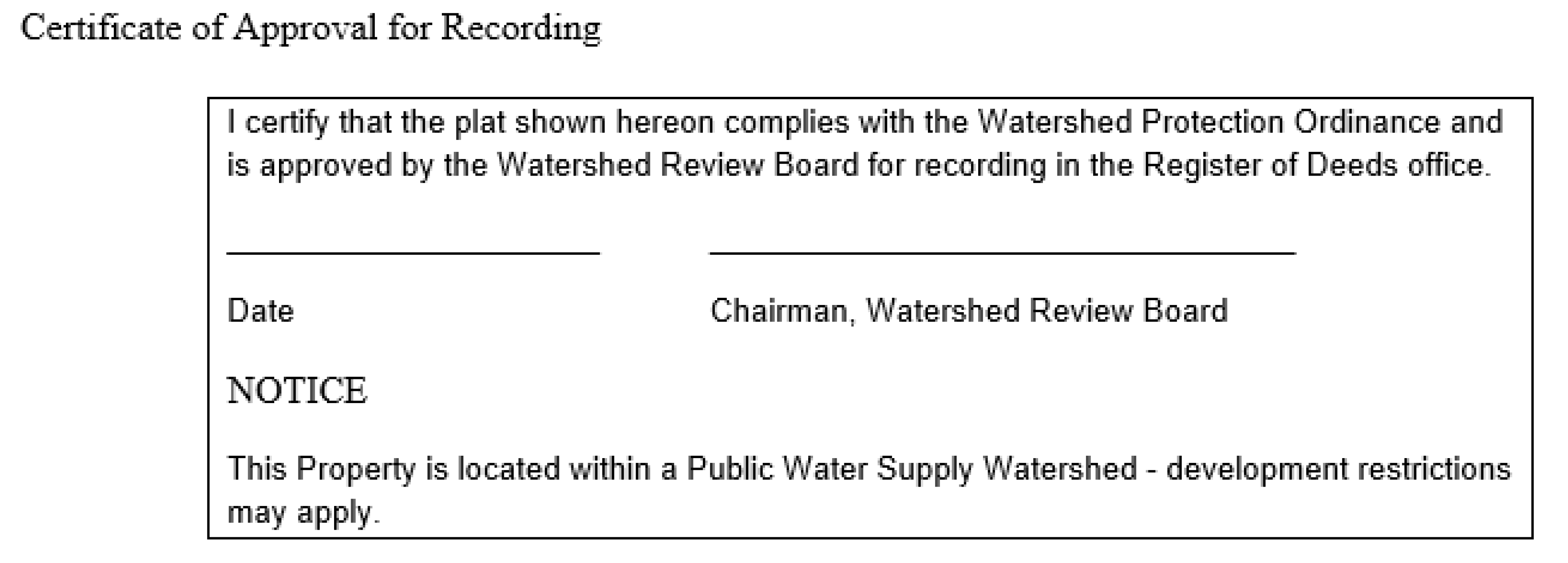
d.
If the Watershed Review Board approves the application, such approval shall be indicated on both copies of the plat by the following certificate and signed by the chairman or other authorized member of the Board:
e.
If the Watershed Review Board disapproves or approves conditionally the application, the reasons for such action shall be stated in writing for the applicant and entered in the minutes. The subdivider may make changes and submit a revised plan, which shall constitute a separate request for the purpose of review.
f.
All subdivision plats shall comply with the requirements for recording of the County Register of Deeds.
g.
The Subdivider shall provide the Watershed Administrator with evidence the plat has been recorded with the Register of Deeds within five (5) working days of its being recorded.
(3)
Subdivision Standards and Required Improvements.
a.
All lots shall provide adequate building space in accordance with the development standards contained in Article 3. Lots, which are smaller than the minimum required for residential lots, shall be identified on the plat as, "NOT FOR RESIDENTIAL PURPOSES."
b.
For the purpose of calculating built-upon area, total project area shall include total acreage in the tract on which the project is to be developed.
c.
Storm Water Drainage Facilities. The application shall be accompanied by a description of the proposed method of providing storm water drainage. The subdivider shall provide a drainage system that diverts stormwater runoff away from surface waters and incorporates best management practices to minimize water quality impacts.
d.
Erosion and Sedimentation Control. The application shall, where required, be accompanied by a written statement that a Sedimentation and Erosion Control Plan has been submitted to and approved by the Land Quality Section, Division of Environmental Management, Fayetteville Regional Office.
e.
Roads constructed in critical areas and watershed buffer areas. Where possible, roads should be located outside of critical areas and watershed buffer areas. Roads constructed within these areas shall be designed and constructed so to minimize their impact on water quality.
(4)
Construction Procedures.
a.
No construction or installation of improvements shall commence in a proposed subdivision until a subdivision plat has been approved by the Watershed Review Board.
b.
No building or other permits shall be issued for erection of a structure on any lot not of record at the time of adoption of this Ordinance until all requirements of this Ordinance have been met. The subdivider, prior to commencing any work within the subdivision, shall make arrangements with the Watershed Administrator to provide for adequate inspection.
(5)
Penalties for Transferring Lots in Unapproved Subdivisions. Any person who, being the owner or agent of the owner of any land located within the jurisdiction of Bladen County, thereafter subdivides his land in violation of this ordinance or transfers or sells land by reference to, exhibition of, or any other use of a plat showing a subdivision of the land before the plat has been properly approved under this Ordinance and recorded in the office of the register of deeds, shall be guilty of a misdemeanor. The description by metes and bounds in the instrument of transfer or other document used in the process of selling or transferring land shall not exempt the transaction from this penalty. The County of Bladen may bring an action for injunction of any illegal subdivision, transfer, conveyance, or sale of land, and the court shall, upon appropriate findings, issue an injunction and order requiring the offending party to comply with this Ordinance.
(c)
Development Regulations.
(1)
Establishment of Watershed Areas. The purpose of this Article is to list and describe the watershed areas herein adopted.
For purposes of this ordinance the County is hereby divided into the following areas:
WS-IV-CA (Critical Area)
WS-IV-PA (Protected Area)
(2)
Description of Watershed Areas.
a.
WS-IV Watershed Areas—Critical (WS-IV-CA). Only new development activities that require and erosion/sedimentation control plan under State law or approved local program are required to meet the provisions of this Ordinance when located in the WS-IV watershed. In order to address a moderate to high land use intensity pattern, single-family residential uses are allowed at a maximum of two (2) dwelling units per acre. All other residential and nonresidential development shall be allowed twenty-four percent (24%) built-upon area. New sludge application sites and landfills are specifically prohibited.
1.
Allowed Uses:
(i)
Agriculture subject to the provision of the Food Security Act of 1985 and the Food, Agriculture, Conservation and Trade Act of 1990. Agricultural activities conducted after January 1, 1993 shall maintain a minimum ten (10) foot vegetative buffer, or equivalent control as determined by the Soil and Water Conservation Commission, along all perennial waters indicated on the most recent versions of U.S.G.S. 1: 24,000 (7.5 minute) scale topographic maps or as determined by local government studies. Animal operations greater than one hundred (100) animal units shall employ Best Management Practices by July 1, 1994 recommended by the Soil and Water Conservation Commission.
(ii)
Silviculture, subject to the provision of the Forest Practices Guidelines Related to Water quality (15 NCAC 11.6101-.0209).
(iii)
Residential.
(iv)
Nonresidential development, excluding: 1) the storage of toxic and hazardous materials unless a spill containment plan is implemented, 2) landfills and 3) sites for land application of sludge/residuals or petroleum contaminated soils.
2.
Density and Built-Upon Limits:
(i)
Single Family Residential—development shall not exceed two dwelling units per acre on a project-by-project basis. No residential lot shall be less than one-half (½) acre, except within an approved cluster development.
(ii)
All Other Residential and Nonresidential—development shall not exceed twenty-four percent (24%) built-upon area on a project-by-project basis. For the purpose of calculating the built-upon area, total project area shall include total acreage in the tract on which the project is to be developed.
b.
WS-IV Watershed Areas—Protected Area (WS-IV-PA). Only new development activities that require and erosion/sedimentation control plan under State law or approved local government program are required to meet the provisions of this Ordinance when located in a WS-IV watershed. In order to address a moderate to high land use intensity pattern, single family residential uses shall develop at a maximum of two (2) dwelling units per acre. All other residential and nonresidential development shall be allowed at a maximum of twenty-four (24%) percent built-upon area. A maximum of three (3) dwelling units per acre or thirty-six (36%) percent built-upon area is allowed for projects without a curb and gutter street system. New sludge application sites and landfills are specifically prohibited.
1.
Allowed Uses:
(i)
Agriculture, subject to the provisions of the Food Security Act of 1985 and the Food, Agricultural, Conservation and Trade Act of 1990.
(ii)
Silviculture, subject to the provision of the Forest Practices Guidelines Related to Water Quality (15 NCAC 11.6101-.0209).
(iii)
Residential development.
(iv)
Nonresidential development, excluding: 1) the storage of toxic and hazardous materials unless a spill containment plan is implemented, 2) landfills and 3) sites for land application of sludge/residuals or petroleum contaminated soil.
2.
Density and Built-Upon Limits:
(i)
Single Family Residential—development shall not exceed two (2) dwelling units per acre, as defined on a project-by-project basis. No residential lot shall be less than one-third (1/3) acre for projects without a curb and gutter system, except within an approved cluster development.
(ii)
All Other Residential and Nonresidential—development shall not exceed twenty-four percent (24%) built-upon area on a project-by-project basis. For projects without a curb and gutter street system, development shall not exceed thirty-six percent (36%) built-upon area on a project-by-project basis. For the purpose of calculating built-upon area, total project area shall include acreage in the tract on which the project is to be developed.
(3)
Cluster Development. Clustering of development is allowed in all Watershed Areas (except WS-1) under the following conditions:
a.
Minimum lot sizes are not applicable to single family cluster development projects; however, the total number of lots shall not exceed the number of lots allowed for single-family detached developments in Section 302. Built-upon area or stormwater control requirements of the project shall not exceed that allowed for the critical area or balance of watershed, whichever applies.
b.
All built-upon area shall be designed and located to minimize stormwater runoff impact to the receiving waters and minimize concentrated stormwater flow.
c.
The remainder of the tract shall remain in a vegetated or natural state. Where the development has an incorporated property owners' association, the title of the open space area shall be conveyed to the association for management. Where a property association is not incorporated, a maintenance agreement shall be filed with the property deeds.
(4)
Buffer Areas Required.
a.
A minimum one hundred (100) foot vegetative buffer is required for all new development activities that exceed the low density option; otherwise, a minimum thirty (30) foot vegetative buffer for development activities is required along all perennial waters indicated on the most recent versions of U.S.G.S. 1:24,000 (7.5 minute) scale topographic maps or as determined by local government studies. Desirable artificial stream bank or shoreline stabilization is permitted.
b.
No new development is allowed in the buffer except for water dependent structures and public projects such as road crossings and greenways where no practical alternative exists. These activities should minimize built-upon surface area, direct runoff away from the surface waters and maximize the utilization of stormwater Best Management Practices.
(5)
Rules Governing the Interpretation of Watershed Area Boundaries. Where uncertainty exists as to the boundaries of the watershed areas, as shown on the Watershed Map, the following rules shall apply:
a.
Where area boundaries are indicated as approximately following either street, alley, railroad or highway lines or centerlines thereof, such lines shall be construed to be said boundaries.
b.
Where area boundaries are indicated as approximately following lot lines, such lot lines shall be construed to be said boundaries. However, a surveyed plat prepared by a registered land surveyor may be submitted to the County as evidence that one or more properties along these boundaries do not lie within the watershed area.
c.
Where the watershed area boundaries lie at a scaled distance more than twenty-five (25) feet from any parallel lot line, the location of watershed area boundaries shall be determined by use of the scale appearing on the watershed map.
d.
Where the watershed area boundaries lie at a scaled distance of twenty-five (25) feet or less from any parallel lot line, the location of watershed area boundaries shall be construed to be the lot line.
e.
Where other uncertainty exists, the Watershed Administrator shall interpret the Watershed Map as to location of such boundaries. This decision may be appealed to the Watershed Review Board.
(6)
Application of Regulations.
a.
No building or land shall hereafter be used and no development shall take place except in conformity with the regulations herein specified for the watershed area in which it is located.
b.
No area required for the purpose of complying with the provisions of this Ordinance shall be included in the area required for another building.
c.
Every residential building hereafter erected, moved or structurally altered shall be located on a lot which conforms to the regulations herein specified, except as permitted in Section 307.
d.
If a use or class of use is not specifically indicated as being allowed in a watershed area, such use or class of use is prohibited.
(7)
Existing Development. Any existing development as defined in this Ordinance, may be continued and maintained subject to the provisions provided herein. Expansions to structures classified as existing development must meet the requirements of this Ordinance, however, the built-upon area of the existing development is not required to be included in the density calculations.
a.
Vacant Lots. This category consists of vacant lots for which plats or deeds have been recorded in the office of the Register of Deeds of Bladen County. Lots may be used for any of the uses allowed in the watershed area in which its is located, provided the following:
1.
Where the lot area is below the minimum specified in this Ordinance the Watershed Administrator is authorized to issue a watershed protection permit.
b.
Occupied Lots. This category consists of lots, occupied for residential purposes at the time of the adoption of this Ordinance. These lots may continue to be used.
c.
Uses of Land. This category consists of uses existing at the time of adoption of this Ordinance where such use of the land is not permitted to be established hereafter in the watershed area in which it is located. Such uses may be continued except as follows:
1.
When such use of land has been changed to an allowed use, it shall not thereafter revert to any prohibited use.
2.
Such use of land shall be changed only to an allowed use.
3.
When such use ceases for a period of at least one year, it shall not be reestablished.
d.
Reconstruction of Buildings or Built-Upon Areas. Any existing building or built-upon area not in conformance with the restriction of this Ordinance that has been damaged or removed may be repaired and/or reconstructed, except that there are no restrictions on single family residential development, provided:
1.
Repair or reconstruction is initiated within twelve (12) months and completed within two (2) years of such damage.
2.
The total amount of space devoted to built-upon area may not be increased unless stormwater control that equals or exceeds the previous development is provided.
(8)
Watershed Protection Permit.
a.
Except where a single family residence is constructed on a lot deeded prior to the effective date of this Ordinance, no building or built-upon area shall be erected, moved, enlarged or structurally altered, nor shall any building permit be issued nor shall any change in the use of any building or land be made until a Watershed Protection Permit has been issued by the Watershed Administrator. No Watershed Protection Permit shall be issued except in conformity with the provisions of this Ordinance.
b.
Watershed Protection Permit applications shall be filed with the Watershed Administrator. The application shall include a completed application form (see Appendix A) and supporting documentation deemed necessary by the Watershed Administrator.
c.
Prior to issuance of a Watershed Protection Permit, the Watershed Administrator may consult with qualified personnel for assistance to determine if the application meets the requirements of this Ordinance.
d.
A Watershed Protection Permit shall expire if a Building Permit or Watershed Occupancy Permit for such use is not obtained by the applicant within twelve (12) months from the date of issuance.
(9)
Building Permit Required. Except for a single family residence constructed on a lot deeded prior to the effective date of this Ordinance, no permit required under the North Carolina State Building Code shall be issued for any activity for which a Watershed Protection Permit is required until that permit has been issued.
(10)
Watershed Protection Occupancy Permit.
a.
The Watershed Administrator shall issue a Watershed Protection Occupancy permit certifying that all requirements of this Ordinance have been met prior to the occupancy or use of a building hereafter erected, altered or moved and/or prior to the change of use of any building or land.
b.
A Watershed Protection Occupancy Permit, either for the whole or part of a building, shall be applied for coincident with the application for a Watershed Protection Permit and shall be issued or denied within ten (10) days after the erection or structural alterations of the building.
c.
When only a change in use of land or existing building occurs, the Watershed Administrator shall issue a Watershed Protection Occupancy Permit certifying that all requirements of this Ordinance have been met coincident with the Watershed Protection Permit.
d.
If the Watershed Protection Occupancy Permit is denied, the Watershed Administrator shall notify the applicant in writing stating the reasons for denial.
e.
No building or structure, which has been erected, moved, or structurally altered, may be occupied until the Watershed Administrator has approved and issued a Watershed Protection Occupancy Permit.
(d)
Public Health Regulations.
(1)
Public Health, in general. No activity, situation, structure or land use shall be allowed within the watershed which poses a threat to water quality and the public health, safety and welfare. Such conditions may arise from inadequate on-site sewage systems which utilize ground absorption; inadequate sedimentation and erosion control measures; the improper storage or disposal of junk, trash or other refuse within a buffer area; the absence or improper implementation of a spill containment plan for toxic and hazardous materials; the improper management of stormwater runoff; or any other situation found to pose a threat to water quality.
(2)
Abatement.
a.
The Watershed Administrator shall monitor land use activities within the watershed areas to identify situations that may pose a threat to water quality.
b.
The Watershed Administrator shall report all findings to the Watershed Review Board. The Watershed Administrator may consult with any public agency or official and request recommendations.
c.
Where the Watershed Review Board finds a threat to water quality and the public health, safety and welfare, the Board shall institute any appropriate action or proceeding to restrain, correct, or abate the condition and/or violation.
(e)
Administration, Enforcement and Appeals.
(1)
Watershed Administrator and Duties thereof. The County shall appoint a Watershed Administrator, who shall be duly sworn in as an officer of the County. It shall be the duty of the Watershed Administrator to administer and enforce the provisions of this Ordinance as follows:
a.
The Watershed Administrator shall issue Watershed Protection Permits and Watershed Protection Occupancy Permits as prescribed herein. A record of all permits shall be kept on file and shall be available for public inspection during regular office hours of the Administrator.
b.
The Watershed Administrator shall serve as clerk to the Watershed Review Board.
c.
The Watershed Administrator shall keep records of all amendments to the local Water Supply Watershed Protection Ordinance and shall provide copies of all amendments upon adoption to the Supervisor of the Classification and Standards Group, Water Quality Section, Division of Environmental Management
d.
The Watershed Administrator shall keep records of the jurisdiction's utilization of the density provisions for each watershed. Records for each watershed shall include the total acres of non-critical watershed area, total acres eligible to be developed under this option, total acres approved for this development option, and individual records for each project with the following information: location, acres, site plan, use, stormwater management plan as applicable and inventory of hazardous materials as applicable.
e.
The Watershed Administrator is granted the authority to administer and enforce the provisions of this Ordinance, exercising in the fulfillment of his responsibility the full police power of the County. The Watershed Administrator, or his duly authorized representative, may enter any building, structure, or premises, as provided by law, to perform any duty imposed upon him by this Ordinance.
f.
The Watershed Administrator shall keep a record of variances to the local Water Supply Watershed Protection Ordinance. This record shall be submitted to the Supervisor of the Classification and Standards Group, Water Quality Section, Division of Environmental management on an annual basis and shall provide a description of each project receiving a variance and the reasons for granting the variance.
(2)
Appeal from the Watershed Administrator. Any order, requirement, decision or determination made by the Watershed Administrator may be appealed to and decided by the Watershed Review Board.
An appeal from a decision of the Watershed Administrator must be submitted to the Watershed Review Board within thirty (30) days from the date the order, interpretation, decision or determination is made. All appeals must be made in writing stating the reasons for appeal, following submission of an appeal, the Watershed Administrator shall transmit to the Board all papers constituting the record upon which the action appealed from was taken.
An appeal stays all proceedings in furtherance of the action appealed, unless the officer from whom the appeal is taken certifies to the Board after the notice of appeal has been filed with him, that by reason of facts stated in the certificate, a stay would in his opinion cause imminent peril to life or property. In such case, proceedings shall not be stayed otherwise than by a restraining order which may be granted by the Board or by a court of record on application of notice of the officer from whom the appeal is taken and upon due cause shown.
The Board shall fix a reasonable time for hearing the appeal and give notice thereof to the parties and shall decide the same within a reasonable time. At the hearing, any party may appear in person, by agent or by attorney.
(3)
Changes and Amendments to the Watershed Protection Ordinance.
a.
The Bladen County Board of Commissioners may, on its own motion or on petition, after public notice and hearing, amend, supplement, change or modify the watershed regulations and restrictions as described herein.
b.
No action shall be taken until the proposal has been submitted to the Watershed Review Board for review and recommendations. If no recommendation has been received from the Watershed Review Board within forty-five (45) days after submission of the proposal to the Chairman of the Watershed Review Board, the Board of Commissioners may proceed as though a favorable report had been received.
c.
Under no circumstances shall the County Board of Commissioners adopt such amendments, supplements, or changes that would cause this Ordinance to violate the watershed protection rules as adopted by the North Carolina Environmental Management Commission. All amendments must be filed with the North Carolina Division of Environmental Management, North Carolina Division of Environmental Health, and the North Carolina Division of Community Assistance.
(4)
Public Notice and Hearing Required. Before adopting or amending this Ordinance, the Bladen County Board of Commissioners shall hold a public hearing on the proposed changes. A notice of the public hearing shall be given once a week for two successive calendar weeks in a newspaper having general circulation in the area. The notice shall be published for the first time not less than ten (10) nor more than twenty-five (25) days before the date fixed for the hearing.
(5)
Establishment of Watershed Review Board. The Bladen County Board of Adjustments is hereby appointed as the Watershed Review Board.
(6)
Rules of Conduct for Members. Members of the Board may be removed by the Bladen County Board of Commissioners for cause, including violation of the rules stated below:
a.
Faithful attendance at meetings of the Board and conscientious performance of the duties required of members of the Board shall be considered a prerequisite to continuing membership on the Board.
b.
No Board member shall take part in the hearing, consideration, or determination of any case in which he is personally or financially interested. A Board member shall have a "financial interest" in a case when a decision in the case will: 1) cause him or his spouse to experience a direct financial benefit or loss, or 2) will cause a business in which he or his spouse owns a 10 per cent or greater interest, or is involved in a decision-making role, to experience a direct financial benefit or loss. A Board member shall have a "personal interest" in a case when it involves a member of his immediate family (i.e., parent, spouse, or child).
c.
No Board member shall discuss any case with any parties thereto prior to the public hearing on that case; provided, however, that members may receive and/or seek information pertaining to the case from the Watershed Administrator or any other member of the Board, its secretary or clerk prior to the hearing.
d.
Members of the Board shall not express individual opinions on the proper judgment of any case prior to its determination on that case.
e.
Members of the Board shall give notice to the chairman at least forty-eight (48) hours prior to the hearing of any potential conflict of interest, which he has in a particular case before the Board.
f.
No Board member shall vote on any matter that decides an application or appeal unless he had attended the public hearing on that application or appeal.
(7)
Powers and Duties of the Watershed Review Board.
a.
Administrative Review. The Watershed Review Board shall hear and decide appeals from any decision or determination made by the Watershed Administrator in the enforcement of this Ordinance.
b.
Variances. The Watershed Review Board shall have the power to authorize, in specific cases, minor variances from the terms of this Ordinance as will not be contrary to the public interests where, owing to special conditions, a literal enforcement of the Ordinance will result in practical difficulties or unnecessary hardship, so that the spirit of this Ordinance shall be observed, public safety and welfare secured, and substantial justice done. In addition, the County shall notify and allow a reasonable comment period for all other local governments having jurisdiction in the designated watershed where the variance is being considered.
1.
Applications for a variance shall be made on the proper form obtainable from the Watershed Administrator and shall include the following information:
(i)
A site plan, drawn to a scale of at least one (1) inch to forty (40) feet, indicating the property lines of the parcel upon which the use is proposed; any existing or proposed structures; parking areas and other built-upon areas; surface water drainage. The site plan shall be neatly drawn and indicate north point, name and address of person who prepared the plan, date of the original drawing, and an accurate record of any later revisions.
(ii)
A complete and detailed description of the proposed variance, together with any other pertinent information, which the applicant feels, would be helpful to the Watershed Review Board in considering the application.
(iii)
The Watershed Administrator shall notify in writing each local government having jurisdiction in the watershed. Such notice shall include a description of the variance being requested. Local governments receiving notice of the variance request may submit comments to the Watershed Administrator prior to a decision by the Watershed Review Board. Such comments shall become a part of the record of proceedings of the Watershed Review Board.
2.
Before the Watershed Review Board may grant a variance, it shall make the following three findings, which shall be recorded in the permanent record of the case, and shall include the factual reasons on which they are based:
(i)
There are practical difficulties or unnecessary hardships in the way of carrying out the strict letter of the Ordinance. In order to determine that there are practical difficulties or unnecessary hardships, the Board must find that the five following conditions exist:
A.
If the complies with the provisions of the Ordinance, the applicant can secure no reasonable return from, nor make reasonable use of, his property. Merely proving that the variance would permit a greater profit to be made from the property will not be considered adequate to justify the Board in granting a variance. Moreover, the Board shall consider whether the variance is the minimum possible deviation from the terms of the Ordinance that will make possible the reasonable use of his property.
B.
The hardship results from the application of the Ordinance to the property rather than from other factors such as deed restrictions or other hardships.
C.
The hardship is due to the physical nature of the applicant's property, such as its size, shape, or topography, which is different from that of neighboring property.
D.
The hardship is not the result of the actions of an applicant who knowingly or unknowingly violates the Ordinance, or who purchases the property after the effective date of the Ordinance, and then comes to the Board for relief.
E.
The hardship is peculiar to the applicant's property, rather than the result of conditions that are widespread. If other properties are equally subject to the hardship created in the restriction, then granting a variance would be a special privilege denied to others, and would no promote equal justice.
(ii)
The variance is in harmony with the general purpose and intent of the Ordinance and preserves its spirit.
(iii)
In the granting of the variance, the public safety and welfare have been assured and substantial justice has been done. The Board shall not grant a variance if it finds that doing so would in any respect impair the public health, safety, or general welfare.
3.
In granting the variance, the Board may attach thereto such conditions regarding the location, character, and other features of the proposed building, structure, or use as it may deem advisable in furtherance of the purpose of this Ordinance. If a variance for the construction, alteration or use of property is granted, such construction, alteration or use shall be in accordance with the approved site plan.
4.
The Watershed Review Board shall refuse to hear an appeal or an application for a variance previously denied if it finds that there have been no substantial changes in conditions or circumstances bearing on the appeal or application.
5.
A variance issued in accordance with this Section shall be considered a Watershed protection Permit and shall expire if a Building Permit or Watershed Occupancy permit for such use is not obtained by the applicant within six (6) months from the date of the application.
6.
If the application calls for the granting of a major variance, and it the Watershed Review Board decides in favor of granting the variance, the Board shall prepare a preliminary record of the hearing with all deliberate speed. The preliminary record of the hearing shall include:
(i)
The variance application;
(ii)
The hearing notices;
(iii)
The evidence presented;
(iv)
Motions, offers of proof, objections to evidence, and rulings on them;
(v)
Proposed findings and exceptions;
(vi)
The proposed decision, including all conditions proposed to be added to the permit.
The preliminary record shall be sent to the Environmental Management Commission for its review as follows:
(i)
If the Commission concludes from the preliminary record that the variance qualifies as a major variance and that (1) the property owner can secure no reasonable return from, nor make any practical use of the property unless the proposed variance is granted, and (2) the variance, if granted, will not result in a serious threat to the water supply, then the Commission shall approve the variance as proposed or approve the proposed variance with conditions and stipulations. The Commission shall prepare a Commission decision and send it to the Watershed Review Board. If the Commission approves the variance as proposed, the Board shall prepare a final decision granting the proposed variance. If the Commission approves the variance with conditions and stipulations, the Board shall prepare a final decision, including such conditions and stipulations, granting the proposed variance.
(ii)
If the Commission concludes from the preliminary record that the variance qualifies as a major variance and that (1) the property owner can secure a reasonable return from or make a practical use of the property without the variance or (2) the variance, if granted, will result in a serious threat to the water supply, then the Commission shall deny approval of the variance as proposed. The Commission shall prepare a Commission decision and send it to the Watershed Review Board. The Board shall prepare a final decision denying the variance as proposed.
(iii)
Subdivision approval.
(iv)
Public Health.
(v)
Approval of all development greater than the low density option.
7.
A description of all projects receiving a variance and the reason for granting the variance shall be submitted to the Environmental Management Commission on January 1st of each year.
8.
For all variances, the Watershed Administrator shall notify and allow a reasonable comment period for all local governments having jurisdiction within or using the water supply from the Cape Fear Watershed.
(8)
Appeals from the Watershed Review Board. Appeals from the Watershed Review Board must be filed with the Superior Court within 30 days from the date of the decision. The decisions by the Superior Court will be in the manner of certiorari.
(9)
Rules of Procedures for the Watershed Review Board Regarding Appeals and Variances. Rules of procedures are the same rules set out for the Board of Adjustment. See Board of Adjustment.
8.10 - TABLE OF USES