
Bryan County Unincorporated
City Zoning Code
City Zoning Code
ARTICLE V
- ZONING DISTRICTS AND USES
This article establishes the county's zoning districts, the zoning map, the land uses authorized in each zoning district, conditions specific to certain uses in the district, the intensity of development, and district-specific development standards.
Sec. 114-500. - Establishment of zoning districts.
All unincorporated areas of the county are hereby divided into the zoning districts listed in Exhibit 500 to regulate the arrangement, location and use of land, buildings, and structures for trade, industry, residence, and other purposes; to regulate the height and size of buildings hereafter erected or structurally altered; to establish minimum setbacks, areas of yards, courts, and other open spaces; and to regulate the density of population.
Exhibit 500: Zoning Districts
(Ord. No. 06-2020, § 3, 12-8-2020)
Sec. 114-501. - Transitions from prior zoning districts.
The UDO eliminates, consolidates or changes several preexisting zoning districts. Unless otherwise rezoned subsequent to UDO adoption, the following districts will transition to the new districts listed in Exhibit 501. All buildings, structures, and uses that were legally established prior to UDO adoption may continue to be occupied and used as authorized prior to UDO adoption in accordance with Article XII: Non-Conforming Situations. New development, redevelopment and newly established uses must comply with the provisions of the newly adopted zoning district and other applicable rules and regulations.
Exhibit 501: Zoning District Transitions
Note: (1) RR-1 zoning applicable to lots of 1 acre or greater. R-15 zoning applicable to lots smaller than 1 acre. In determining the appropriate zoning district, however, the community development director shall determine the average lot size of R-30 parcels within a platted subdivision, lot size for single parcels outside of a major or minor subdivision, or review the conceptual plan included with a rezoning application for undeveloped tracts of land.
(Ord. No. 06-2020, § 3, 12-8-2020)
Sec. 114-502. - Conditional districts.
Upon the adoption of this UDO, the "Conditional District (CD)" designation shall no longer be permitted. For those parcels with a "Conditional District (CD)" designation prior to the adoption of this UDO, all conditions placed on the parcels shall remain valid and binding until such time as the board of commissioners, through the zoning map/text amendment process, modifies, amends, or removes the condition(s).
(Ord. No. 06-2020, § 3, 12-8-2020)
Sec. 114-503. - Zoning map.
(a)
Establishment, amendment and maintenance of the official zoning map.
(1)
There shall be a map designated as the Official Zoning Map, which shall show the boundaries of all zoning districts within the county's planning jurisdiction. This map shall be stored on the county's geographic information system (GIS) and printed on durable material. Prints shall be dated and kept in the community development department.
(2)
The Official Zoning Map is adopted and incorporated herein by reference. Amendments to this map shall be made and posted in accordance with Article III, Division 2 of this UDO.
(3)
The community development director shall update the Official Zoning Map as soon as possible after amendments to it are adopted by the board of commissioners. Upon entering any such amendment on the map, the community development director shall change the date of the map to indicate its latest revision. The community development department shall keep copies of superseded prints of the zoning map for historical reference.
(4)
No unauthorized person may alter or modify the Official Zoning Map. If an unauthorized person alters or modifies the Official Zoning Map, the amendment shall be considered null and void, and the original zoning designation shall be reinstated.
(5)
GIS records shall indicate the zoning designation; the number and date of the ordinance creating the designation; and where a conditional zoning district was established prior to this UDO or conditions were included with the zoning map amendment approval, the conditions of that rezoning. GIS records shall maintain the zoning history.
(6)
Should the Official Zoning Map be lost, destroyed or damaged, the community development director may have a new map generated from the most reliable available data. No further board of commissioners authorization or action is required so long as no district boundaries are changed in this process.
(7)
If there is a question or dispute concerning the current zoning of a property, the community development director shall research the county's official records, including but not limited to application files, P&Z minutes, board of commissioners minutes, and county ordinances, to determine if the Official Zoning Map correctly identifies the parcel(s) zoning. The community development director shall be the final authority as to the current zoning status of the parcel in the county.
(b)
Interpretation of zoning district boundaries.
(1)
Where uncertainty exists as to the boundaries of districts shown on the Official Zoning Map or any other map incorporated in or referenced by the UDO, the following rules shall apply:
a.
Boundaries indicated as approximately following the centerlines of streets, alleys or other public rights-of-way shall be construed to follow such centerlines. Where the street, alley or right-of-way has been vacated through official action of the governing body, the boundary shall be construed to follow the centerline of the vacated right-of-way.
b.
Boundaries indicated as approximately following property lines shall be construed to follow such lines.
c.
Boundaries indicated as approximately following jurisdictional boundaries shall be construed to follow such boundaries.
d.
Boundaries indicated as following railroad lines shall be construed to be midway between the main tracks.
e.
Boundaries indicated as following shorelines shall be construed to follow such shorelines and in the event of change in the shoreline shall be construed as moving with the actual shoreline.
f.
Boundaries indicated as approximately following the centerlines of canals, streams or other bodies of water shall be construed to follow such centerlines.
g.
Boundaries indicated as parallel to features described in paragraphs (a) through (f) above shall be construed as parallel to such features at the distance from the feature indicated on the Official Zoning Map. If a distance is not indicated on the Official Zoning Map, the distance shall be determined by the scale of the map unless actual dimensions are noted.
(2)
If, because of an error or omission on the Official Zoning Map, any lot within the jurisdiction of this UDO is not shown as being within a zoning district, such lot will be classified as A-5, until changed by amendment.
(3)
Where interpretation is needed as to the exact location of boundaries of any mapped area, the community development director shall make the necessary interpretation.
(c)
Parcels divided by district lines.
(1)
Whenever a single parcel of two acres or less in size is located within two or more different zoning districts, the district regulations applicable to the district within which the larger portion of the lot lies shall apply to the entire lot.
(2)
Whenever a single lot greater than two acres in size is located within two or more different zoning districts, then:
a.
If each portion of the lot located within a separate district is equal to or greater than the minimum lot size for that district, then each portion of the lot shall be subject to all regulations applicable to the district in which it is located.
b.
If any portion of the lot located within a separate district is smaller than the minimum lot size for that district, then such smaller portion shall be regarded as if it were in the same zoning district as the nearest larger portion to which it is attached.
(Ord. No. 06-2020, § 3, 12-8-2020)
Sec. 114-504. - Authorized use tables established.
Each district includes a table of authorized land uses showing the principal uses allowed by right within zoning districts, uses subject to supplemental conditions, and uses that must be authorized by conditional use permit. A master table showing all uses and districts is included in Appendix F.
(a)
By right uses. A "P" indicates the listed use is allowed by right within the respective zoning district subject to required approvals in accordance with the procedures established in Articles II—IV.
(b)
Uses subject to supplemental conditions. An "S" indicates that the listed use is allowed by right, but subject to supplemental use regulations established in the zoning district regulations, or articles VII and VIII.
(c)
Conditional uses. A "C" indicates the listed use is allowed within the respective zoning district only after review by the planning and zoning commission and approval of a conditional use permit by the board of commissioners in accordance with the procedures established in article III. Specific conditions for some of these uses are established in the zoning district standards and articles VII and VIII.
(d)
Prohibited uses. A blank cell in an authorized use matrix means that the use is prohibited in the applicable zoning district.
(Ord. No. 06-2020, § 3, 12-8-2020)
Sec. 114-505. - Uses not listed in authorized land use tables.
In the case where a use is not listed in any authorized use matrix of the UDO, and such use is not otherwise prohibited by law, the community development director shall determine whether a substantially similar use exists in the use matrix. If the community development director determines that a substantially similar use exists, then the regulations governing that use shall apply to the particular use not listed. In making the determination, the community development director shall consider the purposes of the zoning district and the following rules of construction:
(a)
Because the list of permissible uses set forth in the authorized use tables cannot be all-inclusive; those uses that are listed shall be interpreted liberally by the community development director to include other uses that have similar impacts to the listed uses.
(b)
If a use cannot be interpreted by the community development director for inclusion in an authorized land use table, that use shall be prohibited. Authorized land use tables shall not be interpreted to allow a use in one zoning district when the use in question is more closely related to another use that is permissible in other zoning districts.
(c)
If, when seeking periodic ratification of interpretations through text amendment to this UDO, the community development director's interpretation is reversed by action of the board of adjustment, then prior decisions regarding a development application made in reliance on the community development director's interpretation shall be valid, except that non-conforming use regulations of this UDO shall apply to the use.
(Ord. No. 06-2020, § 3, 12-8-2020)
Sec. 114-506. - Agricultural and rural residential district purposes.
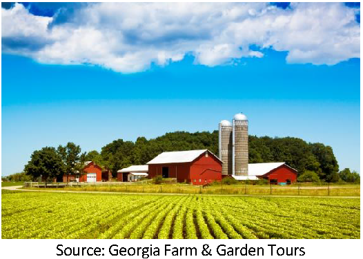
(a)
"A-5" Agricultural District Purpose. Agriculture and forestry are the primary activities to be conducted within this district, which is intended to conserve natural resources and open space of land. The district allows very-low density residential development that is compatible with nearby agricultural and forestry uses.
(b)
"RR-2.5" Rural Residential Districts. The purpose of this district is to provide for large-lot single family development in a rural environment that may include limited agricultural and forestry activities. Residential development shall be compatible with nearby agricultural and forestry uses.
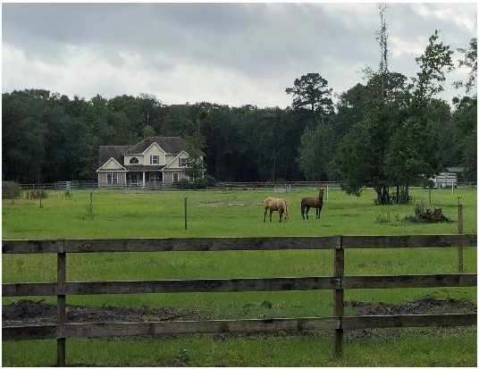
(c)
"RR-1.5" Rural Residential District. The purpose of this district is to provide for large-lot single family development in a rural environment. Limited non-commercial agricultural activity is permissible here.
(d)
"RR-1" Rural Residential Districts. The purpose of this district is to provide for large-lot single family development in a rural environment. Limited non-commercial agricultural activity is permissible here.
(Ord. No. 06-2020, § 3, 12-8-2020)
Sec. 114-507. - Authorized land uses.
Exhibit 507 identifies the land uses that are allowed within agricultural and rural residential zoning districts, by right (P), subject to supplemental conditions (S) or by conditional use permit (C). Supplemental Use conditions for these districts can be found in Section 114-508 and Article VII. See Appendix F for a consolidated table of authorized uses showing all uses and districts.
Exhibit 507 Authorized Land Uses in Agricultural and Rural Residential Districts
(Ord. No. 06-2020, § 3, 12-8-2020; Ord. No. 16-2021, § 2, 8-10-2021)
Sec. 114-508. - Agricultural and agricultural/residential district use conditions.
The following use standards shall apply in addition to the standards established for specified uses in article VII.
(a)
In the A-5 district:
(1)
Retail sales are limited to agricultural products grown or raised on the premises.
(2)
Outdoor recreation uses are limited to low intensity activities that do not involve the use of motorized vehicles or rides, such as go carts, all-terrain vehicles, or carousels. Examples of low intensity uses are:
a.
An unlighted, regulation-size or par three golf courses, including normal club house and pro shop activities, and other business activity associated with country clubs is permitted by right.
b.
Simulated combat course for paintball gun users.
c.
Unlighted recreation fields.
(3)
Commercial riding stables are allowed, provided that no building or enclosure for animals is located closer than 100 feet from any property line.
(4)
The maximum density for large farm animals, non-commercial, is 0.75 large animal units per acre or a minimum of 1.33 acres for each animal unit. For commercial farming, the operator shall comply with all State and federal requirements.
a.
A large farm animal unit shall be considered one horse, one cow, one pig, five sheep or five goats. Other large animal units shall be calculated based on the formula of one animal unit equals 500 lbs. of average mature animal weight.
b.
For purposes of this section, lot area must equal or exceed the minimum area for an entire large farm animal to allow an animal. For example, two horses may be kept on a lot that is at least two and two-thirds (2.67) acres, and approximately four acres is required for three horses (3 horses * 1.33 acres/horse = 3.99 acres).
(5)
There shall be no more than one principal building per lot for parcels less than 25 acres. Parcels containing 25 acres or more will be allowed one additional principal building on the parcel.
(6)
Structures that are accessory to a bona fide agricultural use may be established in the absence of another principal structure.
(7)
A maximum of one accessory structure, not used for agricultural purposes, may be constructed and occupied before a principal building is established. The accessory structure shall be used solely for personal use and may not be used for or in the furtherance of a commercial operation of any kind. If a principal structure has not been constructed, the maximum size of the accessory structure may not exceed 750 square feet.
(b)
In RR-2.5, RR-1.5 and RR-1 districts:
(1)
There shall be no more than one principal building per lot for parcels less than 25 acres. Parcels containing 25 acres or more will be allowed one additional principal building on the parcel.
(2)
Accessory buildings used for bona-fide agricultural purposes may be constructed and established prior to the primary building being established. Only one accessory building may be used for agricultural purposes on lots smaller than two and one-half acres and the building shall not have more than 2,500 square feet of floor area.
(3)
Large farm animals are subject to the following limitations:
a.
Large farm animals include any hooved livestock, such as cows, horses, mules, sheep, goats, llamas, and other animal other than a dog (canis familiaris) with an adult weight of 50 pounds or more.
b.
Large farm animals may not be raised, kept or used for commercial purposes.
c.
The minimum lot size for keeping of a large farm animal is two acres.
d.
The maximum density for large farm animals is 0.75 large animal units per acre or a minimum of 1.33 acres for each animal unit.
e.
A large farm animal unit shall be considered one horse, one cow, one pig, five sheep, or five goats. Other large animal units shall be calculated based on the formula of one animal unit equals 500 lbs. of average mature animal weight.
f.
For purposes of this section, lot area must equal or exceed the minimum area for an entire large farm animal to allow an animal. For example, two horses may be kept on a lot that is at least two and one-half acres, and at least four acres is required for three horses (4 acres * 0.75 animals/acre = 3 large animal units).
g.
Enclosures for large farm animals shall be kept at least 100 feet from property lines. For purposes of this section, an enclosure is a physical structure such as a barn or a shed. A fence is not an enclosure.
h.
The non-commercial keeping of one or more pigs is allowed within a RR-2.5 district on a lot encompassing five or more acres, subject to the large animal limitations applicable to the A-5 district.
(4)
Small farm animals are subject to the following limitations:
a.
Small farm animals include poultry, rabbits and similarly sized animals. Dogs and other domesticated pets that are customarily kept within a household are not considered to be small farm animals subject to the provisions of this section.
b.
Small farm animals may not be raised, kept, or used for commercial purposes.
c.
The minimum lot size for keeping of small animals is one acre. For properties that are a minimum of one acre but less than two and a half acres in size, the maximum number of small animals, collectively, allowed on the property shall be 20. For properties greater than two and a half acres, the maximum number of small animals allowed on the property shall be five additional small animals per half acre with a maximum of 50, collectively.
d.
Enclosures for small farm animals shall be kept at least 50 feet from property lines. In the RR-1 and RR-1.5 districts, poultry shall be kept in an enclosure, which for purposes of this section shall be a physical structure such as a barn, coop, chicken run, or shed.
e.
In the RR-1 and RR-1.5 districts, poultry shall be limited to chickens. Poultry (domesticated birds) such as turkeys, guinea hens, roosters, peafowl, and squab are prohibited.
(c)
In any Agricultural or Rural Residential district: Public utilities substation or sub-installation including water towers are allowed on any sized lot, provided that:
(1)
Such use is enclosed by a painted or chain-link fence or wall at least eight feet in height above finished grade;
(2)
There is no office, commercial operation or storage of vehicles or equipment on the premises; and
(3)
A landscaped strip not less than five feet in width is planted and suitably maintained around the facility.
(Ord. No. 06-2020, § 3, 12-8-2020)
Sec. 114-509. - Agricultural and rural-residential district development standards.
(a)
Lot development standards. Exhibit 509 summarizes the lot area, height and setback requirements in A and RR zoning districts; setbacks and height regulations apply to principal and accessory structures in these districts. See divisions 2 and 3 of article VI for additional rules and explanations of these standards.
Exhibit 509: Summary of Lot Area, Height and Setback Requirements
(Ord. No. 06-2020, § 3, 12-8-2020)
Sec. 114-510. - Residential district purposes.
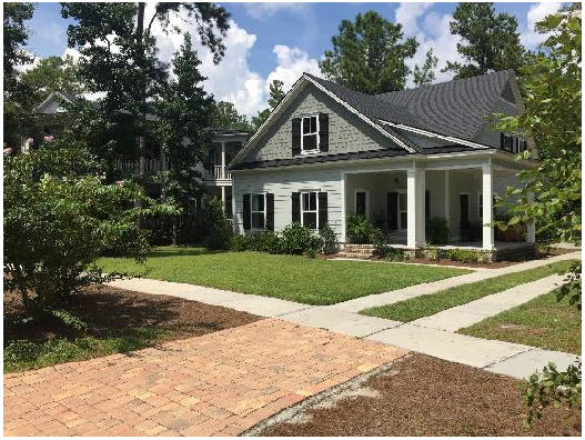
(a)
"R-15" Single Family Residential District. The purpose of this district is to provide for medium to low-density single-family and duplex development free from intrusion by incompatible agricultural and commercial uses. This district is primarily to be served by centralized water systems and public or community sewage systems. Individual systems may be allowed on existing lots or lots created through the minor subdivision process that lack access to public or community systems and comply with minimum requirements of the Public Health Department and the Georgia Environmental Protection Division. Major subdivisions exceeding the minimum lot size and either served by an individual septic system or an individual well are permitted in this district.
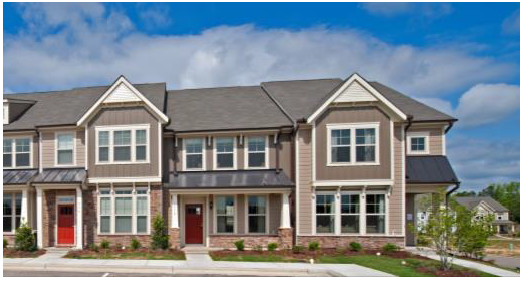
(b)
"R-M" Multi-Family Residential District. The purpose of this district is to provide locations for apartments, townhouses and other attached residential developments served by both a centralized water system and a centralized sewer system.
(c)
"R-MH" Manufactured Housing Park District. The purpose of this district is to provide locations for planned manufactured housing parks that are adequately served by water and sewer systems.
(Ord. No. 06-2020, § 3, 12-8-2020)
Sec. 114-511. - Authorized uses in residential districts.
Exhibit 511 identifies the land uses that are allowed within residential zoning districts, by right (P), subject to supplemental conditions (S) or by conditional use permit (C). Supplemental Use conditions for these districts can be found in Section 114-512 and Article VII. See Appendix F for a consolidated table of authorized uses showing all uses and districts.
Exhibit 511: Authorized Land Uses in Residential Districts
(Ord. No. 06-2020, § 3, 12-8-2020; Ord. No. 16-2021, § 2, 8-10-2021)
Sec. 114-512. - Residential district use conditions.
The following use standards shall apply in addition to the standards established for specified uses in Article VII.
(a)
In any residential district:
(1)
Public utilities substation or sub-installation including water towers, may be allowed on any sized lot, provided that:
a.
Such use is enclosed by a painted or chain-link fence or wall at least eight feet in height above finished grade;
b.
There is no office, commercial operation or storage of vehicles or equipment on the premises; and
c.
A landscaped strip not less than five feet in width is planted and suitably maintained around the facility.
(2)
There shall be no more than one principal building per lot except as otherwise allowed in the R-M and R-MH districts.
(b)
In the R-15 and RM districts, manufactured homes shall not be considered single-family dwellings and shall not be permitted.
(c)
In the R-MH district: Manufactured housing parks shall comply with Section 114-737.
(Ord. No. 06-2020, § 3, 12-8-2020)
Sec. 114-513. - Residential district development standards.
(a)
Lot development standards. Exhibit 513 summarizes the lot area, height and setback requirements in residential zoning districts; setback and height regulations apply to principal structures. See article VII, division 2 for standards applicable to accessory structures. See the following paragraphs in this section, and divisions 2 and 3 of article VI for additional rules and explanations of these standards.
Exhibit 513: Summary of Lot Area, Height and Setback Requirements for Residential Districts
(b)
Standards for townhouse development. Townhouse developments are subject to the applicability requirements identified in Section 114-803(a), shall be consistent with the design themes identified in section 114-803(b), and shall comply with the following standards in addition to the design standards of section 114-804.
(1)
Minimum lot area. The minimum lot area for individual townhouses is 1,600 square feet.
(2)
Minimum lot width. The minimum lot width of individual house units is 20 feet.
(3)
Minimum setbacks. Minimum front setbacks for townhouses shall comply with applicable zoning district standards if on a collector or arterial road. On a local or minor local street, the minimum front setback for townhouses with front-loaded garages shall be 20 feet provided that the garage entry is located at least 25 feet from the front property line to accommodate safe storage of vehicles in driveways. Minimum front setbacks for townhouses with rear-loaded garages shall be ten feet.
(Ord. No. 06-2020, § 3, 12-8-2020)
Sec. 114-514. - Commercial district purposes.
(a)
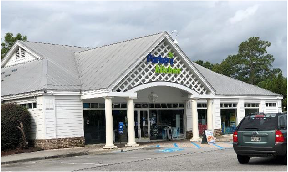
"B-1" Neighborhood Commercial. This district provides for locations of small-scale stores and services at locations serving residential areas. The design, use, scale, and traffic generation of businesses should be compatible with character and needs of the nearby neighborhoods they serve.
(b)
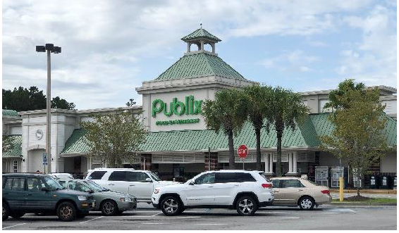
"B-2" General Commercial Districts. This district provides locations for large, county-wide and regional businesses that tend to generate high traffic volumes.
(c)
"C-I" Interchange Commercial District. This district provides locations for transportation related businesses associated with interstate highway travel and for commercial centers serving as regional commercial destinations.
(Ord. No. 06-2020, § 3, 12-8-2020)
Sec. 114-515. - Authorized uses in commercial districts.
Exhibit 515 identifies the land uses that are allowed within commercial zoning districts, by right (P), subject to supplemental conditions (S) or by conditional use permit (C). Supplemental Use conditions for these districts can be found in section 114-516 and article VII. See Appendix F for a consolidated table of authorized uses showing all uses and districts.
Exhibit 515: Authorized Land Uses in Commercial Districts
(Ord. No. 06-2020, § 3, 12-8-2020; Ord. No. 16-2021, § 2, 8-10-2021)
Sec. 114-516. - Commercial district use conditions.
The following use standards shall apply in addition to the standards established for specified uses in article VII.
(a)
In the B-1 district:
(1)
Neighborhood convenience stores shall not exceed 3,500 square feet in size.
(2)
Total square footage within a multi-tenant commercial building or development shall not exceed 40,000 square feet.
(3)
Total square footage for a single tenant building shall not exceed 10,000 square feet.
(b)
In any commercial district:
(1)
Only one residential dwelling unit per lot as an accessory use within the same structure as the commercial activity.
(2)
Outdoor storage of inoperable or junk vehicles is prohibited
(3)
Except as limited in the B-1 district, drive-in and drive-through uses may be approved subject to the conditions in section 114-730.
(Ord. No. 06-2020, § 3, 12-8-2020)
Sec. 114-517. - Commercial district development standards.
(a)
Lot development standards. Exhibit 517 summarizes the lot area, height and setback requirements in commercial zoning districts; height and setback requirements apply to principal and accessory structures in these districts. See the following paragraphs in this section, and divisions 2 and 3 of article VI for additional rules and explanations of these standards.
Exhibit 517: Summary of Lot Area, Height and Setback Requirements for Commercial Districts
(b)
Certain lots fronting on U.S. 17. Lots which currently have frontage along the southbound portion of US 17 from the Richmond Hill City limits to Bryce Street, served by public sewer and water, not serviced by a through access road shall have the following lot and building requirements:
(1)
Minimum lot area: 17,500 square feet.
(2)
Minimum lot width at building line: 95 feet.
(3)
Minimum front yard setback from road right-of-way: 50 feet.
(4)
Minimum side yard setback from property line: 15 feet.
(Ord. No. 06-2020, § 3, 12-8-2020; Ord. No. 08-2024, § 2, 4-9-2024)
Sec. 114-518. - Industrial district purposes.
(a)
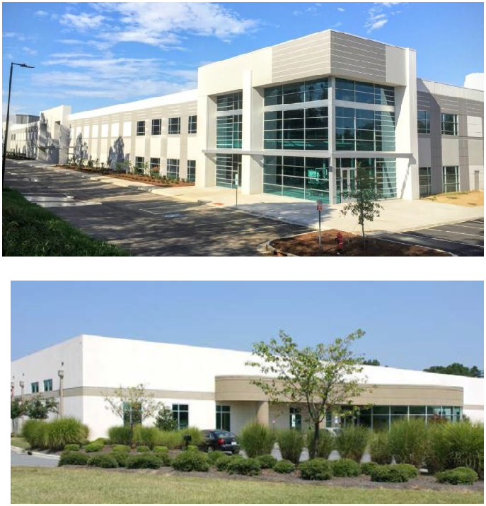
"I-1" Light Industrial District. This district provides land for light industrial uses that are not significantly objectionable to surrounding properties due to noise, odor, fumes, and traffic. This district's regulations are designed to provide a compatible environment for uses generally classified as light industrial in nature; to protect and reserve undeveloped areas within the County that are suitable for such light industries; and to discourage encroachment by residential, commercial, or other uses that may adversely affect the industrial character of the district. Lands within this district should be located for easy access to the County's thoroughfare network, as well as rail and air, if required. Development should be designed so that uses within the district do not disrupt normal traffic flow patterns within the County. Planned industrial parks are encouraged within this district.
(b)
"I-2" General Industrial District. This district provides areas for manufacturing, assembling, fabricating and related activities and standards to prevent adverse effects on surrounding properties.
(c)
"P/I" Public/Institutional District. This district provides areas for public and institutional buildings that provide public gathering places or support the provision of public services to County residents.
(d)
"WP" Waste Management District. This district provides land for waste treatment and disposal in locations which meet strict criteria for protection of other land uses and the environment. The district's regulations are designed to provide a compatible environment for waste processing and treatment facilities so that they will not be encroached upon by other uses or be adversely impacted by nearby conflicting land uses. Lands designated for waste management should be located in relation to the transportation systems it will utilize so that it will not disrupt normal traffic flow patterns within the County. Due to the special nature of waste and the potential health and environmental risks involved, this district will be only designated on the zoning map in response to a specific rezoning request by an applicant.
(Ord. No. 06-2020, § 3, 12-8-2020)
Sec. 114-519. - Authorized uses in industrial and public/institutional districts.
Exhibit 519 identifies the land uses that are allowed within industrial and public/institutional zoning districts, by right (P), subject to supplemental conditions (S) or by conditional use permit (C). Supplemental Use conditions for these districts can be found in section 114-520 and article VII. See Appendix F for a consolidated table of authorized uses showing all uses and districts.
Exhibit 519: Authorized Land Uses in Industrial and Public/Institutional Districts
(Ord. No. 06-2020, § 3, 12-8-2020; Ord. No. 16-2021, § 2, 8-10-2021)
Sec. 114-520. - Industrial and public/institutional district use conditions.
The following use standards shall apply in addition to the standards for specified uses in article VII.
(a)
Conditions applicable to all industrial districts. Retail businesses or services shall be incidental to a permitted use and located on the same premises as a principal use.
(b)
Conditions applicable to the I-2 district. Open yard use for the sale, rental, dismantling and/or storage of new or used salvage and/or junk materials or equipment may be permitted as a conditional use in an I-2 district, provided that:
(1)
Such uses are separated and screened from adjoining properties by a suitable planting screen, fence, or wall at least eight feet in height. If a fence is used, the material must be opaque. A chain link fence with slats is not considered adequate screening and the use of razor wire is not permitted; and
(2)
No burning of materials or products will be conducted on the premises.
(c)
Conditions applicable to all industrial and public/institutional districts.
(1)
All uses shall be conducted in such a manner that noxious odors, fumes, dust and similar particles, or noise are not emitted or detectable beyond the property lines of the lots on which the uses are located.
(2)
A watchman or caretaker's one- or two-family dwelling may be established, provided that:
a.
Such dwelling is located on the premises of the permitted industrial or public/institutional use; and
b.
A member of the household is employed by the industry as a watchman or caretaker.
(3)
Uses that are accessory to conditional uses shall be approved through the conditional use process.
(d)
Conditions applicable in waste management districts.
(1)
There shall be a minimum of a 200-foot wide thick, mature, natural or cultivated landscape buffer established and maintained along all property lines, excluding approved driveways, building sites and drainage facilities as shown on the approved site plan. The site plan must be included in the rezoning application and approved by the board of commissioners.
(2)
As conditions for approval, access to the site shall be controlled and monitored by the operator.
(3)
The operator shall be responsible for the control and proper disposal of incidental litter by providing fencing or other physical barriers around the site.
(4)
As a condition of approval, the applicant shall develop an emergency plan which will be used should there be an accident or other problems which threatens the health or environment. The applicant shall put in place the necessary equipment, hire the necessary personnel and other requirements of the emergency plan before operation can begin. This plan must be approved by the board of commissioners.
(5)
The applicant shall follow the procedures for siting, operating, closure and post closure in accordance with article 2, O.C.G.A. § 12-8-20 and subsequent changes. Verification of compliance with article 2, O.C.G.A. § 12-8-20 shall be required before the landfill becomes operational; however, no waste management district shall be located within 1,000 feet of a residence or a residential domestic water supply (well).
(6)
The applicant must show evidence that the facility will comply with all applicable federal, State and local laws, rules and regulations, including all specifications but not limited to provisions of the Bryan County ordinance regarding the collection, storage and disposal of solid waste.
(7)
All waste management districts must have primary access to a State or federal highway.
(8)
Waste management districts shall not be located in wetlands, as defined by the U.S. Corps of Engineers. All applications for a waste management district must be accompanied by a wetlands delineation of the site and must demonstrate that all processing, storage or disposal of waste products will be outside of wetlands areas.
(Ord. No. 06-2020, § 3, 12-8-2020)
Sec. 114-521. - Industrial district development standards.
(a)
Lot development standards. Exhibit 521 summarizes the lot area, height and setback requirements in industrial and public/institutional zoning districts; height and setback requirements apply to principal and accessory structures. See the following paragraphs in this section, and divisions 2 and 3 of article VI for additional rules and explanations of these standards.
Exhibit 521: Summary of Lot Area, Height and Setback Requirements for Industrial and Public/Institutional Districts
(Ord. No. 06-2020, § 3, 12-8-2020; Ord. No. 20-2021, § 2, 9-14-2021; Ord. No. 2022-15, § 2, 10-11-2022)
Sec. 114-522. - Waterfront and dunes/marshlands district purposes.
(a)
"WB" Waterfront Business District. This district allows for the establishment of a broad range of businesses that are designed and operated to protect the environmentally sensitive waterfront and marsh front locations located in the district.
(b)
"DM-1" Dunes and Marshlands Districts. This district is intended to protect those areas of the county that are considered to be environmentally sensitive due to soil types, drainage, vegetation, wildlife habitats or other factors that are subject to being seriously endangered, damaged, or destroyed if allowed to develop in a manner inconsistent with their conservation and preservation. Since the welfare and well-being of the citizens of the County are directly linked to the natural environment of the area, maintaining sensitive areas in their natural condition to the greatest extent possible is necessary to protect such areas from degradation. Areas that meet any one of the following criteria shall be considered an environmentally sensitive area and subject to the conditions of this district which may be applied to such areas:
(1)
Marshland. All land subject to tidal action which is comprised of generally unstable soil materials commonly known as "hard or soft" marsh grass, reeds and similar growth and is usually characterized by poor load bearing capacity. Marshland lies below an elevation of 5.6 feet above mean sea level.
(2)
Dunes. All land where, through natural action of the wind, sand has accumulated in hills and ridges forming a mound of sand. This area is usually confined to the soil classification Kershaw-Osier complex and is found immediately adjacent to the Atlantic Ocean on the barrier islands. The slopes range from zero to eight percent.
(Ord. No. 06-2020, § 3, 12-8-2020)
Sec. 114-523. - Authorized uses in waterfront business and dunes/marshlands districts.
Exhibit 523 identifies the land uses that are allowed within waterfront and dunes/marshlands zoning districts, by right (P), subject to supplemental conditions (S) or by conditional use permit (C). Supplemental Use conditions for these districts can be found in section 114-524 and article VII. See Appendix F for a consolidated table of authorized uses showing all uses and districts.
Exhibit 523: Authorized Land Uses in Waterfront and Dunes/Marshlands Districts
(Ord. No. 06-2020, § 3, 12-8-2020; Ord. No. 16-2021, § 2, 8-10-2021)
Sec. 114-524. - Waterfront business district use conditions.
The following use standards shall apply in addition to the standards established for specified uses in article VII.
(a)
In WB districts:
(1)
Permitted and conditional uses may serve both water-based and land-based users.
(2)
One residential dwelling unit per lot as an accessory use within the same structure as the commercial activity.
(3)
Uses that are accessory to conditional uses shall be approved through the conditional use process.
(b)
In Dunes and Marshlands districts:
(1)
Permitted uses are limited to boating, swimming, sunbathing, picnicking, fishing, hunting, educational, and other active and passive recreational activities not inherently destructive to the existence or integrity of the marshlands and dunes.
(2)
When approved by the State or U.S. Army Corps of Engineers, bulkheads for single family residential lots, single family docks and boat hoists and other private docks serving up to three lots.
(c)
In Marshland Areas:
(1)
The applicant for a conditional use permit shall prove conclusively that the proposed use will have no significant short or long-term adverse environmental effects, including increasing potentials for disturbance of existing eco-systems, penetration of channels of navigable waterways, interference with existing established dune sequences; and exposure of inland properties to wind, water, or wave damage.
(2)
The following uses may be permitted in marshland areas of a DM-1 District upon approval by the Georgia Department of Natural Resources: seawalls, jetties, bulkheads, piers, revetments, groins, breakwaters, boat ramps, and docks and boat hoists. The construction of roads, driveways, utility lines, and water and sewer infrastructure requires a conditional use permit.
(Ord. No. 06-2020, § 3, 12-8-2020)
Sec. 114-525. - Waterfront business and dunes/marshlands district development standards.
Because of the uniqueness of waterfront, dunes, and marsh front sites, applications for a reclassification to WB or DM districts must include a site plan proposing appropriate buffers and setbacks which must be approved by the board of commissioners. The appropriate minimum lot size shall be determined through the rezoning process. For lots created prior to this UDO, the building setback line shall be consistent with any existing structures on the lot unless modified by the board of commissioners. If the lot is undeveloped, the setbacks shall be no less than 30 feet in front, and ten feet on the side and rear.
(Ord. No. 06-2020, § 3, 12-8-2020)
Sec. 114-526. - Purpose.
To enable the application of flexible land development and use regulations that facilitate creative development patterns that achieve the goals of the comprehensive plan and this UDO better than development under conventional zoning districts. PD zoning is intended to encourage ingenuity and imagination on the part of architects, site planners and developers, to foster creative designs that may deviate from the strict application of use, setback, height, and the minimum lot size requirements of the County's other zoning districts. This flexibility is provided with the expectation that PDs will include more open space and amenities than are required for typical developments. PDs must include a program for the maintenance and operation of all common areas, amenities, neighborhood improvements, facilities, and necessary services for the common use of all occupants thereof. More specifically, the PD should:
Example: Diverse housing plans create more interesting neighborhoods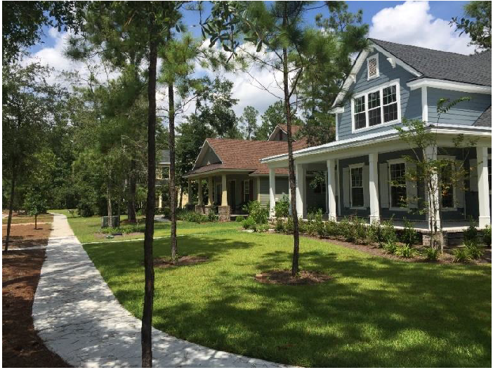
(a)
Require a compatible mix of uses and/or residential dwelling types. If a PD is proposed to be solely residential, the PD shall have a minimum of two different housing types (e.g., single family and townhouses, condominiums and apartments, etc.), each comprising no fewer than ten percent of the total number of dwelling units;
(b)
Allow for development of complete neighborhoods that include parks, open spaces, civic uses, schools, playgrounds, meeting areas and recreational facilities that enhance the development's livability;
(c)
Preserve natural amenities of land through the maintenance of wetlands, natural areas and other open spaces;
(d)
Provide for more efficient use of land;
(e)
Allow for non-residential uses that support the needs of the development and surrounding neighborhoods; and
(f)
Ensure that designs and building forms are interrelated and architecturally harmonious.
Example: tree retention provides a natural amenity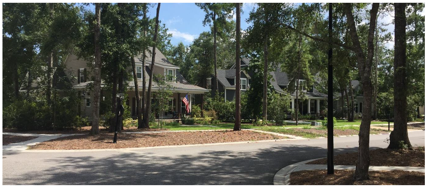
(Ord. No. 06-2020, § 3, 12-8-2020)
Sec. 114-527. - Standards.
The P&Z commission and the board of commissioners shall consider the following standards when reviewing the PD application pursuant to article III, division 3:
(a)
Compatibility with the surrounding area;
(b)
Harmony with the character of neighborhoods within and surrounding the development;
(c)
Need for the proposed development;
(d)
The effects of the proposed PD upon the existing land uses and infrastructure in the surrounding areas;
(e)
The effects of the proposed PD on the future development of the area;
(f)
Whether or not an exception from the zoning ordinance requirements and limitations is warranted by virtue of the design and amenities incorporated in the development;
(g)
That the land within and surrounding the proposed PD can be developed in coordination with the proposed PD in a manner that is consistent with the comprehensive plan;
(h)
That the proposed change to a PD district is in conformance with the general intent of the comprehensive plan and this UDO;
(i)
That the existing and proposed streets are suitable and adequate to safely carry anticipated traffic within the proposed district and in the vicinity of the proposed district and maintain an acceptable level of service;
(j)
That the existing and proposed utility services are adequate for the proposed development;
(k)
That the PD creates a desirable and stable environment; and
(l)
That the PD is necessary for the creation of a creative, innovative, and efficient use of the property.
Example: Front porches and garage location keep focus on neighbors instead of cars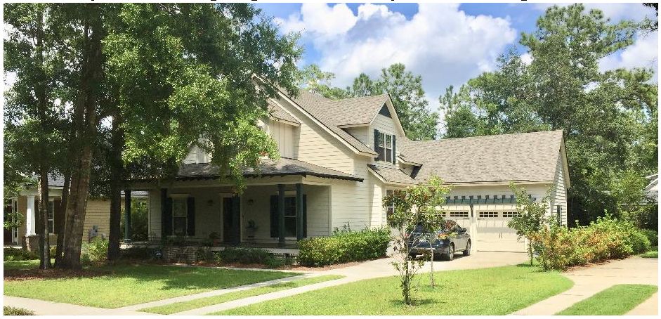
(Ord. No. 06-2020, § 3, 12-8-2020)
Sec. 114-528. - Permitted land uses within a PD.
(a)
Allowable residential and business uses within the PD zone may include, but shall not be limited to:
(1)
Residences. Developers are encouraged to include a variety of housing products to meet the diverse needs of residents at different stages of life, including conventional detached single-family units and attached residences such as townhouses and apartments. Unless modified by through the PD approval process, these development patterns are subject to the design requirements in article VIII. Other residential development products are subject to approval of average lot sizes and design standards for the specific product type.
(2)
General office uses. Including, but not limited to, administrative, sales representatives, legal services, engineering and architecture, accounting, auditing, bookkeeping, finance, real estate, physical fitness and health service clinics, veterinary clinics, insurance and personal services;
(3)
Indoor amusement and recreation. Including, but not limited to theater, bowling, billiards, video and mechanical amusement games;
(4)
Retail sales and service. Including, but not limited to, food stores, drug stores, clothing stores, home furnishings and hardware, specialty shops, craft shops, photography studios, art studios, antique shops, gift and floral shops, bookstores, beauty and barbershops, dry cleaning, laundry service and office supplies;
(5)
Eating and drinking establishments. Including, restaurants, with or without alcoholic beverages, cocktail lounges, nightclubs, taverns, and package stores;
(6)
Outdoor amusement and recreation. Including, but not limited to marina, charter or sightseeing watercraft facilities, golf course, tennis courts;
(7)
Off-street parking lots. Including parking lots to serve common areas and recreational amenities.
(8)
Public/institutional uses. Including meeting areas, schools and religious institutions.
(9)
Other residential support services as deemed necessary by the board of commissioners.
(b)
All proposed land uses will be identified within the PD application provided by the applicant. Land uses not included within the PD application shall be permitted only as a PD amendment through the approval of the board of commissioners.
(Ord. No. 06-2020, § 3, 12-8-2020)
Sec. 114-529. - Minimum lot size.
(a)
Generally. The minimum lot size for individual parcels with and without lot size reduction incentives bonuses shall not be less than provided in Exhibit 529a.
Exhibit 529a: Minimum Lot Sizes
(b)
Lot size reduction incentives.
(1)
Single-family lot size reductions may be granted in accordance with Exhibit 529b provided that the average lot sizes may not be reduced below the minimum in Exhibit 529a.
Exhibit 529b: Lot Size Reduction Incentives
(2)
Applications for lot size reductions shall be submitted in conjunction with preliminary development plan applications. Applications shall identify the type of amenity, the locations where amenities will be provided, sufficient design details to enable the community development director or engineering director to evaluate the adequacy of the amenity, and the proposed timing of provision of the amenity.
(3)
The P&Z commission shall recommend, and the board of commissioners shall decide on all such applications. Any incentives granted by the board of commissioners shall bind the applicant and successors to provision of the amenities in accordance with the preliminary development plan approval.
(4)
An applicant seeking to modify an approved lot size reduction incentive shall demonstrate to the board of commissioners that: any changes to proposed amenities will not result in a reduction of amenities anticipated by residents or owners of lots in the PD at the time of the application for the change; or if the property affected by the change remains under consolidated ownership by the applicant, the reduction in amenities is offset by a corresponding increase in average lot sizes within the PD.
(Ord. No. 06-2020, § 3, 12-8-2020)
Sec. 114-530. - Density.
The maximum density shall not exceed three dwelling units per acre of developable land within a low-density suburban character area or six dwelling units per acre within a mixed-use character area. Only developable acreage used for residential, open space, or recreational purposes shall be used to calculate density; area for commercial or institutional uses shall not be included in density calculations. Developable land excludes wetlands, marshes and tidal lands, but may include upland areas that encompass retention areas and other small water bodies.
(Ord. No. 06-2020, § 3, 12-8-2020)
Sec. 114-531. - Minimum site area.
All PDs will have a minimum contiguous site area of 150 acres. The requirement may be waived by the board of commissioners to insure orderly development of a particular area. The written request will include justification for the PD zone in lieu of a conventional zoning district. If an applicant requests a waiver to the minimum site area requirement, the applicant must submit a conceptual plan of the development. No public hearing is required related to a request to reduce the minimum site area, but the approval only applies to the waiver request and does not constitute approval of the conceptual plan or any development plans. The waiver shall be good for one year. If a preliminary development plan is not submitted within this time period, the waiver shall be void.
(Ord. No. 06-2020, § 3, 12-8-2020)
Sec. 114-532. - Unified ownership or control required.
(a)
The title to all land within a proposed site for a PD will be owned or controlled by the applicant submitting the application provided for under this article.
(b)
The term "controlled by" shall be interpreted to mean that such applicant shall have the written consent of all owners of property within the proposed site not wholly owned by the applicant. Such consent shall contain a statement that such applicant is authorized to represent such owners in the submission of an application under the provisions of this article and that such owners shall agree to be bound by the decision of the board of commissioners in the event such application is approved.
(Ord. No. 06-2020, § 3, 12-8-2020)
Sec. 114-533. - Mobility.
(a)
Easements may be used in commercial application to reduce the number of direct connections to a county or State road. The proposed use of easements in residential applications will be reviewed by the board of commissioners at the time of the submission of the PD application. County representatives shall be permitted ingress and egress on private rights-of-way, easements and open spaces in order to perform basic county services such as fire and police protection, emergency medical services or any other service required.
(b)
Pedestrian circulation shall be provided within the PD. All uses within the PD shall be connected via a continuous network of pedestrian multi-use paths and sidewalks. Pedestrian access will be provided between all parking areas and the structure(s) served by such parking areas.
(c)
The street network shall provide an interconnected system of roads that safely serve the needs of motorists, bicyclists, and pedestrians. The PD plan shall incorporate:
(1)
Complete streets;
(2)
Access to properties abutting the development;
(3)
Block lengths that meet or exceed the standards in section 114-603;
(4)
Roundabouts and/or traffic circles where appropriate;
(5)
Traffic calming street designs (e.g., stamped/textured pavement, center islands, chicanes, raised crosswalks) that use a combination of techniques that foster slow travel speeds within the development but do not rely on speed humps or other vertical traffic calming devices. The use of stop signs at intersections shall not be considered a traffic calming device/method; and
(6)
Street trees.
Example: Pedestrian amenities enhance neighborhood mobility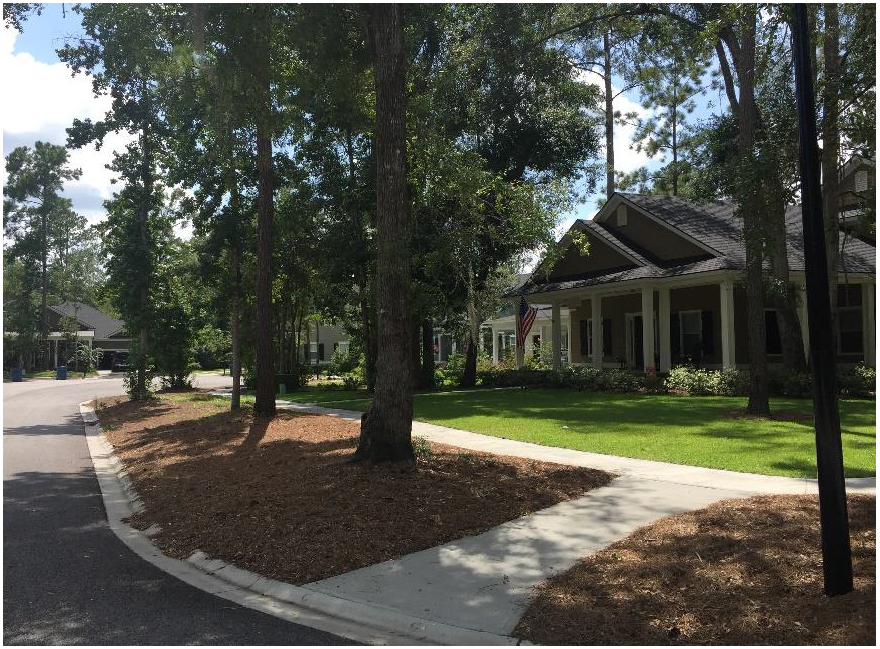
(Ord. No. 06-2020, § 3, 12-8-2020)
Sec. 114-534. - Parking.
(a)
Parking required. Parking shall be provided in accordance with article VI, division 3 except as modified by this section.
(b)
On-street parking. On-street parking may be used to satisfy minimum parking requirements. On-street parking shall be designed to promote traffic calming, pedestrian use, and shopping convenience. Parking configurations may include, but are not limited to, parallel and angle parking.
(c)
Off-street parking. Off-Street site parking in the form of public lots, and parking garages. On-street parking or off-street parking used to satisfy minimum parking requirements shall be within 500 feet of the lot it serves.
(d)
Shared parking. Shared parking is encouraged in accordance with the provisions of section 114-620.
(e)
Bicycle parking. All civic, recreational, and other non-residential uses shall provide bicycle parking in accordance with section 114-624.
(Ord. No. 06-2020, § 3, 12-8-2020)
Sec. 114-535. - Public facilities and services.
(a)
Centralized water and sewer service required. All parts of the development must be served by a sanitary sewer system and water system approved by the appropriate government agencies.
(b)
Roads and utilities. All roads, sidewalks, drainage facilities, water systems, sewerage systems, or any other infrastructure proposed for dedication to the county, must be acceptable to the county, as to the design, configuration, size, shape, and location. Infrastructure will be constructed and fully improved according to the requirements of this UDO.
(c)
Underground utilities required. All electrical, telephone, and other utility services will be underground except for main transmission lines or temporary service for construction use. These utilities shall be provided in accordance with the rules, resolutions and/or regulations established by the appropriate governmental agency.
(Ord. No. 06-2020, § 3, 12-8-2020)
Sec. 114-536. - Open space.
(a)
A PD shall provide open space that meets or exceeds the standards of article VI, division 6.
(b)
A minimum of five percent of the required open space must be permanently preserved. The land must be permanently protected under a permanent conservation easement pursuant to the Georgia Uniform Conservation Easement Act (O.C.G.A. § 44-10-1 et seq.) or a permanent restrictive covenant pursuant to Georgia State Statute (O.C.G.A. § 44-5-60(c)) and must be consistent with at least one of the greenspace statutory goals (O.C.G.A. § 36-22-2(3) [repealed—see now O.C.G.A. § 12-6A-1, et seq.]). Whenever possible, the greenspace should connect or provide connections to existing greenspace areas either within or adjacent to the proposed PD.
(c)
All open space and recreation facilities shall be included in the PD application and each preliminary and final development plan as called for in the PD application.
(d)
All community open space and recreational facilities shall be constructed and fully improved according to the development schedule established for each development phase of the PD.
(e)
A homeowners' association or nonprofit corporation created by the developer, by recorded covenants, declaration and restrictions running with the land, shall preserve and maintain for the owners and occupants of the units the land set aside for open space, parks or recreational use and common off-street parking spaces. The book and page in which these covenants, declaration and restrictions are recorded shall be shown on the final plat of the subdivision. Once the development phase is completed, the applicant must deed all open space, recreational facilities and off-street parking, not managed by another private entity, to the association or nonprofit corporation.
(Ord. No. 06-2020, § 3, 12-8-2020)
Sec. 114-537. - Recreational amenities.
(a)
General park standards. Recreational amenities shall meet or exceed the standards established in article VI, division 7. The PUD shall include provisions for recreational amenities and parks, including size, type, number and location to serve the residential component of the community.
Example: Recreational amenities foster community and healthy residents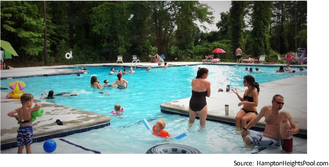
(b)
Civic space. A PD with more than 200 units in one or more phases shall be required to have a central civic space containing an enclosed amenity building (clubhouse) or an open-air pavilion. The open-air pavilion may be completely open on all sides but must include a fully sheathed and clad roof system. Trellises, arbors or similar structures with open roof systems are encouraged but cannot be solely used to satisfy this requirement for an open-air pavilion. The developer shall be responsible for construction of the civic space and its associated structures. Structure size shall be five square feet per dwelling unit for enclosed air conditioned/heated building or a minimum of 225 square feet total for an open-air pavilion. Enclosed air conditioned/heated buildings shall have a minimum size of 1,000 square feet but shall not be required to exceed 2,000 square feet.
(c)
Parks associated with non-residential use projects and components. Civic spaces shall be located to provide a public focal point. Civic spaces may include common areas, parks, plazas, greens, public gathering spaces, transit stops, amphitheaters, stages, and similar areas. Individual buildings with less than 10,000 square feet of enclosed area are exempt from this requirement. If the PD, however, has multiple non-residential buildings concentrated into one area and the aggregate space of the buildings exceed 10,000 square feet, this exemption does not apply. The following standards shall be employed for civic spaces:
(1)
Typical uses may include, but are not limited to, sitting areas; parks; employee lunch or break areas; plazas for public events and outdoor retail sales; and gardens.
(2)
Tower elements, landscaping, kiosks, water features, sculptures, benches, arbors, gateways, or other hardscape and architectural features shall be incorporated in civic spaces. The community development department shall be responsible for approving the number and location of the civic elements to satisfy this requirement.
(3)
Civic space for commercial and office uses shall be calculated at a minimum of 100 square feet per 1,000 square feet of enclosed building area. Civic spaces shall have a minimum size of 1,000 square feet and shall be a minimum of 25 feet in width.
(4)
Civic space shall be owned and maintained by the developer or designated association. In all cases, for open space to qualify as a civic space, the area must be designed for pedestrian use and shall not be solely a landscaped area.
(Ord. No. 06-2020, § 3, 12-8-2020)
Sec. 114-538. - Adequate public facilities and services.
It is the responsibility of the applicant to predict the future demand for public facilities and services, including transportation, recreation, education, emergency services, libraries, and similar necessary facilities created by the development of the proposed PD. All public facilities and services for which a need is determined shall be constructed and fully improved according to county regulations. The engineering director may require water and sewer demand analyses as part of the PD application.
(Ord. No. 06-2020, § 3, 12-8-2020)
Sec. 114-539. - Buffers.
The PD shall establish internal and external buffer standards that meet or exceed the standards established in section 114-630. Development within the PUD is encouraged to be planned so that intervening uses of intermediate intensity provide the transition between more intense uses and less intense uses.
(Ord. No. 06-2020, § 3, 12-8-2020)
Sec. 114-540. - Design guidelines.
The PD shall include architectural design guidelines and enforce such guidelines through deed restrictions. The PD application shall establish design standards that meet or exceed the standards for the applicable development patterns in article VIII. The PD application shall establish specific building typologies or other design requirements that clearly define acceptable site development and its relationship with the public realm.
(Ord. No. 06-2020, § 3, 12-8-2020)
Sec. 114-541. - Landscaping and tree preservation standards.
The PD will include landscape, tree preservation and planting standards that adequately address the public and private realms that meet or exceed the standards in article VI, division 5.
(Ord. No. 06-2020, § 3, 12-8-2020)
Sec. 114-542. - Lighting standards.
The PUD shall provide criteria to minimize the effects of nonresidential site lighting. The use of shielded and directional fixtures shall be required. The PD shall require standards that comply with the International Dark-Sky Association.
(Ord. No. 06-2020, § 3, 12-8-2020)
Sec. 114-543. - Purposes.
The conservation subdivision overlay (CSO) district enables the creation of conservation subdivisions that provide the opportunity for property owners to achieve more efficient development than can be achieved through conventional development, while retaining significant open areas that may be used for agriculture, forestry or environmental purposes. More specifically, the CSO district is intended to:
(a)
Preserve the rural character through the permanent preservation of meaningful open space and sensitive natural resources;
(b)
Preserve scenic views by minimizing views of new development from existing roads;
(c)
Preserve prime agricultural land by concentrating housing on land that has low agricultural potential;
(d)
Provide commonly-owned open space areas for passive and/or active recreational use by residents of the development and, where specified, the larger community. Active recreation areas are intended to be located on previously cleared lands to minimize new clearing of wooded land;
(e)
Provide buffering between residential development and non-residential uses;
(f)
Protect and restore environmentally sensitive areas and biological diversity, minimize disturbance to existing vegetation, and maintain environmental corridors;
(g)
Preserve significant archaeological sites, historic buildings and their settings; and
(h)
Meet demand for housing in a rural setting.
(Ord. No. 06-2020, § 3, 12-8-2020)
Sec. 114-544. - Applicability and compliance.
The conservation subdivision overlay district may be established in the A-5, RR-2.5, RR-1.5 and R-15 zoning districts. The number of new parcels that can be created shall be in conformance with the density allowed in the underlying zoning district as established at the time of the CSO district creation.
(Ord. No. 06-2020, § 3, 12-8-2020)
Sec. 114-545. - Application procedure and approval process.
Conservation subdivisions shall be approved through the planned development process established in article III, division 3 subject to the following additional provisions:
(a)
Initial conference. Before submitting an application for a preliminary development plan, the applicant shall meet with the community development director as required in section 114-323 (PD Initiation).
(b)
Preliminary development plan. The following information shall be included with the preliminary development plan submittal in addition to the preliminary development plan information required in Appendix D:
(1)
Layout of proposed streets, showing right-of-way widths, types of improvements, street surface widths, and proposed street names.
(2)
Locations and type of proposed public easements (i.e. drainage, utility, pedestrian, public access to waterways, etc.); and all conservation easements.
(3)
Layout of proposed blocks and lots within the plat.
(4)
Basic data regarding proposed and existing (if applicable) lots and blocks, including numbers, dimensions, area.
(5)
Minimum front, side and rear yard building setback lines for all lots.
(6)
Indication of the use of any lot.
(7)
Location and size of existing sanitary sewer lines and water mains, and proposed connection locations.
(8)
Development envelopes showing areas for grading, lawns, pavement and buildings.
(9)
Open space areas, other than pedestrian ways and utility easements, intended to be dedicated or reserved for public use, including the size of such area or areas in acres. Provide information on the conditions, if any, of the dedication or reservation.
(10)
Initial management plan for restoration and long-term management of the open space areas.
(c)
Final development plan. The final development plan may be approved in conjunction with the sketch plat for all or part of the proposed conservation subdivision.
(Ord. No. 06-2020, § 3, 12-8-2020)
Sec. 114-546. - Open space requirements.
(a)
Primary conservation areas. The following lands shall be retained as common open space unless the applicant demonstrates that this provision would constitute an unusual hardship or be counter to the purposes of this UDO:
(1)
The 100-year floodplain.
(2)
Stream buffers.
(3)
Wetlands.
(4)
Habitats of sensitive, endangered or threatened species.
(5)
Archaeological sites, historically significant sites, building and structures, and cemeteries and burial grounds.
(b)
Secondary conservation areas. The following are considered secondary conservation areas and shall be included in the retained common open space to the maximum extent feasible.
(1)
Important historic sites, structures or features.
(2)
Existing forests of at least one contiguous acre.
(3)
Significant natural features and scenic viewsheds such as coastal marshes, wetlands, scenic pastures and meadows.
(4)
Prime agricultural lands of at least five contiguous acres.
(5)
Existing trails that connect to adjacent areas.
(c)
Open space requirements. Not less than 50 percent of the gross acreage of the conservation subdivision shall be retained as common open space. This area may include acreage within primary conservation areas, secondary conservation areas, required subdivision buffers and any other area meeting the open space requirements of article VI, division 6.
(Ord. No. 06-2020, § 3, 12-8-2020)
Sec. 114-547. - Development standards.
(a)
Residential lot requirements.
(1)
Minimum lot area. The minimum area for lots in a conservation subdivision shall not be less than 10,000 square feet where centralized sewer service is provided or one acre where centralized sewer service is not available.
(2)
Setbacks shall be consistent with the underlying zoning district except as modified through the PD approval process.
(3)
All lots shall take access from interior streets.
(4)
At least 80 percent of residential lots shall abut common open space.
(5)
Lots shall be configured to minimize the amount of road length required for the subdivision.
(6)
Building lots shall be configured to minimize loss of woodlands.
(7)
If agricultural uses are being maintained, lots shall be configured in a manner that maximizes the usable area remaining for such agricultural uses with appropriate buffers between agricultural uses and residential structures.
(8)
Building lots should not be located along public roads peripheral to the development or in other visually prominent areas.
(9)
Stormwater and water quality management shall comply with State and county standards. Conservation subdivisions shall minimize the use of curb and gutter and maximize the use of open swales.
(b)
Residential siting standards.
(1)
Residences shall be located to minimize negative impacts on the natural, scenic and cultural resources of the site and conflicts between incompatible uses.
(2)
Residences shall avoid encroaching on threatened, sensitive, or endangered species habitats.
(3)
Whenever possible, open space shall connect with existing or potential open space lands on adjoining parcels and with local or regional recreational trails.
(4)
Residences shall be located and designed to achieve the following goals, to the extent practicable:
a.
Minimize impacts to prime farmland soils and large tracts of land in agricultural use and avoid interference with normal agricultural practices.
b.
Minimize disturbance to woodlands, wetlands, grasslands, and mature trees.
c.
Prevent downstream impacts due to runoff through adequate on-site storm water management practices.
d.
Protect scenic views of open land from adjacent roads. Visual impact should be minimized through use of landscaping or other features.
e.
Protect archaeological sites and existing historic buildings or incorporate them through adaptive reuse.
(5)
Landscaping around residential areas may be necessary to reduce off-site views of residences.
(c)
Maximum density within a conservation subdivision. Subject to the minimum lot size and open space requirements, the density shall not exceed the maximum density achievable in the underlying zoning district.
(d)
Water and sewage facilities. Conservation subdivisions must be served by a public water system. Centralized sewage facilities shall be required in conservation subdivisions with lots smaller than one acre in area.
(e)
Subdivision buffer requirements. Conservation subdivisions shall be bounded by buffers that meet or exceed the requirements of section 114-629.
(Ord. No. 06-2020, § 3, 12-8-2020)
Sec. 114-548. - Ownership and maintenance of open space and common facilities.
(a)
Separate parcel and conservation easement. Land retained as open space shall be designated as a separate parcel or parcels on the subdivision plat and shall be protected by conservation easement.
(b)
Alternatives. The designated common open space and common facilities may be owned and managed by one or a combination of the following:
(1)
A homeowners' association.
(2)
A non-profit conservation organization.
(3)
Public dedication to the County (upon agreement by the County).
(4)
An individual who will use the land for open space or agricultural purposes allowed by the conservation easement.
(c)
Homeowners' association. A homeowners' association shall be established if the common open space is proposed to be owned by a homeowners' association. Membership in the association is mandatory for all purchasers of homes in the development and their successors. The homeowners' association bylaws, guaranteeing continuing maintenance of the open space and other common facilities, and the declaration of covenants, conditions and restrictions of the homeowners' association shall be submitted for approval to the County as part of the information required for the sketch plat. The homeowners' association bylaws or the declaration of covenants, conditions and restrictions of the homeowners' association shall contain the following information:
(1)
The legal description of the common land;
(2)
A description of common facilities;
(3)
The restrictions placed upon the use and enjoyment of the lands or facilities;
(4)
Persons or entities entitled to enforce the restrictions;
(5)
A mechanism to assess and enforce the common expenses for the land or facilities (e.g., utility systems, private roads and other public or quasi-public improvements) including upkeep and maintenance expenses, real estate taxes and insurance premiums;
(6)
A mechanism for resolving disputes among the owners or association members;
(7)
The conditions and timing of the transfer of ownership and control of land facilities to the association;
(8)
Any other matter the developer deems appropriate.
(d)
A nonprofit conservation organization. If the common open space is to be held by a nonprofit conservation organization, the organization must be acceptable to the county. The conveyance to the nonprofit conservation organization must contain appropriate provisions for reversion in the event that the organization becomes unwilling or unable to uphold the terms of the conveyance and shall not preclude the ability for the county to extend utilities within that area in the future, if necessary.
(e)
Public dedication of open space and streets. The county may at its discretion accept the dedication of fee title or dedication of a conservation easement to the common open space. The county may accept the common open space provided that:
(1)
The common open space is accessible to the residents of the county.
(2)
The county agrees to and has access to maintain the common open space.
(3)
Streets or other public ways have been constructed to the county requirements and have been inspected and approved by the engineering director. Dedication of streets or other public ways shall follow the procedures identified in article III, division 8.
(f)
Individual ownership. An individual may hold fee title to the land while a nonprofit or other qualified organization holds a conservation easement uses for the common open space.
(Ord. No. 06-2020, § 3, 12-8-2020)
Sec. 114-549. - Management plan.
Every conservation subdivision must include a plan that provides evidence of a means to responsibly manage the common open space in perpetuity and evidence of the long-term means to properly manage and maintain all common facilities, including any storm water and water quality facilities. A management plan shall not be required for land that is retained for pasture or crop use. The plan shall be approved by the county prior to final plat approval.
(Ord. No. 06-2020, § 3, 12-8-2020)