
Columbia City Zoning Code
ARTICLE 1
- GENERAL PROVISIONS
Sec. 29-1.1 - Title.
This chapter may be cited as the "Columbia Unified Development Code", and may be referred to herein as "this ordinance", "this chapter", or "this UDC".
Sec. 29-1.2. - Purpose.
The purpose of this chapter is to regulate land use, site development, and the subdivision of land in Columbia, Missouri, and to implement the vision and recommendations for the city in the comprehensive plan for the city, as that plan may be amended over time. Additional purposes include the coordination of land uses, subdivisions of land, and property development with adequate traffic and infrastructure capacities; providing for the safe, orderly, and economic use of streets and transportation facilities; ensuring adequate movement of emergency vehicles; promoting the orderly use and layout of land; complying with all federal and state laws related to land use; reducing the risks of flooding and flood-related loss and damage; preserve features of historical significance and protecting designated historic resources; ensuring proper legal description and monumenting of subdivided land; protecting stable residential neighborhoods; providing adequate open spaces for traffic, recreation, light and air; promoting economic development; promoting efficient administration of land use controls; promoting effective public engagement in land use decisions; encouraging efficient patterns of land use; promoting a variety of housing choices; preserving trees and preventing erosion on disturbed areas; controlling storm water drainage and sediments from rainfall on graded areas; requiring adequate provision of transportation, water, sewerage, parks, schools, playgrounds, stormwater management facilities, and other services and facilities necessary to serve new development or redevelopment; and otherwise protecting the public health, safety, and welfare.
Sec. 29-1.3. - Applicability and jurisdiction.
The provisions of this chapter apply to all site development activities, establishment or changes in uses of land, construction or modification of buildings or structures, development and redevelopment of property, and subdivisions of land within the City of Columbia, including land annexed into the city after the effective date of adoption.
Sec. 29-1.4. - Official zoning map.
(a)
The map entitled "Official Zoning Map of the City of Columbia, Missouri," the original of which is on file with the director, is hereby adopted as the official zoning map of the city and by this reference made a part of this chapter. The zones and boundaries of the zones as set forth on the map, are established and adopted as shown in the map. The official zoning map includes that regulating plan for the M-DT district shown in section 29-4.2.
(b)
The standards and regulations in this chapter applicable to specific zone districts or overlay zone districts apply to the areas of the city shown with those zone district or overlay zone district designations on the official zoning map.
(c)
The official zoning map is the latest version of the zoning map approved by the city council, and is maintained in electronic form by the department of community development.
(d)
Unless otherwise required by law, zoning districts set forth on the official zoning map shall be construed to extend to the centerline of abutting public rights-of-way.
Sec. 29-1.5. - Compliance required.
(a)
All site development activities, establishment or changes in uses of land, construction or modification of buildings or structures, development and redevelopment of property, subdivisions of land, and sale of land within the City of Columbia shall comply with all applicable provisions of this chapter.
(b)
All applications under this chapter shall comply with all other applicable provisions of city, state and federal laws and regulations, without limitation.
(c)
The directors of city department and agencies are hereby authorized to establish design standards and specifications for the construction of public improvements and utilities for development and subdivisions in the city, which shall ensure a high quality construction of such public improvements and utilities such that these public improvements and utilities will serve the public need and be suitable for acceptance and maintenance by the city. The design standards and specifications shall be in substantial conformance with design standards and specifications for construction of similar public improvements and utilities by the city. All established design standards and specifications shall be on file in the office of the director who promulgated them, and all applications under this chapter shall comply with the established standards and specifications.
(d)
It shall be unlawful for any person to file or record with the recorder of deeds any instrument of sale, transfer or conveyance of land including a description by metes and bounds when the sale or transfer of that land effects a subdivision of land located within the corporate limits of the city within the meaning of this chapter and before such land has been subdivided in accordance with the provisions of this chapter and the plat, if required, has been approved by the council and recorded in the office of the county recorder of deeds. Any deed or instrument of sale filed with the county recorder before full compliance with the requirements of this chapter shall be deemed to be null and void.
(e)
The county recorder of deeds shall not file or record a subdivision plat of any land located within the corporate limits of the city unless the plat has endorsed upon it the approval of the council under the hand of the city clerk, and the seal of the city or, in the case of an administrative plat, with the signature of the director. The plat shall show with particularity what part of the land shown thereon is within the corporate limits of the city. The landowner shown on the plat shall cause to be filed with the director a statement by a registered professional land surveyor, set out on the plat and acknowledged by some official authorized by law to take acknowledgments for conveyances of real estate, stating that the land so shown on the plat as being within the corporate limits of the city is in fact within the corporate limits of the city. Any subdivision plat filed with the county recorder of deeds before full compliance with the requirements of this chapter shall be deemed to be null and void.
(f)
It shall be unlawful for any owner, or agent of the owner, of any land located within the city limits knowingly or with intent to defraud, to transfer or sell, that land by reference to or by other use of a plat or any purported subdivision plat of the land before the plat has been approved by the council and recorded in the office of the county recorder of deeds.
(g)
It shall be unlawful for any owner, or agent of the owner, of any land located within the city, knowingly or with intent to defraud, to directly or indirectly transfer or sell any land by metes and bounds description or otherwise when the sale, transfer or development of that land would effect a subdivision of land within the meaning of this chapter and before such land has been subdivided in accordance with the provisions of this chapter and the plat has been approved by the council and recorded in the office of the county recorder of deeds.
Sec. 29-1.6. - Relationship to other regulations.
If there is a conflict between any part of this chapter and any other public law, city code provision, ordinance, or regulation, the provisions that are more restrictive or that impose higher standards or requirements shall govern, unless state or federal law or regulation requires a different outcome, provided, however, that if there is a conflict between the provisions of an overlay zone district and another regulation in this chapter 29, the provisions of the overlay zone district shall govern regardless of whether they are more or less restrictive, unless a state or federal law or regulation requires a different outcome.
Sec. 29-1.7. - Relationship to third-party private agreements.
(a)
This chapter is not intended to interfere with, abrogate, or annul any easements, covenants or other private agreements between parties. However, where this chapter or the decisions of the commission or council under this chapter impose greater restrictions or higher standards or requirements upon the use of land, buildings or premises than those imposed or required by other easements, covenants or agreements, the provisions of this chapter and related decisions shall govern. Nothing in this chapter shall modify or repeal any private covenant or deed restriction, but such covenant or restriction shall not excuse any failure to comply with this chapter.
(b)
Any restrictions on any of the land contained in a proposed subdivision greater than those required by this chapter or other city ordinances, which in the opinion of the director may affect the division and use of the land, shall be indicated on the subdivision plat by a statement of those restrictions or by reference to the recording of such restrictions in the office of the county recorder of deeds. Any recorded restriction may be removed only by ordinance or resubdivision, and only after the council has determined that removal of the restrictions will not be detrimental to any land in the subdivision or to any neighboring property.
(c)
The city shall not be obligated to enforce the provisions of any easement, covenant or agreement between private parties.
Sec. 29-1.8. - Interpretation.
(a)
In interpreting and applying the provisions of this chapter, the provisions of this chapter shall be held to be the minimum requirements for the promotion of health, safety, or general welfare.
(b)
The director is authorized to interpret the provisions of this chapter, unless a different city, public, or quasi-public official or agency is specifically designated in this chapter to make the determination, or unless state or federal law requires a different official or agency to make the determination. The director's determination shall be based on examination of the plain language of the chapter, the need to interpret each section consistently with other related section of the chapter, and any purpose statements related to the chapter provision in question.
(c)
The director is authorized to make determinations of the location of all zone district or overlay zone district boundary lines, based on examination of the official zoning map, the character of the existing development in relation to the boundary line, the purposes of the zone district or overlay zone district involved, and any available history regarding the adoption of the zone district or overlay zone district boundary.
Sec. 29-1.9. - Transition to this UDC.
(a)
Any application for approval of a building permit or subdivision of land governed by this chapter that was filed and determined by city staff to be a complete application before the effective date of this chapter shall be governed by the zoning and subdivision regulations in effect at the time the complete application was filed.
(b)
Any approval of a structure or land use under the zoning regulations in force prior to the effective date of this chapter, shall be governed by the regulations in effect at the time of the preliminary approval, provided that any additional or final approvals of that structure or land are completed within any time required by those regulations, or within any extension of that time approved by the city.
(c)
Preliminary subdivision plats approved under subdivision regulations in force prior to the effective date of this chapter, shall expire seven (7) years from the date of approval or five (5) years after the effective date, whichever occurs first.
(d)
Notwithstanding the provisions of subsections (a) through (c) above, an applicant whose application would otherwise be governed by regulations in effect prior to this chapter may notify the city in writing that the applicant chooses to have the application governed by the provisions of this chapter. The city shall approve the request provided that (i) the application shall be subject to all applicable provisions of this chapter—not just selected provisions, and (ii) if the application has received preliminary approvals, those approvals shall be reviewed and the application shall be required to comply with the standards and provisions for preliminary approval under this chapter.
(e)
Nothing in this chapter shall require any change in the plans, construction or designated use of a building for which a building permit has been issued prior to the effective date of this chapter.
(f)
All PUD, O-P, C-P, and M-P zone districts approved prior to the effective date of this chapter will be shown on the zoning map as PD zone districts, but shall continue to be governed by the approved development plans for those properties and by those portions of the prior zoning ordinance and subdivision regulations necessary to interpret and carry out the intent of the approved development plans for those properties. All construction and land uses that comply with approved development plans for those properties are legal conforming uses. Modifications to PUD, O-P, C-P, and M-P zone districts approved prior to the effective date of this chapter must comply with the provisions of this chapter.
(g)
Any use of land that was listed as a permitted use of land in the zone district where it is located at the time the use was established, but that is listed as a conditional use in that location in this chapter, shall be deemed to have obtained a conditional use permit; and the city shall provide written confirmation of that status upon request of the owner of the property on which the use is located.
(h)
Any violations of zoning and subdivision regulations in effect prior to the effective date of this chapter shall continue to be violations of city regulations, and the city may enforce and apply penalties to those violations, unless the structure, land use, or action that gave rise to the violation would no longer be a violation under this chapter.
Sec. 29-1.10. - Severability.
In the event any portion of this chapter or any portion of the official zoning district map shall be held by a state or federal court to be invalid or unconstitutional, such portion is hereby declared to be severable and such invalid or unconstitutional portion shall in no way affect the remainder of this chapter, but shall be in full force and effect and it is hereby declared to be the intention of the city council that the remainder of this chapter would have been passed notwithstanding the invalidity or unconstitutionality of any section, clause, paragraph, sentence or phrase thereof.
Sec. 29-1.11. - Definitions and rules of construction.
(a)
Definitions—General. For the purpose of this chapter 29, the following words and terms are defined to mean the following:
Access. The place, means or way by which pedestrians, bicyclists and/or vehicles have ingress and egress to a property or use. A private access is an access not in public ownership or control by means of deed, dedication or public easement.
Accessory commercial kitchen. A commercial, accessory use in which community-serving facilities lease out space where food or drink is prepared for sale or service at an off-site location by a separate food establishment such as a food truck or caterer. Examples of community-serving facilities that may function as a kitchen include religious institutions, schools, and day-care facilities. "Food establishments" are defined in the City of Columbia, Missouri, Food Code.
Accessory dwelling unit ("ADU"). A secondary dwelling unit created on a lot with a principal one-family dwelling, and which is subordinate to the principal dwelling. Accessory dwellings may be internal to or attached to the principal dwelling, or built as a detached structure. Principal one-family dwellings shall not include single-family structures that have been devoted to other uses, including, but not limited to, boardinghouses and bed and breakfasts.
Accessory equipment. For the purposes of wireless telecommunications facilities, any equipment serving or being used in conjunction with a wireless communications facility or wireless support structure, including utility or transmission equipment, power supplies, generators, batteries, cables, equipment buildings, cabinets and storage sheds, shelters, or similar structures.
Accessory structure. A structure that is incidental and subordinate to the principal structure or use on the property.
Accessory use. A use of land that is incidental and subordinate to the primary use of land or structure on the property.
Adult day care center. A group home designed to provide care and supervision to meet the needs of five (5) or more functionally impaired adults for periods of less than twenty-four (24) consecutive hours but more than two (2) hours per day in a place other than the adult's home.
Agent. A person legally authorized to act for another.
Agriculture. Any use of land consisting of at least two and one-half (2½) acres for the purpose of crops, grazing animals, orchards, trees or forest lands, and any other use pertaining to farming or agricultural research, and including all the types of structures normally associated with these uses, including one dwelling unit, storage bins, barns, sheds, tool houses, garages, and any other use or facility ancillary to farming or open land. This use does not include any activities meeting any definition of a use listed in the industrial use section of Table 29-3.1 (Permitted Use Table).
Airport. The Columbia Regional Airport (COU) and any other place for the take-off and landing of aircraft required to meet any safety and licensing requirements of a state or federal entity with regulatory authority over the facility, including areas used or intended to be used for the landing and take-off of aircraft, and any appurtenant airport facility buildings, structures, or uses.
Alcoholic beverage, retail sale. The retail sale of alcoholic beverages to the public, primarily for consumption off the premises, in accordance with the alcoholic beverage regulations in chapter 4 of the City Code, and other applicable state or local laws and licensing requirements.
Alley. A public right-of-way that is used for pedestrian or vehicle access to the back or side of properties otherwise abutting on a street.
Amusement game machine. A mechanical or electronic machine or device that may be operated by the public to play a game installed in or on the machine or for entertainment or amusement. This use includes but is not limited to pinball machines, video games, motion simulator games, imitation sports activities, and virtual reality games.
Artisan industry. Small-scale fabrication, preparation, or production of goods by an artist, artisan, craftsperson, or cook, on the premises for wholesale, on-site, or online retail. Spaces and tools may be shared amongst users. Accessory uses include retail, teaching of these skills to others in the course of preparation or production, and outdoor seating areas, and incidental interior seating areas. Specific artisan industry uses shall be divided into the following two categories:
Artisan Industry, Class 1. This category is intended to include activities relating to small-scale arts, crafts, food and beverage production. Examples include but are not limited to small-scale sculpting or arts and crafts; small-batch bakeries, candy shops, and cheese shops; micro-distilleries; micro-breweries (manufacturing ten thousand (10,000) barrels per year or less) as regulated by the State of Missouri and other small-scale food and beverage producers; small-scale production of textiles, jewelry, and other artisan consumer goods.
Artisan Industry, Class 2. The intent of this category is to separate more intensive activities from those described in Class 1. Examples include but are not limited to small-scale welding, metalworking, glassworking, and firing of pottery or sculpture in kilns; small batch hardware and prototyping.
Assembly or lodge hall. A publicly or privately owned facility intended for the gathering of people for social, professional, or recreational activities such as meetings, conferences, weddings, and similar activities.
Awning. A roof-like cover, made of fabric, or other flexible material, over a door or window and attached to a building.
Bank and financial institution. An establishment that provides financial and banking services to consumers and clients, and is federally or state chartered. Such establishments may include banks, savings and loans associations, savings banks, credit unions, other similar facilities open to the public and engaged in deposit banking, automatic banking and teller machines, and related functions. This use does not include establishments meeting the definition of "consumer lending institution" or "pawn shop."
Banner. Any piece of cloth or other flexible material used as a sign.
Bakery. A facility for the production, distribution, or sale of baked goods and confectioneries.
Balcony. An exterior platform attached to the upper floors of the building façade (forward of the required building line).
Bar or nightclub. An establishment providing alcoholic beverage sales for consumption on the premises as the principal use, and which may permit dancing and provide entertainment. Food service may be provided as an accessory use. This definition shall not include any adult retail or adult entertainment use.
Basement. For all purposes, except floodplain regulations, a story that is not a story above grade plane (see "story above grade plane").
Bed and breakfast. A residential building containing not more than five (5) guest rooms that provides sleeping units and meals for transient guests, and that is managed and occupied by the owner of the property. The definition of bed and breakfast shall exclude hotels and short-term rentals.
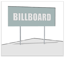
Billboard. An off-premise sign which advertises a product or service.
Board. The board of adjustment, unless the context clearly indicates that another board is intended.
Boardinghouse. A building with a single kitchen, occupied as a single housekeeping unit, where lodging and meals or other services are provided for five (5) or more persons for compensation, pursuant to previous arrangements, but not for the public or transients, where rooms are rented for less than thirty (30) days. This use does not include a group home or residential care facility.
Buildable area. The area of the lot that building(s) may occupy, which includes the area of the lot behind the required building line as designated by the building form standards. The buildable area sets the limits of the building footprint now and in the future—any additions shall be within the specified buildable area.
Building. For all purposes except floodplain regulations, any structure used or intended for supporting or sheltering any use or occupancy.
Building official. The director of community development, or designee.
Bus barn or lot. A facility or lot intended for the maintenance and storage of bus transit vehicles.
Bus station. A facility or structure where bus transit vehicles stop to provide transportation services to the public. This use may include related ticket sales. Accessory uses may include convenience retail or restaurants.
Canopy. A permanent structure or architectural projection of rigid construction over which a covering is attached that provides weather protection, identity or decoration. A canopy is permitted to be structurally independent or supported by attachment to a building on one or more sides.
Car wash. A commercial establishment that provides for the self-service or full-service cleaning of automobiles manually or by machine operated equipment.
CATSO. The Columbia Area Transportation Study Organization, which serves as the Metropolitan Planning Organization (MPO) for the Columbia metropolitan planning area. Transportation jurisdictions which make up the organizational structure of CATSO are Boone County, the City of Columbia, and MoDOT.
Cemetery or mausoleum. A structure or open area used for the burial or permanent storage of human remains.
Channel. A natural or artificial watercourse with a definite bed and banks that confine and conduct the normal continuous or intermittent flow of water.
City. The City of Columbia, Missouri.
Climax forest. Any woodland community of over twenty thousand (20,000) square feet which is dominated by climax species including but not limited to oak, hickory, walnut, sugar maple or bottomland hardwoods such as river birch, basswood, sycamore and hornbeam and which includes an area of five thousand (5,000) square feet with a maximum aspect ratio of 4:1.
Color rendering. General expression for the effect of a light source on the color appearance of objects in conscious or subconscious comparison with their color appearance under a reference light source.
Commercial or trade school. An establishment offering training or instruction in a trade, art, or occupation, such as beauty, dance, and vocational schools, other than public, private, or parochial primary or secondary schools, colleges, or universities.
Commission. The Planning and Zoning Commission of the City of Columbia, Missouri, unless the context clearly indicates that another commission is intended.
Common drive. The public or private easement for shared access for vehicles and pedestrians within a block that provides access to the rear or side of properties, vehicle parking (e.g., garages), utility meters, recycling containers, and garbage bins.
Comprehensive marijuana facility. Any comprehensive marijuana cultivation facility, comprehensive marijuana dispensary facility, or comprehensive marijuana-infused product manufacturing facility.
Comprehensive marijuana cultivation facility. A facility licensed by the department of health and senior services to acquire, cultivate, process, package, store onsite or offsite, transport to or from, and sell marijuana, marijuana seeds, marijuana vegetative cuttings (also known as clones) to a medical marijuana facility, comprehensive marijuana facility, or marijuana testing facility. A comprehensive marijuana cultivation facility need not segregate or account for its marijuana products as either non-medical marijuana or medical marijuana. A comprehensive marijuana cultivation facility's authority to process marijuana shall include the creation of pre-rolls, but shall not include the manufacture of marijuana-infused products.
Comprehensive marijuana dispensary facility. A facility licensed by the department of health and senior services to acquire, process, package, store onsite or offsite, sell, transport to or from, and deliver marijuana, marijuana seeds, marijuana vegetative cuttings (also known as clones), marijuana-infused products, and drug paraphernalia used to administer marijuana to a qualifying patient or primary caregiver, or to a consumer, anywhere on the licensed property or to any address as directed by the patient, primary caregiver, or consumer and consistent with the limitations of this code and as otherwise allowed by law, to a comprehensive marijuana facility, a marijuana testing facility, or a medical marijuana facility. Comprehensive dispensary facilities may receive transaction orders at the dispensary directly from the consumer in person, by phone, or via the internet including from a third party. A comprehensive marijuana dispensary facility need not segregate or account for its marijuana products as either non-medical marijuana or medical marijuana, but shall collect all appropriate tangible personal property sales tax for each sale. A comprehensive marijuana dispensary facility's authority to process marijuana shall include the creation of pre-rolls.
Comprehensive marijuana-infused products manufacturing facility. A facility licensed by the department of health and senior services to acquire, process, package, store, manufacture, transport to or from a medical marijuana facility, comprehensive marijuana facility, or marijuana testing facility, and sell marijuana-infused products, pre-rolls, and infused pre-rolls to a marijuana dispensary facility, a marijuana testing facility, or another marijuana-infused products manufacturing facility. A comprehensive marijuana-infused product manufacturing facility need not segregate or account for its marijuana products as either non-medical marijuana or medical marijuana.
Comprehensive plan. A series of plans for the physical development of the city, consisting of the urban development goals and objectives, the transportation plan, the land use plan, and other elements the council may wish to include. References to the comprehensive plan herein shall be deemed to include Columbia Imagined - The Plan for How We Live & Grow, as approved by the council and amended from time to time.
Community/Recreation center. A public or not-for-profit facility serving the social, educational, cultural, and recreational needs of a neighborhood or the community as a whole.
Conservation. The protection of valuable resources, including but not limited to plants and animals, natural areas, and interesting and important structures and buildings, from the damaging effects of human activity.
Consumer lending institution. An establishment which engages in the business of providing money to customers on a temporary basis, wherein such loans are secured by post-dated check, paycheck, or car title. The classification does not include a state or federally chartered bank, savings and loan association, credit union, or mortgage broker or originator. This classification does include, but is not limited to, check cashing stores, payday loan stores, and car title loan stores.
Conversion. The alteration of a structure to accommodate uses for which it was not originally constructed, but which maintain the structure's general character.
Continuing care retirement community (CCRC). A large scale facility (or integrated group of facilities) that has a primary purpose of providing housing and continuing care for retirement-age persons, and that consists of CCRC independent living units, CCRC assisted living facilities and CCRC support facilities. Such facilities may also include a CCRC skilled care nursing facility. "Continuing care" means the provision of lodging, nursing, medical or other health related services at the same community.
Continuing care retirement community (CCRC) independent living unit. A dwelling unit within a CCRC containing living area(s), bedroom area(s), kitchen area and bathroom(s), including apartments, detached homes, or attached townhomes, that house one or more people in a manner in which they may live independently and may receive one or more meals per day in a congregate setting.
Continuing care retirement community (CCRC) assisted living facility (also known as an assisted living facility licensed as a residential care facility). A facility located within a CCRC that provides a residential living environment, including congregate meals, housekeeping, and personal services for retirement-age persons and spouses or registered domestic partners, who have temporary or periodic difficulties with one or more essential activities of daily living, such as feeding, bathing, dressing or mobility, or memory care issues, but do not require services generally offered in a long-term care facility or nursing facility. A CCRC assisted living facility or residential care facility includes dwelling units, dining room(s), bathing area(s), common area(s), offices and other spaces necessary to provide the above services.
Continuing care retirement community (CCRC) skilled care nursing facility. A facility located within a CCRC that provides board, shelter and twenty-four-hour skilled nursing and medical care to chronic or convalescent patients. A CCRC skilled care nursing facility includes nursing beds or individual rooms, dining rooms, bathing areas, common areas, offices, clinics, therapy areas, medical facilities and other space necessary to provide the above services. Such facilities are accessory to the principal functions of the CCRC and are subordinate in size and area occupied on the site.
Continuing care retirement community (CCRC) support facilities. Facilities and amenities located within a CCRC intended to support the lifestyles of the residents and their visitors. Such facilities may include arts-and-crafts rooms, automatic teller machines (ATMs), chapels, studios, gardens and wellness clubs, small on-site commercial facilities intended for residents, visitors and staff that are owned or operated by the CCRC owner or operated under direct contract with the owner such as general stores, hair salons, postal centers, medical services that may include therapy, home health care, private duty nursing, hospice care, pharmacies, circuit health and dental care that are intended to provide for continuity of care to CCRC residents (past or current), shuttle bus services, and regular programs that take advantage of local cultural and educational activities.
Council. The City Council of the City of Columbia, Missouri.
Cul-de-sac. A street terminated at one end by a widened pavement for the safe and convenient reversal of traffic movement.
Customary accessory use and related structures. A detached subordinate building having a use customarily incident to and located on the lot occupied by the main building; or a use clearly subordinate and incidental to the main use of the property. A customary accessory use or related structure is one that is often provided for the use and convenience of the occupants, residents, or patrons of the principal structure on the same lot, or their guests, rather than the general public. For multifamily residential and non-residential uses these include but are not limited to swimming pools, recreation facilities, meeting rooms, laundry facilities, and outdoor seating. This use does not include any accessory use or related structure listed separately in the permitted use table.
DBH or dbh (diameter breast height). Tree trunk diameter measured four and a half (4.5) feet above the ground.
Deck. An unroofed platform, either freestanding or attached to a building, which is supported by pillars or posts.
Decorative lighting. Lights that have an aesthetic purpose to illuminate the architectural features of a building and produce generally low levels of light (one hundred (100) watts, one thousand eight hundred (1,800) lumens per light), including but not limited to "gooseneck" lights, sconce lights, recessed lighting in roof soffits, spot lighting, and silhouette lights.
Decibel. The unit of measure used to express the magnitude of sound pressure and sound intensity. Commonly abbreviated as dB(A).
Department. The community development department of the city, unless the context clearly indicates that another department is intended.
Designation ordinance. The official zoning document which the council enacts specifying a certain area as an urban conservation district.
Development. Any man-made change to improved or unimproved real estate, including but not limited to buildings or other structures, levees, levee systems, mining, dredging, filling, grading, paving, excavation or drilling operations, excluding routine repair and maintenance. For purposes of any floodplain area, development includes the storage of equipment or materials.
Developed land. Real estate that has been altered by the addition of impervious surface, the addition of soil or fill material, or by site grading that changes the hydrology of the property from its natural state.
Director. The Director of the Community Development Department for Columbia, Missouri, or the director's designee, unless the context clearly indicates that another individual is intended.
Director of public works. The Director of the Department of Public Works for Columbia, Missouri or the director's designee.
Display area. As it relates to lighting regulations, outdoor locations where nighttime sales occur and where accurate color perception by customers is needed, for example automobile sales.
Dormers. Roofed ancillary structures with windows providing light and air to habitable space within the roof.
Dormitory/Fraternity/Sorority. A space in a building where group sleeping accommodations are provided in one room, or in a series of closely associated rooms, for persons not members of the same family group, under joint occupancy and single management, as in college dormitories or fraternity houses, in which each person residing in each living unit shall be a duly registered student in any accredited school, college or university, the spouse of such student, or a management employee. Such living facilities may contain sleeping rooms for use of one or more persons, provided that there is at least one hundred fifty (150) square feet of floor space for the first occupant and at least one hundred (100) additional square feet of floor space for every additional occupant, the floor space to be calculated on the basis of total habitable room area. Accessory uses may include food preparation facilities, exercise facilities, and meeting rooms.
Downtown community improvement district. That area as defined in the petition approved by Ordinance No. 20866, as amended.
Drive-up facility (also "drive-in" or "drive-through"). A site feature or building feature that by design of physical facilities or by service or packaging procedures, encourages or permits customers to receive services, obtain goods, or be entertained while remaining in their motor vehicles.
Driveway. An area established or used for ingress and egress of vehicles from a street or thoroughfare to any point on private property.
Dwelling, live-work. A building or space within a building used jointly for residential and non-residential purposes, where non-residential purposes exceed those permitted by a home occupation.
Dwelling, multi-family. A building containing three (3) or more dwelling units, but not including a structure meeting the definition of dwelling, one-family attached.
Dwelling, one-family attached (also known as "zero lot line," "single-family attached," "semi-attached," and "semi-detached"). A building containing two (2) or more dwelling units, attached side to side at the side lot line, that each have a separate outside entrance, and that share a common party wall on one or more sides that extends from the foundation to the top of the highest habitable story and that meets the fire code requirements for attached individual dwellings.
Dwelling, one-family detached. A building used primarily as living quarters containing one dwelling unit, including a manufactured home or a modular home.
Dwelling, two-family (also known as "duplex"). A building used primarily as living quarters containing two (2) dwelling units situated on a single lot.
Dwelling unit. A single unit consisting of one or more rooms providing complete, independent living facilities for one or more persons, including permanent provisions for living, sleeping, eating, cooking and sanitation.
Easement. Authorization by a property owner for the use by another party, for a specified purpose, of any designated part of that property. It shall include but not necessarily be limited to property designated for installation of storm sewers or drainage ditches, or along a natural watercourse, preservation of the channel to provide for flow of water, or installation of streets, sidewalks, sewer, water, gas, electric transmission lines, telephone, wireline-based communication services facilities, regardless of the technology utilized or other utility services necessary or advantageous to properly serve the public.
Effective date. The effective date of the ordinance adopting this chapter, or any subsequent amendments thereto.
Elementary or secondary school. Public schools, elementary and secondary, private schools with curriculum equivalent to that of a public elementary or high school, and related facilities including but not limited to gymnasiums, stadiums, and dormitories if located on the campus.
Elevation. An exterior wall of a building that faces a public or private street or alley.
Estate lane. A local residential street designed to carry light volumes of traffic and to provide access to low density single-family residential and attendant uses.
Expressway. A street designed to provide for the expeditious movement of large volumes of through traffic across the city, which offers no direct land access function, but has some at-grade intersections (see also "freeway").
FAA. The Federal Aviation Administration.
Family.
(1)
An individual, married couple, or registered domestic partnership and the children thereof, including foster children placed in the household by a public agency, and no more than two (2) other persons related directly to the individual, married couple or registered domestic partnership by blood or marriage, occupying a single housekeeping unit on a nonprofit basis. A family may include not more than one additional person, not related to the family by blood or marriage; or
(2)
a.
In zoning districts R-1 and PD (when the PD development density is five (5) or less dwelling units per acre), a group of not more than three (3) persons not related by blood, marriage, or registered domestic partnership, living together by joint agreement and occupying a single housekeeping unit on a nonprofit cost-sharing basis; or the use of a dwelling unit by four (4) persons not related by blood, marriage, or registered domestic partnership, living together by joint agreement and occupying a single housekeeping unit on a nonprofit cost-sharing basis, prior to February 4, 1991, shall be allowed to continue in districts R-1 and R-1 PUD as a lawful nonconforming use.
b.
In all other applicable zoning districts, a group of not more than four (4) persons not related by blood, marriage, or registered domestic partnership, living together by joint agreement and occupying a single housekeeping unit on a nonprofit cost-sharing basis.
Family day care center (also known as family day care centers, preschool centers, nursery schools, child play centers, child education centers, child experiment stations or child development institutions). A place for reception, care, training or instruction of five (5) or more children, not of common parentage, residing therein, regardless of sex, under the age of eighteen (18) years, for compensation or otherwise, but not including facilities at any regularly established public or parochial schools, colleges, universities, academies or seminaries, or other schools or institutions organized under and by virtue of the laws of the United States or the State of Missouri, and under the supervision of the duly constituted authorities of that school or institution.
Farm. A tract of land consisting of at least two and one-half (2½) acres used for the growing of agricultural crops or raising livestock.
Farmer's market. An area, which may or may not be in a completely enclosed building, where, on designated days and times, groups of individual sellers, such as growers of horticultural and agricultural products, artisans of craft products, and food and beverage providers, offer these items for sale, directly to the public, from on-site booths.
FCC. The Federal Communications Commission.
Fence. A freestanding structure, not including a hedge or other natural growth, resting on or partially buried in the ground and rising above ground level, used for confinement, screening, enclosure, security, or partition purposes. A railing provided for public safety purposes does not constitute a fence.
Final plat. The final map or drawing described in these regulations on which the subdivider's plan of subdivision is presented to the council for approval and which, if approved, is submitted to the county recorder of deeds for filing.
Flag. A piece of fabric attached to a staff.
Footcandles. The amount of light falling on a surface. One footcandle is defined as one lumen per square foot. Initial footcandles is the amount of light when fixtures are new.
Forest land. Forested land area with the aerial canopy dominated by trees greater than four (4) inches in diameter, measured four and one-half (4½) feet above the ground.
Freeway. A street designated to provide for the expeditious movement of large volumes of through traffic across the city, which offers no direct land access function and has grade separated intersections (See also "expressway").
Frontage. The length of the property line of any parcel along each street that it borders.
Frontage road. A street which is parallel and immediately adjacent to an arterial street, expressway or freeway, and which provides a means of access to abutting properties that are separated from through traffic.
Funeral home or mortuary. An establishment providing services such as preparing the human dead for burial, cremating human remains, and arranging and managing funerals. This use does not include cemeteries and columbaria, but does include a crematorium.
Game arcade. Any commercial building in which there are more than three (3) amusement game machines on the premises that are available to the public. An arcade may contain commercial recreational machines or games other than amusement game machines.
Garage sale. The sale or offering for sale to the general public of over five (5) items of personal property on any portion of a lot in a residential zoning district, whether within or outside any building. Sales of programs and food and beverage items at school athletic events shall not be deemed to constitute garage sales.
Gas station or fueling center. The sale of vehicle fuel from a facility or lot having pumps and underground storage tanks. Such facility may also include a convenience store which sells convenience-related items to the general public.
Glare. Light that causes discomfort, distraction, or temporary impairment of sight because it is not adequately diffused, shielded, or directed away from the viewer.
Grade plane. A reference plane representing the average of finished ground level adjoining the building at exterior walls. Where the finished ground level slopes away from the exterior walls, the reference plane shall be established by the lowest points within the area between the building and the lot line or, where the lot line is more than six (6) feet from the building, between the building and a point six (6) feet from the building.
Greenhouse or plant nursery. An establishment, including a building, part of a building, or open space, and any buildings and structures necessary for the growth, display, and/or retail and wholesale activities of horticultural and floricultural products, used in indoor and outdoor planting, and the sale of related items.
Greenspace access easement. A perpetual interest in land as described and dedicated by subdivision plat. Designation of a greenspace access easement shall contain the same restrictions on use of property as a greenspace conservation easement, except that it shall give the public the right of entry to the area for pedestrian use only. The greenspace access easement does not confer any rights to the city to either maintain or develop the easement for recreational use. Designation of a greenspace access easement shall restrict the owner of the underlying fee from erecting barricades that interfere with lawful access. Nothing in this definition shall be construed to prevent the city from acquiring other easements in property encumbered with a greenspace access easement.
Greenspace conservation easement. A perpetual interest in land described and dedicated on a subdivision plat. By designation of a greenspace conservation easement, no right of entry is automatically given to the city or the public; however, public access may be allowed as defined on the subdivision plat. The use of area contained within a greenspace conservation easement shall be restricted as follows:
(1)
No private development of the property shall occur, except for public or private street, driveway, bridge, trails, walkways and utility crossings, where needed.
(2)
No commercial signs or other advertising material shall be placed within the easement area.
(3)
There shall be no removal of trees, shrubs or other vegetation on the property except for the performance of acceptable timber stand improvement practices such as selective thinning. Mowing and cutting or removal of brush or trees may continue as necessary to comply with health ordinances, maintain stream beds, banks, existing agricultural, scenic or recreational uses, or eliminate poisonous or noxious plant material.
(4)
Except as otherwise specifically and expressly authorized on the plat, there shall be no use of the property except for public or private street, driveway, bridge, trails, walkways and utility construction, private noncommercial agricultural, or private noncommercial recreational uses which do not interfere with the growth of the trees and shrubs located on the easement. Uses and activities which are not allowed in district FP-O (floodplain overlay district) shall be prohibited.
Nothing in this definition shall be construed to prevent the city from acquiring other easements in property encumbered with a greenspace conservation easement.
Greenspace trail easement. A perpetual interest in land as described and dedicated by subdivision plat. Designation of a greenspace trail easement shall give the following rights:
(1)
Constructing or maintaining a permanent hiking or bicycle trail or path with accessory facilities or accommodation.
(2)
The right of entry of the city to maintain and develop hiking or bicycle trails or paths.
(3)
The right of entry of the public for pedestrian or bicycle use of the trails or paths which have been constructed within the easement. No right of entry for motor vehicles is granted to the public except for authorized emergency vehicles.
(4)
The right to construct public street, bridge and utility crossings as needed.
Nothing in this definition shall be construed to prevent the city from acquiring other easements in property encumbered with a greenspace trail easement.
Group home, large. A facility that provides care, treatment or custody for more than eight (8) individuals considered to be disabled or handicapped under the federal Fair Housing Act, as amended or the laws of the State of Missouri, and may include additional persons providing oversight of the facility, none of which need to be related to each other.
Group home, small. A facility that provides care, treatment or custody for up to eight (8) individuals considered to be disabled or handicapped under the federal Fair Housing Act, as amended, or the laws of the State of Missouri, and may include two (2) additional persons providing oversight of the facility, none of which need to be related to each other. Residences with up to three unrelated residents are not defined as a group home.
Halfway house. A residential facility primarily for persons who have been institutionalized and released, or who have been assigned to the facility as an alternative to institutionalization, and require the temporary protection of a group setting to facilitate the transition to society.
Hazardous material. Any material or substance listed in 40 CFR Part 355, Appendix A, as an extremely hazardous substance when that substance is stored, generated, used or released in quantities equal to or greater than the lowest quantity listed for either the threshold planning quantity or reporting quantity for the substance; any materials designated hazardous and subject to special requirements by the federal government or the State of Missouri.
Heavy commercial services. An establishment that provides semi-industrial, more intrusive types of commercial services, less compatible with common household commercial services; such as laundry services, lumberyards, newspaper publishing plants, printing shops, sign painting shops, equipment rental, and other similar uses.
Heavy industry. The processing, manufacturing, or storage of products under potentially hazardous conditions, such as the creation of products from extracted raw materials and the use of flammable and explosive materials. This use may include, but is not limited to, concrete plants, electroplating works, forges, galvanizing works, and other similar uses.
Heavy vehicle and equipment sales, rental, and servicing. The sale, rental, leasing, serving, and repair of heavy vehicles and equipment typically used in agricultural, commercial, or industrial operations, including, but not limited to, trucks with a gross vehicle weight of over ten thousand (10,000) pounds, buses, semi-trucks or trailers, tractors, harvesters, loaders, farm machinery, and tracked vehicles, as well as the sales of parts for heavy vehicles and equipment.
Height, building. The vertical distance from grade plane to the average height of the highest roof surface. Generally, this means to the roof level (ignoring parapets) of a flat roof or the top of a mansard roof, and to the midpoint between the eave and the ridgeline on a pitched roof.
Height, sign. The maximum height of a sign shall be measured from the elevation of the point nearest the sign on the center line of the public street or highway nearest the sign upward to the elevation of the highest part of the sign or its supporting structure, whichever is higher. Notwithstanding the foregoing, unless otherwise specified in this chapter, all signs may have a height of eight (8) feet measured from the ground location of the sign to the highest part of the sign or its supporting structure, whichever is higher.
Higher education institution. A college, university, or other institution of higher education, and related facilities including but not limited to gymnasiums, stadiums, and dormitories if located on the campus, but excluding any institution that is not subject to the terms of this development code under the laws of the State of Missouri.
Home occupation. An accessory use of a dwelling unit, or associated garage, where business activities are conducted entirely within the dwelling unit or garage, by residents of the dwelling unit. This use may permit one full-time (forty hours) or two part-time (twenty (20) hours each) non-resident employees.
Hospital. An institution providing health services primarily for human inpatient or medical or surgical care for the sick or injured, including related facilities such as laboratories, outpatient departments, training facilities, medical or dental clinics, sanitariums, and medical laboratories.
Hotel. A building occupied or used as a temporary abiding place of individuals or groups of individuals, with or without meals, in which the typical stay is between one and thirty (30) days. Accessory uses may include restaurants, cafes, swimming pools, meeting rooms, or sports/health facilities. The definition of hotel shall exclude bed and breakfast establishments and short-term rentals.
Impervious surface. A surface on real property where infiltration of stormwater into the earth has been virtually eliminated by the works of man. Impervious surfaces shall include, but not be limited to: roofs, paved driveways, patio areas, sidewalks, parking lots, storage areas, and other oil, macadam, or gravel surfaced areas that prevent percolation of stormwater into the earth's surface.
Indoor entertainment, adult. Entertainment, at a commercial establishment such as a nightclub, theater, bar, juice bar, restaurant, or bottle club, regardless of whether alcoholic beverages are served, which regularly features persons who appear semi-nude, which shall mean the showing of the female breast below a horizontal line across the top of the areola and extending across the width of the breast at such point, or the showing of the male or female buttocks. This use also includes the showing of films, motion pictures, video cassettes, slides, or similar photographic reproductions, which are characterized by their emphasis upon the display of specified sexual activities or specified anatomical areas, regularly shown to more than five persons for any form of consideration, at a motion picture theater or other similar commercial establishment. This use also includes adult arcades where image-producing devices, whether coin-operated, slug-operated, or electronic, are regularly maintained to show images exhibiting sexual activities or specified anatomical areas to five or fewer persons per machine at any one time.
Indoor recreation or entertainment. A facility for indoor participation or observation of sports, games, fitness, arts, or culture activities that do not meet the definition for another use in this chapter. This use includes but is not limited to billiard parlors, game arcades, skating rinks, bowling alleys, gymnasiums not accessory to an education institution, racket clubs, sports arenas, and similar uses. Accessory uses include the sales of food, beverages, and items related to or required for participation in the recreation or entertainment activity. This use includes any establishment with more than three (3) amusement game machines on the premises.
Infill development. New construction in areas where significant development has occurred on more than two (2) sides of the site, or redevelopment of parcels that were previously developed with permanent structures, including replacement of blighted or deteriorated structures.
Infiltration. The process of percolating stormwater into the subsoil.
Installed. The attachment, or assembly fixed in place, of any outdoor light fixture whether or not connected to a power source.
Land disturbance. Any man-made change of the land surface, including mechanized clearing, which removes the vegetative ground cover, excavation, filling and grading, but not including agricultural activities such as planting, growing, cultivating and harvesting of crops, growing and tending of gardens, and landscape modifications.
Land disturbance permit. A permit issued by the City of Columbia that authorizes the commencement of land disturbance activities or logging.
Landscaping. The improvement of a lot, parcel, or tract of land with a combination of at least four (4) of the plant categories found in the planting requirements of the city's guidelines for landscaping and screening as promulgated by the director.
Levee. A man-made structure, usually an earthen embankment, designed and constructed in accordance with sound engineering practices to contain, control or divert the flow of water so as to provide protection from temporary flooding.
Levee system. A flood protection system which consists of a levee, or levees, and associated structures, such as closure and drainage devices, which are constructed and operated in accordance with sound engineering practices.
Light fixture. An illuminating device, outdoor lighting or reflective surface, lamp or similar device, permanently installed or portable, used for illumination or advertisement.
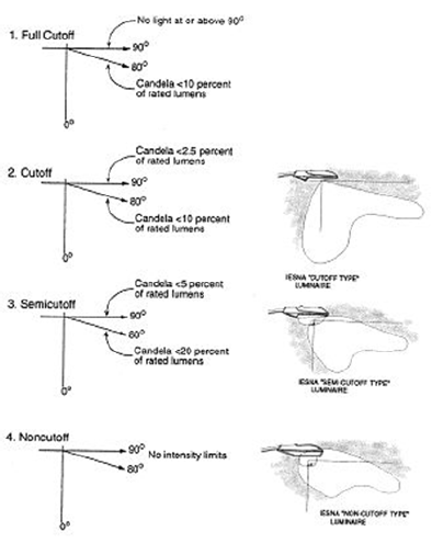
Light fixture, full cutoff. Zero intensity at or above horizontal (ninety (90) degrees above nadir) and limited to a value not exceeding ten (10) percent of lamp lumens at or above eighty (80) degrees.
Light fixture, cutoff. Intensity at or above ninety (90) degrees (horizontal) no more than two and one-half (2.5) percent of lamp lumens and no more than ten (10) percent of lamp lumens at or above eighty (80) degrees.
Light fixture, semi-cutoff. Intensity at or above ninety (90) degrees (horizontal) no more than five (5) percent of lamp lumens and no more than twenty (20) percent at or above eighty (80) degrees.
Light fixture, non-cutoff. No limitations of light distribution at any angle.
Light industry. The manufacturing, compounding, processing, packaging, storage, assembly, treatment of finished or semi-finished products from previously prepared materials, sheet metal shops, or servicing or sale of consumer products, which activities are conducted at a minimum of eighty (80) percent or wholly within an enclosed building and that do not emit noxious fumes or odors.
Light loss ratio. The ratio of the illuminance on a given area after a period of time to the initial illuminance on the same area. Note: The light loss factor is used in lighting calculations as an allowance for the depreciation of lamps, accumulation of dirt on luminaire, light control elements and room surfaces, to values below the initial or design conditions, so that a minimum desired level of illuminance may be maintained in service.
Light spillage. Lighting that illuminates property adjacent to the property on which the light source is located.
Lighting engineer. A person having the education and training to design outdoor lighting systems and prepare and interpret lighting plans.
Light vehicle sales and rental. The sale, display, lease, rental, or storage of light motor vehicles, including automobiles, vans, light trucks, light trailers, boats, and recreational vehicles. This use shall not include salvage operations, scrap operations, vehicle impound yards, or commercial parking lots available for short-term use.
Light vehicle service and repair. An establishment where minor vehicle repair and maintenance activities such as engine tune-ups, oil change and lubrication, brake and muffler repair, tire rotation, glass replacement, and other limited repairs are customarily done in service stations, but not including vehicle bodywork or painting, or major engine or transmission repairs.
Logging. The removal of more than three (3) qualifying existing trees, per acre, from a lot, tract, or building site larger than one acre.
Lot (aka lot of record or legal lot). A tract or parcel of land whose boundaries are shown on a plat recorded with the county recorder of deeds. Tracts or parcels zoned district A, R-1, R-2, R-MF or any combination thereof, and were described by a metes and bounds description accurately describing the location, boundaries and size of the tract or parcel within a recorded instrument prior to annexation into the city or prior to October 5, 1964 shall be considered a lot and entitled to receive permits as though it was shown on a recorded plat. When a portion of a tract of land is acquired for highway or other public purposes, such division of ownership shall not affect the remainder of the tract in meeting the definition of a lot so long as the original tract met the definition of a lot under one of the above provisions. For purposes of this definition, the term "recorded" means recorded in the office of the county recorder of deeds.
Lot, common. A platted lot in a subdivision that is dedicated to the use of more than one lot in the subdivision.
Lot, corner. A lot in which one side lot line is adjacent to a street, platted street right-of-way, or street-space. Special building placement, fencing and landscape requirements may apply.
Lot, flag (aka stem lot or tier lot). A parcel of land that is accessible only by a very long narrow strip leading from a main road.
Lot, interior. A lot whose side lot lines do not abut any streets.
Lot, through. An interior lot having frontage on two (2) streets.
Lot, substandard. A single existing lot, parcel, or tract of land whose zoning classification is R-1, R-2, or R-MF that does not conform to the minimum dimensional standards of the zoning classification to which it is assigned; and such lot, parcel or tract either meets the definition of a "lot," as defined herein, or is platted in its existing configuration as a "lot" in accordance with the requirements of this chapter.
Lot depth. The average horizontal distance from the front lot line to the rear lot line, as measured along both side lot lines.
Lot line. A line dividing one lot from another, or from a street or any public place.
Lot line, front. The lot line between a lot and the street on which it fronts, or that lot line of a through lot that the director shall determine to be the front lot line, based on the character of the fronting streets and the location of front, rear, and side lot lines on abutting properties.
Lot line, rear. The lot line that is opposite and most distant from the front lot line, or that lot line of an irregularly shaped lot that the director shall determine to be the rear lot line, based on its relationship to the street fronting the property and the location of front, rear, and side lot lines on abutting properties.
Lot line, side. Any lot line that is not a front or rear lot line.
Lot width. The average horizontal distance between two (2) side lot lines as measured along the front and rear lot lines.
Lumen. Unit of luminous flux; used to measure the amount of light emitted by lamps.
Luminaire. The complete lighting assembly, less the support assembly. For purposes of determining total light output from luminaries, lighting assemblies that include multiple unshielded or full cutoff lamps on a single pole or standard shall be considered as a single unit. Two (2) or more units with lamps less than three (3) feet apart shall be considered a single luminaire.
Machine shop. An establishment where power-driven tools are used for making, finishing, or repairing machines or machine parts.
Major vehicle repair and service. A vehicle repair facility where major vehicle bodywork or painting, or major engine or transmission repairs of operable or inoperable light motor vehicles is performed. Such facilities may offer other maintenance services such as engine tune-ups, oil change and lubrication, brake and muffler repair, tire rotation, or glass replacement, but are generally characterized by major vehicle repair activities.
Major roadway plan (MRP). The major roadway plan adopted by council, as amended from time to time, which includes both existing and proposed future major roadways in the Columbia Metropolitan Planning Area.
Managed lawn areas. Means any area greater than five hundred (500) square feet where the vegetative ground cover is maintained at a uniform height of less than three (3) inches.
Maintained footcandles. Illuminance of lighting fixtures adjusted for a light loss factor (maintenance factor) accounting for dirt build-up and lamp output depreciation.
Manufactured home. For all purposes except floodplain regulations, a transportable, factory-built structure that is manufactured in accordance with the Federal Manufactured Housing Construction and Safety Standards Act of 1974 (42 U.S.C. Sec. 5401) and that is designed to be used as a permanent single dwelling unit. This definition does not include a recreational vehicle or travel trailer or other similar vehicles and does not include a mobile home.
Manufactured home park. For all purposes other than floodplain regulations, a parcel of land that has been planned and improved for the placement of manufactured homes for non-transient use.
Manufactured home space. An area of land within a manufactured home park for the placement of a single manufactured home and the exclusive use of its occupants.
Manufactured home stand. Improvement on a manufactured home lot constructed for the purpose of providing a structural base for the manufactured home.
Marijuana facility. Any comprehensive marijuana facility, medical marijuana facility, microbusiness marijuana facility, or marijuana testing facility.
Marijuana testing facility. A facility certified by the department of health and senior services to acquire, test, certify, and transport marijuana, including those originally licensed as a medical marijuana testing facility.
Marquee. A roofed structure projecting from and supported by a building, or free-standing when such roofed structure extends beyond the building line, building wall or street lot line.
Maximum aspect ratio of 4:1. A means of defining the configuration of an area of trees such that the measurement of length of the area shall not be more than four (4) times as long as the measurement of width of the area.
Maximum-to-minimum ratio. The highest horizontal illuminance point divided by the lowest horizontal illuminance point or area.
Mechanical and construction contractors. Construction, landscaping, plumbing, heating, air-conditioning, and electrical construction or repair activities and incidental storage at establishments and on lots other than job sites. This use does not include establishments where the primary activity is retail sale of goods to the general public, but includes related contracting, retail, and wholesale sales and distribution from the premises of materials used in mechanical and construction contract work.
Mechanized clearing. Clearing of land by tracked or wheeled vehicles which scrape, cultivate or scarify the surface of the ground exposing bare soil and uprooting vegetation.
Medical marijuana cultivation facility. A facility licensed by the department of health and senior services to acquire, cultivate, process, package, store onsite or offsite, transport to or from, and sell marijuana, marijuana seeds, and marijuana vegetative cutting (also known as clones) to a medical marijuana dispensary facility, marijuana testing facility, medical marijuana cultivation facility or to a medical marijuana-infused products manufacturing facility. A medical marijuana cultivation facility's authority to process marijuana shall include the production and sale of pre-rolls, but shall not include the manufacture of marijuana-infused products.
Medical marijuana dispensary facility. A facility licensed by the department of health and senior services to acquire, process, package, store onsite or offsite, sell, transport to or from, and deliver marijuana, marijuana seeds, and marijuana vegetative cutting (also known as clones), marijuana-infused products, and drug paraphernalia used to administer marijuana as provided for by state law and regulations to a qualifying patient, a primary caregiver, another medical marijuana dispensary facility, a marijuana testing facility, a medical marijuana cultivation facility, or a medical marijuana-infused products manufacturing facility. A medical marijuana dispensary facility's authority to process marijuana shall include the production and sale of pre-rolls, but shall not include the manufacture of marijuana-infused products.
Medical marijuana facility. Any medical marijuana cultivation facility, medical marijuana dispensary facility, or medical marijuana-infused products manufacturing facility, as defined in this section.
Medical marijuana-infused products manufacturing facility. A facility licensed by the department of health and senior services to acquire, store, manufacture, transport, and sell marijuana-infused products to a medical marijuana dispensary facility, a marijuana testing facility, or to another medical marijuana-infused products manufacturing facility.
Microbusiness marijuana dispensary facility. A facility licensed by the department of health and human services to acquire, process, package, store onsite or offsite, sell, transport to or from, and deliver marijuana, marijuana seeds, marijuana vegetative cuttings (also known as clones), marijuana-infused products, and drug paraphernalia used to administer marijuana as provided for in this section to a consumer, qualifying patient, as that term is defined in this article, or primary caregiver, as that term is defined in this article, anywhere on the licensed property or to any address as directed by the consumer, qualifying patient, or primary caregiver and, consistent with the limitations of this article and as otherwise allowed by law, a microbusiness marijuana wholesale facility, or a marijuana testing facility. Microbusiness marijuana dispensary facilities may receive transaction orders at the dispensary directly from the consumer in person, by phone, or via the internet, including from a third party. A microbusiness marijuana dispensary facility's authority to process marijuana shall include the creation of prerolls.
Microbusiness marijuana facility. A facility licensed by the department of health and human services as a microbusiness marijuana dispensary facility or microbusiness wholesale facility, as defined in this section.
Microbusiness marijuana wholesale facility. A facility licensed by the department of health and human services to acquire, cultivate, process, package, store onsite or offsite, manufacture, transport to or from, deliver, and sell marijuana, marijuana seeds, marijuana vegetative cuttings (also known as clones), and marijuana-infused products to a microbusiness marijuana dispensary facility, other microbusiness marijuana wholesale facility, or marijuana testing facility. A microbusiness marijuana wholesale facility may cultivate up to two hundred and fifty (250) flowering marijuana plants at any given time. A microbusiness marijuana wholesale facility's authority to process marijuana shall include the creation of prerolls and infused prerolls.
Mine or quarry. An excavation in the earth for extracting subsurface earthen materials such as limestone.
Mobile home. A transportable, factory-built structure that is designed to be used as a single dwelling unit that was manufactured before 1976 or otherwise does not comply with the construction standards in the Federal Manufactured Housing Construction and Safety Standards Act of 1974 (42 U.S.C. Sec. 5401). This definition does not include a recreational vehicle or travel trailer or other similar vehicles.
Modular home. A structure certified by the manufacturer as constructed in accordance with adopted city building codes, that is transportable but is not constructed on a permanent chassis, and that is designed to be used as a dwelling on a permanent foundation when connected to required utilities including plumbing, heating, air conditioning and electrical systems.
Museum or library. A permanent facility that is open to the public, with or without charge, for the collection and display of paintings, sculpture, textiles, historical artifacts, collectibles, or other works of art, or for the storing and loaning books, periodicals, reference materials, audio tapes, video tapes, and other similar media.
Nadir. For purposes of lighting regulations, a point directly below the light fixture.
Net developable acreage. The area of a lot or lots that is usable for determining allowable densities after land not suitable or restricted from development (such as road, drainage or preservation areas) have been subtracted from the total acreage.
Office. A room or group of rooms used for conducting the affairs of a business, profession, government, or service industry. Examples include professional services such as lawyers, accountants, engineers, architects, planners, insurance agents, brokers, consultants, or real estate agents; data processing; sales offices; artists; writers; physicians, physical therapists, dentists, chiropractors or other licensed medical professionals, including outpatient treatment of alcohol and drug abuse, and estheticians or massage therapists performing services under the direct supervision of a licensed medical professional. This use does not include facilities meeting the definition of a research and development laboratory or any facility where display, sales or rental of goods occurs on more than an incidental basis related to the primary office function.
Outdoor recreation or entertainment. Facilities for outdoor sporting or recreational, activities or performances, and for which an admission fee or membership fee is required to participate in the activity or observe the performance. This use includes but is not limited to amusement parks, commercial baseball or other athletic fields, tennis courts, race tracks, fairgrounds, commercial picnic grounds, commercial fishing lakes, commercial stables, outdoor stage and concert facilities, gun clubs, skeet, trap, or target ranges, commercial golf courses, miniature golf courses, and commercial swimming pools.
Overlay district. A district in which additional requirements act in conjunction with the underlying zoning district(s).
Owner. Any person or other entity having legal title to or a sufficient proprietary interest to legally effectuate transfer of the property sought to be subdivided. Proprietary interest shall include but not be limited to estate administration, trusteeship, guardianship, and actions under a valid power of attorney. Proprietary interest shall not include an agency or a bare employment relation.
Parapet height. Where used to limit building height in this Code, parapet height is measured at the top of the parapet, including any coping.
Parking garage. A building designed for storage of motor vehicles.
Parking lot, commercial. An area on the surface of the land for parking automobiles and light trucks in return for direct or indirect compensation. This use does not include public parking lots, which are a form of public service facility, and does not include accessory parking lots required for compliance with this chapter. In the M-DT district, areas available for commercial parking lots are designated on the regulating plan.
Parking space. A space that is designated for the parking or temporary storage of one motor vehicle located outside of a dedicated street right-of-way, vehicular travel way, or parking aisle.
Parking structure, commercial. An area in an underground or above-ground structure, or an area incorporated into the structural design of a building, for parking automobiles and light trucks in return for direct or indirect compensation. This use does not include public parking lots or structures, which are a form of public service facility, and does not include accessory parking structures required for compliance with this chapter.
Patio. A hard-surfaced area accessory to the principal structure or use that has a horizontal area at grade level, and that has at least one side open to the weather and essentially unobstructed to the sky, specifically designed and intended for the recreational enjoyment of the occupants and guests of the principal structure or use, and not designed or intended for occupancy by automotive vehicles.
Paved area. For purposes of landscaping and buffering regulations, "paved area" means open areas used or occupied by motor vehicles including parking areas, loading areas and driveways. "Paved area" does not include areas under the roof of a building, sidewalks or pedways.
Pawn shop. A business that lends money on the security of pledged goods or that is engaged in the business of purchasing tangible personal property on condition that it may be redeemed or repurchased by the seller for a fixed price within a fixed period of time.
Pedway. A path that is physically separated from the roadway and intended for shared use by pedestrians, joggers, skaters and bicyclists.
Person. For all purposes except floodplain regulations, shall include a human being, corporation, firm, association, syndicate, trust, a partnership and an unincorporated association such as a club.
Personal services, general. Establishments that provide individual services related to personal needs directly to customers at the site of the business, or that receives goods from or returns goods to the customer after the goods have been treated or processed at that location or other locations. Accessory uses may include offices, parking, storage of goods, and assembly, repackaging, or repair of goods for on-site sale, and incidental retail sales of products used on the premises to patrons. This use includes but is not limited to barber and beauty shops; nail salons; spa services not meeting the definition of any other use as defined in this chapter; dry cleaning, laundering, pressing, and dyeing establishments; coin-operated laundries; photographic service shops and studios; repair of household appliances; shoe repair shops; garment storage facilities; rental service; and bicycle repair shops. Outdoor storage, display, or service areas are not permitted.
Pet store or pet grooming. A facility where small animals are sold, groomed, or cared for, including but not limited to small animal day care/spas, but not including a veterinary hospital.
Physical fitness center. An indoor facility where individuals participate in exercise, weight reduction, Pilates, yoga and other wellness-promoting or similar activities designed to improve and preserve physical fitness, but not including any use that meets the definition of a community center or another use in this chapter.
Preliminary plat. The preliminary map or drawing described in and meeting the requirements of these regulations, indicating the proposed manner or layout of a subdivision to be submitted to the planning and zoning commission for recommendation and to the council for approval.
Primary non-residential buildings. Buildings occupied by public and institutional uses identified in the permitted use table (Table 29-3.1).
Private club. An organized group of people not open to or intended for, or controlled by the public, or for the use of the public.
Private drive. An entrance to a lot, or an interior circulation driveway within a lot, or a driveway giving access to no more than four (4) lots, that is not itself a public right-of-way.
Property line. The legally described boundary line that indicates the limits of a parcel, tract, lot, or block for the purpose of delineating ownership and setback requirements.
Public improvements. Any drainage ditch, roadway, parkway, storm sewer, sanitary sewer, water main, electric facility, sidewalk, walkway, tree, lawn, off-street parking area, lot improvement, or other facility for which the city may assume the responsibility for maintenance and operation, or which may constitute an improvement for which city responsibility is subsequently established by the council.
Public park, playground, or golf course. Outdoor recreation areas owned or operated by a public or non-profit entity for public use, including related public recreation, clubhouse, and service buildings.
Public service facility. Facilities necessary for delivering public services that do not meet the definitions of any other use in the public and institutional uses category. This use does not include facilities containing only administrative offices for public services, which are included in the definition of offices.
Public utility service, minor. Buildings and facilities for the distribution of public utilities, including without limitation water, sewer, storm drainage, electric, and gas service, by the city, a regulated utility or a public or quasi-public entity, of a size and scale commonly found in all areas of the city. This use includes buildings or facilities for public service corporations but does not include telecommunications antennas or towers.
Public utility services, major. Buildings and facilities for the provision and distribution of public utilities, including without limitation water, sewer, storm drainage, electric, and gas services, by the city, a regulated utility or a public or quasi-public entity, of a size and scale found only in scattered sites throughout the city. This use includes but is not limited to electric transmission lines over one hundred (100) kV, electric power substations, gas substations, regional stormwater drainage facilities, water treatment plants, sewer treatment plants, and public utility service centers.
Rail or truck freight terminal. An area and related structures where goods shipped by train or truck are loaded, unloaded, or transferred between trains and trucks, and where the goods may be stored for a limited period of time before and after transfer to other sites. This use may also include incidental train and truck storage, maintenance, and administrative terminal offices.
Recorder of deeds. The recorder of deeds for Boone County, Missouri.
Registered professional land surveyor. A person licensed to practice surveying in the State of Missouri.
Registered professional engineer. A person licensed to practice engineering in the State of Missouri.
Rehabilitation. The process of returning a structure to a state of efficiency or soundness by repair or alteration designed to encourage its continued use but without noticeably changing the exterior appearance of the resource.
Religious institution. A structure or place in which worship, ceremonies, rituals, and education pertaining to a particular system of beliefs are held, including a church, temple, mosque, synagogue, covenant, monastery, or other structure, together with its accessory buildings and uses, such as educational facilities, athletic/recreation fields, pastor's and caretaker's housing, and parking. This use is operated, maintained, and controlled under the direction of a religious group.
Renovation. The process of altering or repairing a structure and its facilities so it conforms to minimum standards of sanitation, fire and life safety.
Research and development laboratory. A facility primarily engaged in conducting scientific research, experimental design, and prototype development of devices or products in the physical, engineering, or life sciences, such as agriculture, electronics, biology, biotechnology, chemistry, geology, medicine, pharmacy, veterinary, and other allied subjects; does not include the manufacturing, servicing or sale of consumer products. This use includes facilities primarily engaged in providing analytic or diagnostic services on human specimens, including body fluid or body tissue, or performing diagnostic imaging. This use includes the fabrication of prototype goods, materials and equipment not intended for sale directly to the public, but may include incidental sales of goods produced on site to the public.
Residential care facility. A residential institution, whether operated for profit or not, that provides personal care, custody, or treatment for five (5) or more individuals not related to the operator who, for reasons of illness, advanced age, or mental or physical disability, are unable to care for themselves, or are in a treatment program administered by or through the residential care facility for alcohol or drug abuse, or are considered to be disabled or handicapped under the Federal Fair Housing Act, as amended or the laws of the State of Missouri. This use does not include a continuing care retirement community (CRCC).
Restaurant. An establishment, including cafes and cafeterias, where food and drink are prepared, served, and consumed, primarily within the principal building.
Retail, adult. A commercial establishment such as an adult bookstore, video store, or arcade which, as one of its principal business activities, offers for sale or rental for any form of consideration, any one or more of the following: books, magazines, periodicals, or other printed matter, or photographs, films, motion pictures, video cassettes, compact discs, digital video discs, slides, or other visual representations which are characterized by their emphasis upon the display of specified sexual activities or specified anatomical areas.
Retail, general. An establishment selling goods at retail. This use does not include the sales of light or heavy motor vehicles or any other goods listed as a separate use in the permitted use table, and does not include any activity meeting the definition of an adult retail use.
Reuse of place of public assembly. The reuse of a property originally used as a religious institution, or any property originally used primarily for public assembly, for another temporary or permanent use that has no or minimal impacts on the surrounding community, or for which any significant impacts on the surrounding community have been mitigated to the maximum degree practicable.
Right-of-way. A strip of land occupied or intended to be occupied by a street, sidewalk, crosswalk, railroad, electric transmission line, oil or gas pipeline, water main, sanitary sewer main, or for other similar uses. The usage of the term "right-of-way" for land platting purposes shall mean that right-of-way hereafter established and shown on a final plat to be separate and distinct from lots or parcels adjoining such right-of-way, and not included within the dimensions or areas of such lots or parcels.
Sale. Any transfer of fee ownership, or any transfer of use rights conferring exclusive possession for purpose of building development whether by metes and bounds, deed, contract, plat, map or other written instrument.
Sanitary landfill. A permanent facility either publicly or privately owned and operated for the purpose of disposing solid waste in accordance with applicable federal, state, and local solid waste management laws and licensing requirements.
Scenic roadway. A street designated by the council as a scenic roadway following the procedure outlined in section 29-2.3 (scenic roadway overlay district).
Self-service storage facility. A building, or group of buildings, with controlled access containing separate storage spaces or compartmentalized units of varying sizes, with no unit exceeding six hundred (600) square feet, that are rented or leased to tenants, with no tenant leasing more than two thousand (2,000) square feet, for the storage of goods.
Setback or building line. A line specifically established upon the plat or established by this Code that identifies an area into which no part of a building shall project except as provided by this Code. A setback or building line is generally measured from the property line.
Shared access. A joint use access easement for the parking lots and/or driveways of adjacent properties that is recorded as an irrevocable easement in favor of the properties to which it serves. Such shared access may or may not be shown on a subdivision plat.
Shared parking. Automobile parking that is visible and accessible to the public, with at least twelve (12) hours of public parking provided in any twenty-four (24) hour period, and that at least eight (8) of those hours provided during business or nighttime hours depending on whether the director determines that the primary use will be for commercial or residential uses.
Shopping center. A separate and distinct commercially used area in single ownership or under unified control, including more than one separate business establishment.
Shopping center master sign (and industrial park master sign). A sign indicating the name of the shopping center or industrial park and/or names of businesses in the shopping center or industrial park.
Sidewalk. A constructed, dedicated and accepted pedestrian way for public use, generally to provide for pedestrian circulation along streets and highways.
Sign. A structure that is arranged, intended, designed or used as an advertisement, announcement or direction; and includes a sign, sign screen, billboard, poster panel and advertising devices of every kind, but does not include signs placed on the inside of display cases or show windows fronted with glass which do not project more than six (6) inches from the outside surface of the building wall unless the sign is a digital sign or animated sign as defined in this section.
Sign, animated. A sign with action or motion, flashing or color changes, requiring electrical energy, electronic or manufactured sources of supply, but not including wind actuated elements such as flags, banners, or specialty items (not to include time and temperature signs, or revolving barber poles).
Sign, awning. Any sign or graphic attached to, painted on or applied to an awning or awning canopy.
Sign, civic. A sign that describes services available, function of, activities conducted upon, use of premises or facilities used, maintained, or owned by any government entity.
Sign, commercial. A sign containing copy that relates primarily to, and is intended to promote interest in and patronage of, a business, industry, profession or commodity, product, or service offered for sale.
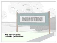
Sign, digital. Any video, computer generated, holographic or electronic images that are arranged, intended, designed or used as an advertisement, announcement or direction, or advertising devices of every kind. A digital sign shall not include electronically operated changing numeric message signs.
Sign, directional. A sign designed to guide pedestrians or vehicular traffic. A directional sign shall not include advertising material.
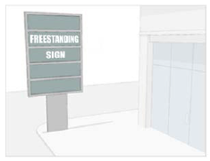
Sign, freestanding. Any sign supported by structures or supports that are placed on, or anchored in, the ground, and that are independent from any building or any other structure.
Sign, illuminated. A sign that is artificially lighted either internally or externally from a source of light connected with such sign.
Sign, marquee. A sign attached to or hung from a marquee.
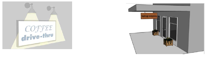
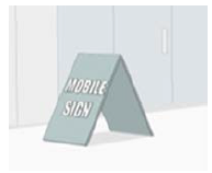
Sign, mobile. A sign which is not designed or manufactured to be permanently anchored or affixed to the ground, building or other structure, but rather is designed or primarily used as a sign which is movable from place to place, without involving any structural support or changes. Mobile signs include but are not limited to signs affixed to a trailer or other portable structure and "A" frame or sandwich signs.
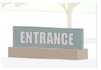
Sign, monument. A freestanding sign where the entire bottom of the sign is generally in contact with or in close proximity to the ground, and where the base of the sign is at least as wide as the sign. A monument sign shall not include a pylon sign.
Sign, noncommercial. A sign containing copy that is not intended to promote interest in or patronage of, a business, industry, profession or commodity, product, or service offered for sale, included but not limited to a sign expressing an opinion regarding a political campaign, religious matter, or public policy issue.
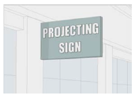
Sign, off-premises. A sign which contains a message unrelated to a business or profession conducted, or to a commodity, service or entertainment, sold or offered upon the premises where such sign is located.
Sign, on-premises. A sign directly pertaining to an existing permitted use on the property upon which said sign is located.
Sign, projecting. Any sign which projects from and is supported by a wall of a building with the display surface of the sign perpendicular to the building wall.
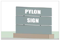
Sign, pylon. A freestanding sign of which the entire bottom of the sign is generally in contact with or in close proximity to the ground and which has a width of two (2) feet or a height at least three (3) times the width.
Sign, roof. A sign that is erected, constructed and maintained above the roof of the building.
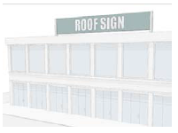
Sign, temporary. A commercial sign promoting or providing information concerning a sale, event or activity that is occurring or shall occur on the property where the sign is displayed.
Sign, wall. A sign attached to the wall of a building with the exposed face of the sign in a plane parallel to the face of said wall, not extending more than twenty-five (25) percent above the roof line or parapet of the building, nor more than twenty-four (24) inches from the wall surface.
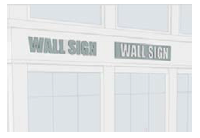
Sign, wind. A display of pennants, streamers, whirligigs or similar devices strung together and activated by wind.
Sign, window. Any sign printed, attached, glued or otherwise affixed to the outside glass of a window.
Sign surface area. Total area of that part of a sign structure that carries any sort of written or graphic materials or in any way conveys a message as seen from any one direction at any one time; except when cut-out letters and/or graphics only are used for wall signs or only lettering and/or graphics are used on awning signs in which cases the surface area is measured as the area of the basic geometric shape that would enclose the message and/or graphics. When individual cut out letters or graphics are installed on a wall, whether that wall be a part of a building or other structure, the area of the basic geometric shape that encloses the message is the surface area of the sign. The definition shall not apply to section 29-4.8.
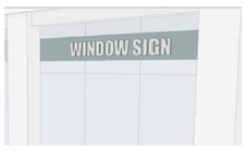
Specified anatomical areas. Less than completely and opaquely covered human genitals, pubic region, buttocks, and female breast below a point immediately above the top of the areola, and human male genitals in a discernibly turgid state, even if completely and opaquely covered.
Specified sexual activity. Intercourse, oral copulation, masturbation, sodomy, or excretory functions as a part of or in connection with any of the activities described herein.
Storage and wholesale distribution. The bulk short-term or long-term storage of commercial goods in facilities that may also provide for the shipping or trans-shipping of those goods to and from commercial buyers.
Storm drainage system. All drainage facilities used for collecting and conducting stormwater to, through and from drainage areas to the points of final outlet including, but not limited to, the following: Conduits and appurtenant features, canals, ditches, streams, gullies, flumes, culverts, streets, gutters, and pump stations.
Stormwater. Any surface flow, runoff, and drainage consisting entirely of water from any form of natural precipitation, and resulting from such precipitation including snowmelt.
Stormwater management plan. A detailed design in conformance with the standards on file with the public works department signed and sealed by an engineer licensed to practice in the State of Missouri.
Story (story height). That portion of a building included between the upper surface of a floor and the upper surface of the floor or roof next above. It is measured as the vertical distance from top to top of two successive tiers of beams or finished floor surfaces and, for the topmost story, from the top of the floor finish to the top of the ceiling joists or, where there is not a ceiling, to the top of the roof rafters. The useable floor area of any vertical level within a building must consist of at least fifty-one (51) percent of a building's ground footprint in order to qualify as a separate story.
Story above grade plane. Any story having its finished floor surface entirely above grade plane, or in which the finished surface of the floor next above is:
(1)
More than six (6) feet above grade plane; or
(2)
More than twelve (12) feet above the finished ground level at any point.
Streams. Perennial and intermittent watercourses identified through site inspection and United States Geological Survey (USGS) maps and further defined and categorized as follows:
(1)
Type I streams are defined as perennial streams shown as solid blue lines on the United States Geological Survey seven and one-half (7.5) minutes series topographical map.
(2)
Type II streams are defined as intermittent streams shown as dashed blue lines on the United States Geological Survey seven and one-half (7.5) minutes series topographical map.
(3)
Type III streams are defined as waterways or natural channels which are not shown on the United States Geological Survey seven and one-half (7.5) minutes series topographical map as either blue or dashed blue lines which have drainage areas of greater than fifty (50) acres.
Stream buffer. A vegetated area including trees, shrubs, managed lawn areas, and herbaceous vegetation which exists or is established to protect a stream system, lake or reservoir.
Stream channel. A naturally or artificially created watercourse with definite bed and banks which conducts continuously or periodically flowing water.
Street. A dedicated and accepted thoroughfare for public use which affords principal means of access, directly or indirectly, to abutting properties.
Street, arterial. A street that provides primarily for through traffic movement between areas and across the city, and has a secondary function of direct access to abutting property, subject to necessary control of entrances, exits and curbside use.
Street, collector. A street that provides for traffic movement between arterials and local streets.
Street, local. A street designed to provide direct access to abutting properties and to provide for local traffic movement within small areas.
Street, perimeter. An existing street, one side of which abuts a parcel of land to be subdivided.
Street, private. A thoroughfare designed to provide vehicular access to five (5) or more lots or parcels which is not dedicated for public use.
Street, terminal. A street that does not provide through access to another street, alley, or private drive, including, but not limited to a cul-de-sac.
Street, through. A public street which is not a cul-de-sac street and which provides vehicular access from an area internal to a subdivision, to the city's major roadway system as shown on the major roadway plan.
Structure. For all purposes except floodplain regulations, anything constructed or erected that requires location on the ground, or that is attached to something having a location on the ground; including but not limited to advertising signs, billboards, poster panels, decks, patios, and paved areas, fences, walls, and retaining walls.
Structural alterations. Any change in the supporting members of a building, such as bearing walls, columns, beams or girders.
Subdivider. Any owner, or the authorized agent or employee of an owner or group of owners, who commences proceedings to effectuate a subdivision of property under this chapter.
Subdivision. The division of a tract or parcel of land into two (2) or more lots, tracts or parcels for sale or development or, if a new street is involved, any division of a lot, or a tract or parcel of land. When appropriate to the context, the term "subdivision" may refer to the land subdivided.
Subdivision, administrative. Any resubdivision of previously subdivided nonresidential land, and any resubdivision of previously divided residential land that meets the criteria for an administrative plat.
Subdivision, major. Any subdivision not classified as a minor subdivision or tract split.
Subdivision, minor. Any subdivision containing not more than five (5) lots fronting on an existing state, county or city street or highway, and not requiring extension or improvement of any street or municipal service.
Subdivision, tract split. Any subdivision which involves division of a tract of land for sale or transfer, but not for development, into no more than five (5) tracts, each of which fronts on an existing state, county or city street or highway.
Substantial improvement. For all purposes except floodplain regulations, any repair, reconstruction, or other change of a structure, the cost of which equals or exceeds fifty (50) percent of the market value of the structure either:
(1)
Before the improvement is started; or
(2)
If the structure has been damaged and was being restored, before the damage occurred.
In the case of a nonconforming structure, restoration of damage is considered a "substantial improvement" which the cost equals or exceeds fifty (50) percent of the structure's market value. For the purposes of this definition "substantial improvement" is considered to occur when the first alteration of any wall, ceiling, floor or other structural part of the building commences, whether or not that alteration affects the external dimensions of the structure. The term does not, however, include any alteration to comply with existing state or local health, sanitary, building, or safety codes or regulations.
Swale. A wide shallow ditch used to carry storm runoff.
Temporary construction office or yard. A facility or area used as a temporary field construction office or temporary outdoor storage of construction equipment and materials associated with an active permit to demolish or construct buildings, structures, or infrastructure.
Temporary parking lot. A lot established to accommodate the temporary parking of vehicles for construction related activities and temporary events or gatherings such as carnivals, fairs, and concerts.
Temporary shelter. A residential facility that primarily provides temporary housing with accommodations for five (5) or more people for little or no financial compensation and that is operated in a manner that provides staff supervision and other support services. The length of time that such persons may stay at the shelter may be indefinite but is not intended to be permanent.
Terrace. An open, raised bank or banks of earth having a vertical or sloping side and a horizontal top.
Theater, drive-in. An open lot, with its appurtenant facilities, such as concession stands and restrooms, where patrons view movies from inside their vehicles.
Total suspended solids. Matter suspended in stormwater excluding litter, debris, and other gross solids exceeding one millimeter in diameter.
Townhouse. A single-family dwelling unit constructed in a group of three or more attached units in which each unit extends from the foundation to roof and with open space on at least two (2) sides.
Tract. An area, parcel, site, piece of land, lot, or property.
Transportation plan. An element of the comprehensive plan for the city describing transportation policies for all modes of travel. The major roadway plan, a part of the transportation plan, shows the approximate location of existing and proposed collector streets, arterial streets, expressways and freeways throughout the city.
Tree. Any self-supporting woody perennial plant, usually with one main stem or trunk.
Tree, existing. A tree which meets or exceeds the following size standards: Deciduous shade trees shall have a four-inch diameter, measured four and one-half (4½) feet above the ground and ornamental and evergreen species shall be a minimum of six (6) feet in height.
Tree or landscaping service. The business activities and equipment storage requirements associated with landscaping design, installation, and maintenance services, including landscape design and contractor offices, landscaping materials stores, and related tool and equipment rentals.
Tree preservation easement. An irrevocable easement, in a form approved by the city counselor, which encompasses all or a portion, when permitted, of the required climax forest that must be saved on a site.
Tree, significant. A tree that is at least twenty (20) inches diameter at breast height (DBH), is not diseased, dying, or of a noxious invasive species, and is located outside of required tree preservation and stream buffer areas.
Travel trailer.
(1)
A vehicular, portable structure built on a chassis and designed for temporary occupancy for travel, recreational or vacation use; and when factory-equipped for the road, being of any weight, provided its overall length is less than forty (40) feet or is less than three hundred twenty (320) square feet in floor area;
(2)
A structure designed to be mounted on a truck chassis for use as a temporary dwelling for travel, recreation, and vacation;
(3)
A portable, temporary dwelling to be used for travel, recreational and vacation purposes, constructed as an integral part of a self-propelling vehicle; or
(4)
A canvas, folding structure, mounted on wheels and designed for travel, recreation and vacation use.
Travel trailer park. A parcel of land that has been improved for the placement of travel trailers.
Underground space. The entire cavern resulting from the extraction of subsurface-located material in such a manner that the surface area of the property is not disturbed except in the vicinity of the entrances and easements servicing the development.
Urban agriculture. The raising, keeping or production of fruit, vegetable, flower, and other crops, poultry, or bees as a primary (not accessory) use of land on sites of two and one-half (2.5) acres or less. This uses includes the ordinary accessory uses and structures for preparing, treating, and storing agricultural products, equipment and machinery, but does not include raising, storing, or processing of any animals other than poultry and bees.
Urban conservation. Public and private efforts to maintain and enhance older urban areas through stabilization, rehabilitation, protection, revitalization, conversion, infill development or redevelopment.
Variance. For all purposes except floodplain regulations, a modification or variation of the zoning regulations contained in this chapter 29, as applied to a specific piece of property, as distinct from rezoning.
Vehicle wrecking or junkyard. A structure or parcel of land where goods, equipment, or materials, or ten or more motor vehicles not in running condition, or parts thereof, are stored in the open and are not being restored to operation, or any land, building, and including any equipment or structure used for crushing or dismantling or storing of any of those items.
Veterinary hospital. A hospital or facility where domesticated animals or fowl are treated, kept, cared for, bred or boarded (daytime only or overnight), including but not limited to animal pounds, animal shelters, and kennels.
Walkway. A pedestrian way designed to provide pedestrian access to abutting properties, deemed to be a public walkway if located within a dedicated right-of-way and accepted for public maintenance. Walkways located adjacent to public streets are sidewalks.
Water quality volume. The storage needed to capture and treat ninety (90) percent of an average annual stormwater runoff volume. It is calculated by multiplying the water quality storm times the volumetric runoff coefficient and site area.
Watercourse. A stream, usually flowing in a particular direction (though it need not flow continuously in a definite channel), having a bed or banks and usually discharging into some other stream or body of water.
Watercourse. A natural running stream of water flowing in a particular direction and having a definite channel with a bed or banks. A watercourse may be intermittent, but shall be considered more than mere surface drainage over the entire fall of a tract of land.
Waterways. Natural or manmade lakes, natural channels, rivers, streams, and creeks which store or convey stormwater runoff.
Wetlands. Areas that are inundated or saturated by surface or groundwater at frequency and duration sufficient to support and under normal circumstances do support a prevalence of vegetation typically adapted for life in saturated soil conditions.
Wholesale sales office or sample room. A sales office or showroom associated with establishments or places of business primarily engaged in selling merchandise to retail, industrial, commercial, institutional, or professional business users, or other wholesalers, but not to the public-at-large; or acting as agents or brokers and buying merchandize for, or selling merchandise to, such individuals or companies. This use does not include the storage and distribution of this wholesale merchandise.
Yard. An open space unobstructed from the ground to the sky, except where specifically provided by this Code, on the lot on which a building is situated.
Yard, corner side. An open space between a building and a street right-of-way adjacent to the side of a building located on the street side of a corner lot that extends from the front property line to the rear property line.
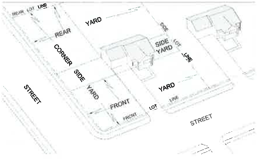
Yard, front. An open space between a building and the street fronting the lot on which the building is located, and extending from side lot line to side lot line.
Yard, rear. An open space between a building and the rear lot line of the lot on which the building is located, and extending from side lot line to side lot line.
Yard, side. An open space between a building and the side lot line closest to that side of the building, but not including any area included in the front yard or rear yard.
Zoning regulations. The provisions of this Code adopted pursuant to RSMo §§ 89.010 to 89.140.
(b)
Communication antennas and tower. For the purpose of chapter 29, article 3, section 29-3.3(n), the following words and terms as used are defined to mean the following:
Antenna support structure. Any building or other structure such as a water tower, other than a tower or a disguised support structure as herein defined, which can be used for the location of telecommunications facilities.
Collocation. The placement or installation of a new wireless facility on a structure that already has an existing wireless facility, including electrical transmission towers, water towers, buildings, and other structures capable of structurally supporting the attachment of wireless facilities.
Communications antenna. Communications equipment that transmits or receives electromagnetic radio signals used in the provision of any type of wireless communications services.
Communications equipment cabinet. A structure for the protection and security of communications equipment associated with one or more antennas where direct access to equipment is provided from the exterior.
Communications equipment shelter. A building for the protection and security of communications equipment associated with one or more antennas and where access to equipment is gained from the interior of the building.
Communications tower. A wireless support structure, such as a monopole, slick stick, stealth, lattice, or guyed tower, designed and constructed for the purpose of supporting wireless facilities. This definition does not include utility poles or any support structure owned and operated by an amateur radio operator licensed by the FCC.
Disguised support structure. Any freestanding, manmade structure used for the support of communications antennas, the presence of which is camouflaged or concealed as an architectural or natural feature. Such structures may include but are not limited to clock towers, campaniles, observation towers, light standards, flag poles and artificial trees.
Height, communications antenna or tower. The vertical distance measured from the base of the structure at ground level to its highest point and including the main structure and all attachments thereto. Height shall also include any ground artificially built up around the base of the structure to increase the ultimate elevation of the highest point of a communications antenna or tower.
Replacement. For purposes of wireless telecommunications facilities includes constructing a new wireless support structure of equal proportions and of equal height or such other height that would not constitute a substantial modification to an existing structure in order to support wireless facilities or to accommodate collocation and includes the associated removal of the preexisting wireless facilities or wireless support structure.
Substantial modification. For the purposes of wireless telecommunications facilities means the mounting of a proposed wireless facility on a wireless support structure which, as applied to the structure as it was originally constructed:
(1)
Increases the existing vertical height of the structure by more than ten (10) percent, or by the height of one additional antenna array with separation from the nearest existing antenna not to exceed twenty (20) feet, whichever is greater; or
(2)
Involves adding an appurtenance to the body of a wireless support structure that protrudes horizontally from the edge of the wireless support structure more than twenty (20) feet or more than the width of the wireless support structure at the level of the appurtenance, whichever is greater (except where necessary to shelter the antenna from inclement weather or to connect the antenna to the tower via cable); or
(3)
Involves the installation of more than the standard number of new outdoor equipment cabinets for the technology involved, not to exceed four (4) new equipment cabinets; or
(4)
Increases the square footage of the existing equipment compound by more than one thousand two hundred fifty (1,250) square feet.
(c)
Floodplain and floodplain overlay (FP-O). For the purpose of chapter 29, article 2, section 29-2.3(d) the following words and terms as used are defined to mean the following:
1% annual chance flood (100-year flood). See "base flood."
100-year flood. See "base flood."
Actuarial or risk premium rates. Those rates established by the administrator of the National Flood Insurance Program pursuant to individual community studies and investigations which are undertaken to provide flood insurance in accordance with Section 1307 of the act and the accepted actuarial principles. "Risk premium rates" include provisions for operating costs and allowances.
Administrator. For purposes of floodplain regulations, the director of public works.
Agency. For purposes of floodplain regulations, the Federal Emergency Management Agency.
Appeal. For purposes of floodplain regulations, a request for a review of the interpretation of the director of public works of any provision of section 29-2.3(d) or a request for a variance.
Area of shallow flooding or sheet flow area. A designated AO or AH zone on the flood insurance rate map (FIRM) with a one percent or greater annual chance of flooding to an average depth of one to three (3) feet where a clearly defined channel is unpredictable and where velocity flow may be evident. Such flooding is characterized by ponding or sheet flow.
Area of special flood hazard. The land in the floodplain subject to one percent or greater chance of flooding in any given year.
Base flood. The flood having one percent chance of being equaled or exceeded in any given year (sometimes referred to as a "100-year flood").
Basement. For purposes of floodplain regulations, any area of the building having its floor subgrade (below ground level) on all sides.
Building. For purposes of floodplain regulations, a walled and roofed building, including a gas or liquid storage tank, that is principally above ground, as well as a manufactured home. Structure, for insurance purposes, means a walled and roofed building, other than a gas or liquid storage tank, that is principally above ground and affixed to a permanent site, as well as a manufactured home on a permanent foundation. For the latter purpose, the term includes a building while in the course of construction, alteration or repair, but does not include building materials or supplies intended for use in such construction, alteration or repair, unless such materials or supplies are within an enclosed building on the premises.
Chief executive officer or chief elected official. For purposes of floodplain regulations, the city manager is the chief executive officer and the mayor is the chief elected official and shall be the official(s) of the community who are charged with the authority to implement and administer laws, ordinances and regulations for the community.
Elevated building. For purposes of floodplain regulations, a non-basement building, (a) built, in the case of a building in zones AE, A, A99, AO, AH, X shaded, other flood areas, X un-shaded, other areas, or D to have the top of the elevated floor, elevated above the ground level by means of pilings, columns (posts and piers), or shear walls parallel to the flow of water; and (b) adequately anchored so as not to impair the structural integrity of the building during a flood of up to the magnitude of the base flood. This also includes a building elevated by means of fill or solid foundation perimeter walls with openings sufficient to facilitate the unimpeded movement of flood waters.
Eligible community or participating community. For purposes of floodplain regulations, a community for which the administrator has authorized the sale of flood insurance under the National Flood Insurance Program.
Existing construction. For purposes of floodplain regulations, and for the purposes of determining rates, means structures for which the "start of construction" commenced before the effective date of the FIRM. "Existing construction" may also be referred to as "existing structures."
Existing manufactured home park or subdivision. For purposes of floodplain regulations, a manufactured home park or subdivision for which the construction of facilities for servicing the lots on which the manufactured homes are to be affixed (including, at a minimum, the installation of utilities, the construction of streets, and either final site grading or the pouring of concrete pads) was complete before October 1, 1973.
Expansion to an existing manufactured home park or subdivision. For purposes of floodplain regulations, the preparation of additional sites by the construction of facilities for servicing the lots on which the manufactured homes are to be affixed (including the installation of utilities, the construction of streets, and either final site grading or the pouring of concrete pads).
Flood or flooding. A general and temporary condition of partial or complete inundation of normally dry land areas from the overflow of a stream, or from the unusual and rapid accumulation of runoff of surface waters from any source.
Flood boundary floodway map (FBFM). An official map delineating the floodway, floodway fringe, one hundred-year floodplain, and five hundred-year floodplain. The FBFW is prepared in conjunction with the flood insurance study (FIS).
Flood drainage areas (less than one square mile). Areas designated within the 1% annual chance floodplain by the most recent flood insurance study and flood insurance rate map, but containing a drainage area less than one square mile. The December 1, 1981 flood insurance study did not establish the base flood elevation or delineate the floodway and flood fringe for these areas; rather the base flood elevation and 1% annual chance floodplain were and are established by the January 16, 1976 flood insurance study and amendments thereto. The flood drainage areas generally include small streams or the upper reaches of major streams.
Flood elevation determination. A determination by the administrator of the water surface elevations of the base flood, that is, the flood level that has a one percent or greater chance of occurrence in any given year.
Flood elevation study. An examination, evaluation and determination of flood hazards and, if appropriate, corresponding water surface elevations.
Flood fringe. That area of the floodplain, outside of the floodway, that has a one percent chance of flood occurrence in any one year.
Flood hazard area. The greater of the following two (2) areas:
(1)
The area within a floodplain subject to a one percent or greater chance of flooding in any year.
(2)
The area designated as a flood hazard area on the city's flood hazard boundary map, or otherwise legally designated.
Flood hazard boundary map (FHBM). An official map of a community, issued by the administrator, where the boundaries of the flood areas having special hazards have been designated as zones A.
Flood insurance rate map (FIRM). An official map of a community, on which the Federal Emergency Management Agency (FEMA) has delineated both the special flood hazard areas and the risk premium zones applicable to the community.
Flood insurance study. The official report provided by the Federal Emergency Management Agency containing the flood insurance rate map (FIRM), the flood boundary and floodway map (FBFM), the surface elevation of the base flood, and supporting technical data.
Floodplain or flood-prone area. Any land area susceptible to being inundated by water from any source (see "flooding").
Floodplain management. The operation of an overlay program of corrective and preventive measures for reducing flood damage, including but not limited to emergency preparedness plans, flood control works and floodplain management regulations.
Floodplain management regulations. Zoning ordinances, subdivision regulations, building codes, health regulations, special purpose ordinances (such as floodplain ordinances, grading ordinances and erosion control ordinances) and other applications of police power. The term describes such state or local regulations, in any combination thereof, which provide standards for the purpose of flood damage prevention and reduction.
Floodproofing. Any combination of structural and nonstructural additions, changes or adjustments to structures that reduce or eliminate flood damage to real estate or improved real property, water and sanitary facilities, structures and their contents.
Floodway or regulatory floodway. The channel of the river, creek or other watercourse and the adjacent land areas that must be reserved in order to discharge the base flood without cumulatively increasing the water surface elevation more than a designated height.
Floodway encroachment lines. The lines marking the limits of floodways on federal, state and local floodplain maps.
Floor area, gross. The floor area within the inside perimeter of the exterior walls of the building under consideration, exclusive of vent shafts and courts, without deduction for corridors, stairways, closets, the thickness of interior walls, columns or other features. The floor area of a building, or portion thereof, not provided with surrounding exterior walls shall be the usable area under the horizontal projection of the roof or floor above. The gross floor area shall not include shafts with no openings or interior courts.
Floor level. The level of habitable space in a building. "Street level" shall be the lowest floor level in a building in which no less than fifty-one (51) percent of the interior side of the business adjacent to a street or alley is above the adjacent grade. "Lower level" shall be a level below the street level; "second level" shall be the first level above the main street level; and "upper level" shall be any level above the second. Floor level shall be determined for each elevation. Where buildings are situated on sloping lots and are adjacent to more than one street or alley, the level of a business may differ from one elevation to another.
Functionally dependent use. For purposes of floodplain regulations, a use which cannot perform its intended purpose unless it is located or carried out in close proximity to water. This term includes only docking facilities, port facilities that are necessary for the loading and unloading of passengers, and ship building and ship repair facilities, but does not include long-term storage or related manufacturing facilities.
Grade, highest adjacent. For purposes of floodplain regulations, the highest natural elevation of the ground surface prior to construction next to the proposed walls of a structure.
Lowest floor. For purposes of floodplain regulations, the lowest floor of the lowest enclosed area (including basement). An unfinished or flood resistant enclosure, usable solely for parking of vehicles, building access or storage, in an area other than a basement area, is not considered a building's lowest floor, provided that such enclosure is not built so as to render the structure in violation of the applicable non-elevation design requirements of the floodplain regulations.
Manufactured home. For purposes of floodplain regulations, a structure, transportable in one or more sections, which is built on a permanent chassis and is designed for use with or without a permanent foundation when connected to the required utilities. For floodplain management purposes the term "manufactured home" also includes park trailers, travel trailers, mobile homes, and other similar vehicles placed on a site for greater than one hundred eighty (180) consecutive days. For insurance purposes the term "manufactured home" does not include recreational vehicles, travel trailers, mobile homes, and other similar vehicles.
Manufactured home park or subdivision. For purposes of floodplain regulations, a parcel (or contiguous parcels) of land divided into two (2) or more manufactured home lots for rent or sale.
Map. For purposes of floodplain regulations, the flood hazard boundary map (FHBM) or the flood insurance rate map (FIRM) for a community issued by the agency.
Mean sea level. For purposes of the National Flood Insurance Program, the National Geodetic Vertical Datum (NGVD) of 1929 or other datum, to which base flood elevations shown on a community's flood insurance rate map are referenced.
New construction. For purposes of floodplain regulations, and for the purpose of determining insurance rates, means structures for which the "start of construction" commenced on or after December 31, 1974 and includes any subsequent improvements to such structures. For floodplain management purposes, "new construction" means structures for which the "start of construction" commenced on or after October 1, 1973 and includes any subsequent improvements to such structures.
New manufactured home park or subdivision. For purposes of floodplain regulations, a manufactured home park or subdivision for which the construction of facilities for servicing the lot on which the manufactured homes are to be affixed (including, at a minimum, the installation of utilities, the construction of streets, and either final site grading or the pouring of concrete pads) was completed on or after October 1, 1973.
Person. For purposes of floodplain regulations, any individual or group of individuals, corporation, partnership, association, or any other entity, including federal, state and local governments and agencies.
Principally above ground. For purposes of floodplain regulations, means that at least fifty-one (51) percent of the actual cash value of the structure, less land value, is above ground.
Recreational vehicle. For purposes of floodplain regulations, a vehicle which is:
(1)
Built on a single chassis;
(2)
Four hundred (400) square feet or less when measured at the largest horizontal projections;
(3)
Designed to be self-propelled or permanently towable by a light duty truck; and
(4)
Designed primarily not for use as a permanent dwelling but as temporary living quarters for recreational, camping, travel or seasonal use.
Regulatory flood. See "base flood."
Remedy a violation. For purposes of floodplain regulations, means to bring the structure or other development into compliance with state or local floodplain management regulations.
Special hazard area. For purposes of floodplain regulations, an area having special flood hazards and shown on an FHBM or FIRM as zone A, AO, AE, A99, AH, A1-30, AR, V, VO, VE, V1-30 or other flood areas.
Start of construction (for other than new construction or substantial improvements under the Coastal Barrier Resources Act (Pub. L. 97-348)). For purposes of floodplain regulations, any substantial improvement, and means the date the building permit was issued, provided the actual start of construction, repair, reconstruction, rehabilitation, addition, placement, or other improvement was within one hundred eighty (180) days of the permit date. The actual start means the first placement of permanent construction of a structure on a site, such as the pouring of slab or footings, the installation of piles, the construction of columns, or any work beyond the stage of excavation or the placement of a manufactured home on a foundation. Permanent construction does not include land preparation, such as clearing, grading and filling; nor does it include the installation of streets and/or walkways; nor does it include excavation for a basement, footings, piers, or foundations or the erection of temporary forms; nor does it include the installation on the property of accessory buildings, such as garages or sheds not occupied as dwelling units or not part of the main structure. For a substantial improvement, the actual start of construction means the first alteration of any wall, ceiling, floor, or other structural part of a floor, or other structural part of a building, whether or not that alteration affects the external dimensions of the building.
State coordinating agency. For purposes of floodplain regulations, the agency of the state, or other office designated by the governor of the state or by state statute at the request of the administrator to assist in the implementation of the National Flood Insurance Program in that state.
Structure. For purposes of floodplain regulations, a walled and roofed building, including a gas or liquid storage tank, that is principally above ground, as well as a manufactured home. Structure, for insurance purposes, means a walled and roofed building, other than a gas or liquid storage tank, that is principally above ground and affixed to a permanent site, as well as a manufactured home on a permanent foundation. For the latter purpose, the term includes a building while in the course of construction, alteration or repair, but does not include building materials or supplies intended for use in such construction, alteration or repair, unless such materials or supplies are within an enclosed building on the premises.
Substantial damage. For purposes of floodplain regulations, damage of any origin sustained by a structure whereby the cost of restoring the structure to its before damaged condition would equal or exceed fifty (50) percent of the market value of the structure before the damage occurred.
Substantial improvement. For purposes of floodplain regulations, any reconstruction, rehabilitation, addition or other improvement of a structure, the cost of which equals or exceeds fifty (50) percent of the market value of the structure before the "start of construction" of the improvement. This term includes structures which have incurred "substantial damage," regardless of the actual repair work performed. The term does not, however, include either:
(1)
Any project for improvement of a structure to correct existing violations of state or local health, sanitary or safety code specifications which have been identified by the local code enforcement official and which are the minimum necessary to assure safe living conditions, or
(2)
Any alteration of a "historic structure," provided that the alteration will not preclude the structure's continued designation as a "historic structure."
Variance. For purposes of floodplain regulations, a grant of relief by the community from the terms of a floodplain management regulation. Floodplain insurance requirements remain in place for any varied use or structure and cannot be varied by the community.
Violation. For purposes of floodplain regulations, the failure of a structure or other development to be fully compliant with the city's floodplain management regulations. A structure or other development without the elevation certificate, other certifications or other evidence of compliance required by this chapter is presumed to be in violation until such time as that documentation is provided.
Water surface elevation. For purposes of floodplain regulations, the height in relation to the National Geodetic Vertical Datum of 1929, or other datum, where specified, of floods of various magnitudes and frequencies in the floodplains of riverine area.
(d)
Historic preservation. For the purpose of chapter 29, article 2, section 29-2.3(c) the following words and terms as used are defined to mean the following:
Alteration. For purposes of historic preservation regulations, any act that changes one or more of the historic or architectural features identified in an ordinance placing property in the HP-O district.
Certificate of appropriateness. A certificate issued by the historic preservation commission indicating its approval of the architectural appropriateness of plans for construction, alteration, removal or demolition of a landmark or of a structure within a historic district.
Construction. For purposes of historic preservation regulations, the act of adding an addition to an existing structure or the erection of a new principal or accessory structure.
Historic district. An area designated as a historic district by ordinance, and included in the HP-O district, which may contain one or more landmarks and which may have within its boundaries other properties or structures which, while not of such historic or architectural significance to be designated as landmarks, nevertheless contribute to the overall visual characteristics and historical significance of the historic district.
Historic resource. Any structure that: 1) is fifty (50) years old or older; or 2) is located in a historic resources survey area; or 3) is within an actual or proposed National Register of Historic Places district; or 4) has been recognized or nominated by the historic preservation commission as a "most notable property".
Historic structure. For purposes of floodplain regulations or applicability of parking regulations, any structure that is:
(1)
Listed individually in the National Register of Historic Places (a listing maintained by the Department of Interior) or preliminarily determined by the Secretary of the Interior as meeting the requirements for individual listing on the National Register;
(2)
Certified or preliminarily determined by the Secretary of the Interior as contributing the historical significance of a registered historic district or a district preliminarily determined by the Secretary to qualify as a registered historic district;
(3)
Individually listed on a state inventory of historic places in states with historic preservation programs which have been approved by the Secretary of the Interior; or
(4)
Individually listed on a local inventory of historic places in communities with historic preservation programs that have been certified either: (a) by an approved state program as determined by the Secretary of the Interior; or (b) directly by the Secretary of the Interior in states without approved programs.
Landmark. A property or structure placed in the HP-O district and designated as a landmark by ordinance, which is worthy of rehabilitation, restoration, and preservation because of its historic or architectural significance.
Removal. For purposes of historic preservation regulations, any relocation of a structure on its site or to another site.
Repair. For purposes of historic preservation regulations, any change that is not construction, removal or alteration.
Stabilization. For purposes of historic preservation regulations, the process of applying measures designed to halt deterioration and to establish the structural stability of an unsafe or deteriorated resource while maintaining the essential form as it presently exists without noticeably changing the exterior appearance of the resource.
(e)
Mixed-use downtown (M-DT). For the purpose of chapter 29, article 4, subsections 29-4.2(a) to (f) the following words and terms as used are defined to mean the following:
Alley/Alley access easement. The public right-of-way or easement for vehicles and pedestrians within a block that provides access to the rear or side of properties, vehicle parking (e.g., garages), utility meters, recycling containers, and garbage bins.
Attic story. Habitable space situated within the structure of a pitched roof and above the uppermost story. An attic story is permitted for all building form standard sites and does not count against the maximum story height or height limits of the building form standards.
Bay window. A composite of two or more windows, or rounded windows (generally, a U-shaped enclosure), projecting (cantilevered) from the outer wall of a building.
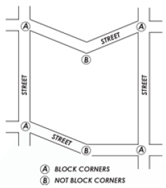
Block. An increment of land comprised of lots, alleys and tracts circumscribed and not traversed by streets (pedestrian pathways excepted). In the M-DT district, blocks shall be measured at the required building line (RBL).
Block corner. For purposes of form-based zoning standards, the outside corner of a block at the intersection of any two street-spaces (the required building lines). Inside corners, where the resulting angle formed by the block face is less than one hundred eighty (180) degrees (concave) are not considered block corners for the purposes of the M-DT district.
Block face. The required building line frontage between block corners.
Building corner. The outside corner of a building where the primary building mass is within an angle less than one hundred eighty (180) degrees. Inside corners, where the exterior space of the building mass forms an angle of more than one hundred eighty (180) degrees are not considered building corners for the purposes of the M-DT district.
Building form standards (BFS). The part of this chapter that establishes basic parameters regulating building form, including the envelope (in three dimensions), placement and certain permitted/required building elements, such as shopfronts, balconies, and street walls. The building form standards establish both the boundaries within which things may be done and specific things that must be done. The applicable building form standards(s) for a site is determined by its street frontage as per the regulating plan. This produces a coherent street-space and allows the building owner greater freedom behind the façade.
Building face. See "façade."
Civic buildings. For purposes of form-based zoning, those buildings that house strictly civic uses or historically and culturally significant structures designated on the mixed-use downtown (M-DT) regulating plan. A civic structure is one in which buildings are customarily designed to meet the needs of assembly for civic affairs, religious worship, or education, and therefore include perimeter greenspace and characteristic building forms that are governed by civic or religious traditions.
Clear height. Within a structure, the distance between the floor and ceiling. For entrances and other external building features, the unobstructed distance from the ground to the bottom of the lowest element above.
Clear walkway. The portion of the sidewalk within a street-space that shall remain clear of obstructions and allow public passage. The clear walkway width is specified in the street type specifications.
Comparative pedestrian crossing. The measured distance, shown on the street type specifications, that a pedestrian would be within an automobile travel lane (or turning movement) while crossing a street. A crossing time is calculated based on a pedestrian speed of 3.7 feet per second (a generally accepted urban average). This distance/time is calculated in order to provide a relative gauge of the comfort level for pedestrians crossing the street.
Complete and discrete façade composition. The façade articulation that breaks down the apparent scale of a large building into smaller apparent pieces. The intent of such a façade composition is to provide "human scale" for the street-space. The objective requirements of the complete and discrete façade composition section of the building form standards regulate and ensure such scalar break-down.
Covered sidewalk. A roofed or built structure attached to the façade and extending beyond the required building line and over the sidewalk or square, open to the street-space except for supporting columns, piers, or arches. (See building form standards for complete specifications.)
Dooryard. In the context of M-DT district building form standards, the area within the street-space between the façade of the building (generally the required building line) and the clear walkway area of the sidewalk. The dooryard area is designated in the street type specifications.
Eave height. Eave height shall be measured at the bottom of the top layer of roofing material at its outermost point from the building wall.
English basement. A habitable floor level below the first floor that is partially above and below grade, with direct street-space access.
Equivalent or better. A building material or construction technique that has been determined, by the director, to be at least equal to, in appearance, durability, etc., or surpassing those expressly permitted herein.
Façade (building face). The building elevation facing the street-space or required building line. Building walls facing private interior courts, common lot lines, alleys, and common drives are not façade.
Façade composition. The arrangement and proportion of materials and building elements (windows, doors, columns, pilasters, bays, etc.) on a given façade.
Fenestration. The design of openings in a building, including skylights, roof windows, vertical windows (whether fixed or moveable); opaque doors; glazed doors; glass block; and combination opaque/glazed doors.
First floor. See "ground story."
Floor plate. The footprint of a building, including exterior walls.
Forecourt. The semi-public space created when a façade is stepped back near its midpoint. Forecourts are surrounded on three sides by building fronts and are un-roofed. A forecourt is similar to a courtyard, except that one side is open to the street-space.
Front porch. The ground floor area consisting of an impervious surface attached to the façade or required building line side of the main building, which is delineated by a change in elevation, surface type or surface texture or combination thereof.
Front yard fence. The wood (picket), wrought iron fence, or masonry wall located along and surrounding the front yard. (For placement, height and gate specifications, see the building form standards.)
Garden wall. A masonry wall defining a property line or delineating a private area. (For placement, height and gate specifications, see the building form standards.) A garden wall may serve as a front yard fence.
Ground story. The first habitable level of a building at or above grade. The next story above the ground story is the second floor or story.
Lot building limit (LBL). For purposes of M-DT district building form standards, a line indicating the outer edge of the buildable area, generally to the rear of a lot away from the required building line. A lot building limit may be used, for example, to establish an edge toward a conservation area, or within a workplace area to establish a common mid-block working courtyard. Where designated on the regulating plan, this shall supersede the building form standard minimum setback.
Lot line, common. A lot line shared by adjacent lots.
Open area. See "private or public open area."
Parking setback line. A line or plane indicated on the regulating plan that extends vertically up from the ground story floor level (unless otherwise noted on the regulating plan or BFS) and is generally parallel to the required building line. The parking setback line is a permissive minimum distance from the required building line and parking may be placed anywhere within the lot behind this line, except where otherwise specified in the M-DT district standards.
Pedestrian pathway. An interconnecting paved way providing pedestrian and bicycle passage through blocks running from a street-space to another street-space, an alley or an interior block parking area. The area within a pedestrian pathway shall be a public access easement or public right-of-way.
Privacy fence. An opaque fence made of wood or masonry (not chain link or any other type of rolled fence) along alleys, common drives, pedestrian pathways, and common lot lines (where behind the required building line). See the building form standards for height specifications.
Private or public open area. For purposes of form-based zoning standards, an occupied area within or adjoining the building area that is accessible to occupants of the particular building or site, which may also be accessible to the public, and functions as an amenity space for gathering, access to air and light, and recreation. Examples include courtyards, forecourts, active rooftops, plazas, balconies, patios, pet exercise areas, recreation or meeting rooms, gardens, atria, light courts, lobbies or private outdoor seating areas. Utilitarian functions such as mechanical equipment, storage space, parking, unfinished basement, corridors and landings shall not qualify as private or public open area.
Regulating plan. The implementing plan for the development of the M-DT district under this Code. Regulating plans allocate the building form standards and street types and provide specific information for the disposition of each building site. The regulating plan also shows how each site relates to adjacent street-spaces, the overall district, and the surrounding neighborhoods.
Required building line (RBL). A line or plane indicated on the regulating plan, in the M-DT district, defining the street frontage which extends vertically and generally parallel to the street, at which the building facade shall be placed. This is a requirement, not a permissive minimum. The minimum length and height of facade that is required at the RBL is shown on the appropriate building form standard.
Shopfront (storefront). That portion of the ground story façade fenestration intended for marketing or merchandising of commerce uses and allowing visibility between the sidewalk and the interior space.
Sidewing. The portion of a building extending along a common lot line toward the alley or rear of the lot.
Small apartment building. See "townhouse/small apartment frontage building."
Stoop. The ground floor area consisting of an impervious surface attached to the façade or required building line side of the main building, which is delineated by a change in elevation, surface type or surface texture or combination thereof (see the building form standards for specifications).
Street frontage. That portion of the lot or building that is coincident with the required building line as required by this Code.
Street-Space. All space between fronting required building lines (streets, squares, plazas, pedestrian pathways, civic greens, sidewalks, parks)—including any transit service operator passenger platform—but not garage entries or alleys.
Street tree. A tree required per this Code and listed in the street tree list located in the urban space standards that is of a proven hardy and drought tolerant species and large enough to form a canopy with sufficient clear trunk to allow traffic to pass under unimpeded.
Street tree alignment line. A line along which street trees shall be planted and streetlights and other such infrastructure are to be placed. It is generally parallel with the street-space.
Street wall. For purposes of form-based zoning, a wall or fence that is located at the required building line in the M-DT mixed-use downtown district that is either required to perform a screening function, such as defining the edge of a parking area or refuse storage area, or is proposed by a property owner to define the edge of the public and private space for security or aesthetic purposes.
Streetlight. A luminaire installed on both sides of the street-space, along the street tree alignment line or median centerline, unless otherwise designated in this Code, with the design criteria in the form district giving equal weight to the lighting of the pedestrian areas and the automobile areas.
Townhouse/Small apartment frontage building. Building form and functions resulting from/as determined by the townhouse/small apartment building form standard indicated on the regulating plan.
Tree lawn (tree trench). A continuous strip of soil area—typically covered with grass, other vegetation, bridging pavement, or sometimes porous pavers—located between the back of curb and the clear sidewalk area, and used for planting street trees and configured to foster healthy street tree root systems. Tree lawn dimensions are specified in the street type specifications.
Urban general frontage building. Building form and functions resulting from/as determined by the urban general building form standard as indicated on the regulating plan.
Urban storefront frontage building. Building form and functions resulting from/as determined by the urban storefront building form standard as indicated on the regulating plan.
Use, civic. For the purpose of the M-DT district form-based regulations, the uses in the public and institutional use (except those in the utilities and communications category) of Table 29-3.1 that are allowed in the M-DT district as permitted or conditional uses. A "civic use" may or may not occupy a "civic building" (see definition, "civic building").
Use, commerce. For the purpose of the M-DT form-based regulations, the uses in the public and institutional use category (except those in the utilities and communications subcategory) and those uses in the commercial and industrial use category (except those in the agriculture & animal-related subcategory and the vehicles & equipment subcategory) of Table 29-3.1 that are allowed in the M-DT district as permitted or conditional uses.
Use, residential. For purposes of the M-DT form-based regulations, the uses in the residential use category of Table 29-3.1 that are allowed in the M-DT district as permitted or conditional uses.
Use, retail. Includes the following:
(1)
Retail service. Establishments providing services, as opposed to products, to the general public, including restaurants, finance, real estate and insurance, travel agencies, health and educational services, and galleries; as well as personal services, general.
(2)
Retail sales. Establishments in which the primary use is the sale of merchandise for use or consumption by the immediate purchaser.
Where clearly visible from the street-space. Some requirements of the M-DT district apply only where the subject is "clearly visible from the street-space." (Note that the definition of street-space includes squares, civic greens, pedestrian pathways, parks, and all public space except alleys.) A building element more than forty (40) feet from a required building line or street-space is by definition not clearly visible from the street-space (such as elements facing a common lot line). Also, common or party walls are by definition not clearly visible from the street-space. This does not exempt vehicle parking lots or parking structures from any building form standard requirements.
(f)
Wind energy conversion systems (WECS). For the purpose of chapter 29, article 3, section 29-3.3(o) the following words and terms as used are defined to mean the following:
Ambient sound level. For purposes of WECS regulations, the sound pressure level exceeded ninety (90) percent of the time, or L90, at a given location. Also, the amount of background noise at a given location prior to the installation of a WECS, which may include, but is not limited to, traffic, machinery, general human activity, and the interaction of the wind with the landscape. Ambient sound level is measured on the decibel dB(A) weighted scale as defined by the American National Standards Institute (ANSI).
Axis. For purposes of WECS regulations, the plane on which a rotor or other wind-harnessing mechanism rotates. City regulations do not differentiate between horizontal- and vertical-axis WECS.
Cutoff angle. The angle formed by a line drawn from the direction of light rays at the light source and a line perpendicular to the ground from the light source above from which no light is emitted.
Fall zone. For purposes of WECS regulations, the hypothetical area into which a tower and wind turbine could collapse in the event of a structural failure.
Feeder line. For purposes of WECS regulations, any power line that carries electrical power from one or more wind turbines or individual transformers associated with an individual wind turbine to the point of interconnection with the electric power grid. In the case of interconnection with the high voltage transmission systems, the point of interconnection shall be the substation serving the WECS.
Generator nameplate capacity/nameplate generating capacity (installed). For purposes of WECS regulations, the maximum rated output of a generator, prime mover, or other electric power production equipment under specific conditions designated by the manufacturer. Installed generator nameplate capacity is commonly expressed in kilowatts (kW) or megawatts (MW) and is usually indicated on a nameplate physically attached to the generator.
Height, WECS system. The height above grade of the WECS, including the generating unit and the highest vertical extension of any blades or rotors.
Interconnection. For purposes of WECS regulations, sharing energy through the local utility grid system. This requires an approved interconnection agreement with the pertinent utility provider serving the site, e.g. City of Columbia Water and Light, Boone Electric Cooperative, or Central Electric Power Cooperative.
Off-grid. For purposes of WECS regulations, an electrical system that is not connected, or is not permitted to be connected, to any utility distribution and transmission facility or to any building or structure that is connected.
Property line. For purposes of WECS regulations, the boundary line of the area over which the entity applying for WECS permit has legal control for the purposes of installation of a WECS. This control may be attained through fee title ownership, easement, or other appropriate contractual relationship between landowners.
Rotor. For purposes of WECS regulations, an element of a WECS that acts as a multi-bladed airfoil assembly, thereby directly extracting through rotation the kinetic energy of wind.
Rotor diameter. For purposes of WECS regulations, the diameter of the circle described by the rotor blades. See also "swept area."
Shadow flicker. For purposes of WECS regulations, alternating changes in light intensity, caused by the moving blades of a wind energy conversion system, that casts moving shadows on the ground and stationary objects.
Solar energy system. A complete design or assembly consisting of a solar energy collector, an energy storage facility (where used), and components for the distribution of transformed energy.
Sound pressure level. The sound measurement commonly reported in decibels (dB(A)).
Swept area. For purposes of WECS regulations, the diameter of the least circle encompassing all blades for a WECS. Also any and all portions of overhanging blades, turbines, or attachments that oscillate, rotate or otherwise move, which are not part of the fixed structural elements of the wind energy conversion system, including those on vertical axis WECS. See also the definition for "rotor diameter."
Tower. For purposes of WECS regulations, the vertical component of a WECS that elevates and supports the wind turbine generator, rotor blades, and other equipment above the ground.
Wind energy conversion system (also referred to as "WECS"). The configuration of components including the base, tower, generator, rotor blades and related equipment to convert the kinetic energy of wind into electrical energy (e.g. windmill or wind turbine). A wind energy conversion system which has a nameplate rated capacity of up to one hundred (100) kilowatts and is incidental and subordinate to a principal use on the same parcel.
Wind energy conversion system, building-mounted. A WECS that is securely fastened to any portion of a principal structure in order to achieve desired elevation, whether attached directly to the principal structure or attached to a tower structure which is in turn fastened to the principal structure. A building-mounted WECS is not a minor projection, as defined in section 29-4.1(c)(2).
Wind energy conversion system, co-located. A WECS that is mounted on a tower or pole structure which serves another primary purpose, such as a flagpole. Co-located systems are permitted per the rules of this chapter, so long as a principal use or structure is located on the subject parcel.
Wind energy conversion system, commercial. A WECS that is intended to produce electricity for sale to a rate-regulated or non-regulated utility or for use off site. For the purpose of this section, a commercial WECS has a total nameplate generating capacity equal to or greater than one hundred (100) kW.
Wind energy conversion system, freestanding. A WECS that is elevated by means of a monopole tower and is not located on another supporting structure. Guyed, lattice, or other non-monopole style towers shall not meet this definition.
Wind energy conversion system, noncommercial. A WECS of less than one hundred (100) kW in total nameplate generating capacity that is not operated on a for-profit basis. A WECS that is interconnected with the pertinent electric utility or that receives credits or rebates for energy transmitted to the power grid is not by that reason alone operated on a for-profit basis.
Wind energy conversion system, small. A WECS of less than ten (10) kW in total nameplate generating capacity.
Wind turbine. A piece of electrical generating equipment that aids in the conversion of the kinetic energy of wind into electrical energy.
(g)
Short-term rentals. For the purpose of chapter 29, article 3, section 29-3.3(vv) the following words and terms as used are defined to mean the following:
Designated agent. An individual or management company located within the County of Boone that is available twenty-four (24) hours per day who accepts full responsibility for addressing matters arising with the operation or use of a dwelling unit licensed as a short-term rental in the absence of the owner/authorized tenant of the property upon which such dwelling is located. The individual or management company is not required to be on-site in the absence of the owner/authorized tenant of the property.
Long-term resident. The owner, or a tenant under a signed lease greater than thirty (30) days that's authorized by the owner to conduct a short-term rental within the dwelling unit ("authorized tenant"), that maintains their principal residence on the parcel where the dwelling unit that is the subject of the short-term rental registration is located.
Owner. Any person, corporation, limited liability company, partnership, limited partnership, trust, real estate investment trust or any other legal entity who has legal interest in a property as shown within the records of the Boone County Assessor's Office.
Principal residence. The one (1) dwelling unit in which a long-term resident resides that, whenever absent, is the dwelling to which they return until a new principal residence is established. A person can have only one (1) principal residence. A principal residence shall be documented by providing at least one (1) of the following documents demonstrating the dwelling unit is the long-term resident's principal residence: Valid motor vehicle or voter registration; federal or state tax returns or other financial documentation; a utility bill; a valid driver's license; or other legal documentation deemed sufficient by the director of the community development department.
Registrant. The natural person who has:
(1)
Identified themselves as the registrant in the registration information and documentation submitted pursuant to the provisions of chapter 22 (Rental Conversation Law) of the City Code;
(2)
Either owns the dwelling unit, or is a long-term resident who has a documented right to possess and conduct a short-term rental within the dwelling unit; and
(3)
Has complied with all registration requirements for such dwelling unit in the City Code.
Short-term rental. A residential dwelling unit, portion of a dwelling unit or room within a residential dwelling unit rented by a transient guest.
Short-term rental (Tier 1). An accessory use of a long-term resident's principal residence that is rented, on occasion, in whole or in part, for not more than a total of thirty (30) nights in a calendar year as a short-term rental, as set forth in section 29-3.3(vv)(1)(i).
Short-term rental (Tier 2). An accessory use of a residential dwelling unit that is rented, on occasion, in whole or in part, as set forth in section 29-3.3(vv)(1)(ii).
Short-term rental (Tier 3). A residential dwelling unit that is rented, in whole or in part, as a short-term rental for greater than one hundred twenty (120) nights in a calendar year, as set forth in section 29-3.3(vv)(1)(iii).
Short-term rental intermediary. A marketplace or network that facilitates the listing, marketing, or rental of a short-term rental on a site, also referred to as a platform.
Transient guest. A person who occupies a room in a hotel, motel or tourist court as well as a bed and breakfast or short-term rental for less than thirty-one (31) consecutive days.
(h)
Rules of construction. This chapter shall be construed and interpreted as stated in the rules below:
(1)
Words used or defined in one tense or form shall include other tenses and derivative forms.
(2)
Words in the singular number include the plural number, and words in the plural number include the singular number.
(3)
The masculine gender shall include the feminine, and the feminine gender shall include the masculine.
(4)
The words "must," "shall," and "may not" are mandatory.
(5)
The words "may" and "should" are permissive.
(6)
The terms "standards," "regulations," and "requirements" indicated specific items that the applicant or property owner must comply with. Compliance with standards, regulations, and requirements is mandatory.
(7)
The word "person" includes individuals, firms, corporations, associations, and any other similar entities, including governmental agencies.
(8)
The words "used" or "occupied", whether used separately or together, shall be construed to include the facilities that were intended, arranged or designed to be used or occupied for that purpose."
(9)
In case of any difference of meaning or implication between the text of this chapter and any caption or illustration, the text shall control.
(Ord. No. 23895, § 1, 6-3-19; Ord. No. 24552, § 1, 3-1-21; Ord. No. 24553, § 1, 3-1-21; Ord. No. 24554, § 1, 3-1-21; Ord. No. 24555, § 1, 3-1-21; Ord. No. 24556, § 1, 3-1-21; Ord. No. 24680, § 1, 7-6-21; Ord. No. 24681, § 1, 7-6-21; Ord. No. 24682, § 1, 7-6-21; Ord. No. 24892, § 1, 1-3-22; Ord. No. 25243, § 1, 2-6-23; Ord. No. 25383, § 1, 7-17-23; Ord. No. 25512, § 1, 11-20-23; Ord. No. 25562, § 1, 2-5-24; Ord. No. 25658, § 1, 5-20-24)