
Cumberland City Zoning Code
ARTICLE IX
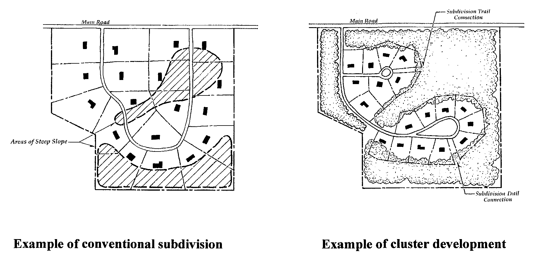
CLUSTER DEVELOPMENT
Sec. 25-236.- Purpose and scope.
(a)
The purpose of cluster development is to provide an alternative method of development to conventional subdivision that permits variation in lot sizes without an increase in the overall density of population; that allows home buyers a choice of lot sizes according to their needs; that preserves green space, tree cover, views, natural drainageways, or preserves features of outstanding natural topography, in order to prevent soil erosion and provide green areas for rest and recreation.
(b)
The provisions of this division shall apply only to cluster developments.
Sec. 25-237. - Districts where permitted.
Cluster developments are permitted in the R-E and R-S Districts.
Sec. 25-238. - Requirements and criteria.
(a)
Gross density permitted. The gross density of cluster developments within the R-E and R-S Districts shall be a maximum of four (4) dwelling units per acre of land.
(b)
Permitted uses.
(1)
Single-family detached, single-family attached, and two-family dwellings shall be permitted in cluster developments in the R-E Zone, provided that an overall density of four (4) dwelling units per acre of land within the tract is maintained.
(2)
Single-family detached, single-family attached dwellings, two-family dwellings, and low-rise apartment buildings shall be permitted in cluster developments in the R-S Zone, provided that an overall density of four (4) dwelling units per acre of land within the tract is maintained.
(c)
Development regulations. Area, yard, and building requirements shall be as set forth in the development regulations table contained in section 25-133. Regardless of these requirements, the planning commission in approving subdivision plats may permit modifications in lot area, lot width, yards (building restriction areas) including zero lot lines, or other requirements in all R-E and R-S Zones.
(d)
Public water and sewer. Cluster developments are not permitted unless public water and public sewer are provided.
(e)
Required open space. Reduction of individual lot areas will be reserved as open space.
(f)
Open space ownership and responsibility.
(1)
Open space areas shall be maintained so that their use and enjoyment as open space is not diminished or destroyed. Open space areas may be owned, preserved, and maintained by any of the following mechanisms or combinations thereof:
a.
Dedication of open space to the city or an appropriate public agency willing to accept the dedication.
b.
Common ownership of the open space by a homeowner's association which assumes full responsibility for its maintenance.
c.
Dedication of development rights of open space may be made to an appropriate public agency with ownership remaining with the developer or homeowner's association. Maintenance responsibility shall remain with the property owner.
d.
Deed-restricted private ownership which shall prevent development and/or subsequent subdivision of the open space land and provide maintenance responsibility.
(2)
Maintenance of natural areas is limited to the removal of litter, dead tree and plant materials, and brush. Natural water courses shall be maintained as free-flowing and devoid of debris. Stream channels shall be maintained so as not to alter floodplain level.
(3)
Maintenance of recreational areas is limited to insuring that no hazards, nuisances, or unhealthy conditions exist.
(4)
Pedestrian amenities shall be maintained in a clean and safe condition.
(g)
Circulation. Each lot shall have adequate access on a public right-of-way. There shall be an adequate, safe, and convenient arrangement of pedestrian circulation facilities, roadways, and parking.
Sec. 25-239. - Procedure.
(a)
Required information/submissions. A concept plan shall be submitted to the planning commission showing the following information:
(1)
The type of dwelling unit (single-family, townhouse, etc.), and building restriction lines;
(2)
Street layout;
(3)
Green area system;
(4)
Vicinity map (Scale: no smaller than one (1) inch equals two thousand (2,000) feet);
(5)
Topography with minimum five-foot contours (USGS topographic maps are permitted for the concept plan);
(6)
Number of acres in the entire tract; and
(7)
Overall dwelling unit density.
(b)
Review and approval. If the concept plan is approved by the planning commission, the developer will then proceed with platting of the development in accordance with the subdivision regulations. Final plats filed on cluster development shall bear a statement indicating that the land lies within an approved residential cluster development. In addition, the development is subject to the follow conditions:
(1)
The development of land within the cluster is permitted only in accordance with the approved final plat.
(2)
The agreements concerning the ownership and maintenance of open space land will be recorded simultaneously with the final plat.