
Dunedin City Zoning Code
DIVISION 2
- BASE ZONING DISTRICTS
103-20 - GENERALLY
No development approval shall be issued unless the proposed development conforms to the design regulations prescribed within the applicable zoning district.
(Ord. No. 10-19, § 4, 12-16-2010; Ord. No. 15-04, § 1, 2-9-2015)
103-21.1 - Generally
No use is permitted unless it is listed as a permitted or conditional use in this code. Those uses permitted as principal uses or buildings within each zoning district are those uses listed in the Use Matrix (Table 103-60.1).
(Ord. No. 10-19, § 4, 12-16-2010; Ord. No. 15-04, § 1, 2-9-2015)
103-21.2 - Uses Not Mentioned
103-21.3 - Uses Preempted By State Statute
Uses that are required to be permitted in any zoning district by state statute may be permitted in accordance with state law whether or not the use is included in the Use Matrix (Table 103-60.1).
(Ord. No. 10-19, § 4, 12-16-2010; Ord. No. 15-04, § 1, 2-9-2015)
103-21.4 - Interpretation—Materially Similar Uses
The zoning administrator shall, by written interpretation, determine if a use not mentioned can reasonably be interpreted to fit into a use category where similar uses are described. (Please refer to § 104-44 Written Interpretations, for procedures) It is the intent of this chapter to group similar or compatible land uses into specific zoning districts, either as permitted uses or as uses authorized by a conditional use permit. Uses not listed as a permitted use or conditional use permit are presumed to be prohibited from the applicable zoning district. Should the zoning administrator determine that a materially similar use does not exist, the matter may be referred to the local planning agency for a recommendation to amend the Use Matrix (Table 103-60.1) to establish a specific listing for the use in question.
(Ord. No. 10-19, § 4, 12-16-2010; Ord. No. 15-04, § 1, 2-9-2015)
103-21.5 - Planned Redevelopment-Mixed Use "PR-MU" Land Use Category
The purpose of this category to depict those areas of the city that are developed with a collection of residential, office and commercial uses, along corridors, adjacent to neighborhoods or within distinct areas that are interrelated and complimentary. When this land use category is utilized, it will require a Special Area Plan in accordance with the Countywide Rules (Section 4.2.7.5). The following zoning districts correlate with the "PR-MU" (Planned Residential Mixed Use) land use category.
(A)
Tourist Facility "TF"
(B)
Downtown Residential "DR"
(C)
General Office "GO"
(D)
Neighborhood Business "NB"
(E)
General Business "GB"
(F)
Commercial Parkway "CP"
(Ord. No. 11-21, § 1, 8-18-2011; Ord. No. 15-04, § 1, 2-9-2015)
103-21.6 - Mixed Uses and Density/Intensity Standards for Certain Land Use Categories
(A)
Mixed uses in the "Commercial Recreation" (CR) land use category shall not exceed, in combination, the respective number of units per acre and floor area ratio permitted, when allocated in their respective proportion to the net land area of the property.
(B)
Mixed uses in the "Commercial General" (CG) land use category shall not exceed, in combination, the respective number of units per acre and floor area ratio permitted, when allocated in their respective proportion to the net land area of the property.
(C)
Mixed uses in the "Commercial Limited" (CL) land use category shall not exceed, in combination, the respective number of units per acre and floor area ratio permitted, when allocated in their respective proportion to the net land area of the property.
(Ord. No. 11-21, § 1, 8-18-2011; Ord. No. 15-04, § 1, 2-9-2015)
103-21.7 - Consistency of Permitted Uses to Countywide Land Use Categories
For those zoning districts that contain more than one possible land use, the desired permitted or conditional use must be consistent with the existing land use category applied to the parcel.
(Ord. No. 11-21, § 1, 8-18-2011; Ord. No. 15-04, § 1, 2-9-2015)
103-22 - DIMENSIONAL REGULATIONS
The lot design (frontage, setback, and coverage) and building design (height) requirements are established in each zoning district regulation below. Specific rules of interpretation and exceptions to the zoning district design regulations are set forth in Chapter 105 - Development Standards, Division 2: Design Standards.
(Ord. No. 10-19, § 4, 12-16-2010; Ord. No. 15-04, § 1, 2-9-2015)
103-23.1.1 - Purpose
The purpose of the "C" (Conservation) district is to protect and preserve natural lands and open space, including inland waters or waterways not subject to tidal flushing. "C" (Conservation) zoning:
•
Preserves, protects and improves air and water quality within the planning area; and
•
Regulates and controls the future development of areas within the district to preserve their scenic, recreational, and ecological importance for future generations; and
•
Preserves the city's system of open spaces.
Natural lands and open space within the "C" (Conservation) district may include sites of either endangered species of flora and fauna, areas of significant environmental or ecological importance, or may include major open space and recreational areas.
(Ord. No. 10-19, § 4, 12-16-2010; Ord. No. 15-04, § 1, 2-9-2015)
103-23.1.2 - Use Regulations
Please refer to the Use Matrix (Table 103-60.1).
(Ord. No. 10-19, § 4, 12-16-2010; Ord. No. 15-04, § 1, 2-9-2015)
103-23.1.3 - Dimensional Standards
Any dimensional zoning requirements for any particular use within the "C" (Conservation) district shall be established by the city commission.
(Ord. No. 10-19, § 4, 12-16-2010; Ord. No. 15-04, § 1, 2-9-2015)
103-23.1.4 - Permissible Land Use Designations
Table 103-23.1.1
Note: Transfer of Development Rights (TDRs) for the Preservation (P) and the Recreation/Open Space (R/OS) land uses shall be allowed consistent with the Countywide Plan Rules, Article 4, Special Rules.
(Ord. No. 10-19, § 4, 12-16-2010; Ord. No. 15-04, § 1, 2-9-2015)
103-23.1.5 - Special Requirements
Development should be consistent with guidelines for areas of concern and management areas and the development standards of the conservation/coastal zoning element of the city comprehensive plan.
(A)
Maximum height 35 feet.
(Ord. No. 10-19, § 4, 12-16-2010; Ord. No. 15-04, § 1, 2-9-2015)
103-23.2.1 - Purpose
"MPL" (Municipal Public Lands) districts provide for all municipal purposes within the city.
(Ord. No. 10-19, § 4, 12-16-2010; Ord. No. 15-04, § 1, 2-9-2015)
103-23.2.2 - Use Regulations
Any lands owned by the city and used for public purpose or leased and used for semi/public purpose may be used for any municipal purpose, including but not limited to, sewer plants, water plants, public parks, storage of equipment and materials, libraries, art centers, historical society centers, senior centers, police and fire stations, and other similar public service buildings.
(Ord. No. 10-19, § 4, 12-16-2010; Ord. No. 11-21, § 1, 8-18-2011; Ord. No. 15-04, § 1, 2-9-2015)
103-23.2.3 - Dimensional Standards
Any dimensional zoning requirements for any particular use within the "MPL" (Municipal Public Lands) district shall be established by the city commission.
(Ord. No. 10-19, § 4, 12-16-2010; Ord. No. 15-04, § 1, 2-9-2015)
103-23.2.4 - Permissible Land Use Designations
1 Locational Characteristics - This category is generally appropriate to those community areas designed to serve as local retail, financial, governmental, residential, and employment focal points for a community; and to specified target neighborhoods designed to encourage redevelopment in one or a combination of uses as identified above and set forth in the special area plan.
1 Traffic Generation Characteristics - The standard for the purpose of calculating typical traffic impacts relative to a Countywide Plan Map amendment for this category shall be based upon the actual mix and intensity of land use proposed in the special area plan, calculated by using the appropriate traffic generation characteristics for each corresponding category of land use, adjusted to account for proposed density/intensity of said land use.
1 Density/Intensity Standards - Shall be as set forth for each classification of use and location in the approved special area plan. Densities/intensities shall be consistent with the redevelopment strategy for this category and shall generally parallel the medium to high density/intensity standards of the conventional categories for the respective types of use characteristics.
1 Other Standards - Shall include the following:
•
Special Area Plan Required - The utilization of this category shall require a special area plan as set forth in Section 4.2.7.5 of the Countywide Rules.
(Ord. No. 10-19, § 4, 12-16-2010; Ord. No. 11-21, § 1, 8-18-2011; Ord. No. 15-04, § 1, 2-9-2015)
103-23.2.5 - Special Requirements
To the degree possible, usage within the "MPL" (Municipal Public Lands) district shall be compatible with the surrounding area and conform to the development standards outlined in the City Code of Ordinances; however, the city commission may authorize such uses as it deems necessary to serve the public interest.
(Ord. No. 10-19, § 4, 12-16-2010; Ord. No. 15-04, § 1, 2-9-2015)
103-23.3.1 - Purpose
"MP" (Marine Park) districts protect wetlands, environmentally sensitive coastline areas, coastal park lands, bodies of water and other submerged lands, excluding inland waters and/or waterways. All bodies of water subject to tidal flushing and adjacent uplands which comprise an integral part of the ecological system shall also be regulated as provided in this division. The "MP" (Marine Park) district is intended to regulate and control the future development of these areas so that their scenic, recreational and ecological importance may be preserved for future generations. All residential and commercial boat docks are located within the "MP" (Marine Park) zoning district.
(Ord. No. 10-19, § 4, 12-16-2010; Ord. No. 15-04, § 1, 2-9-2015)
103-23.3.2 - Use Regulations
Please refer to the Use Matrix (Table 103-60.1).
(Ord. No. 10-19, § 4, 12-16-2010; Ord. No. 15-04, § 1, 2-9-2015)
103-23.3.2.1 - Permitted Uses
Permitted uses within the "MP" (Marine Park) zoning district may include public and private recreational uses that do not appreciably disrupt or negatively impact the surrounding environment.
(Ord. No. 10-19, § 4, 12-16-2010; Ord. No. 15-04, § 1, 2-9-2015)
103-23.3.3 - Bulkheads, Seawall, Docks and Other Marine Requirements
All bulkheads, seawalls, retaining walls, docks, wharfs, piers, floating docks, boat slips with or without boat lift mechanisms, boathouses and moorings (tie poles, mooring points, etc.) are considered under the terms of this division to be accessory structures to the main use or structures of the premises. All such structures shall be regulated by setbacks, height requirements, and other terms of this article, except as provided in this division. For the purposes of this section, all docks are located within the MP zoning district, which is inclusive of all navigable waterways citywide.
(Ord. No. 10-19, § 4, 12-16-2010; Ord. No. 15-04, § 1, 2-9-2015)
103-23.3.4 - State Law and County Water and Navigation Authority Applicable
No seawall, bulkhead or retaining wall shall be built, reconstructed or enhanced beyond the limits of the seawall or bulkhead line established under applicable state law, or the county water and navigation control authority.
(Ord. No. 10-19, § 4, 12-16-2010; Ord. No. 15-04, § 1, 2-9-2015)
103-23.3.5 - City Approval
All bulkheads, seawalls, retaining walls, docks, wharfs, piers, floating docks, boat slips, boat houses and moorings as designed by location shall be approved through the City of Dunedin permitting process once application is made in writing to the zoning administrator.
(Ord. No. 10-19, § 4, 12-16-2010; Ord. No. 15-04, § 1, 2-9-2015)
103-23.3.6.1 - Applicable Pinellas County Regulations
The regulation of boat docks, piers, wharfs, floating docks, boat slips with or without boat lifting mechanisms, and mooring piles or piers of any nature shall also be subject to the regulations of the Pinellas County Water and Navigation Control Authority Regulations.
(Ord. No. 10-19, § 4, 12-16-2010; Ord. No. 15-04, § 1, 2-9-2015)
103-23.3.6.2 - City Application Requirements
All applications for permits for docks will be approved by the City of Dunedin prior to submission to Pinellas County. In addition to the city's application requirements, an additional application must also be filed with the Clerk of the Pinellas County Water and Navigation Control Authority (the Authority). The authority also regulates and administers the following:
(A)
Minimum Construction Specifications - All Docks.
(B)
Dock Repair Permits.
(C)
After-the-Fact Dock Permits.
(D)
Docks in Disrepair or Dilapidated Docks.
(Ord. No. 10-19, § 4, 12-16-2010; Ord. No. 15-04, § 1, 2-9-2015)
103-23.3.6.3 - Design Criteria Private Docks
(A)
Design criteria for all private docks shall be as follows:
1.
A single family residential dock permit shall be administratively granted by the City of Dunedin if the dock can be constructed in strict accordance with the placement regulations dictated by the Pinellas County Water and Navigation Control Authority Regulations based on individual lot dimensions.
2.
No building shall be permitted to be constructed over the Waters of the County.
3.
No dock structure or tie pole shall be allowed to project more than 25 percent of the width of the navigable portion of a waterway.
4.
No dock shall extend waterward of the seawall, mean or ordinary high water line more than 300 feet.
5.
A dock shall not be designed or constructed to accommodate more than two boats for permanent mooring. No more than one structure shall be located at a private residential site.
6.
Docks for the joint use of adjacent waterfront property owners may be centered on the extended common property line without being in variance to the setback requirements.
7.
No portion of a docking facility shall encroach closer than 150 feet to the centerline of the intra-coastal waterway.
8.
Personal watercraft lifts shall not be considered a boat slip and as such are exempt from the depth criteria of these rules. In addition, open grated personal watercraft lifts without outer piling shall not be considered when calculating dock dimensions or setbacks.
9.
Private docks to be constructed in the Waters of the County shall be constructed so that the length of the dock shall not extend from the mean high water line or seawall of the property further than one-half the width of the property at the waterfront. This requirement may be waived by the Director of Planning and Development provided that signed statements of no objection from both adjacent waterfront property owners have been submitted.
10.
Private docks and boat lifts must be constructed within the center one-third of the applicant's waterfront property or 50 feet from the adjacent property, whichever is less restrictive. This requirement may be waived by the Director of Planning and Development, provided that signed statements of no objection from the property owner encroached upon has been submitted.
(B)
In the event written consent cannot be obtained from adjacent property owners, the applicant's single-family dock permit request shall require variance consideration by the city's board of adjustment and appeals (see LDC section 104-22, variance requirements). Upon submittal of a variance application, city staff shall request a submerged land study from the applicant and may request an environmental review by the Pinellas County Water and Navigation Control Authority to be used in support staff's recommendation for variance consideration by the board of adjustment and appeal. Upon rendering of a decision by the board of adjustment and appeal, the applicant's city permit will be released to the county.
(Ord. No. 10-19, § 4, 12-16-2010; Ord. No. 15-04, § 1, 2-9-2015)
103-23.3.6.4 - Design Criteria for Commercial and Multiuse Private Docks
(A)
Design criteria for all commercial and multiuse private docks shall be as follows:
1.
All criteria contained in subsections 103-23.6.3 (A), (2), (3), (4), (7) and (8) shall also apply to commercial and multiuse private docks.
(B)
The following additional criteria shall apply only to commercial and multiuse private docks in the unincorporated areas of the County:
1.
Docking facilities constructed in the Waters of the County shall be constructed so that the width of such facilities shall not exceed 75 percent of the width of the property at the waterfront and shall be further constructed so that the length of the facility shall not extend from the mean high water line or seawall of the property further than 75 percent of the width of the property at the waterfront. All docking facilities must be so located that no portion of the proposed facility is closer to either adjacent extended property line than ten percent of the property width at the waterfront. Multiuse private and commercial docks abutting adjacent waterfront residential property must be set back a minimum of one-third of the applicant's waterfront property width from the adjacent waterfront residential property.
(Ord. No. 10-19, § 4, 12-16-2010; Ord. No. 15-04, § 1, 2-9-2015)
103-23.3.6.5 - Multiuse or Commercial Docks
All multiuse or commercial docks shall require a conditional use permit from the board of adjustment and appeal.
(Ord. No. 10-19, § 4, 12-16-2010; Ord. No. 15-04, § 1, 2-9-2015)
103-23.3.6.6 - Covered Boat Docks
(A)
For the purpose of this section, "covered boat docks" shall include boat lifts, davits and wet slips. A permit may be administratively granted for covered boat docks as accessory structures incidental to a single-family residence provided no variance from the rules and regulations of the Pinellas County Water and Navigation Control Authority is required.
(B)
In addition to the regulations of 103-23.3.6.3 Design Criteria Private Docks, allowable covered boat docks must comply with the following minimum standards:
1.
The boat dock must be legally conforming.
2.
Covered boat docks must conform to the adopted standards of the Pinellas County Water and Navigation Control Authority Regulations and comply with applicable building codes.
3.
Covered boat docks shall not be greater than 450 square feet in area.
4.
The top of the roof structure may not be greater than 14 feet above the deck of the boat dock.
5.
The pitch of the roof shall be 3/12 pitch or less.
6.
In the event that the covered structure is damaged by fire, hurricane or other natural disaster, the structure shall be repaired, replaced or removed within 180 days.
(C)
No variance may be allowed to the terms and requirements of subparagraph (B).
(Ord. No. 10-19, § 4, 12-16-2010; Ord. No. 13-25, § 2, 12-19-2013; Ord. No. 15-04, § 1, 2-9-2015)
103-23.3.6.7 - Dimensional Standards
Any dimensional zoning requirements for the "MP" (Marine Park) district shall be established by the board of adjustment and appeal.
(Ord. No. 10-19, § 4, 12-16-2010; Ord. No. 15-04, § 1, 2-9-2015)
103-23.3.6.8 - Permissible Land Use Designations
Table 103-23.3
Note: Transfer of Development Rights (TDRs) for the Preservation (P) land use category shall be allowed consistent with the Countywide Plan Rules, Article 4, Special Rules.
(Ord. No. 10-19, § 4, 12-16-2010; Ord. No. 15-04, § 1, 2-9-2015)
103-23.3.6.9 - Special Requirements
The following are special requirements for the "MP" (Marine Park) district:
(A)
Development shall be consistent with the goals, objectives, and policies of the conservation/coastal zoning protection element of the city's comprehensive plan.
(B)
Maximum height 35 feet.
(Ord. No. 10-19, § 4, 12-16-2010; Ord. No. 15-04, § 1, 2-9-2015)
103-23.4.1 - Purpose
"AR" (Agricultural Residential) districts provide opportunity for a combination of large lot rural residential uses, including the keeping of animals.
(Ord. No. 10-19, § 4, 12-16-2010; Ord. No. 15-04, § 1, 2-9-2015)
103-23.4.2 - Use Regulations
Please refer to the Use Matrix (Table 103-60.1).
(Ord. No. 10-19, § 4, 12-16-2010; Ord. No. 15-04, § 1, 2-9-2015)
103-23.4.3 - Dimensional Standards
The dimensional standards within the "AR" (Agricultural Residential) district are outlined in Table 103-23.4.1.
Table 103-23.4.1
(Ord. No. 10-19, § 4, 12-16-2010; Ord. No. 15-04, § 1, 2-9-2015)
103-23.4.4 - Permissible Land Use Designations
The dimensional standards associated with the permissible land uses are outlined in Table 103-23.4.2.
Table 103-23.4.2
(Ord. No. 10-19, § 4, 12-16-2010; Ord. No. 11-21, § 1, 8-18-2011; Ord. No. 15-04, § 1, 2-9-2015)
103-23.4.5 - Special Requirements
The following are special requirements for the "AR" (Agricultural) district:
(A)
Infrastructure standards, see Chapter 104 - Procedures.
(B)
Land dedication, see Chapter 104 - Procedures.
(C)
Only three hoofed animals shall be allowed per acre.
(Ord. No. 10-19, § 4, 12-16-2010; Ord. No. 13-25, § 1, 12-19-2013; Ord. No. 15-04, § 1, 2-9-2015)
103-23.5.1 - Purpose
"R-300" (Single-family Residential) districts provide opportunity for an open and low density, estate type suburban or rural living environment.
(Ord. No. 10-19, § 4, 12-16-2010; Ord. No. 15-04, § 1, 2-9-2015)
103-23.5.2 - Use Regulations
Please refer to the Use Matrix (Table 103-60.1).
(Ord. No. 10-19, § 4, 12-16-2010; Ord. No. 15-04, § 1, 2-9-2015)
103-23.5.3 - Dimensional Standards
The dimensional standards within the "R-300" (Single-family Residential) district are outlined in Table 103-23.5.1.
Table 103-23.5.1
(Ord. No. 10-19, § 4, 12-16-2010; Ord. No. 15-04, § 1, 2-9-2015)
103-23.5.4 - Permissible Land Use Designations
The dimensional standards associated with the permissible land uses are outlined in Table 103-23.5.2.
Table 103-23.5.2
(Ord. No. 10-19, § 4, 12-16-2010; Ord. No. 11-21, § 1, 8-18-2011; Ord. No. 15-04, § 1, 2-9-2015)
103-23.5.5 - Special Requirements
The following are special requirements for the "R-300" (Single-family Residential) district:
(A)
Infrastructure standards, see Chapter 104 - Procedures.
(B)
Land dedication, see Chapter 104 - Procedures.
(C)
Subdivision recreational facility, see Chapter 107 - Supplemental Use Regulations.
(Ord. No. 10-19, § 4, 12-16-2010; Ord. No. 15-04, § 1, 2-9-2015)
103-23.6.1 - Purpose
"R-200" (Single-family Residential) districts provide opportunity for an open and low density, large lot suburban residential environment.
(Ord. No. 10-19, § 4, 12-16-2010; Ord. No. 15-04, § 1, 2-9-2015)
103-23.6.2 - Use Regulations
Please refer to the Use Matrix (Table 103-60.1).
(Ord. No. 10-19, § 4, 12-16-2010; Ord. No. 15-04, § 1, 2-9-2015)
103-23.6.3 - Dimensional Standards
The dimensional standards within the "R-200" (Single-family Residential) district are outlined in Table 103-23.6.1.
Table 103-23.6.1
(Ord. No. 10-19, § 4, 12-16-2010; Ord. No. 15-04, § 1, 2-9-2015)
103-23.6.4 - Permissible Land Use Designations
The dimensional standards associated with the permissible land uses are outlined in Table 103-23.6.2.
Table 103-23.6.2
(Ord. No. 10-19, § 4, 12-16-2010; Ord. No. 11-21, § 1, 8-18-2011; Ord. No. 15-04, § 1, 2-9-2015)
103-23.6.5 - Special Requirements
The following are special requirements for the "R-200" (Single-family Residential) district:
(A)
Infrastructure standards, see Chapter 104 - Procedures.
(B)
Land dedication, see Chapter 104 - Procedures.
(C)
Subdivision recreational facility, see Chapter 107 - Supplemental Use Regulations.
(Ord. No. 10-19, § 4, 12-16-2010; Ord. No. 11-21, § 1, 8-18-2011; Ord. No. 15-04, § 1, 2-9-2015)
103.23.7.1 - Purpose
"R-150" (Single-family Residential) districts provide opportunity for an open and low density, large lot suburban residential environment.
(Ord. No. 10-19, § 4, 12-16-2010; Ord. No. 15-04, § 1, 2-9-2015)
103-23.7.2 - Use Regulations
Please refer to the Use Matrix (Table 103-60.1).
(Ord. No. 10-19, § 4, 12-16-2010; Ord. No. 15-04, § 1, 2-9-2015)
103-23.7.3 - Dimensional Standards
The dimensional standards within the "R-150" (Single-family Residential) district are outlined in Table 103-23.7.1.
Table 103-23.7.1
(Ord. No. 10-19, § 4, 12-16-2010; Ord. No. 15-04, § 1, 2-9-2015)
103-23.7.4 - Permissible Land Use Designations
The dimensional standards associated with the permissible land uses are outlined in Table 103-23.7.2.
Table 103-23.7.2
(Ord. No. 10-19, § 4, 12-16-2010; Ord. No. 11-21, § 1, 8-18-2011; Ord. No. 15-04, § 1, 2-9-2015)
103-23.7.5 - Special Requirements
The following are special requirements for the "R-150" (Single-family Residential) district:
(A)
Infrastructure standards, see Chapter 104 - Procedures.
(B)
Land dedication, see Chapter 104 - Procedures.
(C)
Subdivision recreational facility, see Chapter 107 - Supplemental Use Regulations.
(Ord. No. 10-19, § 4, 12-16-2010; Ord. No. 11-21, § 1, 8-18-2011; Ord. No. 15-04, § 1, 2-9-2015)
103-23.8.1 - Purpose
"R-100" (Single-family Residential) districts provide opportunity for an open and low density, suburban residential environment.
(Ord. No. 10-19, § 4, 12-16-2010; Ord. No. 15-04, § 1, 2-9-2015)
103-23.8.2 - Use Regulations
Please refer to the Use Matrix (Table 103-60.1).
(Ord. No. 10-19, § 4, 12-16-2010; Ord. No. 15-04, § 1, 2-9-2015)
103-23.8.3 - Dimensional Standards
The dimensional standards within the "R-100" (Single-family Residential) district are outlined in Table 103-23.8.1.
Table 103-23.8.1
(Ord. No. 10-19, § 4, 12-16-2010; Ord. No. 15-04, § 1, 2-9-2015)
103-23.8.4 - Permissible Land Use Designations
The dimensional standards associated with the permissible land uses are outlined in Table 103-23.8.2.
Table 103-23.8.2
(Ord. No. 10-19, § 4, 12-16-2010; Ord. No. 11-21, § 1, 8-18-2011; Ord. No. 15-04, § 1, 2-9-2015)
103-23.8.5 - Special Requirements
The following are special requirements for the "R-100" (Single-family Residential) district:
(A)
Infrastructure standards, see Chapter 104 - Procedures.
(B)
Land dedication, see Chapter 104 - Procedures.
(C)
Subdivision recreational facility, see Chapter 107 - Supplemental Use Regulations.
(Ord. No. 10-19, § 4, 12-16-2010; Ord. No. 11-21, § 1, 8-18-2011; Ord. No. 15-04, § 1, 2-9-2015)
103-23.9.1 - Purpose
"R-90" (Single-family Residential) districts provide opportunity for an open and low density, suburban residential environment while offering the possibility of some economics in land and public facilities costs per unit.
(Ord. No. 10-19, § 4, 12-16-2010; Ord. No. 15-04, § 1, 2-9-2015)
103-23.9.2 - Use Regulations
Please refer to the Use Matrix (Table 103-60.1).
(Ord. No. 10-19, § 4, 12-16-2010; Ord. No. 15-04, § 1, 2-9-2015)
103-23.9.3 - Dimensional Standards
The dimensional standards within the "R-90" (Single-family Residential) district are outlined in Table 103-23.9.1.
Table 103-23.9.1
(Ord. No. 10-19, § 4, 12-16-2010; Ord. No. 15-04, § 1, 2-9-2015)
103-23.9.4 - Permissible Land Use Designations
The dimensional standards associated with the permissible land uses are outlined in Table 103-23.9.2.
Table 103-23.9.2
(Ord. No. 10-19, § 4, 12-16-2010; Ord. No. 11-21, § 1, 8-18-2011; Ord. No. 15-04, § 1, 2-9-2015)
103-23.9.5 - Special Requirements
The following are special requirements for the "R-90" (Single-family Residential) district:
(A)
Infrastructure standards, see Chapter 104 - Procedures.
(B)
Land dedication, see Chapter 104 - Procedures.
(C)
Subdivision recreational facility, see Chapter 107 - Supplemental Use Regulations.
(Ord. No. 10-19, § 4, 12-16-2010; Ord. No. 11-21, § 1, 8-18-2011; Ord. No. 15-04, § 1, 2-9-2015)
103-23.10.1 - Purpose
"R-75" (Single-family Residential) districts provide opportunity for a suburban residential environment offering the possibilities of economics in land and public facility cost per dwelling unit while still providing a somewhat open low density living environment.
(Ord. No. 10-19, § 4, 12-16-2010; Ord. No. 15-04, § 1, 2-9-2015)
103-23.10.2 - Use Regulations
Please refer to the Use Matrix (Table 103-60.1).
(Ord. No. 10-19, § 4, 12-16-2010; Ord. No. 15-04, § 1, 2-9-2015)
103-23.10.3 - Dimensional Standards
The dimensional standards within the "R-75" (Single-family Residential) district are outlined in Table 103-23.10.1.
Table 103-23.10.1
(Ord. No. 10-19, § 4, 12-16-2010; Ord. No. 15-04, § 1, 2-9-2015)
103-23.10.4 - Permissible Land Use Designations
The dimensional standards associated with the permissible land uses are outlined in Table 103-23.10.2.1.
Table 103-23.10.2.1
(Ord. No. 10-19, § 4, 12-16-2010; Ord. No. 11-21, § 1, 8-18-2011; Ord. No. 15-04, § 1, 2-9-2015)
103-23.10.5 - Special Requirements
The following are special requirements for the "R-75" (Single-family Residential) district:
(A)
Infrastructure standards, see Chapter 104 - Procedures.
(B)
Land dedication, see Chapter 104 - Procedures.
(C)
Subdivision recreational facility, see Chapter 107 - Supplemental Use Regulations.
(Ord. No. 10-19, § 4, 12-16-2010; Ord. No. 11-21, § 1, 8-18-2011; Ord. No. 15-04, § 1, 2-9-2015)
103-23.11.1 - Purpose
"R-60" (Single-family Residential) districts provide opportunity for the highest density considered suitable for single-family detached dwellings, offering the possibility of lower land costs while recognizing that "R-60" (Single-family Residential) lots will not accommodate large houses and accessory structures commonly found in the city.
(Ord. No. 10-19, § 4, 12-16-2010; Ord. No. 15-04, § 1, 2-9-2015)
103-23.11.2 - Use Regulations
Please refer to the Use Matrix (Table 103-60.1).
(Ord. No. 10-19, § 4, 12-16-2010; Ord. No. 15-04, § 1, 2-9-2015)
103-23.11.3 - Dimensional Standards
The dimensional standards within the "R-60" (Single-family Residential) district are outlined in Table 103-23.11.1.
Table 103-23.11.1
1 For lots with less than 70' depth or lots less than 6,000 square feet, the minimum front yard setback shall be 15 feet.
(Ord. No. 10-19, § 4, 12-16-2010; Ord. No. 13-25, § 3, 12-19-2013; Ord. No. 15-04, § 1, 2-9-2015)
103-23.11.4 - Permissible Land Use Designations
The dimensional standards associated with the permissible land uses are outlined in Table 103-23.11.2.
Table 103-23.11.2
(Ord. No. 10-19, § 4, 12-16-2010; Ord. No. 11-21, § 1, 8-18-2011; Ord. No. 15-04, § 1, 2-9-2015)
103-23.11.5 - Special Requirements
The following are special requirements for the R-60 single-family residential district:
(A)
Infrastructure standards, see Chapter 104 - Procedures.
(B)
Land dedication, see Chapter 104 - Procedures.
(C)
Subdivision recreational facility, see Chapter 107 - Supplemental Use Regulations.
(Ord. No. 10-19, § 4, 12-16-2010; Ord. No. 11-21, § 1, 8-18-2011; Ord. No. 15-04, § 1, 2-9-2015)
103-23.12.1 - Purpose
"MF-7.5" (Multifamily Residential) districts provide for flexibility in housing types, encourage the use and reuse of small older lots. "MF-7.5" (Multifamily Residential) zoning:
•
Provides housing opportunities for moderate income residents;
•
Consists predominately of duplex and low density cluster apartments.
The "MF-7.5" (Multifamily Residential) district should be served by at least a collector street to accommodate its higher traffic generation potential and can be utilized as a buffer between single-family areas and more dense multifamily areas.
(Ord. No. 10-19, § 4, 12-16-2010; Ord. No. 11-21, § 1, 8-18-2011; Ord. No. 15-04, § 1, 2-9-2015)
103-23.12.2 - Use Regulations
Please refer to the Use Matrix (Table 103-60.1).
(Ord. No. 10-19, § 4, 12-16-2010; Ord. No. 15-04, § 1, 2-9-2015)
103-23.12.3 - Dimensional Standards
The dimensional standards within the "MF-7.5" (Multifamily Residential) district are outlined in Table 103-23.12.1.
Table 103-23.12.1
*Please refer to Division 4: Supplemental Height Regulations of this chapter for supplemental criteria.
1 For lots with less than 70' depth or lots less than 6,000 square feet, the minimum front yard setback shall be 15 feet.
(Ord. No. 10-19, § 4, 12-16-2010; Ord. No. 11-44, § 1, 12-15-2011; Ord. No. 13-25, § 3, 12-19-2013; Ord. No. 15-04, § 1, 2-9-2015)
103-23.12.4 - Permissible Land Use Designations
The dimensional standards associated with the permissible land uses are outlined in Table 103-23.12.2.
Table 103-23.12.2
(Ord. No. 11-21, § 1, 8-18-2011; Ord. No. 10-19, § 4, 12-16-2010)
103-23.12.5 - Special Requirements
The following are special requirements for the "MF-7.5" (Multifamily Residential) district:
(A)
Minimum floor area of 600 square feet for each two-family, three-family and multifamily dwelling.
(B)
Land dedication, see Chapter 105 - Development Standards.
(C)
Infrastructure standards, see Chapter 104 - Procedures.
(D)
Landscape regulations, see Chapter 105 - Development Standards.
(Ord. No. 10-19, § 4, 12-16-2010; Ord. No. 11-21, § 1, 8-18-2011; Ord. No. 15-04, § 1, 2-9-2015)
103-23.13.1 - Purpose
"MF-10" (Multifamily Residential) districts provide moderate density and allow flexibility in housing type. "MF-10" (Multifamily Residential) zoning:
•
Provides housing opportunities for moderate income residents;
•
Consists predominately of duplexes, triplexes and cluster-type apartments.
The "MF-10" (Multifamily Residential) district should be served by a collector street and can be utilized as a buffer between single-family and multifamily areas. This district can be applied in older sections where residential development and redevelopment is encouraged.
(Ord. No. 10-19, § 4, 12-16-2010; Ord. No. 15-04, § 1, 2-9-2015)
103-23.13.2 - Use Regulations
Please refer to the Use Matrix (Table 103-60.1).
(Ord. No. 10-19, § 4, 12-16-2010; Ord. No. 15-04, § 1, 2-9-2015)
103-23.13.3 - Dimensional Standards
The dimensional standards within the "MF-10" (Multifamily Residential) district are outlined in Table 103-23.13.1.
Table 103-23.13.1
1 For lots with less than 70' depth or lots less than 6,000 square feet, the minimum front yard setback shall be 15 feet.
(Ord. No. 10-19, § 4, 12-16-2010; Ord. No. 11-21, § 1, 8-18-2011; Ord. No. 11-44, § 2, 12-15-2011; Ord. No. 13-25, § 3, 12-19-2013; Ord. No. 15-04, § 1, 2-9-2015)
103-23.13.4 - Permissible Land Use Designations
The dimensional standards associated with the permissible land uses are outlined in Table 103-23.13.2.
Table 103-23.13.2
(Ord. No. 10-19, § 4, 12-16-2010; Ord. No. 11-21, § 1, 8-18-2011; Ord. No. 15-04, § 1, 2-9-2015)
103-23.13.5 - Special Requirements
The following are special requirements for the "MF-10" (Multifamily Residential) district:
(A)
Minimum floor area of 600 square feet for each two-family, three-family and multifamily dwelling.
(B)
Land dedication, see Chapter 105 - Development Standards.
(C)
Infrastructure standards, see Chapter 104 - Procedures.
(D)
Landscape regulations, see Chapter 105 - Development Standards.
(Ord. No. 10-19, § 4, 12-16-2010; Ord. No. 11-21, § 1, 8-18-2011; Ord. No. 15-04, § 1, 2-9-2015)
103-23.14.1 - Purpose
"MF-12.5" (Multifamily Residential) districts provide a medium/high density district which offers the convenience and cost savings of urban living. "MF-12.5" (Multifamily Residential) zoning:
•
Consists predominately of single-story and cluster-type apartments.
The "MF-12.5" (Multifamily Residential) district should be served by a thoroughfare street. This district can be applied to areas adjacent to commercial development, in urban activity centers and in freestanding locations if well buffered from low density residential uses.
(Ord. No. 10-19, § 4, 12-16-2010; Ord. No. 15-04, § 1, 2-9-2015)
103-23.14.2 - Use Regulations
Please refer to the Use Matrix (Table 103-60.1).
(Ord. No. 10-19, § 4, 12-16-2010; Ord. No. 15-04, § 1, 2-9-2015)
103-23.14.3 - Dimensional Standards
The dimensional standards within the "MF-12.5" (Multifamily Residential) district are outlined in Table 103-23.14.1.
Table 103-23.14.1
1 For lots with less than 70' depth or lots less than 6,000 square feet, the minimum front yard setback shall be 15 feet.
(Ord. No. 10-19, § 4, 12-16-2010; Ord. No. 11-21, § 1, 8-18-2011; Ord. No. 11-44, § 3, 12-15-2011; Ord. No. 13-25, § 3, 12-19-2013; Ord. No. 15-04, § 1, 2-9-2015)
103-23.14.4 - Permissible Land Use Designations
The dimensional standards associated with the permissible land uses are outlined in Table 103-23.14.2.
Table 103-23.14.2
(Ord. No. 10-19, § 4, 12-16-2010; Ord. No. 11-21, § 1, 8-18-2011; Ord. No. 15-04, § 1, 2-9-2015)
103-23.14.5 - Special Requirements
The following are special requirements for the "MF-12.5" (Multifamily Residential) district:
(A)
Minimum floor area of 600 square feet for each two-family, three-family and multifamily dwelling.
(B)
Land dedication, see Chapter 105 - Development Standards.
(C)
Infrastructure standards, see Chapter 104 - Procedures.
(D)
Landscape regulations, see Chapter 105 - Development Standards.
(Ord. No. 10-19, § 4, 12-16-2010; Ord. No. 11-21, § 1, 8-18-2011; Ord. No. 15-04, § 1, 2-9-2015)
103-23.15.1 - Purpose
"MF-15" (Multifamily Residential) districts provide high density which offers the convenience and cost savings of dense urban living. "MF-15" (Multifamily Residential) zoning consists predominately of garden apartments. The "MF-15" (Multifamily Residential) district should be served by a thoroughfare street and can be applied to areas adjacent to commercial development, in urban activity centers, and in freestanding locations if well buffered from low density residential uses.
(Ord. No. 10-19, § 4, 12-16-2010; Ord. No. 15-04, § 1, 2-9-2015)
103-23.15.2 - Use Regulations
Please refer to the Use Matrix (Table 103-60.1).
(Ord. No. 10-19, § 4, 12-16-2010; Ord. No. 15-04, § 1, 2-9-2015)
103-23.15.3 - Dimensional Standards
The dimensional standards within the "MF-15" (Multifamily Residential) district are outlined in Table 103-23.15.1.
Table 103-23.15.1
*Please refer to Division 4: Supplemental Height Regulations of this chapter for supplemental criteria.
1 For lots with less than 70' depth or lots less than 6,000 square feet, the minimum front yard setback shall be 15 feet.
(Ord. No. 10-19, § 4, 12-16-2010; Ord. No. 11-21, § 1, 8-18-2011; Ord. No. 11-44, § 4, 12-15-2011; Ord. No. 13-25, § 3, 12-19-2013; Ord. No. 15-04, § 1, 2-9-2015)
103-23.15.4 - Permissible Land Use Designations
The dimensional standards associated with the permissible land uses are outlined in Table 103-23.15.2.
Table 103-23.15.2
(Ord. No. 10-19, § 4, 12-16-2010; Ord. No. 11-21, § 1, 8-18-2011; Ord. No. 15-04, § 1, 2-9-2015)
103-23.15.5 - Special Requirements
The following are special requirements for the "MF-15" (Multifamily Residential) district:
(A)
Minimum floor area of 600 square feet for each two-family, three-family and multifamily dwelling.
(B)
Land dedication, see Chapter 105 - Development Standards.
(C)
Infrastructure standards, see Chapter 104 - Procedures.
(D)
Landscape regulations, see Chapter 105 - Development Standards.
(Ord. No. 10-19, § 4, 12-16-2010; Ord. No. 11-21, § 1, 8-18-2011; Ord. No. 15-04, § 1, 2-9-2015)
103-23.16.1 - Purpose
"MH" (Mobile Home) districts are composed of medium density, single-family residential areas of mobile homes.
(Ord. No. 10-19, § 4, 12-16-2010; Ord. No. 15-04, § 1, 2-9-2015)
103-23.16.2 - Use Regulations
Please refer to the Use Matrix (Table 103-60.1), § 103-23.16.2.1, Permitted Use, and § 103-23.16.2.2 Conditional Uses below.
(Ord. No. 10-19, § 4, 12-16-2010; Ord. No. 15-04, § 1, 2-9-2015)
103-23.16.2.1 - Permitted Uses
Within the "MH" (Mobile Home) residential district only the following uses shall be permitted:
(A)
Subdivisions for mobile homes or closed system dwelling units (individual lot ownership).
(B)
Mobile home parks (rental).
(C)
Customary accessory uses such as maintenance areas, laundry areas, park or subdivision recreational facilities, storage facilities for park residents.
(D)
Home occupations.
(Ord. No. 10-19, § 4, 12-16-2010 Ord. No. 11-21, § 1, 8-18-2011; Ord. No. 15-04, § 1, 2-9-2015)
103-23.16.2.2 - Conditional Uses
(A)
Mobile home sales limited to 3,000 square feet of the park area.
(B)
Temporary construction building.
(C)
Storage of recreational equipment.
(D)
Single-family homes less than 1,000 square feet.
(E)
Additional standards for certain conditional uses, such as standards for the storage of recreational equipment in the MH mobile home residential district, shall be as follows:
1.
The area designated for storage of recreational equipment shall occupy a minimum of one-half acre and occupy not more than 20 percent of the area zoning MH.
2.
Ingress and egress to the storage area shall not be through the residential area of the mobile home park.
3.
Recreational equipment must meet all the standards specified below:
(a)
The equipment shall be maintained in a neat, clean and presentable manner and the area beneath the equipment shall be kept in a neat condition, and no accumulation of undergrowth, weeds or trash will be allowed.
(b)
The equipment shall be in a mobile and usable condition at all times, except for reasonable periods during repair; such periods not to exceed five days.
(c)
Recreational equipment parked or stored shall not have fixed connections to electricity, water, gas or sanitary sewer facilities, and at no time may the equipment be occupied or used for living or housekeeping purposes.
4.
Recreational equipment must be effectively screened from streets, adjoining properties, and from the mobile homes.
(Ord. No. 10-19, § 4, 12-16-2010; Ord. No. 11-21, § 1, 8-18-2011; Ord. No. 15-04, § 1, 2-9-2015)
103-23.16.3 - Dimensional Standards
The dimensional standards within the "MH" (Mobile Home) district are outlined in § 103-23.16.3.1 Area Requirements, through § 103-23.16.3.4 Living Area Requirements below.
(Ord. No. 10-19, § 4, 12-16-2010; Ord. No. 15-04, § 1, 2-9-2015)
103-23.16.3.1 - Area Requirements
The following are the area requirements for the "MH" (Mobile Home) residential district:
(A)
Each mobile home park shall contain a minimum of 15 acres, 80 percent of which shall be dry upland usable area.
(B)
Each mobile home park shall be a minimum of 150 feet wide at the building front setback line, and a minimum of 200 feet in depth.
(C)
Total structural coverage of the entire mobile home park shall not exceed 40 percent of the gross site area.
(Ord. No. 10-19, § 4, 12-16-2010; Ord. No. 15-04, § 1, 2-9-2015)
103-23.16.3.2 - Lot Requirements
The following are the lot requirements for the "MH" (Mobile Home) residential district:
(A)
Each mobile home site or space shall be at least 3,500 square feet in area and at least 20 feet wide where such lot abuts any public or private roadway or drive. Maximum density shall not exceed ten units per acre.
(B)
As an exception to the maximum allowable density, as noted in subsection (A) of this section, a unit-for-unit replacement will be allowed (subject to meeting all technical building, life safety and flood control regulations in effect at the time of replacement) in mobile home parks existing at the time of the enacting of this section regardless of the current density. Such replacement is based on the concept that mobile homes are more susceptible to greater amounts of destruction than standard construction during a natural storm occurrence of equal severity.
(Ord. No. 10-19, § 4, 12-16-2010; Ord. No. 11-21, § 1, 8-18-2011; Ord. No. 15-04, § 1, 2-9-2015)
103-23.16.3.3 - Yard Requirements
The following are the yard requirements for the "MH" (Mobile Home) residential district:
(A)
No part of any structure, except the trailer hitch, shall be closer than seven and one-half feet from the right-of-way line of any interior roadway.
(B)
Side and rear yard setbacks shall be five feet.
(Ord. No. 10-19, § 4, 12-16-2010; Ord. No. 11-21, § 1, 8-18-2011; Ord. No. 15-04, § 1, 2-9-2015)
103-23.16.3.4 - Living Area Requirements
Each mobile home in the "MH" (Mobile Home) residential district shall have a living area of at least 450 square feet.
(Ord. No. 10-19, § 4, 12-16-2010; Ord. No. 15-04, § 1, 2-9-2015)
103-23.16.4 - Permissible Land Use Designations
The dimensional standards associated with the permissible land uses are outlined in Table 103-23.16.2.
Table 103-23.16.2
(Ord. No. 10-19, § 4, 12-16-2010; Ord. No. 11-21, § 1, 8-18-2011; Ord. No. 15-04, § 1, 2-9-2015)
103-23.16.5 - Special Requirements
Special requirements of the "MH" (Mobile Home) include land dedication, see Chapter 104 - Procedures.
(Ord. No. 10-19, § 4, 12-16-2010; Ord. No. 15-04, § 1, 2-9-2015)
103-23.16.5.1 - Street Requirements
Roadways or streets within a mobile home park may be private but the following requirements shall apply:
(A)
Internal collector streets shall be 30 feet in width, with a minimum of 24 feet of paved surface.
(B)
Internal minor streets shall be 25 feet in width, with a minimum of 20 feet of paved surface.
(C)
Inverted crown streets shall not be permitted.
(D)
An internal collector street shall be defined as a street designed to facilitate adequate traffic flow from two or more internal minor streets to dedicated rights-of-way. All streets which provide ingress and egress from dedicated public rights-of-way shall be deemed to be internal collector streets.
(E)
Cul-de-sac road ends shall have a diameter of 66 feet with a minimum 60-foot diameter paved surface.
(F)
Street pavements and surfaces other than cement concrete shall be protected at the edges by curbs, gutters, or other edging approved by the city public works department to prevent raveling of the wearing surface and shifting of the pavement base.
(Ord. No. 10-19, § 4, 12-16-2010; Ord. No. 11-21, § 1, 8-18-2011; Ord. No. 15-04, § 1, 2-9-2015)
103-23.16.5.2 - Parking Requirements
There shall be at least one off-street parking space designated in the "MH" (Mobile Home) residential district for each mobile home unit. Off-street parking may be provided in common parking areas or on individual mobile home lots.
(Ord. No. 10-19, § 4, 12-16-2010; Ord. No. 11-21, § 1, 8-18-2011; Ord. No. 13-25, § 4, 12-19-2013; Ord. No. 13-25, § 4, 12-19-2013; Ord. No. 15-04, § 1, 2-9-2015)
103-23.16.5.3 - Lighting Requirements
Street lighting in the "MH" (Mobile Home) residential district shall be installed and may be either overhead or low level, but must be reflected onto the street.
(Ord. No. 10-19, § 4, 12-16-2010; Ord. No. 15-04, § 1, 2-9-2015)
103-23.16.5.4 - Public Address Requirements
Public address systems in the "MH" (Mobile Home) residential district shall not be permitted if audible beyond the boundaries of the mobile home park.
(Ord. No. 10-19, § 4, 12-16-2010; Ord. No. 15-04, § 1, 2-9-2015)
103-23.16.5.5 - Recreation Area Requirements
Not less than eight percent of the gross site area of a mobile home park shall be devoted to recreation facilities, generally provided in a central location, or in larger courts, decentralized. Recreation area includes space for community buildings and community use facilities, such as adult recreation and child play areas, swimming pools, clothes washing areas and drying yards. No more than ten percent of water areas shall be used as recreation.
(Ord. No. 10-19, § 4, 12-16-2010; Ord. No. 15-04, § 1, 2-9-2015)
103-23.16.5.6 - Drainage Requirements
Surface drainage plans for a mobile home park shall comply with standards as adopted by the city commission and be reviewed by the city public works department, which shall determine whether the proposed plan will be compatible with the surrounding area and the ultimate city drainage plan, prior to issuance of site plan approval and the building permit. No permit shall be issued in such instances where the city public works department finds the plan to be incompatible with surrounding areas.
(Ord. No. 10-19, § 4, 12-16-2010; Ord. No. 15-04, § 1, 2-9-2015)
103-23.16.5.7 - Sanitary Sewer Requirements
Sanitary sewage disposal systems in a mobile home park and their plans shall conform to the state board of health regulations.
(Ord. No. 10-19, § 4, 12-16-2010; Ord. No. 15-04, § 1, 2-9-2015)
103-23.16.5.8 - Requirements for Rezoning
No application for a rezoning of a "MH" (Mobile Home) residential district shall be accepted by the city until the applicant has presented satisfactory evidence that there has been compliance with the provisions of F.S. Ch. 723 or other applicable state statutes relative to the eviction of mobile homes because of changes in zoning or land use.
(Ord. No. 10-19, § 4, 12-16-2010; Ord. No. 15-04, § 1, 2-9-2015)
103-23.16.5.9 - Maximum Height
The height maximum for the "MH" (Mobile Home) district is thirty-five (35) feet.
(Ord. No. 10-19, § 4, 12-16-2010; Ord. No. 15-04, § 1, 2-9-2015)
103-23.17.1 - Purpose
"PRD" (Planned Residential Development) districts provide a moderate to high density and offer flexibility in design and dimensional standards, as determined by an approved Final Design Review (refer to Chapter 104 - Procedures of the Land Development Code). "PRD" (Planned Residential Development) zoning encourages the clustering of dwelling units and the provisions of common open spaces. Dimensional standards shall be compatible with the surrounding area.
(Ord. No. 10-19, § 4, 12-16-2010; Ord. No. 13-25, § 5, 12-19-2013; Ord. No. 15-04, § 1, 2-9-2015)
103-23.17.2 - Use Regulations
Please refer to the Use Matrix (Table 103-60.1).
(Ord. No. 10-19, § 4, 12-16-2010; Ord. No. 13-25, § 5, 12-19-2013)
103-23.17.3 - Dimensional Standards
The dimensional standards within the "PRD" (Planned Residential Development) district are outlined in Table 103-23.17.1.
Table 103-23.17.1
*Please refer to Division 4: Supplemental Height Regulations of this chapter for supplemental criteria.
(Ord. No. 10-19, § 4, 12-16-2010; Ord. No. 13-25, § 5, 12-19-2013; Ord. No. 19-05, § 2, 2-21-2019)
103-23.17.4 - Permissible Land Use Designations
The dimensional standards associated with the permissible land uses are outlined in Table 103-23.17.2.
Table 103-23.17.2
(Ord. No. 10-19, § 4, 12-16-2010; Ord. No. 11-21, § 1, 8-18-2011; Ord. No. 13-25, § 5, 12-19-2013; Ord. No. 15-04, § 1, 2-9-2015)
103-23.17.5 - Special Requirements
The following are special requirements for the "PRD" (Planned Residential Development) districts:
(A)
Conceptual plan review, see Chapter 104 - Procedures.
(B)
Final design review, see Chapter 104 - Procedures.
(C)
Infrastructure standards, see Chapter 104 - Procedures.
(D)
Home owner's association, see Chapter 104 - Procedures.
(E)
Guarantee of completion, see Chapter 104 - Procedures.
(F)
Amendments and additions, see Chapter 104 - Procedures.
(G)
Land dedication, see Chapter 104 - Procedures.
(H)
Landscape regulations, see Chapter 105 - Development Standards.
(Ord. No. 10-19, § 4, 12-16-2010; Ord. No. 11-21, § 1, 8-18-2011; Ord. No. 13-25, § 5, 12-19-2013)
103-23.18 - Reserved
Editor's note— Ord. No. 13-25, § 5, adopted December 19, 2013, amended the Code by repealing former §§ 103-23.18—103-23.18.5 in their entirety. Former §§ 103-23.18—103-23.18.5 pertained to the PR-2 district, and derived from Ord. No. 10-19, § 4, adopted December 16, 2010; and Ord. No. 11-21, § 1, adopted August 18, 2011.
103-23.19.1 - Purpose
The purpose of the "TF" (Tourist Facility) district is to provide convenient, accessible, tourist oriented commercial areas which meet the tourists' needs for accommodations, dining, recreation and necessary related goods and services. This district is intended to primarily provide commercial facilities to tourists. It is also the intent of this district to provide medium and high density transient and permanent residential accommodations in areas with intensive tourist-commercial activity, amenity resources, good transportation access, and mixed use development.
(Ord. No. 10-19, § 4, 12-16-2010; Ord. No. 15-04, § 1, 2-9-2015)
103-23.19.2 - Use Regulations
Please refer to the Use Matrix (Table 103-60.1).
(Ord. No. 10-19, § 4, 12-16-2010; Ord. No. 15-04, § 1, 2-9-2015)
103-23.19.3 - Dimensional Standards
The dimensional standards within the "TF" (Tourist Facility) district are outlined in Table 103-23.19.1.
Table 103-23.19.1
*Please refer to Division 4: Supplemental Height Regulations of this chapter for supplemental criteria.
1 In support of the principles of "new urbanism," the front yard setback may be reduced to 0 feet if the building, including porch area, is established on the edge of the R-O-W with screened side parking or rear parking.
(Ord. No. 10-19, § 4, 12-16-2010; Ord. No. 15-04, § 1, 2-9-2015)
103-23.19.4 - Permissible Land Use Designations
The dimensional standards associated with the permissible land uses are outlined in Table 103-23.19.2.
Table 103-23.19.2
*Refer to Section 103-23.19.5(C) below and see also Section 103-15
(Ord. No. 10-19, § 4, 12-16-2010; Ord. No. 11-21, § 1, 8-18-2011; Ord. No. 13-25, § 6, 12-19-2013)
103-23.19.5 - Special Requirements
The following are special requirements for the "TF" (Tourist Facility) district:
(A)
For a single motel, hotel, or condo-hotel rental unit, the maximum floor area is 600 square feet. For a single motel, hotel, or condo-hotel unit, the minimum floor area is 300 square feet.
(B)
Screening, see Chapter 105 - Development Standards.
(C)
Density/Intensity, see Table 103-23.19.2 above for motels, hotels, and condo-hotels. Higher densities for temporary lodging shall be allowable only when a development agreement is adopted pursuant to the requirements of Section 4.2.7.6 of the Countywide Plan Rules.
(D)
All condo-hotel units shall comply with Chapter 107 - Supplemental Use Regulations.
(E)
Conceptual plan review, see Chapter 104 - Procedures.
(F)
Final design review, see Chapter 104 - Procedures.
(G)
Infrastructure standards, see Chapter 105 - Development Standards.
(H)
Landscape regulations, see Chapter 105 - Development Standards.
(I)
Land dedication,Chapter 104 - Procedures.
(Ord. No. 10-19, § 4, 12-16-2010; Ord. No. 11-21, § 1, 8-18-2011; Ord. No. 13-25, § 7, 12-19-2013; Ord. No. 15-04, § 1, 2-9-2015)
103-23.20.1 - Purpose:
The purpose of the "DR" (Downtown Residential) district is to provide opportunity for a high density residential environment which offers the convenience and cost savings of dense urban living, and to provide a readily accessible consumer market for downtown establishments.
(Ord. No. 10-19, § 4, 12-16-2010; Ord. No. 15-04, § 1, 2-9-2015)
103-23.20.2 - Use Regulations
Please refer to the Use Matrix (Table 103-60.1).
(Ord. No. 10-19, § 4, 12-16-2010; Ord. No. 15-04, § 1, 2-9-2015)
103-23.20.3 - Dimensional Standards
The dimensional standards within the "DR" (Downtown Residential) district are outlined in Table 103-23.20.1.
Table 103-23.20.1
*Please refer to Division 4: Supplemental Height Regulations of this chapter for supplemental criteria.
(Ord. No. 10-19, § 4, 12-16-2010; Ord. No. 15-04, § 1, 2-9-2015)
103-23.20.4 - Permissible Land Use Designations
The dimensional standards associated with the permissible land uses are outlined in Table 103-23.20.2.
Table 103-23.20.2
1 Locational Characteristics - This category is generally appropriate to those community areas designed to serve as local retail, financial, governmental, residential, and employment focal points for a community; and to specified target neighborhoods designed to encourage redevelopment in one or a combination of uses as identified above and set forth in the special area plan.
1 Traffic Generation Characteristics - The standard for the purpose of calculating typical traffic impacts relative to a Countywide Plan Map amendment for this category shall be based upon the actual mix and intensity of land use proposed in the special area plan, calculated by using the appropriate traffic generation characteristics for each corresponding category of land use, adjusted to account for proposed density/intensity of said land use.
1 Density/Intensity Standards - Shall be as set forth for each classification of use and location in the approved special area plan. Densities/intensities shall be consistent with the redevelopment strategy for this category and shall generally parallel the medium to high density/intensity standards of the conventional categories for the respective types of use characteristics.
1 Other Standards - Shall include the following:
•
Special Area Plan Required - The utilization of this category shall require a special area plan as set forth in Section 4.2.7.5 of the Countywide Rules.
(Ord. No. 10-19, § 4, 12-16-2010; Ord. No. 11-21, § 1, 8-18-2011; Ord. No. 15-04, § 1, 2-9-2015)
103-23.20.5 - Special Requirements
Special requirements for the "DR" (Downtown Residential) district shall be as follows:
(A)
The density for residential units may be allowed up to 30 units per acre, provided that all other applicable requirements are met.
(B)
Applicable residential developments shall comply with the land dedication requirements, as per Chapter 104 - Procedures.
(C)
Applicable residential developments shall comply with the landscape regulations, see Chapter 105 - Development Standards.
(D)
All applicable residential developments shall meet the requirements of the infrastructure standards, see Chapter 105 - Development Standards.
(E)
For multifamily residential developments, the following provisions shall apply:
1.
Minimum floor area for multifamily residential dwelling units shall be 600 square feet for one bedroom units and 800 square feet for two bedroom units.
2.
Appropriate screening, see Chapter 105 - Development Standards.
(Ord. No. 10-19, § 4, 12-16-2010; Ord. No. 11-21, § 1, 8-18-2011; Ord. No. 15-04, § 1, 2-9-2015)
103-23.21.1 - Purpose
"GO" (General Office) districts provide areas for the establishment of professional and business offices, and the establishment of limited service and retail sales facilities. This district also provides a transition between residential uses and more intense commercial uses.
(Ord. No. 10-19, § 4, 12-16-2010; Ord. No. 15-04, § 1, 2-9-2015)
103-23.21.2 - Use Regulations
Please refer to the Use Matrix (Table 103-60.1).
(Ord. No. 10-19, § 4, 12-16-2010; Ord. No. 15-04, § 1, 2-9-2015)
103-23.21.3 - Dimensional Standards
The dimensional standards within the "GO" (General Office) district are outlined in Table 103-23.21.1.
Table 103-23.21.1
(Ord. No. 10-19, § 4, 12-16-2010; Ord. No. 15-04, § 1, 2-9-2015)
103-23.21.4 - Permissible Land Use Designations
The dimensional standards associated with the permissible land uses are outlined in Table 103-23.21.2.
Table 103-23.21.2
(Ord. No. 10-19, § 4, 12-16-2010; Ord. No. 11-21, § 1, 8-18-2011; Ord. No. 15-04, § 1, 2-9-2015)
103-23.21.5 - Special Requirements
The following are special requirements for the "GO" (General Office) district:
(A)
Screening, as required by Chapter 105 - Development Standards.
(B)
Maximum height, 35 feet, and one foot additional setback at ground level for each two feet above 30 feet.
(C)
Infrastructure standards, see Chapter 104 - Procedures.
(D)
Landscape regulations, see Chapter 105 - Development Standards.
(E)
Residential density not to exceed a unit count ratio of one dwelling unit per 1,000 square feet of gross commercial floor area. Additionally, the dwelling units must be located within and be part of the commercial building.
(Ord. No. 10-19, § 4, 12-16-2010; Ord. No. 11-21, § 1, 8-18-2011; Ord. No. 15-04, § 1, 2-9-2015)
103-23.22.1 - Purpose
"NB" (Neighborhood Business) districts provide for daily convenience shopping and for other low intensity, small scale commercial activities and provide locations for small businesses. "NB" (Neighborhood Business) zoning:
•
Is generally compatible with surrounding uses including residential uses; and therefore requires screening, design and other features that reduce the impact of commercial uses;
•
Should be located on thoroughfare streets.
(Ord. No. 10-19, § 4, 12-16-2010; Ord. No. 15-04, § 1, 2-9-2015)
103-23.22.2 - Use Regulations
Please refer to the Use Matrix (Table 103-60.1).
(Ord. No. 10-19, § 4, 12-16-2010; Ord. No. 15-04, § 1, 2-9-2015)
103-23.22.3 - Dimensional Standards
The dimensional standards within the "NB" (Neighborhood Business) district are outlined in Table 103-23.22.1.
Table 103-23.22.1
1 In support of the principles of "new urbanism", the front yard setback may be reduced to 0 feet if the building, including porch area, is established on the edge of the R-O-W with screened side parking or rear parking.
(Ord. No. 10-19, § 4, 12-16-2010; Ord. No. 15-04, § 1, 2-9-2015)
103-23.22.4 - Permissible Land Use Designations
The dimensional standards associated with the permissible land uses are outlined in Table 103-23.22.2.
Table 103-23.22.2
(Ord. No. 10-19, § 4, 12-16-2010; Ord. No. 11-21, § 1, 8-18-2011; Ord. No. 15-04, § 1, 2-9-2015)
103-23.22.5 - Special Requirements
The following are special requirements for the "NB" (Neighborhood Business) district:
(A)
Screening, as required by Chapter 105 - Development Standards.
(B)
Infrastructure standards, see Chapter 104 - Procedures.
(C)
Sale of large durable goods such as furniture, major appliances, motorized vehicles and similar large goods and equipment is expressly prohibited.
(D)
Landscape regulations, see Chapter 105 - Development Standards.
(E)
Residential density not to exceed a unit count ratio of one dwelling unit per 1,000 square feet of gross commercial floor area. Additionally, the dwelling units must be located within and be part of the commercial building.
(Ord. No. 10-19, § 4, 12-16-2010; Ord. No. 11-21, § 1, 8-18-2011; Ord. No. 15-04, § 1, 2-9-2015)
103-23.23.1 - Purpose
The purpose of the "GB" (General Business) district is to provide opportunity for large scale retail sales facilities, relatively intensive commercial uses and light business uses of the type allowed in less intensive commercial districts. High traffic generation is associated with commercial uses of this type, and the district should be served by an arterial road.
(Ord. No. 10-19, § 4, 12-16-2010; Ord. No. 15-04, § 1, 2-9-2015)
103-23.23.2 - Use Regulations
Please refer to the Use Matrix (Table 103-60.1).
(Ord. No. 10-19, § 4, 12-16-2010; Ord. No. 15-04, § 1, 2-9-2015)
103-23.23.3 - Dimensional Standards
The dimensional standards within the "GB" (General Business) district are outlined in Table 103-23.23.1.
Table 103-23.23.1
*Please refer to Division 4: Supplemental Height Regulations of this chapter for supplemental criteria.
1 In support of the principles of "new urbanism", the front yard setback may be reduced to 0 feet if the building, including porch area, is established on the edge of the R-O-W with screened side parking or rear parking.
(Ord. No. 10-19, § 4, 12-16-2010; Ord. No. 15-04, § 1, 2-9-2015)
103-23.23.4 - Permissible Land Use Designations
The dimensional standards associated with the permissible land uses are outlined in Table 103-23.23.2.
Table 103-23.23.2
*Refer to Section 103-23.19.5(C) below and see also Section 103-15
(Ord. No. 10-19, § 4, 12-16-2010; Ord. No. 11-21, § 1, 8-18-2011; Ord. No. 15-04, § 1, 2-9-2015)
103-23.23.5 - Special Requirements
The following are special requirements for the "GB" (General Business) district:
(A)
For a single motel, hotel, or condo-hotel rental unit, the maximum floor area is 600 square feet. For a single motel, hotel, or condo-hotel unit, the minimum floor area is 300 square feet.
(B)
Screening, see Chapter 105 - Development Standards.
(C)
Density/Intensity, see Table 103-23.23.2 above for motels, hotels, and condo-hotels. Higher densities for temporary lodging shall be allowable only when a development agreement is adopted pursuant to the requirements of Section 4.2.7.6 of the Countywide Plan Rules.
(D)
Minimum floor area for motel or hotel rental unit, 300 square feet.
(E)
Landscape regulations, see Chapter 105 - Development Standards.
(F)
Open storage must be incidental to and not exceeding 20% of the area of the building to which it is accessory.
(Ord. No. 10-19, § 4, 12-16-2010; Ord. No. 11-21, § 1, 8-18-2011; Ord. No. 15-04, § 1, 2-9-2015)
103-23.24.1 - Purpose
"DC" (Downtown Core) districts create the opportunity to help revitalize the downtown economically, visually, and functionally to provide an aesthetically pleasing and efficient multiuse center. "DC" (Downtown Core) zoning:
•
Is composed of mixed land uses for residential, commercial, and service purposes;
•
Encourages residential uses to be proximate to the commercial and activity center;
•
Provide for maximum use and return on the investment by permitted mixed land uses on a parcel;
The permitted uses within the "DC" (Downtown Core) are encouraged to be a compatible blend that helps to minimize the impact upon the infrastructure, and betters the quality of the area for the public welfare.
(Ord. No. 10-19, § 4, 12-16-2010; Ord. No. 15-04, § 1, 2-9-2015)
103-23.24.2 - Use Regulations
Please refer to the Use Matrix (Table 103-60.1).
(Ord. No. 10-19, § 4, 12-16-2010; Ord. No. 15-04, § 1, 2-9-2015)
103-23.24.3 - Dimensional Standards
The dimensional standards within the "DC" (Downtown Core) district are outlined in Table 103-23.24.1.
Table 103-23.24.1
*Please refer to Division 4: Supplemental Height Regulations of this chapter for supplemental criteria.
The dimensional standards within the "DC" (Downtown Core) - Street Types "B" district are outlined in Table 103-23.24.2.1.
Table 103-23.24.2.1
*Please refer to Division 4: Supplemental Height Regulations of this chapter for supplemental criteria.
(Ord. No. 10-19, § 4, 12-16-2010; Ord. No. 15-04, § 1, 2-9-2015; Ord. No. 19-05, § 4, 2-21-2019)
103-23.24.4 - Permissible Land Use Designations
The dimensional standards associated with the permissible land uses are outlined in Table 103-23.24.2.
Table 103-23.24.2
(Ord. No. 10-19, § 4, 12-16-2010; Ord. No. 11-21, § 1, 8-18-2011; Ord. No. 13-25, § 8, 12-19-2013; Ord. No. 15-04, § 1, 2-9-2015)
103-23.24.5 - Special Requirements
Special requirements for the "DC" (Downtown Core) district shall be as follows:
(A)
For a single motel, hotel, or condo-hotel rental unit, the maximum floor area is 600 square feet. For a single motel, hotel, or condo- hotel unit, the minimum floor area is 300 square feet.
(B)
All condo-hotel units shall comply with Chapter 107 - Supplemental Use Regulations.
(C)
Minimum floor area for multifamily residential dwelling units shall be 600 square feet for one bedroom units and 800 square feet for two bedroom units.
(D)
Appropriate screening shall be required as perChapter 105 - Development Standards.
(E)
Developments shall be subject to applicable procedures and rules of the infrastructure standards, Chapter 104 - Procedures.
(F)
Developments shall be subject to the landscape regulations in Chapter 105 - Development Standards.
(G)
More than one principal structure may be permitted.
(H)
Establishments shall comply with applicable standards as required by Chapter 107 - Supplemental Use Regulations.
(I)
Residential uses shall be subject to the land dedication regulations in Chapter 104 - Procedures.
(J)
All other applicable code requirements, except as specifically modified in this division.
(Ord. No. 10-19, § 4, 12-16-2010; Ord. No. 11-21, § 1, 8-18-2011; Ord. No. 13-25, §9, 12-19-2013; Ord. No. 15-04, § 1, 2-9-2015)
103-23.24.6 - 1991 Main Street Special Public Transportation Zone
(A)
This section is created specifically under F.S. § 316.008 and more generally by F.S. Ch. 163, Part III, and as implemented by Chapter 106 of the uniform development code for the purpose of concurrency standards.
(B)
It is the purpose of this section to establish a special public transportation zone within the community redevelopment regulatory land use district of the city for creating visual appeal, enhancing the pedestrian environment, promoting a festive and viable environment for commerce, and providing easily accessible and safe destination oriented traffic circulation and parking.
(Ord. No. 10-19, § 4, 12-16-2010; Ord. No. 11-21, § 1, 8-18-2011; Ord. No. 15-04, § 1, 2-9-2015)
103-23.24.7 - Applicability of Division
(A)
The standards and regulations set forth in this division shall apply to the following public right-of-way roadway segments which shall form the zone:
1.
Main Street bounded to the east by Skinner Boulevard and to the west by Broadway;
2.
East Honey Street bounded to the east by Douglas Avenue and to the west by Railroad Avenue;
3.
Railroad Avenue bounded to the north by Main Street and to the south by Scotland Street;
4.
West Honey Street bounded to the east by the Pinellas Trail and to the west by Broadway.
5.
Grant Street bounded to the east by Main Street and to the west by Douglas Avenue;
6.
Highland Avenue bounded on the south by Scotland Street and to the north by Skinner Boulevard;
7.
Monroe Street bounded on the east by Douglas Avenue and to the west by the Pinellas Trail; and
8.
Main Street extension from east of Milwaukee Avenue to the intersection with State Road 580; and
9.
Milwaukee Avenue extension from Main Street northerly to Skinner Boulevard; and
10.
Douglas Avenue bounded on the south by Scotland Street and to the North by Skinner Boulevard; and
11.
All publicly held parking and pedestrian lands found immediately adjacent to or a part of the right-of-way roadway segments aforementioned.
(B)
This section shall only apply to those lands owned, operated or maintained by the city and not any adjacent privately held property.
(Ord. No. 10-19, § 4, 12-16-2010; Ord. No. 11-21, § 1, 8-18-2011; Ord. No. 15-04, § 1, 2-9-2015; Ord. No. 18-31 § 1, 12-6-2018)
103-23.24.8 - Street Closures
All street closure requests by private or public individuals and organizations for the purposes of conducting special events within the CRA district shall be submitted to the CRA executive director. Subsequently, the CRA executive director will schedule the closure request for review and recommendation by the duly appointed CRA advisory board at its next regularly scheduled meeting. The CRA executive director will forward the request and the board's recommendations to the city commission for consideration, approval or denial at the earliest possible regularly assembled meeting of the city commission.
(Ord. No. 10-19, § 4, 12-16-2010; Ord. No. 15-04, § 1, 2-9-2015)
103-23.24.9 - Reserved
Editor's note— Ord. No. 19-20, § 2, adopted July 25, 2019, repealed § 103-23.24.9. Former § 103-23.24.9 pertained to Parkland dedication discounts, incentives and credits and derived from Ord. No. 14-04, § 1, adopted March 6, 2014; and Ord. No. 15-04, § 1, adopted February 9, 2015.
103-23.25.1 - Purpose
"SC" (Shopping Center) districts provide opportunity for large retail centers in a planned arrangement allowing for site design flexibility. High traffic generation is associated with commercial uses of this type and the district should be served by an arterial road.
(Ord. No. 10-19, § 4, 12-16-2010; Ord. No. 15-04, § 1, 2-9-2015)
103-23.25.2 - Use Regulations
Please refer to the Use Matrix (Table 103-60.1).
(Ord. No. 10-19, § 4, 12-16-2010; Ord. No. 15-04, § 1, 2-9-2015)
103-23.25.3 - Dimensional Standards
The dimensional standards within the "SC" (Shopping Center) district are outlined in Table 103-23.25.1.
Table 103-23.25.1
*Please refer to Division 4: Supplemental Height Regulations of this chapter for supplemental criteria.
1 In support of the principles of "new urbanism," the front yard setback may be reduced to 0 feet if the building, including porch area, is established on the edge of the R-O-W with screened side parking or rear parking.
(Ord. No. 10-19, § 4, 12-16-2010)
103-23.25.4 - Permissible Land Use Designations
The dimensional standards associated with the permissible land uses are outlined in Table 103-23.25.2.
Table 103-23.25.2
(Ord. No. 10-19, § 4, 12-16-2010; Ord. No. 11-21, § 1, 8-18-2011; Ord. No. 15-04, § 1, 2-9-2015)
103-23.25.5 - Special Requirements
The following are special requirements for the "SC" (Shopping Center) district:
(A)
Screening, as required by Chapter 105 - Development Standards.
(B)
Infrastructure standards, see Chapter 104 - Procedures.
(C)
Landscape regulations, see Chapter 105 - Development Standards.
(D)
Open storage must be incidental to and not exceeding 20% of the area of the building to which it is accessory.
(Ord. No. 10-19, § 4, 12-16-2010; Ord. No. 15-04, § 1, 2-9-2015)
103-23.26.1 - Purpose
"CP" (Commercial Parkway) districts provide for large commercial developments, which, because of their nature and scale, generate considerable traffic and should be located on arterial roads. This district is intended to preserve the traffic-carrying capacity of arterial roads by providing for good traffic circulation and curb cut relationships between the commercial land use and the arterial road.
(Ord. No. 10-19, § 4, 12-16-2010; Ord. No. 15-04, § 1, 2-9-2015)
103-23.26.2 - Use Regulations
Please refer to the Use Matrix (Table 103-60.1).
(Ord. No. 10-19, § 4, 12-16-2010; Ord. No. 15-04, § 1, 2-9-2015)
103-23.26.3 - Dimensional Standards
The dimensional standards within the "CP" (Commercial Parkway) district are outlined in Table 103-23.26.1.
Table 103-23.26.1
1 In support of the principles of "new urbanism," the front yard setback may be reduced to 0 feet if the building, including porch area, is established on the edge of the R-O-W with screened side parking or rear parking.
(Ord. No. 10-19, § 4, 12-16-2010; Ord. No. 15-04, § 1, 2-9-2015)
103-23.26.4 - Permissible Land Use Designations
The dimensional standards associated with the permissible land uses are outlined in Table 103-23.26.2.
Table 103-23.26.2
(Ord. No. 10-19, § 4, 12-16-2010; Ord. No. 11-21, § 1, 8-18-2011; Ord. No. 15-04, § 1, 2-9-2015)
103-23.26.5 - Special Requirements
The following are special requirements for the "CP" (Commercial Parkway) district:
(A)
Screening, as required by Chapter 105 - Development Standards.
(B)
Minimum floor area for single motel and hotel rental unit, 300 square feet.
(C)
Infrastructure standards, see Chapter 104 - Procedures.
(D)
Landscape regulations, see Chapter 105 - Development Standards.
(E)
Open storage must be incidental to and not exceeding 20% of the area of the building to which it is accessory.
(Ord. No. 10-19, § 4, 12-16-2010; Ord. No. 11-21, § 1, 8-18-2011; Ord. No. 15-04, § 1, 2-9-2015)
103-23.27.1 - Purpose
"CR" (Commercial Recreation) districts provide for indoor and outdoor recreational and entertainment uses of a commercial nature to meet the needs of the traveling and resident public. The location of this district is intended for sites on or near major highways and access to such facilities shall not be through existing or proposed residential communities.
(Ord. No. 10-19, § 4, 12-16-2010; Ord. No. 15-04, § 1, 2-9-2015)
103-23.27.2 - Use Regulations
Please refer to the Use Matrix (Table 103-60.1).
(Ord. No. 10-19, § 4, 12-16-2010; Ord. No. 15-04, § 1, 2-9-2015)
103-23.27.3 - Dimensional Standards
The dimensional standards within the "CR" (Commercial Recreation) district are outlined in Table 103-23.27.1.
Table 103-23.27.1
(Ord. No. 10-19, § 4, 12-16-2010; Ord. No. 15-04, § 1, 2-9-2015)
103-23.27.4 - Permissible Land Use Designations
The dimensional standards associated with the permissible land uses are outlined in Table 103-23.27.2.
Table 103-23.27.2
*Refer to Section 103-23.19.5(C) below and see also Section 103-15 (Ord. No. 10-19, § 4, 12-16-2010; Ord. No. 11-21, § 1, 8-18-2011; Ord. No. 13-25, § 10, 12-19-2013; Ord. No. 15-04, § 1, 2-9-2015)
103-23.27.5 - Special Requirements
The following are special requirements for the "CR" (Commercial Recreation) district:
(A)
Screening, as required by Chapter 105 - Development Standards.
(B)
For a single motel or hotel unit, the minimum floor area is 300 square feet.
(C)
Infrastructure standards, see Chapter 104 - Procedures.
(D)
Landscape regulations, see Chapter 105 - Development Standards.
(E)
Density/Intensity see Table 103-23.27.2 above for motels, hotels, and condo-hotels. Higher densities for temporary lodging shall be allowable only when a development agreement is adopted pursuant to the requirements of Section 4.2.7.6 of the Countywide Plan Rules.
(Ord. No. 10-19, § 4, 12-16-2010; Ord. No. 11-21, § 1, 8-18-2011; Ord. No. 13-25, § 11, 12-19-2013; Ord. No. 15-04, § 1, 2-9-2015)
103-23.28.1 - Purpose
"LI" (Light Industrial) districts provide opportunity for clean, low intensity, fully enclosed manufacturing, assembly and research facilities in settings and locations that are compatible with the predominantly residential character of the city. These facilities are intended to meet the needs for a balanced economic base and provide employment opportunity to the residents of the city and surrounding areas. The uses in this district shall not contribute to the deterioration of the air, water, visual or audible environment of the surrounding area. This district must have direct access to a thoroughfare or arterial street and not generate traffic volumes through residential neighborhoods.
(Ord. No. 10-19, § 4, 12-16-2010; Ord. No. 15-04, § 1, 2-9-2015)
103-23.28.2 - Use Regulations
Please refer to the Use Matrix (Table 103-60.1).
(Ord. No. 10-19, § 4, 12-16-2010)
103-23.28.3 - Dimensional Standards
The dimensional standards within the "LI" (Light Industrial) district are outlined in Table 103-23.28.1.
Table 103-23.28.1
(Ord. No. 10-19, § 4, 12-16-2010; Ord. No. 15-04, § 1, 2-9-2015)
103-23.28.4 - Permissible Land Use Designations
The dimensional standards associated with the permissible land uses are outlined in Table 103-23.28.2.
Table 103-23.28.2
NOTE: For mixed use developments in the Industrial Limited (IL) land use category, see the Countywide Rules for additional guidance.
(Ord. No. 10-19, § 4, 12-16-2010; Ord. No. 11-21, § 1, 8-18-2011; Ord. No. 15-04, § 1, 2-9-2015)
103-23.28.5 - Special Requirements
The following are special requirements for the "LI" (Light Industrial) district:
(A)
Screening, as required by Chapter 105 - Development Standards visual and noise screening of waste disposal facilities, solid waste storage facilities and loading docks. Noise generating mechanical equipment shall be enclosed or soundproofed if necessary to meet or exceed the noise regulations of the city and the county.
(B)
A 50-foot setback for structures and a 20-foot setback for all accessory uses including parking lots from all boundaries abutting residentially zoned land.
(C)
Infrastructure standards, see Chapter 104 - Procedures.
(D)
All manufacturing and assembly must be fully enclosed.
(E)
Open storage shall be limited to 50 percent of the building area. Open storage must also meet the setback requirements for accessory uses and be fully screened from abutting properties, streets and district boundaries.
(F)
No operations and activities in this district shall be conducted so as to constitute a nuisance.
(G)
The following uses are incompatible with both this district and adjacent uses and are therefore expressly prohibited:
1.
Manufacturing of chemicals.
2.
Any manufacturing or assembly process involving the vulcanizing or bonding of rubber or heating and bonding of plastics.
3.
All similar uses.
(H)
Landscape regulations, see Chapter 105 - Development Standards.
(Ord. No. 10-19, § 4, 12-16-2010; Ord. No. 11-21, § 1, 8-18-2011; Ord. No. 15-04, § 1, 2-9-2015)
103-23.29.1 - Purpose
"GI" (General Industrial) districts provide opportunity for intensive industrial and heavy commercial uses subject to such requirements and restricted to such locations so as to be compatible with the predominately residential character of the city. These facilities are intended to meet the needs for a balanced economic base and provide employment opportunities to the residents of the city and the surrounding area. The uses in this district shall only marginally contribute to the deterioration of the air, water, visual or audible environment of the surrounding areas. This district must have direct access to a thoroughfare or arterial street and not generate traffic volumes through residential neighborhoods.
(Ord. No. 10-19, § 4, 12-16-2010; Ord. No. 15-04, § 1, 2-9-2015)
103-23.29.2 - Use Regulations
Please refer to the Use Matrix (Table 103-60.1).
(Ord. No. 10-19, § 4, 12-16-2010; Ord. No. 15-04, § 1, 2-9-2015)
103-23.29.3 - Dimensional Standards
The dimensional standards within the "GI" (General Industrial) district are outlined in Table 103-23.29.1.
Table 103-23.29.1
(Ord. No. 10-19, § 4, 12-16-2010; Ord. No. 15-04, § 1, 2-9-2015)
103-23.29.4 - Permissible Land Use Designations
The dimensional standards associated with the permissible land uses are outlined in Table 103-23.29.2.
Table 103-23.29.2
1 In the Industrial General (IG) land use category the Office, Retail Commercial, Personal Service/Office Support, and Commercial/Business Service shall be allowed only as accessory uses, located within the structure to which it is accessory, and not exceed twenty-five (25) percent of the floor area of the principal use to which it is accessory.
(Ord. No. 10-19, § 4, 12-16-2010; Ord. No. 15-04, § 1, 2-9-2015)
103-23.29.5 Special - Requirements
The following are special requirements for the "GI" (General Industrial) district:
(A)
Screening, as required by Chapter 105 - Development Standards visual and noise screening of waste disposal facilities, solid waste storage facilities and loading docks. Noise generating mechanical equipment shall be enclosed or soundproofed if necessary to meet or exceed the noise regulations of the city and the county.
(B)
A 50-foot setback for structures and a 20-foot setback for all accessory uses including parking lots from all boundaries abutting residentially zoned land.
(C)
Infrastructure standards, see Chapter 104 - Procedures.
(D)
All manufacturing and assembly must be fully enclosed.
(E)
Open storage shall be limited to 50 percent of the building area. Open storage must also meet the setback requirements for accessory uses and be fully screened from abutting properties, streets and district boundaries.
(F)
No operations and activities in this district shall be conducted so as to constitute a nuisance.
(G)
The following uses are incompatible with both this district and adjacent uses and are therefore expressly prohibited:
1.
Manufacturing of chemicals.
2.
Any manufacturing or assembly process involving the vulcanizing or bonding of rubber or heating and bonding of plastics.
3.
All similar uses.
(H)
Landscape regulations, see Chapter 105 - Development Standards.
(Ord. No. 10-19, § 4, 12-16-2010; Ord. No. 11-21, § 1, 8-18-2011; Ord. No. 15-04, § 1, 2-9-2015)
103-23.30.1 - Purpose
The purpose of the "DI" (Downtown Industrial) district is to provide opportunity for a variety of compatible light industrial manufacturing and heavy commercial uses to meet the needs for a balanced yet diverse economic base and provide employment opportunities for residents of the city and surrounding areas. The uses in this district shall only marginally contribute to the deterioration of the air, water, visual or audible environment of the surrounding area. This district is intended to help implement the city comprehensive plan.
(Ord. No. 11-21, § 1, 8-18-2011; Ord. No. 15-04, § 1, 2-9-2015)
103-23.30.2 - Use Regulations
Please refer to the Use Matrix (Table 103-60.1).
(Ord. No. 11-21, § 1, 8-18-2011; Ord. No. 15-04, § 1, 2-9-2015)
103-23.30.3 - Dimensional Standards
The dimensional standards within the "DI" (Downtown Industrial) district are outlined in Table 103-23.30.1.
Table 103-23.30.1
*Please refer to Division 4: Supplemental Height Regulations of this chapter for supplemental criteria.
(Ord. No. 11-21, § 1, 8-18-2011; Ord. No. 15-04, § 1, 2-9-2015)
103-23.30.4 - Permissible Land Use Designations
The dimensional standards associated with the permissible land uses are outlined in Table 103-23.30.2.
Table 103-23.30.2
1 Locational Characteristics - This category is generally appropriate to those community areas designed to serve as local retail, financial, governmental, residential, and employment focal points for a community; and to specified target neighborhoods designed to encourage redevelopment in one or a combination of uses as identified above and set forth in the special area plan.
1 Traffic Generation Characteristics - The standard for the purpose of calculating typical traffic impacts relative to a Countywide Plan Map amendment for this category shall be based upon the actual mix and intensity of land use proposed in the special area plan, calculated by using the appropriate traffic generation characteristics for each corresponding category of land use, adjusted to account for proposed density/intensity of said land use.
1 Density/Intensity Standards - Shall be as set forth for each classification of use and location in the approved special area plan. Densities/intensities shall be consistent with the redevelopment strategy for this category and shall generally parallel the medium to high density/intensity standards of the conventional categories for the respective types of use characteristics.
1 Other Standards - Shall include the following:
•
Special Area Plan Required - The utilization of this category shall require a special area plan as set forth in Section 4.2.7.5 of the Countywide Rules.
(Ord. No. 11-21, § 1, 8-18-2011; Ord. No. 15-04, § 1, 2-9-2015)
103-23.30.5 - Special Requirements
The following are special requirements for the "DI" (Downtown Industrial) district:
(A)
Appropriate screening shall be required, as per Chapter 105 - Development Standards.
(B)
More than one principal structure or building may be permitted.
(C)
Off-street loading facilities shall be provided, as perChapter 105 - Development Standards.
(Ord. No. 11-21, § 1, 8-18-2011; Ord. No. 15-04, § 1, 2-9-2015)
103-23.31 - FORM-BASED ZONING CODE
ARTICLE 1: ADMINISTRATION
1.1 Components of a Form-Based Code
Communities should analyze how effective the entire FBC system, not its individual components, is for responding to planning trends and goals. FBCs are more than just mixed use zoning districts. Here is an overview of standard and optional components:
1.1.1 Regulating Plan
A regulating plan is the map assigning the code's various standards to physical locations, including the form-based zone standards. It replaces the zoning map in a form-based code. In a citywide form-based code, it is the same as the zoning map and will have form-based and non-form-based zones on it. It is usually applied in a more fine-grained manner than a zoning map, taking existing and intended form into account.
1.1.2 Frontage Type Standards
Frontage type standards regulate the appropriate transition from the private realm to the public realm. The ultimate intent of frontage standards is to ensure, after a building is located correctly, that its interface with the public realm and the transition between the two are detailed appropriately.
Frontage: the area between a building Facade and the vehicular lanes, inclusive of its built and planted components. Frontage is divided into Private Frontage and Public Frontage.
Frontage Line: a Lot line bordering a Public Frontage. Facades facing Frontage Lines define the public realm and are therefore more regulated than the Elevations facing other Lot Lines.
1.1.3 Building Form Standards
Building form standards are form-based zone standards that replace the existing zone standards. They are the core component of an FBC and typically regulate the configuration, features, and functions (uses) for buildings that define and shape the public realm. To be the most effective, their content should be generated primarily by community character documentation, as opposed to the preexisting zone standards for each area.
1.1.4 Building Type Standards
Many FBCs include building type standards that are supplemental to the building form standards. They introduce an appropriate range of building types that are allowed within each form-based zone and regulate form characteristics specific to each type. To be effectively regulated, especially when applied at a larger scale, building type standards should be tied back directly to zone standards.
1.1.5 Public Space Standards
Public space standards are specifications for the elements within the public realm, including thoroughfares and civic spaces. Thoroughfare standards incorporate detailed requirements for sidewalks, parking lanes, travel lane widths, and street tree locations. Civic space standards regulate parameters, such as maximum and minimum size, and introduce a range of non-suburban civic space types into a city or town.
1.2 Applicability and Pre-existing Conditions
(A)
Existing buildings that do not conform to the provisions of this code may continue in use as they are, until a substantial improvement threshold (50% of fair market value) is proposed. The FEMA substantial improvement worksheet or an appraisal will be used to determine fair market value.
(B)
For structural modifications below, the substantial improvement threshold, existing building changes are permitted by right if such changes result in greater conformance with the specifications of this code.
(C)
Where buildings exist on adjacent lots, the zoning administrator may require that a proposed building match one or the other of the adjacent setbacks and heights, rather than the provisions of this code.
(D)
Compliance with this ordinance is required if an existing site plan is expanded or substantially modified in accordance with the following applicability matrix.
ARTICLE 2: REGULATING PLAN
2.1 District Designations
The districts in this form-based code have been established using a continuum of six intensities of development, ranging from rural to urban. The diagram below illustrates these conditions as they would apply to the entire city, with environmentally-sensitive areas that are permanently preserved for natural areas, and the downtown that is supported first and foremost for the human habitat.

Table 1: Transect Zone Descriptions. This table provides descriptions of the character of each Transect Zone.
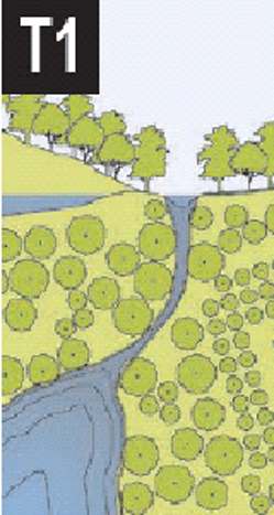 | T-1 NATURAL | ||
| T-1 Natural Zone consists of lands approximating or reverting to a wilderness condition, including lands unsuitable for settlement due to topography, hydrology or vegetation. | General Character: | Natural landscape with some agricultural use | |
| Building Placement: | Not applicable | ||
| Frontage Types: | Not applicable | ||
| Typical Building Height: | Not applicable | ||
| Type of Civic Space: | Parks, greenways | ||
 | T-2 RURAL | ||
| T-2 Rural Zone consists of sparsely settled lands in open or cultivated states. These include woodland, agricultural land, grassland, and irrigable desert. Typical buildings are farmhouses, agricultural buildings, cabins, and villas. | General Character: | Primarily agricultural with woodland & wetland and scattered buildings | |
| Building Placement: | Variable setbacks | ||
| Frontage Types: | Not applicable | ||
| Typical Building Height: | 1- to 2-Story | ||
| Type of Civic Space: | Parks, greenways | ||
 | T-3 SUB-URBAN | ||
| T-3 Sub-Urban Zone consists of low density residential areas, adjacent to higher zones that have some mixed use. Home occupations and outbuildings are allowed. Planting is naturalistic and setbacks are relatively deep. Blocks may be large and the roads irregular to accommodate natural conditions. | General Character: | Lawns and landscaped yards surrounding detached single-family houses; pedestrians occasionally | |
| Building Placement: | Large and variable front and side yard setbacks | ||
| Frontage Types: | Porches, fences, naturalistic tree planting | ||
| Typical Building Height: | 1- to 2-story with some 3-story | ||
| Type of Civic Space: | Parks, greenways | ||
 | T-4 GENERAL URBAN | ||
| FBCM General Urban Zone consists of a mixed use but primarily residential urban fabric. It may have a wide range of building types: single, Sideyard, and Rowhouses. Setbacks and landscaping are variable. Streets with curbs and side-walks define medium-sized Blocks. | General Character: | Mix of houses, townhouses and small apartment buildings with scattered commercial activity; balance between landscape and buildings; presence of pedestrians | |
| Building Placement: | Shallow to medium front and side yard setbacks | ||
| Frontage Types: | Porches, fences, dooryards | ||
| Typical Building Height: | 2- to 3-story with a few taller mixed use buildings | ||
| Type of Civic Space: | Squares, Greens | ||
 | FX-M (MEDIUM INTENSITY) URBAN CENTER | ||
| FX-M Urban Center Zone consists of higher density mixed use buildings that accommodate Retail, Offices, Row-houses and Apartments. It has a tight network of streets, with wide sidewalks, steady street tree planting and buildings set close to the sidewalks. | General Character: | Shops mixed with townhouses, larger apartment houses, offices, work place and civic buildings; predominantly attached buildings; trees within the public right-of-way; substantial pedestrian activity | |
| Building Placement: | Shallow setbacks or none; buildings oriented to street defining a street wall | ||
| Frontage Types: | Terrace, forecourt, stoop, shopfront, gallery or arcade | ||
| Typical Building Height: | 2- to 3-story with some variation | ||
| Type of Civic Space: | Parks, plazas, and squares, median landscaping | ||
 | FX-H (HIGHER INTENSITY) URBAN CORE | ||
| FX-H Urban Core Zone consists of the highest density and height, with the greatest variety of uses, and civic buildings of municipal importance. It may have larger blocks; streets have steady street tree planting and buildings are set close to wide sidewalks. Typically only large towns and cities have an Urban Core Zone. | General Character: | Medium to high-density mixed use buildings, entertainment, civic and cultural uses. Attached buildings forming a continuous street wall; trees within the public right-of-way; highest pedestrian and transit activity | |
| Building Placement: | Shallow setbacks or none; buildings oriented toward the street, defining a street wall | ||
| Frontage Types: | Terrace, forecourt, stoop, shopfront, gallery or arcade | ||
| Typical Building Height: | 3- to 5- plus story with a few shorter buildings | ||
| Type of Civic Space: | Parks, plazas, and squares, median landscaping |
ARTICLE 3: DISTRICT PROVISIONS
3.1 Form-Based Medium (FX-M)
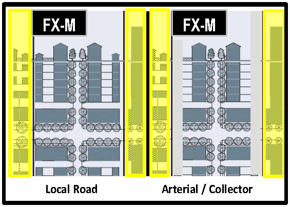 | 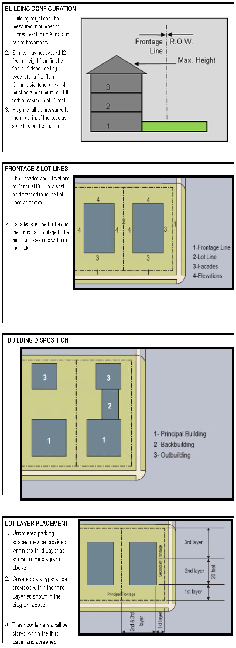 | |
| BUILDING CONFIGURATION | ||
| Principal Building | 2 stories max. | |
| Principal Building | 3 stories max., with City Commission approval | |
| Outbuilding/Backbuilding | not permitted - arterial/collector | |
| Outbuilding/Backbuilding | 1 story max - local road | |
| Building Height (Max) | 27 ft. for 2-story building | |
| Building Height (Min) | 35 ft. for 3-story building | |
DENSITY/INTENSITY STANDARDS | ||
| Determined by the Underlying Land Use | ||
LOT OCCUPATION | ||
| Lot Width | site plan | |
| Lot Coverage | see land use category | |
BUILDING DISPOSITION | ||
| Edgeyard | permitted only on local roads | |
| Sideyard | permitted | |
| Rearyard | permitted | |
| Courtyard | permitted | |
SETBACKS - PRINCIPAL BUILDING | ||
| Front Setback Principal | 2 ft. min., 17 ft. max. | |
| Front Setback Secondary | 2 ft. min., 17 ft. max. | |
| Side Setback | 7.5 ft. to 15 ft. (see below) | |
| Rear Setback | 7.5 ft. to 15 ft. (see below) | |
| Frontage Buildout | 80% min. at setback | |
HEIGHT TO SETBACKS DISTANCE FOR ADJACENT BUILDINGS | ||
| Side/Rear 1 to 1 story | 7.5 ft. min | |
| Side/Rear 2 to 1 story | 10 ft. min. | |
| Side/Rear 3 to 1 story | 15 ft. min (fence and landscape buffer required) | |
PERMITTED PRIVATE FRONTAGES | ||
| Terrace or Lightwell | permitted | |
| Forecourt | permitted | |
| Stoop | permitted | |
| Shopfront & Awning | permitted | |
| Gallery | permitted | |
| Arcade | permitted | |
PARKING PROVISIONS | ||
| (See LDC Chapter 105) | ||
Ord. No. 19-05, § 5, 2-21-2019)
3.2 Form Based High
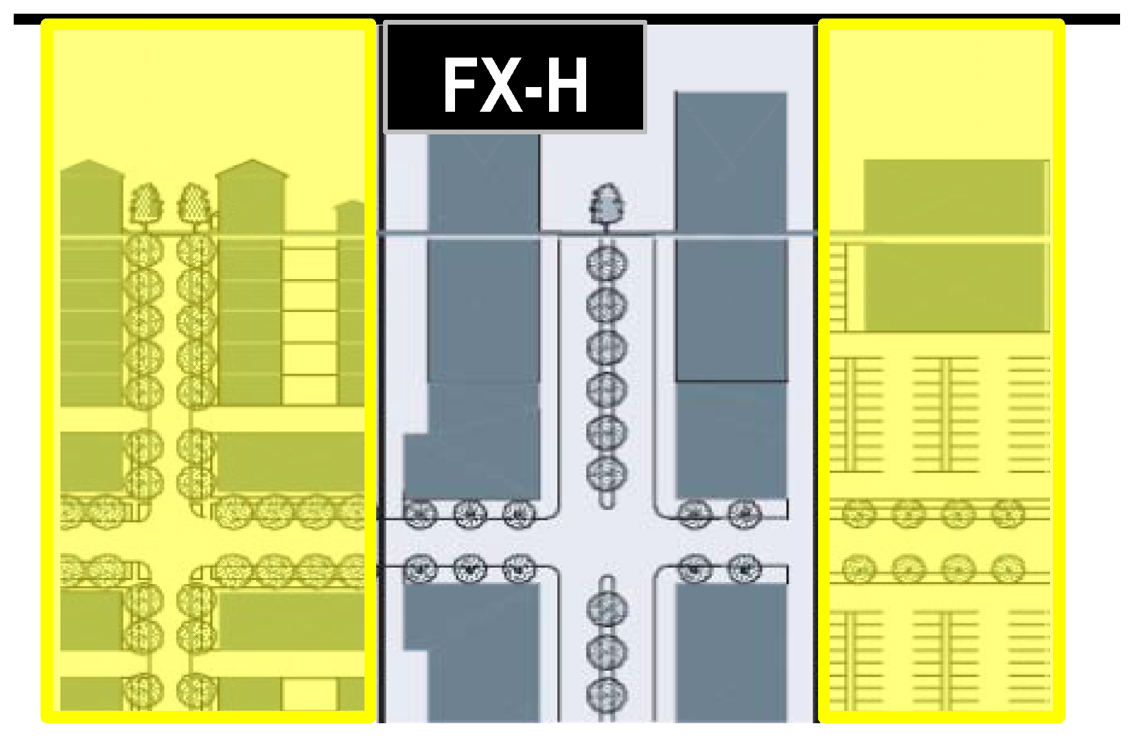 | 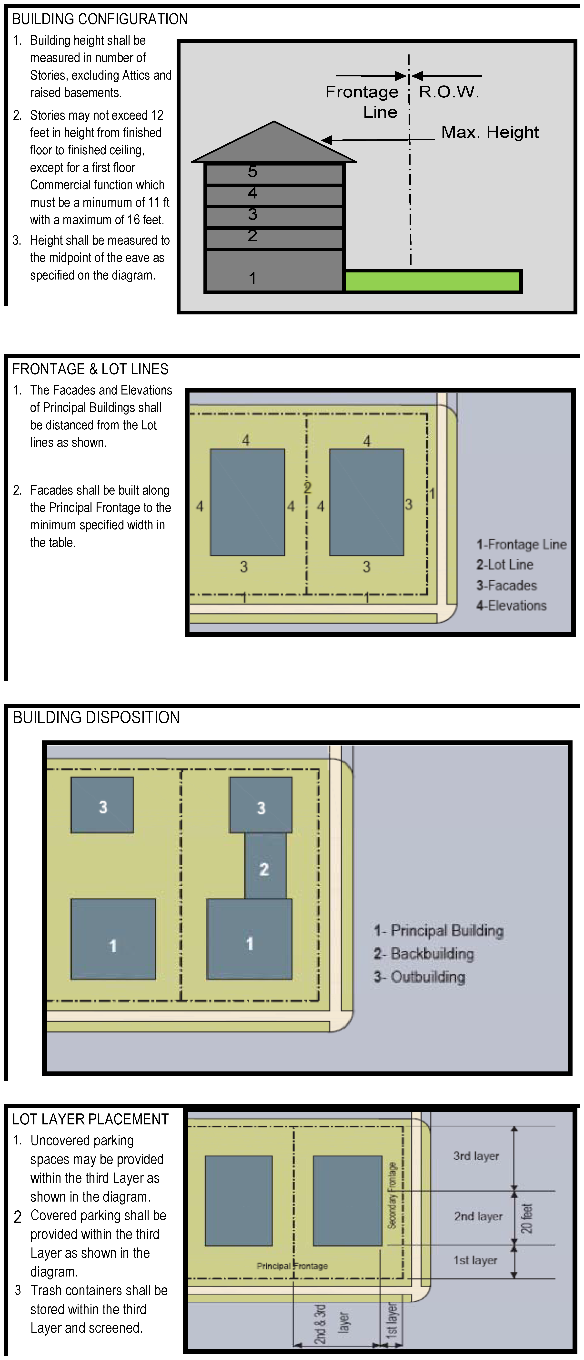 | |
BUILDING CONFIGURATION | ||
| Principal Building | 5 stories max., 2 min. | |
| Outbuilding | N/A | |
| Building Height (Max) | 70 ft | |
| Building Height (Min) | 30 ft | |
DENSITY/INTENSITY STANDARDS | ||
| Determined by the Underlying Land Use | ||
LOT OCCUPATION | ||
| Lot Width | site plan | |
| Lot Coverage | see land use plan category | |
BUILDING DISPOSITION | ||
| Edgeyard | not permitted | |
| Sideyard | not permitted | |
| Rearyard | permitted | |
| Courtyard | permitted | |
SETBACKS - PRINCIPAL BUILDING | ||
| Front Setback Principal | 2 ft. min., 12 ft. max. | |
| Front Setback Secondary | 2 ft. min., 12 ft. max. | |
| Side Setback | 0 ft. min., site plan approval max. | |
| Rear Setback | 0 ft. min.* | |
| Frontage Buildout | 80% min. at setback | |
SETBACKS - BACKBUILDING/OUTBUILDING | ||
| Front Setback Principal | N/A | |
| Front Setback Secondary | N/A | |
| Side Setback (A/C) | site plan approval | |
| Side Setback (L) | site plan approval | |
| Rear Setback | 3 ft. min. | |
PERMITTED PRIVATE FRONTAGES | ||
| Forecourt | permitted | |
| Stoop | permitted | |
| Shopfront & Awning | permitted | |
| Gallery | permitted | |
| Arcade | permitted | |
PARKING PROVISIONS | ||
| (See LDC Chapter 105) | ||
3.3 Table - Building Disposition. This table approximates the location of the structure relative to the boundaries of each individual Lot, establishing suitable basic building types for each Transect Zone.
| Edgeyard: Specific Types - single-family House, Cottage, villa, Estate House, urban villa. A building that occupies the center of its Lot with Setbacks on all sides. This is the least urban of types as the front yard sets it back from the Frontage, while the side yards weaken the spatial definition of the public Thoroughfare space. The front yard is intended to be visually continuous with the yards of adjacent buildings. The rear yard can be secured for privacy by fences and a well placed Backbuilding and/or Outbuilding. | 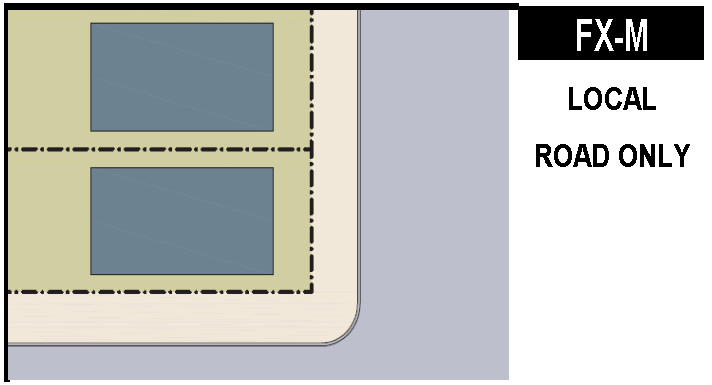 |
| Sideyard: Specific Types - Charleston single-House, double house, zero-lot-line house, twin. A building that occupies one side of the Lot with the Setback to the other side. A shallow Frontage Setback defines a more urban condition. If the adjacent building is similar with a blank side wall, the yard can be quite private. This type permits systematic climatic orientation in response to the sun or the breeze. If a Sideyard House abuts a neighboring Sideyard House, the type is known as a Twin or double house. Energy costs, and sometimes noise, are reduced by sharing a party wall in this disposition. |  |
| Rearyard: Specific Types - Townhouse, Rowhouse, Live-work unit, loft building, Apartment House, Mixed use Block, Flex Building, perimeter Block. A building that occupies the full Frontage, leaving the rear of the Lot as the sole yard. This is a very urban type as the continuous Facade steadily defines the public Thoroughfare. The rear Elevations may be articulated for functional purposes. In its Residential form, this type is the Rowhouse. For its Commercial form, the rear yard can accommodate substantial parking. |  |
| Courtyard: Specific Types - patio House. A building that occupies the boundaries of its Lot while internally defining one or more private patios. This is the most urban of types, as it is able to shield the private realm from all sides while strongly defining the public Thoroughfare. Because of its ability to accomodate incompatible activities, masking them from all sides, it is recommended for workshops, Lodging and schools. The high security provided by the continuous enclosure is useful for crime-prone areas. |  |
3.4 Table of Private Frontages. The Private Frontage is the areas between the building Facades and the Lot lines.
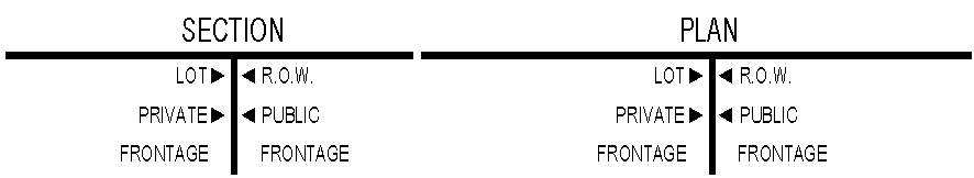 | |
| a. Common Yard: a planted Frontage wherein the Façade is set back substantially from the Frontage Line. The front yard created remains unfenced and is visually continuous with adjacent yards, supporting a common landscape. The deep Setback provides a buffer from the higher speed Thoroughfares. | 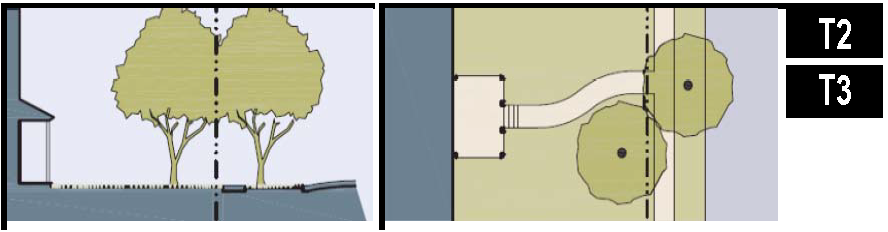 |
| b. Porch & Fence: a planted Frontage where the Façade is set back from the Frontage Line with an attached porch permitted to Encroach. A fence at the Frontage Line maintains street spatial definition. Porches shall be no less than 8 feet deep. | 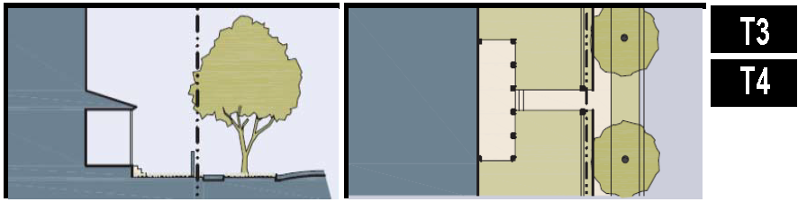 |
| c. Terrace or Lightwell: a frontage wherein the Façade is setback back from the Frontage Line by an elevated terrace or sunken Lightwell. This type buffers Residential use from urban Sidewalks and removes the private yard from public encroachment. Terraces are suitable for conversion to outdoor cafes. Syn: Dooryard. | 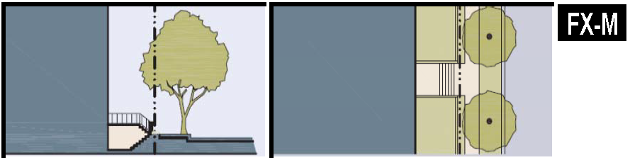 |
| d. Forecourt: a Frontage wherein the Façade is close to the Frontage Line and the central portion is set back. The forecourt created is suitable for vehicular drop-offs. This type should be allocated in conjunction with other Frontage types. Large trees within the Forecourts may overhang the Sidewalks. |  |
| e. Stoop: a Frontage wherein the Façade is aligned close to the Frontage Line with the first Story elevated from the Sidewalk sufficiently to ensure privacy for the windows. The entrance is usually an exterior stair and landing. This type is recommended for ground-floor Residential use. |  |
| f. Shopfront: a Frontage wherein the Façade is aligned close to the Frontage Line with the building entrance at Sidewalk grade. This type is conventional for Retail use. It has substantial glazing on the Sidewalk level and an awning that should overlap the Sidewalk to within 2 feet of the Curb. Syn: Retail Frontage. |  |
| g. Gallery: a Frontage wherein the Façade is aligned with the Frontage Line with an attached cantilevered shed or lightweight colonnade overlapping the Sidewalk. This type is conventional for Retail use. The Gallery should be no less than 10 feet wide and should overlap the sidewalk to within 2 feet of the Curb. |  |
| h. Arcade: a colonnade supporting habitable space that overlaps the Sidewalk, while the Façade at Sidewalk level remains at or behind the Frontage Line. This type is conventional for Retail use. The Arcade shall be no less than 12 feet wide and should overlap the Sidewalk to within 2 feet of the Curb. See Table 8. | 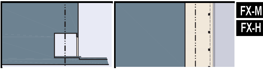 |
ARTICLE 4: GENERAL PROVISIONS
4.1 General Lot Standards
4.1.1 Lot Frontage
All lots must front a street, square or common open space. (exception: buildings which are interior to a site that has buildings that otherwise meet the frontage requirement). Facades shall be built parallel to the principal frontage line or to the tangent of a curved principal frontage line, and along a minimum percentage of the frontage width at the setback, as specified as frontage build-out in Tables 3.1 and 3.2 (see SETBACKS - PRINCIPAL BUILDING) of the district provisions.
4.1.2 Frontage Build-Out
In the absence of a building facade along any part of a frontage line (see Section 3.4), a street screen shall be built co-planar with the facade in accordance with Section 6.3.2.
4.1.3 Infill Setbacks
Front and side setbacks must be consistent with those of surrounding buildings. In the case of an Infill Lot where there is not a consistent frontage within the block, setbacks may match one of the existing adjacent setbacks as determined by the zoning administrator.
4.1.4 Setbacks on Substandard Right-of-Way
Where insufficient right-of-way exists (e.g., right-of-way only includes the pavement area) from which to measure appropriate setbacks, projects shall measure front setbacks from the back edge of the sidewalk.
4.1.5 Corner Lots
Buildings located at street intersections must place the main building, or part of the building, at the corner.
4.1.6 Pedestrian Entries from Frontage Line (see Section 3.4)
Buildings must have their principal pedestrian entrances on a frontage line.
4.1.7 Encroachments
The features listed below may encroach into a required yard with a Right-of-Way Use Agreement.
(A)
Ground Level Air-Rights Encroachments: Awnings, arcades, canopies and galleries may encroach the sidewalk to within 2 feet of the curb, but must clear the sidewalk vertically by at least 8 feet.
(B)
Upper Story Encroachments: Bay windows, balconies and similar features projecting from the principal building may encroach up to 40% of the depth of the first layer with approval of the City or FDOT (whichever has authority over a street).
(C)
Cornices and Gutters: Cornices, eave overhangs, and similar projections (including gutters) may encroach up to three feet into any required yard.
(D)
Fences and Garden Walls: See Chapter 105 - Fences.
(E)
Handicapped Ramps: Ramps for handicap accessibility and fire escapes that are required by the Accessibility Code may encroach into any required yard, but may not be closer than five feet to any property line.
(F)
Porches, Decks, And Patios: See Chapter 103 - Division 5: Permitted Setback Encroachments.
(G)
Steps And Stairs: See Chapter 103 - Division 5: Permitted Setback Encroachments.
4.2 Height
See Chapter 103 - Division 4: Supplemental Height Regulations.
4.2.1 Parking Garage Height
In a parking Structure or garage, each above-ground level counts as 8/10 (80%) of a Story regardless of its relationship to habitable Stories.
ARTICLE 5: BUILDING DESIGN STANDARDS
5.1 General Design Principles
The following list establishes general project design principles, based on what the Community of Dunedin values for its commercial corridors. The design principles list shall be used as a reference during the design review process and shall serve as the framework for project evaluation between project applicants, City staff, the Local Planning Agency and the City Commission. Project applicants will be required to address these principles by appropriate design solutions in the required submittals (site plan, renderings, green space plan) and in the narrative portion of the justification letter.
5.1.1 Design Principle 1: Human Scale
Buildings and public spaces should have strong pedestrian orientation and human scale. Building entrances should be visible from the street. The physical environment should be comfortable, friendly, accessible and approachable. Parking areas should be designed to minimize the impact of automobiles on pedestrian circulation and to be less visually intrusive by placing it in the rear of the site or on the side of the building with a streetscreen. Opportunities to convey a sense of human scale should be maximized through the following:
(A)
Provision of outdoor amenities such as street furniture and landscaping.
(B)
Design features that create visual interest through the visibility of merchandise and store-related activities by pedestrians.
(C)
The location of outdoor activity areas such as plazas and dining areas visible to passing pedestrians.
5.1.2 Design Principle 2: Eclectic Building Styles
Dunedin embraces a diversity of building styles. Regardless of style, buildings must relate to surrounding development patterns in scale, orientation, height and bulk. Eclectic styles can co-exist if building context is properly considered. The building design standards of this code intentionally do not mandate a particular style and permit a wide variety of architectural expressions. However, designers should commit to and exhibit an architectural style. The selected architectural style should exhibit the details and elements consistent with that style unless the local architectural vernacular provides an alternate precedent for a detail or element.
5.1.3 Design Principle 3: Rhythm - Facade Framework and Components
Building element repetition establishes a rhythm, creates patterns and alignments that visually link buildings, provides for individual building storefront identity and contributes in the establishment of a pedestrian scale environment. Unarticulated and solid wall surfaces degrade the quality of the pedestrian experience. Care should be given in designing a project to establish or maintain "rhythm", while avoiding monotony. This can be accomplished by arranging repeated major building elements into manageable groups. Repetition of existing facade modules and components (e.g. bulkheads, arches, arcades, and balconies) is strongly encouraged in infill project design.
5.1.4 Design Principle 4: First Floor Block Frontage
The design of first floor commercial buildings should be artistically composed with a high ratio of void (windows) to solid (wall) areas. The lower building level (storefront) should be predominantly comprised of transparent surfaces to foster pedestrian activity and accommodate retail-merchandising needs. Incorporating landscaping and architectural detailing at the lower level of buildings is encouraged. The height of new infill development should complement that of existing surrounding buildings.
5.1.5 Design Principle 5: Authenticity
Buildings should convey a sense of timelessness, elegance and quality regardless of style or genre. Buildings should look durable and permanent, not temporary or makeshift. The particular style chosen should be well-executed and consistently carried out from overall building form to fine detail.
5.1.6 Design Principle 6: Dialog with Surroundings
Buildings should be oriented, designed and sited to interact with their surroundings. Siting and design of buildings should take account of the overall physical setting in order to help frame and accent building form. Buildings should convey a distinct relationship to their larger, more distant context while simultaneously relating to their immediate surroundings in scale, mass and bulk. Site planning should maximize linkages and connections to surrounding public uses, activities and pedestrian networks.
5.1.7 Design Principle 7: Richness of Details and Materials
Building materials, surfaces, finishes, lighting and landscaping should be durable and able to withstand the Florida climate. They should be designed and executed with a high degree of craftsmanship. High quality building materials should apply to all private as well as public projects, including elements of street design, landscaping, street lighting, etc.
5.1.8 Design Principle 8: Incremental Growth
The Community of Dunedin favors slower, "organic" growth and development patterns over "large sum," big scale projects. Larger projects, especially those on the few remaining parcels of land in the city, should be master-planned and built-out in a way that conveys a sense of project growth over time. Ideally, each separate phase or stage of projects should be designed to "stand on its own," so that projects look complete and finished even if additional growth will occur sometime in the future.
5.2 Architectural Guidelines
5.2.1 High Quality Building Materials and Colors
(A)
Exterior building materials should complement those used in the surrounding area. Use of stucco (smooth or textured), brick, stone, cement board or shingle is encouraged within Dunedin's commercial corridors.
(B)
Metal buildings are prohibited unless clad with high quality materials listed above.
(C)
Accent materials should be used to highlight building features and provide visual interest.
(D)
The architectural style, building materials, building features and details, building size, orientation and context should be the primary contributing factors in the selection of building colors. The following are recommended for buildings in the FX-M and FX-H zoning districts:
(1)
Subtle/muted colors on larger and simpler buildings.
(2)
Use of more intense colors on small buildings.
(3)
Contrasting or more intense colors to accent architectural details and entrances.
(4)
Color palettes harmonious with those found in the surrounding area.
(E)
Use of building materials such as brick, stone, and copper in their natural finish color is encouraged.
5.2.2 Roofs and Upper Story Details
(A)
High quality roof materials, complementary and appropriate to the proposed building style, shall be utilized as part of the building design.
(B)
Roof-mounted mechanical or utility equipment should be architecturally integrated (screened) within the overall building design, when seen from the street.
(C)
The design and finish of roof flashing, rain gutters, downspouts, vents and other roof protrusions should complement the overall architectural theme.
5.2.3 Entrances/Storefronts
(A)
Provision of a prominent corner entry to buildings located at street intersections is recommended.
(B)
The design of corner buildings should provide storefront features or other transparent surfaces on both street faces of the lower level building elevations.
(C)
Use of high quality door design, storefronts and hardware details is encouraged.
(D)
Doors for retail shops should include a high percentage of glass area.
5.2.4 Windows
(A)
The storefront window design should maximize visibility of displays and interior retail spaces.
(B)
Window designs which permit additional light penetration within building spaces (e.g. transom and clerestory windows) are encouraged.
(C)
The location of new and replacement windows should take into consideration existing "blockface" window patterns.
(D)
Adding or replacing windows without any regard for the existing architectural rhythm or character of the original building is prohibited.
(E)
Window details should add to the architectural variety along street frontages.
5.2.5 Awnings and Canopies
(A)
Awnings should be designed to complement the building architecture.
(B)
Fabric or metal awnings should be used to enhance the visual appearance of buildings.
(C)
The awning design should respond to the scale, proportion and rhythm created by the structural bays.
(D)
Awnings constructed of durable, commercial grade fabrics are encouraged. Awning frames and supports should be treated to prevent corrosion. Glossy plastic awnings are prohibited.
5.2.6 Balconies and Rooftop outdoor areas
(A)
Inclusion of balconies and rooftop outdoor areas in the overall building design is encouraged. The design of such spaces should complement the overall architectural theme in terms of location, size, and detail.
5.2.7 Arcades
(A)
Arcades can positively contribute towards fulfilling visual and functional building needs.
(B)
The massing of all arcade components should be proportional to its overall size.
5.2.8 Plazas and Courtyards
(A)
Plazas and courtyards are encouraged. Ample seating should be provided within plaza areas.
(B)
Inclusion of a visual focal point such as a fountain or public art within plaza/courtyard areas is recommended.
5.2.9 Walls and Fences
(A)
Wall and fence enclosure design should be addressed as part of the overall development concept.
(B)
Where appropriate to the selected architectural style and project location, stucco or brick wall enclosures, enhanced with decorative inset tiles, ornamental metal fencing, entry gates, or planters are encouraged.
ARTICLE 6: SITE STANDARDS
6.1 Parking Requirements - see also LDC Chapter 105 for additional regulations.
6.1.2 Parking Location: Off-street parking shall be located and accessed as follows:
6.2 Driveways and Cross-Access Connections
6.2.1 Mid-block Lot Driveways
A mid-block lot without access to a side street or alley is permitted one driveway with a maximum width of 25 feet.
6.2.2 Corner Lot Driveways
Corner lots may take access from side street only. Preference for access shall be given to the minor street. Driveways shall be located as far from the adjacent public street intersection as practical to achieve maximum available corner clearance, with consideration of property limits, adjacent curb cuts, topography, and existing drainage facilities.
6.2.3 Vehicular Aisle Widths
Vehicular entrances to parking lots, garages, and parking structures shall be no wider than 25 feet at the frontage line.
6.2.4 Cross Access Connections
Cross-access easements and connections to adjoining properties shall be required to connect vehicular aisles. The following guidelines shall apply:
(A)
At least 1 connection is provided at all lot lines that are coincident for at least 50 feet with another lot that has primary frontage on the same street.
(B)
The connection is at least 20 feet in width.
(C)
If applicable, the connection aligns with a connection that has been previously constructed on an adjacent property.
(D)
Where a parking lot connection is required, an easement for ingress and egress to adjacent lots shall be recorded by the property owner with the Pinellas County Clerk of the Court.
6.2.4.1 Exemption
In the event these conditions cannot be met without undue hardship, or if such connections would create undesirable traffic flow, the City Commission may waive the connection requirement.
6.3 Site Landscaping - see also LDC. See Chapter 105 for additional regulations.
6.3.1 Parking Area Screening
All parking areas visible from the right-of-way should be screened from view. Parking areas in the side yard shall maintain a 3 foot high screen (75% opacity) along the street side. Shrubs, brick walls (using brick that matches or complements the adjacent building), wrought iron fencing with landscaping, or any combination thereof may be used.
6.3.2 Streetscreens
Interruptions in the street wall discourage pedestrian activity. Streetscreens serve to minimize these interruptions by extending the street wall formed by storefronts and building facades with semi-opaque screens.
(A)
Minimum height six (6)/maximum height eight (8) feet above grade.
(B)
Materials: Streetscreens shall be constructed of a material matching the adjacent building facade. The streetscreen may be replaced by a hedge or fence subject to approval of the City Commission.
(C)
Openings: Streetscreens shall have openings no larger than necessary to allow automobile and/or pedestrian access. Above 42 inches from the ground, the Streetscreen shall be at least 50% opacity. All streetscreens must meet FDOT sight visibility standards.
6.3.3 Fences - See Chapter 105 Section 23.
6.4 Utilities, Trash Containment and Loading Areas
6.4.1 Underground Utilities
When required by the City, all projects entailing new construction of a principal structure or substantial modification of an existing principal structure (in accordance with Article 1), shall install underground utilities. Underground utilities (and associated pedestals, cabinets, junction boxes and transformers) must be located in alleys, where possible. To reduce the visual impact of overhead wiring, utility services must be located underground.
6.4.2 Mechanical And Utility Equipment
(A)
All equipment shall be located to the side or rear of the principal structure or on rooftops, and shall not be visible from any public open space or sidewalk area.
(B)
When located on the ground, equipment must be located in the rear or side yard and screened. Screens using vertically-enclosed opaque walls shall be made of materials which are compatible with the exterior of the building.
(C)
When located on rooftops, all rooftop equipment shall be incorporated into the design of the building and screened with materials similar to the building. Setbacks from the edge of the roof or a screen higher than the equipment may be used.
(D)
If the equipment is not visible off-site from a public right-of-way, then it need not be screened.
6.4.3 Loading Docks
Loading docks and service areas shall be permitted on frontages only by Conditional Use Permit. Loading docks shall be entirely screened from view of any public way, public open space or sidewalk area, using a screen meeting the requirements of 6.3.2 - Streetscreens.
ARTICLE 7: USE STANDARDS
7.1 Table of Permitted Uses
See Table 103-60.1 Land Development Code.
7.2 Additional Use Standards
7.2.1 Automotive Uses and Functions
(A)
Drive-through/drive-in facility.
(1)
Drive-thru facilities shall be located in the 3rd layer only.
(2)
Access to the drive-thru service should be from mid-block or the alley to avoid disrupting pedestrian traffic.
(B)
Gas/fueling station.
(1)
All canopies/pumps must be located in the 3rd layer only, be located at least fifty (50) feet from any interior side or rear property line that adjoins residentially-developed property, and shall be buffered from adjoining residential uses with a street screen.
(2)
A principal building is required and shall be a minimum of one thousand five hundred (1,500) square feet.
(C)
Parking Lot/Structure - Principal Use.
(1)
Parking Garage Design Standards.
(a)
Parking garages located on arterial or collector roads shall be wrapped by ground floor retail, office or some other active use along all street-facing façades. All levels of a structured parking facility must be designed and screened in such a way as to minimize visibility of parked cars.
(b)
Parking garage facades that support principal buildings shall be given vertical articulation and emphasis. The façade should be designed to visually screen cars. In no instance will rails or cabling alone be sufficient to meet this screening requirement.
(D)
Vehicle rental/leasing/sales.
(1)
Areas for vehicle displays shall be limited to the 2nd and 3rd layers only. For principal buildings located at the corner of arterial or collector roads may select one first layer adjacent to the building to display vehicles for sale or lease.
(E)
Vehicle services - minor maintenance/repair.
(1)
Repair and maintenance - general.
(a)
No vehicle may be parked or stored for the purpose of sale or rent, or as a source of parts.
(b)
All repairs and storage must be contained within an enclosed building. Temporary vehicle storage may be allowed in an outdoor storage area in the 2nd and 3rd layer only, shall be no larger than twenty-five (25) percent of the total lot area and must be screened from offsite views by a solid, decorative fence or masonry wall of six (6) to eight (8) feet in height. The height of materials and equipment stored must not exceed the height of the screening fence or wall.
(2)
Car wash or auto detailing.
(a)
An automatic car wash shall be considered an accessory use to an automotive service station use and shall be located in the 2nd or 3rd layer only.
ARTICLE 8: SIGNAGE - SEE CHAPTER 105 - SECTION 24.
(Ord. No. 14-03, § 1, 2-20-2014; Ord. No. 15-04, § 1, 2-9-2015)