
Grand Forks City Zoning Code
ARTICLE 2
- ZONING
18-0201.- Statement of intent.
This article is enacted for the following purposes: to promote the health, safety, morals and general welfare of the inhabitants of the City of Grand Forks and the unincorporated territory adjacent thereto located within four (4) miles of its limits in any direction within the State of North Dakota by lessening congestion in the public right-of-way, securing safety from fire, panic, and other dangers; providing adequate light and air; preventing the overcrowding of land; avoiding undue concentration of population; facilitating the adequate provision of transportation, water, sewerage, schools, parks and other public requirements; conserving the value of properties, and encouraging the most appropriate use of land.
(Ord. No. 4128, § II, 3-20-06)
18-0202. - Territorial jurisdiction of zoning regulations.
Pursuant to the North Dakota Century Code, the territorial jurisdiction of the City of Grand Forks for land use zoning is declared to be, in addition to the entire area within the corporate limits of the City of Grand Forks, the unincorporated territory adjacent thereto contained in each quarter quarter section, the majority of which is located within four (4) miles of the corporate limits of the City of Grand Forks; provided, however, that such land use zoning authority and such extension of the application of the zoning regulations of the City of Grand Forks shall not include territory outside the corporate limits of land attached to the city by a strip of land not more than one hundred (100) feet wide, nor the territory outside the corporate limits of land included within such strip of land, except for those portions of such strip of land and such land so attached to the city which are located within four (4) miles of the corporate limits of the City of Grand Forks, and all such territory in which the City of Grand Forks so exercises jurisdiction for land use zoning. The issuance of permits by the inspection department of the City of Grand Forks shall be a prerequisite to construction, erection, reconstruction, alteration, repair, or enlargement of any building or structure.
(Ord.No. 4128, § III, 3-20-06)
18-0203. - Scope; interpretation.
(1)
Scope. From and after the effective date of this chapter the use of all land and every building or portion of a building erected, altered in respect to hide an area, added to, or relocated, and every use within a building or use accessory thereto, shall be in conformity with the provisions of this chapter. Any existing building or structure and any existing use of the properties not in conformity with the regulations herein described, shall be regarded as nonconforming, subject to the special regulations herein provided.
(2)
Interpretation. In interpreting and applying the provisions of this chapter, they shall be held to be the minimum requirements for the promotion of the public health, safety, comfort, convenience and general welfare. Where the provisions of this chapter impose greater restrictions than those of any statute, other ordinance, or regulation, the provisions of this chapter shall be controlling. Where the provisions of any statute, other ordinance or regulation impose greater restriction than this chapter, the provisions of such statute, other ordinance or regulations shall be controlling.
18-0204. - Rules and definitions.
(1)
Rules. Words used in the present tense shall include the plural, and the plural includes the singular; the word "person" includes a corporation as well as an individual. The word "building" includes the word "structure"; the word "lot" includes the word "plat"; and the word "shall" is mandatory and not directory.
(2)
Definitions. Certain words and terms are defined as follows:
Abut:
(A)
To touch, as contiguous estates, along a border or with a projecting part; as, his land abuts the road.
(B)
To terminate or touch with an end; as, two (2) lots abutting each other.
Accessory use of structure. A subordinate structure or use which is located on the same lot as the main structure and the use of which is clearly incidental to the use of the main structure, such as garages, tool sheds and fences.
Accessory use, wireless communication tower or antenna, commercial. A commercial wireless communication tower or antenna limited to usage in a non-rental capacity for communication with staff or employees, to dispatch fleet vehicles, or for similar activities.
Adjacent. Lying near or close to; sometimes, contiguous; neighboring. Adjacent implies that the two (2) objects are not widely separated, though they may not actually touch.
Adjoining. Adjoining imports that they are so joined contiguous to, in contact with each other that no third object intervenes. Lots separated by a street shall be considered adjoining; except those lots separated by an arterial or collector street shall be adjacent.
Adult bookstore. An enclosed building having a substantial or significant portion of its stock in trade, books, magazines, or other periodicals which are distinguished or characterized by their emphasis on matter depicting or describing specified sexual activities or specified anatomical areas and which excludes minors by virtue of age.
Adult cabaret. A cabaret which features go-go dancers, exotic dancers, strippers, male or female impersonators, or similar entertainers.
Adult cinema. An enclosed building used on a regular basis for presenting pictorial materials or other visual images by way of direct or indirect projection, which materials are distinguished or characterized by an emphasis on the depiction of specified sexual activities or specified anatomical areas for observation by patrons therein in return for the payment of a consideration, irrespective of the number of patrons who may be able to view the presentation at one time.
Adult entertainment center. An adult bookstore, adult cabaret, adult cinema, or any combination thereof.
Alley. A service way which provides secondary access to abutting property or primary access if street access is prohibited.
Alterations. Any change in the supporting members of a building such as bearing walls, columns, beams, or girders.
Animal daycare and boarding facility. A fully enclosed commercial facility that provides animal daycare for all or part of a day, and other incidental services to include overnight boarding, obedience classes, training, grooming, and may also provide for the retail sales of products incidental to the facility. Animals shall not be kept for breeding, for sale, or for medical care.
Animal shelter/rescue. Any firm, person, or corporation that accepts animals for the purpose of finding permanent homes for these animals.
Apartment building. Three (3) or more apartments grouped in one (1) building.
Apartment unit. A part of a building consisting of a room or suite of rooms which is designed for, intended for, or used as a residence for one (1) family and is equipped with cooking facilities and is located in an apartment building.
Auction house. The use of a building and land for the temporary storage and sale on premises of new and/or used goods by means of request or invitation for bids. Animals are excluded. As it relates to the exterior use of a building, temporary storage shall mean a period not to exceed thirty (30) days.
Automobile wrecking. See "junkyards."
Basement. That portion of the building having its floor subgrade, below ground level, on all sides.
Bed and breakfast inn. An owner occupied building at least fifty (50) years old designed for and used as a single-family or two-family dwelling that provides four (4) or fewer lodging rooms or accommodating no more than eight (8) adults, in which meals are provided to overnight guests, and that is open to the traveling public for a stay not to exceed twenty (20) days.
Block. Is an area of land within a subdivision that is entirely bounded by street or by streets and the exterior boundary or boundaries of the subdivision or a combination of the above with a physical land barrier such as a river.
Boardinghouse. Includes every building or structure, or any part thereof with accommodations for four (4) or more boarders, which is kept, used, maintained, or advertised, or held out to the public as a place where food is furnished to regular boarders for periods of one (1) week or more. (See "lodginghouse.")
Buffer yard. A unit of land, together with a specified type and amount of planting thereon, and any structures which may be required between land uses to eliminate or minimize conflicts between them.
Building. Any structure for the shelter, support, or enclosure of persons, animals, chattel, or property of any kind, and when separated by party walls without openings, each portion of such building so separated shall be deemed a separate building.
Building and zoning administrator. That person responsible for the enforcement of the zoning ordinances of the city.
Building facing or facade area. The entire area of a building facing or side extending from the roof or parapet to the ground and from one corner of the building to another but does not include any structural or non-structural elements which extend beyond the roof of a building.
Building height. The vertical distance from the average of the highest and lowest point of that portion of the lot covered by the building to the highest point of the roof for flat roofs; to the deck line of mansard roofs and the mean height between eaves and ridge for gable, hip, and gambrel roofs.
Building inspector. See "building and zoning administrator."
Building line. An imaginary line separating buildable area and required side, front, and rear yards.
Building lot. A lot or two (2) or more abutting lots of a recorded plat or subdivision or a tract occupied and used or intended to be occupied and used as a building site and improved or intended to be improved by the erection thereon of a building or buildings and accessory buildings and having a frontage upon a public street or upon a thoroughfare or upon a highway or upon a traveled road and including as a minimum such open spaces as required under this article.
Building permit. Is the permit to allow for structural construction as required by the building code and zoning code of the City of Grand Forks.
Building setback. The required minimum distance between the building and the property line.
Cellar. An unfinished, uninhabitable level, a portion of which is below the level of the ground and without or lacking in heating, electrical and mechanical equipment.
Child care centers, other than a private residence, means an early child care facility where early childhood services are provided for more than twelve (12) children.
City. The City of Grand Forks, North Dakota.
City council. The governing body of the City of Grand Forks, North Dakota.
Coffee kiosk. A freestanding structure designed and commercially constructed to allow drivers to remain in their motor vehicles while purchasing coffee, espresso, tea, other beverages and approved prepackaged, nonpotentially hazardous foods and beverages (excepting therefrom dairy products used in the preparation or service of coffee, espresso, tea or other beverages) and/or baked goods from approved facilities from a drive-up window for consumption off premises and that provides no indoor or outdoor seating.
Co-location of wireless communication facilities. When two (2) or more providers of wireless communications place their transmitting facilities together on the same wireless communication tower.
Commercial. The sale of, or activity involving the sale of, goods and/or services carried out for profit.
Commercial kennels. Any building or fenced area where dogs are kept for breeding, for sale, for medical care, for training, or for boarding. In addition, any building or fenced area where five (5) or more dogs, six (6) months or older are kept for an individual's own use.
Commission. The planning and zoning commission of the City of Grand Forks, North Dakota.
Compassion center means a medical marijuana dispensary or manufacturing facility as provided for in N.D.C.C. Chapter 19-24.1.
Comprehensive plan. A document which describes in words, and may illustrate by maps, plats, charts, and other descriptive matter, the policy, goals and objectives of the municipality to interrelate all functional and natural systems and activities relating to the development of the territory under its jurisdiction.
Conditional uses. Uses which are permitted only through the issuance of a conditional use permit as provided by section 18-0701.
Condominium. An estate in real property consisting of an undivided interest on interests in common in a portion of a parcel or real property together with a separate interest or interests in space in a structure on such real property.
Congregate housing. Housing units in which some or all of the dwelling units do not have kitchen facilities and are connected with a central dining facility.
Contractors offices. A room or group of rooms used for conducting business affairs, which does not utilize any exterior storage area.
Contractors shops. An enclosed space used for the housing and/or operating of machinery, the provision of services, the fabrication of building related products, and interior storage, but which does not utilize any exterior storage area.
Contractors yard. An open space utilized for the storage of equipment, materials etc.
Court. An open, unoccupied space bounded on two (2) or more sides by the exterior walls of a building or buildings on the same lot.
Curb level. The curb level is the level of the established curb in front of the building measured at the center of such front. Where no curb level has been established, the city engineer shall establish such curb level or its equivalent.
Density. The quotient of the total number of dwelling units divided by the total acreage of a site, exclusive of street right-of-way.
Design standards. The specifications for the preparation of plats, both preliminary and final, indicating among other things the optimum minimum or maximum dimensions of such items as right-of-way, blocks, easements, and lots.
Developer. The owner, subdivider, or party promoting the growth or building in an area.
Drop-in child care facility means a facility where early childhood services are provided for thirty (30) or fewer children on a one-time, occasional, or unscheduled basis to meet the short-term needs of families, subject to the following:
(A)
Must be licensed to operate a Group Child Care facility as required by N.D.C.C. chapter 50-11.1 and North Dakota Administrative Code section 75-03-09-24.
(B)
Must be located in a commercially zoned district.
(C)
Must be in compliance with all other federal, state, and local laws, rules, and regulations.
Dwelling. Any building or portion thereof which is designated or used for residential purposes.
Dwelling, attached. Three (3) or more adjoining dwelling units, each of which is separated from the others by one (1) or more unpierced walls from ground to floor.
Dwelling multiple-family. A building designed for or containing three (3) or more dwelling units, sharing access from a common hall, stair, or balcony.
Dwelling, semidetached. Two (2) dwelling units, each of which is attached side to side, each one sharing only one (1) common wall with the other.
Dwelling, single-family detached. A dwelling designed for and occupied by not more than one (1) family and having no roof, wall, or floor in common with any other dwelling unit.
Dwelling, two-family. A dwelling designed for and occupied by not more than two (2) families and having an unpierced common wall, roof, or floor.
Dwelling unit. A room or group of rooms providing or intended to provide living quarters for not more than one (1) family.
Early childhood services means the care, supervision, education, or guidance of a child or children, which is provided in exchange for money, goods, or other services. Early childhood services do not include:
(A)
Substitute parental child care provided pursuant to N.D.C.C. chapter 50-11.
(B)
Child care provided in any educational facility, whether public or private, in grade one (1) or above.
(C)
Child care provided in a kindergarten which has been established pursuant to N.D.C.C. chapter 15.1-22 or a nonpublic elementary school program approved pursuant to subsection 1 of N.D.C.C. § 15.1-06-06.
(D)
Child care, preschool, and prekindergarten services provided to children under six (6) years of age in any educational facility through a program approved by the superintendent of public instruction.
(E)
Child care provided in facilities operated in connection with a church, business, or organization where children are cared for during periods of time not exceeding four (4) continuous hours while the child's parent is attending church services or is engaged in other activities, on the premises.
(F)
Schools or classes for religious instruction conducted by religious orders during the summer months for not more than two (2) weeks, Sunday schools, weekly catechism, or other classes for religious instruction.
(G)
Summer resident or day camps for children which serve no children under six (6) years of age for more than two (2) weeks.
(H)
Sporting events, practices for sporting events, or sporting or physical activities conducted under the supervision of an adult.
(I)
Head start and early head start programs that are federally funded and meet federal head start performance standards.
(J)
Child care provided in a medical facility by medical personnel to children who are ill.
Easement. The grant by a property owner of the use of a strip of land for such public use as maintaining and constructing utilities, including but not limited to, sanitary sewers, watermains, electric lines, telephone lines, T.V. or F.M. transmission lines, storm sewers or storm drainageways, gas lines and roadways.
Easement slope. A grant by a property owner of the use of a strip of land for the purpose of constructing a slope or grade transition from the existing property grade to a new established grade.
Event center. A building of at least four hundred thousand (400,000) square feet of gross floor area that hosts entertainment, sporting, and business activities.
Existing manufactured home park or subdivision. A manufactured home park or subdivision for which the construction of facilities for servicing the lots on which the manufactured homes are to be affixed (including, at a minimum, the installation of utilities, the construction of streets, and either final site grading or the pouring of concrete pads) is completed before the effective date of the floodplain management regulation adopted by a community.
Expansion to an existing manufactured home park or subdivision. The preparation of additional sites by the construction of facilities for servicing the lots on which the manufactured homes are to be affixed (including the installation of utilities, the construction of streets, and either final site grading or the pouring of concrete pads).
Family. Any number of individuals, related by blood, legal adoption, or marriage, or a group of not more than four (4) persons who need not be related by blood or marriage, living together on the premises as members of a single housekeeping unit, as distinguished from a group occupying a boardinghouse, lodginghouse or hotel as herein described.
Family child care home means a private residence licensed to provide early childhood services for no more than seven (7) children at any one (1) time, except that the term includes a residence licensed to provide early childhood services to two (2) additional school-age children.
Farm. A parcel of land containing no less than forty (40) acres or a parcel of land which is a portion of a larger tract of land containing no less than forty (40) acres owned in fee or leased to a single legal entity and which is devoted to agriculture, pasturage, or stock or poultry raising. The term "farm" does not include:
(A)
Truck gardens.
(B)
Commercial tree farms.
(C)
Sales of agricultural equipment or chemicals.
(D)
Commercial storage of agricultural produce or chemicals.
(E)
Commercial feedlots and poultry lots.
(F)
Nurseries.
Farmer. An individual who normally devotes the major portion of his time to the activities of producing products of the soil, poultry, livestock, or dairy farming in such products' unmanufactured state and who normally receives not less than fifty (50) percent of his annual gross income from any of the foregoing activities; and the term also includes an individual who is retired because of illness or age and who at the time of retirement owned and occupied as a farmer as defined above the residence in which he lives.
Farming. The cultivation of the soil and all activities incidental thereto, except that said term shall not include the raising and feeding of hogs by feeding garbage thereto, other than garbage produced by the residents or occupants of the farm.
Fence. A structure or partition erected for the purpose of enclosing a piece of land, or to divide a piece of land into distinct portions, or to separate two (2) contiguous estates.
Filling. The depositing on land, whether submerged or not, of gravel, earth, or other materials of any composition whatsoever.
Fireworks. Any substance or combination of substances or articles prepared for the purpose of producing a visible or an audible effect by combustion, explosion, deflagration, or detonation, and includes blank cartridges, toy pistols, toy cannons, toy canes, or toy guns in which explosives other than toy paper caps are used, firecrackers, torpedoes, sky rockets, Roman candles, Daygo bombs, sparklers, or other fireworks of like construction, any fireworks containing any explosive or flammable compound, or any tablet or other device containing any explosive substance. Nothing in this regulation shall be construed as applying to toy paper caps containing not more than twenty-five one-hundredths (0.25) of a grain (sixteen point twenty (16.20) milligrams) of explosive composition per cap.
Flood. A temporary rise in stream flow or stage that results in inundation of the area adjacent to the channel.
Flood insurance rate map (FIRM). The official map on which the Federal Emergency Management Agency has delineated both the areas of special flood hazards and the risk premium zones applicable to the community.
Flood insurance study. The scientific and engineering report provided by the Federal Emergency Management Agency. The report includes flood profiles, the flood boundary floodway map, and the water surface elevation of the base flood.
Floodplain. The area of land adjoining a river, coulee, watercourse, or lake which has a statistical probability of being inundated on the average of one (1) percent per year; this is the area which would be inundated by a regional flood of a one-hundred-year magnitude.
Floodproofing. A combination of structural provisions, changes, or adjustments to properties and structures subject to flooding primarily for the reduction or elimination of flood damages.
Floodproofing code of the City of Grand Forks. The set of standards adopted by the City of Grand Forks to regulate construction of floodproofed structures or parts of structures in the floodplain.
Flood protection elevation. The elevation to which uses regulated by this chapter are required to be elevated or floodproofed. This elevation is to be based on the regional floodwater surface profile.
Floodway. The area shall be as shown on the current flood insurance rate map as adopted by the Federal Emergency Management Agency or its successor.
Floor area. The sum of the gross horizontal areas of all the floors of a building measured from the exterior of the exterior walls.
Floor area ratio. A ratio derived by dividing the total floor area of a building by the area of the lot upon which it is erected.
Foster home. See "child care facility."
Fraternity/sorority house. Includes every building or structure, or any part thereof, occupied primarily by members of any social fraternity or sorority, with accommodations for four (4) or more boarders which is kept, used, or maintained as a place where food or sleeping accommodations are furnished to regular boarders for one (1) week or more.
Garage, front-loaded. A garage which is both accessed from and has its doors facing the street.
Garage, private. A garage used for storage purposes only and having a capacity of not more than three (3) automobiles or not more than two (2) automobiles per family housed in the building to which the garage is accessory, whichever is greater. Space therein may be used for not more than one (1) commercial vehicle, and space may be rented for not more than two (2) vehicles of other than occupants of the building to which the garage is accessory.
Garage, public. Any premises except those described as a private garage, operated for gain, and which is used for the storage or care of power-driven vehicles, or where any such vehicles are equipped for operation, repair, or kept for remuneration, hire or sale.
Garage, rear-loaded. A garage accessed from a rear alley.
Group child care home means an occupied private residence where early childhood services are provided for no more than twelve (12) children; except that the term includes a residence licensed to provide early childhood services to two (2) additional school-age children.
Group home. A community based residential home licensed by the appropriate North Dakota State licensing authority that provides room, board, personal care, habitation, services, or supervision in a family environment.
Guest house. An adjunct living unit, with sleeping area(s) and a bathroom, with or without kitchen facilities, which is detached from the main single-family residence on the same lot. Guest houses may be used for temporary housing of family members and guests without compensation, but they may not be rented, leased or sold separately from the rental, lease or sale of the main single-family dwelling unit on the lot.
Hazardous materials. Hazardous materials classified according to their major hazard as per uniform fire code, including but not limited to the following:
(A)
Flammable liquids.
(B)
Combustible liquids.
(C)
Flammable solids.
(D)
Corrosive liquids.
(E)
Radioactive materials.
(F)
Oxidizing materials.
(G)
Highly toxic materials.
(H)
Cryogenic fluids.
(I)
Poisonous gases.
(J)
Reactive material.
(K)
Unstable materials.
(L)
Hyperbolic materials.
(M)
Pyrophoric materials.
(N)
Irritants.
(O)
Sanitizers.
(P)
Any substance or mixture of substances which generates pressure through exposure to heat, decomposition, or any other means.
(Q)
All substances and/or materials as defined by 49 CFR Parts 100 through 199.
Hedge. A row of closely planted shrubs, bushes, or any kind of plant forming a boundary or fence.
Hotel/motel. Any building or portion thereof where lodging is offered to more than ten (10) transient persons for compensation.
Home occupation. An occupation conducted on residential premises provided that:
(A)
The use of the dwelling unit for the home occupation is clearly incidental and subordinate to its use for residential purposes by its occupants, and not more than thirty (30) percent of the floor area of the dwelling shall be used in the conduct of the home occupation.
(B)
There shall be no change in the outside appearance of the building or premises, or other visible evidence of the conduct of such home occupation, other than one (1) home occupation sign as defined within.
(C)
Home occupations (other than automotive repair and commercial kennels) may be conducted in any accessory buildings.
(D)
There shall be no retail sales in connection with such home occupation.
(E)
No traffic shall be generated by such home occupation in greater volumes than would normally be expected in a residential neighborhood.
(F)
No equipment or process shall be used in such home occupation which creates noise, vibration, glare, fumes, odors, or electrical interference detectable to the normal senses off the lot, if the occupation is conducted in a single-family residence. In the case of electrical interference, no equipment or process shall be used which creates visual or audible interference in any radio or television receivers off the premises, or causes fluctuations in live voltage off the premises.
Impervious surface area. Impervious surfaces are those areas which do not absorb water. They consist of all buildings, parking areas, driveways, roads, sidewalks, and any areas of concrete or asphalt. In the case of lumberyards, areas of stored lumber constitute impervious surfaces.
Improvement. Any sanitary sewer, storm sewer, drainage ditch, water main, roadway, street grading and surfacing with or without gutters and curbs, sidewalks, planting strips, crosswalk, off-street parking areas, or other facilities for which the City of Grand Forks may ultimately assume the responsibility for maintaining and operating.
Intensity. The extent of development considering such factors as land coverage by buildings and parking areas. The number of stories, the floor area ratio, the bulk of the buildings, and the proximity of buildings on a site in relation to each other.
Intersection. The point of crossing or meeting of two (2) or more streets.
Junkyards. Any land or structure used for a salvaging operation, including but not limited to the storage of wastepaper, rags, scrap metal, and discarded materials and the collection, dismantlement, storage, and salvage of two (2) or more vehicles which have remained unlicensed for two (2) consecutive years.
Lattice tower. A vertically constructed, tripod-like framework or structure of crossed metal strips to which antennas are affixed, and may include an equipment building storing accessory transmission and receiving equipment.
Loading space, off-street. Space logically and conveniently located for bulk pickups and deliveries, scaled to delivery vehicles expected to be used, and accessible to such vehicles when required off-street parking spaces are filled. Required off-street loading space is not to be included as off-street parking space in computation of required off-street parking space.
Lodginghouse. A building or structure or any part thereof which is kept, used, maintained, or held out to the public as a place where sleeping accommodations are furnished to regular roomers for one (1) week or more which contains eight (8) or less sleeping rooms.
Lot. One (1) unit of a recorded plat or subdivision.
Lot area. The horizontal land area within the lot lines.
Lot area per family. The lot area required by this chapter to be provided for each family in a dwelling unit.
Lot, corner. A lot of which at least two (2) adjacent sides abut for their full length upon a street, provided that the interior angles at the intersection of such two (2) sides is less than or equal to one hundred thirty-five (135) degrees.
Lot depth. The mean horizontal distance between the mean front street and the mean rear lot line. The greater frontage of a corner lot is its depth and its lesser frontage is its width.
Lot, double frontage. An interior lot having frontage on two (2) streets.
Lot, interior. A lot other than a corner lot.
Lot line, front. The boundary of a lot abutting a street. On corner lots the lesser frontage or width (see lot depth) shall be considered the front lot line.
Lot line, rear. The lot line or lot lines most nearly parallel to and most remote from the front line. If the rear lot line is less than ten (10) feet in length or if the lot forms a point at the rear, the rear lot line shall be a line ten (10) feet in length within the lot connecting the side lot lines and parallel with the front lot line.
Lot line, side. A line to extend from the front lot line to the rear lot line.
Lot, of record. Any validly recorded lot, which at the time of its recordation complied with all applicable laws, ordinances, and regulations.
Lot width. The mean horizontal distance between the side lot lines measured at right angles to those side lot lines at the building line. Where there is only one (1) side lot line, lot width shall be measured between such lot line and the opposite lot line or future right-of-way line.
Manufactured home. A factory built structure, transportable in one (1) or more sections, which is built on a permanent chassis, not constructed or equipped with a permanent hitch or other device allowing it to be moved other than to a permanent site, is designed for use with or without a permanent foundation when attached to the required utilities, and which bears the label certifying that it was built in compliance with the Federal Manufactured Home Construction and Safety Standards Act of 1974 (24 CFR 3280) which became effective June 15, 1976. The term "manufactured home" does not include a "recreational vehicle."
Master plan. See "comprehensive plan."
Medical marijuana dispensary means an entity registered by the North Dakota Department of Health as a compassion center authorized to dispense medical marijuana to a registered qualifying patient and a registered designated caregiver as provided for in N.D.C.C. Chapter 19-24.1.
Medical marijuana manufacturing facility means an entity registered by the North Dakota Department of Health as a compassion center authorized to produce and process and to sell usable marijuana to a medical marijuana dispensary as provided for in N.D.C.C. Chapter 19-24.1.
Mixed-use development. A development with two (2) or more complementary and integrated uses, such as, but not limited to, residential, office, retail, or public.
Mobile home. A transportable, factory-built, single-family dwelling unit suitable for year-round occupancy and containing the same water supply, waste disposal, and electrical conveniences as immobile housing, built prior to enactment of the Federal Manufactured Home Construction and Safety Standards Act of 1974 (24 CFR 3280), which became effective June 15, 1976.
Mobile home lot. A section of ground in a mobile home park designed as the location for one (1) mobile home, off-street parking spaces for automobiles and other uses considered pertinent to the establishment and use of a mobile home residence as permitted by this chapter.
Mobile home park. A parcel of land which has been planned and improved for the placement of three (3) or more mobile homes occupied or intended to be occupied for nontransient use.
Model home, commercial. An uninhabited structure resting upon a temporary foundation and erected for the purpose of display to encourage the sale of the structure or sale of similar structure to the general public as a dwelling, and which is intended to be moved upon sale to another location.
Model home, residential. A structure erected for the primary purpose of eventual sale as a dwelling on the lot upon which it was constructed but which is being used as a display home, not as a dwelling, under a conditional use permit to encourage the sale of the structure or sales of similar structures to the general public.
Modular or prefabricated home. A non-mobile housing unit that is fabricated at a central factory and transported to a building site where final installations are made, permanently affixing the module to the site, built according to U.B.C. specifications.
Monopole/monopole tower. A single, slender, vertical, and typically cylindrical tower structure to which antennas or antenna support structures are affixed, and may include an equipment building storing accessory transmission and receiving equipment.
Motel. See "hotel."
Multitenant building. A single-story or multistory building that has more than one (1) tenant.
Mural. A picture, scene, diagram or illustration generally for the purposes of decoration or artistic expression containing no advertising or commercial message, which is painted on or attached directly to the exterior wall of a building or structure.
New construction. Structures for which the start of construction commenced on or after September 30, 1977.
New manufactured home park or subdivision. A manufactured home park or subdivision for which the construction of facilities for servicing the lots on which the manufactured homes are to be affixed (including at a minimum, the installation of utilities, the construction of streets, and either final site grading or the pouring of concrete pads) is completed on or after the effective date of floodplain management regulations adopted by a community.
Nonconforming use. Any occupancy of land or structure once lawful but not presently conforming to the regulations for the district in which it is situated as the result of the adoption of this chapter or an amendment thereto.
Nonhazardous materials. Those materials not classified as hazardous by the Uniform Fire Code.
Offices. Administrative, executive, professional, research, or similar organizations, and laboratories having only limited contact with public, provided that no merchandise or merchandising services are sold on the premises, except such as are incidental or accessory to the principal permissible use.
Off-site recyclable collection facility. See "recyclable collection facility, off-site."
Open space. That land either publicly or privately owned that is not occupied by buildings, parking areas, driveways, roads, sidewalks, or any areas of concrete or asphalt.
Owner/ownership. Includes the plural as well as the singular and where appropriate shall include a natural person, partnership, firm, association, public or quasi-public corporation, private corporation, or a combination of any of these.
Parabolic antenna. Any concave, circular, dish-shaped device, or similar such devices designated for receiving communication or television signals from a satellite or microwave sources.
Parcel. See "tract."
Parking area. A paved or concrete surface used for the parking of vehicles including passages for ingress and egress thereto.
Parking space. An area enclosed or unenclosed, sufficient in size to store one (1) motor vehicle, together with a driveway connecting the parking space with a street or alley and permitting ingress or egress of a motor vehicle.
Parks and playgrounds, public. Land and open spaces within the City of Grand Forks dedicated or reserved for recreation purposes.
Pavement. A hard surface consisting of concrete or plant mix bituminous material.
Pedestrian way. A public or private right-of-way across a block or within a block to provide access to be used by pedestrians.
Percentage of grade. The rise or fall of a slope in feet and tenths of a foot for each one hundred (100) feet of horizontal distance.
Persons. Any individual, firm, partnership, corporation, company, association, joint stock association, or body politic; and includes any trustee, receiver, assignee, or other similar representative thereof.
Plat. A map or representation of a piece of land subdivided into lots which may include streets or alleys and which is filed for public record pursuant to the laws of the State of North Dakota.
Plat, final. A drawing or map of a subdivision meeting all the requirements of the City of Grand Forks and in such form as required by the County of Grand Forks for purposes of recording.
Plat, preliminary. A tentative drawing or map of a proposed subdivision meeting the requirements herein enumerated.
Premises. A building lot with the required front, side and rear yards for a building.
Property. A parcel of land consisting of a lot or multiple lots combined into a single parcel identification number (PIN) as determined by the City of Grand Forks assessing department.
Protective covenants. Contracts made between private parties as to the manner in which land may be used with a view towards protecting and preserving the physical and economic integrity of an area.
Public building. One of which the possession and use, as well as the property in it, are in the public. Any building held, used, or controlled exclusively for public purposes by any department or branch of government, state, county, or municipal, without reference to the ownership of the building or of the realty upon which it is situated. A building belonging to or used by the public for the transaction of public or quasi public business.
Reach. A hydraulic engineering term to describe longitudinal segments of a river.
Recreational vehicle. A vehicle which is:
(A)
Built on a single chassis;
(B)
Four hundred (400) square feet or less when measured at the largest horizontal projections;
(C)
Designed to be self-propelled or permanently towable by a light duty truck; and
(D)
Designed primarily not for use as a permanent dwelling but as temporary living quarters for recreational, camping, travel, or seasonal use.
Recyclable collection facility, off-site. The location of bins, boxes or containers used for the collection of Class A recyclable materials.
Recyclable material. Shall include, but not limited to: paper, paper products, glass, aluminum, plastic, white goods, and tree limbs. Recyclable materials shall not include: junk vehicles or machinery, dead animals and hides, demolition or construction materials, construction refuse, and hazardous or toxic wastes.
Class A recyclable material. Shall include source separated, nonputrescible, recyclable material to include nonferrous metal, glass, paper, paper products, plastic, and cardboard.
Class B recyclable material: Shall include source separated, nonputrescible, recyclable material other than Class A materials, shall include, but not limited to: used oils, batteries, white goods, whole trees, tree parts, brush, leaves, tires, vegetative food waste, waste concrete, pavements, and other related materials resulting from construction operations.
Recyclable material processing. The treatment of recyclable materials so as to conform to end-market specifications, including, but not limited to, separating material by type, grade, or color, crushing, grinding, shredding or bailing or removing contaminants.
Recyclable processing center. A facility designed and operated for the processing of Class A and Class B recyclable materials.
Recycling. Any process by which materials that would otherwise become solid waste are collected, separated or processed and returned to the economic mainstream in the form of raw materials or products.
Recycling center. A facility designed and operated solely for receiving, storing, or transferring source separated recyclable materials.
Regional flood. A flood which is representative of a large flood known to have occurred in the surrounding region and reasonably characteristic of a flood which can be expected to occur on an average probability of one (1) percent per year or on an average frequency of a one-hundred-year recurrence interval.
Residence. A place where a person resides; particularly a house.
Rest home. An establishment licensed by the State of North Dakota that provides housing and general care for the aged and convalescent.
Resubdivision. A change in a map of an approved or recorded subdivision plat if such change affects any street layout on such map or area reserved thereon for public use, or any lot line; or if it affects any map or plan legally recorded prior to the adoption of any regulations controlling subdivisions.
Right-of-way. A strip of land occupied or intended to be occupied by a street, crosswalk, railroad, electric transmission line, oil or gas pipeline, water main, sanitary or storm sewer main, shade trees, or for another special use. The usage of the term "right-of-way" for land-platting purposes shall mean that every right-of-way hereafter established and shown on a final plat is to be separate and distinct from the lots or parcels adjoining such right-of-way and not included within the dimensions or areas of such lots or parcels. Rights-of-way intended for streets, crosswalks, water mains, sanitary sewers, storm drains, shade trees, or any other use involving maintenance by a public agency shall be dedicated to public use by the maker of the plat on which such right-of-way is established.
Screening. A combination of vegetation and/or structural elements which fully or partial provide a visual obstruction between two (2) spaces.
Service road. Minor streets which are parallel and adjacent to thoroughfares and highways and which provides access to abutting properties and protection from through traffic.
Shopping center. A group of commercial establishments planned and constructed as a total entity, with customer and employee parking provided on-site, provision for goods delivery separated from customer access, aesthetic considerations and protection from the elements, and landscaping and signage in accordance with an approved plan.
Sign. A name, identification, description, display, illustration or device which is affixed to or represented directly or indirectly, upon a building, structure, or land in view of the general public and which directs attention to a product, place, activity, person, institution, or business.
Sign, advertising (off-premises). A sign or billboard which directs attention to a business, commodity, service, activity, or entertainment not conducted, sold, or offered upon the premises where such sign is located. This includes signs which contain the name of a product or service incorporated with the name of the business. All noncommercial speech is considered on-premise signage and is entitled to the privileges that on-premise signs are accorded under this chapter.
Sign, A-frame. An advertising device in the shape of an "A" or some variation thereof, located on the ground, easily movable, not permanently attached thereto, and which is usually two-sided.
Sign, banners and pennants. Any attention-getting devices which resemble flags and are of paper, cloth, metal, foil, or plastic-like material and which do not stretch across any building or street right-of-way, and not to exceed forty-five (45) inches by ninety (90) inches.
Sign, business landmark (type I and type II). Any commercial and industrial development within a planned unit development (PUD) district located at an Interstate 29 interchange may erect no more than two (2) business landmark signs as defined in this section. Said development shall be a multitenant commercial or industrial use consisting of two (2) or more businesses, tenants, or occupants, and shall consist of a minimum of fifty (50) gross acres located on property abutting both Interstate 29 and the intersecting public street. Business landmark signs shall direct attention only to those businesses, tenants, or occupants located within said development and may include the development name. No stationary or electronic reader boards shall be permitted on said signs. The design standards for type I and type II business landmark signs shall comply with the following provisions:
Type I business landmark sign. Said sign shall not be visibly supported by poles or posts and shall be attached directly to the ground. The location of the sign shall be restricted to that portion of said development that abuts Interstate 29. Total sign area shall not exceed seven hundred fifty (750) square feet, including sign base and sign surface area. The sign surface area shall not exceed three hundred seventy-five (375) square feet. Maximum height shall not exceed twenty-five (25) feet as measured from normal sidewalk grade. The width of said sign shall not exceed thirty (30) feet and the depth shall not exceed two (2) feet. See Appendix F for example.
Type II business landmark sign. Said sign shall not be visibly supported by poles or posts and shall be attached directly to the ground. The location of the sign shall be restricted to that portion of said development that abuts the intersecting public street at the Interstate 29 interchange. Total sign area shall not exceed one hundred forty-four (144) feet, including sign base and sign surface area. The sign surface area shall not exceed one hundred eight (108) square feet. Maximum height shall not exceed eight (8) feet as measured from normal sidewalk grade. The width of said sign shall not exceed eighteen (18) feet. See Appendix F for example.
Sign, business (on-premises). A sign which directs attention to a business or profession or to a commodity, service, or entertainment sold or offered upon the premises, where such a sign is located. All noncommercial speech is considered on-premise signage and is entitled to the privileges that on-premise signs are accorded under this chapter.
Sign, changeable copy. A sign or portion thereof which has a reader board for the display of text information in which each alphanumeric character, graphic or symbol is defined by objects, may be changed or rearranged manually or mechanically with characters, letters, or illustrations that can be changed or rearranged without altering the face or the surface of the sign.
Sign, electronic changeable copy. A sign or portion thereof that displays electronic images or text using different combinations of light-emitting diodes (LEDs), fiber optics, light bulbs or other illumination devices within the display area. Electronic changeable copy signs do not include government owned signs and traffic control devices.
Sign, development entrance ground monument. A permanent ground monument sign as regulated in [sub]section 18-0301(3)(II) and located at the entrance into a residential subdivision or multifamily development identifying the name of development or subdivision.
Sign, directional. Any on-premises sign giving directions, instructions, or facility information, e.g., parking or exit and entrance signs, and which may contain the name or logo of an establishment. The sign shall not exceed four (4) feet in height above the normal sidewalk grade and be no greater than six (6) square feet in size. Up to fifty (50) percent of the sign area may contain the name or logo of an establishment. No off-premises advertising shall be allowed on such signs. (See Appendix F.)
Sign, double-faced. A sign containing advertising on both the front and rear surface. The front and rear surface of a double-faced sign shall be considered two (2) separate signs.
Sign, event center (Type I and Type II). A sign that displays the name of the event center on a reader board (video, electronic, or fixed lettering) and may also direct attention to the following: sponsors of the activities within the event center; sponsors of the event center; and businesses, commodities, services, activities, or entertainment conducted, sold, or offered in the event center.
Type I event center sign. A sign with a maximum height of fifty (50) feet from normal sidewalk grade and a maximum width of fifty-five (55) feet. The sign surface area is a maximum of one thousand (1,000) square feet.
Type II event center sign. A sign with a maximum height of thirty (30) feet from normal sidewalk grade and a maximum width of twenty-five (25) feet. The sign surface area is a maximum of two hundred twenty-five (225) square feet.
Sign, fin. A sign which is supported wholly by a building or an open air business or by poles placed in the ground or partly by such a pole or poles and partly by a building or structure.
Sign, flashing. Any illuminated sign on which such illumination is not kept stationary or constant in intensity or color at all times when such sign is in use.
Sign, ground. A sign which is supported by more than one (1) upright poles or braces in or upon the ground.
Sign, ground monument (standard). A sign supported by poles less than two (2) feet in height or supported by two (2) or more columns made of brick or other solid materials.
Sign, home occupation. Any unlighted sign with a surface area not to exceed two (2) square feet which advertises a home business.
Sign, identification. A free-standing sign which directs attention to a business, profession, service, or entertainment sold or offered upon the premises.
Sign, illuminated. Any sign containing electrical wiring, but not including signs illuminated by an exterior light source.
Sign, marquee. A permanent roofed structure attached to and supported by the building and projecting over public property.
Sign, multivision. Any sign composed in whole or in part of a series of vertical or horizontal slats or cylinders that are capable of being rotated at intervals so that partial rotation of the group of slats or cylinders produces a different image and when properly functioning allows on a single sign structure the display at any given time one of two or more images.
Sign, official traffic and street. Any sign installed within public right-of-way by a political subdivision to direct or control vehicular, pedestrian, and bicycle traffic, identify streets, parks, historical events, or provide other information deemed appropriate.
Sign, off-premise outdoor sporting facilities. Signs erected on publicly owned outdoor sporting facilities which direct attention to entities contributing to an organized athletic sport conducted on such properties, subject to Section 18-0301(3)(LL).
Sign, painted wall. Signs that are painted directly on the building wall.
Sign, permit. A written permit granted by the zoning administrator for the erection, construction, enlargement, relocation, or conversion of any sign permitted by this Code.
Sign, political. Any sign relating to public elections.
Sign, portable swinging. Any sign which by its design may be swayed, rocked, or moved by wind or other natural phenomena.
Sign, portable temporary attraction. A sign where the message displayed may be subject to periodic changes. It is usually used in connection with a circumstance, situation, or event that is designed, intended, or expected to take place or to be completed within a reasonably short or definite period after the erection or placement of such sign. It is designed and constructed to be easily moveable either by wheeling or skidding and is not permanently fastened to a structure or the land, nor is it wired directly for electricity.
Sign, projecting. A sign other than a wall sign, which projects from and is supported by a wall of a building or structure.
Sign, pylon. A freestanding sign erected on one (1) or more supports on the ground. Also may include freestanding "fin" or "pole" signs.
Sign, real estate. Any sign advertising real estate upon which the sign is located as being for sale, lease, or sold.
Sign, roof. A sign placed upon or erected upon or above a roof or parapet of a building or structure.
Sign, rotating. A sign which revolves or rotates.
Sign, surface area of. The entire area within a single continuous perimeter enclosing the extreme limits of the actual sign surface.
In those cases in which the sign is part of a building facade only that portion of the area which contains any lettering or symbolism will be included, plus: either a one-foot border or one-half (½) of the height of the largest letter, whichever is less.
If individual elements of a sign such as lettering or symbolism are placed directly upon the building wall or facade, each element shall be treated as a separate sign unless the spacing between elements is less than two (2) feet, in which case the combination of elements shall be treated as a single sign. The sign area shall exclude any structural element outside of the limits of the sign unless it is an integral part of the display.
Sign, unified commercial center ground monument. A ground monument sign supported by poles or posts less than two (2) feet in height or supported by two (2) or more columns made of brick or other solid materials and which is attached directly to the ground and used to identify a unified commercial center.
Sign, V-type. For purposes of computing surface area, is two (2) separate signs if the angle between the two (2) outer surfaces exceeds two hundred forty (240) degrees; otherwise the wings shall be considered one (1) sign.
Sign, wall. A sign attached to a building or structure, with the exposed face of the sign in a plane parallel to the plane of said wall.
Small animal clinic. A facility which is used to provide veterinarian services for small animals and household pets. This shall not include the provision of veterinarian services for domestic animals of types customarily raised, used or kept on farms for profit, food or other purposes, nor shall it include kennels or boarding facilities.
Specified anatomical areas:
(A)
Less than completely covered:
1.
Human genital, pubic area;
2.
Buttock;
3.
Female breast below a point immediately above the top of the areola; and
(B)
Human male genitals in a discernibly turgid state, if completely and opaquely covered.
Specified sexual activities:
(A)
Human genitals in a state of sexual stimulation or arousal.
(B)
Acts of human masturbation, sexual intercourse, or sodomy.
(C)
Fondling of human genitals, public region, buttock, or female breast.
Stable, commercial. A building in which any horses are kept for remuneration, sale or hire.
Stable, private. An accessory building in which horses are kept for private use and not for hire, remuneration or sale.
Start of construction. The "start of construction" includes substantial improvement, and means the date the building permit was issued, provided the actual start of construction, repair, reconstruction, placement, or other improvement was within one hundred eighty (180) days of the permit date. The actual start means the first placement of permanent construction of a structure on a site, such as the pouring of slab or footings, the installation of piles, the construction of columns, or any work beyond the state of excavation or the placement of a manufactured home on a foundation. Permanent construction does not include land preparation, such as clearing, grading, and filling; nor does it include the installation of streets and/or walkways; nor does it include excavation for a basement, footings, piers, or foundations or the erection of temporary forms, nor does it include the installation on the property of accessory buildings, such as garages or sheds not occupied as dwelling units or not part of the main structure. For a substantial improvement, the actual start of construction means the first alteration of any wall, ceiling, floor, or other structural part of a building, whether or not that alteration affects the external dimensions of the building.
Story. That portion of a building included between the surface of any floor and the surface of the next floor above it or, if there is not a floor above it, then the space between the floor and ceiling next above it.
Story, lower half. A portion of a building located partly underground, but having half or less of its floor to ceiling height below the average grade of the adjoining ground; a half story shall be counted as a full story.
Story, upper half. A space under a sloping roof which has the line of intersection of roof decking and wall face not more than two (2) feet above the floor level of such story. A half story containing independent apartment or living quarters shall be counted as a full story.
Street. A way, public or private, which offers the principal means of access to abutting property whether designated as a street, highway, thoroughfare, parkway, road, avenue, lane, place, drive, circle or however otherwise designated.
Street, arterial. Serves major regional facilities and provides for high-speed travel to and from collectors. Design speeds range from thirty-five (35) to forty-five (45) miles per hour. They require a minimum of four (4) lanes and have an average daily traffic count in excess of seven thousand (7,000) vehicles per day.
Street, collector. Those roads that connect local streets to major thoroughfares or provide access to nonresidential uses and arterial streets. On-street parking is generally not allowed. Average daily traffic is less than seven thousand (7,000) vehicles and it has a design speed of thirty-five (35) miles per hour. A street serving more than one hundred sixty (160) dwelling units or having a maximum design speed of thirty (30) miles per hour with an average daily traffic count up to thirty-two hundred (3200) vehicles per day shall also be considered a collector street.
Street, cul-de-sac. A minor street with only one (1) outlet and having a safe and convenient reversal of traffic movement.
Street, local/minor. Used primarily to provide access to residential uses. All residential streets are intended to accommodate relatively low traffic volumes at slow speeds. It provides access for up to one hundred sixty (160) dwelling units or has an average daily traffic count of less than twelve hundred (1200) vehicles.
Street, private. A street on the interior of a development which is owned, constructed and maintained by the developers or home-owner's association, and is designed and constructed in conformance with the standard construction specification of the City of Grand Forks.
Street, public. A street which is dedicated to and maintained by the city.
Street and highway plan. A map established and adopted by the City of Grand Forks upon which the locations of all dedicated or otherwise acquired public rights-of-way, excluding alleys, are illustrated, together with all rights-of-way reserved for future streets or highway purposes.
Street width. The shortest distance between the exterior boundaries of a paved street; or if unpaved, a distance equal to the generally traveled surface of the street provided that if an unpaved street is equipped with curbs and gutter, then the street width shall be the distance between the opposite curbs.
Structural alterations. Any change in the supporting members of a building such as bearing walls, columns, beams, or girders.
Structure. Anything constructed, erected or under construction with permanent location on the ground or attachment to something having permanent location on the ground. When a structure is divided into separate parts by a wall without openings, each part shall be deemed a separate structure.
Subdivision. Any land, vacant or improved, which is divided or proposed to be divided into two (2) or more lots, parcels, sites, units, plots, or interests for the purpose of offer, sale, lease or development, either on the installment plan or upon any and all other plans, terms, and conditions, including resubdivision. Subdivision includes the division or development of residential and nonresidential zoned land, whether by deed, metes and bounds description, devise, intestacy, lease, map, plat, or other recorded instrument.
(A)
Subdivisions, major. All subdivisions not classified as minor subdivisions, including but not limited to subdivisions of six (6) or more lots, or any size of subdivision requiring the dedication of any new street or the extension of the local governmental facilities, or the creation of any public improvements.
(B)
Subdivisions, minor. Any subdivision containing not more than five (5) lots fronting on an existing private or public street and not involving the dedication of any public roadway, open space, park, playgrounds, plazas, utility easements, and other public ways and grounds or the extension of municipal facilities or the creation of any public improvements, and not adversely affecting the remainder of the parcel on adjoining property and not in conflict with any provisions or portions of the master plan, official map, zoning ordinance and subdivision regulations.
Substantial damage. Damage of any origin sustained by a structure whereby the cost of restoring the structure to its before damaged condition would equal or exceed fifty (50) percent of the market value of the structure before the damage occurred.
Substantial improvement. Any reconstruction, rehabilitation, addition, or other improvement of a structure, the cost of which equals or exceeds fifty (50) percent of the market value of the structure before the "start of construction" of the improvement. This term includes structures which have incurred "substantial damage," regardless of the actual repair work performed. The term does not, however, include either (1) any project for improvement of a structure to correct existing violations of state or local health, sanitary, or safety code specifications which have been identified by the local code enforcement official and which are the minimum necessary to assure safe living conditions or (2) any alteration of a "historic structure," provided that the alteration will not preclude the structure's continued designation as a "historic structure."
Tangent. A straight line departing from a curve which is perpendicular to the radius of that curve.
Territorial jurisdiction. The area for which the city has zoning and subdivision authority as provided by North Dakota Statutes.
Townhouse. A dwelling unit that does not have a setback from the lot and dwelling unit adjacent to it but, rather, is separated from the dwelling unit adjacent to it only by a common party wall upon the lot line.
Tract. A part or portion of land for which no plat is of record.
Tree, deciduous. Tree which shed all leaves annually at the end of the growing season and enter a dormant period without leaves.
Tree, shade. A deciduous tree that provides a leafy canopy extending horizontally from the trunk, casting a shadow on the ground.
Unenclosed porch. A unheated, open-air stoop which may be partially enclosed with a roof on top, and railings or walls on the sides not exceeding forty (40) inches in height from the porch floor. The area between the roof and the railings or walls may be covered with screening or netting material only, and cannot be enclosed with windows or other material.
Unified commercial center. A parcel or parcels of land, initially platted as a single property or individual or properties for the purpose of developing a shopping center, office park, grouped institutional, or governmental facility center, which is divided or may be subsequently divided into separate properties but still remaining part of the original shopping center, office park, institutional, or governmental facility center in appearance and proximity.
Use. The purpose for which land or premises or a building thereon is designated, arranged or intended, or for which it is or may be occupied or maintained.
Use, accessory. A use on the same lot as a principal use, subordinate to the principal use on a lot and exclusively used for purposes incidental to those of the principal use.
Use, conditional. Uses which are generally appropriate in a specified district but require special planning considerations and permits in each instance, and which may be acceptable in some circumstances and totally unacceptable in others.
Use, nonconforming. See "nonconforming use."
Use, permitted. A use which may be lawfully established in a particular district or districts, provided it conforms with all requirements, regulations, and performance standards of such districts.
Use, principal. The main use of land or buildings as distinguished from subordinate or accessory use. A "principal use" may be either permitted or conditional.
Use, temporary. A temporary use is one established for a fixed period of time with the intent to discontinue such use upon expiration of such time. Such uses do not involve the construction or alteration of any permanent structure and shall not exceed six (6) months.
U.S.G.S. datum. United States Geodetic Survey datum.
Variance. A modification or variation of the provisions of this chapter, as applied to a specific piece of property. Except that modifications in the allowable uses within a district shall not be permitted as a variance.
Vertical curve. The surface curvature on a street centerline located between lines of different percentage of grade.
Wireless communication antenna, commercial. An antenna system, not including parabolic antennas, that is typically mounted upon a structure (i.e. buildings, towers) and designed to transmit and/or receive communication signals.
Wireless communication antenna, noncommercial. An antenna used for noncommercial purposes in which there is no financial gain, i.e. amateur radio, Civil Air Patrol, Red Cross, personal TV receiving antenna or satellite dish, etc.
Wireless communication equipment building, commercial. The structure housing the receiving and/or relaying equipment for a commercial wireless communication facility.
Wireless communication facility, commercial. A commercial facility consisting of the equipment and structures involved in sending or receiving communications signals.
Wireless communication tower, commercial. A tower including, but not limited to, a self-supporting lattice and monopole, which elevates a commercial wireless communication antenna or parabolic antenna, and may include an equipment building storing accessory transmission and receiving equipment.
Wireless communications tower, noncommercial. A structure used for noncommercial purposes in which there is no financial gain, i.e. amateur radio, Civil Air Patrol, Red Cross, personal TV receiving antenna, etc.
Yard. A required open space other than a court unoccupied and unobstructed by any structure or portion of a structure from thirty (30) inches above the general ground level of the graded lot upward; provided, however, that fences, walls, poles, posts, and other customary yard accessories, ornaments, and furniture may be permitted in any yard subject to height limitations and requirements limiting obstruction of visibility.
Yard, front. A yard extending between side lot lines across the front of a lot adjoining a public street.
In the case of through lots, unless the prevailing front yard pattern on adjoining lots indicates otherwise, front yards shall be provided on all frontages. Where one of the front yards that would normally be required on a through lot is not in keeping with the prevailing yard pattern, the administrative official may waive the requirement for the normal front yard and substitute therefor a special yard requirement which shall not exceed the average of the yards provided on adjacent lots.
In the case of corner lots which do not have reversed frontage, a front yard of the required depth shall be provided in accordance with the prevailing yard pattern and a second front yard of half the depth required generally for front yards in the district shall be provided on the other frontage.
In the case of reversed frontage corner lots, a front yard of the required depth shall be provided on either frontage, and a second front yard of half the depth required generally for front yards in the district shall be provided on the other frontage.
In case of corner lots with more than two (2) frontages, the administrative official shall determine the front yard requirements, subject to the following limitations:
(A)
At least one (1) front yard shall be provided having the full depth required generally in the district.
(B)
No other front yard on such lot shall have less than half the full depth required generally.
Depth of required front yards shall be measured at right angles to a straight line joining the foremost points of the side lot lines. The foremost point of the side lot line, in the case of rounded property corners at street intersections, shall be assumed to be the point at which the side and front lot lines would have met without such rounding. Front and rear front yard lines shall be parallel.
Yard, rear. A yard extending across the rear of the lot between inner side yard lines. In the case of through lots and corner lots, there will be no rear yards, but only front and side yards.
Depth of a required rear yard shall be measured in such a manner that the yard established is a strip of the minimum width required by district regulations with its inner edge parallel with the rear lot line.
Yard, side. A yard extending from the rear line of the required front yard to the rear lot line, or in the absence of any clearly defined rear lot line to the point on the lot farthest from the intersection of the lot line involved with the public street. In the case of through lots, side yards shall extend from the rear lines of front yards required. In the case of corner lots, yards remaining after full-and half-depth front yards have been established shall be considered side yards.
Width of a required side yard shall be measured in such a manner that the yard established is a strip of the minimum width required by district regulations with its inner edge parallel with the side lot line.
Zoning district. A section of the city for which the regulations governing the height, area, use of buildings and premises are the same.
Zoning map. The map adopted as an ordinance by the municipality that delineates the extent of each district or zone established in the zoning ordinance.
(Ord. No. 2931, § 1, 4-17-89; Ord. No. 2983, § 1, 10-16-89; Ord. No. 2984, § 1, 10-16-89; Ord. No. 3020, § 1, 3-19-90; Ord. No. 3021, § 1, 3-19-90; Ord. No. 3022, § 1, 3-19-90; Ord. No. 3077, § 1, 12-17-90; Ord. No. 3182, § 1, 4-6-92; Ord. No. 3482, § 3, 12-19-94; Ord. No. 3545.1, § 1, 10-16-95; Ord. No. 3730, § I, 8-17-98; Ord. No. 3747, § I, 11-16-98; Ord. No. 3748, § I, 11-16-98; Ord. No. 3766, § I, 1-1-99; Ord. No. 3767, § I, 1-19-99; Ord. No. 3771, § I, 2-16-99; Ord. No. 3787, § I, 4-19-99; Ord. No. 3824, § I, 11-15-99; Ord. No. 3843, § I, 3-6-00; Ord. No. 3856, § I, 9-18-00; Ord. No. 3887, § I, 5-21-01; Ord. No. 3891, § I, 6-4-01; Ord. No. 3973, § I, 5-5-03; Ord. No. 4006, § I, 1-20-04; Ord. No. 4011, § I, 3-15-04; Ord. No. 4021, § I, 8-16-04; Ord. No. 4040, § I, 3-21-05; Ord. No. 4155, § 1, 9-18-06; Ord. No. 4254, § 1, 11-17-08; Ord. No. 4255, § I, 11-17-08; Ord. No. 4293, § 1, 4-19-10; Ord. No. 4310, § I, 11-15-10; Ord. No. 4523, § 1, 6-15-15; Ord. No. 4586, § I, 10-17-16; Ord. No. 4593, § I, 12-19-16; Ord. No. 4661, § I, 4-16-18; Ord. No. 4665, § 1, 5-21-18; Ord. No. 4751, § I, 12-16-19; Ord. No. 4861, § I, 7-17-23; Ord. No. 4865, § I, 8-21-23; Ord. No. 4872, § I, 11-20-23)
18-0205. - Classification of districts.
(1)
Districts. For the purpose of this chapter, the City of Grand Forks zoning jurisdiction is hereby divided into classes of districts which shall be designated as follows:
Agricultural Districts:
A-1 Limited Development
A-2 Agricultural Reserve
Residential Districts:
R-1 Single-family Residence
R-2 One-and Two-Family Residence
R-3 Multiple-Family Residence (medium density)
R-4 Multiple-Family Residence (high density)
R-5 Mobile Home Residence
R-M Manufactured home residence
Business Districts:
B-1 Limited Business
B-2 Shopping Center Business
B-3 General Business
B-4 Central Business
Industrial Districts:
I-1 Light Industrial
I-2 Heavy Industrial
Overlay Districts:
F-1 Floodway
F-2 Floodplain
Special Districts:
A-E Airport
PUD Planned Unit Development
U-D University
(2)
Zoning map. The location and boundaries of the districts established by this article are hereby set forth on the City of Grand Forks Zoning Map the Grand Forks Mark Andrews International Airport Zoning Map with all explanatory matter thereon and attached thereto. Said maps previously adopted are hereby readopted by reference and declared to be part of this article. Said map parts and all notations, references and data shown thereon are hereby incorporated by reference into this article and shall be as much a part of it as if all were fully described herein. It shall be the responsibility of the planning director to maintain said map and amendments thereto shall be recorded on said map within thirty (30) days after approval of amendments. The official zoning map shall be kept on file in the city hall.
(3)
Boundary lines. Wherever any uncertainty exists as to the boundary of any use districts as shown on the zoning map incorporated herein, the following rules shall apply:
(A)
Where district boundary lines are indicated as following streets, alleys, railroads, or similar rights-of-way, they shall be construed as following the centerlines thereof.
(B)
Where district boundary lines are indicated as approximately following lot lines or section lines, such lines shall be construed to be such boundaries.
(C)
Where a lot held in one (1) ownership, and of record at the effective date of this article, is divided by a district boundary line, the entire lot shall be construed to be within the less restricted district; provided that this construction shall not apply if it increases the area of the less restricted portion of the lot by more than twenty (20) percent.
(D)
Where figures are shown on the zoning map between a street or property line and a district boundary line, they indicate that the district boundary line runs parallel to the street line or property line at a distance therefrom equivalent to the number of feet so indicated, unless otherwise indicated.
(4)
Future extension of zoning jurisdiction. Any new land added to the zoning jurisdiction through future annexation by the City of Grand Forks shall be placed in the A-2 (agricultural reserve) district until placed in another district by action of the city council after recommendation of the city planning and zoning commission.
(5)
Procedures upon annexation:
(A)
Annexation must proceed in accordance with the provisions of North Dakota Century Code Section 40-51.2.
(B)
Any person requesting voluntary annexation for a tract of land must file and record an approved subdivision plat of the subject tract with the register of deeds office in and for Grand Forks County if all or a portion thereof has not been previously subdivided.
(C)
The subdivision plat must have preliminary approval prior to or current with the final approval of the proposed annexation and shall be filed no later than one (1) year after annexation has been approved.
(Ord. No. 2988, §§ 1, 2, 11-6-89; Ord. No. 3792, § I, 5-17-99)
18-0206. - A-1 agricultural preservation and A-2 agricultural urban reserve districts.
The following regulations shall apply in all A-1 agricultural preservation and A-2 agricultural urban reserve districts:
(1)
Statement Of Intent of A-1 Agricultural Preservation District. The intent of the (A-1) agricultural preservation district is to preserve and protect agricultural land use and the activities that are associated with it. The A-1 district recognizes that the proximity of the land within the Grand Forks urbanized area strongly influences land use decisions. Therefore, the intent of this district is also to direct nonfarm development and urban-oriented growth into lands adjacent and/or contiguous to the city and to promote a compact development pattern which:
(A)
Preserves agricultural land and protects it from land use conflicts associated with non-farm development.
(B)
Prevents nonfarm rural development that will inhibit the city's ability to grow in an orderly manner in the future.
(C)
Conserves travel distances, energy consumption, and makes public transportation feasible.
(D)
Maximizes the efficiency of future extensions of city utilities and services.
(2)
Statement of intent of A-2 agricultural urban reserve district The intent of the (A-2) agricultural urban reserve district is to preserve and protect agricultural land use and the activities that are associated with it. The A-2 district recognizes that the proximity of the land within the Grand Forks urbanized area strongly influences land use decisions. Therefore, the primary intent of this district is to preserve and protect agricultural land use by directing nonfarm development and urban oriented growth into lands adjacent and/or contiguous to the city and to promote a compact development pattern. A secondary intent of this district is to establish the means by which a limited amount of non-farm development may occur, provided that:
(A)
Primary use of the land for agricultural uses shall be preserved and protected.
(B)
Nonfarm rural development shall be carried out in a manner that does not inhibit the city's ability to grow in an orderly manner in the future.
(C)
Nonfarm rural development shall be carried out in a manner that is consistent with the City of Grand Forks Comprehensive Plan.
(3)
Uses permitted, limited, conditioned and prohibited.
(A)
Use categories. Uses permitted within the A-1 and A-2 zoning districts are those provided for in table 18-0206(3). In the event of any conflict between the provisions of table 18-0206(3) and the definitions set forth in section 18-0204, the provisions of the definitions in section 18-0204 shall control.
(B)
P—Uses permitted by right. A "P" indicates that a use category is allowed by right in the respective zoning district. These permitted uses are subject to all other applicable regulations of this land development code.
(C)
C—Conditional uses. A "C" indicates that a use category is allowed only if reviewed and approved as a conditional use, in accordance with the conditional use review procedures of section 18-0703. Conditional uses are subject to all other applicable regulations of this Land Development Code.
(D)
/C—Uses subject to specific conditions. A "P" or a "C" that is accompanied by the symbol "/C" indicates that the listed use type is subject to use-specific conditions. The standards are listed in this section after table 18-0206.
(E)
—Uses not allowed. A "-" indicates that a use type is not allowed in the respective zoning district, unless it is otherwise expressly allowed by other regulations of this land development code.
(F)
New or unlisted uses. If an application is submitted for a use type that is not listed in the use table, the planning director shall be authorized to make a similar use interpretation based on the use category descriptions of section 18-0204, and based on a finding that the proposed use is fitting and compatible with the permitted uses in the zoning district. Interpretations by the planning director may be appealed to the planning and zoning commission using the notice and review procedures required for zoning changes.
Table 18-0206(3)
P = Use permitted by right. P/C = Use permitted by right but subject to use-specific standards of section 18-0206. C = conditional use, subject to procedures of section 18-0701. C/C = Conditional use, subject to procedures of setion 18-0701 and standard conditions of section 18-0206.
(G)
Animal feeding operations.
1.
On any parcel of land less than forty (40) acres (one quarter quarter section), the animal density shall not be greater than one (1.0) animal per pasturing/productive acre.
2.
Allow animal feeding operations up to forty (40) animals in A-1 district as P/C (permitted with conditions). Conditions are as follows:
(a)
Such operations shall be located a minimum of one-half (½) mile from churches, businesses, commercially zoned areas, recreational areas, and schools.
(b)
Such operation shall be located no closer than one-half (½) mile from platted lots for which subdivision plats have been approved by the city with the intent of constructing residential dwelling units.
(H)
Animal wintering operations.
1.
On any parcel of land more than forty (40) acres, an animal wintering operation is allowed in the A-1 district as P/C (permitted with conditions). Conditions are as follows:
(a)
The confinement area of such operation shall be located a minimum of one-half (½) mile from existing dwelling units, not including dwelling of farm operation belonging to farm operator.
(b)
The confinement area of such operation shall be located one-half (½) mile from churches, businesses, commercially zoned areas, recreational areas, and schools.
(c)
The confinement area of such operation shall be located a minimum of one-half (½) mile from platted lots for which subdivision plats have been approved by the city with the intent of constructing residential dwelling units.
(I)
Manufactured homes.
1.
One (1) manufactured home is permitted as a primary farm dwelling unit, or, provided the following conditions are met, as a secondary farm dwelling unit when located on the premises of a farmstead.
(a)
Occupants are parents or children of farm operator.
(b)
Occupants are farm laborers on the farmstead upon which the dwelling is located.
(c)
Overall density of the applicable zoning district (A-1 or A-2) is not exceeded by the presence of the dwelling unit.
2.
Manufactured homes must satisfy the following conditions:
(a)
Shall be a "double wide."
(b)
Shall be attached to a permanent foundation system in compliance with all applicable regulations.
(c)
Shall have a date plate attached to the unit specifying, "This manufactured home is designed to comply with federal manufactured home construction and safety standards in force at the time of manufacture" and shall not have been altered so as to be in violation of applicable codes.
(d)
Shall obtain a moving permit as per buildings and building regulations [sub]section 19-0110(1) of the Grand Forks City Code.
3.
Manufactured homes are prohibited as non-farm dwellings.
(J)
Bed and breakfast.
1.
Employees shall be limited to the following:
(a)
Members of household residing on premises; and
(b)
One (1) person in a part-time capacity.
2.
Signs must comply with the sign requirements for home occupations.
3.
On-site parking must be provided as follows:
(a)
One (1) space for each lodging room; and
(b)
Two (2) spaces for the owner.
(K)
Recreational vehicle (R.V.) parks.
1.
Required lot area, lot width, and lot depth for the R.V. park.
(a)
A maximum density of eighteen (18) R.V.s per gross acre shall be permitted. For computation of the area for each R.V. to be located within the R.V. park, the area may include any street, driveway, or parking area, public or private included within the boundaries thereof.
(b)
Minimum area requirements for a recreational vehicle park shall be three (3) acres and not less than three hundred six (306) feet in width.
(c)
An area shall be set aside for an intensive play area for children and shall contain recreational facilities, the types to be determined by the city planner prior to the time of development of the plan. The area to be set aside shall be determined on the basis of one hundred (100) square feet of area for each R.V. stand in the park.
2.
General park development requirements:
(a)
There shall be a minimum R.V. setback from any internal street of at least ten (10) feet.
(b)
Parking stands shall be constructed on an all-weather hard surface material (asphalt or Portland concrete) and shall be so designed as to drain away from the stand to the street or to a drainage area approved by the city engineer.
(c)
Each R.V. stand shall consist of an area of at least ten (10) feet in width and thirty (30) feet in length and shall have a parking area nine (9) feet in width and twenty (20) feet in length, parallel to or tandem to the R.V. parking stand.
(d)
All parking areas and streets shall contain curbing at least four (4) inches in height, graded and landscaped to the site.
(e)
The entire R.V. park shall be landscaped (excluding hard surfaced areas and buffered zones as required by section 18-0309).
(f)
All R.V. parks shall be enclosed by landscaped planting, planted screening or a fence to provide privacy to the occupants of the park. Height, size, and type of enclosure shall be pre-determined and submitted as a part of the general development plan prior to action by the planning commission and the city council.
(g)
All utilities supplied by the R.V. park to the R.V. stands shall be underground. This shall include sanitary sewer, water, and electricity. When central fuel such as gas or oil is provided by the R.V. park to each R.V. stand, such service shall also be located underground.
(h)
All sewerage and water systems hereafter constructed and maintained shall conform to the adopted provisions of the city regulating wastewater treatment and water provision.
(L)
Commercial kennels.
1.
Commercial kennels are permitted provided that in addition to all other applicable city ordinances, state laws and regulations, the following conditions are satisfied:
(a)
A minimum of thirty (30) square feet of an animal shelter area must be provided per dog thirty (30) pounds or more, and a minimum of fifteen (15) square feet of shelter must be provided per dog less than thirty (30) pounds.
(b)
The shelter operation must be completely fenced with a chain link or an equivalent approved by the Planning Director.
(M)
Home occupation.
1.
Home occupations are permitted provided the following conditions are satisfied:
a.
The home occupation may only be conducted in a dwelling unit primarily used for residential purposes by its occupants. The use of the dwelling unit for a home occupation must be clearly incidental and subordinate to its use for residential purposes. No more than thirty (30) percent of the floor area of the principal dwelling shall be used to conduct any home occupation.
b.
There shall be no change in the outside appearance of the building or premises, or other visible evidence of the conduct of such home occupation, other than one (1) home occupation sign as defined within.
c.
Home occupation may be conducted in accessory buildings.
d.
Employees shall be limited to the following:
(i)
Members of household residing on premises; and
(ii)
One (1) person in a part-time capacity.
e.
No traffic shall be generated by such home occupation in greater volumes than would normally be expected in a residential neighborhood.
f.
No equipment or process shall be used in such home occupation which creates noise, vibration, glare, fumes, odors, or electrical interference detectable to the normal senses off the lot, if the occupation is conducted in a single-family residence. In the case of electrical interference, no equipment or process shall be used which creates visual or audible interference in any radio or television receivers off the premises, or causes fluctuations in live voltage off the premises.
g.
The hours of operation shall be limited between the hours of 7:00 a.m. and 10:00 p.m.
(N)
Guest house.
1.
The term of this conditional use permit shall be indefinite until such time zoning is changed.
2.
The guest house owner shall comply with all existing and future Grand Forks City Code. Any violation or violations of the City Code requirements and the conditions in this conditional use permit shall be mitigated by the permit holder within seven (7) days of receipt of the violation(s) notice. A violation(s) not mitigated within this time period may be mitigated by the city and billed to the permit holder.
3.
The owner must reside on the real property and said property must be the owner's primary place of residence.
4.
The guest house is and shall be a secondary use to the primary residential use on the property, and shall not be used in a fashion as to constitute a second primary residential use on the property.
5.
Guest house shall be placed on a lot or parcel equal to or greater than five (5) acres in size.
6.
No more than one (1) guest house shall be permitted on a lot or parcel.
7.
Mobile and manufactured homes shall not be permitted as a guest house.
8.
A declaration of covenants, conditions, and restrictions shall be recorded with Grand Forks County stating the guest house placed on the real property shall not be sold, leased or rented separately from the primary dwelling.
9.
The guest house shall meet all setback requirements for said district. The guest house shall have a minimum front yard setback greater than or equal to the setback of the primary dwelling.
10.
The city reserves the right to revoke this conditional use permit for any violation of this permit and/or a violation of City Code.
(O)
Animal crematory.
1.
Animal crematoriums are permitted provided that in addition to all other applicable city ordinances, state laws, and regulations, the following conditions are satisfied.
2.
All services shall be conducted from within a fully enclosed building and shall be located no closer than one thousand three hundred twenty (1,320) feet from any residential structure.
(P)
Animal shelter/rescue.
1.
Animal shelter/rescue are permitted provided that in addition to all other applicable city ordinances, state laws, and regulations, the following conditions are satisfied:
(a)
A minimum of thirty (30) square feet of an animal shelter area must be provided per dog thirty (30) pounds or more, and a minimum of fifteen (15) square feet of shelter must be provided per dog less than thirty (30) pounds.
(b)
The shelter/rescue operation must be completely fenced with a chain link or an equivalent approved by the planning director.
(4)
Temporary uses. None.
(5)
Dimensional standards. The dimensional standards, including density requirements, included in table 18-0206(5) shall apply to all development in the A-1 and A-2 zoning districts.
Table 18-0206(5)
[1] Forty-acre tracts along established roadways may be a minimum of one thousand three hundred twenty (1,320) feet wide minus the roadway right-of-way.
[2] Lot width of one-sixteenth ( 1/16 ) mile allows one (1) side of lot to conform to one-eighth (⅛) mile access spacing requirements along section line roads.
[3] Seventy-five (75) feet is the required front yard setback on section line roads. This additional setback accounts for future section line roadway dedication of approximately forty-two (42) feet in addition to the typical thirty-three-foot half section of a section-line road, plus a thirty- to thirty-five-foot setback from future road right-of-way.
[4] Applies to dwellings and nonfarm related accessory buildings only. No height limit for farm buildings and structures.
[5] 10/10—Ten (10) feet or ten (10) percent of the width of the lot, whichever is less.
[6] For eave variations, see section 18-0304. For accessory building yard variations, see section 18-0305.
[7] Minimum lot size does not apply to the basic utilities land use category.
[8] For purposes of separating a farmstead with a habitable dwelling unit from a larger tract of property, a minimum two-and-one-half-acre lot may be subdivided to include the dwelling unit. If the remaining tract is less than forty (40) acres, it shall be included in the plat.
(6)
Cluster development. A cluster development is a residential subdivision in which the lots may be allowed to be smaller (in area and width) than otherwise required for the underlying base zoning district, but in which the overall density cannot exceed the maximum density limit for the underlying zoning district. Under the cluster development option, a subdivision may contain no more lots than would otherwise be allowed in the same zoning district, but the individual lots within the development may be smaller than otherwise required.
(A)
In the A-2 zoning district, cluster development is an option for a property owner who owns at least two (2) contiguous quarter sections (three hundred twenty (320) acres up to six hundred forty (640) acres per cluster). A cluster development shall not exceed the overall density of one (1) dwelling unit per forty (40) acres, and is subject to the dimensional standards of table 18-0206 (5). The following conditions must be met, and any such development is subject to the approval of a subdivision plat per section 18-0901.
1.
Property access. Access and street intersections shall conform to the access management requirements of [sub]section 18-0907(4)(L). Direct access to residential lots shall only be taken from a minimal access controlled street as part of the cluster development plat.
2.
Street right-of-way, drainage and grading. Street right-of-way width shall be determined by a grading and drainage plan, which shall detail the grading of the proposed lots, the stormwater drainage plan, the cross section and cross slope of the proposed roadway, the cross section and cross slopes of the proposed ditches (if applicable), and the ditch bottom profile. Culvert sizes and elevations shall also be identified. Based on the above information, the city engineer shall specify the street right-of-way for local streets within a cluster development.
3.
Wastewater treatment.
(a)
Prior to plat approval, the applicant shall submit a wastewater treatment plan for the development, such as a shared drain field, or shall submit a sewer plan that allows the subdivision to be connected to the city sanitary sewer system. Plans for a septic system and drain field shall conform to the adopted provisions of the city regulating wastewater treatment and water provision and are subject to the approval of the city engineer. Plans for sanitary sewer extensions and connections must meet city standards, and are subject to the approval of the city engineer.
(b)
Wastewater collection pipes shall be located within street right-of-way and connections between houses and sanitary sewer lines, under either scenario described above must be located off the front or side of the dwelling to facilitate future installation of city services.
(c)
Prior to plat approval, the applicant shall submit an agreement, covenant or other document in recordable form that specifies the responsible parties for conducting and funding maintenance and repair on privately owned wastewater treatment infrastructure.
4.
Water provision. Prior to plat approval, the applicant shall submit either documentation that the applicable rural water district has agreed to provide water to the proposed development, or plans for connection onto the city water system. Connection plans must meet city standards and are subject to the approval of the city engineer.
5.
Streets.
(a)
Local streets platted as part of a cluster development shall be paved according to city standards.
(b)
Streets shall be laid out in a manner that allows for future street extension(s) to facilitate future urban development at such time as a zoning change allows it, without the need to create additional, nonconforming access points to arterial or collector streets.
(c)
Prior to plat approval, the applicant shall provide an agreement, covenant or other document in recordable form specifying the party responsible for maintaining the roads within the development, or communication from the applicable township officials stating that the township shall provide road maintenance services.
6.
Recorded notice. Recordation of the plat shall be accompanied by a recordable written notice of zoning and subdivision authority providing notice of the city's zoning and subdivision ordinances
(7)
Sewerage and water systems. All sewerage and water systems constructed, operated or maintained shall conform to the adopted provisions of the city of grand forks regulating wastewater treatment and water provisions.
(8)
Existing lots platted prior to March 20, 2006. Plats of existing lots recorded prior to March 20, 2006, shall be considered legal, conforming lots. This applies to lots created within a twenty-acre or larger subdivision, as well as lots created prior to the requirement for a minimum twenty-acre subdivision.
(Ord. No. 2931, §§ 2, 3, 4-17-89; Ord. No. 3006, § 1, 1-15-90; Ord. No. 3030, § 1, 5-21-90; Ord. No. 3351, § 1, 12-6-93; Ord. No. 3748, § II, 11-16-98; Ord. No. 3791, §§ I, II, 5-17-99; Ord. No. 3891, § II, 6-4-01; Ord. No. 4169, §§ 1, 2, 2-20-07; Ord. No. 4193, § I, 6-18-07; Ord. No. 4255, § II, 11-17-08; Ord. No. 4485, § I, 7-7-14; Ord. No. 4558, § 1, 1-19-16; Ord. No. 4861, § II, 7-17-23)
18-0207. - Reserved.
Editor's note— Ord. No. 4169, § 1, adopted Feb. 20, 2006, repealed 18-0207, which pertained to A-2 agricultural reserve districts and derived from Ord. No. 2991, §§ 1, 2, adopted Nov. 6, 1989; Ord. No. 3748, § III, adopted Nov. 16, 1998; Ord. No. 3754, § I, adopted Dec. 12, 1998; and Ord. No. 3904, §§ I, II, adopted Nov. 19, 2001. Provisions previously included in 18-0207 have been included in 18-0206.
18-0208. - R-1 single-family residence district.
The following shall apply in all R-1 districts:
(1)
Statement of intent. This district is intended to preserve, create, and enhance areas for single-family dwelling development.
(2)
Uses permitted:
(A)
Dwelling, single-family detached, except mobile homes.
(B)
Public parks and playgrounds and other recreational uses.
(C)
Elementary schools, junior high schools, high schools.
(D)
Golf courses and country clubs occupying an area not less than forty (40) acres, provided that no principal structure shall be located within fifty (50) feet of any lot line.
(E)
Churches or similar places of worship, parish homes, and convents, provided that no principal structures shall be located within thirty (30) feet of any building lot line.
(F)
Municipal administrative buildings, airports, police and fire stations, community center buildings, public libraries, museums, art galleries, post office, and other municipal service buildings, except those customarily considered industrial in use and provided that no buildings shall be located within thirty (30) feet of any building lot line.
(G)
Water supply buildings, lift stations, reservoirs, wells, elevated tanks, and similar essential public utility and service structures, provided that no such structure shall be located within thirty (30) feet of any building lot line.
(H)
Home occupations.
(I)
Railroad right-of-way, but not including railroad yards.
(J)
Cemetery, memorial garden.
(K)
Signs, as regulated by section 18-0301.
(L)
Off-street parking and loading, as regulated by section 18-0302.
(M)
Group child care home provided the following conditions are fulfilled, to wit:
1.
All property owners within two hundred (200) feet of the proposed facility give written approval, unless serving twelve (12) or fewer children or operating as part of a public school.
2.
Evidence of application for group child care home be provided the zoning administration as required by Chapter 50-11.1 of the North Dakota Century Code.
3.
All appropriate federal, state and local regulations are fulfilled.
4.
All group child care providers shall comply with the 1991 Life Safety Code provisions and any subsequent editions regulating group child care homes.
(N)
Family child care homes, provided the following conditions are fulfilled:
1.
Evidence of application for family or group child care home be provided the zoning administrator as required by Chapter 50-11.1 of the North Dakota Century Code.
2.
All appropriate federal, state and local regulations are fulfilled.
3.
All family child care providers shall comply with the 1991 Life Safety Code provisions and any subsequent editions regulating family child care homes.
(O)
Wind energy conversion systems (WECS), as regulated by section 18-0306.
(P)
Group homes that service six (6) or fewer persons, and necessary staff.
(Q)
Customary accessory uses and buildings, provided such uses are incidental to the principal use. Any accessory building shall be located on the same lot with the principal building.
(R)
Public or private swimming pools subject to special conditions in section 18-0206, paragraph (11)(A).
(S)
Bed and breakfasts, subject to special conditions of section 18-0206(11)(F).
(T)
Noncommercial wireless communication antennas and towers as regulated in section 18-0301.2.
(3)
Conditional uses.
(A)
Residential model home provided that:
1.
The CUP will automatically expire three (3) years after issuance.
2.
The CUP may permit the real estate office in the model home, provided the office is necessary to the primary use of the structure as a model home and provided such accessory use is specifically provided for in the CUP.
(B)
Child care centers, provided that:
1.
The proposed child care center will not be detrimental to or endanger the public health, safety, convenience, or general welfare.
2.
The proposed child care center will not be injurious to the use and enjoyment of adjacent property and will not significantly diminish or impair the values of such property.
3.
The proposed child care center will not impede the normal and orderly development and improvements of the surrounding property.
4.
The proposed child care center provides adequate parking, access, playground and other necessary facilities.
5.
Adequate ingress and egress will be provided to minimize traffic congestion in the public streets.
6.
The traffic generated by the proposed child care center can be safely accommodated on existing or planned street systems.
7.
Adequate measures have been taken or proposed to prevent or control offensive dust, fumes, odors, noise, or lighting which would otherwise disturb the proposed day care center or use of adjacent property.
8.
The child care center will agree to such limitations or conditions as may be deemed appropriate by the governing body, including but not limited to, location, construction, maintenance, landscaping, maximum number of staff, maximum number of children, hours of operation, operation, location of playgrounds, and duration of existence.
9.
The child care center submits evidence of application to the North Dakota Department of Human Services for license to operate a child care center as required by North Dakota Century Code Section 50-11.1.
10.
The child care center submits of a site plan including, but not limited to, the information required in section 18-0504, and the number of employees on the longest work shift, the largest number of employees onsite at peak time of operation, the number of children to be provided for, designation of outdoor play areas, and the normal hours of operation.
11.
Notice of the child care center's application for a conditional use permit is given to property owners lying within two hundred (200) feet of the proposed site of the child care center.
12.
The proposed child care center will not unreasonably or disproportionately increase the concentration of child care facilities in the area in relation to the character of the adjacent neighborhood.
13.
The proposed child care center is compatible with the character, use, appearance, construction, and lot size of adjacent properties.
14.
The proposed child care center will be in compliance with all federal, state, and local laws, rules, and regulations.
15.
All child care center providers shall comply with the 1991 Life Safety Code provisions and any subsequent editions regulating day care centers.
(C)
Conditional use permit may permit a real estate office in the model home, provided the office is accessory to the primary use of the structure as a model home and provided such accessory use is specifically provided for in the C.U.P.
(D)
Multifamily residential subject to special conditions in subsection (11)(A) below and other appropriate conditions imposed by the planning and zoning commission and city council.
(E)
Dancing schools provided that:
1.
Notice of the dance school's application for a conditional use permit is given to property owners lying within two hundred (200) feet of the proposed site of the dance school.
2.
The dance school is located in an existing, special purpose type, nonone- and two-family residential structure such as those permitted in the R-1 (single-family residence) district.
3.
The dance school provides adequate off-street parking including loading and unloading.
4.
Other appropriate conditions imposed by the planning and zoning commission and city council.
(F)
Commercial wireless communication antennas located on an existing structure and as regulated by section 18-0310.1.
(4)
Temporary uses. In addition to those uses permitted in subsection (2), the following use may be permitted on a temporary basis:
Residential model homes as regulated by subsection (3) above (conditional uses).
(5)
Building height limit. Two and one-half (2½) stories, but not exceeding thirty-five (35) feet in height. Also see section 18-0303.
(6)
Required lot area, lot width and lot depth:
(A)
Lots for one-family dwelling purposes shall contain not less than seven thousand five hundred (7,500) square feet in area and a lot width of not less than sixty (60) feet at building setback line and a lot depth of not less than one hundred twenty (120) feet, except that when lots of greater width than sixty (60) feet are used, the depth of lot may be reduced to a minimum of one hundred (100) feet, provided the area requirements are not reduced and provided the necessary rear yard as required by this article is maintained.
(B)
Any lot or plot in existence at the effective date of this article containing less than sixty (60) feet in width shall have a minimum width of forty-five (45) feet and a minimum area of not less than six thousand (6,000) feet.
(C)
The city council may grant variances in the required lot width and depth under this subdivision for lots located within a designated affordable housing development area.
(7)
Impervious surface area. The impervious surface area shall not exceed thirty-five (35) percent of the total lot area.
(8)
Front yard requirements:
(A)
On a lot which fronts a principal arterial or minor arterial street as identified in the transportation element of the city's master plan, a depth of thirty-five (35) feet shall be required unless modified by section 18-0304, paragraph (9).
(B)
The front yard depth on corner lots shall be in accordance with the prevailing yard pattern and a second front yard of half the depth required generally for front yards shall be provided on the other frontage.
(C)
On a lot which fronts a collector street as identified in the transportation element of the city's master plan, a depth of twenty-five (25) feet shall be required.
(D)
On a lot which fronts a local street, a depth of twenty-five (25) feet shall be required. This front yard depth requirement may be reduced a maximum of five (5) feet for a dwelling.unit utilizing a rear-loaded garage, or a front-loaded garage under the following condition: The front yard depth for a dwelling unit may be reduced at a rate of one (1) foot per each two (2) feet of additional setback for a front-loaded garage beyond the minimum setback requirements as heretobefore stated. (See appendix G)
(9)
Side yard requirements. Each lot shall have two (2) side yards, one (1) on each side of the principal building distributed as follows:
(A)
On any lot, existing at the effective date of this article, containing sixty (60) feet or less in width, the minimum side yard shall be not less than ten (10) percent of the width of the lot, and in no case shall a side yard be less than six (6) feet in width from the exterior wall abutting the required side yard.
(B)
On any lot, existing at the effective date of this article, having an average width greater than sixty (60) feet, and less than one hundred (100) feet, the minimum side yard shall be not less than seven (7) feet in width from the exterior wall abutting the required side yard.
(C)
On any lot having an average width of one hundred (100) feet or greater, the minimum side yard shall be ten (10) feet in width from the exterior wall abutting the required side yard.
(D)
Under no circumstances may the distance between the eave line of any building and the adjacent lot line be less than three (3) feet.
(E)
For accessory building yard variation, see section 18-0305.
(10)
Rear yard requirements. Each lot shall have a rear yard of not less than twenty (20) percent of the lot depth, but in no case shall the rear yard be less than twenty-five (25) feet. No alley shall constitute a part of any rear yard.
(11)
Special conditions.
(A)
Multifamily residential, subject to the following:
1.
Must be within an existing structure found to be of historic significance by the Grand Forks Historic Preservation Commission. The commission shall identify in writing the historic, architectural, archeological or other factors that make the building significant.
2.
Developer shall file with the Planning Department a petition demonstrating the approval of fifty-one (51) percent of the property owners within four hundred (400) feet of the proposed development.
3.
Conversion of existing single family structures to multifamily is prohibited.
4.
All other provisions of the city code must be met.
(Ord. No. 2931, § 4, 4-17-89; Ord. No. 3090, § 1, 3-18-91; Ord. No. 3182, §§ 2, 3, 4-6-92; Ord. No. 3464, § 1, 10-17-94; Ord. No. 3652, § II, 7-7-97; Ord. No. 3694, § I, 1-20-98; Ord. No. 3766, § II, 1-19-99; Ord. No. 3794, § I, 5-17-99; Ord. No. 3891, § III, 6-4-01; Ord. No. 4898, § I, 12-16-24)
18-0209. - R-2 one- and two-family residence district.
(1)
Statement of intent. This district is intended to preserve, create, and enhance areas for one- and two-family dwelling development with provision for other limited nonintrusive residential uses.
(2)
Uses permitted:
(A)
Any use permitted in paragraph (2) of the R-1 single-family residence district.
(B)
Dwellings, two-family.
(C)
Dwelling, semi-detached, subject to special conditions as set forth in subsection (11).
(D)
Two-family condominium.
(E)
Group homes serving up to sixteen (16) developmentally disabled people.
(F)
Off-street parking and loading, as regulated by section 18-0302.
(G)
Signs as regulated by section 18-0301.
(3)
Conditional uses:
(A)
Rest homes and nursing homes licensed by the State of North Dakota. No such use shall be established or permitted on a parcel of land less than two (2) acres in area nor shall any principal structure of such use be permitted within fifty (50) feet of any street or lot line.
(B)
Residential model homes; said permit to automatically expire three (3) years after issuance. Said permit shall allow a real estate office in a model home, provided such office is accessory to the primary use of the structure as a model home and provided such accessory use is specifically set forth in the conditional use permit.
(C)
Child care centers, provided that:
1.
The proposed child care center will not be detrimental to or endanger the public health, safety, convenience, or general welfare.
2.
The proposed child care center will not be injurious to the use and enjoyment of adjacent property and will not significantly diminish or impair the values of such property.
3.
The proposed child care center will not impede the normal and orderly development and improvements of the surrounding property.
4.
The proposed child care center provides adequate parking, access, playground and other necessary facilities.
5.
Adequate ingress and egress will be provided to minimize traffic congestion in the public streets.
6.
The traffic generated by the proposed child care center can be safely accommodated on existing or planned street systems.
7.
Adequate measures have been taken or proposed to prevent or control offensive dust, fumes, odors, noise, or lighting which would otherwise disturb the proposed day care center or use of adjacent property.
8.
The child care center will agree to such limitations or conditions as may be deemed appropriate by the governing body, including but not limited to, location, construction, maintenance, landscaping, maximum number of staff, maximum number of children, hours of operation, operation, location of playgrounds, and duration of existence.
9.
The child care center submits evidence of application to the North Dakota Department of Human Services for license to operate a child care center as required by North Dakota Century Code Section 50-11.1.
10.
The child care center submits of a site plan including, but not limited to, the information required in section 18-0504, and the number of employees on the longest work shift, the largest number of employees onsite at peak time of operation, the number of children to be provided for, designation of outdoor play areas, and the normal hours of operation.
11.
Notice of the child care center's application for a conditional use permit is given to property owners lying within two hundred (200) feet of the proposed site of the child care center.
12.
The proposed child care center will not unreasonably or disproportionately increase the concentration of child care facilities in the area in relation to the character of the adjacent neighborhood.
13.
The proposed child care center is compatible with the character, use, appearance, construction, and lot size of adjacent properties.
14.
The proposed child care center will be in compliance with all federal, state, and local laws, rules, and regulations.
15.
All child care center providers shall comply with the provisions of the 1991 Life Safety Code and any subsequent editions regulating day care centers.
(D)
Any conditional use permitted in paragraph (3) of the R-1 single-family residence district.
(E)
Retail sales of antique furniture and collectibles, provided that:
1.
The proposed business will not be detrimental to or endanger the public health, safety, convenience, or general welfare.
2.
The proposed business will not be injurious to the use and enjoyment of adjacent property and will not significantly diminish or impair the values of such property.
3.
The proposed business will not impede the normal and orderly development and improvements of the surrounding property.
4.
The proposed business provides adequate parking, access, and other necessary facilities.
5.
Adequate ingress and egress will be provided to minimize traffic congestion in the public streets.
6.
The traffic generated by the proposed business can be safely accommodated on existing or planned street systems.
7.
Adequate measures have been taken or proposed to prevent or control offensive dust, fumes, odors, noise, or lighting which would otherwise disturb the proposed business or use of adjacent property.
8.
The proposed business will agree to such limitations or conditions as may be deemed appropriate by the governing body, including but not limited to, location, construction, maintenance, landscaping, maximum number of employees and/or customers, hours of operation, and duration of existence.
9.
The proposed business is compatible with the character, use, appearance, construction, and lot size of adjacent properties.
10.
Any conditional use permit issued for the proposed business shall be valid for a term not to exceed two (2) years.
11.
Applications for a conditional use permit as described herein must be submitted no later than June 30, 2000.
(4)
Temporary uses. In addition to those uses permitted above in subsection (2), the following use may be permitted on a temporary basis:
Residential model homes as regulated by subsection (3) above (conditional uses).
(5)
Building height limit. Two and one-half (2½) stories, but not exceeding thirty-five (35) feet in height. Also see section 18-0303.
(6)
Required lot area, width, and depth:
(A)
Lots for one-family dwelling purposes shall contain not less than six thousand (6,000) square feet in area and a lot width of not less than forty-five (45) feet at building setback line and a minimum depth of not less than one hundred twenty (120) feet, except that when lots of greater width than forty-five (45) feet are used the lot depth may be reduced to a minimum of one hundred (100) feet, provided the area requirement is not reduced and provided the necessary rear yard as required by this article is maintained.
(B)
Lots for two-family dwelling purposes shall contain not less than seven thousand (7,000) square feet in area and a lot width of not less than fifty (50) feet at the building setback line, and a lot depth of not less than one hundred twenty (120) feet, except that when lots of greater width than fifty (50) feet are used, the lot depth may be reduced to a minimum of one hundred (100) feet, provided the area requirement is not reduced and provided the necessary rear yard as required by this article is maintained.
(7)
Impervious surface area. The impervious surface area shall not exceed forty (40) percent of the total lot area.
(8)
Front yard requirements:
(A)
On a lot which fronts a principal arterial or minor arterial street as identified in the transportation element of the city's master plan. A depth of thirty-five (35) feet shall be required unless modified by section 18-0304(9).
(B)
The front yard depth on corner lots shall be in accordance with the prevailing yard pattern and a second front yard of half the depth required generally for front yards shall be provided on the other frontage.
(C)
On a lot which fronts a collector street as identified in the transportation element of the city's master plan, a depth of twenty-five (25) feet shall be required.
(D)
On a lot which fronts a local street, a depth of twenty-five (25) feet shall be required. This front yard depth requirement may be reduced a maximum of five (5) feet for a dwelling unit utilizing a rear-loaded garage, or a front-loaded garage under the following condition: The front yard depth for a dwelling unit may be reduced at a rate of one (1) foot per each two (2) feet of additional setback for a front-loaded garage beyond the minimum setback requirements as heretobefore stated. (See appendix G)
(E)
At the discretion of the zoning administrator, the front yard depth may be in accordance with the prevailing yard pattern, when the depth is less than stated above.
(9)
Side yard requirements. Each lot shall have two (2) side yards, one (1) on each side of the principal building distributed as follows:
(A)
On any lot, sixty (60) feet or less in width, minimum side yard shall be not less than ten (10) percent of the width of the lot, and in no case shall a side yard be less than four (4) feet six (6) inches in width from the exterior wall abutting the required side yard.
(B)
On any lot, having an average width greater than sixty (60) feet, and less than one hundred (100) feet, the minimum side yard shall be not less than six (6) feet in width from the exterior wall abutting the required side yard.
(C)
On any lot having an average width of one hundred (100) feet or greater, the minimum side yard shall be not less than ten (10) feet in width from the exterior wall abutting the required side yard.
(D)
Under no circumstance may the distance between the eave line of any building and the adjacent lot line be less than three (3) feet.
(E)
For accessory building yard variations, see section 18-0305.
(10)
Rear yard requirements. Each lot shall have a rear yard of not less than twenty (20) percent of the lot depth, but in no case shall the rear yard be less than twenty-five (25) feet. No alley shall constitute a part of any rear yard.
(11)
Special conditions:
(A)
Dwelling, semi-detached, subject to the following conditions:
1.
The lot adjacent to the common wall side yard must be under the same ownership at the time of initial construction.
2.
The side yard setback for the opposite side yard shall be no less than the minimum required setback for the appropriate district. The two (2) lots shall be combined as a single building lot for the purpose of determining the minimum side yard requirement.
3.
Lots created for semi-detached dwellings shall contain a minimum of thirty-five hundred (3,500) square feet and have a minimum of twenty-five (25) feet of frontage.
(B)
Reserved.
(Ord. No. 3066, 10-15-90; Ord. No. 3090, § 2, 3-18-91; Ord. No. 3182, § 4, 4-6-92; Ord. No. 3516, § 1, 5-15-95; Ord. No. 3650, § I, 6-30-97; Ord. No. 3766, § III, 1-19-99; Ord. No. 3794, § II, 5-17-99; Ord. No. 4898, § II, 12-16-24)
18-0210. - R-3 multiple-family residence, medium density district.
(1)
Statement of intent. This district is intended to allow development of townhouses, condominiums, apartments and other types of medium density multiple-family units.
(2)
Uses permitted.
(A)
Any use permitted in paragraph (2) of the R-1 single-family residence district or paragraph (2) of the R-2 one-and two-family residence district.
(B)
Multiple-family dwellings, apartment buildings, and condominium apartments.
(C)
Townhouses, subject to special conditions set forth in subsection (11).
(D)
Home occupations limited to office use only, subject to special conditions set forth in subsection (11).
(E)
Boarding and lodging houses.
(F)
Clubs and lodges subject to special conditions set forth in subsection (11).
(G)
Congregate housing.
(H)
Off-street parking and loading, as regulated by section 18-0302.
(I)
Signs, as regulated by section 18-0301.
(3)
Conditional uses:
(A)
Hospitals, sanitariums, rest homes, philanthropic, and eleemosynary institutions and similar uses. No such use, however, shall be established or permitted on a parcel of land less than two (2) acres in area; nor shall any principal structure of such use be permitted within fifty (50) feet of any building lot line.
(B)
Child care centers, provided that:
1.
The proposed child care center will not be detrimental to or endanger the public health, safety, convenience, or general welfare.
2.
The proposed child care center will not be injurious to the use and enjoyment of adjacent property and will not significantly diminish or impair the values of such property.
3.
The proposed child care center will not impede the normal and orderly development and improvements of the surrounding property.
4.
The proposed child care center provides adequate parking, access, playground and other necessary facilities.
5.
Adequate ingress and egress will be provided to minimize traffic congestion in the public streets.
6.
The traffic generated by the proposed child care center can be safely accommodated on existing or planned street systems.
7.
Adequate measures have been taken or proposed to prevent or control offensive dust, fumes, odors, noise, or lighting which would otherwise disturb the proposed day care center or use of adjacent property.
8.
The child care center will agree to such limitations or conditions as may be deemed appropriate by the governing body, including but not limited to, location, construction, maintenance, landscaping, maximum number of staff, maximum number of children, hours of operation, operation, location of playgrounds, and duration of existence.
9.
The child care center submits evidence of application to the North Dakota Department of Human Services for license to operate a child care center as required by North Dakota Century Code Section 50-11.1.
10.
The child care center submits of a site plan including, but not limited to, the information required in section 18-0504, and the number of employees on the longest work shift, the largest number of employees onsite at peak time of operation, the number of children to be provided for, designation of outdoor play areas, and the normal hours of operation.
11.
Notice of the child care center's application for a conditional use permit is given to property owners lying within two hundred (200) feet of the proposed site of the child care center.
12.
The proposed child care center will not unreasonably or disproportionately increase the concentration of child care facilities in the area in relation to the character of the adjacent neighborhood.
13.
The proposed child care center is compatible with the character, use, appearance, construction, and lot size of adjacent properties.
14.
The proposed child care center will be in compliance with all federal, state, and local laws, rules, and regulations.
15.
All child care center providers shall comply with the provisions of the 1991 Life Safety Code and any subsequent editions regulating day care centers.
(C)
Commercial wireless communication antennas located on an existing structure and as regulated by section 18-0310.1.
(D)
Commercial accessory wireless communication towers and antennas as defined in section 18-0204(2).
(4)
Temporary uses. None.
(5)
Building height limit. Three (3) stories, but not exceeding forty (40) feet in height; also see section 18-0303.
(6)
Required lot area, width, depth:
(A)
Multiple family dwellings (three (3) units and up); No multiple-family dwelling shall be established on a lot having an area width or depth less than specified for one-family dwellings under section 18-0203; provided, however, that each building shall be located on a lot having an average area of not less than twenty-five hundred (2,500) square feet for each dwelling unit therein.
(B)
Lots for one-family dwelling purposes shall contain not less than six thousand (6,000) square feet of area and a lot width of not less than forty-five (45) feet at building set-back line and a minimum depth of not less than one hundred twenty (120) feet, except that when lots of greater width than forty-five (45) feet are used the lot depth may be reduced to a minimum of one hundred (100) feet, provided the area requirement is not reduced and provided the necessary rear yard required by this article is maintained.
(C)
Lots for two-family dwelling purposes shall contain not less than seven thousand (7,000) square feet in area and a lot width of not less than fifty (50) feet at the building setback line and a lot depth of not less than one hundred twenty (120) feet, except that when lots of greater width than fifty (50) feet are used, the lot depth may be reduced to a minimum of one hundred (100) feet, provided the area requirement is not reduced and provided the necessary rear yard as required by this chapter is maintained.
(7)
Impervious surface area. The impervious surface area shall not exceed forty-five (45) percent of the total lot area.
(8)
Front yard requirements:
(A)
Front yard depth on lots fronting minor and principal arterial streets as identified in the transportation element of the city's master plan shall be thirty-five (35) feet.
(B)
The front yard depth on corner lots shall be in accordance with the prevailing yard pattern and a second front yard of half the depth required generally for front yards shall be provided on the other frontage.
(C)
On a lot which fronts a collector street as identified in the transportation element of the city's master plan, a front yard depth of twenty-five (25) feet shall be required, with one (1) additional foot for each foot in height the building exceeds twenty-five (25) feet.
(D)
On a lot which fronts a local street, a depth of twenty-five (25) feet shall be required. This front yard depth requirement may be reduced a maximum of five (5) feet for any single-family, two-family, semi-detached, or townhouse dwelling unit utilizing a rear-loaded garage, or a front-loaded garage under the following condition: The front yard depth for a dwelling unit may be reduced at a rate of one (1) foot per each two (2) feet of additional setback for a front-loaded garage beyond the minimum setback requirements as heretobefore stated. (See appendix G)
(E)
At the discretion of the zoning administrator, the front yard depth may be in accordance with the prevailing yard pattern, when the depth is less than stated above.
(9)
Side yard requirements. Each lot shall have two (2) side yards, one (1) on each side of the principal building distributed as follows:
(A)
On any lot, sixty (60) feet or less in width, the minimum side yard shall be not less than ten (10) percent of the width of the lot, and in no case shall a side yard be less than five (5) feet in width from the exterior wall abutting the side yard.
(B)
On any lot having an average width greater than sixty (60) feet and less than one hundred (100) feet, the minimum side yard shall not be less than six (6) feet in width from the exterior wall abutting the side yard.
(C)
On any lot exceeding one hundred (100) feet in width, the minimum side yard shall be ten (10) feet in width from the exterior wall abutting the side yard.
(D)
For buildings over two and one-half (2½) stories, or thirty-five (35) feet in height, the minimum side yard shall be one-fourth (¼) of the building height, which dimension shall be measured from the building foundation to the lot line.
(E)
Under no circumstance may the distance between the eave line of any building and the adjacent lot line be less than three (3) feet.
(F)
For accessory building yard variations, see section 18-0304.
(10)
Rear yard requirements. Each lot shall have a rear yard of not less than twenty (20) percent of the lot depth, but in no case shall the rear yard be less than forty (40) feet. No alley shall constitute a part of any rear yard.
(11)
Special conditions:
(A)
Townhouses, subject to the following conditions:
1.
Covenants or townhouse association agreements shall be recorded with the register of deeds and shall govern the maintenance of the party wall, repainting and other conditions deemed necessary. No building permit shall be issued prior to approval of the covenants or townhouse association agreements or prior to the filing of the same in the office of the register of deeds in and for Grand Forks County.
2.
Lot shall contain a minimum of three thousand five hundred (3,500) square feet per townhouse unit and have a minimum of twenty-five (25) feet of frontage for each townhouse unit.
(B)
Offices may not exceed thirty (30) percent of the main floor space of the dwelling and shall be conducted in the principal building, not in an accessory building and may not employ more than two (2) persons not residing on the premises.
(C)
Clubs or lodges, excepting such clubs or lodges the chief activity of which is a service customarily carried on as a business or primarily for gain. In conjunction with such lodge or club, a dining room may be operated, and if duly licensed and authorized under the ordinance covering the sale of beer and intoxicating liquor, the general retail sale of beer and intoxicating liquor may be engaged in, provided said dining room and bar are conducted for the benefit of the members thereof only; and further provided that no sign is displayed advertising such activities, and provided further that the use of said premises shall be exclusively limited to the functions of said club or lodge. No such use, however, shall be established or permitted on a parcel of less than two (2) acres in area; nor shall any principal structure of such use be permitted within fifty (50) feet of any building lot line.
(12)
Density. Density shall be no greater than sixteen (16) units per acre.
(Ord. No. 3090, § 3, 3-18-91; Ord. No. 3128, § 5, 4-6-92; Ord. No. 3766, § IV, 1-19-99; Ord. No. 3794, § III, 5-17-99; Ord. No. 3891, § IV, 6-4-01; Ord. No. 4898, § III, 12-16-24)
18-0211. - R-4 multiple-family residence, high density district.
(1)
Statement of intent. The intent of this district is to provide for residential uses of all types and other compatible uses in a pleasant and stable environment. This district may also be used as a transition zone between lower density resident districts and commercial districts.
(2)
Uses permitted:
(A)
Any use permitted in paragraph (2) of the R-3 multiple-family residence, medium density district.
(B)
Office buildings where the employment within the structure does not exceed twenty (20) persons and the operation does not include retail sales from the site.
(C)
Heliports for taking off and landing of helicopters only in that area which is occupied by the United Hospital and Medical Center; provided, that construction and operation of heliports as so provided, shall be permitted only upon application to the city council of Grand Forks made through the office of the city engineer, and the issuance of a permit therefor by the city council.
(D)
Off-street parking and loading, as regulated by section 18-0302.
(E)
Signs, as regulated by section 18-0301.
(3)
Conditional uses:
(A)
Hospitals, sanitariums, rest homes, philanthropic and eleemosynary institutions and similar uses. No such use, however, shall be established or permitted on a parcel of land less than two (2) acres in area; nor shall any principal structure of such use be permitted within fifty (50) feet of any street or lot line.
(B)
Child care centers, provided that:
1.
The proposed child care center will not be detrimental to or endanger the public health, safety, convenience, or general welfare.
2.
The proposed child care center will not be injurious to the use and enjoyment of adjacent property and will not significantly diminish or impair the values of such property.
3.
The proposed child care center will not impede the normal and orderly development and improvements of the surrounding property.
4.
The proposed child care center provides adequate parking, access, playground and other necessary facilities.
5.
Adequate ingress and egress will be provided to minimize traffic congestion in the public streets.
6.
The traffic generated by the proposed child care center can be safely accommodated on existing or planned street systems.
7.
Adequate measures have been taken or proposed to prevent or control offensive dust, fumes, odors, noise, or lighting which would otherwise disturb the proposed day care center or use of adjacent property.
8.
The child care center will agree to such limitations or conditions as may be deemed appropriate by the governing body, including but not limited to, location, construction, maintenance, landscaping, maximum number of staff, maximum number of children, hours of operation, operation, location of playgrounds, and duration of existence.
9.
The child care center submits evidence of application to the North Dakota Department of Human Services for license to operate a child care center as required by North Dakota Century Code Section 60-11.1.
10.
The child care center submits of a site plan including, but not limited to, the information required in section 18-0504, and the number of employees on the longest work shift, the largest number of employees onsite at peak time of operation, the number of children to be provided for, designation of outdoor play areas, and the normal hours of operation.
11.
Notice of the child care center's application for a conditional use permit is given to property owners lying within two hundred (200) feet of the proposed site of the child care center.
12.
The proposed child care center will not unreasonably or disproportionately increase the concentration of child care facilities in the area in relation to the character of the adjacent neighborhood.
13.
The proposed child care center is compatible with the character, use, appearance, construction, and lot size of adjacent properties.
14.
The proposed child care center will be in compliance with all federal, state, and local laws, rules, and regulations.
15.
All child care center providers shall comply with the provisions of the 1991 Life Safety Code and any subsequent editions regulating day care centers.
(C)
Commercial wireless communication antennas located on an existing structure and as regulated by section 18-0310.1.
(D)
Commercial accessory wireless communication towers and antennas as defined in section 18-0204(2).
(E)
Existing neighborhood convenience grocery and automobile service businesses, excluding repair facilities, provided the following conditions are met:
1.
Prior to consideration of an application for a conditional use permit by the planning and zoning commission, the following conditions shall be met:
A.
The business for which a conditional use permit is requested must have been established prior to the original adoption of the Grand Forks Land Development Code of 1987.
B.
The application for a conditional use must provide sufficient information to demonstrate that the business for which a conditional use permit is requested has been in continuous operation from its opening to the date of application for a conditional use permit (except when government action has impeded access to the premises).
C.
The request for the issuance of a conditional use permit shall be limited to the expansion or reconstruction of an existing structure on an existing lot and/or adjacent lot(s) thereto excluding the expansion of vehicle service islands or increase in the number of fuel pumps.
D.
The application for a conditional use must provide sufficient information to demonstrate that additional products and/or services could not otherwise be provided without expansion of an existing structure or structure and premises in combination.
E.
The application for a conditional use must provide sufficient information to demonstrate that the requested expansion of the business is consistent with the intent of section 18-0223 PUD Planned unit development district, which allows for a coordinated mix of land uses which are compatible and harmonious, but heretofore not permitted in the R-4 multiple-family residence high density district.
F.
The location of a business requesting a conditional use permit shall be limited to the intersection of principal or minor arterial and a local street as designated on the city's official functional classification map.
2.
Approval of a conditional use permit shall be issued up to a maximum period of ten (10) years during which time the planning and zoning commission and the city council may review the conditional use permit and if the conditions established are not adhered to, the city council may revoke the permit after receiving a recommendation from the planning and zoning commission. Any request for extension of the conditional use permit by the property owner must be submitted to the planning and zoning commission prior to its termination date. Such renewal application shall be reviewed by the planning and zoning commission and city council to determine whether or not the conditional use permit should be renewed. The term of any renewal of the conditional use permit shall be for an additional time period not to exceed an additional ten (10) years, however, successive renewal applications may be submitted for consideration prior to any renewal termination date.
3.
If a conditional use permit shall terminate, whether by expiration of its term, non-renewal, or revocation, the conditional use shall not qualify for consideration as a nonconforming use under the provisions of Grand Forks City Code section 18-0401, et seq.
4.
If the use of the structure or structure and premises in combination is discontinued or abandoned for eighteen (18) consecutive months (except when government action impedes access to the premises), the conditional use permit shall be revoked and the structure or use of the structure and premises in combination shall be used in conformity with the regulations of the R-4 multiple-family residence high density district.
5.
Except as provided by an approved conditional use permit, no use of a structure or a structure and premises in combination not permitted by this chapter shall be enlarged, extended, reconstructed, moved or structurally altered, except to change the use of the structure or the use of the structure and premises to a use permitted in the R-4 multiple-family residence high density district.
6.
Notification of the submission of an application for a proposed conditional use permit under this section shall be sent to all property owners within four hundred (400) feet of the property.
7.
A site plan meeting the requirements of section 18-0504 must accompany the conditional use permit application. In addition, building design or architectural drawings and an exterior lighting plan must accompany the conditional use permit application.
8.
The planning and zoning commission must determine that the building design and construction is compatible and in harmony in scale, bulk, materials, and appearance with the neighborhood and adjacent properties.
9.
Except for special conditions as required by the planning and zoning commission or city council, building requirements shall conform to the R-4 multiple-family residence high density district regulations.
(FF)
Mixed-use development subject to the following conditions:
1.
The proposed use must be located in a structure containing residential uses.
2.
The proposed use must be deemed fitting and compatible with surrounding properties. Such determination shall take into account whether or not the use is detrimental to the public health, safety, convenience, or general welfare and will not be injurious to the use and enjoyment of adjacent properties.
3.
The proposed use will not impede the normal and orderly development and improvements of the surrounding property.
4.
Adequate ingress and egress will be provided to minimize traffic congestion in the public streets.
5.
The traffic generated by the proposed shall be safely accommodated on existing or planned street systems.
6.
The applicant will agree to such limitations or conditions as may be deemed appropriate by the governing body, including but not limited to, location, construction, maintenance, landscaping, and impact to the level of on-street parking in the general vicinity of the use.
7.
The applicant submits a site plan including, but not limited to, the information required in section 18-0504, and the number of employees on the longest work shift, the largest number of employees on site at peak time of operation.
8.
Notice of the applicant's request for a conditional use permit is given to property owners lying within four hundred (400) feet of the proposed site of the use.
9.
The proposed use will not unreasonably or disproportionately increase the concentration of similar uses in the area in relation to the character of the adjacent neighborhood.
10.
All owners and renters of residential units within the proposed site must be provided notice of the request for a conditional use permit.
11.
One (1) identification sign is permitted, not to exceed twelve (12) square feet in area and not over four (4) feet in height. Electronic changeable copy signs shall be prohibited.
(4)
Temporary uses. None.
(5)
Building height limit. Six (6) stories, but not exceeding seventy-five (75) feet in height. Also see section 18-0303.
(6)
Required lot area, width, and depth:
(A)
One-family dwellings must meet the requirements as listed in subsection (6) of the R-3 district, section 18-0210.
(B)
Two-family dwellings must meet the requirements as listed in subsection (6) of the R-3 district, section 18-0210.
(C)
No multiple-family dwellings shall be established on a lot having an area width or depth less than specified for two-family dwellings in R-2 districts; provided, however, that each building shall be located on a lot having an average area of not less than eight hundred (800) square feet for each dwelling unit therein.
(7)
Impervious surface area. The impervious surface area shall not exceed sixty (60) percent of the total lot area for developments containing three (3) or more dwelling units. Maximum impervious surface area for single-family uses shall conform to section 18-0208 and two-family uses shall conform to section 18-0209. All developments must conform to the stormwater management regulations contained in article 9 of chapter 15 of city code.
(8)
Front yard requirements:
(A)
On a lot which fronts a principal arterial or minor arterial as identified in the transportation element of the city's master plan, a depth of thirty-five (35) feet shall be required unless modified by section 18-0304.
(B)
The front yard depth on corner lots shall be in accordance with the prevailing yard pattern and a second front yard of half the depth required generally for front yards shall be provided on the other frontage.
(C)
On a lot which fronts a collector street as identified in the transportation element of the city's master plan a depth of twenty-five (25) feet shall be required, with one (1) additional foot for each foot in height the building exceeds twenty-five (25) feet.
(D)
On a lot which fronts a local street, a depth of twenty-five (25) feet shall be required. This front yard depth requirement may be reduced a maximum of five (5) feet for any single-family, two-family, semi-detached, or townhouse dwelling unit utilizing a rear-loaded garage, or a front-loaded garage under the following condition: The front yard depth for a dwelling unit may be reduced at a rate of one (1) foot per each two (2) feet of additional setback for a front-loaded garage beyond the minimum setback requirements as heretobefore stated. (See appendix G)
(E)
At the discretion of the zoning administrator, the front yard depth may be in accordance with the prevailing yard pattern, when the depth is less than stated above.
(9)
Side yard requirements. Each lot shall have two (2) side yards, one (1) on each side of the principal building distributed as follows:
(A)
On any lot, sixty (60) feet or less in width, the minimum side yard shall be not less than ten (10) percent of the width of the lot, and in no case shall a side yard be less than five (5) feet in width from the exterior wall abutting the side yard.
(B)
On any lot having an average width greater than sixty (60) feet and less than one hundred (100) feet, the minimum side yard shall be not less than six (6) feet in width from the exterior wall abutting the side yard.
(C)
On any lot exceeding one hundred (100) feet in width the minimum side yard shall be ten (10) feet in width from the exterior wall abutting the side yard.
(D)
For buildings over two and one-half (2½) stories, or thirty-five (35) feet in height, the minimum side yard shall be one-fourth (¼) of the building height, which dimension shall be measured from the building foundation to the lot line.
(E)
Under no circumstance may the distance between the eave line of any building and the adjacent lot line be less than three (3) feet.
(F)
For accessory building yard variations, see section 18-0304.
(10)
Rear yard requirements. Each lot shall have a rear yard of not less than twenty (20) percent of the lot depth, but in no case shall the rear yard be less than forty (40) feet. No alley shall constitute a part of any rear yard.
(11)
Density. Density shall be no greater than fifty (50) units per acre.
(Ord. No. 3090, § 4, 3-18-91; Ord. No. 3182, § 6, 4-6-92; Ord. No. 3766, § V, 1-19-99; Ord. No. 3794, § IV, 5-17-99; Ord. No. 3891, § V, 6-4-01; Ord. No. 4005, § I, 1-20-04; Ord. No. 4496, § I, 8-18-14; Ord. No. 4602, § I, 3-20-17; Ord. No. 4656, § 1, 3-19-18; Ord. No. 4898, § IV, 12-16-24)
18-0212. - R-5 mobile home residence district.
(1)
Statement of intent. This area to be used exclusively for mobile home residence and limited uses incidental thereto.
(2)
Uses permitted:
(A)
Mobile homes and mobile home parks.
(B)
Uses incidental or accessory to the operation of a mobile home park, provided such uses are only for the benefit and convenience of the occupants of the mobile home court and approved by the planning commission and the city council.
(C)
Water supply buildings, reserves, wells, tanks and similar essential public utility and service structures.
(D)
Signs, as regulated by section 18-0301.
(E)
Off-street parking, as regulated by section 18-0302.
(F)
Family child care homes, provided that:
1.
Evidence of application for family or group child care home be provided the zoning administrator as required by Chapter 50-11.1 of the North Dakota Century Code.
2.
All appropriate federal, state and local regulations are fulfilled.
3.
All family child care providers shall comply with the provisions of the 1991 Life Safety Code and subsequent editions regarding family day care homes.
(G)
Wind energy conversion systems (WECS), as regulated by section 18-0306.
(H)
Group child care homes, provided that:
1.
All property owners within two hundred (200) feet of the proposed facility give written approval unless serving twelve (12) or fewer children.
2.
Evidence of application for group child care home be provided the zoning administration as required by Chapter 50-11.1 of the North Dakota Century Code.
3.
All appropriate federal, state and local regulations are fulfilled.
4.
No group child care home is permitted in a mobile home constructed before July 1, 1976; the mobile homes must be issued an insignia of approval by U.S. Department of Housing and Urban Development.
5.
All group child care providers shall comply with the provision of the 1991 Life Safety Code and any subsequent amendments regulating group child care homes.
(I)
Noncommercial wireless communication antennas and towers as regulated in section 18-0301.2.
(3)
Conditional uses:
(A)
Child care centers, provided that:
1.
The proposed child care center will not be detrimental to or endanger the public health, safety, convenience, or general welfare.
2.
The proposed child care center will not be injurious to the use and enjoyment of adjacent property and will not significantly diminish or impair the values of such property.
3.
The proposed child care center will not impede the normal and orderly development and improvements of the surrounding property.
4.
The proposed child care center provides adequate parking, access, playground and other necessary facilities.
5.
Adequate ingress and egress will be provided to minimize traffic congestion in the public streets.
6.
The traffic generated by the proposed child care center can be safely accommodated on existing or planned street systems.
7.
Adequate measures have been taken or proposed to prevent or control offensive dust, fumes, odors, noise, or lighting which would otherwise disturb the proposed day care center or use of adjacent property.
8.
The child care center will agree to such limitations or conditions as may be deemed appropriate by the governing body, including but not limited to, location, construction, maintenance, landscaping, maximum number of staff, maximum number of children, hours of operation, operation, location of playgrounds, and duration of existence.
9.
The child care center submits evidence of application to the North Dakota Department of Human Services for license to operate a child care center as required by North Dakota Century Code Section 50-11.1.
10.
The child care center submits of a site plan including, but not limited to, the information required in section 18-0504, and the number of employees on the longest work shift, the largest number of employees onsite at peak time of operation, the number of children to be provided for, designation of outdoor play areas, and the normal hours of operation.
11.
Notice of the child care center's application for a conditional use permit is given to property owners lying within two hundred (200) feet of the proposed site of the child care center.
12.
The proposed child care center will not unreasonably or disproportionately increase the concentration of child care facilities in the area in relation to the character of the adjacent neighborhood.
13.
The proposed child care center is compatible with the character, use, appearance, construction, and lot size of adjacent properties.
14.
The proposed child care center will be in compliance with all federal, state, and local laws, rules, and regulations.
15.
All child care center providers shall comply with the provisions of the 1991 Life Safety Code and any subsequent editions regulating day care centers.
(B)
Commercial wireless communication antennas located on an existing structure and as regulated by section 18-0310.1.
(C)
Commercial accessory wireless communication towers and antennas as defined in section 18-0204(2).
(4)
Temporary uses: None.
(5)
Building height limit:
(A)
Two and one-half (2½) stories, not to exceed thirty-five (35) feet in height.
(B)
Reserved.
(6)
Required lot area, lot density, lot width and depth (parks only):
(A)
A minimum area of eight (8) acres shall be required for a mobile home park, and shall not be less than three hundred (300) feet in width.
(B)
There shall be a maximum density of eight (8) mobile home units per gross acre in a mobile home park.
(C)
A minimum of five hundred (500) square feet per mobile home shall be provided for definite play areas and open space within the mobile home park. Such areas of open space and/or play areas shall not be areas included within any setback, nor shall they include any area of less than twenty (20) feet in length and width.
(7)
Impervious surface area and setback requirements:
(A)
Impervious surface area shall not exceed forty (40) percent of the total lot area.
(B)
Reserved.
(8)
Yard requirements:
(A)
Minimum distance between units shall be not less than twenty (20) feet, or the average height of the two (2) units, whichever is greater; the point of measuring being a straight line between the closest point of the units being measured.
(B)
A mobile home park shall have a front, side and rear yard of not less than fifty (50) feet or, in such case where a screening of eighty (80) percent capacity is provided, the setback may be reduced to twenty-five (25) feet.
(9)
General internal park development requirements:
(A)
There shall be a minimum fifteen-foot front yard setback between the mobile home units and any internal street.
(B)
The mobile home stands shall be at such elevation, distance and position relative to the street or driveway, that the placement and removal of the mobile home with a tractor, tow truck or other customary moving equipment is practical. The mobile home stand shall have a longitudinal grade of not less than four (4) percent in traverse crown or grade to provide adequate surface drainage. The stand shall be compacted and surfaced with a material which will prevent the growth of vegetation, while supporting the maximum anticipated load during all seasons. Stands shall be at least ten (10) feet or of sufficient size to accommodate the mobile home.
(C)
The entire mobile home park shall be landscaped (excluding hard surfaced areas) and buffer yards provided in accordance with section 18-0309.
(D)
All utilities supplied by the mobile home park to the mobile home unit stands shall be underground. This shall include sanitary sewer, municipal water, and electricity. When central fuel, such as gas or oil, is provided by the mobile home park to each mobile home stand, such service shall also be located underground.
(E)
A mobile home park shall not include automobile or mobile home sales lots on which unoccupied mobile homes are parked for the purpose of inspection and sale.
(F)
Mobile home tie-down criteria: The specific requirements shall be that:
1.
On mobile homes less than fifty (50) feet in length, a minimum of six (6) frame ties per side shall be provided. These ties are to be located as follows:
(a)
One (1) frame tie at each corner.
(b)
The remaining ties at intermediate locations.
2.
On mobile homes fifty (50) feet or greater in length, a minimum of seven (7) frame ties per side shall be provided. These ties are to be located as follows:
(a)
One (1) frame tie at each corner.
(b)
The remaining ties at intermediate locations.
3.
All frame ties and over-the-top ties recommended and/or provided by the mobile home manufacturer in excess of the minimum number indicated above shall be utilized.
4.
All additions to the mobile homes are to be tied and anchored as though tying and anchoring a mobile home. (For the purpose of this paragraph the word "addition(s)" is to include any enclosed structure which increases the living area of the mobile homes. This is not to include porches, entryways, steps or carports.)
5.
Over-the-top ties shall be positioned at factory installed locations which meet minimum H.U.D. specifications.
6.
Wherever over-the-top ties are located directly above frame ties, both may be fastened to the same anchor.
7.
Frame ties are to connect the anchor to the main structural frame member which runs lengthwise under the mobile home. Any tie made to outrigger beams will not be credited to the minimum number of frame ties indicated above.
8.
All flat steel straps used as ties shall be in accordance with federal specification QQ-S-781; that is 1.25 inches by .035 inch, Type L, Class B, Grade L, with a minimum breaking strength of four thousand eight hundred (4,800) pounds. Steel cable shall not be used as a tie-down material.
9.
Steel strapping used for ties shall be fastened to ground anchors, as described below, and drawn tight with galvanized yolk-type fasteners and tensioning devices.
10.
All steel straps used as ties must terminate with O-rings, bolts or other fastening devices which will not cause distortion of the band or reduce its breaking strength.
11.
All sharp edges of the mobile home that would tend to cut the strap must be protected by a suitable device to prevent cutting when the mobile home is buffeted by the wind. Likewise, special adapters must be installed to prevent the strap from knifing through the mobile home.
12.
Ground anchors shall be of the auger-type, forty-eight (48) inches long, and be equipped with a single helix having a minimum diameter of six (6) inches. A three-fourths-inch steel shaft is to be used with a forged or welded eye at the top, or have a yoke-type fastening and tensioning device or a threaded connector and tensioning device. All component parts of the anchoring system are to be capable of carrying a force of four thousand eight hundred (4,800) pounds. Anchors of equal strength may be substituted upon obtaining written permission from the building official.
13.
Anchors shall be equipped with a removal device, so as to prevent ground saturation within the park of excess anchors.
14.
The City of Grand Forks building inspection department will be enforcing the section.
15.
If frost conditions prevail, a moratorium will be in effect from November 15 to April 15, at which time the owner will be required to be in compliance.
(G)
Require that manufactured homes to be placed or substantially improved on sites in an existing manufactured home park or subdivision within Zones A1-30, AH, and AE on the community's FIRM that are not subject to the provisions of paragraph (c)(6) of this section be elevated so that either: (i) the lowest floor of the manufactured home is at or above the base flood elevation, or (ii) the manufactured home chassis is supported by reinforced piers or other foundation elements of at least equivalent strength that are no less than thirty six (36) inches in height above grade and be securely anchored to an adequately anchored foundation system to resist flotation, collapse, and lateral movement.
(H)
Require that recreational vehicles placed on sites within Zones A1-30, AH, and AE on the community's FIRM either: (i) be on the site for fewer than one hundred eighty (180) consecutive days, (ii) be fully licensed and ready for highway use, or (iii) meet the permit requirements of paragraph (b)(1) of this section and the elevation and anchoring requirements for "manufactured homes" in paragraph (c)(6) of this section. A recreational vehicle is ready for highway use if it is on its wheels or jacking system, is attached to the site only by quick disconnect type utilities and security devices, and has no permanently attached additions.
(10)
Streets:
(A)
Streets shall be of sufficient width so as to permit ease of access to the mobile home parking stand and the placement or removal of mobile homes without causing damage to or otherwise jeopardizing the safety of any occupant or mobile home in the park.
(B)
Streets shall have minimum width so as to permit two (2) moving lanes of traffic; minimum lane width shall be twelve (12) feet. One-way streets, where determined feasible by the planning and zoning commission, may consist of one (1) moving lane of traffic; minimum lane width being fifteen (15) feet.
(C)
Sidewalks of not less than thirty (30) inches in width shall be constructed of Portland cement adjacent to both sides of the street and street curbing, unless the design of the mobile home court is such as to better and more safely facilitate pedestrian traffic in other areas of the mobile home court, in which case such alternate routes shall meet this requirement.
(D)
Public access to mobile homes parks shall be so designed as to provide a minimum number of ingress and egress points, to control traffic movement and to exclude undesirable traffic.
(E)
Street access shall not be permitted into or upon minor, single-family residential area streets.
(F)
Streets shall be graded to their full width to provide proper grades for pavement, curbs and sidewalks and to provide adequate surface drainage to the storm sewer system. The improvement shall extend continuously from existing improved streets to provide access to each stand and to provide connections to existing or future streets at the boundaries of the mobile home park.
(G)
Streets shall be surfaced for all-weather travel, with no less than four (4) inches of crushed stone, gravel, or other suitable base material topped with not less than one and one-half (1½) inches of bituminous concrete or four (4) inches of Portland cement concrete. The surface shall be limited at the edge by a Portland cement curb not less than four (4) inches high.
(11)
Storage:
(A)
Enclosed storage lockers, when provided, shall be located either adjacent to the mobile home or in a mobile home park, or such other place in the court as to be convenient to the unit for which it is provided. Storage of large items such as boats, boat trailers, shall not be accomplished at the site of mobile home unit, but rather shall be provided in a separate screened area of the park.
(B)
Reserved.
(12)
Emergency storm shelter: An emergency below grade storm shelter having an area equal to twenty (20) square feet per mobile home stand shall be provided for residents of the park.
(Ord. No. 3077, § 2, 12-17-90; Ord. No. 3090, § 5, 3-18-91; Ord. No. 3182, §§ 7, 8, 4-6-92; Ord. No. 3351, § 2, 12-6-93; Ord. No. 3655, § I, 7-7-97; Ord. No. 3725, § I, 8-3-98; Ord. No. 3800, § I, 6-7-99; Ord. No. 3891, § VI, 6-4-01; Ord. No. 4593, § II, 12-19-16)
18-0213. - R-M manufactured home residence district.
(1)
Statement of intent. It is the intent of this section to increase the supply of housing and variety of housing types available to the public by establishing a method to locate manufactured homes on permanent foundations on private lots while protecting the surrounding neighborhood from potential adverse effects.
(2)
Uses permitted:
(A)
All uses permitted in the R-1 single-family residence district.
(B)
Off-street parking, as regulated by section 18-0302.
(C)
Signs, as regulated by section 18-0301.
(3)
Conditional uses:
(A)
Child care centers, provided that:
1.
The proposed child care center will not be detrimental to or endanger the public health, safety, convenience, or general welfare.
2.
The proposed child care center will not be injurious to the use and enjoyment of adjacent property and will not significantly diminish or impair the values of such property.
3.
The proposed child care center will not impede the normal and orderly development and improvements of the surrounding property.
4.
The proposed child care center provides adequate parking, access, playground and other necessary facilities.
5.
Adequate ingress and egress will be provided to minimize traffic congestion in the public streets.
6.
The traffic generated by the proposed child care center can be safely accommodated on existing or planned street systems.
7.
Adequate measures have been taken or proposed to prevent or control offensive dust, fumes, odors, noise, or lighting which would otherwise disturb the proposed day care center or use of adjacent property.
8.
The child care center will agree to such limitations or conditions as may be deemed appropriate by the governing body, including but not limited to, loc-ation, construction, maintenance, landscaping, maximum number of staff, maximum number of children, hours of operation, operation, location of playgrounds, and duration of existence.
9.
The child care center submits evidence of application to the North Dakota Department of Human Services for license to operate a child care center as required by North Dakota Century Code Section 50-11.1.
10.
The child care center submits of a site plan including, but not limited to, the information required in section 18-0504, and the number of employees on the longest work shift, the largest number of employees onsite at peak time of operation, the number of children to be provided for, designation of outdoor play areas, and the normal hours of operation.
11.
Notice of the child care center's application for a conditional use permit is given to property owners lying within two hundred (200) feet of the proposed site of the child care center.
12.
The proposed child care center will not unreasonably or disproportionately increase the concentration of child care facilities in the area in relation to the character of the adjacent neighborhood.
13.
The proposed child care center is compatible with the character, use, appearance, construction, and lot size of adjacent properties.
14.
The proposed child care center will be in compliance with all federal, state, and local laws, rules, and regulations.
15.
All child care center providers shall comply with the provisions of the 1991 Life Safety Code and any subsequent editions regulating daycare centers.
(B)
Commercial wireless communication antennas located on an existing structure and as regulated by section 18-0310.1.
(C)
Commercial accessory wireless communication towers and antennas as defined in section 18-0204(2).
(4)
Temporary uses. None.
(5)
Building height limit. No building hereafter erected or structurally altered shall exceed a height of thirty-five (35) feet.
(6)
Required lot area width, and depth:
(A)
Lots for one-family dwelling purposes and lots for one (1) manufactured home shall contain not less than six thousand (6,000) square feet in area and a lot width of not less than forty-five (45) feet at building setback line and a minimum depth of not less than one hundred twenty (120) feet, except that when lots of greater width than forty-five (45) feet are used the lot depth may be reduced to a minimum of one hundred (100) feet, provided the area requirement is not reduced and provided the necessary rear yard as required by this article is maintained.
(B)
Reserved.
(7)
Impervious surface area. The impervious surface area shall not exceed forty (40) percent of the total lot area.
(8)
Front yard requirements:
(A)
On the lot which fronts to a principal arterial or minor arterial as identified in the transportation element of the city's master plan, a depth of thirty-five (35) feet shall be required unless modified by section 18-0304(9).
(B)
The front yard depth on corner lots shall be in accordance with the prevailing yard pattern and a second front yard of half the depth required generally for front yards shall be provided on the other frontage.
(C)
In all other cases, a depth of twenty-five (25) feet shall be required.
(9)
Side yard requirements. Each lot shall have two (2) side yards, one (1) on each side of the principal building distributed as follows:
(A)
On any lot, sixty (60) feet or less in width, the minimum side yard shall be not less than ten (10) percent of the width of the lot, and in no case shall a side yard be less than four (4) feet in width from the exterior wall abutting the side yard.
(B)
On any lot having an average width greater than sixty (60) feet, and less than one hundred (100) feet the minimum side yard shall be not less than eight (8) feet in width from the exterior wall abutting the required side yard.
(C)
On any lot having an average width of one hundred (100) feet or greater, the minimum side yard shall be not less than ten (10) feet in width from the exterior wall abutting the required side yard.
(D)
Under no circumstances may the distance between the eave line of any building and the adjacent lot line be less than three (3) feet.
(E)
For accessory building yard variations, see section 18-0305.
(10)
Rear yard requirements. Each lot shall have a rear yard of not less than twenty (20) percent of the lot depth, but in no case shall the rear yard be less than twenty-five (25) feet. No alley shall constitute a part of any rear yard.
(11)
Special conditions:
(A)
No manufactured home may be built, constructed, or otherwise assembled without the owner thereof having obtained a building permit from the office of the building inspector for which a fee shall be calculated in the same manner for which other fees are calculated within the City of Grand Forks.
(B)
All manufactured homes shall be covered with an exterior material customarily used on conventional dwellings and approved by the zoning administrator. The exterior covering material shall extend to the ground, except that when a solid concrete or masonry perimeter foundation is used, the exterior covering material need not extend below the top of the foundation.
(C)
All manufactured homes shall have a roof with a pitch of not less than two-and-one-half-inch vertical rise for each twelve (12) inches or horizontal run and consisting of shingles or other material customarily used for conventional dwellings and approved by the zoning administrator.
(D)
The manufactured home may be required to have porches and eaves, or roofs with eaves when, in the opinion of the zoning administrator, it is necessary to make it compatible with the dwellings in the area.
(E)
A manufactured home shall have a minimum width of twenty (20) feet.
(F)
A manufactured home shall be attached to a permanent foundation system in compliance with all applicable regulations.
(G)
A minimum area of six (6) acres shall be required for a manufactured home district.
(H)
All manufactured homes must have a date plate attached to the unit specifying, "This manufactured home is designed to comply with federal manufactured home construction and safety standards in force at the time of manufacture."
(I)
A manufactured home shall not be located on a permanent foundation system or a private lot unless it:
1.
Was constructed after July 1, 1976, and was issued an insignia of approval by the U.S. Department of Housing and Urban Development; and
2.
Has not been altered in violation of applicable codes.
(J)
A manufactured home shall be subject to all provisions of this article applicable to residential structures, except that it shall be constructed to specifications adopted by the U.S. Department of Housing and Urban Development.
(12)
Density. One (1) manufactured home per approved lot.
(Ord. No. 3090, § 6, 3-18-91; Ord. No. 3182, § 9, 4-6-92; Ord. No. 3891, § VII, 6-4-01; Ord. No. 4898, § V, 12-16-24)
18-0214. - B-1 limited business district.
(1)
Statement of intent. This district is intended to provide an area where businesses limited to offices or services are permitted, provided that no merchandising or retail sales are conducted on the premises except such as are incidental or accessory to the principal use.
(2)
Uses permitted:
(A)
All uses permitted in the R-4, multiple-family residence district (high density) district, provided that no single-family dwelling or two-family dwelling shall be permitted. Where residential dwellings are integrated within a mixed-use development, they shall be subject to special conditions provided in subsection (11)(B).
(B)
Medical offices and clinics.
(C)
Offices of administrative, executive, professional, research, or similar organization, and laboratories, provided that no merchandise or merchandising services are sold on the premises, except such as are incidental or accessory to the principal permissible use.
(D)
Motel, lodginghouse, hotels or condominium apartments.
(E)
Banks, savings and loan institutions.
(F)
Mortuaries or funeral homes.
(G)
Music studios.
(H)
Parking structures.
(I)
Photographic studios.
(J)
Interior decorating studios.
(K)
Child care centers and drop-in child care facilities, subject to special conditions in section 18-0214(11).
(L)
Family child care home.
(M)
YMCA, YWCA, meeting halls, and similar uses, provided they are not located within fifty (50) feet of any residential district boundary, excluding street rights-of-way.
(N)
Accessory uses customarily incidental to the uses permitted in this section; provided, however, that any incidental repair or processing necessary to conduct a permitted use shall not occupy more than thirty (30) percent of the floor space.
(O)
Off-street parking and loading as regulated by section 18-0302.
(P)
Signs as regulated by section 18-0301.
(Q)
Other uses of similar nature or general character to those specifically permitted in the district, provided they are deemed fitting or compatible with the statement of intent as determined by the city planning and zoning commission.
(R)
Small animal clinic.
(S)
Commercial wireless communication antennas located on an existing structure and as regulated by section 18-0310.1.
(T)
Commercial accessory wireless communication towers and antennas as defined in section 18-0204(2).
(3)
Conditional uses:
(A)
Crematories.
(B)
Wireless communication monopoles, as regulated by section 18-0310.1.
(4)
Temporary uses. No temporary use shall be located within fifty (50) feet of any residential property line.
(A)
Christmas tree sales, provided that no such use shall exist for a period exceeding forty-five (45) days.
(B)
Contractor's office and construction equipment sheds:
1.
Permitted where use is incidental to a construction project. Office or shed shall not contain sleeping or cooking accommodations.
2.
Maximum length of permit shall be one (1) year.
3.
Office or shed shall be removed upon completion of construction project.
(C)
Tents, commercial or exposition, as regulated by Chapter 21-21.
(5)
Building height limit. Six (6) stories or seventy-five (75) feet, in height, provided further that:
(A)
Any building exceeding two and one-half (2½) [stories] or thirty-five (35) feet in height shall have additional side yards as set forth in subsection (9).
(B)
Except that on every lot in a B-1 limited business district that is located adjacent to or across the street from A-1, R-1, R-2, R-3, or R-4 classes of residence districts, no building shall hereafter be erected or structurally altered to exceed four (4) stories or fifty (50) feet in height. Also see section 18-0303.
(6)
Required lot area, width, and depth:
(A)
Lots shall contain not less than seven thousand (7,000) square feet in area and a lot width of not less than fifty (50) feet at the building setback line, and a lot depth of not less than one hundred twenty (120) feet, except that when lots of greater width than fifty (50) feet are used, the lot depth may be reduced to a minimum of one hundred (100) feet, provided the area requirement is not reduced and provided the necessary rear yard as required by this article is maintained.
(B)
Each building to be used for multiple-family residence purposes shall be located on a lot having an area of not less than eight hundred (800) square feet for each dwelling unit therein.
(C)
Where the building height exceeds four (4) stories in height, each building shall be located on a lot having an area of not less than seven hundred (700) square feet for each dwelling unit.
(7)
Impervious surface area. The impervious surface area shall not exceed sixty-five (65) percent of the lot area.
(8)
Front yard requirements:
(A)
There shall be a front yard of not less than twenty-five (25) feet with one (1) additional foot for each foot in height the building exceeds twenty-five (25) feet.
(B)
The front yard depth of corner lots shall be in accordance with the prevailing yard pattern and a second front yard of half the depth required generally for front yards shall be provided on the other frontage.
(C)
Front yard depth on lots fronting minor and principal arterial streets as identified in the transportation element of the city's master plan shall be thirty-five (35) feet.
(9)
Side yard requirements. Each lot shall have two (2) side yards, one on each side of the principal building. The sum of the widths of the two (2) side yards shall not be less than twenty (20) percent of the average width of the lot distributed as follows:
(A)
On any lot sixty (60) feet or less in width, the minimum side yard shall be not less than ten (10) percent of the width of the lot, and in no case shall the side yard be less than four (4) feet in width from the exterior wall abutting the side yard.
(B)
On any lot having an average width greater than sixty (60) feet, and less than one hundred (100) feet, the minimum side yard shall be not less than eight (8) feet in width from the exterior wall abutting the side yard.
(C)
On any lot having an average width of one hundred (100) feet or greater, the minimum side yard shall be ten (10) feet in width from the exterior wall abutting the side yard.
(D)
For the buildings over two and one-half (2½) stories or thirty-five (35) feet in height, the minimum side yard shall be one-fourth (¼) of the building height, which dimension shall be measured from the building foundation to the lot line.
(E)
Under no circumstances may the distance between the eave line of any building and the adjacent lot line be less than three (3) feet.
(F)
For accessory building yard variations, see section 18-0305.
(10)
Rear yard requirements. There shall be a rear yard having a depth of not less than twenty (20) feet, with land for public utility easements provided for and included in this depth. No alley shall count as any part of this rear yard depth.
(11)
Special conditions:
(A)
Child care center, subject to the following provisions:
1.
Evidence of an application for a child care center provided to the zoning administrator.
2.
All appropriate federal, state, and local regulations are fulfilled.
(B)
Child care centers and drop-in child care facilities, subject to the following provisions:
1.
Must be licensed to operate a group child care facility as required by N.D.C.C. Chapter 50-11.1 and North Dakota Administrative Code section 75- 03-09-24.
2.
Must be located in a commercially zoned district.
3.
Must be in compliance with all other federal, state, and local laws, rules, and regulations.
(C)
Mixed-use development which integrates residential dwelling units:
1.
Residential parking areas shall be located within close proximity to the primary residential entranceway. Residential dwelling units shall have designated parking spaces, and signed as per traffic and motor vehicle section 8-0822 of the Grand Forks City Code. Efforts shall also be made to separate residential and commercial parking areas in an attempt to ensure that customers do not use residentially allocated parking stalls.
2.
Residential entranceways and parking areas shall be well lit so as to ensure safe passage to and from the residential units.
3.
A usable open space equivalent to ten (10) percent of the total lot area shall be provided for all residential dwelling units. Patio and deck space and enclosed court yards shall be considered as usable open space.
(Ord. No. 2983, § 2, 10-16-89; Ord. No. 3030, § 2, 5-21-90; Ord. No. 3747, § II, 11-16-98; Ord. No. 3891, § VIII, 6-4-01; Ord. No. 4593, § III, 12-19-16)
18-0215. - B-2 shopping center district.
(1)
Statement of intent. This district is intended to provide an area which may be applied to land in single ownership or unified control for the purpose of developing a planned business center with a unified and organized arrangement of building and service facilities at key locations which are suitable for such use and are centrally located with the residential area they are intended to serve.
(2)
Uses permitted:
(A)
Antique shops.
(B)
Appliance stores.
(C)
Art and school supply.
(D)
Artists' studios and art galleries.
(E)
Auto accessory stores.
(F)
Banks, savings and loan institutions, finance companies.
(G)
Bakery or pastry shops.
(H)
Barber or beauty shops.
(I)
Bicycles sales.
(J)
Book or stationery stores.
(K)
Business, commercial or trades schools.
(L)
Bus stations.
(M)
Camera or photographic supply stores.
(N)
Candy, ice cream, soft drinks, confectionery stores, excluding drive-in type of service.
(O)
Carpet and rug stores.
(P)
Child care center, subject to special conditions in section 18-0214(11).
(Q)
Churches, synagogues and similar places of worship.
(R)
Clothing or ready-to-wear stores.
(S)
Community centers.
(T)
Dancing schools.
(U)
Delicatessens.
(V)
Department stores.
(W)
Drug stores.
(X)
Drycleaning establishments.
(Y)
Florists' or gift shops.
(Z)
Furniture store, including upholstery when conducted as a secondary use.
(AA)
Furrier, retail sales only.
(BB)
Glass, china or pottery stores.
(CC)
Grocery, fruit, meat, or vegetable stores.
(DD)
Haberdashery and ladies' ready-to-wear.
(EE)
Hardware stores.
(FF)
Health clubs, gyms.
(GG)
Hobby and toy stores.
(HH)
Hotels and motels.
(II)
Interior decorating studios.
(JJ)
Jewelry stores and watch repair.
(KK)
Labs, medical, dental and research.
(LL)
Laundromats.
(MM)
Leather goods and luggage shops.
(NN)
Libraries.
(OO)
Museums.
(PP)
Music studios and musical instrument stores.
(QQ)
Newsstands.
(RR)
Offices, administrative, business, medical, professional including ticket sales.
(SS)
Off-street and loading, as regulated by section 18-0302.
(TT)
Paint and wallpaper stores.
(UU)
Parking structures.
(VV)
Pet shops.
(WW)
Pipe and tobacco shops.
(XX)
Photographic studios.
(YY)
Post offices and postal substations.
(ZZ)
Public buildings.
(AAA)
Parks, playgrounds, and other recreational uses.
(BBB)
Railroad rights-of-way, but not including railroad yards.
(CCC)
Record shops.
(DDD)
Restaurant, tea rooms, cafe, tavern, and package liquor, excluding drive-in type of service.
(EEE)
Sewing machine sales and service shops.
(FFF)
Shoe store or shoe repair shop.
(GGG)
Signs, as regulated by section 18-0302.
(HHH)
Small animal clinic.
(III)
Sporting goods store.
(JJJ)
TV or radio repair, when operated as an accessory to a retail establishment.
(KKK)
Tailor shop.
(LLL)
Taxidermy shop.
(MMM)
Taxi stand.
(NNN)
Telephone booths.
(OOO)
Theater, excluding drive-in type of service.
(PPP)
Variety store, five-and ten-cent store.
(QQQ)
Water supply buildings, reservoir walls, elevated tanks, and lift stations.
(RRR)
Wind energy systems as regulated by section 18-0306.
(SSS)
YMCA, YWCA, and meeting halls.
(TTT)
Service station for gasoline, oil and other motor fuels, excluding body or fender repair, provided that no above-ground storage tanks for gasoline, oil or other motor fuels containing more than one thousand (1,000) gallons, and tanks containing more than five hundred (500) gallons of liquefied petroleum (LP) gas shall be allowed, and provided further that such service stations are designed as an integral part of the district.
(UUU)
Other business activities of the same general character to those listed above, provided they are deemed fitting or compatible to the district by the city planning commission.
(VVV)
Accessory uses customarily incidental to the uses permitted in this section; provided, however, that any incidental repair or processing necessary to conduct a permitted use shall not occupy more than thirty (30) percent of the floor space.
(WWW)
Mixed-use development, subject to special conditions provided in subsection (11)(D).
(XXX)
Commercial wireless communication antennas located on an existing structure and as regulated by section 18-0310.1.
(YYY)
Commercial accessory wireless communication towers and antennas as defined in section 18-0204(2).
(ZZZ)
Body art establishment.
(AAAA)
Coffee kiosks or other drive-up food and beverage facilities, subject to special conditions in section 18-0215(11).
(BBBB)
Drop-in child care facility, subject to special conditions in section 18-0215.
(CCCC)
Medical marijuana dispensary as defined in section 18-0204(2).
(3)
Conditional uses:
(A)
Out-patient hospitals.
(B)
Wireless communication monopoles, as regulated by section 18-0310.1.
(4)
Temporary uses:
(A)
All temporary uses permitted in the B-1 limited business district.
(B)
Seasonal sale of farm produce:
1.
Maximum length of stay shall be for six (6) months of each calendar year.
2.
Sales areas, including the produce stands, shall be set back a minimum of thirty (30) feet from the nearest right-of-way of any street or highway. Entrances and exits to the parking lot shall be a minimum of thirty (30) feet from any intersection.
(C)
Greenhouse, for a period not to exceed three (3) months.
(5)
Building height limit. No building shall be erected or structurally altered to exceed four (4) stories or fifty (50) feet in height. Also see section 18-0303.
(6)
Required lot area, width, and depth. The minimum area of land to be included in the B-2 shopping center district shall be at least one (1) acre.
(7)
Impervious surface area. The impervious surface area shall not exceed seventy-five (75) percent of the lot area.
(8)
Front yard requirements:
(A)
There shall be a minimum front yard of thirty-five (35) feet on the side of any street in a B-2 shopping center district with one (1) additional foot for each foot in height the building exceeds twenty-five (25) feet.
(B)
Except that on every lot (in a B-2 shopping center district) which is located across a street from any class of residence districts, there shall be a front yard of seventy-five (75) feet.
(C)
The front yard depth on corner lots shall be in accordance with the prevailing yard pattern and a second front yard of half the depth required generally for front yards shall be provided on the other frontage.
(9)
Side yard requirements. There shall be a side yard of not less than thirty (30) feet.
(10)
Rear yard requirements. There shall be a rear yard of not less than forty (40) feet.
(11)
Special conditions:
(A)
Administrative procedure:
1.
The proponents of a B-2 shopping center district shall submit a general development plan (along with the application for rezoning) to, and secure the approval of, the city planning and zoning commission and city council. The general development plan shall be drawn to scale and the plan shall show:
(a)
The proposed site and existing developments on adjacent properties.
(b)
Proposed size, location, and arrangement of buildings.
(c)
Parking areas and stall arrangement.
(d)
Entrance and exit drives.
(e)
Landscaping.
(f)
Dimensions.
2.
If the zoning change is approved, the general development plan is attached to and is a part of the ordinance establishing the zoning change. Any substantial change to the plan will require a resubmission to and approval by the planning commission and city council.
3.
If the zoning change is approved, the first phase of construction must begin within two (2) years after approval of the general development plan and zoning change by ordinance or the district may be zoned back to its original zoning district classification or other appropriate zoning district classification.
4.
Owner or developer must agree to comply with all the requirements of the city regarding lighting, noise abatement, traffic control and regulation, maintaining order, and keeping the premises free from debris.
(B)
All business shall be conducted within an enclosed yard or building.
(C)
Mast lighting structures in this zone shall be permitted not to exceed thirty-five (35) feet.
(D)
Mixed-use development which integrates residential dwelling units:
1.
Residential dwelling units shall be permitted only within mixed-use developments, and shall not be permitted on the first floor so as to preserve the commercial character of the area.
2.
Residential parking areas shall be located within close proximity to theprimary residential entranceway. Residential dwelling units shall have designated parking spaces, and signed as per traffic and motor vehiclesection 8-0822 of the Grand Forks City Code. Efforts shall also be made to separate residential and commercial parking areas in an attempt to ensure that customers do not use residentially allocated parking stalls.
3.
Residential entranceways and parking areas shall be well lit so as to ensure safe passage to and from the residential units.
4.
A usable open space equivalent to ten (10) percent of the total lot area shall be provided for all residential dwelling units. Patio and deck space and enclosed court yards shall be considered as usable open space.
5.
Prohibited uses. The following uses shall be specifically prohibited from mixed-use developments which integrate residential dwelling units:
(a)
Any establishment involving the storage of hazardous materials, except hardware stores and/or automobile repair shops and similar uses requiring no open flame, welding or motor vehicle fuel dispensing stations.
(E)
Coffee kiosks or other drive-up food and beverage facilities.
1.
The applicant shall obtain approval from the Grand Forks Public Health Department to operate a coffee kiosk and shall remain in compliance with guidelines, rules and regulations established by the Grand Forks Public Health Department.
2.
The applicant shall submit to the planning department a letter of authorization from the owner of the property upon which the coffee kiosk is proposed to be located.
3.
The structure shall be located on a paved surface.
4.
The applicant shall submit a site plan drawing to the planning department for approval. The site plan shall be drawn to scale and shall show the following minimum details: (a) location of the kiosk in its relationship to existing structures, site circulation, traffic flows or patterns and off-street parking stalls and drive isles; (b) dimensions of all parking stalls and drive isles; (c) setbacks and property lines on public and private streets; (d) size and dimensions of the kiosk; (e) location of proposed utilities to serve the kiosk.
5.
No coffee kiosk shall block, impede or otherwise hinder the traffic flow within the lot where the kiosk is proposed to be located, including any approaches or exit lanes leading to and/or away from the structure. No kiosk shall be allowed to cause undue or unsafe congestion on or near the ingress or egress points located on the lot or adjacent lots, nor shall any fire lane be blocked by the structure or patrons of the kiosk.
6.
The planning director is hereby authorized to grant a variance of up to ten (10) percent of the parking spaces required of the principal use of the property or ten (10) parking spaces, whichever is greater, if such variance is necessary for the conduct of business at the coffee kiosk provided that the location and operation of the proposed kiosk will not adversely impact the actual parking demand for any existing use on or adjacent to the lot proposed to be used for the coffee kiosk.
7.
The planning directors is hereby authorized to grant a variance of up to three (3) spaces for waiting or stacking per drive-up service lane if such variance is necessary for the conduct of business at the coffee kiosk provided that the location and operation of the drive-up services lanes will not adversely impact existing structures, site circulation, traffic flows or patterns, parking and drive aisles.
8.
Business signs, limited to flat wall signs, are permitted on the structure. No sign attached to the structure shall extend above the roof or parapet line or extend more than twenty-four (24) inches from the wall to which attached. Flashing illumination shall be prohibited and all elements of such a sign shall be kept stationary and constant in intensity and in color at all times when the sign is in use. Off-premises advertising shall be prohibited. One (1) directional sign, as defined in section 18-0204, shall be permitted if authorized by the owner of the principal use. The location of the directional sign, with the consent of the principal use owner, shall be subject to approval by the planning department.
9.
The design and operation of the structure shall comply with all codes, rules and regulations imposed or enforced by the Grand Forks Public Health Department, the Grand Forks Fire Department, the Grand Forks Inspections Department, Grand Forks Planning Department and/or the Grand Forks Engineering Department.
10.
All fees imposed by the City of Grand Forks shall be paid at the time of application.
11.
Any permit issued for the operation of a coffee kiosk shall be valid for a period of up to one (1) year and may be renewed on an annual basis thereafter. The structure and operation of the kiosk shall at all times, including upon application for renewal, [be] subject to review, inspection and approval by the police department, fire department, public health department and building inspections department.
12.
The maximum size of the structure shall be no more than one hundred fifty (150) square feet.
13.
No structure used for a coffee kiosk shall be a permanent structure but rather shall be a movable structure having skids or wheels.
(F)
Drop-in child care facility, subject to the following provisions:
1.
Must be licensed to operate a group child care facility as defined in N.D.C.C. 50-11.1 and North Dakota Administrative Code 75-03-09-24.
2.
Must be located in a commercially zoned district.
3.
Must be in compliance with all other federal, state, and local laws, rules.
(Ord. No. 2954, § 1, 8-7-89; Ord. No. 3601, § 1, 7-15-96; Ord. No. 3747, § III, 11-16-98; Ord. No. 3891, § IX, 6-4-01; Ord. No. 3913, § I, 1-22-02; Ord. No. 3973, § II, 5-5-03; Ord. No. 4593, § IV, 12-19-16; Ord. No. 4661, § II, 4-16-18)
18-0216. - B-3 general business district.
(1)
Statement of intent. This district is intended to provide an area located in close proximity to arterials or collectors in order that highway service types of land use can be provided and is designed to furnish a wide range of retail services and goods.
(2)
Uses permitted:
(A)
Accessory uses customarily incidental to the uses permitted in this section; provided, however, any incidental repair or processing necessary to conduct a permitted use shall not occupy more than thirty (30) percent of the floor space.
(B)
Any use permitted in the B-2 shopping center district.
(C)
Arcades, vending machines.
(D)
Auction room, rummage, pawn and secondhand shops.
(E)
Automobile repair shops.
(F)
Automobile sales and used car lots.
(G)
Billiard and pool rooms, bowling alleys, skating rinks and dance halls.
(H)
Boat and marine sales and services.
(I)
Carwash.
(J)
Cemeteries and memorial gardens.
(K)
Commercial laundry and self-service laundry.
(L)
Reserved.
(M)
Greenhouses, retail.
(N)
Heliports.
(O)
Locksmith shops.
(P)
Reserved.
(Q)
Mail order houses.
(R)
Miniature golf courses.
(S)
Mobile and manufactured home sales lots, including manufactured home sales offices, subject to special conditions provided in section (11)(B).
(T)
Monument sales, not including processing.
(U)
Mortuary or funeral homes.
(V)
Off-street parking and loading as regulated by section 18-0302.
(W)
Orthopedic and medical appliance store.
(X)
Other business of the same general character to those specifically permitted in the district, provided they are deemed fitting or compatible with the statement of intent as determined by the city planning and zoning commission.
(Y)
Packing and crating.
(Z)
Parcel delivery stations.
(AA)
Pawn shops, secondhand shops, rummage shops, provided all sales are made from an enclosed building.
(BB)
Reserved.
(CC)
Printing, publishing, engraving and newspaper distribution agency.
(DD)
Public utility structures.
(EE)
Recording studios.
(FF)
Signs as regulated by section 18-0301.
(GG)
Tattoo shops.
(HH)
TV, radio broadcasting offices and studios.
(II)
Trailer sales and rental for use with private passenger motor vehicles.
(JJ)
Retail sales and storage of non-hazardous material.
(KK)
Contractors' offices.
(LL)
Animal daycare, boarding facility, and animal shelter/rescues as defined in subsection 18-0204(2) and subject to the special conditions in subsection (11)(F).
(3)
Conditional uses:
(A)
Hospitals, sanitariums.
(B)
Sports arenas, convention centers, armories, and stadiums.
(C)
Custodian quarters, providing the following minimum conditions are met:
1.
The occupant must be the owner or employed by the owner to carry out duties relating to the primary business located on the premises.
2.
A site plan must accompany the application.
3.
The density shall not exceed one (1) unit per building lot.
4.
Other conditions as deemed fitting by the planning and zoning commission and city council.
5.
The quarters shall be served by sewer and water utilities, public or private.
(D)
Schools for music, dance and business.
(E)
Lumberyards, provided the use is screened as required in section 18-0309.
(F)
Crematories.
(G)
Machinery sales and service, subject to special conditions in subsection (11)(A).
(H)
Contractors shops, subject to special conditions in subsection (11)(B).
(I)
Off-site recyclable collection facility, subject to special conditions in subsection (11)(D) (Class A recyclable material only).
(J)
Wireless communication towers, as regulated by section 18-0310.1.
(K)
Commercial storage of nonhazardous products and processed, semi-processed and unprocessed agricultural products subject to special conditions (U)(E) below and other appropriate conditions imposed by the planning and zoning commission.
(L)
Large animal clinic.
(4)
Temporary uses:
(A)
All temporary uses allowed in B-2 shopping center district.
(B)
Reserved.
(5)
Building height limit. No building hereafter shall be erected or structurally altered to exceed four (4) stories or fifty (50) feet in height. Also see section 18-0303.
(6)
Required lot area, width and depth. None.
(7)
Impervious surface area. The impervious surface area shall not exceed eight-five (85) percent of the lot area.
(8)
Front yard requirements:
(A)
There shall be a front yard having a depth of not less than twenty-five (25) feet, with one (1) additional foot for each foot in height the building exceeds twenty-five (25) feet.
(B)
The front yard depth on corner lots shall be in accordance with the prevailing yard pattern and a second front yard of half the depth required generally for front yards shall be provided on the other frontage.
(9)
Side yard requirements. There shall be a side yard on each side of a building having a width of not less than seven (7) feet for buildings not exceeding three (3) stories in height. When over three (3) stories, the sideyard shall be one-fourth (¼) of the height of the building, or seven (7) feet, whichever is greater.
(10)
Rear yard requirements. There shall be a rear yard having a depth of not less than twenty (20) feet. No alley shall be counted as part of this rear yard depth.
(11)
Special conditions:
(A)
Machinery sales and service:
1.
Must be located along the North Washington Street or Gateway Drive corridors.
2.
Other conditions as deemed fitting by the planning and zoning commission and by the city council.
(B)
Manufactured home sales offices shall be subject to the following conditions:
1.
Shall be served and connected with water and wastewater utilities.
2.
Shall be handicapped accessible and equipped with handicapped accessible restrooms for both employees and customers according to ADA standards.
(C)
Contractors shops located in the B-3 zoning district shall not create excess noise, vibration, fumes, odors or electrical interference detectable to the normal senses off the lot. In the case of electrical interference, no equipment or process shall be used which creates visual or audible interference in any radio or television receivers off the premises, or causes fluctuations in live voltage off the premises.
(D)
Off-site recyclable collection facility shall be subject to the following conditions:
1.
If located in a parking lot: shall not reduce available parking spaces below the minimum number required for the principal use; shall be set back at least twenty-five (25) feet from any property line; and shall not obstruct pedestrian or vehicular circulation.
2.
Shall not occupy more than one thousand (1,000) square feet, including any protective enclosure.
3.
Shall be located and designed to be aesthetically compatible with surrounding uses, and shall have no significant impact on surrounding properties.
4.
Shall use containers which are constructed and maintained with durable waterproof and rustproof materials.
5.
Shall be maintained free of liter, odors, pests, and any other undesirable materials.
6.
Must be screened on at least three (3) sides, with a screening height equal to or greater than the tallest bin, box or container.
(E)
Commercial storage of nonhazardous products and unprocessed agricultural products:
1.
[Location.] All proposed sites shall be located no closer than one-half (:frax;1;2>) mile from a residential subdivision.
2.
Parcel size. Favorable consideration is to be given to proposals to be located on small parcels which are marginally efficient for agricultural production.
3.
Adjacent land uses. Infulling [infilling] of areas adjacent: to, or in proximity to, existing business or industrial land uses (with the exception of land uses proposed to be located in proximity to single-family dwellings), is to be given preference over proposed development on isolated sites.
4.
Accessibility. Favorable consideration shall be given to land uses proposed for location on or with access to state, county, or township roadways and consistent with the site locational policies for commercial and industrial land uses shown on pages 113 and 115 of the Grand Forks Land Use Plan).
(F)
Animal daycare, boarding facilities, and animal shelters/rescues shall be subject to the following conditions in addition to all other applicable city, state, and federal laws and regulations:
1.
The applicant shall submit a written plan of operation that provides for proper air ventilation within the facility and provides for the control of odor, dust, noise, waste management, drainage, security, and demonstrates the facility will not constitute a nuisance, hazard or health problem to adjoining property or uses.
2.
All services shall be conducted from within a fully enclosed building, with the exception of an outdoor fenced area for animal bathroom breaks. The outdoor fenced area shall be subject to the following minimum conditions:
a.
The area shall be surrounded by a sight-obscuring fence and shall provide full containment for the animals. The fence must be deep enough and secured to the ground to prevent escape and high enough to prevent animals from jumping or climbing over.
b.
The outdoor fenced area shall be located no closer than three hundred (300) feet from any residential structure and no closer than one hundred (100) feet from any commercial structure. However, the Planning Director may waive the minimum distance and establish a minimum distance less than that stated herein if it is determined that the proximity of the fenced area to residential and/or commercial structures does not have a negative impact on the surrounding properties.
c.
The fenced area shall be cleaned daily and feces shall be properly disposed.
3.
A site plan must accompany the application and shall show the following minimum details:
a.
General layout of the property to include all property lines and locations of all buildings, parking lots, fences, and other structures located on the property. In addition, if the facility is located within a multitenant building, show the floor plan of the building and identify all tenants within the building. Facilities located within multi-tenant buildings shall be constructed of proper acoustical material approved by the zoning administrator.
b.
Proximity of the facility to adjoining properties, to include distances between the facility and all other buildings, parking lots, fences, and any other structures located on all adjoining properties.
4.
The maximum number of dogs allowed in the facility shall be based on a minimum floor area ratio of fifty (50) square feet of indoor floor area per dog. The indoor floor area shall be defined as only that portion of the facility where dogs are kept for daycare services, excluding all other portions of the facility utilized for offices, storage or overnight boarding.
5.
If the facility provides overnight boarding services, the maximum number of animals kept for boarding at any given time shall not exceed the maximum number of animals allowed in the facility.
(Ord. No. 3030, § 3, 5-21-90; Ord. No. 3263, § 1, 2-16-93; Ord. No. 3335, § 2, 10-18-93; Ord. No. 3749, § I, 11-16-98; Ord. No. 3771, § II, 2-16-99; Ord. No. 3824, § II, 11-15-99; Ord. No. 3891, § X, 6-4-01; Ord. No. 3944, § 1, 9-16-02; Ord. No. 4011, pt. II, (D), (11)(f), 3-15-04; Ord. No. 4021, pt. II, 8-16-04; Ord. No. 4743, § I, 10-21-19; Ord. No. 4790, § 1, 4-19-21; Ord. No. 4861, § III, 7-17-23)
18-0217. - B-4 central business district.
(1)
Statement of intent. This district is intended to provide an area for the purpose of developing a unified and organized business center which serves a broad service area with a variety of retail, service, office, and public uses.
(2)
Uses permitted. When conflicts arise between the uses and standards of this section and other sections of the code, the standards in this section apply.
(A)
All uses permitted in the B-2 shopping center district.
(B)
Except as otherwise provided herein, residential dwelling units, including apartments, condominiums, townhomes, and single- and multifamily residences, whether located within a structure used solely for residential purposes or within a structure containing residential and commercial uses provided that:
1.
Ground floor residential uses.
(A)
Ground floor residential uses are not allowed along the first forty feet of frontage at street intersections illustrated in the Figure: Ground Floor Residential Standards, below.
(B)
Residential dwelling units shall be located on a floor or floors at least three (3) feet above the elevation of any adjacent sidewalk.
2.
Ground floor residential standards
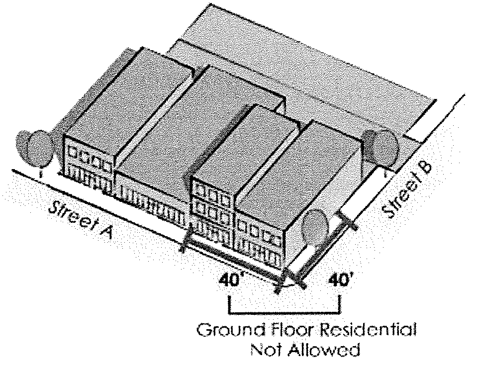
3.
All other design standards and building requirements stated in this section are met, unless explicitly stated otherwise.
(C)
High school.
(D)
Home occupations.
(E)
Parcel delivery stations.
(F)
Printing, publishing, engraving and newspaper distribution agency.
(G)
Recording studios.
(H)
TV, radio broadcast offices and studios.
(I)
Noncommercial wireless communication antennas and towers as regulated in section 18-0301.2.
(J)
Retail sales.
(3)
Conditional uses:
(A)
Hospitals.
(B)
Sports arenas, armory, convention centers, and stadiums.
(C)
Heliports.
(D)
Wireless communication towers, as regulated by section 18-0310.1.
(4)
Temporary uses:
(A)
All temporary uses allowed in the B-1 limited business district.
(B)
Seasonal sale of farm produce that complies with City Special Event permitting requirements.
(Ord. No. 3542, § 1, 9-18-95; Ord. No. 3809, § I, 8-16-99; Ord. No. 3891, § XI, 6-4-01; Ord. No. 4079, § I, 8-1-05; Ord. No. 4127, § I, 3-20-06; Ord. No. 4798, § I, 6-21-21)
Editor's note— Ord. No. 3891, § XI, adopted June 4, 2001, added provisions creating subsection (2)(P). Existing subsection (2)(P) was redesignated (2)(Q) at the editor's discretion to avoid duplication.
18-0217A. - Design standards for B-4 central business district.
(1)
Purpose. In 2019, the city officially adopted the Grand Forks Downtown Action Plan. The purpose of this section is to preserve and enhance the existing character and scale of the downtown area while facilitating new development. The Design Standards Manual provides guidance for new construction and renovations in downtown Grand Forks. The standards identify the role and responsibilities of approving bodies, including the downtown design review board.
(A)
Goals. The design standards in this section and supplemented by the Design Standards Manual establish the following goals:
1.
Create more objective standards for new development, redevelopment, additions, and non-historic building areas.
2.
Ensure existing buildings retain their historic qualities through shorter review timelines for maintenance requests meeting historic standards.
3.
Adopt standards that allow the appropriate implementation of the Grand Forks Downtown Action Plan.
(2)
Application. The standards of this section apply to new development, redevelopment, substantial improvement, exterior renovation, and expansion of residential and non-residential buildings in the B-4 district. Any exterior renovation of structures within the B-4 district over fifty (50) years old and a contributing structure in the Downtown Grand Forks Historic District shall comply with the Secretary of the Interior's Standards for Rehabilitation and Guidelines for Rehabilitating Historic Buildings, published by the U.S. Department of the Interior (1990 revision), which shall be referenced when applying the design standards.
(3)
Exceptions. The following are exempt from the design standards in this section, subject to the details listed below:
(A)
Single-family homes, multi-plexes, and ground floor residential uses that lawfully existed under the B-4 district regulations and boundaries in effect on July 1, 2021.
1.
These uses are considered conforming to this section and are allowed to be fully rebuilt on the building footprint as of July 1, 2021, if damaged or destroyed.
2.
However, these uses existing on July 1, 2021, shall not be allowed to expand their use or building structure unless in compliance with the standards in this section and other codes of the City of Grand Forks.
(4)
Definitions. The following are defined as used in this section:
(A)
Aggregate. The solid material, such as sand or stone, used in making concrete.
(B)
Alley. A service way providing a second means of access to properties, often from between or behind, and often one (1) lane wide.
(C)
Arcade. A covered passageway to an entryway.
(D)
Articulation. The giving of emphasis to architectural elements (like windows, balconies, entries, etc.) that create a complementary pattern or rhythm, dividing large buildings into smaller identifiable pieces. Articulation can be vertical from the ground up or horizontal across all or a portion of a facade, generally parallel to the ground.
(E)
Awning. A roof-like covering extending from a building to shield a sidewalk, window, or entrance from the elements often made of fabric stretched over a metal frame.
(F)
Base. Bottom section, or "pedestal," on which a façade or column visually stands.
(G)
Bay. A vertical division of a building façade suggesting the underlying structure.
(H)
Bollard. A low post, often one (1) of a series, set in the ground to prevent motor vehicles from entering an area.
(I)
Blank wall. A ground floor wall or portion of a ground floor wall with no square area more than twenty-five (25) percent of the ground level facade that does not include a transparent window, door, or architectural changes. Also, an upper floor wall with no area over twenty-five (25) feet by twenty (20) feet without windows or architectural changes.
(J)
Canopy. An overhead roof-like structure that has open sides, usually to provide shelter from weather, but may also be used for decorative purposes.
(K)
Character. Distinguishing features or attributes.
(L)
Column. A vertical support member consisting of a base, cylindrical shaft, and decorative capital.
(M)
Contemporary. Here, current, or modern.
(N)
Context. Here, the visual and functional surroundings in which a particular building occurs.
(O)
Cornice. The molded, often projecting horizontal decorative member uppermost on a building façade.
(P)
Curtain wall. A non-load bearing wall assembly, often consisting mostly of clear and/or opaque glass panels in a metal framework.
(Q)
Dormer window. A window in a projection built out from a sloping roof.
(R)
Dumpster. A large waste container usually stored outside and emptied mechanically by a garbage truck.
(S)
Elevation. Here, the front, side, or rear view of a building.
(T)
Façade. The exterior face of a building, especially the principal and most ornamental face.
(U)
Forecourt. An open court in front of a building or group of buildings that is partly surrounded by walls or buildings.
(V)
Gable. Here, the triangular shape on an elevation created by the end of a pitched roof.
(W)
Historic. Having importance in or an influence on history; surviving from an earlier time period.
(X)
Integrity. Being whole or undivided; having internal consistency.
(Y)
Mansard. Here, a steeply pitched roof section visible on the elevation of a building.
(Z)
Massing. The visual shape, weight, and balance of a building.
(AA)
Ornament. Something that decorates or embellishes, helping to establish a style and character.
(BB)
Parapet. The part of a wall that continues above roofline, concealing the roof.
(CC)
Pediment. Here, a triangular shape applied to a façade that suggests a pitched roof behind, derived from classical architecture.
(DD)
Pier. A solid masonry support member.
(EE)
Pitch. Slope, usually of a roof or an awning.
(FF)
Porch. A covered area adjoining an entrance to a building and usually having a separate roof.
(GG)
Profile. Cross-section.
(HH)
Proportion. A part considered in relation to the whole, with respect to comparative size, quantity, or placement.
(II)
Renovation. Restoring to an earlier condition, from Latin words meaning "again" and "make new."
(JJ)
Right-of-way. A publicly controlled strip of land containing at least one of the following: Streets, alleys, sidewalks, or public utilities.
(KK)
Rhythm. Here, the regular recurrence of particular elements such as buildings, windows, or awnings.
(LL)
Scale. The relative size of elements.
(MM)
Screen. To conceal from view.
(NN)
Setback. Here, the distance a building or parking is sited from the property line.
(OO)
Siding. Boards, usually wood or vinyl, applied to an exterior wall to create a continuous covering.
(PP)
Street furniture. Additive elements of streetscape improvements, such as light fixtures, benches, trash cans, and planters.
(QQ)
Streetscape. Architectural forms, details, materials, and color that are used in combination to create a visually coordinated street scene.
(RR)
Stoop. A porch, platform, entrance stairway, or small veranda to enter a building.
(SS)
Storefront. The ground floor façade of a commercial use adjacent to a sidewalk or internal pathway. Storefront also refers to one (1) of the building type designations that are applied in the design standards.
(TT)
String course. A horizontal row of bricks or stones, sometimes protruding slightly.
(UU)
Strip windows. A continuous horizontal band of glazing, such that the structural support for the windows is not apparent on the building exterior.
(VV)
Transom. A window placed above a door or storefront display window, often operable.
(WW)
Trim. Ornamental material, usually wood or metal.
(5)
District boundaries. The "downtown area" subject to these standards generally Includes the area within the B-4 zoning district.
(A)
Downtown core. Includes the B-4 zoning district, as may be amended from time to time.
(6)
Street classifications.
(A)
Major streets. Major streets are those of significant visibility and traffic. The streets defined as "major streets" for the purposes of these standards include:
1.
DeMers Avenue from overpass to Red River, DOT regulations override standards in this section.
2.
University Avenue from North 8th Street to North 3rd Street.
3.
North 3rd Street, from 4th Avenue North to Minnesota Avenue.
4.
North 4th Street, from 4th Avenue North to Minnesota Avenue.
5.
North 5th Street, DOT regulations override standards in this section from 4th Avenue North to Division Avenue.
(B)
Minor streets. Minor streets are those of visibility and moderate traffic. Minor streets exhibit potential redevelopment projects in the future. The streets defined as "minor streets" for the purposes of these standards include:
1.
2nd Avenue North between North 4th Street and the river levee.
2.
1st Avenue North between DeMers Avenue and the river levee.
3.
Kittson Avenue between South 4th Street and South 3rd Street.
(C)
Determination of street frontage. When this section uses the major and minor street classifications or front, side, street side, or rear to apply standards, the following applies:
1.
The street a parcel fronts towards means the street where the primary building entrance faces or those building elevations that face upon a public street between the building and the public street.
2.
Where a parcel has more than one (1) building elevation facing a public street, the following are used to determine street frontage definitions:
a.
If only one (1) adjacent street is classified as a major street, the major street shall be classified as the front yard and subject to those standards.
b.
If only one (1) adjacent street is classified as a minor street and no adjacent street is classified as a major street, the minor street shall be classified as the front yard and subject to those standards.
c.
If more than one (1) adjacent street is classified as a major street, then both major streets shall be classified as a front yard and subject to those standards.
d.
If more than one (1) adjacent street is classified as a minor street and no adjacent street is classified as a major street, then the minor street with the primary building entrance for pedestrians shall be classified as the front yard and subject to those standards.
e.
If no adjacent street is classified as a major or minor street, then the street with the primary building entrance for pedestrians shall be classified as the front yard and subject to those standards.
(7)
Building types. The range of building types allowed for new construction and significant rehabilitation are limited to those listed in this subsection.
(A)
Purpose. To maintain the character of downtown, the regulation of building types is intended to standardize a building's form and interaction with public spaces.
(B)
Permitted building types. The permitted building types are defined and illustrated below:
1.
Storefront. A building with a non-residential entrance facing a major or minor street that is built to the front property line for nearly all of the lot. There may be small breaks for entryway areas, plazas, or other public spaces.
a.
Figure 18-0217A(7)(B)(1), Storefront.
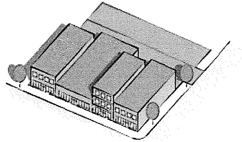
2.
Civic building. A building for civic activities that may include significant public space at entrances and off-street parking on the side or rear.
a.
Figure 18-0217A(7)(B)(2), Civic Building.

3.
Parking structure. Structures allowed for vehicle parking that may be stand alone or incorporated into another building. Facades facing streets are integrated into the streetscape design and pedestrian environment. Parking is hidden as much as possible.
(8)
Siting standards.
(A)
Purpose. Siting standards affect the general layout of new construction and additions to existing properties to provide flexibility for creative design while requiring the massing and setback of older downtown buildings to be respected.
(B)
Application. The standards in this subsection apply to all buildings in the B-4 District unless standards explicitly list otherwise.
(C)
Build to line. The building coverage, or "footprint," of new structures shall be built at or close to the property line as required in Table 18-0217A(8)(F)(1), Building siting, up to at least the second floor for multiple-story structures.
(D)
Entrances. When adjacent to a major street, the main entrance(s) to all buildings shall be on the major street façade, with secondary entrance(s) as necessary from off-street parking areas or minor streets facades. If the building is not adjacent to a major street, the primary entrance shall be oriented toward a public street.
1.
Insets. Building entries may be inset from the street facade but shall be permitted at the first-floor level only. Upper level balconies on street façade(s) shall be set into the building.
2.
Focal features. Entrances shall include multiple pedestrian scale focal point features on the ground level façade. Focal point methods include:
a.
Roofs/canopies.
b.
Porches.
c.
Cloth awnings or other weather protected entrance features.
d.
Ornamental paving.
e.
Planters.
f.
Traditional architectural detailing such as piers, columns, and trim.
g.
Over entrance lighting.
h.
Business signage.
(E)
Screening applications.
1.
Trash receptacles, dumpsters, and loading facilities. All dumpsters and loading facilities shall be accessed from alleys or non-major streets. They must be screened from street view with fencing or landscaping. See section 18-0217A(15)(F), Standards for fences and railings for standards regarding screening.
2.
Utility equipment. Equipment such as air conditioner units or exhaust fans shall be screened from view and located either in the rear of the building or on the roof. Mounting equipment on the façade is prohibited. See section 18-0217A(15)(F), Standards for fences and railings for standards regarding screening.
(F)
Additional building siting standards. Additional siting standards are described in Table 18-0217A(8)(F)(1), Building Siting and Figure 18-0217A(8)(F)(2), Building Siting, Block.
1.
Table 18-0217A(8)(F)(1). Building siting.
2.
Figure 18-0217A(8)(F)(2). Building Siting, Block.
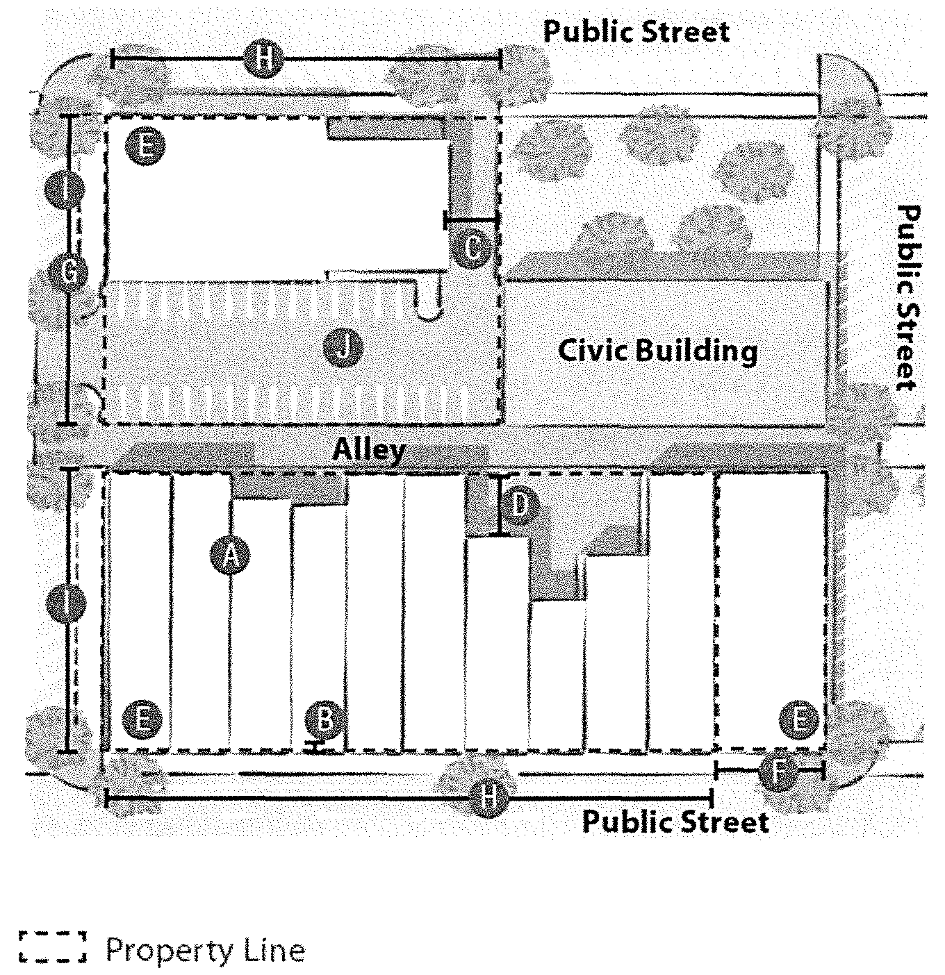
(9)
Streetscaping standards. All site improvements are subject to design approval and shall be coordinated with the city's streetscape improvement specifications. Properties adjacent to updated streetscape standards will be required to install improvements to new standards. Those not adjacent to new streetscape standards will be required to replace any amenities that were previously there prior to construction and to match existing styles for pavers and sidewalks. Property owners shall coordinate with the city prior to undertaking the following:
(A)
Repair or replacement of sidewalks or other paving.
(B)
Alteration of a sidewalk, parking lot, or planting bed grades or elevations.
(C)
Installation of planters, benches, litter receptacles, bollards, or other street furniture.
(D)
Planting of trees or other landscape material.
(E)
Artificial plants are prohibited in any exterior planters in the downtown area, except as part of temporary, seasonal decorations.
(10)
Parking and access standards.
(A)
Purpose. Parking and access standards affect the location and layout of all off-street parking in the B-4 district. They reinforce the continuous street façades and focus on pedestrian experience unique to the downtown area. The standards listed in section 18-0302 apply when a standard is not explicitly listed in this section.
(B)
Application. The standards in this subsection apply to all buildings in the B4 zoning district unless standards explicitly list otherwise.
(C)
Permitted uses and access.
1.
New off-street parking is prohibited in the front or street side of any building, and the side yard of buildings.
2.
Stand-alone surface parking lots as the primary use of a lot are prohibited.
3.
Access to off-street parking shall not be from a street, but rather a rear alley, side alley, or from a non-major street if an alley is not present.
(D)
Landscaping treatment. For the purposes of landscaping screening, the following are defined:
1.
Dense landscaping means evergreens and natural ground cover, or berm that forms a buffer at least thirty (30) inches in height.
2.
Landscaping means a natural ground cover planted with shrubs or trees.
3.
Open fencing means a three-foot decorative fence. See section 18-0217A(15)(F), Standards for fences and railings for fencing standards.
(E)
Screening requirements. Off-street parking shall be screened from view as follows:
1.
Along major streets. Using either dense landscaping, open fencing, and landscaping, or a low masonry wall and open fencing. See section 18-0217A(15)(F), Standards for fences and railings for fencing standards.
2.
Covered parking. Whether under a building, within a building, or in a separate parking structure, covered parking shall be screened from view from any street, either architecturally or with landscaping. Sloped parking ramps must not be visible on any building elevation.
3.
A perimeter parking lot landscaping strip is required in the following locations and treatment:
a.
Adjacent to residential and public streets must include dense landscaping, open fencing and landscaping, or a low masonry wall and open fencing.
b.
Adjacent to building walls where natural ground cover is required and a five-foot pedestrian sidewalk.
(F)
Interior lot landscaping area.
1.
Interior parking landscaping must be provided for large lots where a parking space is not within one hundred (100) feet of a perimeter or interior landscaped area.
2.
When provided or required, interior islands shall be at least one hundred sixty (160) square feet each.
(G)
Pedestrian connection requirements. Pedestrian connections from parking areas must be provided in the following situations:
1.
Paved walkways shall be provided from all parking areas to building entrances or other pedestrian systems.
2.
Walkways that cross driveways or other vehicle use areas shall be clearly defined with special materials such as textured concrete, brick pavers, or striping.
(H)
Parking Lot layout, excluding parking lot setbacks, shall follow Table 1 in section 18-0302 Off-street parking and loading.
(I)
Additional parking standards. Additional parking standards are described in Table 18-0217A(10)(I)(1), Parking, and Figure 18-0217A(10)(I)(2), Parking, Block.
1.
Table 18-0217A(10)(I)(1), Parking.
2.
Figure 18-0217A(10)(I)(2), Parking, Block.
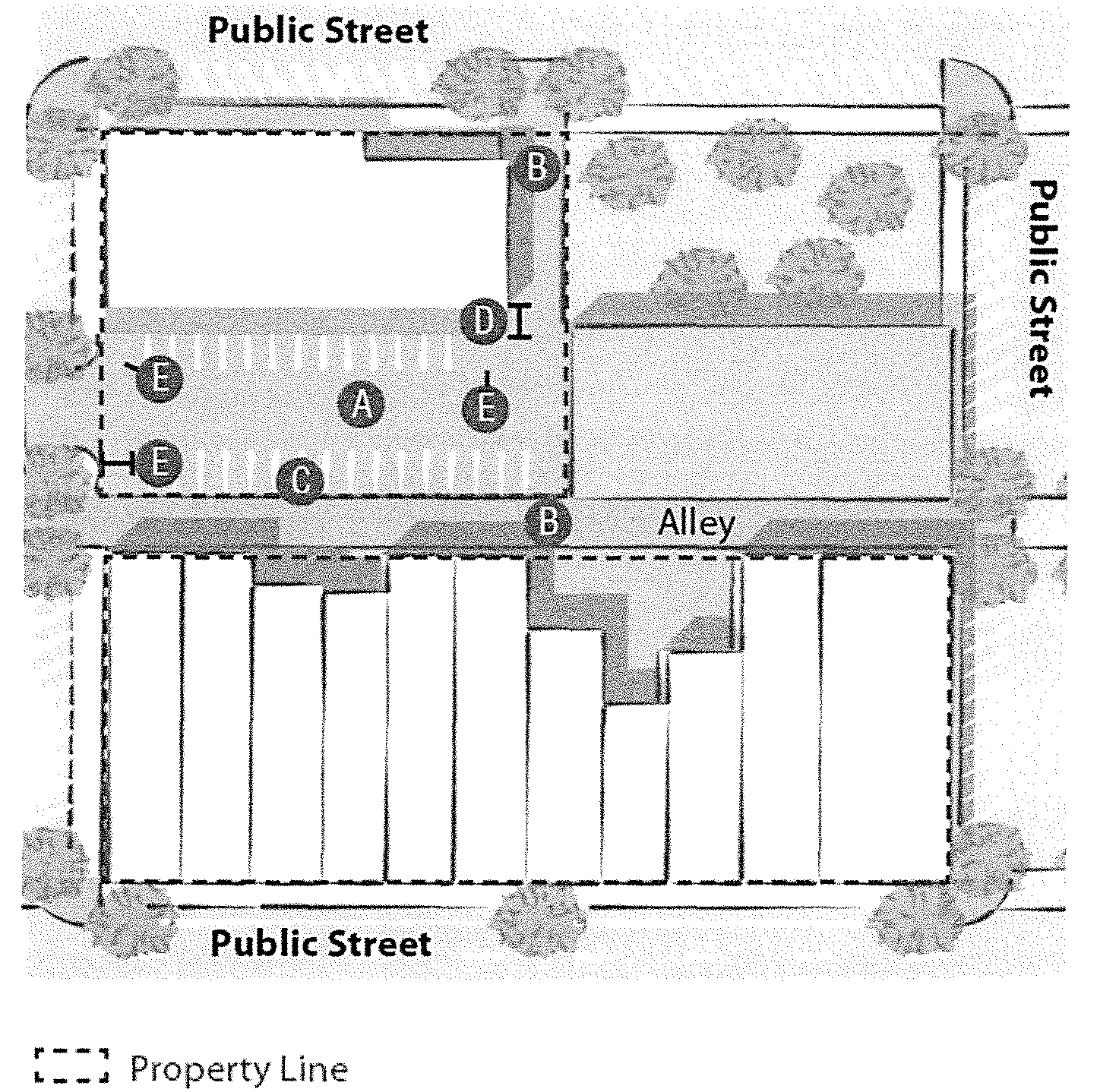
(11)
Massing and scale standards.
(A)
Purpose. Massing and scale refer to the size of buildings and relationship with the public environment. Massing and scale standards will affect the architectural treatment of new and existing structures, so existing historical features are maintained and respected by new buildings and additions. The following section applies to all buildings and detailed further in Table 18-0217A(11)(H)(1), Building massing and scale.
(B)
Application. The standards in this subsection apply to all buildings unless standards explicitly list otherwise.
(C)
Pedestrian scale. The first story of downtown buildings shall be designed to reflect a pedestrian scale, taking cues from existing downtown buildings whose historical integrity remains intact.
1.
Entryway types. Different frontage types are appropriate in the B-4 district, and also major versus minor/undesignated streets. The following are guidelines for review of pedestrian scale ground floor entryways and illustrated in the Design Standards Manual.
a.
Storefront. A storefront is a highly transparent ground story treatment designed to serve primarily as the display area, and primary entrance for retail or service uses.
b.
Arcade. An arcade is a covered pedestrian walkway within the recess of a ground story.
(D)
Ground base. Buildings shall meet the ground with a solid masonry or metal panel base treatment that creates a visual transition from sidewalk to building wall. See Figure 18-0217A(11)(H)(3), Articulation definitions.
(E)
Cornices.
1.
On existing buildings, the original cornice detail, height, and profile shall be maintained and repaired as needed. See Figure 18-0217A(11)(H)(2), Building Massing and Scale Application, and section 18-0217A(4), Definitions.
2.
If new structures or additions are taller than immediately adjacent older buildings, existing cornice height(s) must be reflected on the new elevations with an upper floor setback, façade material change, or string course. See Figure 18-0217A(11)(H)(3), Articulation Definitions.
(F)
Roof types.
1.
New structures shall be designed to utilize flat roof and parapet wall construction similar to that of existing structures.
2.
Mansard roofs, dormer windows, pediments gables, and visible pitched roofs are not permitted.
3.
Rooftop decks are permitted for all uses subject to the following standards:
a.
The roof deck access structure may not exceed ten (10) feet in height above the surface of the roof deck. Roof deck access structures must meet the same setback requirements as the associated roof deck.
b.
The roof deck must be set back at least eight (8) feet from the front or street side face of the building wall. No setback is required from the face of the building wall on rear and non-street sides.
(G)
Windows and doors.
1.
Scale. Windows and doors shall reflect the historic types found in the design standards overlay in scale, proportion, and construction. Historic storefront windows and entry doors can utilize modern frame systems if necessary, but glazing shall not extend to the ground. See Figure 18-0217A(11)(H)(2), Building Massing and Scale Application.
2.
Alterations. Existing windows and doors, including transom windows on the first floor, shall be exposed and repaired where possible. New windows and doors on contributing historic structures shall reflect the original style if a replacement is necessary. New openings shall not be cut into buildings, and original opening sizes shall not be reduced, enlarged, or filled in.
3.
Upper floors. Upper-floor windows in new construction shall be individual openings in solid wall planes, reflecting the historic proportions of existing window openings on historic buildings found in the design standards overlay.
4.
Prohibited types. The following window and door types are not permitted in historic buildings in the B-4 district unless listed on the National Register with those design elements:
a.
Curtain wall glazing systems.
b.
Horizontal or vertical strip windows.
c.
Mirrored or visibly reflective glazing.
d.
Fully glazed or nearly fully glazed doors, though they may be considered acceptable on secondary elevations if the scale, material, and other standards of this section are met.
5.
Accessibility. Existing and new doors must comply with all accessibility and life safety codes, while still reflecting an appearance in keeping with the original character of the building.
(H)
Additional massing and scale standards. Additional massing and scale standards in the Downtown Core and Downtown Fringe districts are described in Table 18-0217A(11)(H)(1), Building Massing and Scale, Figure 18-0217A(11)(H)(2), Building Massing and Scale Application, and Figure 18-0217A(11)(H)(3), Articulation Definitions.
1.
Table 18-0217A(11)(H)(1), Building Massing and Scale.
2.
Figure 18-0217A(11)(H)(2), Building Massing and Scale Application.
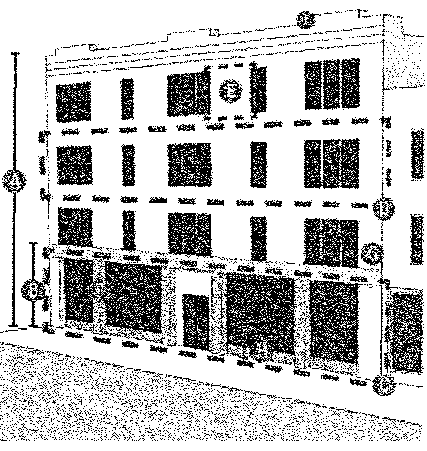
3.
Figure 18-0217A(11)(H)(3), Articulation Definitions.
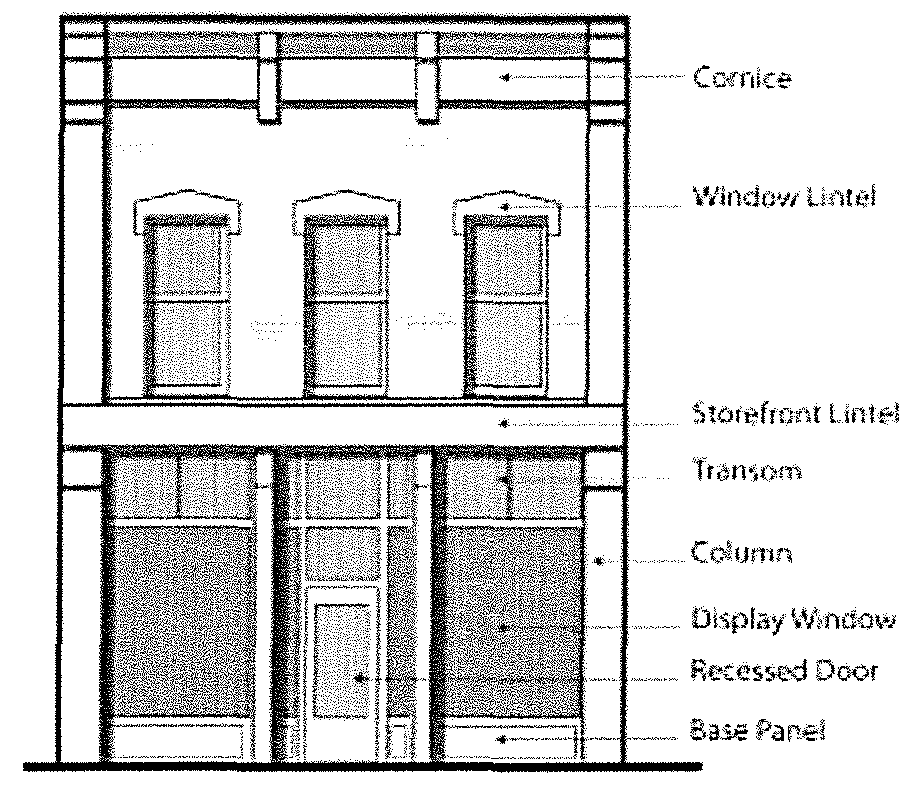
(12)
Architectural materials standards.
(A)
Purpose. It is the goal of these standards to establish a method for the development of a cohesive architectural aesthetic downtown. The following palette of construction materials and thoughtful mix of architectural styles and orientations of structures coupled with the standards herein will work to develop a sense of downtown identity and balance between new and old buildings.
(B)
Application. The standards in this subsection apply to all buildings unless standards explicitly list otherwise.
(C)
Strict application. Table 18-0217A(13)(B), Architectural. Primary materials for historic buildings lists the permitted external materials for contributing historic structures as identified in the National Register nomination for the Downtown Grand Forks National Historic District. Table 18-0217A(13)(B), shall be used when renovating or adding additions that are consistent with the original building materials.
(D)
Flexible application. New construction and non-contributing historic structures as identified in the Grand Forks Downtown National Register nominations are permitted flexibility in facade material subject to Table 18-0217A(14)(B), Prohibited and special exception materials from use on any building.
(E)
Colors. Building colors shall include earth tones, neutrals, and primary colors at the discretion of the City of Grand Forks under the review procedures in section 18-0217A(19), Application procedures. Earth tones are defined as those that were available during the appropriate time period of significance determined for the Grand Forks Downtown Historic District.
1.
Quantity. No more than three (3) colors shall be used on each facade unless evidence shows different historical colors used.
2.
Accent colors. Vibrant primary colors are allowed to accent architecturally significant building detail but must contribute to the building's overall attractiveness and design. Similarly, contrasting trim color(s) can be used to highlight architectural elements, such as windows and door trim.
3.
Applied elements. Awnings, signage, light fixtures, and other applied structures to a building facade shall coordinate with, rather than overwhelm, the architectural color scheme of the building.
4.
Brick. All original brick facades of existing buildings shall be left unpainted, clean, and in good repair.
5.
Equipment. If equipment is mounted behind louvered panels for ventilation purposes, louvers shall be oriented to conceal the equipment from view and shall be finished to match the adjacent wall color, rather than the contrasting trim color, to minimize their visual impact.
(F)
Balconies.
1.
Major streets. Balconies facing a major street shall be inset into the building at street façades, with solid partial height enclosures integrated into the building's architecture.
2.
Minor streets. Balconies on building facades facing a minor street shall be subject to the material requirements outlined in section 18-0217A(15)(F), Standards for fences and railings.
(G)
Doors. Existing and new doors must comply with all accessibility and life safety codes while still reflecting an appearance in keeping with the original character of the building.
(H)
Material quantity. Facades over one hundred (100) square feet shall use more than one building material.
(13)
Primary materials for historic buildings.
(A)
Application. Table 18-0217A(13)(B), Architecture, Primary Materials for Historic Buildings, applies to contributing historic structures as identified in the National Register nomination for the Downtown Grand Forks National Historic District.
(B)
Table 18-0217A(13)(B), Architecture, Primary Materials for Historic Buildings.
(14)
Prohibited and special exception materials.
(A)
Application. Table 18-0217A(14)(B), Prohibited and Special Exception Materials From Use On Any Building shall be used when renovating or adding additions and consistent with the original building materials.
(B)
Table 18-0217A(14)(B), Prohibited and Special Exception Materials From Use on Any Building (limited to percent (%) shown).
(15)
Awnings, fences, railings, and lighting standards.
(A)
Purpose. Awnings, fences, railings, and lighting are functional and aesthetic features that may be applied to building façades and sites throughout the downtown area. Standards allow flexibility for design while ensuring that each is used appropriately.
(B)
Standards application.
1.
The standards in this subsection apply to all buildings in the downtown core unless standards explicitly list otherwise.
2.
State standards. Streets regulated by the North Dakota Department of Transportation (DOT) require additional permits through the DOT for any encroachments or lighting in the right-of-way, including awnings.
(C)
Guidelines. Items under subsections 18-0217A(15)(D), Guidelines and standards for awnings and 18-0217A(15)(E), Guidelines and standards for lighting. Guidelines shall be considered by the applicant in project design. If a guideline is not applied to a project, the applicant shall provide the reasoning for not following the guideline.
(D)
Guidelines and standards for awnings.
1.
Guidelines.
a.
Use. Protected entries and covered arcades on new construction are encouraged.
b.
Design. Visually coordinated, full-width awnings are encouraged on both new and existing buildings to facilitate a continuous pedestrian environment.
c.
Profiles. Simple pitched awning profiles, either retractable or fixed, are most appropriate on major and minor streets.
d.
Materials. Weather-treated fabric awnings are encouraged. Vinyl and metal awnings may be used if other design standards are met.
2.
Standards.
a.
Building coordination. Awning configuration shall coordinate with adjacent building awnings in height, width, and profile.
b.
Coverage. Awnings shall not cover architectural elements or occupy more than forty (40) percent of the facade area measured by the first-floor height multiplied by the building bay width.
c.
Color. Awning colors shall coordinate with the building façade color scheme.
d.
Illumination. Internally illuminated and back-lit awnings are not permitted.
(E)
Guidelines and standards for lighting.
1.
Guidelines.
a.
Location. Lighting may be placed at doorways, below awnings, in display windows, and as needed to illuminate signage or historic elements. See also section 18-0301(8), Signage standards.
b.
Finish. Exposed or painted metal finishes are most appropriate for lighting fixtures.
2.
Standards.
a.
Use of lighting. The lighting of building façades shall serve only to illuminate entries, adjacent pedestrian areas and displays, or to highlight significant architectural features above the first floor.
b.
Types. Historically sensitive fixtures and appropriately scaled contemporary fixtures are permitted.
c.
Prohibited elements. The following lighting types are not permitted:
1)
Visible fluorescent bulbs.
2)
Neon lighting on building exterior, except signage per section 18-0225(20), Signage standards.
3)
Colored bulbs, except for temporary, seasonal decoration.
d.
Color. Fixture color(s) shall be muted and coordinate with the facade and signage color scheme.
(F)
Standards for fences and railings.
1.
Height. Fences used to screen parking areas from view must be between four (4) feet (forty-eight (48) inches) and six (6) feet (seventy-two (72) inches) in height. Masonry or other enclosures for equipment and dumpsters must be at least six (6) feet (72 inches) in height and fully screened according to the standards in section 18-0217A(15)(F), Standards for fences and railings.
2.
Materials.
a.
Wrought iron open fencing is permitted for the shielding of parking areas from view from any street if used in conjunction with landscaping defined in subsection 18-0217A(10)(D), Landscaping treatment, and if finished in a dark, solid color.
b.
Wood fencing or non-white vinyl fencing shall only be used to enclose equipment and dumpster holding areas behind buildings and must be painted a dark, solid color.
c.
Chain link fencing is not permitted unless temporarily installed in the rear yard.
3.
Coverage. Masonry walls may be installed if a dark solid color is used but only for the following purposes:
a.
As enclosures for equipment and dumpster holding areas behind buildings if high enough to fully screen the equipment or dumpster.
b.
As partial-height enclosures (two (2) feet maximum height) for parking areas, if used in conjunction with wrought iron fencing and/or landscaping as defined in subsection 18-0217A(10)(D), Landscaping treatment.
4.
Railing types. Railings at ramps, stairways, and balconies shall follow applicable life safety and accessibility codes and not occupy a length of more than forty (40) percent of a building facade. The following railing types are permitted:
a.
Inset balconies shall use partial-height solid enclosures integrated with the architecture of the building.
b.
Projecting balconies shall use decorative metal railings coordinated with the design and color scheme of the building.
c.
Wooden railings are not permitted for exterior use in the design standards overlay.
(16)
Signage standards.
(A)
Refer to section 18-0301(8) Signs permitted in B-4 central business district.
(17)
Addition standards. Additions have special considerations for historic buildings and their impact on the historic district.
(A)
Application. The standards in this section apply to existing contributing historic structures within the B-4 district as identified in the Grand Forks Downtown National Register Historic District unless standards explicitly list otherwise.
(B)
Location allowance. Additions are permitted when located on the side or rear façade of a building.
(C)
Size. Additions shall be subordinate in size and scale to the principal building as measured by the standards in section 18-0217A(11), Massing and scale standards.
(D)
Design. The design of additions shall reflect the design standards overlay and Secretary of the Interior Standards for historically contributing structures.
(18)
Demolition standards. Demolitions have special considerations for historic buildings and their impact on the historic district.
(A)
Application. The standards in this section apply to existing contributing historic structures within the B-4 district as identified in the Grand Forks Downtown National Register Historic District unless standards explicitly list otherwise.
(B)
General procedure. The demolition of contributing historic structures shall only occur under extreme circumstances. Prevention of structural deterioration shall be the first priority for enforcement in compliance with the Grand Forks Municipal Code. The applicant and city shall consult with the Grand Forks Historic Preservation Commission on the appropriateness of demolition. For unavoidable demolitions, the following standards apply:
1.
All demolitions require special review by the downtown design review board (DDRB), and city council. If demolitions occur without the approval of the city council, then appropriate legal action may be taken subject to section 18-1101, Violations, penalties, and fees.
2.
Prior to demolition, a plan shall be submitted on how the property will be used after demolition and a proposed timeline for improvements. Plans shall follow the standards outlined in section 18-0217, B-4 central business district.
3.
Thirty (30) days shall be reserved from the time of demolition approval to demolition for the historic preservation commission to photo document the contributing historic structure.
(C)
Demolition by neglect.
1.
A person found guilty of demolition of a designated property by neglect or without required approvals shall be fined an amount set out in the fee schedule established by the city council, as amended from time to time.
2.
Dangerous building exception. A structure proposed for demolition that is deemed "a dangerous building" as determined by chapter XIX, article 7 is permitted. The property owner shall include a plan for post demolition that follows the regulations of the design standards.
(19)
Application procedures.
(A)
Applicability. The application procedures for a project in the B-4 district are displayed in the Downtown Design Standards Manual. This subsection details the extended review procedure.
1.
Staff review and approval. The planning director or their designee reviews, approves, or refers all applications for the design standards.
2.
DDRB review and approval. The planning director or their designee shall review and refer applications to the downtown design review board (DDRB) for approval that involve:
a.
Demolitions, which also require approval by the city council.
b.
Redevelopment of an existing site, including additions to existing buildings, that changes the footprint of an existing building by more than twenty (20) percent. A second change under twenty (20) percent on the same building, and all those in a three-year period from the last change, shall require DDRB review.
c.
All new development.
d.
Addition, relocation, and modifications other than replacement of windows and doors that do not alter the existing dimensions on façades facing any street or public space.
e.
Changes in architectural materials on a façade by more than twenty-five (25) percent.
(B)
Application materials. Every application for approval required by this section shall be submitted on a form approved by the planning department and shall include the corresponding application fee that is established by the city council, as amended from time to time. This includes electronic pdf files of full sized and to-scale plans of the necessary drawings. The items to review include, but are not limited to:
1.
Building sites.
2.
The siting of any structure and property as compared to the siting of other structures on abutting properties.
3.
Building massing, proportion, materials, colors, exterior appearance, windows, doors, and details.
4.
Size, location, and arrangement of parking and paved areas.
5.
Ingress and egress points.
6.
Landscaping.
7.
Size, location, design, color, number, lighting, and materials of all signs and/or advertising structures. Each application for a sign subject to the provisions of this section shall be accompanied by a scaled drawing depicting the requirements stated herein.
8.
Awnings, fences, lighting.
9.
Demolition.
10.
Other elements contained in any regulations of the city or in the Design Standards Manual adopted and not listed above.
(C)
Applications that require DDRB review must include an architect or licensed contractor.
(D)
Approval criteria. In granting approval, the planning director or their designee or the DDRB shall take into account the architectural and historic significance of the structure under consideration and the exterior form and appearance of any proposed additions or modifications to that structure, as well as the effect of such addition or modification upon other structures in the B-4 district. When considering applications, the designated review body shall use the following standards for review and compliance approval:
1.
Secretary of the Interior Standard for Rehabilitation and Guidelines for Rehabilitation of Historic Buildings for contributing structures to the Downtown Grand Forks National Historic District.
2.
This section and the Design Standards Manual.
3.
Other applicable zoning ordinance regulations.
(E)
Staff decision. If not required to refer to the DDRB as indicated in subsection 18-0217A(19)(A)(2), the planning director or their designee shall review the application for conformance with the standards and requirements of this section and approve, conditionally approve, or deny the application.
1.
The planning director or their designee shall render a decision to the applicant within ten (10) business days after receiving comments from other city departments as applicable.
(F)
DDRB referral. The planning director or their designee shall refer the application to the DDRB when the conditions listed in subsection 18-0217A(19)(A)(2) apply. Referral shall set the application on the next available agenda of the DDRB, consistent with the legal requirements for public notice.
(G)
Meeting notice. Adjoining property owners on the block face of the subject property, and on the parallel adjacent block face across the public street of the subject property shall be notified prior to the DDRB meeting.
1.
Notification shall be by regular United States mail not less than seven (7) days in advance of the meeting date to the applicant, the owner of any property subject of the application, and to any other person or persons in addition to those above deemed by the planning director to have a direct interest in the subject matter of the meeting.
2.
Notice to city agencies or officials may be by interdepartmental memorandum.
3.
The notice shall include the date, time, and place of the DDRB meeting, a description of the contents of the matter to be heard, and the address or location of the property involved and to be discussed at the meeting.
4.
In computing the time periods for providing notice pursuant to this subsection, the day of mailing, publication, or posting shall not be counted, but the day of the meeting shall be counted.
(H)
DDRB decision. The DDRB shall have twenty (20) business days to review the application, hold a meeting, and approve, conditionally approve, or deny the application. Upon motion of the DDRB, the review period may be extended for an additional twenty (20) business days or to a time mutually agreed upon by the DDRB and the applicant.
(I)
Approved applications. Upon approval of the application, the applicant may proceed with requests for other required approvals and permits.
(J)
Conditionally approved applications. Upon conditional approval of an application, the applicant must make all changes addressed by the planning department or DDRB. Revised plans shall be reviewed by the planning director or their designee to ensure compliance with the conditional approval.
(K)
Denied applications. If the planning director or their designee, or the DDRB determine that the application should be denied, a new application affecting the same property may be submitted only if a substantial change is made in the plans. It is the policy of the city not to hear successive applications for a substantially similar application after an application is denied.
1.
However, any such second application filed more than two (2) years after the final denial of a prior application shall be presumed to be based on new grounds and shall be heard on the merits as though no prior application has been filed.
(L)
Appeals of staff decisions. Any applicant may appeal a decision of the planning director or their designee on the interpretation of the requirements herein. The appeal shall be filed with the planning director within ten (10) days following the decision.
1.
Notification shall be by regular United States mail not less than seven (7) days in advance of the meeting date to the applicant, the owner of any property subject of the application, and to any other person or persons in addition to those above deemed by the planning director to have a direct interest in the subject matter of the meeting.
2.
In making any adjustment or variance under the provisions of this section, the Downtown Design Review Board shall designate such conditions in connection therewith as will, in its opinion, secure substantially the objectives of the regulation or provisions of this section to which the adjustment or variance is granted, as to continuity of design character within the adjacent area as well as to light, air, and the public health, safety, comfort, convenience and general welfare. Unless stated to the contrary, variances or adjustments granted shall run with the land.
3.
The Downtown Design Review Board shall thereupon make its decision upon the appeal application; this decision shall be final. If the application is denied, no further action shall be taken upon it; if the application is approved, permits may be issued based on the decision and conditions set forth by the board.
4.
No permit shall be issued under the provisions of this section unless and until the application is approved.
(M)
Appeals of DDRB decisions. Any applicant may appeal a decision of the DDRB on the interpretation of the requirements herein to the city council. The appeal shall be filed with the planning director within ten (10) days following the decision.
1.
Notification shall be by regular United States mail not less than seven (7) days in advance of the meeting date to the applicant, the owner of any property subject of the application, and to any other person or persons in addition to those above deemed by the planning director to have a direct interest in the subject matter of the meeting.
2.
In making any adjustment or variance under the provisions of this section, the city council shall designate such conditions in connection therewith as will, in its opinion, secure substantially the objectives of the regulation or provisions of this section to which the adjustment or variance is granted, as to continuity of design character within the adjacent area as well as to light, air, and the public health, safety, comfort, convenience and general welfare. Unless stated to the contrary, variances or adjustments granted shall run with the land.
3.
The city council shall thereupon make its decision upon the appeal application, which decision shall be final. If the application is denied, no further action shall be taken upon it; if the application is approved, permits may be issued based on the decision and conditions set forth by the city council.
4.
No permit shall be issued under the provisions of this section unless and until the application is approved.
(N)
Enforcement. Enforcement of the design standards is the same as chapter XVIII, article 11, Violations, Penalties, and Fees.
(Ord. No. 4798, § I, 6-21-21)
18-0218. - I-1 light industrial district.
(1)
Statement of intent. The I-1 district is intended to encourage industrial development that is compatible with surrounding or abutting land uses. To accomplish this compatibility, development in the I-1 district:
(A)
Is limited to administrative, wholesaling and related uses that can be carried on in an unobtrusive manner.
(B)
Must provide open spaces, landscaping and parking areas.
(C)
Must establish a high standard of appearance and controls for external effects such as noise, smoke, and congestion.
(2)
Uses permitted. Subject to the performance standards of subsection (11) listed below, the following uses shall be permitted in this district:
(A)
Bottling establishments.
(B)
Cabinet or carpenter shop.
(C)
Camera, and photographic supplies and manufacturing.
(D)
Cartage and express facilities.
(E)
Cartography and bookbinding.
(F)
Commercial model homes and/or garages for display.
(G)
Contractors' offices, shops and yards, for plumbing, heating, glazing, painting, paperhanging, roofing, ventilating, air conditioning, masonry, electrical and refrigeration including retail sales incidental thereto. See section 18-0309(1), (4) and (5) for additional requirements.
(H)
Drycleaning establishments.
(I)
Electric light or power generating stations.
(J)
Electric and electric products manufacturers.
(K)
Engraving, printing and publishing.
(L)
Fuel and heating.
(M)
Gasoline and oil bulk stations.
(N)
Group child care facility; the use must be an accessory use within the principal building and not occupy more than thirty (30) percent of the floor space in the principal building.
(O)
Jewelry manufacturers.
(P)
Laundries.
(Q)
Locker plants.
(R)
Medical, dental and optical laboratories.
(S)
Printing.
(T)
Produce.
(U)
Railroad right-of-way, including freight yards and railroad yards.
(V)
Storage warehousing.
(W)
TV and radio broadcast offices and studios.
(X)
Wholesale and office establishments.
(Y)
Other industrial activities of the same general character to those listed above, provided they are deemed fitting or compatible to the district by the city planning and zoning commission.
(Z)
Accessory uses customarily incidental to the uses permitted in this section; provided, however, any incidental manufacturing or repair necessary to conduct a permitted use shall not occupy more than thirty (30) percent of the floor space; and further provided that any incidental manufacturing or repair necessary to conduct a permitted use shall meet the performance standards in section 18-0218(11)(B).
(AA)
Garages for repair, storage and servicing of all types of motor vehicles.
(BB)
Heliports.
(CC)
Indoor recreational facilities.
(DD)
Off-street parking, as regulated by section 18-0302.
(EE)
Public buildings, facilities and utilities.
(FF)
Wind energy conversion systems (WECS), as regulated by section 18-0306.
(GG)
Signs, as regulated by section 18-0301.
(HH)
Machinery sales and service.
(II)
Mobile and manufactured home sales lots, including manufactured home sales offices, subject to special conditions provided in section (11)(D).
(JJ)
Off-site recyclable collection facility, subject to the special conditions in section 18-0216(11)(D) (Class A recyclable material only).
(KK)
Commercial wireless communication towers, antennas, and associated facilities as regulated in section 18-0301.1.
(LL)
Commercial accessory wireless communication towers and antennas as defined in section 18-0204(2).
(MM)
Animal daycare, boarding facility and animal shelters/rescues as defined in subsection 18-0204(2) and subject to special conditions set forth in subsection 18-0216(11)(F).
(NN)
Medical marijuana manufacturing facility as defined in section 18-0204(2).
(3)
Conditional uses:
(A)
Retail sales, (except for permitted machinery sales) as an accessory use to the principal use, provided that the retail display area does not exceed twenty (20) percent of the gross floor area.
(B)
Custodian quarters providing the following minimum conditions are met:
1.
The occupant must be the owner or employed by the owner to carry out duties relating to the primary business located on the premises.
2.
A site plan must accompany the application.
3.
The density shall not exceed one (1) unit per building lot.
4.
The planning and zoning commission and the city council may have the option to periodically review, renew, or revoke the conditional use permit if the conditions established are not adhered to.
5.
Other conditions as deemed fitting by the planning and zoning commission and city council.
6.
The quarters shall be served by sewer and water utilities, public or private.
(C)
Bulk storage of nonhazardous materials in accordance with Uniform Fire Code.
(D)
Recycling center.
(E)
Indoor shooting galleries and ranges.
(F)
Auction houses.
(4)
Temporary uses. None.
(5)
Building height limit. Four (4) stories or fifty (50) feet. Also see section 18-0303.
(6)
Required lot area, width and depth. None.
(7)
Impervious surface area. The impervious surface area shall not exceed eighty (80) percent of the lot area.
(8)
Front yard requirements:
(A)
There shall be a front yard of not less than twenty-five (25) feet, with an additional foot for each foot the building exceeds twenty-five (25) feet.
(B)
The front yard depth on corner lots shall be in accordance with the prevailing yard pattern and a second front yard of half the depth required generally for front yards shall be provided on the other frontage.
(9)
Side yard requirements:
(A)
There shall be a side yard of fifteen (15) feet, provided there shall be no paving, parking, loading, or storage within five (5) feet of the lot line.
(B)
All lots located adjacent to or adjoining any other district shall conform to the bufferyard requirements in section 18-0309.
(10)
Rear yard requirements. There shall be a rear yard having a minimum depth of not less than twenty (20) feet. No alley shall be counted as any part of the rear yard.
(11)
Special conditions/performance standards:
(A)
It is the intent of this subsection to provide that industry and related activities shall be established and maintained with proper appearance from streets and adjoining properties to provide that each such permitted use shall be a good neighbor to adjoining properties by the control of the following:
(B)
Standards:
1.
Glare. Glare, whether direct or reflected, such as from floodlights of high temperature processes, and as differentiated from general illumination, shall not be visible at any property line.
2.
Exterior lighting. Lighting, whether direct or reflected, such as from floodlights used for exterior illumination, shall be directed away from any adjoining property.
3.
Vibration. No manufacturing use may generate any ground transmitted vibration in excess of the limits set forth in this section. Vibration shall be measured at any adjacent lot line or residential district line. The instrument used to measure vibrations shall be a three (3) component measuring system capable of simultaneous measurement of vibration in three (3) mutually perpendicular directions. The vibration maximums set forth below are stated in terms of particle velocity, which may be measured directly with suitable instrumentation or computed on the basis of displacement and frequency when computed, the following formula shall be used:
Where:
PV = Particle velocity, inches per second.
F = Vibration frequency, cycles per second.
D = Single amplitude displacement of the vibration, inches.
The maximum velocity shall be the vector sum of the three (3) components recorded.
The values stated above may be multiplied by two (2) for impact vibrations (i.e., discrete vibration pulsations not exceeding one (1) second in duration and having a pause of at least one (1) second between pulses). Vibrations resulting from temporary construction activity that occurs between 7 a.m. and 7 p.m. shall be exempt from the requirements of this section.
4.
Smoke.
(a)
For the purpose of determining the density of equivalent opacity of smoke, the Ringlemann Chart, as adopted and published by the United States Department of Interior, Bureau of Mines Information Circular 8333, May 1967, shall be used. The Ringlemann number referred to in this section refers to the number of the area of the Ringlemann Chart that coincides most nearly with the visual density of equivalent opacity of the emission of smoke observed. For example, a reading of the Ringlemann No. 1 indicates a twenty (20) percent density of the smoke observed.
(b)
All measurements shall be taken at the point of emission of the smoke.
(c)
The manufacturing uses may not emit from a vent, stack, chimney, or combustion process any smoke that exceeds a density or equivalent capacity of Ringlemann No. 1, except that an emission that does not exceed a density or equivalent capacity of Ringlemann No. 2 is permissible for a duration of not more than four (4) minutes during any eight-hour period if the source of such emission is not located within four hundred (400) feet of a residential district.
(d)
North Dakota Century Code Chapter 23-25 and any rules promoted by the North Dakota State Department of Health establishing capacity standards shall be adhered to.
5.
Air pollution.
(a)
Any permitted use that emits any air contaminant as defined by state regulations shall comply with the appropriate state standards as outlined in North Dakota Century Code Chapter 23-25, Air Pollution Controls, as amended.
(b)
No building or conditional use permits may be issued with respect to any development covered by subsection (a) until the state health department has certified to the City of Grand Forks that the appropriate state and federal permits have been obtained by the developer, or that the developer will be eligible to receive such permits and that the development is otherwise in compliance with applicable air pollution laws.
6.
Storage of materials. Open storage of materials in any front yard shall be prohibited. Any other outside storage shall be screened so as not to be visible. Either fences or berms may be used to screen outside storage areas from the public view. The type of fence or berm shall be determined by the city planning office and shall be among those found in appendix B of the 1987 land development code, as amended.
7.
Noise. All uses requiring compliance with special conditions shall be conducted in accordance with Chapter 10, Article 5 of the Grand Forks City Code of 1987, as amended, shall regulate noise levels within the Grand Forks zoning and subdivision jurisdiction.
8.
Disposal of liquid wastes. No use in any district may discharge any waste contrary to federal and state law governing the discharge of radiological, chemical or biological wastes into the sewer system, and any surface, or subsurface water.
9.
Electric disturbance or interference.
(a)
Manufacturing uses may not create any electrical disturbance that adversely affects any operations or equipment other than those of the creator of such disturbance; or
(b)
Otherwise cause, create, or contribute to the interference with electronic signals (including television and radio broadcasting transmissions) to the extent that the operation of any equipment not owned by the creator of such disturbance is adversely affected.
(C)
In order to ensure compliance with the performance standards set forth above, the city council may require the owner or operator of any permitted use to have made such investigations and/or tests as may be required to show adherence to the performance standards. Such investigations and/or tests as are required to be made shall be carried out by an independent testing organization as may be selected by the city. The costs incurred in such investigation or testing shall be ordered by the owner or operator and shared equally by the owner or operator and the city unless the investigation and tests disclose noncompliance with the performance standards; in which situation the entire investigation or testing cost shall be paid by the owner or operator.
(D)
Manufactured home sales offices shall be subject to the following conditions:
1.
Shall be served and connected with water and wastewater utilities.
2.
Shall be handicapped accessible, and equipped with a handicapped accessible restroom for both employees and customers according to ADA standards.
(Ord. No. 3263, § 2, 2-16-93; Ord. No. 3281, §§ 1, 2, 4-19-93; Ord. No. 3282, § 1, 4-19-93; Ord. No. 3554, § 1, 12-18-95; Ord. No. 3744, § I, 10-19-98; Ord. No. 3749, § II, 11-16-98; Ord. No. 3824, § III, 11-15-99; Ord. No. 3891, § XII, 6-4-01; Ord. No. 4011, § III, 3-15-04; Ord. No. 4021, § III, 8-16-04; Ord. No. 4127, § II, 3-20-06; Ord. No. 4293, § 2, 4-19-10; Ord. No. 4661, § III, 4-16-18; Ord. No. 4861, § IV, 7-17-23)
18-0219. - I-2 heavy industrial district.
(1)
Statement of intent. This district is intended to provide area for larger industrial operations; those that may be require outside storage of materials; those that may be incompatible with certain other types of land uses; and those that can best operate with minimum restrictions and controls.
(2)
Uses permitted:
(A)
All uses permitted in I-1 limited industrial districts.
(B)
Freight terminals.
(C)
Rail freight yards, including switching and classification yards, repair shops and round houses.
(D)
Sewage treatment plants and lagoons.
(E)
Weighing stations.
(F)
Any manufacturing, production, processing, cleaning, storage, servicing, repair, and testing of materials, goods or products which conform with the performance standards set forth in section 18-0218(11).
(G)
Accessory uses customarily incidental to the uses permitted in this section; provided, however, any incidental repair or processing necessary to conduct a permitted use shall not occupy more than thirty (30) percent of the floor space.
(H)
Heliports.
(I)
Off-street parking, as regulated by section 18-0302.
(J)
Signs, as regulated by section 18-0301.
(3)
Conditional uses:
(A)
Extraction, processing or storage of sand, gravel, stone, or other raw material.
(B)
Junkyards, wrecking yards or auto salvage.
(C)
Private wastewater treatment plant.
(D)
Adult entertainment center, subject to the conditions in section (11) below.
(E)
Storage of hazardous and nonhazardous materials in accordance with the Uniform Fire Code.
(F)
Automobile race tracks.
(G)
Any other industrial activity deemed fitting and compatible to the district by the planning and zoning commission.
(H)
Recyclable processing center.
(I)
Indoor shooting galleries and ranges.
(J)
Auction houses.
(4)
Temporary uses. None.
(5)
Building height limit. No building shall hereafter be erected or structurally altered to exceed six (6) stories or seventy-five (75) feet in height. Also see section 18-0303.
(6)
Required lot area, width and depth. None.
(7)
Impervious surface area. Impervious surface area shall not exceed eighty-five (85) percent of the lot area.
(8)
Front yard requirements:
(A)
There shall be a front yard of not less than twenty-five (25) feet with one (1) additional foot for each foot in height the building exceeds twenty-five (25) feet.
(B)
The front yard depth on corner lots shall be in accordance with the prevailing yard pattern and a second front yard of half the depth required generally for front yards shall be provided on the other frontage.
(9)
Side yard requirements:
(A)
There shall be a side yard of fifteen (15) feet.
(B)
All lots located adjacent to or adjoining any other district shall conform to the bufferyard requirements in section 18-0309.
(10)
Rear yard requirements. There shall be a rear yard having a minimum depth of not less than twenty (20) feet. No alley shall be counted as any part of the rear yard.
(11)
Special conditions:
(A)
Adult entertainment center:
1.
The center is located no closer than one thousand two hundred fifty (1,250) feet from any pre-existing church, school, or property zoned residential.
2.
The center excludes from its premises those persons less than eighteen (18) years of age.
3.
The center displays no signs visible from the exterior of the center, except for signs identifying the center as an adult bookstore or adult cinema or both.
4.
No materials depicting specific sexual activities or specified anatomical areas shall be visible from the exterior of the center.
5.
The manager and the owners of the center are registered with the chief of police and have provided the police chief with such information as the chief reasonably may require with respect to their identities, including fingerprints, and prior criminal records, if any.
6.
The business premises of the center which are generally open to its patrons are open equally at the same time without charge to members of the city police force who may wish to enter thereon, provided the entry is in the course of the discharge of the police officer's duties.
7.
No signs or other structures shall be placed, erected, or used on the premises without prior approval of the planning and zoning commission.
8.
Lobby and entrance areas should be designed so as to minimize obstruction of sidewalks during operation hours.
9.
When considering an application for a conditional use permit, the planning commission shall impose such other conditions and limitations as may be deemed necessary to carry out the purpose and intent of the Grand Forks City Code and to preserve and protect the general public health, safety and welfare.
(B)
Reserved.
(12)
All uses to meet conditions of performance standards in section 18-0218.
(Ord. No. 3824, § IV, 11-15-99; Ord. No. 4011, § IV, 3-15-04; Ord. No. 4127, § III, 3-20-06; Ord. No. 4293, § 3, 4-19-10; Ord. No. 4751, § II, 12-16-19; Ord. No. 4861, § V, 7-17-23)
18-0220. - F-1 (floodway) and F-2 (floodplain) districts.
(1)
Purpose and intent. This section is enacted to promote the health, safety, and general welfare of the residents of the City of Grand Forks by the proper public regulation and management of flood-prone areas. It is the purpose and intent of this section to:
(A)
Comply with the specific requirements of the Flood Disaster Protection Act of 1973.
(B)
Prevent development in flood-prone areas which is incompatible with land subject to frequent periodic inundation.
(C)
Prevent loss of life, loss of property, health and safety hazards, disruption of commerce and governmental services, extraordinary public expenditures for flood protection and relief, and impairment of the tax base, all of which adversely affect the public health, safety and general welfare.
(2)
General provisions:
(A)
Lands to which this section applies: This section shall apply to all lands within the zoning and subdivision jurisdiction of the City of Grand Forks shown on the City of Grand Forks zoning map and the street and highway master plan as specified within this chapter.
(B)
Compliance: No structure or land shall hereafter be used and no structure shall be located, extended, converted or structurally altered without full compliance with the terms of this section and other applicable regulations.
(C)
Abrogation and greater restrictions: It is not the intent of this section to repeal, abrogate or impair any existing deed restrictions, existing zoning ordinances or other city regulations; however, where this section imposes greater restrictions, the provisions of this section shall prevail. All other ordinances inconsistent with this section are hereby repealed to the extent of this inconsistency only.
(D)
Interpretation: In interpretation and application, the provisions of this section shall be held to be minimum requirements and shall be liberally construed in favor of the City of Grand Forks and shall not be deemed a limitation or repeal of any other powers granted by the North Dakota Statutes.
(E)
Warning and disclaimer of liability: This section does not imply that areas outside the floodplain districts or land uses permitted within such districts will be free from flooding or flood damage. This section does not create liability on the part of the City of Grand Forks or any officer or employee thereof for any flood damages that result from reliance on this section or any administrative decision lawfully made hereunder.
(F)
Severability: If any section, clause, provision or portion of this section is adjudged unconstitutional or invalid by a court of competent jurisdiction, the remainder of this section shall not be affected thereby.
(G)
Official publication for areas of flood hazard: The scientific and engineering report prepared by the Federal Insurance Administration and entitled "The Flood Insurance Study for the City of Grand Forks," dated February, 1977, with an accompanying flood insurance rate map (F.I.R.M.), hereinafter referred to as F.I.R.M., dated September 15, 1977, first revision August 25, 1978, second revision January 25, 1980, third revision September 27, 1985, and the fourth revision dated December 17, 2010, is adopted by reference and declared to be part of this section. The flood insurance study is on file at the Office of the City Engineer, Grand Forks, North Dakota. The flood insurance study is not meant to preclude the consideration of other available base flood data or other additional technical information.
(3)
Establishment of zoning districts, zoning map and appropriate procedures and regulations:
(A)
Zoning districts: The floodplain areas within the jurisdiction of this section are hereby established into two (2) districts: Floodway district (F-1) and floodplain district (F-2).
The floodway district (F-1) shall be a channel area, adjacent to and including the Red River of the North and English coulee within the area of jurisdiction, sufficient to carry the regional flood with not more than a one-foot rise in the regional floodwater surface elevation if the entire flow of said regional flood is confined to the delineated floodway. The determination of the floodway district (F-1) is a theoretical hydraulic calculation to be carried out by an accepted standard methodology. The city engineer shall be responsible for the technical calculation which is to provide the basis for the delineation of the floodway district (F-1). The (F-1) zone is as shown on the federal flood insurance rate map with the revision dated December 17, 2010, which map is hereby adopted by reference and incorporated herein.
The floodplain district (F-2) is to be the floodplain area within the area of jurisdiction which is the floodplain area having special flood hazard, except the floodway district (F-1). This is the area, except the floodway, which would be inundated by a regional flood. The city engineer shall be responsible for the technical hydraulic calculations which are to provide the basis for the delineation of the floodplain district (F-2).
The boundary of the (F-2) zone shall be shown on the "City of Grand Forks Official Floodplain Zoning Map." Within these districts all uses not allowed as permitted uses or permissible as conditional uses shall be prohibited.
(B)
Official floodplain zoning map: The official floodplain zoning map, together with all explanatory matter thereon and attached thereto, is hereby adopted by reference and declared to be a part of this section. The official floodplain zoning map shall be on file in the office of the city engineer. The water surface profile entitled "Regional Flood Water Surface Profile in Grand Forks, North Dakota" is attached to and made a part of the official floodplain zoning map and this section.
(C)
Rules for interpretation of district boundaries: The boundaries of the zoning districts shall be determined by scaling distances on the map unless otherwise indicated on the official floodplain zoning map. Where interpretation of the exact location of a district boundary is to be is in dispute, as for example, where there appears to be a conflict between a mapped boundary and actual field conditions, the board of zoning adjustment of the City of Grand Forks shall make the necessary interpretation by procedures outlined in section 18-0603. In all cases the person contesting the location of the district boundary shall be given a reasonable opportunity to present his case to the board of zoning adjustment and to submit his own technical evidence. Compliance with the provisions of this section shall not be grounds for changing of F-1 or F-2 district zoning boundaries. Properties may be removed from either flood zone district by methods set forth in section 18-1001 of this chapter.
Floodway District (F-1)
1.
Permitted Uses (F-1): The permitted uses in the floodway district shall have a low flood damage potential and shall not act to obstruct flood flows or to increase flood heights. Mobile homes, new construction, and substantial improvement of existing structures are not permitted uses. The following uses shall be permitted within the floodway district to the extent that they are not prohibited by any other ordinance and provided they do not require fill or storage of materials and equipment.
(a)
Agricultural uses such as general farming, outdoor plant nurseries, horticulture, forestry, sod farming and wild crop harvesting.
(b)
Lawns, gardens, open spaces.
(c)
Parking areas and lots, loading areas.
(d)
Private and public recreational uses such as golf courses, tennis courts, picnic grounds, boat launching ramps, and other park and recreational uses.
2.
Conditional uses (F-1): All uses other than those specified in subsection (1) above are permitted only upon application to the planning commission and the issuance of a conditional use permit as set forth in Article 7 of this chapter. Conditional uses include:
(a)
Uses or structures accessory to open space or other conditional use.
(b)
Marinas, boat rentals, docks, piers, or wharves.
(c)
Railroads, streets, bridges, utility transmission lines pipelines, and fences.
(d)
Storage yards for equipment, machinery or materials.
(e)
Kennels or stables.
(f)
Other uses similar to those listed, which are consistent with the provisions and objectives of this section.
3.
Standards for floodway conditional uses (F-1):
(a)
All uses. No structures (temporary or permanent), fill, deposit, obstruction, storage of materials or equipment, or other uses may be allowed as conditional uses, which, acting alone or in combination with existing or anticipated future uses, unduly affects the capacity of the floodway or unduly increases flood heights. Consideration of the effects of a proposed use shall be based on the reasonable assumption that there will be an equal degree of encroachment extending for a significant reach on both sides of the stream.
(b)
Fill:
(i)
Any fill material must be shown to have a beneficial purpose. The proponent must submit a scaled plan of the proposed fill for review.
(ii)
Such fill shall be protected against erosion by rip-rap, vegetation, or bulkheading.
(c)
Structures:
(i)
Structures shall not be designed for human habitation.
(ii)
Structures shall be constructed or substantially improved in accordance with the "Floodproofing Code of the City of Grand Forks" except no residential basements shall be permitted.
(d)
Storage of material and equipment:
(i)
The storage or processing of materials that are in time of flooding buoyant, flammable, explosive, or could be injurious to human, animal or plant life is prohibited.
(ii)
Storage of other material or equipment may be allowed if not subject to major damage by floods and firmly anchored to prevent flotation or readily removable from the area within the time available after flood warning.
Floodplain District (F-2)
1.
Permitted Uses (F-2). The following uses shall be permitted uses within the floodplain district to the extent that they are not prohibited by any other ordinance.
(a)
Any use permitted in the floodway zone, section (d)(1).
(b)
Construction or substantial improvements of residential structures permitted by the ordinances of the City of Grand Forks for which the lowest floor (including basement) elevation is above the flood protection elevation as determined by the regional floodwater surface profile attached and part of this section.
(c)
All nonresidential structural and other uses permitted by the ordinances of the City of Grand Forks for which construction, provision, or substantial improvement is in accordance with the "Floodproofing Code of the City of Grand Forks."
2.
Mobile Home Parks (F-2). New mobile home parks and mobile home subdivisions, or expansions to existing mobile home parks and mobile home subdivisions where the repair, reconstruction or improvement of the streets, utilities, and pads equals or exceeds fifty (50) percent of the value of the streets, utilities, and pads before the repair, reconstruction or improvement has commenced, require that:
(a)
Stands or lots are elevated on compacted fill or on pilings so that the lowest floor of the mobile home will be at or above the base flood level.
(b)
Adequate surface drainage and access for a hauler are provided.
(c)
In the instance of elevation on pilings, that loads are large enough to permit steps, piling foundations are placed in stable soil and no more than six (6) feet above ground level.
3.
Construction and Design Standards for Floodway District F-1 and Floodplain District F-2 Uses:
(a)
Structures: All new construction and substantial improvements shall:
(i)
Be designed and adequately anchored to prevent flotation, collapse, or lateral movement.
(ii)
Be constructed with materials and equipment resistant to flood damage.
(iii)
Be constructed using method and practices that minimize flood damage.
(iv)
Be constructed or substantially improved in accordance with the "Floodproofing Code of the City of Grand Forks."
(v)
Be constructed with electrical, heating, ventilation, plumbing, and air conditioning equipment and other service facilities are designed and/or located so as to prevent water from entering or accumulating within the components during conditions of flooding.
(b)
All new and replacement water systems shall be designed to minimize or eliminate infiltration of floodwaters into the system.
(c)
New and replacement sewer systems shall be designed to minimize or eliminate infiltration floodwaters into the system and to minimize or eliminate discharges from the system into the floodwater.
(d)
On-site waste disposal systems shall be located to avoid impairment to them or contamination from them during flooding.
(e)
AO Zones designated on community's F.I.R.M.:
(i)
New construction and substantial improvements of residential structures located in the AO Zone as designated in the city's F.I.R.M. shall have the lowest floor (including basement) elevated above the highest adjacent grade at least as high as depth number specified in feet on the community's F.I.R.M. (at least two (2) feet if no depth number is specified).
(ii)
New construction and substantial improvements of nonresidential structures within the AO Zone as designated on the city's F.I.R.M. shall have the lowest floor (including basement) elevated above the highest adjacent grade at least as high as the depth number specified in feet on the community's F.I.R.M. (at least two (2) feet if no depth number is specified) or, together with attendant utility and sanitary facilities, be completely floodproofed to that level to meet the floodproofing standard requiring that below the base flood level the structure is watertight with walls substantially impermeable to the passage of water with structural components having the capability of resisting hydrostatic and hydrodynamic loads and effects of buoyancy.
(4)
Administration:
(A)
Building permit required. A building permit issued by the building and zoning administrator in conformity with the provisions of this section shall be secured prior to the erection, addition, or alteration of any building, structure, or portion thereof, in addition to the application requirements established in the city building code, the elevation of the lowest floor (including basement) and the lowest opening (if lower than first floor elevation) shall be clearly indicated. The building inspector shall indicate on the same set of plans, the regulatory flood protection elevation. No building permit may be issued for a building, structure, or portion thereof which does not meet the requirements of this section.
Upon issuance of said variance, the building and zoning administrator shall:
(B)
Floodproofing certification. Any building permit application for which floodproofing measures are proposed for nonresidential structures shall include a certification by a registered professional engineer or architect attesting that the floodproofing methods utilized are reasonably adequate for the structure to withstand the regional flood and meets the requirements of the "Floodproofing Code of the City of Grand Forks." All such certificates are to be kept on file in the office of the city engineer.
(C)
Variances. Variance from the strict interpretation of this section is permitted under the finding of facts, conditions, and procedures set forth in section 18-0603 and if it can be shown that the variance issuance will not result in increased flood levels during the base flood discharge additional threats to public safety, extraordinary public expense, a nuisance, or cause fraud on or victimization of the public.
In all cases, a variance from the strict interpretation of this section can only be permitted for:
1.
New structures or substantial improvement of structures which are to be constructed on lots of one-half (½) acre or less in size, and contiguous to and surrounded by lots with existing structures constructed below the flood protection elevation; or
2.
A structure listed on the national register of historic places or the North Dakota State Inventory of Historic Places that is to be restored or reconstructed.
Upon issuance of said variance, the building and zoning administrator shall:
1.
File and record the variance together with a declaration that:
(a)
Said property is in a floodprone area.
(b)
A statement of the number of feet that the lowest nonfloodproofed floor of the proposed structure is below the regional flood protection level.
(c)
Actuarial flood insurance rates increase as the first floor elevation decreases.
2.
Notify the administrator of the Federal Insurance Administration, Department of Housing and Urban Development, of said commission.
(D)
Duties of the building and zoning administrator (building inspector) and city engineer:
1.
Building and zoning administrator (building inspector) shall see that all permits from other governmental agencies must be obtained.
2.
City engineer shall notify adjacent communities and concerned agencies prior to the alteration or relocation of a watercourse, and submit evidence of such notification to the Federal Insurance Administration; and require that maintenance with the altered or relocated portion be provided so that the flood-carrying capacity will not be diminished.
(E)
Development permit required. A development permit issued by the city engineering office in conformity with the provisions of this section shall be secured prior to any development other than building construction, or to any addition or alteration thereto. Development other than building construction shall include but is not limited to: Baseball parks, football fields, golf courses, parks and open space, and parking lots.
(F)
Data for determination of flood insurance risk premiums. For the purpose of the determination of applicable flood insurance risk premium rates within Zone A on a community's FIRM, the following steps shall be taken by the city engineer:
1.
Obtain the elevation (in relation to mean sea level) of the lowest floor (including basement) of all new or substantially improved structures, and whether or not such structures contained a basement.
2.
Obtain, if the structure has been floodproofed, the elevation (in relation to mean sea level) to which the structure has been floodproofed.
3.
Maintain a record of all such information with official designated by the community to maintain such records.
(G)
Floodplain interpretation using best available data. Obtain, review and reasonably utilize any base flood and floodway elevation data available from a federal, state, or other source, until such other data has been provided by the Federal Emergency Management Agency, as criteria for requiring that:
1.
All new construction and substantial improvement of residential structures have the lowest floor (including basement) elevated to or above the base flood level; and
2.
All new construction and substantial improvements of nonresidential structures have the lowest floor (including basement) elevated or floodproofed to or above the base flood level.
(5)
Nonconforming uses. A structure of use which was lawful prior to October 20, 1975, but which is not subsequently in conformance with the provisions of this section is a nonconforming use which may be continued subject to the provisions of this section.
(6)
Amendment. The provisions of this section can be amended by the procedure set forth in section 18-1001. Final action on amendments to this section shall not be taken until the proposed amendments have been submitted to the Federal Insurance Administration and comments from the same have been received, or sixty (60) days after submittal, whichever is first. The city engineer shall be responsible for proposing amendments to this section when, in his/her best judgment, accurate hydrologic or topographic data is available on which to support the provisions of this section.
(7)
Enforcement. In case any building or structure is erected, constructed, reconstructed, altered, repaired, converted or maintained, or any building, structure or land is used in violation of this section, the building and zoning administrator, in addition to other remedies, may institute any proper action or proceedings in the name of the city, and hereby shall have the powers of a police officer to prevent the occupancy of said building, structure, or land, or to prevent any illegal act, conduct, business or use in or about said premises.
(Ord. No. 3077, §§ 3, 4, 12-17-90; Ord. No. 3891, § XII, 6-4-01; Ord. No. 4310, § II, 11-15-10)
18-0221. - U-D university district.
(1)
Statement of intent. This district is intended to preserve the institutional and residential character of a university or college campus and to limit commercial and industrial intrusions into the institutional and residential environment.
(2)
Uses permitted:
(A)
All uses permitted in the R-2 one-family and two-family residence district.
(B)
Institutions of higher education.
(C)
Lodginghouses subject to special conditions in subsection (11).
(D)
Fraternity and sorority houses subject to conditions in subsection (11).
(E)
Social and religious clubs, hospitals, organizations or centers which are college or university related.
(F)
Customary accessory uses and buildings, provided such uses are incidental to the principal use. Any accessory building shall be located on the same lot with the principal building.
(G)
Signs, as regulated by section 18-0301.
(H)
Off-street parking and loading, as regulated by section 18-0302.
(I)
Commercial wireless communication antennas located on an existing structure and as regulated by section 18-0310.1.
(J)
Commercial accessory wireless communication towers and antennas as defined in section 18-0204(2).
(3)
Conditional uses:
(A)
Crematories.
(B)
Wireless communication monopoles, as regulated by section 18-0310.1.
(4)
Temporary uses. None.
(5)
Building height limit. Six (6) stories but not to exceed seventy-five (75) feet in height. Also see section 18-0303.
(6)
Required lot area, width and depth:
(A)
Lot for one-family dwelling purposes shall contain not less than six thousand (6,000) square feet in area and a lot width of not less than forty-five (45) feet at building setback line and a minimum depth of not less than one hundred twenty (120) feet, except that when lots of greater width than forty-five (45) feet are used the lot depth may be reduced to a minimum of one hundred (100) feet provided the area requirements are not reduced and provided the necessary rear yard, as required by this article, is maintained.
(B)
Lots for two-family dwelling purposes shall contain not less than seven thousand (7,000) square feet in area and a lot width of not less than fifty (50) feet at the building setback line, and a lot depth of not less than one hundred twenty (120) feet, except that when lots of greater width than fifty (50) feet are used, the lot depth may be reduced to a minimum of one hundred (100) feet, provided the area requirement is not reduced and provided the necessary rear yard, as required by this article, is maintained.
(C)
The minimum lot area, width, and depth regulations for two-family dwelling units shall be considered the minimums for other uses permitted in the R-4 district, except that additional space may be required in order to meet the off-street parking requirements set forth in section 18-0302.
(7)
Impervious surface area. The impervious surface area shall not exceed fifty-five (55) percent of the lot area.
(8)
Front yard requirements:
(A)
Front yard depth of twenty-five (25) feet with one (1) additional foot for each foot in height the building exceeds twenty-five (25) feet.
(B)
The front yard depth on corner lots shall be in accordance with the prevailing yard pattern and a second front yard of half the depth required generally for front yards shall be provided on the other frontage.
(C)
Front yard depth on lots fronting minor and principal arterial streets as identified in the transportation element of the city's master plan shall be thirty-five (35) feet.
(9)
Side yard requirements. Each lot shall have two (2) side yards, one on each side of the principal building, the sum of the widths of the two (2) side yards shall not be less than twenty (20) percent of the average width of the lot, distributed as follows:
(A)
On any lot sixty (60) feet or less in width, the minimum side yard shall be not less than ten (10) percent of the width of the lot, and in no case shall a side yard be less than four (4) feet in width from the exterior wall abutting the side yard.
(B)
On any lot having an average width greater than sixty (60) feet and less than one hundred (100) feet, the minimum side yard shall be not less than eight (8) feet in width from the exterior wall abutting the side yard.
(C)
On any lot one hundred (100) feet or greater in width, the minimum side yard shall be ten (10) feet in width from the exterior wall abutting the side yard.
(10)
Rear yard requirements. Depth of twenty (20) percent of the lot depth with a minimum rear yard of twenty-five (25) feet. No alley shall be counted as any part of this rear yard depth.
(11)
Special conditions:
(A)
Lodging houses: Provided upon written application to the zoning administrator a permit is issued when in addition to state laws including, but not limited to, Chapter 23-09 of the North Dakota Century Code; other applicable city ordinances; and other federal, state and local regulations the following conditions are fulfilled, to wit:
1.
That the building permit specify the number of roomers and be based upon the design capacity of the building as determined by the zoning administrator.
2.
That evidence of a lodginghouse license shall be provided the zoning administrator prior to issuance of a certificate of occupancy.
(B)
Fraternity and sorority houses: Provided upon written application to the zoning administrator a permit is issued when in addition to state laws, other applicable city ordinances and federal, state and local regulations, the following condition is fulfilled, to wit:
1.
That the building permit specify the number of boarders and be based upon the design capacity of the building as determined by the zoning administrator.
2.
Reserved.
(Ord. No. 3030, § 4, 5-21-90; Ord. No. 3891, § XIII, 6-4-01)
18-0222. - A-D airport district.
(1)
Statement of intent. To provide an area for the operation and development of an airport district serving both private and commercial aircraft and attendant operations and to limit development inconsistent with such use in such a manner as to minimize conflicts between the airport use and any other use.
(2)
Permitted uses:
(A)
Airport buildings and structures related directly to airport operations, provided such building and structures must comply with applicable FAA regulations.
(B)
Farms, including dwellings of persons employed on the farm and buildings incidental thereto, not including mobile homes.
(C)
Cemetery.
(D)
Railroad rights-of-way, excluding railroad yards.
(E)
Flood control and watershed structures.
(F)
Golf courses.
(G)
Publicly owned structures deemed fitting and compatible by the planning and zoning commission.
(H)
Signs, as regulated by section 18-0301.
(I)
Trees, provided that they are not of a variety which will exceed the height limitations pertinent to the zone within this district in which the tree is to be located as determined by the city forester.
(J)
Off-street parking and loading, as provided by section 18-0302.
(K)
Aviation manufacturing, assembly, sales, and related uses.
(L)
Airport entrance sign as shown on the drawing attached to Ordinance No. 3958.1.
(3)
Airport zones and maps. With the airport district there are hereby created and established specific zones shown on the Grand Forks Mark Andrews International Airport Zoning Map, consisting of one (1) sheet, prepared by the city engineering department which is attached to this article and made a part hereof. The various zones are hereby established and defined as follows:
(A)
Instrument approach zone: An instrument approach zone is established at each end of the instrument runway for instrument landings and take-offs. The instrument approach zones shall have a width of one thousand (1,000) feet at a distance of two hundred (200) feet beyond each end of the runway, widening thereafter uniformly to a width of sixteen thousand (16,000) feet at a distance of fifty thousand two hundred (50,200) feet beyond each end of the runway, its centerline being the continuation of the centerline of the runway.
(B)
Non-instrument approach zone: A non-instrument approach zone is established at each end of all non-instrument runways on Grand Forks Mark Andrews International Airport for non-instrument landings and take-offs. The non-instrument approach zone shall have a width of four hundred (400) feet at a distance of two hundred (200) feet beyond each end of the runway, widening thereafter uniformly to a width of two thousand four hundred (2,400) feet at a distance of ten thousand two hundred (10,200) feet beyond each end of the runway, its centerline being the continuation of the centerline of the runway.
(C)
Transition zones: Transition zones are hereby established adjacent to each instrument and noninstrument runway and approach zone as indicated on the zoning map. Transition zones symmetrically located on either side of runways have variable widths as shown on the zoning map. Transition zones extend outward from a line two hundred (200) feet on either side of the centerline of the noninstrument runway, for the length of such runway plus two hundred (200) feet on each end; and five hundred (500) feet on either side of the centerline of the instrument runway, for the length of such runway plus two hundred (200) feet on each end, and parallel and level with such runway centerline. The transition zones along such runways slope upward and outward one (1) foot vertically for each seven (7) feet horizontally to the point where they intersect the surface of the horizontal zone. Further, transition zones are established adjacent to both instrument and non-instrument approach zones for the entire length of approach zones. These transition zones have variable widths, as shown on the zoning map. Such transition zones flare symmetrically with either side of the runway approach zones from the base of such zones and slope upward and outward at the rate of one (1) foot vertically for each seven (7) feet horizontally to the points where they intersect the surfaces of the horizontal and conical zones. Additionally, transition zones are established adjacent to the instrument approach zone where it projects through and beyond the limits of the conical zone, extending a distance of five thousand (5,000) feet measured horizontally from the edge of the instrument approach zones at right angles to the continuation of the centerline of the runway.
(D)
Horizontal zones: A horizontal zone is hereby established as the area within a circle with its center at the airport reference point and having a radius of seven thousand (7,000) feet. The horizontal zone does not include the instrument and non-instrument approach zones and the transition zones.
(E)
Conical zone: A conical zone is hereby established commencing at the periphery of the horizontal zone and extending to a distance of twelve thousand (12,000) feet from the airport reference point. The conical zone does not include the instrument and non-instrument approach zones and transition zones.
(4)
Conditional uses. None.
(5)
Spacing; adjacent airports:
(A)
Within a radius of eight (8) miles from the center of Grand Forks Mark Andrews International Airport no airport of Class 1 or greater, as hereinafter defined, shall be established unless permit therefor shall have been applied for and granted, in accordance with the provisions of these regulations.
(B)
Except as otherwise provided, the minimum distance between Grand Forks Mark Andrews International Airport and any other airport hereafter established, measured from center to center shall be not less than provided in the following schedule:
(C)
Airport classification, for the purpose of these regulations, shall be in accord with the following schedule:
(D)
Exceptions to the spacing requirements hereinbefore provided in this section may be granted by the board of adjustments, which is hereby authorized to allow lesser distances between Grand Forks Mark Andrews International Airport and any other airport proposed to be established, but only after public hearing duly held in accordance with the provisions of these regulations and where, owing to special conditions, the board of adjustment duly finds that a literal enforcement of these provisions would result in unnecessary hardship and such variance would not be contrary to the public interest.
Prior to granting any such exception of variance, the board of adjustment shall, for the purpose of study and recommendation, refer the matter to the Civil Aeronautics Administration and to any aviation commission, airport zoning commission, and any local planning body having jurisdiction with the area affected.
If any of the aforementioned bodies to whom the matter shall have been referred, does not within forty-five (45) days transmit a report to the board of adjustment, then it shall be deemed to have approved the proposal, provided, however, that upon request of any said body, the board of adjustment shall grant a reasonable extension of such time.
(6)
Height limitations. Except as otherwise provided in this article, no structure or tree shall be erected, altered, allowed to grow, or maintained in any zone created by this article to a height excess of the height limit herein established for such zone. Such height limitations are computed from the established airport elevation and are hereby established for each of the zones in question as follows:
(A)
Instrument approach zone: One (1) foot in height for each fifty (50) feet in horizontal distance beginning at a point two hundred (200) feet from the end of the instrument runway and extending to a distance of ten thousand two hundred (10,200) feet from the end of the runway; thence one (1) foot in height for each forty (40) feet in horizontal distance to a point fifty thousand two hundred (50,200) feet from the end of the runway.
(B)
Non-instrument approach zones: One (1) foot in height for each forty (40) feet in horizontal distance beginning at a point two hundred (200) feet from the end of the non-instrument runway and extending to a point ten thousand two hundred (10,200) feet from the end of the runway.
(C)
Transition zones: One (1) foot in height for each seven (7) feet in horizontal distance beginning at a point two hundred (200) feet from the centerline of non-instrument runways and five hundred (500) feet from the centerline of the instrument runway, measured at right angles to the longitudinal centerline of the runway, extending upward to a maximum height of one hundred fifty (150) feet above the established airport elevation which is eight hundred forty-two and five-tenths (842.5) feet above mean sea level. In addition to the foregoing, there are established height limits of one (1) foot vertical height for each seven (7) feet horizontal distance measured from the edges of all approach zones for the entire length of the approach zones and extending upward and outward to the points where they intersect the horizontal and conical surfaces. Further, where the instrument approach zone projects through and beyond the conical zone, a height limit of one (1) foot for each seven (7) feet of horizontal distance shall be maintained beginning at the edge of the instrument approach zone measured at right angles to the continuation of the centerline of the runway.
(D)
Horizontal zone: One hundred fifty (150) feet above the established airport elevation or a maximum height of nine hundred ninety-two and five-tenths (992.5) feet above mean sea level elevation.
(E)
Conical zone: One (1) foot in height for each twenty (20) feet of horizontal distance beginning at the periphery of the horizontal zone and measured in an inclined plane passing through the airport reference point.
Where an area is covered by more than one (1) height limitation, the more restrictive limitation shall prevail.
Nothing in this section shall be construed as prohibiting the growth, construction or maintenance of any tree or structure to a height up to forty-five (45) feet above the surface of the land.
(7)
Marking and lighting of nonconforming uses. All obstructions shall be marked and lighted in conformance with FAA requirements.
(8)
Permits; future uses. Except as specifically provided in paragraphs (1), (2) and (3) hereunder, no material change shall be made in the use of land and no structure or tree shall be erected, altered, planted, or otherwise established in any zone hereby created unless a permit therefor shall have been applied for and granted. Each application for a permit shall indicate the purpose for which the permit is desired, with sufficient particularity to permit it to be determined whether the resulting use, structure or tree would conform to the regulations herein prescribed. If such determinations are in the affirmative, the permit shall be granted.
(A)
In the area lying within the limits of the horizontal zone and the conical zone, no permit shall be required for any tree or structure less than seventy-five (75) feet of vertical height above the ground, except when because of terrain, land contour or topographic features, such tree or structure would extend above the height limits prescribed for such zone.
(B)
In the area lying within the limits of the instrument and non-instrument approach zones but at a horizontal distance of not less than four thousand two hundred (4,200) feet from each end of the runways, no permit shall be required for any tree or structure less than seventy-five (75) feet of vertical height above the ground, except when such tree or structure would extend above the height limits prescribed for such instrument or non-instrument approach zones.
(C)
In the areas lying within the limits of the transition zones beyond the perimeter of the horizontal zone, no permit shall be required for any tree or structure less than seventy-five (75) feet of vertical height above the ground, except when such tree or structure, because of terrain, land contour or topographic features, would extend above the height limit prescribed for such transition zones.
Nothing contained in any of the foregoing exceptions shall be construed as permitting or intending to permit any construction, alterations or growth of any structure or tree in excess of any of the height limits established by this section except as set forth in subsection (6).
(9)
Existing uses. No permit shall be granted that would allow the establishment or creation of an airport hazard or permit a non-conforming use, structure, tree to be made or become higher, or become a greater hazard to air navigation, than it was on the effective date of this section or any amendments hereto or than it is when the application for a permit shall be granted.
(Ord. No. 3264, § 1, 2-16-93; Ord. No. 3787, § II, 4-19-99; Ord. No. 3958.1, § 1, 1-21-03)
18-0223. - PUD planned unit development district.
The following shall apply in all planned unit development districts:
(1)
Purpose:
(A)
To allow a planned and coordinated mix of land uses which are compatible and harmonious, but herebefore not permitted under conventional zoning procedures.
(B)
To encourage a more creative and efficient utilization of land, a concentration of open space in more usable areas, and a preservation of the natural resources of the site.
(C)
To allow a variety in the types of environment available to the people of Grand Forks.
(D)
To provide the means for greater creativity and flexibility in environmental design than is provided under the strict application of the zoning and subdivision ordinances while at the same time preserving the health, safety, order, and general welfare of the City of Grand Forks and its residents.
(E)
To encourage the overall planning and designing of large land areas.
(F)
To provide a better means of cooperation between the City of Grand Forks and private developers in the urbanization of new lands and the renewal of existing decayed areas.
(2)
Designation. All planned unit development districts shall be so designated on the official zoning maps and records of the city.
(3)
Regulations:
(A)
The tract of land for which a planned unit development project is proposed shall be a minimum of twenty (20) acres. Areas of less than twenty (20) acres may qualify as a planned unit development project if the applicant can show that the waiving of this requirement is in the public interest and that at least one (1) of the following conditions exist:
1.
Unusual physical features of the site or the surrounding neighborhood are such that development under the standard zoning provisions would not conserve the unique physical features of the site or would not allow functional or environmental compatibility with the surrounding neighborhood.
2.
The site is adjacent to an area which has been developed under the provisions of the planned unit development district and will contribute to the amenity and functionality of the neighborhood.
3.
The site is an existing developed property proposed to be redeveloped for uses consistent with and complimentary to the general intent of this section and contributes to the amenity and functionality of the neighborhood in which the proposed development is located. The proposed development must comply with all other applicable regulations.
(B)
Application for a planned unit development designation shall be made by the owner of the property, except that an option holder may apply for the planned unit development designation provided his application is accompanied by a signed statement indicating no objection to this designation from the owner or owners of all property involved in the application.
(C)
The proposed land uses are to be mutually harmonious, compatible with adjacent land uses and in general agreement with the adopted comprehensive plan.
(D)
Variances from traditional zoning requirements are to be granted when they are consistent with the purposes of this section, provide greater functionality and higher amenity to the neighborhood, and are in the interest of the neighborhood and entire community.
(E)
Private roadways shall be permitted within the project provided they are approved by the city engineer and [are installed to city specifications for similar public streets].
(F)
The owner or developer is to comply with all the requirements of the city regarding lighting, noise abatement, traffic control and regulation, maintaining order, and keeping the premises free from debris.
(4)
Administrative procedure:
(A)
Approval is to be obtained for a planned unit development (hereinafter referred to as PUD) project in two (2) stages. First, the planning and zoning commission and city council are to review and give approval to a concept development plan for the total area of the proposed PUD district. Then approval is to be obtained for a detailed development plan by the planning department for the total area, or for sub-areas of the PUD district. If desired by the developer, the concept development plan and the detailed development plan can be approved concurrently.
(B)
Concept development plan:
1.
The proponents of a PUD project shall submit a concept development plan to the planning department for review, comments, and recommendation. A fee shall be charged in accordance with section 18-1103. An application shall be submitted along with two (2) twenty-four-inch by thirty-six-inch prints and one (1) eight-and-one-half-inch by eleven-inch print of the plan at least fourteen (14) days prior to the planning and zoning commission meeting at which the same shall be considered.
2.
The concept development plan shall consist of the following:
(a)
A legal description of the area.
(b)
A map showing existing structures and features of the proposed site.
(c)
A map, drawn to scale, showing the proposed site and its proposed land uses, and the adjacent properties and their present urban or projected urban land uses.
(d)
Development densities, building heights and lot coverage for each sub-area within the proposed site.
(e)
A map showing the major transportation routes within and serving the site.
(f)
Proposed open space and public utilities.
(g)
An outline for the anticipated schedule and sequence of development in terms of the sub-areas for the total PUD district.
3.
In reviewing the plan, the city planner shall determine if the proposed development is consistent with the intended purposes of the PUD district, with the city comprehensive plan and is beneficial to the overall development of the City of Grand Forks. The city planner is to submit the proposed plan and his findings to the city planning and zoning commission.
4.
The proponents of the PUD project will secure the approval of the PUD (concept) district designation from the planning and zoning commission and the city council by the procedure outlined in section 18-1001 of the city code.
5.
Approval of a concept development plan for a PUD district is an agreement between the City of Grand Forks and the developer, or future developers, as to the land use pattern and intensity of development to occur within the project boundaries. Approval of the concept development plan will constitute a PUD zoning district with the full legal approval of the stated land use, but no building permit may be issued or land development may begin until approval is obtained from the city planning department upon the submittal and approval of the detailed development plan.
6.
Upon final approval of the concept development plan, the developer shall submit an AutoCad compatible disk, one (1) twenty-four-inch by thirty-six-inch reproducible print and one (1) eleven-inch by seventeen-inch print of the approved plan to the planning department.
(C)
Detailed development plan:
1.
In order to secure a building permit within a PUD district for a proposed sub-area, the applicant will submit to the city planning department a detailed development plan of any or all sub-areas. A fee shall be charged in accordance with section 18-1103. The detailed development plan shall be submitted for approval to the planning department. An application shall be submitted along with two (2) twenty-four-inch by thirty-six-inch prints and one (1) eight-and-one-half-inch by eleven-inch print of the plan.
2.
The city planner shall consult with the appropriate officials and agencies of local government; a report will subsequently be prepared setting out whether or not the detailed development plan meets the requirements of the concept plan, city code, and the Grand Forks Comprehensive Plan. The report shall be transmitted to the applicant either verbally or in writing within five (5) working days from the date it is received.
3.
The detailed development plan shall consist of the following:
(a)
A subdivision plat or replat (as appropriate) of the area under consideration;
(b)
A map of the proposed site illustrating the following:
i.
Size, location, and arrangement of proposed buildings;
ii.
Parking areas and streets (including cross-sections thereof), sidewalks, and other transportation facilities;
iii.
Landscaping, screening and storm water drainage pattern;
iv.
Common open spaces and recreational area;
v.
Proposed public and private water, sanitary sewer, storm sewer, lighting, and any other utilities.
(c)
A written statement outlining the ownership and maintenance responsibilities of the common areas, open spaces and recreational areas, and documentation of the same.
(d)
An illustration of the architectural style and appearance of the proposed building or buildings.
(e)
The proponents of the planned unit development (detailed development) project shall secure approval from the planning department.
(f)
Upon approval by the city planning department, the detailed development plan is attached to, and is part of, the ordinance establishing the zoning designation of the land.
4.
Upon final approval of the detailed development plan, the developer shall submit an AutoCad compatible disk, one (1) twenty-four-inch by thirty-six-inch reproducible print and one (1) eleven-inch by seventeen-inch print of the approved plan to the planning department.
(5)
Amendment to a planned unit development:
(A)
Concept development plan:
1.
Any change in land use or increase in development density or intensity, in the approved concept development plan, will require a re-submission to the city planning and zoning commission and the city council by the procedures defined in section 18-1001. The proposed change, if approved, will become an amendment to the approved plan.
2.
A fee shall be charged in accordance with section 18-1103.
3.
An application shall be submitted along with two (2) twenty-four-inch by thirty-six-inch prints of the revised plan and one (1) eight-and-one-half-inch by eleven-inch photo mechanical transfer (PMT) of the plan shall be submitted at least fourteen (14) days prior to the planning and zoning commission meeting at which the same shall be considered.
4.
Upon final approval of the concept development plan, the developer shall submit an AutoCad compatible disk, one (1) twenty-four-inch by thirty-six-inch reproducible print and one (1) eleven-inch by seventeen-inch print of the approved plan to the planning department.
(B)
Detailed development plan:
1.
Changes in the approved detailed development plan involving rearrangement of structures; building size modifications; change in location of open spaces, signage, sidewalks, parking spaces; bikeways; access; set-back requirements; impervious surface area; and landscaping may be authorized by the city planning department when such specific changes are consistent with the design intent of the approved detailed development plan.
2.
Changes involving the storm water drainage pattern, the locations or relocations of utilities, and construction or modifications of public works within the PUD may be authorized by the city engineering department.
3.
A fee shall be charged in accordance with section 18-1103 for a minor change.
4.
An application shall be submitted along with two (2) twenty-four-inch by thirty-six-inch prints of the revised plan, shall be submitted.
5.
Upon final approval of the detailed development, the developer shall submit an AutoCad compatible disk, one (1) twenty-four-inch by thirty-six-inch reproducible print and one (1) eleven-inch by seventeen-inch print of the approved plan to the planning department.
(C)
Appeal process for detailed development plans:
1.
Any person aggrieved by any final decision of the planning department and/or the city engineering department denying any application permit or approval relating to a detailed development plan may initiate an appeal to the planning and zoning commission.
2.
General rules and procedures for appeals:
(a)
An appeal from a final decision of the planning department or city engineering department denying any application, permit or approval relating to a detailed development plan must be filed with the director of the planning department within fourteen (14) calendar days of the date of the decision by the planning department or engineering department.
(b)
All appeals shall be filed on forms approved by the director of planning and shall be accompanied by payment of the required fee.
(c)
The planning department shall schedule the appeal to be heard by the planning and zoning commission.
(d)
A notice of the hearing on the appeal shall be published once in the official newspaper for the city, at least ten (10) days before the date of the hearing.
(e)
In considering such appeal, the planning and zoning commission shall have the authority to uphold the decision, to remand the matter to the planning department or city engineering department for consideration of additional evidence, or to reverse a decision. In reversing the decision, the planning and zoning commission shall have the same authority as the respective department to condition such approval. Any conditions imposed shall substantially secure the objectives of this chapter and the public health, safety, comfort, convenience, and general welfare.
(f)
The planning and zoning commission shall issue a written decision on the appeal, which decision shall be final, subject only to the right of judicial review, if any.
(g)
Unless stated to the contrary, any variance or appeal granted by the planning, and zoning commission shall run with the land.
(Ord. No. 2870, §§ 1—4, 5-2-88; Ord. No. 3629, § 1, 1-21-97; Ord. No. 3778, § I, 3-15-99; Ord. No. 4518, § I, 5-18-15)
18-0224. - Corridor overlay district.
(1)
Purpose. The purpose of corridor overlay district for transportation corridors identified herein is to promote and protect the public health, safety and welfare by providing for consistent and coordinated treatment of properties bordering and within the identified transportation corridors in the City of Grand Forks, North Dakota, and in the City of Grand Forks Extraterritorial Zoning Jurisdiction (ETZ). The overlay district is intended to serve as a tool for implementing the development policies and guidelines set for the transportation corridors identified in the 2035 land use plan. The identified corridors are important transportation corridors, and will continue as such with future growth of the city. These transportation corridors are expected to carry significant volumes of traffic, making development along these transportation corridors highly visible to the traveling public. Therefore, it is the purpose of this District to ensure high aesthetic quality of development along these important transportation corridors through:
(A)
The establishment of high standards for buildings, landscaping, and other improvements constructed on the properties bordering and within the identified transportation corridors; and
(B)
The establishment of development requirements which will encourage substantial capital investments for the development of those properties and promote the quality, scale, and character of development consistent with existing and planned uses bordering and within the identified transportation corridors.
(2)
Corridor overlay district boundaries. The boundaries of the corridor overlay districts are hereby established as follows:
(A)
All structures that are within four hundred (400) feet of either side of the right-of-way (existing or future if additional right-of-way is required, whichever is greater) for the following identified corridors:
1.
Medium-speed roadway corridors.
a.
South Columbia Road, from 32nd Avenue S to Merrifield Road;
b.
South Washington Street, from 32nd Avenue S to Merrifield Road.
2.
High-speed roadway corridors.
a.
Gateway Drive from Columbia Road, west to the edge of the city's ETZ;
b.
32nd Avenue S from County Road #5 to I-29;
c.
Merrifield Road from the Red River, west to the edge of the city's ETZ;
d.
South Columbia Road from Merrifield Road, south to the edge of the city's ETZ;
e.
South Washington Street from Merrifield Road, south to the edge of the city's ETZ;
f.
County Road #5 between Gateway Drive, south to the edge of the city's ETZ;
g.
North Washington Street from Gateway Drive, north to the edge of the city's ETZ;
h.
DeMers Avenue from I-29, west to the edge of the city's ETZ;
i.
The entire I-29 corridor within the city's ETZ.
(3)
Permitted uses. The overlay district provisions apply to any base zoning district set forth in this chapter that exists within the defined overlay area. Permitted uses shall be subject to the provisions of this section and shall be further subject to requirements of the applicable base zoning district.
(4)
Application and exemptions.
(A)
These standards apply to sites (including all principal and accessory buildings) that are within the corridor overlay district unless otherwise specified herein, and apply to all use categories.
(B)
Farm structures are exempt from these requirements provided they meet the base zoning district requirements.
(C)
Existing single-family structures are exempt from these requirements provided they meet the base zoning district requirements.
(D)
Expansions to buildings that exist on the date this chapter is adopted are exempt from the requirements of this chapter for any building additions that do not exceed twenty-five (25) percent of the existing building square footage. If multiple building expansions are conducted after the adoption of this ordinance, the expansion that causes the total square footage of expansions to reach or exceed a twenty-five (25) percent expansion of the original building square footage shall thereafter be required to conform with the requirements of this chapter.
(E)
If overlapping regulations appear in other sections of this Land Development Code, those regulations stated herein shall take precedence.
(F)
Unless otherwise noted in this section, the standards of the underlying base zoning districts shall apply.
(G)
The applicant may appeal these requirements, provided that the site is screened so that the requirements of this section would not be visible from the right-of-way of the corridor. An appeal may also be requested for developments of at least twenty (20) acres with an approved design theme. The appeals process as shown in section 18-0224(5)(E) shall be followed.
(5)
Standards.
(A)
Building design.
1.
Building design shall incorporate materials to convey permanence, substance, timelessness, and restraint, with low maintenance. Each building shall be constructed with one (1) or more of the following material(s) consisting of at least fifty (50) percent of the exterior materials, selected with its own natural integrity.
2.
Any exterior building wall visible from the corridor shall be constructed of one or more of the following (minimum of fifty (50) percent):
a.
Clay or masonry brick.
b.
Customized concrete masonry with striated, scored, or broken faced brick type units (sealed) with color consistent with design theme.
c.
Poured-in-place, tilt-up, or precast concrete. Poured-in-place and tilt-up walls shall have a finish of stone, a texture, or a coating.
d.
Architectural flat metal panels or glass curtain walls.
e.
Stucco or exterior finish insulation systems (EFIS).
f.
Natural stone.
g.
Residential-grade permanent siding provided that buildings are enhanced by the application of brick, decorative masonry, or decorative stucco surfaces in combination with decorative fascia, overhangs, and trim. Wooden siding may be used as a substitute for residential grade permanent siding.
h.
Metal siding systems may be used along the Gateway Drive and North Washington Street corridor provided that metal is limited to seventy (70) percent of the building face. In addition the building must be enhanced by the application of brick, decorative masonry, or decorative stucco surfaces in combination with decorative fascia, overhangs, and trim.
i.
Additional materials may be approved by the planning director provided that the substituted or additional materials meet the purpose and intent of this chapter and are similar in nature to those specified materials herein.
3.
Nondecorative exposed concrete block buildings are prohibited.
4.
Ground-floor building facades of commercial and office buildings visible from identified corridors shall have a minimum of twenty (20) percent glass windows.
5.
Any portion of a building facade that exceeds one hundred (100) feet shall incorporate windows or architectural and design elements to break up the expanse of wall. Examples include, but are not limited to, windows, lighting, material changes, articulated wall surfaces, architectural treatments such as sculptured wall features or shadow lines, vertical accents, texture changes or color changes. Landscaping may be used in combination with the design elements listed above.
6.
Sloped roofs shall not exceed one hundred (100) feet without a change in roof plane, or gable, or dormer.
7.
Building design shall incorporate architectural characteristics that emphasize human-scale design features and minimize the mass and scale of buildings through the use of features including, but not limited to: variation in the rooflines and form, designs that visually define "tops" and "bottoms" of buildings, use of protected or recessed entries, use of vertical elements on or in front of expansive blank walls, use of focal points, inclusion of windows on elevations facing streets and pedestrian areas.
8.
Building entrances, excluding emergency exits, shall be designed as focal points and shall be enhanced through the use of elements such as canopies, overhangs, peaked roofs, paving materials, planters, landscaping features, and outdoor seating areas.
9.
Roof-mounted and ground-mounted mechanical equipment shall be fully screened from the identified corridor. Penthouses for mechanical equipment shall be incorporated into the building facade design, consistent with the exterior building design requirements.
10.
Exterior mechanical equipment shall be shielded in a manner that protects adjacent properties from noise levels.
11.
To assist in the interpretation of the above regulations the planning department shall maintain a catalog of approved building designs and materials as a reference.
(B)
Multibuilding or mixed use projects.
1.
Prior to issuance of a building permit on a multibuilding development, the applicant shall submit plans that demonstrate the use of consistent design elements throughout the project. Subsequent building permits shall conform to the design elements presented.
2.
Multibuilding developments shall include prominent focal points which shall include, but not be limited to, architectural structures, art, historical and/or landscape features. These features shall be located at, or visible from, vehicular and pedestrian entrances to the site.
3.
In keeping with the scale of development typical of the identified roadways, multiple-family residential developments along identified corridors shall consist of sites that are a minimum of five acres in size.
4.
Freestanding garage clusters of multiple-family residential sites shall not be placed along the corridor overlay districts.
(C)
Site design.
1.
Building and parking setbacks.
a.
Buildings on sites located at major intersections along the identified corridor (i.e. at intersections with designated future arterial roadways or traffic corridors as identified herein) shall be sited in the corner of the intersection with reasonable setbacks, with parking areas in the rear or side yard.
b.
The planning director shall consider all site design proposals with the requirements set forth herein and the criteria and standards set forth below. In those instances in which a prevailing setback has previously been established, the planning director may require compliance with the prevailing setback rather than the provisions set forth below.
2.
Natural features. Significant natural or existing features, such as drainage swales, existing trees, and shelterbelts, shall be incorporated into the site design to the extent that retention of the feature allows reasonable use of the site, as determined by the Planning Director.
3.
Functional site elements.
a.
Trash enclosures and trash compactors shall be located such that they are not visible from the identified corridor.
b.
Outdoor storage shall be located such that it is not visible from the identified corridor, by placing the outdoor storage on the opposite side of the building from the identified corridor, or by placing outdoor storage in an enclosed area that has the appearance of being integral to the building. All outdoor storage shall be fully screened from view through the use of an opaque decorative fencing material or architectural screen walls.
c.
Loading and delivery areas shall not be located along the side of the building that fronts on the identified corridor. Such areas shall be screened from view through the use of landscaping or architectural building elements that are consistent with the architecture and building materials used in the primary buildings.
d.
Contractor yards, service yards, heavy equipment, salvage, and items of a similar nature shall be located away from public street frontages and shall be screened with opaque fencing.
e.
Shopping cart drop-off sites shall be provided at regular intervals throughout parking lots of retail developments.
4.
Pedestrian accommodations.
a.
Pedestrian walkways shall be provided between building entrances/exits and parking areas, and within parking areas to provide a designated walking area, especially where there is a need to connect dispersed buildings with parking areas.
b.
Pedestrian walkways shall be provided between buildings and sidewalks or multiuse paths along adjacent streets.
c.
On multibuilding sites and mixed use sites, the site design shall provide functional pedestrian spaces, plazas, and seating areas between or in front of buildings. Designs shall include some areas with weather protection, such as overhangs, awnings, and canopies to increase usefulness in a variety of weather conditions.
d.
Canopy shade trees, landscape features, and seating, or other pedestrian amenities near colonnades, storefronts, and pedestrian routes shall be incorporated into the site.
5.
Transit use.
a.
Prior to issuance of building permits on developments of one hundred (100) or more dwelling units or on nonresidential developments of fifty thousand (50,000) square feet or greater, the applicant shall work with the planning director and transportation superintendent to determine if transit circulation or a transit stop is warranted within the development based on existing or future transit service and the roadway circulation pattern in the vicinity. If determined warranted, a bus circulation route shall be accommodated on site.
b.
Commercial structures of one hundred thousand (100,000) square feet or greater shall provide an enclosed, climate protected transit shelter integral to the front of the building if located on an existing or future transit route. The shelter shall be located such that it is close to the on-site bus stop. If, in the determination of the planning director and transportation superintendent, the more optimal location of the transit shelter is not integral to the building, a separate structure shall be provided on the site.
6.
Lighting.
a.
Pedestrian-scale lighting fixtures shall be provided in areas designed for pedestrian activity (walkways, plazas, outdoor seating areas).
b.
Lighting fixtures shall coordinate and complement the general architectural style of the development.
c.
Lighting of an entire building face is prohibited. Lighting that accents entryways and other site focal points, such as significant architectural, landscaping, or artistic features shall be provided.
7.
Stormwater and drainage elements. The stormwater requirements will be as identified in article 12 of this chapter of [the] City Code.
(D)
Administration—Submittal of plans. All plans for construction and renovation of structures within the district shall be submitted to the planning staff. The owner of the property to be constructed upon or renovated, or their authorized agent, shall submit two (2) full-sized and to-scale plans and two (2) reduced copies of the necessary drawings to the planning staff.
(E)
Appeals. Any applicant may appeal a decision of the planning director on the interpretation of the requirements herein. The appeal shall be filed with the planning director within ten (10) days following the decision.
1.
The planning director will notify all property owners within four hundred (400) feet of the subject property prior to the planning and zoning commission taking action on the appeal.
2.
The planning and zoning commission shall consider, at a minimum, subsection (1) prior to approving, approving with conditions, or denying the appeal.
3.
The applicant or any property owner within four hundred (400) feet of the subject property shall have the right to appeal the decision of the planning and zoning commission to the city council.
(Ord. No. 4228, § 1, 4-21-08; Ord. No. 4249, § 1, 9-15-08)