Greenwood City Zoning Code
ARTICLE IV
- SPECIAL DISTRICTS
Sec. 1. - PAMU Park Avenue mixed use district.
(a)
Purpose of the Park Avenue mixed use district. The purpose and intent of the Park Avenue mixed use district is to provide commercial, office, institutional and selected industrial uses complemented by a variety of housing type incorporated both horizontally and vertically in the district.
(b)
General development principles.
(1)
Promote a pedestrian-oriented urban form. In contrast to conventional zoning standards that place a primary emphasis on the regulation of land uses, form based mixed-use development standards and guidelines focus on promoting a walkable, urban form of development, consistent with Greenwood's historic urban core. The focus on form promotes buildings that conform to tested urban design principles.
(2)
Require excellence in the design of the public realm and of buildings that front public spaces. The most successful and memorable urban environments are those in which walking down the street is appealing. Streets, plazas, parks, and other public spaces should be comfortable and inviting, and buildings fronting those spaces should be active and visually interesting at the pedestrian level.
(3)
Encourage creativity, architectural diversity, and exceptional design. Mixed-use is intended to promote high quality design, and the development review process for mixed-use projects is intended to promote flexibility. Standards and guidelines, as well as the development review process, are intended to support creativity and exceptional design while discouraging uniformity.
(c)
Organization of the Park Avenue form based mixed use district. The Park Avenue form based mixed use district is set forth in an organizational pattern distinct from the standard districts in the previous sections. The district's provisions are organized under the following headings:
(1)
District regulating plan.
(2)
Permitted building types and locations.
(3)
Building placement and lot standards by building type.
(4)
Land use.
(5)
Site standards.
(d)
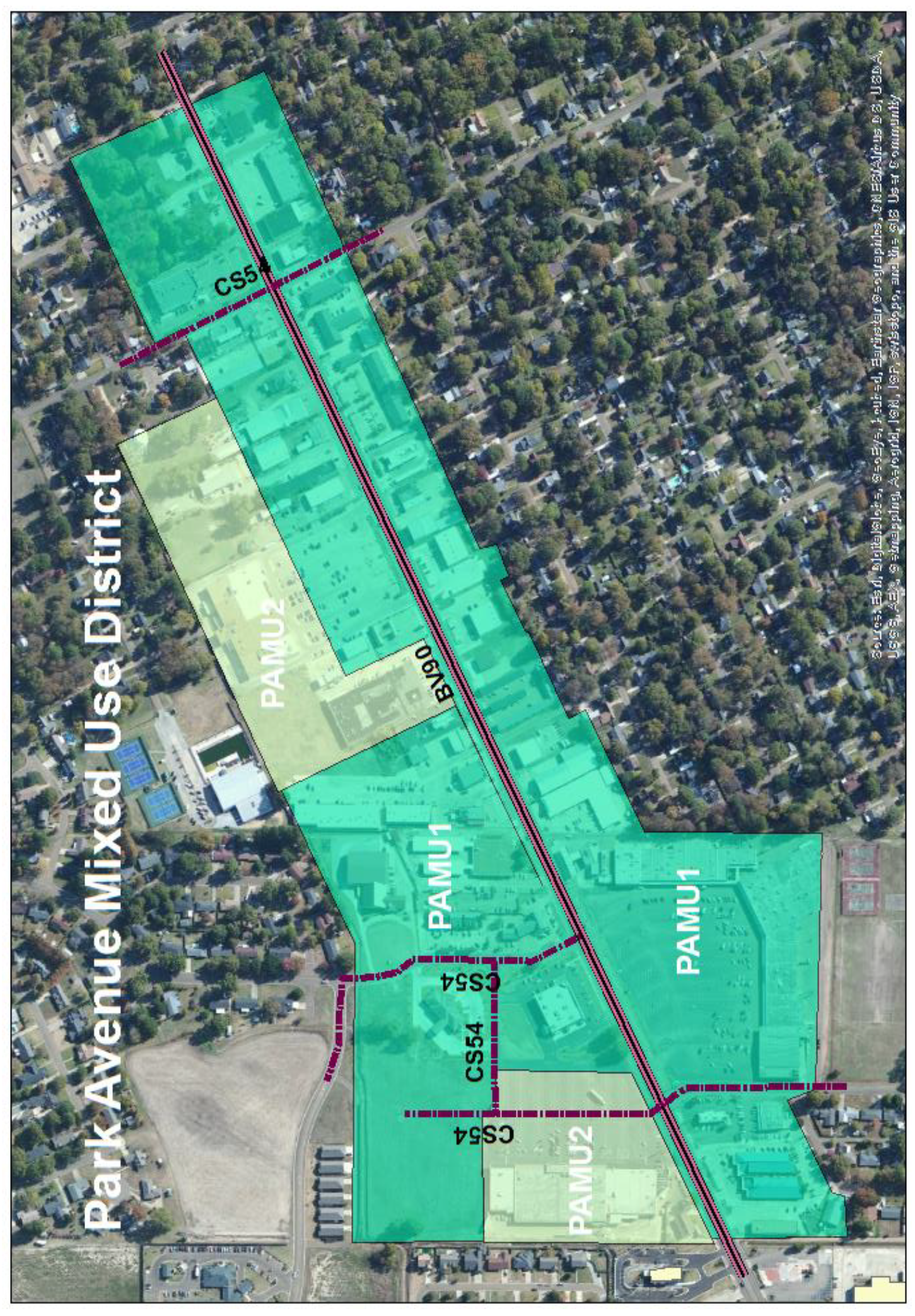
Park Avenue form based mixed use district regulating plan. The Park Avenue form based mixed use district (PAMU) is illustrated on the following map. The district consists of that portion of Greenwood surrounding Park Avenue as indicated on the map below. The district forms a commercial center surrounded on the north, south, and east by residential neighborhoods and on the west by additional commercial development. The district is divided into two sub districts designated as PAMU1 and PAMU2 and illustrated on the following map:
(e)
Building types and location. Permitted building types defined: While other districts in this ordinance do not define building types, the form based district requires that building types be defined to achieve its purposes of the district. Building types are hereby established and defined in the following table along with their permitted locations.
(1)
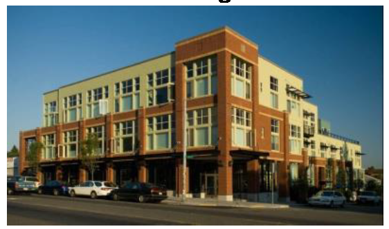
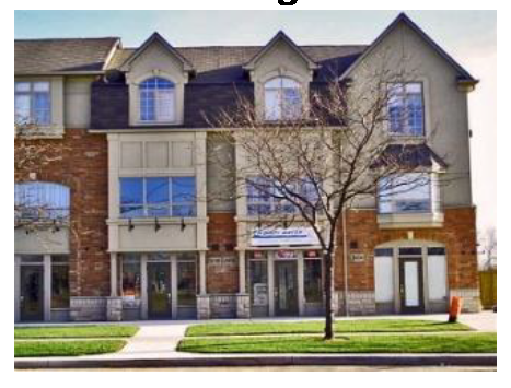
Mixed use building.
a.
Description. A building type intended for ground floor commercial uses with upper-story residential or offices uses. Windows are provided on the ground floor to encourage interaction between the pedestrian and the ground story space. Primary entrances are prominent and street facing and are spaced at regular intervals along the street edge.
b.
Example.
c.
Location.
(2)
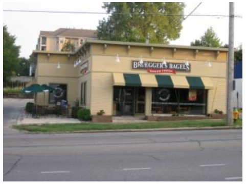
Single story shop front.
a.
Description. A building type intended primarily for small format single-story retail. Buildings are close to the street. Storefront windows are provided to encourage interaction between the pedestrian and the ground story space. Primary entrances are prominent and street facing.
b.
Example.
c.
Location.
(3)
Large format retail.
a.
Description. A building type intended primarily for large format single-story retail. Store may be set back from the street with parking in front. Primary entrances are street facing.
b.
Example.
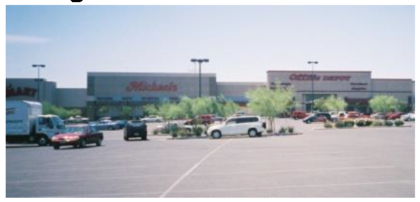
c.
Location.
(4)
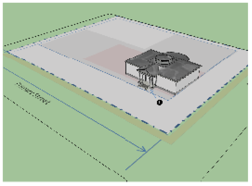
Civic building.
a.
Description. A building type containing community or public uses that serve the surrounding community. Civic buildings are usually sited adjoining or surrounded by civic spaces or they provide a visual landmark by being placed at the axial termination of a street.
b.
Example.
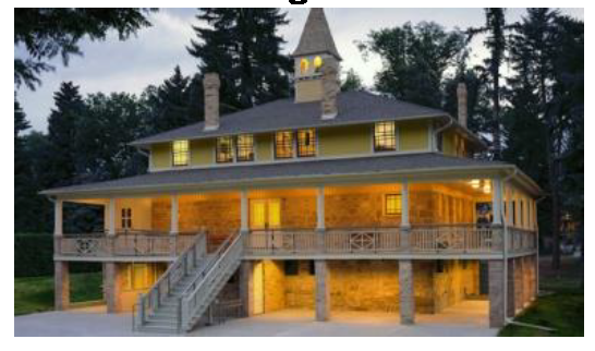
c.
Location.
(5)
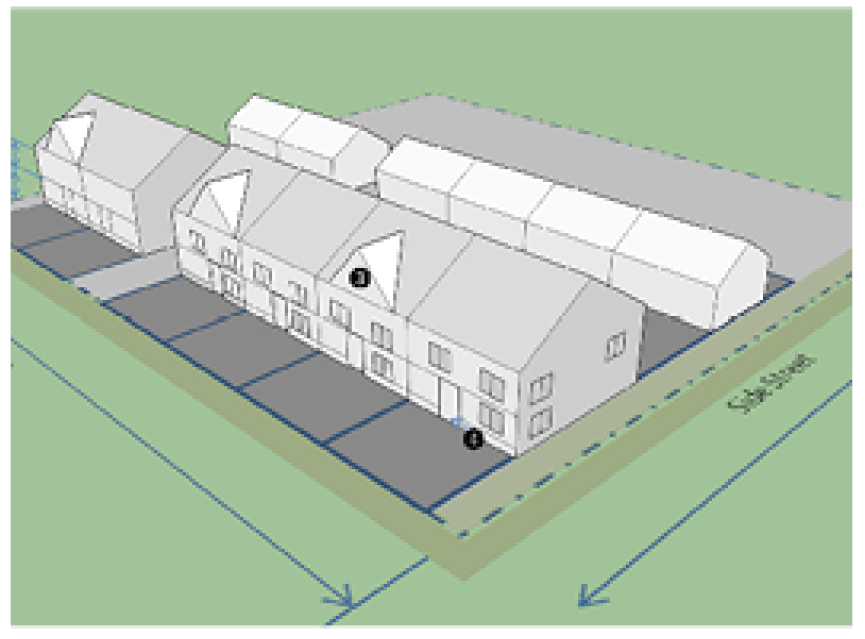
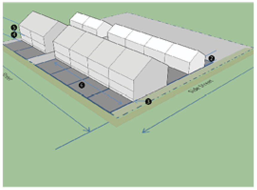
Townhouse.
a.
Description. A building type consisting of three or more attached structures. Each structure shares a common side wall. Each structure may contain up to two principal dwelling units which may be stacked vertically. Each unit has its own external street facing entrance.
b.
Example.
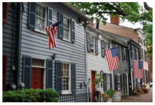
c.
Location.
(6)
Live-work building.
a.
Description. A building type consisting of three or more attached structures sharing a common side wall. Each may contain up to two principal dwelling units which may be stacked vertically. Each has its own external street facing entrance. This type is identical to the Townhouse except may contain a commercial/office and a residential component.
b.
Example.
c.
Location.
(f)
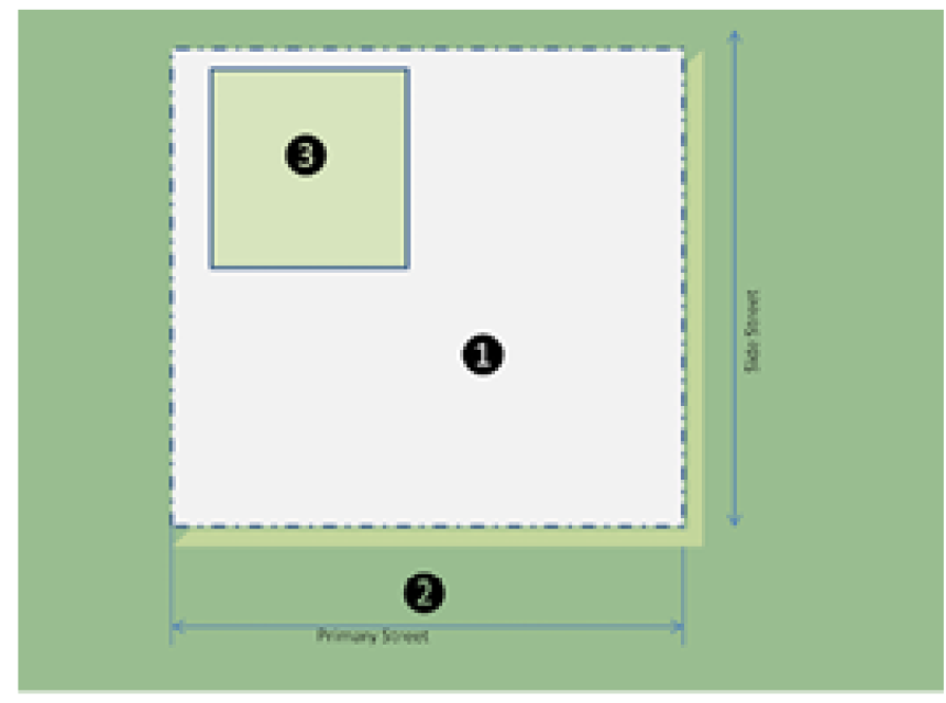
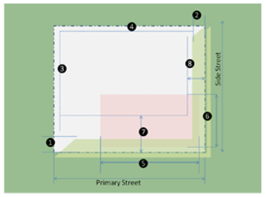
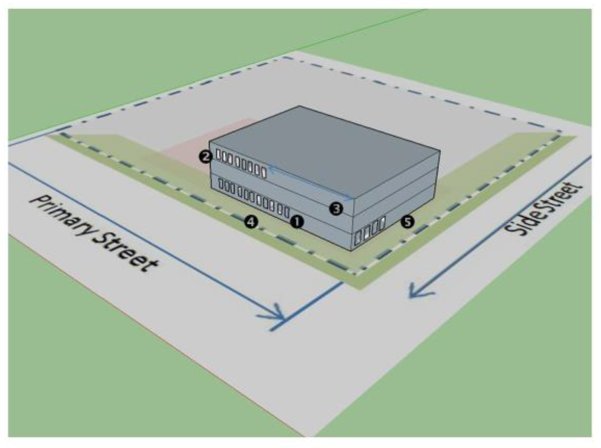
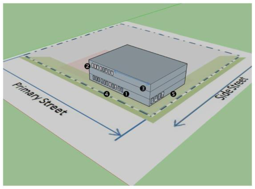
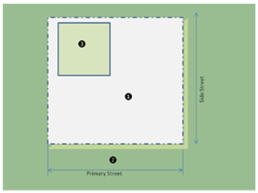
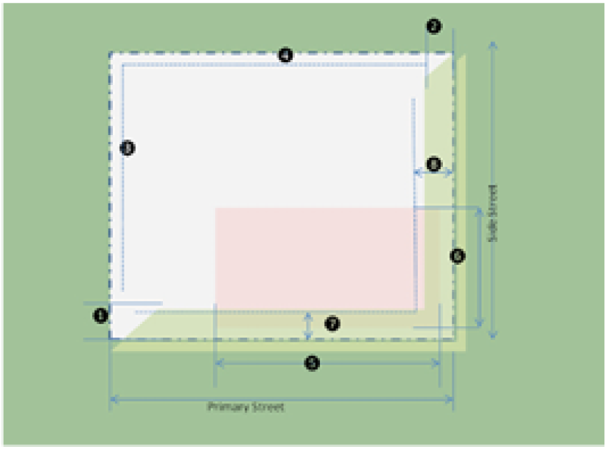
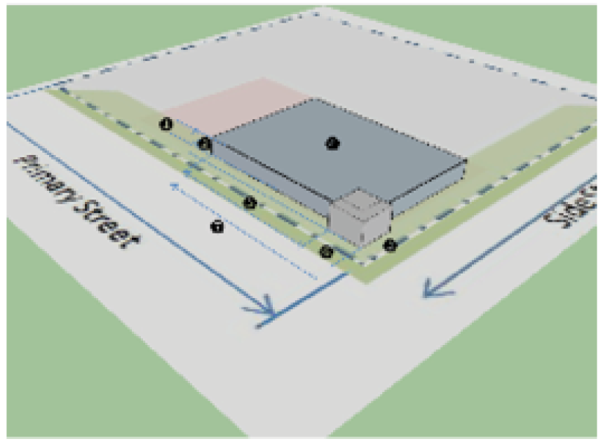
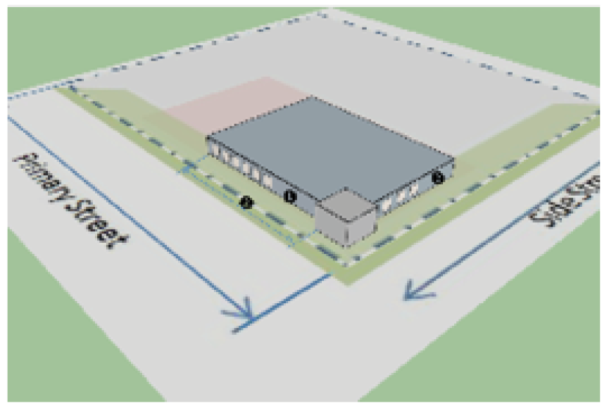
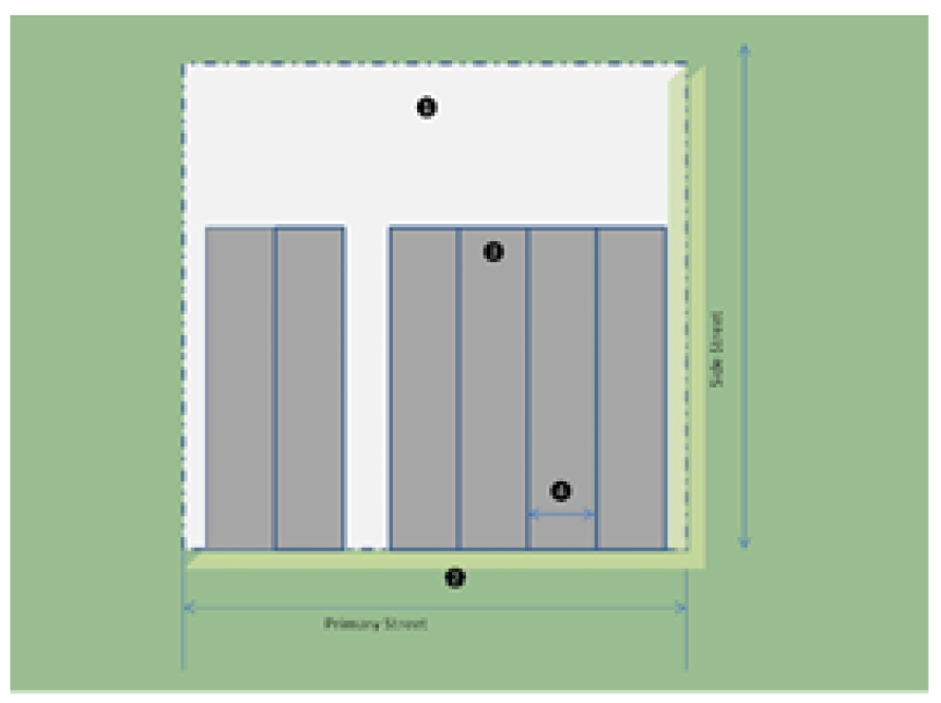
Building placement and lot standards.
(1)
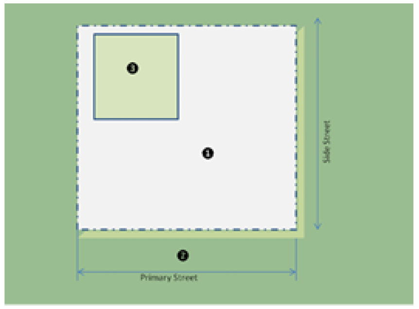
Mixed use building.
a.
Lot.
b.
Placement.
c.
Height and mass.
d.
Activation.
(2)
Single story shop front.
a.
Lot.
b.
Placement.
c.
Height and mass.
d.
Activation.
(3)
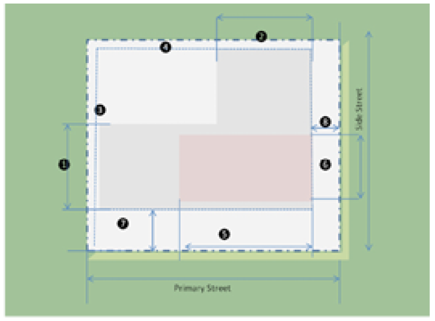
Large format retail.
a.
Lot.
b.
Placement.
c.
Height and mass.
d.
Activation.
(4)
Civic building.
a.
Lot.
b.
Placement.
c.
Height and mass.

d.
Activation.
(5)
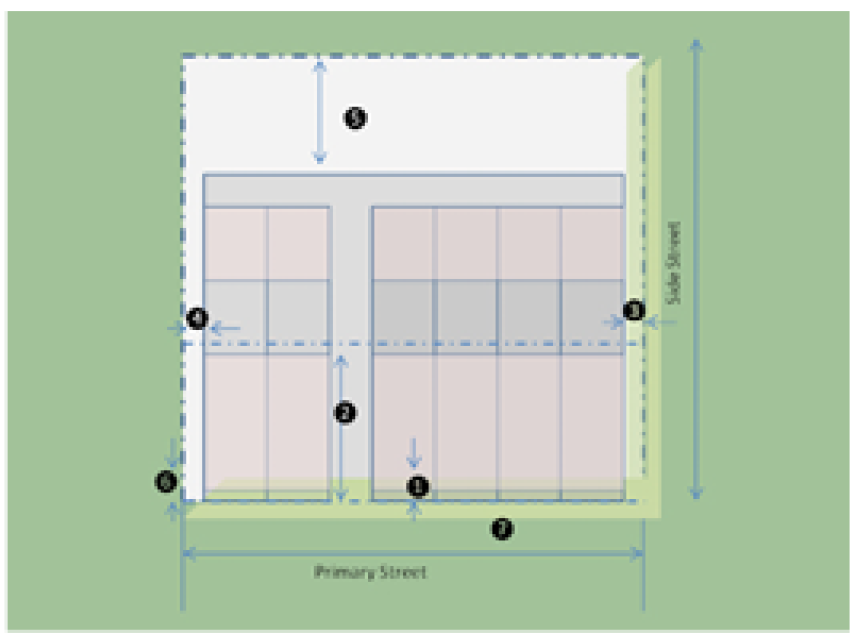
Townhouse.
a.
Lot.

b.
Placement.
c.
Height and mass.

d.
Activation.
(6)
Live-work building.
a.
Lot.
b.
Placement.

c.
Height and mass.
d.
Activation.

(g)
Building and land use. Building and land use for the PAMU district is indicated on the Table of Uses in article V, section 1.
(h)
Site standards.
(1)
Parking. Parking shall adhere to the parking space requirements of the associated use and be designed according to the parking lot design standards.
(2)
Landscaping and screening. Landscaping and screening shall conform to the landscape design standards in the Table of Design Standards.
(3)
Common sign plan. A common sign plan must be filed with the building official for all sites occupied by more than one tenant. After the filing of a common sign plan, all tenant signs must meet the requirements of the common sign plan. The applicant must indicate the standards of consistency of all signs on the subject property with regard to:
a.
Colors;
b.
Letter/graphics style;
c.
Location of each sign;
d.
Materials used in sign construction; and
e.
Maximum dimensions and proportion.
(4)
Signs shall conform to the overall dimensional and placement requirements of article VII.
(i)
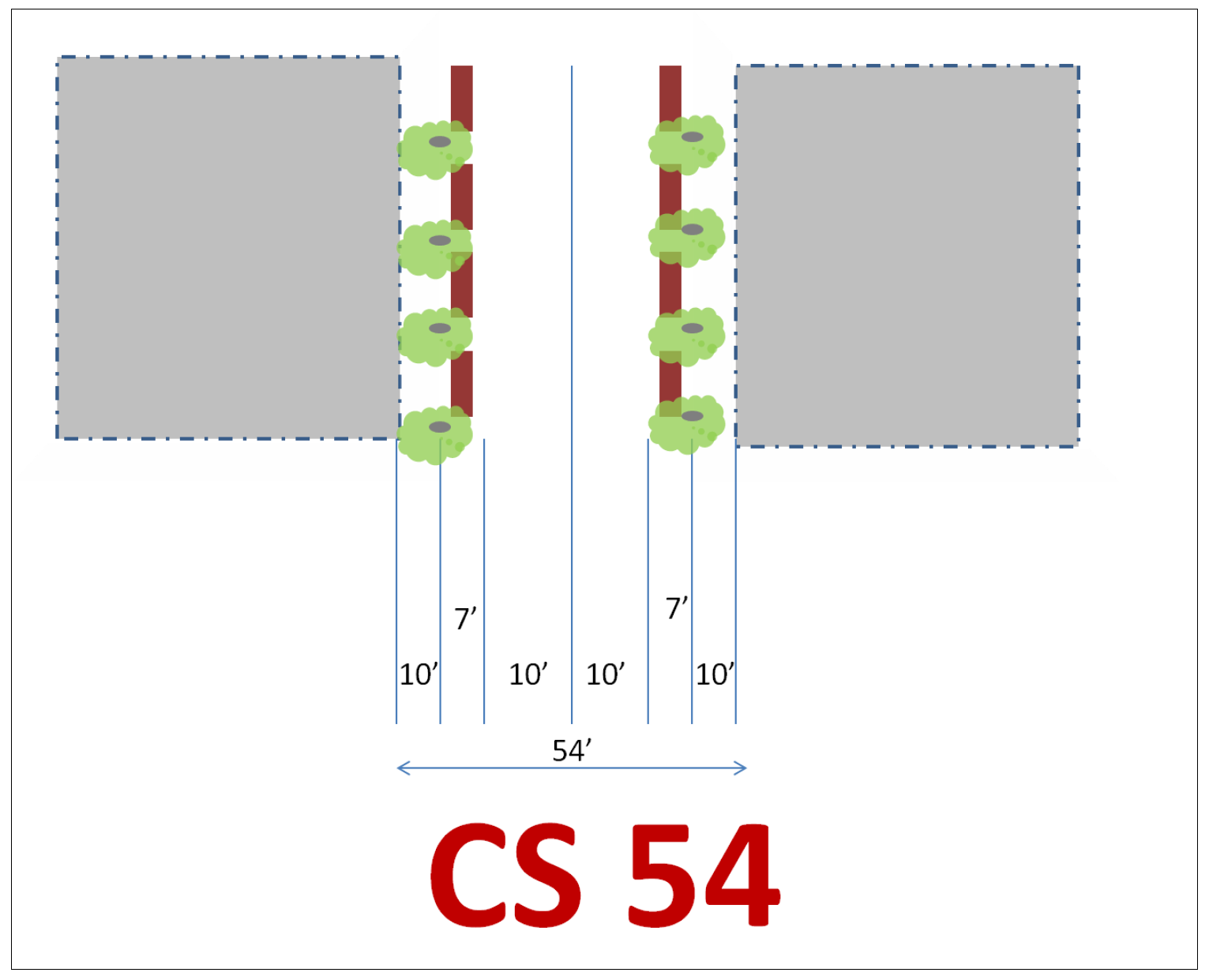
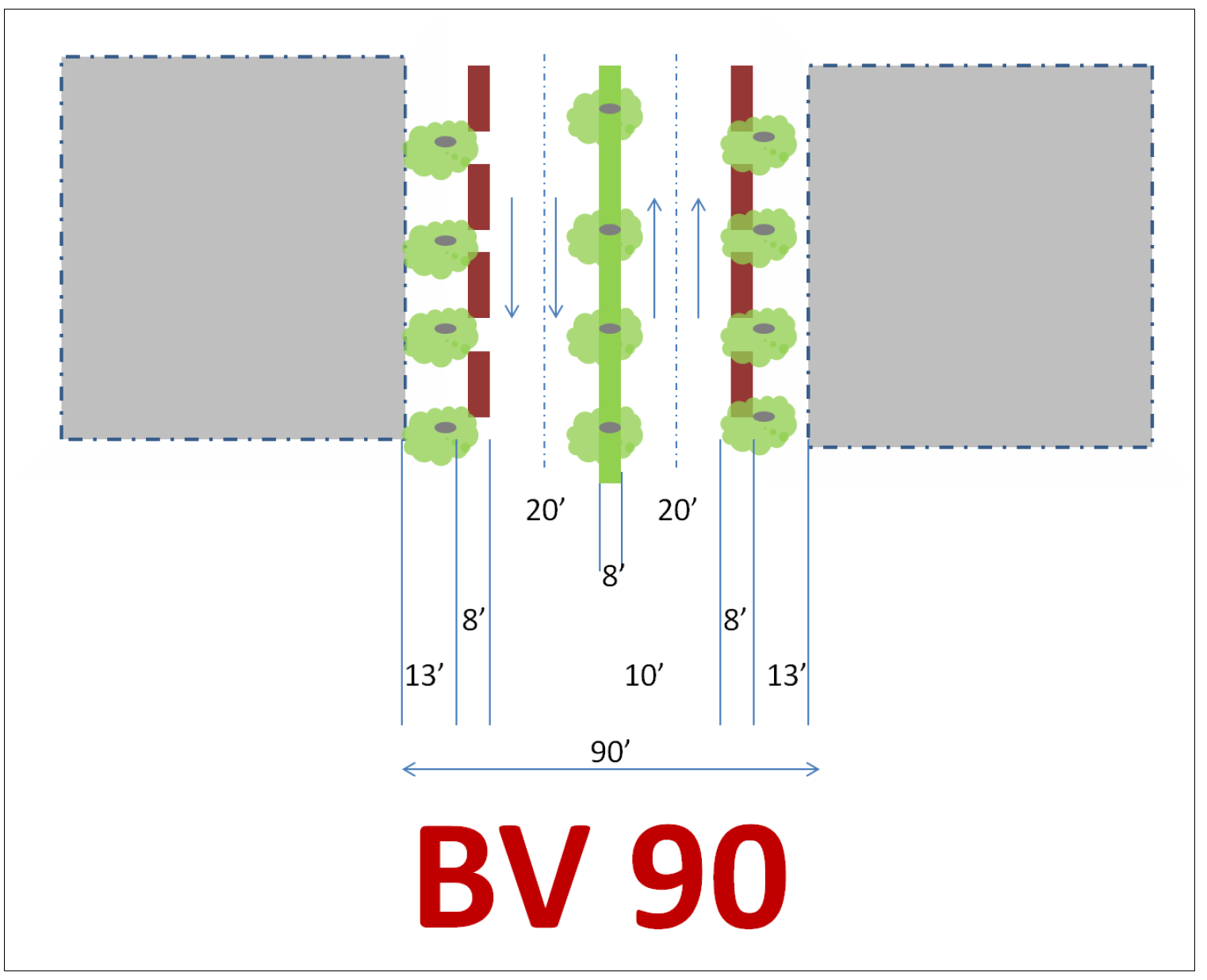
Streets.
(1)
There are two street types in the PAMU district. These street types are to be constructed in the areas indicated on the PAMU district map.
(2)
CS 54: Commercial Street 54′ Right of Way.
(3)
BV 90: Boulevard 90′ Right of Way.
Sec. 2. - PUD planned unit development district.
(a)
The purpose of the planned unit development district is to provide for the development of planned total communities that provide a full range of residential types as well as certain commercial, office or light industrial uses designed to serve the inhabitants of the districts consistent with the city's comprehensive plan.
(b)
Development shall be a tract of land at least one (1) acre in area, under single, corporation, firm, partnership or association ownership, planned and developed as an integrated unit, in a single development operation or a programmed series of development operations and according to an approved preliminary site plan.
(c)
Preliminary site plan required. The "PUD" district shall be established only upon application, after public hearing as specified in the amendatory procedures of this ordinance and shall require an approved preliminary site plan which, when zoning is granted, will govern the development of the land and all development plans thereof.
(d)
Minimum district area. The minimum area for a PUD district shall be one (1) acre.
(e)
Permitted uses. A list of permitted uses within each planned unit development must be submitted with the application for establishment of the district and the preliminary site plan and must be approved by the planning commission and city council upon application by the owner of the property.
(f)
Procedures. An application for rezoning to planned unit development district shall be accompanied by a preliminary site plan and text presenting the following information:
(1)
Proposed land uses and population densities.
(2)
Proposed primary circulation pattern.
(3)
Proposed parks and playgrounds.
(4)
Delineation of the units or phases to be constructed together with a proposed timetable.
(5)
Proposed means of dedication of common open space areas and organizational arrangements for the ownership, maintenance, and preservation of common open space.
(6)
Relation to the Greenwood comprehensive plan, land uses in the surrounding area and to the general plan of the proposed planned unit development.
(7)
A development schedule and phase plan for the proposed planned unit development.
(g)
Rezoning procedures shall be in accordance with article X of this ordinance. Following the initial rezoning procedure, the proposed development shall follow all applicable procedures and requirements governing the subdivision of land. No building permit shall be issued until a final plat of the proposed development, or portion thereof, is approved, filed, and recorded. No building designed or intended to be used, in whole or in part, for commercial purposes shall be constructed prior to the construction of less than 25% of the dwelling units proposed in the plan, or construction of 100 dwelling units, whichever is smaller. If construction is not started within two years of the date of approval, the mayor and city council may consider rezoning the site to its previous classification.
(h)
The applicant, by showing good cause why the applicant cannot adhere to the proposed timetable described may seek an extension of not more than one (1) year at a time. A request for extension shall be submitted in writing to the planning commission.
(i)
Review standards. The site plan must provide for and conform entirely to the following standards and requirements:
(1)
In order to encourage ingenuity, imagination, and high quality design, regulations on residential areas will not specify minimum lot area per dwelling unit but will limit density from four (4) to eight (8) dwellings per acre.
(2)
Street widths and improvements, thereof, as well as off street parking facilities must conform to city standards or show a design superior to city standards.
(3)
Provisions for water supply, sanitary sewers, storm water drainage, and connections shall be made to the satisfaction and requirements of the city and the appropriate state authority.
(4)
All improvements are to be installed and maintained by the developer unless other arrangements approved by the city are made.
(5)
The city may require other special improvements as they are required if they are deemed reasonable and essential, and may require that appropriate deed restrictions to be filed enforceable by the city for twenty (20) years.
(6)
A minimum total area of 15% of the gross residential area shall be set aside as parks and playgrounds. Of this ten (10)%, a maximum of one half may be covered with water. A maximum of 5% of the area designated to be parks and playgrounds may be covered with structures to be used in the recreational use of the area. Parks and playgrounds must be suitably improved for its intended use but parks and playgrounds containing natural features clearly worthy of preservation may be left unimproved.
(7)
The developer shall also submit sketches of the plat for the entire project showing the relationship of uses, street patterns, open space, and the general character of the proposed development, including a schematic drawing illustrating a typical segment of the development.
(j)
Failure to perform. From time to time the zoning administrator may review and/or make a report to the planning commission and city council on the status of a particular PUD. If the zoning administrator finds that the development has not commenced within one (1) year after original approval, the zoning administrator may recommend that the city council extend the time or revoke approval in accordance with rezoning procedures.
Sec. 3. - F-1 flood plain district.
(a)
Purpose. This district is intended to comprise those areas which are subject to periodic or occasional inundation from stream overflows and, therefore, are usually unsuited for residential, commercial, and industrial uses.
(b)
Principal intensity and dimensional standards. This district is an overlay district and the intensity and dimensional standards are governed by the underling standard district.
See chapter 18 of the Greenwood Code of Ordinances for specific procedures and conditions of development in the F-1 flood plain overlay zone.
(c)
Typical building type.

Notes:
1. All development in a designated flood plain is subject to the provisions of the Greenwood flood damage management prevention ordinance.
2. The use of property and buildings or structures in the F-1 flood plain district shall be limited to the following:
a.
The growing of agricultural crops and nursery stock, and gardening.
b.
Public recreation.
c.
Golf course.
d.
Parking.
3. Conditional uses, which may be permitted after planning commission review and recommendation to and approval by the city council. Other uses similar to the above-stated uses as may be determined by the planning commission.
Sec. 4. - H-1 commercial historic overlay district.
(a)
Purpose. The commercial historic overlay district is created for the purpose of promoting the general health, safety, and welfare of Greenwood by preserving those areas or structures that have been designated as having historic, architectural, or cultural significance. Development rules within such districts are intended to protect against deterioration and destruction, to encourage design which will lead to their continuance, conservation, and improvement in a manner appropriate to the preservation of the cultural, social, economic, political, architectural, or archaeological heritage of Greenwood, to prevent creation of environmental influences adverse to such purposes, and to assure that new structures within such districts will be in keeping with the character to be preserved and enhanced.
(b)
Principal intensity and dimensional standards.
(1)
This district is an overlay district and the intensity and dimensional standards are governed by the underlying standard zoning district provisions.
(2)
See article IX for procedures and conditions of development in the H-1 commercial historic overlay district.
Notes:
Residential occupancy in either single-family or multifamily dwellings in existing buildings located in those portions of the district is allowed within the boundaries of the Central Commercial and Railroad Historic District, Cotton Row Historic District and the Williams Landing Historic District. A dwelling unit shall contain no less than eight hundred fifty (850) square feet of floor area and each unit shall consist of a living/sleeping area, kitchen, bath, and storage facility. Residential occupancy and use shall be compatible with occupancy and use permitted within an R-1-5 residential district.
Sec. 5. - H-2 residential historic overlay district.
(a)
Purpose. The residential historic overlay district is created for the purpose of promoting the general health, safety, and welfare of Greenwood by preserving those areas or structures that have been designated as having historic, architectural, or cultural significance. Development rules within such districts are intended to protect against deterioration and destruction, to encourage design which will lead to their continuance, conservation, and improvement in a manner appropriate to the preservation of the cultural, social, economic, political, architectural, or archaeological heritage of Greenwood, to prevent creation of environmental influences adverse to such purposes, and to assure that new structures within such districts will be in keeping with the character to be preserved and enhanced.
(b)
Principal intensity and dimensional standards.
(1)
This district is illustrated on the zoning map for reference purposes and there are no overlay provisions for the district. The intensity and dimensional standards are entirely governed by the underling standard zoning district provisions.
(2)
Article IX does not apply to the H-2 residential historic overlay district.
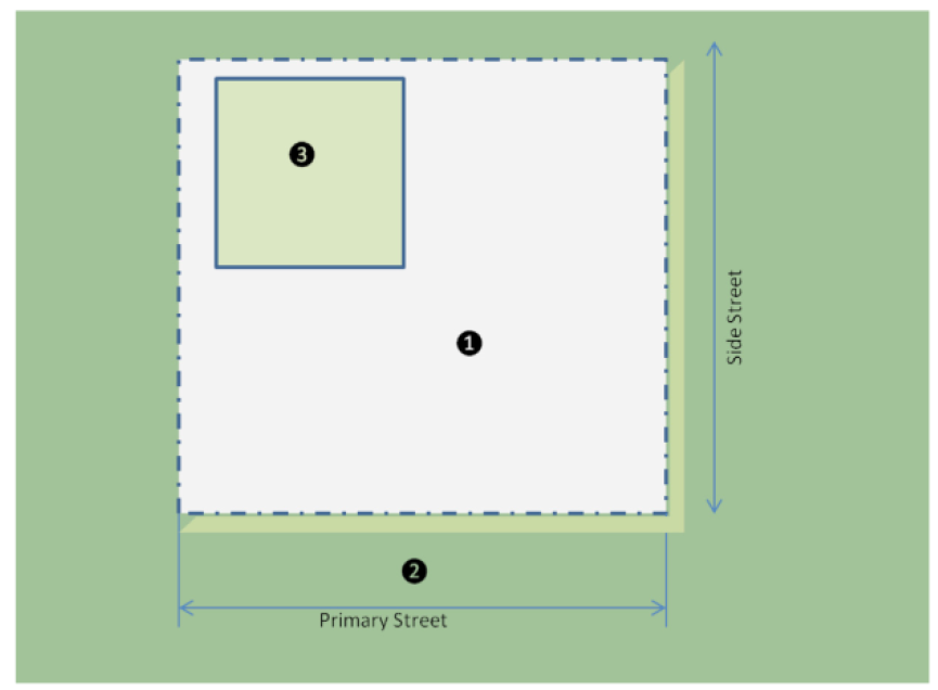
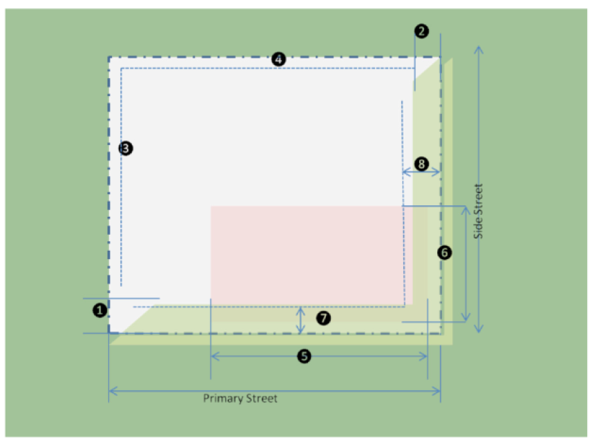
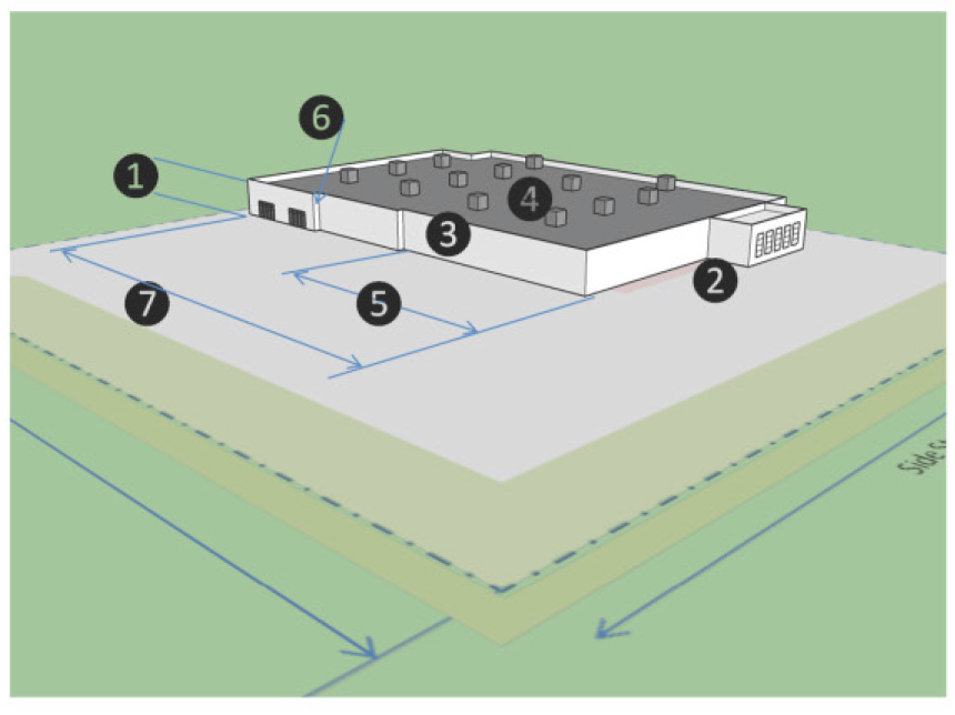
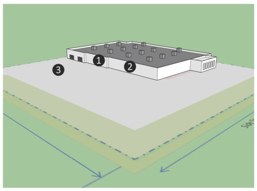
Sec. 6. - I-3 Greenwood Leflore Industrial Park district.
(a)
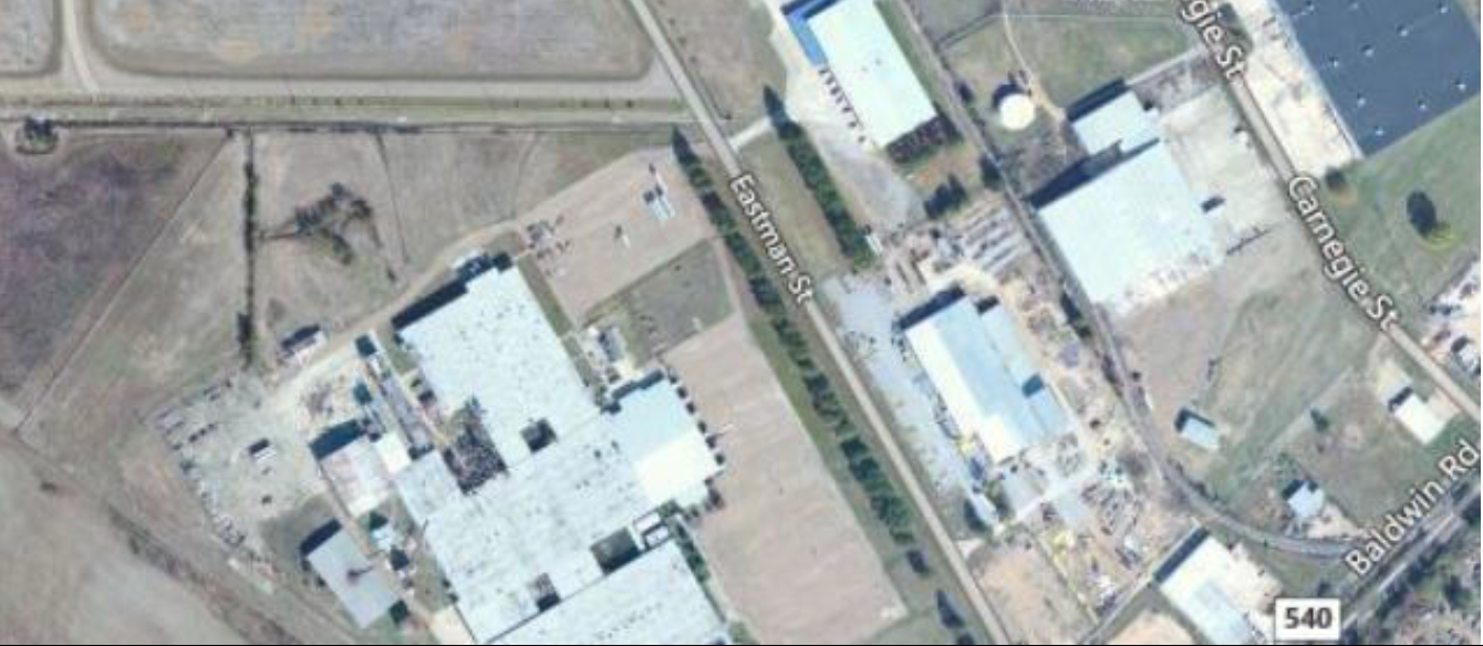
Purpose. The purpose of the Greenwood Leflore Industrial Park (GLIP) district is to provide a well-designed, attractive space for light industrial office, manufacturing, warehousing, research, distribution, corporate headquarters, and financial operation/data processing centers.
(b)
Typical building type.

(c)
Principal intensity and dimensional standards.
Notes:
1. See Use standards for additional provisions.
(d)
Typical lot pattern.
(e)
Typical development configuration.