Hallandale Beach City Zoning Code
ARTICLE III
ZONING
DIVISION 2. ZONING DISTRICTS AND OVERLAYS
Footnotes:
--- (4) ---
Editor's note— Ord. No. 2014-31, § 4, adopted Nov. 5, 2014, changed the title of Div. 2 from "Zoning Districts" to read as herein set out.
DIVISION 3. FORM-BASED ZONING DISTRICTS
Sec. 32-131. Establishment of districts.
In order to classify, regulate, and restrict the use of land, water, buildings and structures; to regulate and restrict the height and bulk of buildings; to regulate the areas of yards and other open spaces around and about buildings; to regulate the intensity of land use and to promote the orderly urban growth of the city, the city is divided into 18 districts as follows:
- RS-5 residential single-family district.
- RS-6 residential single-family district.
- RS-7 residential single-family district.
- RD-12 residential two-family (duplex) district.
- RM-18 residential multi-family (medium-density) district.
- RM-25 residential multi-family (high-density) district.
- RM-HD-2 residential multi-family (high-density-2) district.
- Reserved.
- B-L business limited district.
- B-G business general district.
- B-I business industrial district.
- I-L industrial light district.
- CR-P commercial recreational (passive) district.
- CR-A commercial recreational (active) district.
- CF community facility district.
- OS recreation and open space district.
- ED educational facility district.
- EC employment center district.
(Code 1980, app. A, art. III, § 1; Ord. No. 2003-24, § 1, 10-21-2003)
Sec. 32-132. Official zoning map.
- The boundaries of each district are designated and established as shown on the official zoning map of the city, as that map may be adopted and amended from time to time.
- Where lots or parcels of land have been excluded from the official zoning map or otherwise unzoned, or annexed into the city, such lots or parcels shall be classified RS-5 residential single-family district until changed, if at all, pursuant to the appropriate zoning district boundary change procedures.
- The official zoning map of the city shall consist of a map or series of zoning district maps individually numbered as Sheet No. 1, 2, etc., which may be prepared and adopted separately or cumulatively by the commission.
- The official zoning map shall be retained in the administrative offices of the city clerk; and the official zoning map, as amended from time to time, shall be a part of land incorporated in this chapter.
- The original official zoning map, which may be a composite of all official zoning maps or map amendments adopted by the commission, shall be kept on public display in the city's clerk office located in a locked glass bulletin board with keys allowed only in the custody of the city clerk.
- No changes or amendments to the official zoning map shall be made except in compliance and conformity with this chapter, and any such changes shall be made promptly after official adoption of the amendment.
(Code 1980, app. A, art. III, § 2)
Sec. 32-133. Rules for interpretation of district boundaries and regulations.
- When uncertainty exists as to boundaries of the districts on the official zoning map, the following rules shall apply:
- Centerlines. Boundaries indicated as approximately following the centerlines of streets, highways and alleys shall be construed to follow such lines.
- Lot, section and tract lines. Boundaries indicated as approximately following platted lot lines, section or tract lines shall be construed as following such lot lines.
- Political boundaries. Boundaries indicated as approximately following political boundaries shall be construed as following such political boundaries.
- Railroad lines. Boundaries indicated as following railroad lines shall be construed to be the centerline of the railroad right-of-way.
- Shoreline. Boundaries indicated as following shorelines shall be constructed to follow such shorelines, and in the event of change in the shoreline shall be construed as moving with the actual shoreline; boundaries indicated as approximately following the centerlines of canals or other bodies of water shall be construed to follow such centerlines.
- Parallel lines. Boundaries that are approximately parallel to the centerlines or street lines of streets, the centerlines or alley lines of alleys, or the centerline or right-of-way lines of highways, such district boundaries shall be construed as being parallel thereto and at such distance therefrom as indicated on the zoning maps. If no distance is given, such dimension shall be determined by the use of the scale shown on the zoning maps.
- Bisecting lines. Boundaries that approximately bisect a block, lot or tract shall be construed to follow the median lines of such blocks, as indicated by rear property lines or as measured between the centerlines of boundary streets in the absence of rear property lines or in the absence of both of the above, by use of the scale appearing on the zoning maps.
- Uncertainties. Where features existing on the ground are at variance with those shown on the official zoning map, or in case any other uncertainty exists, the city commission shall interpret the intent of the official zoning map as to the location of district boundaries.
- Street abandonments. Where a public road, street or alley is officially vacated or abandoned, the regulations applicable to the property to which it reverted shall apply to such vacated or abandoned road, street or alley.
- Excluded areas. Where parcels of land have been inadvertently excluded from a zoning district classification in any manner, such parcels shall be classified as RS-5 until rezoned.
- When use district regulations specifically incorporate the permitted uses of another use district, those permitted uses shall be subject to the requirements of the incorporating district, unless otherwise specified.
- Where a permitted use is first specified in a use district, that use may only be permitted in that district and any district incorporating its permitted uses.
- Unless otherwise specified, all height regulations shall be measured from the finished grade, as that term is defined in the South Florida Building code.
(Code 1980, app. A, art. III, § 3)
Sec. 32-134. Rules for allowing uses not specifically listed in zoning districts.
Where ambiguity exists as to whether a proposed use is allowed in a particular zoning district, the director of development services will determine, upon request, if the proposed use is substantially similar to a listed use and if the expected impacts on nearby property are not materially greater than a listed use. The director will issue this determination in writing.
(Ord. No. 2014-31, § 2, 11-5-2014)
Sec. 32-135. Redevelopment area modifications.
- When permitted within this chapter, the city commission may grant redevelopment area modifications for specified development standards relating to any proposed project if all the following criteria are met:
- The code standards are determined to significantly inhibit neighborhood or structural improvement efforts;
- The modifications adequately provide for service areas and other development features for the project;
- The modifications adequately provide for service and emergency vehicle access; and
- The modifications adequately provide for visibility of access.
- All requests for such modifications shall be filed with the city manager by the property owner of record and transmitted to the city commission accompanied by a staff recommendation for approval or denial with the major development review application, if applicable. There shall be a filing fee required and major development application fee if applicable, which is established and on file in the city clerk's office, with each such request. Such requests for modification shall be advertised, posted and noticed in conformity with the requirements of article IX, section 32-1003 of this chapter.
- Within the community redevelopment area (CRA), the city commission may waive the specified density unit count according to section 32-311, to allow permitted residential uses to be developed at greater than 14 net units per acre, but no more than 15.5 net units per acre, or the maximum density permitted by the adopted comprehensive plan, whichever is less; minimum lot size of existing platted lots must be at least 5,620 square feet for any lot or parcel to which the densitywaiver permitted by this section is applied.
(Code 1980, app. A, art. V, § 14; Ord. No. 2001-24, § 1, 11-20-2001; Ord. No. 2009-21, § 1, 11-4-2009; Ord. No. 2014-31, § 3, 11-5-2014)
Editor's note(s)—Ord. No. 2014-31, § 3, adopted Nov. 5, 2014, renumbered former § 32-177 as § 32-135, as set out herein.
Secs. 32-136—32-140. Reserved.
Subdivision I. Conventional Zoning Districts
Footnotes:
--- (5) ---
Editor's note— Ord. No. 2014-31, § 5, adopted Nov. 5, 2014, changed the title of Subdiv. I from "Establishment of Districts" to read as herein set out. Additionally, § 6 of said ordinance renumbered former §§ 32-151—32-167 as §§ 32-141—32-157, as set out herein.
Subdivision II. Planned Development Zoning Districts
Footnotes:
--- (6) ---
Editor's note— Ord. No. 2014-31, § 15, adopted Nov. 5, 2014, changed the title of Subdiv. II from "Special Uses" to read as herein set out.
Subdivision IV. Planned Development Overlays
Sec. 32-141. RS-5 residential single-family district.
- Purpose and intent. The purpose and intent of the RS-5 residential single-family district is to provide suitable sites for the development of detached single-family dwellings on relatively large lots in areas consistent with the city's comprehensive land use plan.
- Uses permitted. Uses permitted are as follows:
- Single-family residential dwellings.
- Residential accessory uses.
- Public parks and playgrounds.
- Public utility substations, transformers and transmission facilities.
- Uses permitted conditionally. Uses permitted conditionally are as follows:
- Churches, synagogues and similar houses of worship; provided that there is a site of not less than two acres and that no structure is located less than 75 feet from any adjacent residential property line. A 20-foot-wide landscaped buffer abutting residential property shall be provided to minimize the visual and noise impacts associated with the church, synagogue or house of worship. Accessory uses shall not exceed more than 50 percent of the total gross floor area of the facility.
- Public and private schools, provided that no structure or play equipment is located less than 50 feet from any adjacent residential use and that educational activities are of secondary level or below with a curriculum substantially similar to that of a general public school curriculum.
- Public facilities, provided that no structure is located less than 50 feet from any adjacent residential use.
- Site development standards.
- Minimum lot area shall be 7,500 square feet. Smaller lots platted prior to November 21, 1978, shall be permitted.
- Minimum lot width shall be 75 feet. Smaller lots platted prior to November 21, 1978, shall be permitted.
- Maximum height shall be two stories or 30 feet.
- Minimum yard setbacks are as follows:
Yard Setback (Feet) a. Front: 1. Generally
30 2. Golden Isles
25 b. Rear: 1. Generally
30 2. Golden Isles
40 c. Side: 1. Interior
10 2. Corner
10 - Minimum floor area shall be 1,800 square feet per unit.
- Special regulations for the Golden Isles Subdivision only are as follows: Accessory structures, excepting swimming pools, shall not be located in required yard setbacks.
- General regulations. Applicable general regulations are as follows:
- Supplemental regulations, section 32-331 et seq.
- Development review procedures, section 32-781 et seq.
- Off-street parking and loading regulations, section 32-451 et seq.
- Landscaping provisions, section 32-381 et seq.
- Sign regulations, section 32-601 et seq.
(Code 1980, app. A, art. IV, § 1; Ord. No. 1998-24, § 2, 12-1-1998; Ord. No. 2014-31, § 6, 11-5-2014)
Note(s)—Formerly § 32-151.
Sec. 32-142. RS-6 residential single-family district.
- Purpose and intent. The purpose and intent of the RS-6 residential single-family district is to provide suitable sites for the development of detached single-family dwellings on moderate-size lots in areas consistent with the city's comprehensive land use plan.
- Uses permitted. Uses permitted are as follows:
- Single-family residential dwellings.
- Residential accessory uses.
- Public parks and playgrounds.
- Public utility substations, transformers and transmission facilities.
- Uses permitted conditionally. Uses permitted conditionally are as follows:
- Churches, synagogues and similar houses of worship, provided that there is a site of not less than two acres and that no structure is located less than 50 feet from any adjacent residential use. A 20-foot-wide landscaped buffer abutting residential property shall be provided to minimize the visual and noise impacts associated with the church, synagogue or house of worship. Accessory uses shall not exceed more than 50 percent of the total gross floor area of the facility.
- Public and private schools, provided that no structure or play equipment is located less than 50 feet from any adjacent residential use and that educational activities are of a secondary level or below with a curriculum substantially similar to that of a general public school curriculum.
- Public facilities, provided that no structure is located less than 50 feet from any adjacent residential use.
- Site development standards.
- Minimum lot area shall be 6,000 square feet. Smaller lots platted prior to November 21, 1978, shall be permitted at their platted size and are exempt from section 32-924 as to nonconforming lots of record.
- Minimum lot width shall be 60 feet. Smaller lots platted prior to November 21, 1978, shall be permitted at their platted size and are exempt from section 32-924 as to nonconforming lots of record.
- Maximum height shall be two stories or 30 feet.
- Minimum yard setbacks are as follows:
Yard Setback (Feet) a. Front 25 b. Rear 30 1. Rear—Principal building
30 2. Canopies or roof extensions over patios *(7)
15 c. Side: 1. Interior
7½ 2. Corner
10 d. Accessory structures 7½ - Minimum floor area shall be 1,400 square feet per unit.
- Special regulations are as follows: Accessory structures, excepting swimming pools, shall cover not more than 30 percent of the total rear yard area.
- *Canopy structures or roof extensions over patios are permitted subject to all the following limitations:
- They shall be attached a minimum of 50 percent to the principal building.
- They shall be open on all sides a minimum of 80 percent when load-bearing elements are used.
- They shall not exceed one story or 15 feet in height.
- A recordable covenant shall be executed by the property owner in a form acceptable to the city attorney restricting any enclosure of the structure. Such covenant shall run with the land and be binding upon all persons having any right, title or interest in the property or any part thereof.
- General regulations. Applicable general regulations are as follows:
- Supplemental regulations, section 32-331 et seq.
- Development review procedures, section 32-781 et seq.
- Off-street parking and loading regulations, section 32-451 et seq.
- Landscaping provisions, section 32-381 et seq.
- Sign regulations, section 32-601 et seq.
(Code 1980, app. A, art. IV, § 2; Ord. No. 1998-24, § 2, 12-1-1998; Ord. No. 2014-31, § 6, 11-5-2014; Ord. No. 2022-029, § 1, 11-2-2022)
Note(s)—Formerly § 32-152.
Sec. 32-143. RS-7 residential single-family district.
- Purpose and intent. The purpose and intent of the RS-7 residential single-family district is to provide suitable sites for the development of detached single-family residential dwellings on relatively small lots in areas consistent with the city's comprehensive land use plan.
- Uses permitted. Uses permitted are as follows:
- Single-family residential dwellings.
- Residential accessory uses.
- Public parks and playgrounds.
- Public utility substances, transformers and transmissions facilities.
- Uses permitted conditionally. Uses permitted conditionally are as follows:
- Churches, synagogues and similar houses of worship, provided that there is a site of no less than one acre and that no structure is located less than 50 feet from any adjacent residential use. A 20-foot-wide landscaped buffer abutting residential property shall be provided to minimize the visual and noise impacts associated with the house of worship. Accessory uses shall not exceed more than 50 percent of the total gross floor area of the facility.
- Public and private schools, provided that no structure is located less than 50 feet from any adjacent residential use and that educational activities are of a secondary level or below with a curriculum substantially similar to that of a general public school curriculum.
- Day care centers and nurseries, provided that areas designated for outdoor play activities are effectively screened from adjacent residential uses.
- Public facilities, provided that no structure is located less than 50 feet from any adjacent residential use.
- Site development standards.
- Minimum lot area shall be 5,000 square feet. Smaller lots platted prior to November 21, 1978, shall be permitted at their platted size and are exempt from section 32-924 as to nonconforming lots of record.
- Minimum lot width shall be 50 feet. Smaller lots platted prior to November 21, 1978, shall be permitted at their platted size and are exempt from section 32-924 as to nonconforming lots of record.
- Maximum height shall be two stories or 30 feet.
- Minimum yard setbacks are as follows:
Yard Setback (Feet) a. Front 20 b. Rear 1. Principal building
20 2. Canopies or roof extensions over patios (7)*
10 c. Side: 1. Interior
5 2. Corner
10 d. Accessory structures 5 - Minimum floor area shall be 1,000 square feet per unit.
- Special regulations are as follows: accessory structures, excepting swimming pools, shall cover not more than 30 percent of the total rear yard area.
- *Canopy structures or roof extensions over patios are permitted subject to the following limitations:
- They shall be attached a minimum of 50 percent to the principal building.
- They shall be open on all sides a minimum of 80 percent when load-bearing elements are used.
- They shall not exceed one story or 15 feet in height.
- A recordable covenant shall be executed by the property owner in a form acceptable to the City Attorney restricting any enclosure of the structure. Such covenant shall run with the land and be binding upon all persons having any right, title or interest in the Property or any part thereof.
- General regulations. Applicable general regulations are as follows:
- Supplemental regulations, section 32-331 et seq.
- Development review procedures, section 32-781 et seq.
- Off-street parking and loading regulations, section 32-451 et seq.
- Landscaping provisions, section 32-381 et seq.
- Sign regulations, section 32-601 et seq.
(Code 1980, app. A, art. IV, § 3; Ord. No. 1998-24, § 2, 12-1-1998; Ord. No. 2014-31, § 6, 11-5-2014; Ord. No. 2022-029, § 1, 11-2-2022)
Note(s)—Formerly § 32-153.
Sec. 32-144. RD-12 residential two-family (duplex) district.
- Purpose and intent. The purpose and intent of the RD-12 residential two-family (duplex) district is to provide suitable sizes for the development of two-family (duplex) residential dwellings and multi -family residential dwellings in areas consistent with the city's comprehensive land use plan.
- Uses permitted. Uses permitted are as follows:
- Two-family (duplex) residential dwellings. The maximum density permitted shall be limited by the future land use designation.
- Multi -Family Residential Dwellings. The maximum density permitted shall be limited by the future land use designation.
- Single-family residential dwellings, subject to RS-7 regulations.
- Residential accessory uses.
- Public parks and playgrounds.
- Public utility substations, transformers and transmission facilities.
- Uses permitted conditionally. Uses permitted conditionally are as follows:
- Public and private schools, provided that no structure is located less than 50 feet from any adjacent residential use and that educational activities are of a secondary level or below with a curriculum substantially similar to that of a general public school curriculum.
- Day care centers and nurseries, provided that areas designated for outdoor play activities are effectively screened from any adjacent residential use.
- Public facilities, provided that no structure is located less than 50 feet from any adjacent residential use.
- Reserved.
- Mobile home residential dwellings that any such use shall comply with the regulations and site development standards as set forth in section 32-411.
- Parking lots.
- Houses of worship, provided that there is a site of not less than one acre and that no structure is located less than 50 feet from any adjacent residential use. A 20-foot-wide landscaped buffer abutting residential property shall be provided to minimize the visual and noise impacts associated with the church, synagogue or house of worship. Accessory uses shall not exceed more than 50 percent of the total gross floor area of the facility.
- Site development standards.
- Minimum lot area shall be 7,500 square feet. Smaller lots platted prior to November 21, 1978, shall be permitted at their platted size and are exempt from section 32-924 as to nonconforming lots of record.
- Minimum lot width shall be 75 feet. Smaller lots platted prior to November 21, 1978, shall be permitted at their platted size and are exempt from section 32-924 as to nonconforming lots of record.
- Maximum height shall be two stories or 30 feet.
- Minimum yard setbacks are as follows:
Yard Setback (Feet) a. Front 20 b. Rear 1. Rear—Principal building
20 2. Rear—Canopies or roof extensions over patios (7)*
10 c. Side: 1. Interior
5 2. Corner
10 d. Accessory structures 5 - Minimum floor area is as follows:
Minimum Per Unit (sq.ft.) Minimum Average (sq.ft) Single Family Residential Dwelling - 1,000 - Two-Family Residential Dwelling - 750 - Multi-family Residential Dwelling - 450 750 - Dwelling units with a minimum floor area of 500 sq. ft. or less may be counted as 0.5 dwelling units for residential density calculations.
- For multi-family residential developments which provide at least 15% of the units as affordable housing, the minimum unit size may be reduced to 400 sq. ft.
- When affordable housing units are provided, such units shall be proportionately distributed amongst unit types and sizes throughout the building(s) and site.
- The minimum average floor area may be reduced to 500 sq. ft. for the following developments:
- Minor Developments on platted development sites that are less than or equal to 7,500 sq. ft.
- Developments where all residential units are made affordable to very-low-income persons as defined in the Florida Statutes and maintained for a period of at least 30 years guaranteed through a restrictive covenant in a form acceptable to the city attorney.
- Special regulations are as follows: Accessory structures shall cover not more than 30 percent of the total rear yard areas.
- *Canopy structures or roof extensions over patios are permitted subject to all the following limitations:
- They shall be attached a minimum of 50 percent to the principal building.
- They shall be open on all sides a minimum of 80 percent when load-bearing elements are used.
- They shall not exceed one story or 15 feet in height.
- A recordable covenant shall be executed by the property owner in a form acceptable to the city attorney restricting any enclosure of the structure. Such covenant shall run with the land and be binding upon all persons having any right, title or interest in the property or any part thereof.
- General regulations. Applicable general regulations are as follows:
- Supplemental regulations, section 32-331 et seq.
- Development review procedures, section 32-781 et seq.
- Off-street parking and loading regulations, section 32-451 et seq.
- Landscaping provisions, section 32-381 et seq.
- Sign regulations, section 32-601 et seq.
(Code 1980, app. A, art. IV, § 4; Ord. No. 1998-9, § 1(4), 4-21-1998; Ord. No. 1998-24, § 2, 12-1-1998; Ord. No. 1999-1, § 2, 1-19-1999; Ord. No. 2000-9, § 2, 4-4-2000; Ord. No. 2014-31, § 6, 11-5-2014; Ord. No. 2022-029, § 1, 11-2-2022; Ord. No. 2024-029, § 2, 10-30-2024)
Note(s)—Formerly § 32-154.
Sec. 32-145. RM-18 residential multi-family (medium-density) district.
- Purpose and intent. The purpose and intent of the RM-18 residential multi-family (medium-density) district is to provide suitable sites for the development of medium-density multi-family residential uses in areas consistent with the city's comprehensive land use plan.
- Uses permitted. Uses permitted are as follows:
- Residential uses, limited to:
- Multi-family residential dwellings.
- Single-family residential dwellings, subject to RS-6 regulations.
- Two-family (duplex) residential dwelling, subject to RD-12 regulations.
- Residential accessory uses.
- Townhouse residential dwellings, provided that any such use shall comply with the regulations and site development standards set forth in section 32-731.
- Nonresidential uses, limited to:
- Public parks and playgrounds.
- Churches, synagogues and other houses of worship, provided that:
- The site has a minimum of 15,000 square feet in lot area and 100 linear feet of lot frontage.
- On lots with 100 linear feet of lot frontage, the building shall be set back no less than 30 feet from the front or rear property lines and 20 feet from the side property lines. On lots with more than 100 linear feet of lot frontage, the building shall be set back no less than 30 feet from any property line.
- The building has a minimum of 2,000 square feet in gross floor area.
- Public facilities and utilities.
- Residential uses, limited to:
- Uses permitted conditionally. Uses permitted conditionally are as follows:
- Parking lots. (Editor's note: (1) reads as "a.")
- Public and private schools. (Editor's note: (2) reads as "b.")
- Day care centers and nurseries. (Editor's note: (3) reads as "c.")
- Site development standards.
- Maximum density shall be 18 dwelling units per net acre.
- Minimum lot area shall be 7,500 square feet.
- Minimum lot width shall be 75 feet.
- Maximum height shall be four stories or 45 feet.
- Minimum yard setbacks are as follows:
Yard Setback (Feet) a. Front 30 b. Rear 25 c. Side: 1. Corner or between structures
30 2. Interior
20 - Minimum landscape area shall be 30 percent.
- Minimum floor are is as follows:
Minimum Per Unit (sq.ft) Minimum Average (sq.ft) Multi-family Residential Dwelling - 450 750 - For multi-family residential developments which provide at least 15% of the units as affordable housing, the minimum unit size may be reduced to 400 sq. ft.
- When affordable housing units are provided, such units shall be proportionately distributed amongst unit types and sizes throughout the building(s) and site.
- The minimum average floor area may be reduced to 500 sq. ft. for the following developments:
- Minor Developments on platted development sites that are less than or equal to 7,500 sq. ft.
- Developments where all residential units are made affordable to very-low-income persons as defined in the Florida Statutes and maintained for a period of at least 30 years guaranteed through a restrictive covenant in a form acceptable to the city attorney.
- General regulations. Applicable general regulations are as follows:
- Supplemental regulations, section 32-331 et seq.
- Development review procedures, section 32-781 et seq.
- Off-street parking and loading regulations, section 32-451 et seq.
- Landscaping provisions, section 32-381 et seq.
- Sign regulations, section 32-601 et seq.
(Code 1980, app. A, art. IV, § 5; Ord. No. 1998-9, § 1(5), 4-21-1998; Ord. No. 1998-24, § 2, 12-1-1998; Ord. No. 1999-1, § 2, 1-19-1999; Ord. No. 2014-31, § 6, 11-5-2014; Ord. No. 2022-029, § 1, 11-2-2022; Ord. No. 2024-014, § 1, 5-15-2024; Ord. No. 2024-029, § 2, 10-30-2024)
Note(s)—Formerly § 32-155.
Sec. 32-146. RM-25 residential multi-family (high-density) district.
- Purpose and intent. The purpose and intent of the RM-25 residential multi-family (high-density) district is to provide suitable sites for the development of high-density multi-family residential uses in areas consistent with the city's comprehensive land use plan.
- Uses permitted. Uses permitted are as follows:
- Residential uses, limited to:
- Multi-family residential dwellings.
- Hotels and motels.
- Single-family residential dwellings, subject to RS-6 regulations.
- Two-family (duplex) residential dwellings, subject to RD-12 regulations.
- Residential accessory uses.
- Nonresidential uses, limited to:
- Public parks and playgrounds.
- Churches, synagogues and other houses of worship, provided that:
- The site has a minimum of 15,000 square feet in lot area and 100 linear feet of lot frontage.
- On lots with 100 linear feet of lot frontage, the building shall be set back no less than 30 feet from the front or rear property lines and 20 feet from the side property lines. On lots with more than 100 linear feet of lot frontage, the building shall be set back no less than 30 feet from any property line.
- The building has a minimum of 2,000 square feet in gross floor area.
- Public facilities and utilities.
- Parking lots.
- Residential uses, limited to:
- Uses permitted conditionally. Uses permitted conditionally are as follows:
- Accessory commercial uses of a convenience nature, such as barbershops and beauty shops, foodstores, newsstands, druggists, florists, restaurants, lounges, and medical and professional offices shall be permitted within multi-family, hotel or motel structures of 50 or more dwelling units provided that:
- There is no outside commercial identification or advertising for such uses, except as provided in section 32-605(c)(8);
- All customer access to such uses is from within the structure;
- All such uses are located on the ground floor; and
- The total amount of commercial floor area shall not exceed ten percent of the total floor area of the structure.
- Nursing and convalescent homes.
- Public and private schools.
- Day care centers and nurseries.
- Accessory commercial uses of a convenience nature, such as barbershops and beauty shops, foodstores, newsstands, druggists, florists, restaurants, lounges, and medical and professional offices shall be permitted within multi-family, hotel or motel structures of 50 or more dwelling units provided that:
- Site development standards.
- Maximum density shall be 25 dwelling units per net acre.
- Minimum lot area shall be 10,000 square feet.
- Minimum lot width shall be 100 feet.
- Maximum height shall be eight stories or 85 feet.
- The following minimum yard setbacks shall apply to all three-story structures or less and shall be increased by five feet each for every story thereafter:
Yard Setback (Feet) a. Front 30 b. Rear 25 c. Side: 1. Corner or between structures
30 2. Interior
20 - Minimum landscape area shall be 35 percent.
- Minimum floor area is as follows:
Minimum Per Unit (sq.ft) Minimum Average (sq.ft) Multi-family Residential Dwelling - 450 750 - For multi-family residential developments which provide at least 15% of the units as affordable housing, the minimum unit size may be reduced to 400 sq. ft.
- When affordable housing units are provided, such units shall be proportionately distributed amongst unit types and sizes throughout the building(s) and site.
- The minimum average floor area may be reduced to 500 sq. ft. for the following developments:
- Minor Developments on platted development sites that are less than or equal to 7,500 sq. ft.
- Developments where all residential units are made affordable to very-low-income persons as defined in the Florida Statutes and maintained for a period of at least 30 years guaranteed through a restrictive covenant in a form acceptable to the city attorney.
- General regulations. Applicable general regulations are as follows:
- Supplemental regulations, 32-331 et seq.
- Development review procedures, section 32-781 et seq.
- Off-street parking and loading regulations, section 32-451 et seq.
- Landscaping provisions, section 32-381 et seq.
- Sign regulations, section 32-601 et seq.
(Code 1980, app. A, art. IV, § 6; Ord. No. 1998-9, § 1(6), 4-21-1998; Ord. No. 1998-24, § 2, 12-1-1998; Ord. No. 2014-31, § 6, 11-5-2014; Ord. No. 2024-014, § 1, 5-15-2024; Ord. No. 2024-029, § 2, 10-30-2024)
Note(s)—Formerly § 32-156.
Sec. 32-147. RM-HD-2 residential multi-family (high-density-2) district.
- Purpose and intent. The purpose and intent of the RM-HD-2 residential multi-family (high-density) district is to provide suitable sites for the development of high-density multi-family residential uses, up to 50 dwelling units per acre and mixed commercial and residential uses in areas consistent with the city's comprehensive land use plan. Rezoning to the high-density district shall be subject to assignment of flexibility units by the city commission in accordance with the flexibility rules of the administrative rules document of the county land use plan. The rezoning of land to this district is limited to properties west of the intracoastal waterway.
- Uses permitted. Uses permitted are as follows:
- Residential uses, limited to:
- Multi-family residential dwellings.
- Hotels and motels.
- Mixed uses, excluding Golden Isles Drive, limited to:
- Office, commercial service and retail uses, permitted in the B-L or B-O districts within multi-family, hotel or motel structures provided that at least 50 percent of the building floor area is used for residences.
- Principal commercial permitted in the B-L category, subject to the allocation of commercial flexibility according to the five percent commercial flexibility rule of the county administrative rules document.
- Nonresidential uses, limited to:
- Public parks and playgrounds.
- Public facilities and utilities.
- Parking lots.
- Uses permitted conditionally:
- Nightclubs, dancehalls and discotheques, provided that they are located 25 vertical feet and 100 horizontal feet from any residential district or adjoining residential use.
- Alcoholic beverage establishments.
- Day care centers and nurseries.
- Residential uses, limited to:
- Site development standards.
- Maximum density shall be 50 dwelling units per net acre; 35 dwelling units per net acre on Golden Isles Drive.
- Minimum lot area shall be one acre.
- Minimum lot width shall be 100 feet.
- Maximum height shall be as follows:
- Mixed or commercial use, 200 feet. Uses may exceed the prescribed maximum height by up to 50 percent above the average intensity for property within a quarter-mile radius of the site in question.
- Residential, 200 feet. However, buildings and structures which comply with all other provisions of this section can exceed the maximum if approved for additional height as a result of public hearing advertised, posted and noticed in accordance with section 32-967 or if approved for additional height in conjunction with a PDO planned development overlay. Shadow studies, when required to evaluate conformance with section 32-787(1), (3) shall be supplied by the applicant.
- Maximum height, Golden Isles Drive, eight stories or 85 feet on Golden Isles Drive.
- The following setbacks shall apply to the first five stories of all structures. For buildings exceeding five stories, the side setbacks shall be increased by one foot for every story thereafter. The commission can, during the PDO process, at their discretion, modify all required setbacks.
Yard Setback (Feet) a. Front 30 b. Rear 25 c. Side: 1. Corner or between structures
30 2. Interior
20 - Minimum landscape area, 35 percent.
- Minimum floor area shall be as follows:
Minimum Per Unit (sq.ft) Minimum Average (sq.ft) Multi-family Residential Dwelling - 450 750 - For multi-family residential developments which provide at least 15% of the units as affordable housing, the minimum unit size may be reduced to 400 sq. ft.
- When affordable housing units are provided, such units shall be proportionately distributed amongst unit types and sizes throughout the building(s) and site.
- The minimum average floor area may be reduced to 500 sq. ft. for the following developments:
- Minor Developments on platted development sites that are less than or equal to 7,500 sq. ft.
- Developments where all residential units are made affordable to very-low-income persons as defined in the Florida Statutes and maintained for a period of at least 30 years guaranteed through a restrictive covenant in a form acceptable to the city attorney.
- General regulations.
- Supplemental regulations, section 32-331 et seq.
- Development review procedures, section 32-781 et seq.
- Off-street parking and loading regulations, section 32-451 et seq.
- Landscaping provisions, section 32-381 et seq.
- Sign regulations, section 32-601 et seq.
(Code 1980, app. A, art. IV, § 7; Ord. No. 1998-22, § 1, 11-3-1998; Ord. No. 2014-31, §§ 6, 22, 11-5-2014; Ord. No. 2024-009, § 2, 4-10-2024; Ord. No. 2024-014, § 1, 5-15-2024; Ord. No. 2024-029, § 2, 10-30-2024)
Note(s)—Formerly § 32-157.
Sec. 32-148. Reserved.
Sec. 32-149. B-L business limited district.
- Purpose and intent. The purpose and intent of the B-L business limited district is to provide suitable sites for the development of limited business activities of an office, retail and service nature in centralized locations consistent with the city's comprehensive land use plan.
- Uses permitted. Uses permitted are as follows:
- Nonresidential uses permitted in the RM-25 residential multi-family district, limited to:
- Public parks and playgrounds.
- Public facilities and utilities.
- Parking lots.
- Churches, synagogues and other houses of worship, provided that they are not located in the South Federal Highway Corridor and, that they are in a freestanding building located on a separate parcel of land that is not connected to or has no access to adjacent commercial uses and further provided that:
- The site shall have a minimum of 15,000 square feet in lot area and 100 linear feet of lot frontage.
- The building shall be set back no less than 30 feet from any residential district or use; however, that on lots with 100 feet of lot frontage, the minimum side yard setback shall be 20 feet from any residential district or use.
- The building shall have a minimum of 2,000 square feet in gross floor area.
- Office uses, limited to:
- Banking companies.
- Brokerage offices: stocks, commodities, real estate, yachts and like services.
- Employment services.
- Banks and financial institutions.
- Insurance agencies.
- Investment counselors.
- Doctors, dentists, optometrists, and other similar licensed medical practitioners.
- Professional services: accountant, architect, engineer, lawyer and other similar professions.
- Secretarial and stenographic services.
- Studio schools: art, sculpture, dance, drama and like instruction.
- Retail and service establishments, limited to:
- Antique shops.
- Appliance stores.
- Art galleries.
- Art and graphic supplies.
- Auction galleries.
- Bakeries.
- Barber, beauty and skin care services.
- Bath shops.
- Bicycle shops.
- Book and stationery stores.
- Camera shops.
- Candy and ice cream stores.
- Catalog sales.
- China and flatware stores.
- Copying services.
- Delicatessens.
- Drapery stores.
- Dry goods stores.
- Florists.
- Foodstores.
- Fruit stores.
- Furniture stores.
- Gift shops.
- Hardware stores.
- Health and exercise studios.
- Hobby and handicraft shops.
- Hotels and motels.
- Interior decorators.
- Jewelry stores.
- Laundry and dry cleaning pickup substations.
- Leather goods shops.
- Liquor package stores.
- Locksmith.
- Luggage shops.
- Medical marijuana treatment center dispensing facility.
- Messenger and delivery services.
- Movie theaters (indoor).
- Music and record shops.
- Newsstands.
- Office supply stores.
- Optical stores.
- Paint stores.
- Pet shops.
- Pharmacies.
- Photographic studios.
- Restaurants provided that:
- Freestanding restaurants located east of U.S. 1 must have a minimum of 2,000 square feet of gross floor area.
- Freestanding restaurants located on the same parcel as a shopping center shall be compatible with the architectural features of the shopping center.
- Shoe repair shops.
- Souvenir and novelty shops.
- Specialty shops: men's, women's, children's clothing, shoes and similar apparel shops.
- Tailors and seamstresses.
- Telegraph offices.
- Title and abstract services.
- Tobacco shops.
- Travel agencies.
- Massage therapy services establishment holding a valid certificate for massage therapy services in accordance with section 7-451.
- Other uses which are similar in nature to the uses permitted in subsections (b)(1)—(3) of this section but not specifically permitted in the B-G business general or B-I business industrial districts.
- Parking lots.
- Nonresidential uses permitted in the RM-25 residential multi-family district, limited to:
- Uses permitted conditionally. Uses permitted conditionally are as follows:
- Automobile parts and accessory sales, provided that all products are contained within a structure, that only new products are sold, and that there are no repair or installation services available on-site.
- Sporting goods store, provided that not more than 20 percent of the gross floor area of any such use may be devoted to the display, and sale of firearms.
- Laundromats, provided that they are connected to the city's wastewater treatment system.
- Nightclubs, dancehalls and discotheques, provided that they are located not less than 300 feet from any residential district or use.
- Alcoholic beverage establishments.
- Retail on-premises dry cleaning operations, provided that such operations do not exceed 2,000 square feet of gross floor area, that only self-contained dry cleaning units using nonflammable solvents are used and that such operations shall not service drops made outside the city limits or any commercial accounts. Such other conditions as may be necessary to ensure that the proposed use shall be operated in a manner not creating adverse effects on abutting and neighboring properties may also be imposed.
- Clubs organized for ethnic, religious, social, educational, charitable or cultural purposes other than nightclubs, dance-halls, discotheques, lodges or fraternal organizations.
- Multi-family residential uses on sites of not less than one acre including residential and commercial uses having a density not exceeding 50 dwelling units per net acre which is devoted to residential use and complying with the site development standards and general regulations set forth in subsection (e) of this section. Any residential development in the B-L zoning use district is subject to and conditioned upon availability and assignment of flexibility units under county flexibility rules contained in the administrative rules document of the county land use plan. It is further provided that density of any such development shall be subject to approval of the city commission pursuant to section 32-796 and that the city shall not be required to allot flexibility units to permit the maximum density of 50 units per net acre.
- Garden shops, provided that:
- Such use is ancillary to a principal retail use.
- The gross use area of the garden shop does not exceed 20 percent of the gross floor area of the entire retail outlet.
- The outside display area shall be screened from open view by a continuous fence of one and one-half feet of above-ground masonry block and decorative material such as wrought iron, but not chainlink, at least six and one-half feet high but not exceeding ten feet.
- One parking space shall be provided for each 200 square feet of gross use area of the outside display area unless such required parking is waived by the city commission.
- If the use is discontinued for a period of six months, a new conditional use application is required.
- The city commission may add to or modify these or any other conditions, as provided in section 32-962.
- Restaurants (fast-food) with drive-through facilities but not drive-in restaurants, provided that:
- The restaurant has a minimum of 2,000 square feet of gross floor area.
- The restaurant is located on the same parcel as a shopping center.
- The restaurant shall not be less than 300 feet from any residential district or use measured from the main entrance of the restaurant to the nearest property line of the residential district or use.
- The restaurant shall not be closer than 1,500 linear feet measured from main entrance to main entrance of any other restaurant with a drive-through facility.
- No more than one such restaurant shall be located within the same shopping center, irrespective of distance between such uses.
- An external loudspeaker system shall not be audible at a distance beyond 50 feet from the restaurant or as otherwise prohibited by section 9-103(a)(3).
- No pylon or pole sign shall be used to advertise the restaurant use. Monument signs as permitted by article IV of this chapter shall not exceed five feet in height and 25 feet in sign area. Menu boards shall not be visible to public view and shall be located at the rear of the building.
- Each drive-through lane shall be screened from public view by a minimum of four feet in height opaque hedge or wall and dense landscaping of adequate height to effectively screen the lane.
- The restaurant and signage shall be compatible with architectural features of the shopping center.
- Public and private schools.
- Day care centers and nurseries.
- Site development standards.
- Minimum lot area is as follows:
- Interior lot, 5,000 square feet.
- Corner, 7,500 square feet.
- Minimum lot width shall be as follows:
- Interior lot, 50 feet.
- Corner lot, 75 feet.
- Minimum yard setbacks are as follows:(Exceptions: Lots platted at a depth of 150 feet or less at the adoption of this chapter shall have a minimum front yard setback of 25 feet.)
Yard Setback (Feet) a. Front 50 b. Rear 10 c. Side: 1. Interior
None 2. Corner
25 d. Adjacent residential 25 - Maximum height is as follows:
- Hallandale Beach Blvd. and U.S. 1 only, 100 feet.
- Other areas, 25 feet.
- Minimum landscape area shall be 15 percent.
- Minimum lot area is as follows:
- Site development standards, residential uses. The following site development standards shall apply to projects including residential uses permitted under subsection (c)(8) of this section:
- Minimum project area shall be one acre.
- Minimum project site width shall be 75 feet.
- Maximum height:
- Residential construction: 100 feet.
- Mixed residential/commercial construction): 100 feet.
- Minimum yard setbacks (residential/mixed use) are as follows:
Yard Setback (Feet) a. Front 20 b. Rear 25 c. Side: 1. Interior
20 2. Corner or between structures
20 - Minimum floor area (residential) is as follows:
Minimum Per Unit (sq.ft) Minimum Average (sq.ft) Multi-family Residential Dwelling - 450 750 - For multi-family residential developments which provide at least 15% of the units as affordable housing, the minimum unit size may be reduced to 400 sq. ft.
- When affordable housing units are provided, such units shall be proportionately distributed amongst unit types and sizes throughout the building(s) and site.
- The minimum average floor area may be reduced to 500 sq. ft. for the following developments:
- Minor Developments on platted development sites that are less than or equal to 7,500 sq. ft.
- Developments where all residential units are made affordable to very-low-income persons as defined in the Florida Statutes and maintained for a period of at least 30 years guaranteed through a restrictive covenant in a form acceptable to the city attorney.
- Minimum landscape area (residential/mixed use) shall be 30 percent.
- Maximum permitted density (residential) shall be 18 dwelling units per net acre. Dwelling units with a minimum floor area of 500 sq.ft. or less may be counted as 0.5 dwelling units for residential density calculations.
- The development standards set forth in subsections (e)(3)—(e)(7) of this section shall apply to the residential portions of projects which include residential and commercial uses. The site development standards set forth in subsection (d) of this section shall apply to the commercial portions of any such project.
- Site development standards, mixed residential and commercial uses. Applications allowing residential uses and commercial uses within the same development shall comply with the standards set forth in subsection (e) of this section and with the following:
- Where residential dwellings are designed within the same project as nonresidential uses, the developer shall be required to identify in a supplemental report, and, on the face of the plans, the special provisions made to ensure the compatibility of the uses. This shall include but shall not be limited to noise/sound attenuation measures taken to lessen the nuisance factor of nonresidential uses upon the residential use, reduction of excessive light and glare to the residential units from the nonresidential uses, site features such as security lighting, and measures taken to improve the orientation and location of the residential units to reduce incompatibility with adjacent nonresidential uses. Site plans and elevations shall show the typical architectural design of each side of all residential and commercial buildings, loading zone area treatment dumpster enclosure areas, and outside accessory activity areas; driveway entrance landscaping areas shall be submitted as part of the conditional use application material for city commission review and approval. Once approved, the development must be constructed in substantial compliance with approved site plans, elevations and other design plans.
- Off-street parking shall be designated for the residential uses, which shall be separated from the parking for the nonresidential uses. Parking shall be calculated as required by article IV of this chapter for each of the uses. Residential parking shall be calculated as provided in section 32-455(b)(3). It shall be unlawful to park, store or keep any commercial vehicle between the hours of 9:00 p.m. and 6:00 a.m. the following morning or to park, store or keep any boats, trailers or recreation vehicles within the residential portion of any project, except within a completely enclosed building; however, boats may be kept properly moored at approved docking facilities. Parking spaces required for the commercial portion of any project shall not be employed for parking of boats, boat trailers, or overnight parking of commercial equipment as defined in section 28-6.
- Buffering solutions in residential property shall not consist solely of the provision of a solid wall or fence. Buffering shall be designed to minimize the visual and noise impacts associated with a mixed use project and shall be designed to be compatible and consistent with the surrounding neighborhood.
- blank
- In mixed use projects, all sides of nonresidential structures shall be finished with the same materials and design treatment. Building wall areas more than 25 feet in length shall be interrupted by substantial landscaped areas and stands of mature trees with at least six-inch diameters and a minimum height of 20 feet at the time of planting, to break up the monotony of the wall face. At least one tree conforming to these standards shall be planted for every 25 linear feet of building wall and shall be placed so as to most effectively break up the monotony of the wall and to screen loading and dumpster areas.
- The buffer area between residential and nonresidential uses shall be at least 20 feet wide and contain dense landscaping capable of effectively screening the two uses upon planting. This shall be complemented by undulating berming and the use of landscaped masonry walls and solid fences that are incorporated into the design scheme for the project. Screening shall not be less than six feet high and not more than eight feet high and shall be subject to the vision clearance requirement provided for in section 32-332. All masonry walls shall be finished on both sides so that no CBS courses are visible. The wall shall also be painted to blend in with the overall architectural design scheme.
- blank
- Entrance landscape treatment is required for all projects permitted under this subsection. The landscaping materials used shall be of sufficient maturity at the time of planting to constitute being an established landscaped area with adequate density to effectively screen adjacent buildings and parking areas.
- Trees shall be incorporated into the design scheme and shall have a minimum diameter of six inches and a minimum height of 20 feet at the time of planting. Undulating berming and contoured ground surfacing shall be used in conjunction with both entrance and perimeter landscaped areas, inclusive of landscaped masonry walls and solid fences. At least one tree shall be planted for every 25 linear feet of entrance area to be landscaped, or a group of trees shall be planted for every 50 linear feet of entrance areas to be landscaped.
- At least 30 percent of all plant materials used in landscaping a project to which these standards apply shall comply with the standards of the South Florida Water Management District Xeriscape Plant Guide II, as amended, or other guide approved by the city manager. Approved plant materials shall be of types rated very drought-tolerant and salt-tolerant if the project is within 500 feet of the intracoastal waterway or of a surface water body which is brackish or salt water. Additionally, plant material shall be appropriately oriented on the site with respect to its suitability for use in a selected environmental location according to accepted landscaping practices.
- All landscape areas in a project to which these standards apply shall provide an automatically operated irrigation system which provides 100 percent coverage of landscaped areas. The irrigation system shall be zoned and designed to provide water based on accepted xeriscaping practice.
- All loading areas shall be adequately screened by a wall at least six feet in height and supplemented by the use of landscaping, or designed to be within a full or partially enclosed area.
- All roof-mounted equipment on all nonresidential structures shall be screened by the use of a treatment which is architecturally compatible with the rest of the structure. The screening shall effectively block the view and noise of roof-mounted equipment from off-site locations, including residential uses on the development site.
- Outdoor tennis courts, racquetball courts and similar facilities shall not be lighted after 10:00 p.m. in the evening.
- Boat dockage shall be limited to noncommercial watercraft of residents/owners, their guests and tenants only. No rentals of dock space to nonresidents of the development will be permitted.
- All residential units which are to be rented shall have a minimum lease period of one year. No time share subleasing or transient lodging facilities shall be permitted.
- Dumpster enclosures shall be of masonry construction and shall be adequate in size to accommodate newspaper recycling containers and shall be landscaped, or shall be designed in such a manner as to screen the dumpster from any area accessible to the public or from adjacent properties.
- The residential portion of the project is subject to the sign regulations of section 32-605(c).
- If an area is subdivided or detached from the original project area, the subdivided areas so created must meet all applicable site development standards on their own. Severance shall not be permitted to cause any nonconformity. Mutual access, drainage and utility easements shall be provided as appropriate for each separate parcel.
- The city commission may require appropriate restrictive covenants to be recorded to ensure compliance with these standards and make any other requirements for the development's conditional use which are considered necessary to encourage imaginative, functional, high-quality development compatible with adjacent uses and activities.
- General regulations. Applicable general regulations are as follows:
- Supplemental regulations, section 32-331 et seq.
- Development review procedures, section 32-781 et seq.
- Off-street parking and loading regulations, 32-451 et seq.
- Landscaping provisions, section 32-381 et seq.
- Sign regulations, section 32-601 et seq.
(Code 1980, app. A, art. IV, § 8; Ord. No. 1998-24, §§ 2, 6, 12-1-1998; Ord. No. 2001-16, § 2, 9-18-2001; Ord. No. 2003-12, § 1, 6-17-2003; Ord. No. 2010-09, § 3, 6-2-2010; Ord. No. 2014-31, § 6, 11-5-2014; Ord. No. 2018-024, § 3, 9-17-2018; Ord. No. 2024-009, § 2, 4-10-2024; Ord. No. 2024-014, § 1, 5-15-2024; Ord. No. 2024-029, § 2, 10-30-2024)
Note(s)—Formerly § 32-159.
Cross reference(s)—Businesses, ch. 7.
Sec. 32-150. B-G business general district.
- Purpose and intent. The purpose and intent of the B-G business general district is to provide for general retailing and a variety of special business uses and to encourage the provision of a wide range of goods and services in areas consistent with the city's comprehensive land use plan.
- Uses permitted. Uses permitted are as follows:
- All uses permitted in the B-L business limited district.
- Retail and service establishments, limited to:
- Alcoholic beverage establishments.
- Automobile parts and accessory sales (outdoor display of tires, as provided by section 32-168, permitted).
- Automobile sales and display (new only).
- Automobile rental agencies.
- Billiard and pool rooms.
- Boat sales and display.
- Reserved.
- Bowling alleys.
- Broadcasting studios.
- Bus terminals.
- Car washes.
- Fortunetellers, provided such business is not located within 1,000 feet of an existing fortunetelling business, measured by the most direct route from main entrance to main entrance.
- Funeral homes (including operator's residence).
- Health and exercise studios.
- Home improvement centers.
- Hotel and motels.
- Lodges and fraternal organizations.
- Marine supply services.
- Messenger and delivery services.
- Miniature golf courses.
- Restaurants (fast-food).
- Skating rinks.
- Taxi and limousine services.
- Other uses which are similar in nature to the uses permitted in subsections (b)(1) and (b)(2) of this section, but not specifically permitted in the B-I business industrial district.
- Parking lots.
- Uses permitted conditionally. Uses permitted conditionally are as follows:
- Animal hospitals and veterinary clinics, provided that all facilities, including ancillary kennels, are located in an enclosed soundproof, air conditioned building.
- Automobile repair and service activities, including all uses accessory to sales, provided that all activities are conducted within an enclosed soundproof building and no painting or body repair services are performed on the premises.
- Automobile sales and display (used), provided that adequate screening shall be provided between all such uses and any adjacent residential use, and that all such uses shall be ancillary to a new automobile dealership.
- Nightclubs, dancehalls and discotheques, provided that they are located not less than 300 feet from any residential district or use.
- Hospitals, provided that there are no facilities for residential psychiatric care.
- Service stations, including towing services, provided that there is no outside display of merchandise except tires and other automotive accessories, as provided by section 32-168, and that there is no rental, sales or storage of trailers, trucks, motorcycles or automobiles, and no outside mechanical repairs.
- Secondhand merchandise stores, provided that they are operated by nonprofit charitable or civic organizations and that no automobile or mechanical equipment is offered for sale.
- Retail on-premises dry cleaning operations, provided that such operations do not exceed 2,000 square feet of gross floor area, that only self-contained dry cleaning units using nonflammable solvents are used, and that such operations shall not service drops made outside the city limits or any commercial accounts. Such other conditions as may be necessary to ensure that the proposed use shall be operated in a manner not creating adverse effects on abutting and neighborhood properties may also be imposed.
- Garden shops (as provided in section 32-159(c)(9)).
- Wholesale distributor's showroom, provided that no more than 50 percent of the gross floor area of the structure is devoted to storage uses and any such storage shall be conducted indoors.
- Accessory uses to retail sales of a manufacturing nature, provided that no such accessory use shall occupy more than 50 percent of the gross floor area of a commercial retail use, and shall not generate noise, fumes, vibration, odor or other nuisances of a nature or intensity that would be incompatible with commercial retail and other uses permitted in the B-G district.
- Public and private schools.
- Day care centers and nurseries.
- Site development standards.
- Minimum lot area shall be 7,500 square feet.
- Minimum lot width shall be 75 feet.
- Minimum yard setbacks are as follows:Exceptions. Lots platted at a depth of 150 feet or less prior to November 21, 1978, shall have a minimum front yard setback of 25 feet.
Yard Setback (Feet) a. Front 35 b. Rear 20 c. Side: 1. Interior
15 2. Corner
20 - Maximum height shall be 100 feet.
- Minimum landscape area shall be 15 percent.
- General regulations. Applicable general regulations are as follows:
- Supplemental regulations, section 32-331 et seq.
- Development review procedures, section 32-781 et seq.
- Off-street parking and loading regulations, section 32-451 et seq.
- Landscaping provisions, section 32-381 et seq.
- Sign regulations, section 32-601 et seq.
(Code 1980, app. A, art. IV, § 9; Ord. No. 2000-17, § 2, 9-5-2000; Ord. No. 2014-31, § 6, 11-5-2014; Ord. No. 2024-014, § 1, 5-15-2024)
Note(s)—Formerly § 32-160.
Cross reference(s)—Businesses, ch. 7.
Sec. 32-151. B-I business industrial district.
- Purpose and intent. The B-I business industrial district is a utilitarian business and light industrial district that is intended to accommodate the building and service trades; small-scale light manufacturing and fabrication operations; plus a broad range of retail, office, wholesale, storage, and repair uses, in areas consistent with the city's comprehensive land use plan.
- Uses permitted. Uses permitted are as follows:
- All uses permitted in the B-L business limited and B-G business general districts.
- Retail and service establishments, limited to:
- Amusement enterprises.
- Animal hospitals and veterinary clinics, provided that all facilities, including ancillary kennels, are located in an enclosed soundproof, air conditioned building.
- Reserved.
- Automobile sales and display (used).
- Bakeries.
- Bottled gas sales.
- Reserved.
- Reserved.
- Dry cleaners and laundries.
- Express companies.
- Exterminating companies.
- Fence companies.
- Fortunetellers.
- Fruit packers.
- Garden supplies and plant nurseries (outside storage and display permitted).
- Indoor tennis, handball and racquetball courts.
- Lawn maintenance services.
- Machine shops.
- Motorcycle sales and service.
- Moving and transfer companies.
- Nightclubs, dancehalls and discotheques.
- Plumbing supply stores.
- Printers and book binders.
- Recording studios.
- Recreational vehicle sales and service.
- Restaurant equipment and supply service.
- Secondhand merchandise stores.
- Sign shops.
- Trade schools.
- Truck and trailer sales and service.
- Vending machine sales and service.
- Warehouse (dry and cold storage).
- Wholesale sales.
- Other uses which are similar in nature to, and no more intense than, the uses permitted in this subsection.
- Light industrial and manufacturing uses, limited to:
- Apparel products.
- Automotive parts products.
- Boat and marine products.
- Cigar and cigarette products.
- Food processing plants.
- Furniture and bedding products.
- Jewelry and silverware products.
- Leather goods products (tanning and curing of hides not permitted).
- Medical and surgical equipment products.
- Novelty products.
- Precision instrument products.
- Taxidermist.
- Other light industrial and manufacturing uses which are similar in nature to, and no more intense than, the uses permitted in this subsection.
- Parking lots and parking garages (commercial or noncommercial).
- Adult entertainment businesses.
- Uses permitted conditionally. Uses permitted conditionally are as follows:
- Automobile paint and body shops.
- Automobile repair shops.
- Equipment rental, limited to equipment for residential maintenance and garden usage (heavy equipment such as bulldozers, backhoe, and the like not permitted).
- Outside storage and display of merchandise, materials and supplies in conjunction with the uses specified in subsection (b) of this section unless specifically permitted.
- Towing service storage facility, provided that such use shall be located not less than 100 feet from any residentially zoned property, and provided that a wall or fence as may be required by the city commission shall be provided.
- Public and private schools.
- Day care centers and nurseries.
- Site development standards.
- Minimum lot area shall be 7,500 square feet.
- Minimum lot width shall be 75 feet.
- Minimum yard setbacks are as follows:
Yard Setback (Feet) a. Front 25 b. Rear 20 c. Side: 1. Interior
20 2. Corner
20 d. Adjacent residential 25 - Maximum height shall be 35 feet.
- Minimum landscape area shall be 15 percent.
- General regulations. Applicable general regulations are as follows:
- Supplemental regulations, section 32-331 et seq.
- Development review procedures, section 32-781 et seq.
- Off-street parking and loading regulations, section 32-451 et seq.
- Landscaping provisions, section 32-381 et seq.
- Sign regulations, section 32-601 et seq.
(Code 1980, app. A, art. IV, § 10; Ord. No. 2000-17, § 2, 9-5-2000; Ord. No. 2002-05, § 4, 4-2-2002; Ord. No. 2014-31, § 6, 11-5-2014; Ord. No. 2024-014, § 1, 5-15-2024)
Note(s)—Formerly § 32-161.
Cross reference(s)—Businesses, ch. 7.
Sec. 32-152. I-L industrial light district.
- Purpose and intent. The purpose and intent of the I-L industrial light district is to provide suitable sites for the development of certain light industrial and manufacturing uses which provide employment opportunities and contribute to the community's overall economic base in areas consistent with the city's comprehensive land use plan.
- Uses permitted. Uses permitted are as follows:
- Warehouses (dry and cold storage).
- Light industrial and manufacturing uses, limited to:
- Apparel products.
- Automotive parts products.
- Boat and marine products.
- Cigar and cigarette products.
- Food processing plants.
- Furniture and bedding products.
- Jewelry and silverware products.
- Leather goods products.
- Medical and surgical equipment products.
- Novelty products.
- Precision instrument products.
- Taxidermists.
- Auto repair and service activities, including major repair work, body work and painting, provided that all activities are conducted within an enclosed building and that vehicles to be repaired shall be stored only in designated storage areas meeting the requirements of this Code. Such storage area shall not include required parking or public rights-of-way. If this Code permits an outside storage area, such storage area shall be screened from view by a fence at least six feet in height and conforming to the minimum and maximum requirements of sections 32-331(b), 32-332, 32-334 and 32-335.
- Accessory retail sales up to a maximum of ten percent of the principal use floor area, not to exceed 2,000 square feet in floor area.
- Other light industrial and manufacturing uses which are similar in nature to the above permitted uses.
- Parking lots.
- Adult entertainment businesses.
- Uses permitted conditionally. Uses permitted conditionally are as follows:
- Towing service storage facility, provided that such use shall be located not less than 100 feet from any residentially zoned property and provided that a wall or fence as may be required by the city commission shall be provided.
- Outdoor storage in connection with permitted principal use, provided storage is effectively screened from public view (heavy equipment, such as bulldozers, backhoes and the like, not permitted). Any item stored shall not exceed 20 feet in height.
- Accessory retail sales over ten percent of the principal use floor area up to a maximum of 25 percent, provided parking for the industrial and retail uses as referenced in section 32-455(c) is provided.
- Medical marijuana treatment center dispensing facility.
- Pharmacies.
- Site development standards.
- Minimum lot area shall be 7,500 square feet.
- Minimum lot width shall be 75 feet.
- Minimum yard setbacks are as follows:
Yard Setback (Feet) a. Front 20 b. Rear 20 c. Side: 1. Interior
10 2. Corner
20 d. Adjacent residential 100 - Maximum height shall be 45 feet.
- Minimum landscape area shall be 15 percent.
- General regulations. Applicable general regulations are as follows:
- Supplemental regulations, section 32-331 et seq.
- Development review procedures, section 32-781 et seq.
- Off-street parking and loading regulations, section 32-451 et seq.
- Landscaping provisions, section 32-381 et seq.
- Sign regulations, section 32-601 et seq.
(Code 1980, app. A, art. IV, § 11; Ord. No. 2000-18, § 1, 9-5-2000; Ord. No. 2000-26, § 2, 11-8-2000; Ord. No. 2002-05, § 4, 4-2-2002; Ord. No. 2014-31, § 6, 11-5-2014; Ord. No. 2018-024, § 3, 9-17-2018)
Note(s)—Formerly § 32-162.
Cross reference(s)—Businesses, ch. 7.
Sec. 32-153. CR-P commercial recreational (passive) district.
- Purpose and intent. The purpose and intent of the CR-P commercial recreational (passive) district is to provide suitable sites for commercial recreational attractions and facilities of a passive nature which require extensive land area and are recognized as being supportive of a tourist-oriented economy in areas consistent with the city's comprehensive land use plan.
- Uses permitted. Uses permitted are as follows:
- Commercial recreation uses, limited to golf courses.
- Accessory uses limited to the following, provided they occupy not more than a cumulative total of 15 percent of total site area:
- Golf driving ranges.
- Hotels, motels, restaurants, private clubs and cocktail lounges.
- Parks, playgrounds and beaches.
- Swimming pools.
- Tennis, racquetball and handball courts.
- Massage therapy services establishment holding a valid certificate for massage therapy services in accordance with section 7-451.
For the purpose of this subsection, a hotel, motel, restaurant, private club, cocktail lounge, golf driving range, swimming pool, tennis, racquetball or handball court, park, playground and beach may be considered an accessory use to the main permitted golf course use, provided that those uses are incidental to and dependent upon the continued existence and operation of the main golf course use, even though uses may be more heavily utilized or realize substantially more income or profit than the main golf course use.
- Uses permitted conditionally. Uses permitted conditionally are as follows:
- Equestrian courses, provided that they are accessory in nature and all stable areas are located not less than 600 feet from any adjacent residential use.
- Petting zoos, provided that they are accessory in nature and all animals are properly sheltered and are located not less than 500 feet from any adjacent use.
- Marinas, provided that they are accessory to a main permitted golf course and dependent upon the continued existence and operation of a main golf course use on a noncontiguous site zoned CR-P.
- Site development standards for golf course use.
- Minimum golf course site area shall be 100 acres.
- Minimum golf course lot width shall be 200 feet.
- Minimum golf course landscape area shall be 75 percent.
- The 100-acre minimum site area may include contiguous site area outside the city limits that is an integral part of the golf course site area and may include accessory conditional uses on noncontiguous site zoned CR-P, provided that they occupy not more than a cumulative total of 15 percent of total site area.
- Site development standards for accessory and accessory conditional uses.
- Minimum yard setback from perimeter property line for all structures, accessory uses, and accessory conditional uses are as follows:
Yard Setback (Feet) a. Front 85 b. Rear 50 c. Side: 1. Interior
50 2. Corner
75 - Maximum height shall be 100 feet.
- Minimum landscape area shall be 35 percent of the area devoted to each accessory and accessory conditional use.
- The setback requirements shall not be construed to require such separation of main or accessory uses from each other within the site.
- All accessory and accessory conditional uses together may not exceed a cumulative total of 15 percent of the total site area.
- Minimum yard setback from perimeter property line for all structures, accessory uses, and accessory conditional uses are as follows:
- General regulations. Applicable general regulations are as follows:
- Supplemental regulations, section 32-331 et seq.
- Development review procedures, section 32-781 et seq.
- Off-street parking and loading regulations, section 32-451 et seq.
- Landscaping provisions, section 32-381 et seq.
- Sign regulations, section 32-601 et seq.
- Site development standards, marinas. The following site development standards shall apply to marinas as permitted by subsection (c)(3) of this section:
- blank
- Where accessory marinas are located within 300 feet of residential uses, a site plan shall be required and approved by the city commission to ensure compatibility of uses. This shall include but not be limited to noise/sound attenuations measures taken to reduce the nuisance factor of accessory marinas upon adjacent residential uses and reduce excess light and glare to the residential area from the marina.
- Site plans and elevations showing the architectural design of any proposed structure, dimensions and location of docks, dolphin pilings, dumpster enclosure area, driveway entrances, parking, landscape and buffer areas shall be submitted as part of the conditional use application for city commission review and approval. Once approved, the development shall be constructed in accordance with approved site plans, elevations and other design plans; and no structure may be constructed on the property unless specifically included in the approved site plan.
- Boat slips and docks for accessory marinas shall not project more than 15 percent into the waterway or 30 feet into the waterway, whichever is less, nor extend closer than 15 feet to the lot line of any adjacent property.
- Dolphin pilings, being defined as those kinds or types which are self-supporting and unattached to the dock proper are permitted, provided they do not project more than 30 feet into the waterway nor extend closer than 15 feet to the lot line of any adjacent property.
- Landscape buffers abutting residential property shall be provided to minimize the visual and noise impacts associated with the marina and shall be designed to be compatible and consistent with the surrounding neighborhood. The buffer area abutting the residential uses shall be at least 20 feet wide and shall contain dense landscaping of alternate heights to effectively screen the two uses upon planting. At least one tree, with a minimum height of 20 feet at time of planting, shall be planted for every 25 linear feet of buffer area.
- Trash receptacles shall be provided and shall be of a quality design, material and workmanship to the satisfaction of the city manager. Dumpster enclosures for marinas shall be of masonry construction and shall be landscaped and designed in such a manner as to screen the dumpster from any area accessible to the public or from adjacent properties.
- Signage for accessory marinas on noncontiguous property shall be limited to one freestanding sign identifying the marina which shall not exceed ten square feet in sign area and shall not be placed higher than eight feet above the ground. One directional sign facing a vehicular use area is permitted per access drive, which shall not exceed three square feet in sign area. Such signs may be illuminated.
- The following marina-related uses and activities are prohibited:
- Living or overnight sleeping aboard boats or houseboats.
- Sale of fuel.
- Commercial boats except boat taxis.
- Boat sales.
- Nonemergency boat repairs or service.
- Boat launch.
- Facilities for cleaning fish.
- Dry storage of boats and equipment.
- Boat rentals.
- Restaurants.
- Retail sales except as otherwise permitted in this subsection and the rental of boating, bathing, fishing supplies and equipment.
- Sewage dump station.
- The following uses and activities may be permitted for accessory marinas subject to city commission approval as part of a conditional use permit or as an amendment to the permit and approved site plan:
- One freestanding roofed structure open on all sides which may be used as a boat taxi terminal, provided no part of such structure extends further seaward than a permitted dock.
- Marina accessory structures and uses such as offices, laundries, restrooms and vending machines placed outdoors, provided that they are not situated within 15 feet of the adjacent property line.
- The city commission may require the marina owner to execute restrictive covenants to be recorded to ensure compliance with the standards of subsections (1)—(8) of this section and may promulgate any other requirements to ensure high-quality development compatible with adjacent residential uses and activities.
- blank
(Code 1980, app. A, art. IV, § 12; Ord. No. 2010-09, § 3, 6-2-2010; Ord. No. 2014-31, § 6, 11-5-2014)
Note(s)—Formerly § 32-163.
Sec. 32-154. CR-A commercial recreational (active) district.
- Purpose and intent. The purpose and intent of the CR-A commercial recreational (active) district is to provide suitable sites for commercial recreational attractions and facilities of an active outdoor or indoor nature which require extensive land area and are recognized as being supportive of a tourist-oriented economy.
- Uses permitted. Uses permitted are as follows:
- All uses permitted in the CR-P commercial recreational (passive) district.
- Commercial recreation uses, limited to:
- Auditoriums.
- Bowling alleys.
- Cultural centers.
- Dog racing tracks.
- Exhibition halls.
- Gymnasiums.
- Horseracing tracks.
- Jai-alai frontons.
- Miniature golf courses.
- Performing arts theaters.
- Skating rinks (roller and ice).
- Swimming pools (indoor).
- Tennis, racquetball and handball courts (indoor).
- Other uses which are similar in nature to the uses permitted in subsections (b)(1) and (b)(2) of this section.
- Uses permitted conditionally. Uses permitted conditionally are as follows:
- Hotels, motels, restaurants, private clubs and alcoholic beverage establishments, provided that they are accessory in nature, and that all structures and off-street parking areas are located not less than 100 feet from any perimeter lot line. Such uses should be primarily oriented to arterial or collector streets.
- Circuses, carnivals, fairs, festivals and flea markets, provided that they are accessory or subordinate to a permitted use; that they are adequately screened from adjacent properties and perimeter roadways; that they have adequate off-street parking; that they are properly insured; and that they have provided for adequate security and public safety protection.
- Site development standards.
- Minimum lot area shall be ten acres.
- Minimum lot width shall be 200 feet.
- Minimum yard setbacks are as follows:
Yard Setback (Feet) a. Front 75 b. Rear 50 c. Side: 1. Interior
50 2. Corner
75 - Maximum height shall be 100 feet.
- Minimum landscape area shall be 75 percent.
- General regulations. Applicable general regulations are as follows:
- Supplemental regulations, section 32-331 et seq.
- Development review procedures, section 32-781 et seq.
- Off-street parking and loading regulations, section 32-451 et seq.
- Landscaping provisions, section 32-381 et seq.
- Sign regulations, section 32-601 et seq.
- The hotel-motel use is subject to the density limitations of the RM-25 residential multi-family (high-density) district.
(Code 1980, app. A, art. IV, § 13; Ord. No. 2014-31, § 6, 11-5-2014)
Note(s)—Formerly § 32-164.
Sec. 32-155. CF community facility district.
- Purpose and intent. The purpose and intent of the CF community facility district is to provide suitable sites for the development of community facilities of both a public and quasipublic nature to serve surrounding residential neighborhoods in areas consistent with the city's comprehensive land use plan.
- Uses permitted. Uses permitted are as follows:
- Cemeteries.
- Houses of worship provided that they are in a freestanding building located on a separate parcel of land that is not connected to or has no access to adjacent commercial uses, and further provided that new development shall meet the following criteria:
- The site shall have a minimum of 15,000 square feet in lot area and 100 linear feet of lot frontage.
- The building shall be set back no less than 30 feet from any residential district or use; however, on lots with 100 feet of lot frontage, the minimum side yard setback shall be 20 feet from any residential district or use.
- The building shall have a minimum of 2,000 square feet of gross floor area.
- Reserved.
- Governmental administration buildings.
- Hospitals.
- Initial care units.
- Libraries.
- Museums and art galleries.
- Nursing homes.
- Parks and playgrounds and other public recreation areas.
- Police and fire stations.
- Public works facilities.
- Utility substations, transformers and transmission lines.
- Transportation facilities.
- Other public facilities.
- Parking lots.
- Other uses which are similar in nature to the uses permitted in subsections (b)(1)—(b)(16) of this section.
- Uses permitted conditionally.
- Day care centers and nurseries.
- Site development standards.
- Minimum lot area shall be 7,500 square feet.
- Minimum lot width shall be 75 feet.
- The following minimum setbacks shall apply to all one-story structures and shall be increased by five feet each for every story thereafter:
Yard Setback (Feet) a. Front 30 b. Rear 20 c. Side: 1. Interior
15 2. Corner
25 d. Adjacent residential 25 - Maximum height shall be the same as the most restrictive abutting district.
- Minimum landscape and area shall be 25 percent.
- These site development standards shall not apply to community facilities that are linear features such as roads, railroads, power transmission lines, etc. Such facilities must be reviewed and approved by the director prior to the issuance of any development permit.
- General regulations. Applicable general regulations are as follows:
- Supplemental regulations, section 32-331 et seq.
- Development review procedures, section 32-781 et seq.
- Off-street parking and loading regulations, section 32-451 et seq.
- Landscaping provisions, section 32-381 et seq.
- Sign regulations, section 32-601 et seq.
(Code 1980, app. A, art. IV, § 14; Ord. No. 1998-24, §§ 2, 6, 12-1-1998; Ord. No. 2014-31, § 6, 11-5-2014; Ord. No. 2024-014, § 1, 5-15-2024)
Note(s)—Formerly § 32-165.
Sec. 32-156. OS recreation and open space district.
- Purpose and intent. The purpose and intent of the OS recreation and open space district is to provide for outdoor sports and recreational activities in which participants are actively engaged, but which may also provide entertainment to spectators. The activities for which the OS district is provided are normally and primarily conducted in the open air. Related or accessory uses may be in the open air or in a building or structure.
- Uses permitted. Uses permitted are as follows:
- Parks and playgrounds.
- Beaches.
- Tennis courts.
- Lawn bowling.
- Swimming pools.
- Shuffleboard courts.
- Miniature golf courses.
- Public dedicated lakes.
- Other uses which are similar in nature to the uses permitted in this subsection.
- Accessory uses.
- Uses permitted conditionally. There are no uses permitted conditionally in this district.
- Site development standards. Because of the nature of uses involved and the variety of arrangements of uses and facilities on the site plan of development, broad general regulations for plot size, yards, setbacks and height cannot be satisfactorily satisfied. For these reasons, to ensure efficient functioning and effective public service, the use and site plans for development improvement and operation are made subject to review and approval in each case.
- General regulations. Applicable general regulations are as follows:
- Supplemental regulations, section 32-331 et seq.
- Development review procedures, section 32-781 et seq.
- Off-street parking and loading regulations, section 32-451 et seq.
- Landscaping provisions, section 32-381 et seq.
- Sign regulations, section 32-601 et seq.
(Code 1980, app. A, art. IV, § 15; Ord. No. 2014-31, § 6, 11-5-2014)
Note(s)—Formerly § 32-166.
Sec. 32-157. ED educational facility district.
- Purpose and intent. The purpose and intent of the ED educational facility district is to provide suitable sites for the development of educational and vocational facilities in areas consistent with the city's comprehensive land use plan.
- Uses permitted. Uses permitted are as follows:
- Educational institutions.
- Other uses which are similar in nature to the use permitted in this subsection.
- Uses permitted conditionally. There are no uses permitted conditionally in this district.
- Site development standards.
- Minimum lot area shall be 43,560 square feet.
- Minimum lot width shall be 150 feet.
- The following minimum setbacks shall apply to all one-story structures and shall be increased by five feet each for every story thereafter:
Yard Setback (Feet) a. Front 30 b. Rear 20 c. Side: 1. Interior
15 2. Corner
25 d. Adjacent residential 25 - Maximum height shall be the same as the most restrictive abutting district.
- Minimum landscape area shall be 25 percent.
- General regulations. Applicable general regulations are as follows:
- Supplemental regulations, section 32-331 et seq.
- Development review procedures, section 32-781 et seq.
- Off-street parking and loading regulations, section 32-451 et seq.
- Landscaping provisions, section 32-381 et seq.
- Sign regulations, section 32-601 et seq.
(Code 1980, app. A, art. IV, § 16; Ord. No. 2014-31, § 6, 11-5-2014)
Note(s)—Formerly § 32-167.
Sec. 32-158. EC employment center district.
- Purpose and intent. The purpose and intent of the EC employment center district is to provide for a zoning category which will encourage nonresidential development compatible with residential and other less intensive land uses, which will support the tourist-oriented segment of the economy as well as high technology and service-based activities.
- Uses permitted. Uses permitted are as follows:
- Office.
- Research facilities.
- Community facilities.
- Communication facilities.
- Educational/vocational center (not including work release programs or halfway houses).
- Retail (limited to 20 percent of the land designated employment center on the future land use plan map within a flexibility zone).
- The following accessory uses, limited to less than 50 percent of the total floor area or total gross development complex site:
- Retail within buildings devoted to principal uses.
- Restaurants and personal services.
- Storage, warehousing and distribution.
- Assembly and light manufacturing uses, limited to:
- Apparel products.
- Cigar and cigarette products.
- Furniture and bedding products.
- Jewelry and silverware products.
- Leather good products.
- Medical and surgical equipment products.
- Novelty products.
- Precision instrument products.
- Other light manufacturing uses which are similar in nature to the uses permitted.
- Transportation and utilities.
- Indoor and outdoor recreation.
- Uses permitted conditionally. Uses permitted conditionally are as follows:
- Hotels, motels and similar lodging.
- Nonresidential agricultural research.
- Restaurants.
- Site development standards.
- Minimum lot area shall be one acre.
- Minimum lot width shall be 100 feet.
- Minimum yard setbacks are as follows:
Yard Setback (Feet) a. Front 25 b. Rear 20 c. Side: 1. Interior
20 2. Corner
20 d. Adjacent residential 25 - Maximum height shall be 100 feet.
- Minimum landscape area shall be 15 percent.
- General regulations. Applicable general regulations are as follows:
- Supplemental regulations, section 32-331 et seq.
- Development review regulations, section 32-781 et seq.
- Off-street parking and loading regulations, section 32-451 et seq.
- Landscaping provisions, section 32-381 et seq.
- Sign regulations, section 32-601 et seq.
(Code 1980, app. A, art. IV, § 19; Ord. No. 2014-31, § 7, 11-5-2014)
Editor's note(s)—Ord. No. 2014-31, § 7, adopted Nov. 5, 2014, renumbered former § 32-170 as § 32-158, as set out herein.
Sec. 32-159. Reserved
(Ord. No. 1999-2, § 1, 1-19-1999; Ord. No. 2001-24, § 1, 11-20-01; Ord. No. 2003-25, §§ 1, 2, 10-21-2003; Ord. No. 2010-09, § 3, 6-2-2010; Ord. No. 2014-31, §§ 13, 22, 11-5-2014; Ord. No. 2018-024, § 3, 9-17-2018; Ord. No. 2025-014, § 2, 8-20-2025)
Sec. 32-160. West RAC district.
- Purpose and intent. The purpose of the West RAC district is to provide single-family, duplex, and multi-family dwellings in the established neighborhoods along the Foster Road corridor, while also providing a mix of compatible, neighborhood scale commercial uses, such as small convenience stores, barber shops, and ice cream shops. Such neighborhood scale uses can occur without sacrificing the existing image and character of the surrounding neighborhood. The purpose of West RAC district is also to encourage and promote well planned, suitable and appropriate mixed use developments along the Pembroke Road corridor.
(Ord. No. 2014-31, § 14(Exh. A), 11-5-2014)
Sec. 32-160.a. Regulating plan showing West RAC subdistricts.
- Purpose and intent. The overall intent of the West RAC subdistricts is to encourage developments that offer a balanced mix of uses, provide for the diverse needs of the residents of the city, and allow development flexibility. To facilitate the development of projects that are designed with a blend of compatible uses within the West RAC area, three subdistricts are hereby created and assigned to land as shown on both a map entitled, "Hallandale Beach Zoning Map" and a map entitled Hallandale Beach West RAC Regulating Plan":
- Palms Gateway.
- Pembroke Road.
- Foster Road.
- The Hallandale Beach West RAC Regulating Plan, depicted in Figure 32-160.a, identifies the subdistricts contained in this division and is hereby officially adopted as an integral part of these regulations.
(Ord. No. 2014-31, § 14(Exh. A), 11-5-2014)
Sec. 32-160.b. Allowable uses.
Table 32-160.a identifies uses that are allowed as permitted or conditional uses in each West RAC subdistrict as well as uses that are not permitted in each subdistrict. Uses identified with a "P" are permitted by right. Uses identified with a "C" are permitted subject to the standards in section 32-964 and additional standards in each subdistrict. Uses identified with a "-" are not permitted in the subdistrict.
- Compatibility of uses.
- Mixed-uses. The West RAC permits mixed use development (Table 32-160.a).
- Mixed use development blends a combination of compatible uses in an environment where such uses are physically and functionally integrated.
- Permitted uses cannot be mixed with prohibited uses.
- Mixed uses in the West RAC zoning district shall provide pedestrian connections and combine compatible uses that function in concert with all other uses in the development.
- Proposed mixed use developments, at the discretion of the director, must provide a supplemental report that outlines the following:
- Special provisions made to ensure compatibility of the uses; and
- Design features that enhance physical and functional integration (including parking, loading, sanitation storage, crime prevention, noise reduction, on-site circulation, etc).
Figure 32-160.a
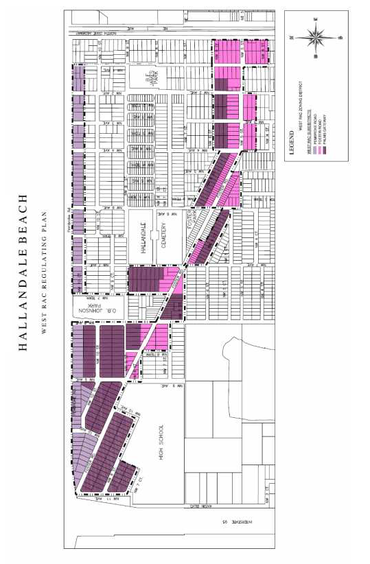
Table 32-160.a West RAC Permitted Uses by Subdistrict
West RAC Permitted Uses by Subdistrict Palms Gateway Pembroke Road Foster Road Residential uses Single-family residential dwelling P - - Two-family (duplex) residential dwellings P - - Multi-family residential dwellings P P P Assisted living facilities See section 32-524 Other residential care facilities Lodging Bed-and-breakfast inns - - - Hotels - P P Commercial uses Alcoholic beverage establishments, subject to chapter 5 - P - Automobile rental agencies1 P P Check cashing - - - Contractor and trade operations - - - Drive-through facilities (for any use) - C - Family Entertainment Center C C Garages, parking (commercial or non-commercial principal use) - C - Medical marijuana treatment center dispensing facility, subject to chapter 32, art. IV, division 24 - P P Office - P P Parking lots (commercial or noncommercial principal use) - C - Pawn shops - - - Restaurants (minimum of 1,000 square feet of G.F.A. required) - P P Restaurant (fast food/no drive-thru) (minimum of 1,000 square feet of G.F.A. required) - P P Service stations/convenience business (subject to 1,500 feet separation to other auto related uses) - C - Stores and services, general - P P Stores and services, large format - P P Studio or workshop - P P Vehicle sales, repair, or service - - - Warehouse/self-storage facility - C - Civic uses Animal hospitals/veterinary clinics (with ancillary boarding in an enclosed air-conditioned building) - C - Civic open spaces P P P Day care centers C C C Government uses - P P Places of worship C - P Schools, public and private C C C 1 Outdoor storage of rental fleet shall be located within a parking structure or be visually screened from the public right-of-way and adjacent properties by a fence/wall and landscape.
- Reserved.
- Accessory uses within the West RAC district are administered pursuant to article IV, division 2 of the zoning and land development code (section 32-242).
- Home occupations within the West RAC district are administered pursuant to section 32-370 of the zoning and land development code.
- Proposed mixed use developments, at the discretion of the director, must provide a supplemental report that outlines the following:
- Mixed-uses. The West RAC permits mixed use development (Table 32-160.a).
- Nonconforming uses. Nonconforming lots, structures or uses located within this district shall be subject to the provisions of article VII of the zoning and land development code.
- Landscaping. Minimum landscaping requirements for new or existing development proposals are contained in section 32-383 the zoning and land development code. Pembroke Road subdistrict shall be subject to additional landscape requirements to include street trees, as described below.
- Additional landscaping requirements, Pembroke Road subdistrict.
- Provisions for street trees: The planting of street trees is required within the Pembroke Road overlay district. Development proposals must provide for the installation of street trees in conformance with the following criteria:
- Street trees are not counted for credit towards the minimum number of on-site trees required by section 32-384.
- Street trees must be a minimum of 20 feet in height with a minimum diameter of three inches at a point four feet above ground level at the time of planting and have trunks which can be maintained in a clean condition for over six feet of clear wood measured from ground level.
- Street trees must be spaced center to center and must be planted and maintained so that there is at least one tree per 30 linear feet of street frontage, exclusive of accessways.
- The minimum height and specified street trees for major transportation corridor standards contained herein for street trees may be modified by the city manager, without penalty, where the installation of the trees would interfere with overhead utilities, so long as the minimum number and spacing of trees is maintained.
- Street trees must be of noninvasive root species and must be designated as street or shade trees on the city's approved plant materials list. The designated street tree for Pembroke Road is the Royal Palm. The designation for all other local trees is Mahogany trees.
- Additional landscaping requirements, Pembroke Road subdistrict.
- Parking. Minimum parking space requirements for new or existing development proposals are contained in section 32-203 the zoning and land development code.
- Awnings.
- Projecting canvas, fabric or metal awnings may be placed over doors or windows but shall not project closer than two feet to property lines provided however, that commercial uses fronting on Foster Road may project up to three feet over existing sidewalks into public rights-of-way. Such structure shall not be less than seven and one-half feet from grade. All awnings encroaching into a public right-of-way are subject to the city manager's approval as to location and structure.
- Awnings projecting over a public right-of-way are erected at the risk of the property owner. If the city or other governmental entity determines that the awning must be removed or modified, it shall be the duty of the property owner to remove or modify same, and bear all costs associated therewith.
- Awning signage shall be maintained in good condition, free from fading, peeling, or any other condition which renders the signage unreadable, either partially or totally. Additionally, all awnings installed in storefronts shall be maintained in good condition, free from tears, holes, fading or peeling, inclusive of all supporting structures. Repairs of awnings or awning signage shall be with the same or comparable materials. Internally illuminated or plastic awnings are prohibited.
- Any awning which will abut into the public right-of-way may be constructed only after a permit from the city has been obtained for such encroachment into the public right-of-way.
- Signage. Sign regulations for new or existing development proposals are contained in section 32, division 17 of the zoning and land development code. Pembroke Road subdistrict shall be subject to additional sign requirements, as described below.
- Additional signage requirements, Pembroke Road subdistrict.
- Signs are prohibited along NW 10 Street within the subdistrict, except for traffic control, address signs and dedication plaques not exceeding three square feet in sign area.
- Uniform signage. Signage on buildings with multiple storefronts must be of the same type (such as box sign channel lettering, molded lettering). Painted wood wall signs are prohibited within the Pembroke Road subdistrict.
- Additional signage requirements, Pembroke Road subdistrict.
- Sidewalks, fences, and walls. Minimum sidewalk, wall and fence requirements for new or existing development proposals are contained in section 32-331 the zoning and land development code, and the following provisions.
- Additional requirements for walls - Pembroke Road subdistrict.
- When abutting residential zoning district, an eight-foot masonry wall must be provided with the required landscape buffer strip. Such walls must be painted to blend with the overall architectural design scheme of the development proposal.
- All masonry walls must be finished on both sides so that no CBS courses are visible.
- Additional requirements for fencing - West RAC district.
- Galvanized chain link and privacy wood fences are prohibited along the Foster Road and Pembroke Road Corridors.
- Additional requirements for fencing - Foster Road subdistrict.
- Permitted fencing along Foster Road shall be setback a minimum of two feet to be finished as landscaping or as a sidewalk extension to existing sidewalk in the public right-of-way.
- No barbed wire extensions shall be permitted on any fence within the West RAC zoning district.
- Galvanized chain link and privacy wood fences are prohibited in the West RAC district.
- Additional requirements for walls - Pembroke Road subdistrict.
- Dumpster enclosures. Dumpster enclosures shall be of masonry. All exterior walls shall be finished in stucco and/or painted to present a finished appearance.
- Development review procedures. Development applications may follow two different review and approval processes:
- Major development applications in the West RAC zoning district may be approved administratively if the application:
- Meets all requirements of this code; and
- Does not exceed the permitted or base density specified for its RAC subdistrict; and
- Does not require any conditional uses; and,
- Does not require non-administrative: variances, or redevelopment area modifications.
- Development applications in the West RAC zoning district may be approved only by the city commission using the major development review process if the application:
- Meets all requirements of this code only upon approval of simultaneously requested conditional uses; and/or
- Meets all requirements of this code only upon approval of simultaneously requested non-administrative variances, or redevelopment area modifications; and/or
- Is requesting more than the allowable base or permitted density in any West RAC subdistrict subject to the provisions of subsection 32-206(c).
- Major development applications in the West RAC zoning district may be approved administratively if the application:
- Redevelopment area modifications. The provisions of section 32-135 of the zoning and land development code shall apply within the West RAC district, except as may be modified by the following:
- Criteria. The city commission may modify any land development code standard through the redevelopment area modification process if all the criteria specified in article III, section 32-135 of the chapter are met.
- Review. The transmittal of a redevelopment area modification waiver request for properties within the West RAC district shall coincide with transmittal of the corresponding major development review application to the city commission, if applicable.
- Administrative waivers. Within the West RAC district, the city manager shall be allowed to approve administrative waivers for redevelopment area modifications up to 20 percent of minimum required for landscaping and setback requirements, and any measureable standard, with the exception of parking, building height, and density.
- Nonconformities. Any previously lawful lot, structure, use, or characteristic of use made non-conforming by these provisions shall be subject to provisions of article VII of this Code,
(Ord. No. 2014-31, § 14(Exh. A), 11-5-2014; Ord. No. 2015-13, § 1, 10-7-2015; Ord. No. 2018-024, § 3, 9-17-2018; Ord. No. 2024-006, § 2, 1-17-2024)
Sec. 32-160.c. Palms Gateway subdistrict standards.
- Purpose and intent. The purpose and intent of the Palms Gateway subdistrict is to provide single-family and multi-family dwellings along the Foster Road corridor that will enhance the historical and cultural identity of the area.
- Permitted uses.
- Specific uses. Specific uses in the Palms Gateway subdistrict shall conform to the regulations in Table 32-160.a.
- Conditional use standards. Conditional uses are noted in Table 32-160.a and must be approved pursuant to the provisions in section 32-964.
- Permitted density. The permitted density in Table 32-160.c is the number of dwelling units allowed per acre.
- Lot size, height, and other dimensional requirements. Table 32-160.c provides the dimensional requirements regarding lot size, lot coverage, building setbacks, and building frontage for the Palms Gateway subdistrict.
Table 32-160.c Palms Gateway Subdistrict Dimensional Requirements
Lot size SFR/duplex1, 3 Multi-family Lot width (min.) 1. Interior 50 ft. 50 ft. 2. Corner 50 ft. 50 ft. Lot area (min./max.) 1. Interior lot 5,000 sf. 5,000 sf. 2. Corner lot 5,000 sf. 5,000 sf. Building placement A. Front setback (min./max.) 25 ft. 25 ft. B. Side setbacks 1. Interior
5 ft. 7.5 ft. 2. Corner
10 ft. 15 ft. C. Rear setback (min.) 20 ft. 25 ft. Rear setback (min.)—Canopies or roof extensions over patios
10 ft. - D. Accessory structure 5 ft. 5 ft. Min. landscape area 40% 40% Building height Max. building height 2 stories or 30 ft. 3 stories or 30 ft. Density Permitted density 14 du/ac 14 du/ac 1 Smaller lots platted prior to November 21, 1978, shall be permitted at their platted size, and are not subject to the provisions of article VII.
2 Subject to the provisions of article IV, division 21, townhouse, residential development.
3. Canopy structures or roof extensions over patios are permitted subject to all the following limitations:
a. They shall be attached a minimum of 50 percent to the principal building.
b. They shall be open on all sides a minimum of 80 percent when load-bearing elements are used.
c. They shall not exceed one story or 15 feet in height.
d. A recordable covenant shall be executed by the property owner in a form acceptable to the city attorney restricting any enclosure of the structure. Such covenant shall run with the land and be binding upon all persons having any right, title or interest in the property or any part thereof.
- Residential unit size. Table 32-160.c(1) provides the minimum residential unit sizes for dwellings for the Palms Gateway subdistrict.
Table 32-160.c(1) Minimum Floor Area for Residential Dwelling Units
Minimum per unit
(sq. ft.)Minimum average
(sq. ft.)Single family and duplex—1,000 - Multi-family—350 750 - Dwelling units with a minimum floor area of 500 square feet or less may be counted as 0.5 dwelling units for residential density calculations.
- When affordable housing units are required, such units shall be proportionately distributed amongst unit types and sizes throughout the building(s) and site.
- The minimum average floor area as provided in Table 32-160.c(1) may be reduced to 500 square feet for the following developments:
- Minor developments on platted development sites that are less than or equal to 7,500 square feet.
- Developments where all residential units are made affordable to very-low-income persons as defined in the Florida Statutes and maintained for a period of at least 30 years guaranteed through a restrictive covenant in a form acceptable to the city attorney.
(Ord. No. 2014-31, § 14(Exh. A), 11-5-2014; Ord. No. 2022-029, § 1, 11-2-2022; Ord. No. 2024-017, § 2, 6-26-2024)
Sec. 32-160.d. Pembroke Road subdistrict standards.
- Purpose and intent. The Pembroke Road subdistrict is to encourage well-designed commercial and mixed-use developments along the Pembroke Road corridor.
- Permitted uses.
- Specific uses. Specific uses in the Pembroke Road subdistrict shall conform to the regulations in Table 32-160.a.
- Conditional usestandards. Conditional uses are noted in Table 32-160.a and must be approved pursuant to the provisions in section 32-964.
Table 32-160.d Pembroke Road Subdistrict Dimensional Requirements
Lot size Non-residential Multi-family and mixed use Lot width (min.) All lots 50 ft. 50 ft. Lot area (min.) All lots 5,000 sf. 10,000 sf. Building placement A. Front setback1 (min./max.) Min. 10 ft.
Max. 15 ft.Min. 10 ft.
Max. 15 ft.B. Side interior setbacks (min.) 0 ft. 0 ft. C. Rear setbacks 1. Rear setback (min.) 10 ft.
20 ft. adjacent to residential district10 ft.
20 ft. adjacent to residential district2. Rear setback above the 5th floor (min.) 30 ft. 30 ft. D. Accessory structure setback (min.) 10 ft. 10 ft. E. Minimum building
frontage—Pembroke Road60% 60% F. Minimum landscape area 10% of lot area 5% of lot area Building height Minimum building height 1 story or 20 ft. 2 stories Base building height 3 stories 3 stories Maximum building height2 10 stories2 10 stories2 Density Base density - 40 du/ac Maximum density2 - 80 du/ac2 1 All lot lines facing streets are regulated by front yard setback requirements.
2 Maximum density allocation shall be subject to the performance criteria in section 32-160.d.(d)(4) and approval by the city commission, pursuant to sections 32-160.b.(i) and 32-206.
- Residential unit size. Table 32-160.d(1) provides the minimum residential unit sizes for dwellings for the Pembroke Road subdistrict.
Table 32-160.d(1) Minimum Floor Area for Residential Dwelling Units
Minimum per unit
(sq. ft.)Minimum average
(sq. ft.)350 750 - Dwelling units with a minimum floor area of 500 square feet or less may be counted as 0.5 dwelling units for residential density calculations.
- When affordable housing units are required, such units shall be proportionately distributed amongst unit types and sizes throughout the building(s) and site.
- The minimum average floor area as provided in Table 32-160.d(1) may be reduced to 500 square feet for the following developments:
- Minor developments on platted development sites that are less than or equal to 7,500 square feet.
- Developments where all residential units are made affordable to very-low-income persons as defined in the Florida Statutes and maintained for a period of at least 30 years guaranteed through a restrictive covenant in a form acceptable to the city attorney.
- Building massing and placement.
- Lot size and building placement. Table 32-160(d) provides the dimensional requirements regarding lot size, lot coverage, building setbacks, and building frontage for the Pembroke Road subdistrict.
- A minimum of 60 percent of the linear width of the lot along Pembroke Road shall be occupied by active uses, located in accordance with the minimum and maximum setbacks in Table 32-160(d). Active use requirements may be reduced or waived at the discretion of the director when sufficient evidence is provided to indicate that necessary vehicular access and circulation cannot be accommodated.
- Buildings taller than five stories are subject to additional setback requirements to ensure harmony among adjacent buildings and architectural articulation of building mass; and protect the character of residential neighborhoods.
- Buildings with more than 200 feet of street frontage shall provide a pedestrian passageway at least ten feet wide connecting rear parking to the sidewalk in the public right-of-way that the building faces.
- At-grade parking lots shall not be permitted within frontage setbacks and shall be located behind the main structure to the maximum degree possible.
- Building articulation.
- Building facades shall incorporate breaks in the horizontal and vertical wall plane to provide articulation and reduce visual mass.
- Blank walls visible from adjacent streets, public areas or adjacent buildings shall not be permitted and shall incorporate facade articulation. A portion of the facade proportionate to the building massing may permitted.
- For ground floor commercial active uses, 50 percent of the storefront facade area shall provide transparency. Transparency may be provided through the use of windows and door glazing as well as unobstructed openings in the building façade.
- Architectural treatment shall be provided for all non-active use facade elevations and shall be harmonious and integrated with the design of adjacent active use facades. Architectural treatment shall be provided through a combination of two or more treatments including, but not limited to: the use of similar materials and construction assemblies; the continuation of fenestration patterns, architectural features, articulation, and rhythm; the application of architectural screens, meshes, louvers, and glass; the incorporation of pervious surfaces and planters; and the provision of consistent signage, graphics, and architectural lighting. The following treatments are permitted but shall not fulfill the requirement for architectural treatment: the application of paint and faux treatments; scoring, construction joints or material projections less than four inches in height, width, or depth.
- Base density. The base density in Table 32-160(d) is the number of dwelling units allowed per acre.
- Maximum density and height. The maximum density and height in Table 32-160(d) shall be subject to approval by the city commission, pursuant to sections 32-160.b.(i) and 32-206. and the following performance criteria:
- For a maximum density of 80 du/ac and/or a maximum building height of ten stories, projects shall provide:
- At least 15 percent of the project's total residential units as affordable housing maintained for a period of at least 30 years guaranteed by execution of a restrictive covenant or agreement in a form acceptable to the city attorney. The quality of finishes and fixtures for affordable housing units shall be identical to the quality of finishes and fixtures for market rate units;
- Street/streetscape improvements consistent with the city's complete streets efforts, on both sides of adjacent rights-of-way, where feasible; and
- At least two of the following:
- A total of five percent of the site, or the portion of the site proposed for development in a multi-phased project, as civic open space(s);
- Fully conceal parking garage levels at the sidewalk level for a depth of at least 20 feet by a story containing active use(s), such as residential, office, or retail; and
- Public art in a form and location acceptable to the city accessible and visible to the public from the right-of-way.
- For a maximum density of 80 du/ac and/or a maximum building height of ten stories, projects shall provide:
- Lot size and building placement. Table 32-160(d) provides the dimensional requirements regarding lot size, lot coverage, building setbacks, and building frontage for the Pembroke Road subdistrict.
- Other sections applicable.Section 32-194, configuration of buildings, and sections 32-202 through 32-204, civic open spaces, off-street-parking requirements and street and block standards also apply to the Pembroke Road subdistrict.
(Ord. No. 2014-31, § 14(Exh. A), 11-5-2014; Ord. No. 2024-006, § 2, 1-17-2024; Ord. No. 2024-015, § 2, 6-5-2024; Ord. No. 2024-017, § 2, 6-26-2024)
Sec. 32-160.e. Foster Road subdistrict standards.
- Purpose and intent. The Foster Road subdistrict is designed to create opportunities for both vertical and horizontal mixed use (residential and commercial) along the Foster Road corridor, while also enhancing the historical and cultural identity of the area.
- Permitted uses.
- Specific uses. Specific uses in the Foster Road subdistrict shall conform to the regulations in Table 32-160.a.
- Conditional usestandards. Conditional uses are noted in Table 32-160.a and must be approved pursuant to the provisions in section 32-964.
Table 32-160.e Foster Road Subdistrict Dimensional Requirements
Lot size Non-residential Multi-family and mixed use Lot width (min.) 1. All lots 50 ft. 50 ft 2. Corner 50 ft. 75 ft.2 Lot area (min.) All lots 5,000 sf. 5,0001 sf. Building placement A. Front setback2 (min./max) Min. 2 ft.
Max. 10 ft.Min. 2 ft.
Max. 10 ft.B. Side interior setbacks 0 ft. 0 ft. C. Rear setback 1. Rear setback (min.)
10 ft.
20 ft. adjacent to residential districts10 ft.
20 ft. adjacent to residential districts2. Rear setback above the 5th floor - Lots East of 4th Avenue (min).
30 ft. 30 ft. D. Accessory structure setback (min.) 10 ft. 10 ft. E. Minimum building
frontage - Foster Road or North Dixie Highway60% of lot width 60% of lot width F. Minimum landscape area 1. Minimum landscape area
10% of lot area 10% of lot area 2. Minimum landscaping area - Lots East of NW 4th Avenue
5% of lot area 5% of lot area Building height Minimum building height 1 story, 20 ft. 2 stories Base building height 3 stories 3 stories Maximum building height3 5 stories2 5 stories3 Maximum building height - Lots east of 4th Avenue.3 12 Stories3 12 Stories3 Density Base density - 30 du/ac Maximum density3 - 60 du/ac3 Maximum density - Lots East of 4th Avenue3 - 120 du/ac3 1 Smaller lots platted prior to November 21, 1978, shall be permitted at their platted size, and are not subject to the provisions of article VII.
2 All lot lines facing streets are regulated by front yard setback requirements.
3 Maximum density allocation and building height shall be subject to the performance criteria in section 32-160.e.(d)(4) and approval by the city commission, pursuant to sections 32-160.b.(i) and 32-206.
- Residential unit size. Table 32-160.e(1) provides the minimum residential unit sizes for dwellings for the Foster Road subdistrict.
Table 32-160.e(1) Minimum Floor Area for Residential Dwelling Units
Minimum per unit
(sq. ft.)Minimum average
(sq. ft.)350 750 - Dwelling units with a minimum floor area of 500 square feet or less may be counted as 0.5 dwelling units for residential density calculations.
- When affordable housing units are required, such units shall be proportionately distributed amongst unit types and sizes throughout the building(s) and site.
- The minimum average floor area as provided in Table 32-160.e(1) may be reduced to 500 square feet for the following developments:
- Minor developments on platted development sites that are less than or equal to 7,500 square feet.
- Developments where all residential units are made affordable to very-low-income persons as defined in the Florida Statutes and maintained for a period of at least 30 years guaranteed through a restrictive covenant in a form acceptable to the city attorney.
- Building massing and placement.
- Lot size and building placement. Table 32-160(e) provides the dimensional requirements regarding lot size, lot coverage, building setbacks, and building frontage for the Foster Road subdistrict.
- A minimum of 60 percent of the linear width of the lot along Foster Road or North Dixie Highway shall be occupied by active uses, located in accordance with the minimum and maximum setbacks in Table 32-160(e). Active use requirements may be reduced or waived at the discretion of director when sufficient evidence is provided to indicate that necessary vehicular access and circulation cannot be accommodated.
- Buildings taller than five stories are subject to additional setback requirements to ensure harmony among adjacent buildings and architectural articulation of building mass; and protect the character of residential neighborhoods.
- Buildings with more than 200 feet of street frontage shall provide a pedestrian passageway at least ten feet wide connecting rear parking to the sidewalk in the public right-of-way that the building faces.
- At-grade parking lots shall not be permitted within frontage setbacks and shall be located behind the main structure to the maximum degree possible.
- Building articulation.
- Building facades shall incorporate breaks in the horizontal and vertical wall plane to provide articulation and reduce visual mass.
- Blank walls visible from adjacent streets, public areas or adjacent buildings shall not be permitted and shall incorporate facade articulation. A portion of the facade proportionate to the building massing may permitted.
- For ground floor commercial active uses, 50 percent of the storefront facade area shall provide transparency. Transparency may be provided through the use of windows and door glazing as well as unobstructed openings in the building façade.
- Architectural treatment shall be provided for all non-active use facade elevations and shall be harmonious and integrated with the design of adjacent active use facades. Architectural treatment shall be provided through a combination of two or more treatments including, but not limited to: the use of similar materials and construction assemblies; the continuation of fenestration patterns, architectural features, articulation, and rhythm; the application of architectural screens, meshes, louvers, and glass; the incorporation of pervious surfaces and planters; and the provision of consistent signage, graphics, and architectural lighting. The following treatments are permitted, but shall not fulfill the requirement for architectural treatment: the application of paint and faux treatments; scoring, construction joints or material projections less than four inches in height, width, or depth.
- Base density. The base density in Table 32-160(e) is the number of dwelling units allowed per acre.
- Maximum density and height. The maximum density and height in Table 32-160(e) shall be subject to approval by the city commission, pursuant to sections 32-160.b.(i) and 32-206 and the following performance criteria:
- For density up 60 du/ac and/or a maximum height of five stories, projects shall:
- At least 15 percent of the project's total residential units as affordable housing maintained for a period of at least 30 years guaranteed by execution of a restrictive covenant or agreement in a form acceptable to the city attorney. The quality of finishes and fixtures for affordable housing units shall be identical to the quality of finishes and fixtures for market rate units;
- Street/streetscape improvements consistent with the city's complete streets efforts, on both sides of adjacent rights-of-way where feasible; and
- At least two of the following:
- A total of five percent of the site, or the portion of the site proposed for development in a multi-phased project, as civic open space(s);
- Fully conceal parking garage levels at the sidewalk level for a depth of at least 20 feet by a story containing active use(s), such as residential, office, or retail;
- Public art in a form and location acceptable to the city and visible to the public from the right-of-way; and
- Other community benefit as approved by the city.
- For lots East of NW 4th Avenue, for density up to 120 du/ac and/or a maximum height of 12 stories, in addition to the criteria in subsection (d)(4)(a), projects shall also provide:
- At least 25 percent of the project's total residential units as affordable housing maintained for a period of at least 30 years guaranteed by execution of a restrictive covenant or agreement in a form acceptable to the city attorney. The quality of finishes and fixtures for affordable housing units shall be identical to the quality of finishes and fixtures for market rate units; and
- At least ten percent more parking than the amount required, accessible to the general public on an hourly or daily basis, with a fee to be determined by the owner.
- For density up 60 du/ac and/or a maximum height of five stories, projects shall:
- Lot size and building placement. Table 32-160(e) provides the dimensional requirements regarding lot size, lot coverage, building setbacks, and building frontage for the Foster Road subdistrict.
- Other sections applicable.Section 32-194, configuration of buildings, and sections 32-202 through 32-204, civic open spaces, off-street-parking requirements and street and block standards also apply to the Foster Road subdistrict.
(Ord. No. 2014-31, § 14(Exh. A), 11-5-2014; Ord. No. 2022-029, § 1, 11-2-2022; Ord. No. 2024-006, § 2, 1-17-2024; Ord. No. 2024-015, § 2, 6-5-2024; Ord. No. 2024-017, § 2, 6-26-2024)
Secs. 32-161—32-170. Reserved.
Sec. 32-171. PLAC planned local activity center district.
- Intent and purpose. The following standards, regulations and requirements apply to areas to be rezoned as a planned local activity center (PLAC) district within the city. The PLAC district regulations are created to ensure development within a local activity center (LAC) future land use category is consistent with LAC land use designation. The PLAC is intended to encourage and promote development that facilitates a coordinated and balanced mix of land uses, including: retail, office, hotel/conference, certain types of commercial recreation uses, residential and other similar uses. The mix of land uses associated with the PLAC district shall also provide recreation, entertainment, and associated employment opportunities while creating an urban center with high quality architecture, pedestrian-friendly streets, outdoor public spaces and access to public transit.
- Definitions. The following words, terms and phrases, when used in this section, shall have the meaning ascribed to them in this subsection, except where the context clearly indicates a different meaning:
Design guidelines mean a document created and submitted in conjunction with a planned local activity center rezoning and a major development plan approval application that describes the architectural and design goals of a specific development within the PLAC. The guidelines shall include a description and intent of the overall development and provide standards for vehicular and pedestrian circulation, architecture, landscaping, open space, signage, parking (surface and structured), loading, streets, and regulations addressing building placement, scale/massing, height, and character.
The PLAC design guidelines standards and criteria shall take precedent over the conceptual site plan design.
Development agreement means a valid and enforceable agreement between an applicant for a development approval and the city. The development agreement shall set forth any conditions and obligations to address impacts of the development on the city, shall be recorded in the public records and shall be binding on all property owners within the boundaries of the development. The development agreement shall be utilized to further the purpose and intent of PLAC set forth in subsection (a) of this section. No building permit shall be issued until a development agreement is signed.
Major development plan means a detailed proposal which incorporates specific site details and specifications including a site plan and other documents as required by subsection (h) of this section and the development review requirements of article V of this chapter.
Planned local activity center (PLAC) means an area zoned as a dense, urban, mixed-use development area to achieve an interdependent live/work/entertainment environment while also enhancing the quality of life in the city and minimizing the demand and dependence on the automobile. - Applicability means the city commission may zone lands as a PLAC district consistent with the intent and purpose of the LAC land use category in the city's comprehensive plan.
- Permitted, accessory and prohibited uses.
- Permitted uses. Uses consistent with or customary to mixed-use urban centers including but not limited to multi-family residential, office, retail/commercial uses including cinemas, nightclubs, café/restaurants, hotels, accessory parking, and commercial recreation uses including casinos, pari-mutuel wagering, slot machine gaming, and cardroom facilities.
- Accessory uses. Accessory uses include uses customarily accessory to the principal permitted use but not including any of the uses listed as prohibited.
- Temporary uses. Temporary uses and structures, such as trailers, in connection with sales, marketing, leasing, construction or development subject to the following restrictions:
- Temporary uses and structures shall only be permitted as part of a conceptual site plan and approved design guidelines. The approval shall include a duration of not more than two years or when the first component or building is completed, whichever is earlier.
- Construction trailers shall only be permitted for the duration of a construction phase, beginning with the date a building permit is issued and continuing not longer than the date a certificate of occupancy is issued for the development.
- The city manager may extend the approved duration in increments of no more than two years upon finding that the temporary use or structure is necessary to facilitate completion of the development.
- A designated parking area with a minimum of 20 parking spaces as approved by the city manager shall be provided in connection with the use of a sales trailer.
- Prohibited uses. Any use not consistent and/or compatible with the permitted and accessory uses established in the LAC land use category text for the specific project area, the PLAC district design guidelines, and specifically prohibiting the following: single-family and duplex residential (not including townhouses), mobile homes, retail sales of secondhand merchandise, auto sales and repair, gas stations, boat yards, warehouse/storage, heavy commercial uses, industrial uses, and any use not specifically permitted and/or compatible with the intended development as determined by the city.
- PLAC district criteria. Consistent with the LAC land use category requirements in the city's comprehensive plan and the county land use plan, the following criteria must be met for an area to be eligible for designation as a PLAC district:
- Minimum/maximum lot size. The minimum area or lot size considered for the PLAC district shall be contiguous ten acres. The maximum area or lot size considered for the PLAC district shall be 160 acres. At such time as 75 percent of the originally zoned PLAC district is developed, an expansion to the subject PLAC district to include abutting properties may be considered without regard to minimum size requirements.
- Proximity to public transportation. Seventy-five percent of the land within the proposed PLAC district must be located within a quarter-mile of public transit, a community shuttle or multi-modal facilities, or are designed, built and located within a quarter-mile of such facilities upon build-out. Where such facilities are not in place or planned to be in place at the time of the rezoning, design standards shall be required in the design guidelines to ensure that the primary priority is a safe, comfortable, and attractive pedestrian environment that will allow convenient connection to public transit, will reduce the number of automobile trips internally, and will ultimately support an integrated multimodal transportation system.
- [Appropriate depth and frontage.] A proposed PLAC district must have a geographic configuration of appropriate depth and frontage to support the location of uses in a manner oriented around a five-minute (i.e., quarter-mile) walk. Multiple nodes of activity oriented around a five-minute walk may be included within one PLAC district.
- General PLAC district requirements. All development within a PLAC district shall conform to the following requirements unless modified by a development agreement enacted pursuant to subsection 32-173(d)(2) by the city commission.
- Setbacks. All buildings, structures and additions shall meet the setback requirements defined in the approved design guidelines required in subsection (h).
- Height. Building heights shall comply with the height standards established in the approved design guidelines. At no time shall a building be higher than 30 stories. As one of the main purposes of the PLAC is to create a dense urban appearance, buildings should be designed in such a manner to avoid the appearance of a one-story "strip commercial" building. To that end, portions of buildings that are approved as one-story structures must be designed in a manner that the average parapet height is at least 20 feet above grade.
- Off-street parking. Off-street parking shall be designed and calculated pursuant to section 32-452 of this Code, entitled "Off-street parking requirements," or as approved in the PLAC design guidelines and major development plan approval. In general, shared parking shall be encouraged to permit a reduction in the total number of required parking spaces for individual uses in mixed-use projects which typically do not experience peak parking demands at the same time or patrons that may visit a number of uses within the project. The city may approve a reduction in the quantity, location or type of required parking spaces based on the submission of a professional parking study acceptable to the city.
- Landscaping. All property or parcels within a PLAC shall conform to the requirements in section 32-384, entitled "Landscape requirements," or as modified as part of the design guidelines. The design guidelines and subsequent major development plans shall include a planting theme consistent with South Florida landscaping and supporting a pedestrian-friendly environment. Park and open space land may include squares, plazas, arcades, landscaped pedestrian walkways, greenbelts, greenways and playgrounds. Required perimeter buffers, median strip landscaping and interior parking lot islands may not comprise more than 20 percent of the total required landscaped area. All such land must be within the boundaries of the PLAC district.
- Notwithstanding the above provisions, the city reserves the right, but is not obligated, to modify the PLAC criteria upon submission of a request from the owner/applicant.
- PLAC submittal requirements. The following shall be submitted for PLAC approval:
- General location map, boundary survey and PLAC narrative. A general location map depicting the PLAC area and its relationship to adjoining land uses and roadways within at least one-half mile of the site; a boundary survey and legal description; and a narrative describing the overall PLAC and the components thereof.
- Conceptual site plan. A conceptual site plan illustrating the general layout of streets, sidewalks, open space, parking, and buildings and any proposed temporary uses or structures. The conceptual site plan drawings must have sufficient detail to clearly illustrate and denote building forms and relationships, architectural styles, setbacks, approximate sizes of uses and functional use areas including dimensions/square footages. The conceptual plan may be revised consistent with the approved design guidelines through the major development plan review/process for each phase of the development. The conceptual site plan approval is deemed conditional until a development agreement is executed by the city and applicant pursuant to the paragraph (n).
- Design guidelines. Design guidelines (text and graphics) providing specific guidelines for the PLAC district governing vehicular and pedestrian circulation, architecture (including building elevations), landscaping, open space, signage, site lighting, parking (surface and structured), loading, streets, and standards addressing building placement, scale/massing, height and character. Unless specifically modified in the design guidelines, all development in the PLAC district shall comply with the city's minimum code requirements.
- Phasing plan. An anticipated development phasing schedule including the sequence for each phase, and approximate size of the area in each phase of the PLAC district consistent with the conceptual plan.
- Infrastructure assessment. An assessment of the infrastructure necessary to serve the PLAC including potable water, sanitary sewer, stormwater, electricity, telephone, gas installation, cable TV, satellite communication facilities, solid waste and waste disposal facilities, loading zones and proposed street improvements.
- Recreation and open space assessment. An assessment of designated recreational opportunities and open spaces within the PLAC district addressing conformance to the goals, objectives and policies of the city's comprehensive plan and applicable land development regulations. Residual areas such as buffers, median strips and retention areas are not considered parkland or open space but may be counted toward minimum landscape requirements.
- Transportation and parking analysis. A transportation and parking analysis including on-site and off-site vehicular traffic, mass transit, pedestrian and bicycle facilities.
- Security measure assessment. An assessment and description of any security measures to be provided within the general area and sub-areas of the PLAC.
- Additional requirements. The city manager, or designee, may require additional materials and studies, as customarily required, to ensure that the applicable standards and guidelines of this chapter have been fully met. The additional requirements must be identified prior to submittal of the major development plan application.
- Application fees. The rezoning application fees for a PLAC district shall be as set forth for rezoning applications in the city's fee schedule.
- Major development plan submittal requirements. In addition to the requirements of article V of this chapter, the following shall be submitted for major development plan approval:
- Design guidelines. Submit a copy of the design guidelines as approved as part of subsection (g).
- Land use tabulations. The site development plan for the major development plan submittal shall include the number, height and type of residential units and proposed hotel units, as well as proposed uses, square footages and the heights of any non-residential uses.
- Site development plan. Site development plan for the major development plan area, illustrating building footprints and elevations, parking areas, functional use areas, vehicular and pedestrian circulation and pedestrian/public amenities.
- Signage and lighting plans. General signage and lighting plans detailing the location, size and type of signage and lighting, consistent with the design guidelines.
- Landscape plan. A detailed landscape plan consistent with the design guidelines and including those items of information and document format contained in section 32-386 of this Code.
- Infrastructure plans. A detailed set of infrastructure plans for the major development plan area including potable water, sanitary sewer, stormwater and other private utilities serving the site.
- Additional requirements. The city manager, or designee, may require additional materials and studies, as customarily required, to ensure that the applicable standards and guidelines of this chapter have been fully met.
- Application fees. The major development plan application fees shall be as set forth in the city's fee schedule.
- Review, approval and modification of major development plans and development agreements. A major development plan for each phase shall be submitted to and processed by the city in accordance with the provisions of article V of this chapter, development review procedures, except that changes and deviations of a major development plan for any phase within a PLAC that does not exceed ten percent of the approved square footage in each phase or permitted uses and continues to be consistent with the approved design guidelines and/or development agreement within the PLAC district area shall only require administrative approval. Amendments and minor revisions to approved development agreements shall be made in accordance with section 32-805 of the City Code. All building permits issued subsequent to the approval of the PLAC rezoning shall be consistent with the respective approved major development plans. Deviations from the approved major development plan and/or development agreement greater than ten percent or that changes the character of the development shall be subject to the provisions for major changes of section 32-174(j)(3).
- Zoning approval versus major development plan. The approval of a rezoning to a PLAC district is intended to establish the conceptual plan of development. Notwithstanding anything to the contrary, prior to the submission of building permits, all phases of development within the PLAC shall submit and receive approval of a major development plan, consistent with the PLAC district conceptual plans and design guidelines.
- PLAC expiration date. Approved developments must submit a detailed major development plan application for at least the first phase within 18 months of the PLAC zoning approval, unless otherwise addressed in the development agreement. Submittal of a major development plan shall be deemed a good faith effort to implement the PLAC district. Failure to submit the major development plan application as specified herein will invalidate the PLAC concept plan and a new concept plan application will have to be submitted to the city.
- PLAC extension.
- Prior to the expiration of the 18-month period for major development plan submittal, the owner/applicant may apply for an extension by filing a petition with the city. Such petition may be granted upon a determination by the city commission that the owner/applicant has made a good faith effort to submit the major development plan application.
- The city commission shall not grant more than one extension. No extension shall exceed 18 months from the date of the expiration of the initial 18-month period.
- Notice of the meeting of the city commission shall be provided to the owner/applicant by regular mail within 15 days of the date of the public hearing at which the extension request is to be heard. The applicant shall be given an opportunity to be heard at the city commission meeting.
- If a petition for an extension is denied, the owner/applicant may appeal such decision to the circuit court.
- Major development plan expiration. A complete, valid building permit application for one or more of the major land uses, not including fencing or utility work, shall be submitted within 18 months from the date of a major development plan approval, unless otherwise addressed in the development agreement. The city manager, or designee, may grant a one-time extension of no more than six months. The city commission may grant an additional six-month extension (total of 12-month extension) after a public hearing upon a determination that the owner/applicant has made a good faith effort to submit the building permit application. Failure to submit a building permit as specified herein will invalidate the major development plan, and a new application will be required to be made to the city.
- Development agreement required. Each PLAC development shall be governed by a development agreement whereby the city and other appropriate entities enter as parties to the agreement. The development agreement shall be utilized to further the purpose and intent of PLAC as set forth in subsection (a) of this section.
- PLAC monitoring report. The recipient of an approved PLAC district rezoning shall submit an annual report to the city. The first annual report shall be submitted one year after the effective date of the approved PLAC district, and on that same date every year thereafter, until development is complete. Failure to submit the report shall not result in a loss of development rights. The city may suspend further development approvals including building permits and certificates of occupancy for failure to submit the report upon notification as described herein. The report shall include the following information:
- An outline of the development activity that occurred since the previous report with an analysis of the maximum allowed, built and remaining development activity.
- Identification and degree of any alterations, modifications or additions to the PLAC master development plan approval;
- If no changes or amendments to the initial plan have been made during the reporting period, a short statement to that effect will be filed with the city, which shall satisfy this requirement.
- Validity. Should any subsection, paragraph, sentence, clause, phrase or other part of this section be declared by a court of competent jurisdiction to be invalid, such decision shall not serve to invalidate the remaining words, subsections, and positions of this section.
(Ord. No. 2006-22, § 3, 11-6-2006; Ord. No. 2012-13, § 1, 5-16-2012; Ord. No. 2014-25, § 1, 9-3-2014; Ord. No. 2014-31, § 17, 11-5-2014; Ord. No. 2018-023, § 2, 9-17-2018; Ord. No. 2023-021, § 1, 10-18-2023)
Editor's note(s)—Ord. No. 2014-31, § 17, adopted Nov. 5, 2014, renumbered former § 32-179 as § 32-171, as set out herein.
Secs. 32-172—32-180. Reserved.
Sec. 32-181. Reserved
(Ord. No. 2001-16, § 1, 9-18-2001; Ord. No. 2003-26, § 1, 11-18-2003; Ord. No. 2009-21, § 1, 11-4-2009; Ord. No. 2014-31, § 19, 11-5-2014; Ord. No. 2019-004, § 1, 3-20-2019; Ord. No. 2024-009, § 2, 4-10-2024; Ord. No. 2025-014, § 2, 8-20-2025)
Secs. 32-182—32-185. Reserved.
Sec. 32-186. PDO planned development overlay.
- Purpose and intent. The purpose and intent of the PDO planned development overlay is to provide an optional zoning procedure to permit site design flexibility and greater land use intensity and density in order to encourage high-quality, innovative development that is consistent with comprehensive plan policies, applicable city development and redevelopment plans, and desired development patterns and land uses in an overlay zone that encourages flexibility in the design and negotiation of land development in order to promote its most appropriate use; to facilitate the adequate and economical provision of streets and utilities; and to ensure that development is planned, designed, and developed to function as integral units independently or in concert with the existing land use pattern and adjacent building sites. Regulations for planned development are intended to accomplish the purposes of zoning and other applicable city regulations to the same degree as in instances where such city regulations are intended to control development on a lot-by-lot basis rather than on a unified development approach.
- Definitions. The following words, terms and phrases, when used in this section, shall have the meanings ascribed to them in this subsection, except where the context clearly indicates a different meaning:
City-initiated rezoning means the assignment of PDO by the city commission to areas of the city where the commission desires to direct development or redevelopment activity which satisfies the intent of this district.
Concept plan means a preliminary presentation and attendant documentation required for the assignment of PDO to land by an applicant other than the city commission in accordance with the requirements outlined in subsection (g) of this section; a plan of sufficient accuracy to be used for the purpose of discussion and consideration.
Major development plan means a detailed plan which represents a specific development plan including specifications required by subsection (h) of this section and the development review requirements of article V of this chapter, except as otherwise provided in this chapter.
Planned development overlay (PDO) means an overlay district assigned to land developed or proposed to be developed according to a plan; as a single entity under unified control; planned and developed as a whole in a single phase or an approved series of phases. It may contain one or more structures with appurtenant common areas. - Unified control. All land included for the purpose of development within a PDO planned development overlay shall be either part of an adopted city-initiated rezoning, or under the control of the applicant (an individual, partnership or corporation, or group of individuals, partnerships or corporations). The applicant shall present satisfactory legal documents to constitute evidence of the unified control of the entire area within the proposed planned development which shall be certified by the city manager. The applicant shall agree in the application for rezoning to the following:
- To proceed with the proposed development according to the provisions of this chapter and the approved plan;
- To provide, subsequent to rezoning and prior to the issuance of a building permit, any agreements, contracts, covenants, deed restrictions or sureties as reasonably deemed necessary by the city, in a form acceptable to the city, to ensure that the development proceeds in accordance with prior approvals and to further provide for continuing operation and maintenance of such areas, functions and facilities which are not proposed to be provided, operated, or maintained at public expense;
- To bind their successors in title to any commitments made as set forth in this subsection; and
- If the developer elects to administer common open space through an association or nonprofit corporation, the organization shall conform to the applicable laws of the state.
- Status.
- Overlay zone. The PDO planned development overlay shall be an overlay zone that can be applied in locations within the city.
- Development agreement required. Each PDO planned development overlay development shall be governed by a development agreement whereby the city and other appropriate entities enter as parties to the agreement. The development agreement shall be utilized to further the purpose and intent of PDO set forth in subsections (a) and (i) of this section.
- Guidelines. Guidelines for the PDO planned development overlay 3.1 administrative process and 3.2 dimension and design guidelines are set forth in the city design guidelines manual maintained in the growth management department and adopted by reference in this section.
- Review; agreement required. In cases whereby a property has no existing development agreement or major development plan of record but has been rezoned to the PDO overlay zoning designation, any further development or redevelopment shall require major development review and a development agreement with the city. This provision is mandatory in all cases, including the event where the proposed development does not meet the standards for submission of major development plan review.
- Uses permitted. The uses permitted in a planned development, as indicated below, must be consistent with the provisions of this section and, in accordance with the city's comprehensive plan:
- In order to achieve the purpose of this section, a PDO planned development overlay may be developed as a residential, business, industrial or mixed use entity and shall be identified as:Within each PDO planned development overlay, uses listed in the underlying zoning district may be permitted subject to major development plan review and the limitations of the applicable future land use designation of the comprehensive plan.
PDO residential PDO/R PDO business PDO/B PDO industrial PDO/I PDO mixed use PDO/M - In situations whereby PDO is applied to a general area rather than a unified single area or tract, singular parcels may be allowed to develop consistent with the underlying zoning district provided such development is not inconsistent with the future development scheme for the entire general area designated PDO. The city manager shall make this determination based upon a statement supplied by the applicant that describes how such underlying zoning district utilization will promote and advance the interest of PDO and not impact the future development of the entire general area designated PDO. If a singular parcel is exempted by the city manager, no development agreement will be required and the plan shall be reviewed as provided in this chapter.
- In order to achieve the purpose of this section, a PDO planned development overlay may be developed as a residential, business, industrial or mixed use entity and shall be identified as:
- Procedures for city-initiated rezoning. Where the city initiates a rezoning to PDO based on a development or redevelopment plan, the PDO provisions shall serve to further the recommendations, goals and policies of that plan. Proposed developments within a city-initiated PDO will be evaluated for their consistency with the city's goals and policies relating to the area being proposed for development or redevelopment. The development or redevelopment plan shall serve as the concept plan as specified in subsection (g)(4) of this section, for all included land. Subsequent applications for development in the PDO shall constitute the major development plan and shall be substantially consistent with the recommendations, goals and policies of the concept plan. Application fees for a major development plan on a city-initiated PDO shall be the responsibility of the applicant.
- Procedures and requirements for rezoning to a PDO planned development overlay.
- An application for a rezoning to PDO planned development overlay shall be made only by the owner of the subject property or an authorized agent and processed in the same manner as other applications for rezoning of land as provided in section 32-966, except as otherwise provided in these regulations.
- The rezoning application fees for a PDO planned development overlay shall be as set forth for rezoning applications in the city's fee schedule.
- Applications for rezoning to PDO planned development overlay may be submitted for review as a concept plan in the absence of a major development plan that meets the requirements of subsection (h) of this section.
- Applications for rezoning to PDO planned development overlay based on a concept plan shall provide the following information for review:
- A certified boundary survey.
- General schematic representation of the land uses with densities and intensities, along with a table of computation which depicts number of units, gross floor area, parking, building height and site coverage.
- Approximate delineation of internal circulation, with hierarchical classification of streets.
- Applications for rezoning to PDO shall be reviewed with consideration given to the following criteria:
- That the proposed project would further the development or redevelopment of an area of the city consistent with city land use and development goals, policies and development/redevelopment efforts.
- That the proposed development would be of an equal or higher quality with regard to appearance, site design, compatibility with the adjacent area, landscaping, and provision of amenities that would result under the existing development standards.
- That PDO would allow a more innovative design than would be possible under the development standards of the existing zoning district and development regulations.
- That the proposed development would promote the public interest, including, if appropriate, the provision of open space and amenities available for public use.
- That mixed commercial and residential development proposals would be well planned, in an integrated design that would encourage use of mass transportation, pedestrian and bicycling modes of transportation.
- That it would be more appropriate for a proposed project to be developed under PDO development standards and procedures than the existing zoning district development standards, and development review and variance procedures, when the criteria mentioned in this subsection are considered.
- Procedures and requirements for major development plan.
- The application fees for major development plan in a PDO planned development overlay shall be those adopted in the city's fee schedule for concurrency evaluation and development review.
- An application for a major development in a PDO planned development overlay shall conform to the requirements for development review as provided in article V of this chapter, except as otherwise provided in this chapter.
- In addition to the requirements of article V of this chapter, the following shall be submitted for major development plan approval:
- A certified boundary survey.
- General schematic representation of the land uses with densities and intensities, along with a table of computation which depicts number of units, gross floor areas, parking, building height and site coverage.
- Approximate delineation of internal circulation, with hierarchical classification of streets.
- Points of connection of the local streets to the trafficways, including general indication of the necessary improvements to the trafficways to accommodate the local trips generated by the planned development.
- General location and size of any community facility included within the planned development such as parks, schools, fire stations, community center, etc.
- Indication of existing vegetation and all other natural features within the planned development, together with general plans for their conservation or mitigation.
- Schematic depiction of the water distribution and wastewater collection facilities and drainage system, including easements.
- Specific indication of the development phasing, in terms of areas and sequence.
- In addition, the city manager may require additional material such as elevation drawings and architectural renderings, plans, maps and studies necessary to make findings and determinations to ensure the applicable standards and guidelines of this chapter have been fully met.
- Dimension and design regulations.
- All site development standards and related development standards of this chapter are to be negotiated between the city and the applicant as part of the development process in accordance with the PDO planned development overlay regulations and all other applicable city codes, regulations and standards set forth in the design guidelines manual.
- All PDO planned development overlays shall contain a minimum of one acre of land under unified control. However, the city commission may modify this minimum if it is determined to meet all the following criteria:
- The size without the modification will significantly inhibit neighborhood improvements;
- The modification adequately provides for service areas and other development features for the project;
- The modification adequately provides for service and emergency vehicle access; and
- The modification adequately provides for visibility of access.
The modification request shall be filed with the city manager by an applicant with unified control of the site. The request shall be transmitted to the city commission accompanied by a staff recommendation for approval or denial. Such requests for modification shall be advertised, posted and noticed in conformity with the requirements of article IX, section 32-1004, of this chapter. The application fee for a modification request shall be those adopted by the city's fee schedule for redevelopment area modifications.
- The PDO planned development overlay permits smaller yard areas than those of the underlying zoning district where the use of reduced yard setbacks is appropriate for a particular project. Minimum setbacks for a PDO planned development overlay shall be established by utilizing one of the following methods:
- By utilizing the applicable setbacks of the underlying zoning districts in connection with the PDO overlay zone.
- By conforming to the established setback pattern of adjacent property and property within 500 feet of the PDO site in all directions.
- Setback minimums may be established using methods a. and b. in combination or as proposed by the applicant utilizing good planning and development practices. Such practices shall consider buffering; the prevention of overcrowding/lessening the adverse effects of density/intensity; accommodation of service areas; proper access for firefighting equipment and the containment of fire; accommodation of other development features (e.g., off-street parking, storage, etc.); view protection and visibility; and future roadway widening.
- All PDO development, redevelopment and exterior improvements shall be designed and constructed in conformance with the requirements and standards of the city's design guidelines manual, incorporated in this section by reference.
- Conformance to approved major development plan.
- Building permits. After rezoning to PDO planned development overlay, no building permits shall be issued by the city and no development shall commence unless in conformance with a development agreement and approved major development plan unless otherwise exempted pursuant to subsection (e)(2) of this section.
- Minor changes. The city manager, after receiving staff recommendations, may approve minor changes and deviations from the approved major development plan which are in compliance with the provisions and intent of this chapter, and which do not depart from the principal concept of the approved major development plan, and which are not major changes as described in subsection (j)(3) of this section. Minor revisions to development agreements shall be in accordance with the provisions of section 32-805(d) of the City Code.
- Major changes. The city manager may determine that the requested changes and deviations from a major development plan constitutes a major change to the character of the development. A requested major change shall be submitted to the city commission as a revision to the major development plan as specified in section 32-782(a)(2) to be heard at a public hearing. Major changes to major development plans shall include but not be limited to:
- A change in the use(s) of the planned development.
- Any change resulting in greater than a ten percent variance in the following plan features:
- An increase in floor area of proposed structures.
- An increase in the density of use, but not exceeding that allowed by the underlying zone.
- Plan revisions which increase trips and impact traffic and utilities.
- A reduction in open space specified in the approved major development plan.
- A reduction of off-street parking and loading spaces specified in the approved major development plan.
- The lesser of either a ten percent increase in building height or the addition of one story.
- Any change in the boundaries or phasing of the project.
- Changes to development agreements which are not minor revisions according to section 32-805(d) are considered development agreement amendments and shall follow the provisions of section 32-805(c).
- Appeals from staff decisions. Any person aggrieved by any decision of the planning and zoning staff under this section in the enforcement of any terms or provisions of this section may appeal to the city commission by filing, within 15 days after the date of the decision complained of, a written notice of appeal with the city manager, which shall set forth concisely the decision appealed from and the reasons or grounds for the appeal. Each appeal shall be accompanied by grounds for the appeal and by a fee as set forth by the city to cover the cost of the appeal proceeding. The city commission shall hear and consider all facts relative to the appeal and render a decision promptly. The city commission may affirm, reverse or modify the staff decision appealed. The decision of the city commission shall be final, and no petition for rehearing or reconsideration shall be considered.
- Validity. Should any subsection, paragraph, sentence, clause, phrase, or other part of this section be declared by a court of competent jurisdiction to be invalid, such decision shall not serve to invalidate the remaining words, subsections, and positions of this section.
(Code 1980, app. A, art. IV, § 22; Ord. No. 2001-24, § 1, 11-20-2001; Ord. No. 2009-21, § 1, 11-4-2009; Ord. No. 2012-13, § 1, 5-16-2012; Ord. No. 2014-31, § 22, 11-5-2014; Ord. No. 2018-023, § 2, 9-17-2018)
Editor's note(s)—Ord. No. 2014-31, § 22, adopted Nov. 5, 2014, renumbered former § 32-174 as § 32-186, and changed the title from "PDD planned development district" to "PDO planned development overlay." Additionally, per § 22 of said ordinance, all references/abbreviations to the former name have been replaced with "PDO planned development overlay" or "PDO" in this chapter.
Secs. 32-187—32-190. Reserved.
Sec. 32-191. Purpose and intent.
The purpose and intent of the Central RAC district is to guide the redevelopment of land within the boundaries of the RAC land use category on the comprehensive plan's future land use map and the surrounding properties into a vibrant area that:
- Provides a mix of uses within a pedestrian-friendly environment to meet the daily needs of workers, residents, and visitors;
- Encourages higher densities and intensities within a half-mile of the planned commuter rail station;
- Establishes a desirable residential location with a variety of housing types, including affordable housing units, to accommodate a diverse population;
- Promotes the optimum use of transit by maintaining and enhancing a continuous, inter-connected network of pedestrian- and bicycle-friendly streets that effectively links transit stations, bike routes, sidewalks, buildings, and open spaces;
- Provides public open space in the form of parks, plazas, and greens; and
- Encourages investment by accommodating new development at a range of scales including individual infill buildings and large redevelopment projects.
(Ord. No. 2014-31, § 24(Exh. B), 11-5-2014; Ord. No. 2020-020, § 1, 9-2-2020)
Sec. 32-192. Regulating plan showing Central RAC subdistricts.
- The locations and boundaries of the Central RAC subdistricts shall be shown on both a map entitled "City of Hallandale Beach Zoning Map" and a map entitled "Hallandale Beach Central RAC Regulating Plan." The Hallandale Beach Central RAC Regulating Plan depicts additional information necessary to apply the standards contained in this section and is hereby officially adopted as an integral part of these regulations. To create the vibrant, diverse character envisioned for the Central RAC, six subdistricts are hereby created and assigned to land, as shown on both a map entitled, "Hallandale Beach Zoning Map" and a map entitled, "Hallandale Beach Central RAC Regulating Plan":
- RAC Corridor.
- Transit Core.
- RAC Neighborhood.
- Transitional Mixed Use.
- District 8.
- Greyhound Track.
- The Hallandale Beach Central RAC Regulating Plan depicts additional information necessary to apply the standards contained in this division and is hereby officially adopted as an integral part of these regulations.
- Primary and secondary streets. Primary streets are intended to develop overtime as superior pedestrian environments and, as such, are held to higher standards in the regulations regarding building placement, building frontage, and the location of parking and service uses. Streets not designated as primary streets are considered secondary streets, which will accommodate service functions and vehicular-oriented development needs including parking, loading, and drive-through facilities.
- Future connections. Potential future connections are illustrated on the regulating plan. Future connections are desired new vehicular and/or pedestrian connections to, or extensions of, existing streets or alleys that will improve the overall transportation network. Future connection designations are not precise alignments or specific locations. The appropriateness of and final street designation, alignment, location, and dedication of these intended links of the transportation network will be determined during the development review process by the city commission.
- General location of the Tri-Rail Coastal Link Station. The general location of the planned Tri-Rail Coastal Link station is mapped on the regulating plan. The station area supports the more intense subdistricts of the RAC and parking requirements are adjusted based on the proximity to this transportation resource.
Sec. 32-193. Allowable uses.
- Permitted and conditional uses. Table 32-193(a), allowable uses by subdistrict, identifies uses that are allowed as permitted or conditional uses in each Central RAC subdistrict as well as uses that are not permitted in each subdistrict. Uses identified with a "P" are permitted by right. Uses identified with a "C" are permitted subject to the standards in section 32-964, conditional uses, and additional standards in each subdistrict. Uses identified with a "-" are not permitted in the subdistrict.
- Accessory uses. Each Central RAC subdistrict allows the accessory uses and structures described in section 32-242(a) and (b), permitted accessory uses. All accessory uses and structures must comply with the special regulations in section 32-243, special regulations. Unless otherwise directed in section 32-242, permitted accessory uses, accessory uses and structures shall be located behind the main building facade and may be placed as close as five feet to rear and side property lines.
Table 32-193(a) - Allowable Uses by Subdistrict
CENTRAL RAC SUBDISTRICTS RAC
CorridorTransit
CoreRAC
NeighborhoodTransitional
Mixed UseDistrict 8 Greyhound
TrackRESIDENTIAL Single-family dwellings - - P - - - Two-family (duplex) dwellings - P P - - P Townhouse dwellings P P P P P P Multi-family dwellings P P P P P P Work/live units P P - P P P Assisted living facilities P P C C - P Nursing homes P P C C - P Other residential care facilities See section 32-524 LODGING Bed-and-breakfast inns P C C P P P Hotels and motels P P - P P P BUSINESS Medical marijuana treatment center dispensing facilities and pharmacies P P - P - P Offices, limited P P C P P P Stores and services, general P P - P P P Stores and services, large format P P - P - P Service station/convenience business - - - C - P Family entertainment center P P - P P P Drive-through facilities (for any use) C - - C C C Contractor and trade operations P - - P - P Garage, public parking C C - C C P Parking lot C C - C C P Parking lot, interim C C - C C C Alcoholic beverage establishments P C - P P P Racing and casino complexes - - - - - P Restaurants P P - P P P Studio or workshop P P - P P P Vehicle sales, repair, or service - - - C - P Automobile rental agencies1 P P - P P P Warehouse/self-storage facility (1) - - - - - P Food truck venue (2) - - - - P - CIVIC & EDUCATION Civic open spaces P P P P P P Day care centers - C C C - C Government uses P P - P C P Places of worship P P C P - - Schools, public and private - C C C - - 1 Outdoor storage of rental fleet shall be located within a parking structure or be visually screened from the public right-of-way and adjacent properties by a fence/wall and landscape. P = Permitted UseC = Conditional Use- = Use Not Permitted - Permitted only on parcels abutting NE 1 Avenue and/or NE 7 Street.
- Food trucks shall be exempt from dimensional requirements of table 32-199(a), and parking requirements, however, they shall be subject to site plan review approval by the city manager. The city manager reserves the discretion to deny any application for a food truck venue. A site plan which clearly identifies the following is required:
- Number and location of each food truck.
- Location of restrooms.
- Number and location of seats.
- Parking, if provided.
- Pedestrian and handicap access to the property.
- Waste disposal location and operation.
(Ord. No. 2014-31, § 24(Exh. B), 11-5-2014; Ord. No. 2016-20, § 1, 10-19-2016; Ord. No. 2018-024, § 4, 9-17-2018; Ord. No. 2019-018, § 1, 12-4-2019; Ord. No. 2023-010, § 3, 5-17-2023; Ord. No. 2024-005, § 2, 1-17-2024)
Sec. 32-194. Configuration of buildings.
- Building height. Unless otherwise specified herein, the height of buildings shall be measured in and regulated by the number of stories. Increasing the maximum number of stories allowed in a central RAC subdistrict may not be approved as a variance or waiver. Stories are measured from the floor to the bottom of the lowest structural member that supports the story above. See Figure 32-194(a).
- Stories located below grade are not counted for the purpose of measuring building height. In all subdistricts, if this floor is elevated more than five feet above the adjacent sidewalk or, if no sidewalk is in place more than five feet above the crown of the adjacent street, the space below counts as the ground (first) story for the purposes of measuring building height.
- The ground story of commercial or mixed-use buildings shall be ten feet to 18 feet tall; any ground story taller than 18 feet will count as two stories for the purpose of measuring building height. In cases where the first story must be taller to accommodate internal waste disposal, the first floor is permitted a maximum height of 22 feet and will count as one story.
- The ground story of residential buildings shall be nine feet to 14 feet tall.
- Each story above the ground story in all buildings must be nine feet to 12 feet tall; any upper story taller than 12 feet will count as two stories for the purpose of measuring building height.
- Mezzanines that exceed the percentage of floor area for a mezzanine defined in the Florida Building Code are counted as a story for the purpose of measuring height.
- Each parking garage level exposed to a street or civic open space shall be counted as a story for the purposes of measuring height. Parking levels fully concealed from view by a story containing an active use, such as residential, office, or retail, are not counted as stories for the purpose of measuring height. See Figure 32-194(b).
- Buildings must have the floor of the first habitable story elevated to meet the minimum floor elevations specified in chapter 8, section 8-81 of this Code plus any regulatory freeboard.
- Flat roofs shall be enclosed by parapets no less than 42 inches high, or as required to screen equipment.
- Mechanical equipment necessary to the operation or maintenance of the building such as, but not limited to, elevator, stair, and mechanical penthouses, cooling towers, vent stacks and antennae shall be enclosed and screened in such a manner that the enclosure is an integral part of the overall building design and provides a balanced and graceful silhouette, and ameliorates the visual impact from adjacent buildings. Minor features not exceeding one foot in height shall be exempted from this regulation. The incorporation of green energy resources, such as photovoltaic cells, is encouraged; however, significant features, such as windmills, require approval by the development services director.
- Architectural features such as church spires, steeples, belfries, cupolas, or similar, structures are not limited by story height.
Figure 32-194(a) Measuring Building Height
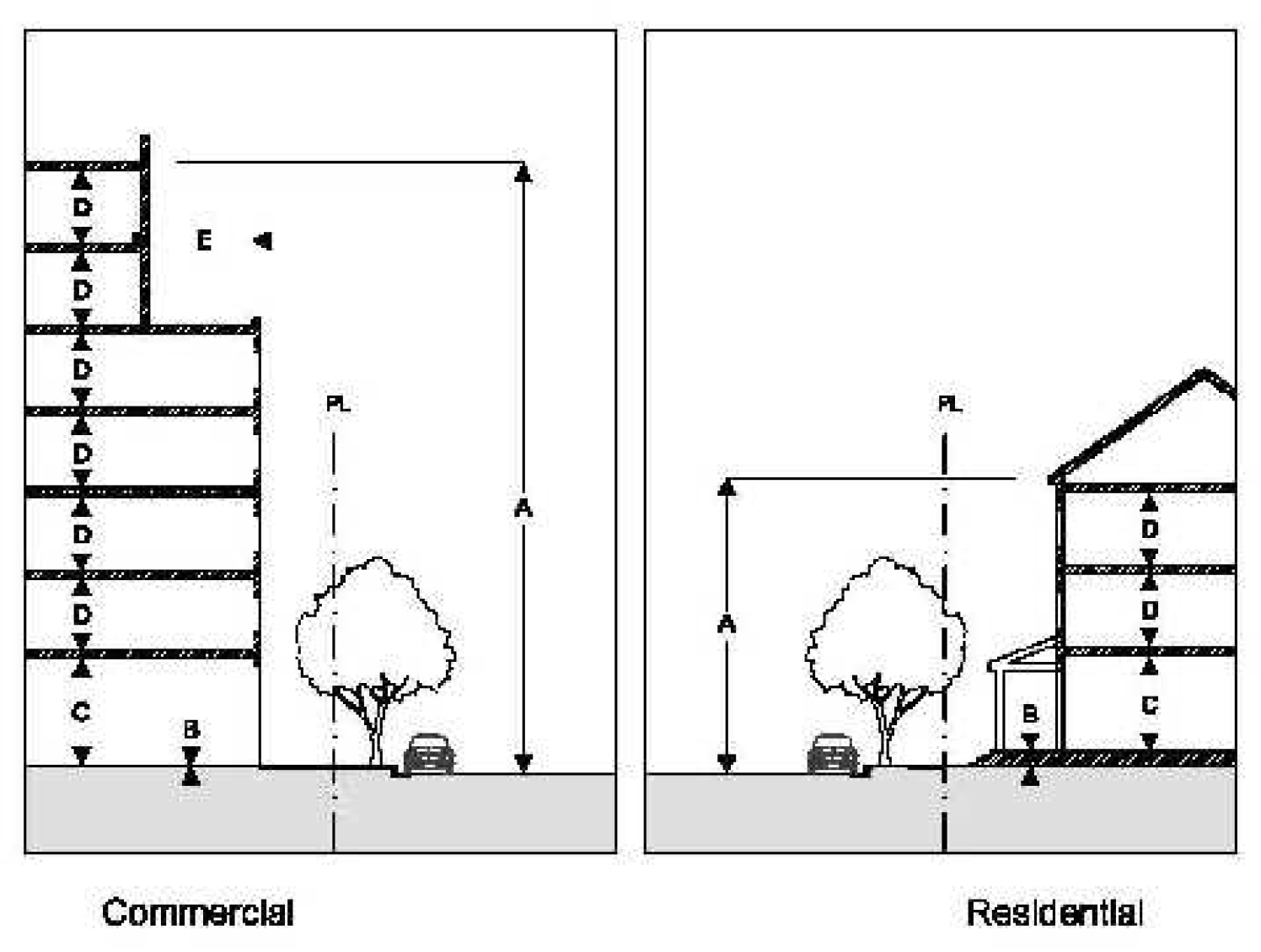
Table 32-194(a) Building HeightA. Maximum Number of Stories Varies by Subdistrict B. Ground Floor Finish Level Commercial Uses and Lobbies/Common Areas in multi-unit buildings in all subdistricts
6" max. Residential Units in the RAC Corridor, Transit Core, Transitional Mixed Use, FAD, and Greyhound Track subdistricts
18" min. Residential Units in the RAC Neighborhood
12" min. C. Ground Story Height Commercial and Mixed-Use Buildings
10' min./18' max. Residential Buildings
9' min./14' max. D. Upper Story Height 9' min./12' max. E. Upper Story Setbacks Above the 5th story Figure 32-194(b) Counting Number of Stories
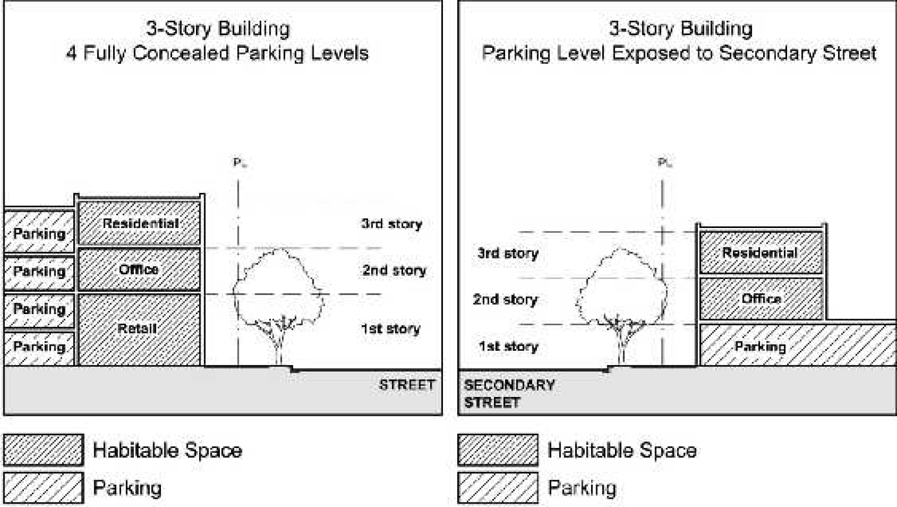
- Building placement.
- Front setbacks shall be measured from the property lines coinciding with public rights-of-way, including streets and parks, or from civic open spaces that meet the requirements in section 32-202. See Figure 32-194(c).
Figure 32-194(c) Building Frontage Requirement
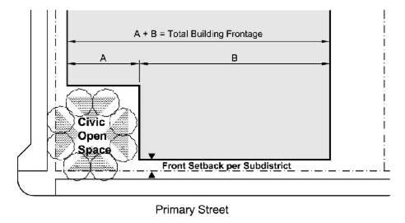
- In subdistricts that allow development with no side or rear setback, the following limitations also apply:
- Side and rear setbacks are required only when an abutting property has a building existing as of the effective date of this ordinance [November 5, 2014] with windows facing the adjoining lot line. Then, new development shall set back to provide at least ten feet of separation between the existing and new buildings.
- All light and air shafts, including those necessary per the percentage of openings on building facades, shall be provided within the lot pursuant to the Florida Building Code.
- Front setbacks shall be measured from the property lines coinciding with public rights-of-way, including streets and parks, or from civic open spaces that meet the requirements in section 32-202. See Figure 32-194(c).
- Frontage percentages. Building frontage is the percentage of the total width of a lot which is required to be occupied by the primary facade of a building. Each subdistrict provides minimum building frontages.
- The primary facade shall be parallel to the right-of-way, located in accordance with the minimum and maximum front setback requirements of the subdistrict.
- The location of the primary facade is not changed by architectural elements such as cornices, bay windows, awnings, porches, balconies, stoops, colonnades, arcades or forecourts.
- The primary facade may adjust around a civic open space that meets the requirements in § 32-202 as shown in Figure 32-194(c).
- Architectural standards. In all RAC subdistricts, the following architectural standards apply:
- Building facades facing streets or civic open spaces must have transparent windows covering a minimum of 20 percent and a maximum of 75 percent of the wall area of each story as measured between finished floors. Transparent means non-solar, non-mirrored glass with a light transmission reduction of no more than 20 percent.
- Windows and doors shall be vertically proportioned. Horizontal fenestration openings can meet this requirement by using muntins to subdivide glazed areas into vertical or square areas, or by using a series of vertically proportioned windows within the opening. Transom windows may be horizontal and semi-circular windows are permitted. Circular and square windows may be used as limited accent elements within the facade.
- All parapets shall have a cornice molding extending a minimum of two inches from the surface plane of the wall.
- An expression line shall be provided at the top of the first or second story. Expression lines shall be moldings extending a minimum of two inches from the surface plane of the building wall. Expression lines are intended to be continuous facade elements and may not be covered by awnings or signs. Significant architectural elements such as columns, pilasters, and towers may interrupt expression lines.
- Building facades shall be designed to visually screen parking and minimize large expanses of blank walls. Appropriate facade design incorporates the consistent use of materials and construction assemblies, fenestration patterns, architectural articulation, and features such as, but not limited to, the application of architectural screens, louvers, or glass, and the incorporation of vegetated surfaces and planters. Paint, faux treatments, scoring, construction joints, lighting, and material projections less than two inches are permitted, but do not fulfill the facade design requirements.
Figure 32-194(d) Character Examples for Screening Parking and Blank Walls
The Clematis Street garage utilizes consistent building materials with fenestration patterns to establish an attractive facade screening the parking levels over the retail space. The Lincoln Theater has the building circulation located along the streets, behind an architectural glass facade, screening the large expanses of blank walls associated with movie theaters. - In the absence of a building facade, a streetwall is required along both primary and secondary streets. Streetwalls shall be three feet to three feet six inches in height, located in line with the building facade or the front setback. Streetwalls shall be composed of either an opaque wall using the same material and color as the building or of a continuous, maintained hedge. In addition, one shade tree per 25 lineal feet, uniformly spaced, shall be installed along the length of the streetwall.
- An opaque, masonry wall six feet in height shall be built on the property line along all side and rear lot lines that abut single-family houses existing as of the date of this ordinance (Nov. 5, 2014) or lots in a residential zoning district. In addition one shade tree shall be planted every 20 feet along the wall.
- Minimum floor area for units. Minimum floor area for multifamily residential dwelling units shall be as shown in Table 32-194(b).
Table 32-194(b) Minimum Floor Area for Multi-Family Dwelling Units
Minimum per unit
(sq. ft.)Minimum average
(sq. ft.)350 750 - Dwelling units with a minimum floor area of 500 square feet or less may be counted as 0.5 dwelling units for residential density calculations.
- When affordable housing units are required, such units shall be proportionately distributed amongst unit types and sizes throughout the building(s) and site.
- The minimum average floor area as provided in Table 32-194(b) may be reduced to 500 square feet for the following developments:
- Minor developments on platted development sites that are less than or equal to 7,500 square feet.
- Developments where all residential units are made affordable to very-low-income persons as defined in the Florida Statutes and maintained for a period of at least 30 years guaranteed through a restrictive covenant in a form acceptable to the city attorney.
- Other standards. Other standards also apply to central RAC subdistricts:
- Frontage standards are in section 32-201.
- Civic open spaces standards are in section 32-202.
- Parking standards are in section 32-203.
- Street and block standards are in section 32-204.
- RAC development approval process in section 32-205.
- RAC density allocation standards are in section 32-206.
(Ord. No. 2014-31, § 24(Exh. B), 11-5-2014; Ord. No. 2016-20, § 1, 10-19-2016; Ord. No. 2021-003, § 3, 3-17-2021; Ord. No. 2024-017, § 2, 6-26-2024)
Sec. 32-195. RAC corridor subdistrict standards.
- Purpose and intent. The RAC corridor subdistrict is the most intense subdistrict in the RAC, accommodating a wide range of uses, including major employment, shopping, civic, and entertainment destinations as well as residential uses. Located along wide, existing commercial corridors, this subdistrict will have the largest scale of redevelopment and will create a vibrant, pedestrian-friendly, mixed-use district along main transit routes, in close proximity to the planned Tri-Rail Coastal Link station.
- Lot size and building placement. Table 32-195(a) provides the dimensional requirements regarding lot size, lot coverage, building setbacks, and building frontage for the RAC corridor subdistrict. Figure 32-195(a) illustrates the dimensional requirements from the table.
- A minimum of 75 percent of the linear width of the lot along a primary street shall be occupied by the primary facade of a building, located in accordance with the minimum and maximum setbacks in Table 32-195(a).
- Secondary streets do not have a required minimum building frontage and buildings shall be located in accordance with the minimum setback in Table 32-195(a).
- Buildings taller than five stories are subject to additional setback requirements in order to ensure harmony among adjacent buildings and architectural articulation of building mass.
- Buildings with more than 250 feet of street frontage shall provide a pedestrian passageway at least ten feet wide connecting rear parking to the sidewalk in the public right-of-way that the building faces.
- Building size and height.
- On primary streets, the minimum building height is two stories in height or one story at least 20 feet tall.
- Maximum building height is ten stories, except that buildings which provide all the following public benefits may build to 15 stories:
- Provide a total of 7.5 percent of the site, or the portion of the site proposed for development in a multi-phased project, as civic open space(s); and
- Provide street/streetscape improvements consistent with the city's complete streets efforts, on both sides of adjacent rights-of-way; and
- On secondary streets fully conceal parking levels at the sidewalk level for a depth of at least 20 feet by a story containing active uses, such as residential, office, or retail.
- Developments which meet the criteria in section (2) above, have 100 feet or more of frontage along federal highway, and are on three or more contiguous acres under unified ownership may receive approval from the city commission for five additional stories, for a total of 20.
- Within the central RAC zoning district, there is hereby established a RAC corridor transition area, which encompasses the area shown on the City of Hallandale Beach's official zoning map. Developments which meet the criteria in subsection (2) above within RAC corridor transition area, shall be limited to a maximum of 14 stories in height.
- Developments which meet the criteria in subsection (2) above, are encompassed within any block located south of Bluesten Park with frontage on federal highway, and are on one or more contiguous acres under unified ownership may receive approval from the city commission for five additional stories, for a total of 20; provided however, that any portion of the development within the RAC corridor transition area shall be limited in height to 14 stories.
Table 32-195(a) RAC Corridor Subdistrict Dimensional Requirements
Lot Size Lot Width 50 ft. min. Lot Area 5000 sf. min./100,000 max. Lot Coverage 95% max. Minimum Landscape Area 5% Building Placement A. Federal Hwy & Hallandale Beach Blvd. 15 ft. min.
20 ft. max.Primary Street Setback1
10 ft. min.
15 ft. max.Secondary Street Setback1
10 ft. min. B. Street Above the 5th Story 20 ft. C. Interior Side Setback 0 ft. min.2 D. Side Above the 5th Story 30 ft. min. E. Rear Setback 10 ft. min. F. Rear Above the 5th Story 30 ft. min. G. Building Frontage on Primary Streets 75% min.
100% max.Building Size & Height Min. Height Primary Streets 2 Stories, or 1 Story 20 ft. high Base Building Height Limit 10 Stories Maximum Building Height Limit 20 Stories Density Base Density 18 du/ac Max. Density 70-90 du/ac Civic Open Space Requirement All Sites 40,000 sq. ft. or more 5% All Sites Exceeding Base Density or Base Height Limit 7.5% 1 Side lot lines facing streets are regulated by front setback requirements.
2 All light and air shafts shall be provided within the lot See section 4.4.13(D)(1)(b)(2)Figure 32-195(a) RAC Corridor Building Placement & Height
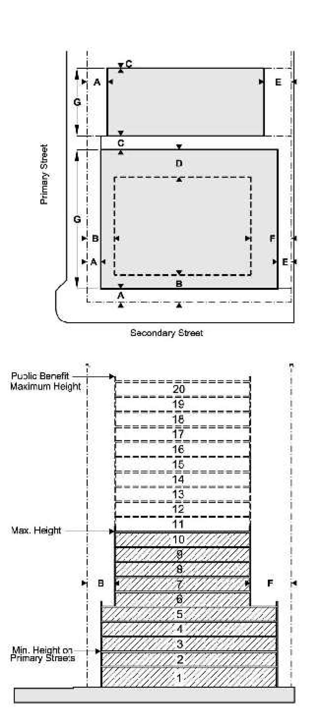
- Building uses and density.
- Specific uses. Specific uses in the RAC Corridor subdistrict shall conform to the regulations in section 32-193.
- Conditional use standards. Conditional uses must be approved pursuant to the provisions in section 32-964. In addition, the following regulations apply:
- Drive-through facilities for any use. Drive-through facilities for any use shall have the drive-through window(s) and stacking area located behind buildings on primary streets. On secondary streets, drive-through facilities may be located to the rear or side of buildings.
- Public parking garages. On primary streets, public parking garages open to the public as a principal use shall be lined along the sidewalk level for a depth of at least 20 feet by a story containing active use(s), such as residential, office, or retail.
- Interim parking lots. Parcels no greater than 25,000 square feet in area may be approved for interim parking lots serving general business and residential areas for specific timeframes. Interim parking lots must be maintained with a dust-free surface and shall have a perimeter landscaping comprised of a continuous maintained hedge three to four feet in height with one tree every 30 feet along streets and residential properties, with final details to be incorporated as conditions of approval. The approval may specify an annual review process that could result in revocation if these requirements and any other conditions of approval are not maintained.
- Base density. The base density in Table 32-195(a) is the number of dwelling units allowed per acre.
- Maximum density. The maximum density in Table 32-195(a) is the number of dwelling units allowed per acre based upon all the following performance criteria and the approval process set forth in sections 32-205 and 32-206:
- For density up to 70 du/ac, projects shall:
- Provide a total of 7.5 percent of the site, or the portion of the site proposed for development in a multi-phased project, as civic open space(s);
- Provide at least 15 percent of the project's total residential units as affordable housing maintained for a period of at least 30 years guaranteed by execution of a restrictive covenant or agreement in a form acceptable to the city attorney. The quality of finishes and fixtures for affordable housing units shall be identical to the quality of finishes and fixtures for market rate units; and
- Fully conceal parking garage levels on secondary streets at the sidewalk level for a depth of at least 20 feet by a story containing active use(s), such as residential, office, or retail; and
- Provide street/streetscape improvements consistent with the city's complete streets efforts, on both sides of adjacent rights-of-way.
- For density up to 90 du/ac, in addition to the criteria in (d)(4)(a), projects shall:
- Provide at least 15 percent of the project's total residential units as affordable housing maintained for a period of at least 30 years guaranteed by execution of a restrictive covenant or agreement in a form acceptable to the city attorney. The quality of finishes and fixtures for affordable housing units shall be identical to the quality of finishes and fixtures for market rate units; and
- Provide at least ten percent more parking than the amount required, accessible to the general public on an hourly or daily basis, with a fee to be determined by the owner.
- For density up to 70 du/ac, projects shall:
- Frontage standards.
- The front setback and side setbacks facing streets shall be hardscaped with the following design characteristics:
- Street trees shall be installed as set forth in section 32-201(c).
- A pedestrian walkway shall be accommodated as set forth in section 32-201(b).
- Any setback area not needed to accommodate a pedestrian walkway may be landscaped using trees, potted plants in removable planters, and ground planting that does not obstruct views into windows, and may also be used to accommodate merchandise displays or outdoor dining areas.
- The main entrance(s) to ground story lobbies or commercial space(s) shall be directly from and face a public right-of-way or civic open space. Doors allowing public access shall occur at intervals no greater than 75 feet.
- Building entrances shall use at least one of the following frontage types detailed in section 32-201:
- Stoop;
- Forecourt;
- Bracketed balcony;
- Storefront;
- Arcade/colonnade.
- The front setback and side setbacks facing streets shall be hardscaped with the following design characteristics:
- Other applicable standards. See section 32-194 and sections 32-201 through 32-204 for standards that also apply to the RAC Corridor subdistrict.
(Ord. No. 2014-31, § 24(Exh. B), 11-5-2014; Ord. No. 2015-14, § 1, 10-7-2015; Ord. No. 2020-020, § 1, 9-2-2020; Ord. No. 2024-015, § 2, 6-5-2024)
Sec. 32-196. Transit Core subdistrict standards.
- Purpose and intent. The Transit Core subdistrict is compact and appropriate for mid-rise multistory, mostly attached buildings accommodating a wide range of uses, including employment, shopping, civic, and entertainment destinations as well as residential uses. This subdistrict will create a vibrant, pedestrian-friendly, mixed-use district around the planned Tri-Rail Coastal Link station and along main transit routes.
- Lot size and building placement. Table 32-196(a) provides the dimensional requirements regarding lot size, lot coverage, building setbacks, and building frontage for the Transit Core subdistrict. Figure 32-196(a) illustrates the dimensional requirements from the table.
- A minimum of 75 percent of the linear width of the lot along a primary street shall be occupied by the primary facade of a building, located in accordance with the minimum and maximum setbacks in Table 32-196(a). Secondary streets do not have a required minimum building frontage and buildings shall be located in accordance with the minimum setback in Table 32-196(a).
- Buildings taller than five stories are subject to additional setback requirements in order to ensure harmony among adjacent buildings and architectural articulation of building mass.
- Buildings with more than 250 feet of street frontage shall provide a pedestrian accessway at least ten feet wide connecting rear parking to the sidewalk in the public right-of-way that the building faces.
- Building size and height.
- On primary streets, the minimum building height is two stories in height or one story 20 feet in height.
- Maximum building height is five stories, except that buildings which meet the following criteria and provide the following public benefits may build to eight stories in height:
- Be located east of Dixie Highway.
- Provide a total of 7.5 percent of the site, or the portion of the site proposed for development in a multi-phased project, as civic open space(s);
- If located on property across from Bluesten Park on SE 5th Street or SE 7th Street, provide residential uses or accessory residential uses only in all stories above the first story; the first story may be business, civic, residential or a combination of uses; and
- If located on property on Federal Highway, provide business uses in the first story; upper stories may be business, civic, residential or a combination of uses.
Table 32-196(a) Transit Core Subdistrict Dimensional Requirements
Lot Size Lot Width 50 ft. min. Lot Area 5000 sf. min./
100,000 max.Lot Coverage 95% max. Minimum Landscape Area 5% Building Placement A. Primary Street Setback2 10 ft. min./
15 ft. max.Secondary Street Setback
10 ft. min. B. Street Above the 5th Story 20 ft. C. Interior Side Setback2 0 ft. min.3 D. Side Above the 5th Story 30 ft. min. E. Rear Setback 10 ft. min. F. Rear Above the 5th Story 20 ft. min. G. Building Frontage on Primary Streets 75% min. Building Size & Height Min. Height Primary Streets 2 Stories, or 1 Story 20 ft. high Base Building Height Limit 5 Stories Maximum Height Limit 8 Stories Density Base Density 18 du/ac Max. Density 50 du/ac Civic Open Space Requirement Sites Greater than 40,000 sq. ft. 5% All Sites Exceeding Base Density or Base Height Limit 7.5% 1 Side lot lines facing streets are regulated by front setback requirements.
2 All light and air shafts shall be provided within the lot See sectionFigure 32-196(a) Transit Core Building Placement & Height
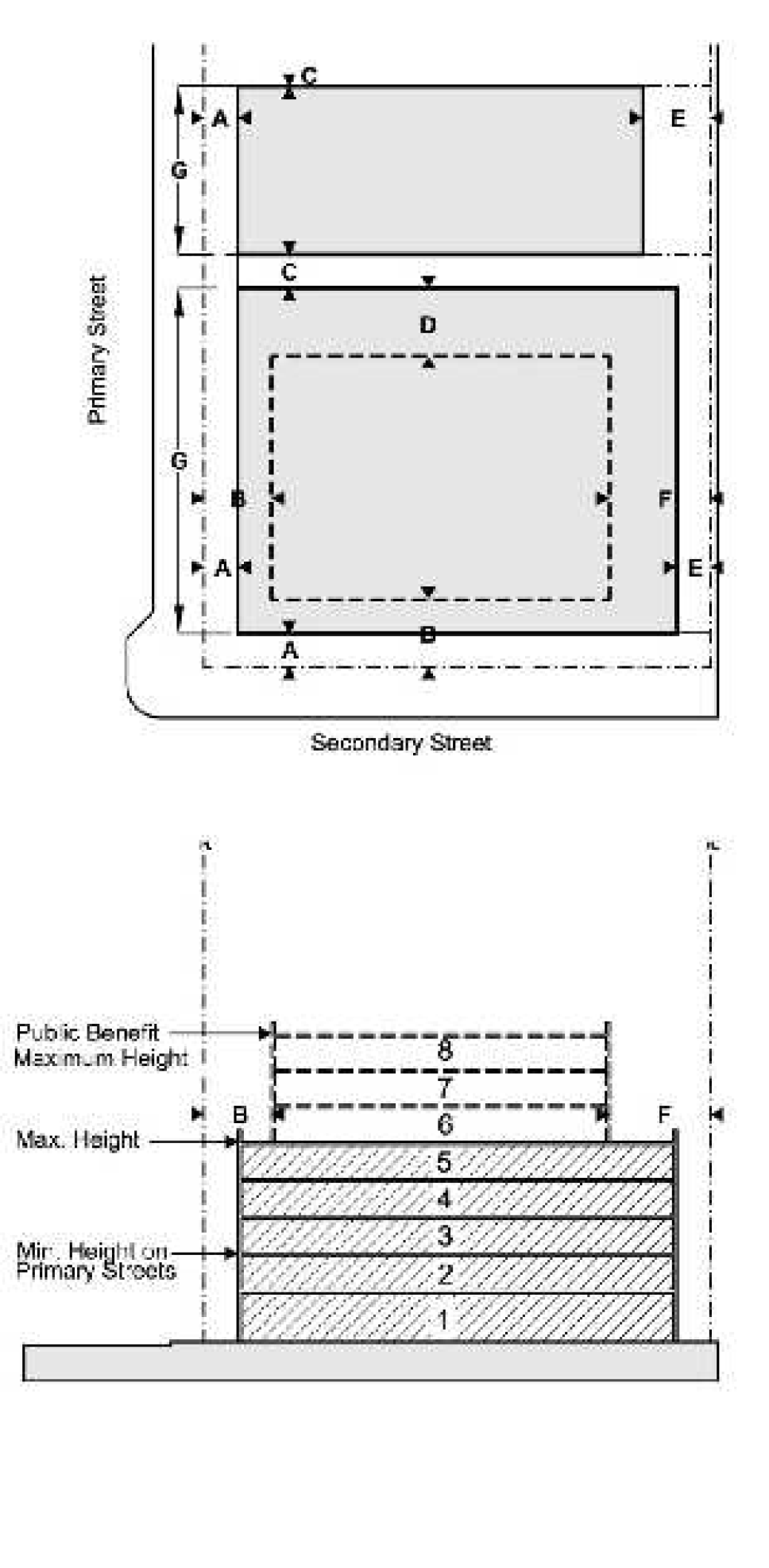
- Building uses and density.
- Specific uses. Specific uses in the Transit Core subdistrict shall conform to the regulations in section 32-193.
- Conditional use standards. Conditional uses must be approved pursuant to the provisions in section 32-964. In addition, the following regulations apply:
- Parking garages. On primary streets, parking garages open to the public as a principal use, shall be lined along the sidewalk level for a depth of at least 20 feet by a story containing active use(s), such as residential, office, or retail.
- Interim parking lots. Parcels no greater than 25,000 square feet in area may be approved for interim parking lots serving general business and residential areas for specific timeframes. Interim parking lots must be maintained with a dust-free surface and shall have perimeter landscaping comprised of a continuous maintained hedge three to four feet in height with one tree every 30 feet installed along streets and residential properties, with final details to be incorporated as conditions of approval. The approval may specify an annual review process that could result in revocation if these requirements and any other conditions of approval are not maintained.
- Base density. The base density in Table 32-196(a) is the number of dwelling units allowed per acre.
- Maximum density. The maximum density in Table 32-196(a) is the number of dwelling units allowed per acre based upon all the following performance criteria and the approval processes set forth in sections 32-205 and 32-206:
- Provide a total of 7.5 percent of the site, or the portion of the site proposed for development in a multi-phased project, as civic open space(s);
- Provide at least 15 percent of the project's total residential units as affordable housing maintained for a period of at least 30 years guaranteed by execution of a restrictive covenant or agreement in a form acceptable to the city attorney. The quality of finishes and fixtures for affordable housing units shall be identical to the quality of finishes and fixtures for market rate units; and
- Fully concealed parking garage levels on secondary streets at the sidewalk level for a minimum depth of 20 feet with a story containing active uses, such as residential, office, or retail, and
- Provide street/streetscape improvements consistent with the city's complete streets efforts, on both sides of adjacent rights-of-way.
- Frontage standards.
- The front setback and side setbacks facing streets shall be hardscaped with the following design characteristics:
- Street trees shall be installed as set forth in section 32-201(c).
- A pedestrian walkway shall be accommodated as set forth in section 32-201(b).
- Any setback area not needed to accommodate a pedestrian walkway may be landscaped using trees, potted plants in removable planters, or ground planting that does not obstruct views into windows, and may also be used to accommodate merchandise displays or outdoor dining areas.
- The main entrance(s) to ground story lobbies or commercial space(s) shall be directly from and face a public right-of-way or civic open space. Doors allowing public access shall occur at intervals no greater than 75 feet.
- Building entrances shall use at least one of the following frontage types detailed in section 32-201:
- Stoop;
- Forecourt;
- Bracketed balcony;
- Storefront;
- Arcade/colonnade.
- The front setback and side setbacks facing streets shall be hardscaped with the following design characteristics:
- Other applicable standards. See section 32-194 and sections 32-201 through 32-204 for standards that also apply to the Transit Core subdistrict.
(Ord. No. 2014-31, § 24(Exh. B), 11-5-2014; Ord. No. 2020-020, § 1, 9-2-2020; Ord. No. 2024-015, § 2, 6-5-2024)
Sec. 32-197. RAC Neighborhood subdistrict standards.
- Purpose and intent. The RAC Neighborhood subdistrict provides for a wide range of residential building types to meet the demands of a diverse community.
- Building types. In order to ensure compatibility, new development shall be in form of one of the following building types:
- House. A single-family detached building with front, side and rear yards.
- Duplex: A building housing two single-family units attached on one side.
- Townhouse. A row of three or more single-family units, attached on at least one side, each with a private rear yard and a front entrance directly accessible from a public right-of-way.
- Apartment house. A detached building resembling a large house, but containing multiple residential dwellings above and/or beside each other.
- Courtyard building. A building designed to accommodate multiple residential dwellings above and beside each other, arranged around a central garden or patio that is partially or wholly open to the street.
- Lot size, building placement and height.
- Table 32-197(a) provides the dimensional requirements for lot size, building placement, frontage, and height for each of the allowable building types in the RAC Neighborhood subdistrict. Figures 32-197(a) through (e) illustrate the dimensional requirements.
Table 32-197(a) - RAC Neighborhood Subdistrict Dimensional Requirements
Lot Size House Duplex Townhouse Apartment House Courtyard Building Lot Width (min.) 50 ft.1 75 ft.1 80 ft.2 with alley
200 ft.2 no alley100 ft./1
120 ft.150 ft./1
300 ft.Lot Area (min./max.) 5,000 sf./1
10,000 sf.6,000 sf./1
7,500 sf.8,000 sf.2 /
No Max.410,000 sf./1
15,000 sf.12,500 sf./1
45,000 sf.Lot Coverage (max.) 60% 65% 85% 85% 85% Min. Landscape Area 40% 35% 15% 15 15% Building Placement A.Front Setback3 (min./max.) 12 ft./25 ft. 25 ft. min. 12 ft./25 ft. 12 ft./25 ft. 12 ft./25 ft. B. Side Setback 5 ft. min;
15 ft. total5 ft. min;
15 ft. total10 ft. min. 5 ft. min;
15 ft. total.5 ft. min;
15 ft. totalC. Rear Setback (min.) 10 ft. 10 ft. 20 ft. with alley
10 feet no alley20 ft. with alley
10 ft. no alley20 ft. with alley
10 ft. no alleyD. Building Frontage 40% - 70% 40% - 70% 70% - 90% 45% - 80% 50% - 90% Building Height Min. Height 1 Story 1 Story 2 Stories 1 Story 1 Story Max. Building Height 3 stories;
5 stories subject to requirements of Sec. 32-197(d)(5)Density Base Density 18 du/ac Max. Density - 50 du/ac 1 Smaller lots platted prior to November 21, 1978, shall be permitted at their platted size, and are not subject to the provisions of article VII.
2 These sizes reflect the parcel necessary to redevelop land into a townhouse project.
3 Corner lots must meet front setbacks on both streets.
4 Sites must follow the street and block standards in section 32-204.Figure 32-197(a) House Building Placement, Height & Character Examples
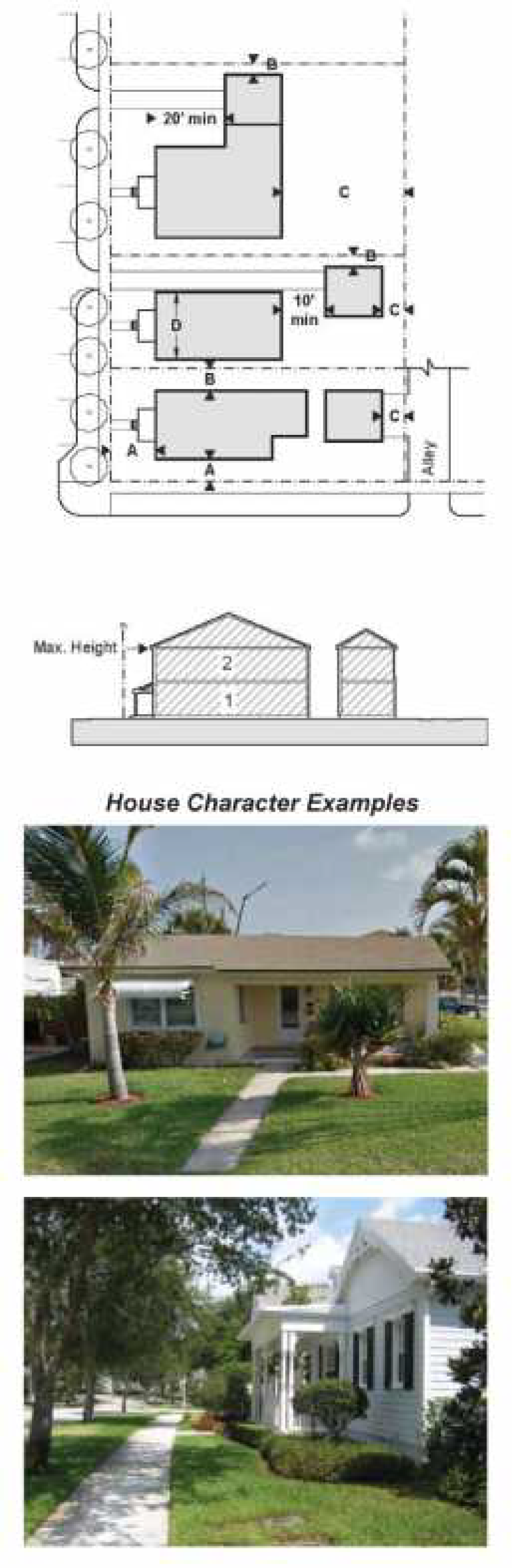
Figure 32-197(b) Townhouse Building Placement, Height & Character Examples
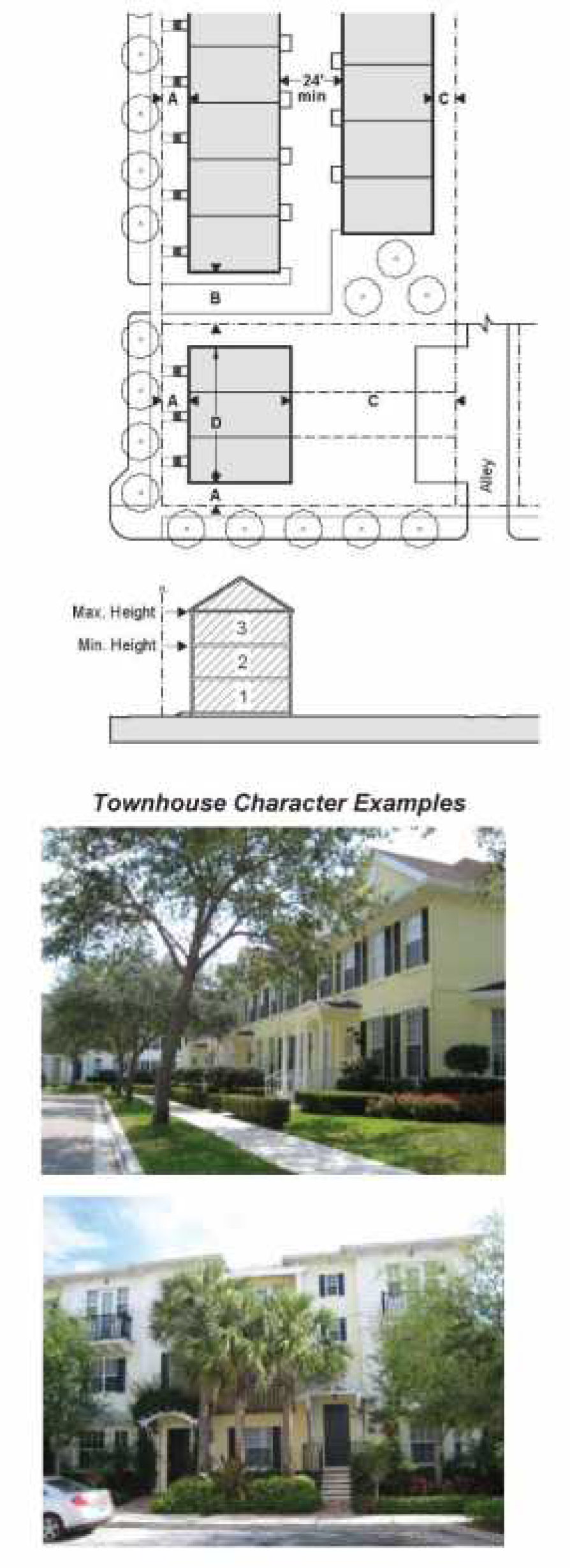
Figure 32-197(c) Apartment House Building Placement, Height & Character Examples
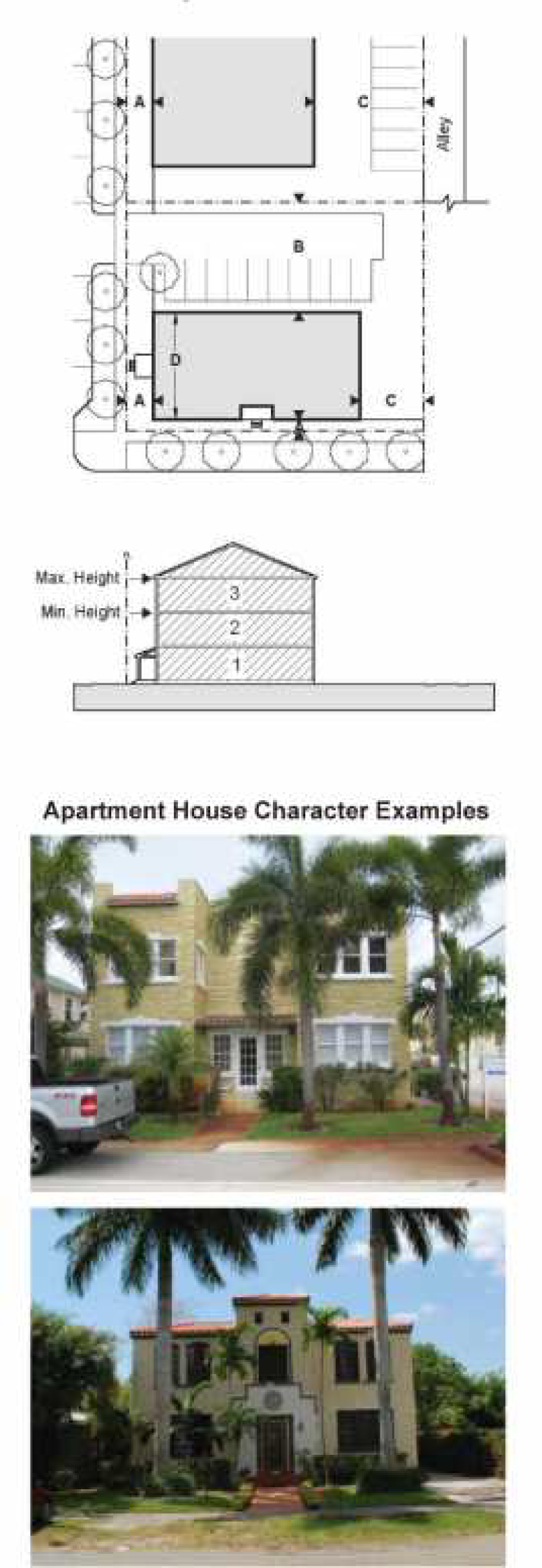
Figure 32-197(d) Courtyard Building Placement, Height & Character Examples
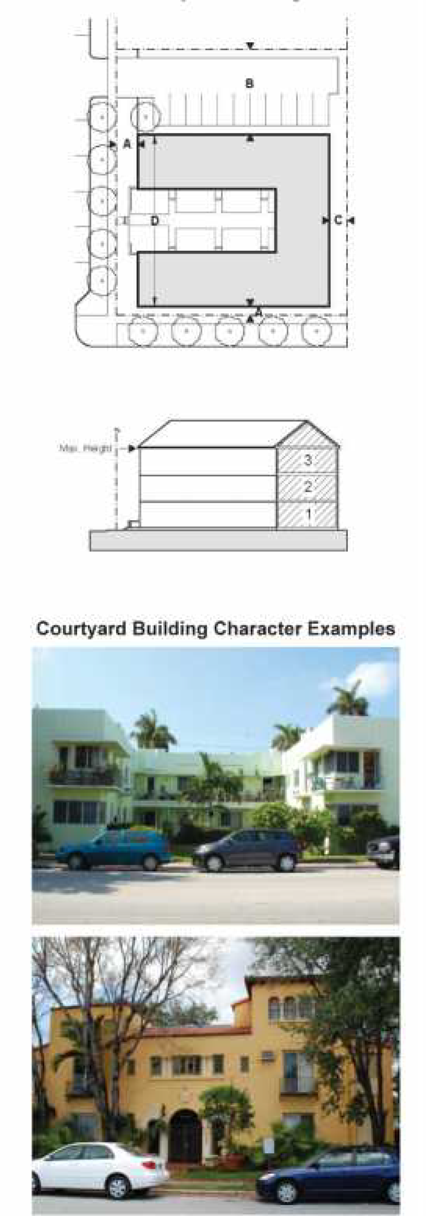
- Where the property to be developed abuts an existing building or buildings, the proposed building shall be located to match or provide a transition to the adjacent front setback. The director of development services will administratively determine the appropriate front setback.
- Duplexes. Duplexes are not a desirable housing type in the Central RAC since parking areas tend to dominate front yards, interrupting sidewalks and limiting areas for street trees. In order to minimize this impact as much as possible, duplexes shall:
- Continue sidewalk widths and materials across front parking areas; and
- Arrange parking spaces so that at least two shade trees are planted in the front yard, or within the adjacent public right-of-way.
Figure 32-197(e) Duplex Building Placement & Height
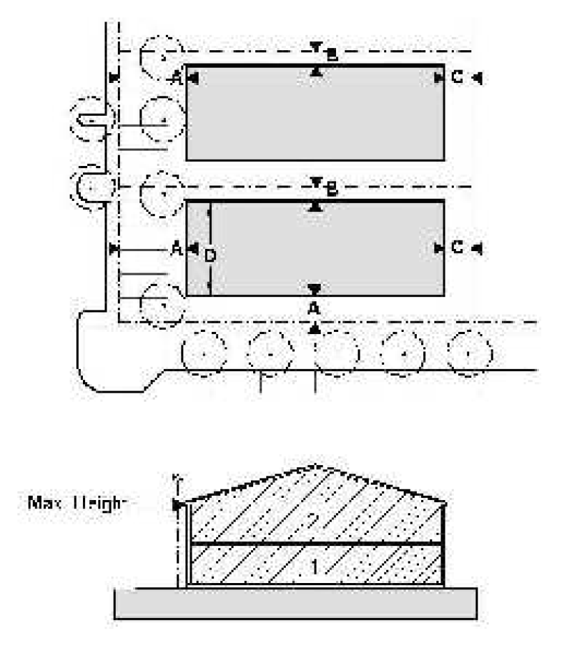
- Courtyard buildings have the following additional criteria:
- A courtyard, open to the sky, of at least 12 percent of the lot area shall be provided.
- The longer dimension of the courtyard shall be at least 30 feet if oriented east-west and at least 40 feet if oriented north-south.
- The main entrance to ground story dwellings shall be directly from the street or the common courtyard.
- In courtyards at least 35 feet wide, open-air porches, stoops, and balconies may encroach from two sides. In courtyards less than 35 feet wide, encroachment is permitted only from one side.
- An open-air covered pedestrian passageway, at least ten feet wide, may connect the courtyard, through the building to the street. The passageway may be gated.
- Townhouses have the following additional criteria:
- Townhouses shall occur in an array of at least three, side by side.
- No more than eight contiguous townhouses shall occur without a pedestrian passageway or landscaped area at least 20 feet wide between sides.
- Groupings of townhouses shall have at least 24 feet of separation between the fronts and/or backs of buildings.
- Garage doors shall not face the street.
- Townhouses in the RAC Central zoning district are exempt from the site development standards in section 32-731(a).
- Townhouse units shall have a minimum width of 20 feet and 850 square feet in unit area.
- Table 32-197(a) provides the dimensional requirements for lot size, building placement, frontage, and height for each of the allowable building types in the RAC Neighborhood subdistrict. Figures 32-197(a) through (e) illustrate the dimensional requirements.
- Building uses and density.
- Specific uses. Specific uses in the RAC Neighborhood subdistrict shall conform to the regulations in section 32-193.
- Conditional use standards. Conditional uses must be approved pursuant to the provisions in section 32-964.
- Base density. The base density in Table 32-197(a) is the number of dwelling units allowed per acre.
- Accessory dwellings units. Accessory dwelling units (ADU) shall be permitted within this subdistrict pursuant to section 32-244, accessory dwelling units, of this chapter. Regulations of this subdistrict shall apply in cases where single-family zoning districts are referenced.
- Maximum density. The maximum density in Table 32-197(a) is the number of dwelling units allowed per acre based upon the following performance criteria and the approval processes set forth in sections 32-205 and 32-206:
- Development shall be in the form of townhouses, apartment houses, or courtyard buildings, and
- All parking areas shall be located to the rear or the side of buildings. Parking facilities may be designed so that vehicles back into a public alley, but shall not allow vehicles to back into a street.
- Provide at least 15 percent of the project's total residential units as affordable housing maintained for a period of at least 30 years guaranteed by execution of a restrictive covenant or agreement in a form acceptable to the city attorney. The quality of finishes and fixtures for affordable housing units shall be identical to the quality of finishes and fixtures for market rate units.
- Frontage standards.
- The front setback and side setbacks facing streets shall be landscaped and shall have the following characteristics:
- Street trees shall be installed as set forth in section 32-201(c).
- A pedestrian walkway shall be accommodated as set forth in section 32-201(b).
- Any remaining setback area not used to accommodate a pedestrian walkway, shall be landscaped.
- All units located along a street shall have a primary building entrance directly accessible from and facing the street. Building entrances shall use at least one of the following frontage types detailed in section 32-201(a):
- Porch;
- Stoop;
- Bracketed balcony.
- The front setback and side setbacks facing streets shall be landscaped and shall have the following characteristics:
- Other applicable standards. See section 32-194 and sections 32-201 through 32-204 for standards that also apply to the RAC Neighborhood subdistrict.
(Ord. No. 2014-31, § 24(Exh. B), 11-5-2014; Ord. No. 2020-020, § 1, 9-2-2020; Ord. No. 2022-029, § 1, 11-2-2022; Ord. No. 2024-005, § 2, 1-17-2024; Ord. No. 2024-015, § 2, 6-5-2024)
Sec. 32-198. Transitional Mixed Use subdistrict standards.
- Purpose and intent. The Transitional Mixed Use subdistrict is appropriate for single and multistory development along commercial corridors and provides an appropriate transition in scale to adjoining low rise residential areas. This subdistrict accommodates a wide range of commercial uses with opportunity to incorporate residential uses, if desired.
- Lot size and building placement. Table 32-198(a) provides the dimensional requirements regarding lot size, lot coverage, building setbacks, and building frontage for the Transitional Mixed Use subdistrict. Figure 32-198(a) illustrates the dimensional requirements from the table.
- A minimum of 50 percent of the linear width of the lot along a primary street shall be occupied by the primary facade of a building, located in accordance with the minimum and maximum setbacks in Table 32-198(a).
- Secondary streets do not have a required minimum building facade frontage and buildings shall be located in accordance with the minimum setback in Table 32-198(a).
- Buildings with more than 250 feet of street frontage shall provide a pedestrian passageway at least 10 feet wide connecting rear parking to the sidewalk in the public right-of-way that the building faces.
- Building size and height.
- On primary streets, the minimum building height is one story in height.
- Maximum building height is three stories. Up to five stories may be permitted, subject to requirements of subsection 32-198(d)(4).
- Building uses and density.
- Specific uses. Specific uses in the Transitional Mixed Use subdistrict shall conform to the regulations in section 32-193.
- Conditional use standards. Conditional uses must be approved pursuant to the provisions in section 32-964. In addition, the following regulations apply:
- Drive-through facilities for any use. Drive-through facilities for any use shall have the drive-through window(s) and stacking area located to the rear or side of buildings.
- Parking garages. On primary streets, parking garages open to the public as a principal use, shall be lined along the sidewalk level for a depth of at least 20 feet by a story containing active use(s), such as residential, office, or retail.
- Interim parking lots. Parcels no greater than 25,000 square feet in area may be approved for interim parking lots serving general business and residential areas for specific timeframes. Interim parking lots must be maintained with a dust-free surface and shall have perimeter landscaping comprised of a continuous maintained hedge three to four feet in height with one tree every 30 feet installed along streets and residential properties, with final details to be incorporated as conditions of approval. The approval may specify an annual review process that could result in revocation if these requirements and any other conditions of approval are not maintained.
- Vehicle sales, repair, or service. These uses are not permitted along primary streets.
- Base density. The base density in Table 32-198(a) is the number of dwelling units allowed per acre.
- Maximum density. The maximum density in Table 32-198(a) is the number of dwelling units allowed per acre based upon the approval processes set forth in sections 32-205 and 32-206.
- Provide at least 15 percent of the project's total residential units as affordable housing maintained for a period of at least 30 years guaranteed by execution of a restrictive covenant or agreement in a form acceptable to the city attorney. The quality of finishes and fixtures for affordable housing units shall be identical to the quality of finishes and fixtures for market rate units; and
Table 32-198(a) Transitional Mixed Use Subdistrict
Dimensional Requirements Lot Size Lot Width 50 ft. min. Lot Area 5000 sf. min./
100,000 max.Lot Coverage 95% max. Minimum Landscape Area 5% Building Placement A. Primary Street Setback2 10 ft. min./
15 ft. max.Secondary Street Setback
10 ft. min. B. Interior Side Setback2 0 ft. min.2 C. Rear Setback 10 ft. min. D. Building Frontage on Primary Streets 50% min. Building Size & Height Min. Height Primary Streets 1 Story Max. Building Height 3 stories;
5 stories subject to requirements of subsection 32-198(d)(4)Density Base Density 18 du/ac Max. Density 50 du/ac Civic Open Space Requirement Sites Greater than 40,000 sq. ft. 5% 1 Side lot lines facing streets are regulated by front setback requirements.
2 All light and air shafts shall be provided within the lot See sectionFigure 32-198(a)
Transitional Mixed Use Subdistrict Building Placement & Height
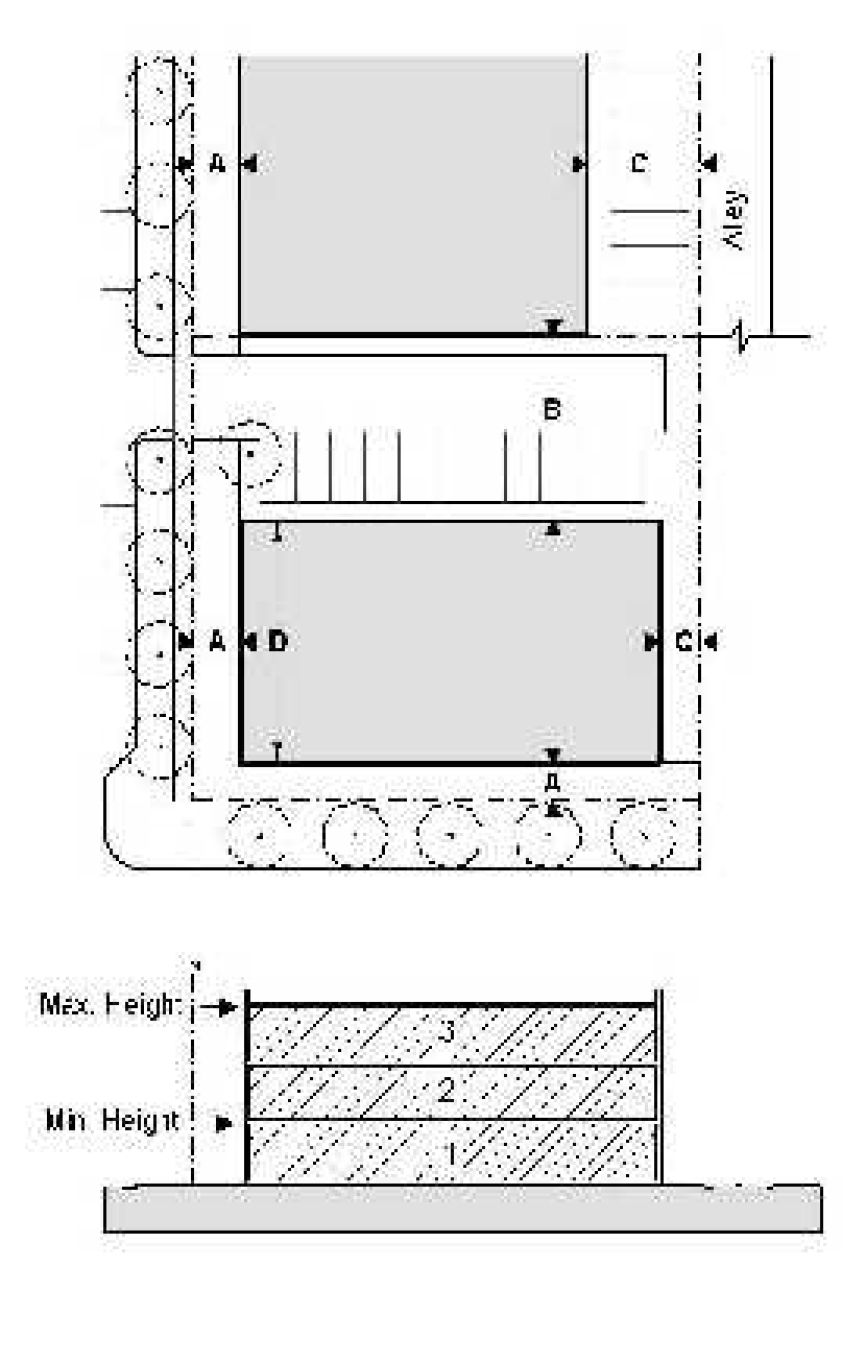
- Provide at least 15 percent of the project's total residential units as affordable housing maintained for a period of at least 30 years guaranteed by execution of a restrictive covenant or agreement in a form acceptable to the city attorney. The quality of finishes and fixtures for affordable housing units shall be identical to the quality of finishes and fixtures for market rate units; and
- Frontage standards.
- The front setback and side setbacks facing streets shall be landscaped and shall have the following characteristics:
- Street trees shall be installed as set forth in section 32-201(c).
- A pedestrian walkway shall be accommodated as set forth in section 32-201(b).
- Any remaining setback area not used to accommodate a pedestrian walkway, shall be landscaped using trees, potted plants in removable planters, or ground planting that does not obstruct views into windows, and may also be used to accommodate merchandise displays or outdoor dining areas.
- The main entrance(s) to ground story lobbies or commercial space(s) shall be directly from and face a public right-of-way or civic open space. Doors allowing public access shall occur at intervals no greater than 75 feet.
- Building entrances shall use at least one of the following frontage types detailed in section 32-201:
- Stoop;
- Forecourt;
- Bracketed balcony;
- Storefront;
- Arcade/colonnade.
- The front setback and side setbacks facing streets shall be landscaped and shall have the following characteristics:
- Other applicable standards. See section 32-194 and sections 32-201 through 32-204 for standards that also apply to the Transitional Mixed Use subdistrict.
(Ord. No. 2014-31, § 24(Exh. B), 11-5-2014; Ord. No. 2020-020, § 1, 9-2-2020; Ord. No. 2024-005, § 2, 1-17-2024; Ord. No. 2024-015, § 2, 6-5-2024; Ord. No. 2024-027, § 2, 10-9-2024)
Sec. 32-199. District 8 subdistrict standards.
- Purpose and intent. The District 8 subdistrict is intended to be a unique, lively arts and commerce area accommodating a wide range of uses including residential, retail, art, culture and design.
- Lot size and building placement. Table 32-199(a) provides the dimensional requirements regarding lot size, lot coverage, building setbacks, and building frontage for the district 8 subdistrict. Figure 32-199(a) illustrates the dimensional requirements from the table.
- A minimum of 50 percent of the linear width of the lot along a primary street shall be occupied by the primary facade of a building, located in accordance with the minimum and maximum setbacks in Table 32-199(a).
- Secondary streets do not have a required minimum building facade frontage and buildings shall be located in accordance with the minimum setback in Table 32-199(a).
- Buildings with more than 250 feet of street frontage shall provide a pedestrian passageway at least ten feet wide connecting rear parking to a sidewalk in the public right-of-way;
- Building size and height.
- On primary streets, the minimum building height is one story in height.
- Maximum base building height is four stories.
- Building uses and density.
- Specific uses. Specific uses in the District 8 subdistrict shall conform to the regulations in section 32-193.
- Conditional use standards. Conditional uses must be approved pursuant to the provisions in section 32-964. In addition, the following regulations apply:
- Drive-through facilities for any use. Drive-through facilities for any use shall have the drive-through window(s) and stacking area located to the rear or side of buildings.
- Interim parking lots. Parcels no greater than 25,000 square feet in area may be approved for interim parking lots serving general business and residential areas for specific timeframes. Interim parking lots must be maintained with a dust-free surface and shall have perimeter landscaping comprised of a continuous maintained hedge three to four feet in height with one tree every 30 feet installed along streets and residential properties, with final details to be incorporated as conditions of approval. The approval may specify an annual review process that could result in revocation if these requirements and any other conditions of approval are not maintained.
- Base density. The base density in Table 32-199(a) is the number of dwelling units allowed per acre.
- Buildings exceeding maximum height or density. The maximum building height is four stories. The maximum density in Table 32-199(a) is the number of dwelling units allowed per acre based upon the approval processes set forth in sections 32-205 and 32-206. Buildings which meet all of the following criteria may build up to eight stories in height and to the maximum density specified in Table 199(a):
- Meet the requirements of the community redevelopment agency (CRA) arts and culture in public places program upon its implementation. Developments proposed prior to the implementation of the arts and culture in public places program, shall provide on-site installation of artwork which shall be reviewed by the directors of the CRA and development services department for content and design. If the proposed design is denied, the applicant may appeal to the city commission. All arts and culture in public places projects shall be accessible to the public.
- Be located on NE 1st Avenue or NE 3rd Street.
- Meet the city's green building requirement level beyond the base certification.
- Provide only business uses in the first story; upper stories may be commercial, residential or a combination of permitted uses.
- First floor garage areas fronting on primary streets shall be screened from view at the sidewalk level by a minimum of 20 feet of habitable space occupied by retail, office or other commercial uses. Upper level of the garage shall have architectural treatment to reflect a building façade or screened by an art installation approved by the CRA and development services directors. Parking lots on secondary streets shall also be screened from street view by an art installation approved by the CRA and development services directors.
- Provide at least 15 percent of the project's total residential units as affordable housing maintained for a period of at least 30 years guaranteed by execution of a restrictive covenant or agreement in a form acceptable to the city attorney. The quality of finishes and fixtures for affordable housing units shall be identical to the quality of finishes and fixtures for market rate units.
Table 32-199(a) - District 8 Subdistrict
Dimensional Requirements Lot Size Lot Width 50 ft. min. Lot Area 5000 sf. min./
100,000 max.Lot Area—Properties west of NE 1st Avenue 2,500 sf Lot Coverage 95% max. Lot Coverage—Properties west of NE 1st Avenue 100% Minimum Landscape Area 5% Minimum Landscaping Area—Properties west of NE 1st Avenue 0% Building placement A. Primary Street Setback2 10 ft. min./
15 ft. max.Primary Street Setback—Properties west of NE 1st Avenue
0 ft. Secondary Street Setback
10 ft. min. B. Street above the 4th story 10 ft. min. C. Interior Side Setback2 0 ft. min.2 D. Interior side above the 4th story 10 ft. min. E. Rear Setback 10 ft. min. F. Rear Setback—Properties west of NE 1st Avenue 0 ft. G. Rear above the 4th story 10 ft. min. H. Building Frontage on Primary Streets 50% min. Building Size & Height Min. Height Primary Streets 1 Story Base Building Height 4 Stories Max. Building Height 8 Stories Density Base Density 25 du/ac Max. Density 50 du/ac Civic Open Space Requirement Sites Greater than 40,000 sq. ft. 5% 1 Side lot lines facing streets are regulated by front setback requirements.
2 All light and air shafts shall be provided within the lot See subsection 32-194(b)(2)Figure 32-199(a)
Fashion/Art/Design Subdistrict
Building Placement & Height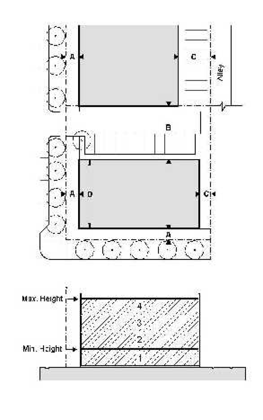
- Frontage standards.
- The front setback and side setbacks facing streets shall be landscaped and shall have the following characteristics:
- One royal palm or shade tree shall be planted in the right-of-way for each 20 feet of linear street frontage of a property. In the absence of a pervious swale, and where installation of new sidewalk segments are required by this chapter, street trees shall be planted within the sidewalk utilizing a minimum of nine and a maximum of 16 square feet of unpaved planting area, provided that at least four feet of pedestrian clearance is maintained. All trees shall be planted and maintained in compliance with article IV, division 8 of this chapter
- A pedestrian walkway at least eight feet wide shall be accommodated as set forth in section 32-201(b).
- Any remaining setback area not used to accommodate a pedestrian walkway shall be landscaped using trees, potted plants in removable planters, or ground planting that does not obstruct views into windows, and may also be used to accommodate merchandise displays or outdoor dining areas.
- Except for the required street wall in section 32-194(d)(6), fences and walls are prohibited within the front setback.
- The main entrance(s) to ground story lobbies or commercial space(s) shall be directly from and face a public right-of-way or civic open space. Doors allowing public access shall occur at intervals no greater than 75 feet.
- Building entrances shall use at least one of the following frontage types detailed in section 32-201:
- Stoop;
- Forecourt;
- Bracketed balcony;
- Storefront;
- Arcade/colonnade.
- The front setback and side setbacks facing streets shall be landscaped and shall have the following characteristics:
- Murals. In addition to the signs permitted in section 32-605(d), establishments in the Fashion/Arts/Design subdistrict may have murals. Murals are encouraged in the Fashion/Art/Design subdistrict to improve the appearance of buildings through the use of highly visible and tasteful art. Murals shall meet the following criteria and process:
- The content shall be of an aesthetically pleasing nature with artistic value and contain no copy advertising a specific business, service, or product.
- Applicants shall submit an application to development services department containing the names and addresses of persons in control or possession of the real property upon which mural will be located, a drawing or rendering of the proposed design, location, dimensions, colors and materials. If the applicant is not the same person as the person in control or possession of the affected real property, the applicant shall provide appropriate proof of authority to proceed with the application. The application shall be accompanied by an application fee which is on file in the city clerk's office. The application shall be reviewed by the development services director and the CRA director for content and size. If the proposed design is denied, the applicant may appeal to the city commission.
- Outdoor display. Outdoor display of merchandise in the Fashion/Arts/Design subdistrict is permitted and exempt from the provisions of section 32-415. Only retailers may display their items in outdoors and the items may only be displayed in the area immediately fronting the individual store selling the item. Items may not be displayed in parking lots. Retailers displaying their merchandise on sidewalks or walkways must allow for the minimum pedestrian walkway as set forth in section 32-201(b).
- Parking exemptions, reductions, and design.
- Parking exemption for permitted existing uses. Any change of a permitted business use, or expansion of an existing permitted business use existing at the time of the effective date of this provision (date of provision) that results in the addition of no more than 100 percent of the existing floor area of the building shall be exempt from the minimum number of off-street parking spaces required per use of subsections 32-203; provided however, that, when in the opinion of the city engineer, there is sufficient right-of-way width which is not otherwise necessary for through traffic, and which can accommodate on-street parking in the adjacent public right-of way, the property owner shall provide on-street parking as may be possible adjacent to the property. The city engineer shall check and approve the plan showing such improvement so as to provide proper drainage and design.
- Nonconforming parking. Any change of a business use, renovation or expansion of an existing business use with a nonconforming parking lot shall be permitted to maintain the existing layout. In the event the property owner wishes to reconfigure a nonconforming parking layout, the property owner shall be exempt from the requirements of subsection 32-453(i)(2); however, the property owner shall submit a new layout to the department of sustainable development director for consideration. Landscaping associated with the reconfigured parking layout shall be subject to review and approval by the director. The director, with the input of the city engineer, shall review such requests on a case-by-case basis and may approve such requests provided there is no public safety or traffic circulation concerns.
- Parking exemptions for new development. Within the District 8 subdistrict, restaurants, and alcoholic beverage establishments on development sites with up to 20,000 square feet in lot area shall be exempt from parking requirements.
A covenant running with the land, approved by the city attorney, shall be recorded to ensure that new development with parking exemptions per this subsection is limited to restaurant and alcoholic beverage establishments and no changes in use are permitted on the property unless a parking facility with the number of spaces required by section 32-203 for such use is provided. - Parking exemptions for development located on the west side of NE 1st Avenue. Within the District 8 subdistrict, all existing or new development shall be exempt from parking requirements.
- Parking reductions for new development. Within the District 8 subdistrict, the parking requirements for the following uses shall be reduced by 50 percent of the required parking specified by section 32-203.
- Stores and services, general.
- Family entertainment center.
- Restaurants and alcoholic beverage establishments which do not qualify for the parking exemptions in subsection (3).
- Other applicable standards. See section 32-193 and sections 32-201 through 32-204 for standards that also apply to the District 8 subdistrict.
(Ord. No. 2014-31, § 24(Exh. B), 11-5-2014; Ord. No. 2019-018, § 1, 12-4-2019; Ord. No. 2020-020, § 1, 9-2-2020; Ord. No. 2023-010, § 3, 5-17-2023; Ord. No. 2024-015, § 2, 6-5-2024)
Editor's note(s)—Ord. No. 2023-010, § 3, adopted May 17, 2023, amended the title of § 32-199 by changing "fashion/art/design" to "district 8."
Sec. 32-200. Greyhound track subdistrict standards.
- Purpose and intent. The Greyhound track subdistrict is intended to be a mixed use and commerce area accommodating a wide range of uses including commercial, residential, and some industrial uses.
- Table 32-200(a) provides the dimensional requirements regarding lot size, lot coverage, building setbacks, and building frontage for the RAC Greyhound track subdistrict. Figure 32-200(a) illustrates the dimensional requirements from the table.
- A minimum of 75 percent of the linear width of the lot along a primary street shall be occupied by the primary facade of a building, located in accordance with the minimum and maximum setbacks in Table 32-200(a).
- Secondary streets do not have a required minimum building frontage and buildings shall be located in accordance with the minimum setback in Table 32-200(a).
- Buildings taller than five stories are subject to additional setback requirements in order to ensure harmony among adjacent buildings and architectural articulation of building mass.
- Buildings with more than 250 feet of street frontage shall provide a pedestrian passageway at least ten feet wide connecting rear parking to the sidewalk in the public right-of-way that the building faces, and generally mid-point of the building frontage.
- Building size, height and lot area.
- On primary streets, the minimum building height is two stories in height or one story at least 20 feet tall.
- Maximum building height is ten stories, except that buildings which provide all the following public benefits may build to 15 stories:
- Provide a total of seven and one-half percent of the site, or the portion of the site proposed for development in a multi-phased project, as civic open space(s); and
- Provide street/streetscape improvements consistent with the city's complete streets efforts, on both sides of adjacent rights-of-way; and
- On secondary streets fully conceal parking levels at the sidewalk level for a depth of at least 20 feet by a story containing active uses, such as residential, office, or retail.
- Developments which meet the criteria in subsection (2) above, have 100 feet or more of frontage along Pembroke Road, and are on three or more contiguous acres may receive approval from the city commission for five additional stories, for a total of 20.
- Site plan approval may be granted by the city commission in accordance with section 32-205, approval processes, for a development that is less than five contiguous acres in lot area under unified control. Such development shall not be subject to the Central RAC regulations contained in section 32-204, street and block standards.
Table 32-200(a) - Greyhound Track Subdistrict
Dimensional Requirements Lot Size Lot Width 50 ft. min. Lot Area 5,000 sq. ft. min./100,000 sq. ft. max.5 Lot Coverage 95% max Minimum Landscape Area 5% min. Building Placement A. Primary Street Setback1 10 ft. min.
15 ft. max.Secondary Street Setback
10 ft. min. B. Street Above the 5th Story 20 ft. C. Interior Side Setback 0 ft. min.2 D. Side Above the 5th Story 30 ft. min. E. Rear Setback 10 ft. min. F. Rear Above the 5th Story 30 ft. min. G. Building Frontage on Primary Streets 75% min.
100% max.Building Size & Height Min. Height Primary Streets 2 Stories, or 1 Story 20 ft. high Base Building Height 10 Stories Maximum Building Height Limit3 15 Stories3 Maximum Building Height Limit4 20 Stories4 Density Base Density 50 du/ac Max. Density Up to 90 du/ac6 Civic Open Space Requirement All Sites 40,000 sq. ft. or more 5% All Sites Exceeding Base Density or Base Height Limit 7.5% 1 Side lot lines facing streets are regulated by front setback requirements.
2 All light and air shafts shall be provided within the lot see section 32-194(b)(2)b.
3 Subject to section 32-200(c)(2).
4 Subject to section 32-200(c)(3).
5 Subject to section 32-200(c)(4).
6 Subject to section 32-200(d)(4)a. and b.Figure 32-200(a)
Greyhound Track Building Placement & Height
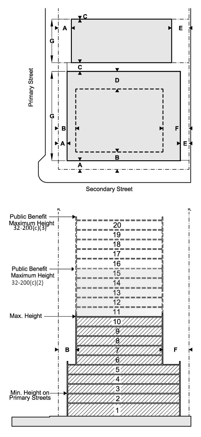
- Buildings uses and density.
- Specific uses. Specific uses in the RAC Greyhound track subdistrict shall conform to the regulations in section 32-193, allowable uses.
- Public parking garages. On primary streets, public parking garages open to the public as a principal use shall be lined along the sidewalk level for a depth of at least 20 feet by a story containing active use(s), such as residential, office or retail.
- Conditional use standards. Conditional uses must be approved pursuant to the provisions in section 32-964, conditional uses. In addition, the following regulations apply:
- Drive-through facilities for any use. Drive-through facilities for any use shall have the drive-through window(s) and stacking area located behind buildings on primary streets. On secondary streets, drive-through facilities may be located to the rear or side of buildings.
- Interim parking lots. Parcels no greater than 25,000 square feet in area may be approved for interim parking lots serving general business and residential areas for specific timeframes. Interim parking lots must be maintained with a dust-free surface and shall have perimeter landscaping comprised of a continuous maintained hedge three to four feet in height with one tree every 30 feet installed along streets and residential properties, with final details to be incorporated as conditions of approval. The approval may specify an annual review process that could result in revocation if these requirements and any other conditions of approval are not maintained.
- Base density. The base density in Table 32-200(a) is the number of dwelling units allowed per acre.
- Maximum density. The maximum density in Table 32-200(a) is the number of dwelling units allowed per acre based upon all the following performance criteria and the approval process set forth in sections 32-205, approval processes, and 32-206, RAC density allocation standards:
- For density up to 70 du/ac, projects shall:
- Provide a total of seven and one-half percent of the site, or the portion of the site proposed for development in a multi-phased project, as civic open spaces(s); and
- Provide at least 15 percent of the project's total residential units as affordable housing maintained for a period of at least 30 years guaranteed by execution of a restrictive covenant or agreement in a form acceptable to the city attorney. The quality of finishes and fixtures for affordable housing units shall be identical to the quality of finishes and fixtures for market rate units; and
- Fully conceal parking garage levels on secondary streets at the sidewalk level for a depth of at least 20 feet by a story containing active use(s), such as residential office, or retail; and
- Provide street/streetscape improvements consistent with the city's complete streets efforts, on both sides of adjacent rights-of-way.
- For density up to 90 du/ac, in addition to the criteria in (d)(4)(a), projects shall:
- Provide at least 15 percent of the project's total residential units as affordable housing maintained for a period of at least 30 years guaranteed by execution of a restrictive covenant or agreement in a form acceptable to the city attorney. The quality of finishes and fixtures for affordable housing units shall be identical to the quality of finishes and fixtures for market rate units; and
- Provide at least ten percent more parking than the amount required, accessible to the general public on an hourly or daily basis, with a fee to be determined by the owner in consultation with the city manager.
- For density up to 70 du/ac, projects shall:
- Specific uses. Specific uses in the RAC Greyhound track subdistrict shall conform to the regulations in section 32-193, allowable uses.
- Frontage standards.
- The front setback and side setbacks facing streets shall be hardscaped with the following design characteristics:
- Street trees shall be installed as set forth in section 32-201(c), frontage standards.
- A pedestrian walkway shall be accommodated as set forth in section 32-201(b), frontage standards.
- Any setback area not needed to accommodate a pedestrian walkway as determined by the city may be landscaped using trees, potted plants in removable planters, and ground planting that does not obstruct views into windows, and may also be used to accommodate merchandise displays or outdoor dining areas.
- The main entrance(s) to ground story lobbies or commercial space(s) shall be directly from and face a public right-of-way or civic open space. Doors allowing public access shall occur at intervals no greater than 75 feet.
- Building entrances shall use at least one of the following frontage types detailed in section 32-201:
- Stoop;
- Forecourt;
- Bracketed balcony;
- Storefront;
- Arcade/colonnade;
- Porch.
- The front setback and side setbacks facing streets shall be hardscaped with the following design characteristics:
- Other applicable standards. See section 32-194, configuration of buildings, and section 32-203, Central RAC parking standards; for standards that also apply to the RAC Greyhound track subdistrict.
(Ord. No. 2014-31, § 24(Exh. B), 11-5-2014; Ord. No. 2016-20, § 1, 10-19-2016; Ord. No. 2020-020, § 1, 9-2-2020; Ord. No. 2024-015, § 2, 6-5-2024)
Sec. 32-201. Frontage types.
The central RAC subdistricts and Hallandale Beach Boulevard subdistrict establish a predictable spatial framework to create a pedestrian-friendly environment supportive of infill redevelopment and multi-modal transportation options. Frontage standards ensure a superior pedestrian environment develops over time that improves the overall visual appearance and use of streets. These standards define architecture and design components for the entrance(s) to buildings and the area between building facades and streets.
- Frontage types. The entrance(s) of every building shall be directly accessible from and face a public right-of-way or civic open space. Frontage types define architectural characteristics for the detailing of these building entrances. Six distinct frontage types have been identified, which are appropriate for different types of buildings and uses. Table 32-201(a) identifies the frontage types appropriate for each subdistrict by an "X". Using one or more of frontage types identified is required.
Table 32-201(a) - Frontage Types per Subdistrict
Porch Stoop Bracketed Balcony Forecourt Storefront Arcade/Colonnade Lobby Entry RAC Subdistrict RAC corridor X X X X X X Transit core X X X X X X RAC neighborhood X X X X Transitional mixed use X X X X X District 8 X X X X X X X Greyhound track X X X X X X X Hallandale Beach Boulevard Subdistrict HBB—West X X X X X X HBB—East X X X X X X - Porch. A porch is an open-air structure attached to a building forming a covered entrance large enough for comfortable use as an outdoor room. Porches are generally appropriate for single-family attached or detached houses. The main building facade is typically setback from the property line, creating a private front yard. Table 32-201(b) provides the dimensional requirements and the maximum allowable encroachment permitted by the subdistrict. Figure 32-201(a) illustrates the dimensional requirements from Table 32-201(b) and Figure 32-201(b) provides a character example.
Table 32-201(b) - Dimensional Requirements for Porches
Dimension Minimum Maximum A Building setback varies by subdistrict B Depth 8 feet 12 feet C Width 40% facade 100% facade D Floor elevation 6 inches 3 feet Maximum setback encroachment - 50% of setback Figure 32-201(a) - Porch Frontage Type
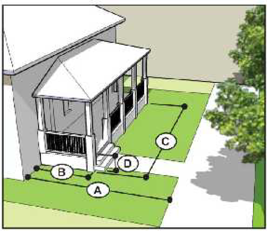
Figure 32-201(b)
Porch Character Example
- Stoop. A stoop is a small staircase leading to the entrance of a building that may be covered. The elevation of the stoop is necessary to ensure privacy for residential uses in the ground story of buildings. Stoops should provide sufficient space for a person to comfortably pause before entering or after exiting the building. Stoops are frontage types typically associated with townhouses and other residential building types. Table 32-201(c) provides the dimensional requirements and the maximum allowable encroachment permitted by the subdistrict. Figure 32-201(c) illustrates the dimensional requirements from Table 32-201(c) and Figure 32-201(d) provides a character example.
Table 32-201(c) - Dimensional Requirements for Stoops
Dimension Minimum Maximum A Building Setback varies by subdistrict B Depth 5 feet 8 feet C Width 4 feet No Max. D Floor Elevation 1 foot 4 feet Maximum Setback Encroachment - 5 feet Figure 32-201(c)
Stoop Frontage Type
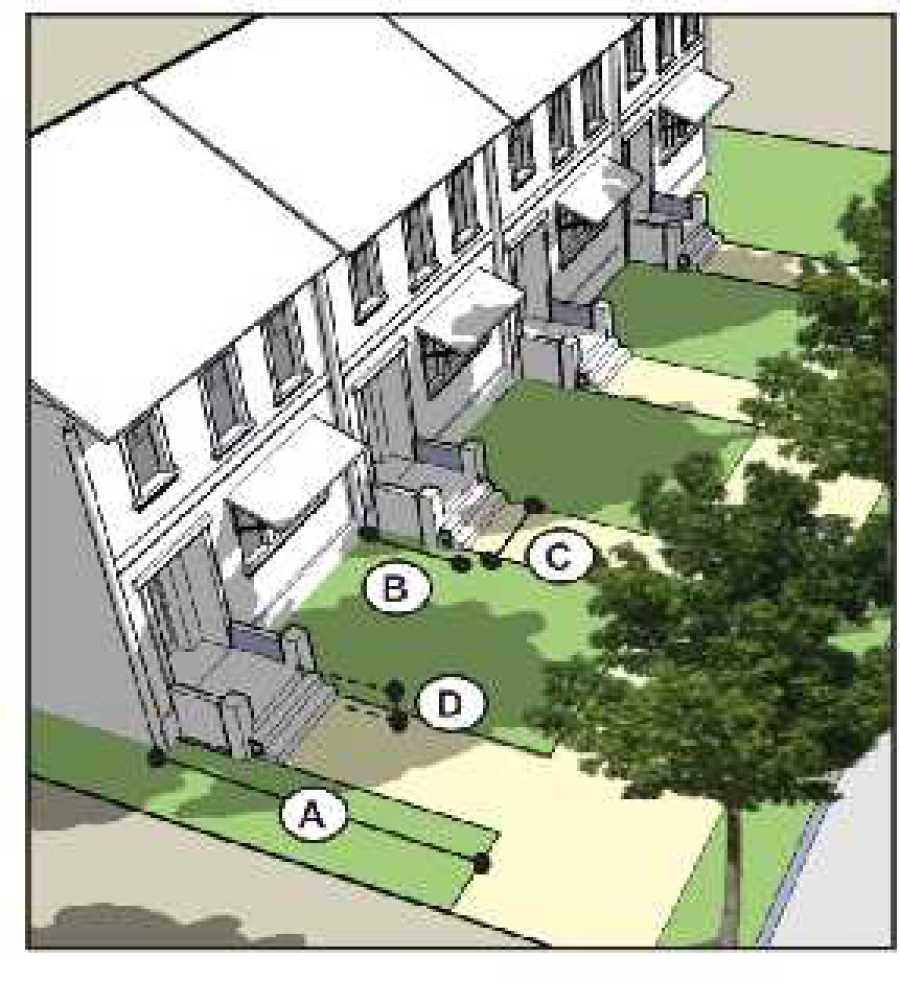
Figure 32-201(d)
Stoop Character Example
- Bracketed balcony. A bracketed balcony is second-story platform projecting from the building wall, enclosed by a railing or balustrade, supported by brackets. The bracketed balcony is located over the main building entry, which provides cover for a person entering or exiting the building, emphasizes the entryway, and creates a semi-public space overlooking the street. Bracketed balconies are typically associated with buildings with commercial uses in the ground story; however, bracketed balconies can be used on residential buildings when combined with a stoop.
- Table 32-201(d) provides the dimensional requirements and the maximum allowable encroachment permitted by the subdistrict. Figure 32-201(e) illustrates the dimensional requirements from Table 32-201(d) and Figure 32-201(f) provides a character example.
Table 32-201(d) - Dimensional Requirements for Bracketed Balcony
Dimension Minimum Maximum A Building Setback varies by subdistrict B Depth - 5 feet C Width 4 feet No Max. D Floor Elevation 0 - Maximum Setback Encroachment - 3 feet Figure 32-201(e)
Bracketed Balcony Frontage Type
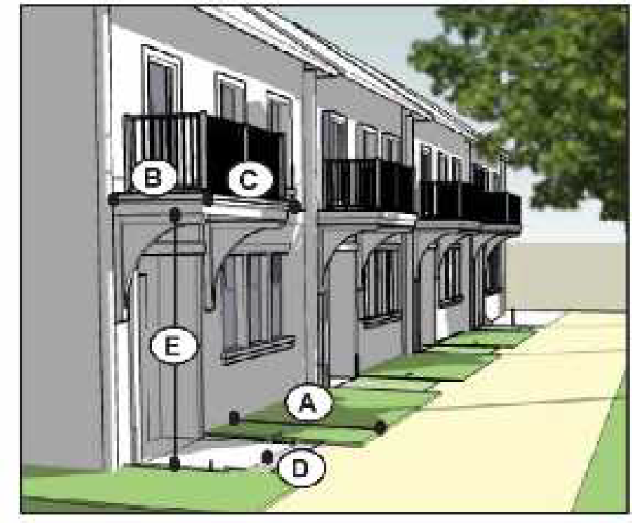
Figure 32-201(f)
Bracketed Balcony
Character Example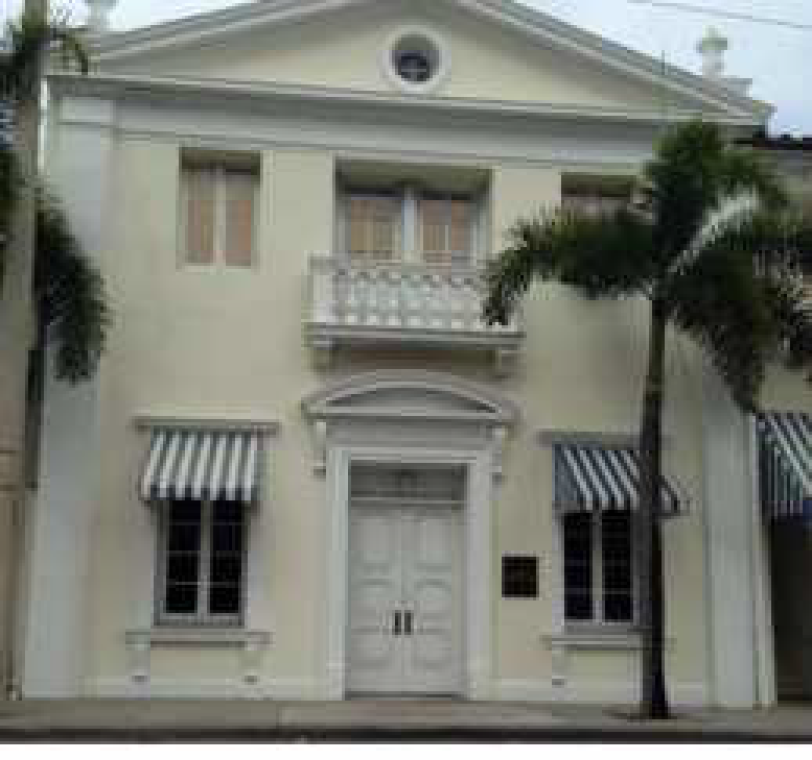
- Bracketed balcony elements
- Brackets shall be made of wood, pre-cast concrete or steel.
- Brackets shall be designed to reflect their intended structural role and to define the entryway.
- Table 32-201(d) provides the dimensional requirements and the maximum allowable encroachment permitted by the subdistrict. Figure 32-201(e) illustrates the dimensional requirements from Table 32-201(d) and Figure 32-201(f) provides a character example.
- Forecourt. A forecourt is an open area in front of the main building entrance(s) designed as a small garden or hardscaped plaza. The forecourt may afford access to one or more first floor units and may incorporate storefronts for retail uses. The forecourt is suitable for outdoor seating for residents or restaurants. Forecourts are typically associated with multifamily, mixed-use, and commercial buildings.
- Table 32-201(e) provides the dimensional requirements and the maximum allowable encroachment permitted by the subdistrict. Figure 32-201(g) illustrates the dimensional requirements from Table 32-201(e) and Figure 32-201(h) provides a character example.
Table 32-201(e) - Dimensional Requirements for Forecourt
Dimension Minimum Maximum A Building Setback varies by subdistrict B Depth 10 feet 20 feet C Width 20 feet 50% of facade D Floor Elevation 0 3 feet Maximum Setback Encroachment N/A N/A Figure 32-201(g)
Forecourt Frontage Type
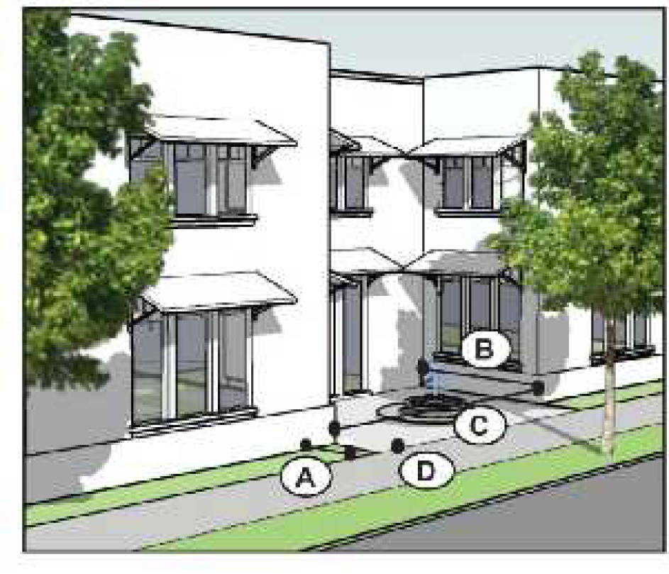
Figure 32-201(h)
Forecourt Character Example
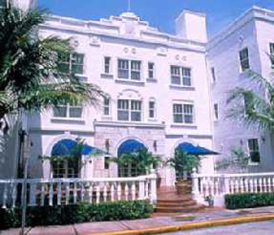
- Forecourt elements
- Low walls or balustrades may extend into the front setback and shall be at least two feet six inches tall and shall not exceed three feet six inches in height.
- Low walls shall be constructed of similar material as the principal building, or be composed of a continuous, maintained hedge.
- Forecourts may be combined with the storefront frontage type.
- Awnings, if proposed, shall project at least four feet and no more than two feet from the edge of curb.
- Awnings shall be consistent with the architecture of the building. Internally illuminated or vinyl awnings are prohibited.
- Table 32-201(e) provides the dimensional requirements and the maximum allowable encroachment permitted by the subdistrict. Figure 32-201(g) illustrates the dimensional requirements from Table 32-201(e) and Figure 32-201(h) provides a character example.
- Storefront. The storefront is a frontage type placed along the property line, and is typically associated with retail and mixed-use buildings. The storefront must be designed in a way that promotes an attractive, convenient shopping experience. Storefronts are typically at sidewalk grade and are usually shaded by awnings or arcades.
- Storefront dimensions. Table 32-201(f) provides the dimensional requirements and the maximum allowable encroachment. Figure 32-201(i) illustrates the dimensional requirements from Table 32-201(f) and Figure 32-201(j) provides a character example.
- Storefronts shall extend across at least 70 percent of the commercial/retail space.
- Storefronts shall be directly accessible from sidewalks; storefront doors may be recessed up to ten feet.
Table 32-201(f) - Dimensional Requirements for Storefronts
Dimension Minimum Maximum A Building Setback varies by subdistrict B Storefront Width 70% 100% C Storefront Base 1 foot 3 feet D Glazing Height 8 feet No Max. E Glazing Area 70% 100% Allowable Setback Encroachment of Elements F Awning Projection 3 feet 2 feet from curb G Pedestrian Blade Sign Projection N/A 4 feet Figure 32-201(j)
Storefront Character Example
- Storefronts shall have transparent glazing of at least 70 percent of the facade area, as measured between the adjacent sidewalk to eight feet in height, comprised of storefront windows and doors. Storefront windows shall have a base one foot to three feet high with transparent glazed areas extending from the base to at least eight feet in height as measured from sidewalk grade. Transparent glazing transmits at least 50 percent of visible daylight.
- Storefront elements.
- Awnings shall project a minimum of three feet from the building facade and no more than to within two feet from the face of curb.
- Awnings shall be consistent with the buildings' architecture and facade opening shape. Except for curved awnings, all fabric awnings shall be sloped 15-35 degrees from the horizontal plane. Valances shall be no more than 12 inches long. Internally illuminated or plastic awnings are prohibited.
- Each ground story business may have one wall sign per street front. The wall sign shall be no greater than three feet in height by 60 percent of the width of the tenant space along the street front. The wall sign shall be located over the first story, below the second story. A name or logo printed on the awnings shall be considered as square footage against the overall dimensions of the sign band.
- Each ground story business may have one pedestrian blade sign per street front. Pedestrian blade signs may extend up to four feet from the building facade and shall not exceed three feet in vertical dimension, including all mounting brackets and hardware, with a maximum sign area of six square feet. Pedestrian blade signs shall be set back at least two feet from the end of the building or storefront. Pedestrian blade signs may not be internally illuminated.
- Window signs advertising special sales, events or services, store hours, and store name may be affixed to the inside of a window provided that their total area does not exceed 25 percent of the window area.
- Storefronts may be combined with forecourts or arcade/colonnades.
Figure 32-201(k) - Storefront Composition and Signage Examples
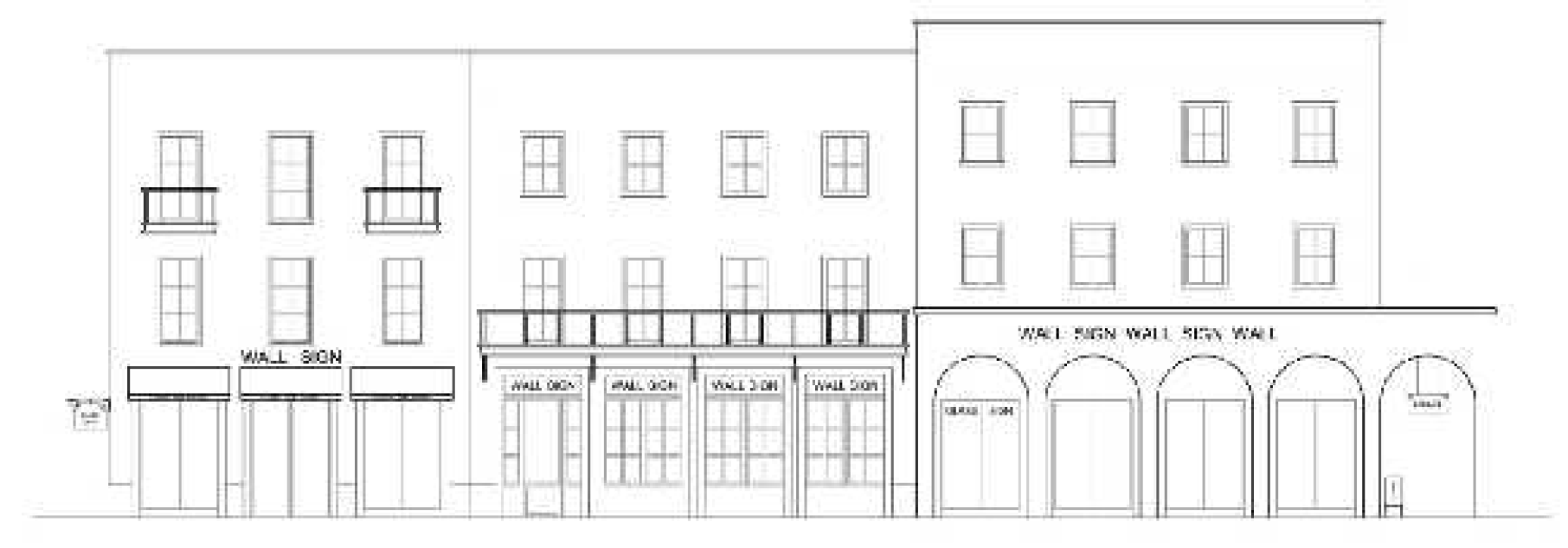
- Storefront dimensions. Table 32-201(f) provides the dimensional requirements and the maximum allowable encroachment. Figure 32-201(i) illustrates the dimensional requirements from Table 32-201(f) and Figure 32-201(j) provides a character example.
- Arcade/colonnade. An arcade/colonnade is a covered, unglazed, linear hallway attached to the front of a building, supported by columns or pillars. The arcade/colonnade extends into the public right-of-way, over the sidewalk, creating a shaded environment ideal for pedestrians and conducive to retail. In arcades, upper stories of the building extend over the passageway. This frontage type is typically associated with retail and mixed-use buildings.
- Arcade/colonnade dimensions. Table 32-201(g) provides the dimensional requirements and the maximum allowable encroachment. Figure 32-201(l) illustrates the dimensional requirements from Table 32-201(g) and Figure 32-201(m) provides a character example.
- Arcades/colonnades shall extend over the sidewalk. A sidewalk should not run parallel to an arcade or colonnade, which allows pedestrians to bypass retail or commercial windows. Use of the arcade/colonnade requires entering into a right-of-way agreement between the property owner and the city. This agreement shall establish liability and insurance responsibilities in a form acceptable to the city.
Table 32-201(g) - Dimensional Requirements for Arcade/Colonnades
Dimension Minimum Maximum A Building Setback varies by subdistrict B Arcade/Colonnade Depth 10 feet 20 feet C Arcade/Colonnade Height 12 feet N/A D Column/Pillar to Face of Curb 2 feet 4 feet Allowable Setback Encroachment of Elements E Arcade/Colonnade varies by street F Pedestrian Blade Sign Projection N/A 4 feet Figure 32-201(l)
Arcade/Colonnade
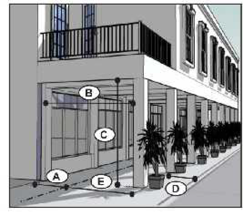
Figure 32-201(m)
Arcade/Colonnade Character
Example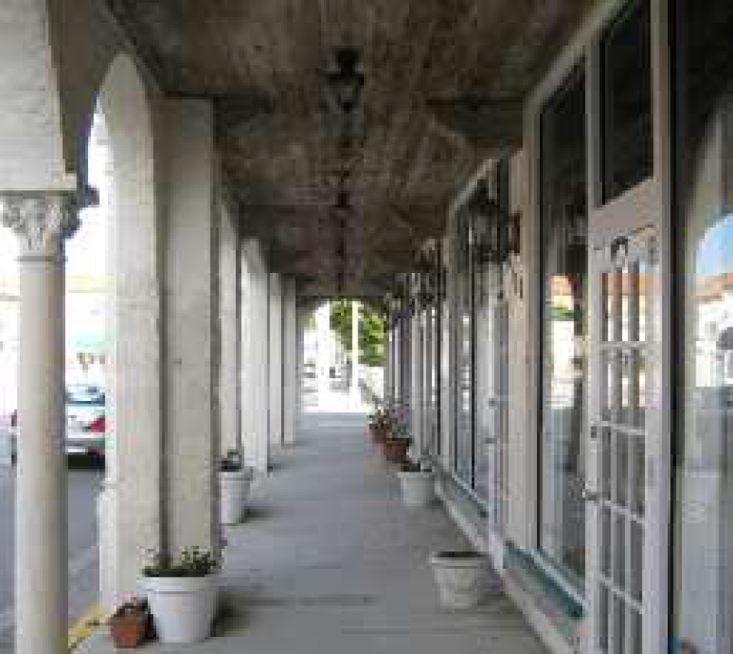
- Arcades/colonnades shall have a clear depth between the interior face of the columns and the building facade of at least ten feet and no more than 20 feet. If the distance between the property line and the face of curb is not sufficient to accommodate the minimum depth required for an arcade/colonnade, the building shall set back accordingly. If the distance between the property line and the face of curb is wide enough that using the minimum building setback results in an arcade with a clear depth greater than 12 feet, the minimum front setback may be administratively reduced by the development services director, taking into consideration the ultimate location of the face of curb based on the street design standards for the community redevelopment area.
- Arcades/colonnades shall have a clear height above the sidewalk of at least 12 feet.
- Support columns or pillars shall be placed no farther apart than they are tall, and shall be placed two to four feet from the face of the curb.
- Open-air terraces and habitable stories may extend over the arcade, up to the fourth story.
- Arcade/colonnade ceilings shall be designed with coffers or exposed beams extruding at least six inches, aligned with columns or pillars.
- Arcades/colonnades shall extend over the sidewalk. A sidewalk should not run parallel to an arcade or colonnade, which allows pedestrians to bypass retail or commercial windows. Use of the arcade/colonnade requires entering into a right-of-way agreement between the property owner and the city. This agreement shall establish liability and insurance responsibilities in a form acceptable to the city.
- Arcade/colonnade elements.
- Arcade/colonnades shall be combined with storefronts.
- The height and proportions of the arcade/colonnade shall be consistent with the style and proportions of the building to which it is attached.
- Each ground story business may have one wall sign not exceeding three feet in height by 60 percent of the storefront width on the first story facade of the arcade/colonnade.
- Each ground story business may have one wall sign under the covered area, not exceeding two feet in height by 60 percent of the storefront width.
- Each ground story business may have one pedestrian blade sign under the covered area. Pedestrian blade signs may extend up to four feet from the building facade and shall not exceed three feet in vertical dimension, including all mounting brackets and hardware, with a maximum sign area of six square feet. Pedestrian blade signs shall be set back at least two feet from the end of the building or storefront. Pedestrian blade signs may not be internally illuminated.
- Potted landscaping or ground planting shall be provided between the face of the columns or pillars and the face of curb.
Figure 32-201(n)
Arcade/Colonnade Signage Examples
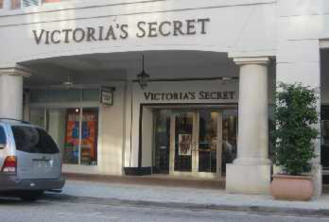
- Arcade/colonnade dimensions. Table 32-201(g) provides the dimensional requirements and the maximum allowable encroachment. Figure 32-201(l) illustrates the dimensional requirements from Table 32-201(g) and Figure 32-201(m) provides a character example.
- Lobby entry. The lobby entry is a frontage type that emphasizes the main entrance to the reception area of a building with a significant architectural feature. The lobby entry type provides an integral architectural element that provides a sheltered area to congregate in front of the main entrance to a commercial, mixed-use, multi-family, or civic building. The entry may be at sidewalk level or elevated.
- Lobby entry dimensions. Table 32-201(h) provides the dimensional requirements and the maximum allowable encroachment permitted for certain elements. Figures 32-201(o) and 32-201(p) provide character examples.
- Lobby entry features shall be consistent with the architecture of the building and encroaching elements shall be harmonious in scale and proportion to the building.
- Lobby entries shall be directly accessible from the sidewalk and may be recessed up to ten feet.
- Overhangs or awnings may encroach into the front setback area up to ten feet.
- Columns, pilasters, and posts may encroach into the front setback up to five feet.
Table 32-201(h) - Dimensional Requirements for Lobby Entry
Minimum Maximum A Building setback 10 ft. 15 ft. B Lobby entry width N/A N/A Maximum allowable encroachment of elements in all districts C Overhang/awning projection N/A 10 ft. D Columns, pilaster, posts N/A 5 ft. Figure 32-201(o)
Lobby Entry Character Example 1
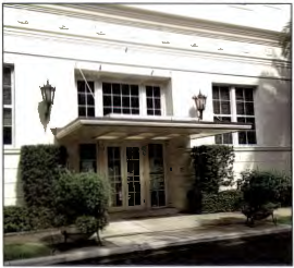
Figure 32-201(p)
Lobby Entry Character Example 2
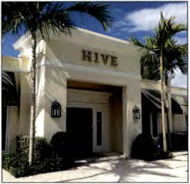
- Pedestrian walkway. In order to ensure a superior pedestrian realm develops overtime, a pedestrian walkway may be required to augment public sidewalk widths, especially along narrow rights-of-way. A pedestrian walkway is an area that forms a continuous route for pedestrians, which is unobstructed by trees, landscaping, street lights, utility poles, etc. Pedestrian walkways may be composed of public sidewalks, hardscape on private property, or a combination of the two.
Figure 32-201(q)
Examples of Providing a Required 10-ft. Wide Pedestrian Walkway
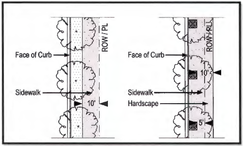
LEFT: A sidewalk ten feet in width is provided within the public right-of-way; therefore, no on-site pedestrian walkway is required.
RIGHT: A sidewalk with trees in planters has a clear route five feet wide in the public right-of-way; therefore, five additional feet in width is provided within the front setback.
Table 32-201(i) - Dimensional Requirements for Pedestrian Walkways per Subdistrict
Subdistrict Primary Street Secondary Street RAC corridor 10 feet 8 feet Transit core 10 feet 8 feet RAC neighborhood 5 feet 5 feet Transitional mixed use 10 feet 8 feet District 8 8 feet 8 feet Greyhound track 8 feet 6 feet Hallandale Beach Boulevard West 10 feet 6 feet Hallandale Beach Boulevard East 10 feet 6 feet - Width of pedestrian walkway. The minimum width of pedestrian walkways shall be provided as depicted in Table 32-201(i). The proposed pedestrian walkway shall be demonstrated on site plans. In order to accommodate the required width of the pedestrian walkway, increasing the front setback beyond the minimum amount allowed by the subdistrict may be necessary and buildings shall set back further than the maximum allowed per subdistrict, if necessary. In the event the maximum front setback does not provide adequate space, the pedestrian walkway may be accommodated within the arcade/colonnade frontage type to meet the intent of the code.
- Where an existing public sidewalk adjoins the property line, the paved area of the public sidewalk and the pedestrian walkway shall connect, thereby expanding the perceived width of the public sidewalk. An existing, adjoining public sidewalk may be counted toward fulfilling the minimum clear width of a pedestrian walkway.
- All paving materials for the pedestrian walkway shall be compliant with ADA accessibility standards, and shall be constructed of concrete consistent with the adjacent sidewalk and acceptable to the development services and engineering departments.
- Where a sidewalk or a pedestrian walkway crosses vehicular ingress/egress points, the pedestrian crossing shall be paved with material consistent with the paving material of the sidewalk or walkway, and shall be clearly distinguished from the vehicular surface.
- Street trees. Street trees are intended to provide a shaded environment for the pedestrian, provide a physical separation between pedestrians and vehicles, and improve the overall visual appearance of the street.
- All new construction, relocation of a building, or addition equal to or greater than 20 percent of the gross floor area of an existing building shall install street trees at the time of development. Street trees shall be a canopy species, planted in the public right-of-way directly in front of the property line(s), uniformly spaced no greater than 25 feet on center. Spacing of trees may only exceed 25 feet in order to accommodate curb cuts, fire hydrants, utilities, existing trees, and other infrastructure elements. Palm varieties may be used at corners, crosswalks, or to accent building entrances and may be permitted in lieu of shade trees when physical conditions may prevent the proper growth of shade trees, as determined by the development services director. Consistency in street tree species shall be established on both sides of the street along a block face. The first to develop shall establish the species for the entire block.
- Lobby entry dimensions. Table 32-201(h) provides the dimensional requirements and the maximum allowable encroachment permitted for certain elements. Figures 32-201(o) and 32-201(p) provide character examples.
- Porch. A porch is an open-air structure attached to a building forming a covered entrance large enough for comfortable use as an outdoor room. Porches are generally appropriate for single-family attached or detached houses. The main building facade is typically setback from the property line, creating a private front yard. Table 32-201(b) provides the dimensional requirements and the maximum allowable encroachment permitted by the subdistrict. Figure 32-201(a) illustrates the dimensional requirements from Table 32-201(b) and Figure 32-201(b) provides a character example.
(2) Street trees shall be planted in planting strips, landscaped planters or tree grates consistent with city street design standards. Street trees shall be located along the curb side, in order to separate pedestrians from vehicular lanes.
(3) All trees shall satisfy the following standards at the time of planting:
(i) Canopy species: Minimum 15 feet in height with a clear trunk space of six feet and a spread of no less than eight feet.
(ii) Palm trees: Minimum 20 feet in height, with a clear trunk space of eight feet.
(4) In the event that site constraints such as utility easements prevent the installation of required street trees, removable planters of small palms and small shrubs, vines or seasonal flowers shall be installed. In addition, the building shall provide devices such as awnings or roof overhangs to establish a shaded pedestrian environment.
(Ord. No. 2014-31, § 24(Exh. B), 11-5-2014; Ord. No. 2021-003, § 3, 3-17-2021; Ord. No. 2023-010, § 3, 5-17-2023)
Editor's note(s)—Ord. No. 2021-003, § 3, adopted March 17, 2021, changed the title of § 32-201 from "frontage standards" to "frontage types."
Sec. 32-202. Civic open spaces.
- Civic open spaces. Civic open spaces are maintained outdoor spaces which are accessible by the general public, improve the pedestrian environment, are aesthetically pleasing, and serve as an amenity for the city as a whole as well as for occupants of the building which the open space serves. Civic open spaces are generally constructed by landowners during the development process.
- Amount. On sites 40,000 square feet or more in size, new buildings or additions of gross floor area equal to 50 percent or more to existing buildings, shall provide at least five percent of the size of the site, or portion of the site proposed for development in a multi-phased project, as civic open space(s). Dedicated rights-of-way may not count toward fulfilling the required amount.
- Types of civic open spaces. Civic open space shall be designed as one of the following types:
- Green. A green is at least 2,000 square feet in size and adjoins streets on at least two sides or a pedestrian passageway and a street. Greens are designed primarily for passive uses, consisting primarily of lawn with either formally or informally arranged landscaping.
- Plaza. A plaza is at least 2,000 square feet in size and adjoins a street on at least two sides or a pedestrian passageway and a street. Plazas are mostly hardscaped with formal landscaping and a water feature.
- Playground. A playground shall be at least 2,500 square feet in size. Playgrounds shall provide children's play equipment and shaded seating. Playgrounds adjoin a street on at least one side and the proposed configuration should ensure easy surveillance of the area from the adjacent buildings and streets.
- Square. A square is at least 10,000 square feet and adjoins streets on at least three sides. Squares may be up to 50 percent hardscaped, with formal landscaping. Squares accommodate both passive uses and community gatherings.
- Attached green. The attached green is generally 3,000 to 6,000 square feet and spans the entire length of a block. Attached greens shall be at least 30 feet wide and are appropriate on the short end of a block. Attached greens are formally landscaped.
Figure 32-202
Civic Open Spaces
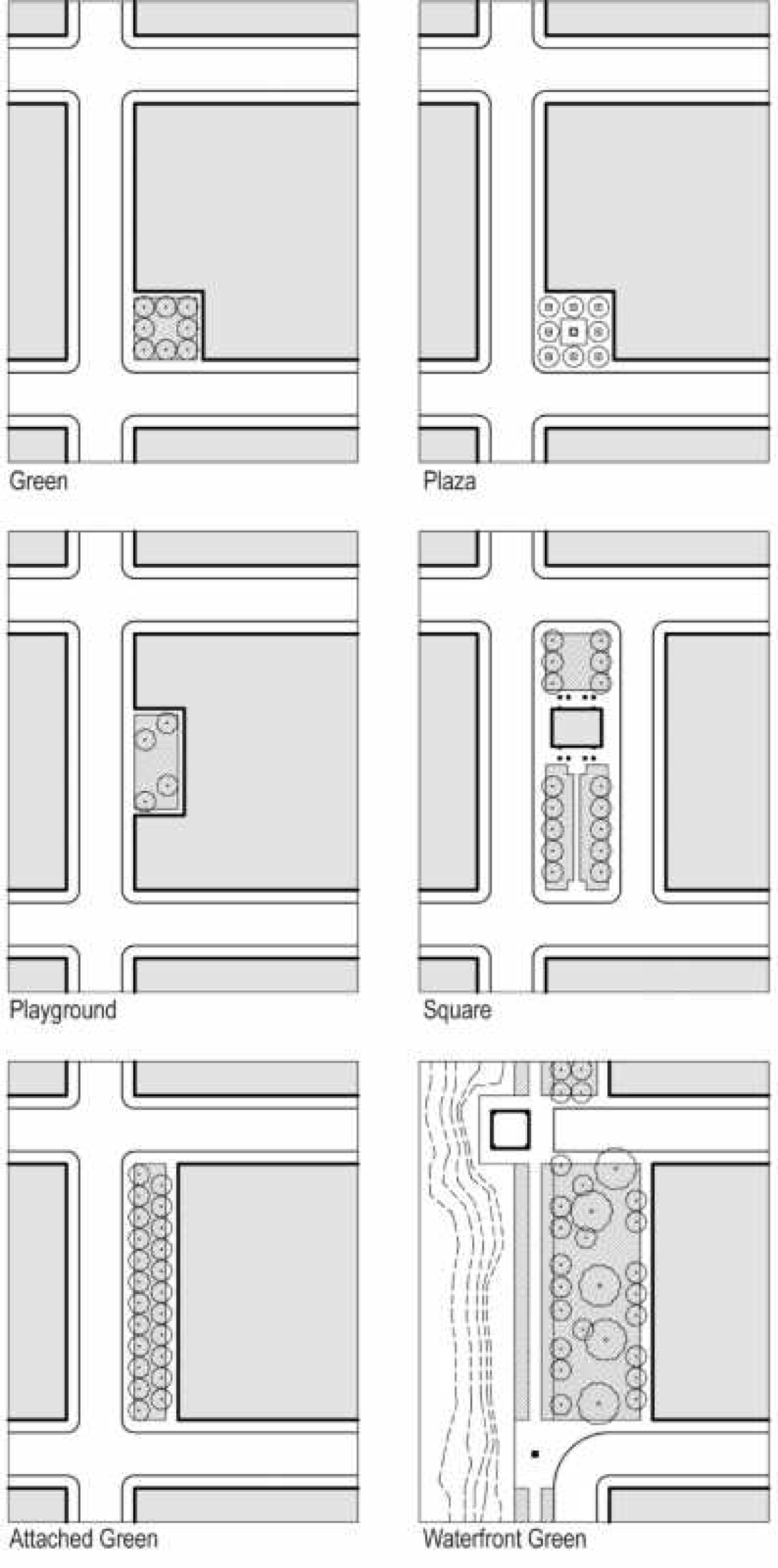
- Configuration. Civic open spaces shall be configured as follows:
- The civic open space shall adjoin a street front property line for no less than 30 linear feet.
- Except for attached greens, civic spaces shall have a proportion so that the depth is no more than two and one-half times the width, and the width is no more than five times the depth.
- Civic open spaces shall be lined by building facades or streets on all sides. In order to provide oversight of the space, buildings facing civic open spaces shall contain habitable uses; parking lots, parking garages, and storage areas are not considered habitable uses.
- Additional standards. Civic open spaces shall meet the following minimum standards:
- Civic open spaces must be accessible to the public during all daylight hours.
- Civic open spaces must be situated to allow easy ingress and egress by pedestrians. Except for playgrounds, which may be fenced, no streetwalls, gates, fences or other impediments to pedestrian accessibility shall be permitted along the frontage line.
- Civic open spaces must be located at the sidewalk level.
- Civic open spaces must be open to the sky; however, open-air garden structures such as gazebos or trellises are permitted within civic open spaces.
- Landscaping shall be arranged in a manner reflective of description of the type of civic open space. One shade tree per 20 feet of perimeter of the space is required. Trees may be arranged in regular spacing or in informal clusters, depending on the type of open space. Trees shall be installed to provide shade along walkways and for benches. Substituting shade trees for multiple palm species is not permitted; however, adding palms to the landscape design is permitted.
- Each civic open space shall provide the following street furniture elements, specifications subject to approval by the City of Hallandale Beach:
- One bench per 700 square feet of area;
- One bicycle rack with no less than four spaces;
- One trash receptacle;
- One pet clean up station.
- Fences are permitted only to enclose playgrounds or community gardens. Fences may be composed of wood or metal pickets and shall not exceed four feet in height.
- Vehicular traffic shall not be permitted within a civic open space.
- Civic open spaces shall be designed to enhance user safety and security using crime prevention through environmental design (CPTED) principles by:
- Being well lighted;
- Having one or more focal points within the open space visible from all adjoining buildings and streets; and
- Having a clear landscape zone between three feet and eight feet in height providing sightlines unobstructed by berms or bushes.
- Availability. Civic open space shall be developed and ready for use concurrent with the issuance of a certificate of occupancy for the building(s) for which the open space is required.
- Public benefit height option. In order to encourage projects to provide civic open space in the central RAC, increased building height and density may be approved in the RAC corridor and transit core subdistricts, provided additional criteria is met, including providing a total of seven and one-half percent of the site, or the portion of the site proposed for development in a multi-phased project, as civic open space(s).
(Ord. No. 2014-31, § 24(Exh. B), 11-5-2014; Ord. No. 2021-003, § 3, 3-17-2021)
Sec. 32-203. Central RAC parking standards.
- Purpose of revised standards. This section provides modified regulations for off-street parking, loading zones, and bicycle parking within the central RAC zoning district. These regulations recognize that the RAC is an interconnected area with multimodal transportation options, and that improper placement of parking and mandatory duplication of the parking supply on each building site separates the various land uses from each other. This separation reduces the viability of the mixed-use districts and harms the walkability of the streets in the RAC. These regulations reflect the needs of an urban, mixed use area. When in conflict with the regulations in division 11, this section shall rule.
- Minimum number of off-street parking spaces. The minimum number of parking spaces required in section 32-455 "Minimum parking space requirements" is modified by this section for the central RAC zoning district.
- Table 32-203(a) identifies the minimum number of off-street parking spaces required for the use; uses not listed shall provide parking in accordance with the amount required in section 32-455.
Table 32-203(a) - Minimum Number of Off-street Parking Spaces Required per Use
Single-Family Residential (Attached or Detached) Single-family house, townhouse, or duplex 2 spaces per unit Multi-Family Residential Use Multi-family dwelling unit—500 sq. ft. or less 0.75 spaces per unit Multi-family dwelling unit—501 sq. ft. or greater 1.25 spaces per unit Guest parking cumulatively 10% of required parking for units Lodging Hotels/motels 0.5 space for each guest room plus 1.0 space per 300 sq. ft. of ballrooms, meeting rooms, shops, restaurants, and lounges Business Uses Professional office 1 space per 300 sf. of gross floor area (GFA) Retail, restaurant, and other commercial uses 1 space per 300 sf. of net floor area (GLA) - Once service commences on the Tri-Rail Coastal Link and the Hallandale Beach station is operational, the minimum number of off-street parking required may be multiplied by a factor of .70 for properties located within one-quarter mile of the station, measured along the closest pedestrian route between nearest building entrance and nearest station entrance.
- Properties located with the District 8 subdistrict are not required to provide additional parking resulting from a change of use or renovations of a building and any existing nonconforming parking layout is permitted to maintain the existing layout.
- Properties located within 750 feet of the planned Tri-Rail Coastal Link station (see regulating plan) are not required to provide additional parking resulting from a change in use within an existing building.
- Table 32-203(a) identifies the minimum number of off-street parking spaces required for the use; uses not listed shall provide parking in accordance with the amount required in section 32-455.
- Location and access to off-street parking. Parking and service areas shall be accessed and located at the rear or side of the building(s) whenever possible.
- Location.
- Except for houses and duplexes that do not have a rear alley, parking is not permitted in front setbacks or in side setbacks facing streets, parks, or civic open spaces.
- On primary streets all parking lots shall be located to the rear of buildings. If parking in the rear is inappropriate or impossible and a RAM is requested, the city commission may require special perimeter landscape treatments to protect and improve the pedestrian experience along the street.
- On secondary streets, parking lots may be located on the side of buildings provided the parking is screened from view of the street by a streetwall (see section 32-194(d)(6)).
- Parking garage design standards.
- On primary streets, parking garage levels shall be fully concealed from view by a story containing active use, such as residential, office, or retail for at least 20 feet of depth.
- On secondary streets, parking garage levels not lined by another use shall be screened by a building facade that meets the architectural requirements in section 32-194(d).
Figure 32-203(a)
Parking Garage Design Standards
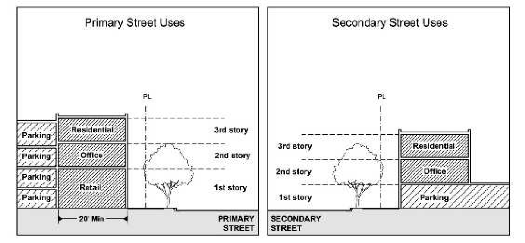
- Access.
- Except for houses and duplexes that do not have rear alleys, and properties located within the fashion/art/design subdistrict, parking shall not be accessed by backing onto public streets.
- Access drives shall not exceed 24 feet in width.
- On primary streets, alleys or secondary streets shall be the primary source of vehicular access to off-street parking, except that access to parking in the fashion/arts/design subdistrict is not permitted from NE 2nd Avenue for properties south of NW 3rd Street.
- When neither alleys nor secondary streets are present, primary vehicular access may be from a primary street. In the instance that site constraints necessitate access from a primary street, and the provision of an access drive precludes meeting the minimum building frontage percentage required, the development services director may administratively allow a reduction from the minimum building frontage in order to allow vehicular access to the site.
- Alleys may be incorporated into parking lots and garages as standard drive aisles and vehicles may back out onto alleys. Access to all properties adjacent to the alley shall be maintained.
- When an alley is not present, vehicular access between adjacent parcels across property lines is required, and shall be accommodated within the site layout. The first property owner to develop shall be required to make an irrevocable offer of cross-access to the adjacent parcels prior to issuance of a development order. When adjacent property develops, a reciprocal cross-access agreement is required, and the physical connection shall be completed by both property owners.
- Parking lots and structures shall provide pedestrian access directly from a street. In addition, pedestrian access may also be provided directly from a building.
- Buildings with more than 250 feet of street frontage on a block face shall provide a pedestrian passageway at least ten feet wide connecting the rear parking to the sidewalk in the public right-of-way that the building faces.
- Public sidewalks may not be interrupted or deviated to accommodate back out parking, drop-off or valet parking. The sidewalk shall continue across driveway openings.
- Parking lots with no more than 20 spaces and a maximum of ten spaces per corridor are exempt from the requirements of section 32-453(i)(4) requiring vehicular entry/exit in one continuous forward motion.
- Location.
- Bicycle parking and facilities. Bicycle parking and facilities shall be provided within the RAC corridor and transit core subdistricts.
- Minimum number of bicycle parking spaces. Bicycle parking shall be provided onsite for all uses. Bicycle parking shall be provided at five percent of total vehicular parking spaces proportionately split between long term bicycle parking for employees or residents and short-term bicycle parking for guest two spaces minimum or whichever is greater.
- Design and location. Visitor, employee and resident bicycle parking facilities shall be provided in a location(s) shown on the site plan that meets the following standards:
- Long term parking spaces shall be located in secure, weather-protected facilities intended for use as long-term, overnight, and work-day bicycle storage by dwelling unit residents, nonresidential occupants, and employees.
- Short term bicycle spaces shall be located in a publicly accessible area with convenient access from the building or structure and street or other bicycle right-of-way. Be clean, highly visible, secure and well-lit, and shall be located within or adjacent to civic and public open space, a building or structure, either on the ground floor, or main level (first floor) in a parking garage intended for transient or short-term use by visitors, guests, and patrons to the building or use.
- Provided in a safe, accessible and convenient location.
- Does not encroach into the minimum pedestrian walkway (see section 32-201(b)).
- The planning and zoning director shall review the location, design, and details of the bicycle spaces as part of the site plan review.
- Loading zones. Design of loading zones.
- A "type I" off-street loading zone shall be provided as required in the Table 32-203(b), loading zone requirements per square footage in this section shall be a minimum of 12 feet by 30 feet. A "type I" off-street loading zone shall be located in a specifically designated loading area which may be adjacent to drive aisles, walkways, or attached/detached from building. Turning geometries utilized in the design of type I loading zone access shall be sufficient to accommodate a standard single unit truck (AASHTO "SU" design vehicle).
- A "type II" off-street loading zone shall be provided as required in the Table 32-203(b), loading zone requirements per square footage shall be a minimum 12 feet by 50 feet. A type II off-street loading zone shall only be located in a specifically designated loading area which is marked by pavement markings and signage on the site. Turning geometries utilized in the design of type II loading zones shall be sufficient to accommodate a standard, intermediate-sized semi-trailer vehicle (AASHTO "WB-40" design vehicle).
- Type I and type II loading zones shall have a minimum vertical clearance of 14 feet.
- Loading zones may not be placed where they obstruct required fire lanes and access to hydrants. Loading zones shall be located on a parcel in a place which insures convenient and safe entry and exit for the users of the loading zone, and the convenience and safety of pedestrians and motorists using the parcel.
- No backing into a public right-of-way shall be permitted for loading zones. Access to and from loading zones shall be clearly indicated on the parking facility site plan.
- Loading zones are not required for residential uses.
Sec. 32-204. Street and block standards.
- Purpose and intent. The highly connected street and block structure of the central RAC is a critical component to foster multi-modal options. Smaller block sizes reduce bike and walk distances and allow traffic to disperse using multiple routes. The standards that guide the creation of new blocks and changes to existing streets and blocks are contained in this section.
- Block standards. The following dimensional standards promote a desirable block structure:
- The maximum block length should not exceed 660 feet.
- The maximum perimeter of a block generally should not exceed 1,800 feet, as measured along the inner edges of each street right-of-way. Block perimeters may exceed 1,800 feet, up to a maximum of 2,000 feet if one or more of the following conditions apply:
- The block has at least one face on an arterial street that limits access points.
- The block contains a public parking garage.
- The portion of a block between intersecting streets may not exceed 600 feet without providing either:
- A publicly dedicated pedestrian passageway not less than ten feet in width that provides access to another street; or
- An alley at least 20 feet in width that provides vehicular access to another street.
- Existing streets. In the case of existing streets, the city will not abandon, relocate, or close streets if the block size(s) will exceed the standards in 32-204(b).
(Ord. No. 2014-31, § 24(Exh. B), 11-5-2014)
Sec. 32-205. Approval processes.
- Approval types. Development applications may follow two different review and approval processes:
- Development applications in the central RAC zoning district may be approved administratively if the application:
- Meets all requirements of this code; and
- Does not exceed the base density specified for its RAC subdistrict; and
- Does not require any conditional uses, variances, or redevelopment area modifications.
- Development applications in the central RAC zoning district may be approved only by the city commission using the major development review process if the application:
- Meets all requirements of this code only upon approval of simultaneously requested conditional uses, variances, or redevelopment area modifications; and/or
- Is requesting a density level between the base density and the maximum density allowable in any central RAC subdistrict.
- Development applications in the central RAC zoning district may be approved administratively if the application:
- Submission requirements and procedures.
- Development applications in the central RAC zoning district that may be approved administratively (see subsection (a)(1) above) shall be submitted to the city using the procedures in article V of this Code, except that the development services director has the authority to approve the application administratively even if article V would otherwise require review and approval by the planning and zoning board and the city commission.
- Development applications in the central RAC zoning district that may be approved only by the city commission (see subsection (a)(2) above) shall be submitted to the city using the procedures in article V of this Code. These applications will be reviewed and processed as if they were major developments even if they are below the size thresholds in section 32-782(a), applicability.
- Conditional uses and variances. The city commission may approve conditional uses and variances in the central RAC zoning district using the procedures and standards in article VIII of this Code plus any additional standards set forth in the central RAC regulations. However:
- These processes cannot be used to increase the number of stories above the maximum building height established for each central RAC subdistrict.
- These processes cannot be used to increase density levels above the base density in any central RAC subdistrict; the process for requesting a density increase (up to the maximum density) is set forth in section 32-206.
- Redevelopment area modifications. The city commission may approve redevelopment area modifications in the central RAC zoning district using the procedures and standards in section 32-135, redevelopment area modifications, plus the following additional standards:
- This process cannot be used to increase the number of stories above the maximum building height established for each central RAC subdistrict.
- This process cannot be used to increase density levels above the base density in any central RAC subdistrict; the process for requesting a density increase (up to the maximum density) is set forth in section 32-206.
- General rules for changes to central RAC zoning district.
- Overlays as contained within section 32-186.
- Prior mapped overlays. Portions of the central RAC zoning district had previously been included in one or more mapped overlays: North Dixie Corridor overlay, South Dixie Highway overlay, District 8 overlay, Pembroke Road overlay, Foster Road Corridor overlay, and redevelopment overlay. Relevant parts of those overlay regulations have been incorporated into the central RAC subdistrict regulations.
- Previously approved planned development overlays. Some individual properties in the central RAC zoning district had obtained prior approval for a site-specific "planned development district (PDD)" overlay. At the landowner's discretion:
- The terms of those approvals may continue to be used to obtain remaining development approvals until such time as the original approval and/or development agreement has expired; or
- The provisions of the central RAC zoning district may be used to obtain future development approvals without rescinding the prior "planned development" approval. However, the two methods may not be combined except to the extent that non-conformity with the current code is not furthered.
- Future overlays. Additional mapped or planned development overlays may be approved in the central RAC zoning district subject to the following restrictions:
- On sites in the RAC corridor subdistrict with five or more contiguous acres under unified control, a landowner may request a planned development overlay (PDO) and development agreement consistent with the applicable provisions of section 32-186; on sites in the greyhound track subdistrict with five or more contiguous acres in lot area under unified control, a landowner may request a planned development overlay (PDO) and development agreement consistent with the applicable provisions of section 32-186.
- On sites in the RAC corridor subdistrict with three to five contiguous acres under unified control, a landowner may request a planned development overlay (PDO) and development agreement consistent with the applicable provisions of section 32-186 for a period up to six months after the land was rezoned to the central RAC zoning district.
- The request must accompany an official development application that meets the site plan review submission requirements as set forth in article V of the City of Hallandale Beach Zoning and Land Development Code.
- Development approval for the application must be obtained within six months of the original request for PDO and development agreement. For good cause shown, the city manager may grant an additional six months for the development plan approval.
- Development approvals granted under this provision are subject to extension provisions as outlined in section 32-790 of the City of Hallandale Beach Zoning and Land Development Code.
- Should the site plan approval expire, the development agreement shall expire concurrently, and the PDO will be administratively removed via rezoning.
- All sites within a planned development overlay shall be subject to the following additional standards:
- Development must be consistent with the city's comprehensive plan.
- Allowable uses and all development regulations and requirements, including height and density shall be as specified for the RAC corridor subdistrict, except where modifications were specifically requested and explicitly approved in the planned development overlay and development agreement.
- Allowable uses and all development regulations and requirements, including height and density shall be as specified for the underlying subdistrict, except where modifications are specifically requested and explicitly approved in a planned development overlay and development agreement.
- Such modifications specifically requested and specifically approved in a planned development overlay and development agreement shall not be required to demonstrate compliance with the development regulations applicable for the underlying subdistrict.
- Expansions, contractions, and subdistrict adjustments. The boundary of the central RAC zoning district and the boundaries of its subdistricts may be expanded or contracted by the city commission by amending the regulating plan in section 32-192. Landowners desiring boundary changes to the regulating plan must request an amendment to the zoning and land development code instead of using the rezoning process. Requests for amendments to the regulating plan shall be advertised, posted and noticed in conformity with the requirements of section 32-1004 as to rezonings in addition to requirements for zoning code text amendments.
- Overlays as contained within section 32-186.
- Transitional period. For applications submitted prior to September 1, 2014, staff may present an analysis of the measurable parameters of development under both regulations.
(Ord. No. 2014-31, §§ 22, 24(Exh. B), 11-5-2014; Ord. No. 2016-20, § 1, 10-19-2016; Ord. No. 2023-010, § 3, 5-17-2023)
Sec. 32-206. RAC density allocation standards.
- Base density and maximum density. Each RAC subdistrict defines a base residential density and a maximum residential density, expressed as the number of dwelling units allowed per acre.
- Regional activity center (RAC). The Hallandale Beach Comprehensive Plan establishes a Regional Activity Center (RAC) for an area generally bounded by Pembroke Road to the north, Federal Highway to the east, County Line Road to the south, Dixie Highway and westward along the Foster Road Corridor to the west. The purpose of the RAC is to define an area of regional significance within which transit-oriented and mixed-use development are encouraged, public transportation will be enhanced, the need for automobile travel will be reduced, redevelopment is encouraged, the walkable urban form is being enhanced, development/redevelopment proposals are encouraged in areas adjacent to major transportation corridors, and existing residential areas are protected.
- RAC density allocation. The Hallandale Beach Comprehensive Plan and the Broward County Land Use Plan limit the total number of dwelling units within the RAC. In addition to the general density allocation procedures applicable to development applications, the following provisions apply to allocation of dwelling units in the RAC subdistricts:
- The Broward County Land Use Plan limits the total number of dwelling units that can be added within the RAC east of U.S. 1. Allocation of dwelling units east of U.S. 1 must be consistent with that plan.
- Acreage for non-residential land use shall be assigned on a net acreage basis to all lands included in the parcel needed to comply with the on-site land development requirements, such as building footprint, setbacks, parking, outdoor pedestrian circulation, landscaping, drainage, and other improvements.
- Monitoring of development activity. Hallandale Beach has entered into an interlocal agreement with Broward County that commits the city to monitor development activity with the RAC and to submit quarterly reports to the county about the density and intensity of land uses within the RAC.
- Within mixed use projects, RAC acreage and RAC dwelling units shall be assigned according to the proportion of floor area associated with each use for monitoring overall RAC build out (e.g., if 50 percent of the floor area is used for A, then 50 percent of the net acreage of the development parcel shall be assigned to A).
(Ord. No. 2014-31, § 24(Exh. B), 11-5-2014; Ord. No. 2020-020, § 1, 9-2-2020; Ord. No. 2024-009, § 2, 4-10-2024)
Sec. 32-207. Purpose and intent.
The purpose and intent of the Hallandale Beach Boulevard district is to guide the redevelopment of land located adjacent to Hallandale Beach Boulevard within the boundaries of the general commercial land use category on the comprehensive plan's future land use map into a vibrant area that:
- Provides an attractive entryway into the city;
- Provides a mix of uses within a pedestrian-friendly environment to meet the daily needs of workers, residents, and visitors;
- Promotes the optimum use of transit by creating and enhancing a continuous, pedestrian- and bicycle-friendly corridor that effectively links transit stations, bike routes, sidewalks, buildings, and open spaces;
- Encourages investment by accommodating new development at a range of scales including individual infill buildings and large redevelopment projects; and
- Protects adjoining single-family residential areas by ensuring compatible transitions in building scale.
(Ord. No. 2021-003, § 4, 3-17-2021)
Sec. 32-208. Regulating plan showing Hallandale Beach Boulevard subdistricts.
- The location and boundary of the Hallandale Beach Boulevard zoning district shall be shown on the "City of Hallandale Beach Zoning Map;" to create an attractive, mixed-use corridor, two subdistricts of the Hallandale Beach Boulevard district are hereby created and assigned to land, as shown on a map entitled, "Hallandale Beach Regulating Plan":
- Hallandale Beach Boulevard West.
- Hallandale Beach Boulevard East.
- The Hallandale Beach regulating plan depicts additional information necessary to apply the standards contained in this division and is hereby officially adopted as an integral part of these regulations.
- Primary and secondary streets. Primary streets are intended to develop over time as superior pedestrian environments and, as such, are held to higher standards in the regulations regarding building placement, building frontage, and the location of parking and service uses. Streets not designated as primary streets are considered secondary streets, which will accommodate service functions and vehicular-oriented development needs including parking, loading, and drive-through facilities.
- Incentive area. The incentive area is an area determined by its proximity to I-95 and configuration to be appropriate for accommodating large-scale redevelopment. To encourage redevelopment of significant scale in this location, increases in building height and density are possible within the incentive area.
(Ord. No. 2021-003, § 4, 3-17-2021)
Sec. 32-209. Allowable uses.
- Permitted and conditional uses. Table 32-209(a) identifies uses that are allowed as permitted or conditional uses in each Hallandale Beach Boulevard subdistrict as well as some uses that are not permitted in each district. Uses identified with a "P" are permitted by right. Uses identified with a "C" are permitted subject to the standards in section 32-964 and additional standards in each district. Uses identified with a "-" are not permitted in the district.
- Uses permitted facing NW and SW 1st Streets only. Table 32-209(a) identifies uses that are allowed, limited to locations facing NW or SW 1st Streets. These uses are identified with a "P1" and are not permitted facing Hallandale Beach Boulevard.
- Uses permitted with supplemental regulations. Table 32-209(a) identifies uses that are allowed with supplemental regulations. These uses are identified with a "PS."
- Accessory uses. Each Hallandale Beach Boulevard subdistrict allows the accessory uses and structures described in subsections 32-242(a) and (b). All accessory uses and structures must comply with the special regulations in section 32-243. Unless otherwise directed in section 32-242, ground-level accessory uses and structures shall be located behind the main building façade and may be placed as close as five feet to the rear and side property lines.
Sec. 32-210. Hallandale Beach Boulevard West subdistrict.
- Purpose and intent. The Hallandale Beach Boulevard West subdistrict is a mixed-use subdistrict that will shape the main entryway to the city into an aesthetically pleasing, pedestrian-friendly environment along the city's main east-west corridor and transit route.
- Configuration of buildings. Unless otherwise specified herein, the standards in section 32-194 "configuration of buildings" shall apply to the Hallandale Beach Boulevard West subdistrict. Buildings must have the floor of the first habitable story elevated to meet the minimum floor elevations specified in chapter 8, section 8-81 of this Code plus any regulatory freeboard.
- Lot size and building placement. Table 32-210(a) provides the dimensional requirements regarding lot size, lot coverage, building setbacks, and building frontage for the Hallandale Beach Boulevard West subdistrict. Figure 32-210(a) illustrates the dimensional requirements from the table.
- A minimum of 60 percent of the linear width of the lot along primary streets shall be occupied by the primary façade of a building, located in accordance with the minimum and maximum setbacks in Table 32-210(a).
- Other streets do not have a required minimum building frontage and buildings shall be located in accordance with the minimum setbacks in Table 32-210(a).
- Buildings may be built without side setbacks on interior lot lines; however, if windows are proposed facing interior side lot lines, the building shall set back at least five feet from the property line or as required by the Florida Building Code to provide adequate light and air.
- Buildings taller than five stories on lots with frontage on Hallandale Beach Boulevard have additional setback requirements in order to ensure harmony among adjacent buildings and architectural articulation of building mass. At the top of the fifth story, front setbacks are 20 feet; side and rear setbacks are 30 feet.
- Buildings taller than three stories on lots with frontage on NW or SW 1st Streets have additional setback requirements in order to ensure harmony with the adjoining residential neighborhood. At the top of the third story, the setback is 45 feet.
- Buildings with more than 250 feet of street frontage along a single street shall provide a pedestrian passageway at least ten feet wide open to the public during daylight hours that (1) for property with frontage on both streets, connects Hallandale Beach Boulevard to NW or SW 1st Streets; or (2) connects rear parking to the sidewalk in the public right-of-way that the building faces.
- The street and block standards in section 32-204 apply to site design to establish a walkable, multi-modal block structure over time. Sites greater than two acres in size shall organize circulation to establish a rational, interconnected street and block structure form that links to adjacent rights-of-way, provides parallel vehicular routes to Hallandale Beach Boulevard, and establishes clear pedestrian routes linked to adjacent sidewalks.
Table 32-210(a) - Hallandale Beach Boulevard West Subdistrict
Lot Size Lot width 50 ft. min. Lot area 5,000 sf. min./100,000 max. Lot area—Incentive area 3 acre min. Lot coverage 90% max. Minimum landscape area 10% Building Placement A Hallandale Beach Blvd. setback 15 ft. min.
20 ft. max.NW and SW 1st Streets setback
10 ft. min. Other street setback1
10 ft. min. B Front setback above the 5th story 30 ft. Front setback above the 3rd story on NW and SW 1st streets
45 ft. C Interior side setback 0 ft. min.2 D Side setback above the 5th story 30 ft. min. E Rear setback 10 ft. min. F Rear setback above the 5th story 30 ft. min. G Building frontage on primary streets 60% min.
100% max.Building Size and Height Min. non-residential building floor area 2,000 sq. ft. Min. building height on Hallandale Beach Blvd. 2 stories or 20 ft. Max. building height on Hallandale Beach Blvd. 8 stories Max. building height in incentive area 350 feet3 Density Base density 18 du/ac Max. density 30 du/ac Civic Open Space Requirement Sites greater than 40,000 sq. ft. 5% All sites exceeding base density or in incentive area 7.5% 1 Side lot lines facing streets are regulated by front setback requirements.
2 If windows are proposed facing interior side lot lines, buildings shall be set back at least five feet.
3 On sites greater than three acres in size.Figure 32-210(a)
Hallandale Beach Boulevard West
Building Placement and Height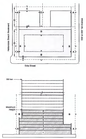
- Building size and height.
- On Hallandale Beach Boulevard West subdistrict, the minimum building height is two stories in height or one story at least 20 feet tall and the minimum floor area is 2,000 square feet.
- Maximum building height is eight stories on West Hallandale Beach Boulevard.
- Maximum building height is three stories along NW and SW 1st Streets. For properties that span the full block with frontage on both Hallandale Beach Boulevard and NW or SW 1st Streets, the building shall be set back above the third story at least 45 feet from NW or SW 1st Street.
- Within the incentive area shown on the regulating plan, on parcels greater than three acres, the maximum building height is 350 feet.
- Building uses and density.
- Specific uses. Specific uses in the Hallandale Beach Boulevard West subdistrict shall conform to the regulations in section 32-209.
- Conditional use standards. Conditional uses must be approved pursuant to the provisions in section 32-964. In addition, the following regulations apply:
- Animal hospital or veterinary clinics. All facilities, including ancillary kennels, shall be located in an enclosed soundproof, air-conditioned building.
- Public parking garages. On primary streets, public parking garages open to the public as a principal use shall be lined along the sidewalk level for a depth of at least 20 feet by a story containing active use(s), such as residential, office, or retail.
- Drive-through facilities for any use. Drive-through facilities for any use shall have the drive through window(s), stacking, and loading areas located to the rear or side of buildings.
- Uses permitted with supplemental regulations. The following uses have supplemental standards:
- Automobile parts and accessory sales. The business shall contain all products within a structure, that only new products are sold, and that there are no repair or installation services on-site.
- Dry-cleaning (on premises). Retail on-premises dry cleaning operations shall not exceed 2,000 square feet of gross floor area, uses only self-contained dry-cleaning units using nonflammable solvents. Other conditions may be imposed as necessary to ensure the proposed use shall be operated in a manner not creating adverse effects on abutting and neighboring properties.
- Fortuneteller. The business shall not be located within 1,000 feet of an existing fortunetelling business, measured by the most direct route from main entrance to main entrance.
- Contractors and trade operations. No outside storage of supplies, heavy equipment such as backhoes and the like, or commercial vehicles as specified in section 28-11 of this Code.
- Multi-family. Properties facing Hallandale Beach Boulevard are required to have a minimum of ten units.
- Places of assembly. Churches, synagogues and other places of worship, lodges, and fraternal organizations, theaters, bowling alleys, and skating rinks, provided that they are in a freestanding building located on a separate parcel of land that is not connected to or has no access to adjacent commercial uses and further provided that:
- The site shall have a minimum of 15,000 square feet in lot area and 100 linear feet of lot frontage.
- The building shall have a minimum of 2,000 square feet in gross floor area.
- Townhouses. Townhouse development is not permitted facing Hallandale Beach Boulevard and shall follow the standards in subsection 32-197(c)(5).
- Base density. The base density in Table 32-210(a) is the number of dwelling units allowed per acre without requiring additional performance criteria, based on the availability of units.
- Maximum density. The maximum density in Table 32-210(a) is the number of dwelling units allowed per acre based upon all the following performance criteria and the approval process set forth in section 32-215. For density up to 30 dwelling units per acre, projects shall:
- Provide at least seven and one-half percent of the site, or the portion of the site proposed for development in a multi-phased project, as civic open space(s) consistent with the standards set forth in section 32-202;
- Fully concealed parking garage levels on all streets at the sidewalk level for a depth of at least 20 feet by a story containing active use(s), such as residential, office, or retail;
- Provide street/streetscape improvements consistent with the city's complete streets efforts, including planting shade trees along the public sidewalk on both sides of side streets on NW or SW 1st Streets;
- Provide at least 15 percent of the project's total residential units as affordable housing maintained for a period of at least 30 years guaranteed by execution of a restrictive covenant or agreement in a form acceptable to the city attorney. The quality of finishes and fixtures for affordable housing units shall be identical to the quality of finishes and fixtures for market rate units; and
- Proposed density shall not exceed the maximum density permitted by the city's comprehensive plan. Any residential development on sites designated commercial in the city's land use plan is subject to allocation by the city commission of residential flexibility units and execution of a restrictive covenant or agreement in a form acceptable to the city attorney as to the number and any restrictions on the residential units. It is further provided that the density of any such development shall be subject to availability and assignment of flexibility units by the city commission in accordance with the county flexibility rules contained in the administrative rules document of the county land use plan. The city commission shall not be required to allot flexibility units to permit the maximum density permitted by the city comprehensive plan.
- Frontage standards.
- The frontage standards in section 32-212 apply to development in the Hallandale Beach Boulevard West subdistrict.
- For properties that span a full block with frontages on both Hallandale Beach Boulevard and NW or SW 1st Streets, development is encouraged to provide active uses along both street frontages. At a minimum, development shall provide:
- Buildings with entrances facing NW or SW 1st Street that are designed in accordance with the frontage standards in section 32-212; or
- Buildings facing Hallandale Beach Boulevard with the rear of the building, loading areas, or parking use areas on NW or SW 1st Street, shall have such areas shielded from view by a masonry wall six feet in height set back at least eight feet from the property line. An opening providing pedestrian access to the site with a ten-foot wide sidewalk connecting Hallandale Beach Boulevard and NW or SW 1st Street is required. The setback area between the wall and the street right-of-way shall be landscaped and provide shade trees uniformly spaced at least 25 feet on center. Spacing may exceed 25 feet in order to accommodate curb cuts, utilities, existing trees, and other infrastructure elements. Palm varieties may be used at corners, crosswalks in order to meet visibility triangle requirements, or to accent building entrances and may be permitted in lieu of shade trees when physical conditions may prevent the proper growth of shade trees, as determined by the development services director.
- Other applicable standards. See sections 32-213 through 32-216 for standards that also apply to the Hallandale Beach Boulevard West subdistrict.
(Ord. No. 2021-003, § 4, 3-17-2021; Ord. No. 2024-015, § 2, 6-5-2024)
Sec. 32-211. Hallandale Beach Boulevard East subdistrict.
- Purpose and intent. The Hallandale Beach Boulevard East subdistrict accommodates the corridor's most intense development, accommodating a wide range of uses, including major employment, shopping, restaurant and entertainment destinations as well as residential uses. Located along Hallandale Beach Boulevard, buildings in this subdistrict will have the largest scale of redevelopment and will create a vibrant, pedestrian-friendly, mixed-use district.
- Configuration of buildings. Unless otherwise specified herein, the standards in section 32-194 "configuration of buildings" shall apply to the Hallandale Beach Boulevard East subdistrict.
- Buildings must have the floor of the first habitable story elevated to meet the minimum floor elevations specified in chapter 8, section 8-81 of this Code plus any regulatory freeboard.
- Lot size and building placement. Table 32-211(a) provides the dimensional requirements regarding lot size, lot coverage, building setbacks, and building frontage for the Hallandale Beach Boulevard East subdistrict. Figure 32-211(a) illustrates the dimensional requirements from the table.
- A minimum of 75 percent of the linear width of the lot along primary streets shall be occupied by the primary façade of a building, located in accordance with the minimum and maximum setbacks in Table 32-211(a).
- Other streets do not have a required minimum building frontage and buildings shall be located in accordance with the minimum setbacks in Table 32-211(a).
- Buildings may be built without side setbacks on interior lot lines; however, if windows are proposed facing interior side lot lines, the building shall be set back at least five feet from the property line or as required to provide adequate light and air.
- Buildings taller than five stories are subject to additional setback requirements in order to ensure harmony among adjacent buildings and architectural articulation of building mass.
- Buildings with more than 250 feet of street frontage along a single street shall provide a pedestrian passageway at least ten feet wide that connects rear parking to the sidewalk in the public right-of-way that the building faces.
- The street and block standards in section 32-204 apply to site design to establish a walkable, multi-modal block structure over time. Sites greater than two and one-half acres in size shall organize circulation to establish a rational, interconnected street and block structure form that links to adjacent rights-of-way, provides parallel vehicular routes to Hallandale Beach Boulevard, and establishes clear pedestrian routes linked to adjacent sidewalks.
Table 32-211(a) - Hallandale Beach Boulevard East Subdistrict
Lot Size Lot width 50 ft. min. Lot area 5,000 sf. min./100,000 max. Lot coverage 90% max. Minimum landscape area 10% Building Placement A Primary street setback 15 ft. min.
30 ft. max.Other street setback1
15 ft. min. B Street above the 5th story 20 ft.3 C Interior side setback 0 ft. min.2 D Side setback above the 5th story 30 ft. min. E Rear setback 10 ft. min. F Rear setback above the 5th story 30 ft. min. G Building frontage on primary streets 75% min.
100% max.Building Size and Height Min. non-residential building floor area 2,000 sq. ft. Minimum height primary streets 2 stories or 20 ft. tall Base building height limit 10 stories Maximum building height 25 stories Density Base density 18 du/ac Max. density 50 du/ac Civic Open Space Requirement Sites > 40,000 sq. ft. 5% Development that exceeds base density and/or height limit 7.5% 1 Side lot lines facing streets are regulated by front setback requirements.
2 If windows are proposed facing interior side lot lines, buildings shall be set back at least five feet.
3 Shall setback at least five feet additional if primary setback is more than 15 feet.Figure 32-211(a)
Hallandale Beach Boulevard East
Building Placement and Height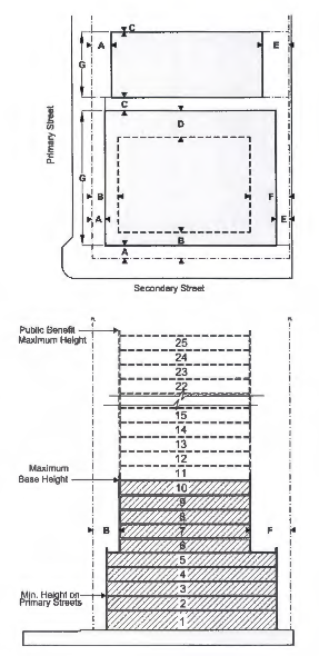
- Building size and height.
- On Hallandale Beach Boulevard, the minimum building height is two stories in height or one story at least 20 feet tall and the minimum building size is 2,000 square feet.
- Maximum building height is ten stories, except that buildings which provide all the following public benefits may build to 25 stories:
- Provide at least seven and one-half percent of the site, or the portion of the site proposed for development in a multi-phased project, as civic open space(s) consistent with the standards set forth in section 32-202;
- Fully concealed parking garage levels on all streets at the sidewalk level for a depth of at least 20 feet by a story containing active use(s), such as residential, office, or retail;
- Provide street/streetscape improvements consistent with the city's complete streets efforts, including planting shade trees along the public sidewalk on both sides of side streets.
- Building uses and density.
- Specific uses. Specific uses in the Hallandale Beach Boulevard East subdistrict shall conform to the regulations in section 32-209.
- Conditional use standards. Conditional uses must be approved pursuant to the provisions in section 32-964. In addition, the following regulations apply:
- Public parking garages. On primary streets, public parking garages open to the public as a principal use shall be lined along the sidewalk level for a depth of at least 20 feet by a story containing active use(s), such as residential, office, or retail.
- Drive-through facilities for any use. Drive-through facilities for any use shall have the drive through window(s), stacking, and loading areas located to the rear or side of buildings.
- Uses permitted with supplemental regulations. The following uses have supplemental standards:
- Dry-cleaning (on premises). Retail on-premises dry cleaning operations shall not exceed 2,000 square feet of gross floor area, uses only self-contained dry-cleaning units using nonflammable solvents. Other conditions may be imposed as necessary to ensure the proposed use shall be operated in a manner not creating adverse effects on abutting and neighboring properties.
- Places of assembly. Churches, synagogues and other places of worship, lodges, and fraternal organizations, theaters, bowling alleys, and skating rinks provided that they are in a freestanding building located on a separate parcel of land that is not connected to or has no access to adjacent commercial uses and further provided that:
- The site shall have a minimum of 15,000 square feet in lot area and 100 linear feet of lot frontage.
- The building shall have a minimum of 2,000 square feet in gross floor area.
- Base density. The base density in Table 32-211(a) is the number of dwelling units allowed per acre without requiring additional performance criteria, based on the availability of units.
- Maximum density. The maximum density in Table 32-211(a) is the number of dwelling units allowed per acre based upon all the following performance criteria and the approval process set forth in section 32-215. For density up to 50 dwelling units per acre, projects shall:
- Provide at least seven and one-half percent of the site, or the portion of the site proposed for development in a multi-phased project, as civic open space(s) or provide the minimum required amount in a waterfront location;
- Fully concealed parking garage levels on all streets at the sidewalk level for a depth of at least 20 feet by a story containing active use(s), such as residential, office, or retail;
- Provide street/streetscape improvements consistent with the city's complete streets efforts, including planting shade trees along the public sidewalk on side streets;
- Provide at least 15 percent of the project's total residential units as affordable housing maintained for a period of at least 30 years guaranteed by execution of a restrictive covenant or agreement in a form acceptable to the city attorney. The quality of finishes and fixtures for affordable housing units shall be identical to the quality of finishes and fixtures for market rate units; and
- Proposed density shall not exceed the maximum density permitted by the city's comprehensive plan. Any residential development on sites designated commercial in the city's land use plan is subject to allocation by the city commission of residential flexibility units and execution of a restrictive covenant or agreement in a form acceptable to the city attorney as to the number and any restrictions on the residential units. It is further provided that the density of any such development shall be subject to availability and assignment of flexibility units by the city commission in accordance with the county flexibility rules contained in the administrative rules document of the county land use plan. The city commission shall not be required to allot flexibility units to permit the maximum density permitted by the city comprehensive plan.
- Other applicable standards. See sections 32-212 through 32-216 for standards that also apply to the Hallandale Beach Boulevard East subdistrict.
(Ord. No. 2021-003, § 4, 3-17-2021; Ord. No. 2024-015, § 2, 6-5-2024)
Sec. 32-212. Frontage standards.
Frontage standards define architecture and design components for the entrance(s) to buildings and the area from building facades to streets. Building setbacks and other development standards are coordinated with street cross-sections to ensure a superior public realm results, improving both the overall visual appearance and use of streets.
- Hallandale Beach Boulevard streetscape standards. The combination of public sidewalk (located within the right-of-way) and hardscape (located in front setback areas) shall provide a minimum streetscape area no less than 20 feet in width, measured from the back of curb. The streetscape area shall be organized as follows:
- Curb zone. The curb zone is at least five feet wide, measured from the back of curb toward the property line (see Figure 32-212(a)). This zone accommodates street trees and public infrastructure needs such as utility poles, streetlights, street signs, etc. These elements shall be located as close to the curb as possible; signs shall be consolidated as much as possible.
- Pedestrian walkway and multi-use path. A ten-foot wide multi-use path shall be provided along Hallandale Beach Boulevard and a pedestrian walkway at least six feet wide shall be provided on all other streetscapes. Any portion of the multi-use path or pedestrian walkway within the front setback area shall be improved as an extension of the public right-of-way and shall match the design and material, providing a seamless physical transition. A sidewalk easement, in a form acceptable to the city attorney, over any portion of the multi-use path or pedestrian walkway located within the front setback shall be granted to the city. The property owner shall also be required to enter into a maintenance agreement, in a form acceptable to the city attorney, requiring the property owner to be responsible for and maintain any improvements made or installed by the owner to meet the requirements of this section.
- Remaining front setback area. The remaining front setback area within the minimum 20-foot wide streetscape shall be detailed appropriately for the ground story use of the building:
- Commercial uses. Buildings with retail or commercial uses in the ground story shall detail and design any remaining front setback area within the 20-foot wide minimum streetscape area using a hardscape design. This portion may be used to accommodate outdoor dining areas, subject to section 32-420. Landscaping comprised of plants in removable planters, palms, and/or ground planting may be installed adjacent to the building provided it does not obstruct views into storefront windows.
- Residential uses. Buildings with residential uses in the ground story shall detail and design any remaining front setback area within the 20-foot wide minimum streetscape area using hardscape or landscaping. The encroachment of stoops in this area may be permitted, pursuant to section 32-201(a)(2).
Figure 32-212(a)
Hallandale Beach Boulevard Streetscape Standards
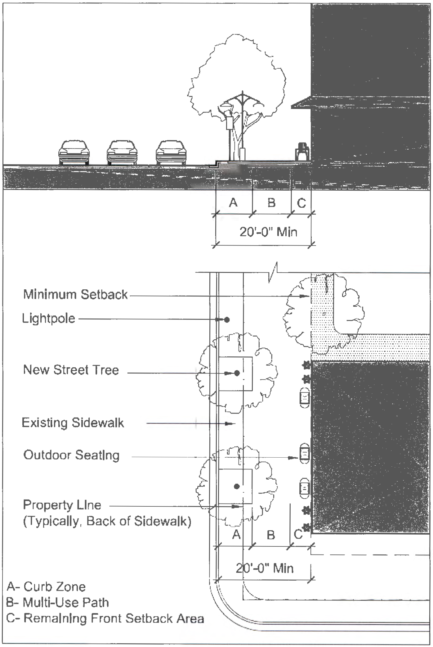
- Street trees. Street trees shall be installed as set forth in subsection 32-201(c).
- Frontage types.
- The main entrance(s) to ground story lobbies or commercial space(s) shall be directly from and face a public right-of-way or civic open space. Doors allowing public access shall occur at intervals no greater than 75 feet along the main façade.
- Building entrances shall use at least one of the following frontage types detailed in subsections 32-201(a)(2) to (a)(7):
- Stoop.
- Forecourt.
- Bracketed balcony.
- Storefront.
- Arcade/colonnade.
- Lobby entry.
- Hallandale Beach Boulevard design guidelines. Please refer to the Hallandale Beach Boulevard design guidelines for design techniques and strategies.
(Ord. No. 2021-003, § 4, 3-17-2021)
Sec. 32-213. Civic open spaces.
Unless otherwise specified herein, the standards in section 32-202 "civic open spaces" shall apply to the Hallandale Beach Boulevard district.
- Amount required. New development or additions of gross floor area equal to 50 percent or more to existing buildings shall provide civic open space.
- Dedicated rights-of-way do not count toward fulfilling the required amount.
- Types of civic open spaces. Civic open space shall be designed as one of the types described in section 32-202.
- Waterfront amenities.
- Sites adjacent to or facing water bodies, including the Intracoastal Waterway and lakes, shall provide public access and amenities along or around the waterbody by incorporating the following design characteristics:
- Building facades with required openings as set forth in subsection 32-194(d) shall face the water body;
- A continuous public walkway with lighting, trash receptacles, and benches;
- A minimum of 50 percent of the required civic open space, shall be located along the water body.
- In order to encourage access and amenities along the Intracoastal Waterway and lakes, projects that provide all of the required civic open space in waterfront locations are eligible to receive additional density as set forth in each subdistrict.
- Sites adjacent to or facing water bodies, including the Intracoastal Waterway and lakes, shall provide public access and amenities along or around the waterbody by incorporating the following design characteristics:
(Ord. No. 2021-003, § 4, 3-17-2021)
Sec. 32-214. Parking standards.
- Purpose of revised standards. This section provides modified regulations for off-street parking, loading zones and bicycle parking within the Hallandale Beach Boulevard zoning district. These regulations recognize that improper placement of parking and mandatory duplication of the parking supply on each building site separates the various land uses from each other. This separation reduces the viability of the mixed-use districts and harms the walkability of the streets and the success of transit. These regulations reflect the needs of an urban, mixed-use area. When in conflict with the regulations in division 11, this section shall rule.
- Minimum number of off-street parking spaces. The minimum number of parking spaces required in section 32-455 "minimum parking space requirements" is modified by this section for the Hallandale Beach Boulevard zoning district.
- Table 32-214(a) identifies the minimum number of off-street parking spaces required for the use; uses not listed shall provide parking in accordance with the amount required in section 32-455.
Table 32-214(a) - Minimum Number of Off-Street Parking Spaces Required per Use
Residential Uses Townhouse 2 spaces per unit Multi-family dwelling unit—500 sq. ft. or less 0.75 spaces per unit Multi-family dwelling unit—501 sq. ft. or greater 1.25 spaces per unit Guest Parking for All Residential Uses Guest parking cumulatively 10% of required parking for units Lodging Hotels/motels 0.5 space for each guest room plus 1.0 space per 300 sq. ft. of ballrooms, meeting rooms, shops, restaurants, and lounges Business Uses Professional office 1 space per 300 sf. of gross (GFA) floor area Retail, restaurant and other commercial 1 space per 300 sf. of net (GLA) floor area - Where adequate right-of-way exists, construction of additional on-street parking spaces directly and wholly abutting the lot, or parcel, may be counted towards the off-street parking requirement of the lot or parcel it is intended to serve, provided that:
- Such parking spaces shall be publicly accessible and cannot be reserved or restricted by the owner(s) or tenant(s) of the lot or parcel.
- Table 32-214(a) identifies the minimum number of off-street parking spaces required for the use; uses not listed shall provide parking in accordance with the amount required in section 32-455.
- Location and access to off-street parking. Parking and service areas shall be accessed and located at the rear or side of the building(s) whenever possible.
- Location.
- On primary streets, parking lots shall be located to the side or rear of buildings. If parking in the side or rear is inappropriate or impossible and a RAM is requested, the city commission may require special perimeter landscape treatments to protect and improve the pedestrian experience along the street.
- On secondary streets, parking lots may be located on the side of buildings provided the parking is screened from view of the street by a street wall (see section 32-194(d)(6)).
- Parking garage design standards.
- On primary streets, all parking garage levels shall be fully concealed from view by a story containing active use, such as residential, office, or retail for at least 20 feet of depth.
- On secondary streets, parking garage levels not lined by another use shall be screened by a building façade that meets the architectural requirements in section 32-194(d).
- All parking garage facades shall meet the requirements in section 32-194(d)(5) and screen the vehicles from view. Open, non-ventilated garages must consider this requirement and create facades accordingly.
Figure 32-214(a)
Parking Garage Design Standards
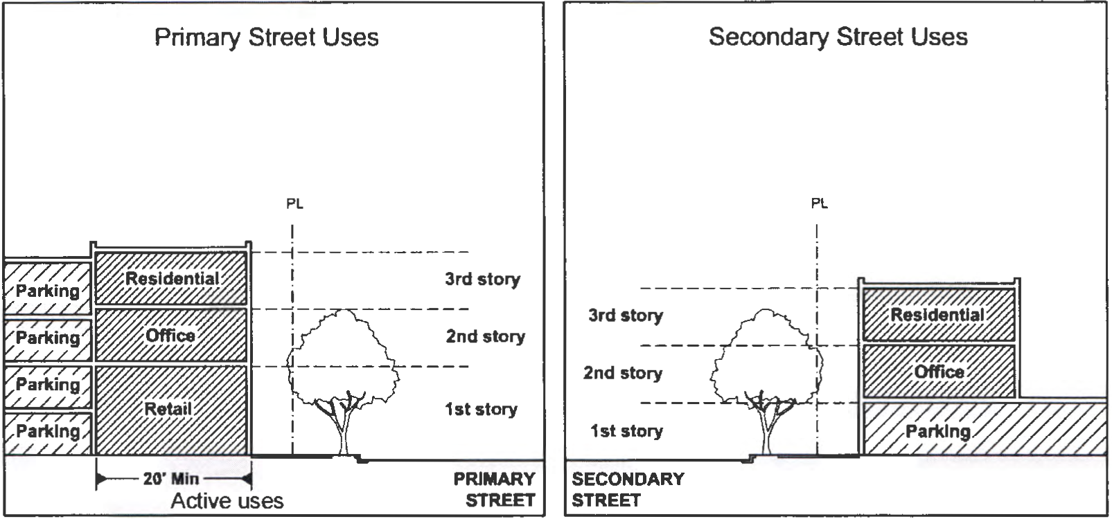
- Access.
- Access drives shall not exceed 24 feet in width.
- On primary streets, vehicular access drives shall be limited to the extent possible and sharing access drives between adjacent properties is encouraged. Access drives from alleys or secondary streets are not limited and should provide vehicular access to off-street parking. In the instance that the necessity of an access drive precludes meeting the minimum building frontage percentage required, the development services director may administratively allow a reduction from the minimum building frontage in order to allow vehicular access to the site.
- Alleys may be incorporated into parking lots and garages as standard drive aisles and vehicles may back out onto alleys. Access to all properties adjacent to the alley shall be maintained by the property owner.
- When an alley is not present, vehicular access between parking lots on adjacent parcels across property lines is required, and shall be accommodated within the site layout. The first property owner to develop shall be required to make an irrevocable offer of cross-access to the adjacent parcels prior to issuance of a development order. When adjacent property develops, a reciprocal cross-access agreement is required, and the physical connection shall be completed by both property owners.
- Parking lots and structures shall provide a five-foot wide minimum pedestrian access directly from a street. In addition, pedestrian access may also be provided directly from a building.
- Buildings with more than 250 feet of street frontage on a block face shall provide a pedestrian passageway at least ten feet wide connecting the rear parking to the sidewalk in the public right-of-way that the building faces.
- Public sidewalks may not be interrupted or deviated to accommodate back out parking, drop-off or valet parking. The sidewalk shall continue across driveway openings.
- Parking lots with no more than 20 spaces and a maximum of ten spaces per row are exempt from the requirements of subsection 32-453(i)(4) requiring vehicular entry/exit in one continuous forward motion.
- Location.
- Loading zones. Design of loading zones.
- A "type I" off-street loading zone shall be provided as required in the Table 32-214(b), loading zone requirements per square footage in this section shall be a minimum of 12 feet by 30 feet. A "type I" off-street loading zone shall be located in a specifically designated loading area which may be adjacent to drive aisles, walkways, or attached/detached from building. Turning geometries utilized in the design of type I loading zone access shall be sufficient to accommodate a standard single unit truck (AASHTO "SU" design vehicle).
- A "type II" off-street loading zone shall be provided as required in the Table 32-214(b), loading zone requirements per square footage shall be a minimum 12 feet by 50 feet. A type II off-street loading zone shall only be located in a specifically designated loading area which is marked by pavement markings and signage on the site. Turning geometries utilized in the design of type II loading zones shall be sufficient to accommodate a standard, intermediate-sized semi-trailer vehicle (AASHTO "WB-40" design vehicle).
- Type I and type II loading zones shall have a minimum vertical clearance of 14 feet.
- Loading zones may not be placed where they obstruct required fire lanes and access to hydrants. Loading zones shall be located on a parcel in a place which insures convenient and safe entry and exit for the users of the loading zone, and the convenience and safety of pedestrians and motorists using the parcel.
- No backing into a public right-of-way shall be permitted for loading zones. Access to and from loading zones shall be clearly indicated on the parking facility site plan.
- Loading zones are not required for residential uses.
Table 32-214(b) - Loading Zone Requirements per Square Footage
Square Footage of Retail, Restaurants and Other Commercial Uses (Sales, Service, or Mixed Use) Number and Type of Loading Zones Required Equal to 20,000 sf but not greater than 75,000 sf 1 type II More than 75,000 sf but less than 150,000 sf 2 type II More than 150,000 sf but less than 200,000 sf 3 type II More than 200,000 sf 4 type II Area of Free-Standing Hotel and Office Use Building Number and Type of Loading Zones Required Equal to 20,000 sf but not greater than 150,000 sf 1 type I More than 150,000 sf 1 type II
- Bicycle parking and facilities. Bicycle parking and facilities shall be provided within the Hallandale Beach Boulevard zoning district.
- Minimum number of bicycle parking spaces.
- Bicycle parking spaces shall be provided onsite for all uses. Bicycle parking shall be provided at five percent of total vehicular parking spaces proportionately split between long term bicycle parking for employees and short-term bicycle parking for guest two spaces minimum or whichever is greater.
- Design and location. Visitor, employee and resident bicycle parking facilities shall be provided in a location(s) shown on the site plan that meets the following standards:
- Long term parking spaces shall be located in secure, weather-protected facilities intended for use as long-term, overnight, and work-day bicycle storage by dwelling unit residents, nonresidential occupants, and employees.
- Short term bicycle spaces shall be located in a publicly accessible area with convenient access from the building or structure and street or other bicycle right-of-way. They shall be clean, highly visible, secure and well-lit, and shall be located within or adjacent to civic and public open space, a building or structure, either on the ground floor, or main level (first floor) in a parking garage intended for transient or short-term use by visitors, guests, and patrons to the building or use.
- Bicycle parking spaces shall not encroach into the minimum required pedestrian walkway (see section 32-201(b).
- Minimum number of bicycle parking spaces.
(Ord. No. 2021-003, § 4, 3-17-2021; Ord. No. 2024-017, § 2, 6-26-2024)
Sec. 32-215. Approval processes.
- Approval types. Development applications may follow two different review and approval processes:
- Development applications in the Hallandale Beach Boulevard zoning district may be approved administratively if the application:
- Meets all requirements of this code; and
- Does not exceed the base density specified for its Hallandale Beach Boulevard subdistrict; and
- Does not require any conditional uses, variances, or redevelopment area modifications (RAM); and
- If within the Hallandale Beach Boulevard West subdistrict, is eight stories or less in height or if within the Hallandale Beach Boulevard East subdistrict, is ten stories or less in height.
- Development applications in the Hallandale Beach Boulevard zoning district may be approved only by the city commission using the major development review process if the application:
- Meets all requirements of this code only upon approval of simultaneously requested conditional uses, variances, or redevelopment area modifications (RAM);
- Is requesting a density level between the base density or height and the maximum density or height allowable in its Hallandale Beach Boulevard subdistrict;
- Is proposing building height taller than eight stories within the Hallandale Beach Boulevard West subdistrict; or
- Is proposing building height above the base height of ten stories in the Hallandale Beach Boulevard East subdistrict.
- Development applications in the Hallandale Beach Boulevard zoning district may be approved administratively if the application:
- Submission requirements and procedures.
- Development applications in the Hallandale Beach Boulevard zoning district that meet subsection 32-215(a)(1) may be approved administratively, as submitted to the city using the procedures in article V of this Code, except that the development services director has the authority to approve the application administratively even if article V would otherwise require review and approval by the planning and zoning board and the city commission.
- Development applications in the Hallandale Beach Boulevard zoning district that may be approved only by the city commission (see subsection (a)(2) above) shall be submitted to the city using the procedures in article V of this Code. These applications will be reviewed and processed as if they were major developments even if they are below the size thresholds in subsection 32-782(a).
- Conditional uses and variances. The city commission may approve conditional uses and variances in the Hallandale Beach Boulevard zoning district using the procedures and standards in article VIII of this Code plus any additional standards set forth in the Hallandale Beach Boulevard district regulations. However:
- Redevelopment area modifications. The city commission may approve redevelopment area modifications in the Hallandale Beach Boulevard zoning district for any land development code standard using the procedures and standards in section 32-135, plus the following additional standards:
- General rules for changes to Hallandale Beach Boulevard zoning district.
- Overlays.
- Prior mapped overlays. Portions of the Hallandale Beach Boulevard zoning district had previously been included in the redevelopment overlay. Relevant parts of those overlay regulations have been incorporated into the Hallandale Beach Boulevard district regulations.
- Previously approved planned development overlays. Some individual properties in the Hallandale Beach Boulevard zoning district are designated planned development overlay (PDO) or have obtained prior approval for a site-specific "planned development overlay district (PDO)." At the landowner's discretion:
- The terms of those approvals may continue to be used to obtain remaining development approvals until such time as the original approval and/or development agreement has expired; or
- The provisions of the Hallandale Beach Boulevard zoning district may be used to obtain future development approvals without rescinding the prior "planned development" approval. However, the two methods may not be combined except to the extent that non-conformity with the current code is not furthered.
- Properties designated planned development overlay (PDO) as of the effective date of this subdivision, shall retain the existing PDO designation and shall be subject to entering into a development agreement as provided in section 32-186, except that, this process cannot be used to increase density levels above the maximum specified by the city's comprehensive plan.
- Future overlays. Additional mapped or planned development overlays may not be approved in the Hallandale Beach Boulevard zoning district, subject to the following restrictions:
- On sites in the Hallandale Beach Boulevard zoning district with two or more contiguous acres under unified control, a landowner may request a planned development overlay (PDO) and development agreement consistent with the applicable provisions of section 32-186.
- On sites in the Hallandale Beach Boulevard zoning district with one contiguous acre under unified control, a landowner may request a planned development overlay (PDO) and development agreement consistent with the applicable provisions of section 32-186 for a period up to six months after the land was rezoned to the Hallandale Beach Boulevard zoning district.
- The request must accompany an official development application that meets the site plan review submission requirements as set forth in article V of this Code.
- Development approval for the application must be obtained within six months of the original request for PDO and development agreement. For good cause shown, the city manager may grant an additional six months for the development plan approval.
- Development approvals granted under this provision are subject to extension provisions as outlined in section 32-790 of this Code.
- Should the site plan approval expire, the development agreement shall expire concurrently, and the PDO will be administratively removed via rezoning.
- Under either exception, the following additional standards shall apply:
- Development must be consistent with the city's comprehensive plan.
- Allowable uses and all development regulations and requirements, including height and density shall be as specified for the Hallandale Beach Boulevard subdistrict, except where modifications were specifically requested and explicitly approved in the planned development overlay and development agreement for the period of six months from the time the land was rezoned to the Hallandale Beach Boulevard zoning district.
- Expansions, contractions, and subdistrict adjustments. The boundary of the Hallandale Beach Boulevard zoning district and the boundaries of its subdistricts may be expanded or contracted by the city commission by amending the regulating plan in section 32-192. Landowners desiring boundary changes to the regulating plan must request an amendment to the zoning and land development code instead of using the rezoning process. Requests for amendments to the regulating plan shall be advertised, posted and noticed in conformity with the requirements of section 32-1004 as to rezonings in addition to requirements for zoning code text amendments. Such applications shall be reviewed utilizing criteria per section 32-963. New mapped or planned development overlays cannot be used in the Hallandale Beach Boulevard zoning district except as provided in subsection 32-215(e)(1)(c).
- Transitional period. For applications submitted prior to the effective date of Ordinance No. 2020, staff may present an analysis of the measurable parameters of development under both regulations.
- Overlays.
(Ord. No. 2021-003, § 4, 3-17-2021)
Sec. 32-216. Density allocation standards.
- Base density and maximum density. Each Hallandale Beach Boulevard subdistrict defines a base density and a maximum density, expressed as the number of dwelling units allowed per net acre.
- Development up to the base density is permitted by right except that allocation of residential flexibility units requires density allocation as described in section 32-796.
- Development between the base density and the maximum density requires residential flexibility unit density allocation as described in section 32-796.
- Development above the maximum density cannot be approved.
(Ord. No. 2021-003, § 4, 3-17-2021; Ord. No. 2024-009, § 2, 4-10-2024)
Secs. 32-217—32-220. Reserved.
Figure 32-192(a) - Central RAC Regulating Plan
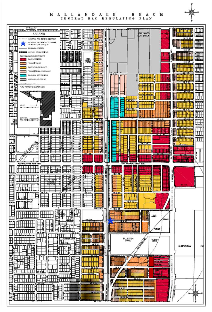
(Ord. No. 2014-31, § 24(Exh. B), 11-5-2014; Ord. No. 2015-14, § 2, 10-7-2015; Ord. No. 2016-22, § 4(Exh. C), 11-16-2016; Ord. No. 2023-010, § 3, 5-17-2023)
Table 32-203(b) - Loading Zone Requirements per Square Footage
| Square Footage of Retail, Restaurants and Other Commercial Uses (Sales, Service, or Mixed Use) | Number and Type of Loading Zones Required |
| Equal to 20,000 sf but not greater than 75,000 sf | 1 type II |
| More than 75,000 sf but less than 150,000 sf | 2 type II |
| More than 150,000 sf but less than 200,000 sf | 3 type II |
| More than 200,000 sf | 4 type II |
| Area of Free-Standing Hotel and Office Use Building | Number and Type of Loading Zones Required |
| Equal to 20,000 sf but not greater than 150,000 sf | 1 type I |
| More than 150,000 sf | 1 type II |
(Ord. No. 2014-31, § 24(Exh. B), 11-5-2014; Ord. No. 2021-003, § 3, 3-17-2021; Ord. No. 2023-010, § 3, 5-17-2023; Ord. No. 2024-017, § 2, 6-26-2024)
Table 32-209(a) - Allowable Uses by Subdistrict
| Allowable Uses by Subdistrict | Hallandale Beach Blvd. West | Hallandale Beach Blvd. East |
|---|---|---|
| Residential | ||
| Single-family dwellings | - | - |
| Two-family (duplex) dwellings | - | - |
| Townhouse dwellings (sec. 32-197(c)(5)) | P1/PS | - |
| Multi-family dwellings (min. of 10 units) | PS | P |
| Live/work units | P | P |
| Work/live units | P | P |
| Assisted living facilities | P | P |
| Nursing homes | P | P |
| Other residential care facilities | See section 32-594 | |
| Lodging | ||
| Bed-and-breakfast inns | - | - |
| Hotels and motels | P | P |
| Business | ||
| Alcoholic beverage establishments | P2 | P2 |
| Animal hospital or clinic | C | - |
| Automobile parts and accessory sales | PS | - |
| Contractor and trade operations | PS | - |
| Drive-through facilities (for any use) | C | C |
| Dry-cleaning (on premises) | PS | PS |
| Fortuneteller | PS | - |
| Garage, public parking | C | C |
| Medical marijuana businesses, pain management clinics and pharmacies | PM | PM |
| Offices | P | P |
| Offices, limited | P | P |
| Parking lot | C | C |
| Parking lot, interim | C | C |
| Places of assembly uses | PS | PS |
| Restaurants | P | P |
| Sale of secondhand/used merchandise | C | - |
| Studio or workshop | P | P |
| Stores and services, general | P | P |
| Stores and services, large format | P | P |
| Vehicle sales, rental, repair, service stations, and car wash | - | - |
| Civic and Education | ||
| Civic open spaces | P | P |
| Day care centers | C | C |
| Government uses | P | P |
| Schools, public and private | C | C |
| P = Permitted use C = Conditional use - = Use not permitted P1 = Permitted facing NW or SW 1st streets only P2 = Permitted per standards in chapter 5 PS = Use permitted with supplemental standards PM = Use permitted per supplemental standards chapter 32, article IV, division 24 | ||
(Ord. No. 2021-003, § 4, 3-17-2021; Ord. No. 2024-014, § 1, 5-15-2024)