
Henrico County Unincorporated
City Zoning Code
City Zoning Code
ARTICLE 3
- ZONING DISTRICTS
Sec. 24-3101.- Compliance with Zoning District Standards.
Land in the County must not be used or developed except in accordance with the zoning regulations of this article and all other regulations of this Ordinance.
Sec. 24-3102. - Districts Established.
This Ordinance establishes the base, planned development, and overlay zoning districts identified in Table 3102: Establishment of Zoning Districts. Each zoning district established in accordance with this Ordinance will have the boundaries shown on the Zoning Districts Map (see Article 1, Division 3, Zoning Districts Map).
(Ord. No. 1338, § 2, 2-11-2025)
Sec. 24-3103. - Organization of Zoning Districts.
In accordance with Table 3102: Establishment of Zoning Districts, each zoning district is classified as either a base district, a planned development district, or an overlay district. Conditional zoning districts are not identified in Table 3102: Establishment of Zoning Districts but will be established only in accordance with Sec. 24-2304, Conditional Zoning.
A.
Base Zoning Districts.
1.
Base zoning districts consist of Conservation and Agricultural Districts, Residential Districts, and Nonresidential and Mixed-Use Districts, in accordance with Table 3102: Establishment of Zoning Districts. Base districts are established initially by the County's adoption of this Ordinance. Additional base districts may be established in accordance with Sec. Sec. 24-2302, Text Amendment. The boundaries of each base district on the Zoning Districts Map will be amended only in accordance with Sec. 24-1304, Changes to Zoning Districts Map.
2.
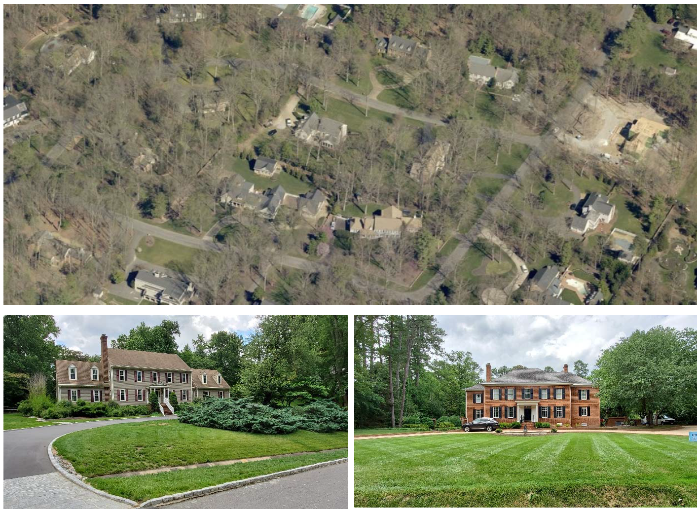
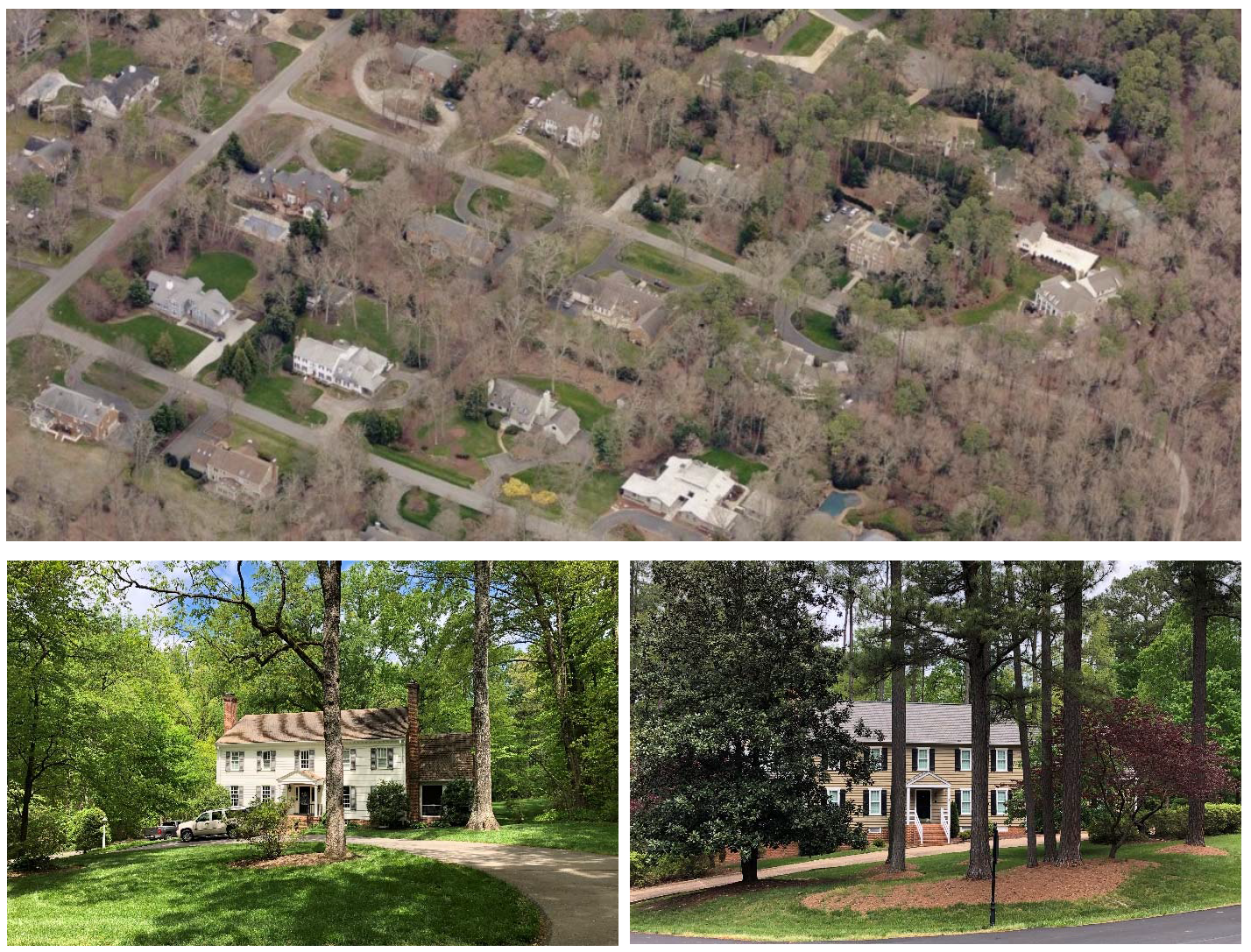
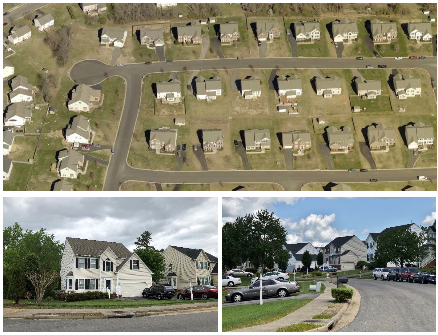
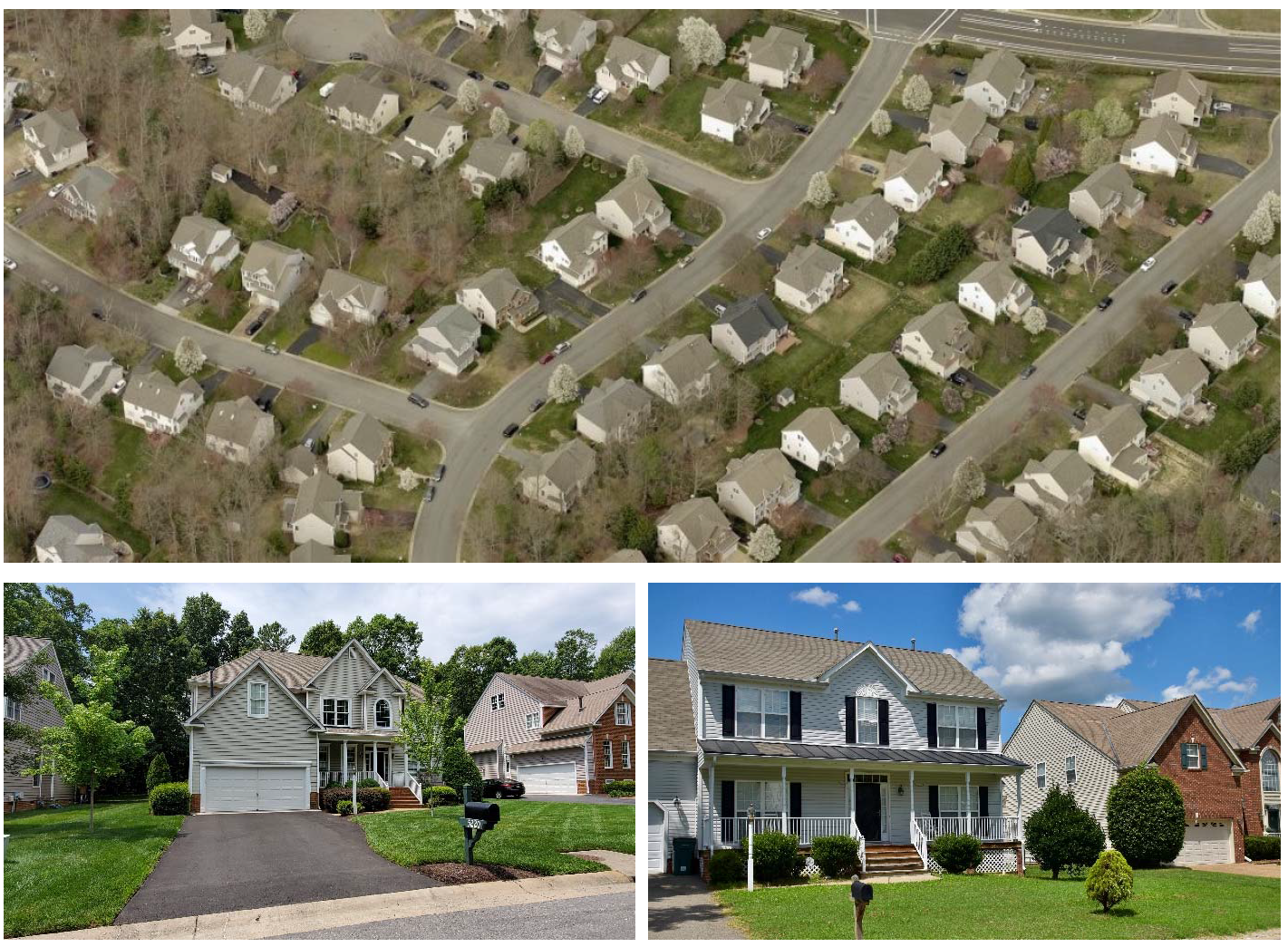
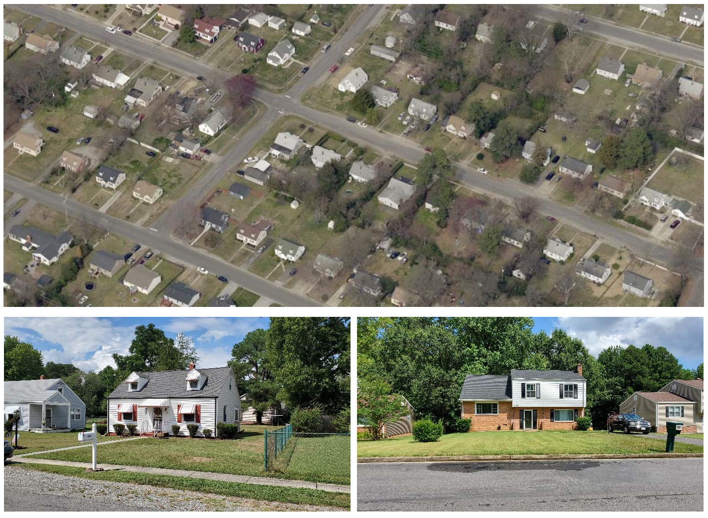
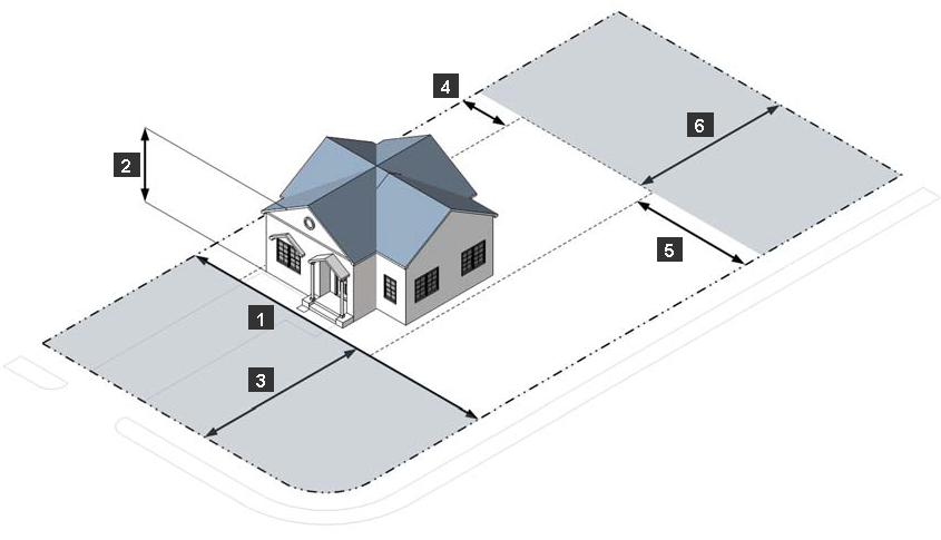
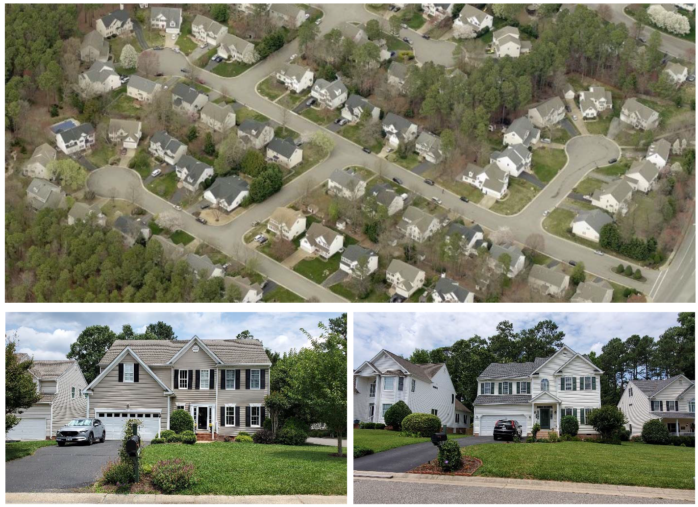
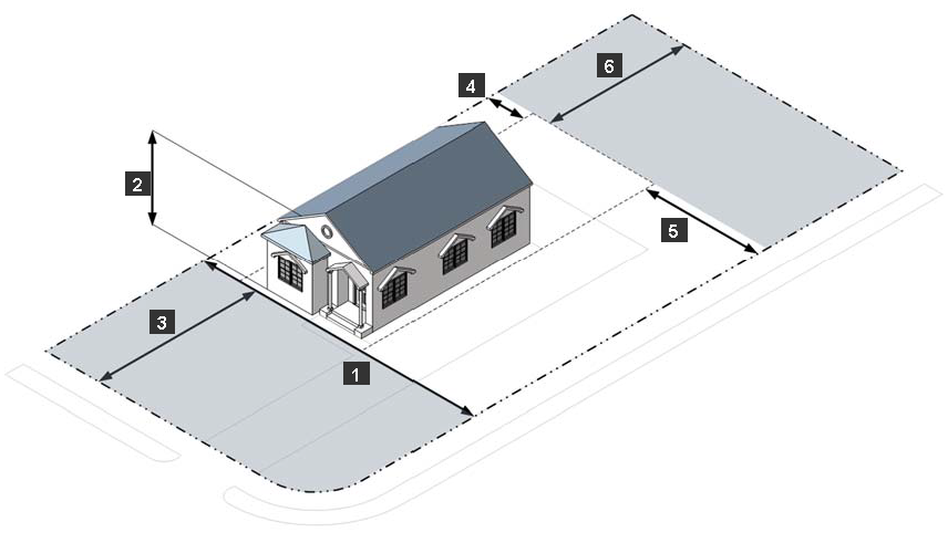
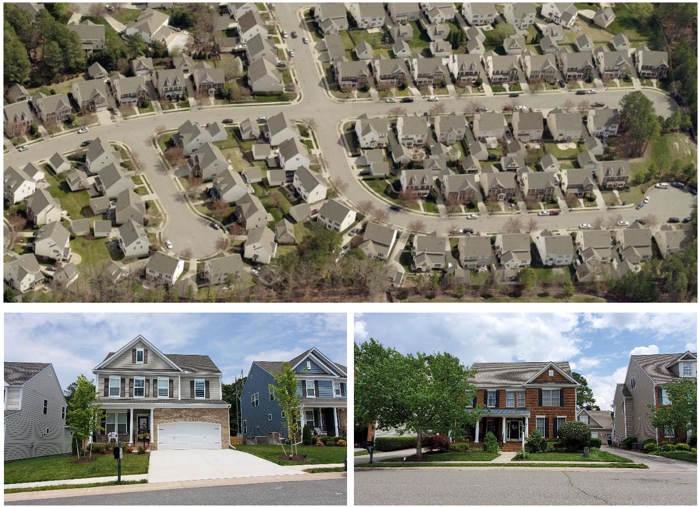
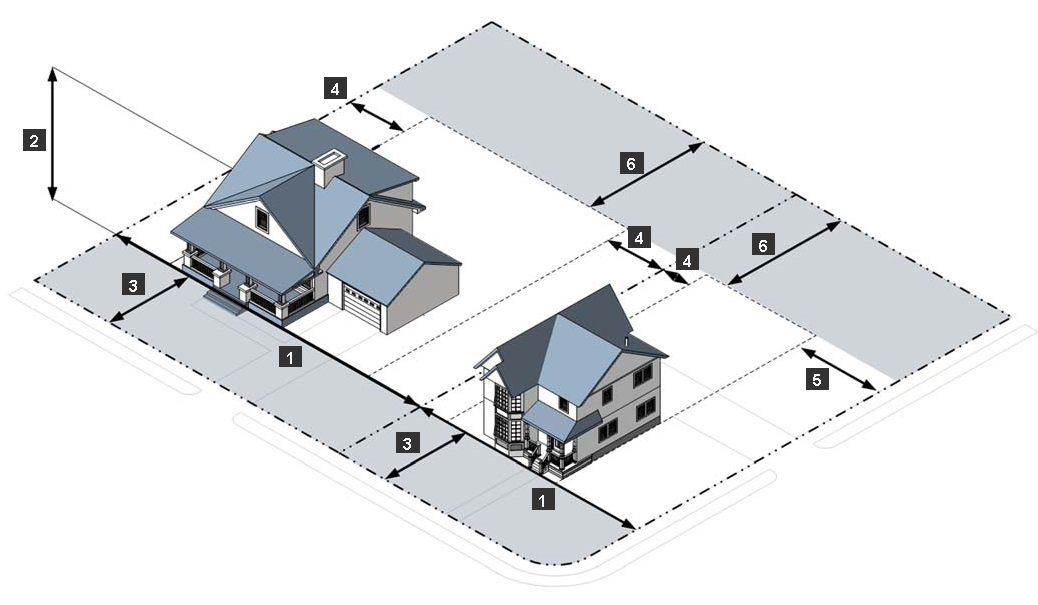
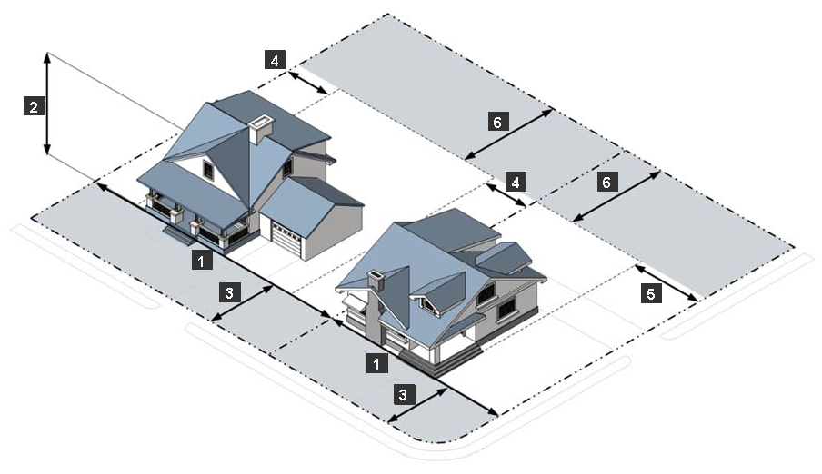
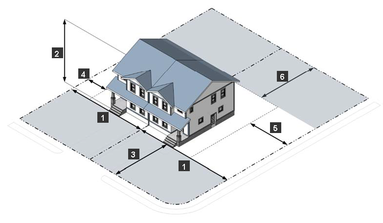
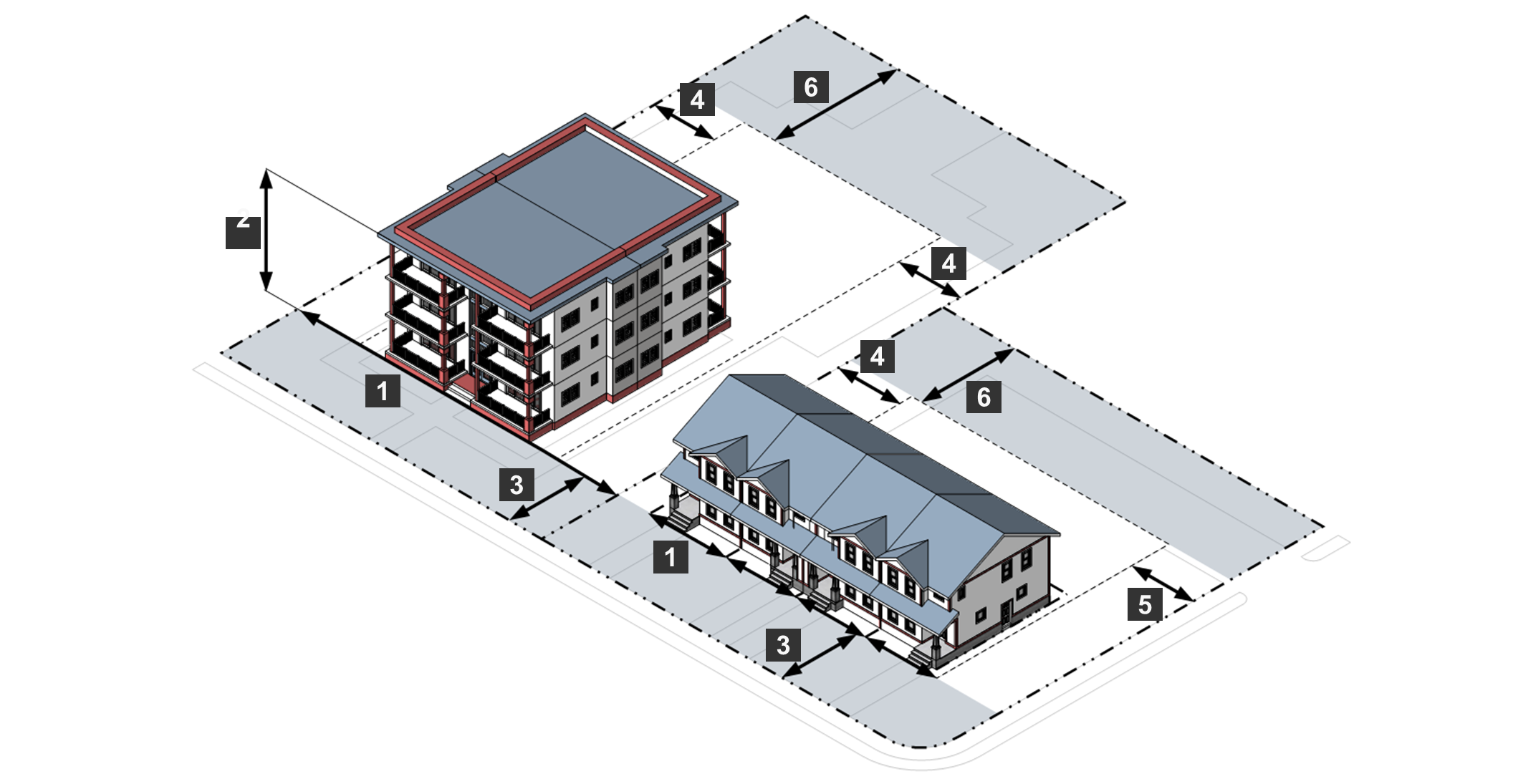
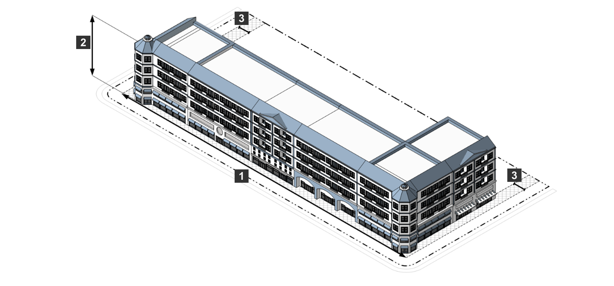
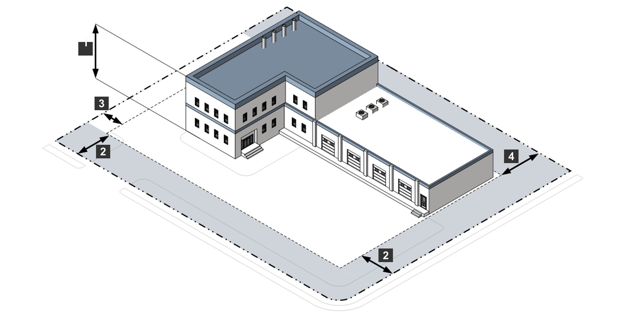
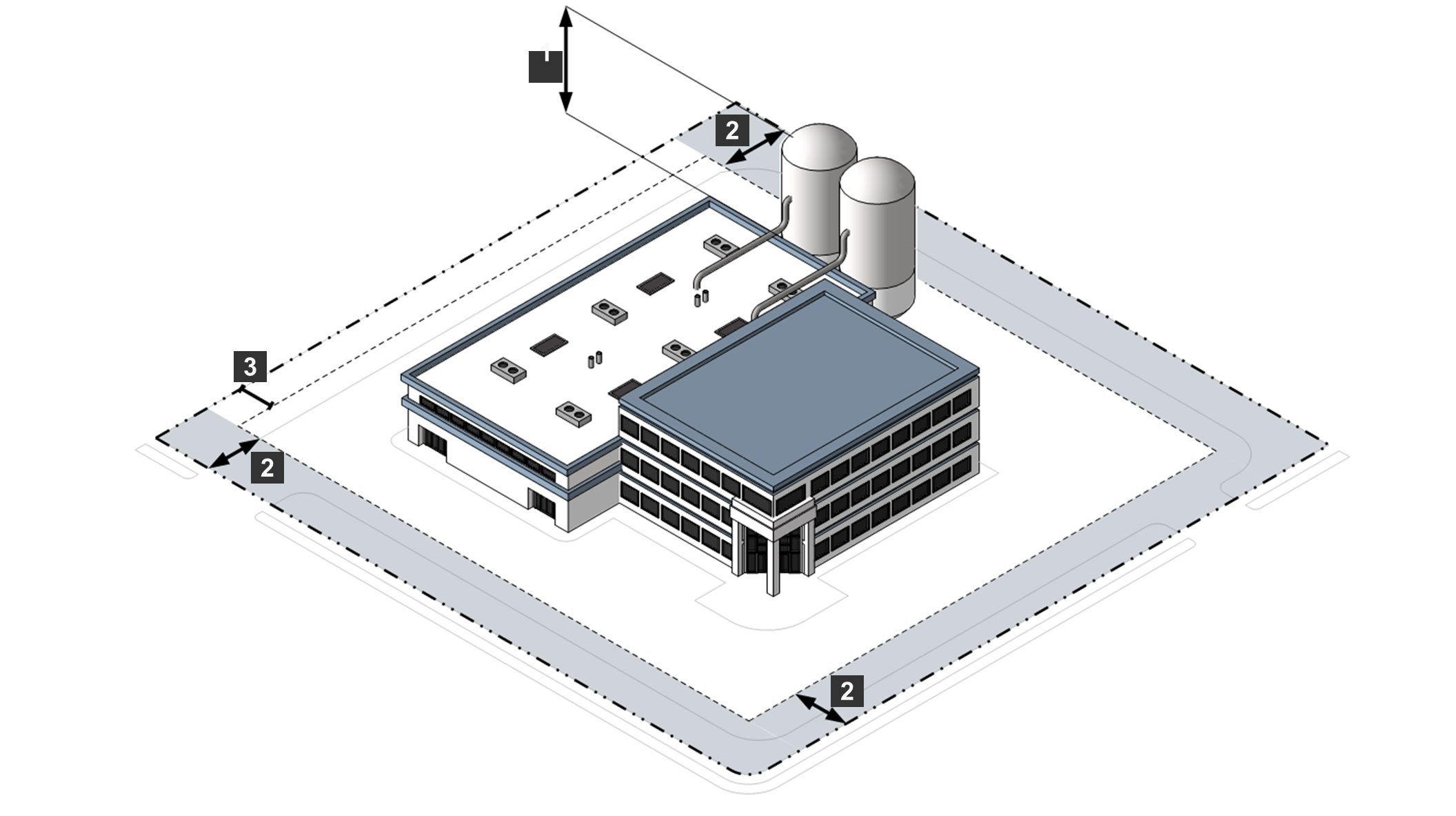
Article 3, Division 2 through Article 3, Division 4 below set out each base district's purpose, establish the intensity and dimensional standards applicable in the district, reference other Ordinance standards generally applicable to development in the district, illustrate the district's dimensional standards applied to lots and typical building forms, and provide examples of development patterns and building forms typical in the district. Illustrations are intended to exemplify the general character of the district and do not necessarily reflect all the standards that may apply to a particular development.
B.
Planned Development (PD) Districts.
1.
Sec. 24-3502, General Provisions for All Planned Development Districts sets forth the general purpose of planned development districts, in addition to the standards applicable to the proposed planned development district. Generally, PD Districts require unified control (by either one or multiple landowners) of a large project and allow for greater flexibility and a wider range of allowed uses than traditional base zoning districts allow, in return for innovative design and higher quality development. It is the intent of this Ordinance that PD Districts should be used only when these elements exist.
2.
Planned development districts are adopted by the Board of Supervisors as zoning map amendments in accordance with Sec. 24-2305, Planned Development. The name and location of the specific planned development district is shown on the Zoning Districts Map.
3.
Each planned development district is subject to an approved PD Master Plan and PD Terms and Conditions Document that establish a plan and regulations for development in the individual PD District. As provided in Sec. 24-2305, Planned Development, the PD Master Plan and PD Terms and Conditions Document are included with the adopting ordinance and recorded in the land records.
C.
Conditional Zoning Districts. Conditional zoning is a flexible zoning classification whereby development conditions, also known as proffers, are attached to rezoned land in order to ensure compatibility of future development, as allowed under the Code of Virginia. Conditional zoning districts are individually approved by the Board of Supervisors as provided in Sec. 24-2304, Conditional Zoning. Approved conditional zoning districts are shown on the Zoning Districts Map, and the adopting ordinance and conditions of approval are maintained in a Conditional Zoning Index (see Sec. 24-3603, Designation on Zoning Districts Map).
D.
Overlay Districts.
1.
Overlay districts are established initially by the County's adoption of this Ordinance. Additional overlay districts may be established in accordance with Sec. 24-2302, Text Amendment. The boundaries of each overlay district on the Zoning Districts Map will be amended only in accordance with Sec. 24-2303, Map Amendment (Rezoning).
2.
Standards governing development in an overlay zoning district will apply in addition to, or instead of, the standards governing development in the underlying base zoning district or planned development district and may also provide a more flexible alternative to base zoning district standards. If the regulations governing an overlay district expressly conflict with those governing an underlying base zoning district, the regulations governing the overlay district will govern, whether more or less restrictive than the underlying district. If land is classified into multiple overlay districts and the regulations governing one overlay district expressly conflict with those governing another overlay district, the more restrictive regulations will govern.
Sec. 24-3104. - Photographs, Graphics, and Diagrams for Illustrative Purposes Only.
Photographs, graphics, and diagrams in this article are included for illustrative purposes only. If there is any inconsistency between them and the text of this Ordinance, including tables, the text will govern (see Sec. 24-8102, Headings, Illustrations, and Text).
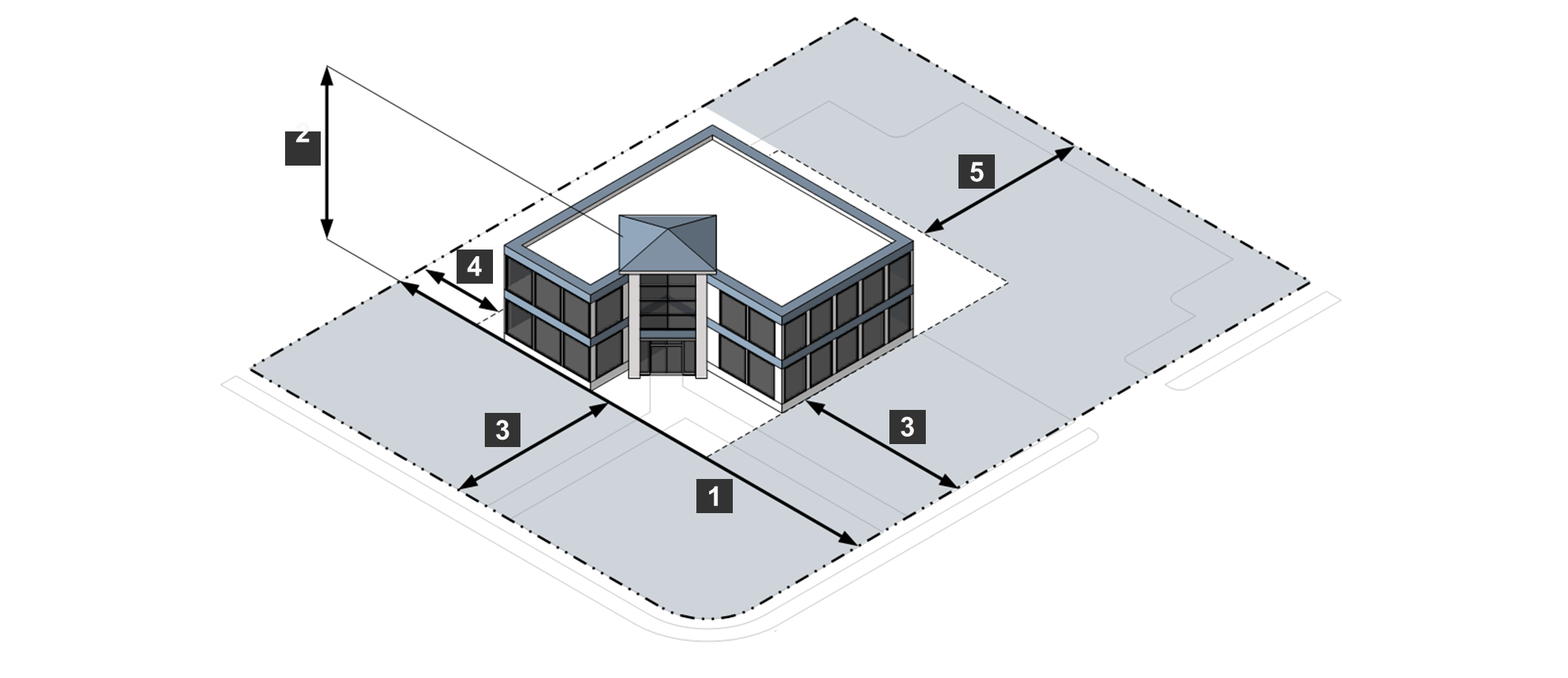
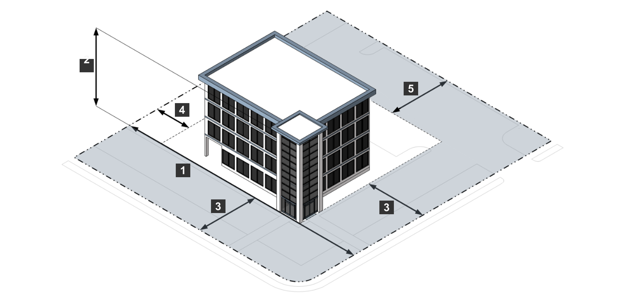
Sec. 24-3105. - Superseding Dimensional Standards.
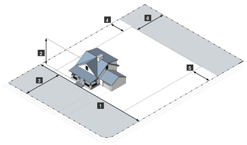
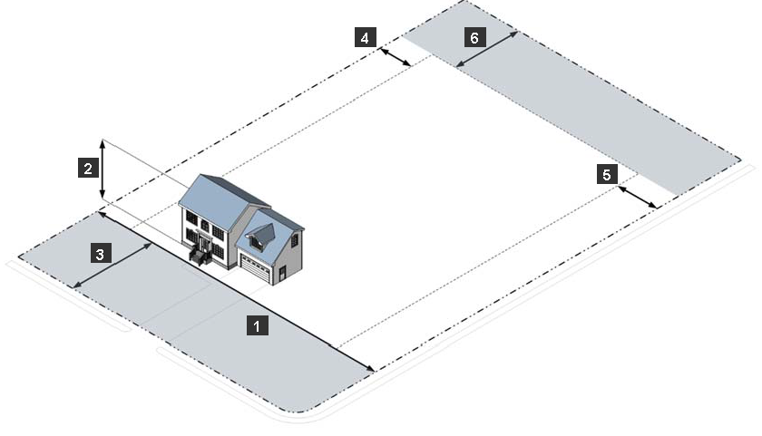
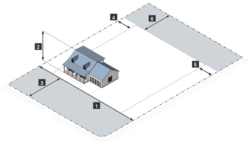
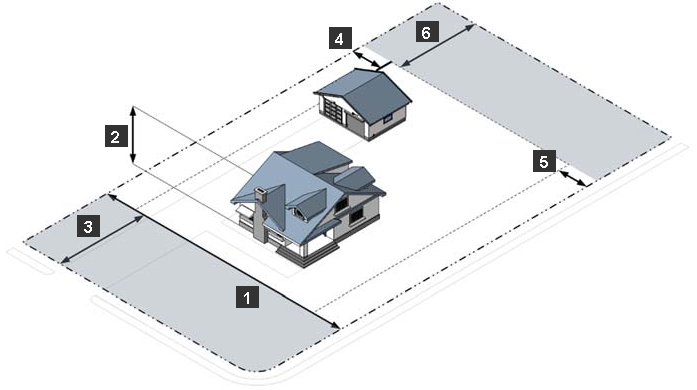
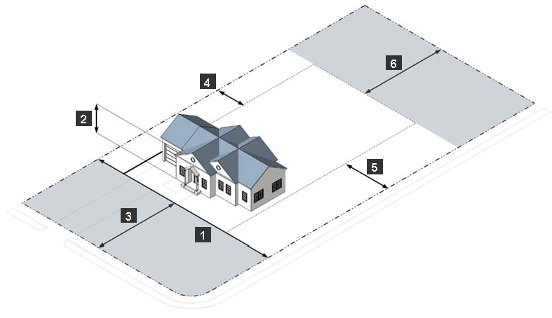
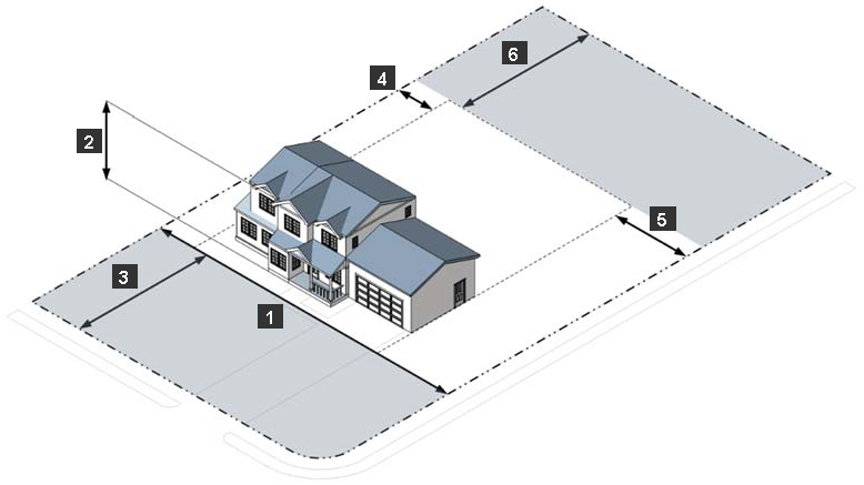
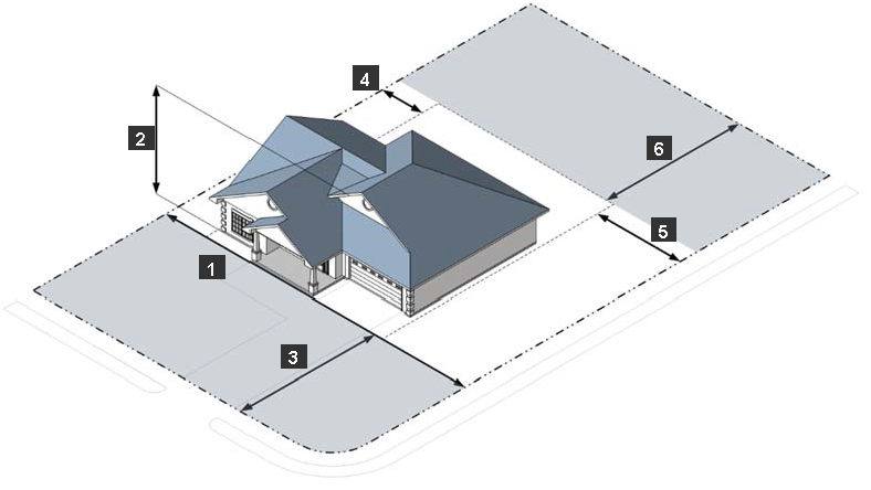
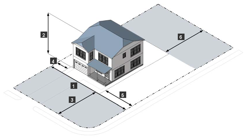
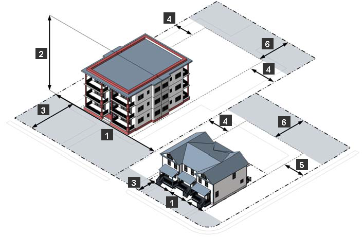
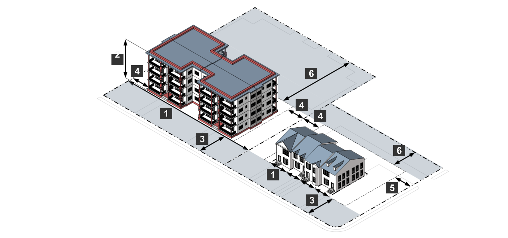
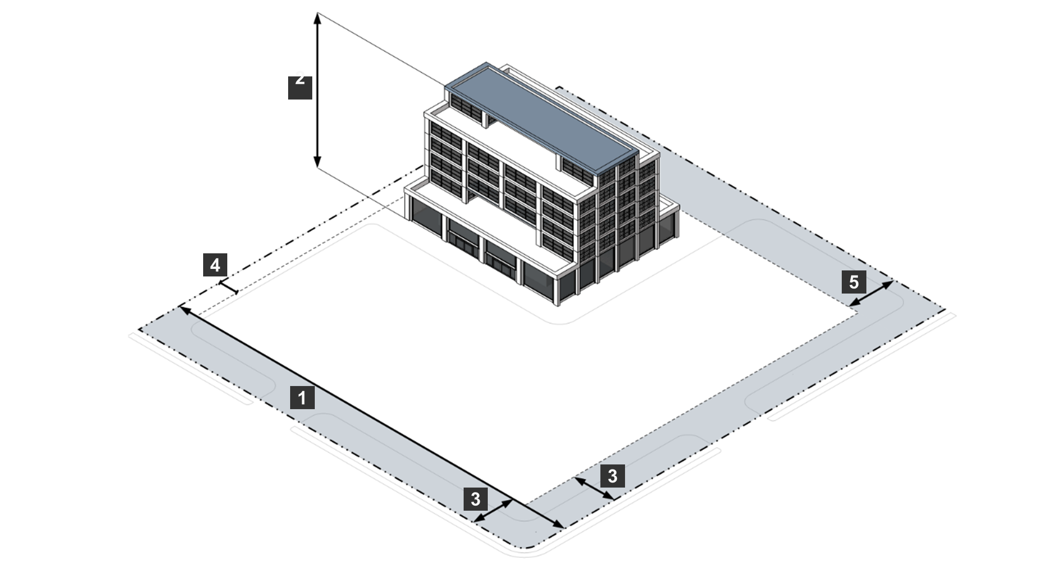
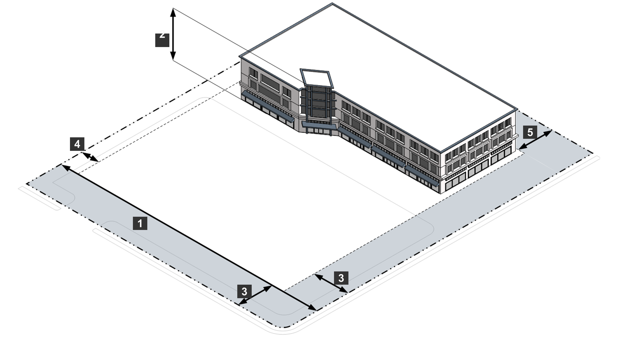
Dimensional standards for each zoning district are in tabular format in this article. Notes within each table provide additional details where necessary, and rules for measuring dimensional standards are in Article 8, Division 3, Measurement. The dimensional standards in the article apply generally but may be superseded by other standards in this Ordinance (see Article 8, Division 1, General Rules for Interpretation), including the standards identified in this section below. Terms abbreviated in this article are defined in Article 8, Division 2, Table of Abbreviations.
A.
Neighborhood Compatibility Standards. Article 5, Division 6, Neighborhood Compatibility, establishes height and setback requirements that apply to specific types of uses within a certain proximity to specific zoning districts and uses.
B.
Use-Specific Standards. For some uses, Article 4: Use Regulations, establishes dimensional standards.
C.
Lots Not Served by Public Water and Sewer. The dimensional standards in this article are minimum standards. A dwelling must not be erected on a lot that is not served by both public sewer and public water unless the lot meets all applicable Health Department requirements in addition to the standards in this article.
D.
Additional Minimum Yard Requirements Adjacent to Major Thoroughfares.
1.
Table 3105: Additional Setback Requirements Adjacent to Specific Roadways in Major Thoroughfare Plan establishes additional setback requirements for yards adjacent to specific roadways. These requirements apply to all residential developments that did not, as of March 26, 2002, have a recorded subdivision, conditional subdivision approval, proffers relating to setbacks, or buffers approved as part of a rezoning case, an approved and valid plan of development, or an approved special exception. Except as otherwise provided in subsections 2 and 3 below, for each row in Table 3105, the additional setback requirement applies in the zoning district listed for each yard listed that is adjacent to the type of roadways listed, if the roadway is identified in the major thoroughfare plan.
2.
The increased setback in Table 3105 may be reduced by the width of common area abutting both the projected right-of-way and the yard.
3.
In approving an application for a development permit or approval, the Planning Commission or the Planning Director, as applicable, may approve an additional setback less than the additional setback in Table 3105 in order to avoid the creation of double-frontage lots or to improve consistency of the proposed development with the setbacks of existing development on the same block face or directly across the street from the same block face.
E.
Dimensional Standards for Lots Created Prior to January 1, 1960, and Nonconforming Single-Family Residential Lots. The following standards apply to any single-family residential lot in an Agricultural or Residential zoning district created prior to January 1, 1960, and to other nonconforming single-family residential lots, including lots in R-5, R-6, or RTH districts created between 1960 and 1992 and lots created through the controlled density development process between 1969 and 2000. Where the setbacks required by Sec. 24-3204 through Sec. 24-3315 are greater than the setbacks of this subsection, the setbacks will be reduced (but not increased) as follows. (See also Sec. 24-6402, Development of Nonconforming Lots, for lot area and width regulations for nonconforming lots.)
1.
The front setback will be reduced to 35 feet.
2.
The rear setback will be reduced to 25 feet.
3.
For a corner lot where the rear lot line adjoins the rear lot line of the adjoining lot, the street side setback will be reduced to ten percent of the lot width (rounded down to the next lowest foot) or 10 feet, whichever is greater.
4.
For a corner lot where the rear lot line adjoins the side lot line of the adjoining single-family residential lot (directly or across an alley or common area less than 30 feet wide), the street side setback will be reduced to 36 percent of the lot width (rounded down to the next lowest foot) or 25 feet, whichever is less.
5.
The interior side setback will be reduced to ten percent of the lot width (rounded down to the next lowest foot) or seven feet, whichever is greater.
6.
If the dwelling will be served by an individual well or onsite sewage disposal system, the lot must include a primary drainfield with a 100% reserve drainfield area, and must meet current requirements of the Virginia Department of Health in addition to the requirements of this subsection.
7.
The height of any principal dwelling on the lot must not exceed 35 feet, or 40 feet if a provisional use permit is approved for additional height (see Sec. 24-2306, Provisional Use Permit).
8.
The lot must abut a public street as required by Sec. 24-4306.E, Dwelling, Single-Family Detached.
F.
Minimum Street Side Yards in Specified Approved Residential Development. For residential development that, as of March 26, 2002, had a recorded subdivision, a conditional subdivision approval, proffers relating to setbacks, or buffers approved as part of a rezoning case, an approved and valid plan of development, or an approved exception (subdivision), the minimum street side yard will be the minimum street side yard specified in the approved subdivision, proffers, plan of development, or special exception, or, if no street side yard was specified, the larger of the minimum interior side yard required or ten feet.
G.
Court-Ordered Division of Land. Any division of land subject to a partition suit by virtue of an order or decree by a court of competent jurisdiction takes precedence over the minimum lot area, width, and frontage requirements in this Ordinance so long as the lot or parcel resulting from such order or decree does not vary from minimum lot area, width, or frontage requirements by more than 20 percent.
(Ord. No. 1335, § 6, 11-12-2024; Ord. No. 1338, § 3, 2-11-2025)
Sec. 24-3201.- General Purposes of Conservation and Agricultural Districts.
The purpose and intent of the Conservation and Agricultural zoning districts established in this division is to:
A.
Protect ongoing agricultural activities and prime agricultural lands;
B.
Support and provide lands for agricultural, forestry, agribusiness, agritourism, agricultural support, and related uses important to the County's economy and the character of the County's rural and agricultural areas;
C.
Preserve and protect the County's important natural resources and environmentally sensitive lands, while providing for their use and enjoyment;
D.
Encourage agribusiness and agritourism uses that are compatible with the character of the County's rural and agricultural areas;
E.
Promote the use of cluster subdivisions as the preferred means of accommodating residential development in a way that preserves open space consistent with the character of the County's rural and agricultural areas; and
F.
Ensure open spaces are designed to maximize preservation and protection of important natural and agricultural resources, to facilitate stormwater management and protect water quality, to maximize residents' opportunities to experience open space, to maintain the visual character of scenic roads, and to promote rehabilitation of degraded habitats.
Sec. 24-3202. - Established Conservation and Agricultural Districts.
The Conservation and Agricultural zoning districts established by this Ordinance are identified in Table 3202: Established Conservation and Agricultural Districts.
(Ord. No. 1338, § 4, 2-11-2025)
Sec. 24-3203. - C-1 Conservation District.
A.
Purpose. The purpose of the C-1 Conservation District is to preserve and protect the County's natural resources, especially flood plain and floodway, while providing for their use and enjoyment. Allowed uses include:
•
Agriculture and forestry and their support uses;
•
Noncommercial recreation areas and facilities; and
•
Animal care.
B.
Concept.
C.
Use Standards. Allowed uses and use-specific standards for principal, accessory, and temporary uses are established in Article 4: Use Regulations.
D.
C-1 District Dimensional Standards.
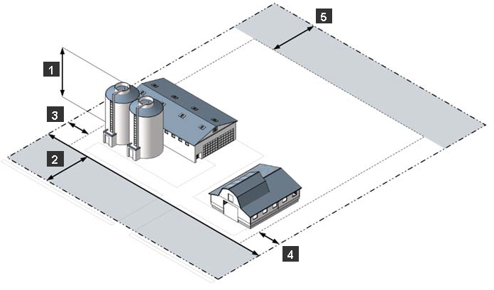
E.
Reference to Other Standards.
Sec. 24-3204. - A-1 Agricultural District.
A.
Purpose. The purpose of the A-1 Agricultural District is to reserve areas for traditional agricultural activities and to provide for their continuation as well as to preserve areas of rural character. Allowed uses include:
•
Agriculture;
•
One-family dwellings on lots of one acre or more; and
•
Limited institutional and commercial uses in appropriate locations.
B.
Concept.
C.
Use Standards. Allowed uses and use-specific standards for principal, accessory, and temporary uses are established in Article 4: Use Regulations.
D.
A-1 District Dimensional Standards.
E.
Reference to Other Standards.
Sec. 24-3301.- General Purposes of Residential Districts.
The purpose and intent of the Residential base zoning districts established in this division is to:
A.
Promote the safety and stability of residential neighborhoods;
B.
Provide a variety of housing options to meet a range of housing demands;
C.
Protect the character of residential neighborhoods from incompatible nonresidential development;
D.
Provide for safe and efficient movement of vehicles and pedestrians in residential areas;
E.
Ensure that residential development occurs at appropriate densities; and
F.
Ensure that residential development is consistent with the goals and policies in the County's comprehensive plan.
Sec. 24-3302. - Established Residential Districts.
The Residential base zoning districts established by this Ordinance are identified in Table 3302: Established Residential Base Zoning Districts.
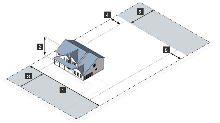
Sec. 24-3303. - R-0 One-Family Residence District.
A.
Purpose. The purpose of the R-0 One Family Residence District is to provide and protect residential areas wherein the predominant pattern of residential development is the one-family dwelling. Allowed uses include:
•
One-family dwellings on lots of one acre; and
•
Supporting institutional, recreational, and public facilities and uses.
B.
Concept.
C.
Use Standards. Allowed uses and use-specific standards for principal, accessory, and temporary uses are established in Article 4: Use Regulations.
D.
R-0 District Dimensional Standards.
E.
Reference to Other Standards.
Sec. 24-3304. - R-0A One-Family Residence District.
A.
Purpose. The purpose of the R-0A One Family Residence District is to provide and protect residential areas wherein the predominant pattern of residential development is the one-family dwelling. Allowed uses include:
•
One-family dwellings on lots of 35,000 sq. ft.; and
•
Supporting institutional, recreational, and public facilities and uses.
B.
Concept.
C.
Use Standards. Allowed uses and use-specific standards for principal, accessory, and temporary uses are established in Article 4: Use Regulations.
D.
R-0A District Dimensional Standards.
E.
Reference to Other Standards.
Sec. 24-3305. - R-1 One-Family Residence District.
A.
Purpose. The purpose of the R-1 One-Family Residence District is to provide and protect residential areas wherein the predominant pattern of residential development is the one-family dwelling. Allowed uses include:
•
One-family dwellings on lots of 25,000 sq. ft.; and
•
Supporting institutional, recreational, and public facilities and uses.
B.
Concept.
C.
Use Standards. Allowed uses and use-specific standards for principal, accessory, and temporary uses are established in Article 4: Use Regulations.
D.
R-1 District Dimensional Standards.
E.
Reference to Other Standards.
Sec. 24-3306. - R-1A One-Family Residence District.
A.
Purpose. The purpose of the R-1A One-Family Residence District is to provide and protect residential areas wherein the predominant pattern of residential development is the one-family dwelling. Allowed uses include:
•
One-family dwellings on lots of 21,500 sq. ft.; and
•
Supporting institutional, recreational, and public facilities and uses.
B.
Concept.
C.
Use Standards. Allowed uses and use-specific standards for principal, accessory, and temporary uses are established in Article 4: Use Regulations.
D.
R-1A District Dimensional Standards.
E.
Reference to Other Standards.
Sec. 24-3307. - R-2 One-Family Residence District.
A.
Purpose. The purpose of the R-2 One-Family Residence District is to provide and protect residential areas wherein the predominant pattern of residential development is the one-family dwelling. Allowed uses include:
•
One-family dwellings on lots of 18,000 sq. ft.; and
•
Supporting institutional, recreational, and public facilities and uses.
B.
Concept.
C.
Use Standards. Allowed uses and use-specific standards for principal, accessory, and temporary uses are established in Article 4: Use Regulations.
D.
R-2 District Dimensional Standards.
E.
Reference to Other Standards.
Sec. 24-3308. - R-2A One-Family Residence District.
A.
Purpose. R-2A One-Family Residence District. The purpose of the R-2A One-Family Residence District is to provide and protect residential areas wherein the predominant pattern of residential development is the one-family dwelling. Allowed uses include:
•
One-family dwellings on lots of 13,500 sq. ft.; and
•
Supporting institutional, recreational, and public facilities and uses.
B.
Concept.
C.
Use Standards. Allowed uses and use-specific standards for principal, accessory, and temporary uses are established in Article 4: Use Regulations.
D.
R-2A District Dimensional Standards.
E.
Reference to Other Standards.
Sec. 24-3309. - R-3 One-Family Residence District.
A.
Purpose. The purpose of the R-3 One-Family Residence District is to provide and protect residential areas wherein the predominant pattern of residential development is the one-family dwelling. Allowed uses include:
•
One-family dwellings on lots of 11,000 sq. ft.; and
•
Supporting institutional, recreational, and public facilities and uses.
B.
Concept.
C.
Use Standards. Allowed uses and use-specific standards for principal, accessory, and temporary uses are established in Article 4: Use Regulations.
D.
R-3 District Dimensional Standards.
E.
Reference to Other Standards.
Sec. 24-3310. - R-3A One-Family Residence District.
A.
Purpose. The purpose of the R-3A One-Family Residence District is to provide and protect residential areas wherein the predominant pattern of residential development is the one-family dwelling. Allowed uses include:
•
One-family dwellings on lots of 9,500 sq. ft.; and
•
Supporting institutional, recreational, and public facilities and uses.
B.
Concept.
C.
Use Standards. Allowed uses and use-specific standards for principal, accessory, and temporary uses are established in Article 4: Use Regulations.
D.
R-3A District Dimensional Standards.
E.
Reference to Other Standards.
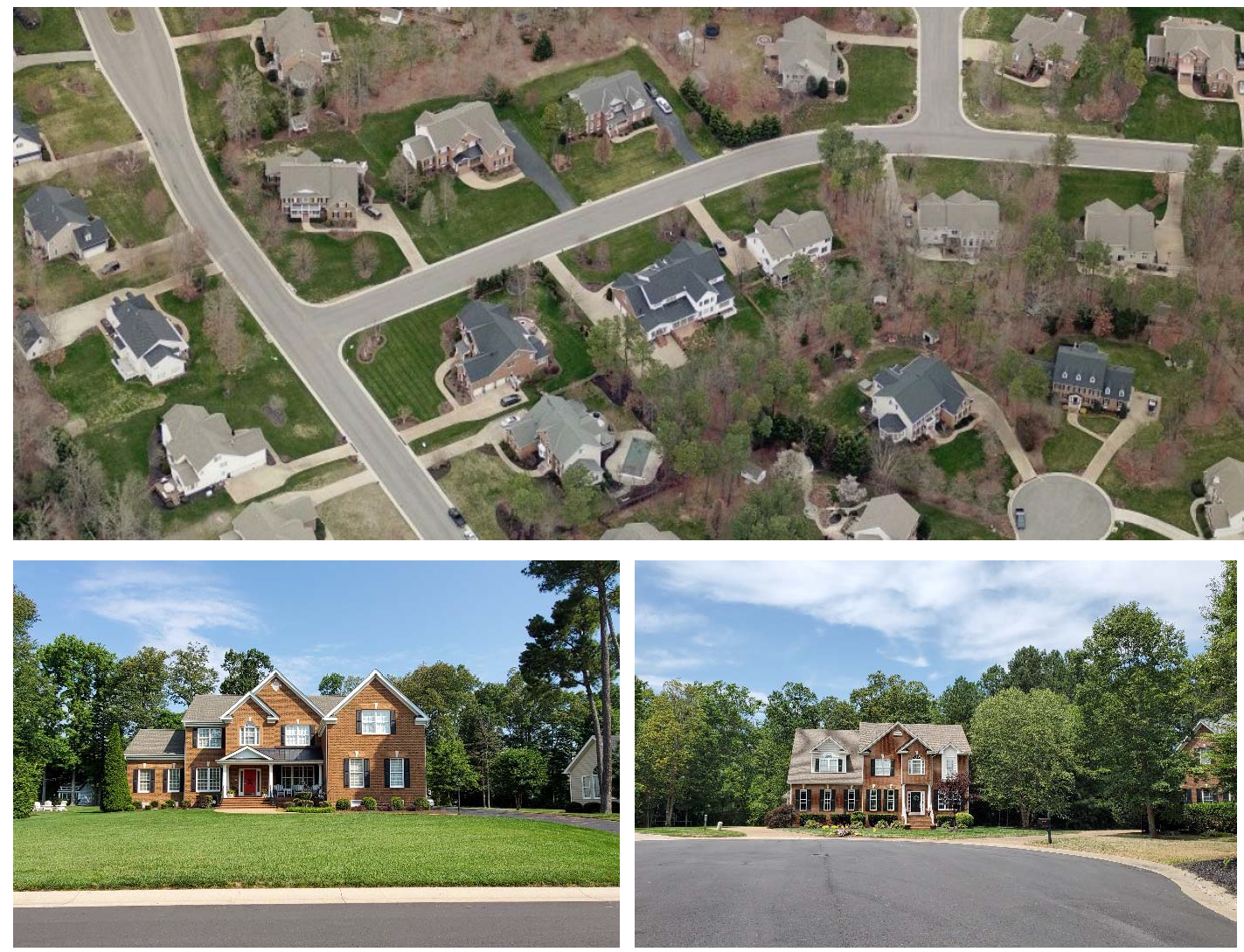
Sec. 24-3311. - R-4 One-Family Residence District.
A.
Purpose. The purpose of the R-4 One-Family Residence District is to provide and protect residential areas wherein the predominant pattern of residential development is the one-family dwelling. Allowed uses include:
•
One-family dwellings on lots of 8,000 sq. ft.; and
•
Supporting institutional, recreational, and public facilities and uses.
B.
Concept.
C.
Use Standards. Allowed uses and use-specific standards for principal, accessory, and temporary uses are established in Article 4: Use Regulations.
D.
R-4 District Dimensional Standards.
E.
Reference to Other Standards.
Sec. 24-3312. - R-4A One-Family Residence District.
A.
Purpose. The purpose of the R-4A One-Family Residence District is to provide and protect residential areas wherein the predominant pattern of residential development is the one-family dwelling. Allowed uses include:
•
One-family dwellings on lots of 7,750 sq. ft.; and
•
Supporting institutional, recreational, and public facilities and uses.
B.
Concept.
C.
Use Standards. Allowed uses and use-specific standards for principal, accessory, and temporary uses are established in Article 4: Use Regulations.
D.
R-4A District Dimensional Standards.
E.
Reference to Other Standards.
Sec. 24-3313. - R-5A General Residence District.
A.
Purpose. The purpose of the R-5A General Residence District is to provide for a range of housing types in a medium-density setting. Allowed uses include:
•
Single-family dwellings on lots of 5,625 sq. ft., which may be detached, attached, or located on a zero lot line;
•
Duplexes on lots of 11,250 sq. ft.; and
•
Supporting institutional, recreational, and public facilities and uses.
B.
Concept.
C.
Use Standards. Allowed uses and use-specific standards for principal, accessory, and temporary uses are established in Article 4: Use Regulations.
D.
R-5A District Dimensional Standards.
Single-family detached dwelling
Single-family dwelling, zero lot line
Single-family attached dwelling
Duplex dwelling
E.
Reference to Other Standards.
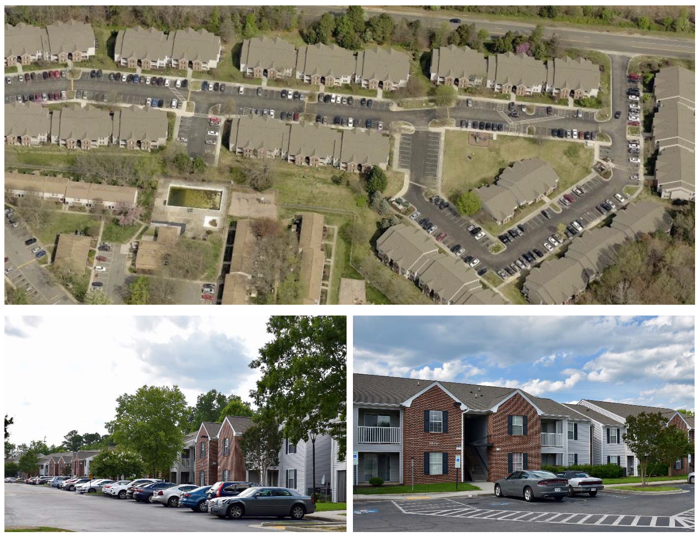
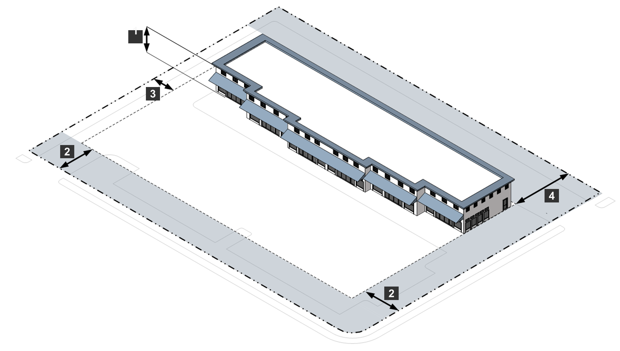
Sec. 24-3314. - R-5B General Residence District.
A.
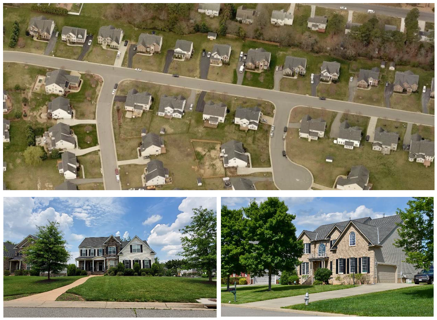
Purpose. The purpose of the R-5B General Residence District is to provide lands to accommodate development of single-family detached dwellings at higher densities than are allowed in the R-5A District, either on infill lots or as residential subdivisions on previously undeveloped lands. Development in the R-5B District should provide appropriate vehicular access to residential lots and a walkable environment, consistent with the county's guidelines for small-lot single-family residential developments. Allowed uses include:
•
Single-family detached dwellings on lots of 3,000 sq. ft.; and
•
Supporting institutional, recreational, and public facilities and uses.
B.
Concept.
C.
Use Standards. Allowed uses and use-specific standards for principal, accessory, and temporary uses are established in Article 4. Use Regulations.
D.
R-5B District Dimensional Standards.
Notes:
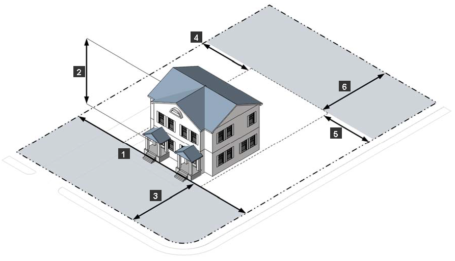
[1] Additional minimum yard requirements apply if a yard is adjacent to a road identified on the major thoroughfare plan. See Sec. 24-3105.D, Additional Minimum Yard Requirements Adjacent to Identified Roadways.
[2] The minimum rear yard along an alley is five feet. In all other cases, the minimum rear setback is 15 feet.
E.
Other District Standards.
1.
Sidewalks, Streets Trees, Curb and Gutter.
(a)
All new development in the R-5B District must include sidewalks along all street frontages. Sidewalks must be at least five feet in width and must be separated from the street by a planting strip at least four feet in width.
(b)
The four-foot-wide planting strip must include street trees having an average spacing of 35 feet or less on center.
(c)
Curb and gutter meeting Henrico County standards must be provided along all street frontages.
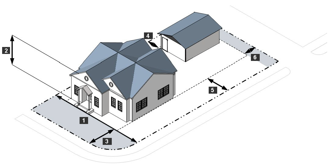
Figure 3314E1 illustrating sidewalk, street trees, and curb and gutter
2.
Vehicular Access and Garage Location.
(a)
Except as provided in paragraph (b) of this subsection, for any lot less than 50 feet in width, driveways, garages, and off-street parking are prohibited in front and street side yards. Vehicular access to the lot must be provided from an alley along the rear lot line. If the lot abuts an alley that is shown on a recorded plat but is unimproved, the alley must be improved to County standards before a certificate of occupancy will be approved.
(b)
If the Planning Director and County Engineer determine that dedication or improvement of an alley is impractical due to the size, shape, topography, or other characteristics of the lot, vehicular access to the front or street side may be allowed, including a driveway or other off-street parking. Any detached garage must be located in the rear yard. Any attached garage must be flush with or recessed behind the main façade of the dwelling.
3.
Exterior Lighting. Streetlights must not exceed 15 feet in height, and all other exterior light fixtures must not exceed 12 feet in height.
4.
Modification. Upon finding any provision of the R-5B District standards contained herein to be impractical based upon site specific characteristics, the Planning Director may review an administrative modification request under the standards of Sec. 24-2319.D.
F.
Reference to Other Standards.
(Ord. No. 1338, § 6, 2-11-2025)
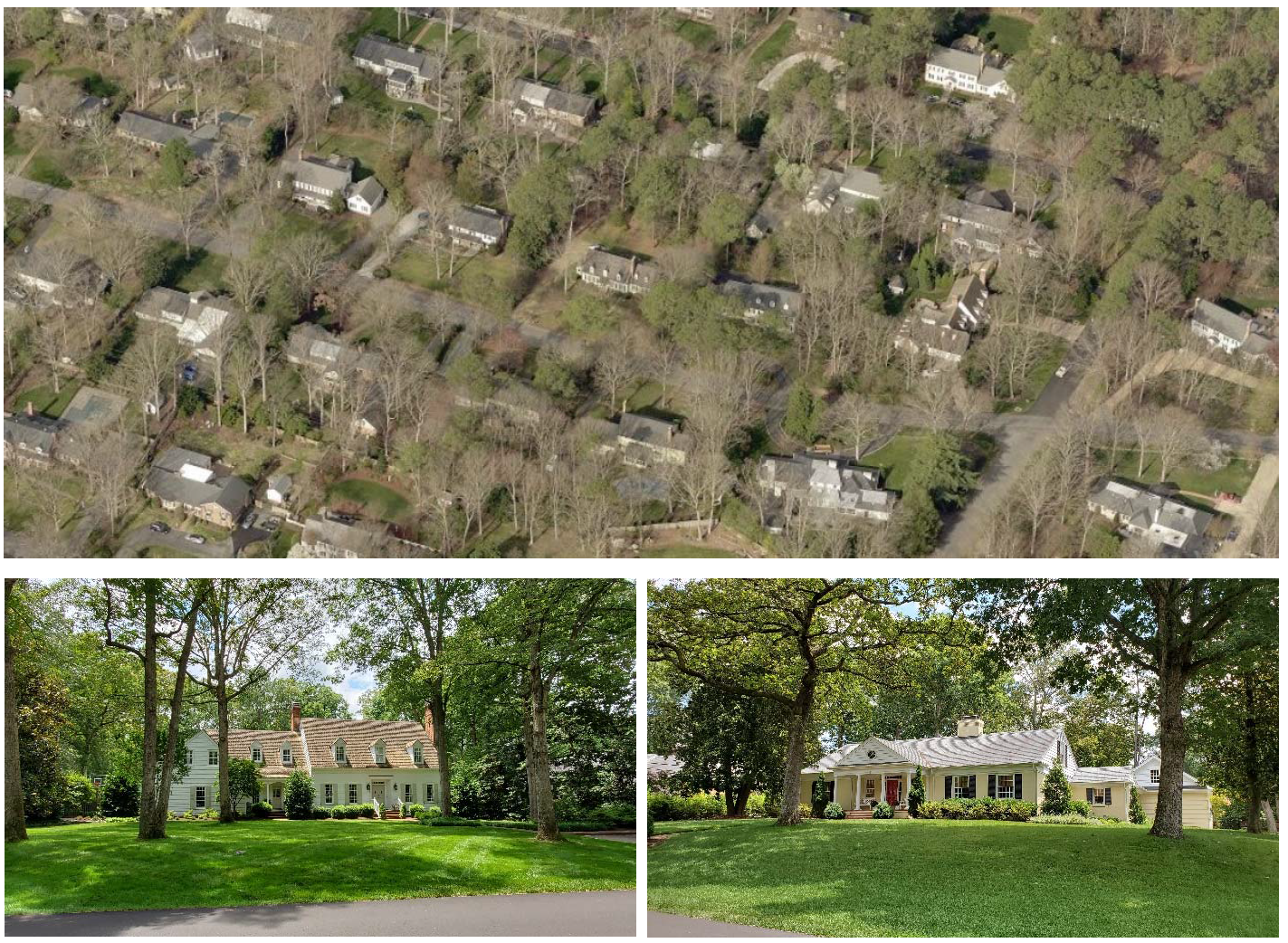
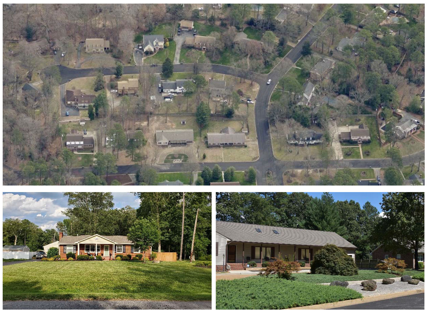
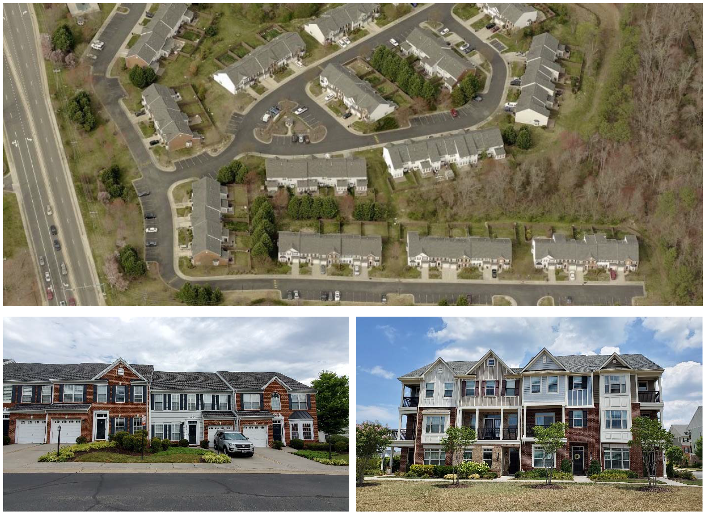
Sec. 24-3315. - R-5 General Residence District.
A.
Purpose. The purpose of the R-5 General Residence District is to provide for townhouses and multifamily housing. Allowed uses include:
•
Townhouses at a density of 12 units per acre;
•
Multifamily dwellings at a density of 14.5 units per acre; and
•
Supporting institutional, recreational, and public facilities and uses.
B.
Concept.
C.
Use Standards. Allowed uses and use-specific standards for principal, accessory, and temporary uses are established in Article 4: Use Regulations.
D.
R-5 District Dimensional Standards.
E.
Reference to Other Standards.
(Ord. No. 1338, § 5, 2-11-2025)
Editor's note— Ord. No. 1338, § 5, adopted Feb. 11, 2025, renumbered § 24-3314 as § 24-3315.
Sec. 24-3316. - R-6 General Residence District.
A.
Purpose. The purpose of the R-6 General Residence District is to provide for townhouses, multifamily housing, which can contain commercial uses in lower floors, and other limited commercial uses. Allowed uses include:
•
Townhouses at a density of 12 units per acre;
•
Multifamily dwellings at a density of 19.8 units per acre, or as otherwise specified in a master planned community;
•
Commercial uses primarily in lower floors of multifamily dwellings;
•
Assisted living, nursing care; and
•
Supporting institutional, recreational, and public facilities and uses.
B.
Concept.
C.
Use Standards. Allowed uses and use-specific standards for principal, accessory, and temporary uses are established in Article 4: Use Regulations. Commercial uses may be established only in accordance with Sec. 24-4315.C.
D.
R-6 District Dimensional Standards.
E.
Reference to Other Standards.
(Ord. No. 1338, § 7, 2-11-2025)
Editor's note— Ord. No. 1338, § 7, adopted Feb. 11, 2025, renumbered § 24-3315 as § 24-3316.
Sec. 24-3317. - RTH Residential Townhouse District.
A.
Purpose. The purpose of the RTH Residential Townhouse District is to provide residential areas where townhouses are the predominant pattern of residential development. Allowed uses include:
•
Townhouses at a density of 12 units per acre;
•
Multifamily dwellings at a density of nine units per acre; and
•
Supporting institutional, recreational, and public facilities and uses.
B.
Concept.
C.
Use Standards. Allowed uses and use-specific standards for principal, accessory, and temporary uses are established in Article 4: Use Regulations.
D.
RTH District Dimensional Standards.
E.
Reference to Other Standards.
(Ord. No. 1338, § 8, 2-11-2025)
Editor's note— Ord. No. 1338, § 8, adopted Feb. 11, 2025, renumbered § 24-3316 as § 24-3317.
Sec. 24-3401.- General Purpose of Nonresidential and Mixed-Use Districts.
The purpose and intent of the Nonresidential and Mixed-use base zoning districts established in this division is to:
A.
Provide appropriately located lands for the full range of business uses needed by the residents, businesses, and workers of the County, consistent with the policies of the comprehensive plan;
B.
Strengthen the County's economic base;
C.
Create suitable environments for mixed-use developments that include business, office, retail, and residential development designed and integrated for compatibility, pedestrian-friendliness, and protection of sensitive natural features;
D.
Encourage mixing of uses vertically within buildings in targeted areas;
E.
Encourage high-quality design of the built environment and public spaces;
F.
Ensure that new nonresidential and mixed-use development is designed to minimize potential negative impacts on surrounding residential areas; and
G.
Accommodate new infill development and redevelopment that is consistent with the policies of the comprehensive plan and appropriate for the context and the character of the district in which it is located.
Sec. 24-3402. - Established Nonresidential and Mixed-Use Districts.
The Nonresidential and Mixed-use base zoning districts established by this Ordinance are identified in Table 3402: Established Nonresidential and Mixed-use Base Zoning Districts.
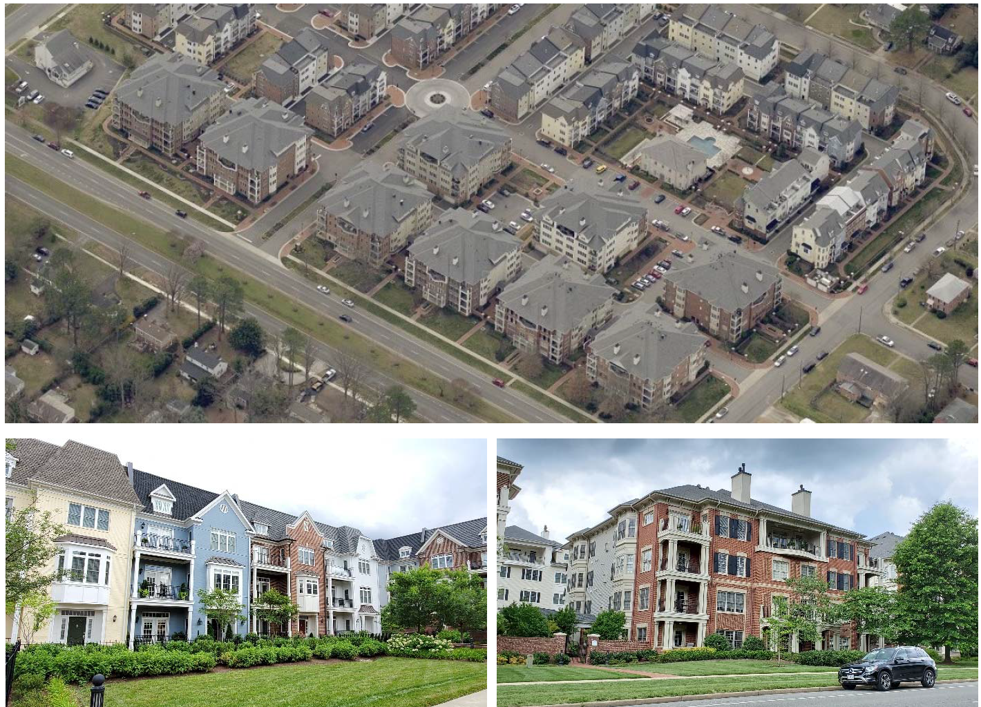
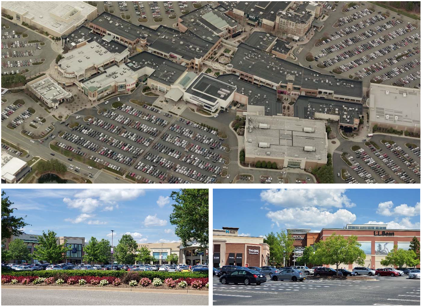
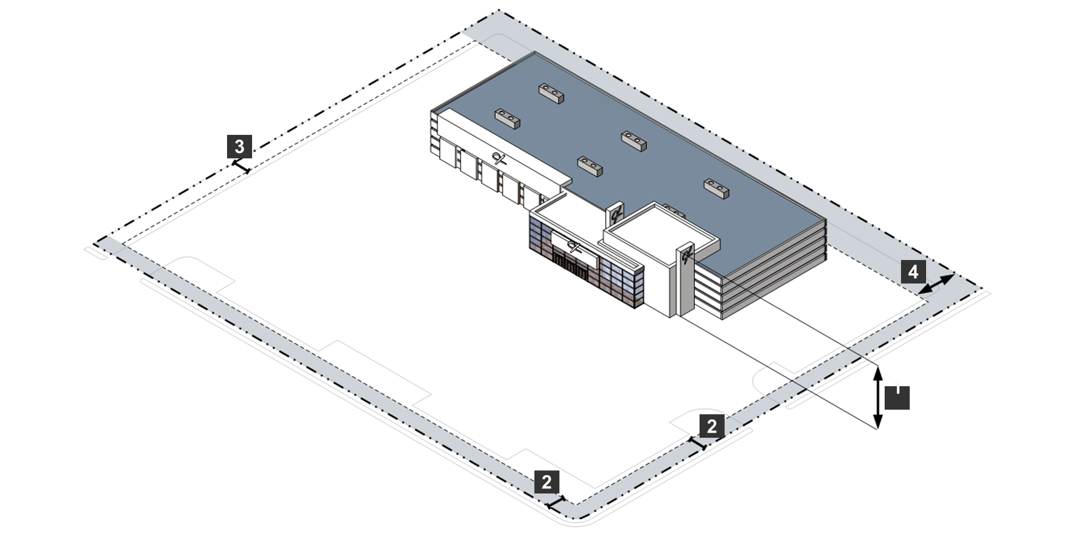
Sec. 24-3403. - CMU Community Mixed-Use District.
A.
Purpose. The purpose of the CMU Community Mixed-Use District is to increase available housing options while creating an enhanced pedestrian environment in which residential, commercial, cultural, institutional, or entertainment uses are physically and functionally integrated. Uses may be mixed horizontally (on adjacent lots), vertically (within the same building), or both. The CMU base zoning district is distinguished from the UMU Planned Development District in that the base zoning district does not require the master plan, terms and conditions, and other documentation required for rezoning to a planned development district. Allowed uses include:
•
Townhouses and multifamily dwellings (other dwelling types by provisional use permit);
•
Commercial and office uses; and
•
Cultural or educational facilities.
B.
Concept.
C.
Use Standards. Allowed uses and use-specific standards for principal, accessory, and temporary uses are established in Article 4: Use Regulations.
D.
CMU District Dimensional and Intensity Standards.
E.
Other District Standards.
1.
Minimum Area for Rezoning. The minimum contiguous area for lands to be classified to the CMU District is four acres in the IR-O, Innsbrook Redevelopment Overlay District, and 12 acres in all other areas. An area containing less than 12 acres may be reclassified to the CMU District in accordance with Sec. 24-2303, Map Amendment (Rezoning) or Sec. 24-2304, Conditional Zoning, if it abuts lands already classified in the CMU District.
2.
Minimum Amount of Mixed-Use Development.
(a)
Except as exempted in accordance with subsection (b) below, no development will be approved in the CMU District unless a minimum of 20 percent of development consists of residential uses and a minimum of 20 percent consists of nonresidential uses. For the purpose of this provision, percentages will be measured including development on the site and, at the option of the applicant, development within 1/4 mile of the site, based on the floor area of the use.
(b)
The body reviewing the development application may exempt a proposed development from this requirement if the applicant demonstrates, through economic or market studies prepared by a qualified professional, that the market will not reasonably support the required mix of uses on or within 1/4 mile of the site.
3.
Building Orientation. The front façade of all buildings, as defined by the primary entrance, must face a street or a courtyard, plaza, or similar open space.
4.
Connectivity.
(a)
The internal vehicular and pedestrian circulation systems of development must be designed in coordination with any existing or allowable future development on adjoining lots.
(b)
Easements allowing vehicular or pedestrian cross-access between adjoining lots, along with agreements defining maintenance responsibilities of the property owners, must be recorded in the land records.
5.
Pedestrian Access and Circulation.
(a)
Sidewalks must be provided on both sides of every street. Each sidewalk must have a minimum width of seven feet along arterial and collector roads and a minimum width of five feet along other streets, exclusive of any outdoor dining, display, or vending area. In addition, street trees must be provided that are spaced between 35 and 45 feet on center, unless otherwise approved by the Planning Director to avoid utility conflicts or to ensure the visibility of major design features. Street trees must be located adjacent to any existing or proposed roadway in either a planting strip or tree well. Planting strips and tree wells must be at least five feet wide in the narrowest dimension.
(b)
At least one walkway must be provided from an adjacent sidewalk to each building entrance designed for use by the general public that is located on the side of the building facing the sidewalk.
6.
Off-Street Parking.
(a)
Reduced Minimum Vehicle Parking Space Requirements. The minimum required number of off-street vehicle parking spaces for mixed-use development must be 70 percent of the minimum requirements in Sec. 24-5110, Minimum Number of Off-Street Parking Spaces, subject to any alternative parking plan or parking reductions approved in accordance with Sec. 24-5115, Off-Street Parking Alternative Parking Plans, and Sec. 24-5120, Reduced Parking Standards for Parking Demand Reduction Strategies.
(b)
Maximum Off-Street Vehicle Parking Spaces. The number of off-street surface vehicle parking spaces must not exceed 125 percent of the minimum requirements in Sec. 24-5110, Minimum Number of Off-Street Parking Spaces. Parking spaces in structured parking facilities do not count toward the maximum allowed, subject to any alternative parking plan approved in accordance with Sec. 24-5120, Reduced Parking Standards for Parking Demand Reduction Strategies.
(c)
Location. All proposed new or expanded surface vehicle parking must be located to the rear or side of the development's principal building(s), or in a parking structure built in accordance with Sec. 24-4320.B, Parking Structure. Parking may be provided along the street (on-street parking), subject to the approval of the County Engineer or VDOT, as appropriate.
(d)
Break-Up of Large Parking Lots. Each surface parking lot with more than 100 parking spaces must be organized into smaller modules that contain 50 or fewer spaces each and are separated by buildings, pedestrian walkways, or landscaped areas in accordance with the Article 5, Division 3, Landscaping and Tree Protection.
(e)
Pedestrian Walkways Through Parking Areas. Each vehicle parking lot or structure containing more than 50 parking spaces must provide clearly identified ADA accessible pedestrian routes between parking areas and the primary pedestrian entrance(s) to the building(s) served by the parking areas. Such pedestrian routes must be designed and located to minimize the exposure of pedestrians to vehicular traffic.
(f)
Parking Structures. Where the façade of a parking structure abuts or faces a street frontage, the façade must be articulated by windows, masonry columns, decorative insets and projections, awnings, changes in color or texture, or similar decorative features that break up the vertical plane.
7.
Utility Lines. All new utility lines such as electric, telephone, CATV, or other similar lines must be installed underground, in conduit and in duct banks where practical. This requirement applies to lines serving individual sites as well as to other necessary utility lines within the district. All junction and access boxes must be screened with appropriate landscaping.
F.
Reference to Other Standards.
(Ord. No. 1335, § 7, 11-12-2024)
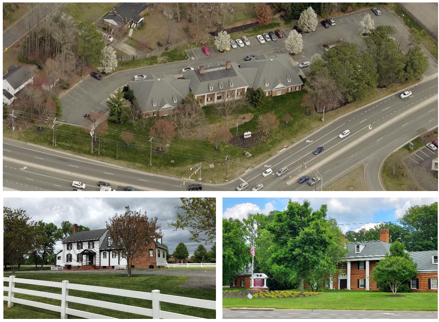
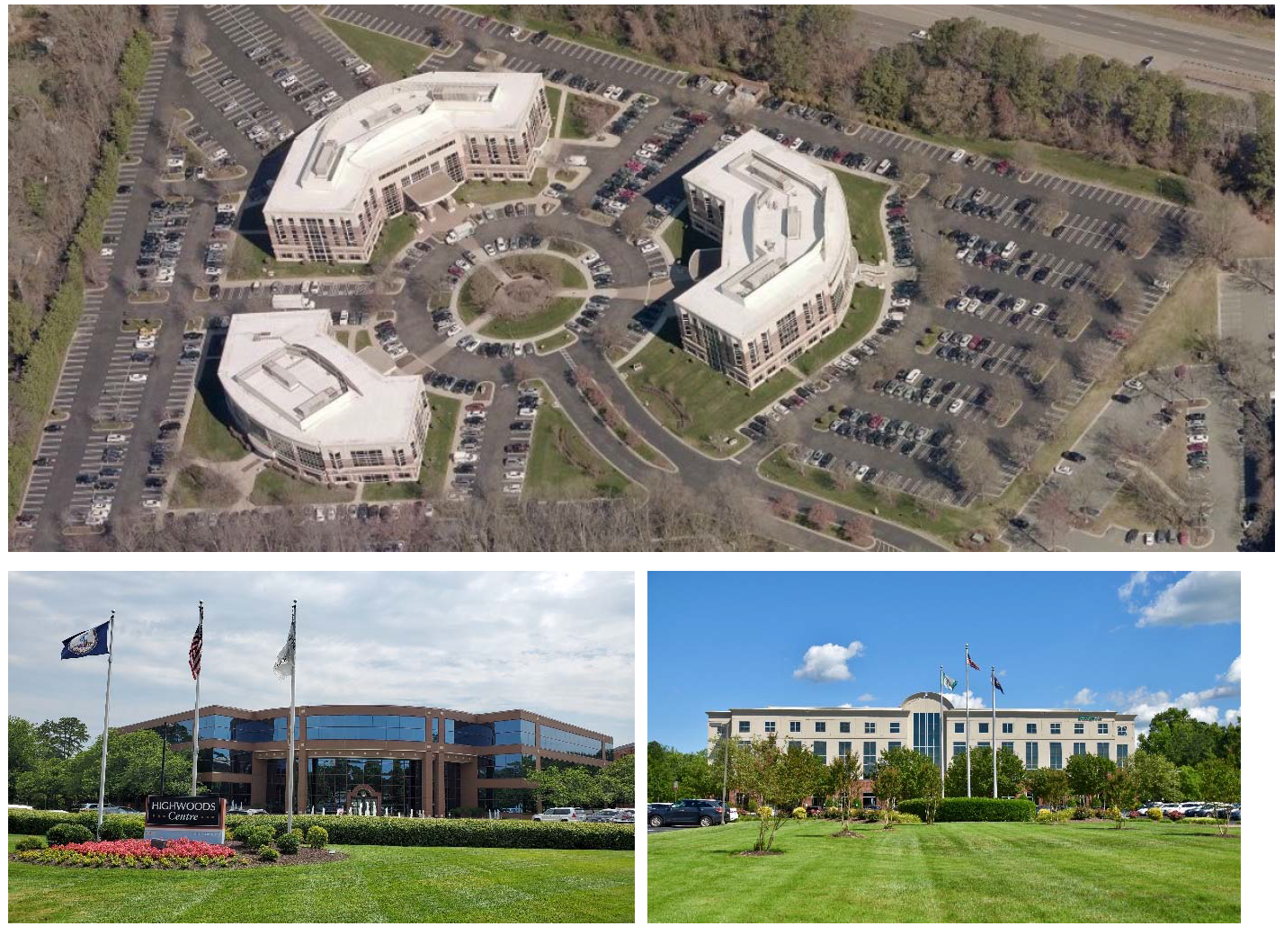
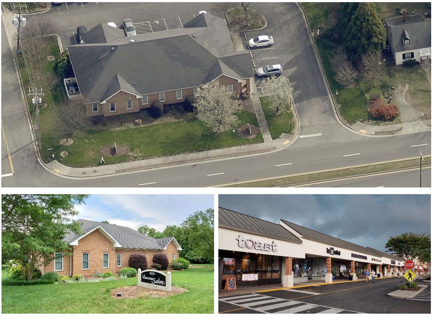
Sec. 24-3404. - O-1 Office District.
A.
Purpose. The purpose of the O-1 Office District is to provide lands primarily for offices and office buildings that are generally compatible with low-density residential development. Allowed uses include:
•
Offices (including medical), artist studios, and professional services;
•
Limited retail uses such as financial institutions; and
•
Childcare and adult care.
B.
Concept.
C.
Use Standards. Allowed uses and use-specific standards for principal, accessory, and temporary uses are established in Article 4: Use Regulations.
D.
O-1 District Dimensional Standards.
E.
Reference to Other Standards.
Sec. 24-3405. - O-2 Office District.
A.
Purpose. The purpose of the O-2 Office District is to provide lands primarily for offices, office buildings and limited retail uses that are generally compatible with medium-density residential development. Allowed uses include:
•
Offices including medical, artist studios, and professional services;
•
Limited retail such as financial institutions, restaurants, and drug stores;
•
Childcare and adult care; and
•
Hospitals.
B.
Concept.
C.
Use Standards. Allowed uses and use-specific standards for principal, accessory, and temporary uses are established in Article 4: Use Regulations.
D.
O-2 District Dimensional Standards.
E.
Reference to Other Standards.
Sec. 24-3406. - O-3 Office District.
A.
Purpose. The purpose of the O-3 Office District is to provide lands primarily for offices, office buildings and limited retail uses that are generally compatible with higher-density residential development and served by arterial thoroughfares. Allowed uses include:
•
Offices including medical, artist studios, and professional services;
•
Limited retail such as financial institutions, restaurants, drug stores, theaters, convenience stores;
•
Childcare and adult care, hospitals, and funeral homes;??Trade schools; and
•
Hotels
B.
Concept.
C.
Use Standards. Allowed uses and use-specific standards for principal, accessory, and temporary uses are established in Article 4: Use Regulations.
D.
O-3 District Dimensional Standards.
E.
Reference to Other Standards.
(Ord. No. 1342, § 1, 6-10-2025)
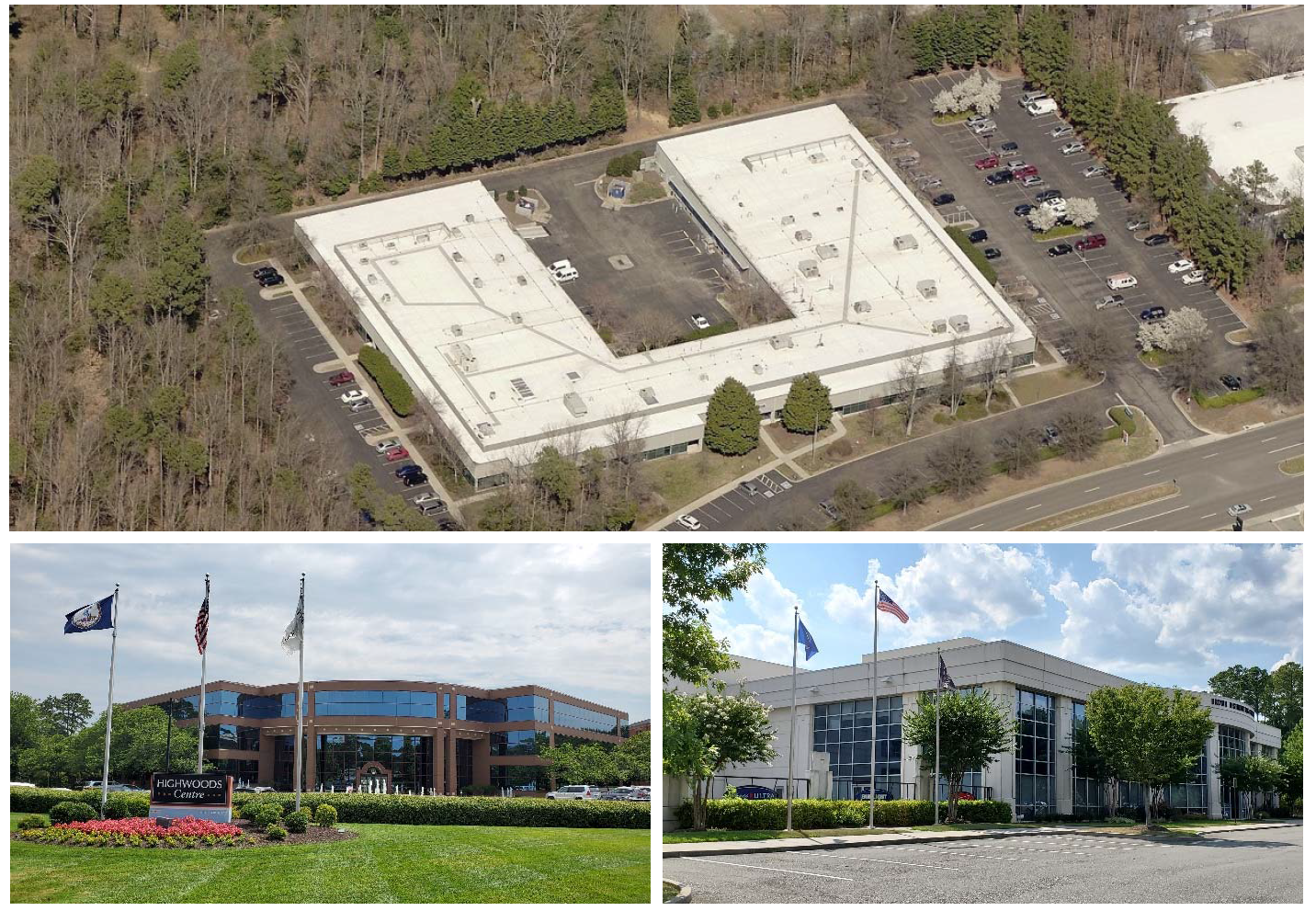
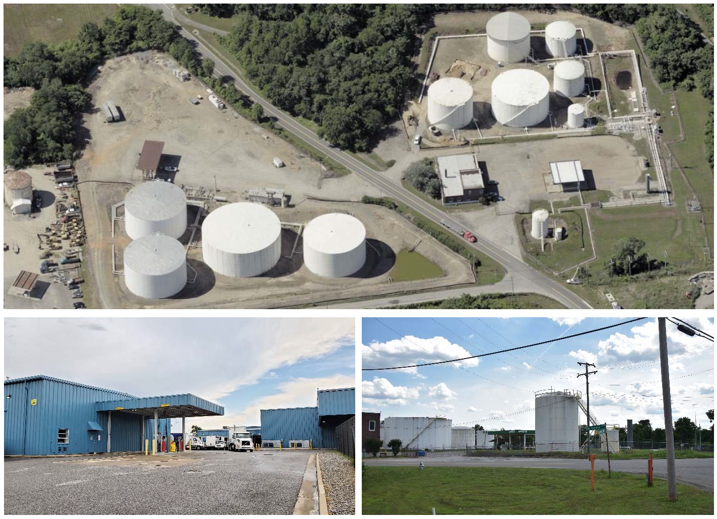
Sec. 24-3407. - O/S Office Service District.
A.
Purpose. The purpose of the O/S Office Service District is to provide lands for the development of office uses in combination with appropriate retail, service, and light industrial uses. Development in the district will occur within a distinct and planned environment under unified control and operational standards. Allowed uses include:
•
Offices;
•
Childcare and adult care;
•
Trade Schools;
•
Hotel;
•
Limited retail such as financial institutions, restaurants, drug stores, theaters, convenience stores;
•
Light industrial, manufacturing, and warehousing.
B.
Concept.
C.
Use Standards. Allowed uses and use-specific standards for principal, accessory, and temporary uses are established in Article 4: Use Regulations.
D.
O/S District Dimensional Standards.
E.
Reference to Other Standards.
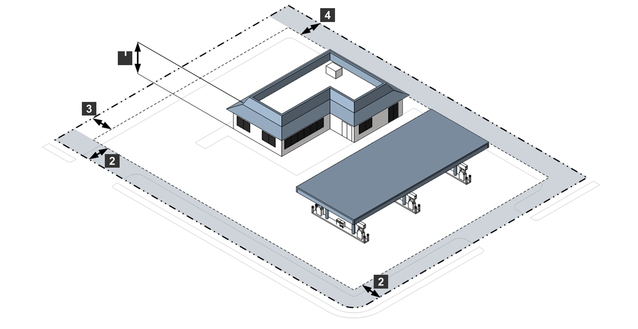
Sec. 24-3408. - B-1 Business District.
A.
Purpose. The purpose of the B-1 Business District is to provide lands primarily for low-intensity retail and personal service uses that serve the needs of relatively small land areas. Within the district, the height of buildings and size of certain uses, as well as permitted hours of operation, are limited to enhance the neighborhood character of the district, its function of neighborhood service, and its compatibility with surrounding residential uses. Allowed uses include:
•
Offices;
•
Retail uses; and
•
Live/Work dwellings.
B.
Concept.
C.
Use Standards. Allowed uses and use-specific standards for principal, accessory, and temporary uses are established in Article 4: Use Regulations.
D.
B-1 District Dimensional Standards*.
E.
Reference to Other Standards.
Sec. 24-3409. - B-2 Business District.
A.
Purpose. The purpose of the B-2 Business District is to provide lands primarily for community shopping, recreational, and service activities generally serving a community of several neighborhoods and appropriately located on major collector or arterial roadways. Allowed uses include:
•
Offices;
•
Retail uses;
•
Drive-thru and specialty restaurants;
•
Automotive filling stations; and
•
Live/Work dwellings.
B.
Concept.
C.
Use Standards. Allowed uses and use-specific standards for principal, accessory, and temporary uses are established in Article 4: Use Regulations.
D.
B-2 District Dimensional Standards.
E.
Reference to Other Standards.
Sec. 24-3410. - B-3 Business District.
A.
Purpose. The purpose of the B-3 Business District is to provide a mix of commercial, automotive, and recreational activities that are located appropriately on arterial roadways. Allowed uses include:
•
Offices;
•
Retail uses;
•
Drive-thru and specialty restaurants;
•
Automobile sales, rental, repair, and service;
•
Live/Work dwellings;
•
Theaters, arenas, stadiums, and sports parks; and
•
Kennels.
B.
Concept.
C.
Use Standards. Allowed uses and use-specific standards for principal, accessory, and temporary uses are established in Article 4: Use Regulations.
D.
B-3 District Dimensional Standards.
E.
Reference to Other Standards.
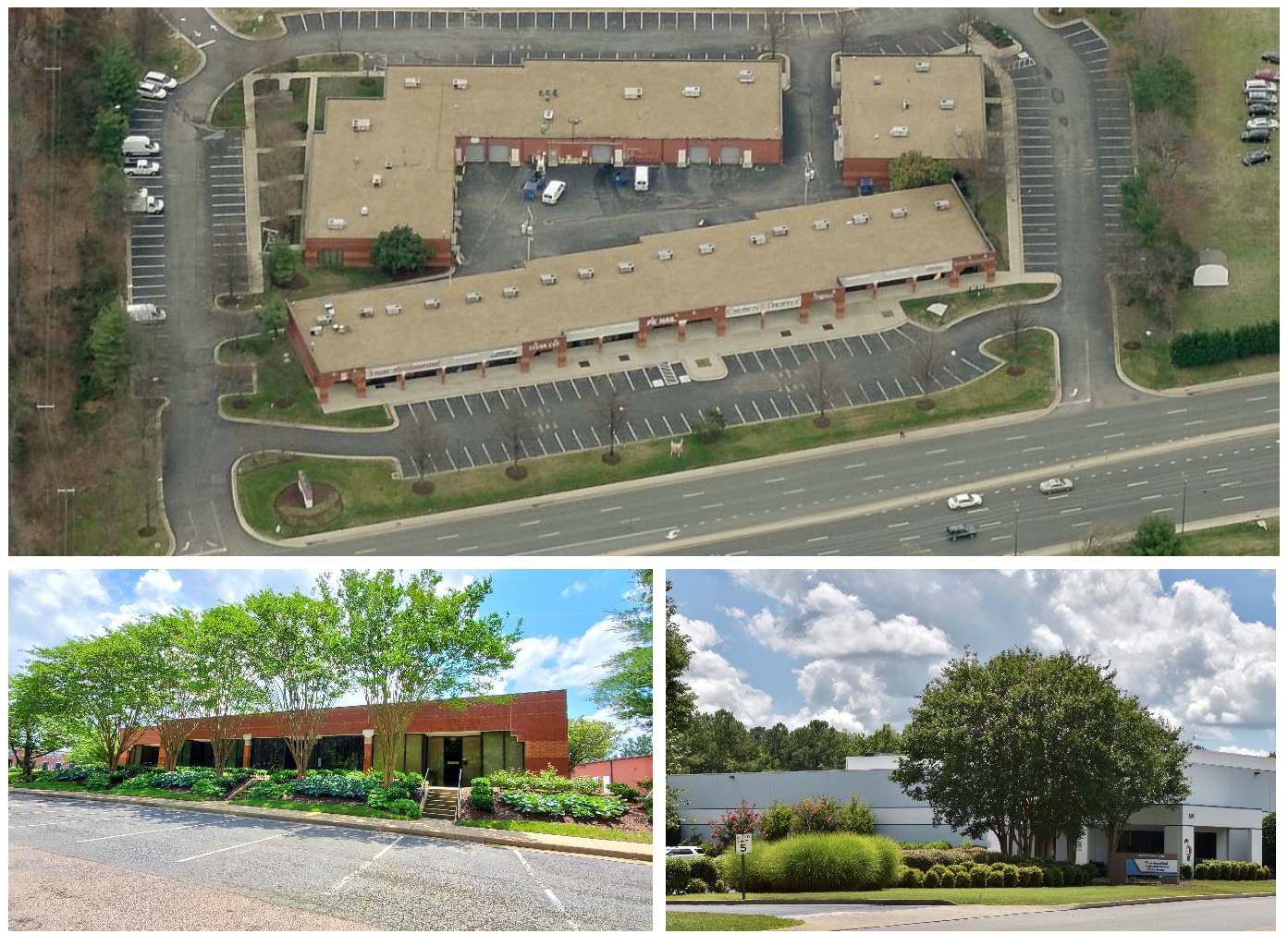
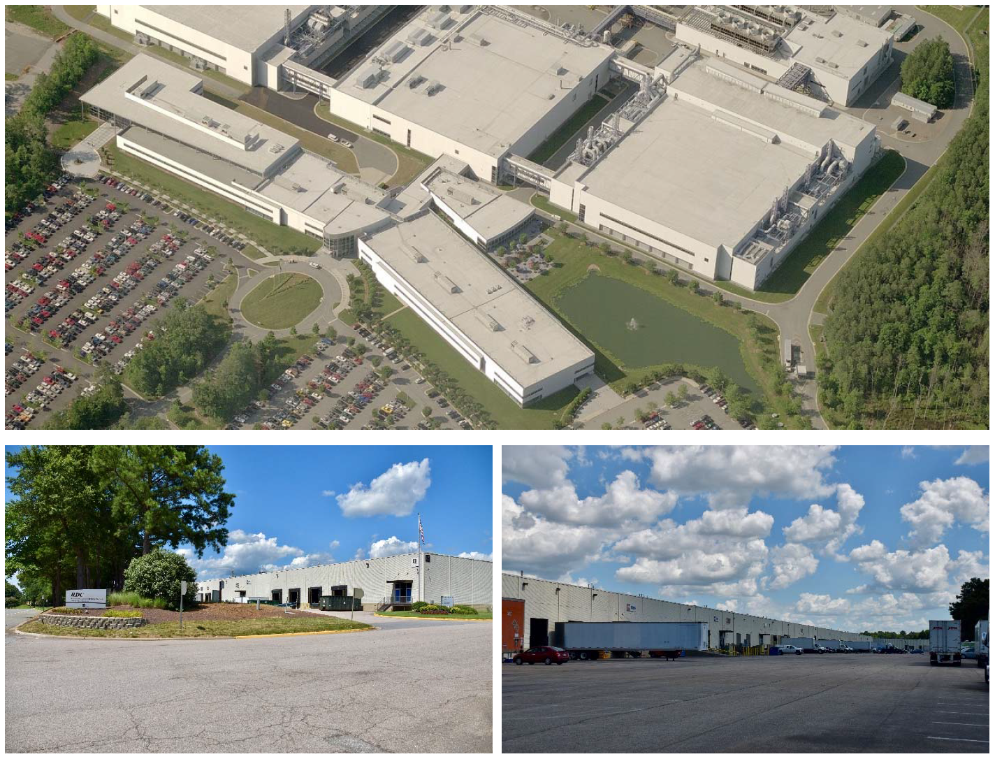
Sec. 24-3411. - M-1 Light Industrial District.
A.
Purpose. The purpose of the M-1 Light Industrial District is to provide lands for a variety of commercial uses and manufacturing, fabricating, and warehousing activities that only produce minimal odors, noises, and similar adverse impacts on nearby lands. To ensure minimal adverse impacts, many industrial activities are only allowed if conducted within enclosed buildings. Allowed uses include:
•
Light manufacturing;
•
Laboratories;
•
Warehouses; and
•
Recycling.
B.
Concept.
C.
Use Standards. Allowed uses and use-specific standards for principal, accessory, and temporary uses are established in Article 4: Use Regulations.
D.
M-1 District Dimensional Standards.
E.
Reference to Other Standards.
Sec. 24-3412. - M-2 General Industrial District.
A.
Purpose. The purpose of the M-2 General Industrial District is to provide lands for a variety of commercial uses and manufacturing, fabricating, and warehousing activities that have the potential to produce low to moderate levels of odor, noise, and similar adverse impacts on nearby lands. To minimize adverse impacts on adjacent lands, many uses are allowed only if they are located a minimum distance from adjacent Residential zoning districts. Allowed uses include:
•
Manufacturing;
•
Laboratories;
•
Warehouses; and
•
Recycling.
B.
Concept.
C.
Use Standards. Allowed uses and use-specific standards for principal, accessory, and temporary uses are established in Article 4: Use Regulations.
D.
M-2 District Dimensional Standards.
E.
Reference to Other Standards.
Sec. 24-3413. - M-3 Heavy Industrial District.
A.
Purpose. The purpose of the M-3 Heavy Industrial District is to provide lands that accommodate intense industrial development that is important to the County's economy but may adversely impact surrounding lands. To minimize adverse impacts on nearby lands, many uses are allowed only if they are located a minimum distance from adjacent Residential zoning districts. Allowed uses include:
•
Heavy Manufacturing;
•
Laboratories;
•
Warehouses; and
•
Recycling.
B.
Concept.
C.
Use Standards. Allowed uses and use-specific standards for principal, accessory, and temporary uses are established in Article 4: Use Regulations.
D.
M-3 District Dimensional Standards.
E.
Reference to Other Standards.
Sec. 24-3501.- Establishment of Planned Development Districts.
The planned development zoning districts established by this Ordinance are identified in Table 3501: Established Planned Development Zoning Districts.
Sec. 24-3502. - General Provisions for All Planned Development Districts.
A.
General Purpose of Planned Development Zoning Districts. The purpose of planned development zoning districts is to encourage innovative and efficient land planning and physical design concepts on large, unified sites. Planned development zoning districts are intended to:
1.
Support high quality of life and achieve a high quality of development, environmental sensitivity, energy efficiency, and provision of public services;
2.
Provide greater flexibility in selecting the form and design of development, the ways by which pedestrians and vehicular traffic circulate, the location and design of the development with respect to the natural features of the land and protection of the environment, the location and integration of open space and civic space into the development, and the provision of amenities;
3.
Provide a well-integrated mix of nonresidential uses, residential dwelling types, lot sizes, and densities and intensities within the same development;
4.
Allow more efficient use of land, with coordinated and right-sized networks of streets, utilities, and pedestrian connections, both within the development and to other developments nearby;
5.
Encourage the provision of accessible and useable open space and recreational amenities within the development;
6.
Promote development forms and patterns that respect the character of established surrounding neighborhoods and other land uses; and
7.
Promote development forms that respect and take advantage of a site's natural and man-made features, such as rivers, lakes, wetlands, floodplains, trees, and historic and cultural resources.
B.
Classification of Land into a Planned Development Zoning District. Land will be classified into a planned development zoning district only in accordance with the procedures and standards set forth in Sec. 24-2305, Planned Development.
C.
Organization of Planned Development Zoning District Regulations.Sec. 24-3502, General Provisions for All Planned Development Districts, Sec. 24-3503, PD Master Plan and Terms and Conditions, and Sec. 24-3504, General Development Standards, establish standards that apply to all planned development zoning districts. Sec. 24-3505, SMX-PD Suburban Residential Mixed Planned Development District; Sec. 24-3506, TND-PD Traditional Neighborhood Development Planned Development District; Sec. 24-3507, UMU-PD Urban Mixed-Use Planned Development District; and Sec. 24-3508, LI-PD Light Industrial Planned Development District, contain specific provisions and standards that apply to the respective types of planned development zoning districts.
Sec. 24-3503. - PD Master Plan and Terms and Conditions.
Before approving a planned development zoning district, the Board of Supervisors must find that the application for the planned development zoning district classification, as well as the Planned Development Master Plan ("PD Master Plan") and Planned Development Terms and Conditions Document ("PD Terms and Conditions Document"), comply with the following standards. Once approved, the PD Master Plan and PD Terms and Conditions Document will have the same force and effect as other zoning regulations.
A.
PD Master Plan. As set forth in Sec. 24-2305, Planned Development, a PD Master Plan is a required component in the establishment of a planned development zoning district. The PD Master Plan must:
1.
Establish a statement of planning and development goals for the zoning district that is consistent with the comprehensive plan and purposes of the specific type of planned development zoning district;
2.
Establish the specific principal, accessory, and temporary uses permitted in the zoning district. Any use allowed in Sec. 24-4205, Principal Use Table, may be proposed for a planned development zoning district. They must align in the PD Master Plan in a way that conforms to the requirements, goals, and purpose of the individual planned development zoning district and the comprehensive plan;
3.
Establish the general location of each development area in the zoning district, types and mix of land uses, maximum number of residential units (by unit type), and maximum nonresidential floor area (by use type). The residential density and nonresidential intensity must be consistent with the purposes of the planned development zoning district and the specific requirements of the individual planned development zoning district;
4.
Establish the dimensional standards that apply in the individual planned development zoning district. The dimensional standards must be consistent with the requirements of the individual planned development zoning district, and its purposes;
5.
Where relevant, establish the standards and requirements that ensure development on the perimeter of the planned development zoning district is designed and located to be compatible with the character of adjacent existing or approved development. Determination of compatible character will be based on densities and intensities, lot size and dimensions, building height, building mass and scale, form and design features, hours of operation, exterior lighting, and siting of service areas;
6.
Establish the general location, amount, and type (whether designated for active or passive recreation) of open space, consistent with the purposes of the individual planned development zoning district;
7.
Establish provisions addressing how public facilities will be provided to accommodate the proposed development in a manner consistent with the purposes of the individual planned development zoning district and the requirements of this Ordinance, including the following:
(a)
The general design and layout of the on-site transportation circulation system, including the general location of all public streets, existing or projected transit corridors, and how they interface with the pedestrian and bicycle pathways and trails, and connect to existing and planned public systems, consistent with the comprehensive plan and the major thoroughfare plan;
(b)
The general location and layout of on-site potable water and wastewater facilities and on-site storm drainage facilities, and how they will connect to existing and planned County and regional systems, as appropriate;
(c)
The general location and layout of all other on-site and offsite public facilities serving the development, including parks, schools, fire protection, police protection, emergency management, and solid waste management;
8.
Identify the location of environmentally sensitive lands, resource lands, wildlife habitat, and waterway corridors, and ensure protection of these lands consistent with the purposes of the individual planned development zoning district and the requirements of this Ordinance; and
9.
Establish the development standards that will be applied to sites within the development. The development standards must be consistent with the requirements of the individual planned development zoning district and its purposes, and the requirements of this Ordinance, as appropriate. At a minimum, the development standards must address:
(a)
Mobility and circulation;
(b)
Off-street parking and loading;
(c)
Required open space;
(d)
Landscaping and tree protection;
(e)
Fences and walls;
(f)
Exterior lighting;
(g)
Neighborhood compatibility; and
(h)
Signage.
B.
Development Phasing Plan. If development in a planned development zoning district is proposed to be phased, the PD Master Plan must include a development phasing plan that identifies the general sequence or phases in which the zoning district is proposed to be developed, including how residential and nonresidential development will be timed, how public and private infrastructure, open space, and other amenities will be provided and timed, how development will be coordinated with the County's capital improvements program, and how environmentally sensitive lands will be protected and monitored.
C.
Conversion Schedule. The PD Master Plan may include a conversion schedule that identifies the extent to which one type of use may be converted to another type of use.
D.
PD Terms and Conditions Document. As set forth in Sec. 24-2305, Planned Development, a PD Terms and Conditions Document is a required component in the establishment of a planned development zoning district. All conditions in the PD Terms and Conditions Document must be related in both type and amount to the anticipated impacts of the proposed development on the public and surrounding lands. The Terms and Conditions Document must include, but not be limited to:
1.
Conditions related to approval of the application for the individual planned development zoning district classification;
2.
Conditions related to the approval of the PD Master Plan, including any conditions related to the form and design of development shown in the PD Master Plan;
3.
Provisions addressing how public facilities (transportation, potable water, wastewater, stormwater management, and other public facilities) will be provided to accommodate the proposed development. This must include provisions for the following:
(a)
The applicant or landowner will be responsible to design and construct or install required and proposed on-site public facilities in compliance with applicable County, state, and federal laws and regulations; and
(b)
The applicant or landowner will dedicate to the public the rights-of-way and easements necessary for the construction or installation of required and proposed on-site public facilities in compliance with applicable County, State, and federal laws and regulations;
4.
Provisions related to environmental protection and monitoring (e.g., restoration of mitigation measures, annual inspection reports);
5.
Provisions related to any required covenants to be recorded in the land records;
6.
Identification of community benefits and amenities that will be provided to compensate for the added development flexibility afforded by the individual planned development zoning district; and
7.
Any other provisions the Board of Supervisors determines are relevant and necessary to the development of the planned development.
(Ord. No. 1335, § 8, 11-12-2024)
Sec. 24-3504. - General Development Standards.
A.
Use Standards. Unless otherwise specified in the PD Master Plan, use-specific standards for principal, accessory, and temporary uses set out in Article 4: Use Regulations, apply within the district.
B.
Development Standards. Unless modified in the PD Master Plan, the requirements of Article 5: Development Standards, apply within the district. Any modifications to the development standards must be consistent with the purpose of the planned development zoning district.
C.
Vehicular access (external):
1.
Streets, alleys, and driveways proposed must be adequate to serve the anticipated traffic of the district. The PD Master Plan must indicate the party responsible for construction and maintenance of alleys.
2.
Proposed street layouts must be coordinated with the existing street system in surrounding areas and with the major thoroughfare plan. Existing streets must, to the maximum extent practicable, be extended to provide access to adjacent developments and subdivisions and to provide for additional points of ingress and egress.
3.
The arrangement of streets in a development must provide for the alignment and continuation of existing or proposed streets into adjoining lands where the adjoining lands are undeveloped and deemed appropriate for future development or are developed and include opportunities for such connections.
4.
For development that abuts vacant lands, street rights-of-way must be extended to or along adjoining property boundaries such that a roadway connection or stub street must be provided in each direction where practicable and feasible.
5.
At all locations where streets terminate with no street connection, but a future connection is planned or accommodated, a sign must be installed in accordance with the requirements of the Department of Public Works or the Virginia Department of Transportation, as appropriate, to inform landowners of the future road connection.
6.
Construction plans (see Chapter 19 of the County Code) must identify all stub streets and include a notation that all stub streets are intended for connection with future streets on adjoining undeveloped or underdeveloped lands.
D.
Vehicular circulation (internal):
1.
Streets must be organized according to a hierarchy based on function, capacity, and design speed. They must connect to other streets within the development and connect to existing and projected through streets outside the development. Internal street design must achieve as high a connectivity index as reasonably practical.
2.
The PD Master Plan must include traffic calming measures such as reduced street widths and block lengths, on-street parking, controlled intersections, and roundabouts.
E.
Pedestrian circulation: Pedestrian and bicycle amenities must be provided to establish connections within the site, and to adjacent public streets. The pedestrian circulation system and its related walkways must be insulated as completely as possible from the vehicular street system in order to provide separation of pedestrian and vehicular movement. Additional pedestrian and bicycle connections must be provided wherever the street layout creates an impediment to circulation.
F.
Streetscape requirements: The PD Master Plan must show how streetscapes will be designed to reflect high quality development. Any proposed parking lots, decks, and garages must be integrated into the streetscape to minimize their visual impact on the overall development.
Sec. 24-3505. - SMX-PD Suburban Residential Mixed Planned Development District.
A.
Purpose. The purpose of the SMX-PD, Suburban Residential Mixed Planned Development District is to encourage unified, high-quality residential development with a harmonious blend of different dwelling types under a master plan that creates a community rather than a series of isolated subdivisions. The variety of housing types is complemented by prominent open space developed for active recreational purposes, as well as preservation of significant natural resources.
The SMX-PD district is intended predominantly for residential development; however, community services, day care, educational facilities, and institutional uses are allowed, as well as recreation, entertainment, retail sales, and personal service uses primarily serving the residents of the district. Unlike the TND-PD District, the streets are not required to be connected in a grid-like manner, alleys are optional, and retail uses may be segregated from the residential uses.
B.
Area and Intensity Standards.
C.
Use Standards.
1.
Each SMX-PD District must contain a mix of residential use types and may include nonresidential uses. Any of the principal, accessory, and temporary uses that are identified as allowed in the SMX-PD zoning district in Article 4 Use Regulations, may be established as permitted uses in accordance with Sec. 24-3503.A, PD Master Plan, provided, the PD Master Plan must comply with the area and intensity standards in subsection B above.
2.
The mix of residential densities and housing types in an SMX-PD District must include at least two of the following:
(a)
Detached single-family dwellings at a density of less than 1.5 du/ac;
(b)
Detached single-family dwellings between 1.5 and 3.0 du/ac;
(c)
Detached single-family dwellings between 3.0 and 4.5 du/ac;
(d)
Townhouse dwellings at a density of up to 12.0 du/ac; or
(e)
Multifamily dwellings at a density of up to 6.0 du/ac.
3.
A minimum of 5 percent of the dwelling units in an SMX-PD District must be townhouse or multifamily units.
D.
Development Standards. The PD Master Plan must establish development standards that will provide for high quality development and create a distinctive built environment consistent with the comprehensive plan.
(Ord. No. 1335, § 9, 11-12-2024)
Sec. 24-3506. - TND-PD Traditional Neighborhood Development Planned Development District.
A.
Purpose. The purpose of the TND-PD, Traditional Neighborhood Planned Development District is to encourage unified, high-quality development combining a variety of lot sizes and housing types with public parks in a compact, walkable neighborhood setting. Depending on its size, the development may include commercial and civic uses. The variety of housing types is served by a highly interconnected street network that complements the topography and natural features of the site, with setbacks appropriate to create a public realm built on a human scale. Prominent sites are saved for community buildings or parks. Parking lots and garage doors are located at the rear of buildings, accessed by alleys.
Each TND-PD district will feature a discernable center, such as a park or civic use. In a district over 40 acres in land area, the overall development will be designed around a village center including commercial uses, and each neighborhood will be designed around a park or civic use. The intent of allowing nonresidential uses is to create a small node of retail and commercial services primarily for the convenience and enjoyment of residents of the TND District. Unlike the UMU-PD District, mixed uses are located primarily on adjacent sites rather than on separate floors of the same building.
B.
Area and Intensity Standards.
C.
Use Standards.
1.
Each TND-PD District must contain a mix of uses. A district of 40 acres or less may include nonresidential uses; a district of more than 40 acres must include nonresidential uses. Any of the principal, accessory, and temporary uses that are identified as allowed in the SMX-PD zoning district in Article 4 Use Regulations, may be established as permitted uses in accordance with Sec. 24-3503.A, PD Master Plan, provided, the PD Master Plan must comply with the area and intensity standards in subsection B above.
2.
The mix of residential densities and housing types in a TND-PD District must include at least two of the following:
(a)
Detached single-family dwellings between 2.0 and 4.0 du/ac;
(b)
Detached single-family dwellings more than 4.0 du/ac;
(c)
Townhouse dwellings at a density of up to 12.0 du/ac; or
(d)
Multifamily dwellings at a density of up to 20.0 du/ac.
3.
A single nonresidential use must not occupy more than 25,000 square feet of floor area.
4.
At least 25 percent of the required open space must be developed and maintained as usable open space. Parks that are surrounded on at least three sides by residential or commercial uses which front the park will be counted at twice their actual area toward satisfaction of the 25 percent requirement. Each neighborhood must be designed around a park with a minimum size of 0.25 acres. Two adjacent neighborhoods may share a park provided it is at least 0.5 acres in area and is located within 1,500 feet of 80 percent of the home sites in each neighborhood. The PD Master Plan must indicate the party responsible for maintenance of parks.
D.
District-Specific Standards.
1.
District and Neighborhood Centers.
(a)
The PD Master Plan must show each district organized around a center including public spaces such as parks or village greens and each neighborhood organized around a neighborhood center.
(b)
The district and neighborhood centers must promote pedestrian activity by providing ground floor area devoted to retail uses, offices, and restaurants.
2.
Vehicular Circulation (Internal):
(a)
The PD Master Plan must show streets designed in a grid pattern to form a connected network, including narrow streets with on-street parking.
(b)
The PD Master Plan must provide alleys for all residential lots except where impracticable due to unusual features of the site and must indicate the party responsible for construction and maintenance of alleys.
3.
Streetscape Requirements.
(a)
The PD Master Plan must show a layout of street trees.
(b)
The PD Master Plan must show build-to zones for each street type.
(c)
The primary entrance of each principal building must face a street, courtyard, plaza, or similar public space.
(d)
The PD Master Plan must show how each building located at the terminus of a street, on a corner lot, or at a similar focal point will be addressed with special architectural detailing.
(e)
Similar land use categories must face each other across streets. For example, single-family dwellings should face other single-family dwellings, townhouses should face other townhouses, and retail uses should face other retail uses.
4.
Parking Lots and Garages.
(a)
For nonresidential and multifamily residential uses, at least 75 percent of required parking spaces must be located at the rear of buildings.
(b)
For residential uses other than multifamily, garage doors must be located at the rear of the dwelling, accessed by alleys. Front-loaded garages may be allowed on no more than 20 percent of the lots when it is not practical to provide an alley. Where front-loaded garages are necessary, they must be set back from the dwelling and driveways must be no wider than ten feet within the street right of way.
(Ord. No. 1335, § 10, 11-12-2024)
Sec. 24-3507. - UMU-PD Urban Mixed-Use Planned Development District.
A.
Purpose. The purpose of the UMU-PD, Urban Mixed Use Planned Development District is to encourage moderate to high density neighborhood development integrated with commercial and civic uses. Unlike the base zoning districts, which prescribe specific design standards, the UMU-PD District allows the applicant to propose development standards for review and approval.
Like the TND-PD district, the UMU-PD district combines a variety of lot sizes and housing types with public parks in a compact, walkable neighborhood setting. However, the UMU-PD district allows for more intense development with higher density, and commercial and civic uses are required.
In exchange for substantial flexibility, it features a highly interconnected street network that recognizes and complements the topography, views, and other natural features of the site, with setbacks appropriate to create a public realm built on a human scale. Prominent sites are saved for community buildings or parks. Parking lots and garage doors are located at the rear of buildings, accessed by alleys.
Each UMU-PD district features a center of commercial, entertainment, and office uses in multi-story buildings that meet most of the residents' needs while also attracting business from outside the development. A variety of dwelling types are located within a short walk of the center. Mixed uses are located on separate floors of the same building, as well as on adjacent sites.
B.
Area and Intensity Standards.
C.
Use Standards.
1.
Any of the principal, accessory, and temporary uses that are identified as allowed in the UMU-PD zoning district in Article 4: Use Regulations, may be established as permitted in accordance with Sec. 24-3503.A, PD Master Plan, provided, the PD Master Plan must comply with the area and intensity standards in subsection B above.
2.
There must be a minimum of two different residential housing types, one of which must be upper story dwellings. Each housing type must constitute a minimum of 15 percent of the dwelling units in the district at build-out.
D.
Development Standards.
1.
District and Neighborhood Centers. The district must be organized around a discernible center, such as a town square with restaurants, commercial, offices, high density residential, and a public park. The PD Master Plan must indicate the party responsible for maintenance of parks. The district center must promote pedestrian activity by providing ground floor area for retail uses, offices, or restaurants.
2.
Vehicular Circulation (Internal). The PD Master Plan must show streets designed in a grid pattern to form a connected network. Residential streets must be narrow with on-street parking. The PD Master Plan must provide alleys for all residential types other than multifamily development and must indicate the party responsible for the construction and maintenance of alleys.
3.
Pedestrian circulation. In cases where a block length exceeds 800 feet, a sidewalk or multi-use path must be provided through the middle of the block to connect parallel sidewalks on the long side of the block.
4.
Streetscape requirements.
(a)
The PD Master Plan must show a layout of street trees.
(b)
The PD Master Plan must establish minimum and maximum build-to zone boundaries.
(c)
The primary entrance of each principal building must face a street, courtyard, plaza, or similar public space.
(d)
The PD Master Plan must show how each building located at the terminus of a street, on a corner lot, or similar focal point will be addressed with special architectural detailing.
(e)
Similar land use categories must face each other across streets. For example, townhouses should face other townhouses and retail uses should face other retail uses.
5.
Parking lots, decks, and garages. The PD Master Plan must show how parking lots will be screened. Parking decks must be architecturally consistent with surrounding development.
(Ord. No. 1335, § 11, 11-12-2024)
Sec. 24-3508. - LI-PD Light Industrial Planned Development District.
A.
Purpose. The purpose of the LI-PD, Light Industrial Planned Development District is to encourage unified, high-quality, mixed-use development that encourages light industrial employment centers to be located near residential and commercial uses, creating an environment where residents live, work, shop, and play. LI-PD districts may combine residential, commercial, office, and light industrial uses complemented by prominent open space developed for active recreational purposes, as well as preservation of significant natural resources.
The LI-PD district is intended to encourage the efficient use of land and resources, promote greater efficiency in providing services and infrastructure, and mitigate potential adverse impacts on surrounding developments. It is the most flexible of the PD districts, allowing for more variety of nonresidential uses while not requiring suburban, traditional neighborhood, or urban forms of development.
B.
Area and Intensity Standards.
C.
Use Standards. Any of the principal, accessory, and temporary uses that are identified as allowed in the LI-PD zoning district in Article 4. Use Regulations, may be established as permitted in accordance with Sec. 24-3503.A, PD Master Plan, provided, the PD Master Plan must comply with the area and intensity standards in subsection B above.
D.
Development Standards. The PD Master Plan must establish development standards that will provide for high quality development and create a distinctive built environment consistent with the comprehensive plan.
(Ord. No. 1335, § 12, 11-12-2024)
Sec. 24-3601.- Purpose of Conditional Zoning Districts.
The rezoning of land to a conditional zoning district is intended to provide a more flexible and adaptable alternative to conventional zoning. In conditional zoning districts, development conditions, also known as proffers, are attached to rezoned land to ensure compatibility of future development, as allowed under the Code of Virginia Sections 15.2-2296 through 15.2-2303.4.
Sec. 24-3602. - Procedure for Establishing Conditional Zoning Districts.
Land will be classified into a conditional zoning district only in accordance with the procedures and requirements set forth in Sec. 24-2304, Conditional Zoning.
Sec. 24-3603. - Designation on Zoning Districts Map.
Approved conditional zoning districts are designated on the Zoning Districts Map by including "C" at the end of the corresponding base zoning district designation, for example, "R-6C." In addition, the adopting ordinance and conditions of approval will be maintained in a Conditional Zoning Index.
Sec. 24-3604. - Relationship to Overlay Districts.
Regulations governing development in an overlay zoning district will apply in addition to the regulations governing development in the underlying conditional zoning district. If the standards governing a conditional zoning district expressly conflict with those governing an overlay zoning district, the conditional zoning district standards will govern.
Sec. 24-3701.- General Purpose of Overlay Districts.
The purpose and intent of Overlay zoning districts are to provide supplemental standards with respect to special areas, land uses, or environmental features, that supersede the standards of the underlying base zoning district or planned development district.
Sec. 24-3702. - Overlay District Boundaries.
Land will be placed within or removed from an overlay district only in accordance with the procedures and standards in Sec. 24-2303, Map Amendment (Rezoning).
Sec. 24-3703. - Conflicting Standards.
If there is a conflict between any base zoning district and overlay district regulations, the overlay district regulations will govern, unless expressly stated to the contrary.
Sec. 24-3704. - Established Overlay Districts.
The Overlay districts established by this Ordinance are identified in Table 3704: Established Overlay Districts.
Sec. 24-3705. - AS-O Airport Safety Overlay District.
A.
Purpose. The purpose of the AS-O Airport Safety Overlay District is to regulate and restrict the height of permanent and temporary structures and other objects, including natural growth, in the vicinity of Richmond International Airport ("the airport") and to restrict the uses of land in the vicinity of the airport by prohibiting any use that would in any way interfere with aircraft landing, taking off, or maneuvering with the intention of using the airport.
B.
District Boundaries. The boundaries of the AS-O district are the limits of the airport's horizontal surfaces, conical surfaces, primary surfaces, approach surfaces, and transitional surfaces as defined in §77.19 of Title 14 of the Code of Federal Regulations or successor regulations applicable to the airport. These surfaces will be shown on the Zoning Districts Map to delineate those areas covered by the AS-O district.
C.
Height Limitations. No structure or other object or vegetation will be permitted to penetrate the floor of any of the surfaces referenced in Sec. 24-3705.B, District Boundaries.
D.
Performance Standards. A use of land or water must not:
1.
Create electrical interference with navigational signals or radio communications between the airport and airborne aircraft;
2.
Diminish the ability of pilots to distinguish between airport lights and other lights;
3.
Result in glare in the eyes of pilot using the airport;
4.
Impair visibility in the vicinity of the airport;
5.
Increase the potential for bird strike hazards; or
6.
Otherwise in any way endanger or interfere with the landing or takeoff or maneuvering of aircraft intending to use the airport.
E.
Compliance with District Standards. In determining whether proposed development complies with the standards in this section, the Planning Director may consult with the FAA, the state department of aviation, or the airport administration to determine whether any changes are necessary to bring the proposed construction into compliance with the provisions of this section.
F.
Variance from District Standards. If the applicant for a permit which has been denied seeks a variance from the requirements of this section, the variance application must include a determination from the state department of aviation as to whether the proposal will adversely affect the operation of the airport and the safe, efficient use of navigable airspace above and around the airport. A variance may be granted only if the determination is that the proposal will not adversely affect the operation of the airport and the safe, efficient use of navigable airspace above and around the airport.
Sec. 24-3706. - WBS-O West Broad Street Overlay District.
A.
Purpose. The purpose of the WBS-O West Broad Street Overlay District is to establish additional requirements for development in the West Broad Street corridor in order to reduce traffic congestion, protect landowners from potential adverse impacts of adjoining development, avoid distracting visual clutter, and enhance the appearance and environment of western Henrico County consistent with the aesthetic values of the district. Within the district, well-planned development that includes a mixture of land uses with adequate buffering, screening, and landscaping to help reduce the visual impacts of development is encouraged. Development that is consistent in timing and location with available public facilities is also encouraged.
B.
District Boundaries. The boundaries of the WBS-O District are the boundaries of the "West Broad Street Special Strategy Area" in the 2010 Land Use Plan adopted by the Henrico County Board of Supervisors on December 13, 1995. The district is generally comprised of the area on either side of the West Broad Street corridor west of the West Broad Street/Interstate 64 interchange to the Goochland County line. This area will be shown on the Zoning Districts Map to delineate the district.
C.
Prohibited Uses. Within the district, the following are prohibited:
1.
The display of attention getting devices; and
2.
The use of outside speakers to produce sound that is audible beyond the property lines of the development.
D.
Applicability of Design Standards. All applications for development or redevelopment in the district filed after the establishment of the district must satisfy the design standards in this section.
E.
Outparcel Access. Outparcels that are part of a larger development site or shopping center must not have direct access onto adjacent public roadways.
F.
Streetscape Buffers.
1.
Within the district, streetscape buffers having a minimum width of 35 feet are required for all new development and redevelopment, other than single-family residential development, on West Broad Street, North Gayton Road, John Rolfe Parkway, Lauderdale Drive, Pouncey Tract Road, Pump Road, and Three Chopt Road.
2.
In addition to the landscaping required by the underlying zoning district in accordance with Article 5, Division 4, Landscaping and Tree Protection, street scape buffers must contain a minimum of four trees for each 100 feet of road frontage, excluding the width of any driveways. Existing trees located within the right-of-way will be applied to this requirement. The trees must be evenly spaced along the right-of-way frontage and located within ten feet of the edge of roadway pavement if the sidewalk is constructed parallel to the roadway. The trees must be regularly trimmed so that the tree trunk remains clear of branches and vegetation to a minimum height of six feet above the ground.
3.
In addition to the landscaping required by the underlying zoning district in accordance with Article 5, Division 4, Landscaping and Tree Protection, street scape buffers must contain a continuous line of evergreen shrubbery planted along the entire length of the streetscape buffer not more than ten feet behind the trees along the right-of-way frontage. The shrubbery must be at least two feet high when planted and must be regularly trimmed for appearance and height not to exceed 3½ feet.
4.
Vegetation planted in the streetscape buffer must be located so as not to interfere with overhead or underground utility lines when it is fully grown.
5.
Sidewalks, trails, utility easements, and signs may be located in the streetscape buffer.
6.
Streetscape buffers must be irrigated and maintained to ensure all plantings remain healthy.
7.
Streetscape buffers must be maintained in accordance with Sec. 24-5306, Maintenance.
8.
Streetscape buffers must adhere to all sight distance requirements as determined by the Department of Public Works or the Virginia Department of Transportation.
9.
The Planning Director may approve deviations from the standards in this subsection where topography, configuration, or other unique circumstances prevent full compliance with the standards. In approving such a deviation, the Planning Director may impose conditions which will accomplish the purposes of the requirements to the maximum extent practicable.
G.
Transitional Buffers. In addition to any transitional buffer required by Sec. 24-5310, Transitional Buffers, a transitional buffer must be provided from all abutting Residential district boundaries a minimum of 15 feet in width and complying with the planting requirements of a Buffer 10 type of transitional buffer.
H.
Screening. On properties zoned or used for office, commercial, industrial, or multifamily residential use, loading docks, recycling and refuse containers, and mechanical equipment must be screened from view at the property line.
I.
Signs. Each parcel must have an overall sign plan which specifies the size and color scheme for proposed signs. Signs located within the streetscape buffer must be monument-style signs and must not exceed ten feet in height.
J.
Architecture. Consistent architectural style is required within individual shopping center sites, including outparcels.
Sec. 24-3707. - IR-O Innsbrook Redevelopment Overlay District.
A.
Purpose. The purpose of the IR-O Innsbrook Redevelopment overlay district is to enhance and provide flexibility for redevelopment projects within the district by:
1.
Encouraging use of development policies adopted with the Innsbrook Area Study contained in the 2026 Land Use Plan adopted by the Board of Supervisors on September 14, 2010;
2.
Protecting landowners from possible adverse impacts of adjoining development; and
3.
Encouraging development that is consistent in timing and location with available public facilities.
B.
District Boundaries. The boundaries of the IR-O Innsbrook Redevelopment Overlay District are the boundaries of Land Bays A, B, and C of the "Innsbrook Study Area" as identified in the 2026 Comprehensive Plan. The boundaries are shown on the Zoning Districts Map.
C.
Internal Circulation. Properties within the overlay district must provide vehicular and pedestrian circulation between adjacent properties unless otherwise approved by the Planning Director due to design considerations such as utility conflicts, steep topography, or other similar factors. Copies of applicable cross access agreements must be provided at the request of the Planning Director.
D.
Innsbrook Area Study Development Policies. Implementation of the development policies adopted with the Innsbrook Area Study is strongly encouraged.
E.
Building height. Building height will be limited as follows:
1.
Buildings within 150 feet of a one-family dwelling existing on June 28, 2016, must not exceed 45 feet in height except as provided in Sec. 24-8310, Height Exceptions.
2.
Buildings between 150 feet and 300 feet from a one-family dwelling existing on June 28, 2016, must not exceed 80 feet in height except as provided in Sec. 24-8310, Height Exceptions.
Sec. 24-3708. - WR-O Westwood Redevelopment Overlay District.
A.
Purpose. The Westwood Redevelopment Overlay (WR-O) District is hereby created to enhance and provide flexibility for redevelopment projects within the overlay district by:
1.
Providing alternative parking requirements for properties within the overlay district;
2.
Protecting landowners from adverse impacts of adjoining development;
3.
Ensuring adequate access for existing and future development; and
4.
Encouraging the timing and location of development consistent with available public facilities.
B.
District Boundaries. The boundaries of the WR-O District will be those of the "Westwood Area Study" in the amendment to the 2026 Comprehensive Plan adopted by the Board of Supervisors on December 11, 2018. The boundaries are delineated on the Zoning Districts Map.
C.
Permitted Uses. In addition to the uses allowed by the underlying zoning district, multifamily dwelling units in conjunction with nonresidential development permitted in the district may be allowed by provisional use permit. Each application for a provisional use permit in accordance with this subsection must include a master plan showing the location and height of all existing and proposed structures, public and private streets, parking spaces, the developer's architectural design requirements, pedestrian accommodations, open space, landscaping, buffers, and site lighting.
D.
Parking. In lieu of compliance with the parking requirements of Sec. 24-5110, Minimum Number of Off-Street Parking Spaces, a development or redevelopment may provide parking in compliance with the following requirements:
1.
A parking study submitted with a master plan containing the information for master plans in subsection C must show that the parking allocation for the development is not likely to conflict on a regular basis with the parking allocation for other properties within the overlay district, based on the manner and time of parking for other properties. The parking study must be prepared by a licensed engineer and must show the number of parking spaces required and provided for the proposed development. The parking study may consider the use of on-street parking and the use of shared parking under shared parking agreements. Such agreements must be included with the parking study.
2.
Each parking space allocated to the property must be located within 1,000 feet of the main entrance of the building to which it is allocated, measured along an accessible walking path.
E.
Access and Circulation.
1.
Vehicular and pedestrian circulation must be provided between new development or redevelopment and adjacent properties unless otherwise approved by the Planning Director due to design considerations such as environmental features, steep topography, or utility conflicts. Copies of cross-access agreements must be provided at the request of the Planning Director.
2.
Sidewalks must be provided along all public streets contiguous to new development or redevelopment. Sidewalks on the opposite side of the street from the development or redevelopment will not satisfy this requirement.
Sec. 24-3709. - R5C-O, Route 5 Corridor Overlay District.
A.
Purpose. The purpose of the Route 5 Corridor Overlay (R5C-O) District is to ensure that all new development and significant redevelopment in the district is consistent with the desired character of the district. More specifically, it is intended to:
1.
Preserve views from Route 5 of existing mature stands of trees;
2.
Ensure that development is located and designed in ways that respect existing topography and the natural features of the land;
3.
Minimize the visual impact of new development using existing and supplemental vegetation;
4.
Maintain a consistent character along the corridor; and
5.
Ensure the development is consistent with the built character of development in the corridor.
B.
Overlay District Boundaries. The boundaries for the Route 5 Corridor Overlay (R5C-O) District extend 500 feet on either side of Route 5, from I-295 to the Charles City County line.
C.
Applicability. All new development, and any expansion of existing development that increases floor area by 30 percent or more, must comply with the standards of this section, in addition to the requirements of the underlying zoning district in which it is located.
D.
Site Design.
1.
Development should avoid mass grading to the maximum extent practicable.
2.
Development should respect and maintain, to the extent feasible, existing significant views along the Route 5 corridor, and should not block an existing view if an alternative to the location and orientation of structures is available.
3.
Buildings should be oriented to front (face) the corridor.
4.
Blank facades should be avoided.
5.
Architectural detailing and fenestration, such as windows, dormers, awnings, doors, louvres, wall panels, skylights, and storefronts are encouraged. Rear facing facades lacking such details visible from the corridor are prohibited.
6.
Any new development taller than adjacent existing buildings by more than 30 percent must be designed to ensure an adequate transition and maintain a building height facing Route 5 that is more consistent with the adjacent buildings through step-backs and similar design techniques.
7.
To the maximum extent practicable, new development must not be located on the top of ridgelines, hilltops, and visually prominent rises within open fields.
8.
New residential development should use Cluster Subdivision in accordance with Article 5 of Chapter 19 of the County Code, to the maximum extent practicable, to preserve open space, existing vegetation, and other natural features on the site.
9.
In instances where Cluster Subdivision is not used, the layout and design of all new residential development must, to the maximum extent practicable, take into consideration the topography and natural features of the land and use existing topography and vegetation to screen the development from view from Route 5.
10.
All new residential development, except that which is part of a Cluster Subdivision (see Article 5 of Chapter 19 of the County Code), must provide a minimum 75 foot landscaped buffer between the development and Route 5 (the right-of-way). The landscaped buffer must comply with the planting requirements for a Buffer 50 type transitional buffer (see Sec. 24-5310.B.2, Width and Planting Standards). The width of the landscaped buffer may be reduced if an alternative landscaping plan is approved in accordance with Sec. 24-5303.B, Alternative Landscaping, that demonstrates how supplemental landscaping will adequately screen the new residential development.
E.
Streets and Access.
1.
New streets must be configured to maximize and preserve existing scenic views. When new streets are adjacent to open areas such as fields and meadows, the view to or across these areas should be preserved and not obstructed by structures, opaque fencing or other buildings, to the extent practicable.
2.
New streets must maintain the rural character of the Route 5 corridor and be configured to avoid natural resources and open space areas. Single-loaded streets with lots on one side and common open space area on the other are strongly encouraged.
3.
The alignment of new streets for residential development should follow natural contours and avoid placement on prominent hillsides or ridges to ensure development is consistent with the character of the district.
4.
New two-way streets in residential developments should use a narrow cross section of 24 feet.
5.
Nonresidential entrances for new streets should be clearly visible with connections to sidewalks or pedestrian trails.
6.
The Capital Trail is a unifying element of the Route 5 corridor. Consequently, new development and redevelopment must provide sidewalk and bikeway links to the trail and other amenities such as rest areas, bike racks, and additional parking for trail users. Additionally, driveways and streets should be designed for safe crossings by bicyclists and pedestrians using the Capital Trail.
7.
Access points along Route 5 should be limited to maintain safe travel and pedestrian conditions and maintain the character of the district.
F.
Landscaping. When new development requires landscaped buffers and supplemental planting, the use of native species is encouraged, provided they can be reasonably maintained. To the maximum extent practicable, existing vegetation and natural features should be used to integrate new development into the landscape. On visually prominent landforms where natural topography or existing vegetation, hedgerows, and windbreaks cannot be used as a vegetated backdrop, natural plantings should be used to visually anchor the development.
G.
Signs and Lighting.
1.
Signs should complement the character of the district. Businesses should employ signs that resemble a traditional storefront style rather than suburban monument style signs.
2.
The scale, size, and materials of signs must be consistent with the character of the district. Cabinet signs and attention getting devices are prohibited. Sign illumination should avoid objectionable glare and light spill-over on adjacent properties.
3.
Consistent ornamental and pedestrian scale lighting is encouraged in the R5C-O district to create a uniform streetscape.
4.
Lighting along the corridor should be designed to avoid light trespass and nuisance glare.
5.
Light poles and fixtures should avoid unnecessary or excessive height and use concealed source fixtures.
Sec. 24-3710. - GA-O, Glen Allen Overlay District.
A.
Purpose. The purpose of the Glen Allen Overlay District is to encourage development that is appropriate for the district, prevent traffic congestion, avoid distracting visual clutter, and facilitate the creation of a convenient, attractive, and harmonious community. More specifically, it is intended to:
1.
Ensure adequate buffering, screening and landscaping to help reduce the visual impacts of development;
2.
Ensure well planned development;
3.
Protect landowners from adverse impacts of adjoining development; and
4.
Enhance the environment and appearance of the district.
B.
Overlay District Boundaries. The boundaries of the Glen Allen Overlay (GA-O) District are delineated on the Zoning Districts Map.
C.
Applicability. All new development, and any expansion of existing development that increases floor area by 30 percent or more, must comply with the standards of this section, in addition to the requirements of the underlying zoning district in which it is located.
D.
Prohibited Uses. The following uses are expressly prohibited within the district:
1.
Attention getting devices.
2.
Outside speakers audible beyond the property lines of the development, except for temporary events sponsored or approved by the County.
3.
Adult businesses.
4.
Drive-through windows.
5.
Outdoor display of retail products during nonbusiness hours.
6.
Vending machines for food and beverage or similar merchandise outside of an enclosed building.
E.
Provisional Uses. Where the following uses would be allowed by right in the underlying zoning district, within the Glen Allen Overlay District they are allowed only by provisional use permit in accordance with Sec. 24-2306, Provisional Use Permit.
1.
Retail uses in which a single business occupies more than 5,000 square feet of floor area.
2.
Automotive filling and service stations with more than four fuel pumps.
3.
Hours of service to the general public after 12:00 midnight or prior to 6:00 am.
4.
All uses in the Industrial Use Classification.
F.
Additional Permitted Use. A restaurant is allowed as an accessory use to a bed and breakfast home allowed in the underlying zoning district.
G.
Building Height. Buildings and structures must not exceed a height of 25 feet unless a provisional use permit is issued in accordance with Sec. 24-2306, Provisional Use Permit.
H.
Streetscape Buffers. All new development and redevelopment must comply with the following standards except where the principal use is a single-family dwelling.
1.
All new development and redevelopment abutting the portions of Mountain Road and Old Washington Highway within the district must include streetscape buffers with a minimum width of 10 feet and a maximum width of 20 feet. Streetscape buffers must contain the landscaping materials required in the underlying zoning district as well as both of the following:
(a)
An average of four trees for each 100 feet of road frontage, except where driveways are located. Such trees must be evenly spaced along the right-of-way frontage and located within 10 feet of the edge of roadway pavement. Where sidewalks are constructed parallel to the roadway, such trees must be placed between the edge of roadway pavement and the sidewalk. This requirement may be satisfied if such trees are located within the right-of-way instead of the streetscape buffer. Such trees must be maintained clear of branches and vegetation from the ground up to a height of eight feet.
(b)
An average of 25 shrubs for each 100 feet of road frontage, except for driveways. The shrubbery must be maintained at a height that does not exceed 2 ½ feet in a public right-of-way, sight distance triangle, or sight distance easement, and 3½ feet in all other locations.
2.
Vegetation planted in the streetscape buffer must not interfere with overhead or underground utility lines when fully grown.
3.
Streetscape buffers may also contain a sidewalk or trail, utility easements and signs.
4.
Streetscape buffers must be irrigated and maintained to ensure the landscaping remains healthy.
I.
Enhanced Transitional Buffers. Parcels zoned for business or industrial use that abut a Residential district must provide an enhanced transitional buffer at least 15 feet wide in addition to the transitional buffer required under Sec. 24-5310, Transitional Buffers.
J.
Signs. Each plan of development must include a comprehensive sign program that specifies the location and size of all proposed signs and meets the following requirements in addition to the requirements of the underlying zoning district:
1.
Signs located within the streetscape buffer must be monument-style and must not exceed six feet in height or 20 square feet in area.
2.
The display on a sign must not change more often than once every ten minutes.
K.
Screening. On properties zoned or used for office, commercial, industrial, or multi-family residential use, heating and air conditioning units, ventilation units, loading docks, recycling and refuse containers, and mechanical equipment must be screened from view at the property line.
L.
Parking Lot Design.
1.
Each parking lot must include one landscape area at least nine feet in width and containing at least 162 square feet for every line of nine parking spaces. The interior dimensions of each landscape area must be sufficient to protect all landscape material planted therein.
2.
Each parking lot must be paved with asphalt or an alternative material approved at the time of plan of development.
3.
No more than one row of parking along one side of one drive aisle may be located in any front yard.
M.
Deviations. The Planning Director may approve deviations from the requirements of subsections G, H, I, J, K, and L where full compliance would be impractical due to the topography, configuration, or other unique circumstances of the site. In approving a deviation, the Planning Director may require conditions that will accomplish the purposes of the requirements to the maximum extent practicable.
Sec. 24-3801.- Purpose and Intent.
A.
The purpose of the FBA-O Form-Based Alternative Overlay District is to provide an alternative set of standards for targeted areas within the County that may be used as an option by a landowner in place of the zoning district standards that apply in the base district, in order to achieve a balance between vehicular and pedestrian-oriented design and facilitate mixed-use, walkable development at higher densities. The FBA-O District standards allow landowners and developers to access otherwise untapped potential on a property by allowing additional forms of development by right in exchange for a better public realm.
B.
The FBA-O District is intended to foster predictable built results and a high-quality public realm by using the physical form as the organizing principle for development with a lesser focus on land use. Overlay district regulations address the relationship between building frontage and the public realm of the street and civic spaces, the form and mass of buildings in relation to one another, and the scale and types of streets and blocks. The overall vision for subdistricts in the FBA-O is illustrated with an illustrative plan and visualizations. The FBA-O is regulated by a regulating and street hierarchy plan and district and subdistrict standards that specify the required form of development in these areas.
C.
The FBA-O District is intended to provide:
1.
A highly interconnected street network that disperses traffic and provides convenient routes for pedestrians and bicyclists;
2.
High-quality public spaces, with building façades having windows and doors facing tree-lined streets, plazas, squares, or neighborhood parks;
3.
Compact development, creating a walkable urban environment and conserving land and energy through reduced automobile dependence;
4.
Diversity, not homogeneity, with a variety of building types, street types, open spaces, and land uses serving people of all ages and multiple modes of mobility; and
5.
Resilient and sustainable neighborhoods, adaptable over time to improved public transit and changing economic conditions.
Sec. 24-3802. - Applicability.
A.
An applicant proposing to develop lands in the FBA-O District may elect either to comply with all of the standards that apply in the base zoning district in which the lands are located, or to comply with the base district standards as modified by this division. Development approved in accordance with the standards in this division must comply with all standards applicable in the underlying zoning district unless modified by the standards in this division.
B.
An applicant proposing to develop lands in the FBA-O District in accordance with this section must submit an application for either a plan of development or a site plan for the proposed development, as appropriate.
C.
If there is a conflict or inconsistency between the text of this division and any heading, caption, figure, illustration, table, or map, the text will govern (see Sec. 24-8102, Headings, Illustrations, and Text).
Sec. 24-3803. - Subdistricts Established.
The FBA-O District is hereby established and composed of FBA-O subdistricts established in this section.
A.
The Brookfield Area Subdistrict (see Sec. 24-3861);
B.
The Parham/Broad Area Subdistrict (see Sec. 24-3865);
C.
The Williamsburg Road Area Subdistrict (see Sec. 24-3869);
D.
The Virginia Center Commons Subdistrict (see Sec. 24-3872);
E.
The Short Pump Town Center Subdistrict (see Sec. 24-3876).
(Ord. No. 1335, § 13, 11-12-2024)
Sec. 24-3804. - FBA-O Subdistrict Boundaries.
The boundaries of the FBA-O subdistricts are identified on the Zoning Districts Map.
Sec. 24-3805. - Organization of FBA-O District Standards.
The FBA-O District standards are organized as follows:
A.
Development Areas. Each subdistrict is composed of development areas that are shown on the subdistrict's regulating and street hierarchy plan. Sec. 24-3806 provides a general description of each of the development areas.
B.
Streets and Sidewalks.Sec. 24-3807 through Sec. 24-3819 establish standards for streets, alleys, sidewalks, street trees, and street lighting that apply in all subdistricts. Typical sections are included for primary, secondary, and tertiary streets that are identified on each subdistrict's regulating and street hierarchy plan.
C.
Civic Open Space.Sec. 24-3821 through Sec. 24-3824 establish minimum standards for required minimum civic open space, provide descriptions of different types of civic open space, and identify what types of civic open space are allowed in each development area.
D.
Frontage Standards.Sec. 24-3825 through Sec. 24-3832 establish standards for the location of buildings and parking areas, building height, and frontage elements in each of the development areas.
E.
Use Standards.Sec. 24-3833 establishes what uses are allowed in each of the development areas.
F.
Other General Standards. These sections establish additional general standards within the FBA-O District:
1.
Parking Standards (Sec. 24-3834 through Sec. 24-3837);
2.
Standards for New Buildings (Sec. 24-3838 through Sec. 24-3844);
3.
Specialty Buildings (Sec. 24-3845 through Sec. 24-3848);
4.
Signage (Sec. 24-3849); and
5.
Exterior Lighting (Sec. 24-3850).
G.
Subdistrict Standards. These sections establish additional standards that apply to individual subdistricts within the FBA-O District and provide an illustrative plan for development in each subdistrict:
1.
Brookfield Area Subdistrict Standards (Sec. 24-3861 through Sec. 24-3864);
2.
Parham/Broad Area Subdistrict Standards (Sec. 24-3865 through Sec. 24-3868);
3.
Williamsburg Road Area Subdistrict Standards (Sec. 24-3869 through Sec. 24-3871);
4.
Virginia Center Commons (VCC) Area Subdistrict Standards (Sec. 24-3872 through 24-3875); and
5.
Short Pump Town Center Subdistrict Standards (Sec. 24-3876 through 24-3879).
(Ord. No. 1335, § 14, 11-12-2024)
Sec. 24-3806. - Development Areas.
The regulating and street hierarchy plan for each FBA-O subdistrict (see Sec. 24-3860, FBA-O Subdistricts, et seq.) establishes the location of development areas within the subdistrict. All parcels within a subdistrict are assigned to a development area and are subject to the specific standards for that development area, which govern the height and location of buildings and the location of parking (see Sec. 24-3825, Frontage Standards), civic open space (see Sec. 24-3821 through Sec. 24-3824), and allowable uses of land (see Sec. 24-3833, Use Standards). A brief description of each type of development area is set out below.
A.
Mixed-Use Corridor. Mixed-use Corridor development areas provide for a wide variety of retail, residential, and commercial uses intended to serve an area larger than a specific neighborhood in an urban setting. These areas are similar to Mixed-use Core areas, with a key difference being the build-to distance along a primary street. Mixed-use Corridor areas are designed to be used when properties abut a wide, major thoroughfare, such as Broad Street and East Parham Road. A mix of nonresidential and residential uses on individual lots is encouraged but not required. These areas permit the greatest intensity and mix of uses, and feature buildings located farther from the street but adjacent to the sidewalk, plentiful shade for pedestrians, along with parking lots and structured parking screened from the view of public spaces and streets.
B.
Mixed-Use Core. Mixed-use Core development areas provide for a wide variety of retail, residential, and commercial uses intended to serve an area larger than a specific neighborhood in an urban setting. A mix of residential and nonresidential uses on individual lots is encouraged but not required. These areas permit the greatest intensity and mix of uses, and feature buildings located adjacent to the sidewalk, plentiful shade for pedestrians, along with parking lots and structured parking screened from the view of public spaces and streets.
C.
Walkable Corridor. Walkable Corridor development areas provide a mix of residential uses and nonresidential uses that serve the surrounding residential neighborhoods. These areas are similar to Walkable Center areas, with a key difference being the build-to distance along a primary street. Walkable Corridor areas are designed to be used when properties directly abut wide, high-speed thoroughfares, such as Williamsburg Road. These areas feature pedestrian-oriented urban form with buildings located farther from the street but close to the sidewalk, plentiful shade for pedestrians, and parking lots screened from view.
D.
Walkable Center. Walkable Center development areas provide a mix of residential uses and nonresidential uses that serve the surrounding residential neighborhoods. These areas feature pedestrian-oriented urban form with buildings located close to the sidewalk, plentiful shade for pedestrians, and parking lots screened from view. When present, parking structures should be lined with habitable space facing public spaces or streets.
E.
Neighborhood General. Neighborhood General development areas provide a mix of uses but are primarily residential, in a pedestrian-oriented urban form. They may have a wide range of building types. Setbacks and landscaping are variable. These areas provide a transition from the more commercial oriented Mixed-use Core and Walkable Center to Connected Edge.
F.
Connected Edge. Connected Edge development areas are predominately residential but may have some neighborhood scale retail uses or home occupations. Buildings are primarily detached with a few attached building types in these areas. The built environment in these areas should retain key features of walkability such as front porches within conversation distance of the sidewalk.
G.
Highway Edge. Highway Edge development areas provide a transition of appropriate development between a walkable development area to an existing highway that creates a barrier. These areas may include a wide variety of retail, residential, and commercial uses. A mix of residential and nonresidential uses on individual lots is permitted but not required. While oriented primarily toward the highway, the built environment in these areas should retain key features of walkability.
Sec. 24-3807. - Streets and Sidewalks: Street Hierarchy.
A.
The street hierarchy for each subdistrict identifies the streets that serve that subdistrict. The precise alignment of new streets and thoroughfares may be adjusted in accordance with Sec. 24-3808, Streets and Sidewalks: New Street Connections.
B.
For each parcel that has multiple street frontages, the street hierarchy map determines the highest priority street frontage where the front build-to zone or setback will apply (see Sec. 24-3825, Frontage Standards, et seq.). Along the lower priority frontages, the side or rear build-to zones or setbacks will apply. Primary Streets are the streets with the highest priority, followed by Secondary Streets, then Tertiary Streets, then Alleys, as illustrated below:
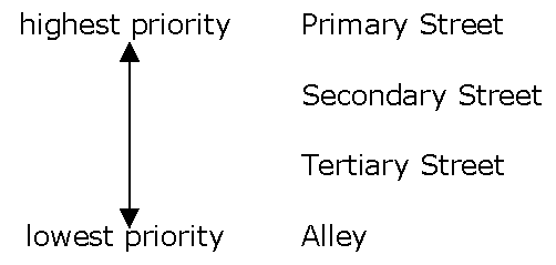
C.
If a parcel has more than one street frontage that is the highest priority street frontage (e.g., frontage on two primary streets, or no frontage on primary streets and frontage on two secondary streets), the applicant must select one of the highest priority frontages to be the primary street frontage where the front build-to zone or setback will apply. If a parcel within 600 feet of any boundary of the initial parcel selecting the primary street in accordance with this subsection is developed or redeveloped subsequent to the approval of the application of the initial parcel, it must use the same primary street frontage as the initial parcel.
Sec. 24-3808. - Streets and Sidewalks: New Street Connections
A.
All potential new street connections identified on the regulating and street hierarchy plan for each subdistrict must be provided when adjoining land is developed. The precise location and alignment of new street connections may be adjusted with the agreement of the Planning Director and the County Engineer at the time of plan of development review and approval. The number of connections provided to surrounding parcels must not be reduced. Private streets are allowed.
B.
Any block face in the Mixed-Use Core, Walkable Center, Neighborhood General, and Connected Edge Districts that exceeds 600 feet must have a mid-block pedestrian access with a minimum width of eight feet.
Sec. 24-3809. - Streets and Sidewalks: General Street Standards.
The design of new streets and modifications to existing streets must comply with the following requirements:
A.
Improvements to thoroughfares must be coordinated with the County Engineer.
B.
All thoroughfares must connect to other streets if reasonably practicable.
C.
Permanent cul-de-sac streets and T-turnarounds are prohibited. When the adjacent property has not been developed or redeveloped, a temporary dead-end street with a temporary cul-de-sac or other temporary turn-around may be approved.
D.
On-street parking lanes must not be closer than 20 feet to intersections measured from the intersecting property lines.
E.
All new thoroughfares must have sidewalks on both sides of the travel lanes.
F.
All sidewalks must have a minimum width of six feet and a continuous unobstructed area within the sidewalk of a width no less than five feet. The unobstructed area must be unobstructed by utility poles, fire hydrants, street furnishings, or any other temporary or permanent structures.
G.
Free and clear public use of the sidewalk area outside of the right-of-way must be provided by a public access easement.
H.
With the exception of fire hydrants and fire department connections, utilities must run underground and above-ground projections of utilities must be placed in or along rights-of-way of streets of lower street hierarchy, wherever practical.
I.
Traffic control devices may include roundabouts, if the County Engineer determines a roundabout will materially improve the traffic safety and not adversely impact the orderly flow of traffic in the area (see Figure 3809: Illustration of Roundabout).
Figure 3809: Illustration of Roundabout
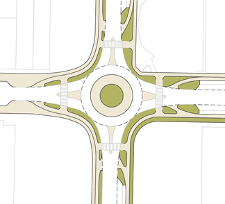
Sec. 24-3810. - Streets and Sidewalks: Alleys.
A.
Where practical, alleys must be used for access to parking and services at the rear of lots.
B.
Alleys must comply with the required alley dimensions in Table 3810: Required Alley Dimensions.
C.
When sidewalks cross alleys, the sidewalk must remain at the same elevation for pedestrians, and the pavement texture must change to signify the alley.
(Ord. No. 1335, § 15, 11-12-2024)
Sec. 24-3811. - Streets and Sidewalks: Curb Radius.
Streets with on-street parking must have a maximum corner curb radius of 15 feet, in order to enhance safety for pedestrians by inhibiting drivers from turning corners at high speeds. (The effective turning radius is larger than the curb radius when parking is present. See Figure 3811: Corner Curb with On-Street Parking)
Figure 3811: Corner Curb with On-Street Parking
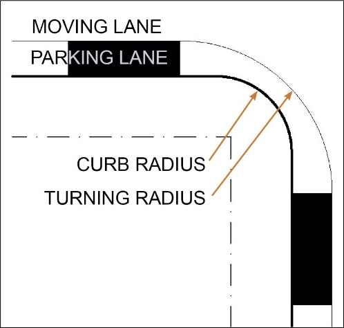
Sec. 24-3812. - Streets and Sidewalks: Streetscape.
Sidewalks may have three zones with differing functions. They are the Frontage Zone, Clear Path, and Furnishing and Landscape Strip (see Figure 3812: Sidewalk Zones). The purpose of each zone and applicable standards are set forth below.
Figure 3812: Sidewalk Zones
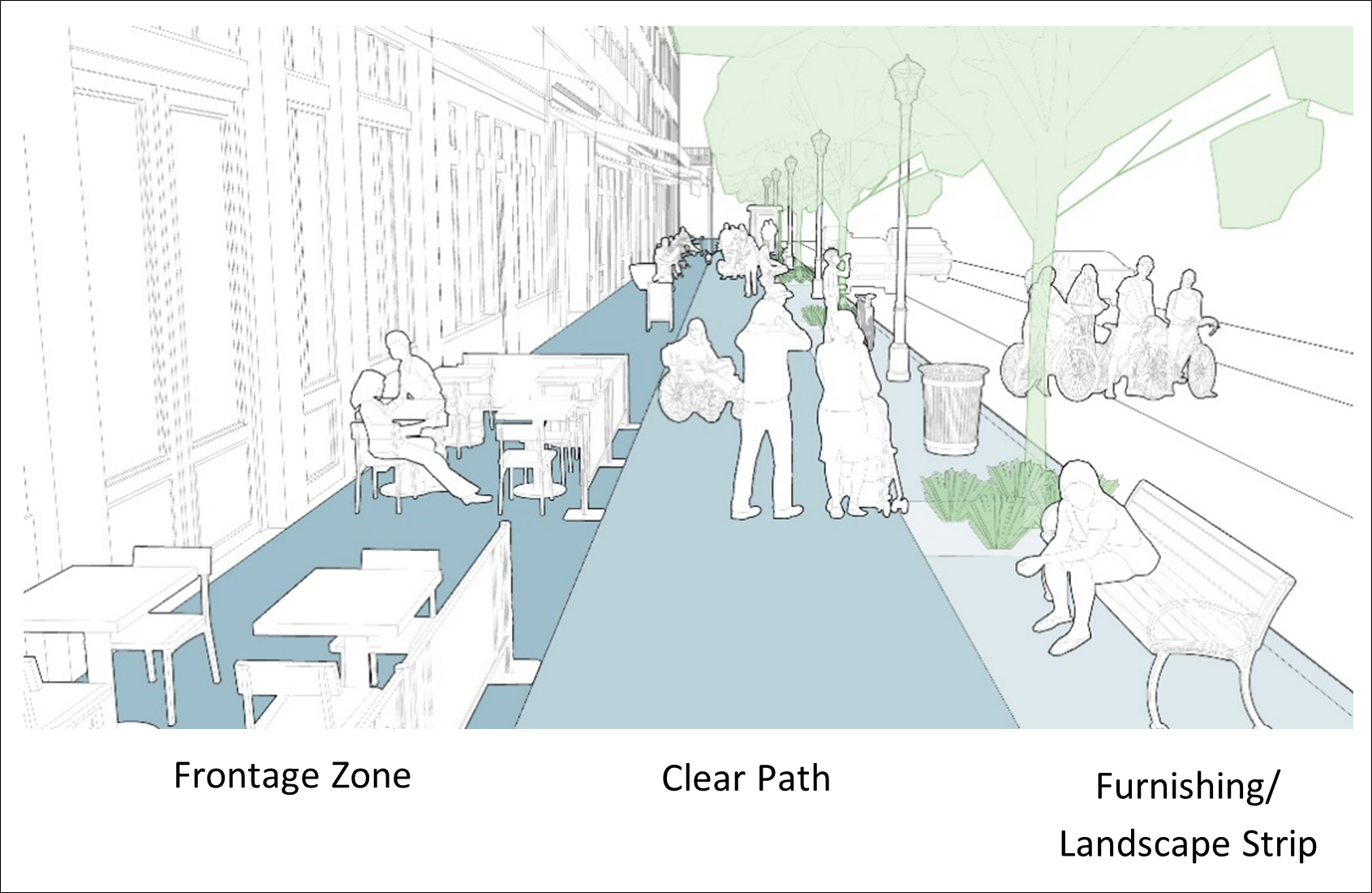
A.
Frontage Zone. The frontage zone is the space between the building façade or property line and the clear path. This space supplements the buildings' activities and provides a buffer between pedestrians, frontage elements that extend beyond the façade such as arcades or colonnades, and opening doors. It is the location for seating, signs, retail displays, and landscaping.
B.
Clear Path. The clear path is the portion of the sidewalk dedicated to pedestrian travel. It should be accessible and free of physical obstructions to allow for the movement of people. It should be well-lit and functional in all weather conditions, including snowy winters, and must comply with the following standards:
1.
A paved sidewalk at least six feet wide must be provided.
2.
The sidewalk must be located in the existing right-of-way or, if the sidewalk cannot fit within the right-of-way, in a dedicated public easement.
3.
The sidewalk must be aligned with any adjoining sidewalk and must be paved to the same elevation as the adjoining sidewalk or land.
C.
Furnishing and Landscape Strip. The furnishing and landscape strip serves many functions, varying greatly depending on the type of street. Its primary purpose is to separate the clear path from motorists and provide a location for street furniture and utilities, street trees, storm water elements, lighting, transit stops, bike racks, parking meters, signage, and other elements.
Sec. 24-3813. - Streets and Sidewalks: Street Trees.
Either a sidewalk planting strip at least five feet wide between the sidewalk and the street or minimum five-foot wide by six-foot long street tree planting areas, must be provided for the location of street trees. Street trees must be planted at a maximum average spacing of 30 feet on center. Street tree areas must be coordinated with public utilities to ensure that the placement and growth of required plantings will not interfere with utilities.
Sec. 24-3814. - Streets and Sidewalks: Street Lighting.
A.
Pedestrian-scaled fixtures must be installed on all streets fronting the property (see Figure 3814: Types of Street Lighting).
B.
Intersection-scaled lighting must be used in addition to pedestrian-scaled lights where required by the Department of Public Works (see Figure 3814: Types of Street Lighting).
C.
Streetlights must be aligned with street tree placement (generally between two and a half feet and four feet from the back of the curb). Placement of fixtures must be coordinated with the organization of sidewalks, landscaping, street trees, building entries, curb cuts, signage, etc.
Figure 3814: Types of Street Lighting
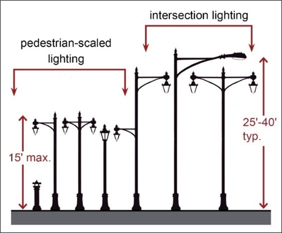
D.
Pedestrian scaled light fixtures must not exceed 15 feet in height to promote a pedestrian scale to the public realm and to minimize light spill to adjoining properties. Light fixtures must be spaced not more than 40 feet on center on average. In cases where this spacing requirement would require two fixtures to be located within 20 feet of each other, they may be consolidated into one fixture.
E.
Light poles may include armature that allows for the hanging of banners or other amenities (e.g., hanging flower baskets, artwork, etc.).
F.
Lighting must be designed to prevent the direct view of the light source from neighboring residential areas.
G.
Light fixtures must be downcast or low cut-off fixtures to prevent glare and light pollution.
H.
To conserve energy and reduce long-term costs, energy-efficient lamps must be used for all public realm lighting.
I.
There must be consistency of lighting fixtures along each street to create a unifying scheme of illumination that is appropriate to the scale of the street and the level of nighttime activity. Lamp styles must be consistent along both sides of each block of each street.
Sec. 24-3815. - Streets and Sidewalks: Terminated Vista.
To enhance wayfinding and mark an important view, where a point of reference is indicated on regulating and street hierarchy plans, a tower, cupola, statue, monument, or a similar significant architectural feature must be placed in the area where the point of reference is indicated.
Sec. 24-3816. - Streets and Sidewalks: Typical Street Types.
The following typical street sections may be used to create new streets or modify existing streets within the FBA-O District: typical primary street sections as shown in Sec. 24-3817, typical secondary street sections as shown in Sec. 24-3818, typical tertiary street sections as shown in Sec. 24-3819, and typical one-way street sections as shown in Sec. 24-3820.
Sec. 24-3817. - Streets and Sidewalks: Typical Primary Street Sections.
A.
Multiway Boulevard. The Multiway Boulevard is designed for high traffic counts while providing an access lane for local traffic to access shops and restaurants. Street trees provide shade for pedestrians and bicyclists. Wide sidewalks accommodate outdoor dining. The Multiway Boulevard will ideally be utilized for West Broad Street through the Brookfield Area Subdistrict and the Parham/Broad Area Subdistrict. (See Figure 3817A: Multiway Boulevard Section.)
Figure 3817A: Multiway Boulevard Section
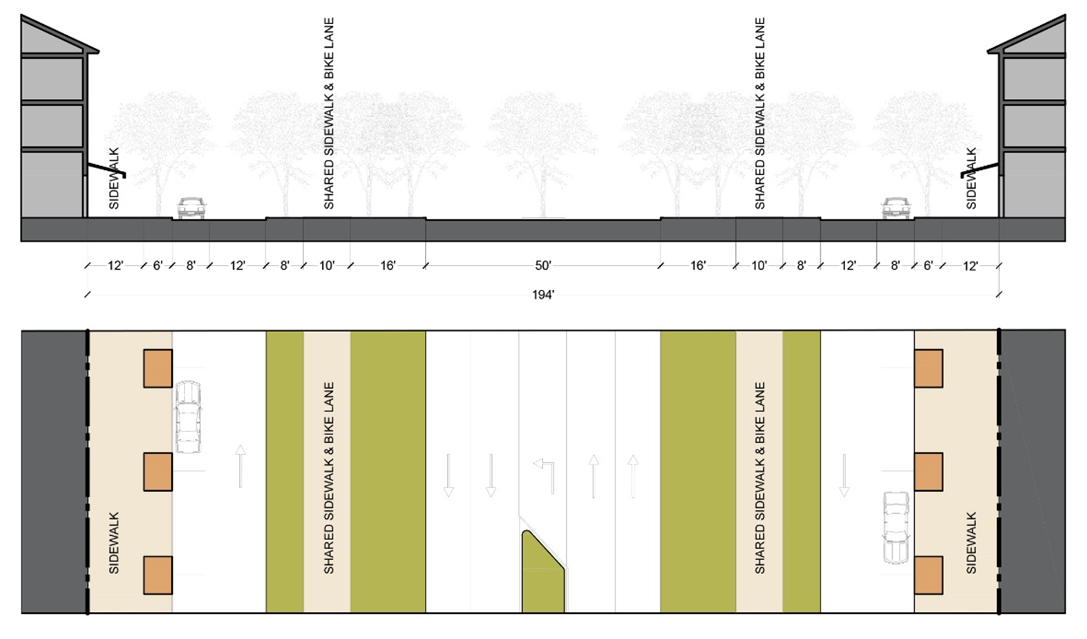
B.
Primary Street 1. Primary Street 1 accommodates two-way traffic with parallel parking on either side. Pairs of trees are planted on each side of two bike lanes. These bike lanes are located between the parallel parking and sidewalk along the street. (See Figure 3817B: Primary Street 1 Section.)
Figure 3817B: Primary Street 1 Section
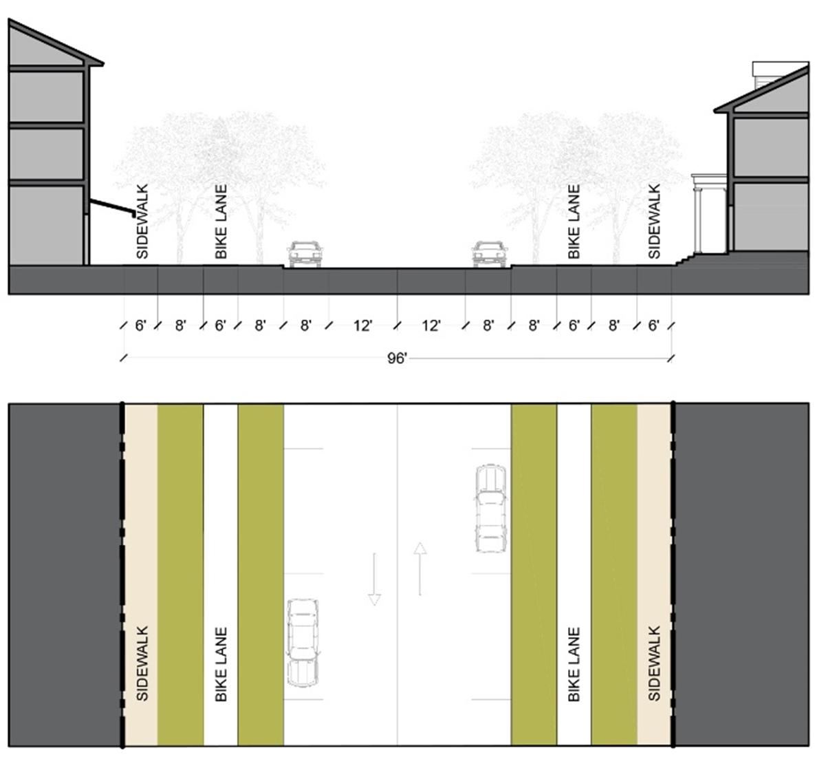
C.
Primary Street 2. Primary Street 2 accommodates two-way traffic with parallel parking on either side. Bike lanes are located between the parallel parking and sidewalk along the street. A raised curb is located between the bike lanes and parallel parking while street trees are located between the bike lanes and sidewalks. (See Figure 3817C: Primary Street 2 Section.)
Figure 3817C: Primary Street 2 Section

D.
Primary Street 3. Primary Street 3 accommodates two-way traffic with parallel parking on either side. A two-way cycle track is located on one side of the street with street trees planted on either side. (See Figure 3817D: Primary Street 3 Section.)
Figure 3817D: Primary Street 3 Section
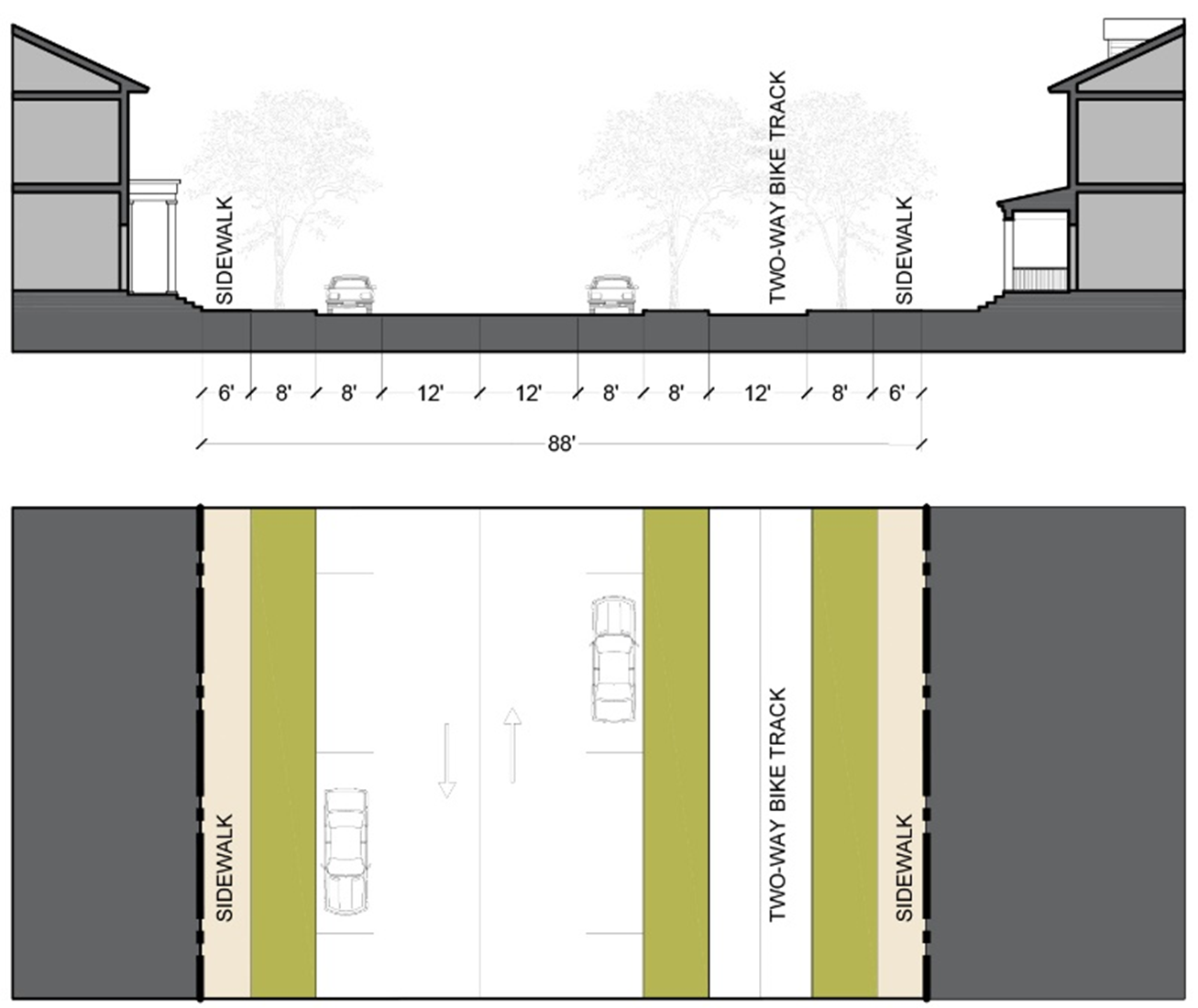
E.
Primary Street 4. Primary Street 4 accommodates two-way traffic with parallel parking on either side. Street trees are located between parallel parking and the sidewalk. An optional turn lane that does not decrease the planting area and sidewalks may be added. (See Figure 3817E: Primary Street 4 Section.)
Figure 3817E: Primary Street 4 Section
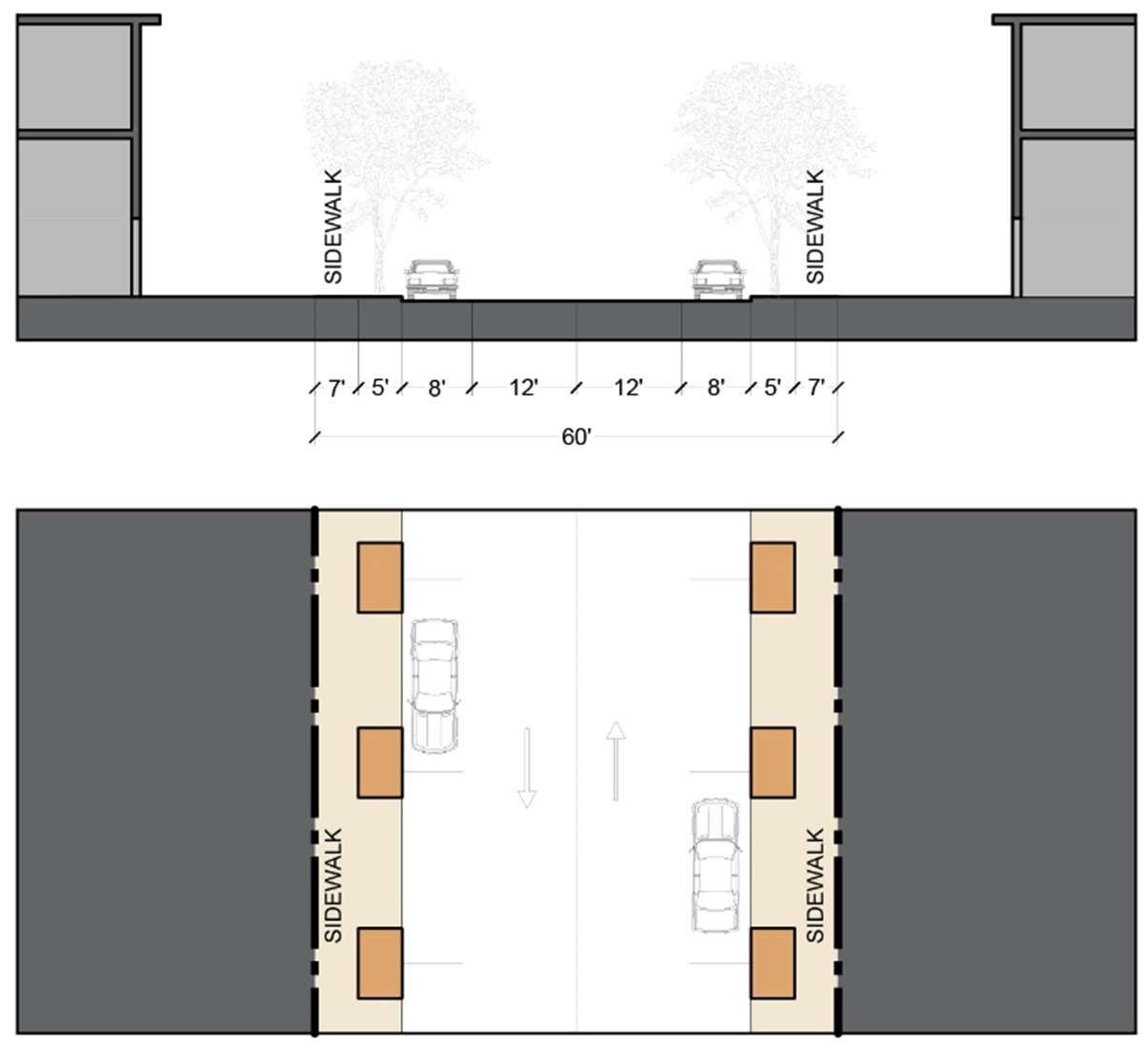
Sec. 24-3818. - Streets and Sidewalks: Typical Secondary Street Sections.
A.
Secondary Street 1. Secondary Street 1 accommodates two-way traffic with parallel parking on either side. Street trees are located between parallel parking and the sidewalk. An optional turn lane that does not decrease the planting area and sidewalks may be added. (See Figure 3818A: Secondary Street 1 Section.)
Figure 3818A: Secondary Street 1 Section
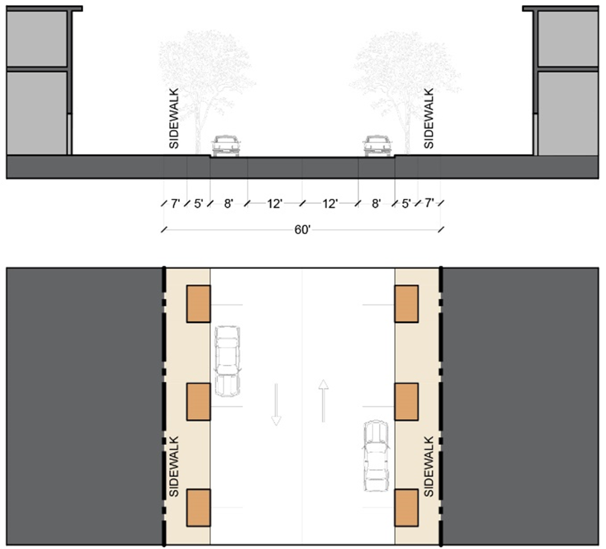
B.
Secondary Street 2. Secondary Street 2 is for residential areas with narrower right-of-way. It accommodates two-way traffic with parallel parking on one side. Street trees provide shade and are located between the street and the sidewalk. (See Figure 3818B: Secondary Street 2 Section.)
Figure 3818B: Secondary Street 2 Section
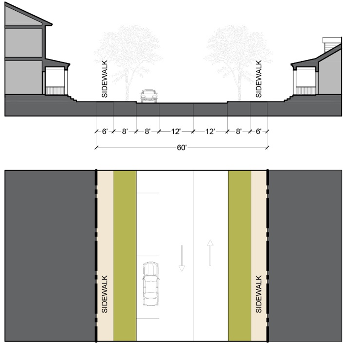
Sec. 24-3819. - Streets and Sidewalks: Typical Tertiary Street Sections.
A.
Tertiary Street 1. Tertiary Street 1 is intended for slower residential streets that are relatively urban. It accommodates two-way traffic with parallel parking on either side. Street trees are located between the street and sidewalks. (See Figure 3819A: Tertiary Street 1 Section.)
Figure 3819A: Tertiary Street 1 Section
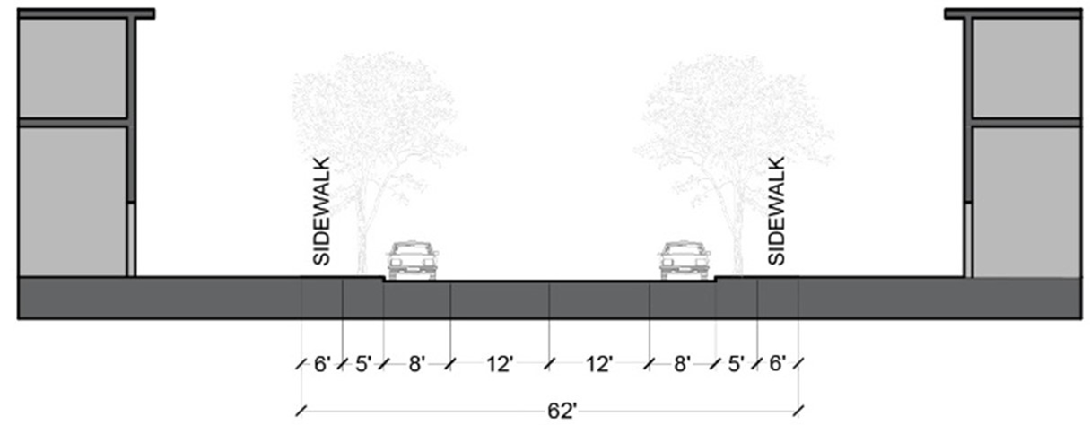
B.
Tertiary Street 2. Tertiary Street 2 is primarily for residential streets with slow traffic. It accommodates two-way traffic with parallel parking on one side. Street trees are located between the street and the sidewalk. (See Figure 3819B: Tertiary Street 2 Section.)
Figure 3819B: Tertiary Street 2 Section
(Ord. No. 1335, § 16, 11-12-2024)
Sec. 24-3820. - Streets and Sidewalks: Typical One-Way Street Sections.
One-way streets may not be used as a Primary Street except when used in a pair on opposite sides of a civic space. One-way streets may be used as secondary and tertiary streets when the right-of-way is not wide enough for a two-way street and does not limit the overall circulation of traffic.
A.
One-Way Street 1. One-way Street 1 accommodates one-way traffic with parallel parking on both sides of the one-way drive lane. Street trees and sidewalks are on both sides of the street section.
Figure 3820A: One-Way Street 1 Section
B.
One-Way Street 2. One-way Street 2 accommodates one-way traffic with parallel parking on one side of the street. Street trees and sidewalks are on both sides of the street section.
Figure 3820B: One-Way Street 2 Section

C.
One-Way Street 3 Section. One-way Street 3 accommodates one-way traffic with a bike lane on one side. Street trees provide shade and are located between the street and the sidewalk on both sides of the street.
Figure 3820C: One-Way Street 3 Section
Sec. 24-3821. - Civic Open Space: Minimum Civic Open Space Required.
A.
All new development must provide civic space within one-quarter-mile walking distance of every parcel.
B.
Except as otherwise provided in subsection D below, the following minimum percentages of the area of each development site must be set aside as civic open spaces:
1.
7.5% for residential uses;
2.
5% for non-residential uses and mixed uses.
C.
The requirement in subsection B above, is in addition to any planting strips within street rights-of-way and open space provided on lots with private buildings.
D.
The requirement in subsection B above may be met by a comparable amount of civic open space within 1/4 mile walking distance that already exists or is committed to be provided by another public or private development to comply with subsection B above but not counted toward the civic open space requirement for that development.
Sec. 24-3822. - Civic Open Space: Types of Civic Open Space.
Civic open spaces are categorized as described in Table 3822: Illustrations of Typical Civic Open Space.
| Table 3822: Illustrations of Typical Civic Open Spaces | |
|---|---|
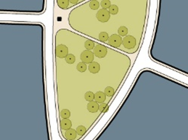 | Green A green is an informal space consisting of lawn and informally arranged trees and shrubs, typically furnished with paths, benches, and open shelters. Greens are spatially defined by abutting streets. |
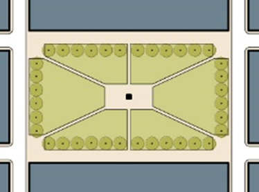 | Square A square is a formal open space available for recreational and civic uses and spatially defined by abutting streets and building frontages. Landscaping in a square consists of lawn, trees, and shrubs planted in formal patterns and it is typically furnished with paths, benches, and open shelters. |
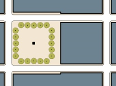 | Plaza A plaza is a formal open space available for civic and commercial uses and spatially defined by building frontages. Landscaping in a plaza consists primarily of pavement or other hardscapes; trees and shrubs are optional. |
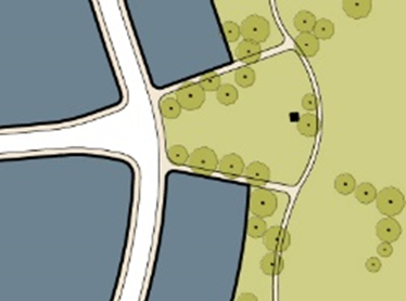 | Neighborhood Park A neighborhood park is a natural landscape consisting of open and wooded areas, typically furnished with paths, benches, and open shelters. Neighborhood parks are often irregularly shaped but may be linear in order to parallel water features or corridors. |
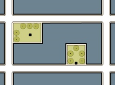 | Playground A playground is a fenced open space, typically interspersed within residential areas, that is designed and equipped for the recreation of children. Playgrounds may be freestanding or located within parks or greens. Community Garden A community garden is a grouping of garden plots available to nearby residents for small-scale cultivation. |
Sec. 24-3823. - Civic Open Space: Civic Open Space Types Counted in Development Areas.
Table 3823 identifies with an "X" which types of open space types are counted toward meeting the requirement in each development area.
Sec. 24-3824. - Civic Open Space: Design Standards.
A.
Squares and plazas must be located so that at least 25 percent of buildings on the public space are facing it with their primary facades.
B.
Civic open spaces must be designed, landscaped, and furnished and not treated as leftover space. They must be included in each plan phase.
C.
Stormwater management improvements must be integrated with the final landscape design as site amenities (see Article 5, Division 2, Required Open Space).
Sec. 24-3825. - Frontage Standards
The frontage standards in this section establish the physical and functional relationships between buildings and the street in all development areas. The standards include rules related to building placement (build-to zones, setbacks, location of parking, etc.) and building heights. New development in the FBA-O must comply with the frontage standards in this Division based on the development area designation on the regulating and street hierarchy plan where the development is located. Table 3825: Summary of Frontage Standards, summarizes the frontage standards that apply in each development area. New development in each development area in the FBA-O District must comply with the corresponding frontage standards in Sec. 24-3826 through Sec. 24-3832.
(Ord. No. 1335, § 17, 11-12-2024)
Sec. 24-3826. - Mixed-use Corridor Frontage Standards.

Sec. 24-3827. - Mixed-use Core Frontage Standards.
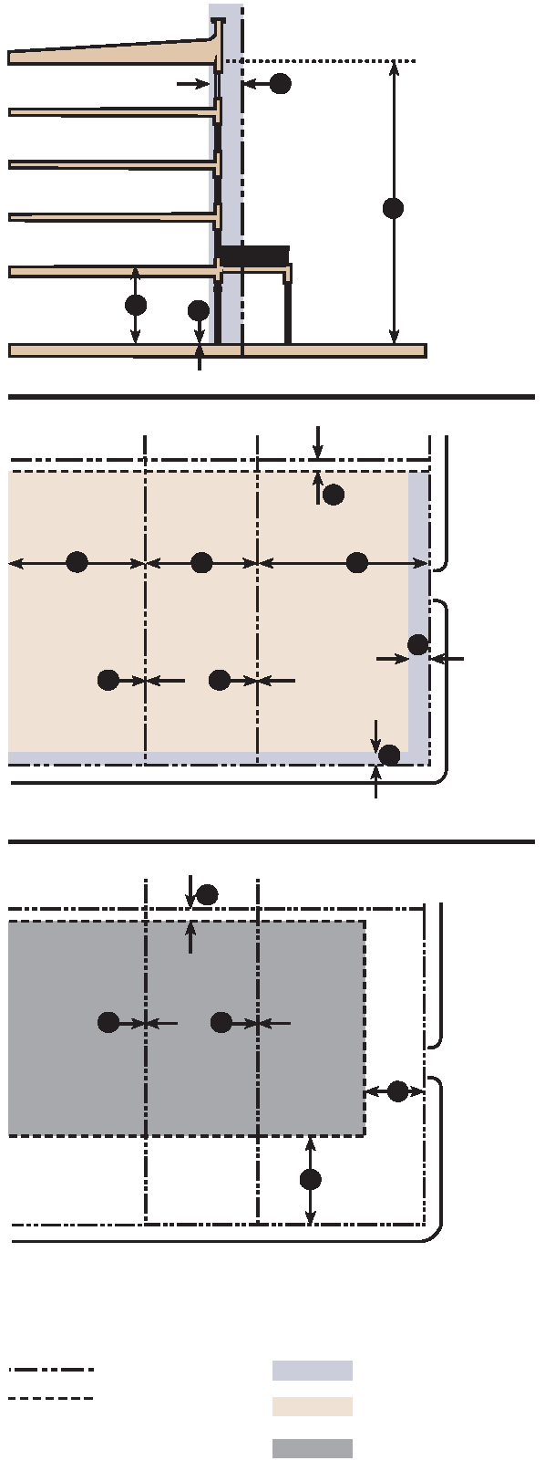
Sec. 24-3828. - Walkable Corridor Frontage Standards.
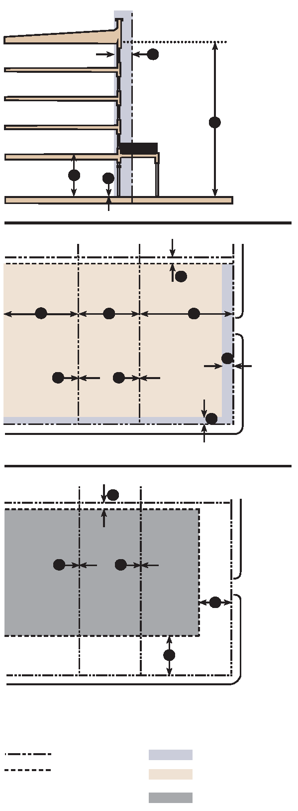
Sec. 24-3829. - Walkable Center Frontage Standards.
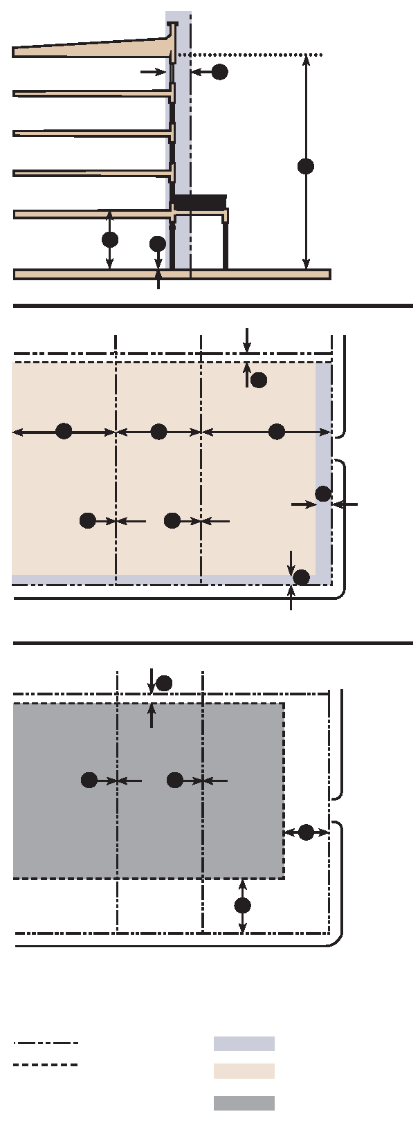
Sec. 24-3830. - Neighborhood General Frontage Standards.
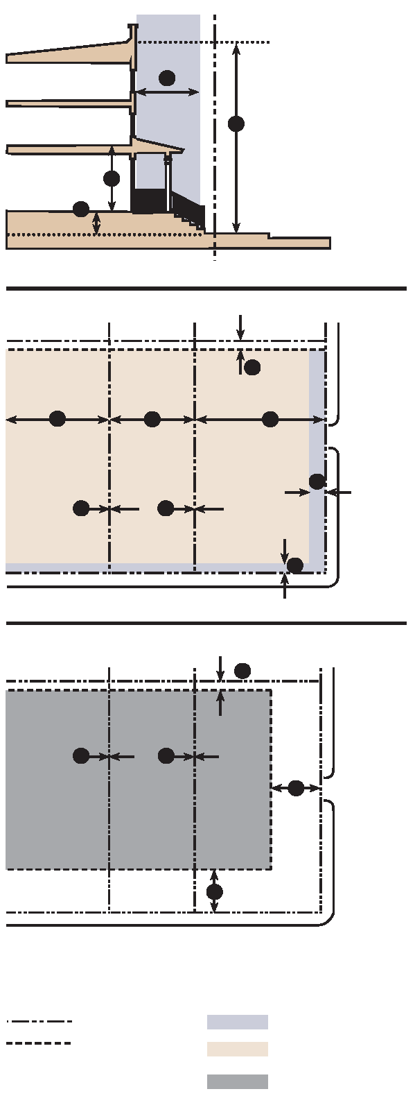
Sec. 24-3831. - Connected Edge Frontage Standards.
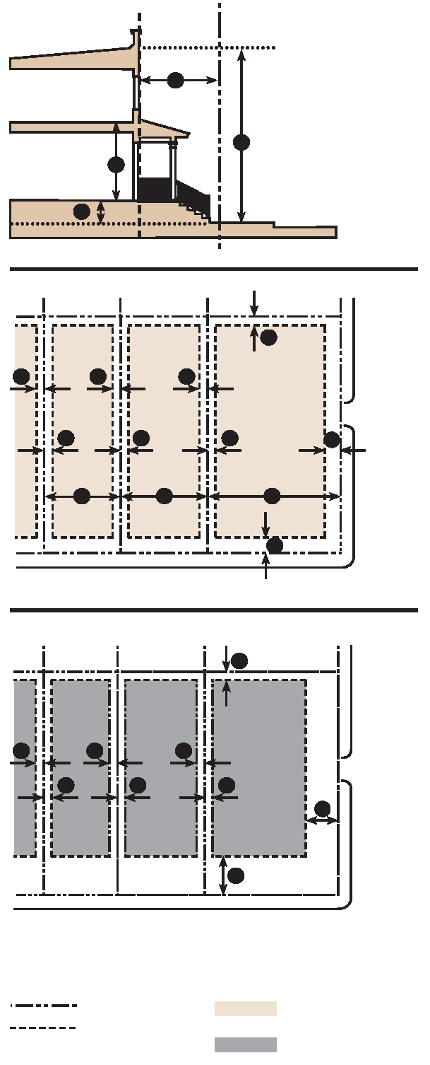
Sec. 24-3832. - Highway Edge Frontage Standards.
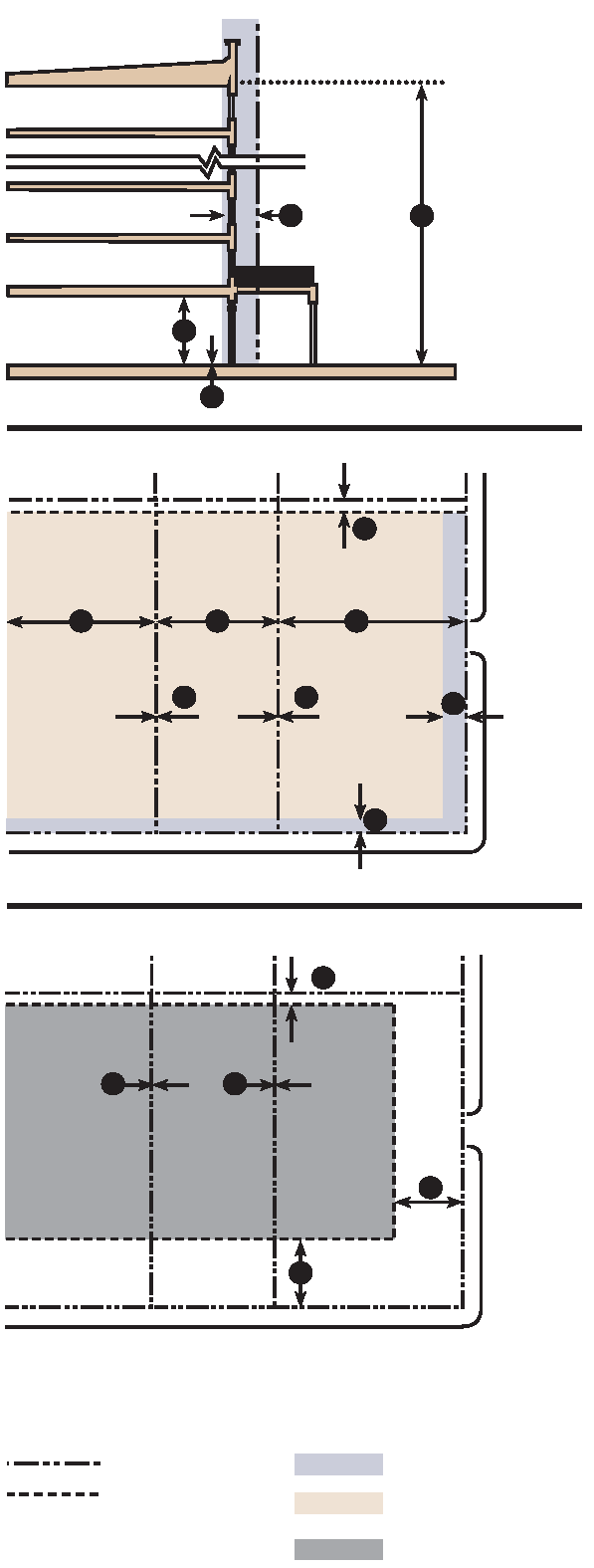
Sec. 24-3833. - Use Standards.
Principal, accessory, and temporary uses are allowed in each of the development areas in accordance with Article 4: Use Regulations.
Sec. 24-3834. - Parking Standards: Purpose.
The purpose and intent of the parking standards is to encourage a balance between pedestrian-oriented development and necessary car storage, so that neither more nor less parking than is needed is developed.
Sec. 24-3835. - Parking Standards: Minimum Parking Standards.
A.
A minimum number of parking spaces must be provided for each use in accordance with Table 3835: Minimum Parking Spaces.
B.
The Planning Director may approve a reduction of up to 30 percent of the minimum parking standards in subsection A above based on a parking study prepared by a professional engineer submitted by the applicant demonstrating that parking demand does not justify the otherwise required parking spaces or may be met by sharing parking with other existing uses.
C.
Parking spaces required by subsection A above may include on-street parking spaces adjacent to the property. The on-street parking must be within 300 feet of the front of the building it is intended to serve.
(Ord. No. 1335, § 25, 11-12-2024)
Sec. 24-3836. - Parking Standards: Shared Parking Standards.
A.
Shared parking is encouraged in all subdistricts for more efficient parking solutions. The amount of parking required is calculated by adding the total number of spaces required by Table 3835: Minimum Parking Spaces, for each separate use and dividing by the appropriate factor from Table 3836: Shared Parking Factors, based on the uses proposed to share parking. The shared parking calculations must be documented in a shared parking study prepared by a professional transportation engineer approved by the Planning Director. For example, consider a residential use that requires ten spaces and an office use that requires twelve spaces. If the uses shared parking, the sum of the separate minimum parking requirements, 22 spaces, would be divided by the sharing factor of 1.4, resulting in a shared parking requirement of 16 spaces. When more than two uses share parking, the lowest shared parking factor will apply.
Sec. 24-3837. - Parking Standards: Parking Location and Access.
A.
Parking must be located in accordance with Sec. 24-3825 Frontage Standards.
B.
All parking must be accessed from rear alleys where they exist (see diagram) or from side streets if the lot is located on a corner. If no rear alley or side street exists, access must be shared with neighboring properties to the extent practical.
C.
When access to rear parking must be directly from the primary street, driveways must be located along side property lines (see Figure 3837: Parking Access Location) and designed such that pedestrians crossing on sidewalks always have the right-of-way.
Figure 3837: Parking Access Location
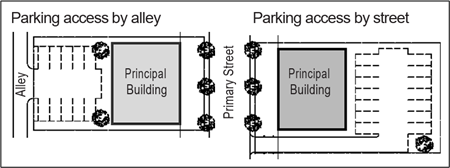
D.
Where parking accessed by a residential alley is visible from an adjacent street, the parking must be screened from view from the adjacent street by an opaque wall or architecturally compatible screening at least 5 feet in height, supplemented with landscaping.
(Ord. No. 1335, § 26, 11-12-2024)
Sec. 24-3838. - Standards for New Buildings: Primary Entrances.
The primary entrance of every building that provides access to a principal use must face a street or a public space. A public space may include a central garden or courtyard that opens directly onto the street.
(Ord. No. 1335, § 27, 11-12-2024)
Sec. 24-3839. - Standards for New Buildings: Wide Buildings.
The primary façade of buildings wider than 250 feet must include at least one of the following:
A.
A break in the façade plane extending the full height of the primary façade or a wall projection or molding the full height of the primary façade; or
B.
A change in the roof line consisting of a variation in building height or a variation in roof form to divide the building into different components.
Sec. 24-3840. - Standards for New Buildings: Façade Transparency.
All building façades which face onto a street or public space must comply with the minimum transparency standards in Table 3840A: Minimum Façade Transparency. An example of appropriate façade transparency is shown in Figure 3840B: Illustration of Façade Transparency Requirements.
Figure 3840B: Illustration of Façade Transparency Requirements
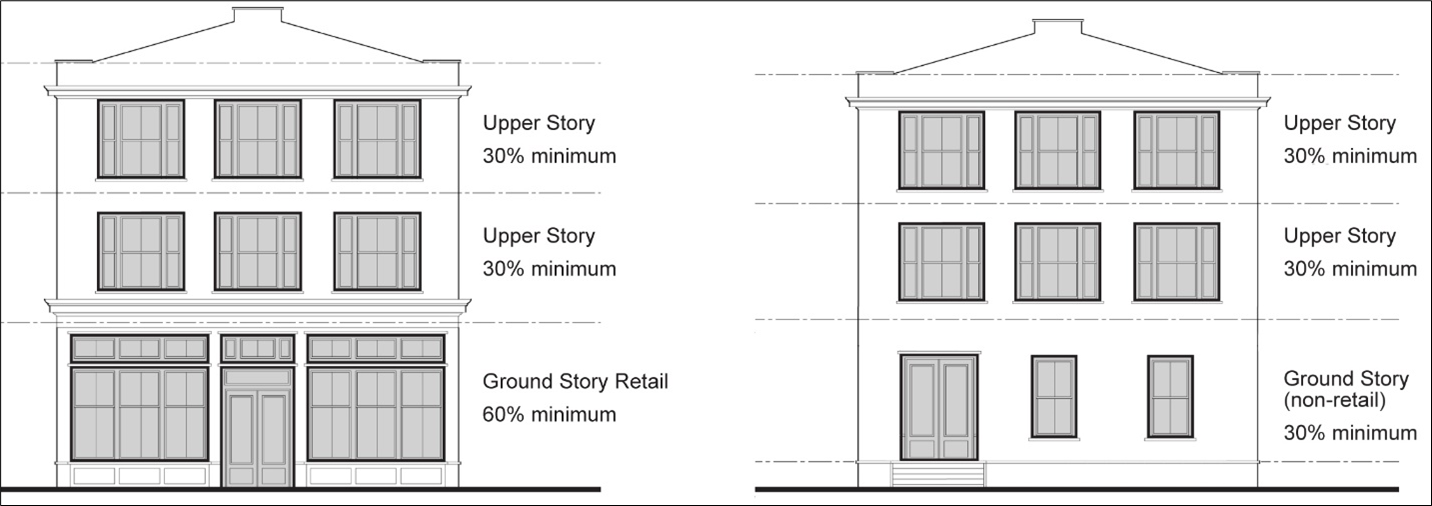
(Ord. No. 1335, § 28, 11-12-2024)
Sec. 24-3841. - Standards for New Buildings: Frontage Elements: Purpose and General Requirements.
A.
Frontage elements are semi-private elements of a building typically located in the area between the primary façade and the lot line. Frontage elements create the transition between the public realm and private buildings and establish the physical and functional relationship between the street and the private lot. This section identifies common frontage elements and sets out standards that apply to those elements. Frontage elements are allowed, but not required. However, if a frontage element is used, it must conform to the standards in this section.
B.
Frontage elements may be located between the build-to zone or setback line and the right-of-way.
C.
Enclosed useable space is permitted above an arcade or gallery forward of the build to zone or setback.
D.
Arcades, galleries, and porches may wrap around the side of the building to face side streets on corner lots.
E.
Frontage elements on commercial buildings must maintain a clear envelope of space with 10' head clearance and 10' between the building and any other element that reaches the ground.
Sec. 24-3842. - Standards for New Buildings: Frontage Elements: Encroachments within Right-of-Way.
A.
Arcades, galleries, balconies, and awnings may encroach into the right-of-way only with the agreement of the County Engineer or VDOT, as appropriate, but may not encroach within a DPU easement. The agreement must establish the sole responsibility of the owner of the frontage element for repairing any damage that may result from public maintenance or improvements in the right-of-way. Enclosed useable space above an arcade or gallery within the right-of-way must be approved as part of the agreement.
B.
Frontage elements must not extend closer than three feet from the curb line.
Sec. 24-3843. - Standards for New Buildings: Frontage Elements: Commercial or Shopfront Frontage Elements.
A.
Shopfront. A shopfront is a frontage element in which the building façade is aligned close to the property line with a high percentage of glazing conventional for shop displays and dining. The building entrance is generally at sidewalk grade. It is often used with arcades, colonnades, galleries, awnings, canopies, or other shade devices. See Figure 3843A-1: Shopfront Illustrations.
Figure 3843A-1: Shopfront Illustrations
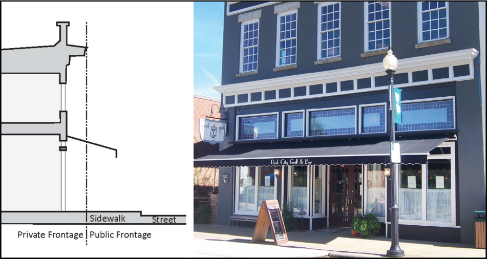
1.
Shopfronts must have a cornice or expression line between the first and second story (see Figure 3843A-2: Shopfront Transparency and Expression Line). Expression lines must either be moldings extending a minimum of two inches outward from the primary façade or jogs in the surface plane of the building wall greater than two inches.
Figure 3843A-2: Shopfront Transparency and Expression Line
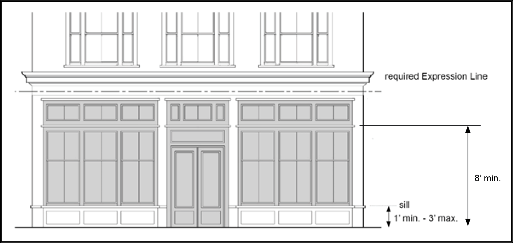
2.
The entrances to all shopfronts must be covered, either by an awning, canopy, second floor balcony, arcade, colonnade, or gallery, or by being inset into the main body of the building.
3.
Entrances for public access into commercial areas must be provided at intervals no greater than 50 feet.
4.
Shopfront doors must contain at least 50 percent transparent glass.
5.
The top of all shopfront windowsills must be between one and three feet above the adjacent sidewalk. Shopfront windows must extend up from the sill at least eight feet above the adjacent sidewalk (see Figure 3843A-2: Shopfront Transparency and Expression Line).
6.
The ground floor of a shopfront must have untinted transparent storefront windows or doors covering no less than 60 percent of the wall area. See Sec. 24-3840: Façade Transparency.
7.
Shopfront windows must not be made opaque by window treatments (excepting operable sunscreen devices within the heated and cooled space). Reflective and frosted glass is prohibited on shopfronts. Low emissivity glass with high visual light transmittance is permitted.
8.
Shopfronts must remain unshuttered at night to provide views of display spaces and are encouraged to remain lit from within until 10:00 PM to provide security to pedestrians.
B.
Arcade, Colonnade, or Gallery. An arcade, colonnade, or gallery is a frontage element where the building façade is aligned close to the property line with an attached cantilevered shed or a colonnade overlapping the sidewalk. See Figure 3843B: Arcade, Colonnade, or Gallery Illustrations. This frontage element type is conventional for retail use.
Figure 3843B: Arcade, Colonnade, or Gallery Illustrations
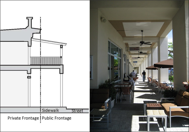
1.
The sidewalk may be a combination of public and private sidewalk.
2.
The Arcade or Gallery must extend a minimum of 75 percent of the building frontage.
C.
Forecourt. A forecourt is a frontage element where the primary portion of the building's main façade is at the build-to zone while a small percentage is set back, creating a court space. This space can be used as an apartment entry court, garden space, or for restaurant outdoor dining. A forecourt should be used in conjunction with other frontage element types. See Figure 3843C: Forecourt Illustrations.
Figure 3843C: Forecourt Illustrations
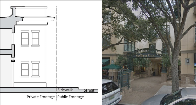
D.
Terrace. A terrace is a frontage element where the building façade is set back from the property with a relatively level paved or planted area adjoining a building and connecting it to the sidewalk. It takes up more space than a forecourt and is often elevated. A terrace may be used in conjunction with other frontage types. A terrace tends to buffer residential uses from urban sidewalks and removes the private yard from public encroachment. Terraces are suitable for use as, or conversion to, outdoor cafes. See Figure 3843D: Terrace Illustrations.
Figure 3843D: Terrace Illustrations
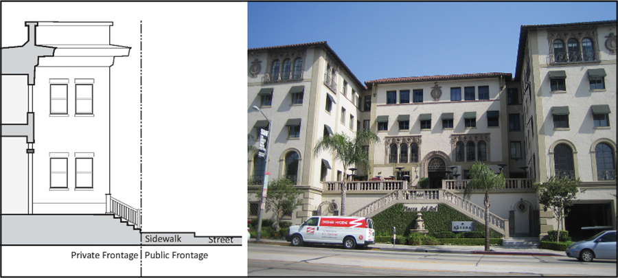
E.
Awning.
1.
Awnings over ground-story doors or windows must not exceed five feet in depth.
2.
Awnings must extend over at least 25 percent of the width of the primary façade.
Sec. 24-3844. - Standards for New Buildings: Frontage Elements: Residential Frontage Elements.
A.
Stoop. A stoop is a frontage element in which the residential building facade is aligned close to the property line with the first story elevated from the sidewalk sufficiently to secure privacy for the windows. The entrance is usually an exterior stair with a landing that is shallower in depth than a porch. A stoop is recommended for ground-floor residential use. See Figure 3844A: Stoop Illustrations.
Figure 3844A: Stoop Illustrations
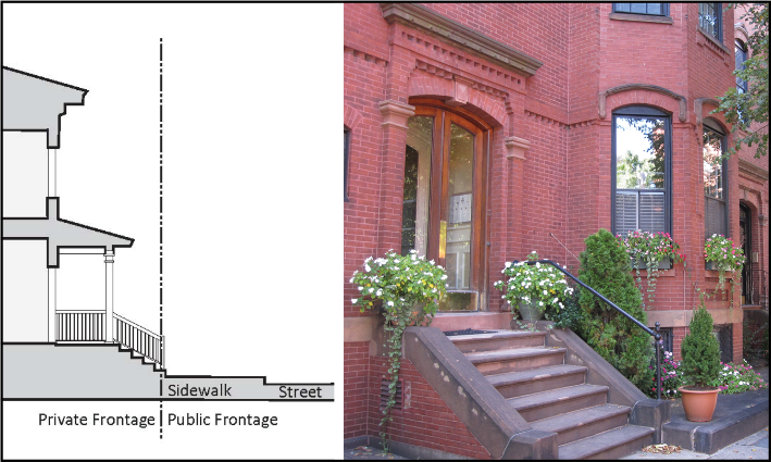
1.
The finished floor of the stoop must be no more than eight inches below the first floor level, and no more than 42 inches above the finished grade of the sidewalk.
2.
Stoop stairs may run to the front or to the side.
3.
Stoops may be covered, either with a roof, or area inset into the main body of the building.
4.
Partial walls and railings on stoops must be no higher than 42 inches.
B.
Porch. A porch is a frontage element where the building facade is set back from the property line, the ground floor is elevated, and stairs lead up to a landing that is large enough for people to gather and can accommodate patio furniture. A fence or low knee wall may be located at the property line to maintain street spatial definition. See Figure 3844B: Porch Illustrations.
Figure 3844B: Porch Illustrations
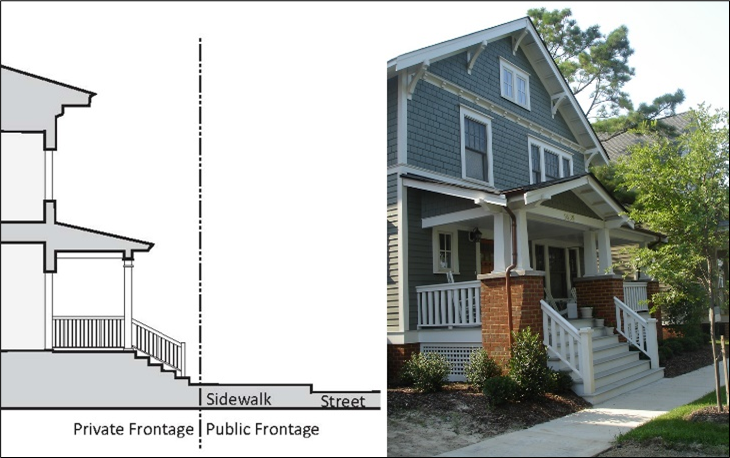
1.
Minimum porch depth is eight feet.
2.
The finished floor of the porch must be no more than eight inches below the first floor level, and no more than 42 inches above the finished grade of the sidewalk.
3.
Front porches may occur forward of the build-to zone or setback but must not extend into the right-of-way or any easement.
4.
Side porches may extend past the side setback requirements, but not into any easement.
5.
Front and side porches may be screened; however, if screened, columns, railings, etc., must be located on the outside of the screen facing a street or public space.
C.
Balcony.
1.
Balconies must not exceed six feet in depth.
2.
Balconies must extend over at least 25 percent of the width of the primary façade. See Balconies may have roofs but must be open toward the primary street.
3.
Open balconies are permitted over galleries above the sidewalk level.
4.
Figure 3844C: Balcony Example.
Figure 3844C: Balcony Example
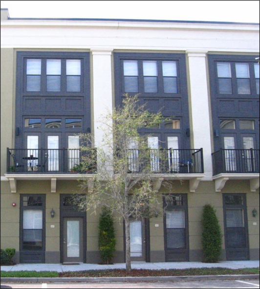
Sec. 24-3845. - Specialty Buildings: Purpose.
The purpose of the standards for specialty buildings is to ensure any auto-oriented development permitted in the FBA-O District does not detract from the walkability of the district. There are three types of specialty buildings:
A.
Liner Buildings;
B.
Automobile Filling Stations; and
C.
Drive-throughs
Sec. 24-3846. - Specialty Buildings: Liner Buildings.
A.
Parking structures and parking decks must be separated from adjacent streets (but not alleys) by liner buildings, to the maximum extent practicable.
B.
Liner buildings must be at least two stories in height with no less than 15 feet in depth (see Figure 3846: Liner Building Configuration).
C.
Liner buildings may be detached from or attached to the primary building (see Figure 3846: Liner Building Configuration).
D.
When access to a parking structure or deck cannot be accommodated on an alley, the required liner building may have a break of up to 30 feet to allow vehicular access on the lowest hierarchy street the parcel adjoins.
E.
Liner buildings may be occupied for any use permitted and as regulated in the district, except for parking.
F.
Liner buildings must comply with the primary façade transparency standards in Sec. 24-3840, Standards for New Buildings: Façade Transparency.
Figure 3846: Liner Building Configuration
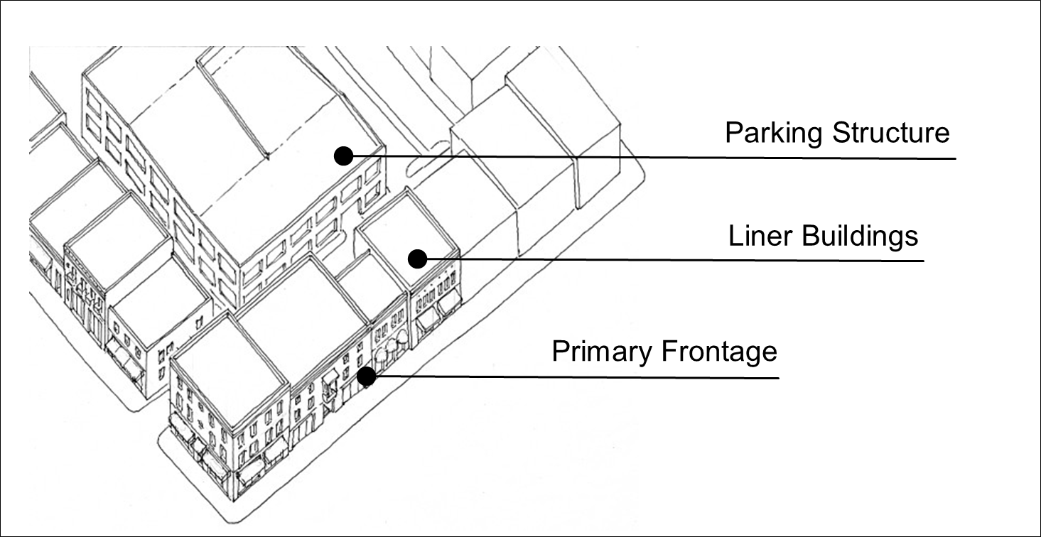
Sec. 24-3847. - Specialty Buildings: Automobile Filling Stations.
Automobile filling stations in the FBA-O District must comply with the following standards:
A.
A ground-floor shopfront is required. The shopfront must face the primary street and if it is located on a corner lot must be located at the build-to line at the corner of the lot.
B.
All pumps, parking, and drive-through areas must be located behind the building.
C.
An example of an appropriate automobile filling station configuration is shown in Figure 3847: Automobile Filling Station Configuration.
Figure 3847: Automobile Filling Station Configuration
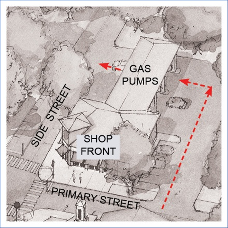
Sec. 24-3848. - Specialty Buildings: Drive-throughs.
Drive-through facilities in the FBA-O District must comply with the following standards:
A.
A ground-floor shopfront must face the primary street.
B.
All parking must be located in the rear and accessed from a rear alley when present.
C.
Drive-through windows must not be located to the front of the building.
D.
Subsections A, B, and C above may be altered through approval of a provisional use permit in accordance with Sec. 24-2306, Provisional Use Permit.
E.
An example configuration of an appropriate building with a drive-through is shown in Figure 3848: Drive-through Building Configuration.
Figure 3848: Drive-through Building Configuration
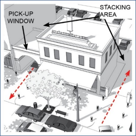
Sec. 24-3849. - Signs.
Signage in the FBA-O District must comply with the following standards in addition to the standards in Article 5, Division 7, Signs.
A.
Signs must be designed and scaled for use by pedestrians, in accordance with the following standards:
1.
Signs mounted flat against a building façade must be limited to a band having a maximum height of three feet on any building façade. The maximum gross area of all such signs mounted on a building façade must not exceed ten percent of the façade area.
2.
Signs mounted on and perpendicular to a building façade must maintain a minimum vertical clearance of eight feet above sidewalks and must not extend closer than two feet from the curb line. Such signs must not exceed nine square feet in area.
B.
Signs must be consistent within the subdistrict in theme and placement and coordinated with other streetscape furniture (e.g., light posts) to reduce visual clutter in the public realm.
C.
Signs must be coordinated with streetscape plantings to allow required plantings without reducing the visibility of signage and businesses.
D.
Detached signs are prohibited, except as provided in Sec. 24-3864, Brookfield Area Subdistrict: Additional Brookfield Area Standards.
E.
Banner signs must comply with the following standards:
1.
Banner signs must not exceed four feet in height or 40 feet in length.
2.
Banner signs must be mounted only on light poles or other street furniture designed for the purpose of hanging banners. In addition, with the agreement of the County Engineer or VDOT, temporary banner signs may be hung over a roadway within a public right-of-way having a width of 70 feet or less.
3.
Banner signs must not be illuminated.
4.
Banner signs must not extend over or into a public right-of-way except with the agreement of the County Engineer or VDOT.
F.
Signs that are illuminated must be externally illuminated from the front. Back lighting is permitted as an exception only for individual letters or numbers (panelized back lighting is prohibited). Signage within a shopfront may be neon lit.
Sec. 24-3850. - Exterior Lighting.
A.
Parking Lot Lighting.
1.
Light fixtures located within the interior of a parking lot must not exceed 30 feet in height.
2.
Light fixtures located along the perimeter of a parking area within 50 feet of a property line must not exceed 20 feet.
B.
Pedestrian Walkway Lighting.
1.
Light fixtures located along pedestrian walkways adjacent to parking lots or streets must not exceed 15 feet in height.
2.
Light fixtures located along internal pedestrian walkways or paths not adjacent to a parking area or a street must not exceed 10 feet in height.
C.
Building and Security Lighting.
1.
All exterior building or security lighting must be full cutoff, shielded, or angled downward to focus the light only on the intended doorway or walkway.
2.
Security lighting is encouraged to be provided with regular pedestrian light fixtures where visible from the street or public way to match other fixtures used on site.
3.
Building-mounted architectural "accent lights" are permitted when downward facing only.
4.
Lighting must be designed in such a way as to prevent the direct view of the light source to neighboring residential areas.
Sec. 24-3860. - FBA-O Subdistricts.
The FBA-O District consists of the subdistricts identified in Table 3860: FBA-O Subdistricts. The following sections set out the intent of each subdistrict and establish standards required in each subdistrict that apply in addition to the other FBA-O District standards.
Sec. 24-3861. - Brookfield Area Subdistrict: Boundary.
The boundary of the Brookfield Area Subdistrict is identified on the Zoning Districts Map.
Sec. 24-3862. - Brookfield Area Subdistrict: Intent.
The Brookfield Area is currently an office park with a single land use and large areas of surface parking. The intent of these subdistrict provisions is to identify a set of design principles and establish regulations that support development in the area that results in a vibrant and lively complete neighborhood with a network of streets, a mix of uses, and public civic space.
Sec. 24-3863. - Brookfield Area Subdistrict: Regulating and Street Hierarchy Plan.
The regulating and street hierarchy plan for the Brookfield Area Subdistrict is set out in Figure 3863: Brookfield Area Regulating and Street Hierarchy Plan.
Figure 3863: Brookfield Area Regulating and Street Hierarchy Plan
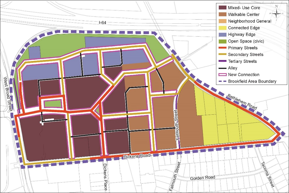
Sec. 24-3864. - Brookfield Area Subdistrict: Additional Brookfield Area Standards.
A.
Monument Signs. Monument Signs are permitted along West Broad Street.
B.
Mixed Use Requirement.
1.
In the Mixed-Use Core Development Area of the Brookfield Area Subdistrict, a minimum of 25 percent of the building floor area must be developed or reserved for nonresidential uses.
2.
In the Brookfield Area Subdistrict overall, a minimum of 10 percent of the building floor area must be developed or reserved for nonresidential uses.
3.
The Board of Supervisors may reduce or waive the requirements of this subsection through approval of a provisional use permit in accordance with Sec. 24-2306, Provisional Use Permit.
(Ord. No. 1335, § 29, 11-12-2024)
Sec. 24-3865. - Parham/Broad Area Subdistrict: Boundary.
The boundary of the Parham/Broad Area Subdistrict is identified on the Zoning Districts Map.
Sec. 24-3866. - Parham/Broad Area Subdistrict: Intent.
The Parham/Broad Area is located around the intersection of West Broad Street and East Parham Road. The area consists mainly of shopping centers and car dealerships with large parking areas. The intent of these subdistrict provisions is to identify a set of design principles and establish regulations that support more walkable development with storefronts facing streets such as West Broad Street transitioning to residential uses towards the edges.
Sec. 24-3867. - Parham/Broad Area Subdistrict: Regulating and Street Hierarchy Plan.
The regulating and street hierarchy plan for the Parham/Broad Area subdistrict is set out in Figure 3867: Parham/Broad Area Regulating and Street Hierarchy Plan.
Figure 3867: Parham/Broad Area Regulating and Street Hierarchy Plan
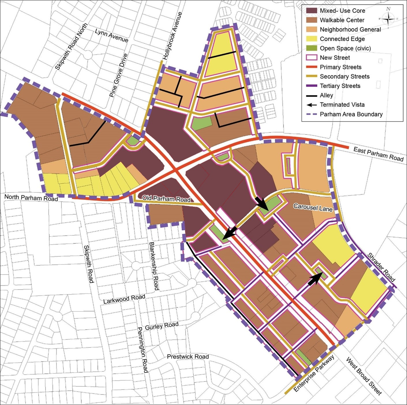
(Ord. No. 1335, § 30, 11-12-2024)
Sec. 24-3868. - Parham/Broad Area Subdistrict: Additional Parham/Broad Area Standards.
In addition to the allowed uses established in Article 4: Use Regulations, Auto Services and Auto Sales are permitted.
Sec. 24-3869. - Williamsburg Road Area Subdistrict: Boundary.
The boundary of the Williamsburg Road Area Subdistrict is identified on the Zoning Districts Map.
Sec. 24-3870. - Williamsburg Road Area Subdistrict: Intent.
Williamsburg Road is a thoroughfare immediately adjacent to the Richmond International Airport. Hotels lining the street that historically attracted travelers arriving by plane have declined, and strip mall shopping is prevalent. The high visibility of this area from the airport provides an opportunity to draw visitors to the area while also providing amenities and services to the local community. The intent of these subdistrict provisions is to identify a set of design principles and establish regulations that support a variety of housing options and the redevelopment of the shopping plaza at Williamsburg Road and Laburnum Avenue into a neighborhood center, connected by Williamsburg Road to a new center at the edge of the airport property.
Sec. 24-3871. - Williamsburg Road Area Subdistrict: Regulating and Street Hierarchy Plan.
The regulating and street hierarchy plan for the Williamsburg Road Area subdistrict is set out in Figure 3871: Williamsburg Road Area Regulating and Street Hierarchy Plan.
Figure 3871: Williamsburg Road Area Regulating and Street Hierarchy Plan
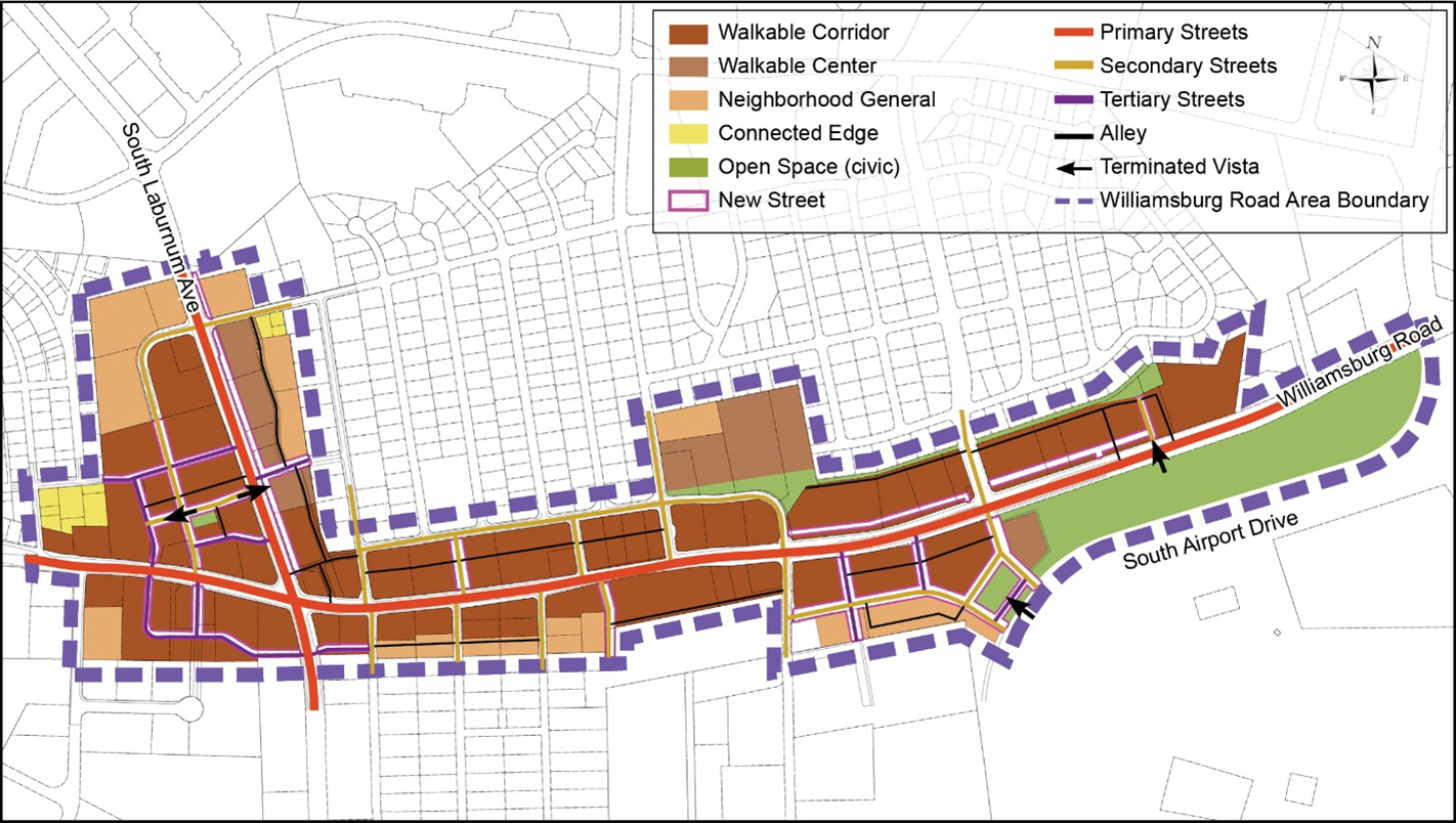
Sec. 24-3872. - Virginia Center Commons (VCC) Area Subdistrict: Boundary.
The boundary of the Virginia Center Commons (VCC) Area Subdistrict is identified on the Zoning Districts Map.
Sec. 24-3873. - Virginia Center Commons (VCC) Area Subdistrict: Intent.
The Virginia Center Commons (VCC) Area is located between US Route 1 and I-95, north of the I-95 and I-295 interchange. The area consists of the declining Virginia Center Commons Mall with several out parcels, hotels, a movie theater, and medical offices. This area is envisioned to become a mixed-use neighborhood housing a hotel, sports complex, retail and dining, along with a range of housing while incorporating existing uses as the market demands.
Sec. 24-3874. - Virginia Center Commons (VCC) Area Subdistrict: Regulating and Street Hierarchy Plan.
The regulating and street hierarchy plan for the Virginia Center Commons Area Subdistrict is set out Figure 3874: Virginia Center Commons Area Regulating and Street Hierarchy Plan.
Figure 3874: Virginia Center Commons Area Regulating and Street Hierarchy Plan
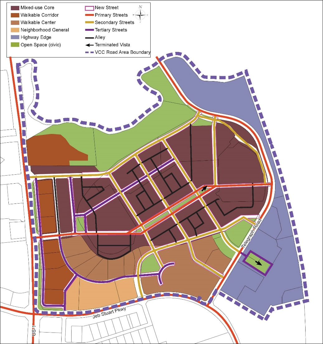
Sec. 24-3875. - Virginia Center Commons (VCC) Area Subdistrict: Additional Standards.
A.
Mixed Use Requirement.
1.
In the Mixed-Use Core Development Area of the Virginia Center Commons Area Subdistrict, a minimum of 25 percent of the building floor area must be developed or reserved for nonresidential uses.
2.
In the Virginia Center Commons Area Subdistrict overall, a minimum of 10 percent of the building floor area must be developed or reserved for nonresidential uses.
3.
The Board of Supervisors may reduce or waive the requirements of this subsection through approval of a provisional use permit in accordance with Sec. 24-2306, Provisional Use Permit.
(Ord. No. 1335, § 31, 11-12-2024)
Sec. 24-3876. - Short Pump Town Center Subdistrict: Boundary.
The boundary of the Short Pump Town Center Subdistrict is identified on the Zoning Districts Map.
(Ord. No. 1335, § 31, 11-12-2024)
Editor's note— Ord. No. 1335, § 31, adopted Nov. 12, 2024, renumbered § 24-3875 as § 24-3876.
Sec. 24-3877. - Short Pump Town Center Subdistrict: Intent.
The Short Pump Town Center Area is an open-air shopping mall with a single land use and large areas of surface parking. The area is a large draw in the region for shopping, people watching, and outdoor recreation. However, the retail landscape is rapidly changing. The intent of these subdistrict provisions is to ensure the Town Center remains viable and productive and has options as it continues to evolve and adapt. These subdistrict provisions are intended to make it easier to add housing, entertainment areas, cafes with outdoor seating, and similar types of development and amenities to facilitate people spending the day or even living within the site, with the ultimate purpose of establishing the Short Pump Town Center Area as a vibrant and lively complete neighborhood with a network of streets, a mix of uses, and public civic space.
(Ord. No. 1335, § 32, 11-12-2024)
Editor's note— Ord. No. 1335, § 32, adopted Nov. 12, 2024, renumbered § 24-3876 as § 24-3877.
Sec. 24-3878. - Short Pump Town Center Subdistrict: Regulating and Street Hierarchy Plan.
The regulating and street hierarchy plan for the Short Pump Town Center Area Subdistrict is set out in Figure 3878.
Figure 3878: Short Pump Town Center Regulating and Street Hierarchy Plan
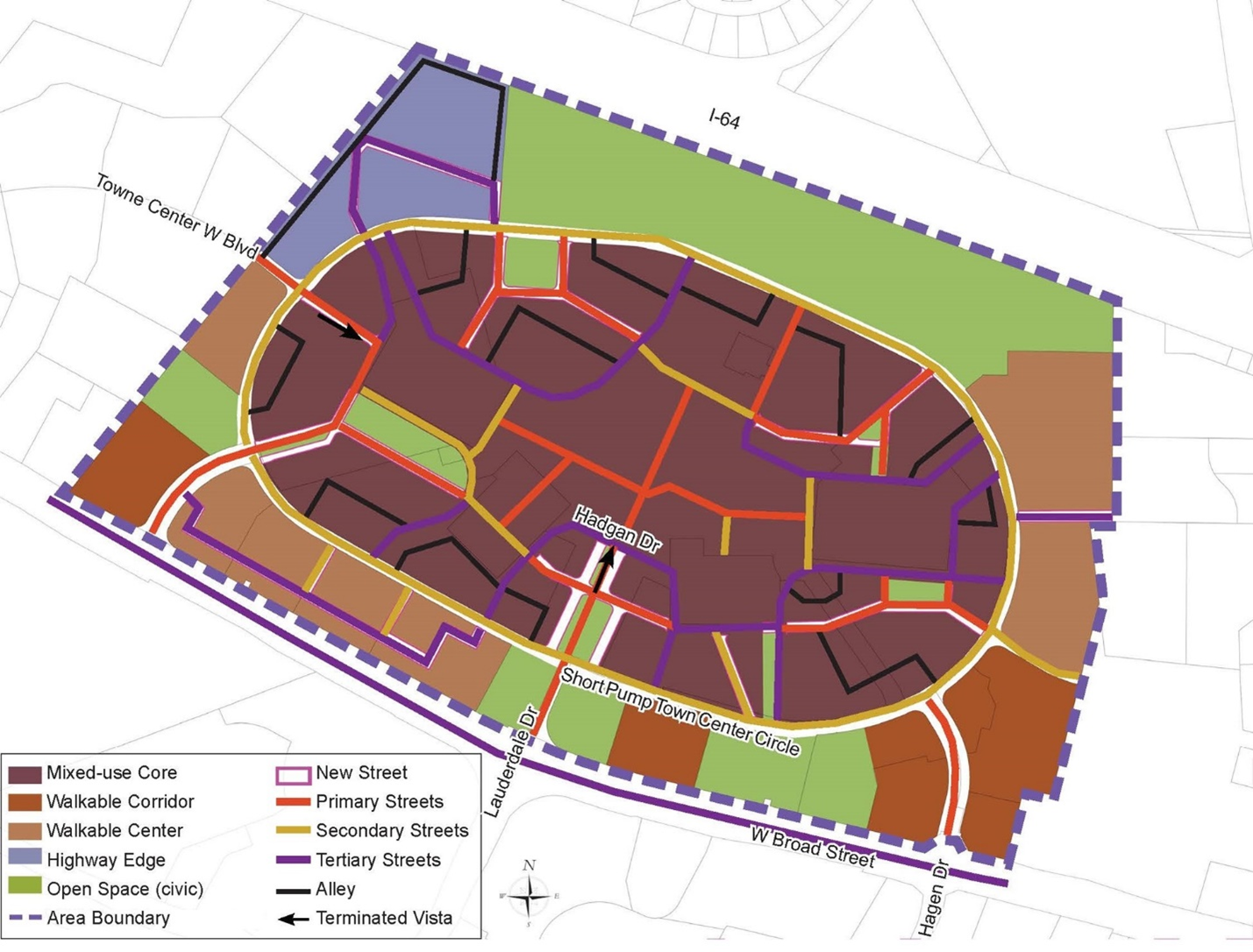
(Ord. No. 1335, § 33, 11-12-2024)
Editor's note— Ord. No. 1335, § 33, adopted Nov. 12, 2024, renumbered § 24-3877 as § 24-3878.
Sec. 24-3879. - Short Pump Town Center Subdistrict: Additional Standards.
A.
Primary Streets. Primary Streets identified on Figure 3878 may be pedestrian only streets where vehicles are not allowed. Such streets must be at least 20 feet wide.
B.
Mixed Use Requirement.
1.
In the Mixed-Use Core Development Area of the Short Pump Town Center Area Subdistrict, a minimum of 25 percent of the building floor area must be developed or reserved for nonresidential uses.
2.
In the Short Pump Town Center Area Subdistrict overall, a minimum of 10 percent of the building floor area must be developed or reserved for nonresidential uses.
3.
The Board of Supervisors may reduce or waive the requirements of this subsection through approval of a provisional use permit in accordance with Sec. 24-2306, Provisional Use Permit.
(Ord. No. 1335, § 34, 11-12-2024)
Editor's note— Ord. No. 1335, § 34, adopted Nov. 12, 2024, renumbered § 24-3878 as § 24-3879.