
Irvine City Zoning Code
Division 9
PLANNING AREAS
CHAPTER 9-1.- PLANNING AREA 1 (ORCHARD HILLS)[1]
Editor's note— Ord. No. 09-02, § 3, adopted March 24, 2009, amended the Code by amending the title of Chapter 9-1.
CHAPTER 9-2.- PLANNING AREA 2 (RESERVED)[2]
Editor's note— Ord. No. 05-12, § 1, adopted June 28, 2005, amended the Code by repealing former ch. 9-2, §§ 9-2-1—9-2-5, in its entirety. Former ch. 9-2 derived from the Code of 1976, §§ V.E-802.1—V.E-802.5; Ord. No. 92-3, adopted April 14, 1992; Ord. No. 95-4, adopted May 9, 1995; Ord. No. 95-22, adopted November 28, 1995.
CHAPTER 9-3.- PLANNING AREA 3 (LIMESTONE CANYON-OPEN SPACE)[3]
Editor's note— Ord. No. 09-02, § 3, adopted March 24, 2009, amended the Code by amending the title of Chapter 9-3.
CHAPTER 9-6.- PLANNING AREA 6 (PORTOLA SPRINGS)[4]
Editor's note— Ord. No. 09-02, § 3, adopted March 24, 2009, amended the Code by amending the title of Chapter 9-6.
CHAPTER 9-7.- RESERVED[5]
Editor's note— Ord. No. 09-02, § 3, adopted March 24, 2009, amended the Code by repealing former ch. 9-7, §§ 9-7-1—9-7-5. Former ch. 9-7 pertained to Planning Area 7, and derived from the Code of 1976, § V.E-807.1—V.E-807.5; Ord. No. 92-3, adopted April 14, 1992; Ord. No. 95-4, adopted May 9, 1995; and Ord. No. 95-22, adopted November 28, 1995.
CHAPTER 9-9.- PLANNING AREA 9 (WOODBURY (9A); STONEGATE (9B))[6]
Editor's note— Ord. No. 12-09, § 3(Exh. A), adopted May 22, 2012, amended the Code by amending the title of Chapter 9-9.
CHAPTER 9-16.- PLANNING AREA 16 (QUAIL HILL - OPEN SPACE)[7]
Editor's note— Ord. No. 09-02, § 3, adopted March 24, 2009, amended the Code by amending the title of Chapter 9-16.
CHAPTER 9-18.- PLANNING AREA 18 (LAGUNA ALTURA)[8]
Editor's note—Ord. No. 12-09, § 3(Exh. A), adopted May 22, 2012, amended the Code by amending the title of Chapter 9-18.
CHAPTER 9-26.- RESERVED[9]
Editor's note— Per city request and keeping consistent with City Council Resolution 97-90, Chapter 9-26, Planning Area 26 (Bonita Canyon) is removed. This area is now in the City of Newport Beach.
CHAPTER 9-28.- PLANNING AREA 28 (BOMMER CANYON OPEN SPACE)[10]
Editor's note— Ord. No. 09-02, § 3, adopted March 24, 2009, amended the Code by amending the title of Chapter 9-28.
CHAPTER 9-29.- PLANNING AREA 29 (UNIVERSITY OF CALIFORNIA, IRVINE - NORTH CAMPUS)[11]
Editor's note— Ord. No. 09-02, § 3, adopted March 24, 2009, amended the Code by amending the title of Chapter 9-29.
CHAPTER 9-30.- RESERVED[12]
Editor's note— Chapter 9-30 is removed to be consistent with City Council Ordinance No. 13-07, which rezoned the entire Planning Area 30 to 8.1 Trails and Transit Oriented Development and included this area to be part of Planning Area 51. See Code Comparative Table for complete derivation.
CHAPTER 9-33.- PLANNING AREA 33 (IRVINE SPECTRUM CENTER)[13]
Editor's note— Ord. No. 09-02, § 3, adopted March 24, 2009, amended the Code by amending the title of Chapter 9-33.
*Note—Planning Area 33 is covered by a development agreement. Please see this Chapter 9-33 and the zoning ordinance in effect on the effective date of the development agreement, October 13, 1983.
CHAPTER 9-34.- PLANNING AREA 34 (IRVINE SPECTRUM 5)[14]
Note— Planning Area 34 was originally covered by Vesting Tentative Parcel Map No. 87-TP-0356. Please see this Chapter 9-34, the zoning ordinance in effect at the time the application for the vesting tentative map was deemed complete, September 26, 1987, and the zoning ordinance in effect at the time the parcel map was approved, August 22, 1990.
CHAPTER 9-36.- PLANNING AREA 36 (IRVINE BUSINESS COMPLEX)[15]
Editor's note— Ord. No. 10-07, § 9(Exh. B), adopted July 27, 2010, amended Chapter 9-36 in its entirety to read as herein set out. Former Chapter 9-36, §§ 9-36-1—9-36-18, pertained to similar subject matter. See Code Comparative Table for history.
CHAPTER 9-38.- PLANNING AREA 38 (WESTPARK II)[16]
Note— Planning Area 38 is covered by Vesting Tentative Tract Map No. 23465. Please see Chapter 9-38 of this ordinance and the zoning ordinance in effect at the time the tract map was approved, May 7, 1991.
CHAPTER 9-39.- PLANNING AREA 39 (LOS OLIVOS)[17]
Editor's note—Ord. No. 24-08, Exh. A, adopted May 28, 2024, amended chapter 9-39 in its entirety to read as herein set out. Former chapter 9-39, §§ 9-39-1—9-39-7, pertained to similar subject matter, and derived from Code 1976, § V.E-839.1—V.E-839.5; Ord. No. 92-3, 4-14-92; Ord. No. 95-4, 5-9-95; Ord. No. 95-22, § 3, 11-28-95; Ord. No. 05-13, § 4, 7-12-05; Ord. No. 06-05, § 6, 6-27-06; Ord. No. 12-09, § 3(Exh. A), 5-22-12; Ord. No. 22-08, § 6(Exh. A), 5-10-22.
CHAPTER 9-40.- PLANNING AREA 40 (CYPRESS VILLAGE)[18]
Editor's note— Ord. No. 12-09, § 3(Exh. A), adopted May 22, 2012, amended the Code by amending the title of Chapter 9-40 to read as herein set out.
CHAPTER 9-51.- PLANNING AREA 51 (GREAT PARK)[19]
Editor's note—Ord. No. 13-07, § 4(Exh. A), adopted December 10, 2013, amended Chapter 9-51 in its entirety to read as herein set out. Former Chapter 9-51, §§ 9-51-1—9-51-6, pertained to similar subject matter. See Code Comparative Table for complete derivation.
Sec. 9-0-1.- Planning areas.
A.
A planning area is defined as a contiguous unit of land which is bounded by natural or manmade features such as roads, ridgelines, canyons or streams. A planning area should be designed as an identifiable unit of land and should display a distinct character through landscaping, signs, fencing, architectural styles or natural features.
B.
Planning areas provide for coordinated planning and development through the use of zoning which is required in accordance with Division 3. Planning areas also provide a recognizable geographic unit which will retain a specific identity in the City's zoning documents. This division contains the zoning for each of the planning areas which are within the City's incorporated boundaries or sphere of influence.
C.
Each planning area chapter contains the following:
1.
Land use zoning map.
2.
Statistical analysis (specifying land use categories, General Plan and zoning designations, minimum and maximum number of dwelling units, and maximum square footage for nonresidential uses).
3.
Land use regulations for only Planning Areas 33, 34, 36 and 38. For all others, see Chapter 3-37.
4.
Development standards for only Planning Areas 33, 34, 36 and 38. For all others, see Chapter 3-37.
5.
Special development requirements.
D.
This division establishes 37 planning areas which are completely, or partly, within the City boundaries. In addition, space has been reserved for the planning area which is outside the City boundaries but is within the Irvine sphere of influence.
E.
The planning areas established and reserved by this division are depicted in Figure 9-0A and listed in Figure 9-0B. Figure 9-0B lists the planning areas in numerical order and indicates the section and name of the planning area.
(Code 1976, § V.E-800.1; Ord. No. 94-7, § 3, 6-14-94; Ord. No. 95-16, § 2, 10-10-95; Ord. No. 96-18, § 4, 12-10-96; Ord. No. 09-02, § 3, 3-24-09)
Sec. 9-0-2. - General development requirements.
A.
Whenever the regulations contained in Division 3 are less restrictive than the planning area zoning, the regulations of the planning area zoning shall take precedence.
B.
Whenever the regulations contained in Division 5 (Overlay Districts) are less restrictive than other regulations in this zoning ordinance, the regulations of the Overlay District shall take precedence.
C.
All development in the City shall comply with all applicable ordinances, resolutions and/or policies of the City, including, but not limited to, the following:
1.
Aircraft notification policy.
2.
Animal regulations.
3.
Building Code.
4.
California Environmental Quality Act procedures.
5.
Eucalyptus windrow preservation policy General Plan.
6.
Grading ordinance.
7.
Historical, archeological, and paleontological policies.
8.
Master environmental assessment.
9.
Noise ordinance.
10.
Park Code.
11.
Security Code.
12.
Subdivision ordinance.
13.
Sustainability in landscaping ordinance.
(Code 1976, § V.E-800.2; Ord. No. 94-7, § 3, 6-14-94; Ord. No. 95-16, § 2, 10-10-95; Ord. No. 96-18, § 4, 12-10-96)
Sec. 9-0-3. - Building intensity standards.
A.
Building intensity standards have been established for each planning area to ensure consistency with the land use element of the General Plan. The building intensity standards provide maximum square feet for nonresidential land use categories and minimum and maximum numbers of dwelling units for residential uses.
B.
Development proposals shall be reviewed for consistency with availability of remaining building intensity in the appropriate General Plan land use element category within the respective planning area. The building intensity standards provide maximum square feet for nonresidential land use categories and minimum and maximum numbers of dwelling units for residential uses.
C.
General Plan Land Use Element Objective A-4 Balanced Land Uses permits approval of institutional land uses that may exceed General Plan land use category development intensity maximums. Institutional land uses must meet specific General Plan criteria and be approved by the applicable approval body as "additive." Any approved "additive" institutional land uses may also exceed the established Building Intensity Standard identified in the applicable planning area statistical analysis table of the Zoning Code to be consistent with the General Plan.
D.
Areas zoned Development Reserve (1.2) must be rezoned to a zoning district category consistent with the General Plan prior to building intensity shown on the General Plan statistical tables.
(Code 1976, § V.E-800.3; Ord. No. 94-7, § 3, 6-14-94; Ord. No. 95-16, § 2, 10-10-95; Ord. No. 96-18, § 4, 12-10-96; Ord. No. 09-02, § 3, 3-24-09)
Sec. 9-0-4. - Irvine sphere of influence.
A.
The City's sphere of influence encompasses unincorporated territory that will be annexed and served by the City. Planning Area 3 is not within incorporated City boundaries but is within the City's sphere of influence.
B.
Land use authority and related regulatory activities for this planning area is controlled by the County of Orange. Additionally, land use authority and related regulatory activities for the University of California (Planning Area 50) is controlled by the State of California. Land use categories, acreage, and building intensities are based on the City of Irvine General Plan.
(Code 1976, § V.E-800.4; Ord. No. 94-7, § 3, 6-14-94; Ord. No. 95-16, § 2, 10-10-95; Ord. No. 96-18, § 4, 12-10-96; Ord. No. 97-05, 5-13-97; Ord. No. 00-02, § 4, 2-8-00; Ord. No. 09-02, § 3, 3-24-09; Ord. No. 12-09, § 3(Exh. A), 5-22-12)
FIGURE 9.0A
FIGURE 9-0B
Planning Area 3 is not within incorporated City boundaries but is within the City's sphere of influence. There are no planning areas with the numbers 2, 7, 37, and 41 through 49.
(Ord. No. 99-03, § 3, 2-9-99; Ord. No. 00-02, § 4, 2-8-00; Ord. No. 01-10, § 3, 5-8-01; Ord. No. 02-06, 3-26-02; Ord. No. 03-13, § 9, 5-13-03; Ord. No. 09-02, § 3, 3-24-09; Ord. No. 12-09, § 3(Exh. A), 5-22-12)
Sec. 9-1-1.- Land use zoning map.
(See Planning Area 1 map following Section 9-1-5.)
(Code 1976, § V.E-801.1; Ord. No. 92-3, 4-14-92; Ord. No. 95-4, 5-9-95; Ord. No. 95-22, § 3, 11-28-95; Ord. No. 05-12, § 6, 6-28-05)
Sec. 9-1-2. - Introduction.
Planning Area 1 is bounded by the Lomas de Santiago ridge to the north, future Jeffrey Road to the east, Jamboree Road to the west, and Portola Parkway to the south.
(Code 1976, § V.E-801.2; Ord. No. 92-3, 4-14-92; Ord. No. 95-4, 5-9-95; Ord. No. 95-22, § 3, 11-28-95; Ord. No. 05-12, § 6, 6-28-05)
Sec. 9-1-3. - Statistical analysis.
*ROW for SR-241/SR-133 is excluded from acreage calculations.
1 Unallocated dwelling units represent those units remaining in a planning area that may be built anywhere in the same planning area. These units are within the maximum development intensity for the planning area; and, therefore, placement of unallocated dwelling units into any residential category within the planning area for purposes of development is determined to be consistent with the General Plan and Zoning Code with regard to intensity allocation only, provided that placement is otherwise consistent with site specific zoning regulations and that any potential environmental impacts are adequately addressed, including traffic impacts, pursuant to CEQA.
2 See Section 9-0-3.C, Building Intensity Standards.
(Code 1976, § V.E-801.3; Ord. No. 92-3, 4-14-92; Ord. No. 95-4, 5-9-95; Ord. No. 95-22, § 3, 11-28-95; Ord. No. 05-12, § 6, 6-28-05; Ord. No. 08-12, § 3, 9-9-08; Ord. No. 12-09, § 3(Exh. A), 5-22-12)
Sec. 9-1-4. - Land use regulations.
See Section 3-3-1 (Land use matrix).
(Code 1976, § V.E-801.4; Ord. No. 92-3, 4-14-92; Ord. No. 95-4, 5-9-95; Ord. No. 95-22, § 3, 11-28-95)
Sec. 9-1-5. - Development standards.
(City-wide regulations can also be found in Division 3.)
Individual project densities in 2.2D may exceed 6.5 dwelling units/net acre. However, no individual project may exceed 31.0 dwelling units/net acre and the overall density within all of 2.2D cannot exceed 6.5 dwelling units/net acre. For individual residential projects within 2.2D, the development standards to be applied shall depend on the actual net density of the individual residential product as follows:
1.
For projects from 0 to 6.5 dwelling units per net acre, Section 3-37-13 development standards shall apply.
2.
For projects from 6.6 to 12.5 dwelling units per net acre, Section 2-37-14 development standards shall apply.
3.
For projects from 12.6 to 31.0 dwelling units per net acre, Section 3-37-15 development standards shall apply.
(Code 1976, § V.E-801.5; Ord. No. 92-3, 4-14-92; Ord. No. 95-4, 5-9-95; Ord. No. 95-22, § 3, 11-28-95; Ord. No. 05-12, § 6, 6-28-05)
Sec. 9-1-7. - Special development requirements.
1.
Affordable housing. The affordable housing needs goal of 15% (5% Income 1, II; 5% income III; and 5% Income IV) of the actual number of units built in Planning Area 1 shall be implemented through the master affordable housing program for Planning Areas 1, 2, 5B, 8A and 9 as adopted by the City Council on March 11, 2003. The achievement of the Income I, II and III affordable housing goals is contingent upon the availability of financial incentives which bridge the gap between the actual cost of construction of a market unit and an affordable unit. The City will provide available financial assistance to help achieve the affordable housing needs goal for these planning areas.
2.
Boundary definitions. The precise Preservation District boundary and SR-241/261 ROW will be defined through the Master Plan process in accordance with Chapter 2-17 and Chapter 8-13 of the Zoning Code and/or the subdivision process per Division 5 of Title 5 of the Municipal Code.
3.
Hillside Master Plan. In accordance with Zoning Code Chapter 5-4, a Master Plan has been prepared for Planning Area 1 which demonstrates how the provisions of the General Plan and Hillside Overlay District will be implemented. The Master Plan includes all concept plan requirements in accordance with Chapter 2-8. Approved Master Plan documents, or modifications thereto pursuant to Chapter 2-19, shall be used as the standard of review for all subsequent applications submitted for Planning Area 1. A subsequent Master Plan application in accordance with Zoning Code Chapter 2-17 or its equivalent will be submitted for each development project to address the location of structures and parking and for residential grading.
4.
Parks. The location of two public neighborhood parks are conceptually shown on Exhibit A. Private parks will also be provided in order to meet local park requirements. At the time of approval of the first tentative tract map for residential purposes within Planning Area 1, a park plan as defined in Section 2-22-2 of the zoning ordinance shall be approved establishing the exact number, precise location, configuration, ownership, and size of community and neighborhood parks and the distribution of public and private parks. The park plan shall also establish construction phasing of all parks in conjunction with residential development.
a.
Community park. The community park requirement for PA 1 will be satisfied by the dedication of parkland and/or construction of park improvements consistent with the Community Parks Park Plan (case number 00321912-PPP) as may be amended from time to time.
b.
Neighborhood park. The exact number, precise location, configuration and size of local neighborhood parks and the distribution of public and private parks will be established at the time of approval of tentative tract maps for residential portions of Planning Area 1 in accordance with the subdivision ordinance, park and recreation element, and Local Park Code.
5.
Maximum dwelling units. Notwithstanding the provisions of Section 9-1-3, a maximum of 297 dwelling units may be transferred into Planning Area 1 from Planning Area 9 and/or Planning Area 40. It is the intent of this provision to facilitate a level of development that remains within the total number of dwelling units authorized by the North Irvine Transportation Mitigation Implementing Development Agreement between the City of Irvine and the Irvine Company. The transfer of units described in this Section will be subject to approval of one or more subdivision maps, which will require the preparation of appropriate NITM-level traffic impact analysis. The units transferred pursuant to this Section shall not be allocated toward multifamily development; they shall be restricted to single family development only. Approval of the transfer of units will be required for receiving areas and will be appropriately and administratively noted in Sections 9-13, 9-1-7, 9-9-3, 9-9-7, 9-40-3 and 9-40-7, as applicable.
6.
Local Residential Streets. In the interest of reducing grading and maintaining open space, local residential streets and collectors in the Low Density zones will be private and will conform to City standards except as follows:
a.
In order to minimize grading the City Engineer, on a case-by-case basis, shall approve that limited portions of local streets for cul-de-sacs may have a centerline radius less than 250 feet.
b.
Subject to approval by the City Engineer on a case-by-case basis, a sidewalk shall be required on only one side of local streets provided that appropriate pedestrian crossings are provided where sidewalks are terminated. Sidewalks shall be placed along the side of any street where curbside parking is allowed.
c.
In order to minimize grading, the City Engineer, on a case-by-case basis, shall approve short sections of these roadways at grades up to 10 percent.
7.
Pedestrian links. Sidewalks will be located on public streets in accordance with City plans and guidelines. Sidewalks are required on both sides of private local streets unless there is no development or curbside parking proposed. There will be appropriate pedestrian crossings for areas where sidewalks are terminated. Pedestrian walks shall link commercial sites, schools, parks and residential neighborhoods.
8.
Village theme. The architectural design shall address detail articulated on all sides of the structures visible from streets, paseos, and other public areas. Particular attention shall be given to windows, balconies, doors, and other design elements. The elements and qualities which shall be encouraged are human scale and privacy, play of light using shade and shadows to provide relief, and variations in roof lines. Large blank walls with minimal detail shall be discouraged.
9.
Residential/community commercial architecture. A variety of architectural styles and forms will be used to express differences among projects and neighborhoods within the planning area. Variations of the following techniques may be used by the developer:
a.
Overall form: Employ symmetry at front facades or around entries to create balance in the overall form. Discourage entry view corridors terminating at blank walls and/or blank building elevations. Screen elevations of multifamily structures with exterior walkways serving as common access for dwellings on second and third floors from public rights-of-way either through building orientation, architecture or landscaping.
b.
Roof form: Vary roof massing with a strong cornice line. Barrel, flat, shake, and slate concrete tile will be used predominantly with a variety of earthtone colors.
c.
Details: Use simple cornices, moldings, projections and recesses, and integral-colored accent materials such as ceramic tile, brick (stone or painted stucco).
d.
Site design: Provide terraces, plazas, arcades, colonnades, and pergolas to define pedestrian areas.
e.
Building heights along arterial roadways: Limit residential structures adjacent to arterial roadways to two stories.
10.
Slope zone. In accordance with Zoning Ordinance Chapter 5-4, Hillside Overlay District, Planning Area 1 has been determined to be in Slope Zone 2. Mass grading is allowed, landforms may be modified, and level building sites and retaining walls are permitted.
11.
Preservation zone grading. Grading for infrastructure, drainage, remediation, flood control, slope stabilization, fuel modification, trails, and habitat enhancements may occur within preservation zones which are not located in the NCCP Reserve.
12.
Transition zones. The transition zone as defined in the open space and conservation element will be coterminus with a fuel modification zone at the boundary of residential development and open space. Transition zones shall not be located within the NCCP Reserve. The width and treatment of this zone shall be adapted to slope condition, vegetation and land use in consultation with fire authorities and consistent with EIR mitigation measures and applicable NCCP requirements.
13.
Eucalyptus trees. The existing eucalyptus windrows in PA 1 will be retained in median landscaping, landscaped setbacks, parks, trails, agriculture areas and areas adjacent to open space to the extent trees are deemed sufficiently healthy for preservation in accordance with a survey conducted by a certified arborist pose no safety concerns, and do no conflict with fuel modification zones, roads, utilities, drainages and other infrastructure improvements. Existing eucalyptus windrows in preservation areas are incompatible with native vegetation and will not be maintained or replaced; they may be removed at the discretion of the landowner.
14.
Alternative setback standards. In conjunction with any discretionary application, alternative setback standards for projects internal to the planning area may be reviewed and approved by the Planning Commission. A description of the proposed setbacks and how they differ from existing standards shall be submitted. The Planning Commission will consider the following criteria and make the appropriate findings, if necessary:
a.
General character: Relationship in scale, bulk, coverage and density with surrounding land uses.
b.
Quality of life: Whether the proposed alternative standard will result in an adverse impact on existing neighborhoods.
c.
Suitability: The physical suitability of the site for the proposed project.
d.
Limitations: Such setbacks shall not be used to deviate from setbacks established for village edges.
15.
Preservation area/NCCP Reserve dedication.
a.
Prior to or concurrent with the recordation of the first subdivision map in PA 1, the applicant shall record an offer of dedication in favor of the City for Dedication Areas "A&B" in PA 1 as generally depicted on Exhibit B. Such offer will be in compliance with Sections 8-14 and 8-23 and may be accepted by the City no sooner than 90 days following issuance of 75 percent building permits for dwelling units and 75 percent of the square footage for nonresidential structures in PA 1.
b.
Concurrent with the recordation of the final builder subdivision map abutting Dedication Area B-1, the applicant shall record an offer of dedication in favor of the City for Dedication Area B-1 as generally depicted on Exhibit B. Such offer will be in compliance with Sections 8-14 and 8-23 except that the offer may be accepted by the City immediately after recordation.
c.
Concurrent with the recordation of the final builder subdivision map abutting Dedication Area B-2, the applicant shall record an offer of dedication in favor of the City for Dedication Area B-2 as generally depicted on Exhibit B. Such offer will be in compliance with Sections 8-14 and 8-23 except that the offer may be accepted by the City immediately after recordation.
d.
Prior to or concurrent with the recordation of the first subdivision map in PA 9, the applicant shall record an offer of dedication in favor of the City for the Preservation Area "P" in PA I shown on Exhibit B. Such offer will be in compliance with Section 8-14-1 and may be accepted by the City no sooner than 90 days following issuance of 75 percent building permits for dwelling units and 75 percent of the square footage for nonresidential structures in PA 9.
(1)
Any trails in the NCCP Reserve and/or preservation area will be designed, constructed, owned and maintained by the City of Irvine with the exception of the design and construction of trailhead improvements as set forth in Paragraph 17 below.
(2)
Because the NCCP Reserve and Preservation category are co-terminus in Preservation Area "P," the NCCP shall serve as the Open Space and Management Plan required under Section 2-21-2.
16.
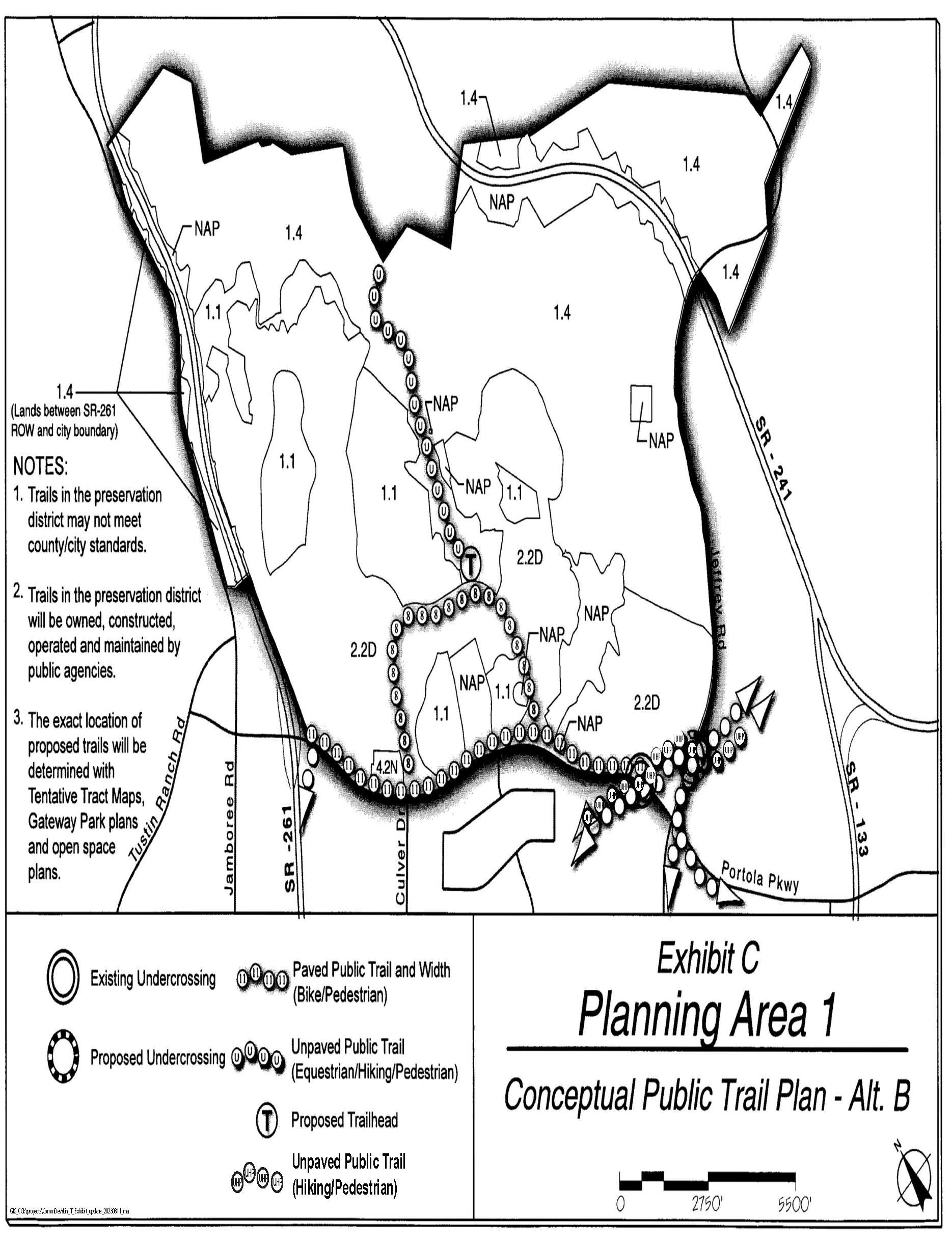
Master trails plan. Prior to approval of the first tentative tract map within this planning area, the applicant shall submit a master trails plan. If the project is phased, and the first tentative tract map does not include the entire Planning Area, a subsequent master trails plan will be required for the areas outside the first map. Such a subsequent trails plan will be consistent with the master trails plan requirements below. Trails through the Preservation District shall not be a part of the master trails plan. The master trails plan shall be submitted for review by the Community and Library Services Commission and approved by the Planning Commission. The plan shall address the following:
a.
Locations of public and private trails and linkages, ownership and maintenance of private trails (including opportunities for non-paved trails), public viewpoints, signage, fencing concepts, and construction phasing of trails and trailhead.
b.
Location and means by which access to dedicated public open space will be controlled and managed by the City through fencing or other means.
c.
Location and means by which access to dedicated public open space will be controlled and managed by the City through fencing or other means.
d.
Consistency with public trails as generally depicted on Exhibit C. All public trails are intended to be owned, operated, and maintained by the City of Irvine. The applicant will construct trails within Residential Districts. The City will be responsible to construct trails within the Preservation District.
(1)
The applicant shall construct a Class I bicycle trail as well as a hiking trail from the existing Portola undercrossing to the proposed Jeffrey undercrossing as generally depicted on Exhibit C.
(2)
At the time Jeffrey Road is constructed north of Portola, a bicycle trail and hiking trail will be merged and constructed as one paved trail under Jeffrey Road to accommodate connection with the Jeffrey Open Space Trail.
(3)
The applicant shall construct an eight-foot-wide bicycle/pedestrian trail along the north side of the local street as generally shown on Exhibit C.
(4)
The applicant shall construct an 11-foot-wide bicycle/pedestrian trail on the north side of Portola Parkway from the Portola undercrossing to SR-261 as generally shown on Exhibit C.
e.
In conjunction with the tentative tract maps for residential areas immediately adjacent to Rattlesnake Reservoir, the applicant shall demonstrate that vista points overlooking the reservoir can be accommodated within the development area.
f.
The applicant will also submit a trail study in conjunction with the first builder level subdivision map adjacent to the Rattlesnake Reservoir, which evaluates the feasibility of a hiking trail around the reservoir. The plan will be prepared in consultation with the City and IRWD and include constraints such as operational and safety issues associated with the operation of the reservoir and applicable environmental regulations associated with the NCCP Reserve. The study will demonstrate how the City portion of the trail in Dedication District P will connect to the private residential neighborhoods adjacent to the reservoir to facilitate completion of the intended loop system and appropriate trail improvements to facilitate its use consistent with applicable constraints identified in the study. The study will include an implementation plan identifying roles and responsibilities to accomplish the loop trail. It is understood that the City will be responsible for obtaining the necessary permits for the public portion of the trail.
17.
Trailhead. Prior to approval of the first residential tentative tract map, the applicant shall provide a design concept plan of a trailhead approved by the Director of Community and Library Services, for access to the public open space, located as generally shown on Exhibit C. The applicant will dedicate land and construct a public trailhead of a minimum 1.5-acre. The total improvements shall be restroom/staff office building (approximately 750 square feet), 16—20 parking stalls (including some pull-through stalls), two picnic tables, two benches, bike rack, hose bib, drinking fountain, monument signage, vehicular security gate, trash cans, kiosk or covered bulletin board, security lighting, and public allweather vehicular access roads.
18.
Open Space Conservation and Management Plan. Because Preservation Areas "A" and "B" are entirely with the NCCP Reserve, the NCCP shall serve as the Open Space Conservation and Management Plan required under Section 2-21-2.
19.
Child care. The need for child care facilities shall be recognized in the development of Planning Area 1. Prior to the approval of the first tentative tract map for the residential portion of this planning area, the number of private sector child care slots to be provided will be determined by the City and the developer in accordance with the City policy in effect at that time. The number of slots will be based on the actual number of residential units to be built and on a determination of child care needs within the planning area.
Prior to the approval of the first tentative tract map for the residential portion of this planning area, the applicant shall address the following when locating any child care center:
a.
The location of any child care center(s) shall be determined.
b.
The size of any parcel that is designated for a potential child care center.
c.
Child care centers shall be compatible with adjacent uses. Development of a child care center in conjunction with proposed elementary schools and adjacent to neighborhood parks, residential developments and/or neighborhood commercial centers shall be encouraged.
In locating a child care center, the proposed site shall be evaluated with regard to factors that might be detrimental to public health, safety, or welfare, including, but not limited to, proximity to high-traffic-volume roadways, hazardous materials, and major generators of traffic.
20.
Hicks Canyon Wash open space spine. Notwithstanding the provisions of Section 8-19-1.C of the Zoning Code, the spine shall consist of dual trails only as set forth in Section 9-1-7.16. Subject to the approval of the Orange County Flood Control District, Army Corps of Engineers, and State Department of Fish and Game, the entire wash through PA 1 will be relocated underground.
21.
Vehicle gates. Use of vehicle gates shall be permitted consistent with terms contained in the Memorandum of Understanding titled "Memorandum of Understanding ("MOU") Concerning the Use of Vehicle Control Gates for Future Residential Communities in the Northern Sphere" dated July 13, 2004.
22.
Sustainable community and green building. Prior to the approval of the first Master Plan in Planning Area 1, The Irvine Company will provide a report to the City describing the voluntary green building and sustainable features that will be employed and/or offered as building options in the construction of residential buildings which exceed current building, energy or State adopted standards.
(Ord. No. 05-12, § 6, 6-28-05; Ord. No. 09-02, § 3, 3-24-09; Ord. No. 19-19, § 4(Exh. A), 1-28-20; Ord. No. 23-09, § 4(Exh. A), 5-23-23; Ord. No. 23-13, § 3(Exh. A), 7-11-23; Ord. No. 25-22, § 4, 9-9-25)
Sec. 9-3-1.- Land use zoning map.
(See Planning Area 3 map following Section 9-3-5.)
(Code 1976, § V.E-803.1; Ord. No. 92-3, 4-14-92; Ord. No. 95-4, 5-9-95; Ord. No. 95-22, § 3, 11-28-95)
Sec. 9-3-2. - Introduction.
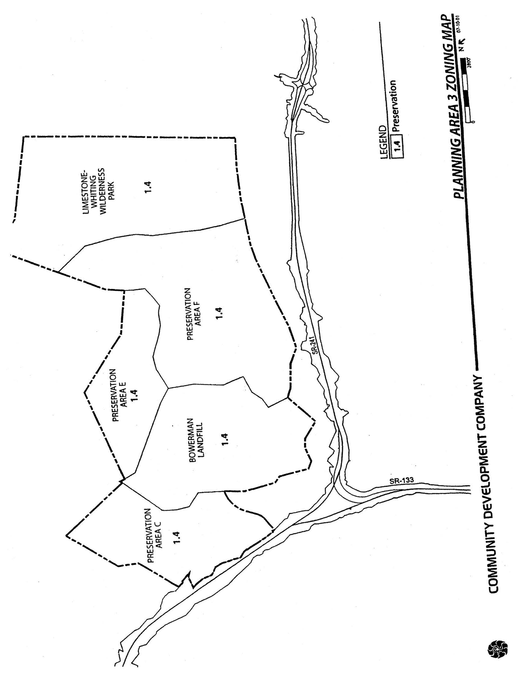
A.
Planning Area 3 is located in the northeastern corner of the City's sphere of influence. Boundaries include Jeffrey Road to the west, Lomas de Santiago Hills ridgeline to the north, City of Lake Forest to the east, and Planning Area 6 to the south.
B.
Precise acreage encompassing the Development Reserve and Conservation and Open Space Reserve land use designations are conceptual. The zoning area boundaries are generalizations based on topography and are subject to exact definition at the time of dedication and/or rezoning of the planning area.
(Code 1976, § V.E-803.2; Ord. No. 92-3, 4-14-92; Ord. No. 95-4, 5-9-95; Ord. No. 95-22, § 3, 11-28-95)
Sec. 9-3-3. - Statistical analysis.
1 Unallocated dwelling units represent those units remaining in a planning area that may be built anywhere in the same planning area. These units are within the maximum development intensity for the planning area; and, therefore, placement of unallocated dwelling units into any residential category within the planning area for purposes of development is determined to be consistent with the General Plan and Zoning Code with regard to intensity allocation only, provided that placement is otherwise consistent with site specific zoning regulations and that any potential environmental impacts are adequately addressed, including traffic impacts, pursuant to CEQA.
2 See Section 9-0-3.C, Building Intensity Standards.
(Code 1976, § V.E-803.3; Ord. No. 92-3, 4-14-92; Ord. No. 95-4, 5-9-95; Ord. No. 95-22, § 3, 11-28-95; Ord. No. 12-09, § 3(Exh. A), 5-22-12)
Sec. 9-3-4. - Land use regulations.
See Section 3-3-1 (Land use matrix).
(Code 1976, § V.E-803.4; Ord. No. 92-3, 4-14-92; Ord. No. 95-4, 5-9-95; Ord. No. 95-22, § 3, 11-28-95)
Sec. 9-3-5. - Development standards.
See Chapter 3-37 (Development Standards).
(Code 1976, § V.E-803.5; Ord. No. 92-3, 4-14-92; Ord. No. 95-4, 5-9-95; Ord. No. 95-22, § 3, 11-28-95)
Sec. 9-4-1.- Land use zoning map.
(See Planning Area 4 map following Section 9-4-3.)
(Code 1976, § V.E-804.1; Ord. No. 92-3, 4-14-92; Ord. No. 95-4, 5-9-95; Ord. No. 95-22, § 3, 11-28-95; Ord. No. 97-06, 5-13-97; Ord. No. 03-32, § 5, 11-18-03)
Sec. 9-4-2. - Introduction.
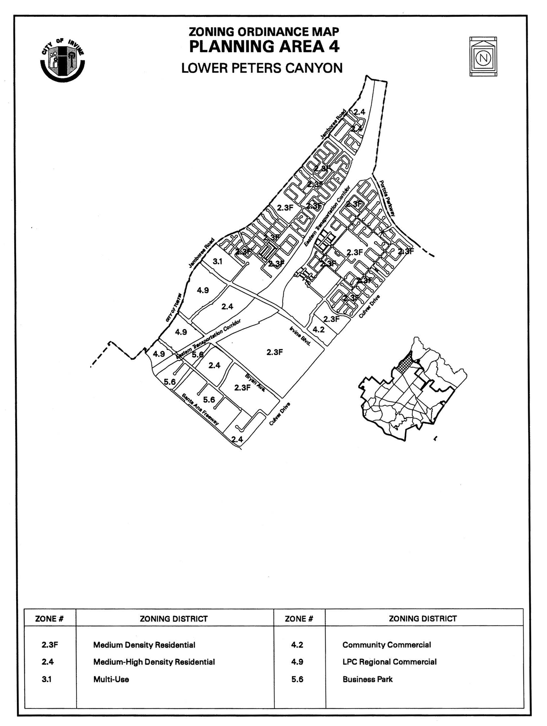
A.
Planning Area 4 is located in the northern portion of the City. Boundaries include Interstate 5 (Santa Ana Freeway) to the south, Jamboree Road to the west, Culver Drive to the east and Portola Parkway to the north. This boundary includes a small portion of land that extends north of Portola Parkway between Jamboree Road and the west leg of the Eastern Transportation Corridor.
B.
Standards for Planning Area 4 have been established through a development agreement between the City and the property owner approved November 26, 1996. These standards are based on a specific plan approved by the County prior to the City's annexation of Lower Peters Canyon or as modified pursuant to the development agreement.
(Code 1976, § V.E-804.2; Ord. No. 92-3, 4-14-92; Ord. No. 95-4, 5-9-95; Ord. No. 95-22, § 3, 11-28-95; Ord. No. 97-06, 5-13-97)
Sec. 9-4-3. - Statistical analysis.
*85,000 square feet refers to maximum square footage for commercial uses. All uses shall not generate more than 12,250 ADT unless additional environmental documentation ensures traffic mitigation.
1 Unallocated dwelling units represent those units remaining in a planning area that may be built anywhere in the same planning area. These units are within the maximum development intensity for the planning area; and, therefore, placement of unallocated units into any residential category or category allowing residential uses within the planning area for purposes of development is determined to be consistent with the General Plan and Zoning Code with regard to intensity allocation only, provided that placement is otherwise consistent with site specific zoning regulations and that any potential environmental impacts are adequately addressed, including traffic impacts, pursuant to CEQA.
2 See Section 9-0-3.C, Building Intensity Standards.
3 Density bonus units. These units are not considered additive.
4 LPC is the Lower Peter's Canyon Village.
(Code 1976, § V.E-804.3; Ord. No. 92-3, 4-14-92; Ord. No. 95-4, 5-9-95; Ord. No. 95-22, § 3, 11-28-95; Ord. No. 97-06, 5-13-97; Ord. No. 00-15, § 4, 1-9-01; Ord. No. 03-02, § 4, 1-14-03; Ord. No. 03-32, § 5, 11-18-03; Ord. No. 10-04, § 3, 4-13-10; Ord. No. 12-09, § 3(Exh. A), 5-22-12; Ord. No. 23-11, § 6(Exh. A), 6-13-23)
Sec. 9-4-4. - Land use matrix.
Notes:
(1)
Demonstration only.
(2)
If within restaurants.
(3)
After July 1, 2005.
(4)
If the 20-acre site set aside for the Tustin Unified School District is not used for school purposes.
(5)
As defined in Section 9-4-7.A.9.
(6)
As defined in Section 9-4-7.B.1.d.
(7)
This land use generates traffic trips the same as office, administrative, in the Irvine Business Complex and in the remainder of the City.
(8)
See Chapter 3-26 for specific accessory dwelling unit requirements.
(9)
Subject to approval of a Master Plan.
(10)
As determined by the City of Irvine, a traffic analysis shall be submitted to determine if on-site and offsite improvements must be made conditions of the project's discretionary approval.
(11)
Use is permitted by right when less than 175,000 square feet of the building's gross square footage is used for warehouse purposes. A traffic study shall be required for this use, and it shall be required for this use, and it shall identify specific on-site and off-site circulation improvements necessary to mitigate the impacts of the projected future development, which shall be implemented prior to and concurrent with the project's construction. In the event identified circulation improvements are not timely constructed, permits required for the project may be withheld and/or a project may be subject to code enforcement or other legal action.
(12)
Use requires an administrative use permit when 175,001 to 225,000 square feet of the building's gross square footage is used for warehouse purposes and a conditional use permit when equal to or more than 225,001 square feet of the building's gross square footage is used for warehouse purposes.
(13)
A private school for adults (18 years and older) that proposes to locate in an existing permanent building and meets all the general development standards will require an administrative use permit (AUP).
(14)
An alternative school that proposes to locate in an existing permanent building and meets all the general development standards will require an administrative use permit (AUP).
(Code 1976, § V.E-804.4; Ord. No. 92-3, 4-14-92; Ord. No. 95-4, 5-9-95; Ord. No. 95-22, § 3, 11-28-95; Ord. No. 97-06, 5-13-97; Ord. No. 99-14, § 2, 6-8-99; Ord. No. 05-16, § 2, 7-12-05; Ord. No. 10-04, § 3, 4-13-10; Ord. No. 13-08, § 2(Exh. A), 1-14-14; Ord. No. 18-05, Exh. A, 4-24-18; Ord. No. 23-11, § 6(Exh. A), 6-13-23; Ord. No. 25-04, Exh. A, 4-8-25; Ord. No. 25-06, § 2(Exh. A), 4-8-25; Ord. No. 25-18, § 2(Exh. A), 6-24-25; Ord. No. 25-22, 9-9-25)
Sec. 9-4-5. - General development requirements.
A.
Sectors.
1.
Description.
a.
Sectors, dividing the planning area into 11 subareas, have been established to allow for an intermediate level of planning. This intermediate level of planning is to be done in conjunction with the first subdivision or Master Plan within a sector (Exhibit 1).
2.
Review process.
a.
Prior to or concurrent with City approval of the first subdivision map (except maps for finance and conveyance purposes only) or Master Plan within each sector, the Planning Commission shall review and approve the following for the entire sector (pursuant to the criteria outlined in Section 9-4-5.A.3 below):
(1)
Ownership of landscape, natural open space and recreation areas.
(2)
Location, width, and treatment of riding and hiking trails within or contiguous to the site.
(3)
A list of any alternative development standards proposed as part of the application.
(4)
Location of significant vegetation and special site features, and an indication of the resources to be altered and the resources to be preserved.
(5)
Location of extensions of off-site roads, flood control facilities, or utilities to serve adjacent areas.
(6)
Existing and planned uses on adjoining and proximate lands.
(7)
Access to the project site and on-site pedestrian and vehicular patterns.
(8)
Sector(s), location, acreage, types of land use and estimated number of dwelling units (or square footages for each nonresidential use) within each sector and/or building site (if deemed applicable by the Director of Community Development).
(9)
A community design program which summarizes the design features of the area (i.e., signage design, fencing design, landscape themes, common landscape features (adjacent to arterials), eucalyptus windrow design/preservation concepts, architectural theme, and other community design features (if deemed applicable by the Director of Community Development)).
(10)
Regional riding and hiking and bicycle trail alignments and design concepts (if deemed applicable by the Director of Community Development).
(11)
Lower Peters Canyon open space spine and creek design concepts (if deemed applicable by the Director of Community Development).
(12)
Community park design concepts (size, access, relationship with adjacent land uses) (if deemed applicable by the Director of Community Development).
(13)
Ownership and maintenance responsibilities for public and private parks, recreation and open space uses (if deemed applicable by the Director of Community Development).
(14)
Access, parking, landscape and architecture themes consistent with the special use park for Sector 9 only (containing mixed-use development surrounding the special use park). This tract map may be approved without the completion of a County-approved general development plan for the special use park.
b.
The application for said subdivision map or Master Plan shall be accompanied by maps, text, or other documentation to satisfy the above requirements. The form and content of such submittals shall be made to the satisfaction of the Director of Community Development.
3.
Alternative development standards.
a.
If alternative development standards are proposed in conjunction with the Planning Commission approvals required by Section 9-4-5.A.2 above, a description of the proposed standards and how they differ shall be submitted. In addition, the Planning Commission will consider the following criteria prior to final action on the map, and make appropriate findings, if necessary:
(1)
General character. Relationship in scale, bulk, coverage and density with surrounding land uses.
(2)
Facilities. The availability of infrastructure facilities to serve the project.
(3)
Harmful effects. The harmful effects, if any, upon desirable neighborhood environments.
(4)
Traffic. The generation of traffic and its effect on the capacity and character of surrounding streets.
(5)
Noise. The existing and predictable future level and quantity of noise the property is subject to and the noise which would be generated by the proposed use.
(6)
Suitability. The physical suitability of the site for the proposed project.
B.
Interim land uses.
1.
Permitted uses.
a.
The existing uses within Planning Area 4, listed below, shall be considered permitted uses; provided, however, that said uses shall be limited to the existing size, scope and location at the date of annexation to the City of Irvine. Maintenance, replacement, and additions shall be permitted for existing uses within Planning Area 4.
(1)
Agriculture and associated uses;
(2)
Wholesale nursery;
(3)
Mobile home park (along Culver Drive).
2.
Temporary uses.
a.
The following temporary uses shall be permitted in conjunction with development in all sectors of the Lower Peters Canyon area:
(1)
Borrow and/or disposal sites and related construction/grading facilities subject to the provisions of the City of Irvine Grading Code; and
(2)
Model homes, real estate sales offices and construction offices or trailers, per administrative approval by the Director of Community Development.
b.
The following temporary and/or permanent use shall be prohibited in all sectors of the Lower Peters Canyon area:
(1)
Concrete recycling facilities.
(Code 1976, § V.E-804.5; Ord. No. 92-3, 4-14-92; Ord. No. 95-4, 5-9-95; Ord. No. 95-22, § 3, 11-28-95; Ord. No. 97-06, 5-13-97; Ord. No. 99-14, § 2, 6-8-99; Ord. No. 23-11, § 6(Exh. A), 6-13-23)
Sec. 9-4-7. - Special development requirements.
A.
Land use.
1.
Sector development intensity.
a.
The maximum dwelling units within Sector 1 (Medium-High Density Residential) shall not exceed 1,200 dwelling units.
b.
The maximum dwelling units within Sector 2 (Medium Density Residential) shall not exceed 2,040 dwelling units. Within Sector 2, individual projects may exceed 12.5 du's/acre provided that the sector total is not exceeded.
c.
The maximum dwelling units within Sector 3 (Medium-High Density Residential) shall not exceed 1,200 dwelling units.
d.
The maximum gross floor area within Sector 4 (Regional Commercial) shall not exceed 267,406 square feet and the maximum dwelling units shall not exceed 1,261 dwelling units.
e.
The maximum dwelling units within Sector 5 (Medium Density Residential) shall not exceed 2,910 dwelling units. Within Sector 5, individual projects may exceed 12.5 du's/acre provided that the sector total is not exceeded.
f.
The maximum gross floor area within Sector 6 (Community Commercial) shall not exceed 136,000 square feet.
g.
The maximum dwelling units within Sector 7 (Medium Density Residential) shall not exceed 1,200 dwelling units. Within Sector 7, individual projects may exceed 12.5 du's/acre provided that the sector total is not exceeded.
h.
The maximum gross floor area within Sector 8 (Business Park) shall not exceed 1,423,000 square feet. Maximum dwelling units within Sector 8 shall not exceed 422.
i.
The maximum gross floor area devoted to commercial use within Sector 9 (Multi-Use) shall not exceed 85,000 square feet. All uses within Sector 9 shall not generate more than 12,250 average daily trips (ADT) unless additional environmental documentation ensures traffic mitigation.
j.
The maximum gross floor area within Sector 10 (Regional Commercial) shall not exceed 388,000 square feet.
k.
The maximum dwelling units for medium density residential uses within Sector 11 shall not generate more than 2,830 ADT unless additional environmental documentation ensures traffic mitigation. The maximum dwelling units for Medium-High Density Residential uses within Sector 11 shall not exceed 840 dwelling units. Within Sector 11, individual projects may exceed 12.5 du's/acre provided that the sector total is not exceeded.
l.
The maximum dwelling unit and commercial square footage totals for each sector are calculated on a gross acreage basis and apply to the overall sectors and not any particular division of those sectors.
m.
Sector boundaries and acreages are approximate and shall be established by subdivision, Master Plan and/or conditional use permit approval.
n.
The total number of dwelling units for Planning Area 4 (Lower Peters Canyon) shall not exceed 8,937 units.
o.
Adjustments in sector boundaries resulting in an acreage change of 10 percent or more of the total sector for final street alignments, landscaping requirements, geotechnical or engineering refinements, site plans and/or tentative and/or final subdivision maps shall require approval from the Planning Commission.
p.
Adjustments in sector boundaries resulting in an acreage change of less than 10 percent of the total sector for final street alignments, landscaping requirements, geotechnical or engineering refinements, site plans and/or tentative and/or final subdivision maps shall require the approval of the Director of Community Development.
q.
Commercial sectors (Sectors 4, 6, and 10) may exceed the maximum gross floor area established for the sector by 10 percent provided that the total commercial square footage for Planning Area 4 does not exceed 876,406 square feet.
2.
Residential.
a.
No individual residential project (except affordable housing projects or projects in the 4.9 Lower Peters Canyon Regional Commercial district) shall exceed 25 dwelling units per gross acre.
b.
Reserved.
c.
Except for residential projects in the 4.9 Lower Peters Canyon Regional Commercial district, the affordable housing goals for Lower Peters Canyon shall be consistent with the Irvine Housing Element in effect on November 26, 1996. The City shall cooperate with the property owner to identify possible public funding programs for affordable housing within Lower Peters Canyon, and the property owner is encouraged to seek such funding as well.
(1)
In accordance with the Irvine Housing Element, neither the property owner nor any residential builder shall be required to provide any privately subsidized affordable housing, or apply for public financing for affordable housing, or reserve land specifically for affordable housing.
(2)
The affordable housing goals are not requirements or standards. The provision of ownership housing for moderate-income households (up to 120 percent of the median income) is encouraged.
(3)
Residential projects in the 4.9 Lower Peters Canyon Regional Commercial district shall be consistent with the Irvine Housing Element in effect at the time of project approval.
d.
Maximum height for fences and walls shall be in accordance with Chapter 3-35, Wall and Fence Standards.
e.
Private streets and driveways.
(1)
Streets or driveways serving four or less dwelling units and having no parking within the travelway shall have a minimum paved width of 12 feet for one-way traffic or 20 feet for two-way traffic.
(2)
Streets or driveways used primarily for access to garages or carports for more than four dwelling units and with no parking within the travelway shall have a minimum paved width of 12 feet for one-way traffic or 24 feet for two-way traffic.
(3)
Streets and driveways where on-street parking will be limited to one side only shall have a minimum paved width of 32 feet.
(4)
Streets and driveways with on-street parking permitted on both sides shall have a minimum paved width of 36 feet.
f.
Private motor courts.
(1)
Motor courts serving two to 12 cluster homes shall have a minimum paved width of 24 feet, excluding garage aprons and designated parking spaces.
(2)
Sidewalks are not required for private motor courts serving cluster homes.
(3)
Motor courts may include planting areas without raised curbs.
g.
Building massing.
(1)
As a goal, the property owner shall consider site planning techniques and architectural treatments to reduce the impact of building mass when processing Master Plans or conditional use permits for residential development adjacent to Bryan Avenue, Irvine Boulevard and Portola Parkway. Use of varied building heights, building articulation, landscaping, walls and fences, screening and other similar techniques may be employed to achieve the desired goal.
h.
Multifamily residential.
(1)
All storage, including cartons, containers or trash, will be shielded from view within a building or area enclosed by a wall not less than six feet in height. If unroofed, no such area will be located within setback areas or within 50 feet of any residential building.
(2)
All lights will be designed and located to minimize off-site impacts.
i.
Standards for all residential housing types within Planning Area 4, except in the 4.9 Regional Commercial zoning district which will be addressed through a master plan, are outlined in Sections 3-37-14 and 3-37-15. Standards for 4.9 Regional Commercial are found in Section 3-3728.
j.
A screen referred to in this section shall be the same as a "wall or fence" and conform to the following:
(1)
See Chapter, 3-35 Wall and Fence Standards.
(2)
See Chapter 3-15, Landscaping Standards.
3.
Regional Commercial (Sectors 4 and 10) (Commercial Uses only).
a.
All exterior and interior lighting shall be designed and located to confine direct rays to the site. Except for necessary security lighting, all lights shall remain off during nonbusiness hours.
b.
All loading and unloading shall be performed on the site. Loading platforms and areas shall be screened from view from adjacent streets, highways and residential areas.
c.
All commercial storage, including cartons, containers or trash, shall be screened from view within a building or area enclosed by a wall not less than six feet in height. If unroofed, no such area shall be located within setback areas or within 50 feet of any residential sector.
d.
Maximum height for fences and walls shall be in accordance with Chapter 3-35, Wall and Fence Standards.
e.
Mechanical equipment, such as, but not limited to, air conditioning, heating, and ventilation ducts and exhausts, placed on any roof shall be screened from view, where feasible, from abutting sections of streets or highways and/or painted to match building coloration.
4.
Community Commercial.
a.
All exterior and interior lighting shall be designed and located to confine direct rays to the site. Except for necessary security lighting, all lights shall remain off during nonbusiness hours.
b.
All loading and unloading shall be performed on the site. Loading platforms and areas shall be screened from view from adjacent streets, highways and residential areas.
c.
All storage, including cartons, containers or trash, shall be screened from view within a building or area enclosed by a wall not less than six feet in height. If unroofed, no such area shall be located within setback areas or within 50 feet of a residential sector (or, if a community facility is located within a residential sector, within 50 feet of any residential building).
d.
Maximum height for fences and walls shall be in accordance with Chapter 3-35, Wall and Fence Standards.
(1)
Mechanical equipment placed on any roof, including, but not limited to, air conditioning, heating, and ventilation ducts and exhausts, shall be screened from view, where feasible, from abutting sections of streets or highways and/or painted to match building coloration.
5.
Institutional.
a.
As provided in the Lower Peters Canyon development agreement, Planning Area 4 has a goal of providing 4,380 square feet of public facility institutional uses and 490,000 square feet of educational facility institutional uses. Such uses shall be permitted in every sector of Planning Area 4. Institutional uses consistent with this goal include:
(1)
Public and private schools.
(2)
Churches.
(3)
Utilities.
(4)
Public facilities.
(5)
Libraries.
(6)
Post offices.
(7)
Police stations.
(8)
Fire facilities.
(9)
Day care centers.
(10)
Hospitals.
(11)
Government offices.
(12)
Educational facilities.
(13)
Nonprofit housing.
(14)
Institutional residential.
b.
The maximum building site area for institutional uses within Planning Area 4 shall be the same as the district in which the use is established.
c.
The maximum building height for institutional uses within Planning Area 4 shall be the same as the district in which the use is established.
d.
Building setbacks for institutional uses within Planning Area 4 shall be the same as the district in which the use is established.
e.
All storage, including cartons, containers or trash, shall be screened from view within a building or area enclosed by a wall not less than six feet in height. If unroofed, no such area shall be located within setback areas or within 50 feet of a residential sector (or, if a community facility is located within a residential sector, within 50 feet of any residential building).
f.
Maximum height for fences and walls shall be in accordance with Chapter 3-35, Wall and Fence Standards.
(1)
A screen shall be installed along all site boundaries where the facility abuts residential areas. Except as otherwise provided, the screening shall be not less than five feet or more than seven feet in height.
(2)
Mechanical equipment placed on any roof, including, but not limited to, air conditioning, heating, and ventilation ducts and exhausts, shall be screened from view from abutting streets, highways, residential areas or open space uses.
6.
Multi-Use (Sector 9).
a.
All lighting shall be designed and located to minimize power consumption and to confine direct rays to the premises.
b.
All loading shall be performed on the site. Loading platforms and areas shall be screened from view from adjacent streets, highways and residential areas.
c.
All storage, including cartons, containers or trash, shall be shielded from view within a building area enclosed by a wall not less than six feet in height. If unroofed, no such area shall be located within setback areas or within 50 feet of any residential building.
d.
Screening, as described in Section 9-4-7.A.2.j (required screening is not counted as part of net usable acres):
(1)
Abutting residential areas. A screen shall be installed along all site boundaries where premises abut areas zoned for residential uses. Except where otherwise provided, the screening shall have a total height of no less than six feet and no more than seven feet. Where there is a difference in elevation on opposite sides of the screen, the height shall be measured from the highest elevation.
(2)
Streets and intersections. Screening along all streets and boundaries shall have a height of not less than 36 inches and not more than 42 inches within 20 feet of the point of intersection of:
(a)
A vehicular accessway or driveway and a street.
(b)
A vehicular accessway or driveway and a sidewalk.
(c)
Two or more vehicular accessways, driveways or streets.
(3)
Parking areas abutting arterial highways. A landscaped screen shall be installed along all parking areas abutting an arterial highway. Except as otherwise provided, the screening shall have height of not less than 36 inches and not more than 42 inches. Where there is a difference in elevation on opposite sides of the screen, the height shall be measured from the highest elevation.
(4)
Notwithstanding the requirements listed above, where the finished elevation of the property at the boundary line, or within five feet inside the boundary, is lower than an abutting property elevation, such change in elevation may be used in lieu of, or in combination with, additional screening to satisfy the screening requirements of this section.
(5)
All outdoor storage of materials and products shall be screened from view from adjacent residential areas and from adjacent streets and highways.
(6)
Mechanical equipment placed on any roof, such as, but not limited to, air conditioning, heating, and ventilating ducts and exhaust, shall be screened from view from any abutting street or highway and any abutting areas zoned for residential or open space uses within Planning Area 4.
e.
Except as otherwise established by an approved Master Plan, any permitted business operation shall be performed or carried out entirely within a building that is designed and constructed so that the enclosed operations and uses do not cause or produce a nuisance to adjacent sites, such as, but not limited to, the following: radio frequency interference, sound, vibration, electromechanical disturbance, electromagnetic disturbance, radiation, air pollution, dust, emission of toxic or nontoxic odors, or toxic or nontoxic matter.
7.
Business Park (Sector 8).
a.
All lighting shall be designed and located to minimize power consumption and to confine direct rays to the premises.
b.
All loading shall be performed on the site. Loading platforms and areas shall be screened from view from adjacent streets, highways and residential areas.
c.
Ail storage, including cartons, containers or trash, shall be shielded from view within a building area enclosed by a wall not less than six feet in height. No such area shall be located within setback areas or within 50 feet of any residential building unless overhead screening is provided.
d.
Screening, as described in Section 9-4-7.A.2.j (required screening is not counted as part of net usable acres):
(1)
Abutting residential areas. A screen shall be installed along all site boundaries where premises abut areas zoned for residential uses. Except where otherwise provided, the screening shall have a total height of no less than six feet and no more than seven feet. Where there is a difference in elevation on opposite sides of the screen, the height shall be measured from the highest elevation.
(2)
Streets and intersections. Screening along all streets and boundaries shall have a height of not less than 36 inches and not more than 42 inches within 20 feet of the point of intersection of:
(a)
A vehicular accessway or driveway and a street.
(b)
A vehicular accessway or driveway and a sidewalk.
(c)
Two or more vehicular accessways, driveways or streets.
(3)
Parking areas abutting arterial highways. A landscaped screen shall be installed along all parking areas abutting an arterial highway. Except as otherwise provided, the screening shall have height of not less than 36 inches and not more than 42 inches. Where there is a difference in elevation on opposite sides of the screen, the height shall be measured from the highest elevation.
(4)
Notwithstanding the requirements listed above, where the finished elevation of the property at the boundary line, or within five feet inside the boundary, is lower than an abutting property elevation, such change in elevation may be used in lieu of, or in combination with, additional screening to satisfy the screening requirements of this section.
(5)
Outdoor storage. All outdoor storage of materials and products shall be screened from view from adjacent residential areas in Lower Peters Canyon and from adjacent streets and highways.
(6)
Mechanical equipment. Mechanical equipment placed on any roof, such as, but not limited to, air conditioning, heating, and ventilating ducts and exhaust, shall be screened from view from any abutting street or highway and any abutting areas zoned for residential or open space uses within Planning Area 4.
e.
Except as otherwise established by an approved site plan, any permitted business operation shall be performed or carried out entirely within a building that is designed and constructed so that the enclosed operations and uses do not cause or produce a nuisance to adjacent sites, such as, but not limited to, the following: radio frequency interference, sound, vibration, electromechanical disturbance, electromagnetic disturbance, radiation, air pollution, dust, emission of toxic or nontoxic odors, or toxic or nontoxic matter.
8.
Service stations.
a.
Service stations, including those with the following associated uses, shall be permitted in Sectors 4, 6, 8, 9 and 10 subject to the approval of a conditional use permit by the Planning Commission:
(1)
Sale/installation of petroleum products, tires, batteries and related minor automotive accessories.
(2)
Minor automobile maintenance, e.g., tuneups, drive belt replacement, muffler/brake repair, electrical repair, washing, and lubricating services. (Heavy automobile repair involving major engine, transmission, drive train or similar work is prohibited.)
(3)
Convenience store ("mini-market") offering incidental food, packaged goods, and convenience items to the motoring public.
(4)
Any other use determined by the Director of Community Development to be consistent with the purpose and intent of this chapter.
b.
Development standards:
(1)
The maximum building height shall be 25 feet.
(2)
Building line regulations (measured from main building):
(a)
From ultimate right-of-way lines: 20 feet minimum.
(b)
From interior property lines: 25 feet from any property line abutting an area designated for residential uses. Ten feet from property lines abutting commercially designated areas.
(3)
All exterior and interior lighting shall be designed and located to confine direct rays to the site.
(4)
All storage, including cartons, containers or trash, shall be shielded from view within a building or area enclosed by a wall not less than six feet in height. No such area shall be located within setback areas or within 50 feet of any residential building unless overhead screening is provided.
(5)
All activities other than the sale of motor fuels and lubricants and washing of cars shall be contained in a completely enclosed structure.
(6)
Screening (as described in Section 9-4-7.A.2.j):
(a)
Screening along all streets shall be a minimum of 30 inches and a maximum of 42 inches in height.
(b)
Mechanical equipment placed on any roof, including, but not limited to, air conditioning, heating, and ventilation ducts and exhausts, shall be screened from view from abutting streets, highways or residential areas.
(c)
Service station uses shall be designed so that operations are shielded from public view. Pump stations and service bays shall be oriented away from public view and landscape berms shall be used as a screen (e.g., reverse bay, backs-up station).
c.
No portion of a service station site shall be utilized for automobile storage other than for temporary parking of an automobile being serviced or for temporary use by employees during working hours.
d.
Service stations which are closed for more than 12 consecutive months will be required to submit an application for a new conditional use permit prior to issuance of a new certificate of use and occupancy.
9.
Temporary uses and structures. The following temporary uses and structures are permitted in all land use categories throughout Planning Area 4:
a.
Residential tract sales and rentals.
(1)
Model homes, subject to the approval of the Director of Community Development.
(2)
Garages, attached and detached.
(3)
Temporary sales office building, or commercial coach.
(a)
When the proposed temporary real estate office is located so that the described parcel is less than 300 feet from any building site used for residential purposes, the proposed real estate office may be permitted subject to the approval of the Director of Community Development for a maximum time period of two years from the date of approval.
(b)
A building permit application for a temporary real estate office may be approved for a maximum time period of 18 months from the date of approval. The permit may be extended for one additional year if it is located more than 300 feet from any building site used for residential purposes.
(4)
Accessory buildings and accessory structures, minor.
(5)
Recreational facilities that will be a permanent portion of the subdivision.
(6)
Permanent streets and driveways that will be part of the subdivision after the abandonment of the real estate office use.
(7)
Temporary children's playgrounds.
(8)
Temporary and permanent fencing, walks and structural amenities.
(9)
Temporary vehicle parking and maneuvering areas to provide off-street parking as necessary for employees and guests.
(10)
Temporary vehicular accessways.
(11)
Signs in connection with the uses permitted above shall be permitted within a tract on the following conditions:
(a)
The sign copy shall be limited to matters relating to the tract within which the signs are located.
(b)
Signs shall have a time limit of existence concurrent with the use of the permitted temporary offices.
(c)
The maximum sign area for ground signs located at a street entrance shall be 64 square feet.
(d)
Additional signage, exclusive of signs allowed in (11)(c) above shall be in accord with Division 7; however, they shall not exceed a total sign area of 100 square feet.
b.
Construction office.
(1)
A temporary construction office during the construction of a main building on the same site shall be permitted upon the following conditions:
(a)
The construction office shall be removed or converted to a permitted use prior to the issuance of a certificate of use and occupancy for the main building or buildings.
(b)
If construction is phased over a length of time, the permit may provide that certificates of use and occupancy may be issued for completed buildings, except the last buildings to be completed, prior to removal or conversion of the temporary use.
c.
Commercial and noncommercial coaches.
(1)
A temporary commercial coach may be approved for a maximum of two years from the date of approval.
(2)
A cash bond in an amount to be determined by the Director of Community Development for each commercial coach unit shall be posted with the Director of Community Development, to guarantee the removal of each coach unit upon the expiration of the permit.
d.
Mobile home residence.
(1)
A temporary mobile home is permitted during the construction of a permanent dwelling in all Residential Districts within Planning Area 4 (Lower Peters Canyon).
(a)
The temporary mobile home shall be located on the same building site and concurrent with the construction of a permanent dwelling.
(b)
The mobile home shall be permitted for a period of time not to exceed one year, or until the issuance of a certificate of use and occupancy for the main building, whichever occurs first. Time extensions shall be subject to the approval of a conditional use permit by the Planning Commission.
(2)
A temporary mobile home, ancillary to an existing dwelling on the same building site, is permitted subject to a conditional use permit by the Planning Commission, in all Residential Districts and similar areas.
(a)
The application shall include evidence as necessary to explain the need and the temporary nature of the proposed use.
(b)
The application shall include a written guarantee that the mobile home will be removed and the property will be restored to its original state or to a permitted use within 60 days after the expiration date of the use permit.
(c)
The mobile home shall be permitted for a period of time not to exceed two years after the issuance of a certificate of use and occupancy for such use unless a shorter period of time is specified by the conditional use permit.
e.
Seasonal uses.
(1)
Seasonal land uses including Christmas tree sales facilities, Halloween pumpkin sales facilities, and off-site sales of single-season agricultural products shall be permitted subject to a seasonal use permit, as outlined in Chapter 2-27.
f.
Outdoor gatherings.
(1)
Special outdoor gatherings shall be permitted subject to a special event permit.
10.
Accessory uses and structures.
a.
See Section 1-2-1 for general definitions for accessory uses and accessory structures and Section 3-5-1 for accessory structures, minor development standards.
b.
Garages and carports.
(1)
The placement or construction of garages and carports on any building site used for residential purposes shall comply with the setback requirements for a main building except as otherwise specified as follows:
(a)
When the building is closer than 20 feet from the ultimate right-of-way line of a street or common driveway providing primary access and circulation to other dwelling units, attached and detached garages shall be located so that the garage entry is a minimum of 20 feet, at the closest point, from the sidewalk (or curb line, if no sidewalk exists).
(b)
When alleys, private streets or common driveways are provided specifically as vehicular access to garages and carports when separate access and circulation systems are provided for pedestrians, guests and emergency vehicles, attached and detached garages and carports may be placed anywhere within the rear setback area to within a minimum of five feet from such alley, private street or common driveway.
(c)
Except as otherwise specified in subsections (1)(a) and (1 )(b) above, detached garages and carports may be placed or constructed any place within the required rear or interior side setback area except within those areas where fences and walls are limited to a maximum height of 3.5 feet.
c.
Patio covers and roofs. See Section 3-27-7, Lattice/Trellis Patio Cover, Cabana, Accessory Structure, Major, and Gazebo Setback Requirements, for development standards.
d.
Satellite dish antennas. See Section 3-8-3, Satellite Dish Antenna Standards.
e.
Swimming pools. See Section 3-27-8, Pools and Spas and Mechanical Equipment Setback Requirements, for development standards.
f.
Fences and walls. See Chapter 3-35, Wall and Fence Standards.
g.
Miscellaneous accessory uses.
(1)
Permitted accessory uses not involving a building or structure may be placed or located on any portion of a building site. However, if any such permitted accessory use is placed or located within the ultimate street right-of-way, it shall be removed by the owner, and at no expense to the public agency involved, prior to the widening of the street.
h.
Elevated driveway on steep topography.
(1)
Where the ground slopes down from the street providing vehicular access to a building site, an elevated driveway connecting the dwelling and garage with the street may be installed within the setback area subject to the following provisions:
(a)
The ground surface elevation of the building site along a line 20 feet from and parallel to the street right-of-way line shall be a minimum of at least five feet lower than the street elevation.
(b)
The maximum width of the driveway shall be 20 feet.
(c)
A handrail not exceeding 3.5 feet in height may be installed along the edges of the driveway.
(d)
A stairway may be constructed from the driveway to the ground surface.
B.
Public and private facilities.
1.
Open space dedication.
a.
The County's regional riding and hiking trails and regional bikeways will be incorporated into an open space spine system as conceptually shown on Exhibit 2 (open space spine/regional trail system). Details of the open space spine system shall be further defined in each sector tract map, consistent with Exhibits 2, 3a and 3b (open space spine/regional trail sections).
b.
An enhanced setback on the east side of Peters Canyon Wash, extending 200 feet north of the Santa Ana Freeway (1-5), shall be landscaped to complement Peters Canyon Wash landscaping immediately south of 1-5. The enhanced setback shall be consistent with criteria outlined in the Peters Canyon Wash Master Plan (21045-MP).
c.
Certain areas within the entire Lower Peters Canyon area, although privately owned and fenced, may be designated as open space. Through the use of deed restrictions, dedications or similar techniques, these areas may limit development to preserve the open space character.
d.
Prior to approval of the first subdivision map or Master Plan in a sector, the developer shall address jurisdictional regulations for off-site open space dedication areas, as shown in Exhibit 4, and on-site regional riding and hiking trails, to the satisfaction of the Director of Community Development.
(1)
Sectors 3, 4, 7 and 8. An offer of dedication has been recorded which provides for the County of Orange to accept Management Unit III of Limestone Canyon Regional Park no sooner than 90 days following issuance of building permits for 3,559 dwelling units and 54,510 commercial square feet in Lower Peters Canyon Sectors 3, 4, 7 and 8 (Limestone Canyon irrevocable offer of dedication).
(2)
Sectors 2, 5 and 6. The landowner shall record an offer of dedication in favor of the County of Orange for Irvine Open Space District C, as shown in Exhibit 4, prior to a concurrent recordation of the first final tract map within Lower Peters Canyon Sector 2, 5 or 6. The offer will provide that it may be accepted no sooner than 90 days following issuance of building permits for 75 percent of the total development in Sectors 2, 5 and 6 or completion of development therein, whichever occurs first.
(3)
Sector 1. The landowner shall record an offer of dedication in favor of the County of Orange for 26 acres of Irvine Open Space District A, as shown in Exhibit 4, prior to or concurrent with the recordation of the first tract map within Lower Peters Canyon and Sector 1. The offer shall provide that it may be accepted no sooner than 90 days following issuance of building permits for 75 percent of the development in Lower Peters Canyon Sector 1 or completion of development therein, whichever occurs first.
(4)
Offers of dedication. Each offer in subsections (2) and (3) above shall be subject to nonmonetary encumbrances, easements, liens, restrictions and title exceptions of record or apparent which do not prevent use of the conveyance areas consistent with the uses set forth below:
(a)
The offer shall provide for conveyance of title by grant deed subject to land use restrictions and/or open space easements. This will ensure that the conveyed land, including corresponding means of enforcement, will be used in perpetuity consistent with the intent of the dedication and the purposes to be served by conservation areas. Land reserved for road, transportation, transit, drainage, flood control, water, sewer and utility purposes by public agencies may be excluded from the offer at the landowner's discretion.
(b)
Mineral and water rights (excluding the right of surface entry) on conveyed lands shall be reserved by the landowner. The landowner will make full written disclosure of toxic and hazardous substances which, to his or her knowledge, were stored on or deposited in the land to be dedicated. Road, transportation, transit, flood control, drainage, water, sewer and utility easements necessary to accomplish development in adjoining areas and/or to accomplish planned facilities by public agencies and utilities on conveyed lands are required if necessary to preserve or facilitate agricultural uses on adjoining Open Space Districts not yet conveyed.
(c)
The enhancement of habitat areas by the landowner, particularly riparian habitat, shall be allowed in conveyed Open Space Districts, consistent with applicable standards and procedures for purposes of environmental impact mitigation.
(d)
The City or other appropriate public agency will accept the offer within two years after all other conditions of acceptance have been satisfied. However, acceptance may be delayed beyond two years by mutual agreement of the City and landowner.
(e)
Prior to being transferred to public ownership, agricultural uses defined below shall be allowed in the Open Space District. Landform, vegetation and drainage modifications pursuant to all allowable uses shall be permitted, except in riparian vegetation areas. Riparian vegetation will not be significantly modified, except as necessary to provide fire protection, access roads, flood control, drainage, water, sewer and utility facilities, or where habitat is to be enhanced as part of a mitigation program approved by the California Department of Fish and Game. The landowner may convey land or easements within the Open Space District to public agencies and utilities for road, transportation, transit, drainage, flood control, water, sewer and utility purposes.
1.
Permitted agricultural uses shall include the following:
a.
Agriculture.
b.
Community care facilities serving six or fewer persons and large day care homes.
c.
Parks, playgrounds, and athletic fields (noncommercial).
d.
Single-family dwelling or mobile home (one per building site).
e.
Animal hospitals and clinics.
f.
Apiaries.
g.
Communication transmitting, reception or relay facilities.
h.
Employee quarters related to agricultural uses.
i.
Grading and excavation over 5,000 cubic yards.
j.
Landfill gas recovery operations.
k.
Libraries and museums.
l.
Public/private utility buildings and structures.
m.
Wholesale nurseries.
2.
Conditional agricultural uses subject to a conditional use permit shall include the following:
a.
Airports and heliports.
b.
Cemeteries, mortuaries, mausoleums and crematories.
c.
Churches, temples and other places of worship.
d.
Commercial dairies.
e.
Commercial outdoor recreation.
f.
Commercial processing of agricultural minerals.
g.
Commercial stables.
h.
Community care facilities serving seven to 12 persons.
i.
Country clubs, golf courses, riding clubs, swimming clubs, tennis clubs and yacht clubs.
j.
Educational institution.
k.
Kennels.
l.
Livestock feeding ranches in compliance with applicable health and safety regulations.
m.
Mini-storage facilities.
h.
Packing plants for agricultural products.
o.
Research and development testing facilities and activities.
p.
Sanitary landfills.
q.
Permanent facilities for sale of agricultural products grown on the site.
r.
Storage of recreation vehicles, campers, trailers and boats.
2.
Eucalyptus windbreaks.
a.
Prior to the recordation of any subdivision map (except for financing and conveyance purposes) and the release of the financial security guaranteeing the landscape improvements, the applicant shall demonstrate compliance with the 1996 eucalyptus windrow maintenance and preservation plan in a manner meeting the approval of the Director of Community Development in consultation with the Director of Public Works and the Chief Building Official.
3.
Special Historic District compatibility.
a.
For a distance of approximately 900 feet from Irvine Boulevard along the boundary of the Mixed-Use Area (Sector 9), a landscaped area containing eucalyptus trees shall be provided in order to screen the view of future development from the special use park and the surrounding land uses.
b.
Along the northern boundary of the special use park (Sector 9), a 20-foot landscaped area containing eucalyptus trees shall be provided in order to screen the view of future development from the special use park. Residential structures directly abutting the landscaped area will be restricted to a maximum building height of 25 feet.
c.
Prior to the issuance of a demolition permit and/or relocation permit for any structure in the Irvine Agricultural Headquarters Complex (Sector 2) known or anticipated to contain asbestos-containing building materials (ACBMs), the applicant shall:
(1)
Develop an asbestos management plan for the structure.
(2)
Complete the demolition and/or relocation in conformity with the United States Environmental Protection Agency national emission standards on asbestos and the corresponding standards of the South Coast Air Quality Management District. Evidence of compliance of the survey and abatement activities shall be provided by the project contractor in writing to the Orange County Fire/Hazardous Materials Unit prior to any disruption of the structure.
d.
Prior to the issuance of a demolition permit for any structure in the boundaries of the National Register eligible Irvine Agricultural Headquarters Complex, the developer shall prepare a written and photographic documentary record of the structure, its historic uses and other features related to the structure. This report shall be prepared to the satisfaction of the Director of Community Development.
(1)
Copies of the final report shall be provided to and on file with the County of Orange Harbors, Beaches and Parks, the City of Tustin, and the Irvine Branch Public Libraries.
4.
Parks. Residential development shall comply with Park Requirements in Section 5-5-1004 and other applicable regulations.
C.
Circulation.
1.
Streets.
a.
Culver Drive.
(1)
Access.
(a)
Direct vehicular access to the Lower Peters Canyon site from Culver Drive between Bryan Avenue and the Santa Ana Freeway (1-5) will be limited to one signalized intersection at Farwell Avenue.
(b)
Culver Drive shall be improved subject to specifications .
(2)
Culver Drive wall.
(a)
If requested by Crestwood Estates Homeowners' Association and approved by the City of Irvine, the landowner shall construct a wall, comparable to the adjoining Culver Drive wall, along the Culver Drive side of the association's existing park prior to the issuance of the first building permit in the Community Commercial Zoning District (Sector 6) within Lower Peters Canyon.
(3)
Culver Drive edge setback.
(a)
The setback along the village edge located along the westerly side of Culver Drive between Portola Parkway and 1-5 shall be a minimum of 35 feet from the back of the curb.
1.
Commercial uses along the Culver Drive edge shall have a minimum setback of 30 feet from the back of the curb.
2.
The average village edge width as measured from the back of the curb on Culver Drive shall be 50 feet.
3.
Significant open space areas (e.g., public parks, open space spine/regional trail elements, and flood control facility rights-of-way) adjacent to Culver Drive and village entry treatments shall be incorporated into the village edge up to a maximum of 150 feet from the back of the curb.
(4)
Village edge between Bryan and Escudero.
(a)
The existing village edge shall be increased by eight feet and improved (at a maximum cost of $350,000 to The Irvine Company) with landscaping, additional tree planting and a sidewalk, and shall be counted toward the average village edge width of 50 feet.
1.
No work shall be required that involves relocation of any utilities, as determined by the owner of those utilities.
(b)
The property owner shall submit plans for infrastructure improvements at least 60 days prior to issuance of the 1,547th residential building permit as calculated when combining the total of building permits issued in Planning Area 5 and Planning Area 4.
(c)
The property owner shall commence construction of improvements no later than the issuance of the 1,547th residential building permit as calculated when combining the total of building permits issued in Planning Area 5 and Planning Area 4.
(5)
Village edge buildings.
(a)
Residential buildings adjacent to Culver Drive shall be limited to two stories. Architectural features may exceed the height of the roofline.
(b)
Wherever possible, the property owner shall seek to reduce building mass through a variety of methods, including the use of landscaping, building articulation, walls and fences, screening and other similar design techniques.
b.
County design standards.
(1)
Arterial highway, collector, and local street construction within and adjacent to Lower Peters Canyon will be in accordance with County design standards; however, deviations consistent with the Lower Peters Canyon design character and intent may be proposed during the subdivision review process.
c.
Arterial setbacks.
(1)
Setbacks from all arterials within Planning Area 4 shall be 25 feet, measured from back of curb, as depicted in Exhibits 3a and 3b.
(2)
Setbacks along arterials containing open space spines within Planning Area 4 shall be 45 feet, measured from back of curb, as depicted in Exhibits 3a and 3b.
(3)
Setbacks along the Eastern Transportation Corridor are depicted in Exhibits 2 and 3a.
2.
Public transit and transportation demand management (TDM).
a.
Prior to the issuance of building permits, the applicant, or any future landowners, shall provide evidence of payment to the City of Tustin for transit fees as prescribed in an areawide transit fee program, if established, in accordance with Lower Peters Canyon Specific Plan General Regulation 18. The issuance of building permits shall not be delayed by the absence of an established transit fee program. In the event that a commuter rail transit fee study has not been completed by November 27, 2000, the landowner's and future landowners 1 obligation to participate in the areawide transit fee program shall expire.
3.
Engineering standards.
a.
Engineering standards applicable to Lower Peters Canyon shall be as described in Exhibits 8a and 8b.
4.
City entry feature.
a.
The property owner shall provide a City entry feature at the intersection of Peters Canyon Wash and the I-5 Freeway, consistent in design and scope with similar improvements approved for Sector 10.
5.
Circulation and phasing requirements.
a.
Prior to the approval of the first subdivision map or Master Plan in a sector (except for financing or conveyance purposes), the developer shall prepare a traffic study for the sector.
(1)
The study shall be approved by the Director of Public Works, in consultation with the City of Tustin.
(2)
The traffic study shall:
(a)
Identify and assign circulation measures pursuant to the project circulation phasing plan;
(b)
Evaluate the impact of either the delay of any previously committed circulation improvements or construction of currently unanticipated circulation improvements assumed in the March 1995 Lower Peters Canyon traffic study for each of the horizon years analyzed; and
(c)
Utilize the circulation system and capacity assumptions consistent with the City of Irvine and the City of Tustin circulation Master Plans and with those additional circulation improvements used by the affected jurisdiction for the applicable horizon year.
b.
As part of each application for the first subdivision map or Master Plan in a sector, a pedestrian circulation plan shall be submitted and approved to the satisfaction of the Director of Public Works. The plan shall show pedestrian access to regional hiking trails, parks, schools, shopping areas, bus stops and/or other public facilities.
c.
(Note: This alternative language shall take the place of the following two regulations if they are satisfied prior to the City's annexation of Lower Peters Canyon.) Lower Peters Canyon EIR 557 mitigation measures T-2 and T-3 have been superseded by the Lower Peters Canyon intersection improvement agreement dated June 1997.
6.
Riding and hiking trails.
a.
Prior to approval of the first subdivision map or Master Plan for Sectors 5, 7 and 8, the developer shall ensure that the Peters Canyon and Hicks Canyon regional riding and hiking trails are incorporated into the site design, including grade-separated undercrossings at Jamboree Road, Culver Drive and the Santa Ana Freeway (I-5), using the existing undercrossing.
(1)
These trails shall be designed consistent with specifications in the County of Orange Master Plan of regional riding and hiking trails and the regional riding and hiking trails design manual.
(2)
Subject trails may be included as a joint use within flood control right-of-way.
(3)
Prior to approval of subdivision maps by the City of Irvine Subdivision Committee, proposed trail designs shall be submitted to the City subject to review and approval of the Director of Community Development.
b.
Prior to the recordation of any applicable map containing trail alignments, the applicant shall irrevocably offer to the City of Irvine, or its designated public agency, the recreational trail for riding and hiking trail purposes and Class I (off-road) bikeway within the tract boundary in accordance with the following:
(1)
Prior to the recordation of an applicable final tract map, the subdivider shall irrevocably offer to the County of Orange a 16-foot-wide recreation easement including the trail surfaces and wood fence maintenance easement for Peters Canyon regional riding and hiking trail purposes and 16-foot-wide recreation easement including trail surfaces and wood fence maintenance easement for the Class I (off-road) bikeway in a location and in a manner meeting the approval of the Director of Community Development. The subdivider shall not grant any easements over the property subject to the recreation easement unless such easements are first reviewed and approved by the County of Orange. Until such time as the easement is accepted by the County, maintenance and upkeep of the easement area shall be the responsibility of the subdivider or its successors.
(2)
Prior to the recordation of an applicable subdivision map adjacent to the riding and hiking trail/Class l bikeway, the subdivider shall design the proposed riding and hiking trail and Class I bikeway, and prior to the issuance of building permits adjacent to the riding and hiking trail and Class I bikeway, the applicant shall enter into an agreement and post financial security for a period of 10 years, guaranteeing 150 percent of the cost of the designing, engineering, and construction of the riding and hiking trail and Class I bikeway. Said improvements shall be in accordance with the County-approved area plan for PA 2 (Area Plan 96-2) of the Lower Peters Canyon specific plan, the Master Plan of riding and hiking trails and the County's bikeway Master Plan.
(3)
Prior to the issuance of a grading permit, the grading plans shall be reviewed by the Director of Community Development to assure that the proposed grading provides for and will not interfere with or preclude the installation of the recreational riding and hiking trail and bikeway in a location and in a manner meeting the approval of the Director of Community Development.
(4)
Prior to the issuance of the 150th final certificate of use and occupancy within Sector 2-B, or any final certificate of use and occupancy in Sectors 2-C or 2-E (Exhibit 9), and prior to the release of financial security guaranteeing the riding and hiking trail improvements and Class I bikeway improvements within each applicable sector, the riding and hiking trails improvements shall be installed, including the grade-separated crossing of Jamboree Road at Peters Canyon Wash, at-grade crossings of Trevino Drive and Robinson Drive and related improvements (i.e., signals with buttons installed at appropriate heights for pedestrians, bicyclists and equestrians), in a manner meeting the approval of the Director of Community Development.
(5)
Prior to the issuance of the 150th final certificate of use and occupancy within Sector 2-B, or any final certificate of use and occupancy in Sectors 2-C or 2-E (Exhibit 9), the applicant shall furnish to the Chief Building Official a written copy of the Director of Community Development's approval of the improvements installed.
D.
Neighborhood design.
1.
Community theme.
a.
Planning Area 4 is a large-scale multi-use planned development intersected by major regional transportation facilities which provide delineation and definition to subareas within the larger community. The community subareas may be developed in thematically distinct villages or Residential Districts and have their own identity. The open space spine system, including a system of regional and local trails, within Lower Peters Canyon has potential to provide a unifying design feature within the community. Location of public and quasipublic facilities, such as school, community and neighborhood parks, and institutional uses, in proximity to the open space spine system is encouraged where feasible. The use of special landscape treatments and/or thematic elements may be used by the applicant to enhance this system and further embellish distinguishable features of the community. The key to this goal is to create a distinctive community theme and reserve diversity and flexibility so that the community can respond to market changes over time during the 20-year projected schedule for completion.
E.
Chemical management.
1.
Tanks and pipelines.
a.
Prior to issuance of certificates of use and occupancy for individual tenant improvements or construction permits for tanks or pipelines, uses shall be identified and, for specified uses, the applicant shall propose plans and measures for chemical management, including, but not limited to, storage, emergency response, employee training, spill contingencies and disposal, to the satisfaction of the Director of Community Development.
(1)
Chemical management plans shall be approved by the Director of Community Development and other specified agencies such as the Orange County Fire Authority, the Health Care Agency and sewering agencies to ensure implementation of each agency's respective requirements. A copy of the approved chemical management plans shall be furnished to the Chief Building Official, prior to the issuance of any certificates of use and occupancy.
(2)
Certificates or permits may be ministerially withheld if features needed to properly manage chemicals cannot be incorporated into a previously completed building, center or complex.
F.
Infrastructure.
1.
Retarding basins.
a.
Prior to any issuance of certificates of use and occupancy, project construction shall appropriately mitigate affects of increased runoff resulting from the project on Peters Canyon Wash and its tributaries through and downstream of the project site to the confluence of Peters Canyon Wash and San Diego Creek. Mitigation shall be accomplished for 10-year, 25-year and 100-year flood.
(1)
Retarding basins shall be constructed either within, downstream and/or upstream of the Lower Peters Canyon area to reduce post-project peak flow rates to be equal to or below pre-project-level discharges.
(2)
Master Plan retarding basins may be constructed for mitigation purposes, except the Trabuco retarding basin, which shall not be considered.
(3)
The East Hicks, Hicks and Orchard Estates retaining basins shall be constructed at specific development stages to ensure mitigation of increased runoff, or interim retaining basins will need to be constructed to mitigate flood peak increases until the ultimate basins are constructed.
2.
Drainage.
a.
Prior to the issuance of certificates of use and occupancy, the applicant shall design and construct all necessary regional control facilities within Lower Peters Canyon to convey the Orange County Environmental Management Agency's (OCEMA) approved ultimate (i.e., full build-out) 100-year discharges, or the 100-year interim condition discharges, whichever is greater.
(1)
All flood control facilities shall be designed to Orange County Flood Control District (OCFCD) standards and approved by the OCFCD prior to construction of the facility.
(a)
Interim flood control facilities may be considered for approval provided such facilities meet all mitigation requirements and are maintained at the sole cost of the applicant and overseen by OCFCD. All interim improvements, including interim mitigation basins, will require agreements which guarantee construction of ultimate flood control facilities by the applicant prior to a date to be determined by OCFCD and provide for indemnification of OCFCD against losses and liabilities, except that ultimate improvements of Peters Canyon Channel shall be accomplished prior to the year 2003, or any other mutually acceptable date prior to 2005.
(b)
Agreements which guarantee construction of ultimate flood control facilities by the applicant will be required prior to grading for the first residential project.
b.
Prior to the issuance of any grading permit or approval of any subdivision map (excluding conveyance maps), whichever occurs first, for any development that is either partially or completely located within the 100-year floodplain of the flood insurance rate map (FIRM), the applicant shall submit all required documentation to the Federal Emergency Management Agency (FEMA) and demonstrate that the application for a Conditional Letter of Map Revision (CLOMR) for changes to the 100-year floodplain are satisfied in a manner meeting the approval of the Director of Community Development.
c.
Prior to the approval of any applicable subdivision map (excluding conveyance maps), local drainage systems shall be designed and constructed by the applicant to standards which generally call for conveyance of the 10-year runoff, unless the facility is in a local sump, in which event the facility shall be designed to convey the 25-year runoff, or, with concurrence of the Director of Community Development, subdivision improvement bonds may be posted in lieu of construction.
d.
Prior to approval of plans and specifications for regional flood control facilities, the applicant shall ensure, in a manner meeting the approval of the Director of Community Development, that the design of grade-separated crossings for trails are compatible with the required hydraulic capacity of the impacted channel.
G.
Biological, archeological, and paleontological resources.
1.
Nesting birds.
a.
If construction activities are conducted during the nesting/breeding season (typically February through July), a construction inspector shall, at the pre-grade conference for each phase of grading, determine the need for, and the frequency of, monitoring for nesting birds protected by the Migratory Bird Treaty Act and/or Endangered Species Act.
(1)
If monitoring is determined to be necessary, the qualified specialist shall monitor construction activities in designated areas and any bird nest discovered shall be reported to the Director of Community Development, the applicant, and any necessary State or federal agencies.
(2)
Removal of observed nests shall be done only in compliance with the federal Migratory Bird Treaty Act and Endangered Species Act, or applicable permits.
2.
Salvage excavation of archeological/paleontological resources.
a.
In the event that human remains are exposed during site preparation, grading or construction, the project contractor shall cease all activity in the vicinity of the remains. The project contractor will comply with the requirements of Health and Safety Code § 7050.5, which states that no further disturbance of the remains and surrounding area shall occur until the County Coroner has made the necessary findings as to the origin and disposition of the human remains, pursuant to Public Resources Code § 5097.98.
H.
Public health and safety.
1.
Hazardous materials.
a.
In the event that unknown wastes or underground storage tanks are discovered during grading and/or construction which the contractor believes may involve hazardous materials, he or she shall:
(1)
Immediately stop all grading and/or construction work in the vicinity of the suspected contamination.
(2)
Notify the project proponent and the Orange County Fire Authority.
(3)
Secure the area to restrict all vehicular and pedestrian access to and in the vicinity of the suspected contamination.
(4)
Coordinate with the Orange County Fire Authority on needed testing of the substance and development of recommendations on removal and disposition of the substance.
2.
Sewerage.
a.
Prior to the abandonment, removal or installation of any underground storage tank, approval shall be obtained from the Orange County Fire Authority and the South Coast Air Quality Management District (SCAQMD). Further, a facility modification application shall be submitted to and approved by the Director of Community Development.
3.
Waste management.
a.
If a waste management ordinance pursuant to Public Resources Code div. 30 (Public Resources Code § 40000 et seq.) has not yet been adopted at the time of submittal of applications for building permits, the applicant shall not be denied the issuance of building permits. However, any development within the Lower Peters Canyon site shall be required to conform to the waste management ordinance within 60 days of notification of the adoption of the ordinance.
I.
Noise mitigation.
1.
Residential.
a.
All residential lots and dwellings shall be sound-attenuated against present and projected noise, which shall be the sum of all noise impacting the project, so as not to exceed an exterior standard of 65 dB CNEL in outdoor living areas and an interior standard of 45 dB CNEL in all habitable rooms. Evidence prepared by a certified acoustical consultant that these standards will be satisfied in a manner consistent with applicable zoning regulations shall be submitted as follows:
(1)
Prior to the recordation of a final tract/parcel map (except for finance and conveyance purposes) or prior to the issuance of grading permits, a preliminary acoustical analysis report shall be submitted to the Director of Community Development for approval. The preliminary report shall describe in detail the exterior noise environment and preliminary mitigation measures. Acoustical design features to achieve interior noise standards may be included in the report, in which case it may also satisfy Subsection (2) below.
(2)
Prior to the issuance of any building permits for residential construction, a final acoustical analysis report describing the acoustical design features of the structures required to satisfy the exterior and interior noise standards shall be submitted to the Director of Community Development for approval, along with satisfactory evidence which indicates that sound attenuation measures specified in the approved acoustical report have been incorporated in the design of the project.
(3)
Prior to the issuance of any building permits, all freestanding acoustical barriers must be shown on the project's plot plan illustrating height, location and construction in a manner meeting the approval of the Director of Community Development.
(4)
Prior to the issuance of any certificates of occupancy, field testing in accordance with Title 19 regulations may be required by the Chief Building Official, to verify compliance with sound transmission class and impact insulation class design standards.
(Code 1976, § V.E-804.6; Ord. No. 92-3, 4-14-92; Ord. No. 95-4, 5-9-95; Ord. No. 95-22, § 3, 11-28-95; Ord. No. 97-06, 5-13-97; Ord. No. 00-02, § 4, 2-8-00; Ord. No. 00-05, § 4, 5-23-00; Ord. No. 00-15, § 4, 1-9-01; Ord. No. 03-32, § 5, 11-18-03; Ord. No. 09-02, § 3, 3-24-09; Ord. No. 13-08, § 2(Exh. A), 1-14-14; Ord. No. 23-11, § 6(Exh. A), 6-13-23; Ord. No. 23-13, § 3(Exh. A), 7-11-23)
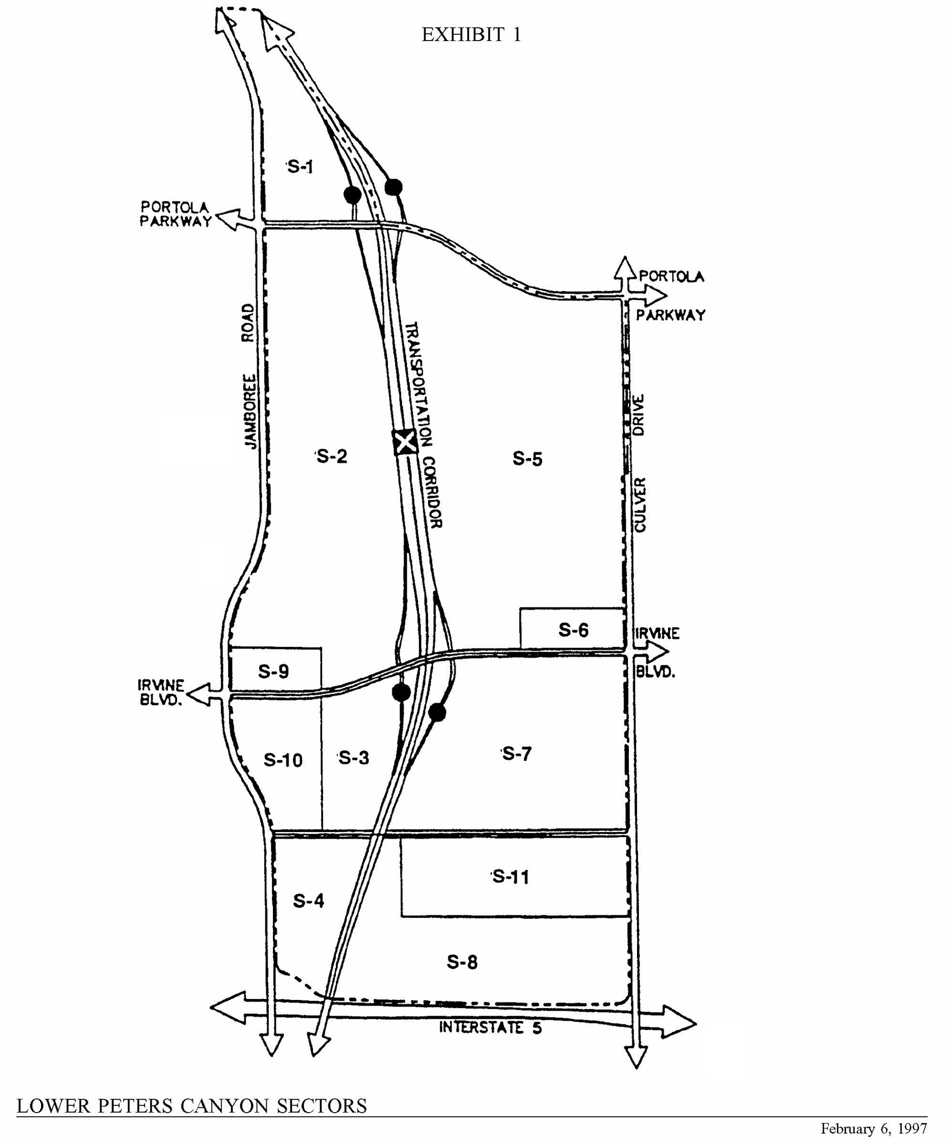
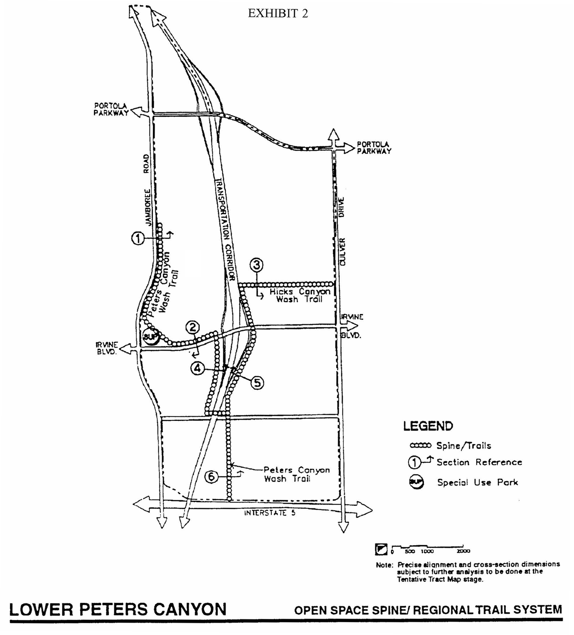
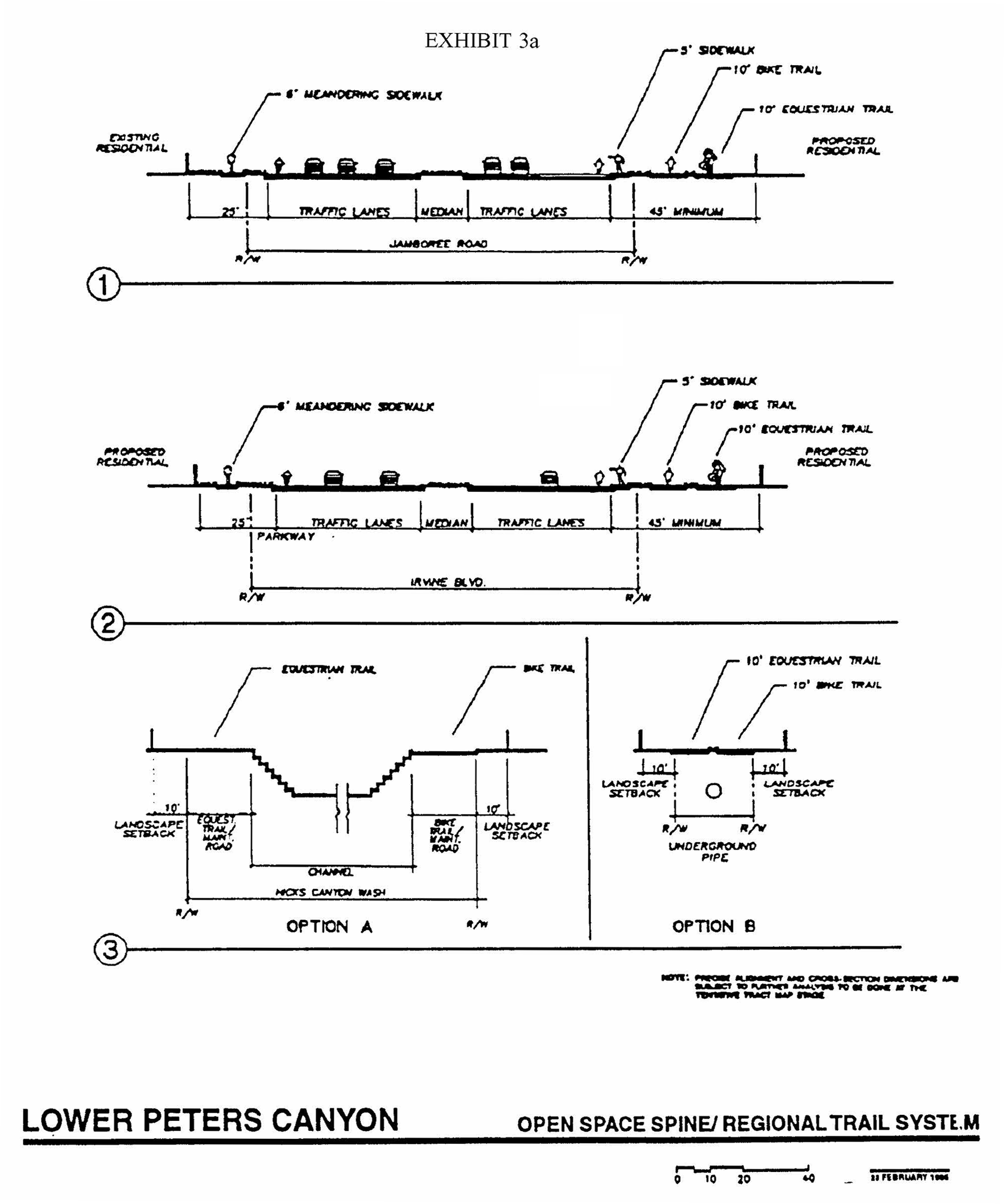
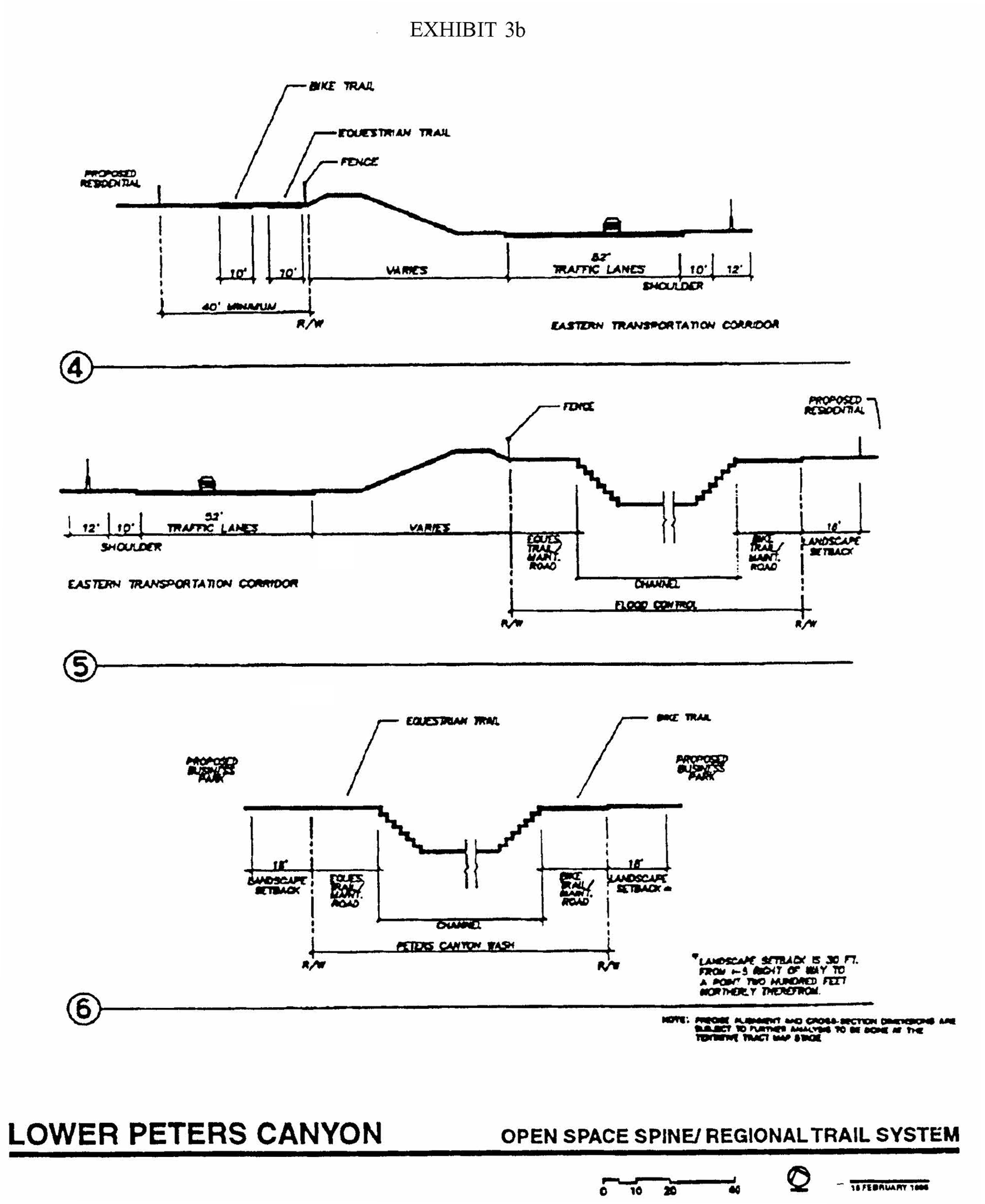
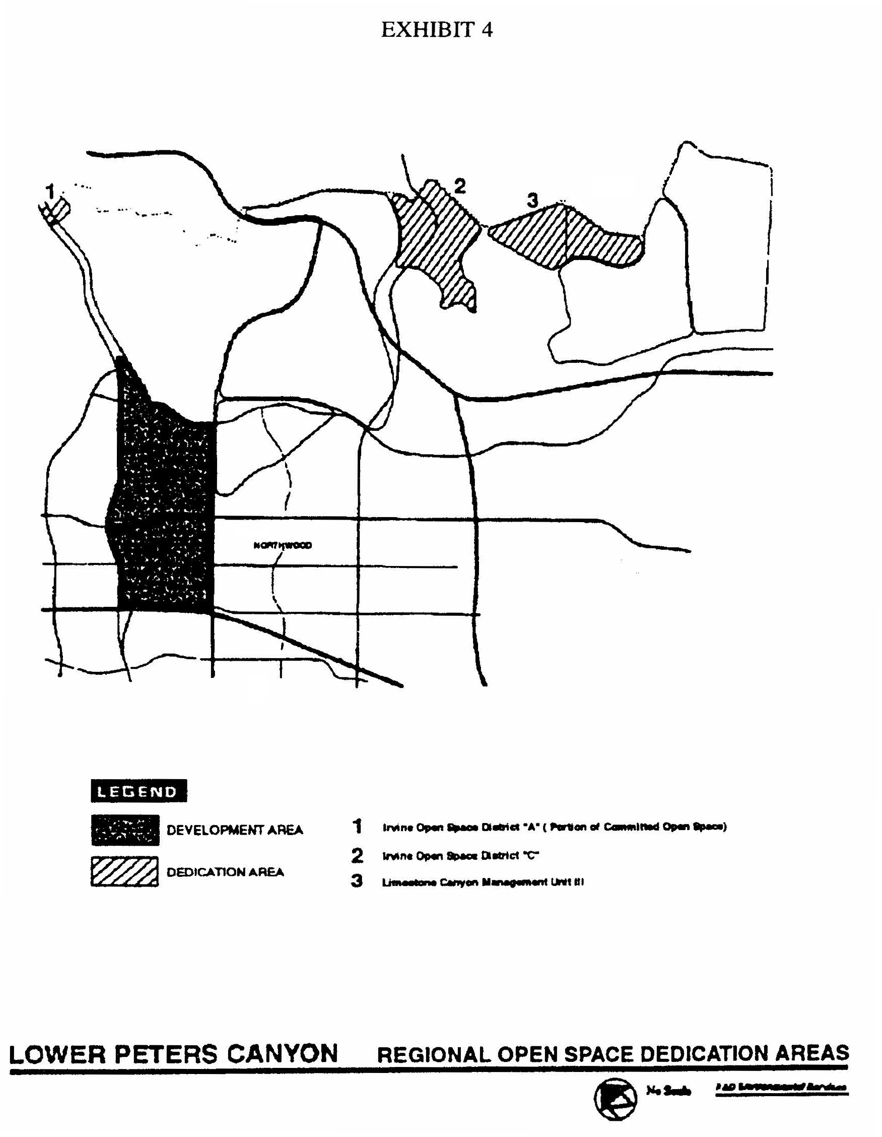
LOWER PETERS CANYON
EXHIBIT 5. CONCEPTUAL PARK PLAN
LOWER PETERS CANYON
EXHIBIT 6a. SCHEDULE OF IMPROVEMENT VALUES—BASE PARKLAND
IMPROVEMENTS
LOWER PETERS CANYON
EXHIBIT 6b. SCHEDULE OF IMPROVEMENT VALUES—
PARK EXTRAORDINARY IMPROVEMENTS
All values are based upon improvements which are typically found in public neighborhood parks.
LOWER PETERS CANYON
EXHIBIT 6c. SCHEDULE OF IMPROVEMENT VALUES—ATHLETIC COURTS
LOWER PETERS CANYON
EXHIBIT 6d. SCHEDULE OF IMPROVEMENT VALUES—LUXURY IMPROVEMENTS
All pool areas must meet City pool standards. Facilities must be handicap accessible.
LOWER PETERS CANYON
EXHIBIT 7A. CULVER DRIVE (TRABUCO ROAD TO 600 FEET NORTH OF BRYAN AVENUE)—PRELIMINARY COST ESTIMATE
Notes:
1.
This estimate represents the additional cost necessary to widen Culver Drive with a 15-foot east side parkway as compared to maintaining the existing eight-foot east side parkway.
2.
Preliminary contracts with IRWD indicate that it will probably be acceptable to maintain the existing 18-foot sewer line in its existing location and adjust manholes within the parkway. The assumption and additional utility locations will require further investigation in final design.
3.
This estimate does not include costs for additional right-of-way.
4.
The landscape cost is based on the City estimate of 8/13/96.
5.
This estimate is based on construction of a four-foot-wide sidewalk.
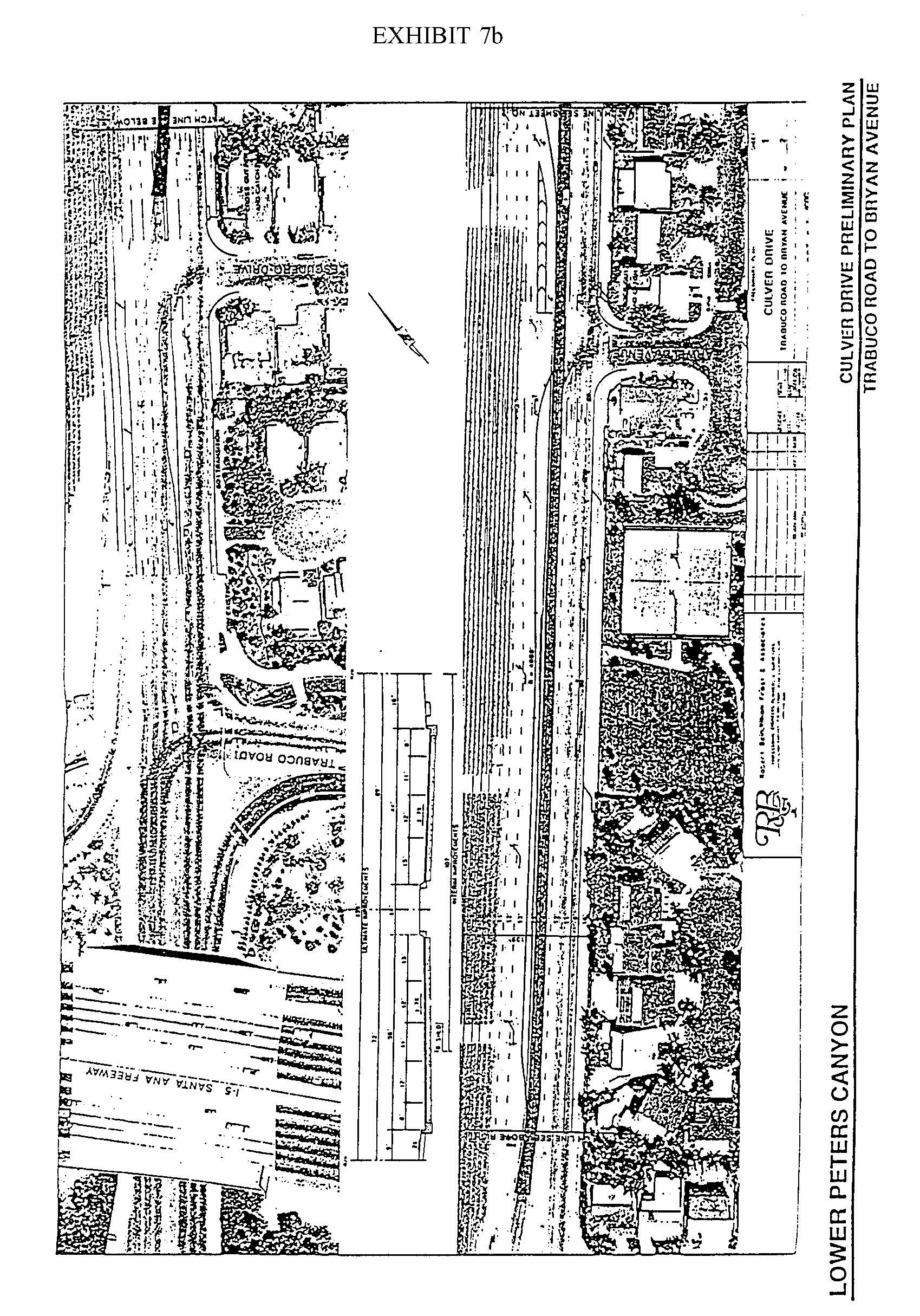
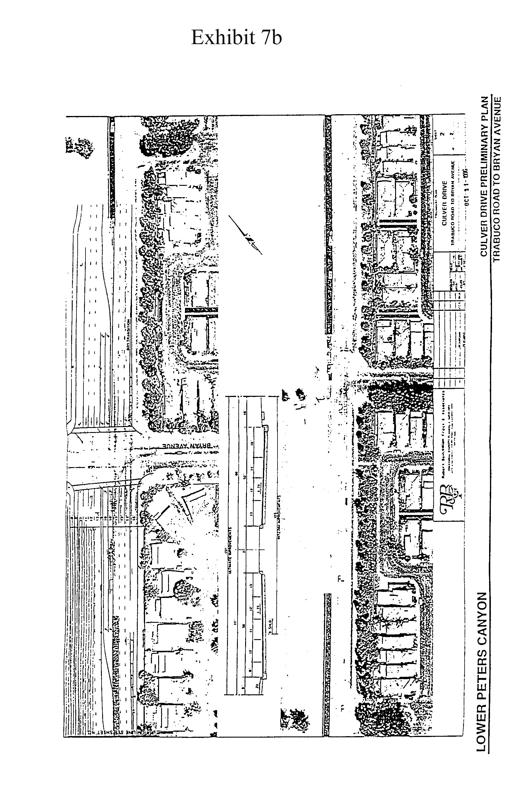
LOWER PETERS CANYON
EXHIBIT 8a. ENGINEERING STANDARDS
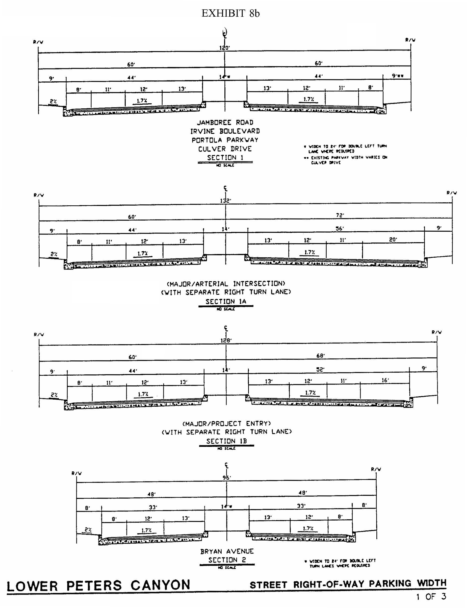
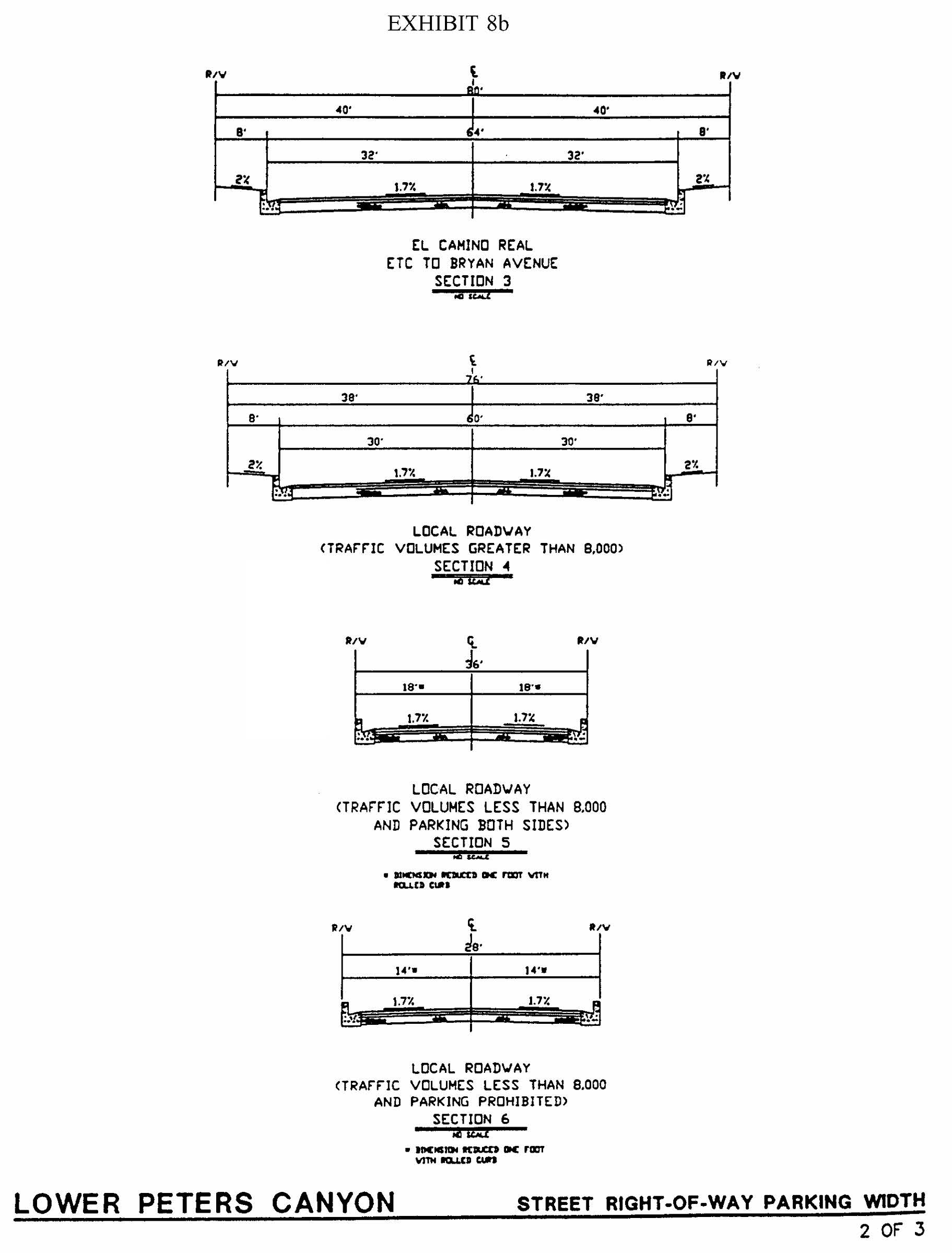
LOWER PETERS CANYON
EXHIBIT 10. DEVELOPMENT PHASING
The above phasing plan thresholds satisfy the fiscal phasing requirements for Planning Area 4. No residential dwelling units can be occupied until 75,000 square feet of retail space has been occupied in Planning Area 4. The cumulative number of residential units for which certificates of occupancy may be issued with a phase shall not be exceeded until the corresponding cumulative retail square feet have received certificates of occupancy. For example, no more than 1,000 new dwelling units could be occupied in Area 4 until in excess of 400,000 square feet of retail space have received certificates of occupancy. Certificates of occupancy of 400,001 square feet of retail would allow up to 1,700 dwelling units to be occupied.
Sec. 9-5-1.- Land use zoning map.
(See Planning Area 5 map following Section 9-5-3.)
(Code 1976, § V.E-805.1; Ord. No. 91-20, 11-12-91; Ord. No. 95-4, 5-9-95; Ord. No. 95-22, § 3, 11-28-95; Ord. No. 02-09, §§ 1—7, 6-11-02)
Sec. 9-5-2. - Introduction.
Planning Area 5 is located in the northern portion of the City. Boundaries include Culver Drive to the west, Jeffrey Road to the east, Portola Parkway to the north and Irvine Boulevard to the south. The Northwood Point community is comprised of Areas 1.5, 2.2, 2.3 and 2.4. A new, unnamed community encompasses Area 2.3I.
(Code 1976, § V.E-805.2; Ord. No. 91-20, 11-12-91; Ord. No. 95-4, 5-9-95; Ord. No. 95-22, § 3, 11-28-95; Ord. No. 02-09, §§ 1—7, 6-11-02)
Sec. 9-5-3. - Statistical analysis.
*Precise acreage encompassing the zoning land use reserve designations is conceptual, and corresponds to Figure 8-2B of Chapter 8-2 of the City zoning ordinance. Additionally, the land use reserve building intensity standards are correlated to Figure 8-2B.
**Presently there is a 20-acre middle school site owned by the Irvine Unified School District located within area 2.3I. If the planned middle school is relocated outside of area 2.3I, then residential uses will be permitted in its place. However, the maximum total of 1,900 dwelling units within area 2.3I cannot be exceeded.
1 Unallocated dwelling units represent those units remaining in a planning area that may be built anywhere in the same planning area. These units are within the maximum development intensity for the planning area; and, therefore, placement of unallocated units into any residential category within the planning area for purposes of development is determined to be consistent with the General Plan and Zoning Code with regard to intensity allocation only, provided that placement is otherwise consistent with site specific zoning regulations and that any potential environmental impacts are adequately addressed, including traffic impacts, pursuant to CEQA. Additionally, unallocated dwelling units in Planning Area 4 cannot be transferred between sectors per an existing development agreement.
2 See Section 9-0-3.C, Building Intensity Standards.
(Code 1976, § V.E-805.3; Ord. No. 91-20, 11-12-91; Ord. No. 95-4, 5-9-95; Ord. No. 95-22, § 3, 11-28-95; Ord. No. 00-12, § 4.A, 10-24-00; Ord. No. 02-09, §§ 1—7, 6-11-02; Ord. No. 10-04, § 3, 4-13-10; Ord. No. 12-09, § 3(Exh. A), 5-22-12)
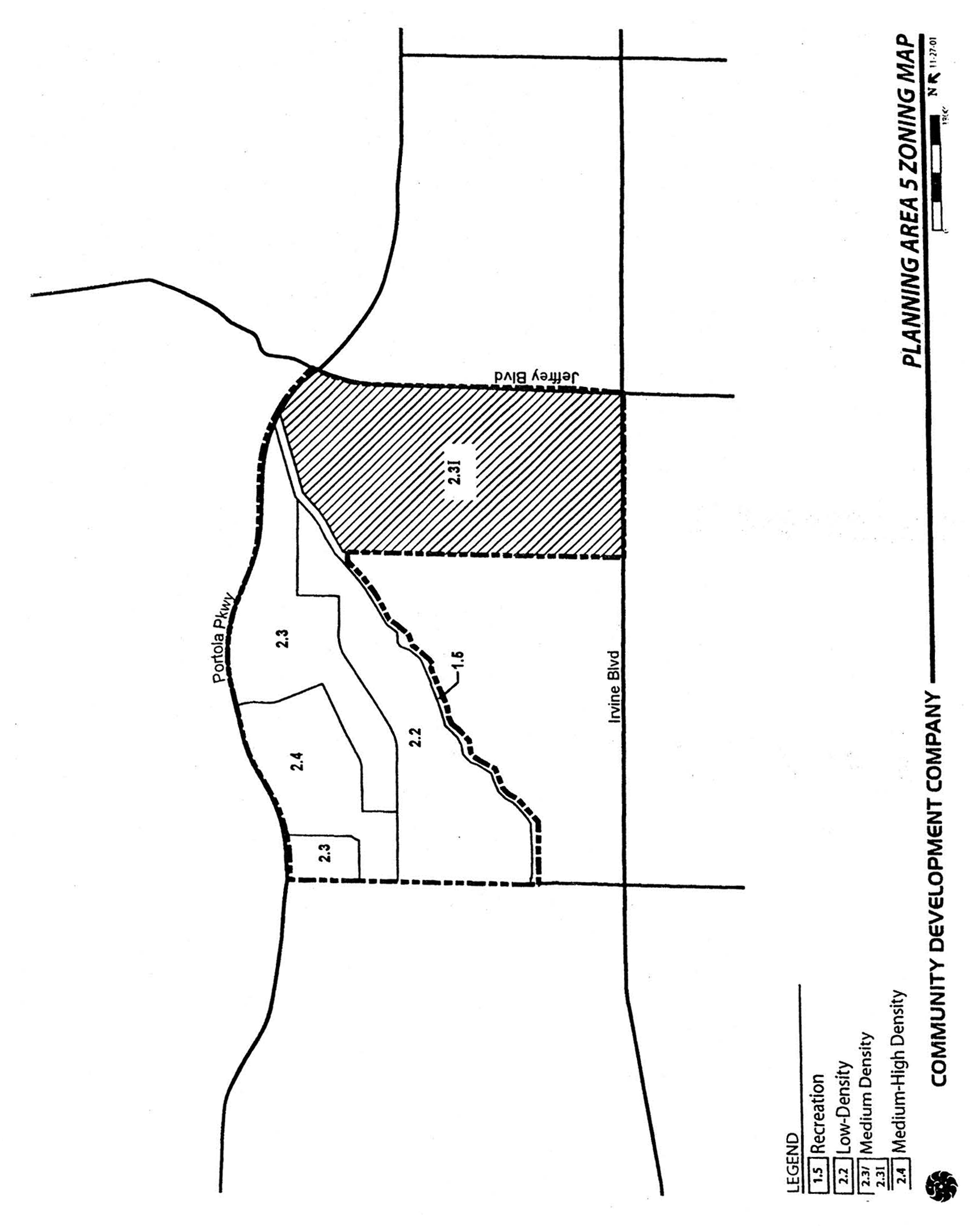
Sec. 9-5-4. - Land use matrix.
(City-wide regulations can also be found in Division 3.)
Notes:
(1)
Interim use.
(2)
Community parks: P.
(3)
Only in public parks.
(4)
See Chapter 9-14 for specific provisions.
(5)
To be deed restricted at TTM.
(6)
Caretaker's quarters only.
(7)
A private school for adults (18 years and older) that proposes to locate in an existing permanent building and meets all the general development standards will require an administrative use permit (AUP).
(8)
An alternative school that proposes to locate in an existing permanent building and meets all the general development standards will require an administrative use permit (AUP).
(Code 1976, § V.E-805.4; Ord. No. 91-20, 11-12-91; Ord. No. 95-4, 5-9-95; Ord. No. 95-22, § 3, 11-28-95; Ord. No. 00-12, § 4.B, 10-24-00; Ord. No. 18-05, Exh. A, 4-24-18; Ord. No. 25-18, § 2(Exh. A), 6-24-25; Ord. No. 25-22, 9-9-25)
Sec. 9-5-5. - Development standards for Area 2.3I.
(City-wide regulations can also be found in Division 3.)
Notes:
(1)
Architectural features may be permitted to exceed maximum building heights.
(2)
May be increased if required for sound attenuation. Setback for City streets and private drives will be measured from curb face.
(3)
Subject to California Building Standards Code.
(4)
Ten feet plus two feet for every five feet in height over 30 feet.
(5)
Setback equals two times the height of the building.
(6)
For church uses, maximum building height is 50 feet and architectural features may be permitted to exceed maximum building heights.
Individual residential projects in Medium Density Category 2.3I may exceed 12.5 dwelling units/net acre. However, no individual project may exceed 31.0 dwelling units/net acre and the overall density within 2.3I cannot exceed 12.5 dwelling units/net acre. For projects within Area 2.3I, the actual net density of individual projects will determine the development standards to be applied according to sections 3-37-13, 3-37-14, and 3-37-15 as applicable.
Individual residential projects in Medium Density Category 2.3I may exceed 12.5 dwelling units/net acre. However, no individual project may exceed 31.0 dwelling units/net acre and the overall density within 2.3I cannot exceed 12.5 dwelling units/net acre. For projects within Area 2.3I, the actual net density of individual projects will determine the development standards to be applied according to Sections 3-37-13, 3-37-14, and 3-37-15 as applicable.
(Code 1976, § V.E-805.5; Ord. No. 91-20, 11-12-91; Ord. No. 95-4, 5-9-95; Ord. No. 95-22, § 3, 11-28-95; Ord. No. 00-12, § 4.C, 10-24-00; Ord. No. 02-09, §§ 1—7, 6-11-02)
Sec. 9-5-7. - Special development requirements for New Community (Area 2.3I).
A.
Land use.
1.
Residential.
a.
The affordable housing implementation plan submitted as part of the development agreement for this planning area sets forth the affordable housing program for this community and the regulatory means for City monitoring.
2.
Reserved.
3.
Institutional.
a.
Four acres of potential institutional land uses have been designated with Final Tract Map 14540. Land uses allowed in these four acres shall be consistent with County Ordinance No. 3893, as well as County Area Plan AP92-002P, as amended by Area Plan Amendments PA94-0124 and PA95-0050.
B.
Public and private facilities.
1.
Open space dedication—Method of conveyance.
a.
An irrevocable offer of dedication to the City of Irvine for the Hicks Canyon Wash open space spine has been accepted by the City and recorded.
b.
An irrevocable offer of conveyance by grant for "The Sinks," Preservation Area D of the City of Irvine General Plan, has been granted to the County of Orange and recorded. The offer shall be accepted no sooner than 90 days following issuance of building permits for 75 percent of the development for Planning Area 5 or the completion of development in Planning Area 5, whichever occurs first.
c.
An agreement increasing, by an additional 25 feet in average width, Parcel S-4 of the Jeffrey Open Space Spine, as identified in conservation/open space element objective L-8, implementing action D-4, beginning at a point from the I-5 (Santa Ana) Freeway extending in a northerly direction to the Lomas de Santiago Hills, has been approved by the County of Orange and executed. This additional 25 feet in width amounts to approximately 12 acres of additional open space in this segment of the Jeffrey Open Space Spine. Implementation of this additional open space shall occur with the dedication of Parcel S-4 as outlined in objective L-8, implementing action D-4, of the conservation/open space element.
2.
Hicks Canyon Wash open space spine.
a.
Final Tract Maps 14916 and 14540 establish Hicks Canyon Wash open space spine lettered lots.
b.
Hicks Canyon open space shall be a minimum width of 100 feet measured in a northerly direction from the centerline of the wash and shall include areas immediately adjacent to the wash between Culver Drive and Portola Parkway consistent with Final Tract Maps 14916 and 14540. Where houses along the south side of the wash are located within 25 feet of the centerline of the wash, the width of the open space on the north side shall be increased through the use of a wider spine, or location of a park, greenbelt paseo or other design features. Also, the landscape plan along the wash shall incorporate additional plantings of trees and shrubs in these areas to assure adequate screening between the existing and proposed residences. In the event that no public agency will accept the open space spine and trails, then any new trails may be deleted from the spine and the hardscape setback reduced.
c.
Building setbacks shall be measured from the lettered lots that comprise the northerly edge of the open space spine.
d.
Development of the Hicks Canyon Wash open space spine shall be in conformance with County Area Plan Amendments PA94-0124 and PA95-0050.
e.
The design of the Hicks Canyon Wash open space spine shall demonstrate the following:
(1)
The character of the open space spine will be consistent with the natural wooded character of the wash using the following.
(2)
If feasible, incorporate the existing vegetation into the final design of the wash:
(a)
All proposed landscape within the open space spine shall be consistent with the sustainability in landscaping ordinance.
(b)
Replace vegetation lost in the existing habitat as a result of the extension of Yale Avenue or other improvements.
(c)
Vegetation shall be introduced to the north side of the open space spine paralleling the existing wash and habitat.
(d)
Vegetation shall be introduced to both sides of the open space spine as it is extended from its present eastern terminus to its future intersection with Portola Parkway.
(e)
Native vegetation may be used to landscape both the south and north sides of the open space spine, subject to City standards.
f.
In conjunction with the submittal of applications for any tentative tract map, conditional use permits or code compliance for developments adjacent to the wash on Lots 10,12 and 13 on Final Tract Map 14540, the applicant shall:
(1)
Provide a plan showing the interface between the proposed development and Hicks Canyon Wash open space spine. The proposed developments shall:
(a)
Architecturally provide for visual relief to reduce a row or tunnel effect.
(b)
Demonstrate that walls/fences built adjacent to the wash utilize a combination of materials preserving a reasonable degree of security and privacy while optimizing the view of the open space spine (such as wrought iron and a solid material).
(c)
Provide convenient, inviting and direct pedestrian and bicycle access points along the spine to adjacent land uses.
(2)
Lots 10,12, and 13 of Final Tract Map 14916 have fully satisfied the requirements in Subsection f(1) and no further plans are required for these lots.
g.
The applicant has entered into an agreement and has posted security for a period of 10 years, guaranteeing 150 percent of the cost of the design, engineering and construction and inspection of the riding and hiking trail within the Hicks Canyon Wash open space spine. The design of the trail shall incorporate the recommendations for grade-separated crossings as prescribed by the engineering feasibility study, required by special development requirements. In the event an assessment district is formed which includes financing of the trail, the bond shall be exonerated.
h.
Prior to issuance of 100 percent of the building permits for the total number of units on Lots 10, 12, and 13 of Final Tract Map 14916, construction of the bicycle and riding and hiking trails between Culver Drive and Yale Avenue within the Hicks Canyon Wash open space spine shall be under construction. Prior to the issuance of 100 percent of the building permits for the total number of units on Lots 10, 12 and 13 of Final Tract Map 14540, construction of the bicycle and riding and hiking trails between Yale Avenue and Portola Parkway shall be under construction.
3.
Parks.
a.
Plans for the public neighborhood park (Lot 9 of Final Tract Map 14540) and private parks (Lot 4 of Final Tract Map 14916 and Lot 8 of Final Tract Map 14540) have been approved by the County of Orange. Irrevocable offers of dedication to the City of Irvine for the public neighborhood parks have been accepted by the City of Irvine and recorded.
b.
The community park dedication requirements for this planning area will be satisfied by the dedication of park land in either Planning Area 1, 2, 4, or 5 or as otherwise approved by the City. The location of and timing for community park dedication shall be established through terms of the annexation and development agreement between the City and the landowner for Northwood 5.
c.
The applicant shall provide a plan showing the design of pedestrian, bicycle and equestrian trails within the Hicks Canyon Wash open space spine, including convenient direct access to the public park located on Lot 11 of Final Tract Map 14540. Special features should be incorporated into equestrian trail designs to restrict horses from entering parks.
d.
The public neighborhood park adjacent to the Hicks Canyon Wash open space spine shall be designed to encourage a passive use. The design of this park should consider, but not be limited to, the following: amenities such as restrooms, picnic tables, benches, water features (i.e., fountains, ponds), drinking fountains, bicycle racks, pedestrian walkways, shade trees, canopy areas, tot lot, and grass mound areas for sitting or lying.
e.
The design of the facilities for the neighborhood park and adjacent elementary school site shall be coordinated to the extent possible.
f.
In conjunction with the submittal of applications for any tentative tract map, conditional use permit or code compliance for development, the applicant shall demonstrate that particular attention has been given to the interface between residential units and adjacent park sites. The design of these units should consider, but not be limited to, the following:
(1)
Orientation of the front of the units toward the parks, to take advantage of the view and open space opportunities presented.
(2)
Where possible, visual access to the parks shall be provided. Visual access shall be encouraged through the use of creative wall and fence designs. Wall and fence designs shall utilize a combination of materials to preserve a reasonable degree of security, while optimizing the view of the parks.
(3)
Where possible, physical access to the parks shall be provided. Consideration shall be given to pedestrian/bicycle circulation such that safe, convenient and direct public access points from a residential development to an adjacent park are accomplished.
4.
Schools.
a.
One elementary school site shall be reserved in Planning Area 5 for development by the Irvine Unified School District. The exact location, configuration, size, and total acreage of the 10-acre school site has been identified on Final Tract Maps 14540 and 14916. In the event that the IUSD Board determines that the site reserved for a school is not needed, or is deemed inappropriate for such development, then this site may be developed in accordance with the underlying zoning of the property. However, approval of such development shall not occur without a written letter of agreement from the IUSD Board indicating that the site is no longer needed for school development and is therefore released by the district.
b.
Consideration shall be given to the following when locating the future school site:
(1)
The elementary school should be centralized within the community node area. The community node area is located within the boundaries of the loop road of Northwood 5.
(2)
The elementary school should be located adjacent to and have common recreational facilities with the public park.
(3)
Safe, convenient, pedestrian and bicycle access to and from the elementary school, connecting neighborhoods, and parks shall be maximized.
5.
Child care.
a.
The need for child care facilities shall be recognized in the development of Planning Area 5. Based upon 2,885 units and the ultimate projected population for this planning area, the City has identified a goal of providing slots for a minimum of 208 children.
b.
Lot 7 of Final Tract Map 14540 (1.4 acres) has been designated for potential use as a child care center to meet the above goal.
c.
In conjunction with the submittal of applications for any conditional use permit for development of child care centers, the applicant shall demonstrate that safe, convenient access from the child care centers to nearby parks, schools, and neighborhoods will be provided.
6.
Eucalyptus windbreaks preservation.
a.
Eucalyptus windbreaks are an important cultural and environmental resource to the community and shall be an integral part of the community design of the planning area. Preservation of the existing windbreak trees shall be the goal for the planning area. Development applications shall address windbreak preservation goals by utilizing the windbreaks to enhance the aesthetic character and environmental quality of the planning area to the greatest extent possible. Improvements shall be planned and designed to accommodate windbreak preservation and maintenance wherever feasible.
b.
Prior to approval of any applications for development which contain windbreaks, the applicant shall demonstrate compliance with the City eucalyptus windrow preservation policy as contained in City Council Resolution No. 81-7 and/or amendments adopted thereto, including amendments to City policies and/or ordinances relating to eucalyptus windbreak preservation and/or maintenance. All trees within the windbreaks shall be maintained as required by the policy until tree removal permits have been issued.
c.
In conjunction with the submittal of applications for development which include windbreaks (including, but not limited to, tentative maps, Master Plans, wall and streetscape plans, conditional use permits, improvement plans, grading plans, preapplications, and landscape plans), the following shall be provided:
(1)
Windbreaks shall be depicted along with the tagged identification number of each tree.
(2)
A report shall be prepared by a certified arborist. A previous report may suffice only if the previous report is no greater than three months old at the time the development application is submitted to the City. The report shall include evaluations regarding each tree location, physical and structural conditions, and recommendations regarding tree maintenance, protection during construction and preservation, to minimize impacts to the trees resulting from the proposed development.
(3)
Windbreak trees proposed for removal shall be shown on plans for discretionary development case applications and accompanied by an application for a tree removal permit.
d.
Windbreak trees not approved for removal in conjunction with discretionary development case applications shall be preserved. Individual tree removals will require a tree removal permit. The application for the tree removal permit shall be in conformance with City Council Resolution No. 81-7 and/or amendments adopted thereto, including amendments to City policies and/or ordinances relating to eucalyptus windbreak preservation and/or maintenance. The permit shall be approved by the Director of Community Development.
C.
Circulation.
1.
Streets.
a.
The circulation system for Planning Area 5 consists of Culver Drive as a thruway (major highway), Portola Parkway as a thruway (major highway), Yale Avenue from Portola Parkway to Arborwood as a collector (commuter highway), and Meadowood as a divided collector (divided commuter). Final street plans have been approved by the County of Orange.
b.
Circulation improvements shall be completed in accordance with the Northwood Point traffic analysis dated April 1993 adopted by the County of Orange.
c.
Accesses to the commercial site shall be designed to provide adequate distance for storage of vehicles entering and exiting during the peak hours, measured from the property line to the first aisle entrance.
d.
Prior to occupancy of each phase of Planning Area 5, the applicant shall be responsible for construction of all the improvements identified in the master tentative tract map traffic study for each phase of the project. These improvements shall be implemented in accordance with the following schedule in a manner meeting the approval of the Director of Public Works, in consultation with the Director of Community Development.
(1)
Stage 1 improvements.
(a)
The applicant has entered into an intersection improvement agreement, dated April 25,1995, with the County of Orange to fund the improvements at identified intersections, on a fair share basis. Funding for the applicant's fair share obligation shall be provided in accordance with this agreement.
(b)
Prior to the issuance of the first building permit, the subdivider shall initiate the design of Portola Parkway from Jeffrey Road to Culver to major arterial standards with dual left turn lanes at Culver and an exclusive right-turn lane from northbound Culver to eastbound Portola. The subdivider shall also initiate the design of Culver Drive from its current terminus to Portola Parkway.
(c)
Concurrent with the opening of model homes, Culver Drive shall be completed as a two-lane road consisting of a minimum of 24 feet of pavement and eight-foot graded shoulders from Irvine Boulevard to the intersection of Meadowood.
(d)
Prior to the issuance of any building permit exceeding 1,000 dwelling units, the construction of Portola Parkway as a two-lane road consisting of a minimum of 24 feet of pavement and eight-foot graded shoulders between Jeffrey Road and Jamboree Road must commence, with the goal of completion of Portola Parkway between Culver Drive and Jamboree Road prior to the issuance of the 1,547th building permit. However, no building permit will be issued for the 1,547th unit unless Portola Parkway between Jeffrey Road and Culver Drive, and Culver Drive between Portola Parkway and "A" Street, are open to traffic as two-lane roads. Also, Yale Avenue between Portola Parkway and Meadowood (westerly loop segment) must be open to traffic.
(e)
Any interior road (i.e., Meadowood, Yale Avenue) must be completed to the project's access point prior to the issuance of certificates of use and occupancy for that project.
(f)
Prior to the issuance of certificates of use and occupancy for any units in excess of 500 dwelling units, intersection improvements consistent with Stage 1 requirements (per traffic study dated April 21, 1993) at Culver/Irvine and Bryan/Culver must be completed.
(2)
Stage 2 improvements.
(a)
Prior to the issuance of any building permit in Stage 2 (in excess of 1,546 dwelling units), the construction of Culver Drive widening to five lanes from Trabuco to Portola must commence. The applicant shall enter into an agreement and provide financial security with the County for the construction and participate in an assessment district.
(b)
Prior to the issuance of any building permits in excess of 2,250 dwelling units (cumulative Stage 1 and Stage 2), construction of Portola Parkway as a four- lane road between Culver Drive and Jamboree Road and widening of Portola Parkway to its ultimate six lanes between Jeffrey Road and Culver Drive must commence. The applicant shall enter into an agreement and provide financial security with the County for the construction or participate in an assessment district.
2.
Streetscapes.
a.
Streetscape themes for this planning area have been established in County Area Plan AP92-002P, as amended by Area Plan Amendments PA94-012 and PA95-0050.
b.
In conjunction with the submittal of applications for tentative tract maps, and/or conditional use permits, the applicant shall submit a plan addressing enhancement of entry view corridors.
Design treatments which enhance project entries through the use of raised medians, additional landscaping, landscape theme, and location of recreational amenities along these view corridors shall be encouraged. Entry view corridors terminating at blank walls and/or blank elevations shall be discouraged.
3.
Pedestrian circulation.
a.
Pedestrian circulation within Planning Area 5 is an integral part of the community design of the planning area. To encourage circulation, the application shall establish safe, direct and convenient pedestrian access between various land uses.
b.
Pedestrian circulation shall include, but not be limited to, the following:
(1)
Pedestrian circulation between Planning Area 5 and the Village of Northwood (Planning Area 8), including existing Northwood retail services.
(2)
Direct access to encourage pedestrian movement between individual residential neighborhoods and the Hicks Canyon Wash open space spine, the community node, parks, schools, institutional uses, Culver Drive, Portola Parkway and Yale Avenue, and the commercial center. Pedestrian movement and access shall be convenient, direct and built to City design standards for safety.
(3)
Pedestrian access to and across (north to south) the open space spine.
(4)
Pedestrian accessways between individual neighborhoods and the community node with major paseos, where appropriate.
(5)
Design of pedestrian circulation along Yale Avenue, Portola Parkway, and Culver Drive, including access from the residential and commercial uses to Culver Drive, Portola Parkway, and Yale Avenue.
(6)
Lots 2, 3, 5, 6, 8, 9,10, 11,12,13, and 15 of Final Tract Map 14916 and Lots 2, 3, 4, and 5 of Final Tract Map 14540 have fully satisfied the above requirements.
c.
Bus stop locations have been identified on the pedestrian circulation plan included in County Area Plan AP92-002P, as amended.
d.
If a future high school and/or community park is developed north of Portola Parkway, the applicant shall provide a signalized crossing of Portola Parkway at Yale Avenue to provide convenient and safe access to the community park and/or high school.
4.
Bicycle, riding and hiking trails.
a.
Bicycle, riding and hiking trails shall be provided in a manner consistent with County Area Plan AP92-002P, as amended.
5.
Public transit.
a.
Prior to the issuance of building permits, the applicant shall participate in a City-wide transit fee program to assist in the implementation of Irvine's transit program. The applicant's participation shall be contingent upon City Council adoption of a City-wide transit fee ordinance providing for fair share contributions from existing and future development. The issuance of building permits shall not be withheld by the City pending City Council adoption of such a transit fee ordinance, and the fee shall not be applied retroactively to residential units in Planning Area 5 which are in receipt of building permits.
D.
Infrastructure.
1.
Drainage.
a.
The drainage of Hicks Canyon Wash will be retained in its substantially existing condition between Culver Drive and the terminus of the 120-inch-diameter underground conduit. In addition, the applicant shall enhance that portion of Hicks Canyon Wash starting from the terminus of the 120-inch underground conduit to Portola Parkway. The enhancement of the wash shall include containment of the 100-year storm flows and include a stable treatment to the 100-year storm flows.
b.
Prior to the recordation of the final master tentative tract map, the applicant shall bond for flood control improvements to mitigate for the 100-year flood impacts in Northwood 5 caused by Hicks Canyon Wash and Rattlesnake Channel as approved in the flood control Master Plan for San Diego Creek.
2.
Dam inundation.
a.
Concurrent with recordation of a final tract map for any residential land use within the dam inundation area, the project proponent shall be required to record a title document in a manner meeting the approval of the Director of Community Development, notifying future owners of record that the property is within a dam inundation area.
b.
Prior to issuance of building permits for residential units, the project applicant shall notify the dam owner for purpose of revising dam inundation maps in accordance with State law. Verification of notification shall be submitted to the City.
c.
Prior to issuance of residential building permits, the project applicant shall prepare emergency evacuation plans for future habitable structures to be submitted to and approved by the Orange County Fire Authority. Should there be an existing emergency evacuation plan in effect, that plan shall be updated as required in light of current and proposed land uses.
3.
Water quality management. A water quality management plan has been submitted and approved by the County of Orange. The plan shall identify specific source control measures known as best management practices (BMPs) to be implemented to reduce the discharge of pollutants to stormwater facilities during all phases of project development. These source reduction measures are articulated in the National Pollution Discharge Elimination System (NPDES) Permit No. CA 8000180. The plan also establishes the responsibility for maintenance.
4.
Hazardous materials assessment. Before the recordation of any subdivision map that involves offers of dedication or grants of easement rights on one or more parcels to a public body, the City shall review pertinent information regarding the parcel(s) and may perform a field review to determine if a hazardous material assessment over such parcels is necessary. If the City determines that an assessment is required, then the subdivider shall prepare the assessment, in form, content, and conclusions to be approved by the Director of Community Development.
E.
Neighborhood design.
1.
Neighborhood character.
a.
Planning Area 5 is to be compatible with the character of existing Northwood (Planning Area 8) by implementing the following:
(1)
Encourage a variety of architectural expressions, using materials such as brick and stucco and wood.
(2)
Preserve the eucalyptus windbreaks consistent with City policy.
(3)
Establish focal points for community interaction in conjunction with uses such as the school, church, child care facility, or other appropriate locations.
(4)
Create village edges which are compatible with existing Northwood.
(5)
Provide a network of parks, trails, and recreational facilities.
2.
Architecture.
a.
Compatibility with existing Northwood is to be established by the following in conjunction with all subsequent development applications in Northwood 5:
(1)
A variety of architectural styles will be permitted.
(2)
A variety of building materials will be permitted:
(a)
Walls of wood siding or stucco with accents of wood, brick or other enhanced materials. The applicant is to provide building elevations of all sides of a proposed structure, including materials call-outs and color samples. Suggested wall finishes would include, but would not be limited to, horizontal siding and stucco.
(b)
Details (porches, balconies, columns, accent walls, doors) are to be predominantly of wood. Materials permitted for ornamental detail elements are brick, ceramic tile, and unpolished stone. Other enhanced materials may be used subject to the approval of the Director of Community Development.
(c)
Roofing materials are to be predominantly flat or barrel tile in the medium to dark color range to simulate the color of wood shakes; other roofing materials and colors are permitted on a limited basis to the extent that they are complementary.
(3)
The building design is to address the integration and equitable distribution of details on sides of a proposed structure which face streets, parks and public right-of-way as follows:
(a)
Light and shadow achieved through openings, projections, recesses and details.
(b)
Avoidance of large blank facades.
(c)
Variation of rooflines, either through a combination of one- and two-story elements or by the use of varying roof structural configurations. Limited use of flat roofs on residential buildings.
(4)
A variety of colors will be permitted, with a majority of light tones.
(5)
Nonresidential buildings will follow the general theme described above, but may incorporate larger areas of flat roofs. Unique identity and function of such buildings is to be expressed through forms and materials. The commercial center is to incorporate a variety of contrasting elements such as, but not limited to, facades, building heights, recesses and surface materials.
(6)
In conjunction with submittal of applications for all development projects, location, height and materials of walls and fences are to be shown on plans. Such walls and fences may incorporate a variety of materials and designs:
(a)
Acceptable materials are wrought iron or open metal with a wrought-iron appearance, masonry (stucco, brick, rock, slump or split block, etc.), wood (picket, split rail, heavy timber, etc.) and combinations of the above.
(b)
When wood is used in fence design, particular attention should be given to the following to minimize maintenance problems:
1.
Use of pressure-treated wood.
2.
Incorporation of several courses of masonry along lower portions of fences.
3.
Attention to the location and type of adjacent plantings and irrigation systems.
3.
Site design.
a.
To provide visual interest and orientation in the Northwood 5 neighborhood, the following elements should be addressed:
(1)
Village edges and entries should be compatible with existing Northwood. A sense of continuity is to be maintained along the boundary between Planning Area 8 and Planning Area 5.
(2)
The hierarchy of the circulation system is to be reinforced through the landscaping described in County Area Plan AP92-002P, as amended.
(3)
In conjunction with the submittal of a discretionary case application, the applicant is to identify opportunities and techniques for the creation of focal points for Northwood 5 where appropriate. Such opportunities may include, but shall not be limited to, views along streets, particularly where the street terminates at a building site; potential sites for public art; architectural features such as unusual height or form; and landscape features such as hardscape, specimen trees, skyline trees, water features or unusual landscape plant groupings.
(4)
The portion of the loop street which links the retail center and the neighborhood green should be designed to enhance pedestrian activity. In conjunction with the submittal of conditional use permits for cluster residential developments adjoining this road segment, the applicant is to demonstrate what design techniques will be used to encourage pedestrian activity.
4.
Landscaping.
a.
Landscaping character is to be compatible with existing Northwood by addressing the following:
(1)
Preservation of eucalyptus windbreaks in accordance with the City's eucalyptus windrow policy.
(2)
Continuance of the general character of plantings along Yale Avenue (to its intersection with the loop street) and Culver Drive.
(3)
Preservation and enhancement of the rustic character of Hicks Canyon Wash through special development requirements Subsections B.2.e, f and g.
(4)
Development of views of Hicks Canyon Wash, an important focal point, through the following:
(a)
Landscape treatment which provides unobstructed view corridors where Yale, Culver and Portola cross the wash.
(b)
Use of the wash as the termination of views from interior streets wherever feasible.
(5)
Formal (symmetrical and with regular intervals) street tree pattern on the loop road to distinguish the street as an important public corridor in the neighborhood.
(6)
In conjunction with review of the conditional use permit or subdivision for single-family residential development, a street tree program shall be prepared by the applicant, consistent with County Plan AP92-002P, as amended.
5.
Public safety.
a.
The intent of this subsection is to enhance police patrol observation ability, and to create resident surveillance opportunities for trails and streets, thereby discouraging criminal activity.
b.
The landscape design of Hicks Canyon Wash shall include the following:
(1)
Hicks Canyon Wash.
(a)
To allow adequate visibility for police car patrol, the applicant shall demonstrate that view corridors into the wash can be maintained, by street frontage or other means, in the area of the existing pedestrian bridge opposite Quebrada and Recinto.
(b)
Placement of both view corridors and physical access (streets or trails), at intervals of approximately every one-half mile.
(c)
A means of allowing emergency vehicle access but discouraging unauthorized vehicle access.
(d)
A route for the bicycle trail which shall be visible from homes adjacent to the wash and/or patrolling vehicles, but maintaining sensitivity to privacy of residential rear yards.
(e)
A plan for lighting on the bicycle trail. This plan should use the standard of the Illuminating Engineering Society (IES) for bikeways and walkways not adjacent to streets.
(f)
The use of shrubs and ground cover which will not obstruct views of the trails and will also discourage intrusion into a residential lot from a trail.
(g)
Walls and fences adjacent to the wash should be designed to provide resident visibility from the rear yard into the wash.
(2)
Streets and trails.
(a)
Providing residents visibility, from within the home, to the adjacent local streets and trails.
(b)
Provide for adequate interior street circulation to facilitate police vehicle patrol.
6.
Light and glare. Prior to the issuance of any building permit, the applicant shall demonstrate that all exterior lighting has been designed and located so that all direct rays are confined to the property in a manner meeting the approval of the Director of Community Development.
F.
Special development requirements for New Community (Area 2.31).
1.
Affordable housing. The affordable housing needs goal of 15 percent (five percent Income I, II; five percent Income III; and five percent Income IV) of the actual number of units built in Area 2.31 may be met utilizing off-site affordable housing credits. The achievement of the Income I, II and III affordable housing goals is contingent upon the availability of financial incentives which bridge the gap between the actual cost of construction of a market unit and an affordable unit. The applicant has the discretion to satisfy these goals through either the conversion of off-site existing market rate housing to affordable housing with 30-year restrictions and/or the extension of the term of affordability for offsite existing affordable units for a minimum of 40 years. The City will provide available financial assistance to help achieve the affordable housing needs goal.
In conjunction with the submittal of the first tentative map within this planning area, the applicant shall submit a comprehensive affordable housing program covering Planning Areas 5, 6, 8, and 9 as called for in Chapter 2-3 of the Zoning Code. The affordable housing goal of 15 percent (five percent Income I, II; five percent Income III; and five percent Income IV) of the actual number of units built shall be addressed in the affordable housing program. The program shall be reviewed by the Planning Commission prior to its approval of the first tentative map and approved by the City Council prior to recordation of the first final map.
2.
Maximum dwelling units. Notwithstanding the provisions of Section 9-6-3, dwelling units may be transferred by the landowner from Area 2.31 to Planning Areas 6 and/or 9. No dwelling units may be transferred into Area 2.31. It is the intent of this provision to allow a total 12,350 dwelling units to be constructed in Planning Areas 5 (2.31), 6, 8 (2.3H) and 9, to be measured cumulatively by actual permits issued.
3.
Open space dedication and conveyance. An irrevocable offer of dedication for Area Q in PA 6 as generally shown on Exhibit A will be recorded following: (a) issuance of building permits for 75 percent of the 1,900 residential units in Area 2.31 (or the completion of development within Area 2.31) and (b) approval of the precise alignment of Jeffrey Road by the City.
4.
Landscape setbacks. The landscape setbacks for the project edge shall be in accordance with Exhibits C, C-1 and C-2. Additionally, streetscapes required with development of Area 2.31 shall be consistent with the City of Irvine Master Streetscape Plan.
5.
Neighborhood design. Area 2.3.1 is to be compatible in appearance, density and landscaping with that found in the Northwood area south of Hicks Canyon Wash adjacent to the project area. This will be accomplished by implementing the following:
(a)
Preserve the eucalyptus windbreaks consistent with City policy. The existing eucalyptus windrows in PA 5 will be retained in median landscaping, landscaped setbacks, trails and areas adjacent to open space to the extent trees are deemed sufficiently healthy for preservation in accordance with a survey conducted by a certified arborist and do not conflict with infrastructure improvements.
(b)
Along Irvine Boulevard and Portola Parkway, west of Jeffrey, plant trees and vegetation that, to the extent practible, replicate that found on Irvine Boulevard and Portola Parkway respectively west of the project area.
(c)
Establish focal points for community interaction in conjunction with uses such as the school, local park, or other appropriate locations.
(d)
Create village edges, which are compatible with adjacent communities, including similar structure heights, comparable perimeter walls or architectural features, densities, landscaping and setback requirements.
(e)
Provide trails, private and/or public parks and recreational facilities.
(f)
A variety of architectural styles will be permitted.
(g)
A variety of building materials will be permitted:
(1)
Walls of wood siding or stucco with accents of wood, brick or other enhanced materials. The applicant is to provide building elevations of all sides of a proposed structure, including materials call-outs and color samples. Suggested wall finishes would include, but would not be limited to, horizontal siding and stucco.
(2)
Details (porches, balconies, columns, accent walls, doors) are to be predominantly of wood. Materials permitted for ornamental detail elements are brick, ceramic tile, and unpolished stone. Other enhanced materials may be used subject to the approval of the Director of Community Development.
(3)
Roofing materials are to be predominantly flat or barrel tile in the medium to dark color range to simulate the color of wood shakes; other roofing materials and colors are permitted on a limited basis to the extent that they are complementary.
(h)
The building design is to address the integration and equitable distribution of details on sides of a proposed structure which face streets, parks and public rights-of-way as follows:
(1)
Light and shadow achieved through openings, projections, recesses and details.
(2)
Avoidance of large blank facades.
(3)
Views of elevations of multifamily structures with exterior walkways serving as common access for dwellings on second and third floors shall be screened from public rights-of-way either through building orientation or other architectural or landscape elements.
(4)
Variation of rooflines, either through a combination of one- and two-story elements or by the use of varying roof structural configurations. To the extent practicable, such variation shall minimize any shadowing effect on public parks or trails, consistent with applicable height limits, and encourage the sense of openness experienced by those on adjacent public rights-of-way. The use of flat roofs shall be limited to minor residential protuberances and those buildings ancillary to the residential structures (i.e., clubhouses, storage, equipment, etc.) unless required otherwise by public safety considerations.
Architectural features (not including chimneys) on individual residential structures may in limited circumstances exceed the established height limit by a maximum of 10% of the roof area on which the structure is secured, but in no event shall exceed 10 feet above applicable zoning district height limit.
(5)
Residential buildings located adjacent to Irvine Boulevard, Jeffrey Road, or Portola Parkway shall not exceed two stories.
(i)
A variety of colors will be permitted, with a majority of light tones.
(j)
There will be a 30-foot-wide landscaped area between the existing residential property lines and the new development property lines as shown on Exhibit C-2. The landscaped area will contain a five-foot public sidewalk between Irvine Boulevard and Hicks Canyon Wash Trail. Access to this sidewalk from existing and new development may be included in conjunction with approval of the first tentative tract map adjacent to this landscaped area. Landscaping shall be designed to provide screening of the new residences from the existing residences. This landscaped area shall be in addition to the required setback and shall, to the extent practicable, include a mix of landscaping materials. Where this landscape area is adjacent to existing single-family detached homes in Planning Area 8, new homes abutting this landscape area in 2.31 shall also be single-family detached homes.
(k)
New homes in Area 2.31 abutting Hicks Canyon open space spine shall be single-family detached homes.
6.
Local parks. (See Exhibit B)
(a)
The total community park requirement will be consistent with the Community Parks Park Plan (case number 00321912-PPP), as may be amended from time-to-time.
(b)
Neighborhood parks requirements will be met through the dedication and improvement of one public neighborhood park and one or more private neighborhood parks within Area 2.3.1. The exact number, precise location, configuration and size of neighborhood parks will be established at the time of approval of the first tentative tract map for residential purposes.
(c)
If a public school is required by IUSD, the public neighborhood park will be located adjacent to it.
7.
Extension of Hick's Canyon Drive. Provided that the location of the future IUSD School site shown as "S- 1" on Exhibit B remains as illustrated, the City shall have the ability to extend Hicks Canyon Drive from its current terminus into Area 2.3.1. However, in the event that the school is relocated outside of Area 2.3.1, then the extension of Hick's Canyon Drive will not be implemented.
8.
Alternative setback standards. Alternative setback standards for setbacks internal to the planning area may be approved in conjunction with any subsequent Planning Commission approval. A description of the proposed setbacks and how they differ shall be submitted. The Planning Commission will consider the following criteria and make appropriate findings, if necessary.
(a)
General character: Relationship in scale, bulk, coverage and density with surrounding land uses.
(b)
Quality of Life: Whether the proposed alternative setback will result in an adverse impact on existing neighborhoods.
(c)
Suitability: The physical suitability of the site for the proposed project.
(d)
Limitations: Such setbacks shall not be used to deviate from setbacks established for village edges.
9.
Hydrology. In conjunction with the submittal of specific development plans, the applicant shall demonstrate that storm drain systems will include project design features for treatment of project related stormwater runoff to improve the quality of discharges into San Diego Creek. This will be addressed as follows:
a.
BMPs (for example, BMPs that achieve similar performance per National BMP Database ratings as catchbasin inserts) will be designed to infiltrate, filter or treat the volume of runoff produced by either (a) a 24-hour, 85th percentile storm event (runoff from 0.75 inch, 24-hour storm), or (b) the maximum flow rate of runoff produced by a rainfall intensity of 0.2 inch of rainfall per hour.
10.
Trails. Prior to approval of the first residential tentative tract map within Area 2.31, the applicant shall submit a master trails plan for Area 2.31, which addresses public and private trails and linkages, public viewpoints, public access points to the open space, links to public parks and schools within the planning area, signage, and construction phasing of trails. The master trails plan shall be consistent with the City's General Plan, and shall include: 1) connection(s) to the existing Hicks Canyon Wash bicycle trail; and 2) the extension of Hick's Canyon Wash bicycle trail along Portola Parkway and down Jeffrey Road to the existing under crossing of Jeffrey Road. The master trails plan shall be submitted for review and comment by the Community and Library Services Commission and approved by the Planning Commission.
11.
Vehicular access. Vehicular access to Area 2.31 from Irvine Boulevard shall be accommodated with a new roadway that shall align with the existing Independence Way in Planning Area 8.
12.
Circulation. In conjunction with the submittal of any traffic study for this planning area, alternative solutions for any proposed triple left turn lanes shall be identified.
(Code 1976, § V.E-805.6; Ord. No. 91-20, 11-12-91; Ord. No. 95-4, 5-9-95; Ord. No. 95-15, § 2, 10-10-95; Ord. No. 00-12, § 4.D, 10-24-00; Ord. No. 02-09, §§ 1—7, 6-11-02; Ord. No. 23-09, § 4(Exh. A), 5-23-23; Ord. No. 25-22, § 4, 9-9-25)
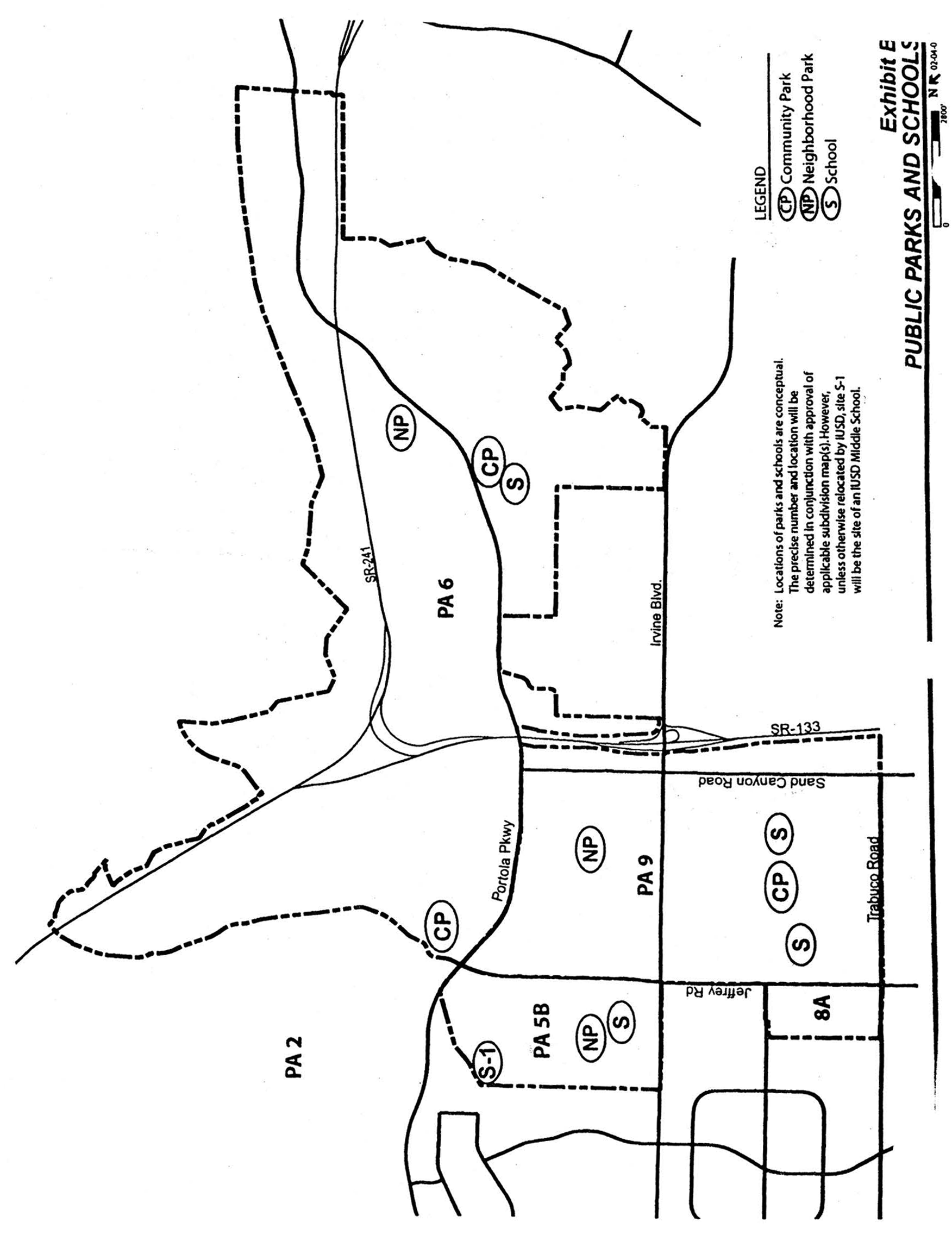
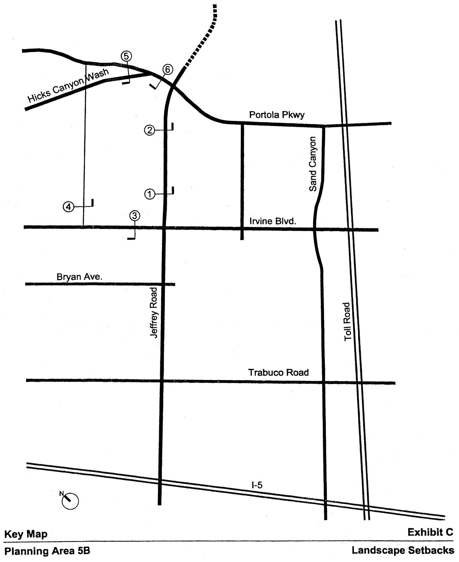
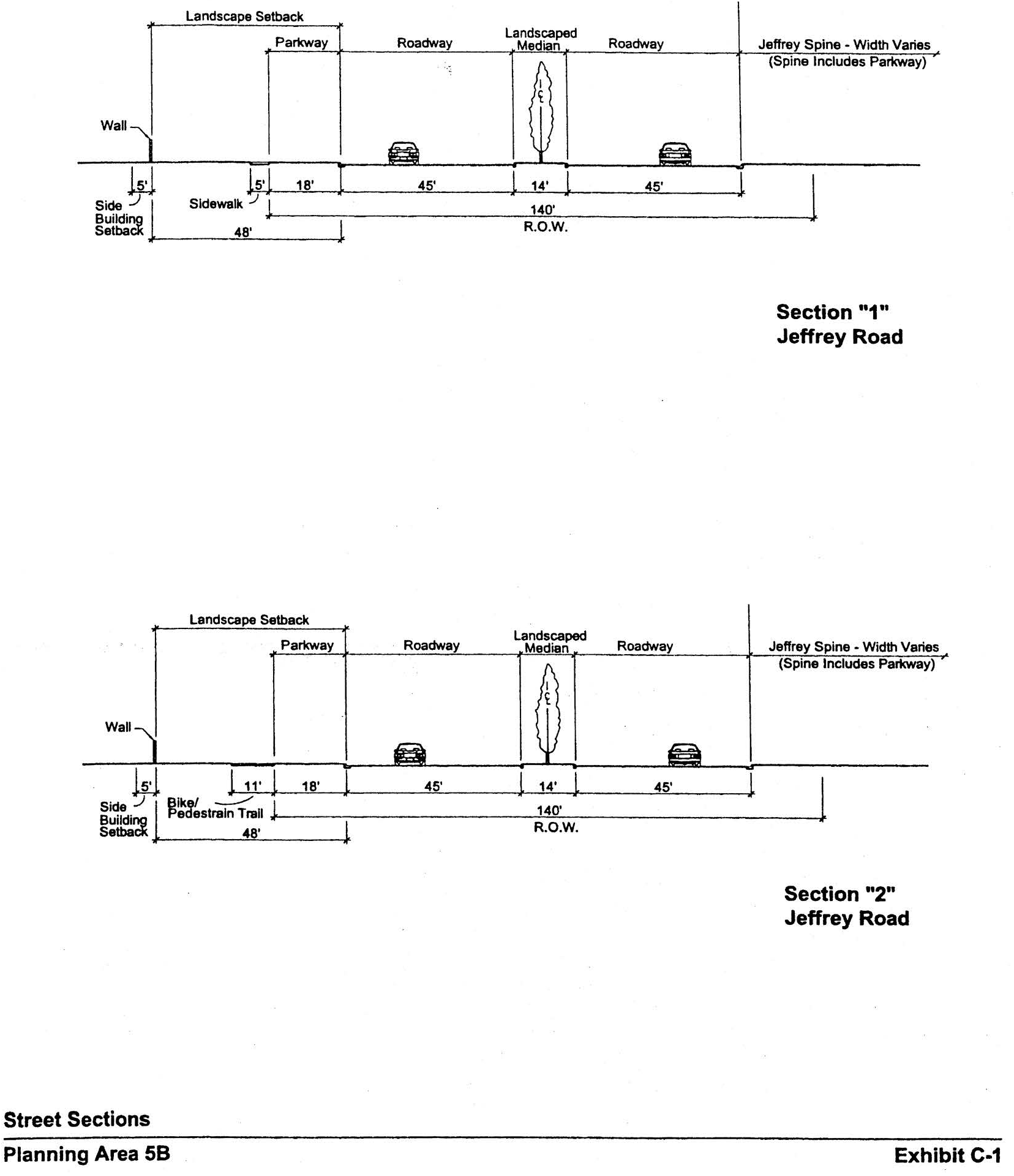
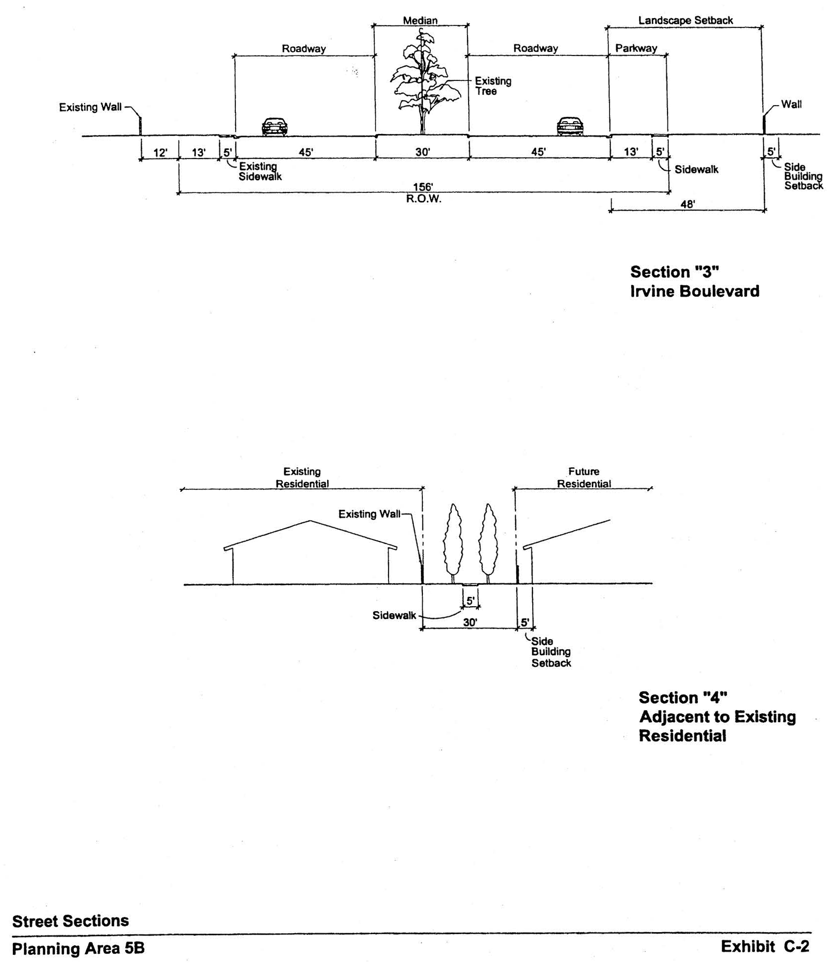
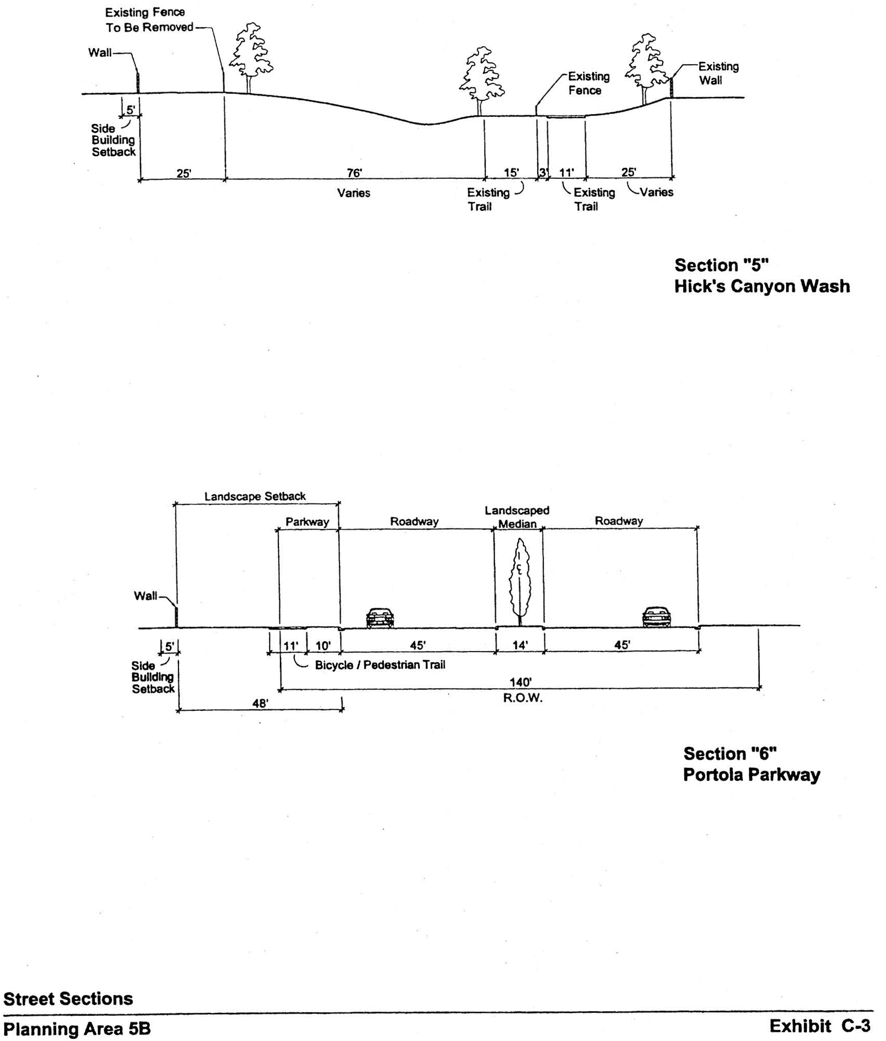
Sec. 9-6-1.- Land use zoning map.
(See Planning Area 6 map following Section 9-6-5)
(Code 1976, § V.E-806.1; Ord. No. 92-3, 4-14-92; Ord. No. 95-4, 5-9-95; Ord. No. 95-22, § 3, 11-28-95; Ord. No. 02-09, §§ 1—7, 6-11-02; Ord. No. 03-33, § 6, 1-22-04; Ord. No. 06-17, § 4, 9-26-06)
Sec. 9-6-2. - Introduction.
A.
Planning Area 6 is generally bounded by Jeffrey Road and SR-133 to the west, PA 51 (Orange County Great Park) to the south, PA 3 to the north and the City sphere boundary to the east.
B.
Planning Area 6 is intended to be a mixed-use village which provides for a full range of residential densities, commercial centers, recreation facilities, and office/high technology uses.
(Code 1976, § V.E-806.2; Ord. No. 92-3, 4-14-92; Ord. No. 95-4, 5-9-95; Ord. No. 95-22, § 3, 11-28-95; Ord. No. 00-02, § 4, 2-8-00; Ord. No. 02-09, §§ 1—7, 6-11-02; Ord. No. 09-02, § 3, 3-24-09)
Sec. 9-6-3. - Statistical analysis.
*ROW for SR-241/SR-133 is excluded.
**Any residential units in the Multi-Use category shall be taken from the Medium Density category and transferred units.
***Maximum units may be exceeded pursuant to Sections 9-6-7.B and 9-6-9.B.
****A maximum of 800,000 square feet of nonresidential intensity has been established for this planning area; however, up to 790 dwelling units (in excess of 4,670) may be substituted for nonresidential square footage in terms of equivalent traffic generation as set forth in Section 9-6-9.B.
1 Unallocated dwelling units represent those units remaining in a planning area that may be built anywhere in the same planning area. These units are within the maximum development intensity for the planning area; and, therefore, placement of unallocated units into any residential category within the planning area for purposes of development is determined to be consistent with the General Plan and Zoning Code with regard to intensity allocation only, provided that placement is otherwise consistent with site specific zoning regulations and that any potential environmental impacts are adequately addressed, including traffic impacts, pursuant to CEQA.
2 See Section 9-0-3.C. Building Intensity Standards.
(Code 1976, § V.E-806.3; Ord. No. 92-3, 4-14-92; Ord. No. 95-4, 5-9-95; Ord. No. 95-22, § 3, 11-28-95; Ord. No. 02-09, §§ 1—7, 6-11-02; Ord. No. 03-33, § 6, 1-22-04; Ord. No. 06-17, § 4(Exh. A), 9-26-06; Ord. No. 12-01, § 5(Exh. A), 1-24-12; Ord. No. 12-09, § 3(Exh. A), 5-22-12; Ord. No. 18-11, § 4(Exh. A), 12-11-18)
Sec. 9-6-4. - Land use regulations.
See Section 3-3-1 (Land use matrix).
(Code 1976, § V.E-806.4; Ord. No. 92-3, 4-14-92; Ord. No. 95-4, 5-9-95; Ord. No. 95-22, § 3, 11-28-95)
Sec. 9-6-5. - Development standards for Area 2.3K.
(City-wide regulations can also be found in Division 3.)
Individual residential projects in Medium Density category 2.3K may exceed 12.5 dwelling units/net acre. However, no individual project may exceed 31.0 dwelling units/net acre and the overall density within 2.3K cannot exceed 12.5 dwelling units/net acre. For projects within Area 2.3K, the actual net density of individual projects will determine the development standards to be applied according to Sections 3-37-13, 3-37-14, 3-37-15 and 3-37-16, as applicable.
(Code 1976, § V.E-806.5; Ord. No. 92-3, 4-14-92; Ord. No. 95-4, 5-9-95; Ord. No. 95-22, § 3, 11-28-95; Ord. No. 02-09, §§ 1—7, 6-11-02)
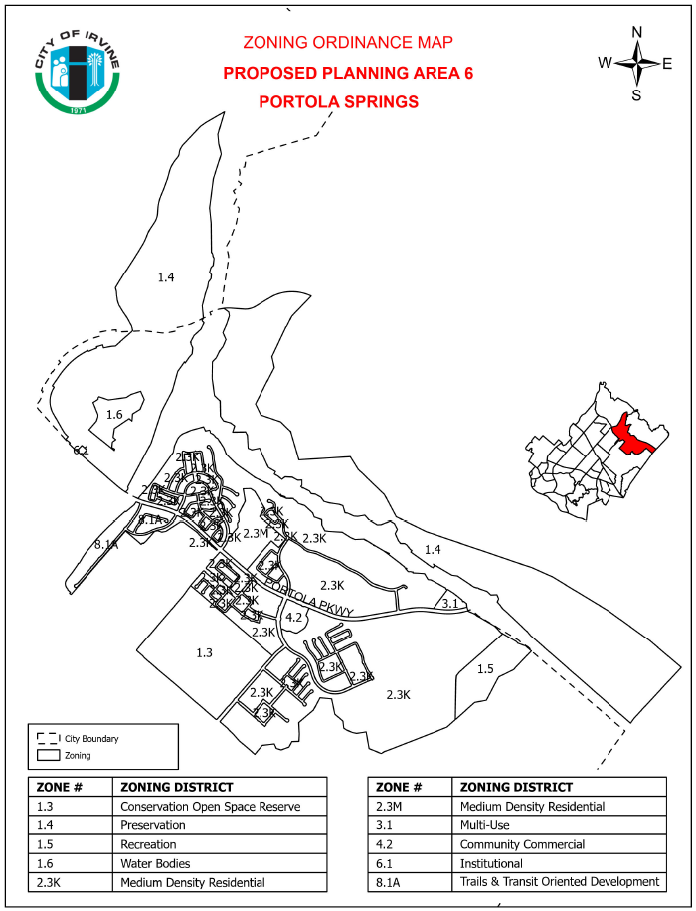
Sec. 9-6-7. - Special development requirements for Area 2.3K.
A.
Affordable housing.
1.
The affordable housing needs goal of 15 percent (5 percent Income I, II; 5 percent Income III; and 5 percent Income IV) of the actual number of units built in Planning Area 6 may be met utilizing the menu option as established in the Housing Element. The achievement of the Income I, II and III affordable housing goals is contingent upon the availability of financial incentives which bridge the gap between the actual cost of construction of a market unit and an affordable unit. The City will provide available financial assistance to help achieve the affordable housing needs goal for these planning areas.
2.
In conjunction with the submittal of the first tentative map within this planning area, the applicant shall submit a comprehensive affordable housing program covering Planning Areas 5, 6, 8, and 9 as called for in Chapter 2-3 of the Zoning Code. The affordable housing goal of 15 percent (5 percent Income I, II; 5 percent Income III; and 5 percent Income IV) of the actual number of units built shall be addressed in the affordable housing program. The program shall be reviewed by the Planning Commission prior to its approval of the first tentative map and approved by the City Council prior to recordation of the first final map.
B.
Maximum dwelling units. Notwithstanding the provisions of Section 9-6-3, a total maximum of 300 dwelling units may be transferred by the landowner from Planning Area 5B (102 units) and/or Planning Area 9 (198 units) into Planning Area 6. In addition, up to 326 dwelling units may be transferred from Area 8.1A to Area 2.3K within Planning Area 6. In addition, up to another 282 units may be transferred from Planning Area 9 and/or Planning Area 40 into Planning Area 6. It is the intent of this provision to facilitate a level of development that remains within the total number of dwelling units authorized by the North Irvine Transportation Mitigation Implementing Development Agreement between the City of Irvine and the Irvine Company.
The transfer of units described in this Section will be subject to approval of one or more subdivision maps, which will require the preparation of the appropriate level of traffic impact analysis. However, consistent with the traffic impact analysis prepared in conjunction with Zone Change 00818601-PZC, units transferred pursuant to this Section shall be single-family detached and/or attached or detached condominiums.
Approval of the transfer of units will be required for receiving areas and will be appropriately and administratively noted in Sections 9-6-3, 9-6-7, 9-9-3, 9-9-7, 9-40-3, and 9-40-7, as applicable.
C.
Parks. The locations of public parks are conceptually shown on Exhibit B. Private parks will also be provided in order to meet local park requirements.
1.
The community park requirement for PA 6 will be satisfied by the dedication of parkland and/or construction of park improvements consistent with the Community Parks Park Plan (case number 00321912-PPP) as may be amended from time-to-time.
D.
Arterial highways. The following arterials are located adjacent to or within Planning Area 6:
E.
Eucalyptus trees. The existing eucalyptus windrows in PA 6 will be retained in median landscaping, landscaped setbacks, parks, the Jeffrey Open Space Trail, trails and areas adjacent to open space to the extent trees are deemed sufficiently healthy for preservation in accordance with a survey conducted by a certified arborist and do not conflict with fuel modification requirements and do not conflict with infrastructure improvements.
F.
Preservation/NCCP Reserve dedication. Prior to or concurrent with the recordation of the first subdivision map in PA 6, the applicant shall record an offer of dedication in favor of the City for Area "R" as shown on Exhibit A. Such offer will be in compliance with Section 8-14-1 and may be accepted by the City no sooner than 90 days following issuance of building permits for 75 percent of the 4,500 total dwelling units permitted and 75 percent of the total square feet of industrial structures, or at the completion of development within the planning area.
1.
Any trails in the NCCP Reserve and/or preservation area will be designed, constructed, owned and maintained by the City of Irvine or its designee.
2.
Because the NCCP Reserve and Preservation category are co-terminus in this dedication, the NCCP shall serve as the Open Space and Management Plan required under Section 9-16-1.
G.
Pedestrian links. Sidewalks will be located on public streets in accordance with City plans and guidelines. Sidewalks on private streets may vary from standard City plans where appropriate to reduce grading or provide better pedestrian linkages. Pedestrian walks should link commercial sites, schools, parks and residential neighborhoods. With the submittal of the first residential tract map, a Master Plan of bicycle and pedestrian trails will be provided.
H.
Jeffrey Open Space Trail. The Jeffrey Open Space Trail (JOST) within Planning Area 6 will provide a continuous open space edge the eastern side of the ultimate alignment of Jeffrey Road from Portola Parkway to the NCCP boundary. The JOST shall be the equivalent of 325 feet in width as measured from the Jeffrey Road curb face (approximately 28 acres). JOST width may vary, but may not be less than 200 feet. The JOST will serve as the village edge for the adjoining development areas, and no further village edge dedications or improvements will be required. Improvement of the JOST shall be consistent with the design character listed in Section 9-6-7.H. JOST improvements may be proposed by the applicant in lieu of dedication, as generally defined in Section 5-5-1004.F.1. of the Municipal Code (in effect at the time of approval of this zoning) and in accordance with this section.
1.
JOST function.
a.
The JOST shall provide a place that will accommodate public trail and passive open space uses and which will achieve the following objectives:
(1)
Provide a Class I bicycle trail, and where deemed appropriate, an unpaved pedestrian trail.
(2)
Include features such as, but not limited to, riparian elements, water quality elements, picnic areas, shade structures, restrooms and other passive recreational improvements.
(3)
Establish landscape and landforms that will provide the trail user with a meandering separation from Jeffrey Road, a village edge for newly developed planning areas, and a landscape buffer between new development and Jeffrey Road.
b.
Permitted uses: Except for utilities and General Plan roadway improvements, surface uses will be limited to trails, and associated passive public recreation and park-and-ride facilities. For the purposes of the JOST, features identified in Subsection H.1.a(2) are considered passive recreation.
2.
Overall park design. North of the I-5 Freeway, to the NCCP boundary in Planning Area 6 (approximately 117 acres), design of the overall Jeffrey open space spine shall be approved as a park design pursuant to Section 2-22-4.
Design concepts to be included in the overall design shall be consistent with the Jeffrey Open Space Trail consensus plan reviewed by City Council on May 13, 2003. The design shall address grade separated crossings and undergrounding any overhead utility lines, including costs, timing, and responsible entities.
Adoption of this overall park design shall establish parameters by which JOST segments will be approved as adjacent development proposals are processed. It is also anticipated that an implementation agreement between The Irvine Company and the City documenting mutual understandings related to implementation issues such as costs, timing, and responsibilities will be approved as a part of this process.
This overall park design shall be reviewed by the Planning Commission, the Community and Library Services Commission, and shall be approved by the City Council.
3.
Segment design approval process.
a.
Segment park design. In conjunction with an application for any subdivision map or community park plan adjacent to the spine, a segment park design for the adjacent JOST segment shall be submitted to the City by the applicant. The plan shall include:
(i)
JOST dimensions and acreage;
(ii)
Trails and pedestrian access to trails;
(iii)
Landscape elements;
(iv)
Conceptual plant palette;
(v)
Planned vehicular access or crossings;
(vi)
Special design features; and
(vii)
Passive recreational amenities and improvements.
b.
Request for improvements in lieu of dedication. Should improvements in lieu of land dedication be proposed by the applicant, fair market value and improvement costs shall be established in the manner defined in Section 5-5-1004 of the Municipal Code or by means mutually acceptable to the applicant and the Director of Community and Library Services. Any modifications to the design through the approval process will be addressed by the implementation agreement noted in Section 9-6-7-H.2.
c.
Segment plan approval. If the City adopts an overall park design, the segment park design shall be approved by the Directors of Community Development and Community and Library Services, provided the segment park design is deemed consistent with the overall park design. In the event the overall park design has not received approvals or if the segment park design is not consistent with an approved overall park design, the segment park design shall be subject to final approval by the Community and Library Services Commission. Appeals of decisions related to the segment park design shall be to the City Council.
4.
JOST improvement.
a.
The project developer's financial obligation to improve the JOST is limited to costs of construction of a permanent trail to be built in accordance with the City's 1985 "Guidelines for Bicycle Facilities in Irvine" (excluding grade separations used solely for trail systems).
b.
Prior to issuance of the first precise grading permit for property adjacent to the JOST, the developer shall commence construction of an 11-foot bicycle/pedestrian trail and all improvements in lieu of dedication, if any, within the adjacent spine segment. Once commenced, the entire segment shall be completed in a single phase.
c.
Any grade-separated crossings shall be constructed and maintained by the City unless otherwise agreed to by the developer consistent with Subsection H.2 herein. The City shall also maintain the bicycle/pedestrian trail, landscaping and all other improvements within the JOST.
5.
JOST conveyance.
a.
Prior to the release of a final map for an area adjacent to the JOST, or the approval of any other conveyance document created for transfer of ownership of any community park land adjacent to the JOST to the City, the applicant shall submit for review to the satisfaction of the Director of Community Development and the City Attorney, the form of an irrevocable offer of dedication to the City of Irvine for the JOST segment adjacent to the development.
b.
The City shall accept the offer of dedication for the JOST and improvements in a timely manner following final inspection of improvements: within 90 days of improvements including landscaping, or within 30 days if the improvements include only the trail. The trail shall not be opened for public use until the City has accepted the offer of dedication.
I.
Trails. Prior to approval of the first residential tentative tract map within this planning area, the applicant shall submit a master trails plan, which addresses public and private trails and linkages, public viewpoints, public access points to the open space, signage, and construction phasing of trails. This plan shall include a pedestrian link along Portola Parkway connecting Sand Canyon Avenue through the planning area to the Transportation Corridor and the open space in the eastern part of the village. This plan shall be consistent with the General Plan Trails Network Figure B-4 and also demonstrate how access to dedicated open space will be controlled and managed by the City through fencing or other means. The master trails plan shall be submitted for review and comment by the Community and Library Services Commission and approved by the Planning Commission.
J.
Hicks Canyon Wash Trail Extension. At the time that Jeffrey Road is constructed north of Portola Parkway, the existing Hick's Canyon Wash Trail shall be extended as an under-crossing of Jeffrey Road to accommodate connection to the Jeffrey Open Space Trail.
K.
Village theme. The architectural design shall address detail articulated on all sides of the structures visible from streets, paseos, and other public areas. Particular attention shall be given to windows, balconies, doors, and other design elements. The elements and qualities which shall be encouraged are human scale and privacy, play of light using shade and shadows to provide relief, and variations in roof lines. Large blank walls with minimal detail shall be discouraged.
L.
Residential/community commercial architecture. A variety of architectural styles and forms will be used to express differences among projects and neighborhoods within the planning area. Variations of the following elements may be used by the developer:
1.
Overall form. Some symmetry at front facades or around entries will be used to create balance in the overall form. Entry view corridors terminating at blank walls and/or blank building elevations shall be discouraged. Views of elevations of multifamily structures with exterior walkways serving as common access for dwellings on second and third floors shall be screened from public rights-of-way either through building orientation or other architectural or landscape elements.
2.
Roof form. Roof massing will be varied with a strong cornice line. Clay, concrete tile, and slate will be used predominantly with consistent earthtone colors.
3.
Details. Simple cornices, moldings, projections and recesses, and integral-colored accent materials such as ceramic tile, brick, garden walls (stone or painted stucco) and picket gates will be used.
4.
Site design. Terraces, plazas, arcades, colonnades, and pergolas will be used to define pedestrian areas.
5.
Building heights along arterial roadways. Residential structures adjacent to arterial roadways shall not exceed two stories.
6.
Architectural features. Architectural features (not including chimneys) on individual residential structures may in limited circumstances exceed the established height limit by a maximum of 10 percent of the roof area on which the structure is secured but in no event shall exceed 10 feet above applicable zoning district height limit.
M.
Industrial architecture. The industrial portion of the planning area will have a clean and contemporary architectural style, similar to Irvine Spectrum. In conjunction with each tentative tract map ("B" map) or parcel map for medical and science parcels adjacent to areas zoned residential, the applicant shall demonstrate how medical and science uses will be compatible with residential uses with particular reference to proposed building heights, locations of loading docks and storage areas, treatment of parking areas, and proposed landscaping. Vehicular access between medical and sciences uses and adjacent residential development shall be evaluated at the time of tentative tract maps ("B" maps) or parcel maps. Vehicular access shall be designed so that conflicts with residential neighborhoods are minimized.
N.
Landscape setbacks. The landscape setbacks for the project edge shall be in accordance with Exhibits C. Additionally, streetscapes required with development of Planning Area 6 shall be consistent with the City of Irvine Master Streetscape Plan.
O.
Alternative setback standards. Alternative setback standards for setbacks internal to the planning area may be approved in conjunction with any subsequent Planning Commission approval. A description of the proposed setbacks and how they differ shall be submitted. The Planning Commission will consider the following criteria and may appropriate findings, if necessary:
1.
General character. Relationship in scale, bulk, coverage and density with surrounding land uses.
2.
Quality of life. Whether the proposed alternative standard will result in an adverse impact on existing neighborhoods.
3.
Suitability. The physical suitability of the site for the proposed project.
4.
Limitations. Such setbacks shall not be used to deviate from setbacks established for village edges.
P.
Multi-use. The Multi-Use category may be developed with a single land use.
Q.
Child care.
1.
The need for child care facilities shall be recognized in the development of Planning Area 6. Prior to the approval of the first tentative tract map for the residential portion of this planning area, the number of private sector child care slots to be provided will be determined by the City and the developer in accordance with the City policy in effect at that time. The number of slots will be based on the actual number of residential units to be built and on a determination of child care needs within the planning area.
2.
Prior to the approval of the first tentative tract map for the residential portion of this planning area, the applicant shall address the following when locating any child care center:
a.
The location of any child care center(s) shall be determined.
b.
The size of any parcel that is designated for a potential child care center.
c.
Child care centers shall be compatible with adjacent uses. Development of a child care center in conjunction with proposed elementary schools and adjacent to neighborhood parks, residential developments and/or neighborhood commercial centers shall be encouraged.
d.
In locating a child care center, the proposed site shall be evaluated with regard to factors that might be detrimental to the public health, safety, or welfare, including, but not limited to, proximity to high-traffic-volume roadways, hazardous materials, and major generators of traffic.
R.
Hydrology. In conjunction with the submittal of specific development plans, the applicant shall demonstrate that storm drain systems will include project design features for treatment of project related stormwater runoff to improve the quality of discharges into San Diego Creek. This will be addressed as follows:
1.
BMPs (for example, BMPs that achieve similar performance per National BMP Database ratings as catchbasin inserts) will be designed to infiltrate, filter or treat the volume of runoff produced by either (a) a 24-hour 85th percentile storm event (runoff from 0.75 inch, 24-hour storm), or (b) the maximum flow rate of runoff produced by a rainfall intensity of 0.2 inch of rainfall per hour.
S.
Circulation. In conjunction with the submittal of any traffic study for this planning area, alternative solutions for any proposed triple left turn lanes shall be identified.
T.
Trip monitoring. Prior to the approval of any discretionary application for new development, the applicant shall submit to the Community Development Department a table documenting the cumulative total of approved development and trips within Area 2.3K, in a manner meeting the approval of the Director of Community Development to ensure the overall average daily trips (ADT) do not exceed the 95,019 ADT as mitigated by prior payment of NITM fees.
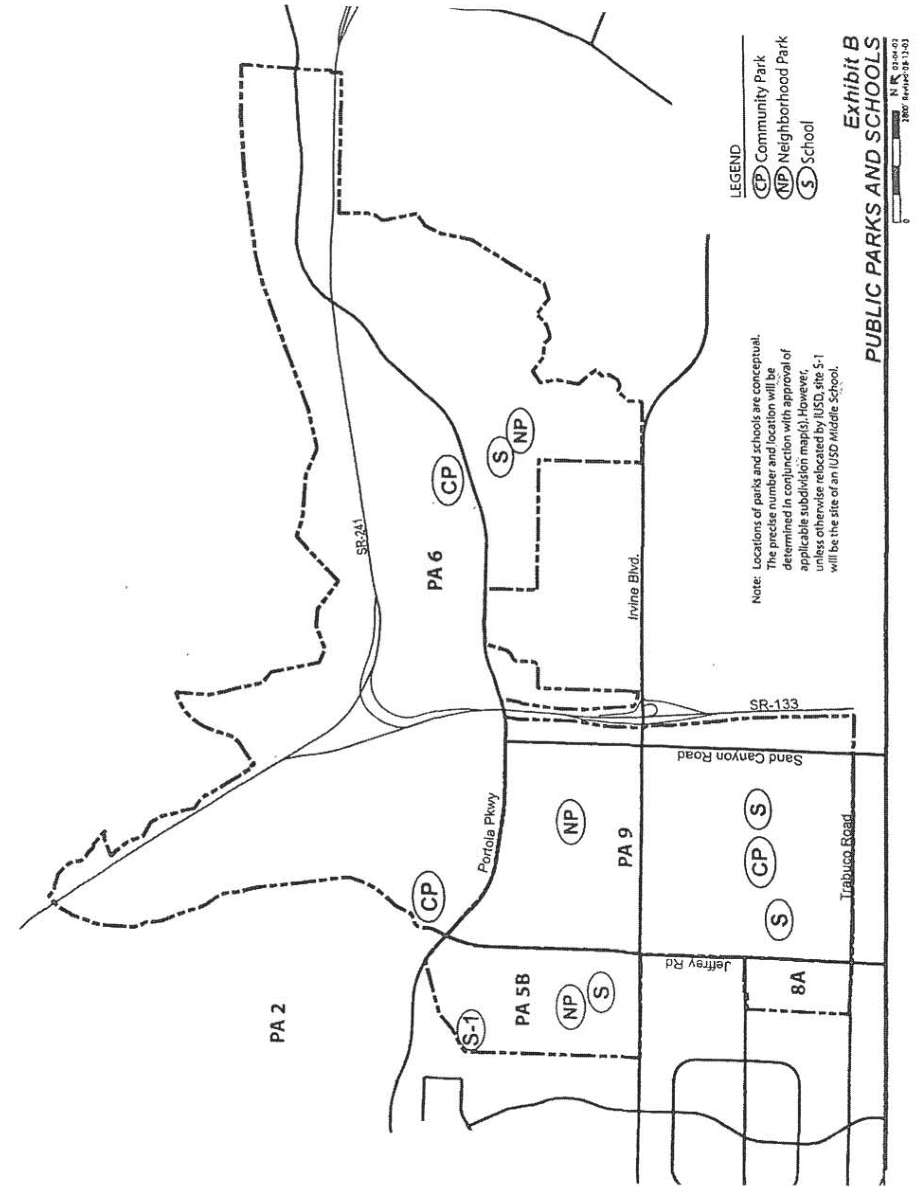
KEY MAP
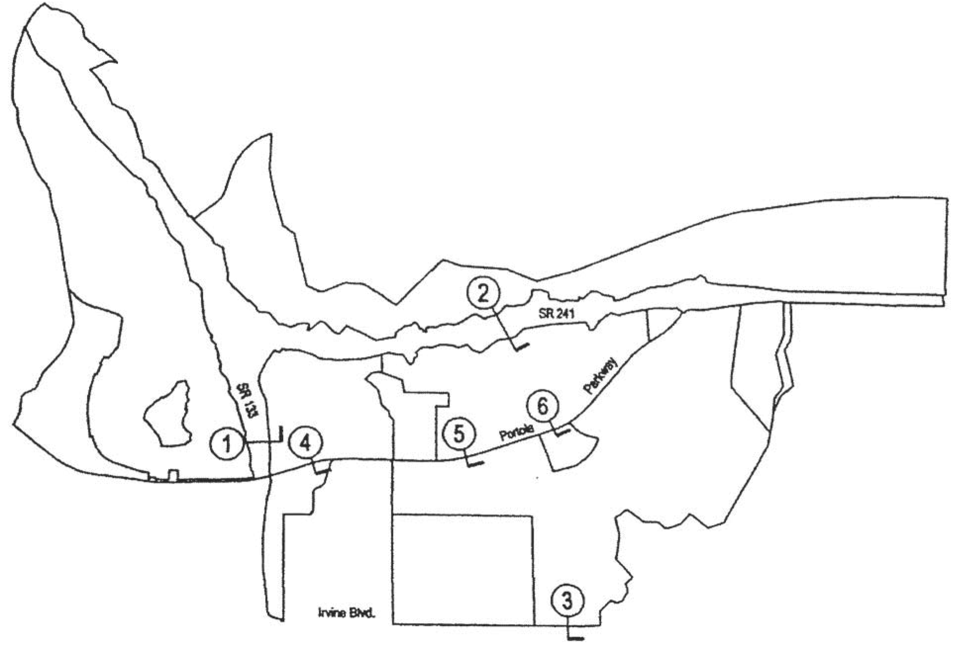
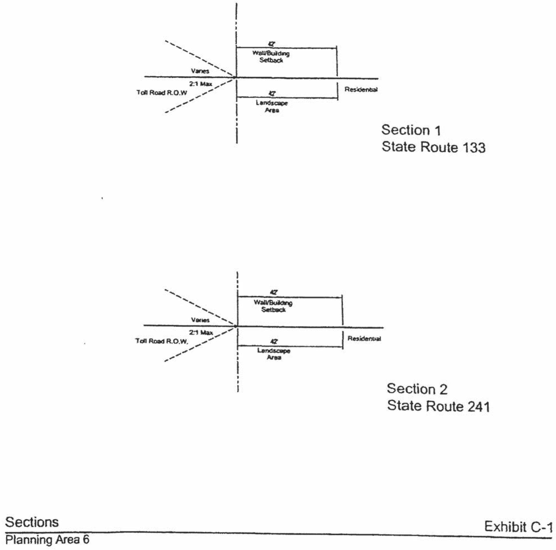
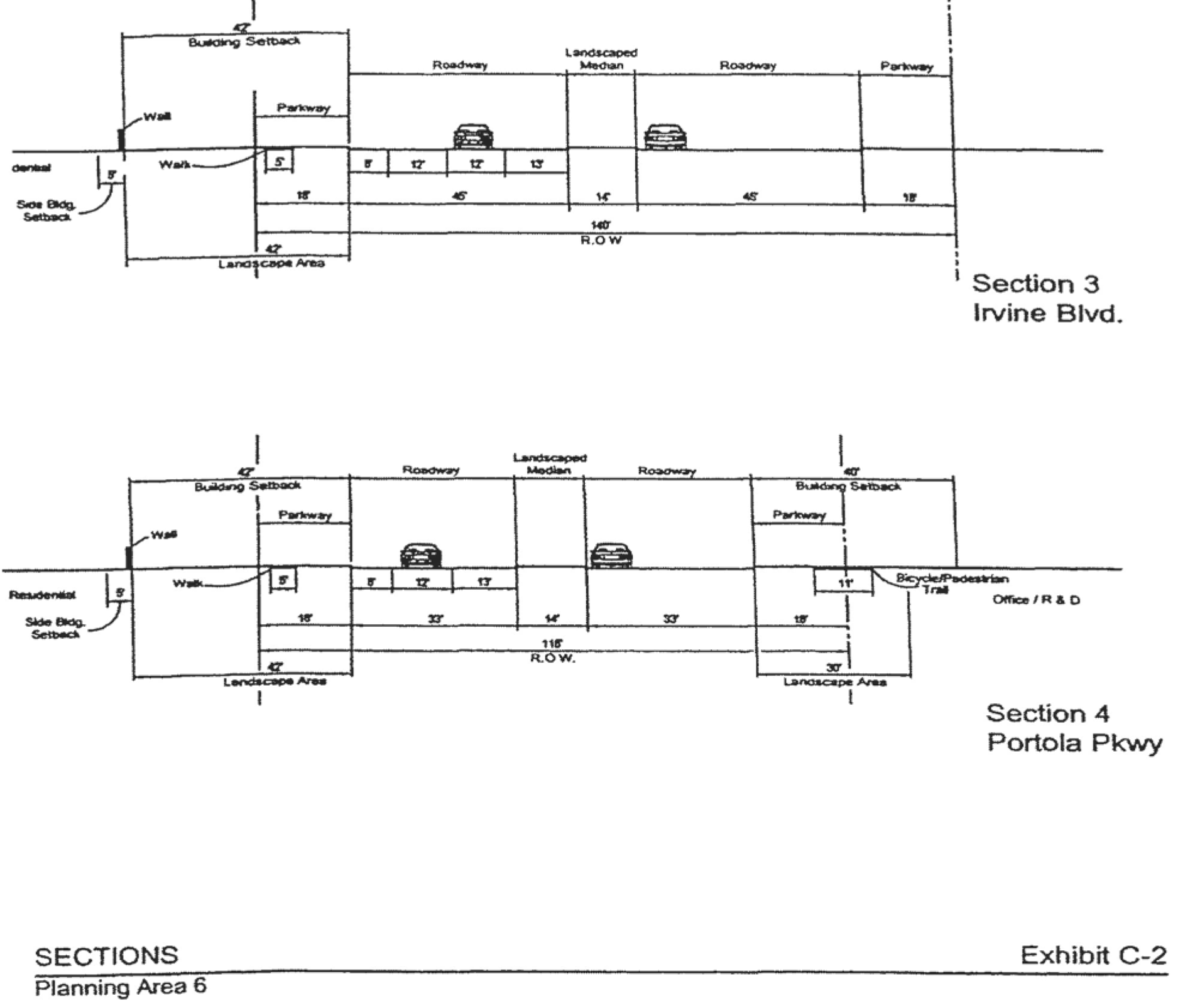
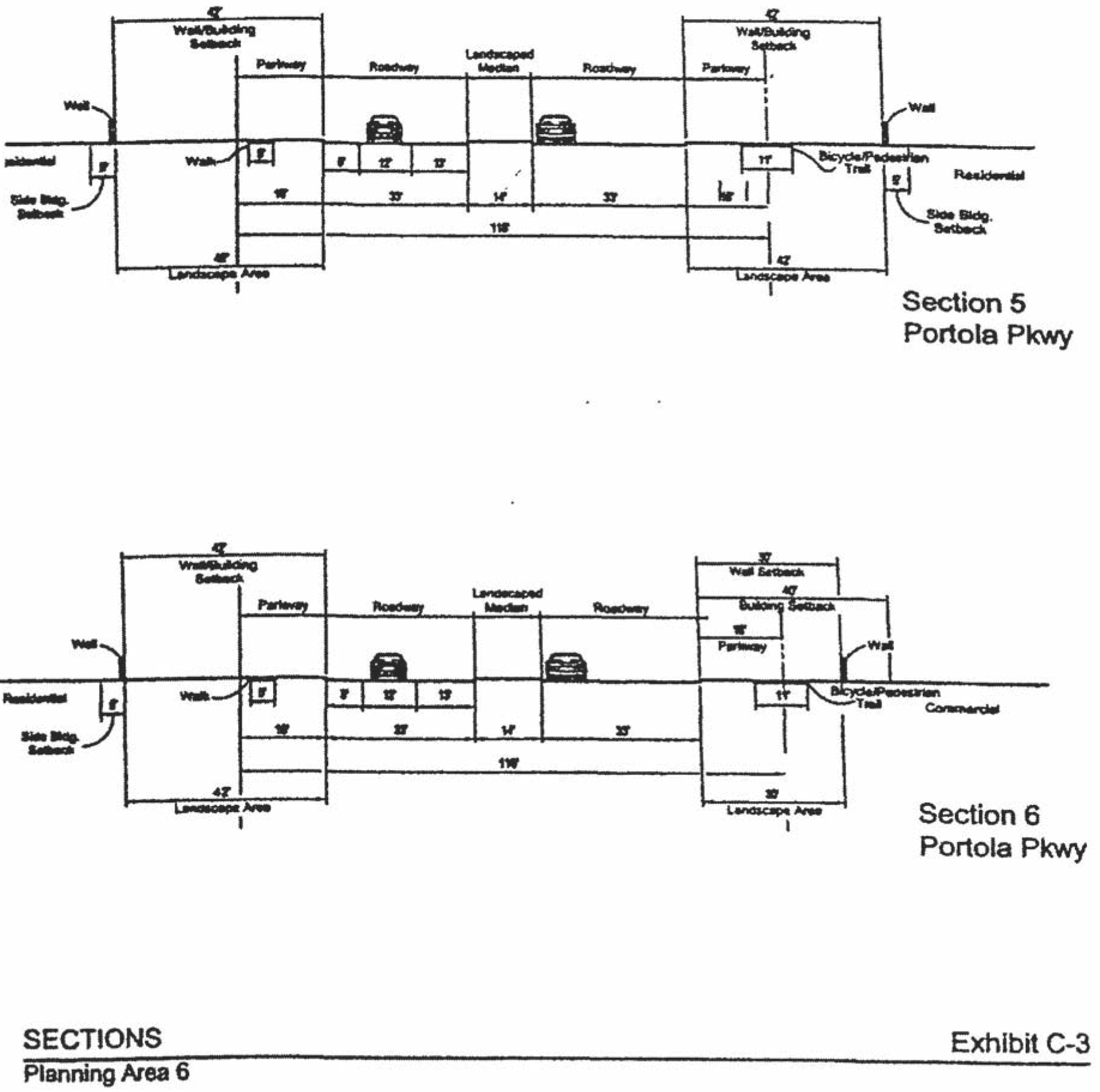
(Ord. No. 02-09, §§ 1—7, 6-11-02; Ord. No. 03-33, § 6, 1-22-04; Ord. No. 04-03, § 3, 2-24-04; Ord. No. 09-02, § 3, 3-24-09; Ord. No. 12-01, § 5(Exh. A), 1-24-12; Ord. No. 18-11, § 4, 12-11-18; Ord. No. 21-05, Exh. A, 5-11-21; Ord. No. 23-09, § 4(Exh. A), 5-23-23; Ord. No. 25-22, § 4, 9-9-25)
Sec. 9-6-8. - Special development requirements for Area 2.3M.
1.
Village theme. The village or "neighborhood" theme of the site should be reminiscent of villages of early California, a neighborhood where the different design elements such as a diversity of home types, roadways, parks and open space are woven together to create a cohesive community. The project site plan should also reinforce the connection between the existing "flatland" and "hillside" areas.
2.
Architectural design. The architectural design shall address detail articulation on all sides of the structures visible from streets, paseos and other public areas. Particular attention shall be given to windows, balconies, doors and other design elements. The elements and qualities that shall be encouraged are pedestrian scale and privacy, play of light using shade and shadows to provide relief and variations in roof-lines. Large blank walls with minimal detail shall be discouraged.
3.
Architectural features. Architectural features on individual residential structures may in limited circumstances exceed the established height limitation by a maximum of 10 percent of the roof area on which the structure is secured but in no event shall exceed 10 feet above applicable zoning district height limit.
4.
Parks. With the submittal of a vesting tentative tract map for development of Lambert Ranch, the applicant will submit a park plan in accordance with Chapter 2-22. The park plan will address the community and neighborhood park dedication requirements for Lambert Ranch.
a.
Neighborhood parks shall be located within the Lambert Ranch development. The aesthetic design goal of the parks shall be to preserve and enhance the existing landscape attributes of the site. Neighborhood parks shall be located to provide convenient pedestrian access from residential units.
b.
The community park requirement for Lambert Ranch will be satisfied by the provision of park in-lieu fees per Section 5-5-1004, subdivision ordinance.
5.
Pedestrian network. Pedestrian circulation is provided through a network of sidewalks and pedestrian paseos. The network has been designed to encourage pedestrian circulation, enhancing a sense of community and to provide access between residential units and the neighborhood parks and open space system, adjacent community park, schools, commercial sites, and residential neighborhoods. Where sidewalks are not provided along private ways or driveways, pedestrian access to units shall be provided from a pedestrian paseo. A minimum of five-foot width shall be provided for walks along key pedestrian corridors, including along the neighborhood park, Esplanade, Paseos and along Portola Parkway. A four-foot width will be limited to sidewalks along interior residential streets.
No lot with frontage on C Drive East and West will be located more than 150 feet from a pedestrian access connecting the private drive to the interior paseo system.
6.
Streets and private ways. Streets shall be designed to encourage "traffic calming" and enhance pedestrian circulation. "Traffic calming" techniques, such as narrower street, choker and special pavement, are encouraged to minimize vehicular speed.
7.
Landscaping. Landscape character shall be compatible with adjacent planning areas through continuation of the general character of plantings along Portola Parkway consistent with the City of Irvine Master Streetscape Plan. The existing early California landscape character of the hillside shall be enhanced with informal native, naturalized and ornamental plantings, while the "flatland" development shall have a combination of formal and informal landscape plantings. Entry landscape treatment shall occur at the primary neighborhood entry from Portola Parkway and secondary entry from Ridge Valley.
8.
Eucalyptus trees. The existing eucalyptus windrows on the project site will be retained in landscape setbacks and paseos to the extent the trees are deemed sufficiently healthy for preservation in accordance with a survey conducted by a certified arborist and do not conflict with fuel modification requirements and do not conflict with infrastructure improvements. A eucalyptus tree report will be provided and approved by the City of Irvine.
9.
Alternative setback standards. Alternative setback standards for setbacks internal to the planning area may be approved in conjunction with any subsequent Planning Commission approval. A description of the proposed setbacks and how they differ shall be submitted. The Planning Commission will consider the following criteria and may appropriate findings, if necessary:
a.
General character: Relationship to scale, bulk, coverage and density with surrounding land uses.
b.
Quality of life: Whether the proposed alternative standard will result in an adverse impact on existing neighborhoods.
c.
Suitability: The physical suitability of the site for the proposed project.
d.
Limitations: Such setbacks shall not be used to deviate from setbacks established for village edges.
10.
Libraries. In the event that a City-wide library impact fee is adopted and in force, the developer shall pay this fee prior to issuance of building permits for new development.
11.
Lambert's residence. The 1.67-acre remainder parcel for vesting tentative tract map 16868 shall not be further subdivided to create additional buildable lots for future development.
(Ord. No. 06-17, § 4, 9-26-06)
Editor's note— Ord. No. 06-17, § 4, adopted September 26, 2006, amended the Code by adding a new section to be numbered 9-6-7. In order to prevent duplication of section number, the section has been renumbered at the discretion of the editor.
Sec. 9-6-9. - Special development requirements for Area 8.1A.
A.
Trails and Transit Oriented Development. The 8.1A Trails and Transit Oriented Development zoning district allows a variety of uses on the same site consistent with the Multi-Use land use category as defined in the General Plan. The Trails and Transit Oriented Development designation allows for a mix of residential, commercial, recreational, and education uses that support a multi-use environment, and which is complementary to the 8.1 Trails and Transit Oriented Development District located in PA 51 and to the Orange County Great Park. Pedestrian paths and trails, including, but not limited to, bike paths, sidewalks, and recreational trails, shall be encouraged in the Trails and Transit Oriented Development District. The variety of trails types and transit choices are intended to provide connectivity to the Orange County Great Park, the 8.1 Trails and Transit Oriented Development District in Planning Area 51, to public open space outside the Orange County Great Park, and to other nearby areas.
Development in Area 8.1A shall:
•
Promote residential communities that are physically connected to each other. Foster community and connectedness between adjacent land uses.
•
Promote livability, transportation efficiency, and walkability.
•
Allow residential dwelling units to be mixed with other uses providing choices in location, type and size based on compatibility with surrounding uses.
•
Promote the development of trails that serve as recreational opportunities and as transportation connections between residential uses, commercial and industrial uses, the Orange County Great Park and transportation hubs.
•
Encourage clustering of residential units, where feasible, to provide for opportunities to develop public and private open spaces within the development.
•
Promote a diversity of housing types to accommodate a range of economic levels and age groups to live within a community.
•
Provide appealing and functional pedestrian street environments to promote pedestrian activity.
•
Encourage vertical and horizontal integration of commercial office and retail land uses into the residential development, where feasible.
In addition, the following planning standards shall apply throughout Area 8.1A:
1.
Allowable residential units may be mixed with other uses providing choices in location, type and size based on compatibility with surrounding uses. Clustering of residential units shall be encouraged to provide for greater opportunities to develop neighborhood parks as well as public and private open spaces within the development.
2.
Reserved.
3.
Community and neighborhood park requirements shall be provided in accordance with City of Irvine Park Code.
4.
The inclusion of alternative educational, vocational, R&D, business and office facilities in the form of high technology research and vocational centers, business incubators, community outreach partnership centers, conference and group presentation facilities within a "campus commons" framework shall be allowed.
5.
The introduction of unique land uses that are not specified in the permitted and conditionally permitted uses but fit within the intent of Area 8.1A shall be encouraged subject to an initial determination by the Director of Community Development and subsequently, subject to a conditional use permit approved by the Planning Commission.
B.
Reserved.
C.
Reserved.
D.
Changes in intensities. The Statistical Analysis Table (Section 9-6-3) shall be administratively adjusted to reflect the allocation of development intensity as approved by applicable discretionary case applications for Areas 2.3K and 8.1A.
E.
Residential/community commercial architecture. A variety of architectural styles and forms will be used to express differences among projects and neighborhoods within the planning area. Variations of the following elements may be used by the developer.
1.
Overall form. Some symmetry at front facades or around entries will be used to create balance in the overall form. Entry view corridors terminating at blank walls and/or blank building elevations shall be discouraged. Views of elevations of multifamily structures with exterior walkways serving as common access for dwellings on second and third floors shall be screened from public rights-of-way either through building orientation or other architectural or landscape elements.
2.
Roof form. Roof massing will be varied with a strong cornice line. Clay, concrete tile, and slate will be used predominantly with consistent earthtone colors.
3.
Details. Simple cornices, moldings, projections and recesses, and integral-colored accent materials such as ceramic tile, brick, garden walls (stone or painted stucco) and picket gates will be used.
4.
Site design. Terraces, plazas, arcades, colonnades, and pergolas will be used to define pedestrian areas.
5.
Building heights along arterial roadways. Residential structures adjacent to arterial roadways shall not exceed two stories.
6.
Architectural features. Architectural features (not including chimneys) on individual residential structures may in limited circumstances exceed the established height limit by a maximum of 10 percent of the roof area on which the structure is secured but in no event shall exceed 10 feet above applicable zoning district height limit.
F.
Industrial architecture. The industrial portion of the planning area will have a clean and contemporary architectural style, similar to Irvine Spectrum. In conjunction with each tentative tract map ("B" map) or parcel map for medical and science parcels adjacent to areas zoned residential, the applicant shall demonstrate how medical and science uses will be compatible with residential uses with particular reference to proposed building heights, locations of loading docks and storage areas, treatment of parking areas, and proposed landscaping. Vehicular access between medical and sciences uses and adjacent residential development shall be evaluated at the time of tentative tract maps ("B" maps) or parcel maps. Vehicular access shall be designed so that conflicts with residential neighborhoods are minimized.
G.
Landscape setbacks. The landscape setbacks for the project edge shall be in accordance with Exhibit C. Additionally, streetscapes required with development of Planning Area 6 shall be consistent with the City of Irvine Master Streetscape Plan.
H.
Alternative setback standards. Alternative setback standards for setbacks internal to the planning area may be approved in conjunction with any subsequent Planning Commission approval. A description of the proposed setbacks and how they differ shall be submitted. The Planning Commission will consider the following criteria and may appropriate findings, if necessary.
1.
General character. Relationship in scale, bulk, coverage and density with surrounding land uses.
2.
Quality of life. Whether the proposed alternative standard will result in an adverse impact on existing neighborhoods.
3.
Suitability. The physical suitability of the site for the proposed project.
4.
Limitations. Such setbacks shall not be used to deviate from setbacks established for village edges.
I.
Affordable housing. In conjunction with the submittal of the first tentative map for residential purposes in Area 8.1A, the applicant shall submit an amendment to the comprehensive affordable housing program covering Planning Areas 1, 5, 6, 8, and 9, as adopted, consistent with City Council Ordinance No. 02-09.
J.
Traffic calming, pedestrian/bike access. In conjunction with the submittal of the first tentative map for residential purposes in Area 8.1A, the applicant shall demonstrate traffic calming measures to mitigate vehicle speeds on the main internal street routes within the development. Additionally, the applicant shall incorporate design features which provide reasonable direct pedestrian/bike access to 1) the Orange County Great Park from this development via the proposed pedestrian/bike overcrossing of Irvine Boulevard, and 2) from Irvine Boulevard to the nearby shopping center at Irvine Boulevard/Sand Canyon intersection.
(Ord. No. 12-01, § 5(Exh. A), 1-24-12; Ord. No. 18-11, § 4(Exh. A), 12-11-18)
Sec. 9-8-1.- Land use zoning map.
(See Planning Area 8 map following Section 9-8-5.)
(Code 1976, § V.E-808.1; Ord. No. 92-3, 4-14-92; Ord. No. 95-3, § 3D, 4-25-95; Ord. No. 95-4, 5-9-95; Ord. No. 95-22, § 3, 11-28-95; Ord. No. 02-09, §§ 1—7, 6-11-02; Ord. No. 08-06, § 5, 7-8-08; Ord. No. 09-02, § 3, 3-24-09)
Sec. 9-8-2. - Introduction.
Planning Area 8, Northwood, is located along the City's northern edge. Boundaries include Culver Drive to the west, Hicks Canyon Wash and Irvine Boulevard to the north, Jeffrey Road to the east and Interstate 5 (Santa Ana Freeway) to the south. A "New Community" comprises Area 2.3H.
(Code 1976, § V.E-808.2; Ord. No. 92-3, 4-14-92; Ord. No. 95-3, § 3D, 4-25-95; Ord. No. 95-4, 5-9-95; Ord. No. 95-22, § 3, 11-28-95; Ord. No. 02-09, §§ 1—7, 6-11-02)
Sec. 9-8-3. - Statistical analysis.
1 Unallocated dwelling units represent those units remaining in a planning area that may be built anywhere in the same planning area. These units are within the maximum development intensity for the planning area; and. therefore, placement of unallocated dwelling units into any residential category within the planning area for purposes of development is determined to be consistent with the General Plan and Zoning Code with regard to intensity allocation only, provided that placement is otherwise consistent with site specific zoning regulations and that any potential environmental impacts are adequately addressed, including traffic impacts, pursuant to CEQA.
2 See Section 9-0-3.C, Building Intensity Standards.
(Code 1976, § V.E-808.3; Ord. No. 92-3, 4-14-92; Ord. No. 95-3, § 3D, 4-25-95; Ord. No. 95-4, 5-9-95; Ord. No. 95-22, § 3, 11-28-95; Ord. No. 02-09, §§ 1—7, 6-11-02; Ord. No. 03-02, § 4, 1-14-03; Ord. No. 05-16, § 2, 7-12-05; Ord. No. 08-06, § 5, 7-8-08; Ord. No. 10-04, § 3, 4-13-10; Ord. No. 12-09, § 3(Exh. A), 5-22-12)
Sec. 9-8-4. - Land use regulations.
See Section 3-3-1 (Land use matrix).
(Code 1976, § V.E-808.4; Ord. No. 92-3, 4-14-92; Ord. No. 95-3, § 3D, 4-25-95; Ord. No. 95-4, 5-9-95; Ord. No. 95-22, § 3, 11-28-95)
Sec. 9-8-5. - Development standards for Area 2.3H.
(City-wide regulations can also be found in Division 3.)
Individual residential projects in Medium Density category 2.3H may exceed 12.5 dwelling units/net acre. However, no individual project may exceed 31.0 dwelling units/net acre and the overall density within 2.3H cannot exceed 12.5 dwelling units/net acre. For projects within Area 2.3H, the actual net density of individual projects will determine the development standards to be applied according to Sections 3-37-13, 3-37-14, and 3-37-15, as applicable.
(Code 1976, § V.E-808.5; Ord. No. 92-3, 4-14-92; Ord. No. 95-3, § 3D, 4-25-95; Ord. No. 95-4, 5-9-95; Ord. No. 95-22, § 3, 11-28-95; Ord. No. 02-09, §§ 1—7, 6-11-02)
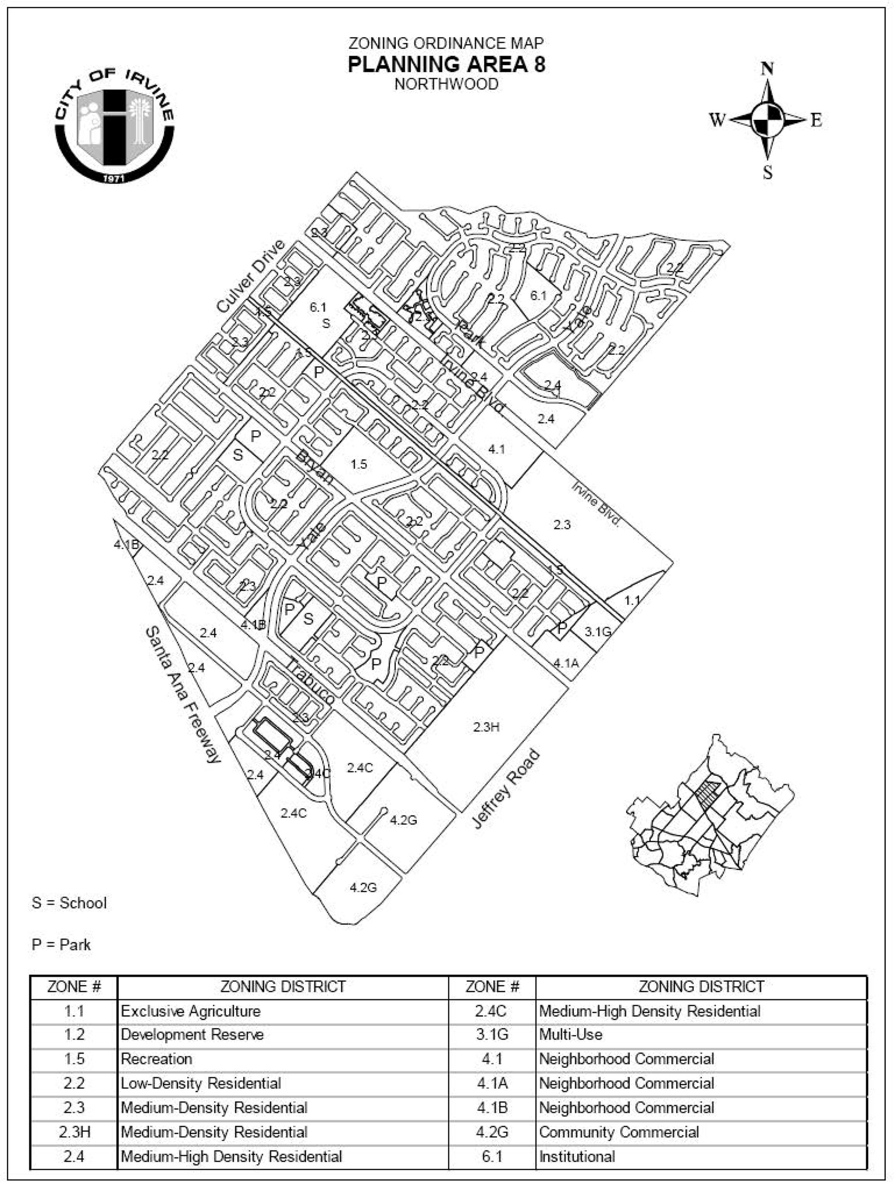
Sec. 9-8-7. - Special development requirements.
A.
See Division 3 for applicable development requirements.
B.
There shall be a maximum of 540 mobile home spaces in Northwood.
C.
At least 10 percent of all housing units built in Northwood shall be in a price range affordable by families of moderate income. For the purposes of this requirement, income and affordability ranges shall be as defined in the Housing Element of the General Plan and any implementing resolutions adopted by the City Council.
D.
The following requirements apply to Area 4.1A only:
1.
Development in this neighborhood commercial center shall not cause the average daily traffic from this center to exceed 14,750 trip ends. The development may be a mix of any permitted uses as long as the projected number of trip ends is not exceeded. Concurrent with any Master Plan or conditional use permit application, the applicant shall provide the gross floor area and traffic generation projections for each increment of development, as well as the cumulative gross floor area and traffic generation projections for the commercial center. The Director of Community Development, with the recommendation of the Director of Public Works, shall determine whether the proposed development exceeds the maximum average daily traffic generation limits.
2.
Any restaurant use, including ice cream parlors within a structure containing other uses, shall be subject to Planning Commission approval regarding parking and traffic circulation.
3.
Reserved.
4.
In accordance with the provisions of the City's eucalyptus windrow policy, existing eucalyptus trees may be removed subject to provision of an adequate buffer area with dense yet attractive landscaping adjacent to contiguous residential uses and provision of a block wall between the commercial uses and the City park.
5.
During review of the Master Plan for Area 4.1A, the Director of Public Works and the Director of Community Development shall analyze the adequacy of vehicular right-of-way and intersection improvements along Bryan Avenue and Jeffrey Road to accommodate this neighborhood commercial center. For any required improvements, the developer shall either post surety for or construct the required improvements prior to the issuance of building permits. If the developer posts surety and does not construct the improvements prior to the issuance of building permits, then the developer shall construct the improvements prior to the issuance of certificates of use and occupancy.
E.
The following requirements apply to Phase II only:
1.
Prior to the issuance of certificates of use and occupancy for Area 2.5C, the developer shall post signs at the boundaries of the project. The signs shall state that the development is located in a jet noise impact area. The format, number and location of these signs shall be as specified by the Director of Community Development.
2.
Reserved.
3.
The streetscapes on Interstate 5 shall be treated as a village edge adjacent to residential development. Prior to approval of any tentative map abutting Interstate 5, a plan for the village edge treatment shall be approved by the Planning Commission. This plan shall continue any already-established treatments along Interstate 5.
4.
Prior to approval of any tentative map in this phase, an agreement requiring formation of an assessment district and advanced funding for circulation and drainage improvements shall be approved by the City Council.
5.
In conjunction with any commercial rezoning of Area 6, in this phase, a program identifying the types and amounts of uses shall be submitted and approved by the City Council.
F.
The following requirements apply to 4.2G Community Commercial District only:
1.
Any Master Plan and/or conditional use permit proposed for parcels immediately adjacent to the existing residential uses (Parcel 8), Truman Avenue, (Parcel 6), and the residential zone (Parcels 1 and 2) of Parcel Map 93-185 shall incorporate all feasible design measures to minimize the potential land use compatibility impacts to the satisfaction of the Director of Community Development. The Master Plan and/or conditional use permit shall address, at a minimum, the following:
a.
Orient building loading areas away from existing residential and future institutional uses.
b.
Encourage equipment, storage and waste receptacle areas to be screened and/or designed away from existing residential and future institutional uses.
c.
Limit hours of operation on deliveries of goods, where applicable.
d.
Establish building setbacks along the western edge of Parcels 1 and 2 to a minimum of 15 feet zero inches as measured from the property line.
e.
To the extent feasible, locate Research and Development uses away from the existing residential and future institutional uses.
2.
The Planning Commission adopted a vehicle trip limit for the project area (4.2G Community Commercial District—Parcel Map 93-185) which shall not exceed 17,307 daily trips, 919 a.m. peak hour trips and 1,253 p.m. peak hour trips. The average daily trip rate, a.m. peak hour trips and p.m. peak hour trips will be monitored by the Director of Community Development and the Director of Public Works in conjunction with the submittal of each Master Plan and/or conditional use permit application required in the 4.2G Community Commercial zoning classification. If the project applicant proposes a land use that exceeds the approved vehicle trip limits, subsequent traffic analysis will be required and submitted in conjunction with the Master Plan application for the project.
3.
In conjunction with future Master Plan and/or conditional use permit applications for this site, the applicant shall analyze, as a special issue, any project-related traffic issues along Roosevelt Street between Jeffrey and Yale. Any identified project-related impacts must be mitigated by the applicant in accordance with the City requirements.
G.
Roosevelt Street is classified as a community collector.
H.
Prior to approval of any Master Plan and/or conditional use permit, the following components and design considerations shall be incorporated into the project design:
1.
The architecture shall be compatible with the existing architectural theme of Planning Area 8 (Northwood).
2.
The buildings shall use nonreflective glass or opaque materials.
3.
To the extent feasible, low-rise buildings shall be located along the western edge of the property.
4.
To maintain the existing landscaping theme within Planning Area 8 (Northwood), special landscape treatment for the intersection of Roosevelt and Jeffrey and the length of Roosevelt shall be provided.
5.
Additional landscaping materials along the western edge of Parcel 8 (Parcel Map 93-185) shall be provided to ensure the future buildings are screened from the existing residential uses.
I.
Prior to issuance of certificates of use and occupancy for Parcels 1 and 2 of Parcel Map 93-185, a 12-foot landscape buffer measured from the property line shall be provided and planted with landscape material which will adequately screen the proposed development within three years.
J.
Prior to approval of any Master Plan and/or conditional use permit, the applicant shall submit a final noise study, demonstrating that the project has incorporated all feasible design measures to minimize the potential for stationary noise impacts, to the satisfaction of the Director of Community Development. Said plan shall include, at minimum, the following components and design considerations:
1.
Loading docks (orientation, location, hours of operation).
2.
Waste/recycling containers (location).
3.
Truck activity/access points.
4.
City noise ordinance limits not exceeded at adjacent property lines, for interior noise sources, exterior mechanical equipment or other noise sources.
K.
In conjunction with the submittal of any conditional use permit which proposes Research and Development uses, the applicant shall submit an inventory of chemicals, hazardous substances, and biomedical and low-level radioactive materials which may be used and stored on-site and demonstrate that all feasible design measures have been incorporated into the project to minimize the potential for any public health and safety impacts resulting from storage, on-site disposal, or accidental release of materials. At a minimum, the submittal shall include the information listed below:
1.
Orange County Fire Department hazardous materials disclosure inventory form.
2.
Orange County Fire Department chemical classification form.
3.
Material safety data sheets from chemical manufacturers.
4.
Location of storage or disposal areas of materials on-site and/or in the tenant space/suite shown on a site plan and/or floor plan.
5.
Location of loading areas used for transfer of materials on a site plan and/or floor plan.
6.
Routes used for the transportation of materials (on- and off-site routes) on a site plan.
7.
Proposed hours of operation and transportation of materials.
8.
Documentation concerning required permits and special studies to be performed in order to obtain necessary permits through applicable regulatory agencies. The applicant shall have early consultation with those agencies that regulate substances to be used, generated, stored and/or emitted on-site prior to submittal of the Master Plan and/or conditional use permit.
When required by law to prepare a risk management prevention plan, the proposed project shall be subject to a one-quarter-mile (1,320 feet) public notification requirement as set forth by Irvine zoning ordinance Chapter 2-23. This public notice shall only be required to include the information submitted with the discretionary application and comments received by the regulatory agencies (e.g., South Coast Air Quality Management District, Orange County Fire Department, and Orange County Health Care Agency) concerning risk management prevention plans, health risk assessments and the use of acutely hazardous materials.
L.
Within 15 days after approval of the first Master Plan, the applicant shall deposit into a trust account with a financial institution of their choosing the sum of $15,000 for the sole purpose of financing the construction of approximately 100 linear feet of fencing to be generally located along Roosevelt Street at the southwesterly corner of the Northwood Villas project. The money shall be returned to the applicant unless the Board of Directors of the Northwood Villas Homeowners' Association votes within 90 days of being notified of the deposit to construct said fence. The design and construction of the fence shall be typical of such boundary fencing. Within 90 days of the vote, the Northwood Villas Homeowners' Association shall present the applicant with a cost estimate for the fence. An amount equal to that estimate shall be transferred to the Northwood Villas Homeowners' Association within 30 days of receipt of the cost estimate for the sole purpose of constructing said fence.
M
Special development requirements for New Community Area 2.3H.
1.
Maximum dwelling units. Notwithstanding the provisions of Section 9-8-3, dwelling units may be transferred by the landowner from this Planning Area 2.3H to Planning Area 6 and/or 9. No dwelling units will be allowed to transfer to this planning area. It is the intent of this provision to allow a total 12,350 dwelling units to be constructed in Planning Areas 5(2.31), 6, 8(2.31-1) and 9, to be measured cumulatively by actual permits issued.
2.
Landscape setbacks. The landscape setbacks for the project edge shall be in accordance with Exhibits B through B-2. Where not in conflict with requirements of adjacent drainage easements, landscaping will also be required along Trabuco Road between the landscape setback line and the development's perimeter wall.
3.
Affordable housing. The affordable housing needs goal of 15 percent (5 percent Income I, II; 5 percent Income III; and 5 percent Income IV) of the actual number of units built in Area 2.3H may be met utilizing off-site affordable housing credits. The achievement of the Income I, II and III affordable housing goals is contingent upon the availability of financial incentives which bridge the gap between the actual cost of construction of a market unit and an affordable unit. The applicant has the discretion to satisfy these goals through either the conversion of off-site existing market rate housing to affordable housing with 30-year restrictions and/or the extension of the term of affordability for offsite existing affordable units for a minimum of 40 years. The City will provide available financial assistance to help achieve the affordable housing needs goal.
In conjunction with the submittal of the first tentative map within this planning area, the applicant shall submit a comprehensive affordable housing program covering Planning Areas 5, 6, 8, and 9 as called for in Chapter 2-3 of the Zoning Code. The affordable housing goal of 15 percent (5 percent Income I, II; 5 percent Income III; and 5 percent Income IV) of the actual number of units built shall be addressed in the affordable housing program. The program shall be reviewed by the Planning Commission prior to its approval of the first tentative map and approved by the City Council prior to recordation of the first final map.
4.
Local parks.
a.
The total community park requirement will be consistent with the Community Parks Park Plan (case number 00321912-PPP) as may be amended from time-to-time.
b.
Neighborhood park requirements will be met through the dedication and improvement of private neighborhood park(s) within Area 2.3H. A portion of the neighborhood park requirements may be met with improvements to existing Blue Gum Park. The exact number, precise location, configuration and size of private neighborhood park(s) and improvements to Blue Gum Park will be established at the time of approval of the first tentative tract map for residential purposes within area 2.3H.
5.
Vehicular access. Vehicular access to the community may be from Bryan Avenue, Trabuco Road and Jeffrey Road. No vehicular access will be permitted from existing local streets within the adjacent neighborhood.
6.
Neighborhood design. Area 2.3H is to be compatible in appearance, density and landscaping with that found in the Northwood area adjacent to the project area. This will be accomplished by implementing the following:
a.
Preserve the eucalyptus windbreaks consistent with City policy. The existing eucalyptus windrows in PA 8 will be retained in median landscaping landscaped setbacks, trails and areas adjacent to open space to the extent trees are deemed sufficiently healthy for preservation in accordance with a survey conducted by a certified arborist and do not conflict with infrastructure improvements.
b.
Along Bryan Avenue, Trabuco Road and Jeffrey Road, plant trees and vegetation that, to the extent practible, replicate that found on these streets and medians as they join limits of the project area. Additionally, streetscapes required with development of Area 2.3H shall be consistent with the City of Irvine Master Streetscape Plan.
c.
Establish focal points for community interaction in conjunction with uses such as the local park or other appropriate locations.
d.
Create village edges, which are compatible with adjacent communities, including similar structure heights, comparable perimeter walls or architectural features, densities, landscaping and setback requirements.
e.
Provide trails, private and/or public parks and recreational facilities.
f.
A variety of architectural styles will be permitted.
g.
A variety of building materials will be permitted.
(1)
Walls of wood siding or stucco with accents of wood, brick, or other enhanced materials. The applicant is to provide building elevations of all sides of a proposed structure, including materials call-outs and color samples. Suggested wall finishes would include, but would not be limited to, horizontal siding and stucco.
(2)
Details (porches, balconies, columns, accent walls, doors) are to be predominantly of wood. Materials permitted for ornamental detail elements are brick, ceramic tile and unpolished stone. Other enhanced materials may be used subject to the approval of the Director of Community Development.
(3)
Roofing materials are to be predominantly flat or barrel tile in the medium to dark color range to simulate the color of wood shakes; other roofing materials and colors are permitted on a limited basis to the extent that they are complementary.
h.
The building design is to address the integration and equitable distribution of details on sides of a proposed structure which face streets, parks and public rights-of-way as follows:
(1)
Light and shadow achieved through openings, projections, recesses and details.
(2)
Avoidance of large blank facades.
(3)
Variation of rooflines, either through a combination of one- and two-story elements or by the use of varying roof structural configurations. To the extent practicable, such variation shall minimize any shadowing effect on public parks or trails, consistent with applicable height limits, and encourage the sense of openness experienced by those on adjacent public rights-of-way. To the extent practicable, such variation shall minimize any shadowing effect on public parks or trails, consistent with applicable height limits, and encourage the sense of openness experienced by those on adjacent public rights-of-way.
(4)
Architectural features (not including chimneys) on individual residential structures may in limited circumstances exceed the established height limit by a maximum of 10 percent of the roof area on which the structure is secured, but in no event shall exceed 10 feet above applicable zoning district height limit.
i.
A variety of colors will be permitted, with a majority of light tones.
j.
There will be a 30-foot landscaped area between the existing residences' property line and the new development property line as shown on Section 4, Exhibit B-2. This landscaped area will contain a five-foot public sidewalk between Trabuco Road and Bryan. The sidewalk will connect to Blue Gum Park and other existing streets as approved by the City. Access to this sidewalk from existing and new development may be included in conjunction with approval of the first tentative tract map adjacent to this landscaped area. Landscaping shall be designed to provide screening of the new residences from the existing residences. Fifty percent of the new homes along this landscape area that are across from existing residences shall be one-story. Additional single-story homes along this edge may be provided at the discretion of the project developer. Where this landscape area is adjacent to existing single-family detached homes in Planning Area 8, new homes abutting this landscape area in 2.3H shall also be single-family detached homes.
k.
Residential buildings along Jeffrey Road, Trabuco Road and Bryan Avenue shall not exceed two stories.
l.
Street lights, as required with development within 2.3H, will be placed within the Bryan Avenue street median.
7.
Alternative setback standards. Alternative setback standards for setbacks internal to the planning area may be approved in conjunction with any subsequent Planning Commission approval. A description of the proposed setbacks and how they differ shall be submitted. The Planning Commission will consider the following criteria and make appropriate findings, if necessary.
a.
General character. Relationship in scale, bulk, coverage and density with surrounding land uses.
b.
Quality of life. Whether the proposed alternative standard will result in an adverse impact on existing neighborhoods.
c.
Suitability. The physical suitability of the site for the proposed project.
d.
Limitations. Such setbacks shall not be used to deviate from setbacks established for village edges.
8.
Hydrology. In conjunction with the submittal of specific development plans, the applicant shall demonstrate that storm drain systems will include project design features for treatment of project related stormwater runoff to improve the quality of discharges into San Diego Creek. This will be addressed as follows:
a.
BMPs (for example, BMPs that achieve similar performance per National BMP Database ratings as catchbasin inserts) will be designed to infiltrate, filter or treat the volume of runoff produced by either (a) a 24-hour, 85th percentile storm event (runoff from 0.75 inch, 24-hour storm), or (b) the maximum flow rate of runoff produced by a rainfall intensity of 0.2 inch of rainfall per hour.
9.
Trails. Prior to approval of the first residential tentative tract map within Area 2.3H, the applicant shall submit a master trails plan for Area 2.3H which addresses public and private trails and linkages, public viewpoints, public access points to the open space, links to public parks, signage, and construction space environment. The master trails plan shall be submitted for review and comment by the Community and Library Services Commission and approved by the Planning Commission.
10.
Signs. In conjunction with submittal of a sign program for Zoning Area 2.3H in Planning Area 8, the applicant shall submit a comprehensive planning study that identifies the locations of existing and future village level identification signs for the Village of Northwood. This planning study shall be approved by the Director of Community Development following input from Northwood community representatives. The construction of any new village level identifications signs approved as part of this study along any street frontage or street corner of Zoning Area 2.3H in Planning Area 8 or Zoning Area 2.31 in Planning Area 5 shall be the responsibility of the developer. The design of the signs shall be compatible and similar in scale to the existing village identity sign and shall be approved by the Director of Community Development.
11.
Circulation. In conjunction with the submittal of any traffic study for this planning area, alternative solutions for any proposed triple left turn lanes shall be identified.
(Code 1976, § V.E-808.6; Ord. No. 92-3, 4-14-92; Ord. No. 95-3, § 3E, F, 4-25-95; Ord. No. 00-02, § 4, 2-8-00; Ord. No. 01-13, § 4, 7-24-01; Ord. No. 02-09, §§ 1—7, 6-11-02; Ord. No. 04-03, § 3, 2-24-04; Ord. No. 23-09, § 4(Exh. A), 5-23-23; Ord. No. 25-22, § 4, 9-9-25)
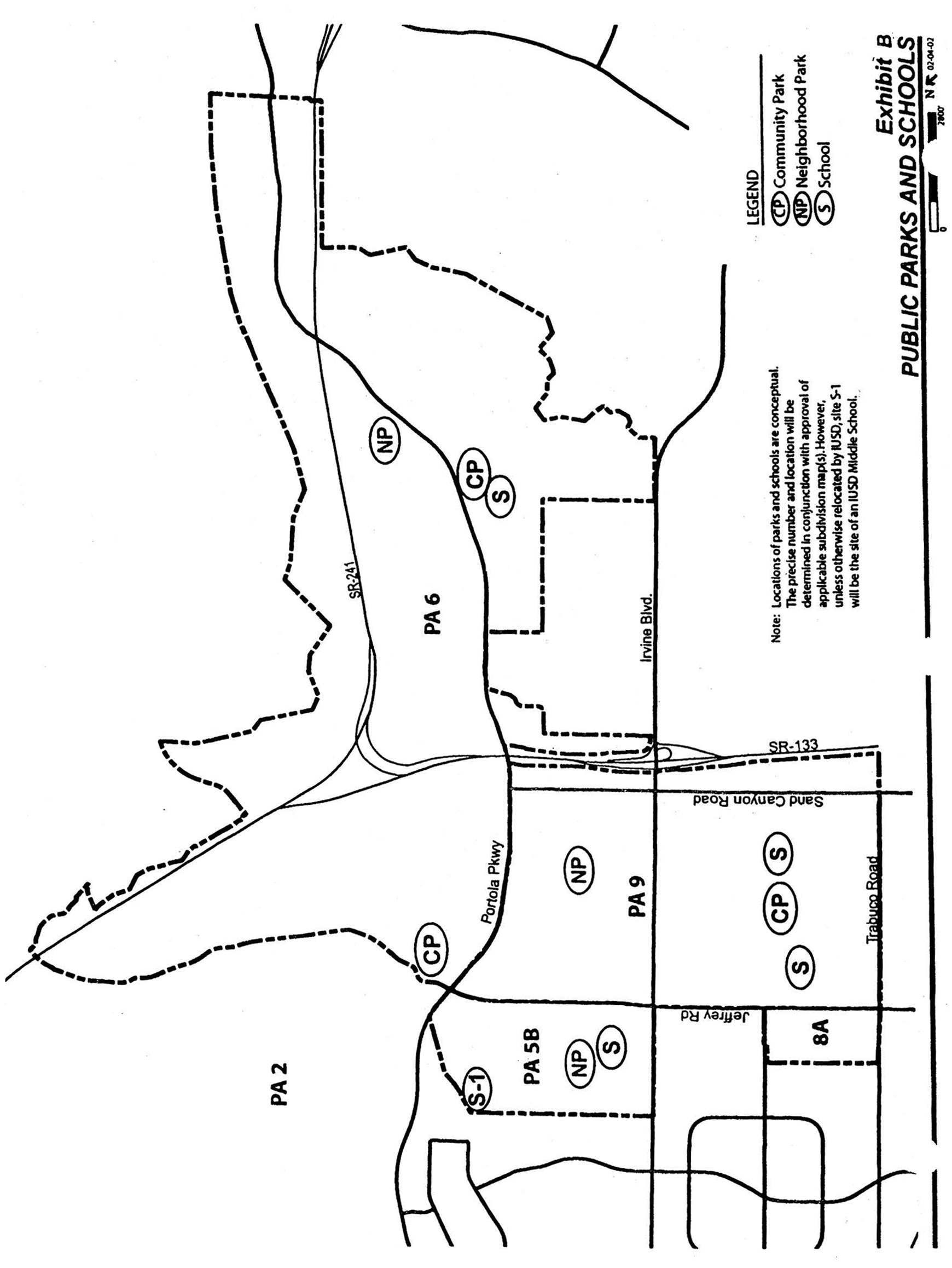
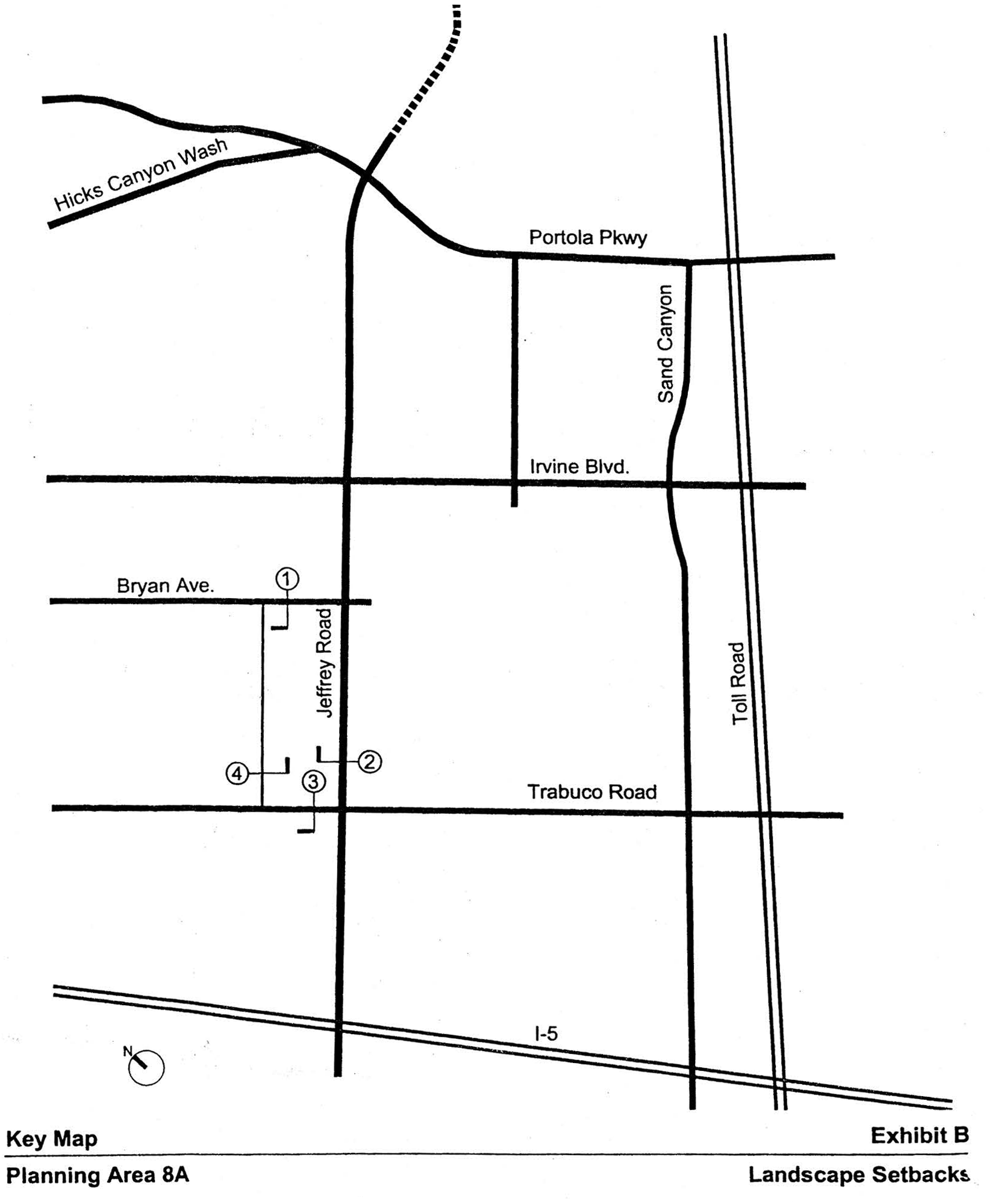
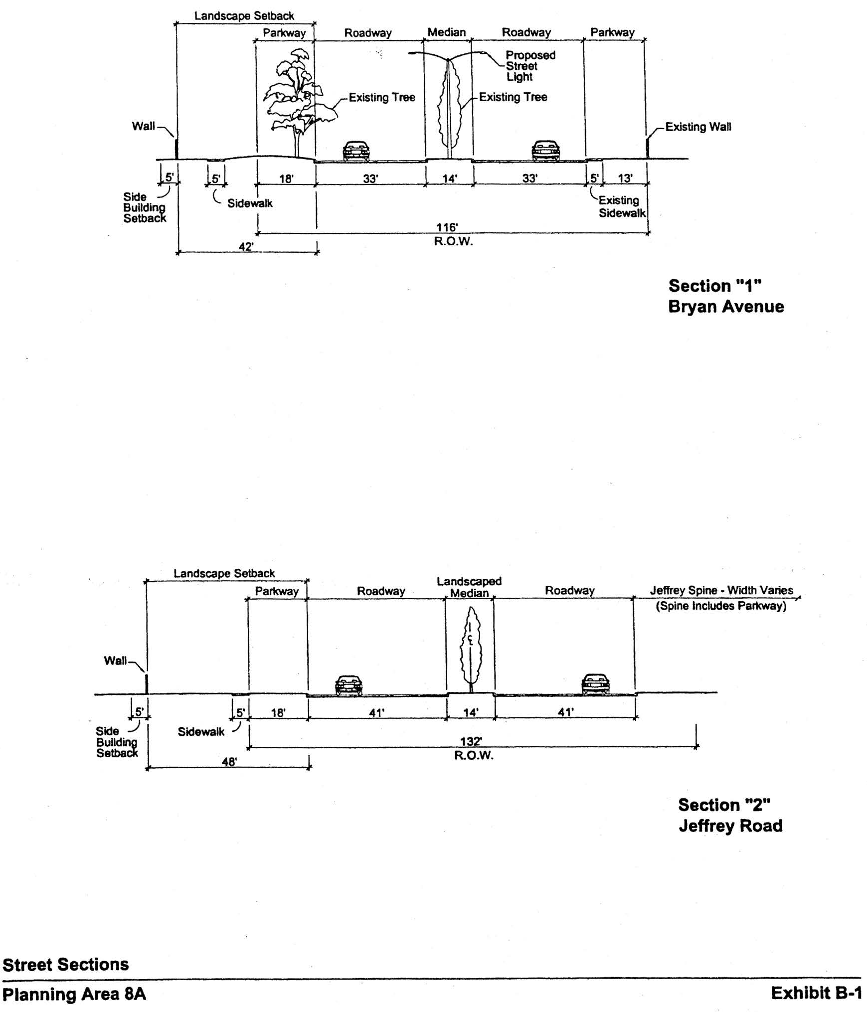
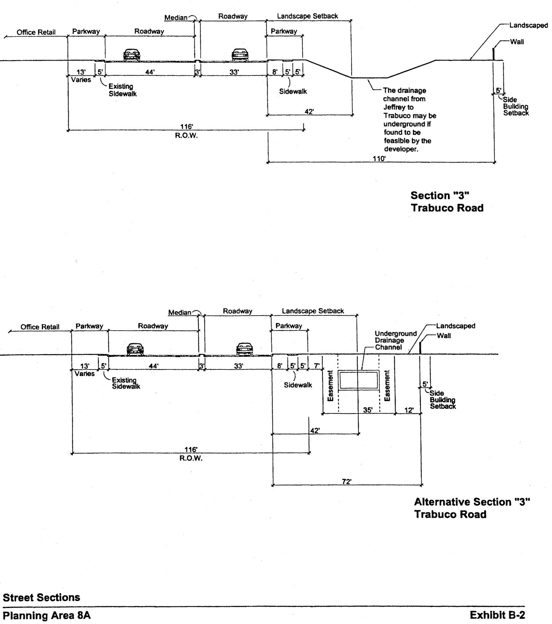
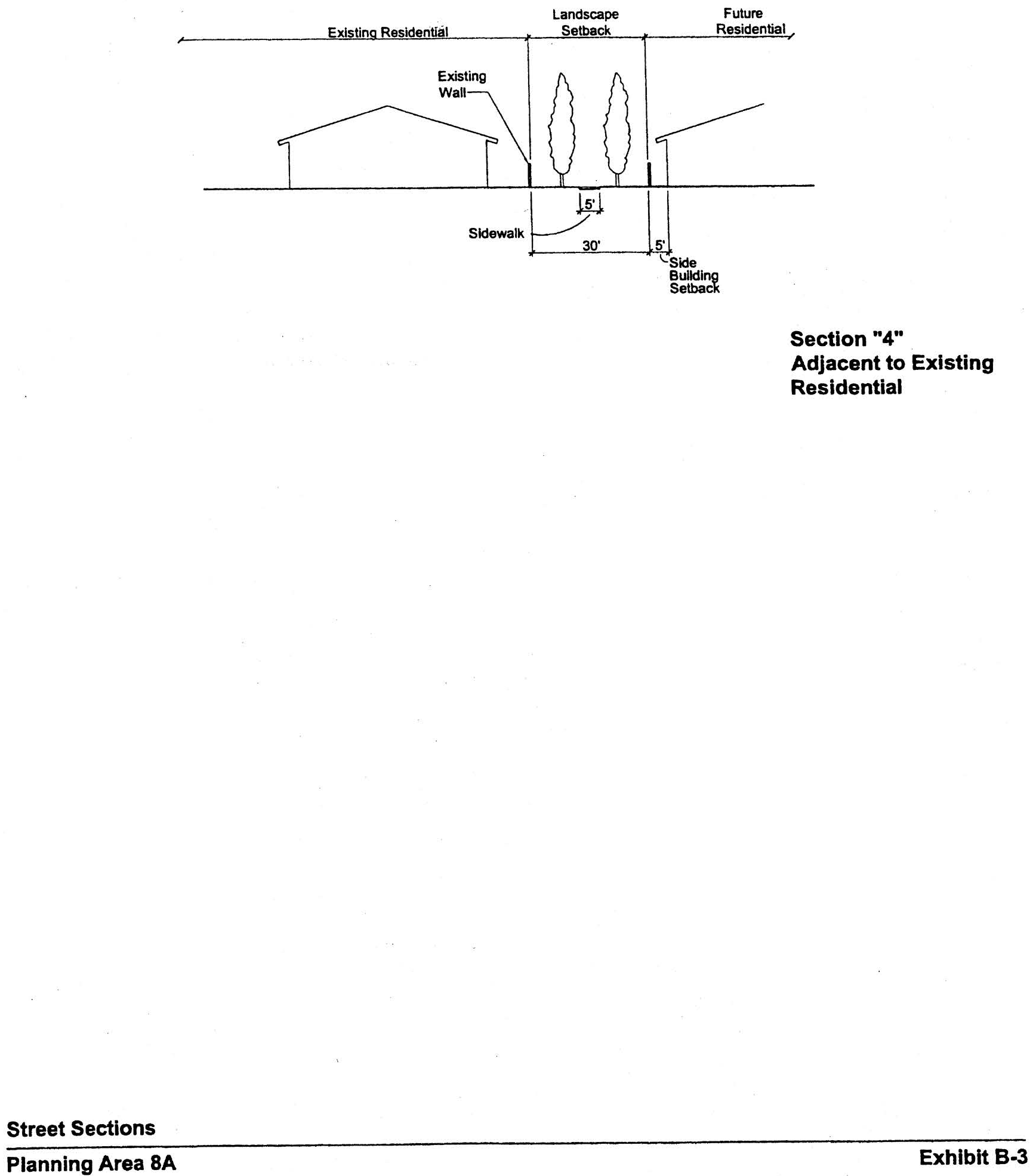
Sec. 9-9-1.- Land use zoning map.
(See Planning Area 9 map following Section 9-9-5.)
(Code 1976, § V.E-809.1; Ord. No. 92-3, 4-14-92; Ord. No. 94-7, § 3, 6-14-94; Ord. No. 95-4, 5-9-95; Ord. No. 95-22, § 3, 11-28-95; Ord. No. 01-10, § 3, 5-8-01; Ord. No. 02-06, 3-26-02; Ord. No. 02-09, §§ 1—7, 6-11-02; Ord. No. 04-11, § 3, 9-14-04; Ord. No. 05-12, § 6, 6-28-05)
Sec. 9-9-2. - Introduction.
A.
Planning Area 9 is generally located at the northeast corner of Jeffrey Road and Trabuco and is bounded by Jeffrey Road, Trabuco Road, SR-I33 and Portola Parkway.
B.
Planning Area 9 is intended to be a mixed-use village which provides for a full range of residential densities, commercial centers, recreation facilities, and office/high technology uses.
(Code 1976, § V.E-809.2; Ord. No. 92-3, 4-14-92; Ord. No. 94-7, § 3, 6-14-94; Ord. No. 95-4, 5-9-95; Ord. No. 95-22, § 3, 11-28-95; Ord. No. 00-02, § 4, 2-8-00; Ord. No. 01-10, § 3, 5-8-01; Ord. No. 02-06, 3-26-02; Ord. No. 02-09, §§ 1—7, 6-11-02)
Sec. 9-9-3. - Statistical analysis.
*ROW for SR-241/SR-133 is excluded from acreage calculations.
**At the time of submittal of development applications for residential units in the Multi-Use zoned areas, the applicant shall identify from which zoning categories dwelling units will be subtracted in order to accommodate the project.
***Total dwelling units subject to Section 9-9-7.D.
****Jeffrey Open Space Trail gross acreage is measured to the Jeffrey Road curb face.
1 Unallocated dwelling units represent those units remaining in a planning area that may be built anywhere in the same planning area. These units are within the maximum development intensity for the planning area; and, therefore, placement of unallocated dwelling units into any residential category within the planning area for purposes of development is determined to be consistent with the General Plan and Zoning Code with regard to intensity allocation only, provided that placement is otherwise consistent with site specific zoning regulations and that any potential environmental impacts are adequately addressed, including traffic impacts, pursuant to CEQA.
2 See Section 9-0-3.C, Building Intensity Standards.
(Code 1976, § V.E-809.3; Ord. No. 92-3, 4-14-92; Ord. No. 94-7, § 3, 6-14-94; Ord. No. 95-4, 5-9-95; Ord. No. 95-22, § 3, 11-28-95; Ord. No. 01-10, § 3, 5-8-01; Ord. No. 02-06, 3-26-02; Ord. No. 02-09, §§ 1—7, 6-11-02; Ord. No. 05-12, § 6, 6-28-05; Ord. No. 05-16, § 2, 7-12-05; Ord. No. 08-12, § 3, 9-9-08; Ord. No. 09-02, § 3, 3-24-09; Ord. No. 12-09, § 3(Exh. A), 5-22-12)
Sec. 9-9-4. - Land use regulations.
See Section 3-3-1 (Land use matrix).
(Code 1976, § V.E-809.4; Ord. No. 92-3, 4-14-92; Ord. No. 94-7, § 3, 6-14-94; Ord. No. 95-4, 5-9-95; Ord. No. 95-22, § 3, 11-28-95)
Sec. 9-9-5. - Development standards.
(City-wide regulations can also be found in Division 3.)
Individual project densities in Area 2.3J may exceed 12.5 dwelling units/net acre. However, no individual project may exceed 31.0 dwelling units/net acre and the overall density within 2.3J cannot exceed 12.5 dwelling units/net acre. Individual project densities in Areas 2.4B and 3.1E may exceed 31.0 dwelling units/net acre. However, the overall density within 2.4B cannot exceed 31.0 dwelling units/net acre. Individual project densities in Area 2.4G may exceed 31.0 dwelling units/net acre. Individual project densities in Area 2.4G may exceed 31.0 dwelling units/net acre. For Area 2.4G development of 3,000 units is consistent with the Medium High Density category. For residential projects within Areas 2.3J, 2.4B, 2.4G and 3.1 E, the actual net density of individual projects will determine the development standards to be applied according to Sections 3-37-13, 3-37-14, 3-37-15 and 3-37-16, as applicable.
(Code 1976, § V.E-809.5; Ord. No. 92-3, 4-14-92; Ord. No. 94-7, § 3, 6-14-94; Ord. No. 95-4, 5-9-95; Ord. No. 95-22, § 3, 11-28-95; Ord. No. 02-09, §§ 1—7, 6-11-02; Ord. No. 04-11, § 3, 9-14-04)
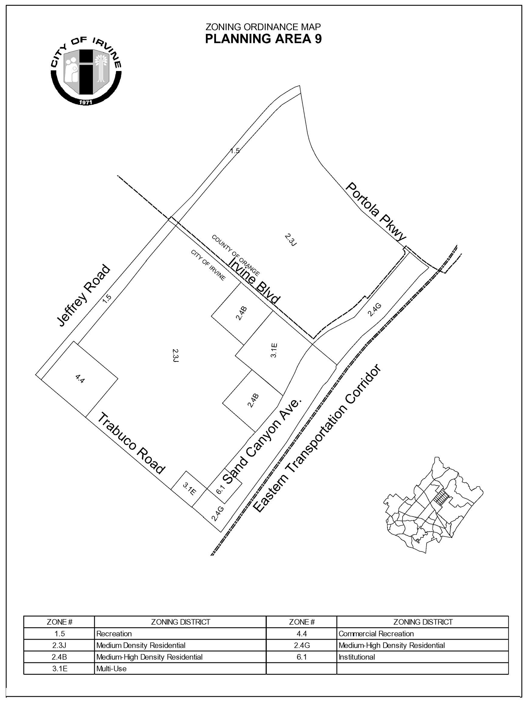
Sec. 9-9-7. - Special development requirements.
A.
See Division 3 for applicable general development requirements.
B.
Incidental offices are permitted in conjunction with any permitted or conditional use. Incidental office space may occupy no more than 50 percent of the gross aggregate building floor area of a parcel. This limitation does not apply to offices of design professionals in the General Industrial District.
C.
Affordable housing requirements for Area 2.4G. The affordable housing needs goal of 15 percent (five percent Income I, II; five percent Income III; and five percent Income IV) of the actual number of units built in Area 2.4G of Planning Area 9 shall be met utilizing a combination of new on-site construction and off-site affordable housing credits generated through the construction of new affordable units within Planning Area 1, 6, or 9. In conjunction with the submittal of the first tentative map within Area 2.4G of Planning Area 9, the applicant shall submit, and the City shall approve, an amendment to the master affordable housing program for the Northern Sphere area, originally adopted by the City in March 2003. The amendment shall reflect the addition of up to 3,000 dwelling units in Planning Area 9 and the requisite affordable housing units. The City will attempt to provide financial assistance, through the use of its CDBG and HOME funds, as well as to assist the applicant secure financial assistance from outside sources, to help achieve the affordable housing needs goal for Area 2.4G.
In conjunction with the submittal of the first tentative map within this planning area, the applicant shall submit a comprehensive affordable housing program covering Planning Areas 5, 6, 8, and 9 as called for in Chapter 2-3 of the Zoning Code. The affordable housing goal of 15 percent (5 percent Income I, II; 5 percent Income III; and 5 percent Income IV) of the actual number of units built shall be addressed in the affordable housing program. The program shall be reviewed by the Planning Commission prior to its approval of the first tentative map and approved by the City Council prior to recordation of the first final map.
D.
Maximum dwelling units. Notwithstanding the provisions of Section 9-9-3, but subject to the limitations set forth in Sections 9-1-7 and 9-6-7, unbuilt dwelling units, up to the total number of units allowed by the unit cap for the planning area, may be transferred by the landowner from Planning Area 9 to Planning Area 1 and/or Planning Area 6. It is the intent of this provision to facilitate a level of development that remains within the total number of dwelling units authorized by the North Irvine Transportation Mitigation Implementing Development Agreement between the City of Irvine and the Irvine Company. The transfer of units described in this Section will be facilitated as a part of the subdivision process required in receiving areas and will be appropriately and administratively noted in Sections 9-1-3, 9-1-7, 9-6-7, 9-9-3, and 9-9-7, as applicable. No dwelling units will be permitted to be transferred from Planning Area 9 to either Planning Area 5B or 8A.
E.
Parks. The location of public parks are conceptually shown on Exhibit B. Private parks will also be provided in order to meet local park requirements.
1.
With the first residential tract map submitted for development in Planning Areas 5 (Area 2.31), 6, 8 (Area 2.3H), and 9, a comprehensive community park plan addressing community park requirements for Planning Areas 5 (Area 2.31), 6, 8 (Area 2.3H), and 9 will be submitted by the applicant. This park plan may also address community park requirements for other planning areas, including, but not limited to, Planning Areas 1 and 2. For community park credit within PA 9, parks may be less than 20 acres in size.
2.
The community park requirement for PA 9 will be satisfied by the dedication of parkland and/or construction of park improvements consistent with the Community Parks Park Plan (case number 00321912-PPP) as may be amended from time-to-time.
F.
Arterial highways. The following arterials are located adjacent to or within Planning Area 9:
G.
Eucalyptus trees. The existing eucalyptus windrows in PA 9, in immediately adjacent planning areas and in the Jeffrey Open Space Trail, will be retained in parks, median landscaping, and landscaped setbacks to the extent trees are deemed sufficiently healthy for preservation in accordance with a survey conducted by a certified arborist and do not conflict with infrastructure improvements. To maximize the number of trees retained in the Trabuco Road median, there shall be no more than four breaks in the median between Jeffrey Road and Sand Canyon Avenue.
H.
Preservation/NCCP Reserve dedication. Prior to or concurrent with the recordation of the first subdivision map in PA 9, the applicant shall record an offer of dedication in favor of the City for the Preservation Area "P" in PA I shown on Exhibit A. Such offer will be in compliance with Section 8-14-1 and may be accepted by the City no sooner than 90 days following issuance of 75 percent building permits for dwelling units and 75 percent of the square footage for nonresidential structures.
1.
Any trails in the NCCP Reserve and/or preservation area will be designed, constructed, owned and maintained by the City of Irvine.
2.
Because the NCCP Reserve and Preservation category are co-terminus in this dedication, the NCCP shall serve as the Open Space and Management Plan required under Section 9-16-1.
I.
Pedestrian links. Sidewalks will be located on public streets in accordance with City plans and guidelines. Sidewalks on private streets may vary from standard City plans where appropriate to reduce grading or provide better pedestrian linkages subject to review and approval by the City Engineer. Pedestrian walks should link commercial sites, schools, parks, and residential neighborhoods. With submittal of the first residential tract map south of Irvine Boulevard, a Master Plan of bicycle and pedestrian trails shall be submitted for the entire portion of the planning area south of Irvine Boulevard. With submittal of the first residential tract map north of Irvine Boulevard, a Master Plan of bicycle and pedestrian trails shall be submitted for the entire portion of the planning area north of Irvine Boulevard.
Area 2.4G. With submittal of the first residential tract map east of Sand Canyon (Area 2.4G), a Master Plan of bicycle and pedestrian trails shall be submitted for the entire portion of the planning area east of Sand Canyon. The Master Plan of bicycle and pedestrian trails for Area 2.4G shall include the reservation of right-of-way allowing options for an off-street trail providing for the safe movement of bicycles and pedestrians between the planned Sand Canyon Trail and the Great Park site.
J.
Jeffrey Open Space Trail. The Jeffrey Open Space Trail (JOST) within Planning Area 9 will provide a continuous open space edge of the eastern side of the ultimate alignment of Jeffrey Road from Trabuco Road to Portola Parkway. The JOST shall be the equivalent of 325 feet in width as measured from the Jeffrey Road curb face (approximately 72 acres: 38 acres between Trabuco and Irvine Boulevard and 34 acres between Irvine Boulevard and Portola Parkway). JOST width may vary, but may not be less than 200 feet adjacent to Area 2.3J and 50 feet adjacent to Area 4.4. The JOST will serve as the village edge for the adjoining development areas, and no further village edge dedications or improvements will be required. Improvement of the JOST shall be consistent with the design character listed in Section 9-6-7.H.2. JOST improvements may be proposed by the applicant in lieu of dedication, as generally defined in Section 5-5-1004.F.1 of the Municipal Code (in effect at the time of approval of this zoning) and in accordance with this section.
1.
JOST function.
a.
The JOST shall provide a place that will accommodate public trail and passive open space uses and which will achieve the following objectives:
i.
Provide a Class I bicycle trail and, where deemed appropriate, an unpaved pedestrian trail.
ii.
Include features such as, but not limited to, riparian elements, water quality elements, picnic areas, shade structures, restrooms and other passive recreational improvements.
iii.
Establish landscape and landforms that will provide the trail user with a meandering separation from Jeffrey Road, a village edge for newly developed planning areas, and a landscape buffer between new development and Jeffrey Road.
iv.
Access to the JOST from new development will occur only through planned common area access points. Direct access to the JOST from individual homeowner lots will not be permitted.
b.
Permitted uses: Except for utilities and General Plan roadway improvements, surface uses will be limited to trails, and associated passive public recreation and park-and-ride facilities. For the purposes of the JOST, features identified in Section 9-6-7.H.l.a(2) are considered passive recreation.
2.
Overall park design. North of the I-5 Freeway, to the NCCP boundary in Planning Area 6 (approximately 117 acres), design of the overall Jeffrey Open Space Trail shall be approved as a park design pursuant to Section 2-22-4.
Design concepts to be included in the overall design shall be consistent with the Jeffrey Open Space Trail consensus plan reviewed by City Council on September 25, 2001. The design shall address grade separated crossings and undergrounding any overhead utility lines, including costs, timing, and responsible entities.
Adoption of this overall park design shall establish parameters by which JOST segments will be approved as adjacent development proposals are processed. It is also anticipated that an implementation agreement between The Irvine Company and the City documenting mutual understandings related to implementation issues such as costs, timing, and responsibilities will be approved as a part of this process.
This overall park design shall be reviewed by the Planning Commission and the Community and Library Services Commission, and shall be approved by the City Council.
3.
Segment design approval process.
a.
Segment park design. In conjunction with an application for any subdivision map adjacent to the JOST, a segment park design for the adjacent JOST segment shall be submitted to the City by the applicant. The plan shall include:
i.
JOST dimensions and acreage.
ii.
Trails and pedestrian access to trails.
iii.
Landscape elements.
iv.
Conceptual plant palette.
v.
Planned vehicular access or crossings.
vi.
Special design features.
vii.
Passive recreational amenities and improvements.
b.
Request for improvements in lieu of dedication. Should improvements in lieu of dedication be proposed by the applicant, fair market value and improvement costs shall be established in the manner defined in Section 5-5-1004 of the Municipal Code or by means mutually acceptable to the applicant and the Director of Community and Library Services. Any modifications to the design through the approval process will be addressed by the implementation agreement noted in Section 9-9-7-H.2.
c.
Segment plan approval. If the City adopts an overall park design, the segment park design shall be approved by the Directors of Community Development and Community and Library Services, provided the segment park design is deemed consistent with the overall park design. In the event the overall park design has not received approvals or if the segment park design is not consistent with an approved overall park design, the segment park design shall be subject to final approval by the Community and Library Services Commission. Appeals of decisions related to the segment park design shall be to the City Council.
4.
JOST improvement.
a.
The project developer's financial obligation to improve the JOST is limited to costs of construction of a permanent trail to be built in accordance with the City's 1985 "Guidelines for Bicycle Facilities in Irvine" (excluding grade separations used solely for trail systems).
b.
Improvements will be installed on a segment-by-segment basis.
c.
Prior to issuance of the first precise grading permit for property adjacent to the JOST, the developer shall commence construction of an 11-foot bicycle/pedestrian trail and all improvements in lieu of dedication, if any, within the adjacent spine segment. Once commenced the entire segment shall be completed in a single phase.
d.
Any grade-separated-crossings shall be constructed and maintained by the City unless otherwise agreed to by the developer consistent with Section 9-6-7.H.2 herein. The City shall also maintain the bicycle/pedestrian trail, landscaping and all other improvements within the spine.
5.
JOST conveyance.
a.
Prior to the release of a final map for an area adjacent to the JOST, the applicant shall submit for review to the satisfaction of the Director of Community Development and the City Attorney, the form of an irrevocable offer of dedication to the City of Irvine for the JOST segment adjacent to the development. The JOST segment shall be included in the tract map as a lettered lot.
b.
The City shall accept the offer of dedication for the JOST and improvements in a timely manner following final inspection of improvements: within 90 days of improvements including landscaping, or within 30 days if the improvements include only the trail. The trail shall not be opened for public use until the City has accepted the offer of dedication.
K.
Trails. Prior to approval of the first residential tentative tract map within this planning area, the applicant shall submit a master trails plan, which addresses public and private trails and linkages, public viewpoints, public access points to the open space, links to public parks and schools within the planning area, signage, and construction phasing of trails. This plan shall be consistent with the General Plan Trails Network Figure B- 4 and also demonstrate how access to dedicated open space will be controlled and managed by the City through fencing and other means. This plan shall include a pedestrian link from the Jeffrey Open Space Trail, located across Jeffrey Road from the terminus of the Venta Spur Trail, connecting through the planning area and allowing a connection to the existing sidewalks at the Irvine Boulevard and Trabuco Road crossings over SR 133. This link need not be a direct linear connection to Sand Canyon to conform to General Plan Exhibit B- 4. The master trails plan shall be submitted for review and comment by the Community and Library Services Commission and approved by the Planning Commission.
L.
Village theme. The architectural design shall address detail articulated on all sides of the structures visible from streets, paseos, and other public areas. Particular attention shall be given to windows, balconies, doors, and other design elements. The elements and qualities which shall be encouraged are human scale and privacy, play of light using shade and shadows to provide relief, and variations in roof lines. Large blank walls with minimal detail shall be discouraged.
M.
Residential/community commercial architecture. A variety of architectural styles and forms will be used to express differences among projects and neighborhoods within the planning area. Variations of the following elements may be used by the developer:
1.
Overall form. Some symmetry at front facades or around entries will be used to create balance in the overall form. Entry view corridors terminating at blank walls and/or blank building elevations shall be discouraged. Views of elevations of multifamily structures with exterior walkways serving as common access for dwellings on second and third floors shall be screened from public rights-of-way either through building orientation or other architectural or landscape elements.
2.
Roof form. Roof massing will be varied with a strong cornice line. Clay, concrete tile, and slate will be used predominantly with consistent earthtone colors.
3.
Details. Simple cornices, moldings, projections and recesses, and integral-colored accent materials such as ceramic tile, brick, garden walls (stone or painted stucco) and picket gates will be used.
4.
Site design. Terraces, plazas, arcades, colonnades, and pergolas will be used to define pedestrian areas. Units will be used clustered around open spaces and public and private areas will be separated.
5.
Architectural features. Architectural features (not including chimneys) on individual residential structures may in limited circumstances exceed the established height limit by a maximum of 10% of the roof area on which the structure is secured but in no event shall exceed 10 feet above applicable zoning district height limit. For Area 2.4G architectural features include towers, lofts mezzanines and mechanical equipment screen walls.
6.
Building heights along arterial roadways. Residential structures adjacent to arterial roadways, except along Sand Canyon Avenue, shall not exceed two stories.
N.
Medical and Science. The industrial portion of the planning area will have a clean and contemporary architectural style, similar to PA 31 and 39. In conjunction with each tentative tract map ("B" map) or parcel map for Medical and Science parcels adjacent to areas zoned residential (north of Irvine Boulevard), the applicant shall demonstrate how Medical and Science uses will be compatible with residential uses with particular reference to proposed building heights, locations of loading docks and storage areas, treatment of parking areas, and proposed landscaping. Vehicular access between Medical and Sciences uses and adjacent residential development north of Irvine Boulevard shall be evaluated at the time of tentative tract maps ("B" maps) or parcel maps. Vehicular access between Medical and Sciences uses and adjacent residential development shall be designed so that conflicts with residential neighborhoods are minimized.
O.
Landscape setbacks. The landscape setbacks for the project edge shall be in accordance with Exhibit C. Additionally, streetscapes required with development of Planning Area 9 shall be consistent with the City of Irvine Master Streetscape Plan.
P.
Alternative setback standards. Alternative setback standards for setbacks internal to the planning area may be approved in conjunction with any subsequent Planning Commission approval. A description of the proposed setbacks and how they differ shall be submitted. The Planning Commission will consider the following criteria and make appropriate findings, if necessary.
1.
General character. Relationship in scale, bulk, coverage and density with surrounding land uses.
2.
Quality of life. Whether the proposed alternative standard will result in an adverse impact on existing neighborhoods.
3.
Suitability. The physical suitability of the site for the proposed project.
4.
Limitations. Such setbacks shall not be used to deviate from setbacks established for village edges.
Q.
Multi-use. The Multi-Use zones areas may be developed with a single land use.
R.
Child care.
1.
The need for child care facilities shall be recognized in the development of Planning Area 9. Prior to the approval of the first tentative tract map for the residential portion of this planning area, the number of private sector child care slots to be provided will be determined by the City and the developer in accordance with the City policy in effect at that time. The number of slots will be based on the actual number of residential units to be built and on a determination of child care needs within the planning area.
2.
Prior to the approval of the first tentative tract map for the residential portion of this planning area, the applicant shall address the following when locating any child care center:
a.
The location of any child care center(s) shall be determined.
b.
The size of any parcel that is designated for a potential child care center.
c.
Child care centers shall be compatible with adjacent uses. Development of a child care center in conjunction with proposed elementary schools and adjacent to neighborhood parks, residential developments and/or neighborhood commercial centers shall be encouraged.
d.
In locating a child care center, the proposed site shall be evaluated with regard to factors that might be detrimental to the public health, safety, or welfare, including, but not limited to, proximity to high-traffic-volume roadways, hazardous materials, and major generators of traffic.
S.
Hydrology. In conjunction with the submittal of specific development plans, the applicant shall demonstrate that storm drain systems will include project design features (PDF) for treatment of project related stormwater runoff to improve the quality of discharges into San Diego Creek. This will be addressed as follows:
1.
The proposed PDF consists of two components. First, the existing Trabuco Retarding Basin will be modified to treat over a 24-hour period to a volume of runoff produced by a 24-hour, 85th percentile storm event (runoff from 0.75 inch, 24-hour storm) over the 1,226-acre PA 9. Second, for any area not tributary to the Trabuco Basin, BMPs (for example, BMPs that achieve similar performance per National BMP Database ratings as catchbasin inserts) will be designed to infiltrate, filter or treat the volume of runoff produced by either (a) a 24-hour, 85th percentile storm event (runoff from 0.75 inch, 24-hour storm), or (b) the maximum flow rate of runoff produced by a rainfall intensity of 0.2 inch of rainfall per hour.
T.
Circulation. In conjunction with the submittal of any traffic study for this planning area, alternative solutions for any proposed triple left turn lanes shall be identified.
(Code 1976, § V.E-809.6; Ord. No. 92-3, 4-14-92; Ord. No. 94-7, § 3, 6-14-94; Ord. No. 95-4, 5-9-95; Ord. No. 95-22, § 3, 11-28-95; Ord. No. 02-09, §§ 1—7, 6-11-02; Ord. No. 04-03, § 3, 2-24-04; Ord. No. 04-11, § 3, 9-14-04; Ord. No. 09-02, § 3, 3-24-09; Ord. No. 19-19, § 4(Exh. A), 1-28-20; Ord. No. 21-05, Exh. A, 5-11-21; Ord. No. 23-09, § 4(Exh. A), 5-23-23; Ord. No. 25-22, § 4, 9-9-25)
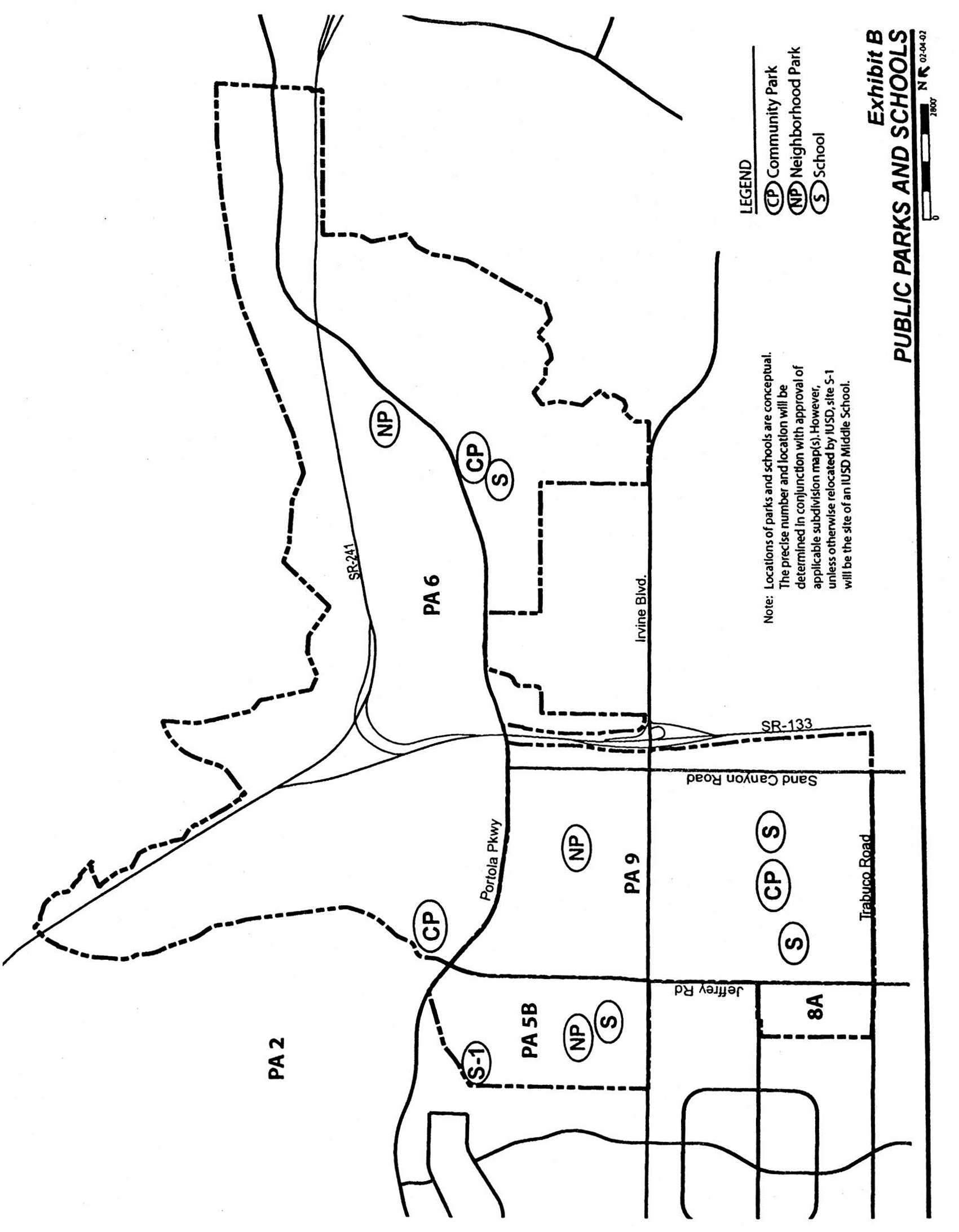
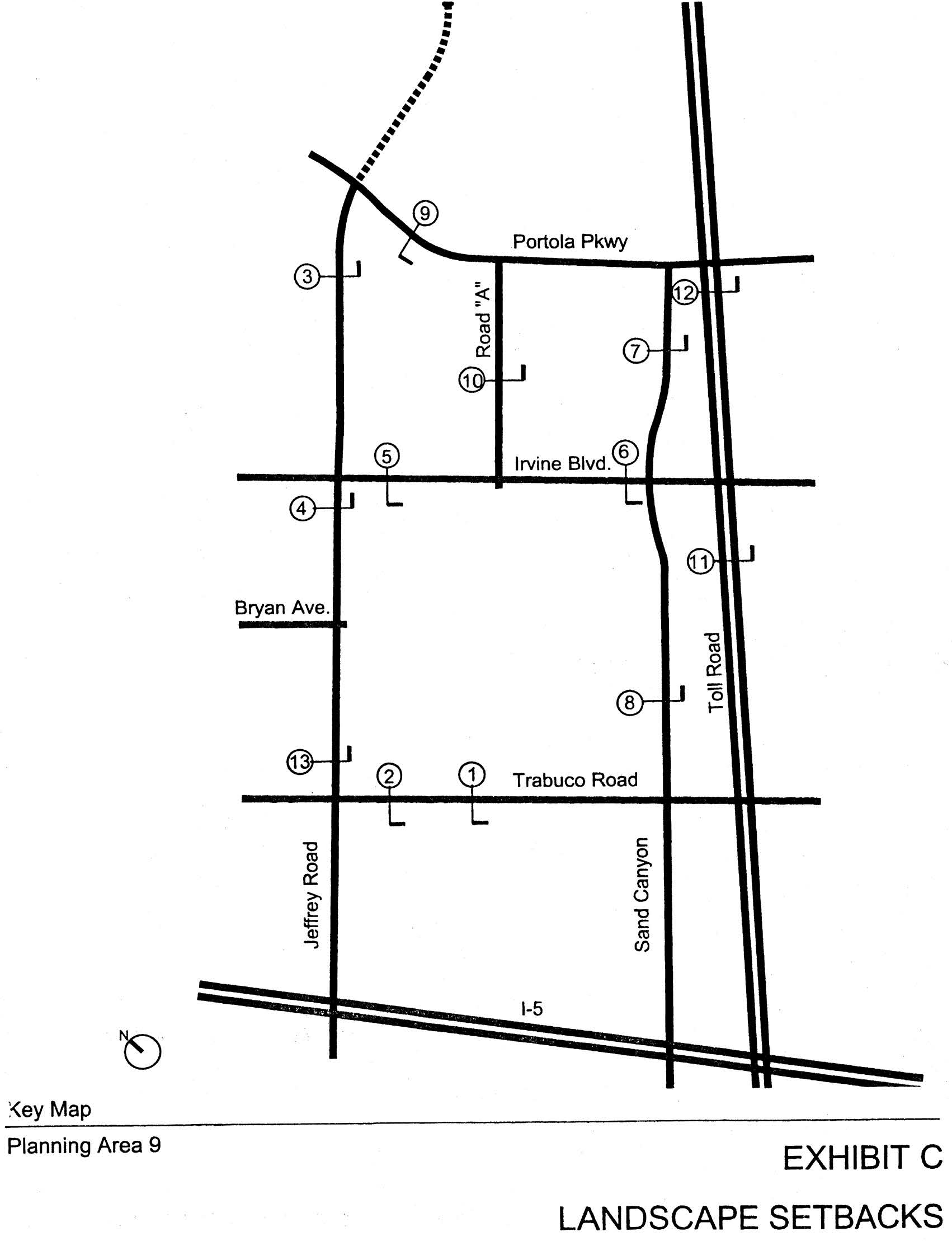
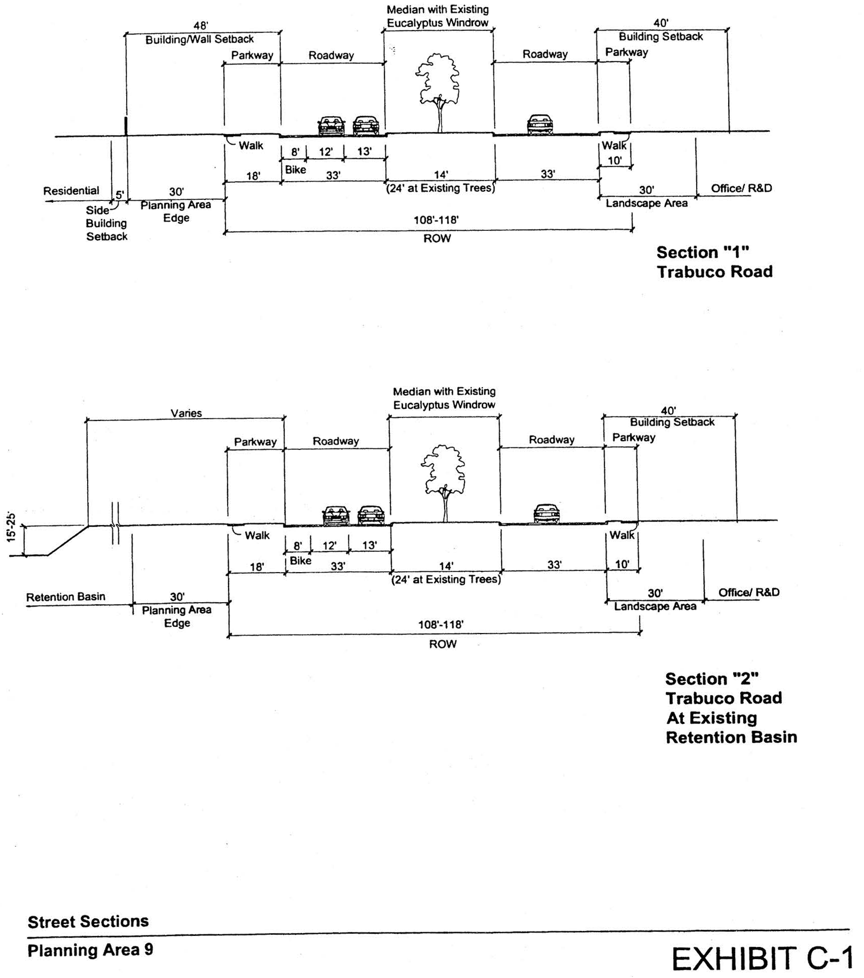
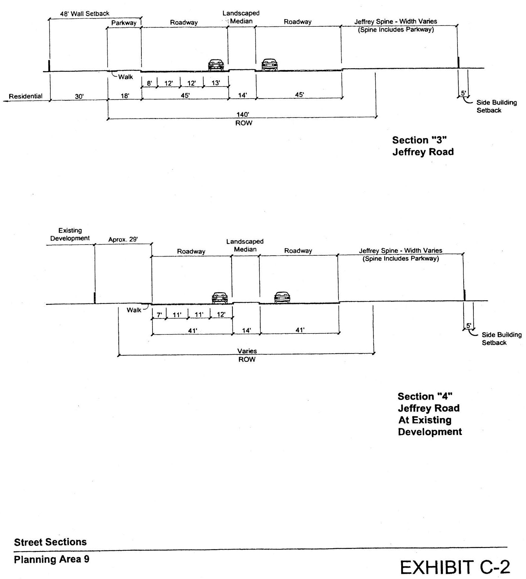
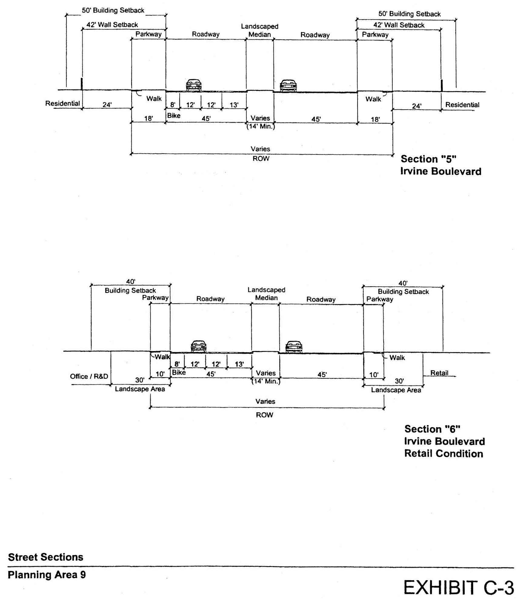
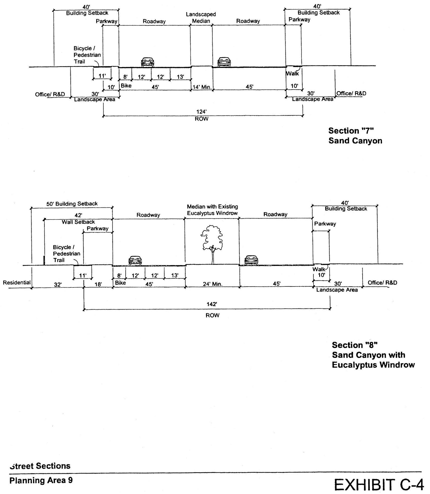
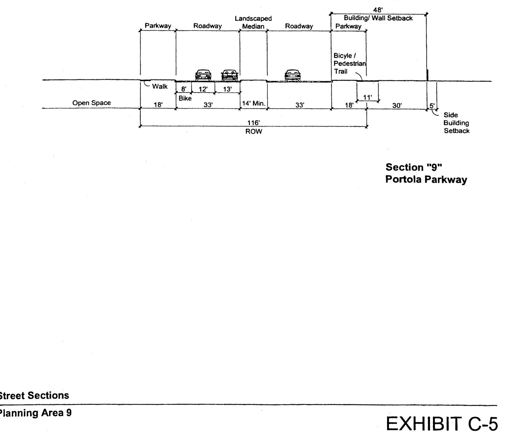
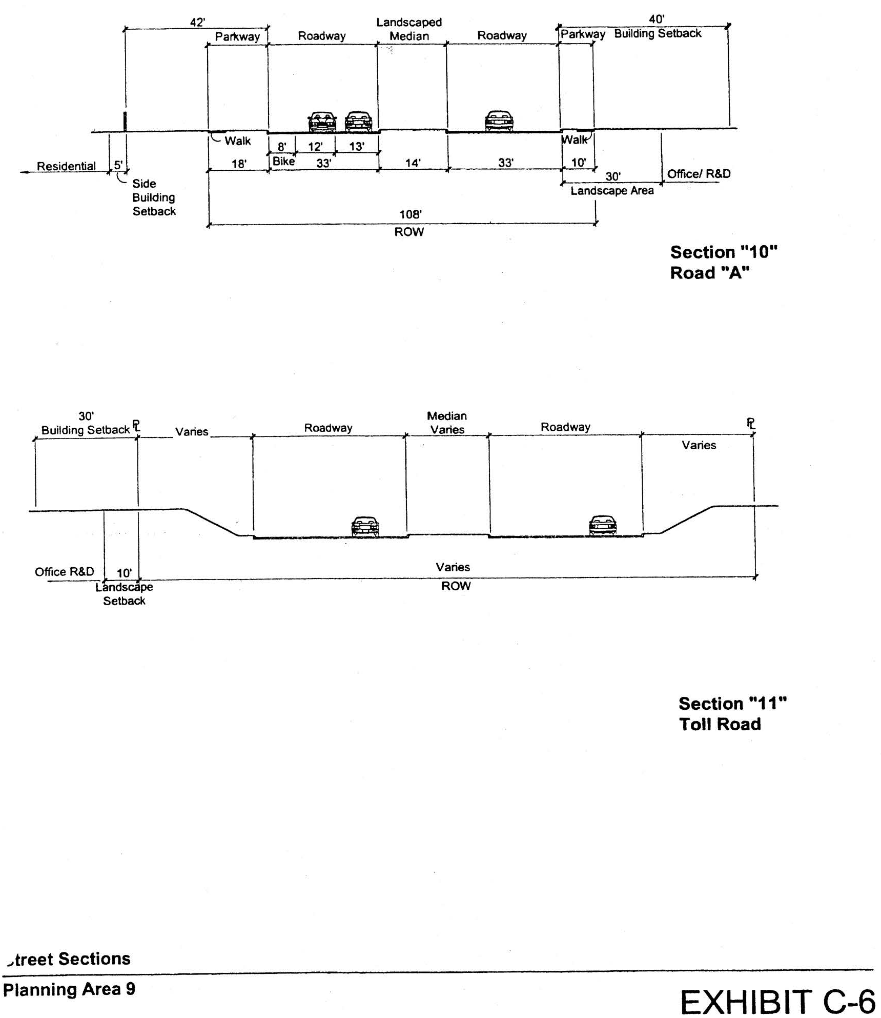
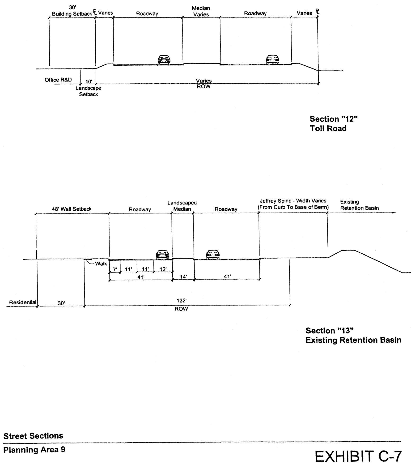
Sec. 9-10-1.- Land use zoning map.
(See Planning Area 10 map following Section 9-10-3.)
(Code 1976, § V.E-810.1; Ord. No. 92-3, 4-14-92; Ord. No. 92-21, 11-24-92; Ord. No. 94-15, § 3, 12-13-94; Ord. No. 95-4, 5-9-95; Ord. No. 95-7, § 4, 7-11-95; Ord. No. 98-07, § 3, 7-14-98; Ord. No. 00-08, § 4, 6-13-00; Ord. No. 05-28, § 3, 1-10-06)
Sec. 9-10-2. - Introduction.
Planning Area 10 is located at the northwest corner of the City. Boundaries include the City of Tustin to the west, Interstate 5 (Santa Ana Freeway) to the north, Culver Drive to the east and Irvine Center Drive to the South.
(Code 1976, § V.E-810.2; Ord. No. 92-3, 4-14-92; Ord. No. 92-21, 11-24-92; Ord. No. 94-15, § 3, 12-13-94; Ord. No. 95-4, 5-9-95; Ord. No. 95-7, § 4, 7-11-95; Ord. No. 98-07, § 3, 7-14-98; Ord. No. 05-28, § 3, 1-10-06)
Sec. 9-10-3. - Statistical analysis.
1 Unallocated dwelling units represent those units remaining in a planning area that may be built anywhere in the same planning area. These units are within the maximum development intensity for the planning area; and, therefore, placement of unallocated dwelling units into any residential category within the planning area for purposes of development is determined to be consistent with the General Plan and Zoning Code with regard to intensity allocation only, provided that placement is otherwise consistent with site specific zoning regulations and that any potential environmental impacts are adequately addressed, including traffic impacts, pursuant to CEQA.
2 See Section 9-0-3.C, Building Intensity Standards.
(Code 1976, § V.E-810.3; Ord. No. 92-3, 4-14-92; Ord. No. 92-21, 11-24-92; Ord. No. 94-15, § 3, 12-13-94; Ord. No. 95-4, 5-9-95; Ord. No. 95-7, § 4, 7-11-95; Ord. No. 98-07, § 3, 7-14-98; Ord. No. 00-08, § 4, 6-13-00; Ord. No. 03-02, § 4, 1-14-03; Ord. No. 05-28, § 3, 1-10-06; Ord. No. 10-04, § 3, 4-13-10; Ord. No. 12-09, § 3(Exh. A), 5-22-12)
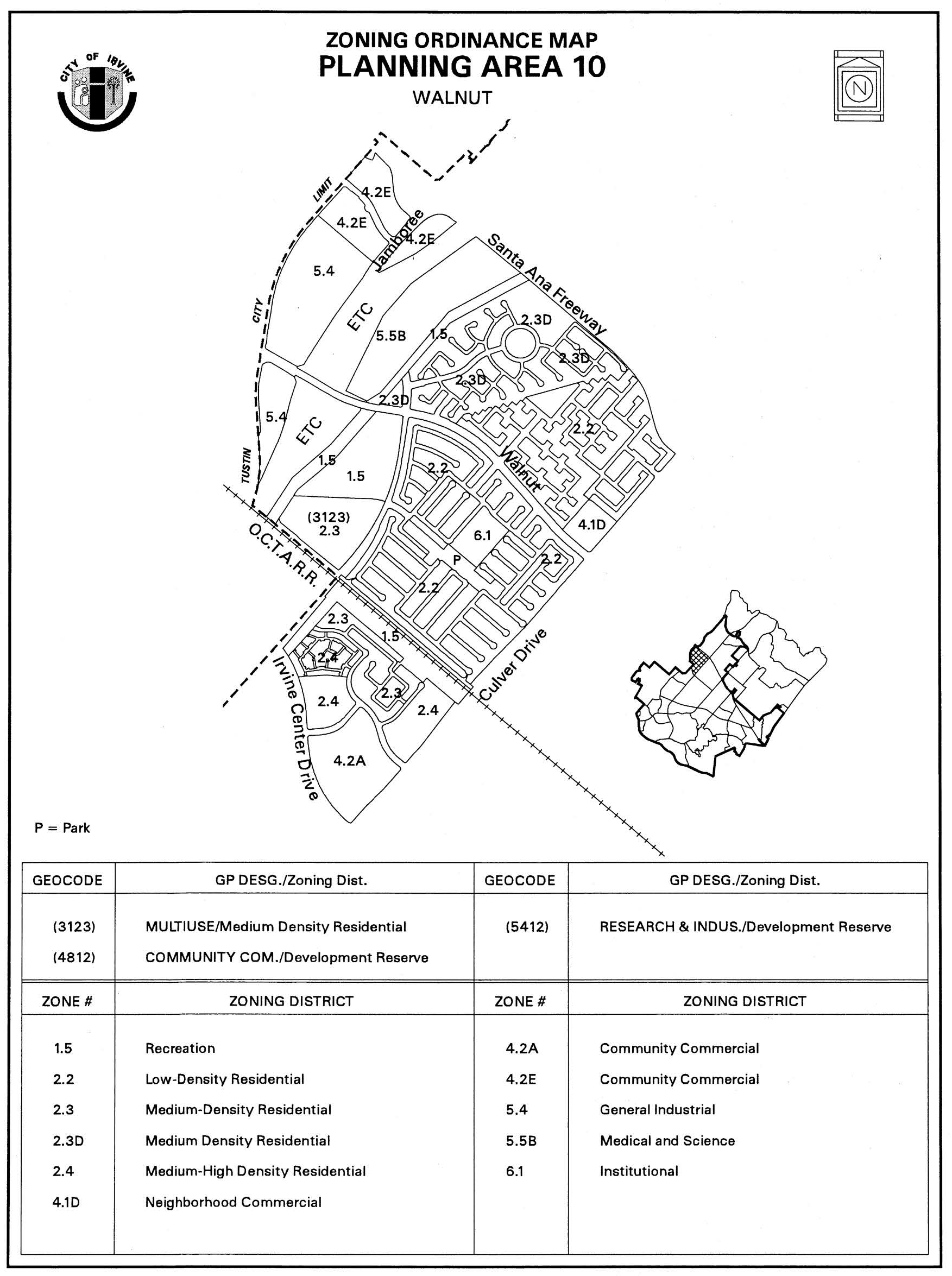
Sec. 9-10-4. - Land use regulations.
See Section 3-3-1 (Land use matrix).
(Code 1976, § V.E-810.4; Ord. No. 92-3, 4-14-92; Ord. No. 92-21, 11-24-92; Ord. No. 94-15, § 3, 12-13-94; Ord. No. 95-4, 5-9-95; Ord. No. 95-7, § 4, 7-11-95)
Sec. 9-10-5. - Development standards.
See Chapter 3-37 (Development Standards).
(Code 1976, § V.E-810.5; Ord. No. 92-3, 4-14-92; Ord. No. 92-21, 11-24-92; Ord. No. 94-15, § 3, 12-13-94; Ord. No. 95-4, 5-9-95; Ord. No. 95-7, § 4, 7-11-95)
Sec. 9-10-7. - Special development standards.
A.
See Division 3 for any applicable general development requirements.
B.
The following requirements apply to Phases II and III only:
1.
Total office, including general and home improvement related offices, in Area 4.2A shall not exceed five percent of the gross floor area developed in Area 4.2A.
2.
At least 21 percent of the housing units for sale or rent in Phases II and III shall be in a price range affordable by families of moderate income. An additional five percent of the units for sale or rent shall be in a price range affordable by families of low income. The provision of the low-income units is contingent upon the availability of subsidies. If subsidies are not available, the requirement for low-income units must be met with an equal number of moderate-income units. Affordable units provided in excess of the minimum number required by this section may be applied toward fulfilling any inclusionary requirement that may be enacted in connection with the zoning of the Walnut Village Planning Area. For purposes of this requirement, income and affordability shall be as defined in the Housing Element of the General Plan and any implementing resolutions adopted by the City Council.
3.
As identified in the EIR, the following conditions shall apply:
a.
Locus A of CA-Ora-373 shall be preserved through incorporation into a park or open space area. Specific plans for park or open space development shall be submitted to the City's Historical, Archaeological and Paleontological (HAP) Committee for review and recommendation to ensure that such plans will not impact or disturb the archaeological site. Locus A shall be further protected from accidental intrusion during development of surrounding areas by a constraint notation in grading maps.
b.
Locus B of CA-Ora-373 shall be preserved if planning considerations permit. In accordance with City policy, the HAP Committee shall make recommendations about the disposition of Locus B. Prior to the issuance of grading permits, the Director of Community Development shall ascertain that the developer has notified a qualified archaeologist and paleontologist and that they be permitted on the site during grading operations. The archaeologist and paleontologist should also attend pre-grade meetings to discuss the importance of avoiding areas subject to preservation and to attest to adherence to constraints. Additional sites or finds discovered during grading operations shall be subject to the City's historical, archaeological and paleontological policies.
4.
Prior to approval of any tentative map in Phases II and III, the landowner or landowners shall prepare a map which indicates where the required lower-cost units will be located and the number of units to be developed at each location. The landowner shall distribute the sites to prevent an undue concentration of lower-cost housing in any one location. The landowner of any one of the parcels shown on the map as a site for lower-cost housing shall be required to inform any potential purchaser/developer that this site is intended to be used to fulfill the City's requirements. This condition shall run with the land until units have been constructed. Modification of the map shall be permitted as long as (1) the modification does not jeopardize fulfillment of any inclusionary requirement assigned to the area covered by the map and (2) the landowner making the modification submits a revised copy of the map of the City. If as a result of this modification a site which was designated for lower-cost housing is no longer designated for this purpose, the site may be sold without restriction.
5.
If traffic generated by development in Phases II and III directly results in traffic volumes on Deerfield Avenue between Culver and Yale in excess of 80 percent of that facility's capacity (capacity is defined as 10,000 vehicles per day along the two-lane section of Deerfield) within a 10-year period from approval of the first tentative map in Phase II or III, Deerfield Avenue shall terminate in a cul-de-sac at Yale. The developer is required to post surety in a sufficient amount, as determined by the Director of Community Development, for this potential project.
6.
The southern boundary of Walnut Village is the centerline of Irvine Center Drive in its ultimate alignment. In no case shall land use decisions made as a part of this village zoning affect property located south of the centerline of Irvine Center Drive as it is ultimately located and constructed.
7.
The City shall explore the feasibility of providing a pool and other recreational amenities at the proposed apartment complex in Area 2.5 of Phase II while still remaining in compliance with applicable HUD regulations.
8.
Village edge plans for Culver Drive and Irvine Center Drive shall be approved by the Director of Community Development prior to issuance of any building permits in Phases II and III. The edge treatment along Harvard Avenue shall be reviewed by the Director of Community Development prior to the issuance of any building permits for Phase III.
9.
This planning area shall be developed in accordance with the phasing plan (see Figure 810-1). Phase II shall consist of 32 acres of general commercial and 250 units of medium density. Phase III shall consist of 725 units of medium density units and 250 low-medium density units.
10.
Prior to issuance of building permits for housing within Phase III, the developer shall submit a proposal for the relocation of the existing recreational vehicle storage spaces. The plan shall be subject to review and approval by the Director of Community Development. The recreational vehicle spaces shall be provided either within the boundary of the village or at alternate locations approved by the City.
11.
Prior to the issuance of building permits for the second phase of development for Area 4.2A, a Master Plan shall be submitted for that phase in accordance with the provisions of Chapter 2-17. During this review, consideration shall be given to parking ratios in relation to the square footage and land uses for the entire project.
12.
On any conditional use permit for liquor stores and convenience markets in Area 4.2A, a public notice shall be sent to all homeowners' associations within a one-mile radius of the proposed use at least 60 days prior to the hearing.
13.
Reserved.
14.
Prior to the issuance of grading permits for the area of land known as the Jamboree Business Center project site, generally bounded by the I-5 Freeway to the north, the AT&SF railroad to the south, Jamboree Road to the east and Myford Road to the west, the property owner shall submit and receive approval from the Planning Commission of a Master Plan in accordance with Chapter 2-17 of the zoning ordinance. The Master Plan shall specifically address the following issues:
a.
Village edge landscape treatments which may include setbacks;
b.
Streetscape design which may include lighting.
15.
For the 2.3D (Walnut) Zone Change 19678-ZC, the affordable housing goals of the City's General Plan will be met through use of the menu option, as set forth in objective C-1 of the Housing Element. It is anticipated that the implementation mechanism will be through extension of the term of affordability made possible by refinancing of the Series 1983A bonds. Prior to issuance of the first building permit, the applicant shall submit an affordable housing program for approval by the Director of Community Development which specifies the use of the menu option.
16.
Reserved.
17.
Prior to the issuance of precise grading permits, the applicant shall submit and receive approval by the Director of Community Development, a trip monitoring summary for the parcel map. The summary shall include an accounting of trips generated by previous approvals to ensure that the aggregate traffic projected by the uses proposed for all parcels within Vesting Tentative Parcel Map 97-133 does not exceed 8,223 daily trips, 752 a.m. trips, or 770 p.m. trips. In addition, Parcels 1 through 7 of Vesting Tentative Parcel Map 97-133 shall not exceed 6,810 daily trips, 624 a.m. trips, or 639 p.m. trips. The analysis shall include, but not be limited to:
a.
The current request of square footage, or other land use unit;
b.
The cumulative square footage or other land use unit;
c.
The current total number of trips used for existing land uses and total number of trips available for future land uses by average daily, a.m. peak hour and p.m. peak hour; and
d.
The total number of a.m., p.m. and ADT trips to be used by proposed land uses.
The maximum allowable trips set forth herein shall restrict all development under Zone Change 28754-ZC. No commercial or industrial entitlement approved within vesting Tentative Parcel Map No. 97-133 after the approval date of Zone Change 28754-ZC (June 23, 1998) may be constructed except to the extent that trip capacity based upon the above maximum allowable trips remains unused. The maximum allowable trips shall prevail over any square footage entitlement. No remaining commercial or industrial entitlement for Planning Area 10 that is not approved by Zone Change 28754-ZC may be transferred to any other planning area.
18.
Vesting Tentative Parcel Map 97-133 shall provide a right-in, right-out access on Walnut Avenue.
19.
For any use in the 5.5B Medical and Science Zoning District that is required by law to prepare a risk management prevention plan (RMP), the applicant shall submit the following information:
a.
Orange County Fire Authority Hazardous Materials Disclosure Inventory Form.
b.
Orange County Fire Authority Chemical Classification Form.
c.
Material safety data sheets from chemical manufacturer(s).
d.
Location of storage or disposal areas of materials on-site and/or in the tenant space/suite shown on a site plan and/or floor plan.
e.
Location of loading areas used for transfer of materials on a site plan and/or floor plan.
f.
Routes used for the transportation of materials (on- and off-site routes) on a site plan.
g.
Proposed hours of operation and transportation of materials.
h.
Documentation concerning required permits and special studies to be performed in order to obtain necessary permits through applicable regulatory agencies. The applicant shall have early consultation with those agencies that regulate substances to be used, generated, stored and/or emitted on-site prior to submittal of the Master Plan and/or conditional use permit.
The RMP shall be subject to a one-quarter mile (1,320 feet) public notification requirement as set forth by Irvine zoning ordinance Chapter 2-23 prior to certificates of use and occupancy. This public notice shall reference the submitted information and comments received by the regulatory agencies (e.g., South Coast Air Quality Management District, Orange County Fire Authority, and Orange County Health Care Agency) concerning risk management prevention plans, health risk assessments and the use of acutely hazardous materials. The purpose of the notice is to inform adjacent properties that a risk management prevention plan has been prepared and to submit comments to the agency responsible for approval of the RMP.
20.
Any land use within the 5.5B Medical and Science Zoning District that causes emissions of vapor or odors as a result of manufacturing processes shall be deemed to be heavy industrial, which is prohibited in the 5.5B Medical and Science Zoning District. See also Section 3-3-1, Footnote No. 55 and Section 3-37-34, Footnote No. 6.
21.
Trucks associated with material deliveries, loading or transfer of materials (shipping), equipment service, maintenance of any devices for, or within parcels that require access from Harvard Avenue are prohibited from using Harvard Avenue, north of Walnut Avenue on Sundays and federal holidays, and between the hours of 7:00 p.m. to 7:00 a.m., Monday through Friday; 6:00 p.m. to 9:00 a.m., Saturday.
(Code 1976, § V.E-810.6; Ord. No. 92-3, 4-14-92; Ord. No. 92-21, 11-24-92; Ord. No. 94-15, § 3, 12-13-94; Ord. No. 95-4, 5-9-95; Ord. No. 95-7, § 4, 7-11-95; Ord. No. 98-07, § 3, 7-14-98; Ord. No. 99-16, § 3, 6-22-99; Ord. No. 00-02, § 4, 2-8-00)
Sec. 9-11-1.- Land use zoning map.
(See Planning Area 11 map following Section 9-11-5.)
(Code 1976, § V.E-811.1; Ord. No. 92-3, 4-14-92; Ord. No. 95-4, 5-9-95; Ord. No. 95-22, § 2, 11-28-95; Ord. No. 04-01, § 5, 1-27-04; Ord. No. 07-16, § 6, 8-14-07)
Sec. 9-11-2. - Introduction.
Planning Area 11, El Camino Real, is located along the City's northern edge. Boundaries include Culver Drive to the west, Interstate 5 (Santa Ana Freeway) to the north, Jeffrey Road to the east and Irvine Center Drive to the south.
(Code 1976, § V.E-811.2; Ord. No. 92-3, 4-14-92; Ord. No. 95-4, 5-9-95; Ord. No. 95-22, § 2, 11-28-95)
Sec. 9-11-3. - Statistical analysis.
1 Unallocated dwelling units represent those units remaining in a planning area that may be built anywhere in the same planning area. These units are within the maximum development intensity for the planning area; and, therefore, placement of unallocated dwelling units into any residential category within the planning area for purposes of development is determined to be consistent with the General Plan and Zoning Code with regard to intensity allocation only, provided that placement is otherwise consistent with site specific zoning regulations and that any potential environmental impacts are adequately addressed, including traffic impacts, pursuant to CEQA.
2 See Section 9-0-3.C, Building Intensity Standards.
(Code 1976, § V.E-811.3; Ord. No. 92-3, 4-14-92; Ord. No. 95-4, 5-9-95; Ord. No. 95-22, § 2, 11-28-95; Ord. No. 07-16, § 6, 8-14-07; Ord. No. 10-04, § 3, 4-13-10; Ord. No. 12-09, § 3(Exh. A), 5-22-12)
Sec. 9-11-4. - Land use regulations.
See Section 3-3-1 (Land use matrix).
(Code 1976, § V.E-811.4; Ord. No. 92-3, 4-14-92; Ord. No. 95-4, 5-9-95; Ord. No. 95-22, § 2, 11-28-95)
Sec. 9-11-5. - Development standards.
See Chapter 3-37 (Development Standards).
(Code 1976, § V.E-811.5; Ord. No. 92-3, 4-14-92; Ord. No. 95-4, 5-9-95; Ord. No. 95-22, § 2, 11-28-95)
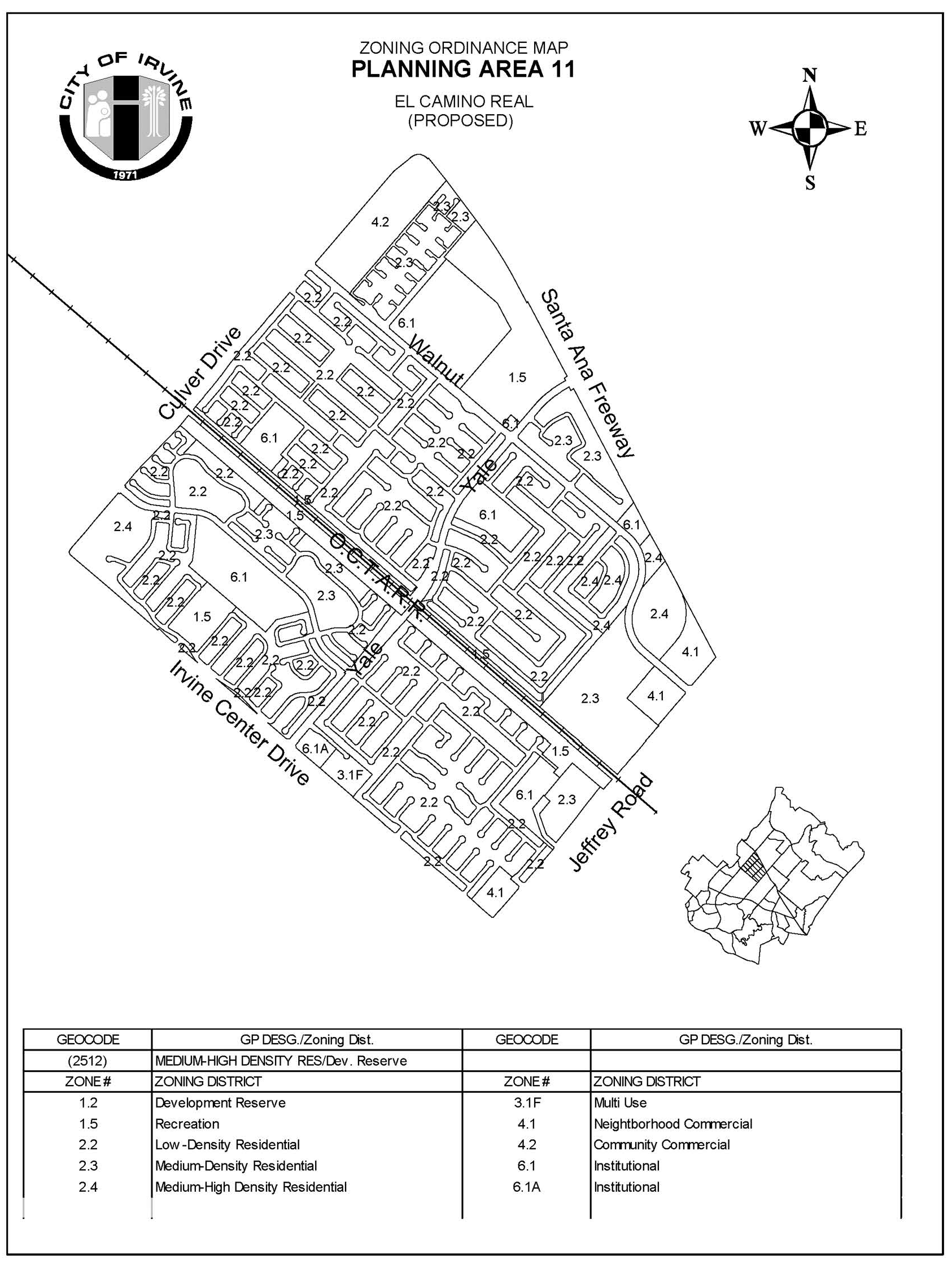
Sec. 9-11-7. - Special development requirements.
A tentative parcel or tract map shall be required for any new residential development in this planning area. For the purposes of the Subdivision Map Act and the City's subdivision ordinance, the Planning Commission shall serve as the advisory agency for any subdivision required by this note.
(Code 1976, § V.E-811.6; Ord. No. 92-3, 4-14-92; Ord. No. 95-4, 5-9-95; Ord. No. 95-22, § 2, 11-28-95)
Sec. 9-12-1.- Land use zoning map.
(See Planning Area 12 map following Section 9-12-2.)
(Code 1976, § V.E-812.1; Ord. No. 92-3, 4-14-92; Ord. No. 92-21, 11-24-92; Ord. No. 94-10, § 2, 7-12-94; Ord. No. 95-4, 5-9-95; Ord. No. 95-22, § 3, 11-28-95; Ord. No. 95-22, § 3, 11-28-95; Ord. No. 97-17, § 3, 9-23-97; Ord. No. 01-04, § 5, 4-10-01; Ord. No. 02-15, § 5, 10-22-02; Ord. No. 08-08, § 5, 8-12-08; Ord. No. 08-12, § 3, 9-9-08)
Sec. 9-12-2. - Introduction.
Planning Area 12 is located in the center of the City. Boundaries include Jeffrey Road to the west, Interstate 5 (Santa Ana Freeway) to the north, Sand Canyon Avenue to the east and Interstate 405 (San Diego Freeway) to the south.
(Code 1976, § V.E-812.2; Ord. No. 92-3, 4-14-92; Ord. No. 92-21, 11-24-92; Ord. No. 94-10, § 2, 7-12-94; Ord. No. 95-4, 5-9-95; Ord. No. 95-22, § 3, 11-28-95; Ord. No. 95-22, § 3, 11-28-95; Ord. No. 97-17, § 3, 9-23-97; Ord. No. 09-02, § 3, 3-24-09; Ord. No. 20-08, Exh. A, 11-24-20)
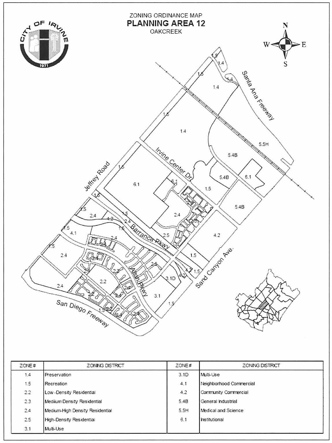
Sec. 9-12-3. - Statistical analysis.
*To the degree residential units are built in the Multi-Use Zoning District, a corresponding reduction in the allowable nonresidential intensity shall occur in terms of equivalent traffic generation. The actual amount of reduction will be determined on the basis of a traffic analysis which utilizes the traffic data in the final EIR for Planning Area 12 for comparison and as deemed acceptable to the City.
1 Unallocated dwelling units represent those units remaining in a planning area that may be built anywhere in the same planning area. These units are within the maximum development intensity for the planning area; and, therefore, placement of unallocated dwelling units into any residential category within the planning area for purposes of development is determined to be consistent with the General Plan and Zoning Code with regard to intensity allocation only, provided that placement is otherwise consistent with site specific zoning regulations and that any potential environmental impacts are adequately addressed, including traffic impacts, pursuant to CEQA.
2 See Section 9-0-3.C, Building Intensity Standards.
An 18-hole regulation course with customary and appurtenant facilities, such as a clubhouse, with food service and a pro shop; and a driving range.
Subtotal of Oak Creek is 3,100 units
Subtotal of Orangetree is 1,120 units
(Code 1976, § V.E-812.3; Ord. No. 92-3, 4-14-92; Ord. No. 92-21, 11-24-92; Ord. No. 94-10, § 2, 7-12-94; Ord. No. 95-4, 5-9-95; Ord. No. 95-22, § 3, 11-28-95; Ord. No. 95-22, § 3, 11-28-95; Ord. No. 97-17, § 3, 9-23-97; Ord. No. 02-09, §§ 1—7, 6-11-02; Ord. No. 02-15, § 5, 10-22-02; Ord. No. 08-08, § 5, 8-12-08; Ord. No. 08-12, § 3, 9-9-08; Ord. No. 10-04, § 3, 4-13-10; Ord. No. 12-09, § 3(Exh. A), 5-22-12; Ord. No. 20-08, Exh. A, 11-24-20)
Sec. 9-12-4. - Land use regulations.
See Section 3-3-1 (Land use matrix).
(Code 1976, § V.E-812.4; Ord. No. 92-3, 4-14-92; Ord. No. 92-21, 11-24-92; Ord. No. 94-10, § 2, 7-12-94; Ord. No. 95-4, 5-9-95; Ord. No. 95-22, § 3, 11-28-95; Ord. No. 95-22, § 3, 11-28-95)
Sec. 9-12-5. - Development standards.
See Chapter 3-37 (Development Standards).
(Code 1976, § V.E-812.5; Ord. No. 92-3, 4-14-92; Ord. No. 92-21, 11-24-92; Ord. No. 94-10, § 2, 7-12-94; Ord. No. 95-4, 5-9-95; Ord. No. 95-22, § 3, 11-28-95; Ord. No. 95-22, § 3, 11-28-95)
Sec. 9-12-7. - Special development requirements.
A.
Land use.
1.
Residential.
a.
Prior to the submittal of applications for the first residential building permit, the applicant shall submit an affordable housing program, consistent with the most recent update of the General Plan Housing Element, for approval by the Planning Commission. The affordable housing program for Planning Area 12 (PA 12 AHP) shall include:
(1)
Fifteen percent affordable housing program goal.
(a)
Income II. Five percent of the actual number of dwelling units built in the planning area shall be affordable, as rental units, to households earning 30 percent to 50 percent of the County median income (Income II) contingent upon the provision of available financial and processing incentives. Those dwelling units that are designated to be used as permanent transitional housing units shall be eligible for multiple credits as determined in the affordable housing program.
(b)
Income III. Five percent of the actual number of dwelling units built in the planning area shall be affordable as either rental or ownership units, with the emphasis on ownership units, to households earning 50 percent to 80 percent of the County median income (Income III) contingent upon the provision of available financial and processing incentives. In the affordable housing program, the applicant shall demonstrate a good faith effort to provide ownership units as the preferred alternative at the Income III level with rental units considered as a secondary alternative. However, to the degree ownership units are provided to Income II households, a 2:1 credit will be attributed toward achievement of this goal. Additionally, to the extent Income II units are provided with the use of financial and processing incentives in excess of the five percent Income II goal, a 2:1 credit will also be attributed toward the achievement of this goal.
(c)
Income IV. In addition, five percent of the actual number of dwelling units built in the planning area shall be affordable to households earning 80 percent to 120 percent of the County median income (Income IV) not contingent upon the provision of available financial incentives.
(2)
Site selection of affordable units. Except as provided for in Subparagraph (4) below, the program shall identify specific site(s) which are distributed throughout Planning Area 12 which can accommodate the construction of affordable units in achievement of the 15 percent affordable housing goal.
(3)
Term of affordability. The term of affordability for all units produced pursuant to the program shall be subject to the conditions of financing used for the project.
(4)
On-site goal. At least 50 percent of the affordable housing shall be provided within Planning Area 12.
(5)
Definitions of financial and processing incentives.
(a)
Financial incentives (such as community development block grant funds, mortgage revenue bonds, low-income housing tax credits, and housing trust fund monies) mean government monetary assistance to the project for the purpose of subsidizing the cost of providing affordable units.
(b)
Process incentives (such as expedited processing, modifications for parking and parkland requirements and density bonuses per State law) or any other type of changes to existing land use policies which will increase the applicant's ability to provide affordable housing.
(6)
Handicapped accessibility. Ten percent of the affordable units shall be adaptable and accessible to the physically handicapped.
(7)
Use of existing units. The existing 33 affordable units provided in excess of the previous affordable housing requirement for the existing development in Planning Area 12, north of Barranca Parkway and west of Orangetree, shall be used as credits toward fulfilling the 10 percent Income II and Income III affordable housing goal for Planning Area 12.
(8)
Priority policy in leasing/selling of units. In leasing or selling the affordable units, the applicant shall conform to the City's prioritization policy as stated in City Council Resolution No. 89-161, or subsequent resolution.
(9)
Compliance by subsequent developers. Subsequent to the approval of the PA 12 AHP, the applicant shall enter into a binding agreement, in a form approved by the City Attorney, with any and all subsequent developers of lots designated for the development of affordable housing units, which ensures that the development complies with the PA 12 AHP. The City shall be a third party beneficiary to this agreement. Developers of lots designated for affordable housing units shall submit for review and approval to the Director of Community Development a specific implementation plan that shows compliance with the PA 12 AHP.
b.
The Director of Community Development shall have the discretion to approve, conditionally approve or deny a density modification application for development of any residential project requiring discretionary approval (including, but not limited to, tract maps, parcel maps, zone changes, Master Plans and variances) at densities lower than the density range applicable to a property located within any given zoning category. Such discretion shall include, but not be limited to, withholding approval of the density modification unless the total number of existing dwelling units within the applicable zoning category of Planning Area 12, when added to the total number of dwelling units developed under the proposed project, remains in and complies with the overall density range for that category. An applicant applying for the project shall submit a completed application to the Community Development Department on the form provided by the City, together with the applicable fee as established by resolution of the City Council. It shall be at the discretion of the Director of Community Development to require additional information as needed as a part of the application, including, but not limited to, plans, renderings and a site/building mass model. In determining whether to grant approval of a request for decreased density, the Director shall consider the following project impacts:
(1)
Environmental.
(2)
Infrastructure.
(3)
Assessment districts.
(4)
Affordable housing, if applicable.
(5)
Schools.
(6)
Recreation and open space.
(7)
On-site and off-site vehicular circulation.
(8)
On-site and off-site pedestrian circulation.
(9)
Other potential impacts not mentioned above.
2.
Multi-use.
a.
The multi-use area may be devoted entirely to one permitted/conditionally permitted use or to any combination of permitted/conditionally permitted uses.
3.
Institutional.
a.
Institutional uses are considered additive to the intensity tables in the General Plan, per table 5, Footnote Number 1 of Figure A-9 of the land use element of the General Plan.
b.
Institutional uses will be deemed consistent with the General Plan if all significant environmental impacts are mitigated to a level of insignificance; and if infrastructure capacity under existing and future (General Plan build-out) conditions can accommodate additional development in the areas of circulation, fire, police, water and flood control services; or development intensity under the adopted land use category is exchanged for intensity to accommodate institutional development in the areas of circulation, fire, police, water and flood control services within the same planning area.
4.
Commercial.
a.
The configuration and total site acreage of the commercial areas shall be determined through master tentative tract map(s) for Planning Area 12.
b.
Vehicular access to commercial sites shown on a master tentative tract map for Planning Area 12 shall be supported by a traffic study. Additional vehicular access to commercial sites shall be determined with the Master Plan to promote safe and convenient on-site circulation.
c.
In order to provide an active pedestrian interface between the neighborhood commercial center and residential uses, the applicant shall demonstrate on the pedestrian circulation plan how the neighborhood commercial center will be linked to the adjacent residential developments, in order to provide convenient and safe pedestrian access.
d.
Any Master Plan or conditional use permit processed for community commercial parcels within the area bound by "A" Street, Irvine Center Drive, Sand Canyon Avenue and Barranca Parkway shall be compatible with the Orangetree neighborhood with particular reference to building heights, the location of loading docks and storage areas, screening of parking areas, signage, elevation design and landscaping.
5.
Industrial.
a.
Parking shall be provided in a manner consistent with the City of Irvine parking ordinance. Required parking for each individual building site may be combined in clusters with that required for other building sites, provided that the intent of the parking ordinance is preserved and appropriate agreements and/or easements are provided to ensure the availability and continued maintenance of the parking area for the intended user. The developer agrees to provide the City with an accurate accounting of the cumulative number of parking spaces required and parking spaces provided or the building sites involved
b.
Any Master Plan or CUP processed for industrial parcels immediately adjacent to Irvine Center Drive shall be compatible with the Orangetree neighborhood with particular reference to building heights, the location of loading docks and storage areas, screening of parking areas, signage, elevations design and landscaping. In addressing project compatibility, the screening effect of the existing trees in the median of Irvine Center Drive shall be recognized.
c.
Golf courses with customary and appurtenant facilities, such as clubhouses, parking areas, restaurants, driving ranges, and pro shops, are conditionally permitted uses within the General Industrial zoning category. Public roadways may be permitted to be built through or adjacent to any golf course.
B.
Public and private facilities.
1.
Jeffrey Open Space Trail.
a.
The Jeffrey Open Space Trail (JOST) will occur on the east side of Jeffrey Road and may consist of varying widths. The JOST will function as the village edge.
(1)
Improvements to the JOST with the exception of the trails shall be the responsibility of the City.
(2)
Maintenance of the JOST, including trails, shall be the responsibility of the City.
(3)
An 11-foot meandering bicycle/pedestrian trail and an 11-foot meandering riding/hiking trail with two-foot-wide shoulders shall be provided within the JOST in accordance with the City policy regarding riding and hiking trails in effect at the time of the master tentative tract map. At grade, signalized crossings will be located at all road intersections. A biking/riding/hiking bridge shall be provided crossing the San Diego Creek parallel to Jeffrey Road. Construction and maintenance shall be the responsibility of the City.
(4)
Between I-405 and Barranca Parkway, the JOST shall total 14 gross acres and will have an average width of 90 feet measured from the Jeffrey Road curb face. Parcel A1, as shown on Exhibit A, will widen to meet the Edison right-of-way along the I-405 Freeway. Parcel A2 may be reduced to a 32-foot width so that, when combined with street right-of-way, there will be a total of 50 feet from the Jeffrey Road curb face to the building property line.
(5)
Between Barranca Parkway and the I-5 Freeway, the JOST shall total 16 gross acres (Parcels A-4 and A-5 on Exhibit A). Portions of the JOST may be maintained by the golf course operator by mutual agreement between the City and landowner. A park-and-ride facility proposed to be located at Jeffrey and I-5 will be credited towards meeting the 16-acre requirement.
b.
In conjunction with the submittal of master tentative tract map(s) for areas adjacent to the JOST, the applicant shall submit for review, to the satisfaction of the Director of Community Development and the City Attorney, the form of an irrevocable offer of dedication to the City of Irvine for the JOST adjacent to the development included in the master tentative tract map. The JOST shall be identified on said master tentative tract map as lettered lots. The irrevocable offer of dedication shall then be accepted by the City and recorded in conjunction with the recordation of the final master tract map(s).
2.
Open space.
a.
Parcels B1 and B2 shown on Exhibit A shall total 176 gross acres and shall be retained in ownership by the existing landowner or its successor in interest and operated as a public golf course. An open space easement, limiting its use to a golf course and customary and appurtenant facilities, will be conveyed to the City.
b.
Open space parcel C1 on Exhibit A is part of the golf course to be developed on Parcels B1 and B2. An open space easement on Parcel C1 is not required to be dedicated to the City.
c.
Concurrent with the recordation of the first final tract map for the newly zoned residential areas within Planning Area 12, an irrevocable offer of an open space easement for Preservation Area O of the City of Irvine General Plan shall be recorded. The offer shall be accepted no sooner than 90 days following issuance of building permits for 75 percent of the development for Planning Area 12 or the completion of development in Planning Area 12, whichever occurs first. Preservation upon Area O, zoned 1.4 Preservation, may be developed with a golf course with customary and appurtenant facilities, such as a clubhouse with food service and pro shop and driving range.
d.
Both the Jeffrey Open Space Trail and Preservation Area O offers of conveyance will be subject to non-monetary encumbrances, easements, liens, restrictions and title exceptions of record or apparent which do not prevent use of the conveyance areas consistent with the conservation open space element and with the following:
(1)
The offer shall provide for conveyance of title by grant deed subject to land use restrictions and/or open space easements assuring that the conveyed land shall be used in perpetuity consistent with the intent of the dedication and the purposes to be served by open space spines and preservation areas, with corresponding means of enforcement. Lands reserved for road, transportation, transit, drainage, flood control, water, sewer and utility purposes by public agencies may be excluded from the offer at the landowner's discretion.
(2)
Mineral rights and water rights (excluding the right of surface entry) will be reserved by the landowner on conveyed lands. The landowner shall make full written disclosure with respect to toxic or hazardous substances which in its knowledge were stored on or deposited in the land to be dedicated. Road, transportation, transit, flood control, drainage, water, sewer, and utility easements necessary to accomplish development in adjoining areas and/or to accomplish planned facilities by public agencies and utilities will be reserved by the landowner on conveyed lands. Easements will be reserved on conveyed lands if necessary to preserve or facilitate agricultural uses on adjoining preservation areas not yet conveyed.
3.
San Diego Creek open space spine.
a.
The San Diego Creek open space spine consists of the new San Diego Creek flood control channel. Development of the channel shall be found by the City to be in conformance with the City-certified Final Environmental Impact Report-Barranca Parkway Connection and San Diego Creek Improvements (FEIR).
b.
The open space areas identified in the FEIR as avoidance or additional mitigation areas adjacent to Barranca Parkway shall be conveyed to the City for ownership and maintenance purposes.
c.
The open space conservation management plan for Planning Area 12 shall include the design concept for the landscape improvements for the open space areas. The design concept shall demonstrate the following:
(1)
Preservation of "avoidance" areas identified in the FEIR and any additional on-site mitigation areas established through the 1601 and 404 permit process.
(2)
Use of adaptive, drought-tolerant plant materials whenever possible, to minimize future maintenance needs and costs.
d.
The master tentative tract map for the new residential portion of Planning Area 12 shall include the conceptual design of landscape improvements for the San Diego Creek open space spine and Barranca Parkway. The conceptual design shall demonstrate the following:
(1)
New eucalyptus trees to relate to the existing eucalyptus trees.
(2)
Complementary open spaces, greenbelts, appropriate setbacks, and a continuous bicycle trail adjacent to the channel.
(3)
Berms, walls, landscaping, and other techniques to screen unattractive elements.
4.
Parks.
a.
To facilitate the review process, the applicant shall submit the park plan concurrently with the master tentative tract map for the new residential portion of Planning Area 12. Parks are conceptually depicted on Exhibit B.
b.
The total park acreage requirements, the exact number, location, configuration, and size of local neighborhood parks, and the distribution of public and private parks shall be established at the time of approval of the master tentative tract map for the new residential portion of Planning Area 12, in accordance with the park and recreation element and Local Park Code. Amenities to be considered for the private neighborhood park(s) include a Junior Olympic pool and a meeting room for local residents.
c.
In addition to the larger neighborhood parks, a number of small private neighborhood parks measuring a minimum of 0.33 acre each may be provided within individual residential developments in the planning area in order to meet City park dedication requirements.
d.
The community park dedication requirements for Planning Area 12 shall be satisfied by the dedication of two acres per 1,000 population and credit for the improvement of community park land within the planning area north of Barranca Parkway between "A" Street and Sand Canyon Avenue as shown on Exhibit B. During the processing of the master tentative tract map for the new residential portion of the planning area, the exact size and configuration of the park as well as the extent of improvements shall be determined pursuant to Section 5-5-1004 of the Code of Ordinances. Full park acreage credits shall be provided for any required improvements. The timing of the park land dedication and improvements shall be agreed to between the applicant and the City prior to the issuance of the first building permit, excluding model home permits, for the new residential portion of Planning Area 12.
5.
Schools.
a.
One elementary school site shall be reserved in Planning Area 12 for development by the Irvine Unified School District (IUSD). The exact location, configuration, size, and total acreage of the school site shall be identified with the approval of the master tentative tract map for the new residential portion of the planning area. In the event the IUSD Board determines that the site reserved for a school is not needed, or is deemed inappropriate for such development, the site may be developed in accordance with the underlying zoning of the property. However, approval of such development shall not occur without a written letter of agreement from the IUSD Board indicating that the site is no longer needed for school development and is therefore released by the district. The conceptual school site location is shown on Exhibit B.
6.
Child care.
a.
The need for child care facilities shall be recognized in the development of Planning Area 12. Prior to the approval of the master tentative tract map for the new residential portion of the planning area, the number of child care slots provided will be determined by the City in accordance with the City policy in effect at the time. The number of slots will be based on the actual number of residential units to be built and on a determination of child care needs within the planning area.
b.
Prior to the approval of the master tentative tract map for the new residential portion of Planning Area 12, the applicant shall address the following when locating any child care center:
(1)
The general location of any child care center(s) shall be determined.
(2)
The size of any parcel that is designated for a potential child care center shall be determined by the Director of Community Development and the Director of Community and Library Services.
(3)
Child care centers shall be compatible with adjacent uses. Development of a child care center in conjunction with the proposed elementary school and adjacent neighborhood park, residential developments and/or the neighborhood commercial center shall be encouraged.
(4)
In locating a child care center, the proposed site shall be evaluated with regard to factors that might be detrimental to the public health, safety, or welfare, including, but not limited to, proximity to high-traffic-volume roadways, hazardous materials, and major generators of traffic.
C.
Circulation.
1.
Streets.
a.
A circulation phasing plan shall be required prior to the approval of the first tentative map, excluding the golf course(s). The phasing plan shall identify the timing, cost and acquisition, design, and construction associated with the implementation of improvements identified.
b.
The alignments of all local streets shown on Exhibit B are conceptual only.
c.
Any additional analyses (traffic studies) for the subsequent development of Planning Area 12 will be subject to the approved traffic study guidelines and performance criteria in use at the time of the analysis.
2.
Bicycle trails.
a.
Class II (on-street) bicycle trails will be located as shown on Exhibit B consistent with planning and design guidelines for bicycle facilities in Irvine.
b.
Trails adjacent to Sand Canyon Avenue shall consist of the following:
(1)
A Class I (off-street) bicycle trail will be located on the west side of Sand Canyon Avenue. This trail shall be designed and constructed by the applicant and maintained by the City.
(2)
A bicycle bridge crossing San Diego Creek parallel to Sand Canyon Avenue shall be designed, constructed and maintained by the City.
c.
The Class I (off-street) bicycle trail in the Edison right-of-way paralleling the San Diego Freeway, as shown on Exhibit B, will be designed and constructed by the applicant and maintained by the City.
3.
Pedestrian links.
a.
In conjunction with the submittal of the master tentative tract map for the new residential portion of Planning Area 12, the applicant shall include a pedestrian circulation plan which shall:
(1)
Demonstrate how pedestrian circulation is being incorporated between the project area and all support uses in the vicinity of the project. Access shall be provided to encourage pedestrian movement between the project area and existing and proposed retail services and transit facilities in the vicinity of the project.
(2)
Demonstrate how pedestrian circulation provides continuity between the project area and adjacent developments.
(3)
Demonstrate how pedestrian circulation is being incorporated to provide access to and across any easement, reservation, open space or other non-project-related element within or adjacent to the project area.
(4)
Demonstrate how pedestrian accessways provide circulation links between individual neighborhoods, where appropriate, including a grade-separated pedestrian crossing of Alton Parkway. Ownership and maintenance of the crossing will be the responsibility of the City.
b.
Consideration shall be given, at the time of review for each tentative map and/or Master Plans for individual developments, to pedestrian access to bus stop locations. Access to the residential units within each subdivision shall be located within a reasonable walking distance to planned/approved bus stop locations. As a goal of access, 90 percent of the residential units within each subdivision shall be located within one-fourth mile walking distance of approved bus stop locations.
4.
Riding and hiking trails.
a.
A riding and hiking trail shall be provided in the Jeffrey Open Space Trail. The trail shall be designed and constructed by the applicant and maintained by the City in accordance with the City policy in effect at the time of approval of the master tentative tract map.
b.
A riding and hiking trail shall be provided south of the existing bicycle trail along the Amtrak railroad line. The trail shall be designed and constructed by the applicant and maintained by the City in accordance with the City policy in effect at the time of approval of the master tentative tract map.
c.
In conjunction with submittal of the first subdivision map for the 5.5H Medical and Science District in Planning Area 12, the subdivided map shall indicate the location of the Class 1 Sand Canyon Trail Extension along the west side of Sand Canyon Avenue between the Santa Ana (I-5) Freeway and the limit of the trail improvements incorporated in the City's improvement plans for the Sand Canyon Avenue undercrossing. The applicant shall be responsible for constructing trail improvements within the project area frontage on Sand Canyon Avenue within the applicant's ownership.
5.
Public transit.
a.
Bus stop and turnout locations shall be identified through the design of the master tentative tract map for the new residential portion of Planning Area 12. Whenever possible, bus stops shall be located at the far side of the intersection to facilitate bus and traffic operations in the vicinity of pedestrian access points. The master tentative tract map for the new residential portion of Planning Area 12 shall demonstrate that there is adequate right-of-way for the siting of bus shelters adjacent to identified bus stops.
6.
Transportation management.
a.
The General Industrial Areas being zoned in Planning Area 12 shall be annexed to the Spectrum Transportation Management Association (TMA).
b.
In recognition of the park-and-ride facility dedicated within PA 2 and consistent with the dedication agreement for this facility at Jeffrey Road and the I-5 Freeway, the inclusion of the industrial area in the Spectrum TMA and provision of transit right-of-way through this village, the trips in the PA 12 traffic analysis will be reduced by a percentage to be determined by the City and the applicant and no further park-and-ride facility exaction will be made for this planning area.
D.
Infrastructure.
1.
Drainage.
a.
San Diego Creek will be relocated and improved in accordance with Alternative 1 (modified) of the FEIR for Barranca Parkway Extension and San Diego Creek improvements. The width and acreage of San Diego Creek depicted on the zoning maps and on all exhibits are approximations.
2.
Utilities.
a.
Consideration shall be given to providing an energy-efficient utility system or systems within the planning area. Consideration of this issue shall be undertaken by the applicant, the City and the utility providers as part of the cooperative effort to determine the economic feasibility of an on-site utility system.
E.
Neighborhood design.
1.
Architecture.
a.
The architectural design shall address detail articulated on all sides of the structures visible from streets, paseos, and other public areas. Particular attention shall be given to windows, balconies, doors, and any special design elements. The elements and qualities which shall be encouraged are human scale and privacy, play of light using shade and shadows to provide relief, and variations in rooflines. Large blank walls with minimal detail shall be discouraged.
b.
Residential/retail/multi-use.
(1)
The architectural character of the planning area south of Barranca Parkway will reflect a classic architectural expression.
(2)
A variety of architectural styles and forms are consistent with this expression and will be used to express differences among projects and neighborhoods within the planning area. In keeping with the activity corridor, the area between Alton and Barranca will reflect the more urban forms. The area south of Alton will reflect the more village influences.
(3)
To achieve the intended architectural character, the following elements may be used by the developer. Variations of these features may also be used which achieve the intended expression.
(a)
Overall form. Bold massing creating strong silhouettes against the sky. Some symmetry at front facades or around entries used to create balance in the overall form. Entry view corridors terminating at blank walls and/or blank building elevations shall be discouraged.
(b)
Roof form. Varied roof massing with a strong cornice line. Clay, concrete tile, and slate are used predominantly with consistent earthtone colors.
(c)
Details. Simple cornices, mouldings, projections and recesses, and integral-colored accent materials such as ceramic tile and brick. Also, garden walls (stone or painted stucco) and picket gates.
(d)
Site design. Terraces, plazas, arcades, colonnades, and pergolas used to define pedestrian areas. Clustering of units around open spaces and separation of public and private areas. Landscaping and building integration; for example, use of planters, vines on garden walls, hedges and treillage.
c.
Industrial. North of Irvine Center Drive in the industrial portion of the planning area, the architectural expression will be unified, clean and contemporary, similar to the Irvine Spectrum 3 (Planning Area 32).
2.
Landscaping.
a.
Residential/retail/multi-use. The landscape character of the planning area south of Barranca Parkway will include both the formal and informal planting design. The tree palette for the planning area will consist of predominantly evergreen trees with deciduous tree accents. The more dense urban part of the planning area will be between Alton and Barranca, where streets and squares will be designed in a formal manner to provide continuity and order. South of Alton, an informal landscape will be provided.
b.
Industrial. North of Irvine Center Drive in the industrial portion of the planning area, the landscape character will be similar to the Irvine Spectrum 3 (Planning Area 32). The plant palette emphasizes the use of evergreen street trees and manicured hedges to provide a unified, clean contemporary character.
c.
Golf course. The character of the golf course will be established by creating new landforms which modify the existing topography and by planting concepts which incorporate, to the extent feasible, the existing eucalyptus windrows.
d.
Streetscape.
(1)
Provision of landscaped edges, walks and trails along major streets shall be in general conformance with Exhibits E1 through E22.
(2)
Special intersection landscape treatments occur in the locations shown on Exhibit D.
(3)
The conceptual design of landscape improvements for the village edges, paseos and other landscaped areas will be included with the master tentative tract map.
(4)
New eucalyptus tree plantings will be incorporated into the landscaping for the JOST except in areas owned by SCE and along the ultimate channel of San Diego Creek.
F.
Project development monitoring within the 5.5H Medical and Science zoning district (north of the AT&SF railroad tracks), 5.4B General Industrial zoning district, and 4.2 Community Commercial zoning district - The Traffic Study conducted for Zone Change 00800352-PZC, prepared by Stantec Consulting Services, dated July 31, 2020 (2020 Spectrum 7 Traffic Study), contains specific land use and related intensity assumptions, identified by the Irvine Transportation Analysis Model traffic analysis zones (ITAM TAZ's). The boundary of the zoning districts stated here, which is known as Spectrum 7, is the Santa Ana Freeway (I-5) to the north, Sand Canyon Avenue to the east, the community park (1.5 Recreation) to the south, and Valley Oak and the Oak Creek Golf Club to the west. The limits of Spectrum 7 are shown on Exhibit F.
For the purposes of this section, "applicant" shall mean the applicant for Zone Change 00800352-PZC. Prior to submittal of each permit application for a precise grading plan, building permit, and/or discretionary application for a master plan, if required, the applicant shall submit a Development Monitoring Report (DMR) for review and approval by the Director of Community Development. The DMR shall include the use and allocation of intensity to each developed and proposed development parcel and related ITAM TAZ. The land use and related intensity shall be consistent with the assumptions included in Table 2-4 of the 2020 Spectrum 7 Traffic Study. Incidental office use in conjunction with research & development, manufacturing, and warehouse uses as identified in the DMR in Spectrum 7 shall not exceed 50 percent of the designated primary use. The approval of the DMR by the Director of Community Development shall be based upon the determination that the use, intensity, and related traffic generation characteristics of the proposed development are consistent with the limits studied in the 2020 Spectrum 7 Traffic Study.
G.
Green building requirements within the 5.5H Medical and Science Zoning District. The applicant will comply with all City, State, and federal greenhouse gas emissions and green building requirements applicable to new development on a City-wide basis that are in place at the time of each tentative tract map approval within Planning Area 12.
(Code 1976, § V.E-812.6; Ord. No. 92-3, 4-14-92; Ord. No. 92-21, 11-24-92; Ord. No. 94-10, § 2, 7-12-94; Ord. No. 95-4, 5-9-95; Ord. No. 95-22, § 3, 11-28-95; Ord. No. 95-22, § 3, 11-28-95; Ord. No. 99-03, § 3, 2-9-99; Ord. No. 02-15, § 5, 10-22-02; Ord. No. 03-17, § 3, 6-10-03; Ord. No. 08-12, § 3, 9-9-08; Ord. No. 09-02, § 3, 3-24-09; Ord. No. 20-08, Exh. A, 11-24-20; Ord. No. 25-22, § 4, 9-9-25)
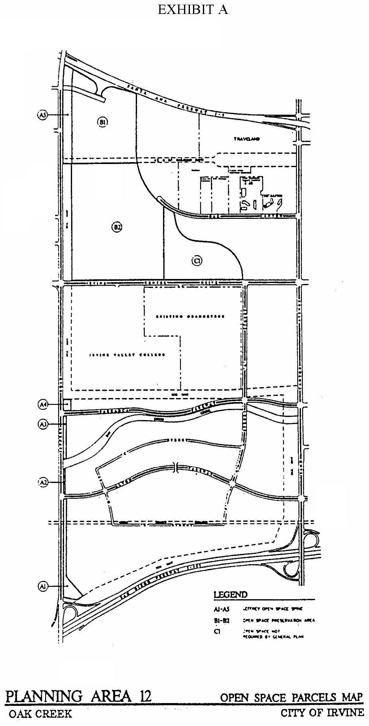
PLANNING AREA 12—PARK AND PEDESTRIAN SYSTEMS MAP
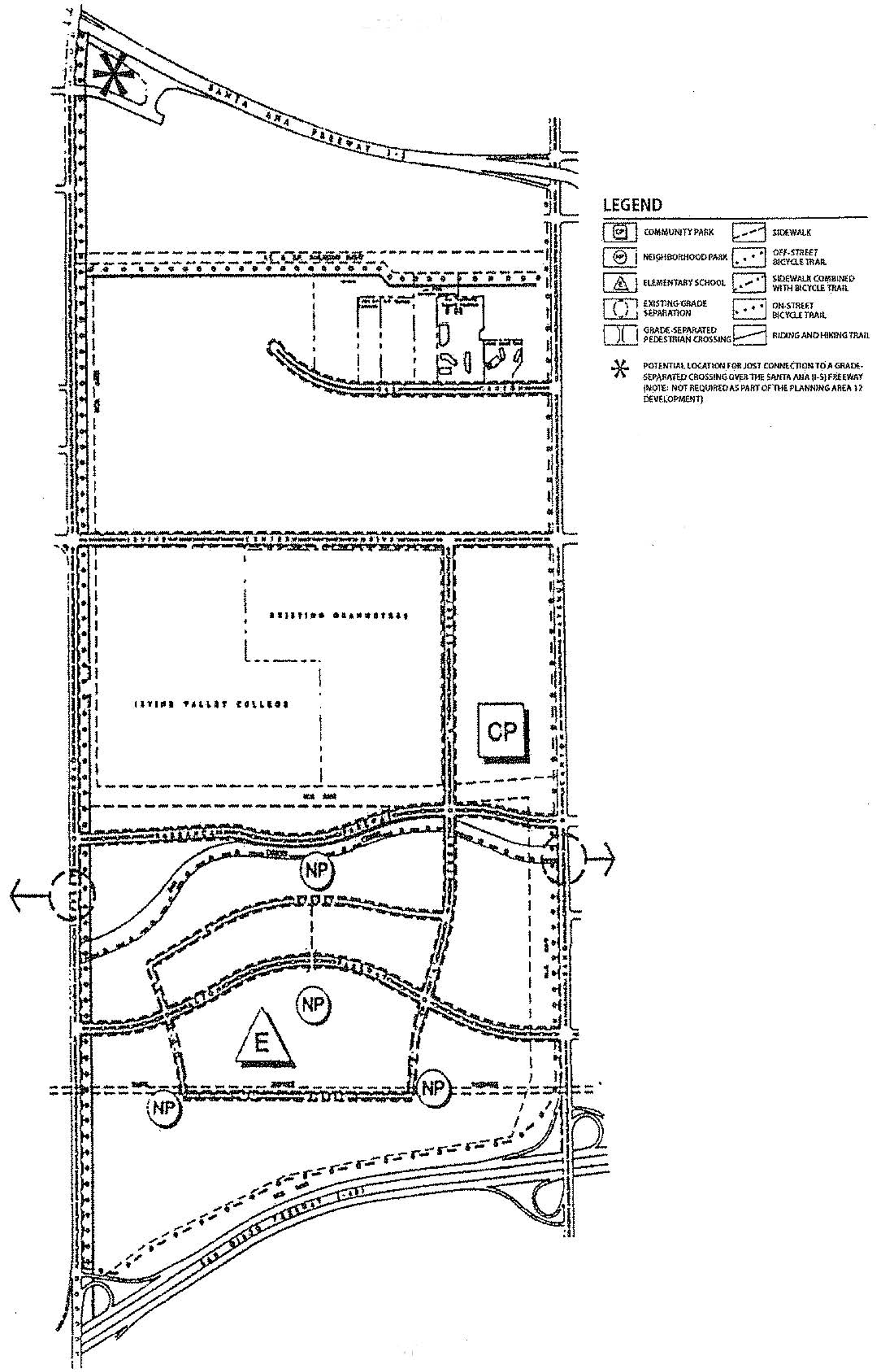
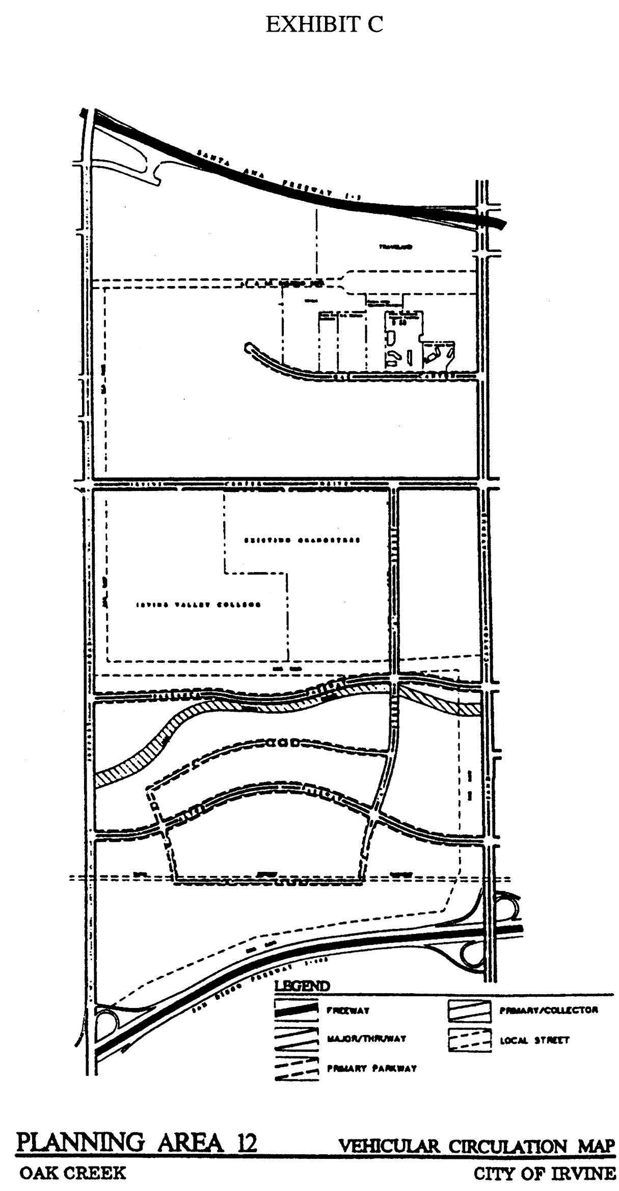
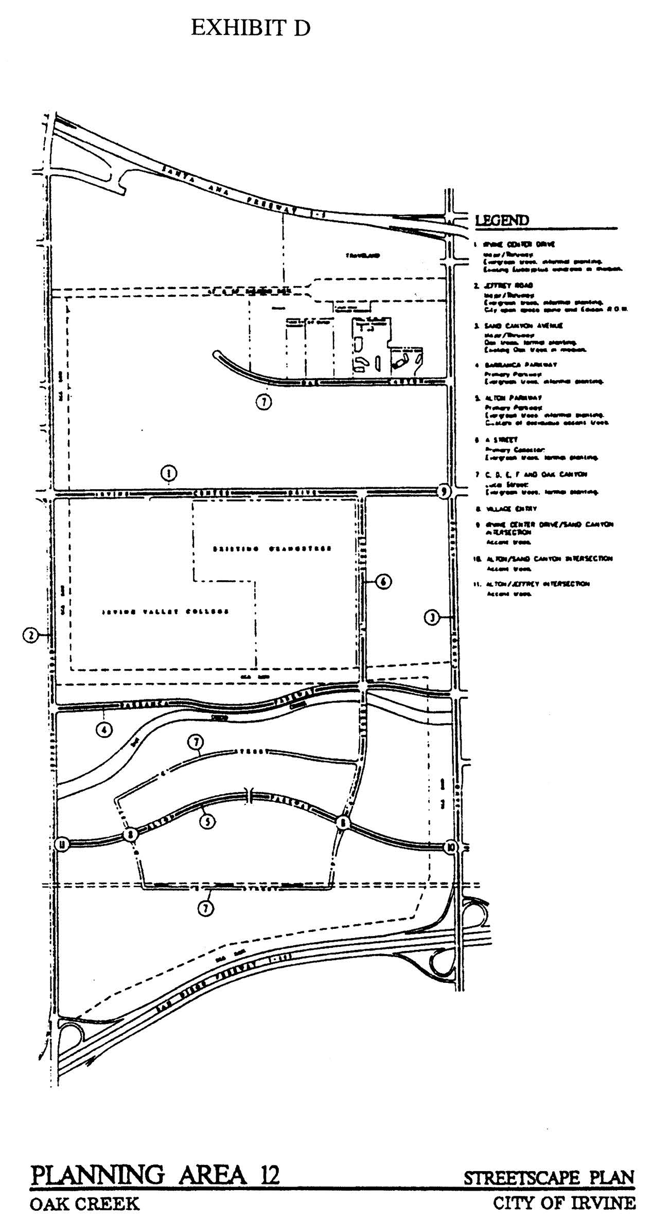
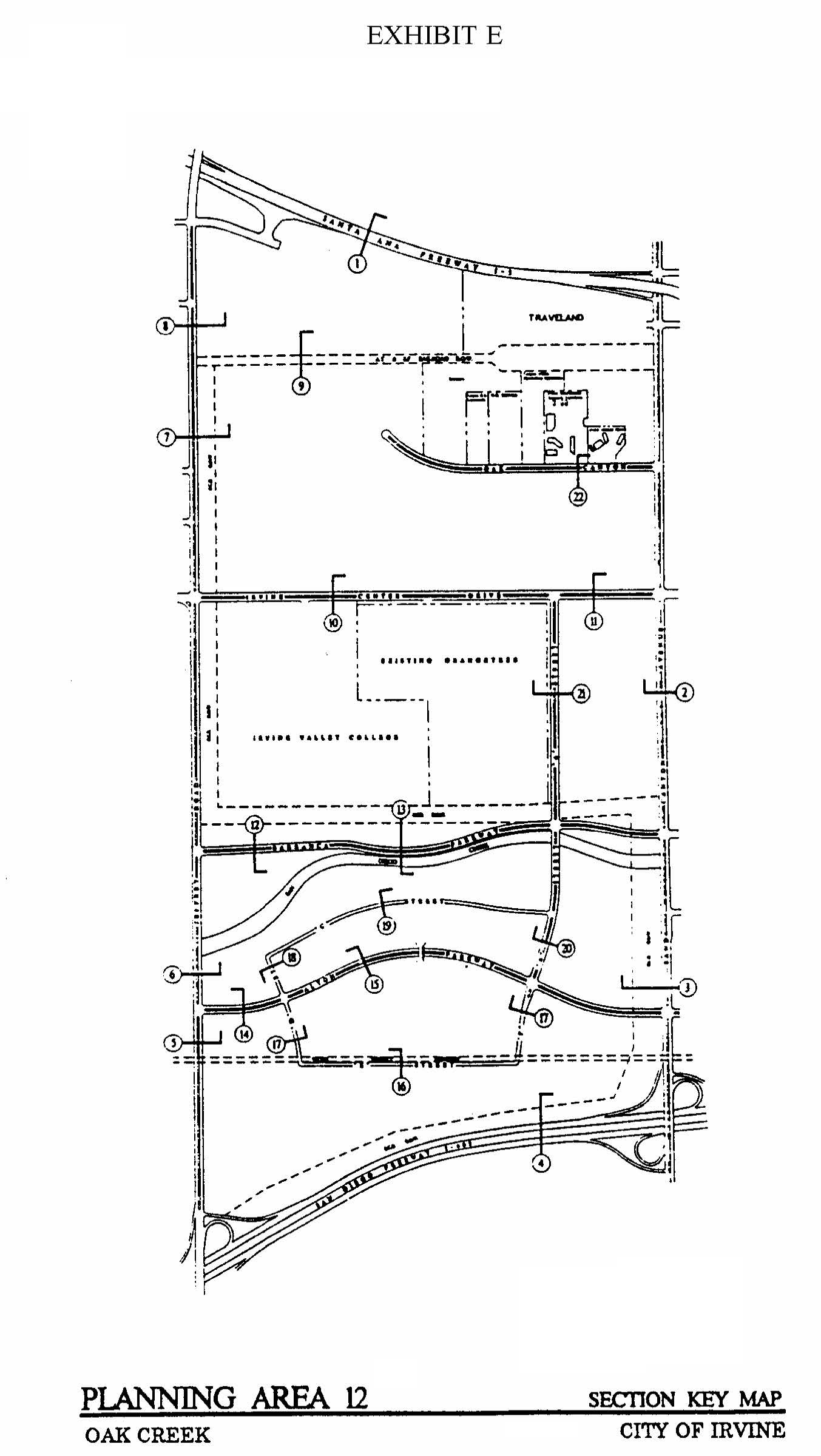
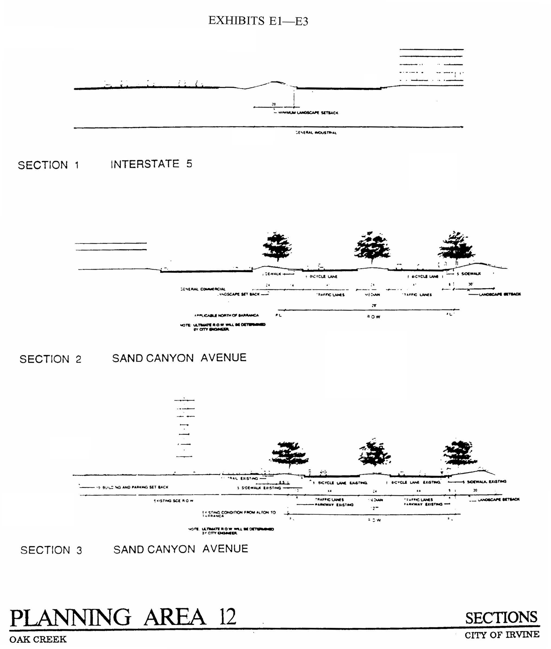
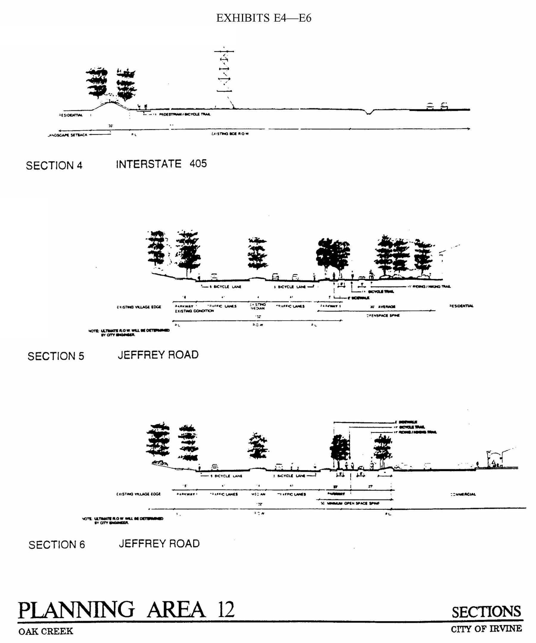
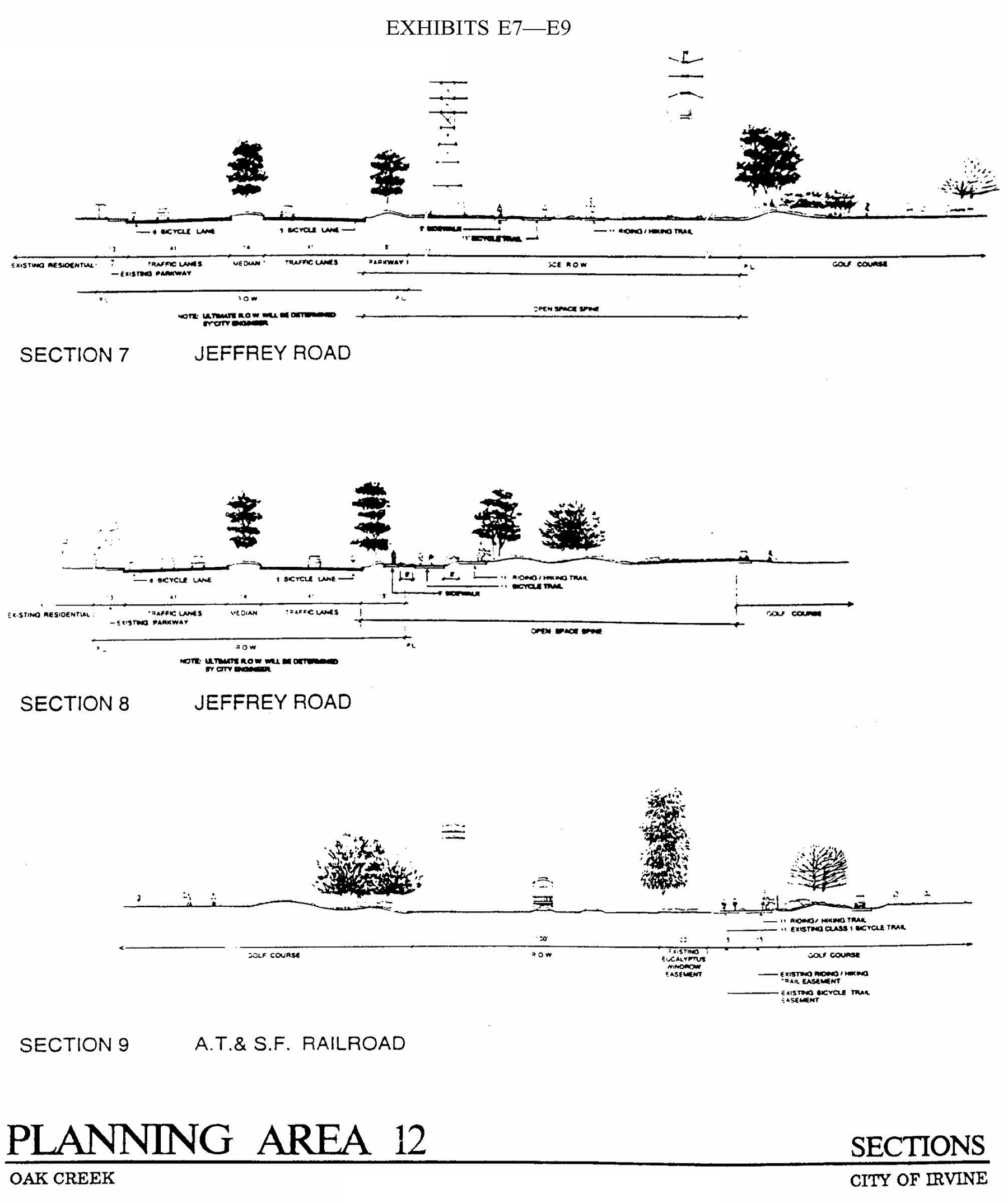
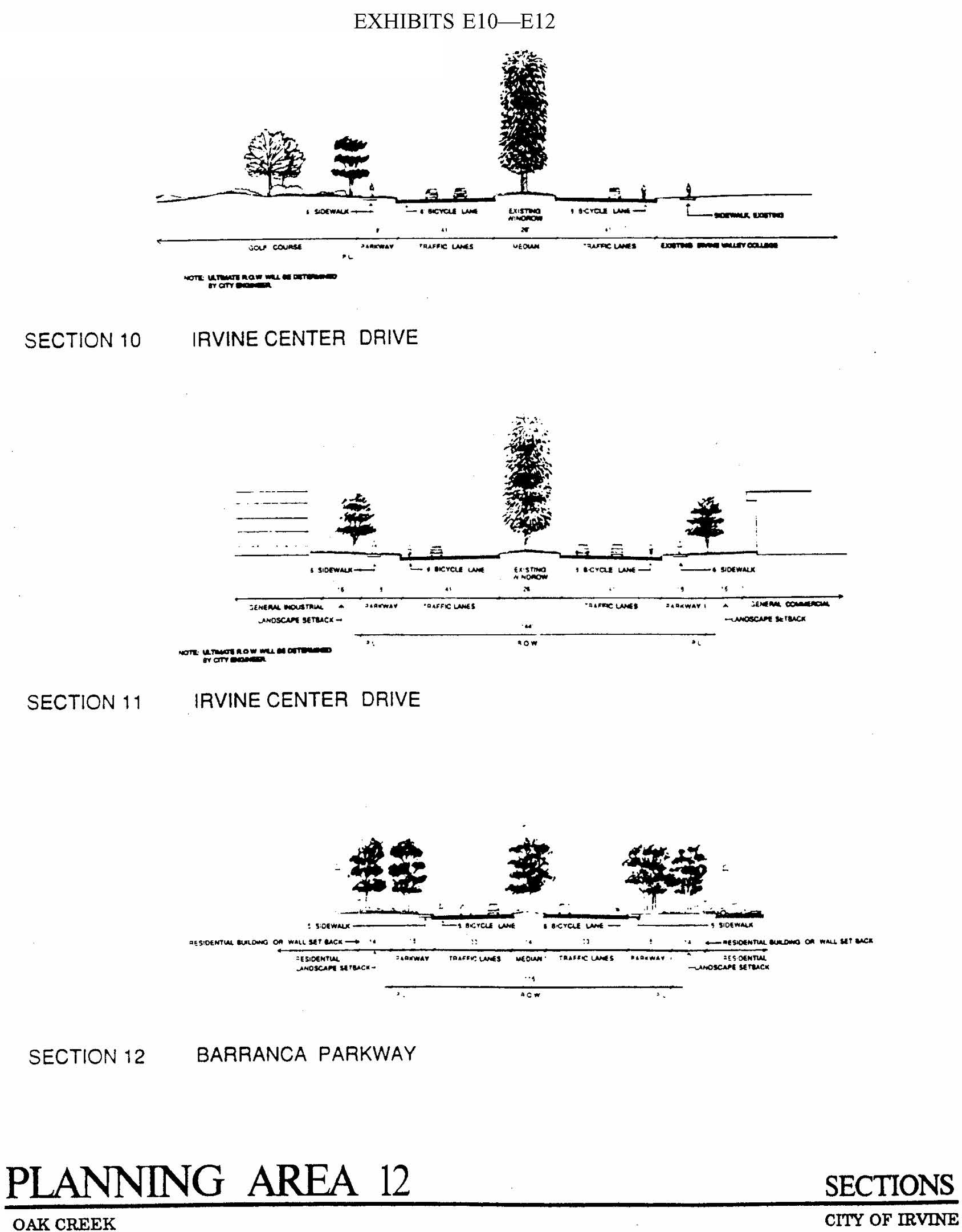
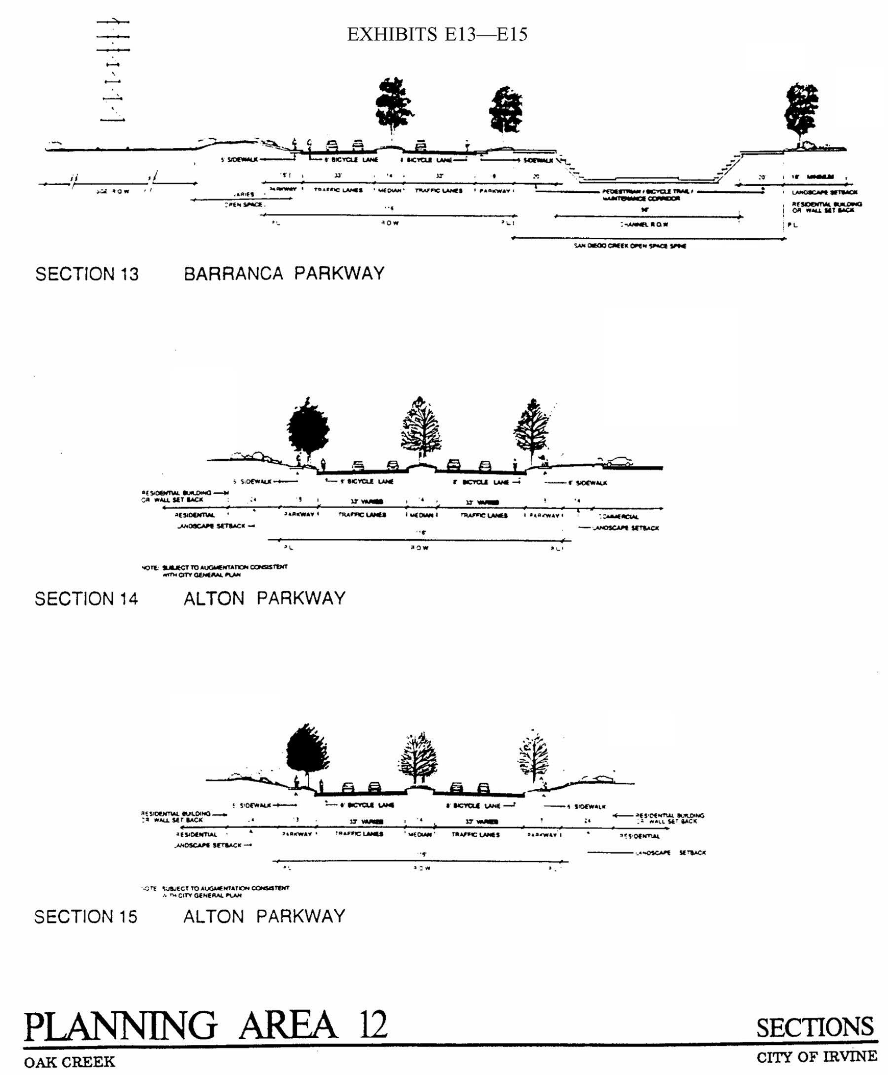
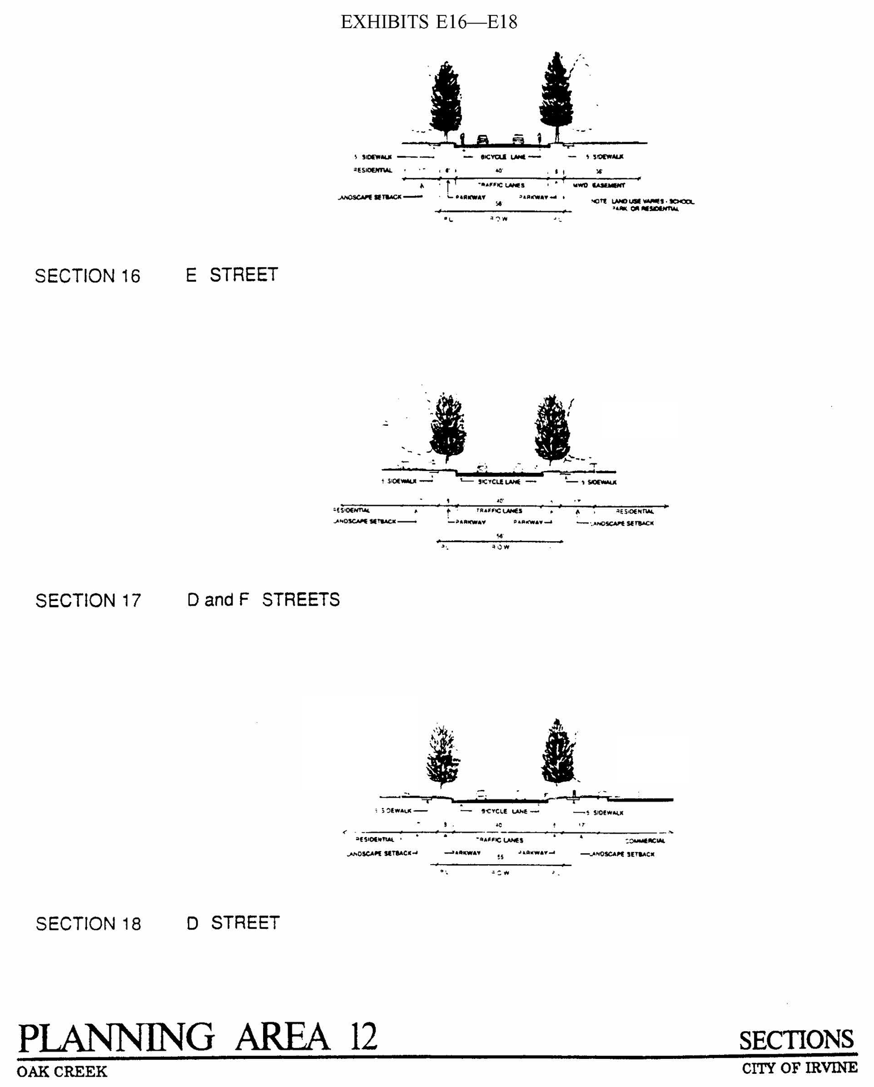
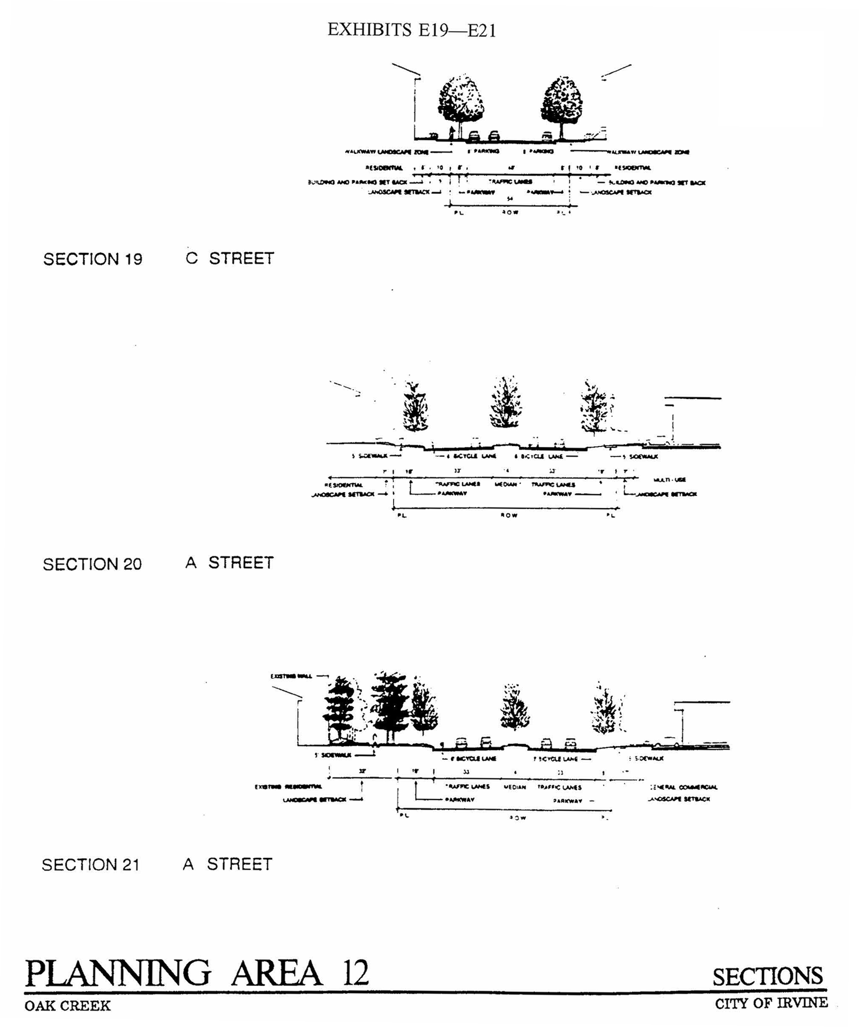
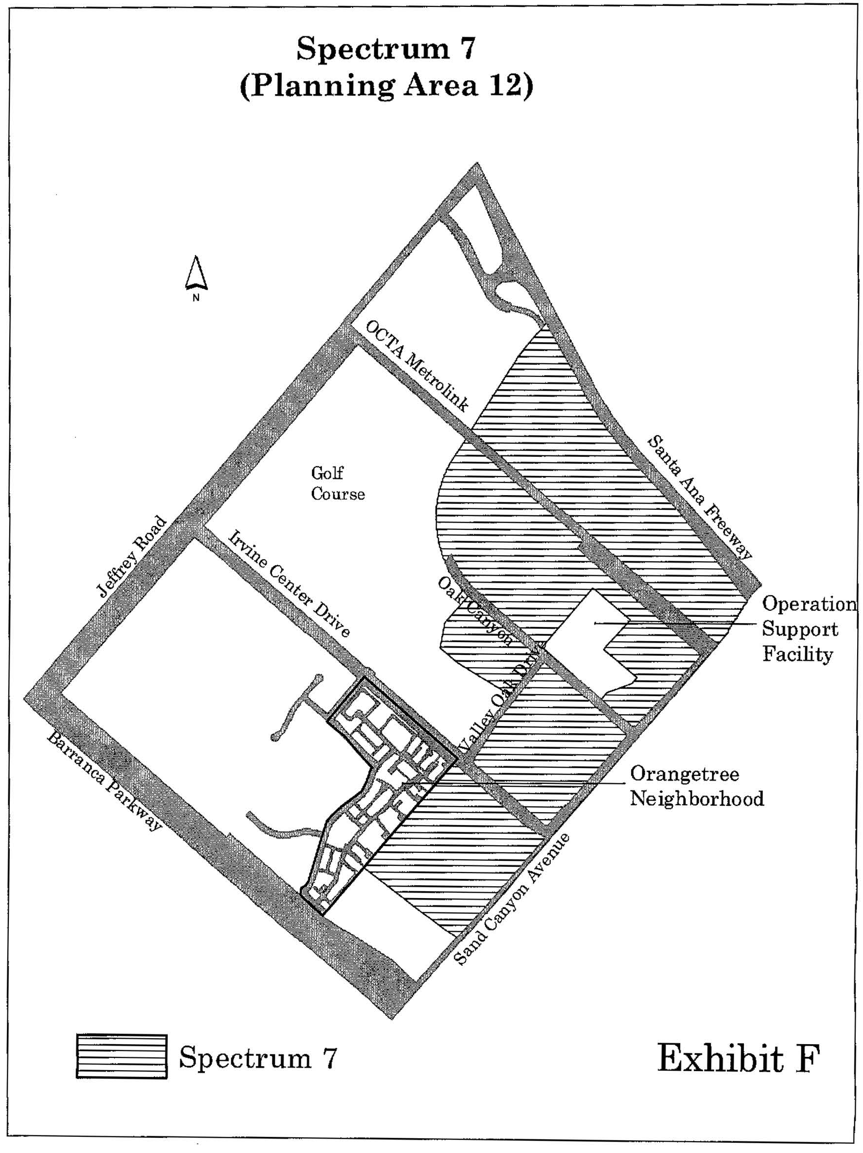
Sec. 9-13-1.- Land use zoning map.
(See Planning Area 13 map following Section 9-13-5.)
(Code 1976, § V.E-813.1; Ord. No. 92-3, 4-14-92; Ord. No. 95-4, 5-9-95; Ord. No. 95-16, § 2, 10-10-95; Ord. No. 95-22, § 3, 11-28-95)
Sec. 9-13-2. - Introduction.
Planning Area 13 is located in the northeastern area of the City. Boundaries include Sand Canyon Avenue to the west, Barranca Parkway to the north, State Route 133 (Laguna Freeway) to the east and Interstate 405 (San Diego Freeway) to the south.
(Code 1976, § V.E-813.2; Ord. No. 92-3, 4-14-92; Ord. No. 95-4, 5-9-95; Ord. No. 95-16, § 2, 10-10-95; Ord. No. 95-22, § 3, 11-28-95)
Sec. 9-13-3. - Statistical analysis
*1,847,711 square feet for the Irvine Medical Center and Kaiser Hospitals is additive and is not included in the planning area total square footage.
1 Unallocated dwelling units represent those units remaining in a planning area that may be built anywhere in the same planning area. These units are within the maximum development intensity for the planning area; and, therefore, placement of unallocated dwelling units into any residential category within the planning area for purposes of development is determined to be consistent with the General Plan and Zoning Code with regard to intensity allocation only, provided that placement is otherwise consistent with site specific zoning regulations and that any potential environmental impacts are adequately addressed, including traffic impacts, pursuant to CEQA.
2 See Section 9-0-3.C, Building Intensity Standards.
(Code 1976, § V.E-813.3; Ord. No. 92-3, 4-14-92; Ord. No. 95-4, 5-9-95; Ord. No. 95-16, § 2, 10-10-95; Ord. No. 95-22, § 3, 11-28-95; Ord. No. 01-12, § 4, 6-26-01; Ord. No. 03-01, § 6, 1-14-03; Ord. No. 05-19, § 4, 9-27-05; Ord. No. 12-09, § 3(Exh. A), 5-22-12)
Sec. 9-13-4. - Land use regulations.
See Section 3-3-1 (Land use matrix).
(Code 1976, § V.E-813.4; Ord. No. 92-3, 4-14-92; Ord. No. 95-4, 5-9-95; Ord. No. 95-16, § 2, 10-10-95; Ord. No. 95-22, § 3, 11-28-95)
Sec. 9-13-5. - Development standards.
See Chapter 3-37 (Development Standards).
(Code 1976, § V.E-813.5; Ord. No. 92-3, 4-14-92; Ord. No. 95-4, 5-9-95; Ord. No. 95-16, § 2, 10-10-95; Ord. No. 95-22, § 3, 11-28-95)
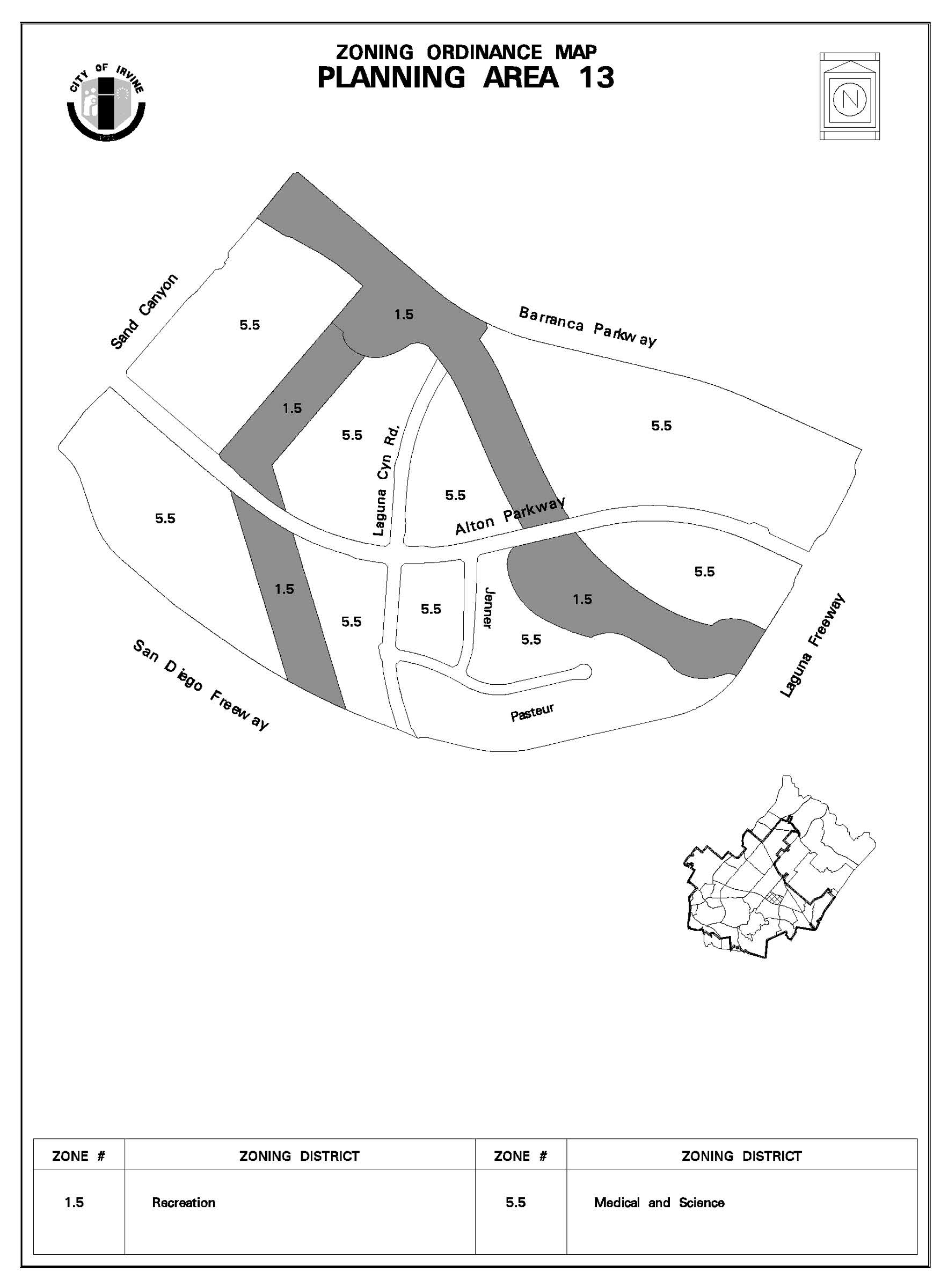
Sec. 9-13-7. - Special development requirements.
A.
See Division 3 for applicable general development requirements.
B.
Reserved.
C.
Special landscaped streets are listed in Section 3-15-9.
D.
Development shall be flood-protected from a 100-year storm in a manner consistent with conceptual plans for San Diego Creek. This conceptual plan shall be submitted to the Director of Community Development for review and approved by the Planning Commission, prior to or in conjunction with the approval of the first master tentative map with the village. The conceptual plan shall delineate the treatment of the open space area and flood control channels, as well as encompass an area which measures from the channel's centerline on both sides of the channel. Total acreage of the San Diego Creek Open Space Corridor shall be no less than 45 acres. The City's participation shall in no way be construed as a commitment for financial or maintenance participation in the actual construction of the flood control channel.
E.
Prior to or in conjunction with the submittal of the first master tentative map for this planning area, the developer shall submit a concept plan delineating the treatment of the open space area encompassed by the Edison right-of-way to the Director of Community Development for review and approval.
F.
A detailed drainage and flood control study and plans for San Diego Creek, consistent with the approved conceptual flood protection plan, shall be submitted and approved prior to or in conjunction with approval of the first master tentative map or off-site improvements which lie within any part of the 100-year floodplain. The detailed plans shall determine the capacity, alignment and design of facilities necessary to accommodate the 100-year design flood (as determined by the Orange County Environmental Management Agency) and protect the site from flooding. The drainage study shall also propose solutions to Sand Canyon Avenue and Irvine Center Drive flooding. The detailed study and plans shall determine any hydrologic changes to adjacent or downstream areas as a result of these improvements and propose measures to avoid any adverse effects.
G.
Prior to or in conjunction with approval of the first master tentative map, the applicant shall submit a flood control facility maintenance plan. This plan shall identify maintenance needs and responsibility, and detail an effective method to assure the City that the identified responsibilities will be carried out.
H.
In conjunction with preparation of the conceptual plan for San Diego Creek, the applicant shall prepare an open space management plan for the San Diego Creek Corridor. This plan shall be submitted to the Director of Community Development for review and approval. This plan shall also be forwarded to the Department of Fish and Game for comment and review. This plan shall be consistent with the open space corridor implementing actions for Planning Area 13.
I.
Prior to or in conjunction with approval of the first master tentative map, the applicant shall complete an analysis which shall include measures which may be necessary to prevent flooding of the planning area should the Laguna Reservoir fail. If determined necessary by the Director of Public Safety, this analysis shall include an emergency evacuation plan.
J.
Limits on development.
1.
Overall limits. The maximum amount of development permitted within the Irvine Spectrum 4 is the square footage of a variety of permitted uses which will generate a maximum of 8,799 trips during the p.m. peak hour. It is the applicant's responsibility to ensure that development does not exceed this cumulative figure.
2.
Cumulative analysis requirements. Upon submittal of any site plan or a conditional use permit for review and approval, the gross floor area and traffic generation projections for each increment of development, as well as cumulative gross floor area and traffic generation projections, shall be provided. The applicant shall have the responsibility of maintaining this cumulative analysis, and shall submit same to the Community Development Department for monitoring.
K.
Parking shall be provided in a manner consistent with the City of Irvine parking ordinance (Division 4) except that all required parking for each individual building site may be combined and provided in clusters with that required for other building sites, if the intent of the parking ordinance is preserved and appropriate agreements and/or easements are provided to ensure the availability and continued maintenance of the parking area for the intended user. The developer agrees to provide the City with an accurate accounting of the cumulative number of parking spaces required and parking spaces provided for the building sites involved.
L.
Prior to or in conjunction with the approval of the first master tentative map for the planning area, the applicant and the City shall reconfirm or determine the proposed alignment of the transit corridor and identify locations of any potential transit stop. The alignment and transit stop location shall be reviewed by the Planning Commission and approved by the Director of Public Works prior to this determination. The alignment shall appear as an easement reservation for future dedication on all subsequent tentative maps where applicable.
M.
Prior to recordation of the first final map, the property owner shall obtain approval from the Planning Commission for a phased development plan for the entire planning area which analyzes related circulation improvements required by each phase of development. This plan shall be reviewed by the Planning Commission prior to approval by the Planning Commission. Additionally, prior to recordation of the first final map, the property owner shall enter into an agreement with the City which guarantees the provision of improvements associated with each phase of development as identified by the phasing plan, if construction of that phase is undertaken. This agreement shall be approved by the City Council.
N.
The applicant shall submit a maximum of two master tentative maps for the planning area, excluding that for the Irvine Medical Center Hospital. Master maps may be submitted separately or concurrently. If submitted separately, the subject area of the first separate master tentative map may be resubdivided prior to the submittal of the second master tentative tract map.
O.
Each business which intends to handle or store hazardous substances shall notify the City and shall prepare a hazardous materials control plan for review and approval by the City of Irvine and the County of Orange, Division of Environmental Health Waste Management Section.
P.
The City's eucalyptus windrow policy shall apply to all on-site oak trees.
Q.
Prior to the issuance of grading permits for any portion of this site, the applicant shall retain an archaeologist and paleontologist to attend pre-grading meetings, who shall coordinate with the contractor/developer all grading activity to maximize the protection and/or salvage of valuable archaeological resources. The archaeologist and paleontologist shall be allowed on the site during grading operations. At the completion of the project, a report shall be prepared by the archaeologist for submission to the HAP Committee. The report shall review the results of this activity and these findings.
R.
Prior to the approval of building permits for any portion of the planning area, the applicant shall work with the City to develop a construction truck traffic routing plan that will route construction traffic away from residential and hospital areas. If that is not possible, construction shall be limited to the hours of 7:00 a.m. to dusk, weekdays.
S.
Consistent with City policy, a noise study report and appropriate plans shall be submitted to the Director of Community Development for review and verification. This report shall be prepared in accordance with the City's environmental review procedure for all projects that are not "clearly compatible" with the future noise level at the site. The report shall identify the existing and future noise levels on the site and describe in detail the mitigation measures necessary to achieve the CNEL and/or single-event noise standards as shown in the City's most current noise element, or any future amendment adopted by the City Council. The single-event noise standard (Lmas 10) of 65 dB(A) daytime and 55 dB(A) nighttime is required for all noise-sensitive land uses as described in the noise element.
T.
Prior to the approval of demolition permits for any structures on the site, the Irvine Historical Society shall be contacted by the Community Development Department and allowed to enter the buildings to remove artifacts for future display in the Irvine Museum. After demolition or removal of the above structures, the historical society shall be allowed to survey the site for artifacts that may be found on the ground around the locations of the structures.
U.
A comprehensive documentation of the area, as it currently exists, shall be performed prior to the issuance of any building, grading and/or demolition permits. The documentation shall be compatible with Historical American Building Survey/Historical American Engineering Record (HABS/HAER) standards and involve consultation with the State Historic Preservation Office.
(Code 1976, § V.E-813.6; Ord. No. 92-3, 4-14-92; Ord. No. 95-4, 5-9-95; Ord. No. 95-16, § 2, 10-10-95; Ord. No. 95-22, § 3, 11-28-95; Ord. No. 99-03, § 3, 2-9-99; Ord. No. 00-02, § 4, 2-8-00; Ord. No. 01-12, § 4, 6-26-01; Ord. No. 03-01, § 6, 1-14-03; Ord. No. 04-03, § 3, 2-24-04; Ord. No. 05-19, § 4, 9-27-05)
Sec. 9-14-1.- Land use zoning map.
(See Planning Area 14 map following Section 9-14-5.)
(Code 1976, § V.E-814.1; Ord. No. 92-3, 4-14-92; Ord. No. 92-21, 11-24-92; Ord. No. 93-7, 6-22-93; Ord. No. 94-13, § 3, 9-27-94; Ord. No. 95-4, 5-9-95; Ord. No. 95-22, § 3, 11-28-95; Ord. No. 96-06, § 3, 3-12-96)
Sec. 9-14-2. - Introduction.
Planning Area 14, Westpark, is centrally located within the City. Boundaries include the San Diego Creek to the west, Barranca to the north, Culver Drive to the east and Interstate 405 (San Diego Freeway) to the south.
(Code 1976, § V.E-814.2; Ord. No. 92-3, 4-14-92; Ord. No. 92-21, 11-24-92; Ord. No. 93-7, 6-22-93; Ord. No. 94-13, § 3, 9-27-94; Ord. No. 95-4, 5-9-95; Ord. No. 95-22, § 3, 11-28-95; Ord. No. 96-06, § 3, 3-12-96)
Sec. 9-14-3. - Statistical analysis.
1 Unallocated dwelling units represent those units remaining in a planning area that may be built anywhere in the same planning area. These units are within the maximum development intensity for the planning area; and, therefore, placement of unallocated units into any residential category within the planning area for purposes of development is determined to be consistent with the General Plan and Zoning Code with regard to intensity allocation only, provided that placement is otherwise consistent with site specific zoning regulations and that any potential environmental impacts are adequately addressed, including traffic impacts, pursuant to CEQA.
2 See Section 9-0-3.C, Building Intensity Standards.
(Code 1976, § V.E-814.3; Ord. No. 92-3, 4-14-92; Ord. No. 92-21, 11-24-92; Ord. No. 93-7, 6-22-93; Ord. No. 94-13, § 3, 9-27-94; Ord. No. 95-4, 5-9-95; Ord. No. 95-22, § 3, 11-28-95; Ord. No. 96-06, § 3, 3-12-96; Ord. No. 99-20, § 4, 9-28-99; Ord. No. 10-04, § 3, 4-13-10; Ord. No. 12-09, § 3(Exh. A), 5-22-12)
Sec. 9-14-4. - Land use regulations.
See Section 3-3-1 (Land use matrix).
(Code 1976, § V.E-814.4; Ord. No. 92-3, 4-14-92; Ord. No. 92-21, 11-24-92; Ord. No. 93-7, 6-22-93; Ord. No. 94-13, § 3, 9-27-94; Ord. No. 95-4, 5-9-95; Ord. No. 95-22, § 3, 11-28-95; Ord. No. 96-06, § 3, 3-12-96)
Sec. 9-14-5. - Development standards.
See Chapter 3-37 (Development Standards).
(Code 1976, § V.E-814.5; Ord. No. 92-3, 4-14-92; Ord. No. 92-21, 11-24-92; Ord. No. 93-7, 6-22-93; Ord. No. 94-13, § 3, 9-27-94; Ord. No. 95-4, 5-9-95; Ord. No. 95-22, § 3, 11-28-95; Ord. No. 96-06, § 3, 3-12-96)
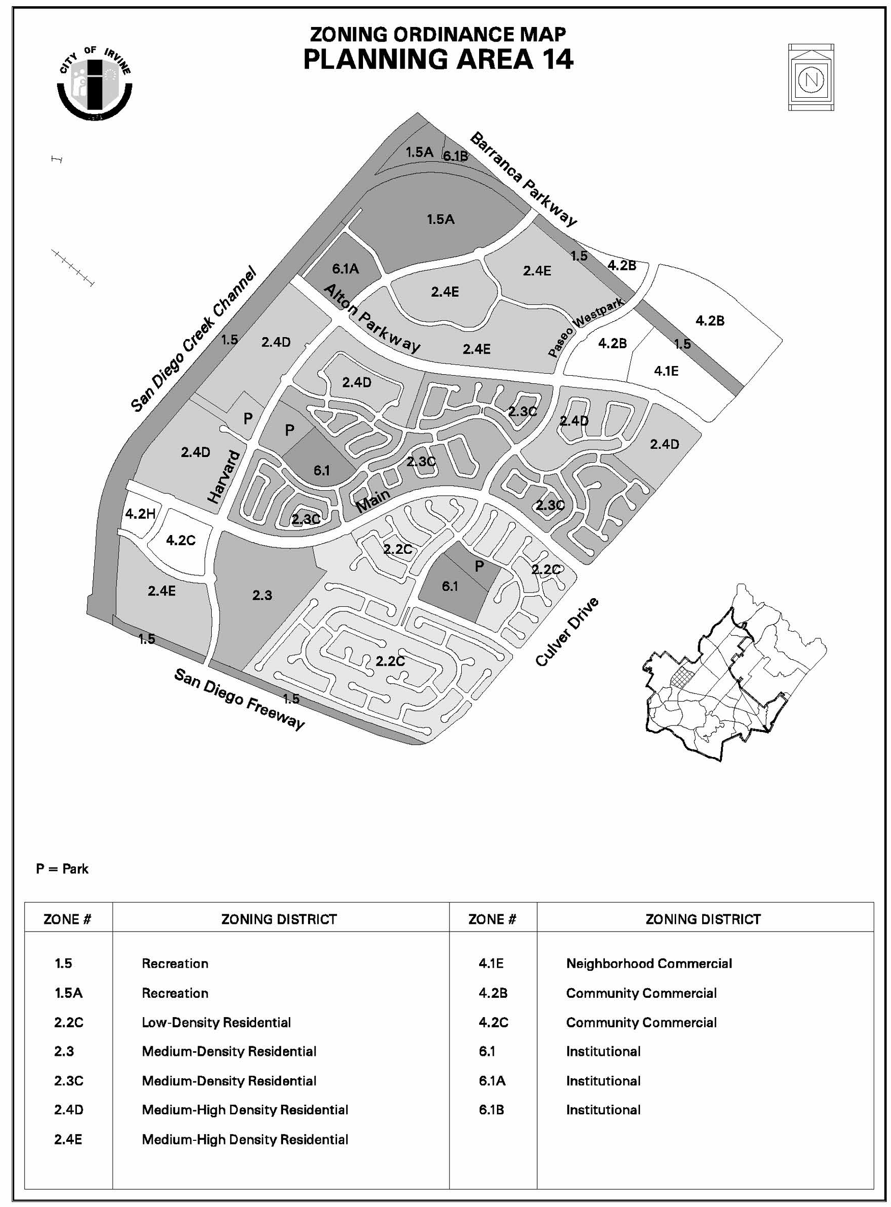
Sec. 9-14-7. - Special development requirements.
A.
See Division 3 for applicable general development requirements.
B.
The parking requirement for the 4.2H Community Commercial zoning category located at the southwest corner of Main and Veneto Streets shall be provided for each of the individual uses on the site according to the automobile parking matrix in zoning ordinance Section 4-3-4.
(Code 1976, § V.E-814.6; Ord. No. 92-3, 4-14-92; Ord. No. 92-21, 11-24-92; Ord. No. 93-7, 6-22-93; Ord. No. 94-13, § 3, 9-27-94; Ord. No. 95-4, 5-9-95; Ord. No. 95-22, § 3, 11-28-95; Ord. No. 96-06, § 3, 3-12-96)
Sec. 9-14-8. - Concept plan requirements.
A.
Implementation. The development objectives set forth in this concept plan are intended to be specific directives for development and shall be implemented according to the standards set forth herein. However, some of the policies and related exhibits contained in the concept plan, including, but not limited to, the street crossing sections and intersection plazas, are intended solely to guide and not to restrict creative design. Instances where this occurs are identified.
B.
Land use.
1.
Residential.
a.
Residential development will occur in conformance with the zoning map for Westpark. Residential categories and density ranges are consistent with the City of Irvine's General Plan, A-5-10.
b.
At build-out, Westpark will contain (including 460 dwelling units in Culverdale) a maximum of 5,660 dwelling units and a minimum of 3,550 dwelling units. The number of units within each density range shall be consistent with the statistical summary.
c.
At least 15 percent of the housing units for sale or rent will be in a price range affordable by families of moderate income. An additional 10 percent of the housing units for sale or rent will be in a price range affordable by families of low income. The provision of the low-income units is contingent upon the availability of governmental financing programs. If these programs are not available, the low-income units total will be met with an equivalent number of moderate-income units. Income and affordability ranges will be as defined by the City of Irvine Housing Element.
d.
Requirement of zoning for Housing Element compliance: Adaptation of the Planning Commission recommendation for Planning Area 3B:
(1)
Term. The requirements below shall commence on the date of approval by the City Council of the General Plan amendment (89-GA-0047) and zone change (89-ZC-0142) (January 8, 1991) and shall be complied with during full residential build-out of the project, except that the affordable housing units shall be provided for at least 30 years, and the monitoring requirement of Tier III shall remain in effect for the required term as stated.
(2)
Tier I: Income II.
(a)
The applicant shall provide 10 percent of the total number of units constructed in the projects as newly constructed on-site dwelling units affordable to Income II households ("Income II units"). The City shall make financial incentives available to the applicant to aid the applicant in satisfying its Tier I obligation. Such financial incentives are preferred over the provision of processing incentives. If financial incentives are not available, the City may make available processing incentives which are within its authority to provide; however, processing incentives are to be used as a last resort. At the City Council's discretion, the applicant may be permitted to satisfy this Tier I requirement through either of the following mechanisms:
1.
Payment of in-lieu fees. Providing the City Council adopts an in-lieu program, and further providing the City Council authorizes this alternative, the applicant may satisfy its Tier I obligation by paying an affordable housing in-lieu fee in an amount equal to the amount of subsidy as that term is defined in Subsection (5)(c), below.
2.
Sale of equivalent value in land. If authorized by the City Council, the applicant may satisfy its Tier I obligation by selling sufficient land on-site to the City to provide for the development of 10 percent of the total number of units to be constructed by the project as Income II units. For the purposes of this mechanism, the land to be used would be zoned Medium Density or Medium-High Density Residential within the project. The applicant shall then sell the land at a price determined by a fair market valuation based on the density range of residential development approvals provided by zoning and minus the amount of subsidy necessary to meet the affordability criteria of this Tier I.
(b)
Compliance with this Tier I requirement in the manner described above is dependent upon the applicant's ability to obtain financial incentives in an amount equal to the amount of subsidy. In the event that financial incentives are "unavailable" as that term is defined in Subsection (5)(b) below, the applicant shall satisfy its Tier I obligation by either of the following mechanisms:
1.
Construction of Income III units. The applicant shall construct on-site 10 percent of the project's total units as new dwelling units affordable to Income III households (Income III units); or
2.
Conversion of existing market rate units. Convert off-site market rate units to Income III units in a number equal to one-half of this Tier I requirement with the other one-half to be satisfied per Paragraph 1 above. If the conversion option is chosen, the program must specify the criteria for measuring the dispersion of affordable units along with its socioeconomic and environmental impact on existing neighborhoods and be approved before the approval of any discretionary permit.
(c)
In the event that the financial incentives are "limited" as that term is defined in Subsection (5)(b) below, the applicant shall satisfy its Tier I obligation by providing a combination of Income II and Income III units. The relative number of Income II and Income III units shall be determined in the following manner: The number of Income II units to be constructed on-site shall be determined by dividing the amount of subsidy necessary to provide 10 percent of the project as Income II units into the total amount of financial incentives the applicant will receive for Tier I. The balance of the Tier I units the applicant is required to provide shall be satisfied by either the construction on-site of Income III units or the conversion of off-site existing market rate units to rental units affordable to Income III households in a number equal to one-half of this Tier I requirement (see example in Subsection (5)(c), below). If the conversion option is chosen, the program must specify the criteria for measuring the dispersion of affordable units along with its socioeconomic and environmental impact on existing neighborhoods and be approved before the approval of any discretionary permit.
(3)
Tier II: Income I and II.
(a)
The applicant shall have the option of providing financial/technical assistance and/or making land available at a reduced or discounted price (reservation of land), which is zoned for medium density or medium-high density development to allow the City, a nonprofit builder or a combination thereof, which may also include the applicant, for the purpose of providing 1.5 percent of the project's total dwelling units as newly constructed Income II units and for the purpose of providing one percent of the project's total dwelling units as newly constructed Income I units.
(b)
The land shall be reserved for acquisition at fair market value based on the density range of residential development approvals provided by zoning. The land shall be reserved for a period not longer than the issuance of building permits representing 75 percent of the residential development to be constructed within the project or for a period of four years from the approval of zoning or recordation of any final map, whichever occurs first.
(c)
This Tier II shall not obligate the applicant to dedicate any land, nor shall it require the City or any nonprofit builder to construct any dwelling units.
(d)
As an alternative to reserving land for a defined period of time, an applicant may provide for this Tier II portion of the program through conversion of off-site existing market rate dwelling units to affordable units (as discussed in Tier I above) or other mechanisms, including, but not limited to, the payment of in-lieu fees, if an in-lieu fee program is adopted by the City Council. The applicant has no construction requirements hereunder.
(4)
Tier III: Income III.
(a)
The applicant shall develop and implement a monitoring process which shall generate a report on a semiannual basis. This report will permit the City to evaluate the extent to which residential development in Planning Area 14 is providing housing which is affordable to Income III households in an amount equal to at least 12.5 percent of all new residential units to be constructed as a result of this approval of Areas 7B and C and 12E, F, and G; providing, however, no unit previously used to satisfy the prior Housing Element or a prior bond program requirement is being counted toward that 12.5 percent. This monitoring process shall be implemented and shall continue throughout build-out of the project. If the reporting requirement shows that the project is producing the 12.5 percent of all newly constructed units on-site as Income III units, then the applicant has no other requirements under this Tier III.
(b)
In the event that the report reflects that the housing units built in the project do not meet the affordability criteria of this Tier III, the applicant agrees to establish, through negotiation, specific affordability requirements for this Tier III consistent with the Housing Element goal of providing 12.5 percent of the project's total dwelling units as Income III units and consistent with Subsection (5)(j) below. The City shall provide financial incentives to the extent available to facilitate the maintenance of affordability of those units for which specific requirements are established. In the event that financial incentives are "limited," the applicant shall satisfy its Tier III obligation by providing a combination of Income III and market rate units, with the number of Income III units to be maintained determined by dividing the amount of subsidy into the total amount of financial incentives the applicant will receive for Tier III. In the event that financial incentives are "unavailable," the applicant has no other requirements under this Tier III.
(c)
In the alternative, the applicant may at its option be relieved from this monitoring or compliance requirement through the payment of in-lieu fees or dedication of land in an amount equal to the amount of subsidy necessary to produce 12.5 percent of the project's total dwelling units as Income III units, provided that an in-lieu fee program is adopted by the City Council.
(5)
For the purpose of this requirement of zoning, the following notes shall apply:
(a)
"Financial incentive" means financial assistance to the project, including public funds and private funds, for the purpose of lowering the cost of providing affordable units. Examples of financial incentives include, but are not limited to, mortgage revenue bonds, community development block grant funds, linkage fees, housing trust fund monies, foundation monies, and tax increment financing if such incentives are made available by the City Council.
(b)
"Unavailable financial incentives" shall mean that financial incentives as defined in Subsection (a) above are absolutely not available for the project. However, financial incentives shall not be deemed to be "unavailable" if the applicant fails to provide the requisite quality or quantity of affordable housing to qualify for financial incentives. For the purposes of this zoning note, the phrase "limited financial incentives" shall mean that the total amount of financial incentives obtainable for the project equals an amount less than the total amount of funds necessary to bridge the affordability gap through the amount of subsidy received. No amount of financial incentives shall be deemed to be limited if such limitation is a result of the applicant's failure to provide a quality or quantity of affordable housing necessary to obtain the financial incentives.
(c)
"Amount of subsidy" shall be an amount equal to the funds necessary to eliminate the affordability gap as discussed on pages 7—18 of the "City of Irvine, The Economics of Affordable Housing Development" report prepared by Rosen & Associates, 1989, as updated or revised from time to time by the City Council. The following is an example of applying the amount of subsidy in the calculation of the number of required affordable units. Assume that the applicant shall construct 500 units as a result of the project. The applicant is required to construct five percent Income II units under Tier I (25 units) and an additional five percent Income II units under Tier II (25 units). Further assume that the amount of subsidy is $10,000 per unit. Assume also that the applicant has obtained $100,000 in financial incentives. Under this scenario, the applicant will be obligated to build 25 Income II units in accordance with Tier I, but only an additional 10 Income II units in accordance with Tier II (financial incentives obtained divided by amount of subsidy required equals number of Income II units required, or, $100,000 divided by $10,000 equals ten). As a result, the applicant shall then have an obligation to construct the remaining 15 units as new Income II or III units.
(d)
"Processing incentives" are any types of changes to existing land use policies which will increase the applicant's ability to provide affordable housing. These incentives may include, but shall not be limited to, development standards modifications for setbacks, building height, parkland requirements and parking requirements; expedited processing; fee waivers; and density bonuses granted only according to Government Code parameters.
(e)
"In-lieu fee" means the payment of a fee derived from determining the difference between the costs of producing a market rate unit as opposed to an affordable unit. This difference is commonly known as the "affordability gap," which is defined as the subsidy required to provide housing units at designated income levels.
(f)
Production of affordable units and conversion of existing market rate units off-site to affordable units will be evaluated for dispersal, with no absolute requirement for them to be produced on the housing development site, except for one-half of the requirement for Tier I, which must be provided on-site. In the event that a development in the project produces affordable units in excess of the Tier I requirement, such units may be used as credits only in Planning Area 23 and Planning Area 38 on an equivalent basis to satisfy the Housing Element goals. Not more than half of the affordable housing requirements for Planning Area 23 or Planning Area 38 will be satisfied by the credit.
(g)
At least 10 percent of all affordable units provided pursuant to Tier I shall provide three or four bedrooms.
(h)
At least 10 percent of all affordable units provided pursuant to Tier I shall be adapted (as defined in Title 24 requirements) for the physically handicapped.
(i)
Except as provided in Subsection (g) above, the number of affordable studio, one-bedroom, two-bedroom, three-bedroom or four-bedroom units will be proportionate to the mix of market rate dwelling units within the project whether produced on- or off-site.
(j)
All affordable units produced in satisfaction of this condition of approval shall be maintained according to the income categories identified in Tiers I and II, and including Tier III, if applicable, and shall be so maintained for a period of 30 years, unless the Housing Element is amended to require a shorter term of affordability. In this instance, the applicant would be required to request a zone change to reduce the 30-year term. Financial incentives will be made available to the applicant (if available) to facilitate the final 15 years of affordability.
(k)
The leasing of rental units shall conform to the City's prioritization policy. This means that preference for occupancy of affordable units will be given to households having one member with full-time employment in the City, or in receipt of a Section 8 certificate and voucher.
(l)
Construction of on-site affordable units pursuant to Tier I shall be phased to be generally concurrent with the construction of market rate units. Consistency with this phasing plan shall be demonstrated as part of the affordable housing requirements for the project.
(m)
The applicant shall be responsible for coordinating with the City in implementing these requirements on its own behalf and on behalf of its merchant builders and shall annually provide evidence of compliance with all requirements set forth.
(n)
"Equivalent value in land" means the fair market value of land reserved as potential site(s) for housing based on the density range of residential development approvals provided by zoning for potential site(s).
(o)
Implementation of this requirement of zoning shall not be limited or restricted in any way by the approval of any vesting subdivision map or development agreement. The City shall retain full discretionary authority over the terms and conditions of the build-out of Planning Area 14 with respect to this requirement of zoning, notwithstanding the approval of any vesting subdivision map or development agreement.
(p)
"Project" shall mean the General Plan amendment (89-GA-0047) and zone change (89-ZC-0142) and all subsequent discretionary actions regarding Areas 7B and C (Lots 1 and 2 of 85-TT-12355) and Areas 12E, F, and G (Lots 10, 11, and 42 of 85-TT-12355) of Planning Area 14. The total number of units affected by this requirement of zoning includes 830 units in Areas 7B and 7C and 183 units in Areas 12E, 12F, and 12G.
(q)
"County median income" shall mean the median income for Orange County as calculated each year by the United States Department of Housing and Urban Development.
(r)
"Income I" shall mean households earning zero to 30 percent of the County median income. "Income II" shall mean households earning less than 50 percent of the County median income. "Income III" shall mean households earning 50 to 80 percent of the County median income. "Income IV" shall mean households earning 80 to 120 percent of the County median income.
e.
Housing units affordable to low- and/or moderate-income families will be developed in areas designated for high and medium-high densities.
f.
The low- and moderate-income units will feature architectural design and building materials similar to and compatible with the surrounding homes and other development.
g.
During the initial sale or rental of residential projects, programs will be developed to encourage employees working within the Irvine Business Complex and other Irvine employment centers to reside in Westpark. Details of the program will be submitted to the City prior to approval of any subdivisions.
h.
Reserved.
i.
Prior to the approval of any tentative maps, the landowner or landowners shall prepare a map which indicates the location and distribution of the required low- and moderate-income units. In preparation of this map, the lower-cost housing sites will be distributed to prevent undue concentration of lower-cost housing in any one location. The landowner(s) of any one of the parcels shown on the map as a site for lower-cost housing shall inform any potential purchaser/developer that this site is to be used to fulfill the City's inclusionary requirements. Modification of the map shall be permitted as long as:
(1)
The modification does not jeopardize fulfillment of any inclusionary requirement assigned to the area covered by the map; and
(2)
The landowner making the modification submits a revised copy of the map to the City.
If, as a result of this modification, a site which was designated for lower-cost housing is no longer designated for this purpose, the site may be sold without restriction.
j.
In conjunction with the submittal of an application for the tentative tract map for Areas 7B and 7C (Lots 1 and 2 of 85-TT-12355), the applicant shall indicate on the map the four-milligauss magnetic fields contour line. No residential living area or child care buildings shall be developed between the Southern California Edison right-of-way and the magnetic fields contour line. This contour line will be based upon the typical annual mean load (median load if annual mean is not available) as provided by Southern California Edison. "Residential living area" is defined as the area included within the exterior walls of a building, excluding any garage or storage area.
k.
In conjunction with the submittal of applications for conditional use permits for residential and child care uses, the applicant shall submit and have approved by the Director of Community Development a study that addresses the current research of residential magnetic field levels. The study shall include a compilation of the current research for the average typical exposure of residential magnetic fields levels in Southern California homes. If the Director of Community Development determines that the research indicates that the average typical exposure level is substantially different from the four-milligauss level included in the Westpark GPA/ZC project, then the milligauss contour lines shall be revised and restrictions pertaining to residential living area and/or child care buildings as contained in Subsection B.1.j shall apply using the revised contour line. The applicant may propose alternate mitigation measures as an alternative to modification of the electromagnetic field contour lines provided that such mitigation measures demonstrate the ability to reduce magnetic field exposure to the average typical exposure level. Such mitigation measures will be subject to the approval of the Director of Community Development.
l.
Prior to the submittal of applications for building permits for any project adjacent to the Southern California Edison (SCE) right-of-way, the applicant shall submit, and the Director of Community Development shall approve, an electromagnetic fields (EMF) notification and information and disclosure statement to be signed by each prospective tenant or homebuyer for the project and included as part of the final sales literature, with the most current information on the following:
(1)
A statement of the EMF's health risk, including, but not limited to:
(a)
The location of the SCE power lines in the vicinity of the project.
(b)
A statement that notes that this subject has been addressed and information on EMF research is available in the final EIR for Village 38 on file with the City of Irvine, Community Development Department.
(c)
A bibliography of research that has been prepared since January 1990, including that from the California State Department of Health and the California Public Utilities Commission, which indicates where and from whom information can be obtained (i.e., name, organization, address, and telephone number).
(d)
A statement that the California State Board of Education has adopted a 150-foot setback from the 230-kv lines for schools.
(e)
A statement that, in the future, SCE may increase the number of power lines and/or voltage through the lines adjacent to Area 7B (Lot 1 of 85-TT-12355).
(f)
A listing of the name, address and telephone number of the Southern California Edison Company representative from whom additional information can be obtained.
2.
East/west activity corridor.
a.
Development in the activity corridor will occur in conformance with the "zoning map" for Westpark. The activity corridor is bounded by Culver, Alton, Barranca, and Peters Canyon Wash.
b.
Within the activity corridor, a 30-foot-wide landscaped area will be planted with a continuous linear row of tall vertical evergreen trees along both sides of the San Diego Creek Channel. See Exhibit 7J (following this chapter). The east/west regional trail shall be dedicated for City ownership and maintenance.
c.
The development of the activity corridor will be consistent with the objectives and implementing actions contained in the Irvine activity corridor urban design study as approved by the City Council unless otherwise modified by the provisions of this ordinance.
d.
The character of development within the activity corridor will be visually distinguishable from the area south of Alton through the use of a different streetscape, different land uses, more intense residential development and an architectural character that is different from yet compatible with the architectural style south of Alton.
e.
The streetscapes for Culver, Barranca, Alton and Paseo Westpark surrounding the district commercial center will feature formal plantings of a broadleaf evergreen tree. The medians for Alton and Barranca in these areas will feature informal plantings of a deciduous broadleaf vertical tree and evergreen pine as described in Subsection B.2.f.
f.
The parkways and medians for Alton and Barranca within the activity corridor from Paseo Westpark to Peters Canyon Wash will feature informal plantings of a deciduous broadleaf vertical tree and an evergreen pine tree as a minor tree in the parkway and a deciduous broadleaf vertical tree and evergreen pine, with the evergreen pine being the major tree. The commercial and civic center will be distinguished by their different streetscape palette and formal planting arrangement.
g.
Developments and streets within the activity corridor will feature a common tree (deciduous), to be approved by the Director of Community Development as a unifying theme element at a time of Phase I design approval.
h.
The Harvard and Paseo Westpark streetscapes within the activity corridor will use the activity corridor's theme tree, the common deciduous tree identified above, except for the streetscapes bordering the district center and the civic center, which will feature the commercial/civic center streetscape palette.
i.
Continuity of development within the activity corridor will be achieved by using common architectural elements such as building material palettes, building form landscaping palettes, materials, colors and wall treatments. Other theme identification features will be developed.
j.
Tall vertical trees will be used in the village edge on Culver Drive immediately south of Alton Parkway as a visual emphasis for the corridor.
k.
For each project, no more than 40 percent of the frontage on Culver Drive may be occupied by buildings, with the remaining 60 percent of the frontage in landscaping, parking or open areas.
3.
Peters Canyon Wash open space spine.
a.
Development of the spine will occur in conformance with Exhibit 7K, cross sections 7A and 7B (following this chapter).
b.
The Peters Canyon Wash open space spine adjacent to Westpark will be complemented by the provision of the community park and a landscaped windrow where the San Diego Freeway (I-405) crosses the corridor.
c.
Minimum setbacks from the San Diego Creek/Peters Canyon Wash right-of-way shall be 65 feet for buildings and 50 feet for parking, with an average of 75 feet building and an average of 65 feet parking setbacks. The average setbacks will be maintained on a project-by-project basis.
d.
A combination of staggered building setbacks, landscaped parking courts of variable dimensions and recreational facilities will provide visual open space extensions that expand the spine image.
e.
Landscaping along the corridor will be used to reduce the visual impact of the commercial uses south of Main Street. Landscape treatment along the channel will feature tall vertical evergreen trees.
f.
The land area will be improved by the developer and dedicated to the City for public ownership and maintenance.
g.
Access to the open space corridor will be provided at the community park and through the public neighborhood park between Main Street and Alton Parkway, west of Harvard Avenue. Accesses will consist of pedestrian and bicycle paths through greenbelt and/or open space areas. See Exhibit 6 (following this chapter).
h.
Adaptive, drought-tolerant plant materials will be utilized along the open space corridor whenever possible to minimize future maintenance needs.
4.
Culverdale.
a.
Whenever feasible, the landscaping along Culver Drive adjacent to Culverdale will be made compatible with the landscaping for the remainder of the Village of Westpark along Culver Drive.
b.
Concurrent with the wall and streetscape plan for the Village of Westpark, a feasibility study for making compatible the appearance of the Culverdale wall with the Village of Westpark theme wall shall be reviewed by the Planning Commission. The study shall analyze alternative treatments which have been developed in conjunction with Culverdale Homeowners' Association.
C.
Public and private facilities and services.
1.
Parks.
a.
The parks and open space system proposed for Westpark will be consistent with the parks and recreation element and Title 5, Division 5, Chapter 10 of the Irvine Municipal Code.
b.
The public park facilities shall be maintained by the City, and private park facilities shall be maintained by private maintenance associations.
c.
The conceptual locations of the three public parks and the three larger private parks are indicated on Exhibit 5. Exact locations, park configurations and sizes will be reviewed by the Community and Library Services Commission and approved by the Planning Commission at the time of tentative tract map and park modification approvals.
d.
Neighborhood park requirements will be met by the dedication and improvement of three public parks (two parks four acres in size and one park six acres in size) and three private parks four acres in size, and the provision of an unknown number of smaller private parks of at least 0.3 acre in size.
e.
Community park dedication requirements of Westpark shall be met by the dedication of parkland at the confluence of the San Diego Creek and Peters Canyon Wash. Any additional parkland at this site will go towards meeting community park requirements for Village 38. Any required improvements to the park will receive park credits.
f.
The 10.4-acre parcel located north of the community park on Barranca shall be dedicated to the City. The developer shall not receive community park credit for this dedication.
g.
All neighborhood parks located adjacent to major streets shall be designed to serve the adjacent residential areas and shall be oriented accordingly. Contribution of aesthetic qualities to major streets shall be secondary to the relationship to the population the park serves. Parking shall be provided per the City of Irvine parking ordinance, off of a local street within the residential area adjacent to the park.
h.
The park fronting on the west side of Harvard shall be designed so that a minimum 100-foot public paseo shall connect the park to the open space spine.
i.
No in-lieu fee shall be accepted to substitute for required community park land.
j.
Private parks shall be located within the neighborhoods they service to provide convenient pedestrian access from the residential units.
2.
Schools.
a.
An elementary school site shall be reserved for development by the Irvine Unified School District. The site shall be located on the east side of Harvard, adjacent to the public neighborhood park. The school will be designed so that it is accessed off of local streets. The precise location of the school will be identified during the subdivision review process.
3.
Fire.
a.
No new fire facilities are proposed within the village.
4.
Police.
a.
Any new police facilities within the village will be provided in the Civic Center.
5.
Child care.
a.
The need for child care facilities will be recognized in the development of Westpark. Based upon the ultimate projected population for Westpark, the Child Care Committee has determined a need for the provision of child care for a minimum of 500 children in the village.
b.
Possible relationships between land uses and child care centers include in the village commercial center, in conjunction with elementary schools, adjacent to neighborhood and community parks, within residential complexes, and within private community clubhouses.
c.
Reserved.
d.
In locating a child care center, the proposed site should be evaluated regarding the proximity to high traffic volume on roadways, automotive exhaust fumes (i.e., heavily used intersections, gas stations), hazardous materials, major industrial pollutants, and major generators of traffic, and other factors that might be detrimental to the public health, safety, or welfare.
e.
In accordance with the intent of the original Westpark zoning (previous special development requirement II-39), 60 percent of the land contained in Lot 14 of Tract 12355 shall be developed with institutional uses (as defined in Section 1-2-1 of this zoning ordinance). Alternatively, the landowner or the City may propose to satisfy this institutional requirement through some alternate method or program. If an alternative method or program is to be considered, the City or the landowner (depending upon who proposes the alternate method or program) shall provide a written proposal to the other party prior to issuance of building permits for development on Area 2B. In the absence of any such written proposal, processing of building permits for Area 2B shall not be affected, and the 60 percent institutional use requirement for Lot 14 stated above shall apply. In the event that either the landowner or the City does submit a written proposal for an alternative method or program, processing of building permits for Area 2B shall not be affected; and any alternative method or program upon which the landowner and the City shall agree shall be reduced to a written agreement between the landowner and the City and approved by the City prior to the earlier to occur of (i) approval of a Master Plan of development for Lot 14, or (ii) approval of a Master Plan for the family services center proposed for Area 9A. In the event that the landowner and the City enter into an agreement for an alternative method or program in lieu of the 60 percent institutional use requirement for Lot 14, the 60 percent use requirement for Lot 14 shall no longer apply, and Lot 14 shall remain zoned General Commercial without the need for any zoning amendment or other process.
D.
Circulation.
1.
Streets.
a.
The major public street components of Westpark are as follows: Culver Drive as a thruway; Barranca Parkway, Alton Parkway and Harvard Avenue as parkways; Main Street as a community collector; and Paseo Westpark, which is proposed to be extended as a community collector to serve as the primary north/south access to the activity corridor.
b.
Cross sections for the major streets are depicted in Exhibits 7A through 7I (following this chapter).
c.
No direct residential driveway access will be provided onto Barranca and Alton Parkways, Culver Drive, Main Street, or Harvard Avenue, or Paseo Westpark Avenue.
d.
Paseo Westpark will be developed as the community theme street featuring minimum building setbacks from the curb of 50 feet and meandering eight-foot sidewalks on both sides of the street south of Alton. See Exhibits 7E and 7F (following this chapter).
e.
The Paseo Westpark median in Culverdale will be replanted with the selected Paseo Westpark Avenue theme tree. See Exhibit 7D (following this chapter).
f.
Provision of landscaping treatments, sound attenuation measures and building setbacks along the village edge and all major streets shall be as shown in Exhibits 7A through 7L (following this chapter).
g.
Major intersection landscape treatments shall occur as shown in Exhibits 2 and 4 (following this chapter). The four intersections entirely within the village will feature plazas of approximately one acre in size (one-fourth acre per corner), with the two intersections along Culver Drive somewhat smaller. These plazas will be dedicated to the City and could contain features such as treillage, palm trees for vertical accent, other landscaping and hardscape. Each of these locations provides an ideal opportunity for public art displays. The plazas shall be maintained by homeowners' associations or by a private maintenance association. If the City Council activates the landscape maintenance district for Planning Area 14, then the district would fund maintenance for the intersection plazas.
h.
Prior to the issuance of a construction permit for the intersection plazas, a landscape and maintenance plan shall be reviewed and approved by the Director of Public Works and the Director of Community Development.
i.
The maintenance and safety impacts of using special pavement treatments for crosswalks shall be identified. Before approval of intersection plans, a mechanism shall be established for financing any additional maintenance requirements.
j.
Village identity signing shall be provided as shown in Exhibit 2 (following this chapter). Prior to the issuance of sign permits, a sign program shall be reviewed and approved by the Planning Commission.
k.
Accent plantings at major entries to Westpark shall be provided. These will be formal plantings containing a tree palette different from adjacent landscaping. These entry statement plantings along the San Diego Creek/Peters Canyon Wash at Alton Parkway and Main Street and Harvard Avenue and the I-405 Freeway are in addition to the major intersection treatments and serve to delineate the village boundaries.
l.
Trees shall be planted in all public rights-of-way so as to minimize the ultimate canopy growth intrusion onto private property.
m.
Additional northerly access is necessary prior to the build-out of Planning Area 14 and has been implemented specifically by building Jamboree through the former MCAS(H) Tustin as a superstreet to provide a desirable route for redistribution of IBC traffic which otherwise impacts Harvard and Culver. In the event that Jamboree improvements are not under construction by the time of building permit submittals for development equivalent to 53 percent of the projected overall trip generation as identified in the Planning Area 14 traffic study, January 25, 1985, further development approvals shall not be granted unless alternative improvements are identified and provided for or an additional traffic analysis determines that additional development can be accommodated within City standards for the operational level of streets. Prior to the issuance of building permits for any development within Planning Area 14, the developer shall provide the City with an accounting of trip generation estimates for all building permits previously issued for Planning Area 14. When 53 percent of the projected overall trip generation has been reached, no further building permits shall be issued until Jamboree is under construction as a superstreet to the I-5 Freeway or alternative improvements are identified and provided for or further analysis demonstrates that additional development can be accommodated within City standards for the operational level of streets. ("Under construction" is defined as the award of the construction contract.)
n.
Circulation improvements identified in the concept plan and the Westpark EIR determined to be necessary through the tentative tract map processing shall be implemented in conjunction with or before each development phase unless otherwise indicated by the Circulation Phasing Task Force subject to review by the Planning Commission and the City Council. Monitoring of those improvement needs and refinement of their implementation timing should be accomplished annually by the task force.
o.
Harvard Avenue at Barranca Parkway shall not be developed as an offset intersection either in the interim or at ultimate development.
2.
Bicycle trails.
a.
Bicycle trails will be provided on-street in a manner consistent with current City of Irvine policy. The cross sections depicting the location of these trails are shown in Exhibits 7A through 7L (following this chapter).
b.
Where regional trails intersect streets, bicycle trail undercrossings will be provided, as shown in Exhibit 3 (following this chapter). A bicycle trail grade separation shall be constructed at Harvard and the San Diego Creek Channel at the time of the Harvard and Barranca intersection improvements or the San Diego Creek Channel improvements at the earliest possible time. A bicycle trail grade separation shall be constructed at Barranca and Peters Canyon Wash Channel and be implemented at the time of ultimate improvement on Barranca or the ultimate improvement of the Peters Canyon Wash at the earliest possible time.
c.
Bicycle trail connections will be provided from Westpark to the regional trails contained in the San Diego Creek Channel and the Edison right-of-way along the I-405 Freeway, as shown in Exhibit 5 (following this chapter). The precise location of these connections will be determined during the subdivision review process.
3.
Pedestrian links.
a.
East/west pedestrian access will be provided from Culver Drive to the San Diego Creek Channel and the community park as shown in Exhibits 5 and 6. Primary paseos shall be 11 feet in width. The precise location of this access will be determined during the subdivision review process.
b.
Pedestrian sidewalks will be provided in the parkways of streets in a manner consistent with current City of Irvine policy. Cross sections depicting the location of these paths are shown in Exhibits 7A through 7I (following this chapter).
c.
The berm design shall facilitate the drainage of the primary paseo area. Additionally, berming will be designed to prevent drainage onto private properties and minimize drainage onto public sidewalks. Prior to issuance of grading permits, the design of the primary paseo shall be reviewed by the Manager of Public Services and approved by the City Engineer.
d.
In conjunction with the review and approval of the master tentative tract map, a pedestrian circulation plan shall be submitted to and approved by the City.
e.
At the time of submittal of individual builder parcels within Planning Area 14, the developer shall submit for review and approval of the Planning Commission a plan for the local pedestrian circulation within the individual parcels and identify how it will connect with the framework pedestrian system within Village 14 and connect or interface with the adjoining tract.
f.
Pedestrian access to transit opportunities shall be provided through subdivision design. Pedestrian breaks in walls, and paths through landscaping, shall be shown on subdivision plans, to enhance use of public transit.
4.
Equestrian and hiking trails.
a.
The equestrian and hiking trail shall be located on the west side of the San Diego Creek Channel.
5.
Public transit.
a.
Bus stop and transit turnout location shall be identified through subdivision design where there is concentrated commercial residential and office development, or at intersections of arterial to arterial, or arterial to collector, streets. Whenever possible, bus stops shall be located at the far side of an intersection to facilitate bus and traffic operations, and shall also be located in the vicinity of walkway connectors.
b, c.
Reserved.
d.
Prior to the submittal of applications for building permits, the applicant shall submit, and the Director of Community Development shall approve, a statement to be signed by each tenant and/or homebuyer prior to occupancy demonstrating receipt of a packet of information, to be approved by the Director of Community Development or obtained from the City of Irvine, describing any and all transportation programs and services in and around the project area. The information shall include information about carpooling, vanpooling, transit and shuttle services, bicycling, walking and other modes, alternative work schedules, ride matching, park-and-ride facilities, and other facilities that could be utilized by employees and residents of the project.
e.
Concurrent with the review and approval of development applications for all future commercial uses in Westpark, the applicant shall be required to participate in and to implement site-related transportation system management (TSM) and/or transportation demand management (TDM) plans as developed by the City. The TSM and/or TDM plans shall be aimed at minimizing impacts of project-generated traffic and may include, but shall not be limited to, the implementation of signal timing/coordination modifications and transportation management techniques.
f.
Any future applications for a density bonus for Westpark Areas 12, 7B, and/or 7C shall be subject to a full environmental analysis and shall include a traffic study evaluating the impacts and required mitigation measures, if determined as necessary by the Director of Community Development, to accommodate the proposed project.
g.
The applicant shall mitigate peak hour traffic impacts of the projects as identified in the traffic study and any supplemental report addressing impacts of a revised number of residential units in Areas 7B and 7C, at those intersections that will be subject to the requirement of an anticipated City-wide deficient intersection mitigation fee program on a fair-share basis, by participation in such a program. The fee program will be established upon City determination of the nature of such a fee program and equitable means of new development participation. The applicant shall not be required to mitigate impacts that are not attributable to their project. The issuance of building permits shall not be withheld by the City pending City Council adoption of the deficient intersection fee ordinance. The fee shall not be applied retroactively to any building which is in receipt of a building permit.
E.
Village edge.
1.
The Culver Drive village edge will consist of a 50-foot building setback from the curb and will feature a blend of hardscape and softscape elements in an informal manner that envisions rolling berms, an eight-foot-wide meandering sidewalk, and the designated street tree. A village theme wall shall be the primary element. The wall design shall be consistent with thematic guidelines adopted for Westpark. The final design of the village edge will be determined at the time of approval of the streetscape plans.
2.
Berms shall be at least a 2:1 slope throughout Westpark. Berms shall be designed to minimize drainage impacts on sidewalks.
3.
A 50-foot landscaped village edge shall be provided along the San Diego Freeway (I-405) within the Edison right-of-way. The landscaping will consist of grass and shrubs. This area will be maintained by the City under license from Edison. See Exhibit 7L (following this chapter).
4.
Treatment of the bicycle trail located within the Edison right-of-way will be consistent with the trail's treatment adjacent to Culverdale.
5.
The village edge along the south side of Alton Parkway will consist of a 42-foot building setback from curb and will feature a six-foot meandering sidewalk, informal tree plantings consisting primarily of evergreen pines with a deciduous tree as an accent, and a sound attenuation wall and/or berm. See Exhibit 7B (following this chapter).
F.
Infrastructure.
1.
Drainage.
a.
No substantial changes are proposed by The Irvine Company for Peters Canyon Wash (F06).
b.
At the time of tentative map approval, reservation of sufficient right-of-way for the east-west channel between Culver Drive and Peters Canyon Wash shall be required for the ultimate improvements. The east/west channel shall be improved as a trapezoidal channel with an earthen or concrete bottom and protected sides sloped at least 2:1 unless engineering considerations require modifications as approved by the Director of Community Development. The east/west channel slope treatment shall be extended through the confluence along the side adjacent to the community park to the Alton bridge. Desired alternatives for slope protection are soil cement, concrete or riprap. Any additional right-of-way for the chosen alternatives shall be on the south edge of the channel. Prior to the recordation of the first final map, the developer shall enter into an agreement and post security for the ultimate east/west channel improvements. The improvements shall be under construction not later than three years after recordation of the first final map. The interim improvements may consist of berm as proposed by the applicant. The Culver Drive bridge shall be improved as necessary to be capable of passing the 100-year storm discharge. The costs for the above improvements shall be as determined in the agreement.
c.
The San Joaquin Creek Channel (F14) adjacent to Main Street will be improved to a reinforced concrete box in conjunction with completion of street improvements for Main Street. No improvements are required for that portion of the channel adjacent to Culverdale unless required for flood protection.
d.
A system of storm drains will be designed and installed to provide drainage in Westpark.
e.
In order to reduce the amount of water ponding over permeable soil, rain gutters with downspouts draining over an impermeable surface to a storm drain, or connected directly to the storm drain, or other mitigation measures, may be required by the City Engineer.
f.
In order to reduce ponding water in landscaped areas, subdrain systems shall be installed if required by the City Engineer.
g.
Where surface runoff from individual lots over natural ground is anticipated, drainage swales, yard drains or other mitigation measures shall be installed if required by the City Engineer.
h.
Prior to issuance of grading permits, a groundwater study shall be submitted to and approved by the City Engineer.
2.
Sewer.
a.
Sewer service to Westpark is provided by the Irvine Ranch Water District, which has trunk lines located in Culver Drive and adjacent to Culverdale.
b.
The backbone sewer system improvements will occur at the time the major roadways are improved, as shown in Exhibit 3 (following this chapter). Construction of smaller lines will be phased in accordance with street improvement activities.
3.
Water.
a.
Domestic and reclaimed water service to the village is provided by the Irvine Ranch Water District.
b.
Additional domestic and reclaimed water distribution facilities will be constructed in accordance with street improvement development activities.
4.
Energy distribution facilities.
a.
Required distribution facilities will be placed underground and be located within roadways or easements as determined in subsequent plan refinement states.
5.
Waste management.
a.
Prior to submittal of applications for building permits for office and commercial uses, the applicant shall submit, and the Director of Community Development and the Director of Public Works shall approve, a plan to implement the objectives of the waste management element of the General Plan. This plan shall include, but not be limited to, the following measures:
(1)
A program which addresses the participation in source reduction of solid waste and recycling of all potential recyclable solid waste products.
(2)
A commitment to contract with a recycling business for collection and reprocessing of glass, paper, and aluminum. An implementation schedule shall be submitted identifying that the proposed recycling program will commence upon initiation of regular solid waste refuse collection.
(3)
Provision of on-site receptacles shall be provided to accumulate paper, bottles, and aluminum for recycling purposes.
(4)
A program which addresses the participation in source information of hazardous materials.
(5)
A program which identifies compliance with hazardous waste and materials regulations (local, State, and federal).
b.
Prior to the submittal of applications for building permits for residential use, the applicant shall submit, and the Director of Community Development and the Director of Public Works shall approve, a plan to implement the objectives of the waste management elements of the General Plan. This plan shall include, but not be limited to, the following measures:
(1)
A commitment to contract with a recycling business for collection and reprocessing of glass, paper, and aluminum until such time as the City of Irvine expands its recycling program to include multifamily residential buildings.
(2)
Provision of on-site receptacles to accumulate paper, bottles, and aluminum for recycling purposes.
(3)
A program for distribution of information encouraging residents to participate in source reduction and to recycle all potential recyclable waste products.
(4)
A program for distribution of information to residents on the County's household hazardous materials collection program, which shall include, but not be limited to, which items are considered household hazardous materials, procedures for deposition, and the location of the regional collection centers.
If in the future the City initiates additional waste management programs, the property owner or tenant shall participate in such programs.
G.
Theme policy.
1.
The character of Westpark shall reflect a "Mediterranean" expression, characterized by the use of materials and forms that have evolved over time in this region, shaped by cultural and climatic influences.
2.
The character of Westpark shall favor the more cosmopolitan forms of the "Mediterranean" expression, but could include more rustic forms.
3.
The objective is to establish a distinctive and consistent character in Westpark. The thematic guidelines are to be used as a reference point in the review of applications for development projects in Westpark.
4.
Thematic guidelines. The purpose of this statement is to provide guidance in the review of development projects in achieving the intended character of Westpark. The elements may be used in various combinations at the discretion of the designer. While this statement describes current features that achieve the intended theme, evolution of these features or other approaches may be used which fulfill the desired thematic expression.
a.
Walls.
(1)
Predominantly smooth-surfaced materials, such as plaster or stucco.
(2)
Light colors.
b.
Roofs.
(1)
Simple forms: hipped, gabled (limited flat roof areas).
(2)
Clay and concrete tile, predominantly.
(3)
Consistent terracotta color.
c.
Details.
(1)
Simple cornices, compatible with wall appearance.
(2)
Integral-colored accent materials, for example, ceramic tile and brick.
(3)
A limited use of woods as accent material.
(4)
Decorative paving accent and highlight areas.
d.
Site design.
(1)
Use of terraces, plazas, arcades, colonnades and pergolas to define pedestrian areas.
(2)
Clustering of units around open spaces.
(3)
Separation of public and private areas.
(4)
Landscaping and building integration, for example, use of planters, vines on garden walls, hedges, and treillage.
(5)
A strong hierarchy of walkways.
(6)
Connection of community facilities.
(7)
Enhancement of the major intersections of Alton, Harvard, Main and Paseo Westpark with open space at corners and special crosswalk treatments.
e.
Commercial buildings.
(1)
In addition to the general thematic qualities noted above, the following are acceptable:
(a)
Walls: Enhanced materials such as stone, architectural concrete.
(b)
Roofs: Combination of flat and sloping roofs; materials and colors to be compatible with the community image.
(c)
Details: Enhanced materials such as terracotta, bronze, ironwork, brass, and finished metals.
(2)
Pedestrian circulation is strongly encouraged in association with amenities such as sculpture, planters, kiosks, benches, and covered outdoor areas.
f.
Activity corridor. The objective is to establish a visually distinguished character that is compatible with the overall village theme.
(1)
Residential.
(a)
Vertical expression.
(b)
Outdoor courtyards with paved material.
(2)
Commercial/mixed-use/open space.
(a)
Similar types of uses and activities to be grouped into activity centers.
(b)
Formal landscape character at major district activity centers.
(c)
Vertical accents.
(d)
Connections to the San Diego Creek regional bike trail.
(e)
Pedestrian connections to theme intersections at Alton/Paseo Westpark, Alton/Harvard and Alton/Culver.
(f)
Open space vistas from Culver, Barranca, Alton Thiel, and Harvard.
(g)
Attractive plazas and courtyards connected to walkways.
(h)
Area bounded by Barranca, Alton, Harvard, and Peters Canyon Wash Channel emphasized as an entry point to the activity corridor.
(i)
Activities in the area bounded by Barranca, Alton, Culver, and Paseo Westpark visually and functionally integrated to the extent possible.
(Code 1976, § V.E-814.7; Ord. No. 92-3, 4-14-92; Ord. No. 92-21, 11-24-92; Ord. No. 93-7, 6-22-93; Ord. No. 94-13, § 3, 9-27-94; Ord. No. 95-4, 5-9-95; Ord. No. 95-22, § 3, 11-28-95; Ord. No. 96-06, § 3, 3-12-96; Ord. No. 00-02, § 4, 2-8-00; Ord. No. 03-17, § 3, 6-10-03; Ord. No. 04-03, § 3, 2-24-04; Ord. No. 09-02, § 3, 3-24-09; Ord. No. 25-22, § 4, 9-9-25)
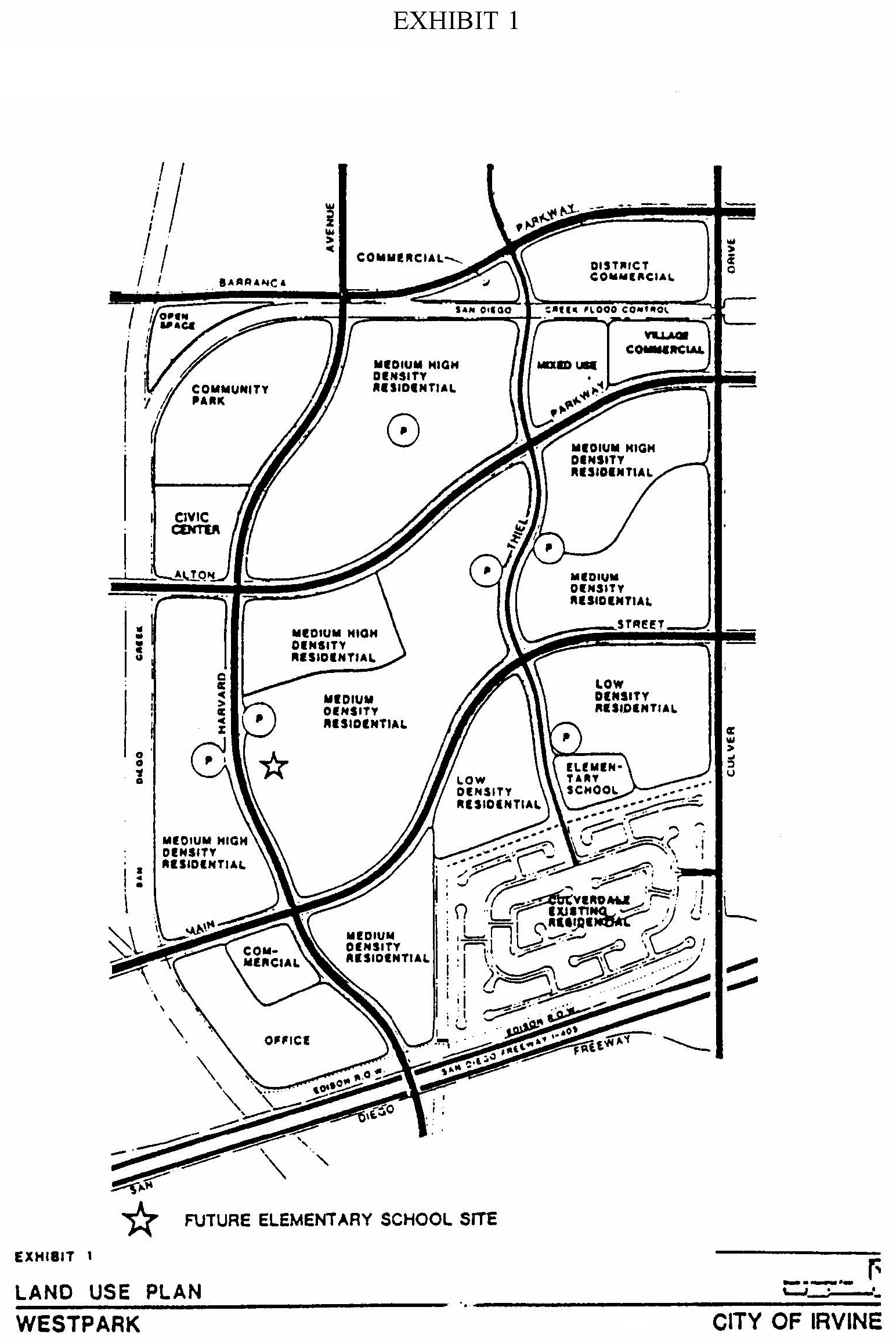
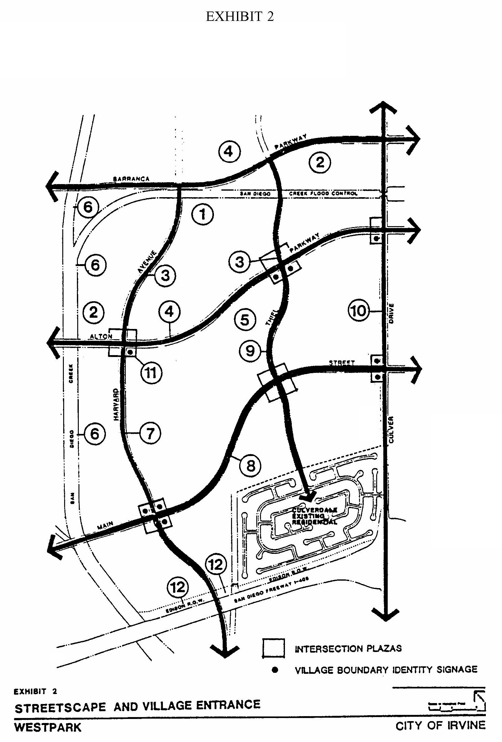
LEGEND
Activity Corridor
(1)
San Diego Creek:
Tall vertical evergreen; formal planting.
(2)
Civic Center/District Center:
Broadleaf dense evergreen; formal planting.
(3)
Activity Corridor theme tree:
Deciduous; informal planting.
(4)
Barranca and Alton Parkways:
Major: Deciduous, broadleaf vertical tree.
Minor: Evergreen pine.
Informal planting.
Village
(5)
Alton Parkway:
Major: Evergreen pine.
Minor: Deciduous, broadleaf vertical tree.
Informal planting.
(6)
Peters Canyon Wash open space spine:
Tall vertical evergreen; informal planting, clusters.
(7)
Harvard Avenue:
Tall vertical evergreen; informal planting.
(8)
Main Street:
Mixed broadleaf deciduous and dense evergreens; informal planting.
(9)
Thiel Avenue:
Irregular evergreen pine; informal planting.
(10)
Culver Drive:
Mixed broadleaf deciduous and evergreen; informal planting and clusters.
(11)
Entries and theme intersections:
Low bushy evergreen pine and tall vertical palms; formal planting.
(12)
Edison right-of-way:
Treatment similar to that behind Culverdale.
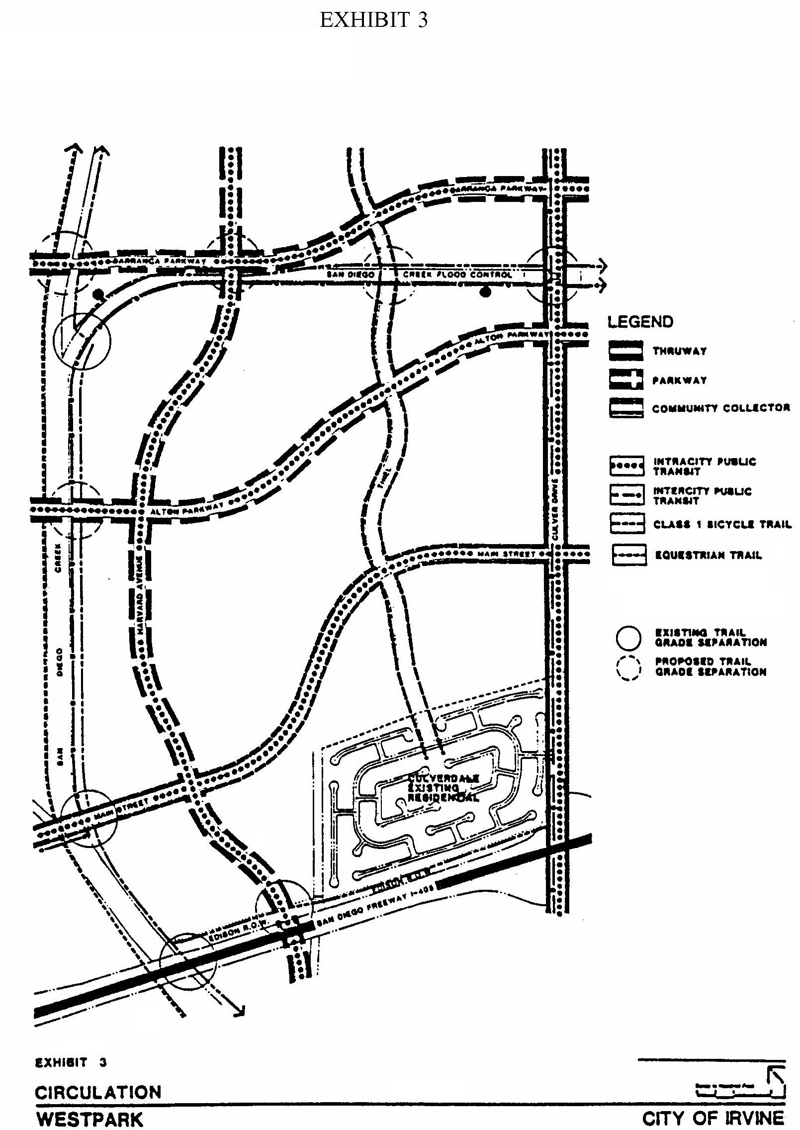
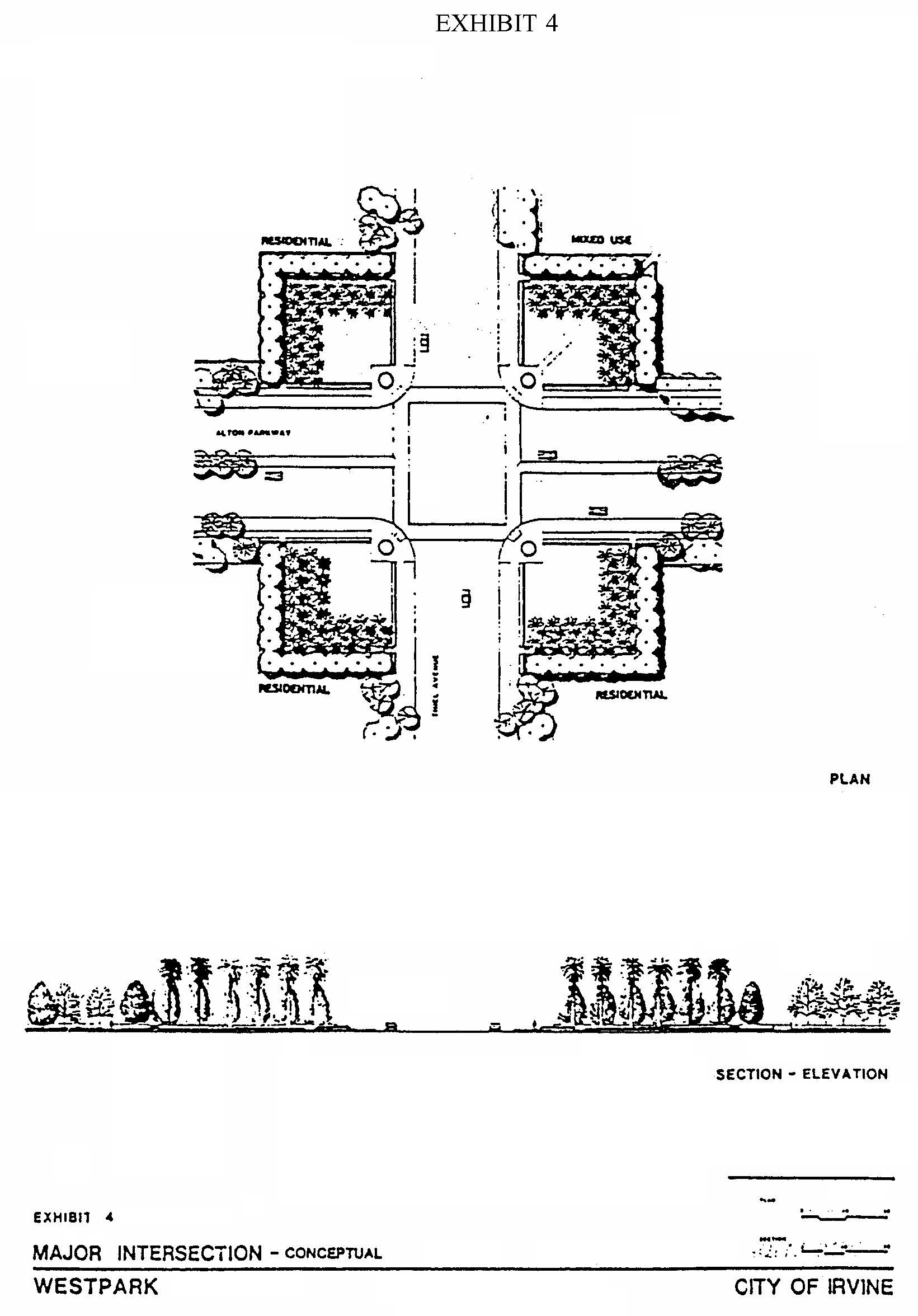
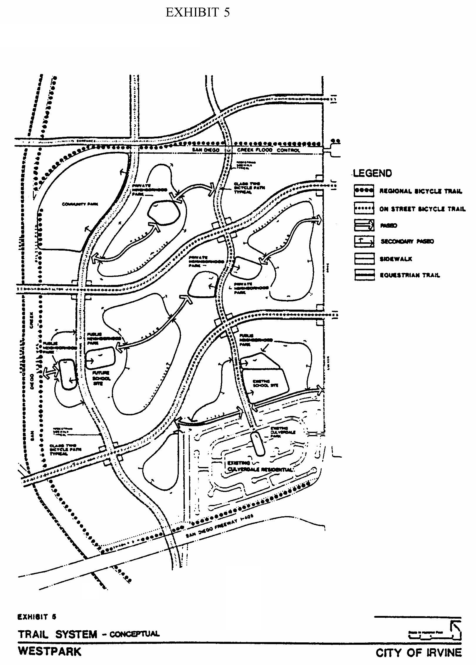
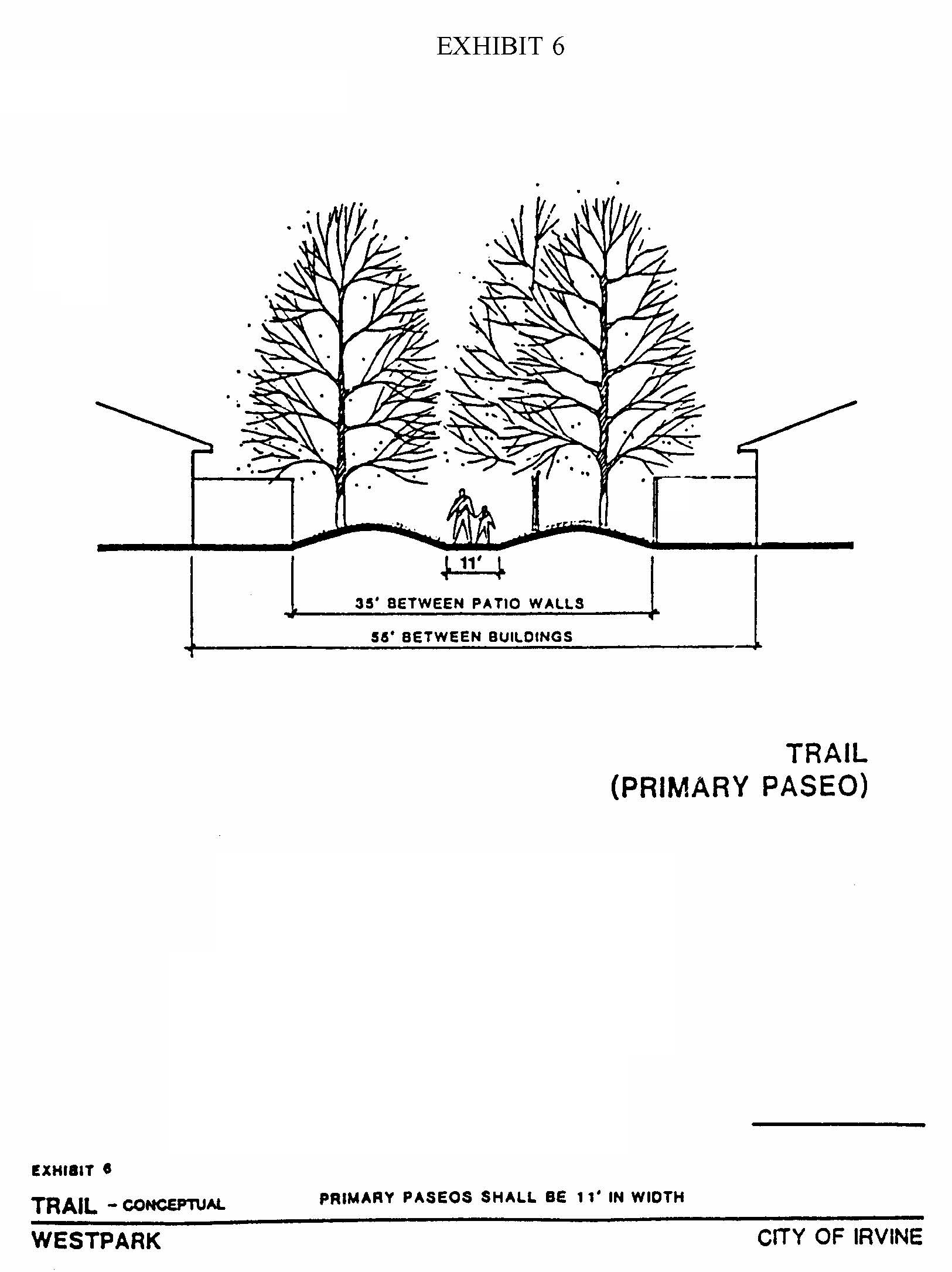
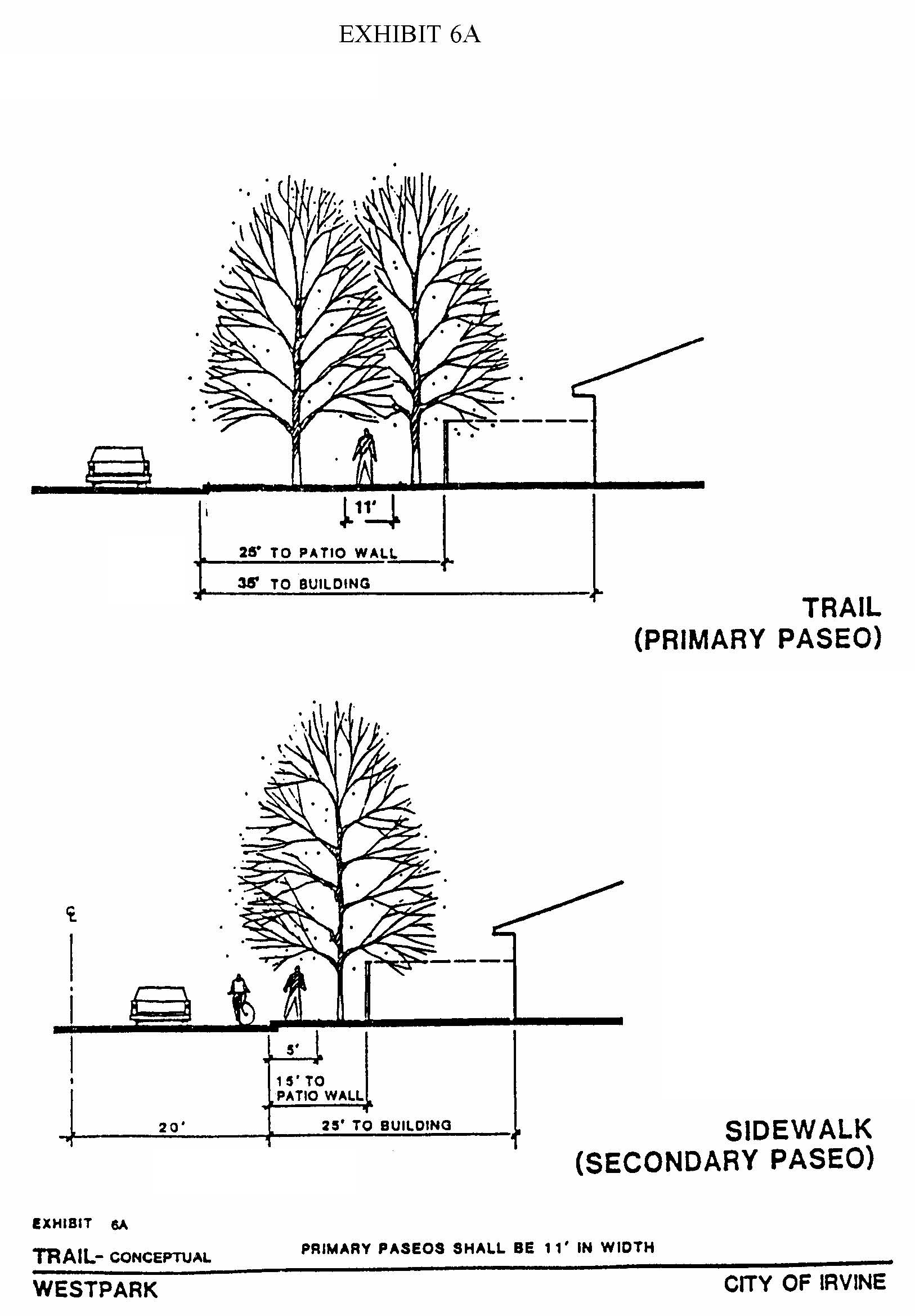
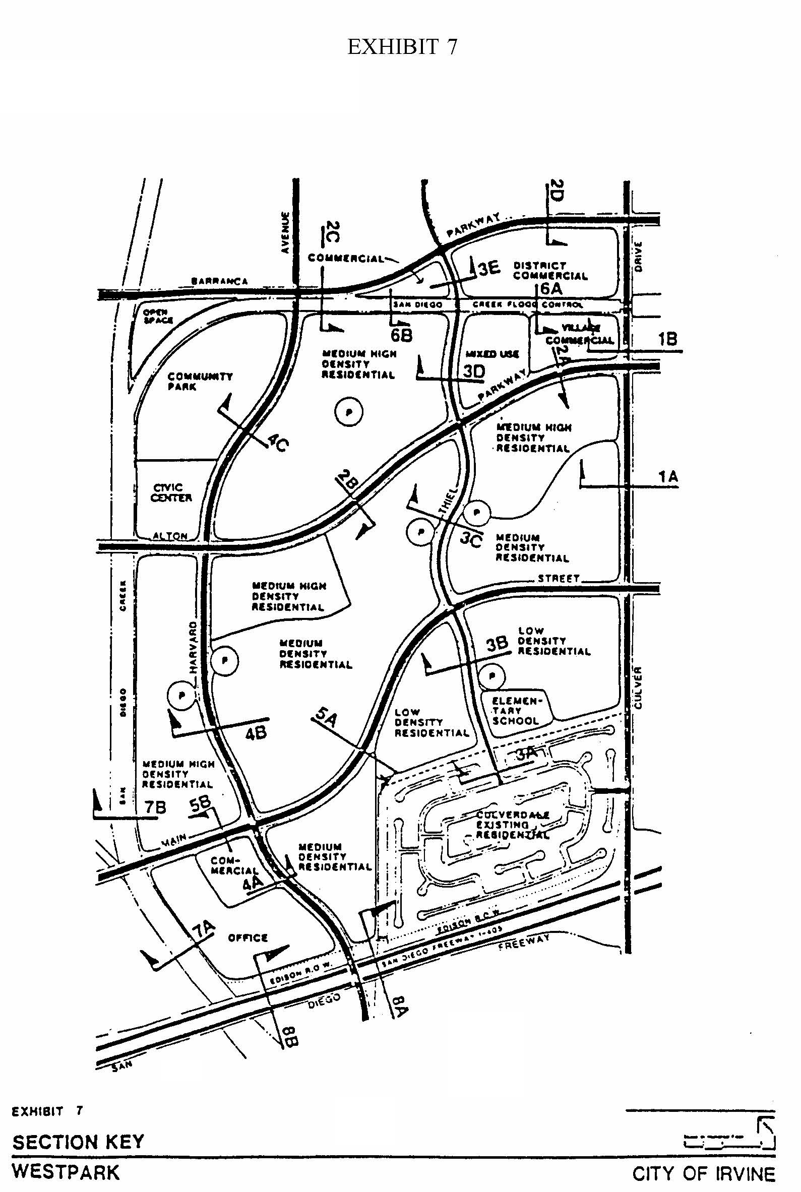
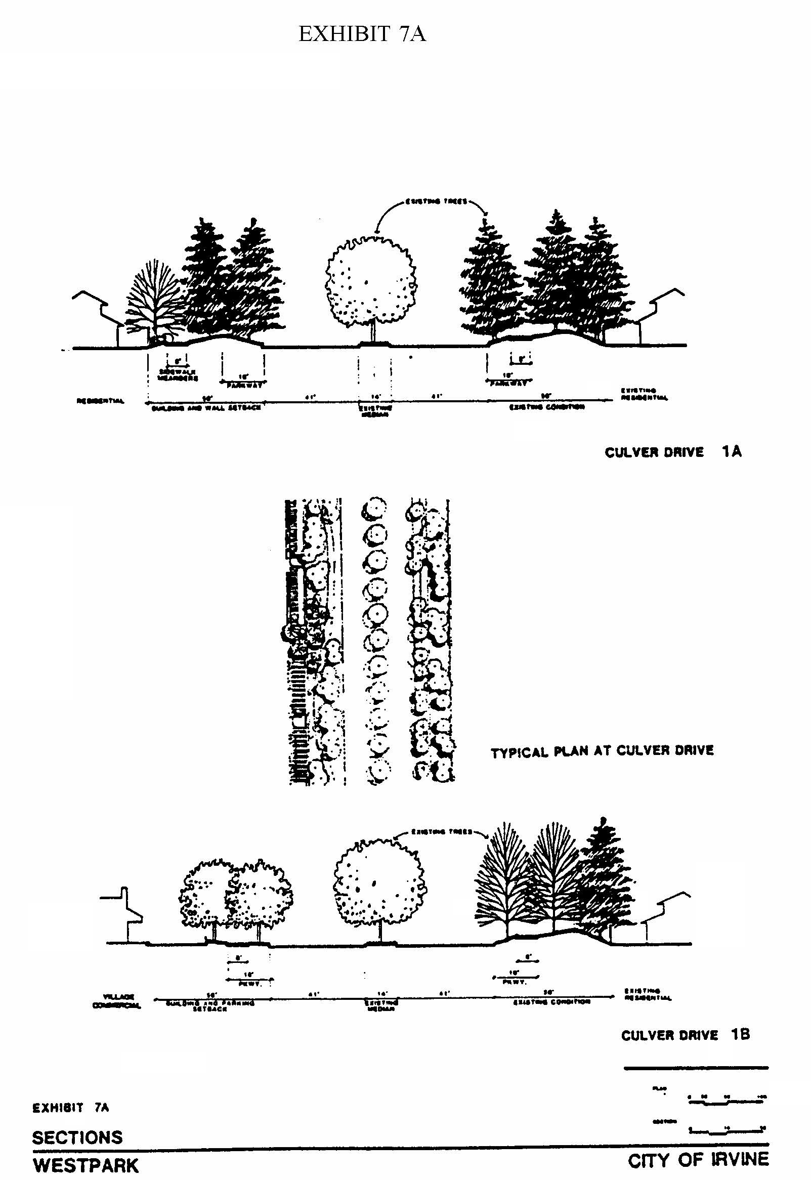
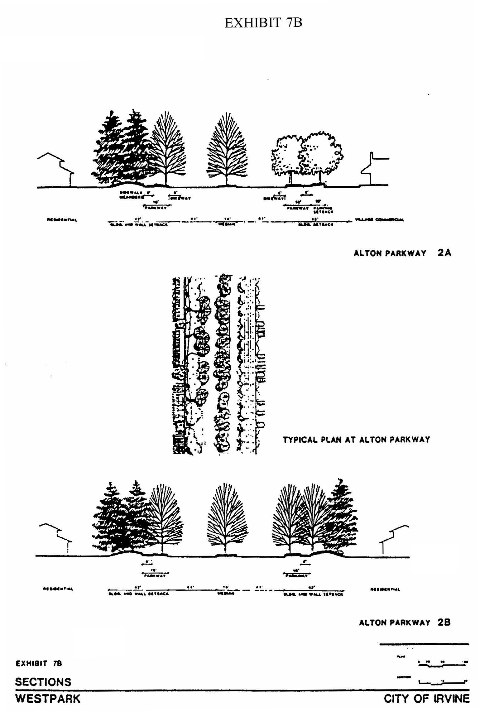
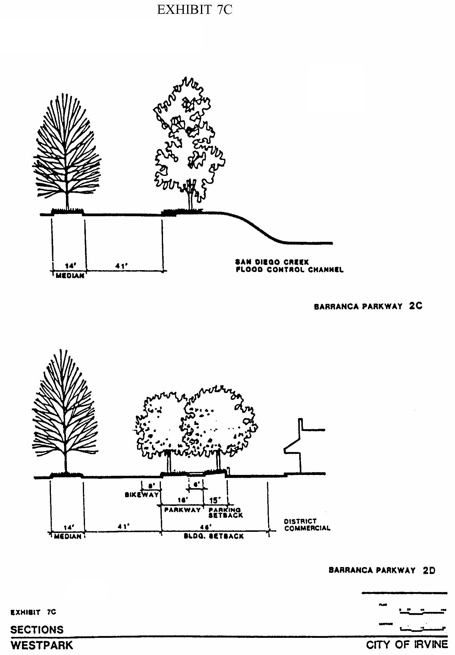
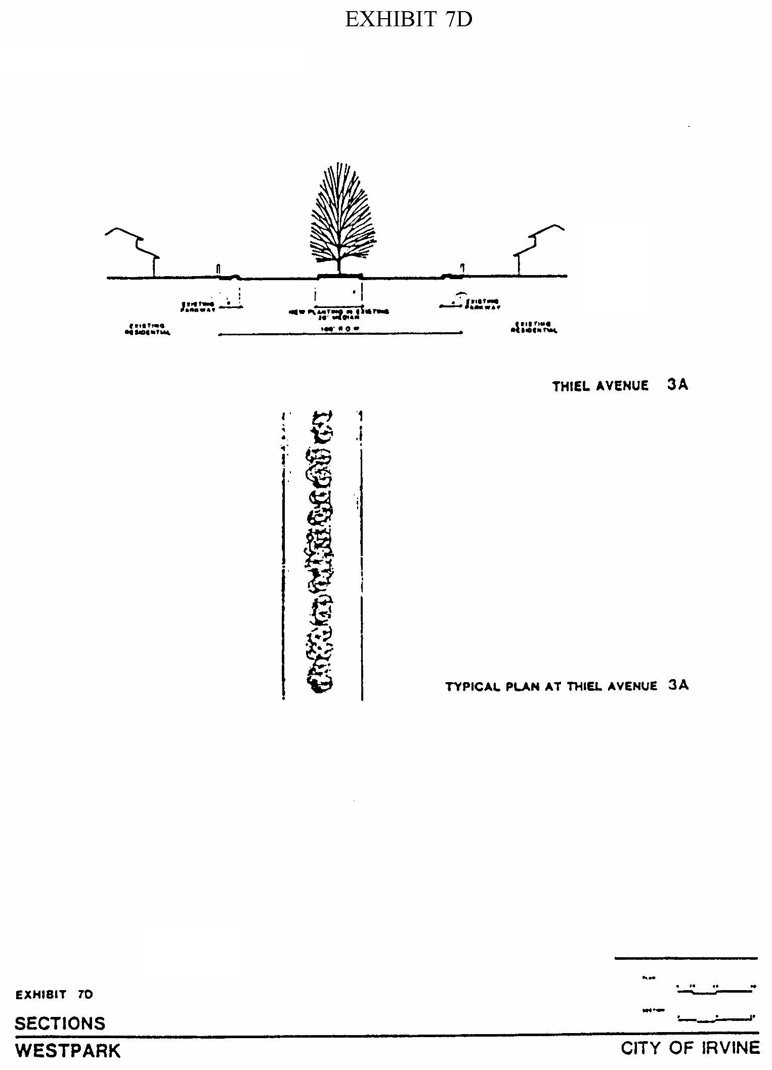
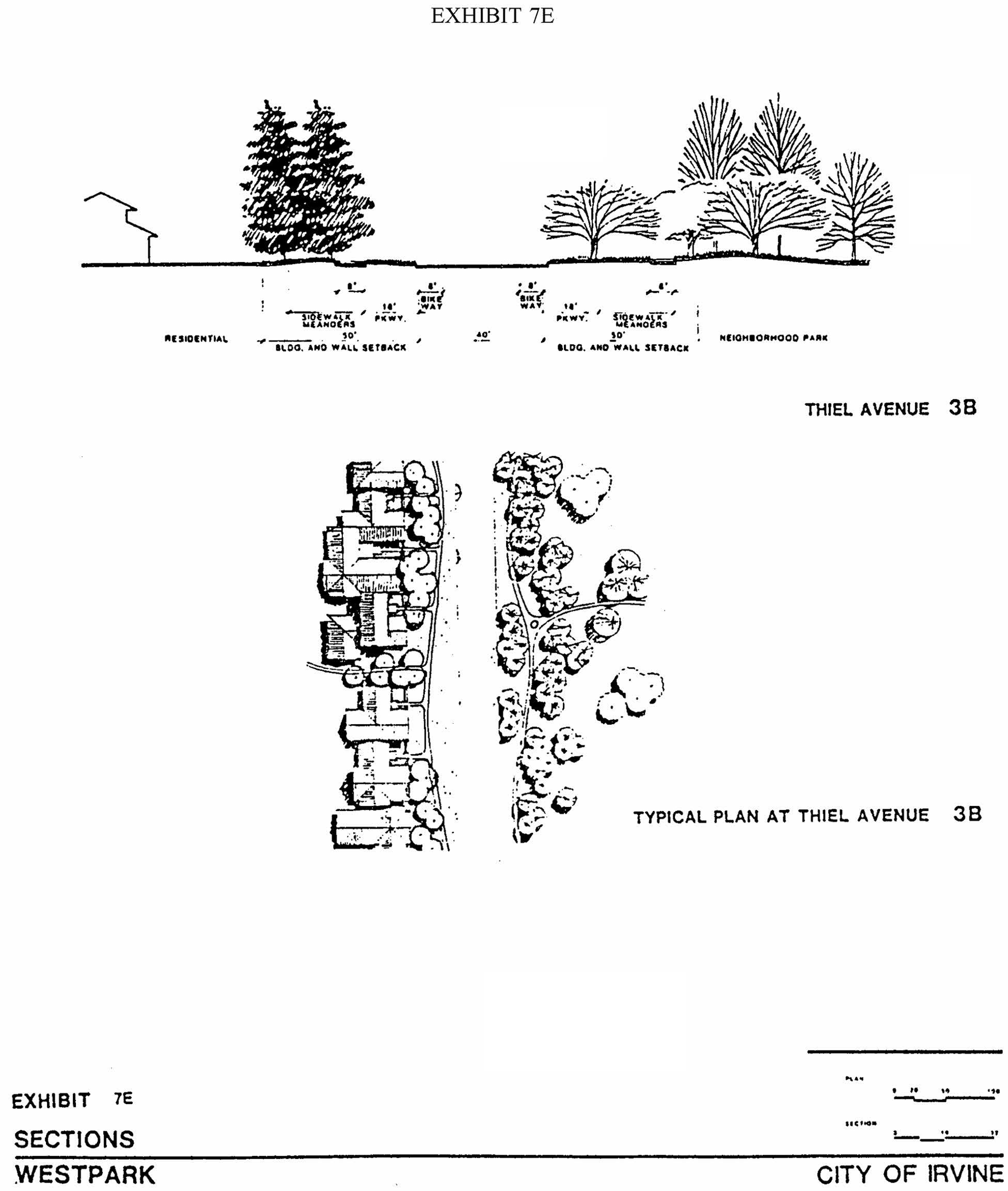
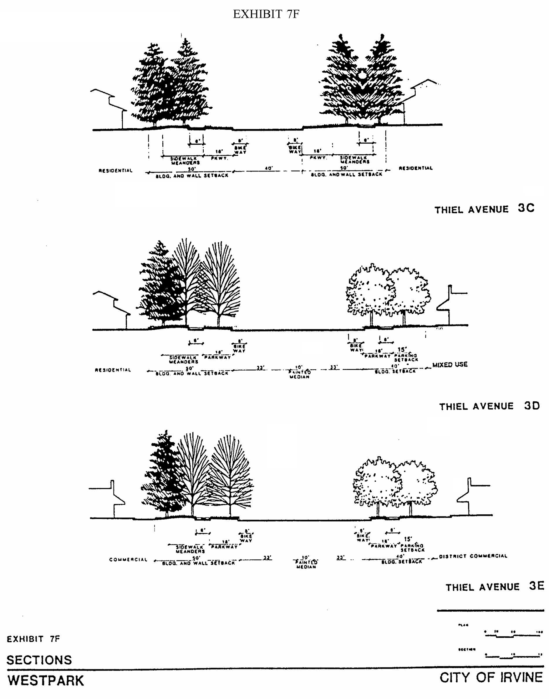
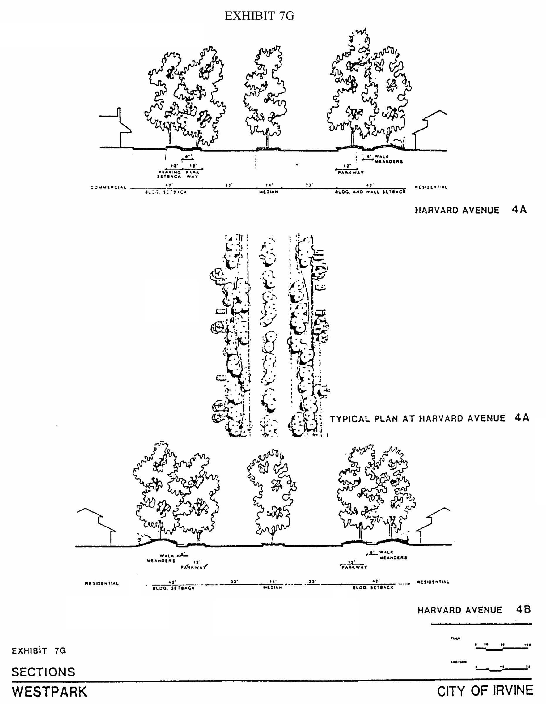
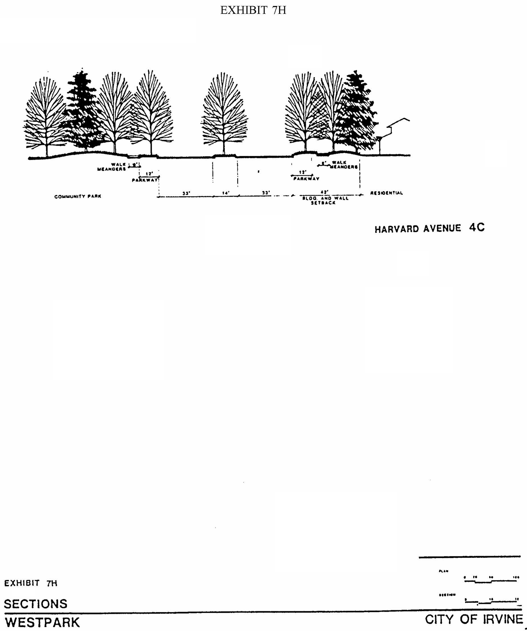
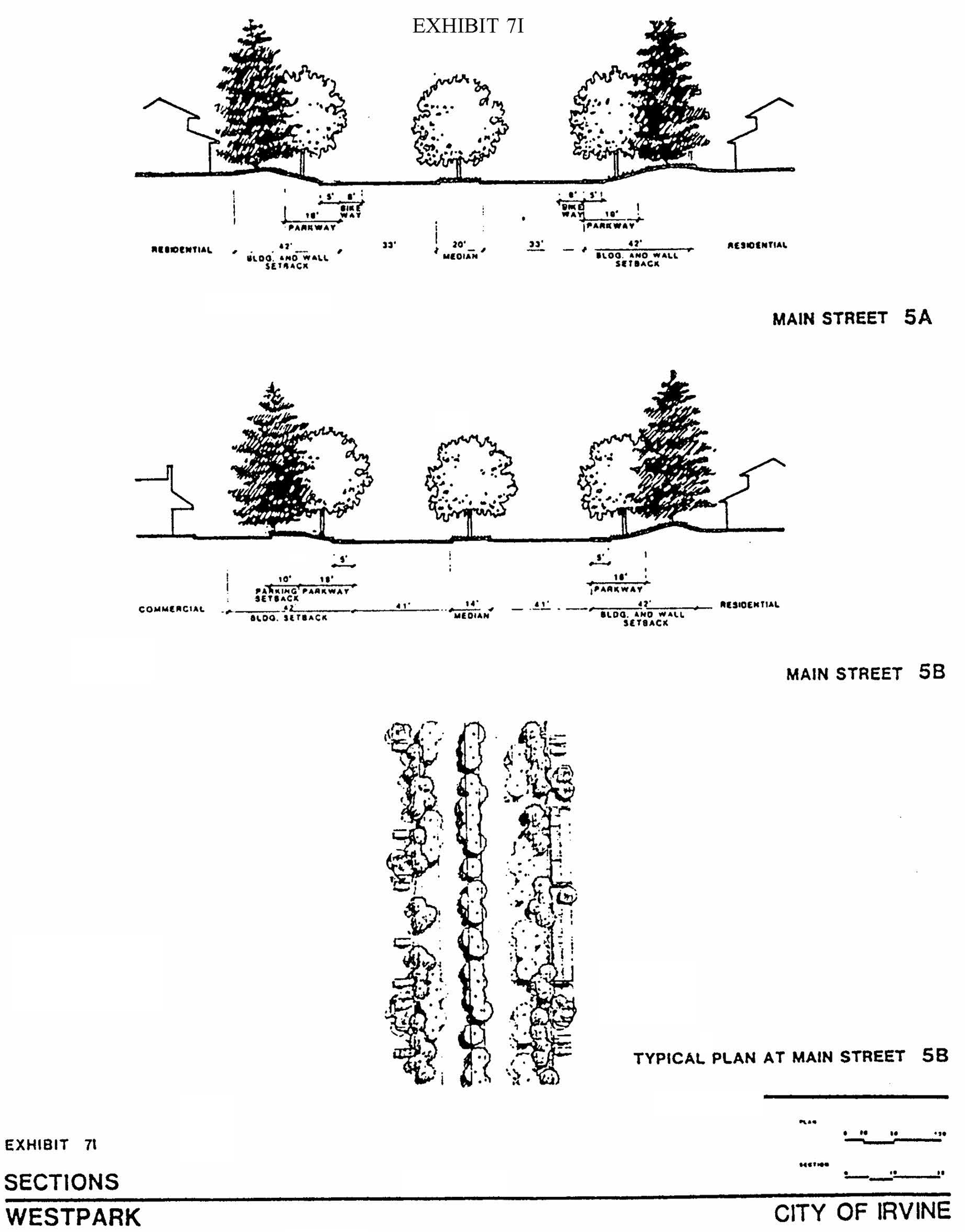
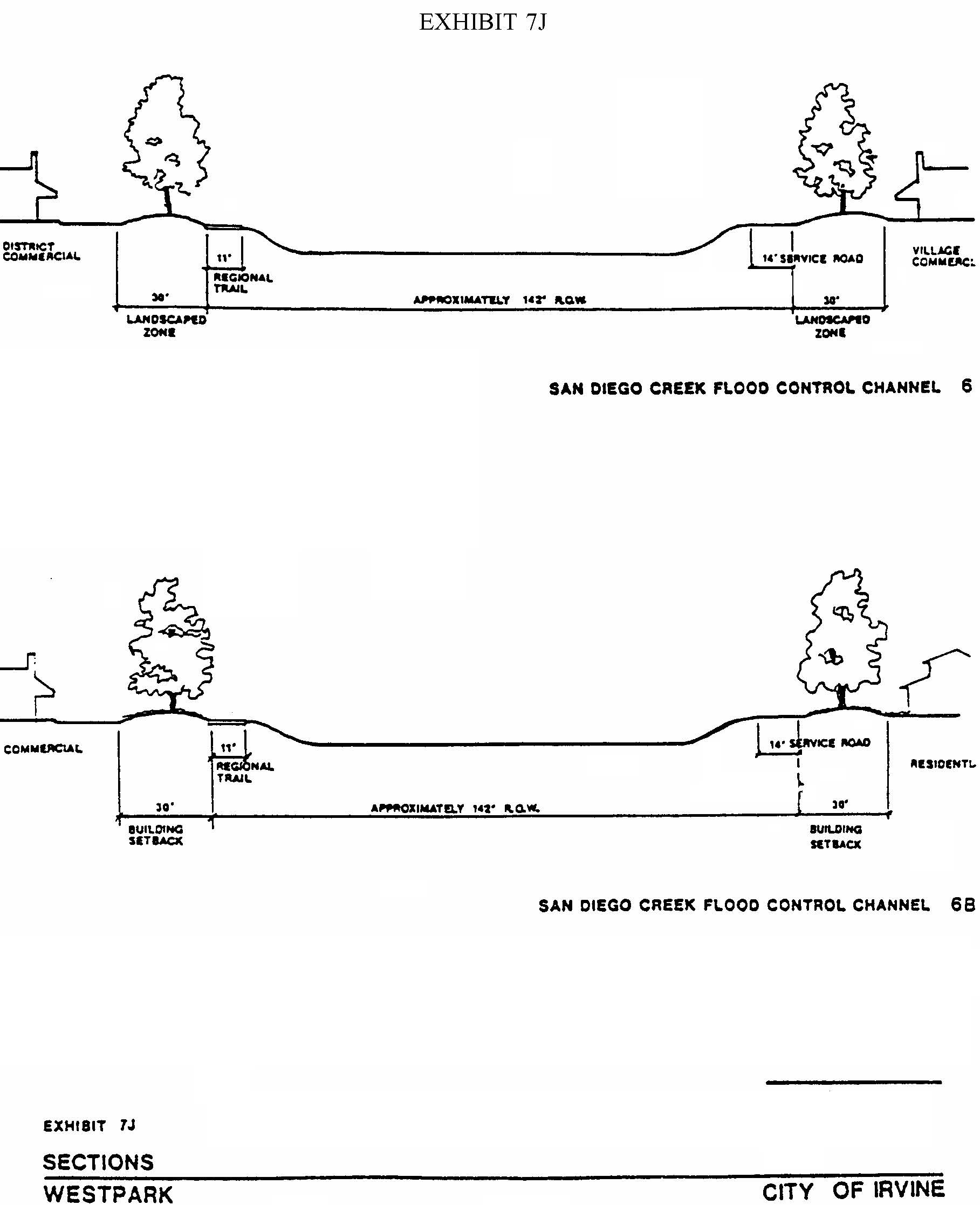
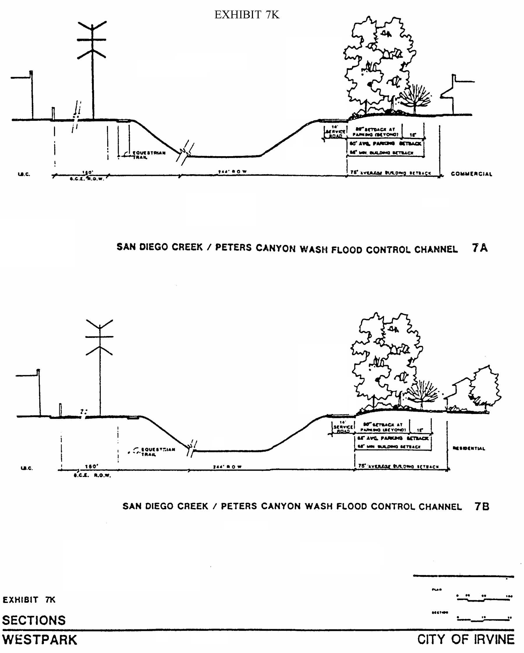
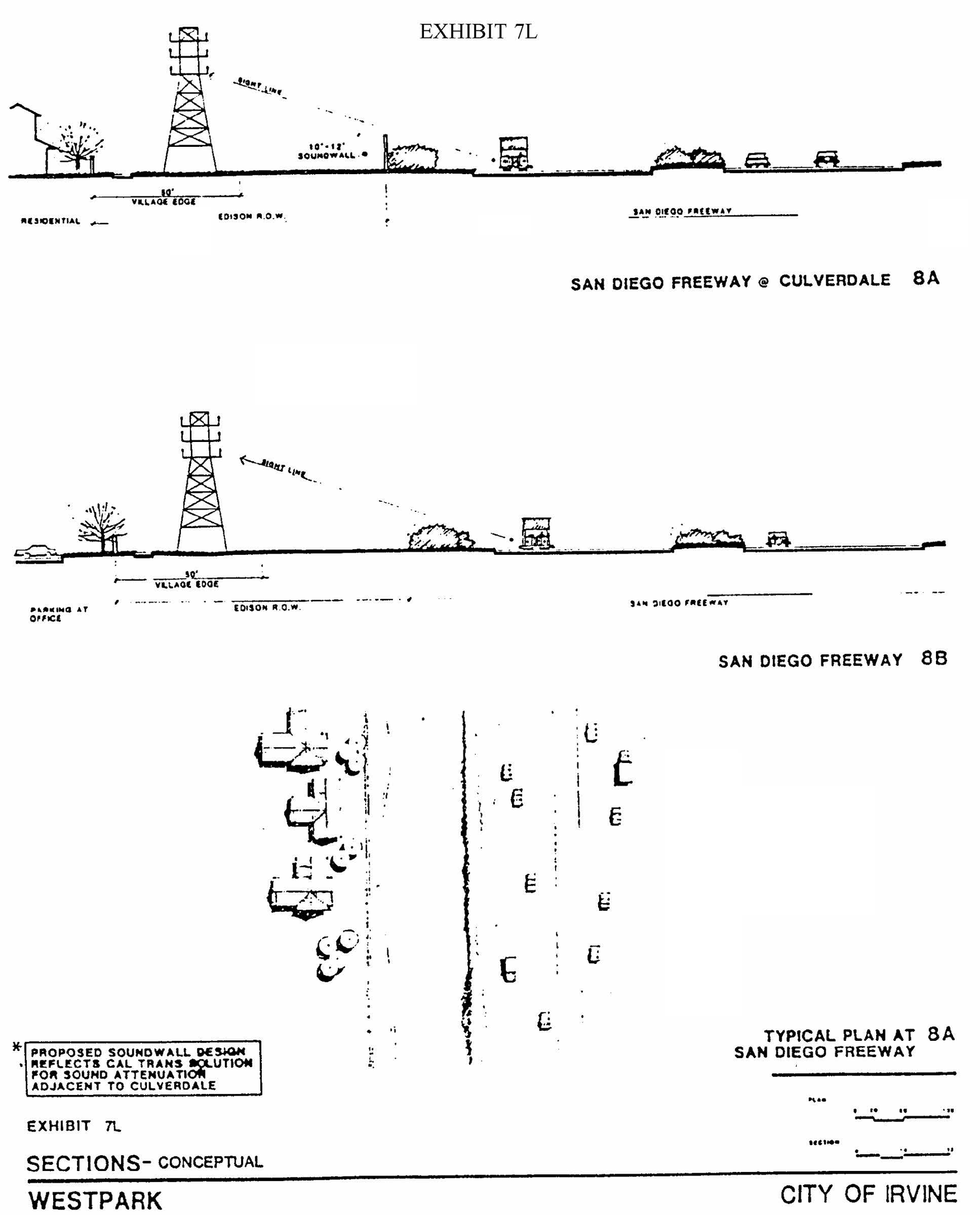
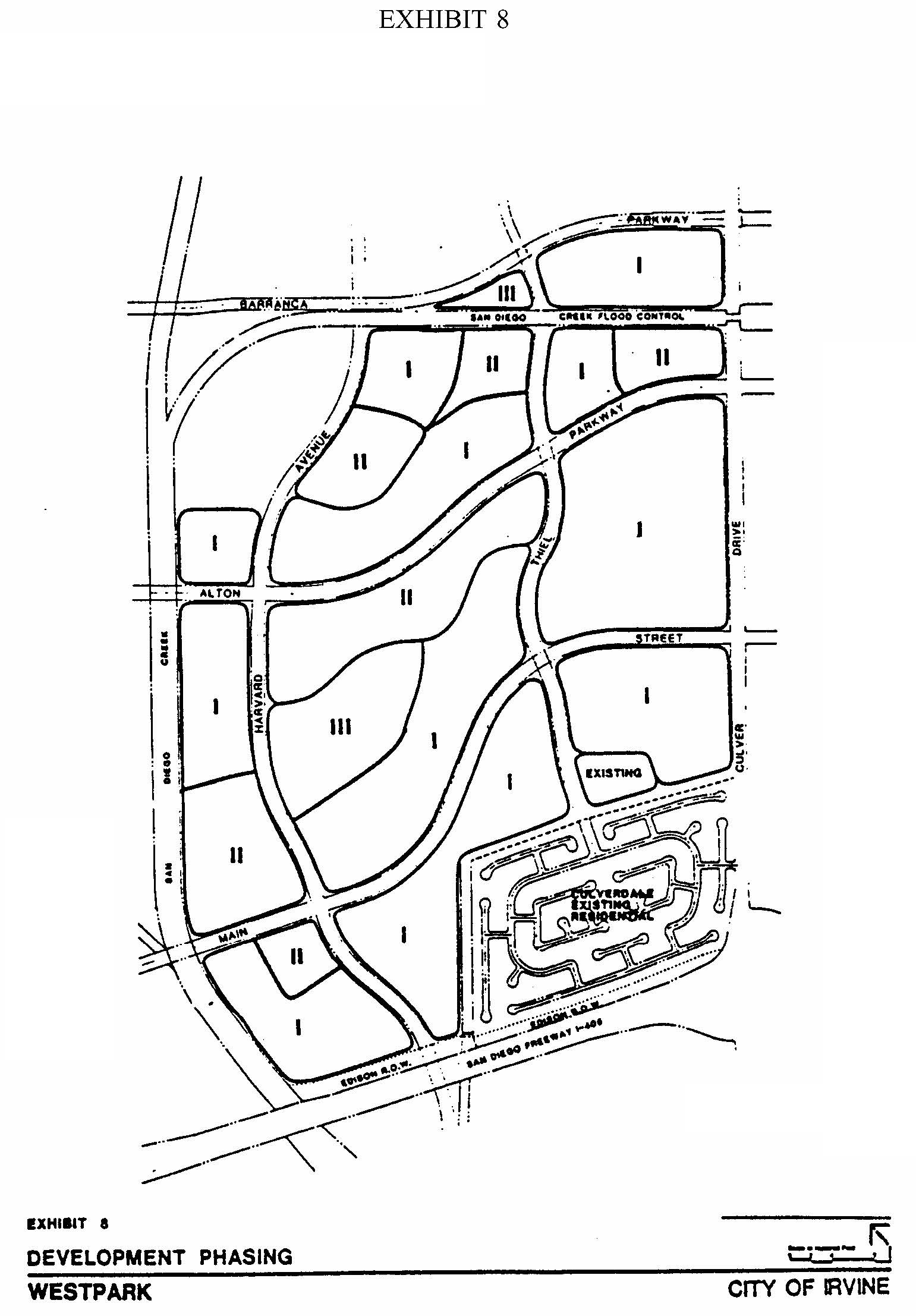
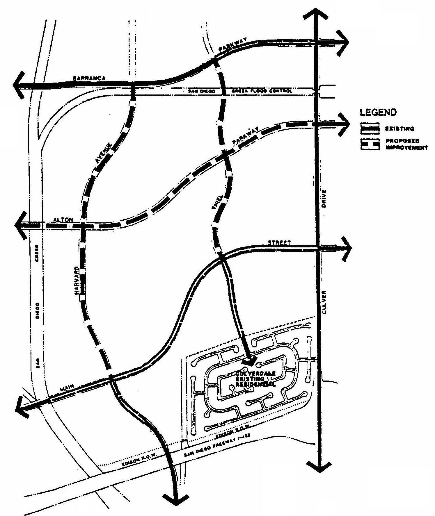
EXHIBIT 9—CIRCULATION AND INFRASTRUCTURE PLAN
Sec. 9-15-1.- Land use zoning map.
(See Planning Area 15 map following Section 9-15-3.)
(Code 1976, § V.E-815.1; Ord. No. 92-3, 4-14-92; Ord. No. 92-21, 11-24-92; Ord. No. 93-1, 1-12-93; Ord. No. 95-4, 5-9-95; Ord. No. 95-22, § 3, 11-28-95; Ord. No. 97-07, § 3, 5-13-97; Ord. No. 01-15, § 4, 9-25-01)
Sec. 9-15-2. - Introduction.
Planning Area 15, Woodbridge, is centrally located in the City. Boundaries include Culver Drive to the west, Irvine Center Drive to the north, Jeffrey Road to the east and Interstate 405 (San Diego Freeway) to the south.
(Code 1976, § V.E-815.2; Ord. No. 92-3, 4-14-92; Ord. No. 92-21, 11-24-92; Ord. No. 93-1, 1-12-93; Ord. No. 95-4, 5-9-95; Ord. No. 95-22, § 3, 11-28-95)
Sec. 9-15-3. - Statistical analysis.
*One hundred sixteen units in the Multi-Use zoning category were approved as congregate care "institutional" units and do not count toward the planning-area-wide residential dwelling unit maximum of 9,511.
1 Unallocated dwelling units represent those units remaining in a planning area that may be built anywhere in the same planning area. These units are within the maximum development intensity for the planning area; and, therefore, placement of unallocated dwelling units into any residential category within the planning area for purposes of development is determined to be consistent with the General Plan and Zoning Code with regard to intensity allocation only, provided that placement is otherwise consistent with site specific zoning regulations and that any potential environmental impacts are adequately addressed, including traffic impacts, pursuant to CEQA.
2 See Section 9-0-3.C, Building Intensity Standards.
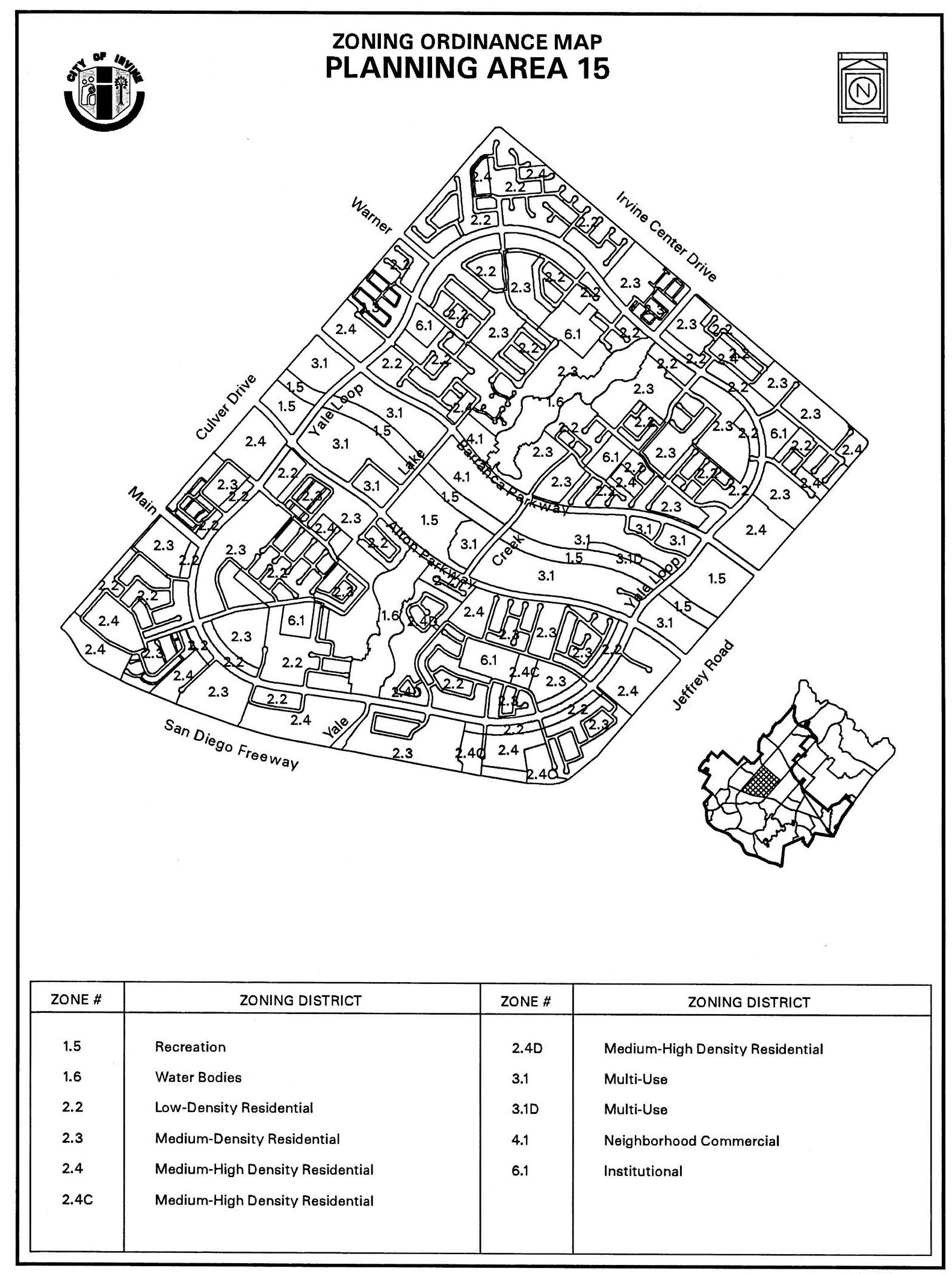
(Code 1976, § V.E-815.3; Ord. No. 92-3, 4-14-92; Ord. No. 92-21, 11-24-92; Ord. No. 93-1, 1-12-93; Ord. No. 95-4, 5-9-95; Ord. No. 95-22, § 3, 11-28-95; Ord. No. 99-11, § 1, 5-11-99; Ord. No. 01-14, § 2, 9-25-01; Ord. No. 01-15, § 4, 9-25-01; Ord. No. 10-04, § 3, 4-13-10; Ord. No. 10-05, § 4, 4-27-10; Ord. No. 11-13, § 5(Exh. A), 10-11-11; Ord. No. 12-09, § 3(Exh. A), 5-22-12)
Sec. 9-15-4. - Land use regulations.
See Section 3-3-1 (Land use matrix).
(Code 1976, § V.E-815.4; Ord. No. 92-3, 4-14-92; Ord. No. 92-21, 11-24-92; Ord. No. 93-1, 1-12-93; Ord. No. 95-4, 5-9-95; Ord. No. 95-22, § 3, 11-28-95)
Sec. 9-15-5. - Development standards.
See Chapter 3-37 (Development Standards).
(Code 1976, § V.E-815.5; Ord. No. 92-3, 4-14-92; Ord. No. 92-21, 11-24-92; Ord. No. 93-1, 1-12-93; Ord. No. 95-4, 5-9-95; Ord. No. 95-22, § 3, 11-28-95)
Sec. 9-15-7. - Special development requirements.
A.
See Division 3 for applicable general development requirements.
B.
At least 10 percent of the housing units for sale or rent shall be in a price range affordable to families of moderate income. A minimum of 300 units shall be provided for low-income households. At least 100 of these shall be specifically developed as a senior citizens project. The park requirements for the required low-income units shall be 4.5 acres per 1,000 population. For the purposes of this requirement, income and affordability ranges shall be as defined in the Housing Element of the General Plan and any implementing resolutions adopted by the City Council.
C.
Due to the lake and linear open space provided, the developer shall receive credit of 1.5 acres per 1,000 population toward the dedication requirement in effect at the time of tentative map approval. In addition, parks between one and six acres are permitted.
D.
CC&Rs for all residential developments shall require membership in the Master Village Community Association (Woodbridge Village Association).
E.
1.
Prior to the submittal of any subsequent discretionary and/or ministerial applications, a traffic analysis that identifies any traffic impacts and/or mitigation measures associated with the development of each specified use on the 10-acre site located at the northwest corner of Alton Parkway and East Yale Loop shall be submitted and approved by the Manager of Transportation Services. This analysis shall include accounting of trips generated by previous approvals to ensure that the aggregate traffic projected to be generated by the uses proposed within the project site do not exceed 3,517 daily trips, 173 a.m. peak hour trips and 313 p.m. peak hour trips. The analysis shall include, but not be limited to:
a.
The current request of square footage, dwelling units or other land use unit;
b.
The cumulative square footage, dwelling units or other land use unit;
c.
The current total number of trips used for existing land uses and total number of trips available for future land uses, by average daily, a.m. peak hour and p.m. peak hour;
d.
The total number of trips to be used by proposed land uses.
2.
However, the overall average daily trips (ADT), a.m. peak hour trips, or p.m. peak hour trips mentioned above may be exceeded according to the following criteria:
a.
If an applicant proposes a use that exceeds the established trip cap for a.m., p.m., or ADT, and it is determined through a traffic analysis (in conformance with the criteria mentioned above) that no additional traffic impacts would result, then the use would be in conformance with the requirements of this mitigation measure.
b.
If an applicant proposes a use that exceeds the established trip cap for a.m., p.m., or ADT, and it is determined through a traffic analysis (in conformance with the criteria mentioned above) that there will be additional traffic impacts, then the applicant shall process a zone change to modify the special development requirement in the zoning ordinance for Planning Area 15 which establishes a trip cap, and be responsible for constructing any and all traffic improvements identified as mitigation measures in the environmental documentation.
(Code 1976, § V.E-815.6; Ord. No. 92-3, 4-14-92; Ord. No. 92-21, 11-24-92; Ord. No. 93-1, 1-12-93; Ord. No. 95-4, 5-9-95; Ord. No. 95-22, § 3, 11-28-95)
Sec. 9-15-8. - Special development requirements for 2.3O (Tract 17359).
A.
Vesting Tentative Tract 17359 shall comply with all applicable general development requirements contained in Division 3, or as otherwise approved at time of Master Plan review.
B.
The following criteria shall be demonstrated at Master Plan review:
a.
Side setbacks (interior boundary if adjacent to residential uses): Reduced side setback for a maximum 18 feet depth "pop-out" space on the ground floor and above second floor space on the front portion of building only. The remainder of the building is required to comply with a required five foot side yard setback. Reduced side setbacks under this provision shall be granted for no more than 11 lots within the subdivision.
b.
Minimum building-to-building setback of eight feet shall be retained at all times.
(Ord. No. 11-13, § 5(Exh. A), 10-11-11)
Sec. 9-16-1.- Land use zoning map.
(See Planning Area 16 map following Section 9-16-5.)
(Code 1976, § V.E-816.1; Ord. No. 92-3, 4-14-92; Ord. No. 95-4, 5-9-95; Ord. No. 95-22, § 3, 11-28-95; Ord. No. 03-07, § 5, 3-11-03; Ord. No. 09-02, § 3, 3-24-09)
Sec. 9-16-2. - Introduction.
Planning Area 16 is centrally located in the City. Boundaries include University Drive to the west, Interstate 405 (San Diego Freeway) to the north, Planning Area 17 to the east and Planning Area 22 and the University of California Irvine (Planning Area 21) to the south.
(Code 1976, § V.E-816.2; Ord. No. 92-3, 4-14-92; Ord. No. 95-4, 5-9-95; Ord. No. 95-22, § 3, 11-28-95)
Sec. 9-16-3. - Statistical analysis.
1 Unallocated dwelling units represent those units remaining in a planning area that may be built anywhere in the same planning area. These units are within the maximum development intensity for the planning area; and, therefore, placement of unallocated dwelling units into any residential category within the planning area for purposes of development is determined to be consistent with the General Plan and Zoning Code with regard to intensity allocation only, provided that placement is otherwise consistent with site specific zoning regulations and that any potential environmental impacts are adequately addressed, including traffic impacts, pursuant to CEQA.
2 See Section 9-0-3.C, Building Intensity Standards.
(Code 1976, § V.E-816.3; Ord. No. 92-3, 4-14-92; Ord. No. 95-4, 5-9-95; Ord. No. 95-22, § 3, 11-28-95; Ord. No. 03-7, § 5, 3-11-03; Ord. No. 12-09, § 3(Exh. A), 5-22-12)
Sec. 9-16-4. - Land use regulations.
See Section 3-3-1 (Land use matrix).
(Code 1976, § V.E-816.4; Ord. No. 92-3, 4-14-92; Ord. No. 95-4, 5-9-95; Ord. No. 95-22, § 3, 11-28-95)
Sec. 9-16-5. - Development standards.
See Chapter 3-37 (Development Standards).
(Code 1976, § V.E-816.5; Ord. No. 92-3, 4-14-92; Ord. No. 95-4, 5-9-95; Ord. No. 95-22, § 3, 11-28-95)
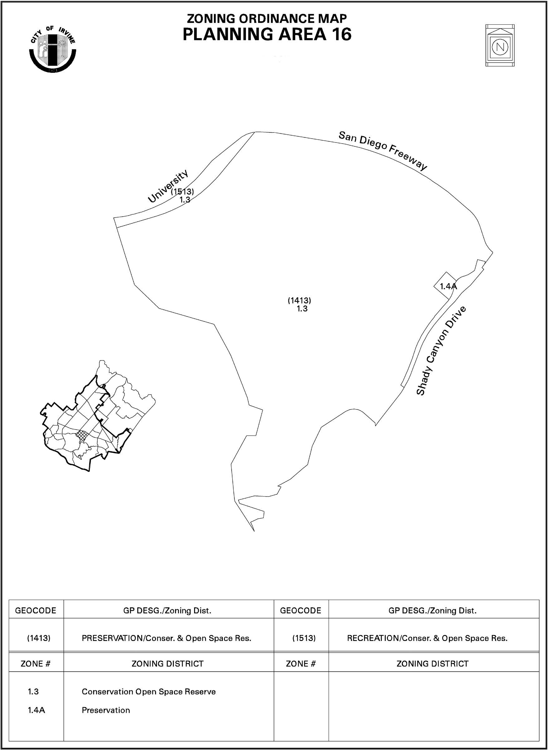
Sec. 9-17-1.- Land use zoning map.
(See Planning Area 17 map following Section 9-17-5.)
(Code 1976, § V.E-817.1; Ord. No. 92-3, 4-14-92; Ord. No. 95-4, 5-9-95; Ord. No. 95-22, § 3, 11-28-95; Ord. No. 00-11, § 3.F, 10-10-00; Ord. No. 01-13, § 4, 7-24-01; Ord. No. 02-11, § 7, 7-9-02)
Sec. 9-17-2. - Introduction.
Planning Area 17 is located in the southern area of the City. Boundaries include Shady Canyon Drive to the west, Interstate 405 (San Diego Freeway) to the north, and State Route 133 (Laguna Freeway) to the east.
(Code 1976, § V.E-817.2; Ord. No. 92-3, 4-14-92; Ord. No. 95-4, 5-9-95; Ord. No. 95-22, § 3, 11-28-95; Ord. No. 09-02, § 3, 3-24-09)
Sec. 9-17-3. - Statistical analysis.
*Maximum dwelling units are subject to change in accordance with Section 8-22-1.
**2.3G: Individual project densities may exceed 12.5 dwelling units per acre provided that the total number of dwelling units does not exceed 2,666 within Planning Area 17.
***Includes transfer of 345 dwelling units to Planning Area 17 pursuant to the Natural Communities Conservation Program (NCCP) Facilitation Agreement.
Note: The Planning Area 17 Environmental Impact Report (SCH #2000021051) for Zone Change 41021-ZC analyzed the impacts of developing 55,000 square feet of institutional use in Planning Area 17.
1 Unallocated dwelling units represent those units remaining in a planning area that may be built anywhere in the same planning area. These units are within the maximum development intensity for the planning area; and, therefore, placement of unallocated dwelling units into any residential category within the planning area for purposes of development is determined to be consistent with the General Plan and Zoning Code with regard to intensity allocation only, provided that placement is otherwise consistent with site specific zoning regulations and that any potential environmental impacts are adequately addressed, including traffic impacts, pursuant to CEQA.
2 See Section 9-0-3.C, Building Intensity Standards.
(Code 1976, § V.E-817.3; Ord. No. 92-3, 4-14-92; Ord. No. 95-4, 5-9-95; Ord. No. 95-22, § 3, 11-28-95; Ord. No. 00-11, § 3.G, 10-10-00; Ord. No. 02-11, § 7, 7-9-02; Ord. No. 03-02, § 4, 1-14-03; Ord. No. 05-16, § 2, 7-12-05; Ord. No. 12-09, § 3(Exh. A), 5-22-12)
Sec. 9-17-4. - Land use regulations.
See Section 3-3-1 (Land use matrix).
(Code 1976, § V.E-817.4; Ord. No. 92-3, 4-14-92; Ord. No. 95-4, 5-9-95; Ord. No. 95-22, § 3, 11-28-95)
Sec. 9-17-5. - Development standards.
See Chapter 3-37 (Development Standards).
(Code 1976, § V.E-817.5; Ord. No. 92-3, 4-14-92; Ord. No. 95-4, 5-9-95; Ord. No. 95-22, § 3, 11-28-95)
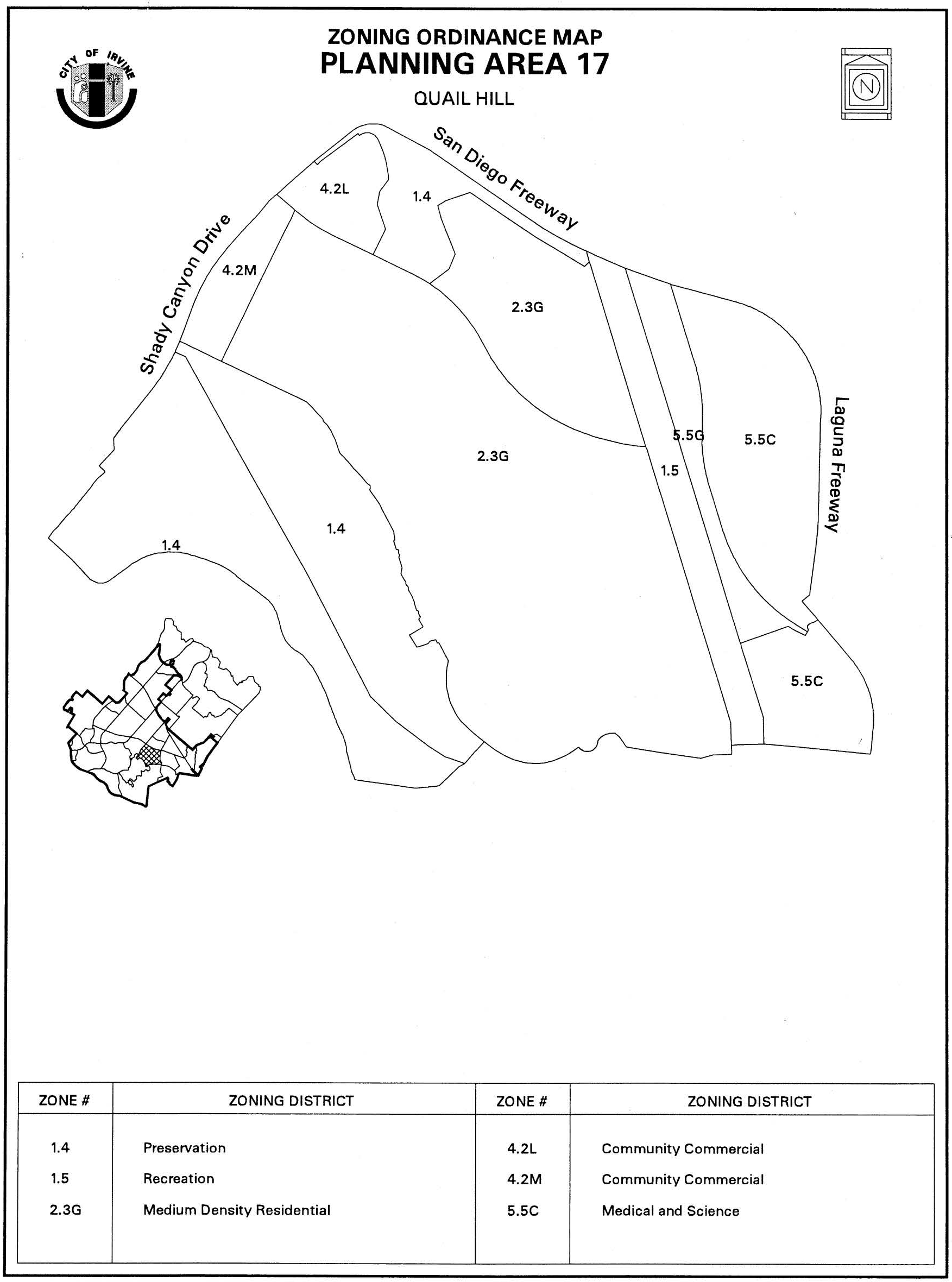
Sec. 9-17-7. - Special development requirements.
1.
Affordable housing. Pursuant to Zoning Code Chapter 2-3, the affordable housing goals of the Housing Element will be met through use of the menu option. These goals may be met at the discretion of the applicant through the extension of the term of affordability made possible through a refinancing of the Series 1983-A bonds or use of other off-site credits available to the applicant. Prior to approval of the first residential building permit, the applicant shall submit an affordable housing program for review and approval by the Director of Community Development which specifies the allocation of units met by the refinancing program and/or other options available to the applicant.
2.
Boundary definitions. The precise Preservation District boundary will be defined through the Master Plan process in accordance with Zoning Code Chapters 2-17 and 8-13 and/or the subdivision process per Division 5 of the Municipal Code.
3.
Hillside Master Plan. In accordance with Zoning Code Chapter 5-4, a Master Plan has been prepared for Planning Area 17 which demonstrates how the provisions of the General Plan and Hillside Overlay District will be implemented. The Master Plan includes all concept plan requirements in accordance with Chapter 2-8. Approved Master Plan documents, or modifications thereto pursuant to Chapter 2-19, shall be used as the standard of review for all subsequent applications submitted for Planning Area 17. A subsequent Master Plan application in accordance with Zoning Code Chapter 2-17 or its equivalent will be submitted for each development project to address the location of structures and parking.
4.
Density. Individual project densities may exceed 12.5 du per acre provided the total number of dwelling units does not exceed 2,673 units within Planning Area 17.
5.
Maximum dwelling units. The maximum dwelling units in PA 17 are subject to change in accordance with Zoning Code Section 8-22-1.
6.
Community park. The community park dedication requirement for PA 17 will be satisfied by the dedication of park land and/or construction of park improvements in PA 17 consistent with the subdivision ordinance, park and recreation element and Local Park Code. The conceptual location of the community park is symbolically shown on Exhibit A.
7.
Neighborhood park. The conceptual location of one public neighborhood park is symbolically shown on Exhibit A. Private neighborhood parks will also be provided in the planning area in order to meet City requirements. A park plan for Planning Area 17 shall be submitted to the Director of Community and Library Services concurrently with the first tentative tract map for any residential portion of Planning Area 17. The exact number, precise location, configuration and size of local neighborhood parks and the distribution of public and private parks will be established at the time of approval of the first tentative tract map for residential portions of Planning Area 17 in accordance with the park and recreation element and Local Park Code.
8.
Arterial highways. The following arterials are located adjacent to or within Planning Area 17:
9.
Arterial highway standards. In the interest of reducing grading and maintaining open space, the arterial highways will conform to standard sections except as follows:
a.
The design speed for Quail Hill Parkway shall be 50 mph. The minimum centerline radius for Quail Hill Parkway shall be 1,600 feet.
b.
The design speed for Shady Canyon Drive shall be 45 mph. The minimum centerline radius for two-lane Shady Canyon Drive shall be 625 feet.
c.
In order to minimize grading, the City Engineer shall approve maximum continuous vertical grades of 10 percent for limited sections of Quail Hill Parkway and two-lane internal residential streets. In addition, the City Engineer may approve, on a case-by-case basis, short sections of these streets at a maximum grade of 12 percent.
d.
A traffic circle (roundabout) is located at the intersection of Shady Canyon Drive and Quail Hill Parkway to create a distinctive village entry theme and provide a smooth transition for dominant traffic flow path between intersecting roadways with different classifications. The following standards shall be used for roundabout design:
(1)
Minimum 200-foot diameter.
(2)
Maximum 134-foot center island diameter.
(3)
Landscaping and architectural features in excess of 36 inches in height shall be located only in the center portion of the center island within a 65-foot diameter area.
10.
Local residential street standards. In the interest of reducing grading and maintaining open space, the local streets will conform to standard sections except as follows:
a.
The minimum centerline radius for two-lane internal residential streets will be 150 feet where it allows better conformance to landforms. This exception will only be approved by the City Engineer on a case-by-case basis. Design speed for the other elements for the two-lane internal residential streets will be 25 mph.
b.
Traffic circles (roundabouts) may be used to create distinctive entries and provide smooth transitions for dominant traffic flow path between intersecting roadways.
11.
Bicycle trails. A combined bicycle trail/sidewalk will be located on the west side of Shady Canyon Drive from Quail Hill Parkway to Planning Area 22. The trail facility will be constructed by the project developer of PA 22 and owned and maintained by the City of Irvine. A Class II (on-street) bicycle trails will be located on public streets in accordance with City plans and guidelines.
12.
Open space trails. Any trails in the NCCP Reserve/preservation area will be designed, constructed, owned and maintained by the City of Irvine.
13.
Master trails plan. In conjunction with the submittal of the first residential tentative tract map, the applicant shall submit a master trails plan which designates public and private trail, access points, and which shall consider potential public vista points.
14.
Pedestrian links. Sidewalks will be located on public streets in accordance with City plans and guidelines. Sidewalks on private streets may vary from standard City plans where appropriate to reduce grading or provide better pedestrian linkages. Pedestrian walks should link commercial sites, schools, parks and residential neighborhoods.
15.
Riding and hiking trail. A riding and hiking trail will be located on the west side of Shady Canyon Drive from the ultimate location of a City staging area to Planning Area 22. The trail facility shall be constructed by the project developer of PA 22 and maintained by the City of Irvine, or its designee.
16.
Village theme. The architectural design shall address detail articulated on all sides of the structures visible from streets, paseos, and other public areas. Particular attention shall be given to windows, balconies, doors, and other design elements. The elements and qualities which shall be encouraged are human scale and privacy, play of light using shade and shadows to provide relief, and variations in roof lines. Large blank walls with minimal detail shall be discouraged.
17.
Residential/community commercial architecture. A variety of architectural styles and forms will be used to express differences among projects and neighborhoods within the planning area. Variations of the following elements may be used by the developer.
a.
Overall form: Some symmetry at front facades or around entries will be used to create balance in the overall form. Entry view corridors terminating at blank walls and/or blank building elevations shall be discouraged.
b.
Roof form: Roof massing will be varied with a strong cornice line. Clay, concrete tile, and slate will be used predominantly with consistent earthtone colors.
c.
Details: Simple cornices, moldings, projections and recesses, and integral-colored accent materials such as ceramic tile, brick, garden walls (stone or painted stucco) and picket gates will be used.
d.
Site design: Terraces, plazas, arcades, colonnades, and pergolas will be used to define pedestrian areas. Units will be used clustered around open spaces and public and private areas will be separated.
18.
Medical and Science (Irvine Spectrum 9). The industrial portion of the planning area will have a clean and contemporary architectural style, similar to Irvine Spectrum (e.g., Planning Areas 31 and 39).
19.
Slope zones. In accordance with Zoning Code Section 5-4, Hillside Overlay District, Planning Area 17 has been determined to be in Slope Zone 1. By City definition Slope Zone 1 is not a hillside condition, and no special site planning, grading, architectural and landscaping techniques are required.
20.
Preservation zone grading. Grading for infrastructure, drainage, remediation, flood control, slope stabilization, fuel modification, trails and habitat enhancements may occur within preservation zones subject to applicable requirements of the NCCP/HCP and grading permits.
21.
Landscape concept/village edges. The landscape concept comprises interrelated landscape zones as depicted on Exhibit B.
22.
Transition zones. The transition zone as defined in the General Plan open space and conservation element, will be co-terminus with a fuel modification zone at the boundary of residential development and open space. The width and treatment of this zone shall be adapted to slope condition, vegetation and land use in consultation with fire authorities and consistent with EIR mitigation measures and applicable NCCP requirements.
(Ord. No. 00-11, § 3.G, 10-10-00; Ord. No. 03-02, § 4, 1-14-03; Ord. No. 09-02, § 3, 3-24-09; Ord. No. 25-22, § 4, 9-9-25)
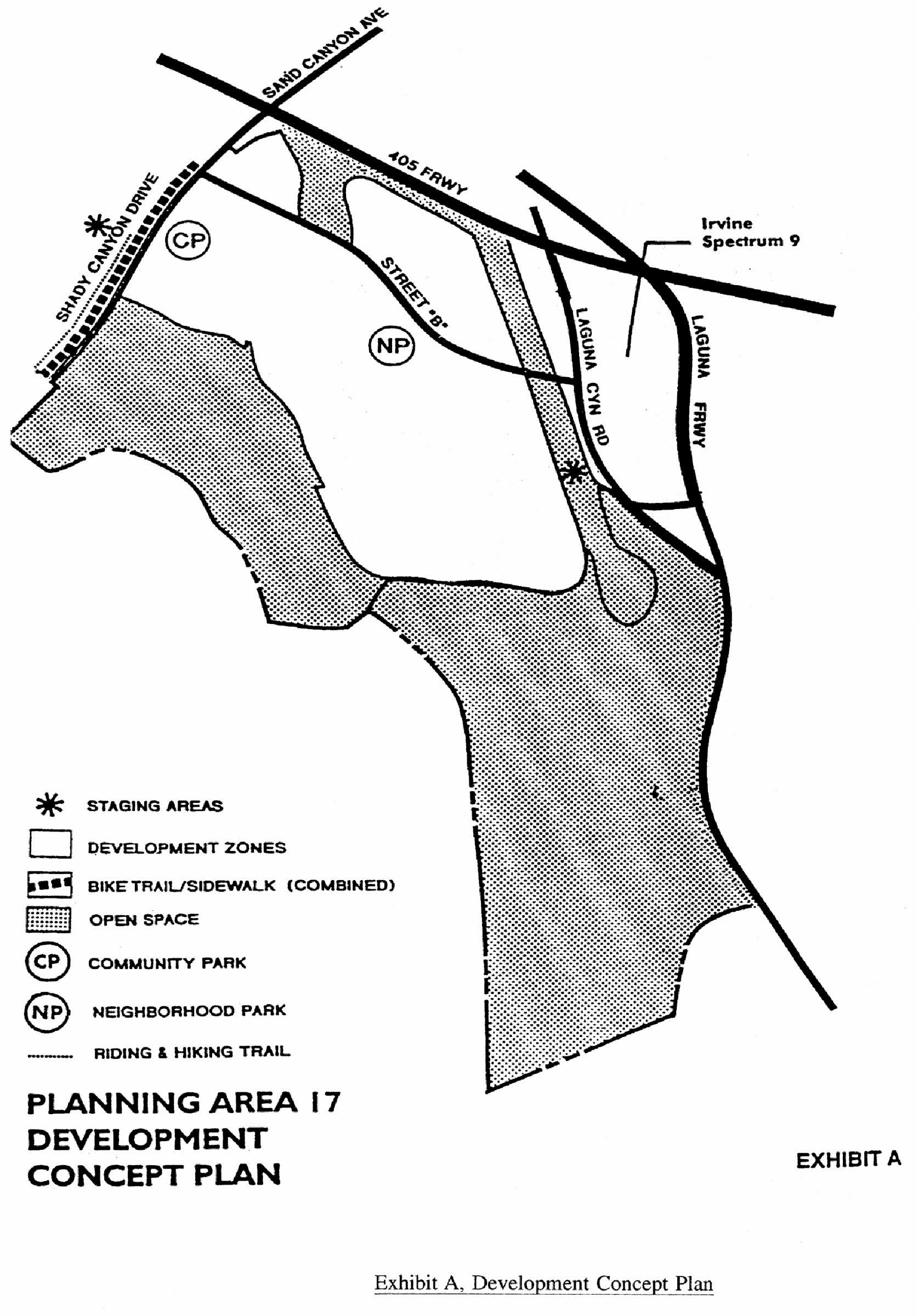
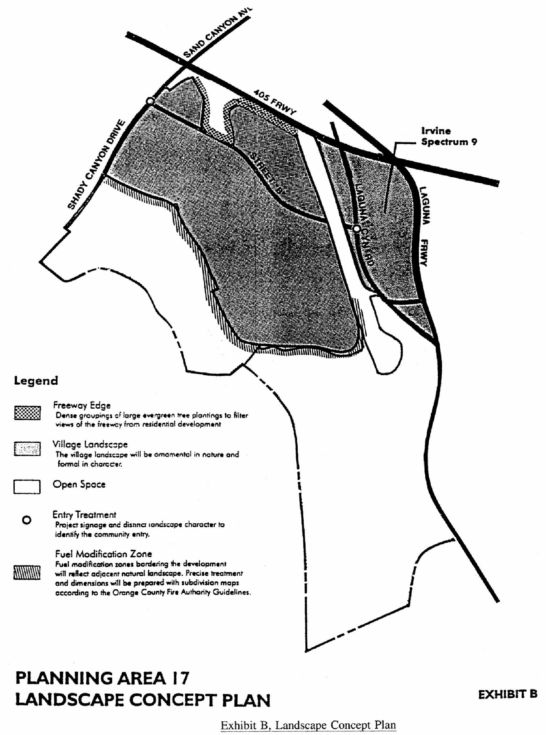
Sec. 9-18-1.- Land use zoning map.
(See Planning Area 18 map following Section 9-18-5.)
(Code 1976, § V.E-818.1; Ord. No. 92-3, 4-14-92; Ord. No. 95-4, 5-9-95; Ord. No. 95-22, § 3, 11-28-95; Ord. No. 06-05, § 6, 6-27-06)
Sec. 9-18-2. - Introduction.
Planning Area 18 is bounded by the I-405 and the future Lake Forest Drive to the north, Laguna Canyon Road to the west, and the City limits to the south and east.
(Code 1976, § V.E-818.2; Ord. No. 92-3, 4-14-92; Ord. No. 95-4, 5-9-95; Ord. No. 95-22, § 3, 11-28-95; Ord. No. 06-05, § 6, 6-27-06)
Sec. 9-18-3. - Statistical analysis.
1 Unallocated dwelling units represent those units remaining in a planning area that may be built anywhere in the same planning area. These units are within the maximum development intensity for the planning area; and, therefore, placement of unallocated dwelling units into any residential category within the planning area for purposes of development is determined to be consistent with the General Plan and Zoning Code with regard to intensity allocation only, provided that placement is otherwise consistent with site specific zoning regulations and that any potential environmental impacts are adequately addressed, including traffic impacts, pursuant to CEQA.
2 See Section 9-0-3.C, Building Intensity Standards.
(Code 1976, § V.E-818.3; Ord. No. 92-3, 4-14-92; Ord. No. 95-4, 5-9-95; Ord. No. 95-22, § 3, 11-28-95; Ord. No. 06-05, § 6, 6-27-06; Ord. No. 12-09, § 3(Exh. A), 5-22-12)
Sec. 9-18-4. - Land use regulations.
See Section 3-3-1 (Land use matrix).
(Code 1976, § V.E-818.4; Ord. No. 92-3, 4-14-92; Ord. No. 95-4, 5-9-95; Ord. No. 95-22, § 3, 11-28-95)
Sec. 9-18-5. - Development standards.
City-wide regulations can also be found in Division 3.
1.
For all residential projects in the 2.2 Residential Low Density District, Section 3-37-13 development standards shall apply.
2.
Individual project densities in the 2.3 Residential Medium Density District may exceed 12.5 dwelling units/net acre. However, no individual project may exceed 31.0 dwelling units/net acre and the overall density within all of the 2.3 Residential Medium Density District cannot exceed 12.5 dwelling units/net acre. For individual residential projects within the 2.3 Residential Medium Density District, the development standards to be applied shall depend on the actual net density of the individual residential project as follows:
a.
For projects from 0 to 6.5 dwelling units per net acre, Section 3-37-13 development standards shall apply.
b.
For projects from 6.6 to 12.5 dwelling units per net acre, Section 3-37-14 development standards shall apply.
c.
For projects from 12.6 to 31.0 dwelling units per net acre, Section 3-37-15 development standards shall apply.
(Code 1976, § V.E-818.5; Ord. No. 92-3, 4-14-92; Ord. No. 95-4, 5-9-95; Ord. No. 95-22, § 3, 11-28-95; Ord. No. 06-05, § 6, 6-27-06)
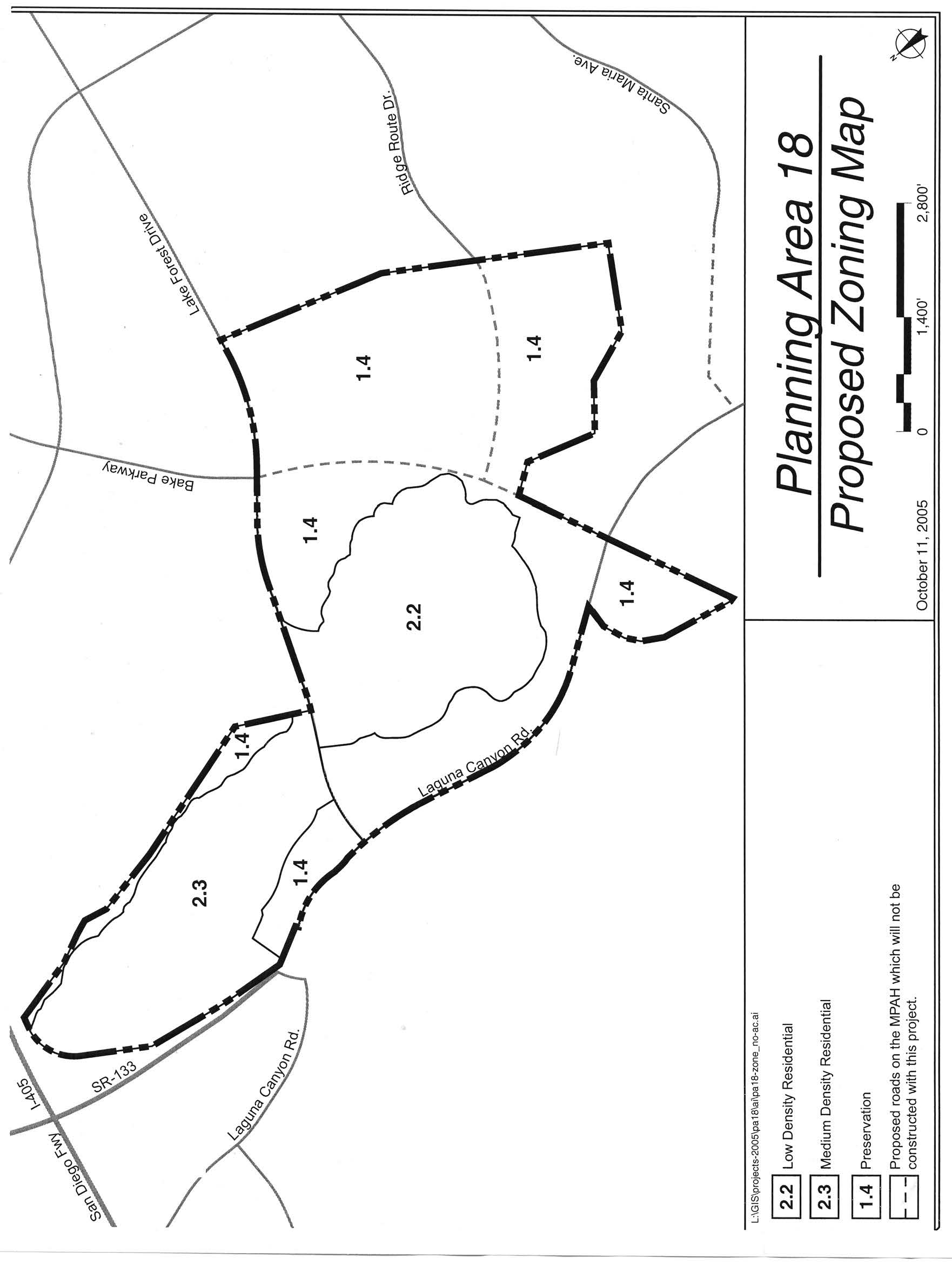
Sec. 9-18-7. - Special development requirements (not applicable to open space reserve and development reserve parcels).
1.
Affordable housing.
a.
The City's affordable housing requirements can be found in Chapter 2-3 of the Zoning Code. In keeping with Chapter 2-3, the affordable housing needs goal of 15 percent (5 percent Income I, II; 5 percent Income III; and 5 percent Income IV) of the actual number of units built in Planning Areas 39 and 18 may be met utilizing the menu option as established in the Housing Element.
b.
In conjunction with the submittal of the first tentative map within this planning area, the applicant shall submit a comprehensive affordable housing program covering Planning Areas 18 and 39 in accordance with Chapter 2-3 of the Zoning Code. The affordable housing goal of 15 percent (5 percent Income I, II; 5 percent Income III; and 5 percent Income IV) of the actual number of units built shall be addressed in the affordable housing program. The program shall be reviewed by the Planning Commission prior to its approval of the first tentative map.
2.
Boundary definitions. The precise Preservation District boundary will be defined through the final builder subdivision map at the boundary of development pads and the fuel modification zone. (The fuel modification zone is included in preservation areas by definition.) However, any preservation areas to be dedicated to the City will exclude fuel modification zones. (The fuel modification zones will be owned and maintained by homeowners' associations.)
3.
Hillside Master Plan. In accordance with Zoning Code Chapter 5-4, a Master Plan shall be prepared for Planning Area 18 which demonstrates how the provisions of the General Plan and Hillside Overlay District will be implemented. The Master Plan shall include all concept plan requirements in accordance with Chapter 2-8. Approved Master Plan documents, or modifications thereto pursuant to Chapter 2-19, shall be used as the standard of review for all subsequent applications submitted for Planning Area 18. A subsequent Master Plan application in accordance with Zoning Code Chapter 2-19 or its equivalent will be submitted for each development project to address the location of structures and parking and for grading.
4.
Parks. At the time of approval of the first tentative tract map for residential purposes within Planning Area 18, a park plan as defined in Section 2-22-2 of the zoning ordinance shall be approved establishing the exact number, precise location, configuration, ownership, size, and the distribution of parks. The park plan shall also establish construction phasing of all parks in conjunction with residential development. Alternatively, the applicant may prepare separate park plans for the two areas on each side of the future Lake Forest Drive provided that tentative tract maps for the areas are filed at different times and that each area meets City neighborhood park requirements within the boundaries of their respective tentative tract maps.
a.
Neighborhood park. The precise number, location, configuration and size of neighborhood parks will be established at the time of approval of tentative tract maps for residential portions of Planning Area 18.
b.
Community park. Community park requirements will be met using existing excess community park credits.
5.
Local residential streets in the 2.2 Low Density Residential District. In the interest of reducing grading and maintaining open space, local residential streets and collectors in the Low Density zone will be private and will conform to City standards except as follows:
a.
On a case-by-case basis, the City Engineer may approve a minimum centerline radius of 150 feet for cul-de-sacs at the end of local streets with a maximum length of 1,000 feet.
b.
Mountable curbs are allowed in lieu of conventional barrier curbs.
c.
For private street frontages, the amount, location and intensity of internal street lighting shall be limited to the minimum necessary for public safety in order to maintain the rural ambience of the community and reduce nighttime glare. A street lighting plan will be submitted with each tentative tract map for those streets contained within the area of the tentative tract lighting and other lights needed to meet public safety concerns and will be approved by the Director of Community Development.
6.
Vehicle control gates. Vehicle control gates shall be permitted in PA 18 pursuant to the approval process and criteria set forth in Zoning Code Chapter 4-4-8 and the 2004 MOU Concerning the Use of Vehicle Control Gates for Future Residential Communities in the Northern Sphere between the City of Irvine and The Irvine Company and the following:
a.
Unrestricted pedestrian access to the communities served by gated roads shall be required. Pedestrian control gates may be provided in apartment communities provided they remain unlocked during daylight hours.
b.
Communities that are not gated will remain open to public access and will contain publicly dedicated and maintained streets.
c.
The precise design and location of the privacy gates will be determined in accordance with Zoning Code Chapter 4-4-8 and evaluated through the Master Plan application procedures.
d.
Unlimited emergency access by Public Safety and the Orange County Fire Department shall be allowed to gated areas.
7.
Visitor parking. Subject to the provisions of this paragraph, public streets may be used for City Code-required visitor parking for ownership residential developments. Public streets may not be used for Code-required visitor parking for rental housing developments. The total number of public lane miles on which City Code-required visitor parking is provided for ownership residential developments other than single-family detached housing developments shall not exceed either 26 percent of the total public lane miles in any individual planning area or 20 percent of the total public lane miles in Planning Area 18. The precise area of public streets where the Code-required visitor parking will be allowed shall be determined in conjunction with subdivision map review and approval.
8.
Village theme. The architectural design shall address detail articulated on all sides of the structures visible from streets, paseos, and other public areas. Particular attention shall be given to windows, balconies, doors, and other design elements. The elements and qualities which shall be encouraged are human scale and privacy, play of light using shade and shadows to provide relief, and variations in roof lines. Large blank walls with minimal detail shall be discouraged.
9.
Residential architecture. A variety of architectural styles and forms will be used to express differences among projects and neighborhoods within the planning area. Variations of the following techniques may be used by the developer:
a.
Overall form: Employ symmetry at front facades and around entries to create balance in the overall form. Discourage entry view corridors terminating at blank walls and/or blank building elevations. Screen elevations of multifamily structures with exterior walkways serving as common access for dwellings on second and third floors from public rights-of-way either through building orientation, architecture or landscaping.
b.
Roof form: Vary roof massing with a strong cornice line. Barrel, flat, shake, and slate concrete tile will be used predominantly with a variety of earthtone colors.
c.
Details: Use simple cornices, moldings, projections and recesses, and integral-colored accent materials such as ceramic tile, brick, (stone or painted stucco).
d.
Site design: Provide terraces, plazas, arcades, colonnades, and pergolas to define pedestrian areas.
10.
Slope zone. In accordance with zoning ordinance Chapter 5-4, Hillside Overlay District, Planning Area 18 has been determined to be in Slope Zone 2. Mass grading is allowed, landforms may be modified, and level building sites and retaining walls are permitted.
11.
Preservation zone grading. Grading for infrastructure, drainage, remediation, flood control, slope stabilization, fuel modification, trails, and habitat enhancements may occur within preservation zones which are not located in the NCCP Reserve.
12.
Alternative setback standards. In conjunction with any discretionary application, alternative setback standards for projects internal to the planning area may be reviewed and approved by the Planning Commission. A description of the proposed setbacks and how they differ shall be submitted along with a justification for the requested alternative. The Planning Commission will consider the following criteria and make the appropriate findings, if necessary:
a.
General character: Relationship in scale, bulk, coverage and density with surrounding land uses.
b.
Quality of life: Whether the proposed alternative standard will result in an adverse impact on existing neighborhoods.
c.
Suitability: The physical suitability of the site for the proposed project.
d.
Limitations: Such setbacks shall not be used to deviate from setbacks established for village edges.
13.
Preservation area dedications. Offers of conveyance for Dedication Areas J-1, J-2 and J-3 will be recorded in accordance with Chapters 8-14 and 8-23 and the following schedule. In order to better facilitate the management of open space, the timing of offers and conveyances may be modified by mutual consent of the City and landowner.
a.
J-1: Prior to or concurrent with the recordation of the first subdivision map in the 2.2 Residential Low Density District, the applicant shall record an offer of dedication in favor of the City for Dedication Area "J-1" as generally depicted on Exhibit A. Such offer will be in compliance with Sections 8-14 and 8-23 and may be accepted by the City no sooner than 90 days following issuance of 75 percent building permits for dwelling units in PA 18.
b.
J-2: Prior to or concurrent with the recordation of the first subdivision map in PA 18 and the recordation of the final right-of-way for Laguna Canyon Road by Caltrans, the applicant shall record an offer of dedication in favor of the City for Dedication Area "J-2" as generally depicted on Exhibit A. Such offer will be in compliance with Sections 8-14 and 8-23 and may be accepted by the City no sooner than 90 days following issuance of 75 percent building permits for dwelling units in PA 18.
c.
J-3: After the installation of natural vegetation and completion of the monitoring program set forth in FEIR ________, the applicant shall record an offer of dedication in favor of the City for Dedication Area "S-1" as generally depicted on Exhibit B. Such offer will be in compliance with Sections 8-14 and 8-23 and may be accepted by the City no sooner than 90 days following the recordation of the offer.
d.
S: Dedication Area S will be dedicated to the City in conjunction with PA 39 development. No offer of dedication or other instrument will be required for Area S in conjunction with any PA 18 development approvals except by mutual agreement of the City and landowner.
e.
Where single-loaded streets abut open space lands to be dedicated to the City, a three-wire cable fence or other access control measures approved by the Director of Community and Library Services shall be provided by the developer.
14.
Transition zones. The transition zone as defined in the General Plan open space and conservation element will be co-terminus with a fuel modification zone as the boundary of residential development and open space. The width and treatment of this zone shall be adapted to slope conditions, vegetation and land use in consultation with fire authorities and consistent with EIR mitigation measures.
15.
Master trails plan. Prior to approval of the first tentative tract map within this planning area, the applicant shall submit a master trails plan consistent with Exhibits B (Public Sidewalks), C (Public Bike Trails) and E-F (Sections). Trails through the Preservation District shall not be a part of the master trails plan. The master trails plan shall be submitted for review by the Community and Library Services Commission and approved by the Planning Commission. The plan shall address the following:
a.
Locations and design of any private trails and sidewalks.
b.
Location where access to dedicated public open space needs to be controlled by the City through fencing or other means.
c.
Phasing of trail construction.
d.
All public trails and sidewalks shown on Exhibits B and C are intended to be owned and operated by the City of Irvine.
(1)
The applicant shall construct public sidewalks as generally depicted on Exhibit B.
(2)
Where public sidewalks and trails parallel roadways, street lighting will be designed to also light trails and sidewalks, where feasible, in order to avoid separate trail and sidewalk lights.
e.
Private sidewalks are generally required on both sides of private local streets. However, on a case-by-case basis, the City Engineer may approve the elimination of the sidewalk on the side of a single-loaded private street where no curbside parking is allowed and no pedestrian circulation is necessary.
f.
City sidewalk requirements for arterial highways are modified as shown on Exhibits E and F (Sections).
g.
The eight-foot sidewalk shown on Exhibit B shall be extended into Planning Area 39 in conjunction with the improvement of the Lake Forest Parkway Extension to Bake Parkway.
16.
OCTA coordination. Prior to the approval of the first residential subdivision map with PA 18, the applicant shall coordinate with the Orange County Transportation Authority to determine the need for future bus stop locations along Lake Forest Drive and Laguna Canyon Road.
17.
Child care. The need for child care facilities shall be recognized with the development of PA 18. Prior to issuance of the 375th residential building permit within PA 18, the number of private sector child care slots to be provided will be determined by the City and the developer in accordance with the City policy. The number of slots will be based on the actual number of residential units to be built and on a determination of child care needs generated by residential development in PAs 17, 18, and 33. The slots determined to be needed may be accommodated within PA 17 or PA 33, at the discretion of the landowner, or at another location as approved by the Director of Community and Library Services.
18.
Wireless facilities. As part of the Master Plan submittal for this area, a plan of preferred sites and designs for wireless facilities shall be prepared, after attempting to receive input from wireless telecommunications carriers concerning their ability to provide service to the proposed development. Based on the information received, the applicant shall identify potential wireless communication facilities sites in residential and nonresidential portions of the subject planning area that, based on the information received, will serve the needs of the proposed development. The applicant's conclusions and proposals for potential wireless sites shall be provided in a report to the City which shall be available for public review prior to any Planning Commission or City Council determination on the application. Subsequent to approval of the Master Plan, any application to locate a wireless communication facility at an identified preferred site may, notwithstanding the "Review Procedure Matrix" set forth in Section 2-37.5-3, be approved by the Director of Community Development, subject to the remaining procedures and requirements specified in Chapter 2-37.5. Any application to site a wireless communication facility at a site that is not an identified preferred site must, in addition to the procedures and requirements specified in Chapter 2-37.5, specifically examine the feasibility of preferred sites and explain why locating a wireless communication facility(ies) at one or more preferred sites cannot adequately satisfy the coverage needs of the telecommunications carrier.
19.
Libraries. In the event a City-wide library impact fee is adopted and in force, the developer shall pay this fee prior to issuance of building permits for new development.
(Ord. No. 05-13, § 4, 7-12-05; Ord. No. 06-05, § 6, 6-27-06; Ord. No. 25-22, § 4, 9-9-25)
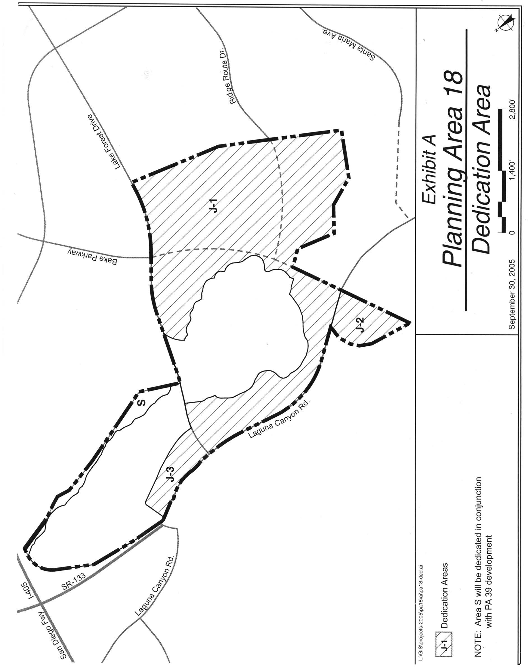
EXHIBIT D—SECTION KEY
EXHIBIT E—SECTIONS 1, 2 & 3
EXHIBIT F—SECTIONS 4 & 5
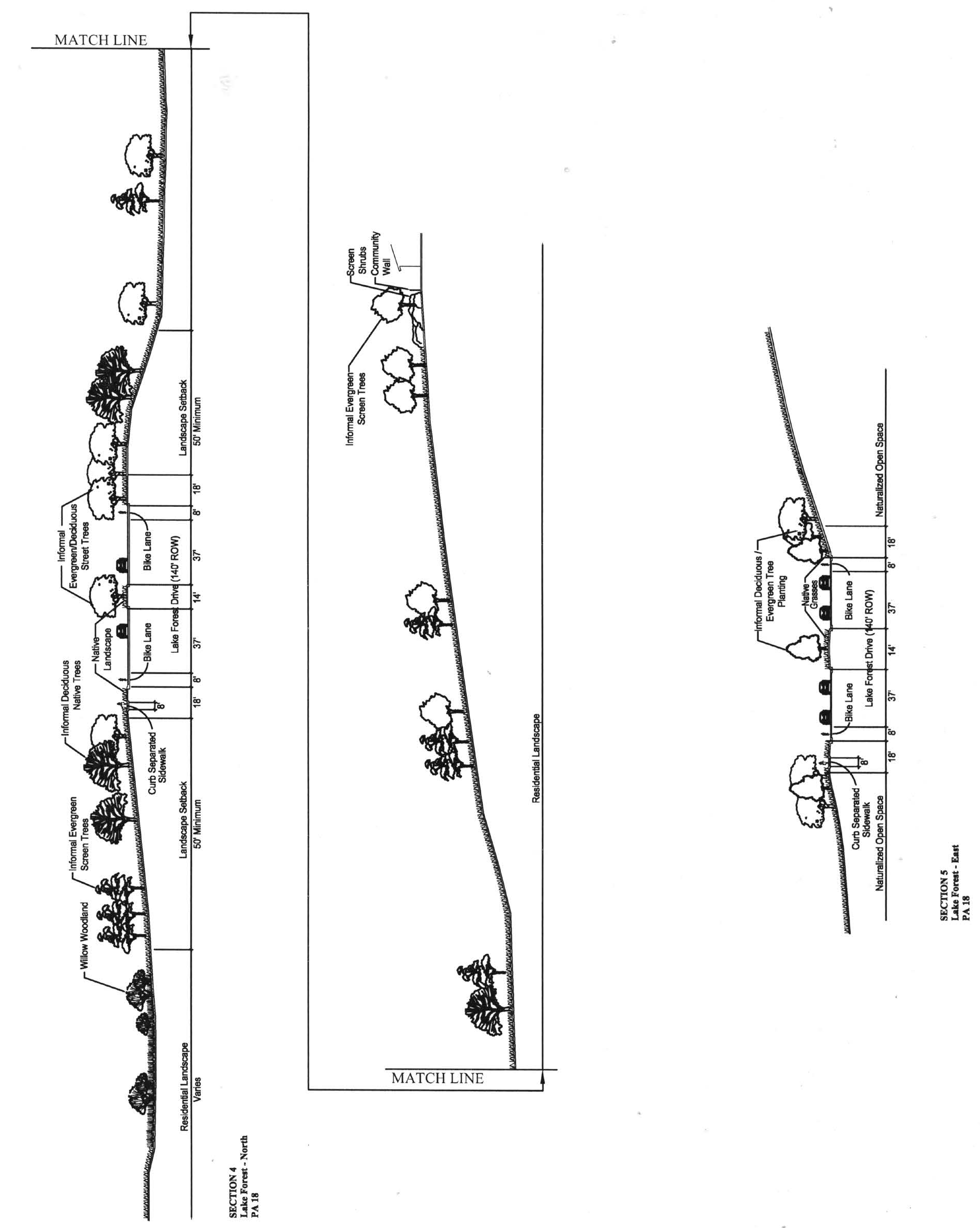
EXHIBIT G—SECTION 6
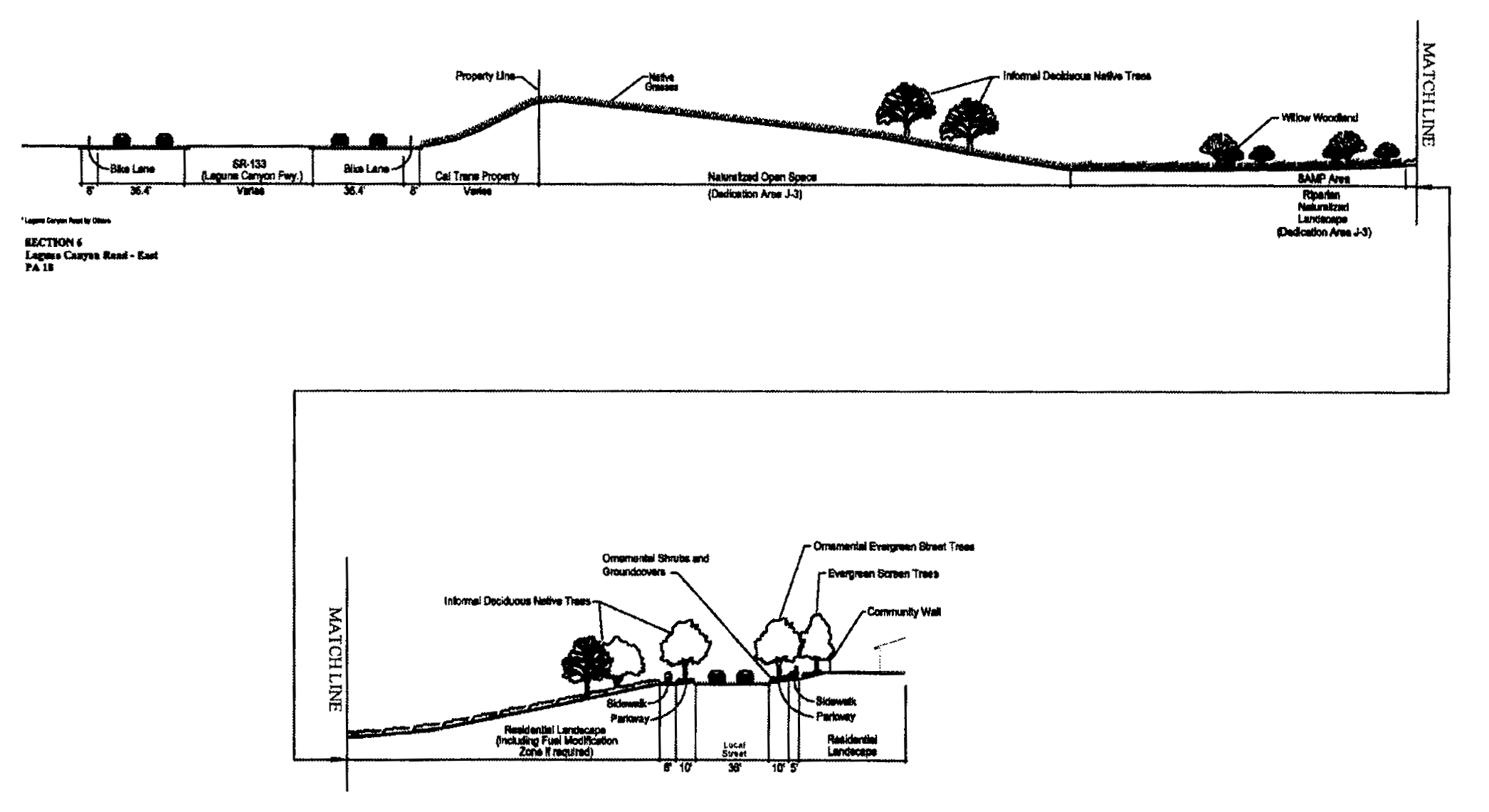
Sec. 9-19-1.- Land use zoning map.
(See Planning Area 19 map following Section 9-19-5.)
(Code 1976, § V.E-819.1; Ord. No. 92-3, 4-14-92; Ord. No. 95-4, 5-9-95; Ord. No. 95-22, § 3, 11-28-95; Ord. No. 97-05, 5-13-97)
Sec. 9-19-2. - Introduction.
Planning Area 19 is centrally located in the City. Boundaries include the San Diego Creek and Harvard Avenue to the west, Interstate 405 (San Diego Freeway) to the north, Culver Drive to the east and University Drive to the south.
(Code 1976, § V.E-819.2; Ord. No. 92-3, 4-14-92; Ord. No. 95-4, 5-9-95; Ord. No. 95-22, § 3, 11-28-95)
Sec. 9-19-3. - Statistical analysis.
1 Unallocated dwelling units represent those units remaining in a planning area that may be built anywhere in the same planning area. These units are within the maximum development intensity for the planning area; and, therefore, placement of unallocated units into any residential category within the planning area for purposes of development is determined to be consistent with the General Plan and Zoning Code with regard to intensity allocation only, provided that placement is otherwise consistent with site specific zoning regulations and that any potential environmental impacts are adequately addressed, including traffic impacts, pursuant to CEQA.
2 See Section 9-0-3.C, Building Intensity Standards.
(Code 1976, § V.E-819.3; Ord. No. 92-3, 4-14-92; Ord. No. 95-4, 5-9-95; Ord. No. 95-22, § 3, 11-28-95; Ord. No. 10-04, § 3, 4-13-10; Ord. No. 12-09, § 3(Exh. A), 5-22-12)
Sec. 9-19-4. - Land use regulations.
See Section 3-3-1 (Land use matrix).
(Code 1976, § V.E-819.4; Ord. No. 92-3, 4-14-92; Ord. No. 95-4, 5-9-95; Ord. No. 95-22, § 3, 11-28-95)
Sec. 9-19-5. - Development standards.
See Chapter 3-37 (Development Standards).
(Code 1976, § V.E-819.5; Ord. No. 92-3, 4-14-92; Ord. No. 95-4, 5-9-95; Ord. No. 95-22, § 3, 11-28-95)
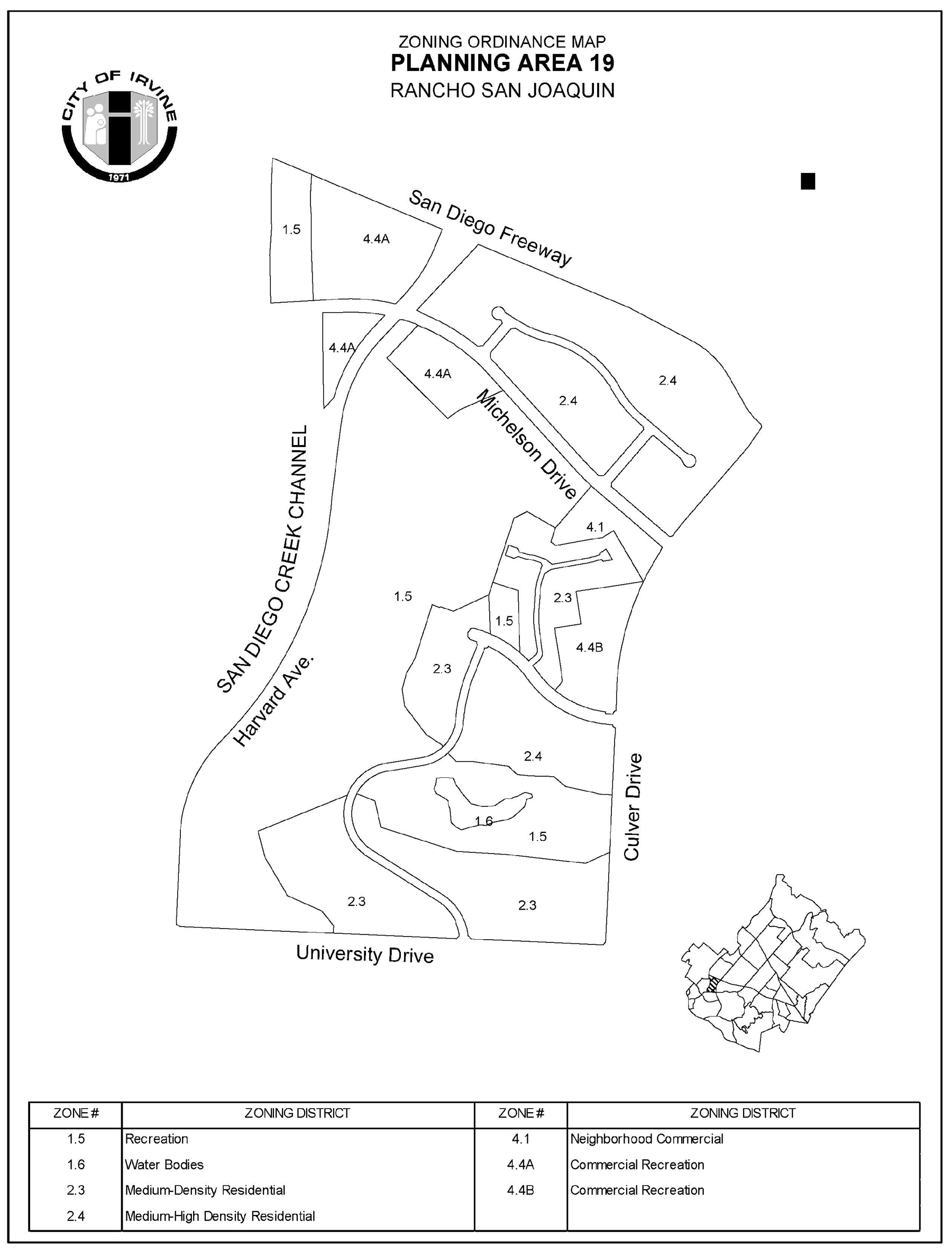
Sec. 9-19-7. - Special development regulations.
A.
See Chapter 3-37 for applicable general development requirements.
B.
The Rancho San Joaquin Cantina and the Jose Sepulveda Adobe historical sites shall be preserved through agreements between the landowner and the City which will allow the City and/or its designated representatives the right of access and use of the sites. The Jose Sepulveda Adobe wall may be excavated and relocated for preservation subject to the approval of the City Council.
(Code 1976, § V.E-819.6; Ord. No. 92-3, 4-14-92; Ord. No. 95-4, 5-9-95; Ord. No. 95-22, § 3, 11-28-95)
Sec. 9-20-1.- Land use zoning map.
(See Planning Area 20 map following Section 9-20-7.)
(Code 1976, § V.E-820.1; Ord. No. 92-3, 4-14-92; Ord. No. 95-4, 5-9-95; Ord. No. 95-22, § 3, 11-28-95)
Sec. 9-20-2. - Introduction.
Planning Area 20, University Park, is centrally located in the City. Boundaries include Culver Drive to the west, Interstate 405 (San Diego Freeway) to the north, and University Drive to the east and south.
(Code 1976, § V.E-820.2; Ord. No. 92-3, 4-14-92; Ord. No. 95-4, 5-9-95; Ord. No. 95-22, § 3, 11-28-95)
Sec. 9-20-3. - Statistical analysis.
1 Unallocated dwelling units represent those units remaining in a planning area that may be built anywhere in the same planning area. These units are within the maximum development intensity for the planning area; and, therefore, placement of unallocated dwelling units into any residential category within the planning area for purposes of development is determined to be consistent with the General Plan and Zoning Code with regard to intensity allocation only, provided that placement is otherwise consistent with site specific zoning regulations and that any potential environmental impacts are adequately addressed, including traffic impacts, pursuant to CEQA.
2 See Section 9-0-3.C, Building Intensity Standards.
(Code 1976, § V.E-820.3; Ord. No. 92-3, 4-14-92; Ord. No. 95-4, 5-9-95; Ord. No. 95-22, § 3, 11-28-95; Ord. No. 10-04, § 3, 4-13-10; Ord. No. 12-04, § 5(Exh. A), 3-13-12; Ord. No. 12-09, § 3(Exh. A), 5-22-12; Ord. No. 12-12, § 5(Exh. A), 9-25-12)
Sec. 9-20-4. - Land use regulations.
See Section 3-3-1 (Land use matrix).
(Code 1976, § V.E-820.4; Ord. No. 92-3, 4-14-92; Ord. No. 95-4, 5-9-95; Ord. No. 95-22, § 3, 11-28-95)
Sec. 9-20-5. - Development standards.
See Chapter 3-37 (Development Standards).
(Code 1976, § V.E-820.5; Ord. No. 92-3, 4-14-92; Ord. No. 95-4, 5-9-95; Ord. No. 95-22, § 3, 11-28-95)
Sec. 9-20-7. - Special development requirements.
See Division 3 for applicable general development requirements.
For properties within the 2.3P Zone, the principal permitted land uses shall be detached single-family. Accessory land uses such as, but not limited to, home occupations, accessory dwelling units, and family day care facilities and other uses as may be authorized pursuant to State or federal law are also allowed.
Properties adjacent to Michelson Drive and/or Rosa Drew Lane within the 2.3P Zone shall provide architectural treatments and articulated rear elevations (i.e., changes in horizontal and/or vertical building planes).
Within the 2.3P Zone, an articulated perimeter project wall shall be provided and positioned such that a 40-foot average landscape setback is provided between 25 and 45 feet behind the ultimate Michelson Drive curb face.
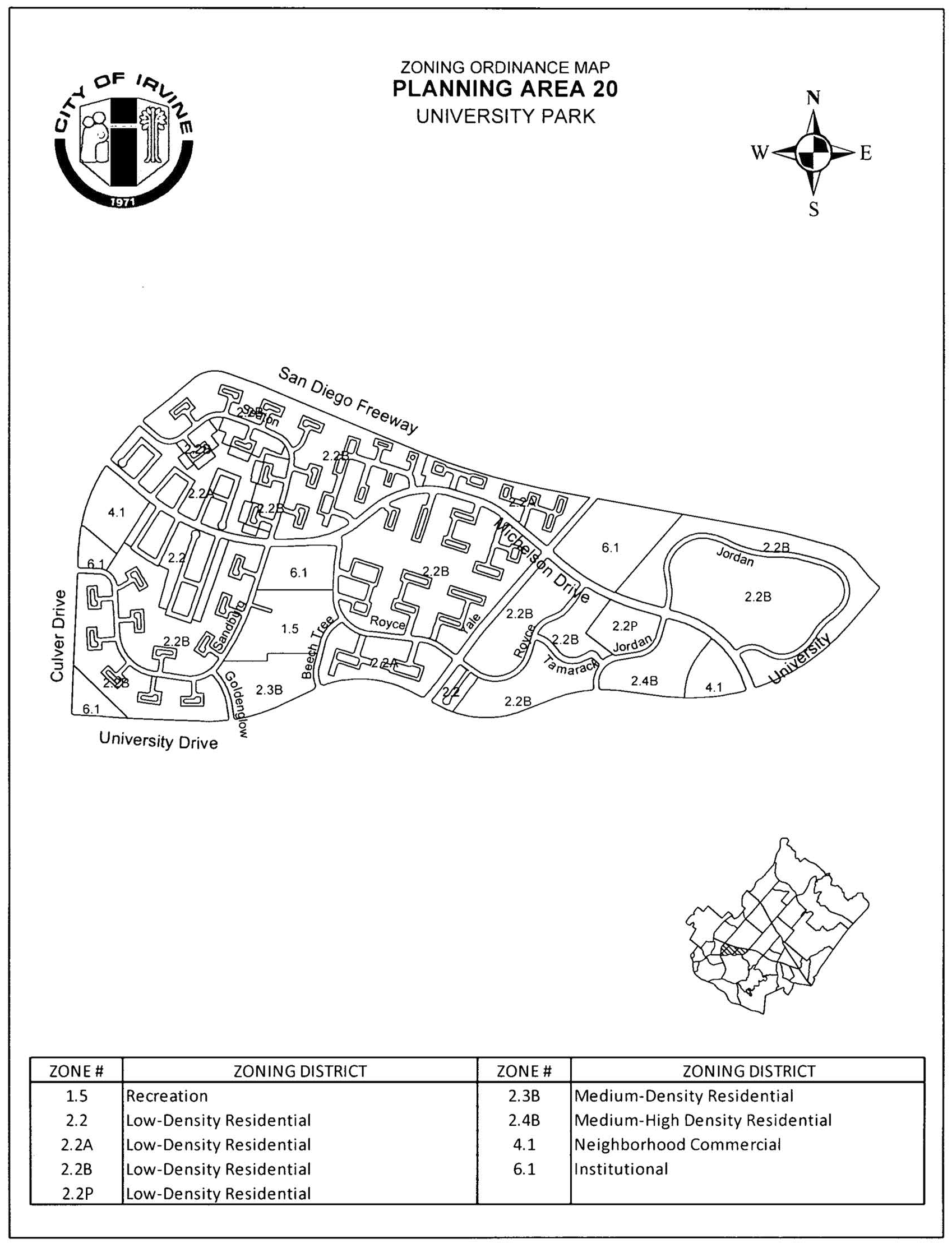
(Code 1976, § V.E-820.6; Ord. No. 92-3, 4-14-92; Ord. No. 95-4, 5-9-95; Ord. No. 95-22, § 3, 11-28-95; Ord. No. 12-04, § 5(Exh. A), 3-13-12; Ord. No. 12-12, § 5(Exh. A), 9-25-12; Ord. No. 18-05, Exh. A, 4-24-18)
Sec. 9-21-1.- Land use zoning map.
(See Planning Area 21 map following Section 9-21-5.)
(Code 1976, § V.E-821.1; Ord. No. 92-3, 4-14-92; Ord. No. 92-4, § 3, 4-28-92; Ord. No. 94-7, § 3, 6-14-94; Ord. No. 95-4, 5-9-95; Ord. No. 95-22, § 3, 11-28-95; Ord. No. 97-05, 5-13-97)
Sec. 9-21-2. - Introduction.
Planning Area 21, Turtle Rock, is located in the southern area of the City. Boundaries include University Drive and Culver Drive to the west, University Drive and Ridgeline Drive to the north, Planning Area 22 to the east and Bonita Canyon Road to the south.
(Code 1976, § V.E-821.2; Ord. No. 92-3, 4-14-92; Ord. No. 92-4, § 3, 4-28-92; Ord. No. 94-7, § 3, 6-14-94; Ord. No. 95-4, 5-9-95; Ord. No. 95-22, § 3, 11-28-95)
Sec. 9-21-3. - Statistical analysis.
1 Unallocated dwelling units represent those units remaining in a planning area that may be built anywhere in the same planning area. These units are within the maximum development intensity for the planning area; and, therefore, placement of unallocated dwelling units into any residential category within the planning area for purposes of development is determined to be consistent with the General Plan and Zoning Code with regard to intensity allocation only, provided that placement is otherwise consistent with site specific zoning regulations and that any potential environmental impacts are adequately addressed, including traffic impacts, pursuant to CEQA.
2 See Section 9-0-3.C, Building Intensity Standards.
(Code 1976, § V.E-821.3; Ord. No. 92-3, 4-14-92; Ord. No. 92-4, § 3, 4-28-92; Ord. No. 94-7, § 3, 6-14-94; Ord. No. 95-4, 5-9-95; Ord. No. 95-22, § 3, 11-28-95; Ord. No. 10-04, § 3, 4-13-10; Ord. No. 12-09, § 3(Exh. A), 5-22-12; Ord. No. 17-05, § 6(Exh. A), 5-9-17)
Sec. 9-21-4. - Land use regulations.
See Section 3-3-1 (Land use matrix).
(Code 1976, § V.E-821.4; Ord. No. 92-3, 4-14-92; Ord. No. 92-4, § 3, 4-28-92; Ord. No. 94-7, § 3, 6-14-94; Ord. No. 95-4, 5-9-95; Ord. No. 95-22, § 3, 11-28-95)
Sec. 9-21-5. - Development standards.
See Chapter 3-37 (Development Standards).
(Code 1976, § V.E-821.5; Ord. No. 92-3, 4-14-92; Ord. No. 92-4, § 3, 4-28-92; Ord. No. 94-7, § 3, 6-14-94; Ord. No. 95-4, 5-9-95; Ord. No. 95-22, § 3, 11-28-95)
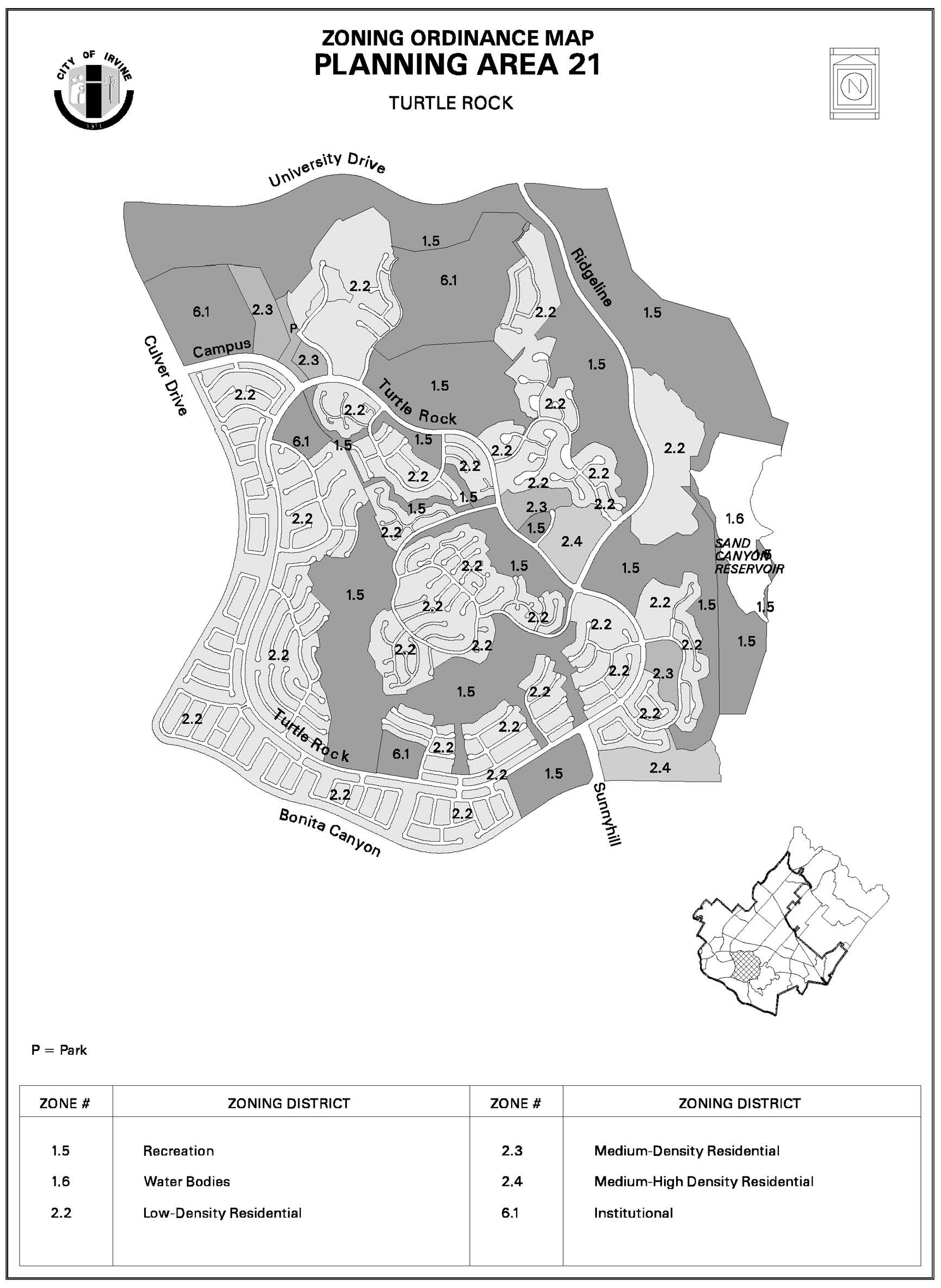
Sec. 9-21-7. - Special development requirements.
A.
General.
1.
See Division 3 for applicable general development requirements.
2.
All development within this planning area shall be in accordance with the Hillside Overlay District and any other hillside regulations in effect at the time of tentative map approval.
3.
Prior to the issuance of building permits for 4,000 total dwelling units in this planning area, the City Council shall determine whether a fourth permanent access is needed after reviewing the recommendation of the Director of Public Works. The Director of Public Works shall base the recommendation on annual analysis of the existing and projected traffic conditions.
4.
All areas designated for residential use may be developed at a lower density than that indicated without requiring a zone change.
B.
Special development requirements: Concordia University (former Christ College Irvine) General Plan Amendment 4237-GA/Zone Change 5232-ZC and Campus Build-Out Plan 00612052-PCPU/Zone Change 00629029-PZC.
Concordia East and West Residential and Concordia University:
1.
The open space areas around the edges of the project as depicted on Drawing 1, Constraints Summary Map (EIR 4237-GA, Appendix K: Graphics Appendix) shall be defined as lettered lots in any tentative and final maps, other than maps for financing and conveyance only. The lettered lots shall be restricted as follows:
a.
With the exception of the Keck Astronomy Center (approximately 500 square feet), no development of any type shall be permitted.
b.
With the exception of the Keck Astronomy Center (approximately 500 square feet), no grading within the open space area except remedial grading as permitted by staff on a case-by-case basis in the specific remedial areas shown in Drawing 15 (Appendix K of the EIR), Concordia East residential (former Hillcrest Vista) Conceptual Grading Plan.
c.
The open space area separating the Concordia West residential (former Chapel Hill Vista) development from the existing Vista homes shall be planted as a landscape buffer in accordance with Drawing 11, Conceptual Landscape Plan for Chapel Hill Vista (Appendix K).
d.
These restrictions shall not preclude implementation of any fuel modification requirements placed upon the project by the Orange County Fire Authority, if such requirements do not interfere with the primary purpose of either the landscape buffer, or open space corridor, as determined by the Director of Community Development.
e.
Provide for a minimum 70-foot unfenced open space corridor between French Hill and Mason Regional Park.
2.
Prior to issuance of grading permits, the applicant shall submit for review and comment, to OC Parks, precise grading plans and sections relative to any infringement within park boundaries, and precise plans for drainage entering or affecting Mason Regional Park.
3.
Prior to issuance of any grading permits, the applicant shall submit for review and approval by the Chief Building Official a construction traffic routing plan which routes construction traffic away from residential areas. The routing plan shall be shown as a map on the grading and building plans and shall specify that construction traffic is to be routed to Ridgeline Drive, to University Avenue, and directly to the I-405 freeway.
4.
Prior to the issuance of building permits for residential uses, each applicant shall demonstrate that all rooftop mechanical and electrical equipment is screened from upper elevation vantage points or integrated into the building design, and that all plumbing vents and ducts are grouped together in order to minimize roof penetration.
5.
Where feasible (i.e., where reclaimed water line hookups are available), all landscaped common areas shall use reclaimed water when permanent irrigation is required and the supply of recycled water is adequate.
6.
Acceptance and maintenance of all surface and subdrainage facilities for the Concordia West (former Chapel Hill Vista), Concordia East (former Hillcrest Vista) and Concordia University (former Christ College) campus, including the on-site perimeter drainage facilities for Concordia West, as described in the Law Environmental hydrogeologic evaluation dated January 24, 1992, shall be the responsibility of the landowner and/or homeowners association. No future dedication of these facilities will be accepted by the City of Irvine.
7.
a.
In conjunction with submittal of swimming pool or spa plans, the applicant shall submit a soil report prepared and signed by a licensed civil and/or geotechnical engineer. The report shall include, but not be limited to, the following information:
(1)
A plot showing the location of all test borings and/or excavations.
(2)
Descriptions and classifications of the materials/soils encountered.
(3)
Elevation of the water table, if encountered.
(4)
Recommendations for foundation type and design criteria, including bearing capacity, provisions to minimize the effects of expansive soils, and the effects of adjacent loads.
(5)
Expected total differential settlement.
b.
Exception: The City Building Official may waive the requirement for submission of a soil report if the following conditions are met:
(1)
A hydrostatic valve is installed in the pool to relieve hydrostatic pressure.
(2)
The pool is designed to accommodate the effects of expansive soils.
Concordia East and West Residential:
8.
A landscape treatment shall be required for those facing either adjacent Enclave I (Vistas), Ridgeline Drive or Turtle Rock Drive which incorporates plant materials at the top of slopes at the intersection of rear and side property lines of heights sufficient to provide a visual break to continuous lot elevations.
9.
In conjunction with submittal of any discretionary development application covering Concordia West (former Chapel Hill Vista), and/or Concordia East (former Hillcrest Vista), the applicant shall submit an adequate hydrology study of the area covered by the development application. The study shall substantiate the downstream drainage facilities to determine the adequacy and ownership to handle the proposed increase in runoff anticipated by such development.
Concordia East Residential:
10.
Any future conditional use permit/master plan for Concordia East residential (former Hillcrest Vista) shall include provision for fencing which prohibits access to the open space area along Ridgeline Drive.
Concordia West Residential:
11.
All homes built within Concordia West (former Chapel Hill Vista) will contain roof gutters, and said gutters will be connected to nonerosive devices as provided for in the Law Environmental report.
(Code 1976, § V.E-821.6; Ord. No. 92-3, 4-14-92; Ord. No. 92-4, § 3, 4-28-92; Ord. No. 94-7, § 3, 6-14-94; Ord. No. 95-4, 5-9-95; Ord. No. 95-22, § 3, 11-28-95; Ord. No. 09-02, § 3, 3-24-09; Ord. No. 17-05, § 6(Exh. A), 5-9-17)
Sec. 9-22-1.- Land use zoning map.
(See Planning Area 22 map following Section 9-22-5.)
(Code 1976, § V.E-822.1; Ord. No. 92-3, 4-14-92; Ord. No. 95-4, 5-9-95; Ord. No. 95-8, § 3, 7-11-95; Ord. No. 95-22, § 3, 11-28-95)
Sec. 9-22-2. - Introduction.
Planning Area 22 is located in the southern area of the City. Boundaries include Planning Area 21 (Turtle Rock) to the west, Planning Areas 16 and 17 to the north, and Planning Area 28 to the east.
(Code 1976, § V.E-822.2; Ord. No. 92-3, 4-14-92; Ord. No. 95-4, 5-9-95; Ord. No. 95-8, § 3, 7-11-95; Ord. No. 95-22, § 3, 11-28-95)
Sec. 9-22-3. - Statistical analysis
1 Unallocated dwelling units represent those units remaining in a planning area that may be built anywhere in the same planning area. These units are within the maximum development intensity for the planning area; and, therefore, placement of unallocated dwelling units into any residential category within the planning area for purposes of development is determined to be consistent with the General Plan and Zoning Code with regard to intensity allocation only, provided that placement is otherwise consistent with site specific zoning regulations and that any potential environmental impacts are adequately addressed, including traffic impacts, pursuant to CEQA.
2 See Section 9-0-3.C, Building Intensity Standards.
(Code 1976, § V.E-822.3; Ord. No. 92-3, 4-14-92; Ord. No. 95-4, 5-9-95; Ord. No. 95-8, § 3, 7-11-95; Ord. No. 95-22, § 3, 11-28-95; Ord. No. 12-09, § 3(Exh. A), 5-22-12)
Sec. 9-22-4. - Land use regulations.
See Section 3-3-1 (Land use matrix).
(Code 1976, § V.E-822.4; Ord. No. 92-3, 4-14-92; Ord. No. 95-4, 5-9-95; Ord. No. 95-8, § 3, 7-11-95; Ord. No. 95-22, § 3, 11-28-95)
Sec. 9-22-5. - Development standards.
See Chapter 3-37 (Development Standards).
(Code 1976, § V.E-822.5; Ord. No. 92-3, 4-14-92; Ord. No. 95-4, 5-9-95; Ord. No. 95-8, § 3, 7-11-95; Ord. No. 95-22, § 3, 11-28-95)
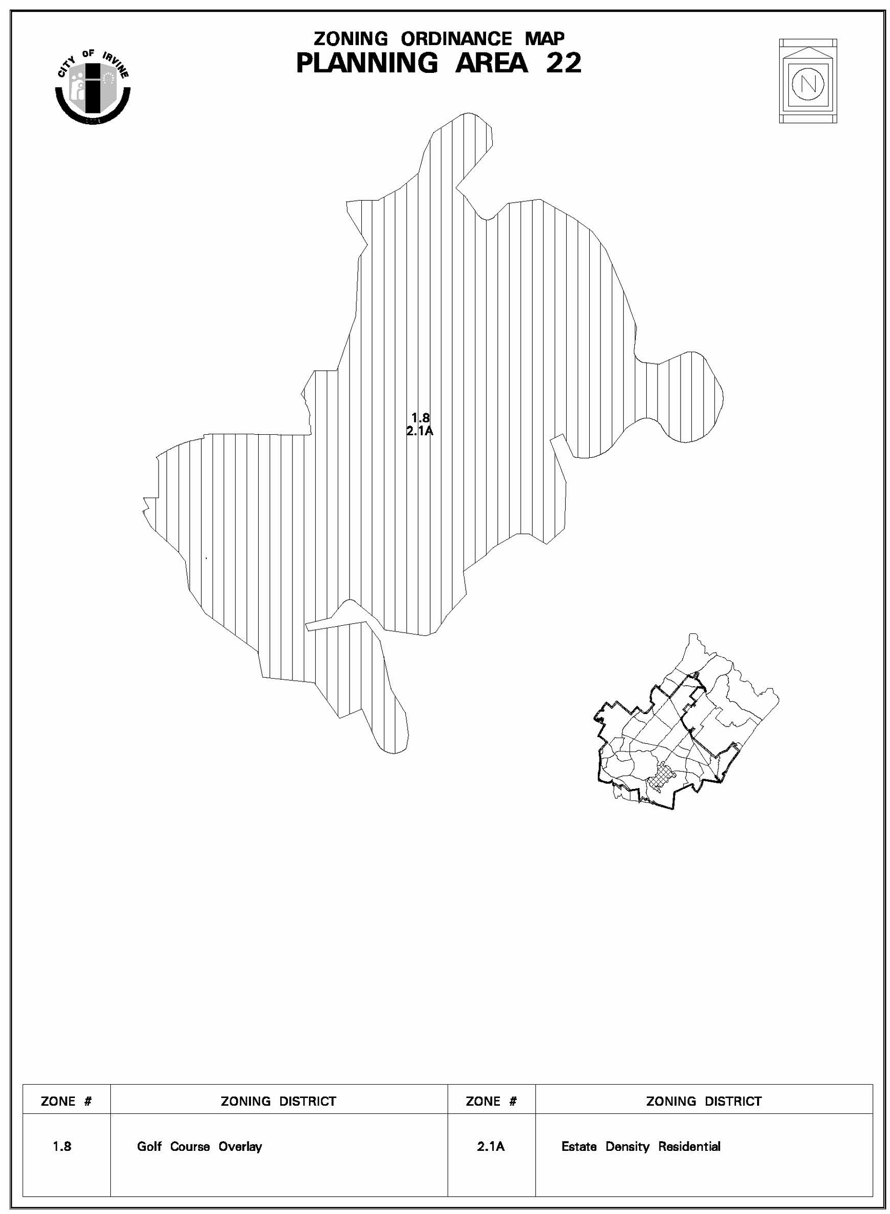
Sec. 9-22-7. - Special development requirements.
A.
Land use.
1.
Affordable housing.
a.
In accordance with City Council Resolution No. 94-52, the affordable housing requirement for Planning Area 22 (Shady Canyon) has been satisfied.
2.
Golf course boundary.
a.
The precise golf course boundary definition will be defined through the Master Plan process in accordance with Chapter 2-17 and Chapter 5-4 of the Irvine zoning ordinance and/or the subdivision process per Section 5-5-101 of the Irvine Municipal Code.
3.
Master Plan application.
a.
In accordance with Chapter 5-3 of the Irvine zoning ordinance, a Master Plan has been prepared for Planning Area 22 which demonstrates how the hillside development ordinance and hillside development manual will be implemented. The approved Master Plan application and incorporated plans (e.g., conceptual natural features plan, conceptual grading plan, conceptual landscape plan, conceptual drainage and flood control plan and slope zone map) shall be used as the basis for reviewing all subsequent applications submitted for Planning Area 22. A subsequent Master Plan application shall be submitted in accordance with Chapter 2-17 of the Irvine zoning ordinance for the following uses within the project area: (1) the private entry gates at Bonita Canyon and at Street "A"; (2) the attached residential units and residential development that exceeds 2.2 dwelling units per net acre; (3) the golf course clubhouse area, which includes the parking lot, driving range, maintenance buildings and clubhouse; and (4) the staging area.
4.
Density average.
a.
In order to minimize the effects of grading and ensure that the natural character of the hillside area is preserved in the residential areas, density averaging will be allowed without a zone change to provide opportunities for clustering residential development as long as the overall averaged density for the planning area does not exceed 1.0 dwelling unit per net acre. The golf course acreage will not be included towards the calculation of residential density.
B.
Public facilities.
1.
Local parks.
a.
The neighborhood and community park dedication requirements for Planning Area 22 will be satisfied through park credit received through the purchase and dedication agreement entered into on December 4, 1981, for Bommer Canyon Community Park. The park dedication acreage and credit will be determined through the tentative tract map application process. The remaining park credit acres can be used for future public park dedication requirements in Planning Area 27.
C.
Circulation.
1.
Private streets.
a.
The internal circulation system for Planning Area 22 will be private and maintained by an entity approved by the City. The design of the internal circulation system shall conform with the private local residential street standards, except mountable curbs are allowed in lieu of the conventional barrier curbs and no sidewalks are required.
b.
For private street frontages, the amount, location and intensity of internal street lighting shall be limited to the minimum necessary for public safety in order to maintain the rural ambience of the community and reduce nighttime glare. A street lighting plan will be submitted with each tentative tract map for those streets contained within the area of the tentative tract lighting and other lights needed to meet public safety concerns and will be approved by the Director of Community Development.
c.
At each entrance to the project area, a security shelter with privacy gates will be allowed. The precise design and location of the privacy gates will be determined in accordance with Section 4-4-9 of the Irvine zoning ordinance and evaluated through the Master Plan application procedures. Unlimited emergency access to the project area by Public Safety and the Orange County Fire Department shall be allowed.
2.
Public streets.
a.
The two-lane roadway extension of Sand Canyon Avenue from Interstate 405 to the entrance of Planning Area 22 shall be constructed with the public local residential street standards, except that an 11-foot sidewalk/bike trail will be installed on only one side of the street in lieu of sidewalks.
3.
Trail system.
a.
A City Class I bicycle trail and parallel City and County riding and hiking trail will be constructed to link the future trails between Mason Regional Park and Bommer Canyon Preservation Area. The general trail location shall be designed in accordance with Exhibit B. These regulational trail linkages will be constructed by the developer in accordance with City standards and maintained by the City of Irvine. The trail system shall be in general conformance with Exhibits B-1, B-2 and B-3 of the Planning Area 22 zoning.
b.
A sidewalk bikeway trail will be provided on one side of public Street "A" along the Sand Canyon Extension from Interstate 405 to the private entrance of Planning Area 22 as shown on Exhibit B. A Class I riding and hiking trail and bicycle trail will connect the future staging area to the regional trail system along the Planning Area 22 boundary at Street "A." These trails will be constructed by the developer in accordance with City standards and maintained by the City of Irvine.
c.
A public staging area will be generally located at the Street "A" entrance to Planning Area 22 as shown on Exhibit B. The staging area will be subject to approval of a Master Plan application, constructed by the developer in accordance with City standards and dedicated to the City of Irvine.
D.
Neighborhood design.
1.
Village theme. Planning Area 22 will be designed as a privately gated, low density residential community with an 18-hole regulation public or private golf course.
2.
Architectural design guidelines.
a.
The architectural character of the residential structures will reflect a classic rural or country expression with an early California or European "country" theme. A variety of architectural styles and forms will be used to create variety among structures throughout the planning area. Architectural style, form and landscaping of the project site shall be integrated into the project. Bold, unique architectural statements resulting in extraordinary visual attention relative to other residences and the overall hillside development are discouraged.
b.
To achieve the intended architectural character in residential areas, one or more of the following elements may be used in any combination at the discretion of the developer. Variations in these elements or other approaches may also be used to achieve the intended character. The purpose of these design elements is to provide guidance in the review of development projects.
(1)
Color: Predominantly warm earthtone colors.
(2)
Overall form: Asymmetrical massing to respond to and reflect site specific conditions. Some symmetry should occur along the frontage of facades or around entries to create and organize building massing.
(3)
Roofs: Varied roof massing to create scale and texture will be encouraged. Clay, tile, and slate should dominate, with consistent dark earthtone colors.
(4)
Details: Broad overhangs, simple cornices, heavy gutters, and integral-colored accent materials such as ceramic tile and brick, garden walls and/or gates, planters, vines on garden walls, hedges and trellises.
(5)
Materials: Stucco and plaster, wood siding and stucco combined, brick, clay, adobe clay or some stone in combination with the above materials.
3.
Natural features. Natural features to be preserved are generally shown on the conceptual grading plan (Exhibit C).
a.
Golf course.
(1)
Rock outcroppings considered to be visually significant will be preserved and/or incorporated into the design of the golf course where feasible.
(2)
Drainage courses and habitat areas considered to be environmentally significant will be preserved, restored and/or enhanced and incorporated into the design of the golf course area.
(3)
Through the Master Plan process, visually significant slopes and natural features in the golf course will be identified for preservation.
(4)
The unimproved areas of the golf course will be preserved, restored, and/or enhanced with native vegetation.
b.
Residential.
(1)
Rock outcroppings considered to be visually significant will be preserved and/or incorporated into the design of the residential areas where feasible.
(2)
Drainage courses and associated riparian vegetation to be preserved or restored in residential zoned areas of the project will be identified through the Master Plan process.
(3)
Dwelling units shall be located, at a minimum, 10 feet from the toes and tops of all slopes which are over 10 feet in vertical height and which are located in Preservation Districts on the zoning map.
(4)
Within the designated preservation fuel modification zones, existing native vegetation will be removed or thinned in accordance with Orange County Fire Department requirements.
(5)
Through the Master Plan process, slopes and natural vegetation in the residential zoned areas of the project will be preserved and/or modified to ensure development opportunities are not constrained.
(6)
In the project area, private views from the residential areas to natural features will be maintained where feasible.
(7)
Special height zones apply to Major Ridgelines A and B (see Exhibit D). Notwithstanding the building height regulations in Section 3-37-12, the height of any building (including architectural features) within special height zones depicted on Exhibit D shall not exceed the elevation specified in the zone.
(8)
Fuel modification zones shall function as transition zones within the residential areas as defined by the City of Irvine General Plan. These fuel modification zones will be dedicated to and maintained by an HOA, maintenance district or entity approved by the City. Fuel modification zones may be included within an Open Space/Conservation Implementation District per Chapter 8-2.
4.
Grading.
a.
In accordance with the hillside development manual, Planning Area 22 has been determined to be in Slope Zone 2. Grading will occur in the areas as generally illustrated on the conceptual grading plan, Exhibit C.
b.
Manufactured slopes shall be contour graded or screened by landscaping using one or more of the following techniques:
(1)
The angle of graded slopes which are visible shall be gradually adjusted to the angle of adjoining natural terrain.
(2)
Graded slopes shall be vegetated and shall reflect the form of existing contours.
(3)
The toes and tops of visible graded slopes in excess of 10 feet in vertical height shall be screened by landscaping and rounded in proportion to the height of the slope where drainage and geotechnical stability permit such rounding.
(4)
The horizontal contours of graded slopes shall be screened by landscaping or curved in a continuous, undulating fashion.
c.
The fuel modification zones will be determined by the Orange County Fire Department through the tentative map application process. Some grading for fire access roads or remedial grading may occur in these zones. For fuel modification zones within or abutting preservation zoned areas, the following guidelines shall apply:
(1)
The overall slope, height and grade of any cut and fill slope shall be in character and scale with the natural terrain.
(2)
Where feasible, the toes and tops of all slopes in excess of 10 feet in vertical height and visible from public areas shall be rounded with curves to the total height of the slope.
(3)
Preservation areas may be subject to remedial grading for fuel modification, infrastructure improvements, trails and staging area/community facility.
5.
Landscape. The landscape concept is generally illustrated on Exhibit E and described below.
a.
Golf course.
(1)
The clubhouse area will feature relatively dense ornamental vegetation of lush and colorful character and quality.
(2)
The fairways, greens, and tees will feature an open pastoral atmosphere with carefully placed groves of shady canopy trees within grassy meadows and gently rolling landform. To the extent feasible, native vegetation shall be used to enhance and/or restore the natural environment.
(3)
Native vegetation and drainage courses as generally depicted on the conceptual landscape plan will be preserved, restored, and/or enhanced where feasible.
(4)
Upon availability from the Irvine Ranch Water District, recycled water shall be used to irrigate the golf course area.
b.
Residential areas.
(1)
The primary entrances to the community, at Sand Canyon Avenue and at Bonita Canyon, will feature distinctive ornamental landscaping of dense groves of canopy trees, shrub masses, and some tall vertical trees with accents in form, color and texture.
(2)
Upon availability from the Irvine Ranch Water District, recycled water shall be used to irrigate the residential areas.
c.
Planning Area 22 boundary treatment.
(1)
The landscaping treatment along the Planning Area 22 boundary shall be consistent with fuel modification requirements.
(2)
Existing native vegetation may be removed or thinned in accordance with Orange County Fire Department fuel modification requirements between development areas and natural areas.
(Code 1976, § V.E-822.6; Ord. No. 92-3, 4-14-92; Ord. No. 95-4, 5-9-95; Ord. No. 95-8, § 3, 7-11-95; Ord. No. 95-22, § 3, 11-28-95)
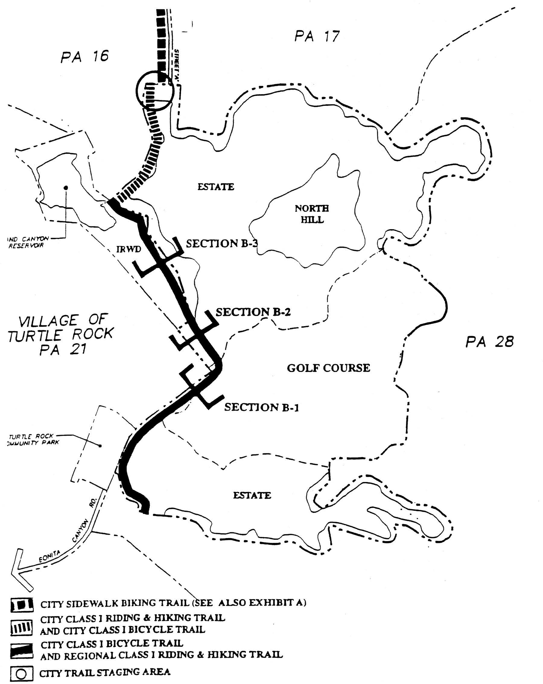
EXHIBIT A—TRAIL SYSTEM
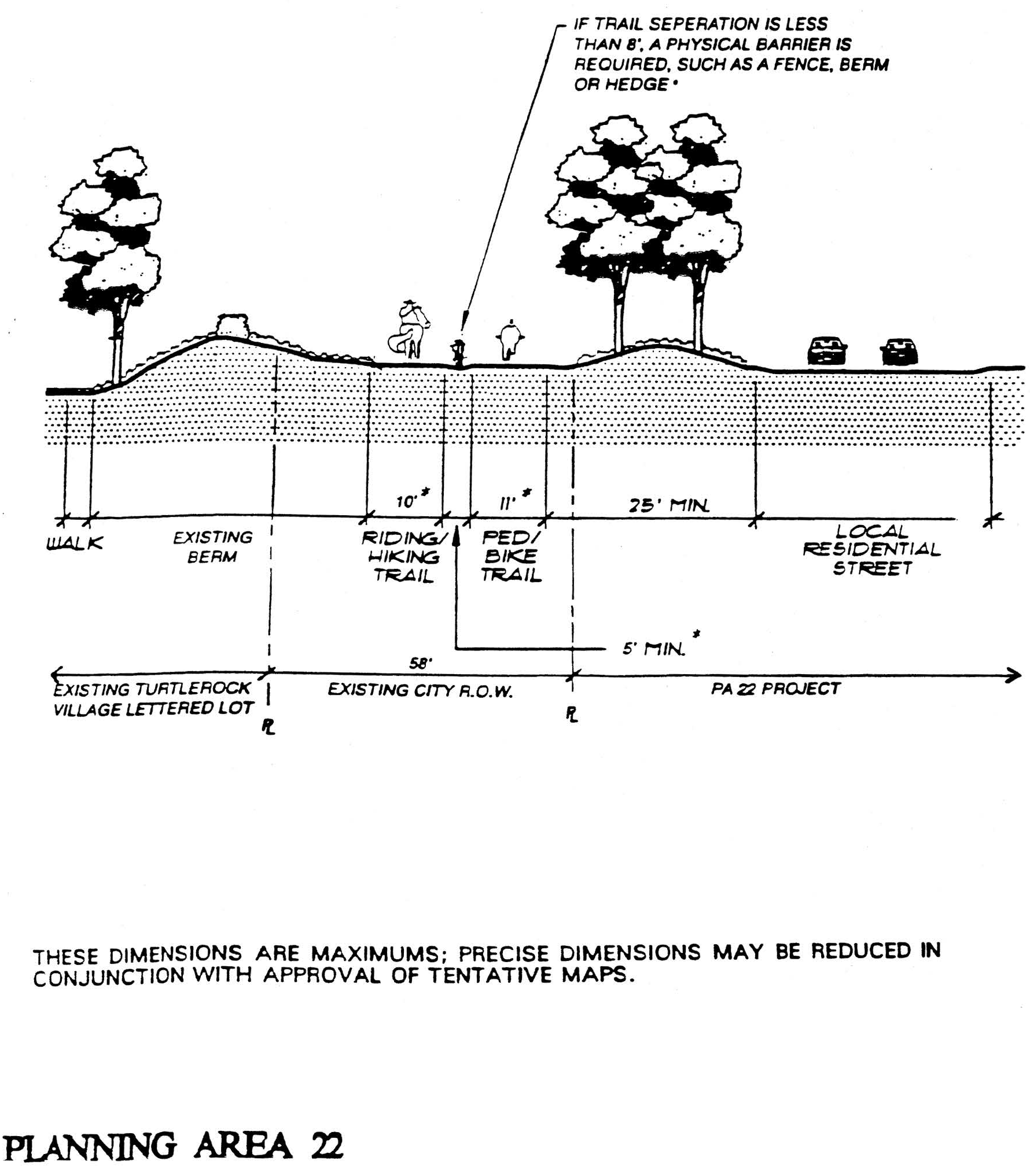
EXHIBIT B-1—VILLAGE EDGE
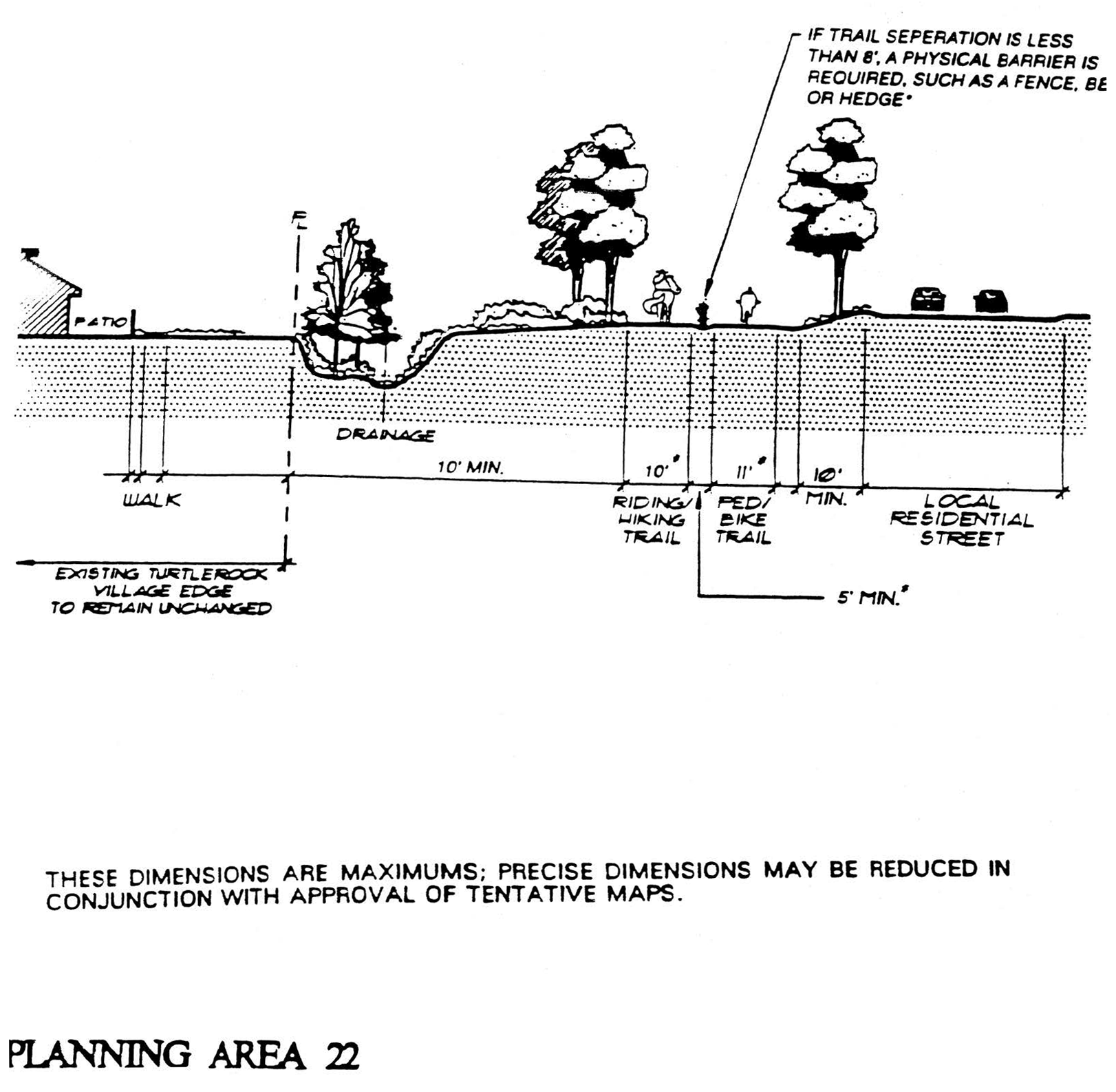
EXHIBIT B-2—VILLAGE EDGE
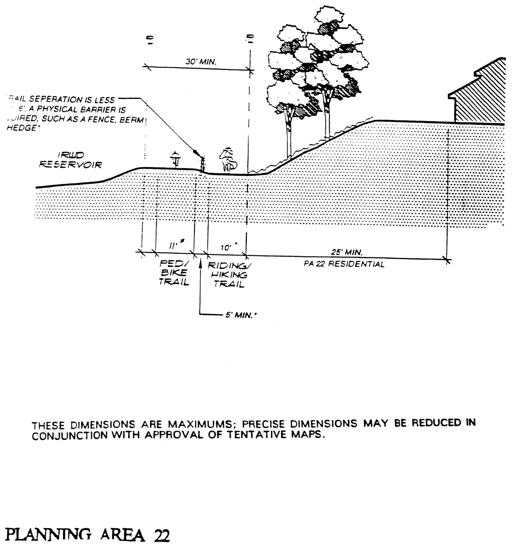
EXHIBIT B-3—VILLAGE EDGE
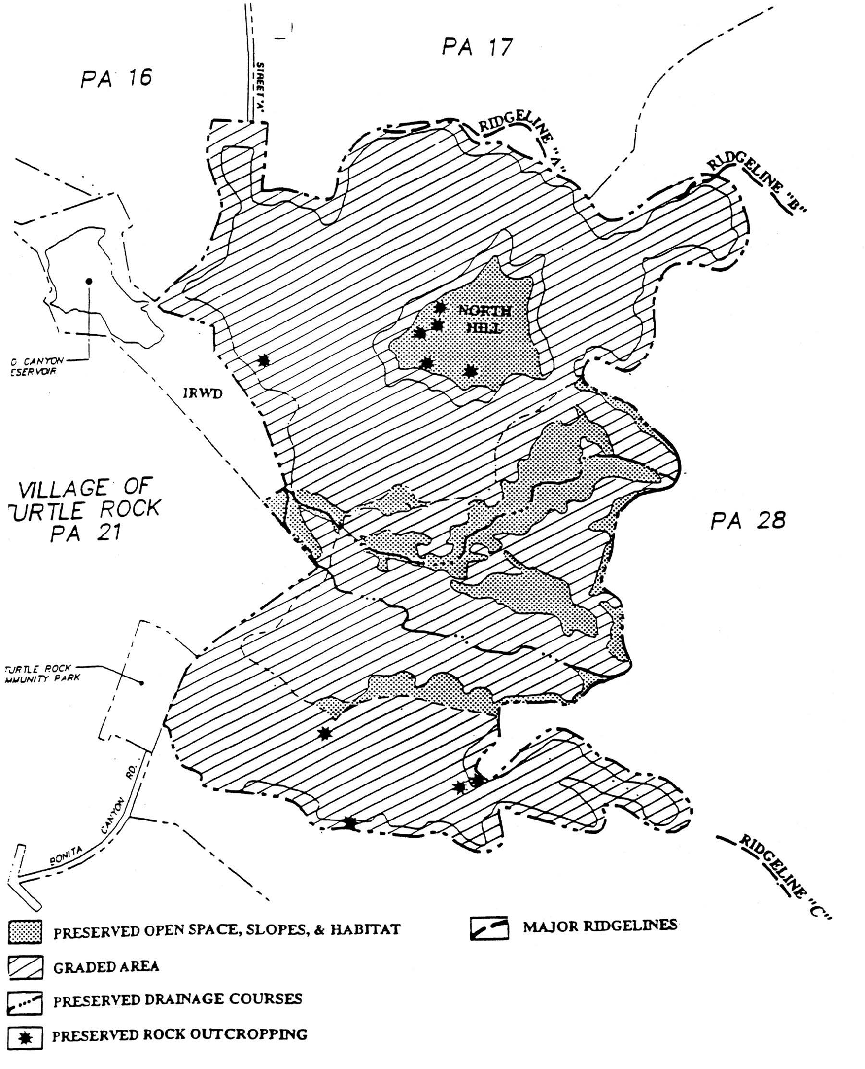
EXHIBIT C—GRADING PLAN
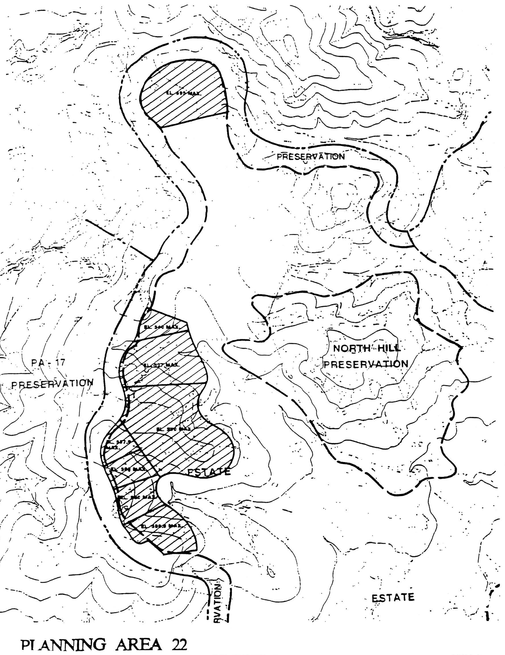
EXHIBIT D—SPECIAL HEIGHT ZONES
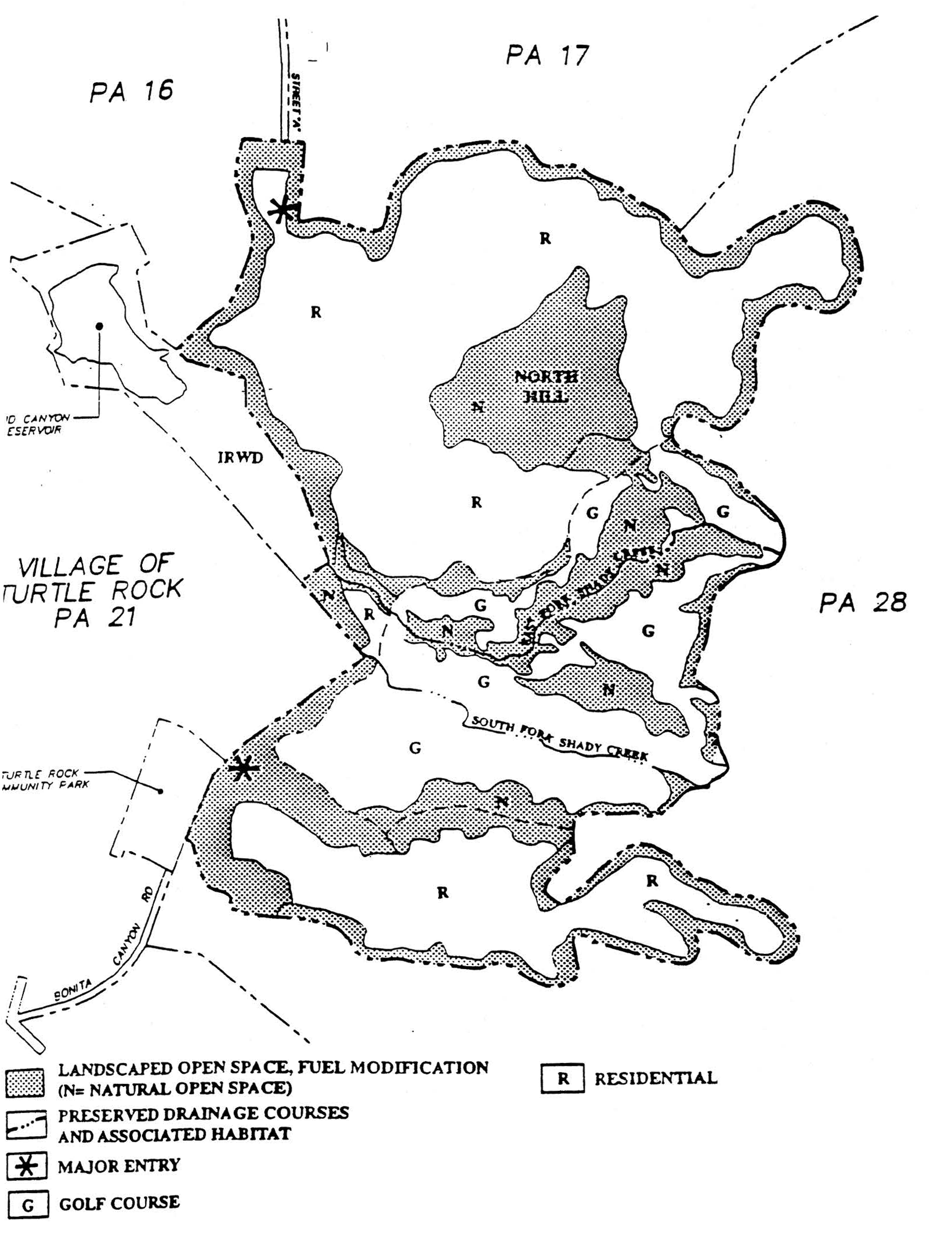
EXHIBIT E—LANDSCAPING
Sec. 9-23-1.- Land use zoning map.
(See Planning Area 23 map following Section 9-23-7.)
(Code 1976, § V.E-823.1; Ord. No. 95-4, 5-9-95; Ord. No. 95-22, § 3, 11-28-95; Ord. No. 97-05, 5-13-97; Ord. No. 09-02, § 3, 3-24-09)
Sec. 9-23-2. - Introduction.
Planning Area 23, San Joaquin Marsh, is located along the southwestern edge of the City. Boundaries include Carlson Avenue to the west, Michelson Drive to the north, Harvard Avenue and University Drive to the east and Campus Avenue to the south.
(Code 1976, § V.E-823.2; Ord. No. 95-4, 5-9-95; Ord. No. 95-22, § 3, 11-28-95)
Sec. 9-23-3. - Statistical analysis.
1 Unallocated dwelling units represent those units remaining in a planning area that may be built anywhere in the same planning area. These units are within the maximum development intensity for the planning area; and, therefore, placement of unallocated dwelling units into any residential category within the planning area for purposes of development is determined to be consistent with the General Plan and Zoning Code with regard to intensity allocation only, provided that placement is otherwise consistent with site specific zoning regulations and that any potential environmental impacts are adequately addressed, including traffic impacts, pursuant to CEQA.
2 See Section 9-0-3.C, Building Intensity Standards.
(Code 1976, § V.E-823.3; Ord. No. 95-4, 5-9-95; Ord. No. 95-22, § 3, 11-28-95; Ord. No. 97-05, 5-13-97; Ord. No. 12-09, § 3(Exh. A), 5-22-12)
Sec. 9-23-4. - Land use regulations.
See Section 3-3-1 (Land use matrix).
(Code 1976, § V.E-823.4; Ord. No. 95-4, 5-9-95; Ord. No. 95-22, § 3, 11-28-95)
Sec. 9-23-5. - Development standards.
See Chapter 3-37 (Development Standards).
(Code 1976, § V.E-823.5; Ord. No. 95-4, 5-9-95; Ord. No. 95-22, § 3, 11-28-95)
Sec. 9-23-7. - Special development requirements.
None.
(Ord. No. 97-05, 5-13-97)
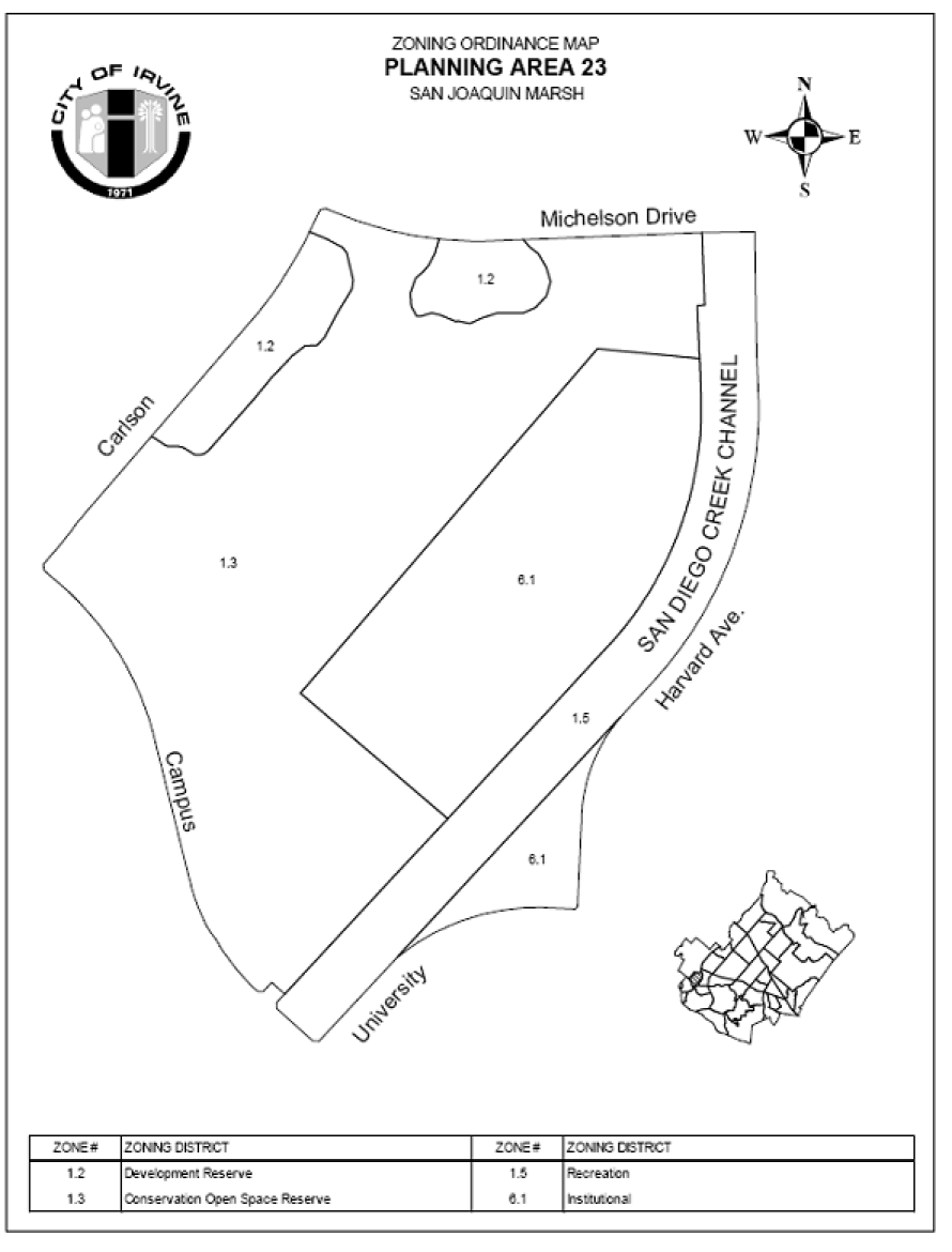
Sec. 9-24-1.- Land use zoning map.
(See Planning Area 24 map following Section 9-24-5.)
(Code 1976, § V.E-824.1; Ord. No. 92-3, 4-14-92; Ord. No. 95-4, 5-9-95; Ord. No. 95-22, § 3, 11-28-95)
Sec. 9-24-2. - Introduction.
Planning Area 24, University Town Center, is centrally located in the City. Boundaries include University Drive to the west, University Drive and Culver Drive to the north, Culver Drive and University Drive to the east, and Campus Drive to the east and Campus Drive to the south.
(Code 1976, § V.E-824.2; Ord. No. 92-3, 4-14-92; Ord. No. 95-4, 5-9-95; Ord. No. 95-22, § 3, 11-28-95)
Sec. 9-24-3. - Statistical analysis.
1 Unallocated dwelling units represent those units remaining in a planning area that may be built anywhere in the same planning area. These units are within the maximum development intensity for the planning area; and, therefore, placement of unallocated dwelling units into any residential category within the planning area for purposes of development is determined to be consistent with the General Plan and Zoning Code with regard to intensity allocation only, provided that placement is otherwise consistent with site specific zoning regulations and that any potential environmental impacts are adequately addressed, including traffic impacts, pursuant to CEQA.
2 See Section 9-0-3.C, Building Intensity Standards.
(Code 1976, § V.E-824.3; Ord. No. 92-3, 4-14-92; Ord. No. 95-4, 5-9-95; Ord. No. 95-22, § 3, 11-28-95; Ord. No. 97-05, 5-13-97; Ord. No. 10-04, § 3, 4-13-10; Ord. No. 12-09, § 3(Exh. A), 5-22-12)
Sec. 9-24-4. - Land use regulations.
See Section 3-3-1 (Land use matrix).
(Code 1976, § V.E-824.4; Ord. No. 92-3, 4-14-92; Ord. No. 95-4, 5-9-95; Ord. No. 95-22, § 3, 11-28-95)
Sec. 9-24-5. - Development standards.
See Chapter 3-37 (Development Standards).
(Code 1976, § V.E-824.5; Ord. No. 92-3, 4-14-92; Ord. No. 95-4, 5-9-95; Ord. No. 95-22, § 3, 11-28-95)
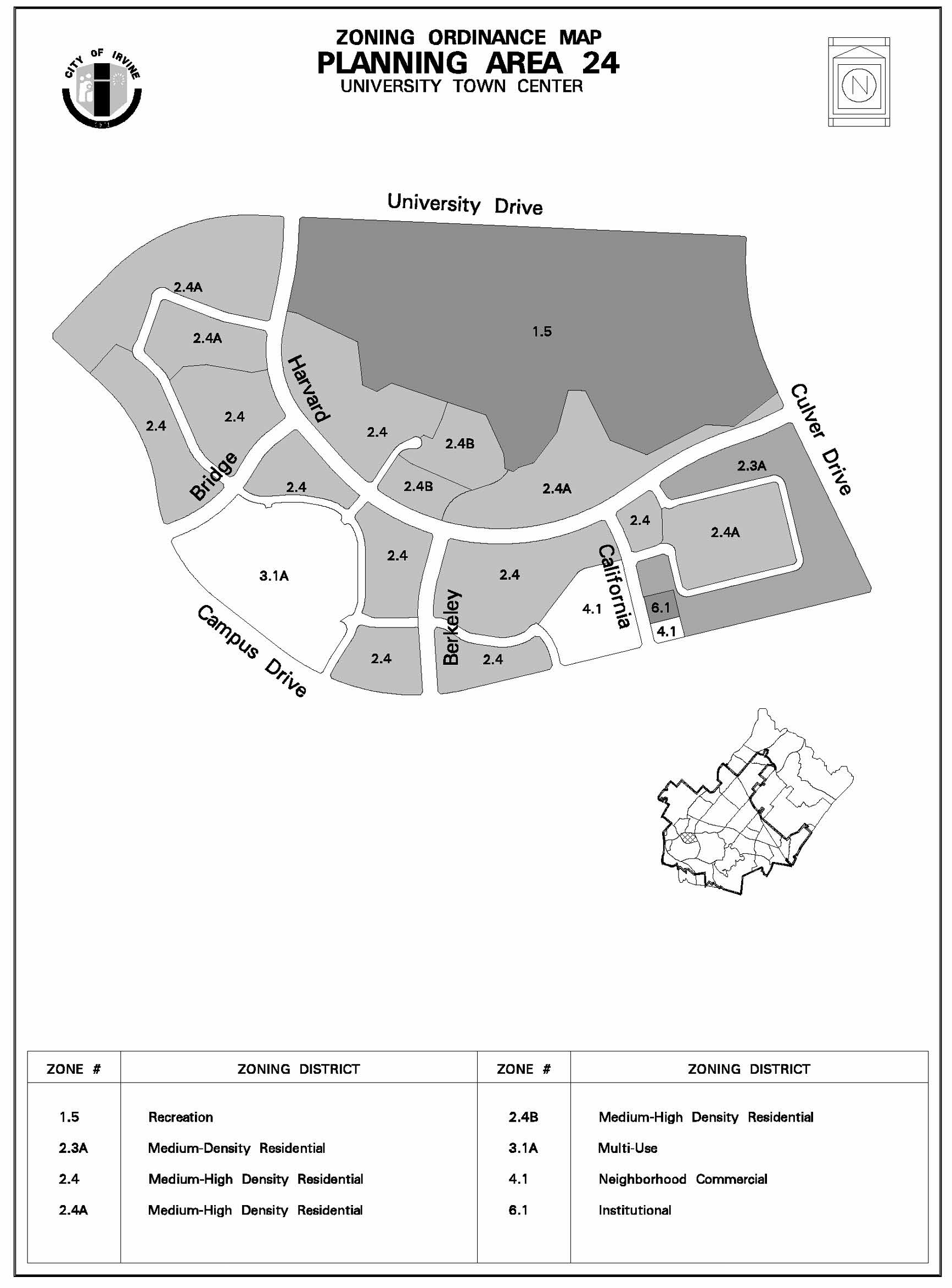
Sec. 9-24-7. - Special development requirements.
A.
See Division 3 for applicable general development requirements.
B.
Within Area 3.1A, all first-floor space on the malls and square shall be designated as retail space except those buildings which are solely residential.
C.
Commercial uses in Area 3.1A (excluding any hotel/motel) shall not exceed 654,000 square feet of combined retail, office, civic, cultural and institutional uses.
D.
The town square shall be the focal point of University Town Center and shall be located in the approximate center of Area 3.1A. The square shall be a pedestrian-oriented place; automobile traffic shall be prohibited.
E.
Service stations and carwashes shall be prohibited on Campus Drive.
F.
Prior to approval of any Master Plan, subdivision map or conditional use permit in Area 3.1A, a design and funding agreement for a pedestrian and bicycle bridge connecting Area 3.1A with the University of California at Irvine shall be reviewed by the Planning Commission and approved by the City Council. The median on Campus Drive shall be designed to impede pedestrian traffic.
G.
Concurrently with the submittal of the design and agreement required in Section 9-24-7.F, the developer shall submit a streetscape plan for Campus, Harvard, Berkeley and Bridge for review and approval by the Planning Commission.
H.
Concurrently with the submittal of the design and agreement required in Section 9-24-7.F, the developer shall submit an illustrated design theme for the town square, including the height of buildings for the pedestrian malls and residential areas in Area 3.1A, and this shall be reviewed and approved by the Planning Commission.
I.
The pedestrian/bicycle bridge shall be under construction prior to issuance of any certificates of use and occupancy for any development within Area 3.1A. "Under construction" means the bridge shall be under active construction with diligent progress directed toward completion. In the event the Chief Building Official reports delays in construction, no further temporary or permanent certificates of use and occupancy will be issued until construction is resumed.
J.
The developer shall provide 3.8 acres of park land per 1,000 persons in accordance with the procedures of the Local Park Code. Park areas may include plazas, malls, courts, trails and parks. The park ratio of 3.8 acres per 1,000 persons is based on the inclusion of at least three pedestrian/bicycle access routes between University Town Center and Mason Regional Park through the landscaped slope bank. The dedication requirement shall be 2.0 acres per 1,000 persons (or appropriate in-lieu fees) for family units located within one-half mile of a publicly maintained park or school playground and for units restricted to low- and moderate-income single persons regardless of location. For purposes of calculating the park land requirements, the retirement project in Area 2.6A shall be treated as a separate project from the rest of the village.
K.
At least 10 percent of the housing units built in University Town Center shall be in a price range affordable by families of moderate income. An additional 10 percent of the housing units shall be in a price range affordable by families of low income. If low-income units are built on a lawsuit settlement site in another planning area where there is no low-income housing requirement or where such requirement has already been met, and where those units are prevented from being credited toward the lawsuit settlement site provision requirement, then those units may be counted toward this low-income housing requirement. For the purpose of this requirement, income and affordability ranges shall be as defined in the Housing Element of the General Plan and any implementing resolutions adopted by the City Council.
L.
As identified by the City Council, Locus V shall be incorporated into the village edge or other open space element. Locus IV shall be preserved within a minimum one-acre park to be dedicated to the City of Irvine. At the time of conditional use permit or code compliance review, landscape plans shall be provided demonstrating the proposed plant pallets, underground utilities, and recreational facilities shall not disturb the archaeological deposits in Locus IV and Locus V. The grading plan shall also demonstrate that no surface or subsurface disturbances shall take place in Locus IV or V without the written consent of the Director of Community Development.
M.
In Area 3.1A, the concept of shared parking and compact car allowances may be implemented using the following standards as guidelines:
1.
Shared parking standard. It is the intent of the shared parking standard to establish criteria for parking spaces based on the differing parking demands and time/use characteristics. The end product shall be a more efficient use of surface area with less land area devoted to parking.
a.
Parking demand ratio. Figure 9-24-7 represents the demand ratio for each programmed use for a weekday afternoon, weekday evening and Saturday afternoon.
FIGURE 9-24-7. RECOMMENDED PARKING DEMAND RATIOS
*Based on City of Irvine off-street parking regulations and Linscott Associates studies of specific uses.
**Based on geographic distribution of potential customers/users of Town Center according to market study and probable breakdown of number of office employees with respect to local residents, commuters and UCI-related employees.
***Saturday parking demand is a function of the amount of office space in use. Total varies with type of use but does not exceed weekday use.
****Since residential parking demand is significantly impacted by product type and alternative transit availability, the parking demand ratio, including guest parking, will be addressed at the time of conditional use permit.
b.
Master Plan review. At the time of Master Plan review for each developmental increment, a precise parking plan shall be submitted showing all parking spaces, the overall circulation system, and an analysis of the parking demand for the specific land uses proposed.
c.
Monitoring of parking demand/supply. To test the operation of the shared parking concept and proposed standards, the developer shall, in conjunction with the City, monitor the actual parking experience as development proceeds. Subsequent to completion and operation of the first development increment, the developer shall submit an analysis of the parking situation on all completed increments as a part of the Master Plan review for additional increments of development.
d.
Compact car factor. A 25 percent allowance for compact cars for the programmed retail-commercial uses and 35 percent for office uses shall be allowed for Phase I development in Area 3.1A. Up to 50 percent compact parking will be allowed for subsequent phases of development if the studies conducted as part of the monitoring program justify it.
(Code 1976, § V.E-824.6; Ord. No. 92-3, 4-14-92; Ord. No. 95-4, 5-9-95; Ord. No. 95-22, § 3, 11-28-95)
Sec. 9-24-8. - Village theme.
A.
Location theme. Because of the location adjoining the University of California campus, the University Town Center area is an appropriate location for a highly integrated and urban "town center" containing sales and rental residential units, units designated for low- and moderate-income families and single persons, both basic and specialty commercial services, office uses, and civic/cultural activities.
B.
UTC core theme. A central commercial district, the core, is proposed with mixed uses such as movie theaters, recreation, special food markets, drugstores, liquor stores, general merchandise and apparel, specialty shops and an inn. The intent of the core is to create and provide a combination of retail commercial, office and residential uses. The theme of the core is one of diverse activities interfacing and integrating with adjacent areas to provide a harmonious, active, urban environment.
(Code 1976, § V.E-824.7; Ord. No. 92-3, 4-14-92; Ord. No. 95-4, 5-9-95; Ord. No. 95-22, § 3, 11-28-95)
Sec. 9-25-1.- Land use zoning map.
(See Planning Area 25 map following Section 9-25-7.)
(Code 1976, § V.E-825.1; Ord. No. 92-3, 4-14-92; Ord. No. 95-4, 5-9-95; Ord. No. 95-12, § 3, 9-12-95; Ord. No. 95-22, § 3, 11-28-95)
Sec. 9-25-2. - Introduction.
Planning Area 25 is located along the southwestern edge of the City. The site is generally bounded by University Drive to the north, open space land which is a part of the UCI campus to the east and south, and MacArthur Boulevard, Newport Coast Drive and the San Joaquin Transportation Corridor to the west.
(Code 1976, § V.E-825.2; Ord. No. 92-3, 4-14-92; Ord. No. 95-4, 5-9-95; Ord. No. 95-12, § 3, 9-12-95; Ord. No. 95-22, § 3, 11-28-95)
Sec. 9-25-3. - Statistical analysis.
1 Unallocated dwelling units represent those units remaining in a planning area that may be built anywhere in the same planning area. These units are within the maximum development intensity for the planning area; and, therefore, placement of unallocated dwelling units into any residential category within the planning area for purposes of development is determined to be consistent with the General Plan and Zoning Code with regard to intensity allocation only, provided that placement is otherwise consistent with site specific zoning regulations and that any potential environmental impacts are adequately addressed, including traffic impacts, pursuant to CEQA.
2 See Section 9-0-3.C, Building Intensity Standards.
3 The 50,000-square-foot National Academy of Sciences institutional site is additive to this number.
(Code 1976, § V.E-825.3; Ord. No. 92-3, 4-14-92; Ord. No. 95-4, 5-9-95; Ord. No. 95-12, § 3, 9-12-95; Ord. No. 95-22, § 3, 11-28-95; Ord. No. 12-09, § 3(Exh. A), 5-22-12)
Sec. 9-25-4. - Land use regulations.
See Section 3-3-1 (Land use matrix).
(Code 1976, § V.E-825.4; Ord. No. 92-3, 4-14-92; Ord. No. 95-4, 5-9-95; Ord. No. 95-12, § 3, 9-12-95; Ord. No. 95-22, § 3, 11-28-95)
Sec. 9-25-5. - Development standards.
See Chapter 3-37 (Development Standards).
(Code 1976, § V.E-825.5; Ord. No. 92-3, 4-14-92; Ord. No. 95-4, 5-9-95; Ord. No. 95-12, § 3, 9-12-95; Ord. No. 95-22, § 3, 11-28-95)
Sec. 9-25-7. - Special development requirements.
Prior to the issuance of building permits for the area of land known as the University Research Park, the property owner shall submit and receive approval from the Planning Commission of a Master Plan in accordance with Chapter 2-17 of the zoning ordinance. The Master Plan shall specifically address the following issues:
A.
Village edge landscape treatments which may include setbacks;
B.
Streetscape design which may include lighting.
(Code 1976, § V.E-825.6; Ord. No. 92-3, 4-14-92; Ord. No. 95-4, 5-9-95; Ord. No. 95-12, § 3, 9-12-95; Ord. No. 95-22, § 3, 11-28-95)
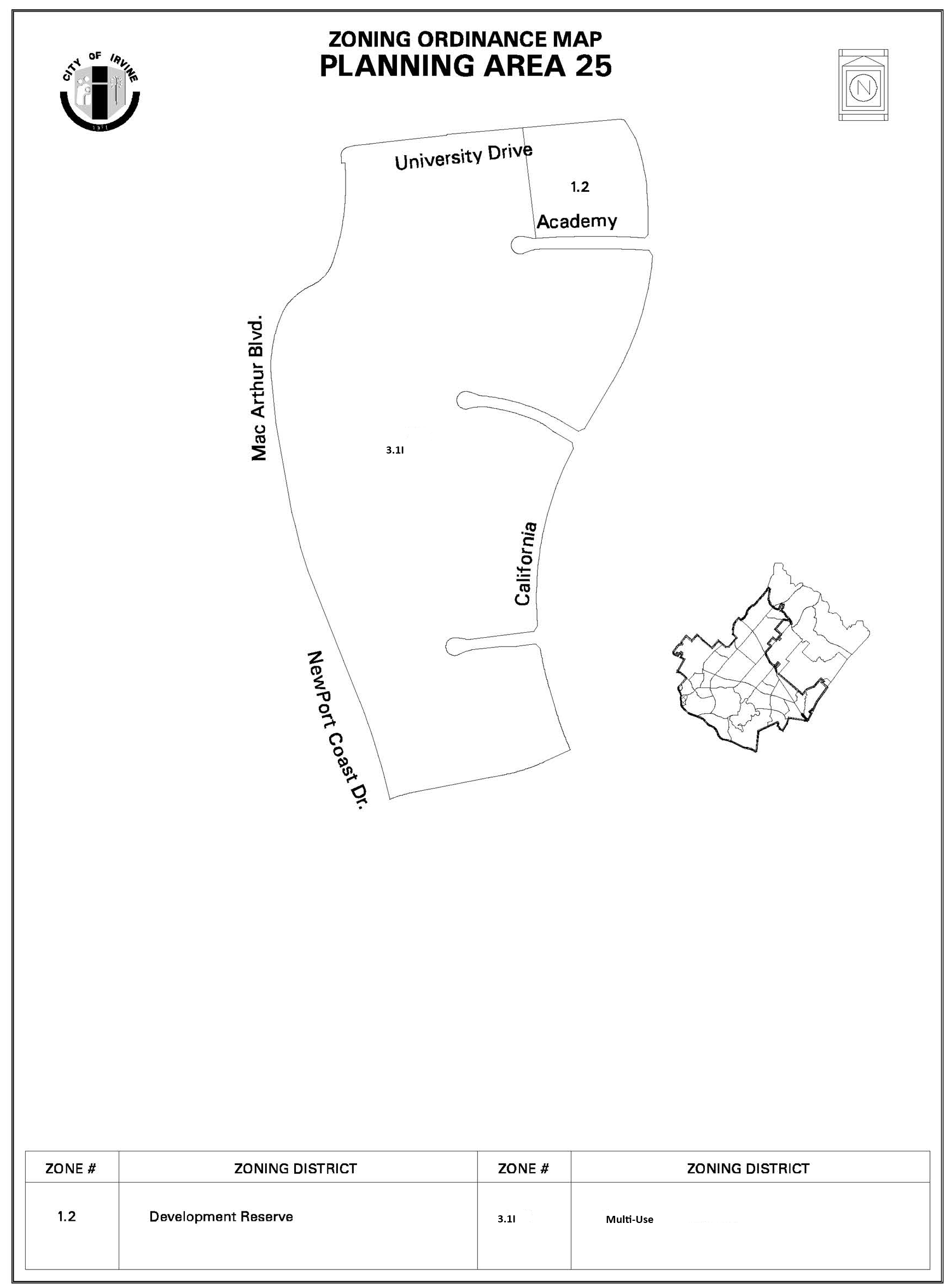
Sec. 9-27-1.- Land use zoning map.
(See Planning Area 27 map following Section 9-27-5.)
(Code 1976, § V.E-827.1; Ord. No. 92-3, 4-14-92; Ord. No. 95-4, 5-9-95; Ord. No. 95-22, § 3, 11-28-95; Ord. No. 02-03, § 5, 2-12-02)
Sec. 9-27-2. - Introduction.
Planning Area 27 is bounded by Bonita Canyon Drive to the north and west, the San Joaquin Hills Transportation Corridor to the south and west, and Bommer Canyon to the east.
(Code 1976, § V.E-827.2; Ord. No. 92-3, 4-14-92; Ord. No. 95-4, 5-9-95; Ord. No. 95-22, § 3, 11-28-95; Ord. No. 99-18, § 5, 9-14-99)
Sec. 9-27-3. - Statistical analysis.
1 Unallocated dwelling units represent those units remaining in a planning area that may be built anywhere in the same planning area. These units are within the maximum development intensity for the planning area; and, therefore, placement of unallocated dwelling units into any residential category within the planning area for purposes of development is determined to be consistent with the General Plan and Zoning Code with regard to intensity allocation only, provided that placement is otherwise consistent with site specific zoning regulations and that any potential environmental impacts are adequately addressed, including traffic impacts, pursuant to CEQA.
2 See Section 9-0-3.C, Building Intensity Standards.
*2.3F: Individual project densities may exceed 12.5 dus per acre provided that the density in all residentially developed areas in medium density zones (2.3 and 2.3F) does not exceed 12.5 dus per acre overall.
**Maximum dwelling units are subject to change in accordance with Chapter 8-22-1.
(Code 1976, § V.E-827.3; Ord. No. 92-3, 4-14-92; Ord. No. 95-4, 5-9-95; Ord. No. 95-22, § 3, 11-28-95; Ord. No. 99-18, § 5, 9-14-99; Ord. No. 02-03, § 5, 2-12-02; Ord. No. 12-09, § 3(Exh. A), 5-22-12)
Sec. 9-27-4. - Land use regulations.
See Section 3-3-1 (Land use matrix).
(Code 1976, § V.E-827.4; Ord. No. 92-3, 4-14-92; Ord. No. 95-4, 5-9-95; Ord. No. 95-22, § 3, 11-28-95)
Sec. 9-27-5. - Development standards.
See Chapter 3-37 (Development Standards).
(Code 1976, § V.E-827.5; Ord. No. 92-3, 4-14-92; Ord. No. 95-4, 5-9-95; Ord. No. 95-22, § 3, 11-28-95)
Sec. 9-27-7. - Special development requirements.
A.
Land use.
1.
Residential.
a.
Affordable housing.
(1)
Pursuant to Chapter 2-3 of the Zoning Code, the affordable housing goals of the Housing Element will be met through use of the menu option. These goals may be met at the discretion of the applicant through the extension of the term of affordability made possible through a refinancing of the Series 1983 A bonds. Prior to approval of the first residential builder subdivision map and/or conditional use permit, the applicant shall submit an affordable housing program for approval by the Director Of Community Development which specifies the allocation of units met by the refinancing program and/or other options available to the applicant.
b.
Boundary definitions.
(1)
The precise Preservation District boundary will be defined through the Master Plan process in accordance with Chapter 2-17 and Chapter 8-13 of the Irvine Zoning Code and/or the subdivision process per Division 5 of the Irvine Subdivision Ordinance.
c.
Master Plan application.
(1)
In accordance with Zoning Code Chapter 5-4, a Master Plan has been prepared for Planning Area 27 which demonstrates how the provisions of the General Plan and Hillside Overlay District will be implemented. The Master Plan includes all concept plan requirements in accordance with Chapter 2-8. Approved Master Plan documents, or modifications thereto pursuant to Chapter 2-19, shall be used as the standard of review for all subsequent applications submitted for Planning Area 27. A subsequent Master Plan application in accordance with Chapter 2-17 of the Irvine Zoning Code or its equivalent will be submitted for each development project to address the location of structures and parking.
d.
Intensity.
(1)
Individual project densities may exceed 12.5 dus per acre provided that the entire medium density zone in PA 27 does not exceed 12.5 dus per acre overall.
(2)
The maximum dwelling units in PA 27 may exceed 2,155 without a subsequent General Plan amendment or zone change in accordance with Chapter 8-22-1.
(3)
The maximum number of dwelling units in the area located adjacent to Bonita Canyon Drive and surrounded by Minor Preservation Area P-8 ("Crescent") shall not exceed 70.
(4)
The maximum number of dwelling units in the area located between the upper portion of "B" Street and Bonita Canyon Drive ("Lower Bowl") shall not exceed 300.
(5)
The maximum number of dwelling units located within the master gated community shall not exceed 600.
e.
Multifamily.
(1)
Apartment projects and single-family attached projects containing three or more stories shall be adjacent to the tollway and/or Newport Coast Drive in order to provide convenient access in close proximity to employment centers for apartment residents, to minimize the length of commuter trips on Irvine streets, and to maximize visibility for marketing.
(2)
For multifamily structures abutting Newport Coast Drive and/or the tollway, the following shall apply:
(a)
60 percent of the surface plane abutting Newport Coast Drive and/or the tollway cannot exceed two stories.
(b)
Rows of buildings will be broken with parking courts, landscaped areas.
(c)
Buildings will have varied orientations, setbacks, colors, facade details, and roof forms.
(d)
Landscaping shall include a dense mix of boxed and 15-gallon, tall vertical trees to provide immediate screening. Thinning may be required in the future as trees mature.
B.
Public facilities.
1.
Local parks.
a.
The community park dedication requirement for PA 27 and PA 26A will be satisfied by the dedication of park land and/or construction of park improvements in PA 27 consistent with the park and recreation element and Local Park Code. The location of the community park is symbolically shown on Exhibit A at the end of this chapter.
b.
The public neighborhood park program will provide both passive and active recreational opportunities. A portion of the neighborhood park dedication requirement will be satisfied through park credit received through the Purchase and Dedication Agreement entered into on December 4, 1981, for Bommer Canyon Community Park. The park dedication acreage and credit will be determined through the tentative tract map application process.
c.
A park plan for Planning Area 27 shall be submitted concurrently with the first tentative tract map for any residential portion of Planning Area 27. The exact number, precise location, configuration and size of local neighborhood parks and the distribution of public and private parks will be established at the time of approval of the first tentative tract map for residential portions of Planning Area 27 in accordance with the park and recreation element and Local Park Code.
d.
The location of the public neighborhood park is generally shown on Exhibit A at the end of this chapter. Private neighborhood parks will also be provided in the planning area in order to meet City requirements.
e.
In conjunction with the submittal of the first residential tentative tract map, the applicant shall submit a conceptual design plan for a vista point a minimum of one half acre in size, at either locations conceptually shown on the Planning Area 27 zoning map. The function of the vista point will be informal and passive, and will respect the surrounding terrain and open space conditions by leaving the landscaping in a natural state where possible. The applicant shall be required to provide, at a minimum, the following improvements for the vista point:
1.
Public, all weather, vehicular access road.
2.
Parking for between five—10 vehicles.
3.
Several accessible park benches with low profile shade elements.
The vista point will not receive park credit for land value. Items 1, 2, and 3 listed above shall not be eligible for park credit; however, park credit shall be granted for any additional improvements requested by the City and mutually agreed upon by the City and The Irvine Company.
f.
The park plan application for the private summit park, located adjacent to Minor Preservation Area P-8, shall be designed so that structures will be located behind land forms to screen the structures from Chaparral Park in Turtle Rock as viewed from the EIR viewpoint location at Chaparral Park RC-1. No sports lighting or court lighting shall be used. Other park lighting shall use full cut-off, non-glare fixtures.
C.
Circulation.
1.
Local streets. In keeping with the hillside grading ordinance and to maintain open space views, the design of the internal circulation system shall conform to the local residential street standards except for the following:
a.
The minimum centerline radius for the four-lane Street "A" will be 950 feet. Design speed for other elements for Street "A" will be 45 mph.
b.
The minimum centerline radius for the two-lane Street "B" will be 625 feet. Design speed for the other elements for Street "B" will be 35 mph.
c.
The minimum centerline radius for the two-lane internal residential streets will be 150 feet where it allows better conformance to the landforms. This exception will only be approved by the City Engineer on a case-by-case basis.
d.
In order to minimize grading, the City Engineer shall approve maximum continuous vertical grades of 10 percent for limited sections of Street "B" and two-lane internal residential streets. In addition, the City Engineer may approve, on a case-by-case basis, short sections of these streets at a maximum grade of 12 percent.
e.
A sidewalk may be located on only one side of portions of Street "B." However, termination of sidewalks shall occur at intersections where appropriate pedestrian crossings shall be provided.
f.
Sight distance at intersections shall be consistent with City, County of Orange, or CalTrans standards, as approved by the City Engineer for street centerline downhill grades greater than seven percent.
g.
On Street "A" and Street "B" where the centerline radius is less than 1,100 feet and is located at the top of a slope greater than three to one, a protective barrier shall be required.
h.
Superelevation shall be used wherever possible within road separation areas.
i.
As part of the tentative tract map process, the applicant shall propose traffic control measures, including, but not limited to, stop signs or traffic signalization, at the intersection of Street "B" and Bonita Canyon Drive, subject to the review and approval of the City.
j.
Access points along Street "B" should be designed with a goal to encourage a 50/50 split of the internal traffic utilizing the two entry gates within the master community.
2.
Arterial highways. The following arterials are located adjacent to or within Planning Area 27:
a.
Prior to, or concurrent with, the first map for Planning Area 27, Community Development staff shall prepare and submit a report to the City Council on the impact of the toll roads on open space acreage and appropriate compensation.
b.
Prior to the approval of the first tentative map for Planning Area 27, the applicant shall enter into a funding agreement with the City for the widening of Culver Drive between Campus and Bonita Canyon to four lanes with the goal of commencing construction of the project prior to the issuance of the first building permit. The agreement will identify means of financing, sources and uses of funds, project phasing and a schedule of improvements. Achievement of the goal is dependent upon the City's timely acquisition of any required right-of-way, completion of any environmental documentation needed for the project, and any other agency approval necessary for the project.
3.
Transit. Transit service in Planning Area 27 will be provided by the Orange County Transportation Authority (OCTA). Future transit service in the area is anticipated to be provided along Bonita Canyon Drive with connections to Culver Drive, San Miguel Drive and MacArthur Boulevard.
Transit service is not anticipated to be provided within the interior roadways of the planning area. OCTA will reevaluate its service routes at the time of the first tract map.
4.
Trails.
a.
A combined bicycle trail/sidewalk will be located in the village edge on the south side of Bonita Canyon Drive from Culver Drive to the Bommer Canyon Preservation Area. The trail facility will be constructed by the project developer and owned and maintained by the City of Irvine.
b.
All trails in the Bommer Canyon Preservation Area will be designed, constructed, owned and maintained by the City of Irvine.
c.
Class II (on-street) bicycle trails will be located on public streets in accordance with City plans and guidelines.
d.
Private trails may be located in areas owned and maintained by homeowners associations.
e.
In conjunction with the submittal of the first residential tentative tract map, the applicant shall submit a master trails plan which designates public and private trails, access points, vista points, and includes an analysis of a pedestrian trail linking the Crescent area with the terminus of the public street, between Tarbut V'Torah School and Park. A plan providing disabled vehicular access within the gated community, for public viewing purposes, shall also be submitted in conjunction with the master trails plan. Trail and entry locations are conceptual as shown on the District L Stewardship Plan. Final locations and connections will be addressed in the master trails plan.
5.
Pedestrian links. Pedestrian sidewalks will be located on public streets in accordance with City plans and guidelines. Pedestrian sidewalks accessible to the public will be located along at least one side of Street "B." At the map level, sidewalks over eight percent grade shall be evaluated by the Director of Public Works to determine if a lower grade is feasible.
D.
Infrastructure.
1.
Drainage.
a.
Interceptor ditches shall be established only where necessary above cut/fill slopes and the intercepted water conveyed to a stable channel or natural drainageway with adequate capacity.
b.
Road designs shall be such that water on roadways is prevented from flowing off the roadway in an uncontrolled fashion.
c.
Natural drainageways shall be riprapped, or otherwise stabilized below drainage and culvert discharge points for a distance sufficient to minimize channel erosion.
d.
Runoff from areas of concentrated impervious cover (e.g., roofs, driveways, roads) shall be conveyed to a natural drainageway or drainage structure with sufficient capacity to accept the discharge without undue erosion. The effects of new drainage patterns on existing systems shall be accounted for in the design of the project drainage plan.
e.
Sediment catchment basins and other erosion/siltation control devices shall be constructed and maintained in accordance with an overall erosion control plan approved by the City.
f.
The overall drainage system shall be completed and made operational at the earliest practical time during construction.
g.
Manmade concrete drainage facilities and concrete buttresses that would detract from the natural appearance of the north facing slope of Minor Preservation Area P-8 shall not be utilized. Erosion control facilities used on the slope shall be limited to collection basins at the toe of the slope not visible to Turtle Rock or the limited use of rock as a rip-rap material that may be necessary in surface fissures. If the City requires other drainage or erosion control structures, the applicant shall treat the structure in such a manner, or covered by earth to maintain the appearance of the natural landform.
2.
Phasing. The phasing of infrastructure with development will be determined by the environmental review process and service providers for each specific requirement prior to construction approvals.
E.
Neighborhood design.
1.
Village theme/architecture. Architectural designs shall contain detail, articulated on all sides of structures visible from streets, paseos, and other public areas. Particular attention shall be given to windows, balconies, doors, and any special design elements. Human scale and privacy, play of light using shade and shadows to provide relief, and variations in roof lines shall be encouraged. The articulation and interplay of the building massing will be utilized to create variety and diversity.
To achieve the intended architectural theme, the following elements should be used by the developer. Variations of these elements may also be used which achieve the intended expression.
a.
Colors: Exterior architectural surfaces will be composed of earthtones and colors found in the natural landscape, including colors ranging from warm reds and browns, tans, medium and light ochre.
b.
Overall form: Simple composition of volume and massing. Some symmetry at front facades or around entries used to create balance in the overall form. Entry view corridors terminating at blank walls and/or blank building elevations shall be discouraged.
c.
Roof form: Varied roof massing with a strong cornice line. Clay, concrete tile, and slate are used predominantly with consistent earthtone colors. Specific roof colors will include variety and diversity, but fit into an overall harmonious color range. Articulation of roof overhangs, windows, building facades and balconies will be utilized to create shadow pattern and variety.
d.
Details: Simple cornices, moldings, projections and recesses, and integral-colored accent materials such as ceramic tile and brick. Also, garden walls (stone or painted stucco) and picket gates.
e.
Site design: Terraces, plazas, arcades, colonnades, and pergolas used to define pedestrian areas. Clustering of units around open spaces and separation of public and private areas. Landscaping and building integration, for example, use of planters, vines on garden walls, hedges and treillage.
f.
Entries: Identity markers such as pilasters will be located at the intersections of Street "B"/Newport Coast Road, Street "B"/Bonita Canyon Drive, Street "A"/Street "B" and Street "A"/Bonita Canyon Drive. These will identify the entrance into the community of PA 27 and will include an identity sign as part of the monument. Specific materials and design will be submitted as part of the first residential subdivision map.
g.
Gates: In addition to the above entries, entry gate features are to be at both ends of the Street B, approximately 1,000 feet in from the intersection of Bonita Canyon Drive and Street A. The gate features are intended to function as an arrival portal and gate facility. The features will include a landscaped area with tree groves, terraced walls, a gate house and gated fence structure. Specific design for these entries will be submitted as part of the first residential subdivision map.
2.
Natural features.
a.
Visually significant rock outcroppings, drainage courses, and slopes will be preserved in open space depicted on Exhibit A at the end of this chapter.
b.
Fuel modification zones shall function as transition zones as defined by the City of Irvine General Plan. These fuel modification zones will be owned and maintained by a homeowners' association, maintenance district or other entity approved by the City. Fuel modification zones are a permitted use in preservation zones in accordance with Section 8-7-1.
3.
Grading.
a.
In accordance with Zoning Code Chapter 5-4, Hillside Overlay District, all of Planning Area 27 has been determined to be in Slope Zone 2. Mass grading will occur, landforms will be modified, and level building sites and retaining walls will be permitted in graded development areas as generally shown on Exhibit B at the end of this chapter.
b.
Grading for infrastructure, drainage, remediation, flood control, slope stabilization, parks, trails, bridges and habitat enhancements may occur within open space and preservation areas provided:
(1)
Landforms are restored to the extent feasible.
(2)
Vegetation is restored or habitat is enhanced.
c.
Manufactured slopes shall be contour graded or screened by landscaping using one or more of the following techniques:
(1)
The angle of graded slopes which are visible shall be gradually adjusted to the angle of adjoining natural terrain.
(2)
Graded slopes shall be vegetated and shall reflect the form of existing contours.
(3)
The toes and tops of visible graded slopes in excess of 10 feet in vertical height shall be screened by landscaping and rounded in proportion to the height of the slope where drainage and geotechnical stability permit such rounding.
(4)
The horizontal contours of graded slopes shall be screened by landscaping or curved in a continuous, undulating fashion.
d.
The fuel modification zones will be determined by the Orange County Fire Authority through the tentative map application process. Some grading for fire access roads or remedial grading may occur in these zones. For fuel modification zones, the following guidelines shall apply:
(1)
The overall slope, height and grade of any cut and fill slope shall be in character and scale with the natural terrain.
(2)
Where feasible, the toes and tops of all slopes in excess of 10 feet in vertical height and visible from public areas shall be rounded with curves to the total height of the slope.
e.
Concurrent with the first tentative tract map for Planning Area 27, the applicant shall provide an informational presentation on the proposed grading plan to the Planning Commission.
f.
The applicant shall screen views of 100 percent of structures on residential lots abutting the Bommer Canyon Road Entry and within a 300-foot radius of the Bommer Canyon Picnic Grove as defined in Zone "A" of Exhibit C at the end of this chapter.
g.
Manufactured slopes higher than 40 feet in all zones that are designated "D" on Exhibit C shall vary among gradients between 2:1 and 3:1 in a manner that has the appearance of a natural swale or valley or a natural transition from manufactured to existing natural slope. The gradient shall be measured along a straight line from top of slope to toe of slope.
h.
Manufactured slopes higher than 40 feet designated in Zone "F" on Exhibit C will generally be the same gradient as the transition back to natural grades of abutting preservation areas.
i.
Manufactured slopes designated "C" on Exhibit C shall not exceed 55 feet in height. For those portions of slope in Zone "C" over 40 feet in height, the gradient shall be 3:1 or greater.
4.
Landscape.
a.
Within fuel modification zones, existing native vegetation will be removed, thinned or replaced in accordance with Orange County Fire Authority requirements.
b.
Existing native vegetation will be preserved in open space areas except for fuel modification zones, utility easements, trails, recreation areas and other allowable uses. Habitat enhancement and restoration, including any necessary grading, may be accomplished at the discretion of the landowner.
c.
Streets "A" and "B" will be landscaped to blend with both development and open space edges along their routes.
d.
Additional landscaping and screening shall be encouraged to provide visual relief in the bowl area and along the "saddle" ridge to provide a connection between Preservation Area P-8 and the open space edge along Bommer Canyon.
A vertical landscape silhouette shall be located on both sides of Street "B" which extends from Minor Preservation Area P-8 into the development area of the "Upper Bowl" as defined in Zone "H" of Exhibit C. The most westerly development area located closest to "B" Street, depicted as zone "H1" of Exhibit C, shall be single loaded and oriented toward the corridor portion of the planning area and situated in a manner so that the structures will be screened by the vertical landscaping as seen from Chaparral Park in Turtle Rock (EIR viewpoint location RC-1).
e.
The applicant shall screen views of structures on residential lots abutting Bommer Canyon Edges as defined in Zone "B" of Exhibit C. Screening will be achieved by berming or landscaping.
f.
In conjunction with subdivision maps creating residential lots, it shall be demonstrated that trees will be distributed on slopes, common areas and/or lots so as to interrupt and soften the silhouette of structures visible from outside Planning Area 27.
g.
Maintain as common area, an open space corridor as defined by Zone "E" on Exhibit C inclusive of graded slope banks, landscape and tree planting, recreation amenities, road, and road right-of-way. The open space corridor will not include residential structures. Precise location of the corridor will vary from Exhibit C, but the width of the corridor will average 100 feet in width and vary between a 50-foot minimum to a 200-foot maximum as measured between residential lot property lines.
h.
The applicant shall plant additional trees on the north side of Bonita Canyon Drive (Turtle Rock Edge) across from the Crescent area, subject to the agreement of adjacent property owners and the approval of the City.
5.
Planning area edges.
a.
Bonita Canyon Edge (Culver Drive to Bommer Canyon): Informal tree and shrub planting to act as gradual transition to the existing natural frontal slope landscape. Tree densities will vary according to specific conditions. Where residential development occurs, landscaping will become more dense. Where open space abuts the village edge, landscaping will provide a transition to natural vegetation, or habitat enhancement will be used in lieu of landscaping.
b.
Bonita Canyon Edge (Crescent area): Buildings adjacent to the village edge along Bonita Canyon Drive surrounded by the Minor Preservation Area P-8 (Crescent) shall be setback a minimum of 20 feet from the right-of-way. Canopy type landscaping shall be planted within the village edge and within the property to screen the views of structures located in the Crescent area.
c.
Bonita Canyon Edge (Tollway to Culver Drive): The landscape character along this section will respond to the existing institutional development as well as to future expansion of Bonita Canyon Drive. Tree spacing will be more formal and will provide buffering and interface with storm drainage easements and existing parking lots.
d.
Toll Road Edge: The edge is envisioned as a densely planted tree groves for the full length of the toll road that it is adjacent to residential or institutional development. Where adjacent to open space native vegetation will be used.
e.
Bommer Canyon Edge: The fuel modification zone along the Bommer Canyon Edge will accomplish a transition from residential development to the natural vegetation of the canyon.
6.
Crescent area (located between Minor Preservation Area P-8 and Bonita Canyon Drive).
a.
Pad elevation of lots adjacent to Bonita Canyon Drive as defined in Zone "G" of Exhibit C (Exhibit 4-66 of the PA 27 EIR document) shall vary between five feet and 10 feet above the centerline of Bonita Canyon Drive, but in no case shall the pad elevation exceed 10 feet above the elevation of the ultimate centerline of Bonita Canyon Drive. Village edge landscaping in this zone shall be designed to screen one- and two-story structural elements.
b.
A minimum of 50 percent of the house elevations adjacent to Bonita Canyon Drive as defined in zone "G" of Exhibit C shall be single-story.
c.
The Crescent area shall maintain a slope of approximately two percent measured from the property line behind the village edge along Bonita Canyon Drive to the toe of the ridge slope with the rear pad elevation not exceeding 15 feet above the centerline along Bonita Canyon Drive.
d.
Any application that includes the addition of privacy gates for the Crescent area community shall require the review and approval of the City Council.
(Code 1976, § V.E-827.6; Ord. No. 92-3, 4-14-92; Ord. No. 95-4, 5-9-95; Ord. No. 95-22, § 3, 11-28-95; Ord. No. 99-18, § 5, 9-14-99; Ord. No. 04-03, § 3, 2-24-04)
Sec. 9-28-1.- Land use zoning map.
(See Planning Area 28 map following Section 9-28-5.)
(Code 1976, § V.E-828.1; Ord. No. 92-3, 4-14-92; Ord. No. 95-4, 5-9-95; Ord. No. 95-22, § 3, 11-28-95; Ord. No. 96-10, § 4, 6-11-96; Ord. No. 00-11, § 3.H, 10-10-00; Ord. No. 01-13, § 4, 7-24-01; Ord. No. 05-16, § 2, 7-12-05)
Sec. 9-28-2. - Introduction.
Planning Area 28 is an all-open space area on the southeast edge of the City, comprising Implementation District "L," Implementation District "M," Implementation District "K" (part) and Implementation District "I" (part).
(Code 1976, § V.E-828.2; Ord. No. 92-3, 4-14-92; Ord. No. 95-4, 5-9-95; Ord. No. 95-22, § 3, 11-28-95; Ord. No. 96-10, § 4, 6-11-96; Ord. No. 99-18, § 5, 9-14-99)
Sec. 9-28-3. - Statistical analysis.
1 Unallocated dwelling units represent those units remaining in a planning area that may be built anywhere in the same planning area. These units are within the maximum development intensity for the planning area; and, therefore, placement of unallocated dwelling units into any residential category within the planning area for purposes of development is determined to be consistent with the General Plan and Zoning Code with regard to intensity allocation only, provided that placement is otherwise consistent with site specific zoning regulations and that any potential environmental impacts are adequately addressed, including traffic impacts, pursuant to CEQA.
2 See Section 9-0-3.C, Building Intensity Standards.
(Code 1976, § V.E-828.3; Ord. No. 92-3, 4-14-92; Ord. No. 95-4, 5-9-95; Ord. No. 95-22, § 3, 11-28-95; Ord. No. 96-10, § 4, 6-11-96; Ord. No. 99-18, § 5, 9-14-99; Ord. No. 00-11, § 3.I, 10-10-00; Ord. No. 05-16, § 2, 7-12-05; Ord. No. 12-09, § 3(Exh. A), 5-22-12)
Sec. 9-28-4. - Land use regulations.
See Section 3-3-1 (Land use matrix).
(Code 1976, § V.E-828.4; Ord. No. 92-3, 4-14-92; Ord. No. 95-4, 5-9-95; Ord. No. 95-22, § 3, 11-28-95; Ord. No. 96-10, § 4, 6-11-96)
Sec. 9-28-5. - Development standards.
See Chapter 3-37 (Development Standards).
(Code 1976, § V.E-828.5; Ord. No. 92-3, 4-14-92; Ord. No. 95-4, 5-9-95; Ord. No. 95-22, § 3, 11-28-95; Ord. No. 96-10, § 4, 6-11-96)
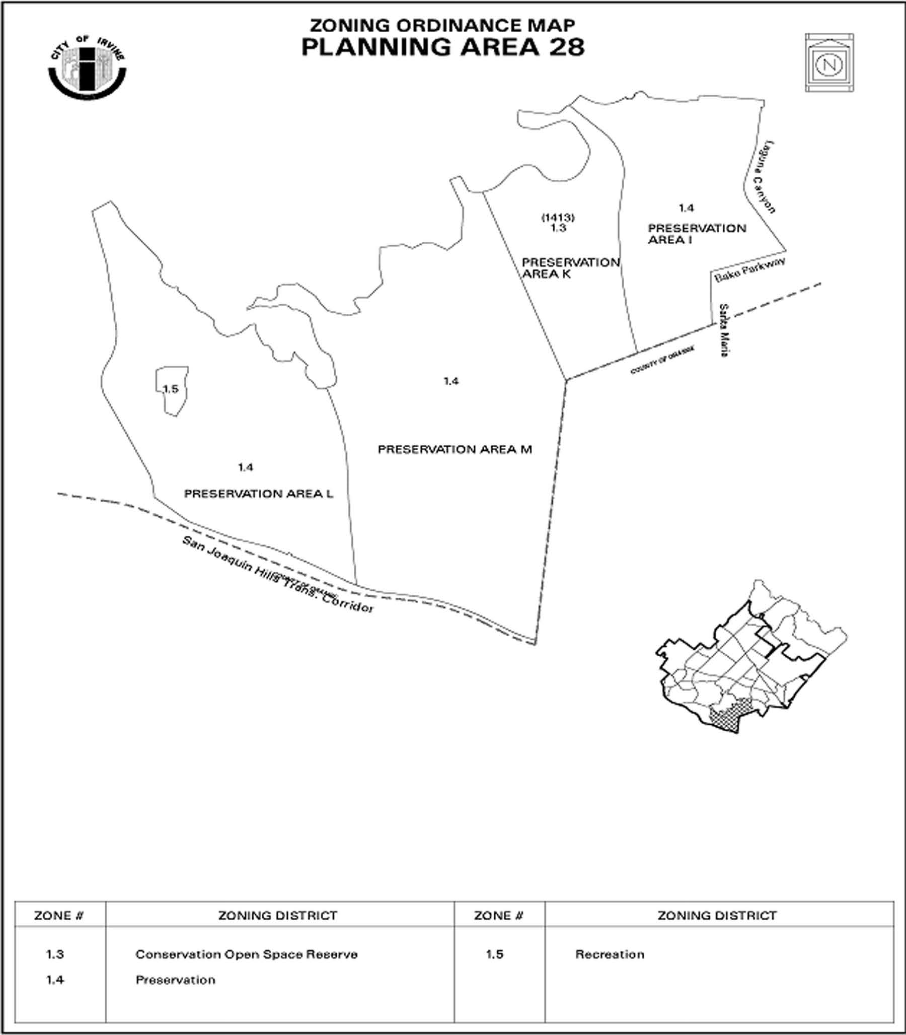
Sec. 9-29-1.- Land use zoning map.
(See Planning Area 29 map following Section 9-29-5.)
(Code 1976, § V.E-829.1; Ord. No. 92-3, 4-14-92; Ord. No. 95-4, 5-9-95; Ord. No. 95-22, § 3, 11-28-95)
Sec. 9-29-2. - Introduction.
Planning Area 29 is located along the southeastern edge of the City. Boundaries include MacArthur Boulevard and Fairchild to the west, Campus Drive to the north, and University Drive to the south.
(Code 1976, § V.E-829.2; Ord. No. 92-3, 4-14-92; Ord. No. 95-4, 5-9-95; Ord. No. 95-22, § 3, 11-28-95)
Sec. 9-29-3. - Statistical analysis.
1 Unallocated dwelling units represent those units remaining in a planning area that may be built anywhere in the same planning area. These units are within the maximum development intensity for the planning area; and, therefore, placement of unallocated dwelling units into any residential category within the planning area for purposes of development is determined to be consistent with the General Plan and Zoning Code with regard to intensity allocation only, provided that placement is otherwise consistent with site specific zoning regulations and that any potential environmental impacts are adequately addressed, including traffic impacts, pursuant to CEQA.
2 See Section 9-0-3.C, Building Intensity Standards.
(Code 1976, § V.E-829.3; Ord. No. 92-3, 4-14-92; Ord. No. 95-4, 5-9-95; Ord. No. 95-22, § 3, 11-28-95; Ord. No. 10-04, § 3, 4-13-10; Ord. No. 12-09, § 3(Exh. A), 5-22-12)
Sec. 9-29-4. - Land use regulations.
See Section 3-3-1 (Land use matrix).
(Code 1976, § V.E-829.4; Ord. No. 92-3, 4-14-92; Ord. No. 95-4, 5-9-95; Ord. No. 95-22, § 3, 11-28-95)
Sec. 9-29-5. - Development standards.
See Chapter 3-37 (Development Standards).
(Code 1976, § V.E-829.5; Ord. No. 92-3, 4-14-92; Ord. No. 95-4, 5-9-95; Ord. No. 95-22, § 3, 11-28-95)
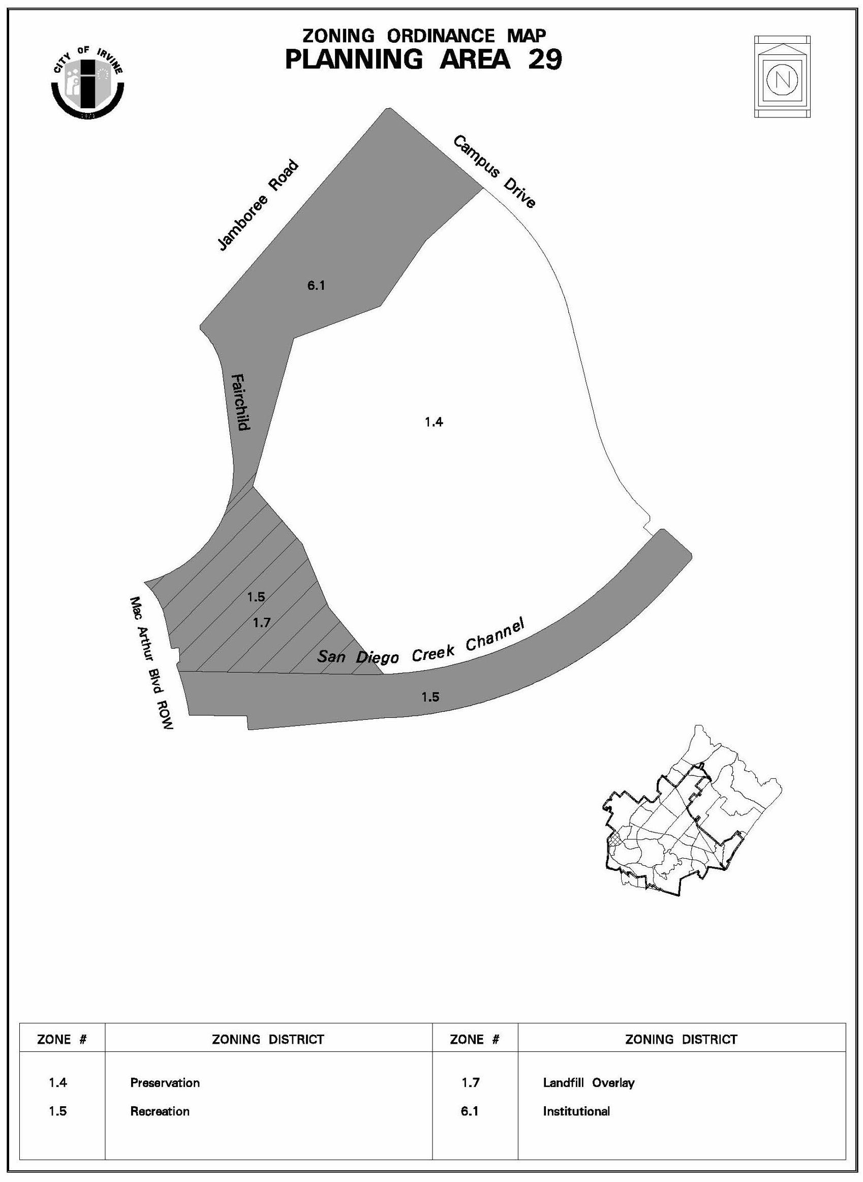
Sec. 9-31-1.- Land use zoning map.
(See Planning Area 31 map following Section 9-31-5.)
(Code 1976, § V.E-831.1; Ord. No. 95-16, § 2, 10-10-95; Ord. No. 95-22, § 3, 11-28-95; Ord. No. 00-14, § 4.D, 11-14-00; Ord. No. 05-19, § 4, 9-27-05; Ord. No. 09-02, § 3, 3-24-09)
Sec. 9-31-2. - Introduction.
Planning Area 31 is located in the northeastern area of the City. Boundaries include Sand Canyon Avenue to the west, Interstate 5 (Santa Ana Freeway) to the north, State Route 133 (Laguna Freeway) to the east and Barranca Parkway to the south.
(Code 1976, § V.E-831.2; Ord. No. 95-16, § 2, 10-10-95; Ord. No. 95-22, § 3, 11-28-95; Ord. No. 97-11, § 3, 6-10-97)
Sec. 9-31-3. - Statistical analysis.
1 Unallocated dwelling units represent those units remaining in a planning area that may be built anywhere in the same planning area. These units are within the maximum development intensity for the planning area; and, therefore, placement of unallocated dwelling units into any residential category within the planning area for purposes of development is determined to be consistent with the General Plan and Zoning Code with regard to intensity allocation only, provided that placement is otherwise consistent with site specific zoning regulations and that any potential environmental impacts are adequately addressed, including traffic impacts, pursuant to CEQA.
2 See Section 9-0-3.C, Building Intensity Standards.
3 Square footage intensity and associated vehicle trips are not a part of the Irvine Spectrum 6 Parcel Monitoring Report.
(Code 1976, § V.E-831.3; Ord. No. 95-16, § 2, 10-10-95; Ord. No. 95-22, § 3, 11-28-95; Ord. No. 00-14, § 4.D, 11-14-00; Ord. No. 01-12, § 4, 6-26-01; Ord. No. 03-02, § 4, 1-14-03; Ord. No. 05-19, § 4, 9-27-05; Ord. No. 06-04, § 3, 3-14-06; Ord. No. 12-09, § 3(Exh. A), 5-22-12; Amd. 1-2017, 6-19-17)
Sec. 9-31-4. - Land use regulations.
See Section 3-3-1 (Land use matrix).
(Code 1976, § V.E-831.4; Ord. No. 95-16, § 2, 10-10-95; Ord. No. 95-22, § 3, 11-28-95)
Sec. 9-31-5. - Development standards.
See Chapter 3-37 (Development Standards).
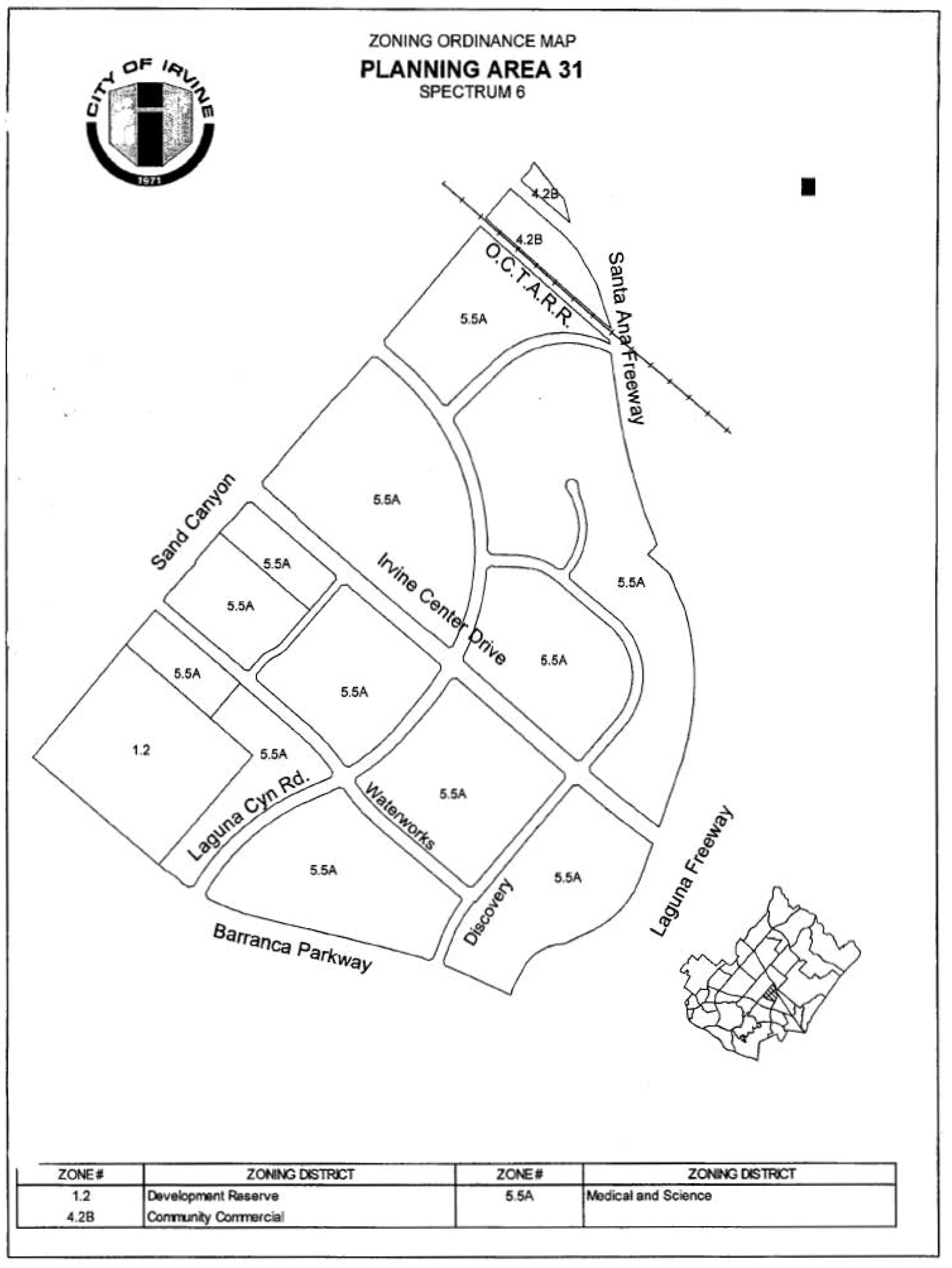
(Code 1976, § V.E-831.5; Ord. No. 95-16, § 2, 10-10-95; Ord. No. 95-22, § 3, 11-28-95)
Sec. 9-31-7. - Special development requirements.
A.
See Division 3 for applicable general development requirements.
B.
The following requirements apply to Irvine Spectrum 6 (Area 5.5A) only.
1.
Special condition. The following shall be placed as a condition on every Master Plan and conditional use permit within Irvine Spectrum 6: "Prior to the issuance of any building permits, the Director of Community Development in consultation with the Director of Public Works will determine if the proposed project is consistent with the Irvine Spectrum 6 phasing plan. The square foot size of each structure approved by this permit will be cumulatively accounted for and evaluated against project thresholds specified in the project phasing plan."
2.
Special finding. The following special finding shall be made prior to the approval of any Master Plan or conditional use permit: "The permit application is in compliance with the Irvine Spectrum 6 project phasing plan in that it will not exceed identified thresholds without providing the required roadway improvements to the satisfaction of the Director of Public Works."
3.
Project phasing plan.
a.
Prior to issuance of any building permits for development exceeding a cumulative total of 1,000,000 square feet, the landowner shall design, fund and commence construction of the following improvement, in a manner meeting the approval of the Director of Public Works:
(1)
Widening of Irvine Center Drive to six lanes between the Laguna Freeway and Sand Canyon Avenue (completed March 1999).
b.
Prior to issuance of any building permits for development exceeding a cumulative total of 1,500,000 square feet, the landowner shall design, fund and commence construction of the following improvements in a manner meeting the approval of the Director of Public Works:
(1)
Barranca Parkway (four lanes between Jeffrey Road and Sand Canyon Avenue) (completed January 2000); and
(2)
Widening of Sand Canyon Avenue from four lanes to five lanes along the Irvine Spectrum 6 boundary (three lanes northbound and two southbound), and to six lanes at its intersections with Irvine Center Drive and Laguna Canyon Road (completed June 1999).
c.
Prior to issuance of any building permits for development exceeding a cumulative total of 2,500,000 square feet:
(1)
The landowner shall design, fund and commence construction of the following improvement, in a manner meeting the approval of the Director of Public Works:
(a)
Laguna Canyon Road (four lanes between Barranca Parkway and Sand Canyon Avenue, (completed June 2000).
d.
Prior to issuance of any building permits for development exceeding a cumulative total of 3,563,000 square feet:
(1)
The landowner shall design, fund and commence construction of the following improvement, in a manner meeting the approval of the Director of Public Works:
(a)
Technology Drive (two lanes from its existing terminus to Laguna Canyon Road).
4.
Subdivision maps. The following note shall be placed on all tentative maps: "This map is located within Irvine Spectrum 6, which limits development in Spectrum 6 to a specific (1) maximum square footage, (2) maximum daily vehicle trips, and (3) maximum p.m. peak hour vehicle trips. Building permits which would cause one or more of these maximums to be exceeded shall not be issued."
5.
Building permits. Prior to the issuance of each building permit for new development, the applicant shall submit to the Community Development Department a table documenting the cumulative total of approved development within Irvine Spectrum 6, in a manner meeting the approval of the Director of Community Development.
6.
Irvine Spectrum 6 Parcel Development Monitoring Report within the 5.5A Medical and Science Zoning District. A project traffic study (Austin-Foust Associates dated August 2005) was prepared for development of the 225 acres zoned Medical and Science within Irvine Spectrum 6 (Exhibit A). Based upon this study, a post-2025 vehicle trip limit has been established for the 5.5A Zoning District within Spectrum 6 of 8,707 a.m. peak hour, 7,875 p.m. peak hour, and 63,424 average daily trips.
Masimo Corporation Zone Change 00612698-PZC added 169 a.m. peak hour, 131 p.m. peak hour, and 675 average daily trips to 52 Discovery. Zone Change 00927538-PZC adds 4 a.m. peak hour, 9 p.m. peak hour, and 101 average daily trips for 78 Discovery, thereby increasing the build-out vehicle trip limit for the 5.5A Zoning District within Irvine Spectrum 6 to 8,880 a.m. peak hour, 8,015 p.m. peak hour, and 64,200 average daily trips.
For the purpose of this section, "applicant" shall mean that applicant for development case 00350805-PGA and 00350802-PZC, and Irvine Spectrum 6 shall mean the area shown on Exhibit A. In conjunction with issuance of any building permit, the applicant shall submit a Parcel Development Monitoring Report for review and approval of the Director of Community Development. The Parcel Development Monitoring Report shall include an allocation and accounting of trips to ensure that the aggregate traffic projected does not exceed the vehicle trip limits. The Parcel Development Monitoring Report shall include, but not limited to, the allocation of trips (average daily, a.m. peak hour and p.m. peak hour) to each parcel. Approval by the Director of Community Development shall be based upon the determination that the allocations shown do not exceed the maximum established for the zoning district; that all parcels have a trip allocation; and that the allocation is generally consistent with the General Plan, zoning and other applicable regulatory documents. The Parcel Development Monitoring Report may be updated by the applicant and is subject to review and approval by the Director of Community Development. The purpose of the Irvine Spectrum 6 Parcel Monitoring Report is to monitor the growth and update the project's components.
7.
Major thoroughfare and bridge fee program. Prior to the issuance of any building permit, the applicant shall pay fees as prescribed in the major thoroughfare and bridge fee program for the foothill/eastern corridor consistent with the provisions of the said fee program.
8.
Public services and facilities. Building permit issuance shall be phased in accordance with the approved growth management phasing program pertaining to the timely provision of public services and facilities. This condition shall be noted on any final subdivision map for development proposals within the project area.
9.
Flood control.
a.
Regional flood control facilities in Irvine Spectrum 6 include improvements to Marshburn Channel. Improvements to Marshburn Channel are anticipated to occur in two phases: interim and ultimate.
b.
The interim improvements will not remove the entire site from the 100-year floodplain. It will result in a reduction of the area subject to inundation and will remove most of the site, westerly of the channel, from the 100-year floodplain.
c.
The ultimate improvements to Marshburn Channel will need to be completed by The Irvine Company prior to issuance of any building permits for building within the remaining 100-year flood zone. The proposed ultimate improvements to Marshburn Channel remove all building sites from the 100-year floodplain. Channel improvements will run from the northern boundary, at the Santa Ana Freeway, to the southerly edge of the project at Barranca Parkway.
10.
Water conservation. Landscaping for common areas of all projects involving landscaping/irrigation shall be subject to the sustainability in landscaping ordinance (Title 5, Division 7 of the Irvine Municipal Code).
11.
Public utilities. Public utility buildings, structures and facilities, including, but not limited to, electrical, water, sewage, telephone and television, and their storage, distribution, treatment and/or production required to carry out development, are permitted within the Irvine Spectrum 6 planning area subject to a conditional use permit.
12.
Open space dedication areas.
a.
Pursuant to the memorandum of understanding implementing initiative resolution 88-1 between the City of Irvine and The Irvine Company, 1,266 acres of open space will be conveyed, and may be accepted by a public agency acceptable to the City of Irvine and consistent with Division 8 (Conservation and Open Space Phased Dedication Districts) of the City of Irvine zoning ordinance.
b.
The 1,266 acres of open space designated for conveyance is located within the Limestone Canyon Area, north of the Irvine Spectrum 6 planning area. The memorandum of understanding designates the Irvine Spectrum 6 project area within Development District F, which also includes the adjacent Irvine Ranch Water District site and United States post office site. District F has a maximum allotment of 4,700,000 square feet of development. The 1,266-acre preservation area associated with Development District F will be conveyed no sooner than 90 days following issuance of building permits for 75 percent of the 4,700,000 square feet of development (3,525,000), or upon completion of total development in the district, if less than 75 percent, whichever occurs first.
c.
The cumulative square footage of building permits within Development District F (which includes Irvine Spectrum 6, the Irvine Ranch Water District site and the United States post office site) will be described within each development monitoring report, which will serve as the tracking mechanism to determine when the conveyance occurs.
13.
Noise. All nonresidential structures shall be sound-attenuated against the combined impact of all present and projected noise from exterior noise sources to meet the interior noise criteria as specified in the General Plan noise element and Municipal Code Title 6, Division 8, Chapter 2 (Noise).
14.
Reserved.
15.
Fire protection and safety. Prior to the issuance of any building permits in Irvine Spectrum 6, the project proponent shall enter into a fire protection agreement with the County of Orange Fire Department. This agreement shall apply to Irvine Spectrum 6 and Planning Area 34 and shall contain:
a.
Provisions for dedication of land to the County of Orange for a permanent fire protection facility;
b.
Provisions for the purchase of all furnishings and fire equipment;
c.
Provision for construction of the facility;
d.
Provisions for the facility to be operational and accepted by the appropriate fire department prior to the issuance of building permits for combined development in Irvine Spectrum 6 and Planning Area 34 totaling 1,000,000 square feet;
e.
Provisions for necessary enforcement controls, such as the requirement for a temporary fire station, phased according to the issuance of building permits, if the permanent station is not operational by the specified threshold noted in Subsection 15.d above, to ensure adequate protection of the development in Irvine Spectrum 6;
f.
Provisions for an adequate site and sufficient funding of capital, operations and maintenance costs associated with the temporary station should the County of Orange Director of Fire Services determine that the temporary station is necessary; and
g.
Provisions, such as a mitigation program, to eliminate or minimize any negative fiscal impact the project may have on the fire fund if a project-induced fire fund shortfall is projected to exist at the time the permanent fire station is to be operational.
16.
Pedestrian access plan. Prior to the approval of each Master Plan or conditional use permit, a pedestrian access plan shall be reviewed and approved by the Director of Community Development.
17.
Road fund. Prior to any final map recordation (except for financing purposes), the project proponent shall submit a landscape/irrigation concept plan to minimize the maintenance costs of public roads within the project area, in a manner meeting the approval of the Director of Public Works.
18.
Provision of extended services by property owners' association or others. Prior to any final map recordation (except for financing purposes), CC&Rs or another method or procedure, including the establishment of a property owners' association or other entity, which will guarantee the provision at no cost to the City or County of any extended services and any other private services, shall be submitted and approved by the Director of Community Development and shall then be recorded prior to the issuance of any certificates of use and occupancy.
C.
The following requirements apply to East Irvine (Area 4.2B) only:
1.
A comprehensive documentation of the area, as it currently exists, shall be performed prior to the issuance of any building, grading and/or demolition permits. The documentation shall be compatible with Historical American Building Survey/Historical American Engineering Record (HABS/HAER) standards and involve consultation with the State Historic Preservation Office. Bungalows within the project not used for the project shall be relocated to a compatible location or shall be documented to the satisfaction of the Department of Community Development prior to the issuance of any demolition permits.
2.
The applicant shall provide for an interpretive center as a part of the project's implementation. This could take place as a part of one of the proposed buildings or a separate structure. The center shall address the site and the Irvine Ranch as a whole.
3.
At the time of Master Plan review, plans for the site shall integrate features such as the following:
a.
The use of the associated buildings and garages.
b.
The use of historically correct planning verified by the project landscape architect.
c.
The rescue of historic signs.
d.
The incorporation of the machinery within the granary and warehouse into final project design.
e.
The use of the tanks and water pumps as important features in the overall landscape design.
f.
The retention and use of tools found in the blacksmith shop in either the motor inn, retail uses, or interpretive center.
g.
The use of grasscrete or turfblock in lieu of asphalt, and use of wooden bollards and period (gas) lights.
h.
The interior walls of the blacksmith's shop shall be retained in a manner so as to preserve the existing features (brands) on the walls.
4.
The new hotel addition and other future additions to the site shall be consistent with the existing architectural styles of East Irvine, including one of the following styles: Craftsman, Pioneer and Building/Contractor. All future additions shall be reviewed and approved by the City of Irvine HAP Committee and Planning Commission.
5.
Prior to the issuance of building permits, the applicant shall submit a sign program for review and approval by the Planning Commission. The sign program shall integrate the reuse of historic signs.
6.
Prior to the issuance of building permits, the final relocation of all buildings shall be approved by the Department of Community Development based on the recommendations of the structural engineer.
7.
All subsequent approvals shall be reviewed according to the provisions of the memorandum of understanding for East Irvine, dated April 23, 1984.
(Code 1976, § V.E-831.6; Ord. No. 95-16, § 2, 10-10-95; Ord. No. 95-22, § 3, 11-28-95; Ord. No. 99-03, § 3, 2-9-99; Ord. No. 00-02, § 4, 2-8-00; Ord. No. 01-12, § 4, 6-26-01; Ord. No. 05-19, § 4, 9-27-05; Ord. No. 09-02, § 3, 3-24-09; Ord. No. 15-12, § 5, 1-12-16; Amd. 1-2017, 6-19-17; Ord. No. 25-01, § 2(Exh. A), 1-28-25)
Planning Area 31
(Spectrum 6)
Exhibit A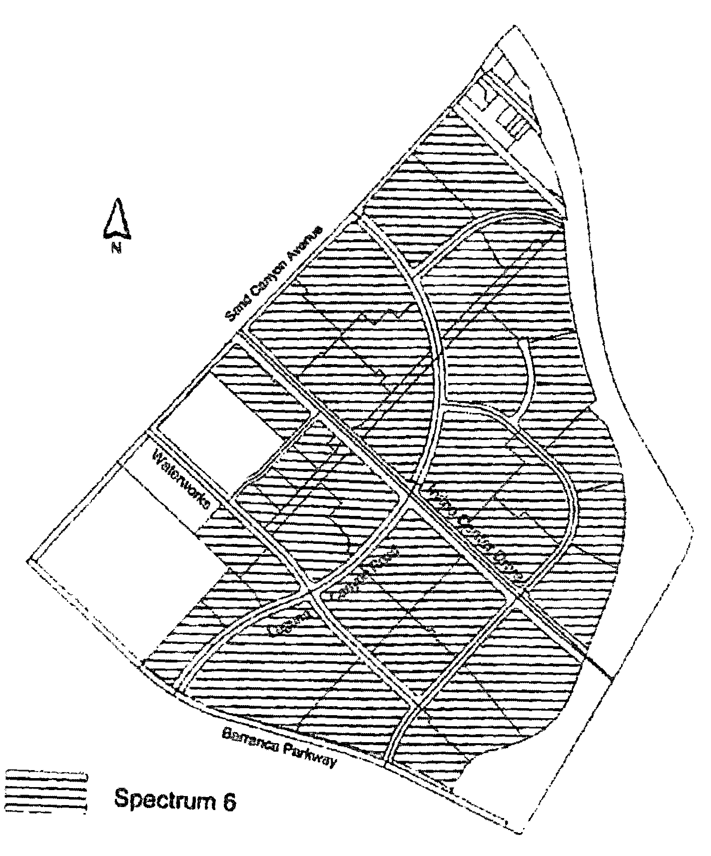
Sec. 9-32-1.- Land use zoning map.
(See Planning Area 32 map following Section 9-32-5.)
(Code 1976, § V.E-832.1; Ord. No. 92-3, 4-14-92; Ord. No. 95-4, 5-9-95; Ord. No. 95-22, § 3, 11-28-95; Ord. No. 04-04, § 5, 2-24-04)
Sec. 9-32-2. - Introduction.
Planning Area 32, Irvine Spectrum 3, is centrally located in the City. Boundaries include Interstate 5 (Santa Ana Freeway) to the west and south and Planning Area 51 to the north and east.
(Code 1976, § V.E-832.2; Ord. No. 92-3, 4-14-92; Ord. No. 95-4, 5-9-95; Ord. No. 95-22, § 3, 11-28-95; Ord. No. 99-03, § 3, 2-9-99; Ord. No. 00-02, § 4, 2-8-00)
Sec. 9-32-3. - Statistical analysis.
1 Unallocated dwelling units represent those units remaining in a planning area that may be built anywhere in the same planning area. These units are within the maximum development intensity for the planning area; and, therefore, placement of unallocated dwelling units into any residential category within the planning area for purposes of development is determined to be consistent with the General Plan and Zoning Code with regard to intensity allocation only, provided that placement is otherwise consistent with site specific zoning regulations and that any potential environmental impacts are adequately addressed, including traffic impacts, pursuant to CEQA.
2 See Section 9-0-3.C, Building Intensity Standards.
(Code 1976, § V.E-832.3; Ord. No. 92-3, 4-14-92; Ord. No. 95-4, 5-9-95; Ord. No. 95-22, § 3, 11-28-95; Ord. No. 04-04, § 5, 2-24-04; Ord. No. 12-09, § 3(Exh. A), 5-22-12)
Sec. 9-32-4. - Land use regulations.
See Section 3-3-1 (Land use matrix).
(Code 1976, § V.E-832.4; Ord. No. 92-3, 4-14-92; Ord. No. 95-4, 5-9-95; Ord. No. 95-22, § 3, 11-28-95)
Sec. 9-32-5. - Development standards.
See Chapter 3-37 (Development Standards).
(Code 1976, § V.E-832.5; Ord. No. 92-3, 4-14-92; Ord. No. 95-4, 5-9-95; Ord. No. 95-22, § 3, 11-28-95)
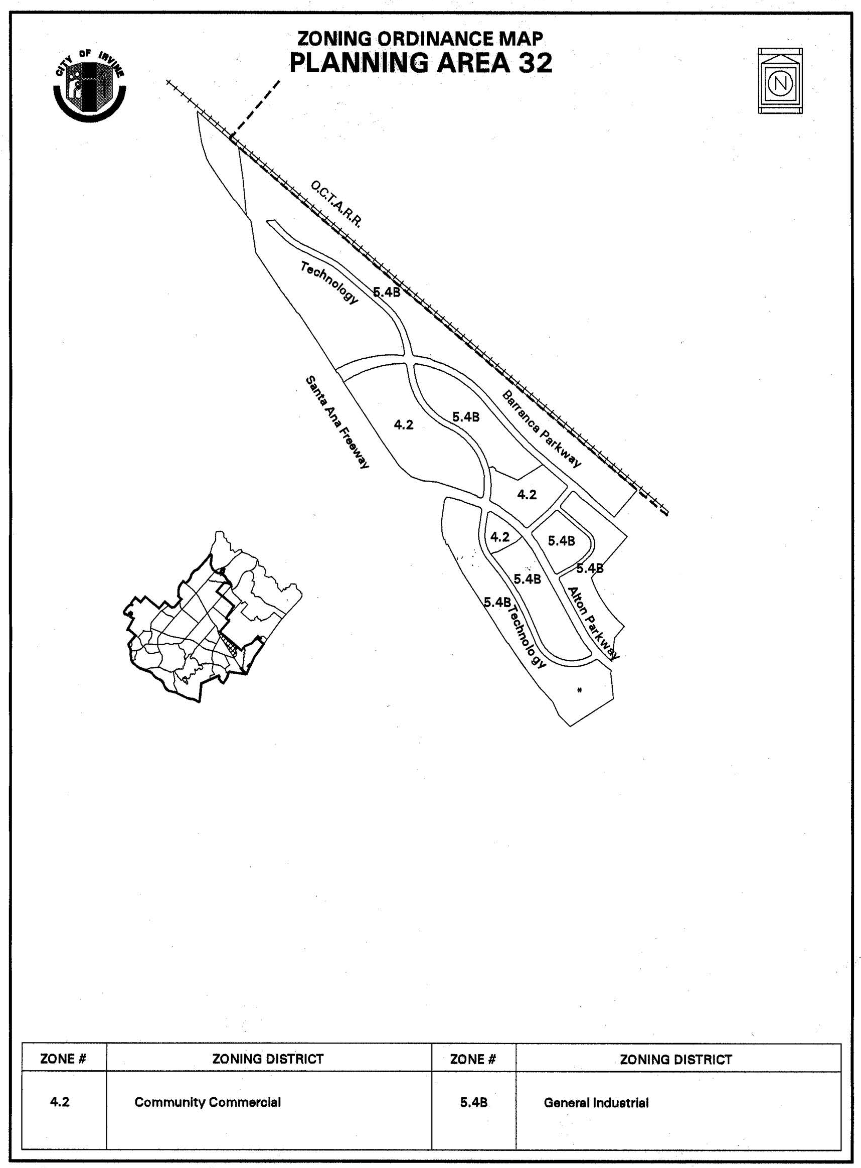
Sec. 9-32-7. - Special development requirements.
A.
Transportation performance monitoring program for Irvine Spectrum 3.
1.
Intent and purpose.
a.
Application. The provisions of this section shall apply only to that part of the Irvine Spectrum known as the Irvine Spectrum 3, which is bordered on the north by the AT&SF Railway, on the south by the I-5 Freeway, and on the east by Planning Area 51.
b.
Program overview.
(1)
The transportation performance monitoring program for the Irvine Spectrum 3 provides a method for monitoring the vehicular trip generation from development in this area to ensure that development can be accommodated within the roadway capacity of the local circulation system. This program consists of the establishment on a parcel-by-parcel basis of the allowable maximum floor area ratio (FAR) for development of each parcel, and the establishment of a limit on the number of p.m. peak trips that can be generated from development of all parcels in the Irvine Spectrum 3, together with a system for allocating trips from that limit to parcels as they are sold or as building permits are issued. The entire land area for the Irvine Spectrum 3 shall not exceed an average FAR of 0.35.
(2)
This information shall be incorporated into the annual report discussed in Paragraph A.1.c(3) of this section.
c.
Trip generation rates.
(1)
The Planning Commission shall by resolution establish trip generation rates for estimating the number of vehicle trips that will be generated for each land use category allowed in the Irvine Spectrum 3 per gross 1,000 square feet of building area.
(2)
These rates may be updated periodically by the Planning Commission based upon the results of the annual report described below or more frequent reports submitted as determined by the Spectrum Transportation Management Association (TMA) or the City. In either event, the Planning Commission shall approve the data collection methodology to be used in amending the trip generation rates.
(3)
By April 1 of each year, a report, based upon the approved data collection methodology, shall be submitted by the TMA to the City, which validates the current trip generation rates or proposes any changes to the approved trip generation rates. Within three weeks of receipt of the report, the Director of Public Works shall notify the Spectrum TMA in writing of the adequacy of the report. If the report is determined to be inadequate, it shall be revised by the TMA. Upon the determination of the Director of Public Works that the report is adequate, the report shall be reviewed and acted upon by the Planning Commission.
d.
Calculation of site trips.
(1)
The calculation of trips generated by a parcel, referred to as "site trips," can occur in two ways: either upon the sale or land lease of a parcel, or the submittal of an application for building permits, based upon the trip generation rates established by the Planning Commission.
(a)
Upon sale or land lease. Concurrent with the submittal to the City of a recorded SLUR for a parcel, and the establishment of the FAR on the FAR map, the site trips shall be computed by multiplying the maximum allowable square feet of development in each land use category specified in the SLUR, by the respective trip generation rate.
(b)
Upon receipt of building permit application. Concurrent with the submittal to the City of an application for building permits, the site trips shall be computed by multiplying the total square footage specified in the building permit application by the trip generation rate corresponding to the land use category.
(2)
On a parcel zoned Community Commercial where a building(s) may contain more than one use, the site trips shall be computed by multiplying the total square footage for each use within the building(s) as specified in the building permit application by the respective trip generation rates, and adding the site trips for each building on the parcel to derive the total site trips.
(3)
On a parcel zoned General Industrial, the site trips for "B. Permitted uses" per Code Section 3-37-33 (with two exceptions noted below) shall be computed by multiplying the gross square footage for the building(s) as specified in the building permit application by the same trip generation rate identified as "High Tech" from the Spectrum 3 (Planning Area 32) traffic study, dated February 7, 1986. The exception is two permitted land uses, "Restaurant, fast food (except drive-thru)," and "Warehouse and sales outlet" and all of the conditionally permitted uses shall be evaluated using the trip rates established by the Planning Commission as noted above in Section 9-32-7A.1.c, Trip Generation Rates.
e.
Allocation of trips on the trip ledger.
(1)
Site trips shall be calculated for all uses and/or buildings on the parcel, and shall be allocated to that parcel upon receipt of a recorded SLUR or the issuance of building permits. The site trips shall be entered on the trip ledger, and added to the cumulative total of all site trips as shown on the trip ledger, provided that the resulting total does not exceed the trip limitation approved by the Planning Commission. No building permit shall be issued for that parcel unless the sum of the site trips for that parcel and the cumulative site trips allocated to other parcels in the Irvine Spectrum 3 is less than or equal to the trip limitation. If adequate site trips do not exist for a parcel, building permits shall not be issued and future available site trips for that parcel will be allocated subject to the provisions of Paragraph A.1.g of this section.
(2)
Any application for building permits for tenant improvements which changes the square footage uses within a building shall require a recalculation and reallocation of trips. In the event that a building permit expires for any parcel defined by Paragraph A.2.a(1)(b) of this section, the site trips allocated to the parcel at the time of issuance of the building permit shall be added back into the total available trips for the Irvine Spectrum 3.
f.
Revision of trip limitation.
(1)
In the event the Planning Commission approves an amendment to the trip generation rates, the site trips shall be recomputed for each parcel using the amended trip generation rates; and the recomputed site trips for each parcel and the cumulative Irvine Spectrum 3 site trips shall be shown on the trip ledger. The new trip generation rates shall be used for all subsequent calculations.
(2)
Any amended trip generation rates shall not preclude entitlement to develop up to the FAR as specified on the FAR map for parcels which have been sold or land leased as long as site trips have been allocated and entered on the trip ledger.
(3)
If the sale or land lease is rescinded, the City shall be notified by the seller within 30 days of the rescission; and the City, upon such notice, shall recalculate the cumulative site trip total for all Irvine Spectrum 3 parcels and revise the FAR map and trip ledger accordingly.
g.
Unavailability of trips and trip prioritization. If a recorded SLUR for a sale or land lease parcel or an application for building permits is received when trips are no longer available for allocation, the City will notify the seller and/or buyer, or land lessee of such, and building permits shall not be issued until additional trips become available. When additional trips become available, these trips shall be allocated in the following priority:
(1)
First to satisfy any deficits in the trips as reported on the trip ledger resulting from any prior changes in the vehicle p.m. peak hour trip generation rates; then
(2)
Second to parcels considered "sold," or land leased, based upon the recorded date of the SLURs as established by the date of recordation; and finally;
(3)
To all other parcels requesting trips through building permit, based upon the date of submission of the application for such permits.
2.
Floor area ratio (FAR).
a.
FAR map and trip ledger.
(1)
The City's Director of Community Development shall maintain a current map depicting the FAR of the Irvine Spectrum 3 (the FAR map). Further, the Director shall maintain a current trip ledger depicting the site trips generated by specific parcels in the Irvine Spectrum 3 and the remaining trips available for development. The FAR shall be established for each parcel and shall be entered on the FAR map upon occurrence of either of the following events:
(a)
The sale or land lease of the parcel and delivery to the City of a copy of the recorded special land use restrictions (SLUR) specifying the FAR for the parcel, in accordance with covenants, conditions, and restrictions (CC&Rs) described in Paragraph A.4 of this section, and a signed trip notification document informing the buyer or land lessee of the provisions of the transportation performance monitoring program; or, in the event there is not a sale or land lease, then
(b)
The approval by the City of a Master Plan, conditional use permit, zoning compliance, code compliance, or any other discretionary or ministerial action specifying an FAR for a parcel, in which case the FAR for the parcel shall be as specified in that approval.
(2)
No parcel may be developed at a density exceeding the FAR established for the parcel and shown on the FAR map, as provided in Paragraph A.2.a(1)(b) of this section, nor may the City approve development exceeding the FAR shown in the recorded SLUR as provided in Paragraph A.2.a(1)(a) of this section. If sufficient trips are available and the total land area of the Irvine Spectrum 3 does not exceed the average FAR of 0.35, the applicant may amend its FAR by the submission of a revised recorded SLUR, or the approval by the City of a revised discretionary or ministerial action specifying an FAR for a parcel. Any unused FAR on a parcel may be transferred to another parcel through the submission of a revised recorded SLUR as provided in Paragraph A.2.a(1)(a) of this section.
3.
Trip limitation, monitoring and allocation.
a.
Trip limitation. The trip limitation for the Irvine Spectrum 3 shall be established by the Planning Commission by resolution and may be amended from time to time based upon identified improvements to the regional circulation system or other methods which would reduce p.m. peak hour trip generation and improve circulation and roadway capacity.
b.
Transportation performance monitoring program. All development shall participate in the transportation performance monitoring program for the Irvine Spectrum 3 as adopted or subsequently amended by the Planning Commission. Said participation shall include, but not be limited to, conducting surveys, performing measurements, and taking additional related actions to determine the actual number of vehicle trips generated from a developed site.
4.
Implementation through covenants, conditions and restrictions. The City has required the recordation of those certain covenants, conditions and restrictions entitled "Declaration of Covenants, Conditions and Restrictions for the Irvine Spectrum Transportation Management Association," record against the Irvine Spectrum 3 on February 3, 1986, and amended on April, 1987, to implement the provisions in this section.
5.
Definitions.
a.
Sale/land lease: Sale, for the purpose of this section, is the transfer of title or interest in land from one party to another through the use of a recorded deed. Land lease, or ground lease, is the transfer of title or interest in land from one party to another for a designated period with reversion to the grantor, through the use of a recorded ground lease.
b.
SLURs: Special land use restrictions recorded with the deed of sale or land lease which specify, among other things, the FAR limitation for a parcel which has been sold or land leased.
c.
Site trips: The number of p.m. peak hour vehicle trips generated by a parcel as described in Paragraph A.1.d of this section.
d.
Trip notification document: A document setting forth the provisions and requirements of the transportation performance monitoring program for the Irvine Spectrum 3 as adopted or amended by the City of Irvine.
(Code 1976, § V.E-832.6; Ord. No. 92-3, 4-14-92; Ord. No. 95-4, 5-9-95; Ord. No. 95-22, § 3, 11-28-95; Ord. No. 97-05, 5-13-97; Ord. No. 99-03, § 3, 2-9-99; Ord. No. 00-02, § 4, 2-8-00; Ord. No. 04-03, § 3, 2-24-04; Ord. No. 04-04, § 5, 2-24-04)
Sec. 9-33-1.- Land use zoning map.
(See Planning Area 33 map following Section 9-33-3.)
(Code 1976, § V.E-833.1; Ord. No. 92-3, 4-14-92; Ord. No. 92-21, 11-24-92; Ord. No. 95-3, § 3G, 4-25-95; Ord. No. 95-4, 5-9-95; Ord. No. 95-22, § 3, 11-28-95; Ord. No. 06-05, § 6, 6-27-06)
Sec. 9-33-2. - Introduction.
Planning Area 33, Irvine Spectrum Center, is centrally located in the City. Boundaries include State Route 133 (Laguna Freeway) to the west, Interstate 5 (Santa Ana Freeway) to the north, and Interstate 405 (San Diego Freeway) to the south.
(Code 1976, § V.E-833.2; Ord. No. 92-3, 4-14-92; Ord. No. 92-21, 11-24-92; Ord. No. 95-3, § 3G, 4-25-95; Ord. No. 95-4, 5-9-95; Ord. No. 95-22, § 3, 11-28-95; Ord. No. 99-03, § 3, 2-9-99; Ord. No. 09-02, § 3, 3-24-09)
Sec. 9-33-3. - Statistical analysis.
*To the extent that residential units are built in Planning Area 33 within the 4.7C Urban Commercial District, a corresponding reduction in the allowable nonresidential intensity shall occur in terms of equivalent traffic generated. The actual amount of reduction in nonresidential intensity will be based upon conversion rate of 648 square feet of nonresidential intensity per dwelling unit built (as established in the traffic analysis "City of Irvine Spectrum Center Housing Traffic Analysis" (July 2003). Revisions to the nonresidential and residential intensity figures for Planning Area 33 (consistent with this note) are authorized without the need for a subsequent General Plan amendment and/or zone change.
To the extant residential units have been provided in PA 33 pursuant to GPA 00529481-PGA (Lots 105 and 107/108 approved in 2012), units are in addition to nonresidential intensity otherwise allowed in PA 33.
**Residential density may exceed 55 du/net acre subject to consistency with the PA 33 unit cap and the requirements of Section 9-33-5.C.4.
1 Unallocated dwelling units represent those units remaining in a planning area that may be built anywhere in the same planning area. These units are within the maximum development intensity for the planning area; and, therefore, placement of unallocated dwelling units into any residential category within the planning area for purposes of development is determined to be consistent with the General Plan and Zoning Code with regard to intensity allocation only, provided that placement is otherwise consistent with site specific zoning regulations and that any potential environmental impacts are adequately addressed, including traffic impacts, pursuant to CEQA.
2 See Section 9-0-3.C, Building Intensity Standards.
3 Density bonus units. These units are not considered additive.
(Code 1976, § V.E-833.3; Ord. No. 92-3, 4-14-92; Ord. No. 92-21, 11-24-92; Ord. No. 95-3, § 3G, 4-25-95; Ord. No. 95-4, 5-9-95; Ord. No. 95-22, § 3, 11-28-95; Ord. No. 03-27, § 7, 9-9-03; Ord. No. 06-05, § 6, 6-27-06; Ord. No. 09-02, § 3, 3-24-09; Ord. No. 12-09, § 3(Exh. A), 5-22-12; Ord. No. 12-11, § 5(Exh. A), 7-24-12; Ord. No. 23-21, Exh. A, 10-24-23)
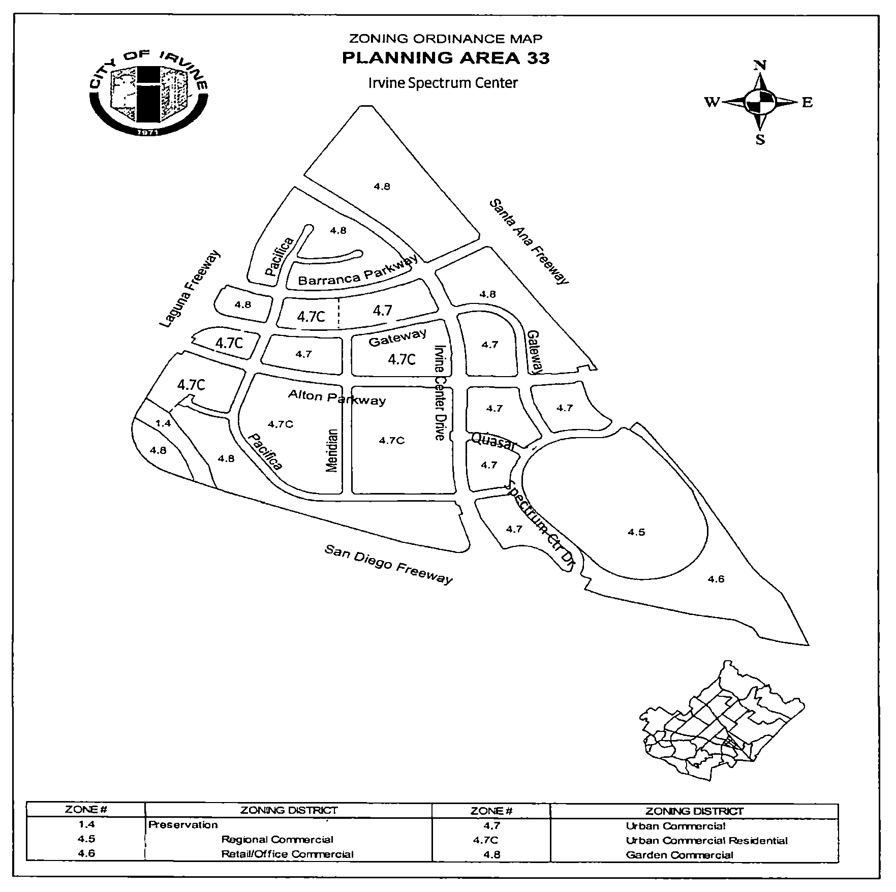
Sec. 9-33-4. - Land use regulations.
A.
Regional Commercial (Area 4.5).
1.
Permitted uses.
a.
Retail commercial uses, such as, but not limited to:
(1)
Department stores.
(2)
Retail shops.
(3)
Restaurants.
(4)
Barber and beauty shops.
(5)
Auto accessories and service.
(6)
Gasoline sales.
(7)
Facilities ancillary to the above uses.
b.
Entertainment, civic and cultural uses, such as, but not limited to:
(1)
Movie theaters.
(2)
Discotheques.
(3)
Ice skating.
(4)
Concert facilities.
(5)
Libraries.
(6)
Cocktail lounges.
(7)
Museum.
(8)
Exhibits.
(9)
Live performance facilities.
(10)
Facilities ancillary to the above uses.
c.
Institutional and office uses, such as, but not limited to:
(1)
Banks.
(2)
Savings and loan associations.
(3)
General offices.
(4)
Professional offices. 2
(5)
Travel agencies.
(6)
Photography.
(7)
Post office.
(8)
Brokerage houses.
(9)
Computer centers.
(10)
Alternative health care provider.
(11)
Facilities ancillary to the above uses.
d.
Hotels and their typical accessory uses, such as, but not limited to:
(1)
Restaurants.
(2)
Conference and convention rooms.
(3)
Retail shops.
(4)
Facilities ancillary to the above uses.
e.
Temporary uses shall be subject to a conditional use permit approved by the Zoning Administrator.
f.
Fortunetelling uses shall be subject to a conditional use permit approved by the Zoning Administrator.
g.
Massage establishment uses shall be subject to a conditional use permit approved by the Zoning Administrator.
h.
Domestic animal care facility shall be subject to a conditional use permit approved by the zoning administrator. Domestic animal care facilities shall require a veterinary certificate of health and proof of current vaccinations for distemper, rabies and parvovirus. Animals may be groomed, trained, exercised socialized and kept or boarded overnight, but not bred, sold or let for hire.
B.
Retail/Office Commercial (Area 4.6).
1.
Permitted uses.
a.
Professional business offices 2 , such as, but not limited to:
(1)
Insurance companies.
(2)
Medical, dental, etc.
(3)
Banks, savings and loan and other financial offices.
(4)
Attorneys.
(5)
Accountants.
(6)
Engineers, architects, planners, etc.
(7)
Travel agencies.
(8)
Corporate headquarters; general office space.
(9)
Alternative health care provider.
b.
Retail commercial, such as, but not limited to:
(1)
Furniture stores.
(2)
Restaurants and food facilities.
(3)
Household accessories.
(4)
Specialty stores.
(5)
Carwash and gasoline sales.
c.
Temporary uses designated on the site plan shall be subject to a conditional use permit approved by the Zoning Administrator.
d.
Massage establishment uses shall be subject to a conditional use permit approved by the Zoning Administrator.
C.
Urban Commercial District (Area 4.7).
1.
Permitted uses.
a.
Retail and service businesses.
b.
Specialty commercial.
c.
Business, professional, financial and medical offices. 2
d.
Office and commercial condominiums.
e.
Civic, cultural, institutional and government facilities.
f.
Research and development (Only permitted in the 4.8 Garden Commercial).
g.
Restaurants, fast food facilities, bars and nightclubs (conditional use in 4.7C* 1 ).
h.
Theaters (conditional use in 4.7C* 1 ).
i.
Parking lots, structures and facilities.
j.
Automobile services, service stations and related uses (conditional use 4.7C* 1 ).
k.
Hotels, motels and motor inns (conditional use in 4.7C* 1 ).
l.
Conference and convention facilities (conditional use in 4.7C* 1 ).
m.
Medical clinic and hospital facilities (conditional use in 4.7C* 1 ).
n.
Accessory structures and uses necessary and customarily incidental to permitted uses.
o.
Residential, attached (4.7C only), subject to approval of a Master Plan pursuant to Chapter 2-17.
p.
Alternative health care provider (conditional use in 4.7C *1 ).
q.
Home occupation permit.
2.
Uses permitted subject to a conditional use permit.
a.
Commercial recreation and recreation facilities (conditional use in 4.7C *1 ) 3 .
b.
Temporary uses shall be subject to a conditional use permit approved by the Zoning Administrator. Such uses shall be permitted prior to submittal of Master Plans for the planning area in which they are located.
c.
Outdoor vendors shall be subject to a conditional use permit approved by the Zoning Administrator. Such uses shall be permitted on private property only and not in the public right-of-way. These users shall obtain a business license and furnish a letter from the property owner granting them permission to operate.
d.
Any other use which the Planning Commission finds consistent with the purpose and intent of this district and which is found to be compatible with adjacent planned and/or existing land uses.
e.
Nonresidential uses within and in support of residential projects (4.7C only).
f.
Single room occupancy (SRO). (4.7C only)
D.
Garden Commercial (Area 4.8).
1.
Permitted uses. Permitted uses shall be the same as those allowed in Area 4.7 (Urban Commercial District), as noted in Section 9-33-4.C.1.
2.
Uses permitted subject to a conditional use permit. Uses allowed subject to a conditional use permit shall be the same as those noted in Section 9-33-4.C.2.
Footnotes:
1 A conditional use permit is required for this use in the 4.7C District only if residential development has been approved in the 4.7C District.
2 An administrative use permit (AUP) is required for online vehicle sales offices.
3 An administrative use permit (AUP) is required.
(Code 1976, § V.E-833.4; Ord. No. 92-3, 4-14-92; Ord. No. 92-21, 11-24-92; Ord. No. 95-3, § 3G, 4-25-95; Ord. No. 95-4, 5-9-95; Ord. No. 95-22, § 3, 11-28-95; Ord. No. 03-27, § 7, 9-9-03; Ord. No. 09-02, § 3, 3-24-09; Ord. No. 10-04, § 3, 4-13-10; Ord. No. 23-21, Exh. A, 10-24-23; Ord. No. 25-05, Exh. A, 4-8-25; Ord. No. 25-06, § 2(Exh. A), 4-8-25)
Sec. 9-33-5. - Development standards.
A.
Regional commercial (Area 4.5).
1.
Site requirements. Minimum site size of 75 acres is required.
2.
Gross leasable square footage.
a.
Limits on gross leasable square footage have been established. At the time a Master Plan is submitted for a planning area, the proposal shall comply with the procedure set forth in Section 9-33-7 of this zoning ordinance.
3.
Setbacks.
a.
Streetside. Setbacks shall be a minimum of 30 feet from the right-of-way line.
b.
Street setbacks. Setbacks shall be determined at the time of Master Plan review. Bridge structures for the purposes of pedestrian and bicycle crossings of public roadways shall be permitted within the right-of-way area.
4.
Maximum building height. The building height shall be determined at Master Plan or conditional use permit review.
5.
Streetside landscape area. In addition to the parkway, there shall be a 10-foot landscape setback along all public streets. Landscaping in the parkways and setback areas shall consist of an effective combination of trees, ground cover and shrubbery, and may include such items as sidewalks, bike trails, access driveways, allowed signs, flagpoles, fountains, lights and other similar appurtenances.
6.
Streetscape landscape area. In addition to the parkway, there shall be a 10-foot landscape setback along all public streets. Landscaping in the parkways and setback areas shall consist of an effective combination of trees, ground cover, and shrubbery, and may include such items as sidewalks, bike trails, access driveways, allowed signs, flagpoles, fountains, lights and other similar appurtenances.
7.
Parking requirements.
a.
Off-street parking areas shall be landscaped with a mixture of trees, shrubs, ground cover and other plant material as determined at the time of preliminary site plan review.
b.
The minimum number of parking spaces required shall be one car for each 200 square feet of gross leasable floor area (see Section 1-2-1 (Definitions)) for all uses within this zone except hotel rooms. Hotel rooms shall be calculated based on one car space for each guest unit.
c.
All other requirements shall be as per Division 4 of this zoning ordinance.
B.
Retail/office commercial (Area 4.6).
1.
Gross leasable square footage.
a.
Limits on gross leasable square footage have been established. At the time a Master Plan is submitted for a planning area, the proposal shall comply with the procedure set forth in Section 9-33-7.
2.
Setbacks.
a.
Interior setbacks: None required.
b.
Building setbacks from public streets shall be 20 feet measured from the right-of-way line.
c.
Building setbacks adjacent to freeways shall be a minimum of 50 feet as measured from the ultimate freeway right-of-way line.
3.
Maximum building height. The building height shall be determined at Master Plan or conditional use permit review.
4.
Streetside landscape area. The entire area between the curb to 20 feet back of the street right-of-way lines shall be landscaped. In the case where parking lots are adjacent to the street right-of-way, the paved surface of these parking areas shall be separated from the street right-of-way by a landscaped area having a dimension of not less than 10 feet. Landscaping in these areas shall consist of an effective combination of trees, ground cover and shrubbery, and may include such items as sidewalks, access driveways, allowed signs, flagpoles, fountains, lights and other similar appurtenances.
5.
Parking areas.
a.
A minimum of 10 percent of the total off-street parking area shall be landscaped with a mixture of trees, shrubs, ground cover and other plant material.
b.
All other requirements shall be as per Division 4 of this zoning ordinance.
C.
Urban Commercial District (Area 4.7).
1.
Site requirements.
a.
Minimum site size shall be 10,000 square feet. Sites of 20,000 square feet or greater may contain parcels smaller than 10,000 square feet for the purposes of condominium ownership, ground leases or financing.
2.
Gross leasable square footage. Limits on gross leasable square footage have been established. At the time a Master Plan is submitted for a planning area, the proposal will be checked against the square footage limit.
a.
If the square footage is below the limit established for the planning area, the remainder may be used for a subsequent development proposal within that planning area or may be available for transfer to other planning areas.
b.
If an applicant intends to submit a Master Plan which shows development in excess of the square footage limit for a planning area, he or she must comply with the procedure set forth in Section 9-33-7 of this ordinance.
c.
For purposes of this section, the limits on gross leasable square footage refers to the area as it is defined in Section 1-2-1. The square footage contained in parking structures shall not be counted in determining whether or not a proposal conforms with the gross leasable square footage limits.
d.
This provision shall not apply to residential development in the 4.7C District.
3.
Setbacks.
a.
Building setbacks from streets.
(1)
Minimum building setbacks from streets shall be measured from the curb face and shall comply with the following standards:
(a)
Thruways and parkways: Minimum of 18 feet except at designated entry points to communities, neighborhoods and environmental areas.
(b)
Thruways and parkways at entry points: Minimum of 24 feet or as otherwise approved in design review process, for purposes of safety, visual impact and identification of community and environmental areas.
(c)
Community collector with no median strip: Minimum of 18 feet.
(d)
Community collector with 14-foot-wide median strips: Minimum of 12 feet.
(e)
Local collector: Minimum of 12 feet where abutting side or rear property lines and minimum of 10 feet where abutting front property lines.
(f)
Local (public or private): Minimum of eight feet.
Residential uses (4.7C only)
(g)
Alton Parkway, Barranca Parkway, and Irvine Center Drive: Minimum of 30 feet except at designated entry points to communities, neighborhoods and environmental areas.
(h)
Alton Parkway, Barranca Parkway, and Irvine Center Drive at entry points: Minimum of 30 feet or as otherwise approved in design review process, for purposes of safety, visual impact and identification of community and environmental areas.
(i)
Loop road with no median strip: Minimum of 20 feet.
(j)
Loop road with 14-foot-wide median strip: Minimum of 20 feet.
(k)
Service grid: Minimum of 18 feet where abutting side or rear property lines and minimum of 15 feet where abutting front property lines.
(l)
On- and off-ramps to SR-133: Minimum of 20 feet.
(2)
For purposes of this section, the roads within Irvine Spectrum Center shall be classified as follows:
(3)
Parking structures shall have an additional 10 feet beyond the required setback for those portions of the structures which have parking areas along the exterior wall on the ground floor. The streetside setback may be the same as is noted for buildings in Subsection 3.a(1) for those portions of the structure which have retail or office uses along the exterior wall on the ground floor.
(4)
These regulations require that the alignment of the transit corridor shall be determined prior to the approval of the first tentative map. It is intended that this alignment will parallel one or more of the streets through Irvine Spectrum Center. After this alignment is determined, the building setback along this alignment shall be a minimum of 40 feet from the curb face.
b.
Interior lot line setback.
(1)
Zero setback shall be permitted (for nonresidential uses only).
(2)
For residential uses (in 4.7C only):
Five feet minimum if adjacent use is residential;
Ten feet minimum if adjacent use is nonresidential;
Fifty feet minimum from ultimate freeway mainline right-of-way line.
4.
Maximum site coverage. Maximum site coverage shall be determined as follows:
Parking structures shall be subject to the same extent of site coverage.
5.
Maximum building height.
a.
The building height shall be determined at Master Plan or conditional use permit review.
6.
Streetside landscape. Landscaping in the parkways and setback areas shall consist of an effective combination of trees, ground cover, and shrubbery and may include such items as sidewalks, bike trails, access driveways, allowed signs, flagpoles, fountains, lights, bus shelters, transit stations and other similar appurtenances.
7.
Parking requirements.
a.
A minimum of 15 percent of the total off-street surface parking areas shall be landscaped with a mixture of shrubs, ground cover and other plant material as determined at the time of Master Plan review. Not applicable to spaces within a parking structure per Section 3-15-7.C.
b.
The minimum number of parking spaces required shall be as required in Division 4 of this zoning ordinance; except that in buildings with four or more stories, the square footage used to determine parking requirements shall not include the area used for elevator shafts, elevator lobbies, mechanical equipment and stairwells (this exception does not apply to residential structures).
c.
All other requirements shall be as per Division 4 of this zoning ordinance.
8.
Affordable housing. Applications for residential development shall demonstrate compliance with the Housing Element of the General Plan and City Council Resolution No. 91-28 or subsequent resolution. The master plan will be conditioned to assure compliance with the Housing Element.
9.
Trails. In conjunction with applications for conditional use permits for residential development authorized by zone change (00382341-PZC) the applicant shall be required to provide a plan for signs to be installed at the intersection of on-street bike lane and portion of the Class 1 trail along the portion of the San Diego Creek Channel within Planning Area 33. The purpose of these signs will be to provide directions to trail users indicating the appropriate path of travel to the I-405 undercrossing and the ultimate connection of the trail into Planning Area 39.
10.
Libraries. In the event a City-wide library impact fee is adopted and in force, the developer shall pay this fee prior to issuance of building permits for new development.
11.
Jeffrey Open Space Trail improvement funding. Prior to the approval of a conditional use permit for any residential units on Lots 105 and/or 107/108 the landowner shall enter into an agreement with the City of Irvine and provide up to $246,000 in improvement funds to be used solely for the construction of the planned Jeffrey Open Space Trail (JOST) pedestrian/bicycle over-crossing of the I-5 Freeway. The agreement shall include a funding schedule (including an option to post a bond as security for funds) based upon phasing of actual residential construction on each individual site.
12.
iShuttle expansion. Prior to the issuance of the occupancy permits for residential development on Lots 105, 107 and/or 108 the applicant shall, in cooperation with City representatives, submit and have approved by the City Council an iShuttle expansion plan to increase iShuttle service in the near term within Spectrum and the Great Park. The plan will assess and make recommendations relative to (a) introducing a new weekend or event service connecting the Irvine Station to the Great Park, (b) increasing and/or modifying peak hour weekday service to Spectrum residential and employment areas and (c) adding off peak weekday and/or weekend service for residential, retail and/or employment areas in Spectrum. The plan will include a financing plan for operation of the recommended service additions. The applicant's financial contribution is limited to the development of the expansion plan and $500,000 toward the capital, operations and maintenance of the City's iShuttle program within Spectrum and for any interim stop costs at or near the Irvine Transportation Center providing service to the Great Park. Any Spectrumotion contribution over and above present funding levels to the Spectrum iShuttle program up to $100,000 will be a credit towards the $500,000 financial cap.
D.
Garden commercial (Area 4.8).
1.
Site requirements. Minimum site size shall be 10,000 square feet. Sites of 20,000 square feet or greater may contain parcels smaller than 10,000 square feet for the purposes of condominium ownership, ground leases or financing.
2.
Gross leasable square footage. Limits on gross leasable square footage have been established. At the time a Master Plan is submitted for a planning area, the proposal shall comply with the procedure set forth in Section 9-33-7 of this ordinance.
3.
Setbacks.
a.
Building setbacks from streets.
(1)
Minimum building setbacks from streets shall be measured from the curb face and shall comply with the following standards:
(a)
Thruway and parkway: Minimum of 38 feet except at designated entry points to communities, neighborhoods and environmental areas.
(b)
Thruway and parkway, at entry points: Minimum of 44 feet or as otherwise approved in the design review process, for purposes of safety, visual impact and identification of community and environmental areas.
(c)
Community collector with no median strip: Minimum of 38 feet.
(d)
Community collector with 14-foot-wide median strip: Minimum of 32 feet.
(e)
Local collector: Minimum of 32 feet where abutting side or rear property lines and minimum of 30 feet where abutting front property lines.
(f)
Local (public or private): Minimum of 28 feet.
(2)
Building setbacks adjacent to freeways shall be a minimum of 50 feet as measured from the ultimate freeway right-of-way line.
(3)
These regulations require that the alignment of the transit corridor shall be determined prior to the approval of the first tentative map. It is intended that this alignment will parallel one or more of the streets through Irvine Spectrum Center. After this alignment is determined, the building setback along this alignment shall be a minimum of 40 feet from the street right-of-way.
b.
Interior lot line set back. Minimum of 20-foot setback from interior lot lines.
4.
Maximum site coverage. Up to 100 percent of the area within the required setbacks may be used for building site coverage. Parking structures shall be included in determining the extent of site coverage.
5.
Maximum building height. The building height shall be determined at Master Plan or conditional use permit review.
6.
Streetside landscape. The area between the curb face and the building setback line shall be landscaped except in cases where parking lots are adjacent to the street right-of-way. In these cases, the paved surface of the parking area shall be separated from the street right-of-way by a landscaped area having a dimension of not less than 10 feet. Landscaping in these areas shall consist of an effective combination of trees, ground cover, and allowed signs, flagpoles, fountains, lights, bus shelters, transit stations and other similar appurtenances.
7.
Parking requirements.
a.
The minimum number of parking spaces required shall be as identified in Division 4; except that in buildings with four or more stories, the square footage used to determine parking requirements shall not include the area used for elevator shafts, elevator lobbies, mechanical equipment and stairwells.
b.
All other requirements shall be as per Division 4 of this zoning ordinance.
(Code 1976, § V.E-833.5; Ord. No. 92-3, 4-14-92; Ord. No. 92-21, 11-24-92; Ord. No. 95-3, § 3G, 4-25-95; Ord. No. 95-4, 5-9-95; Ord. No. 95-22, § 3, 11-28-95; Ord. No. 99-03, § 3, 2-9-99; Ord. No. 03-27, § 7, 9-9-03; Ord. No. 06-04, § 3, 3-14-06; Ord. No. 06-05, § 6, 6-27-06; Ord. No. 09-02, § 3, 3-24-09; Ord. No. 12-11, § 5(Exh. A), 7-24-12; Ord. No. 23-21, Exh. A, 10-24-23)
Sec. 9-33-7. - Review process.
A.
Overview. Because of the variety of the uses proposed for Irvine Spectrum Center, it is necessary to create a review process which provides the City of Irvine with adequate review procedures for future development while providing the applicant with timely direction during the review of the project.
B.
Analysis of circulation improvements. Prior to the submittal of the first tentative map for Irvine Spectrum Center, the applicant shall submit an analysis of circulation improvements which will be required as a result of development. This analysis shall address phasing of necessary major improvements. It shall be reviewed by the Planning Commission prior to approval by the City Council. Each time a tentative map is submitted for approval, the analysis shall be updated and then used to identify appropriate conditions of approval.
C.
Tentative map. A tentative map shall be submitted prior to or in conjunction with the Master Plan for each planning area. The tentative maps may encompass more than one planning area. The submittal and review procedure for the tentative maps shall be in accordance with the Irvine subdivision ordinance, Title 5, Division 5 of the Irvine Municipal Code.
D.
Transfer of gross leasable square footage.
1.
The Director of Community Development shall maintain a chart which lists the amount of gross leasable square footage assigned to each of the planning areas in Irvine Spectrum Center, the amount approved for development as part of Master Plan or zoning compliance review, and the amount available for transfer to other planning areas.
2.
If an applicant intends to submit a Master Plan which shows development in excess of the square footage limit, the applicant must identify other planning areas which have excess square footage which could be transferred and provide a legal document signed by the applicant and the landowner(s) of the contributing planning area(s) agreeing to the transfer. This document shall be designed to run with the land and shall be reviewed and approved by the City Attorney prior to approval of the transfer. This document shall provide a restriction against the development rights of the contributing site when these rights have been transferred to the receiving site. Each transfer shall be approved by the Director of Community Development prior to submittal of the Master Plan. In transferring, the amount of square footage remaining in each of the planning areas which contributed must be equivalent to at least 10,000 square feet per acre. Once a transfer is approved, the chart listing the units of gross leasable square footage shall be revised to reflect the transfer.
E.
Master Plan review. A Master Plan shall be submitted prior to development within a planning area. Master Plan review will delineate the specific program uses, design standards and site layout for each planning area. Master Plans shall be submitted to the Planning Commission. The Planning Commission shall review the Master Plan for conformance with the approved zoning regulations for Irvine Spectrum Center. The applicant shall submit the Master Plan in the form of a design program which shall indicate the following information:
1.
Lot or site dimensions.
2.
Location and configuration of common areas.
3.
All buildings and structures, to include proposed use, location and approximate size and height ranges.
4.
Side yards and distance between buildings.
5.
Perimeter walls and fences, to include location, height and materials.
6.
Off-street parking, to include location, number of spaces (regular and compact), dimensions of parking area and internal circulation pattern.
7.
Pedestrian, bicycle, vehicular and service circulation, including points of ingress and egress to the site.
8.
Loading areas, to include location, number of spaces, and internal circulation.
9.
The general character and configuration of the exterior lighting plan for the entire area.
10.
The location and general nature of landscaping elements, including streetscape plans and freeway edge treatment, if applicable.
11.
Maintenance cost projections.
12.
The location and configuration of refuse disposal facilities.
13.
Street circulation patterns and design.
14.
An architectural program for the individual planning area submitted.
15.
Provisions for security and fire protection as they relate to the site plan.
16.
Any other information deemed necessary by the Director of Community Development.
F.
Sign program for center identification. Prior to approval of the first zoning compliance review, the applicant shall submit a comprehensive program for any center identification, directional and future facility signs. This program shall include the location, dimensions, materials and colors for the proposed signs.
G.
Sign program. A sign program indicating the general design, size, location and method of illumination for signs shall be submitted prior to issuance of building permits.
H.
Revisions to the limit on gross leasable square footage assigned to planning areas. If the boundaries of the planning areas are modified because of changes to the configuration of the circulation system or for other reasons, the limit on gross leasable square footage assigned to the planning areas may be adjusted by the Director of Community Development.
(Code 1976, § V.E-833.6; Ord. No. 92-3, 4-14-92; Ord. No. 92-21, 11-24-92; Ord. No. 95-3, § 3G, 4-25-95; Ord. No. 95-4, 5-9-95; Ord. No. 95-22, § 3, 11-28-95; Ord. No. 99-03, § 3, 2-9-99; Ord. No. 00-02, § 4, 2-8-00; Ord. No. 04-03, § 3, 2-24-04; Ord. No. 09-02, § 3, 3-24-09)
Sec. 9-33-8. - Special development requirements.
A.
Regardless of the provisions of this text, no construction shall be allowed within the boundaries of Irvine Spectrum Center except that which complies with all provisions of the applicable building codes and the various mechanical codes related thereto.
B.
Any land use proposal not specifically covered by this plan and its text shall be subject to the regulations of the City of Irvine Zoning Code. Whenever the regulations contained in this text conflict with the regulations of the City of Irvine zoning ordinance, the regulations for Irvine Spectrum Center shall take precedence.
C.
Within Irvine Spectrum Center, the continued use of the land for agricultural purposes with uses, structures and appurtenances accessory thereto shall be permitted subject to the provisions of the agricultural land use category of the City of Irvine zoning ordinance.
D.
Grading will be permitted within Irvine Spectrum Center outside of an area of immediate development upon the securing of a grading permit. Required grading information shall be submitted to the Director of Community Development for his or her approval. At the time of actual development of any portion of Planning Area 33, a complete report of a preliminary engineering geology and soil engineering investigation showing evidence for a safe and stable development is to be submitted with the tentative tract map. The recommendations by the engineering geologist and soil engineer shall be incorporated into the grading plan design prior to grading permit approval. The soil engineer and engineering geologist must certify the stability of the site prior to issuance of building permits.
E.
The height of all buildings and structures shall not exceed FAA criteria and shall be reviewed and approved at the time of Master Plan review.
F.
Water service and sewage disposal facilities within Irvine Spectrum Center shall be furnished by the Irvine Ranch Water District.
G.
The property lies within the boundaries of the Orange County Master Plan of drainage for the East Irvine area. The plan, when completed, will be administered for the City of Irvine by the Orange County Flood Control District. Developers of the land will be required by the City to participate in this Master Plan in a manner meeting the approval of the Chief Engineer of the Orange County Flood Control District. Said participation may include the construction of Master Plan facilities or the dedication of right-of-way.
H.
Detailing of the location of the 60 CNEL line relative to Phase II development shall be made at Phase II conceptual design review hearings.
I.
For the conceptual design review hearing, the EIR information will be updated to the level of specificity which is equivalent to that level of information which is generally required for that process.
J.
Prior to the approval of the conceptual urban design plan, the applicant shall submit data from a qualified archaeologist/paleontologist determining the significance of the sites and making recommendations for salvage and/or preservation. The data submitted shall also designate which sites will be destroyed by the project as proposed, which sites can be built upon and still be preserved, and which sites are significant enough to salvage. The archaeologist shall be notified of and review the test borings done by the soils engineer.
K.
Prior to the submission of the conceptual urban design plan, a plan of drainage shall be prepared in conjunction with that required for the IIC-East which meets the approval of both the Orange County Flood Control District and the City of Irvine.
L.
The applicant shall pay a deposit commensurate with that which is charged for a zone change for the processing of the conceptual urban design plan.
M.
Reserved.
N.
The interiors of nonresidential structures shall be sound-attenuated from exterior noise to meet the following intrusive interior noise criteria:
Note— Leq (12) is the energy average noise level for the 12-hour period from 7:00 a.m. to 7:00 p.m.
O.
The interiors of motel and hotel structures shall be attenuated from exterior noise in conformance with Title 25 of the California Administrative Code.
P.
Prior to the issuance of building permits, a noise study demonstrating the Leq (12) based on the measured noise level not exceeded by 95 percent of the field mirror practice landing operations over the site and the effectiveness of the proposed construction techniques for meeting the criteria established in Subsection N shall be submitted to the Director of Community Development.
Q.
The area adjacent to the freeway mainline right-of-way lines, excluding on- and off-ramps to SR-133, lines shall be landscaped to a depth of approximately 30 feet. The exact depth shall be determined during Master Plan review. Landscaping for these areas shall consist of an effective combination of trees, ground cover and shrubbery, and may include such items as sidewalks, access driveways, allowed signs, flagpoles, fountains, lights and other similar appurtenances.
R.
During development case review for the regional shopping center, the applicant shall indicate an area within the center for use by the Irvine Public Safety Department. Prior to approval of final site plans, the applicant and the City shall come to an agreement on how the City is to obtain this space. The plans and agreement shall be reviewed by the Director of Public Safety to ensure they conform to the Department's requirements.
S.
Prior to or in conjunction with the submittal of the first tentative map for Irvine Spectrum Center, the applicant and the City shall come to an agreement on the location and size of a maintenance station to service Irvine Spectrum Center. This agreement shall be reviewed and approved by the Director of Public Works.
T.
Prior to the approval of the first tentative map for Irvine Spectrum Center Phase II, the applicant and the City shall determine the alignment of the Transportation Corridor and identify locations of transit stops. The alignment and transit stop locations shall be reviewed by the Planning Commission and approved by the Director of Public Works prior to this determination. The alignment shall appear as an easement/reservation for future dedication on all subsequent tentative maps where applicable.
U.
Prior to or in conjunction with the submittal of the first tentative map for Irvine Spectrum Center, the applicant shall submit a Master Plan of bicycle trails to be reviewed and approved by the Planning Commission. The Master Plan shall show the regional level and "backbone" system. As part of this system, an alignment for a Class I bicycle trail through Irvine Spectrum Center shall be shown to ensure consistency with the City's adopted General Plan unless the General Plan has been amended so that the trail classification has been changed. In any event, the Master Plan shall be consistent with the General Plan in effect at the time the Master Plan is submitted. Internal or local trail systems shall be approved in conjunction with each site plan and corresponding tentative map, where such a map is required.
V.
Prior to or in conjunction with the submittal of the first tentative map for Irvine Spectrum Center, the applicant shall submit a plan showing riding and hiking trail connections, which shall be consistent with the then-adopted General Plan for such trails.
W.
Prior to or in conjunction with the submittal of the first tentative map for Irvine Spectrum Center, the applicant shall submit a Master Plan showing potential bus stops and bus shelters for review and approval by the Planning Commission.
X.
Prior to the submittal of the first tentative map for Irvine Spectrum Center, the applicant shall submit an analysis of circulation improvements which will be required as a result of development. This analysis shall address phasing of necessary major improvements. It shall be reviewed by the Planning Commission prior to approval by the City Council. Each time a tentative map is submitted for approval, the analysis shall be updated and then used to identify appropriate conditions of approval. A report on the status of circulation improvements shall be prepared on an annual basis from the date of approval for the first tentative map in Irvine Spectrum Center and submitted for the City Council's review.
Y.
At the time of filing parcel maps abutting the freeway near the proposed site, the City may require the developer to landscape the adjoining freeway if the State concurs with this requirement and if the State agrees to maintain the landscaping.
Z.
Prior to the approval of any tentative map for Irvine Spectrum Center, the feasibility of the development agreement shall be investigated to ensure projected revenues to the City and reduce uncertainties related to the development from both the viewpoint of the developer and the City. The analysis and recommendations shall be reviewed by the Planning Commission and accepted by the City Council prior to the approval of any tentative map for Irvine Spectrum Center.
(Code 1976, § V.E-833.7; Ord. No. 92-3, 4-14-92; Ord. No. 92-21, 11-24-92; Ord. No. 95-3, § 3G, 4-25-95; Ord. No. 95-4, 5-9-95; Ord. No. 95-22, § 3, 11-28-95; Ord. No. 99-03, § 3, 2-9-99; Ord. No. 00-02, § 4, 2-8-00; Ord. No. 04-03, § 3, 2-24-04; Ord. No. 09-02, § 3, 3-24-09; Ord. No. 23-21, Exh. A, 10-24-23)
Sec. 9-34-1.- Land use zoning map.
(See Planning Area 34 map following Section 9-34-3.)
(Code 1976, § V.E-834.1; Ord. No. 92-3, 4-14-92; Ord. No. 92-14, § 4, 9-8-92; Ord. No. 92-21, 11-24-92; Ord. No. 94-7, § 3, 6-14-94; Ord. No. 95-4, 5-9-95; Ord. No. 95-22, § 3, 11-28-95; Ord. No. 12-09, § 3(Exh. B), 5-22-12; Ord. No. 21-08, Exh. A, 9-28-21)
Sec. 9-34-2. - Introduction.
Planning Area 34, Irvine Spectrum 5, is located along the eastern edge of the City. Boundaries include Irvine Center Drive and the future extension of Bake Parkway to the west, Interstate 405 (San Diego Freeway) and Interstate 5 (Santa Ana Freeway) to the north, and Lake Forest Drive to the south.
(Code 1976, § V.E-834.2; Ord. No. 92-3, 4-14-92; Ord. No. 92-14, § 4, 9-8-92; Ord. No. 92-21, 11-24-92; Ord. No. 94-7, § 3, 6-14-94; Ord. No. 95-4, 5-9-95; Ord. No. 95-22, § 3, 11-28-95; Ord. No. 99-03, § 3, 2-9-99; Ord. No. 21-08, Exh. A, 9-28-21)
Sec. 9-34-3. - Statistical analysis.
1 Unallocated dwelling units represent those units remaining in a planning area that may be built anywhere in the same planning area. These units are within the maximum development intensity for the planning area; and, therefore, placement of unallocated dwelling units into any residential category within the planning area for purposes of development is determined to be consistent with the General Plan and Zoning Code with regard to intensity allocation only, provided that placement is otherwise consistent with site specific zoning regulations and that any potential environmental impacts are adequately addressed, including traffic impacts, pursuant to CEQA.
2 See Section 9-0-3.C, Building Intensity Standards.
3 In Planning Area 34 within the 5.4A General Industrial zone, the developer has the option to construct up to 63,681 square feet of R&D or in lieu of that, up to 126,000 square feet of self-storage facility. A limited scope traffic study will be prepared as part of the building permit application for development of self-storage facility in excess of 63,681 square feet and up to 126,000 square feet of self-storage facility. If this option is exercised, the city shall administratively increase the General Plan and Zoning caps for Planning Area 34 by the square footage to accommodate it.
(Code 1976, § V.E-834.3; Ord. No. 92-3, 4-14-92; Ord. No. 92-14, § 4, 9-8-92; Ord. No. 92-21, 11-24-92; Ord. No. 94-7, § 3, 6-14-94; Ord. No. 95-4, 5-9-95; Ord. No. 95-22, § 3, 11-28-95; Ord. No. 06-05, § 6, 6-27-06; Ord. No. 12-09, § 3(Exh. A), 5-22-12; Ord. No. 21-08, Exh. A, 9-28-21; Ord. No. 25-18, § 2(Exh. A), 6-24-25)
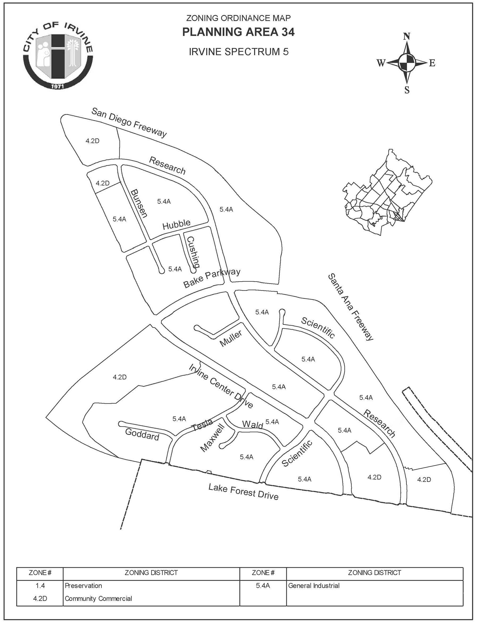
Sec. 9-34-4. - Land use regulations.
(City-wide regulations can also be found in Division 3.)
Notes:
(1)
Interim use.
(2)
Caretaker's quarters only.
(3)
See Chapter 2-17 for special provisions.
(4)
Use is permitted by right when less than 175,000 square feet in area. A traffic study shall be required for this use, and it shall be required for this use, and it shall identify specific on-site and off-site circulation improvements necessary to mitigate the impacts of the projected future development, which shall be implemented prior to and concurrent with the project's construction. In the event identified circulation improvements are not timely constructed, permits required for the project may be withheld and/or a project may be subject to code enforcement or other legal action.
(5)
Use requires an administrative use permit when 175,001 to 225,000 square feet in area and a conditional use permit when equal to or more than 225,001 square feet in area.
(6)
As determined by the City of Irvine, a traffic analysis shall be submitted to determine if on-site and off-site improvements must be made a condition of the project's discretionary approval.
(7)
An administrative use permit (AUP) is required for online vehicle sales office.
(8)
An alternative school that proposes to locate in an existing permanent building and meets all the general development standards will require an administrative use permit (AUP).
(Code 1976, § V.E-834.4; Ord. No. 92-3, 4-14-92; Ord. No. 92-14, § 4, 9-8-92; Ord. No. 92-21, 11-24-92; Ord. No. 94-7, § 3, 6-14-94; Ord. No. 95-4, 5-9-95; Ord. No. 95-22, § 3, 11-28-95; Ord. No. 00-02, § 4, 2-8-00; Ord. No. 09-02, § 3, 3-24-09; Ord. No. 12-09, § 3(Exh. A), 5-22-12; Ord. No. 18-05, Exh. A, 4-24-18; Ord. No. 25-06, § 2(Exh. A), 4-8-25); Ord. No. 25-18, § 2(Exh. A), 6-24-25; Ord. No. 25-22, 9-9-25)
Sec. 9-34-5. - Development standards.
Below is a summary of the development standards applicable to this planning area. This planning area is covered by Vesting Tentative Parcel Map 87-TP-0356. Additional standards are located in the zoning ordinance which was in effect at the time the parcel map was approved (August 22, 1990).
Notes:
(1)
May be increased if required for noise attenuation.
(2)
Subject to Building Code requirements.
(3)
Setback equals two times the height of the building.
(4)
Four hundred feet above mean sea level.
(Code 1976, § V.E-834.5; Ord. No. 92-3, 4-14-92; Ord. No. 92-14, § 4, 9-8-92; Ord. No. 92-21, 11-24-92; Ord. No. 94-7, § 3, 6-14-94; Ord. No. 95-4, 5-9-95; Ord. No. 95-22, § 3, 11-28-95)
Sec. 9-34-7. - Special development requirements.
A.
See Division 3 for general development requirements.
B.
Offices are permitted in conjunction with any permitted or conditional use. Office space may occupy no more than 50 percent of the gross aggregate building floor area of a parcel. This limitation does not apply to administrative, business professional, and headquarters offices in the Community Commercial District, or to offices of design professionals in the General Industrial District.
C.
Community commercial sites shall be permitted to allow a total of 90 gross acres. The precise boundaries of these sites shall be determined in conjunction with the subdivision map. These sites shall be subject to the provisions of the Community Commercial category, 4.2D.
D.
Signs shall be in accordance with Division 7, the City of Irvine sign ordinance; except that where two or more permitted uses are established on a single site, a sign program shall be approved by the Director of Community Development.
E.
Special landscaped streets are listed in Section 3-15-9.
F.
Reserved.
G.
Reserved.
H.
Reserved.
I.
Reserved.
J.
1.
In order to achieve the required performance level, Planning Area 34 (Irvine Spectrum 5) will conform to the following development standards:
a.
Prior to the issuance of building permits in excess of 2,825,000 gross square feet of nonretail uses, 53,000 gross square feet of occupiable retail space shall have been built.
b.
Prior to the issuance of building permits in excess of 4,996,000 gross square feet of nonretail uses, 170,000 gross square feet of occupiable retail space shall have been built.
c.
Prior to the issuance of building permits in excess of 6,145,000 gross square feet of nonretail uses, 217,200 gross square feet of occupiable retail space shall have been built.
d.
When office use development in excess of 311,425 gross square feet is proposed, the following will apply: (1) retail uses over and above the required 217,200 gross square feet are developed previously or concurrently at a minimum ratio of 3.3:1 office/retail, and (2) the average sales tax performance level of general industrial uses within Planning Area 34 (Irvine Spectrum 5) is at or above the City-wide average for sales tax per square foot of general industrial uses, per the most current year General Plan fiscal model.
2.
The City shall monitor development in Planning Area 34 as part of the City-wide development monitoring program.
3.
Retail uses are defined as:
a.
Retail and service businesses, general: Businesses which are oriented toward serving the needs of the residents or employees in the area. Examples of such businesses include:
(1)
Dry cleaners.
(2)
Clothing stores.
(3)
Bookstores.
(4)
Gift shops.
(5)
Specialty shops.
(6)
Beauty and barber shops.
(7)
Sporting goods.
(8)
Discount stores.
b.
Retail business, home improvement related: A retail business which primarily provides goods for home improvement. Example of such businesses include:
(1)
Furniture.
(2)
Lumber.
(3)
Appliances.
(4)
Building supplies.
(5)
Paint.
(6)
Garden supplies.
K.
Prior to the approval of the first tentative subdivision map for Planning Area 34, the Manager of Transportation Services shall prepare, and the Planning Commission shall adopt by resolution, a Planning Area 34 project phasing traffic study. The study shall determine the amount of development to be permitted in Planning Area 34 at each phase and the timing of such development by forecasting the number of vehicle trips generated by development and relating these trips to the capacity of the circulation system in the study area as development and construction of public improvement occur. Development shall not be permitted unless at the time development occurs the circulation system in the study area will have sufficient capacity as defined by the phasing study to accommodate the number of additional vehicular trips generated. The study shall be reviewed and approved by the Planning Commission and be funded by the applicant. Each subsequent subdivision shall be reviewed by the Manager of Transportation Services for consistency with the study, as it may be amended from time to time by resolution of the Planning Commission.
L.
Reserved.
M.
Reserved.
N.
Reserved.
O.
Reserved.
P.
Reserved.
Q.
In conjunction with the submittal of building permits, the applicant shall identify on the construction drawings that exterior building walls having a setback of five feet or less from an adjacent building shall be constructed of masonry or concrete with a minimum four-hour fire rating. Parapets shall conform to the parapet requirements as shown in the California Building Standards Code, without exception.
(Code 1976, § V.E-834.6; Ord. No. 92-3, 4-14-92; Ord. No. 92-14, § 4, 9-8-92; Ord. No. 92-21, 11-24-92; Ord. No. 94-7, § 3, 6-14-94; Ord. No. 95-4, 5-9-95; Ord. No. 95-22, § 3, 11-28-95; Ord. No. 97-05, 5-13-97; Ord. No. 99-03, § 3, 2-9-99; Ord. No. 00-02, § 4, 2-8-00; Ord. No. 04-03, § 3, 2-24-04)
Sec. 9-35-1.- Land use zoning map.
(See Planning Area 35 map following Section 9-35-5.)
(Code 1976, § V.E-835.1; Ord. No. 92-3, 4-14-92; Ord. No. 95-4, 5-9-95; Ord. No. 95-22, § 3, 11-28-95; Ord. No. 05-20, § 3, 9-27-05)
Sec. 9-35-2. - Introduction.
Planning Area 35, Irvine Spectrum 2, is located along the eastern edge of the City. Boundaries include Planning Area 51 to the west and north, Lake Forest Drive to the east and Interstate 5 (San Diego Freeway) to the south.
(Code 1976, § V.E-835.2; Ord. No. 92-3, 4-14-92; Ord. No. 95-4, 5-9-95; Ord. No. 95-22, § 3, 11-28-95; Ord. No. 99-03, § 3, 2-9-99; Ord. No. 00-02, § 4, 2-8-00)
Sec. 9-35-3. - Statistical analysis.
1 Unallocated dwelling units represent those units remaining in a planning area that may be built anywhere in the same planning area. These units are within the maximum development intensity for the planning area; and, therefore, placement of unallocated dwelling units into any residential category within the planning area for purposes of development is determined to be consistent with the General Plan and Zoning Code with regard to intensity allocation only, provided that placement is otherwise consistent with site specific zoning regulations and that any potential environmental impacts are adequately addressed, including traffic impacts, pursuant to CEQA.
2 See Section 9-0-3.C, Building Intensity Standards.
(Code 1976, § V.E-835.3; Ord. No. 92-3, 4-14-92; Ord. No. 95-4, 5-9-95; Ord. No. 95-22, § 3, 11-28-95; Ord. No. 05-20, § 3, 9-27-05; Ord. No. 12-09, § 3(Exh. A), 5-22-12)
Sec. 9-35-4. - Land use regulations.
See Section 3-3-1 (Land use matrix).
(Code 1976, § V.E-835.4; Ord. No. 92-3, 4-14-92; Ord. No. 95-4, 5-9-95; Ord. No. 95-22, § 3, 11-28-95)
Sec. 9-35-5. - Development standards.
See Chapter 3-37 (Development Standards).
(Code 1976, § V.E-835.5; Ord. No. 92-3, 4-14-92; Ord. No. 95-4, 5-9-95; Ord. No. 95-22, § 3, 11-28-95)
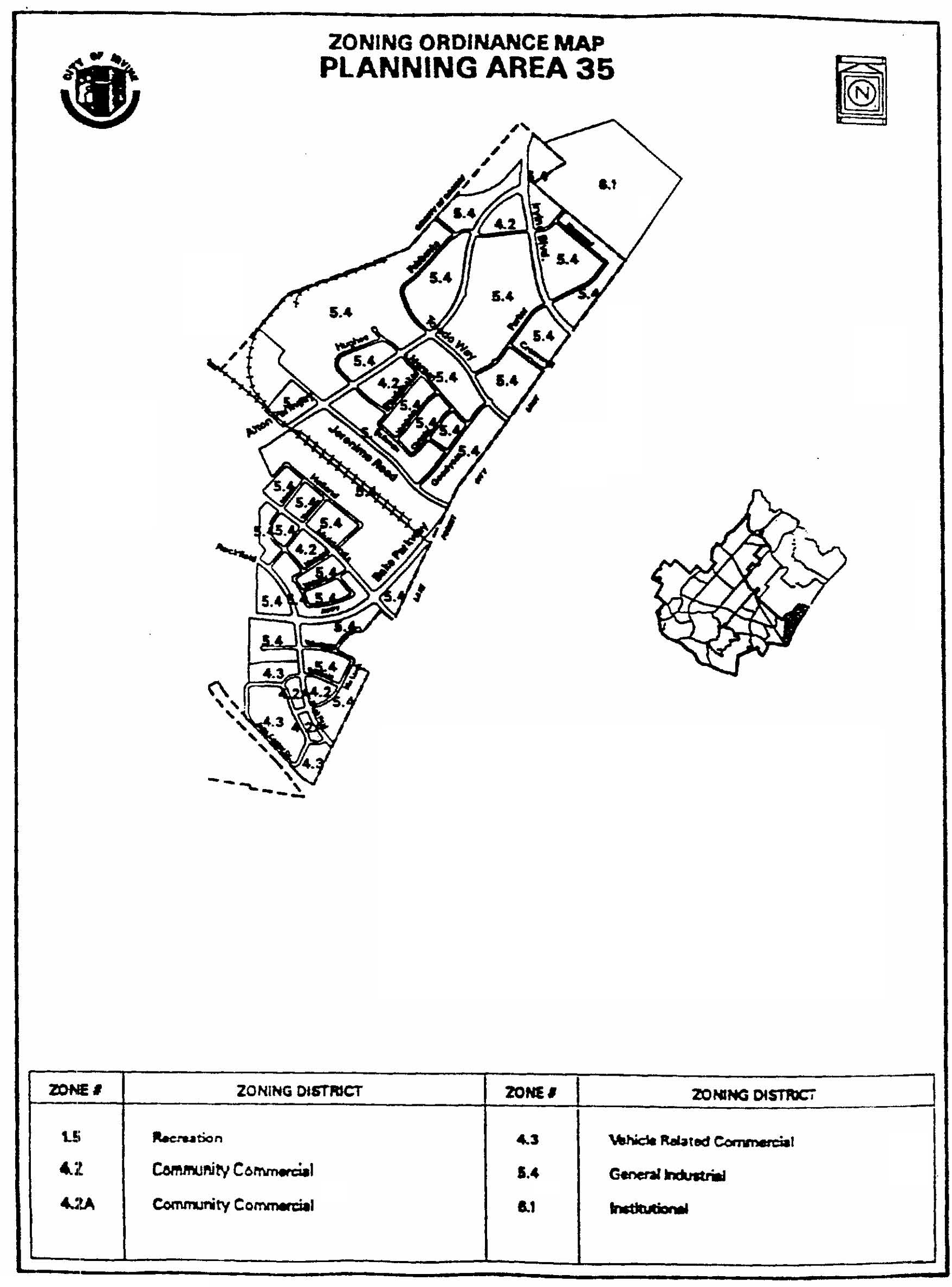
Sec. 9-35-7. - Special development requirements.
A.
Transportation performance monitoring.
1.
See Division 3 for general development requirements.
2.
Development shall be subject to any transportation management plan of the City adopted or amended by resolution of the Planning Commission providing for vanpooling, fleet pooling, ride sharing, shuttle services, public transit, or alternative work hours, or any other measures related to the reduction or mitigation of the effects of traffic and the promotion of efficient transportation services.
3.
Offices are permitted in conjunction with any permitted or conditional use. Office space may occupy no more than 50 percent of the gross aggregate building floor area of a parcel. This limitation does not apply to administrative, business professional, and headquarters offices in the Community Commercial District, or to offices of design professionals in the General Industrial District.
4.
Additional community commercial sites shall be permitted to allow a total of 120 acres. The precise location of these sites shall be determined in conjunction with the subdivision map. These sites shall be subject to the provisions of the Community Commercial category, 4.3.
5.
Signs shall be in accordance with Division 7, except that where two or more permitted uses are established on a single site, a sign program shall be approved by the Director of Community Development.
(Code 1976, § V.E-835.6; Ord. No. 92-3, 4-14-92; Ord. No. 95-4, 5-9-95; Ord. No. 95-22, § 3, 11-28-95; Ord. No. 97-05, 5-13-97; Ord. No. 04-03, § 3, 2-24-04)
Sec. 9-36-1.- Generally.
Please see this Chapter 9-36 for the development standards and Sections 3-30-29, 3-30-31 and 3-30-32 to see which uses are permitted and conditionally permitted.
(Ord. No. 10-07, § 9(Exh. B), 7-27-10)
Sec. 9-36-2. - Land use zoning map.
(See Planning Area 36 map following Section 9-36-5.)
(Ord. No. 10-07, § 9(Exh. B), 7-27-10)
Sec. 9-36-3. - Introduction.
A.
Planning Area 36, Irvine Business Complex, is located along the western edge of the City. Boundaries include State Route 55 (Costa Mesa Freeway) and the John Wayne/Orange County Airport to the west, former USMCAS Tustin to the north, Peters Canyon Wash, the San Diego Creek and the San Joaquin Marsh to the east, and MacArthur Boulevard and Campus Drive (Newport Beach) to the south.
B.
The planning area is divided into four districts. The Multi-Use District is comprised of nearly all portions of the planning area located south of Barranca Parkway. The Residential and Mixed-Use Districts are located in several areas within the Multi-Use District boundaries. The Industrial District is comprised of all portions of the planning area north of Barranca Parkway.
(Ord. No. 10-07, § 9(Exh. B), 7-27-10)
Sec. 9-36-4. - Intent.
It is the intent of this chapter to specify regulations to maintain the development and traffic intensity at the levels analyzed in and mitigated by the final program environmental impact report for the 2010 IBC Vision Plan project.
(Ord. No. 10-07, § 9(Exh. B), 7-27-10)
Sec. 9-36-5. - Statistical analysis.
GROSS SQUARE FOOTAGE*
TRIPS
*The "estimated number of gross square feet" within Planning Area 36 can adjust upward or downward based upon the mix of land uses and is not considered a development cap as is the case in other planning areas. This estimated number can be adjusted as needed by City staff as long as the resulting planning area development intensity is within the planning area development intensity value budget. Land uses may be changed to any permitted or conditionally permitted use within the corresponding zoning district, with the established development intensity values. The minimum required density is 15 du/gross acre.
1 Unallocated dwelling units represent those units remaining in a planning area that may be built anywhere in the same planning area. These units are within the maximum development intensity for the planning area; and, therefore, placement of unallocated dwelling units into any residential category within the planning area for purposes of development is determined to be consistent with the General Plan and Zoning Code with regard to intensity allocation only, provided that placement is otherwise consistent with site specific zoning regulations and that any potential environmental impacts are adequately addressed, including traffic impacts, pursuant to CEQA.
2 See Section 9-0-3.C, Building Intensity Standards.
(Ord. No. 10-07, § 9(Exh. B), 7-27-10; Ord. No. 12-09, § 3(Exh. A), 5-22-12; Ord. No. 15-11, 11-10-15)
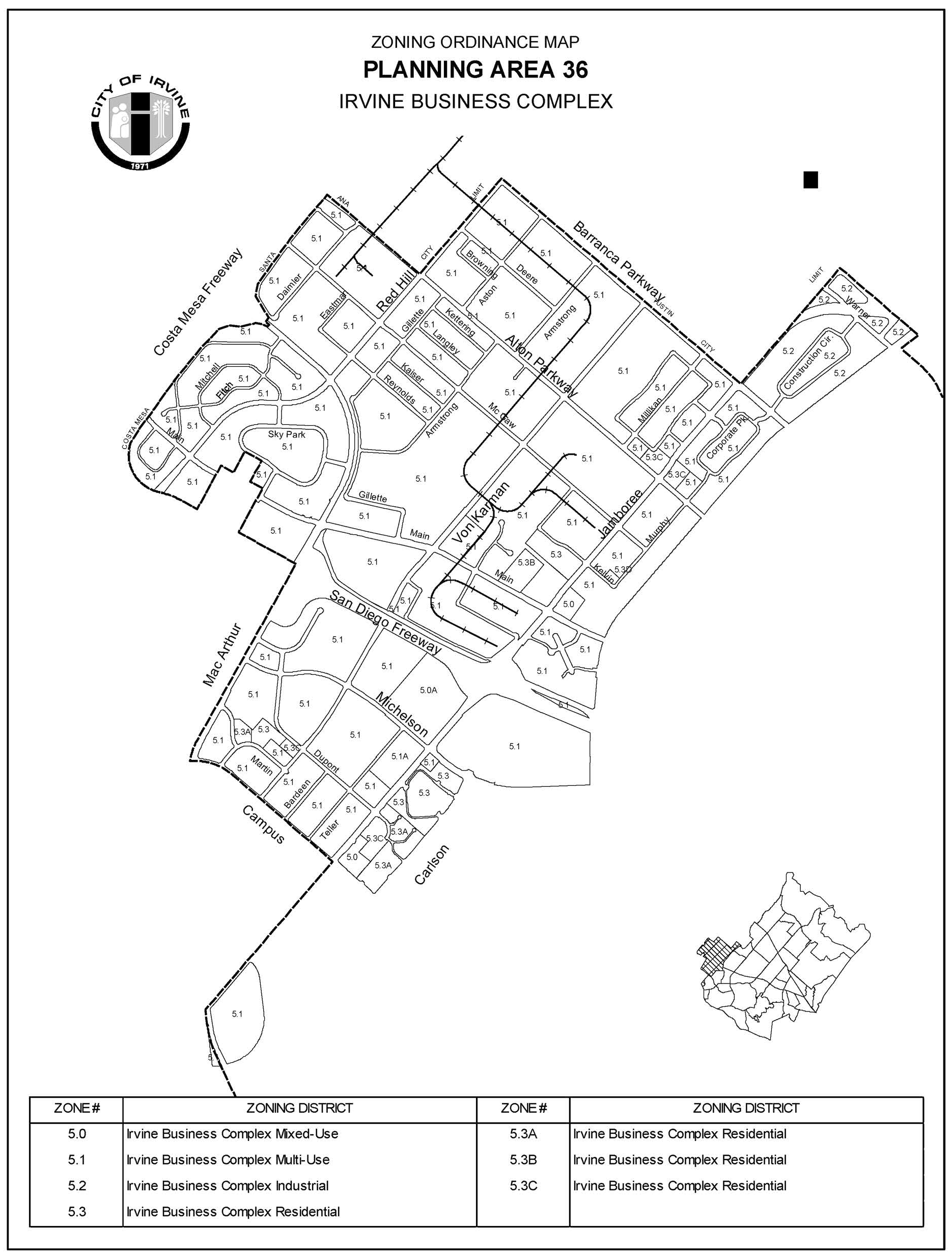
Sec. 9-36-7. - Special development requirements.
See Division 3 and Chapter 5-8 for applicable general development requirements.
(Ord. No. 10-07, § 9(Exh. B), 7-27-10)
Sec. 9-36-8. - Irvine Business Complex land use development intensity value database.
A.
Intent of this section. It is the intent of this section to define the policies used to maintain a land use and development intensity value database for monitoring and regulating the types of land uses and intensity for each property in the Irvine Business Complex.
B.
The Director of Community Development shall maintain a land use and development intensity value database for the Irvine Business Complex.
1.
The IBC land use and development intensity value database shall specify the quantity, in gross square footage, dwelling units and hotel rooms as defined by the Zoning Code, for all existing, approved and zoned development in the planning area by legal parcel and according to the following general land use categories:
a.
Office.
b.
Industrial.
c.
Retail.
d.
Hotel.
e.
Residential.
f.
Zoning potential.
g.
Self-storage facility.
h.
Hotel, extended stay.
2.
The land use and development intensity value database shall specify the corresponding a.m., p.m. and average daily development intensity values allocated for both existing and build-out conditions for each legal parcel in the planning area, which correspond to the traffic intensity levels (vehicle trips) analyzed in and mitigated by the final program environmental impact report for the 2010 IBC Vision Plan project.
Development intensity value allocations for a.m. and p.m. represent a five-day average weekday, and may vary plus or minus 10 percent each day. These allocations shall be based upon the following trip factors:
*Dwelling unit.
**Based on the revision to the Retail Trip Generation Rate approved by City Council on March 24, 2020, all existing retail centers and DIV budgets approved under the prior retail trip generation rate are not revised automatically. Only at the time an expansion is proposed would the existing DIV budget and the proposed DIV budget needed for the expansion be analyzed (with the updated retail trip generation rate now accounted for) to determine the need for additional DIV acquisition and transfer. This process would require discretionary action, consistent with the Modification process described in Section 2-19 of the Zoning Ordinance. The "surplus" trips/DIVs that may result from this process are non-transferable and may not be converted to other land uses at the retail center. These DIVs must remain on the site but would be available for continued retail expansion.
3.
a.
The applicable general land use category for each permitted and conditional use within Planning Area 36 is specified through the use of general land use codes. These codes are included in the land use matrix of this zoning ordinance (see Section 3-3-1) and are defined as follows:
29 Office.
30 Industrial.
31 Retail.
32 Hotel.
33 Residential.
34 Zoning potential.
35 Undefined uses.
36 Uses assumed to have no traffic generation.
37 Self-storage facility.
38 Hotel, extended stay.
b.
The following two codes deal with uses which require special treatment:
35 Undefined uses: Undefined uses include, but are not limited to the following: churches, community facilities, government facilities, commercial recreation, outdoor storage, commercial schools, private schools and public schools, accessory uses, manufactured structures, warehouse and sales outlet, domestic animal care facilities and drive-thru facilities. The general land use categories and corresponding development intensity value rates shall be based upon the City's adopted development intensity value rates as defined in the Table Inset above for the specific land uses proposed. The Directors of Public Works and Community Development shall determine which of the general land use category trip rates most closely resembles the trip generation of the proposed use, based upon the above-noted development intensity value rates, for purposes of establishing a development intensity value.
36 Uses assumed to have no traffic generation: These include parks, pushcarts and heliports for which no traffic generation shall be assumed. Several conditional and permitted uses have also been identified as potential high-traffic-generating uses. Refer to Section 9-36-11 for additional regulations concerning these uses.
4.
Adjustments to database. The Director of Community Development shall regularly adjust the land use and development intensity value database to reflect the status of existing and approved development in relation to the maximum square footage, dwelling unit and development intensity allocations for the planning area. In the event the approved development case (i.e., conditional use permit, Master Plan, development agreement, site design or zoning compliance) has expired, the development intensity allocation and development intensity associated with the approved development shall remain available for use on the site, subject to the terms and conditions of any required discretionary approval. If the proposed development requires a discretionary approval as identified in Division 2 of this Zoning Code, that discretionary case must be approved prior to the use of the development intensity. If no discretionary case is required and the use is a "permitted use," the development of the intensity shall be subject to all applicable development standards.
Unused development intensity may be transferred to another location within the Irvine Business Complex with the approval of a transfer of development rights per Section 9-36-17.
a.
If, as a result of periodic monitoring, the City finds that the allocated intensity for a particular location in the database is inconsistent with what is approved, all necessary adjustments shall be made to the database to reflect what has been documented as approved. Applicants wishing to challenge the intensity allocations for a particular site shall submit floor plans and/or other documentation acceptable to the Director of Community Development to receive credit for existing square footage which was previously approved and inspected by the City.
5.
DIV Credit for existing square footage uses and intensity. In cases where an existing structure is located on the site of a proposed project, credit can be granted for the existing gross building square footage, by use, for purposes of applying the intensity to the proposed project. The procedure for granting credit is as follows:
a.
The applicant shall submit a floor plan of the existing building illustrating the uses and gross square footage devoted to each use prior to the project proposal. The Community Development Department shall verify that appropriate approvals were granted for the establishment of these uses (i.e., building permits). The Department shall calculate the number of a.m., p.m., and average daily development intensity values attributable to the approved uses using the ratios specified in this Section 9-36-8.
b.
Requests for credit for existing gross square footage shall be reviewed and approved by the Director of Community Development for projects which do not require a conditional use permit and by the approval authority for projects requiring a use permit. DIV Credit can only be retained by the applicant if it obtains appropriate permits from the City for any interior alterations or demolitions of buildings. Any demolition must proceed prior to the issuance of any building permits for new structures on the site, or in accordance with a phasing plan approved by the Director of Community Development.
(Ord. No. 10-07, § 9(Exh. B), 7-27-10; Ord. No. 20-04, Exh. A, 4-28-20; Ord. No. 25-18, § 2(Exh. A), 6-24-25; Ord. No. 25-22, 9-9-25)
Sec. 9-36-9. - Subdivisions, mergers and adjustments.
A.
Intent. The following regulations are intended to ensure that the finite quantities of development allocated to each legal parcel in the IBC land use and development intensity value database are accurate and current and that allocated development intensity to each legal parcel is not exceeded as subsequent subdivisions occur.
B.
Applicability. These regulations apply to all applications submitted for properties located in Planning Area 36 (IBC) for tentative parcel maps, tentative tract maps, lot mergers and lot line adjustments.
C.
Development intensity distribution.
1.
Prior to the approval of any final map, lot merger or lot line adjustment for properties located in Planning Area 36, applicants shall submit to the Director of Community Development for review and approval a document specifying the proposed distribution of development intensity for each legal parcel. The approved document shall then be recorded by the County of Orange Recorder's Office.
2.
All initial intensity allocations made to a legal parcel shall be carried through to subsequent subdivisions.
3.
Total development intensity shall not exceed the intensity allocated under the original subdivision configuration existing at the time of the adoption of the 2010 IBC Vision Plan project and associated zone change.
(Ord. No. 10-07, § 9(Exh. B), 7-27-10)
Sec. 9-36-10. - Procedure for analysis of average daily development intensity value.
A.
Intent. This section provides a procedure for (1) analyzing average daily development intensity value for development proposals and (2) identifying and mitigating anticipated traffic impacts (if any) of developments that propose to exceed allocated average daily development intensity value.
B.
Applicability. This section applies to development applications which propose to exceed the average daily development intensity value limits specified for a parcel in the IBC database.
C.
Traffic study.
1.
A traffic study shall be required for development applications proposing to exceed the average daily development intensity value limits for a parcel within the Irvine Business Complex. Assigned general land use category development intensity values shall be utilized for determining whether average daily development intensity value and a.m./p.m. development intensity value allocations in the IBC database are exceeded.
2.
The traffic study shall be reviewed and findings shall be made and approved by the Director of Community Development.
D.
Findings. The following findings must be made in order to approve projects proposing to exceed the average daily development intensity value limits specified for a site in the IBC database:
1.
Approval of the project will not result in exceeding the a.m. and p.m. development intensity values established for the project site in the IBC database. The average daily development intensity value limits established for the project site in the IBC database may be exceeded only if the traffic analysis identifies no impacts or has identified impacts and mitigation measures that show the circulation system has the capacity to accommodate the project.
2.
Approval of the project will not jeopardize the ability of the City of Irvine to qualify for funding sources, including, but not limited to, the Orange County Congestion Management Program (CMP).
E.
Waiver. If the average daily development intensity value limit for a parcel is exceeded, the applicant shall submit a request for a waiver for review and approval by the Director of Community Development or designee.
(Ord. No. 10-07, § 9(Exh. B), 7-27-10)
Sec. 9-36-11. - High-traffic-generating commercial uses.
A.
Intent of this section. It is the intent and purpose of this section to assure that certain land uses which generate high levels of traffic are prevented from exceeding the levels of traffic originally analyzed in the environmental documents for Planning Area 36. These specific land uses are identified with a footnote (T) in the City-wide land use matrix (see Section 3-3-1).
B.
In projects which include uses identified with a footnote (T) in the land use matrix (Section 3-3-1), a conditional use permit shall be required. In addition to the required materials listed in Section 2-9-3, the conditional use permit application shall include a traffic analysis prepared under the direction of the Director of Community Development. Assigned general land use category development intensity value rates shall be utilized for determining whether average daily or a.m./p.m. development intensity value allocations in the database are exceeded. Traffic study requirements may be waived if the project does not meet the minimum traffic generation threshold specified in the traffic study guidelines.
C.
Prior to approval of an extended stay hotel project, the applicant shall submit a vehicle trip generation rate verification study. This study shall demonstrate that the individual project's trip generation rates are consistent with the IBC extended stay hotel development intensity value rates. The Planning Commission shall review and render a decision on whether the individual project's vehicle trip rates are consistent with the IBC extended stay hotel development intensity value rate prior to planning commission review of the project.
D.
Findings. In addition to the findings listed in Section 2-9-7, the following findings shall be made in order to approve a conditional use permit for high-traffic-generating commercial uses:
1.
Approval of the project will not result in exceeding the a.m. and p.m. development intensity value allocations established for the project site in the IBC land use and development intensity value database. The average daily development intensity value limits established for the project site in the IBC land use and development intensity value database may be exceeded only if no impacts are identified, or the traffic analysis has identified impacts and mitigation measures that show the circulation system has the capacity to accommodate the project.
2.
Approval of the project will not jeopardize the ability of the City of Irvine to qualify for funding sources such as, but not limited to, the Orange County Congestion Management Program (CMP) or Measure M.
(Ord. No. 10-07, § 9(Exh. B), 7-27-10)
Sec. 9-36-13. - Sites providing amenities.
A.
Intent of this section.
1.
The intent of this section is to recognize developments which were built during the period in which the Extraordinary Amenities section of the IBC Mixed-Use zoning ordinance was in place (June 30, 1982 to October 23, 1990) and which constructed amenities during that period in conformance with the ordinance.
2.
As part of the database for the Irvine Business Complex, special square footage allocations shall be included to account for amenity credits for eligible locations. To apply for these allocations, applicants must obtain a conditional use permit which must be approved by the City of Irvine Planning Commission.
B.
Eligibility. Limited to those properties which were built and actually constructed qualifying amenities during the period between June 30, 1982, and October 23, 1990. (See IBC database for reserved intensity for amenities.)
C.
Review procedure.
1.
Types of amenities allowed: Amenities such as extraordinary open space, parks, plazas, facilities for the arts, athletic facilities, and child care centers. They shall provide a benefit not only to the site, but also to the larger community. The City shall receive assurance that any structure or area proposed for credit will be used for that purpose for the life of the project receiving this credit through the provision of a document to be recorded separate from the deed.
2.
The site in which the amenity area is located shall be a minimum of 10 gross acres (as recorded on the legal map) in order for the area to qualify. If the site consists of more than one parcel, then the parcels which comprise the 10-gross-acre minimum site must be linked by a comprehensive plan such as a conditional use permit, or Master Plan, approved by the Planning Commission or Zoning Administrator between June 30, 1982, and October 23, 1990.
3.
For each gross square foot of amenity area provided, one gross square foot of office development may be added, up to a maximum of 2,178 gross square feet per gross acre.
4.
Any open space, park, or plaza for which credit is being requested shall comply with the criteria noted below. These criteria shall not apply to areas devoted to lakes or other water elements.
a.
The area must be in addition to that necessary to meet landscaping, park and setback requirements.
b.
Minimum size. The area must contain a minimum of 4,000 gross square feet.
c.
Sunlight patterns. The amenity area shall be able to receive direct sunlight on at least 30 percent of the surface area from 10:00 a.m. to 2:00 p.m. between the fall and spring equinox.
d.
Design and landscaping. At least one major element, such as, but not limited to, artwork or water, shall be included in the amenity area. The dominant landscape elements shall be trees and turf. The amount of impervious surface should not exceed 40 percent of the amenity area unless unique design considerations are offered.
5.
Approval of extraordinary amenity credit shall be granted through a conditional use permit.
(Ord. No. 10-07, § 9(Exh. B), 7-27-10)
Sec. 9-36-14. - Development Impact Fee Program.
A.
Development impact fee. Development is subject to a development impact fee, pursuant to Chapter 9 of Division 7 of Title 2 of the Irvine Municipal Code.
B.
Exemptions from fees. The following types of land uses shall be exempt from payment of fees:
1.
Square footage within a building used to provide recreation or services exclusively to employees who work within the building. The uses shall benefit the employees, and, by providing recreation or services on-site, have the potential to reduce the number of trips employees make to other locations. Examples of such uses include cafeterias, exercise facilities, and employee credit unions. Determination of whether or not a proposed use qualifies for this exemption shall be made by the Director of Community Development. This exemption can only be granted if the property owner enters into an agreement with the City and recorded against the property, ensuring that the square footage remains in the exempt use.
2.
Square footage within the principal building(s) on a site or in a separate building(s) used for resident, employee or customer parking. This exemption does not apply to areas within a building(s) used for vehicle storage.
(Ord. No. 10-07, § 9(Exh. B), 7-27-10; Ord. No. 15-11, 11-10-15; Ord. No. 21-02, Exh. A, 2-23-21; Ord. No. 25-22, 9-9-25)
Sec. 9-36-15. - Requirements for provision of local improvements.
In addition to responsibility to participate in funding the areawide improvements, applicants may be required to construct local improvements if such improvements, as identified in the conditions of approval, are deemed necessary by the Director of Public Works & Sustainability and/or the Director of Community Development.
A.
Review and determination process.In conjunction with applications for development proposals, the applicant may be required to provide a traffic analysis to identify any local improvements necessary to address the traffic impacts of the project. If, as a result of this analysis, the Directors of Public Works & Sustainability and/or Community Development determine that local improvements are needed, the applicant shall be required to provide these improvements as a condition of approval of the development project.
B.
Payment of fees in lieu of construction of local improvements. Applicants may pay fees in lieu of construction of required local improvements subject to the approval of the Directors of Public Works & Sustainability and/or Community Development. The in-lieu fee shall be equal to the construction cost of the required improvements.
C.
Timing of compliance. Prior to the issuance of building permits, the applicant shall submit an estimate of the construction cost for each required improvement. The Director of Public Works & Sustainability shall verify the estimated construction cost or shall revise the estimate. The fee paid by the applicant shall equal the cost accepted by the Director of Public Works & Sustainability.
(Ord. No. 10-07, § 9(Exh. B), 7-27-10; Ord. No. 25-22, 9-9-25)
Sec. 9-36-16. - Affordable housing.
Applications for conditional use permits and/or master plans for residential development shall demonstrate compliance with the Housing Element of the General Plan and City Council Resolution No. 91-28, or subsequent resolution. The conditional use permit and/or master plan will be conditioned to assure compliance with the Housing Element.
(Ord. No. 10-07, § 9(Exh. B), 7-27-10; Ord. No. 25-22, 9-9-25)
Sec. 9-36-17. - Required participation in mitigation measures.
All parcels located within the Irvine Business Complex (Planning Area 36) are subject to the applicable mitigation measures and conditions of approval adopted by the City as part of the Irvine Business Complex Vision Plan/Overlay Zoning Code project approval and the final environmental impact report.
(Ord. No. 10-07, § 9(Exh. B), 7-27-10)
Sec. 9-36-18. - Transfer of development rights.
A.
Intent. It is the intent of this section to allow transfer of development rights between sites within the Irvine Business Complex. Development rights may be transferred from a sending site to a receiving site within the Irvine Business Complex subject to the approval of a Master Plan development case for the transfer of development rights (TDRMP) and/or conditional use permit, depending upon what is otherwise required, except as specified in Subsection H of this section. Approved TDRMP and/or CUP development cases shall include conceptual project plans and other required information which describe how the intensity on the receiving site shall be used. Development intensity transferred to a receiving site through an approved TDR shall remain available for use on the project site in accordance with this section until it is used for development or transferred to another eligible site through appropriate mechanisms described in this section. All conditions of approval affiliated with a TDR approval shall continue to apply to the use of the intensity on the subject site regardless of discretionary approval expiration. If the proposed use requires a discretionary approval separate from the TDR approval, and the separate entitlement either has not been approved or has been approved but has expired, the transferred intensity may not be used unless and until the separate discretionary approval is approved. In the event the intensity is transferred to another site via a new transfer of development rights conditional use permit or Master Plan, any new conditions of approval shall take precedence.
B.
Determination of TDR eligibility. Both the sending and receiving sites shall be located within the boundaries of the Irvine Business Complex (Planning Area 36).
C.
Master Plan application.
1.
Applications to conduct a transfer of development rights shall include the following information for the receiving site:
a.
Conceptual site plan.
b.
Access plan option.
2.
The application shall conceptually identify the proposed use of the total intensity for the receiving site and the adjusted a.m., p.m. and average daily development intensity value budget for both the sending and receiving sites. All three components (i.e., a.m., p.m. and average daily) of intensity must be transferred as a block of intensity.
D.
Determination of development rights to be transferred.
1.
The Master Plan application is required to facilitate review of the conceptual site plan for the receiving site. As such, the materials required for a TDR Master Plan development case shall conceptually identify the approximate locations and configurations of development and potential access points on the receiving site as well as the corresponding distribution of intensity by legal parcel: a.m., p.m. and average daily development intensity values, gross square feet of building area, by use; dwelling units; and hotel rooms.
2.
The application shall also identify the intensity to be transferred from the sending site to the receiving site.
3.
The sending site shall retain sufficient a.m. and p.m. and average daily development intensity values to achieve 0.125 floor area ratio (FAR) office equivalency on the site.
4.
The City shall have the discretion to permit an applicant to transfer development intensity values in excess of those which would result in the sending parcel being developed at less than a 0.125 FAR office equivalency. In such case, the applicant shall have the option of either (1) providing an irrevocable offer of dedication of the parcel to the City for public purposes or (2) demonstrating that a viable project exists which will reasonably function with less than 0.125 FAR of office equivalency. Such offer or demonstration shall occur prior to the issuance of building permits.
E.
Transfer of development rights fee. A fee shall be charged for the transfer of development rights payable prior to the issuance of building permits for the receiving site.
1.
Fee rate. Transfer of development rights fees shall be charged as established by resolution through the City Council.
2.
Fee calculation. Development intensity value fee × Transferred p.m. development intensity values = Total TDR fee.
F.
Findings. The following findings shall be made in order to approve a transfer of development rights development case (MP and/or CUP). These findings are in addition to the findings required in Division 2 (Chapter 2-9 and Chapter 2-17) of this ordinance.
1.
The project shall not adversely affect City infrastructure and services.
2.
There is no adverse impact on the surrounding circulation system. The performance criteria as established in the 2010 - IBC Vision Plan/Overlay Zoning Code project final program EIR is maintained as a result of no impact, or adequate mitigation.
G.
IBC database adjustments. A site which transfers development intensity values ("sending site") shall retain sufficient a.m., p.m., and average daily development intensity values to achieve 0.125 floor area ratio (FAR) office equivalency on the site, except as provided below:
1.
The following requirements apply to all Master Plan and/or conditional use permit applications for transfers of development rights:
a.
Prior to submittal of applications for building permits for either the sending or receiving site, the applicant shall submit an instrument prepared to the satisfaction of the Director of Community Development and the City Attorney executing a transfer of development rights agreement between the receiving and sending site(s). The following information shall be included in the agreement:
(1)
The amount of a.m., p.m., and average daily development intensity values transferred values;
(2)
The remaining amount of a.m., p.m., and average daily development intensity values, including gross square feet of building area, for each site.
b.
Prior to issuance of building permits for either the sending or receiving site, the agreement between the sending and receiving site as described above shall be recorded in the Office of the Orange County Recorder.
H.
A CUP or Master Plan shall not be required for transfers of development intensity values for permitted land uses between parcels located within the same Traffic Analysis Zones (TAZs as defined in the 2010 IBC Vision Plan and Overlay Zoning Code EIR). Such transfers may also be permitted between adjacent zones without the requirement for a CUP or Master Plan if a direct physical relationship between sites in adjacent TAZs can be demonstrated to the satisfaction of the Director of Community Development. Such transfers shall also be exempt from TDR fee requirements. All other TDR provisions of this section shall apply.
(Ord. No. 10-07, § 9(Exh. B), 7-27-10)
Sec. 9-36-19. - Procedure for analysis of development intensity and vehicle trip capture within 5.0 IBC Mixed-Use and 5.1 IBC Multi-Use Districts.
A.
Intent. This section provides a procedure for analysis of development intensity and vehicle trip capture rates for mixed-use projects locating within the 5.0 IBC Mixed-Use and 5.1 IBC Multi-Use Zoning Districts.
B.
Applicability. This section applies only to development applications for mixed-use projects that propose to locate within the 5.0 IBC Mixed-Use and 5.1 IBC Multi-Use Zoning Districts and formally request a development intensity and vehicle trip capture.
C.
Traffic study.
1.
A traffic study shall be required for development applications proposing to utilize trip capture for a parcel within the 5.0 IBC Mixed-Use Zoning District. The most recent ITE formulas and methodologies, as determined by the Directors of Public Works and Community Development, shall be used for calculating the appropriate development intensity and vehicle trip capture rates.
2.
The traffic study shall be reviewed and findings shall be made and approved by the Director of Public Works and Community Development.
D.
Findings. The following findings must be made in order to approve an on-site trip capture rate for a mixed-use project located within the 5.0 IBC Mixed-Use and 5.1 IBC Multi-Use Zoning Districts:
1.
Approval of the project will not result in exceeding the development intensity value identified in the IBC database. The trip capture rate may be used only if the traffic analysis has identified no impacts, or if impacts have been identified, demonstrate mitigation measures that show the circulation system has the capacity to accommodate the project.
2.
Average daily development intensity values may be exceeded subject to the provisions of Section 9-36-11.E of this chapter.
3.
Approval of the project will not jeopardize the ability of the City of Irvine to qualify for funding sources, including, but not limited to, the Orange County Congestion Management Program (CMP).
(Ord. No. 10-07, § 9(Exh. B), 7-27-10)
Sec. 9-36-20. - Environmental standards.
1.
Applicants for new developments in the Irvine Business Complex shall require that the construction contractor provide alternative transportation mode incentives, such as bus passes, and/or carpooling for workers to and from the worksite on days that construction activities require 200 or more workers. These requirements shall be noted on the grading plan cover sheet.
2.
Applicants for new developments in the Irvine Business Complex shall submit evidence to the satisfaction of the Director of Community Development or Director of Public Works that the project uses recycled materials for at least 20 percent of construction materials. Recycled materials may include salvaged, reused, and recycled content materials. Recycled and/or salvaged building materials shall be shown on building plans and product cut sheets submitted to the City.
3.
Applicants for new developments in the Irvine Business Complex shall require that the construction contractor utilize off-road construction equipment that conforms to Tier 3 of the United States Environmental Protection Agency, or higher emissions standards for construction equipment over 50 horsepower that are commercially available. The construction contractor shall be made aware of this requirement prior to the start of construction activities.
4.
Applicants for new developments in the Irvine Business Complex shall submit evidence to the satisfaction of the Director of Community Development that toilets, urinals, sinks, showers, and other water fixtures installed on-site are ultra-low-flow water fixtures that exceed the California Plumbing Code. Such examples include: 1.28 average gallon/flush high efficiency toilets; 2 GMP efficient bathroom faucets, 2.2 GPM efficient kitchen faucets, and 2.2 GPM efficient shower heads.
5.
Applicants for new developments in the Irvine Business Complex shall submit evidence to the satisfaction of the Director of Community Development that landscaping irrigation systems installed on the project are automated, high-efficient irrigation systems that reduce water use, such as an evapotranspiration (ET) "smart" weather-based irrigation controller, dual piping, bubbler irrigation; low-angle, low-flow spray heads; moisture sensors, and use of a California Friendly Landscape Palette. These features will make the project consistent with the intent of California Water Conservation in Landscaping Act of 2006 (AB 1881), including provisions to reduce the wasteful, uneconomic, inefficient, and unnecessary consumption of water.
6.
Reclaimed water shall be used on all master landscaped areas: This will include master landscapes commercial, multifamily, common, roadways, and park areas. The use of reclaimed water directly offsets potable water demand and reduces the GHG emissions associated with irrigation by approximately 70 percent. Master landscapes will also incorporate weather-based ET controllers and efficient irrigation system design to reduce over watering combined with the application of a California Friendly Landscape Palette.
7.
New parking lots shall include tree plantings designed to result in 50 percent shading of parking lot surface areas within 15 years. These shading requirements shall apply to all impervious surfaces on which a vehicle can drive, including parking stalls, driveways, drive aisles, and other maneuvering areas within parking areas. Landscaping shall be provided with drought-tolerant species and groundcovers rather than pavement, in order to reduce heat deflection.
8.
On-site recycling facilities shall be provided on all new developments as required by the Director of Public Works.
9.
Applicants for new nonresidential developments in the Irvine Business Complex shall submit evidence to the satisfaction of the Director of Community Development that proposed buildings are designed and constructed to achieve the 'Designed to Earn the Energy Star' rating. In order achieve the 'Designed to Earn the Energy Star' rating, the architect/design firm must demonstrate that the final estimate of the building's energy use correspond to a rating of 75 or better using the US EPA's Energy Performance Rating from the Internet based tool Target Finder.
(Ord. No. 10-07, § 9(Exh. B), 7-27-10)
Sec. 9-36-21. - Transportation Management Association.
This section allows for the formation of a Transportation Management Association (TMA) within the Irvine Business Complex, the structure and operation of which shall be determined by the Director of Public Works. The objectives of the TMA shall include, but not be limited to, the following:
1.
Monitor travel demand at employment sites and provide reports on trip generation to the City of Irvine.
2.
Offer employees and property owners assistance with transportation services on a voluntary basis.
3.
Deliver transportation services to commuters, such as ride matching, transit and Metrolink information.
4.
Represent the IBC in local transportation matters.
5.
Oversee and fund the implementation and expansion of the i-shuttle system.
(Ord. No. 10-07, § 9(Exh. B), 7-27-10)
Sec. 9-36-22. - Heliports.
Applicants for a conditional use permit for a heliport or helistop shall provide evidence that the proposed heliport or helistop complies fully with State of California permit procedures and with any and all conditions of approval imposed by the Federal Aviation Administration (FAA), the Airport Land Use Commission for Orange County (ALUC), and by the Caltrans Division of Aeronautics.
(Ord. No. 10-07, § 9(Exh. B), 7-27-10)
Sec. 9-36-23. - Accessory retail.
For project sites located more than one-fourth mile from existing neighborhood-oriented retail services, applicants for residential development of 500 units or more, or nonresidential developments of 250,000 square feet or more are strongly encouraged to provide accessory retail uses as defined in the City of Irvine Zoning Code. Should accessory retail uses not be provided, applicants shall provide written rationale for not doing so, as part of the conditional use permit application.
(Ord. No. 10-07, § 9(Exh. B), 7-27-10)
Sec. 9-38-1.- Land use zoning map.
(See Planning Area 38 map following Section 9-38-2.)
(Code 1976, § V.E-838; Ord. No. 93-8, § 5, 6-22-93; Ord. No. 95-1, § 5, 1-10-95; Ord. No. 95-4, 5-9-95; Ord. No. 95-22, § 3, 11-28-95; Ord. No. 05-02, § 5, 1-11-05; Ord. No. 05-03, § 4, 1-11-05
Sec. 9-38-2. - Statistical analysis.
Notes to Section 9-38-2:
*Zone change for Lots 19 and 20 from 2.5 to 2.4.
**All reserve land use categories shall be limited to the permitted land uses in the Exclusive Agriculture category, until the rezoning of those areas.
***Zoning land use reserve designations are conceptual, and correspond to the General Plan land use element diagram. Additionally, the land use reserve building intensity standards are correlated to the General Plan land use element building intensity standards.
1 Unallocated dwelling units represent those units remaining in a planning area that may be built anywhere in the same planning area. These units are within the maximum development intensity for the planning area; and, therefore, placement of unallocated units into any residential category within the planning area for purposes of development is determined to be consistent with the General Plan and Zoning Code with regard to intensity allocation only, provided that placement is otherwise consistent with site specific zoning regulations and that any potential environmental impacts are adequately addressed, including traffic impacts, pursuant to CEQA.
2 See Section 9-0-3.C, Building Intensity Standards.
(Code 1976, § V.E-838.1; Ord. No. 93-8, § 5, 6-22-93; Ord. No. 95-1, § 5, 1-10-95; Ord. No. 95-4, 5-9-95; Ord. No. 95-22, § 3, 11-28-95; Ord. No. 00-02, § 4, 2-8-00; Ord. No. 05-02, § 5, 1-11-05; Ord. No. 10-04, § 3, 4-13-10; Ord. No. 12-09, § 3(Exh. A), 5-22-12)
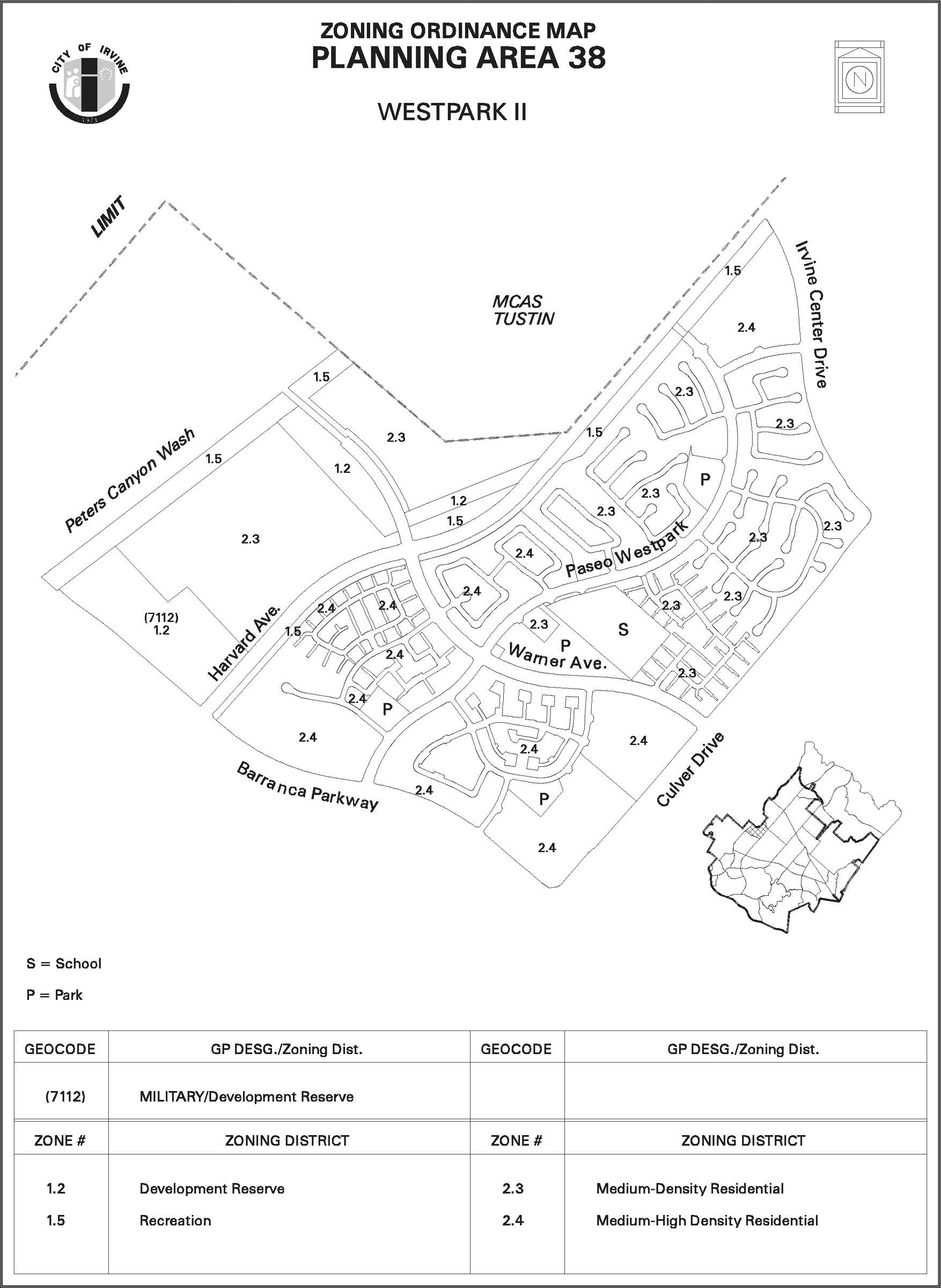
Sec. 9-38-3. - Land use regulations.
Below is a summary of the permitted and conditional uses allowed in this planning area. Additional land use regulations are located in Division 3. (Note: Any amendments to this section also require amendments to Division 3.)
LAND USE MATRIX
(City-wide regulations can also be found in Division 3.)
Notes:
(1)
Interim use.
(2)
Agricultural products only.
(3)
Community park: P.
(4)
Only in public parks.
(5)
See Chapter 3-26 for specific accessory dwelling unit requirements.
(6)
As determined by the City of Irvine, a traffic analysis shall be submitted to determine if on-site and off-site improvements must be made conditions of the project's discretionary approval.
(7)
Use is permitted by right when less than 175,000 square feet of the building's gross square footage is used for warehouse purposes. A traffic study shall be required for this use, and it shall be required for this use, and it shall identify specific on-site and off-site circulation improvements necessary to mitigate the impacts of the projected future development, which shall be implemented prior to and concurrent with the project's construction. In the event identified circulation improvements are not timely constructed, permits required for the project may be withheld and/or a project may be subject to code enforcement or other legal action.
(8)
Use requires an administrative use permit when 175,001 to 225,000 square feet of the building's gross square footage is used for warehouse purposes and a conditional use permit when equal to or more than 225,001 square feet of the building's gross square footage is used for warehouse purposes.
(9)
A private school for adults (18 years and older) that proposes to locate in an existing permanent building and meets all the general development standards will require an administrative use permit (AUP).
(10)
An alternative school that proposes to locate in an existing permanent building and meets all the general development standards will require an administrative use permit (AUP).
(Code 1976, § V.E-838.2; Ord. No. 93-8, § 5, 6-22-93; Ord. No. 95-1, § 5, 1-10-95; Ord. No. 95-4, 5-9-95; Ord. No. 95-22, § 3, 11-28-95; Ord. No. 00-02, § 4, 2-8-00; Ord. No. 05-02, § 5, 1-11-05; Ord. No. 05-16, § 2, 7-12-05; Ord. No. 18-05, Exh. A, 4-24-18; Ord. No. 25-18, § 2(Exh. A), 6-24-25; Ord. No. 25-22, 9-9-25)
Sec. 9-38-4. - Development standards.
Below is a summary of the development standards applicable to this planning area. Additional standards are located in Division 3. (Note: Any amendments to this section also require amendments to Division 3.)
DEVELOPMENT STANDARDS
(City-wide regulations can also be found in Division 3.)
Notes:
(1)
Architectural features may be permitted to exceed maximum building heights.
(2)
May be increased if required for sound attenuation. Setbacks for City streets and private drives will be measured from curb face.
(3)
Property line/wall setbacks from the east curb face of Harvard Avenue shall be a minimum of 75 feet.
(4)
Building/wall setbacks from the curb face of Paseo Westpark shall be a minimum of 35 feet with a 50-foot average building setback.
(5)
Ten feet minimum, 20 feet average.
(6)
Ten feet minimum, 15 feet average.
(7)
Subject to Building Code requirement.
(8)
Ten feet plus two feet for every five feet in height over 30 feet.
(9)
See special development requirements, Section 9-38-5.A.1.h and i.
(10)
For church uses, building height standards for the Medium-High Density Residential category shall apply.
(11)
Minimum site landscaping shall apply to the residential, cluster use and may include sidewalks and paseo/bikeway paths within project area.
(12)
Section 3-27-10, Garage and Carport Setback Requirements, from private drives shall apply to projects west of Harvard Avenue.
(Code 1976, § V.E-838.3; Ord. No. 93-8, § 5, 6-22-93; Ord. No. 95-1, § 5, 1-10-95; Ord. No. 95-4, 5-9-95; Ord. No. 95-22, § 3, 11-28-95; Ord. No. 00-02, § 4, 2-8-00; Ord. No. 05-02, § 5, 1-11-05)
Sec. 9-38-5. - Special development requirements.
A.
Land use.
1.
Residential.
a.
Prior to the approval of the first tentative tract map, the applicant shall submit an affordable housing program to be approved by the Planning Commission. For the area west of Harvard Avenue, the affordable housing program shall comply with Section 2-3 of the Zoning Code. For the remainder of PA 38, the program shall comply with the following requirements:
(1)
Term of program. The program will commence on the date it is approved by the Planning Commission and shall be administered until the full build-out of Planning Area 38, except that the program shall be in effect for the term of affordability of the housing provided.
(2)
Tier I: Income Level II.
(a)
The applicant shall provide 10 percent of all dwelling units constructed by the project as newly constructed on-site dwelling units affordable to households earning up to 50 percent of the Orange County median income ("Income II units"). The City shall make processing and financial incentives available to the applicant to aid the applicant in satisfying its Tier I obligation. Such financial incentives are preferred over the provision of processing incentives. Processing incentives are to be used as a last resort. At the City Council's discretion, the applicant may be permitted to satisfy this Tier I requirement through either of the following mechanisms:
1.
Payment of in-lieu fees. Providing the City Council adopts an in-lieu fee program, and, further, providing the City Council authorizes this alternative, the applicant may satisfy its Tier I obligation by paying an affordable housing in-lieu fee in an amount equal to the "amount of subsidy" as that term is defined in Subsection (5)(c) below.
2.
Sale of equivalent value in land. If authorized by the City Council, the applicant may satisfy its Tier I obligation by selling sufficient land to the City to provide for the development of 10 percent of the total number of units to be constructed by the project as Income Level II dwelling units. For the purposes of this mechanism, the land to be used would be zoned Medium Density or Medium-High Density Residential within Planning Area 38. The applicant shall then sell land to the City at a price which is discounted in an amount equal to the "amount of subsidy."
(b)
Compliance with this Tier I requirement in the manner described above is dependent upon the applicant's ability to obtain financial incentives in an amount equal to or greater than the "amount of subsidy." In the event that financial incentives are "unavailable" as that term is defined in Subsection (5)(b) below, the applicant shall satisfy its Tier I obligation by either of the following mechanisms:
1.
Construction of Income Level III units. The applicant shall construct 10 percent of the total number of units to be constructed by the project as new dwelling units affordable to households earning between 50 and 80 percent of the Orange County median income (Income Level III units); or
2.
Conversion of existing market rate units. Convert off-site market rate units to Income Level III affordable units in a number equal to one-half of this Tier I requirement with the other one-half to be satisfied per Subsection 1 above. If the conversion option is chosen, the program must specify the criteria for measuring the dispersion of affordable units along with its socioeconomic impact on existing neighborhoods and be approved by the Planning Commission before the approval of any tentative tract map.
(c)
In the event that the financial incentives are "limited" as that term is defined in Subsection (5)(b) below, the applicant shall satisfy its Tier I obligation by providing a combination of Income Level II and Income Level III units. The relative number of Income Level II and Income Level III units shall be determined in the following manner:
1.
The number of Income Level II units to be constructed shall be determined by dividing the "amount of subsidy" into the total amount of financial incentives the applicant will receive for Tier I.
2.
The balance of the Tier I units the applicant is required to provide shall be satisfied by either the construction of Income Level III units or the conversion of off-site existing market rate rental units to rental units affordable to Income Level III households in a number equal to one-half of this Tier I requirement. (See example, Subsection (5)(c) below.) If the conversion option is chosen, the program must specify the criteria for measuring the dispersion of affordable units along with its socioeconomic and environmental impact on existing neighborhoods and be approved by the Planning Commission before the approval of any tentative tract map.
(3)
Tier II: Income Levels I and II.
(a)
The applicant shall have the option of providing financial/technical assistance and/or making land available (reservation of land) which is zoned for medium density or Medium-High Density Residential development to allow the City, a nonprofit builder, or a combination thereof, which may also include the applicant, to provide 1.5 percent of all dwelling units built in this project as newly constructed units affordable to households earning up to 50 percent of the County median income, and for the purpose of constructing one percent of all dwelling units built in this project which are affordable to households earning up to 30 percent of the County median income. The land will be reserved for a defined period of time, as determined in the affordable housing program, for acquisition at fair market value based on the density range of residential development approvals provided by zoning. This reservation shall be for a period not longer than the issuance of building permits representing 75 percent of the residential development to be constructed within the project, or for a period of four years from the approval of zoning or recordation of any final map, whichever occurs first.
(b)
This Tier II formula shall not obligate the applicant to dedicate any land, nor does it require the City or nonprofit builder to construct any dwelling units.
(c)
As an alternative to reserving land for a defined period of time, the applicant may provide for this Tier II portion of the program through conversion of off-site existing market rate dwelling units to affordable units (as discussed in Tier I above) or other mechanisms, including, but not limited to, the payment of in-lieu fees, if an in-lieu fee program is adopted by the City Council. The applicant has no construction requirements hereunder.
(4)
Tier III: Income Level III.
(a)
The applicant shall develop and implement a monitoring process through build-out of the project which would generate a report on a semiannual basis. This report would permit the City to evaluate the extent to which the project is providing 12.5 percent of all newly constructed units which are affordable to households earning up to 80 percent of the County median income. If the reporting requirement shows that the project is producing the 12.5 percent of all newly constructed units at up to 80 percent of the County median income, the applicant has no other requirements under this Tier III.
(b)
In the event that the report reflects that the housing units built in this project do not meet the affordability criteria of this Tier III, the applicant agrees to establish, through negotiations, specific affordability requirements for this Tier III consistent with the Housing Element goal of 12.5 percent at Income Level III and consistent with Subsection (5)(j) below. The City shall provide processing incentives and financial incentives to the extent available to facilitate the maintenance of affordability of those units for which specific requirements are established. In the event that financial incentives are "limited," the applicant shall satisfy its Tier III obligation by providing a combination of Income Level III and market rate units with the number of Income Level III units to be maintained and determined by dividing the "amount of subsidy" into the total amount of financial incentives the applicant will receive for Tier III. In the event that financial incentives are "unavailable," the applicant has no other requirements under this Tier III.
(c)
In the alternative, applicant may, at its option, be relieved from this monitoring or compliance requirement through the payment of in-lieu fees or dedication of land in an amount equal to the "amount of subsidy" at the discretion of the City Council, provided that an in-lieu fee program is adopted by the City Council.
(5)
For the purpose of this requirement of zoning, the following notes shall apply:
(a)
"Financial incentive" means governmental monetary assistance to the project for the purpose of lowering the cost of providing affordable units. Examples of financial incentives include, but are not limited to, mortgage revenue bonds, community development block grant (CDBG) funds, linkage fees, housing trust fund monies, and tax increment financing if such incentives are made available by the City Council.
(b)
The phrase "unavailable financial incentives" shall mean that financial incentives as defined in Subsection (a) above are absolutely not available for the project. However, financial incentives shall not be deemed to be "unavailable" if the applicant's project cannot receive financial incentives as a result of the applicant's failure to provide the requisite quality or quantity of affordable housing to qualify for financial incentives. The phrase "limited financial incentives" shall mean that the total amount of financial incentives obtainable for the project equals an amount less than the total amount of funds necessary to bridge the affordability gap as discussed on pages 7—18 of the "City of Irvine, The Economics of Affordable Housing Development" report as may be updated by the City Council from time to time (the "amount of subsidy"). No amount of financial incentives shall be deemed to be limited if such limitation is a result of the applicant's failure to provide a quality or quantity of affordable housing necessary to obtain the financial incentives.
(c)
"Amount of subsidy" shall be an amount equal to the funds necessary to eliminate the affordability gap as discussed on pages 7—18 of the "City of Irvine, The Economics of Affordable Housing Development" report prepared by Rosen & Associates, 1989, as updated or revised from time to time by the City Council. By way of example only, to calculate the amount of the subsidy, assume that the applicant shall construct 500 units as a result of the project. Because the applicant is required to construct five percent Income Level II units, the applicant shall have an obligation to construct 25 Income Level II units. Further assume that the "amount of subsidy" is $10,000 per unit. Assume also that the applicant has obtained $100,000 in financial incentives. Under this scenario, the applicant will be obligated to build 10 Income Level II units ($10,000 (amount of subsidy) divided into $100,000 (financial incentives obtained) equals 10 (number of Income II units required)). As a result, the applicant shall have an obligation to either construct the remaining 15 units as new Income Level II or III units or convert 15 off-site market rate units to rental units affordable to Income Level II or III households.
(d)
"Processing incentives" are any other types of changes to existing land use policies which will increase the applicant's ability to provide affordable housing. These incentives may include, but shall not be limited to, development standards modifications for setbacks, building height, parkland requirements and parking requirements; expedited processing; fee waivers; and density bonuses granted only according to Government Code parameters.
(e)
"In-lieu fee" means the payment of a fee derived from determining the difference between the cost of producing a market rate unit as opposed to an affordable unit. This difference is commonly known as the "affordability gap," which is defined as the subsidy required to provide housing units at designated income levels.
(f)
Production and conversion of affordable units will be evaluated for dispersal, with no absolute requirement for them to be produced on the housing development site, except for one-half of the requirement for Tier I, which must be provided on-site.
(g)
At least 10 percent of all affordable units produced or converted pursuant to Tier I shall provide three or four bedrooms.
(h)
At least 10 percent of all affordable units produced or converted pursuant to Tier I shall be adapted (as defined in Title 24 requirements) for the physically handicapped.
(i)
Except as provided in Subsection (g) above, the number of affordable studio, one-bedroom, two-bedroom, three-bedroom or four-bedroom units will be proportionate to the mix of market rate apartment units within an apartment project whether produced on or off the project site.
(j)
All affordable units produced in satisfaction of this condition of approval shall be maintained according to the income categories identified in Tiers I and II, and including Tier III if applicable, and shall be so maintained for a period of 30 years, unless the Housing Element is amended to require a shorter term of affordability. In this instance, the applicant would be required to request a zone change to reduce the 30-year term. Financial incentives will be made available to the applicant (if available) to facilitate the final 15 years of affordability.
(k)
The leasing of rental units shall conform to the City's prioritization policy. This means that preference for occupancy of affordable units will be given to households having one member with full-time employment in the City, or in receipt of a Section 8 certificate or voucher.
(l)
Construction of affordable units pursuant to Tier I shall be phased to be generally concurrent with the construction of market rate units. Consistency with this phasing plan shall be demonstrated as part of the affordable housing program.
(m)
The applicant shall be responsible for coordinating with the City in implementing this program on its own behalf and on behalf of its merchant builder.
(n)
Implementation of this requirement of zoning shall not be limited or restricted in any way by the approval of any vesting subdivision map or development agreement. The City shall retain full discretionary authority over the terms and conditions of the build-out of Planning Area 38 with respect to this requirement of zoning, notwithstanding the approval of any vesting subdivision map or development agreement.
(o)
"Project" shall mean the Planning Area 38 zone change (87-ZC-0123) and the dwelling units to be built thereunder.
b.
The affordable housing units required will feature architectural design and building materials similar to and compatible with the surrounding homes and other development.
c.
Prior to the issuance of the first building permit in Planning Area 38, a program to encourage employees working within the Irvine Business Complex and other Irvine employment centers to reside in this planning area shall be submitted for review and approval by the Director of Community Development.
d.
(1) In addition to the affordable units required by Subsection A.1.a of this section, the 284 housing units required as part of the Planning Area 34 approval shall be developed in Planning Area 38. These 284 housing units will be for sale or rent in a price range affordable to a family of four with incomes below 60 percent of the HUD County median income. At least 10 percent (28) of these units will be three-bedroom units and at least 40 percent (114) will be two-bedroom units. The applicant shall utilize HUD income criteria for adjustments for smaller and larger families. Monthly rental rates shall be restricted so as not to exceed 30 percent of the gross household income for rent.
(2)
Ownership units shall have a 10 percent maximum down payment and a sales price not to exceed three times the annual gross household income. The units shall remain affordable to households with incomes at 60 percent and below of the HUD County median income for at least 30 years.
(3)
The units will feature square footage, architectural design and building materials similar to and compatible with the surrounding homes and other development.
(4)
During the initial rental or sale of these units, the applicant will encourage employees working within Village 34 and other Irvine employment centers to reside in the new village. Details of the program will be submitted to the City prior to approval of any subdivision in the new village. Concurrent with the submittal of the master tentative tract map, the applicant shall prepare a map which indicates the location and distribution of the 284 units which will be made available at the required income ranges when required by this condition.
(5)
In preparation of this map, the low-cost housing sites will be distributed to prevent undue concentration of low-cost housing in any one location.
(6)
Up to a total of 7,105,440 gross square feet of construction, as measured by the issuance of building permits, shall be allowed in Village 34 prior to compliance with this condition.
(7)
If compliance with this condition has not been met at this time, no additional development will be allowed in Village 34.
(8)
The City and The Irvine Company will cooperate in seeking governmental assistance or other alternatives to provide the 284 units.
e.
The development at the northwest corner of Culver Drive and Barranca Parkway shall be zoned Medium-High Density Residential to provide a "gate post," as indicated in the Irvine activity corridor urban design study.
f.
Reserved.
g.
In conjunction with the submittal of conditional use permits for individual residential single-family developments, the applicant shall submit, for review and approval by the Planning Commission, a street tree program designed to achieve an attractive street scene in each development. The design shall consider the following:
(1)
Trees planted in the front yards of homes. Consideration shall be given to design which takes advantage of and complements the variable setback requirement in areas zoned Low-Medium Density Residential.
(2)
Trees planted in areas adjacent to the local streets, such as in a landscape parkway.
(3)
Long-term maintenance and replacement program for damaged trees and trees required to be removed for other reasons.
h.
In conjunction with the submittal of an application for the master tentative tract map for Planning Area 38, the applicant shall indicate on the map the four-milligauss magnetic fields contour line. No residential living area or child care buildings shall be developed between the Southern California Edison right-of-way and the magnetic fields contour line. This contour line shall be based upon the typical annual mean load (medium load if annual mean is not available) as provided by Southern California Edison. "Residential living area" is defined as the area included within the exterior walls of a building, excluding any garage or storage area.
i.
In conjunction with the submittal of applications for conditional use permits for residential and child care uses, the applicant shall submit and have approved by the Director of Community Development a study that addresses the current research on residential magnetic field levels. The study shall include a compilation of the current research for the average typical exposure of residential magnetic field levels in Southern California homes. If the Director of Community Development determines that the research indicates that the average typical exposure level is substantially different from the four-milligauss level included in the Planning Area 38 project, then the milligauss contour lines shall be revised and restrictions pertaining to residential living area and/or child care buildings as contained in Subsection A.1.h shall apply using the revised contour line. The applicant may propose alternate mitigation measures as an alternative to modification of the electromagnetic field contour lines provided that such mitigation measures demonstrate the ability to reduce magnetic field exposure to the average typical exposure level. Such mitigation measures will be subject to the approval of the Director of Community Development.
j.
Prior to the issuance of any grading or building permits for development within Planning Area 38, screening shall be provided at the curbline along the Culver Drive, Barranca Parkway, Harvard Avenue and Irvine Center Drive planning area edges. The screening provided shall be in the form of a temporary opaque fencing. The temporary screening may be modified as necessary to accommodate infrastructure improvements, but shall remain until the ultimate edge improvements are installed in accordance with the master wall, streetscapes and park plan approved for the planning area. In any case, the permanent planning area theme wall along Culver Drive shall be approved and constructed prior to the issuance of any certificates of use and occupancy for any development within Planning Area 38.
k.
Prior to the approval of any development application for residential uses, the applicant shall demonstrate how the project will be participating in a waste management program which includes, but is not limited to, the following:
(1)
A commitment to contract with a recycling business for collection and reprocessing of glass, paper, and aluminum until such time as the City of Irvine expands its recycling program to include multifamily residential buildings. An implementation schedule shall be submitted identifying that the proposed recycling program will commence upon initiation of regular solid waste refuse collection.
(2)
Provision of on-site receptacles to accumulate paper, bottles, and aluminum for recycling purposes.
(3)
A program for the distribution of information encouraging residents to participate in source reduction and recycle all potential recyclable waste products.
(4)
A program for the distribution of information to residents on the County's household hazardous materials collection program, which shall include, but is not limited to, which items are considered household hazardous materials, procedures for deposition and location of the regional collection centers.
B.
Public and private facilities.
1.
Open space.
a.
The north/south open space spine will occur on the east side of Harvard Avenue, between Barranca Parkway and Irvine Center Drive. The open space spine shall consist of 75 feet measured from the east curb of Harvard Avenue.
b.
Concurrent with the recordation of the first final map within Planning Area 38, an irrevocable offer of conveyance for the Peters Canyon Wash open space spine, located on the east side of Harvard Avenue from Barranca Parkway to Irvine Center Drive, shall be recorded. The offer shall provide that it may be accepted no sooner than 90 days following issuance of building permits for 75 percent of the development for Planning Area 38 or completion of development in Planning Area 38, whichever occurs first.
c.
Development of the open space spine will be in conformance with Exhibit 5, cross section 5B or 5C.
d.
Concurrent with the recordation of the first final map for Planning Area 38, the landowner shall implement a program allowing public access over the existing haul road at the northern extension of the proposed Jeffrey Open Space Spine consistent with the criteria specified in Attachment F (Haul Road Access Terms and Conditions) of the memorandum of understanding between the City of Irvine and The Irvine Company on September 26, 1988.
2.
Parks.
a.
The park program will be consistent with the parks and recreation element of the City of Irvine General Plan and the Local Park Code.
b.
The conceptual location of neighborhood parks is indicated on Exhibit 4. The exact number of parks, locations, configurations, sizes and total acreage requirements will be determined through the master tentative tract map, walls, streetscapes and park plans, and park modification approvals.
c.
Neighborhood park requirements shall be met by the dedication and improvement of at least five parks, both public and private, and the provision of an additional number of smaller private parks of at least 0.3 acre in size.
d.
Each small private park shall be located within the neighborhood it serves and shall be provided with convenient pedestrian access from the residential units within the neighborhood. For the neighborhood west of Harvard Avenue, formerly known as Marble Mountain and Moffett Meadows, a reciprocal access agreement shall be included in the CC&Rs to allow residents in the Irvine portion of the project to access the private recreation facilities within the project that are located on the north side of Warner Avenue in the City of Tustin. The developer shall submit CC&Rs for review and approval by the City of Irvine Community Development Director prior to recordation of the first final map.
e.
Community park dedication requirements for this planning area have been satisfied by the dedication of parkland at the confluence of the San Diego Creek and Peters Canyon Wash.
f.
Prior to approval of the wall, streetscapes and parks plans for the neighborhood parks, it shall be demonstrated that the parks are designed to serve the adjacent residential areas and shall be oriented accordingly. Contribution of aesthetic qualities to streets shall be secondary to the relationship to the population each park serves.
g.
The walls, streetscape and park plans for the public and private neighborhood parks shall, where feasible, include the use of larger trees and a wide variety of trees.
h.
In conjunction with the submittal of a conditional use permit, or Master Plan application for individual residential developments, particular attention shall be given to those residential units that are located directly adjacent to the park sites. The design of these units should consider, but not be limited to the following:
(1)
Orientation of the units towards the park, to take advantage of the view and open space opportunities presented.
(2)
Where possible, both visual and physical access to the parks shall be provided. Visual access shall be encouraged through the use of creative wall and fence designs. Wall and fence designs shall utilize a combination of materials to preserve a reasonable degree of security, while optimizing the view of the park.
i.
The Community park dedication requirement for the development west of Harvard will be satisfied by the dedication of park land and/or construction of park improvements, or in-lieu fees, consistent with the subdivision ordinance and park and recreation element.
j.
The conceptual location of one public neighborhood park for the area west of Harvard Avenue is shown on Exhibit 4. Private neighborhood parks will also be provided west of Harvard Avenue in order to meet City requirements. A park plan for Planning Area 38 west of Harvard Avenue shall be submitted to the Director of Community and Library Services concurrently with the first tentative tract map for any residential portion of Planning Area 38. The exact number, precise location, configuration and size of local neighborhood parks and the distribution of public and private parks will be established at the time of approval of the first tentative tract map for residential portions of Planning Area 38 in accordance with the park and recreation element and subdivision ordinance. The park plan may include the recommendation for lighting future athletic courts at the adjacent school site
3.
Schools.
a.
Prior to approval of the master tentative tract map for Planning Area 38, two elementary school sites shall be reserved in Planning Area 38 for development by the Irvine Unified School District. The exact location, configurations, sizes, and total acreage of the schools will be identified through review of the master tentative tract map. In addition, a school site is identified at the northwest corner of Barranca Parkway and Harvard Avenue. In the event that the Irvine Unified School District Board determines that those sites reserved for schools are not needed, or are deemed inappropriate for such development, then those sites may be developed in accordance with the underlying zoning of the property. However, approval of such development shall not occur without a written letter of agreement from the Irvine Unified School District Board indicating that the site(s) are no longer needed for school development and are therefore released by the district.
b.
Reserved.
c.
Prior to approval of the master tentative tract map for Planning Area 38, consideration shall be given to the following when locating future school sites:
(1)
Elementary school facilities shall be centralized within the residential areas where feasible.
(2)
Elementary schools shall be located on local streets and/or local collectors so as not to require the crossing of highly traveled streets.
(3)
Safe pedestrian and bicycle access to school sites shall be maximized.
(4)
Where feasible, elementary schools shall be located adjacent to public parks.
4.
Child care.
a.
The need for child care facilities shall be recognized in the development of Planning Area 38. Based upon 4,270 units and the ultimate projected population for the portion of PA 38 east of Harvard Avenue, the City has identified a goal of providing slots for a minimum of 341 children in child care centers.
b.
Reserved.
c.
In reviewing child care development applications, specific consideration shall be given to the compatibility of child care with adjacent uses. Child care centers are especially compatible with certain land uses based upon access, convenience, and environmental factors. Development of child care centers in conjunction with the proposed elementary schools and the neighborhood parks, and within residential complexes, shall be encouraged in Planning Area 38.
d.
In locating child care centers, the proposed sites shall be evaluated in regards to factors that might be detrimental to the public health, safety, or welfare, including, but not limited to, proximity to high-traffic-volume roadways, hazardous materials, major industrial pollutants, electric power lines, and major generators of traffic.
e.
The exact locations, configurations, and size requirements of the sites designated for child care shall be determined through the master tentative tract map approval. The applicant for the master tentative tract map shall work with the City's Child Care Committee to ensure that the parcels reserved for child care are of adequate size to achieve the City's desired goal, including spaces for infants, adequate parking, and an overall high quality of facilities. The size of parcels reserved for child care shall be a minimum of 1.5 acres unless the applicant can demonstrate to the satisfaction of the Directors of Community Development and Community and Library Services that the smaller parcels are adequate to provide care for the desired number of children.
f.
In conjunction with the submittal of an application for the master tentative tract map for Planning Area 38, the applicant shall submit to the City for review, and obtain approval of, the appropriate language pertaining to "deed restrictions" imposed on parcels of land reserved for child care use within Planning Area 38.
5.
Eucalyptus.
a.
The existing windbreaks in Planning Area 38 shall be preserved. Prior to the approval of the master tentative map for Planning Area 38, the applicant shall submit and the Director of Community Development shall approve a plan which demonstrates the following:
(1)
Northerly tree row. The northerly windbreak between Warner Avenue and Paseo Westpark shall be preserved and incorporated into a neighborhood park. The eucalyptus tree row between Paseo Westpark and Harvard Avenue shall be preserved and incorporated into a primary paseo.
(2)
Southerly tree row. The southerly windbreak shall be incorporated into the design of a neighborhood park. The remainder of the eucalyptus trees shall be incorporated into the site plan of the adjacent parcel, unless the applicant can demonstrate appropriateness of deletion of the trees. Any request for deletion shall be subject to Planning Commission review and approval.
(3)
All existing trees shall be plotted on the master tentative tract map for Planning Area 38. Those trees requiring removal as part of the mass grading, or infrastructure improvement, or for any other reason, shall be identified as such. Any trees that require removal shall be replaced in the same location and configuration as the original windbreak with new Eucalyptus rudis.
(4)
In those areas where trees have been felled and stumps remain, the stumps shall be removed and replacement eucalyptus trees shall be planted to provide a continuous row of trees.
The approved plans shall be utilized as a planning tool for all subsequent developments within Planning Area 38.
6.
Fire station.
a.
Prior to recordation of a final map, the applicant shall enter into an agreement with the County of Orange and the City of Irvine regarding the capital improvement funding to equip a fire station located on City property south of Barranca Parkway, west of Harvard, known as the "triangle piece" in Planning Area 14. This agreement shall include the applicant's participation on a fair share basis in the construction of the station and the purchase of apparatus necessary to equip the station.
C.
Circulation.
1.
Streets.
a.
The major public street components related to development of this area include: Culver Drive and Irvine Center Drive as thruways, Barranca Parkway, Warner Avenue and Harvard Avenue as parkways, and Paseo Westpark and Hearthstone as local streets, as shown in Exhibit 1. All future development proposals shall be evaluated for consistency with the cross sections for the major streets as depicted in Exhibits 5A through 5L.
b.
No direct residential driveway access shall be provided onto Culver Drive, Barranca Parkway, Harvard Avenue, Irvine Center Drive, Warner, Paseo Westpark or Hearthstone.
c.
Reserved.
d.
Reserved.
e.
Paseo Westpark will be developed as the community theme street featuring an average building setback of 50 feet with a 35-foot minimum building setback from face of curb, meandering eight-foot sidewalks on both sides of the street, and a two-lane paved road section with eight-foot bicycle lanes. See Exhibits 5K and 5L.
f.
The landscape themes for Planning Area 38 shall be consistent with the landscape themes established in Westpark (Planning Area 14). The master wall, streetscape and park plan for Planning Area 38 shall require the following:
(1)
Informal plantings of deciduous and evergreen trees, with the evergreen being the major tree for the north side of Barranca.
(2)
Tall vertical trees on the Culver Drive planning area edge immediately north of the Barranca Parkway entry plaza, as a visual emphasis for the activity corridor.
(3)
Provision of landscape treatment along the planning area edge and all major streets as shown on Exhibits 5A through 5L.
g.
In conjunction with the submittal of the master wall, streetscape and park plan for Planning Area 38, the applicant shall submit a landscape and maintenance plan for the intersection plazas to be reviewed and approved by the Director of Public Works and the Director of Community Development.
h.
The master walls, streetscapes and park plan shall address the design of the intersection plazas shown on Exhibit 3. Pedestrian access shall be considered and strongly encouraged through intersection plazas to facilitate pedestrian access to the adjacent land uses. Pedestrian access shall, in all cases, be designed into the intersection plazas at Paseo Westpark and Warner.
i.
Community identity signing will be provided where shown in Exhibit 2. Prior to the submittal of applications for sign permits, the applicant shall submit and the Planning Commission shall approve a sign program for the planning area.
j.
The area located west of Harvard Avenue shall have a separate Master Landscape and Trails Plan, submitted concurrently with tentative tract maps, that will be compatible with the remainder of Planning Area 38.
2.
Bicycle trails.
a.
Bicycle trails shall be provided on-street in a manner consistent with current City of Irvine policy. The cross sections depicting the location of these trails are shown in Exhibits 5A through 5L.
b.
An 11-foot-wide paseo providing bicycle and pedestrian circulation within the planning area will occur in the open space spine along the east side of Harvard Avenue without grade-separated crossings. This paseo shall be delineated in the master wall, streetscape and park plan for the planning area and a construction phasing schedule shall be established prior to approval of the master wall, streetscape and park plan application.
c.
In conjunction with the submittal of an application for a tentative tract for Planning Area 38 west of Harvard, the applicant shall prepare a Master Landscape and Trails Plan (including section diagrams of interior and surrounding roadways), bike paths and trails. The plan shall include a cross section for the Peters Canyon regional bike trail (or alternative cross sections based on channel widening alternatives), for review and approval by the Planning Commission in conjunction with review of the tentative tract map. The plan shall also address trail linkages from the Harvard open space spine trail to the future Peters Canyon regional trail. A construction phasing schedule shall be established as part of the Master Landscape and Trails Plan.
3.
Pedestrian links.
a.
Pedestrian sidewalks will be provided in the parkway of streets in a manner consistent with current City of Irvine policy. Cross sections depicting the location of these paths are shown in Exhibits 5A through 5L.
b.
In conjunction with the submittal of the master tentative tract map, the applicant shall submit a pedestrian circulation plan which shall:
(1)
Demonstrate how pedestrian circulation is being incorporated between Planning Area 38 and the activity corridor. Access shall be provided to encourage pedestrian movement between Planning Area 38 and retail services and future transit facilities in the activity corridor, as well as possible transit facilities.
(2)
Demonstrate how pedestrian circulation along Paseo Westpark provides continuity between Westpark (Village 14) and Planning Area 38.
(3)
Demonstrate how pedestrian circulation is being incorporated between Planning Area 38 and the retail services in Village 10 (Walnut) at the home and garden center.
(4)
Demonstrate how pedestrian circulation is being incorporated to provide access to and across the open space spine and to the future Peters Canyon regional bike trail.
(5)
Demonstrate how pedestrian accessways provide circulation links between individual neighborhoods where appropriate with major paseos.
(6)
Identify bus stop and turnout locations. Whenever possible, bus stops shall be located at the far side of the intersection to facilitate bus and traffic operations in the vicinity of pedestrian access points. The master tentative tract map shall demonstrate that there is adequate right-of-way for the siting of bus shelters adjacent to identified bus stops.
c.
The master walls, streetscapes and park plan shall address enhanced pedestrian facilities. The design of pedestrian facilities shall consider, but not be limited to, the following:
(1)
Enhanced crosswalks at Paseo Westpark/Warner, Barranca/Culver, Barranca/Harvard, Barranca/Paseo Westpark, Hearthstone/Irvine Center Drive, Irvine Center Drive/Culver, and Barranca/access to Crossroads Center.
(2)
Enhanced design of all pedestrian accessways through theme walls and intersection plazas. Treatments shall include, but not be limited to, the following: stepped or curvilinear walls, wider accessways, archways, and color accents.
(3)
Repetitive design elements such as, but not limited to, colored pavers, colored plant materials, shade trees, and light bollards along pedestrian paseos.
(4)
Design of the intersection plazas at Paseo Westpark and Warner shall be consistent with the intersection plazas in Planning Area 14 (Westpark), but shall also incorporate pedestrian-scale elements such as seating areas, public art, short shade trees (bottom of canopy approximately eight feet zero inches above ground at maturity), and colored landscape and plant materials.
d.
In conjunction with the submittal of applications for each tentative map and/or conditional use permits for individual developments, the applicant shall provide a plan which demonstrates that pedestrian access to bus stop locations is achieved. As a goal of access, 90 percent of the residential units within each subdivision shall be located within one-fourth-mile walking distance to approved bus stop locations.
e.
Sidewalks will be located on public streets in accordance with City plans and guidelines. Sidewalks on private streets may vary from standard City plans where appropriate to reduce grading or provide better pedestrian linkages. Pedestrian walks should link commercial sites, schools, parks, the Peters Canyon Wash Trail, the residential development on either side of Warner, and adjacent residential neighborhoods.
4.
Equestrian and hiking trails.
a.
In conjunction with submittal of an application for the master tentative tract map for Planning Area 38, the applicant shall submit a study to determine the feasibility of the preferred Peters Canyon Wash alignment of the regional off-street bicycle trail and equestrian/hiking trail. In the event the City determines that the preferred Peters Canyon Wash alignment is infeasible, the open space spine in Planning Area 38 shall include equestrian/hiking trails with appropriate connections to the existing trail systems inclusive of the crossing of Irvine Center Drive along the east side of Harvard Avenue inclusive of grade-separated crossings where appropriate and feasible. The master walls, streetscapes and park plan shall include an alternative design that accommodates the regional bicycle trail and equestrian/hiking trail within the open space spine along the east side of Harvard Avenue, including grade-separated crossings where appropriate and feasible. Additionally, the master tentative tract map for Planning Area 38 shall address the issue of fair share funding (up to 100 percent) of the design and construction of the regional bicycle and equestrian/hiking trail in the vicinity of Planning Area 38.
5.
Public transit.
a.
Prior to the issuance of building permits, the applicant shall participate in a City-wide transit fee program, if adopted by the City Council, to assist in the implementation of Irvine's transit program. The applicant's participation shall be contingent upon City Council adoption of a City-wide transit fee ordinance or resolution providing for fair share contributions from existing and future development. The issuance of building permits shall not be withheld by the City prior to City Council adoption of such a transit fee ordinance or resolution, and the fee shall not be applied retroactively to residential units in Planning Area 38 which are in receipt of building permits.
b.
In conjunction with the submittal of an application for the master tentative tract map for Planning Area 38, the applicant shall prepare and submit a study of the opportunities in the vicinity of Planning Area 38 for development of a transit system running north-south per Exhibit D-4 of the circulation element of the City of Irvine General Plan. The study shall also address the location of the commuter rail station (north of Planning Area 38) along the AT&SF right-of-way and the identification of possible funding sources for the acquisition of the necessary site. The north-south system shall connect the rail station to the east-west corridor and IBC. The transit study shall be coordinated with the Strategic Transportation Planning Division of the City or its successor, reviewed by the Transportation Commission and approved by the Planning Commission. This requirement shall not apply to a tentative tract map application for Planning Area 38 west of Harvard Avenue.
c.
In conjunction with the submittal of an application for the preliminary grading permits for Planning Area 38, the applicant shall participate in funding a planning study to be conducted by the City to develop a City-wide transit fee program. The applicant's participation shall not exceed $100,000. The goal of the planning study shall be to establish a fair share funding program for existing and new development within the City based on the benefit received by each area from implementation of Irvine's planned transit program. The applicant's participation in the planning study shall be credited toward the applicant's responsibility for participation in the fee program. This requirement shall not apply to a tentative tract map application for Planning Area 38 west of Harvard Avenue.
d.
Prior to the recordation of the final map, the applicant shall enter into an agreement with the City to participate in funding a demonstration shuttle service program linking Planning Area 38 and Woodbridge with the Irvine Transportation Center, the Spectrum, and the IBC employment centers. The agreement will include the following provisions:
(1)
Design, implementation and operation of the program shall be the responsibility of the City staff, in cooperation with other agencies (i.e., OCTC, OCTD) and participants.
(2)
Applicant shall advance $50,000 to the City to assist in initiating the demonstration project prior to issuance of building permits in Planning Area 38.
(3)
Continuation of the service after the initial funding level would be subject to achieving a minimum level of ridership to be established by the City.
(4)
The applicant shall post a bond to the City of Irvine for an additional $50,000 per year for a period of three years based on the continuing attainment of minimum ridership levels to be established and reviewed annually by the City.
This requirement shall not apply to a tentative tract map application for Planning Area 38 west of Harvard Avenue.
e.
Prior to recordation of the final map, the applicant shall enter into an agreement with the City in a form approved by the City Attorney to fund the improvements for a park-and-ride facility within 1½ miles of Planning Area 38. The applicant's responsibility shall not exceed $100,000 if the facility is located on City-owned property. Alternatively, the applicant may, at its option, satisfy this requirement by providing 100 parking spaces on sites approved by the City within 1½ miles of Planning Area 38. These spaces shall be reserved on a priority basis for use by residents of Planning Area 38. This requirement shall not apply to a tentative tract map application for Planning Area 38 west of Harvard Avenue.
f.
Prior to the recordation of any subsequent map to the master tentative tract map for each builder site or submittal of applications for residential building permits, whichever comes first, the applicant shall submit for review, and obtain approval of the Director of Community Development, a packet of information to be distributed to all prospective homeowners or tenants describing any and all alternative transportation programs and services in and around Columbus Grove/Moffett Meadows. The packet of information shall include: information about carpooling, vanpooling, transit and shuttle services, bicycling and walking, bicycle trail maps, and ridesharing, and information about park-and-ride lot locations.
D.
Infrastructure.
1.
Drainage.
a.
The Warner Channel will be realigned and placed underground between Culver Drive and Harvard Avenue in conjunction with completion of street improvement for Warner Avenue. The open channel will remain between Harvard Avenue and Peters Canyon Wash. The Valencia Channel (FO6-SO1) will be improved to reinforced concrete box between Culver Drive and Harvard Avenue. No improvements are required for the Peters Canyon Wash (FO6) or San Diego Creek.
E.
Urban design.
1.
a.
The character of Planning Area 38 shall reflect a "Mediterranean" expression, characterized by the use of materials and forms that have evolved over time in this region, shaped by cultural and climatic influences. For the area west of Harvard Avenue, see Subsection F, Urban Design West of Harvard Avenue, below.
b.
The character of Planning Area 38 should favor the more cosmopolitan forms of the "Mediterranean" expression but could include more rustic forms.
c.
The objective is to establish a consistent character between Village 14 (Westpark) and Planning Area 38. The following thematic guidelines are to be used as a reference point in the review of applications for development projects in Planning Area 38.
d.
Thematic guidelines. The purpose of this statement is to provide guidance in the review of development projects in achieving the intended character of Planning Area 38. The elements may be used in various combinations at the discretion of the designer. While this statement describes current features that achieve the intended theme, evolution of these features or other approaches may be used which fulfill the desired thematic expression.
(1)
Walls: Predominantly smooth surfaced materials, such as plaster or stucco. Light colors.
(2)
Roofs. Simple forms: hipped, gabled (limited flat roof areas). Clay and concrete tile, predominantly. Consistent terracotta color.
(3)
Details. Simple cornices, compatible with wall appearance. Integral-colored accent materials, for example, ceramic tile and brick. A limited use of woods as accent material. Decorative paving accent and highlight areas.
(4)
Site design. Use of terraces, plazas, arcades, colonnades, and pergolas to define pedestrian areas. Clustering of units around open spaces. Separation of public and private areas. Landscaping and building integration; for example, use of planters, vines on garden walls, hedges, and treillage.
2.
In conjunction with the submittal of any application for a wall, streetscapes and parks plan for Planning Area 38, the applicant shall provide adequate detail on the plans to demonstrate how walls will be designed and landscaped so as to provide visual relief and mitigation for overall height and mass. The following techniques shall be encouraged:
a.
Use of materials such as, but not limited to, tile, iron, metal tubing, and wood to provide visual relief in walls.
b.
Additional landscaping (e.g., shrubs, vines) adjacent to walls.
c.
Combination walls or fences which achieve visual relief in walls located adjacent to open areas such as parks and pedestrian paseos.
The exterior elevations of village edge theme walls are not subject to the above-mentioned criteria.
3.
The master wall, streetscape and park plan for Planning Area 38 shall include designs for pedestrian accessways through walls. Elements to be considered include, but are not limited to, the use of stepped or curvilinear walls, wider accessways, archways and color accents.
4.
In conjunction with the submittal of applications for conditional use permits for individual single-family detached residential developments, the applicant shall demonstrate that the project design integrates one-story elements, such as projections, recesses, one-story exterior walls, and single-story units, so as to achieve a variation in the rooflines.
5.
In conjunction with the submittal of applications for conditional use permits for individual residential developments, the applicant shall submit detailed building elevations. The architectural design shall address detail articulated on all sides of the structures visible from streets, paseos, and other public areas. Particular attention shall be given to windows, balconies, doors, and any special design elements. The elements and qualities which shall be encouraged are human scale and privacy, play of light using shade and shadows to provide relief, and variations in rooflines. Large blank walls with minimal detail shall be discouraged.
6.
In conjunction with the submittal of applications for conditional use permits for individual residential developments, the applicant shall submit a design for the project entry. The design shall address enhancement of entry view corridors. Design treatments which enhance project entries through the use of raised medians, additional landscaping, landscape theme, and location of recreational amenities along these view corridors shall be encouraged. Entry view corridors terminating at blank walls and/or blank building elevations shall be discouraged.
7.
In conjunction with the submittal of applications for conditional use permits for individual residential developments, the applicant shall provide a color palette that is compatible with Planning Area 14 (Westpark), so as to maintain a consistent character. Additional colors may be included. A mix of coordinated colors should be used within individual developments. Use of contrasting colors as accents is encouraged.
8.
In conjunction with the submittal of applications for conditional use permits for individual residential developments that border Paseo Westpark, the applicant shall submit for review and approval plans which demonstrate that a combination of the following techniques are inherent to the project design:
a.
Variety of building orientations: rear-on and side-on orientations.
b.
Jogs in floor plans, for building walls facing Paseo Westpark.
c.
Variety of building heights.
d.
Variation in rooflines.
e.
Architectural details on building walls facing Paseo Westpark.
f.
Variety in landscape treatments, including colors.
g.
Integration of single-story units, and one-story elements such as projections, recesses, and one-story exterior walls.
9.
PA 38 density modification special development requirement. The Director of Community Development shall have the discretion to approve, conditionally approve or deny a density modification application for development of any residential project requiring discretionary approval (including, but not limited to, tract maps, parcel maps, zone changes, conditional use permits and variances) at densities lower than the density range applicable to a property located within any given zoning category. Such discretion shall include, but not be limited to, withholding approval of the density modification unless the total number of existing dwelling units within the applicable zoning category of PA 38, when added to the total number of dwelling units developed under the proposed project, remains in and complies with the overall density range for that category. An applicant applying for the project shall submit a completed application to the Community Development Department on the form provided by the City, together with the applicable fee as established by resolution of the City Council. It shall be at the discretion of the Director of Community Development to require additional information as needed, as a part of the application, including, but not limited to, plans, renderings and a site/building mass model. In determining whether to grant approval of a request for decreased density, the Director shall consider the following project impacts:
a.
Environmental.
b.
Schools.
c.
Assessment districts.
d.
Infrastructure.
e.
Traffic; on-site and off-site circulation.
f.
Affordable housing requirements, if applicable.
g.
Pedestrian circulation, on-site and off-site.
h.
The physical juxtaposition of developments of varying densities on lots within any given parcel.
i.
Overall visual quality of the physical development of the entire planning area.
j.
Architectural and landscape variations of developments with different densities on lots within any given parcel of the planning area.
k.
Pedestrian and vehicular aesthetic view corridors within the overall planning area.
l.
Recreation/open space.
m.
Other potential impacts not mentioned above.
F.
Urban design west of Harvard Avenue.
1.
Character.
a.
The character of Planning Area 38 west of Harvard Avenue shall reflect a native Californian theme titled "California Heritage." This theme will be expressed through the use of historical architectural styles, forms, materials, and colors that have evolved over time and have been shaped by the cultural and climatic influences specific to this region. These styles are California Bungalow, Colonial Revival, Craftsman, French-influenced, Monterey, Tudor and Victorian. Although Mediterranean is not formally listed as a style for Prominence, some of the proposed styles do include Mediterranean features. The French-influenced style, for example, is based on the same classical principles that are integral to Mediterranean architecture. This is also true for the Monterey and Colonial styles. Stucco walls, vertically oriented windows with divided lites, elegant porches and colonnades, deep recessed windows in some cases, and picturesque compositions of building elements are some of the traits shared with Mediterranean architecture.
The remaining proposed styles inject a greater variety of forms and materials that will help tie the community to the surrounding areas. It is in this fashion that a community can be created that appears to have evolved over time as an integral part of its surroundings. The architecture, although rich in character, will play a supporting role as backdrop to the lush landscape that is envisioned for this agrarian themed community.
b.
The character of Planning Area 38 west of Harvard Avenue shall favor the agrarian-like expressions of this theme but could include more refined urban-like expressions as accents.
This will establish a unifying theme between surrounding communities and Planning Area 38.
c.
Thematic guidelines. The purpose of this statement is to provide guidance in the review of development projects in achieving the intended character of Planning Area 38 west of Harvard Avenue. The elements may be used in various combinations at the discretion of the designer. While this statement describes current features that achieve the intended theme, evolution of these features or other approaches may be used which fulfill the desired thematic expression.
(1)
Walls. A combination of some smooth surfaced materials, such as plaster or stucco, siding such as lapboard or board and batten, and/or masonry such as brick, or simulated stone. Wood (or wood-like) rail fencing may also be appropriate for perimeter fencing.
(2)
Roofs. Simple forms: hipped, gabled (limited flat roof areas). Clay or concrete tile, predominantly. Varying hues of dark, earthtone and terracotta colors.
(3)
Details. Simple cornices and/or eaves, compatible with wall appearance. Integral-colored accent materials, for example ceramic tile and brick. Decorative paving accent and highlight areas.
(4)
Site design. Use of terraces, plazas, arcades, colonnades, and pergolas to define pedestrian areas. Clustering of units around open spaces. Separation of public and private areas. Landscaping and building integration; for example, use of planters, vines on garden walls, hedges, and trellises.
2.
In conjunction with the submittal of any application for a Master Landscape and Trails Plan and park plan for Planning Area 38 west of Harvard, the applicant shall provide adequate detail on the plans to demonstrate how walls will be designed and landscaped so as to provide visual relief and mitigation for overall height and mass. The following techniques shall be encouraged:
a.
Use of materials such as, but not limited to, tile, iron, metal tubing, and wood to provide visual relief in walls.
b.
Additional landscaping (e.g., shrubs, vines) adjacent to wall.
c.
Combination walls or fences that achieve visual relief in walls located adjacent to open areas such as parks.
The exterior elevations of village edge theme walls are not subject to the above-mentioned criteria.
3.
In conjunction with the submittal of an application for a tentative tract map involving individual single-family detached residential developments, the applicant shall demonstrate that the project design integrates one-story elements, such as projections, recesses, one-story exterior walls or single-story units, so as to achieve a variation in the rooflines.
4.
In conjunction with the submittal of applications for a tentative tract map, the applicant shall submit detailed building elevations. The architectural design shall address detail articulated on all sides of the structures visible from streets, and other public areas. Particular attention shall be given to windows, balconies, doors, and any special design elements. The elements and qualities that shall be encouraged are human scale and privacy, play of light using shade and shadows to provide relief, and variations in rooflines. Large blank walls with minimal detail shall be discouraged.
5.
In conjunction with the submittal of applications for a tentative tract map, the applicant shall submit a design for the project entry. The design shall address enhancement of entry view corridors. Design treatments that enhance project entries through the use of raised medians, additional landscaping, landscape theme, and location of recreational amenities along these view corridors shall be encouraged. Entry view corridors terminating at blank walls and/or blank building elevations shall be discouraged.
6.
In conjunction with the submittal of application for a tentative tract map, the applicant shall provide a color palette that is compatible with Planning Area 38 (Westpark II) as well as Planning Area 14 (Westpark), so as to maintain a compatible character. Additional colors may be included. A mix of coordinated colors should be used within individual developments. Use of contrasting colors as accents is encouraged.
7.
In conjunction with the submittal of applications for a tentative tract map, the applicant shall submit for review and approval plans which demonstrate that a combination of the following techniques are inherent to the project design:
a.
Variety of building orientations: rear-on and side-on.
b.
Jogs in floor plans, for building walls facing major public spaces.
c.
Variety of building.
d.
Variation in character.
e.
Architectural details on building walls.
f.
Variety in landscape treatments, including colors.
g.
Integration of single-story units, or one-story elements such as projections, recesses, and one story exterior.
(Code 1976, § V.E-838.4; Ord. No. 93-8, § 5, 6-22-93; Ord. No. 95-1, § 5, 1-10-95; Ord. No. 95-4, 5-9-95; Ord. No. 95-22, § 3, 11-28-95; Ord. No. 00-02, § 4, 2-8-00; Ord. No. 04-03, § 3, 2-24-04; Ord. No. 05-02, § 5, 1-11-05; Ord. No. 25-22, § 4, 9-9-25)
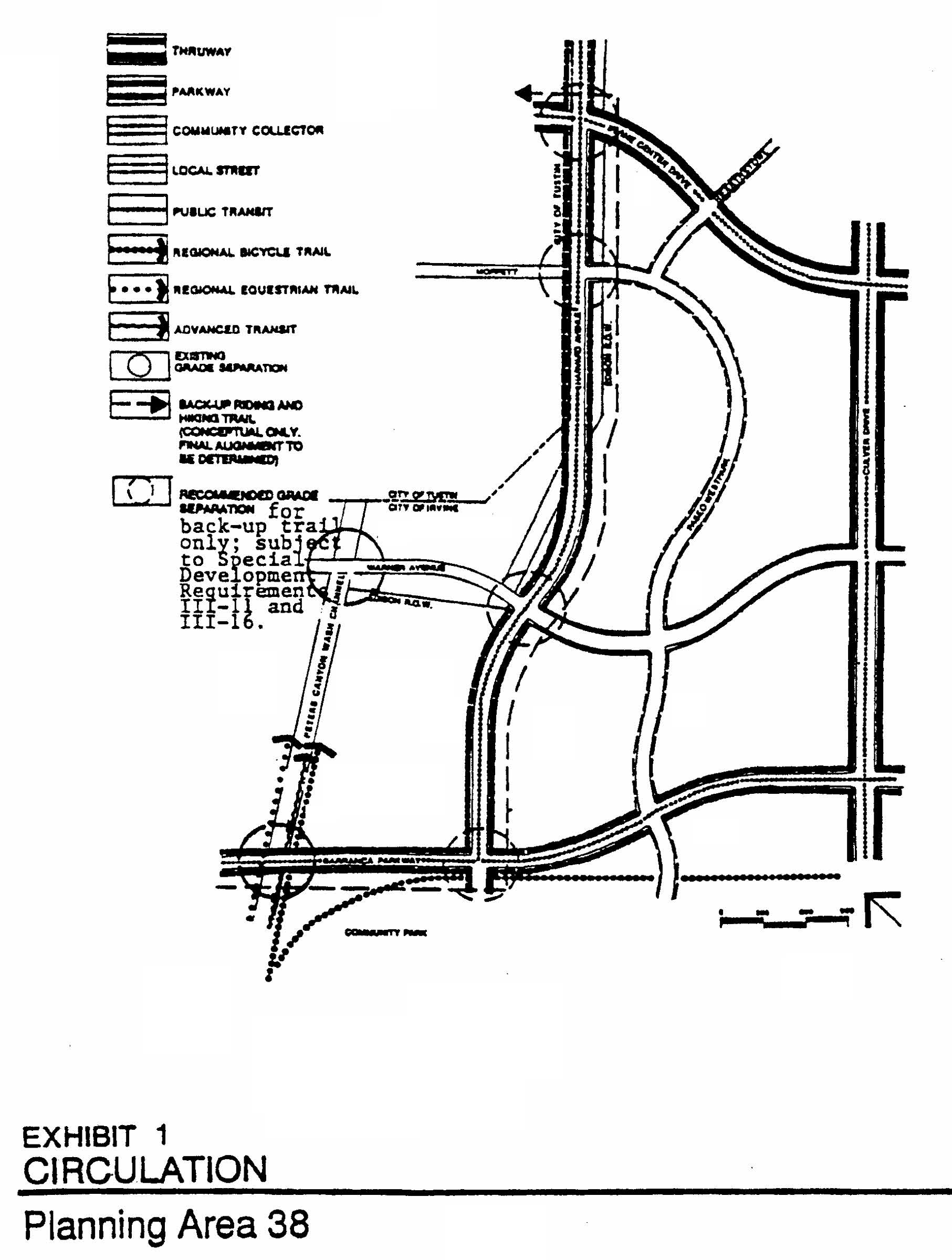
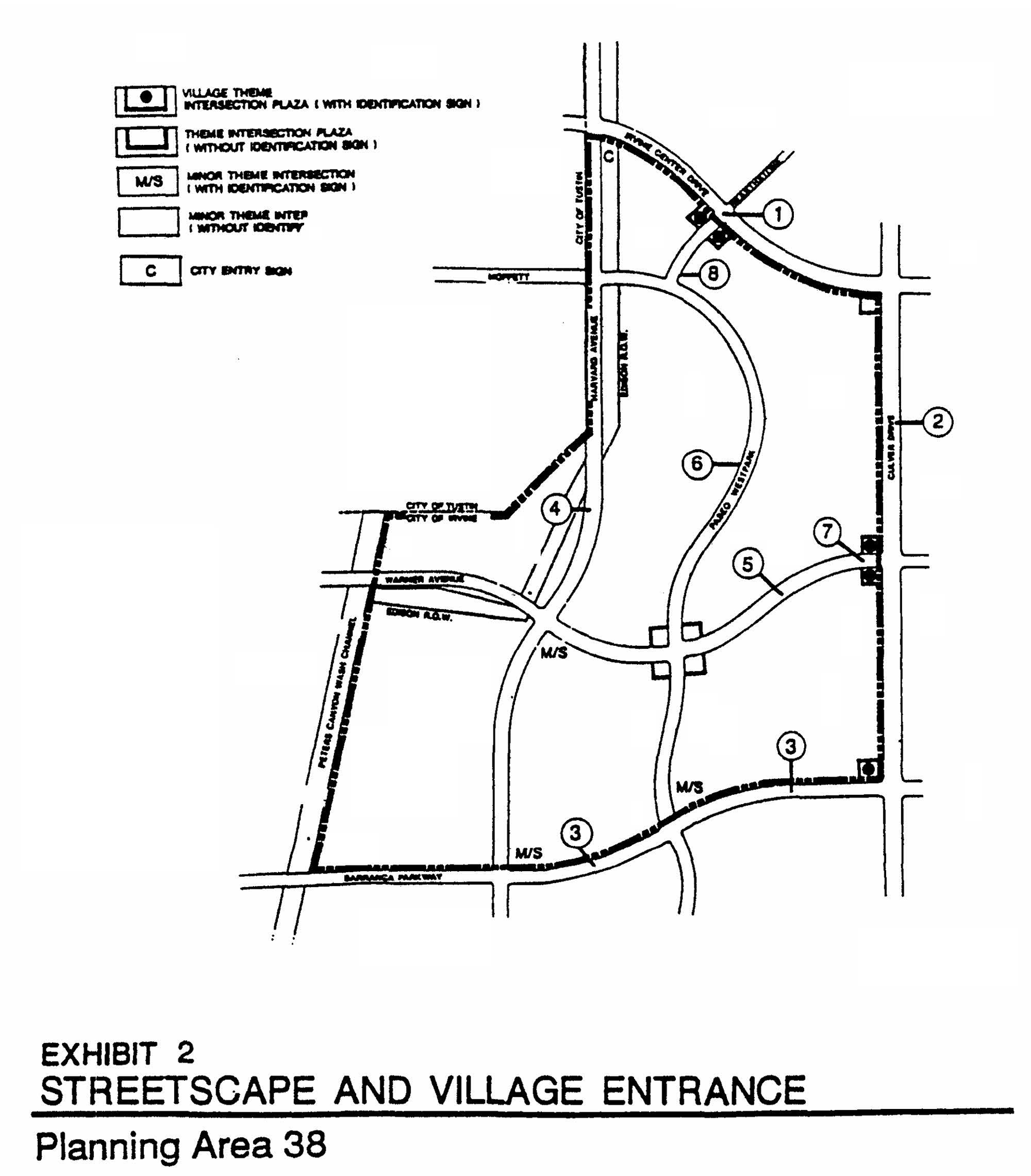
LEGEND
1.
Irvine Center Drive:
Evergreen trees, informal planting. Tall vertical evergreen trees in median.
Six-foot-wide walk.
2.
Culver Drive:
Tall, vertical evergreen trees with deciduous accent, informal planting. (Formal evergreen planting north of Barranca/Culver theme intersection.)
Eight-foot-wide walk.
3.
Barranca Parkway:
Major: Evergreen tree, informal planting.
Minor: Deciduous tree, clusters.
Six-foot-wide walk.
4.
Harvard Avenue:
Tall, vertical, evergreen trees, informal planting.
11-foot-wide walk (open space spine paseo).
5.
Warner Avenue:
Evergreen trees, informal planting.
Six-foot-wide walk.
6.
Paseo Westpark:
Evergreen trees, informal plantings with clusters of deciduous trees as accents.
Eight-foot-wide walk.
7.
Entries and theme intersection:
Formal palm with evergreen tree as a backdrop.
8.
Hearthstone:
Evergreen trees, informal planting.
Eight-foot-wide walk (east side).
Six-foot-wide walk (west side).
Landscape concepts should be consistent with Planning Area 14 landscape concepts. Refer to specific section of the zoning for additional detail.
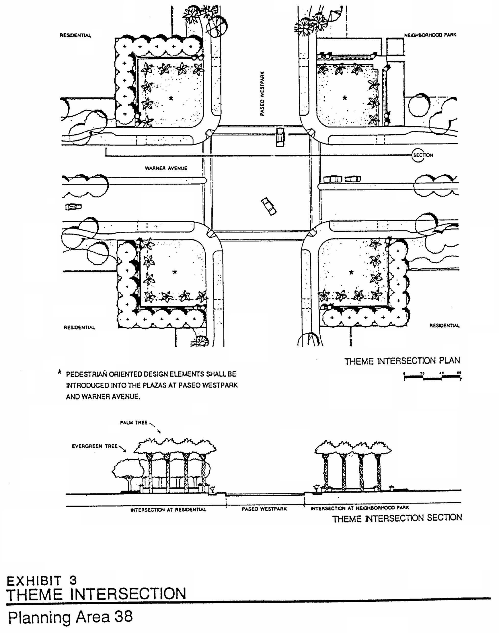
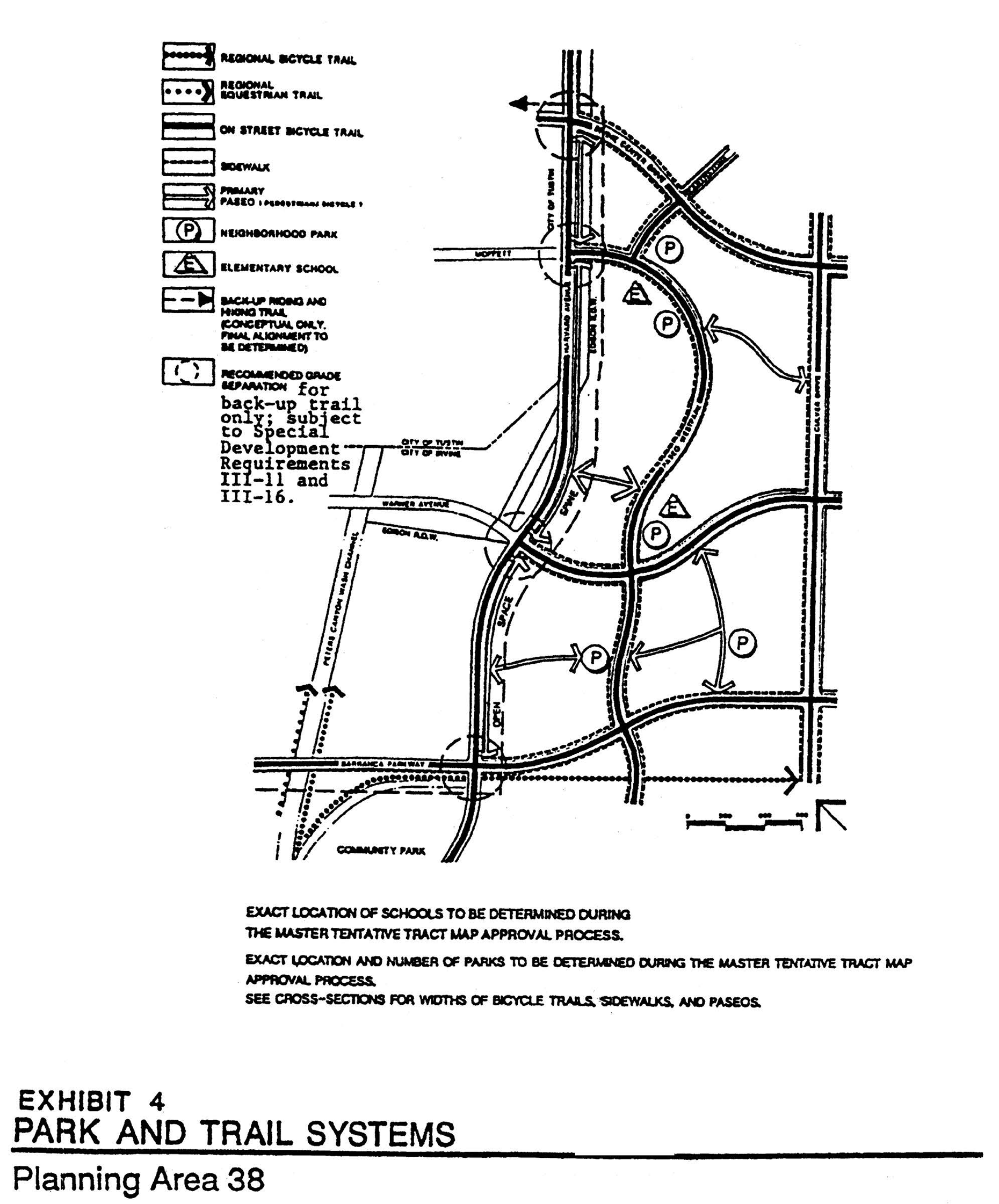
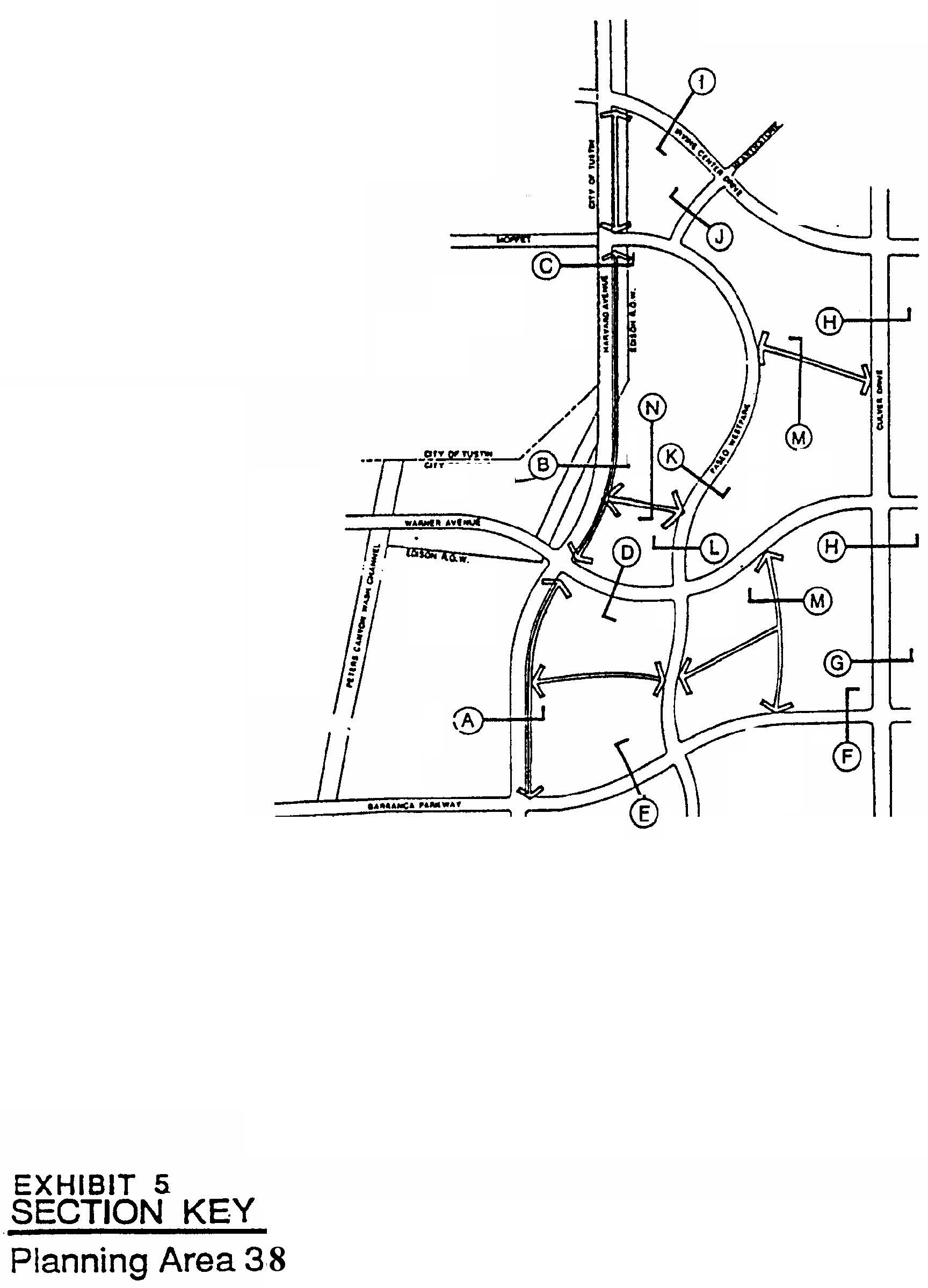
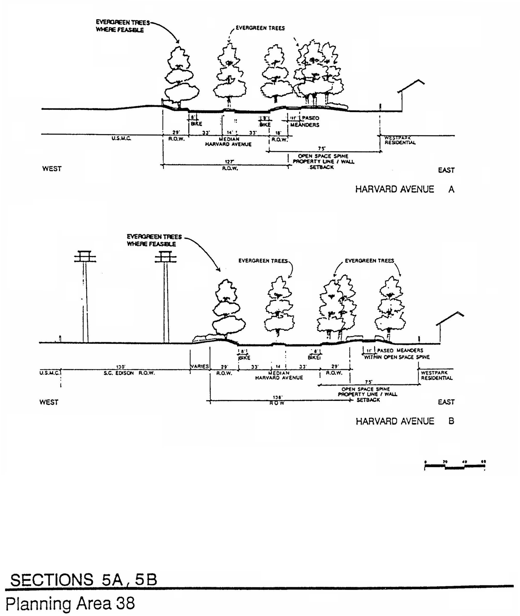
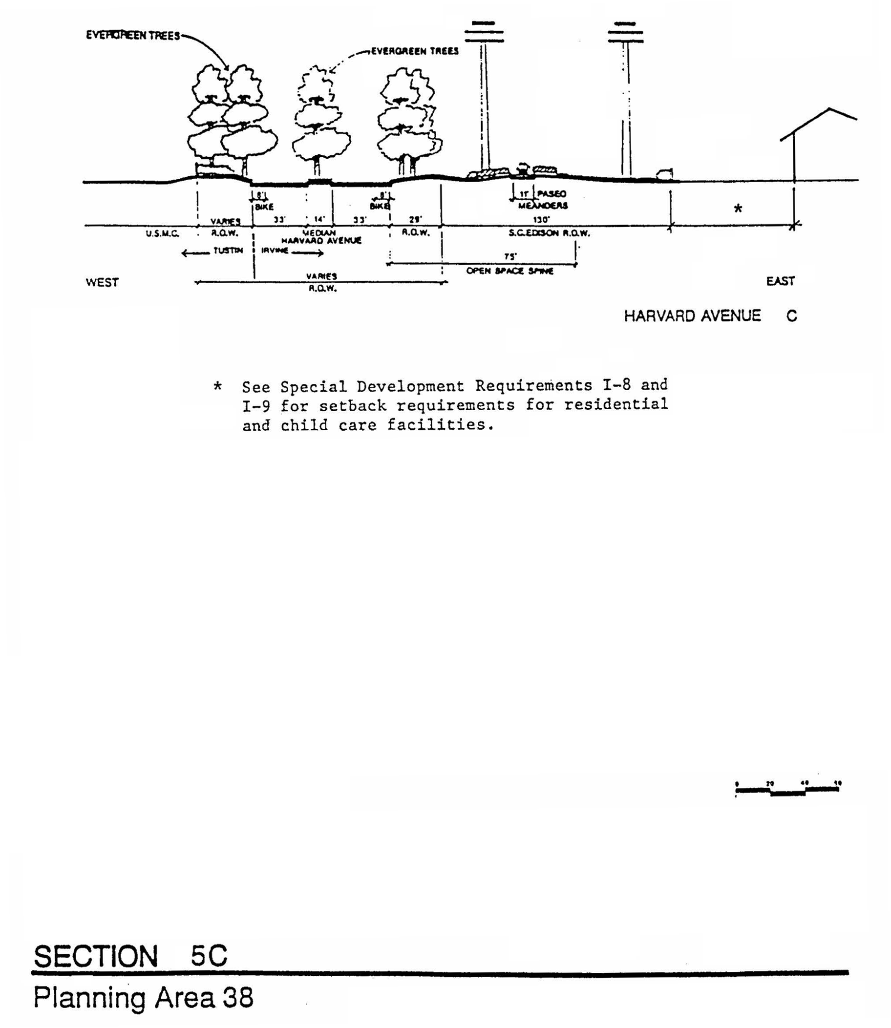
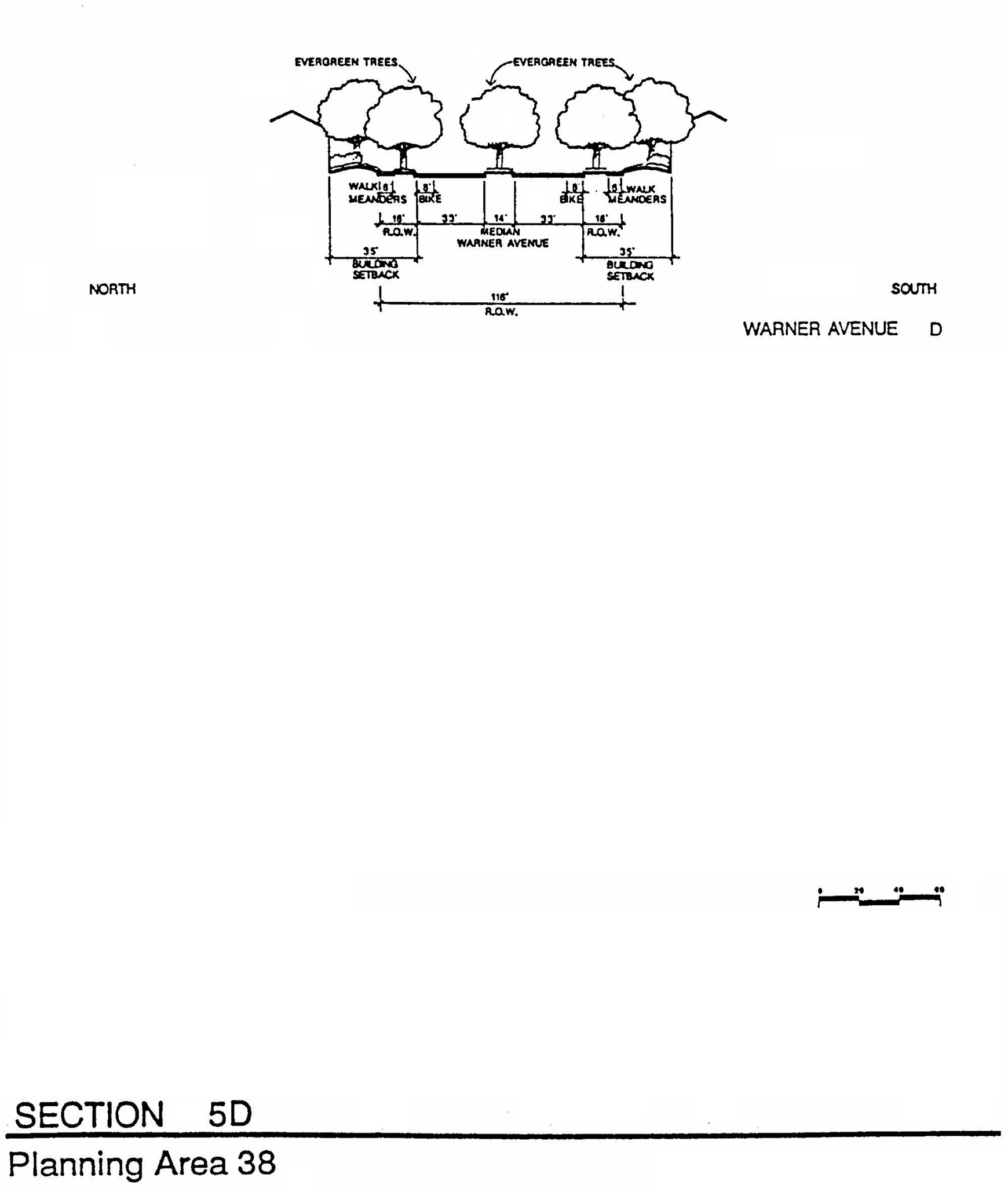
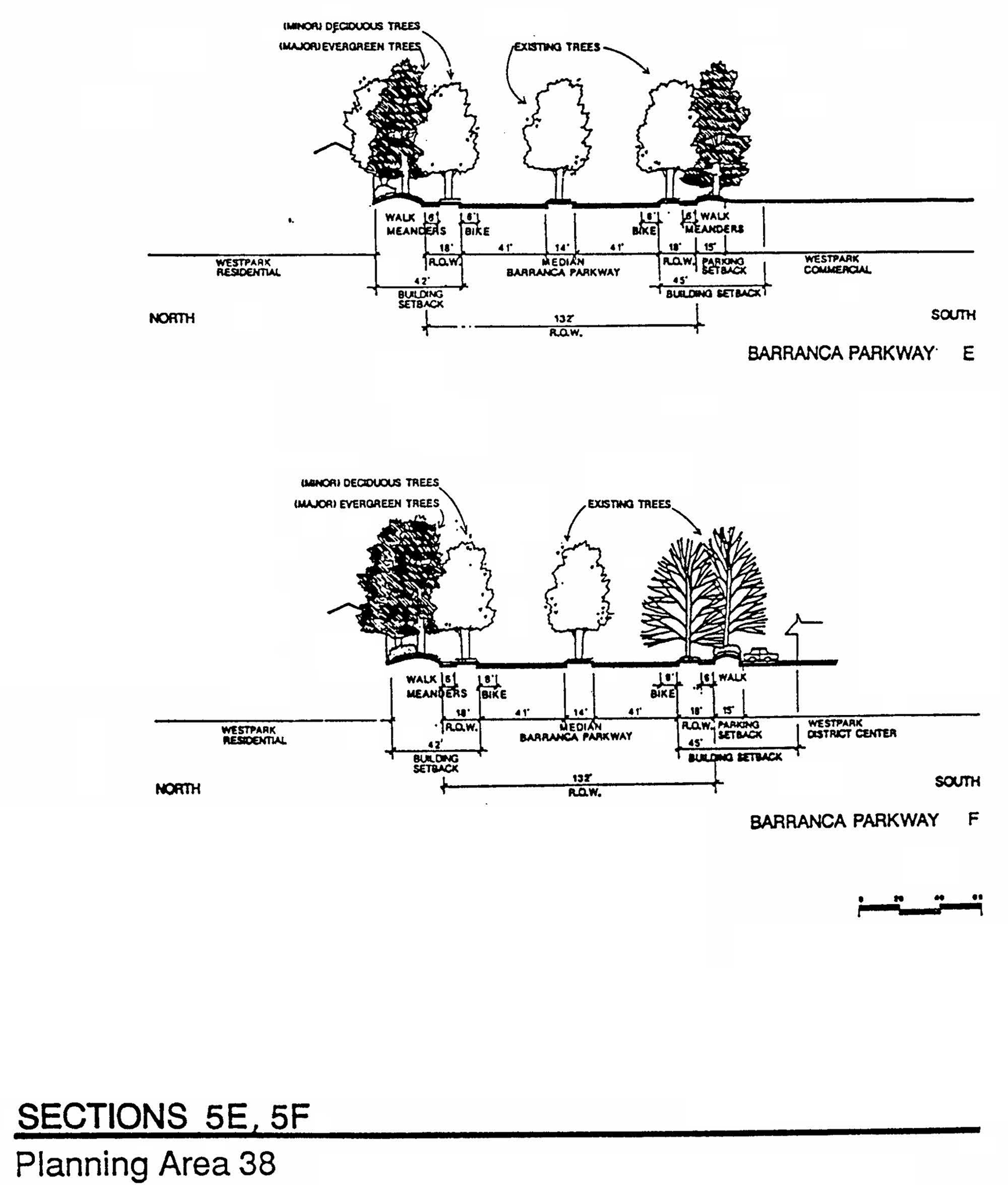
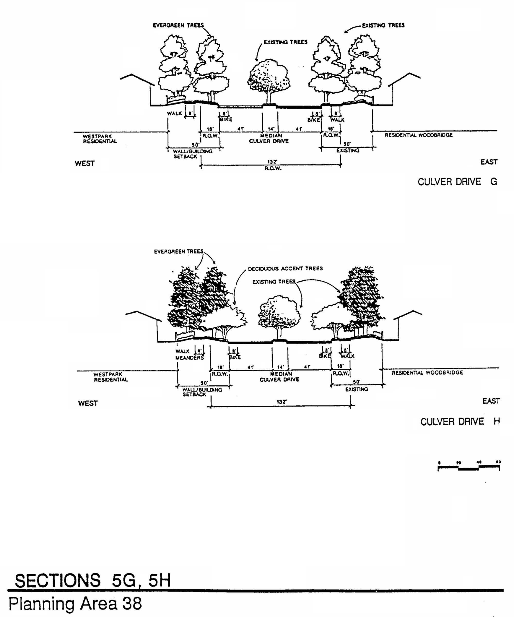
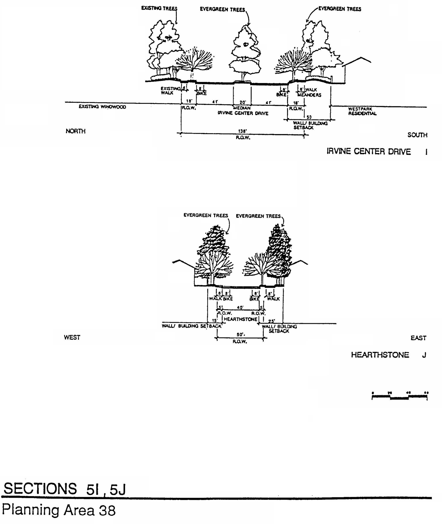
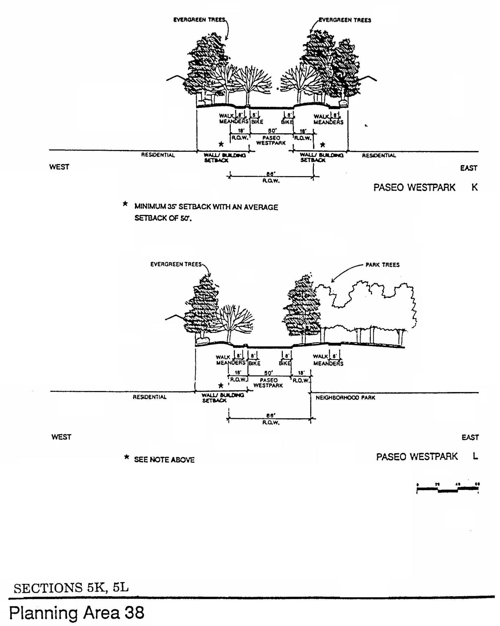
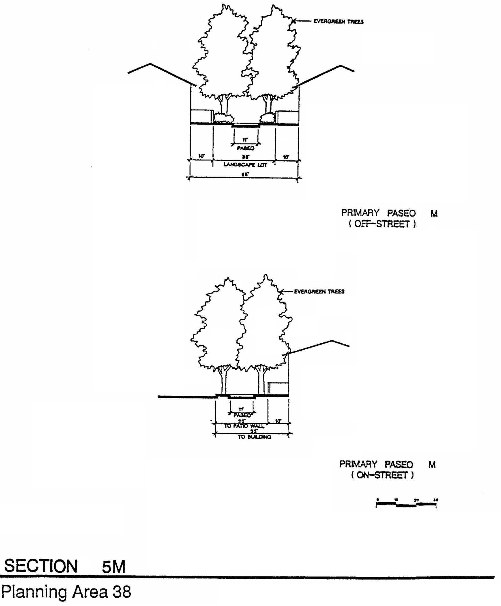
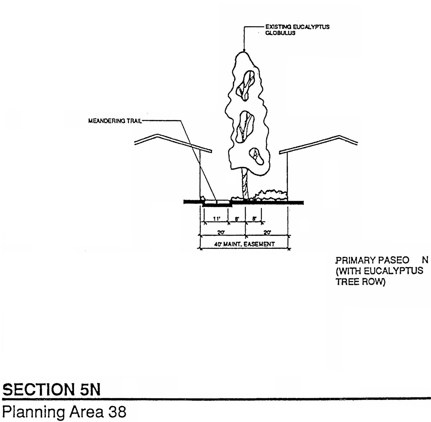
Sec. 9-39-1.- Land use zoning map.
(See Planning Area 39 map following Section 9-39-5.)
(Ord. No. 24-08, Exh. A, 5-28-24)
Sec. 9-39-2. - Introduction.
Planning Area 39 is bounded by the I-405 to the north, Irvine Center Drive and Bake Parkway to the east, future Lake Forest Drive to the south and Planning Area 18 to the west.
(Ord. No. 24-08, Exh. A, 5-28-24)
Sec. 9-39-3. - Statistical analysis.
1 Unallocated dwelling units represent those units remaining in a planning area that may be built anywhere in the same planning area. These units are within the maximum development intensity for the planning area; and, therefore, placement of unallocated dwelling units into any residential category within the planning area for purposes of development is determined to be consistent with the General Plan and Zoning Code with regard to intensity allocation only, provided that placement is otherwise consistent with site specific zoning regulations and that any potential environmental impacts are adequately addressed, including traffic impacts, pursuant to CEQA.
2 See Section 9-0-3.C, Building Intensity Standards.
3 Totals include 100 density bonus units in the 2.4H zoning district pursuant to 00900828-PGA and 00900833-PZC.
(Ord. No. 24-08, Exh. A, 5-28-24)
Sec. 9-39-4. - Land use regulations.
See Section 3-3-1 (Land use matrix).
(Ord. No. 24-08, Exh. A, 5-28-24)
Sec. 9-39-5. - Development standards.
See Section 3-37 (Development Standards).
1.
Individual project densities may exceed 31.0 du per net acre provided the total number of dwelling units does not exceed 4,700 in Planning Area 39.
2.
The total number of dwelling units in Area 2.4H shall not exceed 2,750 (inclusive of density bonus units).
3.
For individual residential projects, the development standards to be applied shall depend on the actual net density of the project in accordance with the following:
a.
For projects from 0 to 6.5 dwelling units per net acre, Section 3-37-13 development standards shall apply.
b.
For projects from 6.6 to 12.5 dwelling units per net acre, Section 3-37-14 development standards shall apply.
c.
For projects from 12.6 to 31.0 dwelling units per net acre, Section 3-37-15 development standards shall apply.
d.
For projects from 31.1 to 50.0 dwelling units per net acre in Area 2.4, Section 3-37-16 development standards shall apply.
e.
For projects providing 31.1 or more dwelling units per net acre in Area 2.4H only, Section 3-37-15 shall apply except that the intensity may exceed 50.0 dwelling units per net acre and the maximum height may exceed 50 feet subject to a conditional use permit and/or master plan.
(Ord. No. 24-08, Exh. A, 5-28-24)
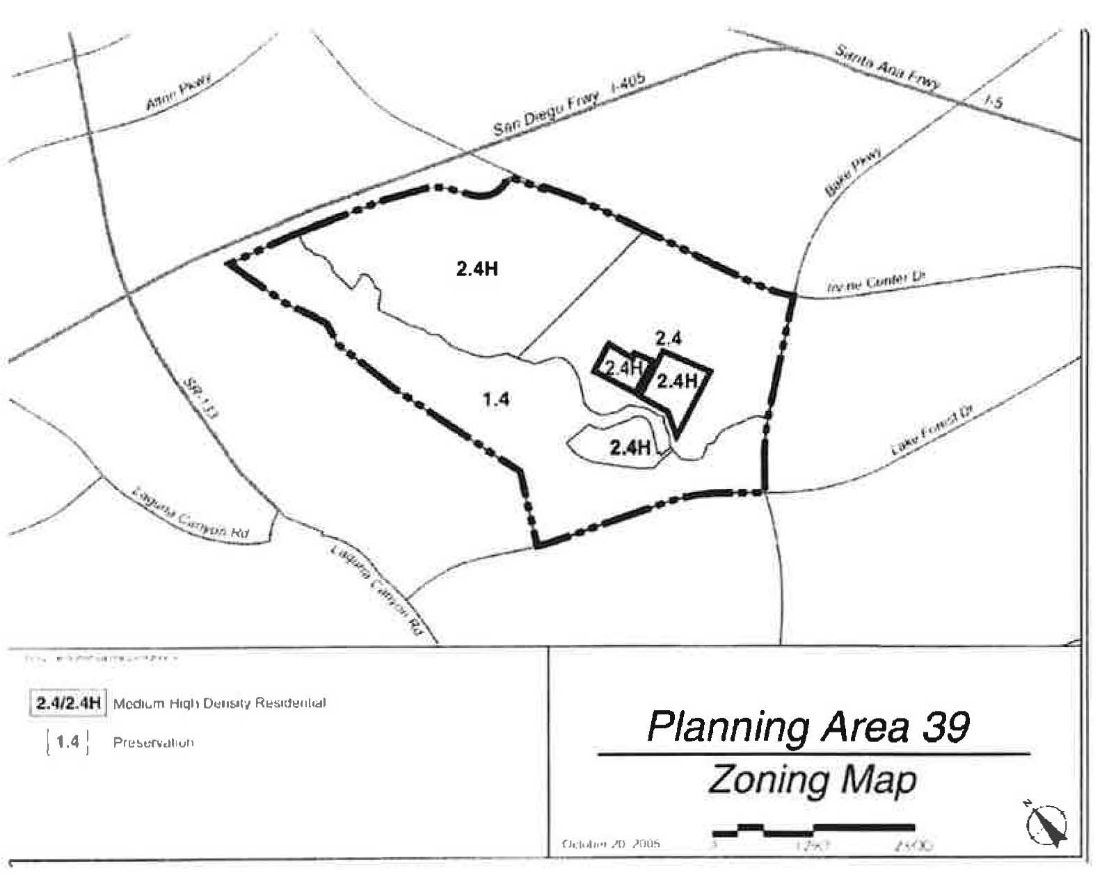
(Ord. No. 24-08, Exh. A, 5-28-24)
Sec. 9-39-7. - Special development requirements (not applicable to open space reserve and development reserve parcels).
1.
Affordable housing.
a.
The City's affordable housing requirements can be found in Chapter 2-3 of the Zoning Code. In keeping with Chapter 2-3, the affordable housing needs goal of 15 percent (5 percent Income I, II; 5 percent Income III; and 5 percent Income IV) of the actual number of units built in Planning Areas 39 and 18 may be met utilizing the menu option as established in the Housing Element.
b.
In conjunction with the submittal of the first tentative map within this planning area, the applicant shall submit a comprehensive affordable housing program covering Planning Areas 18 and 39 in accordance with Chapter 2-3 of the Zoning Code. The affordable housing goal of 15 percent (5 percent Income I, II; 5 percent Income III; and 5 percent Income IV) of the actual number of units built shall be addressed in the affordable housing program. The program shall be reviewed by the Planning Commission prior to its approval of the first tentative map.
2.
Boundary definitions. The precise Preservation District boundary will be defined through the final builder subdivision map at the boundary of development pads and the fuel modification zone. (The fuel modification zone is included in preservation areas by definition). However, any preservation areas to be dedicated to the City will exclude fuel modification zones. (The fuel modification zones will be owned and maintained by homeowners' associations.)
3.
Hillside Master Plan. In accordance with Zoning Code Chapter 5-4, a Master Plan shall be prepared for Planning Area 39 which demonstrates how the provisions of the General Plan and Hillside Overlay District will be implemented. The Master Plan shall include all concept plan requirements in accordance with Chapter 2-8. Approved Master Plan documents, or modifications thereto pursuant to Chapter 2-19, shall be used as the standard of review for all subsequent applications submitted for Planning Area 39. A subsequent Master Plan application in accordance with Zoning Code Chapter 2-19 or its equivalent will be submitted for each development project to address the location of structures and parking and for grading.
4.
Parks. The location of a public neighborhood park is conceptually shown on Exhibit A. At the time of approval of the first tentative tract map for residential purposes within Planning Area 39, a park plan, as defined in Section 2-22-2 of the Zoning Ordinance, shall be approved establishing the exact number, location, configuration, and size, of community and neighborhood parks in accordance with the subdivision ordinance, park and recreation element, and Local Park Code. The park plan shall also establish construction phasing of all parks in conjunction with the residential development.
a.
Community park. The community park requirement for PA 39 will be satisfied by the payment of in-lieu fees dedication of parkland and/or construction of park improvements for a community park in PA 39 or other locations acceptable to the City.
b.
Neighborhood park. The precise number, location, configuration and size of neighborhood parks will be established at the time of approval of tentative tract maps for residential portions of Planning Area 39.
5.
Village theme. The architectural design shall address detail articulated on all sides of the structures visible from streets, paseos, and other public areas. Particular attention shall be given to windows, balconies, doors, and other design elements. The elements and qualities which shall be encouraged are human scale and privacy, play of light using shade and shadows to provide relief, and variations in roof lines. Large blank walls with minimal detail shall be discouraged.
6.
Slope zone. In accordance with Zoning Ordinance Chapter 5-4, Hillside Overlay District, Planning Area 39 has been determined to be in Slope Zone I, which is not a hillside condition subject to grading limitations.
7.
Preservation zone grading. Grading for infrastructure, drainage, remediation, flood control, slope stabilization, fuel modification, trails, and habitat enhancements may occur within preservation zones which are not located in the NCCP Reserve.
8.
Alternative setback standards. In conjunction with any discretionary application, alternative setback standards for projects internal to the planning area may be reviewed and approved by the Planning Commission. A description of the proposed setbacks and how they differ shall be submitted along with a justification for the requested alternative. The Planning Commission will consider the following criteria and make the appropriate findings, if necessary:
a.
General character: Relationship in scale, bulk, coverage and density with surrounding land uses.
b.
Quality of life: Whether the proposed alternative standard will result in an adverse impact on existing neighborhoods.
c.
Suitability: The physical suitability of the site for the proposed project.
d.
Limitations: Such setbacks shall not be used to deviate from setbacks established for village edges.
9.
Master trails plan. Prior to approval of the first tentative tract map within this planning area, the applicant shall submit a master trails plan consistent with Exhibits C (Public Bike Trails), E—F (Public Sidewalks) and G—K (Sections). Trails through the Preservation District shall not be a part of the master trails plan except for the paved 11-foot Class I trail along San Diego Creek. The master trails plan shall be submitted for review by the Community and Library Services Commission and approved by the Planning Commission. The plan shall address the following:
a.
The location and design of any private trails and sidewalks.
b.
The locations where access to dedicated public open space needs to be controlled by the City through fencing or other means.
c.
Phasing of trail construction.
d.
All public trails and sidewalks shown on Exhibits C and E are intended to be owned, operated, and maintained by the City of Irvine.
(1)
The applicant shall construct a Class I bicycle trail ("San Diego Creek Trail") through PA 39 on the south side of San Diego Creek as generally depicted on Exhibit C.
(2)
The applicant shall construct the connection of the Class I bicycle trail on the south side of San Diego Creek in PA 39 to the existing trail on the north side of the Creek within the I-405 undercrossing.
(3)
In conjunction with the construction of the Class 1 trail shown on Exhibit C, the developer, if deemed necessary by the City and subject to approval of the Orange County Flood Control District and/or Caltrans, or their successors, shall improve the existing trail under crossing of I-405 as follows:
(a)
Resurface the trail connection with asphalt slurry or similar sealant within the under crossing.
(b)
Stripe the trail connection to City standards.
(c)
Install directional signs and trail markers.
(d)
Install lighting within the under crossing.
(e)
Install a three-wire fence separating the trail from the creek channel.
(4)
The applicant shall construct public sidewalks as generally depicted on Exhibit E.
(5)
Neighborhood trails in PA 39 shall link to the San Diego Creek Trail.
(6)
Where public sidewalks and trails parallel roadways, street lighting will be designed to also light trails and sidewalks, where feasible, in order to avoid separate trail and sidewalk lights.
e.
Private sidewalks are generally required on both sides of private local streets. However, on a case-by-case basis, the City Engineer may approve the elimination of the sidewalk on the side of a single-loaded private street where no curbside parking is allowed and no pedestrian circulation is necessary.
f.
City sidewalk requirements for arterial highways are modified as shown on Exhibits F—K (Sections).
10.
Preservation area dedications. Offers of conveyance for Dedication Areas S, P.3, and H will be recorded in accordance with Chapters 8-14 and 8-23 and the following schedule. In order to better facilitate the management of open space, the timing of offers and conveyances may be modified by mutual consent of the City and landowner.
a.
S and P-3: Prior to or concurrent with the recordation of the first subdivision map in Planning Area 39, the applicant shall record an offer of dedication for a first part dedication of Areas "S" and P-3 as generally depicted on Exhibit B and described in Section 8-23-1. Such offer will be in compliance with Section 8-14 and may be accepted by the City no sooner than 90 days following issuance of 75 percent of the building permits for dwelling units in PA 39 and after the installation of natural vegetation and completion of the monitoring program for P-3 as set forth in FEIR.
b.
H: Prior to or concurrent with the recordation of the first subdivision map in Planning Area 39, the applicant shall record an offer of dedication in favor of the City for Dedication Area "H" as generally depicted on Exhibit "D." Such offer will be in compliance with Section 8-14 and may be accepted by the City no sooner than 90 days following issuance of 75 percent of the building permits for dwelling units in either Planning Area 39 or Planning Area 33, whichever comes first.
c.
Where single-loaded streets abut open space lands to be dedicated to the City, a three-wired cable fence or other access control measures shall be provided by the developer.
d.
To facilitate implementation of the San Diego Creek Trail, any lands for the trail which encroach into P-3 may be severed from the offer of dedication for S and P-3 and dedicated by mutual agreement between the City and applicant.
11.
Transition zones. The transition zone as defined in the General Plan open space and conservation element, will be co-terminus with a fuel modification zone as the boundary of residential development and open space. The width and treatment of this zone shall be adapted to slope conditions, vegetation and land use in consultation with fire authorities and consistent with EIR mitigation measures.
12.
Arterial highway standards. City sidewalk requirements for arterial highways are modified as shown on Exhibit 7 of the PA 39 Hillside District Master Plan.
13.
Child care. The need for child care facilities shall be recognized with the development of PA 39. Prior to the approval of the first residential tentative tract map in PA 39, the number of private sector child care slots to be provided will be determined by the City and the developer in accordance with the City policy. The number of slots will be based on the actual number of residential units to be built and on a determination of child care needs generated by residential development in PAs 17,18, 33 and 39.
14.
Verizon Amphitheater. Nothing in this section shall be construed to limit the existing uses of the Verizon Amphitheater pursuant to its conditional use permit until termination of its lease on or before February 28, 2017. Any residential uses must be compatible with the existing amphitheater use until its termination.
15.
OCTA coordination. Prior to approval of the first residential subdivision map within PA 39, the need for future bus stop locations along Irvine Center Drive, Bake Parkway and Lake Forest Drive will be coordinated with the Orange County Transportation Agency (OCTA).
16.
Wireless facilities. As part of the Master Plan submittal for this area, a plan of preferred sites and designs for wireless facilities shall be prepared, after attempting to receive input from wireless telecommunications carriers concerning their ability to provide service to the proposed development. Based on the information received, the applicant shall identify potential wireless communication facilities sites in residential and nonresidential portions of the subject planning area that, based on the information received, will serve the needs of the proposed development. The applicant's conclusions and proposals for potential wireless sites shall be provided in a report to the City which shall be available for public review prior to any Planning Commission or City Council determination on the application. Subsequent to approval of the Master Plan, any application to locate a wireless communication facility at an identified preferred site may, notwithstanding the "Review Procedure Matrix" set forth in Section 2-37.5-3, be approved by the Director of Community Development, subject to the remaining procedures and requirements specified in Chapter 2-37.5. Any application to site a wireless communication facility at a site that is not an identified preferred site must, in addition to the procedures and requirements specified in Chapter 2-37.5, specifically examine the feasibility of preferred sites and explain why locating a wireless communication facility(ies) at one or more preferred sites cannot adequately satisfy the coverage needs of the telecommunications carrier.
17.
Libraries. In the event a City-wide library impact fee is adopted and in force, the developer shall pay this fee prior to issuance of building permits for new development.
(Ord. No. 24-08, Exh. A, 5-28-24; Ord. No. 25-22, § 4, 9-9-25)
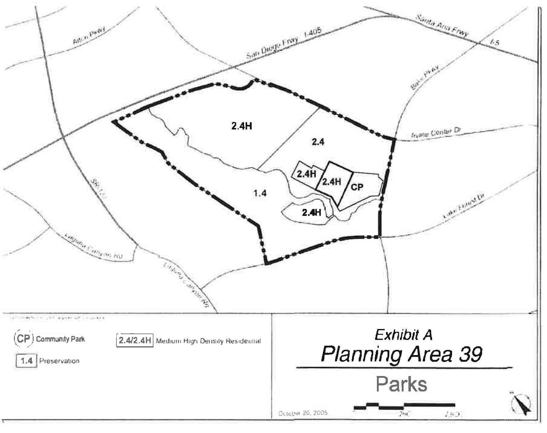
(Ord. No. 24-08, Exh. A, 5-28-24)
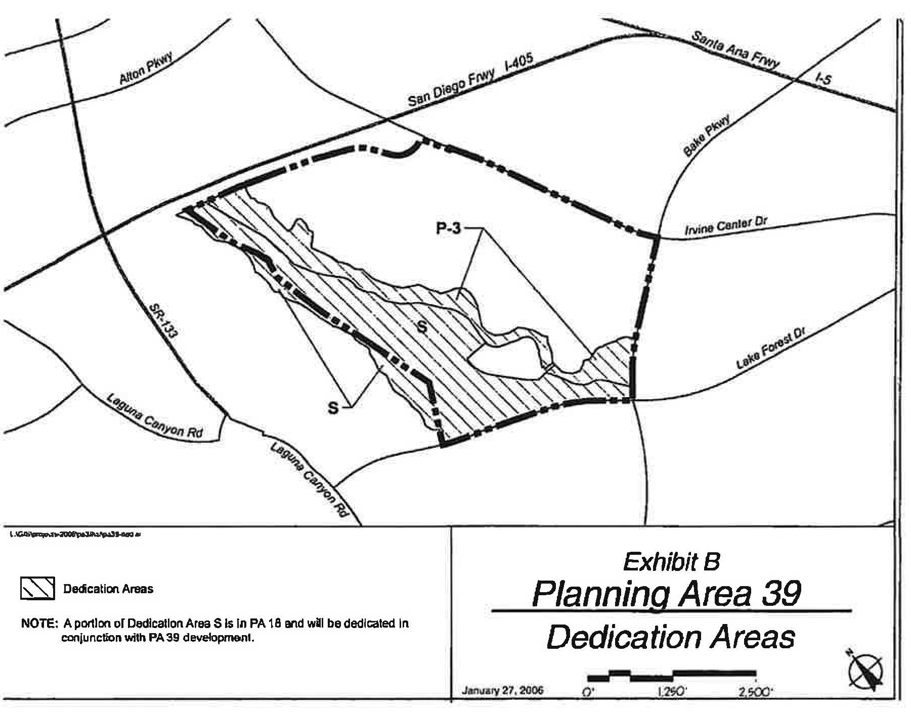
(Ord. No. 24-08, Exh. A, 5-28-24)
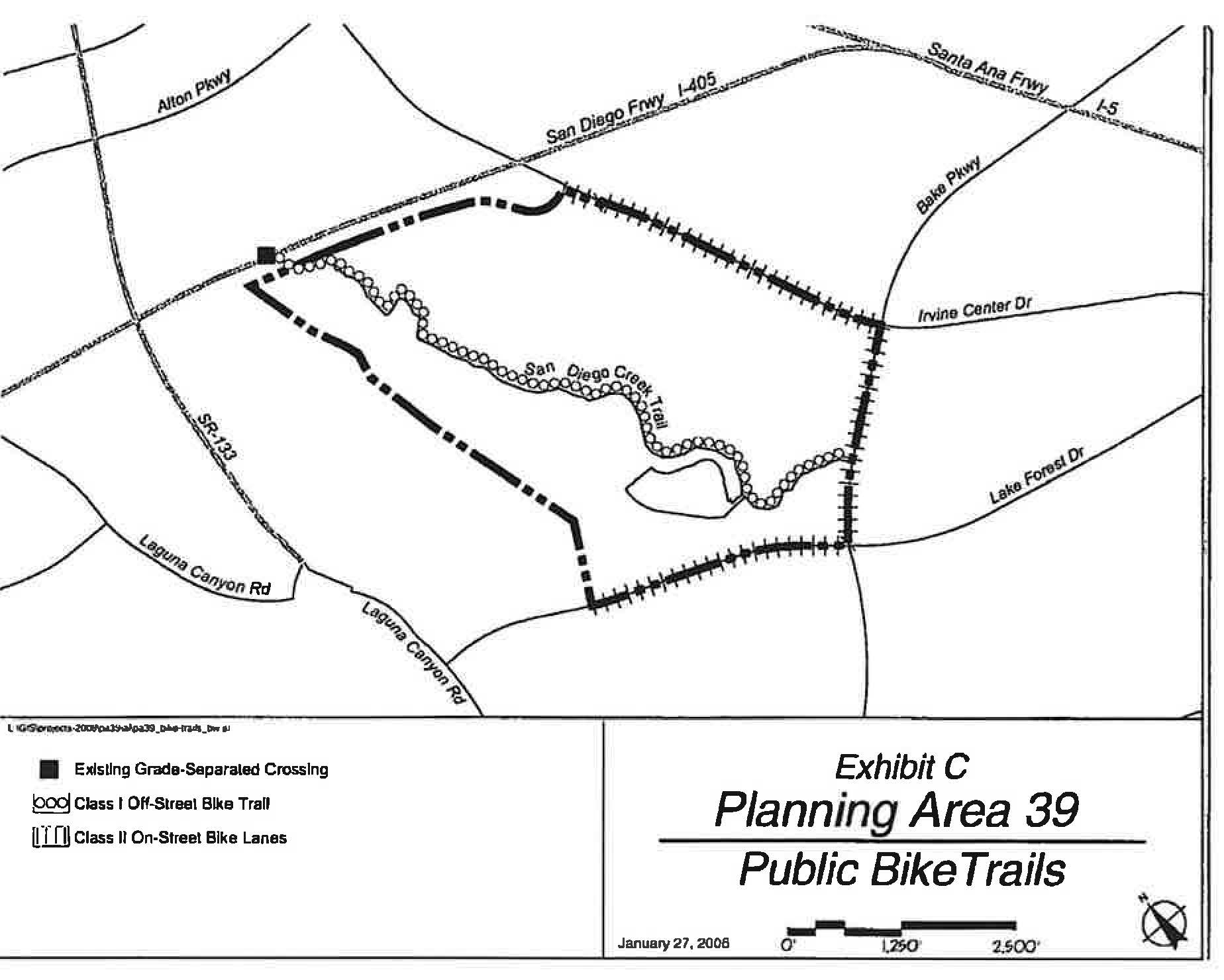
(Ord. No. 24-08, Exh. A, 5-28-24)
(Ord. No. 24-08, Exh. A, 5-28-24)
(Ord. No. 24-08, Exh. A, 5-28-24)
(Ord. No. 24-08, Exh. A, 5-28-24)
(Ord. No. 24-08, Exh. A, 5-28-24)
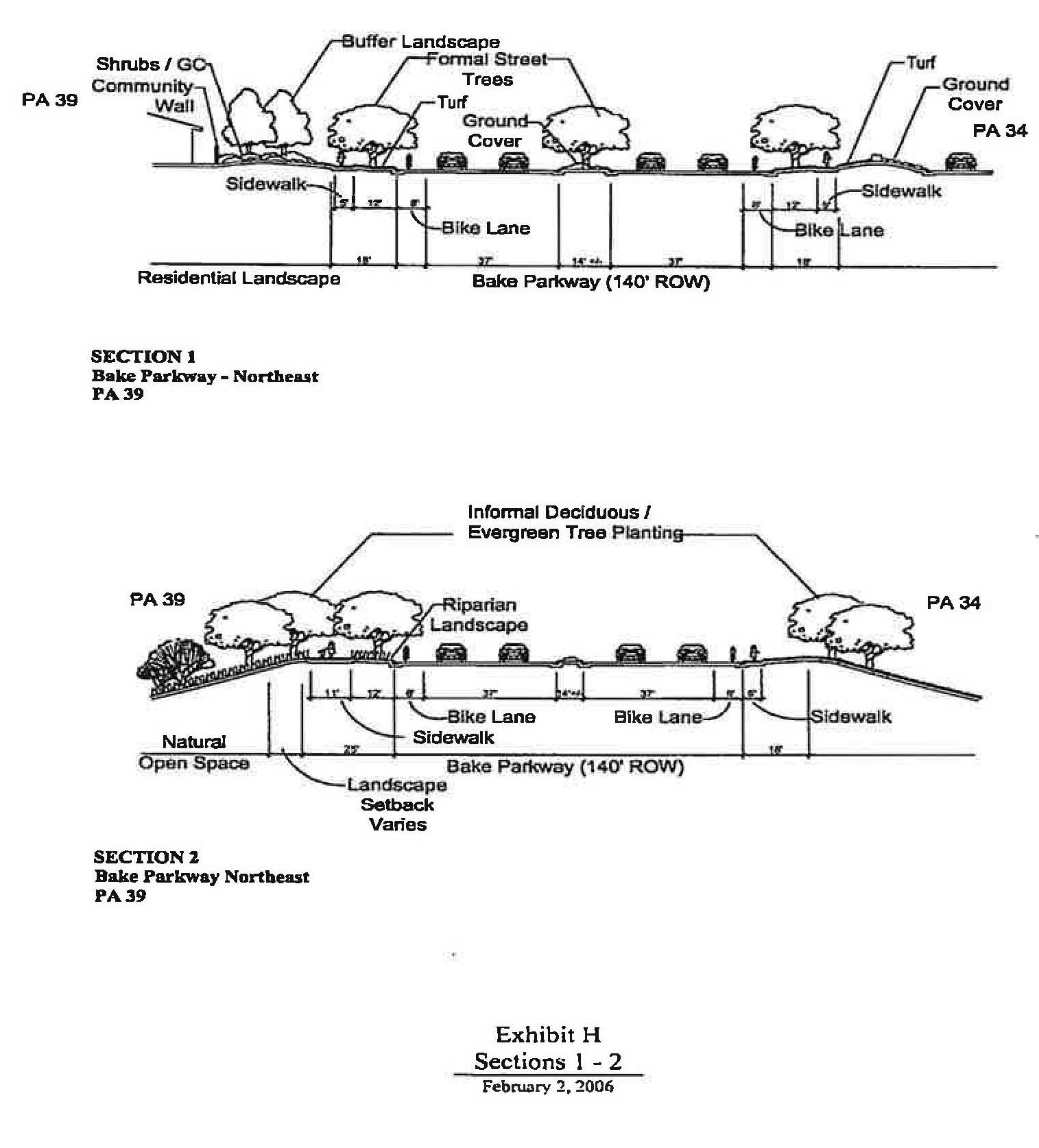
(Ord. No. 24-08, Exh. A, 5-28-24)
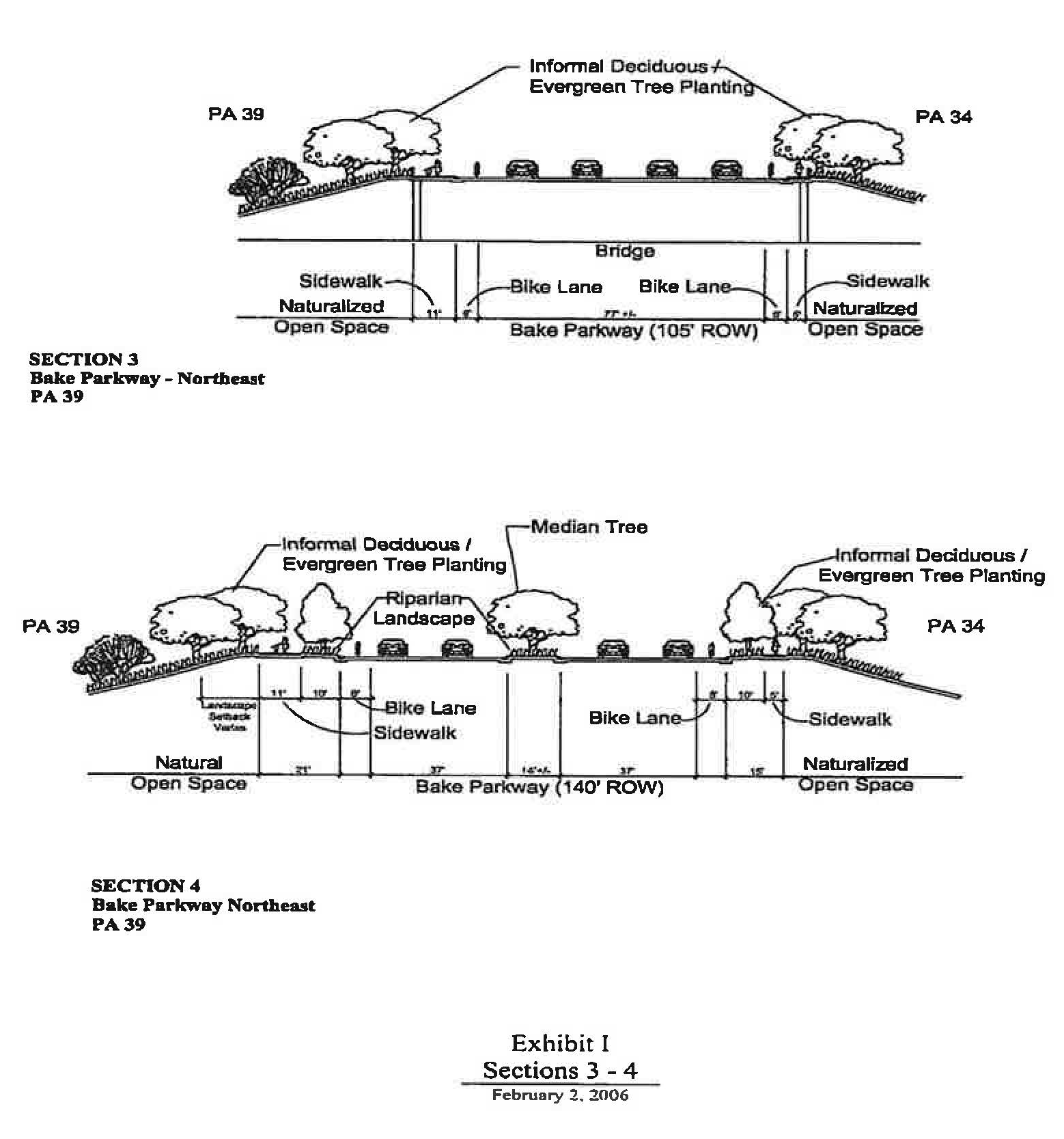
(Ord. No. 24-08, Exh. A, 5-28-24)
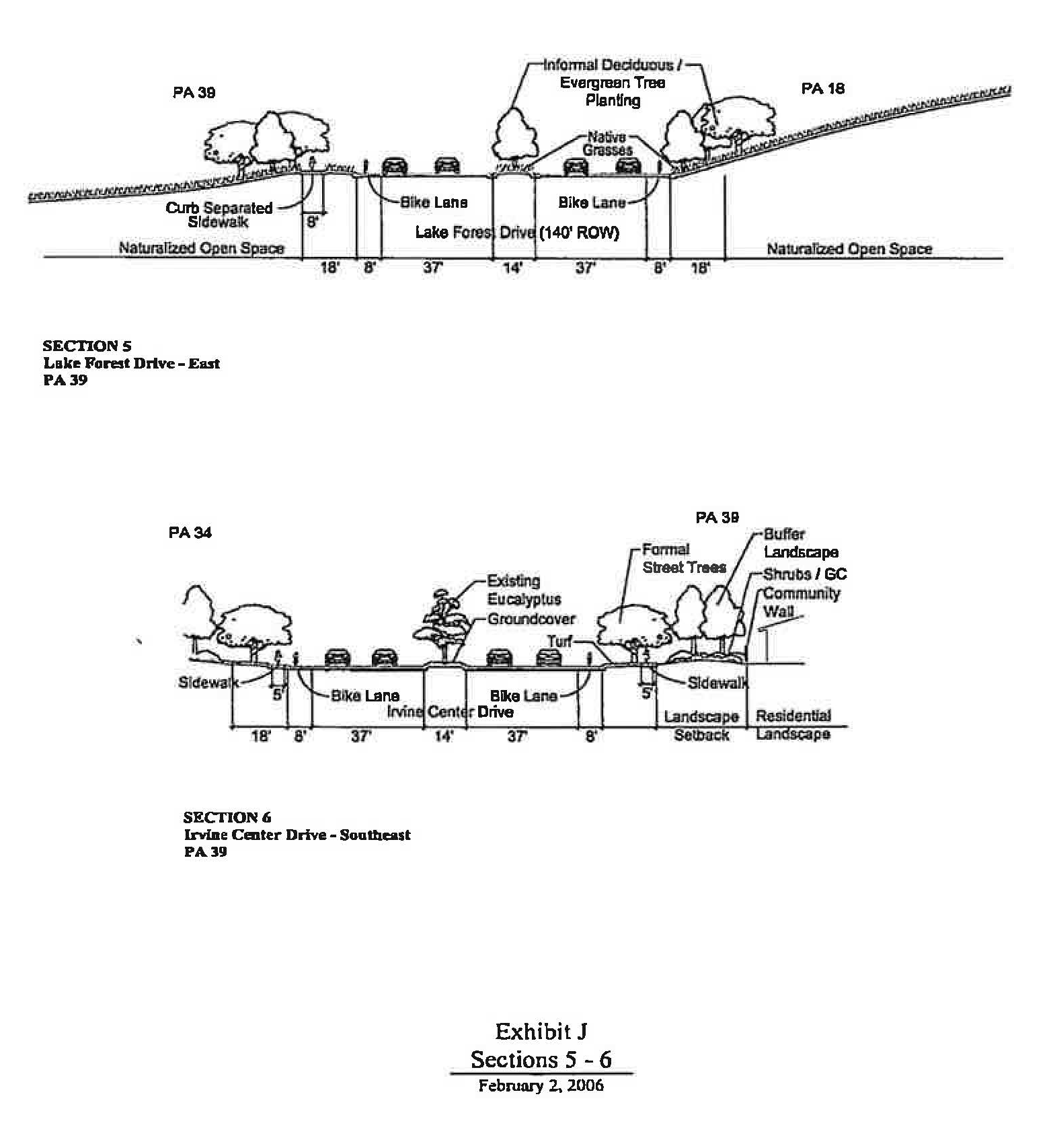
(Ord. No. 24-08, Exh. A, 5-28-24)
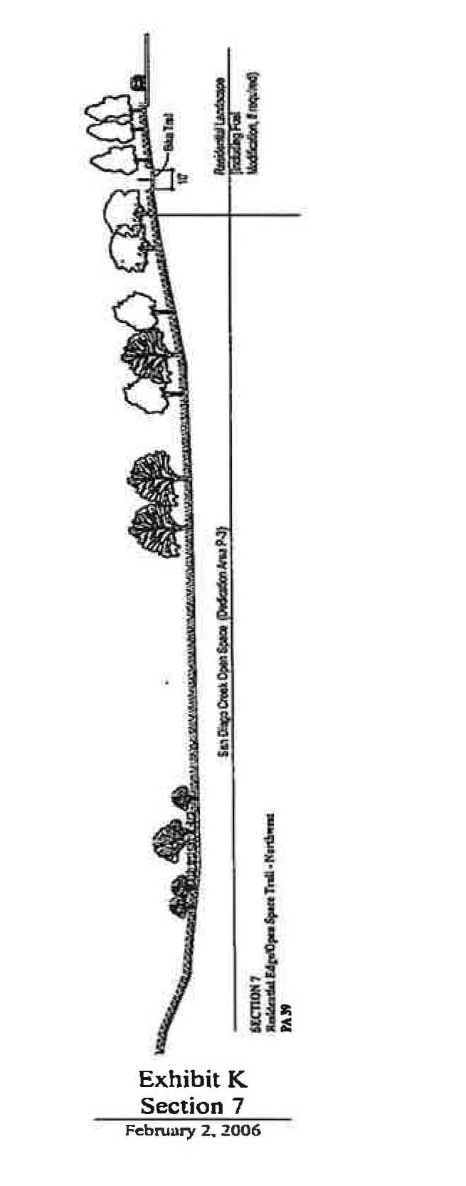
(Ord. No. 24-08, Exh. A, 5-28-24)
Sec. 9-40-1.- Land use zoning map.
(See Planning Area 40/Spectrum 8 map following Section 9-40-5.)
(Ord. No. 03-13, § 9, 5-13-03; Ord. No. 08-12, § 3, 9-9-08)
Sec. 9-40-2. - Introduction.
Planning Area 40 is bounded by Jeffrey Road, Trabuco Road, the Santa Ana Freeway (I-5) and Planning Area 51 (former MCAS El Toro).
(Ord. No. 03-13, § 9, 5-13-03; Ord. No. 08-12, § 3, 9-9-08)
Sec. 9-40-3. - Statistical analysis.
1 Unallocated dwelling units represent those units remaining in a planning area that may be built anywhere in the same planning area. These units are within the maximum development intensity for the planning area; and, therefore, placement of unallocated dwelling units into any residential category within the planning area for purposes of development is determined to be consistent with the General Plan and Zoning Code with regard to intensity allocation only, provided that placement is otherwise consistent with site specific zoning regulations and that any potential environmental impacts are adequately addressed, including traffic impacts, pursuant to CEQA.
2 See Section 9-0-3.C, Building Intensity Standards.
*Does not include acres used for existing arterial highway rights-of-way (except Marine Way).
**Subject to dwelling unit transfers between Areas 2.3N and 2.41 as set forth in Section 9-40-7B.
(Ord. No. 03-13, § 9, 5-13-03; Ord. No. 08-12, § 3, 9-9-08; Ord. No. 12-09, § 3(Exh. A), 5-22-12; Ord. No. 23-15, § 6(Exh. A), 7-25-23)
Sec. 9-40-4. - Land use regulations.
See Chapter 3 (Land use matrix).
(Ord. No. 03-13, § 9, 5-13-03)
Sec. 9-40-5. - Development standards.
See Chapter 3 (Development Standards).
Individual project densities in Area 2.3N may exceed 12.5 dwelling units/net acre. However, no individual project may exceed 31.0 dwelling units/net acre and the overall density within 2.3N cannot exceed 12.5 dwelling units/net acre. Individual project densities in Area 2.4I may exceed 31.0 dwelling units/net acre. However, the overall density within 2.4I cannot exceed 31.0 dwelling units/net acre. For residential projects within Areas 2.3N, 2.4I and 3.1H, the actual net density of individual projects will determine the development standards to be applied according to the following:
1.
For projects from 0 to 6.5 dwelling units per net acre, Section 3-37-13 development standards shall apply.
2.
For projects from 6.6 to 12.5 dwelling units per net acre, Section 3-37-14 development standards shall apply.
3.
For projects from 12.6 to 31.0 dwelling units per net acre, Section 3-37-15 development standards shall apply.
4.
For projects from 31.0 to 50.0 dwelling units per net acre, Section 3-37-16 development standards shall apply (3.1H only).
(Ord. No. 03-13, § 9, 5-13-03; Ord. No. 08-12, § 3, 9-9-08)
Sec. 9-40-7. - Special development requirements.
A.
Circulation. The following arterials are located adjacent to or within Planning Area 40
B.
Maximum residential units.
1.
The total number of allowable residential dwelling units overall in Areas 2.3N, 2.41, and 3.1H shall be 5,221 units.
2.
Notwithstanding the provisions of Section 9-40-3, up to 750 dwelling units may be transferred between the 2.3N Medium Density Residential District and the 2.41 Medium-High Density Residential District provided the cumulative total in both Area 2.3N and Area 2.4I does not exceed 3,918 dwelling units.
3.
Subject to the limitations set forth in Sections 9-1-7 and 9-6-7, unbuilt dwelling units, up to the total number of units allowed by the unit cap for the planning area, may be transferred from Planning Area 40 into Planning Area 1 and/or Planning Area 6. It is the intent of this provision to facilitate a level of development that remains within the total number of dwelling units authorized by the North Irvine Transportation Mitigation Implementing Development Agreement between the City of Irvine and the Irvine Company. The transfer of units described in this Section will be facilitated as a part of the subdivision process required in receiving areas and will be appropriately and administratively noted in Sections 9-1-3, 9-1-7, 9-6-7, 9-40-3, and 940-7, as applicable.
C.
Project trip monitoring within the 5.5D Medical and Science District. The development intensity allocated to the 5.5D Medical and Science District Area and analyzed in the traffic study equates to 973,130 square feet of office, research and development, and mini-warehouse uses with a build-out trip limit of 3,146 average daily trips, 279 a.m. peak hour trips and 334 p.m. peak hour trips. The source of the traffic trip rates is the Planning Area 40 General Plan Amendment, Zone Change, Vesting Tentative Parcel Map 2020-137 Traffic Study, dated 12-9-2020.
1.
For the purposes of this section, "applicant" shall mean that applicant for development case 00793825-PGA and 00793828-PZC. Prior to approval of each subdivision map in the 5.5D Medical and Science Zoning District, the applicant shall submit a Trip Allocation and Monitoring Report (TAMR) for review and approval of the Director of Community Development. The TAMR shall include an allocation and accounting of trips to ensure that the aggregate traffic projected does not exceed the vehicle trip limits. The TAMR shall include, but not be limited to, the allocation of trips (average daily, a.m. peak and p.m. peak hour) to each parcel. Approval by the Director of Community Development shall be based upon the determination that the allocations shown do not exceed the maximum established for the zoning district; that all parcels have a trip allocation; and that the allocation is consistent with the General Plan, zoning and other applicable regulatory documents. The TAMR may be updated by the applicant and is subject to review and approval by the Director of Community Development.
2.
The build-out vehicle trip limits set forth herein shall restrict all development within the 5.5D Medical and Science District. Any increase to the maximum allowable trips for the zoning district as a whole shall require the approval of a zone change.
3.
In addition, the trips allocated to individual parcels in an approved TAMR shall not be exceeded. Any increase to the vehicle trip limit for an individual parcel shall require either the submission and approval by the applicant of an updated TAMR or the approval of a zone change.
D.
Project trip monitoring within the 3.1H Multi - Use District. The development intensity allocated to the 3.1 H Multi-Use Area and analyzed in the project traffic study equates to 1,383 residential dwelling units with a build-out trip limit of 10,059 average daily trips, 798 a.m. peak hour trips and 987 p.m. peak hour trips. The source of the traffic trip rates is the Planning Area 40 General Plan Amendment, Zone Change, Vesting Tentative Parcel Map 2020-137 Traffic Study, dated 12-9-2020.
E.
Jeffrey open space spine ("JOST"). The JOST within Planning Area 40 is designated as 15 Recreation on the zoning map. The JOST width may vary, but may not be less than 200 feet. The JOST will serve as the Village Edge for the adjoining development areas, and no further Village Edge dedications or improvements will be required. JOST improvements may be proposed by the applicant in lieu of dedication, as agreed to in the "Jeffrey Open Space Spine Implementation Agreement," dated June 10, 2003.
1.
JOST function.
a.
The JOST shall provide a place that will accommodate public trail and passive open space uses and which will achieve the following objectives:
i.
Provide a Class I bicycle trail with crossings at Roosevelt and Trabuco and, provide where deemed appropriate, an unpaved pedestrian trail. Any references to grade-separated crossings at these locations as indicated in Exhibit B are conceptual only. The final determination of whether a grade-separated crossing will be required in the JOST at Trabuco Road and/or at Roosevelt shall be made as part of the JOST Segment 1 Design Plan and master tentative tract map review for Planning Area 40 per the JOST Implementation Agreement. Reference to any grade-separated crossing within this section in no way requires or otherwise obligates the City to accept a grade-separated crossing at this location.
ii.
Include features such as, but not limited to, riparian elements, water quality elements, picnic areas, shade structures, restrooms and other passive recreational improvements.
iii.
Establish landscape and landforms that will provide the trail user with a meandering separation from Jeffrey Road, a village edge for newly developed planning areas, and a landscape buffer between new development and Jeffrey Road.
iv.
Access to the JOST from new development will occur only through planned common area access points. Direct access to the JOST from individual lots will not be permitted.
b.
Permitted uses: Except for utilities and General Plan roadway improvements, surface uses will be limited to trails, and associated passive public recreation. For the purposes of the JOST, all features identified in Subsection E.1.a. above are considered passive recreation.
2.
Segment Plan approval process.
a.
Segment Plan submitted: In conjunction with the first residential "A" master tract map for the portion of Planning Area 40 west of SR-133, a segment park design ("Segment Plan") for the JOST segment shall be submitted to the City by the applicant. The plan shall include:
i.
JOST dimensions and acreage;
ii.
Trails and pedestrian access to trails;
iii.
Landscape elements;
iv.
Conceptual plant palette;
v.
Planned vehicular access or crossings;
vi.
Special design features;
vii.
Passive recreational amenities and improvements; and
viii.
The boundary interface with the adjacent land uses.
b.
Segment Plan approval: The segment park design ("Segment Plan") shall be approved by the Directors of Community Development and Community and Library Services, provided the Segment Plan is deemed consistent with the overall park design. In the event the overall park design has not received approvals or if the Segment Plan is not consistent with an approved overall park design, the Segment Plan shall be subject to final approval by the Community and Library Services Commission. Appeals of decisions related to the Segment Plan shall be to the City Council.
3.
JOST improvement.
a.
The project developer's financial obligation to improve the JOST is limited to costs of construction of a permanent trail to be built in accordance with the City's 1985 "Guidelines for Bicycle Facilities in Irvine" (excluding grade separations used solely for trail systems). However, the project developer shall provide JOST improvements consistent with the approved Segment Plan and the "Jeffrey Open Space Spine Implementation Agreement," dated June 10, 2003.
b.
The City shall provide in lieu dedication credits for the grade-separated crossings according to the criteria set forth in the "Jeffrey Open Space Spine Agreement." The City shall maintain the bicycle/pedestrian trail, grade-separated crossings, landscaping and all other improvements within the JOST.
4.
JOST conveyance.
a.
Prior to the release of the first final residential map for the portion of Planning Area 40 west of SR-133, the applicant shall submit for review to the satisfaction of the Director of Community Development and the City Attorney, the form of an irrevocable offer of dedication to the City of Irvine for the Spine segment adjacent to the development. The JOST segment shall be included in the tract map as a lettered lot.
b.
The City shall accept the offer of dedication for the Spine and improvements in a timely manner following final inspection of improvements: within 90 days of improvements including landscaping, or within 30 days if the improvements include only the trail. The trail shall not be opened for public use until the City has accepted the offer of dedication.
F.
Fire protection. Planning Area 40 is subject to the Secured Fire Protection Services Agreement by and between The Irvine Company and the Orange County Fire Authority.
G
Eucalyptus trees. The existing eucalyptus windrows in Planning Area 40 will be retained in median landscaping, landscaped setbacks, parks, trails, agriculture areas and areas adjacent to open space to the extent that the trees:
1.
Are deemed sufficiently healthy for preservation in accordance with a survey conducted by a certified arborist;
2.
Pose no safety concerns; and
3.
Do not conflict with roads, utilities, drainages and other infrastructure improvements.
Any and all proposed removal(s) of the existing eucalyptus windrows shall be subject to the applicable provisions of the urban forestry ordinance.
H.
Affordable housing. Concurrent with the submittal of any master tentative tract map or other residential subdivision map for lands not covered by a master tentative tract map which proposes to utilize affordable housing credits established under Ordinance 06-15, the applicant shall provide both of the following:
1.
An up-to-date accounting for the affordable housing credits utilized; and
2.
An accounting that demonstrates the City's moderate income housing goals are being achieved.
I.
Park plan. The locations of public parks are conceptually shown on Exhibit A. Private parks (which are not shown) will also be provided in order to meet local park requirements.
1.
If the Planning Area 40 project is phased, at the time of the first tentative tract map or conditional use permit for residential project in Planning Area 40, the applicant shall submit a park plan addressing overall community park dedication requirements for the entire Planning Area 40 project area. If, at that time, no residential units are projected in the Multi-Use Area of Planning Area 40, then that park plan would be based on the 3,918 unit count. For neighborhood parks, a separate park plan for the area east of SR-133 (east village) can be submitted as long as the number and type of recreational amenities east of SR-133 meets recreational facility standards for what is needed for the proposed population east of SR-133.
2.
A community park will be located adjacent to the JOST south of Roosevelt, as conceptually shown on Exhibit D, and subject to the following design criteria:
a.
Lands subject to existing IRWD sewer easements and proposed City storm drain easements shall be included within the community park as generally depicted on Exhibit D. No local park credit shall be given for the aforementioned easement lands; however local park credit for any park improvements to these lands shall be given.
b.
All weather maintenance access shall be provided within the community park to selected manhole locations.
c.
Access to the community park shall be provided along "AA" Street as depicted on Exhibit D, if deemed appropriate by future access studies conducted for the community park site.
d.
The eucalyptus windrow between NTS basin and the community park shall be removed.
e.
Pedestrian and bicycle access through the community park to JOST shall be provided.
f.
No sports fields (such as baseball and soccer fields) that require sports field lighting (with light standards 60 feet or more in height) shall be located adjacent to "AA" Street. Other lighted sports facilities such as courts for outdoor tennis, basketball or volleyball are acceptable adjacent to "AA" Street.
g.
Notwithstanding the zoning district provisions, development within the community park to be owned and operated by the City shall be subject to the setback requirements of Section 3-37-7.G.
J.
Master Landscape and Trails Plan. Prior to approval of the first tentative tract map within this planning area, the applicant shall submit a Master Landscape and Trails plan consistent with Exhibits B—D. The Master Landscape and Trails Plan shall be submitted for review by the Community and Library Services Commission and approval by the Planning Commission. The plan shall address the following elements and features:
1.
The locations, design, ownership, maintenance, fencing and access gates of any private trails and sidewalks.
2.
Phasing of trail and sidewalk construction except as noted below in Subsection J.8.d and e where phasing has already been determined.
3.
Demonstrate how pedestrian circulation is being incorporated between the project area and all support uses in the vicinity of the project. Access shall be provided to encourage pedestrian movement between the project area and existing and proposed retail services and transit facilities in the vicinity of the project.
4.
Demonstrate how pedestrian circulation provides continuity between the project area and adjacent developments.
5.
Demonstrate how pedestrian circulation is being incorporated to provide access to and across any easement, reservation, open space or other non-project related element within or adjacent to the project area.
6.
Demonstrate how pedestrian accessways provide circulation links between individual neighborhoods, where appropriate, including pedestrian crossings of Trabuco Road and Roosevelt on the east side of Jeffrey Road in conjunction with the trail alignments contained in the JOST. Ownership and maintenance of the crossings will be the responsibility of the City.
7.
Trails shown on Exhibits B and C are intended to be owned and operated by the City of Irvine. These shall include the following trails:
a.
The applicant shall construct public trails within the JOST and crossings at Trabuco Road and Roosevelt as generally depicted on Exhibit B, subject to the provisions in Section 9-40-7.E.3.b. Reference to any grade-separated crossings within this section conceptual only. The final determination of whether a grade-separated crossing will be required in the JOST at Trabuco Road and/or at Roosevelt shall be made as part of the JOST Segment 1 Design Plan and master tentative tract map review for Planning Area 40 per the JOST Implementation Agreement. Reference to any grade-separated crossing for the JOST in Exhibit B in no way requires or otherwise obligates the City to accept a grade-separated crossing at the locations indicated in Exhibit B.
b.
The applicant shall construct an 11-foot-wide Class I, off-street public trail along Sand Canyon Road as generally depicted on Exhibit B and Exhibit C (Sections A and B).
c.
The applicant shall construct an 11-foot-wide Class I, off-street public trail parallel to I-5 from the JOST to Sand Canyon Avenue as generally depicted on Exhibit B and Exhibit C (Section H).
d.
The applicant shall construct an 11-foot-wide Class I, off-street public trail on the north side of Marine Way between SR-133 and "O" Street as generally depicted on Exhibit C (Section K).
e.
The City of Irvine plans to implement a grade-separated crossing for the JOST over the Santa Ana (I-5) Freeway as indicated in Exhibit B.
8.
Sidewalks are generally required on both sides of local streets. However, on a case-by-case basis, the City Engineer may approve the elimination of the sidewalk on the side of a single-loaded street where no curbside parking is allowed and no pedestrian circulation is necessary. Pedestrian walks should link commercial sites, schools, parks, bus stop locations, the JOST, and residential neighborhoods
a.
The applicant shall construct an eight-foot-wide public sidewalk system linking the public parks, trails, and schools within the village.
b.
The applicant shall construct an eight-foot-wide sidewalk along the south side of Trabuco Road from Jeffrey Road to Sand Canyon Avenue.
c.
Eight-foot-wide sidewalks shall be located adjacent to any school site.
d.
The applicant shall provide funding for 50 percent of the costs to widen the Trabuco Road/SR- 133 bridge to accommodate an eight-foot-wide, curb-separated sidewalk along the north side of the bridge to be constructed as part of the Trabuco Road/SR-133 Interchange Improvement Project. Further, the applicant will advance the remaining 50% of such costs if the City does not have funds available to complete the widening project provided that the advancement of funds is subject to reimbursement agreement between the City and the applicant to be executed before award of the construction contract for the bridge widening project.
e.
The applicant shall widen the existing five-foot-wide sidewalk located along the north side of Trabuco Road between Sand Canyon Avenue and the Trabuco/SR-133 Interchange to a width of eight feet. The widening of the existing sidewalk as described shall be completed at a time no later than the completion of the widening of the Trabuco/SR-133 bridge.
9.
The Master Landscape and Trails Plan shall identify potential locations for bus shelters, and illustrate pedestrian access routes to the bus stop locations from residential areas within Planning Area 40 as indicated in Section 9-40-7.U.
10.
The Master Landscape and Trails Plan shall include a plant palette that is to be used to coordinate the landscaping of parkways along all major streets with Planning Area 40. The plant palette shall reflect the City of Irvine Master Streetscape Plan as applicable to all streets within Planning Area 40 including Jeffrey Road, Trabuco Road, Sand Canyon Avenue and "O" Street. The plant palette for Trabuco Road (east of SR-133) and for "O" Street shall be coordinated with adjacent property owners in Planning Area 51 to provide a uniform aesthetic streetscape. To the extent that there are variations between the proposed streetscapes in this area, the City shall be responsible for determining the preferred treatment to be employed.
K.
Village theme. The architectural design shall address detail articulated on all sides of the structures visible from streets, paseos, and other public areas. Particular attention shall be given to windows, balconies, doors, and other design elements. The elements and qualities which shall be encouraged are human scale and privacy, play of light using shade and shadows to provide relief, and variations in roof lines. Large blank walls with minimal detail shall be discouraged.
L.
Green building requirements. The applicant will comply with all City, State, and federal greenhouse gas emissions and green building requirements applicable to new development on a City-wide basis that are in place at the time of each tentative tract map approval within Planning Area 40.
M.
Residential architecture. A variety of architectural styles and forms will be used to express differences among projects and neighborhoods within the planning area. Variations of the following elements may be used by the developer:
1.
Overall form. Some symmetry at front facades or around entries will be used to create balance in the overall form. Entry view corridors terminating at blank walls and/or blank building elevations shall be discouraged. Views of elevations of multifamily structures with exterior walkways serving as common access for dwellings on second and third floors shall be screened from public rights-of-way either through building orientation or other architectural or landscape elements.
2.
Roof form. Roof massing will be varied with a strong cornice line. Clay, concrete tile, and slate will be used predominantly with consistent earthtone colors.
3.
Details. Simple cornices, moldings, projections and recesses, and integral-colored accent materials such as ceramic tile, brick, garden walls (stone or painted stucco) and picket gates will be used.
4.
Site design. Terraces, plazas, arcades, colonnades, and pergolas will be used to define pedestrian areas. Units will be clustered around open spaces and public and private areas will be separated.
5.
Architectural features. Architectural features (not including chimneys) on individual residential structures may in limited circumstances exceed the established height limit by a maximum of 10% of the roof area on which the structure is secured but in no event shall exceed 10 feet above applicable zoning district height limit. For Area 2.41 architectural features include towers, lofts mezzanines and mechanical equipment screen walls.
6.
Building heights along Trabuco Road. Structures immediately adjacent to Trabuco Road shall not exceed two stories.
N.
Multi-Use 3.1 H and Medical and Science 5.5D architecture. The nonresidential portion of the planning area will have a clean and contemporary architectural style, similar to PA 31. In conjunction with each tentative tract map ("B" map) or parcel map for Medical and Science parcels adjacent to areas zoned residential, the applicant shall demonstrate how Multi-Use and Medical and Science architecture will be compatible with residential uses with particular reference to proposed building heights, locations of loading docks and storage areas, treatment of parking areas, and proposed landscaping. Vehicular access along "O" Street (Ridge Valley) and the adjacent Great Park shall be evaluated at the time of tentative tract maps ("B" maps) or parcel maps.
1.
Building Height for Mini-Warehouse Uses: Mini-Warehouse buildings on parcel(s) in the 5.5D Medical and Science zone located at the intersection of Ridge Valley and Marine Way shall be limited to a maximum height of 40 feet unless located beyond 100 feet from the face of curb of Marine Way. The maximum building height beyond 100 feet from face of curb of Marine Way shall be 55 feet.
2.
Signage: A sign program, reviewed by the Zoning Administrator (or appropriate approval body as identified in Section 7-2-1 Special Sign Regulations of the Zoning Ordinance), shall be required for any signage adjacent to Marine Way on parcel(s) in the 5.5D Medical and Science zone located at the intersection of Ridge Valley and Marine Way.
3.
Building Design for Mini-Warehouse Uses: Direct individual storage unit access (i.e. roll-up doors) shall not be visible from Marine Way on parcel(s) in the 5.5D Medical and Science zone located at the intersection of Ridge Valley and Marine Way.
O.
Landscape setbacks. The landscape setbacks for the project edge shall be in accordance with Streetscape Sections A through K herein and with the City of Irvine Master Streetscape Plan. Any transit right-of-way along "O" Street (Ridge Valley) and the adjacent Great Park shall be accommodated within the landscaped setback shown on Street Section I.
1.
Mini-Warehouse uses on parcel(s) in the 5.5D Medical and Science zone located at the intersection of Ridge Valley and Marine Way shall provide a 40-foot landscape setback, measured from the face of curb of Marine Way. Said landscape setback shall consist of enhanced landscaping, and may only include driveways, sidewalks, monument signs (subject to sign program approval), planters, and walls.
P.
Alternative setback standards. Alternative setback standards for setbacks internal to the planning area may be approved in conjunction with any subsequent Planning Commission approval. A description of the proposed setbacks and how they differ shall be submitted. The Planning Commission will consider the following criteria and make appropriate findings, if necessary:
1.
General character. Relationship in scale, bulk, coverage and density with surrounding land uses.
2.
Quality of life. Whether the proposed alternative standard will result in an adverse impact on existing neighborhoods.
3.
Suitability. The physical suitability of the site for the proposed project.
4.
Limitations. Such setbacks shall not be used to deviate from setbacks established for village edges.
Q.
Multi-Use. The Multi-Use Districts in Planning Area 40 may be developed with a single land use.
R.
Child care.
1.
The need for a child care facility shall be recognized in the development of Planning Area 40. Prior to the approval of the first tentative tract map for any residential uses in Planning Area 40 including dwelling units in the Multi-Use District, the number of private sector child care slots to be provided will be determined by the City and the developer in accordance with the City policy in effect at that time. The number of slots will be based on the actual number of residential units to be built and on a determination of child care needs within the planning area.
2.
Prior to the approval of the first tentative tract map for any residential uses in Planning Area 40, including residential units in the Multi-Use District, the applicant shall address the following when locating a child care center if one is determined to be needed:
a.
The size of any parcel that is designated for a potential child care center.
b.
Child care centers shall be compatible with adjacent uses. Development of a child care center in conjunction with proposed elementary schools and adjacent to neighborhood parks, residential developments and/or neighborhood commercial centers shall be encouraged.
c.
In locating a child care center, the proposed site shall be evaluated with regard to factors that might be detrimental to the public health, safety, or welfare, including, but not limited to, proximity to high-traffic-volume roadways, hazardous materials, and major generators of traffic.
S.
Libraries. In the event a City-wide library impact fee is adopted and in force, the developer shall pay this fee prior to issuance of building permits for new development.
T.
Carpool stalls. For office and industrial uses, carpools stalls shall be provided in accordance with Section 4-3-4.
U.
Public transit.
1.
Bus stop and turnout locations shall be identified through the design of the master tentative tract map. Wherever possible, bus stops shall be located at the far side of intersections to facilitate bus and traffic operations in the vicinity of pedestrian access points. The master tentative tract map for Planning Area 40 shall demonstrate that there is adequate right-of-way for the siting of bus shelters adjacent to identified bus stops.
2.
Consideration shall be given, at the time of the review of each tentative tract map and/or Master Plan for residential development to provide pedestrian access to bus stop locations. Pedestrian access to the residential portions of the planning area shall be located within a reasonable walking distance of all planned or approved bus stop locations.
3.
The applicant shall prepare, in cooperation with the City, a comprehensive study of a clean technology shuttle system that extends the existing shuttle system in IBC (the iShuttle) to the Irvine Transportation Center, the Great Park, and the Spectrum. The analysis will discuss and identify optional routes, stops, phasing, costs, and other information necessary to explore eligible funding opportunities available from the Orange County Transportation Authority (OCTA) or outside funding sources with the goal of commencing implementation of the system by December 2010. The applicant shall complete the study within 180 calendar days of the effective date of the zone change for Planning Area 40.
4.
Prior to the recordation of the first residential tract map for Planning Area 40, the applicant shall request that the City evaluate the status of securing the necessary funding from OCTA and other available outside funding sources for the implementation of the clean technology shuttle system based on the options and corresponding financing plans identified in the applicant's study.
If the City's evaluation of the status of securing the necessary funds shows that there is a shortfall in funding for the clean technology shuttle system pursuant to the financing plan identified in the applicant's study, the City may require the applicant to fund the shortfall in an amount not to exceed $10 million dollars payable pursuant to a separate funding agreement. The separate funding agreement shall be executed before recordation of the applicant's first residential tract map for Planning Area 40.
(Ord. No. 03-13, § 9, 5-13-03; Ord. No. 08-12, § 3, 9-9-08; Ord. No. 19-19, § 4(Exh. A), 1-28-20; Ord. No. 21-05, Exh. A, 5-11-21; Ord. No. 23-15, § 6(Exh. A), 7-25-23; Ord. No. 25-22, § 4, 9-9-25)
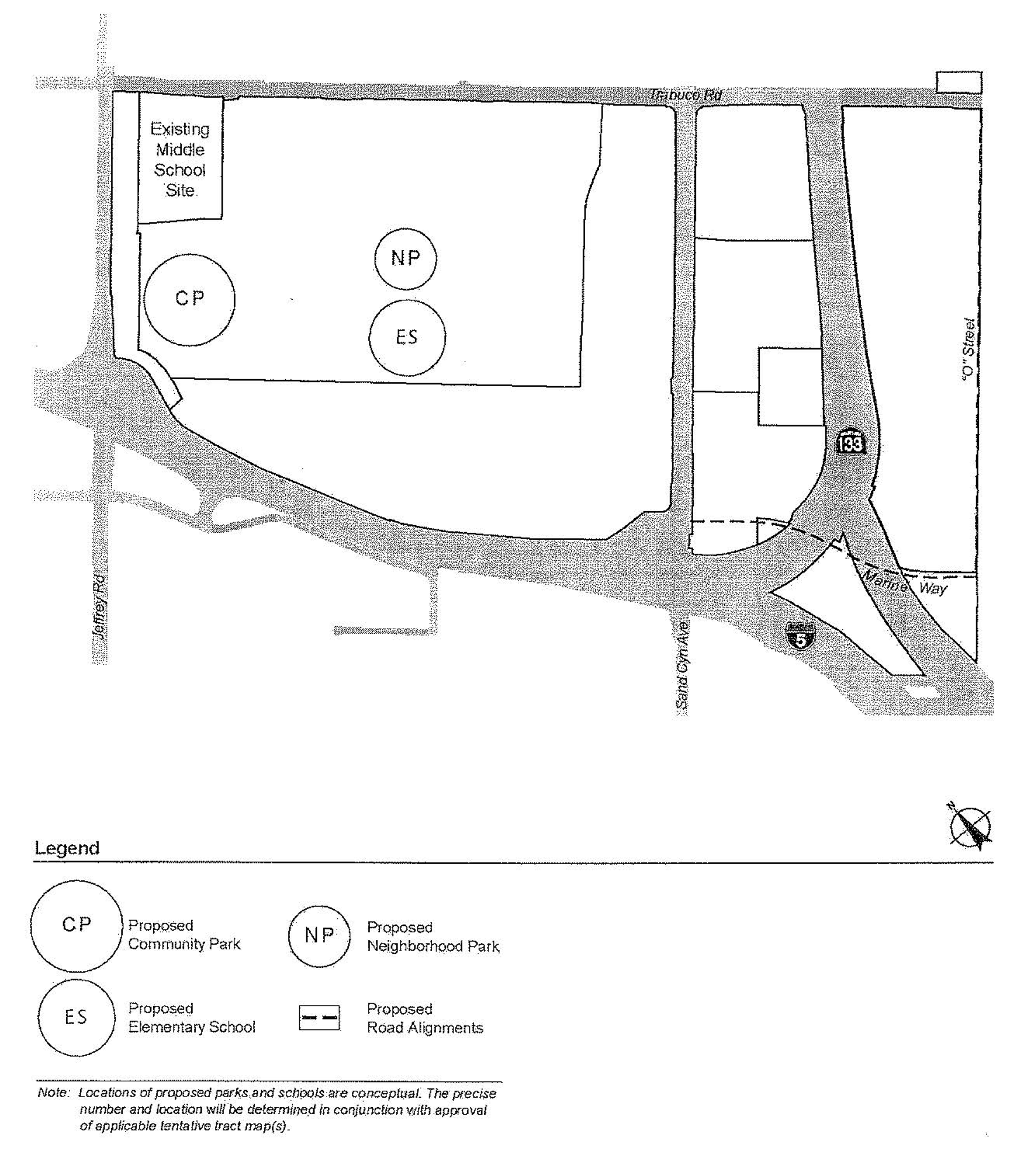
PLANNING AREA 40—PUBLIC PARKS AND SCHOOLS
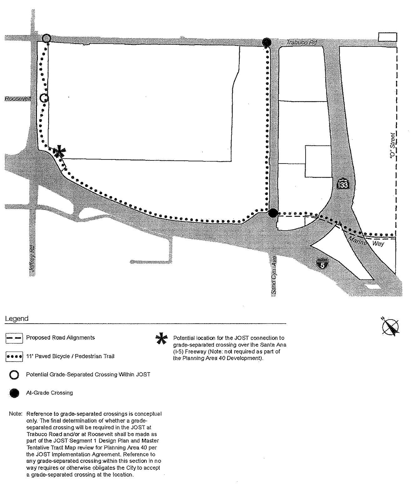
PLANNING AREA 40—PUBLIC TRAILS
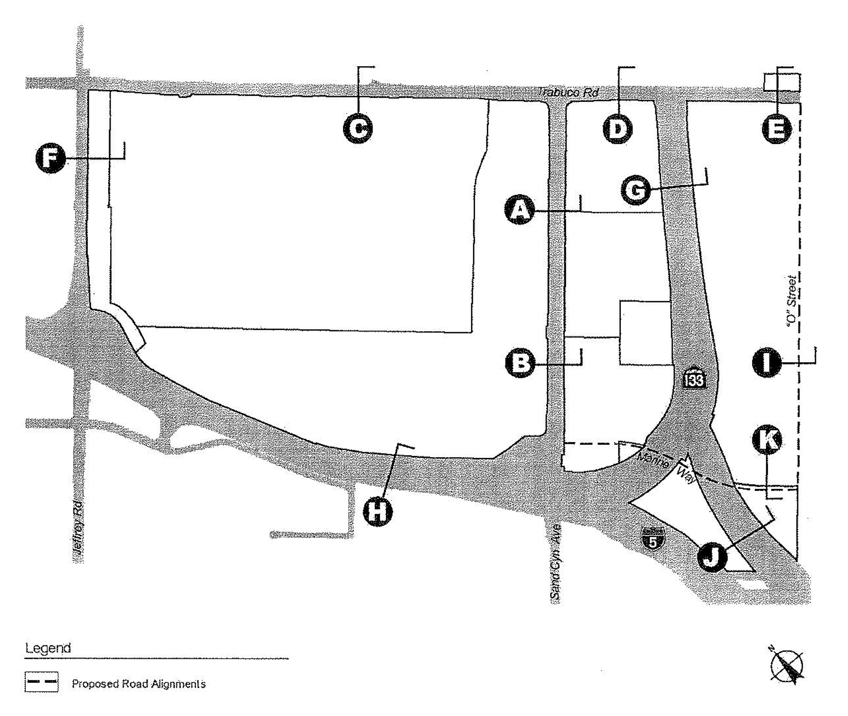
PLANNING AREA 40—STREET SECTION KEY MAP
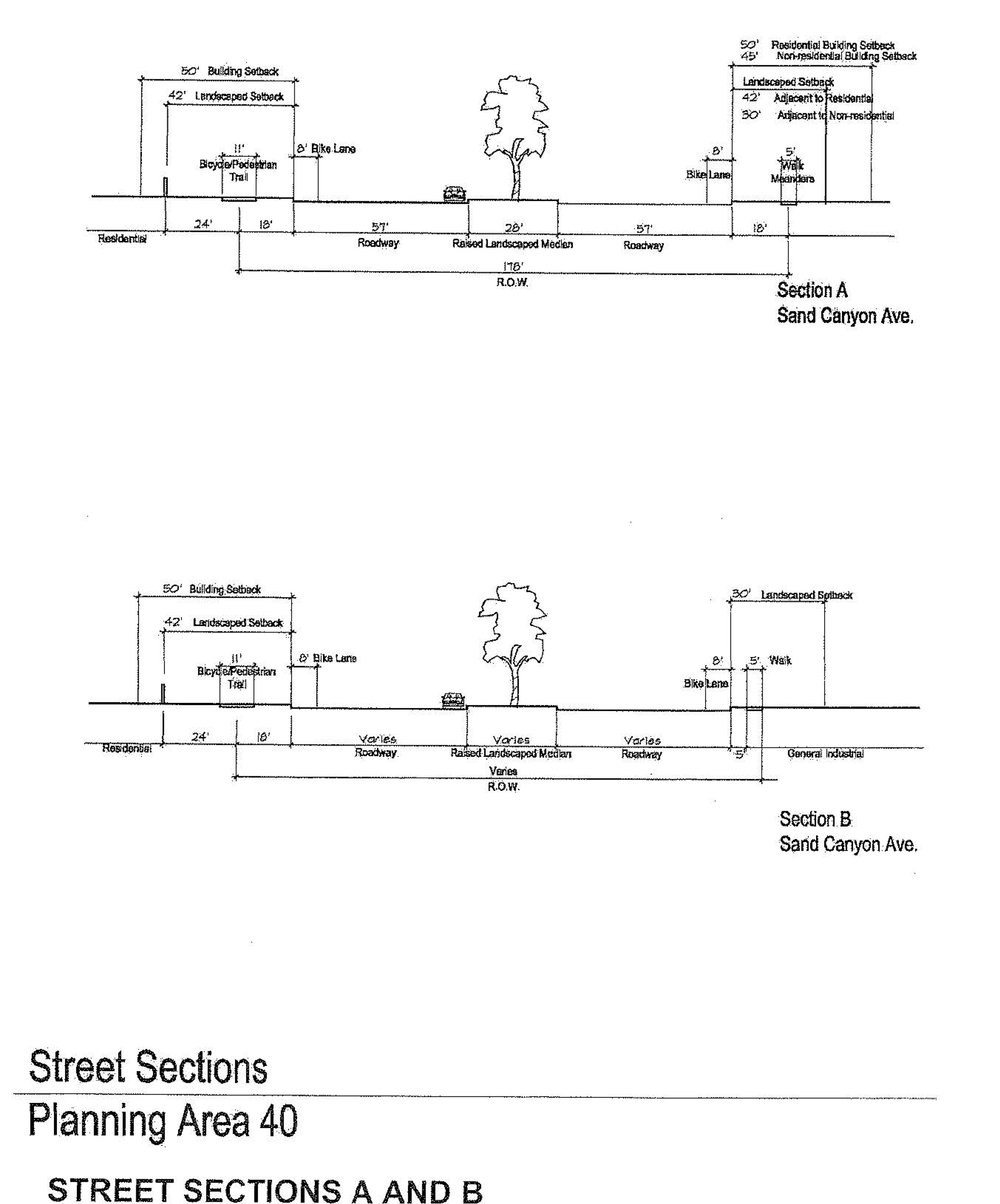
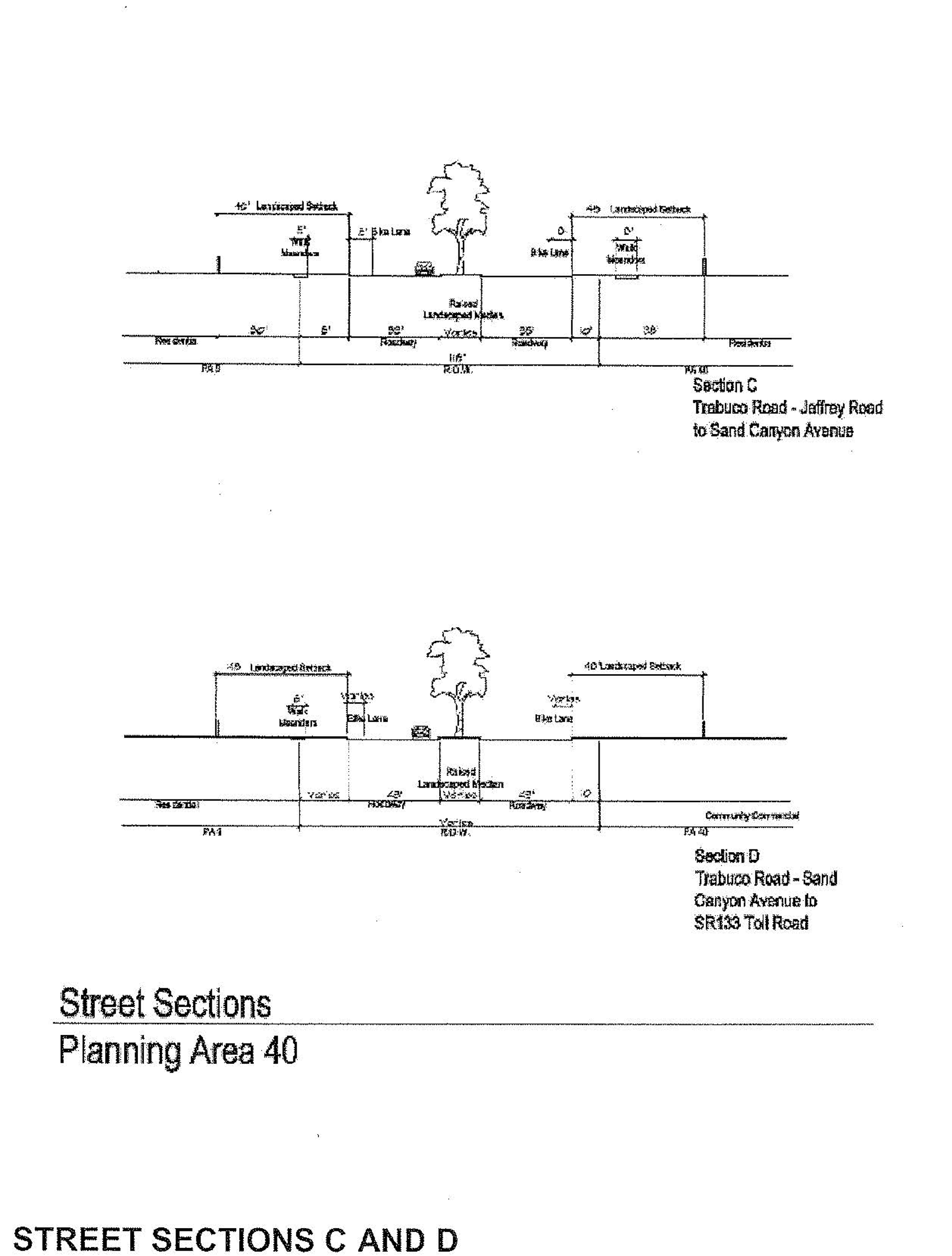
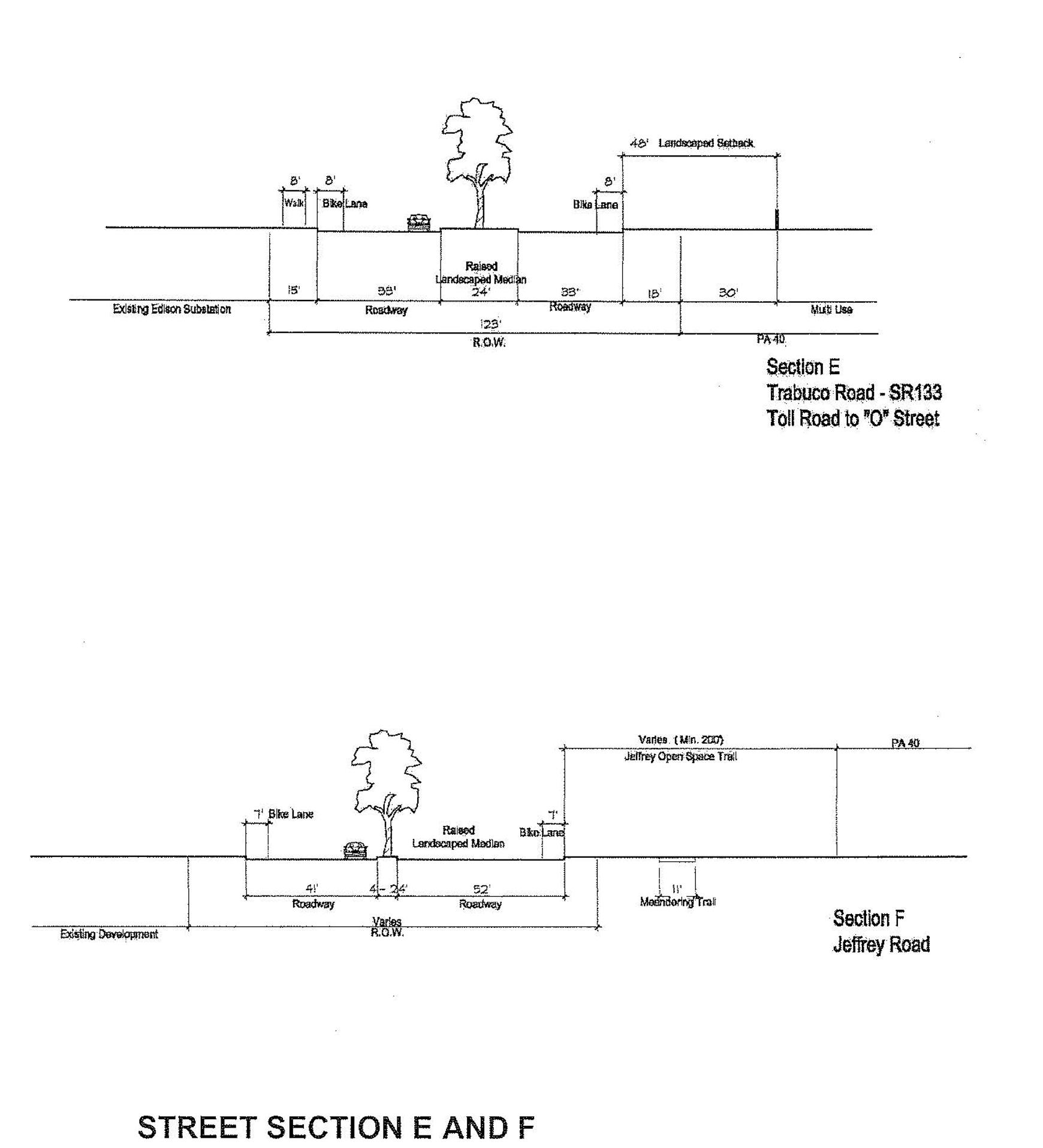
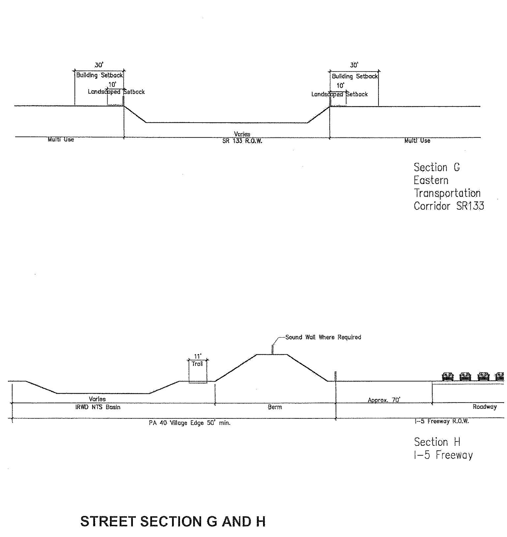
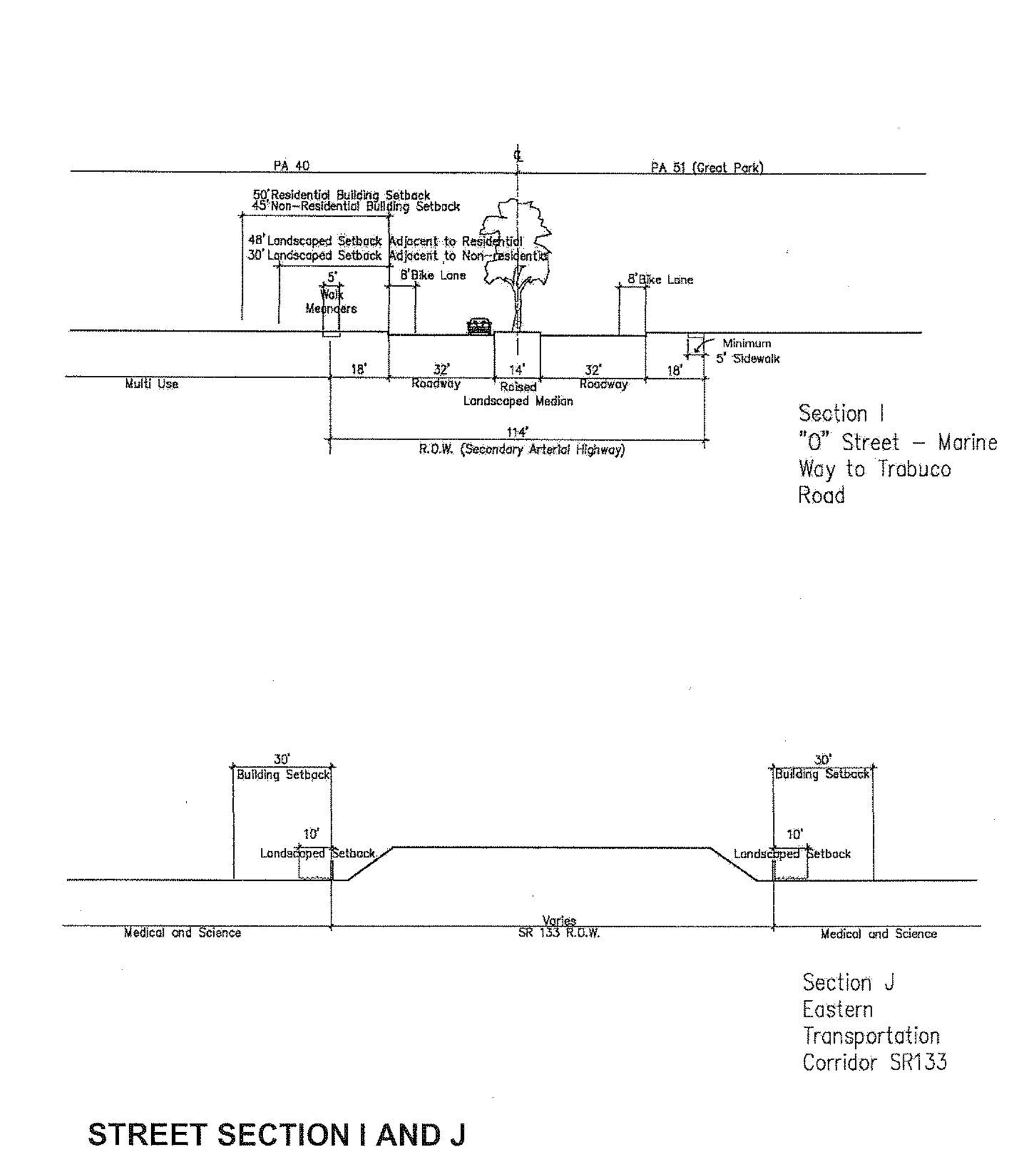
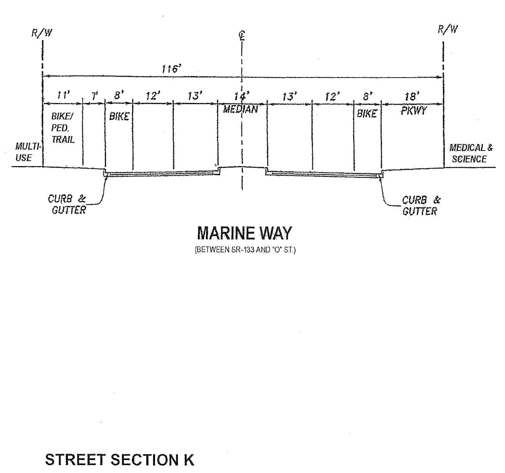
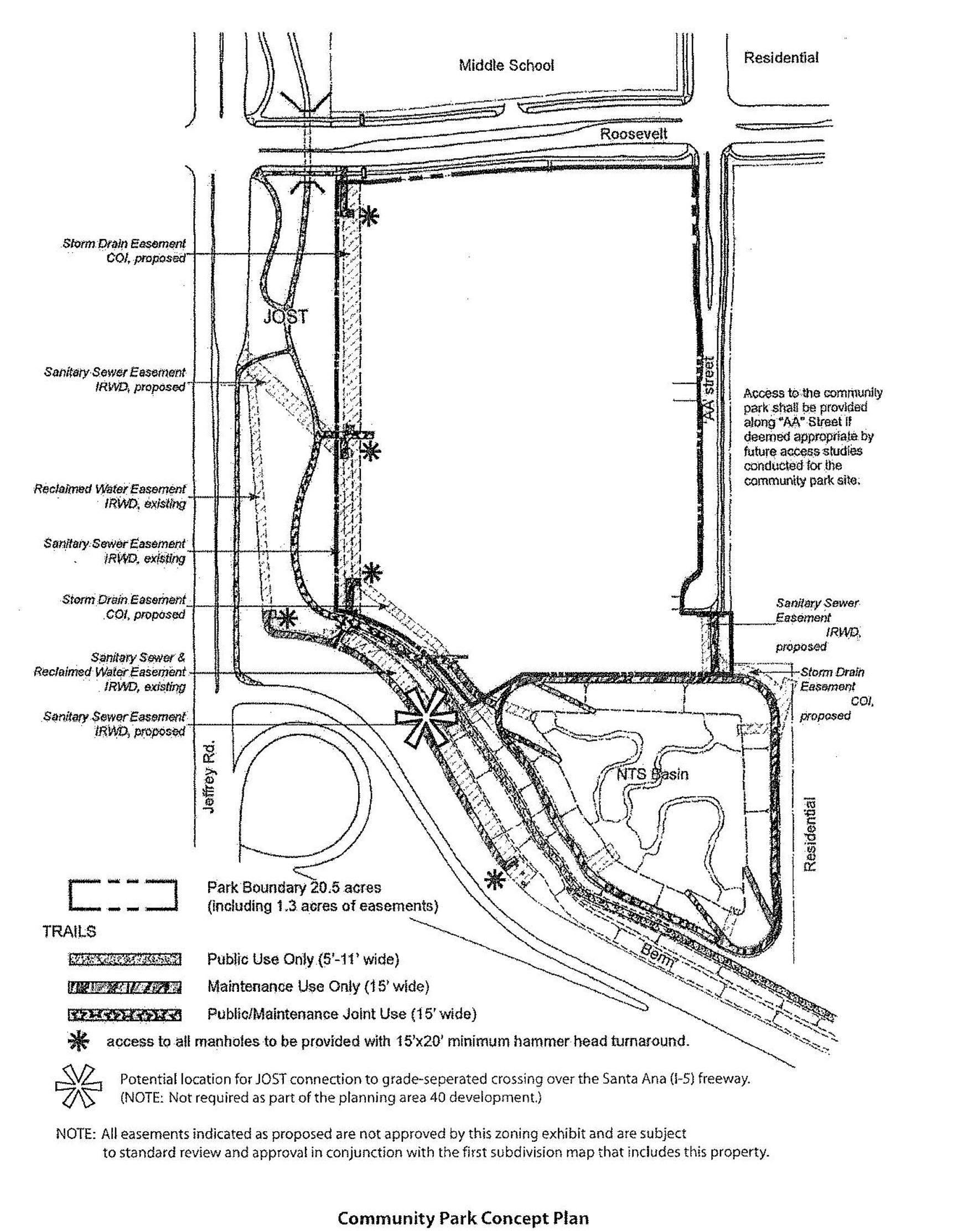
Sec. 9-50-1.- Land use zoning map.
(See Planning Area 50 map following Section 9-50-7.)
(Code 1976, § V.E-850.1; Ord. No. 92-3, 4-14-92; Ord. No. 95-4, 5-9-95; Ord. No. 95-22, § 3, 11-28-95)
Sec. 9-50-2. - Introduction.
Planning Area 50, University of California, Irvine, is located along the southern edge of the City. Boundaries include California Avenue and University Drive to the west, Campus Drive to the north, Culver Drive to the east and Bonita Canyon Road to the south.
(Code 1976, § V.E-850.2; Ord. No. 92-3, 4-14-92; Ord. No. 95-4, 5-9-95; Ord. No. 95-22, § 3, 11-28-95)
Sec. 9-50-3. - Statistical analysis.
1 Unallocated dwelling units represent those units remaining in a planning area that may be built anywhere in the same planning area. These units are within the maximum development intensity for the planning area; and, therefore, placement of unallocated dwelling units into any residential category within the planning area for purposes of development is determined to be consistent with the General Plan and Zoning Code with regard to intensity allocation only, provided that placement is otherwise consistent with site specific zoning regulations and that any potential environmental impacts are adequately addressed, including traffic impacts, pursuant to CEQA.
2 See Section 9-0-3.C, Building Intensity Standards.
(Code 1976, § V.E-850.3; Ord. No. 92-3, 4-14-92; Ord. No. 95-4, 5-9-95; Ord. No. 95-22, § 3, 11-28-95; Ord. No. 12-09, § 3(Exh. A), 5-22-12)
Sec. 9-50-4. - Land use regulations.
See Section 3-3-1 (Land use matrix).
(Code 1976, § V.E-850.4; Ord. No. 92-3, 4-14-92; Ord. No. 95-4, 5-9-95; Ord. No. 95-22, § 3, 11-28-95)
Sec. 9-50-5. - Development standards.
See Chapter 3-37 (Development Standards).
(Code 1976, § V.E-850.5; Ord. No. 92-3, 4-14-92; Ord. No. 95-4, 5-9-95; Ord. No. 95-22, § 3, 11-28-95)
Sec. 9-50-7. - Special development requirements.
Land use authority and regulatory activities are controlled by the University of California. Residential dwelling unit totals are based on the university's long range development plan.
(Code 1976, § V.E-850.6; Ord. No. 92-3, 4-14-92; Ord. No. 95-4, 5-9-95; Ord. No. 95-22, § 3, 11-28-95)
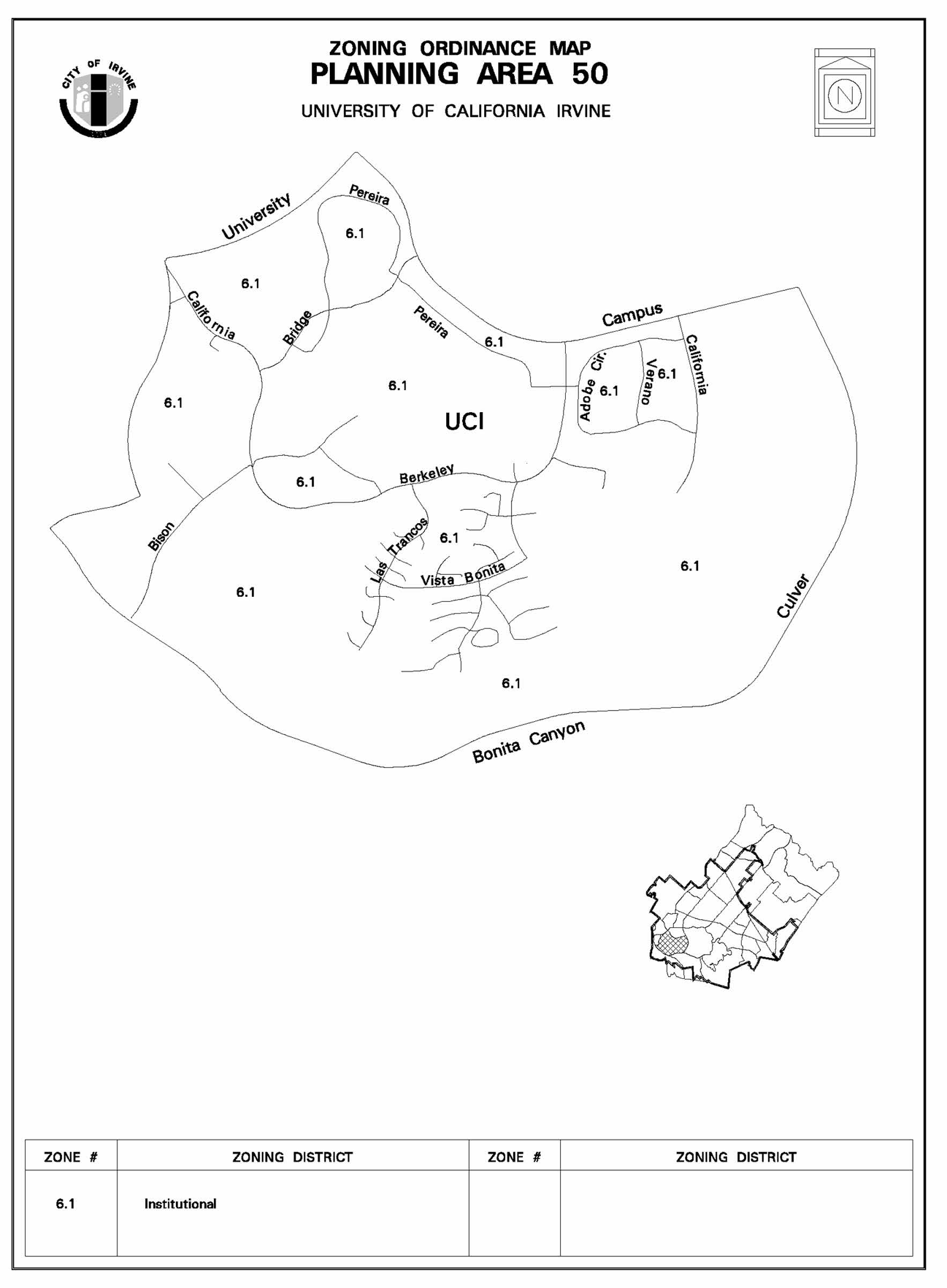
Sec. 9-51-1.- Land use zoning map.
(See Planning Area 51 map following Section 9-51-3.)
(Ord. No. 13-07, § 4(Exh. A), 12-10-13)
Sec. 9-51-2. - Introduction.
A.
Location. Planning Area 51 contains the former Marine Corps Air Station, El Toro, near the eastern edge of the City. Boundaries generally include the Eastern Transportation Corridor, the Foothill Transportation Corridor, Irvine Boulevard, the storm channel near Alton Parkway and Interstate 5 (Santa Ana Freeway). It is bordered on the south by Planning Area 32, on the east by the Irvine Spectrum 2 - Planning Area 35, on the west by Planning Areas 9 and 40 and the Irvine Spectrum 3 (Planning Area 32), and on the north by Planning Area 6.
B.
Development. Of utmost importance to the City of Irvine is the development of the Great Park at the former MCAS El Toro site in Planning Area 51. The site will serve as a Countywide asset consistent with the intent of the citizens of Orange County, who adopted Measure W, the "Orange County Central Park and Nature Preserve Initiative," in March 2002. The City also wishes to assure a financially viable development consistent with the intent of Measure W with the orderly development of public infrastructure and public open space amenities at no cost to the local taxpayer. Within Planning Area 51, the Great Park plan includes habitat preservation, wildlife corridor, education, open space, recreation, institutional and other public-oriented land uses (including a veterans memorial park and cemetery) as well as opportunities for the private development of medical and science, community commercial, residential, and mixed-use development. In order to develop the uses and at the intensities of the development shown in Section 9-51-3, Statistical Summary, the master developer has entered into an Amended and Restated Development Agreement which requires the dedication of land and the development of infrastructure improvements in excess of the City's standard requirements, and the commitment to long-term maintenance of public facilities. Interim activities will occur on the site by private parties and prior to the complete development of the land. These activities may include agricultural and nursery operations, open storage, and reuse of aviation hangars located in the southern portion of Planning Area 51 which could be appropriate for reuse as warehousing, manufacturing, or motion picture production studios. Close proximity to the permanent open space areas may also facilitate reuse of the hangars as museum, sports, cultural facilities, or other uses consistent with the zoning of the site. Interim activities other than agriculture will be allowed for a maximum period of five years through approval of an interim use permit. Extensions of up to three years may be approved by the Director of Community Development. Existing interim uses in Planning Area 51 approved prior to January 1, 2010, and new interim uses within the Great Park will be allowed for a five year term with up to three year extensions granted by the Director of Community Development. Extensive materials reclamation activities related to the removal of the runways, aprons, and taxiways, as well as the stockpiling and recycling of concrete and other materials will also occur. Demolition of buildings will also occur as they become obsolete, uneconomic to repair, or conflict with approved development plans.
An efficient street system and a system of bikeways and pedestrian paths are provided. Roadways are designed with sufficient capacity for the projected traffic volumes at full development of the planning area.
(Ord. No. 13-07, § 4(Exh. A), 12-10-13; Ord. No. 20-05, § 6, 5-12-20; Ord. No. 21-12, § 4(Exh. A), 11-9-21)
Sec. 9-51-3. - Statistical analysis.
Planning Area 51:
(1)
2,026 acres of property in PA 51 is zoned 8.1 TTOD.
(2)
This number includes the 1,269 density bonus units granted pursuant to State law, Section 2-3, and Planning Commission Resolution No. 08-2926 and a further 1,194 density bonus units granted pursuant to State law and Section 2-3, and 1,056 additive units pursuant to Planning Commission Resolution No. 19-3719.
(3)
This acreage includes 27 acres of the Marshburn Basin which shall remain in its current location.
(4)
Includes 122,500 square feet for institutional facilities, 300,000 square feet for County facilities, and 263,000 square feet of "McKinney Act" warehousing.
(5)
See Section 9-51-6.S (Land Use Conversions). Adjustments to the Statistical Table in accordance with Section 9-51-6.S (Land Use Conversions) do not require a zone change.
(6)
5.5 acres Police Site per Amended and Restated Development Agreement pursuant to City Council Ordinance No. 09-09.
(7)
125.5 acre ARDA Transfer Site per Amended and Restated Development Agreement pursuant to City Council Ordinance No. 09-09 and Build the Great Park Veterans Cemetery Initiative.
(8)
Limited institutional facilities in support of a veterans memorial park and cemetery only.
Notes on maximum intensities: In order to develop the permitted uses and intensities for Planning Area 51, the master developer has entered into the Amended and Restated Development Agreement pursuant to City Council Ordinance No. 09-09, which requires the dedication of land and the development of infrastructure improvements in excess of the City's standard requirements, and the commitment to long-term maintenance of public facilities (Section 9-51-2).
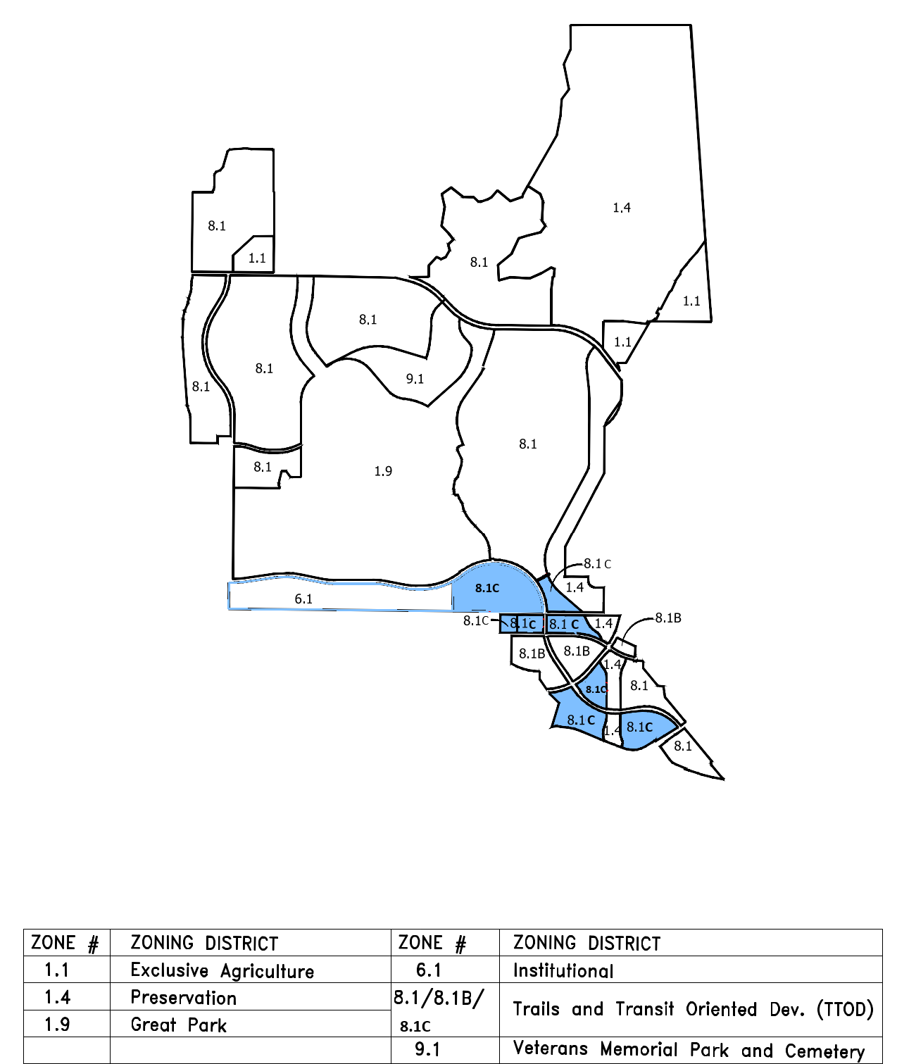
GREAT PARK NEIGHBORHOODS DEVELOPMENT DISTRICTS
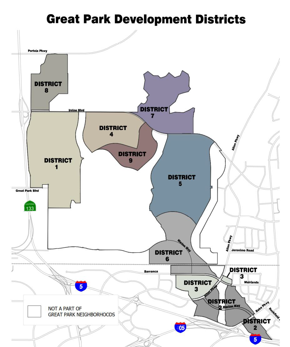
(Ord. No. 13-07, § 4(Exh. A), 12-10-13; Ord. No. 19-20, § 4(Exh. A), 12-10-19; Ord. No. 20-05, § 6, 5-12-20; Ord. No. 21-12, § 4(Exh. A), 11-9-21)
Sec. 9-51-4. - Land use regulations.
The permitted and conditional uses for the zoning designations are given in Chapter 3-37. These uses are also referenced in the land use matrix, Section 3-3-1.
(Ord. No. 13-07, § 4(Exh. A), 12-10-13)
Sec. 9-51-5. - General development standards.
See Chapter 3-37 (Development Standards).
(Ord. No. 13-07, § 4(Exh. A), 12-10-13)
Sec. 9-51-6. - Special development requirements.
A.
Affordable housing. See Chapter 2-3 Affordable Housing Implementation Procedures.
B.
Trails and Transit Oriented Development. The Trails and Transit Oriented Development Zoning District allows a variety of uses on the same site consistent with the Great Park land use category as defined in the General Plan. The Trails and Transit Oriented Development Zoning District land use designation allows for a mix of residential, commercial, recreational, and educational uses that support a multi-use environment and which are complementary to the Irvine Station and to the Great Park. Pedestrian paths and trails, including, but not limited to, bike paths, sidewalks, and recreational trails, shall be encouraged in the Trails and Transit Oriented Development Zoning District. The variety of trail types and transit choices are intended to provide connectivity to the Great Park, to the Irvine Station, to public open space outside the Great Park, and to other nearby areas.
8.1 Trails and Transit Oriented Development Zoning District intensity.
The maximum residential intensity shall not exceed 9,500 dwelling units. The maximum nonresidential intensity in the Great Park Neighborhoods OCGP sub land use category of the Trails and Transit Oriented Development Zoning District shall not exceed: 220,000 square feet of Community Commercial, 3,364,000 square feet of Research and Development/Medical and Science, and 1,318,200 square feet of Multi-Use.
Development intensity shall be recorded in a Trails and Transit Oriented Development District Development Intensity Database and monitored administratively by the Director of Community Development following the Master Plan approval by the Planning Commission (E below). The following planning standards shall apply throughout the 8.1 Trails and Transit Oriented Development Zoning District:
1.
Promote residential communities that are physically connected to each other. Foster community and connectedness between adjacent land uses.
2.
Promote livability, transportation efficiency, and walkability.
3.
Promote diversity of land uses. Allow residential dwelling units to be mixed with other uses providing choice in location, type and size based on compatibility with the surrounding uses.
4.
Promote the development of trails that serve as recreational opportunities and as transportation connections between residential uses, commercial, and industrial uses, the Great Park and transportation hubs.
5.
Encourage clustering of residential units, where feasible, to provide for opportunities to develop public and private open spaces within the development.
6.
Promote a diversity of housing types to accommodate a range of economic levels and age groups to live within a community.
7.
Provide appealing and functional pedestrian street environments to promote pedestrian activity.
8.
Vertical and horizontal integration of commercial office and retail land uses into the residential development should be encouraged, where feasible.
9.
Total average daily trips (ADT) shall not exceed the trip budget established for the development within the Great Park (C below). The developer shall provide additional traffic analysis for the review and approval of the Director of Community Development to support the consideration of trip reduction design standards and integration with transit systems.
10.
Neighborhood parks shall be provided in accordance with City of Irvine Park Code. Community park requirements shall be met through participation in the original dedication in the Development Agreement adopted by the City in July 2005, as amended by the Amended and Restated Development Agreement adopted pursuant to City Council Ordinance 09-09.
11.
The introduction of land uses that are not specified in the permitted and conditionally permitted uses but fit within the intent of the Trails and Transit Oriented Development Zoning District (Section 3-37-39) shall be encouraged subject to an initial determination by the Director of Community Development and subsequently, subject to a conditional use permit approved by the Planning Commission.
12.
Prior to approval of a Master Plan for development of areas within the Trails and Transit Oriented Development Zoning District site (E below), the Planning Commission shall make a specific finding that the Master Plan meets the intent of the Trails and Transit Oriented Development Zoning District planning standards.
13.
Pedestrian connections within and between the Irvine Station, the public areas of the Great Park and the adjacent development shall be provided. An emphasis on pedestrian, way-finding signage and graphics, and the integration of nonresidential uses shall facilitate pedestrian access in lieu of automobile access to the site amenities.
C.
Trip budget. Based on the socioeconomic-based trip generation average daily trip (ADT) rates used to analyze the Great Park traffic impacts, the total trips for the entire Great Park project area are not to exceed 148,910 ADT, not including the ADT associated with the 1,269 density bonus units granted pursuant to State law, Section 2-3, and Planning Commission Resolution No. 08-2926, and 1,194 density bonus units subsequently granted pursuant to State law.
D.
Great Park Development Monitoring Database. The purpose of the Database is to monitor the development intensity and trips in Planning Area 51 and update the allocated intensity for all parcels as they develop.
a.
The development in Planning Area 51 is subject to specific limits as follows:
1.
Maximum square footage - see Section 9-51-3, Statistical Analysis.
2.
Maximum residential units - see Section 9-51-3, Statistical Analysis.
3.
Maximum daily vehicle trips - 148,910 ADT, not including the ADT associated with any density bonus units granted from time to time pursuant to State law and Section 2-3 of the Zoning Ordinance (Affordable Housing Implementation Procedure), including Planning Commission Resolution No. 08-2926 (Density Bonus Agreement).
b.
In conjunction with the submittal of any of the following development applications that allocates (or reallocates) development intensity: 1) subdivision map, 2) lot merger, or 3) lot line adjustment or in conjunction with the submittal of a building permit for properties located in Planning Area 51, the master developer shall submit documentation to the Director of Community Development identifying the following:
i.
A unique reference number that identifies the data record;
ii.
Project name;
iii.
Legal description for each parcel;
iv.
Addresses affiliated with each building, if applicable;
v.
Land use designation, by square footage, for each building or lot;
vi.
Number of residential units;
vii.
The cumulative and remaining square footage and residential units of remaining development (including ADT); and
viii.
A comprehensive summary describing the square footage of nonresidential development and the total number of residential units of all Development Districts in Planning Area 51 (including ADT).
E.
Review process. Prior to the commencement of any private development in the 1.9 Great Park, 8.1 Trails and Transit Oriented Development or 6.1 Institutional Zoning Districts within Planning Area 51, the City shall review and approve a Master Plan for the specific project, containing the following information for the specific development proposed:
1.
Location, acreage, types of land use and estimated square footages or number of dwelling units for each area.
2.
A community design program, which characterizes the design features of the development, including signage design, fencing design, landscape themes, architectural theme, and other community design features.
3.
Landscape treatments including:
a.
Planning area edge and entry widths and general character.
b.
Special landscaping themes, if any.
c.
Palette of plant materials, walls, and hardscape for areas in and adjacent to the public rights-of-way.
d.
Ownership of landscape areas.
4.
Wildlife corridor edge condition treatments, consistent with the Irvine Wildlife Corridor Plan, including:
a.
Light and noise mitigation programs and techniques.
b.
Palette of compatible plant materials.
c.
Walls, fences, and/or barrier mechanisms to protect the wildlife corridor from unwanted intrusions.
5.
Other information as required by the Director of Community Development. The application for said Master Plan shall be accompanied by maps, text, or other documentation to satisfy the above requirements. The form and content of such submittals shall be made to the satisfaction of the Director of Community Development.
F.
Changes in boundaries and/or intensities. Boundaries and acreages in the Great Park plan are approximate and shall be established by Master Plan approval (E above).
G.
Reuse of existing facilities. The former MCAS El Toro site has a number of facilities suitable for civilian reuse, including warehouses, hangars, and other buildings. The zoning accommodates a number of these existing facilities, encouraging adaptive reuse wherever possible. Some existing facilities can possibly be adapted for civilian use on a long-term, permanent basis; others can serve interim uses during development of the site. For example, aviation hangars located in the southern portion of Planning Area 51 could be appropriate for reuse as warehousing, manufacturing, or motion picture production studios. Close proximity to the permanent open space areas may also facilitate reuse of the hangars as museum, sports, cultural facilities, or other uses consistent with the zoning of the site.
Prior to the issuance of occupancy permits for any existing structure, a fire life-safety evaluation of the structure, including recommendations for improvements required for compliance with current Building Codes adopted by the City for the use of existing structures, and plans for any required improvements shall be submitted to the Chief Building Official for review and approval.
H.
Recycling operations. Existing runways are located on a substantial portion of the site planned for open space and related uses. Runways, aprons, and associated taxiways exist on the site reflecting its prior usage as a Marine Corps air station. In order to use the site for urban purposes, the runways will be removed. Concrete and asphalt from the runways intended to be removed will be crushed and, where feasible, used as aggregate base or recycled for other roadway or development uses.
The runways will be removed in a sequential manner. The removal of most of the runway paving is anticipated. Some portion of runway may be preserved for use as playing surfaces and parking areas or for historic purposes. Demolition of the runways is to occur in accordance conjunction with the phasing program adopted by the City and Master Developer pursuant to the Amended and Restated Master Implementation Agreement. Stockpiled material will be placed in designated areas and distributed as required to provide aggregate for development projects. Once the material has been used, the land will become available for development. Concrete recycling facilities and stockpiling of demolished or recycled material are considered an appropriate interim land use, subject to the approval of a minor conditional use permit.
I.
Trails plan. In conjunction with the submittal of the master tract map the applicant shall submit a conceptual Master Landscape and Trails Plan or a detailed exhibit depicting potential trail connections on site to the City's existing or planned regional trail network.
In addition, in conjunction with subsequent tract maps, Master Plans or building permit submittals, whichever comes first, the applicant shall provide a specific and detailed trails plan depicting the exact location, alignment and connectivity of on-site trails to the City's existing or planned regional trail network.
J.
Child care. The need for child care facilities shall be recognized in the development of Planning Area 51. In 2011, the City approved a Child Care Need Analysis for the first 4,894 residential units in Planning Area 51. That study indicated that the child care needs generated by those residential units will be satisfied within Planning Area 51. Prior to the approval of the first residential tentative tract map that causes the total combined approved residential dwelling units, excluding senior housing units, to reach 6,300 in Planning Area 51, the Master Developer of Great Park Neighborhoods shall submit another child care needs study to the Director of Community and Library Services for review and approval. Upon approval of the Study by the Director of Community and Library Services, the Master Developer of Great Park Neighborhoods shall identify ways to provide any unmet private child care needs created by their residential development in Planning Area 51. Any private sector child care center(s) shall:
1.
Accommodate the determined number of slots, which shall be based on the actual number of residential units to be built and on a determination of child care need within the project.
2.
Be located at a site that is compatible with adjacent uses. Development of a child care center in conjunction with proposed elementary schools and public neighborhood parks, religious institutions, affordable housing developments, residential development and/or neighborhood commercial center shall be encouraged.
3.
Be located at a site that has been evaluated with regard to factors that might be detrimental to public health, safety, or welfare, including, but not limited to, proximity to high-traffic volume roadways, hazardous material, and major generators of traffic.
K.
Edge conditions. Prior to the grading of development pads within those portions of Development Districts adjacent to the Great Park, the applicant shall submit a pre-application, for the review and approval by the Director of Community Development that provides a detailed design for the edge conditions where the development abuts the Great Park. The design detail should demonstrate an attractive edge between the private development and the public park. Private residential development is encouraged and preferred to face outward toward the park and provide for architectural cohesion between the two land uses.
L.
Transit. Prior to the recordation of the first residential tract map in any Development District (except Development District 8) in the Great Park Neighborhoods development, the applicant shall prepare, fund, and work in cooperation with the City to develop a transit study, consistent with the City's 30-year Transit Vision Plan approved by the City Council in April 2009, ensuring that a route for the iShuttle is identified. At a minimum, the route should circulate along "O" Street, Irvine Boulevard, and Marine Way (or similar) and the study should contemplate a route circulating along "LQ" Street and "B" Street as well. The master developer shall identify strategic shuttle stop locations based upon developer's approved Master Plans. The master developer will continue to work cooperatively with the City, the Irvine Company, and other agencies to help identify and secure funding for the new iShuttle route identified in the transit study.
M.
Charging stations for electric vehicles. To the extent feasible, the applicant shall install electric vehicle charging stations at the commercial retail components of the project in District 1 North and District 4. The parking spaces in these centers will include electric vehicle charging devices.
N.
Reserved.
O.
Reciprocal Use of Recreational Amenities. Prior to the issuance of the first building permit for any dwelling unit other than model homes, in a particular Development District (i.e., District 1 North, 1 South, 4, 7, or 8), the applicant shall provide evidence to the Director of Community Development of a framework for a reciprocal use agreement or CC&Rs for private recreational amenities to be available for use by homeowners within the applicable Development Districts. If the master developer elects to allow reciprocal use among homeowners in other Development Districts of certain amenities, the use agreement or CC&Rs shall be finalized and executed to incorporate each subsequent district prior to the issuance of the first building permit for any dwelling unit other than model homes in that subsequent district.
P.
Orange Bike Program. The developer shall incorporate a bike share program into their development program that takes advantage of, and expands upon, the "Orange Bike Program" being implemented by the Great Park Corporation with an emphasis on connecting the Great Park Neighborhoods to the Great Park. The bike share program shall tap into marketing opportunities for other existing programs that exist regionally, such as the one that currently exist at the University of California, Irvine. In addition, the program shall be promoted through the developer's home sales program.
Q.
District character. Each neighborhood within Planning Area 51 has a distinct character:
i.
Development District 1: A horizontally mixed-use community featuring a significant main-street style town center and employment area. With up to approximately 1.5 million square feet of nonresidential uses, this district may contain a variety of land uses and businesses including, among other uses, commercial services, entertainment, hotel, accessory retail and restaurants; office, medical and research facilities; amenities such as a civic facility, schools, religious institutions, child care, and neighborhood parks. A FAR range from 0.25—1.5 allows for both a low-level campus-like setting as well as higher-density, multi-story buildings.
The circulation within the residential uses consists of a modified grid network, creating multiple vehicular, bicycle, and pedestrian routes. Tree-lined streets with wide landscaped parkways are located throughout the residential neighborhoods and emphasize a small-scale community atmosphere.
The nonresidential uses are generally west of "O" Street and along Trabuco, the main western gateway to the GP. Allowing up to 2,226 dwelling units, this district offers a highly diverse residential market: multifamily attached, single-family attached, single-family detached, and may include affordable units.
ii.
Development District 2: Area-wide employment center with a majority of the area dedicated to low- to mid-rise buildings housing a variety of uses including, among other uses, high-tech, manufacturing, research and development, and office-style businesses. A FAR range from 0.25—1.5 allows for both a low-level campus-like setting as well as higher-density, multi-story buildings. The land uses will be similar in nature to the surrounding Spectrum Planning Areas. District-serving accessory retail is encouraged to serve employees. Arterial Backbone streets with a complete pedestrian sidewalk network are expected in this district to accommodate traffic and pedestrians.
iii.
Development District 3: Area-wide employment center with a majority of the area dedicated to low- to mid-rise buildings housing a variety of uses including, among other uses, high-tech, manufacturing, research and development, and office-style businesses. A FAR range from 0.25—1.5 allows for both a low-level campus-like setting as well as higher-density, multi-story buildings. Residential uses are limited to a maximum of 400 dwelling units on 20 percent or less of the district's land area and are intended to allow for the possibility for high density (average densities of 20 du/ac or greater) and/or affordable dwelling units located in conjunction with the Master Affordable Housing Plan. District-serving accessory retail is encouraged to serve employees. Arterial Backbone streets with a complete pedestrian sidewalk network are expected in this district to accommodate traffic and pedestrians.
iv.
Development District 4: Primarily a residential suburban neighborhood providing area-wide services and retail. This community includes a small main-street or town center style commercial district. This neighborhood's circulation consists of a modified grid network, creating multiple vehicular, bicycle, and pedestrian routes throughout the neighborhood. Tree-lined streets with wide landscaped parkways are located throughout, emphasizing a small-scale neighborhood atmosphere. In addition to bordering the GP, neighborhood parks are strategically located to put all residents within easy walking distance. A maximum of 1,102 dwelling units will be located in this district, offering a highly diverse residential market: multifamily attached, single-family attached, single-family detached units, and may include affordable housing. Up to 70,000 square feet of neighborhood and GP serving commercial land uses are allowed. Other land uses may include, among other uses, schools, religious institutions, and child care facilities.
v.
Development District 5: Primarily a residential suburban neighborhood with an average density of 5—12.5 du/ac, characterized by a majority single-family detached, single-family attached product types and may include affordable housing. Nonresidential land uses are limited to 10-percent or less of the district's land area and are intended to provide neighborhood services and/or conveniences. The district is characterized by narrow, slow-speed streets, and pedestrian trails. Other land uses may include, among other uses, schools, religious institutions, and child care facilities. Residential neighborhoods within this district are unique due to the adjacency of the Wildlife Corridor, Agua Chinon Open Space Corridor and the Great Park. Therefore, open space linkages are abundant for this district encouraging alternative means of transportation, such as walking and bicycling. To accomplish the desired vision, a maximum of 3,700 residential units are allowed along with a maximum of 100,000 square feet of neighborhood serving commercial development.
vi.
Development District 6: Mixed-use urban core serving as a regional destination, with nonresidential uses such as, without limitation, mid- to high-rise office, corporate headquarters, research and development, medical, and cultural/institutional/entertainment facilities of regional interest. This district is characterized by a high floor area ratio and a walkable character. Residential neighborhoods will feature high-density, multi-story residential units (average densities of 20 du/ac or greater within the area south of future Marine Way), which may include affordable housing units. Vertical mixed uses within buildings are allowed (i.e., ground floor office or retail with residential above). The development pattern is focused on increasing density with approaching proximity to the Irvine Station. The focus is to create a thriving, walkable, mixed-use community with a diverse mix of land uses, architecture, landmarks and outdoor gathering places to create a walkable urban environment that encourages on-street pedestrian activity and reduces dependence on the automobile for everyday needs. To accomplish the desired vision, this district will contain a minimum of 1,200 dwelling units and a minimum of 150,000 square feet of nonresidential development with a goal of a minimum jobs to housing ratio of 2:1 within one-half mile of the Irvine Station.
vii.
Development District 7: This district is a primarily residential suburban neighborhood with a lower average density of 5—10 du/ac for a maximum of 840 dwelling units, characterized by single-family detached, single-family attached products types, and may include affordable housing. Access to regional trails and open space is maximized through the Agua Chinon riding and hiking trail, which bisects the district, and the existing open space to the east (El Toro Wildlife Preserve). Compatible edge conditions and interface is required between the residential uses and these features. Roundabouts, traffic calming devices, narrowed street widths, and pedestrian trails are characteristic of this district. Other land uses may include, among other uses, schools, religious institutions, and child care facilities.
viii.
Development District 8: This district is primarily a residential suburban neighborhood with a lower average density of 5—10 du/ac for a maximum of 892 dwelling units, characterized by single-family detached, single-family attached product types, and may include affordable housing. Less than 10 percent of the district may be designated for neighborhood serving uses including, but not limited to, religious institutions and child care for a maximum of 21,000 square feet. Roundabouts, traffic calming devices, narrowed street widths, park space, and pedestrian trails are characteristic of this district.
Notes:
1.
The maximum number of residential dwelling units per Development District can be increased by up to 10% of the total allowable dwelling units in Planning Area 51 as long as the total number of units within Planning Area 51 does not exceed the total established in Section 9-51-3 (Statistical Analysis). Any increase to the number of residential units designated in an approved Master Plan will require a modification to said Master Plan in accordance with Chapter 2-19.
2.
The maximum amount of nonresidential square footage mentioned above can be increased by up to 10% in District 1, 5% in District 4, and 1% in Districts 5 and 8, based on the total allowable nonresidential square footage in Planning Area 51 as long as the total square footage within Planning Area 51 does not exceed total established in Section 9-51-3 (Statistical Analysis).
ix.
Development District 9: This district is the location for a veterans memorial park and cemetery. This district will be the exclusive location for a veterans cemetery. There will be no residential uses and only minor institutional or commercial uses ancillary and related to cemetery use, such as a bookstore or gift shop offering commemorative items or veterans-oriented materials, administrative buildings, or community meeting rooms. Any new structures at the site shall be small in scale. Structures determined to be of historic value may remain. The district shall have circulation in the form of internal streets and sidewalks, and pedestrian access may be provided to adjacent Great Park uses. A perimeter system of trees, trails, and gardens for use and enjoyment by cemetery visitors and the general public shall integrate the district with Great Park and adjacent uses.
R.
Alternative setback standards. Alternative setback standards for setbacks internal to the planning area may be approved in conjunction with any subsequent Planning Commission approval. A description of the proposed setbacks and how they differ shall be submitted. The Planning Commission will consider the following criteria and make appropriate findings, if necessary:
1.
General character. Relationship in scale, bulk, coverage, and density with surrounding land uses.
2.
Quality of Life. Whether the proposed alternative standard will result in an adverse impact on existing neighborhoods.
3.
Suitability. The physical suitability of the site for the proposed project.
4.
Limitations. Such setbacks shall not be uses to deviate from setbacks established for village edges.
S.
Nonresidential land use conversions. The "Heritage Fields Project 2012 General Plan Amendment and Zone Change Traffic Impact Analysis, approved October 24, 2013" or subsequent traffic analysis approvals amending these assumptions analyzed 1,318,200 square feet of Multi-Use (Office) in Planning Area 51. If any other nonresidential land uses within the 8.1 TTOD Zoning District are proposed in lieu of Multi-Use (Office), the square footage may be adjusted accordingly within the Zoning Statistical Table without the need for a zone change.
T.
Future traffic analysis. Subsequent discretionary applications shall require further traffic analysis, if revisions occur that are different (i.e., creates materially different trip generation resulting in new or altered traffic impacts) than the assumptions in the "Heritage Fields Project 2012 General Plan Amendment and Zone Change Traffic Impact Analysis, approved October 24, 2013" or subsequent traffic analysis approvals amending these assumptions. The traffic analysis for the conversion, depending on the proposed use, may include a long-term/General Plan build-out analysis. This requirement will address any land use conversions between Multi-Use (Office) and other nonresidential land uses as provided in Section 9-51-6.S (Land Use Conversions) that differ from those assumed in the 2012 traffic analysis and approval or subsequent approvals and that may result in new or altered traffic impacts. Any future traffic analysis shall be used to update the Great Park Development Monitoring Database. Notwithstanding the requirements of City Council Ordinance No. 03-20 (The NITM program), The Director of Community Development may waive this requirement if the applicant can demonstrate that these revisions do not result in significant differences compared to the underlying traffic analysis.
i.
Conversion to other nonresidential uses within the Multi-Use category is subject to a traffic analysis to assess traffic impacts due to the change in land use. To the degree other uses are proposed above their maximum limits, a corresponding adjustment in allowable Multi-Use (Office) intensity shall occur in terms of equivalent traffic generation based on a.m. peak, p.m. peak, and average daily trips (ADT). The adjustment will be based on Socioeconomic (SED) trip rates derived from ITAM 8.4-10, and using an average trip generation rate (12.55 ADT, 1.13 a.m. peak hour trips, 1.21 p.m. peak hour trips per 1,000 square feet of office use) and applicable rates for any proposed non-office use based on trip generation rates in table 3-1 of the approved "Heritage Fields Project 2012 General Plan Amendment and Zone Change Traffic Impact Analysis, approved October 24, 2013." If the proposed non-office use and associated trip generation rate is not included in table 3-1, the Director of Community Development shall approve the application of an appropriate rate.
U.
Land sales - special development requirements. Any purchase agreement for the sale of land for initial development (excluding sales once the initial development has occurred and excluding sales for public uses) in PA 51 shall include a recorded deed or special land use restriction (SLUR) or covenants, conditions and restrictions (CC&Rs) document with the following:
i.
The legal tract and lot number(s);
ii.
County Recorder's recordation number which will be reflected on the recorded grant deed;
iii.
The maximum number of residential units (by type - single-family or multifamily); and
iv.
The maximum nonresidential square footage by land use with maximum ADT.
The SLUR, and any subsequent modification to the SLUR, shall be recorded by the County of Orange Recorder's Office. Within 30 days of recordation (or any amendments thereafter), the developer shall provide documentation of the information identified in Section 9-51-6.D.d.i—iv above to the Director of Community Development.
(Ord. No. 13-07, § 4(Exh. A), 12-10-13; Ord. No. 20-05, § 6, 5-12-20; Ord. No. 21-12, § 4(Exh. A), 11-9-21; Ord. No. 25-22, § 4, 9-9-25)