
Martin County Unincorporated
City Zoning Code
City Zoning Code
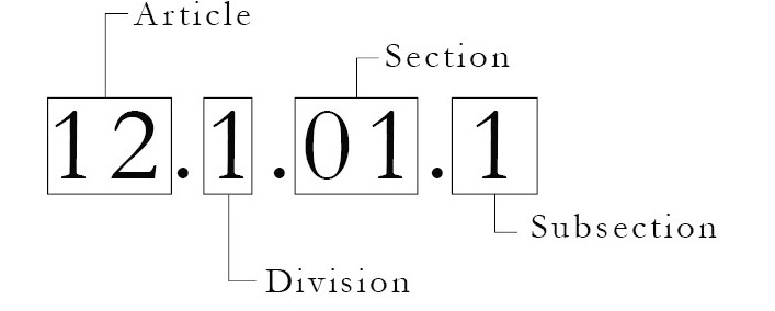
ARTICLE 12
COMMUNITY REDEVELOPMENT CODE
Sec. 12.1.01. - Purpose and intent.
Article 12, the Redevelopment Code establishes Redevelopment Zoning Districts, permitted uses and development standards to implement the Comprehensive Growth Management Plan and the Community Redevelopment Plans in Martin County's six Community Redevelopment Areas (CRAs). The Community Redevelopment Code provides opportunities for traditional neighborhood design and mixed residential and commercial uses in redeveloping areas. The Community Redevelopment Code shall be applicable only for CRAs that have been formally designated by Martin County in accordance with the Comprehensive Growth Management Plan.
12.1.01.A.
Content of the Community Redevelopment Code.Article 12 establishes Redevelopment Zoning Districts and a specific Division for each CRA. Article 12, Division 1 is applicable in all Redevelopment Zoning Districts.
Figure 12-1.01 Martin County Community Redevelopment Areas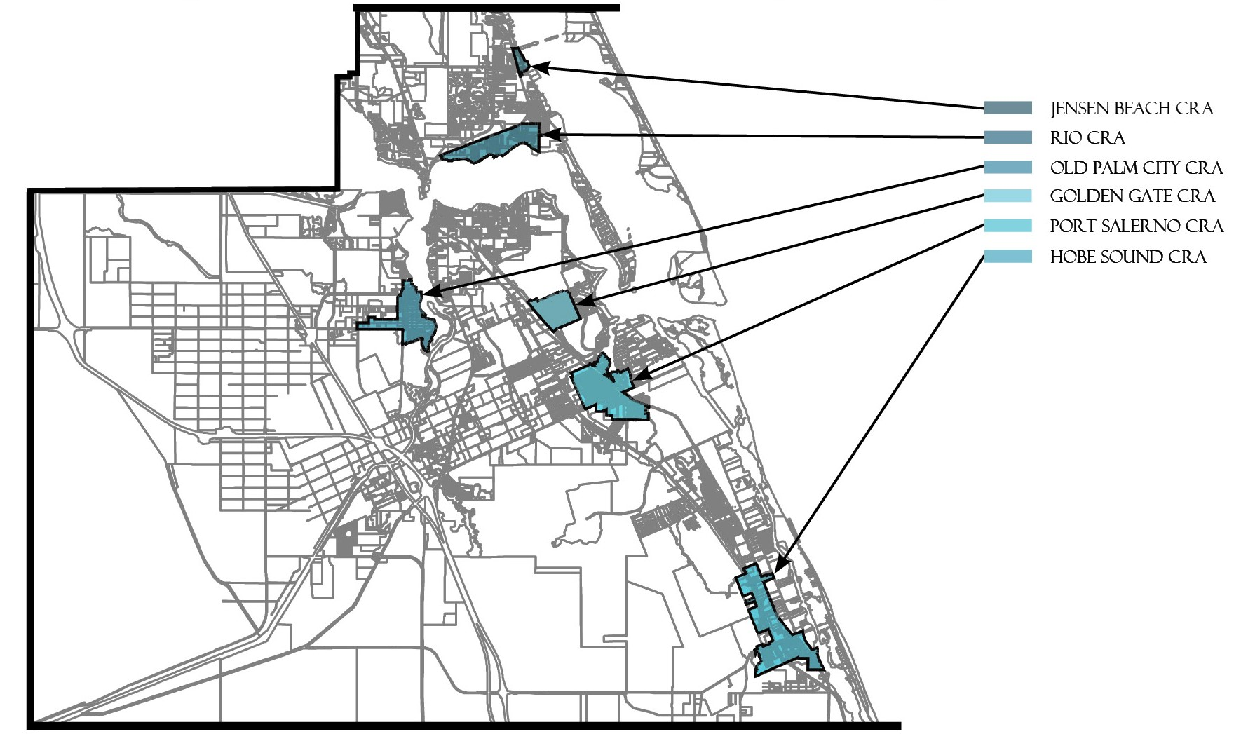
12.1.01.B.
Adoption and modification of the Community Redevelopment Code. The adoption or modification of the Community Redevelopment Code and Redevelopment Zoning Districts and the assignment of land to a Community Redevelopment Zoning District or Subdistrict shall be by an ordinance amending the Land Development Regulations. When such ordinance assigns land to a Redevelopment Zoning District or Subdistrict, public notice shall be the same as for development applications and for amendments to the Martin County zoning atlas as set forth in Article 10.
12.1.01.C.
Comprehensive Plan. All development in a CRA shall comply with the Martin County Comprehensive Growth Management Plan (CGMP). In the case of conflict between Chapter 18, Community Redevelopment, CGMP and the LDR or the General Ordinances, Chapter 18 shall control.
12.1.01.D.
Function of the Community Redevelopment Code; consistency with other regulations.
1.
Development under the Community Redevelopment Code shall comply with all requirements of the Martin County Land Development Regulations (LDR) and General Ordinances. In the case of conflict between Article 12, LDR and other provisions of the LDR or the General Ordinances, Article 12 shall control.
2.
Table 12-1.02 identifies which standards of Article 3 are modified, replaced, or do not apply in the Redevelopment Zoning District.
Table 12-1.02 - Article 3 Standards Applicable to Article 12
12.1.01.E.
Form-based code. The Community Redevelopment Code is a form-based code, land development regulations that foster predictable built results and a high-quality public realm by using physical form (rather than full separation of uses) as the code's primary organizing principle.
12.1.01.F.
Subdistricts. The land in each Redevelopment Zoning District is controlled by a Regulating Plan. The Regulating Plan may identify the following Subdistricts:
1.
The Core Subdistrict is intended to be a pedestrian-oriented center for surrounding neighborhoods and the entire CRA. These are centers of dining, shopping, housing, and entertainment, with shaded sidewalks, large windows, intimate pedestrian spaces, outdoor dining, and richly detailed building façades. A broad mix of uses is encouraged in the Core Subdistrict.
2.
The Corridor Subdistrict is intended to extend the pedestrian-oriented building types, frontages, types, and streetscapes along a major roadway.
3.
The Railroad Corridor Subdistrict identifies those areas, adjacent to a functioning railroad right-of-way, in which a variety of uses, ranging from single family residential to light industrial, have emerged over time and shall be permitted to remain.
4.
The General Subdistrict offers a wide variety of housing, civic spaces, and pedestrian-oriented businesses. The General Subdistrict also fosters a mix of uses but is more residential in scale and character.
5.
The Waterfront Subdistrict is defined by marinas and working waterfronts. It also promotes a mixed-use waterfront environment with restaurants, entertainment, resort and residential uses.
6.
The Industrial Subdistrict identifies areas where industrial uses are permitted and encouraged.
7.
The Multifamily Subdistrict allows for denser and more varied residential buildings.
8.
The Detached Subdistrict is predominantly single-family homes with front yards and walkable sidewalks.
9.
The Detached Limited Subdistrict is predominantly single-family homes with front yards and walkable sidewalks, but building types may be more restrictive than the Detached Subdistrict.
10.
The Detached Estate Subdistrict is predominantly single-family homes characterized by larger lots.
11.
The Mobile Home Subdistrict identifies where mobile homes are permitted.
12.1.01.G.
Consistency with Future Land Use. Subdistricts shall be consistent with the Future Land Use. The Future Land Use designations shall be implemented by one of the Subdistricts as described in Figure 12-1.02.
Table 12-1.03 - Consistency with Future Land Use
12.1.01.H.
How to use Article 12.
1.
Review the standards in Division 1, which apply to all Redevelopment Zoning Districts.
2.
Division 2 through Division 7 establish standards specific to each Redevelopment Zoning District(s). Review the Division applicable to the specific site.
3.
Locate the site on the Regulating Plan. The Regulating Plan identifies the Subdistrict of each site in the Redevelopment Zoning District, the existing street network, the lot pattern, and additional regulatory information pertaining to that Redevelopment Zoning District.
4.
Determine Permitted Uses for the Subdistrict.
5.
Determine applicable Development Standards for the Subdistrict including lot size, density, and height.
6.
Determine the permitted Building Types for the Subdistrict and development standards that correspond to those types.
7.
Determine the Architectural Style.
8.
Determine the Frontage Type.
9.
Review applicable Stormwater Standards, Parking Standards, Wall and Fence Standards, Sign Standards, and other standards that may be specific to the Redevelopment Zoning District and the Subdistrict.
10.
Organization of Article 12 numbering.
(Ord. No. 1111, pt. II, 9-24-2019, Ord. No. 1123, pt. 1, 12-17-2019; Ord. No. 1159, pt. 1, 5-11-2021; Ord. No. 1237, pt. I(Exh. 1), 1-28-2025)
Sec. 12.1.02. - Regulating plan.
1.
Purpose. A Regulating Plan is adopted for each Redevelopment Zoning District. The Regulating Plan illustrates zoning Subdistricts and provides detail about the existing and desired character of individual streets, blocks, and civic spaces. Certain standards in Redevelopment Zoning Districts are keyed to specific features shown on the Regulating Plan to manage the form and scale of buildings and their relationship with other buildings and the public realm.
2.
Content. Regulating Plans and Street Regulating Plans contain regulatory information including the following:
a.
Boundary. Boundary of the CRA.
b.
Subdistricts. All land in a Redevelopment Zoning District is assigned to a Subdistrict that provides regulations for the characteristics and location of that land. Subdistricts are designated on the regulating plans. Some land within the CRA remains outside of the Redevelopment Zoning District and therefore is not assigned a Subdistrict. Land with the General Institutional, Recreational, or Public Conservation Future Land Use designations retain Article 3 zoning districts. Additionally, some land that was developed pursuant to a Planned Unit Development Zoning Agreement or a final Site Plan retains its Article 3 zoning district, and remains governed by that district.
c.
Primary and Secondary Streets and Alleys.
i.
Primary Streets are intended to develop over time as pedestrian friendly environments and, as such, are held to higher standards regarding building placement, building frontage, and the location of parking and service uses. Primary Streets allow movement through, as well as, within Redevelopment Zoning Districts.
ii.
Secondary Streets identify corridors for future street improvement within the neighborhood which should include sidewalks and landscape improvements.
iii.
Alleys are important assets in the Redevelopment Zoning Districts, performing many functions within small rights-of-way. Alley rights-of-way should be retained and improved whenever feasible.
d.
Required Commercial Frontage. Portions of Primary Streets within Redevelopment Zoning Districts are intended to support businesses, civic uses, and reinforce local character. These streets are designated as Required Commercial Frontage and are held to stricter standards regarding allowable frontage types and uses located within sidewalk level stories. Required Commercial Frontage shall be nonresidential and open to the public at the ground level. Frontages shall be shopfront and arcades. Required Commercial Frontage shall be provided for a depth of no less than 20 feet measured from the front of the building.
e.
Recommended Future Street and Alley Connections. Potential future street and alley connections may also be illustrated on Regulating Plans and Street Regulating Plans. Future connections are desired new vehicular or pedestrian connections to existing streets or alleys that will improve the overall transportation network. Future connections are not precise alignments or specific locations. The final street designations, exact alignment, location, maintenance responsibility and dedication of these intended links of the transportation network will be determined during the development review and approval process.
f.
Civic Sites.
(Ord. No. 1111, pt. II, 9-24-2019; Ord. No. 1159, pt. 1, 5-11-2021)
Sec. 12.1.03. - Permitted uses.
1.
Table 12-2 below identifies potential uses of land included in "use groups" with similar impacts. Each use group contains one or more of the uses described in Article 3 (see definitions in Div. 1, Article 3, and Table 12-1.02). Each Redevelopment Zoning District contains a table describing which use groups are permitted.
2.
Not all uses listed in Table 12-2 are permitted in every Redevelopment Zoning District or Subdistrict.
3.
The Growth Management Director may approve uses other than those listed in the use groups permitted tables upon a finding that the use is functionally similar to the permitted uses and that the use is not likely to generate harmful impacts or create incompatibilities with other uses in the area. Prior to the decision, the Growth Management Director may request a recommendation from the Neighborhood Advisory Committee for that Redevelopment Zoning District. The Growth Management Director shall keep a record of all such determinations. The approval of a use pursuant to this provision may include conditions including, but not limited to, a time limitation on the requested use.
4.
Accessory uses and structures. Accessory uses and structures are permitted in Redevelopment Zoning Districts and subdistricts when such uses or structures:
a.
Are ancillary, in connection with, and incidental to, the principal use or structure allowed within the district and subdistrict in question;
b.
Contribute to the comfort, convenience or necessity of occupants within the principal use or structure served; and
c.
Are located on the same lot, or on a contiguous lot that is either under the same ownership as the lot on which the principal use occurs, or is under the ownership of a homeowners' association and in the same zoning district and subdistrict as the principal use or structure.
d.
With the exception of fences, walls and boat docks, accessory uses and structures shall not be established on a lot prior to the issuance of all permits required for the development of the principal use to which it is accessory.
e.
Development standards applicable to accessory uses and structures are provided in Section 12.1.04.
Table 12-2 - Permitted Uses in Each Use Group
(Ord. No. 1111, pt. II, 9-24-2019)
Sec. 12.1.03.5. - Sale of alcoholic beverages in redevelopment zoning districts.
a.
The sale of alcoholic beverages for off-premises consumption is permitted in all redevelopment zoning districts in any subdistrict in which the retail and services, limited impact use group is allowed, if all applicable requirements of the particular subdistrict are met.
b.
The sale of alcoholic beverages for on-premises consumption is permitted in all redevelopment zoning districts in any subdistrict in which restaurants are permitted, if all applicable requirements of the particular subdistrict are met, except as Tables JB-4, R-4, OPC-4, HS-4, PS-4 or GG-4 may further restrict microbreweries and craft distilleries, and except as provided in paragraphs c. and d. below.
c.
Sales restricted within 50 feet of certain protected uses.
i.
For purposes of subsection 12.1.03.5.c, the term protected use means active places of worship, parks, playgrounds, residential zoning districts and subdistricts, and dwellings.
ii.
The sale of alcoholic beverages for on-premises consumption shall not be permitted within 50 feet of a protected use.
iii.
The 50-foot minimum separation required by paragraph ii. above shall not be applicable to sales by a licensed premises if the protected use is located in a Core, Waterfront or Industrial subdistrict.
iv.
The 50-foot minimum separation required by paragraph ii. above shall not be applicable to sales by a licensed premises if the protected use was established after the date of the establishment of the licensed premises.
v.
If the licensed premises has outdoor seating that is adjacent to a dwelling, the licensed premises shall also provide an eight-foot wide landscape buffer and a solid, finished masonry wall no less than six feet in height between the licensed premises and the dwelling. Such landscape buffer shall include at least one tree and ten shrubs for every 300 square feet of required buffer. The provision of the landscape buffer and wall required by this paragraph v. shall not be applicable to a licensed premises existing prior to the adoption of this section 12.1.03.5. Notwithstanding the foregoing, if a licensed premises existing prior to the adoption of this section 12.1.03.5. adds outdoor seating to the licensed premises and such outdoor seating is adjacent to a dwelling, the provision of the landscape buffer and wall described in this paragraph v. shall be required.
vi.
In the Jensen Beach Redevelopment Zoning District, there shall be no minimum separation requirement between a place of worship and any other use.
d.
Sales restricted within 500 feet of schools.
i.
The sale of alcoholic beverages for on-premises consumption shall not be permitted within 500 feet of the real property that comprises a public or private elementary school, middle school, or secondary school.
ii.
Notwithstanding paragraph d.i, if the licensed premises or a predecessor licensed premises (1) was established before the establishment of the school use; or (2) was licensed for the sale of alcoholic beverages on or before July 1, 1999; or (3) is licensed as a restaurant, pursuant to F.S. ch. 509, and derives at least 51 percent of its gross revenues from the sale of food and nonalcoholic beverages, then such licensed premises shall be required to provide a 50-foot minimum separation from a school property. If the licensed premises has outdoor seating that is adjacent to a school property, the licensed premises shall also provide an eight-foot wide landscape buffer and a solid, finished masonry wall no less than six feet in height between the licensed premises and the school property. Such landscape buffer shall include at least one tree and ten shrubs for every 300 square feet of required buffer. The 50-foot separation and the provision of the landscape buffer and wall required by this paragraph ii. shall not be applicable to a licensed premises existing prior to the adoption of this section 12.1.03.5. Notwithstanding the foregoing, if a licensed premises existing prior to the adoption of this section 12.1.03.5. adds outdoor seating to the licensed premises and such outdoor seating is adjacent to a school property, the provision of the landscape buffer and wall described in this paragraph ii. shall be required.
e.
Measurement of distance.
i.
The distance between a school property and a licensed premises shall be measured on a straight line connecting the nearest point of the school property to the nearest point of the building or any outdoor seating area of the licensed premises, whichever is closer to the school.
ii.
The distance between a place of worship and a licensed premises shall be measured on a straight line connecting the nearest point of the building of the place of worship to the nearest point of the building or any outdoor seating area of the licensed premises, whichever is closer to the place of worship.
iii.
The distance between a park or playground and a licensed premises shall be measured on a straight line connecting the nearest point of the boundary of the park or playground to the nearest point of the building or any outdoor seating area of the licensed premises, whichever is closer to the park or playground.
iv.
The distance between a residential zoning district, residential subdistrict, or dwelling and a licensed premises shall be measured on a straight line connecting the nearest point of the boundary of the residential district or subdistrict, the nearest point of the boundary of the lot on which a single-family or duplex dwelling is located, or the nearest point of the building of a multifamily dwelling to the nearest point of the building or any outdoor seating area of the licensed premises, whichever is closer to the residential use or district.
f.
Waiver of distance restrictions. Required distances identified in subsection 12.1.03.5. may be waived by the Board of County Commissioners only after a public hearing is held pursuant to the public hearing notification requirements of sections 10.6.D and 10.6.E, Land Development Regulations, Martin County Code, at which the Board approves the location as promoting the public health, safety and general welfare of the community. Any such waiver shall be limited to the applicant requesting the waiver. The waiver shall not apply to any future transfer of the applicant's alcoholic beverage license without the consent of the Board of County Commissioners granted at a public hearing pursuant to the requirements set forth herein. In granting a waiver to the distance requirements for the on-premises consumption of alcoholic beverages, the Board of County Commissioners may require such conditions as will, in its judgment, substantially ensure that negative impacts are not generated from any site requesting a waiver. The Board may revoke a waiver at any time upon determining, after a public hearing to consider all relevant facts, that impacts from the approval of any such waiver are negatively affecting the public health, safety, and general welfare of the community.
(Ord. No. 1177, pt. 2, 3-22-2022)
Sec. 12.1.04. - Development standards.
Development Standards are established for all Redevelopment Zoning Districts. The following provisions apply in all Redevelopment Zoning Districts, except as they may be modified in a particular district:
1.
Lot Size. Lot width shall be measured pursuant to Section 3.15.B, Div. 2, Article 3. Section 3.15.C, Div. 2, Article 3 provides exceptions to minimum lot size requirements.
2.
Height. Height is measured in accordance with Section 3.14, Div. 2, Article 3. Height exceptions are described in Section 3.14.B, Div. 2, Article 3. See Figure 12-3 for illustration. In case of a conflict between illustrations and text, Section 3.14, Div. 2, Article 3 controls.
Figure 12-3 Building Height Diagrams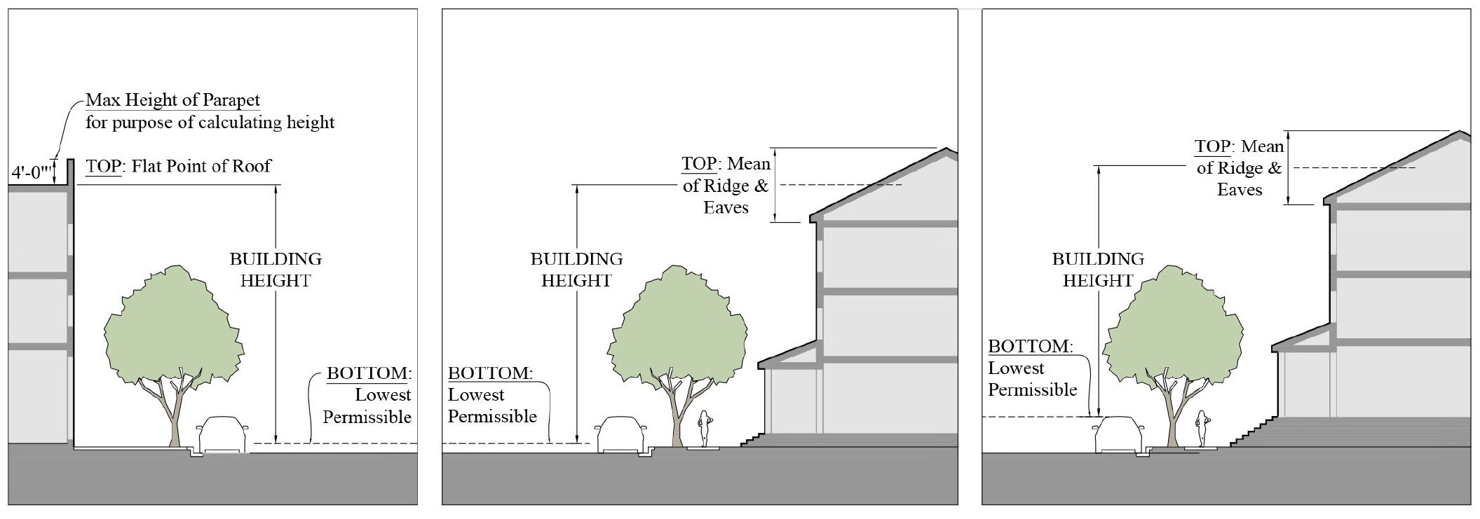
a.
Where maximum building heights are established in stories, all levels devoted to parking are considered as individual stories except when screened by a liner building with active use provided for a depth of no less than 20 feet measured from the front of the building. See Figure 12-4 for illustration. Under all circumstances the 40' and 4-story height limit shall not be exceeded.
Figure 12-4 Parking Screened by Uses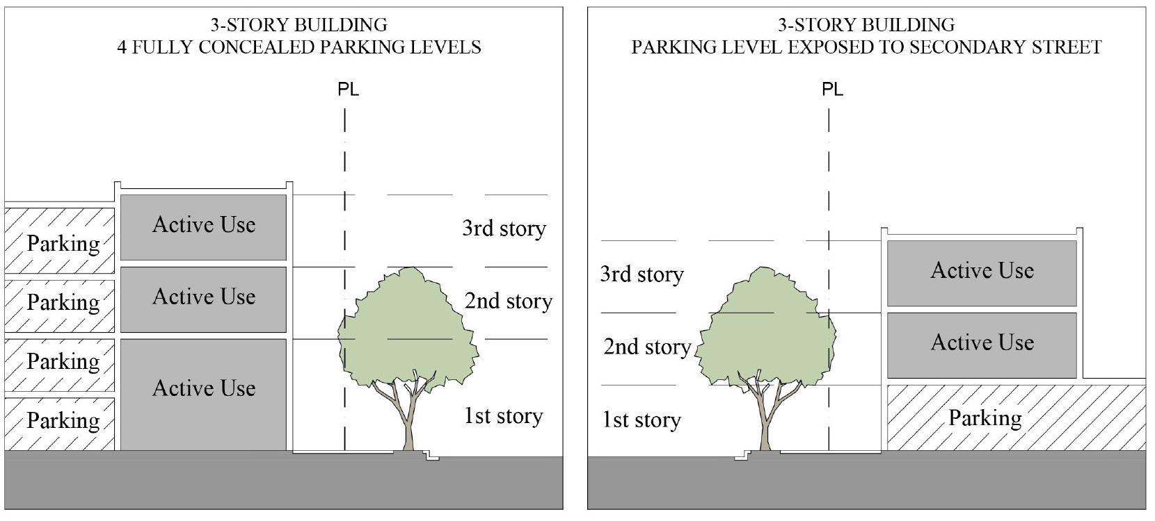
b.
Minimum ceiling heights are provided for certain Building Types in individual Redevelopment Zoning Districts. Ceiling height is measured from finished floor to finished ceiling.
3.
Density. Density shall be applied to contiguous land areas under common ownership, with the following provisions and exceptions:
a.
In cases where land abuts the waters of the Atlantic Ocean, St. Lucie River, Indian River, Loxahatchee River, Intracoastal Waterway, Lake Okeechobee or any tributary or manmade canal, the boundary of the land shall be delineated as established by State Statutes.
b.
No submerged land areas waterward of the boundary described above shall be included under this definition.
c.
No land areas proposed to be allocated to nonresidential uses shall be included under this definition except for contiguous land areas for:
i.
Utilities under common ownership and principally supporting;
ii.
Recreational facilities for the primary use;
iii.
Dedication to the County or other County-approved agencies or not for-profit corporations;
iv.
Mixed-use projects in the six designated CRAs.
d.
For development proposed in a CRA and subject to calculation of residential density, the property owner may opt to include within the land area one-half of any opened right-of-way adjoining the development site provided density does not exceed 15 units per acre for the contiguous land under common ownership. This shall be used for the purpose of density calculations and not for other development standards.
e.
Small dwelling units. Within Core, Corridor, and General Subdistricts when the lot is one acre or less, dwelling units of 800 square feet or less shall count as one-half of a dwelling unit. This shall be used for the purpose of density calculations and not for other development standards.
f.
Small dwelling units in affordable housing. Within the Core, Corridor, and General Subdistricts when the lot is larger than one-acre, dwelling units of 800 square feet or less shall count as one-half of a dwelling unit if all units that count as one-half of a dwelling unit qualify as affordable housing, as defined in the CGMP. This shall be used for the purpose of density calculations and not for other development standards.
4.
Building coverage. Building coverage means the horizontal area measured from the building footprint of the roofed area at the ground floor of the principal and accessory structures on a lot.
5.
Open space.
a.
The open space requirements shall apply on a lot-by-lot basis unless the lot has been approved as part of a final site plan which demonstrates compliance on a project-wide basis, for example, by way of setting aside common areas such as upland and wetland preserve areas and other eligible open spaces.
b.
Within the CRAs, impervious civic open space may be credited towards required open space if designed to meet the criteria below:
i.
Shall abut an existing public sidewalk on at least one side.
ii.
Shall provide pedestrian level lighting.
iii.
Shall provide two benches or one linear feet of another appropriate seating area per 200 square feet of civic open space area.
iv.
Shall contain a minimum of 30 percent of native tree shade canopy and other landscape material which can include raised planter beds. Tree canopy or shade structures shall be provided over seating areas.
v.
Shall be designed to incorporate existing protected trees when practicable.
vi.
Shall be privately owned and maintained.
vii.
Shall not contain vehicular parking or access ways, mechanical equipment, dumpsters, service areas, or be directly adjacent to loading areas or trash pickup.
viii.
Shall not be fenced off and remain open for the public at minimum from dawn to dusk.
c.
Project sites that are one acre or greater shall design a minimum of two percent of the total required open space on site as civic open space meeting the requirements of section 12.1.04.5.b.
i.
The minimum size of one area of required civic open space shall be 900 square feet.
ii.
The following uses are exempt from this provision:
1.
Projects comprised solely of "single-family dwellings" or "mobile homes" as listed in Table 12-2 of section 12.1.03.
2.
Projects comprised solely of industrial uses.
3.
Educational institutions.
4.
Residential care facilities.
5.
Neighborhood assisted residences with six or fewer residents.
6.
Protective and emergency services.
d.
A development that is less than one acre may meet its obligation to provide open space by providing green building and green infrastructure techniques through an alternative compliance request in accordance with section 12.1.12.4. The site:
i.
Must be able to meet infill storm water standards pursuant to section 12.1.08 and the required architectural standards
ii.
Shall provide green building and green infrastructure techniques that may offset the open space reduction including, but not limited to, the following:
1.
Solar panels, rooftop or car canopy.
2.
Green roof.
3.
Tree wells with structural soil or root cells.
4.
Pervious pavement.
5.
Vegetated walls designed by a landscape architect or otherwise qualified landscape professional.
6.
Building and parking placement.
a.
Frontage buildout. Frontage Buildout is the percentage of the total width of a lot minus the required setbacks which is required to be occupied by the primary façade of a building. Frontage Buildout requirements are established for each Building Type.
i.
The primary façade shall be generally parallel to the right-of-way, located in accordance with the minimum and maximum front setbacks of the Subdistrict or permitted Building Type.
ii.
The primary façade shall face existing roadways.
iii.
The location of the primary façade is not changed by the projection of architectural elements such as cornices, bay windows, awnings, balconies, or stoops.
iv.
On corner lots, the primary façade shall extend to the corner or civic open space shall be provided.
v.
Primary facades shall include the required Principal Entrance & Frontage Type.
b.
Setbacks. Setbacks are measured from the property line and are illustrated in the Building Types for each Redevelopment Zoning District.
c.
Parking placement. Each building type establishes setbacks for parking placement. The front, side and rear parking placement setbacks apply to parking spaces for all building types except certain residential building types. The side and rear setbacks also apply to parking aisles and driveways, except as necessary to access the street or an adjacent property. For single-family building types—cottage, side yard house, all yard house, and duplex—the front setback for Parking Placement is the minimum setback for carports and garages only. Parking Placement standards do not prohibit parking in residential driveways or side yard driveways. Additional parking requirements are found in Section 12.1.07.
7.
Accessory uses and structures. Accessory structures shall comply with the Development Standards applicable in the Subdistrict unless otherwise provided herein.
a.
Accessory dwelling units.
i.
One accessory dwelling unit (ADU) may be permitted on a lot on which a detached single-family dwelling or townhouse is located. An ADU shall not be permitted on a lot on which a duplex is located. ADUs are not permitted for small dwelling units.
ii.
An ADU shall not count as a separate unit for purposes of calculating density.
iii.
An ADU may be the second floor of a garage, a freestanding cottage, or physically attached to the principal dwelling.
iv.
An ADU shall not exceed the lesser of a footprint of 850 square feet or one-half the square footage of the primary dwelling.
v.
An ADU may have separate utility meters or share utilities with the principal dwelling, as required or permitted by the utility provider.
vi.
An ADU shall not be sold or conveyed separately from the principal dwelling unit.
b.
Residential garages and carports. Refer to Parking Standards Section 12.1.07.8 and Section 12.1.04.6.C for garage and carport placement standards.
c.
Outbuildings. Outbuildings, including sheds, detached garages, ADUs, and similar structures, shall be located as permitted within the Building Type Standards of the Redevelopment Zoning District.
d.
Shielding from street. Sheds, exposed pumps, electrical meters, air conditioning compressors, clothes lines, antennas, satellite dishes, outdoor storage, and similar structures and uses shall not be located between the front of a building and a street.
e.
Swimming pools, tennis, basketball or volleyball courts, and other similar private outdoor recreational uses.
i.
Swimming pools, and tennis, basketball and volleyball courts located within the rear yard of a single-family residential lot shall have five feet side yard and five feet rear yard setbacks.
ii.
In-ground swimming pools, tennis, basketball or volleyball courts located within a side yard or a front yard shall have the same setbacks as those applicable to the principal dwelling and shall include landscaping to screen the recreational use from view from the street and abutting properties.
iii.
No above-ground swimming pool shall be located within a front yard.
iv.
The size of a swimming pool or other recreational facility on a residential lot shall be restricted by the minimum open space standards of the Subdistrict.
f.
Gates and guardhouses. Private gated communities are not permitted within the Redevelopment Zoning Districts. Gates and guardhouses may not be installed on public or private streets or alleys in Redevelopment Zoning Districts. This prohibition does not preclude gates that control access to a single parking lot.
g.
Home occupations. Home occupations shall comply with F.S. § 559.955.
h.
Storage or parking of recreational vehicles, including, but not limited to, boat trailers, camping trailers, travel trailers, motorized dwellings, tent trailers, and horse vans, provided that such equipment shall not be used for living, sleeping, or other occupancy when parked and provided that such equipment over 25 feet in length shall not be parked or stored within any side or rear setback area.
i.
Storage or parking of one commercial vehicle or commercial trailer, not to exceed one-ton cargo capacity, is allowed, provided:
i.
That such vehicle or trailer is owned or operated by the resident of the property; and
ii.
That such vehicle or trailer is garaged or otherwise screened from view of adjoining properties and any adjoining street;
iii.
The restrictions in subparagraph (ii) shall not apply to public service agency vehicles such as law enforcement and those providing emergency response services.
j.
With the exception of fences, walls and boat docks on lots zoned for single-family use, accessory uses and structures shall not be established on a lot prior to the issuance of all permits required for the development of the principal use to which it is accessory.
8.
Building Length. Buildings shall not be longer then 200 feet without a street, alley, or paseo providing through access to another street, alley or paseo. Paseos shall be a minimum of 15 feet wide, open to the public, open to the sky, and illuminated at night. Except in residential buildings, the building face shall have transparent windows covering at least 50% of the wall area, and incorporation of storefront standards is encouraged.
9.
Foundation types. When any building is required to be raised above existing or natural grade, a foundation type as shown in Figure 12-5 or a similar foundation type shall be provided. Raised fill outside the building footprint is not a permitted means of raising structures within the Redevelopment Zoning Districts.
Figure 12-5 Acceptable Foundation Types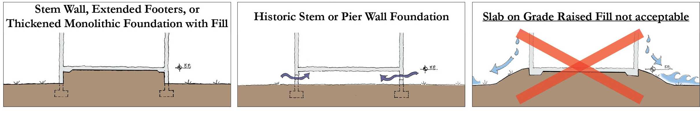
10.
Finished floor elevations of residential development. When residential use is proposed on the first floor of a building, elevation of the first floor at least twenty-one inches above the finished grade as measured along the front building line is required. The requirement does not apply to garages or accessory structures.
11.
Building transitions. Where a commercial, multifamily, townhouse, or mixed-use project abuts an Article 3 single family residential zoning district, Detached Subdistrict, or an existing single family detached dwelling the following shall apply:
a.
For buildings or portions of buildings two stories or 30 feet, or less in height, a minimum side and rear setback of ten feet from the property line shall be provided, unless a greater setback is required by another standard.
b.
For buildings over two stories or 30 feet in height, a minimum side and rear building setback of 20 feet shall be provided from the property line for the portion of the building over two stories.
c.
A solid finished masonry wall six feet in height shall be located along the property line and extend to the right-of-way. A minimum of a six foot planting strip with a hedge or trees shall extend the full length of the masonry wall.
d.
Walkways and other pedestrian or bicycle connections through the masonry wall may provide links encouraged by the CGMP to promote necessary or desirable connectivity.
e.
Exemptions:
i.
When the proposed commercial, multifamily, townhouse or mixed-use project is separated by public open space of at least 20 feet from the Article 3 Single-Family Residential Zoning District, a Detached Subdistrict, or an existing single-family detached dwelling; or,
ii.
When the proposed commercial, multifamily townhouse or mixed-use project is located within a Core Subdistrict; or,
iii.
When the preservation of existing native vegetation is considered an exemption by approval of the Growth Management Director.
Figure 12-6 Building Transition Requirements between
Existing Single Family Residential and New Construction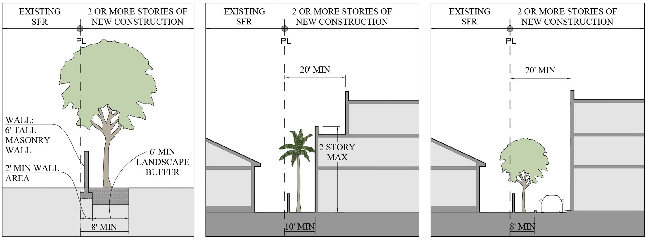
12.
Substantial improvement. A substantial improvement is defined in Section 8.1, Article 8. Refer to Section 12.1.13 Applicability for Nonconforming uses, structures and lots as well as alternative compliance.
13.
Convenience store with fuel. In addition to the standards in Section 3.106, vehicular service and maintenance development shall meet the following criteria:
a.
A ground level shop must be located along a street, with the gas pumps located to the rear or side of the lot as illustrated in Figure 12-6.01. No more than eight fueling positions and four fueling islands are permitted, refer to Figure 12-6.02.
b.
The shop shall have the primary entrance facing and directly accessible from the street: an additional entrance shall face the parking lot or fuel pumps.
c.
Gasoline stations shall be limited to one story in height.
Figure 12-6.01 Fueling Stations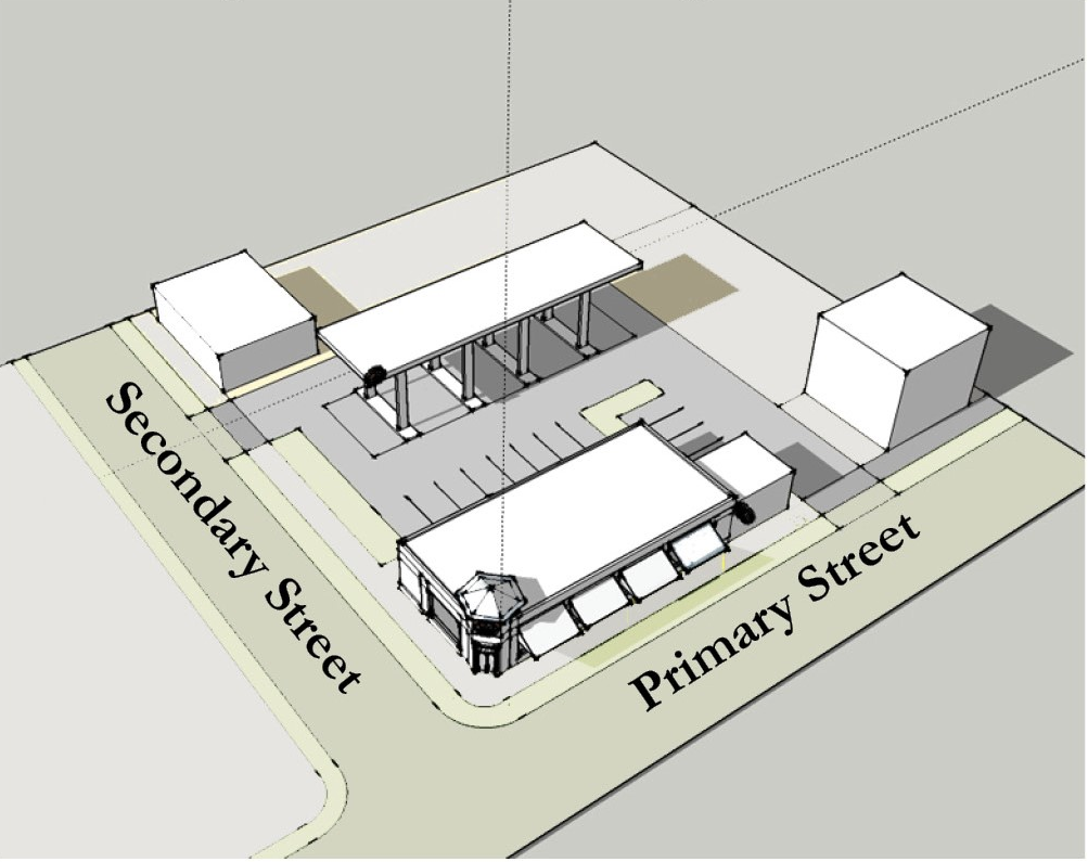
Figure 12-6.02 Fueling Stations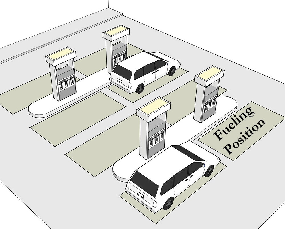
14.
Drive through. In addition to the standards in Section 3.95, restaurant, convenience development shall meet the following criteria:
a.
The stacking area shall be located along the side and/or in the rear of the lot or fuel pumps.
b.
The drive-through window shall be located either in the rear or to the side of the building, close to the frontage street. Figures 12-6.03 through 12.6.05 illustrate methods of incorporating drive through uses.
Figure 12-6.03 Drive Through Configuration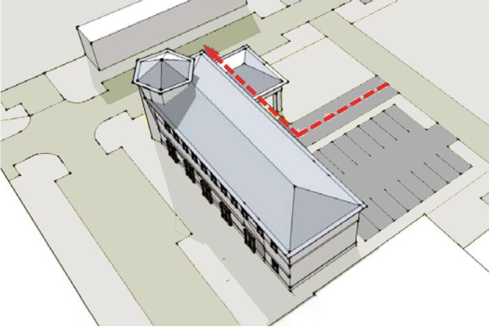
Figure 12-6.04 Drive Through Configuration
Figure 12-6.05 Drive Through Configuration
15.
Native upland habitat. Development within a CRA may meet its obligation to preserve native upland habitat on the development site, as established in article 4, division 2, by making a cash payment in lieu of on-site preservation in accordance with the following:
a.
Undeveloped sites: A cash payment in lieu of on-site preservation for an undeveloped site is available when the requirement for a preservation area is one-quarter acre or less for rare native upland habitat or one-half acre or less for common native upland habitat.
b.
Isolated upland preserve areas existing on previously developed sites: Subject to Board approval, cash payment in lieu of preservation is available for an existing, isolated preservation area that is one-quarter acre or less for rare native upland habitat or one-half acre or less for common native upland habitat, as designated on an approved site plan for development or PAMP, subject to the following:
i.
The existing upland preserve area shall not be part of a required wetland buffer, shoreline protection zone, or connected to an off-site preservation area.
ii.
The payment in lieu of an existing upland preserve area shall be established in conjunction with a revised final site plan and Development Order recorded in Martin County Official Records. The revised final site plan shall provide for compliance with CRA landscaping and buffering requirements.
iii.
Undersized upland preserve areas, as defined in Article 4, Division 2, are not required to make a cash in lieu of payment and may be eliminated in conjunction with a revised, recorded final site plan for redevelopment, provided that all open space and landscaping requirements are met on site.
c.
The cash payments in lieu of on-site preservation for subsections a and b above, shall be equal to the value of the total development site multiplied by a fraction, the numerator of which shall be the area of the required on-site preserve and the denominator of which shall be the area of the total development site. The value of the total development site shall be determined by a state-certified. MAI real estate appraiser acceptable to the County and shall be based upon an appraisal dated no more than 180 days prior to the application approval.
d.
All payments received in lieu of preservation shall be memorialized in writing and include the land area, habitat type, and value of the preservation area.
e.
Payments received in lieu of preservation shall be utilized to acquire land in Martin County that will be part of a sustainable preserve system. Up to 25 percent of funds received may be utilized to plant native vegetation and to restore the natural habitat on the 27 acres acquired by Martin County in December 2017, the deed for which is recorded in Martin County Official Records Book 2965, Page 2237, and commonly called the Hobe Sound Scrub Preserve.
16.
Shoreline Protection Zone. Land within a CRA and with the Marine Waterfront Commercial or the CRA Center future land use designation shall have a shoreline protection zone extending landward from the mean high water line a minimum of 25 feet. The landward extent of the shoreline protection zone may be developed or redeveloped consistent with the standards set forth herein:
a.
Existing, legal, non-conforming impervious surfaces and structures may be relocated, redeveloped or enlarged vertically provided there is no net increase in the square footage of impervious surfaces on the parcel within the shoreline protection zone.
b.
Except as authorized in (a) above, the square footage of impervious surfaces shall not exceed 40 percent of the shoreline protection zone.
c.
Pervious walkways shall be allowed within the shoreline protection zone where they provide public access to the water or connection between adjoining properties.
d.
Existing manmade boat basins or boat "cut-outs" may be reduced or eliminated provided there is no impact to wetlands, seagrass or oyster beds. Elimination of a basin shall not permit the creation of upland area waterward of the natural shoreline, prior to human-made impacts and compliance with paragraph (e.ii.) below shall not be required.
e.
Any development or redevelopment authorized pursuant to this policy, shall:
i.
Protect all shoreline mangroves;
ii.
Incorporate a living shoreline element into the site plan to the extent feasible. Where a living shoreline is not feasible, an alternative proposal for mitigation shall be submitted for review and approval;
iii.
Meet the minimum stormwater requirements for rate, quantity, quality, and timing of the discharge; and
iv.
Ensure no shoreline erosion.
17.
Public access to the waterfront. Where residential development is proposed within the Marine Waterfront Commercial future land use designation as part of a mixed-use project, public access shall be provided to no less than 50 percent of the linear length of the shoreline on the subject property. Public access within the landward extent of shoreline protection zone shall be provided as follows:
a.
Public access shall be provided parallel to the water within the shoreline protection zone via a pervious boardwalk or other pervious walkway not less than ten feet wide.
b.
As an alternative or in combination to public access parallel to the water, public access may be provided perpendicular to the water by means of dock or pier projecting over the water.
c.
Public access shall not be restricted to patrons and paying guests of commercial establishments or residents of the residential development.
d.
A site plan and landscape plan for proposed development shall designate the areas provided for public access to the shoreline. Outside of the pervious walkway and the 40 percent that may be developed in the shoreline protection zone, native vegetation shall be planted and maintained.
18.
Transportation Concurrency Exception Areas. CRAs are designated as Transportation Concurrency Exception Areas (TCEA). Development within the TCEAs shall be exempt from the County's transportation concurrency requirement.
(Ord. No. 1111, pt. II, 9-24-2019; Ord. No. 1159, pt. 1, 5-11-2021; Ord. No. 1188, pt. V, 10-11-2022; Ord. No. 1215, pt. I, 12-12-2023; Ord. No. 1237, Pt. I(Exh. 1), 1-28-2025)
Sec. 12.1.05. - Building types and frontage types.
1.
Building Types are required in Redevelopment Zoning Districts. Building Types do not prescribe use or architectural style. The following Building Types shall be incorporated or modified for use in Redevelopment Zoning Districts:
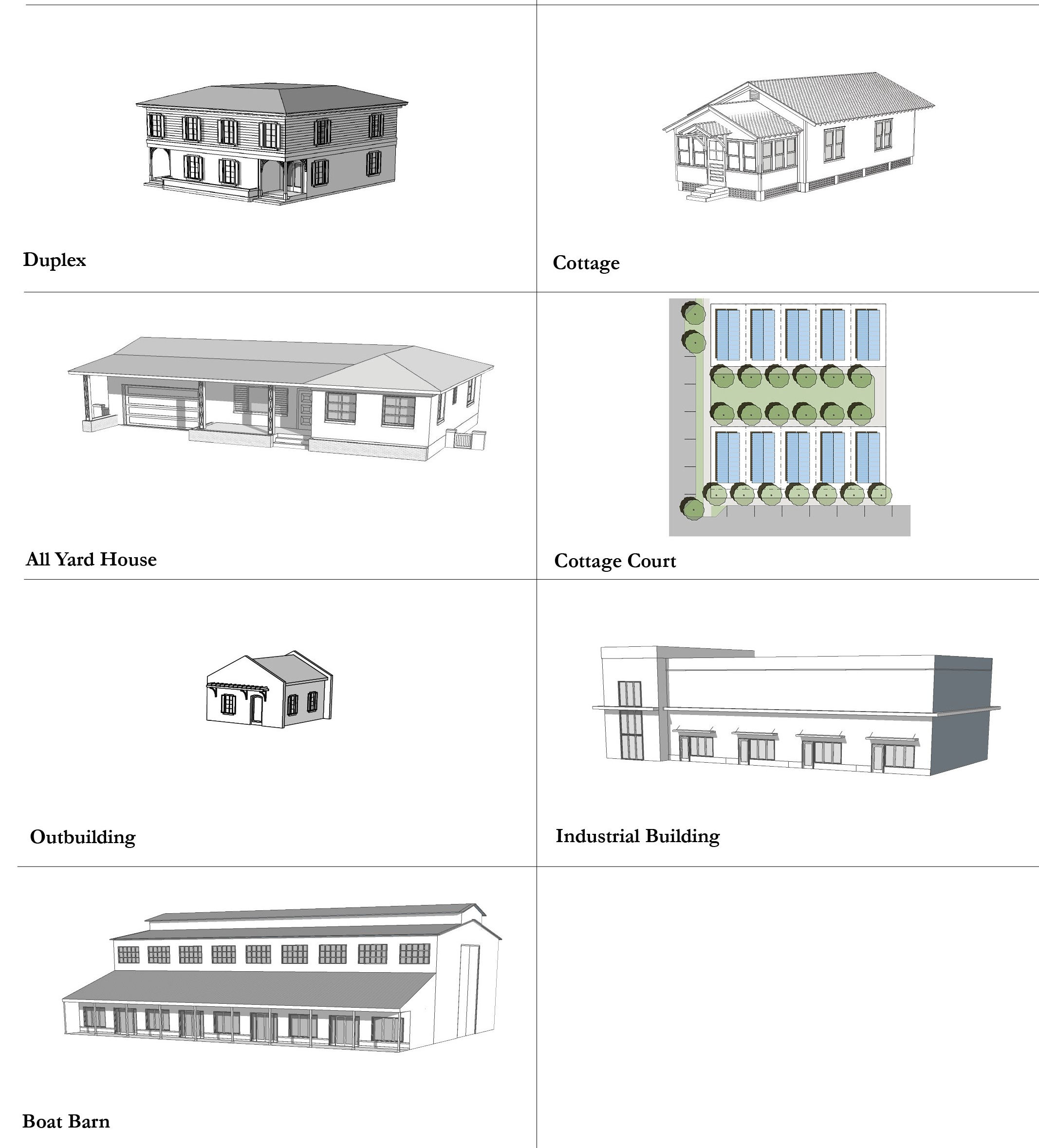
a.
A Shopfront Building has ground-floor space immediately adjoining the sidewalk that can accommodate business uses with doors and large windows facing the sidewalk.
b.
A Mixed-Use Building has multiple tenants or occupancies and may contain residences, lodging and/or businesses to the extent permitted in the Subdistrict. Mixed-use buildings may have a storefront frontage on the ground floor.
c.
An Office Building has a one or more commercial tenants, occupancies, or businesses. An office building may have a storefront frontage on the ground floor.
d.
An Apartment Building contains multiple residences above or beside each other in a building that occupies most of its lot width and is placed close to the sidewalk. Off-street parking is provided to the side or rear.
e.
A Courtyard Building accommodates multiple dwellings or businesses arranged around and fronting on a central green that may be partially or wholly open to the street.
f.
A Townhouse is a building with common walls on one or both sides and often has a private garden to the rear. Service and parking shall be located in the rear.
g.
A Live/Work Building is a building which is predominately residential in its character, but contains commercial and residential uses.
h.
A Side Yard House is a detached building that occupies one side of the lot adjacent to an open space which runs from the front yard to the rear yard. This Building Type is often delivered in a series of multiple side yard house types.
i.
A Cottage is a detached building with a small front yard often located on a narrow lot. Parking can be accommodated with on-street parking, a driveway, or detached garage to the rear.
j.
A Cottage Court is a series of small detached houses arranged around a common open space. Homes may share other common amenities like storage and parking areas. Parking can be accommodated on-street and in a parking lot to the rear.
k.
A Duplex is an attached building with one common wall that separates two dwelling units within a single lot. Duplexes can be designed to blend in with detached single family houses.
l.
An All Yard House has yards on all sides and may contain accessory structures toward the rear.
m.
An Outbuilding is an accessory building, usually located toward the rear of the same lot as a Principal Building, and is sometimes connected to the Principal Building. Outbuildings may include a garage, shed, workshop, or an accessory dwelling unit.
n.
A Boat Barn is an indoor storage facility. A liner with habitable uses is required to avoid large blank façades visible to the public. A liner shall face all primary streets. Liners may be additional commercial space with permitted uses.
o.
An Industrial Building will vary in scale depending on its intended use. Some commercial uses may be permitted, but its primary focus is industrial. Parking and loading shall be accommodated in Alleys or Secondary Streets whenever possible.
Figure 12-7.00 Building Types Matrix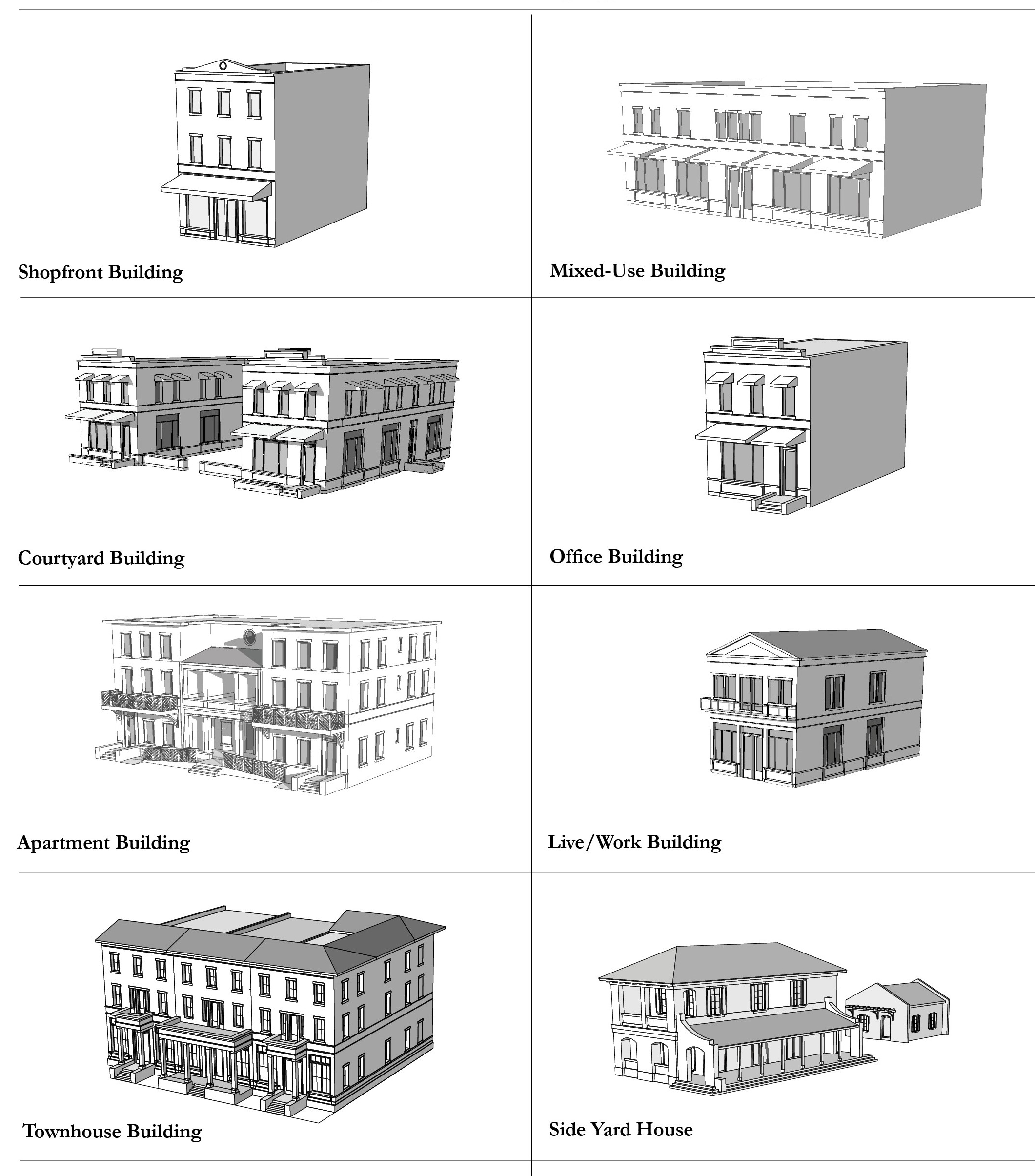
2.
Frontage Types. Building Frontage Types are required by the Architectural Styles permitted for each of the Redevelopment Zoning Districts. In addition to the standards set forth in Section 12.1.04.06, the primary façade and Frontage Type shall be located on the Primary Streets where applicable. The frontage types are described in Figures 12-7.01—12-7.08.
a.
A Storefront frontage.
b.
An Arcade or gallery frontage.
c.
A Bracketed Balcony frontage.
d.
A Porch frontage.
e.
A Stoop frontage.
f.
A Forecourt frontage.
Figure 12-7.01 Storefront Frontage Matrix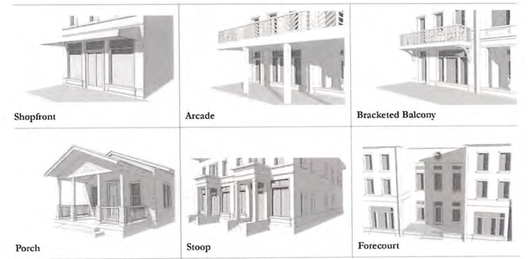
Figure 12-7.02 Storefront Frontage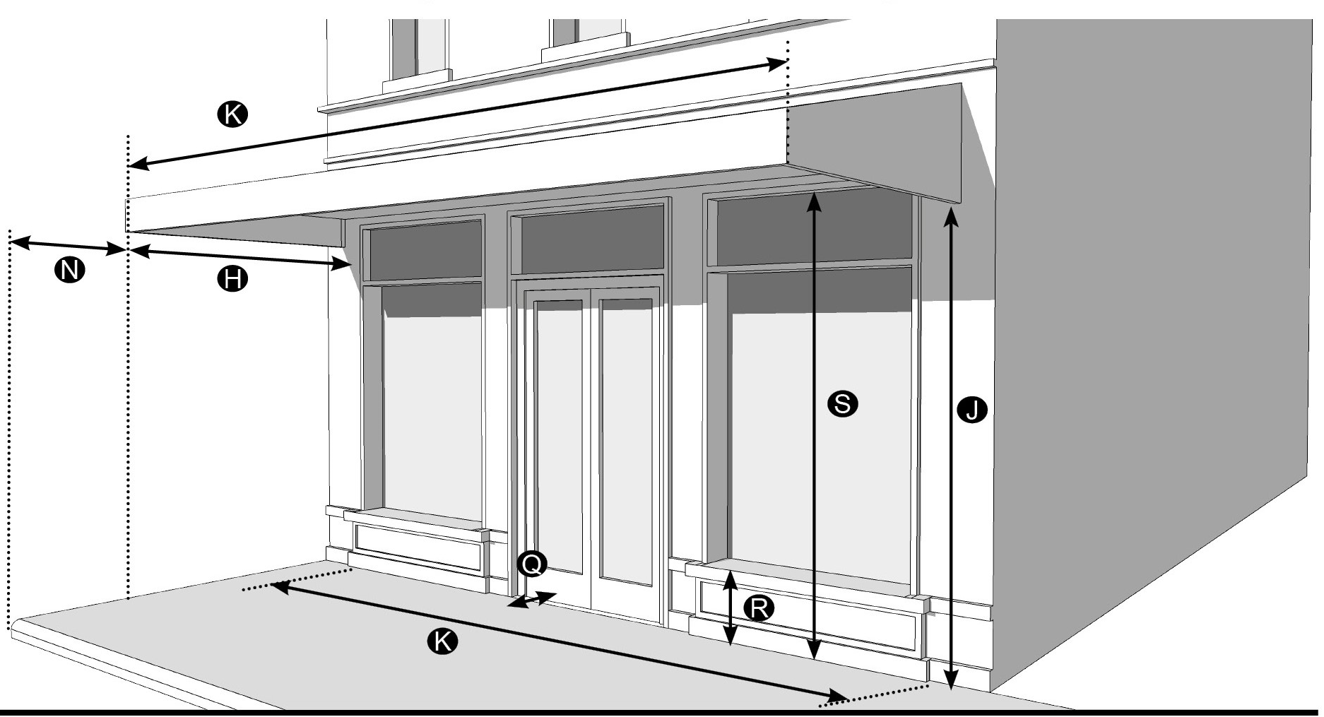
| Description |  | ||
| The storefront is a frontage type along the sidewalk level of the ground story, typically associated with commercial uses. Storefronts are frequently shaded by awnings or arcades. | |||
| Dimensions | |||
| Width, length of façade | 70% min. | ||
| Door recess | 10 feet max. | ||
| Storefront base | 1 foot min./3 feet max. | ||
| Glazing height | 8 feet min. | ||
| Awning | |||
| Depth | 3 feet min. | ||
| Height, ground level clear | 8 feet min. | ||
| Width, length of façade | 70% min. | ||
| Set back from curb | 2 feet min. | ||
Figure 12-7.03 Arcade Frontage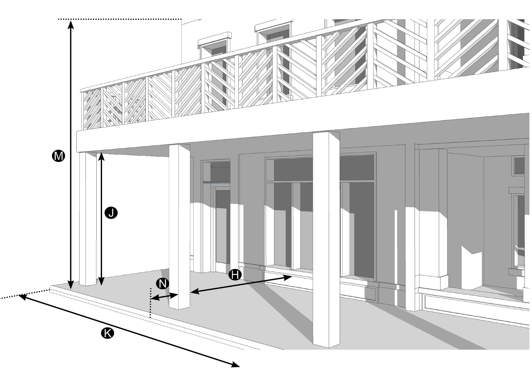
| Description |  | ||
| An arcade is a covered, unglazed, linear hallway attached to the front of a building, supported by columns or pillars. The arcade extends into the public right-of-way, over the streetscape area, creating a shaded environment ideal for pedestrians. This frontage type is typically associated with commercial uses. Arcades shall remain open to the public at all times. In the case where an arcade encroaches into the public right-of-way, a right-of-way maintenance agreement may be required. | |||
| Dimensions | |||
| Depth, clear | 8 feet min. | ||
| Height, ground level clear | 10 feet min | ||
| Width, length of façade | 70% min. | ||
| Finish level above finished grade | Not applicable | ||
| Height, stories | 2 stories max. | ||
| Set back from curb | 2 feet min./4 feet max. | ||
Figure 12-7.04 Bracketed Balcony Frontage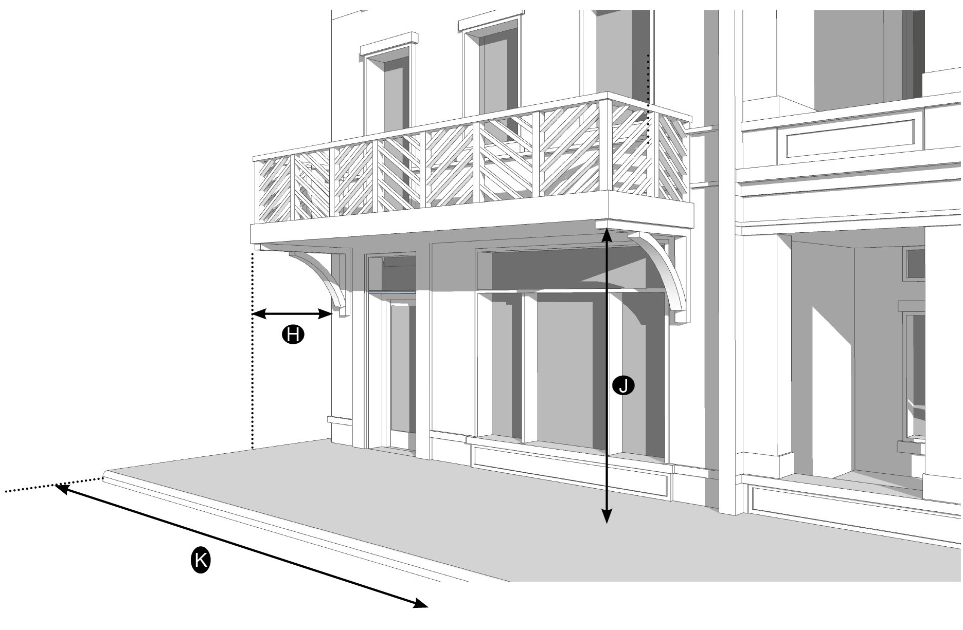
| Description |  | ||
| A bracketed balcony is a second-story balcony, that creates a semi-public space overlooking the street. Bracketed balconies are typically associated with buildings with commercial uses in the ground story; however, bracketed balconies may be used with residential uses. | |||
| Dimensions | |||
| Depth | 5 feet max. | ||
| Height, ground level clear | 10 feet min. | ||
| Width | 4 feet min. | ||
| Finish level above finished grade | Not applicable | ||
| Height, stories | Not applicable | ||
| Set back from curb | Not applicable | ||
Figure 12-7.05 Porch Frontage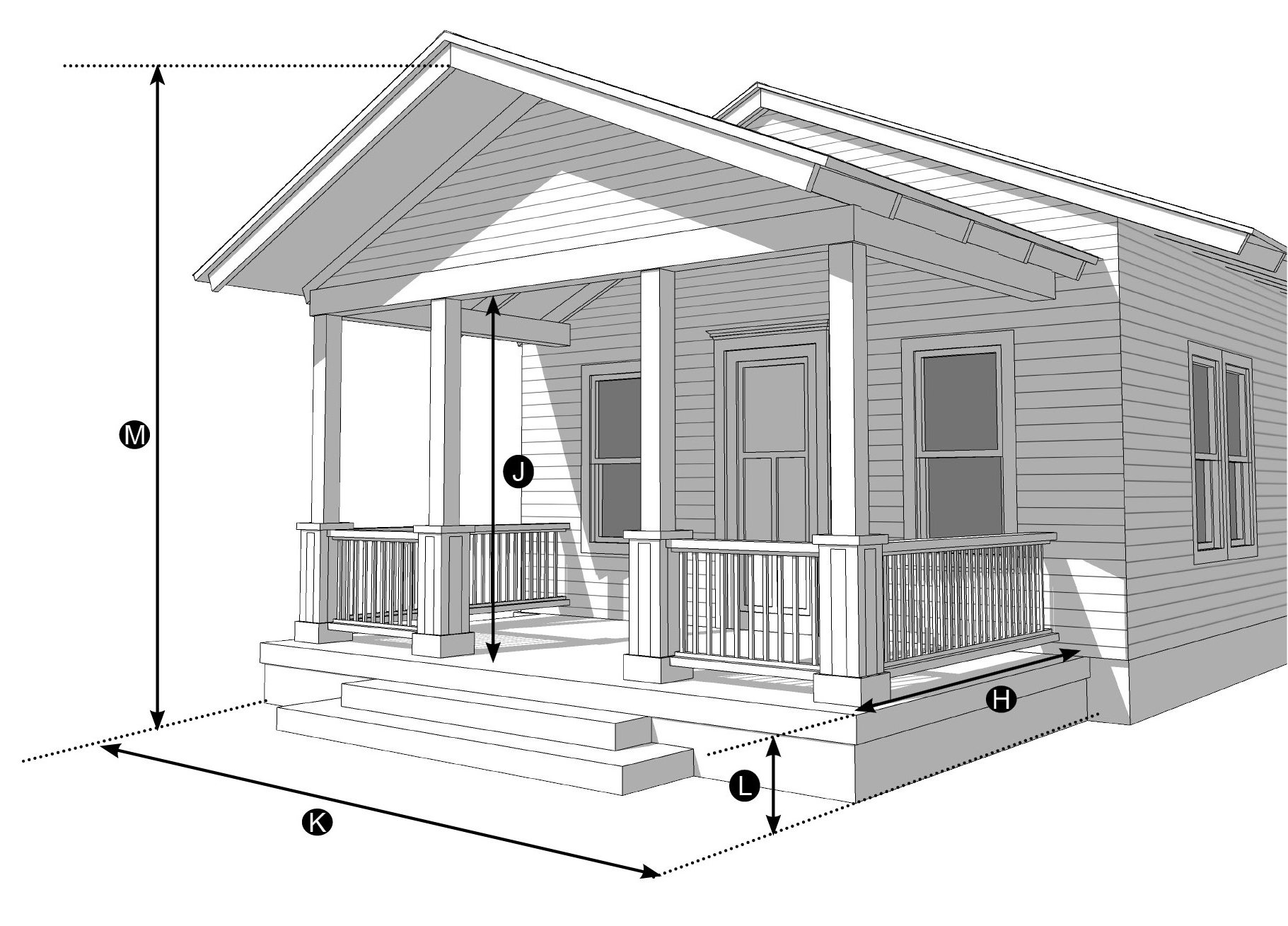
| Description |  | ||
| A porch is an open-air structure attached to a building forming a covered entrance large enough for comfortable use as an outdoor room. All porches shall cover at least 40% of the width of the façade the porch enfronts, including any garage. Front porches may be screened. | |||
| Dimensions | |||
| Depth | 8 feet min. | ||
| Height, clear | 8 feet min. | ||
| Width | 40% min. | ||
| Finish level above finished grade | 21 inches min. | ||
| Height, stories | 2 stories max. | ||
| Set back from curb | Not applicable | ||
Figure 12-7.06 Stoop Frontage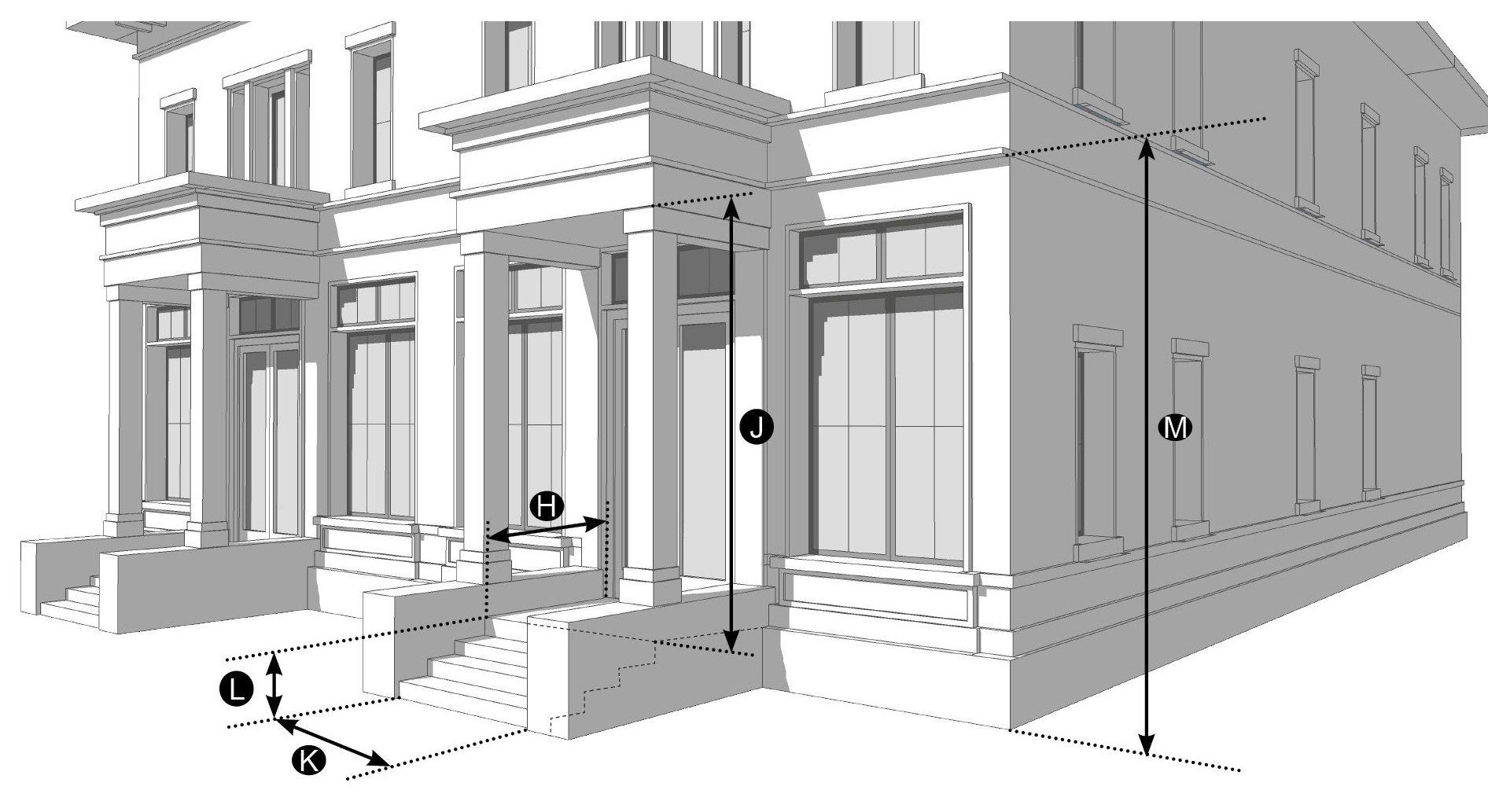
| Description |  | ||
| A stoop is a small staircase leading to the entrance of a building that may be covered. The elevation of the stoop is necessary to ensure privacy for residential uses in the ground story of buildings. Stoops should provide sufficient space for a person to comfortably pause before entering or after exiting the building. | |||
| Dimensions | |||
| Depth | 5 feet min. | ||
| Height, clear | 8 feet min. | ||
| Width, clear | 4 feet min. | ||
| Finish level above finished grade | 21 inches min. | ||
| Height, stories | 1 story max. | ||
| Set back from curb | Not applicable | ||
Figure 12-7.07 Forecourt Frontage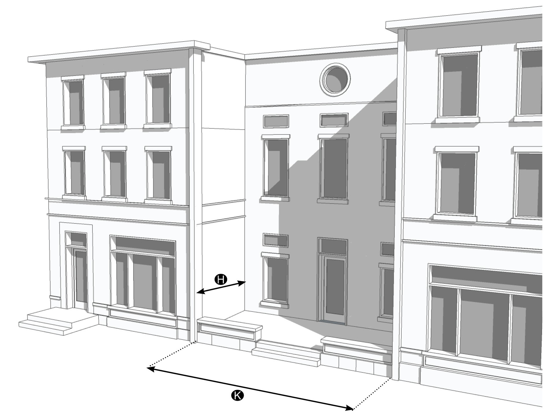
| Description |  | ||
| A forecourt is an open area in front of the main building entrance(s) designed as a small garden or plaza. Low walls or balustrades no higher than three feet six inches in height when solid may enclose the forecourt. Forecourt walls are constructed of similar material as the principal building or are composed of a continuous, maintained hedge. A forecourt may afford access to one or more first floor residential dwelling units or incorporate storefronts for commercial uses. Forecourts are typically associated with multifamily, mixed-use, and commercial buildings. | |||
| Dimensions | |||
| Depth, clear | 20 feet min. | ||
| Height, clear | Not required | ||
| Width, length of façade | 12 feet min./50% of façade max. | ||
| Finish level above finished grade | Not required | ||
Figure 12-7.08 Possible Examples of Accessible Routes for Raised Ground Levels
Description
The Florida Building Code contains technical requirements for accessibility for sites, facilities, buildings and elements by individuals with disabilities which may include code requirements for the access into a building. The images above depict possible solutions for buildings when raised above the natural or existing grade. Refer to the latest version of Florida Building Code for the specific requirements and standards of the code. See Figure 12-7.07 for images of examples.
(Ord. No. 1111, pt. II, 9-24-2019; Ord. No. 1159, pt. 1(Exh. A), 5-11-2021; Ord. No. 1237, Pt. I(Exh. 1), 1-28-2025)
Sec. 12.1.06. - Street standards.
1.
Intent. The intent of this section is to provide flexibility for the design of traditional neighborhood streets and to achieve the transportation, environmental, aesthetic, economic, safety, and maintenance objectives for each street and neighborhood. These street standards expand options for vehicular, pedestrian, and bicycle access through an integrated network of narrow streets that incorporates traffic calming and often allows on-street parking.
2.
Street Layout Principles. All development including public improvements within Redevelopment Zoning Districts shall incorporate the following street layout principles:
a.
Street layout shall exhibit a high degree of overall connectivity, with allowances for topographic or wetlands conditions.
b.
Cul-de-sacs are strongly discouraged, but may be used where physical barriers preclude street connectivity.
c.
Oversized blocks shall be avoided so that neighborhoods can be traversed easily.
d.
Shade trees shall be planted between the sidewalk and vehicles.
e.
Wherever possible, provisions shall be made for on-street parking.
3.
Description of Street Types. Table 12-8 describes street types that are appropriate for Redevelopment Zoning Districts. Figures 12-1.8.01 through 12-1.8.17 are illustrative examples of the street types.
4.
New Streets. When new streets and alleys are developed or an existing street or alley is extended, the street types in Table 12-8 and illustrated in Figures 12-1.8.01 through 12-1.8.17 shall be used. The selection of the particular street type shall be determined through consultation between the CRA, the developer, and the County Engineer and governed by the context of the surrounding community and street network and CGMP Policies 18.2A.1. and 18.2B.1.
5.
Existing Streets. Within a CRA, the street design standards of Section 12.1.06 should be incorporated into the construction or reconstruction of streets to the greatest extent possible, taking into account existing conditions including right-of-way constraints that may require adjustments to these standards. The abandonment of existing streets or paved or unpaved rights-of-way is strongly discouraged.
6.
Specific Standards.
a.
Street Design Standards. The standards for street designs are provided in Figures 12-1.8.01 through 12-1.8.17. Where particular elements are not required, they are not prohibited if its design is appropriate to the context and is approved by the County Engineer. The illustrative street designs address the desired street elements in a Redevelopment Zoning District:
i.
Travel lanes—Primarily for vehicular circulation.
ii.
Parking lanes—On-street parking.
iii.
Bike facility—May be the shared use of a travel lane or a separate bicycle lane; bicycle lanes are always required if included among the "Top 20 Priorities" of the latest Martin County Bicycle and Pedestrian Action Plan or identified as a project recommendation in the latest Metropolitan Planning Organization (MPO) bicycle, pedestrian and trails master plan.
iv.
Pavement width—Width of pavement from edge of pavement or curb which is dedicated for vehicular travel, but could include bike lanes. Where appropriate, pavement may include pervious areas to manage stormwater.
v.
Sidewalk—A sidewalk shall be at least six feet wide and be provided on both sides of all the streetscapes.
vi.
Pedestrian zone—A pedestrian zone is free of any street furnishings or utilities and allows the clear passage of pedestrians. A six feet wide pedestrian zone is preferred. Any portion of the pedestrian zone within the front setback area shall be improved as an extension of the public sidewalk and shall match the public sidewalk in design and material, providing a seamless physical transition.
vii.
Furnishing zone—Paved area adjacent to the sidewalk for street furniture, tree wells, and extra sidewalk width.
viii.
Median—Vegetated area between travel lanes of opposing direction (required only where indicated) Medians, when present, should be used to integrate stormwater management.
Figure 12-8 Streetscapes Diagrams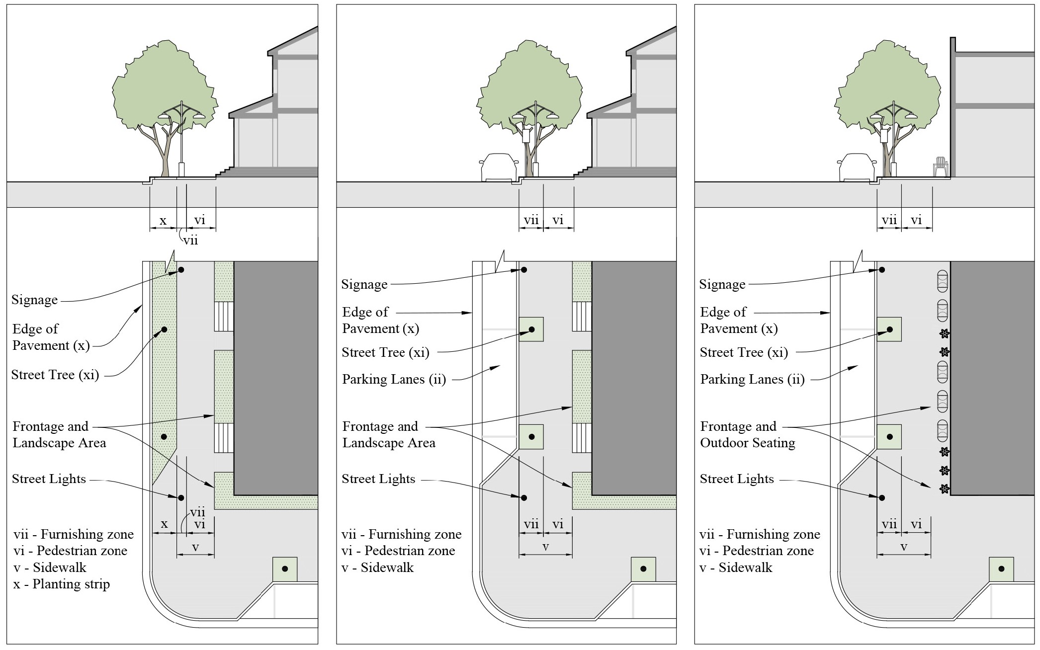
ix.
Edge of pavement—Curb and gutter may be required.
x.
Planting strip or planting area—Vegetated area between a sidewalk and vehicles. Planting strips are encouraged to integrate stormwater management.
xi.
Street trees—Required type and placement of street trees.
b.
Deviation from Street Design Standards.
i.
The County Engineer after consulting with the Office of Community Development may allow deviations from the standards contained in Figures 12-1.8.01 through 12-1.8.17 when necessary due to the location of existing buildings, constrained right-of-way, or to meet other community needs or goals for the particular street segment. Such deviations may include, but are not limited to, the width of a furnishings zone, sidewalk, median, or bike facility that is greater or less than that provided in Figures 12-1.8.01 through 12-1.8.17.
ii.
These street design standards may also be modified by provisions specific to a particular Redevelopment Zoning District.
c.
Block standards. Blocks created by new streets shall not exceed 660 feet on any side of the block. New block perimeters shall not exceed 2,000 feet
d.
Gates and guardhouses. Private gated communities are not permitted within the Redevelopment Zoning Districts. Gates and guardhouses may not be installed on public or private streets or alleys in Redevelopment Zoning Districts. This prohibition does not preclude gates that control access to a single parking lot.
e.
Stormwater and landscape. The recommended filtration strategies from the Stormwater Design Toolkit (Martin County CRA, January 2012) shall be used whenever feasible. Green infrastructure stormwater best practices, such as pervious paving, bioretention systems, rain gardens, bioswales, and stormwater planters, are encouraged to slow and treat stormwater runoff while providing additional community benefits.
7.
Conflicting standards.
a.
The standards contained in the following sub-sections of Section 4.843, Div. 19, Article 4 do not apply to streets designed in conformity with Article 12:
i.
Section 4.843.B — (Right-of-way requirements);
ii.
Section 4.843.C. — (Lane and buffer widths); and
iii.
Section 4.843.E. — (Radius at street intersections).
b.
Section 4.627, Div. 14, Article 4 Parking and Loading, does not apply to streets designed in conformity with Section 12.1.06.
8.
Street Regulating Plan. A Street Regulating Plan is provided for each CRA. Features identified in the Street Regulating Plan are described in Section 12.1.02.2.
Table 12-8 - Description of Street Types
Figure 12-8.01 - Boulevard 1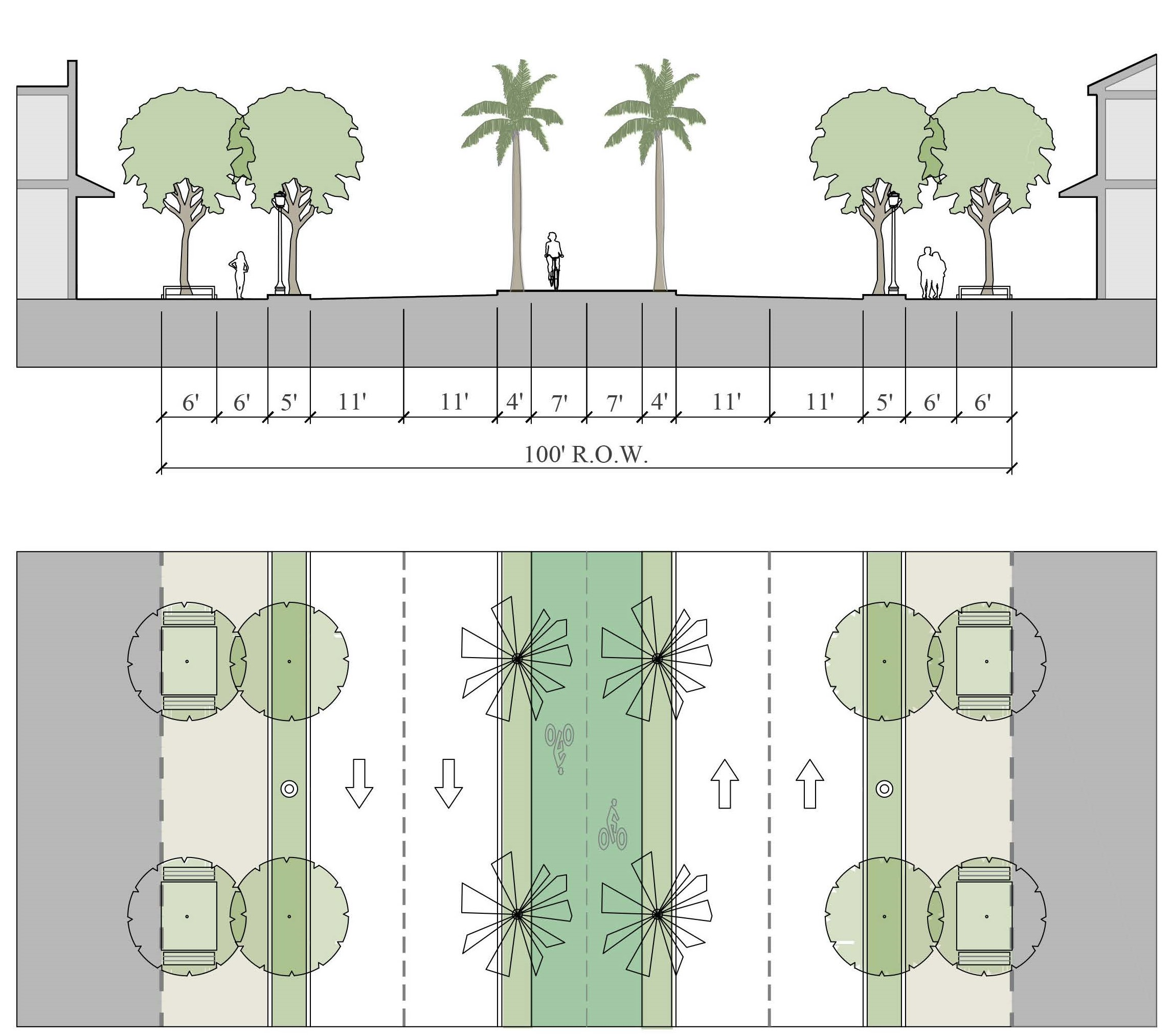
Figure 12-8.02 - Boulevard 2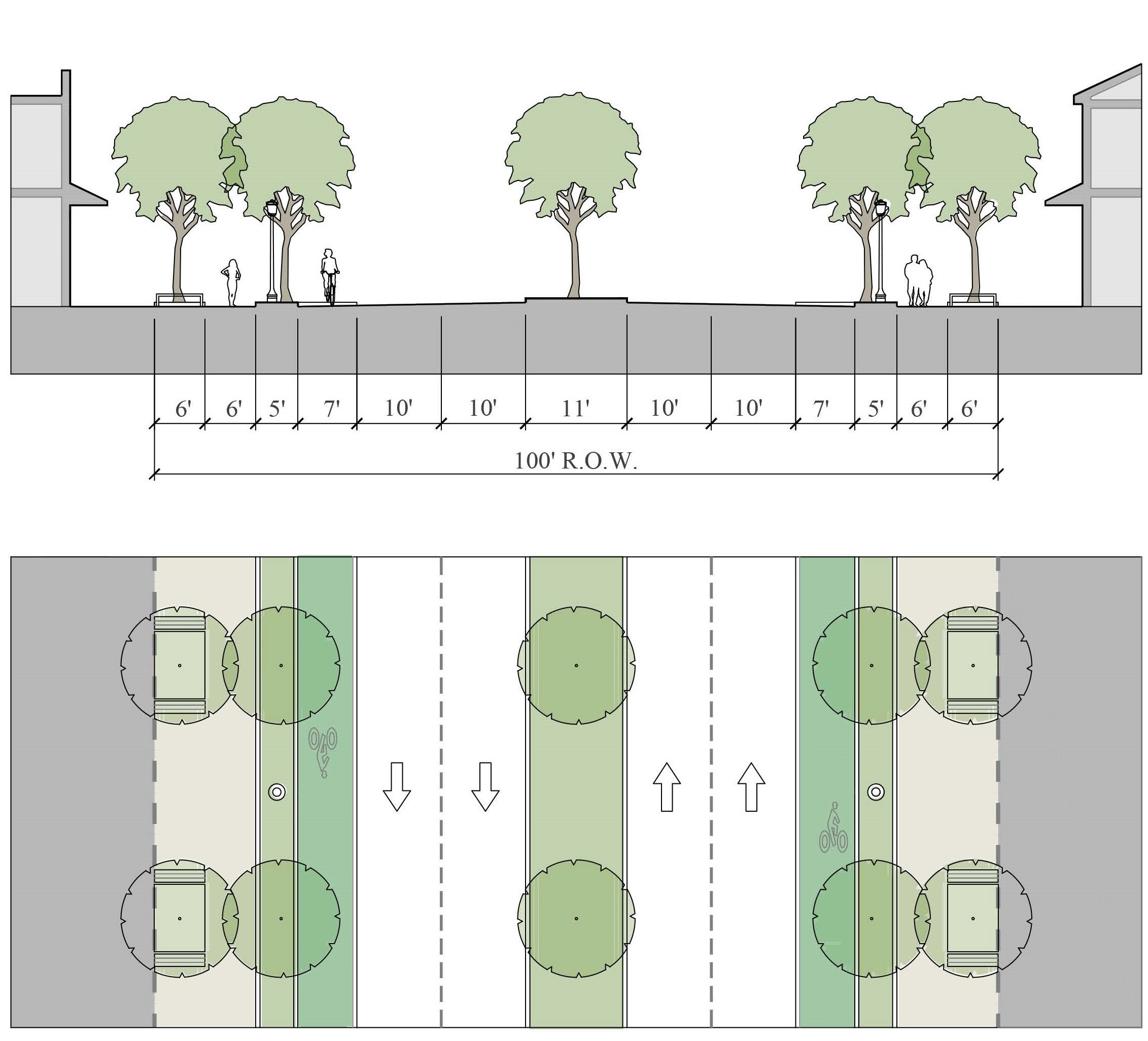
Figure 12-8.03 - Avenue Street 1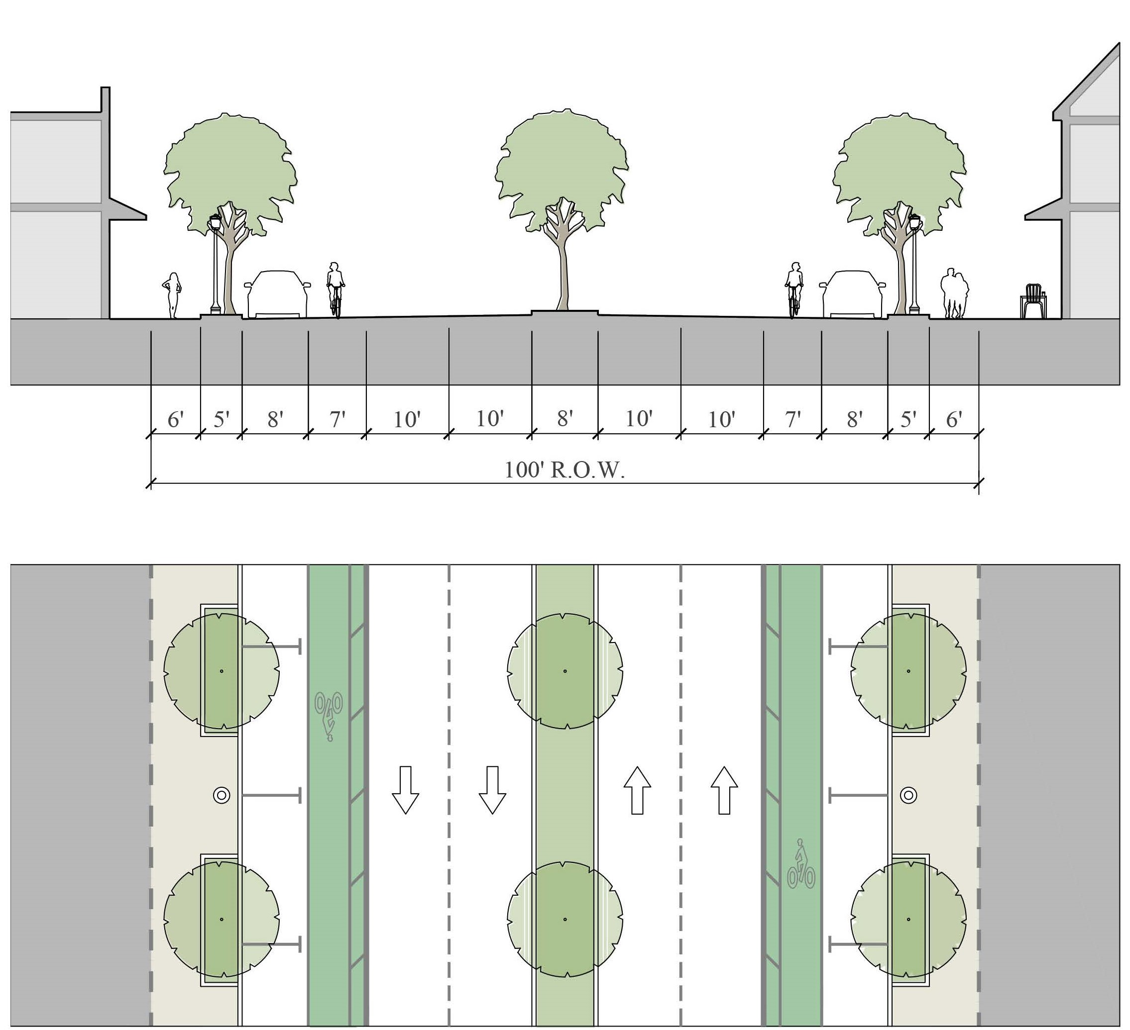
Figure 12-8.04 - Avenue Street 2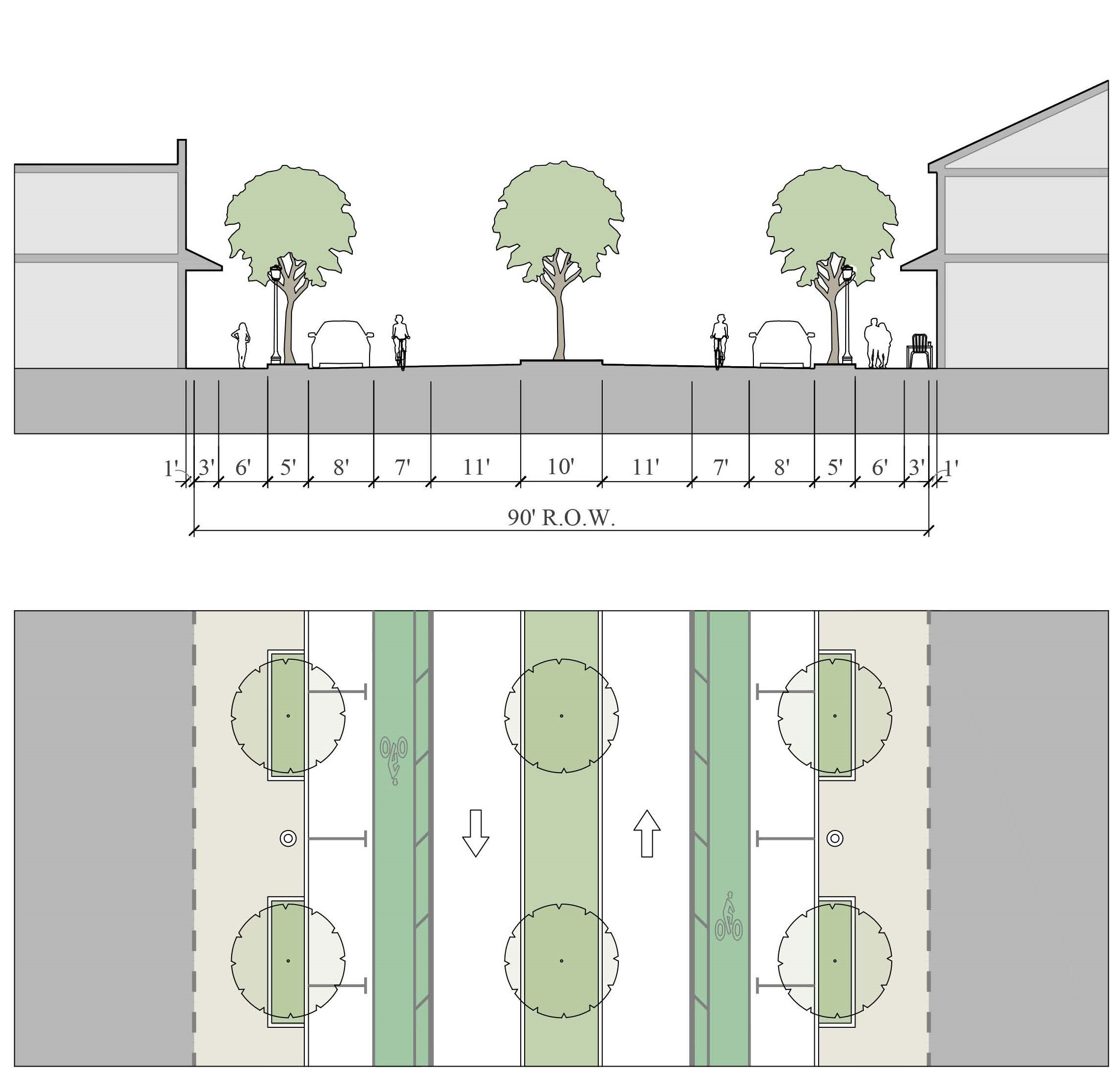
Figure 12-8.05 - Avenue Street 3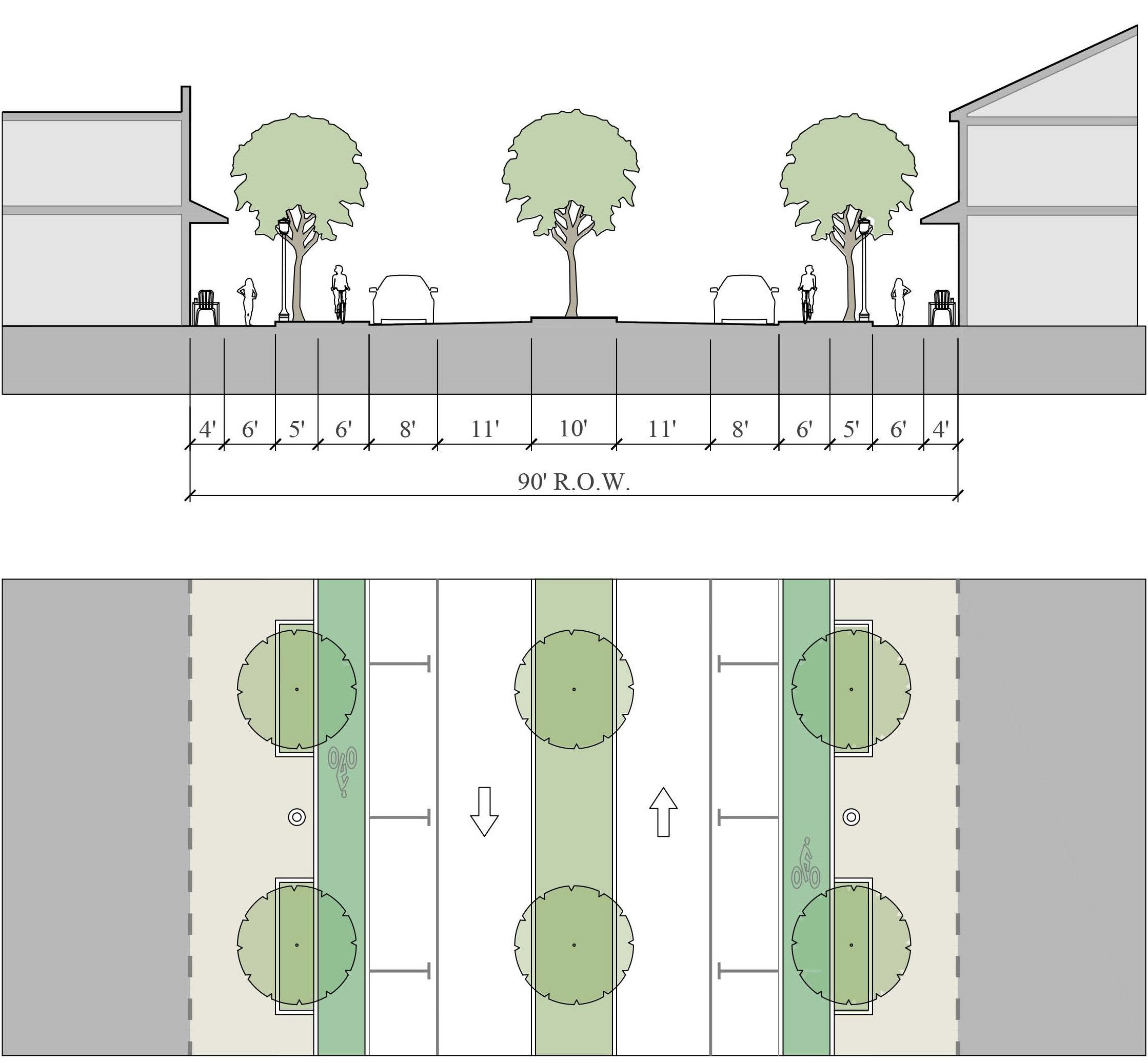
Figure 12-8.06 - Main Street 1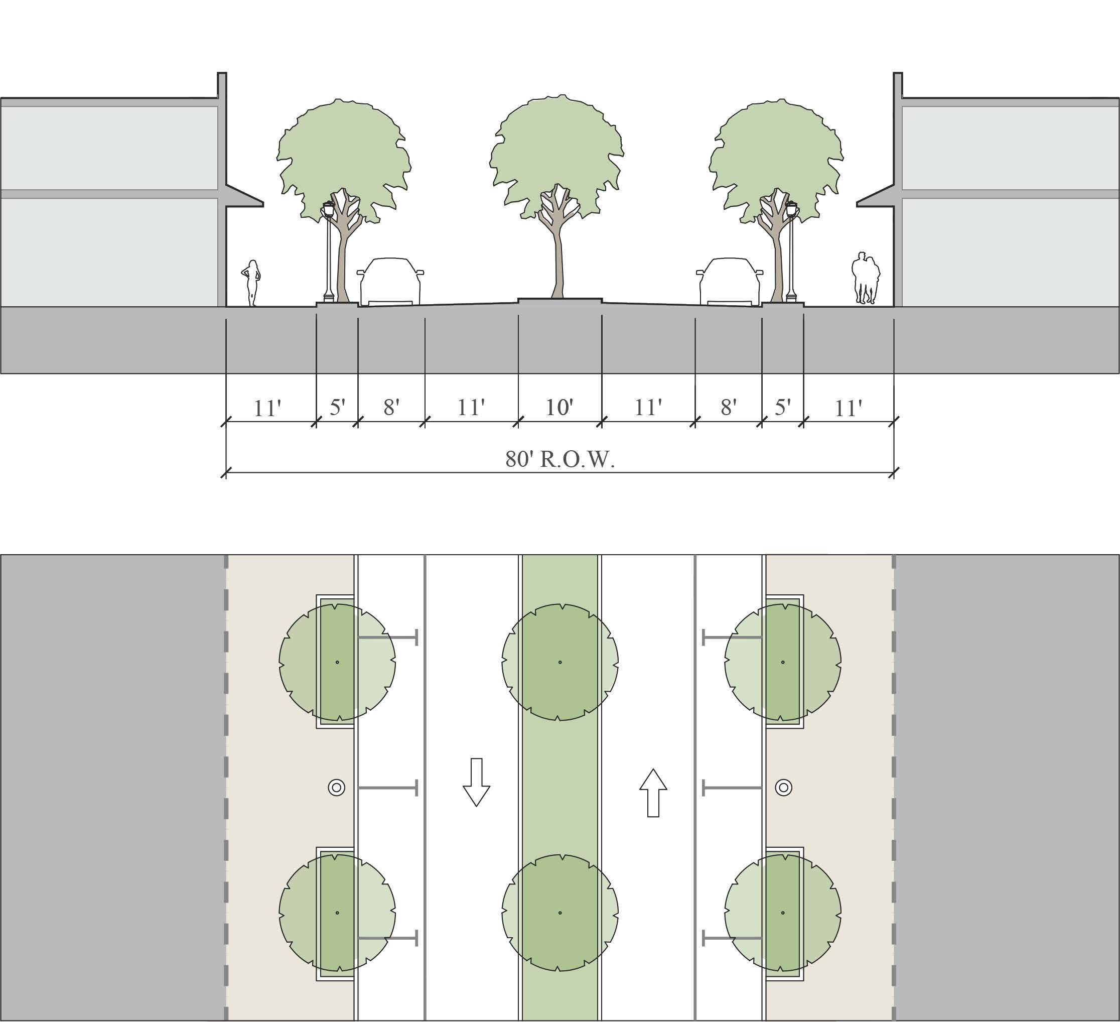
Figure 12-8.07 - Main Street 2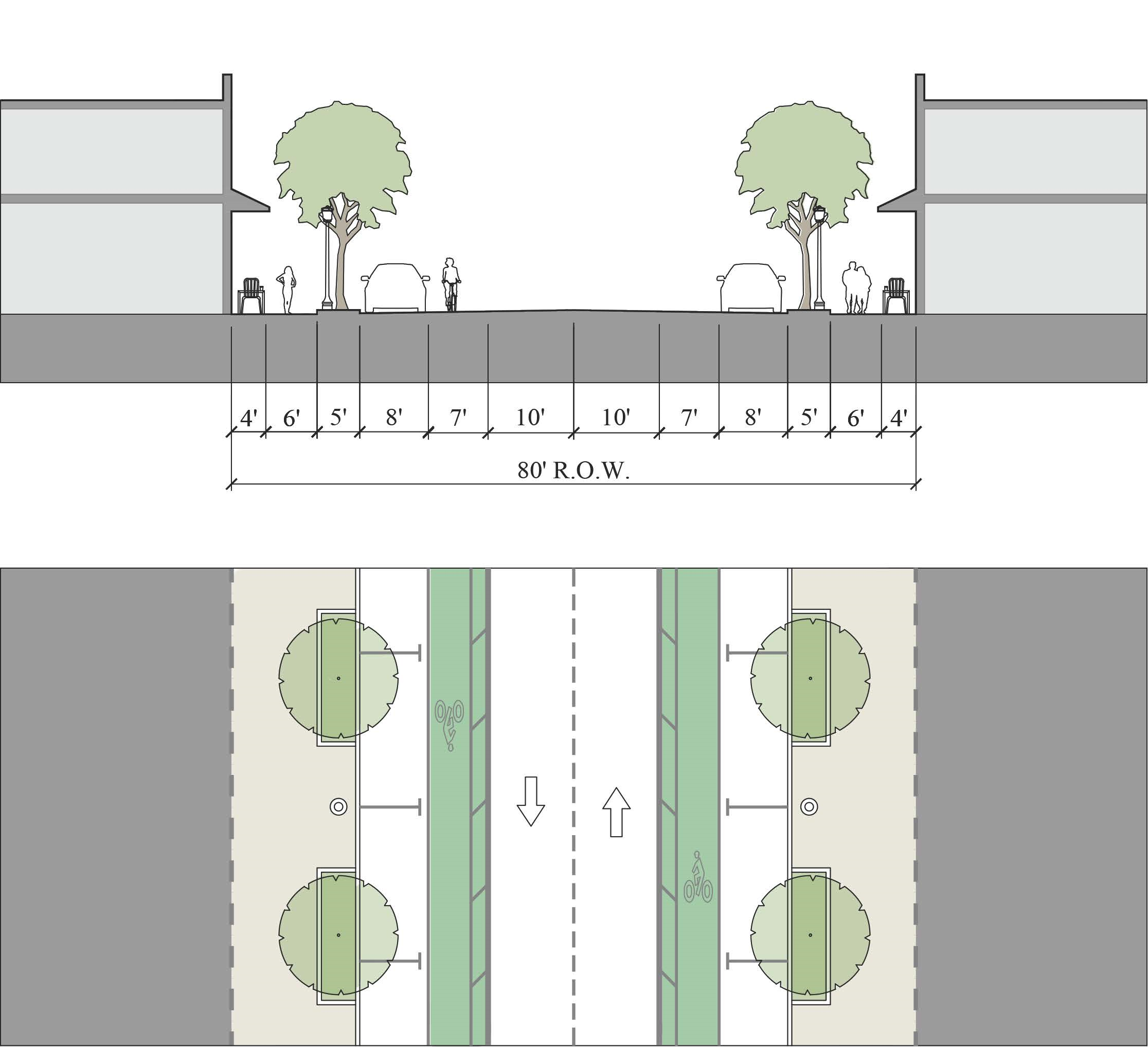
Figure 12-8.08 - Main Street 3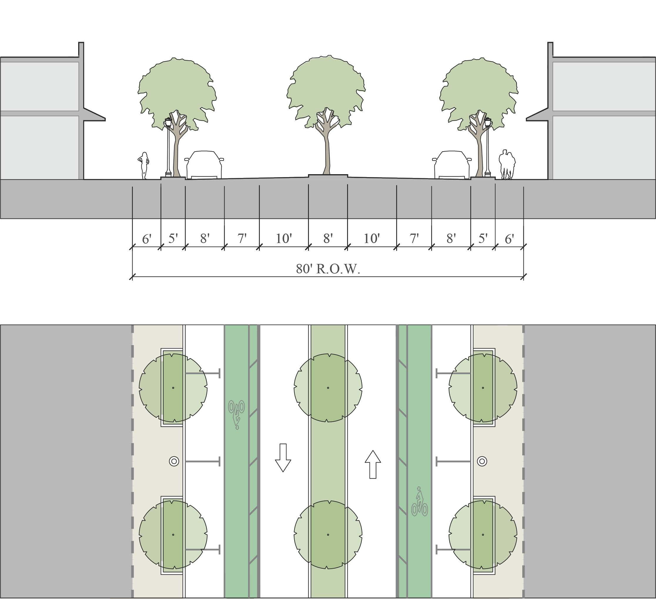
Figure 12-8.09 - Main Street 4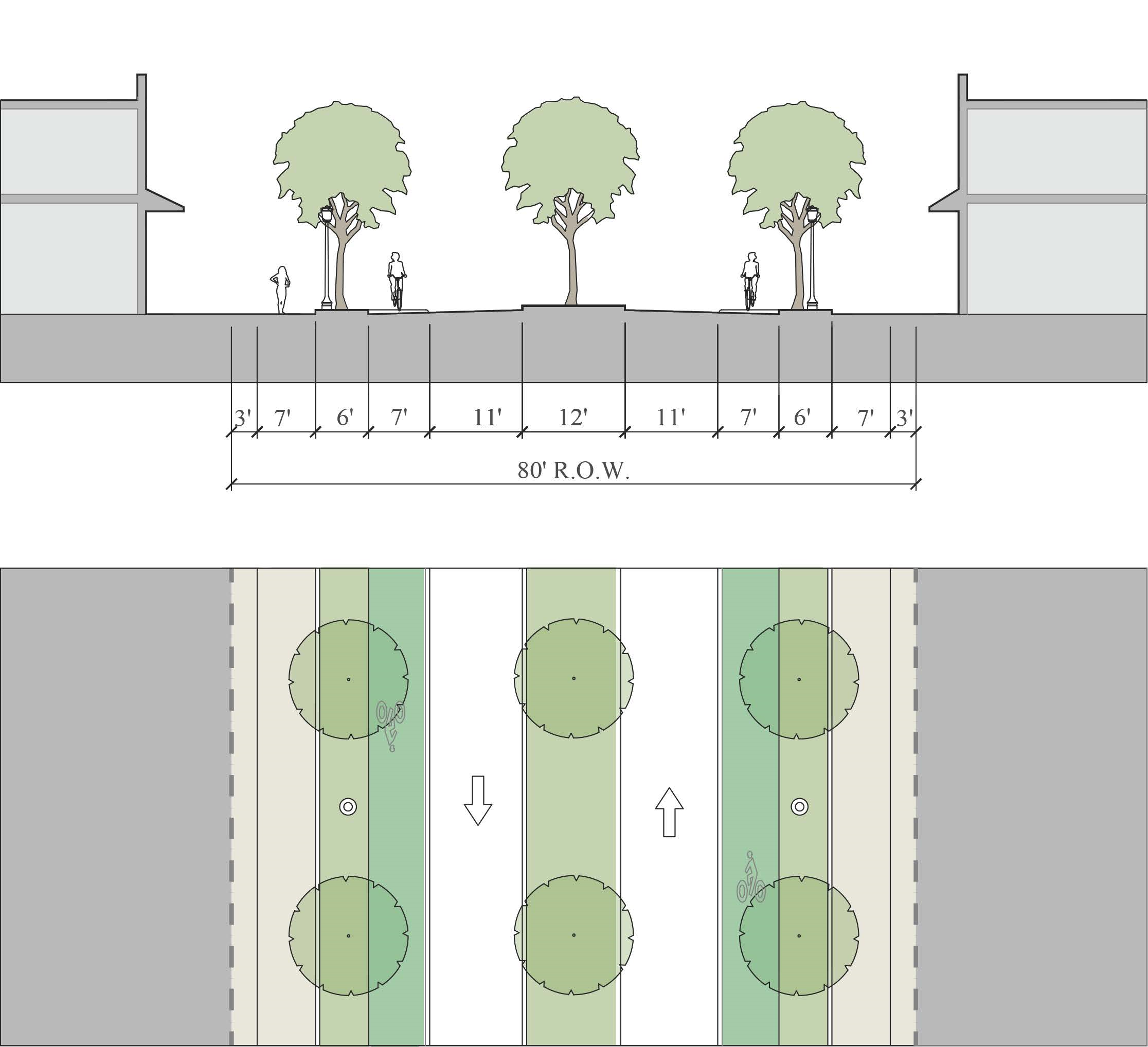
Figure 12-8.10 - Local Street 1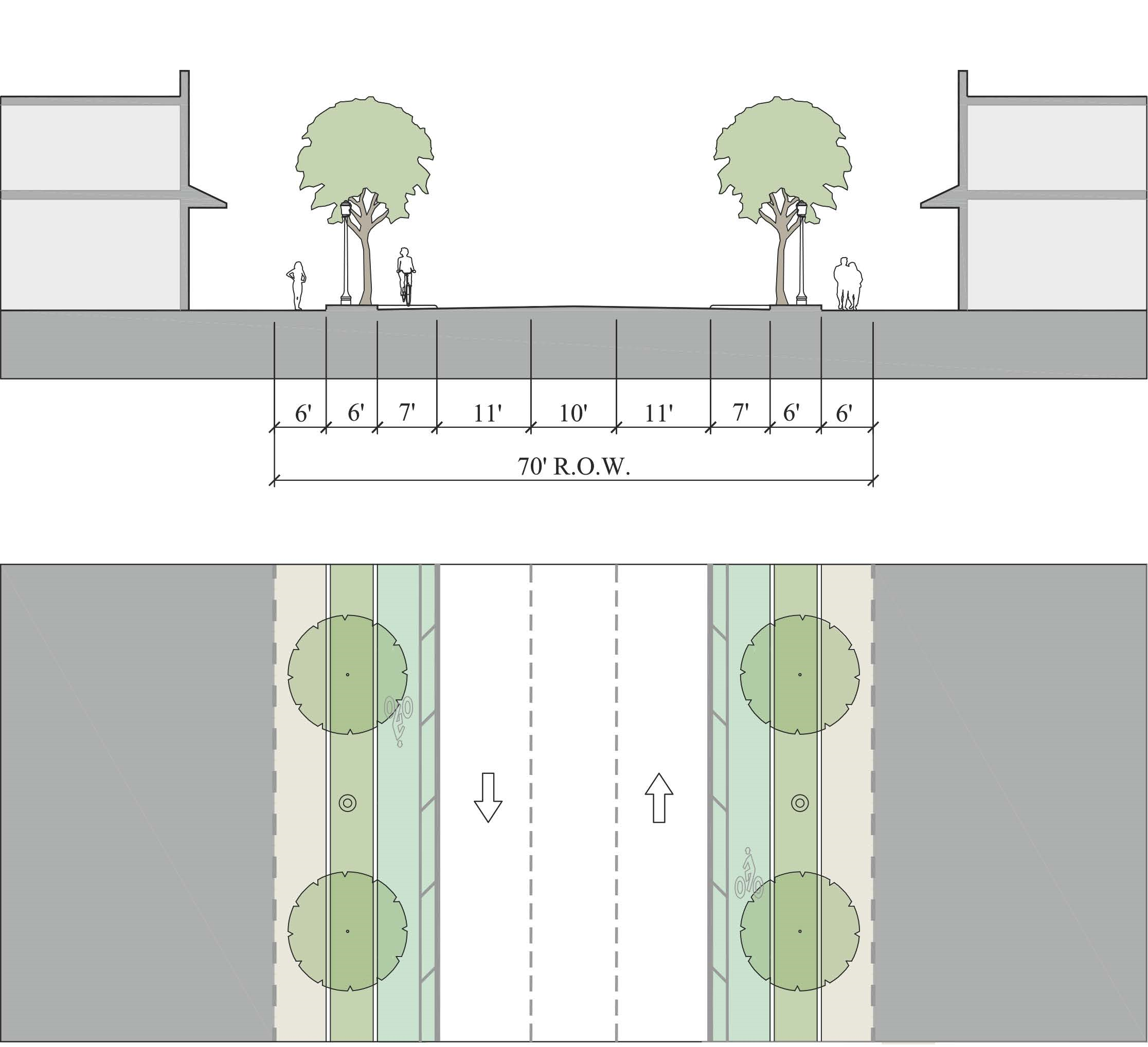
Figure 12-8.11 - Local Street 2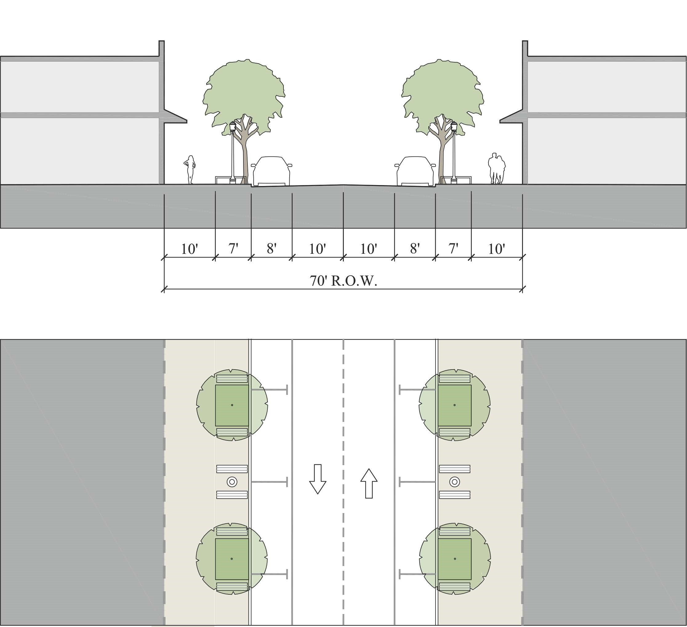
Figure 12-8.12 - Local Street 3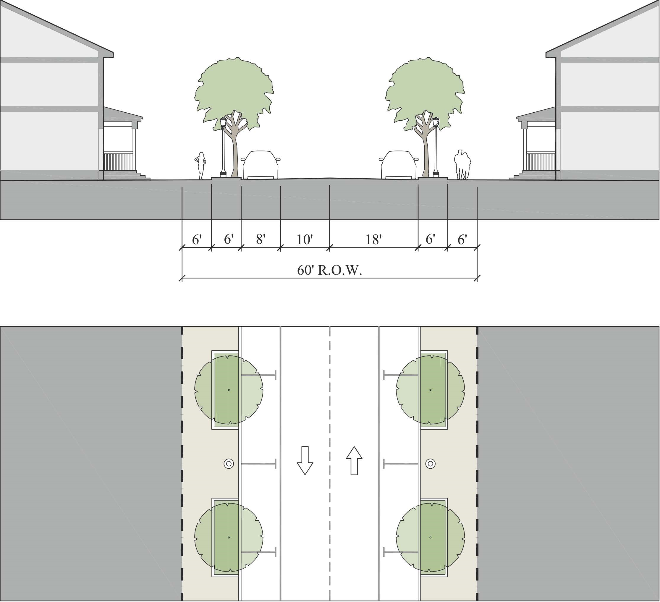
Figure 12-8.13 - Local Street with Shared Use Path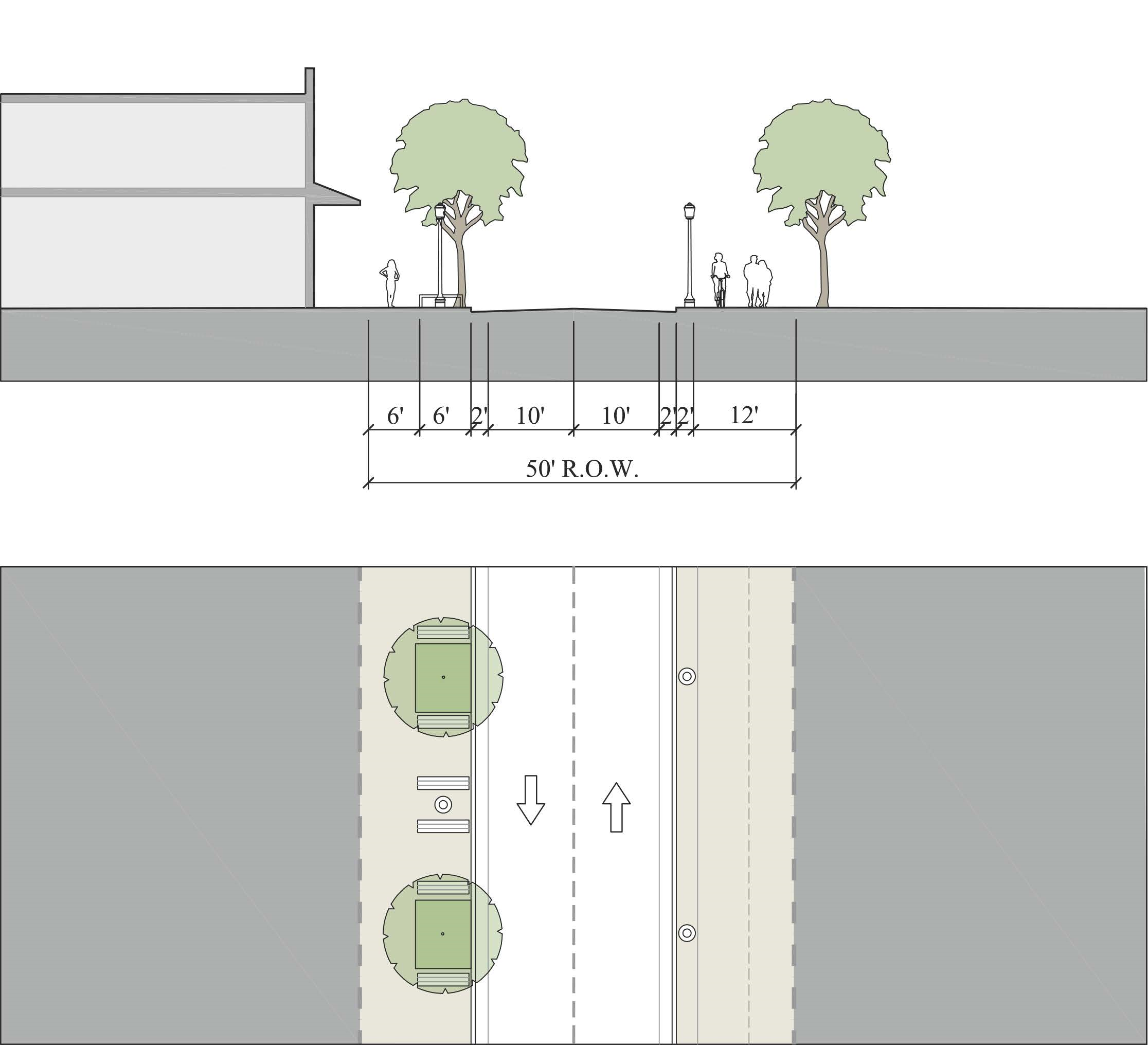
Figure 12-8.14 - Neighborhood Street 1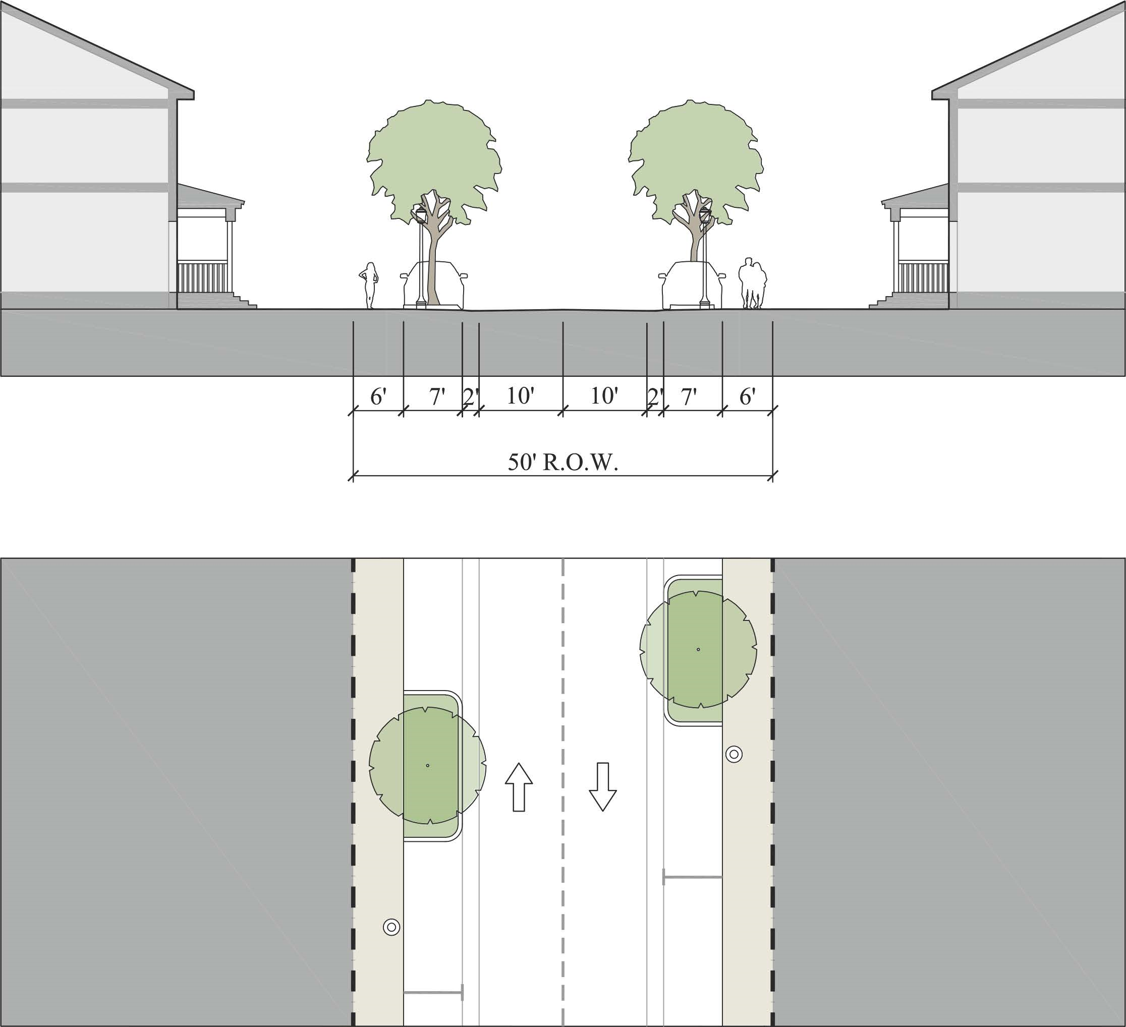
Figure 12-8.15 - Neighborhood Street 2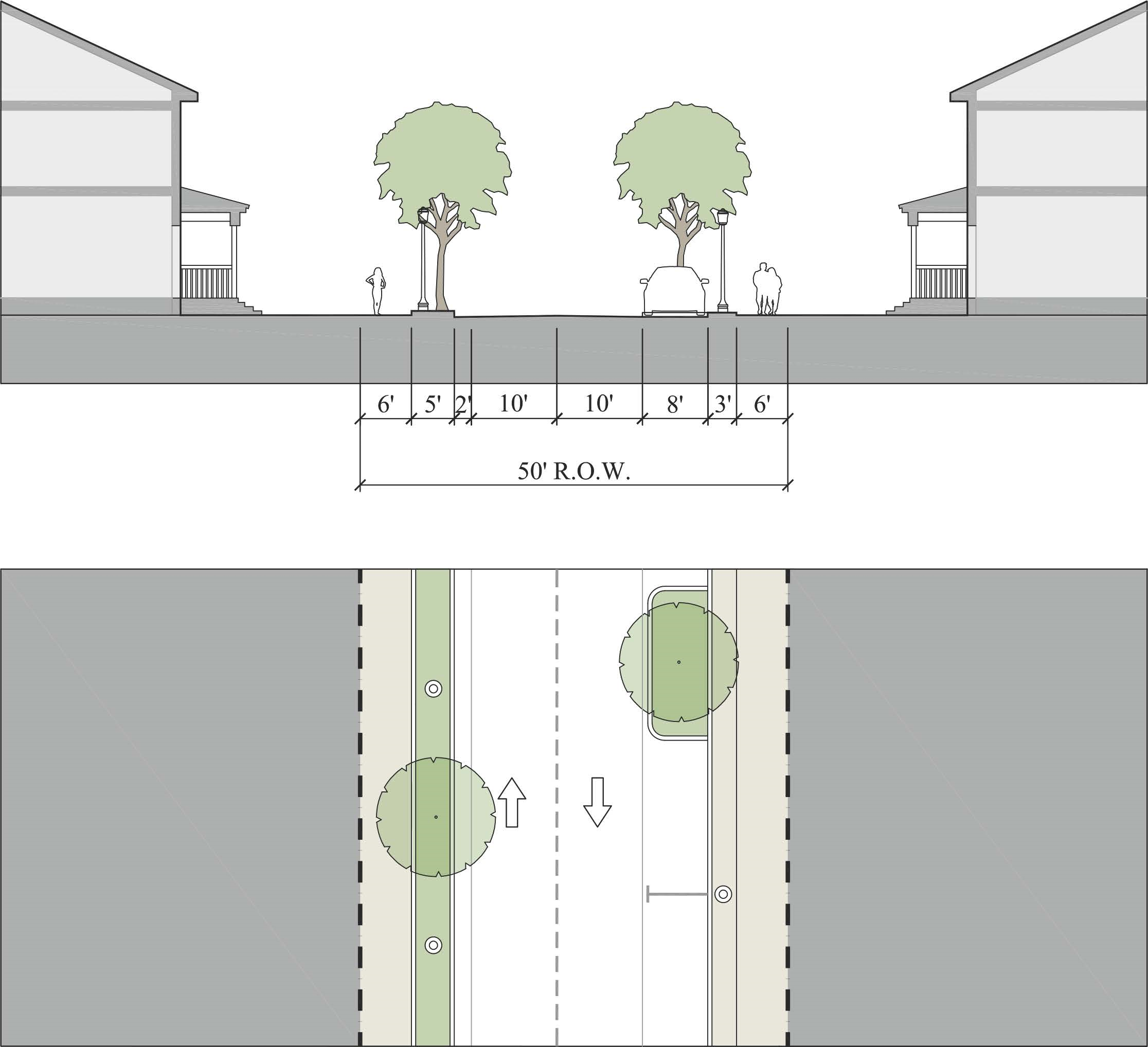
Figure 12-8.16 - Yield Street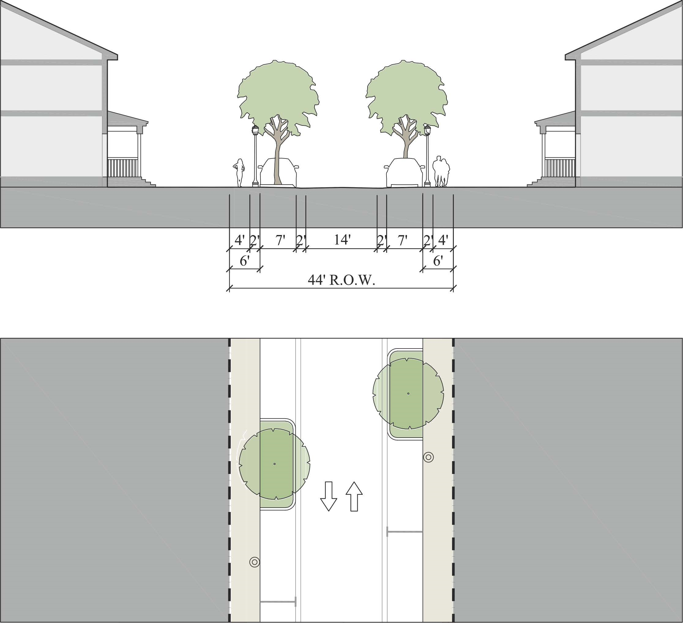
Figure 12-8.17 - Alley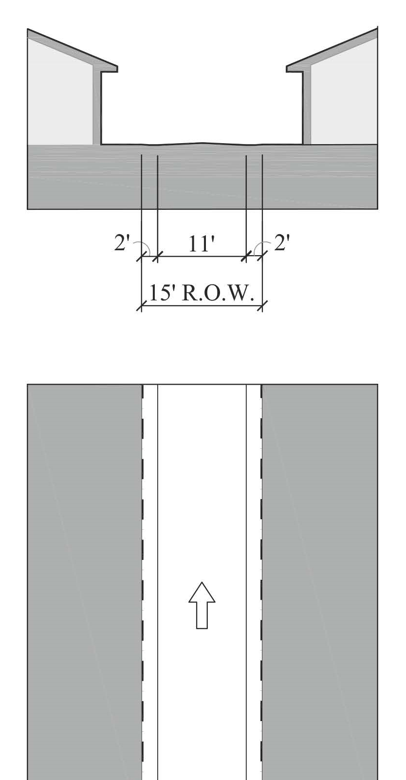
(Ord. No. 1111, pt. II, 9-24-2019; Ord. No. 1159, pt. 1(Exh. A), 5-11-2021)
Sec. 12.1.07. - Parking standards.
1.
Parking rates. Table 12-9 provides the minimum parking rates in Redevelopment Zoning Districts, unless specifically modified further in a Redevelopment Zoning District. Section 4.625 Parking rate adjustment does not apply in Redevelopment Zoning Districts.
Table 12-9 - Minimum Parking Rates for Each Use Group
Note: Square footages refer to gross floor area unless otherwise noted.
2.
Loading standards. The loading standards in Section 4.626.4, Div. 14, Article 4 do not apply in Redevelopment Zoning Districts, unless specifically included in a particular Redevelopment Zoning District.
3.
Parking design standards. The parking design standards in Section 4.627, Div. 14, Article 4 apply to off-street parking in Redevelopment Zoning Districts, unless specifically modified in a particular Redevelopment Zoning District.
4.
On-street parking. On-street parking within a public right-of-way along the lot frontage can be counted towards on-site parking requirements.
5.
Combined parking lot. Where feasible, combined parking lots or continuous parking lots are encouraged. Section 4.845.D. which require joint and cross access between adjacent commercial properties applies in the Redevelopment Zoning Districts even if the properties are separated by an alley or an unimproved alley right-of-way.
Table 12-9.01 - Minimum Bicycle Parking & Pedestrian Amenity
6.
Bicycle and Pedestrian Standards. Commercial, multifamily, institutional, and mixed-use development shall provide bicycle parking in accordance with Table 12-9.01 and below standards. Redevelopment Zoning Districts may require additional bicycle parking as described in a particular Redevelopment Zoning District.
a.
Pedestrian Access. Parking lots and structures shall provide pedestrian and bicycle access directly from a street. In addition, pedestrian access shall also be provided directly from a building. Pedestrian access shall be separated from the vehicular travel path. All development should be designed to provide safe opportunities for alternative modes of transportation by connecting with existing and future pedestrian and bicycle ways and to provide safe passage from public rights-of-way to the building(s) within the commercial development, between adjoining developments, and between alternative modes of transportation. Wherever possible, pedestrian ways should be constructed of paver blocks, stamped or colored concrete or similar materials that clearly distinguish them from vehicular use areas and promote traffic calming.
b.
Structural or vegetative shading shall be provided along pedestrian ways at intervals of no greater than 70 feet.
c.
Bicycle and pedestrian amenities. Bicycle and pedestrian amenities shall be provided as determined by the square footage of buildings on the site as indicated in the Table 12-9.01. These amenities may be incorporated into a pedestrian arcade or similar feature that otherwise meets the requirements of this Article 12. Bicycle racks shall be provided within 50 feet of any customer entrance. The design of all amenities shall be of durable, long-lasting materials, consistent with the design of the principal structures on site and principles found in Bicycle Facilities Planning and Design Handbook (State of Florida, Department of Transportation, 1997). Benches shall not be less than six feet in length and shall have either structural or vegetative shading. Required bike racks shall be the inverted "U" type and shall be designed to store a minimum of six bicycles each.
d.
Lighting. Lighting fixtures shall be a maximum of 30 feet in height within a parking lot and shall be a maximum of 20 feet in height within non-vehicular pedestrian areas.
e.
Public transit stops. Any development providing more than 200 parking spaces and located adjacent to any arterial or collector street shall designate a minimum 100 square foot area on the site plan as a future public transit stop. The future public transit stop shall be located immediately adjacent to the right-of-way line of the arterial or collector street. The future transit stop area may be landscaped or used for overflow parking but shall not be used to comply with the minimum landscape, buffer, open space or similar requirements. The landowner shall execute an easement authorizing the County to construct and maintain a transit stop at that location.
7.
Special Parking Alternatives for Redevelopment Centers (SPARC) program. This program provides a mechanism for property owners or applicants to satisfy part of their parking requirement by paying-in-lieu for some of the required parking space(s). The program revenue shall fund enhancements to the existing public parking areas and the transportation and mobility network within that Community Redevelopment Area.
a.
Applicability of SPARC. SPARC is authorized in each Redevelopment Zoning District by Subdistrict as identified in Table 12-9.4.
i.
The SPARC program can be used to satisfy up to three parking spaces or the maximum percentage listed in Table 12-9.4, whichever is greater. Sec. 4.623.D. LDR, shall apply when calculating SPARC parking spaces.
ii.
Residential development is not eligible for the SPARC program. In mixed-use development, only nonresidential uses are eligible.
iii.
Required accessible parking spaces shall not be satisfied by payment.
iv.
An additional five percent of parking may be met with SPARC if the development is within 100 feet of an existing transit stop with shelter.
Table 12-9.4 - Maximum Percentage by Subdistrict of Required Parking Eligible for SPARC
b.
Application approval and payment.
i.
A SPARC application shall be submitted to the Growth Management Department.
ii.
Unless the request is included in an application that is required to go before the Board, the County Administrator shall have the authority to administratively approve SPARC applications.
iii.
SPARC payments shall be made within 60 days of approval of SPARC applications; however, parking requirements are not satisfied until full payment is received by the County.
iv.
Upon receipt of payment, all approvals will be memorialized in writing and recorded in the public records of Martin County.
v.
Any parking requirements satisfied with the SPARC program shall run with the land exclusively. A change of use may be eligible for the SPARC program. No refund will be made when there is a change of use that requires less parking.
vi.
Payments made pursuant to this section do not guarantee specific parking for the development nor the reservation of parking spaces in the right-of-way.
vii.
The County shall use professionally accepted methods to determine the appropriate cost for payment in lieu of parking spaces and shall adopt such fees by resolution. The Community Redevelopment Agency shall retain the information for current valuation of payment in lieu of parking.
c.
Establishment of SPARC fund accounts. Martin County shall establish separate SPARC fund accounts for each CRA into which all payments made pursuant to this program shall be deposited. Monies deposited into said accounts shall be used in the same CRA from which such funds were generated. Appropriate uses of SPARC funds include, but are not limited to:
i.
The creation, maintenance, or operational costs related to mobility and parking needs including, but not limited to, on-street parking spaces, parking lots, alley improvements, sidewalks, crosswalks, pedestrian lighting, shared valet services, bicycle racks, public transportation (in the form of transit stops with shelters, electric trolleys, or trams), wayfinding signage, curb management (i.e. for ride-share, delivery services, etc.), and other programs and projects that reduce the need for additional parking spaces.
ii.
The cost of all labor and materials, the cost to acquire lands, property, rights, easements, leases, and franchises; the cost of financing; the cost of interest prior to and during construction and for one year after completion of construction; discount on the sale of municipal bonds; the cost of plans and specifications, surveys of estimates of costs and of revenues; the costs of design, engineering and legal services; such other costs and expenses necessary or incident to determining the feasibility or practicability of such construction or reconstruction, administrative expenses, permitting and such other expenses as may be necessary or incidental to the construction, reconstruction, or financing for the implementation of the items listed in i. above.
d.
SPARC review. The SPARC program shall be evaluated by CRA and County staff one year after adoption and every three years thereafter.
8.
Garage and Driveway. Garages shall not be the principal element of the front façade. The total driveway width at the property line shall not exceed 20 feet. For single-family detached dwellings and duplexes the following shall apply:
a.
Attached garages shall be set back from the front facade or Building Type as described in Figure 12-9.02 or configured with a side entry, shown in Figure 12-9.03.
b.
Garages and carports shall also comply with the setbacks established by Parking Placement standards for each building type.
c.
Detached garages are permitted provided they comply with the Outbuilding Building Type and building coverage requirements.
d.
Carports and Porte cocheres shall be regulated the same as attached garages.
e.
An Outbuilding Building Type is permitted between the principal structure and the right-of-way, provided the lot is deeper than 250 feet and the front and side setbacks comply with the Building Type permitted within the Subdistrict.
Figure 12-9.02 Front Loaded Attached Garage
| Description | ||
| Setting the garage back from the primary façade emphasizes the building entrance and living spaces. | ||
| Dimensions | ||
| Garage |
40% max front elevation
2 car garage max. | |
| Width of Driveway |
20' max. total width at property line
or 20' max. total width (C+D) at property line | |
| Setback from Front Façade or Building Type |
5' min for garage with garage door up to 16' in width
10' min. for garage with garage door that exceeds 16' | |
Figure 12-9.03 Front Loaded - Side Entry Attached Garage
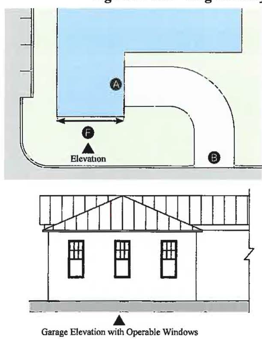
| Description | ||
| Side entry garage continues the character of the home and diminishes the appearance of non-livable space to the street. | ||
| Dimensions | ||
| Garage | 2 car garage max. | |
| Width of Driveway | 20 feet max. | |
| Building Width | 40% max. front elevation must be in character of main house and have operable windows | |
(Ord. No. 1111, pt. II, 9-24-2019; Ord. No. 1159, pt. 1(Exh. A), 5-11-2021; Ord. No. 1196, pt. I(Exh. A), 5-9-2023)
Sec. 12.1.08. - Stormwater standards.
1.
Flood protection standards are provided in Div. 10, Article 4. Flood protection standards apply in all Redevelopment Zoning Districts and cannot be modified or exempted.
2.
Stormwater management standards provided in Div. 9, Article 4 apply in Redevelopment Zoning Districts except as modified in this section for Small Sites and for the construction of a single-family residence or a duplex on a legally created lot, regardless of lot size. A Small Site is defined as the construction or expansion of a principal building or accessory structures on a lawful parcel, provided the parcel being developed is less than one-half acre.
3.
The stormwater management requirements identified in Sections 4.384, 4.385.B.6, 4.385.C, 4.385.D, and 4.385.F.4, Div. 9, Article 4 are not applicable to Small Sites. Development on Small Sites shall be designed to control stormwater runoff, retain or detain stormwater runoff, and clean stormwater runoff by using one or more strategies from each Stormwater Strategy Category (pavement, storage and filtration) listed below in Table 12-10. The strategies set forth in Table 12-10 are recommended in the Stormwater Design Toolkit (Martin County CRA, January 2012). Use of these strategies in detached single-family dwellings and duplexes is encouraged, but is not required.
Table 12-10 Stormwater Strategies for Small Sites
4.
The application requirements for single family residential development found in the Martin County Stormwater Management and Flood Protection Standards shall apply to all Small Sites. The application shall include:
a.
Topographic map with one foot contour lines extending a minimum of 25 feet off of the project site.
b.
A plan showing existing adjacent development, FEMA flood zones, location relative to the Coastal High Hazard Area, or any other significant onsite features.
c.
A drawing or map showing proposed alterations of the site including proposed excavations, dredging, grading, filling or clearing, impervious surfaces and water management facilities and the location, dimensions and the elevations of the first finished floor of all buildings to be constructed including:
i.
A detail on the plan for the control of erosion and sedimentation at the perimeter of the area disturbed by construction which describes in detail the type and location of control measures.
ii.
A detail on the plan of any temporary culverts that may be necessary to maintain the flow through roadside swales during construction.
iii.
Cross section details of the fill to be placed on the lot.
iv.
Cross section details of swales that are required to direct runoff to the street or other approved outfall.
v.
Cross section detail with elevations of the driveway and driveway culvert (if applicable) where the driveway crosses a roadside swale.
5.
All Small Sites shall be developed in accordance with Section 4.389.B, Div. 9, Article 4 to ensure absolute minimal impact on adjacent property; however the use of perimeter berms is discouraged. Stem wall foundations, extended footers, concrete piers, or treated wood pilings shall be used to achieve required finished floor elevations while avoiding the need for excessive fill and perimeter berms. Within Redevelopment Zoning Districts the maximum slope of fill on the lot shall not exceed 10:1 (H:V). See Figure 12-11 and Figure 12-5 in Section 12.1.04 for reference. The 10:1 (H:V) maximum slope shall not apply to a drainfield for an on-site sewage treatment and disposal system that must be elevated above existing natural grade in order to comply with the required separation from the seasonal high water table.
Figure 12-11 Impact of Foundation Types on Neighborhood Resiliency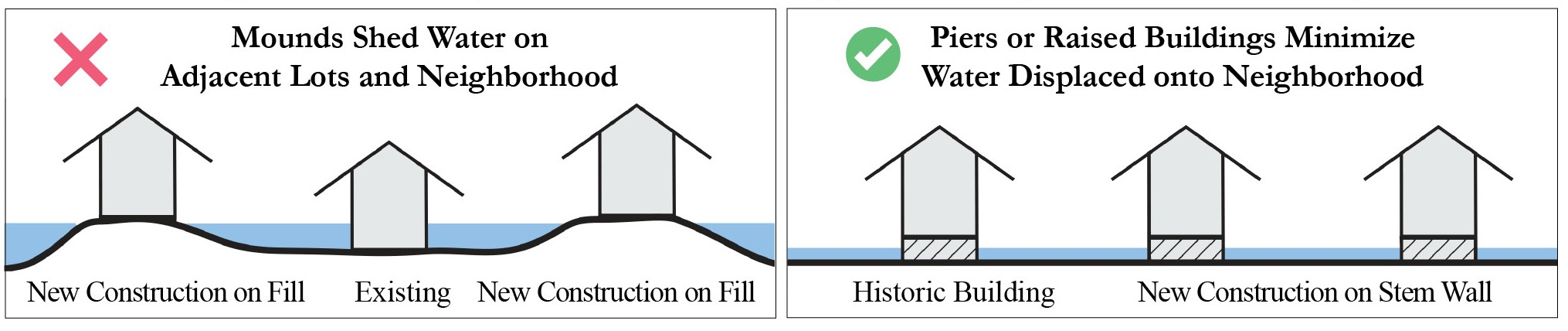
(Ord. No. 1111, pt. II, 9-24-2019; Ord. No. 1159, pt. 1(Exh. A), 5-11-2021)
Sec. 12.1.09. - Landscape standards.
1.
Landscape, buffering, and tree protection standards are provided in Sections 4.661 through 4.668, Div. 15, Article 4. Each Redevelopment Zoning District shall specify which provisions apply in that Redevelopment District.
2.
Service areas. Service function areas, including dumpsters, shall be screened in accordance with Section 4.663.A.6, Div. 15, Article 4, except that landscaping shall not be required around the perimeter of the screen and chain link fences are not permitted. All nonconforming enclosures shall be brought into compliance no later than June 20, 2023.
(Ord. No. 1111, pt. II, 9-24-2019; Ord. No. 1159, pt. 1(Exh. A), 5-11-2021)
Sec. 12.1.10. - Wall and fence standards.
1.
Fence and wall standards provided in Div. 4, Article 3 apply, except as modified in Redevelopment Zoning Districts. Fences and walls in Redevelopment Zoning Districts must comply with the following standards, except as may be modified in a particular Redevelopment Zoning District.
2.
Location.
a.
Figure 12-12 illustrates how these fence and wall standards are applied on different portions of a lot.
b.
Fences and walls adjoining on public right-of-way must allow no less than 12 inches of open space from the sidewalk.
Figure 12-12 Wall & Fence Locations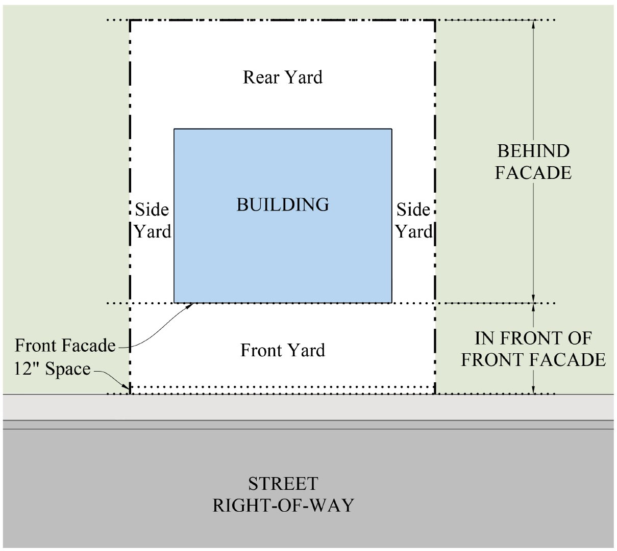
3.
Materials. Fences and walls shall be constructed with one or more of the materials listed in Table 12-13.
Table 12-13 - Wall & Fence Materials
4.
Height. Fences and walls shall not exceed the following heights as measured from the adjacent natural grade:
a.
48 inches in front yards and in portions of side yards that are in front of the building's front façade.
b.
48 inches where screening is required between an allowable Vehicular Use Area and a street.
c.
72 inches in rear yards and in portions of side yards that are behind or in line with the building's front façade.
d.
Refer to Section 12.1.04.11 Development Standards for circumstances requiring a 72 inches masonry wall pursuant to Building Transition standard.
e.
Fences and walls on corner lots may be further restricted in height to maintain required site distance standards.
5.
Types. Fences and walls must comply with these additional restrictions:
a.
Chain link fences are permitted only in rear yards, and in side yards behind the façade of a building. Chain link fences must have vegetative screening where visible from a street or public park.
b.
Dangerous fences, such as electrically charged fences or fences topped with barbed wire or other sharp objects, are not permitted unless approved as necessary to protect the public from hazardous conditions.
c.
When one side of a fence or wall is finished to a higher standard than the other, the finished side must face outwards, except when abutting an existing fence or wall on the adjoining property.
6.
Replacement of fences.Article 8, Nonconformities, does not apply to the replacement of fences in the Redevelopment Zoning Districts. All replacement fences in a Redevelopment Zoning District shall comply with this section.
(Ord. No. 1111, pt. II, 9-24-2019; Ord. No. 1159, pt. 1(Exh. A), 5-11-2021)
Sec. 12.1.11. - Sign standards.
1.
Sign standards provided in Sections 4.691 through 4.709, Div. 16, Article 4 apply in Redevelopment Zoning Districts, except as modified in this section or for a particular Redevelopment Zoning District. In addition, signs in Redevelopment Zoning Districts must comply with the following standards.
2.
Clear Height. All projecting and under canopy signs shall be 9' minimum above sidewalk.
3.
Window Signs. Window signs shall not exceed 20 percent of the window area.
4.
Prohibited signs. The list of prohibited signs in Section 4.695, Div. 16, Article 4 is adjusted for the Redevelopment Zoning District by adding the following prohibited signs:
a.
Back-lit awning signs (signs affixed to awnings that have a translucent covering material that is illuminated from behind)
b.
Billboards and off premises signs of any kind.
5.
Maintenance. Signs shall be kept clean, painted and free from all hazards such as, but not limited to, faulty wiring and loose fastenings. Weeds shall be cut underneath and around the base of ground signs and no rubbish or debris shall be permitted that would constitute a fire hazard or be detrimental to the public health and safety. All signs shall be maintained in a manner which will withstand hurricane wind load requirements.
6.
Nonconformities. Nonconforming signs shall not be structurally modified. Any nonconforming sign damaged in excess of 50 percent of the integrity of the structure as determined by the Building Official shall only be repaired in full compliance with the requirements of this section.
(Ord. No. 1111, pt. II, 9-24-2019; Ord. No. 1159, pt. 1(Exh. A), 5-11-2021)
Sec. 12.1.12. - Design standards.
The following Design Standards are applicable within Redevelopment Zoning Districts.
1.
General Design Standards.
a.
Historic Structures. Structures identified as historically and architecturally contributing shall be candidates for historic protection as set forth in Div. 13, Article 4.
b.
Identical freestanding structures shall not be built next door to one another.
c.
Accessory Structures. Accessory structures shall be designed and constructed to match the architectural style and building form of the principal building. For accessory structures less than 450 square feet, use of complementary or matching color shall meet the requirements of this standard. Accessory structures larger than or equal to 450 square feet shall be held to the same design standards as the primary structure.
d.
Limitation on Blank Walls. Windowless, uninterrupted walls are not permitted. Blank wall areas shall not exceed 20 feet in horizontal direction of any facade adjacent to a public right-of-way, private road, thoroughfare, civic open space, or other open space, with the exception of facades facing alleys.
e.
Continuation of Architectural features. Architectural treatments on the primary facade shall continue to all faces of the building visible to a public right-of-way, private road, thoroughfare, civic open space, or other open space, with the exception of facades facing alleys.
f.
Authentic Architecture/Faux Elements. Buildings shall clearly reflect their use and respond to their unique location. Details shall be consistent with one of the architectural styles permitted in the relevant Redevelopment Zoning District. Appropriate materials and types of elements are discussed within each style in Section 12.1.12.4. These elements shall be appropriately scaled to the primary structure:
i.
Bracket sizes shall reflect the loads being supported.
ii.
All balconies shall be habitable with a minimum depth of 4 feet with the exception of Parisian balconies.
iii.
Shutters are encouraged to be operable. Stucco shutters are not permitted. If shutters are not operable, they shall be sized to the adjacent windows (each being half the size of the window).
g.
Prohibited materials and colors. For structures greater than 450 square feet, the following shall not be used:
i.
Reflective or back-lit panels made of plastic, vinyl, fiberglass or similar materials
ii.
Unfinished concrete block (i.e., without stucco finish), except split-faced block
iii.
Corrugated or other non-insulated metal panels where such material will cover more than 50 percent of the primary facade area
iv.
Black or fluorescent colors as a predominant exterior building color, except black trim, window frames, doors, and architectural accents may be used
v.
Back-lit awnings
vi.
Unshielded lights in commercial and multifamily structures
vii.
Asphalt shingles, where permitted, shall be 320 pound, 30-year architectural grade or better shingles which otherwise meet all requirements of the Florida Building Code
h.
Heat Island Effect. In order to reduce urban heat islands, the following standards are recommended for roofed structures:
i.
Use Energy Star roof-compliant, or Energy Star equivalent standard, or install a "green" (vegetated) roof for at least 50 percent of the roof area.
ii.
For parking garage roofs, provide shade for at least 30 percent of any exposed parking on the roof of a garage.
i.
Building Context. Drawings, renderings, photographs, or other graphic communications shall be provided to show neighboring buildings and important features of adjacent sites. Existing features should be shown in sufficient detail to enable evaluation of the proposed development in context with surrounding uses.
2.
Massing, Building Articulation and Rhythm. All new development, except single family dwellings and duplexes, shall adhere to the massing, building articulation, and rhythm standards described in this Section.
a.
Massing. Buildings shall have a clearly articulated base, middle, and top. Figure 12.14-01 identifies the base, middle, and top for a one story and three story building.
i.
Base. The base shall express the building's load-bearing function with the most durable and highest quality of materials. The base may be expressed in a number of ways. For one story buildings, the stoop, porch or storefront express the base. For one and two story buildings, the base may be expressed by the visible thickening of the wall surface, which may be accompanied by a change of material or color. For three or four story buildings, the base of the building is typically the first story.
ii.
Middle. The middle shall be designed with a simple rhythm and pattern that expresses the function of the building via placement of windows, doors, and other vertical elements. A horizontal transition line may separate the middle from the base and/or top. The transition line may be a molding or cornice. The transition line should be reinforced by the location of other architectural elements such as awnings on the first story or balconies and window sills on the second story. The transition line shall not be covered by signage or awnings.
iii.
Top. The top shall be expressed with a parapet or roofline for buildings of one to three stories. For four story buildings, the upper floor with a compatible yet distinct architectural treatment may express the top. Vertical facade elements are to be terminated by cornice lines, moldings, and/or balconies.
FIGURE 12.14-01 BASE-MIDDLE-TOP DIAGRAM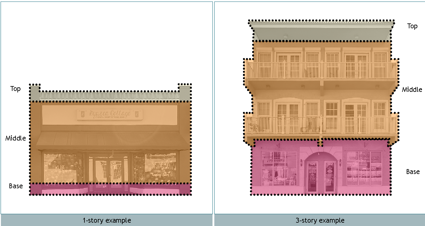
b.
Building Articulation and Rhythm. Building articulations are designed to break up building facades into distinct composed elements and may occur in elevation (vertical bays of a facade) or in plan (undulation in the building footprint) or both. Storefront widths are important in building articulation and shall be limited to 50 feet.
i.
Buildings over two stories in height shall include a balcony, arcade, bay window, step-back, awning, or other similar design element on all facades. Figure 12.14-02 identifies examples of articulation.
FIGURE 12.14-02 BUILDING ARTICULATION DIAGRAM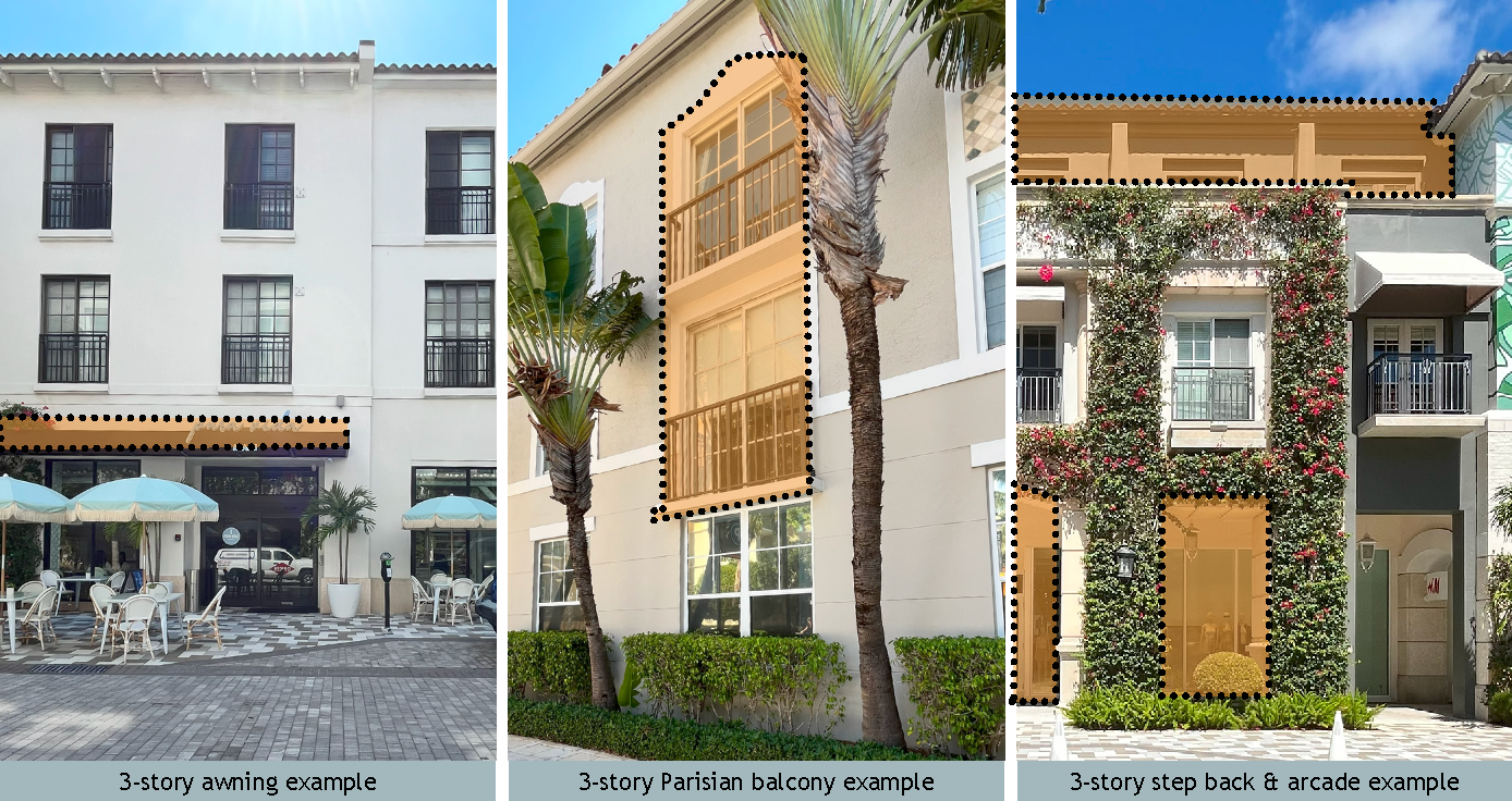
ii.
Building articulation, especially proposed tower elements, should respond to corner conditions, public open spaces, the visual axis of a street, and/or main building entries. Figure 12.14-03 identifies examples of public spaces and their relationship to architecture.
FIGURE 12.14-03 RESPONDING TO CORNER, VISTA & PUBLIC OPEN SPACE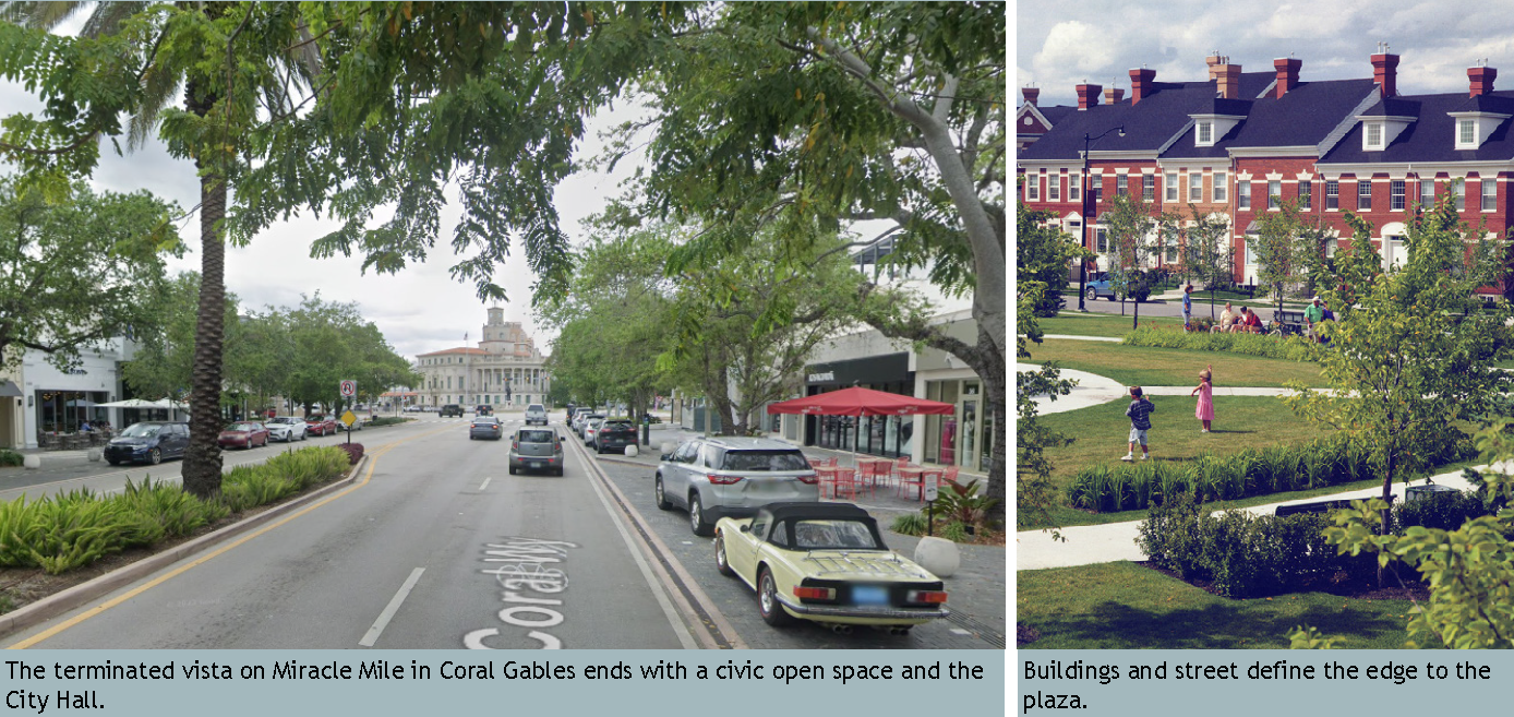
iii.
Building facades shall be composed so that proportions do not exceed height to width ratios of 1:1. The facade composition should be reinforced by fenestration patterns and architectural elements. Apparent building width shall be limited to 50 feet and one commercial entrance shall be provided per each 30 lineal feet. Figure 12.14-04 illustrated an example of buildings with apparent buildings and a regular interval of commercial entrances.
FIGURE 12.14-04 BUILDING RHYTHM DIAGRAM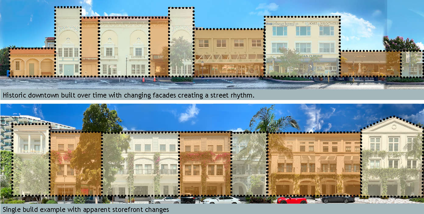
3.
Architectural Styles. All new development shall adhere to one of the architectural styles described in this Section. Any improvement or renovation of an existing structure or renovation of a building exterior shall be consistent with the existing architectural style of the building. Figure 12.14-05 Architectural Styles Matrix identifies the defined styles and the permitted heights for the associated style. Note, in all cases the permitted height is first limited by the Subdistrict, then the Building Type, followed by the Architectural Style. Figure 12.14-06 Architectural Styles Permitted by Redevelopment Zoning District identifies which styles are permitted in each of the Redevelopment Zoning Districts.
FIGURE 12.14-05 ARCHITECTURAL STYLES MATRIX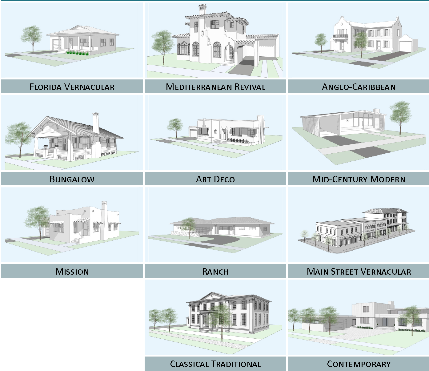
FIGURE 12.14-06 ARCHITECTURAL STYLES PERMITTED BY REDEVELOPMENT ZONING DISTRICT
Note, if a CRA area should want to introduce Architectural Styles that are not permitted above, that discussion shall be held at the NAC and CRA Board and would require a change to the Land Development Regulations.
a.
Florida Vernacular. The Florida Vernacular is a style of architecture native to the region, traditionally constructed with a wooden frame and finished with wood siding. The origins of the style are adapted from multiple sources including the Victorian, the Southern Plantation home, and the Florida Cracker styles. Other architectural styles considered as part of this genre include Key West and Conch House. Representative images, required elements, and recommended features to follow.
FIGURE 12.14-07 FLORIDA VERNACULAR IMAGE MATRIX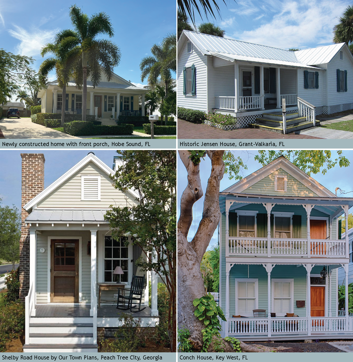
FIGURE 12.14-08 FLORIDA VERNACULAR: REQUIRED ELEMENTS OF THE STYLE DIAGRAM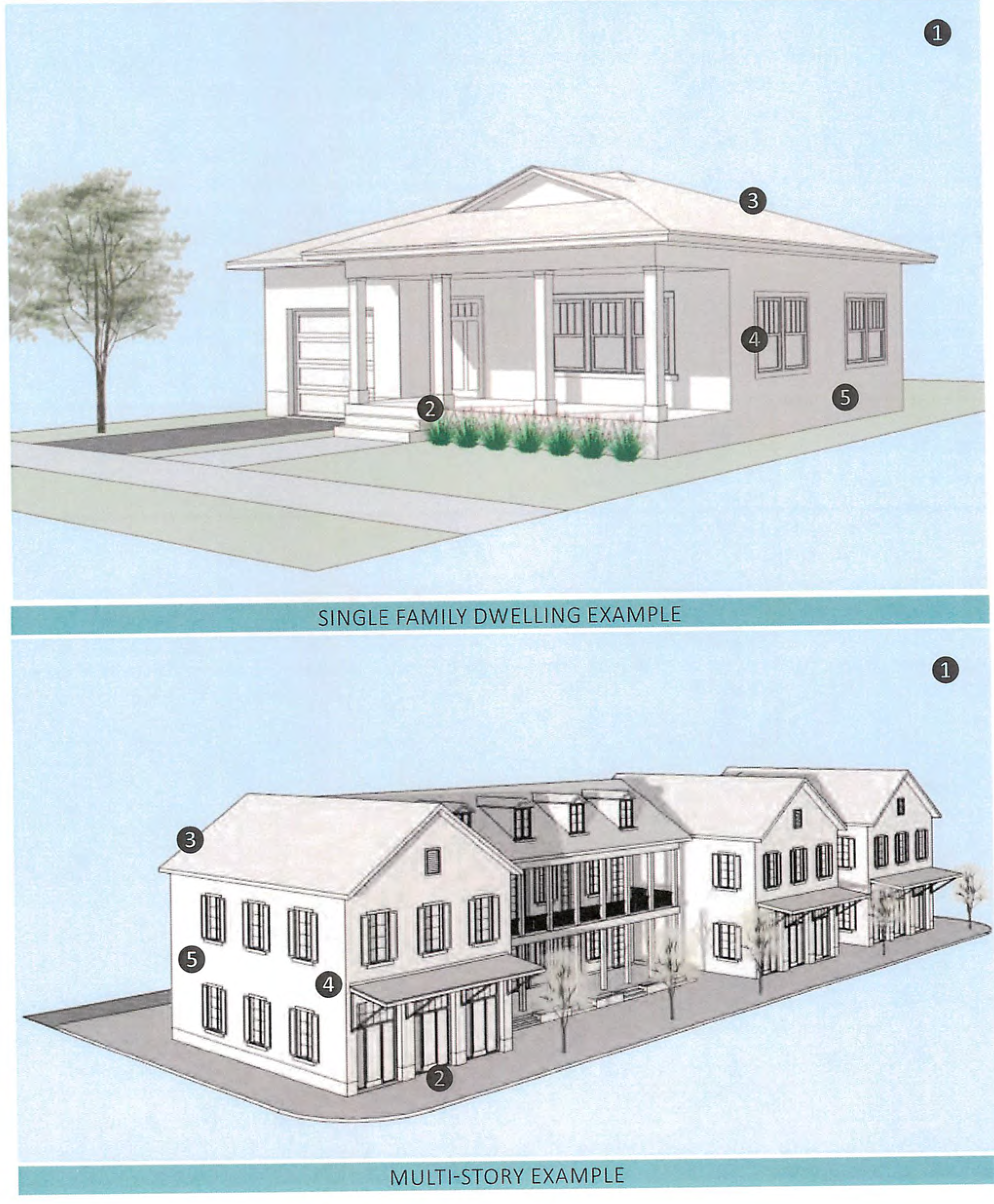
CONTINUATION OF FIGURE 12.14-08
| REQUIRED ELEMENTS OF THE STYLE | |
|---|---|
| 1—Massing and height. Florida Vernacular buildings are vertically proportioned in their massing. | |
|
2—Frontage Type.
i. The porch or stoop frontage type shall be used. See Figure 12-7.04 and 12-7.05 for dimensional criteria. ii. When a porch is present, the porch roof shall be supported by posts which are placed to create vertical or square openings between them. The porch roof may be of a different slope than that of the principal building, however detailing and overhangs shall be consistent. Porch posts shall be simple columns or boxed-in posts. iii. When a stoop is present, a projecting bracketed overhang over the front door shall be present. | |
|
3—Roof.
i. Roofs of the principal building shall be gabled, gable-on-hip, dutch gable, cross gable, pyramidal, or a hip roof. Slopes shall be between 4:12 and 12:12. ii. Roofing materials consist of low-profile standing seam metal, 5V crimp metal, asphalt shingles, or wooden shakes. iii. Roof overhangs must be between 18" or greater. | |
|
4—Doors and Windows.
i. Doors and windows shall be vertically proportioned. Horizontally-proportioned openings shall be made of a grouping of vertical windows. ii. Windows shall be casement, double-hung, or single-hung. iii. Windows shall include surrounds and sills. | |
|
5—Exterior Materials and Finishes.
i. The exterior finishes are horizontal siding such as lap, ship lap, clapboard, shingle or vertical siding such as board and batten. Siding shall be wood or fiber cement. Stucco shall be smooth stucco or a fine sand finish. ii. The siding shall be terminated with vertical corner boards at the building's edges. | |
FIGURE 12.14-09 ENCOURAGED FLORIDA VERNACULAR FEATURES
(A minimum of three features are required for projects in the Core Subdistrict)
1—Operable shutters.
2—Wrap around porches.
3—Exposed rafter tails, beams, and brackets.
4—Decorative ventilation panels in the gable ends.
5—Gable ends in the primary facade.
6—Fascias on the gabled ends deeper than those exposed along the running eave edge.
7—Oolitic limestone details at porch walls, supports, or chimneys.
8—Shingle accents on gables.
9—Multiple lights (divided panes) on window sashes.
10—Dormers with windows.
11—Railings with decorative geometric patterns or with coastal/tropical motifs.
IMAGES FLORIDA VERNACULAR DETAILS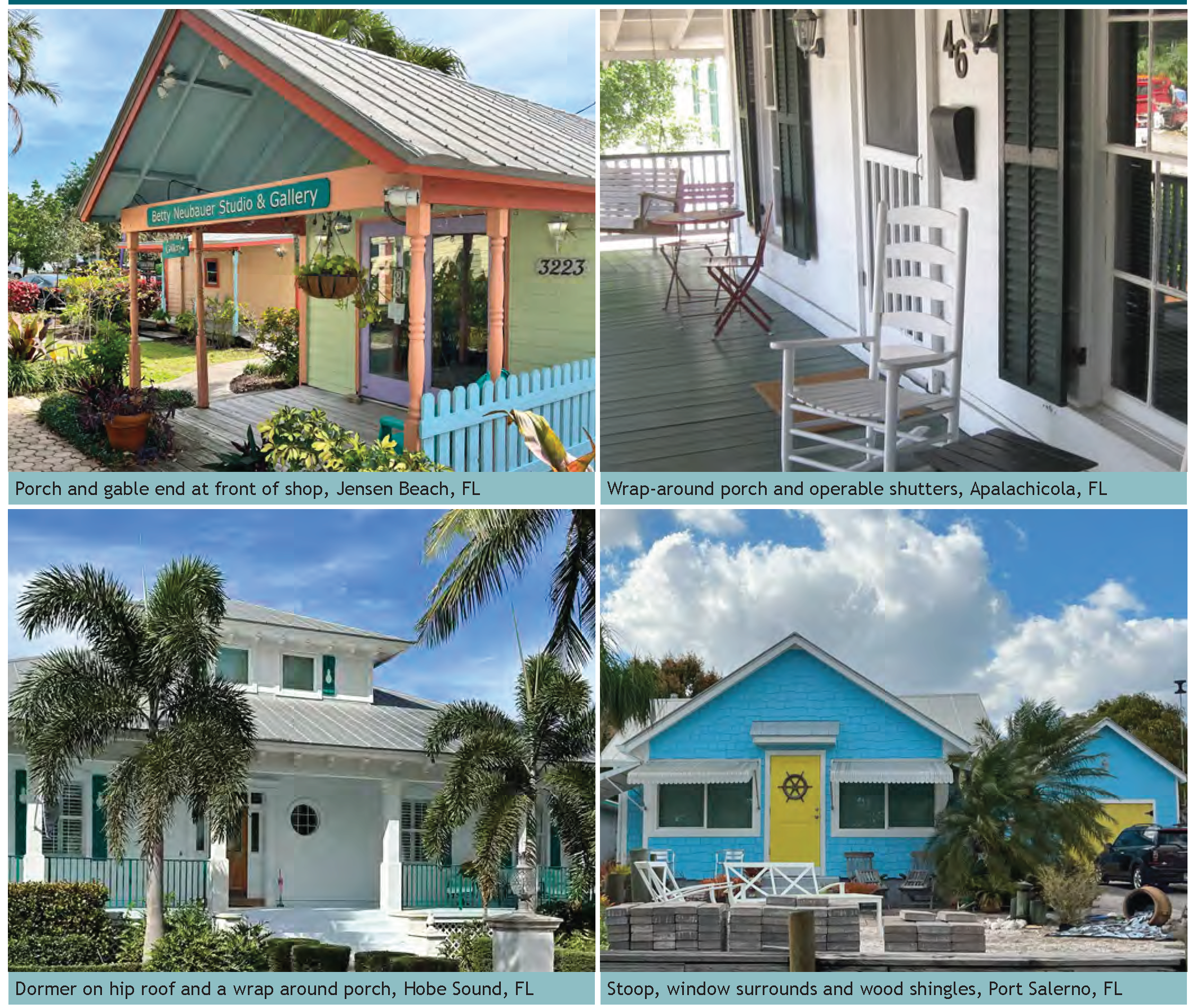
b.
Anglo-Caribbean. Anglo-Caribbean architecture is derived from the study of different colonial styles of architecture in Florida and the Caribbean, but particularly the architecture of St. Augustine. In the historic architecture of St. Augustine there was an overlapping of Spanish and British design in response to local climate and materials that were available and durable. A prominent feature of the Anglo-Caribbean house is the clear distinction between the first and second floors, inclusion of both heavy and delicate details, and use of both masonry and wood. Balconies with extended roof overlays and brackets are also prominent features. Representative images, required elements, and recommended features to follow.
FIGURE 12.14-10 ANGLO-CARIBBEAN IMAGE MATRIX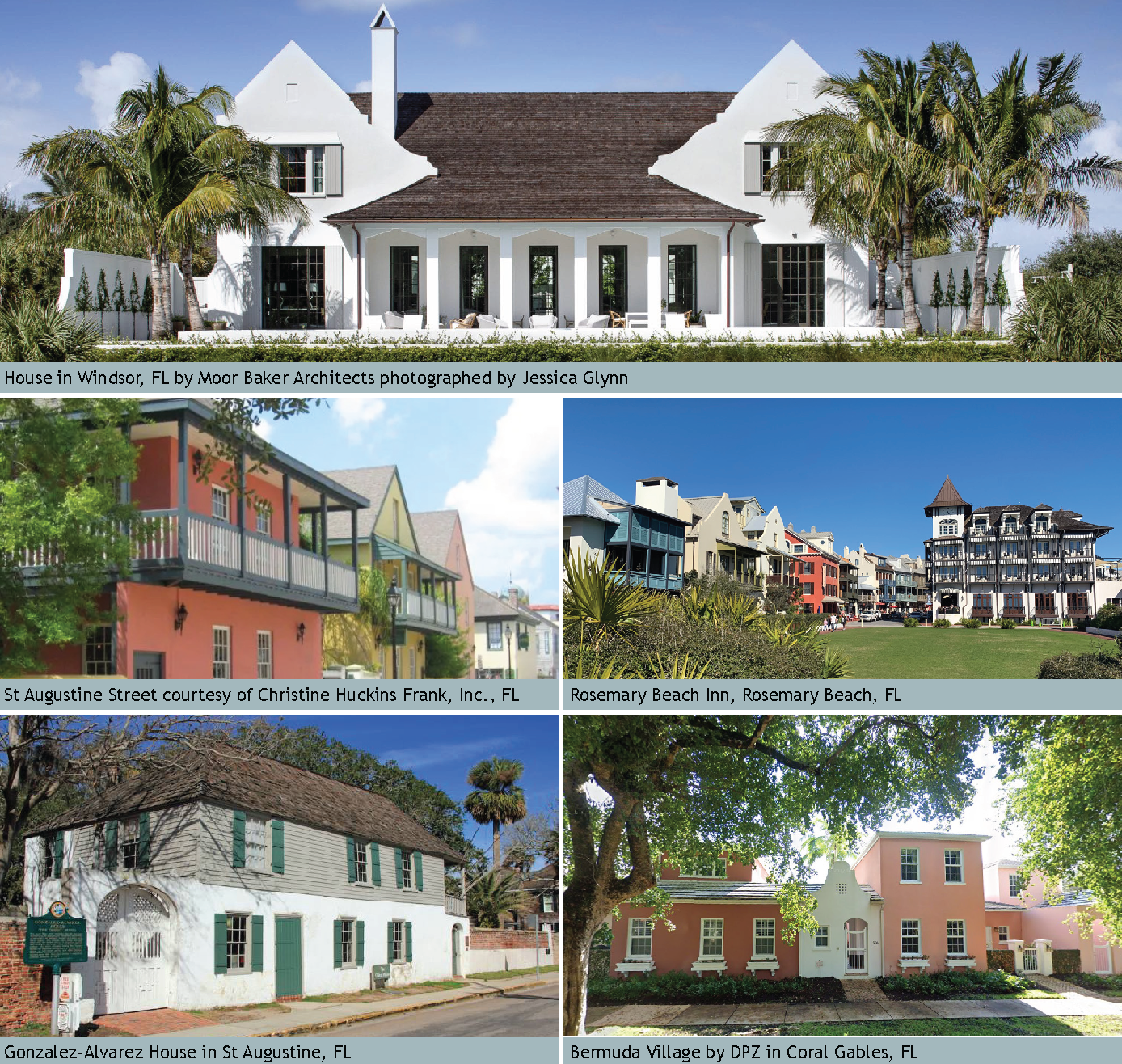
FIGURE 12.14-11 ANGLO-CARIBBEAN: REQUIRED ELEMENTS OF THE STYLE DIAGRAM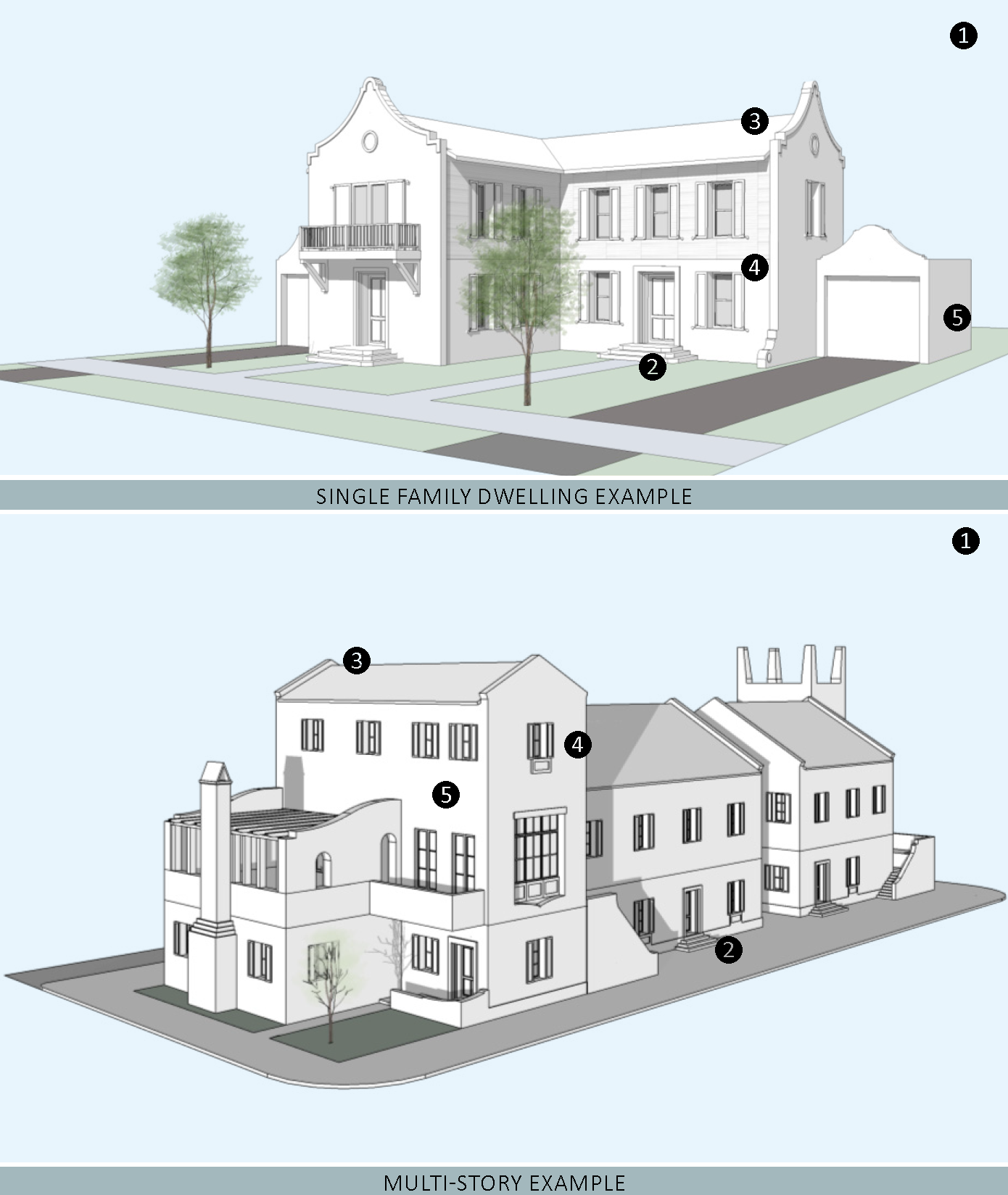
CONTINUATION OF FIGURE 12.14-11
| REQUIRED ELEMENTS OF THE STYLE | |
|---|---|
| 1—Massing and height. Anglo-Caribbean architecture expresses weight and compression, therefore the corners are thick to reflect solidity of the structure. Buildings can be symmetrical or asymmetrical in composition. Anglo-Caribbean structures are 2 or more stories although portions of the building can be 1 story. | |
|
2—Frontage Type.
i. A frontage type defined in Sec. 12.1.05 shall be used. ii. Columns are round or square masonry piers. iii. For storefronts, a series of french doors or an operable glass wall system may be used in lieu of a traditional shopfront. | |
|
3—Roof.
i. Roofs shall be sloped. Roof slopes shall be between 4:12 and 8:12 and are hipped or gabled with a parapet roof end. Where a parapet occurs on the primary facade, it shall include an undulating profile. ii. Sloped roofs shall be wood or asphalt shingles, metal, flat concrete tile, or slate. | |
|
4—Doors and Windows.
i. Windows and doors shall be vertically proportioned. ii. Windows shall not be installed on the same plane as the exterior walls. Openings for doors and windows shall cast shadows and give the impression of thickness and solidity. iii. Windows shall have single or divided lights. iv. Windows shall be double-hung, single-hung, or casement, and have a sill. v. Window surrounds when provided can be sculptural, narrow or minimal, or may only include the top header and bottom sill. Surrounds shall be made of stucco, stone, wood or fiber cement. | |
|
5—Exterior Materials and Finishes.
i. Exterior finishes shall be smooth stucco, fine sand finish stucco, stone, wood or fiber cement siding on upper stories, or a combination of these. | |
FIGURE 12.14-12 ENCOURAGED ANGLO-CARIBBEAN FEATURES
(A minimum of three features are required for projects in the Core Subdistrict)
1—Two story porches and balconies supported by brackets.
2—Roof overhangs with exposed rafter tails and thin eaves.
3—Overhangs extending from the beam at a more shallow slope than the main roof, creating a canted roof.
4—Loggias on either the first or second story.
5—A front porch that supports a second story balcony and is thereby under the primary roof.
6—Masonry or stone is used on the ground floor while wood or fiber cement framing and siding are used on the second floor.
7—Posts, railings, brackets, louvered openings.
8—The creation of small courtyards and passageways within the mass of the building that allow access to additional units or amenities beyond the primary elevation.
9—Volumetric setbacks and intentional misalignment between building masses to create opportunities for balconies, porches, and terraces.
10—Prominent and sculptural door surrounds.
11—Operable shutters.
FIGURE 12.14-12 IMAGE ANGLO-CARIBBEAN DETAILS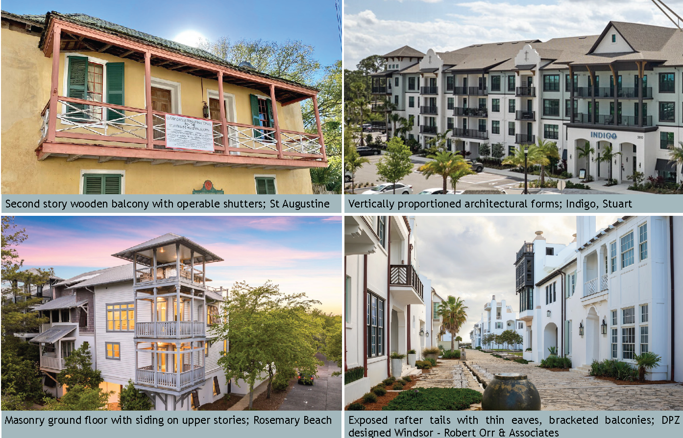
c.
Mediterranean Revival. Mediterranean Revival buildings are not replications of a particular area, but result from the blending of architectural elements from Spain, Morocco, and Italy. The massing of the building is much heavier in Mediterranean architecture and often asymmetrical. Larger buildings appear to have grown over time. Representative images, required elements, and recommended features to follow.
FIGURE 12.14-13 IMAGE MEDITERRANEAN REVIVAL MATRIX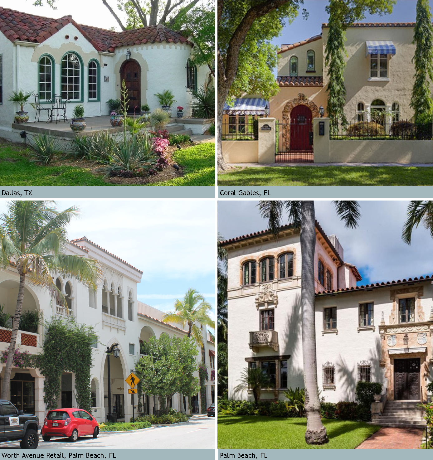
FIGURE 12.14-14 MEDITERRANEAN REVIVAL: REQUIRED ELEMENTS OF THE STYLE DIAGRAM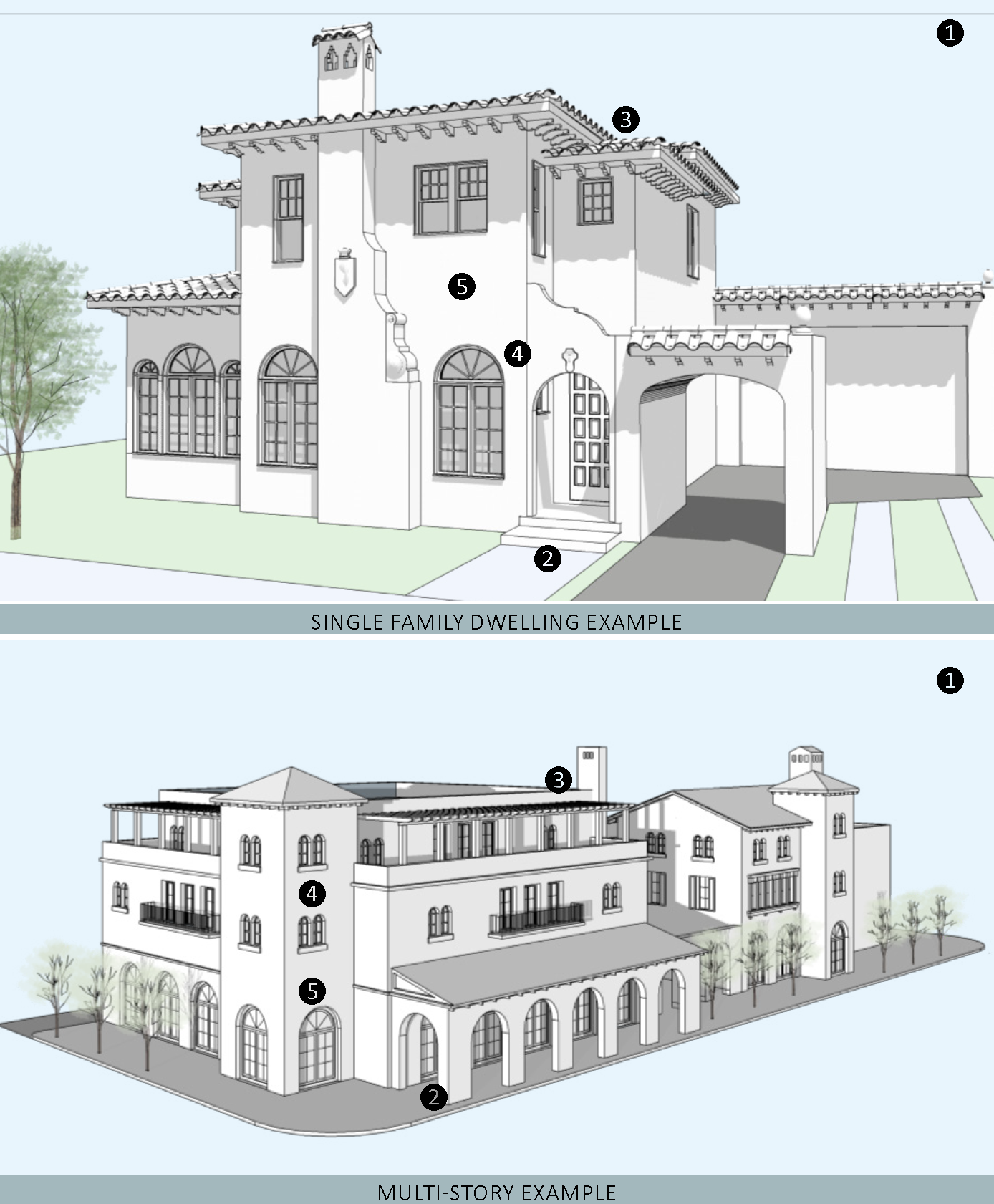
CONTINUATION OF FIGURE 12.14-14
| REQUIRED ELEMENTS OF THE STYLE | |
|---|---|
| 1—Massing and height. The Mediterranean Revival style is ornate, asymmetrical and eclectic. It is common to have multiple levels, multiple interior and exterior spaces. Building massing is irregular with a variety of shapes and heights; however, the appearance of solidity and permanence is critical. | |
|
2—Frontage Type.
i. A frontage type defined in Sec. 12.1.05 shall be used. ii Ornamented columns, posts, balustrades, and/or brackets are required elements. iii. Columns may be rounded, twisted, or detailed as squared masonry piers. | |
|
3—Roof.
i. Roofs of the principal building shall be hipped, gabled or a combination of both. Roof slopes are somewhat shallow and shall be sloped between 3:12 and 6:12. Roofs may be flat when used as a terrace. ii. Where roofing is sloped, materials shall be barrel tile, Spanish "S" tile, or flat concrete tile, all in clay colors. iii. Roof overhangs vary from being deep to having no overhang at all. When deep overhangs exist (24" or greater), they shall be supported by sizable wooden brackets. Roofs that do not overhang shall be treated with a molded cornice. iv. Exposed rafters are required elements. | |
|
4—Doors and Windows.
i. Windows and doors shall be vertical and/or square proportions with the occasional round, oval, or ornamental window. ii. Windows shall not be installed on the same plane as the exterior walls. Openings for doors and windows shall cast shadows and give the impression of thickness and solidity. iii. Windows shall have divided lights and are double-hung, single-hung, or casement. Window and door surrounds, when they exist, are made of stucco or stone and may include elaborate ornamentation. | |
|
5—Exterior Materials and Finishes.
i. Exterior finishes shall be smooth or textured stucco. ii. Stone can be used as an accent material. | |
FIGURE 12.14-15 ENCOURAGED MEDITERRANEAN REVIVAL FEATURES
(A minimum of three features are required for projects in the Core Subdistrict)
1—Arched openings and/or windows are prominent characteristics.
2—Elements of iron, wood or fiber cement detailing.
3—Chimneys which are masonry built with either stone, brick, or stucco finish. Flues are roofed or have decorative chimney caps.
4—Loggias to serve as outdoor circulation between rooms.
5—Balconies, courtyards, and terraces.
6—Doors and Windows:
i. Arched windows in groups of two or three.
ii. Doorways with carved stonework, spiral columns, and pilasters.
iii. Canvas and awnings to shield windows from the sun.
iv. Operable shutters for protection of openings.
7—Brightly colored ceramic tiles on floors and on stair risers.
8—Ornate and decorative lighting fixtures and sconces.
IMAGES OF MEDITERRANEAN REVIVAL DETAILS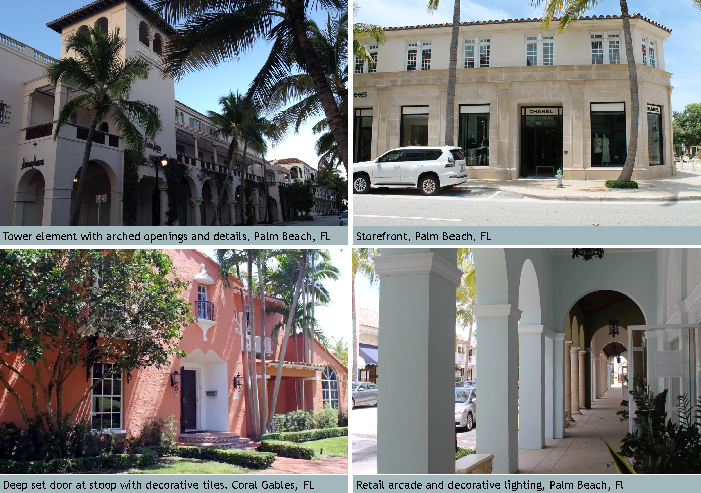
d.
Bungalow. Variations of this style include Prairie, Craftsman, or "Stick" style. The style was popular in America from 1910 through the 1930s and is well suited to the Florida climate with deep overhangs and porches. Representative images, required elements, and recommended features follow:
FIGURE 123.14-16 BUNGALOW IMAGE MATRIX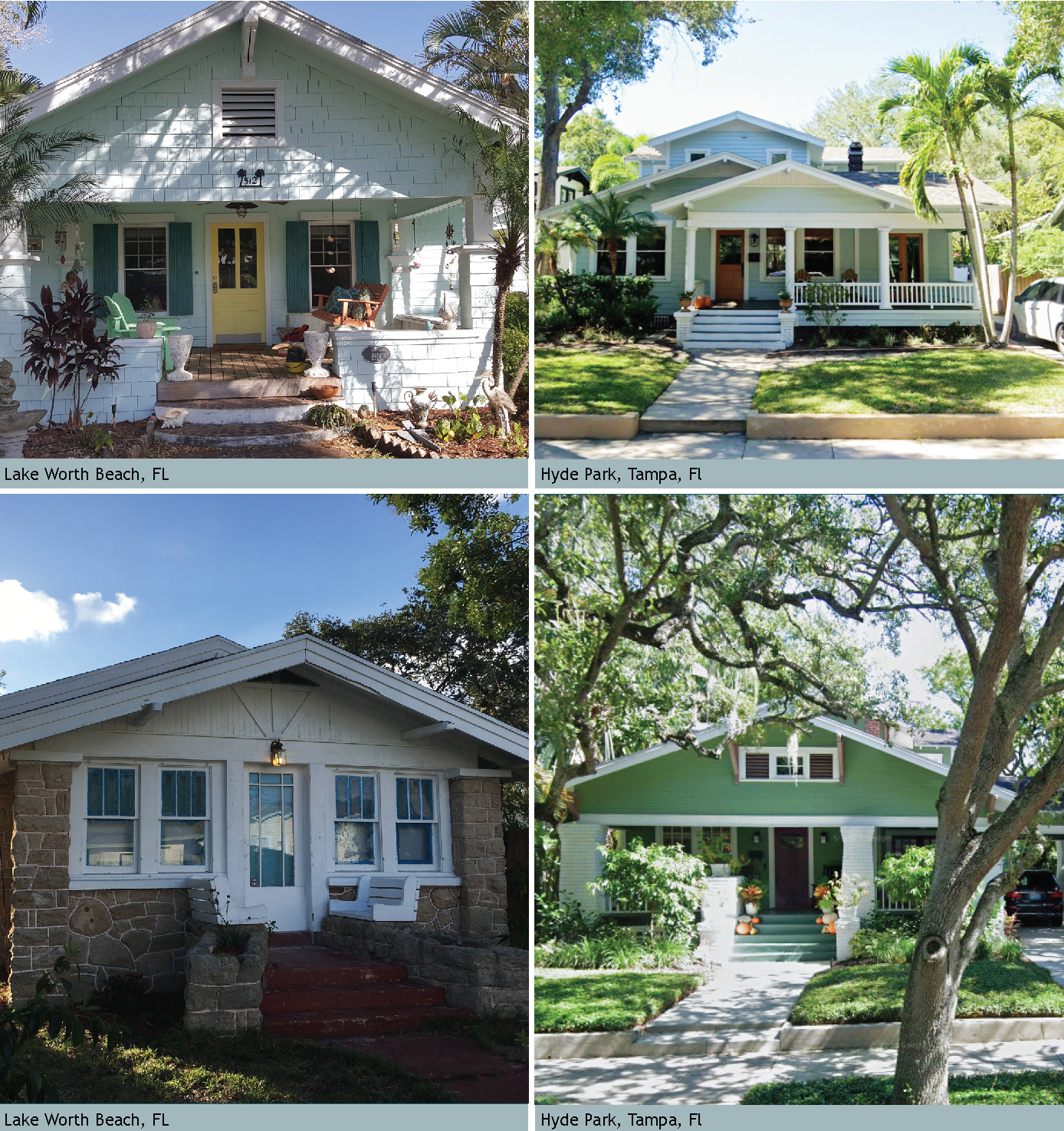
FIGURE 12.14-17 BUNGALOW: REQUIRED ELEMENTS OF THE STYLE DIAGRAM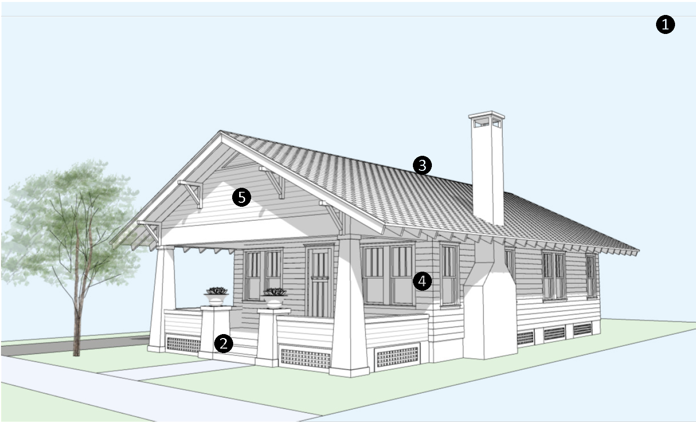
| REQUIRED ELEMENTS OF THE STYLE | |
|---|---|
| 1—Massing and height. The Bungalow house is eclectic in its origins and detailing. The building maintains a low profile. It is moderate in size yet delivers a prominent street presence with its porches and detailing. | |
|
2—Frontage Type.
i. Stoop or porch frontage type shall be used. See Figure 12-7.04 and 12-7.06. ii. The porch, when it is the full width of the house, can share the roof of the principal building. iii. Vertical support members shall be tapered, square wooden posts or masonry piers. Rounded columns are prohibited. | |
|
3—Roof.
i. Roofs of the Bungalow shall be gabled, hip, or hip-on-gable (dutch gable) with shallow slopes of 3:12 to 8:12. Dormers are permitted. ii. Roofing materials shall be wood shingles or shakes, metal shingles, asphalt shingles, low- profile standing seam, or 5V crimp metal. iii. Overhangs shall be between 18" or greater. | |
|
4—Doors and Windows.
i. Windows and doors shall be square or vertically proportioned and double-hung, singlehung, or casement type. ii. Double and single-hung windows may have multiple divided lights within the top and bottom sashes. iii. Window and door surrounds shall be provided. | |
|
5—Exterior Materials and Finishes.
i. Finishes shall be siding, shingles, and/or stucco. Stucco may be smooth or textured. Variations of siding and/or shingles give the Bungalow its true craftsman aesthetic and shall be used. ii. Brackets, porch railings, balustrades and/or tapered columns shall be provided. | |
FIGURE 12.14-18 ENCOURAGED BUNGALOW FEATURES
(A minimum of three features are required for projects in the Core Subdistrict)
1—Wooden brackets at the gable's end.
2—Deep overhangs of two feet or more and exposed rafter tails and support joinery.
3—Masonry and stone used for a building's base, steps, and the pedestal for porch columns.
4—Operable shutters.
5—Attic Vent:
i. Wood framed or with fiber cement trim and placed on center beneath roof ridge.
ii. Embellished with louvers or other decorative features.
6—Chimney:
i. Masonry structure built with either a stone, brick, or stucco finish.
ii. Tapered chimney that flares at the bottom of the home and shares the same material as the foundation.
IMAGES OF BUNGALOW DETAIL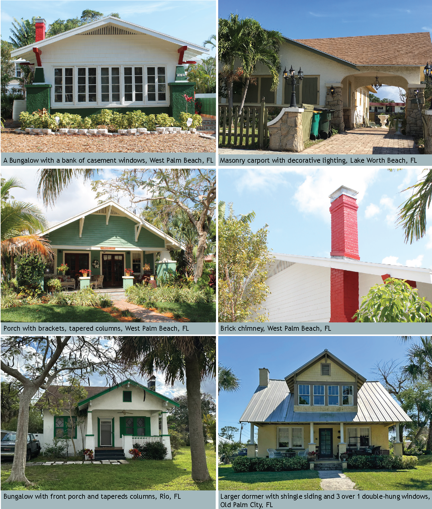
e.
Art Deco. The Art Deco style typically emphasizes verticality while Streamline Moderne places emphasis on the building's horizontality. In Florida, Art Deco was most often used on apartment buildings, hotels, and commercial buildings. The use of this style on residential homes was less frequent. The style may pay tribute to the local tropical setting with designs featuring pelicans, palm trees, flamingos, and nautical motifs and elements. Representative images, required elements, and recommended features follow:
FIGURE 12.14-20 ART DECO IMAGE MATRIX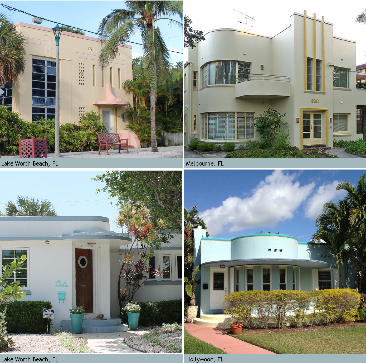
FIGURE 12.14-20 ART DECO: REQUIRED ELEMENTS OF THE STYLE DIAGRAM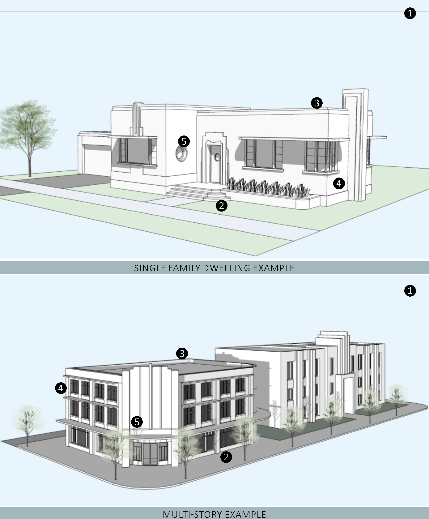
| REQUIRED ELEMENTS OF THE STYLE | |
|---|---|
| 1—Massing and height. The massing and composition is simple with an emphasis on the appearance of the building thrusting skyward, with architectural elements, towers, and other vertical projections accentuating the top of the building. | |
| 2—Frontage Type. A stoop, storefront, or forecourt frontage type shall be used. See Figure 12-7.01, 12-7.05, and 12-7.06. | |
|
3-Roof.
i. Roof shall be flat with parapets. Parapets are embellished with decorative stucco reliefs, banding, and bas-relief ornamentation. ii. Deep "eyebrow" overhangs, minimum 16" deep, shall be placed over some or all openings. | |
|
4—Doors and Windows.
i. Doors are ornamented around entrances, windows are ornamented with abstract, angular or floral ornaments or eyebrows. ii. Doors have geometric patterns in the shape of portholes, contain horizontal lights, or designed with asymmetrical lights. iii. Windows shall be casement, awning, fixed, or sliding. Glass block and round porthole windows are used as accent windows. iv. Windows shall have square or horizontal lights. v. Windows shall be vertical, square, or horizontal in their proportion. vi. Windows shall not be installed on the same plane as the exterior walls. Openings for doors and windows shall cast shadows and give the impression of thickness and solidity. vii. Art Deco windows rarely have any detailed window surrounds or sills. They are in "punched" or simple, non-articulated openings. Occasionally, brick or cast sills are used. Shutters are not permitted. | |
|
5—Exterior Materials and Finishes.
i. Walls shall be finished with smooth stucco. Metal accents are occasionally used. ii. Facades shall include a decorative motif, such as zig-zag, botanical, floral, chevron, sunburst, scalloped fluting, or vertical or horizontal banding. iii. Details shall emphasize horizontal and vertical lines. | |
FIGURE 12.14-21 ENCOURAGED ART DECO FEATURES
(A minimum of three features are required for projects in the Core Subdistrict)
1—Chimneys shall be masonry built with either a stone, brick, or stucco finish. Vertical stripes or horizontal lines near the top are common.
2—Ground or upper floor terraces use masonry walls or horizontal tube railings.
3—Metal or cast concrete detailing or finishes.
4—Windows placed at the corners of buildings.
5—Nautical design motif.
6—Vertical fluting as part of the elevation.
7—Exposed stone finishes used as the primary building material, to highlight architectural features such as doorway entrances, and for garden walls.
CONTINUATION OF FIGURE 12.14-21
IMAGES OF ART DECO DETAILS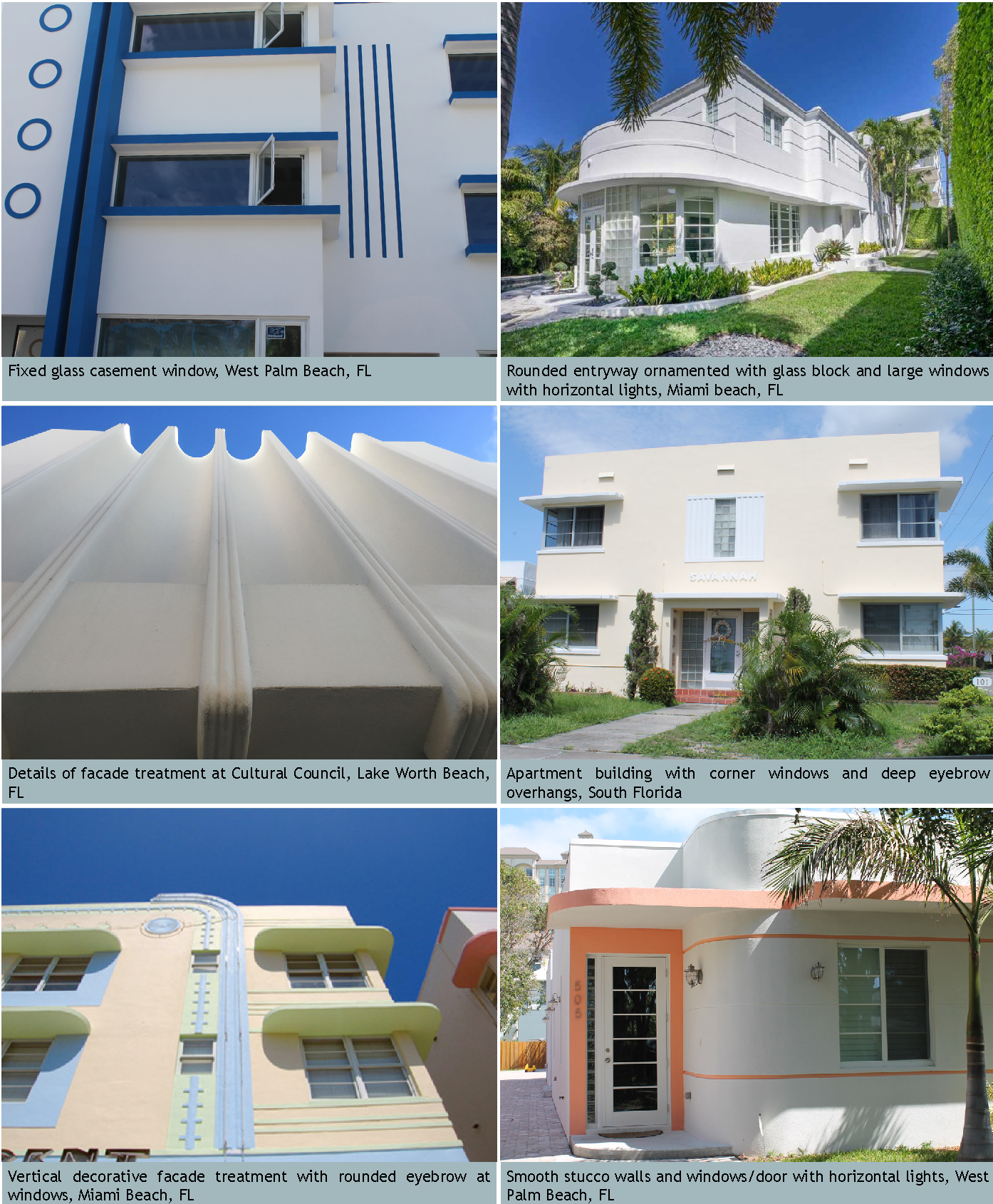
f.
Mid-century Modern. Mid-century Modern became the predominate style in the post WWII era where architects and builders experimented with angled roof lines, new materials, and asymmetry were explored. The influence of aerodynamics impacted building design. The Sarasota Modern and Tropical Modern are examples of Mid-century Modern design adapted to the Florida climate. Representative images, required elements, and recommended features follow:
FIGURE 12.14-23 MID-CENTURY MODERN: IMAGE MATRIX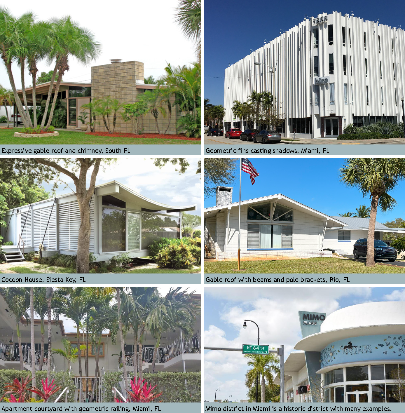
FIGURE 12.14-24 MID-CENTURY MODERN: REQUIRED ELEMENTS OF THE STYLE DIAGRAM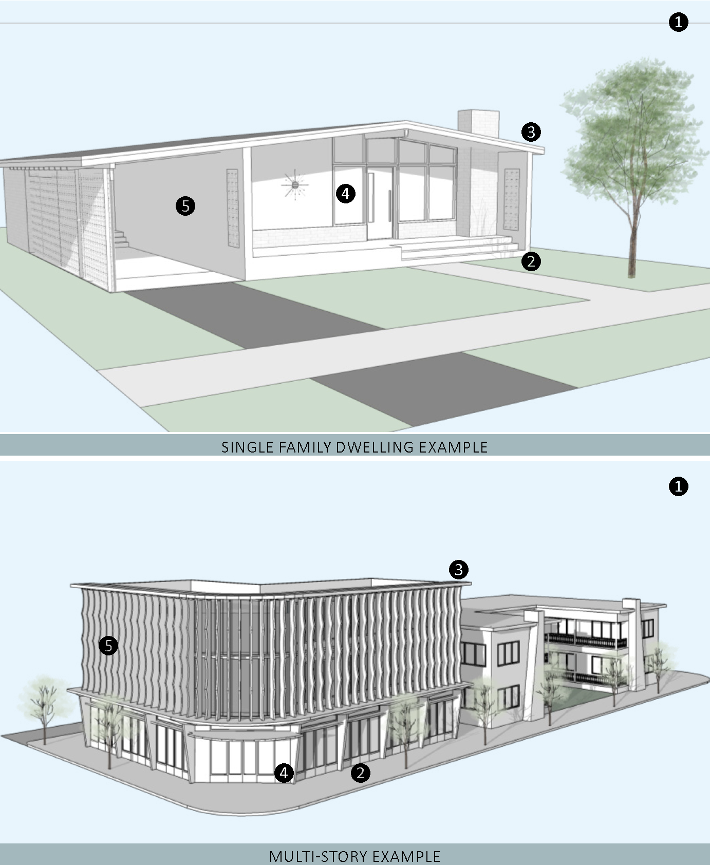
CONTINUATION OF FIGURE 12.14-23
| REQUIRED ELEMENTS OF THE STYLE | |
|---|---|
| 1—Massing and height. Mid-Century Modern single family dwellings are typically 1 to 2 stories and are horizontally proportioned. Multi-family, commercial, and mixed-use applications can be taller consistent with the Subdistrict regulations. | |
|
2—Frontage Type.
i. The porch or stoop frontage type shall be used. See Figure 12-7.04 and 12-7.05 for dimensional criteria. For porches, the minimum width can be reduced to 20' wide in lieu of the full 40% of the front facade when the primary facade exceeds 50' wide. ii. Columns shall be pipe columns, masonry, or poured concrete columns. | |
|
3—Roof.
i. Roofs shall be asymmetrical gable roofs, shed roofs, butterfly, and/or include flat roof parapet or overhanging flat roofs. ii. Where gable ends exist, the gable end of a structure shall face the street. | |
|
4—Doors and Windows.
i. Clerestory windows, ribbon windows, or large picture windows are very common. Windows shall be casement, awning, sliding, fixed or a combination. ii. Windows shall be vertical, square or horizontal in proportion, but have square or horizontal lights. iii. Doors are flush with raised panels, or asymmetrical fixed single or horizontal 3, 4, or 5 lights. | |
|
5—Exterior Materials and Finishes.
i. Smooth stucco, brick facing, wood, fiber cement, or a combination of those are all acceptable finishes. Textured stucco is prohibited. ii. Punched block or breeze block are incorporated into carports, porches, or other details. | |
FIGURE 12.14-24 ENCOURAGED MID-CENTURY MODERN FEATURES
(A minimum of three features are required for projects in the Core Subdistrict)
1—Masonry built wide chimney with either a stone, brick, or stucco finish on the front elevation.
2—Decorative iron railing with geometric patterns.
3—Brise soleil and louvers to diffuse the intense Florida sun.
4—Butterfly roof.
5—Large expanses of fixed glass windows around the primary entrance.
6—"V" shaped pipe or poured concrete columns.
7—Projected sills, eyebrows, or window surrounds running the length of the facade.
CONTINUATION OF FIGURE 12.14-24
IMAGES OF MID-CENTURY MODERN DETAILS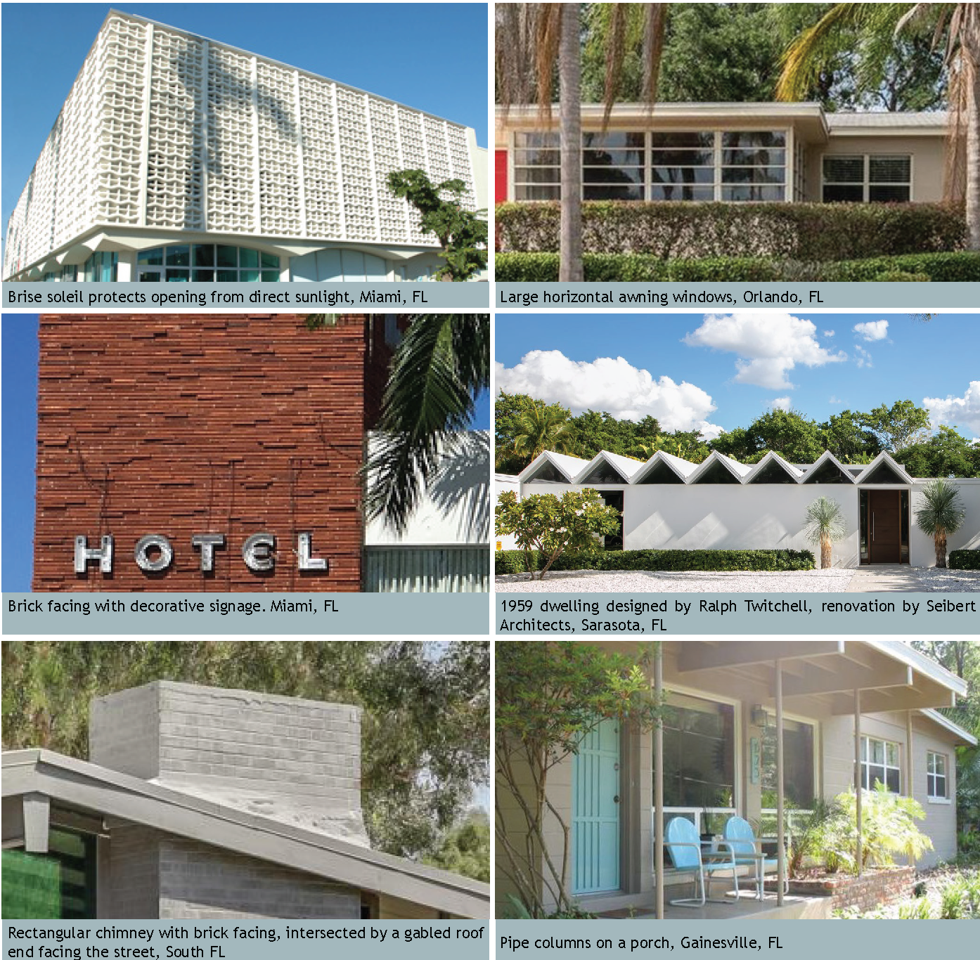
g.
Mission. The Mission style grew in popularity as ideas from the American west were brought east through the Columbian Exposition and the expansion of the transcontinental railroad at the beginning of the turn of the 20th century. In Florida, it became a very popular style especially in neighborhoods of the 1920s. The ability to maintain its style with a variety of massing makes it a very popular choice for apartment buildings as well as private residences. Representative images, required elements, and recommended features follow:
FIGURE 12.14-25 IMAGE EXAMPLES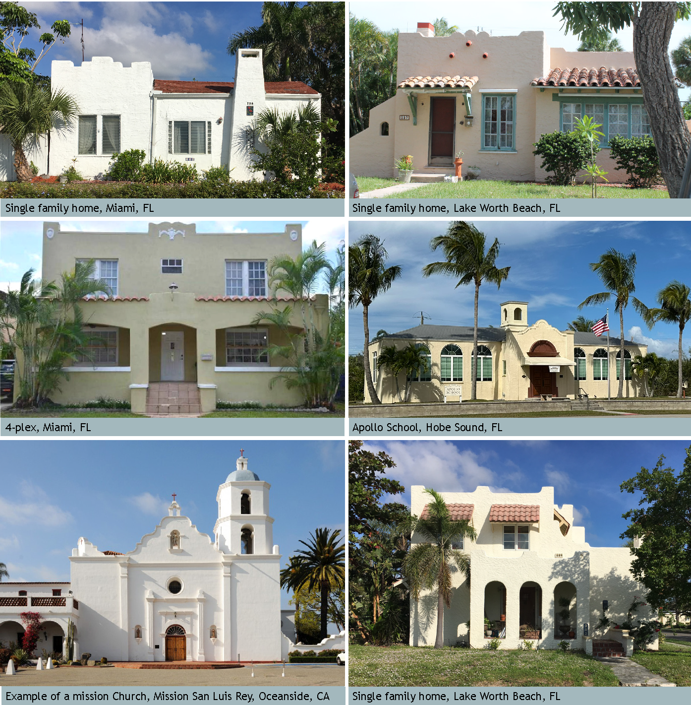
FIGURE 12.14-26 MISSION: REQUIRED ELEMENTS OF THE STYLE DIAGRAM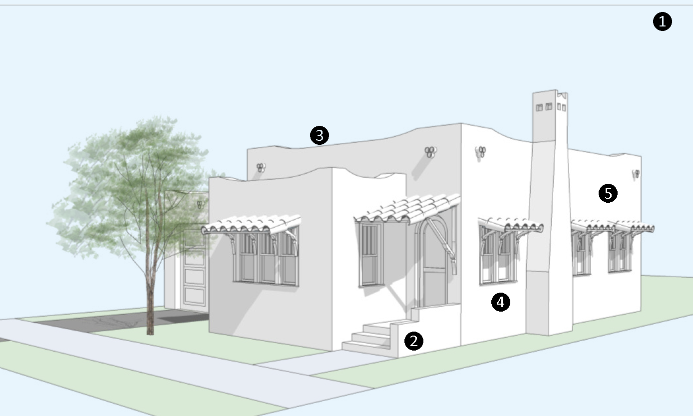
| REQUIRED ELEMENTS OF THE STYLE | |
|---|---|
| 1—Massing and height. Mission style single family dwellings are 1 or 2 stories whereby multifamily or mixed-use structures may be taller consistent with the Subdistrict regulations. Mission style structures have variations in their massing often emphasizing the front entrance. | |
|
2—Frontage Type.
i. Stoop, porch, or bracketed balcony frontage type shall be used. See Figure 12-7.03, 12-7.04, and 12-7.05 for criteria. ii. Where front porches occur, they shall be supported by thick square piers or feature arches, or a smaller stepped version of the main house parapet. | |
|
3—Roof.
i. Roofs shall be flat and surrounded by a parapet, which is undulated, curvilinear, or articulated and includes decorative elements. Roofs may include portions of pitched roofs or shed roofs, overhangs with clay barrel tile, low profile metal roofs, or asphalt shingle. ii. Scuppers at the base of a parapet for drainage shall include ornamental detailing and be aesthetically placed. | |
|
4—Doors and Windows.
i. Doors shall be panel or plank with multiple lights (divided window). Doors may be arched or rectangular. ii. Windows shall be double-hung, single-hung, or casement. Divided lights may occur in the top sash in single or double-hung windows while the bottom sash has no divisions. iii. Windows shall be vertical or square in their proportions. Window groupings of two or three are common. iv. Windows shall have sills and trim surrounds. | |
| 5—Exterior Materials and Finishes. The primary surface treatment shall be smooth or medium to rough textured stucco and may include stone and stucco accents. | |
FIGURE 12.14-27 ENCOURAGED MISSION FEATURES
(A minimum of three features are required for projects in the Core Subdistrict)
1—Masonry built or stucco chimneys with decorative chimney caps.
2—Parapets with simple moldings or barrel tile caps.
3—Parapets featuring a single row of sloped roofing tile between the taller, curvilinear portions.
4—Simple applied swags, crests, or medallions.
5—Clay tile scuppers at base of parapet for drainage off of flat roof.
6—Ornamental banding.
7—Rusticated doors with heavy metal hinges.
IMAGES OF MISSION DETAILS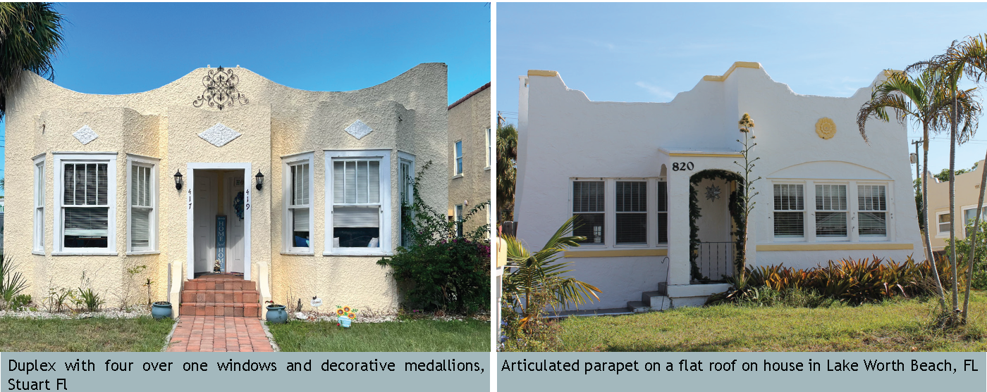
h.
Ranch. The popularity of the Ranch style spans from 1950 to the mid 1970s when many homes in Martin County were constructed. The Ranch home is characterized by engaging the outdoors through the use of large windows, courtyards, and patios. The Ranch house is elongated and horizontal in its proportions. Representative images, required elements, and recommended features follow:
FIGURE 2.14-28: RANCH IMAGES MATRIX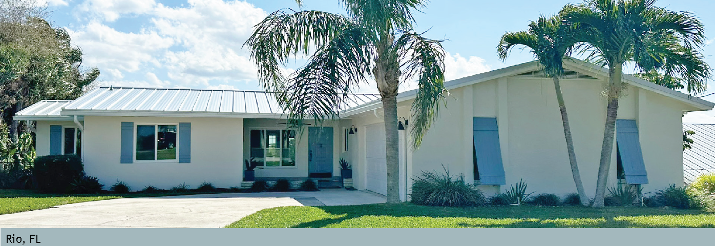
FIGURE 12.14-29 RANCH: REQUIRED ELEMENTS OF THE STYLE DIAGRAM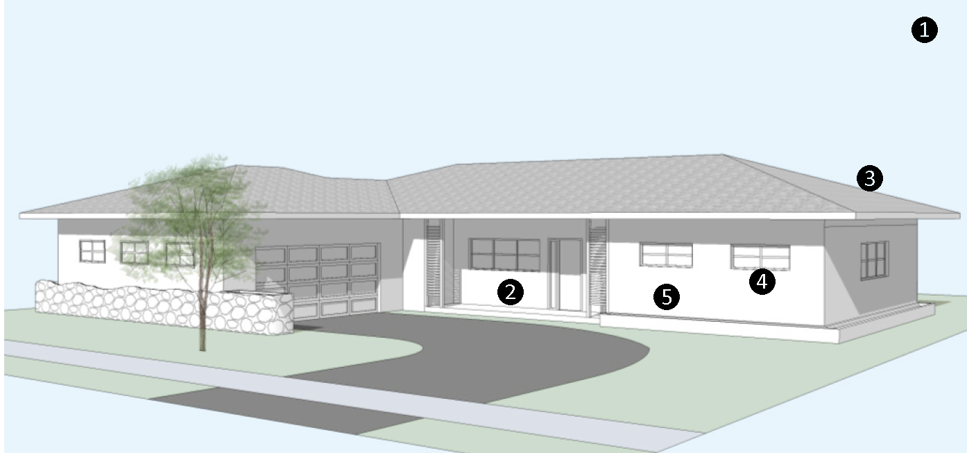
| REQUIRED ELEMENTS OF THE STYLE | |
|---|---|
| l—Massing and height. The plan of a ranch house is rambling, long and linear, and is organized horizontally. The plan is generally asymmetrical. | |
|
2—Frontage Type.
i. Porch frontage, Figure 12-7.04, shall be used. The minimum width can be reduced to 20' wide in lieu of the full 40% of the front facade when the primary facade exceeds 50' wide. ii. Posts shall include geometric detailing, wrought iron, or metal decorative supports. | |
|
3—Roof.
i. Low-pitched roof of 3:12 or 4:12, but may include portions of a flat roof. ii. Gable, hip, dutch gable, and intersecting overlaid hip are permitted roof shapes. iii. Overhangs shall be deep (24" or greater) and shade windows and walls. iv. Permitted materials include white flat cement tiles, asphalt shingle, 5v metal crimp, or low profile metal standing seam. | |
|
4—Doors and Windows.
i. Doors shall be multi-panel, full light panel, horizontal 4 or 5 light, or flush with asymmetrical fixed lights. ii. Windows shall be awning, casement, fixed pane picture windows, sliding or a combination. Individual windows may be horizontal, square or vertical, but shall be horizontal in composition or grouping when square or vertical. iii. Windows shall include minimal sill detail in masonry or brick. | |
| 5—Exterior Materials and Finishes. Smooth or fine sand finished stucco, clapboard, board and batten, brick veneer, or other natural materials such as stone or wood are permitted as accents and primary finishes. Textured stucco is prohibited. | |
FIGURE 12.14-30 ENCOURAGED RANCH FEATURES
(A minimum of three features are required for projects in the Core Subdistrict)
1—L-shaped or U-shaped house plan around an outdoor patio or courtyard.
2—Primary entrance with an oversized or double doors.
3—Chimneys with rectangular proportions.
4—Operable shutters.
5—Horizontal masonry or brick planters along the structure.
6—Decorative front door with geometric glass panes or carvings.
7—Ridge vents or mini-gables on the crown the roof.
IMAGE OF RANCH DETAILS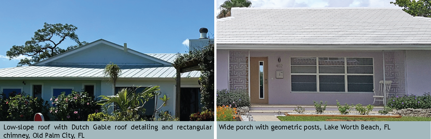
i.
Main Street Vernacular. The Main Street Vernacular is a style of the traditional commercial and mixed-use buildings that has shaped successful main streets throughout the region since the 1900s. Storefronts line the sidewalk and promote commercial activity. The buildings are structurally simple, comprised of a bay or series of bays and openings (windows and doors) that are aligned. Representative images, required elements, and recommended features follow:
FIGURE 12.14-31: MAIN STREET VERNACULAR IMAGE MATRIX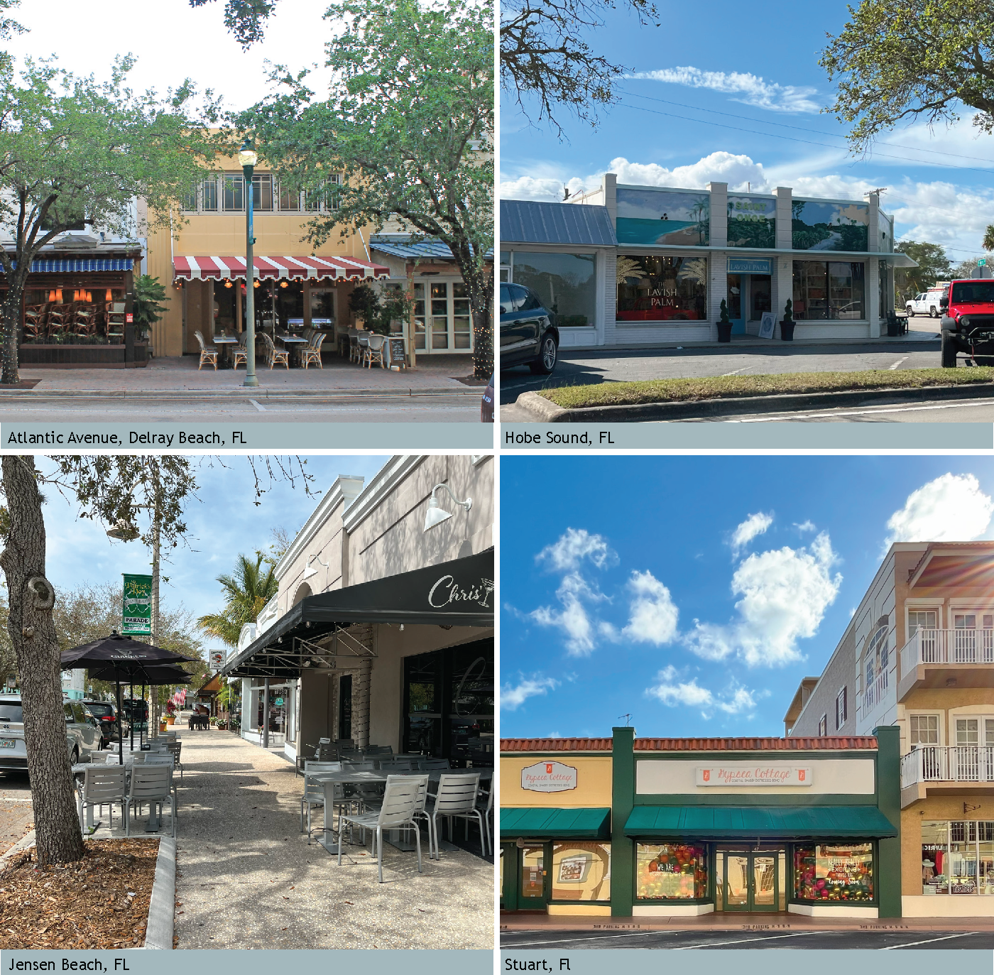
FIGURE 12.14-32 MAIN STREET VERNACULAR: REQUIRED ELEMENTS OF THE STYLE DIAGRAM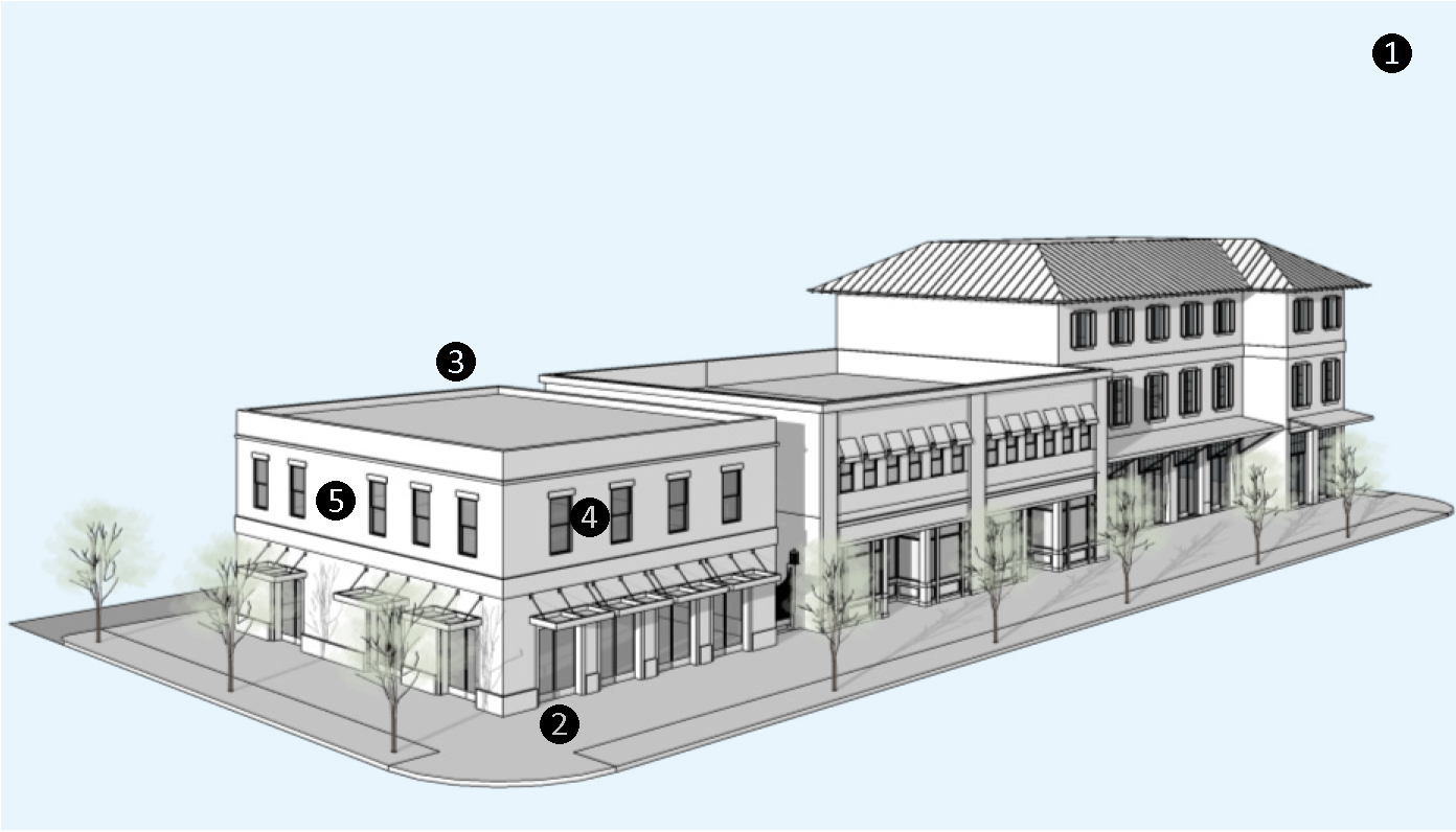
| REQUIRED ELEMENTS OF THE STYLE | |
|---|---|
| 1—Massing and height. The composition of the building is simple, usually a single bay or series of vertically-proportioned bays containing storefronts at the sidewalk. | |
|
2—Frontage Type.
i. A storefront frontage type is required, see Figure 12-7.01. ii. A series of French glass doors, operable glass wall system, or overhead glass doors which open to the sidewalk are permitted alternatives to a traditional storefront. | |
| 3—Roof. Roofs of the primary structure shall be flat with parapets. Parapet may be pitched to give the appearance of a pitched roof. | |
| 4—Doors and Windows. Openings shall be square or vertically proportioned with simple sills and surrounds. Upper story windows shall be double-hung, single-hung, or casement. | |
|
5—Exterior Materials and Finishes.
i. Exterior finishes shall be smooth or textured stucco, stone, or brick, and may include accent materials. ii. A cornice line shall be located between the first and second stories and along the parapet. If other ornamentation is incorporated, it is expressed in the parapet, between window bays, or around entries and may be classical in nature or reflective of native flora or fauna. | |
FIGURE 12.14-33 ENCOURAGED FEATURES OF MAIN STREET VERNACULAR
(A minimum of three features are required for projects in the Core Subdistrict)
1—Upper story balconies.
2—Cantilevered overhangs or attached awnings.
3—Arcades.
4—Operable shutters or awnings on upper story windows.
5—Gooseneck lights for signage.
6—Signage band.
IMAGES OF MAIN STREET VERNACULAR DETAILS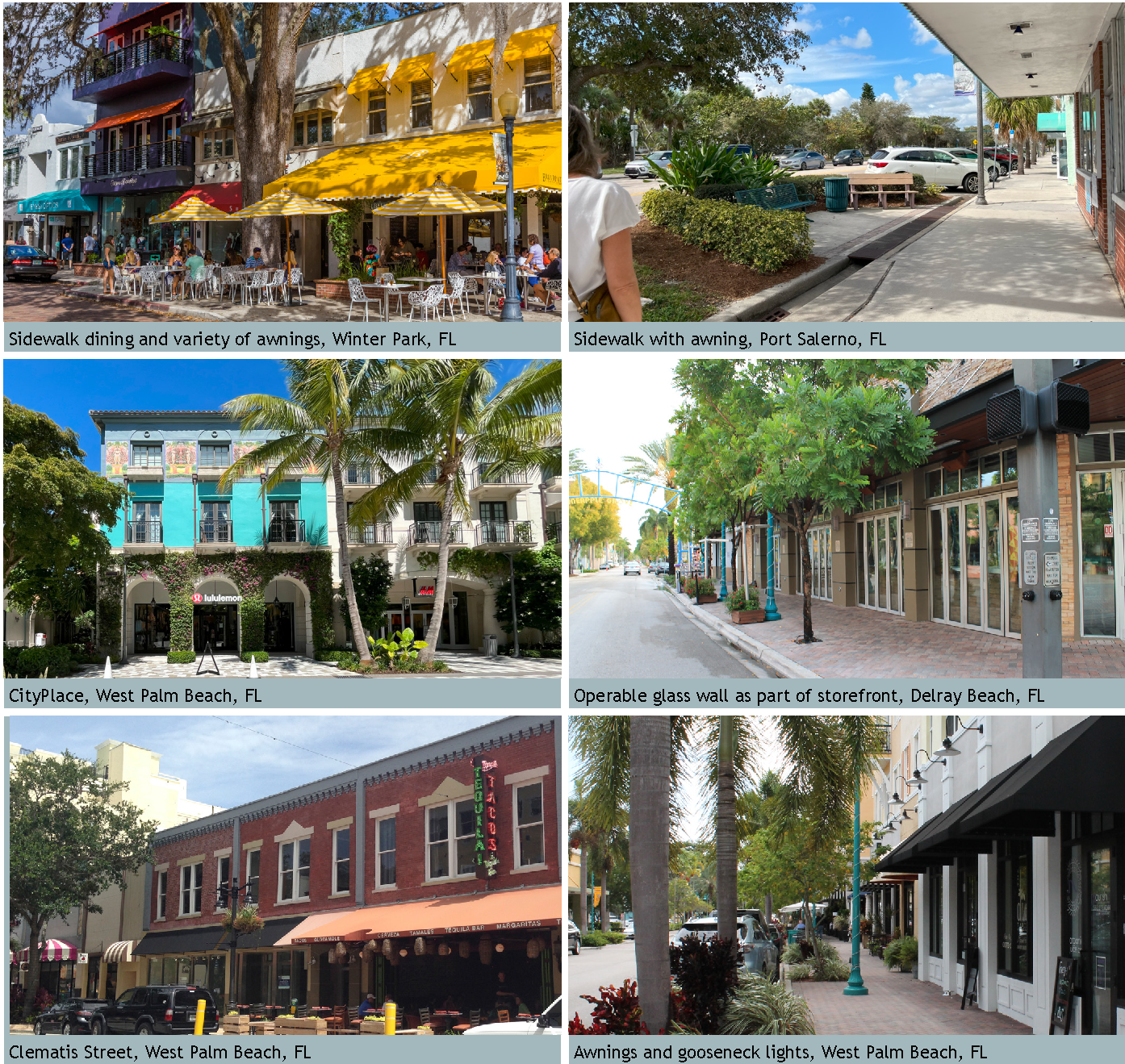
j.
Classical Traditional. Classical architecture can be defined as the architecture of ancient Greece and Rome and its later expression though the Renaissance. Classicism uses a specific vocabulary and syntax, which provides a detailed design framework. Books written about Classical architecture by architects such as Vitruvius, Alberti, Serlio, and Palladio remain relevant today and should be referenced when designing a Classical building. The style may include Greek Revival, Colonial Revival, Georgian, Italianate, and Federal. Representative images, required elements, and recommended features follow:
FIGURE 12.14-34: CLASSICAL TRADITIONAL: IMAGE EXAMPLES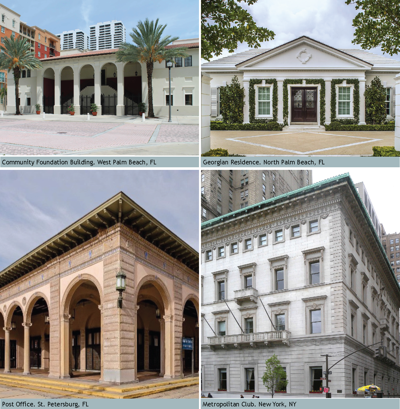
FIGURE 12.14-35 CLASSICAL TRADITIONAL: REQUIRED ELEMENTS OF THE STYLE DIAGRAM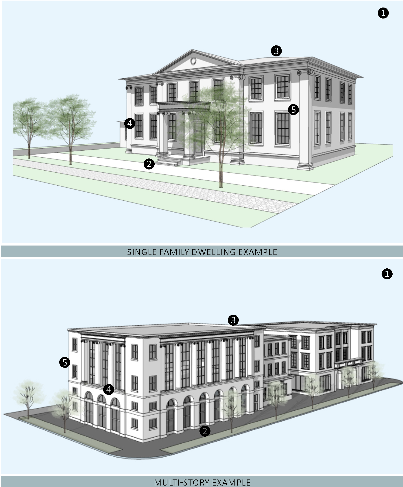
CONTINUATION OF FIGURE 12.14-35
| REQUIRED ELEMENTS OF THE STYLE | |
|---|---|
|
1—Massing and height. Building in the classical tradition today is a direct translation
of the cannons of the classical orders. Pedestals, columns, and entablatures categorically
related to the Tuscan, Doric, Ionic, Corinthian, and Composite orders.
i. Classicism is an architecture that expresses weight and compression, therefore the corners are wide to reflect solidity of the structure. Columns support the weight of beams and brackets support cantilevers. ii. The elements of a Classical building are arranged in a rational, symmetrical manner with careful attention to proportions. The facade has a base, middle, and top clearly evident on the facade. Bay spacing for windows, colonnades, and arcades are vertical in proportion. Entrances are typically in the center of the facade in an area with an odd number of bays, or even number of columns, so that the entrance is on axis, welcoming, and not blocked by a column. Windows and doors line up vertically in the facade and reflect a clear path for structural loads to the ground. | |
| 2—Frontage Type. A frontage type specified in Sec. 12.1.05 shall be used. Columns if present shall follow classical canons, i.e. the orders Tuscan, Doric, Ionic, Corinthian, Composite. | |
|
3—Roof.
i. Roofs of the primary structure shall be hipped, gabled, or a combination of both. Flat roofs with parapet are acceptable for commercial structures. ii. Roof slopes shall be shallow and are sloped between 3:12 and 6:12, unless following Greek Revival or Georgian Style can be as steep as 10:12. iii. Shingle, barrel tile, Spanish "S" tile, or flat concrete tiles are permitted roofing materials. iv. Exposed gutters shall be half-round with metal finish. | |
|
4—Doors and Windows.
i. Windows and doors shall be vertical and/or square proportions with the occasional round, oval, or ornamental window. Windows include divided lights. Divided light patterns of 9 over 6, or 6 over 6 are typical, but there can be variation. ii. Windows shall not be installed on the same plane as the exterior walls. Openings for doors and windows shall cast shadows and give the impression of thickness and solidity. iii. Windows shall be double-hung, single hung, or casement. Window and door architraves, when they exist, are made of wood or stone. | |
|
5—Exterior Materials and Finishes.
i. Exterior finishes shall be brick, stone, smooth faced pre-cast concrete, or clapboard in wood, or fiber cement. Smooth stucco is permitted. | |
FIGURE 12.14-36 ENCOURAGED CLASSICAL TRADITIONAL FEATURES
(A minimum of three features are required for projects in the Core Subdistrict)
1—Attached porches and balconies.
2—Loggias located within the volume of buildings, serving as covered outdoor circulation between rooms.
3—Dentil molding and cornices
4—Semi-circular or elliptical fanlights that adorn a primary entrance.
5—Operable shutters along with shutter stays.
6—Gabled portico with columns.
IMAGES OF CLASSICAL TRADITIONAL DETAILS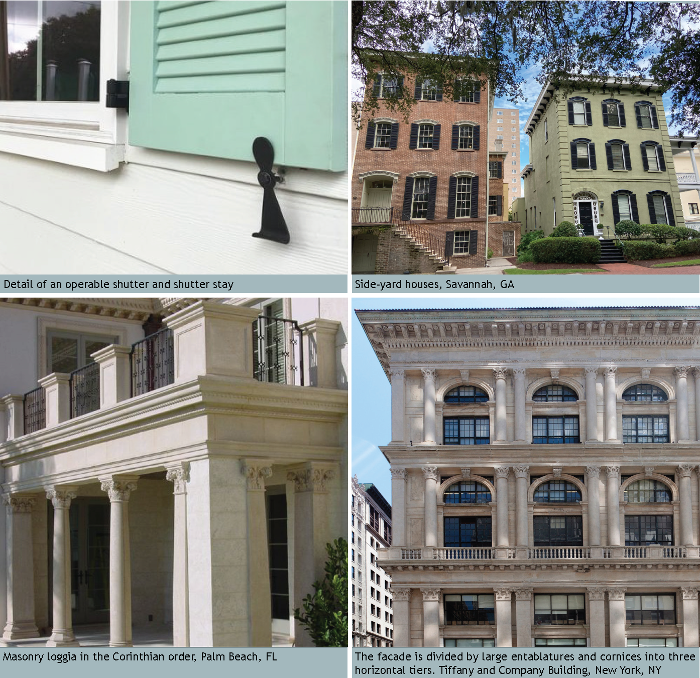
k.
Contemporary. Contemporary architecture is of the current time and does not have the benefit of historical distance to define its character. It draws inspiration from previous styles, utilizes modern materials, and is reflective of the climate and context. Contemporary architecture is an opportunity to use new materials, technology, and improve energy efficiency. It is not to be confused with simply the lack of ornamentation or the use of poor quality materials. Materials are of high quality and details are carefully considered. Representative images, required elements, and recommended features follow:
FIGURE 12.14-37: CONTEMPORARY IMAGES MATRIX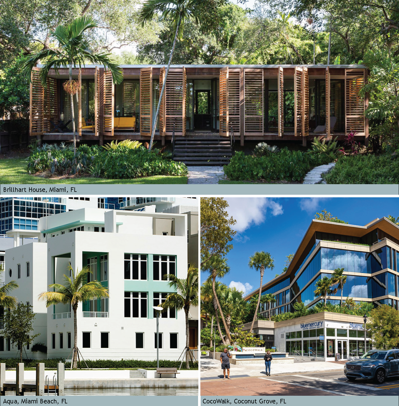
FIGURE 12.14-38 CONTEMPORARY REQUIRED ELEMENTS OF THE STYLE DIAGRAM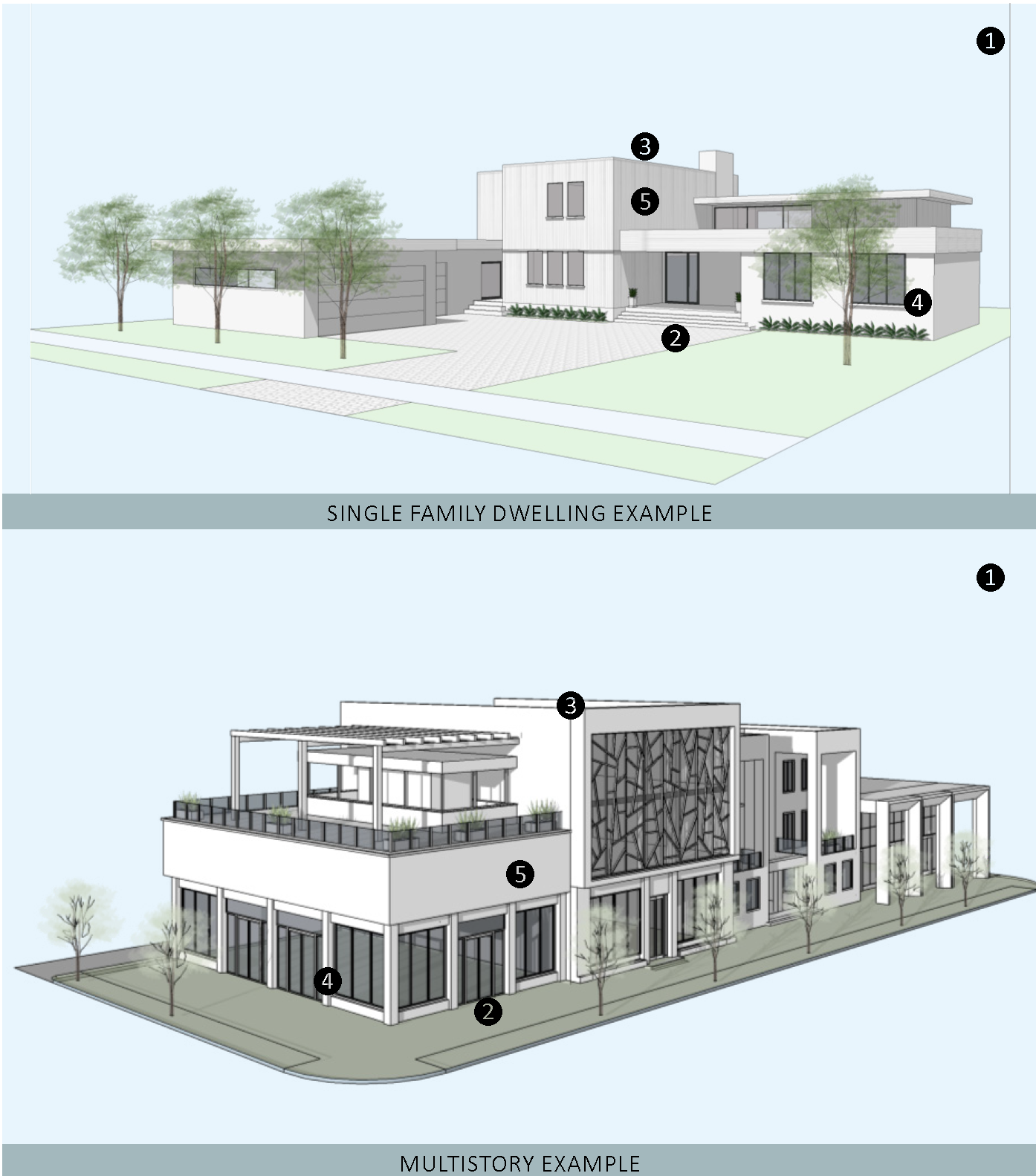
CONTINUATION OF FIGURE 12.14-38
| REQUIRED ELEMENTS OF THE STYLE | |
|---|---|
| 1—Massing and height. Contemporary architecture emphasizes the solidity of the mass or the lightness of materials. The geometry of the building appears to be carved from a solid volume while often lighter elements may bisect or intersect the mass. | |
| 2—Frontage Type. A frontage type defined in 12.1.05 shall be used. | |
| 3—Roof. Roofs can take a variety of forms. A broad range of roofing materials are used in contemporary architecture. Roofs shall meet minimum Energy Star ratings. | |
|
4—Doors and Windows.
i. In masonry construction, windows shall not be installed on the same plane as the exterior walls. Openings for doors and windows shall cast shadows and give the impression of thickness and solidity. ii. Window types shall be casement, awning, sliding, fixed-pane with transom openings, or operable glass wall systems. Single or double-hung are less common, but are permitted. iii. Windows and doors shall meet minimum Energy Star ratings. | |
| 5—Exterior Materials and Finishes. Smooth stucco, brick facing, stone, architectural concrete, wood, fiber cement, or a combination of these are all acceptable finishes. Textured stucco is prohibited. | |
FIGURE 12.14-39 ENCOURAGED CONTEMPORARY FEATURES
(A minimum of three features are required for projects in the Core Subdistrict)
1—A color palette comprised primarily of whites and creams with sea greens and blues highlighting details.
2—Darker hues to highlight the bases of buildings, or emphasize deeper recesses of porches or loggias.
3—Green building infrastructure or design to improve energy efficiency.
4—Flat roofs utilized for terraces.
5—Stairway access embellished and sculptural in nature.
6—Natural local materials for exterior finishes.
7—The structural system of the building clearly expressed in the building's exterior.
8—Oversized windows.
9—Oversized entry doors.
10—Pivot door hardware on entry doors.
IMAGES OF CONTEMPORARY DETAILS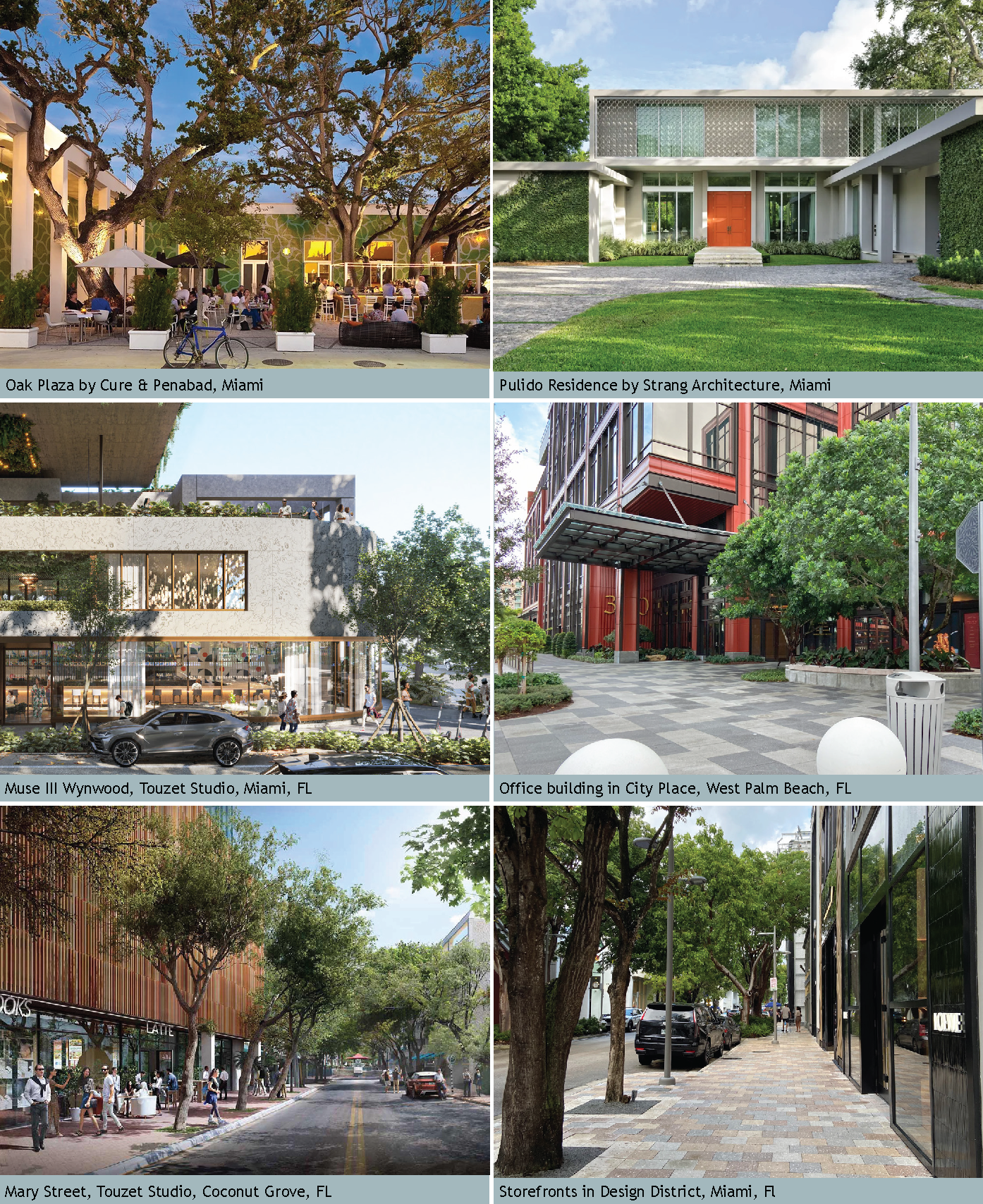
(Ord. No. 1237, pt. II(Exh. 1), 1-26-2025)
Editor's note— Ord. No. 1237, pt. II(Exh. A), adopted January 26, 2025, renumbered §§ 12.1.12—12.1.14 as §§ 12.1.13—12.1.15.
Sec. 12.1.13. - Applicability.
1.
All new development, substantial improvements of a building, and substantial renovations of a building exterior shall comply with Article 12.
2.
Existing Buildings. Whenever substantial improvement of a building or substantial renovation of a building exterior triggers the obligation to comply with Article 12, the Growth Management Director may authorize incremental compliance with its requirements proportional to the nature and scope of the existing and proposed improvements if full compliance would be unreasonable. An application for alternative compliance shall not be required, but the Growth Management Director may require that the proposal be presented to the Neighborhood Advisory Committee for review and comment. See Section 4.871.B, Div. 20, Article 4.
3.
Nonconforming uses, structures, and lots. All legally permitted uses, structures, and lots that are existing on the effective date of Article 12 that do not comply with Article 12 shall comply with Article 8, Nonconformities. Additionally, an existing structure in a special flood hazard area that does not comply with the base flood elevation requirements in Article 4, Div. 10. may be subject to Division 10 restrictions on substantial improvements to the structure.
4.
Alternative compliance. An applicant for development approval may propose a site, landscape, or architectural plan that varies from the requirements of Article 12 in order to accommodate unique circumstances of the proposed development site or to propose a different but comparable design solution. Such alternative plan may include offers by the applicant to mitigate or offset the impacts of the alternative design. Such alternative plan may be approved only upon a finding by the Growth Management Director that the alternative plan fulfills the purpose and intent of Article 12 as well as, or more effectively than, adherence to the strict requirements of Article 12 and/or would help carry out specific goals or objectives outlined in the particular CRA plan. Prior to the decision, the Growth Management Director may request a recommendation from the Neighborhood Advisory Committee for that Redevelopment Zoning District. The Growth Management Director shall keep a record of all such determinations. The alternative compliance process shall not be used to increase the height of buildings or to reduce the required on-site parking requirements beyond the limits provided in Article 12. Appropriate justifications for approving alternative plans include, but are not limited to:
a.
The resolution of site constraints associated with the incorporation of new buildings and structures on sites developed prior to the adoption of Article 12 or the expansion of existing buildings and structures.
b.
The utilization of existing site characteristics, such as historical or archaeological features, topography, scenic views or native vegetation.
c.
Improve or provide integration of proposed development with the surrounding off-site development.
d.
The preservation of the historical or archaeological features of the area.
e.
Accepting a design solution that is comparable to, but different from a standard in Article 12.
(Ord. No. 1111, pt. II, 9-24-2019; Ord. No. 1159, pt. 1(Exh. A), 5-11-2021; Ord. No. 1196, pt. I(Exh. A), 5-9-2023; Ord. No. 1237, pt. II(Exh. 1), 1-26-2025)
Editor's note— See editor's note, § 12.1.12.
Sec. 12.1.14. - Review process.
1.
Article 10, Development Review Procedures, LDR, Martin County Code has special provisions that apply to development applications within CRAs:
a.
Development application within the CRA means a request for development approval for land within one of the designated CRAs within unincorporated Martin County as defined in Section 10.1.B, Article 10.
b.
Within a CRA, the construction or expansion of structures on a lawfully established lot, provided the lot is less than one-half acre shall be exempt from Sections 10.2 through 10.11 (site plan review) as specified in Section 10.1.D.2.s provided a pre-application meeting is held regarding the subject site.
c.
A pre-application meeting shall be mandatory where the site proposed for development is located within a CRA as specified in Section 10.5.C.2.m.
d.
Minor development applications for projects within a CRA area are eligible for expedited staff review as specified in Section 10.5.E.3.1.
e.
Development applications shall be presented to the Neighborhood Advisory Committee (NAC), as required in Section 10.5.F.10. The presentation shall be scheduled with CRA staff. A request for alternative compliance may require a second presentation to the NAC.
2.
Urban Development Standards. For new construction, demolition, and additions proposed in the Core, General, and Corridor Subdistricts the following standards shall apply:
a.
Provide Site Plan(s) & Elevation(s) which identify and provide dimensions for:
i.
Adjacent properties with existing and/or proposed structure(s) and dimension(s) from property line(s).
ii.
Adjacent sidewalk(s) and existing and/or proposed sidewalk connection(s).
ii.
All existing and/or proposed roof overhang(s).
(Ord. No. 1111, pt. II, 9-24-2019; Ord. No. 1159, pt. 1(Exh. A), 5-11-2021; Ord. No. 1213, pt. I(Exh. B), 12-12-2023; Ord. No. 1237, pt. II(Exh. 1), 1-26-2025)
Editor's note— See editor's note, § 12.1.12.
Sec. 12.1.15. - Glossary.
For purposes of this Article, the following words, terms and phrases shall have the meanings as set forth below:
1.
Additional definitions are found in these sections of the LDR:
a.
Sec. 3.3 Zoning District General Provisions
b.
Sec. 4.141 Wellfield Protection
c.
Sec. 4.31 Upland Protection
d.
Sec. 4.382 Stormwater Management
e.
Sec. 4.661 Landscaping Buffering and Tree Protection
f.
Sec. 4.73 Mangrove Protection
g.
Sec. 4.842 Roadways
h.
Sec. 7.3 Development Agreements
A
Accessory Dwelling Unit (ADU). Also referred to as accessory apartments, second units, or granny flats — are additional living quarters on single-family lots that are independent of the primary dwelling unit. The separate living space is equipped with kitchen and bathroom facilities, and can be either attached or detached from the main residence.
Agrihood. Agrihoods are neighborhoods organized with residential and agriculture food cultivation.
Alley. A service roadway that is designed to provide access to properties abutting another street and that is not intended for general traffic circulation.
Artisan, art studio, galleries. Artisan, art studios and galleries are the location of art production or art display. They may be private or open the public and may include retail sales.
Architrave. In the classical orders, the lowest member of the entablature; the beam that spans from column to column, resting directly upon their capitals.
B
Balcony. An open habitable portion of an upper floor extending beyond a building's exterior wall that is not supported from below by vertical columns or piers but is instead supported by either a cantilever or brackets. Also, an accessory area to a dwelling, with one or more sides permanently open to the exterior except for a railing or parapet not exceeding four feet in height.
Balustrade. An entire railing system, as along the edge of a balcony, including a top rail and its balusters, and sometimes a bottom rail.
Bas-relief. A carving, embossing, or casting moderately protruding from the background plane; low relief.
Bracket. Any overhanging member projecting from a wall or other body to support a weight acting outside the wall.
Brise soleil. A fixed or movable device, such as fins or louvers, designed to block the direct entrance of sun rays into a building.
Building Type. A structure defined by its configuration.
Block. A combination of private lots, alleys, and passages that are surrounded by existing or new streets or by wetlands, parks, or civic spaces.
Build-to-Zone (BTZ). The range of allowable distances from the front property line along which the principal vertical place of the building's primary façade shall be built in order to create a moderately uniform line of building along the street.
Building Coverage. The horizontal area measured from the building footprint of the roofed area of the ground floor of the principal and accessory structures on a lot.
C
Carport. A roofed area, typically open on at least two sides and attached to the principal structure which is used for the storage of one or more vehicles.
Civic Open Space. An outdoor area provided for the purpose of active or passive public recreation which may be fully impervious.
Clearstory window. Clearstory window is a window above eye-level. Its purpose is to admit light, fresh air, or both.
Cornice. The exterior trim of a structure at the meeting of the roof and wall: usually consists of bed molding, soffit facia, and crown molding.
Convenience store with fuel. An establishment that provides goods and services primarily to the motoring public such as fuel sales, car washing, or car detailing, and that may also sell merchandise including food and beverages. This definition applies to this Article only.
D
Day care, family. A residence in which child care is regularly provided for children from at least two unrelated families and receives a payment, fee, or grant for any of the children receiving care, whether or not operated for profit, as licensed by the State of Florida, pursuant to F.S. § 402.302(8) and complying with the statutory limits on the number of children receiving care.
Dormer. A structure projecting from sloping roof housing a window or ventilated louver.
Drive-through facility. An establishment that provides physical facilities which allow its customers or patrons to obtain food or goods, receive services, or be entertained while remaining in their motor vehicles. This definition applies to this Article only.
Dwelling, single-family detached. A dwelling unit that is not physically attached to any other dwelling by any means, which is surrounded by open space on all sides and which is the only dwelling unit on a lot other than an ADU in a CRA. This definition specifically excludes mobile homes. Two or more single-family detached dwelling units placed on a single lot shall be considered a duplex or multifamily dwelling use, depending on the number of dwelling units involved.
E
Entablature. In classical architecture, the elaborate beam member carried by the columns, horizontally divided into architrave (below), frieze, and cornice (above). The proportions and detailing are different for each order (i.e. Doric, Ionic, and Corinthian), and strictly prescribed.
Entrance, Principal. The main point of access of pedestrians into a building, facing a street or public space.
Expression Line. A horizontal line, expressed by a material change or by a continuous projection not less than two inches nor more than one foot deep.
F
Façade. The exterior wall of a building.
Façade Transparency. The amount of transparent window glass or other openings in the façade of a building, relative to the overall surface area of the façade.
Farmer's market. An establishment providing for the retail sale of agricultural products, primarily involving the sale of fresh produce, such as fruits and vegetables, but also including such products and services that are customarily provided in rural or agricultural areas.
Fenestration. The arrangement and design of windows in a building.
Form based code. Form based code is a land development regulation that fosters predictable built results and a high-quality public realm by using physical form (rather than full separation of uses) as the code's primary organizing principle.
Frontage Buildout. The percentage of the total width of a lot minus the required setbacks which must be occupied by the primary facade of a building. Frontage buildout requirements are established for each Building Type.
H
Heat Island. Heat islands are urbanized areas that experience higher temperatures than outlying areas. Structures such as buildings, roads, and other infrastructure absorb and re-emit the sun's heat more than natural landscapes such as forests and water bodies. Urban areas, where these structures are highly concentrated and greenery is limited, become "islands" of higher temperatures relative to outlying areas.
L
Live/Work Building. Live/Work Building is a building which is predominately residential in its character but contains commercial and residential uses.
M
Mixed-use project. One or more buildings containing a residential use and one or more complementary commercial, institutional, and limited impact industrial uses in close proximity and planned and approved as a single, unified project.
O
Open space. That portion of a development that is permeable and remains open and unobstructed from the ground to the sky, specifically excluding parking areas, whether permeable or impermeable.
P
Parisian balcony. A Parisian balcony, also known as a French balcony, Juliet balcony, or balconet, is composed of operable French doors or a sliding glass door with a railing fitted to the outside of the building. A Parisian balcony may include a narrow deck to step onto.
Parking lots and garages. A parking lot or structure operated as a principal use for the purpose of providing short-term parking of operable motor vehicles to support nearby land uses.
Paseo. A public walk, plaza or pedestrian streetscape.
Porte cocheres. A roofed structure extending from the entrance of a building sheltering an entry drive.
Primary Façade. The façade of a building that faces the street. In the case of a corner lot, it is the façade along the higher priority street.
Principal Building. The main building on a lot, usually located toward the Frontage.
R
Regulating Plan. A map or set of maps in a Redevelopment Zoning District that provide details about the existing and desired character of the district, including its streets, blocks, and civic spaces, and also provides other regulatory details. See Section 12.1.02.
Residential storage facility. A building or series of buildings designed and used for the rental of space for the storage of personal property but specifically excluding the rental of space for commercial or industrial warehousing. Outdoor storage of boats and recreational vehicles may be an accessory use.
S
Scupper. An opening in a wall or parapet that allows water to drain from a roof.
Shared Use Path. Shared use path is a multi-use trail or other path, physically separated from motorized vehicular traffic by an open space or barrier, either within a highway right-of-way or within an independent right-of-way, and usable for transportation purposes. Shared use paths may be used by pedestrians, bicyclists, skaters, equestrians, and other nonmotorized users.
Shutter stay. Shutter stays or shutter dogs are decorative and functional fasteners used to make a shutter stay open.
Small Site. Small Site is defined as development or expansion of existing uses on a lawful parcel, provided the parcel being developed is equal to or less than one-half acre.
U
Urban Agriculture. Urban farming or community gardens which promote local food production Livestock is prohibited. Private residential gardens are excluded and do not apply.
Use groups. Use groups combine individual uses described in the LDR into groups of uses with similar impacts. Use groups are used in Redevelopment Zoning Districts. Individual uses are defined in the glossary in Section 3.3, Div. 1, Article 3.
W
Working waterfront. The use of waterfront land for commercial fishing and related activities including fuel sales; marine manufacturing, repair, and storage facilities; public access including launching facilities, and compatible supporting uses. This definition applies in Redevelopment Zoning Districts.
(Ord. No. 1111, pt. II, 9-24-2019; Ord. No. 1159, pt. 1(Exh. A), 5-11-2021; Ord. No. 1213, pt. I(Exh. B), 12-12-2023; Ord. No. 1215, pt. II, 12-12-2023; Ord. No. 1237, pt. II(Exh. 1), 1-26-2025; Ord. No. 1237, Pt. I(Exh. 1), 1-28-2025)
Editor's note— See editor's note, § 12.1.12.
Sec. 12.2.01. - Purpose.
1.
Jensen Beach is a historic riverfront community that has traditionally depended on a tourist economy. In order to preserve Jensen Beach as a desirable community in which to live, vacation and conduct business, a pleasing, visually attractive environment is of foremost importance. This Division is intended to:
a.
Preserve Jensen Beach as a pleasing, visually attractive environment.
b.
Promote and accomplish the goals, objectives, and policies of the Martin County Comprehensive Growth Management Plan and achieve the vision for Jensen Beach in its Community Redevelopment Plan.
c.
Enhance the attractiveness and economic well-being of Jensen Beach as a place to live, vacation and conduct business.
d.
Upgrade the quality of the tourist experience and retain Jensen Beach's premier status in a competitive resort market by preserving the natural, environmental, historical and architectural character of the neighborhood and the exceptional scenic views of the Indian River Lagoon.
2.
Organization. How this Division is organized:
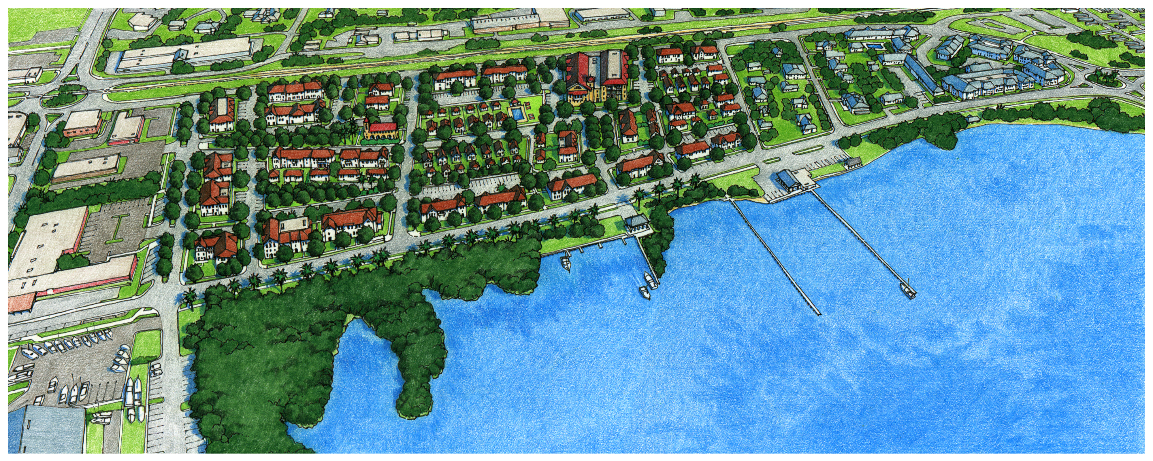
Figure JB-1 Artist rendering of the future vision of Jensen Beach as established in
the 2002 CRA plan
(Ord. No. 1111, pt. II, 9-24-2019)
Sec. 12.2.02. - Regulating plan.
Figures JB-2 and JB-3 are the Regulating Plans that apply to the Jensen Beach Redevelopment Zoning District. Section 12.1.02 describes the purpose and content of Regulating Plans.
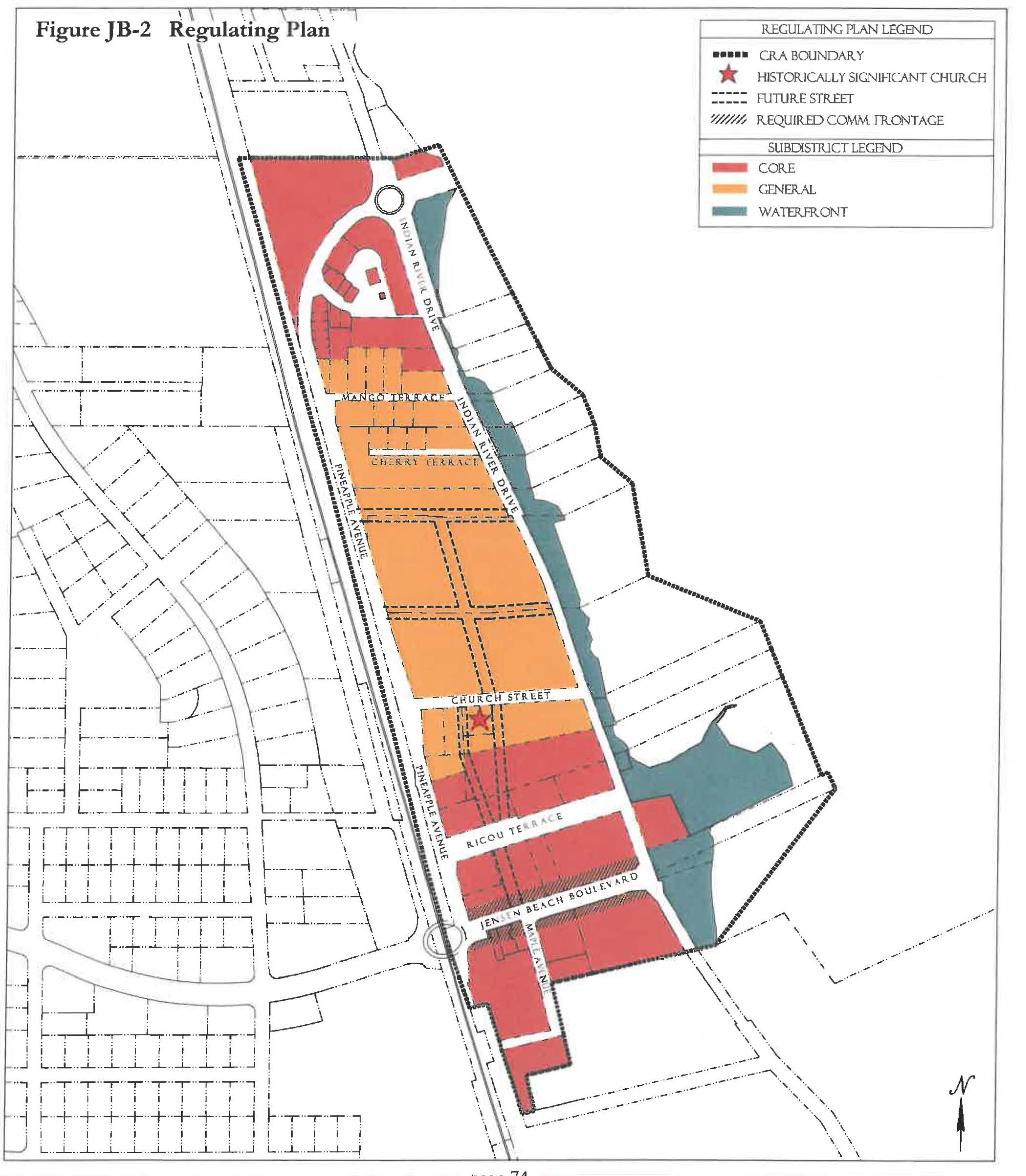
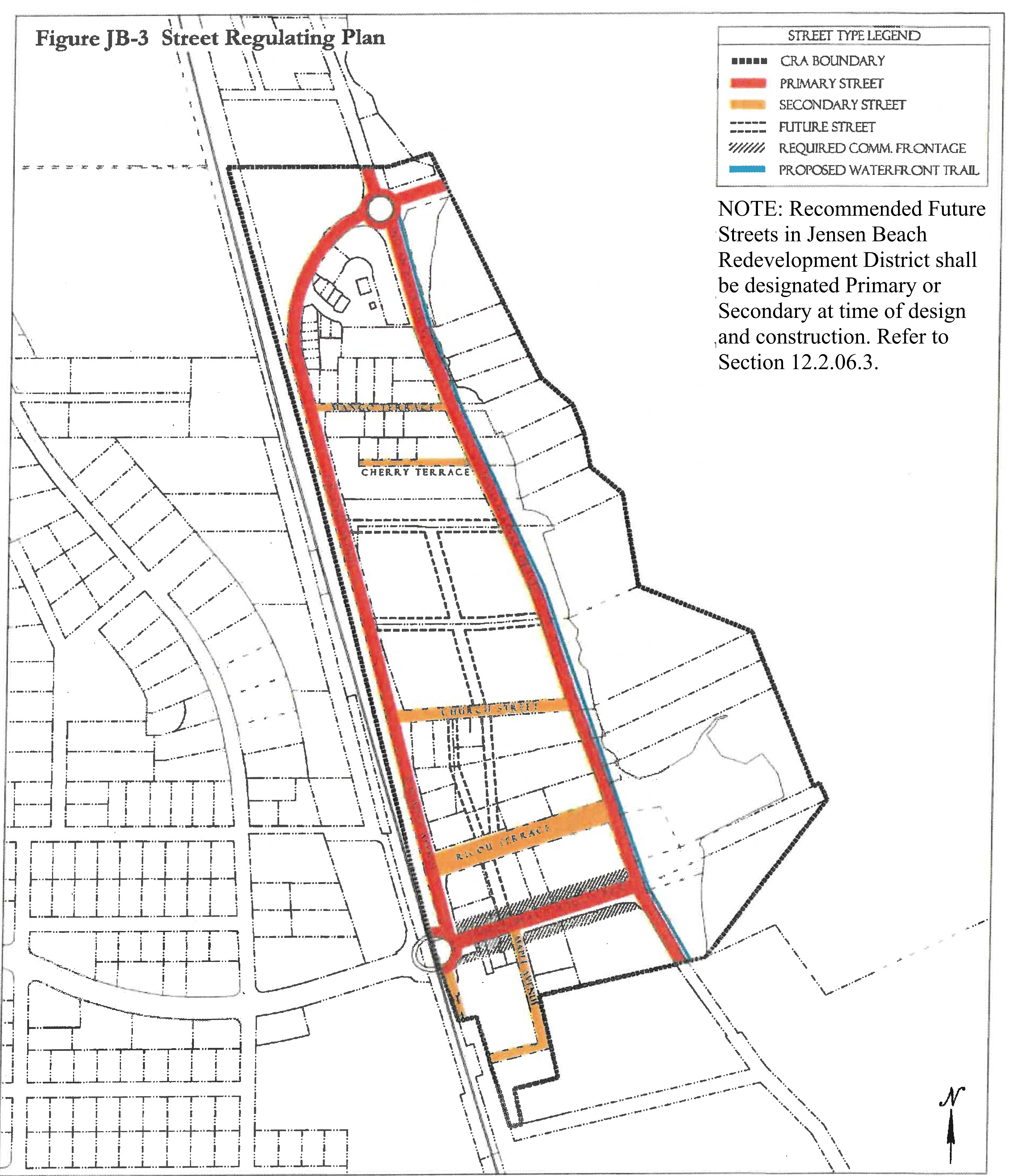
(Ord. No. 1111, pt. II, 9-24-2019; Ord. No. 1159, pt. 1(Exh. A), 5-11-2021)
Sec. 12.2.03. - Permitted uses.
Table JB-4 identifies permitted uses in the JB (Jensen Beach) Redevelopment Zoning District.
1.
The use groups listed in the first column of Table JB-4 are described in Section 12.1.03.
2.
The remaining columns identify the Subdistricts shown on the Regulating Plan.
a.
"P" in a row below a column means that any use in that use group is permitted within that Subdistrict, provided the use can be developed in accordance with all applicable requirements of the LDR.
b.
If "P" is not shown in a row, the use group is not permitted in that Subdistrict.
3.
For uses that are functionally similar but not clearly permitted in a Subdistrict see Section 12.1.03.3.
4.
Street Markets and Fairs. A street market or fair shall be open air, temporary, and occasional.
5.
Kiosks. Kiosks in the public right-of-way shall be a permitted use subject to the approval of the Neighborhood Advisory Committee, a right-of-way use permit, and payment of an annual fee. The fee shall be set by the Board of County Commissioners by resolution and deposited into the Jensen Beach CRA Redevelopment Trust Fund. Kiosks shall be subject to the Section 12.2.12 Architectural Standards.
6.
There shall be no minimum separation requirements between place of worship and any other use.
Table JB-4 Use Groups Permitted in Jensen Beach Subdistricts
Footnotes to Table JB-4:
1 The outdoor storage of goods or materials is prohibited unless it is completely screened from the street and adjacent property.
2 Limited impact industrial services or uses may offer the products manufactured for sale on location and the manufacturing process may be accessible to the public for viewing.
3 Development in the Waterfront Subdistrict shall be water-dependent or water-related. Development on land in the Waterfront Subdistrict may contain residential uses when other uses in a mixed-use development are water-dependent or water-related. Water-related development includes marine resort-type uses including transient accommodations, restaurants and retail shops.
4 Coin-operated amusements shall be limited to no more than four per business establishment whether such coin-operated amusements are offered as a primary use, such as in an amusement arcade, or as an accessory to another business. For purposes of this subsection, "coin-operated amusements" shall mean any machine intended to provide amusement on-demand, such as but not limited to pin-ball machines, pool tables and video games, regardless of whether the actual method of payment is via coins, tokens, paper money, credit card or similar means. See also, Section 3.59, Div. 3, Article 3.
5 Use permitted only when fronting a Primary street.
(Ord. No. 1111, pt. II, 9-24-2019)
Sec. 12.2.04. - Development standards.
1.
All new development, substantial improvements of a building, and substantial renovations of a building exterior shall comply with the Development Standards in Table JB-5.
2.
Existing Buildings. Whenever substantial improvement of a building or substantial renovation of a building exterior triggers the obligation to comply with this Division, the Growth Management Director may authorize incremental compliance with its requirements proportional to the nature and scope of the existing and proposed improvements if full compliance would be unreasonable. An application for alternative compliance shall not be required, but the Growth Management Director may require that the proposal be presented to the Neighborhood Advisory Committee for review and comment. See Section 4.871.B, Div. 20, Article 4.
3.
Accessory Dwelling Units. Standards for accessory dwelling units are provided in Section 12.1.04.7.a Development Standards.
4.
Maximum Lot Area and Lot Width. Maximum lot area and lot width apply to parcels assembled or subdivided after the date of adoption of the Jensen Beach Redevelopment Code, Div. 2, Article 12. Maximum lot area and lot width are intended to preserve existing character and landmarks.
5.
Building Types. Each new building, or substantial improvement, constructed must meet the standards for one of the Building Types permitted in the Subdistrict where it is located, see Table JB-5. Building Type diagrams do not prescribe use or architectural style and are illustrative. Dimensions provided in tables control for regulatory requirements.
6.
Façade Transparency. Shopfront, Mixed-use, Office or Apartment building façades facing streets or civic open spaces at the ground level must have transparent windows which cover between 20 percent and 70 percent of the wall area. Above the ground level, building façades must have transparent windows which cover between 20 percent and 50 percent of the wall area of each story as measured between finished floors. Transparent means non-solar, non-mirrored glass with a light transmission reduction of no more than forty percent.
Table JB-5 - Development Standards in Jensen Beach Subdistricts
Footnotes, see above
1 Buildings within the General Subdistrict facing Pineapple Drive and facing Indian River Drive along the west side of Indian River Drive are permitted max. height of 35'/3 stories within the first 100' facing the roadway as measured from the property line.
2 Buildings within all Subdistricts east of Indian River Drive are permitted maximum height of 24 feet.
3 Only permitted when facing Pineapple Drive and Indian River Drive.
(Ord. No. 1111, pt. II, 9-24-2019; Ord. No. 1159, pt. 1(Exh. A), 5-11-2021)
Sec. 12.2.05. - Building type and frontage type standards.
1.
Building Types. The following Building Type standards shall apply in the Jensen Beach Subdistricts. Table JB-5 provides additional Development Standards.
Figure JB-5.01 Shopfront Building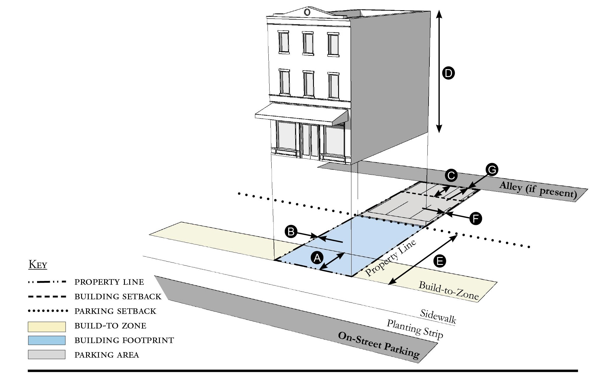
| Building Placement, see 12.1.04.6 | ||
| Frontage Buildout | 80% min. | |
| Front Build-to-Zone | 0' min., 15' max. | |
| Side at Street Build-to-Zone | 0' min., 15' max. | |
| Side at Property Line Setback 2 | 0' or 5' | |
| Rear Yard Setback 2 | 10' min./5' min. with alley | |
| Height, see 12.1.04.2 | ||
| Ceiling at Ground Level | 12' min. | |
| Building Height | Refer to Table JB-5 | |
| Parking Placement, see Sec. 12.1.04.6 | ||
| Front Setback | 30' min. | |
| Side at Street Setback | 10' min. | |
| Side at Property Line Setback | 0' min. | |
| Rear Setback | 5' min/0' min with alley | |
Notes:
1 Only permitted when facing Pineapple Drive and Indian River Drive.
2 Section 12.1.04.11 Building Transitions applies when the rear or side of a property abuts a residential subdistrict or an existing single family dwelling.
For permitted Lot Size, Density, Building Coverage, and Open Space, see Table JB-5.
Figure JB-5.02 Mixed-Use Building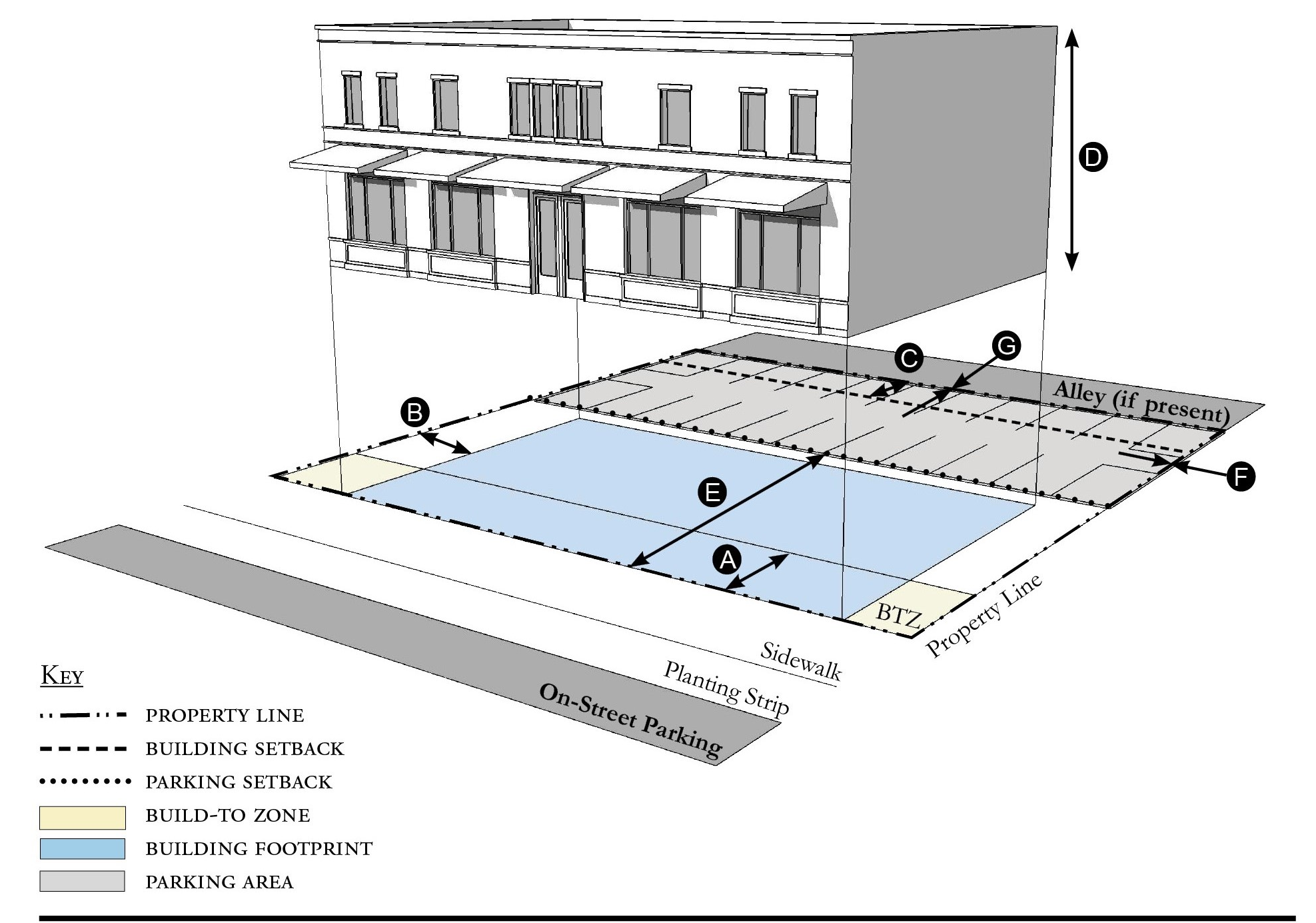
| Building Placement, see 12.1.04.6 | ||
| Frontage Buildout | 80% min. | |
| Front Build-to-Zone | 0' min., 15' max. | |
| Side at Street Build-to-Zone | 5' min., 15' max. | |
| Side at Property Line Setback 2 | 5' min., 10' max. | |
| Rear Yard Setback 2 | 10' min./5' min. with alley | |
| Height, see 12.1.04.2 | ||
| Ceiling at Ground Level | 12' min. | |
| Building Height | Refer to Table JB-5 | |
| Parking Placement, see Sec. 12.1.04.6 | ||
| Front Setback | 30' min. | |
| Side at Street Setback | 10' min. | |
| Side at Property Line Setback | 0' min. | |
| Rear Setback | 5' min/0' min with alley | |
Notes:
1 Only permitted when facing Pineapple Drive and Indian River Drive.
2 Section 12.1.04.11 Building Transitions applies when the rear or side of a property abuts a residential subdistrict or an existing single family dwelling.
For permitted Lot Size, Density, Building Coverage, and Open Space, see Table JB-5.
Figure JB-5.03 Office Building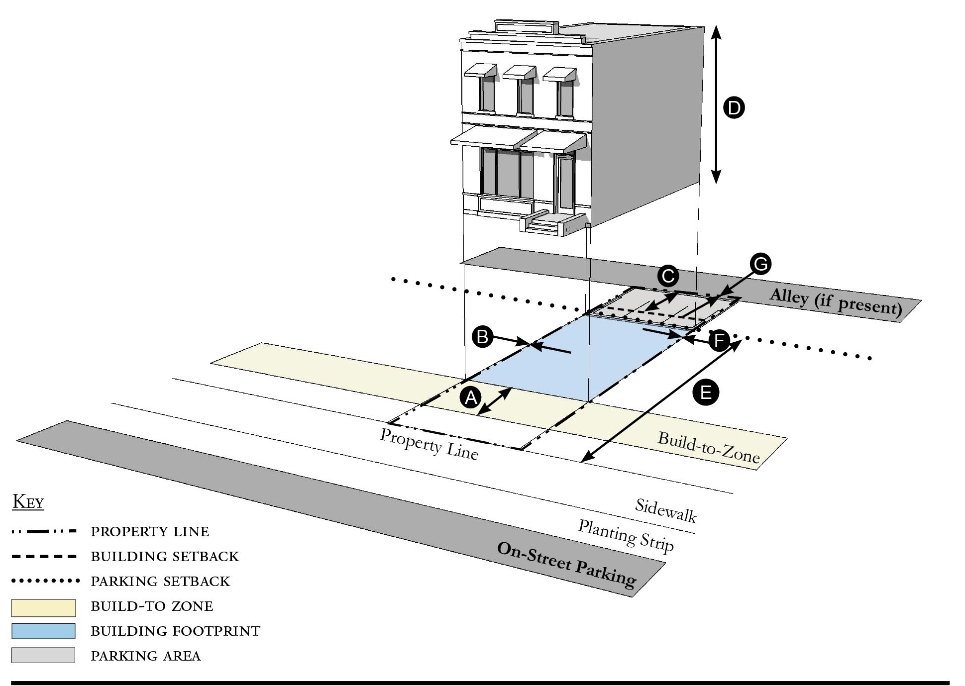
| Building Placement, see 12.1.04.6 | ||
| Frontage Buildout | 80% min. | |
| Front Build-to-Zone | 10' min./15' max. | |
| Side at Street Build-to-Zone | 10' min./15' max. | |
| Side at Property Line Setback 1 | 0' or 5' | |
| Rear Yard Setback 1 | 10' min./5' min. with alley | |
| Height, see 12.1.04.2 | ||
| Ceiling at Ground Level | 12' min. | |
| Building Height | Refer to Table JB-5 | |
| Parking Placement, see Sec. 12.1.04.6 | ||
| Front Setback | 30' min. | |
| Side at Street Setback | 10' min. | |
| Side at Property Line Setback | 0' min. | |
| Rear Setback | 5' min/0' min with alley | |
Notes:
1 Section 12.1.04.11 Building Transitions applies when the rear or side of a property abuts a residential subdistrict or an existing single family dwelling.
For permitted Lot Size, Density, Building Coverage, and Open Space, see Table JB-5.
Figure JB-5.04 Apartment Building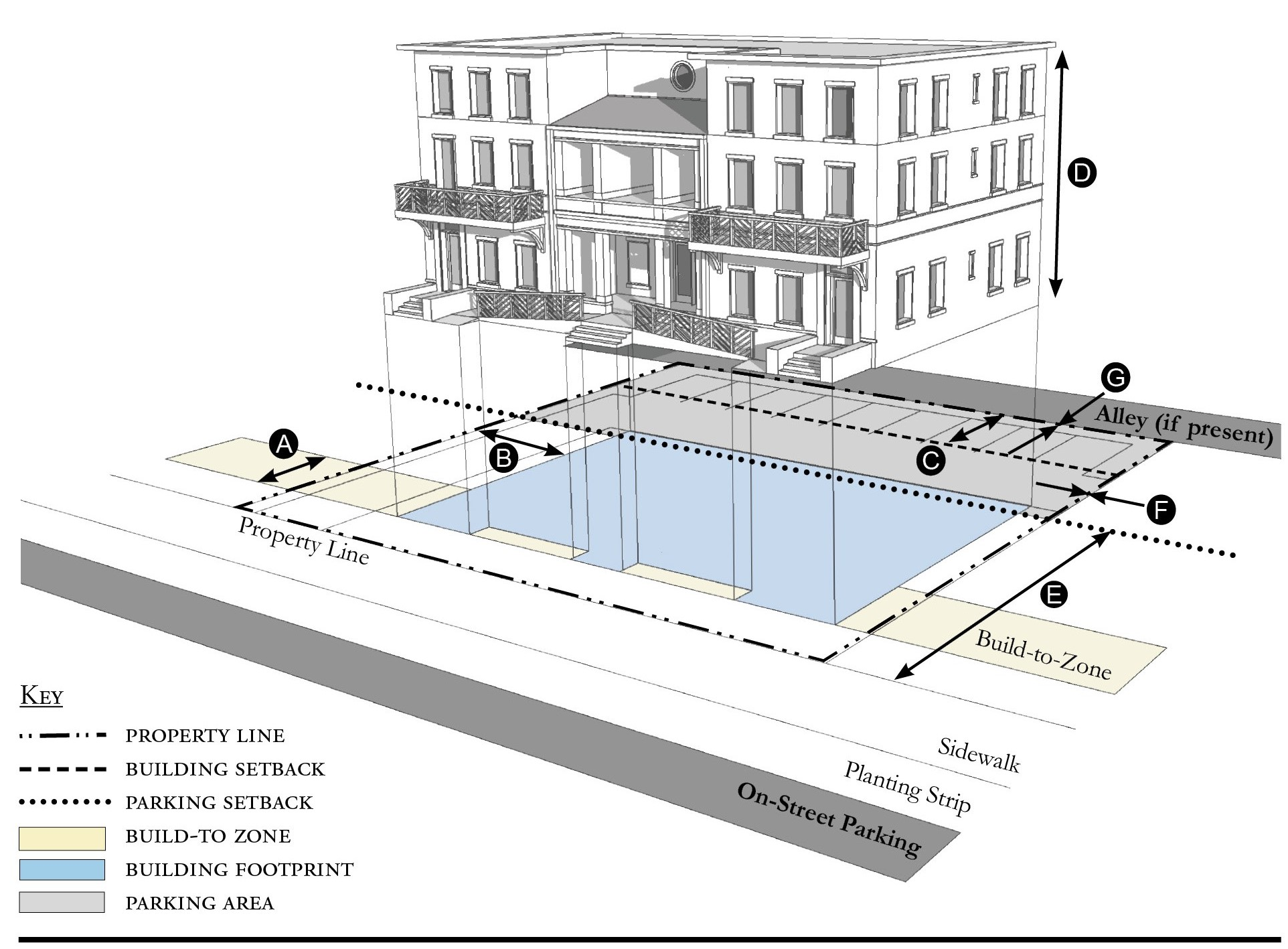
| Building Placement, see 12.1.04.6 | ||
| Frontage Buildout | 60% min. | |
| Front Build-to-Zone | 10' min./25' max. | |
| Side at Street Build-to-Zone | 10' min./15' max. | |
| Side at Property Line Setback 1 | 5' min. | |
| Rear Yard Setback 1 | 10' min./5' min. with alley | |
| Height, see 12.1.04.2 | ||
| Ceiling at Ground Level | Not applicable | |
| Building Height | Refer to Table JB-5 | |
| Parking Placement, see Sec. 12.1.04.6 | ||
| Front Setback | 30' min. | |
| Side at Street Setback | 10' min. | |
| Side at Property Line Setback | 5' min./0' min. with alley | |
| Rear Setback | 5' min./0' min. with alley | |
Notes:
1 Section 12.1.04.11 Building Transitions applies when the rear or side of a property abuts a residential subdistrict or an existing single family dwelling.
For permitted Lot Size, Density, Building Coverage, and Open Space, see Table JB-5.
Figure JB-5.05 Courtyard Building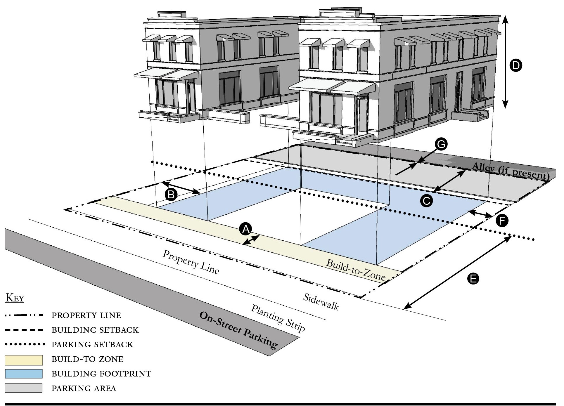
| Building Placement, see 12.1.04.6 | ||
| Frontage Buildout | 80% min. | |
| Front Build-to-Zone | 10' min./25' max. | |
| Side at Street Build-to-Zone | 10' min./15' max. | |
| Side at Property Line Setback 1 | 5' min. | |
| Rear Yard Setback 1 | 10' min./5' min. with alley | |
| Height, see 12.1.04.2 | ||
| Ceiling at Ground Level | Not applicable | |
| Building Height | Refer to Table JB-5 | |
| Parking Placement, see Sec. 12.1.04.6 | ||
| Front Setback | 30' min. | |
| Side at Street Setback | 10' min. | |
| Side at Property Line Setback | 5' min./0' min. with alley | |
| Rear Setback | 5' min./0' min. with alley | |
Notes:
The proportions of the courtyard space shall be at least as deep as it is wide.
1 Section 12.1.04.11 Building Transitions applies when the rear or side of a property abuts a residential subdistrict or an existing single family dwelling.
For permitted Lot Size, Density, Building Coverage, and Open Space, see Table JB-5.
Figure JB-5.06 Townhouse
| Building Placement, see 12.1.04.6 | ||
| Frontage Buildout | 80% min. | |
| Front Build-to-Zone | 0' min./15' max. | |
| Side at Street Build-to-Zone | 0' min./15' max. | |
| Side at Property Line Setback 1, 2 | 0' min. or 10' min. | |
| Rear Yard Setback 1 | 10' min./5' min. with alley | |
| Height, see 12.1.04.2 | ||
| Ceiling at Ground Level | Not applicable | |
| Building Height | Refer to Table JB-5/2 stories min. | |
| Parking Placement, see Sec. 12.1.04.6 | ||
| Front Setback | 30' min. | |
| Side at Street Setback | 10' min. | |
| Side at Property Line Setback | 5' min. | |
| Rear Setback | 5' min./0' min. with alley | |
Notes:
Townhouses shall have a maximum grouping of 8 dwelling units and a minimum Setback of 15 feet between buildings.
1 Section 12.1.04.11 Building Transitions applies when the rear or side of a property abuts a residential subdistrict or an existing single family dwelling.
2 When adjacent to another property that is not part of the townhouse development the Side at Property Line Setback in 10 feet minimum from the property line.
For permitted Lot Size, Density, Building Coverage, and Open Space, see Table JB-5.
Figure JB-5.07 Live/Work Building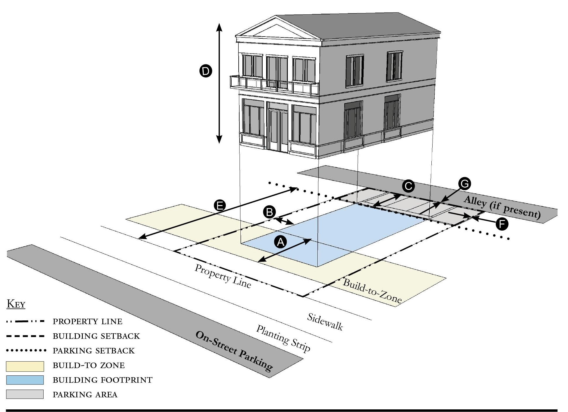
| Building Placement, see 12.1.04.6 | ||
| Frontage Buildout | 80% min. | |
| Front Build-to-Zone | 10' min./25' max. | |
| Side at Street Setback | 10' min. | |
| Side at Property Line Setback 1 | 10' min. | |
| Rear Yard Setback 1 | 10' min | |
| Height, see 12.1.04.2 | ||
| Ceiling at Ground Level | 12' min. | |
| Building Height | Refer to Table JB-5 | |
| Parking Placement, see Sec. 12.1.04.6 | ||
| Front Setback | 30' min. | |
| Side at Street Setback | 10' min. | |
| Side at Property Line Setback | 0' min. | |
| Rear Setback | 5' min./0' min. with alley | |
Notes:
2 Section 12.1.04.11 Building Transitions applies when the rear or side of a property abuts a residential subdistrict or an existing single family dwelling.
For permitted Lot Size, Density, Building Coverage, and Open Space, see Table JB-5.
Figure JB-5.08 Side Yard House
| Building Placement, see 12.1.04.6 | ||
| Frontage Buildout 2 | 60% min. | |
| Front Build-to-Zone | 10' min./25' max. | |
| Side at Street Setback | 10' min. | |
| Side at Property Line Setback 1 | 5' min., 10' min. other side | |
| Rear Yard Setback 1 | 10' min/5' min. with alley | |
| Height, see 12.1.04.2 | ||
| Ceiling at Ground Level | Not applicable | |
| Building Height | 24'/2 stories max. | |
| Parking Placement, see 12.1.04.6 and 12.7.07.9 | ||
| Front Setback | 30' min. | |
| Side at Street Setback | 10' min. | |
| Side at Property Line Setback | 5' min. | |
| Rear Setback | 5' min./0' min. with alley | |
Notes:
1 Section 12.1.04.11 Building Transitions applies when the rear or side of a property abuts a residential subdistrict or an existing single family dwelling.
2 For this Building Type, the frontage buildout requirement may be met with the provision of a continuous wall or fence along the lot frontage.
For permitted Lot Size, Density, Building Coverage, and Open Space, see Table JB-5.
Figure JB-5.09 Duplex
| Building Placement, see 12.1.04.6 | ||
| Frontage Buildout 1 | 60% min. | |
| Front Build-to-Zone | 10' min./25' max. | |
| Side at Street Setback | 10' min. | |
| Side at Property Line Setback | 5' min. | |
| Rear Yard Setback | 10' min | |
| Height, see 12.1.04.2 | ||
| Ceiling at Ground Level | Not applicable | |
| Building Height | 24'/2 stories max. | |
| Parking Placement, see 12.1.04.6 and 12.7.07.9 | ||
| Front Setback | 30' min. | |
| Side at Street Setback | 10' min. | |
| Side at Property Line setback | 5' min. | |
| Rear Setback | 5' min./0' min. with alley | |
| Refer to Section 12.1.07.8 Garage & Driveway for parking an driveway configurations for Single Family Dwellings. | ||
Notes:
An ADU is prohibited on lots on which a duplex is located.
1 For this Building Type, the frontage buildout requirement may be met with the provision of a continuous wall or fence along the lot frontage.
For permitted Lot Size, Density, Building Coverage, and Open Space, see Table JB-5.
Figure JB-5.10 Cottage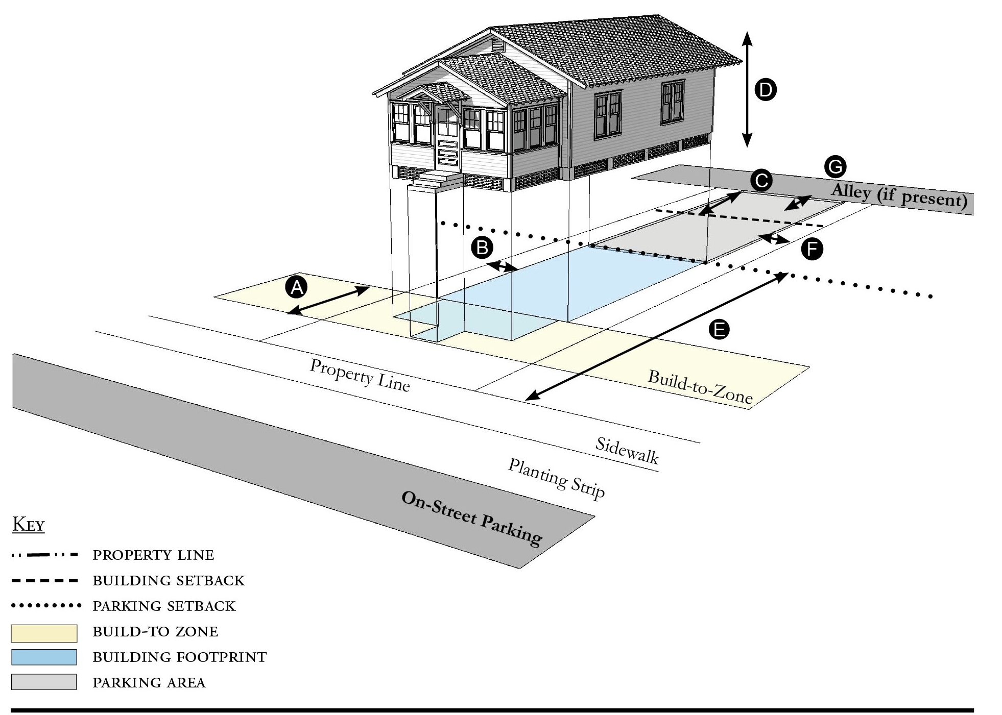
| Building Placement, see 12.1.04.6 | ||
| Frontage Buildout 1 | 60% min. | |
| Front Build-to-Zone | 10' min./25' max. | |
| Side at Street Build-to-Zone | 5' min., 10' max. | |
| Side at Property Line Setback | 5' min. | |
| Rear Yard Setback | 10' min | |
| Height, see 12.1.04.2 | ||
| Ceiling at Ground Level | Not applicable | |
| Building Height | 24'/2 stories max. | |
| Parking Placement, see 12.1.04.6 and 12.7.07.9 | ||
| Front Setback | 30' min. | |
| Side at Street Setback | 10' min. | |
| Side at Property Line setback | 5' min. | |
| Rear Setback | 5' min. | |
Notes:
1 For this Building Type, the frontage buildout requirement may be met with the provision of a continuous wall or fence along the lot frontage.
For permitted Lot Size, Density, Building Coverage, and Open Space, see Table JB-5.
Figure JB-5.11 Cottage Court
| Building Placement, see 12.1.04.6 | ||
| Frontage Buildout | 60% min. | |
| Front Setback | 6' min. | |
| Side/Rear at Street Setback | 6' min. | |
| Side/Rear at Property Line Setback | 6' min. | |
| Unit Separation | 10' min | |
| Height, see 12.1.04.2 | ||
| Ceiling at Ground Level | Not applicable | |
| Building Height | 24'/2 stories max. | |
| Parking Placement, see 12.1.04.6 | ||
| Front Setback | 30' min. | |
| Side at Street Setback | 10' min. | |
| Side at Property Line Setback | 5' min. | |
| Rear Setback | 5' min. | |
Notes:
Cottage Courts may include duplexes.
1 For this Building Type, the frontage buildout requirement may be met with the provision of a continuous wall or fence along the lot frontage.
For permitted Lot Size, Density, Building Coverage, and Open Space, see Table JB-5.
Figure JB-5.12 Outbuilding
| Building Placement, see 12.1.04.6 | ||
| Frontage Buildout | Not applicable | |
| Front Build-to-Zone | Not applicable | |
| Side at Street Build-to-Zone | Not applicable | |
| Side at Property Line Setback | 5' min. | |
| Rear Yard Setback | 5' min | |
| Height, see 12.1.04.2 | ||
| Ceiling at Ground Level | Not applicable | |
| Building Height | 24'/2 stories max. | |
Notes:
Outbuildings shall not exceed a footprint of 850 square feet.
For permitted Lot Size, Density, Building Coverage, and Open Space, see Table JB-5.
Figure JB-5.13 - Boat Barn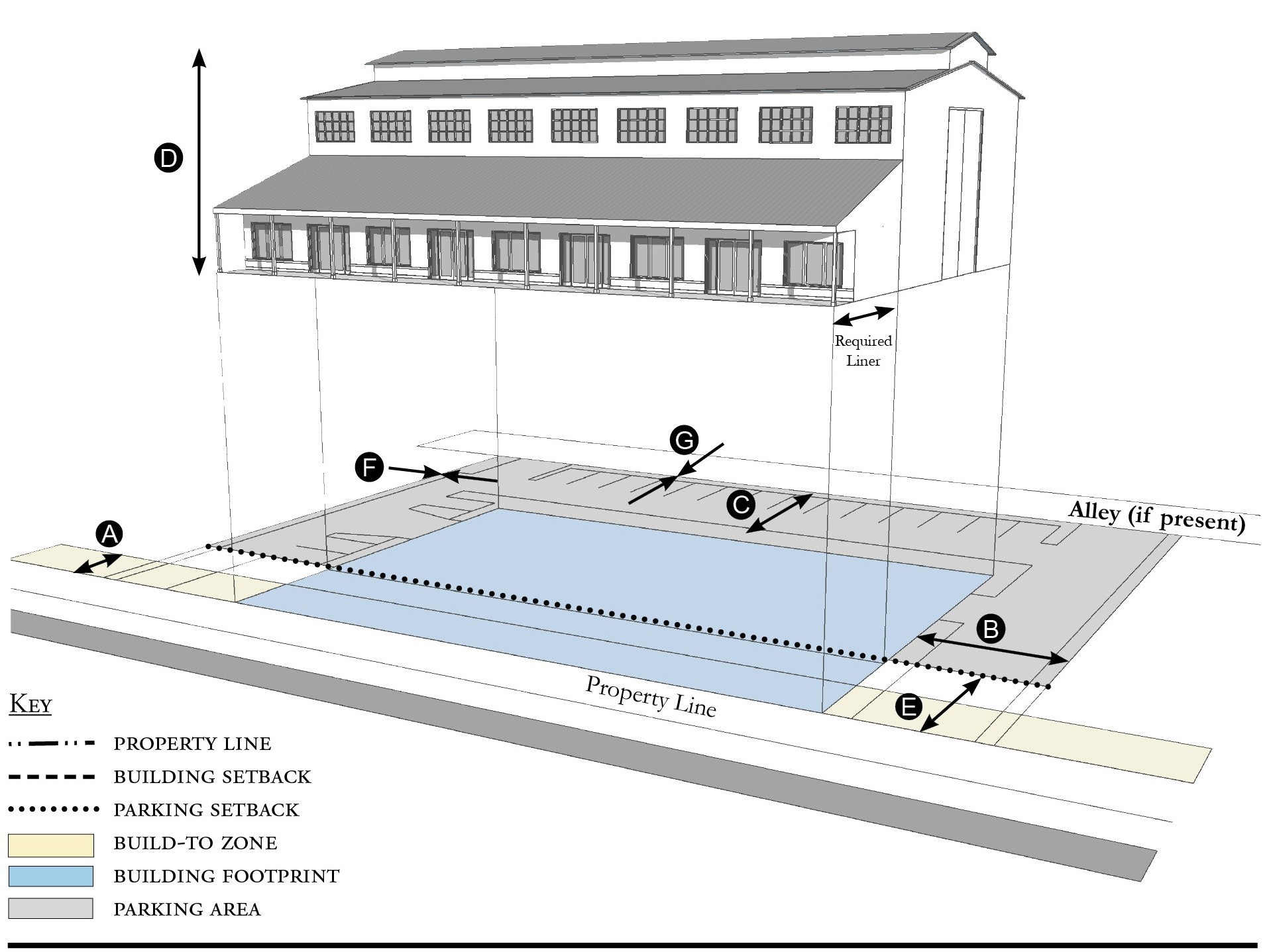
| Building Placement, see 12.1.04.6 | ||
| Frontage Buildout | 60% min. | |
| Front Build-to-Zone | 0' min., 15' max. | |
| Side at Street Setback | 10' min. | |
| Side at Property Line Setback 1 | 10' min. | |
| Rear Yard Setback 2 | 10' min/5' min. with alley | |
| Height, see 12.1.04.2 | ||
| Ceiling at Ground Level | Not applicable | |
| Building Height | Refer to Table JB-5 | |
| Parking Placement, see 12.1.04.6 | ||
| Front Setback | 30' min. | |
| Side at Street Setback | 5' min. | |
| Side at Property Line Setback | 5' min. | |
| Rear Setback | 5' min./0' min. with alley | |
| Parking shall not be located between the building and the street. | ||
Notes:
A commercial liner shall be a minimum depth of 20' feet.
1 Section 12.1.04.11 Building Transitions applies when the rear or side of a property abuts a residential subdistrict or an existing single family dwelling.
For permitted Lot Size, Density, Building Coverage, and Open Space, see Table JB-5.
Figure JB-5.14 Industrial Building
| Building Placement, see 12.1.04.6 | ||
| Frontage Buildout | Not required | |
| Front Setback | 20' min. | |
| Side at Street Setback | 5' min. | |
| Side at Property Line Setback 1 | 5' min. | |
| Rear Yard Setback 1 | 10' min/5' min. with alley | |
| Height, see 12.1.04.2 | ||
| Ceiling at Ground Level | Not applicable | |
| Building Height | 24' max. | |
| Parking Placement, see 12.1.04.6 | ||
| Front Setback | 30' min. | |
| Side at Street Setback | 0' min. | |
| Side at Property Line Setback | 0' min. | |
| Rear Setback | 5' min./0' min. with alley | |
Notes:
1 Section 12.1.04.11 Building Transitions applies when the rear or side of a property abuts a residential subdistrict or an existing single family dwelling.
For permitted Lot Size, Density, Building Coverage, and Open Space, see Table JB-5.
(Ord. No. 1111, pt. II, 9-24-2019; Ord. No. 1159, pt. 1(Exh. A), 5-11-2021; Ord. No. 1237, Pt. I(Exh. 1), 1-28-2025)
Sec. 12.2.06. - Street standards.
1.
Applicability. Street standards that apply in all Redevelopment Zoning Districts are provided in Section 12.1.06. The additional street standards which apply in the Jensen Beach Redevelopment Zoning District are specified in this section.
2.
Street Regulating Plan. A Street Regulating Plan is provided in Figure JB-3, Section 12.2.02. Features identified in the Street Regulating Plan are described in 12.1.02.2.
a.
Primary Streets.
b.
Secondary Streets.
c.
Recommended Future Streets.
d.
Recommended Future Alleys.
e.
Waterfront Trail along Indian River Drive is proposed.
3.
Future Streets.
a.
Street Location. The schematic location of proposed streets is shown on the Street Regulating Plan. The exact location may be adjusted during the development review process provided the new location meets these requirements:
i.
The adjusted location does not reduce the level of connectivity with surrounding streets, both existing and proposed.
ii.
The adjusted location does not reduce the level of street connectivity within the site or substantially increase the average block size.
iii.
The adjusted location does not diminish or eliminate any proposed civic space, or civic building shown on the Regulating Plan.
iv.
The adjusted location maintains or enhances pedestrian convenience and safety and does not create any traffic hazards.
b.
Street Types. Proposed streets may be designed and constructed as any one of the following street types below defined Section 12.1.06.
i.
Local Street 1.
ii.
Local Street 2.
iii.
Local Street 3.
iv.
Neighborhood Street 1.
v.
Neighborhood Street 2.
vi.
Yield Street.
4.
Shade Trees. The following landscaping requirements shall apply to existing streets:
a.
The landscaping on Jensen Beach Boulevard, Indian River Drive, Ricou Terrace, and Pineapple Avenue shall include the planting of shade trees unless a covered walkway is provided. Shade trees shall be a minimum height of 12 feet at the time of planting with a minimum crown spread of six feet and a minimum DBH of three inches and located at a maximum of 50-to-30 foot intervals. If a covered walkway is provided, 12-foot tall palm trees shall be permitted. Every other tree shall be complemented with a bench and a garbage container. The soil volume shall be sized appropriately to the maximum mature size of the tree.
b.
The landscaping along other roadways shall include the planting of trees meeting the standards of Section 4.664.B.1., Div. 15, Article 4 at a maximum of 30-foot intervals. Trees may be planted in clusters, but not located more than 50 feet apart.
5.
Other Improvements To Existing Streets. As provided in Section 12.1.06, the County Engineer may allow deviations from these minimum standards when necessary due to the location of existing buildings, constrained right-of-way, or to meet other goals for the particular street section.
a.
Indian River Drive. When improved, the corridor shall be designed and constructed to include a Shared Use Path along the waterway and a generous sidewalk with a pedestrian and furnishing zone. An illustrative street section of Local Street with Shared Use Path is included in Section 12.1.06 as Figure 12-8.13.
b.
Pineapple Avenue. The build-to-zone shall provide for a pedestrian zone, furnishing zone, and on-street parking as described in Section 12.1.06. No less than ten feet shall be provided for the combined pedestrian zone and furnishing zone.
c.
Jensen Beach Boulevard. The build-to-zone shall provide for a pedestrian zone, furnishing zone, and on-street parking as described in Section 12.1.06. No less than ten feet shall be provided for the combined pedestrian zone and furnishing zone. On Jensen Beach Boulevard, ten feet shall be provided for parallel, on-street parking.
d.
Ricou Terrace. The build-to-zone shall provide for a pedestrian zone, furnishing zone, and on-street parking as described in Section 12.1.06. No less than ten feet shall be provided for the combined pedestrian zone and furnishing zone. On Ricou Terrace, 18 feet shall be provided for angled, on-street parking.
(Ord. No. 1111, pt. II, 9-24-2019; Ord. No. 1159, pt. 1(Exh. A), 5-11-2021)
Sec. 12.2.07. - Parking standards.
1.
Applicability. Parking Standards found in Sections 4.621 through 4.628, Div. 14, Article 4, are modified for all Redevelopment Zoning Districts in Section 12.1.07. Those modified Parking Standards apply in the Jensen Beach Redevelopment Zoning District, except as specified otherwise in this section.
2.
Parking rates. Refer to Section 12.1.07 for parking rates applicable to Redevelopment Zoning Districts.
3.
Screening of parking from residential uses. There shall be an Alley between parking areas and adjacent residential uses. Where an Alley is not possible, there shall be a visual barrier between parking areas or commercial uses and residential uses. Refer to Section 12.2.09 Landscaping Standards Vehicular Use Areas.
4.
Parking structures. Whenever a parking structure or surface parking provided beneath a building is located on a Primary Street, as identified on the Street Regulating Plan, Section 12.2.02, street level commercial space shall be provided for a depth of no less than 20 feet measured from the front of the building.
5.
Distributing Parking. Where more than 200 parking spaces are provided onsite, such parking shall be distributed such that no more than 50 percent of the spaces are grouped in a single area of the parcel. Methods of distributing parking include locating parking adjacent to the rear or sides of a building or by physically separating parking areas with other buildings or landscaped areas.
6.
Boats, recreational vehicles or boat trailers shall not be parked or stored between the front of a building and a street. This prohibition does not apply to boats and boat trailers associated with a lawfully established commercial use.
(Ord. No. 1111, pt. II, 9-24-2019; Ord. No. 1159, pt. 1(Exh. A), 5-11-2021; Ord. No. 1196, pt. I(Exh. A), 5-9-2023)
Sec. 12.2.08. - Stormwater standards.
1.
Stormwater management standards are provided in Sections 4.381 through 4.390, Div. 9, Article 4 and apply in the Jensen Beach Redevelopment Zoning Districts except as modified in Section 12.1.08.
(Ord. No. 1111, pt. II, 9-24-2019)
Sec. 12.2.09. - Landscape standards.
1.
Table JB-9 identifies which of the landscaping, buffering, and tree protection standards in Div. 15, Article 4 apply as written in the Jensen Beach Redevelopment Zoning District and which standards are modified, replaced, or do not apply in this Redevelopment Zoning District.
Table JB-9 - Landscaping, Buffering, and Tree Protection Standards
2.
Single family dwellings or duplexes. Lots cannot be cleared without a clearing permit. Single-family dwellings and duplexes on existing lots shall plant one tree for each 3,000 sq. ft. of lot area. Such tree shall meet the standards in Section 4.664 landscape material standards. The maintenance requirements in Section 4.665 also shall apply. Construction of SFR and duplexes on existing lots is exempt from all other landscaping requirements.
3.
Required landscape area.
a.
Table JB-10 indicates the minimum percentage of the total developed area that must be landscaped.
b.
Landscaping shall be permitted in easements only with the written permission of the easement holder. A written agreement shall specify the party responsible for restoring disturbed landscape areas, shall be submitted to the county in a form acceptable to the County Attorney, and shall be recorded in the public records.
c.
Exposed dirt yards are prohibited.
4.
Required tree planting.
a.
Table JB-10 indicates the minimum number of trees that must be planted.
b.
Trees planted in adjacent right-of-way as indicated in Section 12.2.06, or in other nearby public space, shall be credited towards meeting the number of trees required by Table JB-10. Any private use of the public right-of-way requires the approval of the County Engineer, a right-of-way use permit, a construction agreement, and an indemnification agreement.
c.
Trees planted in Vehicular Use Areas shall be credited towards meeting the number of trees required by Table JB-10.
d.
Trees planted near utilities shall consider FPL's Right Tree/Right Place Guidelines.
Table JB-10 - Required Landscape Area & Tree Planting
5.
Landscape plan. Development applications shall include a landscape plan prepared by a qualified professional that provides the location and type of existing and proposed features that are identified in Table JB-11, which are summarized from the detailed requirements in Section 4.662.A, Div. 15, Article 4.
a.
Column A requirements apply to an application for a final site plan.
b.
Column B requirements apply to an application for a building permit for a Small Site, which are defined as the construction or expansion of a principal building or accessory structures on a lawfully established lot or adjacent lots, provided the parcel being developed is less than one-half acre.
c.
Column B requirements also apply to an application for a substantial improvement or substantial renovation of a building exterior on any lot regulated by Article 12, as those terms are defined in Section 4.871.B, Div. 20, Article 4.
d.
For applications for a substantial improvement/renovation only, the Growth Management Director, or the Director's designee, may authorize incremental compliance with its requirements when the nature and scope of the existing and proposed improvements make full compliance unreasonable. An application for alternative compliance shall not be required but the Growth Management Director may require that the proposal be presented to the Neighborhood Advisory Committee for review and comment.
Table JB-11 - Landscape Plan Application Requirements
1 On-site features only
6.
Vehicular Use Areas, not applicable to single family dwellings or duplexes.
a.
Perimeter landscaping. Landscaping shall be provided along the perimeter of vehicular use areas in accordance with the following standards:
i.
One tree shall be planted for each 30 linear feet. Trees may be planted in clusters, but not more than 50 feet apart with adequate soil volumes and root paths to promote mature, sustainable tree growth.
ii.
A hedge, fence, or other durable landscape barrier with a minimum height of four feet shall be installed along the perimeter of vehicular use areas. Height of hedge, fence or landscape barrier shall comply with Section 12.1.10 Wall & Fence Standards.
iii.
Walls, fences and landscaping around vehicular use areas must have one pedestrian connection to adjacent development or sidewalks for every 50 feet.
iv.
No hedge, fence, or other durable landscape barrier is required along the side of a parking area that abuts another parking area or a building, or that faces the rear of a lot.
b.
Interior landscaping. If a vehicular use area is larger than 15,000 square feet, landscaping shall be provided within its interior in accordance with Section 4.663.A.4, Div. 15, Article 4, except that these interior landscape areas may also be used as stormwater management and conveyance facilities. If a vehicular use area is equal to or smaller than 15,000 square feet, no interior landscaping, terminal islands, interior medians, or interior islands are required.
(Ord. No. 1111, pt. II, 9-24-2019; Ord. No. 1159, pt. 1(Exh. A), 5-11-2021)
Sec. 12.2.10. - Wall and fence standards.
1.
Walls and fences must comply with the Wall and Fence Standards for all Redevelopment Zoning Districts found in Section 12.1.10.
(Ord. No. 1111, pt. II, 9-24-2019)
Sec. 12.2.11. - Sign standards.
1.
Sign Standards must comply with the standards for all Redevelopment Zoning Districts found in Section 12.1.11 except where modified below for Jensen Beach Redevelopment Zoning District.
2.
Wall Signs. Table JB-12 supersedes the signage-area table in Section 4.700, Div. 16, Article 4.
3.
Types of signs permitted. The list of permitted signs in Section 4.703, Div. 16, Article 4 is adjusted by adding the following sign as permitted:
a.
Sandwich or sidewalk signs, as defined in Section 4.693, Div. 16, Article 4 are permitted in the Core, General, and Waterfront Subdistricts, provided the signs do not exceed 6 square feet per face, do not unreasonably obstruct pedestrian or vehicular movement, and are moved off sidewalks or other public property by 9:00 PM daily.
4.
Lettering and logo size. Table JB-12 provides the maximum height of lettering and logos on any allowable. Section 4.699, Div. 16, Article 4 describes how to measure the height of irregularly shaped features. Section 4.700, Div. 16, Article 4 describes how to measure Building Face Area.
Table JB-12 - Sign Size Limitations
(Ord. No. 1111, pt. II, 9-24-2019)
Sec. 12.2.12. - Architectural standards.
Architectural Standards must comply with the Architectural Standards established for all Redevelopment Zoning Districts in Section 12.1.12.
(Ord. No. 1159, pt. 1(Exh. A), 5-11-2021; Ord. No. 1237, Pt. I(Exh. 1), 1-28-2025)
Sec. 12.3.01. - Purpose.
1.
Rio is a unique, coastal community located on the St. Lucie River with historically platted neighborhoods, established industries, scenic views, and civically engaged and diverse residents. This division is intended to:
a.
Revitalize Rio as a desirable place to live, vacation, and conduct business.
b.
Improve upon its indigenous architecture and colorful history to create an intimate village with an enviable quality of life.
c.
Strengthen Rio's character and economic well-being through both public and private redevelopment initiatives.
d.
Promote and accomplish the goals, objectives, and policies of the Martin County Comprehensive Growth Management Plan and achieve the vision for Rio in its Community Redevelopment Plan.
2.
Rio Redevelopment Zoning District. This Article 12, Division 3 of the Martin County Land Development Regulations establishes the Rio Redevelopment Zoning District and the permitted uses and development standards applicable therein.
3.
Organization. How this Division is organized:
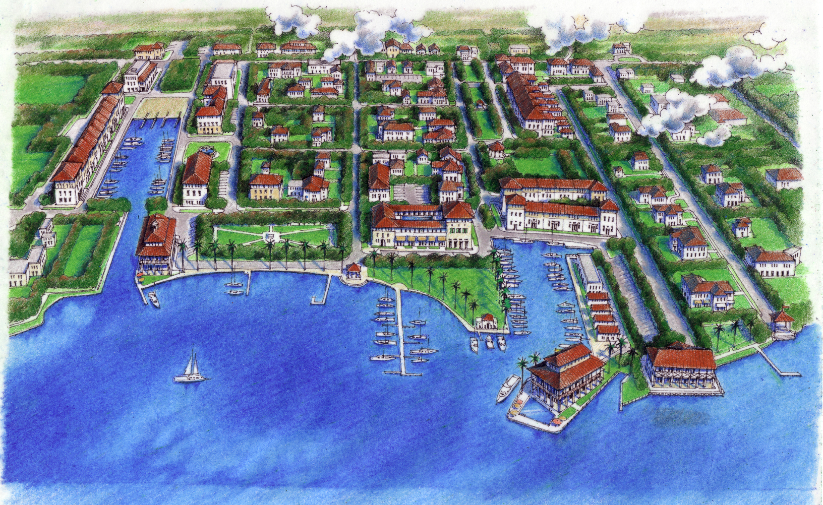
Figure R-1 Artist rendering of the future vision of Rio as established in the 2001
Vision Planning and updated in 2009 and 2015
(Ord. No. 1121, pt. I, 12-17-2019)
Sec. 12.3.02. - Regulating plan.
Figures R-2 and R-3 are the Regulating Plans that apply to the Rio Redevelopment Zoning District. Section 12.1.02 describes the purpose and content of Regulating Plans.
Figure R-2 Regulating Plan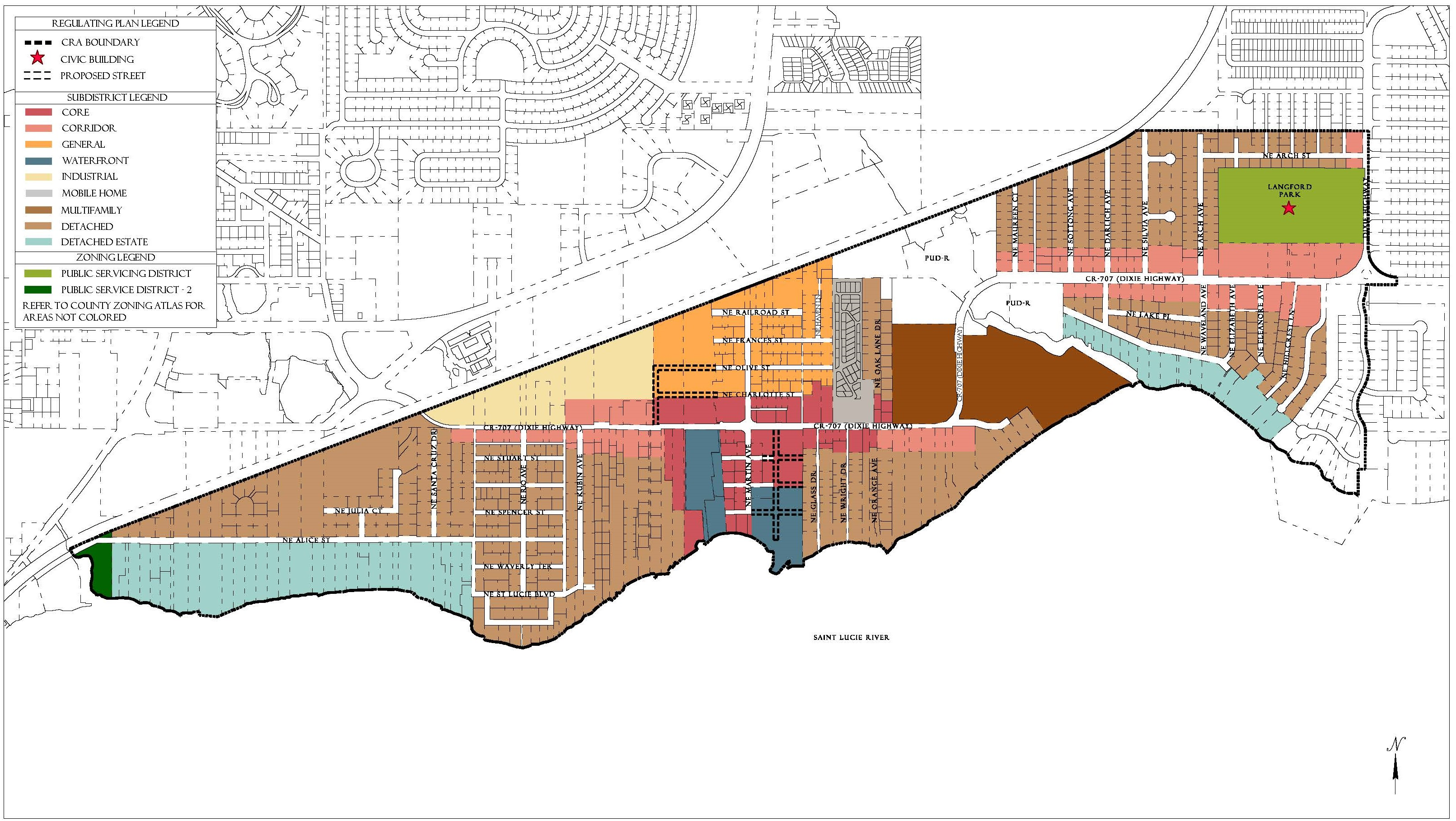
Figure R-3 Street Regulating Plan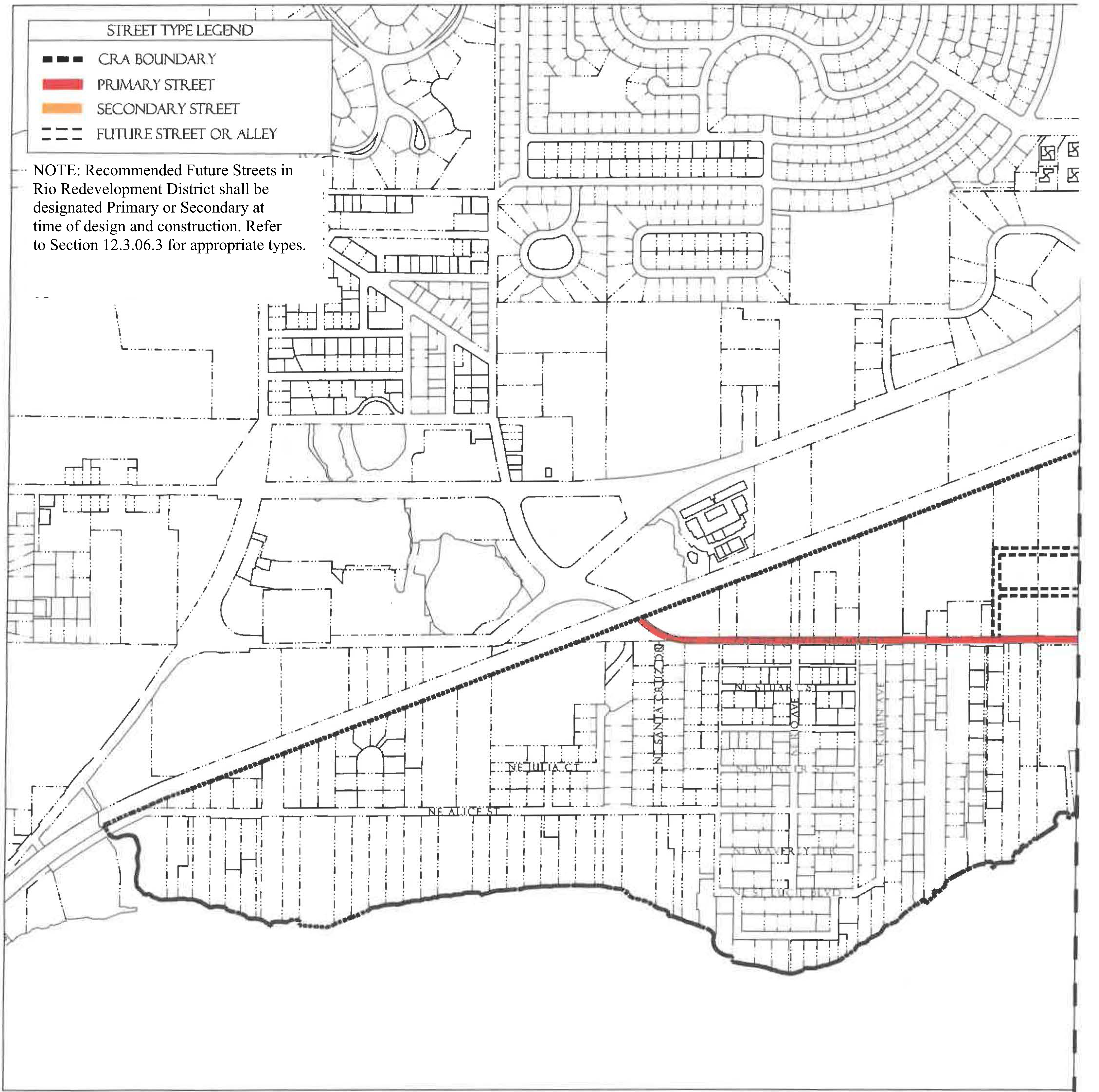
Figure R-3 Street Regulating Plan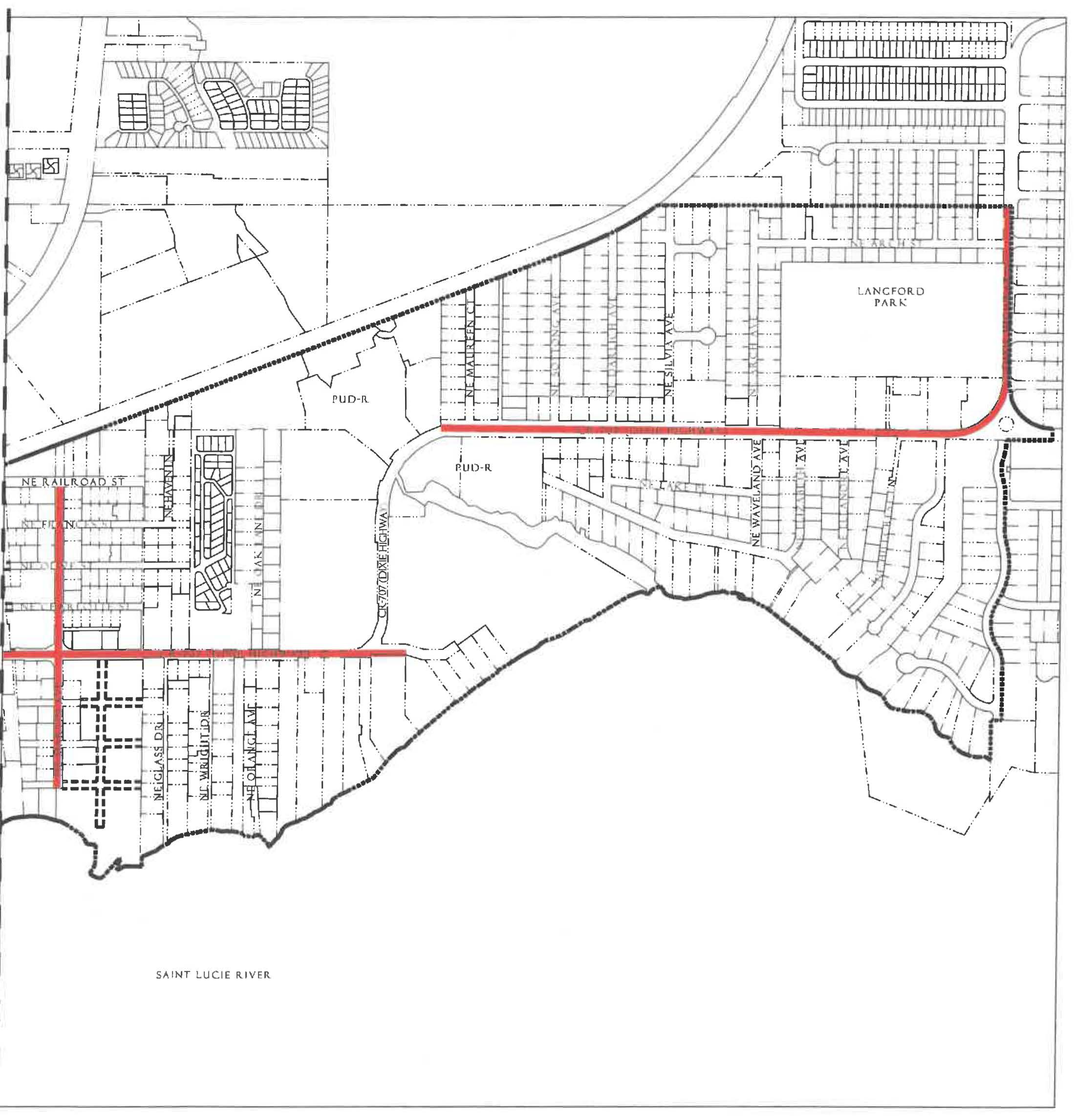
(Ord. No. 1121, pt. I, 12-17-2019)
Sec. 12.3.03. - Permitted uses.
Table R-4 identifies permitted uses in the Rio (R) Redevelopment Zoning District.
1.
The Use Groups listed in the first column of Table R-4 are described in Section 12.1.03.
2.
The remaining columns identify the Subdistricts shown on the Regulating Plan.
a.
"P" in a row below a column means that any use in that use group is permitted within that Subdistrict, provided the use can be developed in accordance with all applicable requirements of the LDR.
b.
If "P" is not shown in a row, the use group is not permitted in that Subdistrict.
3.
For uses that are functionally similar but not clearly permitted in a Subdistrict see Section 12.1.03.3.
Table R-4 Use Groups Permitted in Rio Subdistricts
Footnotes, see above
1 Development in the Waterfront Subdistrict shall be water-dependent or water-related. Development on land in the Waterfront Subdistrict may contain residential uses when other uses in a mixed-use project are water-dependent or water-related. Water-related development includes marine resort-type uses including transient accommodations, restaurants and retail shops.
2 Residential development in the Waterfront & Industrial Subdistricts shall be within a Mixed-Use Project.
3 No duplexes are permitted.
(Ord. No. 1121, pt. I, 12-17-2019; Ord. No. 1159, pt. 1(Exh. A), 5-11-2021)
Sec. 12.3.04. - Development standards.
1.
All new development, substantial improvements of a building, and substantial renovations of a building exterior shall comply with the Development Standards in Table R-5.
2.
Existing Buildings. Whenever substantial improvement of a building or substantial renovation of a building exterior triggers the obligation to comply with this Division, the Growth Management Director may authorize incremental compliance with its requirements proportional to the nature and scope of the existing and proposed improvements if full compliance would be unreasonable. An application for alternative compliance shall not be required, but the Growth Management Director may require that the proposal be presented to the Neighborhood Advisory Committee for review and comment. See Section 4.871.B, Div. 20, Article 4.
3.
Accessory Dwelling Units. Standards for accessory dwelling units are provided in Development Standards Section 12.1.04.7.a.
4.
Building Types. Each new building, and any substantial improvement, must meet the standards for one of the Building Types permitted in the Subdistrict where it is located, see Table R-5. Building Type diagrams do not prescribe use or architectural style and are illustrative. Dimensions provided in tables are regulatory requirements.
5.
Façade Transparency. Shopfront, Mixed-use, Office, Apartment and Courtyard Building façades facing streets or civic open spaces at the ground level must have transparent windows which cover between 20 percent and 70 percent of the wall area. Building façades above ground level must have transparent windows which cover between 20 percent and 50 percent of the wall area of each story as measured between finished floors. Transparent means non-solar, non-mirrored glass with a light transmission reduction of no more than 40 percent.
Table R-5 - Development Standards in Rio Subdistricts
Footnotes, see above
1 Residential development in the Waterfront & Industrial Subdistricts shall be within a Mixed-Use Project.
(Ord. No. 1121, pt. I, 12-17-2019)
Sec. 12.3.05. - Building type and frontage type standards.
1.
Building types. The following standards shall apply in the Rio Subdistricts. Table R-5 provides additional Development Standards.
Figure R-5.01 Shopfront Building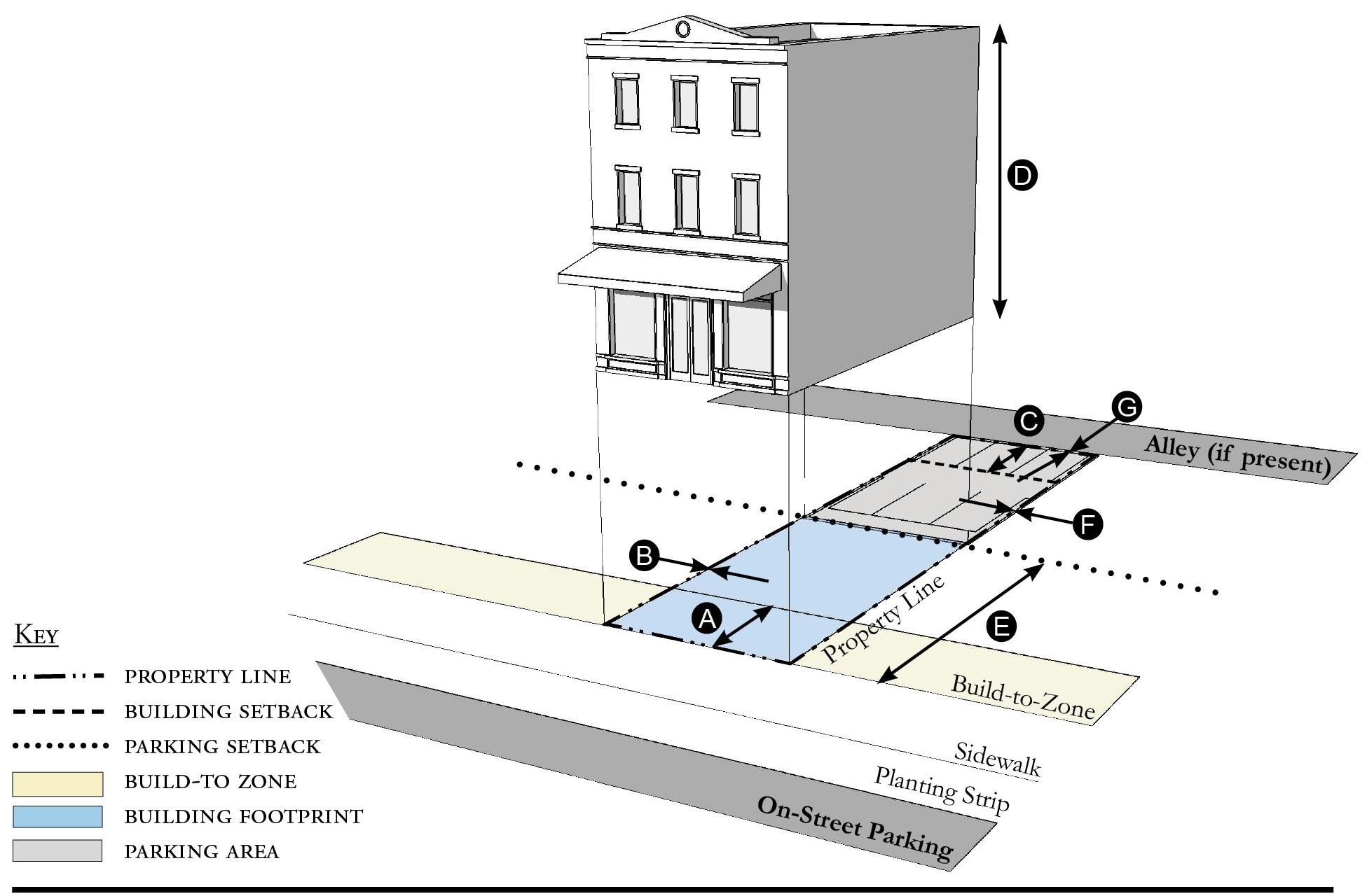
| Building Placement, see 12.1.04.6 | ||
| Frontage Buildout | 80% min. | |
| Front Build-to-Zone | 0' min., 15' max. | |
| Side at Street Build-to-Zone | 0' min., 15' max. | |
| Side at Property Line Setback 1 | 0' or 5' | |
| Rear Yard Setback 1 | 10' min./5' min. with alley | |
| Height, see 12.1.04.2 | ||
| Ceiling at Ground Level | 12' min. | |
| Building Height | Refer to Table R-5 | |
| Parking Placement, see 12.1.04.6 | ||
| Front Setback | 30' min. | |
| Side at Street Setback | 10' min. | |
| Side at Property Line Setback | 0' min. | |
| Rear Setback | 5' min/0' min with alley | |
Notes:
1 Section 12.1.04.11 Building Transitions applies when the rear or side of a property abuts a residential subdistrict or an existing single family dwelling.
For permitted Lot Size, Density, Building Coverage, and Open Space, see Table R-5.
Figure R-5.02 Mixed-Use Building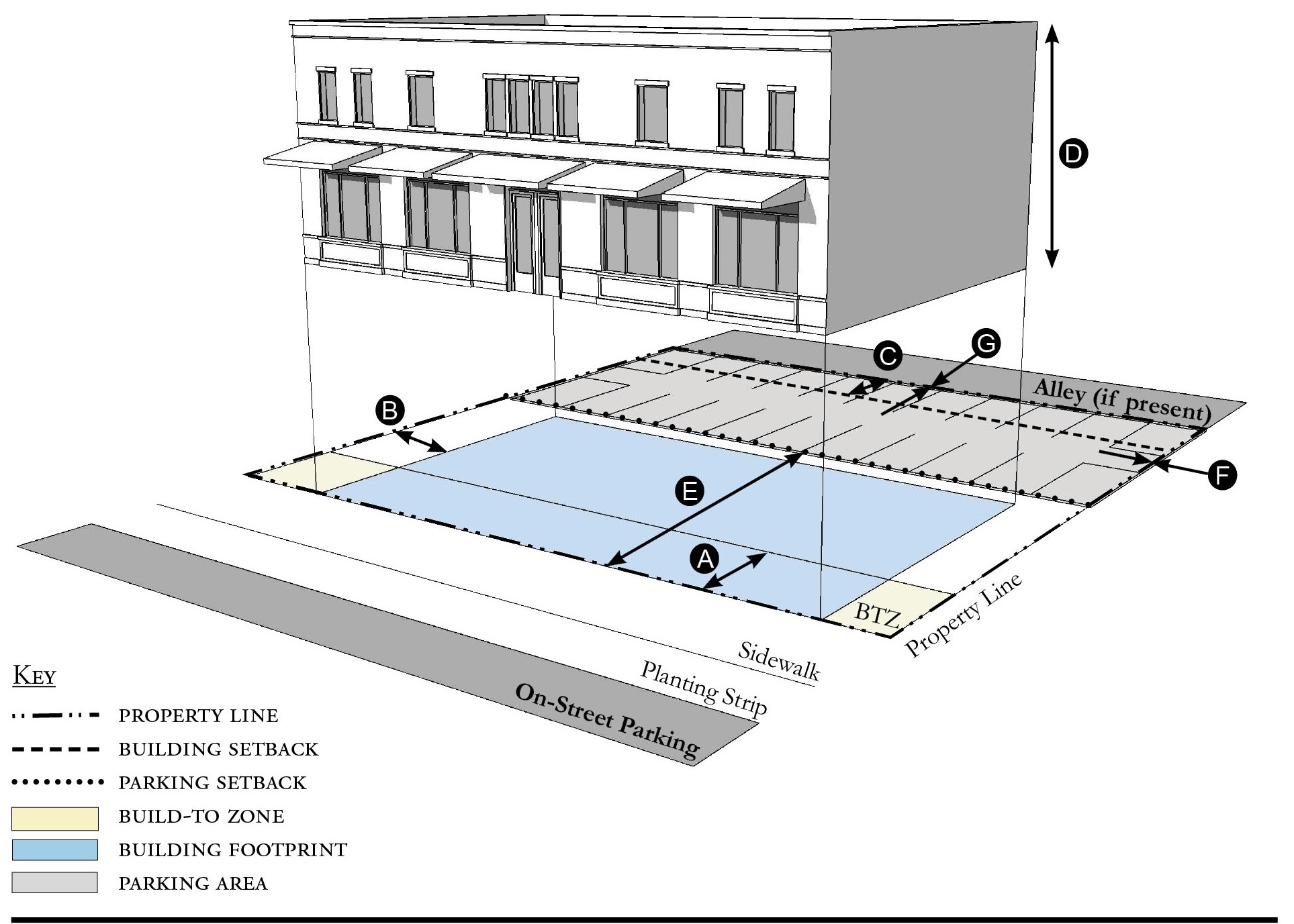
| Building Placement, see 12.1.04.6 | ||
| Frontage Buildout | 80% min. | |
| Front Build-to-Zone | 0' min., 15' max. | |
| Side at Street Build-to-Zone | 5' min., 15' max. | |
| Side at Property Line Setback 1 | 5' min. or 10' max. | |
| Rear Yard Setback 1 | 10' min./5' min. with alley | |
| Height, see 12.1.04.2 | ||
| Ceiling at Ground Level | 12' min. | |
| Building Height | Refer to Table R-5 | |
| Parking Placement, see 12.1.04.6 | ||
| Front Setback | 30' min. | |
| Side at Street Setback | 10' min. | |
| Side at Property Line Setback | 0' min. | |
| Rear Setback | 5' min/0' min with alley | |
Notes:
1 Section 12.1.04.11 Building Transitions applies when the rear or side of a property abuts a residential subdistrict or an existing single family dwelling.
For permitted Lot Size, Density, Building Coverage, and Open Space, see Table R-5.
Figure R-5.03 Office Building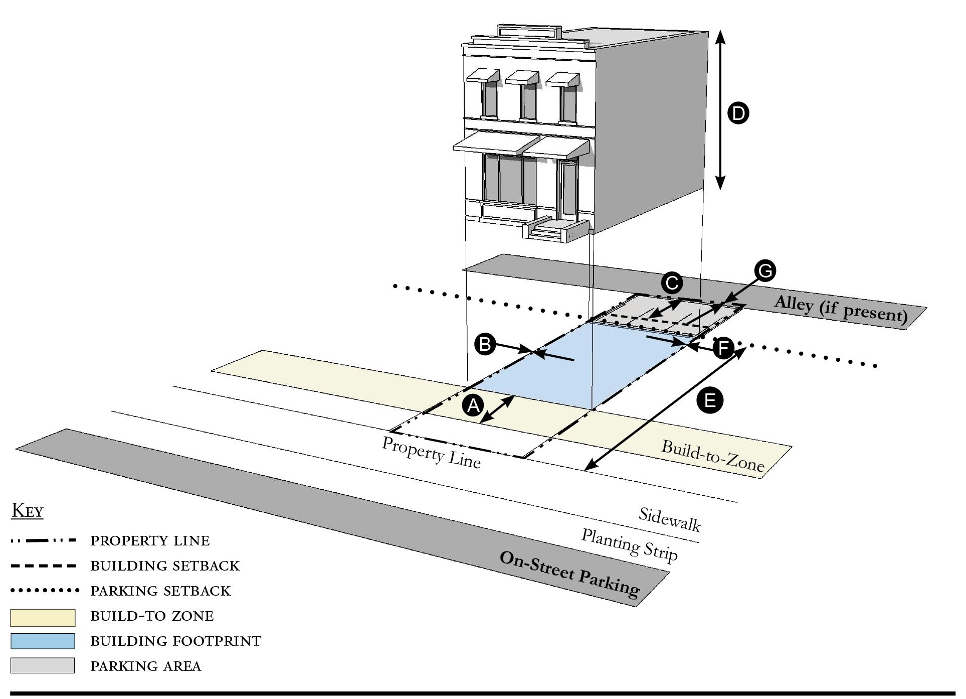
| Building Placement, see 12.1.04.6 | ||
| Frontage Buildout | 80% min. | |
| Front Build-to-Zone | 10' min./15' max. | |
| Side at Street Build-to-Zone | 10' min./15' max. | |
| Side at Property Line Setback 1 | 0' or 5' | |
| Rear Yard Setback 1 | 10' min./5' min. with alley | |
| Height, see 12.1.04.2 | ||
| Ceiling at Ground Level | 12' min. | |
| Building Height | Refer to Table R-5 | |
| Parking Placement, see 12.1.04.6 | ||
| Front Setback | 30' min. | |
| Side at Street Setback | 10' min. | |
| Side at Property Line Setback | 0' min. | |
| Rear Setback | 5' min/0' min with alley | |
Notes:
1 Section 12.1.04.11 Building Transitions apllies when the rear or side of a property abuts a residential subdistrict or an existing single family dwelling.
For permitted Lot Size, Density, Building Coverage, and Open Space, see Table R-5.
Figure R-5.04 Apartment Building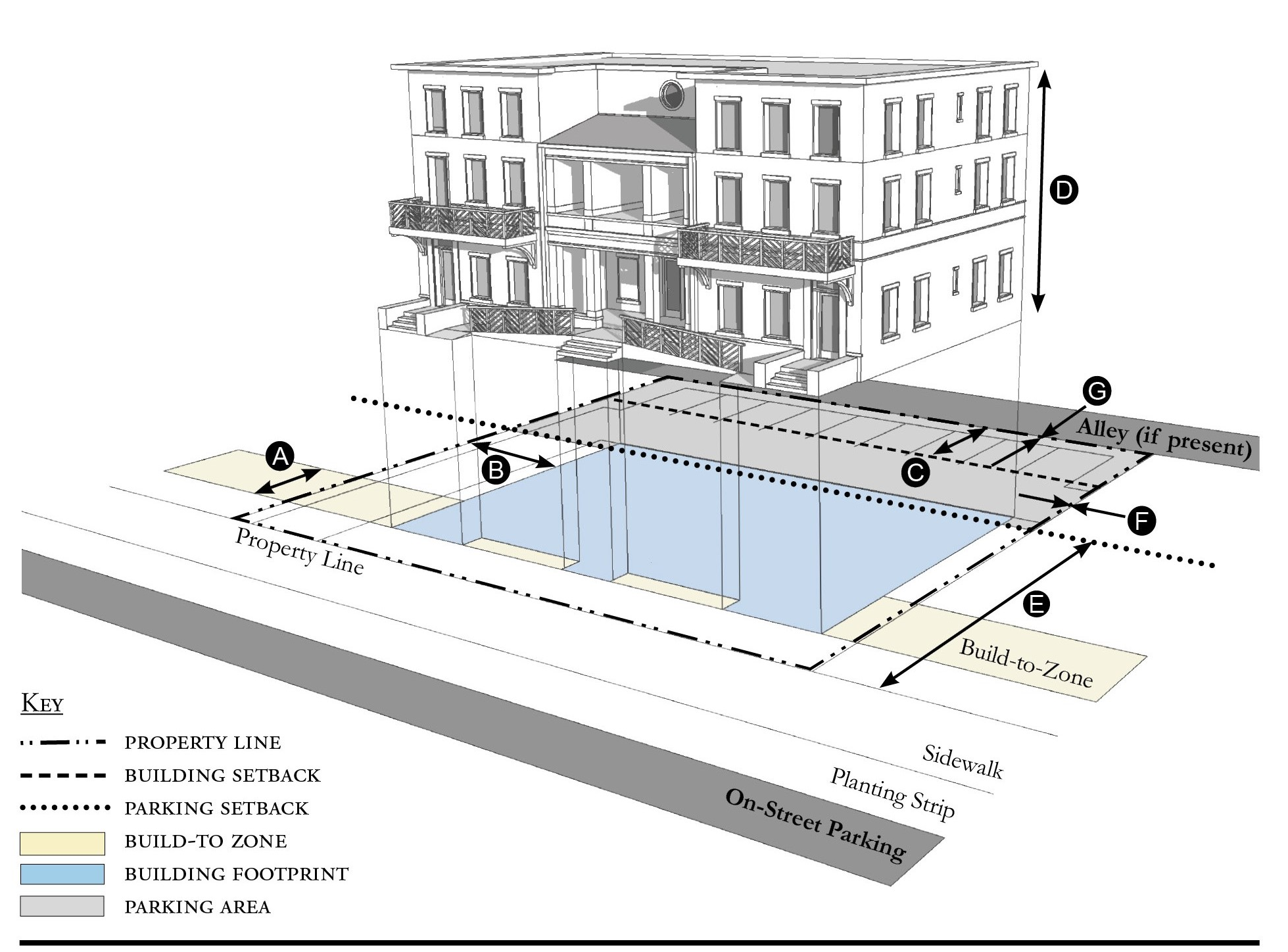
| Building Placement, see 12.1.04.6 | ||
| Frontage Buildout | 60% min. | |
| Front Build-to-Zone | 10' min./25' max. | |
| Side at Street Build-to-Zone | 10' min./15' max. | |
| Side at Property Line Setback 1 | 5' min. | |
| Rear Yard Setback 1 | 10' min./5' min. with alley | |
| Height, see 12.1.04.2 | ||
| Ceiling at Ground Level | Not applicable | |
| Building Height | Refer to Table R-5 | |
| Parking Placement, see 12.1.04.6 | ||
| Front Setback | 30' min. | |
| Side at Street Setback | 10' min. | |
| Side at Property Line Setback | 5' min./0' min. with alley | |
| Rear Setback | 5' min./0' min. with alley | |
Notes:
1 Section 12.1.04.11 Building Transitions applies when the rear or side of a property abuts a residential subdistrict or an existing single family dwelling.
For permitted Lot Size, Density, Building Coverage, and Open Space, see Table R-5.
Figure R-5.05 Courtyard Building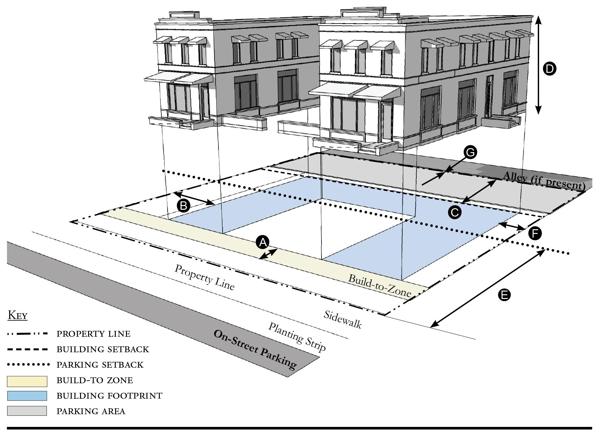
| Building Placement, see 12.1.04.6 | ||
| Frontage Buildout | 80% min. includes courtyard | |
| Front Build-to-Zone | 10' min./25' max. | |
| Side at Street Build-to-Zone | 10' min./15' max. | |
| Side at Property Line Setback 1 | 5' min. | |
| Rear Yard Setback 1 | 10' min./5' min. with alley | |
| Height, see 12.1.04.2 | ||
| Ceiling at Ground Level | Not applicable | |
| Building Height | Refer to Table R-5 | |
| Parking Placement, see 12.1.04.6 | ||
| Front Setback | 30' min. | |
| Side at Street Setback | 10' min. | |
| Side at Property Line Setback | 5' min./0' min. with alley | |
| Rear Setback | 5' min./0' min. with alley | |
Notes:
1 Section 12.1.04.11 Building Transitions applies when the rear or side of a property abuts a residential subdistrict or an existing single family dwelling.
For permitted Lot Size, Density, Building Coverage, and Open Space, see Table R-5.
Figure R-5.06 Townhouse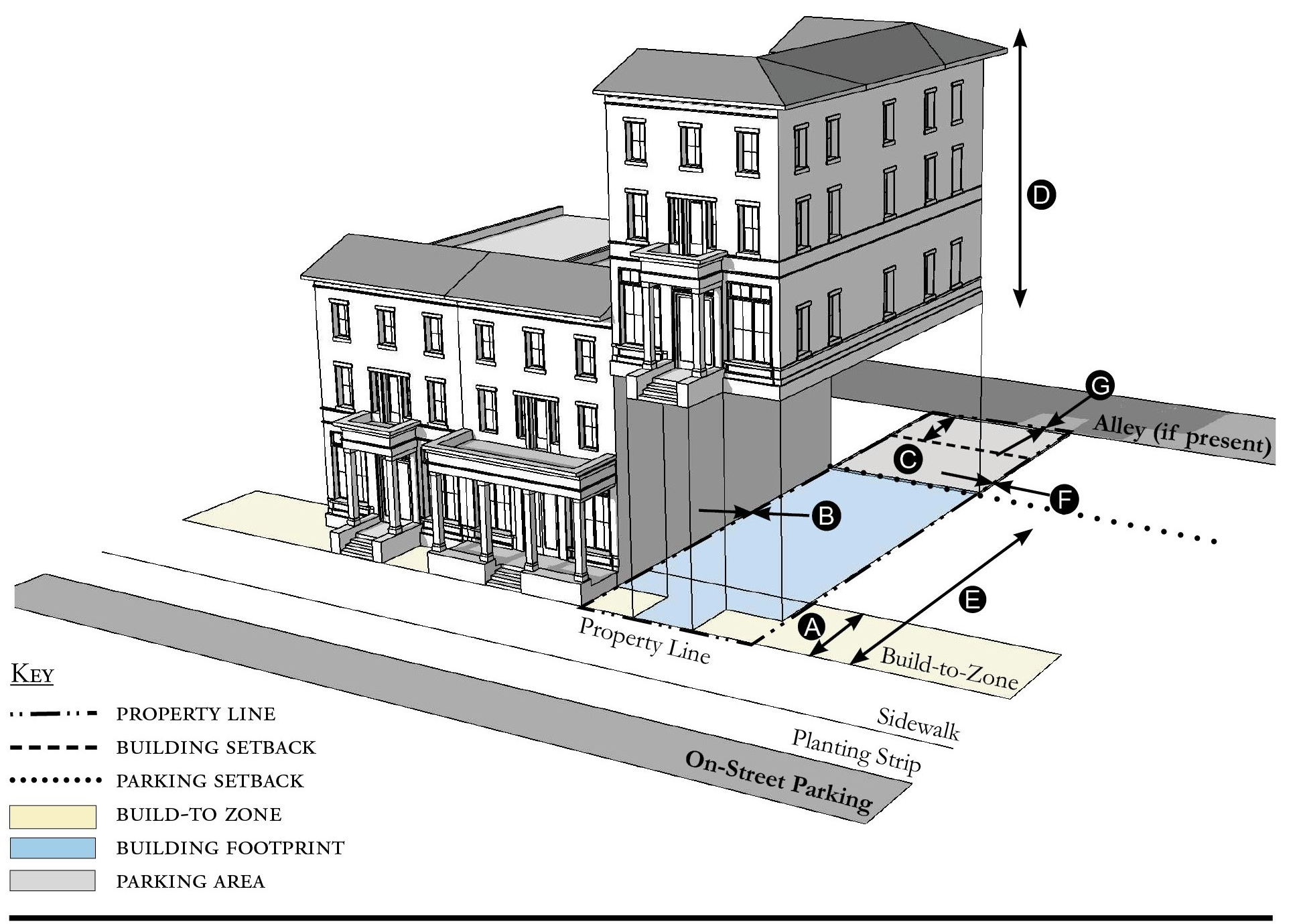
| Building Placement, see 12.1.04.6 | ||
| Frontage Buildout | 80% min. | |
| Front Build-to-Zone | 0' min./15' max. | |
| Side at Street Build-to-Zone | 0' min./15' max. | |
| Side at Property Line Setback 1, 2 | 0' min. or 10' min. | |
| Rear Yard Setback 1 | 10' min./5' min. with alley | |
| Height, see 12.1.04.2 | ||
| Ceiling at Ground Level | Not applicable | |
| Building Height | Refer to Table R-5/2 stories min. | |
| Parking Placement, see 12.1.04.6 | ||
| Front Setback | 30' min. | |
| Side at Street Setback | 10' min. | |
| Side at Property Line Setback | 0' min. | |
| Rear Setback | 5' min./0' min. with alley | |
Notes:
Townhouses shall have a maximum grouping of 8 dwelling units and a minimum Setback of 15 feet between buildings.
1 Section 12.1.04.11 Building Transitions applies when the rear or side of a property abuts a residential subdistrict or an existing single family dwelling.
2 When adjacent to another property that is not part of the townhouse development the Side at Property Line Setback is 10 feet minimum from the property line.
For permitted Lot Size, Density, Building Coverage, and Open Space, see Table R-5.
Figure R-5.07 Live/Work Building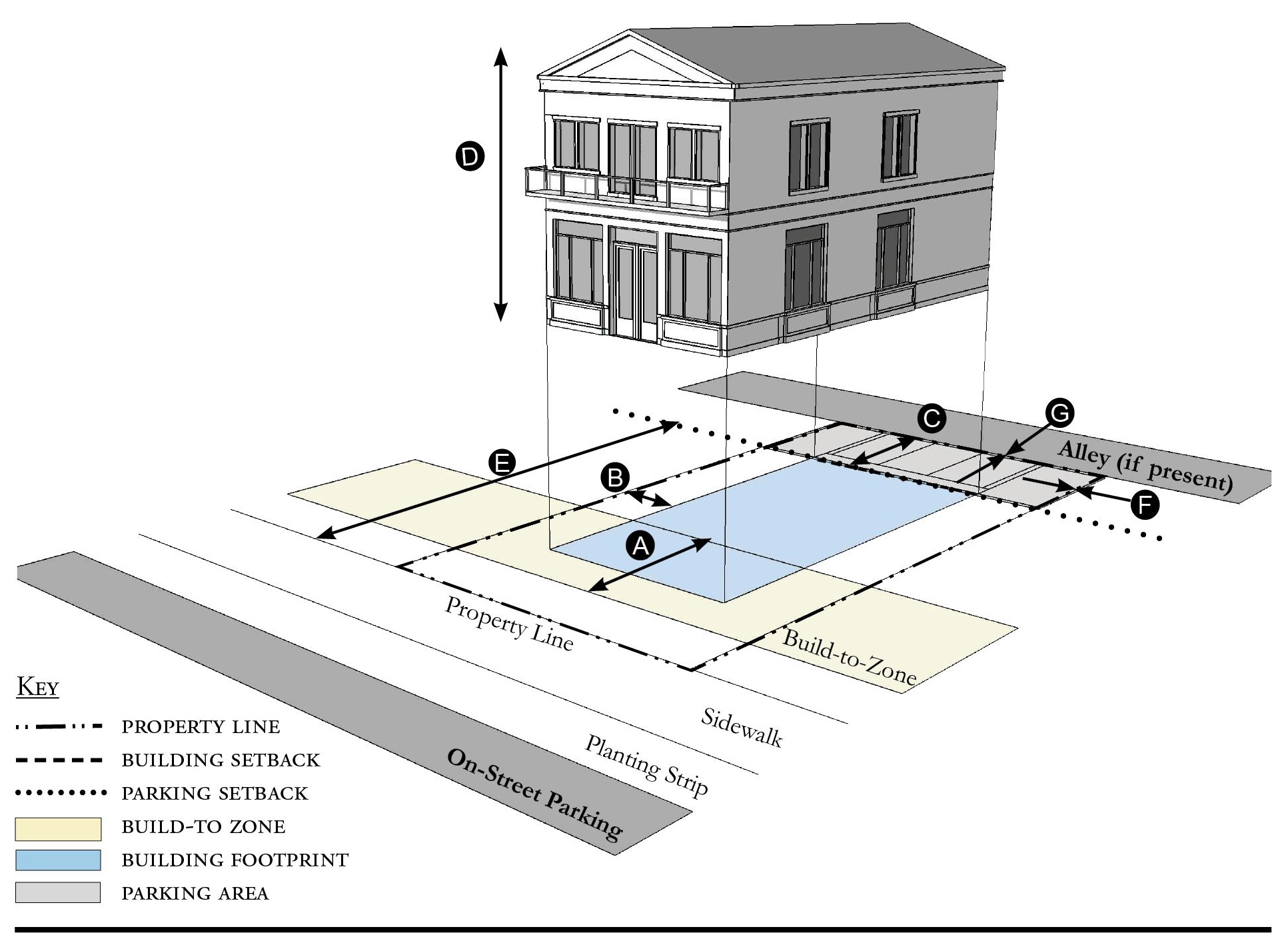
| Building Placement, see 12.1.04.6 | ||
| Frontage Buildout | 80% min. | |
| Front Build-to-Zone | 10' min./25' max. | |
| Side at Street Setback | 10' min. | |
| Side at Property Line Setback 1 | 10' min. | |
| Rear Yard Setback 1 | 10' min | |
| Height, see 12.1.04.2 | ||
| Ceiling at Ground Level | 12' min. | |
| Building Height | Refer to Table R-5 | |
| Parking Placement, see 12.1.04.6 | ||
| Front Setback | 30' min. | |
| Side at Street Setback | 10' min. | |
| Side at Property Line Setback | 0' min. | |
| Rear Setback | 5' min./0' min. with alley | |
| Parking Placement does not prohibit parking in a residential driveway or a side yard driveway. | ||
Notes:
1 Section 12.1.04.11 Building Transitions applies when the rear or side of a property abuts a residential subdistrict or an existing single family dwellings.
For permitted Lot Size, Density, Building Coverage, and Open Space, see Table R-5.
Figure R-5.08 Side Yard House
| Building Placement, see 12.1.04.6 | ||
| Frontage Buildout 1 | 60% min. | |
| Front Build-to-Zone | 10' min./25' max. | |
| Side at Street Build-to-Zone | 10' min. | |
| Side at Property Line Setback | 5' min., 10' min. other side | |
| Rear Yard Setback | 10' min/5; min. with alley | |
| Height, see 12.1.04.2 | ||
| Ceiling at Ground Level | Not applicable | |
| Building Height | 30'/2 stories max. | |
| Parking Placement, see 12.1.04.6 | ||
| Front Setback | 30' min. | |
| Side at Street Setback | 10' min. | |
| Side at Property Line Setback | 5' min. | |
| Rear Setback | 5' min./0' min. with alley | |
| Parking Placement does not prohibit parking in a residential driveway or a side yard driveway. | ||
Notes:
1 For this Building Type, the frontage buildout requirement may be met with the provision of a continuous wall or fence along the lot frontage.
For permitted Lot Size, Density, Building Coverage, and Open Space, see Table R-5.
Figure R-5.09 Cottage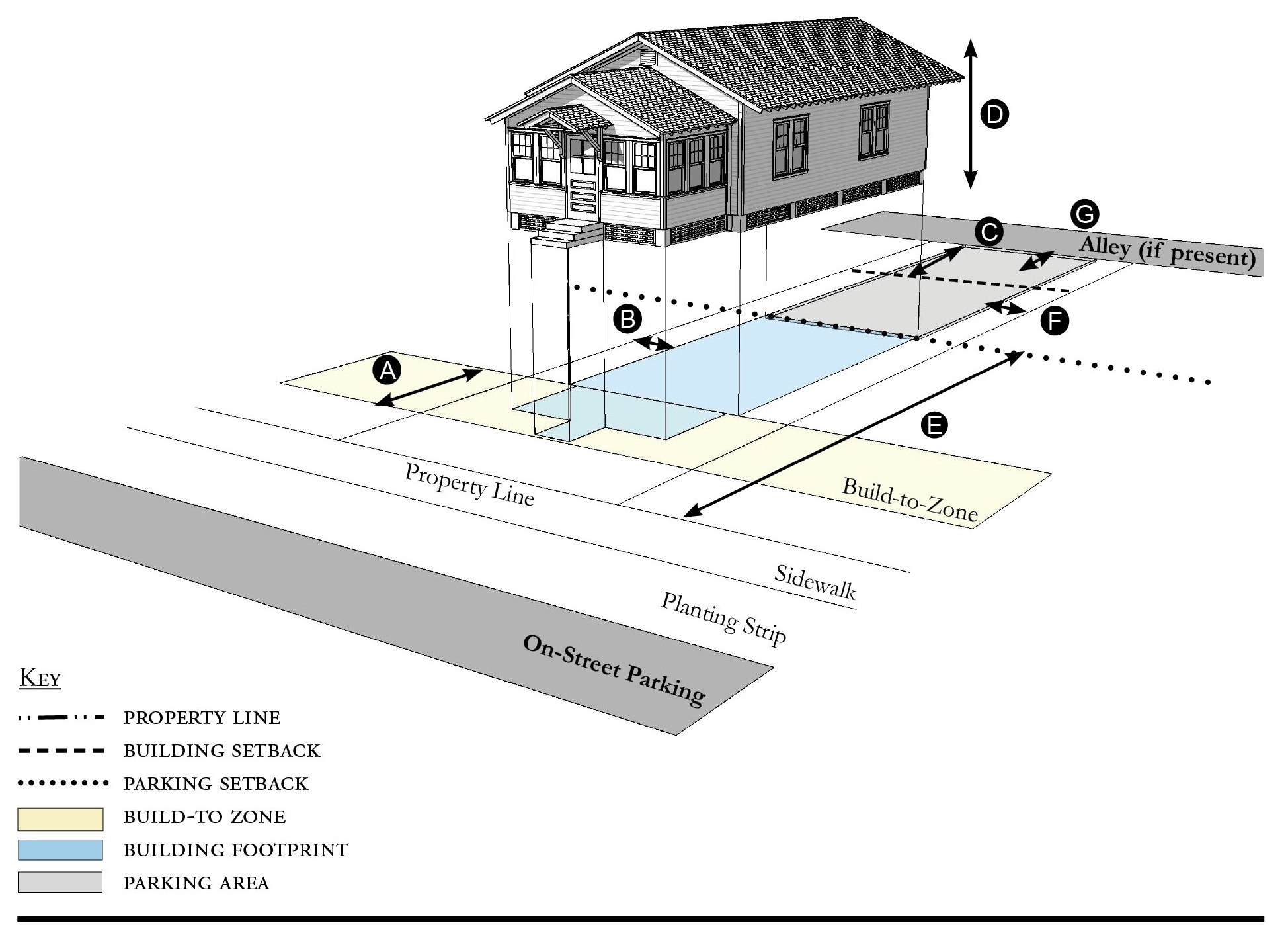
| Building Placement, see 12.1.04.6 | ||
| Frontage Buildout 1 | 60% min. | |
| Front Build-to-Zone | 10' min./25' max. | |
| Side at Street Build-to-Zone | 5' min., 10' max. | |
| Side at Property Line Setback | 5' min. | |
| Rear Yard Setback | 10' min | |
| Height, see 12.1.04.2 | ||
| Ceiling at Ground Level | Not applicable | |
| Building Height | 30'/2 stories max. | |
| Parking Placement, see 12.1.04.6 | ||
| Front Setback | 30' min. | |
| Side at Street Setback | 10' min. | |
| Side at Property Line Setback | 5' min. | |
| Rear Setback | 5' min. | |
| Parking Placement does not prohibit parking in a residential driveway or a side yard driveway. | ||
Notes:
Cottages shall not exceed a footprint of 2,000 square feet.
1 For this Building Type, the frontage buildout requirement may be met with the provision of a continuous wall or fence along the lot frontage.
For permitted Lot Size, Density, Building Coverage, and Open Space, see Table R-5.
Figure R-5.10 Cottage Court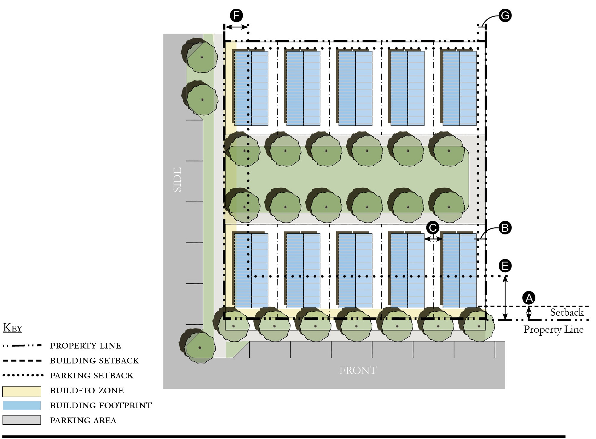
| Building Placement, see 12.1.04.6 | ||
| Frontage Buildout 1 | 60% min. | |
| Front Setback 2 | 6' min. | |
| Side/Rear at Street Setback 2 | 6' min. | |
| Side/Rear at Property Line Setback 2 | 6' min. | |
| Unit Separation 2 | 10' min | |
| Height, see 12.1.04.2 | ||
| Ceiling at Ground Level | Not applicable | |
| Building Height | 30'/2 stories max. | |
| Parking Placement, see 12.1.04.6 | ||
| Front Setback 2 | 30' min. | |
| Side at Street Setback 2 | 10' min. | |
| Side at Property Line Setback 2 | 5' min. | |
| Rear Setback 2 | 5' min. | |
Notes:
Cottage Courts may include duplexes.
1 For this Building Type, the frontage buildout requirement may be met with the provision of a continuous wall or fence along the lot frontage.
2 The Building Placement standards for a Cottage Court apply to the installation of a new mobile or modular home in the Mobile Home Subdistrict except that frontage standards do not apply. Parking Placement standards also do not apply. Written verification by the property owner that the proposed location and footprint of the dwelling comply with the 10-ft. minimum separation shall be provided with the building permit application.
For permitted Lot Size, Density, Building Coverage, and Open Space, see Table R-5.
Figure R-5.11 Duplex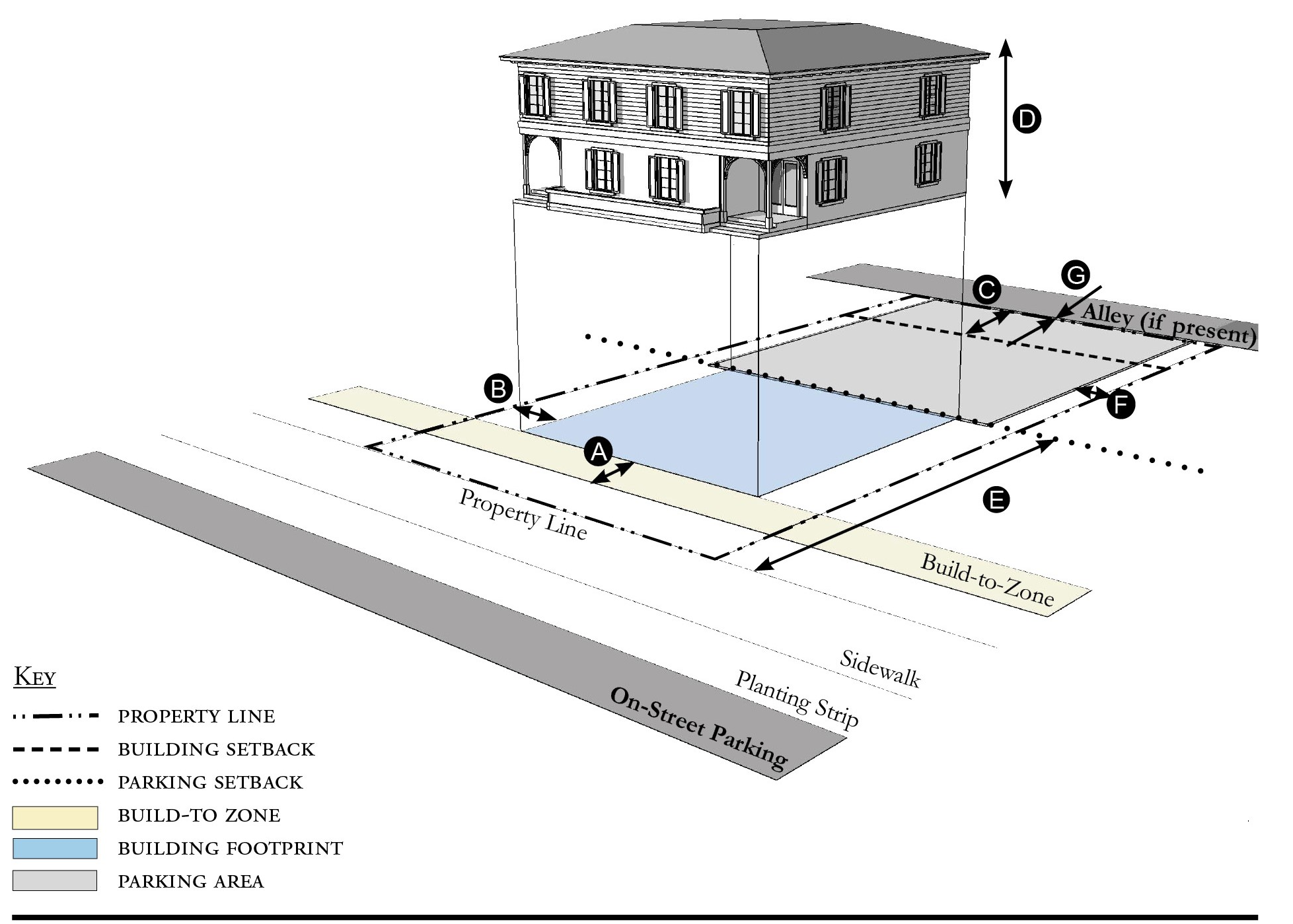
| Building Placement, see 12.1.04.6 | ||
| Frontage Buildout | 60% min. | |
| Front Build-to-Zone | 10' min./25' max. | |
| Side at Street Setback | 10' min. | |
| Side at Property Line Setback 1 | 5' min. | |
| Rear Yard Setback 1 | 10' min | |
| Height, see 12.1.04.2 | ||
| Ceiling at Ground Level | Not applicable | |
| Building Height | 30' max. | |
| Parking Placement, see 12.1.04.6 | ||
| Side at Property Line | 5' min. | |
| Rear Setback | 5' min./0' min. with alley | |
| Parking Placement does not prohibit parking in a residential driveway or a side yard driveway. | ||
| Refer to Section 12.1.07.8 Garage & Driveway for parking and driveway configurations for Single Family Dwellings. | ||
Notes:
An ADU is prohibited on lots on which a duplex is located.
1 For this Building Type, the frontage buildout requirement may be met with the provision of a continuous wall or fence along the lot frontage.
For permitted Lot Size, Density, Building Coverage, and Open Space, see Table R-5.
Figure R-5.12 All Yard House
| Building Placement, see 12.1.04.6 | ||
| Frontage Buildout | Not Required | |
| Front Setback | 20' min. | |
| Side at Street Setback | 6' min. | |
| Side at Property Line Setback | 6' min. | |
| Rear Yard Setback | 10' min | |
| Height, see 12.1.04.2 | ||
| Ceiling at Ground Level | Not applicable | |
| Building Height | 30'/3 stories max | |
| Parking Placement, see 12.1.04.G | ||
| Side at Property Line | 5' min. | |
| Rear Setback | 5' min., 0' min. alley | |
| Parking Placement does not prohibit parking in a residential driveway or a side yard driveway. | ||
| Refer to Section 12.1.07.8 Garage & Driveway for parking and driveway configurations for Single Family Dwellings. | ||
Notes:
For permitted Lot Size, Density, Building Coverage, and Open Space, see Table R-5.
Figure R-5.13 Outbuilding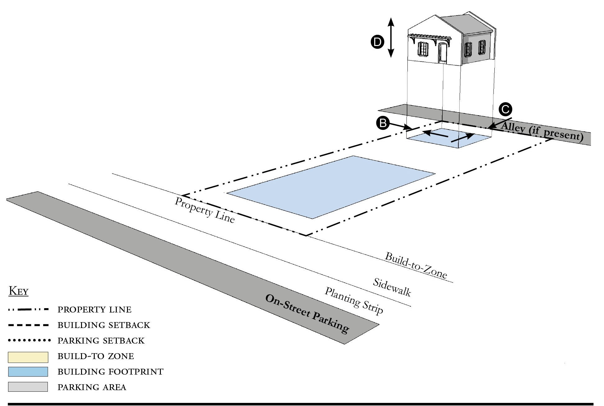
| Building Placement, see 12.1.04.6 | ||
| Frontage Buildout | Not applicable | |
| Front Build-to-Zone | Not applicable | |
| Side at Street Build-to-Zone | Not applicable | |
| Side at Property Line Setback | 5' min. | |
| Rear Yard Setback 1 | 5' min | |
| Height, see 12.1.04.2 | ||
| Ceiling at Ground Level | Not applicable | |
| Building Height | 24'/2 stories max. | |
Notes:
Outbuildings shall not exceed a footprint of 850 square feet.
For permitted Lot Size, Density, Building Coverage, and Open Space, see Table R-5.
Figure R-5.14 Boat Barn
| Building Placement, see 12.1.04.6 | ||
| Frontage Buildout | 60% min. | |
| Front Build-to-Zone 1 | 0' min., 15' max. | |
| Side at Street Setback | 10' min. | |
| Side at Property Line Setback 2 | 10' min. | |
| Rear Yard Setback 2 | 10' min/5' min. with alley | |
| Height, see 12.1.04.2 | ||
| Ceiling at Ground Level | Not applicable | |
| Building Height | 40' max. | |
| Parking Placement, see 12.1.04.6 | ||
| Front Setback | 30' min. | |
| Side at Street Setback | 5' min. | |
| Side at Property Line Setback | 5' min. | |
| Rear Setback | 5' min./0' min. with alley | |
| Parking shall not be located between the building and the street. | ||
Notes:
A commercial liner shall be a minimum depth of 20 feet.
1 Measured from existing Right-of-Way or edge of pavement.
2 Section 12.1.04.11 Building Transitions applies when the rear or side of a property abuts a residential subdistrict or an existing single family dwelling.
For permitted Lot Size, Density, Building Coverage, and Open Space, see Table R-5.
Figure R-5.15 Industrial Building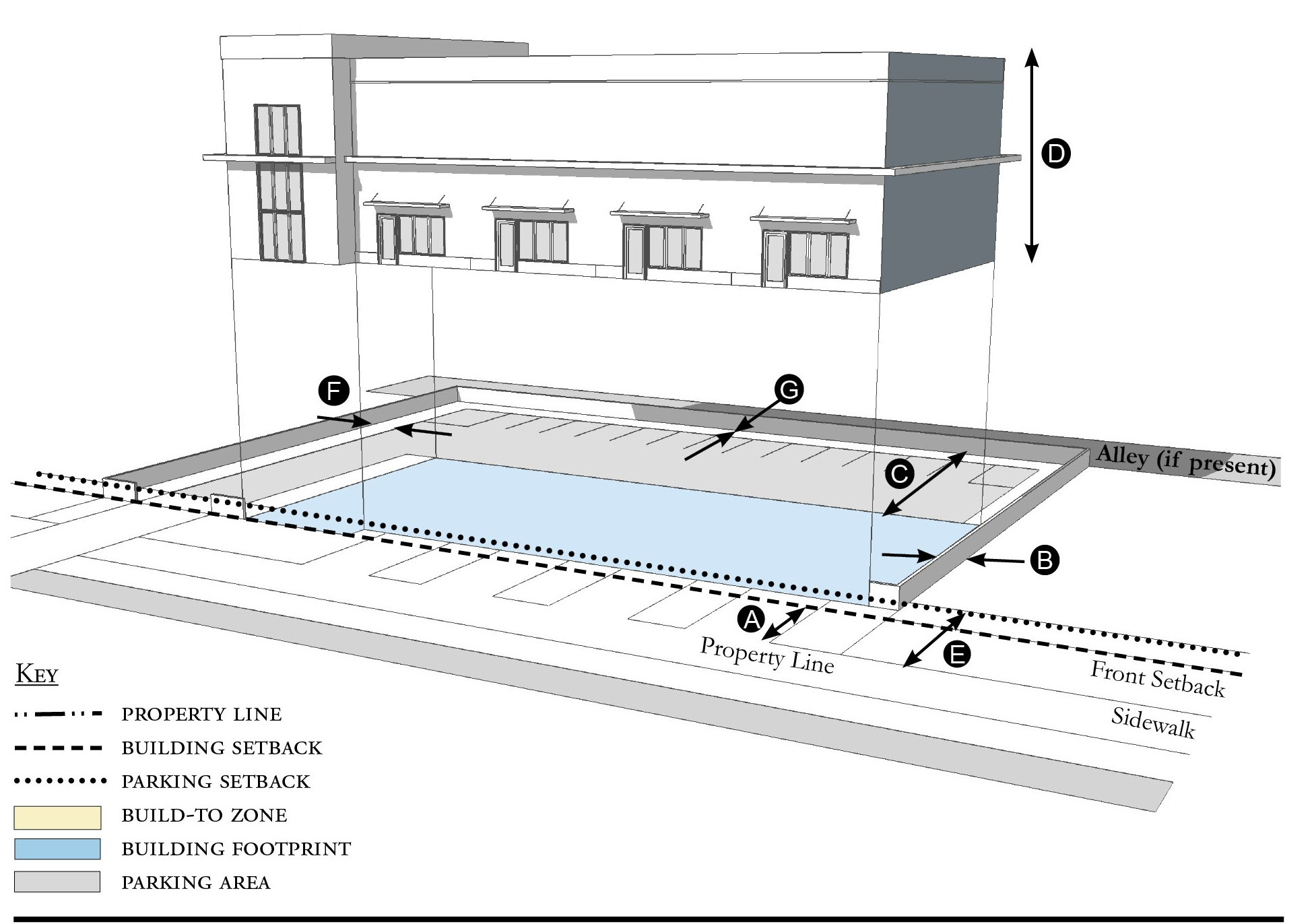
| Building Placement, see 12.1.04.6 | ||
| Frontage Buildout | Not required | |
| Front Setback 1 | 20' min. | |
| Side at Street Setback | 5' min. | |
| Side at Property Line Setback 2 | 5' min. | |
| Rear Yard Setback 2 | 10' min/5' min. with alley | |
| Height, see 12.1.04.2 | ||
| Ceiling at Ground Level | Not applicable | |
| Building Height | 40' max. | |
| Parking Placement, see 12.1.04.6 | ||
| Front Setback | 30' min. | |
| Side at Street Setback | 5' min. | |
| Side at Property Line Setback | 5' min. | |
| Rear Setback | 5' min./0' min. with alley | |
| Parking shall not be located between the building and the street. | ||
Notes:
1 Measured from existing Right-of-Way or edge of pavement.
2 Section 12.1.04.11 Building Transitions applies when the rear or side of a property abuts a residential subdistrict or an existing single family dwelling.
For permitted Lot Size, Density, Building Coverage, and Open Space, see Table R-5.
(Ord. No. 1121, pt. I, 12-17-2019; Ord. No. 1159, pt. 1(Exh. A), 5-11-2021; Ord. No. 1237, Pt. I(Exh. 1), 1-28-2025)
Sec. 12.3.06. - Street standards.
1.
Applicability. Street Standards that apply in all Redevelopment Zoning Districts are provided in Section 12.1.06. The additional Street Standards which apply in the Rio Redevelopment Zoning District are specified in this section.
2.
Street Regulating Plan. A Street Regulating Plan is provided in Figure R-3, Section 12.3.02. Features identified in the Street Regulating Plan are described in 12.1.02.2.
a.
Primary Streets.
b.
Secondary Streets.
c.
Recommended Future Streets.
d.
Recommended Future Alleys.
3.
Future Streets.
a.
Street Location. The schematic location of proposed streets is shown on the Street Regulating Plan. The exact location may be adjusted during the development review process provided the new location meet these requirements:
i.
The adjusted location does not reduce the level of connectivity with surrounding streets, both existing and proposed.
ii.
The adjusted location does not reduce the level of street connectivity within the site or substantially increase the average block size.
iii.
The adjusted location does not diminish or eliminate any proposed civic space or civic building shown on the Regulating Plan.
iv.
The adjusted location maintains or enhances pedestrian convenience and safety and does not create any traffic hazards.
b.
Street Types. Proposed streets may be designed and constructed as any one of the following street types below defined in Section 12.1.06:
i.
Local Street 1.
ii.
Local Street 2.
iii.
Local Street 3.
iv.
Neighborhood Street 1.
v.
Neighborhood Street 2.
vi.
Yield Street.
4.
Improvements To Existing Streets. The planting of new shade trees shall be required for project approval and shall be coordinated with existing or future CRA and County streetscape improvements. As provided in Section 12.1.06, the County Engineer may allow deviations from these minimum standards when necessary due to the location of existing buildings, constrained right-of-way, or to meet other goals for the particular street section.
a.
Primary streets shall have shade trees planted at 30-foot intervals. The trees shall be 16 feet in height, with a four-foot clear trunk, and four-inch dbh at the time of planting. The landscaping on CR-707 (Dixie Highway) shall include native and non-native trees with a minimum height of 16 feet, with a four-foot clear trunk, and three-inch dbh at the time of planting, planted at a maximum of 30-foot intervals. Along CR-707 (Dixie Highway), every other block shall be complemented with a bench and a garbage container. The landscape islands shall be sized appropriately to the maximum mature size of the tree.
b.
Secondary streets shall have shade trees planted at 30-foot intervals with a minimum height of 12 feet, with a four-foot clear trunk, and two-inch dbh at 30-foot intervals.
(Ord. No. 1121, pt. I, 12-17-2019; Ord. No. 1159, pt. 1(Exh. A), 5-11-2021)
Sec. 12.3.07. - Parking standards.
1.
Applicability. Parking Standards found in Sections 4.621 through 4.628, Div. 14, Article 4, are modified for all Redevelopment Zoning Districts in Parking Standards Section 12.1.07. Those modified Parking Standards apply in the Rio Redevelopment Zoning District except as specified otherwise in this section.
2.
Parking Rates. Refer to Section 12.1.07 for parking rates applicable to Redevelopment Zoning Districts.
3.
Screening of Parking from Residential Uses. There shall be an alley between parking areas and adjacent residential uses. Where an alley is not possible, there shall be a visual barrier between parking areas and residential uses. Refer to Landscaping Standards Section 12.3.09 Vehicular Use Areas.
4.
Parking Structures. Whenever a parking structure or surface parking provided beneath a building is located on a Primary Street, as identified on the Street Regulating Plan, Section 12.3.02, ground level commercial space shall be provided for a depth of no less than 20 feet measured from the front of the building.
5.
Distributing Parking. Where more than 200 parking spaces are provided onsite, such parking shall be distributed such that no more than 50 percent of the spaces are grouped in a single area of the parcel. Methods of distributing parking include locating parking adjacent to the rear or sides of a building or by physically separating parking areas with other buildings or landscaped areas.
6.
Shared Parking Lot.
a.
Shared parking lots must be located within 500 feet of each use. These lots may be separated from the use(s) by a street, easement, or other right-of-way.
b.
In order to meet the parking requirements, parking shared by different uses must be supported by evidence that peak parking demands of each use occur at different times of the day or days of the week. Section 4.626.B.2, Div. 14, Article 4, Shared Parking provides the methodology to support shared parking. Mixed-use developments do not have to meet this standard.
7.
Off-Street Loading. A minimum of one loading space must be provided for all buildings that receive or ship goods via semitrailer or trucks larger than 20 feet in length. The space shall not obstruct or otherwise hinder the movement of vehicles and pedestrians. Nonresidential development within Multifamily, Mobile Home, Detached 1 and Detached 2 Subdistricts shall conform with 4.626.B.4, Div. 14, Article 4 regarding the number of loading spaces.
8.
Boats, recreational vehicles or boat trailers. Section 3.201.C.2.h. Div. 4, Article 3, shall apply, except that boats, recreational vehicles or boat trailers that exceed 25 feet in length shall not be parked or stored in the front, side or rear setback.
(Ord. No. 1121, pt. I, 12-17-2019; Ord. No. 1159, pt. 1(Exh. A), 5-11-2021; Ord. No. 1196, pt. I(Exh. A), 5-9-2023)
Sec. 12.3.08. - Stormwater standards.
1.
Stormwater management standards are provided in Sections 4.381 through 4.390, Div. 9, Article 4 and apply in Redevelopment Zoning Districts except as modified in Section 12.1.08.
(Ord. No. 1121, pt. I, 12-17-2019)
Sec. 12.3.09. - Landscape standards.
1.
Table R-9 identifies which of the landscaping, buffering, and tree protection standards in Div. 15, Article 4 apply in the Rio Redevelopment Zoning District and which standards are modified, replaced, or do not apply in this Redevelopment Zoning District.
Table R-9 - Landscaping, Buffering, and Tree Protection Standards
2.
Single family dwellings or duplexes. Single family dwellings and duplexes are not required to submit a Landscape Plan or comply with Vehicular Use Area requirements. Required tree planting and landscape area do apply to single family dwellings and duplexes.
3.
Required landscape area.
a.
Table R-10 indicates the minimum percentage of the total developed area that must be landscaped.
b.
Landscaping shall be permitted in easements only with the written permission of the easement holder. A written agreement shall specify the party responsible for restoring disturbed landscape areas, shall be submitted to the county in a form acceptable to the County Attorney, and shall be recorded in the public records.
c.
Exposed dirt yards are prohibited.
4.
Required tree planting.
a.
Table R-10 indicates the minimum number of trees that must be planted.
b.
Tree species and size.
i.
Palm trees shall have a minimum height of 12 feet at the time of planting.
ii.
Fruit trees shall have a minimum height of five feet at the time of planting.
iii.
Other required trees shall have a minimum height of 12 feet, with a four-foot clear trunk, and two-inch diameter at breast height (dbh), at the time of planting.
c.
Trees planted in adjacent right-of-way in accordance with Section 12.3.06 or in other nearby public space shall be credited towards meeting the number of trees required by Table R-11. Any private use of the public right-of-way requires the approval of the County Engineer, a right-of-way use permit, a construction agreement, and an indemnification agreement.
d.
Trees planted in Vehicular Use Areas shall be credited towards meeting the number of trees required by Table R-10.
e.
FPL's Right Tree/Right Place Guidelines shall be considered when trees are planted near utilities.
Table R-10 - Required Landscape Area & Tree Planting
Table R-11 - Landscape Plan Application Requirements
1 On-site features only
5.
Landscape Plan. Development applications shall include a landscape plan prepared by a qualified professional that provides the location and type of existing and proposed features that are identified in Table R-11, which are summarized from the detailed requirements in Section 4.662.A, Div. 15, Article 4.
a.
Column A requirements apply to an application for a final site plan.
b.
Column B requirements apply to an application for a building permit for a Small Site which is defined as the construction or expansion of a principal building or accessory structure on a lawfully established lot or adjacent lots, provided the parcel being developed is less than one-half acre.
c.
Column B requirements also apply to an application for a substantial improvement or substantial renovation of a building exterior on any lot regulated by Article 12 as those terms are defined in Section 4.871.B, Div. 20, Article 4.
6.
Vehicular Use Areas.
a.
Perimeter landscaping. Landscaping shall be provided along the perimeter of vehicular use areas in accordance with the following standards:
i.
The side of a vehicular use area fronting SR 707 shall be planted with trees at 30-foot intervals. The trees shall be 16 feet in height, with a four-foot clear trunk, and four-inch dbh at the time of planting.
ii.
The side of a vehicular use area abutting a Detached, Detached Estate, Multifamily or Mobile Home that is not a part of the subject development shall be planted with trees with a minimum height of 16 feet, 4-foot clear trunk, and four-inch dbh, at 25-foot intervals in a landscape area that is at least ten feet wide. The trees, landscaped buffer and the wall, fence or hedge may be reduced or eliminated with the written consent of the owner of the residential property, which shall be recorded in the public records.
iii.
Any side of a vehicular use area not included in paragraph (i) or (ii) shall be planted with trees minimum height of 12 feet, with a four-foot clear trunk, and two-inch dbh at 30-foot intervals.
iv.
A wall, fence, or hedge shall be provided around all vehicular use areas. Between the vehicular use area and a road right-of-way, the wall, fence, or hedge shall not exceed four feet in height. For the remainder of the lot, it shall be no more than six feet in height. Walls and landscaping around parking areas shall provide pedestrian access every 50 linear feet. No wall, fence, or hedge is required along the side of a parking area that abuts another parking area.
b.
Interior landscaping. If a vehicular use area is larger than 15,000 square feet, landscaping shall be provided within its interior in accordance with Section 4.663.A.4, Div. 15, Article 4, except that these interior landscape areas may also be used as stormwater management and conveyance facilities. If a vehicular use area is equal to or smaller than 15,000 square feet, no interior landscaping, terminal islands, interior medians, or interior islands are required.
(Ord. No. 1121, pt. I, 12-17-2019; Ord. No. 1159, pt. 1(Exh. A), 5-11-2021)
Sec. 12.3.10. - Wall and fence standards.
1.
Walls and fences must comply with the Wall and Fence Standards established for all Redevelopment Zoning Districts in Section 12.1.10.
(Ord. No. 1121, pt. I, 12-17-2019)
Sec. 12.3.11. - Sign standards.
1.
Signs must comply with the Sign Standards established for all Redevelopment Zoning Districts in Section 12.1.11 except where modified below.
2.
Wall signs. Table R-12 supersedes the signage-area table in Section 4.700, Div. 16, Article 4.
3.
Banner signs. Banner signs may be erected for a temporary period, not to exceed 90 days. If hung over a right-of-way, they must comply with all applicable FDOT and Martin County regulations.
4.
Freestanding signs. One freestanding sign is permitted per building or each 200 lineal feet of property frontage. The freestanding sign shall be a pedestal sign with a maximum square footage of 50 square feet per sign face.
5.
Murals are permitted and defined in Art. 4, Div. 16.
6.
Types of signs permitted. The list of permitted signs in Section 4.703, Div. 16, Article 4 is adjusted by adding the following type of sign:
a.
Sandwich or sidewalk signs as defined in Section 4.693, Div. 16, Article 4, are permitted in the Core, General, Waterfront, and Corridor Subdistricts, provided the signs do not exceed six square feet per face, do not unreasonably obstruct pedestrian or vehicular movement, and are moved off sidewalks or other public property by 9:00 p.m. daily.
7.
Lettering and logo size. Table R-12 provides the maximum height of lettering and logos. Section 4.699, Div. 16, Article 4 establishes how the height of irregularly shaped features shall be measured.
Table R-12 - Sign Size Limitations
(Ord. No. 1121, pt. I, 12-17-2019; Ord. No. 1159, pt. 1(Exh. A), 5-11-2021)
Sec. 12.3.12. - Architectural standards.
Architectural Standards must comply with the Architectural Standards established for all Redevelopment Zoning Districts in Section 12.1.12.
(Ord. No. 1121, pt. I, 12-17-2019; Ord. No. 1159, pt. 1(Exh. A), 5-11-2021; Ord. No. 1237, Pt. I(Exh. 1), 1-28-2025)
Sec. 12.4.01. - Purpose.
1.
Old Palm City is an intimate, interconnected community that exhibits a traditional small town setting that forms the foundation for a pleasant, quality living environment. Schools, small shops and neighborhood serving businesses, parks and the St. Lucie River are within easy walking distance of residents within the community. This division is intended to:
a.
Improve Old Palm City as a desirable place to live, and conduct business.
b.
Strengthen Old Palm City's character and economic well-being through both public and private redevelopment initiatives.
c.
Promote and accomplish the goals, objectives, and policies of the Martin County Comprehensive Growth Management Plan and achieve the vision for Old Palm City as set forth in its Community Redevelopment Plan.
2.
Old Palm City Redevelopment Zoning District. This Article 12, Division 4 of the Martin County Land Development Regulations establishes the Old Palm City Redevelopment Zoning District and the permitted uses and development standards applicable therein.
3.
Organization. How this Division is organized:
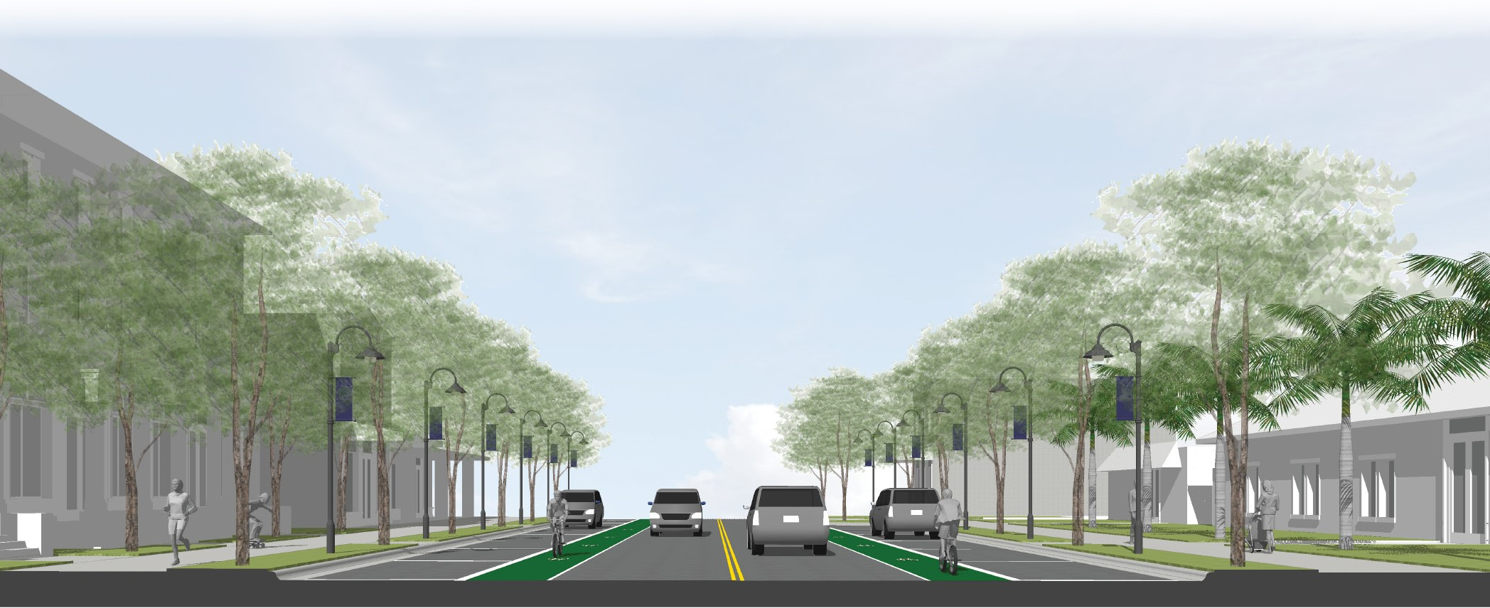
Figure OPC-1 Illustration of conceptual new development and existing buildings on
anticipated Mapp Road streetscape improvements
(Ord. No. 1130, § 1(Exh. A), 5-5-2020; Ord. No. 1159, pt. 1(Exh. A), 5-11-2021)
Sec. 12.4.02. - Regulating plan.
Figures OPC-2 and OPC-3 are the Regulating Plans that apply to the Old Palm City Redevelopment Zoning District. Section 12.1.02 describes the purpose and content of Regulating Plans.
Figure OPC-2 Regulating Plan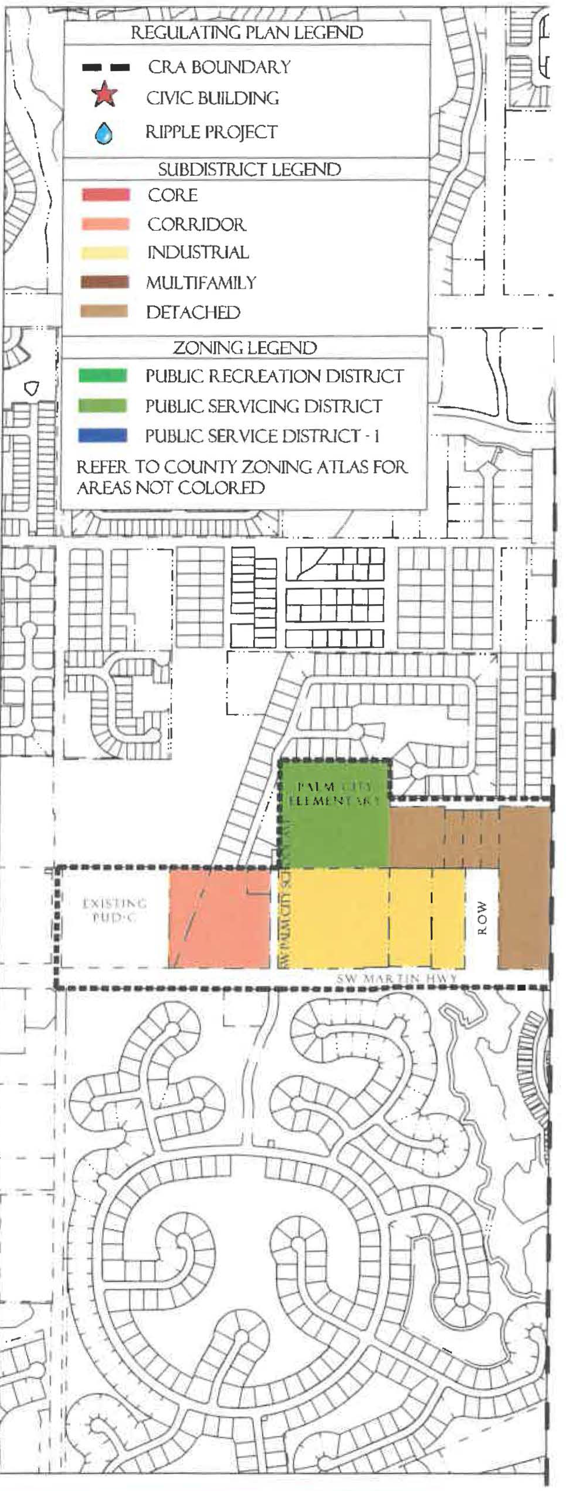
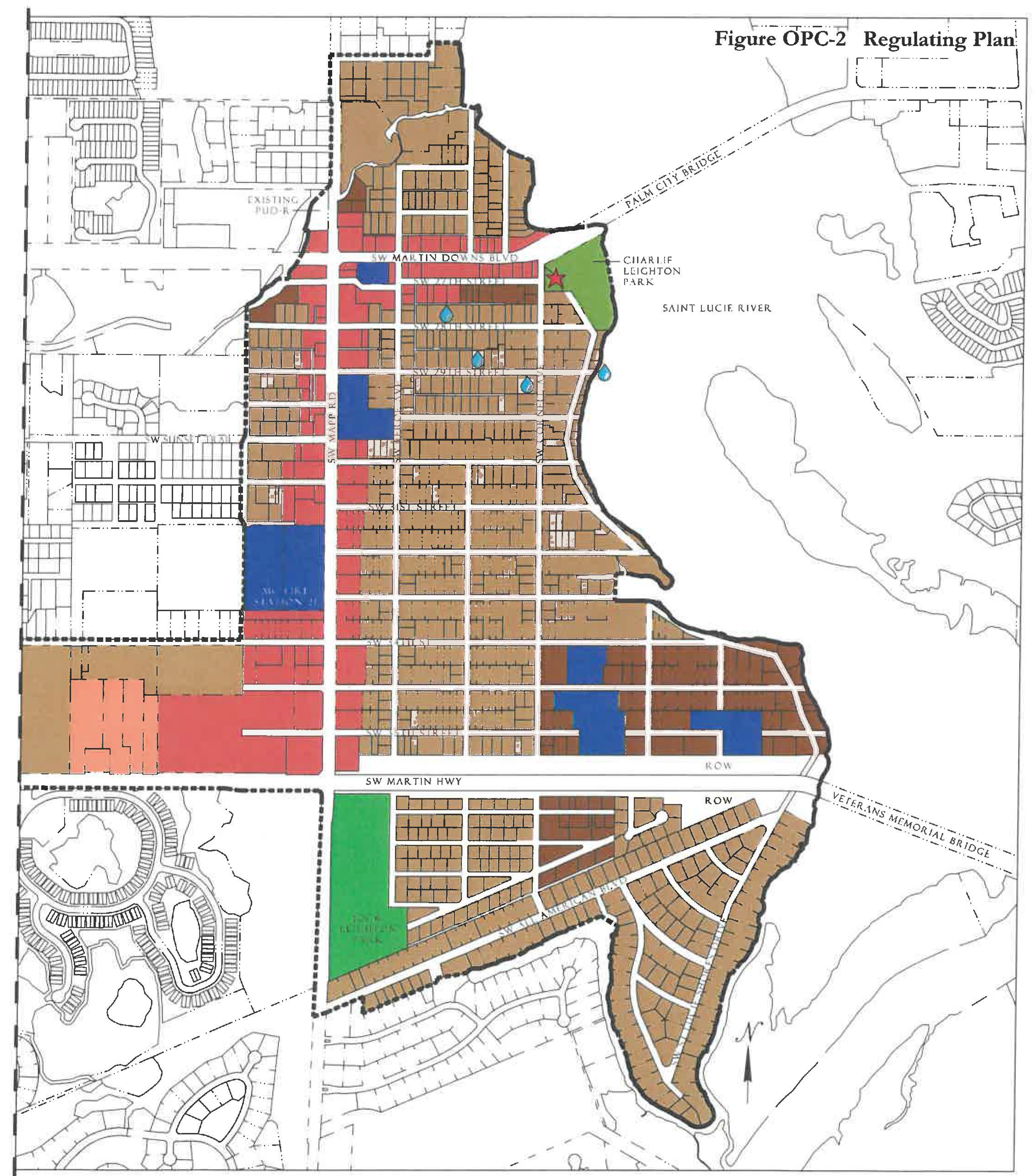
Figure OPC-3 Regulating Plan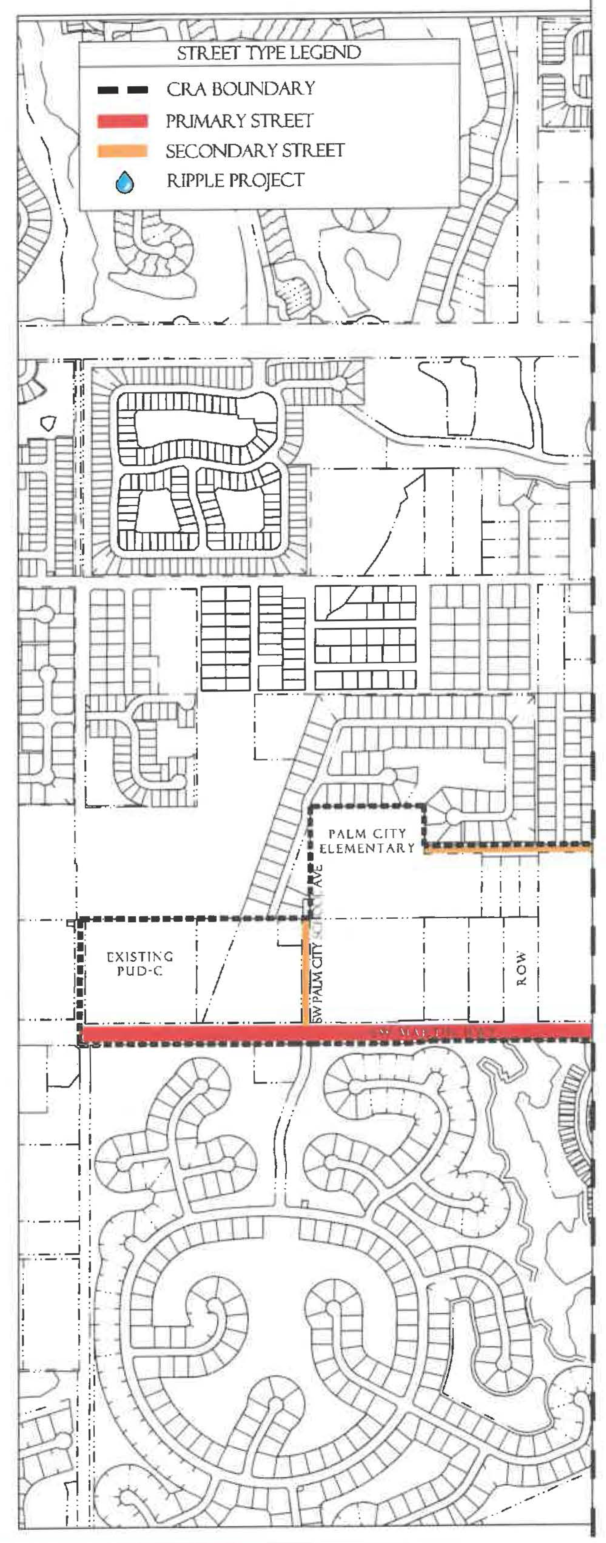
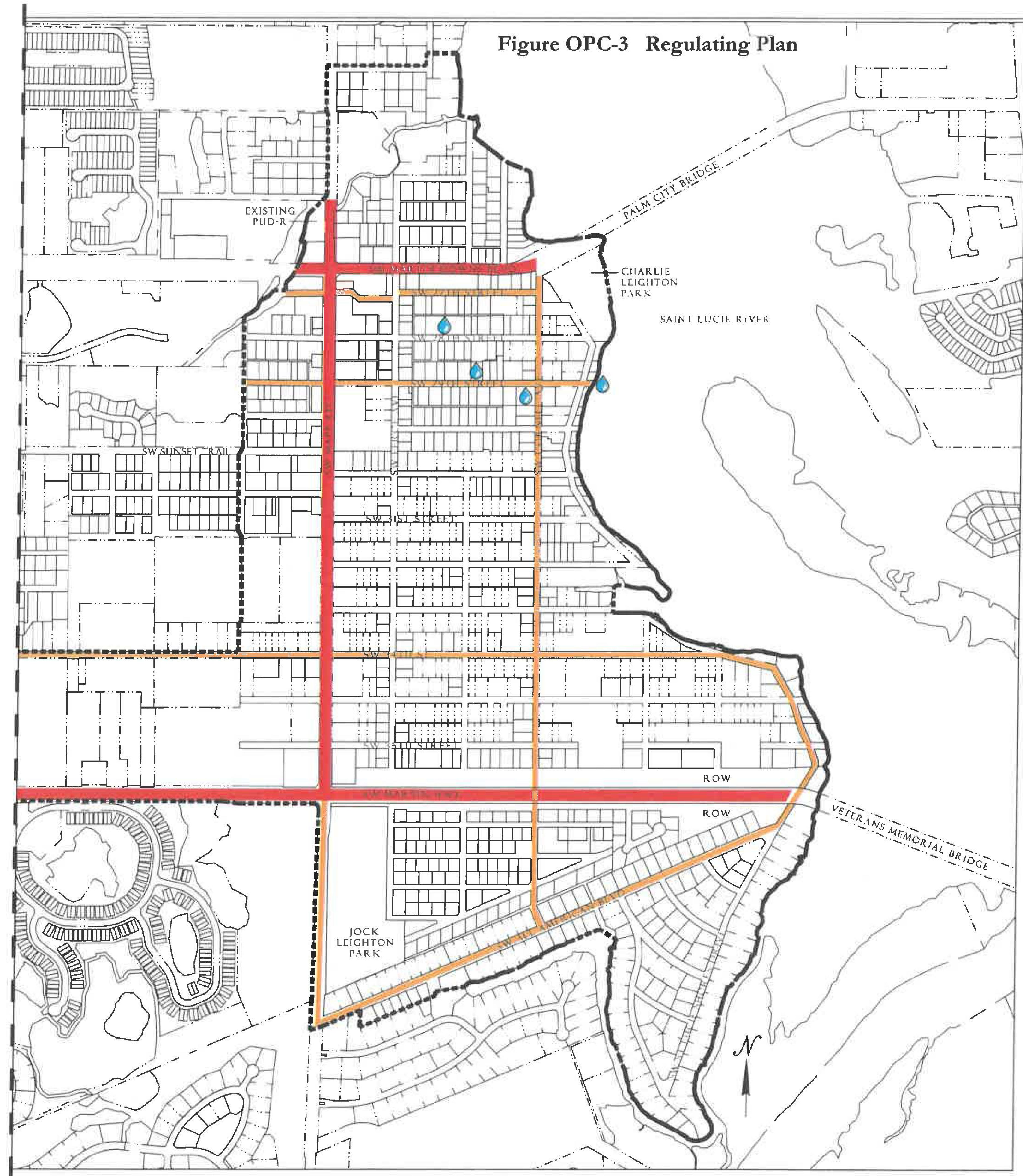
(Ord. No. 1130, § 1(Exh. A), 5-5-2020)
Sec. 12.4.03. - Permitted uses.
Table OPC-4 identifies permitted uses in the Old Palm City Redevelopment Zoning District.
1.
The use groups listed in the first column of Table OPC-4 are described in Section 12.1.03.
2.
The remaining columns identify the Subdistricts shown on the Regulating Plan.
a.
"P" in a row below a column means that any use in that use group is permitted within that Subdistrict, provided the use can be developed in accordance with all applicable requirements of the LDR.
b.
If "P" is not shown in a row, the use group is not permitted in that Subdistrict.
3.
For uses that are functionally similar but not clearly permitted in a Subdistrict see Section 12.1.03.3.
Table OPC-4 Use Groups Permitted in Old Palm City Subdistricts
1 Residential development in the Industrial Subdistrict shall be within a Mixed-Use Projects.
2 No duplexes are permitted.
3 No apartment hotels or multifamily dwellings are permitted.
4 Construction services, limited shall be permitted use if established prior to the effective date of this ordinance.
(Ord. No. 1130, § 1(Exh. A), 5-5-2020; Ord. No. 1159, pt. 1(Exh. A), 5-11-2021)
Sec. 12.4.04. - Development standards.
1.
All new development, substantial improvements of a building, and substantial renovations of a building exterior shall comply with the Development Standards in Table OPC-5.
2.
Existing Buildings. Whenever substantial improvement of a building or substantial renovation of a building exterior triggers the obligation to comply with this Division, the Growth Management Director may authorize incremental compliance with its requirements proportional to the nature and scope of the existing and proposed improvements if full compliance would be unreasonable. An application for alternative compliance shall not be required, but the Growth Management Director may require that the proposal be presented to the Neighborhood Advisory Committee for review and comment. See Section 4.871.B, Div. 20, Article 4.
3.
Accessory Dwelling Units. Standards for accessory dwelling units are provided in Development Standards 12.1.04.7.a.
4.
Building Types. Each new building, and any substantial improvement, must meet the standards for one of the Building Types permitted in the Subdistrict where it is located, see Table OPC-5. Building Type diagrams do not prescribe use or architectural style and are illustrative. Dimensions provided in tables are regulatory requirements.
5.
Façade Transparency. Shopfront, Mixed-use, Office, Apartment and Courtyard Building façades facing streets or civic open spaces at the ground level must have transparent windows which cover between 40 percent and 70 percent of the wall area. Building façades above ground level must have transparent windows which cover between 20 percent and 50 percent of the wall area of each story as measured between finished floors. Transparent means non-solar, non-mirrored glass with a light transmission reduction of no more than 40 percent.
Table OPC-5 - Development Standards in Old Palm City Subdistricts
Footnotes, see above
1
Residential development in the Industrial Subdistricts shall be within a Mixed-Use
Projects.
(Ord. No. 1130, § 1(Exh. A), 5-5-2020; Ord. No. 1159, pt. 1(Exh. A), 5-11-2021)
Sec. 12.4.05. - Building type and frontage type standards.
1.
Building Types. The following building type standards shall apply in the Old Palm City Subdistricts. Table OPC-5 provides additional Development Standards.
Figure OPC-5.01 Shopfront Building
| Building Placement, see 12.1.04.6 | ||
| Frontage Buildout | 80% min. | |
| Front Build-to-Zone | 0' min., 15' max. | |
| Side at Street Build-to-Zone | 0' min., 15' max. | |
| Side at Property Line Setback 1 | 0' min. or 5' min. | |
| Rear Yard Setback 1 | 10' min./5' min. with alley | |
| Height, see 12.1.04.2 | ||
| Ceiling at Ground Level | 12' min. | |
| Building Height | Refer to Table OPC-5 | |
| Parking Placement, see 12.1.04.6 | ||
| Front Setback | 30' min. | |
| Side at Street Setback | 10' min. | |
| Side at Property Line Setback | 0' min. | |
| Rear Setback | 5' min/0' min with alley | |
Notes:
1 Section 12.1.04.11 Building Transitions applies when the rear or side of a property abuts a residential subdistrict or an existing single family dwelling.
For permitted Lot Size, Density, Building Coverage, and Open Space, see Table OPC-5.
Figure OPC-5.02 Mixed-Use Building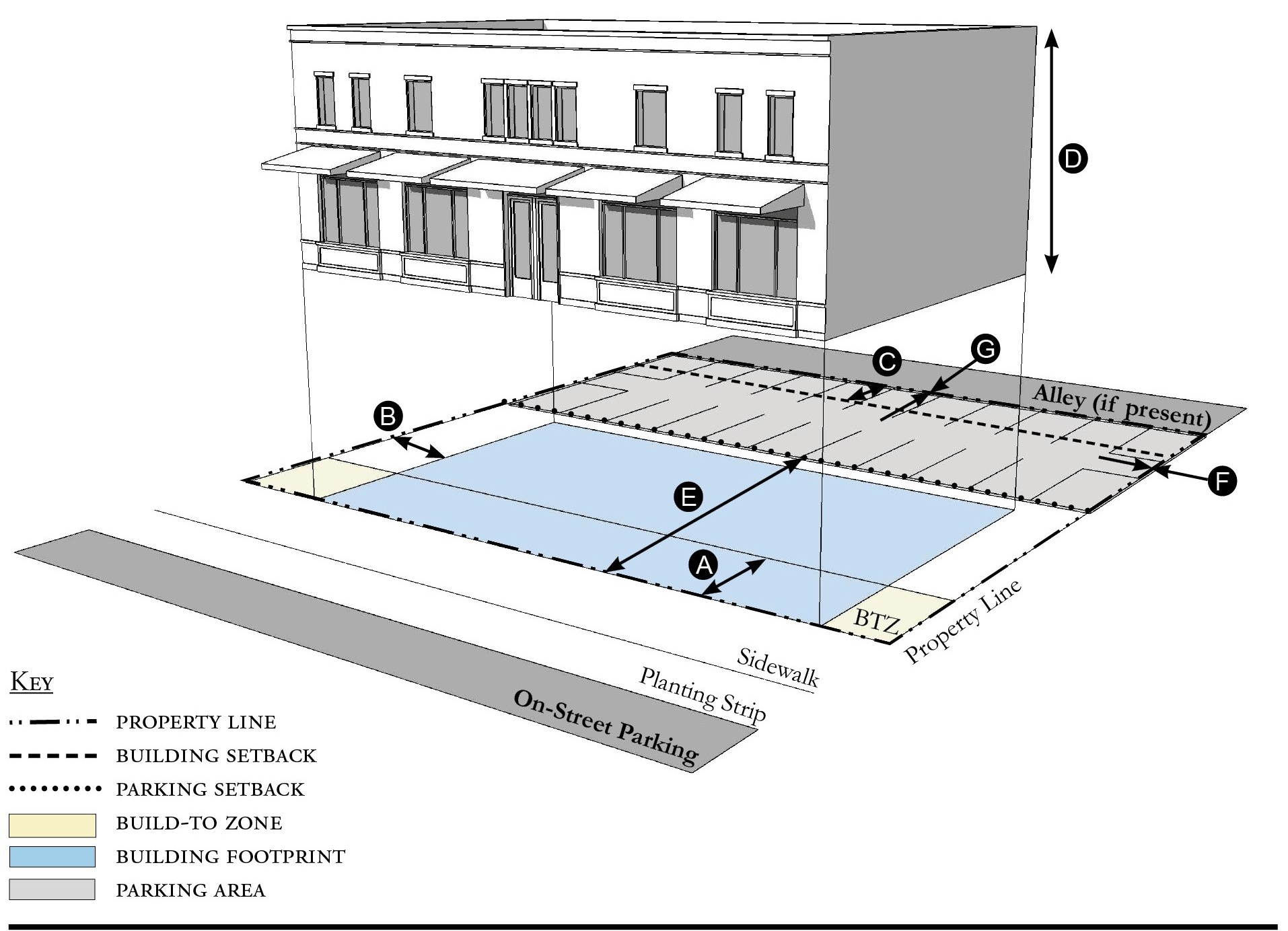
| Building Placement, see 12.1.04.6 | ||
| Frontage Buildout | 80% min. | |
| Front Build-to-Zone | 0' min., 15' max. | |
| Side at Street Build-to-Zone | 5' min., 15' max. | |
| Side at Property Line Build-to-Zone 1 | 5' min. or 10' max. | |
| Rear Yard Setback 1 | 10' min./5' min. with alley | |
| Height, see 12.1.04.2 | ||
| Ceiling at Ground Level | 12' min. | |
| Building Height | Refer to Table OPC-5 | |
| Parking Placement, see 12.1.04.6 | ||
| Front Setback | 30' min. | |
| Side at Street Setback | 10' min. | |
| Side at Property Line Setback | 0' min. | |
| Rear Setback | 5' min/0' min with alley | |
Notes:
1 Section 12.1.04.11 Building Transitions applies when the rear or side of a property abuts a residential subdistrict or an existing single family dwelling.
For permitted Lot Size, Density, Building Coverage, and Open Space, see Table OPC-5.
Figure OPC-5.03 Office Building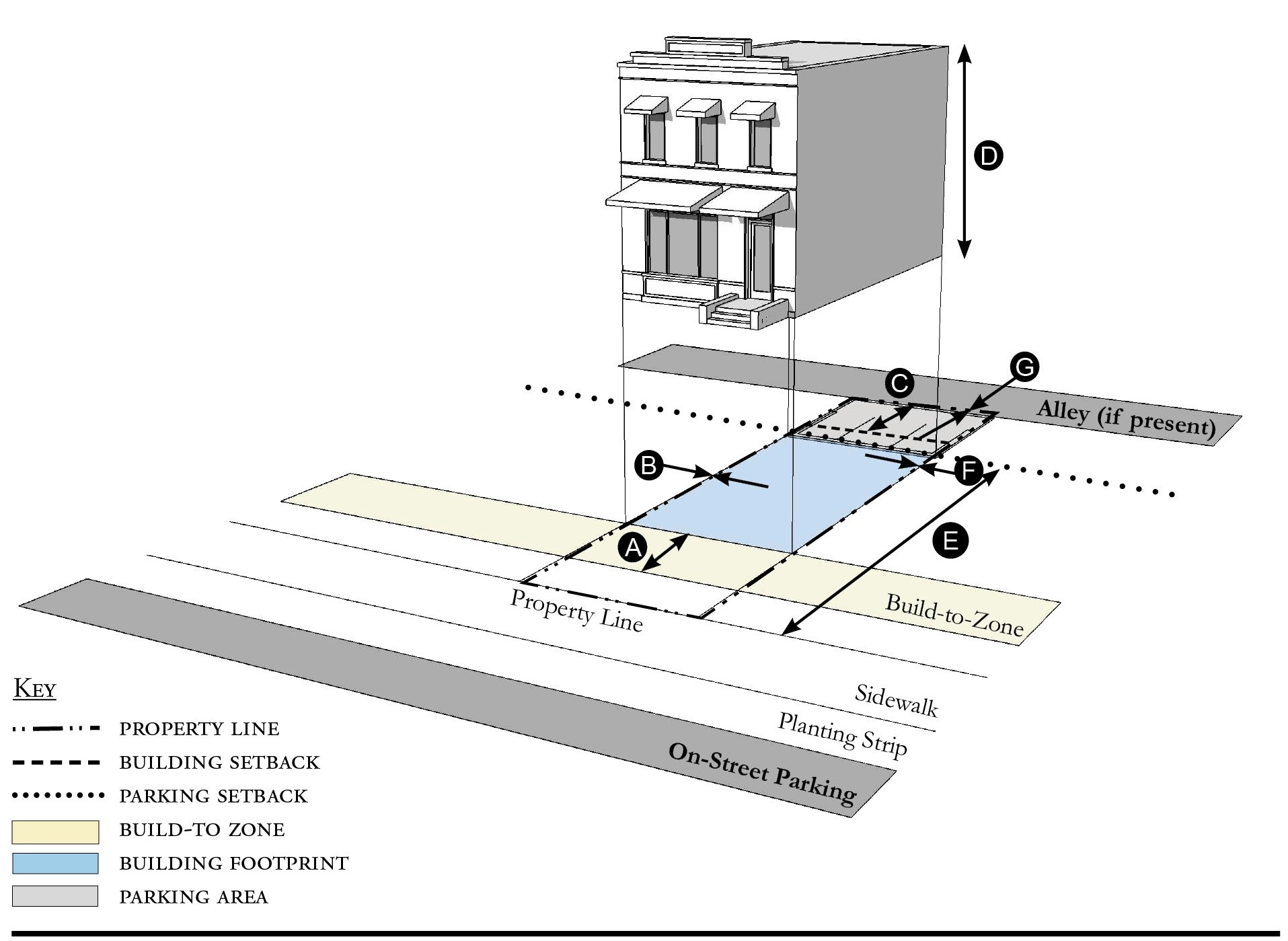
| Building Placement, see 12.1.04.6 | ||
| Frontage Buildout | 80% min. | |
| Front Build-to-Zone | 10' min./15' max. | |
| Side at Street Build-to-Zone | 10' min./15' max. | |
| Side at Property Line Setback 1 | 0' or 5' | |
| Rear Yard Setback 1 | 10' min./5' min. with alley | |
| Height, see 12.1.04.2 | ||
| Ceiling at Ground Level | 12' min. | |
| Building Height | Refer to Table OPC-5 | |
| Parking Placement, see 12.1.04.6 | ||
| Front Setback | 30' min. | |
| Side at Street Setback | 10' min. | |
| Side at Property Line Setback | 0' min. | |
| Rear Setback | 5' min/0' min with alley | |
Notes:
1 Section 12.1.04.11 Building Transitions applies when the rear or side of a property abuts a residential subdistrict or an existing single family dwelling.
For permitted Lot Size, Density, Building Coverage, and Open Space, see Table OPC-5.
Figure OPC-5.04 Apartment Building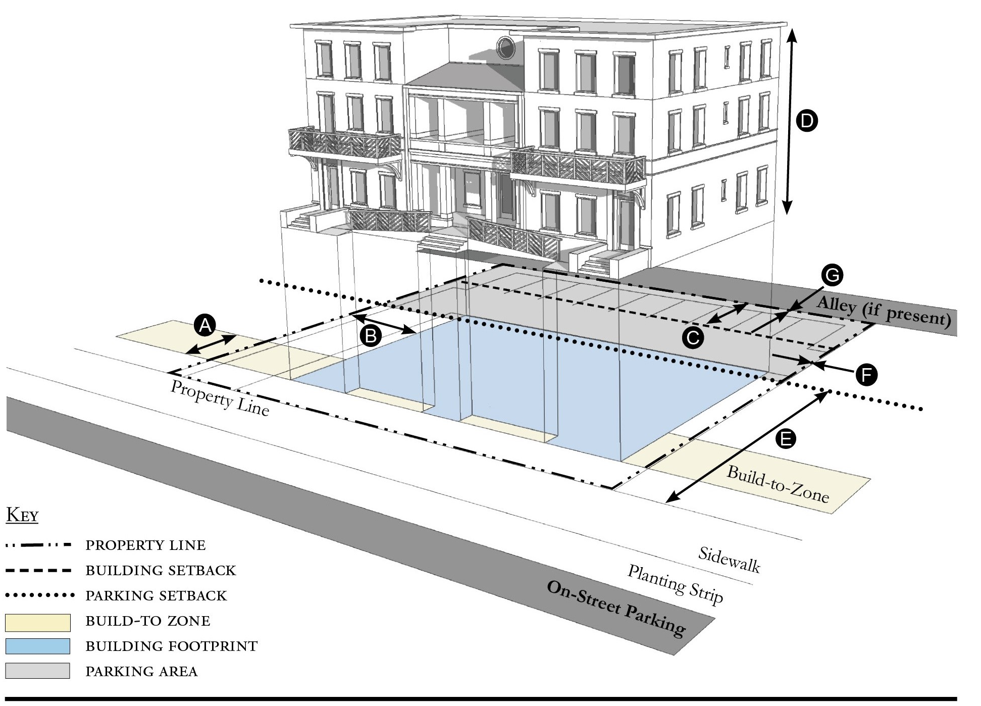
| Building Placement, see 12.1.04.6 | ||
| Frontage Buildout | 60% min. | |
| Front Build-to-Zone | 10' min./25' max. | |
| Side at Street Build-to-Zone | 10' min./15' max. | |
| Side at Property Line Setback 1 | 5' min. | |
| Rear Yard Setback 1 | 10' min./5' min. with alley | |
| Height, see 12.1.04.2 | ||
| Ceiling at Ground Level | Not applicable | |
| Building Height | Refer to Table OPC-5 | |
| Parking Placement, see 12.1.04.6 | ||
| Front Setback | 30' min. | |
| Side at Street Setback | 10' min. | |
| Side at Property Line setback | 5' min./0' min. with alley | |
| Rear Setback | 5' min./0' min. with alley | |
Notes:
1 Section 12.1.04.11 Building Transitions applies when the rear or side of a property abuts a residential subdistrict or an existing single family dwelling.
For permitted Lot Size, Density, Building Coverage, and Open Space, see Table OPC-5.
Figure OPC-5.05 Courtyard Building
| Building Placement, see 12.1.04.6 | ||
| Frontage Buildout | 80% min. includes courtyard | |
| Front Build-to-Zone | 10' min./25' max. | |
| Side at Street Build-to-Zone | 10' min./15' max. | |
| Side at Property Line Setback 1 | 5' min. | |
| Rear Yard Setback 1 | 10' min./5' min. with alley | |
| Height, see 12.1.04.2 | ||
| Ceiling at Ground Level | Not applicable | |
| Building Height | Refer to Table OPC-5 | |
| Parking Placement, see 12.1.04.6 | ||
| Front Setback | 30' min. | |
| Side at Street Setback | 10' min. | |
| Side at Property Line Setback | 5' min./0' min. with alley | |
| Rear Setback | 5' min./0' min. with alley | |
Notes:
The proportion of the courtyard space shall be at least as deep as it is wide.
1 Section 12.1.04.11 Building Transitions applies when the rear or side of a property abuts a residential subdistrict or an existing single family dwelling.
For permitted Lot Size, Density, Building Coverage, and Open Space, see Table OPC-5.
Figure OPC-5.06 Townhouse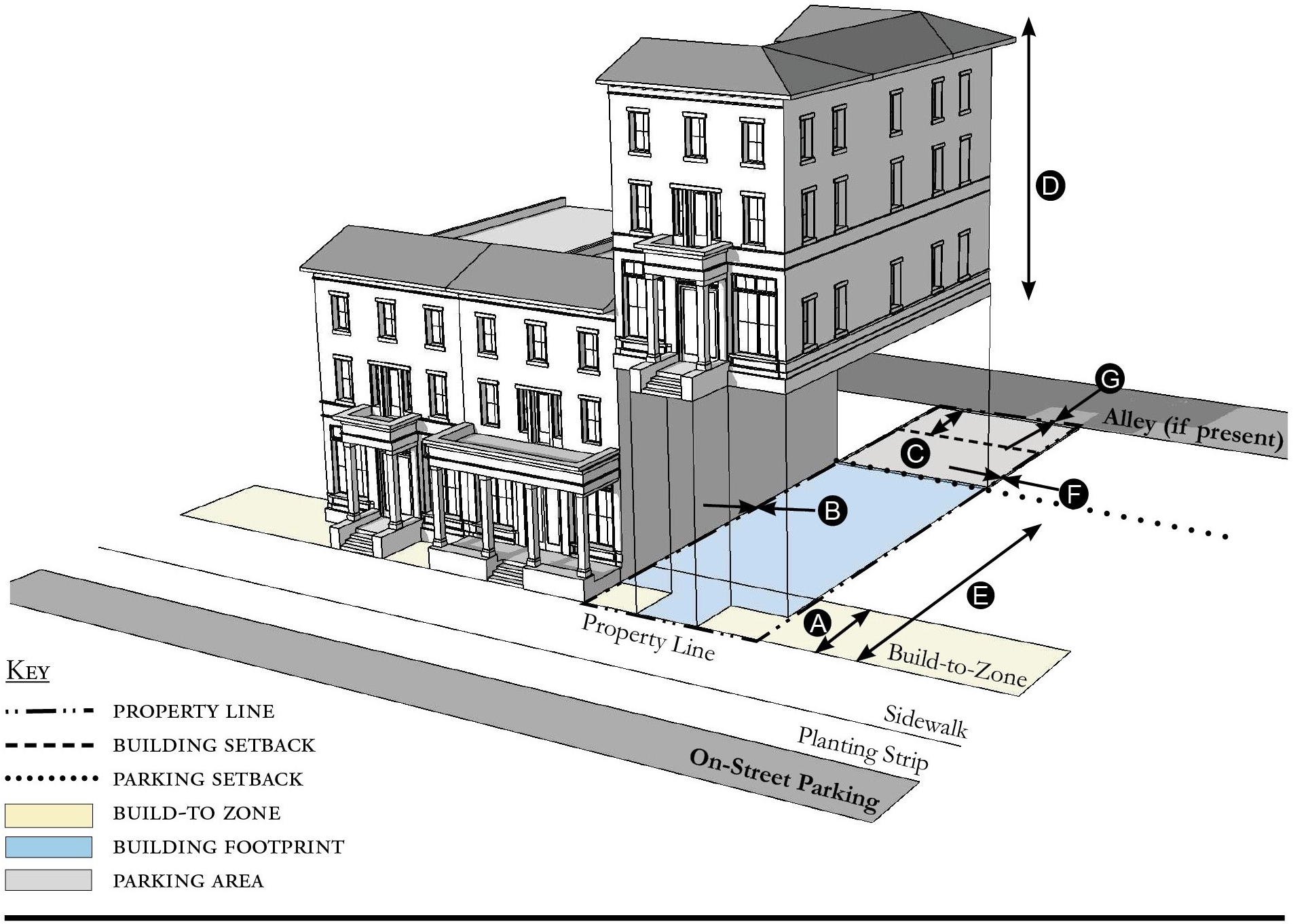
| Building Placement, see 12.1.04.6 | ||
| Frontage Buildout | 80% min. | |
| Front Build-to-Zone | 0' min./15' max. | |
| Side at Street Build-to-Zone | 0' min./15' max. | |
| Side at Property Line Setback 1, 2 | 0' min. or 10' min. | |
| Rear Yard Setback 1 | 10' min./5' min. with alley | |
| Height, see 12.1.04.2 | ||
| Ceiling at Ground Level | Not applicable | |
| Building Height | Refer to Table OPC-5/2 stories min. | |
| Parking Placement, see 12.1.04.6 | ||
| Front Setback | 30' min. | |
| Side at Street Setback | 10' min. | |
| Side at Property Line Setback | 0' min. | |
| Rear Setback | 5' min./0' min. with alley | |
Notes:
Townhouses shall have a maximum grouping of 8 dwelling units and a minimum Setback of 15 feet between buildings.
1 Section 12.1.04.11 Building Transitions applies when the rear or side of a property abuts a residential subdistrict or an existing single family dwelling.
2 When adjacent to another property that is not part of the townhouse development the Side at Property Line Setback is 10 feet minimum from the property line.
For permitted Lot Size, Density, Building Coverage, and Open Space, see Table OPC-5.
Figure OPC-5.07 Live/Work Building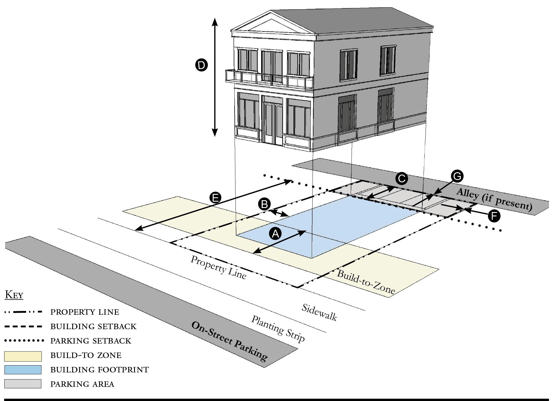
| Building Placement, see 12.1.04.6 | ||
| Frontage Buildout | 80% min. | |
| Front Build-to-Zone | 10' min./25' max. | |
| Side at Street Setback | 10' min. | |
| Side at Property Line Setback 1 | 10' min. | |
| Rear Yard Setback 1 | 10' min | |
| Height, see 12.1.04.2 | ||
| Ceiling at Ground Level | 12' min. | |
| Building Height | Refer to Table OPC-5 | |
| Parking Placement, see 12.1.04.6 | ||
| Front Setback | 30' min. | |
| Side at Street Setback | 10' min. | |
| Side at Property Line Setback | 0' min. | |
| Rear Setback | 5' min./0' min. with alley | |
| Parking Placement does not prohibit parking in a residential driveway or a side yard driveway. | ||
Notes:
1 Section 12.1.04.11 Building Transitions applies when the rear or side of a property abuts a residential subdistrict or an existing single family dwelling.
For permitted Lot Size, Density, Building Coverage, and Open Space, see Table OPC-5.
Figure OPC-5.08 Side Yard House
| Building Placement, see 12.1.04.6 | ||
| Frontage Buildout 1 | 60% min. | |
| Front Build-to-Zone | 10' min./25' max. | |
| Side at Street Setback | 10' min. | |
| Side at Property Line Setback | 5' min., 10' min. other side | |
| Rear Yard Setback | 10' min/5; min. with alley | |
| Height, see 12.1.04.2 | ||
| Ceiling at Ground Level | Not applicable | |
| Building Height | 35'/3 stories max. | |
| Parking Placement, see 12.1.04.6 and 12.4.07.8 | ||
| Front Setback | 30' min. | |
| Side at Street Setback | 10' min. | |
| Side at Property Line Setback | 5' min. | |
| Rear Setback | 5' min./0' min. with alley | |
| Parking Placement does not prohibit parking in a residential driveway or a side yard driveway. | ||
Notes:
1 For this Building Type, the frontage buildout requirement may be met with the provision of a continuous wall or fence along the lot frontage.
For permitted Lot Size, Density, Building Coverage, and Open Space, see Table OPC-5.
Figure OPC-5.09 Cottage
| Building Placement, see 12.1.04.6 | ||
| Frontage Buildout 1 | 60% min. | |
| Front Build-to-Zone | 10' min./25' max. | |
| Side at Street Build-to-Zone | 5' min., 10' max. | |
| Side at Property Line Setback | 5' min. | |
| Rear Yard Setback | 10' min | |
| Height, see 12.1.04.2 | ||
| Ceiling at Ground Level | Not applicable | |
| Building Height | 30'/2 stories max. | |
| Parking Placement, see 12.1.04.6 and 12.4.07.8 | ||
| Front Setback | 30' min. | |
| Side at Street Setback | 10' min. | |
| Side at Property Line Setback | 5' min. | |
| Rear Setback | 5' min. | |
| Parking Placement does not prohibit parking in a residential driveway or a side yard driveway. | ||
Notes:
Cottages shall not exceed a footprint of 2,000 square feet.
1 For this Building Type, the frontage requirement may be met with the provision of a continuous wall or fence along the lot frontage.
For permitted Lot Size, Density, Building Coverage, and Open Space, see Table OPC-5.
Figure OPC-5.10 Cottage Court
| Building Placement, see 12.1.04.6 | ||
| Frontage Buildout 1 | 60% min. | |
| Front Build-to-Zone | 6' min. | |
| Side at Street Setback | 6' min. | |
| Side at Property Line Setback | 6' min. | |
| Unit Separation | 10' min | |
| Height, see 12.1.04.2 | ||
| Ceiling at Ground Level | Not applicable | |
| Building Height | 30'/2 stories max. | |
| Parking Placement, see 12.1.04.6 | ||
| Front Setback | 30' min. | |
| Side at Street Setback | 10' min. | |
| Side at Property Line Setback | 5' min. | |
| Rear Setback | 5' min. | |
Notes:
Cottage Courts may include duplexes.
1 For this Building Type, the frontage buildout requirement may be met with the provision of a continuous wall or fence along the lot frontage.
For permitted Lot Size, Density, Building Coverage, and Open Space, see Table OPC-5.
Figure OPC-5.11 Duplex
| Building Placement, see 12.1.04.6 | ||
| Frontage Buildout 1 | 60% min. | |
| Front Build-to-Zone | 10' min./25' max. | |
| Side at Street Setback | 10' min. | |
| Side at Property Line Setback | 5' min. | |
| Rear Yard Setback | 10' min | |
| Height, see 12.1.04.2 | ||
| Ceiling at Ground Level | Not applicable | |
| Building Height | 35'/3 stories max. | |
| Parking Placement, see 12.1.04.6 and 12.4.07.8 | ||
| Side at Property Line | 5' min. | |
| Rear Setback | 5' min./0' min. with alley | |
| Parking Placement does not prohibit parking in a residential driveway or a side yard driveway. | ||
| Refer to Section 12.1.07.8 Garage and Driveway for parking and driveway configurations for Single Family Dwellings. | ||
Notes:
An ADU is prohibited on lots on which a duplex is located.
1 For this Building Type, the frontage buildout requirement may be met with the provision of a continuous wall or fence along the lot frontage.
For permitted Lot Size, Density, Building Coverage, and Open Space, see Table OPC-5.
Figure OPC-5.12 All Yard House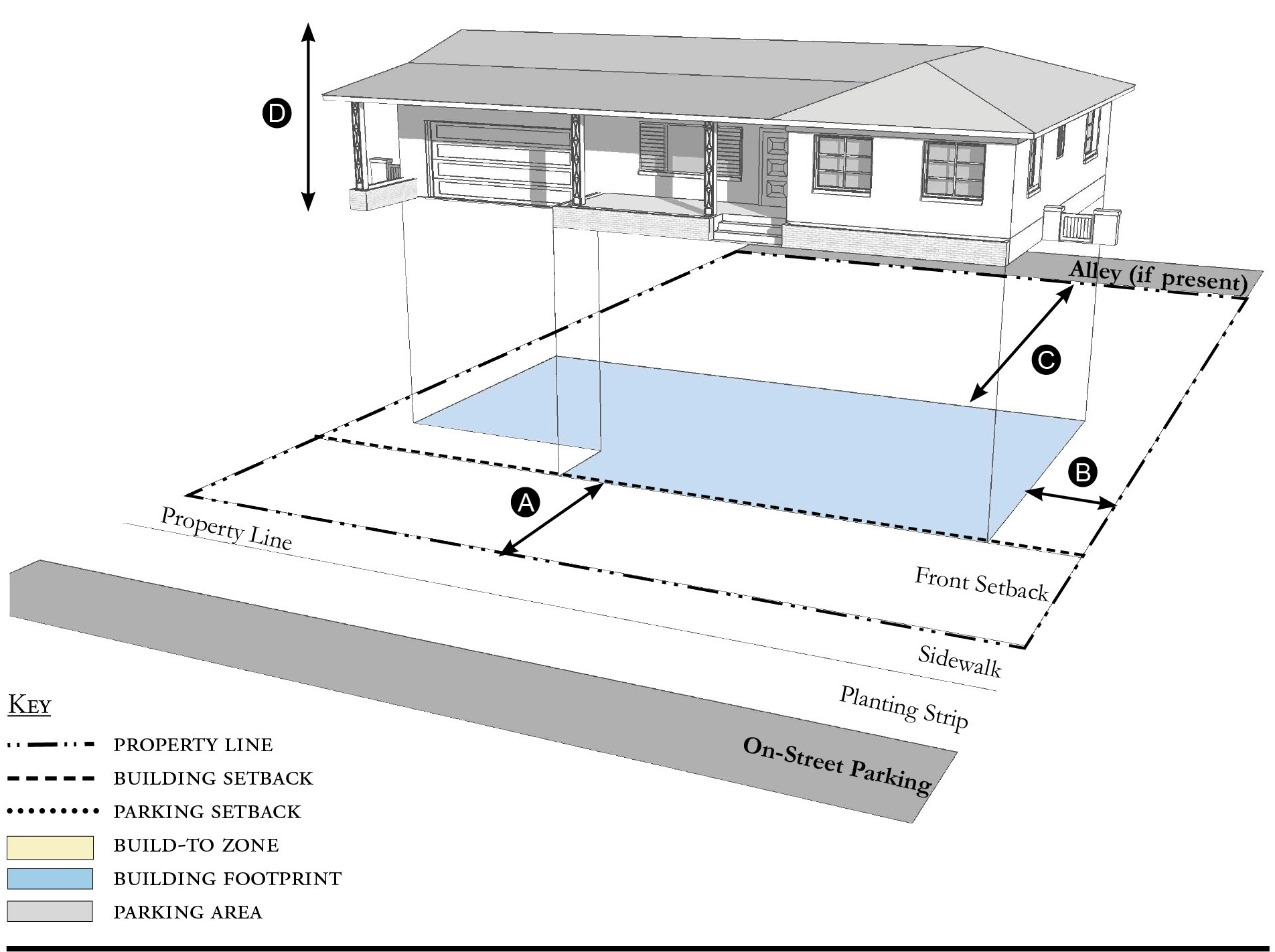
| Building Placement, see 12.1.04.6 | ||
| Frontage Buildout | Not Required | |
| Front Setback | 20' min. | |
| Side at Street Setback | 6' min. | |
| Side at Property Line Setback | 6' min. | |
| Rear Yard Setback | 10' min | |
| Height, see 12.1.04.2 | ||
| Ceiling at Ground Level | Not applicable | |
| Building Height | 35'/3 stories max | |
| Parking Placement, see 12.1.04.6 and 12.4.07.8 | ||
| Side at Property Line | 5' min. | |
| Rear Setback | 5' min., 0' min. alley | |
| Parking Placement does not prohibit parking in a residential driveway or a side yard driveway. | ||
| Refer to Section 12.1.07.8 Garage and Driveway for parking and driveway configurations for Single Family Dwellings. | ||
Notes:
For permitted Lot Size, Density, Building Coverage, and Open Space, see Table OPC-5.
Figure OPC-5.13 Outbuilding
| Building Placement, see 12.1.04.6 | ||
| Frontage Buildout | Not required | |
| Front Build-to-Zone | Not applicable | |
| Side at Street Build-to-Zone | Not applicable | |
| Side at Property Line Setback | 5' min. | |
| Rear Yard Setback 1 | 5' min | |
| Height, see 12.1.04.2 | ||
| Ceiling at Ground Level | Not applicable | |
| Building Height | 24'/2 stories max. | |
Notes:
Outbuildings shall not exceed a footprint of 850 square feet.
For permitted Lot Size, Density, Building Coverage, and Open Space, see Table OPC-5.
Figure OPC-5.14 Industrial Building
| Building Placement, see 12.1.04.6 | ||
| Frontage Buildout | Not required | |
| Front Setback | 20' min. | |
| Side at Street Setback | 5' min. | |
| Side at Property Line Setback 1 | 5' min. | |
| Rear Yard Setback | 10' min/5' min. with alley | |
| Height, see 12.1.04.2 | ||
| Ceiling at Ground Level | Not applicable | |
| Building Height | 30'/3 stories max. | |
| Parking Placement, see 12.1.04.6 | ||
| Front Setback | 30' min. | |
| Side at Street Setback | 5' min. | |
| Side at Property Line Setback | 5' min. | |
| Rear Setback | 5' min./0' min. with alley | |
| Parking shall not be located between the building and the street. | ||
Notes:
1 Section 12.1.04.11 Building Transitions applies when the rear or side of a property abuts a residential subdistrict or an existing single family dwelling.
For permitted Lot Size, Density, Building Coverage, and Open Space, see Table OPC-5.
(Ord. No. 1130, § 1(Exh. A), 5-5-2020; Ord. No. 1159, pt. 1(Exh. A), 5-11-2021; Ord. No. 1237, Pt. I(Exh. 1), 1-28-2025)
Sec. 12.4.06. - Street standards.
1.
Applicability. Street Standards that apply in all Redevelopment Zoning Districts are provided in Section 12.1.06. The additional street standards which apply in the Old Palm City Redevelopment Zoning District are specified in this section.
2.
Street Regulating Plan. A Street Regulating Plan is provided in Figure OPC-3, Section 12.2.02. Features identified in the Street Regulating Plan are described in 12.1.02.2.
a.
.Primary Streets.
b.
Secondary Streets.
c.
Recommended Future Streets.
d.
Recommended Future Alleys.
3.
Shade Trees. Seventy-five percent of all street trees and trees planted in fulfillment of the requirements regarding perimeter landscaping for vehicular use areas that front Mapp Road, Martin Downs Boulevard, and Martin Highway, shall be of the following species:
a.
Canopy trees (60 percent minimum):
i.
Live or Laurel Oak.
ii.
Magnolia.
iii.
Mahogany.
iv.
Red Maple.
v.
Bald Cypress.
vi.
Buttonwood.
vii.
Gumbo Limbo.
b.
Palm trees:
i.
Medjool or Canary Island Date Palm.
ii.
Royal Palm.
iii.
Ribbon Palm.
iv.
Sabal Palm (3:1 ratio).
4.
Improvements to Existing Streets. The planting of new shade trees shall be required for project approval and shall be coordinated with existing or future CRA and County streetscape improvements. As provided in Section 12.1.06, the County Engineer may allow deviations from these minimum standards when necessary due to the location of existing buildings, constrained right-of-way, or to meet other goals for the particular street section.
a.
Mapp Road. Every block shall be complemented with a bench and a garbage container. The landscape islands shall be sized appropriately to the maximum mature size of the tree. The landscaping shall include trees with a minimum height of 16 feet, with a four-foot clear trunk, and four-inch caliper at the time of planting, planted at a maximum of 30-foot intervals. The species mix shall be governed by Section 12.4.06.3 Shade Trees.
b.
Martin Downs Boulevard. The landscaping shall include trees with a minimum height of 16 feet, with a four-foot clear trunk, and four-inch caliper at the time of planting, planted at a maximum of 30-foot intervals. The species mix shall be governed by Section 12.4.06.3 Shade Trees.
c.
Martin Highway. The landscaping shall include trees with a minimum height of 16 feet, with a four-foot clear trunk, and four-inch caliper at the time of planting, planted at a maximum of 30-foot intervals. The species mix shall be governed by Section 12.4.06.3 Shade Trees.
(Ord. No. 1130, § 1(Exh. A), 5-5-2020; Ord. No. 1159, pt. 1(Exh. A), 5-11-2021)
Sec. 12.4.07. - Parking standards.
1.
Applicability. Parking Standards found in Sections 4.621 through 4.628, Div. 14, Article 4, are modified for all Redevelopment Zoning Districts in Section 12.1.07. Those modified Parking Standards apply in the Old Palm City Redevelopment Zoning District except as specified otherwise in this section.
2.
Parking rates. Refer to Parking Standards Section 12.1.07 for parking rates applicable to Redevelopment Zoning Districts.
3.
Screening of Parking from Residential Uses. There shall be an alley between parking areas and adjacent residential uses. Where an alley is not possible, there shall be a visual barrier between parking areas and residential uses. Refer to Landscaping Standards Section 12.4.09 Vehicular Use Areas.
4.
Parking structures. Whenever a parking structure or surface parking provided beneath a building is located on a Primary Street, as identified on the Street Regulating Plan, Section 12.4.02, ground level commercial space shall be provided for a depth of no less than 20 feet measured from the front of the building.
5.
Distributing Parking. Where more than 200 parking spaces are provided onsite, such parking shall be distributed such that no more than 50 percent of the spaces are grouped in a single area of the parcel. Methods of distributing parking include locating parking adjacent to the rear or sides of a building or by physically separating parking areas with other buildings or landscaped areas.
(Ord. No. 1130, § 1(Exh. A), 5-5-2020; Ord. No. 1159, pt. 1(Exh. A), 5-11-2021; Ord. No. 1196, pt. I(Exh. A), 5-9-2023)
Sec. 12.4.08. - Stormwater standards.
1.
Stormwater management standards are provided in Sections 4.381 through 4.390, Div. 9, Article 4 and apply in Redevelopment Zoning Districts except as modified in Section 12.1.08.
(Ord. No. 1130, § 1(Exh. A), 5-5-2020)
Sec. 12.4.09. - Landscape standards.
1.
Table OPC-9 identifies which of the landscaping, buffering, and tree protection standards in Div. 15, Article 4 apply in the Old Palm City Redevelopment Zoning District and which standards are modified, replaced, or do not apply in this Redevelopment Zoning District.
Table OPC-9 - Landscaping, Buffering, and Tree Protection Standards
2.
Single family dwellings or duplexes. Lots cannot be cleared without a clearing permit. Single-family dwellings and duplexes on existing lots shall plant one tree for each 3,000 sq. ft. of lot area. Such tree shall meet the standards in Section 4.664, landscape material standards. The maintenance requirements in Section 4.665 also shall apply. Construction of SFR and duplexes on existing lots is exempt from all other landscaping requirements.
3.
Required landscape area.
a.
Landscaping shall be permitted in easements only with the written permission of the easement holder. A written agreement shall specify the party responsible for restoring disturbed landscape areas, shall be submitted to the county in a form acceptable to the County Attorney, and shall be recorded in the public records.
b.
Exposed dirt yards are prohibited.
4.
Required tree planting.
a.
Table OPC-10 indicates the minimum number of trees that must be planted.
b.
Trees planted in adjacent right-of-way as indicated in Section 12.4.06, or in other nearby public space, shall be credited towards meeting the number of trees required by Table OPC-10. Any private use of the public right-of-way requires the approval of the County Engineer, a right-of-way use permit, a construction agreement, and an indemnification agreement.
Table OPC-10 - Required Tree Planting
c.
Trees planted in Vehicular Use Areas shall be credited towards meeting the number of trees required by Table OPC-10
d.
FPL's Right Tree/Right Place Guidelines shall be considered when trees are planted near utilities.
5.
Landscape Plan. Development applications shall include a landscape plan prepared by a qualified professional that provides the location and type of existing and proposed features that are identified in Table OPC-11, which are summarized from the detailed requirements in Section 4.662.A, Div. 15, Article 4.
a.
Column A requirements apply to an application for a final site plan.
b.
Column B requirements apply to an application for a building permit for a Small Site which is defined as the construction or expansion of a principal building or accessory structure on a lawfully established lot or adjacent lots, provided the parcel being developed is less than one-half acre.
c.
Column B requirements also apply to an application for a substantial improvement or substantial renovation of a building exterior on any lot regulated by Article 12, as those terms are defined in Section 4.871.B, Div. 20, Article 4.
6.
Vehicular Use Areas.
a.
Perimeter landscaping. Landscaping shall be provided along the perimeter of all vehicular use areas, and also in accordance with the following standards:
Table OPC-11 - Landscape Plan Application Requirements
i.
The side of a vehicular use area fronting Mapp Road, Martin Downs Boulevard, or Martin Highway shall be landscaped with a minimum width of eight feet and planted with trees at 30-foot intervals. The trees shall be 16 feet in height, with a four-foot clear trunk, and four-inch caliper at the time of planting.
ii.
The side of a vehicular use area abutting a residential property shall be planted with trees with a minimum height of 16 feet, four-foot clear trunk, and four-inch caliper, at 25-foot intervals in a landscape area that is at least eight feet wide. A five-foot wall or hedge shall also be provided. The trees, landscaped buffer and the wall, fence or hedge may be reduced or eliminated with the written consent of the owner of the residential property, which shall be recorded in the public records.
iii.
Any side of a vehicular use area not included in paragraph (i) or (ii) shall be planted with trees minimum height of 12 feet, with a four-foot clear trunk, and two-inch dbh at 30-foot intervals.
iv.
A wall, fence, or hedge shall be provided around all vehicular use areas. Between the vehicular use area and a road right-of-way, the wall, fence, or hedge shall not exceed four feet in height. For the remainder of the lot, it shall be no more than six feet in height. Walls and landscaping around parking areas shall provide pedestrian access every 50 linear feet. No wall, fence, or hedge is required along the side of a parking area that abuts another parking area.
b.
Interior landscaping. If a vehicular use area is larger than 15,000 square feet, landscaping shall be provided within its interior in accordance with Section 4.663.A.4, Div. 15, Article 4, except that these interior landscape areas may also be used as stormwater management and conveyance facilities. If a vehicular use area is equal to or smaller than 15,000 square feet, no interior landscaping, terminal islands, interior medians, or interior islands are required.
(Ord. No. 1130, § 1(Exh. A), 5-5-2020; Ord. No. 1159, pt. 1(Exh. A), 5-11-2021)
Sec. 12.4.10. - Wall and fence standards.
1.
Walls and fences must comply with the Wall and Fence Standards established for all Redevelopment Zoning Districts in Section 12.1.10 except where modified below.
2.
Types.
a.
Chain link fences are not permitted in the in Core Subdistrict.
(Ord. No. 1130, § 1(Exh. A), 5-5-2020)
Sec. 12.4.11. - Sign standards.
1.
Signs must comply with the Sign Standards established for all Redevelopment Zoning Districts in Section 12.1.11 except where modified below.
2.
Wall signs. Table OPC-12 supersedes the signage-area table in Section 4.700, Div. 16, Article 4.
3.
Freestanding signs. One freestanding sign is permitted per building or each 200 lineal feet of property frontage, with a maximum square footage of 50 square feet per sign face.
4.
Murals. Are permitted and defined in Art. 4, Div. 16.
5.
Types of signs permitted. The list of permitted signs in Section 4.703, Art. 4, Div. 16. is adjusted by adding the following type of sign:
a.
Sandwich or sidewalk signs as defined in Section 4.693, Art. 4, Div. 16 are permitted in the Core and Corridor Subdistricts, provided the signs do not exceed six square feet per face, do not unreasonably obstruct pedestrian or vehicular movement, and are moved off sidewalks or other public property by 9:00 p.m. daily.
6.
Lettering and logo size. Table OPC-12 provides the maximum height of lettering and logos. Section 4.699, Div. 16, Article 4 establishes how the height of irregularly shaped features shall be measured.
Table OPC-12 - Sign Size Limitations
(Ord. No. 1130, § 1(Exh. A), 5-5-2020)
Sec. 12.4.12. - Architectural standards.
Architectural Standards must comply with the Architectural Standards established for all Redevelopment Zoning Districts in Section 12.1.12.
(Ord. No. 1130, § 1(Exh. A), 5-5-2020; Ord. No. 1159, pt. 1(Exh. A), 5-11-2021; Ord. No. 1237, Pt. I(Exh. 1), 1-28-2025)
Sec. 12.5.01. - Purpose.
1.
Hobe Sound is an intimate, historic community in Martin County which boasts a rich and diverse cultural, physical, economic, and geographic history. Originally a pineapple plantation, Hobe Sound has matured over time into a desirable destination for tourists, a strong community for residents, and a unique location for business activities. In an effort to maintain and strengthen the historical and cultural attributes of Hobe Sound, this LDR Division is intended to:
a.
Promote and accomplish the goals, policies, and objectives of the Martin County Growth Management Plan as they pertain to Hobe Sound;
b.
Preserve the character, quality, and scale of historic Hobe Sound and ensure the compatibility of future investment;
c.
Provide clarity and predictability in future planning and development in Hobe Sound;
d.
Maintain the high-quality standards of residential and nonresidential growth;
e.
Ensure a desirable and controlled natural and built environment for future generations.
2.
Hobe Sound Redevelopment Zoning District. This Article 12, Division 5 of the Martin County Land Development Regulations establishes the Hobe Sound Redevelopment Zoning District and the permitted uses and development standards applicable therein.
3.
Organization. How this Division is organized:
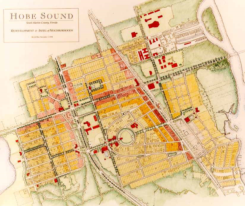
Figure HS-1 Artist rendering of the future vision of Hobe Sound as established in
1994
(Ord. No. 1134, pt. I(Exh. A), 6-16-2020)
Sec. 12.5.02. - Regulating plan.
Figures HS-2 and HS-3 are the Regulating Plans that apply to the Hobe Sound Redevelopment Zoning District. Section 12.1.02 describes the purpose and content of Regulating Plans.
Figure HS-2 Regulating Plan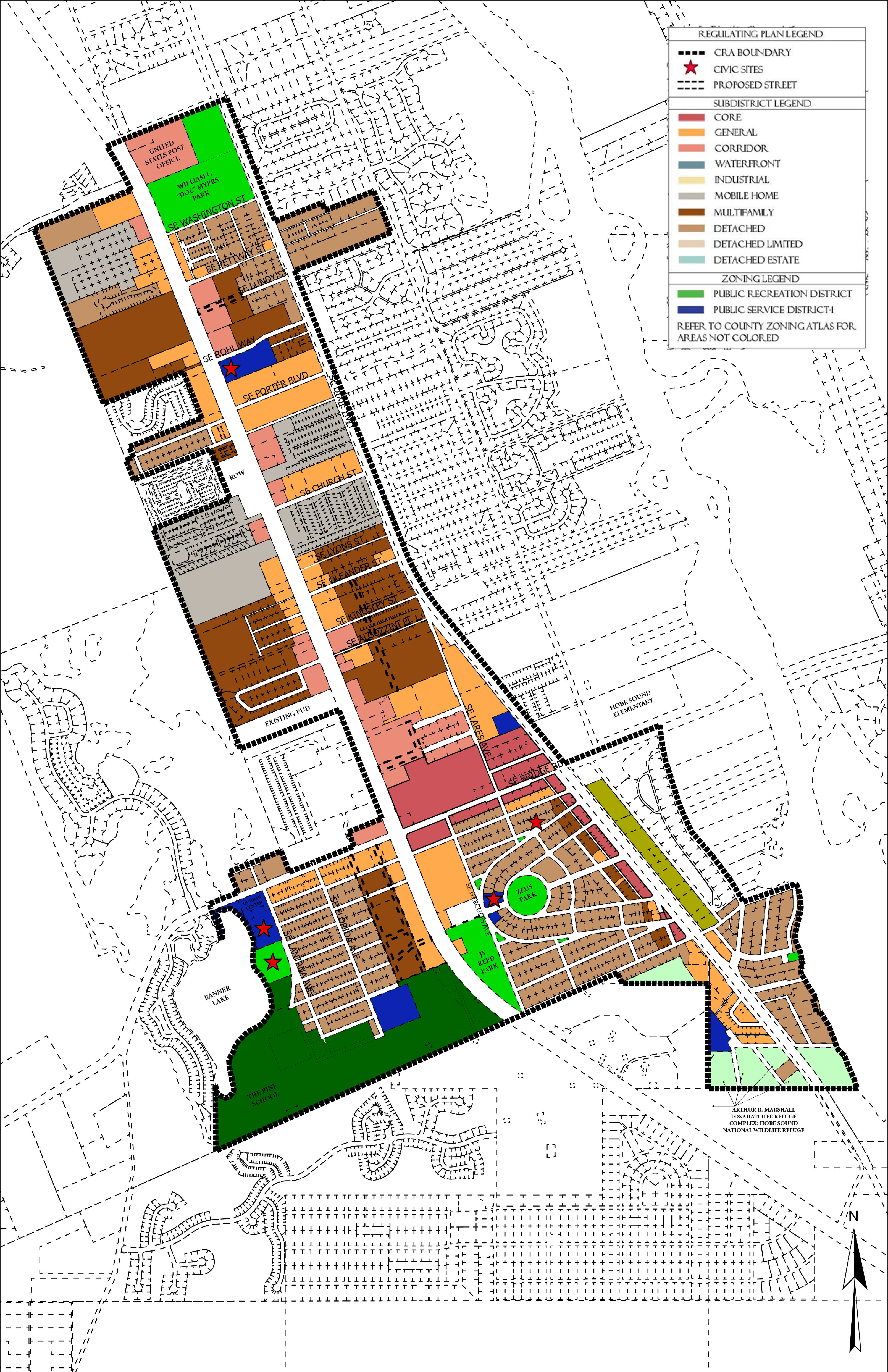
Figure HS-3 Street Regulating Plan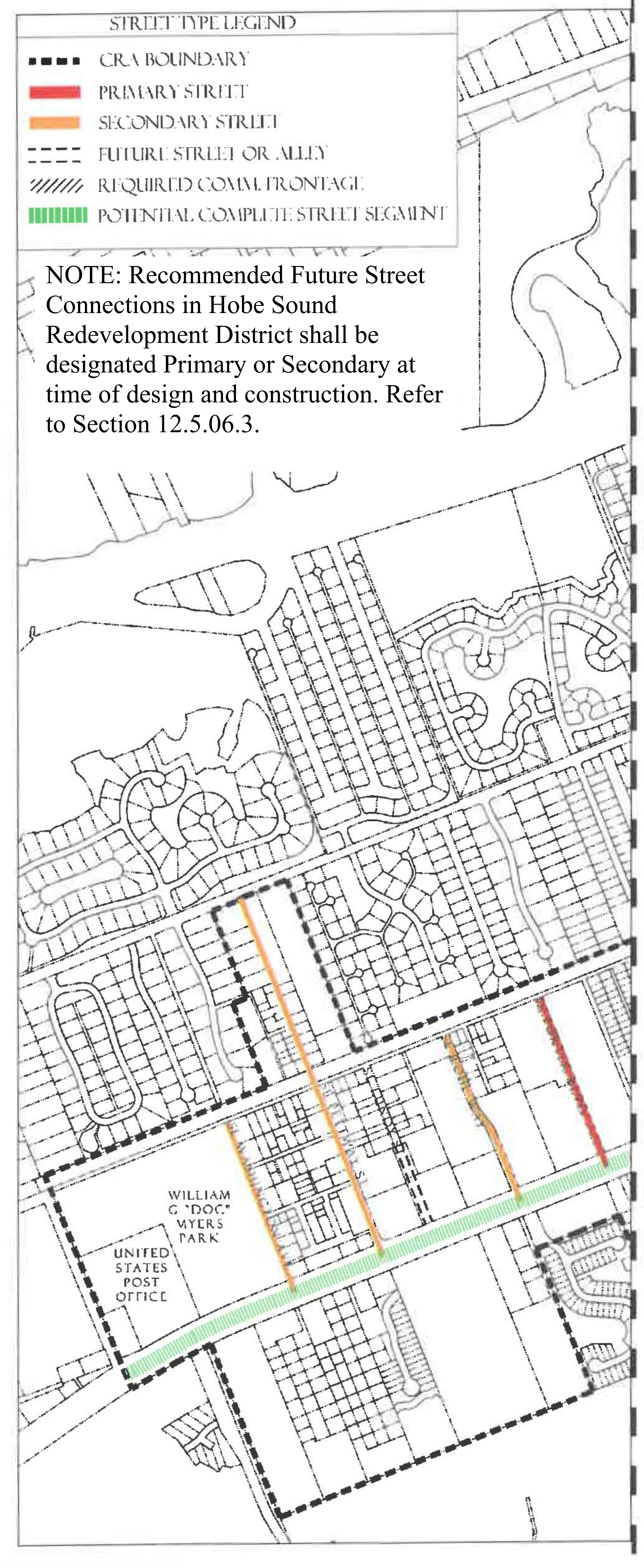
Figure HS-3 Street Regulating Plan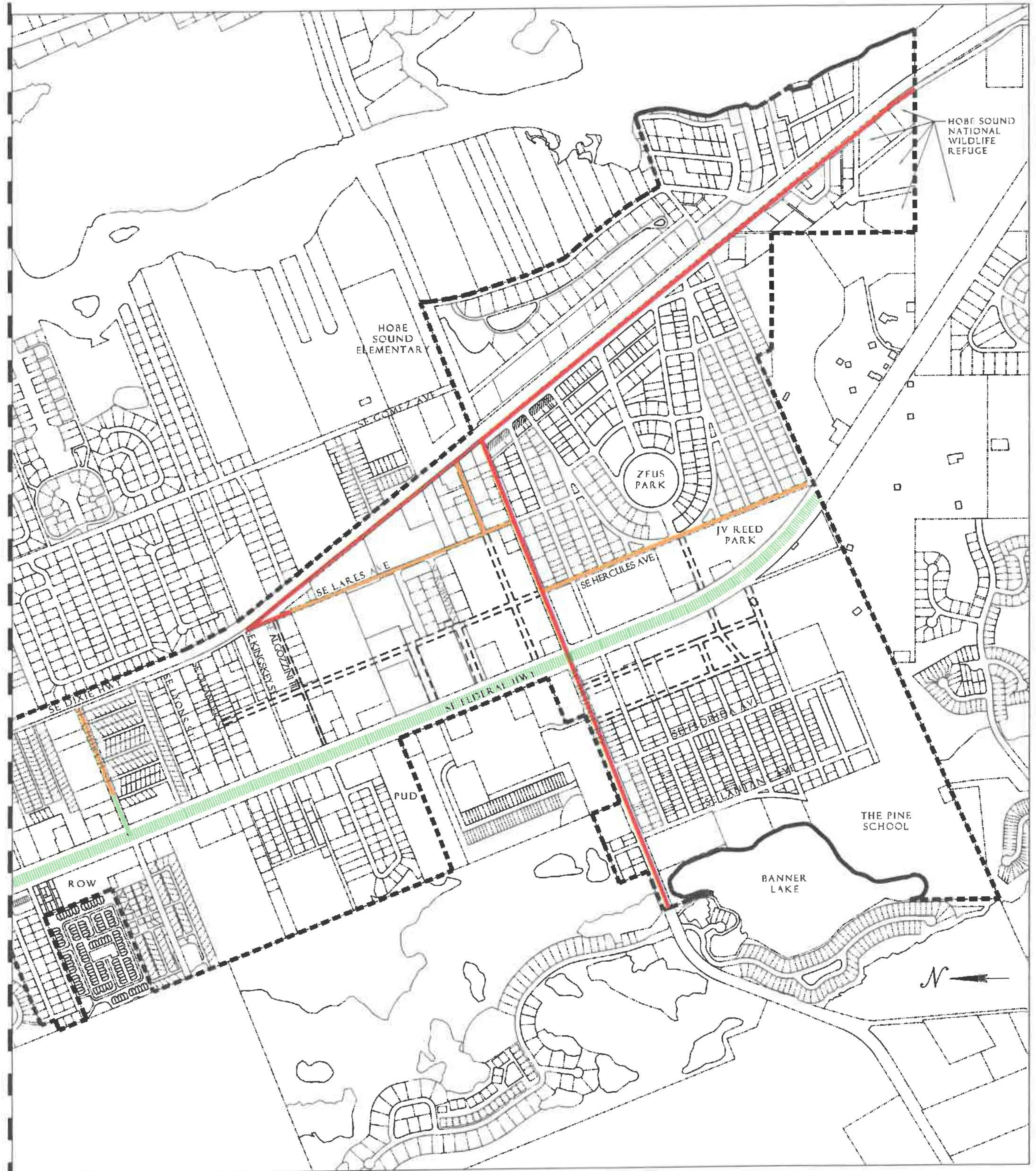
(Ord. No. 1134, pt. I(Exh. A), 6-16-2020; Ord. No. 1159, pt. 1(Exh. A), 5-11-2021; Ord. No. 1227, pt. I, 7-9-2024)
Sec. 12.5.03. - Permitted uses.
Table HS-4 identifies permitted uses in the HS (Hobe Sound) Redevelopment Zoning District.
1.
The Use Groups listed in the first column of Table HS-4 are described in Section 12.1.03.
2.
The remaining columns identify the Subdistricts shown on the Regulating Plan.
a.
"P" in a row below a column means that any use in that use group is permitted within that Subdistrict, provided the use can be developed in accordance with all applicable requirements of the LDR.
b.
If "P" is not shown in a row, the use group is not permitted in that Subdistrict.
3.
For uses that are functionally similar but not clearly permitted in a Subdistrict see Section 12.1.03.3.
Table HS-4 Use Groups Permitted in Hobe Sound Subdistricts
Footnotes, see above
1
No duplexes are permitted.
2
No apartment hotels or multifamily dwellings are permitted.
(Ord. No. 1134, pt. I(Exh. A), 6-16-2020; Ord. No. 1159, pt. 1(Exh. A), 5-11-2021)
Sec. 12.5.04. - Development standards.
1.
All new development, substantial improvements of a building, and substantial renovations of a building exterior shall comply with the Development Standards in Table HS-5.
2.
Existing Buildings. Whenever substantial improvement of a building or substantial renovation of a building exterior triggers the obligation to comply with this Division, the Growth Management Director may authorize incremental compliance with its requirements proportional to the nature and scope of the existing and proposed improvements if full compliance would be unreasonable. An application for alternative compliance shall not be required, but the Growth Management Director may require that the proposal be presented to the Neighborhood Advisory Committee for review and comment. See Section 4.871.B, Div. 20, Article 4.
3.
Accessory Dwelling Units. Standards for accessory dwelling units are provided in Development Standards Section 12.1.04.7.a
4.
Building Types. Each new building, and any substantial improvement, must meet the standards for one of the Building Types permitted in the Subdistrict where it is located, see Table HS-5. Building Type diagrams do not prescribe use or architectural style and are illustrative. Dimensions provided in tables are regulatory requirements.
5.
Façade Transparency. Shopfront, Mixed-use, Office, Apartment and Courtyard Building façades facing streets or civic open spaces at the ground level must have transparent windows which cover between 40 percent and 70 percent of the wall area. Building façades above ground level must have transparent windows which cover between 20 percent and 50 percent of the wall area of each story as measured between finished floors. Transparent means non-solar, non-mirrored glass with a light transmission reduction of no more than 40 percent.
Table HS-5 - Development Standards in Hobe Sound Subdistricts
Footnotes, see above
Gymnasiums developed as part of an institutional use may be constructed to a maximum
height of 35 feet.
(Ord. No. 1134, pt. I(Exh. A), 6-16-2020; Ord. No. 1159, pt. 1(Exh. A), 5-11-2021; Ord. No. 1238, pt. I, 1-28-2025)
Sec. 12.5.05. - Building type and frontage type standards.
1.
Building Types. The following Building Type standards shall apply in the Hobe Sound Subdistricts. Table HS-5 provides additional Development Standards.
Figure HS-5.01 Shopfront Building
| Building Placement, see 12.1.04.6 | ||
| Frontage Buildout | 70% min. | |
| Front Build-to-Zone | 0' min., 15' max. | |
| Side at Street Build-to-Zone | 0' min., 15' max. | |
| Side at Property Line Setback 2 | 0' or 5' | |
| Rear Yard Setback 2 | 10' min./5' min. with alley | |
| Height, see 12.1.04.2 | ||
| Ceiling at Ground Level | 12' min. | |
| Building Height | Refer to Table HS-5 | |
| Parking Placement, see 12.1.04.6 | ||
| Front Setback | 30' min. | |
| Side at Street Setback | 10' min. | |
| Side at Property Line Setback | 0' min. | |
| Rear Setback | 5' min/0' min with alley | |
Notes:
1 Only permitted when facing US1/Federal Highway.
2 Section 12.1.04.11 Building Transitions applies when the rear or side of a property abuts a residential subdistrict or an existing single family dwelling.
For permitted Lot Size, Density, Building Coverage, and Open Space, see Table HS-5.
Figure HS-5.02 Mixed-Use Building
| Building Placement, see 12.1.04.6 | ||
| Frontage Buildout | 70% min. | |
| Front Build-to-Zone | 0' min., 15' max. | |
| Side at Street Build-to-Zone | 5' min., 15' max. | |
| Side at Property Line BTZ 1 | 5' min. or 10' max. | |
| Rear Yard Setback 1 | 10' min./5' min. with alley | |
| Height, see 12.1.04.2 | ||
| Ceiling at Ground Level | 12' min. | |
| Building Height | Refer to Table HS-5 | |
| Parking Placement, see 12.1.04.6 | ||
| Front Setback | 30' min. | |
| Side at Street Setback | 10' min. | |
| Side at Property Line Setback | 0' min. | |
| Rear Setback | 5' min/0' min with alley | |
Notes:
1 Section 12.1.04.11 Building Transitions applies when the rear or side of a property abuts a residential subdistrict or an existing single family dwelling.
For permitted Lot Size, Density, Building Coverage, and Open Space, see Table HS-5.
Figure HS-5.03 Office Building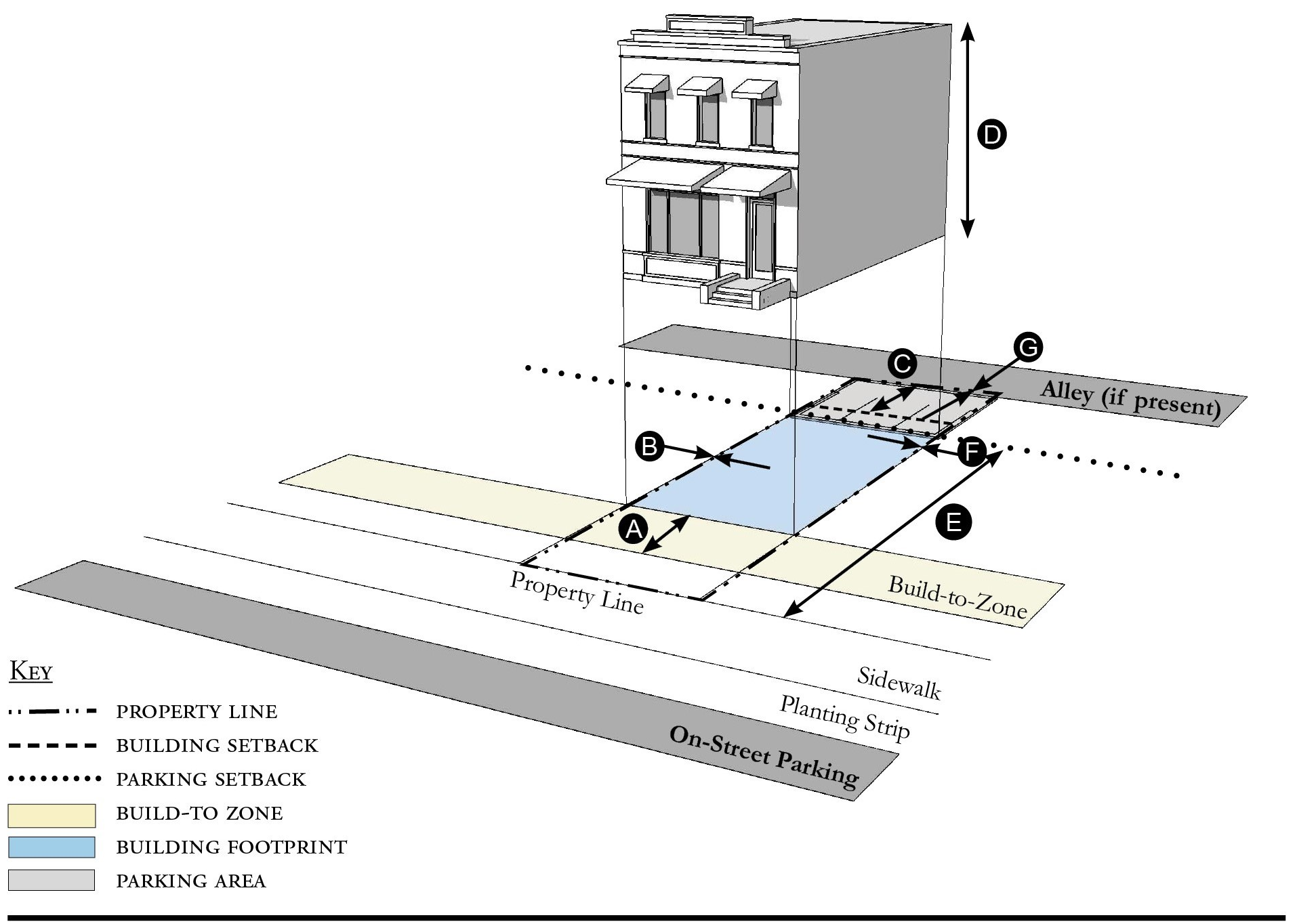
| Building Placement, see 12.1.04.6 | ||
| Frontage Buildout | 70% min. | |
| Front Build-to-Zone | 10' min./15' max. | |
| Side at Street Build-to-Zone | 10' min./15' max. | |
| Side at Property Line Setback 2 | 0' or 5' | |
| Rear Yard Setback 2 | 10' min./5' min. with alley | |
| Height, see 12.1.04.2 | ||
| Ceiling at Ground Level | 12' min. | |
| Building Height | Refer to Table HS-5 | |
| Parking Placement, see 12.1.04.6 | ||
| Front Setback | 30' min. | |
| Side at Street Setback | 10' min. | |
| Side at Property Line Setback | 0' min. | |
| Rear Setback | 5' min/0' min with alley | |
Notes:
1 Only permitted when facing US1/Federal Highway
2 Section 12.1.04.11 Building Transitions applies when the rear or side of a property abuts a residential subdistrict or an existing single family dwelling.
For permitted Lot Size, Density, Building Coverage, and Open Space, see Table HS-5.
Figure HS-5.04 Apartment Building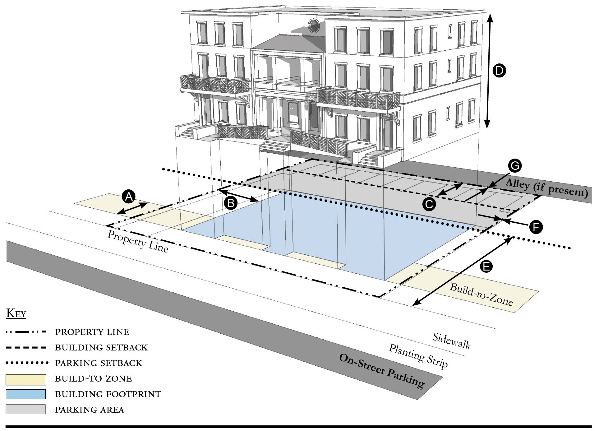
| Building Placement, see 12.1.04.6 | ||
| Frontage Buildout | 60% min. | |
| Front Build-to-Zone | 10' min./25' max. | |
| Side at Street Build-to-Zone | 10' min./15' max. | |
| Side at Property Line Setback 1 | 5' min. | |
| Rear Yard Setback 1 | 10' min./5' min. with alley | |
| Height, see 12.1.04.2 | ||
| Ceiling at Ground Level | Not applicable | |
| Building Height | Refer to Table HS-5 | |
| Parking Placement, see 12.1.04.6 | ||
| Front Setback | 30' min. | |
| Side at Street Setback | 10' min. | |
| Side at Property Line Setback | 5' min./0' min. with alley | |
| Rear Setback | 5' min./0' min. with alley | |
Notes:
1 Section 12.1.04.11 Building Transitions applies when the rear or side of a property abuts a residential subdistrict or an existing single family dwelling.
For permitted Lot Size, Density, Building Coverage, and Open Space, see Table HS-5.
Figure HS-5.05 Courtyard Building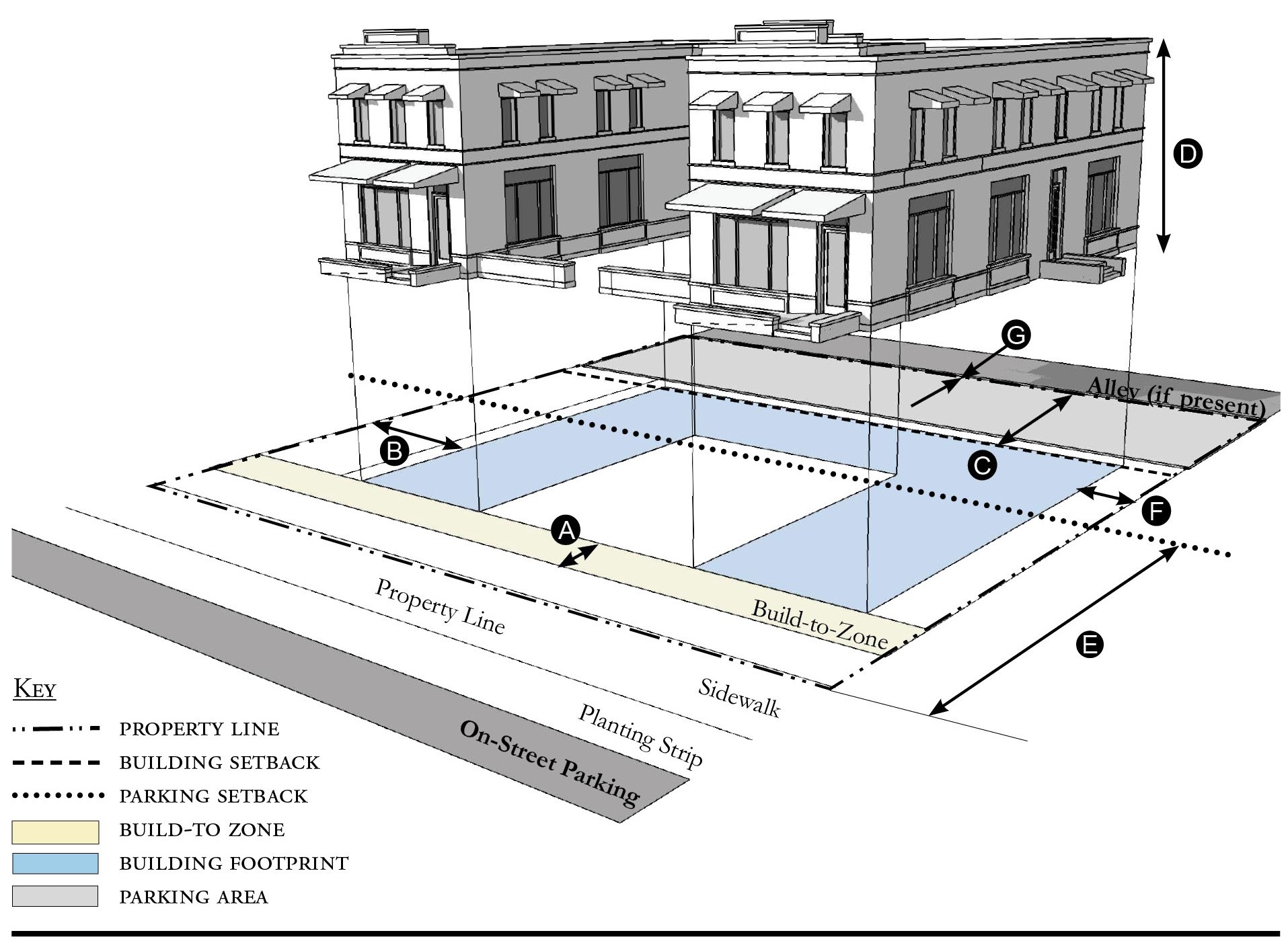
| Building Placement, see 12.1.04.6 | ||
| Frontage Buildout | 70% min. includes courtyard | |
| Front Build-to-Zone | 10' min./25' max. | |
| Side at Street Build-to-Zone | 10' min./15' max. | |
| Side at Property Line Setback 1 | 5' min. | |
| Rear Yard Setback 1 | 10' min./5' min. with alley | |
| Height, see 12.1.04.2 | ||
| Ceiling at Ground Level | Not applicable | |
| Building Height | Refer to Table HS-5 | |
| Parking Placement, see 12.1.04.6 | ||
| Front Setback | 30' min. | |
| Side at Street Setback | 10' min. | |
| Side at Property Line Setback | 5' min./0' min. with alley | |
| Rear Setback | 5' min./0' min. with alley | |
Notes:
The proportion of the courtyard space shall be at least as deep as it is wide.
1 Section 12.1.04.11 Building Transitions applies when the rear or side of a property abuts a residential subdistrict or an existing single family dwelling.
For permitted Lot Size, Density, Building Coverage, and Open Space, see Table HS-5.
Figure HS-5.06 Townhouse
| Building Placement, see 12.1.04.6 | ||
| Frontage Buildout | 70% min. | |
| Front Build-to-Zone | 0' min./15' max. | |
| Side at Street Build-to-Zone | 0' min./15' max. | |
| Side at Property Line Setback 1, 2 | 0' min. or 10' min. | |
| Rear Yard Setback 1 | 10' min./5' min. with alley | |
| Height, see 12.1.04.2 | ||
| Ceiling at Ground Level | Not applicable | |
| Building Height | Refer to Table HS-5/2 stories min. | |
| Parking Placement, see 12.1.04.6 | ||
| Front Setback | 30' min. | |
| Side at Street Setback | 10' min. | |
| Side at Property Line Setback | 0' min. | |
| Rear Setback | 5' min./0' min. with alley | |
Notes:
Townhouses shall have a maximum grouping of 8 dwelling units and a minimum Setback of 15 feet between buildings.
1 Section 12.1.04.11 Building Transitions applies when the rear or side of a property abuts a residential subdistrict or an existing single family dwelling.
2 When adjacent to another property that is not part of the townhouse development the Side at Property Setback is ten feet minimum from the property line.
For permitted Lot Size, Density, Building Coverage, and Open Space, see Table HS-5.
Figure HS-5.07 Live/Work Building
| Building Placement, see 12.1.04.6 | ||
| Frontage Buildout | 70% min. | |
| Front Build-to-Zone | 10' min./25' max. | |
| Side at Street Setback | 10' min. | |
| Side at Property Line Setback 1 | 10' min. | |
| Rear Yard Setback 1 | 10' min | |
| Height, see 12.1.04.2 | ||
| Ceiling at Ground Level | 12' min. | |
| Building Height | Refer to Table HS-5 | |
| Parking Placement, see 12.1.04.6 | ||
| Front Setback | 30' min. | |
| Side at Street Setback | 10' min. | |
| Side at Property Line Setback | 0' min. | |
| Rear Setback | 5' min./0' min. with alley | |
| Parking Placement does not prohibit parking in a residential driveway or a side yard driveway. | ||
Notes:
1 Section 12.1.04.11 Building Transitions applies when the rear or side of a property abuts a residential subdistrict or an existing single family dwelling.
For permitted Lot Size, Density, Building Coverage, and Open Space, see Table HS-5.
Figure HS-5.08 Side Yard House
| Building Placement, see 12.1.04.6 | ||
| Frontage Buildout 1 | 60% min. | |
| Front Build-to-Zone | 10' min./25' max. | |
| Side at Street Setback | 10' min. | |
| Side at Property Line Setback | 5' min., 10' min. other side | |
| Rear Yard Setback | 10' min/5; min. with alley | |
| Height, see 12.1.04.2 | ||
| Ceiling at Ground Level | Not applicable | |
| Building Height | Refer to Table HS-5 | |
| Parking Placement, see 12.1.04.6 and 12.5.07.9 | ||
| Front Setback | 30' min. | |
| Side at Street Setback | 10' min. | |
| Side at Property Line Setback | 5' min. | |
| Rear Setback | 5' min./0' min. with alley | |
| Parking Placement does not prohibit parking in a residential driveway or a side yard driveway. | ||
Notes:
1 For this Building Type, the frontage buildout requirement may be met with the provision of a continuous wall or fence along the lot frontage.
For permitted Lot Size, Density, Building Coverage, and Open Space, see Table HS-5.
Figure HS-5.10 Cottage
| Building Placement, see 12.1.04.6 | ||
| Frontage Buildout 1, 2 | 60% min. | |
| Front Build-to-Zone | 10' min./25' max. | |
| Side at Street Build-to-Zone | 5' min., 10' max. | |
| Side at Property Line Setback | 5' min. | |
| Rear Yard Setback | 10' min | |
| Height, see 12.1.04.2 | ||
| Ceiling at Ground Level | Not applicable | |
| Building Height | 30'/2 stories max. | |
| Parking Placement, see 12.1.04.6 and 12.5.07.9 | ||
| Front Setback | 30' min. | |
| Side at Street Setback | 10' min. | |
| Side at Property Line Setback | 5' min. | |
| Rear Setback | 5' min. | |
| Parking Placement does not prohibit parking in a residential driveway or a side yard driveway. | ||
Notes:
Cottages shall not exceed a footprint of 2,000 square feet.
1 For this Building Type, the frontage buildout requirement may be met with the provision of a continuous wall or fence along the lot frontage.
2 The Building Placement standards for a Cottage building type apply to the installation of a new mobile or modular home on a lot on SE Cactus Trail, SE Wagon Trail, SE Arrance St., SE Fairchild St., or SE Asaro Lane, except minimum frontage buildout does not apply. Parking Placement standards also do not apply. The front Build-to-Zone shall be measured from the edge of the road rather than the lot line.
For permitted Lot Size, Density, Building Coverage, and Open Space, see Table HS-5.
Figure HS-5.10 Cottage Court
| Building Placement, see 12.1.04.6 | ||
| Frontage Buildout | 60% min. | |
| Front Setback | 6' min. | |
| Side at Street Setback | 6' min. | |
| Side at Property Line Setback | 6' min. | |
| Unit Separation | 10' min | |
| Height, see 12.1.04.2 | ||
| Ceiling at Ground Level | Not applicable | |
| Building Height | 30'/2 stories max. | |
| Parking Placement, see 12.1.04.6 | ||
| Front Setback | 30' min. | |
| Side at Street Setback | 10' min. | |
| Side at Property Line Setback | 5' min. | |
| Rear Setback | 5' min. | |
Notes:
Cottage Courts may include duplexes.
1 For this Building Type, the frontage requirement may be met with the provision of a continuous wall or fence along the lot frontage.
2 The Building Placement standards for a Cottage Court apply to the installation of a new mobile or modular home in the Woodbridge Village Co-op Sea Breeze Manor Co-op Lakeside Village Co-op and Hobe Sound Park except that frontage buildout standards do not apply Parking Placement standards also do not apply. Written verification by the property owner that the proposed location and foot print of the dwelling comply with the 10 ft. minimum separation shall be provided with the building permit application.
For permitted Lot Size, Density, Building Coverage, and Open Space, see Table HS-5.
Figure HS-5.11 Duplex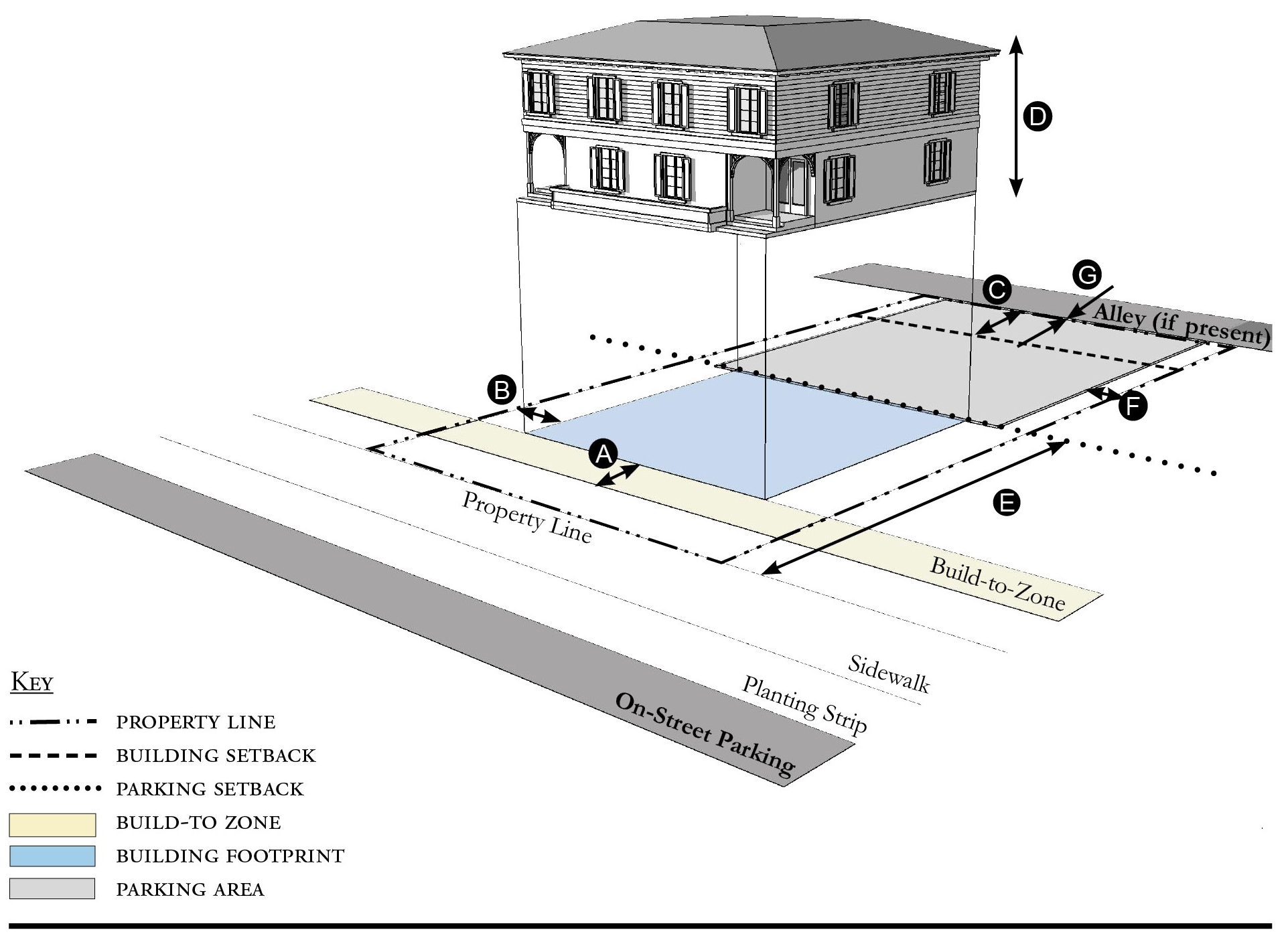
| Building Placement, see 12.1.04.6 | ||
| Frontage Buildout 1 | 60% min. | |
| Front Build-to-Zone | 10' min./25' max. | |
| Side at Street Setback | 10' min. | |
| Side at Property Line Setback | 5' min. | |
| Rear Yard Setback | 10' min | |
| Height, see 12.1.04.2 | ||
| Ceiling at Ground Level | Not applicable | |
| Building Height | 30'/2 stories max. | |
| Parking Placement, see 12.1.04.6 | ||
| Side at Property Line Setback | 5' min. | |
| Rear Setback | 5' min./0' min. with alley | |
| Parking Placement does not prohibit parking in a residential driveway or a side yard driveway. | ||
| Refer to Section 12.1.07.8 Garage and Driveway for parking and driveway configurations for Single Family Dwellings. | ||
Notes:
An ADU is prohibited on lots on which a duplex is located.
1 For this Building Type, the frontage buildout requirement may be met with the provision of a continuous wall or fence along the lot frontage.
For permitted Lot Size, Density, Building Coverage, and Open Space, see Table HS-5.
Figure HS-5.12 All Yard House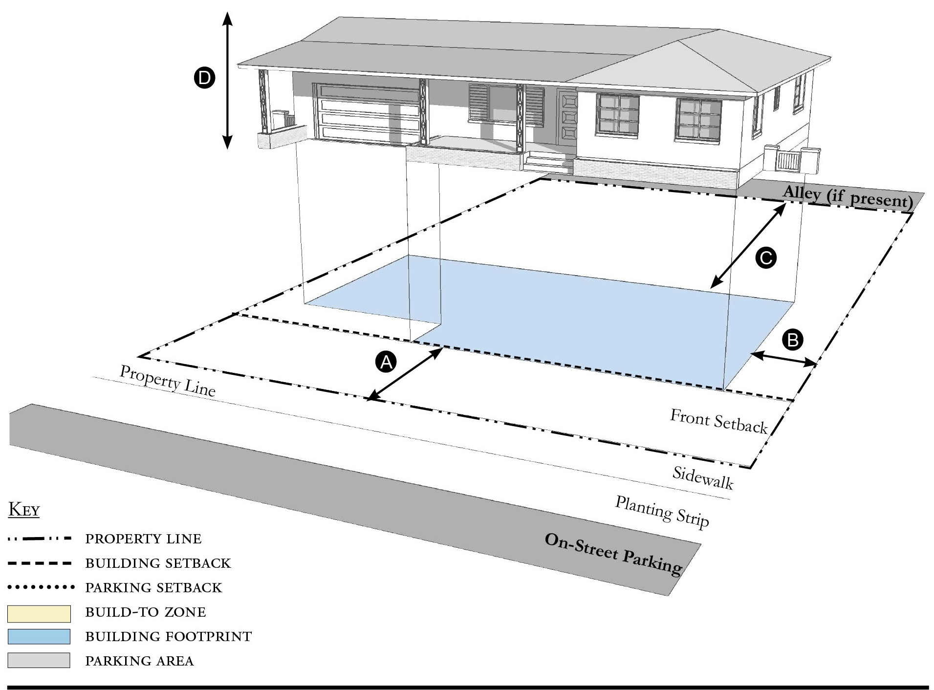
| Building Placement, see 12.1.04.6 | ||
| Frontage Buildout | Not Required | |
| Front Setback | 20' min. | |
| Side at Street Setback | 6' min. | |
| Side at Property Line Setback | 6' min. | |
| Rear Yard Setback | 10' min | |
| Height, see 12.1.04.2 | ||
| Ceiling at Ground Level | Not applicable | |
| Building Height | 30'/2 stories max | |
| Parking Placement, see 12.1.04.G | ||
| Side at Property Line | 5' min. | |
| Rear Setback | 5' min., 0' min. alley | |
| Parking Placement does not prohibit parking in a residential driveway or a side yard driveway. | ||
| Refer to Section 12.1.07.8 Garage and Driveway for parking and driveway configurations for Single Family Dwellings. | ||
Notes:
For permitted Lot Size, Density, Building Coverage, and Open Space, see Table HS-5.
Figure HS-5.13 Outbuilding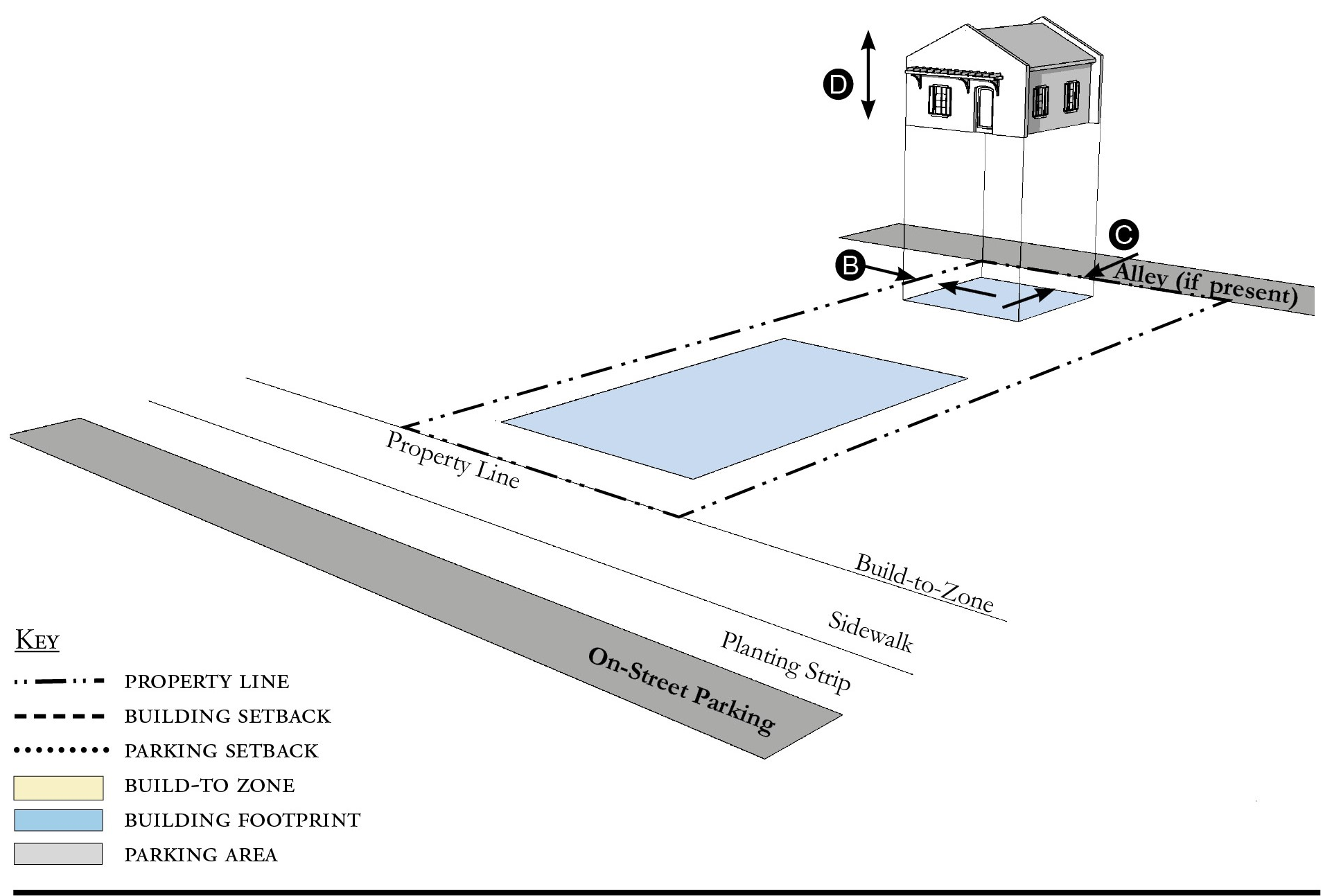
| Building Placement, see 12.1.04.6 | ||
| Frontage Buildout | Not applicable | |
| Front Build-to-Zone | Not applicable | |
| Side at Street Build-to-Zone | Not applicable | |
| Side at Property Line Setback | 5' min. | |
| Rear Yard Setback 1 | 5' min | |
| Height, see 12.1.04.2 | ||
| Ceiling at Ground Level | Not applicable | |
| Building Height | 24'/2 stories max. | |
| Parking Placement, see 12.1.04.6 | ||
| Refer to Section 12.1.07.8 Garage and Driveway for parking and driveway configurations for Single Family Dwellings. | ||
Notes:
Outbuildings shall not exceed a footprint of 850 square feet.
For permitted Lot Size, Density, Building Coverage, and Open Space, see Table HS-5.
Figure HS-5.14 Boat Barn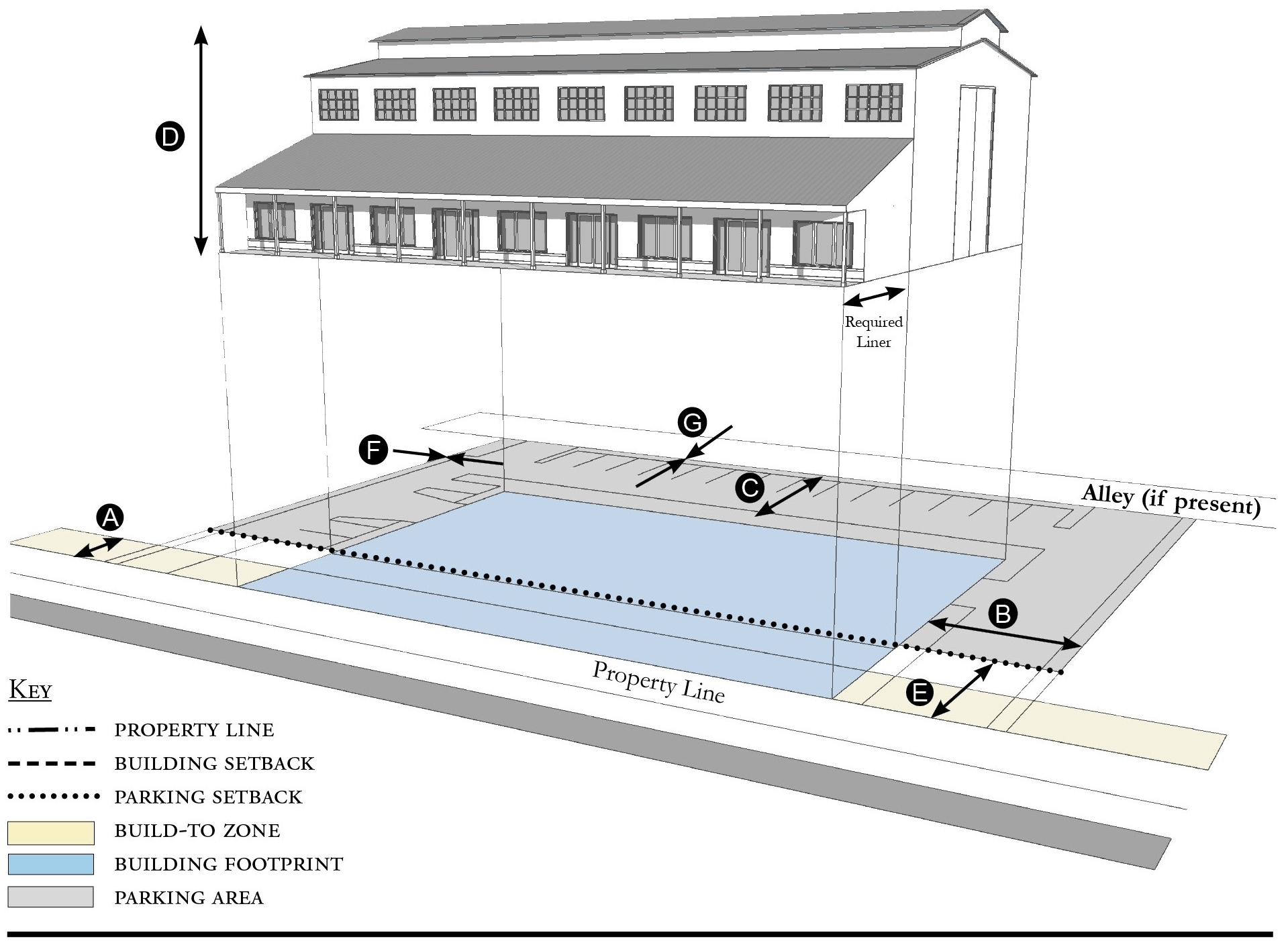
| Building Placement, see 12.1.04.6 | ||
| Frontage Buildout | 60% min. | |
| Front Build-to-Zone 1 | 0' min., 15' max. | |
| Side at Street Setback | 10' min. | |
| Side at Property Line Setback 1 | 10' min. | |
| Rear Yard Setback 1 | 10' min/5' min. with alley | |
| Height, see 12.1.04.2 | ||
| Ceiling at Ground Level | Not applicable | |
| Building Height | Refer to Table HS-5 | |
| Parking Placement, see 12.1.04.6 | ||
| Front Setback | 30' min. | |
| Side at Street Setback | 5' min. | |
| Side at Property Line Setback | 5' min. | |
| Rear Setback | 5' min./0' min. with alley | |
| Parking shall not be located between the building and the street. | ||
Notes:
A commercial liner shall be a minimum depth of 20 feet.
1 Section 12.1.04.11 Building Transitions applies when the rear or side of a property abuts a residential subdistrict or an existing single family dwelling.
For permitted Lot Size, Density, Building Coverage, and Open Space, see Table HS-5.
Figure HS-5.15 Industrial Building
| Building Placement, see 12.1.04.6 | ||
| Frontage Buildout | Not required | |
| Front Setback | 20' min. | |
| Side at Street Setback | 5' min. | |
| Side at Property Line Setback 1 | 5' min. | |
| Rear Yard Setback | 10' min/5' min. with alley | |
| Height, see 12.1.04.2 | ||
| Ceiling at Ground Level | Not applicable | |
| Building Height | Refer to Table HS-5 | |
| Parking Placement, see 12.1.04.6 | ||
| Front Setback | 30' min. | |
| Side at Street Setback | 5' min. | |
| Side at Property Line Setback | 5' min. | |
| Rear Setback | 5' min./0' min. with alley | |
| Parking shall not be located between the building and the street. | ||
Notes:
1 Section 12.1.04.11 Building Transitions applies when the rear or side of a property abuts a residential subdistrict or an existing single family dwelling.
For permitted Lot Size, Density, Building Coverage, and Open Space, see Table HS-5.
(Ord. No. 1134, pt. I(Exh. A), 6-16-2020; Ord. No. 1159, pt. 1(Exh. A), 5-11-2021; Ord. No. 1237, Pt. I(Exh. 1), 1-28-2025)
Sec. 12.5.06. - Street standards.
1.
Applicability. Street Standards that apply in all Redevelopment Zoning Districts are provided in Section 12.1.06. The additional street standards which apply in the Hobe Sound Redevelopment Zoning District are specified in this section.
2.
Street Regulating Plan. A Street Regulating Plan is provided in Figure HS-3, Section 12.5.02. Features identified in the Street Regulating Plan are described in 12.1.02.2.
a.
Primary Streets.
b.
Secondary Streets.
c.
Recommended Future Streets.
d.
Recommended Future Alleys.
3.
Future Streets.
a.
Street Location. The schematic location of proposed streets is shown on the Street Regulating Plan. The exact location may be adjusted during the development review process provided the new location meets these requirements:
i.
The adjusted location does not reduce the level of connectivity with surrounding streets, both existing and proposed.
ii.
The adjusted location does not reduce the level of street connectivity within the site or substantially increase the average block size.
iii.
The adjusted location does not diminish or eliminate any proposed civic space, or civic building shown on the Regulating Plan.
iv.
The adjusted location maintains or enhances pedestrian convenience and safety and does not create any traffic hazards.
b.
Street Types. Proposed streets may be designed and constructed as any one of the following street types below defined in Section 12.1.06.
i.
Local Street 1.
ii.
Local Street 2.
iii.
Local Street 3.
iv.
Local Street with Shared Use Path.
v.
Neighborhood Street 1.
vi.
Neighborhood Street 2.
vii.
Yield Street.
4.
Improvements To Existing Streets. The planting of new shade trees shall be required for project approval and shall be coordinated with existing or future CRA and County streetscape improvements. As provided in Section 12.1.06, the County Engineer may allow deviations from these minimum standards when necessary due to the location of existing buildings, constrained right-of-way, or to meet other goals for the particular street section.
a.
A-1-A/Dixie Highway. Dixie Highway in Hobe Sound is a candidate road for a Complete Street intervention. A-1-A/Dixie Highway shall include the planting of trees with a minimum height of 12 feet, a four-foot clear trunk, and three-inch diameter at breast height (dbh) at the time of planting, planted at a maximum of 30-foot intervals. If palms are used, each palm must have a minimum 12-foot clear trunk planted at a maximum of 15-foot intervals. Every 200 feet shall be complemented with a bench and a garbage container set on a solid surface and accessible to the sidewalk. The landscape islands shall be sized appropriately to the maximum mature size of the tree.
b.
Bridge Road. Bridge Road is a candidate road for a Complete Street intervention. Bridge Road shall include the planting of trees with a minimum height of 12 feet, a four-foot clear trunk, and three-inch diameter at breast height (dbh) at the time of planting, planted at a maximum of 30-foot intervals. If palms are used, each palm must have a minimum 12-foot clear trunk planted at a maximum of 15-foot intervals. Every 200 feet shall be complemented with a bench and a garbage container set on a solid surface and accessible to the sidewalk. The landscape islands shall be sized appropriately to the maximum mature size of the tree.
c.
US1/SE Federal Highway. This corridor has been given a high priority to become a Complete Street and a Safe Route to School with landscaping that requires close coordination, planning, and investment among Martin County Public Works, the Community Redevelopment Agency, the Martin Metropolitan Planning Organization, and the Florida Department of Transportation.
(Ord. No. 1134, pt. I(Exh. A), 6-16-2020; Ord. No. 1159, pt. 1(Exh. A), 5-11-2021)
Sec. 12.5.07. - Parking standards.
1.
Applicability. Parking Standards found in Sections 4.621 through 4.628, Div. 14, Article 4, are modified for all Redevelopment Zoning Districts in Parking Standards Section 12.1.07. Those modified Parking Standards apply in the Hobe Sound Redevelopment Zoning District except as specified otherwise in this section.
2.
Parking Rates. Refer to Section 12.1.07 for parking rates applicable to Redevelopment Zoning Districts.
3.
Screening of Parking from Residential Uses. There shall be an alley between parking areas and adjacent residential uses. Where an alley is not possible, there shall be a visual barrier between parking areas and residential uses. Refer to Landscaping Standards Section 12.3.09 Vehicular Use Areas.
4.
Parking Structures. Whenever a parking structure or surface parking provided beneath a building is located on a Primary Street, as identified on the Street Regulating Plan, Section 12.3.02, ground level commercial space shall be provided for a depth of no less than 20 feet measured from the front of the building.
5.
Distributing Parking. Where more than 200 parking spaces are provided on-site, such parking shall be distributed such that no more than 50 percent of the spaces are grouped in a single area of the parcel. Methods of distributing parking include locating parking adjacent to the rear or sides of a building or by physically separating parking areas with other buildings or landscaped areas.
6.
Shared Parking Lot.
a.
Shared parking lots must be located within 500 feet of each use. These lots may be separated from the use(s) by a street, easement, or other right-of-way.
b.
In order to meet the parking requirements, parking shared by different uses must be supported by evidence that peak parking demands of each use occur at different times of the day or days of the week. Section 4.626.B.2, Div. 14, Article 4, Shared Parking provides the methodology to support shared parking. Mixed-use developments do not have to meet this standard.
(Ord. No. 1134, pt. I(Exh. A), 6-16-2020; Ord. No. 1159, pt. 1(Exh. A), 5-11-2021; Ord. No. 1196, pt. I(Exh. A), 5-9-2023)
Sec. 12.5.08. - Stormwater standards.
1.
Stormwater management standards are provided in Sections 4.381 through 4.390, Div. 9, Article 4 and apply in Redevelopment Zoning Districts except as modified in Section 12.1.08.
(Ord. No. 1134, pt. I(Exh. A), 6-16-2020)
Sec. 12.5.09. - Landscape standards.
1.
Table HS-9 identifies which of the landscaping, buffering, and tree protection standards in Div. 15, Article 4 apply in the Hobe Sound Redevelopment Zoning District and which standards are modified, replaced, or do not apply in this Redevelopment Zoning District.
Table HS-9 - Landscaping, Buffering, and Tree Protection Standards
2.
Single family dwellings or duplexes. Single Family Dwellings and duplexes are not required to submit a Landscape Plan or comply with Vehicular Use Area requirements. Required tree planting and landscape area do apply to single family dwellings and duplexes.
3.
Required landscape area.
a.
Table HS-10 indicates the minimum percentage of the total developed area that must be landscaped.
b.
Landscaping shall be permitted in easements only with the written permission of the easement holder. A written agreement shall specify the party responsible for restoring disturbed landscape areas, shall be submitted to the county in a form acceptable to the County Attorney, and shall be recorded in the public records.
c.
Exposed dirt yards are prohibited.
4.
Required tree planting.
a.
Table HS-10 indicates the minimum number of trees that must be planted.
b.
Tree species and size.
i.
Palm trees shall have a minimum height of 12 feet at the time of planting.
ii.
Fruit trees shall have a minimum height of five feet at the time of planting.
iii.
Other required trees shall have a minimum height of 12 feet, with a four-foot clear trunk, and two-inch diameter at breast height (dbh), at the time of planting.
c.
Trees planted in adjacent right-of-way in accordance with Section 12.5.06 or in other nearby public space shall be credited towards meeting the number of trees required by Table HS-11. Any private use of the public right-of-way requires the approval of the County Engineer, a right-of-way use permit, a construction agreement, and an indemnification agreement.
d.
Trees planted in Vehicular Use Areas shall be credited towards meeting the number of trees required by Table HS-10.
e.
FPL's Right Tree/Right Place Guidelines shall be considered when trees are planted near utilities.
Table HS-10 - Required Landscape Area and Tree Planting
Table HS-11 - Landscape Plan Application Requirements
5.
Landscape Plan. Development applications shall include a landscape plan prepared by a qualified professional that provides the location and type of existing and proposed features that are identified in Table HS-11, which are summarized from the detailed requirements in Section 4.662.A, Div. 15, Article 4.
a.
Column A requirements apply to an application for a final site plan.
b.
Column B requirements apply to an application for a building permit for a Small Site which is defined as the construction or expansion of a principal building or accessory structure on a lawfully established lot or adjacent lots, provided the parcel being developed is less than one-half acre.
c.
Column B requirements also apply to an application for a substantial improvement or substantial renovation of a building exterior on any lot regulated by Article 12 as those terms are defined in Section 4.871.B, Div. 20, Article 4.
6.
Vehicular Use Areas.
a.
Perimeter landscaping. Landscaping shall be provided along the perimeter of vehicular use areas in accordance with the following standards:
i.
The perimeter of a vehicular use area shall be planted with trees at 30-foot intervals. The trees shall be a minimum of 12 feet in height, with a four-foot clear trunk, and a three-inch dbh at the time of planting.
ii.
If a vehicular use area abuts a residential property (existing residential use or Mobile Home, Multifamily, and/or Detached Subdistrict) that is not a part of the subject development, a landscaped buffer, eight-feet wide shall be provided. Trees with a minimum height of 16 feet, with a four-foot clear trunk, and four-inch dbh shall be planted at a maximum of 30-foot intervals. If palms are used, each palm must have a 12-foot minimum clear trunk and be planted at a maximum of 15-foot intervals.
iii.
A wall, fence, hedge or other durable landscape barrier shall be provided around all vehicular use areas. Between the vehicular use area and a road right-of-way, the wall, fence, or hedge shall not exceed four feet in height. For the remainder of the lot, it shall not exceed six feet in height. Walls and landscaping around vehicular use areas shall provide pedestrian access every 50 linear feet. No wall, fence, or hedge is required along the side of a parking area that abuts another parking area.
b.
Interior landscaping. If a vehicular use area is larger than 15,000 square feet, landscaping shall be provided within its interior in accordance with Section 4.663.A.4, Div. 15, Article 4, except that these interior landscape areas may also be used as stormwater management and conveyance facilities. If a vehicular use area is equal to or smaller than 15,000 square feet, no interior landscaping, terminal islands, interior medians, or interior islands are required.
(Ord. No. 1134, pt. I(Exh. A), 6-16-2020; Ord. No. 1159, pt. 1(Exh. A), 5-11-2021)
Sec. 12.5.10. - Wall and fence standards.
1.
Walls and fences must comply with the Wall and Fence Standards established for all Redevelopment Zoning Districts in Section 12.1.10.
(Ord. No. 1134, pt. I(Exh. A), 6-16-2020)
Sec. 12.5.11. - Sign standards.
1.
Signs must comply with the Sign Standards established for all Redevelopment Zoning Districts in Section 12.1.11 except where modified below.
2.
Wall signs. Table HS-12 supersedes the signage-area table in Section 4.700, Div. 16, Article 4.
3.
Banner signs. Banner signs may be erected for a temporary period, not to exceed 90 days. If hung over a right-of-way, they must comply with all applicable FDOT and Martin County regulations.
4.
Freestanding signs. One freestanding sign is permitted per building or each 200 lineal feet of property frontage. The freestanding sign shall be with a maximum square footage of 16 square feet per sign face.
5.
Murals. Are permitted and defined in Art. 4, Div. 16.
6.
Types of signs permitted. The list of permitted signs in Section 4.703, Div. 16, Article 4 is adjusted by adding the following type of sign:
a.
Sandwich or sidewalk signs as defined in Section 4.693, Div. 16, Article 4, are permitted in the Core, Corridor and General Subdistricts, provided the signs do not exceed six square feet per face, do not unreasonably obstruct pedestrian or vehicular movement, and are moved off sidewalks or other public property by 9:00 p.m. daily.
7.
Lettering and logo size. Table HS-12 provides the maximum height of lettering and logos. Section 4.699, Div. 16, Article 4 establishes how the height of irregularly shaped features shall be measured.
Table HS-12 - Sign Size Limitations
(Ord. No. 1134, pt. I(Exh. A), 6-16-2020; Ord. No. 1159, pt. 1(Exh. A), 5-11-2021)
Sec. 12.5.12. - Architectural standards.
Architectural Standards must comply with the Architectural Standards established for all Redevelopment Zoning Districts in Section 12.1.12.
(Ord. No. 1134, pt. I(Exh. A), 6-16-2020; Ord. No. 1159, pt. 1(Exh. A), 5-11-2021; Ord. No. 1237, Pt. I(Exh. 1), 1-28-2025)
Sec. 12.6.01. - Purpose.
1.
Port Salerno is a diverse and historic community in Martin County that boasts a wide range of cultural and economic assets. Known for its working waterfront and commercial fishing industry in the Manatee Pocket area, Port Salerno is also rich with a variety of neighborhoods offering housing options at all economic levels in close proximity to the center of town. In an effort to maintain and strengthen the historical and cultural attributes of Port Salerno, this LDR Division is intended to:
a.
Promote and accomplish the goals, policies, and objectives of the Martin County Growth Management Plan as they pertain to Port Salerno;
b.
Preserve the character, quality, and scale of historic Port Salerno and ensure the compatibility of future investment;
c.
Provide clarity and predictability in future planning and development in Port Salerno;
d.
Maintain the high-quality standards of residential and nonresidential growth;
e.
Ensure a desirable and controlled natural and built environment for future generations.
2.
Port Salerno Redevelopment Zoning District. This Article 12, Division 6 of the Martin County Land Development Regulations establishes the Port Salerno Redevelopment Zoning District and the permitted uses and development standards applicable therein.
3.
Organization. How this Division is organized:
Figure PS-1 Rendering of Complete Street interventions as part of the Martin Metropolitan
Planning Organization Complete Streets: Access to Transit Study
(Ord. No. 1142, pt. I(Exh. A), 9-15-2020)
Sec. 12.6.02. - Regulating plan.
Figures PS-2 and PS-3 are the Regulating Plans that apply to the Port Salerno Redevelopment Zoning District. Section 12.1.02 describes the purpose and content of Regulating Plans.
Figure PS-2 Regulating Plan
Figure PS-3 Street Regulating Plan
Figure PS-3 Street Regulating Plan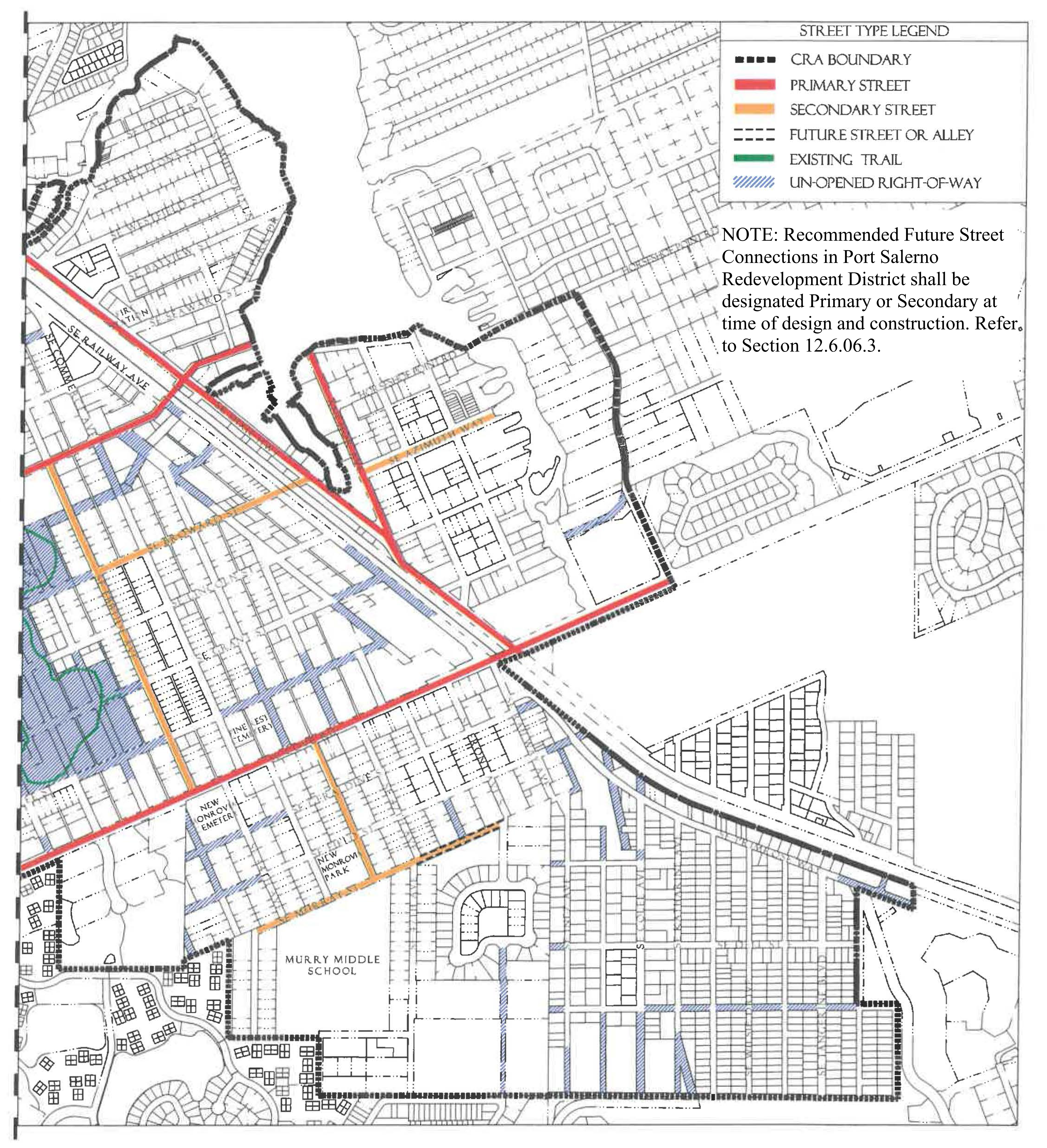
(Ord. No. 1142, pt. I(Exh. A), 9-15-2020; Ord. No. 1159, pt. 1(Exh. A), 5-11-2021; Ord. No. 1200, pt. 1, 8-8-2023)
Sec. 12.6.03. - Permitted uses.
Table PS-4 identifies permitted uses in the PS (Port Salerno) Redevelopment Zoning District.
1.
The Use Groups listed in the first column of Table PS-4 are described in Section 12.1.03.
2.
The remaining columns identify the Subdistricts shown on the Regulating Plan.
a.
"P" in a row below a column means that any use in that use group is permitted within that Subdistrict, provided the use can be developed in accordance with all applicable requirements of the LDR.
b.
If "P" is not shown in a row, the use group is not permitted in that Subdistrict.
3.
For uses that are functionally similar but not clearly permitted in a Subdistrict see Section 12.1.03.3.
Table PS-4 Use Groups Permitted in Port Salerno Subdistricts
Footnotes, see above
Development in the Waterfront Subdistrict shall be water-dependent or water-related.
Development on land in the Waterfront Subdistrict may contain residential uses when
other uses in a mixed-use project are water-dependent or water-related and not located
within the Marine Service Area. Water-related development includes marine resort-type
uses including transient accommodations, restaurants and retail shops.
2
;hg;Residential uses established prior to the effective date of Art. 12, Div. 6 or within a mixed-use project are permitted.
3
;hg;No Duplexes are permitted.
4
No Multifamily dwellings and Apartment hotels are permitted.
5
;hg;No Garages are permitted.
6
;hg;No Residential storage facilities are permitted.
7
;hg;See Section 12.6.04.7 for standards governing establishment and operation of
marinas in Port Salerno's General Subdistrict.
8
;hg;Marinas and Working Waterfront shall be permitted use if established prior to
October 29, 2020.
(Ord. No. 1142, pt. I(Exh. A), 9-15-2020; Ord. No. 1159, pt. 1(Exh. A), 5-11-2021)
Sec. 12.6.04. - Development standards.
1.
All new development, substantial improvements of a building, and substantial renovations of a building exterior shall comply with the Development Standards in Table PS-5.
2.
Existing Buildings. Whenever substantial improvement of a building or substantial renovation of a building exterior triggers the obligation to comply with this Division, the Growth Management Director may authorize incremental compliance with its requirements proportional to the nature and scope of the existing and proposed improvements if full compliance would be unreasonable. An application for alternative compliance shall not be required, but the Growth Management Director may require that the proposal be presented to the Neighborhood Advisory Committee for review and comment. See Section 4.871.B, Div. 20, Article 4.
3.
Accessory Dwelling Units. Standards for accessory dwelling units are provided in Development Standards Section 12.1.04.7.a.
4.
Building Types. Each new building, and any substantial improvement, must meet the standards for one of the Building Types permitted in the Subdistrict where it is located, see Table PS-5. Building Type diagrams do not prescribe use or architectural style and are illustrative. Dimensions provided in tables are regulatory requirements.
5.
Façade Transparency. Shopfront, Mixed-Use, Office, Apartment, and Courtyard Building façades facing streets or civic open spaces at the ground level must have transparent windows which cover between 40 percent and 70 percent of the wall area. Building façades above ground level must have transparent windows which cover between 20 percent and 50 percent of the wall area of each story as measured between finished floors. Transparent means non-solar, non-mirrored glass with a light transmission reduction of no more than 40 percent.
6.
Maximum Lot Width. Maximum lot width applies to parcels assembled or subdivided after the date of adoption of the Port Salerno Redevelopment Code, Div. 6, Article 12. Maximum lot width is intended to preserve existing character and landmarks.
7.
Marinas in the General subdistrict. Marinas in the General Subdistrict shall be governed by these standards:
a.
Only waterfront lots with an upland area of one-half acre or more may have a marina.
b.
The owner of the upland parcel must have a submerged land lease with the State of Florida or document ownership of the submerged land.
c.
No more than 13 slips shall be provided.
d.
In addition to parking required for the marina, the upland parcel associated with the marina shall have an additional use permitted by Table PS-4.
e.
The marina shall be used for the mooring of recreational vessels exclusively.
f.
The following uses or activities are prohibited at marinas in the General Subdistrict:
i.
Embarking or disembarking for purposes related to commercial fishing, charter fishing, transport of materials, scenic or wildlife tours, or marine construction;
ii.
The sale or other dispensing of fuel;
iii.
Dry storage of vessels or trailers (dry slips);
iv.
Launching facilities (boat ramps);
v.
Marine travel lifts;
vi.
Marine manufacturing or boat repair;
vii.
Maintenance activities that cannot be completed from inside the vessel;
viii.
Accessory retail and service uses, such as, but not limited to, the sale, lease, or rental of boats, bait and tackle shops, sale of food or drink;
ix.
Off-loading or processing of commercial seafood products; and
x.
Marine equipment sales.
Table PS-5 - Development Standards in Port Salerno Subdistricts
Footnotes, see above
Residential uses established prior to the effective date of Art. 12, Div. 6 or within a mixed-use project are permitted.
2
;hg;Only permitted when facing a primary or secondary road as identified in PS-3.
(Ord. No. 1142, pt. I(Exh. A), 9-15-2020; Ord. No. 1159, pt. 1(Exh. A), 5-11-2021)
Sec. 12.6.05. - Building type and frontage type standards.
1.
Building Types. The following Building Type standards shall apply in the Port Salerno Subdistricts. Table PS-5 provides additional Development Standards.
Figure PS-5.01 Shopfront Building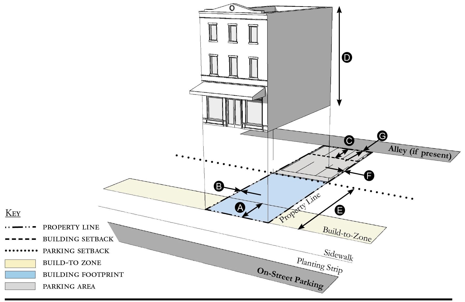
| Building Placement, see 12.1.04.6 | ||
| Frontage Buildout | 60% min. | |
| Front Build-to-Zone | 0' min., 15' max. | |
| Side at Street Build-to-Zone | 0' min., 15' max. | |
| Side at Property Line Setback 2 | 0' or 5' | |
| Rear Yard Setback 2 | 10' min./5' min. with alley | |
| Height, see 12.1.04.2 | ||
| Ceiling at Ground Level | 12' min. | |
| Building Height | Refer to Table PS-5 | |
| Parking Placement, see 12.1.04.6 | ||
| Front Setback | 30' min. | |
| Side at Street Setback | 10' min. | |
| Side at Property Line Setback | 0' min. | |
| Rear Setback | 5' min/0' min with alley | |
Notes:
1 Only permitted when facing a primary or secondary road as identified in PS-3.
2 Section 12.1.04.11 Building Transitions applies when the rear or side of a property abuts a residential subdistrict or an existing single family dwelling.
For permitted Lot Size, Density, Building Coverage, and Open Space, see Table PS-5.
Figure PS-5.02 Mixed-Use Building
| Building Placement, see 12.1.04.6 | ||
| Frontage Buildout | 60% min. | |
| Front Build-to-Zone | 0' min., 15' max. | |
| Side at Street Build-to-Zone | 5' min., 15' max. | |
| Side at Property Line BTZ 1 | 5' min., 10' max. | |
| Rear Yard Setback 1 | 10' min./5' min. with alley | |
| Height, see 12.1.04.2 | ||
| Ceiling at Ground Level | 12' min. | |
| Building Height | Refer to Table PS-5 | |
| Parking Placement, see 12.1.04.6 | ||
| Front Setback | 30' min. | |
| Side at Street Setback | 10' min. | |
| Side at Property Line Setback | 0' min. | |
| Rear Setback | 5' min/0' min with alley | |
Notes:
1 Section 12.1.04.11 Building Transitions applies when the rear or side of a property abuts a residential subdistrict or an existing single family dwelling.
For permitted Lot Size, Density, Building Coverage, and Open Space, see Table PS-5.
Figure PS-5.03 Office Building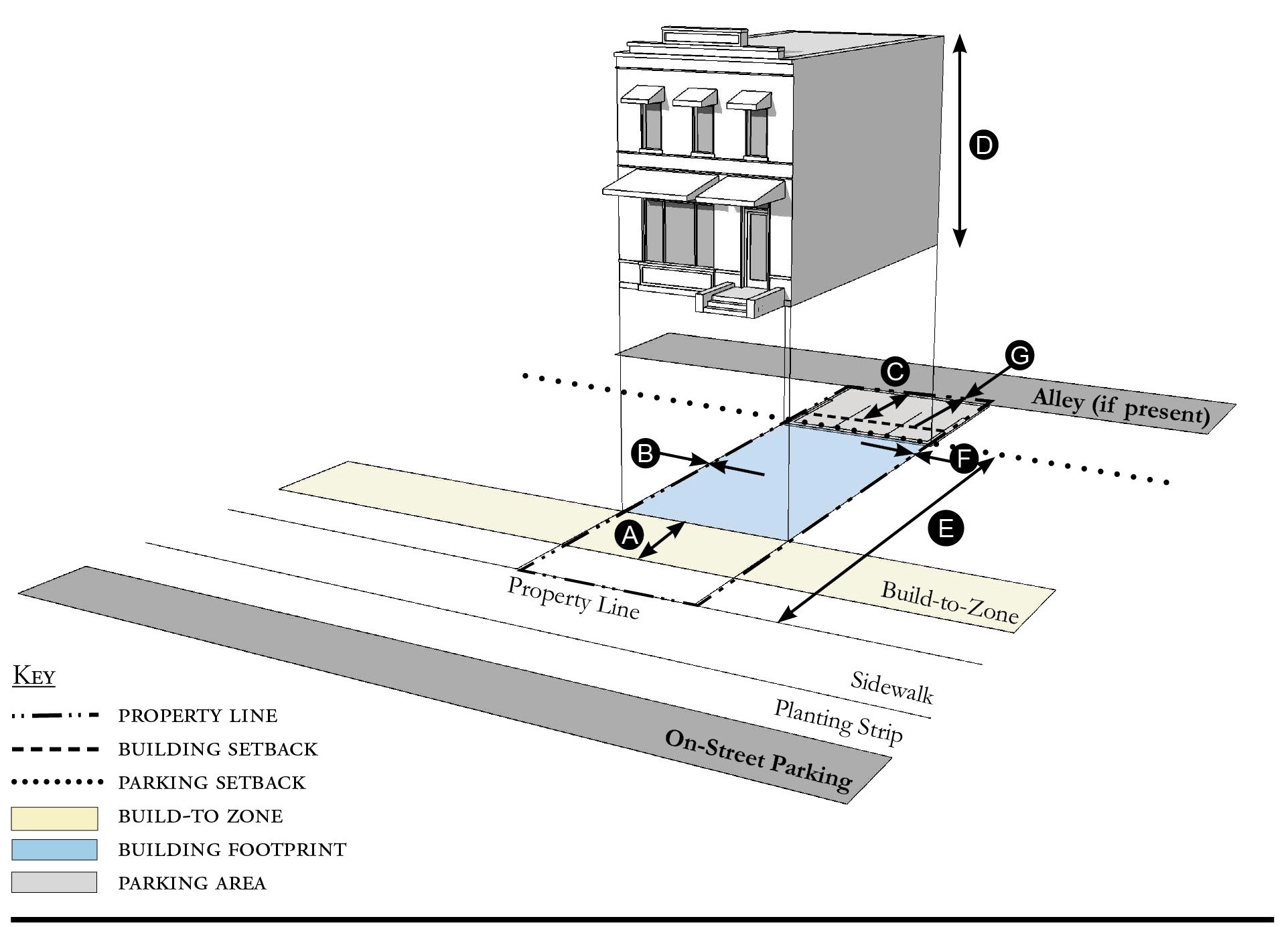
| Building Placement, see 12.1.04.6 | ||
| Frontage Buildout | 60% min. | |
| Front Build-to-Zone | 10' min., 15' max. | |
| Side at Street Build-to-Zone | 10' min., 15' max. | |
| Side at Property Line Setback 2 | 0' or 5' | |
| Rear Yard Setback 2 | 10' min./5' min. with alley | |
| Height, see 12.1.04.2 | ||
| Ceiling at Ground Level | 12' min. | |
| Building Height | Refer to Table PS-5 | |
| Parking Placement, see 12.1.04.6 | ||
| Front Setback | 30' min. | |
| Side at Street Setback | 10' min. | |
| Side at Property Line Setback | 0' min. | |
| Rear Setback | 5' min/0' min with alley | |
Notes:
1 Only permitted when facing a primary or secondary road as identified in PS-3.
2 Section 12.1.04.11 Building Transitions applies when the rear or side of a property abuts a residential subdistrict or an existing single family dwelling.
For permitted Lot Size, Density, Building Coverage, and Open Space, see Table PS-5.
Figure PS-5.04 Apartment Building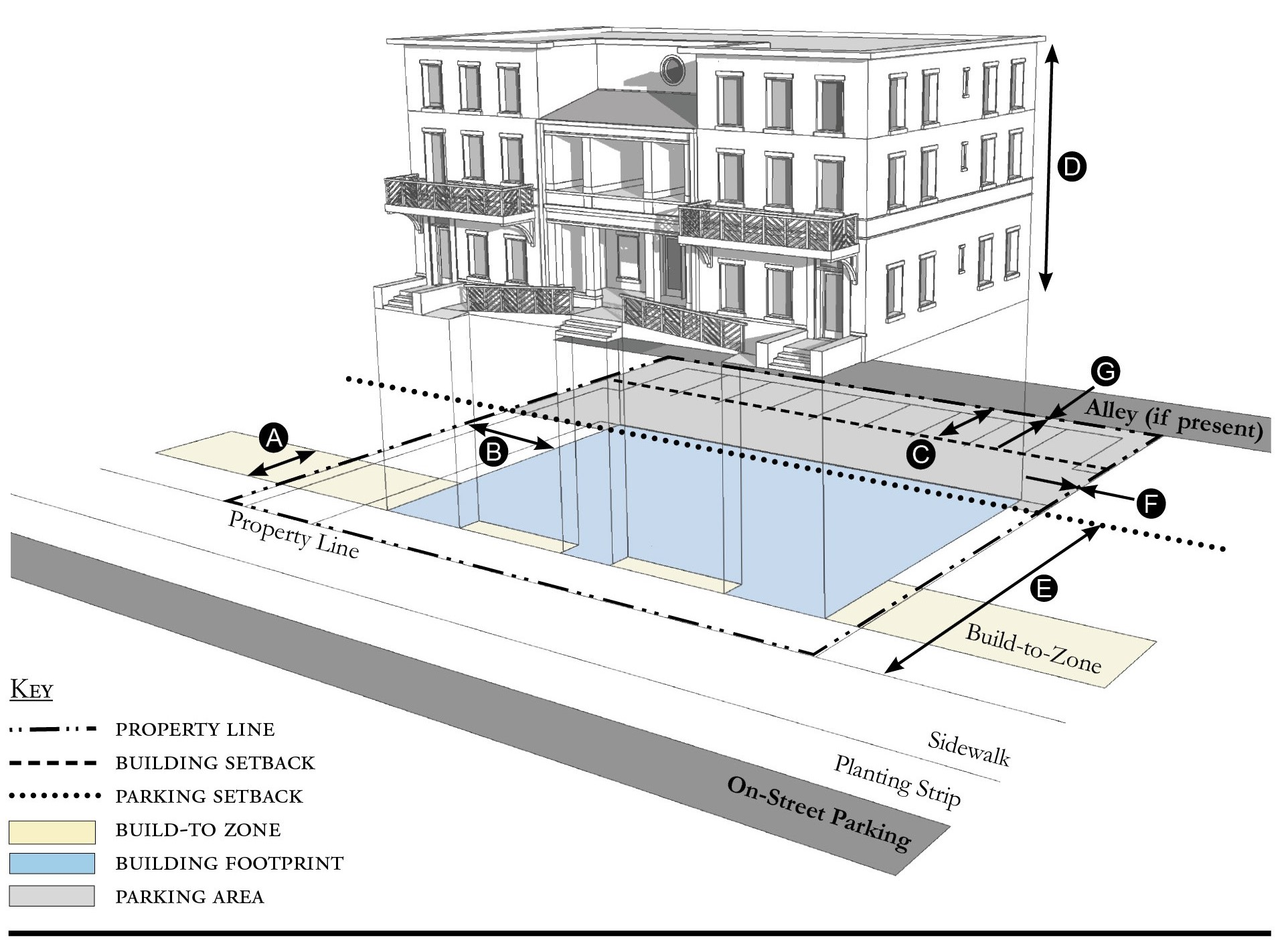
| Building Placement, see 12.1.04.6 | ||
| Frontage Buildout | 60% min. | |
| Front Build-to-Zone | 10' min., 25' max. | |
| Side at Street Build-to-Zone | 10' min., 15' max. | |
| Side at Property Line Setback 1 | 5' min. | |
| Rear Yard Setback 1 | 10' min./5' min. with alley | |
| Height, see 12.1.04.2 | ||
| Ceiling at Ground Level | Not applicable | |
| Building Height | Refer to Table PS-5 | |
| Parking Placement, see 12.1.04.6 | ||
| Front Setback | 30' min. | |
| Side at Street Setback | 10' min. | |
| Side at Property Line Setback | 5' min/0' min with alley | |
| Rear Setback | 5' min/0' min with alley | |
Notes:
1 Section 12.1.04.11 Building Transitions applies when the rear or side of a property abuts a residential subdistrict or an existing single family dwelling.
For permitted Lot Size, Density, Building Coverage, and Open Space, see Table PS-5.
Figure PS-5.05 Courtyard Building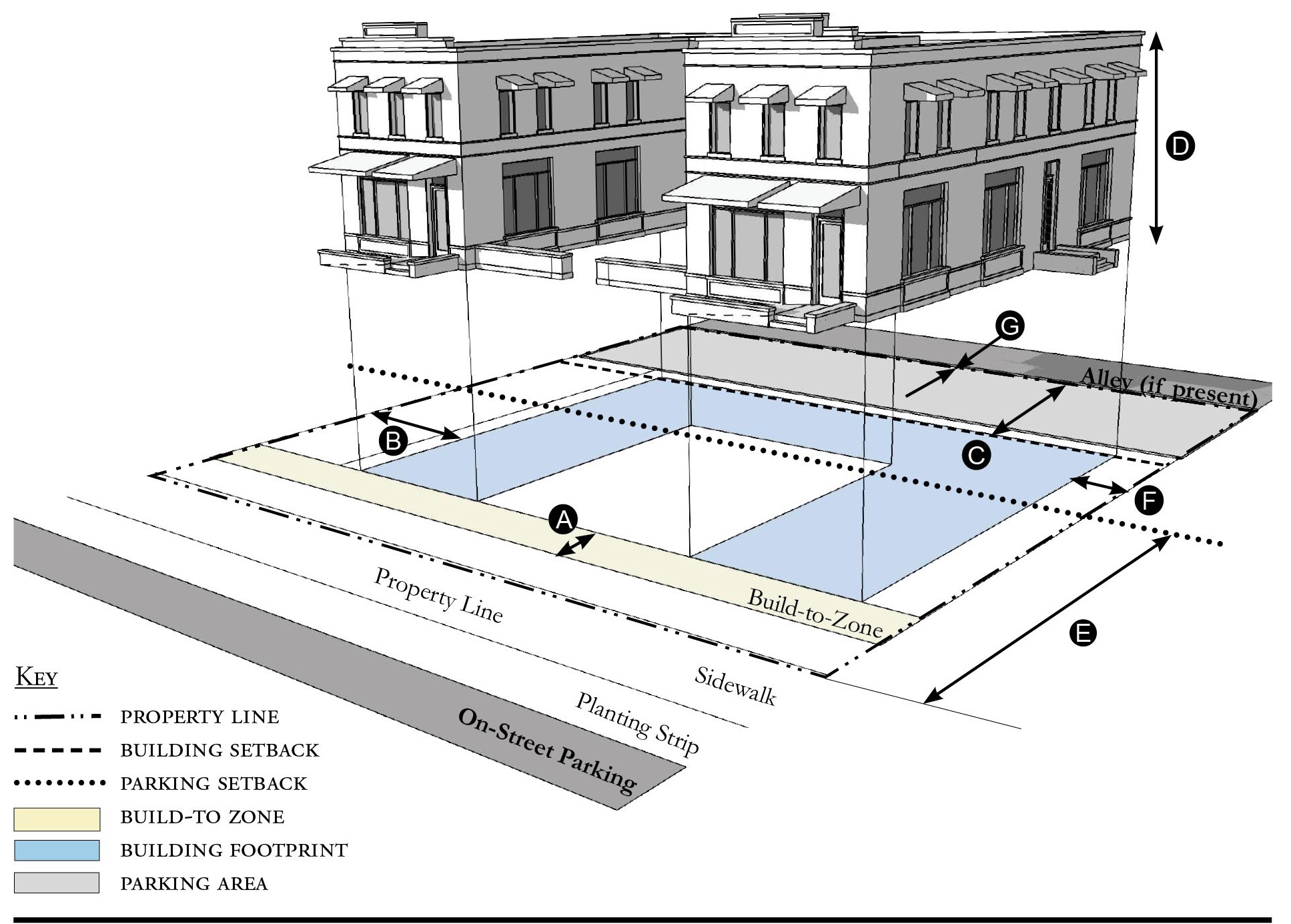
| Building Placement, see 12.1.04.6 | ||
| Frontage Buildout | 60% min. includes courtyard | |
| Front Build-to-Zone | 10' min., 25' max. | |
| Side at Street Build-to-Zone | 10' min., 15' max. | |
| Side at Property Line Setback 1 | 5' min. | |
| Rear Yard Setback 1 | 10' min./5' min. with alley | |
| Height, see 12.1.04.2 | ||
| Ceiling at Ground Level | Not applicable | |
| Building Height | Refer to Table PS-5 | |
| Parking Placement, see 12.1.04.6 | ||
| Front Setback | 30' min. | |
| Side at Street Setback | 10' min. | |
| Side at Property Line Setback | 5' min/0' min with alley | |
| Rear Setback | 5' min/0' min with alley | |
Notes:
The proportions of the courtyard space shall be at least as deep as it is wide.
1 Section 12.1.04.11 Building Transitions applies when the rear or side of a property abuts a residential subdistrict or an existing single family dwelling.
For permitted Lot Size, Density, Building Coverage, and Open Space, see Table PS-5.
Figure PS-5.06 Townhouse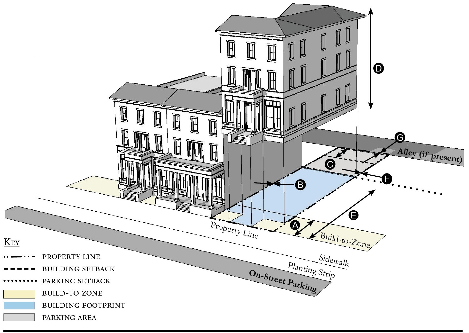
| Building Placement, see 12.1.04.6 | ||
| Frontage Buildout | 60% min. | |
| Front Build-to-Zone | 0' min., 15' max. | |
| Side at Street Build-to-Zone | 0' min., 15' max. | |
| Side at Property Line Setback 1, 2 | 0' min. or 10' min. | |
| Rear Yard Setback 1 | 10' min./5' min. with alley | |
| Height, see 12.1.04.2 | ||
| Ceiling at Ground Level | Not applicable | |
| Building Height | Refer to Table PS-5/2 stories min. | |
| Parking Placement, see 12.1.04.6 | ||
| Front Setback | 30' min. | |
| Side at Street Setback | 10' min. | |
| Side at Property Line Setback | 0' min | |
| Rear Setback | 5' min/0' min with alley | |
Notes:
Townhouses shall have a maximum grouping of 8 dwelling units and a minimum Setback of 15 feet between buildings.
1 Section 12.1.04.11 Building Transitions applies when the rear or side of a property abuts a residential subdistrict or an existing single family dwelling.
2 When directly adjacent to another property that is not part of the townhouse development the Side at Property Line Setback is 10 feet minimum from the property line.
For permitted Lot Size, Density, Building Coverage, and Open Space, see Table PS-5.
Figure PS-5.07 Live/Work Building
| Building Placement, see 12.1.04.6 | ||
| Frontage Buildout | 60% min. | |
| Front Build-to-Zone | 5' min., 25' max. | |
| Side at Street Setback | 10' min. | |
| Side at Property Line Setback 1 | 10' min. | |
| Rear Yard Setback 1 | 10' min. | |
| Height, see 12.1.04.2 | ||
| Ceiling at Ground Level | 12' min. | |
| Building Height | Refer to Table PS-5 | |
| Parking Placement, see 12.1.04.6 | ||
| Front Setback | 30' min. | |
| Side at Street Setback | 10' min. | |
| Side at Property Line Setback | 0' min. | |
| Rear Setback | 5' min./0' min with alley | |
| Parking Placement does not prohibit parking in a residential driveway or a side yard driveway. | ||
Notes:
1 Section 12.1.04.11 Building Transitions applies when the rear or side of a property abuts a residential subdistrict or an existing single family dwelling.
For permitted Lot Size, Density, Building Coverage, and Open Space, see Table PS-5.
Figure PS-5.08 Side Yard House
| Building Placement, see 12.1.04.6 | ||
| Frontage Buildout 1 | 60% min. | |
| Front Build-to-Zone | 5' min., 25' max. | |
| Side at Street Setback | 10' min. | |
| Side at Property Line Setback | 5' min., 10' min. other side | |
| Rear Yard Setback | 10' min./5' min. with alley | |
| Height, see 12.1.04.2 | ||
| Ceiling at Ground Level | Not applicable | |
| Building Height | Refer to Table PS-5 | |
| Parking Placement, see 12.1.04.6 and 12.6.07.8 | ||
| Front Setback | 30' min. | |
| Side at Street Setback | 10' min. | |
| Side at Property Line Setback | 5' min. | |
| Rear Setback | 5' min./0' min with alley | |
| Parking Placement does not prohibit parking in a residential driveway or a side yard driveway | ||
Notes:
1 Section 12.1.04.11 Building Transitions applies when the rear or side of a property abuts a residential subdistrict or an existing single family dwelling.
For permitted Lot Size, Density, Building Coverage, and Open Space, see Table PS-5.
Figure PS-5.09 Cottage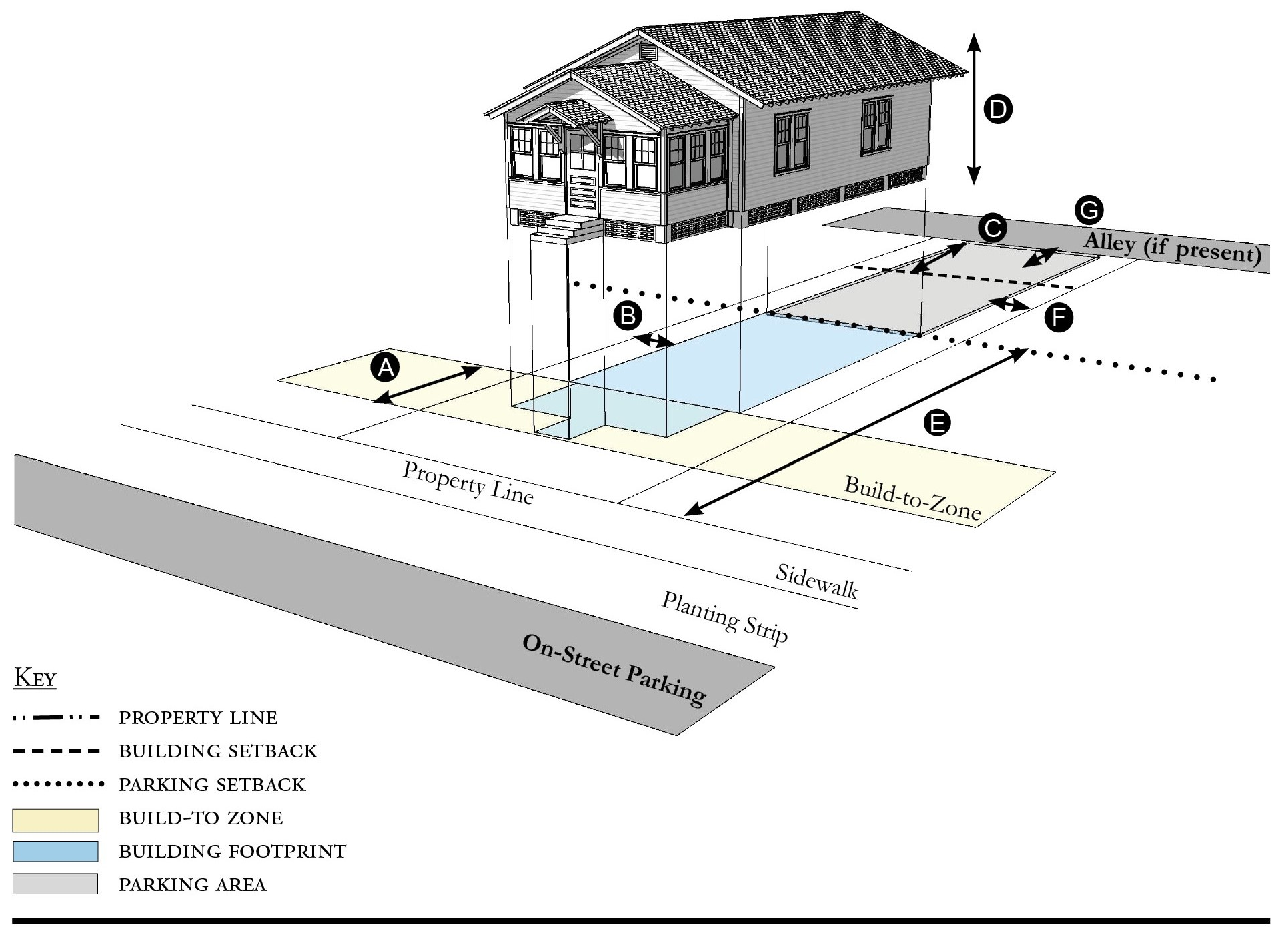
| Building Placement, see 12.1.04.6 | ||
| Frontage Buildout 1, 2 | 60% min. | |
| Front Build-to-Zone | 5' min., 25' max. | |
| Side at Street Build-to-Zone | 5' min., 10' min. | |
| Side at Property Line Setback | 5' min. | |
| Rear Yard Setback | 10' min. | |
| Height, see 12.1.04.2 | ||
| Ceiling at Ground Level | Not applicable | |
| Building Height | Refer to Table PS-5 | |
| Parking Placement, see 12.1.04.6 and 12.6.07.8 | ||
| Front Setback | 30' min. | |
| Side at Street Setback | 10' min. | |
| Side at Property Line Setback | 5' min. | |
| Rear Setback | 5' min. | |
| Parking Placement does not prohibit parking in a residential driveway or a side yard driveway. | ||
Notes:
Cottages shall not exceed a footprint of 2,000 square feet.
1 Section 12.1.04.11 Building Transitions applies when the rear or side of a property abuts a residential subdistrict or an existing single family dwelling
2 For Mobile Homes frontage requirement does not apply.
For permitted Lot Size, Density, Building Coverage, and Open Space, see Table PS-5.
Figure PS-5.10 Cottage Court
| Building Placement, see 12.1.04.6 | ||
| Frontage Buildout | 60% min. | |
| Front Setback 2 | 6' min. | |
| Side at Street Setback 2 | 6' min. | |
| Side at Property Line Setback 2 | 6' min. | |
| Unit Separation 2 | 10' min. | |
| Height, see 12.1.04.2 | ||
| Ceiling at Ground Level | Not applicable | |
| Building Height | Refer to Table PS-5 | |
| Parking Placement, see 12.1.04.6 | ||
| Front Setback 2 | 30' min. | |
| Side at Street Setback 2 | 10' min. | |
| Side at Property Line Setback 2 | 5' min. | |
| Rear Setback 2 | 5' min. | |
Notes:
Cottage Courts may include duplexes.
1 For this Building Type, the frontage buildout requirement may be met with the provision of a continuous wall or fence along the lot frontage.
2 The Building Placement standards for a Cottage Court apply to the installation of a new mobile or modular home in the Mobile Home Subdistrict except that frontage buildout standards do not apply. Parking Placement standards also do not apply. Written verification by the property owner that the proposed location and footprint of the dwelling comply with the 10-ft. minimum separation shall be provided with the building permit application.
For permitted Lot Size, Density, Building Coverage, and Open Space, see Table PS-5.
Figure PS-5.11 Duplex
| Building Placement, see 12.1.04.6 | ||
| Frontage Buildout 1 | 60% min. | |
| Front Build-to-Zone | 5' min., 25' max. | |
| Side at Street Setback | 10' min. | |
| Side at Property Line Setback | 5' min. | |
| Rear Yard Setback | 10' min. | |
| Height, see 12.1.04.2 | ||
| Ceiling at Ground Level | Not applicable | |
| Building Height | Refer to Table PS-5 | |
| Parking Placement, see 12.1.04.6 and 12.6.07.8 | ||
| Side at Property Line | 5' min. | |
| Rear Setback | 5' min. | |
| Parking Placement does not prohibit parking in a residential driveway or a side yard driveway. | ||
| Refer to Section 12.1.07.8 Garage and Driveway for parking and driveway configurations for Single Family Dwellings. | ||
Notes:
An ADU is prohibited on lots on which a duplex is located.
1 For this Building Type, the frontage buildout requirement may be met with the provision of a continuous wall or fence along the lot frontage.
For permitted Lot Size, Density, Building Coverage, and Open Space, see Table PS-5.
Figure PS-5.12 All Yard House
| Building Placement, see 12.1.04.6 | ||
| Frontage Buildout | Not Required | |
| Front Setback | 20' min. | |
| Side at Street Setback | 10' min. | |
| Side at Property Line Setback | 10' min. | |
| Rear Yard Setback | 10' min. | |
| Height, see 12.1.04.2 | ||
| Ceiling at Ground Level | Not applicable | |
| Building Height | Refer to Table PS-5 | |
| Parking Placement, see 12.1.04.6 and 12.6.07.8 | ||
| Side at Property Line | 5' min. | |
| Rear Setback | 5' min./0' min. with alley | |
| Parking Placement does not prohibit parking in a residential driveway or a side yard driveway. | ||
| Refer to Section 12.1.07.8 Garage and Driveway for parking and driveway configurations for Single Family Dwellings. | ||
Notes:
For permitted Lot Size, Density, Building Coverage, and Open Space, see Table PS-5.
Figure PS-5.13 Outbuilding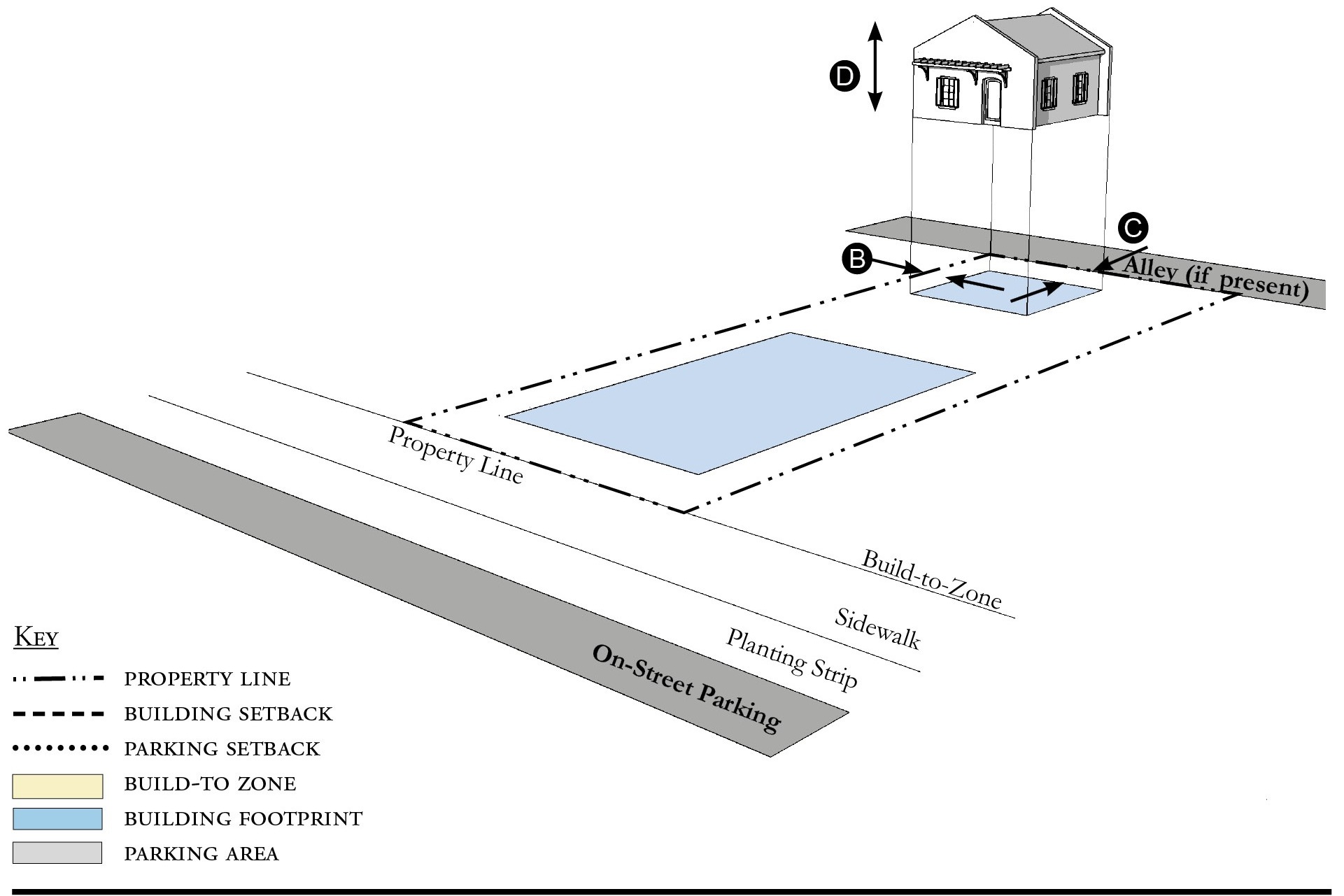
| Building Placement, see 12.1.04.6 | ||
| Frontage Buildout | Not Applicable | |
| Front Build-to-Zone | Not Applicable | |
| Side at Street Build-to-Zone | Not Applicable | |
| Side at Property Line Setback | 5' min. | |
| Rear Yard Setback | 5' min. | |
| Height, see 12.1.04.2 | ||
| Ceiling at Ground Level | Not applicable | |
| Building Height | Refer to Table PS-5 | |
| Parking Placement, see 12.1.04.6 | ||
| Refer to Section 12.1.07.8 Garage and Driveway for parking and driveway configurations for Single Family Dwellings. | ||
Notes:
Outbuildings shall not exceed a footprint of 850 square feet.
For permitted Lot Size, Density, Building Coverage, and Open Space, see Table PS-5.
Figure PS-5.14 Boat Barn
| Building Placement, see 12.1.04.6 | ||
| Frontage Buildout | 60% min. | |
| Front Build-to-Zone | 0' min., 15' max. | |
| Side at Street Setback | 10' min. | |
| Side at Property Line Setback | 10' min. | |
| Rear Yard Setback 1 | 10' min./5' min. with alley | |
| Height, see 12.1.04.2 | ||
| Ceiling at Ground Level | Not applicable | |
| Building Height | Refer to Table PS-5 | |
| Parking Placement, see 12.1.04.6 | ||
| Front Setback | 30' min. | |
| Side at Street Setback | 5' min. | |
| Side at Property Line Setback | 5' min. | |
| Rear Setback | 5' min./0' min. with alley | |
| Parking shall not be located between the building and the street. | ||
Notes:
A commercial liner shall be a minimum depth of 20 feet.
1 Section 12.1.04.11 Building Transitions applies when the rear or side of a property abuts a residential subdistrict or an existing single family dwelling.
For permitted Lot Size, Density, Building Coverage, and Open Space, see Table PS-5.
Figure PS-5.15 Industrial Building
| Building Placement, see 12.1.04.6 | ||
| Frontage Buildout | Not Required | |
| Front Setback | 20' min. | |
| Side at Street Setback | 5' min. | |
| Side at Property Line Setback 1 | 5' min. | |
| Rear Yard Setback | 10' min./5' min. with alley | |
| Height, see 12.1.04.2 | ||
| Ceiling at Ground Level | Not applicable | |
| Building Height | Refer to Table PS-5 | |
| Parking Placement, see 12.1.04.6 | ||
| Front Setback | 30' min. | |
| Side at Street Setback | 5' min. | |
| Side at Property Line Setback | 5' min. | |
| Rear Setback | 5' min./0' min. with alley | |
| Parking shall not be located between the building and the street. | ||
Notes:
1 Section 12.1.04.11 Building Transitions applies when the rear or side of a property abuts a residential subdistrict or an existing single family dwelling.
For permitted Lot Size, Density, Building Coverage, and Open Space, see Table PS-5.
(Ord. No. 1142, pt. I(Exh. A), 9-15-2020; Ord. No. 1159, pt. 1(Exh. A), 5-11-2021; Ord. No. 1237, Pt. I(Exh. 1), 1-28-2025)
Sec. 12.6.06. - Street standards.
1.
Applicability. Street Standards that apply in all Redevelopment Zoning Districts are provided in Section 12.1.06. The additional street standards which apply in the Port Salerno Redevelopment Zoning District are specified in this section.
2.
Street Regulating Plan. A Street Regulating Plan is provided in Figure PS-3, Section 12.6.02. Features identified in the Street Regulating Plan are described in 12.1.02.2.
a.
Primary Streets.
b.
Secondary Streets.
c.
Recommended Future Streets.
d.
Recommended Future Alleys.
3.
Future Streets.
a.
Street Location. The schematic location of proposed streets is shown on the Street Regulating Plan. The exact location may be adjusted during the development review process provided the new location meets these requirements:
i.
The adjusted location does not reduce the level of connectivity with surrounding streets, both existing and proposed.
ii.
The adjusted location does not reduce the level of street connectivity within the site or substantially increase the average block size.
iii.
The adjusted location does not diminish or eliminate any proposed civic space, or civic building shown on the Regulating Plan.
iv.
The adjusted location maintains or enhances pedestrian convenience and safety and does not create any traffic hazards.
b.
Street Types. Proposed streets may be designed and constructed as any one of the following street types below defined in Section 12.1.06.
i.
Local Street 1.
ii.
Local Street 2.
iii.
Local Street 3.
iv.
Local Street with Shared Use Path.
v.
Neighborhood Street 1.
vi.
Neighborhood Street 2.
vii.
Yield Street.
4.
Improvements To Existing Streets. The planting of new shade trees shall be required for project approval and shall be coordinated with existing or future CRA and County streetscape improvements. As provided in Section 12.1.06, the County Engineer may allow deviations from these minimum standards when necessary due to the location of existing buildings, constrained right-of-way, or to meet other goals for the particular street section. The following streets are all identified as candidates for Complete Streets interventions in the Martin MPO Complete Street Access to Transit Study.
a.
A-1-A/Dixie Highway. A-1-A/Dixie Highway shall include the planting of trees with a minimum height of 12 feet, a four-foot clear trunk, and three-inch diameter at breast height (dbh) at the time of planting, planted at a maximum of 30-foot intervals. If palms are used, each palm must have a minimum 12-foot clear trunk planted at a maximum of 15-foot intervals. Every 200 feet shall be complemented with a bench and a garbage container set on a solid surface and accessible to the sidewalk. The landscape islands shall be sized appropriately to the maximum mature size of the tree. SE Dixie Highway in Port Salerno is identified as part of the East Coast Greenway in Florida.
b.
SE Salerno Road. SE Salerno Road shall include the planting of trees with a minimum height of 12 feet, a four-foot clear trunk, and three-inch diameter at breast height (dbh) at the time of planting, planted at a maximum of 30-foot intervals. If palms are used, each palm must have a minimum 12-foot clear trunk planted at a maximum of 15-foot intervals. Every 200 feet shall be complemented with a bench and a garbage container set on a solid surface and accessible to the sidewalk. The landscape islands shall be sized appropriately to the maximum mature size of the tree.
c.
SE Cove Road. SE Cove Road shall include the planting of trees with a minimum height of 12 feet, a four-foot clear trunk, and three-inch diameter at breast height (dbh) at the time of planting, planted at a maximum of 30-foot intervals. If palms are used, each palm must have a minimum 12-foot clear trunk planted at a maximum of 15-foot intervals. Every 200 feet shall be complemented with a bench and a garbage container set on a solid surface and accessible to the sidewalk. The landscape islands shall be sized appropriately to the maximum mature size of the tree.
(Ord. No. 1142, pt. I(Exh. A), 9-15-2020; Ord. No. 1159, pt. 1(Exh. A), 5-11-2021)
Sec. 12.6.07. - Parking standards.
1.
Applicability. Parking Standards found in Sections 4.621 through 4.628, Div. 14, Article 4, are modified for all Redevelopment Zoning Districts in Parking Standards Section 12.1.07. Those modified Parking Standards apply in the Port Salerno Redevelopment Zoning District except as specified otherwise in this section.
2.
Parking Rates. Refer to Section 12.1.07 for parking rates applicable to Redevelopment Zoning Districts.
3.
Screening of Parking from Residential Uses. There shall be an alley between parking areas and adjacent residential uses. Where an alley is not possible, there shall be a visual barrier between parking areas and residential uses. Refer to Landscaping Standards Section 12.6.09 Vehicular Use Areas.
4.
Parking Structures. Whenever a parking structure or surface parking provided beneath a building is located on a Primary Street, as identified on the Street Regulating Plan, Section 12.6.02, ground level commercial space shall be provided for a depth of no less than 20 feet measured from the front of the building.
5.
Distributing Parking. Where more than 200 parking spaces are provided on-site, such parking shall be distributed such that no more than 50 percent of the spaces are grouped in a single area of the parcel. Methods of distributing parking include locating parking adjacent to the rear or sides of a building or by physically separating parking areas with other buildings or landscaped areas.
6.
Shared Parking Lot.
a.
Shared parking lots must be located within 500 feet of each use. These lots may be separated from the use(s) by a street, easement, or other right-of-way.
b.
In order to meet the parking requirements, parking shared by different uses must be supported by evidence that peak parking demands of each use occur at different times of the day or days of the week. Section 4.626.B.2, Div. 14, Article 4, Shared Parking provides the methodology to support shared parking. Mixed-use developments do not have to meet this standard.
(Ord. No. 1142, pt. I(Exh. A), 9-15-2020; Ord. No. 1159, pt. 1(Exh. A), 5-11-2021; Ord. No. 1196, pt. I(Exh. A), 5-9-2023)
Sec. 12.6.08. - Stormwater standards.
1.
Stormwater management standards are provided in Sections 4.381 through 4.390, Div. 9, Article 4 and apply in Redevelopment Zoning Districts except as modified in Section 12.1.08.
(Ord. No. 1142, pt. I(Exh. A), 9-15-2020)
Sec. 12.6.09. - Landscape standards.
1.
Table PS-9 identifies which of the landscaping, buffering, and tree protection standards in Div. 15, Article 4 apply in the Port Salerno Redevelopment Zoning District and which standards are modified, replaced, or do not apply in this Redevelopment Zoning District.
Table PS-9 - Landscaping, Buffering, and Tree Protection Standards
2.
Single family dwellings or duplexes. Lots cannot be cleared without a clearing permit. Single-family dwellings and duplexes on existing lots shall plant one tree for each 3,000 square feet of lot area. Such tree shall meet the standards in Section 4.664, landscape material standards. The maintenance requirements in Section 4.665 also shall apply. Construction of SFR and duplexes on existing lots is exempt from all other landscaping requirements.
3.
Required landscape area.
a.
Landscaping shall be permitted in easements only with the written permission of the easement holder. A written agreement shall specify the party responsible for restoring disturbed landscape areas, shall be submitted to the county in a form acceptable to the County Attorney, and shall be recorded in the public records.
b.
Exposed dirt yards are prohibited.
4.
Required tree planting.
a.
Table PS-10 indicates the minimum number of trees that must be planted.
b.
Trees planted in adjacent right-of-way as indicated in Section 12.6.06, or in other nearby public space, shall be credited towards meeting the number of trees required by Table PS-10. Any private use of the public right-of-way requires the approval of the County Engineer, a right-of-way use permit, a construction agreement, and an indemnification agreement.
c.
Trees planted in Vehicular Use Areas shall be credited towards meeting the number of trees required by Table PS-10.
d.
FPL's Right Tree/Right Place Guidelines shall be considered when trees are planted near utilities.
Table PS-10 - Required Tree Planting
5.
Landscape plan. Development applications shall include a landscape plan prepared by a qualified professional that provides the location and type of existing and proposed features that are identified in Table PS-11, which are summarized from the detailed requirements in Section 4.662.A, Div. 15, Article 4.
a.
Column A requirements apply to an application for a final site plan.
Table PS-11 - Landscape Plan Application Requirements
b.
Column B requirements apply to an application for a building permit for a Small Site which is defined as the construction or expansion of a principal building or accessory structure on a lawfully established lot or adjacent lots, provided the parcel being developed is less than one-half acre.
c.
Column B requirements also apply to an application for a substantial improvement or substantial renovation of a building exterior on any lot regulated by Article 12, as those terms are defined in Section 4.871.B, Div. 20, Article 4.
6.
Vehicular use areas.
a.
Perimeter landscaping. Landscaping shall be provided along the perimeter of all vehicular use areas, and also in accordance with the following standards:
i.
The side of a vehicular use area fronting SE Salerno Road, SE Cove Road, or SE Dixie Highway shall be landscaped with a minimum width of eight feet and planted with trees at 30-foot intervals. The trees shall be 12 feet in height, with a four-foot clear trunk, and four-inch caliper at the time of planting.
ii.
The side of a vehicular use area abutting a residential property shall be planted with trees with a minimum height of 12 feet, four-foot clear trunk, and four-inch caliper, at 25-foot intervals in a landscape area that is at least eight feet wide. A five-foot wall or hedge shall also be provided. The trees, landscaped buffer and the wall, fence or hedge may be reduced or eliminated with the written consent of the owner of the residential property, which shall be recorded in the public records.
iii.
Any side of a vehicular use area not included in paragraph (i) or (ii) shall be planted with trees minimum height of 12 feet, with a four-foot clear trunk, and two-inch dbh at 30-foot intervals.
iv.
A wall, fence, or hedge shall be provided around all vehicular use areas. Between the vehicular use area and a road right-of-way, the wall, fence, or hedge shall not exceed four feet in height. For the remainder of the lot, it shall be no more than six feet in height. Walls and landscaping around parking areas shall provide pedestrian access every 50 linear feet. No wall, fence, or hedge is required along the side of a parking area that abuts another parking area.
b.
Interior landscaping. If a vehicular use area is larger than 15,000 square feet, landscaping shall be provided within its interior in accordance with Section 4.663.A.4, Div. 15, Article 4, except that these interior landscape areas may also be used as stormwater management and conveyance facilities. If a vehicular use area is equal to or smaller than 15,000 square feet, no interior landscaping, terminal islands, interior medians, or interior islands are required.
(Ord. No. 1142, pt. I(Exh. A), 9-15-2020; Ord. No. 1159, pt. 1(Exh. A), 5-11-2021)
Sec. 12.6.10. - Wall and fence standards.
1.
Walls and fences must comply with the Wall and Fence Standards established for all Redevelopment Zoning Districts in Section 12.1.10.
(Ord. No. 1142, pt. I(Exh. A), 9-15-2020)
Sec. 12.6.11. - Sign standards.
1.
Signs must comply with the Sign Standards established for all Redevelopment Zoning Districts in Section 12.1.11 except where modified below.
2.
Wall signs. Table PS-12 supersedes the signage-area table in Section 4.700, Div. 16, Article 4.
3.
Banner signs. Banner signs may be erected for a temporary period, not to exceed 30 days. If hung over a right-of-way, they must comply with all applicable FDOT and Martin County regulations.
4.
Freestanding signs.
a.
Double-sided signs are permitted.
b.
Single post with centered panel is not permitted.
5.
Murals. Are permitted and defined in Art. 4, Div. 16.
6.
Types of signs permitted. The list of permitted signs in Section 4.703, Div. 16, Article 4 is adjusted by adding the following type of sign:
a.
Sandwich or sidewalk signs as defined in Section 4.693, Div. 16, Article 4, are permitted in the Core, Corridor and General Subdistricts, provided the signs do not exceed six square feet per face, do not unreasonably obstruct pedestrian or vehicular movement, and are moved off sidewalks or other public property by 9:00 PM daily.
7.
Lettering and logo size. Table PS-12 provides the maximum height of lettering and logos. Section 4.699, Div. 16, Article 4 establishes how the height of irregularly shaped features shall be measured.
Table PS-12 - Sign Size Limitations
(Ord. No. 1142, pt. I(Exh. A), 9-15-2020; Ord. No. 1159, pt. 1(Exh. A), 5-11-2021)
Sec. 12.6.12. - Architectural standards.
Architectural Standards must comply with the Architectural Standards established for all Redevelopment Zoning Districts in Section 12.1.12.
(Ord. No. 1159, pt. 1(Exh. A), 5-11-2021; Ord. No. 1159, pt. 1(Exh. A), 5-11-2021; Ord. No. 1237, Pt. I(Exh. 1), 1-28-2025)
Sec. 12.7.01. - Purpose.
1.
Golden Gate is one of the most historic neighborhoods in Martin County with its original platting in 1911 by Henry Sewall. In addition to the historic Golden Gate Building and several Mediterranean Revival and Mission homes from its mid-1920s development, the neighborhood contains a wide variety of housing types, job centers, commercial storefronts, and parks. It has the advantage of a grid street plan that can provide a robust system of local streets, sidewalks, and bikeways. This LDR Division seeks to strengthen the historical and cultural attributes of Golden Gate, and is intended to:
a.
Achieve the goals, policies, and objectives of the Martin County Growth Management Plan and the Golden Gate Community Redevelopment Plan;
b.
Strengthen Golden Gate's character and economic well-being as a vibrant neighborhood; Provide clarity and predictability in future planning and development in Golden Gate;
c.
Provide clarity and predictability in future planning and development in Golden Gate;
d.
Promote high-quality standards of residential and nonresidential growth;
e.
Ensure a desirable and resilient built environment for future generations.
2.
Golden Gate Redevelopment Zoning District. This Article 12, Division 7 of the Martin County Land Development Regulations establishes the Golden Gate Redevelopment Zoning District and the permitted uses and development standards applicable therein.
3.
Organization. How this Division is organized:
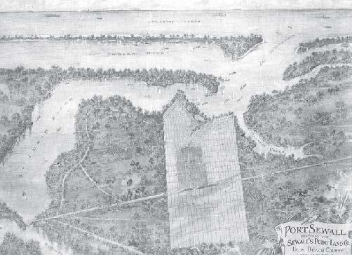
Figure GG-1 Historical Port Sewall Map of 1911 depicting the original platted Golden
Gate community
(Ord. No. 1147, pt. I(Exh. A), 10-27-2020)
Sec. 12.7.02. - Regulating plan.
Figures GG-2 and GG-3 are the Regulating Plans that apply to the Golden Gate Redevelopment Zoning District. Section 12.1.02 describes the purpose and content of Regulating Plans.
Figure GG-2 Regulating Plan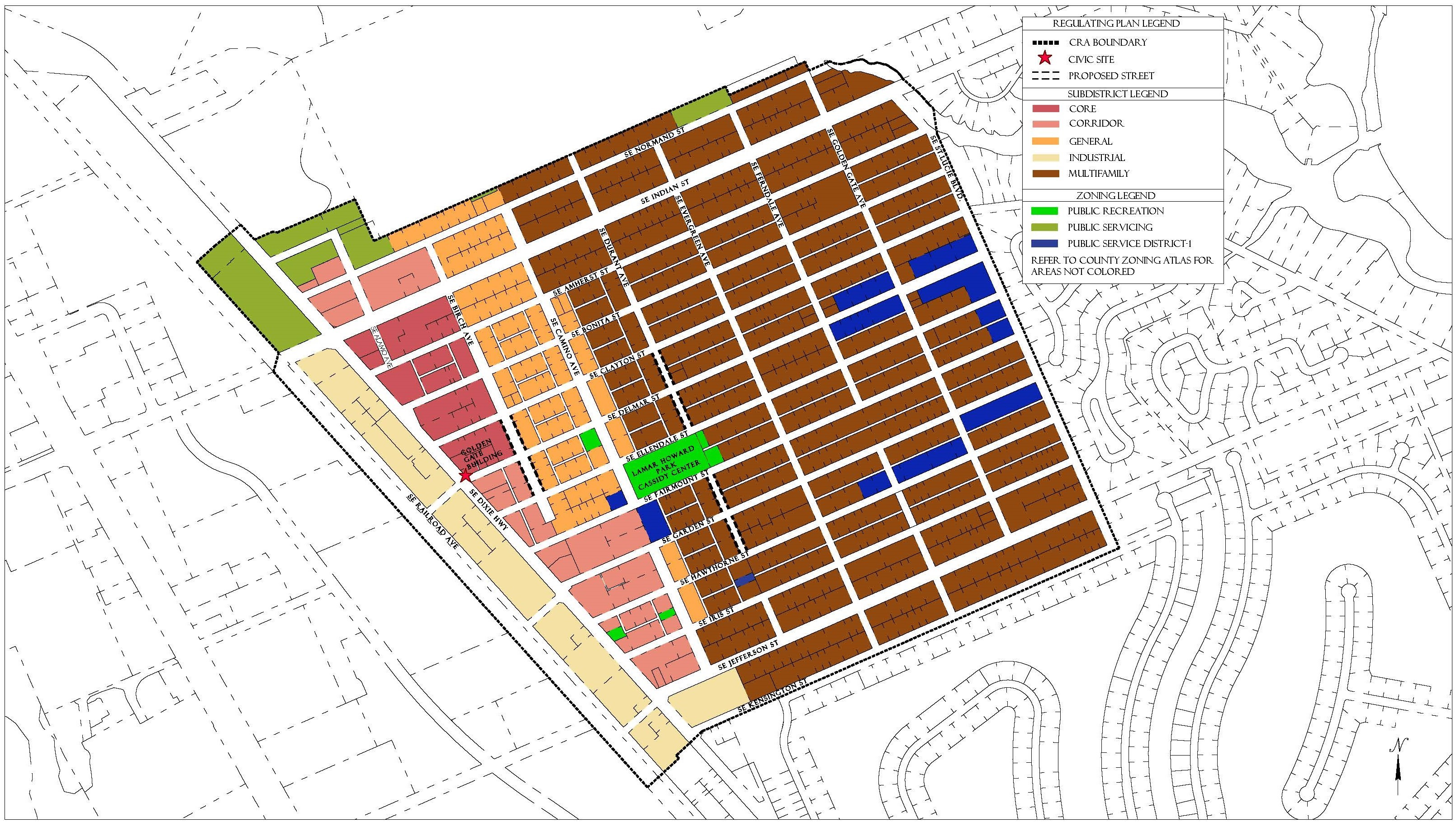
Figure GG-3 Street Regulating Plan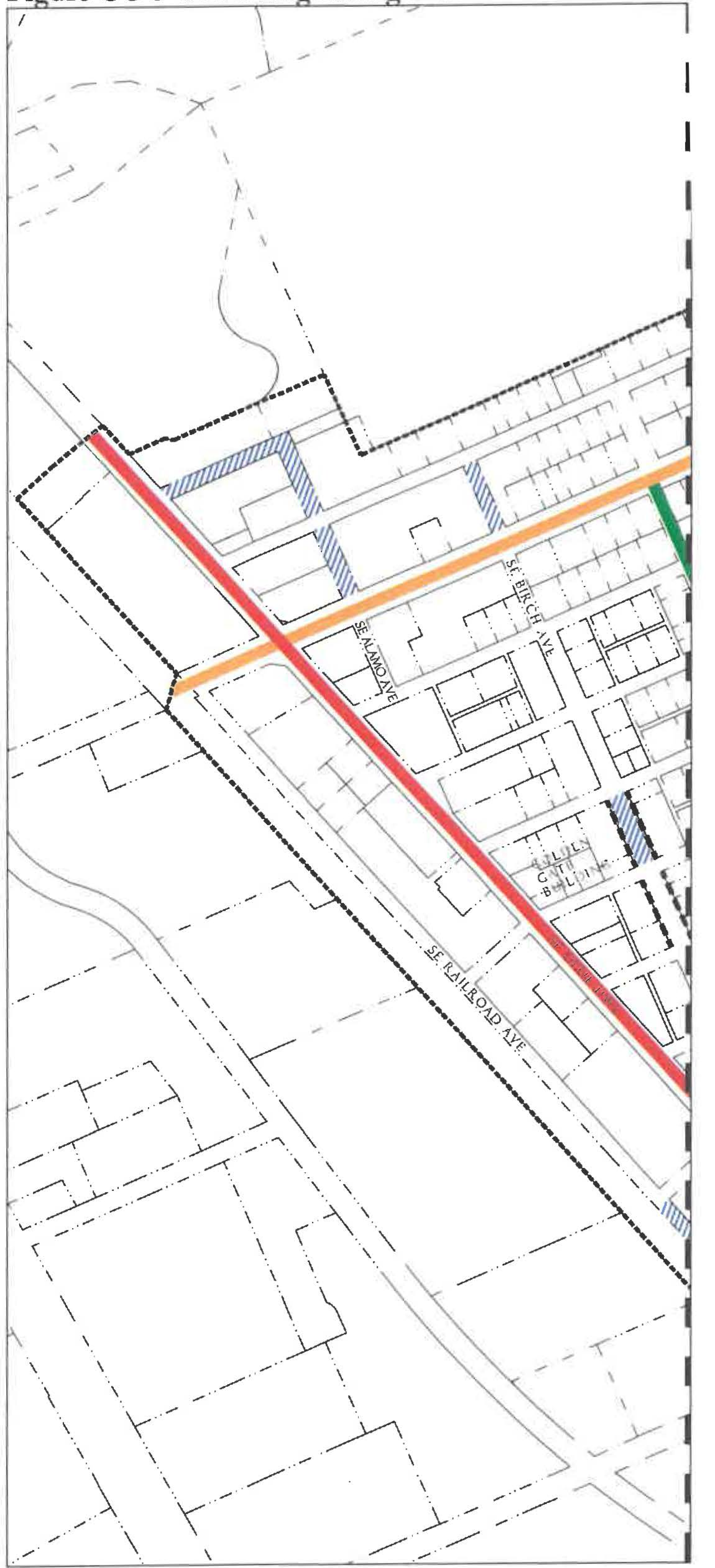
Figure GG-3 Street Regulating Plan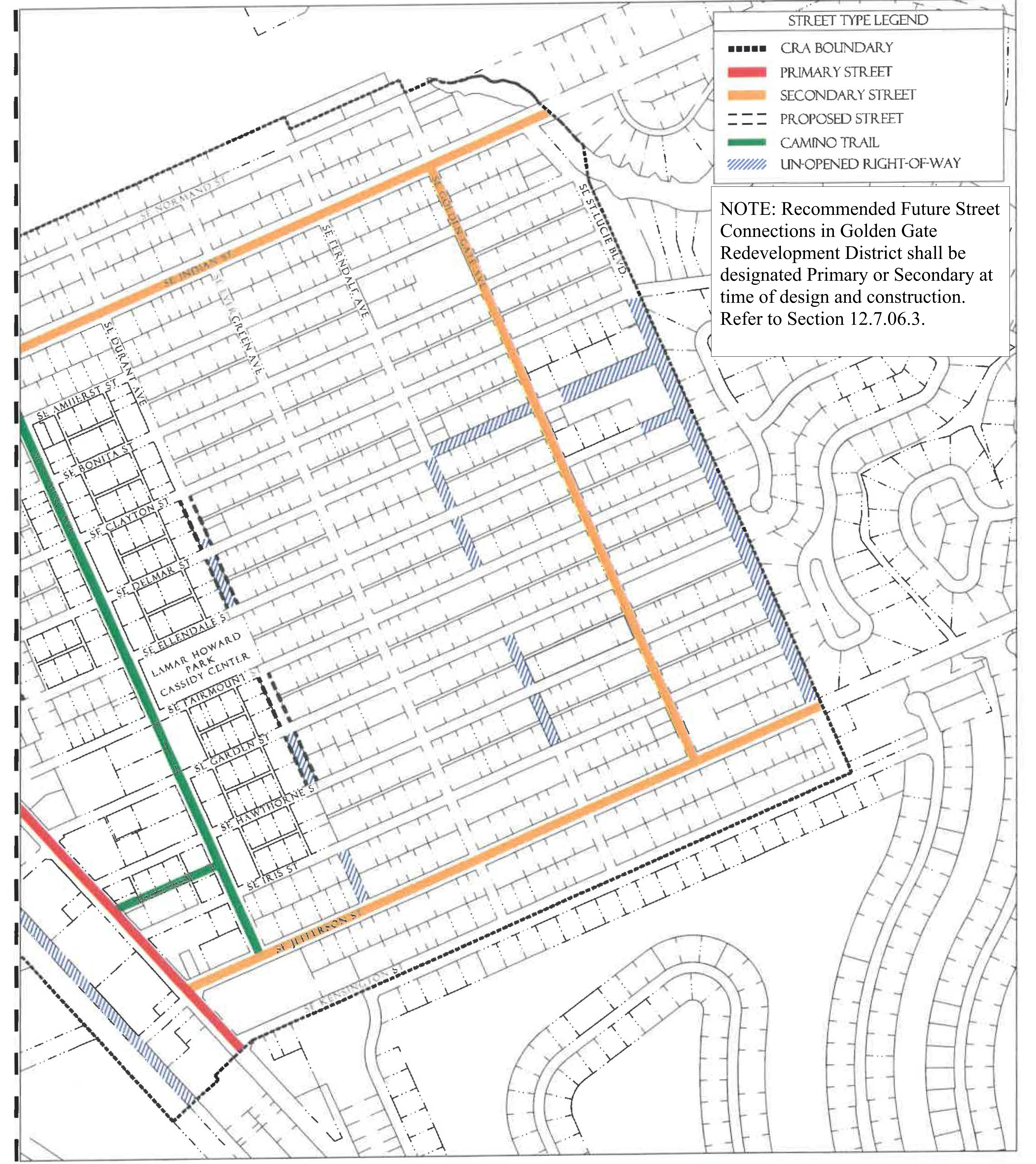
(Ord. No. 1147, pt. I(Exh. A), 10-27-2020; Ord. No. 1159, pt. 1(Exh. A), 5-11-2021)
Sec. 12.7.03. - Permitted uses.
Table GG-4 identifies permitted uses in the Golden Gate Redevelopment Zoning District.
1.
The use groups listed in the first column of Table GG-4 are described in Section 12.1.03.
2.
The remaining columns identify the Subdistricts shown on the Regulating Plan.
a.
"P" in a row below a column means that any use in that use group is permitted within that Subdistrict, provided the use can be developed in accordance with all applicable requirements of the LDR.
b.
If "P" is not shown in a row, the use group is not permitted in that Subdistrict.
3.
For uses that are functionally similar but not clearly permitted in a Subdistrict see Section 12.1.03.3.
Table GG-4 Use Groups Permitted in Golden Gate Subdistricts
Footnotes, see above
Residential development in the Industrial Subdistrict shall be within a Mixed-Use
Projects.
2
;hg;No Residential storage facilities are permitted.
3
;hg;Construction services, limited and Wholesale trades and services shall be a permitted
use if established prior to the effective date of this ordinance.
(Ord. No. 1147, pt. I(Exh. A), 10-27-2020; Ord. No. 1159, pt. 1(Exh. A), 5-11-2021)
Sec. 12.7.04. - Development standards.
1.
All new development, substantial improvements of a building, and substantial renovations of a building exterior shall comply with the Development Standards in Table GG-5.
2.
Existing Buildings. Whenever substantial improvement of a building or substantial renovation of a building exterior triggers the obligation to comply with this Division, the Growth Management Director may authorize incremental compliance with its requirements proportional to the nature and scope of the existing and proposed improvements if full compliance would be unreasonable. An application for alternative compliance shall not be required, but the Growth Management Director may require that the proposal be presented to the Neighborhood Advisory Committee for review and comment. See Section 4.871.B, Div. 20, Article 4.
3.
Accessory Dwelling Units. Standards for accessory dwelling units are provided in Development Standards Section 12.1.04.7.a.
4.
Building Types. Each new building, and any substantial improvement, must meet the standards for one of the Building Types permitted in the Subdistrict where it is located, see Table GG-5. Building Type diagrams do not prescribe use or architectural style and are illustrative. Dimensions provided in tables are regulatory requirements.
5.
Façade Transparency. Shopfront, Mixed-Use, Office, Apartment and Courtyard Building façades facing streets or civic open spaces at the ground level must have transparent windows which cover between 40 percent and 70 percent of the wall area. Building façades above ground level must have transparent windows which cover between 20 percent and 50 percent of the wall area of each story as measured between finished floors. Transparent means non-solar, non-mirrored glass with a light transmission reduction of no more than 40 percent.
Table GG-5 - Development Standards in Golden Gate Subdistricts
Footnotes, see above
Residential development in the Industrial Subdistricts shall be within a Mixed-Use
Project.
(Ord. No. 1147, pt. I(Exh. A), 10-27-2020; Ord. No. 1159, pt. 1, 5-11-2021)
Sec. 12.7.05. - Building type and frontage type standards.
1.
Building Types. The following Building Type standards shall apply in the Golden Gate Subdistricts. Table GG-5 provides additional Development Standards.
Figure GG-5.01 Shopfront Building
| Building Placement, see 12.1.04.6 | ||
| Frontage Buildout | 70% min. | |
| Front Build-to-Zone | 5' min., 15' max. | |
| Side at Street Build-to-Zone | 5' min., 15' max. | |
| Side at Property Line Setback 1 | 0' or 5' | |
| Rear Yard Setback 1 | 10' min./5' min. with alley | |
| Height, see 12.1.04.2 | ||
| Ceiling at Ground Level | 12' min. | |
| Building Height | 35'/3 stories max | |
| Parking Placement, see 12.1.04.6 | ||
| Front Setback | 30' min. | |
| Side at Street Setback | 10' min. | |
| Side at Property Line Setback | 0' min. | |
| Rear Setback | 5' min/0' min with alley | |
Notes:
1
Section 12.1.04.11 Building Transitions applies when the rear or side of a property
abuts a residential subdistrict or an existing single family dwelling.
For permitted Lot Size, Density, Building Coverage, and Open Space, see Table GG-5.
Figure GG-5.02 Mixed-Use Building
| Building Placement, see 12.1.04.6 | ||
| Frontage Buildout | 70% min. | |
| Front Build-to-Zone | 5' min., 15' max. | |
| Side at Street Build-to-Zone | 5' min., 15' max. | |
| Side at Property Line BTZ 2 | 5' min., 10; max. | |
| Rear Yard Setback 2 | 10' min./5' min. with alley | |
| Height, see 12.1.04.2 | ||
| Ceiling at Ground Level | 12' min. | |
| Building Height | 35'/3 stories max. | |
| Parking Placement, see 12.1.04.6 | ||
| Front Setback | 30' min. | |
| Side at Street Setback | 10' min. | |
| Side at Property Line Setback | 0' min. | |
| Rear Setback | 5' min/0' min with alley | |
Notes:
2 Section 12.1.04.11 Building Transitions applies when the rear or side of a property abuts a residential subdistrict or an existing single family dwelling.
For permitted Lot Size, Density, Building Coverage, and Open Space, see Table GG-5.
Figure GG-5.03 Office Building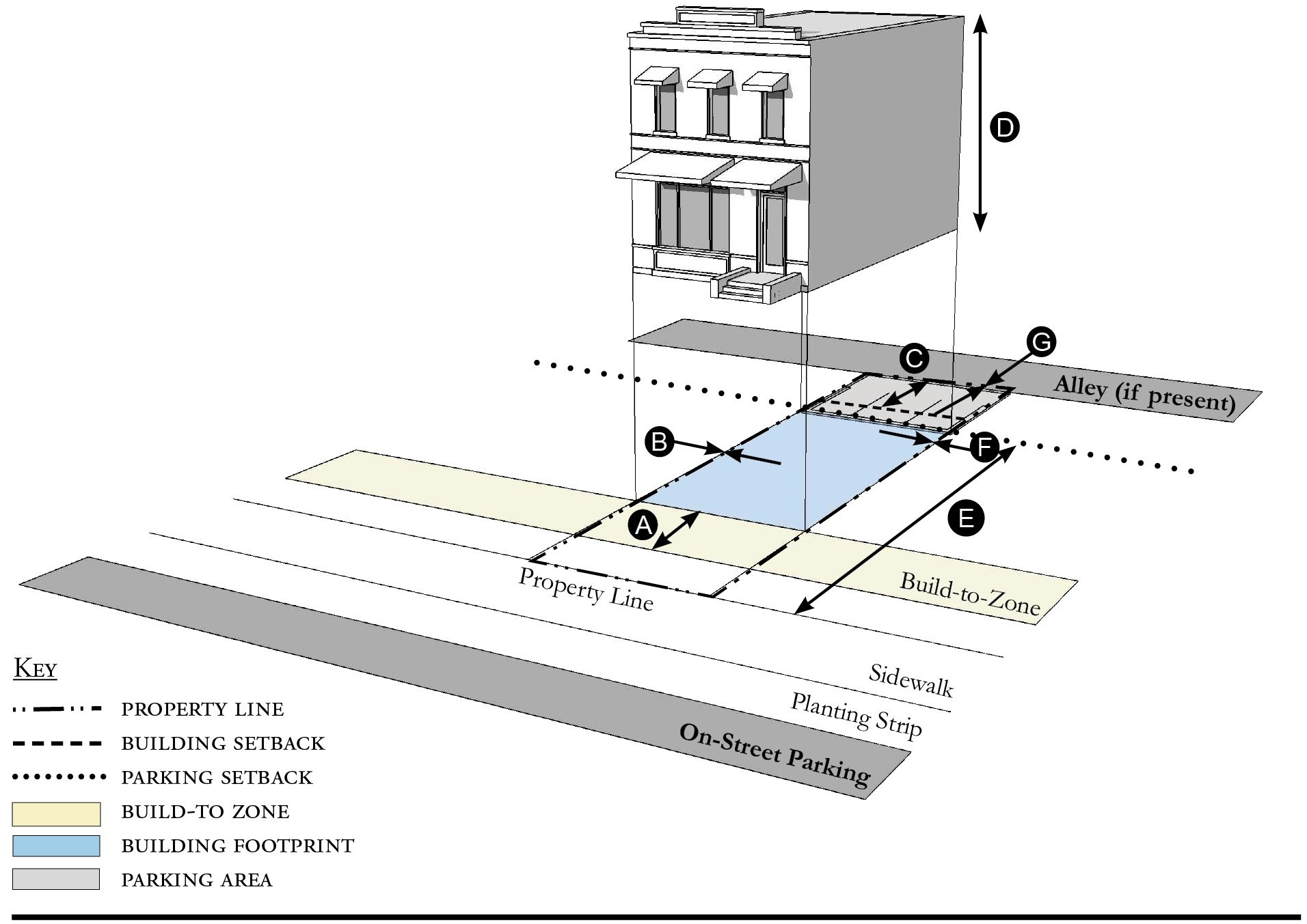
| Building Placement, see 12.1.04.6 | ||
| Frontage Buildout | 70% min. | |
| Front Build-to-Zone | 10' min., 15' max. | |
| Side at Street Build-to-Zone | 10' min., 15' max. | |
| Side at Property Line Setback 1 | 0' or 5' | |
| Rear Yard Setback 1 | 10' min./5' min. with alley | |
| Height, see 12.1.04.2 | ||
| Ceiling at Ground Level | 12' min. | |
| Building Height | 35'/3 stories max. | |
| Parking Placement, see 12.1.04.6 | ||
| Front Setback | 30' min. | |
| Side at Street Setback | 10' min. | |
| Side at Property Line Setback | 0' min. | |
| Rear Setback | 5' min/0' min with alley | |
Notes:
1 Section 12.1.04.11 Building Transitions applies when the rear or side of a property abuts a residential subdistrict or an existing single family dwelling.
For permitted Lot Size, Density, Building Coverage, and Open Space, see Table GG-5.
Figure GG-5.04 Apartment Building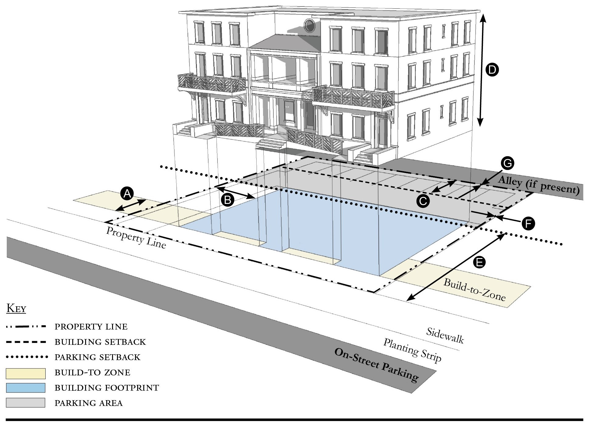
| Building Placement, see 12.1.04.6 | ||
| Frontage Buildout | 60% min. | |
| Front Build-to-Zone | 10' min., 25' max. | |
| Side at Street Build-to-Zone | 10' min., 15' max. | |
| Side at Property Line Setback 1 | 5' min. | |
| Rear Yard Setback 1 | 10' min./5' min. with alley | |
| Height, see 12.1.04.2 | ||
| Ceiling at Ground Level | Not applicable | |
| Building Height | Refer to Table GG-5 | |
| Parking Placement, see 12.1.04.6 | ||
| Front Setback | 30' min. | |
| Side at Street Setback | 10' min. | |
| Side at Property Line Setback | 5' min/0' min with alley | |
| Rear Setback | 5' min/0' min with alley | |
Notes:
1 Section 12.1.04.11 Building Transitions applies when the rear or side of a property abuts a residential subdistrict or an existing single family dwelling.
For permitted Lot Size, Density, Building Coverage, and Open Space, see Table GG-5.
Figure GG-5.05 Courtyard Building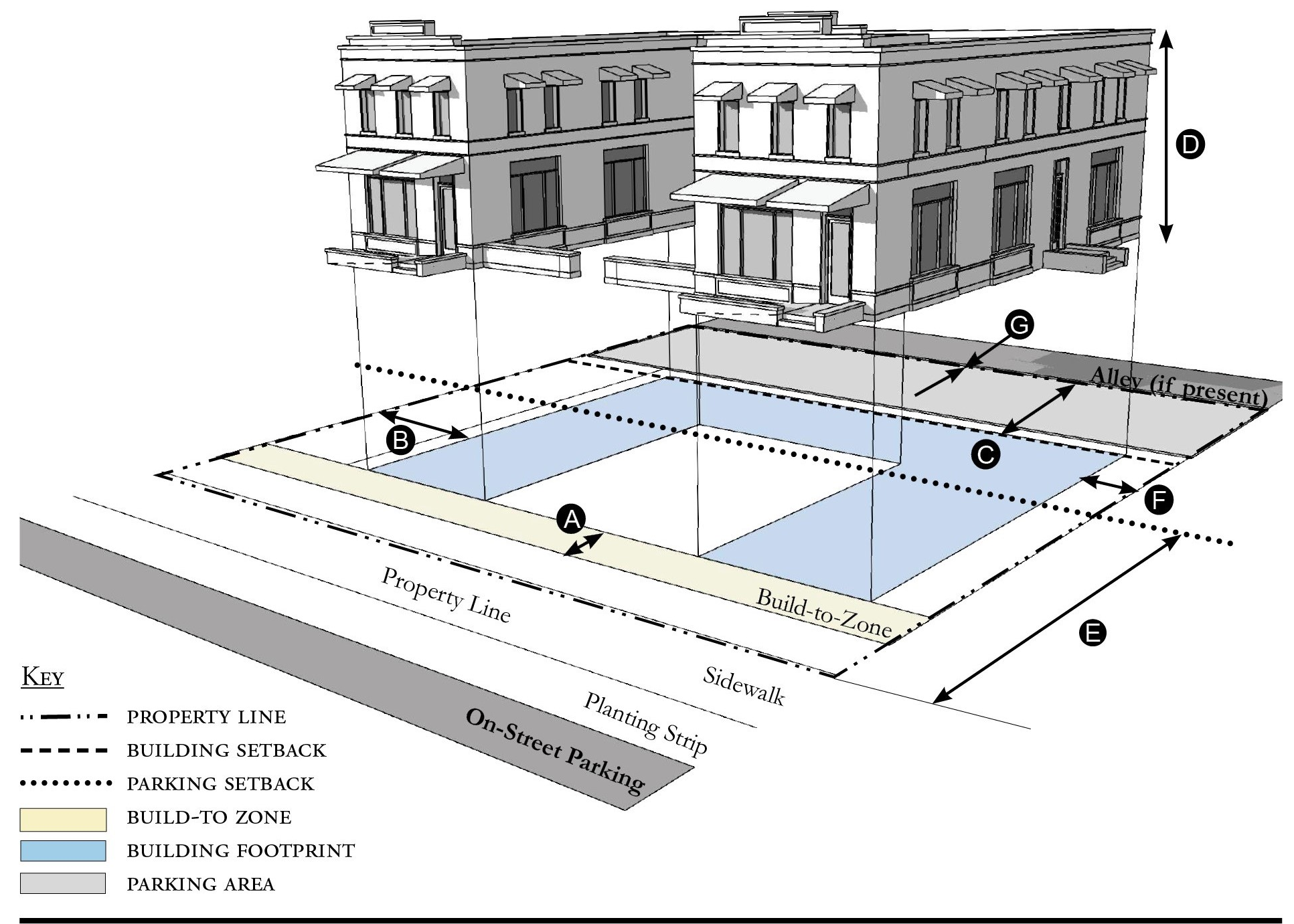
| Building Placement, see 12.1.04.6 | ||
| Frontage Buildout | 70% min. includes courtyard | |
| Front Build-to-Zone | 10' min., 25' max. | |
| Side at Street Build-to-Zone | 10' min., 15' max. | |
| Side at Property Line Setback 1 | 5' min. | |
| Rear Yard Setback 1 | 10' min./5' min. with alley | |
| Height, see 12.1.04.2 | ||
| Ceiling at Ground Level | Not applicable | |
| Building Height | Refer to Table GG-5 | |
| Parking Placement, see 12.1.04.6 | ||
| Front Setback | 30' min. | |
| Side at Street Setback | 10' min. | |
| Side at Property Line Setback | 5' min/0' min with alley | |
| Rear Setback | 5' min/0' min with alley | |
Notes:
The proportions of the courtyard space shall be at least as deep as it is wide.
1 Section 12.1.04.11 Building Transitions applies when the rear or side of a property abuts a residential subdistrict or an existing single family dwelling.
For permitted Lot Size, Density, Building Coverage, and Open Space, see Table GG-5.
Figure GG-5.06 Townhouse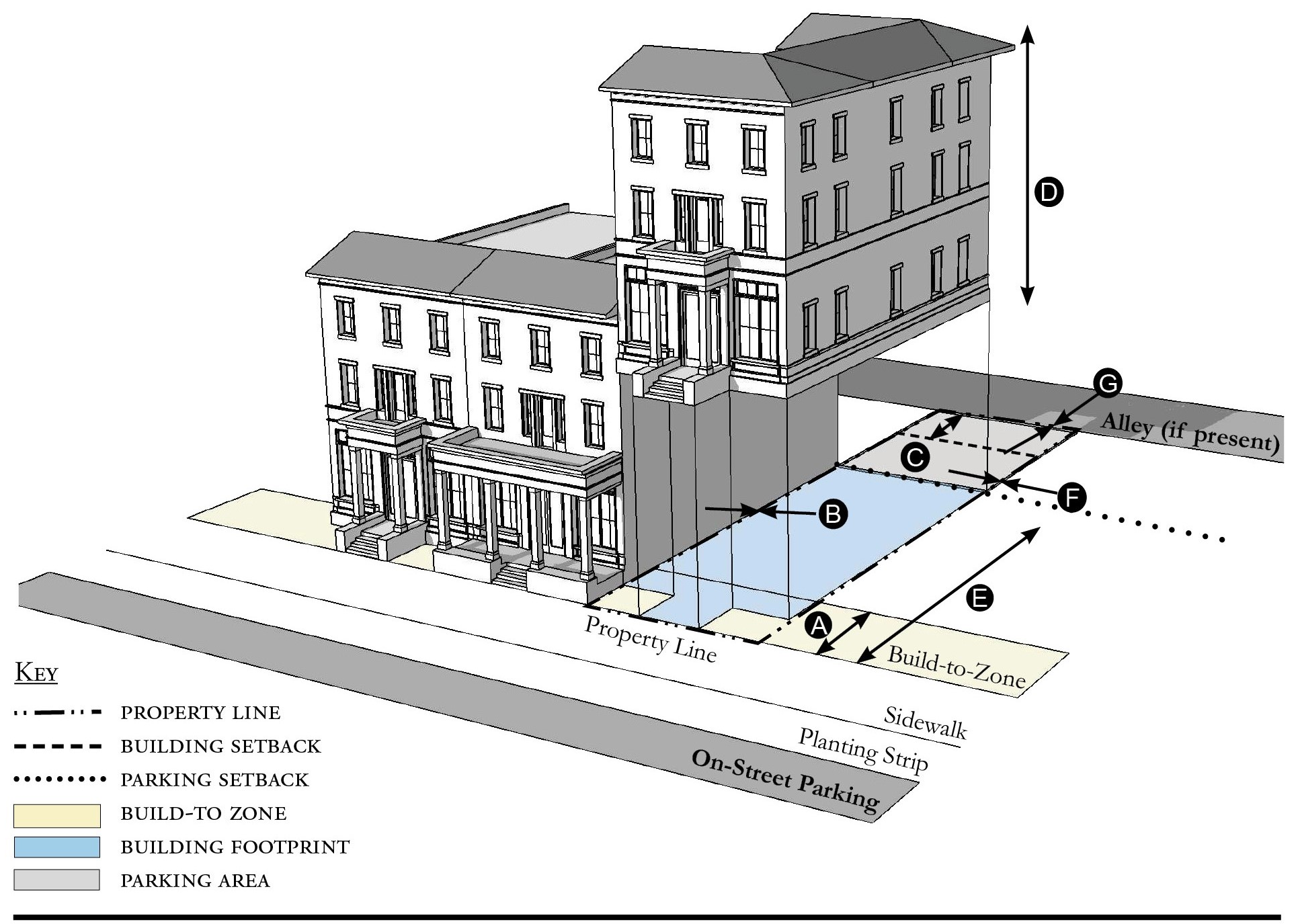
| Building Placement, see 12.1.04.6 | ||
| Frontage Buildout | 70% min. | |
| Front Build-to-Zone | 5' min., 15' max. | |
| Side at Street Build-to-Zone | 5' min., 15' max. | |
| Side at Property Line Setback 1, 2 | 0' min. or 10' min. | |
| Rear Yard Setback 1 | 10' min./5' min. with alley | |
| Height, see 12.1.04.2 | ||
| Ceiling at Ground Level | Not applicable | |
| Building Height | Refer to Table GG-5/2 stories min. | |
| Parking Placement, see 12.1.04.6 | ||
| Front Setback | 30' min. | |
| Side at Street Setback | 10' min. | |
| Side at Property Line Setback | 0' min | |
| Rear Setback | 5' min/0' min with alley | |
Notes:
Townhouses shall have a maximum grouping of 8 dwelling units and a minimum Setback of 15 feet between buildings.
1 Section 12.1.04.11 Building Transitions applies when the rear or side of a property abuts a residential subdistrict or an existing single family dwelling.
2 When adjacent to another property that is not part of the townhouse development the Side at Property Setback is 10 feet minimum from the property line.
For permitted Lot Size, Density, Building Coverage, and Open Space, see Table GG-5.
Figure GG-5.07 Live/Work Building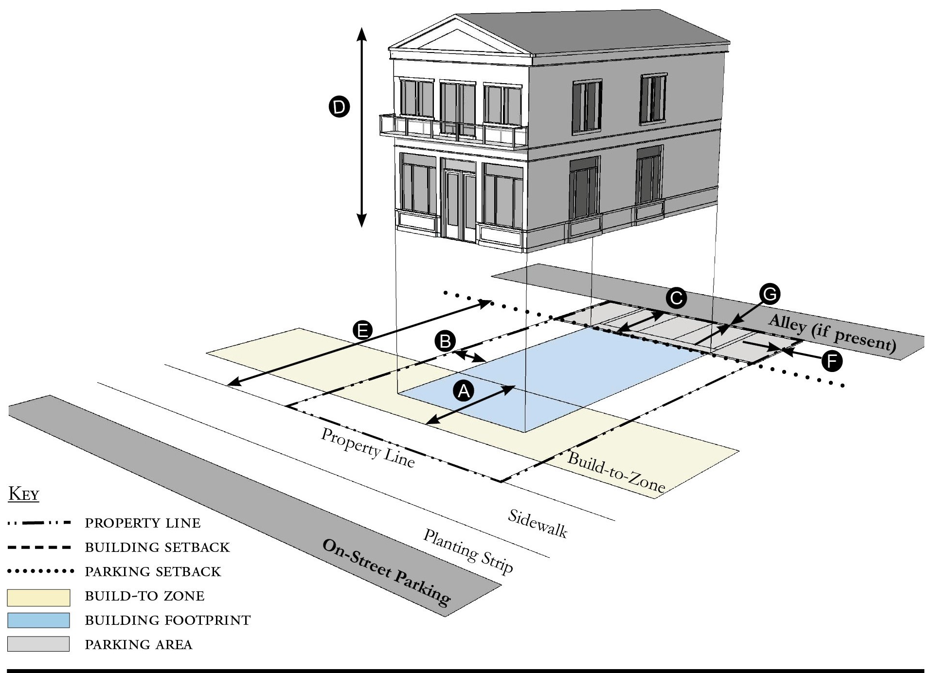
| Building Placement, see 12.1.04.6 | ||
| Frontage Buildout | 70% min. | |
| Front Build-to-Zone | 10' min., 25' max. | |
| Side at Street Setback | 10' min. | |
| Side at Property Line Setback 1 | 10' min. | |
| Rear Yard Setback 1 | 10' min. | |
| Height, see 12.1.04.2 | ||
| Ceiling at Ground Level | 12' min. | |
| Building Height | 35'/3 stories max. | |
| Parking Placement, see 12.1.04.6 | ||
| Front Setback | 30' min. | |
| Side at Street Setback | 10' min. | |
| Side at Property Line Setback | 0' min. | |
| Rear Setback | 5' min./0' min with alley | |
| Parking Placement does not prohibit parking in a residential driveway or a side yard driveway. | ||
Notes:
1 Section 12.1.04.11 Building Transitions applies when the rear or side of a property abuts a residential subdistrict or an existing single family dwelling.
For permitted Lot Size, Density, Building Coverage, and Open Space, see Table GG-5.
Figure GG-5.08 Side Yard House
| Building Placement, see 12.1.04.6 | ||
| Frontage Buildout 1 | 60% min. | |
| Front Build-to-Zone | 10' min., 25' max. | |
| Side at Street Setback | 10' min. | |
| Side at Property Line Setback | 5' min., 10' min. other side | |
| Rear Yard Setback | 10' min./5' min. with alley | |
| Height, see 12.1.04.2 | ||
| Ceiling at Ground Level | Not applicable | |
| Building Height | Refer to Table GG-5 | |
| Parking Placement, see 12.1.04.6 and 12.7.07.9 | ||
| Front Setback | 30' min. | |
| Side at Street Setback | 10' min. | |
| Side at Property Line Setback | 5' min. | |
| Rear Setback | 5' min./0' min with alley | |
| Parking Placement does not prohibit parking in a residential driveway or a side yard driveway | ||
Notes:
1 For this Building Type, the frontage buildout requirement may be met with the provision of a continuous wall or fence along the lot frontage.
For permitted Lot Size, Density, Building Coverage, and Open Space, see Table GG-5.
Figure GG-5.09 Cottage
| Building Placement, see 12.1.04.6 | ||
| Frontage Buildout 1 | 60% min. | |
| Front Build-to-Zone | 10' min., 25' max. | |
| Side at Street Build-to-Zone | 5' min./10' min. | |
| Side at Property Line Setback | 5' min. | |
| Rear Yard Setback | 10' min. | |
| Height, see 12.1.04.2 | ||
| Ceiling at Ground Level | Not applicable | |
| Building Height | Refer to Table GG-5 | |
| Parking Placement, see 12.1.04.6 and 12.7.07.9 | ||
| Front Setback | 30' min. | |
| Side at Street Setback | 10' min. | |
| Side at Property Line Setback | 5' min. | |
| Rear Setback | 5' min. | |
| Parking Placement does not prohibit parking in a residential driveway or a side yard driveway | ||
Notes:
Cottages shall not exceed a footprint of 2,000 square feet.
1 For this Building Type, the frontage buildout requirement may be met with the provision of a continuous wall or fence along the lot frontage.
For permitted Lot Size, Density, Building Coverage, and Open Space, see Table GG-5.
Figure GG-5.10 Cottage Court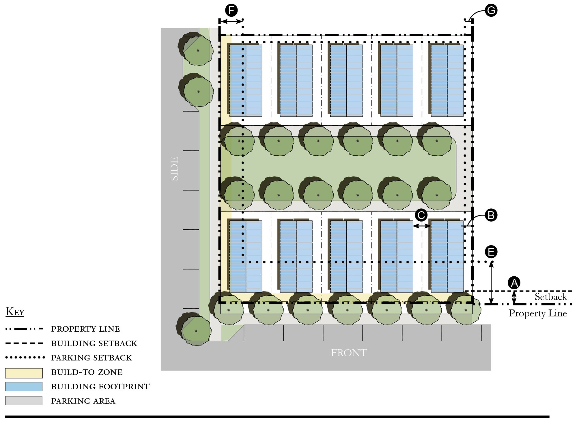
| Building Placement, see 12.1.04.6 | ||
| Frontage Buildout | 60% min. | |
| Front Setback | 6' min. | |
| Side at Street Setback | 6' min. | |
| Side at Property Line Setback | 6' min. | |
| Unit Separation | 10' min. | |
| Height, see 12.1.04.2 | ||
| Ceiling at Ground Level | Not applicable | |
| Building Height | Refer to Table GG-5 | |
| Parking Placement, see 12.1.04.6 | ||
| Front Setback | 30' min. | |
| Side at Street Setback | 10' min. | |
| Side at Property Line Setback | 5' min. | |
| Rear Setback | 5' min. | |
Notes:
Cottage Courts may include duplexes.
1 For this Building Type, the frontage requirement may be met with the provision of a continuous wall or fence along the lot frontage.
2 For Mobile Homes frontage buildout requirement does not apply.
For permitted Lot Size, Density, Building Coverage, and Open Space, see Table GG-5.
Figure GG-5.11 Duplex
| Building Placement, see 12.1.04.6 | ||
| Frontage Buildout 1 | 60% min. | |
| Front Build-to-Zone | 10' min., 25' max. | |
| Side at Street Setback | 10' min. | |
| Side at Property Line Setback | 5' min. | |
| Rear Yard Setback | 10' min. | |
| Height, see 12.1.04.2 | ||
| Ceiling at Ground Level | Not applicable | |
| Building Height | Refer to Table GG-5 | |
| Parking Placement, see 12.1.04.6 and 12.7.07.9 | ||
| Side at Property Line | 5' min. | |
| Rear Setback | 5' min./0' with alley | |
| Parking Placement does not prohibit parking in a residential driveway or a side yard driveway. | ||
| Refer to Section 12.1.07.8 Garage and Driveway for parking and driveway configurations for Single Family Dwellings. | ||
Notes:
An ADU is prohibited on lots on which a duplex is located.
1 For this Building Type, the frontage buildout requirement may be met with the provision of a continuous wall or fence along the lot frontage.
For permitted Lot Size, Density, Building Coverage, and Open Space, see Table GG-5.
Figure GG-5.12 All Yard House
| Building Placement, see 12.1.04.6 | ||
| Frontage Buildout | Not Required | |
| Front Setback | 20' min. | |
| Side at Street Setback | 6' min. | |
| Side at Property Line Setback | 6' min. | |
| Rear Yard Setback | 10' min. | |
| Height, see 12.1.04.2 | ||
| Ceiling at Ground Level | Not applicable | |
| Building Height | Refer to Table GG-5 | |
| Parking Placement, see 12.1.04.6 and 12.7.07.9 | ||
| Side at Property Line | 5' min. | |
| Rear Setback | 5' min./0' min. with alley | |
| Parking Placement does not prohibit parking in a residential driveway or a side yard driveway. | ||
| Refer to Section 12.1.07.8 Garage and Driveway for parking and driveway configurations for Single Family Dwellings. | ||
Notes:
For permitted Lot Size, Density, Building Coverage, and Open Space, see Table GG-5.
Figure GG-5.13 Outbuilding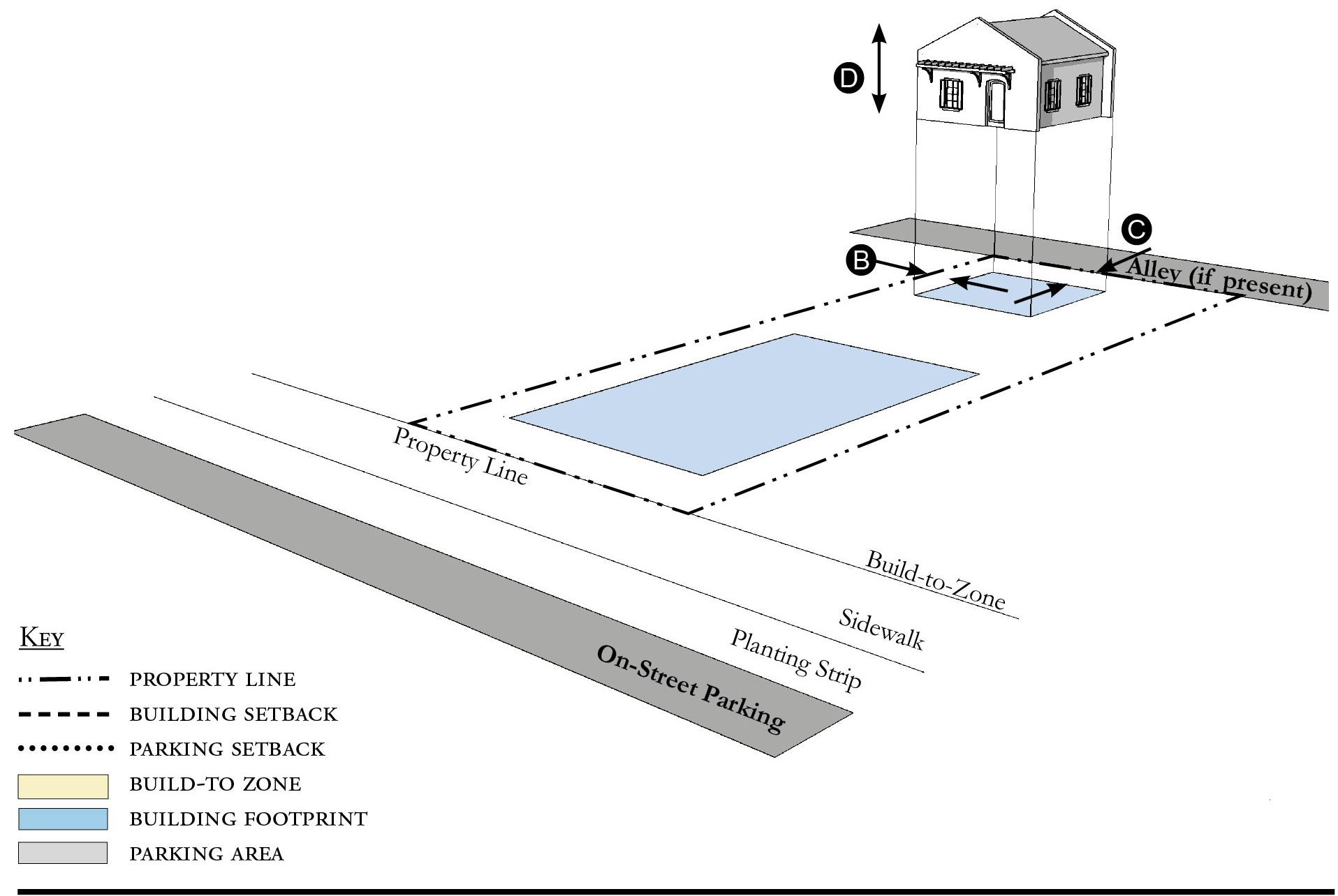
| Building Placement, see 12.1.04.6 | ||
| Frontage Buildout | Not Applicable | |
| Front Build-to-Zone | Not Applicable | |
| Side at Street Build-to-Zone | Not Applicable | |
| Side at Property Line Setback | 5' min. | |
| Rear Yard Setback | 5' min. | |
| Height, see 12.1.04.2 | ||
| Ceiling at Ground Level | Not applicable | |
| Building Height | 25'/2 stories max. | |
| Parking Placement, see 12.1.04.6 | ||
| Refer to Section 12.1.07.8 Garage and Driveway for parking and driveway configurations for Single Family Dwellings. | ||
Notes:
Outbuildings shall not exceed a footprint of 850 square feet.
For permitted Lot Size, Density, Building Coverage, and Open Space, see Table GG-5.
Figure GG-5.14 Boat Barn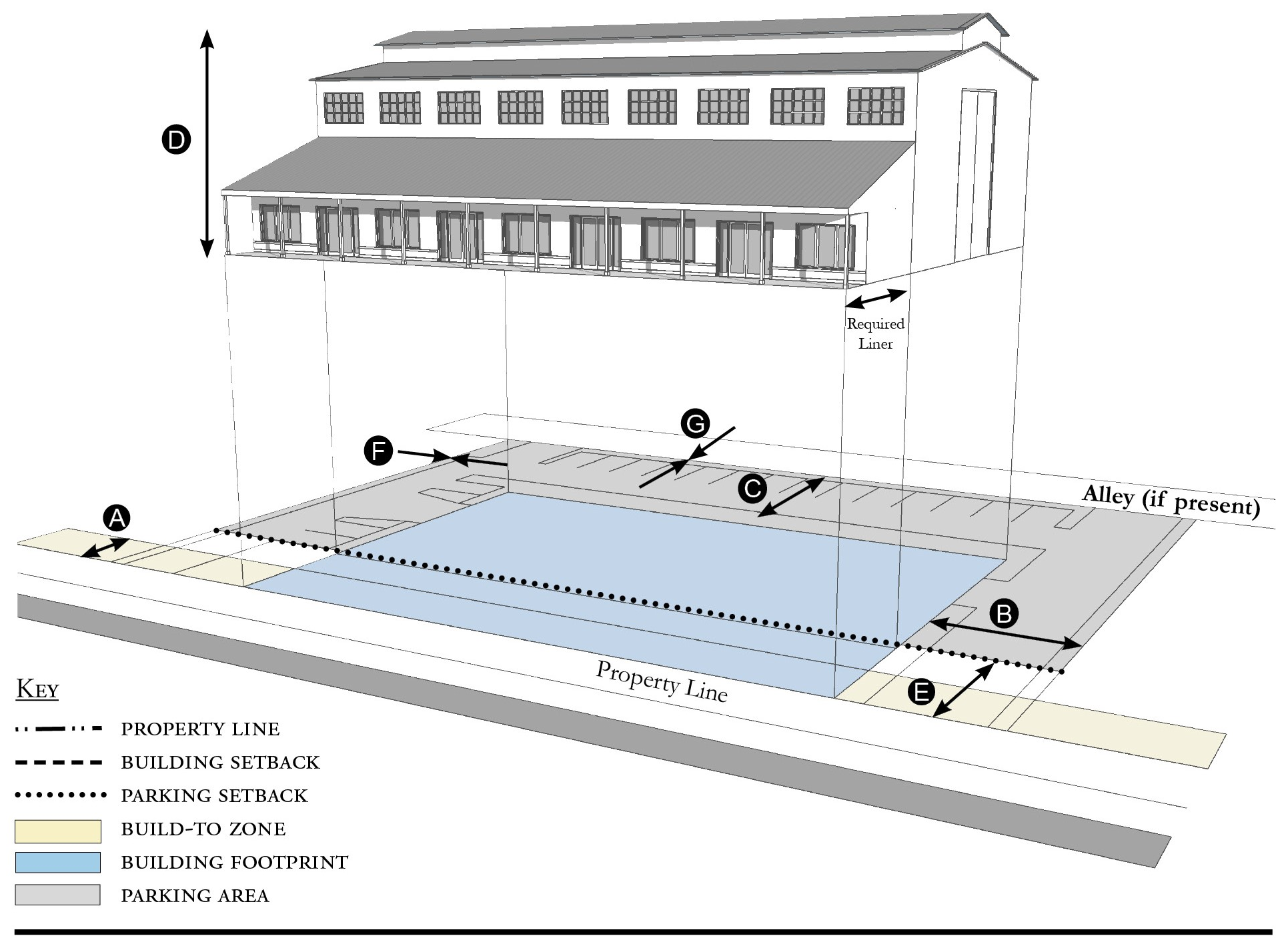
| Building Placement, see 12.1.04.6 | ||
| Frontage Buildout | 60% min. | |
| Front Build-to-Zone | 5' min., 15' max. | |
| Side at Street Setback | 10' min. | |
| Side at Property Line Setback 1 | 10' min. | |
| Rear Yard Setback 1 | 10' min./5' min. with alley | |
| Height, see 12.1.04.2 | ||
| Ceiling at Ground Level | Not applicable | |
| Building Height | 35'/3 stories max. | |
| Parking Placement, see 12.1.04.6 | ||
| Front Setback | 30' min. | |
| Side at Street Setback | 5' min. | |
| Side at Property Line Setback | 5' min. | |
| Rear Setback | 5' min./0' min. with alley | |
| Parking shall not be located between the building and the street. | ||
Notes:
A commercial liner shall be a minimum depth of 20 feet.
1 Section 12.1.04.11 Building Transitions applies when the rear or side of a property abuts a residential subdistrict or an existing single family dwelling.
For permitted Lot Size, Density, Building Coverage, and Open Space, see Table GG-5.
Figure GG-5.15 Industrial Building
| Building Placement, see 12.1.04.6 | ||
| Frontage Buildout | Not Required | |
| Front Setback 2 | 20' min. | |
| Side at Street Setback | 5' min. | |
| Side at Property Line Setback 1 | 5' min. | |
| Rear Yard Setback | 10' min./5' min. with alley | |
| Height, see 12.1.04.2 | ||
| Ceiling at Ground Level | Not applicable | |
| Building Height | 40'/3 stories max. | |
| Parking Placement, see 12.1.04.6 | ||
| Front Setback | 30' min. | |
| Side at Street Setback | 5' min. | |
| Side at Property Line Setback | 5' min. | |
| Rear Setback | 5' min./0' min. with alley | |
| Parking shall not be located between the building and the street. | ||
Notes:
1 Section 12.1.04.11 Building Transitions applies when the rear or side of a property abuts a residential subdistrict or an existing single family dwelling.
2 Encroachment into the front setback of up to 15' is permitted when Frontage Types are utilized as described in Section 12.1.05.2.
The front setback shall be treated with Required Landscape Area and Tree Planting as described in Table GG-10 Section 12.7.09 when Frontage Types are not provided.
For permitted Lot Size, Density, Building Coverage, and Open Space, see Table GG-5.
(Ord. No. 1147, pt. I(Exh. A), 10-27-2020; Ord. No. 1159, pt. 1, 5-11-2021; Ord. No. 1237, Pt. I(Exh. 1), 1-28-2025)
Sec. 12.7.06. - Street standards.
1.
Applicability. Street Standards that apply in all Redevelopment Zoning Districts are provided in Section 12.1.06. The additional street standards which apply in the Golden Gate Redevelopment Zoning District are specified in this section.
2.
Street Regulating Plan. A Street Regulating Plan is provided in Figure GG-3, Section 12.7.02. Features identified in the Street-Regulating Plan are described in 12.1.02.2.
a.
Primary Streets.
b.
Secondary Streets.
c.
Recommended Future Streets.
d.
Recommended Future Alleys.
3.
Shade Trees. Street trees may be incorporated into landscaped islands associated with on-street parking or to provide shade for pedestrian areas. Landscaped islands and other street tree planting areas shall be sized to support the mature size of the tree and may include shrubs and appropriate ground cover plants. Street trees from the following list are planted at a maximum of 30-foot intervals along the right-of-way:
a.
Canopy trees (60 percent minimum):
i.
Live or Laurel Oak.
ii.
Magnolia.
iii.
Mahogany.
iv.
Red Maple.
v.
Bald Cypress.
vi.
Buttonwood.
vii.
Gumbo Limbo.
b.
Palm Trees:
i.
Medjool or Canary Island Date Palm.
ii.
Royal Palm.
iii.
Coconut Palm (2:1 ratio, unless eight feet grey wood, then 1:1).
iv.
Sabal Palm (3:1 ratio).
4.
Future Streets.
a.
Street Location. The schematic location of proposed streets is shown on the Street Regulating Plan. The exact location may be adjusted during the development review process provided the new location meets these requirements:
i.
The adjusted location does not reduce the level of connectivity with surrounding streets, both existing and proposed.
ii.
The adjusted location does not reduce the level of street connectivity within the site or substantially increase the average block size.
iii.
The adjusted location does not diminish or eliminate any proposed civic space, or civic building shown on the Regulating Plan.
iv.
The adjusted location maintains or enhances pedestrian convenience and safety and does not create any traffic hazards.
b.
Street Types. Proposed streets may be designed and constructed as any one of the following street types below defined in Section 12.1.06.
i.
Local Street 2.
ii.
Local Street 3.
iii.
Neighborhood Street 1.
iv.
Neighborhood Street 2.
v.
Yield Street.
5.
Improvements To Existing Streets. The planting of new shade trees shall be required for project approval and shall be coordinated with existing or future CRA and County streetscape improvements. As provided in Section 12.1.06, the County Engineer may allow deviations from these minimum standards when necessary due to the location of existing buildings, constrained right-of-way, or to meet other goals for the particular street section.
a.
A-1-A/SE Dixie Highway. Along Dixie Highway street trees shall be a minimum height of 16 feet, with a four-foot clear trunk, and four-inch caliper at the time of planting. Dixie Highway in Golden Gate is also identified as a candidate for Complete Streets interventions in the Martin MPO Complete Street Access to Transit Study and is part of the East Coast Greenway in Florida.
b.
Indian Street. Along Indian Street street trees shall be a minimum height of 16 feet, with a four-foot clear trunk, and four-inch caliper at the time of planting.
c.
Along all other streets, street trees shall be a minimum height of 12 feet, with a four-foot clear trunk and two and one-half-inch caliper, at the time of planting.
d.
Within the Core, Corridor and Industrial Subdistricts. The build-to-zone shall provide for a pedestrian zone, furnishing zone, and on-street parking as described in Section 12.1.06. No less than ten feet shall be provided for the combined pedestrian zone and furnishing zone.
(Ord. No. 1147, pt. I(Exh. A), 10-27-2020; Ord. No. 1159, pt. 1, 5-11-2021)
Sec. 12.7.07. - Parking standards.
1.
Applicability. Parking Standards found in Sections 4.621 through 4.628, Div. 14, Article 4, are modified for all Redevelopment Zoning Districts in Parking Standards Section 12.1.07. Those modified Parking Standards apply in the Golden Gate Redevelopment Zoning District except as specified otherwise in this section.
2.
Parking Rates. Refer to Section 12.1.07 for parking rates applicable to Redevelopment Zoning Districts.
3.
Screening of Parking from Residential Uses. There shall be an alley between parking areas and adjacent residential uses. Where an alley is not possible, there shall be a visual barrier between parking areas and residential uses. Refer to Landscaping Standards Section 12.7.09 Vehicular Use Areas.
4.
Parking Structures. Whenever a parking structure or surface parking provided beneath a building is located on a Primary Street, as identified on the Street Regulating Plan, Section 12.7.02, ground level commercial space shall be provided for a depth of no less than 20 feet measured from the front of the building.
5.
Distributing Parking. Where more than 200 parking spaces are provided on-site, such parking shall be distributed such that no more than 50 percent of the spaces are grouped in a single area of the parcel. Methods of distributing parking include locating parking adjacent to the rear or sides of a building or by physically separating parking areas with other buildings or landscaped areas.
6.
Shared Parking Lot.
a.
Shared parking lots must be located within 500 feet of each use. These lots may be separated from the use(s) by a street, easement, or other right-of-way.
b.
In order to meet the parking requirements, parking shared by different uses must be supported by evidence that peak parking demands of each use occur at different times of the day or days of the week. Section 4.626.B.2, Div. 14, Article 4, Shared Parking provides the methodology to support shared parking. Mixed-use developments do not have to meet this standard.
(Ord. No. 1147, pt. I(Exh. A), 10-27-2020; Ord. No. 1159, pt. 1, 5-11-2021; Ord. No. 1196, pt. I(Exh. A), 5-9-2023)
Sec. 12.7.08. - Stormwater standards.
1.
Stormwater management standards are provided in Sections 4.381 through 4.390, Div. 9, Article 4 and apply in Redevelopment Zoning Districts except as modified in Section 12.1.08.
(Ord. No. 1147, pt. I(Exh. A), 10-27-2020)
Sec. 12.7.09. - Landscape standards.
1.
Table GG-9 identifies which of the landscaping, buffering, and tree protection standards in Div. 15, Article 4 apply in the Golden Gate Redevelopment Zoning District and which standards are modified, replaced, or do not apply in this Redevelopment Zoning District.
Table GG-9 - Landscaping, Buffering, and Tree Protection Standards
2.
Single family dwellings or duplexes. Single family dwellings and duplexes are not required to submit a Landscape Plan or comply with Vehicular Use requirements. Required tree planting and landscape area do apply to single family dwellings and duplexes.
3.
Required landscape area.
a.
Table GG-10 indicates the minimum percentage of the total developed area that must be landscaped.
b.
Landscaping shall be permitted in easements only with the written permission of the easement holder. A written agreement shall specify the party responsible for restoring disturbed landscape areas, shall be submitted to the county in a form acceptable to the County Attorney, and shall be recorded in the public records.
c.
Exposed dirt yards are prohibited.
4.
Required tree planting.
a.
Table GG-10 indicates the minimum number of trees that must be planted.
b.
Tree species and size.
i.
Palm trees shall have a minimum height of 12 feet at the time of planting.
ii.
Fruit trees shall have a minimum height of five feet at the time of planting.
iii.
Other required trees shall have a minimum height of 12 feet, with a four-foot clear trunk, and two-inch diameter at breast height (dbh), at the time of planting.
c.
Trees planted in adjacent right-of-way in accordance with Section 12.7.06 or in other nearby public space shall be credited towards meeting the number of trees required by Table GG-11. Any private use of the public right-of-way requires the approval of the County Engineer, a right-of-way use permit, a construction agreement, and an indemnification agreement.
d.
Trees planted in Vehicular Use Areas shall be credited towards meeting the number of trees required by Table GG-10.
e.
FPL's Right Tree/Right Place Guidelines shall be considered when trees are planted near utilities.
Table GG-10 - Required Landscape Area and Tree Planting
Table GG-11 - Landscape Plan Application Requirements
5.
Landscape plan. Development applications shall include a landscape plan prepared by a qualified professional that provides the location and type of existing and proposed features that are identified in Table GG-11, which are summarized from the detailed requirements in Section 4.662.A, Div. 15, Article 4.
a.
Column A requirements apply to an application for a final site plan.
b.
Column B requirements apply to an application for a building permit for a Small Site which is defined as the construction or expansion of a principal building or accessory structure on a lawfully established lot or adjacent lots, provided the parcel being developed is less than one-half acre.
c.
Column B requirements also apply to an application for a substantial improvement or substantial renovation of a building exterior on any lot regulated by Article 12 as those terms are defined in Section 4.871.B, Div. 20, Article 4.
6.
Vehicular use areas.
a.
Perimeter landscaping. Landscaping shall be provided along the perimeter of vehicular use areas in accordance with the following standards:
i.
The perimeter of a vehicular use area shall be planted with trees at 30-foot intervals. The trees shall be a minimum of 12 feet in height, with a four-foot clear trunk, and a three-inch dbh at the time of planting.
ii.
If a vehicular use area abuts a residential property (existing residential use or Multifamily Subdistrict) that is not a part of the subject development, a landscaped buffer, eight-feet wide shall be provided. Trees with a minimum height of 16 feet, with a four-foot clear trunk, and four-inch dbh shall be planted at a maximum of 30-foot intervals. If palms are used, each palm must have a 12-foot minimum clear trunk and be planted at a maximum of 15-foot intervals.
iii.
A wall, fence, hedge or other durable landscape barrier shall be provided around all vehicular use areas. Between the vehicular use area and a road right-of-way, the wall, fence, or hedge shall not exceed four feet in height. For the remainder of the lot, it shall not exceed six feet in height. Walls and landscaping around vehicular use areas shall provide pedestrian access every 50 linear feet. No wall, fence, or hedge is required along the side of a parking area that abuts another parking area.
b.
Interior landscaping. If a vehicular use area is larger than 15,000 square feet, landscaping shall be provided within its interior in accordance with Section 4.663.A.4, Div. 15, Article 4, except that these interior landscape areas may also be used as stormwater management and conveyance facilities. If a vehicular use area is equal to or smaller than 15,000 square feet, no interior landscaping, terminal islands, interior medians, or interior islands are required.
(Ord. No. 1147, pt. I(Exh. A), 10-27-2020; Ord. No. 1159, pt. 1, 5-11-2021)
Sec. 12.7.10. - Wall and fence standards.
1.
Walls and fences must comply with the Wall and Fence Standards established for all Redevelopment Zoning Districts in Section 12.1.10.
(Ord. No. 1147, pt. I(Exh. A), 10-27-2020)
Sec. 12.7.11. - Sign standards.
1.
Signs must comply with the Sign Standards established for all Redevelopment Zoning Districts in Section 12.1.11 except where modified below.
2.
Table GG-12 supersedes the signage-area table in Section 4.700, Div. 16, Article 4.
Table GG-12 - Sign Size Limitations
3.
Murals. Are permitted and defined in Art. 4, Div. 16.
4.
Wall signs. Wall signs are permitted within Core, Corridor, Industrial
a.
Placement:
i.
Near top of the building.
ii.
Above upper floor windows.
iii.
Directly on wall surface/background must be building wall.
iv.
Must face public street.
v.
Placed on maximum of two building sides.
vi.
May be cut or carved.
b.
Letter materials: Metal, stone, wood, paint, carved, plaster. No plastic letters permitted.
c.
Lighting: Front lit, back lit, opaque lighting. No channel cut lighting permitted. (Channel cut is a method of illumination that illuminates only the lettering or logo and the remaining face of the sign is not illuminated or opaque in any manner, also known as stencil-cut.)
5.
Wall sign as Sign band. Sign bands are permitted within Core, Corridor, Industrial. This type of sign is intended primarily for retail uses at street level to draw the attention of pedestrians and drivers.
a.
Placement:
i.
On building face between first and second floor window openings.
ii.
Must be integrated with composition of the façade.
iii.
Background may be building wall or "backboard."
iv.
Minimum of ten feet above sidewalk.
b.
Dimensions:
i.
Backboard and overall band width limited to 12 square feet.
ii.
Backboard may have a maximum height of 30 inches.
iii.
Letters may have a maximum height of 24 inches.
c.
Letter or backboard materials: Metal, stone, wood, paint, carved, plaster, plastic. Cabinet signs are permitted.
d.
Lighting: Front lit and back lit permitted, channel cut is not permitted.
e.
Consistency of the sign bands on a single building is required.
6.
Freestanding signs. Freestanding signs are permitted within Core, Corridor, Industrial, General.
a.
Configuration:
i.
Double post with framed panel.
ii.
Offset single post with bracketed or suspended panel.
iii.
Double-sided signs are permitted.
iv.
Single post with centered panel is not permitted.
v.
Sign must be essentially two-dimensional. Small structures or kiosk type designs are not permitted.
b.
Dimensions:
i.
Sign panel is limited to a maximum of six square feet.
ii.
Overall sign is limited to a maximum height of four feet above grade.
c.
Materials: Metal, wood.
d.
Lighting:
i.
Externally projected ground lighting is permitted.
ii.
Internally illuminated signs or signs incorporating lighting elements are not permitted.
7.
Swing sign, under-canopy sign and projecting signs. Swing sign, under-canopy sign and projecting signs are permitted within Core, Corridor, Industrial, General.
a.
Dimensions:
i.
Maximum of six square feet.
ii.
Bracketed signs may project a maximum of 48 inches from the building face.
iii.
Logos or Artwork may be a maximum of 18 inches in any dimension.
b.
Materials: Metal, wood.
c.
Lighting: Externally projected lighting is permitted.
8.
Monument signs. Monument signs are permitted within Core, Corridor, Industrial, General.
a.
Placement:
i.
Must be perpendicular to public road with identical graphics on each face.
ii.
Must form a 45 percent angle to the street intersection at street corners.
iii.
Must be set back at least two feet from the public right-of-way.
b.
Dimensions:
i.
Height of the monument sign may not exceed five feet.
ii.
Graphic area of the monument must not exceed 40 square feet.
c.
Materials:
i.
Substantial materials such as stone, concrete, brick, stucco, wood, steel, and aluminum are required.
ii.
Letter or backboard materials: metal, stone, wood, paint, carved, plaster, plastic.
d.
Lighting: External lighting only permitted.
9.
Types of signs permitted. The list of permitted signs in Section 4.703, Div. 16, Article 4 is adjusted by adding the following type of sign:
a.
Sandwich or sidewalk signs as defined in Section 4.693, Div. 16, Article 4, are permitted in the Core, Corridor and General Subdistricts, provided the signs do not exceed six square feet per face, do not unreasonably obstruct pedestrian or vehicular movement, and are moved off sidewalks or other public property by 9:00 p.m. daily.
10.
Prohibited signs.
a.
Illuminated signs behind the glass storefront that advertise on a permanent basis.
b.
Applied window signs, such as cardboard panels.
c.
Pennants and Banners for commercial or private use.
d.
Pole signs.
11.
Lettering and logo size. Table GG-12 provides the maximum height of lettering and logos. Section 4.699, Div. 16, Article 4 establishes how the height of irregularly shaped features shall be measured.
(Ord. No. 1147, pt. I(Exh. A), 10-27-2020)
Sec. 12.7.12. - Architectural standards.
Architectural Standards must comply with the Architectural Standards established for all Redevelopment Zoning Districts in Section 12.1.12.
(Ord. No. 1147, pt. I(Exh. A), 10-27-2020; Ord. No. 1159, pt. 1, 5-11-2021; Ord. No. 1237, Pt. I(Exh. 1), 1-28-2025)