
Martin County Unincorporated
City Zoning Code
City Zoning Code
ARTICLE 4
SITE DEVELOPMENT STANDARDS
DIVISION 1. - WETLANDS AND SHORELINE PROTECTION[1]
Editor's note— Part 1 of Ord. No. 903, adopted Dec. 13, 2011, amended div. 1 in its entirety to read as herein set out. Former div. 1 pertained to similar subject matter, was comprised of §§ 4.1—4.4, and derived from Ord. No. 548, adopted June 22, 1999; Ord. No. 572, adopted July 25, 2000; Ord. No. 573, adopted May 25, 2000; Ord. No. 580, adopted Nov. 7, 2000; Ord. No. 590, adopted June 19, 2001; Ord. No. 640, adopted March 9, 2004; Ord. No. 732, adopted Dec. 19, 2006; and Ord. No. 821, adopted April 7, 2009.
Cross reference— Excavation, mining and filling, § 4.341 et seq.; stormwater management and flood control, § 4.381 et seq.; tree protection, § 4.666.
DIVISION 2. - UPLANDS PROTECTION[2]
Cross reference— Excavation, mining and filling, § 4.341 et seq.; tree protection, § 4.666.
DIVISION 3. - MANGROVE PROTECTION[3]
Cross reference— Tree protection, § 4.666.
DIVISION 4. - BARRIER ISLAND AND SEA TURTLE PROTECTION[4]
Cross reference— Stormwater management and flood control, § 4.381 et seq.
DIVISION 5. - WELLFIELD PROTECTION[5]
Cross reference— Excavation, filling and mining, § 4.341 et seq.; stormwater management and flood control, § 4.381 et seq.
DIVISION 6. - POTABLE WATER[6]
Cross reference— Subdivisions, § 4.911 et seq.; adequate public facility standards, art. 5; impact fees, art. 6.
DIVISION 7. - WASTEWATER DISPOSAL SYSTEMS[7]
Cross reference— Subdivisions, § 4.911 et seq.; adequate public facility standards, art. 5; impact fees, art. 6.
DIVISION 8. - EXCAVATING, FILLING, AND MINING[8]
Editor's note— Ord. No. 1162, pt. 1(Exh. A), adopted June 22, 2021, repealed div. 8, §§ 4.341—4.352 and enacted a new div. 8 as set out herein. Former div. 8 pertained to similar subject matter and derived from Ord. No. 549, pt. 1, §§ 4.8.1—4.8.11, adopted July 13, 2000; Ord. No. 592, pt. 1, §§ 4.8.1—4.8.11, adopted July 10, 2001; and Ord. No. 1082, pt. 3, adopted August 21, 2018.
Cross reference— Wetlands protection, § 4.1 et seq.; upland protection, § 4.31 et seq.; wellfield protection, § 4.141 et seq.; nonconforming mining operations, § 8.4.B.
DIVISION 9. - STORMWATER MANAGEMENT[9]
Editor's note— Ord. No. 969, pt. 1(Exh. A), adopted March 3, 2015, changed the title of Div. 9 from "Stormwater Management and Flood Control" to "Stormwater Management." See Div. 10 for provisions pertaining to flood protection.
Cross reference— Wetlands protection, § 4.1 et seq.; barrier island protection, § 4.101 et seq.; wellfield protection, § 4.141 et seq.; roadway design, § 4.841 et seq.; subdivisions, § 4.911 et seq.; adequate public facilities standards, art. 5; impact fees, art. 6.
DIVISION 14. - PARKING AND LOADING[11]
Editor's note— Part 1 of Ord. No. 835, adopted Nov. 17, 2009, amended Div. 14, in its entirety, to read as herein set out. Former Div. 14 was comprised of §§ 4.621—4.633, pertained to the same subject matter, and derived from Ord. No. 622, adopted Aug. 27, 2002; and Ord. No. 748, adopted May 1, 2007.
Cross reference— Roadway and driveway design, § 4.841 et seq.; parking design standards, § 4.846.
DIVISION 17. - ADDRESSING[13]
Editor's note— Ordinance No. 636, adopted Nov. 11, 2003, amended Div. 17, in its entirety to read as herein set out. Former Div. 17 pertained to the same subject matter and was comprised of §§ 4.761—4.765, which derived from Ord. No. 526, §§ 4.17.01—4.17.05, adopted April 14, 1998.
DIVISION 18. - WIRELESS TELECOMMUNICATION FACILITIES[14]
Editor's note— Ord. No. 667, adopted May 10, 2005, repealed Div. 18, §§ 4.791—4.812, in its entirety and replaced it with similar provisions to read as herein set out. Former Div. 18 derived from Ord. No. 546, adopted March 25, 1999; Ord. No. 574, adopted Aug. 15, 2000; and Ord. No. 643, adopted July 27, 2004.
DIVISION 19. - ROADWAY DESIGN[15]
Cross reference— Stormwater management, § 4.381 et seq.; off-street parking and loading, § 4.621 et seq.; subdivisions, § 4.911 et seq.; traffic impact analysis, § 5.61 et seq.
DIVISION 21. - SUBDIVISION REGULATIONS[16]
Editor's note— Part 3 of Ord. No. 616, adopted June 24, 2002, repealed ch. 30½ in its entirety, which had been redesignated from the 1974 Code as §§ 4.911—4.916, 4.931—4.946, 4.971—4.982, and 4.1011—4.1017, during recodification. Said sections had been amended by Res. of Oct. 8, 1963; Res. of Oct. 13, 1964; Ord. No. 12, adopted Nov. 7, 1972; Ord. No. 14, adopted Nov. 7, 1972; Ord. No. 17, adopted Nov. 7, 1972; Ord. No. 18, adopted Feb. 6, 1973; Ord. No. 24, adopted May 8, 1973; Ord. No. 44, adopted Jan. 28, 1975; Res. No. 75-1.9, adopted Jan. 28, 1975; Ord. No. 76, adopted Sept. 9, 1975; Ord. No. 91, adopted June 15, 1976; and Ord. No. 107, adopted Sept. 27, 1977; Ord. No. 138, adopted April 10, 1979; Ord. No. 150, adopted Nov. 27, 1979; Ord. No. 184, adopted Sept. 22, 1981; Ord. No. 321, adopted March 10, 1987; Ord. No. 483, adopted Dec. 5, 1995; Ord. No. 549, adopted July 13, 2000; Ord. No. 561, adopted Dec. 7, 1999; and Ord. No. 568, adopted May 16, 2000; also Laws of Fla. ch. 61-2466, § 4. Part 1, § 4.21 of Ord. No. 616 enacted similar provisions which have been redesignated as §§ 4.911—4.914 in order to maintain the alphanumeric style of the recodified LDR.
Cross reference— Potable water, § 4.181 et seq.; wastewater disposal systems, § 4.261 et seq.; stormwater management and flood control, § 4.381 et seq.; roadway design, § 4.841 et seq.; adequate public facility standards, art. 5; impact fees, art. 6; development agreements, art. 7; development review procedures, art. 10; plat review and processing, § 10.11.G.
State Law reference— Plats, F.S. ch. 177.
Sec. 4.1.- In general.
4.1.A.
Purpose. It is the purpose of this division to promote ecological stability, improve water quality, prevent flooding and protect property and environmental resources as set forth below.
1.
The purpose of this division is to establish regulations that implement the Goals, Objectives and Policies as established in Chapters 2, 8 and 9 of the Comprehensive Growth Management Plan for wetlands and shoreline protection zones. The regulations in this division shall be consistent with the Comprehensive Plan and provide additional standards and procedures for permitting, compliance and enforcement.
2.
The purpose of this division is to protect natural wetland systems and sustain natural wetland hydroperiods, to minimize activities that degrade, destroy or otherwise negatively impact wetland values and functions, and where appropriate, to reestablish and restore productive wetland systems.
3.
It is also the purpose of this division to protect estuarine waters to minimize activities that degrade, destroy or otherwise negatively impact estuarine systems, and where appropriate, to reestablish and restore natural habitat. Activities that negatively impact estuarine water quality and the natural habitat, above or below the mean high water line, shall be minimized. Furthermore, activities/improvements which increase water retention and/or increase water quality improvements shall be encouraged.
4.
Wetlands serve many important hydrological and ecological values and functions. They reduce the impact of flooding by acting as natural retention and water storage areas. Wetlands act as groundwater recharge and/or discharge areas for the surficial aquifer, and protect water supplies for environmental, urban and agricultural use. Wetlands protect groundwater table levels and help minimize damage from fires. Wetlands provide in-flows of clean water to the rivers and estuaries through surface and groundwater connections and minimize urban runoff by filtering water. They provide green space and biological diversity, and serve to cool the atmosphere. Wetlands act as productive biological systems providing habitat, foraging and denning areas for listed, threatened and endangered species. Wetlands are important to our community values and aesthetic appearance.
5.
The purpose of this division is to protect natural wetland systems regardless of whether or not the wetlands in question have ever been delineated through either a binding or nonbinding boundary determination. Manmade excavations in uplands, except those that are navigable and connected to surface waters of the State, are not protected by this division. While manmade wetlands exempt under this division are not protected as natural wetlands, development review shall assure that impacts to them do not adversely affect drainage or natural systems.
4.1.B.
Wetlands applicability.
1.
All wetlands in unincorporated Martin County shall be protected. Freshwater wetlands and estuarine wetlands shall be protected and regulated pursuant to sections 4.1., 4.2., 4.3., 4.6., and 4.7., within the Land Development Regulations (LDR) and Objective 9.1G., Martin County Comprehensive Growth Management Plan (Comprehensive Plan).
a.
No negative impacts or alterations shall be allowed within wetlands or wetland buffers except as specifically provided for in section 4.3, waivers and exceptions. All development must be consistent with the wetland protection requirements of this division and the Comprehensive Plan. Compliance with these requirements must be demonstrated by the applicant prior to the issuance of any development approval or order.
b.
The requirements of this division to protect wetlands and wetland buffers shall apply to all activities, whether urban or agricultural. A clearing permit or land clearing plan approval shall be required, for any clearing in order to demonstrate compliance as specified within this division.
4.1.C.
Shoreline protection applicability.
1.
Within the unincorporated area of Martin County the Shoreline Protection Zone, as defined, shall be protected pursuant to sections 4.1., 4.4., 4.5., 4.6., and 4.7., within Article 4, Division 1., LDR and Objective 8.1C., Comprehensive Plan.
a.
The Shoreline Protection Zone includes areas commonly referred to as the St. Lucie River, Indian River Lagoon, Loxahatchee River, all navigable tributaries, navigable canals, and any wetlands delineated within the Shoreline Protection Zone.
4.1.D.
Glossary. For purposes of this division the following words, terms and phrases shall have the meanings as set forth below.
Buffers means a transition area managed for the protection of preserved upland and wetland habitats from the destructive impacts of human activities.
County Administrator shall mean the County Administrator of Martin County or his/her designee.
Docks mean fixed or floating structures providing access over submerged lands.
Hardened shoreline means a shoreline area connected to surface waters of the state that has been legally excavated and stabilized (e.g., sea walls, rip rap, retaining walls, or interlocking bricks that function to provide shoreline stabilization at Mean High Water or above).
Isolated wetlands means delineated wetlands and wetlands that would have been delineated except for being illegally altered, but which are surrounded by uplands and without a natural or navigable connection to surface waters of the state.
Living shorelines means an environmentally sound practice that uses materials and methods of construction intended to stabilize shorelines and reduce erosion while simultaneously enhancing environmental function by providing natural shoreline habitat for marine organisms, native vegetation, fish and wildlife.
Mean high water (MHW) line means the intersection of the tidal plane of the mean high water with the shore as determined in accordance with F.S. ch. 177, pt. II.
Natural wetland hydroperiod means the normal seasonal fluctuations in the surface and groundwater levels of wetlands and the resulting duration of surface flooding in response to seasonal rainfall.
Navigable means the following estuarine river systems in Martin County; St. Lucie River, Indian River and Loxahatchee River, including canals, tributaries and sovereign submerged lands regardless of the existence of a lease, easement or license. For purposes of applying a Shoreline Protection Zone, the term "navigable" shall not include:
a.
Surface waters of the State that are connected to estuarine waters by a weir or other manmade structure.
b.
Ditches, swales and other constructed conveyances that are connected to the estuary by a pipe.
Retaining wall means a vertical structure designed and constructed to resist the lateral pressure of soil moving downward due to stormwater runoff. Unlike riprap or a seawall a retaining wall shall not be subject to normal wave action.
Riprap means a manmade aggregation of unconsolidated boulders, rocks, or clean rubble designed to break the force of waves and to protect the shore from erosion due to wave action. The materials used shall not contain any dangerous protrusions.
Seawall means a vertical structure built along a portion of a coast, retaining earth against its landward face and designed to prevent erosion and other damage by wave action.
Self-contained plant community means a sustainable native habitat appropriate to the local conditions.
Shoreline Protection Zone means all estuarine waters within Martin County and all surface waters of the State that are both hydrologically connected to the estuarine waters and navigable. The Shoreline Protection Zone shall also extend 75 feet laterally upland from the mean high water of those estuarine waters and surface waters of the state. Within the waters described above, "wetlands" (as defined by Florida Statutes and delineated pursuant to Florida Statutes) shall be protected as described in Objective 9.1G. Comprehensive Plan and Sections 4.1, 4.2, 4.3, 4.6 and 4.7 of this division.
Surface waters of the state, for purposes of this division, includes navigable waters and connected wetlands, as defined by F.S. § 373.019(19), and excludes isolated wetlands as defined in this division.
Unhardened manmade shoreline means a shoreline area connected to surface waters of the state that has been legally excavated, not structurally hardened.
Wetlands mean areas as defined in Florida Statutes and are those areas that are inundated or saturated by surface water or groundwater at a frequency and a duration sufficient to support, and under normal circumstances do support, a prevalence of vegetation typically adapted for life in saturated soils. Soils present in wetlands generally are classified as hydric or alluvial, or possess characteristics that are associated with reducing soil conditions. The prevalent vegetation in wetlands generally consists of facultative or obligate hydrophytic macrophytes that are typically adapted to areas having soil conditions described above. These species, due to morphological, physiological, or reproductive adaptations, have the ability to grow, reproduce or persist in aquatic environments or anaerobic soil conditions. Florida wetlands generally include swamps, marshes, bayheads, bogs, cypress domes and strands, sloughs, wet prairies, riverine swamps and marshes, hydric seepage slopes, tidal marshes, mangrove swamps and other similar areas. Florida wetlands generally do not include longleaf or slash pine flatwoods with an understory dominated by saw palmetto.
Wetland alteration, for the purposes of this division, includes any activity that results in the reduction to the spatial extent of wetlands or any activity that causes adverse or negative impacts to the functions of wetlands.
Wetland areas of special concern means generalized areas of Martin County identified in the Comprehensive Plan where delineated wetlands shall be given special protection.
(Ord. No. 903, pt. 1(Exh. A), 12-13-2011; Ord. No. 1082, pt. 1, 8-21-2018)
Sec. 4.2. - Wetland protection standards.
4.2.A.
Manmade wetlands. This policy is intended to protect natural wetlands even when impacted by manmade excavations. This division is not intended to protect manmade excavations created in uplands except those that are navigable and connected to the surface waters of the State. While manmade wetlands exempt under this policy are not protected as natural wetlands, development review shall assure that impacts to them do not adversely affect surface water management or natural systems. In determining if a wetland which meets the definition in section 4.1.D., above, is a natural system protected under Objective 9.1G of the Comprehensive Plan and under this division, the following standards shall apply:
1.
Only manmade wetlands clearly excavated in uplands are exempt.
2.
Navigable canals connected to the surface waters of the state, whether excavated in uplands or wetlands, are not exempt; wetlands delineated landward and adjacent to such canals are protected as described in this division.
3.
Artificially created wetlands where there were no wetlands at the time of excavation and where there are no wetlands adjacent to the bank top of the excavation are exempt.
4.
Manmade wetlands which are within or directly adjacent to natural wetlands shall be protected as part of the natural wetland system.
5.
If there is not sufficient evidence to prove that the area delineated as a wetland both was manmade in upland soils and is not within or adjacent to a natural wetland, then the system shall be protected as a natural wetland.
4.2.B.
Delineation. All those contemplating land purchase or development are urged to obtain field delineations of wetlands by an environmental professional prior to decisions on land use and project design. The Martin County Composite Wetlands Map, a composite of several data sources, may be consulted. The composite map is a useful guide to locate potential wetlands, but state law requires wetland boundaries to be delineated in the field according to the state unified wetlands delineation methodology. The state unified wetland delineation methodology will determine the final jurisdictional location and extent of wetlands. All wetlands delineated pursuant to Florida Statutes shall be protected, regardless of size.
4.2.C.
Basic information requirements.
1.
All applications for development shall delineate all wetlands on-site and identify those wetlands off-site within 100 feet of the property line and within 200 feet of any proposed excavation greater than two feet in depth. Wetland delineation shall be verified on site as provided in subsections A. and B. above.
2.
The County Administrator may accept the submittal of information to verify that no wetlands can be identified on site. This method of identification shall not be used to delineate the boundaries of any wetland. One or more of the following documents, at the highest resolution available, may be submitted by the applicant to verify no wetlands occur:
a.
Historic and current aerial photography.
b.
Martin County Composite Wetland Map, most updated version or its successor.
c.
Martin County Soil Survey.
d.
National Wetlands Inventory.
Upon a determination by the County Administrator that no wetlands exist on site no further submittal pursuant to this section shall be required.
3.
One or more of the following may be required for a delineated wetland as described in paragraph 4.2.C.1., above:
a.
A topographic survey indicating the elevation of wetland boundaries and of the deepest part of each wetland, and including existing contours per the requirements of section 4.343.A.1.
b.
Normal wet season elevation of wetlands surface water as determined by local surface water stage records or locally calibrated hydrologic models. In the absence of this hydrologic data, the wetland normal wet season surface water levels will be provided based on field surveys of biological indicators such as vegetation and reduced soil indicators according to the expert opinion of professional wetland ecologists or biologists. Appropriate biological indicators include moss or lichen lines on the buttress of cypress trees or other wetland tree species and the landward extent of perennial aquatic vegetation species.
c.
The normal high surface water elevation for wetlands surface water as determined by local surface water stage records or locally calibrated hydrologic models. In the absence of this hydrologic data, the normal high surface water elevation for wetlands surface water levels will be indicated as 1.0 feet above the normal wet season elevation as determined in paragraph 2., above, or until such time that a method for determining an equivalent water level is determined by the state agency designated to issue permits.
d.
Sheet flow patterns illustrating predevelopment hydrological connections between wetlands on and off site in a high water year.
e.
A wetland jurisdictional determination by the state.
4.
Wetland areas of special concern. Wetlands delineated within the following areas of special concern include:
a.
The North County Savannas.
b.
Britt Creek.
c.
Arant's Creek and Swamp.
d.
Warner Creek.
e.
Hutchinson Island estuarine area.
f.
St. Lucie South Fork and Islands.
g.
Willoughby Creek.
h.
Manatee Creek.
i.
Intracoastal Waterway and adjacent marshes.
j.
St. Lucie South Fork headwaters.
k.
Myrtle Slough.
l.
Danforth Creek.
m.
Kitching Creek headwaters.
n.
Cypress Creek and Loxahatchee River headwaters.
o.
Bessey Creek.
p.
Mapp Creek.
q.
Hog Creek.
r.
Allapattah Slough.
s.
Barley Barber Swamp.
t.
Bluefield Wetlands.
u.
Boar and Myer Hammocks.
v.
East Creek.
w.
Cane Slough.
x.
Roebuck Creek.
y.
Wetlands within Federal, state, regional or county designated greenways.
4.2.D.
Wetland buffers. Wetland buffers and setbacks from wetland buffers shall be provided and maintained in accordance with the following requirements:
1.
Areas of native vegetation shall be preserved as buffer zones to all wetlands. Any native vegetation removed or destroyed in violation of laws in effect at the time such vegetation was removed or destroyed shall be restored pursuant to policy 9.1G.2.(3) and (6) of the Comprehensive Plan and as required by this division.
2.
Wetland buffers shall be measured landward of the boundary of the delineated wetland. For natural bluffs with slopes steeper than one foot vertical to three feet horizontal, required buffers shall start at the top of the bank.
3.
For wetlands connected to natural creeks, rivers, water bodies connected to surface waters of the state, and surface waters of the state, a wetland buffer zone with a minimum of 75 feet shall be required.
4.
For isolated wetlands and any other wetlands not covered in sections 4.2.D.3. and 4.2.D.5., a wetland buffer with a minimum of 50 feet shall be provided landward from the delineated wetland.
5.
The following protective measures will be required to assure protection of wetlands delineated within the wetland areas of special concern listed in this division. All applications for: clearing of native vegetation, site plan approval, and building permits on any lot of record greater than five acres in size shall be reviewed for the presence of habitat supporting listed species and shall be governed by the following regulations:
a.
In order to assure that the biological resources of the wetlands are protected, there shall be a 75-foot buffer of native vegetation.
b.
Where habitat is identified that may support species listed by either the U.S. Fish and Wildlife Service or the Florida Fish and Wildlife Conservation Commission a listed species survey shall be done and remote sensing data shall be reviewed for the surrounding private property. The nest, den or burrow of any species listed as threatened or endangered by the U.S. Fish and Wildlife Service, the Florida Fish and Wildlife Conservation Commission or any other Federal or State listing agency shall be protected pursuant to the requirements and recommendations of the listing agency.
4.2.E.
Setbacks for construction and building maintenance activities. Wetland buffers shall be protected from encroachment during construction and building maintenance activities as follows:
1.
New construction (including fill proposed adjacent to wetland buffer zones and upland preserve areas) shall be set back a minimum of ten feet for primary structures. Setbacks for accessory structures, such as, but not limited to, pool decks, screen enclosures and driveways, shall be five feet, unless specifically identified in Section 4.3.A.
2.
Graded areas landward of these required buffer protection areas shall not exceed a slope of one foot vertical to four feet horizontal. All slopes shall be properly stabilized upon completion of construction to the satisfaction of the County Administrator.
3.
For lots that do not require construction setbacks to wetland buffers, pursuant to the waivers and exceptions of this division, the following criteria shall apply:
a.
Proposed construction adjoining the buffer shall utilize stem wall designs or other non-intrusive construction techniques.
b.
Temporary erosion control devices may be installed up to five feet into the adjacent estuarine wetland buffer to accommodate permitted construction. No other excavation or filling is allowed in this area. The erosion control devices shall be removed upon completion of permitted construction.
c.
Permanent stabilization is required prior to the issuance of a certificate of occupancy or final approval of the permitted construction. If a preponderance of native vegetation is absent throughout the wetland buffer, there is no requirement to replant with this material to restabilize the buffer.
4.2.F.
Density transfers. All property owners shall have the right to transfer density to upland areas on any site which contains wetlands, in accordance with the following standards. Net buildable density is the allowable number of residential units divided by the net buildable upland area; net buildable upland area is the gross land area less all wetlands.
1.
The site shall be submitted for review as either a planned unit development or a clustered multifamily project in one of the multifamily residential zoning districts.
2.
The resulting residential density of the upland property shall be no greater than 15 dwelling units per acre. In those instances where the density proposed is greater than ten dwelling units per acre, there shall be a minimum 75-foot buffer around all wetlands on site.
3.
The total number of units allowed in any development using this density transfer formula shall not exceed the maximum allowed density for the entire parcel as shown on the Future Land Use Map of the Comprehensive Plan.
4.
Density transferred shall not exceed one-half the wetland acreage multiplied by the gross density.
5.
For parcels with wetlands that occupy 50 percent or more of the total site, the gross residential density of the upland parcel shall not exceed more than two times the gross residential density of the entire parcel.
6.
The increase in net residential density created by density transfer shall not create adverse impacts or land use incompatibility with adjacent parcels.
7.
Whenever density transfers are proposed, the net buildable area of all plans shall include a minimum 50 percent permeable open space. Golf courses shall account for no more than 60 percent of the required permeable open space.
4.2.G.
Performance standards. The following performance standards shall be followed for all wetland areas and wetland buffers unless specifically provided for otherwise in Section 4.3, waivers and exceptions.
1.
Vegetation removal. The removal of natural vegetation and exotic invasive vegetation from wetlands and from buffer zones surrounding wetlands shall be governed by the following regulations:
a.
Clearing or direct removal of vegetation shall not occur except in compliance with an approved Preserve Area Management Plan (PAMP) or in compliance with those minimal activities permitted under section 4.3.
b.
All materials that are cleared from the wetland or buffer zone, including exotic invasive vegetation debris, shall be removed from the site and not piled or stored within the wetland or designated upland preserve areas, except as provided in an approved PAMP.
c.
Removal of exotic or nuisance native vegetation in wetlands and buffer areas shall be conducted in compliance with a PAMP approved by the County Administrator or as specified in an approved clearing plan or an approved permit issued for residential lots.
d.
Exotic vegetation must be regularly removed from all preserve areas including wetlands and wetland buffers by the least damaging means or as specified in an approved PAMP.
e.
Planting of exotic vegetation or incompatible native vegetation shall not occur within or encroach upon the wetland area or buffer. Any proposed plantings occurring in the wetland or buffer shall consist of native vegetation which is compatible with existing native plant communities, soils, and climatic conditions, and must be approved in writing by the County Administrator.
2.
Replanting. Areas of the wetland or buffer zone that are devoid of existing, natural associations of native vegetation shall be planted with, or supplemented by, appropriate native vegetation sufficient to create a self-perpetuating plant community capable of functioning as natural habitat. When supplemental plantings are necessary, a planting plan for the wetland or wetland buffer zone shall be prepared as an attachment to the PAMP. The planting plan must include:
a.
A planting area map will be prepared showing the extent of proposed plantings together with local soil information. Planting density shall be sufficient to provide approximately 80 percent vegetative groundcover in the first year.
b.
Construction drawings of the replanting areas showing any proposed alteration to topographic contours.
c.
A topographic map showing various elevation contours to be planted and the plant species appropriate to each contour.
d.
Description of the current hydrologic conditions affecting the replanting area and adjacent hydrologic contributing and receiving areas.
e.
Schedule and details of replanting including the type of construction and measures to minimize impacts to the adjacent wetland buffer, water management and other irrigation practices that will be used until the vegetation has been established. Planting shall be complete prior to:
•
Issuance of the first building permit in a major or minor residential subdivision; or
•
A certificate of occupancy is issued for a nonresidential final site plan.
f.
Monitoring reports detailing the progress of the planting plan will be submitted within six months after planting. Information provided must be adequate to determine that planted species have survived in sufficient number and health as needed to reasonably meet cover requirements in the above. The Environmental Monitoring Report Guidelines developed by the South Florida Water Management District may be used as a reporting template.
g.
Replanting of portions or all of the affected area will be required if the cover requirements are not met within the first year.
h.
A bond for 100 percent of the cost of exotic vegetation removal, replanting, maintenance and monitoring shall be required for a period of two years from the date the planting was completed.
3.
Excavating and filling. Excavating and filling activities within 300 feet of wetlands shall be governed by the following regulations.
a.
Dredging or filling shall not occur within the wetlands or the buffer zone surrounding the wetlands except in compliance with a PAMP prepared in accordance with this division.
b.
A minimum width of 200 feet shall be maintained between the outer edge of any wetland and any lake excavation unless an alternative plan utilizing an impermeable barrier or gradient analysis is approved by Martin County in consultation with the South Florida Water Management District. The gradient analysis, provided in compliance with state permitting requirements, shall show that the drawdown will not result in adverse impacts to wetlands. Any excavation which is likely to result in drawdown of the water table through pumping or through off site outfalls must be separated a minimum of 200 feet from any wetland.
c.
Filling which occurs landward of a wetland buffer zone shall be contained to prevent runoff of sediment into buffer zones or wetlands and immediately stabilized upon completion of construction.
4.
Construction within or adjacent to wetlands and wetland buffer zones. No alteration or construction shall be allowed within wetlands or buffer zones except as specifically provided below and in Section 4.3, Waivers and Exceptions.
a.
The structure and foundation of docks shall be designed to accommodate surface water flows and shall not be designed to impede, interrupt or impound surface water flows. Public and private dock structures shall be consistent with the Comprehensive Plan. Marina development shall be consistent with the Boat Facilities Siting Plan, Manatee Protection Plan and marina siting section of the Comprehensive Plan.
b.
Routine maintenance of existing structures shall be permitted, but shall be performed in the least intrusive manner possible and shall not result in additional damage to the wetland or wetland buffer zone. Trimming of native vegetative growth shall be limited to only provide for the continued maintenance of and access to permitted structures such as docks, boardwalks, and water management control structures.
c.
All pilings shall be secured, placed or set to the desired depth by the least disruptive method based on existing site characteristics.
d.
Boardwalks shall be designed to minimize wetland disruption while allowing access for wildlife and water viewing. Where boardwalks are provided for golf course access and for access between facilities, they must be part of an overall site plan designed to minimize wetland intrusion.
e.
The use of heavy equipment shall be minimized in the wetland areas and/or buffer zones.
f.
There shall be no temporary filling of the wetlands area or buffer zone for construction.
g.
Construction of water management control structures in wetlands and/or the buffers around wetlands shall only be allowed as part of a stormwater management plan that complies with Division 9 of this article. The project must demonstrate it improves the functions and values of wetlands and serves a necessary public purpose for stormwater management. Placement of structures in preserve areas shall require revegetation of both the wetland and wetland buffer for which planting plans shall be included in the Preserve Area Management Plan.
4.2.H.
Waste disposal. Disposal of wastes in and around wetlands and buffer zones shall be governed by the following regulations:
1.
The discharge of domestic, industrial, leachate, or agricultural wastewater containing heavy metals, herbicides, pesticides or any other toxic substance(s) in excess of concentrations established by State and Federal and County guidelines into the waterways, wetlands or buffer zones shall be prohibited.
2.
Sludge, sewage and septic systems which are adjacent to wetlands in wetland areas of special concern shall be set back from such wetlands in accordance with Section 4.2.D.5.a.
3.
The disposal of hazardous material in designated areas shall not occur within 300 feet of a wetland.
4.
Any new solid waste disposal facility shall be subject to the wetland protection provisions of this division and designed in such a manner as to have no negative effect on the wetlands or buffer zones.
4.2.I.
Stormwater and surface water management. Management of water in and around wetlands is critical to the survival of a healthy wetlands system. Seasonal freshwater in-flows in appropriate volumes are critical to the health of the estuary. There is presently excess freshwater runoff to the estuary during the rainy season which may contribute to heavy pollutant loads, fish disease and freshwater imbalance. Dry season freshwater flows are currently inadequate to supply base flows for a healthy estuary. Stormwater and surface water management in and around wetlands and buffer zones shall be governed by the following regulations:
1.
Maintenance of wetland hydrology and water quality.
a.
Direct discharge of stormwater into wetlands or buffer zones shall be prohibited. Stormwater must be provided retention and/or detention water quality treatment prior to being discharged into wetlands or wetland buffer zones. Stormwater retention and/or detention basins shall be used to maintain post-development discharges at predevelopment levels.
b.
Stormwater retention basins and outfall structures shall be designed to assure that the water quality, rate of runoff and seasonal runoff volumes are equal to natural conditions. Timing and volume of water discharge shall be appropriate to restore and/or maintain the natural hydroperiod.
c.
Retention and/or detention basins shall be designed and constructed with sediment traps and litter or trash screens. The retention and/or detention basins shall be vegetated, and the use of herbicides and pesticides within the retention and/or detention basin for vegetation and insect control shall be discouraged.
2.
Any alteration of water levels within wetlands shall be prohibited unless determined necessary to restore or maintain the natural hydroperiod of the wetland system by way of a surface water management plan approved by the County Administrator in consultation with the SFWMD. Outfall structures shall be designed to assure wet season water tables will be maintained throughout the development and that quality, rate, timing and volume will maintain sustainable on-site wetlands and healthy receiving waters.
3.
Timing and volume of water discharge shall be appropriate to restore and/or maintain the natural hydroperiod.
4.
For lots in subdivisions without approved stormwater management plans, an in-fill lot grading plan utilizing swales or other stormwater treatment approved by the Public Works Department in accordance with the requirements for infill residential development in Division 9 of this article is required.
5.
Any lots without approved stormwater management plans and that qualify for a reduced wetland buffer under Section 4.3.A. shall provide water quality treatment and stormwater control as follows:
a.
For 4:1 slopes or greater (e.g., code standard or shallower slope) from the residence to the wetland buffer, a stormwater detention swale, a minimum of 12 inches in depth, shall be provided in the buffer zone and run along the entire width of the existing lot.
b.
For less than 4:1 slopes (e.g., steeper slope than code standard) from the residence to the wetland buffer, a stormwater detention berm, a minimum of 16 inches high, shall be provided in the buffer zone and run along the entire width of the existing lot and extend up the sides of the lots for at least one-third its depth.
c.
For lots with existing native vegetation in the buffer zone, a berm or swale, as required, shall be provided upland and outside this zone.
d.
An alternative stormwater design that differs from the required stormwater detention swale or berm may be utilized if such design provides water quality treatment equal to or greater than a swale or berm.
4.2.J.
Subdivision site design. Master and final site plans dividing land into three or more lots, tracts or parcels shall identify all wetlands and the required wetland buffers as part of a preserve area. All such preserve areas shall be separate from the individual lots, tracts or parcels within all future land use designations except Agricultural Ranchette and Agricultural.
(Ord. No. 903, pt. 1(Exh. A), 12-13-2011; Ord. No. 1082, pt. 1, 8-21-2018; Ord. No. 1162, pt. 2(Exh. B), 6-22-2021)
Sec. 4.3. - Waivers and exceptions for delineated wetlands.
This division is not intended to result in a taking of property under the Fifth Amendment of the United States Constitution or section 5 of the tenth article of the Florida Constitution, and waivers and exceptions may be granted by the Board of County Commissioners or the County Administrator under the procedures and provisions of this division where a landowner proves that the implementation of this division will result in such a taking. All wetland alteration allowed under these waivers and exceptions shall be the least damaging alternative, shall replace the functions and values of the altered wetlands, and shall be sufficiently mitigated to ensure that there is no net loss of the spatial extent of wetlands in Martin County. Mitigation shall also be provided to compensate for any adverse secondary impacts to the functions of wetlands that may result from adjacent development or from other indirect impacts to wetlands. Exceptions shall not result in adverse impacts on plants and animals that are designated by the federal government or the state of Florida as "Endangered" or "Threatened." Development plans shall provide restoration of the natural hydroperiod to the maximum extent technically feasible, and shall provide for buffers, exotic vegetation removal, long-term maintenance guarantees, and any other actions necessary to assure the continuing values and functions of the wetland area. Mitigation for wetland impacts shall be conducted on site whenever feasible.
4.3.A.
Waivers for certain lots of record. Buffers and setbacks may be altered on certain lots of record to provide reasonable use of such lots of record under the following circumstances. Stormwater control shall be provided for all residential lots that qualify for reduced buffers in accordance section 4.2.I. of this division.
1.
Single-family residential lots of record on plats approved after April 1, 1982 may be developed in accordance with the wetland regulations (wetland buffer, setback, and performance criteria) in effect at the time that the plat was approved. No waiver application is required for this determination.
2.
Lots of record created prior to April 1, 1982 which are less than five acres in size shall be exempt from the buffer provisions for wetlands of special concern as outlined in section 4.2.D.5., and shall remain exempt if such lots or parcels are subsequently subdivided, provided that such lots or parcels are not part of a contiguous, commonly owned lot or parcel that is larger than five acres at the time of subdivision. This waiver or exception shall not affect other buffer requirements contained in section 4.2.D., above. No waiver application is required for this determination.
3.
Retaining walls for primary or accessory structures may be placed at the upland edge of the buffer on residential lots of record created prior to April 1, 1982, if slopes are maintained and the buffer area is replanted in native vegetation compatible with elevations and proximity to the delineated wetland; and provided that all zoning district setback criteria are met. No waiver application is required for this determination.
4.
Replanting of native vegetation shall not be required at the time of a building permit for new single-family homes on residential lots of record created prior to April 1, 1982, where no native vegetation existed on such lot on April 1, 1982. No waiver application is required for this determination.
5.
For lots of record created prior to April 1, 1982 with an area of one acre or less with wetlands that abut or connect to the estuaries or their navigable tributaries, the wetland buffer shall be reduced to 25 feet. The buffer shall not require additional "construction setbacks" from the buffer area. However, required zoning setbacks from property boundaries shall remain applicable. Erosion control devices shall be installed and maintained throughout the duration of any construction activities adjacent to the wetland buffer. The wetland buffer shall not be subject to a preserve area management plan (PAMP) unless the wetland and reduced buffer meet the minimum width criteria of 50 feet. No wavier application is required for this determination.
a.
Native upland and wetland vegetation in the wetland and wetland buffer shall be maintained. If a preponderance of native vegetation is absent throughout the wetland buffer, there is no requirement to replant with this material. Invasive exotic vegetation shall be removed from the wetland and wetland buffer as part of any permit approval on the property.
6.
For residential lots of record created prior to April 1, 1982 with an area of more than one acre but not more than two acres, with wetlands that abut or connect to the estuaries or their navigable tributaries, the wetland buffer zone may be reduced to less than 75 feet but shall not be reduced to less than 25 feet for either primary or accessory structures. New principal structures on lots shall maintain a wetland buffer zone equal to or greater than the average wetland buffer and Shoreline Protection Zone of the nearest principal residences on adjacent lots. The average Shoreline Protection Zone or wetland buffer of the nearest principal residences on adjacent lots shall be determined by measuring from the point of each of the existing principal residences nearest to mean high water.
a.
Native wetland and upland vegetation in the wetland and wetland buffer shall be maintained and the 25-foot buffer shall be exceeded if the lot size is large enough to allow it and the larger buffer zone conforms to the neighborhood pattern. If a preponderance of native vegetation is absent throughout the wetland buffer, there is no requirement to replant with this material. Invasive exotic vegetation shall be removed from the wetland and wetland buffer as part of any permit approval on the property.
A waiver application is required for this determination.
7.
Elimination of all reasonable use. Any provision of this division that precludes all reasonable economically viable use of the property and which if applied would result in a taking of the property may be waived to the extent necessary to provide the minimum reasonable use as described in this section below.
a.
One single-family home shall be allowed on residential lots of record created prior to April 1, 1982, which are vested under the Comprehensive Plan where there is insufficient upland property to make any reasonable use of the land. Compliance with the following criteria shall be required for this authorization:
1.
The footprint of the home, accessory uses, and on-site sewage disposal system shall be sited to avoid direct impacts to wetlands wherever possible. The area of the footprint of the home (which shall also include the first floor of a home constructed on pilings) shall not exceed 3,000 square feet. If direct wetland impacts cannot be avoided to site the home or accessory uses, the area of the footprint of the home (which shall also include the first floor of a home constructed on pilings) together with the area of the accessory uses shall not exceed 3,000 square feet.
2.
Fill shall be the minimum necessary to accommodate the home to include a stem wall or piling design used wherever possible. A stem wall or piling design shall be required for primary and secondary structures whenever direct wetland impacts are required to site the footprint of the home or secondary structures.
3.
The area required for septic system placement shall not be included in the 3,000 square foot calculation of the house footprint. When pervious driveways and sidewalks are provided for required access to and egress from the proposed structure these areas shall not be included in the 3,000 square foot calculation of the house footprint.
4.
On sites where municipal sewer service is not available and insufficient upland area exists to place a septic system wetland impacts will be allowed in order to site a septic system and a house. A minimum 50 feet between the septic system and preserved wetlands shall be maintained. All other requirements for on-site sewage disposal systems must be met.
5.
An abbreviated Preserve Area Management Plan shall be required for any on-site wetlands to be protected on the property.
b.
The provisions of this division may be waived with respect to nonresidential lots of record created prior to April 1, 1982, which are vested under the Comprehensive Plan, but only to the extent necessary to allow for the minimum reasonable use. Fill shall be the minimum necessary to provide for a minimum reasonable use. Approval for waivers and exceptions for nonresidential lots of record shall be decided by the Board of County Commissioners
c.
Procedure for obtaining waivers under this subsection 4.3.A.7. Upon a showing that the application of the wetland regulations in this division would preclude all economically viable reasonable use, the County Administrator may approve a waiver or exception provided in section 4.3.A.7.a.
A property owner shall file an application for waivers or exceptions with the County Administrator. The application shall be on a form approved by the County Administrator which includes:
(1)
The name of the present owner of the property and the name of the owner from which the present owner took title.
(2)
The history of zoning and land uses of the property, and the history of the development of the property.
(3)
Proof that the lot is a lot of record for purposes of the waiver or exception subsection relied upon by the applicant. Proof may be a plat, a deed, or another title record that demonstrates that the lot satisfies the lot of record requirement.
(4)
A complete description of the use (indicating activity, scale, and intensity) that the applicant believes is the minimum reasonable economically viable use.
(5)
A boundary and topographic survey of the property to show the existing elevations and delineated wetlands on site and within 100 feet of the property line. The survey shall clearly indicate the required minimum finished floor elevation for the proposed home, based upon site specific required flood control elevations and septic system siting requirements.
(6)
A site plan showing all of the proposed development for the lot, including finished grades.
(7)
A mitigation plan to replace the functions and values and the spatial extent of the altered wetlands. Mitigation shall also be provided to compensate for any secondary impacts to the functions of wetlands that may result from adjacent development or from other indirect impacts to wetlands.
In addition, applications for waivers and exceptions to be decided by the Board of County Commissioners shall provide the following information:
(8)
The proposed development shall include all finished site elevations and proposed grading plans for the property. The plan shall identify the areas for infrastructure as may be required for a development order. The applicant's plan shall show that the applicant has considered and used flexible and innovative design techniques to accommodate the project with minimum effect on the wetland protection measures intended by this division for wetlands on and off site.
(9)
The applicant shall establish by clear, substantial competent evidence that the application of the regulations in this division preclude all reasonable economically viable use of the property. The applicant shall further establish by clear, substantial competent evidence that the use and project proposed by the applicant for the lot is the minimum use that can be made of the lot.
(10)
The Board of County Commissioners will make its decision on the basis of the facts of the particular case presented by the application. To grant the application, the Board of County Commissioners must find that the owner of the lot will be denied all beneficial use of the property (as such is described in controlling Federal and State case law), considering the impact of the application of the regulations and the extent to which application of the regulations interferes with the owner's investment backed expectations. Among the factors to be considered are: the history of the property, the history of development, the history of zoning and land use regulation on the property, changes in development when or if title passed, the nature and extent of the property, the developability of the property with and without the application of the regulations, the reasonable expectations of the owner, any diminution of the owner's investment backed expectations, and the minimum development necessary to prevent a taking of the property under Federal and State takings law. The Board of County Commissioners shall make a specific factual finding on each of the above factors and any other factors considered by the board if it approves the application.
4.3.B.
Waivers for access. The provisions of this division may be waived for access purposes only under the following circumstances:
1.
Access to uplands. A waiver may be granted where the owner of the property demonstrates that encroachment of wetlands or wetland buffers is necessary for access to an upland area and no reasonable upland alternative exists. An exception or waiver shall be granted only when appropriate environmental agencies and the Growth Management Department, certify in writing that (i) the encroachment is the least damaging alternative, and (ii) the encroachment is the minimum encroachment capable of providing the required access, and (iii) the applicant submits an acceptable proposal for mitigation which will minimize damage to the extent technically feasible to wetlands or buffers. A waiver application is required for this determination.
4.3.C.
Bridges and roads in public rights-of-way.
1.
An exception from these regulations may be granted for proposed or approved bridges in a public right-of-way crossing estuarine waters or surface waters of the State, so that public access may be maintained in accordance with the provisions in policy 9.1G.2.(7)(f) of the Comprehensive Plan. For proposed bridges within public rights-of-ways crossing estuarine waters or surface waters of the state, public access shall be allowed by clearing that portion of the affected wetland vegetation so long as a revegetation and management plan is reviewed, adopted and implemented in accordance with applicable State regulations. The County Administrator shall approve a request for access under this subsection C. only after receiving a satisfactory plan of the proposed development which shall demonstrate the need for access and shall designate the property boundaries to scale (including the limits of the Shoreline Protection Zone). The plan shall also demonstrate the reason for the development and other information as may be required by the Code of Ordinances, the Comprehensive Plan, and the LDR. The decision of the County Administrator may be appealed to the Board of County Commissioners. No waiver application is required for this determination.
2.
If no feasible alternative exists, transportation facilities may traverse isolated wetlands and or wetland buffers. Design techniques, including, but not limited to, box culverts or piling support bridges, should be used to minimize wetland impacts. An exception or waiver shall be granted only when appropriate environmental agencies and the Growth Management Department, certify in writing that (i) the encroachment is the least damaging alternative, and (ii) the encroachment is the minimum encroachment capable of providing the required access, and (iii) the applicant submits an acceptable proposal for mitigation which will minimize damage to wetlands or buffers and ensures there is no net loss of functions or spatial extent of wetlands in Martin County. No waiver application is required for this determination.
4.3.D.
Waivers and exceptions for public utilities. An exception from these regulations may be granted where the applicant demonstrates that encroachment of wetlands, or wetland buffers, as defined in this Land Development Regulation, is necessary for the construction and/or maintenance of a public utility, as defined in F.S. § 366.02, subject to the following conditions:
1.
The construction or maintenance activity is for a linear facility that cannot be accomplished without wetland impacts.
2.
The utility has demonstrated that the encroachment is necessary and that no reasonable upland alternative exists.
3.
The activity is designed and located in such a manner that the least amount of damage to the wetlands is assured.
4.
The applicant has submitted a proposal for reforestation and/or mitigation, to offset the impact.
5.
Permits have been received from the appropriate State and Federal environmental agencies and copies of those permits have been submitted to Martin County, prior to issuance of the County permit.
6.
The Growth Management Department has reviewed the application and has determined in writing that the proposed encroachment is the least damaging alternative.
7.
The applicant has provided proof of ownership or easement over the property to be encroached.
8.
A plan has been approved by the Growth Management Department for the removal of undesirable exotic vegetation as part of the restoration and/or mitigation proposed in subparagraph 4., above.
9.
The applicant has demonstrated that the construction and/or maintenance activity will maximize the preservation of native indigenous vegetation.
10.
The utility demonstrates that, should fill be required, the minimum necessary is used to assure reasonable access to the property or construction activity.
4.3.E.
Waivers for access to navigable water not otherwise described in section 4.3.
1.
The following exceptions from these regulations may be granted for elevated observation boardwalks and single-family residential docks and accessways, multislip docks and accessways, boat ramps and commercial docks and accessways that are designed and located in such a manner that the least amount of damage to the wetland and wetland buffer is assured; and has been approved by the County Administrator, as meeting all criteria of the Coastal Management and Conservation and Open Space Elements; and has been approved by the appropriate State and Federal agencies prior to construction. The following regulations shall not be applicable to the Shoreline Protection Zone unless delineated as wetlands. A variance to the following dimensions shall be permitted to the extent necessary to achieve compliance with the Florida Americans with Disabilities Accessibility Implementation Act.
a.
A single-family residential lot may be allowed one single elevated dock, not to exceed six feet in width. No waiver application is required for this determination.
b.
A final site plan for single-family residential lots or multifamily residential units may be approved with one single elevated multislip dock, not to exceed six feet in width.
c.
A nonresidential final site plan on lands with a Commercial Waterfront future land use designation may be approved with an elevated multislip dock, not to exceed 12 feet in width, or multiple elevated walkways, not to exceed the combined width of 12 feet.
d.
As an alternative to subsection c. above, a nonresidential final site plan on lands with a Commercial Waterfront future land use designation may be approved with a boat ramp, travel lift basin or other boat launch facility, not to exceed 30 feet in width. The access must be approved by the County Administrator and provide a public benefit. Where vehicle turnaround and maneuver are needed, the area of alteration shall likewise be limited to 30 feet in width as with the approach road, but they may be designed to be contiguous with the accessway. Said access shall comply with all applicable State and Federal regulations. Boat entry and retrieval facilities shall be allowed.
e.
A nonresidential final site plan on lands with an Institutional Recreational future land use designation may be approved for a single elevated dock, not to exceed 12 feet in width, or multiple elevated docks, not to exceed the combined width of 12 feet. Due to the public benefit derived from public boat launch facilities, a public boat launch facility, not to exceed 30 feet in width, may be approved in addition to the 12 feet of elevated walkway.
4.3.F.
Clearing for access under this section. The County Administrator shall approve any request for clearing under this section 4.3 only after receiving a satisfactory plan of the proposed development which shall demonstrate the need for access and shall designate the boundaries to scale (including the limits of the Shoreline Protection Zone). The plan shall also demonstrate the reason for the development and other information as may be required by the Martin County Code of Ordinances, the Comprehensive Plan and the LDR. The decision of the County Administrator may be appealed to the Board of County Commissioners. The Board of County Commissioners may approve the subject request upon a finding of compliance with this division.
a.
Limited clearing required to install and maintain an agricultural fence to secure livestock on the perimeter of a property with a future land use of Agricultural or Agricultural Ranchette shall be allowed. No waiver application is required for this activity.
4.3.G.
Maintenance. The maintenance of existing legal uses, if done in accordance with this division, shall not be considered a violation of the requirements of this division. Maintenance shall not include fill and shall be done so as to create minimal impacts to wetlands and buffers. Existing permitted structures within a wetland buffer zone may be maintained, rebuilt or reconstructed within the existing foot prints. No waiver application is required for this determination.
4.3.H.
Shoreline stabilization. No new construction shall threaten the stability of the estuarine system. Decisions regarding shoreline stabilization shall be coordinated to protect adjacent properties and to protect the values and functions of wetlands, spoil islands and submerged lands throughout the estuary and its tributaries.
1.
Shoreline stabilization shall be accomplished by the establishment of appropriate native wetland and/or transitional upland vegetation. Native vegetation shall be compatible with elevations and proximity to the mean high water line.
2.
In the event shoreline stabilization methods are proposed to impact a wetland delineated within estuarine waters, a field determination shall be made to verify erosion is causing a serious (significant) threat to life or property. Application materials must demonstrate that erosion is causing a serious (significant) threat pursuant to criteria described in section 4.5.B.
3.
If the County Administrator determines erosion is causing a serious (significant) threat to life or property, and direct impacts to wetlands cannot be avoided, section 4.3.A.7., elimination of all reasonable use, shall be utilized to identify a means to minimize impacts to a delineated wetland and prevent erosion causing a serious (significant) threat to life or property.
4.
In all cases where shoreline hardening is allowed, revegetation with native shoreline vegetation appropriate to tidal and upland sections of the shoreline shall be required as an integral part of the project. The revegetation plan shall provide a minimum of 25 percent of the hardened shoreline to be planted with red, white or black mangroves spaced two feet on center where technically feasible. Such vegetation shall be protected and maintained in accordance with a preserve area management plan approved by the County Administrator. This requirement is intended to provide scenic buffering along the waterway and to improve and/or maintain the biological functions of the shoreline protection and upland transition zone.
4.3.I.
Stormwater treatment projects. Those projects listed in the adopted Capital Improvements Plan and constructed by the Martin County Board of County Commissioners, as well as reservoirs, stormwater treatment areas and related facilities constructed as part of the Comprehensive Everglades Restoration Plan in any part of Martin County may be done. No waiver application is required for this determination, subject to the following:
1.
The project must be designed to cause the least amount of negative impact to wetlands. Waivers to existing requirements will be based on the principle of protecting the highest quality of habitat and impacting the lowest quality habitat. Following are example habitats ranked from lowest to highest in quality and importance:
a.
Wetland buffers degraded with exotic vegetation;
b.
Wetland buffers, undisturbed;
c.
Wetlands isolated and degraded;
d.
Wetland systems, large and disturbed;
e.
Wetland systems, large and undisturbed.
f.
Wetland quality will be assessed using criteria established by the State of Florida.
2.
All projects must follow all State and Federal regulations and permitting requirements.
3.
Waivers to the Comprehensive Plan policies or the LDR will not be granted that would jeopardize the continued existence of threatened or endangered species as listed by the Florida Fish and Wildlife Conservation Commission or the U.S. Fish and Wildlife Service. No waiver application is required for this determination.
4.3.J.
Public facility capital improvement projects. Notwithstanding provisions of the Comprehensive Plan concerning concurrency with Level of Service requirements or adverse impacts to wetland or upland habitat, the Board of County Commissioners may approve the location and construction of a public facility capital improvement upon their determination that the following are met:
1.
The facility is listed in the adopted Capital Improvements Plan.
2.
The site for the proposed public facility capital improvement is within the Primary or Secondary Urban Services District.
3.
The facility site has been evaluated based on the following criteria:
a.
Project-specific requirements including location within facility service area, minimum facility size requirements, co-location with existing facilities, facility siting or design requirements, operational requirements and state or Federal funding and regulatory requirements;
b.
Impact on environmental resources and the ability to mitigate negative impacts;
c.
Future land use designation and zoning district; and
d.
Relative cost of alternative sites including the cost of mitigating or restoring natural resources.
4.
The design and layout of the proposed facility is the least disruptive to wetland and upland habitats.
5.
Where negative impacts to wetland and upland habitats cannot be avoided, such impacts shall be minimized and mitigated in accordance with State and Federal permitting requirements.
Impacts to lower quality habitat shall be considered before impacts to higher quality habitat. Below are example habitats ranked from lowest to highest in quality and importance:
a.
Common upland habitat impacted by exotic vegetation.
b.
Common upland habitat, undisturbed.
c.
Wetland buffers degraded with exotic vegetation.
d.
Wetland buffers, undisturbed.
e.
Wetlands, isolated and degraded.
f.
Wetland systems, large and disturbed.
g.
Wetland systems, large and undisturbed.
Wetland quality will be assessed using criteria established by the State of Florida.
6.
The construction of the proposed facility shall not jeopardize the continued existence of threatened or endangered species as listed by the Florida Fish and Wildlife Conservation Commission or the U.S. Fish and Wildlife Service.
7.
The design and construction of the proposed facilities complies with:
a.
All State and Federal regulations and permitting requirements;
b.
Comprehensive Plan policies in Objective 16.5F. regarding the protection of historical resources;
c.
Comprehensive Plan policies in Objective 8.2A. regarding the location of public facilities within the Coastal High Hazard Area of the County;
d.
Comprehensive Plan policy 9.1G.7 of the Comprehensive Plan concerning the protection of endangered, unique or rare upland habitat; and
e.
Compliance with policy 9.1G.3 of the Comprehensive Plan concerning the protection of wetlands of special concern.
8.
The facility site has been selected as part of a review of alternative sites and, based on the criteria listed above, has been found to be the site most appropriate for the facility.
(Ord. No. 903, pt. 1(Exh. A), 12-13-2011; Ord. No. 1082, pt. 1, 8-21-2018)
Sec. 4.4. - Shoreline protection.
4.4.A.
General. The County shall enforce shoreline performance standards in review of estuarine development proposals. Martin County shall protect the estuarine rivers and the shoreline in order to protect the stability of the estuary, enhance water quality and preserve shoreline mangrove communities, where they are not otherwise protected as wetlands under sections 4.1., 4.2., 4.3., 4.6., and 4.7.
1.
Shoreline protection zone. The Shoreline Protection Zone (SPZ) includes that portion of shoreline extending 75 feet laterally upland from the mean high water of the estuarine waters and surface waters of the state and shall be referred to as the landward extent of the Shoreline Protection Zone. All new development shall provide a 75 foot shoreline protection zone, extending landward from mean high water, with which there shall be no construction within or reductions to the shoreline protection zone, except as set forth in Section 4.5 below.
2.
Existing development. Any permitted uses located within the landward extent of the Shoreline Protection Zone may be maintained subject to appropriate permits as further described in Section 4.5 of this division.
3.
Shoreline uses. Except as provided in section 4.4 and section 4.5., no structure shall be permitted within the Shoreline Protection Zone. Elevated walkways that cross over navigable surface waters of the state shall be reviewed by the Board of County Commissioners for compliance with the Comprehensive Plan.
4.
Proposed development. The landward extent of the Shoreline Protection Zone shall be designated as a preserve area, provided it meets the minimum upland preserve area width requirement and thus extends 50 feet upland from the mean high water line. Areas not meeting the minimum preserve area width shall not require a management plan but will be sloped, revegetated and maintained free of invasive exotic vegetation to prevent the need for shoreline hardening.
5.
Shoreline performance standards.
Removal of exotic vegetation or planting of appropriate native vegetation shall be conducted in accordance with an approved Preserve Area Management Plan. Where a PAMP is not required, removal of exotic vegetation shall be conducted in compliance with the land clearing requirements of Article 4, Division 2.
a.
Mangroves. The Shoreline Protection Zone mangroves shall include mangrove communities containing red (Rhizophora mangle) and black (Avicennia germinans) mangroves. White (Laguncularia racemosa) and Buttonwood mangroves (Conocarpus erectus) may be included in the Shoreline Protection Zone if they are integrally tied to the estuarine environmental system. Any mangrove or wetland vegetative communities that are isolated inland, separated from estuarine waters by non-wetland natural vegetation communities, and outside the Shoreline Protection Zone, shall be preserved and protected in accordance with the provisions of sections 4.2.
The existence of a narrow band of Australian Pine or other berm vegetation such as those created by mosquito impoundment dikes shall not constitute "isolation" as used above. This standard shall not be interpreted as allowing destruction of non-mangrove wetlands landward of the area protected by this standard when such wetlands are protected in accordance with the provisions of sections 4.2.
Areas of the Shoreline Protection Zone that have been voluntarily altered after the effective date of the Comprehensive Plan (adopted 1982) by planting wetland vegetation, including mangroves, shall be exempt from additional setbacks from such plantings. Such alterations must be documented; and must not have been required for remedial purposes or as part of any prior development approval.
b.
Vegetation removal. The removal of natural vegetation and exotic invasive vegetation from the Shoreline Protection Zone shall be governed by the following regulations:
(1)
Clearing or direct removal of vegetation shall not occur except in compliance with an approved preserve area management plan, an exotic vegetation removal permit or, in compliance with those minimal activities permitted for riparian usage (e.g., docks and walkways), pursuant to sections 4.5.
(2)
All materials that are cleared from the Shoreline Protection Zone, including exotic invasive vegetation debris, shall be removed from the site and shall not be piled or stored within the Shoreline Protection Zone or designated upland preserve areas.
(3)
Exotic vegetation must be regularly removed from all preserve areas including the Shoreline Protection Zone by the least damaging means.
(4)
Planting of exotic vegetation or incompatible native vegetation shall not occur within or encroach upon the Shoreline Protection Zone. Any proposed plantings shall consist of native vegetation which is compatible with existing native plant communities, soils, and climatic conditions, and must be approved in writing by the County Administrator.
c.
Replanting of preservation areas within the Shoreline Protection Zone. Areas of the Shoreline Protection Zone that are devoid of existing, natural associations of native vegetation shall be planted with, or supplemented by, appropriate native vegetation sufficient to create a self-contained plant community capable of functioning as natural habitat. When supplemental plantings are necessary, a planting plan for the Shoreline Protection Zone shall be prepared as an attachment to the PAMP. The planting plan must include the following:
(1)
A planting area map will be prepared showing the extent of proposed plantings together with local soil information.
(2)
Construction drawings of the replanting areas showing any proposed alteration to topographic contours.
(3)
A topographic map showing various elevation contours to be planted and the plant species appropriate to each contour.
(4)
Monitoring reports detailing the progress of the supplemental planting plan will be submitted within six months after planting.
(5)
Schedule and details of replanting including the type of construction and measures to minimize impacts to the adjacent wetland buffer, water management and other irrigation practices that will be used until the vegetation has been established.
(6)
The Planting Plan and required monitoring report must document that planting density (on the planting area map) shall be sufficient to provide approximately 80 percent vegetative ground cover in the first year.
(7)
Information provided (in the monitoring report) must be adequate to determine that planted species have survived in sufficient number and health as needed to reasonably meet cover requirements in the above. The Environmental Monitoring Report Guidelines developed by the South Florida Water Management District may be used as a reporting template.
(8)
Replanting of portions or all of the affected area will be required if the cover requirements are not met within the first year.
(9)
Planting shall be complete prior to the approval of the first Certificate of Occupancy in a Minor or Major site plan. Planting shall be complete prior to the final inspection of an Excavation and Fill Permit.
(10)
A bond for 100 percent of the planting cost shall be required for a period of two years from the first Certificate of Occupancy in a Minor or Major site plan or final inspection of an Excavation and Fill Permit.
d.
Construction within the Shoreline Protection Zone. No alteration or construction shall be allowed within the Shoreline Protection Zone except as specifically provided below and in section 4.5, waivers and exceptions.
(1)
Public and private dock structures shall be consistent with the Comprehensive Plan. Marina development shall be consistent with the Boat Facilities Siting Plan, Manatee Protection Plan and marina siting section of the Comprehensive Plan.
(2)
Routine maintenance of existing structures shall be permitted, but shall be performed in the least intrusive manner possible and shall not result in additional damage to natural vegetation in the Shoreline Protection Zone.
(3)
Boardwalks shall be designed to minimize natural vegetation disruption while allowing access for wildlife and water viewing.
(4)
The use of heavy equipment shall be minimized in the Shoreline Protection Zone.
e.
Waste disposal. Disposal of wastes in and around the Shoreline Protection Zone shall be governed by the following regulations:
(1)
The discharge of domestic, industrial, leachate, or agricultural wastewater containing heavy metals, herbicides, pesticides or any other toxic substance(s) in excess of concentrations established by State and Federal and County guidelines into the waterways shall be prohibited.
(2)
Sludge, sewage and septic systems which are adjacent to the Shoreline Protection Zone shall be set back in accordance with section 4.4.A.1.
(3)
The disposal of hazardous material in designated areas shall not occur within 300 feet of the Shoreline Protection Zone.
f.
Stormwater and surface water management. Stormwater and surface water management in and around the Shoreline Protection Zone shall be governed by the following regulations:
(1)
Direct discharge of stormwater into the Shoreline Protection Zone shall be prohibited. Stormwater must be provided retention and/or detention water quality treatment prior to being discharged. Stormwater retention and/or detention basins shall be used to maintain post-development discharges at predevelopment levels.
[a]
Stormwater retention basins and outfall structures shall be designed to assure that the water quality, rate of runoff and seasonal runoff volumes are equal to natural conditions. Timing and volume of water discharge shall be appropriate to restore and/or maintain the natural conditions.
[b]
Retention and/or detention basins shall be designed and constructed with sediment traps and litter or trash screens. The retention and/or detention basins shall be vegetated, and the use of herbicides and pesticides within the retention and/or detention basin for vegetation and insect control shall be discouraged.
(2)
For lots in subdivisions without approved stormwater management plans, an in-fill lot grading plan utilizing swales or other stormwater treatment approved by the Public Works Department in accordance with the requirements for infill residential development in Division 9 of this article is required.
(3)
Any lots without approved stormwater management plans and that qualify for a reduced shoreline protection zone under section 4.5.A, shall provide water quality treatment and stormwater control as follows:
a.
For 4:1 slopes or greater (e.g., code standard or shallower slope) from the residence to the shoreline protection zone, a stormwater detention swale, a minimum of 12 inches in depth, shall be provided in the buffer zone and run along the entire width of the existing lot.
b.
For less than 4:1 slopes (e.g., steeper slope than code standard) from the residence to the shoreline protection zone, a stormwater detention berm, a minimum of 16 inches high, shall be provided in the buffer zone and run along the entire width of the existing lot and extend up the sides of the lots for at least one-third its depth.
c.
For lots with existing native vegetation in the shoreline protection zone, a berm or swale, as required, shall be provided upland and outside this zone.
d.
Alternative stormwater designs that differ from the required stormwater detention swale or berm may be utilized if such design provides water quality treatment equal to or greater than a swale or berm.
g.
Protection of the Shoreline Protection Zone. Shoreline Protection Zones and any other designated upland preserve areas shall be protected from encroachment due to construction and/or building maintenance activities. Erosion control devices shall be installed and maintained throughout the duration of any construction activities adjacent to the Shoreline Protection Zone.
(1)
New construction proposed for areas adjacent to the Shoreline Protection Zone shall be set back a minimum of ten feet (or greater if warranted by specific site conditions) for primary structures. Minimum setbacks for accessory structures (pool decks, screen enclosures, driveways, etc.) shall be five feet. This setback is unrelated to setbacks associated with specific zoning districts.
(2)
Construction setbacks to the Shoreline Protection Zone are required unless specifically identified in the exceptions in this division. For lots that do not require construction setbacks to Shoreline Protection Zones, pursuant to the waivers and exceptions of this division, the following criteria shall apply:
a.
Proposed construction adjoining the Shoreline Protection Zone shall utilize stem wall designs or other non-intrusive construction techniques.
b.
Temporary erosion control devices may be installed up to five feet into the adjacent Shoreline Protection Zone to accommodate permitted construction. No other excavation or filling is allowed in this area. The erosion control devices shall be removed upon completion of permitted construction.
c.
Permanent stabilization is required prior to the issuance of a certificate of occupancy or final approval of the permitted construction. If a preponderance of native vegetation is absent throughout the Shoreline Protection Zone, there is no requirement to replant with this material to re-stabilize the Shoreline Protection Zone.
4.4.B.
Prohibition of canals. Martin County shall prohibit construction of navigable canals. Canals have been shown to have a variety of negative impacts on the estuary.
4.4.C.
Proposed alterations to natural flushing patterns and circulation of estuarine waters. Any proposed alteration shall not permit significant alteration of tidal flushing and circulation patterns by development without demonstrated proof by the applicant that such alteration will not have a negative impact on the natural environment. The phrase "significant alteration of tidal flushing and circulation patterns" is defined as an alteration that would:
1.
Reduce water quality.
2.
Cause erosion.
3.
Reduce nutrient input into estuarine system (mangrove detrital matter).
4.
Cause potential for saltwater intrusion into groundwater.
5.
Cause siltation or shoaling.
6.
Prevent or restrict tidal flushing.
4.4.D.
Boat facilities siting plan. All development orders regarding boat facilities (including commercial marinas and all boat ramps) and all development of boat facilities shall be consistent with the Boat Facilities Siting Plan incorporated into the Comprehensive Plan.
(Ord. No. 903, pt. 1(Exh. A), 12-13-2011; Ord. No. 1082, pt. 1, 8-21-2018)
Sec. 4.5. - Waivers and exceptions to the shoreline protection zone.
The following waivers and exceptions are only applicable to section 4.4., shoreline protection. The following waivers and exceptions are not applicable to lands delineated as wetlands or to wetland buffers.
4.5.A.
Waivers for certain lots of record. The Shoreline Protection Zone and setbacks may be altered on certain lots of record to provide reasonable use of such lots of record under the following circumstances.
1.
Single-family residential lots of record on plats approved after April 1, 1982 may be developed in accordance with the regulations (buffer, transition zone, setback, shoreline protection zone and performance criteria) in effect at the time that the plat was approved. No waiver application is required for this determination.
2.
For lots of record so existing on April 1, 1982, with an upland area of one acre or less, the landward extent of the Shoreline Protection Zone shall be reduced to 25 feet. No waiver application needs to be submitted for this determination. The shoreline protection zone shall not require additional "construction setbacks" from the shoreline protection zone. However, required zoning setbacks from property boundaries shall remain applicable. Erosion control devices shall be installed and maintained throughout the duration of any construction activities adjacent to the shoreline protection zone. The shoreline protection zone shall not be subject to a preserve area management plan (PAMP) unless a PAMP has already been established pursuant to a development order, prior to August 13, 2013. If a preponderance of native vegetation is absent throughout the Shoreline Protection Zone, there is no requirement to replant with this material.
3.
Non residential lots of record (April 1, 1982) more than one acre in size with hardened shorelines may reduce the shoreline protection zone from the mean high water line to 50 feet. No waiver application needs to be submitted for this determination; the required SPZ shall be established 50 feet landward from the mean high water line.
4.
For residential lots of record (as of April 1, 1982) with an upland area of more than one acre but not more than two acres, the landward extent of the shoreline protection zone may be reduced to less than 75 feet but shall not be reduced to less than 25 feet for either primary or accessory structures. New principal structures on lots shall maintain a SPZ from mean high water equal to or greater than the average SPZ of the nearest principal residences on adjacent lots. The average SPZ of the nearest principal residences on adjacent lots shall be determined by measuring from the point of each of the existing principal residences nearest to mean high water.
Native vegetation in the shoreline protection zone shall be maintained and the 25-foot shoreline protection zone shall be exceeded if the lot size is large enough to allow it and the larger buffer zone conforms to the neighborhood pattern. If a preponderance of native vegetation is absent throughout the Shoreline Protection Zone, there is no requirement to replant with this material. Invasive exotic vegetation shall be removed from the Shoreline Protection Zone as part of any permit approval on the property.
The requirement for stormwater treatment, as described in section 4.4.A is waived where there is a minimum shoreline protection zone of 50 feet and 4:1 slopes or greater (e.g., code standard or shallower slope) from the residence to mean high water.
A waiver application is required for this determination.
5.
Elimination of all reasonable use. Any provision of this division that precludes all reasonable economically viable use of the property and which if applied would result in a taking of the property may be waived to the extent necessary to provide the minimum reasonable use based on the following:
a.
One single-family home shall be allowed on residential lots of record created prior to April 1, 1982, where there is insufficient upland property to make any reasonable use of the land and impacts to the shoreline protection zone may therefore be required. Compliance with the following criteria shall be required for this authorization:
1.
The footprint of the home, accessory uses, and on-site sewage disposal system shall be sited to avoid impacts to the Shoreline Protection Zone wherever possible. The area of the footprint of the home (which shall also include the first floor of a home constructed on pilings) shall not exceed 3,000 square feet. If shoreline protection zone impacts cannot be avoided to site the home and accessory uses, the area of the footprint of the home (which shall also include the first floor of a home constructed on pilings) together with the area of the accessory uses shall not exceed 3,000 square feet.
2.
Fill shall be the minimum necessary to accommodate the home to include a stem wall or piling design used wherever possible. A stem wall or piling design shall be required for primary and secondary structures whenever Shoreline Protection Zone impacts are required to site the footprint of the home and secondary structures.
3.
The area required for septic system placement shall not be included in the 3,000 square foot calculation of the house footprint. When pervious driveways and sidewalks are provided for required for access to and egress from the proposed structure these areas shall not be included in the 3,000 square foot calculation of the house footprint.
4.
On sites where municipal sewer service is not available and insufficient upland area exists to place a septic system impacts to the Shoreline Protection Zone will be allowed in order to site a septic system and a house. A minimum 50 feet between the septic system and surface waters of the state shall be maintained. All other requirements for on-site sewage disposal systems must be met.
b.
The provisions of this division may be waived with respect to nonresidential lots of record created prior to April 1, 1982, which are vested under the Comprehensive Plan, but only to the extent necessary to allow for the minimum reasonable use. Fill shall be the minimum necessary to provide for minimum reasonable use. Approval for waivers and exceptions for nonresidential lots of record shall be decided by the Board of County Commissioners.
c.
Procedure for obtaining waivers under this subsection. Upon a showing that the application of the Shoreline Protection Zone would preclude all economically viable reasonable use, the County Administrator may approve a waiver or exception provided in section 4.5.A.5.a.
A property owner shall file an application for waivers or exceptions with the County Administrator. The application shall be on a form approved by the County Administrator which includes:
(1)
The name of the present owner of the property and the name of the owner from which the present owner took title.
(2)
The history of zoning and land uses of the property, and the history of the development of the property.
(3)
Proof that the lot is a lot of record for purposes of the waiver or exception subsection relied upon by the applicant. Proof may be a plat, a deed, or another title record that demonstrates that the lot satisfies the lot of record requirement.
(4)
A complete description of the use (indicating activity, scale, and intensity) that the applicant believes is the minimum reasonable economically viable use.
(5)
A boundary and topographic survey of the property to show the existing elevations and mean high water line. The survey shall clearly indicate the required minimum finished floor elevation for the proposed home, based upon site specific required flood control elevations and septic system siting requirements.
(6)
The applicant shall include a site plan showing all of the proposed development for the lot.
In addition, applications for waivers and exceptions to be decided by the Board of County Commissioners shall provide the following information:
(7)
The proposed development shall include all finished site elevations and proposed grading plans for the property. The plan shall identify the areas for infrastructure as may be required for a development order. The applicant's plan shall show that the applicant has considered and used flexible and innovative design techniques to accommodate the project with minimum effect on the shoreline protection measures intended by this division.
(8)
The applicant shall establish by clear, substantial competent evidence that the application of the regulations in this division preclude all reasonable economically viable use of the property. The applicant shall further establish by clear, substantial competent evidence that the use and project proposed by the applicant for the lot is the minimum use that can be made of the lot.
(9)
The Board of County Commissioners will make its decision on the basis of the facts of the particular case presented by the application. To grant the application, the Board of County Commissioners must find that the owner of the lot will be denied all beneficial use of the property (as such is described in controlling Federal and State case law), considering the impact of the application of the regulations and the extent to which application of the regulations interferes with the owner's investment backed expectations. Among the factors to be considered are: the history of the property, the history of development, the history of zoning and land use regulation on the property, changes in development when or if title passed, the nature and extent of the property, the developability of the property with and without the application of the regulations, the reasonable expectations of the owner, any diminution of the owner's investment backed expectations, and the minimum development necessary to prevent a taking of the property under Federal and State takings law. The Board of County Commissioners shall make a specific factual finding on each of the above factors and any other factors considered by the board if it approves the application.
4.5.B.
Construction activity in estuarine systems and shoreline stabilization. Hardening of the shoreline shall not be allowed without a clear demonstration that there is continuing erosion that causes a significant threat to property. Hardening shall be a last resort where it can be demonstrated that other options which maintain natural vegetation and a sloped shoreline will not provide protection. The circumstances under which shoreline protection measures shall be permitted shall be established by the County Engineer and the Growth Management Director and also approved by the Board of County Commissioners where required for development approval pursuant to Article 10. No waiver application needs to be submitted, any proposed construction authorized pursuant to this section shall be authorized by a shoreline stabilization permit approved by the County.
This section shall not be applicable to the Atlantic Coast on the east side of Hutchinson Island or the east side of Jupiter Island within unincorporated Martin County. Sections 4.5.B.1., 2., and 3. shall not require a determination that erosion is causing a serious (significant) threat to life or property.
1.
Shoreline stabilization shall be accomplished by the establishment of appropriate native wetland and/or transitional upland vegetation, wherever practicable. Native vegetation shall be compatible with elevations and proximity to the mean high water line. The construction of living shorelines for shoreline stabilization is strongly encouraged. Shoreline stabilization incorporating methodologies for living shorelines shall be a preferred shoreline stabilization technique. Properly designed oyster reefs and breakwaters can be combined with shoreline planting to protect against shoreline erosion by dissipating the energy caused by boat wakes and waves and stabilizing the substrate. Projects that are permitted in accordance with Section 62-330 of the Florida Administrative Code or meet the requirements for an exemption under this section may be approved by the Growth Management Department.
2.
For residential lots of record, retaining walls for construction of primary or accessory structures located landward of the Shoreline Protection Zone can be placed up to five feet waterward of the upland limits of the Shoreline Protection Zone line if slopes are to be maintained and the transition zone is replanted in native vegetation compatible with elevations and proximity to water; and, provided that all zoning district setback criteria are met.
3.
Bulkheads or vertical seawalls may be allowed under the following circumstances:
a.
The lot is a residential lot of record so existing on April 1, 1982; and
b.
The lot fronts on a manmade canal created prior to April 1, 1982; and
c.
Seventy-five percent or more of the canal lots of the subdivision or plat have permitted bulkheads or vertical seawalls existing as of January 1, 2000; and
d.
The lot is undeveloped as of January 1, 2000.
Retaining walls shall be constructed landward of mean high water to avoid impacting mangroves or shoreline resources in lieu of the bulkheads or seawalls authorized above.
4.
In the event section 4.5.B.1., above, is not applicable, structural methods may be permitted when erosion is causing a serious (significant) threat to life or property. Methods described in subsection a., below, may be used when erosion is caused by stormwater runoff carrying soils into the Shoreline Protection Zone. Methods described in subsections b. and c., below, may be used when erosion is caused by wave action.
a.
Retaining walls shall be permitted within the landward extent of the Shoreline Protection Zone for the construction of primary or accessory structures provided:
(1)
Retaining walls shall be located landward from the mean high water to permit planting of appropriate native vegetation waterward of the retaining wall.
(2)
The area between the retaining wall and the primary or accessory structures includes stormwater management pursuant to Section 4.4.A.5.f.
(3)
The slope of the land, waterward of the retaining wall, is (as determined by the County Administrator) shallow enough to support a natural variety of native vegetation.
(4)
The proposal for a retaining wall includes a planting plan of native vegetation waterward of the retaining wall. Native vegetation shall be compatible with elevations and proximity to the mean high water line.
b.
Riprap materials, pervious interlocking brick systems, filter mats and other stabilization systems shall be permitted within the landward extent of the Shoreline Protection Zone provided:
(1)
Native plant revegetation shall be used in combination with riprap materials, pervious interlocking brick systems, filter mats and other stabilization systems; and
(2)
The County Administrator shall determine that significant erosion exists due to hydrological activity in the waterway and that a less intense method will fail to prevent erosion.
(3)
The area landward of the riprap includes the use of stormwater management pursuant to Section 4.4.A.5.f.
c.
Seawalls may be allowed to stabilize or harden a shoreline provided:
(1)
The County Administrator determines that significant erosion exists due to hydrological activity in the waterway and that no other protection method is suitable to the specific and unique conditions of the site. An example would be a significantly eroding shoreline which drops so sharply that no suitable bank exists for the placement of native plants, riprap materials or other materials used in other similar stabilization methods.
(2)
The lack of any suitable alternative to the use of vertical seawalls must be field checked, reviewed and verified by the County Administrator prior to issuance of a building permit for construction of vertical seawalls.
(3)
Vertical seawalls shall be located landward of the mean high water line, whenever practicable, to permit the planting of native vegetation pursuant to policy 8.1C.2.(7), Comprehensive Plan.
(4)
The area landward of the vertical seawall includes the use of stormwater management pursuant to Section 4.4.A.5.f.
(5)
Where practicable, riprap materials shall be installed waterward of the vertical seawall.
5.
Replacement of existing, legally permitted shoreline hardening structures.
a.
Existing structures may be repaired or replaced with a similar structure. For example, existing riprap may be replaced with riprap. An existing seawall may be replaced with a similar seawall. All replacement structures shall include the use of stormwater management pursuant to Section 4.4.A.5.f.
b.
Replacement of riprap or a seawall shall occur in the same location as the existing shoreline hardening. The water side of a new vertical seawall (cap and wall face) shall not be located more than 18 inches from the water side of an existing seawall (cap and wall face).
6.
Additional shoreline hardening requirements applicable to all riprap and seawall applications:
a.
No shoreline hardening system, new or replacement, shall cause the erosion of abutting properties to be accelerated by the establishment of the applicant's riprap or seawall. It shall be the responsibility of the property owner who has constructed the riprap or seawall to remediate such accelerated erosion activity on adjoining properties and the applicant shall be required to state such responsibility on the approved plans.
b.
All shoreline hardening, new or replacement shall include revegetation pursuant to policy 8.1C.2.(7), Comprehensive Plan. Such vegetation shall be protected and maintained in accordance with a preserve area management plan approved by the County Administrator. This requirement is intended to provide scenic buffering along the waterway and to improve and/or maintain the biological functions of the Shoreline Protection Zone.
7.
The following minimum criteria shall be used by the County Administrator to assess each application for shoreline hardening to determine that erosion is causing a serious (significant) threat to life or property:
a.
Increasing, destructive loss of native vegetation, which results in a documented accelerated shoreline loss. The burden of proof shall be the responsibility of the applicant; or
b.
Existing shoreline protection trends as established within the immediate area where the shoreline protection measure is proposed shall be considered if:
(1)
The parcel proposed for shoreline hardening is immediately adjacent to and between existing, riprap, or seawalled lots on either side of the subject parcel; or
(2)
The parcel is located along a canal where more than 75 percent of the canal has riprap or vertical walls; or
(3)
The parcel is located less than 150 feet from existing riprap, or vertical walls.
c.
Existing manmade canals cut into upland areas shall be considered special problems if:
(1)
Canals 50 feet or less in width (as measured at the mean high water line).
(2)
A ten foot or larger elevation difference exists between mean high water and the finished floor of existing primary structures.
(3)
Invasion and domination of the native shoreline vegetation by undesirable exotic vegetation, including Australian Pine, Melaleuca and Brazilian Pepper trees may require not only the removal of the trees but the excavation of the root systems. Depending on the size of the excavation and the proximity to structures, the County Administrator may consider the excavated area more vulnerable to erosion.
d.
Unique water-dependent requirements of existing and proposed marine waterfront commercial uses.
(1)
Pursuant to policy 8.1C.1.(3)(c)(2), Comprehensive Plan, properties designated for marine waterfront commercial use may access the water through the Shoreline Protection Zone. In these cases the shoreline may be hardened for travel lifts, boat ramps and related facilities and shall generally be limited to 60 feet in width.
8.
Shoreline hardening applications must provide plans, test results, or other professionally accepted information that affirmatively demonstrates that any proposed shoreline hardening project will not:
a.
Adversely impact water quality; or
b.
Adversely affect adjacent properties; or
c.
Adversely affect biological communities; or
d.
Adversely affect the flow of water; or
e.
Increase the waterward extension of the existing shoreline; or
f.
Create a navigational hazard.
9.
Native indigenous vegetation within and adjacent to the estuary, including mangrove and upland vegetation, especially on slopes and bluffs shall be preserved. Vegetative and landscaping requirements should emphasize the importance of planting indigenous coastal vegetation to minimize the water usage for irrigation purposes.
10.
In all new development, in which plats or site plans are required to be submitted, plans shall show, and the engineer of record shall certify, that sufficient preservation area exists to protect natural banks and prevent the necessity for future shoreline hardening. Where banks have been previously cleared or filled and are not sufficiently stabilized then the banks shall be resloped (if necessary) and revegetated with appropriate native vegetation in order to assure that future shoreline hardening will not be necessary.
11.
In all cases where shoreline hardening is allowed, revegetation with native shoreline vegetation appropriate to tidal and upland sections of the shoreline shall be required as an integral part of the project. The revegetation plan shall provide a minimum of 25 percent of the hardened shoreline to be planted with red, white or black mangroves spaced two feet on center where technically feasible. Such vegetation shall be protected and maintained in accordance with a preserve area management plan approved by the County Administrator. This requirement is intended to provide scenic buffering along the waterway and to improve and/or maintain the biological functions of the shoreline protection and upland transition zone.
12.
Incorporation of living shorelines practices in combination with structural stabilization as provided for in this division may result in a reduction in associated permit fees for shoreline stabilization. The County may establish reduced permit fees as established by resolution of the Board of County Commissioners.
4.5.C.
Waivers for access to water. Within the Shoreline Protection Zone, defined in section 4.A.1., no development shall be permitted except to provide the property owner reasonable access to the water.
1.
Development shall be restricted to accessways running perpendicular to the shoreline, shall represent the minimum destruction required for access, and shall be no greater than 12 feet in width. No waiver application is required for this determination.
2.
For those properties that are designated and zoned for marine waterfront commercial use, development associated with access to the water through the Shoreline Protection Zone must be accomplished in a manner that is least disruptive to the existing native vegetation, and generally shall not exceed a width of 60 feet. The access must be accepted by the County Administrator. Where vehicle turnaround and maneuver are needed, the area of alteration shall likewise be limited to 60 feet in width as with the approach road, but they may be designed to be contiguous with the accessway. Said access shall comply with all applicable State and Federal regulations. Boat entry and retrieval facilities shall be allowed. No waiver application is required for this determination.
3.
For those properties that are designated for institutional use on the CGMP Future Land Use Maps, and used for public boat ramps, docking facilities, fishing piers, and related facilities providing benefits which exceed those lost as a result of Shoreline Protection Zone alterations, an accessway running generally perpendicular to the shoreline shall be no greater than 150 feet in width at its maximum point. Public use shall demonstrate the need for direct water access in any proposal for shoreline clearing under this subsection 4.5.C.3. This exception shall be used only to the extent necessary to provide access to the water. No waiver application is required for this determination.
4.
For bridges proposed within public rights-of-way crossing estuarine waters or surface waters of the state, public access shall be allowed by clearing that portion of affected native vegetation, so long as a revegetation plan is reviewed and approved by Martin County and in accordance with applicable state regulations. No waiver application is required for this determination.
5.
The County Administrator (or designee), shall approve a request for access under this section only after receiving a satisfactory plan of the proposed development, as required by Article 10, which shall demonstrate the need for access and shall designate the property boundaries to scale (including the limits of the Shoreline Protection Zone). The plan shall also demonstrate the reason for the development and other information as may be required by the Martin County LDR. The decision of the County Administrator may be appealed to the Board of County Commissioners. The Board of County Commissioners may approve the request upon a finding of need, together with a finding that the plan represents the minimum reasonable mangrove destruction needed for access.
4.5.D.
Waivers and exceptions for public utilities. An exception from these regulations may be granted where the applicant demonstrates that encroachment of the Shoreline Protection Zone, as defined in this Land Development Regulation, is necessary for the construction and/or maintenance of a public utility, as defined in F.S. § 366.02, subject to the following conditions:
1.
The construction or maintenance activity is for a linear facility that cannot be accomplished without impacts to the Shoreline Protection Zone;
2.
The utility has demonstrated that the encroachment is necessary and that no reasonable upland alternative exists;
3.
The activity is designed and located in such a manner that the least amount of damage to the Shoreline Protection Zone is assured;
4.
The applicant has submitted a proposal for revegetation to offset the impact;
5.
Permits have been received from the appropriate State and Federal environmental agencies and copies of those permits have been submitted to Martin County, prior to issuance of the County permit;
6.
The Martin Soil and Water Conservation District or the County Administrator has reviewed the application and has determined in writing that the proposed encroachment is the least damaging alternative;
7.
The applicant has provided proof of ownership or easement over the property to be encroached;
8.
A plan has been approved by the County Administrator for the removal of undesirable exotic vegetation as part of the revegetation proposed in subparagraph 4., above;
9.
The applicant has demonstrated that the construction and/or maintenance activity will maximize the preservation of native indigenous vegetation; and
10.
The utility demonstrates that, should fill be required, the minimum necessary is used to assure reasonable access to the property or construction activity.
No waiver application is required for this determination.
4.5.E.
Maintenance. Within the landward extent of the shoreline protection zone, no permits shall be required for maintenance of existing uses or of uses permitted by this section. The maintenance of existing legal uses, if done in accordance with this division, shall not be considered a violation of the requirements of this division. Existing facilities within the shoreline protection zone may be maintained, rebuilt or reconstructed within the existing foot print. Replacement of existing structures within the shoreline protection zone shall not be subject to a 75 foot shoreline protection zone. No waiver application needs to be submitted.
1.
For existing development, in filled areas landward from legally constructed seawalls or retaining walls, maintenance of existing uses shall be allowed to include the following:
a.
Maintenance required for repairs or replacement of legally constructed seawalls, retaining walls or other shoreline protection structures. This shall also include the associated construction, backfilling and regrading of the property to meet minimal flood control elevations to site new residential homes or to comply with an in-fill grading plan for lots within subdivisions without approved stormwater management plans, as approved by the Public Works Department.
b.
Fences along the perimeter property lines shall be allowed on existing developed residential lots. Safety fencing for swimming pools, as required under Florida Building Code, shall be allowed on existing developed residential lots.
c.
Fencing shall be allowed on top of legally established seawalls, retaining walls or other shoreline protection structures on existing developed residential lots, provided that all other zoning requirements are met.
2.
Where an existing master plan which is in compliance with its original timetable and has been found to be in compliance with policies in effect at the time of approval, specifies a shoreline protection zone which differs from policies in effect at the time of final plan approval, the shoreline protection zone specified in the approved master plan shall be deemed consistent with this policy.
4.5.F.
Docks and elevated walkways. An exception from these regulations may be granted when a plan for elevated observation boardwalks, single-family residential docks, multislip docks, boat ramps and commercial docks has been designed and located in such a manner that the least amount of damage to the Shoreline Protection Zone and has been approved by the County Administrator. Elevated walkways that cross over navigable surface waters of the state shall be reviewed by the Board of County Commissioners for compliance with the policies of the Comprehensive Growth Management Plan. No waiver application is required for this determination.
4.5.G.
Commercial Marinas. Commercial marinas are water-dependent uses requiring proximity to the water. Commercial marinas that exist as of August 13, 2013 may be reconfigured and redeveloped, as provided below:
[a]
Impervious surfaces and other encroachments in to the shoreline protection zone may be relocated within the shoreline protection zone provided, there is no net increase in the square footage of impervious surfaces.
[b]
Planting of native vegetation shall not be required landward of vertical seawalls where no such vegetation exists.
[c]
Existing commercial marinas shall maintain existing access through the shoreline protection zone for water-dependent uses and this area shall not be limited to the 60 foot wide access provided for properties designated for marine waterfront commercial use, Policy 8.1C.1.(3)(c)2.
1.
Where redevelopment of existing commercial marina developments requires relocation of boat entry facilities, access through the shoreline protection zone may be expanded beyond existing access where clear need is demonstrated.
2.
Where redevelopment of existing commercial marina developments is proposed, existing pedestrian access and access for loading between vehicles and vessels within the shoreline protection zone may be maintained.
[d]
Commercial marinas with existing manmade boat basins or boat "cut-outs" may be allowed to reduce or eliminate the manmade basin provided, there is no impact to wetlands, seagrass or oyster beds. Elimination of a basin shall not permit the creation of upland area waterward of the natural shoreline, prior to man-made impacts.
[e]
Any redevelopment, as authorized in this section, shall demonstrate that impact to the estuary from stormwater run-off will meet the minimum storm water requirements (in place at the time of the proposed redevelopment) for rate, quantity, quality, and timing of the discharge.
[f]
Additional "construction setbacks" from the shoreline protection zone are not required. However, required zoning setbacks from property boundaries shall remain applicable. Erosion control devices shall be installed and maintained throughout the duration of any construction activities adjacent to the shoreline protection zone. The shoreline protection zone shall not be subject to a preserve area management plan (PAMP) unless a PAMP has already been established pursuant to a development order, prior to August 13, 2013.
No waiver application is required for this determination.
4.5.H.
Access to Conservation Lands. The construction of state required public access facilities on Martin County conservation lands shall be allowed. Each project shall be reviewed to ensure that environmental impacts are kept to a minimum. No waiver application is required for this determination.
(Ord. No. 903, pt. 1(Exh. A), 12-13-2011; Ord. No. 1082, pt. 1, 8-21-2018)
Sec. 4.6. - Preserve Area Management Plan (PAMP).
All applicants for development approval on sites which require upland preserve areas, wetland preserve areas, wetland buffers, Shoreline Protection Zone or hardened shorelines must provide a PAMP for review and approval by the County Administrator. Sites which include both upland and wetland preserve areas may be governed by a single PAMP, provided that all applicable requirements are met. The landward extent of the Shoreline Protection Zone shall be designated as a preserve area, provided the minimum upland preserve width requirements are met. All applicable provisions of the Comprehensive Plan shall apply to preserve areas regardless of whether a detailed PAMP, an abbreviated PAMP or no PAMP is required. Preserve areas must be at least 50 feet wide. Areas less than 50 feet in width shall be protected in accordance with the requirements of this division, but shall not require a PAMP.
4.6.A.
Applicability.
1.
Preserve area maintenance not implemented through a PAMP. For those developed areas where a PAMP does not exist for the preserve areas identified in an approved site plan, the following basic preserve area maintenance is required:
a.
All exotic vegetation and trash must be removed at least annually.
b.
No new drainage or irrigation which negatively affects wetlands, wetland buffers or upland preserves shall be allowed.
2.
Publically owned land. A Preserve Area Management Plan shall not be required on publicly-owned land where a management plan has already been approved by, or required as an agreement with, the state of Florida.
3.
Reduced shoreline protection zones. A PAMP will not be required for a Shoreline Protection Zone that does not meet minimum width requirement of 50 feet. A PAMP shall not be required for lots of record with reduced shoreline protection zones or where wetlands and associated buffers are of less than 50 feet, as specified in Sections 4.3 and 4.5 of this article.
4.
Shoreline hardening.Sections 4.3 and 4.5 of this division provide the criteria for structural methods that may be permitted when erosion is causing a serious (significant) threat to life or property. Sites with existing preserve area management plans governing the Shoreline Protection Zone shall be authorized to stabilize the shoreline pursuant to the requirements of this division. An amendment to the Preserve Area Management Plan shall be required to recognize approved stabilization and filling authorized per these sections.
4.6.B.
Abbreviated PAMP. An abbreviated PAMP is authorized as set forth in paragraphs 1., 2., and 3., below. Preserve area management plans shall be subject to review and approval by the County Administrator, and no development approval shall be issued until the preserve area management plan is approved. The wetland areas on site must be maintained in accordance with the PAMP.
1.
An abbreviated PAMP may be required for the Shoreline Protection Zone where fill is permitted, revegetation is required as part of shoreline hardening and, where minimum upland preserve area width requirements are met as established, by policy 9.1G.8 of the Comprehensive Plan. Areas not meeting the minimum preserve area criteria will be sloped, revegetated and maintained free of invasive exotic vegetation to prevent the need for shoreline hardening.
2.
When delineated wetlands, wetland buffers or upland preserve areas are located on existing single family lots an abbreviated PAMP form will be provided by the County. The form may be revised periodically by the County Administrator but, shall include with the following minimum requirements:
a.
Responsibilities will be outlined to protect and preserve any native vegetation within the preserve area including limits for the type of maintenance that can be performed.
b.
Guidelines for any exotic removal to be performed by the least damaging method to the preserve area.
c.
Restrictions stating that a preserve area cannot be modified or altered in size, vegetation type, or function without approval by the Board of County Commissioners.
d.
Responsibilities for protection of any rare, threatened and endangered species in accordance with State and Federal laws.
e.
Restrictions stating that no new drainage or irrigation which negatively affects wetlands, wetland buffers or upland preserves shall be allowed.
f.
A legal description and survey of the delineated wetland and/or preserve area within the site must be attached as part of the PAMP. Where there is no wetland delineation the Shoreline Protection Zone shall be shown on the site plan and attached to the PAMP.
4.6.C.
Detailed PAMP. A more detailed PAMP shall be required for site plans (minor and major) and may be required for other permits/approvals. Detailed PAMP templates may be revised from time to time by the County Administrator and shall contain the following minimum requirements:
1.
Provisions for the initial removal and ongoing management of exotic invasive vegetation and debris.
2.
Plans for the revegetation of any preserve areas with appropriate native plant material, where necessary.
3.
Mitigate previous or potential drainage impacts, to the maximum extent technically feasible and consistent with permitted flood control, in order to restore the natural hydroperiod. The PAMP shall identify on-site drainage which is lowering wet season water tables. Where artificial drainage has lowered the water table, natural water storage shall be restored. When monitoring reports indicate that the surface water management system improvements are lowering the site's water table, predevelopment wetland hydrologic patterns shall be restored. Artificial drainage shall be blocked to the extent possible without flooding existing buildings.
4.
The applicant must demonstrate that the quality and quantity of inflows to the wetlands from natural drainage patterns are maintained by incorporating these areas into the project's surface water management plan. Patterns of flow between wetlands shall remain open. Hydrologic connections between wetlands shall be maintained. Water quality, rate of runoff and volume of runoff shall recreate natural conditions for the benefit of wetlands and receiving waterways.
5.
The applicant must demonstrate that a regulated activity will not cause adverse secondary impacts to a water resource. The PAMP must also provide reasonable assurance that the secondary impacts from construction, alteration, and intended or reasonably expected use of a proposed activity will not cause violations of water quality standards or adverse impacts to the functions of wetlands or other surface waters.
6.
Preserved habitat shall be arranged in a continuous, massed fashion adjacent to wetlands, natural water bodies, connected lakes and other preserved habitats.
7.
Provide any additional measures deemed necessary to protect and maintain the values and functions of the wetland area including regular monitoring and reports on compliance.
8.
Provide for the protection of plant and animal species that are rare, endangered, threatened or a species of special concern as defined by the Federal government, the State of Florida, including the Florida Fish and Wildlife Conservation Commission (FFWCC), and including any species or native habitat the Treasure Coast Regional Planning Council determines to be regionally rare, endangered or threatened with extinction, in accordance with recommendations from applicable State and Federal agencies; and include all permitting conditions as an attachment to the PAMP. Such recommendations, requirements and conditions for permit shall be made part of the preserve area management plan. The preserve area management plan shall include the protection provisions for endangered, unique or rare habitat. In the case of aquatic or wetland dependent species for which habit management guidelines have been developed by the U.S. Fish and Wildlife Service or the FFWCC; the applicant must provide compliance with these guidelines and assurance that the proposed development will not adversely affect the listed species. For those aquatic or wetland dependent animal species that are listed but habitat management guidelines have not been developed the applicant must propose measures to avoid and minimize impacts to habitat function.
9.
The applicant must demonstrate that the construction, alteration, and intended or reasonably expected uses of development will not adversely impact the ecological value that uplands provide for aquatic or wetland dependent listed animal species for enabling existing nesting or denning by these species.
10.
Provide language that native upland or wetland vegetation within the preserve area can be altered only in accordance with the PAMP. Preserve areas shall not be altered except by way of a PAMP amendment approved by the Board of County Commissioners. The PAMP may also provide for necessary habitat management practices if approved by the Growth Management Director; such necessary management shall be for the purpose of protecting, preserving and enhancing but not altering or removing the existing native vegetation. The PAMP document and guidelines may be modified as needed to fulfill required management obligations that do not conflict with the purposes of the preserve area. These modifications must be approved by the Growth Management Director. The PAMP shall provide for fire management and other alternatives necessary for the long term viability and habitat value of the preserve area and shall also provide for protection against imminent threats to public health and safety.
11.
The professional responsible for the PAMP shall certify in writing that the PAMP meets all of the requirements of the Comprehensive Plan and the applicable Martin County regulations and that the PAMP will assure the maintenance of functions and values of upland habitat and wetland systems, and that the natural wetland hydroperiod fluctuations and water tables will not be altered by stormwater improvements or on-site wells. Stormwater management plans shall be carefully coordinated with the PAMP. Weir height must be set to maintain or enhance water tables throughout the site in order to maintain natural storage and natural wetland hydroperiods on the land.
12.
Monitor restoration of uplands, wetlands, wetland buffers, and shoreline protection zone areas to ensure the survivorship of planted vegetation and any required maintenance to perpetuate naturally functioning habitats.
(Ord. No. 903, pt. 1(Exh. A), 12-13-2011; Ord. No. 1082, pt. 1, 8-21-2018)
Sec. 4.7. - Violations; restoration and set-aside; correction; hearings.
4.7.A.
Correction of violation upon notice of violation. Correction of a violation of applicable regulations of this division shall consist of the following:
1.
Where evidence indicates that drainage, clearing, or other development or manmade impacts has taken place, subsequent to April 1, 1982, and in violation of applicable wetland development restrictions in effect at the time the violation occurred, restoration shall be required before any development permits or orders are issued and within 90 days after receiving a notice of violation. This requirement shall include submittal of a PAMP application for the subject property including a restoration plan, a commitment for installation and maintenance of plant materials for environmental restoration and a minimum two-year letter of credit, or other acceptable financial alternative, to assure the successful restoration of the particular violation. This policy shall apply regardless of whether or not the wetlands in question have ever been delineated through either a binding or nonbinding boundary determination. However, where there has been a binding determination by a state agency or the SFWMD, that determination will control as required by law.
2.
Where activities in violation of the Comprehensive Plan, the Code of Ordinances, the LDR, an approved PAMP, or an approved development order have altered any wetland area so that all or part of the original area no longer meets the definition of a wetland or has negatively impacted a wetland, restoration shall be required within 90 days after receiving a notice of violation. Restoration will be required at the site of alteration to include restoration of buffers, habitat and hydrology of the original wetland area. This requirement shall include submittal of a PAMP application for the subject property including an approved restoration plan, a commitment for installation and maintenance of plant materials for environmental restoration and a minimum two-year letter of credit, or other acceptable financial alternative, to assure the successful restoration of the particular violation.
3.
Where activities in violation of the shoreline protection section of the Comprehensive Plan or this division have taken place, an after-the-fact shoreline stabilization permit shall be required within 90 days after receiving a notice of violation. A PAMP shall be required within 90 days after receiving a notice of violation if the shoreline protection zone meets the criteria provided in section 4.4.A.4. An approved restoration plan shall be provided for impacts to native habitat in the shoreline protection zone and shall include submittal of a commitment for installation and maintenance of plant materials for environmental restoration and a minimum two-year letter of credit, or other acceptable financial alternative, to assure the successful restoration of the particular violation.
4.7.B.
Restoration.
1.
Restoration shall be conducted in accordance with an approved PAMP and an approved restoration plan. Restoration of buffers, habitat, and hydrology of the original wetland area shall be required. The wetland shall be protected as a natural wetland. Restoration of the habitat at all levels (i.e., groundcover, understory and canopy), with species diversity for the habitat type, is required. The replanting standards outlined in section 4.2.G.2 of this division, except for section 4.2.G.2.h., shall apply and be part of the restoration plan. The restoration plan shall include success criteria by providing a minimum 80 percent coverage or an approved targeted percent coverage of planted and recruited desirable native species throughout the restoration area, based upon habitat type. Restored native plant material shall be established and self-propagating throughout the restoration area.
2.
Surety provided for required restoration shall include a cost estimate for restoration materials, installation, maintenance and monitoring of the restoration area under the supervision of a qualified environmental professional. Surety shall be provided in the amount of 110 percent of the cost estimate from an environmental professional. Restoration maintenance shall include exotic species removal and be conducted on a quarterly basis, at a minimum. Monitoring shall be reported annually to include a baseline planting report and quarterly monitoring for a minimum of two years or until success criteria is met, whichever is longer.
4.7.C.
Hearings.
1.
If the recipient of the notice of violation requests a hearing before the Code Enforcement Magistrate, then the provisions of subsection A. and B. above shall not apply until final action by the Code Enforcement Magistrate. The recipient of the notice may, at its option, proceed with the approved corrective actions provided for in subsection A. and B. above before the Code Enforcement Magistrate acts on the notice.
2.
If the matter goes to a hearing before the Code Enforcement Magistrate upon request of the recipient of the notice of violation or if correction has commenced but has not been completed in accordance with subsection A. and B., then the Code Enforcement Magistrate shall hear the case and issue a final decision on the notice of violation.
4.7.D.
Penalties. In addition to the foregoing, the Code Enforcement Magistrate may assess monetary penalties provided by law.
4.7.E.
Unmitigated violations. Should the violation continue beyond the time specified for correction as provided above, or if the violator fails to take the corrective actions provided above within reasonable time, the Code Inspector shall notify the Code Enforcement Magistrate and request a hearing.
4.7.F.
Repeat violations. If a repeat violation is found, the Code Inspector shall issue a notice of violation, but is not required to give the violator further time to correct the violation. The Code Inspector shall notify the Code Enforcement Magistrate and request a hearing. The case may be heard by the Code Enforcement Magistrate and penalties and corrective measures imposed in accordance with this section, even if the repeat violation has been corrected prior to the hearing, and the notice shall so state.
4.7.G.
Threats to public health, safety and welfare; irreparable or irreversible violations. If the Code Inspector has reason to believe a violation or the condition causing the violation presents a serious threat to the public health, safety, and welfare or if the violation is irreparable or irreversible in nature, the Code Inspector shall make a reasonable effort to notify the violator and may immediately notify the Code Enforcement Magistrate and request a hearing.
(Ord. No. 903, pt. 1(Exh. A), 12-13-2011; Ord. No. 954, pt. I, 5-20-2014; Ord. No. 1082, pt. 1, 8-21-2018)
Sec. 4.31.- In general.
4.31.A.
Purpose and intent. The purpose and intent of this division is to promote ecological stability and integrity by preventing the loss of native upland habitat. The specific objectives to be advanced by the regulations of this division are the maintenance of air and water quality, the control of erosion, the reduction of stormwater runoff, conservation of water resources, preservation of adequate aquifer recharge throughout the spatial extent of the aquifer, the promotion of biological diversity and the preservation of native upland habitat for various forms of plants and wildlife, including species which are endangered, threatened or of special concern.
The purpose of this division is also to establish regulations that implement the Goals, Objectives and Policies as established in Chapters 2, 8 and 9 of the Comprehensive Growth Management Plan for uplands protection. The regulations in this division shall be consistent with the Comprehensive Plan and provide additional standards and procedures for permitting, compliance and enforcement.
4.31.B.
Applicability. In addition, this division is intended to apply to all development and all land uses, consistent with the provisions of the Martin County Comprehensive Growth Management Plan.
4.31.C.
Glossary.
For purposes of this division, the following words, terms and phrases shall have the meanings as set forth below.
Agricultural land clearing permit: Approval to clear native upland habitat on land with an agricultural future land use designation.
Common native upland habitat: A native upland habitat determined not to be rare, unique or endangered. This definition also includes natural upland communities that are not ranked as rare, imperiled, or critically imperiled natural communities as ranked in the Florida Natural Areas Inventory (FNAI) Guide. Mesic flatwood communities (FNAI) are the dominant common native upland habitat in Martin County.
Defensible space: The area between wildland fuels or native habitats and structures, at least 30 feet in width, that allows firefighters to protect the structure from wildfire. In the absence of firefighters, this safety zone increases the likelihood that the structure will survive on its own.
Development: The carrying out of any building activity, mining operation, the making of any material change in the redevelopment or modification of an existing use or appearance of any structure or land, which creates additional impacts or the dividing of land into three or more lots, tracts or parcels, including planned unit developments and acknowledging all exceptions to subdivisions.
Endangered, unique or rare native upland habitats: Native upland habitats, also known as special habitats, that have been identified by the Martin County Comprehensive Growth Management Plan (hereinafter referred to as the Comprehensive Plan) as being regionally or locally unique, rare or endangered. Determination of endangered or regionally rare habitat will be based on those habitats identified by the Florida Natural Areas Inventory's (FNAI) Guide to the Natural Communities of Florida and supported by applicable State and Federal authorities. Special upland habitats include natural upland communities that are ranked as either rare or imperiled or critically imperiled in the FNAI Guide. The Comprehensive Plan has identified special upland habitats to include, but not limited to, sand pine/scrub oak associations, turkey oak associations, hardwood hammock associations, tropical hammock associations, coastal hammock associations and cabbage palm/oak hammock associations as endangered, unique and rare in Martin County.
Environmental assessment: A document prepared and certified by a qualified environmental professional pursuant to section 4.32.
Exotic vegetation: A plant that is a nonnative species including all nonnative species identified in the most current Florida Exotic Pest Plant Council (FLEPPC) invasive plant list.
Firewise: The use of materials and systems in the design of a development, a building or structure, or a landscaping plan, to safeguard against the spread of fire to or from a building or structure to the native habitat area.
Firewise Protection Plan: A plan, as prepared by the Florida Forest Service or appropriate State agency, incorporating firewise principles for the mitigation of wildfire risk to existing or proposed developments.
Golf course area: The total area within the golf course boundaries including all preserve areas.
Land clearing: The removal of vegetation or soils from either wetlands or uplands. Land clearing shall not mean the removal of exotic vegetation or the practice of silviculture in compliance with best management practices.
Land clearing debris: Means rocks, soils, tree remains, trees, and other vegetative matter which normally results from land clearing or development. Land clearing debris shall not include vegetative matter from lawn maintenance, commercial or residential landscape maintenance, right-of-way or easement maintenance, farming operations, nursery operations, or from any other sources not related development.
Land clearing plan: A required part of an application for a land clearing permit. This plan includes, at a minimum, proposed dates for clearing, a description of the proposed method of erosion and sediment control, a description of the proposed method of debris disposal, and a description of site stabilization procedures to be implemented after land clearing. Other information may be required on a site-specific basis. Amended plans may be required if proposed methodology prove inadequate.
Native upland habitat: A naturally occurring vegetative habitat on upland soils where the dominance of vegetation in the canopy, understory, and groundcover, or any combination thereof, is native plant community associations. "Dominance of vegetation" means that native vegetation occupies 50 percent or more of the areal extent (coverage by vegetation) of the stratum (canopy, understory, or groundcover) being evaluated. A combination of the strata including canopy, understory or groundcover exists when two or more of the strata exhibit a dominance of native vegetation. Native upland habitat need not be pristine or totally without exotics.
1.
Areas where invasive and other exotics exist, but are not dominant vegetation, are protected.
2.
Natural areas that do not have groundcover are protected.
Native vegetation: Plant species that occurred in Florida at the time of European contact or the 1500s or as identified as a native plant in the Guide to the Vascular Plants of Florida by R. Wunderlin and B. Hansen.
Natural or naturally occurring: Existing in and produced by nature, occurring in nature without manmade influence.
Nuisance native species: Native plant species with nuisance characteristics or presence in sufficient number or biomass that may be expected by a qualified environmental professional to prevent, or unreasonably interfere with, the long or short term success of a preserve area.
Preserve area management plan (PAMP): Pursuant to section 4.36, a plan required of all applicants for development approval on sites which contain upland or wetland preserve areas.
Protected species: Plant and animal species currently listed as rare (R), endangered (E), threatened (T), or species of special concern (SSC) by the Florida Fish and Wildlife Conservation Commission, List of Endangered and Potentially Endangered Fauna and Flora in Florida. Protected species shall also include plant and animal species currently listed by the U.S. Fish and Wildlife Service, the Treasure Coast Regional Planning Council, and plant species currently listed as threatened or endangered by the Florida Department of Agriculture and Consumer Services that have a distribution range in Martin County, or as designated by the Comprehensive Plan.
Qualified environmental professional: A person who possesses the necessary skills and a special registration, certification, or education which is obtained by completion of an accredited two-year or four-year college degree. The person shall also possess knowledge which is inherently or legally necessary to render that person capable, competent, and eligible to perform the particular responsibilities. The special registration or certification shall pertain to environmental science and the two- or four-year college degree shall be in landscape architecture or an environmental science discipline including but, not limited to biology, botany, ecology or forestry.
Silviculture practice or operation: A process where forests are tended, harvested, and reforested, following Florida Department of Agriculture best management practices.
Site: The total area within the property boundaries of a principal parcel to be developed, or contiguous parcels, intended for development under a common scheme or plan.
Upland preserve area: Pursuant to the requirements of this division, an upland area designated for protection, preservation, and maintenance of appropriate ecological functions located within a site proposed for development.
Uplands: Any area not defined as wetlands or surface waters, including all native upland habitat and impacted lands such as pasture and other cleared areas.
(Ord. No. 527, pt. 1, 5-21-1998; Ord. No. 605, pt. I, § 4.2.1, 12-4-2001; Ord. No. 930, pt. 1, 6-11-2013; Ord. No. 1082, pt. 2, 8-21-2018; Ord. No. 1188, pt. IV, 10-11-2022)
Cross reference— Rules of interpretation, § 1.5.
Sec. 4.32. - Environmental assessment.
Any application for development approval shall submit either an environmental assessment prepared and certified by a qualified environmental professional or a statement from a qualified professional stating that no wetlands or native upland habitat exists on the site. The environmental assessment shall be required if wetland or native upland habitat exists on the site and shall be used as the basis for determining the portions of a development site to be preserved and shall include, at a minimum, the following:
4.32.A.
Property boundaries superimposed on a recent aerial photo.
4.32.B.
An assessment of existing soils, using County soil surveys.
4.32.C.
Acreage, location and description of each habitat type, including areas of invasive exotic vegetation and wetlands, total acreage in common habitat types, total acreage of habitats which are endangered, unique, rare or threatened, and total upland acreage shall be tabulated and mapped using the Florida land use cover and classification system.
4.32.D.
A list of rare, endangered, threatened or species of special concern, both flora and fauna, with the potential to be found on site based on the Treasure Coast Regional Planning Council's Strategic Regional Policy Plan, Florida Fish and Wildlife Conservation Commission and/or U.S. Fish and Wildlife Service lists or based upon appropriate critical habitat found on site for protected species.
4.32.E.
A field survey and map shall be made showing the areas of the site surveyed for listed species identified pursuant to section 4.32.D, above. Surveys shall be performed and certified as utilizing appropriate referenced survey methodologies established by the listing agencies. In addition to listed fauna, the survey shall locate specific species of rare, endangered, threatened or unique plants of limited range that have been found (e.g. four-petal paw paw in Jensen Beach sand pine scrub) so that they can be included in preserve areas.
(Ord. No. 527, pt. 1, 5-21-1998; Ord. No. 605, pt. 1, § 4.2.2, 12-4-2001; Ord. No. 930, pt. 1, 6-11-2013)
Sec. 4.33. - Preservation of native upland habitat.
Martin County shall ensure that a minimum of 25 percent of the existing native upland habitat in the County will be preserved. It is the intent of the policies related to native upland habitat that all development shall protect and preserve native upland habitat in place within the development. The following minimum requirements shall apply to all development, including activity on land with an agricultural ranchette future land use designation and land clearing on all land uses not specifically exempted in section 4.37. Planned unit developments which take advantage of variances in lot size and density must exceed the minimum upland habitat preservation requirements. In addition to required preserve areas, all existing native trees and native vegetation not located in an area requiring their removal shall be retained in an undisturbed state.
4.33.A.
Implementation of minimum preserve requirements.
1.
On sites where common native upland habitat exists, not less than 25 percent of common native upland habitat shall be preserved in place on the site, such that the cumulative total need not exceed 25 percent of the existing native upland vegetation on site, except as required under the provisions for endangered, unique and rare habitat. Mesic flatwood communities (FNAI) are among the common native upland habitats in Martin County.
2.
Increased conservation of native habitats which are determined to be endangered, unique, or rare in Martin County, or regionally rare is required by this division. On sites where endangered, unique, or rare native upland habitat exists, up to 25 percent of the total upland area shall be preserved in endangered, unique, or rare native upland habitat, in a clustered fashion where possible, in a manner that is consistent with a reasonable use of the property.
3.
Required wetland buffers shall count toward preservation requirements when they contain appropriate habitat types. An area of pine flatwoods that meets preserve area design standards shall count toward the total required acreage for common habitat. Buffers and other preservation requirements can only be counted toward the preserve requirements of this division if they contain the appropriate habitat type and meet design standards. For example, pine flatwoods (common habitat) around a wetland shall not count toward the preservation requirements for any endangered, unique, threatened or rare habitat. The requirement to provide a wetland buffer or shoreline protection zone is separate from upland preservation requirements. The total native upland habitat set aside may exceed 25 percent when wetland buffers or shoreline protection zones are included.
4.
Where only common habitat exists on site, preservation of no more than 25 percent of the total upland native habitat on site shall be required. Where possible, 25 percent of each common habitat shall be preserved.
5.
Where common habitat and unique, endangered, threatened or rare habitat both exist on the same site, the first requirement to be met shall be the preservation of 25 percent of the total uplands in unique, endangered, threatened or rare habitat.
a.
When 25 percent of the total upland has been preserved in unique, endangered, threatened or rare habitat, there shall be no further requirements for 25 percent of common upland native habitat.
b.
When there is insufficient unique, endangered, threatened or rare upland habitat to provide preserve area equal to 25 percent of the total uplands, then all unique, endangered, threatened or rare upland habitat shall be preserved and in addition, the following rules shall apply to the remaining common habitat:
(1)
If the habitat consists of a single type, then 25 percent of that habitat shall also be preserved, provided, however, that in no case shall over 25 percent of the total uplands be required for upland habitat preservation.
(2)
If the habitat consists of more than one type, then 25 percent of the common habitat shall also be preserved by preserving up to 25 percent of each common habitat type in such proportions as comply with the requirements of section 4.35; provided, however, that in no case shall over 25 percent of the total uplands be required for upland habitat preservation.
By way of illustration of subparagraphs a and b above:
A 100-acre site with 100 acres of upland consisting of 24 acres of rare upland habitat and 76 acres of common habitat must preserve 24 acres of rare habitat and one acre of common habitat.
A 100-acre site with 100 acres of upland consisting of 35 acres of rare habitat and 65 acres of common habitat must preserve 25 acres of rare habitat.
A 100-acre site with 100 acres of upland containing five acres of rare habitat and 20 acres of common habitat must preserve five acres of rare habitat and five acres of common habitat.
A 100-acre site with 100 acres of upland containing 45 acres of upland habitat consisting of five acres of rare and 40 acres of common habitat comprised of 20 acres of one particular common habitat type and 20 acres of another particular common habitat type must preserve five acres of rare and five acres of each particular common habitat type.
In contrast, a 100-acre site with 45 acres of upland consisting of five acres of rare habitat and 20 acres of one type of common habitat and 20 acres of another type of common upland habitat must preserve five acres of rare habitat and a total of 6.25 acres of common habitat in such proportions as comply with the requirements of section 4.33.B, Additional preservation requirements.
4.33.B.
Additional preservation requirements.
1.
Required preserve areas shall not be located in areas where future road rights-of-way are shown on the Transportation Element of the Comprehensive Plan. Rights-of-way for utilities, stormwater management and other purposes may cross preserve areas where necessary, but no such right-of-way within a preserve area shall be credited toward the upland preservation requirement.
2.
Portions of preserve areas within single-family lots that are eligible for clearing according to water access provisions cannot be credited toward preserve area requirements.
3.
Areas which are not permanently protected as native upland habitat shall not be credited toward preserve area requirements. For example, areas in and adjacent to preserve areas which may be altered for docks, boardwalks, sidewalks, golf cart paths, golf play ("line of sight" clearing), utilities, stormwater management and any other intrusions must be clearly outlined on development plans and shall not be credited toward preserve area requirements.
4.
Nature trails within preserve areas are for pedestrian use only. All-terrain vehicles, dirt bikes and other motorized vehicles are prohibited within preserve areas. Trails within preserve areas shall not be credited toward preserve area requirements.
5.
Upland preserve areas shall be protected from encroachment during construction activities by erecting barricades which are highly visible. Such barricades shall be a minimum of four feet in height and shall not be attached to vegetation. The developer shall be responsible for maintaining such barriers until construction activities have concluded.
6.
New construction (including fill proposed adjacent to wetland buffer zones and upland preserve areas) shall be set back a minimum of ten feet for primary structures; setbacks for accessory structures, such as, but not limited to, pool decks, screen enclosures and driveways, shall be five feet. On-site sewage disposal systems (including the drainfield) shall not be located within ten feet of designated upland preserve areas. Graded areas landward of these required buffer protection areas shall not exceed a slope of one foot vertical to four feet horizontal. All slopes shall be properly stabilized to the satisfaction of the County Engineer.
7.
Where areas of native upland habitat have been destroyed in violation of the Comprehensive Plan, Martin County Code of Ordinances or the Martin County Land Development Regulations, including, but not limited to, dumping, burning and clearing, such areas shall be included as native upland habitat acreage when calculating preserve requirements under this section. Use of pre-clearing aerial photography or habitat mapping, if available, shall be referenced to determine if such areas are common native upland habitat or endangered, unique or rare native upland habitat (see section 4.38 regarding enforcement of restoration).
4.33.C.
Special requirements for golf courses. Golf courses shall retain and preserve a minimum of 30 percent of the total upland area of the golf course in native upland habitat. Because of high water use by golf courses and the potential for increased runoff of nutrients, pesticides and herbicides, increased in size of the preservation area is warranted. This golf course requirement shall be applied to the area designated as golf course and shall not reduce the 25 percent requirement (25 percent of common habitat or 25 percent of total upland where endangered, unique or rare habitat exists) for remaining parts of the project.
4.33.D.
Alternative compliance for preclusion of reasonable use. This option may be used only after all perimeter buffer requirements have been met. Flexible and innovative design techniques shall be applied to site design to maximize on-site preservation of native upland habitat. The requirements for an on-site preserve area may be reduced only after a showing that these requirements preclude reasonable use of the site as determined and approved by the Board of County Commissioners. Requirements may be reduced only in the amount necessary to provide reasonable use of the site. The mitigation measures allowed by this policy can only be used when reasonable use is precluded. All other development must preserve native upland habitat on site. The following options are available as approved by the Board of County Commissioners:
1.
Purchase similar upland native habitat communities outright within the same planning area; if not available, then purchase in Martin County; or
2.
Create an equal amount of similar required native upland habitat adjacent to other areas of preserved native habitat on or off site.
The off-site preserved native habitat area must be preserved in place on a site deeded to the County or to a private conservation group recognized by the County. A preserve area management plan (PAMP) shall be provided for the off-site areas of preservation or of habitat creation. Longterm funding for management must be assured by the applicant prior to development plan approval.
4.33.E.
Undersized upland preserve areas. Upland preserve areas that were historically established and do not meet the minimum width requirements of this division, and that do not constitute a required buffer to wetlands or a shoreline protection zone shall be managed as follows:
1.
Platted single-family residential lots.
a.
Enforcement of preserve area requirements and management plans. The county shall not enforce preserve area management criteria for undersized upland preserve areas that are established within platted residential lots, that do not meet the minimum width requirements of section 4.35.A.1 and which do not constitute a required buffer to wetlands or a shoreline protection zone. Homeowners associations may elect to continue to manage these areas as required by their governing documents. The county encourages residents and homeowners associations to maintain existing native vegetation in these areas.
b.
Allowed development in undersized preserve areas. Fences may be constructed along property lines within undersized upland preserve areas on single-family residential lots after approval of a building permit. Building construction setbacks from undersized upland preserve areas on single-family residential lots shall not be required. Undersized preserve areas shall be maintained as open space. The approval of building permits for other construction within undersized preserve areas on single-family residential lots is prohibited.
2.
Non-residential properties.
a.
Enforcement of preserve area requirements and management plans. The county shall not enforce preserve area management criteria for undersized upland preserve areas on non-residential properties which do not meet the minimum width requirements of section 4.35.A.1 and which do not constitute a required buffer to wetlands or a shoreline protection zone.
b.
Allowed development in undersized preserve areas. Fences may be constructed along property lines within undersized upland preserve areas on non-residential properties. Building construction setbacks from undersized upland preserve areas established on non-residential properties shall not be required. Undersized upland preserve areas shall be maintained as open space on non-residential properties. The approval of building permits for other construction within undersized preserve areas on non-residential properties is prohibited.
(Ord. No. 527, pt. 1, 5-21-1998; Ord. No. 530, pt. I, 10-9-1998; Ord. No. 605, pt. 1, § 4.2.3, 12-4-2001; Ord. No. 930, pt. 1, 6-11-2013; Ord. No. 1082, pt. 2, 8-21-2018)
Sec. 4.34. - Preservation requirements for upland areas within the agricultural land use designation.
4.34.A.
Commercial agricultural uses. Where commercial agricultural uses are proposed for lands which currently exist as native upland habitat and are designated agriculture on the future land use map and where the proposed agricultural use would require clearing of that currently existing habitat, such use shall be required to preserve native upland habitat as follows:
1.
Common native upland habitat. The property owner of the proposed agricultural use must:
a.
Preserve a minimum of ten percent of each common native upland plant community which occurs on site; or
b.
Pay a land value exaction fee at the time the land is converted. The land exaction fee shall be equivalent to the average assessed value of one acre of the particular habitat type under consideration within the county multiplied by the number of acres the proposed use was required to preserve but elected to contribute to preservation off-site. Whenever possible, these funds shall be used towards purchasing property in close proximity to the subject site. The time of conversion of the agricultural land from its current natural state will be evidenced by an application to the South Florida Water Management District for an agricultural surface water management permit.
2.
Unique/rare/endangered native upland habitat. The property owner of the proposed agricultural use shall be required to:
a.
Preserve a minimum of 25 percent of each native upland plant community which occurs on-site and is designated as unique or rare in Martin County or designated as a habitat which is regionally rare or endangered as determined by the Treasure Coast Regional Planning Council and supported by State and Federal agencies. (These habitats shall be limited to oak/cabbage palm hammock associations, sand pine/scrub oak associations, coastal hammock associations, turkey oak associations and other hardwood hammock associations with native trees such as cypress, magnolia, maple and/or bay trees); or
b.
At the time of conversion of agricultural land from its current natural state by way of an application to the South Florida Water Management District for an agricultural surface water management permit, the property owner shall pay a land value exaction fee equivalent to the average assessed value of one acre of the particular habitat type under consideration within the County multiplied by the number of acres of that habitat type the proposed use was required to preserve but elected to contribute to preservation off-site. Whenever possible, these funds shall be used towards purchasing property in close proximity to the subject site.
3.
In all cases of clearing native uplands, an environmental assessment shall be supplied to Martin County along with a preserve area management plan. These documents must be approved by the Martin County Growth Management Department prior to any site development or alteration. Prior to clearing on sites greater than ten acres in size, the PAMP and environmental assessment must be submitted to the Florida Game and Fresh Water Fish Commission and the Florida Department of Environmental Protection for comment and plan implementation.
4.
All agricultural uses shall be required to comply with the applicable objectives and policies set forth in this element. Any exceptions or exemptions to the policies of this plan will require a plan amendment supported by adequate data and analysis. To the maximum extent possible, regulations and/or ordinances shall be promulgated to avoid unreasonable interference with efficient and economical use of agriculturally designated lands.
(Ord. No. 527, pt. 1, 5-21-1998; Ord. No. 605, pt. 1, § 4.2.4, 12-4-2001)
Sec. 4.35. - Preserve area design standards.
Any application for final site plan approval for a site containing upland or wetland preserve areas must include a Preserve Area Management Plan to address both upland and wetland areas. Development on the site shall be designed to preserve the most important habitat. Habitat that is endangered, unique or rare or contains endangered, unique or rare plants or animals shall have the highest priority for preservation. High priority shall also go to habitats exhibiting minimal disturbance and maximum diversity. The Preserve Area Management Plan is subject to the review and approval of the Martin County Growth Management Department. No development approval will be issued until the Preserve Area Management Plan is approved by the Martin County Growth Management Department. The following preserve area design standards shall apply to both wetland and upland preserve areas. Please see Division 1 of this article, the Wetlands Protection LDR, for additional information. General provisions for the design of preserve areas include:
4.35.A.
Minimum upland preserve area width requirements. The width of preserve areas should be adequate to maintain longterm viability and should maximize wildlife utilization. Native habitat configured as long narrow areas between lots shall not be credited towards preserve area requirements. Preserve areas that meet the minimum 50-foot width standard may be permitted between lots if they provide an effective wildlife corridor or if they connect clustered preserve areas.
1.
The minimum width of native upland habitat to be credited toward upland preserve requirements shall be 50 feet; therefore, 2,500 square feet is the minimum area to be established as an upland preserve area.
2.
For isolated wetlands, buffer areas shall be a minimum of 50 feet of native vegetation, measured landward of the boundary of the delineated wetland.
3.
For natural creeks, rivers and water bodies connected to waters of the State, a minimum 75-foot wide buffer zone of native vegetation shall be provided and maintained from the landward extent of the wetland.
4.
Wetland buffers, for isolated wetlands, in and adjacent to golf courses shall be a minimum of 75 feet. Of the 75-foot buffer, the 25 feet adjacent to the golf course may be native sand or a native vegetation planting area and turf grass, fertilizer and pesticides shall be prohibited. This 25-foot area adjacent to the golf course shall provide a clear distinction between the golf course and the preserve area. The balance of the 75-foot wetland buffer shall be included in the PAMP and shall comply with section 4.35.A.2 above.
4.35.B.
Preserve areas in the shoreline protection zone. The requirements for wetland buffers and Shoreline Protection Zones are separate from upland preserve requirements. However, required shoreline protection zone or wetland buffer areas on waterfront lots (per Division 1 of this article), less any areas that are eligible to be cleared for shoreline access, can be credited toward upland preserve requirements where appropriate habitat is present. The total native upland habitat set aside may exceed 25 percent when wetland buffers or Shoreline Protection Zones are included. Otherwise, preserve areas shall not be part of single family lots.
4.35.C.
Preserve area configuration requirements.
1.
Preserved habitat shall be maintained in a clustered configuration adjacent to wetlands, natural water bodies, constructed lakes and other preserved habitats located on-site or off-site. Preserve areas shall be larger along property boundaries where preserve areas or public conservation areas exist immediately adjacent to the parcel.
2.
Applicants for development approval shall utilize creative and innovative design techniques to comply with the upland preserve requirements and to maximize preservation of native upland vegetation to the extent technically feasible.
3.
Required preserve areas may only be permitted between lots if they serve as a wildlife corridor or if they connect clustered preserve areas.
4.
All preserve areas which are adjacent to single-family or multifamily lots shall be clearly marked with signs indicating that the area is a preserve area, subject to a recorded Preserve Area Management Plan on file in the Martin County Growth Management Department.
4.35.D.
Requirements for wildlife utilization and listed species.
1.
Preserved habitat shall be located so as to maximize wildlife utilization.
2.
Native preserve area arrangement shall give special consideration to maximizing wildlife utilization for species which are endangered, threatened or of special concern.
3.
Preserved habitat shall be located so as to maintain the longterm viability of native upland plant communities.
4.
Native preserve area arrangement shall give special consideration to maintaining the longterm viability of native upland plant communities which are unique, regionally rare, or endangered.
5.
Individual specimens of plants designated as a protected species that occur on the development site and are not located within the project's proposed preserve area, shall be relocated, if biologically practicable, into the onsite preserve area or onto other suitable existing conservation/preservation lands in accordance with state and federal regulations. Plants listed by the Florida Department of Agriculture and Consumer Services on the state's Regulated Plant Index shall not be part of this requirement as this list is not to be used to regulate construction or other land alteration activities on any property.
4.35.E.
Firewise setback requirements to native habitat areas.
1.
New development requiring a minor or major site plan approval on lands designated as agricultural or agricultural ranchette on the future land use map shall incorporate a 30-foot defensible space between the primary or attached secondary structure and proposed preserve areas within the development. In addition such developments shall require a 30-foot defensible space between proposed primary or attached secondary structures and native habitat areas managed for conservation or preservation on adjoining properties.
2.
New residential development requiring a minor or major site plan approval on future land use designations other than agricultural or agricultural ranchette shall be required to incorporate a defensible space as described in 4.35.E.1., above, if the proposed development scores a 75 or more on the Florida Wildfire Risk Assessment Scoresheet. A completed scoresheet shall be included in all new applications and will be reviewed and approved by the Fire Prevention Chief and Environmental Division of the Growth Management Department. Proposed projects that score a 75 or less on the scoresheet shall incorporate a defensible space in accordance with section 4.35.E.3. Ten-foot wide emergency vehicle access routes to the defensible space shall be established and approved by the County during final site plan review. Emergency vehicle access routes shall not be in conflict with required land development, building, or zoning setbacks.
3.
New residential development requiring a minor or major site plan approval for future land use designations other than agricultural or agricultural ranchette shall incorporate a 30-foot defensible space between proposed primary or attached secondary structures and native habitat areas managed for conservation or preservation on adjoining properties outside the development. A 30-foot defensible space shall also be incorporated between proposed primary or attached secondary structures and proposed preserve areas within the development. However a maximum of 25 feet of the defensible space can be within the proposed upland preserve or wetland buffer area for the development. Maintenance of the defensible space shall adhere to the firewise landscaping guidelines developed by the Florida Forest Service and all other requirements in this section and be part of the Firewise Protection Plan incorporated into the PAMP.
4.
Existing residential developments with preserve areas can request County approval of a Firewise Protection Plan to allow a defensible space between existing structures and preserve areas. A maximum of 25 feet of the defensible space can be within an upland preserve or wetland buffer area. A recommendation for the creation of a defensible space, as prepared by the Florida Forest Service or other responsible State agency shall be provided to the Growth Management Department for approval. Maintenance of the defensible space shall be described in the plan and be in conformance with the firewise landscaping guidelines developed by the Florida Forest Service and all other requirements in this section. Review and approval of a new PAMP pursuant to section 4.36 shall be required if one does not exist for the development, or existing PAMPs shall be amended to add the Firewise Protection Plan. Mechanical removal of vegetation in the preserve defensible space shall only be granted upon recommendation by the Florida Forest Service and approval by the Environmental Division of the Growth Management Department.
(Ord. No. 527, pt. 1, 5-21-1998; Ord. No. 530, pt. I, 10-9-1998; Ord. No. 605, pt. 1, § 4.2.5, 12-4-2001; Ord. No. 930, pt. 1, 6-11-2013; Ord. No. 1082, pt. 2, 8-21-2018; Ord. No. 1188, pt. IV, 10-11-2022)
Sec. 4.36. - Preserve area management plan (PAMP).
4.36.A.
Preserve area management plans required.
1.
All applicants for development approval on sites which contain upland, wetland preserve areas, or Shoreline Protection Zone areas meeting the minimum width requirement must provide a PAMP for review and approval by the Martin County Growth Management Department. Sites which include upland preserves, wetlands, shoreline protection zone areas, or any combination thereof may be governed by a single PAMP, provided that all applicable requirements are met.
2.
There shall be no alteration of upland or wetland preserve areas. Necessary habitat management practices, as provided in the PAMP and approved by the Martin County Growth Management Department, shall be conducted as necessary, consistent with an existing approved PAMP.
3.
Clearing and removal of exotic vegetation in upland preserve areas is exempt from the requirement for a clearing permit. However, clearing and removal of exotic vegetation in upland preserve areas shall be conducted in compliance with an approved Preserve Area Management Plan (PAMP) and with the concurrence of the Environmental Division of the Growth Management Department. In addition, if the use of motorized vehicles or tools other than hand-held tools are proposed as part of the clearing and removal process, an Exotic Vegetation Clearing Plan that has been approved by the Director of the Growth Management Department shall be required. Hand-held tools are defined here as those tools that can be held in a person's hands, including power tools. The Board of County Commissioners may establish a fee for the processing of Exotic Vegetation Clearing plans. Exotic Vegetation Clearing Plans shall be posted in a conspicuous place in the front of the premises before the clearing is started. All land clearing debris, including exotic vegetation debris, shall be removed from preserve areas and not piled or stored in the preserve areas.
4.36.B.
Minimum requirements. The PAMP shall contain the following:
1.
Provisions for the initial removal and ongoing management of exotic vegetation, nuisance native vegetation and debris.
2.
Plans for the revegetation of any upland preserve areas with appropriate native plant material, if required by this division.
3.
Provisions for the protection of plant and animal species of regional concern in accordance with recommendations from applicable State and Federal agencies.
4.
Any additional measures deemed necessary to protect and maintain the functions and values of the upland preserve areas. Where sand pine scrub is present in developments where controlled burns will not be possible after full development, alternative methods for maintaining the endangered habitat must be outlined in detail in the PAMP, including an estimate of the frequency of major maintenance projects.
5.
Provision for protective barriers around all trees and vegetation to be saved, prohibiting all activity within these areas during construction.
6.
Provisions for fire management and other alternatives necessary for the longterm viability and habitat value of the preserve area; and provisions for protection against imminent threats to public health and safety including guidelines and maintenance of firewise setbacks, if required by this division.
7.
Specific provisions for County enforcement of the PAMP and a reduced copy of the final development plan or plat clearly indicating preserve area locations shall be attached to the declaration of covenants and restrictions as recorded in the County public records.
8.
Provisions for the perpetual maintenance of preserve areas and procedures for the transfer of responsibilities must be clearly identified for any applicant requesting development approval and all successive owners.
9.
A certification by a qualified professional stating that the PAMP meets all of the requirements of the Comprehensive Growth Management Plan and the Land Development Regulations and will preserve the function and value of the native upland habitat.
10.
Existing approved preserve areas or PAMPs may be amended to include the criteria and minimum requirements as established in this section, upon review and approval of a PAMP amendment by the Growth Management Department.
4.36.C.
Alteration of preserve areas. There shall not be any alteration of the size, shape or design of a previously approved preserve area without approval by the Board of County Commissioners. An applicant shall make a written request for alteration of a preserve area including the reason for the request and the extent of the alteration. The Growth Management Department Director shall make a recommendation to the BCC regarding the need for the change and the restoration or enhancement necessary to compensate for the alteration. Amendments to a PAMP or alteration of a preserve area must meet all of the requirements of the original PAMP.
(Ord. No. 527, pt. 1, § 4.2.09, 5-21-1998; Ord. No. 605, pt. 1, § 4.2.6, 12-4-2001; Ord. No. 640, pt. 2, 3-9-2004; Ord. No. 930, pt. 1, 6-11-2013; Ord. No. 1082, pt. 2, 8-21-2018)
Cross reference— Development review procedures, art. 10.
Sec. 4.37. - Land clearing plans and procedures.
Protection of upland habitat requires regulation of the development of upland areas. Because most development requires land clearing, this section establishes land clearing requirements and the procedure for obtaining land clearing permits. Land clearing shall not be permitted in unincorporated Martin County until a permit is obtained and posted. A land clearing permit shall not be required if it has been determined by the County that the project is exempt from the requirement for a permit and that listed species will not be impacted. A land clearing permit shall not be issued until an environmental assessment, as required herein, has been submitted to, and approved by, the County in association with applicable development review procedures. This section shall apply to all land clearing and development activities in unincorporated Martin County. No land clearing shall be allowed, except as described in section 4.34, Preservation requirements for upland areas within the agricultural land use designation, unless a final site plan has been approved in accordance with applicable development review procedures. For agricultural purposes, no clearing of native habitat shall begin until an environmental assessment and a PAMP for any required wetland or upland habitat have been submitted to the County and approved.
4.37.A.
Land clearing procedures.
1.
Applications for land clearing shall require a land clearing plan that includes, at a minimum, proposed dates for clearing, the proposed method of erosion and sediment control, the proposed method of debris disposal and site stabilization procedures to be implemented after land clearing. Site clearing, vegetation removal and/or building demolition shall be phased concurrent with construction activity to minimize soil erosion and generation of airborne dust. Site stabilization construction practices such as, but not limited to, seeding, wetting and mulching that minimize airborne dust and particulate emissions generated by construction activity shall be completed progressively and actively maintained as vegetation removal occurs within a given area of a site. Building or infrastructure construction shall commence no later than 30 days after vegetation removal and site clearance is completed. Where off-site siltation becomes a problem, work on the project shall stop until an amended plan is approved and implemented.
2.
During construction activities, existing native vegetation shall be retained to act as buffers between adjacent properties, and to minimize nuisance dust, noise and air pollution. This requirement shall be a condition of all development approvals. Barricades shall be used on-site to preserve the vegetation to be retained. Areas especially vulnerable to wind or water erosion, such as shorelines or bluffs, shall retain existing vegetation during construction and be the last area or part of the final phase of a phased clearing plan to be cleared.
4.37.B.
Permits or Plans. Land clearing permits or approved land clearing plans may be issued under the following circumstances but, in all cases a land clearing permit or plan shall be posted, where visible and accessible, prior to the start of clearing.
1.
Prior to land clearing, the owner of a residential lot platted or recorded prior to February 20, 1990, shall obtain an approved land clearing plan in conjunction with the issuance of a single-family or duplex building permit. Such lot shall be exempt from the preservation requirements in sections 4.33 through 4.36, but shall be developed in compliance with all other requirements of this division.
2.
Prior to land clearing, the owner of a residential lot created through a final site plan approved after February 20, 1990, shall be issued an approved land clearing plan in conjunction with the issuance of a single-family or duplex building permit. Such lot shall be developed in compliance with the applicable PAMP for that subdivision.
3.
For land clearing permits issued in conjunction with a final site plan approval of a subdivision (standard, minor or major) pursuant to Article 10 of the Martin County Land Development Regulations, the following restrictions shall apply:
a.
Subdivision lots of less than 6,500 square feet may be cleared along with the roads, utilities, and drainage improvements.
b.
Subdivision lots in excess of 6,500 square feet shall not be cleared until a land clearing permit is issued in conjunction with a building permit.
c.
In limited cases where it has been demonstrated as necessary to retain excess fill in designated areas, clearing of native vegetation on subdivision lots, over 6,500 square feet shall be permitted, prior to the issuance of a building permit.
4.
An agricultural land clearing permit shall be required for the removal of native vegetation and the conversion of native habitat to agricultural production on land with an agricultural future land use designation. For agricultural purposes, no land clearing shall begin until an environmental assessment and a PAMP, if applicable, have been submitted and approved in accordance with the requirements of section 4.34, Preservation requirements for upland areas within the agricultural land use designation. Wetland protection standards, pursuant to section 4.2 shall also be required.
5.
The provisions of section 4.34 shall not apply to lands designated agricultural ranchette. For agricultural ranchette purposes, no land clearing shall begin until an environmental assessment and PAMP, if applicable, have been submitted and approved in accordance with the requirements of sections 4.33 and 4.2.
6.
An Exotic Vegetation Clearing Plan shall be required for the removal of exotic vegetation using motorized vehicles or tools other than hand-held tools as part of the clearing and removal process.
4.37.C.
Exemptions. The following activities shall not require the issuance of a land clearing permit.
1.
The removal of exotic invasive vegetation from undeveloped land shall not require the issuance of a land clearing permit. However, any impact to native vegetation (canopy, understory or groundcover) resulting from or done as a part of exotic invasive vegetation removal may require restoration and replanting of the native vegetation, as specified in section 4.38. Therefore, clearing of exotic invasive vegetation shall be conducted with the concurrence of the Environmental Division of the Growth Management Department. In addition, if the use of motorized vehicles or tools other than hand-held tools are proposed as part of the clearing and removal process, an Exotic Vegetation Clearing Plan that has been approved by the Director of the Growth Management Department shall be required. Hand-held tools are defined here as those tools that can be held in a person's hands, including power tools.
The Board of County Commissioners may establish a fee for the processing of Exotic Vegetation Clearing Plans. Exotic Vegetation Clearing plans shall be posted in a conspicuous place in front of the premises before clearing is started.
2.
Where the removal of exotic vegetation from the upland or wetland preserve areas of a site is proposed, such activity shall be conducted pursuant to a PAMP. Although no land clearing permit will be necessary for the removal of exotic vegetation from designated preserve areas under the control of a PAMP, clearing in preserve areas shall be conducted with the concurrence of the Environmental Division of the Growth Management Department. In addition, if the use of motorized vehicles or tools other than hand-held tools are proposed as part of the clearing or removal process, an Exotic Vegetation Clearing Plan that has been approved by the Director of the Growth Management Department shall be required. Hand-held tools are defined here as those tools that can be held in a person's hands, including power tools. All land clearing debris, including exotic vegetation debris, shall be removed from the preserve area and not piled or stored within the preserve area.
3.
Single-family homeowners shall not be required to obtain land clearing permits or submit Exotic Vegetation Clearing Plans prior to removing exotic vegetation from the parcel on which their existing home is located. Single-family homeowners are encouraged to seek advice and guidance from the Environmental Division of the Growth Management Department when formulating plans to clear exotic invasive vegetation from such parcels. All land clearing debris, including exotic invasive vegetation debris, shall be removed from the premises and not piled or stored within the premises.
a.
Where the removal of exotic invasive vegetation will result in areas of more than one-quarter acre of exposed soil, such soil shall be planted or seeded with a permanent native groundcover to reduce the loss of topsoil due to water and wind erosion.
4.
Based on an approved final site plan or an approved residential building permit, where clearing has been previously approved, proposed development may be determined to be exempt from the requirement for obtaining a land clearing permit. The County shall determine such properties are exempt from the requirement for a clearing permit and that listed species will not be impacted. An environmental assessment may be provided to the County prior to land clearing showing that no upland or wetland habitat exists and that listed species will not be impacted.
5.
The removal of understory through the use of hand tools to establish a line of sight for the purpose of performing routine field survey work shall not require a land clearing permit.
4.37.D.
Site stabilization. Site stabilization such as, but not limited to, seeding, wetting and mulching which minimize airborne dust and particulate emission generated by construction activity shall be completed progressively and actively maintained as vegetation removal occurs within a given area of a site. Excavation, fill placement, vertical construction or infrastructure construction shall begin within 30 days of vegetation removal within a given area of a site. The method chosen for site stabilization must be appropriate for the particular situation.
4.37.E.
Disposal of land clearing debris. Open burning of land clearing debris in the Urban Service District, as defined in the Future Land Use Element of the Comprehensive Plan, by any method other than the oxygenated or pit burning technique that does not add particulate matter or smoke to the air, shall be prohibited. Land clearing debris shall be disposed of in the following manner:
1.
Chipped on-site or at a legal chipping facility and delivered for composting to a facility approved for composting; or
2.
Delivered to the chipper at the Martin County Landfill and chipped for mulch; or
3.
Burned as described above.
Nonvegetative debris including construction and demolition debris shall be disposed of at an approved landfill site.
(Ord. No. 527, pt. 1, 5-21-1998; Ord. No. 605, pt. 1, § 4.2.7, 12-4-2001; Ord. No. 640, pt. 2, 3-9-2004; Ord. No. 930, pt. 1, 6-11-2013; Ord. No. 1082, pt. 2, 8-21-2018)
Sec. 4.38. - Enforcement.
When a notice of violation, issued because clearing has occurred in violation of applicable upland preservation regulations, becomes final, restoration and/or set-aside (if set-aside is necessary) shall be required. Restoration or set-aside of substitute native upland habitat, as provided below, shall be commenced within 90 days of the date the notice of violation becomes final, or within 30 days, if correction is effected in lieu of Code Enforcement Board action.
4.38.A.
Correction of violation upon notice of violation where upland habitat set-aside is required. Correction of a violation of the land clearing provisions of the upland preservation regulations shall consist of the following:
1.
The upland habitat affected by the illegal clearing shall be restored or replaced as provided herein, in the amount of 125 percent of the requirement prior to the violation.
2.
Set-aside requirements.
a.
When existing native upland habitat on the project site meets the requirements for a development order issued under this division, a conservation easement shall be required on the remaining upland habitat. The set-aside area covered by this conservation easement shall equal 125 percent of the requirements of this division.
b.
A set-aside habitat plan with a conservation easement and PAMP shall be submitted to the Growth Management Department for approval. Within 90 days of submittal and approval, the new preserved area shall be marked and posted to assure its protection. The method of marking and posting of the new preserve area will be consistent with the method described previously in section 4.35.
3.
Restoration.
a.
Habitat restoration shall be required when, because of the location, amount, type or quality of remaining native upland habitat, 125 percent of the upland habitat requirements for this division cannot be provided. A Restoration Plan shall be submitted to the Growth Management Department. The plan will demonstrate that restoration, set-aside habitat, or the combination of the two, amounts to 125 percent of the area of the violation. The plan shall provide for monitoring and reporting at least every six months and include an enforceable conservation easement covering all areas of the restoration and set-aside habitat.
b.
Restoration of the habitat at all levels (i.e., groundcover, understory and canopy), with full species diversity for the habitat type, is required. No sodding, grassing or mowing of the native groundcover shall be allowed during or following the restoration. Native plant material shall be used for the restoration and shall meet the requirements of Division 15 of this article, the landscaping, buffering and tree protection LDR. If feasible, local stock shall be used rather than material grown elsewhere to assure compatibility and survivability.
c.
On approval of the restoration plan, a fee or bond covering the cost of enforcement and restoration, equal to 110 percent of estimated costs of the entire activity, shall be provided to the County.
d.
Ninety days after completion of restoration, the Growth Management Department Environmental Planning Administrator shall inspect the site to determine initial success. If more than ten percent of the plants have died or are at risk of dying, replanting shall be undertaken immediately. When this replanting is completed another inspection shall be required after 90 days. If the subsequent restoration fails, the fee or bond may be adjusted to assure its adequacy under subsection 4.38.A.3.c. When a 90-day review determines that the restoration has been successful, a new PAMP shall be submitted and approved within 60 days of the determination to assure the continued protection and viability of the restored area.
e.
A reporting plan shall be submitted and approved to assure monitoring and appropriate remediation.
f.
In addition to the fee or bond required under subsection 4.38.A.3.c, a five-year letter of credit shall be submitted and approved for monitoring and exotic removal in the amount of 110 percent of the cost of the restoration only.
g.
The recipient of the notice of violation or its successors or assigns shall not be eligible for a development order for the property until all of the corrective actions contained herein have been completed.
4.38.B.
Hearings.
1.
If the recipient of the notice of violation requests a hearing before the Code Enforcement Board, then the provisions of subsection 4.38.A.3 shall not apply until final action by the Code Enforcement Board. The recipient of the notice may, at its option, proceed with the corrective actions provided for in subsection 4.38.A.3 before the Code Enforcement Board acts on the notice.
2.
If the matter goes to a hearing before the Code Enforcement Board upon request of the recipient of the notice of violation or if correction has commenced but the violation has not been completed in accordance with subsection 4.38.A.3, then the Code Enforcement Board shall hear the case and issue a final decision on the notice of violation.
4.38.C.
Penalties. In addition to the foregoing, the Code Enforcement Board may assess monetary penalties provided by law.
4.38.D.
Unmitigated violations. Should the violation continue beyond the time specified for correction as provided above or if the violator fails to take the corrective actions provided above within reasonable time, the Code Inspector shall notify the Code Enforcement Board and request a hearing.
4.38.E.
Repeat violations.
1.
If a repeat violation is found, the Code Inspector shall issue a notice of violation, but is not required to give the violator a reasonable time to correct the violation.
2.
The Code Inspector shall notify the Code Enforcement Board and request a hearing. The case may be heard by the Code Enforcement Board and penalties and corrective measures imposed in accordance with section 4.38, even if the repeat violation has been corrected prior to the Board hearing.
4.38.F.
Threats to public health, safety, and welfare; irreparable or irreversible violations. If the Code Inspector has reason to believe a violation or a condition causing the violation presents a serious threat to the public health, safety, and welfare, or if the violation is irreparable or irreversible in nature, the Code Inspector shall make a reasonable effort to notify the violator and may immediately notify the Code Enforcement Board and request a hearing.
4.38.G.
Issuance of development orders. When native upland habitat has been destroyed by illegal activity, completion of restoration or replacement shall be necessary to receive a development order as outlined in subsection 4.38.A.
(Ord. No. 527, pt. 1, 5-21-1998; Ord. No. 605, pt. 1, § 4.2.8, 12-4-2001; Ord. No. 930, pt. 1, 6-11-2013)
Sec. 4.71.- Title.
This division shall be known as the "Martin County Mangrove Protection Ordinance."
(Code 1974, § 12-81; Ord. No. 280, pt. 1, 1-28-1986; Ord. No. 456, pt. 1, 2-28-1995)
Sec. 4.72. - Policy and intent.
4.72.A.
The Martin County Board of County Commissioners finds that:
1.
Mangrove vegetation borders much of the estuarine shoreline of Martin County;
2.
The mangrove vegetation protects the shoreline against erosion resulting from relentless coastal dynamics;
3.
The mangroves provide habitat for a diverse community of plants, animals, and endangered species;
4.
The mangroves play a fundamental role in estuarine nutrition by producing concentrations of organic matter which are utilized by marine organisms within the estuarine food web;
5.
Over 90 percent of Florida's sport and commercial fishery species are dependent upon the nursery function of these dynamic estuaries;
6.
The mangroves provide a dependable winter resting ground for a host of species of migratory birds;
7.
The mangroves are aesthetically appealing and, with special concern for maintenance of biological function, can be reasonably incorporated into the landscaping of waterfront residences; and
8.
The mangroves have been shown, in certain cases, to be amenable to standard horticultural practices, including pruning, and waterfront property owners can live in harmony with mangroves by use of selective modification of the vegetative growth.
4.72.B.
It is the intent of this division to protect mangroves and their vital role in the economy and ecology of the County by establishing a procedure for evaluating and minimizing the impacts of proposed mangrove alteration, while allowing waterfront property owners to selectively trim mangroves in order to increase enjoyment of the benefits of riparian ownership.
(Code 1974, § 12-82; Ord. No. 280, pt. 1, 1-28-1986; Ord. No. 456, pt. 1, 2-28-1995)
Sec. 4.73. - Definitions.
Alter or alteration means to cut, remove, defoliate, or destroy by any means.
Mangroves means any specimen of the species Avicennia germinans (black mangrove), Languncularia racemosa (white mangrove), Rhizophora mangle (red mangrove) and Conocarpus erectus (buttonwood mangrove).
Prop roots means the structures originating below the lowest limbs of red mangroves which are also known as stilt roots.
Untrimmed mangrove means a mangrove that has not been trimmed over two successive growing seasons (years).
(Code 1974, § 12-83; Ord. No. 280, pt. 1, 1-28-1986; Ord. No. 456, pt. 1, 2-28-1995)
Cross reference— Rules of interpretation, § 1.5.
Sec. 4.74. - Prohibitions.
Unless exempted pursuant to section 4.77 of this division, no person shall alter or allow or cause to be altered any mangrove in the unincorporated and incorporated areas of Martin County, as defined in section 8.4.A and 9.4.A of the Martin County Comprehensive Plan, without first obtaining an approval from the Martin County Growth Management Department in accordance with the rules and regulations as outlined in this division.
(Code 1974, § 12-84; Ord. No. 280, pt. 1, 1-28-1986; Ord. No. 456, pt. 1, 2-28-1995)
Sec. 4.75. - Approval procedures.
4.75.A.
A person desiring to alter mangroves in unincorporated and incorporated Martin County shall apply for approval to do so on forms provided by the Martin County Growth Management Department unless the proposed alteration is exempt pursuant to section 4.77 of this division.
4.75.B.
Within five working days after receipt of an application or receipt of additional information, the Martin County Growth Management Department shall examine the application or information and notify the applicant of any apparent errors or omissions, and request such additional information as may be necessary for the processing of the application.
4.75.C.
Within 30 working days after an application has been determined to be complete by the Martin County Growth Management Department, the department shall take one of the following actions:
1.
Approve the application with or without specific conditions reasonably necessary to assure compliance with this division.
2.
Deny the application with an explanation of what changes, if any, in the application are necessary for approval of the application.
3.
Deny the application with reasons clearly stated.
4.75.D.
Any approval issued pursuant to this division shall expire within 60 days if the affected mangrove area is one-tenth acre or less or within 90 days if the affected mangrove area is over one-tenth acre unless otherwise specified in the conditions of approval.
4.75.E.
Any final action or any inaction of the Martin County Growth Management Department may be appealed to the Martin County Board of County Commissioners in writing, addressed to the County Administrator, within 30 days from the date of the final action by the department or after 30 days of inaction by the department, as appropriate. The Board of County Commissioners shall assure that this division has been properly applied.
(Code 1974, § 12-85; Ord. No. 280, pt. 1, 1-28-1986; Ord. No. 456, pt. 1, 2-28-1995)
Cross reference— Development review procedures, art. 10.
Sec. 4.76. - Standards for approval or denial of an application.
4.76.A.
No approval shall be granted for the removal, alteration or destruction of mangroves by mechanical, chemical or other means except as otherwise provided in section 4.76.E, H, I, J, and K below.
4.76.B.
No approval shall be granted for the alteration of any mangrove if such alteration destroys or causes the destruction of the mangrove, except as provided in subsections E, H, I, J, and K below.
4.76.C.
No approval shall be granted for the alteration of any mangrove which serves as an active nesting site for migratory birds or breeding area for a colony of birds.
4.76.D.
Prior to the commencement of any alteration, permits and approvals required by other Federal, State and local agencies must be obtained and copies of such permits and approvals must be submitted to the Growth Management Department.
4.76.E.
An approval shall be granted for the removal and/or alteration of mangroves to provide upland property owners with reasonable access to the water subject to the following guidelines:
1.
The removal and/or alteration of mangroves shall be restricted to an accessway running perpendicular to the shoreline.
2.
The width of the mangrove area affected by the accessway shall not exceed 30 feet for those properties that are designated for Marine Waterfront Commercial use on the Martin County Comprehensive Plan future land use maps and when such properties are used for marine waterfront commercial purposes.
3.
The width of the mangrove area affected by the accessway shall not exceed 12 feet for properties other than those listed in section 4.76.E.2 above.
4.
The applicant must demonstrate a need for the requested accessway if such accessway necessitates the removal and/or alteration of mangroves.
5.
The accessway must be designed and located in such a manner that the least amount of damage to the mangroves is assured in a manner consistent with sections 4.5.B and 8.4.A and 9.4.A of the Comprehensive Plan.
4.76.F.
Except as otherwise provided in section 4.76.E, H, I, J, and K below, the following alterations to mangroves are prohibited:
1.
The removal of more than 25 percent of the lateral limbs or other lateral branches of any untrimmed mangroves.
2.
The reduction in height of any black, white, red or buttonwood mangrove by more than 25 percent of the height of any untrimmed mangrove.
3.
The removal of more than 25 percent of the foliage of any untrimmed mangrove.
4.
The removal of any trunk, limbs or other branches greater than one inch in diameter.
5.
Alterations to any prop roots.
6.
The reduction in height of any mangrove to less than six feet in height or the cutting or alteration of any tree less than six feet in height.
4.76.G.
Plant materials removed by selective trimming shall be disposed of in the following manner:
1.
Trunks, limbs or other branches less than one inch in diameter, with associated leaves, shall be cut into one-foot lengths and placed in the waters where the trimming is performed.
2.
Trunks, limbs or other branches greater than one inch in diameter, but less than two inches in diameter with associated leaves, shall be cut into lengths of six inches or less and shall be placed in the waters where the trimming is performed.
3.
Trunks, limbs or other branches greater than two inches in diameter, with associated leaves, shall be properly disposed of in an upland location, so as not to impede or restrict water movement or create a hazard to navigation.
4.
Leaves not attached to trunks, limbs, or other branches shall be placed in the waters where the trimming is performed.
4.76.H.
An approval shall be granted for the removal and/or alteration of mangroves to provide vehicular access to property subject to the following guidelines:
1.
The applicant must demonstrate that no other access alternatives exist.
2.
Appropriate environmental agencies, including the Martin County Soil and Water Conservation District, must review and comment in writing regarding the proposed removal and/or alteration as to its appropriateness as the least damaging alternative.
3.
The applicant must submit a proposal for reforestation.
4.76.I.
An approval shall be granted for the removal and/or alteration of mangroves when such removal and/or alteration is necessary to make any reasonable use of property subject to the following guidelines:
1.
The property must have been a lot of record on April 1, 1982.
2.
The applicant must demonstrate that there is insufficient upland area or non-mangrove area to make any reasonable use of the property.
3.
The guidelines outlined in section 4.76.H above must be met.
4.76.J.
An approval shall be granted for the removal and/or alteration of mangroves within a dedicated utility easement of road right-of-way to provide public utilities as defined in F.S. § 366.02, with reasonable access subject to the following guidelines:
1.
The width of the mangrove area affected by the accessway shall not exceed eight feet.
2.
The applicant must demonstrate that no other access or alternatives exist.
3.
The accessway should be designed and located in such a manner that the least amount of damage to the mangroves is assured.
4.
The easement was an easement of record on April 1, 1982.
5.
The applicant must submit a proposal for reforestation.
6.
Appropriate environmental agencies, including the Martin County Soil and Water Conservation District, must review and comment in writing regarding the proposed removal and/or alteration as to its appropriateness as the least damaging alternative.
4.76.K.
An approval shall be granted for maintenance of existing facilities of public or private utilities and public drainage systems, provided that no other alternative exists and that the alteration will be the minimum necessary.
(Code 1974, § 12-86; Ord. No. 280, pt. 1, 1-28-1986; Ord. No. 456, pt. 1, 2-28-1995)
Sec. 4.77. - Exemptions.
No approval under this division shall be required for:
4.77.A. Alteration by a Florida licensed land surveyor in the performance of his duties, provided such alteration is the minimum necessary and is limited to a swath three feet or less in width.
4.77.B. Alteration by a waterfront property owner who desires to alter mangroves that were voluntarily planted, provided that the voluntary nature of the planting is documented and provided that such planting was not required for remedial purposes or as part of any prior development approval.
4.77.C. Alteration by a waterfront property owner who desires to trim away freeze-damaged and dead plant tissue, provided such trimming occurs a minimum of nine months after the freeze, provided such trimming is performed by hand, and provided such trimming is limited to said freeze-damaged and dead plant tissue removal.
4.77.D. Alteration in connection with any development which, prior to the enactment of this division, has received a binding letter of vested rights pursuant to section 1.12 of the Martin County Comprehensive Plan to the effect that such development is consistent with said plan. Such alteration shall be the minimum necessary for the development.
4.77.E. Alteration approved for shoreline protection measures pursuant to the exceptions provided in section 8.4.A and 9.4.A of the Comprehensive Plan, as may be amended from time to time.
4.77.F. Any alteration lawfully permitted and specified in a valid permit issued by the State of Florida. To obtain the exemption, the State permit must be submitted to Martin County prior to commencement of the alteration.
(Code 1974, § 12-87; Ord. No. 280, pt. 1, 1-28-1986; Ord. No. 456, pt. 1, 2-28-1995)
Sec. 4.78. - Enforcement and penalties.
4.78.A.
Any person who violates this division shall be subject to the enforcement provisions set out in F.S. ch. 125, and chapter 1, article 4, and chapter 67, article 2, of the Martin County Code of Ordinances as amended from time to time, and the penalties set forth therein.
4.78.B.
Each individual mangrove unlawfully altered under the provisions of this division shall constitute a separate offense.
4.78.C.
In addition to other penalties provided by law, appropriate reforestation shall be required for violation of this division.
4.78.D.
No development orders shall be issued to any violators of this division until the violation(s) has been properly abated to the satisfaction of the County.
4.78.E.
Mangroves used for reforestation purposes shall be grown in pots no smaller than five gallons, have no fewer than two lateral branches and be a minimum of four feet in height at the time of planting. The number of mangroves used for reforestation shall be equal to or greater than the number of mangroves altered in violation of this division.
4.78.F.
No alteration shall be permitted for five years on mangroves that have been planted to abate a violation of this division.
4.78.G.
Security shall be posted for a minimum of two years to assure that the plant materials installed to abate a violation of this division shall survive and that the natural habitat is maintained by regular removal of nonnative competing vegetation. The amount of the bond shall be equal to 200 percent of the estimated cost of the necessary work required to abate the violation.
4.78.H.
Violators of this division shall pay for all costs to the County for the review of any reforestation or other mitigation plan and for any required plan implementation inspections conducted by the County. The review and inspection fees shall be sufficient to cover the expenses to the County. The amount of the fee shall be as established from time to time, as set forth by a resolution of the Board of County Commissioners.
(Code 1974, § 12-88; Ord. No. 280, pt. 1, 1-28-1986; Ord. No. 456, pt. 1, 2-28-1995)
Sec. 4.101.- Title.
This division shall be known as the "Martin County Barrier Islands Ordinance."
(Code 1974, § 33-72(A); Ord. No. 462, pt. I, 6-6-1995)
Sec. 4.102. - Purpose and intent.
It is the purpose and intent of the special barrier island regulations to provide minimum standards for development on the barrier islands (Hutchinson Island, Long Island, Jupiter Island) of the unincorporated areas of the County and to limit the density and intensity of development in a manner that will properly reflect the unique conditions of the barrier islands as they relate to providing essential public services and facilities such as vehicular access, emergency evacuation, water supply, wastewater treatment, drainage and public safety. It is the further purpose and intent of these regulations to preserve environmentally sensitive resources to maintain and, where appropriate, to reestablish productive natural ecosystems and related coastal components of the barrier islands, the Indian River, the Intracoastal Waterway and the Atlantic Ocean and to maintain their contribution to the quality of life and economic well-being of the County.
(Code 1974, § 33-72(B); Ord. No. 462, pt. I, 6-6-1995)
Sec. 4.103. - Definitions.
For the purposes of this division, the following definitions shall be used:
ACOE means Army Corps of Engineers.
Artificial light source means any source of light emanating from a manmade device including, but not limited to, incandescent mercury vapor, metal halide or sodium lamps, spotlights, streetlights, vehicular lights, construction or security lights.
Beach means the zone of unconsolidated material that extends landward from the mean low-water line to the place where there is a marked change in material or physiographic form, or to the line of permanent vegetation (usually the effective limit of storm waves), as is defined in F.A.C. ch. 16B-33, as may be amended, or to constructed bulkheads or other coastal protection structures.
Beach access point means any path through or over the dune used by the general public, or, with respect to private property, by the owners or with the owner's permission, for the purpose of gaining access to the beach with the least disruption of natural dune vegetation.
Beachfront lighting means all artificial lighting within the jurisdictional boundaries of this division.
Coastal construction means the carrying out of any activity within jurisdictional boundaries to modify or improve site conditions including, but not limited to, building, clearing, filling, excavation, beach/dune preservation, stabilization and restoration projects, mechanical beach cleaning, grading or planting of vegetation, or the making of any material change in the size or use of any structure or the appearance of site conditions, or the placement of equipment or material upon such sites.
DEP means the Florida Department of Environmental Protection.
Dune means a mound or ridge of loose sediments, lying landward of the beach and deposited by any natural or artificial mechanism.
Ground level barrier means any natural or artificial structure rising above the ground which reduces artificial lighting from shining directly onto the beach/dune system.
Hatchling means any species of sea turtle, within or outside of a nest, which has recently hatched from an egg.
Jurisdictional boundaries as applied to sea turtle protection are defined as follows:
1.
The area between State Road A1A and the Atlantic Ocean on Hutchinson Island;
2.
The area between MacArthur Boulevard and the Atlantic Ocean on Hutchinson Island.
3.
The area between Beach Road and the Atlantic Ocean on Jupiter Island;
4.
The area between the coastal construction control line (CCCL), established pursuant to F.S. § 161.053, as amended, and the Atlantic Ocean.
If the section of the barrier island has both an above-referenced road and the coastal construction control line, then the western jurisdictional boundary shall be whichever is the greater distance from the Atlantic Ocean.
Mechanical beach cleaning means any mechanical method by which debris is removed from the beach.
Nest means the area in and around a place in which sea turtle eggs are naturally deposited or relocated beneath the sediments of the beach/dune system.
Nesting season means the period from March l through October 31 of each year.
Permitted agent of the State means any qualified individual, group or organization possessing a permit from the Department of Environmental Protection (DEP) to conduct activities related to sea turtle protection and conservation.
Primary dune means the first natural or manmade mound or bluff of sand which is located landward of the beach, which has substantial vegetation, height, continuity and configuration.
Sea turtle means any specimen belonging to the species Caretta caretta (loggerhead turtle), Chelonia mydas (green turtle), Dermochelys coriacea (leatherback turtle), Eretmochelys imbricata (hawksbill turtle) or any other marine turtle using County beaches as a nesting habitat.
SFWMD means the South Florida Water Management District.
Turtle walk means any organized, educational, public awareness program expressly formed for the purpose of observing nesting or hatching sea turtles.
(Code 1974, § 33-72(C); Ord. No. 462, pt. I, 6-6-1995)
Cross reference— Rules of interpretation, § 1.5.
Sec. 4.104. - Applicability.
These development standards shall apply throughout and adjacent to the barrier islands within the unincorporated areas of the County, and all development on or attached to the barrier islands shall be consistent with said development standards. Standards related to beachfront lighting shall apply to proposed and existing facilities.
(Code 1974, § 33-72(D); Ord. No. 462, pt. I, 6-6-1995)
Sec. 4.105. - Maximum residential densities.
The following density limitations shall apply:
4.105.A. Comprehensive Plan limitations. The maximum permitted residential density for contiguous land areas under common ownership on the barrier islands shall not exceed two dwelling units per gross upland acre.
4.105.B. Transportation capacity limitations. When minimum traffic standards are exceeded based on existing and approved developments on the principal transportation system that provides access to the barrier islands and provides traffic circulation on the barrier islands, including the Jensen and Stuart Causeways, A1A and MacArthur Boulevard, residential development shall be restricted to single-family dwellings.
(Code 1974, § 33-72(E); Ord. No. 462, pt. I, 6-6-1995)
Sec. 4.106. - Site design standards.
The following site design standards shall apply to all barrier island development requiring site plan approval:
4.106.A. Bufferyards. A minimum 20-foot-wide native vegetative buffer, excluding all buildings, structures, driveways and parking areas, shall be provided on each parcel along all property lines separating two residential uses. The bufferyard shall be increased to not less than 40 feet in width on each parcel between nonresidential uses or between a residential use and an adjacent property which is used, zoned or designated for nonresidential use in the Comprehensive Growth Management Plan.
4.106.B. Building separation. The following minimum structural separations shall be maintained:
1.
One- and two-story structures: 15 feet.
2.
Three-story structures: 20 feet.
3.
Four-story structures: 25 feet.
4.106.C. Maximum building height. The building height restrictions of section 3.7 of this Code shall apply, except that the height of structures on oceanside parcels shall be measured from the average height of the primary dune. Where this method of measurement would permit buildings to exceed four stories or 40 feet in height the additional area shall be restricted to parking garages, utilities and building access uses.
4.106.D. Setback requirements. The following setback standards shall apply:
1.
A minimum setback of 50 feet shall be maintained from the centerline of all County or other non-State road rights-of-way.
2.
A minimum setback of 100 feet shall be maintained from the centerline of all State road rights-of-way.
3.
Adequate setbacks shall be maintained from all roads or drives that provide internal traffic circulation to a development. This provision shall not apply to minor structures such as a guardhouse which are normally constructed in close proximity of roads or drives.
4.106.E. Parking facilities. Constructed parking facilities shall be specifically limited to one floor of parking.
(Code 1974, § 33-72(F); Ord. No. 462, pt. I, 6-6-1995)
Sec. 4.107. - Beach and dune protection.
4.107.A.
Dune preservation zone. A dune preservation zone extending from the mean high-water line of the Atlantic Ocean to a point being 50 feet westerly of the coastal construction control line (CCCL) as in force and effect on June 1, 1985, is hereby established.
4.107.B.
Permitted uses within dune preservation zone. No development, other than approved shore protection, beach restoration, St. Lucie Inlet maintenance, dune crossovers or activities related to beach safety shall be permitted within the dune preservation zone.
4.107.C.
Modification of dune preservation zone boundaries. For those lands lying south of the Fletcher Beach access strip, the Board of County Commissioners may reduce the western limits of the dune preservation zone upon a determination that such a reduction shall not materially affect the preservation of the dune. No total net loss of dune shall be allowed.
4.107.D.
Responsibility for funding. Funding for approved beach renourishment, shoreline stabilization and dune restoration projects shall be the responsibility of the beneficiaries of such projects.
4.107.E.
Dune restoration. Dune restoration shall be a component of all beach renourishment projects.
4.107.F.
Motorized vehicles. No motorized land vehicles shall be allowed seaward of the dune preservation zone without prior approval from DEP and the Board of County Commissioners.
4.107.G.
Dune crossings. A permit from the Department of Environmental Protection is required for the construction of walkways crossing dunes to beaches fronting on the open waters of the Atlantic Ocean.
1.
Dune crossings constructed across the dune are to be post-supported and elevated according to the provisions set forth by the Department of Environmental Protection which vary in allowance for sand buildup and clearance above existing or proposed dune vegetation.
2.
Each subdivision will be limited to one common dune crossing, provided, however, that this limitation shall not apply to single-family lots constituting lots of record prior to the enactment of this division. The crossing structure shall conform to the standards set forth by the DEP for public walkways and handicap ramps.
4.107.H.
Pedestrian use of dune crossings. No person shall cross a dune except by way of an elevated dune crossing.
(Code 1974, § 33-72(G); Ord. No. 462, pt. I, 6-6-1995)
Sec. 4.108. - Flood damage prevention.
The minimum living floor elevation for any structure constructed on the barrier island shall comply with F.A.C. 16B-33.07, as may be amended, pertaining to coastal construction and excavation, in addition to all applicable flood damage prevention provisions of the County Code of Ordinances.
(Code 1974, § 33-72(H); Ord. No. 462, pt. I, 6-6-1995)
Sec. 4.109. - Public safety requirements.
The following minimum public safety requirements shall be met by all developments on the barrier islands that require site plan approval. These requirements do not apply to single-family residences.
4.109.A. Access to structures. Adequate space shall be provided in all developments to permit accessibility to all structures by firefighting and other emergency equipment.
4.109.B. Fire hydrants. All development shall incorporate fire hydrants with appropriate locations including hydrant separations of not more than 500 feet.
4.109.C. Sprinkler systems. All structures with habitable floorspace over two stories or 25 feet in height (whichever is less) shall be provided with a sprinkler system installed in accordance with NFPA 13, Standards for Automatic Sprinkler Protection, and NFPA 14, Standards for Standpipes, as may be amended.
4.109.D. Elevators. Primary elevators, and passageways providing vertical and horizontal access to habitable areas within structures, shall be designed and constructed to be capable of accommodating a stretcher in a supine position.
4.109.E. Emergency evacuation. All development applications must include an emergency evacuation plan approved by the Emergency Management Division of the Public Safety Department. The plan must include construction, if required, and locations of approved shelters, public emergency preparedness information and emergency evacuation routes.
(Code 1974, § 33-72(I); Ord. No. 462, pt. I, 6-6-1995)
Sec. 4.110. - Stormwater standards.
Where applicable, stormwater systems shall be designed and constructed pursuant to stormwater standards established by DEP, SFWMD, or as required by County ordinance.
(Code 1974, § 33-72(J); Ord. No. 462, pt. I, 6-6-1995)
Sec. 4.111. - Sea turtle protection.
4.111.A.
Prohibition of activities disruptive to sea turtles.
1.
Horseback riding and campfires. Horseback riding and campfires shall be prohibited on or seaward of the primary dune during the nesting season. Areas of prohibition for these activities are also extended to all areas landward of the primary dune where sea turtles are known to nest.
2.
Disturbance or touching of sea turtles. Any disturbing, touching, harassing, killing or taking of any sea turtle, hatchling, egg or part of same is strictly prohibited. Persons wishing to observe sea turtle nesting and/or hatching are encouraged to join a DEP approved public awareness "turtle walk." Groups or individuals conducting public awareness turtle walks shall obtain a permit from DEP and follow DEP guidelines.
4.111.B.
Required sea turtle protection plan (STPP). A sea turtle protection plan (STPP) approved by the County in consultation with DEP shall be required for all coastal construction involving the installation of permanently mounted light fixtures and for all coastal construction conducted during the nesting season seaward of the primary dune or landward of the primary dune where sea turtles are known to nest. Approval of an STPP does not relieve applicants from complying with all other applicable conditions set out in this division or from mitigating against subsequent negative impacts to sea turtles, their nests or eggs.
1.
STPP application procedures. A STPP shall be submitted to the County concurrently with the application for a development order. The STPP shall include the following information, as applicable:
a.
Location, number, positioning and type of all proposed permanent exterior artificial light sources including, but not limited to, those used on balconies, walkways, recreational areas, roadways, parking lots, dune crossovers, decks, boardwalks and signs.
b.
Protective/mitigative measures to minimize lighting impacts on sea turtles, including measures to prevent direct illumination of areas seaward of the primary dune.
c.
Schedule of proposed construction periods.
d.
Number of linear feet of shoreline seaward of the primary dune upon which construction will occur.
e.
Number and type of vehicles, equipment and materials to be used seaward of the primary dune, and location of beach access points to be used in moving equipment and materials to and from the site.
f.
Location, number, positioning and type of temporary nighttime security lights.
g.
Protective/mitigative measures to minimize construction impacts on sea turtles.
2.
Alternate STPP application procedure. The provisions of subsection 1 (required sea turtle protection plan (STPP)) above can be met by supplying a copy of a sea turtle protection plan approved through permit by the State of Florida Department of Environmental Protection (DEP).
4.111.C.
General standards for coastal construction. The following standards with no exceptions shall apply to all coastal construction specified in this division and shall be met prior to the issuance of a building permit or approval of a site plan:
1.
Timing considerations. Coastal construction shall be limited to the maximum extent possible to the nonnesting season (November 1 through February 28). Coastal construction (other than government-approved hydraulic filling activities) occurring during any portion of the nesting season shall be conducted during daylight hours only.
2.
Coastal construction seaward of primary dune during nesting season. Protective and mitigative measures for sea turtles developed pursuant to this division shall be implemented for all coastal construction seaward of the primary dune during the nesting season.
3.
Restrictions on nighttime security lighting. Temporary nighttime security lighting should be limited to the fewest number of lights necessary to provide adequate security and shall:
a.
Be mounted not more than 15 feet above the ground;
b.
Not illuminate areas outside of the subject property, and use shrouded lighting hoods or shielded lighting to retain light within these areas;
c.
Not directly illuminate areas seaward of the primary dune, unless protective mitigative measures for lighting impacts are developed pursuant to this division.
4.
Protective and mitigative measures. Temporary security lighting, or construction seaward of the coastal construction control line or 50-foot setback during the sea turtle nesting season, will require extended review by County staff and the DEP and shall not be approved unless emergency circumstances are demonstrated. If it is absolutely necessary for these activities to be performed because emergency circumstances have been demonstrated, then lighting shall be limited to the fewest number necessary. If construction seaward of the coastal construction control line is proposed during the nesting season, then the following minimum additional information for protective and mitigative measures must be supplied. If these minimum criteria are required as part of the DEP sea turtle protection plan permit then the project will be exempt from additional Martin County permitting requirements. Protective and mitigative measures shall include, but not be limited to, the following, as applicable:
a.
Nest relocation. A permitted agent of the State shall conduct a preliminary site survey and relocate all sea turtle nests to a safe habitat during the nesting season.
b.
Exemption of preliminary site survey. Construction activity in progress on or before March 1 of each year shall be exempt from a preliminary site survey, but the daily nesting survey requirements below shall apply.
c.
Delay of construction. If nests are known to be present during a preliminary site survey and cannot be relocated or removed to a safe habitat, construction shall be postponed for 65 days or until all potentially affected nests have hatched.
d.
Prevention of construction delays. Persons anticipating construction starts during the nesting season may obtain the services of a permitted agent of the State to mark all nests on a daily basis as set out in DEP guidelines, beginning no later than March 1 of each year. The nests may be relocated by the permitted agent of the State after all permits have been obtained.
e.
Daily nesting surveys. A permitted agent of the State shall conduct daily nesting surveys of construction areas seaward of the primary dune and shall cage sea turtle nests or relocate the nests to a safe habitat, beginning with the preliminary site survey or the nesting season, as applicable, until one of the following occurs: construction activities are completed or the nesting season has ended.
f.
Delimitation of construction areas. Preliminary site surveys and daily nesting surveys shall encompass all areas seaward of the primary dune upon which equipment and materials are moved to and from the construction site.
g.
Record maintenance. Daily records shall be maintained for all sea turtle monitoring conducted pursuant to this division and, together with a summary of the monitoring results, shall be provided to the County upon completion of construction activities or at the end of the sea turtle nesting season, whichever comes first. Daily records shall include, as appropriate:
(1)
Date of the preliminary site survey;
(2)
Inclusive dates of daily nesting survey;
(3)
Number of nests relocated;
(4)
Number of eggs per nest relocated;
(5)
Hatch success, if required by DEP; and
(6)
Names of permitted agent of the State performing monitoring program.
4.111.D.
Standards for site development. All agents of the State performing site development activities within jurisdictional boundaries, approved by the County after the effective date of this division, shall comply with the following standards, as applicable, and the standards shall be incorporated into a STPP:
1.
Location, alignment and placement of structures. The positioning of buildings, recreational facilities, walkways, beach access points, parking lots and other features of the site shall be predicated on minimizing operational impacts of these features on sea turtles.
2.
Ground level barriers and dune enhancement. Natural or artificial structures rising above the ground should be used to the maximum extent possible to prevent lighting from directly or indirectly illuminating the beach/dune system and to buffer noise and conceal human activity from the beach. Improving dune height in areas of low dune profile, planting native vegetation or using hedges and privacy fences is encouraged.
4.111.E.
Standards for beachfront lighting. All lighting for the coastal construction activities shall comply with the following standards, as applicable, and shall be incorporated into the STPP:
1.
General prohibition. No artificial existing or proposed public or private light source, directly or indirectly, within or outside jurisdictional boundaries, shall illuminate areas seaward of the primary dune.
2.
Permanent lighting. The installation of permanent lighting shall reflect the standards and mitigative measures using the DEP "Information Form to Assess and Reduce Impacts to Marine Turtles" or such publication as amended.
3.
Reference availability. The County shall make a copy of the DEP "Information Form to Assess and Reduce Impacts to Marine Turtles" available for review. As design and performance standards are developed or upgraded and become available, the County may provide additional references.
4.
Controlled use, design and positioning of lighting.
a.
Any and all light fixtures shall be designed or positioned such that they do not cause direct or indirect illumination of areas seaward of the primary dune and the source of light is not directly visible from the beach.
b.
All lights on balconies shall be shielded from the beach.
c.
The use of lighting for decorative and accent purposes, within line of sight of the beach, such as that emanating from spotlights or floodlights, is prohibited.
d.
The use of lights for safety and security purposes shall be limited to the minimum number required to achieve their functional roles.
e.
Lighting used in parking lots within line of sight of the beach shall be:
(1)
Set in a base which raises the source of light no higher than 48 inches off the ground.
(2)
Positioned or shielded such that the source of light is not visible from the beach.
5.
Use of window treatments. To prevent interior lights from illuminating the beach, one or a combination of the following window treatments are required on all windows of single- and multi-story structures:
a.
Blackout draperies or shade screens.
b.
Window tint/film with a shading coefficient (the percent of incident radiation passing through a window) of 0.37 to 0.45.
6.
Design of vehicular circulation and parking areas.
a.
Parking lots and roadways, including any paved or unpaved area upon which motorized vehicles will operate, shall be designed and/or positioned such that vehicular headlights do not cast light on the beach.
b.
Vehicular lighting shall be shielded from the beach through the use of hedges, dune vegetation and/or other ground level barriers.
7.
Lighting for pedestrian traffic.
a.
Beach access points, dune crossovers, beach walkways, piers or any other structure on or seaward of the primary dune designed for pedestrian traffic shall use the minimum amount of light necessary to ensure safety.
b.
Lighting for pedestrian traffic shall be of low intensity and be recessed or shielded so that the source light is not directly visible from the beach.
8.
Beachfront lighting approval. Prior to the issuance of a certificate of occupancy by the County, each STPP shall be inspected for compliance as follows:
a.
Upon completion of construction activities, a registered Florida architect or professional engineer shall conduct a site inspection, which includes a night survey with all beachfront lighting turned on.
b.
The inspector shall prepare and report the inspection findings in writing to the County identifying:
(1)
Date and time of initial inspection;
(2)
Extent of compliance with this division;
(3)
All areas of potential and observed noncompliance with this division;
(4)
Any actions taken to remedy observed noncompliance, if applicable; and
(5)
Date and time of remedial inspections, if applicable.
c.
The inspector shall sign and seal the inspection report, which includes a certification that all beachfront lighting:
(1)
Has been constructed in accordance with the STPP, if applicable;
(2)
Does not illuminate areas seaward of the primary dune at the time of night inspection;
(3)
And is not directly or indirectly visible from the beach at the time of night inspection.
9.
Approval not exclusive. Approval of compliance with the beachfront lighting standards set out in the STPP shall not relieve persons from complying with all other applicable conditions set out in this division or from mitigating against subsequent negative impacts to sea turtles, their nests or eggs, resulting from the approved activity.
4.111.F.
Standards for beach access points. All beach access points shall comply with the following standards:
1.
Pedestrian traffic. Pedestrian traffic shall be directed and limited to beach access points provided with dune crossovers.
2.
Information sign requirements. Permanent sea turtle information signs shall be conspicuously posted at all public beach access points provided with dune crossovers and all such private beach access points, except property developed with single-family dwellings. The information signs shall be:
a.
Standardized by the County; and
b.
Installed and maintained by the property owner.
3.
Standardized information requirements. Information printed on the signs shall inform beach users:
a.
That sea turtles use the beach as a nesting habitat;
b.
Of potential penalties for the possession, molestation, disturbance, harassment or destruction of sea turtles, their nests or eggs; and
c.
Of a contact address or phone number for public use in obtaining additional information.
4.
Sign maintenance requirements. Standardized sea turtle information signs shall be maintained in perpetuity such that information printed on the signs remains legible and the signs are positioned such that they are conspicuous to persons accessing the beach.
5.
Sign removal. Removal of information signs by anyone other than those authorized by the County is prohibited.
4.111.G.
Beach/dune preservation stabilization, restoration. All coastal construction within jurisdictional boundaries associated with beach/dune preservation, stabilization and restoration, approved by the County, shall comply with the following standards as well as those set out by DEP:
1.
Design and location of structures. Buried, emergent or aboveground structures shall be designed or located such that they do not act as traps to adult sea turtles or their hatchlings or significantly reduce usable areas of nesting habitat.
2.
Restored beaches. Restored beaches shall, to the maximum extent possible, resemble the characteristics of pre-existing or adjacent natural beaches in terms of sediment grain size, compaction, refractivity and beach slope.
3.
Restored dunes. Restored and stabilized dunes shall, to the maximum extent possible, be similar in appearance to the pre-existing or adjacent natural dunes in terms of profile, vegetation and sediment characteristics.
4.
Use of native dune vegetation. The use of natural, native dune vegetation shall be required and the design and operation of sprinkler systems to sustain dune vegetation shall:
a.
Be approved by the County prior to installation;
b.
Be timed and operated so as not to interfere with the normal development of sea turtle eggs in the nests or adversely affect emergent hatchlings; and
c.
Not broadcast water seaward of the primary dune.
5.
Consultation with other agencies. The County shall confer with DEP, permitted companies and State agencies whenever necessary to determine compliance with any of the standards set out in this division.
4.111.H.
Standards for mechanical beach cleaning. All mechanical beach cleaning activities approved by the State after the effective date of this division, designed to remove debris from the beach, alter beach profiles or disturb more than the upper two inches of beach sediment through the use of motorized vehicles or other mechanical means, shall comply with the following standards, and the standards shall be incorporated into a STPP, as applicable:
1.
Compliance with County and State beach/dune preservation policies. Equipment, methodologies and points of access shall be consistent with long-term beach/dune preservation policies established by the County and State.
2.
Daylight cleaning only. Beach cleaning shall be confined to daylight hours.
3.
Mode of operations. During the nesting season (March 1 through October 31) the following beach cleaning regulations shall apply:
a.
Beach cleaning operations shall be limited to the strand line (previous high tide mark) whenever possible.
b.
Lightweight motorized vehicles having wide, low profile, low pressure tires or hand raking shall be used to conduct beach cleaning operations.
c.
Devices used for removing debris shall be designed or operated such that they do not penetrate beach sediments by more than two inches.
4.
Sea turtle protection plan exemption. An STPP may not be required for mechanical beach cleaning activities, if it is demonstrated to the County that the proposed operation will have no adverse effects on the normal development and viability of eggs and hatchlings in sea turtle nests and habitats, pursuant to the following procedures:
a.
The County shall be notified in writing by the applicant that the protective/mitigative measures of section 4.111.C.4 shall not be required as part of the State permit.
b.
The County shall grant an exemption from the STPP upon consultation with the State and receipt of a copy of the State permit prior to commencement of the mechanical beach cleaning activities.
5.
Coordination of beach cleaning with State-sanctioned studies. All beach cleaning operations shall be coordinated through the State to ensure that these operations do not interfere with State-sanctioned scientific studies of sea turtle nesting activities.
4.111.I.
Enforcement of sea turtle protection standards. In areas where compliance with the lighting conditions and other mitigative measures within this division are not evidenced, property owners that are not in compliance shall be sent a notice of violation and shall be required to implement appropriate protective measures, developed in consultation with the County and DEP. Mitigative measures shall be implemented in addition to penalties and fines, if applicable. Any mitigation program implemented as a result of a notice of violation shall remain in effect until such time that compliance with this division is documented in the following manner:
1.
Submittal to the County of a signed and sealed inspection report by a registered architect or professional engineer. The inspection report shall certify that all provisions of this division have been met.
2.
The inspection report shall be prepared and include standard information in accordance with this division.
(Code 1974, § 33-72(K); Ord. No. 462, pt. I, 6-6-1995)
Sec. 4.141.- Short title; applicability; construction.
4.141.A.
This division shall be known as the "Wellfield Protection Ordinance."
4.141.B.
All provisions of this division shall be effective within the incorporated and unincorporated areas of Martin County, Florida, and shall set restrictions, constraints, and prohibitions to protect existing and future public potable water supply wells from degradation by contamination from deleterious substances.
4.141.C.
This division shall be liberally construed to effectuate the purposes set forth herein.
(Code 1974, § 12-100; Ord. No. 428, pt. 2, 7-27-1993; Ord. No. 437, pt. I, 3-8-1994)
Sec. 4.142. - Purpose and intent.
The purpose and intent of this division is to protect the health and welfare of the residents and visitors of the County by providing criteria for regulating deleterious substances and contaminants, and by regulating the design, location and operation of development and activities which may impair existing and future public potable water supply wells.
(Code 1974, § 12-101; Ord. No. 428, pt. 2(A), 7-27-1993)
Sec. 4.143. - Definitions.
For the purposes of this division, the following terms are defined:
Aquifer means a groundwater-bearing geologic formation or formations that are saturated and permeable enough to yield significant quantities of water.
CERCLA means the Comprehensive Environmental Response, Compensation and Liability Act of 1980, as amended.
DEP means the Florida Department of Environmental Protection.
EPA means the United States Environmental Protection Agency.
Groundwater means water that fills all the unblocked voids of underlying material below the natural ground surface, which is the upper limit of saturation, or water which is held in the unsaturated zone by capillarity.
Nonresidential activity means any activity which occurs in any building, structure, or open area which is not used primarily as a private residence or dwelling.
Person means any natural person, individual, public or private corporation, firm, association, joint venture, partnership, municipality, governmental agency, political subdivision, public officer or any other entity whatsoever or any combination of such, jointly or severally.
Petroleum product includes fuels (gasoline, diesel fuel, kerosene, and mixtures of these products), lubricating oils, motor oils (new and used), hydraulic fluids and other similar petroleum products.
Protection zone means that area surrounding a public potable water supply well that is protected by the provisions of this division.
Public potable water supply well means wells withdrawing potable water from the surficial aquifer that serve and are operated by regional water systems. For purposes of this division, "regional water systems" shall mean any municipality, special district, County-owned or other water systems that have a DEP rated capacity of at least 500,000 gpd (0.5 MGD) and a South Florida Water Management District (SFWMD) individual water use permit.
Regional water system means a system [of] either government-owned or investor-owned potable water facilities that provide water, for a fee, to specific geographic areas within the County. These systems are designed and located so as to offer service to a relatively large area. This term is not intended to designate a single, County-wide potable water system.
Regulated area means that area within the zone of protection surrounding each public potable water supply well.
Regulated substances means:
1.
Substances which are classified as one or more of the following:
a.
A priority toxic pollutant and hazardous substance by EPA (40 CFR 122.21).
b.
A hazardous substance by EPA under CERCLA (40 CFR 302).
c.
An extremely hazardous substance by EPA (40 CFR 355, appendices A and B).
d.
A hazardous waste (40 CFR part 261, subpart D) and hazardous constituents (40 CFR appendix VIII).
e.
A degradation product which is toxic and includes petroleum-based products.
f.
A restricted use pesticide pursuant to F.S. ch. 487, as set forth in F.A.C. chs. 5E-2 and 5E-9, and having the following physical characteristics:
(1)
Prone to be persistent in the environment; or
(2)
Water-soluble or prone to pass downward through surface soils, to enter into and mix with groundwater, and transported by the movement of groundwater.
2.
Regulated substances shall include, but are not limited to, those set forth in the list entitled "Public Potable Well Water Supply Regulated Substances," which shall be maintained by the Growth Management and the Utilities Departments.
Retail sales activities means an establishment that is licensed for retail sales and that stores or handles consumer products that contain regulated substances, for resale in their original unopened containers.
Secondary containment shall mean a level of containment that is external to and substantially separate from the primary containment, which will prevent the contained material from being discharged and will allow for leak detection capability between the two levels of containment.
SFWMD means the South Florida Water Management District.
Well means a hole sunk into the earth for the distinct purpose of reaching a supply of potable water for drinking.
(Code 1974, § 12-102; Ord. No. 428, pt. 2(B), 7-27-1993)
Cross reference— Rules of interpretation, § 1.5.
Sec. 4.144. - Applicability.
This division shall apply within all incorporated and unincorporated areas of the County. The provisions shall set restrictions, constraints and prohibitions to protect existing and future public potable water supply wells from degradation by contamination from deleterious substances.
(Code 1974, § 12-103; Ord. No. 428, pt. 2(C), 7-27-1993)
Sec. 4.145. - Regulated area maps.
4.145.A.
The regulated area maps shall illustrate existing and future public potable water supply wells and their zones of protection and shall be reviewed and, if necessary, updated annually to include any amendments, additions, or deletions which are adopted by the Board of County Commissioners. Any entity that operates a well protected by this division shall assist the County in preparing the regulated area maps by delivering to the County a surveyed location sketch of each well and corresponding protection zone. Every development approval package that contains a site for a public potable water supply well shall include a resolution adding the well site to the County's regulated area maps. These maps shall be maintained by the Utilities Department and shall be on file with the Growth Management Department.
4.145.B.
The boundaries of the wellfield protection areas reflect the best hydrogeologic information available as of the date of the map. Where these bounds are in doubt or in dispute, the burden of proof shall be upon the owner(s) of the land in question to show where the boundaries should be properly located. At the request of the owner(s), the County may engage a professional geologist, hydrogeologist, engineer, or other qualified expert trained and experienced in hydrogeology to determine more accurately the location and extent of an aquifer or recharge area, and may charge the owner(s) for the entire cost of the investigation.
(Code 1974, § 12-104; Ord. No. 428, pt. 2(D), 7-27-1993)
Sec. 4.146. - Regulated areas.
The regulated areas comprise three zones, protection zone 1, protection zone 2, and protection zone 3. The effective date for zone 3 requirements is January 1, 1997. The size of the regulated areas is provided by resolution of the Board of County Commissioners.
(Code 1974, § 12-105; Ord. No. 428, pt. 2(E), 7-27-1993)
Sec. 4.147. - Prohibited activities within regulated areas.
4.147.A.
Regulated substances. Nonresidential activities, other than retail sales and offices exempted by section 4.149.A, B, which store, handle, produce or use any regulated substance within protection zone 1 shall be prohibited if its quantities are greater than those listed in section 4.150.H.
4.147.B.
Septic tanks. Nonresidential septic tank drainfields shall not be located within 200 feet of a public potable water supply well.
4.147.C.
Stormwater retention/detention areas. Stormwater retention/detention areas (wet), as defined by the SFWMD (volume VI, section 3.2.2.4), shall not be located within 300 feet of a public potable water supply well.
4.147.D.
Wastewater effluent discharges. Wastewater treatment plant effluent discharges, including but not limited to percolation ponds, spray irrigation, surface water discharge, land application, or drainfields, shall not be located within 500 feet of a public potable water supply well unless otherwise allowed in accordance with DEP 17-610.
4.147.E.
Nonresidential use of regulated substances. If a nonresidential building proposes to contain, use, handle or store regulated substances and is located partially within a protection zone, then the entire building shall be governed by the restrictions applicable to that zone or to the more restrictive zone, if two zones are covered.
4.147.F.
New wells. No new wells shall be constructed within 200 feet of an existing or proposed public potable water supply well, except for the following purposes:
1.
Wells constructed by a public utility for water production or groundwater monitoring;
2.
Wells constructed to replace existing wells to meet additional standards;
3.
Wells or test borings required as part of an approved contamination assessment plan where contamination exists or is suspected; or
4.
Wells or test borings required as part of an approved remedial action plan to prevent further groundwater contamination; and
5.
Serves individual household residence.
4.147.G.
Negative water supply impacts. No development shall be approved that negatively impacts a public potable water well (see SFWMD volume III regulations). Impacts shall include potential supply limitations by excessive drawdown, saltwater contamination, or other quality problems.
(Code 1974, § 12-106; Ord. No. 428, pt. 2(F), 7-27-1993; Ord. No. 437, pt. II, 3-8-1994)
Sec. 4.148. - Requirements within the regulated areas.
4.148.A.
Protection zone 1. Nonresidential activities containing regulated substances shall be subject to the following requirements except as exempted by this division.
1.
Inventory. Prepare and record an inventory of regulated substances.
2.
Containment of regulated substances. Leakproof trays under containers, floor curbing or other containment systems to provide secondary liquid containment shall be installed. The containment shall be of adequate size and construction to handle all spills, leaks, overflows, and rainfall until appropriate action can be taken. The specific design and selection of materials shall be sufficient to preclude any regulated substance loss to the external environment. Containment systems shall be sheltered so that the intrusion of rainfall is prevented. The owner/operator may choose to provide adequate and appropriate liquid collection methods rather than sheltering only after approval of the design by the County Utility Department's Technical Services Division. These requirements shall apply to all areas of use, production, and handling, to all storage areas, to loading and off-loading areas, and to aboveground and underground storage areas. A generic list of secondary containers shall be provided. The list is provided by resolution of the Board of County Commissioners. Containers that require construction or containers beyond the scope of the list shall warrant certification by a professional engineer.
3.
Emergency collection devices.
a.
Vacuum suction devices, absorbent scavenger materials or other devices shall be present on-site or available within two hours (one hour in zone 1) by contract with a cleanup company in sufficient magnitude or capacity to control and collect the existing total quantity of regulated substances. Employees shall be trained to use the equipment. The equipment shall be inspected and tested on a regular basis to assure that it is in working order. The presence of such emergency collection devices shall be indicated in the operating permit application for existing activities.
b.
If emergency devices are to remain on-site, then a generic list of emergency collection devices shall be provided. The list is provided by resolution of the Board of County Commissioners. Devices that are beyond the scope of the list shall warrant certification by a professional engineer registered in the State of Florida. The professional engineer shall certify that the emergency collection devices are sufficient to control and collect the existing total quantity of regulated substances. Certification shall be provided to the County Utility Department's Technical Division upon applying for an operating permit. The owner shall provide an affidavit stating that the emergency collection devices shall remain on-site.
4.
Emergency plan. An emergency plan shall be prepared and filed with the operating permit application indicating the procedures that will be followed if a regulated substance is spilled. The plan is to control and collect all such spilled material in such a manner as to prevent as much spillage as possible from reaching any storm or sanitary drains or the ground.
5.
Regular maintenance of containment and emergency equipment. Regular maintenance procedures shall be established for the quarterly in-house inspection, testing and maintenance of containment and emergency equipment. Such procedure shall be in writing, a regular checklist and schedule of maintenance shall be established, and a log shall be kept of inspections and maintenance. Such logs and records shall be kept up-to-date and available for inspection by the County Utility Department's Technical Services Division.
6.
Inspection.
a.
A responsible person designated by the permittee who stores, handles, uses or produces the regulated substances shall check, every day of operation, for breakage or leakage of any container holding the regulated substances. Electronic sensing devices may be employed as part of the inspection process, provided the sensing system is checked daily for malfunctions.
b.
The manner of daily inspection shall not necessarily require physical inspection of each container provided the location of the containers can be inspected to a degree that reasonably assures the County Utility Department's Technical Services Division that breakage or leakage can be detected by the inspection. Monitoring records shall be kept and made available to the County Utility Department's Technical Division at all reasonable times for examination.
7.
Reporting spills. For the purpose of this division, any spill in excess or equal to the threshold limits (see section 4.150.H.1) of a regulated substance shall be reported by telephone to the County Utility Department's Technical Division within 24 hours of discovery of the spill. Cleanup shall commence immediately upon discovery of the spill. A full written report including the steps taken to contain and clean up the spill shall be submitted to the County Utility Department's Technical Division within 15 days of discovery of the spill. A section of the report shall also include a prevention plan to reduce the recurrence of another spill. If the property is being leased, then a certified letter shall be sent to the landowner, informing the owner of the spill.
8.
Monitoring for regulated substances in groundwater monitoring wells.
a.
Groundwater monitoring well(s) shall be provided at the expense of the permittee. The criteria to determine which nonresidential activity shall install monitoring wells are provided by resolution of the Board of County Commissioners. Except for existing wells found by the division to be adequate for this provision, the required well or wells shall be installed by a State-licensed water well contractor. A leak detection system is acceptable for double-walled tanks that are consistent with the Department of Environmental Protection's regulations. Samples shall be taken by the State-certified laboratory doing the analyses, or its authorized representative following standard chain of custody procedures.
b.
Analytical reports prepared by a State-certified laboratory of the quantity present in each monitoring well of the regulated substances listed in the activity's operating permit shall be filed at least annually, or more often, as determined by the County Utility Department's Technical Division, based upon site conditions and operations. If the division determines that a monitoring well(s) are required, then a proposed nonresidential activity shall have the well(s) in place at the time the certificate of occupancy is issued.
9.
Disposal manifest required. The permittee shall maintain a disposal manifest(s) which, at a minimum, provides the name and quantity of any regulated substance disposed of by the permittee, the method and place of disposal, and the name of the person or firm who transported the regulated substance to its ultimate place of disposal. Upon request, the permittee shall make the disposal manifest available to the County utilities or solid waste department.
10.
Alterations and expansion.
a.
The County Utility Department's Technical Division shall be notified in writing prior to expansion, alteration or modification of an activity holding an operating permit. Such expansion, alteration, or modification may result from increased square footage of production or storage capacity, or increased quantities of regulated substances, or changes in types of regulated substances beyond those square footages, quantities, and types upon which the permit was issued.
b.
Excluded from notification prior to alteration or modification are changes in types of regulated substances used in laboratory or laboratories designated as such in the valid permit that do not exceed the nonaggregate limits in section 4.150.H (Quantities less than threshold limits) and that are within the generic substances listed in said permit based upon the generic substance list attached hereto and incorporated herein as exhibit A [following section 4.154].
c.
Should a facility add new regulated substances that individually are below the nonaggregate limits, it shall notify the County Utility Department's Technical Division on an annual basis of the types and quantities of such substances added and the location of the use, handling, storage, and production of said substances. If the total quantity of such additions exceed the total limit, then notification is required. Any such expansion, alteration or modification shall be in strict conformity with this division.
d.
Except as provided herein, any existing operating permit shall be amended to reflect the introduction of any new regulated substances resulting from the change. The reported introduction of any new regulated substance shall not prevent the revocation or revision of any existing operating permit.
e.
If the County Utility Department's Technical Division thinks such introduction substantially or materially modifies, alters or affects the conditions upon which the existing operating permit was granted or the ability to remain qualified as a general exemption, then the County Utility Department's Technical Division shall notify the permittee in writing within 60 days of receipt of the permittee's notice. The notification shall state that the division proposes to revoke or revise the permit. Also, it shall state the grounds which the existing operating permit was granted or the ability to remain qualified as a general exemption, if applicable, or to continue to satisfy any conditions that have been imposed as part of a special exemption, if applicable. The County Utility Department's Technical Division shall notify the permittee in writing that the permit will be revised or revoked within 60 days of receipt of the permittee's notice.
11.
Reconstruction after catastrophe.
a.
Reconstruction of any portion of a structure or building in which there is any activity subject to the provisions of this regulation and which is damaged by fire, vandalism, riot, flood, explosion, collapse, wind, war or other catastrophe shall be in strict conformity with this division. This provision shall not apply to retail sales activities and offices governed by section 4.149.
b.
Any expansions or modifications or alterations shall be in conformance with paragraph 10 above.
4.148.B.
Protection zone 2. Those persons in zone 2 who store, handle, use or produce any regulated substance may continue or propose to do so in agreement with the provisions and exemptions set forth in this division. They shall be subject to the requirements as listed above under subsection A.
4.148.C.
Protection zone 3.
1.
The effective date for zone 3 requirements is January 1, 1997.
2.
Those activities involving the storage, handling, production or use of regulated substances in zone 3 which are in existence on the effective date of this division [January 1, 1994], or any new activity established thereafter, unless specifically exempted, shall be subject to the following requirements:
a.
Inventory. Prepare and record an inventory of regulated substances.
b.
Emergency collection devices.
(1)
Vacuum suction devices, absorbent scavenger materials or other devices shall be present on-site or available within two hours (one hour in zone 1) by contract with a cleanup company in sufficient magnitude or capacity to control and collect the existing total quantity of regulated substances. To the degree feasible, emergency containers shall be present and of such capacity to hold the total quantity of regulated substances and the absorbent material. Employees shall be trained to use the equipment. The equipment shall be inspected and tested on a regular basis to assure that it is in working order. The presence of such emergency collection devices shall be indicated in the operating permit application for existing activities.
(2)
If emergency devices are to remain on-site, then a generic list of emergency collection devices shall be provided. The list is provided by resolution of the Board of County Commissioners. Devices that are beyond the scope of the list shall warrant certification by a professional engineer registered in the State of Florida. The professional engineer shall certify that the emergency collection devices are sufficient to control and collect the existing total quantity of regulated substances. Certification shall be provided to the County Utility Department's Technical Division upon applying for an operating permit. The owner shall provide an affidavit stating that the emergency collection devices shall remain on-site.
c.
Reporting spills.
(1)
Any spill in excess or equal to the threshold limits (see section 4.150.H.1) of a regulated substance shall be reported by telephone to the County Utility Department's Technical Division within 24 hours of discovery of the spill. Cleanup shall commence immediately upon discovery of the spill.
(2)
A full written report including the steps taken to contain and clean up the spill shall be submitted to the County Utility Department's Technical Division within 15 days of discovery of the spill. A section of the report shall also include a prevention plan that is approved by the County Utility Department's Technical Services Division to reduce the recurrence of another spill. If the property is being leased, then a certified letter shall be sent to the landowner, informing the owner of the spill.
(Code 1974, § 12-107; Ord. No. 428, pt. 2(G), 7-27-1993; Ord. No. 437, pts. III, IV, 3-8-1994)
Sec. 4.149. - Other activities.
4.149.A.
Retail sales activities. Retail sales establishments in any regulated areas that store and handle regulated substances for resale in their original unopened containers shall be subject to the requirements as listed for protection zone 1, section 4.148.A.1, 3 and 7. The criteria to determine which retail sales activities shall comply with the above requirements are provided by resolution of the Board of County Commissioners. Activities that do not meet the criteria are exempt.
4.149.B.
Offices. Offices in any regulated areas that use regulated substances for the daily operation of the business shall be subject to the requirements as listed for protection zone 1, section 4.148.A.1, 3 and 7. The criteria to determine which offices shall comply with the above requirements are provided by resolution of the Board of County Commissioners. Offices that do not meet the criteria are exempt.
(Code 1974, § 12-108; Ord. No. 428, pt. 2(H), 7-27-1993)
Sec. 4.150. - Exemptions.
The following shall be exempt from the requirements of this division to the extent indicated:
4.150.A. Previous approvals. Development projects that applied for master or final plan approval before October 25, 1988, and are in compliance with the timetable and all terms of the development approval order shall be exempt from the prohibition based on the quantities of regulated substances set forth in section 4.148.A. Such activity shall be subject to all other requirements of this division.
4.150.B. Transfer of ownership. A new owner of an existing nonresidential activity whose intent is to operate the same business activity shall be exempt from the prohibition based on the quantities of regulated substances set forth in section 4.148.A. Such activity shall be subject to all other requirements of this division.
4.150.C. Continuous transit. The transportation of any regulated substance, provided that the transporting vehicle is passing or moving through protection zones 1 and 2 and the vehicle is not used for storage of regulated substances within those zones. This exemption includes the use of regulated substances in vehicle and lawn maintenance equipment provided that the regulated substance is necessary for the proper functioning of the vehicle or equipment.
4.150.D. Vehicular fuel and lubricant use. The use of any regulated substance solely as operating or hydraulic fuel in a vehicle or lawn maintenance equipment, as a lubricant provided that it is necessary for the proper functioning of the vehicle or equipment.
4.150.E. Pesticides, herbicides, fungicides and rodenticides. The application of substances used as pesticides, herbicides, fungicides and rodenticides in recreation, agriculture, pest control and aquatic weed control activities shall be exempt from the provisions of this division provided that:
1.
The property owner of a nonresidential activity shall register all services to the Technical Services Division of the Utilities Department that apply pesticides, insecticides, fungicides and herbicides within protection zone 1. The licensed applicator spraying within zone 1 shall register residential and nonresidential areas that are sprayed within zone 1 on a monthly basis. A monthly report shall indicate the name of the substance sprayed, the location, and the approximate quantity of substance used in the application. This requirement does not apply to indoor applications. Licensed applicators shall obtain a wellfield protection permit.
2.
Chemicals shall not be stored within protection zone 1.
3.
In all regulated areas the application is in strict conformity with the use requirement as set forth in the EPA substances' registries, as indicated on the containers in which the substances are sold.
4.
In all regulated areas the application is in strict conformity with the requirements as set forth in F.S. chs. 482 and 487 and F.A.C. chs. 5E-2 and 5E-9. This exemption only applies to the application of pesticides, herbicides, fungicides and rodenticides.
5.
Excess application is not exempt. Manufacturer's instructions or recommendations are not to be exceeded.
6.
The quantity of pesticide handled by the operator and present in zones of protection 1 and 2 does not exceed 1,000 gallons of formulation at any one time.
4.150.F. Fertilizers. The use of fertilizers containing any form of nitrogen, provided that the application of the fertilizer is in accordance with manufacturer's directions or in accordance with the recommendations of the County Agricultural Extension Agent.
4.150.G. Water plants/potable water facilities. Potable water utility activities (e.g., well construction and water treatment) that are directly related to and required for the provision of potable water service shall be exempt from this division. Maintenance and refueling of utility vehicles are not exempt.
4.150.H. Quantities less than threshold limits. Any nonresidential activity that uses, handles, produces or stores the following quantities of regulated substances shall be allowed if all three criteria are met:
1.
The total sum of all quantities of any one regulated substance for any one nonresidential activity at a given facility, building or property at any one time does not exceed six gallons where said substance is a liquid, or 25 pounds where said substance is a solid. If the reportable quantity under EPA 40 CFR 302.4 regulations is lower (a smaller quantity is considered hazardous, toxic, etc.), then only the lower quantity will be allowed.
2.
The total sum of all regulated substances for any one nonresidential activity at one facility, building or property at any one time does not exceed 100 gallons if said substances are liquids, or 500 pounds where said substances are solids, and the total sum of all quantities of any one regulated substance does not exceed the reference limits in subparagraph 1 above.
3.
Where regulated substances are dissolved in or mixed with other nonregulated substances, the total volume of the mixture present shall be used to determine compliance with this division, unless it can be documented that the mixture itself does not have hazardous and toxic substance characteristics as defined herein.
4.150.I.
Special exemptions. An affected person in zones 1 or 2 may file an application for a special exemption from the prohibited activities set forth in section 4.147 herein.
1.
Criteria. In order to obtain a special exemption, a person must demonstrate, by competent, substantial evidence, that:
a.
Special or unusual circumstances and adequate technology exists and shall be implemented to isolate the facility or activity from the potable water supply as required by this division; and
b.
In granting the special exemption, the Board may prescribe any additional appropriate conditions and safeguards which are necessary to protect the wellfield.
2.
Procedures. The following special exemption application and review procedures shall apply to facilities or activities claiming a special exemption:
a.
Application. A special exemption application claiming special or unusual circumstances and adequate protection technology shall be signed by the applicant and a professional engineer or professional geologist registered or licensed in the State of Florida. A special exemption application shall be filed with the County Utility Department's Technical Division;
b.
Basis for application. The application shall contain a concise statement by the applicant detailing the circumstances that the applicant feels entitles the applicant to special exemption, pursuant to this section; and
c.
Fee. A fee shall be required as established by resolution of the Board to defray the costs of processing such application.
d.
Submittal requirements. An applicant for special exemption shall submit an application for a wellfield protection permit as required in section 4.151 herein. A special exemption application shall be submitted concurrently with the following required information:
1)
A site plan of the facility including all storage, piping, dispensing, shipping, etc., facilities.
2)
A Phase I Environmental Site Assessment report of the proposed site.
3)
A groundwater monitoring plan detailing well(s) installation, sampling and analysis described in section 4.148.A.8 herein. Groundwater monitoring shall be required for a special exemption. The frequency of such monitoring (daily, weekly, monthly, quarterly, semi-annual or annual) shall be determined by the County in its sole discretion on a case by case basis.
4)
A hydrogeologic assessment of the site which shall address, at a minimum, soil characteristics and around water levels, directional flow, and quality.
5)
Any other reasonable information deemed necessary by the County Utility Department's Technical Division or the Board due to site specific circumstances.
6)
Certificates of insurance demonstrating the applicant has at a minimum the following types and amounts of insurance: a) commercial general liability insurance with limits of at least $1,000,000.00 each occurrence including bodily injury/property damage liability, personal and advertising injury and contractual liability; b) pollution/environmental impairment liability insurance of not less than $1,000,000.00 each claim; c) umbrella liability if applicable. Coverage shall respond as primary and non-contributory. Waivers of subrogation are required in favor of the County. The amount and types of insurance required may be increased and/or amended including the requirement for umbrella liability based on specific operations and individual circumstances of the applicant, the County reserves the right to review, modify, amend, reject or accept any required policies of insurance, including limits, coverages or endorsements, herein from time to time. The certificates shall name the Martin County Board of County Commissioners as additional insured. Policies must be endorsed to specifically grant the County 30 days notice of cancellation or change/reduction in insurance coverage.
e.
Notice.
1)
The applicant shall provide written notice by regular mail and certified mail return receipt requested of its application to all owners of public potable water supply wells within the applicable wellfield protection zone. Proof of such notice shall be filed with the County Utility Director.
2)
The owners of public potable water supply wells within the applicable zone shall, following receipt of the notice required in subsection 1) above, notify its customers using its customer notification system of the filing of the special exemption 4.151.E. herein. Upon revocation or revision, the activity will immediately be subject to the enforcement provisions of this division.
6.
Other agency requirements. Any special exemption granted pursuant to this division shall not relieve the exemptee of the obligation to comply with any other applicable federal, state, regional, or local regulation, rule, ordinance or requirement. Nor shall said exemption relieve any exemptee of any liability for violation of such regulations, rules, ordinances or requirements.
7.
New regulations. Upon adoption of any amendment to this division or any regulation that supersedes this division, the special exemption shall be subject to the newly adopted regulations.
(Code 1974, § 12-109; Ord. No. 428, pt. 2(I), 7-27-1993; Ord. No. 437, pts. V—VIII, 3-8-1994; Ord. No. 949, pt. 1, 2-18-2014)
Sec. 4.151. - Wellfield protection permits.
4.151.A.
Permits required.
1.
Wellfield protection permits. This section provides the requirements and procedures for the issuance of permits by this division.
2.
An application shall satisfy the requirements of the applicable protection zone to receive a permit. If the applicant fails to satisfy these requirements or has three citations of this division, then the County Utility Department's Technical Division may deny a permit. If the prior history of the applicant's operation demonstrates an inability to comply with the requirements of the applicable zone, then the applicant shall not receive a permit.
3.
An operating permit shall remain valid for one year for zone 1, two years for zone 2, and three years for zone 3, provided the permittee is in compliance with the terms and conditions of the permit.
4.
A wellfield protection operating permit shall be renewed annually for zone 1, and every two years for zone 2, and every three years for zone 3. Applications for renewal of permit shall be made at least 90 days prior to the permit expiration date.
4.151.B.
Types of permits required. The applicant shall receive all applicable permits, including the following permits in relation to wellfield protection:
1.
Wellfield protection operating permit. Any activity coming under this regulation in zone 1 shall apply for a wellfield protection operating permit within 90 days of the effective date of this division [January 1, 1994]. Any activity in zone 2 shall apply for a permit within one year of the effective date of this division. Any activity in zone 3 shall apply for a permit within three years after the effective date of this division. A permit shall be received within 180 days of the date that the application was received.
2.
Construction permit. Any activity that requires constructing secondary containment or installation of any other structural requirements shall obtain a construction permit from the County Utility Department's Technical Division. The applicant shall provide assurances (i.e., engineering certification, manufacturer's recommendations, etc.) that the containment has been designed, installed and is working properly. A permit is required for secondary structures by January 1995. An operating permit shall not be issued until the applicant demonstrates that the construction is operating properly.
3.
Closure permit. When any activity coming under this regulation is to be permanently terminated, the permittee shall obtain a closure permit from the County Utility Department's Technical Division confirming that all regulated substances are to be or have been removed.
4.151.C.
Permit applications.
1.
Wellfield protection operating permit. Copies of reports to any other agency containing substantially similar information to that required hereunder shall constitute satisfaction of reporting required hereunder. The applicant shall submit a copy of the report to the Technical Services Division of the Utilities Department. All applications shall provide the following information:
a.
A list of the regulated substances stored, handled, used or produced in the activity being permitted, including their quantities.
b.
A detailed description of the nonresidential activities that involve the storage, handling, use or production of the regulated substances. The description shall indicate the unit quantity in which the substances are contained or manipulated and the square footage of the facility in which the activity is situated. If applicable, a professional engineer, registered and licensed in the State of Florida, shall certify that construction has been completed in a technically acceptable manner.
c.
A description of the inventory record that will be instituted to comply with the restrictions required for zones 1, 2 and 3 as set forth by this division.
d.
A description of the emergency collection devices for zones 1, 2 and 3.
e.
A description of the containment, the emergency collection containers, and the emergency plan that will be employed to comply with the restrictions required for zones 1 and 2 as set forth above. For zone 3, this particular documentation will be required only with an application for a new wellfield protection operating permit following any spillage.
f.
A description of the daily monitoring records that will be instituted to comply with the restrictions for zones 1 and 2.
g.
A description of the proper and adequate regular maintenance of containment will be required for zones 1 and 2. For zone 3, this particular documentation will be required only with an application for a new wellfield protection operating permit following any spillage.
h.
A description of the proper and adequate regular maintenance of emergency equipment that will be required for zones 1, 2 and 3.
i.
If applicable, a description of the groundwater monitoring wells that have been or will be installed, other pertinent well construction information, or leak detection systems for double-walled tanks, and the arrangements that have been made or that will be made for certified analyses for specified regulated substances.
j.
Existing nonresidential activities shall have 12 months to install structural requirements as identified in the permit. Proposed nonresidential activities shall have structural requirements in place to qualify for the certificate of occupancy.
2.
Wellfield protection closure permit. All applications shall provide the following information:
a.
A schedule of events to complete the closure of an activity that does store or did store, handle, use, or produce regulated substances. As a minimum, the following actions shall be addressed:
(1)
Disposition of all regulated substances and contaminated containers.
(2)
Cleanup of the activity and environs to preclude leaching of unacceptable levels of residual regulated substances into the aquifer.
(3)
Certification by a professional engineer, registered and licensed in the State of Florida, that disposal and cleanup have been completed in a technically acceptable manner. The requirement for certification by a professional engineer may be waived if the applicant provides evidence to the County Utility Department's Technical Division that all of the following items are applicable:
(a)
The entire operation is maintained inside the building(s) of the facility.
(b)
The approved method of removing operating waste is not by septic tank, sewer mains, or floor drains.
(c)
There is no evidence of spills permeating floors or environs.
(d)
There are no outstanding past notices of violation from any regulatory agency concerned with hazardous, industrial or special waste.
(e)
There is no evidence of past contamination in the public drinking water well(s) associated with the facility in zone 1.
(f)
The applicant shall provide a sworn statement that disposal and cleanup have been completed in a technically acceptable manner.
(4)
Liability of closure runs with the land.
3.
Permit conditions. The permit conditions shall be such to comply with all the prohibitions and restrictions as set forth in this regulation.
4.151.D.
Fee schedule. The fees are provided by resolution of the Board of County Commissioners. All applicants within the protection zones shall pay the fees for the wellfield protection permits.
1.
Operating permit fee. All applicants for a wellfield protection operating permit shall pay a nonrefundable operating fee. The operating fee shall be paid prior to acceptance of the permit application for review.
2.
Operating permit renewal fee. All applicants that have an existing operating permit shall pay a fee for the annual renewal.
3.
Construction permit fee. All applicants that are required to construct secondary containment shall pay a fee for a construction permit.
4.
Closure permit fee. All applicants that close an activity that stores or did store, handle, use, or produce regulated substances are required to pay a fee for a closure permit.
5.
Permit transfer fee. A fee shall be required for transfer of an operating permit or closure permit to defray the cost of processing the transfer. Application for transfer of permit is to be made within 60 days of transfer of ownership of the activity.
4.151.E.
Revocation or revision of the permit.
1.
Revocation. Any permit or exemption issued under the provisions of this division shall not become vested in the permittee. The County Utility Department's Technical Division may revoke any issued permit by first issuing a written notice of intent to revoke if it finds that the permit holder:
a.
Has failed or refused to comply with any of the provisions of this division, including but not limited to permit conditions; or
b.
Has submitted false or inaccurate information in the operating permit application; or
c.
Has failed to submit operational reports or other information required by this division; or
d.
Has refused lawful inspection; or
e.
Is subject to revocation under other sections (alterations and expansions, spills).
The notice shall be sent certified mail return receipt requested, or hand delivered.
2.
Excess spillage. A permittee's permit for zone 3 shall be revised to be in accordance with the requirements listed in zone 1, section 4.148.A.1 through 10, if any spillage is in excess or equal to the threshold limit (section 4.150.H.1) of a regulated substance.
3.
Revision. The County Utility Department's Technical Division may revise any permit as set forth above or by first issuing a written notice of intent to revise (certified mail return receipt requested, or hand delivery).
4.
Spills.
a.
A spill in excess or equal to the threshold limit (section 4.150.H.1) of a regulated substance that is not reported in accordance with section 4.148.A.7 could result in revocation or revision of the permit. Within 30 days of a spill in protection zone 1, 2, or 3, the County Utility Department's Technical Division shall review for possible revocation or revision of the permit.
b.
Upon such review, the County Utility Department's Technical Division may issue a notice of intent to revoke or revise that shall be subject to the provisions set forth above, or elect not to issue such notice. In consideration of whether to revoke or revise the permit, the County Utility Department's Technical Division may consider the intentional nature or degree of negligence, if any, associated with this spill and the extent to which containment or cleanup is possible, the nature, number and frequency of previous spills by the permittee and the potential degree of harm to the groundwater and surrounding wells due to the spill.
5.
Notice.
a.
For any revocation or revision of an operating permit containing a special or administrative exemption permitting certain land uses or activities, the County Utility Department's Technical Division shall issue a notice of intent to revoke or revise the permit that shall state that the County Utility Department's Technical Division intends to revoke or revise the operating permit.
b.
The written notice of intent to revoke or revise shall contain the following information:
(1)
The name and address of the permittee, if any, and property owner, if different.
(2)
A description of the facility that is the subject of the proposed revocation or revision.
(3)
Location of the spill, if any.
(4)
Give a concise explanation and specific reasons for the proposed revocation or revision.
(5)
A statement stating "Failure to file a petition with the clerk of the board within 20 days after the date upon which permittee receives written notice of the intent to revoke to revise shall render the proposed revocation or revision final and in full force and effect."
c.
Failure of a permittee to file a petition as set forth above shall render the proposed revocation or revision final and in full force and effect. Nothing in this section shall preclude or be deemed a condition precedent to the County Utility Department's Technical Division's seeking a temporary or permanent injunction.
4.151.F.
Reconstruction after catastrophe.
1.
Reconstruction of any portion of a structure or building in which there is any land use or activity subject to the provisions of this division, which structure is damaged by fire, vandalism, riot, flood, explosion, collapse, wind, war or other catastrophe, shall be in strict conformity with this division.
2.
Within 90 days of the receipt of written notice from the County Utility Department's Technical Division, all owners of existing land uses shall file or activities regulated by this division that use, handle, store, or produce regulated substances shall file an application for an operating permit. Any owner of such land use or activity that fails to apply for an operating permit shall file for a closure permit within 120 days of the receipt of written notice from the County Utility Department's Technical Division. Said permit application shall be prepared and signed by a professional engineer registered and licensed in the State of Florida. Within 30 days of receipt of said notice, the owner shall file with the County Utility Department's Technical Division proof of retention of said engineer. If application is made for an operating permit, such permit shall be issued or denied within 60 days of the filing of the completed application. If the application for an operating permit is denied, then the activity shall cease within 12 months of the denial and an application for a closure permit shall be filed with the County Utility Department's Technical Division within 120 days of the denial of the operating permit.
(Code 1974, § 12-110; Ord. No. 428, pt. 2(J), 7-27-1993; Ord. No. 437, pts. IX—XII, 3-8-1994)
Cross reference— Development review procedures, art. 10.
Sec. 4.152. - Restrictions on new activity permits and licenses.
4.152.A.
Every application for a rezoning, special exception, occupational license, change of occupancy, development order, certificate of occupancy, or building permit shall indicate whether or not the property, or any portion thereof, lies within a protection zone. The applicant shall be informed of this division if located within a protection zone and instructed to apply for an appropriate wellfield protection permit(s) at the Technical Services Division of the Utilities Department.
4.152.B.
Every application which involves property located wholly or partially within a protection zone shall be reviewed by the County Utility Department's Technical Division. The County Utility Department's Technical Division shall then issue a notice as to whether or not the proposed use or activity meets the requirements of this division.
4.152.C.
No request for a rezoning, special exception, special permit, development order, certificate of occupancy, building permit, change of occupancy or occupational license for any activity regulated by this division shall be granted that is contrary to the restrictions and provisions provided in this division. Permits or occupational licenses issued in violation of this division confer no right or privilege on the grantee, and such invalid permit or licenses will not vest rights.
(Code 1974, § 12-111; Ord. No. 428, pt. 2(K), 7-27-1993)
Sec. 4.153. - Protection of future wells.
The prohibitions and restrictions set forth in this division and any regulations promulgated pursuant hereto shall apply to any future public potable water supply well sites adopted by the Board of County Commissioners by resolution. A protected future well is permitted by the SFWMD. If a permit has not been obtained then the following criteria must be met:
4.153.A. The proposed well site is included in a water use application with the SFWMD;
4.153.B. The SFWMD application is not over three years old;
4.153.C. A notification has been placed in the newspaper;
4.153.D. Adjacent landowners within the corresponding protection zone 1 have been contacted;
4.153.E. Preliminary approval has been received from the Wellfield Protection Division; and
4.153.F. A DEP water construction permit has been received for site approval.
(Code 1974, § 12-112; Ord. No. 428, pt. 2(L), 7-27-1993)
Sec. 4.154. - Enforcement.
4.154.A.
The County is hereby authorized and empowered to make inspections at reasonable hours of all land uses or activities regulated by this division within wellfield protection zones in order to determine if applicable provisions of this division are being followed.
4.154.B.
Any person subject to this division shall be liable for any damage caused by a regulated substance present on or emanating from the person's property, for all costs of removal or remedial action incurred by the County, and damages for injury to, destruction of, or loss of natural resources, including the reasonable costs of assessing such injury, destruction or loss resulting from the release or threatened release of a regulated substance. Such removal or remedial action by the County shall include, but is not limited to, the prevention of further contamination of groundwater, monitoring, containment and cleanup or disposal of regulated substances resulting from the spilling, leaking, pumping, pouring, emitting or dumping of any regulated substance or material that creates an emergency hazardous situation or is expected to create an emergency hazardous situation.
(Code 1974, § 12-113; Ord. No. 428, pt. 2(M), 7-27-1993)
EXHIBIT A. PUBLIC WATER SUPPLY WELL GENERIC SUBSTANCE LIST
Acid and basic cleaning solutions.
Antifreeze and coolants.
Arsenic and arsenic compounds.
Bleaches, peroxides.
Brake and transmission fluids.
Brine solution.
Casting and foundry chemicals.
Caulking agents and sealants.
Cleaning solvents.
Corrosion and rust prevention solutions.
Cutting fluids.
Degreasing solvents.
Disinfectants.
Electroplating solutions.
Explosives.
Fire extinguishing chemicals.
Food processing wastes.
Formaldehyde.
Fuels and additives.
Glues, adhesives and resins.
Greases.
Hydraulic fluid.
Indicators.
Industrial and commercial janitorial supplies.
Industrial sludges and stillbottoms.
Inks, printing and photocopying chemicals.
Laboratory chemicals.
Liquid storage batteries.
Medical, pharmaceutical, dental, veterinary and hospital solutions.
Mercury and mercury compounds.
Metal finishing solutions.
Oils.
Paints, primers, thinners, dyes, stains, wood preservatives, varnishing and cleaning compounds.
Painting solvents.
PCBs.
Pesticides and herbicides.
Plastic resins, plasticizers and catalysts.
Photo development chemicals.
Poisons.
Polishes.
Pool chemicals.
Processed dust and particulates.
Radioactive sources.
Reagents and standards.
Refrigerants.
Roofing chemicals and sealers.
Sanitizers, disinfectants, bactericides and algaecides.
Solders and fluxes.
Stripping compounds.
Tanning industry chemicals.
Transformer and capacitor oils/fluids.
Water and wastewater treatment chemicals.
(Code 1974, ch. 12, art. VII, exhibit A; Ord. No. 437, pt. XIII, 3-8-1994)
Sec. 4.341.- In general.
4.341.A.
Purpose and intent. It is the intent of the Board of County Commissioners to provide for the health, safety, and welfare of the residents of Martin County by requiring that excavating, filling, and mining activities are not harmful to the natural resources of the county and are consistent with the goals, objectives and policies of the Martin County Comprehensive Growth Management Plan (Comprehensive Plan) by:
1.
Ensuring that excavating, filling, and mining activities do not adversely impact the health, safety, and welfare of the citizens of Martin County.
2.
Preventing the immediate and long-term negative environmental and economic impacts of undesirable land development practices.
3.
Requiring the use of environmentally sound excavating, filling, and mining practices.
4.
Protecting existing and future use of surrounding properties from the negative effects of excavating, filling, and mining.
5.
Ensuring that mined lakes do not become public safety hazards or sources of water resource degradation or pollution.
6.
Preventing public nuisances, safety hazards, and damage to private and public lands.
7.
Maintaining environmental integrity and the water quality of groundwater and surface waters.
8.
Preserving the county's right to deny any application for excavating, filling or mining which does not comply with the provisions of this division, the Comprehensive Plan, the LDR, or the Code, or which is harmful to the natural resources of the county, interferes with the legal rights of others, is inconsistent with the overall objectives of the county, or is otherwise contrary to the public interest.
9.
Requiring that the proposed activity is compatible with any existing county stormwater plan for the area, and consistent with existing drainage patterns.
10.
Requiring that excavating, filling, and mining shall not create a public nuisance, such as excessive noise or dust and airborne pollution.
11.
Requiring that no wetlands will be impacted and that native upland habitat and listed wildlife species will be protected.
4.341.B.
Applicability. Any person proposing to excavate or fill any real property in unincorporated Martin County shall first obtain a Martin County Excavation and Fill Permit in accordance with the requirements of this division unless such activity:
1.
Results in excavating, filling, or hauling of less than 100 cubic yards over two-years;
2.
Is in conjunction with the issuance or approval of a:
a.
Building permit;
b.
Final site plan; or
c.
Mining operation development.
3.
Is in conjunction with agricultural activity on agricultural land, provided historical drainage patterns to or from surrounding properties are not altered; or
4.
Is in conjunction with the restoration of any previously permitted and constructed development to the limits of any previous permit authorization or condition of approval.
4.341.C.
Glossary. For purposes of this division, the following words, terms and phrases shall have the meanings as set forth below.
Agricultural activity is: the raising of crops, inclusive of organic farming; the raising of animals, inclusive of aquaculture; or the production of animal products such as eggs or dairy products, inclusive of a retail or wholesale nursery, on an agricultural or commercial basis.
Agricultural land is land outside the Primary and Secondary Urban Service District, has been designated as Agricultural or Agricultural Ranchette on the Future Land Use Map, and which has received an agricultural classification from the Martin County Property Appraiser pursuant to F.S. § 193.461.
Excavating is the work involving the removal of soil, rock, or other natural materials from the natural surface to form an open face, hole, or cavity using tools or machinery.
Filling is the work of adding soil, rock, or other natural materials to the natural surface to modify the existing topography of the site using tools or machinery.
Hauling is the removal of excavated soil, rock, or other natural materials from a site.
Mine is an area of land upon which mining or mining operations have been conducted, are being conducted, or proposed.
Mining or Mining operation is the process of extracting clay, peat, gravel, sand, heavy minerals, limestone, phosphate, or any other solid substance of commercial value found in natural deposits for the sole purpose of receiving profit.
Reclaiming is the reasonable rehabilitation of land where mining operations have occurred.
Restoring is the recontouring and revegetation of lands in a manner that will maintain or improve the water quality and function of the biological systems present at the site prior to mining or mining operations.
Wet season water table is the water control elevation and is the highest water table described in either the "Detailed Soil Map Units" section or table 17, "Water Features," of the USDA Soil Survey of Martin County Area. Florida. A different water control elevation may be used if competent evidence prepared by a professional engineer, licensed in the State of Florida, demonstrates, to the satisfaction of the County Engineer, that the water table is different from that shown in the soil survey.
(Ord. No. 1162, pt. 1(Exh. A), 6-22-2021)
Sec. 4.342. - Fees.
4.342.A
Permit fee. The permit fee for an Excavation and Fill Permit shall be established by the Board of County Commissioners from time to time by resolution.
4.342.B.
Renewal Fee. The renewal fee for an Excavation and Fill Permit shall be established by the Board of County Commissioners from time to time by resolution.
4.342.C.
Hauling Fee. The fee for hauling material from a site shall be established by the Board of County Commissioners from time to time by resolution.
(Ord. No. 1162, pt. 1(Exh. A), 6-22-2021)
Sec. 4.343. - Permit application requirements.
An application for an Excavation and Fill Permit shall be submitted on a form approved by the County Administrator and made available to the public. It shall be signed by the owner or other person having power of attorney from the owner to make the application and shall be accompanied by the appropriate fee. Such application shall include the applicant's full name, address, mailing address if different, electronic mail address, telephone number, and:
4.343.A.
A site plan, including a topographic survey, extending 200 feet beyond the property boundary or to a discernable drainage basin boundary that is signed and sealed by a Professional Engineer and/or Professional Surveyor and Mapper licensed in the State of Florida showing the area of the proposed excavation or fill. The site plan shall also include, but not be limited to:
1.
The location and dimensions of any existing stormwater or groundwater storage areas;
2.
The location and extent of the proposed excavation or proposed placement of fill including dimensions to all property lines;
3.
The location of all wells and septic systems on the site or within 100 feet of the perimeter of proposed excavation and/or placement of fill;
4.
The location of the permit display;
5.
The location of wetlands within 200 feet of a proposed excavation;
6.
The location, size, color, and wording of signs warning of the potential hazard created by the excavation, if applicable;
7.
Cross sections showing:
a.
Elevation of existing ground;
b.
Peak elevation of proposed fill;
c.
Lowest point of proposed excavation;
d.
Typical side slopes;
e.
The location of littoral, upland and transitional zones;
f.
Proposed volume of excavated, filled, and hauled material.
8.
The location of the required wind and water erosion and sediment control methods including installation details;
9.
The location of equipment refueling and maintenance areas. The location of proposed petroleum and waste oil storage tanks shall comply with all applicable county, State and Federal laws, rules and regulations;
10.
The hours of operation; and
11.
The location of required littoral and upland transition zones to be planted, including the total linear footage of the lake.
4.343.B.
A lake area management plan (LAMP) for the required planted littoral and upland transition zones, which is prepared in accordance with Division 9 of this article.
4.343.C.
A planting plan for required lake littoral and upland transition zone plantings in accordance with Division 9 of this article.
4.343.D.
A dewatering plan that specifies the methods to be utilized in dewatering the excavation, shall be required when the duration of the proposed dewatering exceeds ten days. The dewatering effluent shall not be discharged off-site unless approved by the County Engineer. The plan shall indicate the size and location of on-site holding ponds and include calculations used in determining the size of holding ponds, if applicable. A soils report shall be provided, which documents the ability of the subsurface soils of the holding ponds to percolate and that details the zone of influence for the given pumping rate over the anticipated duration of the activity through a groundwater draw-down analysis. The soils report shall be prepared by a Professional Engineer licensed in the State of Florida that is qualified to provide the required information. The analysis shall demonstrate that the proposed operation will not have an adverse impact on groundwater quality, wetlands, or adjacent wells. If dewatering is allowed, pumps may be required to be located or encased in an insulated structure in order to comply with the Martin County Noise Control Ordinance, article 10 of chapter 67 of the Code of Ordinances.
(Ord. No. 1162, pt. 1(Exh. A), 6-22-2021)
Sec. 4.344. - Permit application review.
An application for an Excavation and Fill Permit shall be processed as follows:
4.344.A.
Completeness. Within ten business days of the receipt of the permit application and fee, the County Engineer shall determine whether the application is complete. The parties may mutually agree in writing to extend the ten business day determination period. If an application is deemed incomplete, the County Engineer shall notify the applicant by electronic mail and provide a written explanation of the deficiencies.
4.344.B.
Application review. Within 30 days of the date the permit application is deemed complete, the County Engineer shall approve, approve with conditions, or deny the application. The parties may mutually agree in writing to extend the 30 day review period. No later than the end of the application review period, the County Engineer shall notify the applicant by electronic mail whether the the application is approved, approved with conditions, or denied. If the application is denied, the County Engineer shall specify in writing the basis of the denial, including the specific Code provisions on which the denial is based. The applicant may cure the deficiencies identified by the County Engineer and resubmit the application within 30 days after the notice of denial is sent. If the applicant fails to meet the resubmittal deadline, including any approved extension period, the application shall be terminated. The County Engineer shall approve or deny the revised application within 30 days after the date of the resubmittal of the application.
(Ord. No. 1162, pt. 1(Exh. A), 6-22-2021)
Sec. 4.345. - Permit issuance.
4.345.A.
Hauling fee. Prior to the issuance of an Excavation and Fill Permit, the applicant shall pay the appropriate hauling fee, unless the material being hauled is associated with a mining operation, in which case, the hauling fee will be deferred to quarterly payments in a manner approved by the County Engineer.
4.345.B.
Display of permit. The applicant shall maintain a fully visible copy of the Excavation and Fill Permit at the location shown on the approved site plan during the entire permit period.
4.345.C.
Inspections. The county shall be allowed reasonable access to inspect the property during the entire permit period.
4.345.D.
Permit expiration and extension. Excavation and filling permits shall automatically expire one year from the date of issuance, except when renewed as provided herein.
4.345.E.
Renewal. An Excavation and Fill Permit may be renewed for one year; however, the maximum cumulative renewal period is three years from the original date of issuance. Each renewal shall require a written request from the applicant accompanied by the Excavation and Fill Permit renewal fee.
4.345.F.
Suspension. Failure to comply with the conditions of the Excavation and Fill Permit will result in the suspension of development activity pursuant to Section 10.14 of Article 10 of the LDR.
(Ord. No. 1162, pt. 1(Exh. A), 6-22-2021)
Sec. 4.346. - Permit certification and final acceptance.
4.346.A.
Certification. Within 30 days of the completion of the excavating and/or filling associated with an Excavation and Fill Permit, a Professional Engineer or a professional surveyor and mapper licensed in the State of Florida shall certify that the excavating and/or filling was completed. The following shall be submitted to the County Engineer to request a final acceptance inspection:
1.
Final certification report prepared by a professional engineer, licensed in the State of Florida, shall demonstrate that the permit criteria have been met and the site is in compliance with the Excavation and Fill Permit. The following certification statement must also appear on the signed and sealed certification report:
I hereby notify Martin County of the completion of all excavating and filling on the site referenced in Excavation and Fill Permit Number _______ and I certify that they were completed in conformance with the plans and specifications permitted by the county including, but not limited to: all area and quantities of all excavation and fill material: excavation setbacks, depths, and side slopes; vegetated littoral and upland buffer zones; and natural resources protection.
2.
Density test reports of filled area, if applicable, prepared by a professional engineer licensed in the State of Florida.
3.
Record drawings prepared by a professional engineer or an "as-built" survey signed and sealed by a professional surveyor and mapper licensed in the State of Florida. The record drawing shall contain sufficient information to document that all requirements of the permit have been met and shall include cross sections of the excavated and/or filled area or include a bathymetric survey to document the lake depth and side slope requirements were not exceeded. The drawing shall also locate the extent of the excavation or fill and the distance to all property lines.
4.
Special conditions of the Excavation and Fill Permit shall be identified and certified complete as appropriate.
4.346.B.
Final acceptance. Upon receipt of the documents required in Section 4.346.A, the County Engineer will schedule a final acceptance inspection with the engineer of record. In order to receive final acceptance, the County Engineer must approve the engineer of record's certification and verify that the excavating and filling was performed in substantial conformance with the plans and specifications of the Excavation and Fill Permit.
(Ord. No. 1162, pt. 1(Exh. A), 6-22-2021)
Sec. 4.347. - Excavation and fill standards.
All excavation and fill must meet minimum standards. All activities within the site, including, but not limited to, digging, loading trucks, excavating, dredging, rock crushing, and hauling of material from the site shall only be conducted between the hours of 7:00 a.m. and 4:00 p.m. Monday through Friday and 9:00 a.m. to 4:00 p.m. on Saturday unless otherwise authorized by the Board of County Commissioners.
4.347.A.
Excavation standards.
1.
Minimum distance from rights-of-way. No excavation that creates an open body of water shall be allowed within 50 feet of any road right-of-way or easement as measured from the water control elevation of the open body of water unless approved by the County Engineer. The County Engineer may require, at applicant's expense, a guardrail or other suitable barrier to be placed between the right-of-way and excavation when consistent with County engineering standards and good engineering practice.
2.
Minimum distance from property lines. No excavation that creates an open body of water shall be allowed within 20 feet of any property line as measured from the water control elevation of the open body of water unless approved by the County Engineer.
3.
Minimum distance from wetlands. The excavation that creates an open body of water near wetlands shall be designed and operated such that the natural hydroperiod of wetlands shall not be altered, and wetlands shall be protected from siltation and eutrophication. See Divisions 1 and 2 of this article for more information.
4.
Minimum distance from wells and septic systems. No excavation that creates an open body of water shall be allowed within 75 feet of an existing well or septic system as measured from the water control elevation of the open body of water unless a 75 foot setback cannot be achieved on the lot, in which case, the maximum attainable setback must be used.
5.
Minimum depth. The minimum depth of a swale shall be eight inches, unless approved by the County Engineer.
6.
Maximum depth. The depth of an excavated body of water shall not exceed 20 feet as measured from the water control elevation to the bottom. For excavation proposed deeper than 15 feet below the water control elevation, the applicant shall provide soil and geological assessments that fully document the subsurface soils and groundwater conditions, fully document the proximity to the subsurface aquifers and confining layers, and address the potential impacts upon the water quality of the aquifers and surrounding wells. All such assessments shall be prepared by a professional engineer or professional geologist licensed in the State of Florida qualified to provide the required information and subject to the review and approval of the County Engineer.
7.
Maximum side slopes.
a.
Excavation that creates an open body of water shall not exceed one foot vertical to four feet horizontal from the top of bank to a depth of three feet below the control elevation. Below the depth of three feet from the water control elevation, the excavation shall not exceed one foot vertical to two feet horizontal.
b.
Excavation that does not create an open body of water shall not exceed one foot vertical to four feet horizontal and shall be conducted via wide vegetated areas which meander where possible to maximize nutrient removal.
8.
Dewatering. The maximum depth of dewatering shall be 20 feet as measured from the control elevation. A dewatering plan in accordance with Section 4.343.D shall be approved by the County Engineer in conjunction with the applicable development approval.
4.347.B.
Fill Standards
1.
Fill quality. Fill material for any loadbearing purpose shall be free of roots, boards, organic matter, and other debris that may adversely affect the loadbearing capacity. In order to be used for purposes other than loadbearing, fill containing muck, peat, clay, unstable soils, organic matter, trash, liquid or solid wastes, or any form of debris that is subject to consolidation, disintegration, erosion, or encourages the presence of insects, termites or vermin will require the approval of the County Engineer. Fill placed within county rights-of-way must be deemed satisfactory by the County Engineer and may require compaction and soil tests of backfill and underlying material at permittee's expense. The permittee's engineer is required to certify the type of material and method of placement in county rights-of-way.
2.
Maximum side slopes. Side slopes shall not exceed one foot vertical to four feet horizontal except for landscaped berms, golf courses and other special cases as approved by the County Engineer who must be satisfied that maintenance and safety concerns are addressed and that adjacent properties will not be adversely impacted. Examples of special cases include, but are not limited to, dry retention areas, fill areas where retaining walls are used, and rock revetments. All slopes shall be properly stabilized to the satisfaction of the County Engineer consistent with County engineering standards and good engineering practices.
4.347.C.
Stabilization. All excavation and fill areas shall be stabilized to prevent runoff and degradation of buffer zone vegetation prior to the excavating and filling. All disturbed areas shall be stabilized by planting or seeding with a permanent native ground cover to reduce the loss of topsoil due to water and wind erosion, to prevent the establishment of prohibited plant species, and to provide adequate growing conditions. Stabilization of excavation areas shall occur no later than 30 days after the completion of the excavation, vegetation removal, or fill placement.
4.347.D.
Construction period drainage. Drainage related to excavating and filling shall be retained entirely on-site during construction, unless approved by the County Engineer.
(Ord. No. 1162, pt. 1(Exh. A), 6-22-2021)
Sec. 4.348. - Mining standards.
All excavation and fill that is associated with a mining operation that proposes to exceed the maximum allowable depth established in Section 4.347.A.6 must meet the following standards.
4.348.A.
General.
1.
Material. Excavated material shall be restricted to sand as classified by the American Society of Testing and Materials (ASTM) Soil Classification System (ASTM D-2487).
2.
Minimum site size. No mining operation shall occur on a site that is smaller than 100 acres.
3.
Reporting. The geotechnical reports submitted with the application shall be signed and sealed by a professional engineer or professional geologist licensed in the State of Florida qualified to provide the required information and shall contain the following information:
a.
Sampling. Geological and hydrological assessments shall be based on soil sampling to a minimum depth of 50 feet or at least ten feet below the proposed excavation depth, and at least one per every ten acres of the mining operation. Samples will be collected on minimum five foot intervals for sieve analysis testing.
At least one soil sample shall be drilled to at least 70 feet to demonstrate that the proposed excavation depth will be a minimum of 30 feet above the confining unit of the Upper Floridan Aquifer (Hawthorn Group).
At least one soil sample shall be drilled using the Standard Penetration Test (SPT) method to verify that the maximum side slopes identified in section 4.348.B.6 can be achieved and maintained.
b.
Lithologic descriptions. Lithologic descriptions (description of materials from the drilling samples, i.e., sand, clay, limestone, etc.) shall be provided for each soil sample to demonstrate the nature of the sediment encountered in the drilling samples.
c.
Sieve analysis. The results of the sieve analysis for each soil boring shall be provided to demonstrate that material proposed to be excavated is sand.
d.
Water Quality. Groundwater samples shall be collected from a minimum of two on-site monitoring wells at the surface and the maximum depth of the proposed excavation and shall be sampled for chlorides and total dissolved solids. The presence of Chlorides shall be lower than 250 mg/l and the presence of total dissolved solids shall be less than 920 mg/l. The results will set the background water quality, which meets the required minimum standards, and will act as the compliance standard to ensure that there is no degradation of water quality at the site. Samples will be collected and analyzed semiannually for site compliance. The results of the semiannual analysis will be provided to the County Engineer within five days of the sample testing results. Should any sample fail the compliance standard, the County Engineer will issue a notice to cease and desist all activities on the site and require the applicant to provide a plan to mitigate the degraded water quality within 30 days. No activities shall commence until the background water quality is restored.
4.348.B.
Excavation standards.
1.
Minimum distance from rights-of-way. No excavation associated with a mining operation shall be allowed within 300 feet of any road right-of-way or roadway easement as measured from the water control elevation of the open body of water unless a Type 5 bufferyard, in accordance with section 4.663.B.6.e, is provided; however, no excavation shall be allowed within 100 feet of any road right-of-way or roadway easement.
2.
Minimum distance from property lines. No excavation associated with a mining operation shall be allowed within 300 feet of any property line as measured from the water control elevation of the open body of water unless a Type 5 bufferyard, in accordance with section 4.663.B.6.e, is provided; however, no excavation shall be allowed within 100 feet of any property line.
3.
Minimum distance from wetlands. Excavation associated with a mining operation near wetlands shall be designed and operated such that the natural hydroperiod of wetlands shall not be altered and wetlands shall be protected from siltation and eutrophication. See divisions 1 and 2 of this article for additional requirements.
4.
Minimum distance from wells and septic systems. No excavation associated with a mining operation shall be allowed within 300 feet of an existing well or septic system as measured from the water control elevation of the open body of water.
5.
Maximum depth. The depth of a mining operation shall not exceed 40 feet as measured from the water control elevation to the bottom and the bottom shall be a minimum of 30 feet above the confining unit of the Upper Floridan Aquifer (Hawthorn Group). The applicant shall provide a certification by a professional engineer or professional geologist licensed in the State of Florida qualified to provide the required information that certifies the water quality of the aquifers and surrounding wells will not be impacted. Such certification shall be supported by geological and hydrological assessments that fully demonstrate the subsurface soils and groundwater conditions and fully demonstrate the proximity to the subsurface aquifers and confining layers.
6.
Maximum side slopes. Excavation associated with a mining operation shall not exceed one foot vertical to four feet horizontal from the top of bank to a depth of three feet below the control elevation. Below the depth of three feet from the water control elevation, the excavation shall not exceed one foot vertical to two feet horizontal.
7.
Dewatering. Dewatering shall be in accordance with Section 4.347.A.8.
8.
Dredging. Excavation associated with a mining operation below the wet season water table shall be hydraulically dredged or excavated by mechanical means or dragline. The processing area for the dredged material shall be depicted on a final site plan and shall be designed to retain all silt and water on-site.
9.
Recharge trench. No water from dredging activities shall be discharged from the site nor into a wetland. The processed water shall be directed through a recharge trench around the open body of water and conveyed back to the open body of water.
10.
Blasting. Blasting is prohibited in a mining operation.
11.
Stockpile height. Stockpiles shall be limited to a maximum height of 25 feet above existing grade.
4.348.C.
Fill standards. Fill quality and maximum side slopes shall be in accordance with Section 4.347.B.
4.348.D.
Technical consultants. The County shall have the right to retain independent technical consultants and experts that it deems necessary to properly evaluate applications for mining operation development and to charge reasonable fees as necessary to offset the cost of such evaluations.
(Ord. No. 1191, pt. I, 11-15-2022)
Sec. 4.381.- Purpose and intent.
The purposes of this division are to ensure that development activity: enhances the water quality of downstream water bodies; does not impede or negatively alter the historic flow of stormwater runoff; and does not create additional stormwater runoff, and to promote the public health, safety and general welfare. Preventing the degradation of water quality, the disruption of freshwater flows to estuaries, and the loss of habitat is essential to maintaining a sustainable environmental system. The intent of this division is to set standards and design criteria for development activity, which will maintain water quality and historic flows of stormwater runoff.
(Ord. No. 568, pt. 1, § 4.9.1, 5-16-2000; Ord. No. 593, pt. 1, § 4.9.1, 7-24-2001; Ord. No. 969, pt. 1(Exh. A), 3-3-2015)
Sec. 4.382. - Glossary.
For the purposes of this division, the following terms, words and phrases shall have the meanings set forth below:
Adverse impacts. Any modifications, alterations or effects on a feature or characteristic of water or floodprone lands, including their quality, quantity, hydrodynamics, surface area, species composition, living resources, aesthetics or usefulness for human or natural uses which are or potentially may be harmful or injurious to human health, welfare, safety or property, to biological productivity, diversity, or stability or which unreasonably interfere with the enjoyment of life or property, including outdoor recreation. The term includes secondary and cumulative as well as direct impacts.
Base flood means a flood which has a one percent chance of being equaled or exceeded in any given year (also called the 100-year flood).
Construct. To build, install, enlarge, replace or substantially restore a structure, impervious surface or water management system.
Detention. The collection and temporary storage of surface water for subsequent discharge.
Development or development activity. For the purpose of administering this division, any man-made change to improved or unimproved real estate, including but not limited to, buildings or other structures, tanks, temporary structures, temporary or permanent storage of equipment or materials, mining, dredging, filling, grading, paving, excavations, drilling operations, or any other land disturbing activities.
Elevation. Height in feet above mean sea level referenced to the North American Vertical Datum (NAVD).
Erosion. Wearing or washing away of soil by the action of wind or water.
Impervious surface. A surface which has been compacted or covered with a layer of material so that it is highly resistant to infiltration by water. It includes surfaces such as compacted sand, lime rock, or clay, as well as most conventionally surfaced streets, roofs, sidewalks, parking lots and other similar structures.
Levee means a manmade structure, usually an earthen embankment, designed and constructed in accordance with sound engineering practices to contain, control or divert the flow of water so as to provide protection from temporary flooding.
Obstruction includes, but is not limited to, any dam, wall, wharf, embankment, levee, dike, pile abutment, protection, excavation, channelization, bridge, conduit, culvert, building, wire, fence, rock, gravel, refuse, fill, structure, vegetation or other material in, along, across or projecting into any watercourse which may alter, impede, retard or change the direction and/or velocity of the flow of water, or due to its location, its propensity to snare or collect debris carried by the flow of water, or its likelihood of being carried downstream.
Predevelopment condition. Those conditions which existed before any alteration of the topography, vegetation and rate, volume, timing, quality or direction of surface or groundwater flow by development.
Receiving body. Any water bodies, watercourses or wetlands into which surface waters flow either naturally, in manmade ditches, or in a closed conduit system.
Retention. The collection and storage of runoff for disposal by percolation or evaporation.
Riverine means relating to, formed by, or resembling a river (including tributaries), stream, brook, etc.
Sediment. Fine particulate material, whether mineral or organic, that is in suspension or has settled in a water body.
Water body. Any natural or artificial pond, lake, reservoir or other area which ordinarily or intermittently contains water and which has a discernible shoreline.
Water management facility. A component of a water management system.
Water management system. A system of natural or artificial water bodies, watercourses, or wetlands which store or convey water.
Watercourse means a lake, river, creek, stream, wash, arroyo, channel or other topographic feature on or over which waters flow at least periodically. "Watercourse" includes specifically designated areas in which substantial flood damage may occur.
Waters. Any and all water, on or beneath the surface of the ground, including the water in any watercourse, water body or water management system, diffused surface water, water percolating, standing or flowing beneath the surface of the ground and coastal waters.
(Ord. No. 568, pt. 1, § 4.9.2, 5-16-2000; Ord. No. 593, pt. 1, § 4.9.2, 7-24-2001; Ord. No. 969, pt. 1(Exh. A), 3-3-2015)
Cross reference— Rules of interpretation, § 1.5.
Sec. 4.383. - Standards for design and review.
Technical standards and design guidelines and criteria are contained in a separate document entitled "Martin County Stormwater Management and Flood Protection Standards For Design and Review", which has been adopted by resolution of the Board of County Commissioners and may be amended from time to time by the Board of County Commissioners pursuant to the provisions of that resolution. All development applications must be in compliance with the requirements of the "Martin County Stormwater Management and Flood Protection Standards For Design and Review" prior to the issuance of any development order.
(Ord. No. 568, pt. 1, § 4.9.3, 5-16-2000; Ord. No. 593, pt. 1, § 4.9.3, 7-24-2001; Ord. No. 969, pt. 1(Exh. A), 3-3-2015)
Sec. 4.384. - Stormwater management submittal requirements.
4.384.A.
All development applications shall be reviewed for consistency with the requirements of this division.
1.
Before preparing development plans, applicants are encouraged to attend a preapplication meeting in accordance with Article 10, Development Review Procedures, section 10.2.A of the Martin County Land Development Regulations. Among others, a purpose of the preapplication meeting is to discuss the information that will be required for the applicant to, design an acceptable water management system and other matters relevant to the interpretation and administration of this division. Information may be requested in the form of maps, drawings, graphs, photographs or narrative descriptions, as deemed appropriate by the County Engineer.
2.
With the initial application submitted to Martin County for a development order, the engineer of record shall provide the following certification:
I, __________ (insert name), do certify to Martin County that the application for ___________ (insert project name) has been designed in full compliance with Divisions 9 and 10 of Article 4 of the Martin County Land Development Regulations (LDR). I acknowledge that Martin County's LDR may and do include requirements that are more stringent or restrictive than the requirements of other regulatory agencies including, but not limited to, the South Florida Water Management District (SFWMD), the U.S. Army Corps of Engineers (USACOE), the U.S. Environmental Protection Agency (EPA) and the Florida Department of Environmental Protection (FDEP). Any plans, calculations, reports, or other documents submitted to Martin County or any regulatory agency in support of the application have been prepared in full recognition of and compliance with Martin County LDR.
The certification and all documents that are submitted in support of the application shall be signed and sealed by a professional engineer licensed in the State of Florida in a manner consistent with Florida Administrative Code (FAC) Section 61G15 and F.S. ch. 471.
3.
In addition to the requirements of Article 10, Development Review Procedures, the following information shall be submitted for use by the County Engineer in reviewing all development applications:
a.
Existing site information. A detailed description of existing environmental and hydrologic conditions on the site, including:
(1)
A drawing or map showing existing conditions on the site including existing water management facilities, areas of vegetation, wetlands, impervious surfaces and dimensions and elevation of all buildings.
(2)
Topography, mapped to one-foot contour intervals with elevations referenced to the North American Vertical Datum (NAVD).
(3)
Soils and vegetation maps.
(4)
Water levels, including seasonal fluctuations.
(5)
A description, including water quality information, of all watercourses, water bodies and wetlands on the site or into which water flows from site.
(6)
The dimensions and elevations of existing improvements, including, but not limited to buildings, impervious surfaces, roads, and water management facilities.
b.
Proposed site alterations. A detailed description of proposed alterations of existing conditions, including:
(1)
A drawing or map showing proposed alterations of the site including proposed excavations, dredging, grading, filling or clearing, impervious surfaces, water management facilities, and the location, dimensions and elevations of the first finished floor of all buildings to be constructed.
(2)
Description of the extent to which any watercourse, natural or manmade, will be altered or relocated as a result of proposed development.
(3)
Changes in topography by grading, filling or excavating.
(4)
Areas where vegetation will be cleared.
(5)
Areas where impervious surfaces will be constructed.
(6)
The dimensions, location and lowest floor elevation of any buildings.
c.
Storm water management plan. A detailed description of the proposed stormwater management system and any measures for the detention, retention, or infiltration of stormwater, the maintenance of stormwater quality, or protection from flood damage, including:
(1)
The point of discharge, channel, direction, rate of flow, volume, timing, and quality of runoff that will be conveyed from the site, with a comparison to predevelopment conditions. The wet season water table shall be the highest water table described in either the "Detailed Soil Map Units" section or Table 17 "Water Features" of the USDA Soil Survey of Martin County Area, Florida. A different water table elevation may be used if competent evidence prepared by a professional engineer licensed in the State of Florida demonstrates, to the satisfaction of the County Engineer, that the water table is different from that shown in the soil survey.
(2)
Detention and retention areas, including plans for the discharge of contained waters, maintenance plans, and predictions of water quality in those areas.
(3)
Areas of the site to be constructed and reserved for percolation; analysis of that site's ability to percolate; maintenance plans; and predicted impacts on groundwater quality.
(4)
A plan for the control of erosion and sedimentation which describes in detail the type and location of control measures; the stage of development at which they will be installed or used; and provisions for inspections and maintenance.
d.
Impacts of development. A detailed description of the effects on hydrologic conditions and natural resources, including:
(1)
Alterations in elevations, velocity, frequency, or duration of flooding on the site of development or on adjacent lands caused by diversion, displacement, obstruction or increases in flood discharges.
(2)
Changes in groundwater levels; changes in water quality and adverse impacts on wetlands and vegetation.
(Ord. No. 568, pt. 1, § 4.9.5, 5-16-2000; Ord. No. 593, pt. 1, § 4.9.5, 7-74-2001; Ord. No. 969, pt. 1(Exh. A), 3-3-2015)
Editor's note— Ord. No. 969, pt. 1(Exh. A), adopted March 3, 2015, repealed § 4.384 and renumbered the former §§ 4.385 and 4.386 as §§ 4.384 and 4.385 as set out herein. The historical notation has been retained with the amended provisions for reference purposes. Formerly, § 4.384 pertained to flood protection and derived from Ord. No. 568, pt. 1, § 4.9.4, adopted May 16, 2000; and Ord. No. 593, pt. 1, § 4.9.4, adopted July 24, 2001.
Cross reference— Development review procedures, art. 10.
Sec. 4.385. - Standards for review.
4.385.A.
No development orders or permits shall be issued by Martin County for any lot, tract or parcel created after the effective date of this division until the applicant demonstrates to the County Engineer that compliance with the provisions of this section 4.385 can be achieved.
4.385.B.
The following standards shall be met by all development. The cumulative effects of a proposed development in combination with other existing or proposed development shall be considered in evaluating compliance with these standards. A complete stormwater management system shall be designed and calculations presented for all areas within a proposed development including lots, streets, alleys and other areas that must be suitably drained. In addition, where runoff from outside the development passes over or through areas of the development, such runoff shall be included in the stormwater management design. Rights-of-way or easements shall be reserved by the developer for ultimate design flood frequencies.
1.
Projects within a Special Flood Hazard Area as designated on the County's adopted Flood Insurance Rate Maps, shall be required to meet all of the provisions set forth in Division 10, Flood Protection, of the County's Land Development Regulations.
2.
The velocity of the regulatory flood shall not be adversely altered on any watercourse.
3.
No development shall be allowed that poses a significant threat of releasing harmful quantities of pollutants to surface waters during flooding.
4.
Discharge from the site after development shall have approximately the same rate of flow, volume, timing and quality as runoff that would have occurred following the same rainfall under predevelopment conditions.
5.
Retention and detention systems shall be used to retain and detain the increased and accelerated runoff which the development generates. Water shall be released from detention ponds into watercourses or wetlands at a rate and in a manner approximating the natural flow that would have occurred before development. Design capacity will be calculated considering variations between dry season and wet season water levels.
6.
When it is not technically feasible to manage runoff on the site of development in a manner that fully meets the standards of this division runoff may be discharged into off-site stormwater management facilities provided all of the following conditions are met:
a.
The off-site stormwater management facilities and channels leading to them are designed, constructed and maintained in accordance with the requirements of this division.
b.
If off-site stormwater management facilities have been constructed by Martin County, adequate provisions must have been made for sharing construction, maintenance and operating costs. The developer may be required to pay a portion of the cost of constructing, maintaining and operating the facilities.
c.
If an applicant intends to use off-site stormwater management facilities, the applicant shall provide a written report to Martin County which documents that construction of on-site stormwater management facilities is not technically feasible. The burden of justifications shall be on the applicant. The report shall be reviewed by representatives of the Growth Management Department, Engineering Department, County Attorney's Office, and Administrative Services Department as a part of the development review process. Projects designed for maximum density shall not qualify for a determination that the construction of on-site stormwater management facilities is not technically feasible.
d.
The use of off-site facilities shall not relieve the applicant from full compliance with the requirements of this division, specifically including the rate, volume, timing and quality of the stormwater discharge from the off-site facility.
e.
The area of the site of development is less than ten net buildable acres excluding wetlands, preserve areas and buffers.
f.
The entire outfall route, from the outfall structure to the receiving body, shall be analyzed to determine if the discharge rate in this section 4.385 can be conveyed without any impacts to the conveyance, adjacent lands or receiving body.
g.
An off-site stormwater management facility is considered an accessory use. Accordingly, in order to be located on a site other than the development site, the use for which the off-site stormwater management facility is an accessory use must be a permitted use on both the development site and the site on which the off-site stormwater facility is located.
7.
There shall be no alteration of mangrove stands or other shorefront vegetation which would increase potential flood damage in areas adjacent to open water, as determined by the County Engineer in accordance with good engineering practice.
8.
Normally, isolated wetlands tend to fill and then overflow during floods. Flowage areas should be protected from incompatible development. Wetlands may be altered where an applicant demonstrates that encroachment of a wetland is necessary for vehicular access and no upland alternative exists. The construction of roads across such areas should be limited, and any roads that are built shall be constructed to allow the passage of floodwaters; provided that construction of roads shall only be allowed if the Director of Growth Management certifies in writing that it is the least damaging alternative and that the applicant has submitted a proposal for mitigation which minimizes damage to the extent technically feasible.
9.
Natural watercourses shall not be filled, dredged, cleared, deepened, widened, straightened, stabilized or otherwise altered without approval from the County Engineer.
10.
No person shall drain into or otherwise use a county owned or maintained stormwater management outfall without approval from the County Engineer.
11.
Vegetated buffer strips shall be created or, where feasible, retained in their natural state along the banks of all watercourses, water bodies or wetlands. The width of the buffer shall be sufficient to prevent erosion, trap the sediment in overland runoff, provide access to the water body and allow for periodic flooding without damage to buildings, roads or other structures.
12.
Erosion and sedimentation control devices shall be installed between the disturbed area and water bodies, watercourses and wetlands before grading, cutting or filling is begun.
13.
Land which has been cleared for development and upon which construction has not commenced shall be protected from erosion by appropriate techniques designed to stabilize soil and revegetate the area.
14.
Wetlands and other natural water bodies shall not be used as sediment traps during development.
15.
Lowest floor elevations for all structures shall be:
a.
Above the predicted elevation of stormwater that will stage within a development after a 100-year storm having a three-day duration and without any discharge from the development; or
b.
In accordance with Division 10, Flood Protection, of the County's Land Development Regulations for properties that are in a Special Flood Hazard Area as designated on the County's adopted Flood Insurance Rate Maps; or
c.
A minimum of 18 inches above the crown of the nearest street, unless approved by the County Engineer and the Building Official, for properties that do not have an approved stormwater management system and are not in a Special Flood Hazard Area; or
d.
Above minimum elevations that are required by other Federal, State or local regulations.
4.385.C.
Hydraulic design criteria.
1.
Stormwater management outfalls.
a.
Natural runoff to and ultimate runoff from developments shall be conducted to positive outfalls that can be permanently, practicably and legally maintained. Outfalls to existing waterways, canals, lakes or storm sewer systems shall be designed to receive the proposed ultimate design flood flow. Side ditches along public roads may not be accepted as suitable positive outfalls unless as specifically accepted by the County Engineer, and by the Florida Department of Transportation if applicable. Drainage wells or underdrains shall not be accepted as positive outfalls.
b.
The entire outfall route, from the outfall structure to the receiving body shall be analyzed to determine if the required discharge rate can be conveyed without any impacts to the conveyance, adjacent lands or receiving body. This requirement can be waived by the County Engineer if the County already has this information on file or it can be demonstrated by the applicant that a backwater profile analysis is unnecessary due to specific site conditions.
c.
If the Martin County Engineer makes a determination, based upon available data, that a legal positive outfall does not exist for a project area, then approval may only be granted if the County Engineer determines, based on standard engineering practices, that the proposed development is designed for full on-site retention of a 100-year, 24-hour storm. Also, the discharge from events with a return frequency greater than a 100-year 24-hour storm shall be conveyed to the adjacent road right-of-way or as approved by the County Engineer. It shall be incumbent upon the applicant, or applicant's representatives, to substantiate the legal positive outfall question.
2.
Hydraulics of minor streams, canals, ditches and swales. Open channels other than major waterways may be defined as minor streams, canals, ditches, and swales. Such open channels shall be designed in accordance with good accepted engineering practice adapted to local conditions. The design shall provide that the channels will not overflow their banks at design flood conditions. Cross sectional areas and hydraulic gradients shall be such that design velocities shall not result in scouring for the soil and/or turf conditions reasonably anticipated. The applicant shall demonstrate that nonerosive velocities exist throughout the channel section. Mean velocities greater than three feet per second shall be considered excessive unless permanent channel lining or other suitable protection is provided.
3.
Major waterways. Improvement or establishment of major canals is of such significance to the County that the design of each such improvement or establishment proposed shall be developed as a separate hydraulic problem. Engineering data, criteria and suitable calculations shall be submitted to the County Engineer prior to approval of construction plans.
4.385.D.
Hydrologic design criteria. Stormwater management facilities for development shall be designed in accordance with the following;
1.
All projects shall control the volume of discharge from developed areas at predevelopment volume of discharge for the following storm events:
a.
Twenty-five-year frequency, three-day duration storm event.
b.
Three-year frequency, one-day duration storm event.
The area under the hydrograph curve developed for predevelopment and postdevelopment conditions shall be compared over the design storm time interval. The postdevelopment value shall be approximately equal or less than the predevelopment value.
2.
All project sites shall control the timing of discharges to preclude any off-site impact for any storm event.
3.
Peak discharge rate shall not exceed predevelopment discharge rate for the 25-year frequency, three-day duration storm event.
4.385.E.
Wetlands stormwater criteria. Management of water in and around wetlands is critical to the survival of a healthy wetlands system. Seasonal freshwater in-flows in appropriate volumes are critical to the health of the estuary. There is presently excess freshwater runoff to the estuary during the rainy season which may contribute to heavy pollutant loads, fish disease and freshwater imbalance. Dry season freshwater flows are currently inadequate to supply base flows for a healthy estuary. Stormwater and surface water management in and around wetlands and buffer zones shall be governed by the following regulations:
1.
Maintenance of wetland hydrology and water quality.
a.
Direct discharge of untreated stormwater into wetlands or buffer zones shall be prohibited. Stormwater must be provided retention and/or detention water quality treatment prior to being discharged into wetlands or wetland buffer zones.
b.
Timing and volume of water discharge to wetlands shall be appropriate to restore and/or maintain the natural hydroperiod.
c.
Retention and/or detention basins shall be designed and constructed with sediment traps and litter or trash screens. The retention and/or detention basins shall be vegetated, and the use of herbicides and pesticides within the retention and/or detention basin for vegetation and insect control shall be discouraged.
2.
Any alteration of water levels within wetlands shall be prohibited unless determined necessary to restore or maintain the natural hydroperiod of the wetland system by way of a surface water management plan approved by the County Engineer and a through a preserve area management plan approved for the development. Outfall structures shall be designed to assure wet season water tables will be maintained throughout the development and that quality, rate, timing and volume will maintain sustainable on-site wetlands and healthy receiving waters.
4.385.F.
Water quality criteria.
1.
Surface water discharges from a project after development shall have approximately the same quality as runoff that would have occurred following the same rainfall under predevelopment conditions.
2.
Reserved.
3.
Compliance with this section 4.385.F shall be demonstrated by compliance with the following water quality treatments. Alternatives to these water quality treatments may be allowed if the applicant demonstrates, to the satisfaction of Martin County, that the annual mass pollutant load reductions provided by the alternate is equal to or greater than the annual mass pollutant load reductions provided by the following water quality treatments. The burden of proof for efficiency of requested alternative must be supported by independent analysis and verified by field testing.
4.
New projects. Treatment volumes and methodologies for all development shall be calculated using the following: The required treatment volume is three inches except for agricultural projects where the required treatment volume is the runoff from three inches of rainfall. The treatment type is weighted in accordance with its efficiency; therefore the total treatment volume may be greater than the required treatment volume. The following represents the treatment type and its efficiency:
a.
Dry retention, reuse, source reduction, exfiltration trench, swales, etc.
(1)
Pond bottom minimum one foot above seasonal high groundwater table.
(2)
Recovery of half of the treatment volume between 24 hours and five days.
(3)
Recovery 90 percent of the 25-year three-day runoff volume in 12 days from cessation of the storm event.
(4)
One acre-foot of dry retention volume is equivalent to one acre-foot of the required treatment volume.
b.
Off-line retention:
(1)
Recovery of half of the treatment volume between 24 hours and five days.
(2)
Pond bottom minimum three feet above seasonal high groundwater table or a minimum of 18 inches above the seasonal high groundwater table with mounding calculations to support lower elevation.
(3)
One acre-foot of off-line retention volume is equivalent to one acre-foot of the required treatment volume.
c.
Dry detention:
(1)
Pond bottom minimum one foot above seasonal high groundwater table elevation, mounding calculations required when proposed in soils with low hydraulic conductivity.
(2)
Orifice or V-notch weir one inch above pond bottom.
(3)
Recovery of half of the treatment volume between 24 hours and five days.
(4)
Recovery 90 percent of the 25-year three-day runoff volume in 12 days from cessation of the storm event.
(5)
One and one-half acre-foot of wet detention volume is equivalent to one acre-foot of the required treatment volume.
d.
Wet detention:
(1)
Minimum 14-day wet season residence time.
(2)
Orifice elevation minimum is the seasonal high groundwater table elevation.
(3)
Recovery of half of the treatment volume between 24 hours and five days.
(4)
Recovery 90 percent of the 25-year three-day runoff volume in 12 days from cessation of the storm event.
(5)
One and one half acre-foot of wet detention volume is equivalent to one acre-foot of the required treatment volume.
5.
Littoral and upland transition zones. Permanent plantings consisting of native vegetation shall be established and maintained as part of the surface water management system. All required lake planting and lake area management plans shall be approved by the Growth Management Director. Excavated lakes or ponds shall be planted with required littoral and upland vegetation prior to the issuance of the first certificate of occupancy for any lot in the development or the associated development phase and no later than the final certification, or prior the County Engineer's acceptance of completion. Such plans shall comply with the following requirements:
a.
General plan requirement. Provide areal and cross-sectional planting plans for the establishment of required lake littoral and upland transition zones, including a lake management plan prepared by a qualified environmental professional. The lake littoral and upland transition zones shall be identified and quantified on a final site plan for proposed development. The planting plans shall be provided on a landscape plan or PAMP as part of a proposed development.
b.
General planting requirement. Identify the species, size and number of native plants to be used; the location and dimensions of the littoral and upland transition zones; the total linear footage of the proposed lake; typical cross section of planted littoral, upland transition areas; and the methods for planting and ensuring survival of the plants.
c.
Lake littoral zone planting area requirement. The littoral zone shall include a total area of at least ten square feet per linear foot of lake perimeter. The lake perimeter shall be measured at the control elevation of the lake. The littoral zone planting area consists of that area between one foot above control water elevation to four feet below control water elevation. With some exceptions predicated on species and exposure, extended littoral zone shelves should be located in pocketed areas of the lake and/or in areas of the lake which receive direct drainage outfall from adjacent development.
(1)
Slopes for planted littoral zones shall be no steeper than ten feet horizontal to one foot vertical to a distance of five feet waterward of the designated planted littoral zone area. Shallower slopes are encouraged to promote greater success of the littoral zone plantings.
(2)
The littoral zone shall be provided with a minimum of six inches of an organic topsoil mix to promote vegetative growth for those areas that do not have adequate soil conditions to ensure plant survivorship. The littoral zone shall be planted with at least five species of appropriate native wetland vegetation with an average spacing of two feet on center. Submergent aquatic vegetation, as well as emergent vegetation shall be used to satisfy the littoral planting requirement. The design of these species used shall have an anticipated minimal 80 percent coverage
(3)
In addition to the littoral zone criteria required above, a minimum of one tree for every 500 square feet of littoral zone area is required. The trees must be a minimum of eight feet in height and consist of native freshwater wetland and transitional varieties.
d.
Lake upland transition zone planting area requirement. The upland transition zone shall also include a total area of at least ten square feet per linear foot of lake perimeter. The upland transition zone planting area consists of that area immediately beyond the landward extent of the littoral zone planting area. The upland transition zone may consist of preserved or planted vegetation but shall include trees, understory and ground cover of native species only. The upland transition zone and the adjacent littoral zone shall be designed and maintained to provide a continuous compatible habitat area.
(1)
The upland transition zone shall be planted with at least five native plant species which shall include trees with a minimum height of eight feet and understory seedlings with a minimum height of 18 inches. Existing native vegetation in the upland transitional zone shall qualify to help fulfill this requirement. Plants are required to be installed in accordance with the applicable standards provided in Division 1 of this article to establish native groundcover and understory species. The design of these species used shall have an anticipated minimum 80 percent coverage.
(2)
A minimum of one tree shall be planted for every 500 square feet of upland and transitional zone area. The trees must be a minimum of eight feet in height and native upland and transitional varieties.
e.
Adjacent lake habitat and islands. The required area of littoral zones and upland buffer zones may be created by utilizing contiguous native habitat adjacent to the lake or by creating "habitat islands" within the water body to the extent that no less than 25 percent of the lake shoreline is provided with littoral zones and adjacent upland transition zones a minimum of ten feet wide. Utilization of islands with native littoral zone and upland vegetation are encouraged to meet this requirement. Where habitat islands are not included in the construction of the lake, a minimum of 50 percent of the lake perimeter will be provided with a vegetated extended littoral zone shelf and upland and transitional zone.
f.
Lake area management plan requirement. A lake area management plan (LAMP) shall be prepared by a qualified environmental professional for the successful establishment and long-term maintenance of lake littoral and upland transitional zone areas. The lake area management plan may be included with a PAMP for projects that have protected upland or wetland habitats or with the landscape plan for projects that do not require a PAMP and shall include the following:
(1)
Description of how vegetation is to be established including the extent, method, type, and timing of any planting provided. Contingencies for reestablishing lake littoral or upland transition zone plantings where required coverage is not established.
(2)
Description of the water management procedures to be followed to assure the continued viability and health of the plantings.
(3)
A written strategy that identifies who shall be responsible for regular monitoring and removal of noxious, pest plant, and exotic species in order to assure a continued healthy diversity in littoral zone vegetation. This shall include management guidance for future homeowner's associations or responsible entities to address common maintenance issues and remedies to implement.
4.385.G.
Community redevelopment areas (CRA). When it is not technically feasible to manage runoff from a CRA in a manner that fully meets the standards of this section 4.385, the CRA shall develop a master stormwater management plan that achieves a minimum of 70 percent compliance with the requirements of sections 4.385.D and 4.385.F. All other requirements of this division shall be met in the CRA master stormwater management plan. Prior to the issuance of any development order within a CRA, an individual development project shall demonstrate compliance with the approved CRA stormwater master plan. In addition, a CRA with an approved stormwater master plan shall not be required to comply with section 4.385.B.6.g.
4.385.H.
Agriculture.
1.
All new agriculture shall comply with this division.
2.
Agricultural projects that change from one of the following categories to another require compliance with this division.
a.
Livestock, sod farming and poultry;
b.
Vegetables/row crops;
c.
Land in orchards/citrus;
d.
Sugar cane; and
e.
Nurseries and greenhouses.
3.
For the purposes of this division agriculture shall be considered development.
4.
The County Engineer shall establish an application, application submittal requirements, an application fee and review process for agricultural projects subject to the requirements of this division.
(Ord. No. 568, pt. 1, § 4.9.6, 5-16-2000; Ord. No. 593, pt. 1, § 4.9.6, 7-24-2001; Ord. No. 969, pt. 1(Exh. A), 3-3-2015; Ord. No. 1162, pt. 3(Exh. C), 6-22-2021)
Note— See the editor's note to § 4.384.
Sec. 4.386. - Maintenance and monitoring.
All stormwater management systems constructed after the effective date of this division must have a maintenance plan approved by the County Engineer. This plan must be approved prior to the site plan approval. This maintenance plan must include, at a minimum, the following:
1.
A written plan describing in detail the operation and maintenance of the stormwater management system in order to ensure the perpetual functioning of the system. This plan should include a detailed checklist of items that must be inspected on an annual basis, or more frequently as necessary, for the proper operation of the system. As-built stormwater management plans shall be submitted to the County Engineer within 60 days of the completion of the project or a phase of the project.
2.
Prior to the release of the bonds of construction, a signed and sealed stormwater maintenance report shall be submitted to the County Engineer. This report shall include an evaluation of the functioning of the stormwater system, a description of any failure, deterioration, or maintenance related problems with the system, and a plan for the necessary repairs or maintenance of the system to restore the system to its approved function. After approval by the County Engineer, the proposed actions must be implemented within three months of approval.
3.
The stormwater maintenance plan shall ensure that all areas within the stormwater management system have a plan for the removal of nuisance exotics. In addition, the continued monitoring of nuisance exotics shall be included in the maintenance plan to ensure that no regrowth has occurred.
(Ord. No. 568, pt. 1, § 4.9.8, 5-16-2000; Ord. No. 593, pt. 1, § 4.9.8, 7-24-2001; Ord. No. 969, pt. 1(Exh. A), 3-3-2015)
Editor's note— Ord. No. 969, pt. 1(Exh. A), adopted March 3, 2015, repealed § 4.387 and renumbered the former §§ 4.388—4.392 as §§ 4.386—4.390 as set out herein. The historical notation has been retained with the amended provisions for reference purposes. Formerly, § 4.387 pertained to duties of the floodplain administrator and derived from Ord. No. 568, pt. 1, § 4.9.8, adopted May 16, 2000; and Ord. No. 593, pt. 1, § 4.9.8, adopted July 24, 2001.
Sec. 4.387. - Swales.
Swales can provide conveyance of stormwater, aquifer recharge, and water quality treatment. To provide these benefits, swales may hold water for extended periods of time. In order to provide the benefits of swales and to ensure the aesthetic values of development, swale construction shall comply with the criteria in "The Martin County Stormwater Management and Flood Protection Standards For Design and Review." Swale details, including the invert elevation, cross section, and location, shall be included in the application material and shown on the plans submitted for any development approval.
(Ord. No. 568, pt. 1, § 4.9.9, 5-16-2000; Ord. No. 593, pt. 1, § 4.9.9, 7-24-2001; Ord. No. 969, pt. 1(Exh. A), 3-3-2015)
Note— See the editor's note to § 4.386.
Sec. 4.388. - Obstruction of drainage facilities.
It shall be unlawful for any person to place any trash, refuse, branches, lawn cuttings, fill, or other objects or debris in, or to obstruct in any manner, any swale, ditch, drain, canal, required water retention area, natural stream or other facility, public or private, used to drain lands in Martin County, without obtaining prior written approval to do so from the County Engineer. Such written approval shall be given only when the County Engineer determines that the proposed action or obstruction will not interfere with the drainage of adjoining or surrounding lands or with the overall drainage plans or patterns of any area of the county.
(Ord. No. 568, pt. 1, § 4.9.10, 5-16-2000; Ord. No. 593, pt. 1, § 4.9.10, 7-24-2001; Ord. No. 969, pt. 1(Exh. A), 3-3-2015)
Note— See the editor's note to § 4.386.
Sec. 4.389. - Infill residential development in existing subdivisions.
4.389.A.
Lots within subdivisions with approved stormwater management plans. In all subdivisions that have an approved stormwater management plan, all new development must be in compliance with the approved plan. A site plan, complete with topographic information that is in compliance with this division, must be submitted for review prior to the issuance of the building permit. If the lot grading plan of the approved stormwater management plan does not contain sufficient information to verify that the lot being permitted will drain in accordance with the overall plan, sufficient information must be supplied to verify that the lot drainage will comply with the overall stormwater management plan.
4.389.B.
Lots within subdivisions without approved stormwater management plans.
1.
For lots in subdivisions that do not have an approved stormwater management plan, the lot must be developed in a manner that ensures minimal impact of the runoff of the lot on adjacent property. Gutters and downspouts that direct runoff away from adjacent lots and toward the street or other suitable outfall and swales along the property lines of the lot and adjacent to the road and driveway culverts shall be required unless otherwise approved by the County Engineer. In addition, the County Engineer may require one or more of the following in order to ensure absolute minimal impact on adjacent property.
a.
Berms along the property lines of the lot.
b.
Grading of the site to direct runoff away from adjacent lots.
c.
Stem walls or extended footers.
d.
Pumps for on-site sewage disposal systems (drainfields).
e.
Other methods deemed appropriate by the County Engineer consistent with sound engineering practices to achieve the purpose of this section.
2.
A site plan, complete with topographic information that is in compliance with this division, shall be submitted for review prior to the issuance of the building permit. The topographic information must be sufficient to verify the predevelopment drainage in the vicinity of the lot and the proposed post-development drainage.
3.
The finished floor elevation of the structure shall not be higher than the finished floor elevation on the approved site plan unless approved by the County Engineer in cooperation with the County Building Official. A pumped drainfield shall be required if the requirements for a gravity drainfield cause the finished floor elevation to be higher than the flood protection elevation, unless the applicant can demonstrate to the satisfaction of the County Engineer that the increased floor elevation will not impact the adjacent properties.
4.
Fill placed on the lot shall be limited to the minimum necessary for construction of the building.
5.
The maximum slope of fill on the lot must not exceed 5:1; fill slope for a septic system must not exceed 4:1 (H:V).
6.
The toe of the fill must be set back a minimum of two feet from the property line to allow for the construction of required side and rear lot swales necessary to direct the runoff from the lot to the street or other suitable outfall as approved by the county engineer.
7.
Roadside swales shall be constructed to provide conveyance of runoff that conforms with the subdivision's existing stormwater management system.
8.
A swale shall be constructed around either the perimeter of the lot or the filled area of the lot. This swale shall convey runoff to the roadside swale or other approved outfall. This swale shall have the capacity to retain on the lot one-half inch of runoff from either the entire lot or the filled area of the lot, which ever is the lesser volume, unless the applicant can demonstrate to the satisfaction of the County Engineer that the lot can be developed without the swale and still avoid impact to the adjacent properties.
9.
Off-site runoff that flows to or through the lot shall be conveyed to the roadside swale or approved outfall. This flow shall not be blocked by the new construction.
(Ord. No. 568, pt. 1, § 4.9.11, 5-16-2000; Ord. No. 593, pt. 1, § 4.9.11, 7-24-2001; Ord. No. 816, pt. 1, 2-24-2009; Ord. No. 969, pt. 1(Exh. A), 3-3-2015)
Note— See the editor's note to § 4.386.
Sec. 4.390. - Enforcement.
4.390.A.
Pursuant to article 10, section 10.8, suspension of development orders for failure to comply, of the LDR, development activity shall be in compliance with the development order at all times. Failure to comply with a development order or unauthorized development activity may result in the suspension of the current development order, and the cessation of county processing of all applications for development on the subject property and any associated phases, or termination of the development order. Any person, including the BCC or any member of the Board of County Commissioners, may file a complaint with the County Administrator alleging that there has been a failure to comply with the development order or unauthorized development activity has occurred. In the event that such a complaint is filed, the procedures specified in section 10.8 of the Land Development Regulations shall be followed.
4.390.B.
If a violation of this division is found, such violation may be processed pursuant to the provisions of article 4, Code Enforcement Board, of chapter 1, Administration, of the Code.
4.390.C.
Nothing contained in this section 4.390 shall prohibit the Board of County Commissioners from enforcing this division by any other means.
(Ord. No. 568, pt. 1, § 4.9.12, 5-16-2000; Ord. No. 593, pt. 1, § 4.9.12, 7-24-2001; Ord. No. 969, pt. 1(Exh. A), 3-3-2015)
Note— See the editor's note to § 4.386.
Sec. 4.421.- General.
4.421.A.
Scope. The provisions of this division shall apply to all development that is wholly within or partially within any Special Flood Hazard Area, including but not limited to the subdivision of land; filling, grading, and other site improvements and utility installations; construction, alteration, remodeling, enlargement, improvement, replacement, repair, relocation or demolition of buildings, structures, and facilities that are exempt from the Florida Building Code; placement, installation, or replacement of manufactured homes and manufactured buildings; installation or replacement of tanks; placement of recreational vehicles: installation of swimming pools; installation of emergency generators and electric facilities, and any other development.
4.421.B.
Purpose and intent. The purposes of this division and the flood load and flood resistant construction requirements of the Florida Building Code are to establish minimum requirements to safeguard the public health, safety, and general welfare and to minimize public and private losses due to flooding through regulation of development in Special Flood Hazard Areas to:
(1)
Minimize unnecessary disruption of commerce, access, and public service during times of flooding;
(2)
Require the use of appropriate construction practices in order to prevent or minimize future flood damage;
(3)
Manage filling, grading, dredging, mining, paving, excavation, drilling operations, storage of equipment or materials, and other development which may increase flood damage or erosion potential;
(4)
Manage the alteration of Special Flood Hazard Areas, watercourses, and shorelines to minimize the impact of development on the natural and beneficial functions of the floodplain;
(5)
Minimize damage to public and private facilities and utilities;
(6)
Help maintain a stable tax base by providing for the sound use and development within the Special Flood Hazard Areas;
(7)
Minimize the need for future expenditure of public funds for flood control projects and response to and recovery from flood events; and
(8)
Meet the requirements of the National Flood Insurance Program for community participation as set forth in 44 CFR 59.22.
4.421.C.
Coordination with the Florida Building Code. This division is intended to be administered and enforced in conjunction with the Florida Building Code.
4.421.D.
Warning. The degree of flood protection required by this division and the Florida Building Code, as amended by Martin County, is considered the minimum reasonable for regulatory purposes and is based on scientific and engineering considerations. Larger floods can and will occur. Flood heights may be increased by man-made or natural causes. This division does not imply that land outside of mapped Special Flood Hazard Areas, or that uses permitted within such Special Flood Hazard Areas, will be free from flooding or flood damage. The Special Flood Hazard Areas and base flood elevations contained in the Flood Insurance Study and shown on Flood Insurance Rate Maps and the requirements of 44 CFR 59 and 60, may be revised by the Federal Emergency Management Agency, thereby requiring Martin County to revise these regulations to remain eligible for participation in the National Flood Insurance Program. No guaranty of vested use, existing use, or future use is implied or expressed by compliance with this division.
4.421.E
Disclaimer of liability. This division shall not create liability on the part of the Martin County Board of County Commissioners or by any officer or employee thereof for any flood damage that results from reliance on this division or any administrative decision lawfully made thereunder.
(Ord. No. 969, pt. 2(Exh. B), 3-3-2015; Ord. No. 1160, pt. 1, 5-25-2021)
Sec. 4.422. - Applicability.
4.422.A.
General. Where there is a conflict between a general requirement and a specific requirement, the specific requirement shall be applicable.
4.422.B.
Areas to which this division applies. This division shall apply to all Special Flood Hazard Areas within the unincorporated Martin County, as established in section 4.422.C of this division.
4.422.C.
Basis for establishing Special Flood Hazard Areas. The Flood Insurance Study for Martin County, Florida and Incorporated Areas dated February 19, 2020, and all subsequent amendments and revisions, and the accompanying Flood Insurance Rate Maps (FIRM), and all subsequent amendments and revisions to such maps, are adopted by reference as a part of this division and shall serve as the minimum basis for establishing the Special Flood Hazard Areas. Studies and maps that establish Special Flood Hazard Areas are on file in the Engineering Department.
4.422.D.
Other laws. The provisions of this division shall not be deemed to nullify any provisions of local, state, or federal law.
4.422.E.
Abrogation and greater restrictions. This division supersedes any ordinance in effect for management of development in Special Flood Hazard Areas. However, it is not intended to repeal or abrogate any existing regulations or ordinances including but not limited to provisions of the Martin County Land Development Regulations, the Martin County Code of Ordinances, or the Florida Building Code. In the event of a conflict between this division and any other regulation or ordinance, the more restrictive shall govern. This division shall not impair any deed restriction, covenant, or easement, but any land that is subject to such interests shall also be governed by this division.
4.422.F.
Interpretation. In the interpretation and application of this division, all provisions shall be:
(1)
Considered as minimum requirements;
(2)
Liberally construed in favor of the governing body; and
(3)
Deemed neither to limit nor repeal any other powers granted under state statutes.
(Ord. No. 969, pt. 2(Exh. B), 3-3-2015; Ord. No. 1160, pt. 1, 5-25-2021)
Sec. 4.423. - Acronyms and definitions.
4.423.A.
Acronyms.
4.423.B.
Definitions. Unless otherwise expressly stated, the following words and terms shall, for the purposes of this division, have the meanings shown in this section. Where terms are not defined in this division and are defined in the Florida Building Code, such terms shall have the meanings ascribed to them in that code. Where terms are not defined in this division or the Florida Building Code, such terms shall have ordinarily accepted meanings such as the context implies.
Accessory structure. A structure on the same parcel of property as a principal structure and the use of which is incidental to the use of the principal structure. The term includes only accessory structures used for parking and storage.
Agricultural structure. A walled and roofed structure used exclusively for agricultural purposes or uses in connection with the production, harvesting, storage, raising, or drying of agricultural commodities and livestock, including aquatic organisms. Structures that house tools or equipment used in connection with these purposes or uses are also considered to have agricultural purposes or uses.
Alteration of a watercourse. A dam, impoundment, channel relocation, change in channel alignment, channelization, or change in cross-sectional area of the channel or the channel capacity, or any other form of modification which may alter, impede, retard, or change the direction and/or velocity of the riverine flow of water during conditions of the base flood.
Appeal. A request for a review of the Floodplain Administrator's interpretation of any provision of this division.
ASCE 24. A standard titled Flood Resistant Design and Construction that is referenced by the Florida Building Code. ASCE 24 is developed and published by the American Society of Civil Engineers, Reston, VA.
Base flood. A flood having a one percent chance of being equaled or exceeded in any given year. [Also defined in FBC, B, Section 1612.2.] The base flood is commonly referred to as the "100-year flood" or the "one-percent-annual chance flood."
Base flood elevation. The elevation of the base flood, including wave height, relative to the North American Vertical Datum (NAVD) as specified on the Flood Insurance Rate Map (FIRM). [Also defined in FBC, B, Section 1612.2.]
Basement. The portion of a building having its floor subgrade (below ground level) on all sides. [Also defined in FBC, B, Section 1612.2.]
Coastal construction control line. The line established by the State of Florida pursuant to F.S. § 161.053, and recorded in the official records of Martin County, which defines that portion of the beach-dune system subject to severe fluctuations based on a 100-year storm surge, storm waves, or other predictable weather conditions.
Coastal A Zone. Flood hazard areas that have been delineated as subject to wave heights between one and one-half feet and three feet. Such areas are seaward of the Limit of Moderate Wave Action (LiMWA) shown on the Flood Insurance Rate Map.
Coastal high hazard area. A Special Flood Hazard Area extending from offshore to the inland limit of a primary frontal dune along an open coast and any other area subject to high velocity wave action from storms or seismic sources. Coastal high hazard areas are also referred to as "high hazard areas subject to high velocity wave action" or "V zones" and are designated on Flood Insurance Rate Maps (FIRM) as Zone V1-V30, VE, or V. [Note: The FBC, B defines and uses the term "flood hazard areas subject to high velocity wave action" and the FBC, R uses the term "coastal high hazard areas."]
Design flood. The flood associated with the greater of the following two areas. [Also defined in FBC, B, Section 1612.2]:
(1)
Area with a floodplain subject to a one percent or greater chance of flooding in any year; or
(2)
Area designated as a Special Flood Hazard Area on the County's Flood Insurance Rate Maps, or otherwise legally designated.
Design flood elevation. The elevation of the design flood, including wave height, relative to the datum specified on the County's Flood Insurance Rate Maps. In areas designated as Zone AO, the design flood elevation shall be the elevation of the highest existing grade of the building's perimeter plus the depth number (in feet) specified on the flood hazard map. In areas designated as Zone AO where the depth number is not specified on the map, the depth number shall be taken as being equal to two feet. [Also defined in FBC, B, Section 1612.2.]
Development. Any man-made change to improved or unimproved real estate, including, but not limited to, buildings or other structures, tanks, temporary structures, temporary or permanent storage of equipment or materials, mining, dredging, filling, grading, paving, excavations, drilling operations, or any other land disturbing activities.
Development order. Any written document granting, denying, or granting with conditions an application for a building permit, site plan, plat, change to the zoning atlas, special exception, variance, or clearing permit.
Encroachment. The placement of fill, excavation, buildings, permanent structures or other development into a Special Flood Hazard Area which may impede or alter the flow capacity of riverine Special Flood Hazard Areas.
Existing building and existing structure. Any buildings and structures for which the "start of construction" commenced before June 15, 1981. [Also defined in FBC, B, Section 1612.2.]
Federal Emergency Management Agency (FEMA). The federal agency that, in addition to carrying out other functions, administers the National Flood Insurance Program.
Flood or flooding. A general and temporary condition of partial or complete inundation of normally dry land from [also defined in FBC, B, Section 1612.2]:
(1)
The overflow of inland or tidal waters.
(2)
The unusual and rapid accumulation or runoff of surface waters from any source.
Flood damage-resistant materials. Any construction material capable of withstanding direct and prolonged contact with floodwaters without sustaining any damage that requires more than cosmetic repair. [Also defined in FBC, B, Section 1612.2.]
Flood insurance rate map (FIRM). The official map of the community on which the Federal Emergency Management Agency has delineated the Special Flood Hazard Areas and the risk premium zones applicable to the Martin County. [Also defined in FBC, B, Section 1612.2.]
Flood insurance study (FIS). The official report provided by the Federal Emergency Management Agency that contains the Flood Insurance Rate Map, the Flood Boundary and Floodway Map (if applicable), the water surface elevations of the base flood, and supporting technical data. [Also defined in FBC, B, Section 1612.2.]
Floodplain. Any land area susceptible to being inundated by water from any source.
Floodplain Administrator. The office or position designated and charged with the administration and enforcement of this division.
Floodplain Approval. An official document or certificate issued by the Floodplain Administrator or designee, or other evidence of approval or concurrence, which authorizes development located in Special Flood Hazard Areas and that are-determined to be compliant with this division.
Floodway. The channel of a river or other riverine watercourse and the adjacent land areas that must be reserved in order to discharge the base flood without cumulatively increasing the water surface elevation more than one foot. [Also defined in FBC, B, Section 1612.2.]
Floodway encroachment analysis. An engineering analysis of the impact that a proposed encroachment into a floodway is expected to have on the floodway boundaries and base flood elevations; the evaluation shall be prepared by a qualified professional engineer licensed in the State of Florida using standard engineering methods and models.
Florida Building Code. The family of codes adopted by the Florida Building Commission, including: Florida Building Code, Building; Florida Building Code, Residential; Florida Building Code, Existing Building; Florida Building Code, Mechanical; Florida Building Code, Plumbing; and Florida Building Code, Fuel Gas.
Functionally dependent use. A use which cannot perform its intended purpose unless it is located or carried out in close proximity to water, including only docking facilities, port facilities that are necessary for the loading and unloading of cargo or passengers, and ship building and ship repair facilities; the term does not include long-term storage or related manufacturing facilities.
Highest adjacent grade. The highest natural elevation of the ground surface prior to construction next to the proposed walls or foundation of a structure.
Historic structure. Any structure that is determined eligible for the exception to the flood hazard area requirements of the Florida Building Code, Existing Building, Chapter 12 Historic Buildings.
Letter of map change (LOMC). An official determination issued by FEMA that amends or revises an effective Flood Insurance Rate Map or Flood Insurance Study. Letters of map change include:
(1)
Letter of map amendment (LOMA). An amendment based on technical data showing that a property was incorrectly included in a designated Special Flood Hazard Area. A LOMA amends the current effective Flood Insurance Rate Map and establishes that a specific property, portion of a property, or structure is not located in a Special Flood Hazard Area.
(2)
Letter of map revision (LOMR). A revision based on technical data that may show changes to flood zones, flood elevations, Special Flood Hazard Area boundaries and floodway delineations, and other planimetric features.
(3)
Letter of map revision based on fill (LOMR-F). A determination that a structure or parcel of land has been elevated by fill above the base flood elevation and is, therefore, no longer located within the Special Flood Hazard Area. In order to qualify for this determination, the fill must have been permitted and placed in accordance with the County's Flood Protection Division of the Land Development Regulations.
(4)
Conditional letter of map revision (CLOMR). A formal review and comments as to whether a proposed flood protection project or other project complies with the minimum NFIP requirements for such projects with respect to delineation of Special Flood Hazard Areas. A CLOMR does not revise the effective Flood Insurance Rate Map or Flood Insurance Study; upon submission and approval of certified as-built documentation, a letter of map revision may be issued by FEMA to revise the effective FIRM.
Light-duty truck. As defined in 40 CFR 86.082-2, any motor vehicle rated at 8,500 pounds gross vehicular weight rating or less, which has a vehicular curb weight of 6,000 pounds or less and which has a basic vehicle frontal area of 45 square feet or less, which is:
(1)
Designed primarily for purposes of transportation of property or is a derivation of such a vehicle; or
(2)
Designed primarily for transportation of persons and has a capacity of more than 12 persons; or
(3)
Available with special features enabling off-street or off-highway operation and use.
Limit of moderate wave action. Line shown on FIRMs to indicate the inland limit of the 1½-foot breaking wave height during the base flood.
Lowest floor. The lowest floor or the lowest enclosed area of a building or structure, including basement, but excluding any unfinished or flood-resistant enclosure, other than a basement, usable solely for vehicle parking, building access or limited storage provided that such enclosure is not built so as to render the structure in violation of the non-elevation requirements of the Florida Building Code or ASCE 24. [Also defined in FBC, B, Section 1612.2.]
Manufactured home. A structure, transportable in one or more sections, which is eight feet or more in width and greater than 400 square feet, and which is built on a permanent, integral chassis and is designed for use with or without a permanent foundation when attached to the required utilities. The term "manufactured home" does not include a "recreational vehicle" or "park trailer." [Also defined in 15C-1.0101, F.A.C.]
Manufactured home park or subdivision. A parcel (or contiguous parcels) of land divided into two or more manufactured home lots for rent or sale.
Market value. The price at which a property will change hands between a willing buyer and a willing seller, neither party being under compulsion to buy or sell and both having reasonable knowledge of relevant facts. As used in this division, the term refers to the market value of buildings and structures, excluding the land and other improvements on the parcel. Market value may be established by a qualified independent appraiser, actual cash value (replacement cost depreciated for age and quality of construction), or tax assessment value adjusted to approximate market value by a factor provided by the Property Appraiser.
New construction. For the purposes of administration of this division and the flood resistant construction requirements of the Florida Building Code, structures for which the "start of construction" commenced on or after June 15, 1981 and includes any subsequent improvements to such structures.
Park trailer. A transportable unit which has a body width not exceeding 14 feet and which is built on a single chassis and is designed to provide seasonal or temporary living quarters when connected to utilities necessary for operation of installed fixtures and appliances. [Defined in F.S. § 320.01.]
Recreational vehicle. A vehicle, including a park trailer, which is [see F.S. § 320.01]:
(1)
Built on a single chassis;
(2)
Four hundred square feet or less when measured at the largest horizontal projection;
(3)
Designed to be self-propelled or permanently towable by a light-duty truck; and
(4)
Designed primarily not for use as a permanent dwelling but as temporary living quarters for recreational, camping, travel, or seasonal use.
Sand dunes. Naturally occurring accumulations of sand in ridges or mounds landward of the beach.
Special flood hazard area. An area in the floodplain subject to a 1 percent or greater chance of flooding in any given year. Special flood hazard areas are shown on FIRMs as Zone A, AO, A1-A30, AE, A99, AH, V1-V30, VE or V. [Also defined in FBC, B Section 1612.2.]
Start of construction. The date of issuance for new construction and substantial improvements to existing structures, provided the actual start of construction, repair, reconstruction, rehabilitation, addition, placement, or other improvement is within 180 days of the date of the issuance. The actual start of construction means either the first placement of permanent construction of a building (including a manufactured home) on a site, such as the pouring of slab or footings, the installation of piles, the construction of columns. Permanent construction does not include land preparation (such as clearing, grading, or filling), the installation of streets or walkways, excavation for a basement, footings, piers, or foundations, the erection of temporary forms or the installation of accessory buildings such as garages or sheds not occupied as dwelling units or not part of the main buildings. For a substantial improvement, the actual "start of construction" means the first alteration of any wall, ceiling, floor or other structural part of a building, whether or not that alteration affects the external dimensions of the building. [Also defined in FBC, B Section 1612.2.]
Substantial damage. Damage of any origin sustained by a building or structure whereby the cost of restoring the building or structure to its before-damaged condition would equal or exceed 50 percent of the market value of the building or structure before the damage occurred. [Also defined in FBC, B Section 1612.2.]
Substantial improvement. Any combination of repair, reconstruction, rehabilitation, addition, or other improvement of a building or structure taking place during a five-year period, the cumulative cost of which equals or exceeds 50 percent of the market value of the building or structure before the improvement or repair is started. For each building or structure, the five-year period begins on the date of the first improvement or repair of that building or structure subsequent to March 16, 2015. If the structure has incurred "substantial damage," any repairs are considered substantial improvement regardless of the actual repair work performed. The term does not, however, include either: [Also defined in FBC, B, Section 1612.2.]
(1)
Any project for improvement of a building required to correct existing health, sanitary, or safety code violations identified by the Building Official and that are the minimum necessary to assure safe living conditions.
(2)
Any alteration of a historic structure provided the alteration will not preclude the structure's continued designation as a historic structure.
Variance. A grant of relief from the requirements of this division, or the flood resistant construction requirements of the Florida Building Code, which permits construction in a manner that would not otherwise be permitted by this division or the Florida Building Code.
Watercourse. A river, creek, stream, channel or other topographic feature in, on, through, or over which water flows at least periodically.
(Ord. No. 969, pt. 2(Exh. B), 3-3-2015; Ord. No. 1160, pt. 1, 5-25-2021)
Sec. 4.424. - Duties and powers of the floodplain administrator.
4.424.A.
Designation. Unless determined otherwise by the County Administrator, the County Engineer is designated as the Floodplain Administrator. The Floodplain Administrator may delegate performance of certain duties to other employees.
4.424.B.
General. The Floodplain Administrator is authorized and directed to administer and enforce the provisions of this division. The Floodplain Administrator shall have the authority to render interpretations of this division consistent with the intent and purpose of this division and may establish policies and procedures in order to clarify the application of its provisions. Such interpretations, policies, and procedures shall not have the effect of waiving requirements specifically provided in this division without the granting of a variance pursuant to section 4.428 of this division.
4.424.C.
Applications and permits. The Floodplain Administrator shall:
(1)
Review applications and plans to determine whether proposed development will be located in Special Flood Hazard Areas;
(2)
Review applications for modification of any existing development in Special Flood Hazard Areas for compliance with the requirements of this division;
(3)
Interpret Special Flood Hazard Area boundaries where such interpretation is necessary to determine the exact location of boundaries;
(4)
Provide available flood elevation and flood hazard information;
(5)
Determine whether additional flood hazard data shall be obtained from other sources or shall be developed by an applicant;
(6)
Review applications to determine whether proposed development will be reasonably safe from flooding;
(7)
Issue Floodplain Approvals for development including buildings, structures and facilities exempt from the Florida Building Code, that does not require a development order or other permit; and
(8)
Coordinate with and provide comments to the Building Official to assure that applications, plan reviews, and inspections for buildings and structures in Special Flood Hazard Areas comply with the applicable provisions of this division.
4.424.D.
Substantial improvement and substantial damage determinations. For applications for building permits to improve buildings and structures, including alterations, movement, enlargement, replacement, repair, change of occupancy, additions, rehabilitations, renovations, substantial improvements, repairs of substantial damage, and any other improvement of or work on such buildings and structures, the Floodplain Administrator, in coordination with the Building Official, shall:
(1)
Estimate the market value, or require the applicant to obtain an appraisal of the market value prepared by a qualified independent appraiser, of the building or structure before the start of construction of the proposed work; in the case of repair, the market value of the building or structure shall be the market value before the damage occurred and before any repairs are made;
(2)
Compare the cost to perform the improvement, the cost to repair a damaged building to its pre-damaged condition, or the combined costs of improvements and repairs, if applicable, to the market value of the building or structure;
(3)
Determine and document whether the proposed work constitutes substantial improvement or repair of substantial damage; the determination requires evaluation of previous permits issued for improvements and repairs as specified in the definition of "substantial improvement"; and
(4)
Notify the applicant if it is determined that the work constitutes substantial improvement or repair of substantial damage and that compliance with the flood resistant construction requirements of the Florida Building Code and this division is required.
4.424.E.
Modifications of the strict application of the requirements of the Florida Building Code. The Floodplain Administrator shall review requests submitted to the Building Official that seek approval to modify the strict application of the flood load and flood resistant construction requirements of the Florida Building Code to determine whether such requests require the granting of a variance pursuant to section 4.428 of this division.
4.424.F.
Notices and orders. The Floodplain Administrator shall coordinate with appropriate County agencies for the issuance of all necessary notices or orders to ensure compliance with this division.
4.424.G.
Inspections. The Floodplain Administrator shall make the required inspections as specified in section 4.427 of this division for development that is not subject to the Florida Building Code, including buildings, structures and facilities exempt from the Florida Building Code. The Floodplain Administrator shall inspect Special Flood Hazard Areas to determine if development is undertaken without issuance of a floodplain approval.
4.424.H.
Other duties of the Floodplain Administrator. The Floodplain Administrator shall have other duties, including, but not limited to:
(1)
Establish, in coordination with the Building Official, procedures for administering and documenting determinations of substantial improvement and substantial damage made pursuant to section 4.424.D of this division;
(2)
Require that applicants proposing alteration of a watercourse notify adjacent communities and the Florida Division of Emergency Management, State Floodplain Management Office, and submit copies of such notifications to the Federal Emergency Management Agency (FEMA);
(3)
Require applicants who submit hydrologic and hydraulic engineering analyses to support permit applications to submit to FEMA the data and information necessary to maintain the Flood Insurance Rate Maps if the analyses propose to change base flood elevations, Special Flood Hazard Area boundaries, or floodway designations; such submissions shall be made within six months of such data becoming available;
(4)
Review required design certifications and documentation of elevations specified by this division and the Florida Building Code to determine whether such certifications and documentations are complete;
(5)
Notify the Federal Emergency Management Agency when the boundaries of unincorporated Martin County are modified; and
(6)
Advise applicants for new buildings and structures, including substantial improvements that are located in any unit of the Coastal Barrier Resources System established by the Coastal Barrier Resources Act (Pub. L. 97-348) and the Coastal Barrier Improvement Act of 1990 (Pub. L. 101-591) that federal flood insurance is not available on such construction; areas subject to this limitation are identified on Flood Insurance Rate Maps as "coastal barrier resource system areas" and "otherwise protected areas."
4.424.I.
Floodplain management records. Regardless of any limitation on the period required for retention of public records, the Floodplain Administrator shall maintain and permanently keep and make available for public inspection all records that are necessary for the administration of this division and the flood resistant construction requirements of the Florida Building Code, including Flood Insurance Rate Maps: letters of change: records of issuance of permits and denial of permits; determinations of whether proposed work constitutes substantial improvement or repair of substantial damage: required design certifications and documentation of elevations specified by the Florida Building Code and this division; notifications to adjacent communities, FEMA, and the state related to alterations of watercourses; assurances that the flood carrying capacity of altered watercourses will be maintained; documentation related to appeals and variances, including justification for issuance or denial: and records of enforcement actions taken pursuant to this division and the flood resistant construction requirements of the Florida Building Code. These records shall be available for public inspection in the Martin County Engineering Department.
(Ord. No. 969, pt. 2(Exh. B), 3-3-2015; Ord. No. 1160, pt. 1, 5-25-2021)
Sec. 4.425. - Development orders, permits, and floodplain approvals.
4.425.A.
Development orders and permits required. Any owner or owner's authorized agent (hereinafter "applicant") who intends to undertake any development shall obtain a development order, building permit, or other permit, such as an Excavation and Fill Permit, as applicable,. No such development order or permit shall be issued until compliance with the requirements of this division and all other applicable codes and regulations have been satisfied.
4.425.B.
Floodplain Approvals required. Any applicant who intends to undertake any development, which is wholly within or partially within any Special Flood Hazard Area and which is not subject to the requirements of the Florida Building Code, including buildings, structures and facilities exempt from the Florida Building Code, shall obtain a Floodplain Approval.
4.425.C.
Buildings, structures, and facilities exempt from the Florida Building Code. Pursuant to the requirements 44 CFR Sections 59 and 60 regarding participation in the National Flood Insurance Program, Floodplain Approvals shall be required for the following buildings, structures and facilities that are exempt from the Florida Building Code or that are exempt from the requirement to obtain a building permit:
(1)
Railroads and ancillary facilities associated with the railroad.
(2)
Nonresidential farm buildings on farms, as provided in F.S. § 604.50.
(3)
Temporary buildings or sheds used exclusively for construction purposes.
(4)
Mobile or modular structures used as temporary offices.
(5)
Those structures or facilities of electric utilities, as defined in F.S. § 366.02, which are directly involved in the generation, transmission, or distribution of electricity.
(6)
Chickees constructed by the Miccosukee Tribe of Indians of Florida or the Seminole Tribe of Florida. As used in this paragraph, the term "chickee" means an open-sided wooden hut that has a thatched roof of palm or palmetto or other traditional materials, and that does not incorporate any electrical, plumbing, or other non-wood features.
(7)
Family mausoleums not exceeding 250 square feet in area which are prefabricated and assembled on site or preassembled and delivered on site and have walls, roofs, and a floor constructed of granite, marble, or reinforced concrete.
(8)
Temporary housing provided by the Department of Corrections to any prisoner in the state correctional system.
(9)
Structures identified in F.S. § 553.73(10)(k), are not exempt from the Florida Building Code if such structures are located in Special Flood Hazard Areas established on Flood Insurance Rate Maps.
(10)
Buildings and structures specifically regulated and preempted by the Federal Government.
(11)
Temporary sets, assemblies, or structures used in commercial motion picture or television production, or any sound-recording equipment used in such production, on or off the premises.
4.425.D.
Consultation encouraged. For development that requires a Floodplain Approval, applicants are encouraged to contact the Floodplain Administrator or designee before filing a Floodplain Approval application in order to discuss the information required, the availability of flood hazard data, the potential limitations on use of sites, and other matters relevant to the interpretation of this division.
4.425.E.
Application for a Floodplain Approval. For development that requires a Floodplain Approval, the applicant shall first file a floodplain approval application with the Floodplain Administrator. The applicant shall provide the Floodplain Administrator with the following:
(1)
A Floodplain Approval checklist.
(2)
The name, address, and telephone number of the applicant.
(3)
The signature of the applicant.
(4)
A description of the development to be covered by the floodplain approval.
(5)
A description of the land on which the proposed development is to be conducted by legal description, street address or similar description that will readily identify and definitively locate the site.
(6)
A map showing the location of the site.
(7)
The use and occupancy for which the proposed development is intended.
(8)
A site plan and construction plans and specifications documents as specified in section 4.426 of this division. The Floodplain Administrator is authorized to waive the submission of site plans, construction documents, and other data that are required by this division, if it is found that the nature of the proposed development is such that the review of such submissions is not necessary to ascertain compliance with this division.
(9)
Other data and information as required by the Floodplain Administrator.
4.425.F.
Validity of Floodplain Approval. The issuance of a Floodplain Approval pursuant to this division shall not be construed to be a permit for, or approval of, any violation of this division, the Florida Building Codes, or any other regulation or ordinance of Martin County. The issuance of a Floodplain Approval based on submitted applications, construction documents, and information shall not prevent the Floodplain Administrator from requiring the correction of errors and omissions discovered subsequent to the issuance of the Floodplain Approval.
4.425.G.
Expiration. A Floodplain Approval shall become invalid: (1) unless the work authorized by such approval is commenced within 180 days after its issuance, or (2) if the work authorized is suspended or abandoned for a period of 180 days after the work commences. Extensions for periods of not more than 180 days each shall be requested in writing and justifiable cause shall be demonstrated.
4.425.H.
Suspension or revocation. The Floodplain Administrator is authorized to suspend or revoke a Floodplain Approval if the approval was issued in error, on the basis of incorrect, inaccurate or incomplete information, or if the Floodplain Approval was issued in violation of this division or any other ordinance, regulation or requirement of Martin County.
4.425.I.
Other permits required. Floodplain Approvals shall include a condition that all other applicable state or federal permits be obtained before commencement of the development including, but not limited to, the following:
(1)
The South Florida Water Management District; F.S. § 373.036.
(2)
Florida Department of Health for onsite sewage treatment and disposal systems; F.S. § 381.0065 and Chapter 64E-6, F.A.C.
(3)
Florida Department of Environmental Protection for construction, reconstruction, changes, or physical activities for shore protection or other activities seaward of the coastal construction control line; F.S. § 161.141.
(4)
Florida Department of Environmental Protection for activities subject to the joint coastal permit; F.S. § 161.055.
(5)
Florida Department of Environmental Protection for activities that affect wetlands and alter surface water flows, in conjunction with the U.S. Army Corps of Engineers; Section 404 of the Clean Water Act.
(6)
Federal permits and approvals.
(Ord. No. 969, pt. 2(Exh. B), 3-3-2015; Ord. No. 1160, pt. 1, 5-25-2021)
Sec. 4.426. - Site plans and construction documents.
4.426.A.
Information for development in Special Flood Hazard Areas. The site plan and construction plans and specifications associated with any development subject to the requirements of this division shall be drawn to scale and shall include:
(1)
Delineation of Special Flood Hazard Areas, floodway boundaries and flood zone(s), base flood elevation(s), and ground elevations if necessary for review of the proposed development.
a.
Where the parcel on which the proposed development will take place will have more than 50 lots or is larger than five acres and the base flood elevations are not included on the FIRM or in the Flood Insurance Study, such elevations shall be established in accordance with section 4.426.B(1) of this division.
b.
Where floodway boundaries or base flood elevations, are not included on the FIRM or in the Flood Insurance Study, they shall be established in accordance with section 4.426.B(2) or (3) of this division.
(2)
Location of two proposed accessible benchmarks, referenced to the datum on the FIRM, which shall be established prior to the issuance of a building permit and shall remain until a certificate of occupancy has been issued.
(3)
Location of the proposed activity and proposed structures, and locations of existing buildings and structures; in coastal high hazard areas and Coastal A Zones, proposed buildings shall be located landward of the reach of mean high tide and landward of setbacks required in the Land Development Regulations.
(4)
Location, extent, amount, and proposed final grades of any filling, grading, excavation, or water management facilities.
(5)
Where the placement of fill is proposed, the amount, type, and source of fill material; compaction specifications; a description of the intended purpose of the fill areas; and evidence that the proposed fill areas are the minimum necessary to achieve the intended purpose.
(6)
Delineation of the coastal construction control line or notation that the site is seaward of the coastal construction control line, if applicable.
(7)
Extent of any proposed alteration of sand dunes or mangrove stands or other shorefront vegetation, provided such alteration meets the requirements of article 4, Site Development Standards, division 4, Barrier Island and Sea Turtle Protection, in the Martin County Land Development Regulations and is approved by the Florida Department of Environmental Protection.
(8)
Existing and proposed alignment of any proposed alteration of a watercourse.
4.426.B.
Information in Special Flood Hazard Areas without base flood elevations (approximate Zone A). Where Special Flood Hazard Areas are delineated on the FIRM and base flood elevation data have not been provided, the Floodplain Administrator shall:
(1)
Require the applicant to provide base flood elevation data prepared in accordance with currently accepted engineering practices for review and consideration.
(2)
Require the applicant to obtain and use base flood elevation and floodway data available from a federal or state agency or other source.
(3)
Where base flood elevation and floodway data are not available from another source, where the available data are deemed by the Floodplain Administrator to not reasonably reflect flooding conditions, or where the available data are known to be scientifically or technically incorrect or otherwise inadequate, set the base flood elevation to be three feet above the highest adjacent grade at the location of the development, provided there is no evidence indicating flood depths have been or may be greater than three feet.
(4)
Where the base flood elevation data are to be used to support a letter of map change from FEMA, advise the applicant that the analyses shall be prepared by a professional engineer licensed in the State of Florida in a format required by FEMA, and that it shall be the responsibility of the applicant to satisfy the submittal requirements and pay the processing fees.
4.426.C.
Additional analyses and certifications. Depending upon the location and nature of the proposed development, and in addition to the other requirements of this division, the applicant shall provide the following analyses signed and sealed by a professional engineer licensed in the State of Florida for submission with the site plan and construction plans and specifications:
(1)
For development proposed to be located in a regulatory floodway, a floodway encroachment analysis that demonstrates that the encroachment of the proposed development will not cause any increase in base flood elevations; where the applicant proposes to undertake development that increases base flood elevations, the applicant shall submit such analysis to FEMA as specified in section 4.426.D of this division and shall submit the conditional letter of map revision, if issued by FEMA, with the site plan and construction plans and specifications.
(2)
For development proposed to be located in a riverine Special Flood Hazard Area for which base flood elevations are included in the Flood Insurance Study or on the FIRM and floodways have not been designated, hydrologic and hydraulic analyses that demonstrate that the cumulative effect of the proposed development, when combined with all other existing and anticipated Special Flood Hazard Area encroachments, will not increase the base flood elevation more than one foot at any point within the community. This requirement does not apply in isolated Special Flood Hazard Areas not connected to a riverine Special Flood Hazard Area or in Special Flood Hazard Areas identified as Zone AO or Zone AH.
(3)
For alteration of a watercourse, an engineering analysis prepared in accordance with standard engineering practices which demonstrates that the flood-carrying capacity of the altered or relocated portion of the watercourse will not be decreased, and certification that the altered watercourse shall be maintained in a manner which preserves the channel's flood-carrying capacity; the applicant shall submit the analysis to FEMA as specified in section 4.426.D of this division.
(4)
For activities that propose to alter sand dunes or mangrove stands or other shorefront vegetation in coastal high hazard areas (Zone V) and Coastal A Zones, an engineering analysis that demonstrates that the proposed alteration will not increase the potential for flood damage.
4.426.D.
Submission of additional data. When additional hydrologic, hydraulic or other engineering data, studies, and additional analyses are required to support an application, the applicant has the right to seek a letter of map change from FEMA to change the base flood elevations, change floodway boundaries, or change boundaries of Special Flood Hazard Areas shown on FIRMs, and to submit such data to FEMA for such purposes. The analyses shall be prepared by a professional engineer licensed in the State of Florida in a format required by FEMA. Submittal requirements and processing fees shall be the responsibility of the applicant.
(Ord. No. 969, pt. 2(Exh. B), 3-3-2015; Ord. No. 1160, pt. 1, 5-25-2021)
Sec. 4.427. - Inspections.
4.427.A.
General. The Floodplain Administrator or designee shall inspect all development that is wholly within or partially within any Special Flood Hazard Area to determine compliance with the requirements of this division and the conditions of issued Floodplain Approvals, including those buildings, structures and facilities exempt from the Florida Building Code and manufactured homes.
4.427.B.
Buildings, structures and facilities exempt from the Florida Building Code
(1)
Lowest floor inspection. Upon placement of the lowest floor, including basement, and prior to further vertical construction, the applicant shall submit to the Floodplain Administrator:
(a)
The certification of elevation of the lowest floor prepared and sealed by a professional surveyor and mapper licensed in the State of Florida if a design flood elevation was used to determine the required elevation of the lowest floor; or
(b)
The documentation of height of the lowest floor above highest adjacent grade, prepared by the owner or the owner's authorized agent if the elevation used to determine the required elevation of the lowest floor was determined in accordance with section 4.426.B(3) of this division.
(2)
Final inspection. As part of the final inspection the applicant shall submit to the Floodplain Administrator a final certification of elevation of the lowest floor or final documentation of the height of the lowest floor above the highest adjacent grade; such certifications and documentations shall be prepared as specified in section 4.427.B of this division.
4.427.C.
Manufactured homes. The Floodplain Administrator shall inspect manufactured homes that are installed or replaced in Special Flood Hazard Areas to determine compliance with the requirements of this division and the conditions of the floodplain approval. Upon placement of a manufactured home, certification of the elevation of the lowest floor shall be submitted to the Floodplain Administrator.
(Ord. No. 969, pt. 2(Exh. B), 3-3-2015; Ord. No. 1160, pt. 1, 5-25-2021)
Sec. 4.428. - Variances and appeals.
4.428.A.
Flood Protection Review Committee.
(1)
A Flood Protection Review Committee (FPRC) is hereby established which shall consist of: the Public Works Director or designee; the Growth Management Director or designee; and the Building Official or designee.
(2)
The Floodplain Administrator or designee shall serve as the custodian of all FPRC records, in accordance with applicable public records policies.
(3)
The Flood Protection Review Committee shall consider requests for variances from the requirements of this division and the strict application of the flood resistant construction requirements of the Florida Building Code. The Flood Protection Review Committee shall not consider variances to Section 3109 of the Florida Building Code pertaining to the coastal construction control line.
4.428.B.
Variance application. Any person requesting relief from the requirements of this division or the flood resistant construction requirements of the Florida Building Code shall file an application for a variance with the Floodplain Administrator. Such application shall include:
(1)
The name, address, and telephone number of the applicant.
(2)
The signature of the applicant.
(3)
A description of the development to be covered by the variance.
(4)
A description of the land on which the proposed development is to be conducted by legal description, street address or similar description that will readily identify and definitively locate the site.
(5)
A map showing the location of the site.
(6)
A justification statement identifying the reason for the request and providing evidence or data supporting the request.
(7)
A site plan and construction plans and specifications documents as specified in section 4.426 of this division. The Floodplain Administrator is authorized to waive the submission of site plans, construction documents, and other data that are required by this division, if it is found that the nature of the proposed development is such that the review of such submissions is not necessary to ascertain compliance with this division.
4.428.C.
Variance procedure.
(1)
Within 15 working days of the receipt of a complete variance application, the FPRC shall convene to consider the request.
(2)
The FPRC shall consider the application materials and within 15 working days of the meeting, issue a written decision approving, approving with modifications, or denying the request of a variance.
4.428.D.
Limitations on authority to grant variances. The Flood Protection Review Committee shall base its decisions on variances on technical justifications submitted by applicants, the considerations for issuance in section 4.428.I. of this division, the conditions of issuance set forth in section 4.428.J. of this division, and the comments and recommendations of the Floodplain Administrator and the Building Official. The Flood Protection Review Committee has the right to attach such conditions as it deems necessary to further the purposes and objectives of this division.
4.428.E.
Appeal. Any person adversely affected by a final action of the Floodplain Administrator or a final decision of the Flood Protection Review Committees shall file an appeal with the County Administrator pursuant to the procedure established in Section 10.12, LDR, prior to applying to the courts for judicial relief.
4.428.F.
Restrictions in floodways. A variance shall not be issued for any proposed development in a floodway if the development results in any increase in base flood elevations, as evidenced by the applicable analyses and certifications required in section 4.426.C of this division.
4.428.G.
Historic buildings. A variance is authorized to be issued for the repair, improvement, or rehabilitation of a historic building that is determined eligible for the exception to the flood resistant construction requirements of the Florida Building Code, Existing Building, Chapter 12, Historic Buildings, upon a determination that the proposed repair, improvement, or rehabilitation will not preclude the building's continued designation as a historic building and the variance is the minimum necessary to preserve the historic character and design of the building. If the proposed work precludes the building's continued designation as a historic building, a variance shall not be granted and the building and any repair, improvement, and rehabilitation shall be subject to the requirements of the Florida Building Code.
4.428.H.
Functionally dependent uses. A variance is authorized to be issued for the construction or substantial improvement necessary for the conduct of a functionally dependent use, as defined in this division, provided the variance meets the requirements of section 4.428.D, is the minimum necessary considering the flood hazard, and all due consideration has been given to use of methods and materials that minimize flood damage during occurrence of the base flood.
4.428.I.
Considerations for issuance of variances. In reviewing requests for variances, the Flood Protection Review Committee shall consider all technical evaluations, all relevant factors, all other applicable provisions of the Florida Building Code, this division, and the following:
(1)
The danger that materials and debris may be swept onto other lands resulting in further injury or damage;
(2)
The danger to life and property due to flooding or erosion damage;
(3)
The susceptibility of the proposed development, including contents, to flood damage and the effect of such damage on current and future owners;
(4)
The importance of the services provided by the proposed development to the community;
(5)
The availability of alternate locations for the proposed development that are subject to lower risk of flooding or erosion;
(6)
The compatibility of the proposed development with existing and anticipated development;
(7)
The relationship of the proposed development to the comprehensive plan and floodplain management program for the area;
(8)
The safety of access to the property in times of flooding for ordinary and emergency vehicles;
(9)
The expected heights, velocity, duration, rate of rise and debris and sediment transport of the floodwaters and the effects of wave action, if applicable, expected at the site; and
(10)
The costs of providing governmental services during and after flood conditions including maintenance and repair of public utilities and facilities such as sewer, gas, electrical and water systems, streets and bridges.
4.428.J.
Conditions for issuance of variances. Variances shall be issued only upon:
(1)
Submission by the applicant, of a showing of good and sufficient cause that the unique characteristics of the size, configuration, or topography of the site limit compliance with any provision of this division or the required elevation standards;
(2)
Determination by the Flood Protection Review Committee that:
(a)
Failure to grant the variance would result in exceptional hardship due to the physical characteristics of the land that render the lot undevelopable; increased costs to satisfy the requirements or inconvenience do not constitute hardship;
(b)
The granting of the variance will not result in increased flood heights, additional threats to public safety, extraordinary public expense, nor create nuisances, cause fraud on or victimization of the public, conflict with existing local laws and ordinances, or violate other provisions of the Land Development Regulations, the Code of Ordinances or the Comprehensive Growth Management Plan; and
(c)
The variance is the minimum necessary, considering the flood hazard, to afford relief.
(3)
Receipt of a signed statement by the applicant that the variance, if granted, shall be recorded in the Office of the Clerk of the Court in such a manner that it appears in the chain of title of the affected parcel of land; and
(4)
If the request is for a variance to allow construction of the lowest floor of a new building, or substantial improvement of a building, below the required elevation, a copy in the record of a written notice from the Floodplain Administrator to the applicant for the variance, specifying the difference between the base flood elevation and the proposed elevation of the lowest floor, stating that the cost of federal flood insurance will be commensurate with the increased risk resulting from the reduced floor elevation (up to amounts as high as $25.00 for $100.00 of insurance coverage), and stating that construction below the base flood elevation increases risks to life and property.
4.428.K.
Agricultural structures. A variance is authorized to be issued for the construction or substantial improvement of agricultural structures provided the requirements of this section are satisfied and:
(1)
A determination has been made that the proposed agricultural structure:
(a)
Is used exclusively in connection with the production, harvesting, storage, raising, or drying of agricultural commodities and livestock, or storage of tools or equipment used in connection with these purposes or uses, and will be restricted to such exclusive uses.
(b)
Has low damage potential (amount of physical damage, contents damage, and loss of function).
(c)
Does not increase risks and pose a danger to public health, safety, and welfare if flooded and contents are released, including, but not limited to, the effects of flooding on manure storage, livestock confinement operations, liquified natural gas terminals, and production and storage of highly volatile, toxic, or water-reactive materials.
(d)
Is not located in a coastal high hazard area (Zone V/VE) and Coastal A Zones, except for aquaculture structures dependent on close proximity to water.
(e)
Complies with the wet floodproofing construction requirements of paragraph (2), below.
(2)
Wet floodproofing construction requirements.
(a)
Anchored to resist flotation, collapse, and lateral movement.
(b)
When enclosed by walls, walls have flood openings that comply with the flood opening requirements of ASCE 24, Chapter 2.
(c)
Flood damage-resistant materials are used below the base flood elevation plus one foot.
(d)
Mechanical, electrical, and utility equipment, including plumbing fixtures, are elevated above the base flood elevation plus one foot.
(Ord. No. 969, pt. 2(Exh. B), 3-3-2015; Ord. No. 1160, pt. 1, 5-25-2021)
Sec. 4.429. - Violations.
4.429.A.
Violations. Any person, including the Board of County Commissioners or any member of the Board of County Commissioners, may file a complaint with the County Administrator alleging that there has been a failure to comply with a development order or unauthorized development activity has occurred. In the event that such a complaint is filed, the procedures specified in Section 10.14.G of the Land Development Regulations shall be followed. A building or structure without the documentation of elevation of the lowest floor, other required design certifications, or other evidence of compliance required by this division or the Florida Building Code is presumed to be in violation until such time as that documentation is provided.
4.429.B.
Authority. As an alternative to Section 4.429.A, any development that is regulated by this division and that is determined to be a violation, such violation may be processed pursuant to the provisions of Article 4, Code Enforcement Board, Chapter 1, Administration, of the Code of Ordinances. The Floodplain Administrator is authorized to serve notices of violation or stop work orders to owners of the property involved, to the owner's agent, or to the person or persons performing the work. Nothing in this section shall prohibit the Board of County Commissioners from enforcing this division by any other means.
4.429.C.
Unlawful continuance. Any person who shall continue any work after having been served with a notice of violation or a stop work order, except such work as that person is directed to perform to remove or remedy a violation or unsafe condition, shall be subject to penalties as prescribed by law.
(Ord. No. 969, pt. 2(Exh. B), 3-3-2015; Ord. No. 1160, pt. 1, 5-25-2021)
Sec. 4.430. - Buildings and structures.
4.430.A.
Design and construction of buildings, structures and facilities exempt from the Florida Building Code. Buildings, structures, and facilities that are exempt from the Florida Building Code, including substantial improvement or repair of substantial damage of such buildings, structures and facilities, shall be designed and constructed in accordance with the flood load and flood resistant construction requirements of ASCE 24. Structures exempt from the Florida Building Code that are not walled and roofed buildings shall comply with the requirements of section 4.436 of this division.
4.430.B.
Buildings and structures seaward of the coastal construction control line. If extending, in whole or in part, seaward of the coastal construction control line and also located, in whole or in part, in a Special Flood Hazard Area:
(1)
Buildings and structures shall be designed and constructed to comply with the more restrictive applicable requirements of the Florida Building Code, Building Section 3109 and Section 1612 or Florida Building Code, Residential Section R322.
(2)
Minor structures and non-habitable major structures as defined in F.S. § 161.54 shall be designed and constructed to comply with the intent and applicable provisions of this division and ASCE 24.
4.430.C.
Accessory structures. Accessory structures are permitted below the base flood elevation provided the accessory structures are used only for parking or storage and:
(1)
If located in special flood hazard areas (Zone A/AE) other than coastal high hazard areas and Coastal A Zones, are one-story and not larger than 600 square feet and have flood openings in accordance with Section R322.2 of the Florida Building Code, Residential.
(2)
If located in coastal high hazard areas (Zone V/VE) and Coastal A Zones, are not located below elevated buildings and are not larger than 100 square feet.
(3)
Are anchored to resist flotation, collapse or lateral movement resulting from flood loads.
(4)
Have flood damage-resistant materials used below the base flood elevation plus one foot.
(5)
Have mechanical, plumbing and electrical systems, including plumbing fixtures, elevated to or above the base flood elevation plus one foot.
(Ord. No. 969, pt. 2(Exh. B), 3-3-2015; Ord. No. 1160, pt. 1, 5-25-2021)
Sec. 4.431. - Subdivisions.
4.431.A.
Minimum requirements. In addition to the provisions set forth in article 4, Site Development Standards, division 21, Subdivisions, proposed subdivisions, including proposals for manufactured home parks, shall be reviewed to determine that:
(1)
Such proposed subdivisions are consistent with the need to minimize flood damage and will be reasonably safe from flooding;
(2)
All public utilities and facilities such as sewer, gas, electric, communications, and water systems are located and constructed to minimize or eliminate flood damage; and
(3)
Adequate drainage is provided to reduce exposure to flood hazards; in Zone AH and AO, adequate drainage paths shall be provided to guide floodwaters around and away from proposed structures.
4.431.B.
Subdivisions. Where any portion of proposed subdivisions, including subdivisions for manufactured home parks, lies within a Special Flood Hazard Area, the following shall be required on the final site plan and/or construction plans and specifications:
(1)
Delineation of Special Flood Hazard Areas, floodway boundaries and flood zones, and design flood elevations, as appropriate;
(2)
Where the subdivision has more than 50 lots or is larger than five acres and base flood elevations are not included on the FIRM, the base flood elevations determined in accordance with section 4.426.B(1) of this division; and
(3)
Compliance with the site improvement and utilities requirements of section 4.432 of this division.
(Ord. No. 969, pt. 2(Exh. B), 3-3-2015; Ord. No. 1160, pt. 1, 5-25-2021)
Sec. 4.432. - Site improvements, utilities and limitations.
4.432.A.
Minimum requirements. All proposed new development shall be reviewed to determine that:
(1)
Such proposals are consistent with the need to minimize flood damage and will be reasonably safe from flooding;
(2)
All public utilities and facilities such as sewer, gas, electric, communications, and water systems are located and constructed to minimize or eliminate flood damage; and
(3)
Adequate drainage is provided to reduce exposure to flood hazards; in Zone AH and AO, adequate drainage paths shall be provided to guide floodwaters around and away from proposed structures.
4.432.B.
Sanitary sewage facilities. All new and replacement sanitary sewage facilities, private sewage treatment plants (including all pumping stations and collector systems), and on-site waste disposal systems shall be designed in accordance with the standards for onsite sewage treatment and disposal systems in Chapter 64E-6. F.A.C. and ASCE 24 Chapter 7 to minimize or eliminate infiltration of floodwaters into the facilities and discharge from the facilities into flood waters, and impairment of the facilities and systems. Where fill above the natural grade is necessary to reach required drainfield elevations, the side slopes of the filled area shall not exceed one foot vertical to four feet horizontal. No building permit shall be issued where fill will result in any increase in flood levels during the occurrence of the base flood discharge.
4.432.C.
Water supply facilities. All new and replacement water supply facilities shall be designed in accordance with the water well construction standards in Chapter 62-532.500, F.A.C. and ASCE 24 Chapter 7 to minimize or eliminate infiltration of floodwaters into the systems.
4.432.D.
Limitations on sites in regulatory floodways. No development, including, but not limited to, site improvements, and land disturbing activity involving fill or regrading, shall be authorized in the regulatory floodway unless the floodway encroachment analysis required in section 4.426.C(1) of this division demonstrates that the proposed development or land disturbing activity will not result in any increase in the base flood elevation.
4.432.E.
Limitations on placement of fill. Subject to the limitations of this division, fill shall be designed to be stable under conditions of flooding including rapid rise and rapid drawdown of floodwaters, prolonged inundation, and protection against flood-related erosion and scour. In addition to these requirements, if intended to support buildings and structures (Zone A only), fill shall comply with the requirements of the Florida Building Code.
4.432.F.
Limitations on sites in coastal high hazard areas (Zone V) and Coastal A Zones. In coastal high hazard areas and Coastal A Zones, alteration of sand dunes and mangrove stands or other shorefront vegetation shall be permitted only if such alteration is approved by the Florida Department of Environmental Protection and only if the engineering analysis required by section 4.426.C(4) of this division demonstrates that the proposed alteration will not increase the potential for flood damage. Construction or restoration of dunes under or around elevated buildings and structures shall comply with section 4.436.J(3) of this division.
(Ord. No. 969, pt. 2(Exh. B), 3-3-2015; Ord. No. 1160, pt. 1, 5-25-2021)
Sec. 4.433. - Manufactured homes.
4.433.A.
General. All manufactured homes installed in Special Flood Hazard Areas shall be installed by an installer that is licensed pursuant to F.S. § 320.8249, and shall comply with the requirements of Chapter 15C-1, F.A.C. and the requirements of this division. If located seaward of the coastal construction control line, all manufactured homes shall comply with the more restrictive of the applicable requirements.
4.433.B.
Limitations in coastal high hazard areas (Zone V) and Coastal A Zones. New manufactured homes shall not be installed in coastal high hazard areas (Zone V) and Coastal A Zones.
4.433.C.
Foundations. All new manufactured homes and replacement manufactured homes installed in Special Flood Hazard Areas shall be installed on permanent, reinforced foundations that:
(1)
Are designed in accordance with the foundation requirements of the Florida Building Code, Residential Section R322.2 and this division in Special Flood Hazard Areas (Zone A) other than coastal high hazard areas and Coastal A Zones.
(2)
Are designed in accordance with the foundation requirements of the Florida Building Code, Residential Section R322.3 and this division in coastal high hazard areas (Zone V) and Coastal A Zones.
4.433.D.
Anchoring. All new manufactured homes and replacement manufactured homes shall be installed using methods and practices which minimize flood damage and shall be securely anchored to an adequately anchored foundation system to resist flotation, collapse or lateral movement. Methods of anchoring include, but are not limited to, use of over-the-top or frame ties to ground anchors. This anchoring requirement is in addition to applicable state and local anchoring requirements for wind resistance.
4.433.E.
Elevation. All manufactured homes that are placed, replaced, or substantially improved in flood hazard areas shall be elevated such that the bottom of the frame is at or above the elevation required, as applicable to the flood hazard area, in the Florida Building Code, Residential Section R322.2 (Zone A) or Section R322.3 (Zone V and Coastal A Zone), as applicable.
4.433.F.
Enclosures. Enclosed areas below elevated manufactured homes shall comply with the requirements of the Florida Building Code, Residential Section R322 for such enclosed areas, as applicable to the Special Flood Hazard Area.
4.433.G.
Utility equipment. Utility equipment that serves manufactured homes, including electric, heating, ventilation, plumbing, and air conditioning equipment and other service facilities, shall comply with the requirements of the Florida Building Code, Residentially Section R322, as applicable to the Special Flood Hazard Area.
(Ord. No. 969, pt. 2(Exh. B), 3-3-2015; Ord. No. 1160, pt. 1, 5-25-2021)
Sec. 4.434. - Recreational vehicles and park trailers.
4.434.A.
Temporary placement. Recreational vehicles and park trailers shall not be placed in coastal high hazard areas (Zone V) and Coastal A Zones; in other Special Flood Hazard Areas recreational vehicles and park trailers that are placed temporarily shall:
(1)
Be on the site for fewer than 180 consecutive days; or
(2)
Be fully licensed and ready for highway use, which means the recreational vehicle or park model is on wheels or jacking system, is attached to the site only by quick-disconnect type utilities and security devices, and has no permanent attachments such as additions, rooms, stairs, decks and porches.
4.434.B.
Permanent placement. Recreational vehicles and park trailers that do not meet the limitations in section 4.434.A of this division for temporary placement shall meet the requirements of section 4.433 of this division for manufactured homes.
(Ord. No. 969, pt. 2(Exh. B), 3-3-2015; Ord. No. 1160, pt. 1, 5-25-2021)
Sec. 4.435. - Tanks.
4.435.A.
Underground tanks. Underground tanks in Special Flood Hazard Areas shall be anchored to prevent flotation, collapse or lateral movement resulting from hydrodynamic and hydrostatic loads during conditions of the design flood, including the effects of buoyancy assuming the tank is empty.
4.435.B.
Above-ground tanks, not elevated. Above-ground tanks that do not meet the elevation requirements of section 4.435.E of this division shall:
(1)
Be permitted in Special Flood Hazard Areas (Zone A) other than coastal high hazard areas and Coastal A Zones, provided the tanks are anchored or otherwise designed and constructed to prevent flotation, collapse or lateral movement resulting from hydrodynamic and hydrostatic loads during conditions of the design flood, including the effects of buoyancy assuming the tank is empty and the effects of flood-borne debris.
(2)
Not be permitted in coastal high hazard areas (Zone V) and Coastal A Zones.
4.435.C.
Above-ground tanks, elevated. Above-ground tanks in Special Flood Hazard Areas shall be attached to an elevated to or above the design flood elevation on a supporting structure that is designed to prevent flotation, collapse or lateral movement during conditions of the design flood. Tank-supporting structures shall meet the foundation requirements of the applicable Special Flood Hazard Area.
4.435.D.
Tank inlets and vents. Tank inlets, fill openings, outlets and vents shall be:
(1)
At or above the design flood elevation or fitted with covers designed to prevent the inflow of floodwater or outflow of the contents of the tanks during conditions of the design flood; and
(2)
Anchored to prevent lateral movement resulting from hydrodynamic and hydrostatic loads, including the effects of buoyancy, during conditions of the design flood.
(Ord. No. 969, pt. 2(Exh. B), 3-3-2015; Ord. No. 1160, pt. 1, 5-25-2021)
Sec. 4.436. - Other development.
4.436.A.
General requirements for other development. All development, including man-made changes to improved or unimproved real estate for which specific provisions are not specified in this division or the Florida Building Code, shall:
(1)
Be located and constructed to minimize flood damage;
(2)
Meet the limitations of section 4.432.D of this division if located in a regulated floodway;
(3)
Be anchored to prevent flotation, collapse or lateral movement resulting from hydrostatic loads, including the effects of buoyancy, during conditions of the design flood;
(4)
Be constructed of flood damage-resistant materials; and
(5)
Have mechanical, plumbing, and electrical systems above the design flood elevation, except that minimum electric service required to address life safety and electric code requirements is permitted below the design flood elevation provided it conforms to the provisions of the electrical part of building code for wet locations.
4.436.B.
Emergency generators. Emergency generators shall meet the requirements for protection of mechanical and other service equipment in the Florida Building Code and fuel tanks for emergency generators shall be installed in accordance of section 4.435 of this division.
4.436.C.
Electrical facilities. Electrical transformers and/or switching vaults, pad-mounted transformers, pad-mounted switches and related electrical facilities shall be permitted as independent structures within or outside the projected perimeter of the building(s) they are intended to serve. Such electrical facilities are permitted below base flood elevation provided they comply with ASCE 24, Chapter 7.
4.436.D.
Fences in regulated floodways. Fences in regulated floodways that have the potential to block the passage of floodwaters, such as stockade fences and wire mesh fences, shall meet the limitations of section 4.432.D of this division.
4.436.E.
Retaining walls, sidewalks and driveways in regulated floodways. Retaining walls and sidewalks and driveways that involve the placement of fill in regulated floodways shall meet the limitations of section 4.432.D of this division.
4.436.F.
Roads and watercourse crossings in regulated floodways. Roads and watercourse crossings, including roads, bridges, culverts, low-water crossings and similar means for vehicles or pedestrians to travel from one side of a watercourse to the other side, that encroach into regulated floodways shall meet the limitations of section 4.432.D of this division. Alteration of a watercourse that is part of a road or watercourse crossing shall meet the requirements of section 4.426.C(3) of this division.
4.436.G.
Concrete slabs used as parking pads, enclosure floors, landings, decks, walkways, patios and similar nonstructural uses in coastal high hazard areas (Zone V) and Coastal A Zones. In coastal high hazard areas and Coastal A Zones, concrete slabs used as parking pads, enclosure floors, landings, decks, walkways, patios and similar nonstructural uses are permitted beneath or adjacent to buildings and structures provided the concrete slabs are designed and constructed to be:
(1)
Structurally independent of the foundation system of the building or structure;
(2)
Frangible and not reinforced, so as to minimize debris during flooding that is capable of causing significant damage to any structure; and
(3)
Have a maximum slab thickness of not more than four inches.
4.436.H.
Decks and patios in coastal high hazard areas (Zone V) and Coastal A Zones. In addition to the requirements of the Florida Building Code, in coastal high hazard areas and Coastal A Zones decks and patios shall be located, designed, and constructed in compliance with the following:
(1)
A deck that is structurally attached to a building or structure shall have the bottom of the lowest horizontal structural member at or above the design flood elevation and any supporting members that extend below the design flood elevation shall comply with the foundation requirements that apply to the building or structure, which shall be designed to accommodate any increased loads resulting from the attached deck.
(2)
A deck or patio that is located below the design flood elevation shall be structurally independent from buildings or structures and their foundation systems, and shall be designed and constructed either to remain intact and in place during design flood conditions or to break apart into small pieces to minimize debris during flooding that is capable of causing structural damage to the building or structure or to adjacent buildings and structures.
(3)
A deck or patio that has a vertical thickness of more than 12 inches or that is constructed with more than the minimum amount of fill necessary for site drainage shall not be approved unless an analysis prepared by a qualified registered design professional demonstrates no harmful diversion of floodwaters or wave runup and wave reflection that would increase damage to the building or structure or to adjacent buildings and structures.
(4)
A deck or patio that has a vertical thickness of 12 inches or less and that is at natural grade or on nonstructural fill material that is similar to and compatible with local soils and is the minimum amount necessary for site drainage may be approved without requiring analysis of the impact on diversion of floodwaters or wave runup and wave reflection.
4.436.I.
Other development in coastal high hazard areas (Zone V) and Coastal A Zones. In coastal high hazard areas and Coastal A Zones, development activities other than buildings and structures shall be permitted only if also authorized by the appropriate federal, state or local authority; if located outside the footprint of, and not structurally attached to, buildings and structures; and if analyses prepared by qualified registered design professionals demonstrate no harmful diversion of floodwaters or wave runup and wave reflection that would increase damage to adjacent buildings and structures. Such other development activities include but are not limited to:
(1)
Bulkheads, seawalls, retaining walls, revetments, and similar erosion control structures;
(2)
Solid fences and privacy walls, and fences prone to trapping debris, unless designed and constructed to fail under flood conditions less than the design flood or otherwise function to avoid obstruction of floodwaters; and
(3)
On-site sewage treatment and disposal systems defined in 64E-6.002, F.A.C., as filled systems or mound systems.
4.436.J.
Nonstructural fill in coastal high hazard areas (Zone V) and Coastal A Zones. In coastal high hazard areas and Coastal A Zones:
(1)
Minor grading and the placement of minor quantities of nonstructural fill shall be permitted for landscaping and for drainage purposes under and around buildings.
(2)
Nonstructural fill with finished slopes that are steeper than one unit vertical to five units horizontal shall be permitted only if an analysis prepared by a qualified registered design professional demonstrates no harmful diversion of floodwaters or wave runup and wave reflection that would increase damage to adjacent buildings and structures.
(3)
Where authorized by the Florida Department of Environmental Protection or applicable local approval, sand dune construction and restoration of sand dunes under or around elevated buildings are permitted without additional engineering analysis or certification of the diversion of floodwater or wave runup and wave reflection if the scale and location of the dune work is consistent with local beach-dune morphology and the vertical clearance is maintained between the top of the sand dune and the lowest horizontal structural member of the building.
(Ord. No. 969, pt. 2(Exh. B), 3-3-2015; Ord. No. 1160, pt. 1, 5-25-2021)
SUBDIVISION 2. - AIRPORT HEIGHT RESTRICTIONS AND SAFETY REQUIREMENTS[10]
State Law reference— Airport zoning, F.S. ch. 333.
Sec. 4.581.- General provisions and definitions.
4.581.A.
Purpose and applicability.
1.
The purpose of division 13 is to establish procedures for organizing a Historic Preservation Board (HPB), for designating landmarks, sites, historic districts and archaeological sites, and for processing applications for certificates of appropriateness and certificates to dig.
2.
Division 13 shall apply to the unincorporated area of Martin County and to properties owned or leased by Martin County within the incorporated areas of Martin County. Section 4.594, Tax Exemptions, shall also apply within the incorporated areas of Martin County to the extent of any ad valorem taxes levied by the Board of County Commissioners.
3.
When any provision of division 13 is in conflict with any other provision of the LDRs, or the Code, division 13 shall prevail.
4.581.B.
Definition. For the purposes of division 13, the following words, terms and phrases shall have the meanings as set forth below:
Archaeological Geo-Environmental Zone. An area which is likely to yield information on the history and prehistory of Martin County. Zones are based on prehistoric settlement patterns in Martin County. Eleven zones have been identified for protection in an archaeological survey of Martin County. The zones conform to natural physiographic features which were the focal points for prehistoric and historic activities.
Archaeological site. Those sites listed in an archaeological survey of Martin County which meet the criteria for listing in the State of Florida master site file.
Architectural features. Architectural features shall include, but not be limited to the architectural style, scale, massing, siting, and general design of the structure. The general arrangement of the exterior of the building or structure including the type, style and color of roofs, windows, doors and appurtenances shall be regarded as architectural features. Architectural features shall also include, when applicable, interior spaces where interior designation has been given.
Building. As defined by the U.S. Department of the Interior, National Park Service, National Register of Historic Places, a building is created principally to shelter any form of human activity.
Certificate of appropriateness. A certificate, similar to a building permit, permitting certain alterations or improvements to a designated historic site or property within a designated historic district based on the guidelines for preservation approved by the HPB.
Certificate to dig. A certificate, issued by Martin County based on the guidelines for preservation approved by the HPB. A certificate to dig authorizes certain excavations or ground disturbing activities that may affect known archaeological sites or may involve the discovery of as yet unknown archaeological sites within an archaeological geo-environmental zone.
Certificate of designation. A certificate issued by the HPB recognizing a building, structure, archaeological site, other improvement or district designated as historic pursuant to this division 13.
Demolition. The intended destructive removal of a building, in whole or in part, from its site.
Demolition by neglect. Neglect in the maintenance of any building or structure resulting in one or more of the following:
A.
The deterioration of a building(s) or structure, to the extent that it creates or permits a hazardous or unsafe condition as determined by the building official.
B.
The deterioration, as determined by the building official, of a building or structure, characterized by one or more of the following:
1.
Parts that may fall and injure persons or property;
2.
Deteriorated or inadequate foundation;
3.
Defective or deteriorated floor supports or floor supports insufficient to carry imposed loads safely;
4.
Walls or other vertical supports that split, lean, list or buckle due to defective material or deterioration;
5.
Walls or other vertical supports that are insufficient to carry imposed loads safely;
6.
Ceilings, roofs, ceiling and roof supports, or other horizontal parts of a structure which sag, split, or buckle due to defective material or deterioration or are insufficient to carry imposed loads safely;
7.
Any fault, defect or condition in the building which renders the building or structure structurally unsafe or not properly water-tight
8.
Unsafe electrical and/or mechanical conditions;
9.
Water intrusion causing water damage to the interior of the building or structure caused by broken or missing windows, broken or missing doors and/or deterioration of roofing material; or
10.
Excessive damage to exterior and interior wood framing, flooring systems, and finishes caused by termites, to the extent that the building or structure may be unsafe.
Economic hardship. Proof that the owner cannot realize a reasonable return upon the value of the property and that an onerous and excessive financial burden upon the property would result.
Exterior. All outside surfaces of a building or structure.
Historic District. A geographically definable area possessing a significant collection of archaeological sites, buildings, structures, or other historic resources that have been collectively designated as historic pursuant to this division 13.
Historic marker. An official marker, whose size, design and descriptive wording and placement of location has been approved by the HPB, and which complies with the state historic marker program specifications.
Historic Preservation Board (HPB). A board of citizens established for the purpose of assisting in the implementation of this division 13.
Historic resource. Any buildings, structures, objects, landscape features, architectural features, monuments, memorials, Indian habitations, ceremonial sites, abandoned settlements, sunken or abandoned ships, engineering works, treasure troves, artifacts or other objects or improvements with intrinsic historical, cultural, architectural or archaeological value, or any part thereof, relating to the history, government or culture of the county, the state or the United States of America.
Historic site. An archaeological site, building, structure, or other historic resource that has been designated as historic pursuant to this division 13.
Historic sites survey. A comprehensive survey compiled by Martin County involving the identification, research, and documentation of historic resources, sites, and areas of any historical, cultural, archaeological, or architectural importance in Martin County.
Interior. An area contained within the walls or confines of a building or structure.
Landscape feature. Any improvement or vegetation including, but not limited to, walls, courtyards, fences, shrubbery, trees, sidewalks, planters, plantings, gates, street furniture, signs and exterior lighting used in landscaping.
Local register of historic places. The master document created through the designation of archaeological sites, buildings, structures, other improvements and districts as historic pursuant to this division 13.
National Register of Historic Places. A Federal listing maintained by the U.S. Department of the Interior, National Park Service, of buildings, sites, structures, objects, and districts that have attained a quality of significance as determined by the Historic Preservation Act of 1966 as amended.
Ordinary maintenance. Work done to prevent deterioration or decay of, or damage to, a building or structure or any part thereof by restoring the building or structure as nearly as practicable to its condition prior to such deterioration, decay or damage.
Site improvements. Site improvements shall include but are not limited to site regrading, subsurface alterations, fill deposition, paving, landscaping, walls, fences, courtyards, signs and exterior lighting.
Structure. Means anything constructed or erected on the ground or attached to anything constructed or erected on the ground as distinguished from a building.
Treatments. Standards for four distinct, but interrelated, approaches to the preservation, rehabilitation, restoration or reconstruction of historic properties.
(Ord. No. 620, pt. 1, § 4.13.1, 8-6-2002; Ord. No. 893, pt. 1, 4-19-2011; Ord. No. 1109, pt. I, 9-10-2019)
Sec. 4.582. - Historic Preservation Board.
4.582.A.
Powers and duties. There is hereby created an historic preservation board (HPB). The powers and duties of the HPB include, but are not limited to the following:
1.
Recognize archaeological geo-environmental zones as identified on an archaeological survey of Martin County.
2.
Designate historic sites and districts pursuant to section 4.584.
3.
Approve historical markers and issue certificates of designation.
4.
Establish procedures for the issuance of certificates of appropriateness and certificates to dig.
5.
Recommend zoning and building code amendments to the proper authorities.
6.
Promote an awareness of the benefits of historic preservation and its benefits to the community.
7.
Perform periodic updates to the historic architectural survey.
8.
Perform periodic updates to the archaeological survey.
9.
Record and maintain records of the HPB's actions and decisions.
10.
Provide an annual report to the Board of County Commissioners.
11.
Review, develop, and recommend ordinances to the Board of County Commissioners that promote the preservation and rehabilitation of historic resources.
12.
Seek out worthy projects for matching grants-in-aid from sources which have as their purpose the preservation for public benefit of properties that are significant in American history, architecture, archaeology, and culture.
13.
Review applications for all buildings, properties and sites in unincorporated Martin County nominated for listing on the National Register of Historic Places.
14.
Establish criteria and procedures for the expedited review of certain projects by staff.
15.
Seek expertise on proposals or matters requiring evaluation by a professional or a discipline not represented on the HPB.
16.
Provide an annual budget to the Board of County Commissioners.
17.
Attend pertinent information or educational meetings, workshops and conferences.
4.582.B.
Membership, appointment qualifications, terms and removal.
1.
The HPB shall consist of nine members appointed by the Board of County Commissioners. Each member of the HPB shall be a resident of Martin County. The composition of the HPB shall consist of four designated seats and five at-large seats. There will be a representative of each of the following professions: one architect with professional or educational experience related to historic preservation; one general contractor with professional or educational experience related to historic preservation: one realtor; and one person with demonstrated knowledge specifically related to Martin County history. The five at-large seats will be comprised of citizens who, by virtue of their profession or business, have demonstrated interest and experience in historic preservation and/or archeological resources; however, appointments shall be in the sole discretion of the Board of County Commissioners.
2.
Appointments shall be for a term of four years for each member, except the initial terms for three members shall be for three years so that the terms are staggered.
3.
A member's term of office shall terminate if the member ceases to be a resident of Martin County. If any member fails to attend three consecutive meetings in one year without cause or prior approval of the Chair, the HPB shall declare the member's office vacant. In addition, a member may be removed from office at the pleasure of the Board of County Commissioners. Any vacancy occurring on the HPB shall be filled by the Board of County Commissioners for the remainder of the unexpired term within 60 days.
4.
Members shall be eligible for reappointment, and shall hold office until their successors have been duly appointed, unless they have been removed from office. Members of the HPB shall serve without compensation, but may receive actual and necessary expenses incurred in the performance of their official duties.
4.582.C.
Officers.
1.
A chair shall be elected by the members of the HPB and shall preside at all meetings of the HPB.
2.
A vice chair shall be elected by the members of the HPB and shall preside at all meetings of the HPB in the absence of the chair.
3.
Election of officers shall be held annually in March.
4.582.D.
Meetings.
1.
Regular meetings of the HPB shall be held as necessary to fulfill their duties, and at least quarterly.
2.
Special meetings of the HPB may be called by the chair upon no less than three days' advance notice.
3.
No business shall be conducted by the HPB without a quorum consisting of five members, and all business shall be conducted using Robert's Rules of Order.
4.
All actions of the HPB require the affirmative vote of a majority of the members present.
5.
Reasonable public notice of all HPB meetings shall be provided and such meetings shall be open to the public at all times.
6.
The HPB agenda will be placed on the County's website at least 24 hours prior to the meeting at which it will be considered.
7.
Minutes will be taken of the HPB meetings and all meeting records made available to the public.
4.582.E.
Staffing.
1.
The County Administrator shall designate staff for the HPB.
2.
The County Attorney or a designated assistant county attorney shall serve as legal advisor to the HPB.
3.
The County Administrator or designee shall make recommendations to the HPB regarding zoning and planning issues, and design guidelines consistent with the Secretary of the Interior's Standards for Rehabilitation, Guidelines for Rehabilitating Historic Buildings, and Standards for the Treatment of Historic Properties. In addition, the County Administrator or designee shall administer staff review of applications for certificates of appropriateness and certificates to dig.
4.
The Building Department shall identify applications for building permits submitted for buildings or structures identified on a historic sites survey. The Building Department may continue to review and evaluate any such application, but shall not issue the permit requested until notifying the applicant and the property owner of the historic significance of the building or structure and of the opportunity to apply for designation pursuant to this chapter. The Building Department may act upon any such application upon receiving written notice from the property owner that designation pursuant to this chapter will not be pursued. This notice from the property owner will be kept by the Building Department with the property records and will be considered with future applications for building permits on the building or structure without additional contact with the property owner.
5.
The Building Department shall inspect all buildings and structures that have received certificates of appropriateness for compliance with the requirements of such certificates and of this chapter.
6.
Nothing in this chapter shall limit the authority of the Building Official to enforce the provisions of this Code, and specifically the provisions concerning unsafe buildings or systems.
7.
Staff designated to assist the HPB shall, at a minimum perform the following tasks in support of the HPB
1.
Provide duplicates of the inventory of designated historic districts, individual sites. and historic structures to the State Historic Preservation Office and make the inventory available to the public;
2.
Provide the State Historic Preservation Officer with 30 calendar days prior notice of all meetings;
3.
Prepare and submit the following to the Historic Preservation Officer within 30 calendar days of each meeting:
a.
Minutes of the meeting;
b.
A record of attendance of the HPB; and
c.
Public attendance figures;
4.
Notify the State Historic Preservation Officer of the following:
a.
Any change in HPB membership, within 30 calendar days of action; and
b.
All new historic designations or alterations to existing designations;
5.
Submit amendments to this division 13 to the State Historic Preservation Officer for review and comment at least 30 calendar days prior to adoption;
6.
Prepare and submit an annual report to the State Historic Preservation officer by November 1 covering activities of the previous October 1 through September 30, and including, at a minimum, the following:
a.
A copy of the Rules of Procedure;
b.
A copy of this division 13;
c.
Resume of each HPB member;
d.
Changes to HPB membership;
e.
New local designations;
f.
New National Register listings;
g.
Review of survey and inventory activity with a description of the system used;
h.
Program report on each grant-assisted activity; and
i.
Number of projects reviewed.
4.582.F.
Ex parte communications. Members of the HPB shall comply with the provisions of section 1-11 of the Code of Laws and Ordinances of Martin County regarding ex parte communications when an action of the HPB is considered a quasi-judicial proceeding.
4.582.G.
Voting conflicts. Members of the HPB shall comply with the provisions of F.S. § 112.2143, regarding voting conflicts.
4.582.H.
Financial disclosure. Members of the HPB shall comply with the provisions of F.S. § 112.3145, regarding financial disclosure.
(Ord. No. 620, pt. 1, § 4.13.2, 8-6-2002; Ord. No. 725, pt. 1, 10-10-2006; Ord. No. 807, pt. 1, 9-9-2008; Ord. No. 893, pt. 1, 4-19-2011; Ord. No. 1109, pt. I, 9-10-2019; Ord. No. 1212, pt. I, 12-12-2023)
Sec. 4.583. - Designation criteria.
4.583.A.
The HPB shall issue certificates of designation to designate as historic buildings, structures, archaeological sites, and other improvements that contain one or more historic resources and:
1.
Are significant in the history, architecture, archeology or culture of Martin County and possess an integrity of location, design, setting, materials, workmanship, or association; or
2.
Are associated with distinctive elements of the cultural, social, political, economic, scientific, prehistoric, and architectural history that have contributed to the pattern of history in Martin County, south Florida, or the nation; or
3.
Are associated with the lives of persons significant in Martin County's, the State of Florida's or the United States of America's past; or
4.
Embody the distinctive characteristics of a type, period, style, or method of construction or work of a master; or that possess high artistic value; or that represent a distinguishable entity whose components may lack individual distinction; or
5.
Have yielded, or are likely to yield information in history, or prehistory; or
6.
Are listed in the National Register of Historic Places.
4.583.B.
Properties not generally considered; exceptions. Certain properties which include cemeteries, birthplaces, properties owned by religious institutions or used for religious purposes, structures that have been moved from their original locations, properties commemorative in nature, and properties that have achieved significance within the last 50 years, will not normally be considered for designation. However, such properties will qualify if they are integral parts of historic districts that do meet the criteria, or if they fall within the following categories:
1.
A property owned by a religious institution or used for religious purposes which derives its primary significance from architectural or artistic distinction or historical importance; or
2.
A building or structure removed from its original location but which is primarily significant for architectural value, or is the surviving structure most importantly associated with a historic event or person; or
3.
A birthplace or grave of a historical figure of outstanding importance if there is no other appropriate site or building directly associated with his/her, productive life; or
4.
A cemetery which derives its primary significance from graves of persons of transcendent importance, from age, from distinctive design features, or from association with historic events; or
5.
A property primarily commemorative in intent if design, age, tradition or symbolic value has invested it with its own historical significance; or
6.
A property or district achieving significance within the past 50 years if it is of exceptional importance.
4.583.C.
The HPB shall issue certificates of designation to designate as historic districts geographically definable areas possessing a significant concentration, linkage, or continuity of archaeological sites, buildings, structures, or other historic resources that meet the criteria established in this section or are otherwise united historically or aesthetically by plan or physical development.
(Ord. No. 620, pt. 1, § 4.13.3, 8-6-2002; Ord. No. 1109, pt. I, 9-10-2019)
Sec. 4.584. - Designation procedure.
4.584.A.
A petition for designation of a historic site shall be filed with Martin County by the owner of the property or other person having a power of attorney from the owner to file the petition and to act on behalf of the owner in reference to the petition. The petition shall be in a form approved by the HPB and made available to the public. At a minimum, the petition shall include the following information:
1.
A copy of the recorded deed for each parcel;
2.
A detailed explanation of how the site meets the criteria of section 4.583;
3.
A copy of the master site file, if any exists for the site;
4.
A map identifying the location of the site within the county; and
5.
A site plan identifying the location of the site on the parcel or parcels.
4.584.B.
A petition for designation of a historic district shall be filed with Martin County by a majority of the property owners in the proposed district or other person having a power of attorney to file the petition and to act on behalf of the owner(s) in reference to the petition. The petition shall be in a form approved by the HPB and made available to the public. At a minimum, the petition shall include the following information:
1.
A copy of the recorded deed for each property within the proposed district;
2.
A detailed explanation of how each property within the proposed district meets the criteria of section 4.583;
3.
Identification of the properties within the proposed district that do not contribute to the historic character;
4.
A copy of the master site file, if any exists for each property;
5.
A map identifying the location within the county of the proposed district; and
6.
A site plan identifying the location of each historic resource on each property within the proposed district.
4.584.C.
Within 30 days of the filing of a historic designation petition, the HPB shall consider the historic designation petition and either direct staff to begin the designation process or deny the petition.
4.584.D.
Absent the filing of a historic designation petition, the HPB may direct staff to begin the process for designation of historic sites and historic districts.
4.584.E.
Within 60 days of being directed to begin the designation process, staff shall prepare and submit to the HPB an investigation and designation report. The format of these reports may vary according to the type of designation; however at a minimum all reports must address the following: the historical, cultural, architectural, or archaeological significance of the property or properties being considered for designation; a recommendation of boundaries for districts and identification of boundaries of individual properties being considered; and where a district is proposed, the report shall identify those properties, if any, within the district which do not contribute to the period of significance.
4.584.F.
A public hearing to consider the designation request must be held by the HPB no sooner than 15 days or no later than 60 days from the date a designation report has been filed with the HPB. Notice of the public hearing shall be published in a newspaper of general circulation at least 15 days prior to the public hearing. The public hearing may be continued by the HPB to a fixed date, time and place.
4.584.G.
After the conclusion of the public hearing, the HPB shall approve, approve with modifications or deny the request for a certificate of designation by resolution which shall constitute the final action of the HPB. Resolutions shall be recorded in the public records of Martin County and a copy provided to the applicant and property owner(s). If the request for a certificate of designation is approved or approved with modifications, the provisions of division 13 shall apply to that property and the certificate of designation shall be shown in the Property Appraiser's records of the property. If the request for a certificate of designation is denied, the property will not be governed by division 13 and will not qualify for incentives for historical resources preservation provided in sections 4.593 and 4.594.
4.584.H.
Owners of private property which is approved for an HPB initiated certificate of designation, shall be given the opportunity to accept or reject the designation. If the designation is rejected, the development of or improvements to the property will not be governed by the division 13 and the property will not qualify for incentives for historical resources preservation provided in sections 4.593 and 4.594. If the designation is accepted, then the provisions of division 13 shall apply to that property and the certificate of designation shall be recorded in the public records of Martin County, Florida and shall be shown in the Property Appraiser's records of the property.
(Ord. No. 620, pt. 1, § 4.13.4, 8-6-2002; Ord. No. 807, pt. 1, 9-9-2008; Ord. No. 893, pt. 1, 4-19-2011; Ord. No. 1109, pt. I, 9-10-2019)
Sec. 4.585. - Historic recognition.
4.585.A.
An historic preservation overlay shall be created within the County's GIS mapping system to depict archaeological geo-environmental zones, archaeological sites and the designated historic sites and districts in Martin County.
4.585.B.
The overlay will contain the name of each historic site and district as furnished by the HPB.
4.585.C.
An inventory by address, master site file number, and legal description will be maintained by Martin County of all properties contained within the GIS overlay. The inventory shall include a separate listing of the designated historic sites and districts as the local register of historic places, which will be made available to the public.
4.585.D.
Amendments to or rescission of the designation of historic sites or districts, and of the recognition of archaeological geo-environmental zones or archaeological sites will be recorded as part of the overlay.
4.585.E.
Designated historic sites and districts may be recognized by placement of an appropriate plaque, prepared by the HPB in coordination with the property owner recognizing the designation and placement on the local register of historic places. The placement or removal of the plaque shall have no effect on the designation of the historic site or district or the application of the provisions of division 13 to the historic site or district.
(Ord. No. 620, pt. 1, § 4.13.5, 8-6-2002; Ord. No. 807, pt. 1, 9-9-2008; Ord. No. 893, pt. 1, 4-19-2011; Ord. No. 1109, pt. I, 9-10-2019)
Editor's note— Ord. No. 1109, pt. I, adopted September 10, 2019, renamed § 4.585 from "historic preservation/GIS overlay" to "historic recognition."
Sec. 4.586. - Certificate of appropriateness.
4.586.A.
Certificate required as prerequisite. A Certificate of appropriateness shall be required for designated historic sites and districts, prior to issuance of a permit for:
1.
Any material change or alteration in the exterior appearance of existing historical resources;
2.
Demolition of any building, object or structure;
3.
The movement or relocation of any building, object or structure;
4.
Any new construction of principal or accessory buildings or structures;
5.
Division of a tract or parcel into two or more lots.
4.586.B.
Application. An application for a certificate of appropriateness shall be filed with Martin County in a form approved by the HPB and available to the public. At a minimum the application must include:
1.
Full plans and specifications; site plan and samples of materials to fully describe the proposed appearance, color, texture, or material, and architectural design of the buildings; and any outbuilding, wall, courtyard, fence, or landscape features.
2.
Adequate information to enable the HPB to visualize the effect of the proposed action on the applicant's building and its adjacent buildings and streetscapes.
3.
If an application involves an archaeological site or property within an archaeological geo-environmental zone, the applicant shall provide full plans and specifications of work that may affect the surface and subsurface of the archaeological site or property.
An applicant may request a pre-application meeting with the HPB where the HPB may provide informal comments regarding any proposed action that would require a certificate of appropriateness.
4.586.C.
Consideration by the HPB. The HPB shall consider the application at a public meeting within 30 days of the application being deemed complete. In addition to the regular meeting requirements, notice of the meeting shall be provided to the applicant. The HPB may continue the meeting to a fixed date, time and place. After the conclusion of the public meeting the HPB shall approve, approve with modifications or deny the request for a certificate of appropriateness by resolution which shall constitute the final action of the HPB. Any modifications imposed shall be reasonably related to the certificate of appropriateness sought by the applicant. Resolutions shall be recorded in the public records of Martin County. A copy of the resolution shall be provided to the applicant and the Building Department. The HPB may establish a procedure for the administrative review and approval of an application for a certificate of appropriateness.
4.586.D.
Review criteria. In addition to other applicable provisions of division 13 and the requirements of the Secretary of the Interior's Standards for Rehabilitation of Historic Buildings, Guidelines for Rehabilitating Historic Buildings, and Standards for the Treatment of Historic Properties, the following criteria shall be utilized in evaluating applications for a certificate of appropriateness.
1.
For exterior alterations of existing buildings, objects or structures:
a.
The alterations must be visually compatible with the existing building(s).
b.
Additions should be located to the rear or least visible side.
c.
The alterations must minimize the loss of historic materials of the property and protect character-defining features.
d.
The alterations must be compatible in terms of massing, size, scale, relationship of solids to voids, and architectural features and be subordinate to the historic building, object or structure.
e.
The alterations should be differentiated from the historic building, object or structure.
f.
Alterations to the rooftop, if permitted, should generally be limited to one story in height, should be set back from the wall plane and should be as inconspicuous as possible.
g.
The alterations must continue the design elements of the historic building, object or structure on all elevations, not just those elevations that can be viewed from the street.
h.
The alterations must be made in such a fashion that, if removed, the essential form and integrity of the historic building, object or structure will be unimpaired.
i.
The alterations must limit the size and number of openings between the historic building, object or structure and any additions by utilizing existing doors or by enlarging existing windows.
2.
For demolition of any building, object or structure:
a.
Is the building, object or structure of such interest or quality that it would reasonably meet national, state, or local criteria for designation?
b.
Is the building, object or structure of such design, craftsmanship, or material that it could be reproduced only with great difficulty and/or expense?
c.
Is the building, object or structure one of the last remaining examples of its kind in the neighborhood, the county or the region?
d.
Does the building, object or structure contribute significantly to the historic character of a designated district?
e.
Would retention of the building, object or structure promote the general welfare of the county by providing an opportunity for study of local prehistory, history, architecture and design or by developing an understanding of the importance and value of a particular culture and heritage?
f.
Are there definite plans for reuse of the property if the proposed demolition is carried out, and what will be the effect of those plans on the character of the surrounding area?
3.
For movement or relocation of any building, object or structure:
a.
Is the historic character or aesthetic interest of the building, object or structure contributing to its present setting in such a manner that relocation would result in a substantial loss to the historic site or district?
b.
Are there definite plans for the area to be vacated?
c.
Are there definite plans for the area to be vacated which may adversely affect the character of the historic site or district?
d.
Is the proposed relocation area compatible with the historic, cultural, and architectural character of the building, object or structure?
e.
Has little or no effort been made to consider relocation within the same historic district or within another historic district with compatible historic, aesthetic, cultural, or design qualities with the relocated building, object or structure?
4.
For new construction within a historic district or accessory to a historic site:
a.
The new construction must be visually compatible with the existing buildings, including the following:
i.
Height;
ii.
Distance from the street;
iii.
Orientation;
iv.
Relationship of width of windows and doors to the height of windows and doors;
v.
Relationship between solids (walls) and voids (windows and doors);
vi.
Relationship to open space between structures;
vii.
Roof shape; and
viii.
Physical size, scale, bulk, mass and volume.
b.
The new construction should take its design cues from the prevailing architectural styles in the historic district or from the historic site. Traditional or contemporary design standards and elements should relate to the existing styles.
c.
The new construction should take into account the compatibility of landscaping, parking, service areas, walkways, and accessory structures to design a setting with the overall environment in mind.
d.
The new construction should be constructed with the predominant materials and textures of the historic district or site.
5.
For division of property into two or more lots:
a.
Is the appropriateness of the division directly associated with the appropriateness of new construction?
b.
Is the lot split in keeping with the uniformity of the neighborhood?
c.
What are the plans for development of the separate lots?
4.586.E.
Demolition delay. A certificate of appropriateness for demolition may be granted with a delayed effective date of up to six months. The effective date shall be determined by the HPB based upon the relative significance of the building, object or structure and the probable time required to arrange an alternative to demolition. During the demolition delay period, the HPB may take such steps as it deems necessary to preserve the building, object or structure. Such steps may include, but shall not be limited to consultation with civic groups, public agencies, and interested citizens, recommendations for acquisition of property by public or private bodies or agencies, and exploration of the possibility of mitigation measures, including, but not limited to, moving one or more building, object or structures or other features, or salvaging historic resources as may be deemed necessary or desirable.
4.586.F.
Building permit not to be issued without certificate. No building permit shall be issued by the Martin County Building Department for any historic site or property within a historic district in Martin County without a certificate of appropriateness. In addition, the building department shall issue stop work orders on any work performed on a historic site or property within a historic district which is not in compliance with an issued certificate of appropriateness.
4.586.G.
Compliance of work with certificate standards. All work performed pursuant to the issuance of any certificate of appropriateness shall conform to the requirements of the certificate. The Martin County Building Department shall make the necessary inspections and shall be empowered to issue a stop work order if the performance of work on a historic site or property within a historic district is not in compliance with the issued certificate. No work shall proceed as long as a stop work order continues in effect. Copies of any inspection reports and stop work orders shall be furnished to the HPB and the applicant. The building official shall be responsible for ensuring that any work not done in compliance with an issued certificate of appropriateness is corrected prior to rescinding the stop work order.
4.586.H.
Changes in approved work. Any change to the work approved pursuant to the issuance of any certificate of appropriateness shall be reviewed by the Building Department. If the proposed change does not materially affect the historic character or the proposed change is in accordance with the HPB's decision, the Building Department may administratively approve the change. If the proposed change is not in accordance with the HPB's decision, a new certificate of appropriateness application for the change must be submitted for review.
4.586.I.
Emergency, temporary measures. For the purpose of remedying emergency conditions determined to be dangerous to life, health, or property, nothing contained herein shall prevent the making of any necessary repairs to a historic site or property within a historic district. The owner of a building damaged by fire or natural calamity is permitted to stabilize the building immediately to prevent further damage and threat to public safety without HPB approval. Further reconstruction or renovation shall require a certificate of appropriateness.
(Ord. No. 620, pt. 1, § 4.13.6, 8-6-2002; Ord. No. 807, pt. 1, 9-9-2008; Ord. No. 893, pt. 1, 4-19-2011; Ord. No. 1109, pt. I, 9-10-2019)
Sec. 4.587. - Certificate of economic hardship.
Prior to taking an appeal of a decision to the Board of County Commissioners on an application for certificate of appropriateness, an applicant may file an application for a certificate of economic hardship.
4.587.A.
Application. An application for a certificate of economic hardship must be submitted to Martin County on a form approved by the HPB and available to the public within 30 days after the date of the hearing at which the HPB's decision on the related application for certificate of appropriateness is announced. At a minimum, the application must include the following information:
1.
For all property:
a.
The amount paid for the property, the date of purchase and the party from whom purchased;
b.
The assessed value of the land and improvements thereon according to the two most recent assessments;
c.
Real estate taxes for the previous two years;
d.
Annual debt service, if any, for the previous two years;
e.
All appraisals obtained within the previous two years by the owner or applicant in connection with his purchase, financing, or ownership of the property;
f.
Any listing of the property for sale or rent, price asked and offers received, if any;
g.
Any consideration by the owner as to profitable adaptive uses for the property;
h.
Recent sales of similar properties in the immediate area;
i.
Proposed construction, alteration, demolition and removal costs;
j.
Structural and condition reports from a licensed professional with experience in assessing historic buildings; and
k.
Estimates as to the economic feasibility of rehabilitation or reuse.
2.
For income producing property:
a.
Annual gross income from the property for the previous two years;
b.
Itemized operating and maintenance expenses for the previous two years; and
c.
Annual cash flow, if any, for the previous two years.
3.
The HPB may require an applicant to furnish additional information by affidavit relevant to a determination of economic hardship. In the event that any of the required information cannot be obtained by the applicant, the applicant shall file with his affidavit a statement of the information which cannot be obtained and shall describe the reasons why such information cannot be obtained.
4.587.B.
Negotiation prior to consideration by the HPB. During the period between the filing of the application and consideration of the application by the HPB, the applicant must discuss the proposed action with staff. Discussions may also include other county officials and local preservation organizations to consider alternatives that will avoid any economic hardship and have the least adverse effect to the historic site or district. Staff may request information from county departments and other agencies in order to negotiate an alternative resolution that is in the best interest of the applicant and the county. If negotiation is successful, staff will make a written recommendation to the HPB regarding the negotiated alternatives.
4.587.C.
Consideration by the HPB. The HPB shall consider the application at a public meeting within 30 days of the application being deemed complete. In addition to the regular meeting requirements, notice of the meeting shall be provided to the applicant. The HPB may continue the meeting to a fixed date, time and place. After the conclusion of the public meeting the HPB shall approve, approve with conditions or deny the request for a certificate of economic hardship by resolution which shall constitute the final action of the HPB. A copy of the resolution shall be provided to the applicant.
4.587.D.
Effect of determination on economic hardship. The effect of denial of the application for certificate of economic hardship is that the decision regarding the certificate of appropriateness is upheld. The application for certificate of economic hardship may be granted with conditions that will avoid the economic hardship and have the least adverse effect to the historic site or district.
(Ord. No. 620, pt. 1, § 4.13.8, 8-6-2002; Ord. No. 1109, pt. I, 9-10-2019)
Editor's note— Ord. No. 1109, pt. I, adopted September 10, 2019, renamed § 4.587 from "variances" to "certificate of economic hardship."
Sec. 4.588. - Maintenance of designated properties.
Nothing in division 13 shall be construed to prevent ordinary maintenance, replacement or repair of any exterior elements of a historic site or property within a historic district which does not involve a change of color, design, appearance or material, and which does not require a building permit.
(Ord. No. 620, pt. 1, § 4.13.8, 8-6-2002; Ord. No. 1109, pt. I, 9-10-2019)
Sec. 4.589. - Demolition by neglect.
4.589.A.
Requirements. Every owner of a historic site property within a historic district, listed on the local register of historic places shall keep the property in good repair, and in compliance with all applicable codes, laws and regulations governing the maintenance of property, including the Secretary of the Interior's Standards for Rehabilitation, Guidelines for Rehabilitating Historic Buildings, and Standards for the Treatment of Historic Properties. It is the intent of this section to preserve from deliberate or inadvertent neglect the following:
1
All of the exterior portions of all buildings, objects or structures;
2.
All interior portions thereof which, if not so maintained, may cause such buildings, objects or structures to deteriorate or become damaged or otherwise fall into a state of disrepair; and
3.
In addition, where the historic resource is an archaeological site, the owner shall be required to maintain his property in such a manner as not to adversely affect the archaeological integrity of the site.
4.589.B.
Determining neglect. The HPB may request that the Martin County Building Department conduct an inspection of a historic site or district and file a complete report of existing conditions and remedies, to the HPB. The Martin County Building Department shall make its determination based upon the definition of demolition by neglect in section 4.581 as well as applicable building code requirements.
4.589.C.
Notification and enforcement. Where the HPB determines that a historic site or properties within a historic district lack maintenance and repair to such an extent as to detract from the desirable character of the historic site or district, the HPB shall notify the owner of record, by certified mail, within 30 days of such findings. The HPB shall request the owner of the property to appear before the HPB and the HPB shall present ways to improve the condition of the property. If the owner fails to take action within a prescribed period of time, the HPB may request that county staff initiate appropriate enforcement proceedings.
4.589.D.
Emergency conditions applicable to this part. The Building Official shall immediately notify the HPB of cases where there are emergency conditions dangerous to life, health or property affecting a historic site or property within a historic district. After consultation with the HPB, the Building Official may order the remedying of the dangerous conditions.
(Ord. No. 620, pt. 1, § 4.13.9, 8-6-2002; Ord. No. 1109, pt. I, 9-10-2019)
Sec. 4.590. - Certificates to dig.
4.590.A.
Certificates required for archaeological sites and properties within archaeological geo-environmental zones. Within an archaeological site or property an archaeological geo-environmental zone, no building permit shall be issued for new construction, filling, grading, grubbing, large scale digging, swimming pool excavation, the removal of trees, the planting of trees or any other ground disturbing activity that occurs at locations more than three inches below adjacent surrounding ground surface, encompasses a combined area of equal to or greater than 100 square feet, or which may disturb or reveal an interred archaeological site without the applicant first obtaining a certificate to dig.
4.590.B.
Application process.
1.
An application for a certificate to dig shall be filed with Martin County in a form approved by the HPB. Martin County may waive the requirement for a certificate to dig in those cases where alterations are regarded as minor or minimal such as, but not limited to: placement of irrigation systems, fence posts six inches or less in diameter, or ditches 12 inches or less in width and other minor or minimal alterations as determined by the criteria of the HPB.
2.
Within 30 days of the application being deemed complete, staff shall approve, approve with modifications or deny the request for a certificate to dig. Such determination shall be based up on the designation report for the archaeological site or archaeological geo-environmental zone and any guidelines established by the HPB. Approval of the request may be subject to specified conditions including, but not limited to, site inspections by staff and conditions regarding site excavation. The applicant shall agree to permit a county designated archaeologist to conduct excavations for the time of the application until the effective date. The determination by staff shall be reduced to writing and provided to the applicant.
3.
The applicant may request a review of the staff decision to the HPB by filing a request within 30 days of the receipt of the determination. The HPB shall consider such request at its next regularly scheduled meeting and approve, approve with modifications or deny the request by resolution which shall constitute the final action of the HPB. Resolutions shall be recorded in the public records of Martin County. A copy of the resolution shall be provided to the applicant.
4.590.C.
Work to conform to certificate; stop work order.
1.
All work performed pursuant to the issuance of a certificate to dig shall conform to the requirements of such certificate.
2.
In the event that work is performed which is not in accordance with such certificate, the Martin County Building Department shall be empowered to issue a stop-work order and all work shall cease.
4.590.D.
Ground disturbing activities.
1.
Ground disturbing activities shall be suspended within 100 feet of the discovery of any archaeological artifact or burial and the staff of the HPB shall be notified within 24 hours of the discovery. This suspension may last for up to 30 days from the date of notification to allow for an initial evaluation of significance by a professional archaeologist. If human skeletal remains are found, then F.S. § 872.05, as amended, shall control.
2.
If the historic resource is found to be potentially significant, activities shall be further suspended for up to 30 days to allow for further evaluation by a professional archaeologist.
3.
Ground disturbing activities shall be undertaken with caution in the surrounding area.
(Ord. No. 620, pt. 1, § 4.13.10, 8-6-2002; Ord. No. 893, pt. 1, 4-19-2011; Ord. No. 1109, pt. I, 9-10-2019)
Sec. 4.591. - Appeals.
Appeals of final actions of the HPB shall be made to the Board of County Commissioners in a manner provided for in section 10.10.E, Appeals of Final Actions, of article 10 of the LDR.
(Ord. No. 620, pt. 1, § 4.13.11, 8-6-2002)
Sec. 4.592. - Enforcement.
Enforcement of division 13 shall be consistent with chapter 1, article 4 of the Code of Laws and Ordinances.
(Ord. No. 620, pt. 1, § 4.13.12, 8-6-2002)
Sec. 4.593. - Incentives and conservation easements.
4.593.A.
Properties designated as historic sites or as a contributing property within a historic district may be eligible for financial assistance set aside for historic preservation by Martin County, or the State of Florida.
4.593.B.
Owners are also encouraged to consider granting, selling, or leasing conservation easements, pursuant to F.S. ch. 704.
4.593.C.
The application, permit and other fees applicable to the relocation of a historic resource may be paid by Martin County after review and recommendation by the HPB and approval by the Board of County Commissioners. The approval shall be implemented through an agreement between Martin County and the applicant including, but not limited to: 1) a project completion schedule and 2) the posting of a bond, letter of credit, or other form of security to guarantee the timely completion of the project based upon the cost of such completion.
(Ord. No. 620, pt. 1, § 4.13.13, 8-6-2002; Ord. No. 696, pt. 6, 2-14-2006; Ord. No. 893, pt. 1, 4-19-2011; Ord. No. 1109, pt. I, 9-10-2019)
Sec. 4.594. - Tax exemptions for historic properties.
4.594.A.
Scope of tax exemptions. A method is hereby created for the Board of County Commissioners, in its discretion, to allow ad valorem tax exemptions for the restoration, renovation or rehabilitation of historic properties. The exemption shall apply to up to 100 percent of the assessed value of all improvements to historic properties which result from restoration, renovation or rehabilitation made in accordance with a certificate of appropriateness issued by the HPB on or after January 1, 2003. The exemption applies only to taxes levied by the Board of County Commissioners and not to taxes levied for the payment of bonds or to taxes authorized by a vote of the electors pursuant to Section 9(b) or Section 12, Article VII of the Florida Constitution. The exemption does not apply to personal property.
4.594.B.
Duration of tax exemptions. Any exemption granted under this division 13 to a particular property shall remain in effect for up to ten years. In order to retain an exemption, however, the historic character of the property, and improvements which qualified the property for exemption, must be maintained over the period for which the exemption was granted.
4.594.C.
Eligible properties and improvements.
1.
Property is qualified for an exemption if at the time the exemption is granted, the property is:
a.
Individually listed in the National Register of Historic Places pursuant to the National Historic Preservation Act of 1966, as amended; or
b.
A contributing property to a national-register-listed district; or
c.
Designated as a historic site, or as a contributing property to a historic district, under the terms of this division 13.
2.
In order for an improvement to a historic property to qualify the property for an exemption, the improvement must:
a.
Be consistent with the United States Secretary of the Interior's Standards of Rehabilitation, Guidelines for Rehabilitating Historic Buildings, and Standards for the Treatment of Historic Properties; and
b.
Be determined by Martin County to meet criteria established in rules adopted by the Florida Division of Historical Resources.
4.594.D.
Applications. Any person, firm, or corporation that desires an ad valorem tax exemption for the improvement of a historic property must, in the year the exemption is desired to take effect, file with Martin County a written application on a form prescribed by the Florida Division of Historical Resources. The application must include the following information:
1.
The name of the property owner and the location of the historic property;
2.
A description of the improvements to real property for which an exemption is requested and the date of commencement of construction of such improvements;
3.
Proof, to the satisfaction of the HPB, that the property to be rehabilitated or restored is a historic property under division 13;
4.
Proof, to the satisfaction of the HPB, that the improvements to the property will be consistent with the United States Secretary of the Interior's Standards for Rehabilitation, Guidelines for Rehabilitating Historic Buildings, and Standards for the Treatment of Historic Properties and will be made in accordance with guidelines developed by the Florida Division of Historical Resources;
5.
Other information deemed appropriate by the Florida Division of Historical Resources, or requested by Martin County; and
6.
A completed application for a certificate of appropriateness for the qualifying restoration, renovation or rehabilitation.
4.594.E.
Required covenant. To qualify for an exemption, the property owner must enter into a covenant or agreement with Martin County for the term for which the exemption is granted. The form of the covenant or agreement must be established by the Florida Division of Historical Resources and must require that the character of the property, and the qualifying improvements to the property, be maintained during the period that the exemption is granted. The covenant or agreement shall be binding on the current property owner, transferee, and the owner's heirs, successors, or assigns. Violation of the covenant or agreement results in the property owner being subject to the payment of the differences between the total amount of taxes which would have been due in March in each of the previous years in which the covenant or agreement was in effect had the property not received the exemption and the total amount of taxes actually paid in those years, plus interest on the difference calculated as provided in F.S. § 212.12(3).
4.594.F.
Review by Martin County. The HPB will review applications for exemptions and recommend that the Board of County Commissioners either grant or deny the exemption. Such reviews must be conducted in accordance with rules adopted by the Florida Division of Historical Resources. The recommendation, and the reasons therefore, must be provided to the applicant and to the Board of County Commissioners before consideration of the application at public meeting of the Board of County Commissioners. The HPB must certify to the Board of County Commissioners that the property for which an exemption is requested is eligible as set forth in F.S. § 196.1997 and this division 13.
4.594.G.
Approval by Martin County. A majority vote of the Board of County Commissioners shall be required to approve a written application for exemption. Such exemption shall take effect on the January 1 following substantial completion of the improvement. The Board of County Commissioners shall include the following in the resolution approving the application for exemption:
1.
The name of the owner and the address of the historic property for which exemption is granted;
2.
The period of time for which the exemption will remain in effect and the expiration date of the exemption; and
3.
A finding that the historic or archaeological property meets the requirements of F.S. § 196.1997 and this division 13.
(Ord. No. 620, pt. 1, § 4.13.14, 8-6-2002; Ord. No. 807, pt. 1, 9-9-2008; Ord. No. 893, pt. 1, 4-19-2011; Ord. No. 1109, pt. I, 9-10-2019)
Sec. 4.595. - Procedure for review of nominations for the National Register Of Historic Places.
4.595.A.
Comment period. In compliance with existing Federal regulations, the HPB and appropriate local officials shall be given 60 days in which to comment on or object to the listing of a property in the National Register. In addition to the regular meeting notice, notice will be sent to the owners of record and the applicants of such property for the meeting at which the proposed National Register listing will be discussed by the HPB. Within 30 days after its meeting, the HPB will forward to the State Historic Preservation Officer its action on the nomination and the recommendation of the local officials. Appropriate local officials, the owner, and the applicant shall be notified of the HPB's action.
4.595.B.
Objections. Objections by property owners must be notarized and filed with the State Historic Preservation Officer to prevent nomination to the National Register.
(Ord. No. 620, pt. 1, § 4.13.15, 8-6-2002; Ord. No. 1109, pt. I, 9-10-2019)
Sec. 4.621.- Purpose and intent.
The purpose and intent of division 14 is to set forth parking and loading facility requirements in proportion to the parking demand for each use in order to ensure functionally adequate, efficient, aesthetically pleasing, and secure off-street parking and loading facilities, and to provide for on-street parking in certain circumstances. The regulations and design standards of division 14 are intended to ensure the usefulness of parking and loading facilities, protect the public safety, and mitigate potential adverse land use impacts.
(Ord. No. 835, pt. 1, 11-17-2009)
Sec. 4.622. - Applicability.
4.622.A.
Development. Every development, as defined in section 10.1.B, LDR, established after the effective date of division 14 shall comply with the requirements of division 14. Upon a determination by the County Engineer that inadequate on-site parking in an existing use causes a recurring traffic hazard or a nuisance off-site, the owner shall increase the number of parking spaces or decrease the need for parking spaces by limiting the amount, kind, or intensity of use. Existing parking and loading spaces shall not be used for storage or other purposes that make them unavailable for parking.
4.622.B.
Residential districts.
1.
Parking in driveways. Driveways may be used to satisfy the parking requirements for single-family dwellings, duplexes and mobile homes provided that sufficient space is available exclusive of right-of-way or road easements.
2.
Truck parking or storage. No required parking space shall be used for vehicle storage or other uses which interferes with normal off-street parking needs.
3.
Emergency vehicles. Parking shall not be permitted which blocks emergency vehicles on either public or private roads.
4.622.C.
Exemptions.
1.
Redevelopment. Building permits and certificates of occupancy may be issued for remodeling or structural alterations in existing developments without requiring compliance with division 14 provided such redevelopment does not result in an increase in the number of required parking and loading spaces. However, in no event shall the continued use of on-street or off-site parking to meet on-site parking requirements be allowed unless one of the following criterion is met:
a.
The cost of the improvements is less than or equal to 50 percent of the Martin County Property Appraiser's assessed value of such building or structure either before the improvement is commenced or, if the property has been damaged and is being restored, before the damage occurred.
b.
The development is a historically registered structure that is unable to provide off-street parking without negatively impacting the area.
c.
The development is in a defined redevelopment area where on-street parking is included in the plan.
2.
Change of use. The number of parking and loading spaces required by division 14 may be reduced when the use of a building is changed or reduced to a use or floor area for which fewer parking or loading spaces are required. When the use is changed to a use for which more parking or loading spaces are required, the number of spaces shall be increased to comply with the off-street parking schedule and design standards unless the cost of the improvements is less than or equal to 50 percent of the Martin County Property Appraiser's assessed value of such building or structure either before the improvement is commenced or, if the property has been damaged and is being restored, before the damage occurred. Off-street parking requirements may be met with shared or remote parking areas as described elsewhere in division 14. A change in use, substantial renovation, or expansion of an existing shopping center will not require additional parking spaces provided the cumulative change of use, renovation, or expansion is consistent with the historic mix of tenants at the center.
3.
Parking districts. A parking exemption for land uses other than single-family residences may be approved by the Board of County Commissioners where the applicant demonstrates compliance with the following requirements:
a.
The proposed development or redevelopment is located within a district which has been previously designated by the Board of County Commissioners as a parking fee district, which district shall be supported by public parking facilities or facilities open to the public; or
b.
The applicant can demonstrate through a parking analysis that the available parking facilities can accommodate the parking demand associated with the proposed development or redevelopment; or
c.
The applicant pays a parking facility fee, which fee is calculated based on a fee schedule set by the Board of County Commissioners, and updated from time to time. At the Board of County Commissioners' discretion, the applicant may substitute an interest in land in lieu of all or a portion of the fee. In determining whether or not to accept an interest in land, the county must consider the land's location and its proximity to the parking need, its size and the feasibility of constructing a parking facility on the land, and its value which must be at least equivalent to the parking facility fee that would be assessed. The land may only be accepted if it is to be utilized in connection with the provision of parking in the district.
(Ord. No. 835, pt. 1, 11-17-2009)
Sec. 4.623. - Computing parking requirements.
4.623.A.
Acceptable thresholds. As part of an approval of new construction, a change in use, substantial renovation, or expansion of an existing shopping center, the applicant shall apply the rates identified in Table 4.14.1 and:
1.
For a development that requires less than 51 parking spaces, the number of required spaces may be increased or decreased by no more than 20 percent; or
2.
For a development that requires 51 or more parking spaces, the number of parking spaces may be increased or decreased by no more than ten percent.
3.
The number of handicapped parking spaces shall be as required by applicable Florida Statutes.
4.623.B.
Unlisted uses. Upon receiving a development application for a use not listed in division 14, the County Administrator shall apply the parking and loading requirements for the listed use most similar in parking needs to the use for which development approval is requested.
4.623.C.
Multiple uses. Lots containing more than one use shall provide parking in an amount equal to the total of the requirements for all uses unless a shared parking arrangement is approved pursuant to division 14.
4.623.D.
Fractions. When calculations of the number of required spaces result in fractions, any fraction up to one-half shall be disregarded and any fraction of one-half or more shall be rounded upward to the next highest full number.
4.623.E.
Bench seating. Where seating consists of benches or pews, each 20 linear inches shall be considered one seat.
4.623.F.
Floor area. For the purpose of computing parking requirements which are based on the amount of square footage in buildings, calculations shall be on a gross floor area basis, unless otherwise indicated.
4.623.G.
Employees. For the purpose of computing parking requirements based on the number of employees, calculations shall be for the largest number of persons working on any single shift, including owners and managers.
(Ord. No. 835, pt. 1, 11-17-2009)
Sec. 4.624. - Parking rates.
Off-street parking spaces shall be provided in accordance with the standards contained in the following Table 4.14.1. Land uses shall be as defined in section 3.3 of Article 3, Zoning Districts of the Martin County Land Development Regulations (LDR).
Table 4.14.1
Parking Rates
(Ord. No. 835, pt. 1, 11-17-2009)
Sec. 4.625. - Parking rate adjustment.
4.625.A.
Any deviation in parking from the acceptable thresholds set forth in section 4.623.A., shall require approval by the decision-maker, as defined in Article 10, LDR. This approval shall rely on an application for a parking rate adjustment filed with the County Administrator as defined in Article 10, LDR. At a minimum the application shall include:
1.
All data, materials, and information required for site plan approval of the subject site,
2.
A map of the surrounding area reflecting existing zoning,
3.
A parking study that identifies the relevant facts upon which the application is based, and describes in detail the basis for the proposed rate adjustment, and
4.
Documents demonstrating that the applicant controls and will continue to control the property(ies) affected by the application.
All parking areas in excess of the acceptable thresholds listed in section 4.623.A. shall be pervious parking as set forth in section 4.627.D.
4.625.B.
The parking study required in section 4.625.B.3. may include, but is not limited to:
1.
Local parking studies of the same land use,
2.
Shared parking by mixed uses,
3.
On-site trip capture from secondary trip opportunities, and/or
4.
Utilization of off-site parking, employer-based or other activities and/or provisions that will result in alternative travel modes that are not dependent on on-site parking,
5.
Availability of on-street parking and other relevant features which have the effect of reducing parking demand at the subject site; this must be clearly and unequivocally documented.
4.625.C.
In granting a parking rate adjustment, the decision-maker shall determine that the proposed rate adjustment would not result in undesirable overflow parking, nor otherwise adversely impact the character and integrity of the surrounding area. The decision-maker may also prescribe appropriate conditions within the development order including, but not limited to, a requirement that the applicant enter into a written multiparty agreement with the County that includes, but is not limited to:
1.
The location and description of parking areas designated and reserved for shared parking, if relevant, and each specific commitment put forward in the parking adjustment application and during any public hearings on the matter.
2.
A requirement that the applicant consistently adhere to the executed agreement.
3.
A requirement that failure in any regard will nullify the agreement and the applicant will be required to provide for the full parking requirement.
(Ord. No. 835, pt. 1, 11-17-2009)
Sec. 4.626. - Types and location of parking.
4.626.A.
The types of parking that shall be permitted in satisfaction of a development's or redevelopment's parking requirements shall include, but not be limited to, self-park, valet parking, tandem parking, shared parking, and mechanical or robotic parking.
4.626.B.
The function and operation of the proposed parking type must be compatible with and appropriate for the type parking proposed. Back-out parking or any other type parking utilizing the public right-of-way as an access aisle is prohibited except when applied to single-family and duplex land uses or on a street where the posted speed limit is 30 mph or less.
1.
Valet and tandem parking.
a.
Except for single-family and duplex, valet parking and tandem parking uses must be the subject of a parking agreement, which keeps in effect the proposed operation of the parking facility or revokes the use if the proposed parking operation is suspended.
b.
Valet parked areas may utilize eight feet six inches by 18 feet spaces incorporating tandem parking and gain relief from landscaping requirements in those portions of the area not visible to the public.
2.
Shared parking.
a.
The standards and peak parking analysis contained in the most current edition of "Parking Generation" by the Institute of Transportation Engineers (ITE), is hereby adopted and shall be referenced in any calculation of shared parking.
b.
The decision-maker may permit the required parking spaces for one use to be shared with required parking spaces for one or more uses upon a finding that:
1)
The shared parking spaces are in close proximity and readily accessible to the uses served; and
2)
The uses served have different peak parking demands and operating hours; and
3)
There will be a reduction in vehicle movements by the uses served; and
4)
The design of the parking area in terms of traffic circulation, vehicular and pedestrian access, stormwater management, landscaping, open space preservation, and public safety meets the requirements set forth in division 14.
c.
It shall be the responsibility of an applicant for shared parking approval to provide a description of the uses, site plan(s), trip generation report, parking study and other information necessary to permit a finding by the decision-maker regarding the request for shared parking.
d.
In granting approval to meet the parking requirement with shared parking, the decision-maker may require an agreement for shared parking be made between or among the appropriate parties in the form of a shared parking agreement with easement(s) in recordable form acceptable to the County Attorney's office. Such document shall be recorded in the public records of Martin County, Florida.
3.
On-street parking.
a.
On-street parking shall be permitted within traditional neighborhood developments, neighborhood and community commercial core districts, and community redevelopment areas designated by the Board of County Commissioners unless in the judgment of the County Engineer the on-street parking poses a safety hazard.
b.
On-street parking shall be permitted on local streets as defined in division 4.19, LDR, unless in the judgment of the County Engineer the on-street parking poses a safety hazard.
c.
Swale parking, or partial swale parking, within the public right-of-way is permitted on local streets as defined in division 4.19, LDR, except where specifically prohibited as determined by the County Engineer and posted by approved county signage.
4.
Loading.
a.
Purpose and intent. All vehicles awaiting loading, unloading, or service must be accommodated within the site plan boundaries. In no instance shall any vehicles awaiting loading, unloading or service be parked off the approved site. Loading areas shall be located and screened to avoid nuisance impacts to off-site areas with special consideration for noise impacts to adjacent residential uses.
b.
Uses handling goods in quantity. Uses which normally handle large quantities of goods, including, but not limited to, industrial, wholesale, storage warehouses, hospitals, and retail establishments shall provide off-street loading spaces in the following amounts:
c.
Uses not handling goods in quantity. Commercial establishments that do not handle large quantities of goods, including, but not limited to, offices, restaurants, auditoriums, funeral homes, hotels, and motels shall provide off-street loading in the following amounts:
d.
Loading space dimensions.
1)
For uses containing less than 20,000 square feet of floor area, each loading space shall be not less than ten feet in width and 25 feet in length.
2)
For uses containing 20,000 square feet of floor area or more, each loading space shall be not less than 12 feet in width and 50 feet in length.
3)
Wheel stops or curbs. Wheel stops or curbs shall be provided to prevent any vehicle using a loading space from encroaching on unpaved areas or on adjacent property.
(Ord. No. 1020, pt. 1, 4-25-2017)
Sec. 4.627. - Design standards.
4.627.A.
Parking stall dimensions. A standard parking space shall provide a minimum ten-foot width and 20-foot depth. Wheel stops may be used to provide a two-foot overhang onto grassed areas or sidewalks; however, the unobstructed sidewalk width must be at least six feet. Accessible spaces shall be in compliance with the Americans with Disabilities Act and the Florida Accessibility Code for Construction.
4.627.B.
Parking lot layout. Parallel parking shall have 0° angle while perpendicular parking shall have a 90° angle. Parking angles are generally laid out at 30°, 45°, and 60° angles in addition to the two noted above.
Standard parking nomenclature is shown on the diagram below:
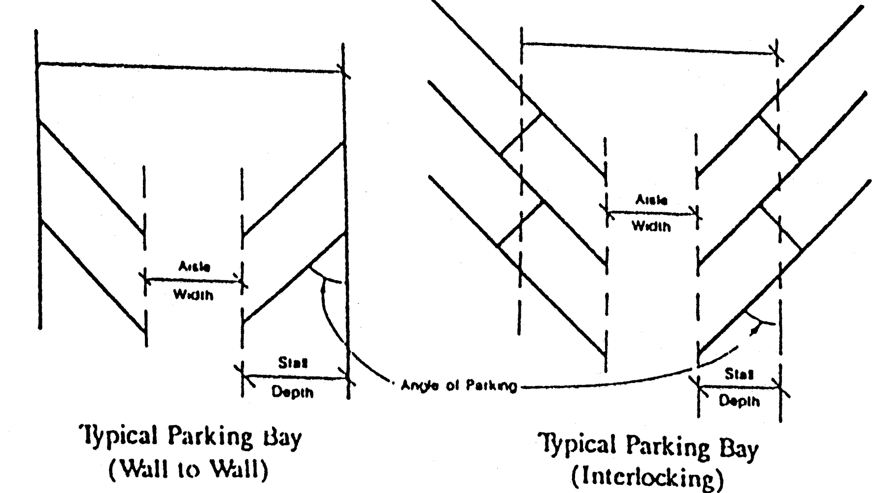
Table 4.14.2 indicates the standard dimensions for the various configurations, given the standard parking ten-foot by twenty-foot dimensions.
Table 4.14.2
Parking Dimensions in Feet
4.627.C.
Design and setbacks. It is the intent of these standards to discourage parking lots which give the appearance of an unbroken use of asphalt and that have negative impacts on adjacent land uses and aesthetics, while at the same time, to encourage pervious parking areas. Therefore:
1.
Parking spaces shall be located on the same site as the principle use, except as permitted elsewhere in division 14.
2.
Setbacks.
a.
A front yard setback of not less than ten feet shall be provided, except where a parking area is greater than two acres, then the front yard setback shall be increased to 15 feet. If off-site parking is proposed, the front yard setback shall be increased to 25 feet.
b.
Side yard setback of not less than ten feet shall be provided on every off-site lot, except when a nonresidential parking lot is located adjacent to property designated for residential land use or an alley-way, a setback of not less than 15 feet shall be required between the pavement or parking space and the property line.
c.
Sufficient area must be provided for required landscaping where swales are incorporated in the setback.
3.
All lighting shall be shielded and directed away from residential units and adjacent roadways.
4.
Entrances and exits shall be arranged to minimize hazards and must be approved by the County Engineer.
4.627.D.
Paving standards. All parking spaces, access drives, and loading zones shall be paved in accordance with the design standards set forth in division 19, LDR. The County Engineer may approve the use of alternate surfaces for parking, storage, driveways, and maneuvering areas not designed for everyday use and where the requirement for paved areas is inconsistent with other environmental considerations.
It is the intent of the county to encourage pervious parking areas. Solely for stormwater management calculations, the parking area may be reduced by 50 percent when pervious parking is used.
When pervious parking areas are provided:
1.
Soil stabilization techniques must be used in a manner to assure parking will remain functional in heavy rains or drought.
2.
Pervious parking areas must be designed so the stormwater accumulated in a five-year 24-hour storm event percolates into the ground without runoff. The runoff from storm events exceeding a five-year 24-hour event shall be adequately directed to other components of the stormwater management system in a way that prevents erosion and sedimentation.
3.
Regular maintenance of pervious areas is necessary to ensure long-term integrity of function. Sweeping or other recommended maintenance procedures must be implemented. If such areas cease to function in providing adequate parking or cause sedimentation within the drainage system which reduces the effectiveness of the system or decreases water quality, then paving to normal design standards will be required. If the area is not functioning adequately and cannot be paved, then the amount, kind or intensity of use, must be reduced in order to limit parking needs to available spaces.
4.627.E.
Handicapped parking. Paved handicapped parking spaces shall be provided in accordance with applicable Florida Statutes.
4.627.F.
Queuing requirements for drive-through facilities. In addition to meeting the minimum off-street parking and loading standards of this article, drive-through facilities shall satisfy the following minimum queuing space requirements. Should these requirements fail to meet the needs of the facility resulting in nuisance to adjacent properties and traffic hazards, the owner shall be responsible for adding additional queuing space or reducing the intensity of usage.
1.
Queue space schedule. The minimum number of queuing spaces required shall be as follows. Variations from these minimums may be allowed based on a traffic study submitted for review and approval by the County Administrator.
2.
Minimum dimensions. Each queue space shall be a minimum of ten feet by 20 feet in size. Queuing lane dimensions shall be measured from the point indicated in the queue space schedule to the end of the queuing lane.
3.
Design. Each queue lane shall be clearly defined and designed so as not to conflict or interfere with other traffic using the site. A bypass lane with a minimum width of 12 feet shall be provided if a one-way traffic flow is used in the parking lot. The bypass lane shall be clearly designated and distinct from the queuing area.
(Ord. No. 835, pt. 1, 11-17-2009)
Sec. 4.628. - Temporary parking.
A temporary parking facility may be utilized for up to 18 months when in the judgement of the County Engineer, the off-street parking requirements of this division 14 cannot be met and the primary use meets all other requirements of the LDR, Code and Comprehensive Plan. The surface shall consist of stabilized grass surface, compacted gravel, compacted limerock with stabilizing additive(s), or similar hard and dustless surface approved by the County Engineer, and shall be capable of being continuously maintained in a clean and level condition. Pavement markings, landscape requirements except around the perimeter of the lot, and drainage requirements shall not be applicable. All other parking standards remain in effect.
(Ord. No. 835, pt. 1, 11-17-2009)
Sec. 4.661.- General requirements.
4.661.A.
Purpose and intent. The purpose and intent of this division is to promote the health, safety and welfare of existing and future residents by establishing minimum standards for the installation and continued maintenance of landscaping and buffering without inhibiting creative landscape design. This division requires specific water conservation measures including the preservation of native vegetation for landscaping purposes where applicable to minimize water use, conserve energy, limit nutrient loading to surface waters, and provide mature vegetation for aesthetics, shade and wildlife habitat. The specific objectives of these regulations are to: preserve and protect existing vegetation; promote water conservation and encourage greater use of native cold-tolerant and drought-tolerant landscape material; reduce heat and glare; provide temperature control; to improve the appearance of developed areas; enhance the value and appearance of local properties by more effectively buffering land uses; reduce air and noise pollution; improve the aesthetic appearance of all development by requiring sustainable landscaping and buffering that harmonizes and enhances the natural and built environment; and to reduce or minimize potential nuisances between land uses.
4.661.B.
Applicability. Except as set forth below a certificate of occupancy shall not be granted for any use, structure or development within the unincorporated area of the County until all requirements of this division are met.
1.
Construction of a single-family or duplex residence shall require the planting of one tree per three thousand square feet of site area and those trees shall comply with the standards set forth in section, 4.664, LDR. Single-family and duplex residences shall also comply with section 4.664.A.3. requiring the removal of prohibited species. Single-family and duplex residences shall be exempt from all other requirements of this division. The enlargement or repair of single-family or duplex units shall be exempt from this division.
2.
Administrative amendments to approved development orders pursuant to section 10.14 LDR shall not be required to provide a landscape plan unless the proposed amendment would substantially affect the existing landscaping.
3.
Removal of exotic, dead or diseased vegetation shall be exempt from this division.
4.
Land used and permitted for agricultural use by the Comprehensive Growth Management Plan shall be exempt from this division.
4.661.C.
Glossary. For the purposes of this division the following words, terms and phrases shall have the meanings set forth below:
Adverse impact: Any direct or indirect effect likely to cause, or actually causing, a decline in the stability, natural function, or natural diversity of any environmental resource or system, or in the quiet, peaceful, safe, or healthful use or occupancy of any off-site property.
Bufferyard: A landscaped area intended to separate and partially obstruct the view of two adjacent land uses or properties from one another.
Building area: That portion of a site upon which a structure exists or may legally be constructed.
Caliper: The diameter of a tree, which shall be measured 12 inches above the soil line for trees required to have a four-inch or greater caliper; or, for smaller trees, which shall be measured six inches above the soil line, except that grafted trees shall be measured one inch above the graft union if union can be seen.
Canopy road tree protection zones: All lands within 100 feet of the centerlines of existing roads where trees form a continuous canopy over the roadway are to be treated as canopy road tree protection zones.
Commercial building: Any nonresidential development conducted in the general commercial, limited commercial, commercial office/residential or waterfront commercial future land use designations.
Crown: The main point of branching or foliage of a tree or plant, or the upper portion of a tree or plant.
Crown spread: The distance measured across the greatest diameter of the crown of a plant or a tree.
DBH: Diameter at breast height; the diameter of a tree measured at a height of 54 inches above the naturally occurring ground level.
Developed area: That portion of a site upon which any building, structure, pavement, landscape material, stormwater facility, excavated lake, or other improvement has been or will be placed or on which a development activity occurs or has occurred.
Drip-line: The vertical projection on the ground of the outer perimeter of the crown of a plant.
EcoArt: EcoArt is an intentional aesthetic construction or assemblage designed by an artist. EcoArt incorporates environmental science in its design and is intended to communicate ecological principles. An EcoArt project could be a naturally regenerative ecosystem that supports and enriches biodiversity, provides storage, filtration, habitat, energy attenuation and absorption, etc. and or it can be an architectural structure that provides many of the same benefits. EcoArt projects can provide ecologically positive benefits to disturbed and impaired areas and the built environment.
Exotic vegetation: A plant that is a nonnative species.
Good forestry practices: Activities which reduce excessive competition between trees, or which remove intrusive exotic species and replace with native species.
Ground cover: Low-growing plants other than turf grass or deciduous varieties, generally reaching a maximum height of not more than 24 inches at maturity, installed to form a continuous cover over the ground.
Interior area: The entire parcel to be developed exclusive of the required front, rear, and side perimeter landscape areas.
Landscape material: Living material, including trees, shrubs, vines, turf grass, and ground cover; landscape water features; and nonliving durable material commonly used in landscaping, including mulch, walls and fencing, rocks, pebbles, sand, prairie film, brick pavers, and earthen mounds, but excluding impervious surfaces for vehicular use.
Landscaping: The placement of landscape material on a site in accordance with the requirements of this division.
LDR means the Martin County Land Development Regulations.
Mulch: Organic or inorganic materials which may have been shredded, cut, or pulverized to facilitate the spreading on the soil surface for the purpose of protecting the roots of plantings, conserving soil moisture, suppressing weed growth, and changing the aesthetic appearance of a landscape area.
Native: A species that occurred in Florida at the time of European contact or 1500s or as identified as a native plant in the Guide to the Vascular Plants of Florida by R. Wunderlin and B. Hansen.
On-site: Within the boundaries of a facility location, property or site including those sites separated by public or private rights-of-way.
Opaque: Obscure as to be visually unintelligible.
Open space: Land open and unobstructed from the ground to the sky, excluding areas covered by excavated lakes, buildings, sidewalks, patios, parking and loading areas, driveways or other impermeable structures or manmade surfaces. Where pervious parking is provided only those pervious spaces which are in excess of the number required will qualify as open space.
Preserve area: Portions of a site that are to be protected from any tree or understory removal (except for the removal of noxious or exotic vegetation as approved by a preserve area management plan (PAMP) and maintained without any development.
Qualified professional: A person who possesses, in addition to skill, a special registration, or certification, or knowledge which is obtained by an accredited four-year college degree, and which is inherently or legally necessary to render him or her capable, competent, and eligible to perform the particular responsibilities.
Service function areas and mechanical equipment: Outdoor equipment serving development including but not limited to electrical or transformer boxes, air conditioning units, duct work, telecommunication equipment, generators, propane tanks, solid waste collection areas and utility equipment.
Shade tree: Any self-supporting woody plant of a species, deciduous or nondeciduous, that is generally well-shaped, well-branched, and well-foliated which normally grows to an overall minimum height of 35 feet with a minimum average mature crown spread of 30 feet, and which is commonly accepted by local horticultural and arboricultural professionals as a species which can be expected to survive for at least 15 years in a healthy and vigorous growing condition over a wide range of environmental conditions.
Shrub: A woody perennial plant differing from a perennial herb by its persistent and woody stems and from a tree by its low stature and habit of branching from the base.
Sight triangle: An area of unobstructed sight distance along both approaches of an access connection.
Site: The total area within the property boundaries of a principal parcel to be developed, or contiguous parcels intended for development under a common scheme or plan.
Tree: Any self-supporting woody plant having one well-defined stem a minimum of two inches DBH, and which normally grows to a minimum average height of 20 feet.
Tree credit: A numerical representation of the value of a two-inch DBH ten-foot high tree, used to assign values to trees of various sizes to calculate either credit against reforestation requirements, as in the case of trees protected during the development process, or to determine the extent of replanting required, as in the case of removal of protected trees.
Tree removal: The actual removal of a tree; any unmitigated development impact to 25 percent or more of the critical protection zone of a protected tree; any encroachment within three-fourths of the radius of the critical protection zone of a protected tree; any damage to 30 percent or more of the crown of a protected tree within the vertical projection of its critical protection zone; or any other action or activity likely to damage a protected tree.
Turf or Turf grass: A mat layer of monocototyledonous plants such as, but not limited to, Bahia, Bermuda, Centipede, Paspalum, St. Augustine, and Zoysia.
Underbrushing: The removal of understory vegetation, either by hand or with the use of equipment, which neither disturbs the soil nor causes the destruction of any tree.
Understory: The complex of woody, fibrous, herbaceous, and graminoid plant species that are typically associated with a natural forest community.
Vehicular use area: Any ground surface area, excepting public rights-of-way, used by any type of vehicle, whether moving or at rest, for such purposes as driving, parking, loading, unloading, storage, or display, including new or used car lots; activities of a drive-in nature in connection with banks, restaurants, filling stations, grocery and dairy stores, and other vehicular uses under, on, or within buildings.
Vines: Any group of woody or herbaceous plants which may climb by twining, or which normally require support to reach mature form.
Visual screen: A barrier of living or nonliving landscape material which separates and obscures an area from view.
(Ord. No. 601, pt. 1, § 4.15.1, 10-2-2001; Ord. No. 930, pt. 2, 6-11-2013)
Cross reference— Rules of Interpretation, § 1.5.
Sec. 4.662. - Application requirements.
4.662.A.
Landscape plan. Except as provided in section 4.661, all development applications shall include a landscape plan prepared by a qualified professional in accordance with F.S. § 481.301 et seq., and indicate the location and type of all existing and proposed:
1.
Property boundaries, land use, rights-of-way and easements.
2.
On-site and abutting land use features, including adjacent sidewalks, existing vegetation, natural features and site improvements within 50 feet of the property.
3.
Buildings, structures, paving, and adjacent buildings within 50 feet of the property.
4.
All overhead, above and underground utilities, including septic tank and drain fields.
5.
Off-street parking, access aisles, driveways and other vehicular use areas.
6.
Surface water bodies and wellfields.
7.
A tree survey, including approximate position of protected trees, protected tree clusters, landscaping and other vegetation to be preserved or removed.
8.
Plant installation methods and irrigation sources.
9.
The location and acreage of all areas designated for development and preservation.
10.
Ditches, swales, stormwater treatment structures or slopes exceeding 3V:1H in any proposed landscape area.
11.
Tabular data summary: required quantities of plant materials, identification of Florida native plant species provided, gross and net acreage, acreage of preserve areas, number of trees and tree clusters to be protected within the developed area and within perimeter areas, and square footage of vehicular use areas. Service function areas and mechanical equipment requiring screening shall be summarized in a table to identify equipment and the type of screening proposed. Tabular data shall also indicate a calculation of the minimum total number of trees and shrubs required to be planted based upon the proposed developed area and separately based upon quantities required to meet the vehicular use area planting requirements and any required bufferyard requirements.
4.662.B.
Irrigation plans. Irrigation systems are not required; however all required plantings must remain viable, healthy, neat and orderly in appearance. If an irrigation system is to be installed, irrigation plans shall be submitted with the certificate of completion prepared by a landscape architect prior to certification of occupancy is granted. The landscape architect, licensed plumbing contractor or licensed irrigation sprinkling contractor shall certify that irrigation plans shall meet or exceed the minimum compliance regulations set forth within the Standards and Specifications for Turf and Landscape Irrigation Systems published by the Florida Irrigation Society as amended. The required irrigation plan shall be prepared by a qualified professional and shall include the following minimum information:
1.
A scale: same as site plan.
2.
Water main: location size and specifications.
3.
Valve(s): location(s), size and specifications.
4.
Pump(s): location(s), size and specifications or water source.
5.
Backflow-prevention devices and locations.
6.
Controller(s): location(s) and specifications (rain-sensor override devices are required for sprinkler systems).
7.
Typical irrigation zone plan: indicate head types, specifications and spacing, and separate zoning details for different types of irrigation heads and a calculation of percent area irrigated.
8.
Total volume: gallons required for typical depths of application and application rate, inches per hour.
9.
Reclaimed water irrigation system: if applicable, and whether the system is temporary or permanent.
(Ord. No. 601, pt. 1, § 4.15.2, 10-2-2001; Ord. No. 794, pt. 1, 3-18-2008; Ord. No. 930, pt. 2, 6-11-2013)
Cross reference— Development review procedures, art. 10.
Sec. 4.663. - Landscape design standards.
4.663.A.
General requirements. The following minimum landscaping and tree planting requirements shall apply.
1.
Required landscape area. At least 20 percent of the total developed area shall be landscaped.
2.
Credit towards landscape area requirements may be allowed for all or part of native habitat in addition to upland preserve area requirements, provided the applicant demonstrates to the satisfaction of the Director of Growth Management that the native area claimed for credit includes one or more of the following:
a.
Tree clusters including native vegetative communities, protected from development impact.
b.
Vegetative areas with native understory flora, protected from development impact.
c.
Protected trees.
d.
Constitutes a perimeter buffer along any roadway, parking lot or adjacent property.
3.
Trees shall be planted in accordance with the following minimum requirements:
a.
All multifamily developments shall provide at least one tree per 1,500 square feet of site area.
b.
All nonresidential developments shall provide at least one tree per 2,500 square feet of site area.
4.
Vehicular use area requirements for nonresidential sites. The following landscaping requirements shall apply within vehicular use areas.
a.
Landscaping shall be provided along the perimeter of vehicular use areas in accordance with the following standards:
(1)
A ten-foot wide strip of land, exclusive of curbing, along the entire front perimeter of a site, located between the front property line and any vehicular use area, shall be landscaped. Width of sidewalks shall not be included within the ten-foot wide front perimeter landscape area. Berming is encouraged along public roadway frontages to screen parking areas and provide visual interest.
(2)
A ten-foot wide strip of land exclusive of curbing along the entire side and rear perimeter of a site, located between the side and rear property lines and any vehicular use area, shall be landscaped. When side or rear perimeter landscape areas are required on adjacent properties, the owners of such adjacent properties may agree to the installation of only one such landscape area on the adjacent boundary, as long as such agreement is binding on both property owners and their successors in interest and is approved as part of the permit application.
(3)
The total tree requirement within the perimeter landscape area shall be determined by using a ratio of one tree for each 30 linear feet of required landscape perimeter area, or one tree for every 300 square feet of planting area or major portion thereof, with no less than 75 percent of said trees being shade trees. This provision is not intended to require trees to be equally spaced 30 feet apart. Creative design and spacing is encouraged.
(4)
Shrubs with 15 to 23 inches of spread shall be planted on three foot centers; shrubs with greater than 23 inches of spread shall be planted on five-foot centers. In no event shall spacing exceed five feet on center, nor shall plants be closer than two feet to the edge of any pavement.
(5)
A minimum of 25 percent of the total perimeter landscape area is to be in native plantings.
(6)
Vehicle stops or other design features shall be used so that parked vehicles do not overhang into landscape areas.
(7)
Separation between any one-way drives shall be no less than ten feet.
(8)
Until such time as the Engineering Department develops minimum sight distance triangles at intersections, sight distance triangles at intersections shall at a minimum conform with the requirements of the Florida Department of Transportation. The County Engineer may impose an additional distance requirement if the conditions of an intersection warrant such treatment based on Martin County engineering standards and/or good engineering practices. Objects within the sight triangle shall not exceed 24 inches in height with the exception of traffic control devices and utility structures. Trees having limbs and foliage trimmed so the cross-visibility within the triangle is not obscured shall be allowed to overhang the sight triangle, provided the location of any tree does not create a traffic hazard.
b.
Landscaping shall be provided within the interior of vehicular use areas in accordance with the following standards:
(1)
In vehicular use areas within the interior of a site, one 500-square-foot planting area shall be required for every 5,000 square feet of vehicular use area, or major portion thereof, and at least three two-inch, or two three-inch caliper shade trees together with other landscape material shall be planted within each such planting area. Interior landscape areas shall be located to most effectively relieve the monotony of large expanses of paving and contribute to orderly circulation of vehicular and pedestrian traffic, and shall be no less than 12 feet in width, exclusive of curbing. Whenever linear medians at least 50 feet long having shade trees spaced no greater than 15 feet on center are used, the minimum width may be reduced to eight feet exclusive of curbing.
(2)
Landscaped terminal islands of not less than ten feet in width exclusive of curbing and 18 feet in length shall be provided at each end of a parking row. Where divider medians are eliminated (see (3) below), terminal islands shall be increased by an area equal to the divider median requirement. At least one tree shall be planted in every island. Terminal islands shall not be used as stormwater management or conveyance facilities.
(3)
Landscaped interior medians of at least six feet in width exclusive of curbing shall be provided between an interior row of parking spaces and an abutting interior driveway or between abutting rows of parking spaces. At least one tree shall be required for every 30 linear feet of interior median, planted singly or in clusters with tree locations not more than 60 feet apart. Divider medians shall not be used for interior stormwater management or conveyance facilities. The elimination of divider medians for up to three bays of parking shall be allowed with the transfer of an equal square footage of landscaped area into terminal islands located along a public roadway. Public parks are allowed to utilize divider medians for stormwater management or conveyance purposes where the medians are a minimum of ten feet in width.
(4)
Landscaped interior islands shall measure not less than five feet in width exclusive of curbing and 20 feet in length and may be reduced five feet less than the required parking space length. Such islands shall be placed within rows of parking spaces so that there is at least one interior island for every ten parking spaces or portion thereof. At least one tree shall be required per island with the remainder of the island landscaped with grass, ground cover, mulch, shrubs, or other treatment excluding pavement or sand according to the provisions of this section. Interior islands shall not be used for stormwater management or conveyance facilities.
(5)
As an incentive to preserving native areas, up to one-half of the required interior landscape area may be waived when an equal area within the vehicle use area is preserved in a native state. To qualify for such a waiver, preserved native areas must be at least 800 square feet in size. The area must not be altered by grade changes or irrigation impacts which may stress the vegetation in its existing habitat. Such native areas that are used to meet landscaping requirements, shall not be used to meet upland preservation requirements.
5.
For vehicular use areas not utilized for off-street parking, but serving the vehicular access or storage needs of the public (stacking lanes for drive-in banks and restaurants), ten percent of the total paved area of such vehicular use area shall be added to interior landscaping.
6.
Screening of service function areas. Screening materials and landscaping used to screen service function areas shall be consistent with the design of the primary facades.
a.
Solid waste collection areas. The location of all trash, recycling and similar receptacles, including dumpsters, shall be screened with an opaque, six-foot-high masonry wall or fence. A hedge shall be installed around the perimeter of this screen. Where possible, dumpsters shall be sited so as not to be visible from public rights-of-way. Opaque gates shall be used to screen trash receptacles from the view of public rights-of-way. Property served by residential curbside service shall be exempt from the provisions of this requirement.
b.
Service function and mechanical equipment areas. Landscape plans shall clearly identify the locations of service function and mechanical equipment that are required to be screened and the type of screening provided. These areas shall be enclosed by an opaque fence, wall or hedge a minimum of six feet in height or to the highest point of the equipment, whichever is lower. For air conditioning or other equipment requiring air flow, a lattice screen of at least 50 percent opacity shall be sufficient to meet this requirement.
7.
Commercial building requirements. Landscape plans shall identify the square footage (gross floor area) of commercial buildings and the locations of pedestrian access and customer entrances to these buildings. Structural or vegetative shading shall be provided along pedestrian ways at intervals of no greater than 70 feet. Pedestrian amenities shall be provided for all commercial buildings greater than 10,000 square feet, as follows:
a.
Commercial buildings greater than 10,000 square feet. Commercial buildings of more than 10,000 square feet in gross floor area shall provide an outdoor patio area adjacent to the customer entryway of a minimum of 200 square feet in area. Plans shall identify required bench/seating locations in required outdoor patios or pedestrian arcades next to customer entryways. Benches shall not be less than six feet in length and shall have either structural or vegetative shading identified on the plans. Required decorative landscape planters shall also be identified on the plans in these locations.
b.
Commercial buildings greater than 50,000 square feet. The requirements are the same as listed above for commercial buildings greater than 10,000 square feet, with the exception that a minimum of two benches shall be provided.
c.
Commercial buildings greater than 100,000 square feet. The requirements are the same as listed above for commercial buildings greater than 10,000 square feet, with the exception that a minimum of four benches shall be provided. Additionally, the location of a required outdoor fountain for these buildings shall be provided on the plans.
4.663.B.
Bufferyard requirements. To reduce potential incompatible relationships between adjacent land uses, landscaped bufferyards shall be required between differing land uses and along certain transportation corridors. However, pedestrian and vehicular connections shall be encouraged between like uses (i.e., commercial, outparcels to adjacent outparcels along major thoroughfares) whenever possible. It is the intent of this provision to encourage the preservation of existing vegetation for use in buffers as opposed to clearing and replanting designed landscapes. The following landscaped bufferyards shall be required for all new development or redevelopment which creates the indicated land use conflicts.
1.
Bufferyards for differing land uses.
a.
Bufferyard type. The following table indicates the type of bufferyard required between various land uses.
b.
Determination of use. Proposed use types shall be those indicated on a development application or the most intensive use permitted by existing zoning or the Comprehensive Growth Management Plan. The adjacent use shall be based on existing development, an approved development plan or the least intensive use permitted by existing zoning or the Comprehensive Growth Management Plan. In no case shall the existence of a nonconforming use on adjacent property work to impose a greater bufferyard requirement than the least intensive use permitted by existing zoning or the Comprehensive Growth Management Plan.
2.
Bufferyards for residential uses along major transportation corridors.
a.
Residential bufferyards. Wherever new residential dwelling units are proposed to be located along any minor or major arterial road, specifically excluding community redevelopment overlay districts adopted pursuant to Article 3, Division 6, of the Land Development Regulations, a Type 5 bufferyard shall be required to screen the view of the dwelling units from the street. The major or minor arterial road classifications are described in section 4.842 of the Land Development Regulations. This requirement shall be applicable only to areas within the Primary Urban Service District as shown on figure 4-5 of the Comprehensive Growth Management Plan.
b.
Screening of construction sites. Despite any provision to the contrary elsewhere in this Division 15, residential bufferyards required by paragraph 2.a (above) shall be installed no later than 60 days after commencement of any site clearing. The Growth Management Director may modify this requirement where the applicant can demonstrate that the land clearing activities will not be readily visible from a minor or major arterial street or because a temporary or permanent source of landscape irrigation cannot reasonably be installed until later in the development process. Any modification of this requirement shall be the minimum necessary to overcome the particular limitations of the site, but in no case shall vertical construction of residential buildings commence until the required bufferyard is installed.
c.
Implementation. The provisions of paragraph 4.663.B.2 shall apply to all new residential development except where a final site plan was approved prior to January 1, 2008. Residential projects which are being developed as part of the implementation of a master site plan approved prior to January 1, 2008 shall comply with the provisions of paragraph 4.663.B.2 to the maximum extent practicable, as determined by the final decision-maker for the development (the County Administrator or the Board of County Commissioners, as appropriate). For example, if the approved master site plan includes an area which could accommodate a bufferyard without reducing the number of lots or residential units proposed:
(1)
The final decision-maker may require either the full buffer or a modified version of the buffer, depending upon the amount of area available within that particular portion or phase of the development; and
(2)
A revised master site plan shall not be required to implement this requirement.
3.
Bufferyards for residential uses along railroad rights-of-way.
a.
Residential bufferyards. Wherever new residential dwelling units are proposed to be located along any railroad rights-of-way, specifically excluding community redevelopment overlay districts adopted pursuant to Article 3, Division 6, of the Land Development Regulations, a Type 5 bufferyard shall be required to screen the view of the dwelling units from the railroad rights-of-way. This requirement shall be applicable only to areas within the Primary Urban Service District as shown on figure 4-5 of the Comprehensive Growth Management Plan.
b.
Implementation. The provisions of paragraph 4.663.B.3 shall apply to all new residential development. Residential projects which are being developed as part of the implementation of a master site plan approved prior to January 1, 2014 with a valid timetable of development shall comply with the provisions of paragraph 4.663.B.3 to the maximum extent practicable, as determined by the final decision-maker for the development (the County Administrator or the Board of County Commissioners, as appropriate). For example, if the approved master site plan includes an area which could accommodate a bufferyard without reducing the number of lots or residential units proposed:
(1)
The final decision-maker may require either the full buffer or a modified version of the buffer, depending upon the amount of area available within that particular portion or phase of the development; and
(2)
A revised master site plan shall not be required to implement this requirement.
4.
Bufferyards for public parks and recreation areas, active and passive.
a.
Active recreation facilities (such as tennis courts and sports fields) shall provide a Type 4 landscaped buffer along the border of any RE, RS, RM, MH, residential PUD or Category "B" zoning district.
5.
Bufferyards for uses adjoining conservation lands. Proposed development abutting land with a Conservation Future Land Use designation shall provide the following intensity and density transition area to enhance protection of the wildlife populations and natural systems.
a.
A preservation area as defined in Divisions 1 and 2 of this article, provided all requirements of Divisions 1 and 2 of this article, and this division are met.
b.
Stormwater retention areas, a minimum of 50 feet in width, planted with native littoral and upland transition vegetation may be provided to meet the requirements of this section. Littoral and upland transition vegetation shall be planted on the side of the stormwater pond abutting the conservation land use.
c.
Where an applicant can demonstrate that a preservation area or stormwater retention area cannot be provided adjacent to conservation lands, as described above, a Type 5 native bufferyard shall be provided. Optionally, a Type 3 native bufferyard incorporating an EcoArt element may be approved by the Growth Management Department Director.
d.
All bufferyard vegetation shall be comprised of native plants and all existing native vegetation shall be retained and incorporated into the bufferyard. Fire resistant plant species shall be utilized in the native firewise landscape bufferyard.
e.
Regardless of the technique selected, the following activities shall be prohibited:
(1)
Altering the hydrologic regime or lowering the water table;
(2)
Generating, storing or handling of hazardous wastes;
(3)
Generating nuisance noise, dust, lighting or odors;
(4)
Generating high concentrations of excessive nutrient runoff.
6.
Description of bufferyard types.
a.
Type 1 bufferyard: A 20-foot-wide landscape strip with a six-foot-high, opaque fence or wall. At least one tree and ten shrubs shall be provided for every 300 square feet of required bufferyard. Trees must be at least ten feet in height with a two-inch caliper. A six-foot-high vegetative landscape screen consisting of 28 shrubs provided for every 250 square feet of required bufferyard can be substituted for the shrub, fence, wall or berm requirements. This vegetative landscape screen shall be 100 percent opaque at the time of planting.
b.
Type 2 bufferyard: A 25-foot-wide landscape strip with a six-foot-high opaque fence or wall. At least one tree and ten shrubs shall be provided for every 300 square feet of required bufferyard. Trees must be at least ten feet in height with a two-inch caliper. A six-foot-high vegetative landscape screen consisting of 28 shrubs provided for every 250 square feet of required bufferyard can be substituted for the shrub, fence, wall or berm requirements. This vegetative landscape screen shall be 100 percent opaque at the time of planting.
c.
Type 3 bufferyard: A 30-foot-wide landscape strip with a six-foot-high opaque fence or wall. At least one tree and 34 shrubs shall be provided for every 300 square feet of required bufferyard. Trees must be at least 14 feet in height with a three-inch caliper and staggered for maximum opacity.
d.
Type 4 bufferyard: A 40-foot-wide landscape strip with a six-foot-high opaque fence, wall or berm. At least one tree and 34 shrubs shall be provided for every 300 square feet of required bufferyard. Trees must be at least 14 feet in height with a three-inch caliper and staggered for maximum opacity.
e.
Type 5 bufferyard:
(1)
A 50-foot-wide landscape strip, with at least three trees and 34 shrubs for every 300 square feet of required bufferyard. The required shrubs shall be a minimum of two feet in height at planting, capable of reaching six feet or more when mature and shall not be trimmed below six feet in height. Trees must be at least 14 feet in height with a three-inch caliper and staggered for maximum opacity; or
(2)
A 30-foot-wide landscape strip, with at least three trees and 34 shrubs for every 300 square feet of required bufferyard, where 100 percent of such vegetation is made up of native plants and all existing native vegetation is retained. Trees must be at least 14 feet in height with a three-inch caliper and staggered for maximum opacity. Required shrubs shall be a minimum of two feet in height at planting, capable of reaching six feet in height when mature and shall not be trimmed to below six feet in height.
7.
Requirements for vegetative landscape screens. Where vegetative landscape screens are installed in required bufferyards, they shall be required to form a solid visual screen at time of planting. A continuous visual screen shall be located along the entire length of all common boundaries. It shall be at least six feet in height and shall incorporate existing native vegetation to the fullest extent possible. When the existing vegetation is inadequate to function as a visual screen, it shall be augmented by two staggered rows of shrub material which will provide such a screen at maturity. Only in cases where the existing vegetation is of poor quality, or totally lacking, shall the visual screen be established solely through the use of the above specified double row of shrubs. Required shrubs shall be a minimum of two feet in height at planting, capable of reaching six feet or more when mature and shall not be trimmed below six feet in height. Existing native vegetation may be used to satisfy screening requirements upon approval of the Growth Management Director.
8.
Use of bufferyards.
a.
Utilities, easements, septic drainfields or other physical improvements shall not be placed in bufferyards, unless approved by the Growth Management Director based on good cause shown.
b.
In any case where an unbuffered view exists within 500 feet from the side or rear service areas of any nonresidential land use to any single-family or two-family residential land use, buffer requirements shall apply as if such residential uses were located on immediately adjacent lands.
c.
Preserve areas as defined in Divisions 1 and 2 of this article may be used to fulfill the landscape bufferyard requirements of this division, provided, all requirements of Divisions 1 and 2 of this article, and this division are met.
d.
Bufferyards may not be established on single-family residential lots.
9.
Exceptions. The following exceptions to and reductions from the bufferyard requirements shall be permitted. The bufferyard width reductions set forth in this paragraph are not intended to reduce the quantity, type or size of plantings required.
a.
The bufferyard width requirements of section 4.663.B.1 may be reduced by 50 percent for development which is separated from an adjacent use by a public street right-of-way of 60 feet or more in width.
b.
Where section 4.663.B.1 requires a bufferyard between a residential use and a nonresidential use and such uses are separated by a public street right-of-way of 100 feet or more in width, the buffer requirement shall be reduced to 20 feet.
c.
Park sites consisting of or surrounded by passive open space with a depth of 50 feet or more along adjacent lot lines shall be exempt from the landscape bufferyard width requirements of this section 4.663.B, but shall be subject to the screening requirements of this section 4.663.B.
d.
When a mixed use development with a unified master plan and development standards is proposed, the bufferyard requirements may be waived between internal residential and commercial uses where the provisions of section 4.667 are met. Applicable bufferyards are required.
10.
It shall be the responsibility of the property owner requesting development approval to install required bufferyards. If a proposed development abuts vacant land not yet approved for development, required bufferyards may be reduced by 50 percent. When the adjacent site develops, this property owner shall be required to install an equivalent bufferyard.
However, in the event any property receives a development order after the effective date of this division that increases the size of the required buffer, that property shall be responsible for providing all of the increase in size of the buffer so that the adjoining property, regardless of whether it is developed, is not obligated to increase the size of its buffer.
11.
Bufferyard fence, wall and berm standards.
a.
Whenever a buffer fence is required, it shall be of sufficient height to obstruct view between adjoining properties, presumably to a height of six feet. The buffer fence shall be solid opaque, constructed of durable materials appropriate for the intended use and consistent with materials commonly used in surrounding neighborhoods, and shall include provision for the access to all landscape materials.
b.
The side of a fence facing a less intensive use and any side of a fence facing a public view shall have a finished appearance to furnish an aesthetically pleasing view.
c.
At least one-half of all required plant materials shall be installed and maintained on the side facing the less intensive use, unless otherwise specifically provided.
d.
Fencing shall be maintained in good repair by the property owner.
e.
When walls are proposed to meet bufferyard requirements, the facade treatment of the walls exceeding 100 feet in length shall require architectural columns at each 100-foot increment to encourage architectural variety and interests.
f.
Fences or walls installed on property near preserve areas shall be designed to permit animal access and crossings.
g.
Berms used in place of the fence or wall requirement shall have no more than a three-foot horizontal to a one-foot vertical slope. Berms may be used in combination with fences or hedges to achieve the minimum six-foot-high 100 percent opaque requirement. For example a three-foot-high fence or hedge may be installed on top of a three-foot-high berm. The six-foot height requirement shall be measured from grade on the side of the buffer with the less intense land use.
4.663.C.
Additional requirements for all landscaped areas.
1.
Mulch material to a minimum compacted depth of three inches shall be allowed for all planting areas when used to supplement ground cover. Cypress mulch is prohibited.
2.
Whenever development activity is subject to both the perimeter landscaping requirements and land use bufferyard requirements of this division, the more intensive shall apply.
3.
No use shall be made of, and no development activity shall be permitted in, land use buffers and perimeter landscape areas, except for:
a.
Planting material approved as part of the landscape plan.
b.
Completely underground utilities and essential, specifically approved, overhead or aboveground utilities which cross these areas and do not interfere with the mature growth of required plant material.
c.
Grass ditches, with back slopes no steeper than 3:1, which can support the required landscaping materials.
d.
Pathways of six feet in width between adjacent uses may be allowed.
4.
All shrub material used as a part of a dissimilar land use bufferyard shall be a minimum height of 30 inches and have a minimum crown width of 24 inches when planted; shall be species capable of achieving a minimum height of six feet; and shall be located in such a way as to maximize the screening potential.
4.663.D.
Water efficient landscaping. All development for which landscaping is required shall comply with the requirements set forth below prior to the issuance of a certificate of occupancy. The accompanying points necessary to meet the following water efficiency requirements shall be clearly tabulated on the landscape plan.
1.
All development shall attain a minimum of 50 points from the following design options. As used in the following design options, "list" means the list of drought-tolerant species set forth by the South Florida Water Management District as recommended drought-tolerant species for use in landscaping.
2.
Adequate irrigation of landscaped areas shall be provided for the first full growing season and continue thereafter only as necessary to maintain required vegetation in good and healthy condition. Irrigation systems shall conform to following standards:
a.
Irrigation systems shall be continuously maintained in working order and shall be designed so not to overlap water zones or to water impervious areas.
b.
No irrigation system shall be installed or maintained abutting any public street which causes water from the system to spurt onto the roadway or to strike passing vehicular traffic.
c.
No permanent irrigation system is required for an area set aside on approved site plans for preservation of existing native vegetation or for drought-tolerant planting areas.
4.663.E.
Preserve area interface requirements for landscaping and stormwater management systems. A preserve area interface shall be established between required landscaping and stormwater treatment areas and preservation areas when preservation areas exist on a development site and when preserve areas abut a development site. The preserve area interface shall include a consolidation and connection of landscaping and stormwater treatment areas with preservation areas. Where more than one preservation area exists on a development site or abutting a development site multiple preserve area interfaces shall be created. Within the preserve area interface the use of plant materials shall be restricted to native species.
The following preserve area interface criteria shall be documented and met for all development sites where preservation areas are identified and where preserve areas have been identified adjacent to a development site:
1.
Stormwater management systems. Plantings within dry retention and detention stormwater areas abutting preserve areas shall be restricted to native trees, native shrubs and native groundcovers. Wet retention and detention stormwater areas abutting preserve areas shall be designed and planted as littoral and upland transition zone areas (preserve area interface) and connected to preserve areas pursuant to Article 4, Division 8, LDR, MCC.
2.
Perimeter landscaping. Plantings within perimeter vehicular use landscape areas abutting preserve areas shall be restricted to native trees, native shrubs and native groundcovers pursuant to quantity, size and dimension requirements of section 4.663.A.4., LDR, MCC.
Where an applicant demonstrates that connection of stormwater management systems to a preserve area interface is impractical due to requirements in Article 4, Division 9 or other documentation as approved by the Growth Management Department Director, alternative compliance to this section may be provided. At a minimum, the stormwater management systems will be required to be planted exclusively with native plant material, as described above.
(Ord. No. 601, pt. 1, § 4.15.3, 10-2-2001; Ord. No. 617, pt. 3, § 4.15.3, 7-9-2002; Ord. No. 794, pt. 1, 3-18-2008; Ord. No. 930, pt. 2, 6-11-2013; Ord. No. 954, pt. II, 5-20-2014)
Sec. 4.664. - Landscape material standards.
4.664.A.
Quality and species. The following shall be considered minimum standards for all landscape materials:
1.
Plant and landscape materials used to satisfy the requirements of this division (Article 4, Division 15) shall meet or exceed the standards for Florida No. 1, as given in the latest edition of Grades and Standards for Nursery Plants, parts I and II, as prepared by the Florida Department of Agriculture and Consumer Services.
2.
Trees and plants used in a landscape design pursuant to this section 4.664 shall be cold-tolerant; drought-tolerant; or appropriate for the environmental setting in which they are to be planted. They must be hardy, sustainable, commercially available; and be otherwise consistent with the purpose and intent of this section. At least 50 percent of all required landscaping, by category in the form of trees, shrubs and ground cover plants, other than grass, shall consist of native vegetation. The Xeriscape Plant Guide by the South Florida Water Management District, or if available County or regional lists as amended may be used to determine appropriate native vegetation. To qualify as native vegetation, plant material shall be native, noninvasive and designated as hardy or very hardy.
3.
Prohibited species.
a.
The following species shall not be planted. Where such species already exist, their removal shall be a condition of development approval.
(1)
Melaleuca (Melaleuca spp).
(2)
Brazilian pepper (Schinus terebinthifolius).
(3)
Australian pine (Casuarina).
(4)
Ficus trees, when located less than 50 feet from a public street right-of-way, street pavement, utility easement or septic tank drainfield.
(5)
Carrotwood (Cupaniopsis anacardioides).
(6)
Catclaw mimosa (Mimosa pigra).
(7)
Earleaf acacia (Acacia auriculaefornis).
(8)
Eucalyptus species (except Eucalyptus torelliana, Eucalyptus camaldulensis and Eucalyptus cinerea).
(9)
Silk oak (Grevillea robusta).
b.
The Board of County Commissioners has established by resolution an additional list of species which shall not be planted except for sterile hybrids and cultivars. The removal of such species shall be a condition of approval for all new development. Where additions or revisions to existing final site plans are proposed, such species shall be removed to the degree feasible as determined by the approving entity:
4.664.B.
Trees.
1.
At the time of planting, all required trees shall have a minimum height of ten feet and one defined vertical stem with a minimum diameter of two inches caliper at the time of planting, except that whenever three or fewer trees are required to be planted on site, such trees shall have a minimum height of 12 feet, a minimum crown spread of six feet and a minimum DBH of three inches.
a.
Planted trees must be a species with an average mature crown spread of at least 15 feet, or they must be grouped so as to create a crown spread of 15 feet.
b.
Tree species and placement shall be selected so as to minimize conflicts with existing or proposed utilities. As set forth below no tree shall be planted where it could, at mature height, conflict with overhead power lines.
(1)
Large trees (height at maturity of more than 30 feet) shall be planted no closer than a horizontal distance of 30 feet from the nearest overhead power line.
(2)
Medium height trees (height at maturity between 20 and 30 feet) shall be offset at least 20 feet and small trees (height at maturity of less than 20 feet) require no offset.
(3)
No tree, shrubs, hedges or vines shall be planted within five feet of any existing or proposed utility pole, guy wire or pad mounted transformer.
(4)
Palms should be planted at a distance equal to or greater than the average frond length plus two feet from power lines.
c.
The Growth Management Director may grant an exception to the size requirement if:
(1)
Species considerations and availability of stock restrict the tree size requirement, then two six-foot to eight-foot trees will be used as the standard; and
(2)
The habitat in question normally includes native trees of smaller size (for example: wetlands, dunes and mangrove areas).
2.
At least 75 percent of all trees planted to satisfy the requirements of this section shall be native species.
a.
All trees required within vehicular use areas shall be shade trees.
b.
Not more than 30 percent of all required trees shall be palms. Where used, two palms or three sabal palms shall constitute one required tree.
c.
When more than ten trees are required to be planted to meet the requirements of this section 4.664, a mix of species shall be provided. The number of species to be planted shall vary according to the overall number of trees required to be planted. The minimum number of species to be planted is indicated in the following table. Species shall be planted in proportion to the required mix. This species mix standard shall not apply to areas of vegetation required to be preserved by law.
3.
The following species may be planted but they shall not be used to satisfy the tree requirements of this section 4.664 unless height restrictions such as proximity to overhead utilities warrant their use as approved by the Growth Management Director.
a.
Crape myrtle (Lagerstroemia indica).
b.
Wax myrtle (Myrica cerifera).
c.
Japanese privet (Ligustrum japonicum).
d.
Sweet acacia (Acacia farnesiana).
e.
Annatto (Bixa orellana).
f.
Black calabash (Enallagma latifolia).
g.
Jaboticaba (Myrciaria cauliflora).
h.
Marlberry (Ardisia escallonioides).
i.
Areca palm (Chrysalidocarpus lutescens).
j.
Paurotis palm (Acoelorrhaphe wrightii).
k.
Seagrape (Coccoloba uvifera).
l.
Spineless yucca (Yucca elephantipes).
4.664.C.
Hedges and shrubs. The hedges and shrubs required by this section 4.664 shall consist of at least 75 percent native species and shall meet the following criteria except where a greater requirement is otherwise specified:
1.
Shrubs shall be a minimum height of 24 inches at the time of planting. In addition, shrubs shall at a minimum be in a three-gallon container or be an equivalent ball and burlapped plant. All such plants shall meet the Florida No. 1 requirements, per species, as described in the latest version of the Florida Department of Agriculture and Consumer Services "Nursery Grades and Standards."
2.
Shrubs with 15 to 23 inches of spread shall be planted on three-foot centers; shrubs with greater than 23 inches of spread shall be planted on five-foot centers. In no event shall spacing exceed five feet on center, nor shall plants be closer than two feet to the edge of any pavement.
4.664.D.
Vines. Vines which have a minimum of three runners 30 inches in length may be used in conjunction with fences, screens or walls to meet barrier requirements. If vines are used in conjunction with fences, screens or walls, their runners shall be attached in a way that encourages proper growth.
4.664.E.
Ground treatment. The ground area within required landscaped areas which is not dedicated to trees, vegetation or landscape barriers shall be appropriately landscaped and present a finished appearance and reasonably complete coverage upon planting. The following standards shall guide the design of ground treatment:
1.
Ground covers shall be spaced so as to present a finished appearance and complete coverage within six months after planting. Ground covers required by this division shall consist of at least 50 percent native species.
2.
Organic mulch shall be temporarily applied to areas not immediately covered by ground cover. Mulch may be used as a permanent ground treatment in landscape designs where ground cover or grass is inappropriate. Where mulch is permanently installed, it shall be renewed and maintained as required. Cypress mulch is prohibited.
3.
Inorganic mulch materials such as rock, pebbles and sand, or other inorganic materials such as walls or paving blocks, may be used in combination with organic mulch materials to satisfy the requirements of this section 4.664. Other recycled materials as approved by the Growth Management Director may also be used to satisfy the requirements of this division. Artificial plants shall not be used to meet any of the requirements of this division.
4.
The use of drought-tolerant grasses is preferred over traditional turf grass varieties. Grass areas may be sodded, plugged, sprigged or seeded, provided that solid sod shall be used in swales, rights-of-ways or other areas subject to erosion. In areas where grass seed is used, nursegrass seed shall also be sown for immediate effect, and maintenance shall be provided until coverage is completed.
5.
Irrigated turfgrass areas shall be consolidated and limited to those areas on the site that receive pedestrian traffic, provide for recreation use, provide cover for on-site sewage disposal systems, or provide soil erosion control such as on slopes or in swales; and where turfgrass is used as a design unifier or other similar practical use. Turf areas shall be quantified and identified on the landscape plan.
4.664.F.
Tree preservation credits. A preserved cold-tolerant and drought-tolerant tree that meets the standards below may be substituted for any of the trees required by the landscaping requirements of this section.
1.
Preserved cold-tolerant and drought-tolerant trees shall be credited for required trees, pursuant to the following formula.
2.
No credit shall be granted for trees which are:
a.
Classified as prohibited;
b.
Located within recreational tracts, golf courses or similar subareas within planned unit developments;
c.
Located within required preservation areas;
d.
Dead, dying, diseased or insect-infested;
e.
Damaged from skinning, barking or bumping; or
f.
Suppressed trees which have been overtopped and whose crown development is restricted from above due to their relative size in relation to surrounding trees.
(Ord. No. 601, pt. 1, § 4.15.4, 10-2-2001; Ord. No. 794, pt. 1, 3-18-2008; Ord. No. 930, pt. 2, 6-11-2013)
Sec. 4.665. - Maintenance of required landscaping.
4.665.A.
Protection of required landscaping. Encroachment into required bufferyards and landscaped areas by vehicles, boats, mobile homes or trailers shall not be permitted, and the following protection measures shall be required.
1.
Required landscaped areas shall not be used for the storage or sale of materials or products or the parking of vehicles and equipment.
2.
Wheel stops or curbs of not more than six inches in height and width shall be placed at least two feet from the edge of a required landscaped area. Where a stop or curb is used, the area between it and the end of the space may be landscaped.
3.
During periods of development and construction, the areas within the drip-line of preserved trees shall be maintained at their original grade with pervious landscape material. Within these areas, there shall be:
a.
No trenching or cutting of roots;
b.
No fill, compaction or removal of soil; and
c.
No use of concrete, paint, chemicals or other foreign substances.
4.
Barriers in compliance with the preserve area management plan shall be provided around all preserved trees during construction.
5.
All existing trees and native vegetation not located in areas requiring their removal shall be retained in their undisturbed state.
4.665.B.
Installation and maintenance. All property owners shall be responsible for properly installing and maintaining required landscaping so as to at all times present a healthy, neat and orderly appearance, free of refuse and debris.
1.
All landscaping shall be installed according to sound nursery practices in a manner designed to encourage vigorous growth. Soil improvement measures may be required to ensure healthy plant growth. A plant's or tree's growth characteristics shall be considered before planting to prevent conflicts with utilities, views or signs.
2.
If vegetation which is required to be planted or preserved by this division dies it shall be replaced with equivalent vegetation. All trees for which credit was awarded and which subsequently die, shall be replaced by the requisite number of living trees according to the standards established in this division.
3.
Prior to the issuance of a certificate of occupancy, security shall be required for 50 percent of the supply and installation cost of the landscape materials to ensure adequate maintenance and survivability of vegetative materials. The applicant shall warrant and guarantee a survival rate of 100 percent for all required landscape materials for a period of 24 months following the certification of installation by the landscape architect. Such securities shall be released upon inspection and approval by the Growth Management Department that the provisions of this section have been met.
4.
The property owner, or successors in interest, or agent, if any, shall be jointly and severally responsible for the following:
a.
Regular maintenance of all landscaping to be kept alive and in good condition and in a way that presents a healthy, neat, and orderly appearance. All landscaping shall be maintained free from disease, pests, weeds and litter. Maintenance shall include weeding, watering, fertilizing, pruning, mowing, edging, mulching or other maintenance, as needed and in accordance with acceptable horticultural practices.
b.
Repair or replacement of required walls, fences or structures to a structurally sound condition.
c.
Regular maintenance, repair or replacement, where necessary, of any screening or buffering required by this division.
d.
Perpetual maintenance to prohibit the reestablishment of invasive exotic species within landscaping and preservation areas.
5.
Pruning of trees shall be permitted to allow for healthy uniform growth and to promote structural, aesthetic and safety considerations. All permitted pruning shall be conducted in accordance with the latest standards of the National Arborist Association. Hat-racking is prohibited.
6.
Landscaping shall be permitted in easements only with the written permission of the easement holder. Written permission shall specify the party responsible for replacing disturbed landscape areas and shall be submitted to the County in a form acceptable to the County Attorney. Written permission to plant within easements shall be filed with the land records applicable to the site.
(Ord. No. 601, pt. 1, § 4.15.5, 10-2-2001; Ord. No. 794, pt. 1, 3-18-2008; Ord. No. 930, pt. 2, 6-11-2013)
Sec. 4.666. - Tree protection.
4.666.A.
Protected trees. The following native trees are protected and shall not be removed or damaged without the approval specified below.
1.
Any hardwood native tree having a diameter of eight inches DBH or greater.
2.
Any native hardwood tree four-inch DBH or greater or any native softwood, including pine trees, eight-inch DBH or greater which is located in the perimeter area of any development site.
3.
Any tree within a canopy road tree protection zone, except prohibited trees.
4.666.B.
Location of protected trees. All protected trees which may be impacted within 75 percent of their canopy drip-lines by proposed development activities shall be physically located on site and indicated on the tree survey as required in section 4.662.A.7., Barricades must be constructed around the critical protection zone of each tree or cluster of trees. These barricades must be constructed of a minimum of one-fourth-inch diameter rope which is yellow or orange in color and made of nylon or poly. The rope is to be attached to a minimum of two × two wooden poles, iron rebar, two inches or greater PVC pipe or other material with prior approval of the Growth Management Department. The rope must be a minimum of four feet off the ground and may not be attached to any vegetation. All barricades must be maintained intact for the duration of construction. The location of proposed development activities that are within 15 feet of the critical protection zone of a protected tree must be located using brightly colored flagging to indicate corners.
4.666.C.
Criteria for protected tree removal. Approval for the removal of a protected tree may be granted if the applicant demonstrates the presence of one or more of the following conditions:
1.
Necessity to remove a tree which poses a safety hazard to pedestrians or other persons, buildings or other property, or vehicular traffic, or which threatens to cause disruption of public services.
2.
Necessity to remove a diseased or pest-infested tree to prevent the spread of the disease or pest.
3.
Necessity to reduce competition between trees or to remove exotic species and replace them with native species.
4.
Tree removal which is essential for reasonable and permissible use of property, or necessary for construction of essential improvements, resulting from:
a.
Need for access immediately around the proposed structure for essential construction equipment, limited to a maximum width of 20 feet from the structure.
b.
Limited access to the building site essential for reasonable use of construction equipment.
c.
Essential grade changes needed to implement safety standards common to standard engineering or architectural practices, and reference to a text where such standards are found shall be required.
d.
Location of driveways, buildings or other permanent improvements where there is no other alternative or to provide access.
e.
Compliance with other ordinances or codes such as building, zoning, subdivision regulations, health provisions, and other environmental ordinances where there is no alternate way to achieve these goals.
4.666.D.
Tree replanting requirements.
1.
As a condition of the issuance of a permit for removal of a protected tree, a satisfactory plan shall be presented by the applicant for the successful replacement of trees to be removed, based on the following schedule:
a.
If protected trees are removed without a permit or otherwise in violation of this regulation, the number of required replacement tree credits in the schedule shall be doubled.
b.
Trees preserved on site for reforestation requirements shall be given credit on an inch-for-inch basis to be applied to the tree replanting schedule, e.g., a six-inch preserved tree may be given credit as one four-inch tree plus one two-inch tree, or two three-inch trees.
c.
In order to promote planting of larger size replacement trees, the number of two-inch diameter tree credits that must be replanted, as determined by the table above, may be reduced when replanted trees are of a larger size than two-inch DBH, according to the following table:
2.
If the total number of trees to be replanted based on the tree replanting schedule in (D.1.) above exceeds that which may be reasonably planted on the development site, the applicant may enter into an agreement with the County, as approved by the Growth Management Director, to plant the excess trees on an approved public site or to provide the monetary equivalent to the County for use in public landscaping projects.
3.
If any tree for which credit was given under this division is not alive and growing three years after all associated development activity on the property is completed, it shall be removed and replaced with trees of at least the size which originally would have been required to be planted if such credit had not been allowed.
4.666.E.
Protection minimum for protected trees. The development activity shall preserve at least ten percent of the total number of protected trees on the site unless it can be shown that the property would be precluded of reasonable use if the trees are not removed.
(Ord. No. 601, pt. 1, § 4.15.6, 10-2-2001; Ord. No. 930, pt. 2, 6-11-2013)
Cross reference— Wetlands protection, § 4.1 et seq.; uplands protection, § 4.31 et seq.; mangrove protection, § 4.71 et seq.
Sec. 4.667. - Alternative compliance.
An applicant may submit a landscape plan which varies from the strict application of the requirements of this division in order to accommodate unique site features or utilize innovative design. An alternative compliance landscape plan shall be approved only upon a finding that it fulfills the purpose and intent of this division as well as or more effectively than would adherence to the strict requirements of this division.
4.667.A.
Evaluation. The applicant must provide documentation to justify a landscape plan not meeting the minimum standards of this division. Such documentation shall include a quantitative analysis of areas not meeting minimum standards or dimensions, required vs. provided dimensions, and materials not meeting minimum Code requirements.
In evaluating proposed alternative compliance landscape plans, considerations shall be given to proposals which preserve native vegetation and use drought-tolerant plantings and other low water use landscape design principles and where the design may accomplish one or more of the following:
1.
Ensures preservation of the maximum predevelopment vegetation on the site.
2.
Is designed to assure that the overall appearance and function of the proposed project is compatible with other properties in the immediate area; is demonstrably responsive to the environmental attributes of soil, slope, hydrology, and vegetative communities unique to the site; is consistent with sound planning and site design principles, and contingent upon:
a.
Structures and other improvements are designed as to utilize existing site characteristics of topography, existing vegetative communities, and any unique environmental feature.
b.
Conflicts between vehicular and pedestrian circulation are avoided.
c.
Planting plans indicate a diversity of plant species in the categories of ground covers, shrubs, and trees.
d.
Integration of proposed and existing vegetation is demonstrated in the plans with an emphasis on maintaining native community buffers and corridors, preserving or restoring forest community types, and providing for the natural ecological function of each type by using such techniques as preserving a diversity of upperstory, midstory, and understory.
e.
Plant schedules contain botanical and common names, sizes of materials by dimension and containerize, location by dimension, and notation describing species diversity.
f.
Planting specifications and species selected for the site are suitable for individual site environmental characteristics of soil slope, aspect, wetness and microclimate.
g.
Plans indicate compatibility with adjacent site environmental features.
3.
Implements a EcoArt element as approved by the Growth Management Department Director.
4.
Provides foundation landscaping, comprised entirely of native vegetation around principle structures with educational signage identifying native plant species.
(Ord. No. 601, pt. 1, § 4.15.7, 10-2-2001; Ord. No. 930, pt. 2, 6-11-2013)
Sec. 4.668. - Certification of compliance.
Prior to the issuance of a certificate of occupancy the owner shall provide to the Growth Management Department a certificate of completion prepared by a landscape architect licensed by the State of Florida demonstrating compliance with the provisions of this division. The certificate shall specifically include reference to the landscaping area, installation of materials, automatic irrigation system and an audit of percent irrigated area. If an irrigation system is installed and an irrigation plan was not provided for approval with the approved landscape plan, an irrigation plan shall be provided and certified by the landscape architect or licensed plumbing contractor or licensed irrigation sprinkling contractor as in compliance with the criteria in section 4.662.B. The irrigation plan shall also include the irrigation permit number, as issued by the Building Department, for the construction of the irrigation system. The following certification statement must appear on the certification report:
I hereby notify the County of the completion of the installation of landscaping for the above referenced project and certify that the installation of vegetative materials, the automatic irrigation system and the positioning of the irrigated area as depicted on the site plan is in substantial conformance with Article 4, Division 15, Land Development Regulations, Martin County Code, and the plans and specifications permitted by the County . A copy of the approved project drawings is attached with deviations, if applicable.) I hereby fix my seal this day of ________, 20___.
___________
Signature and Seal
___________
Date
___________
Name (Please Print)
FL Registration No.
(Ord. No. 601, pt. 1, § 4.15.8, 10-2-2001; Ord. No. 930, pt. 2, 6-11-2013)
SUB DIVISION 1. - GENERAL PROVISIONS[12]
Editor's note— Ord. No. 1071, adopted June 19, 2018, amended division 16, subdivision 1, §§ 4.691—4.709 in its entirety and enacted new division 16, subdivision 1, §§ 4.693—4.709 as set out herein. Former §§ 4.693—4.703 pertained to similar subject matter and derived from the Code of 1974, Ord. No. 446, adopted September 13, 1994; Ord. No. 470, adopted July 25, 1995; Ord. No. 546, adopted March 25, 1999; Ord. No. 614, adopted May 28, 2002; and Ord. No. 701, adopted May 9, 2006.
Sec. 4.761.- Purpose.
The purpose of this division is to establish a standardized procedure for addressing the physical location of structures, streets and real properties in unincorporated Martin County.
(Ord. No. 636, pt. 1, 11-4-2003)
Sec. 4.762. - Generally.
These regulations authorize the county administrator to manage the addressing process to include an automated system for storing and sharing information about addresses. Structures and habitable units within structures, streets and real properties represented as points, lines and polygons and assigned unique numbers and names shall constitute the County's address database. Addresses shall not be assigned to structures and property that do not have legal access over roadways declared "open" by the Board of County Commissioners and included in the Engineering Department's Roads Inventory.
(Ord. No. 636, pt. 1, 11-4-2003; Ord. No. 909, pt. 1, 2-21-2012)
Sec. 4.763. - Development review.
Site address enumeration and street and subdivision naming shall occur during the staff review of applications for proposed development. All site plan applications shall be consistent with the street and subdivision naming and site address numbering system of unincorporated Martin County. New address numbers shall be determined from the relationship of proposed development's location to the addressing grid and shall be associated with the property on which the structure is to be built. The address assignment process, which occurs during the development review procedure, is essential to maintaining the County address database.
(Ord. No. 636, pt. 1, 11-4-2003)
Sec. 4.764. - Addressing grid system.
The following grid system is established for the purposes of street naming and site address numbering:
4.764.A. Quadrants. Martin County shall be divided by north/south and east/west baselines into four quadrants: northeast (NE), northwest (NW), southeast (SE) and southwest (SW).
4.764.B. North/south baseline. The north/south baseline, separating east from west quadrants, shall be the section line on which Colorado Avenue/South Kanner Highway, State Road 76, lies. In the Hanson Grant this baseline shall follow the centerline of South Kanner Highway/SR 76 instead of the section line, and at SW Gaines Avenue, the baseline shall follow a line separating sections 4 and 5, Township 39 South, Range 41 East, and extending south and separating succeeding sections to the County line.
4.764.C. East/west baseline. The east/west baseline, separating north from south quadrants, shall be the line separating Township 37 South and Township 38 South.
(Ord. No. 636, pt. 1, 11-4-2003)
Sec. 4.765. - Site enumeration.
The procedure for enumeration of a site address shall be as follows:
4.765.A. Enumeration of a site address shall be derived from a site's location relative to the grid system aligned to the baselines, in which each cell of the grid measures 440 feet on a side with 100 possible addresses ranging across the cell.
4.765.B. Each section is assumed to be one mile square. When sections are partially submerged, the enumeration shall to be limited to upland.
4.765.C. Odd numbers shall be assigned on the north and east sides of the roadway and even numbers shall be assigned on the south and west sides of the roadway.
4.765.D. Units (suites, offices, bays, etc.) within structures which have direct access to the building exterior shall be individually enumerated. Units having only interior hallway access shall share the same building address.
4.765.E. The following subdivisions and areas of the County are exempt from this site address procedure: Jupiter-Tequesta Hunt Club Colony, B.L.I. Minor Plat, Turtle Creek Village and Turtle Creek Condominium and Turtle Creek East, all commonly known as Turtle Creek.
(Ord. No. 636, pt. 1, 11-4-2003; Ord. No. 909, pt. 1, 2-21-2012; Ord. No. 937, pt. 2, 8-6-2013; Ord. No. 951, pt. I, 4-15-2014)
Sec. 4.766. - Direction.
A direction shall be assigned to establish the relative location of a point, line or polygon to the baselines within the County.
4.766.A. NE, NW, SW and SE. The quadrant prefix shall precede the named or numbered street, avenue, etc.; thus NW First Street, NE Ocean Boulevard, SW Second Court, SE Federal Highway.
4.766.B. North, south, east, west. For a street or avenue lying on a baseline, north, south, east or west shall be utilized; thus, North Baseline Avenue.
(Ord. No. 636, pt. 1, 11-4-2003)
Sec. 4.767. - Street name.
Street names shall be established as follows:
4.767.A. Numbered streets. Streets parallel to the baseline may bear a number instead of a name. Numbers shall be allocated on the basis of 12 per mile or one per 440 feet.
4.767.B. New street and subdivision names. Proposed names of streets and subdivisions shall be submitted to the Growth Management Department for review and approval.
4.767.C. Street name selection, spelling, duplication. A proposed street name shall not duplicate existing street names. Street names shall not be homonyms of existing street names. Spelling of street names shall be according to that provided in a current standard, unabridged English dictionary. The use of foreign words is discouraged; the use of non-English accent symbols is prohibited.
4.767.D. Naming driveways. A driveway that serves as the principal access to two or more parcels that contain primary structures shall be named and the primary structures shall be addressed from the named access. A driveway that serves as the principal access to two or more multifamily structures shall be named and the structures shall be addressed from the named access.
4.767.E. Continuity of street names. New streets shall not change names at intersections, except as authorized by the Board of County Commissioners at a public hearing held for the purpose of changing street names.
(Ord. No. 636, pt. 1, 11-4-2003; Ord. No. 909, pt. 1, 2-21-2012; Ord. No. 951, pt. I, 4-15-2014)
Sec. 4.768. - Street name suffix.
Street name suffixes shall be established as follows:
4.768.A. North/south streets. Streets running parallel to the north/south baseline shall be designated "avenue," "court," "drive," "lane" or some other designation beginning with a letter in the first half of the alphabet (A through M).
4.768.B. East/west streets. Streets running parallel to the east/west baseline shall be designated "street," "terrace," "place," "way" or some other designation beginning with a letter in the second half of the alphabet (N through Z).
4.768.C. Roads, highways, parkways, expressways and boulevards. Only major thoroughfares shall be designated "boulevard," "expressway," "highway," "parkway" or "road." These terms may be used regardless of street direction.
4.768.D. Circular roadways. Roadways that form loops or circles shall be designated "circle."
4.768.E. Suffix abbreviations. The official United States Postal Service "Street Suffix Abbreviations" publication shall be used for abbreviating the street suffix.
4.768.F. The Beau Rivage community, which was the subject of incorporation into Martin County from St. Lucie County by an act of the Florida Legislature, Chapter 2012-45, SB 800, Laws of Florida, located in Sections 24 and 25, Township 37 South, Range 40 East, is exempt from these street name suffix policies.
(Ord. No. 636, pt. 1, 11-4-2003; Ord. No. 951, pt. I, 4-15-2014)
Sec. 4.769. - Display of site addresses.
Site addresses shall be displayed as follows:
4.769.A. The property owner shall be responsible for the placement of the site addresses. The numbers shall be placed conspicuously on the front of the structure, so the numbers can be seen plainly from the street. Additionally, whenever the house or building is more than 50 feet from the street line, then the site address shall also be placed on the same side of the street, near the driveway or a common entrance, upon a post or mailbox so as to be easily discernible from the street, ensuring that the sight-triangle zone that preserves clear visibility is maintained (see section 4.843.F).
4.769.B. Numbers used for new residences shall be not less than four inches in height and shall be made of a durable and visible material.
4.769.C. Numbers used for commercial and industrial buildings shall not be less than six inches in height. In addition to placement on individual entry doors, the range of addresses within a commercial development shall be placed conspicuously at the right-of-way fronting the development on either a monument sign or a marquee sign. Numbers on the monument or marquee sign shall also be six inches in height.
4.769.D. Where a question exists as to the correct placement or visibility of address numbers, the property owner shall adhere to the code requirements of the most current adopted edition of the National Fire Protection Association, NFPA 1, The Uniform Fire Code, Florida Edition.
4.769.E. No certificate of occupancy shall be issued until the site address is posted in the required manner.
(Ord. No. 636, pt. 1, 11-4-2003; Ord. No. 909, pt. 1, 2-21-2012; Ord. No. 951, pt. I, 4-15-2014)
Sec. 4.770. - Official address assignments.
The Growth Management Department shall maintain the official list of street and subdivision names and an electronic database of addresses associated with property in the unincorporated county. Public service providers may request to be included in a notification list to receive advisements of new address assignments to this database. Site addresses shall be assigned as follows:
4.770.A. The property shall be addressed from the street which the principal building faces.
4.770.B. If the driveway to the principal building is located on a side street that intersects the street which the building faces, and the driveway is more than 100 feet from the intersection, then the property shall be addressed from the side street.
4.770.C. A request for an address for a public facility that is located in the right-of-way (lift station, phone box, traffic signal box, meters, wells. etc.) shall be on official letterhead and include a description of the facility and an aerial photograph showing the proposed location of the facility.
4.770.D. Properties that do not contain a principal building will not be addressed unless:
1.
The property is created through the site plan or plat process.
2.
An official request for an address is received from Martin County Fire Rescue, Martin County Sheriff, a utility company, or a public agency.
3.
The property is issued a permit for a structure or driveway.
4.770.E. The Growth Management Department shall maintain the official list of street and subdivision names and an electronic database of addresses associated with property in the unincorporated county.
4.770.F. The County's public service providers shall be notified of any changes or additions to the address database.
(Ord. No. 636, pt. 1, 11-4-2003; Ord. No. 909, pt. 1, 2-21-2012; Ord. No. 951, pt. I, 4-15-2014)
Sec. 4.771. - Change of street names in conflict with this division.
The Board of County Commissioners recognizes that a policy must be established to provide an equitable and convenient procedure for changing street names in conflict with this division. Following is the procedure for changing any street name that is in conflict with this division:
4.771.A. The Growth Management Department shall notify each affected property owner of any conflicts with this division. The notice letter shall identify a possible solution(s) to the conflict. Further, the notice letter shall seek input from the property owners with a time limit for response of not less than 30 days from the date the notice is mailed.
4.771.B. After the notice period has expired, the Growth Management Department shall review all response comments and determine a course of action. The selected course of action shall be in the interest of the majority of the affected property owners and shall also be consistent with this division.
4.771.C. The Growth Management Department shall provide a final written notice to all affected property owners. The notice shall: (1) identify the selected course of action, (2) allow the property owner six months to implement any name change, and (3) advise the property owner that a temporary sign indicating current and future street names will be posted by the County during the six-month implementation period.
4.771.D. The Growth Management Department shall notify all affected agencies and utilities of the County's action.
(Ord. No. 636, pt. 1, 11-4-2003)
Sec. 4.772. - Street name changes other than those in conflict with this division.
Following is the procedure for changing a street name not in conflict with these addressing procedures:
4.772.A. BCC initiation of a street name change. The Board of County Commissioners may change a street name at a public hearing advertised for this purpose.
1.
Public notice for the BCC public hearing. The Engineering Department director shall compile a list of affected property owners (where "affected property owner" shall mean the owner of property adjacent to the right-of-way of the street proposed to be renamed). The County Attorney's Office shall certify the affected property owners list. The Growth Management Department director shall prepare and mail letters to the affected property owners giving them notice of the public hearing to consider the street name change.
2.
Sign. A new street sign shall be provided by Martin County.
4.772.B. Citizen petition for a street name change. A petition of any citizen for a street name change shall be submitted to the Board of County Commissioners in a format and application determined by the Growth Management director. The application shall include the petition explaining the proposed name change, a certified mailing list of all affected property owners, the results of a poll of each affected property owner (defined in section 4.772.A.1), as to whether he or she is "in favor of" or "opposed to" or "neutral to" the proposed change, and a sample notice letter announcing a public hearing.
1.
Administrative change. A petition signed by 100 percent of the affected property owners "in favor of" the street name change shall be resolved administratively. The petitioner shall prepare and mail letters to the affected property owners giving them notice of the name change. Copies of the letters shall be submitted to the Growth Management Department with postal return receipt cards attached. After determining that the public has been adequately informed of the name change, the Growth Management director shall conclude the process.
2.
BCC public hearing of petition to change a street name. If less than 100 percent but at least 51 percent of the affected property owners sign the petition "in favor of" the proposed change, the Growth Management director shall schedule a public hearing before the Board of County Commissioners. The petitioners shall prepare and mail letters to the affected property owners giving them notice of the public hearing to consider the street name change.
a.
Copies of the letters with postal return receipt cards shall be submitted to the Growth Management Department.
b.
In the event that the Board authorizes a name change, a new street sign shall be provided by Martin County when the affected street is located on a public right-of-way.
c.
Otherwise, the new street sign shall be the responsibility of the petitioners.
(Ord. No. 636, pt. 1, 11-4-2003)
Sec. 4.791.- Findings of fact; purpose and intent.
4.791.A.
Findings of fact.
1.
Section 704 of the Communications Act of 1934, as amended by the Telecommunications Act of 1996 ("the Act"), recognizes that local governments have the authority to regulate the placement, construction, and modification of towers, antennas, and other wireless telecommunications facilities ("WTCF").
2.
The Act grants the Federal Communications Commission ("FCC") exclusive jurisdiction over the regulation of radio signal interference among users of the radio frequency spectrum.
3.
Under the Act, the County cannot regulate the placement, construction, and modification of a WTCF on the basis of the environmental effects of radio frequency emissions to the extent that such facilities comply with FCC regulations concerning such emissions.
4.791.B.
Purpose and intent.
1.
The board finds that the wireless telecommunications industry is deploying WTCFs in the United States and the County at a rapid rate to provide services to local residents and that such deployment will impact the citizens of the County. Because of the rapid deployment of WTCFs, the board finds that the public convenience, safety, and general welfare can best be served by exercising regulatory powers which are vested in the County or such persons as the County shall designate. It is the intent of this division 18 to provide for and specify the means to best serve the public interest and public purpose in the regulation of WTCFs consistent with applicable State and Federal law.
2.
It is the intent of the board to accommodate the communication needs of County residents by regulating WTCFs and the use of such facilities in order to:
a.
Facilitate the provision of reasonable services to the residents and businesses of the County;
b.
Encourage the placement of WTCFs on roofs, walls, existing towers, and other existing structures instead of constructing new towers;
c.
Minimize adverse visual impacts of WTCFs and towers by setting minimum standards for the design, landscaping, screening, innovative camouflaging techniques, and siting;
d.
Protect the public from the hazards of structural failure of towers and WTCFs;
e.
Expand the use of County-owned property to accommodate new WTCFs;
f.
Encourage the co-location of antennas in order to minimize the number of towers needed to serve the community;
g.
Provide for the removal of abandoned or unsafe towers;
h.
Protect and preserve ecosystems that are habitats for native trees, plants, wildlife, and marine life and other sensitive environmental areas from potential adverse impacts of WTCFs and towers;
i.
Protect and preserve the distinctive and unique natural features of the County, which are in part the result of the County's location on the Atlantic Ocean and the County's unique waterways, including the following: the St. Lucie River estuary which is one of only three in the state; the Loxahatchee River on the southern boundary of the County which is a pristine and protected waterway as is its headwaters, Jonathan Dickinson State Park; the surrounding Atlantic Ocean beaches which are natural assets of the County and which are accessible to the public and not overdeveloped or overcrowded; the Savannas; Hutchinson Island, a natural barrier island; the island near Jensen Beach; the Indian River Lagoon; the Intracoastal Waterway which is one of the three primary waterways in the state, as designated by the state; and scenic vistas of the County;
j.
Protect the unique landscape created by the building height limitation and its positive aesthetic impact on the skyline;
k.
Retain the existing beauty, views, and character of the County;
l.
Protect residentially zoned areas and land uses from potential adverse impacts of WTCFs and towers;
m.
Minimize the visual impact of new WTCFs and towers by encouraging their location in currently visually impacted areas;
n.
Prevent potential adverse impacts to aviation safety;
o.
Establish the review process and the standards and criteria for evaluation of development applications for WTCFs.
(Ord. No. 667, pt. 1, 5-10-2005)
Sec. 4.792. - Glossary.
For purposes of this division 18 the following words terms and phrases shall have the meanings set forth below:
Amateur radio antenna means an antenna used to engage in amateur radio communications as licensed by the FCC.
Antenna means a transmitting or receiving device used for services that radiates or captures electromagnetic radio frequencies for the communication of voice, video or data.
Antenna support structure means any building or other structure, other than a tower, which can be used for location of wireless telecommunications facilities.
Board, means the Board of County Commissioners of Martin County.
Broadcast radio and television towers means towers utilized by licensed radio and television broadcasters under 47 C.F.R Part 73 of the FCC's rules.
Cells-on-wheels (COW) means a temporary, transportable WTCF used to provide emergency or temporary transmission capacity.
Class A satellite earth station means an antenna or dish that is designed to receive direct broadcast satellite service, including direct to home satellite services, that is one meter or less in diameter; or an antenna that is designed to receive video programming services via multipoint distribution services, including multichannel multipoint distribution services, instructional television fixed services and local multipoint distribution services, and that is one meter or less in diameter or diagonal measurement.
Class B satellite earth station means a satellite reception dish or antenna that is two meters or less in diameter and does not otherwise fall within the definition of Class A satellite earth station.
Coastal high hazard area means the evacuation zone for a Category 1 hurricane, as defined in Chapter 8, the Coastal Management Element, of the Comprehensive Growth Management Plan.
Co-location means erecting antenna(s) of more than one wireless service provider on a single tower or on an existing antenna support structure already supporting an antenna.
County means Martin County, Florida.
County administrator means the county administrator of Martin County or his or her designee.
Fall zone means the calculated area of the land surrounding a tower or any of its attachments which may be affected by debris should the tower structure collapse.
Person means any natural person, firm, partnership, association, corporation, company or other legal entity, private or public, whether for profit or not-for-profit.
Pole-mounted means an antenna attached to or upon an electric transmission or distribution pole, a streetlight, a traffic signal or similar facility located within the public right-of-way or a utility easement. A utility pole mounted facility shall not be considered a tower.
Propagation study means a method utilized by radio frequency (RF) engineers for site placement to analyze the coverage area and signal strength. The analysis indicates signal strength at multiple sites to ensure quality transmissions and signal transfers, showing the potential for towers or tall structures within the study area to be utilized for co-location. The study includes actual system measurements in the subject area.
Public safety telecommunication facility means any wireless telecommunications facilities erected by municipal, County, state or Federal government for the primary purpose of providing public safety related communications.
Service means all wireless communications services including, broadcast radio and television services, and any other wireless services compatible with the use of a WTCF.
Stealth facility means any tower or WTCF which is designed to blend into the surrounding environment to the extent that an average person would be unaware of its presence as a tower or WTCF.
Structure-mounted means a WTCF, tower or antenna which is mounted to an existing building or structure not otherwise meant to support a WTCF.
Tower means a guyed or self-supported structure which is designed for the purpose of supporting one or more Antennas or WTCFs. The term "tower" shall not include amateur radio antennas, structure-mounted and pole-mounted WTCFs or cells-on-wheels.
Wireless telecommunications facility (WTCF) means any cables, wires, lines, wave guides, antennas, and any other equipment associated with the transmission or reception of telecommunications installed upon a tower or antenna support structure, including ground-based equipment in direct support of such transmission or reception. However, the term "wireless telecommunications facilities" shall not include satellite earth stations, or amateur radio antennas.
(Ord. No. 667, pt. 1, 5-10-2005)
Sec. 4.793. - Applications for development approval.
No WTCF or tower shall be constructed, reconstructed, structurally altered or moved except pursuant to the provisions of this division 18 and pursuant to a development order issued in accordance with Article 10, Development Review Procedures, of the Land Development Regulations. Nothing in this division is intended to limit routine maintenance of lawfully established WTCFs or towers. Despite any provisions to the contrary in Section 10.11 of the Land Development Regulations, the required type of development review for a WTCF or tower shall be as follows:
(Ord. No. 667, pt. 1, 5-10-2005)
Sec. 4.794. - Development application requirements for towers.
In addition to any other applicable requirements provided elsewhere in the Land Development Regulations, a development application for a tower shall include the following:
4.794.A.
Engineering report. A report from a licensed professional providing:
1.
Design of the tower height including a cross section view and elevation;
2.
Design of the tower's structural capacity, including the number and types of antennas that it can accommodate;
3.
Documentation of the height above grade for all potential mounting positions for all potential co-located antennas and the minimum separation distances between potential antennas;
4.
An analysis and/or other data documentation that certifies that, in the event of a catastrophic failure or collapse of the tower, it will collapse within the engineered fall zone;
5.
Written technical documentation of any Federal Aviation Administration ("FAA") approvals and lighting requirements and, if applicable, documentation of approval or denial of lighting and a statement whether an FAA "Determination of No Hazard to Aviation" is required by 47 C.F.R. part 17 for the tower. If such a determination is required, no building permit for the tower shall be issued until a copy of the determination is filed with the County.
4.794.B.
Color illustrations. Color photo digitized simulations showing the proposed site of the tower including all attached or associated WTCF equipment, with a photo-realistic representation of the proposed tower as it would appear viewed from the closest residential property or properties and from adjacent roadways.
4.794.C.
Shared use letter of intent. An application for a tower shall include a letter of intent, in a form approved by the County, committing the tower owner and successors to allow the shared use of the tower if additional users agree in writing to meet reasonable terms and conditions for shared use.
4.794.D.
Documentation of the infeasibility of tower co-location. An application for a tower shall contain adequate documentation that co-location on an existing approved tower, of any type, or on an existing building or structure, has been attempted and is not feasible. Such documentation shall include:
1.
The results of a propagation study demonstrating to the satisfaction of the County that the equipment planned for a proposed tower cannot be accommodated on an existing or approved and unbuilt structure.
2.
A propagation study analysis shall be based upon a search radius of three-quarters of a mile minimum distance from the proposed location of the intended tower, including areas lying outside of the unincorporated area of Martin County. At the discretion of the County, based on the County's knowledge of existing co-location opportunities, the County may allow an applicant to provide an affidavit from a professional radio frequency engineer which establishes the search area diameter for the proposed WTCF location and identifies all other alternatives in such search area. Even if the latter methodology is utilized, further information may be required by the County on the ability of the WTCF to be accommodated on specific sites within three-quarters of a mile of the proposed WTCF.
3.
When co-location is determined by staff to be infeasible, the determination shall be based upon the results of the propagation study and other evidence provided by the applicant documenting one or more of the following reasons:
a.
Structural limitation. The proposed equipment would exceed the structural capacity of the existing or approved structure, as documented by a qualified and licensed professional engineer, and the existing or approved structure cannot be reinforced, modified, or replaced to accommodate the planned or equivalent equipment at a reasonable cost.
b.
Interference. The proposed equipment would cause interference or obstruction materially impacting the usability of other existing or planned equipment at the tower or building as documented by a qualified professional and the interference or obstruction cannot be prevented at a reasonable cost.
c.
Insufficient height. Existing or approved towers and buildings within the search radius cannot accommodate the planned equipment at a height necessary to function reasonably as documented by a qualified and licensed, if applicable, professional.
d.
Lack of space. Evidence from the applicant, verified by a licensed professional, of the lack of space on existing towers or other structures within the search radius to accommodate the proposed facility.
e.
Other factors. Other reasons that make it unfeasible to locate the planned equipment upon an existing or approved tower or building as documented by a qualified and licensed, if applicable, professional.
4.794.E.
Other requirements.
1.
A copy of the Federal Aviation Administration response to the submitted "Notice of Proposed Construction or Alteration," or its replacement, or certification from a qualified professional engineer that FAA review and approval is not required.
2.
A sealed statement from a qualified professional engineer, licensed in the State of Florida, that the design of the proposed tower complies with the tower design standards as set forth in section 4.797.B.1.
3.
Copies of all currently valid FCC licenses for the proposed facility.
(Ord. No. 667, pt. 1, 5-10-2005)
Sec. 4.795. - Priority siting conditions.
Any new WTCF or tower shall be subject to a determination of the appropriate siting priority as follows:
4.795.A.
Siting priorities, generally. These priorities range from 1 to 4, with the preferred siting conditions found in Priority 1 and the least desirable siting conditions found in Priority 4. In the event that a proposed WTCF or tower cannot be sited to comply with the conditions of Priority 1, the development application shall demonstrate why a lower priority site is necessary.
4.795.B.
Priority 1. Pole-mounted WTCFs or the co-location of WTCFs on existing towers or antenna support structures located on property that is not adjacent to residential uses are preferred. If a WTCF cannot be co-located on a site which is not adjacent to a residential use, co-location on a site located adjacent to a residential use is the next preference within Priority 1. Only when it can be demonstrated that there are no suitable existing structures, based on the determination made under section 4.794.D.3., can a lower priority be considered for siting the proposed facility.
4.795.C.
Priority 2. If a WTCF cannot be located on a site specified in Priority 1, the applicant may propose a new tower on property designated industrial or agricultural on the future land use map.
4.795.D.
Priority 3. If a proposed WTCF cannot comply with Priorities 1 and 2, the applicant may propose a new tower on property designated general commercial or limited commercial on the future land use map.
4.795.E.
Priority 4. If a proposed WTCF cannot comply with Priority 1, 2, and 3, the applicant may propose a new WTCF or tower on property designated waterfront commercial, commercial office/residential, institutional-general, institutional-conservation, institutional-recreational or any residential designation, as shown on the future land use map.
(Ord. No. 667, pt. 1, 5-10-2005)
Sec. 4.796. - General siting requirements.
4.796.A.
Pole-mounted WTCFs are allowed within public rights-of-way at the discretion of the County Engineer.
4.796.B.
Towers and structure-mounted WTCFs within the following areas shall be stealth facilities:
1.
Traffic circles.
2.
Bridges.
3.
Barrier islands (Hutchinson Island, Jupiter Island or Long Island).
4.
Areas lying within 3,000 feet from the mean high water line of the Atlantic Ocean or within 2,500 feet from the Intracoastal Waterway, the St. Lucie River, Loxahatchee River, Indian River.
5.
Lands designated commercial office/residential, commercial waterfront, institutional-recreation, institutional conservation on the future land use map.
6.
Lands designated for residential use on the future land use map.
7.
The hurricane evacuation zone for a Category 2 hurricane, as defined in Chapter 8, the Coastal Management Element, of the Comprehensive Growth Management Plan.
4.796.C.
Towers and WTCFs shall not be located in the following areas:
1.
Wetlands or wetland buffer areas, as defined in Article 4, Division 1, of the Land Development Regulations, Martin County Code.
2.
Upland preserve areas or endangered, unique or rare upland habitats, as defined in Article 4, Division 2, of the Land Development Regulations, Martin County Code.
3.
In the flight path of or on an airstrip, as defined in Article 3 of the Land Development Regulations, Martin County Code.
4.796.D.
Despite any provision to the contrary in section 4.796.B above, towers on county-owned parcels on Hutchinson Island are not required to be stealth facilities.
(Ord. No. 667, pt. 1, 5-10-2005)
Sec. 4.797. - Structure design requirements.
4.797.A.
Standards for antennas and structure-mounted WTCFs.
1.
Minimum structure height. No antenna shall be placed on any nonresidential structure unless the structure is at least ten feet in height or be placed on any structure used as a residence unless such structure is at least three stories high.
2.
Maximum height of Structure-mounted antennas. Structure-mounted antennas shall be placed no higher than ten feet above the top of the structure on which they will be placed and no higher than ten feet above the maximum structure height allowed for structures in the particular zoning district as set forth in Article 3, Zoning Districts, of the Land Development Regulations.
3.
Visual impact. Structure-mounted WTCFs, shall be of a color that is identical to, or closely compatible with, the color of the building so as to be as visually unobtrusive as is reasonably possible, be located in the area of minimal visual impact within the site which will allow the facility to function consistent with its purpose, and be located as close as possible to the building to which it is attached.
4.
Roof-mounted Class B satellite earth station antennas; the color, location and design shall blend into and not detract from the character and appearance of the building and surrounding developed properties.
5.
Panel antennas. Panel antenna physical dimensions shall not exceed a maximum height of eight feet, a maximum depth of four feet and a maximum width of four feet.
6.
State and Federal law. The antenna shall comply with all applicable Federal and state regulations.
7.
Structural design requirements. Any proposed antenna shall meet the structural design limitations of the tower on which it will be placed.
8.
Limited access. Structure-mounted facilities shall be located and designed to insure limited access for authorized persons only.
9.
Pole-mounted WTCFs. Pole-mounted antennas shall be placed no higher than ten percent above the point at which the utility pole would normally extend for purposes of providing the utility service. For example, where a 35-foot pole would normally be utilized to support a street light, a pole-mounted antenna located above such a street light shall be placed no higher than 38.5 feet.
4.797.B.
Tower design standards.
1.
National standards. The Telecommunications Industries Association (TIA) is the accepted standards making body for towers. Any proposed tower or modification of an existing tower shall be constructed according to Structural Standards for Steel Antenna Towers and Antenna Supporting Structures (ANSI/TIA 222), as may be amended from time to time.
2.
Tower design for co-location. A proposed tower shall be designed, when applicable, to allow for future rearrangement of antennas, to provide space for antennas to be mounted at varying elevations, and to accommodate co-location.
3.
Monopoles. All towers shall be monopoles except as otherwise provided for in this division 18.
4.
Illumination. A tower shall not be artificially lighted except as may be required by Federal or state regulation.
5.
Surface or finish color. Regardless of whether designed as a stealth facility, towers shall be painted or have a noncontrasting finish that minimizes the visibility of the facility from public view, except where contrasting color is required by Federal or state regulation. In addition, the exterior of support facilities shall be designed to be compatible with the architectural design prevailing generally among the structures in the surrounding developed area.
6.
Signage. The main access gate to the tower shall have affixed to it a sign not to exceed two feet by three feet in size which displays the owner's and/or permittee's name and an emergency telephone number.
(Ord. No. 667, pt. 1, 5-10-2005)
Sec. 4.798. - Tower separations and fall zones.
4.798.A.
Tower separations. The minimum horizontal distance separating any existing tower and a proposed tower shall be 2,640 feet, as measured from the center point of each tower.
4.798.B.
Setback and fall zone. As provided below, a tower shall have a minimum setback relative to its height, provided that the fall zone of the tower shall be no less than the usual setback requirement for the structures within the particular zoning district.
1.
At a minimum, a tower shall be set back from any residential zoning district a distance that is equal to 400 percent of the tower height. In addition, at a minimum, a tower shall be set back from any existing residential structure not located within a residential zoning district a distance that is equal to 200 percent of the tower height.
2.
At a minimum, a tower shall be set back from the edge of the right-of-way of any public street a distance that is equal to 100 percent of the tower height.
3.
A tower shall be set back from any property not covered in paragraphs 1. or 2. above a minimum distance of 100 percent of the tower height, provided that, on lands designated industrial or agricultural on the future land use map, a tower may be set back to a lesser extent where a professional engineer, licensed in the State of Florida, certifies that, in the event of a catastrophic failure or collapse, such tower will collapse within an engineered fall zone lying wholly within the lot lines of the parcel containing the tower. Only the WTCF shall be allowed within this engineered fall zone.
4.798.C.
Exceptions. The requirements set forth in subsections 4.798.A and 4.798.B above shall not apply to any stealth tower.
4.798.D.
WTCFs located on lands designated agricultural on the future land use map and on a site that is utilized, on the effective date of this ordinance, for a radio and television broadcasting antenna farms as referenced in section 4.808.C. shall not be subject to the tower separation requirements of section 4.798.A.
(Ord. No. 667, pt. 1, 5-10-2005; Ord. No. 832, pt. 1, 10-27-2009; Ord. No. 931, pt. 1, 6-18-2013)
Sec. 4.799. - Tower height restrictions.
4.799.A.
Measurement of tower height. Tower height shall be determined by the vertical distance from the base elevation of the tower site prior to construction to the highest point of the tower, including all antennas and other attachments except lightening rods.
4.799.B.
Maximum height. The maximum height of towers shall be as follows:
4.799.C.
Amateur radio antennas. Amateur radio antennas shall be limited to maximum height of 80 feet except where a higher antenna is allowed by the Federal Communication Commission's preemptive ruling PRB-1, and provided that a determination is made by the approving authority, based on evidence submitted by the applicant, that the proposed height is technically necessary to successfully engage in amateur radio communications.
(Ord. No. 667, pt. 1, 5-10-2005; Ord. No. 832, pt. 2, 10-27-2009)
Sec. 4.800. - Public safety communications requirements.
4.800.A.
Noninterference with existing facilities. A WTCF or tower shall not create interference with any public safety telecommunication facility. For purposes of this section 4.800, "interference" means degradation to RF signals caused by improper performance or operation of a WTCF or by the reduction of RF signals due to the physical characteristics of a WTCF.
4.800.B.
Certification of noninterference with public safety telecommunications facilities. Any application for a WTCF or tower shall include a certification from the sheriff and the emergency management director that the proposed facility is not expected to interfere with or obstruct transmissions to and from existing public safety telecommunications facilities.
1.
In the event that an authorized County official determines that a proposed WTCF or tower will interfere with a public safety telecommunications facility or public safety communications, the official may recommend denial of the application and set forth in writing the reasons for the recommendation of denial.
2.
In the event that the constructed WTCF or tower does interfere with public safety telecommunication facilities, it shall be the responsibility of the owner and/or permittee of the WTCF or tower which creates the interference or obstruction to make all necessary repairs, and/or accommodations to alleviate the problem at the permittee's expense. The County shall be held harmless in this occurrence.
(Ord. No. 667, pt. 1, 5-10-2005)
Sec. 4.801. - Right to inspect.
The County or its designees shall have the right to inspect, upon reasonable notice to the owner and/or permittee, any WTCF or tower for the purpose of determining compliance with this Division 18.
(Ord. No. 667, pt. 1, 5-10-2005)
Sec. 4.802. - Certification of continued structural integrity.
Every five years, or within 90 days following a catastrophic act of nature or other emergency that may affect the structural integrity of a tower, the tower owner or permittee shall file with the County Administrator a statement, sealed by a qualified professional engineer, licensed in the State of Florida, that an inspection has been completed and that the tower has not been structurally compromised.
(Ord. No. 667, pt. 1, 5-10-2005)
Sec. 4.803. - Removal of abandoned or unsafe towers.
4.803.A.
Determination of abandoned or unsafe tower. The County Administrator may determine that a tower is abandoned or unsafe and shall provide written notification of such determination to the tower owner and/or permittee.
4.801.B.
Prima facie evidence. The following shall constitute prima facie evidence that a tower has been abandoned or is unsafe:
1.
Failure of the tower owner and/or permittee to respond within 90 days to a notice by the County Administrator of a failure to submit a certification of continued structural integrity as required in section 4.802; or
2.
Discontinuation of the use of the tower for its intended use for a period of 360 consecutive days.
3.
Failure of the tower owner and/or permittee to respond within 90 days to a notice from the County Administrator of finding that a tower is abandoned or unsafe pursuant to this section 4.803.
4.803.C.
Response to the notice of abandonment. Upon receipt of the notice of determination that a tower is abandoned or unsafe, the tower owner and/or permittee shall have 90 days within which to:
1.
Correct the deficiencies noted in the County Administrator's determination of an abandoned or unsafe tower; or
2.
Dismantle and remove the tower.
4.803.D.
Removal of the tower. A tower that is removed as a result of the enforcement provisions of this section 4.803 shall be completed at no cost to the County. Where removal of a tower is required, all related structures shall also be removed, including any associated ground-based equipment and including footings and foundations. If the tower is not removed within one year of the date of the County Administrator's determination that the tower is abandoned or unsafe, the County may remove the tower and place a lien on the property following the appropriate procedures for demolition of an unsafe structure. The duty to remove the tower shall supersede and otherwise override any conflicting provision of any contract, agreement, lease, sublease, license, franchise or other instrument entered into or issued on and after the effective date of this Division 18.
(Ord. No. 667, pt. 1, 5-10-2005)
Sec. 4.805. - Technical consultants.
The County shall have the right to retain independent technical consultants and experts that it deems necessary to properly evaluate applications for wireless telecommunication facilities and to charge reasonable fees as necessary to offset the cost of such evaluations.
(Ord. No. 667, pt. 1, 5-10-2005)
Sec. 4.806. - Nonconformities.
WTCFs and towers lawfully established prior to April 1, 1999 (the effective date of Ordinance No. 546) which do not comply with the current provisions of this Division 18 shall not be considered in conflict with this Division 18 but shall be governed as follows:
4.806.A.
Nothing in this Division 18 shall prohibit routine maintenance on a nonconforming WTCF or tower or prohibit the placement of additional antennas (co-location) on a nonconforming tower.
4.806.B.
Despite any provision in this Division 18 to the contrary, the board may allow a nonconforming tower to be repaired, reconstructed, replaced or increased in height upon a demonstration by the applicant that the new or modified tower complies with the current regulations to the maximum extent practicable while achieving an overall public benefit in terms of the provision of services. Once authorized by the board, repairs, reconstruction or replacement of towers not involving an increase in height may be approved by way of a building permit. A modification to an existing tower involving an increase in height shall require development approval as a minor development pursuant to Article 10, Development Review Procedures.
(Ord. No. 667, pt. 1, 5-10-2005)
Sec. 4.807. - Public safety telecommunications facilities.
Public Safety WTCFs and towers shall be exempt from the monopole requirement of sections 4.797.B.3 and the tower height requirements of section 4.799 and instead shall be governed as follows:
4.807.A.
Public safety. On property zoned PS, PS-1 or PS-2 or designated Institutional-General or Institutional-Public Recreation, the board may exempt any tower constructed for emergency response and "911" service which are owned by law enforcement or other governmental agencies from the height requirements of this Division 18. Further, the board may allow such tower to be exempt from the monopole design requirement and may allow other entities to co-locate antennas on such tower below the level on the tower where the emergency response or "911" equipment is located if such space is available. Applications seeking such public safety exemptions shall be processed as a major development pursuant to section 4.793, shall comply with all applicable laws and regulations, and shall also include the following:
1.
The engineering report associated with section 4.794.A shall also include documentation, including propagation studies analyzing whether the emergency and "911" service can be adequately provided using towers at the standard height allowed by this land development regulation, as well as the lowest possible height at which such emergency and "911" service can be provided. If the service can be adequately provided using towers at the standard height allowed by this land development regulation, or at a lower height than requested in the application, then the board shall deny the application or approve the application as modified in accordance with such findings.
2.
The report referenced at section 4.794.A shall also include an acceptable plan for reducing the height of the tower in the future if technological advances make deployment at a lower level feasible, or if the entity or agency changes to a different service which can be deployed at a lower level. Any agreement for co-location on such tower shall include appropriate provisions to assure implementation of this plan.
4.807.B.
Public utility telemetry. Antennas up to 15 feet in height used for public utility telemetry and SCADA for utility lift stations and wellfields shall be exempt from the provisions of this Division 18.
4.807.C.
Public stormwater management facilities. Where the purpose is to allow off-site monitoring and control of water control structures or pumping stations located on any property owned in whole or part by the South Florida Water Management District, the Board of County Commissioners may waive or modify any requirement of this division 18 in the same manner as provided in section 1.4.C. of the Land Development Regulations, regardless of whether the project is included in the County's Capital Improvement Plan.
(Ord. No. 667, pt. 1, 5-10-2005; Ord. No. 746, pt. 1, 4-10-2007)
Sec. 4.808. - Limited regulation of broadcast radio and television towers.
Due to the propagation characteristics, broadcast radio and television towers shall be exempt from the monopole requirement of section 4.797.B.3, the separation and fall zone requirements of section 4.798 and the tower height requirements of section 4.799. Instead, broadcast radio and television towers shall comply with the following:
4.808.A.
Broadcast radio and television towers shall not exceed 1,000 feet unless deploying a technology that demonstrates to the satisfaction of the board the need for additional height. Broadcast radio and television towers shall not exceed 250 feet when located on lands designated agricultural ranchette on the future land use map.
4.808.B.
The search radius for broadcast radio and television towers shall be two miles.
4.808.C.
Except when developed as monopole type towers meeting the height, placement and other requirements of other towers, broadcast radio and television towers shall only be located on property designated agricultural or agricultural ranchette on the future land use map near existing broadcast radio and television towers, to facilitate the development of radio and television broadcasting antenna farms.
(Ord. No. 667, pt. 1, 5-10-2005)
Sec. 4.809. - Cells-on-wheels.
Cells-on-wheels shall be allowed during documented states of emergency as declared by the County Administrator. Cells-on-wheels shall also be allowed for periods up to 30 days for testing purposes, special events or as otherwise authorized by the FCC.
(Ord. No. 667, pt. 1, 5-10-2005)
Sec. 4.810. - Application review process and standards.
4.810.A.
Nondiscrimination and timely review. All applications for WTCFs or towers, including modifications to same, shall be reviewed pursuant to the procedures set forth in section 4.793. Consistent with Federal law, such reviews shall not unreasonably discriminate among providers of functionally equivalent services, and at a minimum shall act upon a properly completed application within a reasonable period of time, taking into account the nature and scope of such request. Where County review procedures are in conflict with minimum review timeframes set forth in the Florida Statutes, the stricter provision shall prevail.
4.810.B.
Denial of application. Any final decision by the County to deny an application for a WTCF or a tower shall be in writing and supported by substantial, competent evidence contained in a written record. No such denial shall be on the basis of the environmental effects of radio frequency emissions to the extent that such facilities comply with the FCC's regulations concerning such emissions.
4.810.C.
Commercial design exception. Wireless telecommunications facilities (WTCF) located on lands designated for agricultural use on the future land use map, including the towers or antennas support structures upon which they are located and the ground-based support equipment for such facilities shall be exempt from the commercial design requirements of Article 4, Division 20, Commercial Design, LDR, MCC.
(Ord. No. 667, pt. 1, 5-10-2005; Ord. No. 931, pt. 1, 6-18-2013)
Sec. 4.811. - Inventory and master plan report.
In order to encourage co-location of facilities, the County shall maintain a map and database of the locations of all towers and antenna support structures and their capacity for co-location. This information shall be available for public use in encouraging co-location. Each applicant for a WTCF shall provide the County with an inventory report of the applicant's existing WTCFs located within the County and for a distance of one mile beyond the County limits. By requiring this information, the County does not warrant its accuracy or its applicability.
The inventory report shall specify the following:
4.811.A.
The location, type and design of each tower or antenna support structure;
4.811.B.
The ability of the tower or antenna support structure to accommodate additional antennas;
4.811.C.
The longitude and latitude of each tower or antenna support structure;
4.811.D.
Where applicable, the height of the support structures on which the applicant's existing WTCFs are located.
(Ord. No. 667, pt. 1, 5-10-2005)
Sec. 4.841.- General.
4.841.A.
Purpose and intent. The purpose of this division is to assure a safe, efficient, maintainable and balanced transportation system that preserves community character and provides for all modes of transportation. This division establishes minimum standards for the design of the transportation network, including roadways, sidewalks, pedestrian walkways, bicycle lanes and equestrian paths; policies and procedures for traffic calming; and regulations to manage the location, design and operation of access to County roadways. The traffic calming provisions of this division provide for the application of roadway design elements and traffic control devices to promote safe and pleasant conditions for motorists, bicyclists, and pedestrians on neighborhood streets. Access management regulations protect the safety and capacity of the County's major roadways by reducing conflicts between moving vehicles, parked vehicles, and pedestrians or bicyclists. The intent of this division is to balance the right of reasonable access to private property with the right of the citizens of Martin County to safe and efficient travel by all modes of transportation.
4.841.B.
Applicability.
1.
Except as specifically provided elsewhere in this division, this division shall apply to all roadways which are under the jurisdiction of Martin County whether located within the unincorporated or incorporated areas of Martin County.
2.
This division shall not be interpreted to require roadways existing on the effective date of this division to comply with the requirements of this division except as provided for in sections 4.843.G and 4.845.H. Any modifications to roadways existing on the effective date of this division shall be required to comply with this division to the extent possible. Unopened or unpaved platted streets shall comply with the requirements of this division.
3.
This division shall apply to all roadways which have not been constructed as of the effective date of this division except:
a.
When a development project within which a roadway is located has received final site plan approval prior to the effective date of this division; or when the final site for a development project within which a roadway is located has received a recommendation of approval from the Development Review Committee or the Planning and Zoning Commission prior to the effective date of this division; or when staff has issued a written staff report regarding the proposed final site plan finding compliance with roadway requirements; and no modifications are made to the final site plan.
b.
If a project within which a roadway is located has received master plan approval prior to the effective date of this division and the approval is still valid and clearly establishes compliance with roadway design requirements existing at the time of master plan approval, the project may proceed forward consistent with the approved master plan so long as there is no modification to the master plan.
c.
For Martin County road projects included within the Capital Improvement Plan which have been designed and permitted prior to the effective date of this division.
4.
The access classification system and associated standards of the Florida Department of Transportation shall apply to all roadways on the State highway system.
4.841.C.
Glossary. For purposes of this division, the following words, terms and phrases shall have the meanings set forth below:
Access classification means a system for assigning the appropriate degree of access control to roadways, based upon roadway function, traffic characteristics, and community development objectives.
Access connection means any driveway, street, turnout or other means of providing for the movement of vehicles to or from the public roadway system.
Access management means the process of providing and managing access to land development, while preserving the safety and efficiency of travel on the surrounding roadway system.
Access management plan means a plan establishing the preferred location and design of access for properties along a parkway or major arterial roadway or in the area around an interchange for the purpose of access management.
Alley means a service roadway that is designed to provide access to properties abutting another street and that is not intended for general traffic circulation.
Bike lane means a portion of roadway which has been designated for the preferential or exclusive use by bicyclists.
Bikeway means any road, path, or route which in some manner is specifically designated as open to bicycle travel.
Chicane means a traffic control measure that reduces the speed of vehicles by providing a narrowed vehicle travel path for a section of roadway.
Corner clearance means the distance from an intersection of a public or private road to the nearest access connection, measured from the closest edge of the pavement of the intersecting road to the closest edge of the pavement of the connection along the traveled way.
Corridor overlay zones provide special requirements added on to the underlying land development regulations along portions of a public roadway.
Cross access means an easement or service drive providing vehicular access between two or more contiguous sites.
Cul-de-sac means a dead end street with a circular turnaround at the end.
Cut-through traffic means traffic passing through a specific residential area without stopping or without at least one trip end within the area.
Decision maker means the approving entity pursuant to article 10, Development Review Procedures.
Directional median opening means an opening in a restrictive median that provides for specific movements and physically restricts other movements. Directional median openings for two opposing left or "U-turn" movements along a road segment are considered one directional median opening.
Driveway flare means a triangular pavement surface at the intersection of a driveway with a public street that facilitates turning movements and is used to replicate turning radius in areas with curb and gutter construction.
Driveway return radius means a circular pavement transition at the intersection of a driveway with a street that facilitates turning movements to and from the driveway.
Driveway spacing means the distance between driveways as measured from the closest edge of pavement of the first driveway to the closest edge of pavement of the second driveway along the same side of a roadway.
Easement means a grant of one or more property rights by a property owner to or for use by the public, or another person or entity.
Full median opening means an opening in a raised median that allows all turning movements from the roadway and the intersecting road or access connection.
Functional area (intersection) means that area beyond the physical intersection that comprises decision and maneuver distance, plus any required vehicle storage length, and is protected through corner clearance standards and driveway spacing standards.
Functional classification means the character of service of the roads in relationship to the total public road system by trip purpose.
Furnishings zone means the area that serves as a buffer between the pedestrian zone and the travelway and that provides space for appurtenances including but not limited to, landscaping, utility and transportation infrastructure, and street furniture.
Island means an area within the roadway not for vehicular movement, which is designed to control and direct specific movements of traffic and which may be defined by paint, raised bars, curbs, or other devices.
Joint access or shared access means a driveway connecting two or more contiguous sites to the public street system.
Median means that portion of a roadway separating the opposing traffic flows. Medians can be depressed, raised or flush.
On-street parking means the space in which to park vehicles within a public right-of- way or access easement that is divided into stalls that are either parallel or angled to the adjacent travel/bicycle lane or parallel or angled to a service road.
Outparcel means a lot adjacent to a roadway that interrupts the frontage of another lot.
Pedestrian zone means the area between the furnishings zone and the edge of the right-of-way or the face of the building, which may include landscaping, utility and transportation infrastructure, and street furniture, but must include an unobstructed sidewalk.
Raised median means a physical barrier in the roadway that separates traffic traveling in opposite directions, such as a concrete barrier or landscaped island.
Reasonable access means the minimum number of access connections, direct or indirect, necessary to provide safe access to and from a road consistent with the purpose and intent of this division.
Right-of-way (transportation) means a strip of land in which the State, a county, or a municipality owns the fee simple title or has an easement dedicated or required for a transportation use.
Road, open, means any street, thoroughfare, road, avenue, highway, etc., excluding State-owned limited access highways, which affords access to more than one parcel and is listed in the county road inventory.
Road, platted but unopened, means a platted street or roadway that is not an open road.
Road, privately maintained, means a roadway that is not maintained by a governmental entity and can be either paved or unpaved.
Road, publicly maintained, means a roadway that is maintained by a governmental entity and can be either paved or unpaved.
Road, unpaved, means a roadway open to the public that has not been paved to County standards.
Roadway classification means a system used to group roadways into classes according to their purpose in moving vehicles and providing access.
Scenic corridor means any corridor classified by the board as a scenic corridor in order to preserve, maintain, protect or enhance the cultural, historic, or environmental character of the corridor.
Service road means a public or private road, auxiliary to a controlled access facility, that maintains local road continuity and provides access to properties adjacent to a controlled access facility.
Sidewalk means a paved area for general pedestrian use.
Sidewalk café means an outdoor portion of a restaurant, coffeehouse or cafe.
Sight distance means the distance of unobstructed view for the driver of a vehicle, as measured along the normal travel path of a roadway to a specified height above the roadway.
Sight triangle means an area of unobstructed sight distance along both approaches of an access connection.
Street furniture means benches, sidewalk cafes, trash receptacles, and similar objects.
Streetside means the area that is between the face of curb and the edge of the right-of-way or the face of the building and includes the pedestrian zone and the furnishings zone.
Stub-out (stub street) means a portion of a street or cross access drive used as an extension to an abutting property that may be developed in the future.
Swale means a shallow gently sloped channel for conveyance and infiltration of stormwater.
Throat length means the distance parallel to the centerline of a driveway to the first on-site location at which a driver can make a right turn or a left turn. On roadways with curb and gutter, the throat length shall be measured from the face of the curb. On roadways without a curb and gutter, the throat length shall be measured from the edge of the paved shoulder.
Throat width means the distance edge-to-edge of a driveway measured at the right-of-way line.
TND boulevard means a road intended to provide high vehicle mobility, which may be multi-lane and limited access, designed to carry longer vehicular trips, and possibly include a service road along one or both sides designed for land access, parking, bicycles, and pedestrians.
TND main street means a street with collection of destinations within close proximity. Buildings are close to street with direct connection to the pedestrian zone. Driveway access is minimized and the adjacent properties are primarily served by alternative access such as local streets, alleys or cross access.
Traditional neighborhood development means development guided by the attributes of "traditional neighborhoods." Traditional neighborhood development promotes social integration of age and economic classes by providing a full range of housing types, commercial and office opportunities and promotes the efficient use of land and capital facilities. For the purposes of this division, traditional neighborhood development includes development within community redevelopment areas.
Traffic calming means the combination of design and policy measures that reduce traffic speed and volumes, alter driver behavior, improve conditions for pedestrians and bicyclists, and generally enhance the livability of an area.
Traffic calming measures means the design elements in or along a street or intersections that advance traffic calming objectives. Techniques include roundabouts, diverters, partial-diverters, chicanes, speed humps, raised pedestrian crosswalks, and other devices erected or constructed within a roadway to slow vehicular speeds or reduce cut through traffic, but not restrict access to a street.
Traffic control devices means signs, signals, and markings designed to regulate, warn, guide and provide information for motorists.
Transportation and utility infrastructure means utility poles, sign poles, signal and electrical cabinets, fire hydrants, bicycle racks, bus shelters and other similar items.
Travelway means the area between the faces of the curb.
Undivided roadway means a roadway having full access on both sides of the travel lanes including a roadway with a center two-way turn lane.
(Ord. No. 561, pt. I, § 4.19.1, 12-7-1999; Ord. No. 603, pt. I, § 4.19.1, 11-20-2001; Ord. No. 811, pt. 1, 10-28-2008; Ord. No. 1019, pt. 1, 4-25-2017; Ord. No. 1084, pt. 1, 10-23-2018)
Cross reference— Rules of interpretation, § 1.5.
Sec. 4.842. - Roadway classification.
All roadways under the jurisdiction of Martin County shall be classified in accordance with this section 4.842. The appropriate classification shall be determined by the Board of County Commissioners based upon the Comprehensive Plan and the appropriate function of the roadway in relation to the surrounding roadway network.
Limited access highways. Major highways providing no direct property access that are designed primarily for through traffic. Interstate highways (I-95), the Florida Turnpike, freeways, and some parkways are considered limited access highways.
Parkway. Major controlled access roadways with nicely landscaped buffers, designed to move high traffic volumes while providing a pleasing view from the road. Parkways are subject to highly restrictive access control requirements and more landscaping than other major roadways.
Major arterial. Arterials are roadways of regional importance intended to serve moderate to high volumes of traffic travelling relatively long distances. A major arterial is intended primarily to serve through traffic where access is carefully controlled.
Minor arterials. A roadway that is similar in function to major arterials, but operates under lower traffic volumes, over shorter distances, and provides a higher degree of property access than major arterials.
Major collector. A roadway that provides for traffic movement between arterials and local streets and carries moderate traffic volumes over moderate distances. Collectors may also provide direct access to abutting properties.
Minor collector. A roadway similar in function to a major collector but which carries lower traffic volumes over shorter distances and provides a higher degree of property access.
Local street. A street intended to provide access to abutting properties, which tends to accommodate lower traffic volumes and serves to provide mobility within that neighborhood.
(Ord. No. 561, pt. I, § 4.19.2, 12-7-1999; Ord. No. 603, pt. I, § 4.19.2, 11-20-2001)
Sec. 4.843. - Roadway design and right-of-way.
4.843.A.
Roadway design and construction.
1.
In the absence of specific criteria in this division, the documents listed in section 4.843.A.2 shall be used as guides for the design of roadways, bridges, pavements and bicycle and pedestrian paths within Martin County, but shall not be utilized where site specific conditions require independent analysis and design. Requirements of the Americans with Disabilities Act (ADA) shall be incorporated into the design and review criteria. Approval by the County Engineer is required on the design and construction of all roadways, bridges, pavements and bicycle and pedestrian paths.
2.
The following are adopted by reference for use in Martin County:
a.
AASHTO Policy on Geometric Design of Highways and Streets;
b.
The Manual of Uniform Traffic Control Devices;
c.
The FDOT Roundabout Design Guide;
d.
FDOT Manual on Uniform Minimum Standards for Design, Construction and Maintenance for Street and Highways;
e.
FDOT Roadway and Traffic Design Standards for Design, Construction, Maintenance and Utility Operations for Streets and Highways on State Maintained Systems;
f.
FDOT Flexible Pavement Design Manual for New Construction and Pavement Rehabilitation;
g.
FDOT Standard Specifications for Road and Bridge Construction;
h.
Florida Bicycle Facilities Planning and Design Handbook;
i.
Martin County Bicycle and Pedestrian Plan;
j.
Guidelines for the Development of Bicycle Facilities;
k.
Florida Pedestrian Planning and Design Handbook;
l.
Best Development Practices;
m.
Design for Livable Communities; and
n.
Pedestrian and Transit Friendly Design.
Sustainability guidelines and other documents available after the effective date of this division may also be utilized.
3.
All new roads in Martin County shall be constructed and paved in compliance with the standards set forth above, except as provided in section 4.843.L.
4.
Except as otherwise provided in section 4.843.L. all roads providing access to any new development shall be paved.
4.843.B.
Right-of-way requirements.
1.
Minimum right-of-way (ROW) widths for each roadway classification are provided in table 4.19.1. Additional width may be necessary as determined by the County Engineer depending upon the approved roadway cross section, design elements within the right-of-way, and drainage requirements for the area. Applicants are encouraged to incorporate traditional neighborhood street design in redevelopment and new development projects. The minimum ROW widths for traditional neighborhood street design or within community redevelopment areas are found in section 4.847.
2.
Variances may be granted by the Board of County Commissioners for rights-of-way within plats that were recorded prior to 1972 where the previously acquired right-of-way is less than the required minimum right-of-way.
3.
Right-of-way requirements may be adjusted by the County Engineer for specific roadways involving intersection right-of-way improvements or restrictions of Martin County or the FDOT.
4.
Intersection fillets shall provide a minimum 25-foot radius or an equivalent chord connecting the rights-of-way of the intersecting roads.
TABLE 4.19.1.
MINIMUM MID-BLOCK RIGHT-OF-WAY
(1)
An additional 12 feet is required where a right-turn lane is to be provided at an access connection, including roadway intersections.
(2)
Right-of-way as required to maintain the character of the roadway based on a scenic corridor resolution.
4.843.C.
Lane and buffer widths. Minimum lane and buffer widths for each roadway classification are established in table 4.19.2. Minimum lane and buffer widths for streets within areas designated as traditional neighborhood developments (TND) or community redevelopment areas are established in table 4.19.11.
TABLE 4.19.2.
MINIMUM LANE AND BUFFER WIDTH
(1)
Landscaped strip between edge of pavement and sidewalk. The swale shall serve as the minimum buffer on roadways where the swale is greater than the minimum buffer. However, for curb and gutter sections FDOT standards shall apply.
(2)
Median width is 30 feet.
(3)
Provide five-foot bike lanes on the outer side of roadway.
(4)
The cul-de-sac may include a center island with a 30-foot radius and a outside radius of 50 feet as feet approved by the Public Services Director.
(5)
Lane width and buffer as required to maintain the character of the roadway based on a scenic corridor resolution.
4.843.D.
Utilities and drainage.
1.
All utilities construction within the right-of-way shall be in accordance with the latest edition of the Martin County Utilities and Solid Waste Department minimum design and construction standards and shall require a utility connection permit issued by the County Engineer. After utility construction is complete, the roadway shall be restored to the satisfaction of the County Engineer consistent with Martin County engineering standards and good engineering practices. Utility design and placement shall facilitate vehicular and pedestrian access.
2.
All roadways under the jurisdiction of Martin County shall be in accordance with the following minimum requirements:
a.
Profile grade line.
(1)
Curb and gutter. Minimum pavement profile grade line slope shall be 0.3 percent.
(2)
Swale drainage. Minimum swale profile grade line slope shall be 0.5 percent.
b.
Pavement crown shall be normal, with minimum cross slope of 2.0 percent. Inverted crowns shall be permitted only upon written authorization from the County Engineer.
c.
Hydraulic capacity. The minimum hydraulic capacity of pavement drainage shall be as set forth in table 4.19.3.
d.
Stormwater attenuation and water quality shall be as set forth in division 9, Stormwater Management and Flood Control, of this article.
TABLE 4.19.3
* HGL: hydraulic grade line; EOP: edge of pavement.
3.
Roadway flood protection. Roadway centerlines shall be elevated above the elevations specified in table 4.19.4 except where roadway base protection requires that the centerline be elevated above those elevations.
TABLE 4.19.4
4.
Valley gutters and curbing may be used to convey water to the stormwater management systems.
4.843.E.
Radius at street intersections. At street intersections, the intersection of paved surfaces shall be rounded with a radius sufficient to allow vehicles to complete a 90-degree turn without encroaching on the opposing traffic lane. The minimum required intersection radii are set forth in table 4.19.5. Where two roadways of differing classification intersect, the required radius shall be that of the roadway serving the higher traffic volume. (For example, where a major arterial and a major collector intersect, the minimum radius shall be that of the major arterial.) Longer radii may be required by the County Engineer under the following circumstances:
1.
Where streets intersect at less than right angles.
2.
Frequent use by large vehicles such as motor homes and large trucks.
3.
Bus routes.
4.
Industrial parks with a recommended minimum radius of 45 feet.
TABLE 4.19.5.
MINIMUM INTERSECTION RADII
(1)
Radius may be reduced by five feet if parking is provided on the intersecting street.
(2)
Intersection radii as required to maintain the character of the roadway based on a scenic corridor resolution.
4.843.F.
Sight triangles at intersections. Until such time as the Engineering Department develops minimum sight distance triangles at intersections, sight distance triangles at intersections shall at a minimum conform with the requirements of the Florida Department of Transportation. The County Engineer may impose an additional distance requirement if the conditions of an intersection warrant such treatment based on Martin County engineering standards and/or good engineering practices. Objects within the sight triangle shall not exceed 24 inches in height with the exception of traffic control devices and utility structures.
4.843.G.
Sidewalks.
1.
All sidewalks shall be a minimum of six feet wide and constructed of Portland cement concrete.
2.
All sidewalks shall comply with Florida Department of Transportation (FDOT) standards and specifications, the Americans with Disabilities Act and the Florida Accessibility Code for Construction.
3.
Sidewalks are required on both sides of all roadways, except that sidewalks are required on only one side of roadways classified as local or residential streets and except on only the fronting side of a new development where the new development abuts an existing roadway where no sidewalk exists. One foot shall separate the sidewalk from the right-of-way line.
4.
All sidewalks constructed in a road right-of-way or within a development shall be designed so there remains a six-foot unobstructed width taking into account vehicle parking, matured landscaping, proposed buildings and other possible obstructions.
5.
The County Engineer may authorize a modification in sidewalk width to protect existing trees or to accommodate existing utilities. Sidewalks are not required to be constructed around the perimeter circle of a cul-de-sac.
6.
The decision maker may modify or waive sidewalk requirements where a single pathway forming an integrated bicycle and pedestrian system is provided, so long as the design and construction complies with the Americans with Disabilities Act, the Florida Accessibility Code for Construction and has a minimum width of eight feet.
7.
The decision maker may waive the sidewalk requirements and accept payment equal to the cost of construction, as determined by the County Engineer, when the decision maker deems the sidewalk construction is not warranted. Such payment shall be used to fund sidewalk construction within the County to enhance pedestrian connectivity as needed or may be allocated to fund economic development activities at the discretion of the Board of County Commissioners.
8.
The decision maker may waive the sidewalk requirements within a development and accept equestrian facilities when the decision maker deems an equestrian trail is appropriate for the area and the development is outside the County's urban service boundaries. The equestrian trail should provide access to the County's existing or proposed greenways when possible. The design and construction of the equestrian trail must be approved by the Parks and Recreation Department.
9.
The maintenance of bicycle paths and pedestrian sidewalks not located within the public right-of-way and of sidewalks abutting private streets shall be the responsibility of the developer or property/homeowners association. The maintenance obligation shall be established on a plat or by a separate instrument approved by the County Attorney and recorded in the public records of Martin County.
10.
Sidewalks may be maintained and/or replaced with the existing width and surface type as approved by the County Engineer. A transition section is required where sidewalks of six feet in width abut previously constructed sidewalks of less than six feet in width.
11.
All sidewalks and ramps that are intended for pedestrian access shall comply with the Americans with Disabilities Act and the Florida Accessibility Code for Construction.
4.843.H.
Traffic controls, signage, and pavement markings. All traffic controls, signage, and pavement markings shall be designed and installed in accordance with the Manual of Uniform Traffic Control Devices (MUTCD).
4.843.I.
Private streets. No new private streets shall be created unless the applicant establishes a road maintenance agreement or other means satisfactory to the County Attorney to provide for proper maintenance. The parties to such agreement shall be responsible for construction, maintenance, and control of such roadways.
4.843.J.
Road maintenance.
1.
Streets that do not meet the requirements of this division shall not be accepted into the County maintenance system or for public ownership after the effective date of this division.
2.
The minimum right-of-way requirements of table 4.19.1 may be reduced for the purpose of paving maintained dirt roads that were established prior to 1972 upon the approval of the County Engineer and Stormwater Administrator and in accordance with the following conditions:
a.
The roadway is classified as a minor collector or local street and is not expected to be upgraded to a higher roadway classification;
b.
Sufficient right-of-way is available, given existing topography and soil conditions, to provide for adequate drainage and water quality; and
c.
The available right-of-way provides an adequate shoulder and buffer area.
3.
Opened roads, whether private or public, shall be maintained or improved to insure that passenger and emergency vehicles may traverse the road without damage or delay at a minimum speed of 20 miles per hour, as determined by the County Engineer.
4.
The paving of unpaved open roads to eliminate dust and reduce maintenance shall be allowed under the following circumstances:
a.
The dirt road is listed as a minor collector or local street and is an open road.
b.
The road elevation shall not be changed so that hydrology remains unchanged.
c.
The abutting property owners shall be notified that the level of service for drainage shall not be improved.
d.
The pavement is pervious to water.
5.
Driveway connections including drainage culverts within the County right-of-way shall be maintained by the property owner.
4.843.K.
Open Road Frontage. In order for a building permit to be issued for the construction of any structure, the lot must directly front on an open road.
1.
Exceptions: In addition, building permits may be issued under the following circumstances:
a.
Building permits may be issued on both lots that result from a lot split created in accordance with section 4.911.C.1. provided that the County Engineer determines:
(1)
The parent lot fronts on an open road; and
(2)
The lot has legal access to an open road that is established by a recorded easement over no more than three lots and the easement is no more than 700 feet long; and
(3)
The exception does not create an undue burden on the County's provision of public safety or public services.
b.
Building permits may be issued on a lot to replace a structure currently on the lot if the existing structure was built pursuant to a building permit issued by the County. In addition, if the existing structure is a single-family dwelling, building permits may be obtained for accessory structures.
c.
The Board of County Commissioners may grant a variance that allows building permits on a lot not fronting on an open road provided that the Board determines:
(1)
It is a legal lot of record; and
(2)
The lot has legal access to an open road that is:
(a)
Reasonable and practical; and
(b)
In general conformity to the style and character of the neighborhood; and
(c)
Established by recorded easement no more than ¼ mile (1,320 feet) long; and
(3)
The variance does not create an undue burden on the County's provision of public safety or public services.
The applicant for the variance shall notify, by U.S. Mail, return receipt requested, the fee simple owners of the property encumbered by the private easement(s) at least 14 days prior to a hearing before the Board of County Commissioners.
d.
The Board of County Commissioners may grant a variance that allows building permits to be issued for a telecommunication tower on property not fronting on an open road provided that the Board determines:
(1)
The property does not have frontage or direct access on a public or private road, street, or other right-of-way, regardless of whether such public or private road, street or right-of-way is improved;
(2)
The property has legal access established by an instrument submitted with the application for the telecommunication tower to an open road by easement over at least one intervening parcel; and
(3)
A variance does not create an undue burden on the County's provision of public safety or public services.
The applicant for the variance shall notify, by U.S. Mail, return receipt requested, the fee simple owners of the property encumbered by the private easement(s) at least 14 days prior to a hearing before the Board of County Commissioners.
e.
The Board of County Commissioners may grant a variance that allows building permits to be issued for a solar energy facility (solar farm) on property not fronting on an open road provided that the Board determines:
(1)
The property does not have frontage or direct access on a public or private road, street, or other right-of-way, regardless of whether such public or private road, street or right-of-way is improved;
(2)
The property has legal access established by an instrument submitted with the application for solar energy facility (solar farm) to an open road by easement over at least one intervening parcel; and
(3)
A variance does not create an undue burden on the country's provision of public safety or public services.
The applicant for the variance shall notify, by U.S. Mail, return receipt requested, the fee simple owners of the property encumbered by the private easement(s) as least 14 days prior to a hearing before the Board of County Commissioners.
2.
It shall be unlawful for anyone to open a road in the unincorporated portion of Martin County without having obtained a permit therefore in accordance with this article. This provision shall not affect the lawful use of any platted, unopened road right-of-way.
4.843.L.
Unpaved Roads.
1.
Roads may be opened without the requirement of paving subject to the following requirements:
a.
The parcel of land for which the unpaved road will provide access shall:
(1)
Be located outside of the primary and secondary urban services district; and
(2)
Be at least 40 acres or be at least 20 acres within the first mile lying either side of an open roadway classified as a collector or arterial; and
(3)
Be a lot of record created prior to September 29, 1977, or the result of a lot split or other division of property exempted from the subdivision regulations pursuant to section 4.911, and shall not be the result of a subdivision of real property.
b.
The unpaved road shall:
(1)
Be stabilized by a substance and material that can support passenger and emergency vehicles to safely travel at speeds of up to 20 miles per hour without damage or delay; and
(2)
Have a stabilized width of at least 20 feet; and
(3)
Have a right-of-way or easement width of at least 50 feet, unless the County Engineer determines that a reduced width will not negatively impact the health, safety, and welfare of the public; and
(4)
Meet or exceed the roadway flood protection standards for local residential roads identified in section 4.843.D.3.
2.
Sidewalks are not required for the opening of unpaved roads.
3.
Parcels of land within the Pal Mar Drainage District shall not be eligible to obtain a permit for opening an unpaved road unless specifically authorized by the Board of County Commissioners.
4.
The owners of a parcel of land where the unpaved road was opened after November 30, 2009, and provides access shall be obligated to provide maintenance of the unpaved road. Notice of the obligation shall be recorded in the public records of Martin County.
(Ord. No. 561, pt. I, § 4.19.3, 12-7-1999; Ord. No. 603, pt. I, § 4.19.3, 11-20-2001; Ord. No. 791, pt. 1, 3-4-2008; Ord. No. 811, pt. 1, 10-28-2008; Ord. No. 821, pt. 2, 4-7-2009; Ord. No. 834, pt. 1, 11-17-2009; Ord. No. 863, pt. 1, 4-20-2010; Ord. No. 1019, pt. 1, 4-25-2017; Ord. No. 1067, pt. 6, 5-22-2018; Ord. No. 1084, pt. 2, 10-23-2018)
Sec. 4.844. - Mobility and connectivity.
The purpose of this section 4.844 is to discourage the use of local streets for cut-through traffic while maintaining the overall connectivity of the roadway system. This section 4.844 also provides for bicycle/pedestrian connections between neighborhoods under certain circumstances. The provisions of this section 4.844 are intended to improve the safety and convenience of walking and bicycling; facilitate emergency access; reduce vehicle miles traveled; help preserve the use of major roadways for through traffic by providing alternative routes for short local trips and reduce the need for continued road widening which divides neighborhoods with wide expanses of pavement that are difficult and hazardous to cross. In addition it is expected that these provisions will reduce environmental damage by allowing more compact layouts of streets and lots.
4.844.A.
Connectivity with surrounding streets. All new developments shall be designed to discourage the use of local streets by cut-through traffic while maintaining the overall connectivity with the surrounding system of roadways. This may be accomplished through the use of modified grid systems, T-intersections, roadway jogs, or other appropriate traffic calming measures within the development. The following are also encouraged:
1.
Coordination of the street system of a proposed subdivision with existing, proposed and anticipated streets surrounding the subdivision.
2.
The extension of proposed streets to the boundary lines of the development where such an extension would connect with streets in an existing, platted or planned development. The extension or connection should be based upon traffic circulation or public safety issues and compatibility of adjacent land uses.
3.
When a proposed development abuts unplatted land or a future development phase of the same development, stub streets should be provided to provide access to abutting properties or to logically extend the street system into the surrounding areas. All street stubs should be provided with a temporary turnaround or cul-de-sac, and the restoration of the temporary turnaround or cul-de-sac, and extension of the street should be the responsibility of any future developer of the abutting land.
4.844.B.
Bicycle and pedestrian access.
1.
Opportunities for bicycle/pedestrian mobility should be enhanced through site design strategies and bicycle/pedestrian access ways that seek to shorten walking distances and increase accessibility between neighborhoods, schools, recreation areas, community centers, shopping areas or employment center as follows:
a.
Sidewalks connecting residential developments to the sidewalk system of surrounding roadways.
b.
An accessible route within the boundary of a site shall be provided to meet the requirements of the Americans with Disabilities Act.
c.
Bicycle/pedestrian ways connecting residential developments and or nearby schools, neighborhood community centers, churches, parks, commercial and office developments, or other compatible land uses.
2.
Where the decision maker determines that a bicycle/pedestrian connection is desirable from a subdivision to schools, parks, playgrounds, or other roads or facilities and that such access is not conveniently provided by sidewalks adjacent to the streets, the developer may be required to reserve an unobstructed easement to provide such access.
3.
Reserved.
4.
Reserved.
4.844.C.
Equestrian facilities.
1.
Opportunities for equestrian paths should be enhanced through site design strategies and equestrian path connections that seek to provide equestrian access from new developments where equestrian facilities are permitted to the County's existing or proposed greenways.
2.
Where the decision maker finds that an equestrian path is desirable from a proposed development to an existing or proposed greenway and that such access is not conveniently provided by local streets, the developer may be required to reserve an unobstructed easement to provide such access.
(Ord. No. 561, pt. I, § 4.19.4, 12-7-1999; Ord. No. 603, pt. I, 4.19.4, 11-20-2001; Ord. No. 617, pt. 2, § 4.19.B, 7-9-2002)
Sec. 4.845. - Access management.
4.845.A.
General requirements.
1.
No person shall construct or modify any access connection to a County roadway without a connection permit from the County Engineer. An access connection to a State highway requires a connection permit from the Florida Department of Transportation (FDOT). FDOT will notify Martin County of all requests for access connections on State roadways.
2.
A notice of intent to permit an access connection to a State highway from the Florida Department of Transportation is not a final connection permit and does not constitute approval from Martin County. The County may require modifications to property access during development review in accordance with County policies and regulations governing land development and interparcel circulation.
3.
Access connections initiated by Martin County will be constructed by the County.
4.845.B.
Access classification system and standards.
1.
Separation between access points on all State highways shall be in accordance with Florida Department of Transportation Access Classification System and Standards, F.A.C. ch. 14-96 and 14-97.
2.
Roadways under the jurisdiction of Martin County shall be classified for the purposes of access management as provided in table 4.19.4. Roadways or roadway segments shall be assigned an access classification by the Board of County Commissioners. The factors to be considered in assigning an access classification shall include, but not be limited to, the current and planned functional classification of the roadway, existing and projected traffic volumes, drainage requirements, growth management objectives, and location within a TND or CRA.
3.
The separation between access points on roadways shall meet or exceed the minimum standards for that classification as set forth in table 4.19.6.
TABLE 4.19.6.
MARTIN COUNTY ACCESS CLASSIFICATION SYSTEM AND STANDARDS
*A "restrictive" median physically prevents vehicle crossing. A "nonrestrictive" median allows turns across any point.
4.
Deviation from access spacing standards may be permitted as follows:
a.
Deviations up to ten percent of the allowable spacing standard or 100 feet, whichever is less, may be authorized by the County Engineer where a property is otherwise unable to meet the minimum driveway spacing standards and where this deviation would not create a safety problem on the public road.
b.
Other deviations shall require the approval of the decision maker. A traffic impact study shall be required at the expense of the applicant to assist the County in these determinations, except as provided in section 4.845.B.5 below.
5.
Where the existing configuration of properties and driveways in the vicinity of the subject site precludes spacing of an access point in accordance with this section 4.845, the County Engineer shall be authorized to waive the spacing requirement if all of the following conditions have been met:
a.
A joint use driveway will be established to serve two abutting building sites with cross access easements provided in accordance with section 4.845.D.
b.
The building site is designed to provide cross access and unified circulation with abutting sites; and
c.
The property owner agrees to close any pre-existing curb-cuts that do not meet the requirements of this division after the construction of both sides of the joint use driveway.
6.
A development that cannot meet the access requirements of this division and has no reasonable alternative means of access to the public road system shall be issued a temporary connection permit. When adjoining parcels develop which can provide joint or cross access, the temporary permit shall be rescinded and an application for a connection permit consistent with the requirements of this division shall be required. Conditions may be included in the temporary permit including, but not limited to, a limitation on development intensity on the site until adjoining parcels develop which can provide the joint and/or cross access consistent with the requirements of this division.
4.845.C.
Corner clearance.
1.
Access connections shall not be permitted within the functional area of an intersection, as established by the minimum connection spacing for each roadway, unless:
a.
No other reasonable access to the property is available, including joint and cross access with adjacent properties; and
b.
The connection does not create a potential safety or operational problem as determined by the County Engineer upon review of a site specific study of the proposed connection prepared by the applicant's registered engineer.
2.
Where no other alternatives exist, construction of an access connection along the property line farthest from the intersection may be allowed by the County Engineer. In such cases, directional connections may be required (right-in/out only) and only one driveway shall be permitted along the roadway having the lower functional classification unless such connection would create a safety or operational problem.
4.845.D.
Joint and cross access. Adjacent commercial or office properties and major traffic generators (i.e., shopping plazas, office parks) shall provide a cross access drive and pedestrian access way to allow circulation between sites. This requirement shall also apply to a building site that abuts an existing developed property unless the decisionmaking body finds that this would be impractical. Property owners shall:
1.
Record an easement in the public records of Martin County allowing cross access to and from the adjacent properties;
2.
Agree that any pre-existing driveways provided for access in the interim shall be closed and eliminated after construction of the joint use driveway; and
3.
Record a joint maintenance agreement in the public records of Martin County defining maintenance responsibilities of property owners that share the joint use driveway and cross access system.
4.845.E.
Requirements for unified access and circulation.
1.
In the interest of promoting unified access and circulation systems, development sites under the same ownership or consolidated for the purposes of development and comprised of more than one building site shall be considered unified parcels for the purposes of this division. This shall also apply to phased development plans. Accordingly, the following requirements shall apply:
a.
The number of connections permitted shall be the minimum number necessary to provide reasonable access to the overall site and not the maximum available for that frontage.
b.
All easements and agreements required under section 4.845.D shall be provided.
c.
Access to outparcels shall be internalized using the shared circulation system and designed to avoid excessive movement across parking aisles or queuing across surrounding parking and driving aisles.
2.
Where abutting properties are in different ownership and not part of an overall development plan, cooperation between the various owners in development of a unified access and circulation system is encouraged. Only the building site(s) under consideration for development approval shall be subject to the requirements of this division. Abutting properties shall not be required to provide unified access and circulation until they are developed or are redeveloped.
4.845.F.
Access to homes and subdivisions. When a residential development is proposed that would abut an arterial or major collector roadway, it shall be designed to provide lots abutting the roadway with access from an interior local road or frontage road. Direct driveway access to individual one- and two-family dwellings from arterial and major collector roadways shall be avoided. All other reasonable access alternatives shall be investigated and judged unacceptable by the County Engineer before direct residential driveway access on an arterial or major collector is permitted.
4.845.G.
Driveway location and design.
1.
Driveway approaches shall be located and designed to provide adequate sight distance as determined by the County Engineer. Until such time as the Engineering Department develops sight distance standards, Florida Department of Transportation (FDOT) standards for sight distance shall apply.
2.
During the site plan approval process, the County Engineer may require auxiliary lanes where deemed necessary due to traffic volumes in order to meet concurrency or where a safety or operational problem exists. The design of left turn and right turn lanes shall conform to FDOT design standards until such time as the Engineering Department develops design standards.
3.
Construction of driveways along acceleration or deceleration lanes and tapers is prohibited unless no other access to the property is available.
4.
Driveways across from median openings shall be consolidated wherever feasible to coordinate access at the median opening.
5.
To reduce left turn conflicts, new driveways on undivided roadways shall be aligned with those across the roadway if possible. If alignment is not possible, driveways on opposite sides of undivided roadways shall be offset to minimize jog maneuvers, overlapping left turns and other maneuvers that may result in safety hazards or operational problems. Guidelines for minimum offset distances are provided in table 4.19.7. Longer offsets may be required by the County Engineer depending on the expected inbound left turn volumes of the driveways.
TABLE 4.19.7.
MINIMUM OFFSET DISTANCE BETWEEN DRIVEWAYS OR
INTERSECTIONS ON OPPOSITE SIDES OF
UNDIVIDED ROADWAYS
(1) Measured centerline-to-centerline of opposing driveways on intersections.
(2) Posted speed 45 mph or greater.
(3) Posted speed 40 mph or less.
6.
Driveway width and return radius or flare shall be adequate to serve the volume of traffic and provide for efficient movement of vehicles onto and off of the major thoroughfare. However, the width of driveways shall not be so excessive as to pose safety hazards for pedestrians and bicycles. Guidelines for driveway design for passenger cars are provided in tables 4.19.6 and 4.19.7. The County Engineer may require longer radii and/or wider throats where deemed necessary to accommodate trucks.
7.
Driveways with more than one entry and one exit lane shall incorporate channelization features to separate the entry and exit sides of the driveway. Double yellow lines may be considered instead of medians where truck off-tracking is a problem.
8.
Driveways shall be designed with adequate on-site storage for entering and exiting vehicles to reduce unsafe conflicts with through traffic or on-site traffic and to avoid congestion at the entrance. Guidelines for driveway throat length are provided in tables 4.19.8 and 4.19.9. Shorter throat lengths may be permitted by the County Engineer for driveways that are considered as service entrances not considered as primary access points to the site.
TABLE 4.19.8.
GUIDELINES FOR DRIVEWAY THROAT LENGTH, THROAT WIDTH AND
RETURN RADIUS FOR SIGNALIZED OR DIVIDED DRIVEWAYS
(1)
(1) Divided driveways apply primarily to parkways and major arterials.
(2) Width face-to-face of curbs, or face of divider to edge of driveway pavement.
(3) Driveway medians (dividers) that are not landscaped shall have a surface color that contrasts with the driveway pavement surface; the surface of such a median (divider) shall not be more than three inches above the driveway pavement surface. The median (divider) shall be outlined with a four-inch wide solid yellow line.
(4) Landscaped medians shall be at least ten feet wide, face-to-face of curb. The length shall be equal to the throat length. A mountable type curb shall be used, preferably four inches in height but not to exceed six inches. A more liberal design is needed with a landscaped divider because an entering vehicle cannot encroach on the exit side of the drive.
(5) Includes a separate right-turn lane.
TABLE 4.19.9.
GUIDELINES FOR DRIVEWAY THROAT LENGTH, THROAT WIDTH AND RETURN RADIUS FOR UNDIVIDED DRIVEWAYS (1)
(1) Combinations of throat width and return radii are for passenger cars; wider throat widths and/or longer return radii may be required where large volumes of trucks are expected.
(2) Entry and exit sides of the driveway shall be separated by a four-inch solid yellow line.
(3) Entry and exit sides of the driveway shall be separated by four-inch double solid yellow lines; exit lanes shall be separated by a four-inch solid white line. Paint lines shall extend the full length of the driveway throat.
(4) Entry and exit lanes are not normally defined.
9.
The maximum change in grade between the pavement cross-slope of the roadway and the driveway grade are provided in table 4.19.10.
TABLE 4.19.10.
GUIDELINES FOR CHANGE IN DRIVEWAY GRADE
*A change in grade in excess of eight percent shall be permitted only where the driveway of a single-family residence connects with a local street.
4.845.H.
Redevelopment requirements.
1.
Properties with access connections which do not meet the requirements of this division shall be brought into compliance with this division to the extent possible when modifications to the roadway are made or when a change in use results in one or more of the following conditions:
a.
When a connection permit is required.
b.
When site plan review is required.
c.
When a site experiences an increase of twenty percent or greater in peak hour trips or 100 vehicles per hour in the peak hour, whichever is less, as determined by one of the following methods:
(1)
An estimation based on the ITE Trip Generation Manual (latest edition) for typical land uses; or
(2)
Traffic counts made at similar traffic generators located in Martin County; or
(3)
Actual traffic monitoring conducted during the peak hour of the adjacent roadway traffic for the property.
2.
When a site plan or driveway application is submitted for approval and if the principal activity on a parcel with access connections which do not meet the regulations of this division is discontinued for a period of one year or more, then that parcel must comply with all applicable access requirements of this division to the extent possible.
4.845.I.
Corridor access management overlay zones. Martin County may designate segments of a roadway corridor for the purpose of developing corridor access management plans that apply special access management requirements to the corridor. The purpose of this designation is to develop a specific plan for the roadway system, including, but not limited to, median openings, signal location, access connections and cross access and joint access requirements for adjacent developments that reduces access problems on major thoroughfares and advances sustainable development patterns in conformance with the desired character of the County and the Comprehensive Plan. Corridor access management overlay zones do not supercede underlying land use and zoning provisions, but provide additional requirements for designated areas. Corridor access management overlay zones shall be designated in accordance with the public hearing provisions of article 10 of the Land Development Regulations. Corridor access management plans for State-maintained highways shall be developed in accordance with the procedural requirements of F.A.C. 14-97.004(5) for corridor access management plans.
(Ord. No. 561, pt. I, § 4.19.5, 12-7-1999; Ord. No. 603, pt. I, § 4.19.5, 11-20-2001)
Sec. 4.846. - Reserved.
Editor's note— Part 2, § B, of Ord. No. 622, repealed § 4.19.6, which had been recodified as § 4.846 and amended by Ord. No. 561, adopted Dec. 7, 1999 and Ord. No. 603, adopted Nov. 20, 2001. Former § 4.846 pertained to parking, provisions for which can be found under § 4.621 et seq.
Sec. 4.847. - Traditional neighborhood street design.
4.847.A.
Applicability.
1.
Applicants are encouraged to incorporate traditional neighborhood street design into redevelopment and new development projects for the purpose of developing a traditional neighborhood development (TND) pattern outside of the community redevelopment areas. Applicants are required to utilize traditional neighborhood street design in the community redevelopment areas. TND street design reduces traffic congestion and expands options for vehicular, pedestrian and bicycle access through an integrated network of narrow roadways. It results in a reduction in linear streets, incorporates traffic calming resources and allows on-street parking.
2.
The standards contained in the following sub-sections of this division do not apply to TND streets designed in conformity with Section 4.847.:
a.
Sub-section 4.843.B (Right-of-way requirements),
b.
Sub-section 4.843.C. (Lane and buffer widths), and
c.
Sub-section 4.843.E. (Radius at street intersections).
3.
The standards contained in sub-section 4.627 of article 4, division 14, Parking and Loading, do not apply to TND streets designed in conformity with Section 4.847.:
4.
The intent of this section is to provide flexibility for the design of traditional neighborhood streets to facilitate achievement of the transportation, environmental, aesthetic, economic, safety, and maintenance objectives for each roadway segment. The decision-maker may allow deviations from the minimum standards contained in Table 4.19.11 when necessary due to the location of existing buildings, constrained right-of-way, or to meet other needs or goals of the particular street segment. Such deviations may include, but are not limited to, a width of a furnishings zone, pedestrian zone, median or bicycle lane that is greater or less than that provided in Table 4.19.11.
4.847.B.
TND street design and layout.
1.
Traditional neighborhood developments, and developments within community redevelopment areas shall incorporate the following street layout principles:
a.
Street layout should exhibit a high degree of overall connectivity, with some allowances for topographic or wetlands conditions.
b.
Cul-de-sacs are generally discouraged, but may be used in moderation.
c.
Maximum block length in the TND should not exceed 1,320 linear feet.
d.
Trees should be planted within the street rights-of-way between the sidewalk and the street curb.
e.
Provision should be made for on-street parking.
2.
The minimum standards for TND street designs are provided in table 4.19.11.
TABLE 4.19.11.
TND Street Minimum Standards
(all measurements in feet as measured perpendicular to center line of street)
(1) Bicycle lanes are required if the roadway segment is included among the "Top 20 Priorities" of the Martin County Bicycle and pedestrian action plan or identified in the latest bicycle, pedestrian and trails master plan. On local streets, bicycles and motor vehicles share the travel lane.
(2) Any change in a posted speed limit requires the approval of the Board of County Commissioners. The maximum posted speed limit of 35 mph for a TND Boulevard is intended to allow incremental transition of existing roadways to traditional neighborhood street types. The goal for TND Boulevards is that the posted speed limit shall not exceed 30 mph.
(3) The minimum standards for medians apply only if medians are proposed.
(4) If on-street parking for a TND Boulevard is provided on a parallel service road, the standards shall be the same as those for a main street or a non-residential local street.
(5) "n/a" means not applicable. It does not mean such a feature is prohibited if the design is appropriate to the context and approved by the County Engineer.
(6) On local residential streets, on-street parking may be provided by increasing the width of the pavement by five feet.
(7) An alley may be one-way or two-way. A one-way alley shall have a pavement width of no less than 10 feet.
(8) The furnishings zone may also accommodate expanded sidewalk width.
Figure 4.19.1 Illustration of TND Street
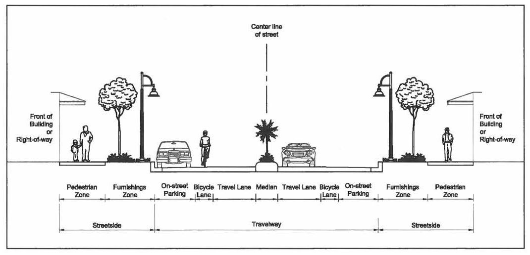
(Ord. No. 561, pt. I, § 4.19.7, 12-7-1999; Ord. No. 603, pt. I, § 4.19.7, 11-20-2001; Ord. No. 1019, pt. 1, 4-25-2017)
Sec. 4.848. - Traffic calming.
This section provides a procedure and guidelines for evaluating the need for traffic calming and traffic control devices in new developments and in neighborhoods affected by cut-through or high-speed traffic, and to guide the provision of such devices on County roadways. The intent of this section 4.848 is as follows: (1) to improve the livability of neighborhoods by reducing adverse traffic impacts on residential neighborhoods; (2) to promote safe and pleasant conditions for motorists, bicyclists, and pedestrians on neighborhood streets; (3) To provide meaningful citizen involvement in all phases of neighborhood traffic management; (4) to make efficient use of County resources by screening and prioritizing requests for traffic calming.
4.848.A.
Neighborhood traffic studies.
1.
Prior to implementing neighborhood traffic control devices or traffic calming measures on local streets or minor arterials, a neighborhood traffic study will be conducted to document the extent to which cut-through traffic or high-speed traffic is negatively impacting the area. The study may be initiated by the Board of County Commissioners, by residents or property owners in the affected neighborhood, or by County staff.
2.
The Engineering Department shall process requests for neighborhood traffic studies in accordance with the procedures of this section 4.848 and within the limits of available resources. To aid in screening and prioritizing requests for traffic studies, the County may request a demonstration of interest and support from neighborhood residents in the form of a petition signed by the majority of residents on the affected street(s). The petition must specify the area under consideration, the nature of the problem (speed, traffic volume, cut-through traffic) and the objectives being sought through the study (reduce speeds, lower volumes, eliminate through-traffic, etc.).
4.848.B.
Study procedures. When it is determined that a neighborhood traffic study should be conducted, appropriate data shall be collected upon which to base the decisions for implementation of traffic control devices and/or traffic calming measures. Considerations for data collection may include, but are not limited to:
1.
Traffic volumes.
2.
Speed.
3.
Safety.
4.
Intersection volumes.
5.
Extent of bicycle and pedestrian activity.
Upon completion, the study shall be submitted to the Board of County Commissioners.
4.848.C.
Public notification.
1.
When a neighborhood traffic study results in a determination by the Board of County Commissioners that traffic control devices or traffic calming measures may be warranted in the study area, a public notification process will be undertaken by the Engineering Department to inform property owners, residents, and business owners. The public notification process will seek input, address concerns, and discuss alternative solutions.
2.
A neighborhood workshop will be held and a neighborhood team may be formed to discuss problems, current conditions and to review the results of the traffic study. As recommended strategies are devised, follow-up meetings will be held with neighborhood residents as needed to reach consensus on a recommended approach.
3.
Final recommendations and a plan for carrying out the recommendations will be presented to the Board of County Commissioners for final action.
4.848.D.
Priority ranking for implementation. The Engineering Department may prioritize the implementation of traffic control devices and/or traffic calming measures in neighborhoods with a completed traffic study by establishing a priority ranking. Criteria, not listed in order of priority, to determine the priority for implementation may include:
1.
Traffic volumes.
2.
Traffic speeds.
3.
Number of crashes and injuries.
4.
Number of schools in proximity to the residential area.
5.
Number of pedestrian generators.
6.
Existence of sidewalks versus no sidewalks.
7.
Number of residents adversely affected.
4.848.E.
Test installation and evaluation. The County Engineer may require a test prior to permanent installation to assure that no unforeseen hazard is created by a traffic control device or traffic calming measure. If the evaluation indicates that the installation poses a hazard or has not met the objectives as set forth in the studies, then the County shall conduct additional neighborhood workshops to develop new alternatives.
4.848.F.
Traffic calming on thoroughfares.
1.
Traffic calming measures may be considered on selected segments of thoroughfares as they pass through areas with a higher intensity of community activity for the purpose of reducing travel speeds, increasing driver deference to pedestrian activity, and supporting walking and bicycling in these areas. Areas that may considered for such treatments include dense settlements along rural roadways, pedestrian-oriented shopping districts, and school crossing zones or others as deemed appropriate by the Board of County Commissioners.
2.
The need for traffic calming along a thoroughfare and appropriate treatments will be evaluated on a case-by-case basis by the Board of County Commissioners. Approaches to solving traffic problems on selected thoroughfare segments shall include, but not be limited to:
a.
Targeted enforcement for limited durations to slow traffic.
b.
Traffic control devices or entry treatments to permanently slow traffic.
c.
Education to raise awareness of the negative effects that speeding and excessive vehicle volumes have on pedestrian safety and the livability of affected areas.
3.
Treatments that may be appropriate for thoroughfares include entry or gateway treatments, raised medians, roundabouts, raised crosswalks, textured pavement, bulbouts (neckdowns) at intersections, or other treatments deemed appropriate by the County Engineer. In determining appropriate treatments for such areas, the following factors shall be considered:
a.
Traffic control devices shall not inappropriately restrict buses, emergency vehicles, and trucks from providing normal and necessary services to the affected area.
b.
Devices shall be well illuminated, visible and include appropriate markings and signage.
c.
Devices shall allow the traffic stream to maintain a consistent speed that is appropriate for the area.
d.
Devices or treatments shall not pose a hazard to bicycles or pedestrians, or impede people with disabilities.
e.
In no case shall any treatment be approved where it is found by the County Engineer to pose a potential safety hazard.
4.
Should a traffic calming study be desired on the state highway system, it shall be conducted in coordination with the Florida Department of Transportation and traffic calming measures shall be consistent with FDOT policy 000-625-060-a, Transportation Design for Livable Communities.
(Ord. No. 561, pt. I, § 4.19.8, 12-7-1999; Ord. No. 603, pt. I, § 4.19.8, 11-20-2001)
Sec. 4.849. - Scenic corridors.
Some roadways, due to their cultural, historic, or environmental amenities, may warrant special protection. Examples may include canopy roads or roadways with special scenic or historic qualities. The purpose of this section 4.849 is to provide for the designation and protection of such roadways or roadway segments in Martin County as historic or scenic corridors.
4.849.A.
County scenic corridors. The Board of County Commissioners may classify segments of County-maintained roadways as scenic corridors through roadway classification or the use of a corridor overlay zone. Such designation shall extend for a specified distance on either side of the roadway and allow for the adoption of special corridor overlay regulations to preserve, maintain, protect, or enhance the intrinsic character of the corridor. The adoption of a scenic corridor classification shall be by resolution of the Board of County Commissioners and shall include justification for the preservation, maintenance and protection of the facility.
4.849.B.
Scenic corridors on the State highway system. Any citizen, group of citizens, or local government wishing to designate a corridor on the State highway system as a scenic corridor may do so in accordance with the procedures of the Florida Scenic Highways Program (FSHP). All potential applicants are directed to reference the Florida Scenic Highways Program Manual, available through the local FDOT District Scenic Highways Coordinator.
(Ord. No. 561, pt. I, § 4.19.9, 12-7-1999; Ord. No. 603, pt. I, § 4.19.9, 11-20-2001)
Sec. 4.871.- In general.
4.871.A.
Purpose and intent. The purpose of this division 20 is to regulate the architectural features, form and arrangement of buildings, and site design of commercial, multifamily, and industrial developments. Massive or generic developments that do not contribute to, nor integrate with, the community in a positive manner can be detrimental to the community's image and sense of place. The goal of this division 20 is to create and maintain a strong community image by providing for architectural and site design standards which will enhance the visual appearance and function of development in Martin County.
4.871.B.
Applicability.
1.
Scope of regulations. The provisions of this division 20 shall apply to the following:
a.
Any nonresidential development conducted in the General Commercial, Limited Commercial, Commercial Office/Residential or Waterfront Commercial Future Land Use designations.
b.
Any residential multifamily development outside of the Community Redevelopment Agency areas.
c.
Except as provided for in subparagraph d., below, any development within an Industrial or Institutional Future Land Use designation, on lots abutting a minor or major arterial street or an expressway, or parkway, as defined in section 4.842, Roadway Design, of the Land Development Regulations, but specifically excluding buildings and structures that are set back more than 600 feet from such streets. Where any portion of a building lies within 600 feet of a minor or major arterial street, parkway, or an expressway, the entire building shall comply with the provisions of this division 20.
d.
Any development on the Witham Field airport property, excluding Fixed Base Operators and other uses directly related to aviation, but only until such time as the Board of County Commissioners has approved architectural design standards for Witham Field.
2.
Developments lawfully established prior to the effective date of this division 20 which do not conform to the requirements of this division 20 shall be required to comply upon occurrence of any of the following:
a.
Change of use. Any change from one permitted use category, as set forth in article 3, Zoning Districts, to another permitted use category, as set forth in article 3, Zoning Districts, or any change in the use of a lot that increases the demand for parking, creates additional impervious area, or increases the traffic generating capacity of the development.
b.
Substantial improvement. Any repair, reconstruction, extension or other improvement to a building or structure, including such work conducted over a period of time, the cost of which equals or exceeds 50 percent of the assessed value of such building or structure either before the improvement is commenced or, if the property has been damaged and is being restored, before the damage occurred. For purposes of this definition, assessed value shall mean the assessed value of a structure for the current year as determined by the Martin County Property Appraiser.
c.
Substantial renovation of building exterior. A substantial renovation of the building exterior is one in which the appearance of the building materially changes, such as by the installation or modification of façade features, but not painting or cleaning that is simply intended to restore the exterior to its previous condition. The replacement of roofing material, even if it changes the appearance of the building, shall not be considered a substantial renovation of the building exterior provided that the new roofing material is not otherwise prohibited by section 4.872.F.
d.
Discontinuation of use. A discontinuation of use occurs when the building or buildings on a lot have remained unoccupied for a period of 365 consecutive days. Evidence of discontinuation of a use may include, but is not limited to, failure to maintain required occupational or other licenses required by any government entity, the discontinuation of utility services, or removal of machinery or equipment normally associated with the use. This provision shall not apply to lots containing more than one principal use, such as a multitenant commercial center or industrial park. Where the requirements of this division 20 have been deemed to apply by virtue of this paragraph d., the applicant may appeal such decision to the County Administrator. The County Administrator may set aside the finding that a discontinuation of use has occurred upon a demonstration by the applicant that the costs of complying with the requirements of this division 20 will make the parcel unmarketable.
4.871.C.
Determination of compliance.
1.
No final site plan or building permit shall be approved unless the application demonstrates compliance with the requirements of this division 20.
2.
All elevation drawings used to demonstrate compliance with the requirements of this division 20 shall be prepared under the direction of an architect licensed pursuant to F.S. ch. 481.
(Ord. No. 617, pt. 1, § 4.20.1, 7-9-2002; Ord. No. 1205, pt. I, 9-26-2023)
Sec. 4.872. - Architectural design standards.
4.872.A.
Purpose and intent. All commercial, multifamily and industrial buildings and structures should be designed to maintain and enhance the attractiveness of the streetscape and the existing architectural design of the community. Buildings and structures should have architectural features and patterns that reflect human scale and proportions, reduce massing and recognize local character. Facades should be designed to reduce the mass or scale and uniform monolithic appearance of large unadorned walls, while providing visual interest that will be consistent with the community's identity and character through the use of detail and scale.
4.872.B.
Primary façades.
1.
Primary façade shall mean any building elevation that is:
a.
Visible from a public street, excluding alleys designed primarily for service vehicles; or
b.
Which provides a primary resident entrance or a customer entrance to a commercial or institutional use.
2.
Consistent architectural style. The primary façades of all buildings and structures shall be designed with consistent architectural style, detail and trim features.
3.
Minimum design elements. All primary façades on the ground floor shall have at least four of the enumerated design features.
a.
Commercial and multifamily buildings and structures:
i.
Awnings, located over windows or doors, in increments often feet or less in length.
ii.
Porches with decorative railings and/or stairs or covered stoops.
iii.
Overhanging eaves, extending out from the wall at least three feet, with a minimum eight-inch facia.
iv.
Pedestrian arcades, a minimum of eight feet in width and length.
v.
Raised parapet over a customer or primary residential entrance.
vi.
Peaked or mansard roof forms.
vii.
Decorative light fixtures.
viii.
One or more bay windows projecting at least twelve inches from the façade plane.
ix.
Artwork, such as, but not limited to, sculpture, mosaic, glass block, opaque art glass, or relief work.
x.
Architectural details other than those listed above, which are integrated into the building and overall design. Examples of architectural details include, but are not limited to, relief and reveal work, decorative columns, or pilasters. Architectural details do not include: paint changes; signage; construction joints, scoring, or projections less than three inches in height, width, or depth.
b.
Industrial buildings and structures:
i.
A defined customer entrance including a raised parapet or other prominent architectural feature that is unique to overall building design.
ii.
Artwork, including, but not limited to, sculpture, mosaic, glass block, opaque art glass, or relief work.
iii.
Decorative light fixtures.
iv.
Faux windows which are designed to the standard of true windows per subsection 4.872.B.6.
v.
Changes in color and material/texture at least every 50 lineal feet to break up massing.
vi.
Architectural details other than those listed above, which are integrated into the building and overall design. Examples of architectural details include, but are not limited to, relief and reveal work, decorative columns, or pilasters. Architectural details do not include: paint changes; signage; construction joints, scoring, or projections less than three inches in height, width, or depth.
4.
Limitations on blank wall areas. Blank wall areas shall not exceed ten feet in vertical direction and 20 feet in horizontal direction on any primary façade. Control and expansion joints shall be considered blank wall area unless used as a decorative pattern and a minimum of three inches in depth, width or height. Wall areas that are adorned using at least one of the design features set forth in paragraph 3., above, with the exception of decorative light fixtures, shall not be considered blank wall areas. Walls that are incorporated with a pedestrian arcade shall not be considered blank wall areas.
5.
Transparency/fenestration.
a.
Commercial and multifamily. At least 40 percent of the ground-level floor of primary façades of commercial buildings and street facing façades of multifamily buildings shall be occupied by windows or doorways with non-mirrored glass.
b.
Industrial. At least 20 percent of the ground-level floor of primary façades of commercial buildings and street facing façades of multifamily buildings shall be occupied by windows or doorways with non-mirrored glass.
c.
Street facing façades of the ground-level floor shall not include service bay entrances, overhead doors, or similar type of doors.
6.
Windows. Windows shall include visually prominent sills, shutters, stucco reliefs, awnings or other such forms of framing.
7.
Upper-story balconies located within 100 feet of a single-family dwelling shall be oriented or configured to prevent direct views into the single-family dwelling's rear yard.
4.872.C.
Secondary façades. Although the design standards of subsection 4.872.C., above, do not apply to secondary façades, the secondary façades of each building shall be consistent with the primary façade in terms of the exterior finish and colors used. For example, if the dominant exterior finish of the primary façade is stucco with beige paint and white trim, the secondary façades of the building shall include a similar stucco finish, beige paint and white trim.
4.872.D.
Building orientation and massing
1.
Multi-building development. Developments over five acres with one or more buildings totaling 50,000 or more square feet of floor area shall be configured to:
a.
Break up the site into a series of smaller "blocks" defined by on-site streets, vehicle accessways, pedestrian walkways, or other circulation routes;
b.
For commercial developments, frame the corner of an adjacent street intersection or entry point to the development with a building or civic open space;
c.
To the maximum extent possible, outparcels and their buildings shall be configured and located to define street edges and development entry points. Areas between outparcels shall be configured with small scale pedestrian amenities such as plazas, seating areas, pedestrian connections, and gathering spaces and not just serve as parking lots or vehicular accessways.
2.
Control of building mass.
a.
Commercial and industrial: On the ground floor of any primary façade, no continuous wall plane shall exceed 100 linear feet, nor shall any single wall plane constitute more than 60 percent of a building's total length. A wall plane shall be off-set a minimum of three feet from the adjacent wall plane and be a minimum of eight feet in length to be considered a separate wall plane. However, any portion of a wall plane having a pedestrian arcade extending a minimum of eight feet out from such wall, shall be considered a separate wall plane, provided that such arcade does not extend uninterrupted farther than 120 linear feet.
Separate Wall Planes
b.
Residential ground floor: On the ground floor of any primary façade, the wall plane shall be staggered by recesses and projections every two units or 50 feet whichever is less, a minimum of three feet deep and minimum five feet width in length in order to create variation.
3.
Horizontal form. For commercial and multi-family buildings which are three or four stories, the building shall have a horizontal separation between the base and upper floors as well as material differences that clearly distinguish a recognizable base and top.
4.872.E
Civic open space and public features.
1.
Major intersections. In addition to all other requirements of Section 4.872.B., developments located at an intersection of two or more arterial, parkway, or collector streets shall provide a prominent architectural or site feature including, but not limited to, a monument, sculpture, wall or ground mounted art feature, or mural to emphasize their location as gateways and transition points within the community.
2.
Artwork for large developments. In addition to all other requirements of section 4.872.B., large developments which are over 100,000 square feet or 100 units shall provide a public display of artwork, including, but not limited to, sculpture, mural, or tile mosaic. The artwork may be placed on any outdoor portion of the site which is available for public viewing. Developers providing artwork in accordance with this paragraph are encouraged to coordinate with the Public Art Advisory Board.
3.
Civic open space.
a.
Developments in commercial or industrial future land uses that are ten acres or greater shall design a civic open space area that may contain a display of public art, shaded refuge for pedestrians, or a space otherwise designed to be integrated into the surrounding community and is open to the general public. The civic open space shall be privately owned and maintained.
b.
The civic open space shall not contain vehicular parking or access ways, mechanical equipment, dumpsters, service areas, or be directly adjacent to loading areas or trash pickup.
c.
The minimum size of one area of required civic open space shall be 1,000 square feet.
d.
The space shall contain three of the following features or elements:
i.
Pedestrian level lighting.
ii.
Benches or seating areas that are shaded.
iii.
Shall be designed to incorporate existing protected trees when practicable.
iv.
Shall provide vegetative or structural shading.
v.
Artwork as described in section 4.872.E.2.
vi.
Fountain or water feature.
vii.
Features other than those listed above, which are integrated into the overall design.
4.872.F.
Parking. The parking requirements shall reduce the visual impact of parking uses, avoid conflicts between vehicles and pedestrians, and enhance pedestrian activity throughout the County.
1.
Parking structures: All new parking structures shall comply with the following standards:
a.
A minimum of 60 percent of any primary façade of a parking structure shall have at least one of the following:
i.
Decorative metal grill-work or similar detailing which provides texture and partially covers the parking structure opening(s); or
ii.
Vertical trellises extending a minimum of 20 feet in height or to the top of the parking structure, whichever is less, covering at least 50 percent of the primary façade).
iii.
Wherever possible, circulation ramps shall be internalized to avoid visibility of the ramps from the street or public areas.
b.
When a parking structure is an accessory structure within a larger development, the façades of such parking structure shall be consistent with the primary façades of other buildings within the development in terms of the exterior finish and colors used. For example, if the dominant exterior finish of the primary façades of the other buildings is stucco with beige paint and white trim, the façades of the parking structure shall include a similar stucco finish, beige paint and white trim.
2.
Surface parking lots. All new surface parking lots shall be primarily at the rear or side of the building. In the case of a corner lot, parking shall be located along the rear or interior side property line when possible. One drive aisle with parking on either side may be included between the building and the street.
3.
Whenever feasible, required vehicular cross access shall be provided at the rear of the development.
4.
Drive-through uses. Drive-through uses shall be designed so that the drive-through window faces internally to the site in order for the primary façade to present itself as a storefront.
4.872.G.
Roofs.
1.
Generally. Variations in roof lines shall be used to add interest to and reduce the massing of buildings (see figure 4.20.2 for examples). Roof features should be in scale with building mass and should complement the character of adjoining or adjacent buildings and neighborhoods wherever possible. Roofing material should be constructed of durable high quality materials in order to enhance the appearance and attractiveness of the community.
2.
Flat roofs shall:
a.
Have a parapet of at least 12 inches in height along any primary façade and shall have at least two changes in height of a minimum of two feet along each primary façade.
b.
Provide a three-dimensional cornice treatment along the entire length of the primary façade. The cornice treatments shall be a minimum of 12 inches in height and have a minimum of three reliefs.
3.
Peaked roofs shall:
a.
Provide at least two roof slope planes per primary façade, where the primary façade is less than 40 feet in horizontal length, or at least three roof slope planes where the primary façade is 40 feet or longer in horizontal length.
b.
Not exceed the average height of the supporting walls.
c.
Have an average slope greater than or equal to one foot of vertical rise for every three feet of horizontal run and less than or equal to an average slope of one foot of vertical rise for every one foot of horizontal run.
4.
Asphalt shingles shall be prohibited, except for 320 pound, 30-year architectural grade or better shingles which otherwise meet all requirements of the Florida Building Code.
Architectural Design Standards
4.872.H.
Customer and resident entrances.
1.
All detached buildings shall have clearly defined, highly visible customer entryways (see figure 4.20.2 for examples). Entryway design elements and variations should give protection from the sun and adverse weather conditions. These elements shall be integrated into a comprehensive design style for the commercial development.
4.872.I.
Materials and color.
1.
The following shall not be used as a wall covering on a primary façade:
a.
Reflective or back-lit panels made of plastic, vinyl, fiberglass or similar materials.
b.
Unfinished concrete block (i.e., without stucco finish), specifically excepting split-faced block.
c.
Corrugated or other non-insulated metal panels where such material will cover more than 50 percent of the primary façade area.
2.
The following shall not be used on any primary façade:
a.
Black or florescent colors.
b.
Back-lit awnings.
c.
Unshielded florescent lights applied so as to accent the architectural features of a building or structure.
(Ord. No. 617, pt. 1, § 4.20.2, 7-9-2002; Ord. No. 930, pt. 3, 6-11-2013; Ord. No. 1205, pt. I, 9-26-2023)
Sec. 4.873. - Site design standards.
4.873.A.
Bicycle and pedestrian access.
1.
All commercial and multifamily development shall be designed to provide safe opportunities for alternative modes of transportation by connecting with existing and future pedestrian and bicycle ways and to provide safe passage from public rights-of-way to the building(s) within the development, between adjoining developments, and between alternative modes of transportation. Wherever possible, pedestrian ways should be constructed of paver blocks, stamped or colored concrete or similar materials that clearly distinguish them from vehicular use areas and promote traffic calming.
2.
Structural or vegetative shading shall be provided along pedestrian ways at intervals of no greater than 50 feet. Trees shall be a minimum of 16 feet in height. Along public sidewalks, including along the perimeter of the site, shade trees shall be installed at the back of sidewalk. Appropriate root barrier systems shall be installed when applicable.
4.873.B.
Bicycle and pedestrian amenities. Bicycle and pedestrian amenities shall be provided as determined by the square footage of buildings or number of units on the site as indicated in the table below. These amenities may be incorporated into a pedestrian arcade or similar feature that otherwise meets the requirements of this division 20. Bicycle racks shall be provided within 50 feet of any customer entrance or main entrance to a multifamily building. The design of all amenities shall be of durable, long-lasting materials. Seating areas shall provide a minimum of six linear feet of seating area and shall have either structural or vegetative shading. Required bike racks shall be the inverted "U" type or similar design and shall be designed to store a minimum of six bicycles each. Amenities including benches that are provided within civic open space shall count towards this requirement.
a.
Commercial development.
b.
Multifamily development. 1 bike rack and 1 bench or equivalent seating area for every 25 units.
4.873.C.
Lighting. A photometric plan shall be provided for all projects and include light pole and fixture detail. Lighting fixtures shall be a maximum of 20 feet in height within a parking lot and shall be a maximum of 15 feet in height within nonvehicular pedestrian areas. Pedestrian sidewalks internal to the site and customer/residential entrances shall be lit with a minimum of 0.6 footcandle as measured one foot above the sidewalk. Light fixtures shall be shielded from adjacent properties and natural areas including preserves. Public sidewalks shall be lit by the County approved standard pedestrian scale lighting, with light poles at the back of sidewalk in private property whenever feasible. Light poles shall be placed within the rights-of-way at the discretion of the County Engineer: any light poles in the County ROW shall be subject to a right-of-way use permit and a maintenance agreement.
4.873.D.
Screening of mechanical equipment.
1.
The required screening of roof-mounted mechanical equipment, including air conditioning units and duct work shall be as follows: when located on a flat roof, roof shall provide full parapet coverage a minimum of four feet in height, or to the highest point of the mechanical equipment, whichever is lower.
2.
Ground mounted mechanical equipment, including air conditioning units, dumpster enclosures, generators, shall be located in the rear or side of a development site and not between the building and a street.
3.
All mechanical equipment shall comply with the provisions of article XI, Noise, of chapter 12, Environmental Control, of the Code of Laws and Ordinances.
4.873.E.
Public transit stops. Any development providing more than 200 parking spaces and located adjacent to any public street shall designate a minimum 200 square foot area on the site plan as a future public transit stop easement area. For developments adjacent to an existing route or route which will be implemented within two years, the developer shall construct a bus shelter with lighting, a bicycle rack and a trash can. The future public transit stop or bus shelter shall be located immediately adjacent to the right-of-way line of the street. A future transit stop easement area may be landscaped or used for overflow parking but shall not be used to comply with the minimum landscape, buffer, open space or similar requirements. The landowner shall execute an easement authorizing the County to construct and maintain a transit stop at that location.
(Ord. No. 617, pt. 1, § 4.20.3, 7-9-2002; Ord. No. 930, pt. 3, 6-11-2013; Ord. No. 1205, pt. I, 9-26-2023)
Sec. 4.874. - Alternative compliance.
4.874.A.
Generally. The decision-maker for a particular development application, as determined by article 10, Development Review Procedures, may approve a design plan that varies from the standards set forth in this division 20 in order to accommodate unique site features or to provide a more innovative design, provided that the decision-maker finds that the alternative plan generally fulfills the purpose and intent as set forth in section 4.871 or complies to the maximum extent practicable considering the configuration of the development that existed prior to the effective date of this division 20.
(Ord. No. 617, pt. 1, § 4.20.4, 7-9-2002; Ord. No. 930, pt. 3, 6-11-2013)
Sec. 4.911.- General provisions.
4.911.A.
Applicability.
1.
Any person or entity proposing a subdivision of real property in unincorporated Martin County shall first obtain plat approval in accordance with the requirements of Division 21 unless such sale or conveyance is specifically exempted.
2.
The provisions of Division 21 shall be in addition to the requirements of Chapter 177, F.S.
3.
No subdivision plat shall be approved for recording until the requirements of Division 21 and Chapter 177, F.S., have been met.
4.911.B.
Subdivision defined. As used in this Division 21, the term "subdivision" shall mean: the division or platting of land into three or more lots, tracts, or parcels for the purpose of sale or lease; the creation of new streets and alleys, whether public or private; changes in an existing street or alley, whether public or private; or additions and divisions of any parcel divided or platted after September 27, 1977.
4.911.C.
Exemptions. The term subdivision shall not be applied to any of the following:
1.
Lot splits: The division of a lot of record that so existed on September 27, 1977, into two lots (parcels) provided that each lot (parcel) so created shall comply with all other Land Development Regulations.
2.
Judicial exception: Any division or redivision of a parcel of land made pursuant to an order of a court of competent jurisdiction.
3.
Boundary settlement exceptions: Any conveyance between adjacent land owners if:
a.
The purpose of the conveyance is to adjust or settle the common boundary line between said adjacent landowners; and
b.
Such purpose is stated in the deed of conveyance or is stated in a separate instrument recorded in the public records of Martin County.
4.
Conveyance to government: Any division or redivision of a parcel of land, the sole purpose of which is to convey a part thereof to any Federal, state or local governmental entity or agency for a bona fide public purpose, provided that such conveyance is accepted by such governmental entity or agency by an instrument recorded in the public records of Martin County.
5.
Creation of equal or larger building parcels in recorded subdivisions: Any division or redivision of lots in a previously platted subdivision, the sole purpose of which division or redivision is to create new building parcels which are at least equal in size to the existing lot or lots (for example, and not by way of limitation, three adjoining platted 50-foot-wide lots might be replaced by two 75-foot-wide parcels or by one 70-foot-wide parcel and one 80-foot-wide parcel).
6.
Exception for corrective instruments: Any conveyance from the grantor in a deed recorded prior to September 27, 1977, to the same grantee in said deed, if the purpose of such conveyance is solely to correct defects in such deed recorded prior to September 27, 1977.
7.
Agricultural exception: Any division or redivision of a parcel of land for bona fide agricultural use, provided no parcel of less than 20 acres is created, no public street is created, no change to an existing public street is made, and a declaration is contained in each deed of conveyance that the Board of County Commissioners of Martin County shall have no responsibility, duty, or liability with regard to any private street that may be created.
Residential development in the areas designated Agricultural on the Future Land Use Map of the Growth Management Plan are restricted to one single-family residence per gross 20-acre tract. In order to further avoid activities that adversely impact agricultural productivity on agricultural lands as designated on the Future Land Use Map, no development shall be permitted which divides landholdings into lots, parcels or other units of less than 20 gross acres. Acreage may be split for bona fide agricultural uses into parcels no smaller than 20 gross acres. Residential subdivisions must be platted and must provide for all necessary services. Residential subdivisions at a density or intensity of greater than one single-family dwelling unit per 20 gross acre lot shall not be allowed.
4.911.D.
Plat procedures. Applications for plats shall be reviewed and processed pursuant to Article 10, Development Review Procedures.
4.911.E.
Issuance of building permits. Compliance with this Division 21 shall be a condition precedent to the issuance of a building permit for any parcel within unincorporated Martin County, unless an expedited approval of residential building permits is granted pursuant to § 177.073 F.S.
(Ord. No. 616, pt. 1, § 4.21.1, 6-24-2002; Ord. No. 1264, pt. 1, 8-26-2025)
Sec. 4.912. - Plat requirements.
4.912.A.
Purpose and intent. The purpose of Division 21 is to establish minimum requirements for all plats within the unincorporated area of Martin County. At a minimum, all plats must meet the requirements of Chapter 177, F.S. and Chapter 5J-17 of the Florida Administrative Code. If a provision within Division 21 conflicts with a provision of state law, the stricter provision shall apply. All references within Division 21 to particular governmental agency, officer, or provision of law are to be construed as including any agency, officer, or provision of law, however designated, which succeeds the current agency, officer, or provision of law.
4.912.B.
Definitions. For purposes of Division 21, the following words, terms, and phrases shall have the meaning set forth below:
Benchmark means a relatively permanent material object, bearing a marked point whose elevation above or below an adopted datum is known.
Computer aided drafting (CAD) means computer software and hardware commonly used in the preparation of maps, drawings, plats and other similar documents.
Digital exchange file (DXF) means a standard format for the electronic transfer of CAD information.
Drawing (DWG) means a specific computer file containing a complete drawing in its native format.
Geodetic control station means a relatively permanent fixed point on the earth that has been established and adjusted by geodetic methods and in which the size and shape of the earth (geoid) have been considered in position computations.
Safe upland line means the intersection of the shore with a contour line established at an elevation known to be above the MHW elevation.
Utility means any public or private utility system, such as, but not limited to, stormwater management, wastewater collection, potable and reclaimed water distribution, electric transmission or distribution, gas transmission or distribution, and telecommunication including, but not limited to, video, cable television, internet, and broadband, whether underground or overhead.
4.912.C.
Plat standards. The following standards shall be applicable to all plats within the unincorporated area of Martin County:
1.
The plat must be prepared under the responsible direction and supervision of a professional surveyor and mapper.
2.
Each plat must be prepared on 24-inch by 36-inch sheets of material in conformity with Chapter 177, F.S. and must contain a border that delineates a three-inch margin on the left side of the plat for binding purposes. The remaining three sides must have a one-inch margin.
3.
All text and graphics on the plat must be clearly and legibly drawn; all text and numerical data must be a minimum of one-tenth inch in height, including lower case letters; the graphics must be to a scale of not smaller than one-inch equals 100 feet, unless the County Surveyor and Mapper issues prior written approval of a smaller scale.
4.
The first page of the plat must contain a vicinity sketch illustrating the subdivision location in reference to major roadways and adjoining properties. Each sheet must be numbered in the lower right-hand corner as "Sheet ___ of ___".
5.
A five-inch line for the subdivision parcel control number must be provided in the upper right-hand corner of the first page of the plat.
6.
Plats with more than two map sheets must provide a key map on each map sheet detailing the relationship of each sheet to the total plat. Clearly labeled matchlines are required on all map sheets and each map sheet must include the Surveyor's notes and a legend.
7.
Plot curve data may be tabulated subject to the following conditions:
a.
External plat boundary or roadway centerline curve data may not be tabulated.
b.
When lot line curve data are tabulated, a minimum of the arc length and the curve designation number or letter must be shown on the actual curve.
c.
Curve tables reflecting the tabulated data must appear on the map sheet on which the curves appear.
8.
Tangent line data may not be tabulated unless the County Surveyor and Mapper issues prior written approval of such tabulation; plat scale will not be considered as a factor. If approved, line tables reflecting the tabulated data must appear on the map sheet on which the lines appear.
9.
Plats or portions of plats that lie within a Special Flood Hazard Area (flood zones A, AE, AH, AO, AR, A99, V and VE) as shown on the applicable FEMA Flood Insurance Rate Map (FIRM), shall have two permanent benchmarks established on site in an accessible location and shall consist of a brass or aluminum disc set in concrete or other permanent material, stamped with benchmark identification number, elevation, and datum. Each of the two permanent benchmarks shall be shown and described on the plat in its current location together with its identification number, elevation, and vertical datum, as approved by the County. The attribute data for each benchmark shall be submitted on a form approved by the County to the County Surveyor and Mapper for inclusion in the Martin County benchmark inventory.
10.
Plats bordering on tidally affected navigable waters where the location of the mean high water line (MHWL) is used to determine building or other setbacks required for development must comply fully with the requirements of Chapter 177, F.S. regarding establishment of a local tidal datum and the determination of the MHWL. The elevation and date of determination of the MHWL, as approved by the Florida Department of Environmental Protection (FDEP) Bureau of Surveying and Mapping, must appear on the plat. A copy of the MHWL survey approved by the FDEP must be submitted to the County Surveyor and Mapper prior to plat recordation.
11.
Plats bordering on tidally affected navigable waters where the location of the MHWL is not used to determine building or other setbacks required for development are exempt from compliance with the provisions of Chapter 177, F.S. regarding the determination of the MHWL. In case of such an exemption, a safe upland line that is physically established on the site at a location and an elevation approved by the FDEP or the County Surveyor and Mapper shall be used to determine building or other setbacks required for development. The location and courses of the safe upland line must be shown on boundary survey of the subject property in conformance with the professional standards provided in Chapter 5J-17, Florida Administrative Code and such survey must be submitted at the time when the plat is initially submitted for review by the County. The safe upland line:
a.
May be used to determine the total plat acreage only and may not constitute a boundary line; and
b.
Must be shown on the plat with its location and courses; and
c.
Must be established with Permanent Reference Monuments set in accordance with this Division 21; and
d.
May be represented by a top of bank if approved in writing by the County Surveyor and Mapper.
When a safe upland line is used, the plat must contain a note indicating that the plat boundary is the MHWL of the water body, as approximated by the safe upland line.
12.
Each plat submitted must be accompanied by a boundary survey which is signed and sealed by the professional surveyor and mapper whose signature and seal appears on the plat. The date of the field survey must be less than 180 days prior to the date of initial submittal of the plat. A specific purpose survey may be submitted in the circumstance in which a safe upland line is used to approximate the boundary adjacent to a navigable water body.
13.
A minimum of two boundary monuments shall be tied to the nearest approved geodetic control station or to other control points established by Global Navigation Satellite System (GNSS) which meet or exceed Third Order Class I Accuracy Standards according to current publication of the Federal Geodetic Control Committee (FGCC) procedures. The bearing and distance from each boundary monument to the control station or point and the state plane coordinates for each boundary monument shall be shown on the plat.
14.
Prior to plat recordation, a CAD file, preferably in DWG format or, alternatively, in DXF format, or in a digital format that is acceptable to the County Surveyor and Mapper, shall be provided to the County showing all final plat survey data and line annotations, including, but not limited to, lots, roadways, easements, preserve areas, buffer areas, maintenance areas, and other specific information which appears on the map portion of the plat. The purpose of such a computer file is to provide direct, efficient updates to the County's Geographic Information Systems (GIS) parcel map coverage. The coordinate positions within this file are to be rotated and translated to state plane coordinates in the North American Datum of 1983/adjustment of 1990 (NAD 83/90) Florida East Zone, or currently approved datum, based upon the required tie-in to geodetic control. The conversion of ground distance to grid distance within the digital file is not required.
15.
A plat checklist shall be submitted with all applications for plat approval. The checklist shall be submitted on a form approved by the County and shall be completed and signed by the professional surveyor and mapper responsible for the preparation of the plat. Plat review by County shall not commence until the signed plat checklist has been submitted.
16.
Certified corner records must be filed in accordance with Chapter 177, F.S. for public land corners identification, recovered, reestablished, remonumented, restored or used as controls in the preparation of a plat. The original certified corner record must be submitted to the FDEP Bureau of Surveying and Mapping, and a copy thereof must be provided to the County Surveyor and Mapper. Each certified corner record must indicate the state plane coordinates value of the corner. Upon approval of the certified corner record by FDEP, the certified number of the public land corner shall be shown on the plat prior to recordation of the plat.
17.
The legal description on the plat must contain the total acreage of the platted land and such acreage must be consistent with the title certification.
18.
The title of the plat (i.e., the name of the subdivision, which is the subject of the plat) must be set forth on each page of the plat and must contain text of uniform size and type. If the plat encompasses a Planned Unit Development (PUD), then the title on the plat shall contain the abbreviation "PUD".
19.
The following shall be submitted with the plat application:
a.
Acceptable 100 percent security, if the subdivider has not elected to construct the required improvements; or
b.
In the event that the required improvements have been made before a plat is recorded, a certificate from the subdivider's engineer shall be submitted indicating that all the required improvements have been constructed in accordance with the approved plans and specifications, and an affidavit shall be submitted by the subdivider indicating that all bills for improvements have been paid.
4.912.D.
Required textual exhibits. The required textual components for plats shall be established by resolution of the Board of County Commissioners and may be amended from time to time to assure compliance with Chapter 177, F.S. and Division 21.
4.912.E.
Monuments. The following standards shall be applicable to the placement of monuments.
1.
Permanent Reference Monuments (PRMs or P.R.M.s) must be set in the field and shown on the plat in accordance with Chapter 177, F.S. Unless otherwise approved by the County Surveyor and Mapper, the monuments shall be set in four inches by four inches concrete, 24 inches long. Their position in reference to each other shall be identified by distances and angles. The top of the monuments shall be set less than four inches above finished grade. The position of said monuments shall be indicated on the plat and shall be marked "Permanent Reference Monument" or with the initials "PRM".
2.
Prior to final approval of a plat for recordation, the County Surveyor and Mapper or designee shall physically inspect the PRMs to verify placement. The professional surveyor and mapper or designee shall be present, if requested.
3.
PRMs, PCPs, and lot corners must be in place prior to final improvement inspection of subdivision improvements by the County. The County Surveyor and Mapper or designee must make a field inspection to verify existence and placement of PRMs, PCPs, and lot corners upon completion of subdivision improvements. The subdivider shall be responsible for ensuring that PRMs, PCPs, and lot corners are in place after construction and that such PRMs, PCPs, and lot corners are marked clearly for inspection. The professional surveyor and mapper or designee shall be present, if requested, at the PRM, PCP, and lot corner inspection to identify the location of the PRMs, PCPs, and lot corners. In circumstances involving subdivisions where security is required, the cost of setting or resetting all PRMs, PCPs, and lot corners must be included separately as a line item in the engineer's opinion of probable cost. The cost of setting these control points must be determined by a professional surveyor and mapper. The subdivider is responsible for the ensuring that a professional surveyor and mapper has properly replaced any destroyed, damaged, or otherwise altered PRMs, PCPs, and lot corners. PRMs, PCPs, and lot corners that are replaced must meet all the requirements of Chapter 177, F.S. and shall be stamped "PRM Re-set" and bear the registration number of the individual replacing the original monument.
(Ord. No. 616, pt. 1, § 4.21.2, 6-24-2002; Ord. No. 1264, pt. 1, 8-26-2025)
Sec. 4.913. - Required improvements and infrastructure.
4.913.A.
Improvements and infrastructure required prior to plat recording. Before a plat shall be recorded in the public records all improvements and infrastructure required by the Land Development Regulations, Code of Laws and Ordinances and state law, including, but not limited to, roads, sidewalks, utilities, traffic control devices, permanent reference monuments, permanent control points, lot and tract corners, and landscaping, shall have been constructed and approved by the County Engineer.
4.913.B.
Authority of county inspectors. The County Engineer or designee is authorized to inspect all construction related to required subdivision improvements and infrastructure. The County Engineer or designee shall not be authorized to revoke, alter, or waive any requirements of the approved plans and specifications, but shall be authorized to call to the attention of the subdivider any failure of work or materials to conform to the approved plans and specifications. The County Engineer or designee shall have the authority to reject materials or suspend work that is not consistent with the approved plans and specifications.
The County Engineer or designee shall in no case act as foreman or perform any duties for the subdivider, nor interfere with the management of the work, and any advice that the County Engineer or designee may give to the subdivider shall in no way be construed as binding to the County or release the subdivider from carrying out the intent of the plans and specifications.
When the County Engineer or designee determines that construction activities must cease, such determination shall be documented in writing to the subdivider.
The neglect of the County Engineer to order the rejection of any material or work at the time it is proposed for use shall not act as a waiver of the right to subsequently reject such material or work in the event of discovery that such material or work is not consistent with approved plans and specifications.
4.913.C.
Testing. The expense for the testing of materials and construction related to required subdivision improvements and infrastructure shall be the responsibility of the subdivider.
All required tests of materials shall be performed by an authorized laboratory. The samples for such tests shall be taken under supervision of, or as directed by, either the subdivider's engineer or the authorized laboratory personnel.
Tests shall be made for compaction of roadways, sidewalks, grading, where applicable, subbase and base. Compression test of concrete cylinders shall be made on all phases of concrete work. All density tests of compacted areas shall be made pursuant to the Modified Proctor Test (AASHTO 180) in accordance with the method specified in each case by the Department of Transportation standard specifications. The required density shall be 95 percent of the maximum density as determined by AASHTO 180. The test results shall show that the minimum Limerock Bearing Ratio set forth in the accepted plans and specifications is met.
1.
Tests for the stability of the existing subsoil shall be taken at intervals of not more than 200 feet, or less, where necessary.
2.
Tests for the density of the subgrade shall be taken at intervals of 200 feet, or less, where necessary.
3.
Tests for the density of the base shall be made at intervals of 500 feet, or less where necessary.
4.913.D.
Completion. Upon completion of all required improvements, the subdivider's engineer shall submit a certification to the County Engineer that all work was constructed according to the approved plans and specifications. The subdivider's engineer shall submit with the certification a construction report including the dates, locations, and results of all tests and the person(s) who conducted the tests and signed and sealed record drawing/as-built survey.
4.913.E.
Provision of security in lieu of completion. In lieu of the completion of the required improvements and infrastructure prior to plat recordation, security may be posted in a form acceptable to the Board of County Commissioners to ensure such completion. The terms and conditions for the required improvements and the forms necessary to ensure completion shall be established by the County Attorney, upon review and concurrence of the County Engineer, and may be amended from time to time to assure compliance with Chapter 177, F.S. and Division 21.
Security shall be posted in the amount of 100 percent of the engineer's opinion of probable costs of improvements, which shall be prepared by a professional engineer registered in the State of Florida and accepted by the County Engineer. Partial release (up to 90 percent of the posted security) of the security may be authorized by the County Engineer as work is accepted. Upon completion and acceptance by the County Engineer of the required improvements, 90 percent of the posted security shall be released by the BCC County Engineer. The remaining ten percent shall be held for an additional 12 months as warranty security; if, after 12 months, all improvements are free of defects due to faulty field engineering, workmanship or materials, the ten percent warranty security will be released by the County Engineer. In lieu of the ten percent warranty security, an acceptable ten percent maintenance security may be posted for a period of 12 months.
(Ord. No. 616, pt. 1, § 4.21.3, 6-24-2002; Ord. No. 1264, pt. 1, 8-26-2025)
Sec. 4.914. - Vacation of plats.
4.914.A.
Authorization and applicability. The owner of any land that has been platted may request that the Board of County Commissioners vacate said plat either in whole in part. Such requests shall be reviewed and processed pursuant to the requirements of Chapter 177, F.S. this Division 21, and Article 10, Development Review Procedures.
4.912.B.
Action may be initiated by Board of County Commissioners. The Board of County Commissioners may initiate the vacation of a recorded plat subject to compliance with Chapter 177, F.S., this Division 21, and Article 10.
(Ord. No. 616, pt. 1, § 4.21.4, 6-24-2002; Ord. No. 1264, pt. 1, 8-26-2025)
Sec. 4.181. - Definitions.
Applicant means any individual, partnership, corporation, owner, developer, subdivider, or builder who requests an extension of water service for any property or properties, area, development or subdivision.
Capital facility charge (CFC) is a charge made for capital cost of water supply, treatment and transmission facilities which shall consist of construction and associated costs. Construction costs include the cost of installation of plants, pipelines, special fittings, valves, pumps and appurtenances and the cost of acquiring permanent and construction rights-of-way. Associated costs include engineering, legal, and fiscal services, contingencies and administrative costs. The capital facility charge does not include the cost of constructing a distribution system.
Connection charge shall consist of a meter charge and a lateral charge (if required). The meter charge shall include the cost of the meter and the meter box for meter sizes up to and including two inches, and the meter only for meters larger than two inches. The connection charge does not include unusual extensions of a service lateral.
Distribution line charge is a charge made for the capital cost of constructing distribution lines to a local service area.
Distribution lines is the network of lines receiving water from the transmission main for the purpose of distributing water to the local service areas and to the service lateral.
Equivalent residential connection (ERC) shall be a factor used to convert a given average daily flow (ADF) to the equivalent number of units required for connection to the County system. For residential purposes other than affordable housing, all single-family units, including but not limited to each single-family unit contained in a duplex, triplex or multifamily structure, shall constitute one equivalent residential connection. For nonresidential use and for rental multifamily residential uses which qualify as affordable housing for very low or low income households under the Martin County Comprehensive Plan, and which use a common meter, one equivalent residential connection shall equal 250 gallons per day.
Fire sprinkler service charge is a monthly charge for providing water service to a fire sprinkler system.
Initial construction is the period of time beginning when the County issues a notice to proceed with construction of the water treatment plant and ending on a date agreed on by both the County and the Farmers Home Administration.
Installation cost or construction cost shall mean the cost of materials, labor, engineering supervision, equipment, and all other incidental costs necessary for complete water service extension.
Lateral charge is the charge due for installing the service lateral.
Nonresidential unit shall consist of a nonresidential building or structure, or portions of residential buildings dedicated to nonresidential use, connected to the water system of the County, including but not limited to hotels, motels and boardinghouses, wholesale and retail businesses, professional offices, warehouses and, without limitation, all other structures of a commercial nature, public and quasipublic buildings and structures, and those portions of nonresidential areas within multiple-family residences.
Residential unit shall consist of a residential living unit or structure directly or indirectly connected to the water system of the County, including but not limited to single-family dwellings, and each separate living unit of duplexes, apartment houses, townhouses, condominiums and cooperative apartments.
Service availability is the reservation of water service in the County system. Service availability may be provided by the County to the owner if available.
Service availability charge (SAC) is the periodic charge which shall be paid at each regularly scheduled monthly billing period following the County's agreement to reserve service availability in its system.
Service charge is the periodic charge for water service which shall be paid at each regularly scheduled monthly billing period after connection to the system.
Service lateral is the line from the main to the meter.
Special service charge is a charge due for additional or unusual services to customer not otherwise defined in this subdivision.
Transmission line is the network of mains receiving water from the treatment supply point for the purpose of transporting water to the distribution lines.
Water service extension or main extension or water line extension shall mean all necessary water mains and lines, valves, fittings, hydrants and appurtenances.
(Code 1974, § 31-42; Ord. No. 178, pt. 1, 6-9-1981; Ord. No. 235, pt. 1, 4-24-1984; Ord. No. 291, pt. 1, 2-11-1986; Ord. No. 310, pt. 1, 9-23-1986; Ord. No. 386, pt. 1(A), 9-25-1990)
Cross reference— Rules of interpretation, § 1.5.
Sec. 4.182. - General standards.
The following provisions apply only to the Martin County Waterworks system:
4.182.A. Public easement required. No facilities will be installed under the provisions outlined herein and accepted by the County for maintenance unless it is in a dedicated public right-of-way or dedicated public easement. Said easement shall be accessible and traversable by standard maintenance equipment. No natural or manmade obstruction shall be planted, built or otherwise created within the limits of this easement or right-of-way without written permission from the Utilities Director.
4.182.B. Ownership. All utility facilities and appurtenances up to and including the meter and meter box, when constructed and accepted by the County, shall become and remain the property of the County and the consumer shall so agree and does so agree in making an application for utility service. No person shall, by payment of any charges provided herein, or by causing any construction of facilities accepted by the County, acquire any interest or right in any of these facilities, or any portion thereof, other than the privilege of having their property connected thereto for utility services in accordance with these rules, procedures and regulations.
4.182.C. Fire protection. Hydrants shall be installed on mains constructed in the Martin County waterworks system at such locations as deemed appropriate by the Fire Marshal and the National Fire Code. All such facilities must be located within public rights-of-way or easements in accordance with section 4.182.A. Private fire protection system connections shall be paid for by those benefitted.
4.182.D. Extent of County maintenance.
1.
All facilities that have been accepted by the County shall become the property of the County and will be operated and maintained by the County. No person shall do any work or be reimbursed for any work, or in connection with any work, on the system unless written authorization from the County was received prior to the work being accomplished.
2.
The County shall make a reasonable effort to inspect and keep its facilities in good repair, but assumes no liability for any damage caused by the system that is beyond the control of normal maintenance or due to situations not previously reported to the department. This shall include damage due to breaking of pipes, poor quality of water caused by unauthorized or illegal entry of foreign material into the system, faulty operation of fire protection facilities or damage not caused by the negligence of the County.
4.182.E. Water quality. The County shall use its best efforts to meet or exceed all of the Federal and Florida minimum safe drinking water standards and to produce water suitable for domestic use.
4.182.F. Location of water service line [in relation] to septic systems. Pursuant to F.A.C. 10D-6.46, as may be amended, no potable water lines shall be connected to the County waterworks system unless the water lines are located at least ten feet from the drain trenches, absorption beds or other septic system. Water lines may only be located within ten feet from the nearest portion of the septic system if the lines are encased in at least six inches of concrete or lines are placed within a sleeve of similar material pipe to a distance of at least ten feet from the nearest portion of the drainfield. F.A.C. ch. 10D-9, as amended, shall be used to determine water distribution pipe material and installation requirements.
(Code 1974, § 31-42.1; Ord. No. 235, pt. 1, 4-24-1984; Ord. No. 310, pt. 1, 9-23-1986)
Sec. 4.183. - Right to refuse service.
No payment of any costs, submitting of any petition or any other act to receive utility service shall guarantee such service. The County shall have the right, at all times, to refuse to provide service if water is not available.
(Code 1974, § 31-43; Ord. No. 178, pt. 1, 6-9-1981; Ord. No. 235, pt. 1, 4-24-1984; Ord. No. 310, pt. 1, 9-23-1986)
Sec. 4.184. - Monthly charge or rate for water service; connection charge; service availability charge; capital facility charge; distribution line charge; service charges.
4.184.A.
Any user of the services of the waterworks system shall pay a monthly charge or rate for water service as provided for by resolution.
4.184.B.
There shall be a connection charge, a capital facility charge, a distribution line charge, a service availability charge, a monthly fire sprinkler service charge, special service charges, and a monthly service charge at the rates provided for by resolution.
4.184.C.
When charges are due.
1.
The capital facility charge is due when water service to a property has been approved by the County.
2.
The connection charge shall be due when the request for connection is made.
3.
A service availability charge (SAC) is due monthly after water service has been approved by the County. Where the County has constructed and financed a water system pursuant to F.S. ch. 153, all owners of vacant buildable lots shall pay the applicable minimum reserve availability charge.
4.
Special service charges are due whenever special services are provided to the customer.
5.
The distribution line charge is due when water service to a property has been approved by the County. Where the distribution lines have been installed by a developer or an applicant at no cost to the County, the distribution line charge shall be waived.
(Code 1974, § 31-44; Ord. No. 178, pt. 1, 6-9-1981; Ord. No. 235, pt. 1, 4-24-1984; Ord. No. 310, pt. 1, 9-23-1986)
Sec. 4.185. - Unlawful connection.
4.185.A.
No person shall be allowed to connect into the waterworks system without the written consent of Martin County, and then the connection with such system shall only be made under the direction and supervision of Martin County. Any person who shall make any connection without such consent of Martin County shall, upon conviction, be subject to the penalties hereinafter provided.
4.185.B.
All meters, valves, pipes, fire hydrants, fittings and appurtenances comprising the County system shall be under the control of the County. It shall be unlawful to molest or disturb them in any way. Duly authorized employees or agents of the County shall have free access at all times to all parts of any premises to which water is or may be supplied to make necessary inspections of pipes and fittings and fixtures. No person shall make any attachment on existing water utility fixtures, or remove, disconnect or damage in any way whatsoever any meter, box, pipe, valve, fitting, fire hydrant or fixture belonging to the County.
(Code 1974, § 31-45; Ord. No. 178, pt. 1, 6-9-1981; Ord. No. 235, pt. 1, 4-24-1984; Ord. No. 310, pt. 1, 9-23-1986)
Sec. 4.186. - Connecting old plumbing.
Whenever it is desirable to connect existing plumbing with the waterworks system, the owner or plumber contemplating doing such work shall notify the Martin County Building Department or such department as Martin County may authorize, who will inspect said plumbing and notify the owner or plumber what alterations will be necessary to place said plumbing in an acceptable condition for connection with the waterworks system. Any owner or plumber who shall make any connection without the approval of said department shall, upon conviction, be subject to the penalties hereinafter provided.
(Code 1974, § 31-46; Ord. No. 178, pt. 1, 6-9-1981; Ord. No. 310, pt. 1, 9-23-1986)
Sec. 4.187. - Installation of transmission and distribution lines.
4.187.A.
If, at the time an owner of property requests the County to provide water service to the owner's property, it is necessary, as determined by the County, to install a transmission line which will provide service to that owner's property, the County will allow a portion of the capital facility charge as a credit towards the transmission line construction. The County at its sole discretion shall determine the proportion of the CFC charge to be credited against the transmission line construction. Any transmission line construction cost in excess of the proportion of the CFC charge shall be rebated to the property owner for a period not to exceed five years. Said rebate will be from CFC charges collected by the County from property owners who abut the transmission line constructed. The County shall only pay 35 percent of the CFC charges collected during said five-year period.
4.187.B.
The cost and expenses of constructing, operating, repairing and maintaining the installation necessary to provide service from the prospective user's water meter to his building shall be that of said user.
4.187.C.
Property owners shall not have the right to install lines or interconnect to the water facilities of County until formal written application has been made to County and approval for such interconnection has been granted. Water meters shall be installed at the expense of prospective users of water service.
(Code 1974, § 31-47; Ord. No. 178, pt. 1, 6-9-1981; Ord. No. 235, pt. 1, 4-24-1984; Ord. No. 242, pt. 1, 6-26-1984; Ord. No. 310, pt. 1, 9-23-1986)
Sec. 4.188. - Maintenance of plumbing; inspection of plumbing; cross connections prohibited.
4.188.A.
The owner of the property shall be responsible for maintaining all plumbing on such property and the pipe leading and connecting from the waterworks system distribution lines.
4.188.B.
The County reserves the right to make a special meter reading and/or inspect all plumbing at the owner's property. This will be done in a situation where an abnormally large bill is to be rendered, in cases of suspected extreme wastage, or use detrimental to the system. In other cases where a customer desires such inspection service or a meter tested, he may receive them only after payment of the cost as estimated by the department.
4.188.C.
Cross connection by the consumer with any other water source (i.e., private wells) is strictly prohibited. Water from private wells may only be used for irrigation purposes and may not be used within a residential or nonresidential unit under any circumstances within the County waterworks system.
(Code 1974, § 31-48; Ord. No. 178, pt. 1, 6-9-1981; Ord. No. 235, pt. 1, 4-24-1984; Ord. No. 310, pt. 1, 9-23-1986)
Sec. 4.189. - Cross connection control; backflow prevention devices.
The following provisions apply only to users of the Martin County utilities system:
4.189.A. The Manual of Cross-Connection Control and Backflow Prevention, identified for purposes of this section as attachment A, is hereby adopted and incorporated by reference as part of this section.
4.189.B. Copies of the manual have been duly deposited with the clerk of the board and shall be kept in this office for public use, inspection and examination. Copies of the manual may be obtained from the Utilities Department.
4.189.C. Backflow preventers, as specified in the manual, shall be required, tested and maintained where the use of a substance or process water is such as to subject the public water supply to deterioration in sanitary quality and to permit its entry into the public water system.
4.189.D. Backflow preventers may be required by the Director of the Martin County Utilities Department or his designee for other facilities if deemed necessary to protect the water system from possible contamination.
4.189.E. The owner of the property shall be responsible for the proper installation of backflow prevention devices required by this section.
4.189.F. Service of water to any premises shall be disconnected by Martin County utilities if a required backflow prevention device is not installed, tested and maintained or has been removed or bypassed, or if unprotected cross connections exist on the premises and there is inadequate backflow protection at the service connection. Water service will not be restored until such conditions or defects are corrected. All turn-off and turn-on service charges shall be paid by the consumer.
(Code 1974, § 31-48.1; Ord. No. 276, pt. 1, 12-3-1985)
Sec. 4.190. - Payment of fees and bills required.
4.190.A.
Deposit required; adjustments. All users shall make a deposit with Martin County equal to two months' estimated use as determined by the County or $50.00, whichever is greater, prior to providing service. Such deposit may be adjusted when the water user or the County demonstrates a permanent change in the pattern of use, as determined by the County. A refund of the deposit will be made if the account is free of delinquency notices for a 25-consecutive-month period.
4.190.B.
Discontinuance of service. Bills for the monthly charges hereinbefore mentioned shall be submitted by Martin County and shall be paid by the users monthly. If any monthly bill for water service shall be and remain unpaid on and after 45 days from the date of submission of such bill, the water service to the consumer may be discontinued and shall not be reconnected until all past due and current charges shall have been fully paid, together with a shutoff fee for nonpayment as provided for in the appropriate rate resolution adopted by the Board of County Commissioners.
(Code 1974, § 31-49; Ord. No. 178, pt. 1, 6-9-1981; Ord. No. 194, pt. 1, 5-25-1982; Ord. No. 235, pt. 1, 4-24-1984; Ord. No. 310, pt. 1, 9-23-1986; Ord. No. 335, pt. 1, 10-6-1987; Ord. No. 374, pt. 1, 2-13-1990; Ord. No. 836, pt. 1, 12-1-2009)
Sec. 4.191. - No free service; discontinuing service.
4.191.A.
No water shall be furnished free of charge to any person, firm or corporation whatsoever, and Martin County and each and every agency, department or instrumentality which uses the waterworks system shall pay therefor at the rates fixed by this division. In the event water service or related services are requested in a form which is not covered by this division, the County Administrator or his designee shall negotiate or establish a service charge subject to Board of County Commissioners' approval which will be in accordance with the County's covenants with bond holders.
4.191.B.
The County may discontinue water service to any customer due to an infraction of these procedures and regulations, nonpayment of bills, for tampering with any service (including meter and appurtenances), for plumbing cross connections with another water source, or for any reason that may be detrimental to the system. The County has the right to withhold service until the condition is corrected and all costs due the County are paid. These costs may include delinquent billings, turn-off and turn-on fees, and payment for any drainage caused to the system. Should a discontinued service be turned on without authorization, then the department shall remove the meter and make an additional charge as shown in the appropriate rate resolution adopted by the Board of County Commissioners.
(Code 1974, § 31-50; Ord. No. 178, pt. 1, 6-9-1981; Ord. No. 235, pt. 1, 4-24-1984; Ord. No. 310, pt. 1, 9-23-1986)
Sec. 4.192. - System to be fully metered.
4.192.A.
Each and every connection shall be metered. The County reserves the right to determine the meter size and type that will be required for the service rendered.
4.192.B.
Unauthorized use of water and water used without being metered shall be considered as having used 100,000 gallons of water for each and every occurrence. The cost of said water will be charged at the current rate against the connection being used and must be paid before application for service will be accepted or service reinstated.
(Code 1974, § 31-51; Ord. No. 178, pt. 1, 6-9-1981; Ord. No. 235, pt. 1, 4-24-1984; Ord. No. 310, pt. 1, 9-23-1986)
Sec. 4.193. - Affordable housing commitment.
Where equivalent residential connections are determined based on a rental multifamily residential use qualifying as affordable housing under the Martin County Comprehensive Plan for very low or low income households, a commitment must be provided by the property owner, in a form satisfactory to the County, which requires the property being served to retain its status as affordable housing for such households in perpetuity, unless such restriction is released by the Board of County Commissioners.
(Code 1974, § 31-51.1; Ord. No. 386, pt. 1(B), 9-25-1990)
Sec. 4.194. - Penalties.
Any person, firm or corporation violating any of the provisions of this division shall, upon conviction, be deemed guilty of a misdemeanor of the second degree and punished as provided by law.
(Code 1974, § 31-52; Ord. No. 178, pt. 1, 6-9-1981)
Sec. 4.195. - Effective date.
This subdivision shall take effect upon receipt of official acknowledgment from the office of Secretary of State that Ordinance No. 178 has been filed in that office, or upon acquisition of the water system by the County, whichever is later.
(Code 1974, § 31-53; Ord. No. 178, pt. 1, 6-9-1981)
Sec. 4.221. - Purpose and intent.
The purpose and intent of this subdivision is to provide safe and economical potable water service in a timely, cost-efficient manner to the County's primary urban service district, to protect the public health and welfare, and to promote efficient land use patterns by encouraging compact urban development and discouraging urban sprawl. Nothing in this subdivision is intended, however, to change the laws or requirements of the State or Public Service Commission.
(Code 1974, § 31-54; Ord. No. 454, pt. 2, 2-14-1995)
Sec. 4.222. - Definitions.
For the purposes of this subdivision, the following terms are defined.
Adjacent to means adjoining, contiguous, bordering any common property line.
DEP means the Florida Department of Environmental Protection.
Development has the meaning given it in F.S. § 380.04.
Easement means a vested or acquired right to use land for a specific purpose, such right being held by someone other than the owner of said land.
Fire flow means the minimum volume of water required, measured in gallons per minute, as recommended by the National Fire Protection Association. Required flow is based on size of building, use, and type of construction.
Individual potable water treatment system means a potable water well, treatment and supply system which serves nonresidential uses with a flow rate of less than or equal to 2,000 gallons per day, and where treatment is mandated by governing agencies.
Individual potable water well means a potable water well and supply system which generally serves residential uses and where treatment is not mandated by governing agencies, but is optional.
Interim water system means any potable water treatment and supply system, other [than] an individual potable water well, approved by the County for use until connection to a regional potable water system is mandated pursuant to this subdivision.
Master water pipe network plan means a facilities planning document assembled to predict future water transmission system sizing and routing requirements based on historical consumption and population growth projections.
Package water treatment plant means a water treatment plant which accommodates flows greater than 2,000 gallons per day, but less than 500,000 gallons per day, and is not certified as a regional potable water system.
Potable water means water that is satisfactory for drinking, culinary and domestic purposes which is subject to current State and Federal drinking water standards.
Regional potable water system means a system supplying potable water service by either government-owned or investor-owned public water facilities, for a fee, to specific geographic areas within Martin County. These systems have a DEP rated capacity of 500,000 gallons per day or greater. These systems are designed and located to offer service to a relatively large area.
SFWMD means the South Florida Water Management District.
Well means an excavation that is constructed to conduct groundwater from an aquifer to the ground surface, by pumping or artesian flow.
(Code 1974, § 31-55; Ord. No. 454, pt. 2, 2-14-1995)
Cross reference— Rules of interpretation, § 1.5.
Sec. 4.223. - Applicability.
This subdivision shall apply to all development in unincorporated Martin County unless specifically exempted.
(Code 1974, § 31-56; Ord. No. 454, pt. 2, 2-14-1995)
Sec. 4.224. - Restrictions.
All future development of a use or intensity that requires regional potable water facilities will not be permitted outside the primary urban service district. Construction of regional potable water facilities outside the primary urban service district shall also be prohibited unless otherwise exempted below:
4.224.A. Regional potable water treatment plants, wells and other related facilities which are either existing or planned in Martin County's current five-year Capital Improvement Element (CIE) prior to the adoption of this subdivision. As of the date of the adoption of this subdivision [Ordinance No. 454, adopted February 14, 1995], a portion of the Tropical Farms Wastewater Treatment Plant is the only facility planned in the CIE which is located outside the primary urban service district.
4.224.B. Future regional raw potable water wells or other raw water sources, and the nonservice mains which convey raw water to existing or proposed regional potable water treatment plants inside the primary urban service district.
4.224.C. Regional potable water transmission mains which cross outside the primary urban service district to provide potable water or fire protection service to a separate portion of the primary urban service district, when no other cost-effective alternative is feasible.
4.224.D. Regional potable water treatment plants, wells and other related facilities which are either existing or proposed by regional potable water systems which are already regulated by the Public Service Commission and the Department of Environmental Protection.
(Code 1974, § 31-57; Ord. No. 454, pt. 2, 2-14-1995; Ord. No. 1036, pt. 1, 11-14-2017)
Sec. 4.225. - Exemptions.
This subdivision shall not affect the remodeling, rebuilding or reconstruction of existing buildings on any residential or nonresidential site utilizing an existing individual potable water well or individual potable water treatment system, provided the intensity of the use is not increased, or that the improvements do not increase the potable water consumption rate for the entire site development.
(Code 1974, § 31-58; Ord. No. 454, pt. 2, 2-14-1995)
Sec. 4.226. - Required system connections.
4.226.A.
All new development within the primary urban service district requiring site planning or platting shall connect to a regional potable water system if a water line with sufficient available capacity exists within one-quarter mile of the development as accessed via public easements or rights-of-way, and the regional potable water system has available capacity.
4.226.B.
Developments required to extend lines to connect to a regional potable water system shall do so in accordance with the requirements of that regional potable water system. For County-owned and/or operated systems, the routing and size of the main extension shall be in accordance with the County's master pipe network plan to be adopted by resolution. Where urban land use designations require future extension of water mains, the mains shall be required to be extended the full length of the right-of-way or easement which is adjacent to the property.
4.226.C.
All residential and nonresidential properties obtaining building permits after adoption of this subdivision [Ordinance No. 454, adopted February 14, 1995] must connect to a regional potable water system within 365 days of the date that a water main with sufficient available capacity is adjacent to the property within an easement or right-of-way.
4.226.D.
When the Martin County Board of County Commissioners makes a determination, based upon facts and evidence presented to it, proving that:
1.
The potable water being supplied to a parcel of property by an individual potable water well or private water system constitutes a health hazard or a potential health hazard; and
2.
Connection to a regional potable water system is a reasonable means of avoiding such health hazard;
then the owner of such lot or parcel of land shall be required to connect to a regional potable water system. All such connections shall be made in accordance with rules and regulations that provide for charges for these connections as determined by the Board of County Commissioners or the private regional potable water utility.
4.226.E.
Once a service connection is made to a regional water system, disconnection from that regional water system is prohibited.
(Code 1974, § 31-59; Ord. No. 454, pt. 2, 2-14-1995)
Sec. 4.227. - Individual potable water well regulations.
4.227.A.
A permit from the Florida Department of Health is required for all development proposing the use of individual potable water wells prior to the issuance of a building permit from Martin County.
4.227.B.
The use of individual potable water wells shall be limited to the following when a safe and dependable water supply is assured:
1.
New subdivisions for single-family dwellings on lots of a minimum one acre of usable upland area if a regional potable water system line with sufficient available capacity does not exist within one-quarter mile of the development as accessed via public easements or rights-of-way, and/or the regional potable water system does not have available capacity.
a.
For purposes of this section, the term "usable upland area" shall not include:
(1)
Street rights-of-way.
(2)
Drainage easements.
(3)
Utility easements, except those allowing only overhead wires.
(4)
Wetlands.
(5)
Streams, lakes or similar bodies of water.
2.
Single-family dwellings on existing legally created residential lots of record as of April 1, 1982, provided all other provisions of this subdivision are met.
3.
Single-family lots created between April 1, 1982, and December 16, 2014 shall comply with the following:
a.
Each individual potable water well shall be located on a lot.
b.
Each lot shall have a usable minimum area of one-half acre per unit.
4.
Any allowable residential or nonresidential use outside the primary urban service district on a lot of a minimum one acre of usable upland area per unit provided that such use generates a potable water demand at total site buildout of no more than 2,000 gallons per day and water treatment is not mandated by governing agencies. For nonresidential or agricultural uses permitted by the future land use designation and zoning district, the BCC may waive the 2,000 gpd limitation pursuant to Policy 10.2A.8.9 of the Comprehensive Plan. In no event shall the waiver allow total site buildout flows to exceed 5,000 gpd. Total site buildout shall be as determined by the Florida Department of Health.
For residential and nonresidential uses, the potable water demand shall be calculated in accordance with the following:
a.
For any use, the allowed potable water demand must match the allowed sewage flow. Allowed flows for potable water cannot exceed allowed flows for sanitary sewage and vice versa. The potable water demand shall be calculated in accordance with the Standards for On-Site Sewage Treatment and Disposal Systems, of the State of Florida Department of Health, Chapter 64E-6, Florida Administrative Code.
5.
Agricultural uses.
6.
Testing uses.
7.
All other residential and nonresidential uses inside the primary urban service district as provided under the interim potable water system regulations section of this subdivision.
(Code 1974, § 31-60; Ord. No. 454, pt. 2, 2-14-1995; Ord. No. 1036, pt. 1, 11-14-2017)
Sec. 4.228. - Individual potable water treatment system regulations.
4.228.A.
A permit from the Florida Department of Health or the Department of Environmental Protection is required for all development proposing the use of individual potable water treatment systems prior to the issuance of a building permit from Martin County.
4.228.B.
The use of individual potable water treatment systems shall be limited to the following:
1.
Nonresidential uses outside the primary urban service district, provided that such use generates a potable water demand at total site build-out of no more than 2,000 gallons per day and water treatment is mandated by governing agencies, except where a waiver has been granted pursuant to Policy 10.2A.8.9 of the Comprehensive Plan. The nonresidential potable water demand shall be calculated in accordance with the following:
a.
For any use the allowed potable water demand must match the allowed sewage flow. Allowed flows for potable water cannot exceed allowed flows for sanitary sewage and vice versa. The potable water demand shall be calculated in accordance with the Standards for On-Site Sewage Treatment and Disposal Systems of the State of Florida Department of Health. Chapter 64E-6 Florida Administrative Code.
2.
All other residential and nonresidential uses inside the primary urban service district as provided under the interim potable water system regulations section of this subdivision.
(Code 1974, § 31-60.1; Ord. No. 454, pt. 2, 2-14-1995; Ord. No. 1036, pt. 1, 11-14-2017)
Sec. 4.229. - Package water treatment plant regulations.
4.229.A.
No new package plants shall be allowed except for those projects specified in Policy 10.1A.11 of the Comprehensive Plan. No connections to existing package plants shall be allowed if enforcement action by FDEP would preclude such connections.
4.229.B.
Existing customers of package plants will be connected to regional systems when:
(1)
The useful life of the package plant has been exhausted; or
(2)
Doing so is cost-effective; or
(3)
A package plant falls into noncompliance with FDEP regulations and is required to connect by consent order.
4.229.C.
When package plants are connected to regional systems not purchased by the County, property owners receiving the benefit of connection shall pay all applicable connection costs, including capital facility charges.
4.229.D.
In accordance with Policy 11.1F.4 of the CGMP, if water lines become available in a public easement or right-of-way within 500 feet of Seven J's or Martingale Commons, the respective property will be required to connect to these lines within 365 days of notice of the availability of the lines. All properties deriving a special benefit from the connection shall pay for the expenses that are properly attributable to providing such connection under generally accepted accounting principles including, but not limited to, expenses related to the line extension, reimbursement to the County for any funds advanced, and all connection costs or other applicable capital facility charges. Such expenses shall be apportioned to and collected from such properties in a manner that fairly and reasonably apportions such expenses based upon an objectively determinable methodology in accordance with Section 71.103 of the Martin County Code, or other similar method of cost recovery permitted under Florida law.
(Code 1974, § 31-60.2; Ord. No. 454, pt. 2, 2-14-1995; Ord. No. 1036, pt. 1, 11-14-2017)
Sec. 4.230. - Regional potable water systems.
Regional potable water systems which are defined in this subdivision, whose service areas are shown in the Comprehensive Plan, and which meet the standards contained in the Comprehensive Plan and the Adequate Public Facilities Ordinance shall qualify to provide potable water service to development in Martin County. It is not the intent of this subdivision to further regulate utilities already regulated by the Public Service Commission and the Department of Environmental Protection.
(Code 1974, § 31-60.3; Ord. No. 454, pt. 2, 2-14-1995)
Sec. 4.231. - Sailfish Point systems.
This water treatment system shall have special status as noted in the Comprehensive Plan. While not large enough to qualify as a regional system serving a larger area, it is not an interim system and will not be required to connect to a regional system.
(Code 1974, § 31-60.4; Ord. No. 454, pt. 2, 2-14-1995; Ord. No. 1036, pt. 1, 11-14-2017)
Sec. 4.232. - Reserved.
Editor's note— Ord. no. 1036, pt. 1, adopted November 14, 2017, repealed § 4.232. Former § 4.232 pertained to interim potable water system regulations and derived from the Code of 1974; Ord. No. 454, adopted February 14, 1995; and Ord. No. 96-489, adopted January 23, 1996.
Sec. 4.233. - Developments unable to satisfy regulations.
Developments that do not qualify for the use of individual potable water wells, treatment systems, or package water treatment plants, that cannot connect to a regional potable water system, and that cannot qualify for the use of an interim potable water system shall not be approved.
(Code 1974, § 31-60.6; Ord. No. 454, pt. 2, 2-14-1995)
Sec. 4.234. - Location of Martin County utilities water meters.
The Martin County utilities shall have sole discretion as to the proper location of water meters. Consumers can, however, express their preference as to the location of the water meters. Where meters are installed on private property the consumer shall give the County the necessary easements to install, operate, read and repair all meters and related equipment, and the consumer shall so agree and does agree in making his application for utility service.
(Code 1974, § 31-60.7; Ord. No. 178, pt. 1, 6-9-1981; Ord. No. 210, pt. 1, 4-26-1983; Ord. No. 235, pt. 1, 4-24-1984; Ord. No. 310, pt. 1, 9-23-1986; Ord. No. 273, pt. 1, 6-23-1987; Ord. No. 454, pt. 2, 2-14-1995)
Sec. 4.235. - Conflict with regulatory authority of the South Florida Water Management District.
To the extent that portions of this subdivision conflict with regulations promulgated by the South Florida Water Management District, the regulations promulgated by the South Florida Water Management District shall govern.
(Code 1974, § 31-60.8; Ord. No. 219, pt. 1, 8-23-1983; Ord. No. 454, pt. 2, 2-14-1995)
Sec. 4.261. - Purpose and policy.
This division sets forth uniform requirements for users of the Martin County wastewater collection and treatment systems, and enables the County to comply with applicable State and Federal laws.
(Code 1974, § 31-120; Ord. No. 314, pt. 1, 12-2-1986)
Sec. 4.262. - Definitions.
Unless the context specifically indicates otherwise, the following terms and phrases, as used in this division, shall have the meanings hereinafter designated:
Capital facility charge (CFC): A charge made for the capital cost of the wastewater transmission and treatment facilities.
Composite sample: A mixture of samples obtained at regular intervals over a time period where the volume of each sample is proportional to the discharge flow rate for the sampling interval. The minimum time period for composite sampling shall be four hours.
County: Martin County, Florida, as represented by the County Administrator, or his authorized representative.
Domestic sewage: Sewage that consists of water and human excretions or other waterborne wastes incidental to the occupancy of a residential building.
Equivalent residential connection (ERC): Shall be a factor used to convert a given average daily flow (ADF) to the equivalent number of units required for connection to the County system. For residential purposes, all single-family units, including but not limited to each single-family unit contained in a duplex, triplex or multifamily structure, shall constitute one equivalent residential connection. For nonresidential units, one equivalent residential connection shall equal 250 gallons per day (250 gpd).
Grab sample: A sample which is taken from a waste stream on a one-time basis with no regard to the flow in the waste stream and without consideration of time.
Industrial users: All users generating wastewater from industrial processes, trade or business.
Nonresidential unit: Shall consist of a nonresidential building or structure, or portions of residential buildings dedicated to nonresidential use.
Service availability: The reservation of wastewater service in the County system.
Service availability charge (SAC): The charge which shall be paid at each regularly scheduled billing period following the County's agreement to reserve service availability in its system.
Service lateral: The connecting pipe extending from the wastewater system main to the property line or easement line.
Special services: Additional or unusual services to customer, for which a charge is not otherwise designated in this division.
Standard Methods: The latest edition of Standard Methods for the Examination of Water and Waste Water, prepared and published jointly by the American Public Health Association, the American Water Works Association, and the Water Pollution Control Federation.
Toxic pollutant: Any pollutant or combination of pollutants listed as toxic in regulations promulgated by the administrator of the Environmental Protection Agency under the provisions of section 307(a) of the act [Federal Water Pollution Control Act] or other acts.
User: Any person who contributes, causes or permits the contribution of wastewater to the wastewater system.
Wastewater service charge: The charge for wastewater service which shall be paid at each regularly scheduled billing period after connection to the system.
Wastewater system: The wastewater collection, transmission and treatment system owned by Martin County.
(Code 1974, § 31-121; Ord. No. 314, pt. 1, 12-2-1986)
Cross reference— Rules of interpretation, § 1.5.
Sec. 4.263. - Connections to wastewater system.
4.263.A.
Authorization required. No person shall uncover, make any connections with or opening into, or alter, repair or disturb any portion of the wastewater system unless authorized by the County to do so.
4.263.B.
Notification of change. Any person proposing a new discharge other than domestic sewage into the wastewater system or a substantial change in the volume or character of pollutants that are being discharged into the wastewater system shall notify the County in writing at least 45 days prior to the proposed change or connection.
4.263.C.
Inspections. A connection to the wastewater system can be made only after the building's plumbing has been approved by the County Building Inspector in order to ensure that the County's minimum standards are met for the installation. No trench containing a connection to the wastewater system shall be backfilled until the County has completed an inspection of and approved the work; provided, however, that the County shall make the required inspection within 48 hours, excluding weekends and holidays, of the developer giving notice to inspect to the County Utilities Department.
4.263.D.
Owner to bear costs. All costs and expenses incidental to connecting to the wastewater system shall be borne by the owner. The owner shall be responsible to the County for any loss or damage that may directly or indirectly be occasioned by the connection.
4.263.E.
Prohibited connections. No person shall make any connection which allows surface runoff or groundwater to enter the wastewater system.
4.263.F.
Licensed plumbers to make connections. No connection to a service lateral shall be made except by a plumber licensed in the State of Florida or Martin County.
4.263.G.
Responsibility for maintenance—User. The user shall be responsible for the maintenance of all plumbing from the service lateral into and including the building plumbing. The County shall have the right to inspect the plumbing to determine that it is maintained in a sanitary and effective operating condition.
4.263.H.
Responsibility for maintenance—County. The County shall be responsible for the maintenance of the wastewater system up to and including the service lateral. A cleanout shall be provided by the property owner at the connection to the service lateral.
(Code 1974, § 31-122; Ord. No. 314, pt. 1, 12-2-1986)
Sec. 4.264. - County ownership of utility facilities, easements and rights-of-way.
4.264.A.
Public easement or utility easement required. No facilities will be accepted by the County for maintenance unless they are in a dedicated public right-of-way or dedicated utility easement. Said easement shall be accessible and traversable by standard maintenance equipment.
4.264.B.
Ownership. All utility facilities and appurtenances to be maintained by the County pursuant to this division shall be granted to the County by the property owner by an appropriate bill of sale.
(Code 1974, § 31-123; Ord. No. 314, pt. 1, 12-2-1986)
Sec. 4.265. - Powers and authority of inspectors; right of access for repairs.
Duly authorized employees of the County bearing proper credentials and identification shall be permitted to enter all properties for the purpose of inspection, observation, measurement, sampling and testing in accordance with the provisions of this division.
(Code 1974, § 31-124; Ord. No. 314, pt. 1, 12-2-1986)
Sec. 4.266. - Monthly charges or rates for sewer service; service availability charge (SAC); capital facility charge (CFC); special service charges.
4.266.A.
All users of the services of the wastewater system shall pay the charges or rates for service as provided for by resolution of the Board of County Commissioners.
4.266.B.
There shall be a capital facility charge, a service availability charge, wastewater service charges, and special service charges as provided for by resolution.
4.266.C.
When charges are due.
1.
The capital facility charge (CFC) is due when wastewater service to a property has been approved by the County.
2.
A service availability charge (SAC) is due monthly after wastewater service has been approved by the County.
3.
A wastewater service charge is due monthly when customer has received wastewater service.
4.
Special service charges are due whenever special services are provided to the customer.
(Code 1974, § 31-125; Ord. No. 314, pt. 1, 12-2-1986)
Sec. 4.267. - Payment of fees and bills required.
4.267.A.
Deposit required; adjustments. All users shall make a deposit with Martin County in an amount to be determined by the Martin County Board of County Commissioners by resolution. A refund of the deposit will be made if the account is free of delinquency notices for a 25-consecutive-month period.
4.267.B.
Discontinuance of service. Bills for the charges hereinbefore mentioned shall be submitted by Martin County and shall be paid by the users. If any bill for wastewater service shall be and remain unpaid for a period of 45 days from the date of submission of such bill, the wastewater service to the user may be discontinued and shall not be reconnected until all past due and current charges shall have been fully paid, together with a shutoff fee for nonpayment as provided for by resolution.
(Code 1974, § 31-126; Ord. No. 314, pt. 1, 12-2-1986; Ord. No. 335, pt. 2, 10-6-1987; Ord. No. 374, pt. 2, 2-13-1990)
Sec. 4.268. - No free service; discontinuing water and/or wastewater service.
4.268.A.
No wastewater service shall be furnished free of charge to any person, firm or corporation whatsoever, and Martin County and each and every agency, department or instrumentality which uses the wastewater system shall pay therefor at the rates fixed by this division. In the event wastewater service or related services are requested in a form which is not covered by this division, the County Administrator or his designee shall negotiate or establish a service charge subject to Board of County Commissioners' approval which will be in accordance with the County's covenants with bond holders and creditors.
4.268.B.
The County may discontinue water and/or wastewater service to any customer due to failure to pay charges, an infraction of any procedure or regulation contained in this division, or for any act that may be detrimental to the wastewater system.
(Code 1974, § 31-127; Ord. No. 314, pt. 1, 12-2-1986)
Sec. 4.269. - Unmetered connection rates.
Where the wastewater system user has an unmetered water supply or no County water supply, the wastewater service charge shall be based upon 125 percent of the average monthly bill for a similar class of water customer whose water use is metered. The appropriate wastewater service charge shall be applied thereon. The County may at its option require metering of the water supply to determine proper wastewater service charges.
(Code 1974, § 31-128; Ord. No. 314, pt. 1, 12-2-1986)
Sec. 4.270. - Public building rate.
All public buildings, post offices, schools, and churches shall be considered commercial customers for wastewater service and the applicable rates shall apply.
(Code 1974, § 31-129; Ord. No. 314, pt. 1, 12-2-1986)
Sec. 4.271. - Prohibited constituents.
4.271.A.
A user shall not contribute the following types of substances to the wastewater system:
1.
Any liquids, solids or gases which by reason of their nature or quantity are, or may be, sufficient either alone or by interaction with other substances to cause fire or explosion or be injurious in any other way to the wastewater system.
2.
Substances which may cause obstruction to the flow or other interference with the operation of the wastewater system.
3.
Any wastewater capable of causing damage or hazard to structures, equipment or personnel of the wastewater system.
4.
Any wastewater containing toxic pollutants.
5.
Any substance which may cause the wastewater system's effluent, or any other product of the wastewater system, to be unsuitable for an economically feasible disposal process.
4.271.B.
A list of specific substances prohibited under the provisions of A.1 through 5 of this section is on file with and can be obtained from the County.
(Code 1974, § 31-130; Ord. No. 314, pt. 1, 12-2-1986)
Sec. 4.272. - Industrial users.
4.272.A.
Self-monitoring. All industrial users discharging into the wastewater system shall perform such self-monitoring of their discharge as shall be reasonably required by the County to assure that prohibited wastes are not being discharged into the wastewater system.
4.272.B.
Monitoring facilities.
1.
The County may require industrial users to provide and operate, at their expense, monitoring facilities to allow County inspection, sampling and flow measurement of the user's wastewater. The monitoring facility should normally be situated on the user's premises, but the County may, when such allocation would be impractical or cause undue hardship on the user, allow the facility to be constructed in the public street or sidewalk area and located so that it will not be obstructed by landscaping or parked vehicles.
2.
There shall be ample room in or near such monitoring facility to allow accurate sampling and preparation of samples for analysis. The facility and the sampling and measuring equipment shall be maintained at all times in a safe and proper operating condition at the expense of the user.
3.
Whether constructed on public or private property, the sampling and monitoring facilities shall be provided in accordance with the County requirements and all applicable local construction standards and specifications. Construction shall be completed within 90 days of written notification by the County, or within such longer period as may be permitted by the County.
4.272.C.
Standards for tests, samples, etc. All measurements, tests and analysis of the characteristics of wastewater to which reference is made in this section shall be determined in accordance with the latest edition of the Standard Methods. Sampling methods, location, times, duration and frequencies are to be determined on an individual basis by the County.
4.272.D.
Federal standards. Upon the promulgation of any Federal categorical pretreatment standard for a particular industrial subcategory, the Federal standard, if more stringent than limitations imposed under this subdivision for sources in that subcategory, shall supersede the limitations imposed under this section.
4.272.E.
Dilution no substitute for treatment. No user shall increase the use of process water for the purpose of diluting a discharge as a partial or complete substitute for adequate treatment to achieve compliance with the limitations contained in the Federal categorical pretreatment standards, or any specific pollutant limitations developed by the County.
4.272.F.
Accidental discharges of prohibited wastewater—Reporting required. Immediately upon detection of an accidental discharge, the user shall cease such discharge and verbally notify the County and describe the type and quantity of such discharge. Within five days following an accidental discharge, the user shall submit to the County a detailed written report describing the cause of the discharge and the measures to be taken by the user to prevent similar future occurrences.
4.272.G.
Same—Notice to employees. A notice shall be permanently posted on the user's bulletin board or other prominent place advising employees whom to call in the event of an accidental discharge of prohibited wastewater. Employers shall ensure that all employees responsible for the proper handling of process water are advised of the emergency notifications procedure.
(Code 1974, § 31-131; Ord. No. 314, pt. 1, 12-2-1986; Ord. No. 1036, pt. 1, 11-14-2017)
Sec. 4.301. - Purpose and intent.
The purpose and intent of this subdivision is to provide safe and economical sanitary sewer service in a timely, cost-efficient manner to the County's primary urban service district, to protect the public health and welfare, to protect surface and groundwater quality, and to promote efficient land use patterns by encouraging compact urban development and discouraging urban sprawl. Nothing in this subdivision is intended, however, to change the laws or requirements of the State or Public Service Commission.
(Code 1974, § 31-132; Ord. No. 460, pt. 2, 5-2-1995)
Sec. 4.302. - Definitions.
For the purposes of this subdivision, the following terms are defined:
Adjacent to means adjoining, contiguous, bordering any common property line.
Commercial sewage waste means nontoxic, nonhazardous wastewater from commercial facilities which is usually similar in composition to domestic wastewater, but which may occasionally have one or more of its constituents exceed domestic ranges.
DEP means the Florida Department of Environmental Protection.
Development has the meaning given it in F.S. § 380.04.
Domestic sewage waste means human body waste and wastewater, including bath and toilet waste, residential laundry waste, residential kitchen waste and other similar waste from household or establishment appurtenances.
Easement means a vested or acquired right to use land for a specific purpose, such right being held by someone other than the owner of said land.
Industrial, hazardous, or toxic sewage waste means wastewater not otherwise defined in this subdivision as domestic sewage waste or commercial sewage waste. Wastewater carried off by floor drains and equipment drains located in buildings in industrial or commercial zoned areas, wastewater from commercial laundry facilities, and wastewater from car and truck washes are included in this definition.
Interim wastewater system means any wastewater treatment and disposal system approved by the County for use until connection to a regional wastewater system is mandated pursuant to this subdivision.
Master wastewater pipe network plan means a facilities planning document assembled to predict future wastewater collection and transmission system sizing and routing requirements based on historical consumption and population growth projections.
On-site sewage treatment and disposal system means a sewage treatment and disposal facility which contains a drainfield system and an anaerobic or aerobic treatment system, installed or proposed to be installed on land of the owner, as further defined in the Standards for On-Site Sewage Treatment and Disposal Systems, of the State of Florida Department of Health, Chapter 64E-6, Florida Administrative Code, as may be amended from time to time.
Package wastewater treatment plant means a wastewater treatment plant which accommodates flows greater than 2,000 gallons per day, but less than 500,000 gallons per day, and is not certified as a regional wastewater system.
Regional wastewater system means a system supplying wastewater service by either government-owned or investor-owned public wastewater facilities, for a fee, to specific geographic areas within Martin County. These systems have a DEP-rated capacity of 500,000 gallons per day or greater. These systems are designated and located to offer service to a relatively large area.
(Code 1974, § 31-133; Ord. No. 460, pt. 2, 5-2-1995; Ord. No. 910, pt. 1, 3-27-2012)
Cross reference— Rules of interpretation, § 1.5.
Sec. 4.303. - Applicability.
This subdivision shall apply to all development in unincorporated Martin County unless specifically exempted.
(Code 1974, § 31-134; Ord. No. 460, pt. 2, 5-2-1995)
Sec. 4.304. - Restrictions.
All future development of a use or intensity that requires wastewater facilities will not be permitted outside the primary urban service district. Construction of regional wastewater facilities outside the primary urban service district shall also be prohibited unless otherwise exempted below:
4.304.A. Regional wastewater system treatment plants, effluent disposal systems, and other related facilities which are either existing or planned in Martin County's current five-year Capital Improvement Element (CIE) prior to the adoption of this subdivision. As of the date of the adoption of this subdivision [May 2, 1995], a portion of the Tropical Farms Wastewater Treatment Plant is the only facility planned in the CIE which is located outside the primary urban service district.
4.304.B. Future regional wastewater effluent disposal systems, and the nonservice mains which convey the effluent from the regional wastewater system treatment plants inside the primary urban service district.
4.304.C. Regional wastewater system collection, transmission, and reclaimed water mains which cross outside the primary urban service district to provide sanitary sewer service to a separate portion of the primary urban service district, when no other cost-effective alternative is feasible.
4.304.D. Regional wastewater system treatment plants, effluent disposal systems, and other related facilities which are either existing or proposed by regional wastewater systems which are already regulated by the Public Service Commission and the Department of Environmental Protection.
(Code 1974, § 31-135; Ord. No. 460, pt. 2, 5-2-1995; Ord. No. 1036, pt. 1, 11-14-2017)
Sec. 4.305. - Exemptions.
This subdivision shall not affect the remodeling, rebuilding or reconstruction of existing buildings on any residential or nonresidential site utilizing an existing on-site sewage disposal system, provided the intensity of the use is not increased, or that the improvements do not increase the potable water consumption rate for the entire site development.
(Code 1974, § 31-136; Ord. No. 460, pt. 2, 5-2-1995)
Sec. 4.306. - Required system connections.
4.306.A.
All new development within the primary urban service district requiring site planning or platting shall connect to a regional wastewater system if a wastewater collection or transmission line with sufficient available capacity exists within one-quarter mile of the development as accessed via public easements or rights-of-way, and the regional wastewater system has available capacity.
4.306.B.
Developments required to extend lines to connect to a regional wastewater system shall do so in accordance with the requirements of that regional wastewater system. For County-owned and/or operated systems, the routing and size of the wastewater collection and/or transmission main extension shall be in accordance with the County's master wastewater pipe network plan to be adopted by resolution. Where urban land use designations require future extension of wastewater collection and/or transmission mains, the mains shall be required to be extended the full length of the right-of-way or easement which is adjacent to the property.
4.306.C.
All single-family and duplex residential properties obtaining building permits after adoption of this subdivision must connect to a regional wastewater system within 365 days of the date that a gravity sewer collection main with sufficient available capacity is adjacent to the property within an easement or right-of-way, and the regional wastewater system has available capacity.
4.306.D.
All multifamily and nonresidential properties obtaining building permits after adoption of this subdivision must connect to a regional wastewater system within 365 days of the date that a gravity sewer collection or a wastewater transmission (force) main with sufficient available capacity is adjacent to the property within an easement or right-of-way, and the regional wastewater system has available capacity.
4.306.E.
When the Martin County Board of County Commissioners makes a determination, based upon facts and evidence presented to it, proving that:
1.
The sanitary sewer service being supplied to a parcel of property by an on-site sewage disposal system constitutes a health hazard or a potential health hazard; and
2.
Connection to a regional wastewater system is a reasonable means of avoiding such health hazard;
then the owner of such lot or parcel of land shall be required to connect to a regional wastewater system. All such connections shall be made in accordance with rules and regulations that provide for charges for these connections as determined by the Board of County Commissioners or the private regional wastewater utility.
4.306.F.
Once a service connection is made to a regional wastewater system, disconnection from that regional wastewater system is prohibited.
(Code 1974, § 31-137; Ord. No. 460, pt. 2, 5-2-1995)
Sec. 4.307. - On-site sewage disposal system regulations.
A permit from the Florida Department of Health for all development proposing the use of an on-site sewage disposal system is required to be obtained prior to applying for a building permit from Martin County.
4.307.A. The use of on-site sewage disposal systems to provide sanitary sewer service shall be limited to the following:
1.
Single-family dwellings on existing legally created residential lots of record as of April 1, 1982, provided all other provisions of this subdivision are met.
2.
Duplex units on existing legally created residential lots of record as of April 1, 1982, provided all other provisions of this subdivision are met and provided that:
a.
The lot of record is serviced by a regional potable water system.
b.
The duplex is located in a subdivision which is zoned for duplex use and is designated for medium density or high density use on the future land use map of the Comprehensive Plan, and which was three-fourths developed in duplex use on April 1, 1982.
c.
A regional wastewater system gravity sewer collection main is not available within 1,000 feet of the subject duplex lot.
d.
An agreement is executed with the County to connect to a regional wastewater system within one year from the date that a gravity sewer collection main with sufficient available capacity is adjacent to the property within an easement or right-of-way, and the regional wastewater system has available capacity.
3.
Single-family lots created between April 1, 1982 and December 16, 2014, shall comply with the following:
a.
Each septic system shall be located on a lot.
b.
Each lot shall have a usable minimum area of one-half acre per unit when the development is serviced by a private well.
c.
Each lot shall have a usable minimum area of one-third acre per unit when the development is serviced by a regional or interim water supply system.
d.
The septic tank must be set back 75 feet from a drinking water well and 50 feet from an irrigation well.
4.
New subdivisions for single-family dwellings, serviced by individual potable water wells, on lots of a minimum one acre of usable upland area if a regional wastewater system collection or transmission line with sufficient available capacity does not exist within one-quarter mile of the development as accessed via public easements or rights-of-way, and/or the regional wastewater system does not have available capacity. For purposes of this section, the term "usable upland area" shall not include:
a.
Street rights-of-way.
b.
Drainage easements.
c.
Utility easements, except those allowing only overhead wires.
d.
Wetlands.
e.
Streams, lakes or similar bodies of water.
5.
New subdivisions for single-family dwellings, serviced by regional or interim potable water systems, on lots of a minimum one-third acre of usable upland area if a regional wastewater system collection or transmission line with sufficient available capacity does not exist within one-quarter mile of the development as accessed via public easements or rights-of-way, and/or the regional wastewater system does not have available capacity.
6.
Any allowable new residential or nonresidential use outside the primary urban service district on a lot of a minimum one acre of usable upland area per unit provided that such use generates a potable water demand at total site build out of no more than 2,000 gallons per day. For nonresidential or agricultural uses permitted by the future land use designation and zoning district, the BCC may waive the 2,000 gpd limitation pursuant to Policy 10.2A.8.9 of the Comprehensive Plan. In no event shall the waiver allow total site buildout flows to exceed 5,000 gpd. Total site buildout shall be determined by the Florida Department of Health.
All uses shall be in compliance with the following:
a.
For nonresidential and residential uses, the potable water demand shall be calculated in accordance with the Standards for On-Site Sewage Treatment and Disposal Systems, of the State of Florida Department of Health, Chapter 64E-6, Florida Administrative Code, as may be amended from time to time, or by documented potable water consumption volumes generated by similar development(s).
7.
Nonresidential use of septic tanks. Septic tanks can serve nonresidential uses when a government-owned or investor-owned sewerage system is not available. In addition, the use must be deemed by the Florida Department of Health not to constitute a high expected failure level.
An on-site sewage disposal system (septic tanks) shall not be approved:
a.
Where an existing sanitary sewer (either government-owned or investor-owned) is available for connection, which means the system: (1) is not under an FDEP moratorium, (2) has adequate hydraulic capacity to accept the quantity of sewage to be generated by the proposed establishment, and (3) complies with the following conditions:
(1)
For estimated sewage flows of 600 or fewer gallons per day, there is a gravity sewer line in a public easement or right-of-way abutting or within 100 feet of the property, and gravity flow can be maintained from the building drain to the sewer line.
(2)
For estimated sewage flows of 601 to 1,200 gallons per day, there is a gravity sewer line, force main or lift station in a public easement or right-of-way within 100 feet of the property.
(3)
For estimated sewage flows of 1,200 to 2,000 gallons per day, there is a gravity sewer line, force main or lift station in a public easement or right-of-way within 500 feet of the property.
b.
For treatment and disposal of industrial, hazardous or toxic wastes; or
c.
For onsite sewage treatment and disposal systems in excess of 2,000 gpd flows within the PUSD.
8.
All other residential and nonresidential uses inside the primary urban service district as provided under interim wastewater system regulations section of this subdivision.
4.307.B. The following standards shall apply to all on-site sewage disposal system installations:
1.
All on-site sewage disposal systems shall be designed, located and installed in accordance with the "Standards for On-Site Sewage Treatment and Disposal Systems," State of Florida Department of Health, Chapter 64E-6, Florida Administrative Code, as may be amended from time to time, or as otherwise required by this subdivision, whichever is the more restrictive.
2.
On-site sewage disposal systems (including the drainfield) shall not be located within ten feet of designated upland preserve areas.
3.
Where fill is used, the property owner shall be responsible for assuring adequate drainage so adjacent parcels will not be adversely affected.
4.
When a parcel of land contains wetlands or other surface waters an on-site sewage treatment and disposal system shall be placed on the side of the parcel farthest from and at least 75 feet from the surface water or wetland. An on-site sewage treatment and disposal system shall be located at least 75 feet from wetlands or other surface waters that exist off site. This requirement shall be designated on the final plat of any approved subdivision that contains wetlands or other surface waters or where off site wetlands or other surface waters are within 100 feet of the subdivision. In the case of a lot of record created prior to April 1, 1982, the requirement set forth in this subsection shall be waived in cases of severe hardships. The Growth Management Department director may approve such a waiver in writing upon a finding that requiring the 75-foot setback would prevent any reasonable use of the lot and upon an affirmative recommendation of the Florida Department of Health. A severe hardship does not exist if the building(s), driveways or other features on the property can be moved and still comply with all the current codes.
5.
Subdivisions to be served by on-site sewage disposal systems and wells shall identify the required locations for on-site sewage disposal systems and wells on the proposed lots. The required locations of wells and on-site sewage disposal systems shall be identified by a subdivision analysis approved by the Florida Department of Health.
6.
Each septic tank utilized must be equipped with a septic tank effluent filter. These filters must be maintained by the property owner and must remain in service for the life of the septic tank. A list of approved filters is available at the Florida Department of Health.
7.
The installation of an on-site sewage disposal system shall not be permissible when the use is determined by the Florida Department of Health to constitute a high expected failure level.
8.
Septic systems shall be set back a minimum of 15 feet from the design high-water line of a retention or detention area designed to contain standing or flowing water for less than 72 hours after a rainfall, or the design high-water level of normally dry drainage ditches or normally dry individual lot stormwater retention area.
4.307.C. The following standards shall apply to all on-site sewage disposal systems that require repair or replacement:
1.
Each existing septic tank must be equipped with a septic tank effluent filter. These filters must be maintained by the property owner and must remain in service for the life of the septic tank. A list of approved filters is available at the Florida Department of Health.
2.
If the existing on-site sewage disposal system is located within 75 feet of wetlands or other surface waters, the effluent disposal portion of the system must be relocated to at least 75 feet from wetlands or other surface waters. If potable water wells, property size, or other similar site restraints exist that prevent the relocation of the effluent disposal system to the proper setback, then the effluent disposal system must be moved as far as possible from wetlands and other surface waters, as approved by the Florida Department of Health.
(Code 1974, § 31-138; Ord. No. 460, pt. 2, 5-2-1995; Ord. No. 910, pt. 1, 3-27-2012; Ord. No. 1036, pt. 1, 11-14-2017)
Sec. 4.308. - Package wastewater treatment plant regulations.
4.308.A
Package treatment plants shall be prohibited except within the Seven Js Industrial Area and Martingale Commons PUD, provided that the respective project is proceeding in accordance with its timetable of development and conditions of approval.
4.308.B.
In accordance with Policy 10.1A.12 if there is a gravity sewer line, force main or lift station in a public easement or right-of-way within 500 feet of Seven J's or Martingale Commons, the respective property will be required to connect to these facilities and the construction and/or utilization of package treatment plants or onsite treatment and disposal systems within these developments shall be prohibited. All properties deriving a special benefit from the connection shall pay for the expenses that are properly attributable to providing such connection under generally accepted accounting principles including, but not limited to. expenses related to the line extension, reimbursement to the County for any funds advanced, and all connection costs or other applicable capital facility charges. Such expenses shall be apportioned to and collected from such properties in a manner that fairly and reasonably apportions such expenses based upon an objectively determinable methodology in accordance with Section 71.103 of the Martin County Code, or other similar method of cost recovery permitted under Florida law. Until such time as facilities are available for connection, the use of on-site sewage treatment and disposal systems up to 2,000 gpd flows shall be allowed. Any existing uses on on-site sewage treatment and disposal systems must connect to the regional sewage system within 365 days of the date of receiving notice of the availability of the facilities.
(Code 1974, § 31-139; Ord. No. 460, pt. 2, 5-2-1995; Ord. No. 1036, pt. 1, 11-14-2017)
Sec. 4.309. - Regional wastewater systems.
4.309.A.
Regional wastewater systems which are defined in this subdivision, whose service areas are shown in the Comprehensive Growth Management Plan, and which meet the standards contained in the Comprehensive Growth Management Plan and the adequate public facilities ordinance, shall qualify to provide sanitary sewer service to development in Martin County. It is not the intent of this subdivision to further regulate utilities already regulated by the Public Service Commission and the Department of Environmental Protection.
4.309.B.
All regional wastewater system effluent disposal systems shall comply with the Martin County wellfield protection standards.
(Code 1974, § 31-140; Ord. No. 460, pt. 2, 5-2-1995)
Sec. 4.310. - Sailfish Point systems.
This wastewater treatment system shall have special status as noted in the Comprehensive Growth Management Plan. While not large enough to qualify as a regional system serving a larger area, it is not an interim system and will not be required to connect to a regional system.
(Code 1974, § 31-140.1; Ord. No. 460, pt. 2, 5-2-1995; Ord. No. 1036, pt. 1, 11-14-2017)
Sec. 4.311. - Reserved.
Editor's note— Ord. No. 1036, pt. 1, adopted November 14, 2017, repealed § 4.311. Former § 4.311 pertained to interim wastewater system regulations and derived from the Code of 1974; Ord. No. 460, adopted May 2, 1995; and Ord. No. 96-490, adopted January 23, 1996.
Sec. 4.312. - Developments unable to satisfy regulations.
Developments that do not qualify for the use of an on-site sewage disposal system or a package wastewater treatment plant, that cannot connect to a regional wastewater system, and that cannot qualify for the use of an interim wastewater system shall not be approved.
(Code 1974, § 31-140.3; Ord. No. 460, pt. 2, 5-2-1995)
Sec. 4.501. - Authority of Commissioners in respect to airport property.
The Board of County Commissioners of Martin County, Florida, shall have the authority to acquire, [or] lease as lessor or lessee, lands for airport purposes, provided, however, that no such lease shall exceed a total of 30 years, also, to construct, reconstruct, improve, extend, enlarge, equip, furnish, repair, maintain, operate and otherwise contract with regard to any property, whether real or personal, for the purpose of developing such property for airport purposes.
(Code 1974, § 3-1; Laws of Fla. ch. 67-1708, § 1)
Sec. 4.521. - Short title.
This subdivision shall be known and may be cited as "Martin County Airport Height Restrictions and Safety Ordinance."
(Code 1974, § 3-21; Ord. No. 233, § 1, 4-10-1984)
Sec. 4.522. - Definitions.
As used in this subdivision, unless the context otherwise requires, the following words and terms shall have the meanings respectively ascribed:
Airport. Witham Field Airport.
Airport elevation. The highest point of an airport's usable landing area, measured in feet above mean sea level.
Airport obstruction. Any structure or object of natural growth or use of land which would exceed the Federal obstruction standards as contained in 14 CFR, sections 77.21, 77.23, 77.25 and 77.28, or which obstructs the airspace required for flight of aircraft in landing and takeoff at an airport or which is otherwise hazardous to such landing or takeoff of aircraft.
Airspace height. To determine the height limits in all zones set forth in this subdivision, the datum shall be mean sea level elevation (AMSL) unless otherwise specified.
Nonconforming use. Any pre-existing structure, object of natural growth or use of land which is inconsistent with the provisions of this subdivision, or amendments thereto.
Runway. A defined area on an airport prepared for landing and takeoff of aircraft along its length.
Structure. Any object construed or installed by man, including but not limited to: buildings, towers, smoke stacks, utility poles and overhead transmission lines.
Utility runway. A runway that is constructed for and intended to be used by propeller-driven aircraft of 12,500 pounds maximum gross weight and less.
Visual runway. A runway intended solely for the operation of aircraft using visual approach procedures with no straight-in instrument approach procedure and no instrument approach procedure and no instrument designation indicated on an FAA-approved airport layout plan, or by any planning document submitted to the FAA by competent authority.
Zoning administrator. The administrative office or agency responsible for administering zoning within each of the political subdivisions that adopt this Martin County Airport Height Restriction and Safety Ordinance.
(Code 1974, § 3-22; Ord. No. 233, § 2, 4-10-1984)
Cross reference— Rules of interpretation, § 1.5.
Sec. 4.523. - Airport zones and airspace height limitations.
4.523.A.
In order to carry out the provisions of this subdivision, there are hereby created and established certain zones which include all of the land lying beneath the approach, transitional, horizontal and conical surfaces as they apply to a particular airport. Such zones are shown on the Witham Field Height Restriction Map A, which is attached to Ordinance No. 233 and made a part of this subdivision. An area located in more than one of the described zones is considered to be only in the zone with the more restrictive height limitation. The various zones are hereby established and defined as follows:
4.523.B.
Public civil airport height zones and limitations.
1.
Primary zone. An area longitudinally centered on a runway, extending 200 feet beyond each end of that runway with the width so specified for each runway for the most precise approach existing or planned for either end of the runway. No structure or obstruction will be permitted within the primary zone that is not part of the landing and takeoff area and is of a greater height than the nearest point on the runway centerline. The width of the primary zone is as follows:
a.
Witham Field: Runways 11/29, 02/20, 15/33 and 07/25: 500 feet for visual approaches.
b.
The width of the primary zone of a runway will be that width prescribed in this section for the most precise approach existing or planned for either end of that runway.
c.
No structure or obstruction will be permitted within the primary zone that is not part of the landing and takeoff facilities and is of greater height than the nearest point on the runway centerline.
2.
Horizontal zone.
a.
The area around each civil airport with an outer boundary the perimeter of which is constructed by swinging arcs of specified radii from the center of each end of the primary zone of each airport's runway and connecting the adjacent arcs by lines tangent to those arcs. The radius of each arc is 5,000 feet for all runways designated as utility or visual.
b.
The radius of the arc specified for each end of a runway will have the same arithmetical value. That value will be the highest composite value determined for either end of the runway. When a 5,000-foot arc is encompassed by tangents connecting two adjacent 10,000-foot arcs, the 5,000-foot arc shall be disregarded on the construction of the perimeter of the horizontal zone.
c.
No structure or obstruction will be permitted in the horizontal zone that has a height greater than 150 feet above the airport height.
3.
Conical zone. The area extending outward from the periphery of the horizontal zone for a distance of 4,000 feet. Height limitations for structures in the conical zone are 150 feet above airport height at the inner boundary with permitted height increasing one foot vertically for every 20 feet of horizontal distance measured outward from the inner boundary to a height of 350 feet above airport height at the outer boundary.
4.
Approach zone. An area longitudinally centered on the extended runway centerline and extending outward from each end of the primary surface. An approach zone is designated for each runway based upon the type of approach available or planned for that runway end.
a.
The inner edge of the approach zone is the same width as the primary zone and it expands uniformly to a width of:
(1)
Witham Field: 1,500 feet for that end of a runway other than as utility runway with only visual approaches.
b.
The approach surface extends for a horizontal distance of 5,000 feet for all utility and visual runways.
c.
The outer width of an approach zone to an end of a runway will be that width prescribed in this subsection for the most precise approach existing or planned for that runway end.
d.
Permitted height limitation within the approach zones is the same as the runway end height at the inner edge and increases with horizontal distance outward from the inner edge as follows: Permitted height increases one foot vertically for every 20 feet of horizontal distance for all utility and visual runways.
5.
Transitional zone. The area extending outward from the sides of the primary zones and approach zones connecting them to the horizontal zone. Height limits within the transitional zone are the same as the primary zone or approach zone at the boundary line where it adjoins and increases at a rate of one foot vertically for every seven feet horizontally, with the horizontal distance measured at right angles to the runway centerline and extended centerline, until the height matches the height of the horizontal zone or conical zone or for a horizontal distance of 5,000 feet from the side of the part of the precision approach zone that extends beyond the conical zone.
6.
Other areas. In addition to the height limitations imposed in paragraphs 1 through 5 above, no structure or obstruction will be permitted within Martin County that would cause a minimum obstruction clearance altitude, a minimum descent altitude, a radar vectoring altitude or a decision height to be raised.
(Code 1974, § 3-23; Ord. No. 233, § 3, 4-10-1984)
Sec. 4.524. - Airport land use restrictions.
4.524.A.
Use restrictions. Notwithstanding any other provision of this subdivision, no use may be made of land or water within any zones established by this subdivision in such a manner as to interfere with the operation of an airborne aircraft. The following special requirements shall apply to each permitted use:
1.
All lights or illumination used in conjunction with streets, parking, signs or use of land and structures shall be arranged and operated in such a manner that it is not misleading or dangerous to aircraft operating from a public airport or in vicinity thereof.
2.
No operations of any type shall produce smoke, glare or other visual hazards within three statute miles of any usable runway of a public airport.
3.
No operations of any type shall produce electronic interference with navigation signals or radio communication between the airport and aircraft.
4.524.B.
Lighting. Notwithstanding the preceding provisions of this section, the owner of any structure over 200 feet above ground level shall install lighting in accordance with Federal Aviation Administration Advisory Circular 70/7460-1 and amendments thereto on such structure. Additionally, high intensity white obstruction lights shall be installed on a high structure which exceeds 749 feet above mean sea level. The high intensity white obstruction lights must be in accordance with Federal Aviation Administration Advisory Circular 70/7460-1 and amendments.
4.524.C.
Variances. Any person desiring to erect or increase the height of any structures, or use his property not in accordance with the regulations prescribed in this subdivision, may apply to the Board of Adjustment for a variance from such regulations. No application for variance to the requirements of this subdivision may be considered by the Board of Adjustment unless a copy of the application has been furnished to the appropriate zoning administrator.
4.524.D.
Hazard marking and lighting. Any permit or variance granted shall require the owner to mark and light the structure in accordance with FAA Advisory Circular 70/7460-1 or subsequent revisions. The permit may be conditioned to allow Martin County at its own expense to install, operate and maintain such markers and lights as may be necessary to indicate to pilots the presence of airspace hazard if special conditions so warrant.
(Code 1974, § 3-24; Ord. No. 233, § 4, 4-10-1984)
Sec. 4.525. - Administration and enforcement.
It shall be the duty of the zoning administrator to administer and enforce the regulations prescribed herein within the territorial limits over which Martin County has authority. In the event of any violation of the regulations contained herein, the person responsible for such violation shall be given notice in writing by the zoning administrator. Such notice shall indicate the nature of the violation and the necessary action to correct or abate the violation. A copy of said notice shall be sent to the Board of Adjustment. An administrative official shall order discontinuance of use of land or building; removal of trees to conform with height limitations set forth herein; removal of buildings, additions, alterations, or structures; discontinuance of any work being done; or shall take any or all other action necessary to correct violations and obtain compliance with all provisions of this subdivision.
(Code 1974, § 3-25; Ord. No. 233, § 5, 4-10-1984)
Sec. 4.526. - Board of Adjustment.
4.526.A.
The Martin County Zoning Board of Adjustment shall have and will exercise the following power on matters relating to areas within the territorial limit of authority:
1.
To hear and decide appeals from any order, requirement, decision, or determination made by the zoning administrator in the enforcement of this subdivision;
2.
To hear and decide special exceptions to the terms of this subdivision upon which such Board of Adjustment may be required to pass; and
3.
To hear and decide specific variances.
4.526.B.
The Board of Adjustment shall adopt rules for its governance in harmony with the provisions of this subdivision. Meetings of the Board of Adjustment shall be held at the call of the chairman[. The chairman], or in his absence the acting chairman, may administer oaths and compel the attendance of witnesses. All hearings of the Board of Adjustment shall be public. The Board of Adjustment shall keep minutes of its proceedings showing the vote of each member upon each question, or if absent or failing to vote, indicating such fact, and shall keep records of its examinations, and other official actions, all of which shall immediately be filed in the office of the County Clerk.
4.526.C.
The Board of Adjustment shall make written findings of facts and conclusions of law giving the facts upon which it acted and its legal conclusions from such facts in reversing, affirming, or modifying any order, requirement, decision or determination which comes before it under the provisions of this subdivision.
4.526.D.
The concurring vote of a majority of the members of the Board of Adjustment shall be sufficient to reverse any order, requirement, decision, or determination of the zoning administrator, or to decide in favor of the applicant on any matter upon which it is required to pass under this subdivision, or to effect variation of this subdivision.
(Code 1974, § 3-26; Ord. No. 233, § 6, 4-10-1984)
Sec. 4.527. - Appeals.
4.527.A.
Any person aggrieved, or any taxpayer affected, by any decision of the zoning administrator made in the administration of this subdivision may appeal to the Board of Adjustment.
4.527.B.
All appeals hereunder must be made within a reasonable time as provided by the rules of the Board of Adjustment, by filing with the zoning administrator a notice of appeal specifying the grounds thereof. The zoning administrator shall forthwith transmit to the Board of Adjustment all the papers constituting the record upon which the action appealed was taken.
4.527.C.
An appeal shall stay all proceedings in furtherance of the action appealed unless the zoning administrator certifies to the Board of Adjustment, after the notice of appeal has been filed, that by reason of the facts stated in the certificate, a stay would cause imminent peril to life or property. In such case, proceedings shall not be stayed except by order of the Board of Adjustment on notice to the zoning administrator and after due cause is shown.
4.527.D.
The Board of Adjustment shall fix a reasonable time for hearing appeals, give public notice and due notice to the interested parties and render a decision within a reasonable time. During the hearing, any party may appear in person, by agent or by attorney.
4.527.E.
The Board of Adjustment may, in conformity with the provisions of this subdivision, reverse or affirm, in whole or in part, or modify the order, requirement, decision, or determination, as may be appropriate under the circumstances.
(Code 1974, § 3-27; Ord. No. 233, § 7, 4-10-1984)
Sec. 4.528. - Judicial review.
Any person aggrieved, or any taxpayer affected, by any decision of the Board of Adjustment may appeal to the Circuit Court as provided in F.S. § 333.11.
(Code 1974, § 3-28; Ord. No. 233, § 8, 4-10-1984)
Sec. 4.551. - Generally.
4.551.A.
Purpose. The purpose of this subdivision is to enact noise abatement procedures for aircraft using Witham Field to reduce noise exposure to surrounding areas.
4.551.B.
Data survey. The noise abatement procedures in this subdivision are based on the data collected in "A Survey of Aircraft Noise at Witham Field, Stuart, Florida," prepared by Grumman Aerospace Corporation in June of 1976.
4.551.C.
Definitions. For the purposes of this division, the following terms are defined as follows:
Control tower. Control tower at Witham Field or other control center having authority over aircraft at Witham Field.
Jet aircraft. Aircraft powered by jet engines.
Reciprocating aircraft. Aircraft powered by reciprocating engines.
(Code 1974, § 3-31; Ord. No. 241, pt. 1, 6-26-1984)
Sec. 4.552. - Noise abatement procedures—For jet aircraft; required takeoff paths.
4.552.A.
All jet aircraft using Witham Field shall reduce power after takeoff so as to maintain a safe airspeed and a moderate rate of climb (1,000 feet per minute). All jet aircraft may resume a normal climb schedule after the aircraft reaches an altitude of 3,000 feet.
4.552.B.
Unless otherwise directed by the control tower, all jet aircraft using Witham Field shall observe the following takeoff paths:
1.
Runway 02: Climb straight out to the Indian River, then on course.
2.
Runway 07: Climb straight out to the Indian River, then on course.
3.
Runway 11: Climb straight out over golf course toward the St. Lucie Inlet, then on course.
4.
Runway 15: Left climbing turn toward the St. Lucie Inlet, then on course.
5.
Runway 20: Climb straight out.
6.
Runway 25: Slight right climbing turn (avoiding high school) to the South Fork River of the St. Lucie River, then on course.
7.
Runway 29: Left climbing turn to altitude.
8.
Runway 33: Right climbing turn to the Indian River, then on course.
(Code 1974, § 3-32; Ord. No. 241, pt. 1, 6-26-1984)
Sec. 4.553. - Same—For reciprocating aircraft.
Unless otherwise directed by the control tower, all reciprocating aircraft using Witham Field shall use the following traffic pattern:
4.553.A. All reciprocating aircraft shall use 1,000 feet mean sea level (MSL) for traffic pattern altitude.
4.553.B. All reciprocating aircraft shall make all turns to the left.
4.553.C. All reciprocating aircraft taking off on Runways 07, 15, 25 and 29 shall climb to 800 feet on runway heading before executing the first turn.
4.553.D. All aircraft taking off on Runways 02, 11, 20 and 33 shall climb to 400 feet on runway heading before executing the first turn.
(Code 1974, § 3-33; Ord. No. 241, pt. 1, 6-26-1984)
Sec. 4.554. - Preferential runway system for aircraft using Witham Field during daylight hours (sunrise to sunset).
4.554.A.
In a calm wind, all aircraft should use Runway 20.
4.554.B.
When some wind exists, the preferred runway for all aircraft using Witham Field is Runway 20, with Runway 07 and Runway 11 next in sequence.
4.554.C.
Pursuant to Federal air regulations, the pilot in command may refuse to use a designated runway if the pilot deems the runway unsafe.
(Code 1974, § 3-34; Ord. No. 241, pt. 1, 6-26-1984)
Sec. 4.555. - Notice.
4.555.A.
A copy of this subdivision shall be displayed in the general aviation terminal at Witham Field.
4.555.B.
A sign stating "Noise Abatement Procedures Are in Effect at This Airport" shall be posted at the entrance to each runway.
(Code 1974, § 3-35; Ord. No. 241, pt. 1, 6-26-1984)
Sec. 4.691. - Title.
This division shall be known as the "Martin County Sign Ordinance."
(Ord. No. 1071, 6-19-2018)
Sec. 4.692. - Purpose and intent.
The purpose and intent of this division is to regulate the use of signs in a content-neutral manner so that they are compatible with their surroundings, to promote the aesthetic character of the County, to preserve the natural appearance of the County, to promote tourism, to promote traffic safety, to maintain property values, to express the identity of individual proprietors and of the community as a whole, and to regulate signs so that they are legible in the circumstances in which they are seen and constructed to standards which promote the safety, health and general welfare of the public. This division is not intended to apply to any traffic control signs within any public right-of-way that are governed by the Manual of Uniform Traffic Control Devices or as otherwise provided by law. This division does not apply to signs completely located inside a building and not visible from outside the building.
(Ord. No. 1071, 6-19-2018; Ord. No. 1108, pt. I, 9-10-2019)
Sec. 4.693. - Definitions.
4.693.A.
The following terms and phrases when used in this division, whether in the singular or plural or if the first letter is capitalized or in lower case, shall have the meanings ascribed to them in this section, except when the context clearly indicates a different meaning:
Abandoned sign means a sign located on a property where the use advertised on the sign is unlicensed, the owner has failed to pay its local business taxes, or the business advertised has moved or vacated from the property where the sign is located.
Animated (sign) means a sign that uses movement or change of lighting to depict action or to create a special effect or scene.
Awning sign means letters or characters placed upon an awning or awning valance.
Balloon means a lighter than air sign or display tethered to the ground or a structure.
Banner means a temporary sign having the characters, letters, illustrations, or ornamentations applied to cloth, paper, or fabric of any kind with only the material for a backing. "Banner" shall include any animated or fluttering devices designed to attract attention.
Billboard means a flat surface (such as a panel, wall or fence) on which bills are placed; specifically, a large panel designed to carry outdoor advertising, particularly for an off-premises sale.
Building Director means the Director of Martin County's Building Department or his or her designee.
Cabinet sign means a sign incorporating a rigid frame which supports and retains the sign face panel(s) and/or background constructed of plastic or similar material, and which has an internal light source. Cabinet signs do not include signs composed of individually-mounted and individually-illuminated letters, or logos no larger than the lettering to which they relate.
Canopy means a covered structure projecting from the face of the principal building. Canopies may be cantilevered or self-supporting and include awnings.
Changeable copy sign means a sign with informational content that can be changed or altered by manual or electronic means to display a message.
Circuit Court means the 19 th Judicial Circuit in and for Martin County. Florida.
County means Martin County, a political subdivision of the State of Florida, and its Board of County Commissioners.
County Engineer means the County Engineer for Martin County or his or her designee.
Combustible sign means any sign or sign structure which has an internal electrical circuit which may ignite or support flames and which has a low flame point.
Day means a calendar day and includes Saturdays, Sundays, and legal holidays.
Directory sign means a sign listing the tenant's names, locations, buildings or group of buildings.
District means a zoning district.
Effective date means the date this ordinance is filed with the Secretary of State for the State of Florida.
Finished grade means the final elevation of the ground surface after completion of all site preparation and development, and conforming to the approved plans, but not including berms or artificial fills to elevate signs above the surrounding finished grade.
Fixed projecting sign means a sign projecting at an angle from the outside wall of any building and rigidly affixed thereto.
Freestanding sign means a sign affixed to the ground and supported by a masonry foundation, posts, uprights, or braces extending from the ground, or a permanently mounted object on the ground, but not attached to any part of a building. A freestanding sign is limited to no more than two faces. Example:
Height (of a sign) means the vertical distance measured from the highest point of the sign, to the finished grade at the base of the sign.
Identification sign means a sign that indicates the name of the primary use.
Lighted (sign) means any sign which is illuminated by any type of light from an artificial or man-made source, whether separate and apart from or contained within or on the sign, which is intended and used to make the sign visible or readable.
Manual or electronic changeable copy sign. See changeable copy sign.
Manual of Uniform Traffic Control Devices means the manual issued by the Federal Highway Administration of the United States Department of Transportation specifying traffic control standards including traffic signs.
Monument (sign) means a freestanding sign with the sign area at the top of a solid base. Example:

Mural sign means a painting or drawing on an external wall which contains a message, or logo, or depiction of a product or service of a particular business being offered to the public.
Non-commercial sign means a temporary sign erected for purposes other than advertising a commercial business.
Non-conforming sign means a sign which was erected legally but no longer complies with the current sign ordinance.
Off-premises sign means a sign advertising a business which is not located on the property where the sign is located.
Owner means the individual, entity, or person having ownership, whether in whole or in part, of a sign, including, but not limited to, an agent attorney, director, executor, guardian, officer, personal representative, trustee, or any other individual, entity, or person acting on behalf of the owner or owners of the sign.
Projecting sign means a sign which is attached at a right angle to the outside wall of the building. Example:

Real estate sign means any temporary sign advertising the real estate where the sign is placed, stating as being for sale, rent or lease.
Remove or removal means the actual removal by digging up or cutting down, or the effective removal through other means.
Roof sign means a sign located wholly upon or over the roof of any building.
Sandwich or sidewalk sign means a temporary, movable sign, having not more than two faces, and not permanently attached to the public sidewalk, but stable enough to support its own weight.
Sign means any device, structure or fixture using graphics, illustrations, lettering, logos, printing, symbols, writing or other forms of communication, whether commercial or non-commercial.
Sign area means the area including all graphics, illustrations, lettering, logos, printing, symbols, writing or other forms of communication of a sign.
Signs confusing to vehicular drivers means a sign erected at the intersection of any streets or in any street right-of-way in a manner as to obstruct free and clear vision; or at any location where, by reason of the position, shape, or color, it may interfere with, obstruct the view of, or be confused with any authorized traffic sign, a traffic signal, or traffic device; or which makes use of the words "look," "danger," "stop," or any other word, phrase, symbol, or character in a manner as to interfere with, mislead, or confuse pedestrians or vehicular drivers.
Sign structure means the frame, hardware, platform, posts, or other material or parts on which a sign is displayed, mounted, or supported.
Snipe sign means any sign located in the public right-of-way other than traffic signs or other lawful signs intended to direct pedestrian or vehicular traffic or designate streets or street crossings.
Special event banner sign means a sign which announces a special event or function which is of general benefit to the community at large.
Swinging sign means a flexible swinging sign hanging from the outside wall or walls of any building or any pole structure which is not rigidly affixed thereto.
Temporary sign means any sign erected for a limited time period not to exceed six months per year.
Under-canopy sign means a sign attached or suspended under the canopy or roof of a walkway. Example:

Unlawful sign means a sign which does not meet the requirements of the Martin County Sign Ordinance or other applicable law and has not received legal non-conforming status.
Vehicular sign means a sign placed on vehicles or trailers that are parked in the public right-of-way or on private property for the primary purpose of displaying the sign.
V-shape sign means a sign containing two faces of approximately equal size erected upon common or separate structures, positioned in a "V" shape with an interior angle between faces of not more than 90 degrees.
Wall sign means a sign painted or attached parallel to the outside of a building.
Wind sign means a sign consisting of banners, pennants, ribbons, spinners, streamers, or other objects or material fastened in such a manner as to move upon being subjected to pressure by natural or artificial wind.
Window sign means any sign placed on the inside or outside of any window of any building or door and which is visible from any public right-of-way. This does not include merchandise on display.
(Ord. No. 1071, 6-19-2018; Ord. No. 1108, pt. I, 9-10-2019)
Sec. 4.694. - Sign ordinance is content-neutral.
4.694.A.
Notwithstanding anything contained in this sign ordinance to the contrary, any sign erected pursuant to the provisions of this ordinance may contain either a commercial or non-commercial message. Either a commercial or non-commercial message may occupy the entire sign face or portion thereof. The sign face may be changed from a commercial message to non-commercial message as desired by the owner of the sign, subject to the further provisions of this ordinance, and provided that:
1.
The size and design criteria conform to the applicable portions of this ordinance;
2.
The sign is allowed by this ordinance;
3.
The sign conforms to the setback and other requirements of the zoning district in which the sign is located;
4.
The appropriate permits have been obtained; and
5.
The construction materials and methods meet the requirements of the Florida Building Codes.
4.694.B.
No permitting decision shall be based upon the content or the message contained (i.e., the viewpoint expressed) on such signs.
4.694.C.
Notwithstanding subsections A and B above, no banner, billboard, or any other sign shall contain, depict, display, exhibit, illustrate, present, or show any message or image that: is lewd, obscene, profane, pornographic as the same may be defined by community standards and by law; is directed to inciting or producing imminent lawless action and is likely to incite or produce such action; violates the constitutional protections of individuals; or violates applicable law.
(Ord. No. 1071, 6-19-2018)
Sec. 4.695. - Prohibited signs.
4.695.A.
The following signs, or sign features, are prohibited within Martin County:
1.
Animated signs;
2.
Balloons;
3.
Billboards or off-premises signs on Hutchinson Island;
4.
Combustible signs;
5.
Intermittent lighting, animation, moving or rotating signs, not including governmental traffic signals and devices;
6.
Noise-producing signs;
7.
Private signs in public rights-of-way other than awning or under-canopy signs or as otherwise approved by the Board of County of Commissioners;
8.
Roof signs;
9.
Signs confusing to vehicular drivers;
10.
Snipe signs;
11.
Vehicular signs, except:
a.
Bumper stickers; and
b.
Graphics applied or painted upon a vehicle as long as the primary use of the vehicle is not for the purpose of advertisement, whether commercial or non-commercial. In no case shall vehicles with graphics applied or painted on the vehicle be parked in, at or near rights-of-way or on publicly-owned land, including, but not limited to, parks, roads, streets, and highways, unless for a reasonable time for the temporary placement of the vehicle at that location.
12.
Wind signs;
13.
Any sign not provided for, or expressly permitted, by this ordinance or otherwise allowed by law is prohibited.
(Ord. No. 1071, 6-19-2018)
Sec. 4.696. - Permit required.
It shall be unlawful for any person to post, display, erect or modify a sign or sign structure that requires a permit provided for in this ordinance without first having obtained a permit therefor from either the Building Director or the County Engineer, or both, as applicable. Signs or sign structures erected without a valid permit shall be deemed to be in violation of this ordinance.
(Ord. No. 1071, 6-19-2018; Ord. No. 1108, pt. I, 9-10-2019)
Sec. 4.697. - Non-conforming signs.
4.697.A.
Signs erected under a valid permit prior to the effective date that are now non-conforming under this ordinance shall be allowed to remain. Non-conforming signs may be repaired, but may only be replaced with signs in conformance with this ordinance or as otherwise required by law.
4.697.B.
Nothing in this section shall prohibit the Building Director from removing any unsafe or dangerous signs as provided in this ordinance.
(Ord. No. 1071, 6-19-2018)
Sec. 4.698. - Permit procedures.
4.698.A.
Issuance of permits, validity and renewal. Permit applications shall be reviewed by the either the Building Director or the County Engineer, or both, as applicable, within 30 days of submission of the permit application. Upon satisfactory compliance and a determination that the proposed sign meets all applicable standards, either the Building Director or the County Engineer, or both, as applicable, shall cause a permit to be issued to the applicant. The permit shall be valid for 180 days from its approval, during which period the sign may be erected and inspected. However, the Building Director, for good cause shown, may renew the permit for an additional 90-day period provided there have not been later enacted sign ordinance provisions which invalidate or disallow the permit. Appeals from the decision of the Building Director may be made directly to the Circuit Court.
4.698.B.
Permits for individual signs. Permits for all lawful signs shall be on a form promulgated by the either the Building Director or the County Engineer, or both, as applicable.
(Ord. No. 1071, 6-19-2018)
Sec. 4.699. - Sign area, dimensioning, illumination, location and safety.
4.699.A.
Basis for measurement. The sign area shall be expressed in square feet or square inches that is allowed in accordance within these regulations for each sign face. The sign face includes any background material, panel, trim, color, and direct or self-illumination used that differentiates the sign from the building, structure, backdrop surface, or object upon which, or against which, it is placed. When there is no such differentiation, the sign face shall be one or more rectangles or squares just large enough to enclose all illustrations, lettering, logos, ornamentation, or symbols. A sign structure shall not be included in the total sign area provided that no lettering, illustrations, lettering, logos, ornamentation, or symbols are displayed on, or designed as part of, the sign structure.
4.699.B.
Dimensioning of signs. The basis and method of sign dimensions is depicted graphically, below:
4.699.C.
Illumination. Signs may be illuminated directly or indirectly, unless specifically prohibited elsewhere in this division. In residential districts, all overhead illumination shall provide shielding so that the light is not directed toward adjacent residential property. Wall signs, freestanding signs, monument signs, and fixed projecting signs may include cabinets, individual illuminated letters, or letters which are lighted from behind by backlighting or internally illuminated from within.
4.699.D.
Location.
1.
Obstructions. A sign shall be located in such a manner as to not obscure an existing sign unless provisions are made for the removal of the obscured sign, or unless it is not reasonable and practical to locate the new sign elsewhere on the site.
2.
Zoning requirements. A sign shall be located in such a manner as to comply with the requirements of the applicable zoning district.
4.699.E.
Safety.
1.
Safety determination required. Whenever consideration is given to locating a sign, either the Building Director, the County Engineer, or both as applicable, must determine that the location of the sign does not present a hazard to children, bicyclists, pedestrians or to vehicular traffic circulation. In so doing, any applicable sign triangle shall comply with the Florida Department of Transportation's Design Manual or as otherwise required by law.
2.
Traffic safety. No sign shall be located in such a manner that is a hazard to automotive or pedestrian traffic nor shall any sign or lighting of a sign be so placed as to obstruct the vision of the driver of any motor vehicle where vision is necessary for safety.
3.
Height of ground signs (monument or freestanding) at intersections. Anything else in this section to the contrary notwithstanding, three feet (as measured from the crown of the road) shall be the maximum height of any section of new ground signs that are located within ten feet of the following:
a.
The right-of-way lines of two streets;
b.
The right-of-way lines of a street and a right-of-way line of an alley; and
c.
The right-of-way line of a street and the right-of-way line of a railroad.
(Ord. No. 1071, 6-19-2018; Ord. No. 1108, pt. I, 9-10-2019)
Sec. 4.700. - Wall signs.
4.700.A.
The size and amount of all allowable wall signs shall be based on a percentage of the wall areas computed as the length multiplied by the height of the geometric figures which comprise the actual wall area. For purposes of calculating the percentage allowable for a wall sign, one wall of the building shall be considered the front wall, and the remaining walls shall be calculated on the basis of one-half of the percentage allowable for the front wall. The wall length shall be the building face. The height of the wall for computing purposes shall not exceed 25 feet. No wall sign shall be mounted more than 18 inches from the wall face of the building, and no wall sign shall cover, in whole or in part, any wall opening required by law.
SIGNAGE-AREA TABLE
(Example: 100 linear feet × 25 feet height building = 2,500 square feet × ten percent = 250 square feet total signage allowed.)
(Ord. No. 1071, 6-19-2018; Ord. No. 1108, pt. I, 9-10-2019)
Sec. 4.701. - Structural standards.
4.701.A.
In addition to provisions of the Florida Building Code, the following structural standards shall be required for all signs erected in the County.
1.
Securing signs. Wall signs shall be securely attached to the building or structure by means of metal anchors, bolts, or expansion screws. No wood blocks or anchorage with wood used in connection with screws or nails shall be considered proper anchorage, except in the case of wall signs attached to studs or other structural members of buildings or structures having non-masonry walls. No sign shall be attached to a non-structural parapet wall.
2.
Wind loading. Where the Florida Building Code or applicable federal, state or local law requires a sign meet certain wind loading specifications, the sign contractor or sign owner shall submit plans showing the location, structural members, and design calculations for wind loading, and certify the sign is in compliance with the wind loading specifications.
(Ord. No. 1071, 6-19-2018)
Sec. 4.702. - Removal and disposition of certain signs.
4.702.A.
Removal and disposition of certain signs. It shall be unlawful to erect, use or maintain a sign or sign structure when it does not comply with the requirements of this division. Unlawful signs are subject to removal pursuant to the following provisions:
1.
Summary procedures for removal of snipe signs. The County finds that the inexpensive nature of snipe signs and the administrative and cost burden imposed by elaborate procedural prerequisites prior to removal, requires the summary removal of these signs, when unlawfully erected and maintained. The Building Director is hereby authorized to remove such signs when unlawfully erected and maintained, subject to the provisions contained herein. Upon removal of a snipe sign, pursuant to this section, the County shall attempt to notify the occupant of the property from which the sign was removed (other than property owned by the County), or if the sign identifies a party other than the occupant of the property, the party so identified. The notice shall advise that the sign has been removed and shall state that the sign may be retrieved within 20 days of the date of the notice upon payment of the fine or administrative fee established therefor, and that, if the sign is not retrieved within 20 days, it will be disposed of by the County, without further notice.
2.
Permanent signs. Signs and sign structures not subject to removal pursuant to the provisions of subsection 1. above that are or have been erected or maintained unlawfully, are subject to all remedies available at law or equity for the removal of signs or sign structures which are or have been unlawfully erected or maintained.
3.
Unsafe or dangerous signs. The Building Director is authorized to remove unsafe or dangerous signs pursuant to Martin County Code of Ordinances, chapter 21, section 21.75 et seq., as amended.
4.
Abandoned signs. If any sign regulated in this division is found by the Building Director to be abandoned, the owner shall be responsible to remove the sign, cover the sign with a plain fabric cover, or place a blank copy panel in the sign frame within 30 days of the Building Director's notice to the owner.
4.702.B.
Failure to remove. Upon the failure, neglect or refusal of any owner to remove or repair any sign in violation of this division, after reasonable notice by the Building Director, and in addition to any other remedies available to the County, the Building Director is hereby authorized and empowered to effect the removal of the sign which is in violation. When the County has made reasonable repairs or removed a sign or has paid for the repair or removal thereof, the actual cost shall be paid to the County by the owner of the property upon which the sign is located as set forth in section 4.707 below.
4.702.C.
Responsibility of maintenance. All signs shall be properly maintained. Exposed surfaces shall be cleaned and painted, if paint is required. Defective or damaged parts shall be replaced.
(Ord. No. 1071, 6-19-2018; Ord. No. 1108, pt. I, 9-10-2019)
Sec. 4.703. - Types of signs permitted.
4.703.A.
Billboards and off-premises signs. Billboards and off-premises signs shall be permitted in accordance with building code construction standards of the County (except as provided in section 4.695.A.3.) provided that the following conditions are met:
1.
Billboards and off-premises signs shall be allowed only on property zoned general commercial or general industrial.
2.
Billboards and off-premises signs shall only be allowed on property which has been reviewed and developed in accordance with a commercial site plan.
3.
Where utility facilities or railroads are in place or are constructed after the date of adoption of this division, those improvements shall be considered the principal use of the property and no further principal uses shall be allowed on the property.
4.
Billboards and off-premises signs shall not exceed 18 feet in height above unfinished lot grade.
5.
Billboards and off-premises signs shall not exceed 100 square feet in sign area on any face. There shall not be more than two faces on any sign.
6.
Billboards and off-premises signs shall not be less than 2,500 feet in any direction from any other billboard or off-premises sign.
7.
Billboards and off-premises signs shall not be less than 2,500 feet in any direction from any of the following:
a.
Residential district;
b.
Cemetery;
c.
Mixed-use districts where the land use is residential;
d.
Place of worship;
e.
Public service district;
f.
Railroad crossing (measured from the center line);
g.
Road intersection (measured from the centerline); and
h.
School.
8.
Billboards and off-premises signs shall comply with the minimum front, rear, side and corner setbacks established in the Land Development Code. Setbacks shall be measured from the outermost limit of any portion of a sign.
9.
Billboards and off-premises signs shall be completely independent of any building or other structure, excluding the sign structure.
10.
Billboards and off-premises signs shall not be permitted within 100 feet of a point of purchase sign.
11.
The applicant must be in receipt of any required State Department of Transportation permit prior to application to the Building Director for a sign permit.
4.703.B.
Freestanding signs.
1.
Not more than three freestanding signs shall be permitted on each property line adjacent to a public street.
2.
The total sign area of all freestanding signs permitted on any property line adjacent to a public street shall be prorated on the basis of 1 square foot of sign area for each linear foot of property line adjacent to that public street.
3.
No freestanding sign shall exceed 300 square feet in sign area per face.
4.
Freestanding signs shall comply with the minimum side and corner yard setbacks of the applicable zoning district.
5.
No freestanding sign shall exceed a height of 25 feet from existing grade.
6.
All freestanding signs shall be located at least five feet from all buildings.
7.
There shall be a zero-setback requirement from the front property line.
4.703.C.
Monument signs. All monument signs shall follow the freestanding sign provisions of this division except where otherwise provided by law.
4.703.D.
Projecting signs. A projecting sign is affixed to a structure and extends at a right angle from the structure.
1.
A projecting sign shall not have more than two sign faces. Projecting signs may project into the public right-of-way, but must have clear sidewalks by at least nine feet, and be no closer than two feet from the curb.
2.
Signs must not project more than six feet from the wall face of a building.
4.703.E.
Under-canopy signs. A sign hung from the underside of an awning or canopy or ceiling of an arcade or covered walkway or portico. It shall be rigid and not swing. Such a sign shall not have more than two sign faces.
4.703.F.
No portion of any sign projecting over a public sidewalk shall be less than nine feet above the grade of the sidewalk, with the exception of awning valances which shall not be less than eight feet above the sidewalk.
4.703.G.
Any sign projecting over private property and located where motor trucks may be required to pass beneath it shall be erected and maintained at a height of not less than 14 feet.
4.703.H.
A graphic or other similar feature may be painted, placed or installed on any awning provided that any such graphic complies with all other provisions of this division and falls within the allowable size limits for wall signs.
4.703.I.
Wall signs. A wall sign must be professionally fabricated or hand-painted. Such a sign may be applied to a structural mansard or building face. Wall signs may not extend above the highest point of the roofline of a building.
4.703.J.
Gas station canopies shall be limited to a maximum of one wall sign per right-of-way frontage and shall be counted as part of the allowable wall signage per occupancy.
4.703.K.
Window signs.
1.
Plastic signs, or signs painted on the glass may be placed upon windows when limited to 20 percent of the aggregate glass area, per tenant space or per main use.
2.
Signs displayed from the inside of the glass but which are visible from the outside shall be considered as window signs.
3.
Window signs shall not be placed where they substantially obscure the view of a person to the interior of the building through the window.
(Ord. No. 1071, 6-19-2018; Ord. No. 1108, pt. I, 9-10-2019)
Sec. 4.704. - Special purpose signs.
4.704.A.
As an aid to the motoring public, the County has determined that the following special purpose signs serve the public interest and welfare by providing basic information regarding fuel price, location, time, temperature, dates of events, and the like. Permits for the following signs shall be issued provided that the provisions contained herein are complied with:
1.
Grand opening banner. One banner may be placed on the building of a newly opened location pursuant to the following:
a.
Display is limited to four weeks.
b.
The banner shall not exceed one square foot per linear foot of occupancy frontage, and a total area of 50 square feet.
c.
The banner shall not be higher than 15 feet above the finished grade, and must be placed on the building on the predominate street front.
d.
Banners shall be made of color fast material, and shall be securely fastened so as not to become a safety hazard.
2.
Special event banner signs. The Director of County's Growth Management Department or his or her designee may approve one or more banners for a non-profit, charitable organization or special event on any street, sidewalk, public building, park or playground, or on private property, subject to the following criteria:
a.
The sign shall be located on the property where the event is being held or on private property with the written consent of the property owner; and
b.
The sign shall be temporary and for a stated limited period of not more than 14 days prior to the event, and it must be removed by the second day after the event;
c.
Banners shall be limited in size to three feet by 50 feet;
d.
When permitted, the sign must meet the following additional criteria:
i.
The sign will not conceal or obstruct adjacent land uses or signs;
ii.
The sign will not conflict with the principal permitted use of the site or adjoining sites;
iii.
The sign will not interfere with, or obstruct the vision of, or distract motorists, bicyclists or pedestrians; and
iv.
The sign will be installed and maintained in a safe manner.
e.
The approval, or disapproval, of such sign shall not be based on the content of the message contained (i.e., the viewpoint expressed) on such sign;
f.
The Building Director shall render a decision within ten days after an application is made for utilizing this sign type for a special event. Such a decision shall be deemed an administrative interpretation and any person adversely affected has the right to appeal the decision directly to the Circuit Court.
4.704.B.
Drive-thru window signs. Sign boards used at locations in conjunction with service at a drive-thru window are permitted so long as the size of the board does not exceed seven feet in height, nor 24 square feet in total area.
4.704.C.
Subdivision identification signs. Residential subdivision identification signs may be located at the roadway entrances to the subdivision or along the front of the property facing the roadway and subject to the following standards:
1.
Such signs may be double-sided or single-sided or mounted to community walls or entrance walls.
2.
Each sign area shall be no greater than 36 square feet in area.
3.
Subdivision entrance signs are permitted within all residential zoning districts.
4.704.D.
Changeable copy signs.
1.
Manual or electronic changeable copy information signs shall be permitted when attached to or made part of an otherwise permitted monument sign. Such signs shall be limited to one changeable copy message sign per street frontage, and no more than two such signs shall be permitted on any individual parcel.
2.
Electronic changeable copy signs shall be permitted to change their message no more than four times within a 24-hour period, except that time and temperature signs may change as the temperature changes, and as the time changes in one minute increments.
4.704.E.
Time and temperature signs. Signs giving time and temperature, or either time or temperature information shall be permitted when attached to or made part of an otherwise permitted sign. Such signs shall not be larger than 20 percent of the permitted area of the sign to which they are attached or included. Such signs shall be counted as part of the permitted area of the sign to which they are attached.
4.704.F.
Prohibited lighting for electronic message sign:
1.
Lamps, light emitting diodes, or bulbs in excess of the amount and intensity of light generated by a 300-watt incandescent lamp.
2.
Exposed reflectorized lamps, light emitting diodes, or bulbs; and lamps or bulbs not covered by a lens, filter, louver or sunscreen; or modes of operation that scroll, flash, zoom, twinkle or sparkle, or appear to do so.
4.704.G.
Mural signs. Mural signs shall be counted as wall signs for the portion which includes any message, logo or which depicts a product or service, and shall be of such a design as to compliment the architectural style of the subject building and shall be in keeping with the general character of the land use district. There shall be a maximum of only one mural sign per building. The sign portion of a mural sign, if any, shall comply with the dimensional requirements of a wall sign.
(Ord. No. 1071, 6-19-2018; Ord. No. 1108, pt. I, 9-10-2019)
Sec. 4.705. - Temporary signs.
4.705.A.
Temporary signs for a commercial purpose are allowed to be erected on private property in the County with a permit so long as they conform to the following criteria:
1.
One freestanding temporary sign for a commercial purpose may be erected per street frontage for a limited time period not to exceed six months per year, and the sign shall be non-illuminated, with a sign area of not more than 32 square feet per sign face with two face maximum per sign on any private lot or parcel, be no more than six feet in height, and may not be placed in a location that constitutes a safety hazard or hindrance to pedestrian or vehicular traffic.
4.705.B.
No temporary sign, whether for commercial or non-commercial purpose, shall be placed on any public right-of-way or public property without the written permission of the Building Director. Nothing in this section shall limit the Building Director from removing and disposing snipe signs or any other unlawful sign as provided by this division or as otherwise provided by law.
4.705.C.
Construction site signs. Temporary signs at construction sites that identify an approved, active, on-site development project is underway, shall be permitted for up to the final completion of the development project provided that such signs shall be subject to the following standards:
1.
One freestanding temporary sign per street frontage, non-illuminated, with sign area of not more than 32 square feet, nor more than six feet in height; or
2.
One temporary wall sign per street frontage, which shall be non-illuminated with a sign area of not more than 32 square feet.
4.705.D.
The Building Director may require the location or relocation of any temporary sign based on potential or actual traffic obstruction.
(Ord. No. 1071, 6-19-2018; Ord. No. 1108, pt. I, 9-10-2019)
Sec. 4.706. - Exempt signs (not requiring a permit).
4.706.A.
The following signs are allowed to be erected on public or private property in the County, without a permit so long as they conform to the following criteria:
1.
Automated teller machine (ATM) panels. One panel which is physically constructed within and is an integral part of an ATM.
2.
Directional signs. Such signs shall be for the purpose of directing vehicular and pedestrian traffic, and shall be placed in accordance with the Manual on Uniform Traffic Control Devices or as otherwise required by law.
3.
Hours of operation signs. Signs denoting hours of operation shall be non-illuminated; have a sign face of not more than two square feet and be located close to the entry of the establishment.
4.
Instructional signs. Instructional signs are signs which convey safety information or legal information or instructions with respect to the premises on which located, including, but not limited to, "no trespassing," "danger" or "bad dog" signs. Such signs shall not have a height of more than six feet from the ground and shall not be greater than five square feet in area.
5.
Memorial signs, tablets, tombstones, or other markers adjacent to, covering, or designating a crypt, grave, or vault.
6.
Mural. A mural, which is not a mural sign, may be painted or placed on one or more exterior walls.
7.
Non-residential and multi-family residential real estate signs.
a.
One freestanding sign structure with up to two sign faces, with or without post caps or covers, shall be permitted for each street frontage.
b.
Signs shall not exceed 32 square feet in area per face, and shall not be higher than eight feet above the adjacent finished grade. A V-shape sign shall be permitted and shall be considered as one sign as long as it has no more than two faces, and the interior angle does not exceed 90 degrees.
8.
Single family and duplex residential real estate signs.
a.
One freestanding sign structure with up to two sign faces shall be permitted for each single-family or duplex property, and shall not exceed three square feet in area, per face, and shall not be higher than six feet above the adjacent finished grade. One additional sign per lot may be erected on a lot which borders a waterway or which is a corner lot, provided that the additional sign is located along the waterways or placed so there is only one sign per street frontage.
b.
One freestanding sign structure with up to two sign faces shall be permitted for each multi-family property, and shall not exceed 32 square feet in area per face, and shall not be higher than eight feet above the adjacent finished grade. One additional sign per lot may be erected on a lot which borders a waterway or which is a corner lot, provided that the additional sign is located along the waterways or placed so there is only one sign per street frontage.
9.
Non-commercial signs.
10.
Tenant panels. The tenant panels displayed in a directory sign are exempt from needing a permit provided that the sign itself was permitted.
11.
Valet parking signs. Valet parking signs shall be limited to one sandwich board. The sign area shall not exceed six square feet in area. The location of such sign shall be approved by the Building Director. The sign must be removed during hours when the approved valet parking queue is not in use. Traffic control cones may be used for queuing purposes and must be removed when the valet parking queue is not in use.
12.
Any sign used by any emergency responders, law enforcement, or branch of the armed services in the execution or performance of their duties is exempt.
13.
Any notices of a proposed future land use change, zoning change, development application or other notices required by law in connection with land use is exempt.
(Ord. No. 1071, 6-19-2018; Ord. No. 1108, pt. I, 9-10-2019)
Sec. 4.707. - Notice; liens; appeals.
4.707.A.
Notice. Whenever notice is required under this division, notice shall be by certified mail, email with a return receipt requested, facsimile transmission with a receipt of transmittal, or by hand-delivery with a return of service unless otherwise provided in this division.
4.707.B.
Lien for fines. Whenever the County assesses a fine as provided in this division, the fines shall be a lien on the real property or assets of the sign's owner if the owner fails to pay fine within 30 days after being duly notified of the fine.
4.707.C.
Lien for costs. Whenever the County incurs costs in enforcing this division, the costs shall be a lien on the real property or assets of the sign's owner if the owner fails to pay the County for the fine or costs within 30 days after being duly notified.
4.707.D.
Extensions of time. Extensions of time for any deadline provided by this division may be granted for good cause shown.
4.707.E.
Appeals. An applicant whose sign permit has been denied or owner whose sign has been removed by the County or the Building Director may appeal directly to the Circuit Court unless otherwise allowed or required by law. Nothing in this division shall act as a restraint imposed on an applicant for a final judicial determination on the merits of the application or removal in any court of competent jurisdiction and proper venue.
(Ord. No. 1071, 6-19-2018; Ord. No. 1108, pt. I, 9-10-2019)
Sec. 4.708. - Enforcement; penalties.
Violation of this ordinance is a misdemeanor pursuant to F.S. § 125.69, and is punishable under said section by imprisonment for up to 60 days, or a fine for up to $500.00, or both such imprisonment and fine. Alternatively, the Building Director may enforce this ordinance through the County's Code Enforcement Board established pursuant to F.S. ch. 162, and Martin County Code of Ordinances, section 1.92 et seq., as amended, or by appropriate action in the Circuit Court.
(Ord. No. 1071, 6-19-2018)
Sec. 4.709. - Community redevelopment areas.
To the extent any sign regulations in any ordinances governing Community Redevelopment Areas in the County conflict with this ordinance, the regulations in the ordinances governing the Community Redevelopment Areas shall control unless otherwise provided by law.
(Ord. No. 1071, 6-19-2018)
Sec. 4.731. - Expiration and removal of standard directional/informational signs in repealed Palm City Sign Overlay District.
All standard directional/informational signs erected by the Chamber of Commerce pursuant to the Palm City Sign Overlay District Ordinance, which has been repealed by Ordinance No. 525, shall be removed upon the expiration of the lease term of the lease between the Chamber of Commerce and the advertiser/lessee, excluding any lease extension. Each sign structure shall be immediately removed by the Palm City Chamber of Commerce upon the expiration of all lease terms associated with the sign. Unless removed earlier pursuant to the above terms, all signs and structures shall be removed by July 31, 1998.
(Code 1974, § 33-741; Ord. No. 525, pt. 2, 3-10-1998)