
New Meadows City Zoning Code
CHAPTER 5
Zoning Districts And Boundaries
10-5-1 Classifications Of Districts
To effectuate the comprehensive plan adopted by the City in the promotion of the health, safety, and general welfare within its area of jurisdiction, lands within the incorporated boundaries of the City and its area of impact are hereby classified into the following categories and are further described in this title and so indicated on the Zoning Map:
Agricultural District (A)
Residential districts:
R-1 Residential
R-2 Medium Density Residential
R-3 High Density Residential
Commercial districts:
C General Commercial
CBD Central Business
BRD Business/Residential
Industrial District (I) (Ord. 313-08, 6-9-2008)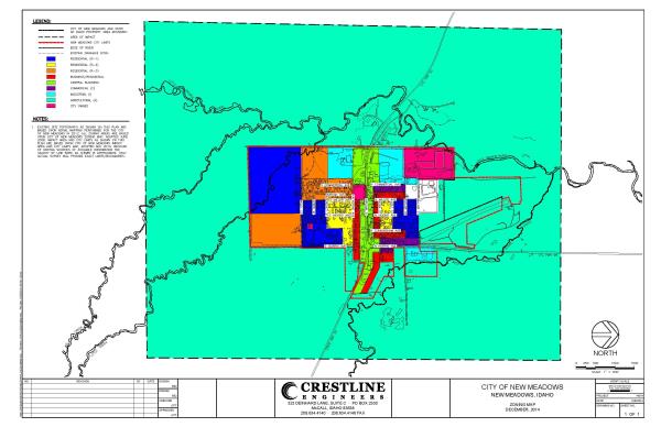
10-5-2 Boundaries Of Districts
The boundaries of the various districts shown on the Zoning Map are, unless otherwise indicated, streets, alleys, lot lines, or other lines of demarcation as shown on said map. Where a street layout property line or other boundary on the ground varies from that shown on the Zoning Map, and where property or other boundary lines do not exist or are not shown on the Zoning Map, the designations shown on the map shall be applied by the Planning and Zoning Commission by map scale or other method so as to carry out the intent and purpose of the Zoning Map for that district. (Ord. 313-08, 6-9-2008)
10-5-3 Divided Ownership
Where a district boundary line, as shown on the Zoning Map, divides a lot or other unit of property in a single ownership at the effective date hereof, the use permitted on the least restricted portion of such lot may extend to the portion lying in the more restrictive district a distance of not more than fifty feet (50') beyond the district boundary line. (Ord. 313-08, 6-9-2008)