Ridgeland City Zoning Code
HOW TO
USE THE SMARTCODE
| Step 1: Determine Sector of Subject Property | Step 2: Determine Community Type | Step 3: Applicable Standards | Step 4: Form/Checklist |
|---|---|---|---|
 | Community types not permitted | Article 2, 3 | N/A |
 | Community types not permitted, Transfer of Development Rights (TDR) Sending Area for G-2 & G-3 | Article 2, 4, Table 10 | N/A |
 |
If property is less than 30 acres, then prepare plan per base T-Zone standards
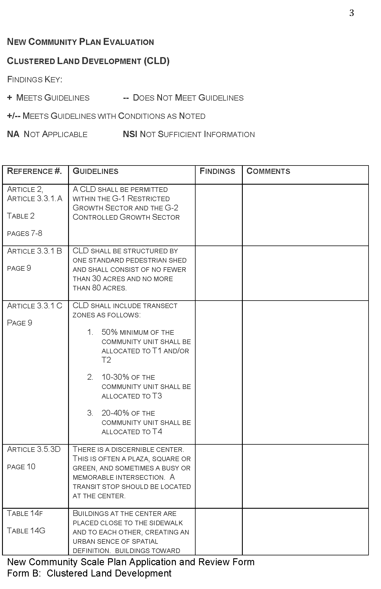
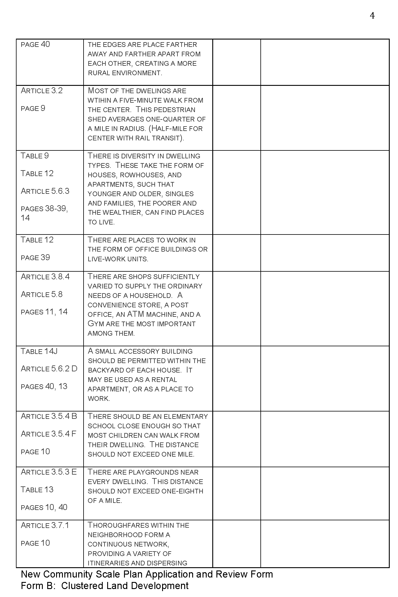
If property is 30—80 acres, Clustered Land Development (CLD) |
Table 10 Articles 3.3.1, 3.4, 3.5, 3.6, 3.7, 3.8, 3.9 |
Form D
Form B |
 |
If property is less than 30 acres, then prepare plan per base T-Zone standards
If property is 30—80 acres, Clustered Land Development (CLD) If property is 80—160 acres, Traditional Neighborhood Development (TND) |
Table 10 Articles 3.3.1, 3.4, 3.5, 3.6, 3.7, 3.8, 3.9 Articles 3.3.2, 3.4, 3.5, 3.6, 3.7, 3.8, 3.9 |
Form D
Form B Form C |
 |
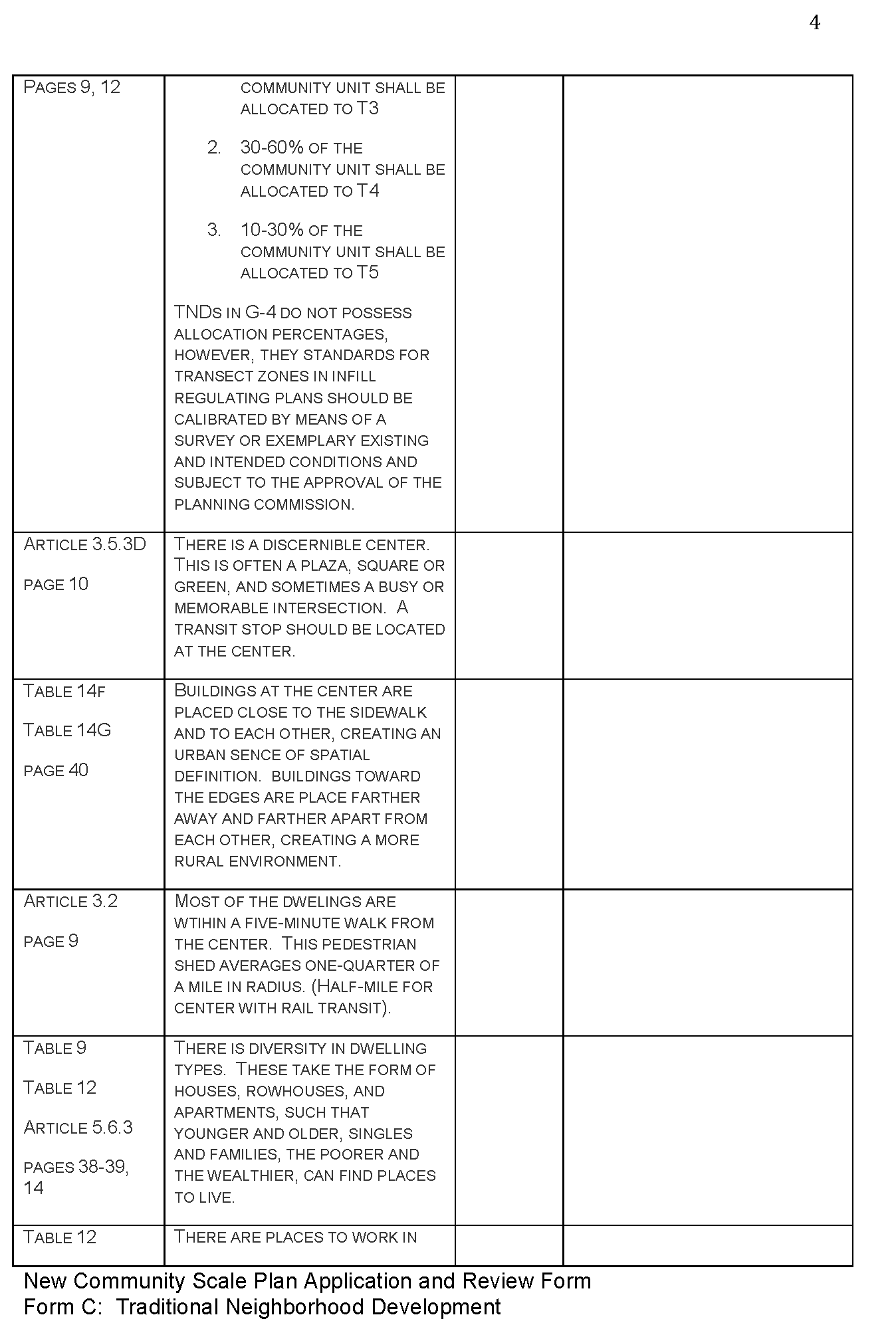
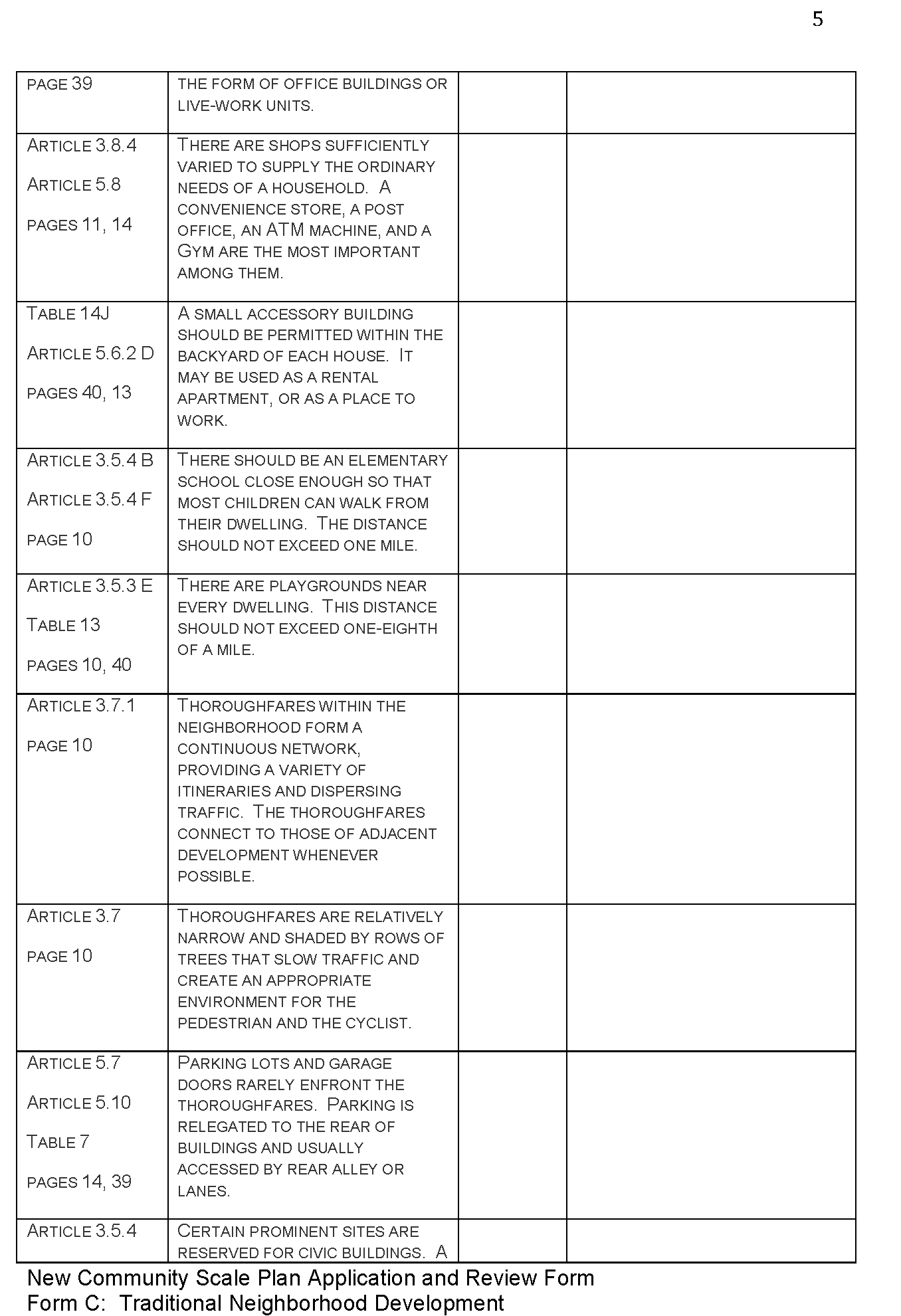
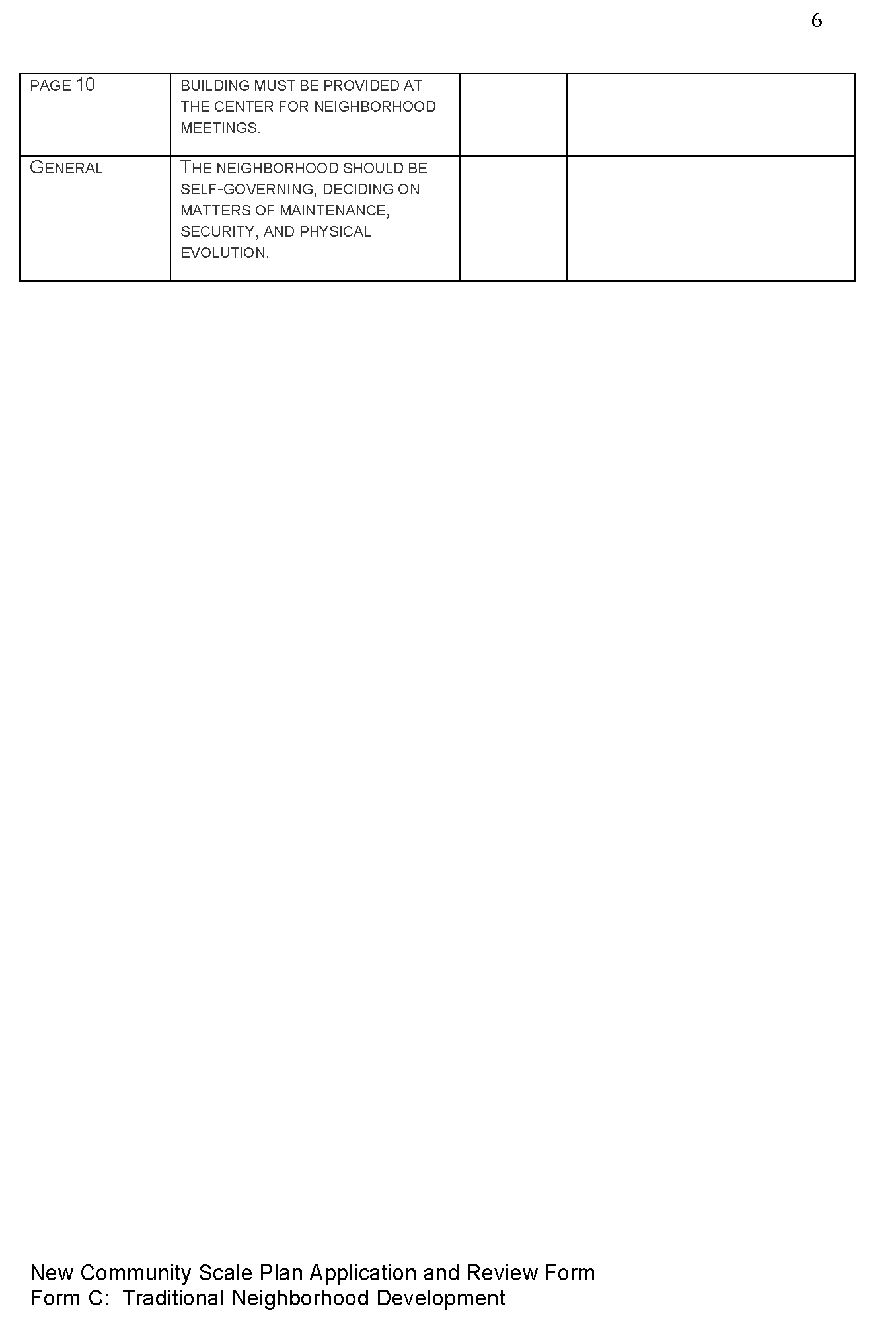
If property is less than 80 acres, then prepare plan per base T-Zone standards
If property is 80—160 acres, Traditional Neighborhood Development (TND) |
Table 10 Articles 3.3.2, 3.4, 3.5, 3.6, 3.7, 3.8, 3.9 |
Form D
Form C |
 |
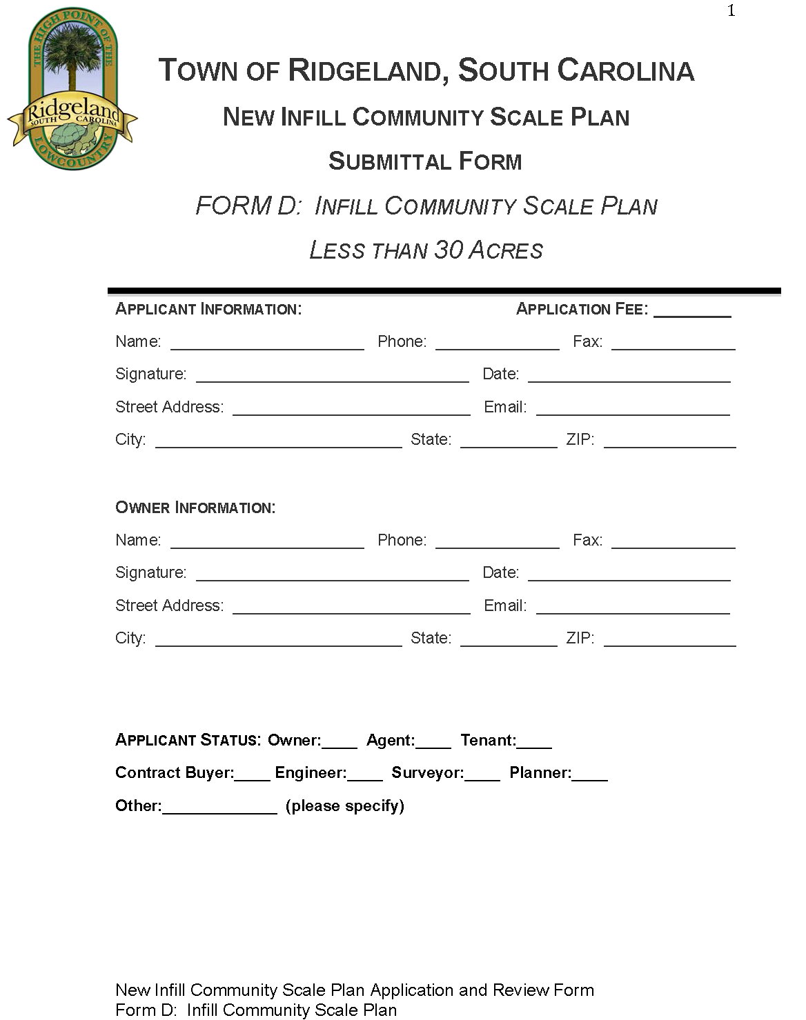
If property is less than 10 acres, then prepare regulating plan
If property is 10—30 acres, then prepare Special Area Plan If property is greater than 30 acres, then prepare New Community Plan: Infill TND or TOD |
Articles 4.1.1, 4.1.2, 4.1.3, 4.1.4, 4.3, 4.4, 4.5, 4.6, 4.7 Articles 4.1.5, 4.3, 4.4, 4.5, 4.6, 4.7 Articles 4.1.6, 4.2, 4.3, 4.4, 4.5, 4.6, 4.7 |
Form D
Form D Form D |
| **For all existing lots of record, development standards of the applicable Transect
Zone shall apply. (Table 10) | |||