
San Antonio City Zoning Code
DIVISION 4
OVERLAY DISTRICTS
Sec. 35-330.- Generally.
The overlay zoning districts address special siting, use and compatibility issues which require use and development regulations in addition to those found in the underlying zoning districts. If any regulation in an overlay zoning district requires lower densities, greater setbacks, or otherwise imposes greater standards than those required by the base zoning district, the more restrictive standard applies.
The zoning designation of property located within an overlay district shall consist of the regular zone symbol and the overlay district symbol as a suffix. For example, if a parcel is zoned "RE" and is also located within the Edwards Recharge Zone district, the zoning designation of the property would be "RE" (ERZD). In effect, the designation of property as being within the Edwards Recharge Zone district places such property in a new zoning district classification and all procedures and requirements for zoning and rezoning must be followed.
Sec. 35-331. - "AHOD" Airport Hazard Overlay District.
STATEMENT OF PURPOSE
This division is adopted pursuant to the authority conferred by V.T.C.A. Local Government Code Ch. 241. It is hereby found that an airport hazard endangers the lives and property of the users of San Antonio International Airport, Stinson Municipal Airport, Kelly Air Force Base, Randolph Air Force Base and of the occupants of land in the vicinity thereof, and also, if of the obstruction type, such hazard reduces the size of the area available for the landing, taking-off and maneuvering of aircraft, thus tending to destroy or impair the utility of these airports and the public investment therein. Accordingly, it is declared:
• That the creation or establishment of an airport hazard is a public nuisance and an injury to the communities served by these airports;
• That it is necessary, in the interest of the public health, public safety and general welfare that the creation or establishment of airport hazards be prevented; and
• That the prevention of these hazards should be accompanied, to the extent legally possible, by the exercise of the police power without compensation.
(a)
Development Standards.
(1)
Future Uses. Within any airport hazard area which is within, or extends into, the controlled area of these regulations, no material change in the use of land and no structure or tree shall be erected, altered, planted or otherwise established at a height greater than two hundred (200) feet above the ground or above a 100 to 1 (100:1) slope from the nearest point of the nearest runway of any airport unless a permit therefor shall have been applied for and granted. Applications for permits shall be made to the department of planning and development services upon a form supplied for this purpose, and by submitting a map of sufficient accuracy and detail to allow an accurate determination of compliance with this division. No permit for a use inconsistent with this division shall be granted unless a variance has been approved in accordance with subsection (a)(4) of this section. Nothing in the foregoing shall be construed as permitting or intending to permit any construction, alteration or growth of any structure or tree in excess of the height limits established by this division.
(2)
Existing Uses. No permit shall be granted that would allow the establishment or creation of an airport hazard or permit a nonconforming use, structure or tree to be made or become higher or become a greater hazard to air navigation than it was on the effective date of the ordinance from which this division is derived or any amendments thereto, or than it is when the application for a permit is made. Except as indicated, all applications for such a permit shall be granted.
(3)
Nonconforming Structures, Natural Growths and Land Uses. A permit shall be required before any nonconforming structure, natural growth or land use in the airport hazard area may be altered, repaired, rebuilt, replaced, replanted or relocated. No permit shall be granted that would allow a nonconforming structure, natural growth or land use to be made or become higher, or become a greater hazard to air navigation than it was. Whenever the department of planning and development services or administrative agency outside of the City of San Antonio determines that a nonconforming land use has been abandoned or more than eighty (80) percent torn down, damaged, physically deteriorated or decayed, no permit shall be granted that would allow same to be replaced, repaired or re-established unless in full compliance with the height and use restrictions of this division.
(4)
Variances. Any person desiring to erect or increase the height of any structure or permit any natural growth or use his property, not in accordance with the regulations prescribed in this division, shall apply to the board of adjustment for a variance from such regulations. Such variances shall be allowed where it is found that a literal application or enforcement of the regulations would result in practical difficulty or unnecessary hardship, and the relief granted would not be contrary to the public interest but will do substantial justice and be in accordance with the spirit of this division. Applications for such action by the board of adjustment shall be made to the director of planning and development services if inside the City of San Antonio, or the director of planning and development services if in the city's extraterritorial jurisdiction.
(5)
Federal Notification. Within any airport hazard area, any person who proposes any construction, alteration or tree growth meeting the following criteria shall give notice to the regional office of the Federal Aviation Administration if and as required by Part 77 of the Federal Aviation Regulations, titled "Objects Affecting Navigable Airspace":
• Any construction or alteration of more than two hundred (200) feet in height above the ground level at its site.
• Any construction or alteration of greater height than an imaginary surface extending upward and outward at any one (1) of the following slopes: (a) for International and Stinson, a slope of 100 to 1 (100:1) for a horizontal distance of twenty thousand (20,000) feet from the nearest point of the nearest runway; and (b) for military airports, a slope of 50 to 1 (50:1) for a horizontal distance of ten thousand (10,000) feet from the nearest point of the nearest runway.
Also, any person who proposes to construct, alter, activate or deactivate a civil or joint use, civil/military, airport shall likewise give notice to the Federal Aviation Administration as required by Part 157 of the Federal Aviation Regulations titled "notice of construction, alteration, activation, and deactivation of airports." If a request for a permit or variance is made from any action falling under any of the stated federal notice requirements, final action on the requested permit or variance may, at the discretion of the administrative agency or of the board of adjustment, be deferred until a final determination has been issued by the Federal Aviation Administration. However, in no event shall the requirements of this division be subordinate to a determination of the Federal Aviation Administration.
(6)
Marking and Lighting. Any permit or variance granted may require the owner of the structure or natural growth in question to install, operate and maintain thereon, at his own expense, such markers and lights as may be necessary to indicate to flyers the presence of an airport hazard. Any lights required under this paragraph shall be engineered and designed for the intended purpose by a recognized manufacturer, and it shall be the responsibility of the owner or any subsequent owner to see that the lights are properly installed and maintained so as to be functioning during darkness and all periods of low visibility, independently of the functioning of other lighting in or on the structure or growth.
(b)
Height-Limiting Imaginary Surfaces, International and Stinson. The height restrictions for structures and growths in the airport hazard areas are specified by means of imaginary planes or surfaces in the airspace above the airport hazard areas. Within the controlled area of this section, such surfaces are hereby established in the airspace surrounding each airport protected by this division to define the limit above which any projection of a structure or tree would be considered an airport hazard and thus be prohibited except as otherwise provided by this division. The surfaces are illustrated on the airport hazard zoning maps, which are adopted and made a part of this division, by means of elevation contour lines in a manner similar to the use of topographic contour lines to illustrate the variations in the elevation of natural terrain. Their geometric description is as follows:
(1)
Primary Surface. The primary surface is centered longitudinally and laterally about the runway, the ends extending two hundred (200) feet beyond the runway ends. The elevation of any point on the primary surface is the same as the nearest point on the runway centerline between the runway ends. The width of the primary surface varies according to the existing or planned classification of usage of the most critical end of the individual runways as follows per Part 77 of the Federal Aviation Regulations:
A.
San Antonio International Airport:
B.
Stinson Municipal Airport:
(2)
Approach Surface. The approach surface is an inclined plane, longitudinally centered on the extended runway centerline, which begins at the end of the primary surface, at the same width and elevation, and extends outward and upward at a specific horizontal to vertical slope, at a specific uniform rate of increase in width and for a specific distance as follows:
A.
San Antonio International Airport:
Runways 3, 12R, 12, 21, and 30L: 50 to 1 (50:1> slope for first ten thousand (10,000) feet, thence to a 40 to 1 (4:1) slope at an ultimate distance of fifty thousand (50,000) feet, at which the width is sixteen thousand (16,000) feet.
Runway 30R: 20 to 1 (20:1) slope for a distance of five thousand (5,000) feet, at which the width is one thousand five hundred (1,500) feet.
B.
Stinson Municipal Airport:
Runway 27: 50 to 1 (50:1) slope for first ten thousand (10,000) feet, thence at a 40 to 1 (40:1) slope to an ultimate distance of fifty thousand (50,000) feet, at which the width is sixteen thousand (16,000) feet.
Runway 32: 20 to 1 (20:1) slope for a distance of five thousand (5,000) feet, at which the width is two thousand (2,000) feet.
Runways 9 and 14: 20 to 1 (20:1) slope for a distance of five thousand (5,000) feet, at which the width is one thousand two hundred fifty (1,250) feet.
(3)
Transitional Surface. These surfaces extend outward and upward to a slope of 7 to 1 (7:1) from the longitudinal edges of the primary surfaces and approach surfaces, measured at right angles to the runway centerline and centerline extended. These surfaces connect the primary and approach surfaces with the other surfaces described in this section, including other transitional surfaces. Beyond the outer periphery of the conical surfaces, the transitional surfaces extend a maximum horizontal distance of five thousand (5,000) feet from the longitudinal edges of the precision approach surfaces, measured at right angles to the extended runway centerline.
(4)
Horizontal Surface. The horizontal surface is a horizontal plane one hundred fifty (150) feet above the established airport elevation, nine hundred fifty-nine (959) feet above mean sea level for San Antonio International; seven hundred twenty-seven (727) feet above mean sea level for Stinson Airport. The perimeter of the horizontal surface is constructed by swinging arcs of ten thousand (10,000) feet radius from the center of each end of the primary surfaces of Runways 3-21, 12"R-3"0L and 12L-30R at San Antonio International Airport and Runway 9-27 at Stinson Municipal Airport. The adjacent arcs are then connected by tangent lines.
(5)
Conical Surface. The conical surface extends outward and upward to a slope of 20 to 1 (20:1) from the periphery of arid at the same elevation as the horizontal surface. It extends for a horizontal distance of four thousand (4,000) feet, to a height of three hundred fifty (350) feet above established airport elevation.
(6)
Kelly Air Force Base and Randolph Air Force Base. In addition to the above described imaginary surfaces, the imaginary surfaces of Kelly Air Force Base and Randolph Air Force Base described by Section 77.28 of Part 77 of the Federal Aviation Regulations, and which extend into the corporate limits of the city, shall be enforceable under these regulations within the corporate limits.
(c)
Height Restrictions.
(1)
Except as otherwise provided in this article, no structure or natural growth shall be erected, altered, increased in height, allowed to grow or maintained in an airport hazard area in excess of the height of the imaginary surface above the structure or natural growth.
(2)
Where more than one (1) imaginary surface or the imaginary surfaces of more than one (1) airport exist in the same area, the more restrictive limitation shall prevail.
(3)
In addition to the height restrictions imposed by the imaginary surfaces, no structure or natural growth shall be erected, altered, increased in height, allowed to grow or maintained in an airport hazard area at such height as would result in the alteration of any flight procedure established by federal aviation authorities.
(4)
If tall construction cranes or other equipment will be used which are higher than a structure or growth which is being erected under a permit granted pursuant to this article, the operator of the cranes or equipment may be required, at the discretion of the authorities in charge of the airport affected, to maintain coordination with air traffic control personnel to keep them informed of his work schedule, to keep the equipment in a lowered position to the maximum extent possible, and to install appropriate hazard marking and/or lighting on the top extremity of the equipment.
(5)
Nothing in this division shall be construed as prohibiting the construction or maintenance of any structure, or growth of any tree to a height up to twenty (20) feet above the surface of the land.
(6)
If the imaginary surface boundaries established above are less restrictive for a specific instance than those specified in the Federal Aviation Regulation Part 77, "Objects Affecting Navigable Airspace" as amended, or any subsequent Federal Aviation Agency criteria, then the criteria shall, in effect, be a part of these regulations and shall be the applicable restriction hereunder.
(d)
Use Restrictions. Notwithstanding any other provisions of this division no use may be made of land within the airport hazard area in such manner as to:
(1)
Create electrical or visual interference with any electronic facility or instrumentation, wherever located within the airport hazard area, including but not limited to, radio transmitters and receivers, radar installations, landing and navigational aids and weather instruments where such facilities are used in connection with the landing, taking-off and maneuvering of aircraft;
(2)
Make it difficult for flyers to distinguish between airport lights and others;
(3)
Result in glare in the eyes of flyers using the airport;
(4)
Impair visibility in the vicinity of the airport;
(5)
Cause physical objects of any nature to penetrate, however briefly, the air space above the imaginary surfaces established in this article, such objects including, but not limited to kites, balloons, projectiles, rockets, model aircraft, derricks and cranes, unless a special temporary permit be obtained from the authorities in charge of the affected airport;
(6)
Establish or alter privately owned flying fields, strips or heliports, unless found not to be objectionable after a special aeronautical study by federal aviation authorities;
(7)
Create bird strike hazards;
(8)
Otherwise endanger the landing, taking-off, or maneuvering of aircraft.
(e)
Nonconforming Uses.
(1)
Not Retroactive. The regulations prescribed in this division shall not be construed to require changes in land use or the removal, lowering, or other change or alteration of any structure or natural growth in previous lawful existence, but not conforming to the effective date of the ordinance from which this division is derived, or otherwise interfere with the continuance of any previously lawful nonconforming use. Nothing contained in this division shall require any change in the construction, alteration or intended use of any structure, the construction or alteration of which was begun prior to the effective date of the ordinance from which this division is derived, is diligently prosecuted, and would have otherwise been in legal existence upon completion.
(2)
Marking and Lighting. Notwithstanding the preceding provision of this section, the owner of any nonconforming structure or natural growth is hereby required to permit the installation, operation and maintenance thereon of such markers and lights as shall be deemed necessary to indicate to the operators of aircraft in the vicinity of the airport the presence of such flight hazards. Such markers and lights shall be installed, operated and maintained at the expense of the airport desiring such marking and lighting.
(f)
Administrative Agency (Inside City Limits). The department of planning and development services of the city is hereby designated as the administrative agency charged with the administration and enforcement of this division. As such, it shall establish administrative procedures for requiring, accepting and subsequently approving or denying applications for airport zoning permits, in accordance with subsection (a) of this section. In this regard, the department of planning and development services will withhold any other permits normally issued under its jurisdiction which would allow construction or erection to proceed on any structure which would be in violation of these regulations. The administrative agency shall not have, or exercise any of the powers or duties, which are delegated to the board of adjustment under V.T.C.A. Local Government Code Ch. 241.
(g)
Board of Adjustment. The board of adjustment of the city is hereby designated to be the board of adjustment for this division, to have and exercise the powers set forth in V.T.C.A. Local Government Code Ch. 241.
(h)
Appeals. Any person aggrieved or taxpayer affected by any decision of the administrative agency made in its administration of this division, or any governing body of a political subdivision, which is of the opinion that a decision of such an administrative agency is an improper application of airport hazard zoning regulations may appeal to the board of adjustment under the provisions of V.T.C.A. Local Government Code Ch. 241.
(i)
Judicial Review (Inside City Limits). Any person aggrieved or taxpayer affected by any decision of the board of adjustment which is of the opinion that a decision of the board of adjustment is illegal, may present to a court of record a verified petition setting forth that the decision is illegal, in whole or in part, and specifying the grounds of illegality as provided in V.T.C.A. Local Government Code Ch. 241. Such petition shall be presented to the court within ten (10) days after the decision is filed in the office of the board.
(j)
Conflicting Regulations. In the event of conflict between any airport zoning regulations adopted hereunder and any other regulations applicable to the same area, whether the conflict be with respect to the height of structures or trees, the use of land or any other matter, and whether such other regulations were adopted by the city or by some other political subdivision, the more stringent limitation or requirement shall govern and prevail.
(k)
Imaginary Surfaces (Kelly and Randolph Air Force Bases). The following airport imaginary surfaces are hereby created and establish the limit above which any projection of a structure, natural growth or object constitutes an airport hazard under these regulations:
(1)
Primary Surface. The primary surface is centered longitudinally and laterally about each runway. It extends two hundred (200) feet beyond each end of the runway in a horizontal plane at the same elevation as the associated runway end, except at military airports, where primary surface length is the same as the runway length. Between the ends of the runway it has a uniform gradient as established by the runway and elevations. The width varies as follows:
A.
Instrument runways, municipally-owned airports, one thousand (1,000) feet.
B.
Non-instrument runways, municipally owned airports, five hundred (500) feet.
C.
Runway 15-22, Kelly Air Force Base: two thousand (2,000) feet.
D.
Runway 14-32, Kelly Air Force Base, and all runways, Randolph Air Force Base: one thousand five hundred (1,500) feet.
(2)
Approach-Departure Surface.
A.
The approach-departure surface begins at the end of the primary surface, except at military airports where it begins two hundred (200) feet beyond the primary surface, and is centered about the runway centerline extended. From a width equal to that of the primary surface it extends outward and upward and increases uniformly in width as follows:
B.
For instrument runways at municipally owned airports, the approach-departure surface extends outward from the primary surface at a distance of fifty thousand (50,000) feet, at which point it is sixteen thousand (16,000) feet wide. It extends upward at a slope of 50 to 1 (50:1) to a distance of ten thousand (10,000) feet from primary surface, thence at a slope of 40 to 1 (40:1) thereafter.
C.
For non-instrument runways at municipally-owned airports, the approach departure surface extends outward from the primary surface a distance of ten thousand (10,000) feet, at which point it is two thousand five hundred (2,500) feet wide. It extends upward at a slope of 40 to 1 (40:1).
D.
For military airports, the approach-departure surface begins two hundred (200) feet beyond the primary surface and thereafter extends outward a distance of fifty thousand (50,000) feet, at which point it is sixteen thousand (16,000) feet wide. It extends upward at a slope of 50 to 1 (50:1) until it reaches an elevation five hundred (500) feet above the established airport elevation, then it continues horizontally to its outer end.
(3)
Transitional Surface. The transitional surface extends outward and upward at right angles to the runway centerline at a slope of 7 to 1 (7:1) until it intersects the horizontal or conical surface, except that transitional surfaces for those portions of ILS approach surfaces that project through and beyond the limits of the conical surface, extend a distance of five thousand (5,000) feet measured horizontally from the edges of those portions of the approach surfaces and at right angles to the runway centerline. For military airports, the transitional surface does not apply for the horizontal portion of the approach-departure surface.
(4)
Inner Horizontal Surface. The inner horizontal surface is a horizontal plane at a height of one hundred fifty (150) feet above the established airport elevation. Its outer edge is determined by scribing an arc with a radius of seven thousand five hundred (7,500) feet above a point on the centerline at the end of all runways and interconnecting these arcs with tangents.
(5)
Conical Surface. The conical surface extends outward and upward from the outer edge of the inner horizontal surface at a slope of 20 to 1 (20:1) for a horizontal distance of seven thousand (7,000) feet to a height of five hundred (500) feet above the established airport elevation.
(6)
Outer Horizontal Surface. The outer horizontal surface is a horizontal plane which extends from the outer edge of the conical surface a distance of thirty thousand (30,000) feet at a height five hundred (500) feet above the established airport elevation.
(7)
Airport Zoning Maps. The attached airport zoning maps are hereby adopted and supersede all prior airport zoning maps. The imaginary surface boundaries are shown on these maps by aerial contours.
(Ord. No. 98697 § 1, 5 and 6)
Sec. 35-332. - "ERZD" Edwards Recharge Zone District.
STATEMENT OF PURPOSE
The Edwards Recharge Zone district "ERZD" has been established for locations where theEdwards and associated limestone formations come to the surface to provide a recharge area for the underground water supply contained within these formations. The recharge area also can provide an entrance to the underground water supply for contaminated water runoff from uses on the recharge zone as well as from the related sensitive area. Thus this recharge zone district is designed to not allow land uses which could adversely affect the water supply, and thereby minimizing the risk of potential occurrences wherein such substances could enter the water reservoir. Land uses permitted are those not having operations, production, or storage of hazardous materials which could contribute contaminants to the water supply. All land uses allowed within the "ERZD" by this subdivision must also conform to the requirements of article VI, division 6 of this chapter.
The provisions of this section implement the following policies of the master plan:
• Natural Resources, Policy 1b: Develop and implement a management plan for land use activities which includes the best management practices, based on scientific study, that will protect the recharge and drainage zones of the Edwards Aquifer from pollution.
• Natural Resources, Policy 1b: Aggressively implement the water quality recommendations included in the 1994 report, The Edwards Aquifer: San Antonio Mandates for Water Quality Protection and any subsequent revisions.
• Natural Resources, Policy 1b: Incorporate comprehensive watershed management considerations in revisions of land use and development standards.
• Natural Resources, Policy 1b: Support new development designs that incorporate street, drainage and lot layouts which reduce storm runoff, pollutant loading, and the need for landscape irrigation.
• Natural Resources, Policy 1b: Adopt urban drainage standards which reduce non point source pollution and minimize downstream flooding.
• Natural Resources, Policy 1b: Continue to enforce, and strengthen if necessary, requirements for underground storage tanks.
• Natural Resources, Policy 1b: Identify significant recharge features and accurately record their location onto subdivision plats using current computer technology.
• Natural Resources, Policy 1b: Protect recharge features through such measures as acquisition, zoning restrictions, and buffering.
• Natural Resources, Policy 1b: Consider impacts of transportation on the recharge zone when revising and implementing the major thoroughfare plan.
• Natural Resources, Policy 1b: Utilize vegetated buffer zones along 100-year floodplains and significant creeks.
• Natural Resources, Policy 1b: Establish standards for vegetation clearing and maintenance.
• Natural Resources, Policy 1b: Maximize open space and minimize impervious cover through all available means.
• Natural Resources, Policy 1b: Study the correlation between land use and stormwater quality and set standards in accordance with the findings.
• Natural Resources, Policy 1b: Utilize mechanisms such as land banking to provide incentives to public and private entities to mitigate impacts at a higher ratio than the minimum required.
• Adopt local guidelines and support regional guidelines for construction activities in the Edwards Aquifer Drainage and Recharge Zones area.
(a)
Boundaries. The limits of the Edwards Recharge Zone district (ERZD) are described on United States Geological Survey Quadrangle Maps, being copies of the official maps in the offices of the Texas Environmental Quality Commission (TEQC), and are defined in the Texas Administrative Code, 31 TAC § 701 et seq. (West 1997). If the limits of the ERZD cannot be accurately determined, then Watershed Protection and Management Department of SAWS shall interpret the district boundaries after obtaining such geologic information as is necessary from the United States Geological Survey or other properly designated agency.
(b)
Zoning Classification.
(1)
The Edwards Recharge Zone district (ERZD) is designed as an overlay to the regular zoning districts. Property located within this overlay district must also be designated as being within one (1) of the regular zoning districts. Authorized uses must be permitted in both the regular zoning district and the overlay district.
(2)
Uses permitted by right and with a specific use permit are specified in section 35-311, use regulations of this article. It shall be unlawful for any person to make use of any property located within the Edwards Recharge Zone district, except in accordance with such tables of permitted uses.
(c)
Development Standards. No use may be established, and no development activity shall occur, within the ERZD except in compliance with the Edwards Aquifer Protection Standards (chapter 34, article VI, division 6 of the City Code). For subdivisions constructed over Edwards and associated limestone formations, all construction shall meet the herein referenced city specifications and the latest revision of the Texas Administrative Code, 31 TAC 313.1-313.11.
Sec. 35-333. - Historic Districts and Landmarks.
STATEMENT OF PURPOSE
Pursuant to V.T.C.A. Local Government Code §§ 211.001 and 211.003, historic districts and landmark designations are adopted in order to protect and preserve places and areas of historical, cultural, or architectural importance and significance. Historic districts and landmark designation preserve and enhance the city's historic resources pursuant to Goal 2 of the Urban Design Element of the master plan.
(a)
Establishment. Historic districts and landmarks shall be established and governed in accordance with division 2 of article VI of this chapter.
(1)
Design, new construction, alterations, site elements, additions, signage and maintenance within historic districts and landmarks shall be governed by the historic design guidelines as adopted by the city council.
(b)
Applications for Rezoning.
(1)
The designated historic districts have outstanding historic and cultural significance. When considering applications for rezoning relating to landmarks and in historic districts, the zoning commission shall apply the following goals and guidelines in addition to the criteria set forth in section 35-421 of this chapter:
A.
Preserve the architectural integrity of the historic district or landmark.
B.
Promote the general welfare of the community by fostering compatible land uses.
C.
Permit only uses which would be compatible within these districts.
D.
Prevent uses which would deteriorate the landmark, historic district, and/or district character.
E.
Provide a sense of community identity and continuity for site planning issues such as open space, parking ratios, setbacks, lot size, building heights, signs, lighting, and traffic.
(2)
All decisions approving a rezoning related to a landmark or within a historic district should:
A.
Conform as closely as possible to established zoning regulations while incorporating these goals; and
B.
Protect adjacent property; and
C.
Encourage preservation, restoration and revitalization of existing structures and neighborhood integrity.
(3)
When considering applications for a rezoning related to a landmark or within a historic district, the zoning commission should encourage housing, commercial or institutional uses, or combinations thereof, to maintain the historic, architectural, and cultural harmony of design and function. It is further the intent of these goals and guidelines to provide for:
A.
Zoning which preserves existing historic districts, landmarks, architecture, structures, trees, outstanding natural topography, and geologic features.
B.
An efficient use of inner city land resulting in the use of existing facilities, structures, utilities, streets, topography, and resources.
C.
An environment of stable architecture in harmony with the historic and cultural character of the surrounding cityscape.
D.
Complimentary design, new construction, alterations, site elements, additions, signage and maintenance within historic districts and landmarks in accordance with the historic design guidelines as adopted by the city council.
(4)
Flexibility to implement special development concepts should be encouraged, but should not detract from these goals and guidelines.
(Ord. No. 2011-11-08-0877, § 2, 11-8-12)
Sec. 35-334. - "MAOZ" Military Airport Overlay Zones.
STATEMENT OF PURPOSE
The City of San Antonio has designated the military airport overlay zones in order to promote the public health, safety, peace, comfort, convenience, and general welfare of the inhabitants of military airport environs and to prevent the impairment of military airfields and the public investment therein. The land areas below military airport take off and final approach paths are exposed to significant danger of aircraft accidents. It is, therefore, necessary to limit the density of development and intensity of uses in such areas. The military airport overlay zones are intended to:
• Guide, control, and regulate future growth and development.
• Promote orderly and appropriate use of land.
• Protect the character and stability of existing land uses.
• Enhance the quality of living in the areas affected.
• Protect the general economic welfare by restricting incompatible land uses.
• Prevent the establishment of any land use which would endanger aircraft operations and the continued use of military airports.
(a)
Definitions and Boundaries.
(1)
For the purpose of this subdivision, the following terms shall have the meaning given in this section:
Clear Zones: The area at the ends of the runways of military airports which measure three thousand (3,000) feet by three thousand (3,000) feet in length and width. Beyond the clear zones, the city has designated two (2) military overlay zones (see diagram):
Military Airport Overlay Zone 1 (MAOZ-1): The area that extends approximately five thousand (5,000) feet in length and three thousand (3,000) feet in width beyond the clear zone.
Military Airport Overlay Zone 2 (MAOZ-2). The area that extends approximately seven thousand (7,000) feet in length and three thousand (3,000) feet in width beyond district 1.
Official Map. The specific boundaries of the military airport overlay zones are shown on the official zoning map maintained by the City of San Antonio.
(b)
Zoning Classification.
(1)
Overlay District. The "MAOZ" military airport overlay zones are designed as overlays to the regular zoning districts. Property located within these districts must also be designated as being within one of the regular zoning districts. Authorized uses must be permitted in both the regular zoning district and the overlay district and must comply with height, yard, area, and parking requirements of the regular zoning district.
(2)
Zoning Designation. The zoning designation of property located within the military airport overlay zones shall consist of the regular zone symbol and the overlay district symbol as a suffix. For example, if a parcel is zoned "C-1" and is also located within district 2, the zoning designation of the property would be "C-1" (MAOZ-2). In effect, the designation of property as being within a military airport overlay zone places such property in a new zoning district classification and all procedures and requirements for zoning/rezoning must be followed.
(c)
Uses.
(1)
Permitted Uses. The following uses are permitted within the military airport overlay zones, subject to the limitations indicated in the military airport overlay zone permitted use table and the conditions set forth for visual and electrical interference and storage of flammables [subsections 35-334(e) through 35-334(f)]:
MILITARY AIRPORT OVERLAY ZONE PERMITTED USE TABLE
;sz=8q;Notes:
1 With no public assembly.
2 Maximum 100 parking spaces.
3 No industrial or manufacturing uses will be allowed if operations emit into the air any substance which would impair the visibility or otherwise interfere with the operation of aircraft, e.g., steam, dust, smoke. Nor will any use be allowed which would interfere with aircraft communication systems or navigational equipment through electrical disturbances.
4 Building size is limited to maximum 3,000 square feet.
5 Excludes chapels.
6 Low-intensity office use only.
7 Building size limit in "MAOZ-2" is 250,000 square feet.
8 With height restrictions.
9 With no clubhouses.
(2)
Prohibited Uses.
A.
Residential uses, except as provided for in exceptions for residential uses [subsection 35-334(d)].
B.
All other uses not permitted under subsection (a) of this section
(3)
Military Airport Overlay Zone 1 Size Limitation. Any retail, office or personal service use that is permissible in the "MAOZ-1" may not exceed three thousand (3,000) square feet in total floor area. Front, rear and side setbacks of twenty (20) feet shall be required on all lots. There shall be a separation of at least twenty (20) feet between each such use.
(4)
Military Airport Overlay Zone 2 Size Limitation. Any retail, office or personal service use that is permissible in the "MAOZ-2" may not exceed two hundred fifty thousand (250,000) square feet in total floor area.
(5)
Plat Notice. A notice shall be placed on all final plats for properties located within Military Airport Overlay Zones 1 and 2 that the property, either partially or wholly, lies within a military airport overlay zone and is subject to noise and/or aircraft accident potential which may be objectionable.
(d)
Exceptions for Residential Uses.
(1)
Existing Residences. Notwithstanding any other provisions of the zoning ordinance, residential uses located within the military airport overlay zones which were lawfully in compliance with the provisions of this chapter on the effective date of this chapter may be repaired and enlarged provided (1) the number of dwelling units is not increased and (2) all other applicable requirements of this district are met.
(2)
Vacant Lots. Vacant platted lots which are zoned for single-family residential uses may be used for single-family residences providing they conform to all other applicable requirements of this district. Such lots may not be subdivided into more than one (1) additional lot for single-family residential use.
(3)
Unplatted Property. Unplatted properties zoned for single-family residential may be platted and used for single-residences in the "MAOZ-2," providing they conform to all other applicable requirements of this district. Such lots may not exceed a density of one (1) single-family residence per acre.
(e)
Visual and Electrical Interference. Notwithstanding any other provisions of these regulations, no use shall be made of land within the military airport overlay zones in such a manner to:
(1)
Release into the air any substance which would impair visibility or otherwise interfere with the operation of aircraft; e.g., steam, dust, smoke, etc.;
(2)
Produce light emissions, either direct or indirect (reflective) which would interfere with pilot vision;
(3)
Produce electrical emissions which would interfere with aircraft communications systems or navigational equipment; or
(4)
Attract birds or waterfowl, or in any other manner constitute an airport hazard.
(f)
Storage of Flammables. The provisions of this section shall apply throughout the military airport overlay zones. All technical terms shall be interpreted as defined in the Uniform Fire Code.
(1)
Solid Materials.
A.
The storage or manufacture of flammable solid materials or products is permitted only if the flammable material or products are stored or manufactured within completely enclosed buildings having noncombustible exterior walls and protected throughout by an automatic fire extinguishing system.
B.
The storage or manufacture of explosive materials and of materials or products which decompose by detonation is prohibited.
(2)
Liquid Materials.
A.
The manufacture of flammable or combustible liquids or materials which produce flammable or combustible vapors or gases is prohibited.
B.
All aboveground storage of flammable or combustible liquids or materials which produce flammable or combustible vapors or gases shall be in enclosed fireproof vaults. This requirement does not apply to liquids or materials used for single-family residences.
C.
The storage of flammable and combustible liquids, or of materials that produce flammable or combustible vapors or gases, shall be permitted only in accordance with the Uniform Fire Code.
(g)
Height Regulations. The height of structures within the military airport overlay zones shall be governed by the height requirements of the underlying zoning district as well as the provisions of the joint airport zoning regulations in article III, division 11 of this chapter.
(h)
Procedure.
(1)
Site Plan. Except for single-family residences, a site plan shall be submitted to the director of planning and development services for approval by the planning commission prior to the issuance of building permits. All building plans must be in compliance with an approved site plan. The applicant shall submit eight (8) blue- or black-line copies and one reproducible 8½ x 11-inch reduced copy of the site plan accompanied by the plan review fee specified in Appendix "C." The plan review fee shall be in addition to any other required fees.
(2)
Purpose. The purpose of the site plan is to ensure the proposed development complies with the provisions and intent of this chapter. The plan review will focus on the following:
A.
Ordinance Provisions. Permitted uses, potential visual and electrical interference, and storage of flammables.
B.
Intent. The site design should locate the most intensive uses farthest away from the end and centerline of the runway.
(3)
Plan Requirements. The plan shall include the following as a minimum:
A.
Site size, location information, and adjacent land uses.
B.
Dimensioned layout, with the location, size, and height of all buildings and structures.
C.
The location and size of all above and below ground storage containers for flammable and combustible materials.
D.
Size and location of all vehicular access points, streets, and parking areas.
E.
Major physical features such as creeks, topography, and easements.
F.
Diagrams indicating the location, dimensions, and angles of any or other reflective surfaces proposed in the development design.
G.
A staging plan if appropriate.
(4)
Staff Review. The director of planning and development services shall, upon receipt of the site plan, distribute copies to other departments/agencies, as the director deems necessary. Departments/agencies receiving copies of the site plan shall, within twenty (20) days of receipt of the plan, submit to the director of planning and development services their written recommendation and comments about the plan. No later than thirty (30) days after submission of the site plan, the director shall submit the plan with a recommendation to the planning commission for consideration.
(5)
Planning Commission Consideration. The planning commission may approve the plan submitted, amend and approve the plan as amended, or disapprove the plan. If approved, the plan with amendments, if any, shall be stamped "approved" and be dated and signed by the chairman of the planning commission and by the secretary of the commission.
(6)
Distribution of the Approved Plan. One (1) copy of the approved plan shall be submitted to the director of planning and development services for use in issuing building permits. In addition, other copies of the approved plan may be requested as necessary by other departments and agencies.
(7)
Changes in the Plan.
A.
Minor Changes. After favorable action by the planning commission, minor alterations which do not substantially change the concept of the site plan may be approved by the director of planning and development services, if required by engineering or other circumstances not foreseen at the time the plan was approved. Minor changes may not cause a change in location or an increase in size of any storage containers for flammable or combustible materials.
B.
Major Changes. Major alterations to the site plan shall be resubmitted for consideration by the planning commission following the same procedures required in the original adoption of the plan. Major changes to a site plan include any alterations which would cause any of the above conditions as well as those which are determined as such by the director of planning and development services.
(8)
Time Limit. The construction of the proposed development shall be started within two (2) years of the effective date of approval of the site plan by the commission. The planning commission may, no sooner than sixty (60) days prior to the end of the time period, upon request of the developer, extend the time one (1) additional year if, in the judgment of the commission, additional time is warranted. In any event, construction must be started within (3) years of the effective date of approval. Failure to begin the development within the required time period or the period as extended shall automatically void the site plan, and no building permit shall be issued until the plan or an amended plan has been resubmitted and properly approved by the commission.
(i)
Supplemental Information. Whenever any application for a change in zoning in a military airport overlay zone is filed, the director of planning and development services shall make formal request to the United States Air Force at least thirty (30) days prior to the zoning commission hearing for any relevant statistics, operational activities information, technical data, or other studies with bearing on the request.
(Ord. No. 2010-11-18-0985, § 2, 11-18-10; Ord. No. 2012-12-13-1006, § 56, 12-13-12)
Sec. 35-335. - "NCD" Neighborhood Conservation District.
(a)
Purpose.
(1)
Within the City of San Antonio there are many unique and distinctive residential neighborhoods or commercial districts which contribute significantly to the overall character and identity of the city. They are worthy of preservation and protection, but may lack sufficient historical, architectural or cultural significance at the present time to be designated as historic districts. As a matter of public policy, the city council aims to preserve, protect, enhance, and perpetuate the value of these residential neighborhoods or commercial districts through the establishment of neighborhood conservation districts.
(2)
The purposes of a neighborhood conservation district in residential neighborhoods or commercial districts are as follows:
A.
To protect and strengthen desirable and unique physical features, design characteristics, and recognized identity and charm;
B.
To promote and provide for economic revitalization;
C.
To protect and enhance the livability of the city;
D.
To reduce conflict and prevent blighting caused by incompatible and insensitive development, and to promote new compatible development;
E.
To stabilize property values;
F.
To provide residents and property owners with a planning tool for future development;
G.
To promote and retain affordable housing;
H.
To encourage and strengthen civic pride; and
I.
To ensure the harmonious, orderly and efficient growth and redevelopment of the city.
(3)
The neighborhood conservation district planning tool implements the following policies of the master plan:
A.
Neighborhoods, Policy 2b (1): Establish a zoning classification such as a conservation district or a planned development district for neighborhood specific plans.
B.
Urban Design, Policy 1b (1): Create and adopt urban design guidelines and standards that will enhance the quality of life in San Antonio, and which specifically encourage the following: Preservation and enhancement of the city's important historic and cultural characteristics, including architectural styles and historic districts, as well as existing residential and commercial districts, and neighborhood centers.
C.
Urban Design, Policy 1d (1): Involve neighborhoods in developing neighborhood-specific plans that define the character and pattern of development for their neighborhood, and that establish infill development guidelines.
(b)
Designation Criteria. To be designated as a neighborhood conservation district, the area must meet the following criteria:
(1)
Contain a minimum of one (1) blockface (all the lots on one (1) side of a block);
(2)
At least seventy-five (75) percent of the land area in the proposed district was improved at least twenty-five (25) years ago, and is presently improved; and
(3)
Possess one (1) or more of the following distinctive features that create a cohesive identifiable setting, character or association:
A.
Scale, size, type of construction, or distinctive building materials;
B.
Spatial relationships between buildings;
C.
Lot layouts, setbacks, street layouts, alleys or sidewalks;
D.
Special natural or streetscape characteristics, such as creek beds, parks, greenbelts, gardens or street landscaping;
E.
Land use patterns, including mixed or unique uses or activities; or
F.
Abuts or links designated historic landmarks and/or districts.
(c)
Zoning Authority. Separate ordinances are required to designate each "NCD" neighborhood conservation district. Ordinances designating each district shall identify the designated boundaries, applicable designation criteria and design standards for that district, and be consistent with any existing neighborhood and/or community plans. Adopted neighborhood conservation district plans referenced herein by their title, date of adoption, and adopting ordinance are:
A.
South Presa/South St. Mary's Sts. "NCD-1," November 14, 2002, Ordinance # 96732.
B.
Alta Vista "NCD-2," May 8, 2003, Ordinance # 97590.
C.
Ingram Hills "NCD-3," September 9, 2004, Ordinance # 99689.
D.
Whispering Oaks "NCD-4," February 24, 2005, Ordinance # 100480.
E.
Beacon Hill Area "NCD-5," December 15, 2005, Ordinance # 101890, Amended and Restated June 22, 2017, Ordinance # 2017-06-22-0497.
F.
Mahncke Park "NCD-6," January 17, 2008, Ordinance 2008-01-17-0050. Amended and Restated April 11, 2019, Ordinance # 2019-04-11-0307.
G.
Jefferson "NCD-7," April 16, 2009, Ordinance # 2009-04-16-0308.
H.
Woodlawn Lake Area "NCD-8," November 18, 2010, Ordinance # 2010-11-18-1006.
I.
Westfort Alliance "NCD-9," October 20, 2011, Ordinance # 2011-10-20-0881.
J.
Monte Vista Terrace "NCD-10," May 6, 2021, Ordinance # 2021-05-06-0309.
(1)
Overlay District. Neighborhood conservation districts are designed as overlays to the regular zoning districts. Property designated within these districts must also be designated as being within one (1) or more of the regular base zoning classifications.
Authorized uses must be permitted in both the regular zoning district and the overlay district. Property designated as a neighborhood conservation district may have additional designations. Such property shall comply with all applicable use restrictions.
(2)
Zoning Designation. The zoning designation for property located within a neighborhood conservation district shall consist of the base zone symbol and the overlay district symbol "NCD" as a suffix. Neighborhood conservation districts shall be numbered sequentially to distinguish among different districts, i.e., "R-6-NCD-1," "C-1-NCD-2," etc.
A.
The designation of property within a neighborhood conservation district places such property in a new zoning district classification and all procedures and requirements for zoning/rezoning must be followed.
B.
In the event of a conflict between the provisions of a specific neighborhood conservation district ordinance and the regular base zoning district regulations, the provisions of the neighborhood conservation district ordinance shall control.
C.
Except as modified by this section, the procedures for zoning changes set forth in this chapter shall otherwise apply to the designation of an area as a neighborhood conservation district.
D.
Upon designation of an area as a neighborhood conservation district, the city council shall cause notice of such designation to be recorded in the official public records of real property of Bexar County, the tax records of the City of San Antonio and the Bexar Appraisal District, and the house numbering section of the City of San Antonio's department of planning and development services.
(d)
Initiation Procedures.
(1)
A zoning change application for designation as a neighborhood conservation district shall be initiated at the direction of the:
A.
A request of owners representing fifty-one (51) percent of the land area within the proposed district, or
B.
Request of fifty-one (51) percent of property owners within the proposed district, or
C.
Development services director, pursuant to a neighborhood, community, perimeter, sector, or sub-area plan adopted by city council, or city or community revitalization program.
(2)
Following initiation for designation of a neighborhood conservation district, the development services department shall develop a neighborhood conservation plan for the proposed district that follows subsection 35-335(b)(3) and includes:
A.
Maps indicating boundaries, age of structures and existing land use within the proposed district;
B.
Maps and other graphic and written materials identifying and describing the distinct neighborhood and building characteristics of the proposed district;
C.
A list of all property owners (with legal addresses), neighborhood associations and/or other organizations representing the interests of property owners in the proposed district; and
D.
Design standards.
(3)
All property owners within the proposed district shall be afforded the opportunity to participate in drafting the neighborhood conservation plan, which will be approved as part of the zoning ordinance creating a neighborhood conservation district.
(e)
Design Standards for Neighborhood Conservation Districts Established Prior to April 1, 2019.
(1)
The neighborhood conservation plan approved as part of the zoning ordinance creating a neighborhood conservation district prior to April 1, 2019, shall include design standards for new construction of any building or structure, or the relocation or rehabilitation to the street facade of an existing building or structure.
(2)
Existing neighborhood conservation plans shall not be modified after April 1, 2019, with respect to building materials or methods.
(3)
The neighborhood conservation plan, and requisite design standards shall not apply to those activities which constitute ordinary repair and maintenance, i.e., using the same or similar material and design.
(4)
The design standards for the neighborhood conservation district must include at a minimum (or note the inapplicability), the following elements governing the physical characteristics and features of all property (public or private) within the proposed district:
A.
Building height, number of stories;
B.
Building size, massing;
C.
Principal elevation features;
D.
Lot size, coverage;
E.
Front and side setbacks;
F.
Off-street parking and loading requirements;
G.
Roof line and pitch;
H.
Paving, hardscape covering.
(5)
In addition, the design standards may include, but shall not be limited to, the following elements:
A.
Building orientation;
B.
General site planning (primary, ancillary structures);
C.
Density;
D.
Floor area ratio;
E.
Signage;
F.
Architectural style and details;
G.
Building materials;
H.
Garage entrance location;
I.
Window/dormer size and location;
J.
Landscaping;
K.
Fences and walls;
L.
Entrance lighting;
M.
Driveways, curbs and sidewalks;
N.
Utility boxes, trash receptacles;
O.
Street furniture;
P.
Solar systems, components;
Q.
Building relocation;
R.
Right-of-way (exceeding public works standards).
(f)
Design Standards for Neighborhood Conservation Districts Established On or After April 1, 2019.
(1)
The neighborhood conservation plan approved on or after April 1, 2019, as part of the zoning ordinance creating a neighborhood conservation district shall include design standards for new construction of any building or structure, or the relocation or rehabilitation to the street facade of an existing building or structure, but in accordance with state law, shall not include any standards or requirements relating to building materials or methods.
(2)
The neighborhood conservation plan, and requisite design standards shall not apply to those activities which constitute ordinary repair and maintenance, i.e., using the same or similar design.
(3)
The design standards for the neighborhood conservation district must include at a minimum (or note the inapplicability), the following elements governing the physical characteristics and features of all property (public or private) within the proposed district:
A.
Building height, number of stories;
B.
Building size, massing;
C.
Principal elevation features;
D.
Lot size, coverage;
E.
Front and side setbacks;
F.
Off-street parking and loading requirements;
G.
Roof line and pitch;
H.
Paving, hardscape covering.
(4)
In addition, the design standards may include, but shall not be limited to, the following elements:
A.
Building orientation;
B.
General site planning (primary, ancillary structures);
C.
Density;
D.
Floor area ratio;
E.
Signage;
F.
Architectural style and details;
G.
Garage entrance location;
H.
Window/dormer size and location;
I.
Landscaping;
J.
Fences and walls;
K.
Entrance lighting;
L.
Driveways, curbs and sidewalks;
M.
Utility boxes, trash receptacles;
N.
Street furniture;
O.
Building relocation;
P.
Right-of-way (exceeding public works standards).
(5)
The design standards in a neighborhood conservation plan adopted on or after April 1, 2019, shall not include elements related to build materials or methods.
(g)
Neighborhood Ordinance Administration. No building permit shall be issued by development services for new construction or an alteration or addition to the street facade of an existing building or structure within a designated neighborhood conservation district without the submission and approval of design plans and the issuance of a certificate of compliance by the development services director.
(h)
Violation of Provisions.
(1)
The violation of any provision of this section shall constitute a violation of this chapter and may be prosecuted in municipal court regardless of whether civil or administrative action is taken against the permit holder. Upon conviction, the permit holder shall be subject to the penalties prescribed in this chapter.
(2)
The director of development services may request the city attorney to institute a civil action as prescribed in this chapter, regardless of whether a criminal action has been taken.
(Ord. No. 98697 § 1, 5) (Ord. No. 100126) (Ord. No. 101816, § 2, 12-15-05) (Ord. No. 2006-11-30-1333, § 2, 11-30-06) (Ord. No. 2009-01-15-0001, § 2, 1-15-09) (Ord. No. 2010-11-18-0985, § 2, 11-18-10) ; Ord. No. 2012-10-18-0829, § 2, 10-18-12) (Ord. No. 2017-06-22-0497, § 1, 6-22-17, eff. 7-2-17; Ord. No. 2021-05-06-0309, § 3, 5-6-21, eff. 5-16-21; Ord. No. 2022-11-03-0831, § 2, 11-3-22, eff. 1-1-23)
Sec. 35-336. - "UCD" Utility Conversion Districts.
STATEMENT OF PURPOSE
Within the city there are numerous corridors in which the transmission of electricity, telecommunications, cable television and other technologies (collectively referred to as utilities or facilities within this division) has been facilitated through the use of aboveground poles in public rights-of-way and easements.
Under grounding or relocation of these facilities can provide a safer environment for the public. Under grounding, relocation or redesign of these facilities can enhance the surrounding development by improving the visual appearance and appeal of the city's visitor attractions, scenic views and urban corridors, cultural and historical resources, public gathering places and other major public facilities. The under grounding, relocation or redesign of these facilities can also promote economic development and revitalization in surrounding areas, increase the value of commercial properties and residential neighborhoods, and improve the quality of life for all San Antonians. The establishment of utility conversion districts requires mechanisms to identify and designate the specific corridors and areas to be modified, to determine the nature of the improvements to be required in each such corridor or area, to require the various utility companies to implement these projects as parts of public works or civic improvement projects directed by city council and to require property owners and utility customers to modify their property as necessary to receive utility services from underground, relocated or redesigned distribution systems.
(a)
Applicability. To be established as a utility conversion district, a corridor or area must meet either one (1) of the following criteria:
• The proposed utility conversion district includes the area of another public works or civic improvement project which is already planned and for which reasonable assurance of funding has been secured. If the existing public works or civic improvement project does not already require some relocation of existing aboveground utilities in the area, then it must be of such unique and city wide significance, as determined by city council, to justify consideration to achieve the purposes of this subdivision. This related project does not need to be sponsored or financed by the city, but it must be the project of a governmental entity; or
• A utility conversion district is proposed by a petition of the property owners in the area. The petition must be signed by the owners of at least two-thirds (⅔) of the total number of lots or separate tracts of land in the area of the proposed district, and the property of these owners must encompass at least two-thirds (⅔) of the total land area of the proposed district, excluding the area of streets, alleys and other public rights-of-way and of any other land owned by the city. Petitioners shall use the city petition form for utility conversion districts to ensure that the project proposed is technically feasible and worthwhile and that all of the affected property owners are considered in the calculation of the signature requirement.
Other provisions of this chapter notwithstanding, the provisions of this section shall apply to property belonging to or used by the city or to property used to provide city owned utilities.
(b)
"UCD" Ordinances.
(1)
Ordinances Establishing Utility Conversion Districts. This division authorizes the establishment of utility conversion districts and includes general provisions governing all such districts. However, a separate ordinance is required to establish each such district. The ordinance establishing a particular utility conversion district shall:
• Describe the area of the district;
• Specify the requirements for improvement of the utilities in each part of the district; and
• Establish a deadline by which existing utility customers within the district must complete the modification of their property as necessary to continue to receive utility services from the new utility distribution systems.
(2)
Requirements of Utility Conversion Districts. The requirements of a particular district may include any combination of the following:
• The conversion of existing overhead utility facilities to underground operation;
• The relocation of existing overhead utility lines from one specified route to another;
• Specified improvements in the design of existing and/or new overhead utilities.
• A requirement that all new utility lines in the district or in a specified area of the district be installed underground or meet an improved design standard without requiring modification of existing utilities in the district or that area of the district.
The requirements of a particular district may apply to transmission and trunk lines, to distribution lines, or both, as specified in the ordinance creating the district. The ordinance creating a particular district shall specify the improvements which are to be required in the district, and it may apply any combination of the preceding requirements to any particular specified areas or corridors within the district. In addition, the ordinance may require that whenever utility lines are extended from within the district or a specified area of the district to serve property which is outside but adjacent to the district or that area of the district, the portion of the extensions within the district shall conform to the district requirements with respect to underground installation, aboveground route or design standard as appropriate.
(3)
Utility Conversion Districts are Overlay Districts. Utility conversion districts are established as overlays to the regular base zoning districts. The zoning district designation for each utility conversion district shall consist of the base zone symbol with the overlay district symbol "UCD" as a suffix, followed by a sequential number for the order in which these districts are created.
(c)
UCD.
(1)
Compilation Process. At the beginning of each calendar year, city staff shall begin compiling a list of the proposals for utility conversion districts which have been received during the previous year and which meet the criteria of the previous paragraph. Upon completion of the compilation process, city staff shall make the list available to the public. This list shall include the staff's preliminary analysis of the potential benefits, technical feasibility, and costs of each proposed district which is eligible for consideration. For each proposed and eligible district, the analysis shall also include consideration of any alternatives to the initially proposed requirements which the staff believes are feasible and would largely achieve the intended objectives of the district.
(2)
City Council Resolution. Each year, following the city's receipt of notice from CPS Energy of the amount of funds available for utility conversion projects in the city, the city council shall hold a public hearing to consider the establishment of utility conversion districts. Following the hearing, the council shall adopt a resolution stating its intention to establish one (1) or more utility conversion districts, up to the limit of the funds available. The number of districts and their size and scope shall be limited to the funds available. For each such district which the council intends to establish, the resolution shall describe the area or boundaries of the district, the requirements or combinations of requirements which are proposed in each part of the district, and the deadline which is proposed for compliance by the utility customers.
(3)
Notification. Following the adoption by city council of a resolution of intent to establish a utility conversion district, the city shall notify each property owner, inside and within two hundred (200) feet of the boundaries of the proposed district, of this action. The city will also work with the utilities involved to identify and notify the utility customers in the area who are not property owners. The notice shall include a summary explanation of the purposes, procedures, requirements and possible impacts on property owners and utility customers of the establishment of a utility conversion district. The notice may also include the time and place of an informal public meeting, in a location convenient to the area, at which city staff will explain the process of implementing utility conversion districts, answer questions, and attempt to gather information on the degree of community support for the proposal.
(4)
Decision.
• Following the notice of the council's intent to establish a utility conversion district and the neighborhood public meeting, the zoning commission shall hold a public hearing and make recommendations to city council. Notice of the hearing shall be provided in the same manner as for a change in zoning. The planning commission will also consider the substance of the proposed utility conversion district and make a recommendation to the city council.
• Following receipt of the recommendations of the zoning commission and the planning commission, the city council shall hold a second public hearing before determining whether to proceed with the establishment of the district. If the council determines to proceed, it shall adopt an ordinance establishing the district as an amendment to subsection 35-335(i) of this chapter. The ordinance adopting the amendment to subsection 35-335(i) shall also declare that implementation of the utility improvements is required for the public health, safety and general welfare, and that the project constitutes a public works or civic improvement project of the city within the meaning of the utility franchise and municipal fee agreements.
• If the council determines not to proceed with the establishment of the district, it shall adopt a resolution to abandon the proposal. The council may then adopt a resolution of intent to establish another utility conversion district in place of the district which is abandoned. The adoption of a new resolution of intent shall then initiate the processes of notice, neighborhood meeting, and recommendations by the zoning commission as set out in the previous paragraphs of this section. However, the council may not establish a new district at this stage unless the proposed district was among those considered at the previous annual public hearing.
• Within thirty (30) days after the establishment of a utility conversion district, the city shall notify each affected utility company and property owner listed on the current Bexar County Appraisal District tax rolls. The notice to the utilities shall constitute their direction to proceed with the project as a public works or civic improvement project of the city. Except for districts or areas within districts which only require new utility distribution lines to be extended underground, the notice shall notify property owners that the utility poles, overhead utility lines and associated facilities in the district are to be removed and converted to underground operation, or relocated or redesigned as appropriate to the location of their property within the district, and that if the property owners, the tenants or occupants of their property desire to continue to receive the utility services they must make all of the necessary changes on the premises so as to receive service from the new utility distribution systems. The notice shall also notify the property owners of the anticipated schedule for the completion of the district improvements and the required deadline for modification of the property. The notice shall also inform the property owners of the technical and other assistance which is available to them in meeting the district requirements, and contain the name, office address and telephone number of a city staff person who will be available to answer questions.
(d)
Implementation of District Improvements.
(1)
Conversion of Overhead to Underground Operations. If the ordinance establishing a particular utility conversion district requires the conversion of overhead utilities to underground operation, then every public utility which has poles, overhead lines and associated aboveground facilities in the affected area of the district shall remove it poles, overhead lines and associated facilities in the area as required by the ordinance establishing the district, subject to other applicable city ordinances and franchise agreements. Thereafter, no new utility poles, overhead lines or associated facilities shall be permitted in the affected district area.
(2)
Rerouting of Overhead Utility Lines. If the ordinance establishing a particular utility conversion district requires the relocation of overhead utilities from one route to another, then every public utility which has poles, overhead lines and associated aboveground facilities along the route which is to be vacated shall remove its poles, overhead lines and associated facilities from that route, and shall install such new facilities as it considers necessary along the alternate route, as required by the ordinance establishing the district. Thereafter, no new utility poles, overhead lines or associated facilities shall be permitted in the district along the route which is vacated. The ordinance establishing the district may also require that utility lines shall not be extended overhead from elsewhere within the district or within a specified area of the district to serve adjacent property along that route or along a specified part of that route. Prior to placement, the location of all new poles, anchors and guy lines along any new route shall be approved by the director of public works.
(3)
Replacement of Facilities. If the ordinance establishing a particular utility conversion district requires the replacement of existing poles, overhead lines and associated aboveground facilities with those of an improved design, then every public utility which has poles, overhead lines and associated facilities in the affected area of the district shall remove those which do not conform to the improved design standard and shall replace them with poles, lines and associated facilities which meet the improved standard, as required by the ordinance establishing the district. Thereafter, no new utility poles, overhead lines or associated facilities shall be permitted in the affected district areas which do not meet the improved design standard. Prior to placement, the location, route and design of the new poles (including anchors and guy lines), overhead lines and associated facilities shall be approved by the director of public works.
(4)
Regulations Applicable Only to New Development. If a requirement of the ordinance establishing a particular utility conversion district applies only to new development, then the existing utility poles, overhead lines and associated facilities in the affected district area may continue in use and may be replaced as necessary. However, no additional poles shall be installed and no additional lines shall be extended on existing poles in the affected district area except in conformance with the district requirements.
(e)
Responsibilities of Property Owners and Customers.
(1)
Application. This section applies whenever a utility conversion district requires:
• The conversion of overhead utilities to underground operation;
• The relocation of overhead utilities from one route to another; or
• The replacement of existing poles, overhead lines and associated aboveground facilities with those of an improved design.
(2)
New Easements. Any new easement acquired by the city shall be reasonable and necessary. If an additional easement or easements are required, the utility may request the property owner to dedicate the easement with no compensation to the property owner. Election by the property owner to not dedicate the easement without receipt of compensation, will in no way impair the property owner's service contract with the utility. In such event, the city may:
• Withdraw or modify the proposed designation of the project as a utility conversion district; or
• Procure the new easement in conformity with existing procedures and statutes governing compensation for nonvoluntary easements.
The cost associated with acquisition of easements for utility conversion district shall not be borne by the property owner conveying the easement. Acquisition costs for gas and/or electric easements shall be paid from the CPS Energy service conversion fund. Acquisition costs for other easements shall be paid by the respective utilities.
(f)
Modification to Receive Utility Service.
(1)
Financial Responsibility. Property owners and customers shall not be required to pay any costs associated with conversion of existing utility service to underground utilities. Modifications to the owner/customer's property necessary to receive service from the new utility distribution system shall be paid from the CPS Energy conversion fund. However, if preexisting electrical code violations are observed during installation or reconnection of service from the new utility distribution system the property owner/customer shall be responsible for the correction of such violations. All correction of violations shall be completed within ninety (90) days after written customer and owner notification that the new distribution system is available. For the purposes of this section, "preexisting electrical code violation" shall mean the violation of the electrical code in effect at the time the property owner/customer's improvements were constructed. Only life safety corrections will be required. Electrical installations that comply with prior codes and are in good repair may remain. All conversion costs for other utilities shall be borne by the respective utilities.
(2)
Unfunded Conversion Costs. In the event conversion costs that do not qualify for payment through the CPS Energy conversion fund are not borne by the customers, municipal utilities, other utilities or other interests, the project will not be designated as a utility conversion district unless the affected property owners voluntarily choose to pay for conversion costs of their property to receive service from the new distribution system.
(3)
Utility Drops. All new construction and new structural alterations which involve the utility drop of an existing building or structure with a utility conversion district shall be designed to receive utility service from the utility distribution system required in the district.
(g)
Disconnection of Service. In the event that a property owner or utility customer does not comply with the requirements of a utility conversion district within ninety (90) days after receiving notice that service is available from the new utility distribution system, the utility provider(s) shall notify the director of public works of the owner/customer's noncompliance. The director of public works shall give the noncompliant party an opportunity to be heard. If, after this opportunity to be heard, the director of public works determines that the service should be disconnected, he/she shall direct the utility providers to do so. The purpose of this provision is to provide for flexibility when dealing with exceptional circumstances and not to frustrate the intent expressed in this division to convert or reroute utilities.
Upon notice to disconnect service, and subject to applicable federal and state rules and regulations regarding service termination, the utility providers shall disconnect and remove any and all poles, overhead lines and associated facilities supplying utility service to the subject property. The utility providers shall not thereafter be required to provide service to such premises until the necessary modifications to receive service from the new distribution system are made.
(h)
Exceptions. The provisions of this division shall not apply to the following types of facilities:
• Temporary utility services during construction.
• Overhead lines attached to the exterior surface of a building by means of a bracket or other fixture and extending from one location on the building to another or to an adjacent building without crossing the front line of the building or the building setbacks.
In the case of a utility conversion district which requires the conversion of overhead utilities to underground operation or the installation of new utilities underground, the director of public works shall, at the property owner's request, authorize the use of overhead service drops from riser poles located on private property when the riser pole is located behind the front line of a building and behind the adjacent street side line of a building on a corner lot, or the riser pole is otherwise effectively shielded from public view from any street abutting the property.
(i)
Emergencies and Unusual Circumstances. In cases of emergency or unusual circumstances of a temporary nature, the director of public works may authorize any person to erect, maintain and use utility poles, overhead utility lines and associated facilities which do not meet the requirements of a utility conversion district for the duration of the emergency or unusual circumstances, not to exceed one (1) year.
(j)
Districts Established. The utility conversion district administrative procedures attached to Ordinance No. 85764 are adopted in order to provide city staff with general guidance regarding the implementation process and project selection criteria. The administrative procedures are available for public inspection in the office of the city clerk.
The city council urges CPS Energy to limit its annual contributions to the utility conversion fund to the current one (1) percent of the electric revenue of the CPS Energy electric system billed during the previous fiscal year, and to refrain from implementing any further rate increases to subsidize this fund.
(Ord. No. 98697 § 6) (Ord. No. 101816, § 2, 12-15-05)
Sec. 35-337. - "VP" Viewshed Protection and "MPOD" Mission Protection.
STATEMENT OF PURPOSE
The purpose of this district is to establish regulations to protect, preserve and enhance of views and vistas by authorizing and establishing viewshed protection districts. The City of San Antonio has many views and vistas of historic places, landmark buildings, and other sites of cultural importance which have always been important to the city. These views will continue to be amenities and assets of great value to the city, its people and its economy. New development in the vicinity of these important places is usually beneficial, but when construction becomes too tall and begins to overwhelm or intrude, in scale and mass, the main view or vista of a smaller place of significance, then the viewshed located behind the significant property should be protected. Viewshed protection districts are overlay districts that will be used primarily for unique situations regarding views and vistas that are not adequately covered by the standard zoning districts.
Specific purposes of these viewshed protection districts are as follows:
• To safeguard San Antonio's heritage by preventing the despoliation of views of areas and buildings that reflect important elements of the city's cultural, natural, historic, and economic fabric.
• To create favorable impressions of San Antonio as well as provide environmental enrichment for the citizens of the city.
• To enhance San Antonio's image as a scenic and livable city and to provide appropriate measures to maintain the existing ambiance of certain historic and cultural sites.
• To preserve, protect, and enhance visually those areas of high visitor interest.
• To reduce visual distractions and enhance the photographic quality and opportunities of important historic and cultural sites and landscapes.
(a)
Designation Criteria.
(1)
To be designated as a viewshed protection district or a mission protection overlay district, an area must lie within the viewshed of the major entrance or front door to the following historic landmark buildings, objects, sites, or structures:
Notes and Rules of Interpretation: "P" refers to the parcel number; "NC"B refers to the new city block number.
(2)
Additional mission protection not within the major entrance or front door may be granted based on written descriptions, survey information, photos, maps or illustrations in accordance with the standards and process of this section. Such protection may be related to corridors, outward views and other visual links.
(b)
Zoning Process and Classification.
(1)
This Code authorizes the establishment of viewshed and mission protection districts; however, separate ordinances are required to designate each district. This chapter also specifies the general purposes of the protection districts and the scope of the standards which the separate ordinances may address. Ordinances designating each viewshed or mission protection district shall identify the designated districts and the scope of the standards which the separate ordinances may address.
(2)
Ordinances designating each protection district shall identify the designated viewshed or mission protection district(s) and specify the individual purposes and standards for that district.
(3)
The office of historic preservation shall undertake land use and other background studies necessary to designate a viewshed or mission protection district. All property owners within the proposed district and adjacent areas shall be afforded the opportunity to comment on the ordinance regulations.
(4)
The viewshed or mission protection districts are established as overlays to the regular base zoning districts.
(5)
The zoning designation for the viewshed or mission protection district shall consist of a base zone symbol and the viewshed or mission protection district symbol ("VP" or "MPOD") as a suffix. Viewshed or mission protection districts shall be numbered sequentially to distinguish among different districts, i.e., "VP-1", "VP-2", "MPOD-1", etc. and shall be give a specific name, i.e., Alamo Viewshed, Mission Conception Viewshed, Mission Conception Protection Overlay District, etc. along with a number.
(c)
Boundaries.
(1)
To be designated as a viewshed or mission protection district, an area must be located in front of or behind a building or site as described in subsection (a) of this section (designation criteria) unless other or additional areas are designated by approved ordinance.
(2)
Prior to viewshed or mission protection designation, a brass disk monument shall be set and named to mark the viewpoint origination. This monument shall be called out in a survey as the instrument in each legal description defining a viewshed. Each monument shall be numbered and named sequentially, i.e., "VP-1", "VP-2", etc. From the named monument the elevation, horizontal angle, and vertical angle of the viewshed shall be determined. The viewshed or protection boundary shall be described in the ordinance designating a viewshed or mission protection district.
(3)
Using these points, the viewshed or mission protection area shall also define the volume or envelope within which new construction will be allowed. New construction beyond or outside of this envelope that protrudes into the viewshed or protected area and obstructs the view of the designated building or site being photographed, filmed, or otherwise enjoyed by visitors to the site shall be limited by this chapter.
(4)
The viewpoint origination brass disk monument shall also mark the spot where a photograph can be taken at five and fifty-one one-hundredths (5.51) feet above the pin (which is the approximate eye level for most adults). The photograph taken at this point represents a protected view.
(d)
Development Standards.
General. Ordinances establishing specific viewshed or mission protection districts shall comply with the requirements addressed in this section subject to the guidelines included herein. In the event of a conflict between the specific viewshed and/or mission protection district and other provisions of this chapter, the viewshed or mission protection district provisions shall prevail.
(1)
Limitation on Construction. No part of a new structure, sign, tower, wireless communication system, roof top equipment or other appurtenance shall be permitted to encroach into any designated viewshed or protected area as set forth in this chapter unless an encroachment is approved in accordance with subsection (2), below. If the maximum height allowed in any zoning district within the city differs from the height permitted by a protection district, the more restrictive height limitation shall apply.
A.
Protection Angles. No single building, structure, sign, wireless communication system or object shall be constructed within a Mission Protection Overlay District which exceeds the allowable height established by the protection angle for each district.
(2)
Nonconforming Structures.
A.
Any structure which presently encroaches into a viewshed or mission protection district which was lawfully authorized by ordinances or regulations existing prior to the effective date of a protection district may continue. However, such encroachments will be encouraged to be removed as part of any remodeling or reconstruction of the structure. In the case of certain focal points that contribute to the historic character and to the quality of the urban design of the city, their removal due to their nonconforming status is not encouraged.
B.
Structures lawfully established prior to the effective date of a protection district may be modified provided that such modification does not cause the structure to encroach into the viewshed or mission protected area to any greater extent in any dimension or configuration, specifically height, width or mass, than the existing structure.
C.
Nonconforming structures may be maintained and repaired as necessary for the safe and efficient operation or use provided that no such maintenance or repair shall cause the structure to encroach into a viewshed or mission protected area to a greater extent in any dimension or configuration, specifically height, width, or mass, than the structure encroached prior to such maintenance and repair.
D.
Whenever a nonconforming structure which does not conform with the provision of this chapter is destroyed by fire, other calamity or by act of God, its use may be resumed or the structure may be restored provided the restoration is commenced within one (1) year and diligently pursued to completion. The structure after such restoration shall not encroach into a viewshed or mission protected area to a greater extent in any dimension or configuration, specifically height, width, or mass, than the encroachment which existed prior to destruction.
(e)
Public Facilities and Utilities. Notwithstanding article I, the city (including its departments and agencies) and all utilities as identified in subsection 35-507(a) shall comply with the siting and design requirements of structures and utility facilities which are located within a viewshed or Mission Protection Overlay district. Utility lines are encouraged to be located underground and in the right-of-way where possible.
(f)
Viewshed Protection Districts.
(1)
"VP-1" Alamo Viewshed Protection District.
A.
Designation Criteria. There is hereby established an Alamo Viewshed protection district. The area for the Alamo Viewshed protection district meets the following designation criteria established in subsection 35-337(a) above:
1.
The viewshed protection district lies behind the major entrance to the front door of the Mission San Antonio de Valero (The Alamo), a local historic exceptional landmark that is also a national historic landmark; and
2.
A brass disc monument named "VP-1," Alamo Viewshed, has been set to mark the viewpoint origination in Alamo Plaza in front of the Alamo Chapel at coordinates N13702680.0759 and E213939.4520 (feet) NAD-83 Coordinates established November 23, 1997 by George W. Muery Services, Inc. and at elevation 657.72 feet referencing City of San Antonio Standard Disc (5962) located at the south lawn, city hall elevation 648.58 feet.
B.
Boundaries. The area above a plane described by the following boundary is designated as the Alamo Viewshed protection district "VP-1": Beginning at a point at elevation 663.22 feet (5.50 feet observation height above monument) above disk "VP-1," Alamo Viewshed and extending through a point of the plane of the facade that is level with and six (6) inches northwest from the topmost northern corner of the Alamo facade at a vertical angle of 9°34'38" and at a distance of 109.23 feet to the east right-of-way line of Interstate Highway 37 for the northern boundary of the viewshed; Thence, south along the east right-of-way line of Interstate Highway 37 through an arc of 35°40'22" to a point which is the extension of a line extending from the point of beginning through a point on the plane of the facade that is level with and six (6) inches southwest from the topmost southern corner of the Alamo facade, at a vertical angle of 11°12'43" at a distance of 93.28 feet for the eastern boundary of the viewshed; Thence, to point of beginning.
Figure 337-1 VP-1 Alamo Viewshed Protection District
(Ord. No. 97591 § 2) (Ord. No. 98697 § 5 and 6) (Ord. No. 100126) (Ord. No. 2010-11-18-0985, § 2, 11-18-10) (Ord. No. 2014-10-02-0742, § 2, 10-2-14)
Editor's note— Ord. No. 2014-10-02-0742, § 2, adopted October 2, 2014, changed the title of section 35-337 from "VP" Viewshed Protection Districts" to ""VP" Viewshed Protection and "MPOD" Mission Protection." The historical notation has been preserved for reference purposes.
Sec. 35-338. - "RIO" River Improvement Overlay Districts.
STATEMENT OF PURPOSE
The purpose of these districts is to establish regulations to protect, preserve and enhance the San Antonio River, San Pedro Creek, the Woodlawn Lake area, and their improvements by establishing design standards and guidelines for properties located near the river or creek. San Antonio's waterways are a unique and precious natural, cultural and historic resource that provides a physical connection through San Antonio by linking a variety of neighborhoods, cultural sites, public parks and destinations. The districts cover a total of seven (7) geographic areas.
Specific purposes of the river improvement overlay are as follows:
• Protect and enhance the overall character of the San Antonio River, San Pedro Creek, and the Woodlawn Lake area.
• Protect and enhance the unique experiences along the length of the river or creek as well as define development nodes of greater activity.
• Preserve and protect the distinctive historic character of the Riverwalk and the Hugman features.
• Promote the integration of the street and river or creek levels.
• Prevent the negative impacts caused by incompatible and insensitive development and promote new compatible development.
• Maintain the openness and natural habitat of the river or creek, access to its trails and provide safety for its users.
• Assure that development near the river or creek is compatible with a future vision of a series of mixed-use neighborhoods with commercial and residential nodes that orient to the river or creek and/or stimulate redevelopment of existing commercial corridors.
• Preserve the scenic and natural qualities of Woodlawn Lake including existing outward views from Woodlawn Lake Park.
The river improvement overlay implements the following policies of the master plan:
• Economic Development, Policy 2b: Promote consistency in the development process.
• Neighborhoods, Policy 5I (2): Discourage development of parking garages adjacent to the Riverwalk and the city's plazas and parks.
• Urban Design, Policy 1b (1): Create and adopt design guidelines and standards that will enhance the quality of life in San Antonio.
• Urban Design, Policy 1b (6): Develop unique and specific design standards for areas throughout the city, including neighborhoods and downtown.
• Urban Design, Policy 1e: Apply strategies, which will result in all streetscapes being accessible, safe and stimulating.
• Urban Design, Policy 3b: Plan and develop a citywide system of linear parks and hike and bike trails which incorporate drainageways and open spaces which link parks, schools, institutions, and neighborhoods.
(a)
Boundaries. The specific boundaries of the river improvement overlay are shown on the City of San Antonio's Official Zoning Map.
(b)
Zoning Classification.
(1)
Overlay District. The river improvement overlay is designed as an overlay to the regular zoning districts. Properties located within these overlay districts must also be designated as being within one of the regular, underlying zoning districts.
(2)
Zoning Designation. The zoning designation of property located within the river improvement overlay shall consist of the regular zone symbol and the overlay district symbol as a suffix. The seven (7) river improvement overlay districts are "RIO-1," "RIO-2," "RIO-3," "RIO-4," "RIO-5", "RIO-6," and "RIO-7." For example, if a parcel is zoned "C-1" and is also located within "RIO" district 2, the zoning designation of the property would be "C-1" ("RIO-2"). A river improvement overlay district development node suffix would be "RIO-2 DN."
(3)
Development Nodes. It is the intent of this section that a river improvement overlay district development node shall be restricted to areas lying fully within a river improvement overlay district that are located at 1) the intersection of a major thoroughfare and the San Antonio River or 2) the intersection of two (2) major thoroughfares or 3) if not located at an above mentioned intersection, abut the San Antonio River and be a minimum of twelve (12) acres. Development nodes must range in size from three (3) to twenty (20) acres and shall be located a minimum of one-half (½) mile apart. A development node must include property located on both sides of the street and/or river. A development node must provide at least two (2) of the following uses: office, retail and multi-family residential. Designation of a development node provides for a minimum setback of zero (0) feet from all property lines including riverside and the ability to increase the building height by fifty (50) percent from the requirements set out in article VI. Adoption of a new Development Node within a RIO district requires review and recommendation by the Historic and Design Review Commission and Zoning Commission.
(4)
Neighborhood Conservation Districts. Notwithstanding any other provision of this chapter, design standards for an established and adopted neighborhood conservation district within or overlapping a river improvement overlay district shall take precedent over the design standards of this chapter if a conflict exists between the two.
(c)
Uses.
(1)
Prohibited Uses.
A.
The following uses are prohibited within the river improvement overlay districts:
1.
Billboards.
2.
Transmitter towers, cell towers, or any freestanding commercial antennas.
3.
Truck and heavy equipment - auction.
4.
Auto - manufacture.
5.
Auto and light truck auction.
6.
Storage - outside.
7.
Batching plant.
8.
Stockyard.
9.
Used automotive parts recycler.
10.
Abrasive manufacturing.
11.
Acetylene gas - manufacturing and storage.
12.
Hazardous materials hauling or storage.
13.
Petro chemicals bulk storage.
14.
Metal forging or rolling mill.
15.
Packing plant.
16.
Petroleum - manufacturing or processing.
17.
Poultry processing.
18.
Rendering plant.
19.
Sand or gravel - storage or sales.
20.
Vulcanizing, recapping.
21.
Wood processing by creosoting or other preservation treatment.
22.
In RIO-3 or RIO-7, commercial surface parking lots as primary use.
B.
In addition to the uses prohibited above, the following uses are prohibited within the river improvement overlay districts where development is proposed on a property that directly abuts the river or creek or on a property that falls within one hundred (100) feet of the river or creek right-of-way:
1.
Parking and transient vehicle storage - related to delivery.
2.
Parking and/or storage - long term.
3.
Tire repair - auto and small truck.
4.
Truck repair and maintenance.
5.
Truck stop or laundry.
6.
Can recycle collection station.
7.
Dry cleaning - plant.
8.
Laundry - plant.
9.
Flea market - outdoor.
10.
Farm equipment sales, service or storage.
11.
Oil well supplies and machinery sales.
12.
Oil refining.
13.
Portable building sales.
14.
Electric repair - heavy equipment.
15.
Manufactured home/oversize vehicle sales, service or storage.
16.
Paper products - manufacturing.
17.
Sexually oriented businesses.
18.
Parking structures, except where the parking structure is separated by at least twenty-five (25) feet from directly abutting the river by a permitted use and is not visible from the river or river right-of-way.
19.
Commercial surface parking lots as primary use.
(2)
Permitted Uses. All other uses authorized by the underlying zoning district are permitted subject to the conditions set forth in division 6 of article VI of this chapter.
(3)
Nonconforming Structures and Uses. Any structure or use which presently exists in a river improvement overlay district which was lawfully authorized by ordinance or regulations existing prior to the effective date of the river improvement overlay districts may continue and may be maintained, modified or repaired as authorized and in accordance with the provisions of article VII division 1 of this chapter (entitled "nonconforming uses"), provided however, that a refinery use or a petroleum manufacturing or processing use existing prior to the effective date of this subsection may be allowed by amendment to the official zoning map in accordance with the provisions of section 35-421.
(d)
Exception for Residential Uses.
(1)
Single-Family Development. Notwithstanding any other provisions of this chapter, the new construction, alteration, restoration, rehabilitation, ordinary repair, maintenance or demolition of a single-family development shall not be subject to section 35-338 of this chapter except when the single-family development exceeds the lesser of five (5) units or five (5) acres.
(2)
Multi-Family Development. Notwithstanding any other provisions of this chapter, the new construction, alteration, restoration, rehabilitation, ordinary repair, maintenance or demolition of a multi-family development shall not be subject to section 35-338 of this chapter except when the multi-family development exceeds eight (8) units.
(3)
Mixed Residential Development. Notwithstanding any other provisions of this chapter, the new construction, alteration, restoration, rehabilitation, ordinary repair, maintenance or demolition of a mixed residential development shall not be subject to section 35-338 of this chapter except when the mixed residential development exceeds eight (8) units.
(e)
Design Standards. River improvement overlay districts shall be governed in accordance with division 6 of article VI of this chapter.
(f)
Administration. River improvement overlay districts shall be governed in accordance with division 5 of article IV of this chapter, except that proposed changes to the boundary of a "RIO" shall be first submitted to the HDRC for review and recommendation before going to the zoning commission.
(g)
Enforcement, Violations and Penalties. River improvement overlay districts shall be governed in accordance with division 11 of article IV of this chapter.
(Ord. No. 95352 § 1, Attachment 1, 8,9) (Ord. No. 100126) (Ord. No. 2011-03-31-0230, § 2, 3-31-11) (Ord. No. 2011-05-19-0418, § 2, 5-19-11; Ord. No. 2015-12-17-1077, § 2, 12-17-15; Ord. No. 2016-10-13-0798, § 1(Att. A), 10-13-16; Ord. No. 2022-11-03-0831, § 2, 11-3-22, eff. 1-1-23)
Sec. 35-339. - Urban Corridor Districts (1987).
(a)
Development Standards.
(1)
General. Ordinances establishing specific urban corridor districts shall comply with the requirements addressed in this section subject to the guidelines included herein. In event of a conflict between the specific corridor ordinance and other provisions of this chapter, the urban corridor provisions shall prevail.
(2)
Setbacks. The setback along designated street corridors may be established in accordance with the table below. The determination of the setback shall take into account lot size, easements, and the location of existing buildings within the corridor. All other setbacks shall comply with the base zoning district requirements. However, residential buildings less than four (4) stories in height shall have no greater setbacks than required by the base zoning district.
Collector street ..... 0—30 feet
Arterial street ..... 0—40 feet
Expressway ..... 0—60 feet
(3)
Reserved.
(4)
Screening. The following uses may be required to be screened from a designated street corridor to a height sufficient to completely screen the use from view at ground level: all outside storage and industrial activities, off-street loading areas as required by division 9 of this article, refuse storage areas, air conditioning and heating equipment, and microwave and satellite antennas.
(5)
Driveways. The total width of driveways shall not exceed forty (40) percent of each street frontage, but in any event no less than one (1) driveway shall be permitted per platted lot.
(6)
Public facilities. Public agencies are encouraged to take into account an urban corridor designation and be sensitive to the intent and provisions of a corridor ordinance in the siting and design of facilities which are located within or adjacent to an urban corridor district. On-site utilities may be required to be located underground unless required by the utility to be otherwise located. Public agencies which own property within an urban corridor district are also encouraged to provide landscaping along public rights-of-way.
(7)
Reciprocal access easements. Reciprocal access easements between adjacent properties for use by the general public are encouraged. Where such easements are platted between adjacent developments and the owners of the developments mutually agree to allow reciprocal parking, a reduction in off-street parking requirements may be granted.
(b)
Site Plan.
(1)
Site Plan. A site plan for all properties within an urban corridor district shall be submitted in conjunction with an application for a building permit or certificate of occupancy. The plan shall be on a standard drawing sheet of a size not to exceed twenty-four by thirty-six (24 x 36) inches and shall be submitted in four (4) copies, including one (1) reproducible copy, together with a reproducible eight and one-half by eleven (8.5 x 11) inches reduction of the plan. The site plan shall include the following information as applicable for a particular urban corridor district:
A.
Street address, legal description, vicinity diagram, scale, north arrow, and perimeter boundaries.
B.
Location and dimensions of existing and/or proposed structures, easements, driveways, and parking areas.
C.
Reserved.
D.
Location and height of required screening.
E.
Location and dimensions of proposed signs.
(2)
Plan Consideration. Upon submission, each site plan shall be reviewed by the staff for compliance with the standards of the corridor zoning district. If approved, the plan shall be so annotated and one (1) copy of the approved plan shall be returned to the applicant and one (1) copy retained by the department of development services.
(3)
Plan Appeal. If the plan is not approved, the applicant may appeal the staff decision to the board of adjustment for a final determination.
(Ord. No. 76381, § 1(Att. I), 8-27-92; Ord. No. 79330, Att. I(3)(A), 12-16-93) (Ord. No. 2010-11-18-0985, § 2, 11-18-10; Ord. No. 2012-12-13-1006, § 57, 12-13-12)
Sec. 35-339.01. - Corridor Districts.
STATEMENT OF PURPOSE
Within the city there are many roadway corridors that have been and/or will continue to be very significant to the City of San Antonio. Some of these corridors are important because they have shaped the sense of what individual neighborhoods of the city are in their role as historic entrances to the city or as traditional commercial centers. Other corridors are significant because they serve as gateways to the city or because of surrounding natural, historic, cultural, and aesthetic areas. These corridors are amenities and assets of great value to the city, its inhabitants and its economy. The city council aims to preserve, enhance, and perpetuate the value of these roadway corridors and hereby authorizes the establishment of corridor overlay zoning districts.
The purposes of these overlay districts are as follows:
• To create a more attractive, cohesive, and safe environment.
• To safeguard San Antonio's heritage by preventing the despoliation of views of areas and buildings that reflect important elements of the city's cultural, natural, historic, and economic fabric.
• To create favorable impressions of San Antonio as well as provide environmental enrichment for the citizens of the city.
• To enhance San Antonio's image as a progressive, scenic, and livable community.
• To preserve, protect, and enhance areas of high tourist and visitor visibility.
• To enhance the appearance and economic viability of corridors within established neighborhoods.
• To provide motorists and pedestrians with attractive viewing opportunities.
• To reduce visual chaos and limit distractions along public roadways.
• To stabilize and strengthen property values within the corridors.
• To protect capital investments in new roadways and infrastructure.
(a)
Corridor Districts Established. This section authorizes the establishment of corridor overlay districts. However, separate ordinances are required to establish each district. This section also specifies the general purposes of the corridor districts and the scope of the standards that the separate ordinances may address. Ordinances establishing each corridor district shall identify the street corridor(s) and specify the individual purposes and standards for that district. In event of a conflict between the provisions of a specific corridor ordinance and other provisions of the City Code, the most restrictive provisions shall apply.
The following three (3) types of corridor districts may be established:
(1)
Gateway Corridors. These corridors shall follow and parallel major highways in order to protect both developed and undeveloped areas in view of vehicular travelers from visual blight.
(2)
Metropolitan Corridors. These corridors shall follow arterial streets or expressways in developed portions of the city and shall be directed toward reduction of existing visual clutter, improved design features, and preservation of developed areas of the city.
(3)
Preservation Corridors. These corridors shall follow roadways having unique historical significance, natural vistas and unique scenic environments in order to protect these assets from visual blight.
(b)
Designation Criteria. To be designated a corridor district an area must meet one (1) or more of the following criteria:
(1)
Gateway Corridors. Must lie along a state or federal designated highway or follow a portion of Interstate Highway 410 or Loop 1604; and
A.
Serve as a primary entryway into the city from outside the city limits or the Bexar County line; or
B.
Provide primary access to one (1) or more major tourist attractions.
(2)
Metropolitan Corridors. Must lie along a street in the city's adopted major thoroughfare plan; and
A.
Abut, traverse or link designated historic landmarks and/or districts; or
B.
Have a public or private commitment of resources for redevelopment or revitalization of the corridor's building or infrastructure; or
C.
Have historically served as a regional or neighborhood commercial center; or
D.
Provide primary access to one (1) or more major tourist attractions; or
E.
Abut, traverse or link the San Antonio River or its major tributaries including Leon and Salado Creeks; or
F.
Traverse residential areas where single-family and multi-family housing units exist in residentially zoned areas along at least fifty (50) percent of the corridor frontage.
(3)
Preservation Corridors. Must lie along a street in the city's adopted major thoroughfare plan; and
A.
Abut, traverse, or link designated historic landmarks and/or districts; or
B.
Traverse scenic terrain where natural areas (an area without man made alterations that contains native topography and/or native plants such as trees);
C.
Shrubs, wildflowers, forbs and grasses are present along at least fifty (50) percent of the roadway frontage; or
D.
Abut, traverse, or link the San Antonio River or its major tributaries, including Leon and Salado Creek; or
E.
Provide primary access to one (1) or more major tourist attractions; or
F.
Abut, traverse, or link historic roads or trails.
(c)
Initiation Procedures and Zoning Classification.
(1)
Zoning changes to establish specific corridor districts shall be initiated by city council resolution.
(2)
The department of planning and community services shall undertake land use and other background studies necessary to establish a corridor district. All property owners within the proposed corridor district and adjacent areas shall be afforded an opportunity to participate in drafting the proposed regulations through public hearings and meetings.
(3)
The corridor districts are established as overlays to the regular base zoning districts established by this chapter.
(4)
The zoning designation for the corridor district shall consist of a base zone symbol and the overlay district symbol "GC" gateway corridor, "MC" metropolitan corridor and "PC" preservation corridor as a suffix. Corridor districts shall be numbered sequentially to distinguish among different districts, i.e., "GC-1," "GC-2," etc. Adopted corridor districts referenced herein by their title and date of adoption are:
A.
Hill Country Gateway Corridor "GC-1"; May 19, 2003.
B.
Highway 151 Gateway Corridor "GC-2"; April 28, 2005.
C.
Roosevelt Metropolitan Corridor "MC-1"; October 1, 2009.
D.
Bulverde Road Preservation Corridor "PC-1"; June 17, 2010.
E.
South Presa Metropolitan Corridor "MC-2"; May 19, 2011.
F.
Austin Highway/Harry Wurzbach (TAPS Memorial Boulevard) Metropolitan Corridor "MC-3"; March 15, 2012.
(d)
Boundaries. Corridor districts shall be designated on both sides of a street except when one side is not located within the City of San Antonio. The maximum width of a corridor district along either side of the street right-of-way shall not exceed the distance indicated in Table 339.01-1; however structures on lots with access to the corridor street but, due to topography of the property, are not visible from the corridor street shall be exempt from the requirements of individual corridor ordinances. The planning and community development director shall make this determination based on the materials submitted by the applicant pursuant to subsection (g) below.
(e)
Zoning/Rezoning Plan. A corridor district may be adopted as an overlay zone on top of the existing base zoning to incorporate additional urban design standards, and to ensure safe traffic movement within the corridor. The zoning ordinance creating a corridor district shall include a corridor plan. Uses allowed in the corridor shall be in accordance with the design and development standards found in Table 339.01-1 of this section. The city council may elect to rezone all or portions of the corridor to reflect compatible land use relationships.
(1)
The corridor plan approved as part of the zoning ordinance creating a corridor district shall include development and design standards for new construction of any building or structure, or the relocation or rehabilitation to the street facade of an existing building or structure as set forth in subsection (f) below.
(2)
The corridor plan and requisite development and design standards shall not apply to those activities that constitute ordinary maintenance and repair of the building or site using the same or similar material and design.
(3)
Nonconforming structures shall be governed by article VII of this chapter.
(f)
Development and Design Standards for Corridor Overlays Established Prior to April 1, 2019. Development and design standards for a corridor district established prior to April 1, 2019 may only include the following elements and no others governing the physical characteristics and features of all property (public or private) within the proposed corridor district:
(1)
Siting, grading;
(2)
Building size;
(3)
Lot coverage; floor area ratio;
(4)
Front and side setbacks;
(5)
Lot frontage;
(6)
Driveway size and sidewalks;
(7)
Parking, off-street parking and loading requirements;
(8)
Screening of lighting for entrances, parking lots, walkways and building exteriors;
(9)
Screening; fences, walls and berms;
(10)
Landscaping to encourage the use of native trees and plants;
(11)
Tree preservation;
(12)
Natural areas to encourage the use of native trees and plants;
(13)
Noise levels;
(14)
Building materials;
(15)
Trash receptacles, utility boxes;
(16)
Satellite dishes and components to the extent permitted by federal laws and regulations;
(17)
Solar systems and components.
Existing development and design standards for Corridor Overlays shall not be modified after April 1, 2019, with respect to building materials or methods.
(g)
Development and Design Standards for Corridor Overlays Established On or After April 1, 2019. Development and design standards for a corridor district established on or after April 1, 2019, may only include the following elements and no others governing the physical characteristics and features of all property (public or private) within the proposed corridor district:
(1)
Siting, grading;
(2)
Building size;
(3)
Lot coverage; floor area ratio;
(4)
Front and side setbacks;
(5)
Lot frontage;
(6)
Driveway size and sidewalks;
(7)
Parking, off-street parking and loading requirements;
(8)
Screening of lighting for entrances, parking lots, walkways and building exteriors;
(9)
Screening; fences, walls and berms;
(10)
Landscaping to encourage the use of native trees and plants;
(11)
Tree preservation;
(12)
Natural areas to encourage the use of native trees and plants;
(13)
Noise levels;
(14)
Location of trash receptacles and utility boxes.
The development and design standards adopted on or after April 1, 2019, shall not include elements related to build materials or methods.
(h)
Corridor Ordinance Administration.
(1)
A site plan and building elevations for all properties within a corridor district shall be submitted in conjunction with an application for a building permit as required by the city's building code. The plan shall be on a standard drawing sheet of a size not to exceed twenty-four by thirty-six (24 x 36) square inches and shall be submitted in four (4) copies, including one (1) reproducible copy, together with a reproducible eight and one-half by eleven (8.5 x 11) inches reduction of the plan.
(2)
The site plan shall include the following, as applicable, for a particular corridor district:
A.
Street address, legal description, vicinity diagram, scale, north arrow, and perimeter boundaries;
B.
Location and dimensions of existing and/or proposed structures, easements, driveways, and parking areas;
C.
Location and height of required screening;
D.
Topographic contours at ten-foot intervals (for preservation corridors only);
E.
Significant vegetative features including all trees that are at least six (6) inches in diameter measured four and one-half (4½) feet from the ground (for preservation corridors only);
F.
Locations and dimensions of all signs and appurtenances; and
G.
Location of lighting.
(3)
Building elevations shall include:
A.
Building materials; and
B.
Building dimensions and details.
(4)
No building permit shall be issued by the department of development services for new construction or an alteration or addition to the street facade of an existing building or structure within a designated corridor district without the submission and approval of design plans submitted in conformance with the development and design standards established pursuant to subsection (f) above and the issuance of a certificate of compliance by the planning director, provided however, a sign permit may be issued upon review of the applicable corridor ordinance by the department of development services without issuance of a certificate of compliance by the planning and community development director.
(5)
The director of development services shall forward a copy of a building permit application to the planning and community development director for review and comment. Upon receipt of all submittal materials required in subsection (1), the planning and community development director shall issue or deny a certificate of compliance to the applicant within ten (10) working days. If approved or disapproved the plan shall be so annotated and the plan shall be returned to the department of development services.
(6)
Site preparation, including any grading or clearing of natural features, is prohibited until the planning director has issued a certificate of compliance (for preservation corridors only).
(7)
If the plan is not approved, the applicant may appeal the staff decision to the board of adjustment.
(i)
Sign Standards.
(1)
General. The provisions of section 28-220 of the City Code shall apply to corridor districts established pursuant to this section, provided that in the event of a conflict between the provisions of a specific corridor ordinance and section 28-220, the most restrictive provisions shall apply.
(2)
Prohibited Signs. In addition to the signs prohibited by section 28-220, no signs shall be permitted in public rights-of-way except for licensed residential monument signs and other signs expressly authorized by permit or license before the effective date of this section.
(3)
Nonconforming Signs. Abatement of nonconforming signs shall be governed by section 28-245, nonconforming sign abatement.
(4)
On-Premises Signs. The maximum sign height and message area shall be as indicated in Table 339.01-1. Sign consolidation incentives may be considered for individual corridors not to exceed the maximum sign areas in Table 339.01-1.
(5)
Off-Premises Advertising Signs and Billboards. This Code does not prohibit signs advertising goods or services off-premises. However, such a prohibition may be adopted as a requirement of a designated corridor.
(6)
Sign Master Plan Development Agreements. No provision in this section may be construed to prohibit a sign master plan development agreement as defined by section 28-244 of the City Code.
(7)
Automobile Sales. Where the primary use of a lot is automobile sales, one (1) freestanding sign shall be permitted for each two hundred (200) linear feet of street frontage in accordance with Table 339.01-1. The maximum height and size for all allowed signs on lots where the primary use is automobile sales shall be in accordance with Table 339.01-1 On lots with frontage on more than one (1) street, the same shall apply for each street.
(8)
Definitions. For the purposes of this section the following definitions apply: dual tenant sign. Dual tenant signs are signs that advertise no more than two (2) businesses, each with a separate certificate of occupancy on the same platted lot. Provisions pertaining to dual tenant signs may only be used when no more than two (2) businesses occupy a single platted lot. An individual tenant shall not exceed the maximum allowable message area of a single tenant sign as designated in Table 339.01-1.
Commentary:The provision of dual tenant signs in corridor districts is to encourage the reduction in the number of freestanding signs.
(9)
Monument Sign. Monument signs are signs that are directly supported by the earth for the full width of the sign face area.
(10)
Freestanding Sign. Freestanding signs means any type of sign supported by structures or supports that are placed on, or anchored in, the ground and is independent of any structure and of a permanent nature. This type of sign shall include any form of monument sign as defined in chapter 28 of the City Code.
(j)
Public Facilities and Utilities. Public agencies shall take into account a corridor designation and be sensitive to the intent and provisions of a corridor ordinance in the siting and design of projects and facilities that are located within or adjacent to a corridor district. On-site utilities may be required to be located underground unless required by the utility to be otherwise located. Public agencies that own property within a corridor district shall be encouraged to provide landscaping along public rights-of-way.
(k)
Optional Provisions. Notwithstanding the minimum front setback established for a corridor district, an individual lot shall be entitled to a reduction of up to twenty-five (25) percent of the minimum front street yard setback, if, from the materials submitted by the applicant pursuant to subsection (g) above, the planning and community development director determines at least one (1) of the following conditions exists:
(1)
The lot contains three (3) or more trees greater than six (6) inches in diameter measured four and one-half (4½) feet from the ground.
(2)
The topography of the lot is such that application of the corridor minimum front setback will unreasonably burden the use of the property. Consideration shall be given to easements, elevation changes, drainage, floodplains and lot configuration.
TABLE 339.01-1
(Ord. No. 96956 § 1) (Ord. No. 100126) (Ord. No. 2010-11-18-0985, § 2, 11-18-10) (Ord. No. 2012-10-18-0829, § 2, 10-18-12; Ord. No. 2022-11-03-0831, § 2, 11-3-22, eff. 1-1-23)
Sec. 35-339.02. - "EP" Facility Parking/Traffic Control Districts.
STATEMENT OF PURPOSE
The purpose of this district is to establish regulations to regulate parking and traffic in and around large facilities that attract large amounts of vehicle traffic.
Specific purposes of these facility parking/traffic control districts are as follows:
• To regulate parking of vehicles in areas not properly zoned for commercial parking.
• To reduce aesthetic and traffic problems for persons and businesses in these area.
• To reduce visual blight, congestion, and wear and tear on city streets.
• To increase access for emergency vehicles in these areas.
Designation Criteria. To be designated as a facility parking/traffic control district, an area must be within one (1) mile of a facility with a capacity of over sixteen thousand (16,000) persons.
(a)
Zoning Process and Classification.
(1)
This chapter authorizes the establishment of facility parking/traffic control districts; however, separate ordinances are required to designate each district. This chapter also specifies the general purposes of the facility parking/traffic control districts and the scope of the standards within that district.
(2)
The departments of planning and community development, development services, code enforcement services, and police department shall evaluate land use, traffic and other development related issues in determining the necessity of establishing a facility parking/traffic control district. All property owners within the proposed district and adjacent areas shall be afforded the opportunity in accordance with zoning regulations to comment on the ordinance regulations and proposed district(s).
(3)
The facility parking/traffic control districts are established as overlays to the regular base zoning districts.
(4)
The zoning designation for the facility parking/traffic control district shall consist of a base zone symbol and the facility parking/traffic control district symbol "EP" as a suffix. Facility parking/traffic control districts shall be numbered sequentially to distinguish among different districts, i.e., "EP-1," "EP-2," etc.
(b)
District Standards.
(1)
As used in this article, the term "commercial parking lot" shall be defined as any land or structure used for the parking of vehicles in which a parking area is offered to the general public at a set rate, whether it be by the hour, day, month or event.
(2)
It shall be unlawful for any person to own, manage, conduct or operate a commercial parking lot within an approved facility parking/traffic control district without first obtaining a permit therefor. It shall be a rebuttable presumption that the failure to post a permit or furnish a permit upon request to an authorized city employee as specified in subsection 35-339.02(b)(7) is a violation of this article.
(3)
Before obtaining a license required by this article, the applicant shall make a written, signed building permit application therefor to the city's department of planning and development services. The application shall be made on forms provided by the city and shall set forth information concerning the applicant, including, but not limited to:
A.
The full name, present address and telephone number of the applicant.
B.
The full name, present address and telephone number of the property owner, if different from the applicant.
C.
The full address and legal description of the property.
D.
Provide a recorded plat and set of plans showing the proposed or existing improvements in accordance with development requirements defined in sections 35-386 and 35-526 of this chapter.
(4)
The fee for such application required by this article shall be one hundred fifty dollars ($150.00) plus all building plan review and permit fees. No refund shall be made if the application is not approved.
(5)
The department of planning and development services shall verify the accuracy of the statements made in the application and determine that the property is zoned for commercial parking lot use and that the commercial lot is proposed to be built in accordance with sections 35-386 and 35-526 of this chapter.
(6)
All permits issued under this article shall expire one (1) year from the date the permit is effective.
(7)
Any permit issued under this article shall be posted by the licensee in a conspicuous location on the property, or in the alternative, may be held on the person of an agent or employee on the property while business is being conducted. At the request of any city police officer, code compliance inspector or development services inspector, the permit must be furnished for review.
(8)
A permit issued pursuant to this article may be transferred to a different person upon application and payment of a transfer fee of ten dollars ($10.00). Permits may only be transferred to subsequent applicants for the same property.
(9)
No permit shall be issued for any location where the proposed operation would be in violation of this chapter.
(10)
The department of planning and development services may revoke or suspend the permit of any person issued under the provisions of this article if the applicant has knowingly made any false, misleading or fraudulent statement of fact in the application; or upon any grounds that would warrant the denial of issuance of the license in the first place. Notice of the suspension or revocation shall be given to the applicant in writing, with the reasons for the suspension or revocation specified in the notice. The notice shall be served either by personal service upon the applicant, or by posting the notice upon the property.
(11)
When a license is revoked or suspended by the department of planning and development services the applicant may appeal to the board of adjustments within ten (10) days of such revocation, which appeal shall be perfected by delivering to the director of planning and development services a letter stating that an appeal is desired along with a three hundred dollar ($300.00) appeal application fee. In the event of the filing of an appeal, until such appeal has been determined by the board of adjustment, the revocation order shall be stayed. The board of adjustment shall within a reasonable time after receiving the notice of appeal hold a hearing thereon and after the hearing sustain or reverse the decision of the department of planning and development services. If no appeal is taken from the finding made by the department of planning and development services within the prescribed ten-day period, the decision of the department of planning and development services shall be final.
(12)
It is a class "C" misdemeanor for any owner, manager, agent, or employee of a commercial parking lot to violate the provisions of this article, and upon conviction, shall be punished by a fine of not less than one hundred dollars ($100.00) or more than two thousand dollars ($2,000.00). If the violator has a previous conviction under this article, the fine shall be not less than five hundred dollars ($500.00) or more than two thousand dollars ($2,000.00).
(13)
In addition to any criminal penalties, the city attorney's office may immediately seek additional remedies at law or in equity to prevent the operation of a commercial parking lot by a property not having a permit as required under this article.
(14)
Any commercial parking lot which was lawfully established prior to the effective date of the facility parking/traffic control district in which it is located shall be exempt from the requirements of this section, provided that the use has been continuously maintained since the establishment of the district.
(Ord. No. 96038 § 1) (Ord. No. 96272 § 6) (Ord. No. 2010-11-18-0985, § 2, 11-18-10)
Sec. 35-339.03. - "NHS" National Highway System High Priority Corridor Districts.
STATEMENT OF PURPOSE
Within the city there are interstate highways that contribute to domestic and international trade between the United States, Canada and Mexico. Significant infrastructure improvements have been or will be completed to further facilitate trade and commerce and contribute to the economic development initiatives of the City of San Antonio. To preserve, enhance, and perpetuate the value of these interstate highways the city council hereby authorizes the establishment of a National Highway System ("NHS") High Priority Corridor overlay zoning district.
The purposes of this overlay district are as follows:
• To create a more attractive, cohesive, and safe environment for visitors, freight traffic and area residents.
• To create favorable impressions of San Antonio to further promote targeted economic development initiatives of the city.
• To enhance San Antonio's image as a family friendly city.
• To preserve, protect, and enhance areas of high tourist and visitor visibility.
• To enhance the appearance and economic viability of areas along interstate highways.
• To reduce visual chaos and limit driver distractions along public roadways.
• To protect publicly funded capital investments in the national transportation infrastructure.
(a)
"NHS" High Priority Corridor District Established. This section authorizes the establishment of an "NHS" high priority corridor overlay district. However, separate ordinances are required to establish each district. This division also specifies the general purposes of the "NHS" high priority corridor district and the scope of the standards that the separate ordinances may address. Ordinances establishing each district shall identify the street corridor(s) and specify the individual purposes and standards for that district. In event of a conflict between the provisions of a specific corridor ordinance and other provisions of the City Code, the provisions of this section shall apply.
(Commentary - "NHS" priority corridor districts established as of January 1, 2005 include:
1. The "IH-35" North Corridor District Ordinance No. 99358 dated June 24, 2004. Details relative to specific design standards and requirements are maintained in the planning and community development director's office.)
(b)
Designation Criteria. To be designated an "NHS" high priority corridor district an area must be designated as a high priority corridor in the national highway system in accordance with section 1118 of the Transportation Efficiency Act of the 21st Century enacted in 1998 amending Title 23 of the United States Code (23 U.S.C.).
(c)
Initiation Procedures and Zoning Classification.
(1)
City council resolution shall initiate zoning changes to establish a specific "NHS" high priority corridor district.
(2)
The department of planning and development services shall undertake land use and other background studies necessary to establish an "NHS" high priority corridor district. All property owners within the proposed district and adjacent areas shall be afforded an opportunity to participate in drafting the proposed regulations through public hearings and meetings.
(3)
An "NHS" high priority corridor district is established as an overlay district to the regular base zoning districts established by this chapter.
(4)
The zoning designation for the "NHS" high priority corridor district shall consist of a base zone symbol and the overlay district symbol "IH" as a suffix. High priority corridor districts shall be numbered sequentially to distinguish among different districts, i.e., "IH-1," "IH-2," etc. Adopted high priority corridor districts referenced herein by their title and date of adoption are:
A.
Northeast Gateway Corridor District ("IH-1"); June 24, 2004.
(d)
Boundaries. An "NHS" high priority corridor district shall be designated on both sides of a street except when one side is not located within the City of San Antonio. The maximum width of a district along either side of the street right-of-way shall not exceed one thousand (1,000) feet. The minimum length of a district shall be two thousand six hundred forty (2,640) feet.
(e)
Zoning/Rezoning Plan. An "NHS" high priority corridor district may be adopted as an overlay zone on top of the existing base zoning to incorporate additional urban design standards, and to ensure safe traffic movement within the corridor. The zoning ordinance creating an "NHS" high priority corridor district shall include a development plan. Uses allowed in the corridor shall be in accordance with the design and development standards found in Table 35-339.03-1 of this section. The city council may elect to rezone all or portions of the district to reflect compatible land use relationships.
(1)
The development plan approved as part of the zoning ordinance creating a corridor district shall include development and design standards for new construction of any building or structure, or the relocation or rehabilitation to the street facade of an existing building or structure as set forth in subsection (f) below.
(2)
The development plan and requisite development and design standards shall not apply to those activities that constitute ordinary maintenance and repair of the building or site using the same or similar material and design.
(3)
Nonconforming structures shall be governed by article VII of this chapter.
(f)
Development and Design Standards. Development and design standards for the corridor district may only include the following elements and no others governing the physical characteristics and features of all property (public or private) within the proposed corridor district:
(1)
Siting, grading;
(2)
Building size;
(3)
Lot coverage; floor area ratio;
(4)
Front and side setbacks;
(5)
Lot frontage;
(6)
Driveway size and sidewalks;
(7)
Parking, off-street parking and loading requirements;
(8)
Screening of lighting for entrances, parking lots, walkways and building exteriors;
(9)
Screening; fences, walls and berms;
(10)
Landscaping to encourage the use of native trees and plants;
(11)
Tree preservation;
(12)
Natural areas to encourage the use of native trees and plants;
(13)
Noise levels;
(14)
Building materials;
(15)
Street wall facade of permanent structures;
(16)
Trash receptacles, utility boxes;
(17)
Satellite dishes and components;
(18)
Solar systems and components.
(g)
Corridor Ordinance Administration.
(1)
A site plan and building elevations for all properties within a corridor district shall be submitted in conjunction with an application for a building permit as required by the city's building code. The plan shall be on a standard drawing sheet of a size not to exceed twenty-four by thirty-six (24 x 36) square inches and shall be submitted in four (4) copies, including one (1) reproducible copy, together with a reproducible eight and one-half by eleven (8.5 x 11) inches reduction of the plan.
(2)
The site plan shall include the following, as applicable, for a particular corridor district:
A.
Street address, legal description, vicinity diagram, scale, north arrow, and perimeter boundaries;
B.
Location and dimensions of existing and/or proposed structures, easements, driveways, and parking areas;
C.
Location and height of required screening;
D.
Locations and dimensions of all signs and appurtenances; and
E.
Location of lighting.
(3)
Building elevations shall include:
A.
Building materials; and
B.
Building dimensions and details.
(4)
No building permit shall be issued by the department of development services for new construction or an alteration or addition to the street facade of an existing building or structure within a designated "NHS" high priority corridor district without the submission and approval of design plans submitted in conformance with the development and design standards established pursuant to subsection (f) above and the issuance of a certificate of compliance by the planning and community development director, provided however, a sign permit may be issued upon review of the applicable corridor ordinance by the department of development services without issuance of a certificate of compliance by the planning and community development director.
(5)
The development services director shall forward a copy of a building permit application to the planning director for review and comment. Upon receipt of all submittal materials required in subsection (1), the planning and community development director shall issue or deny a certificate of compliance to the applicant within ten (10) working days. If approved or disapproved, the plan shall be so annotated and the plan shall be returned to the department of development services.
(6)
If the plan is not approved, the applicant may appeal the staff decision to the board of adjustment.
(h)
Sign Standards.
(1)
General. The provisions of section 28-220 of the City Code shall apply to corridor districts established pursuant to this section, provided that in the event of a conflict between the provisions of a specific corridor ordinance and section 28-220, the most restrictive provisions shall apply.
(2)
Prohibited Signs. In addition to the signs prohibited by section 28-220, no signs shall be permitted in public rights-of-way except for licensed residential monument signs and other signs expressly authorized by permit or license before the effective date of this section.
(3)
Nonconforming Signs. Abatement of nonconforming signs shall be governed by section 28-245, nonconforming sign abatement, of this chapter; provided however that the right to maintain any nonconforming sign shall terminate and shall cease to exist whenever the device is damaged or destroyed from any cause whatsoever and the cost of repairing such damage or destruction exceeds sixty (60) percent of the replacement cost of the sign on the date of such damage or destruction.
(4)
On-Premises Signs. The maximum sign height and message area shall be as indicated in Table 35-339.03-1. Sign consolidation incentives may be considered for individual corridors not to exceed the maximum sign areas in Table 35-339.03-1.
(5)
Off-Premises Advertising Signs and Billboards. This Code does not prohibit signs advertising goods or services off-premises. However, such a prohibition may be adopted as a requirement of a designated corridor.
(6)
Sign Master Plan Development Agreements. No provision in this section may be construed to prohibit a sign master plan development agreement as defined by section 28-244 of the City Code.
(7)
Automobile Sales. Where the primary use of a lot is automobile sales, one (1) freestanding sign shall be permitted for each two hundred (200) linear feet of street frontage in accordance with Table 35-339.03-1. The maximum height and size for all allowed signs on lots where the primary use is automobile sales shall be in accordance with Table 35-339.03-1 On lots with frontage on more than one (1) street, the same shall apply for each street.
(8)
Definitions. For the purposes of this section the following definitions apply:
A.
Dual Tenant Sign. Dual tenant signs are signs that advertise no more than two (2) businesses, each with a separate certificate of occupancy on the same platted lot. Provisions pertaining to dual tenant signs may only be used when no more than two (2) businesses occupy a single platted lot. An individual tenant shall not exceed the maximum allowable message area of a single tenant sign as designated in Table 35-339.03-1.
Commentary: The provision of dual tenant signs in corridor districts is to encourage the reduction in the number of freestanding signs.
B.
Monument Sign. Monument signs are signs that are directly supported by the earth for the full width of the sign face area.
C.
Freestanding Sign. Freestanding signs means any type of sign supported by structures or supports that are placed on, or anchored in, the ground and is independent of any structure and of a permanent nature. This type of sign shall include any form of monument sign as defined in chapter 28 of the City Code.
(i)
Public Facilities and Utilities. Public agencies shall take into account a corridor designation and be sensitive to the intent and provisions of a corridor ordinance in the siting and design of projects and facilities that are located within or adjacent to a corridor district. On-site utilities may be required to be located underground unless required by the utility to be otherwise located. Public agencies that own property within a corridor district shall be encouraged to provide landscaping along public rights-of-way.
_____
TABLE 35-339.03-1
1.
MAXIMUM SIGN HEIGHT. The maximum sign height for freestanding signs shall be established in accordance with the table below as measured feet. The maximum sign heights below shall apply to Arterial Type A, Arterial Type B and Expressways in the district.
A.
Single Tenant 10—45 ft.
B.
Dual Tenant 10—45 ft.
C.
Multiple Tenant 10—50 ft.
Up to an additional ten (10) feet of overall sign height may be added if the adjacent street grade is elevated. The difference in elevation between the property and the street grade shall be the determining factor in the height allowed.
2.
MAXIMUM FREESTANDING SIGN MESSAGE AREA (single/dual/multiple tenant). The maximum sign face area for freestanding signs shall be established in accordance with the table below as measured in square feet.
3.
NUMBER OF FREESTANDING SIGNS. To be determined for each designated "NHS" High Priority Corridor district, provided that, one (1) freestanding sign per platted lot is permitted. Additional freestanding signs may be permitted if a minimum spacing between signs of two hundred (200) feet exists along one (1) side of the street and no sign is within the clear vision area defined by section 35-506. Except in those instances provided in subsection (h) (7) above, additional freestanding signs shall not exceed seventy-five (75) percent of the allowable height and size set out in Table 35-339.03-1.
4.
MAXIMUM ATTACHED SIGN MESSAGE AREA. The maximum allowable sign area, as a percentage of the area of each building elevation, for attached signs along all street frontage shall be as follows, provided that each occupancy that has a separate and distinct public entrance located on an Arterial Type B street shall be allowed a minimum of fifty (50) square feet of sign message area, each occupancy that has a separate and distinct public entrance located on an Arterial Type A street shall be allowed a minimum of seventy-five (75) square feet of sign message area, and each occupancy that has a separate and distinct public entrance located on an Expressway shall be allowed a minimum of one hundred (100) square feet of sign message area.
A.
Cabinet Sign; Painted or Flat Sign 15%
B.
Channel Letters Raised or Incised 20%
_____
(j)
Prohibited Uses. It shall be a violation to operate, own, manage, or maintain a sexually oriented business within a national highway system high priority corridor district.
(Ord. No. 99355) (Ord. No. 2010-11-18-0985, § 2, 11-18-10)
Sec. 35-339.04. - Military Lighting Overlay Districts.
STATEMENT OF PURPOSE
The purpose of this section is to establish regulations for outdoor lighting impacting military operations five (5) miles or less from the perimeter of Camp Bullis/Camp Stanley, Randolph Air Force Base, Lackland Air Force Base and Martindale Army Air Field.
Specific purposes of these lighting districts are as follows:
• To reduce glare and potential distractions to night time training exercises occurring within this area.
• To balance the needs of the military, the City of San Antonio, and property owners regarding responsible development including outdoor lighting within this area.
• To permit the use of outdoor lighting that does not exceed the minimum level as guided by Illuminating Engineering Society (IES) recommended practices for night-time safety, utility, security, productivity, enjoyment, and commerce.
• Minimize adverse offsite impacts of lighting such as light trespass, and obtrusive light.
• To restore and preserve our heritage of a clear, dark night-sky.
Designation Criteria. To be designated as a military lighting overlay district, an area must be five (5) miles or less from the perimeter of Camp Bullis/Camp Stanley, Randolph Air Force Base, Lackland Air Force Base, or Martindale Army Air Field; provided, however, that if a Joint Land Use Study determines that lighting regulations are required in a smaller area than those required in a designated district, the City may initiate a rezoning to remove properties from a military lighting overlay district. If a Joint Land Use Study determines that different regulations are required or recommended, the City may modify the district regulations accordingly.
(a)
Zoning Process and Classification.
(1)
This section establishes a military lighting overlay district, specifies the general purposes of the military lighting overlay district and the scope of the standards within that district.
(2)
The military lighting overlay district is established as an overlay to the regular base zoning districts.
(3)
The planning and development services department shall coordinate with other appropriate departments or agencies in order to evaluate land use, traffic and other development related issues in determining the necessity of establishing a military lighting overlay district. All parties in interest and citizens shall have an opportunity to be heard at a public hearing in accordance with Chapter 211 of the Local Government Code.
(4)
The zoning designation for the military lighting overlay district shall consist of a base zone symbol and the military lighting overlay district symbol "MLOD" as a suffix. The following two (2) types of military lighting overlay districts shall be established and numbered sequentially to distinguish among different districts, i.e., "MLOD-1," "MLOD-2," etc.
(b)
Military Lighting Regions (MLRs) within Military Lighting Overlay Districts (MLODs). Overall geographic areas shall be known as Military Lighting Regions within the Military Lighting Overlay District and shall be specified as described below.
(1)
MLR1—Three (3) miles or less from the installation (most restricted lighting) = LZ-2 for BUG rating limitations referenced in Exhibit 1. Lighting Zone 2 allows only fifty (50) lumens in the Uplight High (UH) and Uplight Low (UL) zones, one hundred (100) lumens total (less than a 25W incandescent lamp).
(2)
MLR2—Greater than three (3) miles and up to and including five (5) miles from the installation (less restricted lighting) = LZ-3 for BUG rating limitations referenced in Exhibit 1. Lighting Zone 3 allows only five hundred (500) lumens in the Uplight High (UH) and Uplight Low (UL) zones, one thousand (1,000) lumens total (about the output of a 75W incandescent bulb).
(3)
This will ensure the following:
A.
Consistent color temperature of the lights.
B.
Color temperatures do not exceed 3000K (white light or warm light) depending on MLR.
C.
Fully shielded lights.
D.
No light emitted above ninety (90) degrees.
E.
Appropriate amount of light where needed.
F.
Glare restrictions are in place.
_____
Table 339.04-1 Maximum Allowable BUG Ratings for Non-Residential
Note: BUG ratings are defined by IDA
(c)
Limits to Off Site Impacts. All luminaires shall be rated and installed using either Option A (the maximum Allowable BUG ratings as shown in Exhibit 1) or Option B (through computer lighting calculations/photometric calculations). Only one (1) option may be used per permit application.
(1)
Option A: All luminaires shall be rated and installed according to Exhibit 1.
(2)
Option B: Will be required for all non-residential luminaires that:
A.
Do not have BUG ratings, or exceed acceptable BUG ratings.
B.
Are not fully shielded, or have adjustable mountings.
The entire outdoor lighting design shall be analyzed using industry standard lighting software including inter-reflections in the following manner:
1.
Input data shall describe the lighting system including luminaire locations, mounting heights, aiming directions, and employing photometric data tested in accordance with IES guidelines. Buildings or other physical objects on the site within three (3) object heights of the property line must be included in the calculations.
2.
Analysis shall utilize an enclosure comprised of calculation planes with zero (0) reflectance values around the perimeter of the site. The top of the enclosure shall be no less than thirty-three (33) feet above the tallest luminaire. Calculations shall include total lumens upon the inside surfaces of the box top and vertical sides and maximum vertical illuminance (footcandles and/or lux) on the sides of the enclosure.
3.
Photometric plan and data sheets, such as or similar to that furnished by manufacturers, showing the angle of cut off or light emissions.
4.
A lighting plan and photometric plan shall be prepared by a certified engineer, lighting engineer, architect, landscape architect or designer.
The design complies if:
i.
The total lumens on the inside surfaces of the virtual enclosure are less than fifteen (15) percent of the total site lumen limit per Exhibit 2; and
ii.
The maximum vertical illuminance on any vertical surface is less than the allowed maximum illuminance per Exhibit 3.
"Total initial luminaire lumens" is a measurement in addition to footcandles or lux. The footcandle (fc) is equal to one (1) lumen per square foot. Lux is the metric unit and is equal to one (1) lumen per square meter.
Table 339.04-2 Allowed Total Initial Site Lumens
Note: Lighting Zones (LZ) are defined in IDA model ordinance.
Table 339.04-3 Maximum Vertical Illuminance at Any Point in the Plane of the Property Line
Note: Lighting Zones (LZ) are defined in IDA model ordinance
Table 339.04-4 Additional Allowances for Certain Non-Residential Uses
Note: Lighting Zones (LZ) are defined in IDA model ordinance.
(d)
Lighting Plans. A lighting plan shall be submitted and approved at the time of permitting that include relevant source, luminaire and pole information including:
(1)
For commercial permitted projects:
• Luminaire manufacturer and catalog number.
• Lamp manufacturer and catalog number if applicable.
• Mounting height.
• BUG rating for each luminaire type, including for any variations in lamping and shielding or photometric plan in lieu of BUG rating.
• Color information (CCT and CRI).
(2)
For residential permitted projects:
• Lighting information may be submitted in the form of manufacturer specs and/or cut sheets to include:
o
Light source information.
o
Location.
o
Shielding, if applicable.
o
Controls.
(e)
Certification Statement. The lighting plan/photometric plan shall also contain a certification by the preparer of the lighting plan/photometric plan that the exterior lighting represented on the lighting plan complies with the requirements of the ordinance from which this section derives.
(f)
District Standards.
(1)
As used in this article, the following terms shall be defined as follows:
BUG: A luminaire classification system that rates: backlight (B), uplight (U), and glare (G).
Business: A person, partnership, corporation, or organization engaged in commerce, manufacturing, or a service; profit and non-profit seeking enterprise or concern. The definition is intended to be broadly construed and shall include, but not be limited to, charitable organizations.
Candela: The unit of measure indicating the luminous intensity (candlepower) of a light source in a specific direction.
Color Rendering Index (CRI): A measure of the accuracy with which a light source of a particular CCT renders different colors in comparison to a reference light source with the same CCT. A high CRI provides better illumination with the same or lower lighting levels. It is important not to mix lamps with different CCTs and CRIs. Specify both the CCT and CRI when purchasing lamps.
Correlated Color Temperature (CCT): A measure in degrees Kelvin (°K) of light's warmness or coolness. Lamps with a CCT of less than 3,200°K are pinkish and considered warm. Lamps with a CCT greater than 4,000°K are bluish-white and considered cool.
Digital Sign: Catho-ray tube (CRT), flat panel liquid-crystal display (LCD), plasma, aerial imaging, projector or other electronic devices that are at the end-point of a digital signage system, presenting the content to include: Dynamic signs, electronic signs, digital media advertising, as well as signs within a Digital Signage Network, In-store TV Network, Captive Audience Network, Narrowcasting Network, Out-of-home Media Network, Digital Media Network, and Advertising Network.
Direct light: Light emitted directly from the lamp, off of the reflector diffuser, or through the refractor or diffuser lens of a luminaire.
Exempted nonconforming
luminaires: Any existing luminaires which were lawfully in place according to all applicable
city ordinances at the time, but which do not now comply with all applicable regulations
as of the effective date of district designation.
Flood lamp: means a specific form of lamp designed to direct its output in a specific direction (a beam) with a reflector formed from the glass envelope of the lamp itself, and with a diffusing glass envelope.
Foot-candle (fc): A unit of light measurement equal to one (1) lumen per square foot.
Full cutoff: Describes a luminaire light distribution where one hundred (100) candela per one thousand (1,000) lamp lumens (ten (10) percent) may emit at all vertical angles beginning at eighty (80) degrees up from nadir to less than ninety (90) degrees, and zero (0) candela per one thousand (1,000) lamp lumens (zero percent) is allowed at ninety (90) degrees (horizontal plane) and all angles above. This applies to all horizontal angles around the luminaire. A full cutoff luminaire is also fully shielded. (See Figure 1).
Fully shielded: A lighting fixture constructed in such a manner that all light emitted by the fixture, either directly from the lamp or a diffusing element, or indirectly by reflection or refraction from any part of the luminaire, is projected below the horizontal plane as determined by photometric test or certified by the manufacturer. A fully shielded fixture is not necessarily full cutoff.
Gasoline filling station: Shall have the definition as provided in Appendix A of the Unified Development Code.
Glare: A luminance produced by bright sources in the field-of-view superimposed on the image in the eye reducing contrast and hence visibility.
International Dark-Sky Association (IDA): A non-profit organization whose goals are to build awareness of the value of dark skies, and of the need for quality outdoor lighting.
"IESNA" (or "IES"): An acronym for the Illuminating Engineering Society of North America. The IESNA makes recommendations for outdoor lighting but does not set outdoor lighting community standards which are set through local regulations.
Illuminance: The quantity of light arriving at a surface measured in foot-candles.
Intermittent lighting: Luminaires that do not remain on for more than five (5) minutes.
Lumen: A unit of luminous flux. For purposes of this section, the lumen-output values shall be the initial lumen output ratings of a lamp. The lumen rating associated with a given lamp is generally indicated on its packaging or may be obtained from the manufacturer.
Luminaire: A complete lighting fixture consisting of a lamp or lamps together with the parts designed to distribute the light, to position and protect the lamps and to connect the lamps to the power supply.
Luminous flux: A quantitative expression of the brilliance of a source of visible light which is electromagnetic energy within the wavelength range of approximately three hundred ninety (390) nanometers (nm) to seven hundred seventy (770) nm. This quantity is measured in terms of the power emitted per unit solid angle from an isotropic radiator, a theoretical point source that radiates equally in all directions in three-dimensional space.
Mounting Height: The height of the photometric center of a luminaire above grade level.
Nadir: The direction pointing vertically down from the lowest light emitting part of the luminaire (see Figure 1 for an example).
Nit: A unit of illuminative brightness equal to one (1) candle per square meter, measured perpendicular to the rays of the source.
Outdoor lighting: Illumination of an outside area or object by any man-made device that is located outdoors and produces light.
Photometric Plan: A point-by-point plan illustrating the intensity and location of lighting on the property.
Sign, externally illuminated: A sign illuminated by light sources from the outside.
Spot lamp: A specific form of lamp designed to direct its output in a specific direction (a beam) with a reflector formed from the glass envelope of the lamp itself, and with a clear or nearly clear glass envelope. Spot lamps are those lamps so designated by the manufacturers.
Street lighting: Lighting provided for major, collector, and local roads where pedestrians and cyclists are generally present. The primary purpose of street lighting is to help the motorist identify obstacles, provide adequate visibility of pedestrians and cyclists, and assist in visual search tasks, both on and adjacent to the roadway.
Temporary outdoor lighting: Lighting allowed as specified in an approved temporary permit pursuant to the requirements of subsection 20.J below.
Trespass lighting: Light emitted by a luminaire that falls outside the boundaries of the property on which the luminaire is sited.
Figure 1
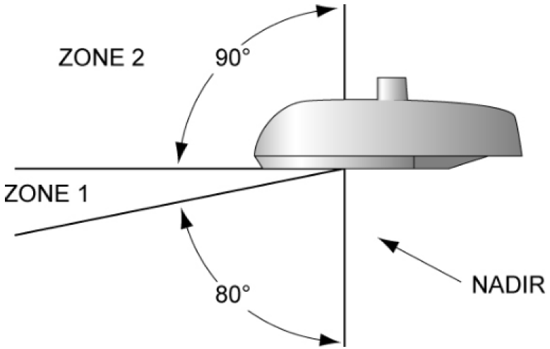
(2)
All public and private outdoor lighting installed after the effective date(s) of an MLOD district designation shall conform to the requirements established by this section.
(3)
Any luminaire in a new development that is aimed, directed, or focused so as to cause direct light from the luminaire to be directed toward an adjacent military base, camp or installation is prohibited. Such luminaire must be redirected or its light output controlled to eliminate such conditions.
(4)
For new development properties situated at or above one thousand two hundred (1,200) feet in elevation (above sea level), and which are situated within one (1) mile from the perimeter of the affected military installation, all lighting shall be fully screened from the affected military installation(s). Methods of screening can include, but are not limited to, fencing and landscaping.
(5)
Within MLR-1:
A.
Maximum CCT of 3000K for all outdoor light sources.
B.
All Night Security Lighting (ANSL) installed by CPS Energy and used to light private property areas and/or non-dedicated streets shall be a maximum CCT of 3000K and contain a full cut-off.
(6)
Within MLR-2:
A.
Maximum CCT of 3000K for all outdoor light sources.
B.
All Night Security Lighting (ANSL) installed by CPS Energy and used to light private property areas and/or non-dedicated streets shall be a maximum CCT of 4000K and contain a full cut-off.
(7)
Residential Lighting.
A.
No trespass lighting within residential areas may exceed one and one-half (1½) foot-candles at the property line, with the exception of intermittent lighting which can be up to two (2) foot-candles.
B.
All lighting within residential areas must comply with commercial lighting subsections (9)A—E below.
(8)
Residential Lighting Exceptions.
A.
Low Ambient Landscape lighting.
(9)
Commercial Lighting.
A.
All lighting fixtures installed on any commercial property and which include or exceed two (2) foot-candles shall be fitted to render them full cutoff (no light output emitted above ninety (90) degrees at any lateral angle around the fixture.) See "acceptable fixture" designation as shown in Figure 2. The manufacturer or firm handling the installation of outdoor lighting must provide documentation to prove full cutoff status of outdoor lighting to the planning and development services department during the plan review stage.
Figure 2 Acceptable vs. Unacceptable Fixture Examples
B.
For lighting horizontal tasks such as roadways, sidewalks, entrances and parking areas, fixtures must meet "full cutoff" criteria (no light output emitted above ninety (90) degrees at any lateral angle around the fixture).
C.
Intermittent lighting must be of the "motion sensor" type that stays on for a period of time not to exceed five (5) minutes and has a sensitivity setting that allows the luminaire to be activated only when motion is detected on the site.
D.
All trespass lighting shall not exceed two and one-half (2½) foot-candles measured at the property line, except that residential trespass lighting is regulated in subsection f(7)A above.
E.
Floodlight fixtures must be aimed so as to prevent direct radiation of light into the open sky at any angle above the horizontal plane as shown in Figure 3 and verified using a tool such as shown in Exhibit 8.
Figure 3
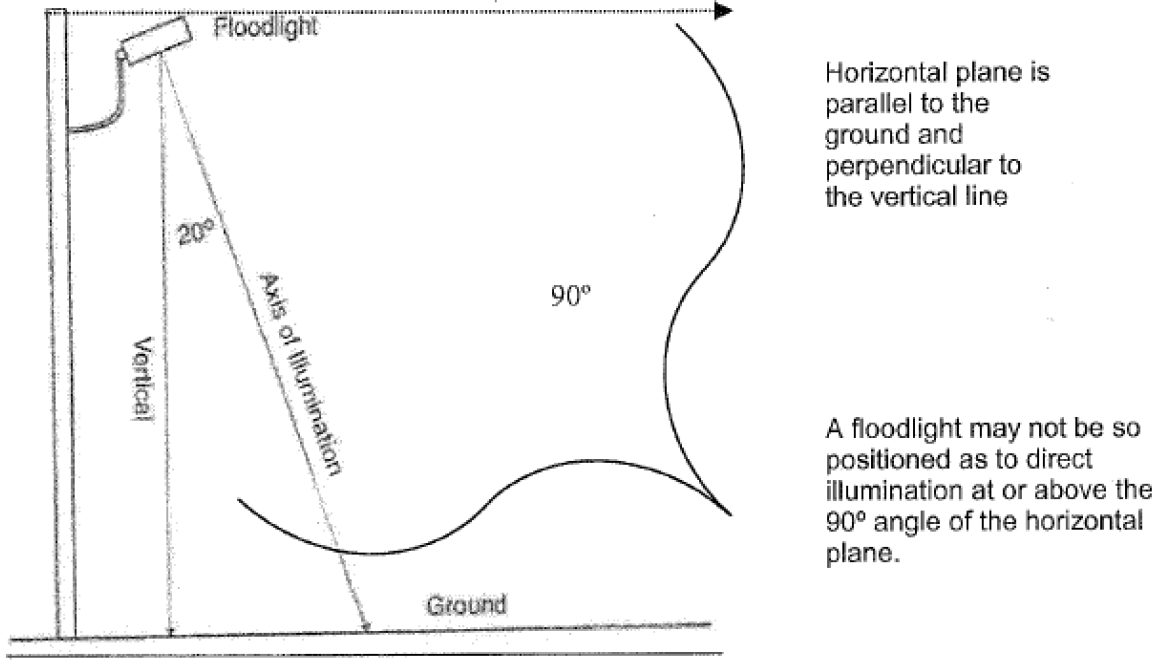
Figure 4
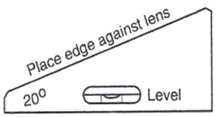
Figure 4: This is a tool for aiming lights such as the floodlight represented in Figure 3. This tool would verify the angle of 20º by placing the upper edge of the tool against the floodlight lens and adjusting the floodlight so that a level parallel to the bottom edge shows level.
F.
With the exception of lighting which is required for security and safety such as parking lot illumination, businesses must turn off outdoor lights emitting illumination levels exceeding two (2) foot-candles (fc) after 11:00 p.m. or one (1) hour after closing, the later of the two.
G.
Lighting installed to illuminate construction sites in order to secure or protect equipment at night shall meet the requirements of subsection f.(9)A. above.
(10)
Non-Residential.
A.
Non-residential limits to off-site impacts are determined using Backlight, Uplight, and Glare (BUG) ratings.
(11)
Gasoline Filling Stations.
A.
Outdoor sales and service station canopies must utilize canopy lights that are fully recessed into the canopy or are fully shielded by the canopy.
B.
The following average maintained illuminance levels for service stations must not be exceeded:
Note: fc = foot-candle
(12)
Parking Lot and Parking Structure Lighting.
A.
Total pole and fixture height shall comply with section 35-392.b of this chapter.
B.
All lighting luminaires in surface parking lots and on the top decks of parking structures shall be fitted to render them full cutoff.
C.
Reflectivity. In order to allow for a variety of surface material options:
i.
Surface parking lots shall be designed, coated or constructed so that illumination levels are no more than what is reflected from asphalt at an average of twenty (20) foot-candles.
ii.
Top decks of parking structures shall be designed, coated or constructed so that illumination levels are no more than what is reflected from asphalt at an average of fifteen (15) foot-candles.
D.
One (1) hour after closing, businesses must reduce light output at least fifty (50) percent in surface parking lots and on top decks of parking structures; however, those luminaires turned off may be set to function utilizing a motion detector system or dimmer.
(13)
Outdoor Sign Lighting.
A.
All signs, except conventional non-digital off-premise signs, located within three-quarters (¾) of a mile of a military installation with an associated MLOD designation shall be positioned in such a manner and contain "dark sky" approved shielding devices as to significantly reduce spillover light affecting the military installation and operations. In no instance shall signs be positioned facing parallel to the adjacent boundaries of the military installation.
B.
On-premises signs may remain illuminated during regular business hours, but may not be illuminated later than one-half (½) hour after the business is no longer open to the public, nor prior to the daily opening of the business to the public.
C.
On-premises signs utilizing neon tube lighting shall be exempt from the requirements of subsection B above.
D.
Single-tenant on-premises signs shall be illuminated at a level no greater than seven (7) foot-candles measured at five (5) feet from the light source. Multi-tenant on-premises signs shall be illuminated at a level no greater than twelve (12) foot-candles measured at five (5) feet from the light sources.
E.
Exterior means of illumination utilized for on-premises signs shall be positioned in a "top down" manner as depicted in Exhibit 7. Bottom-mounted fixtures shall not be used for on-premises signs.
F.
Conventional non-digital off-premises signs shall employ an upward illumination system utilizing no more than three (3) luminaires to illuminate each sign message area (face). Each luminaire shall employ a refractor and hood that focuses the light on to the sign face and each luminaire may not exceed two hundred (200) watts.
G.
All on-premises and off-premises digital signs shall be illuminated at a level no greater than 0.3 footcandles over ambient light levels for the location and time and shall employ light cutoff devices, such as louvers, to minimize light escaping above the horizontal plane. This subsection (13)G. is not exempt from the requirements of subsection (13)B. above.
H.
Other than the requirements contained in subsection (d)(1) and subsection (13), the installation, operation, alteration, repair or improvement of an illumination device used for an off-premises sign are not subject to the other provisions of sections 35-339.04 or 35-498, but are subject to provisions of chapter 28 and chapter 35 as appropriate.
I.
Nothing in this section shall be interpreted to authorize signs in areas of the city prohibiting signs.
(14)
Externally Illuminated Sign Standards.
A.
External illumination for signs shall conform to the following lamp source, shielding restrictions and lumen caps as shown in Exhibit 9.
B.
Upward-directed sign lighting is prohibited.
Table 339.04-5
Lamp Type and Shielding Standards
Note: Lighting Zones (LZ) are defined in IDA model ordinance
Notes to Table 339.04-5.
A = all types of light fixtures are allowed except that any spot or floodlight shall be aimed not higher then twenty-five (25) degrees from the vertical line between the light fixture and the ground when light emitted from a light fixture is visible from any off-site residential property or public roadway.
F = only fully shielded light fixtures allowed.
1 = Flood or spot lamps shall be aimed no higher than twenty-five (25) degrees from the vertical line between the light fixture and the ground when the source is visible from any off-site residential property or public roadway.
(15)
Street Lighting.
A.
This subsection regulates the illumination levels and CCT for the MLR's street lights that are installed on any street and must follow the American National Standard Practice for Roadway Lighting under the IESNA.
B.
Street light illumination must follow the guidelines in paragraph C, D, and E. of this subsection unless a licensed professional engineer, trained and experienced in the science of illumination engineering, deems other illumination levels based on IESNA standards more appropriate for existing conditions and staff concurs with this assessment.
C.
Street lights installed in residential areas on IESNA classified local roads shall have a max CCT of 3000K. Street lights installed on IESNA classified collector and major roads shall have a max CCT of 4000K.
D.
All standard streetlights must utilize full cutoff type luminaires that are installed level to the ground in two (2) intersecting perpendicular planes (see Figure 5), and should be horizontally level in all directions.
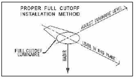
Figure 5
E.
New ornamental street lights must be classified as either IES "Full Cutoff' or IES "Cutoff" as determined by a valid photometric report. This report must be generated for the specified model by a qualified testing lab (testing to IES standards) and must include a full vertical evaluation through one hundred eighty (180) degrees, otherwise that fixture will be unacceptable.
(16)
LEED Standards. It is encouraged that, where possible, LEED (The Leadership in Energy and Environmental Design) certified lighting standards be substituted for the requirements of subsections (5) through (10) above, so long as the minimum standards of this section are met. If a project utilizes LEED certified lighting standards, the remainder of a project's design does not have to meet LEED standards.
(17)
Tower and Structure Lighting. See FCC or FAA regulations.
(18)
Other Prohibited Lighting. Unless authorized by the city council by specific ordinance for a special event:
A.
The use of laser source light or any similar high intensity light, such as used for outdoor advertising or entertainment, when projected above the horizontal plane is prohibited; and
B.
The operation of searchlights for any purposes is prohibited.
(19)
Unmanned Automated Teller Machine Lighting. Unmanned automated teller machines (ATMs) shall comply with the requirements as listed in section 59.307, Texas Finance Code and this article by utilizing fully shielded or full cutoff luminaires as appropriate.
(20)
Exemptions. The following outdoor lighting instances are exempt from the lighting requirements of this section:
A.
All legal outdoor lighting in place prior to the effective date of an MLOD district designation (see subsection (21) below).
B.
Outdoor lighting for which light is produced directly by the combustion of fossil fuels.
C.
Outdoor lighting used during law enforcement, fire, and medical activities and for meteorological data gathering purposes.
D.
Outdoor lighting employed during emergency or night-time repairs of roads and utilities.
E.
Lighting required by law to be installed on motor vehicles.
F.
Lighting required for the safe operation of aircraft.
G.
Outdoor lighting installed on federal and state facilities; however, voluntary compliance is encouraged.
H.
Decorative holiday lighting from November 15 through the next January 15.
I.
Applicable Building Code required lighting for steps, stairs, walkways, and building entrances.
J.
Temporary exemptions: Any individual may submit a written request to the director for temporary lighting and obtain a temporary electrical permit. For a temporary use, the temporary electrical permit may grant temporary lighting for a period not to exceed thirty (30) days, with at least thirty (30) days passing before another temporary electrical permit may be issued. The request for temporary lighting must contain the following information in addition to information required to obtain a temporary electrical permit:
a.
Proposed use and location of the outdoor light requested.
b.
Type of lamp(s) to be used, including manufacturer's part number and initial lumens.
c.
Type of light fixture used, including manufacturer's model number and specification (cut) sheets indicating photometric distribution data stated in iso foot-candle diagrams.
d.
Starting and ending dates for temporary lighting use.
e.
Contact information including name of requester, affiliation (if applicable), address and telephone number.
f.
And such other information the director may require.
(21)
Maintenance and Repair of Legal Nonconforming Luminaires.
A.
All luminaires lawfully in place prior to the effective date(s) of an MLOD district designation shall have legal nonconforming status.
B.
Minor repair and maintenance of legal nonconforming luminaires up to fifty (50) percent of the replacement value is allowed, however any alteration in excess of fifty (50) percent shall terminate the nonconforming status and at that time all standards of this section must be met.
(22)
Administration. The director shall administer this section.
(23)
Variances and Special Exceptions.
A.
The board of adjustment may grant a variance to the requirements of this section where a literal enforcement of the provisions will result in unnecessary hardship. A variance request must be submitted to the city in writing that sets out the basis for the request. No variance can be granted unless it meets the approval criteria outlined in subsection 35-482(e).
B.
A special exception to the requirements of this section may be granted by the board of adjustment where a plan's lighting design does not meet strict design standards but alternative methods may be used which meet the intent of the Code.
(Ord. No. 2008-12-11-1133, § 1, 12-11-08; Ord. No. 2018-02-08-0079, § 2, 2-8-18, eff. 2-18-18; Ord. No. 2018-12-06-0978, § 2, 12-6-18, eff. 12-16-18; Ord. No. 2022-11-03-0831, § 2, 11-3-22, eff. 1-1-23)
Sec. 35-339.05. - "MSAO" Military Sound Attenuation Overlay District.
STATEMENT OF PURPOSE
Noise generated from military training exercises and aircraft operations affects quality of life for various San Antonio neighborhoods and business districts. This section establishes standards intended to lessen the external noise audible within the interior of noise sensitive structures to a level which greatly mitigates the impact on the general welfare of the public.
(a)
Zoning District Establishment and Designation Criteria.
(1)
This section establishes a military sound attenuation overlay district as an overlay to the base zoning districts. Separate ordinances are required to designate an overlay district via the official rezoning process.
(2)
To be designated as a military sound attenuation overlay district, the area must be identified by the United States military, joint land use study or adopted master plan as being situated within a noise military influence area.
(3)
The zoning designation for a military sound attenuation overlay district shall consist of a base zone symbol and the "MSAO" symbol as a suffix. Military sound attenuation overlay districts shall be numbered sequentially to distinguish among different districts, i.e., "MSAO-1," "MSAO-2," etc.
(b)
Noise Sensitive Land Uses. The following is a list of noise sensitive land uses subject to this section:
(1)
Residential structures including but not limited to single-family and multi-family dwellings.
(2)
Assisted living facilities, nursing facilities, adult day cares and similar congregated living uses.
(3)
Facilities for religious worship or study.
(4)
In-patient medical facilities including but not limited to hospitals and residential treatment centers.
(5)
Funeral homes.
(6)
Child care facilities.
(7)
Senior/community centers.
(8)
Libraries.
(9)
Schools including but not limited to primary and secondary schools, colleges and universities; Exceptions:
A.
Public school buildings built with standard masonry construction techniques.
B.
Non-classroom portions of public or private school gymnasiums.
C.
Public school temporary portable buildings with standard exterior mounted HVAC units, and with construction materials for walls, ceilings, windows and doors having a minimum tested or listed sound transmission class (STC) rating of thirty-two (32), in accordance with ASTM E 90.
(c)
District Standards - Camp Bullis (MSAO-1) and Martindale (MSAO-2). All habitable portions of structures occupied by noise sensitive land uses shall be designed and constructed to achieve either: an outside to inside noise level reduction (NLR) of at least twenty-five (25) a-weighted decibels (dBA), or be built to the standards set forth in subsection (c)(1)B. below.
These standards are required regardless of whether the noise sensitive land use is stand-alone as a single use or part of a larger development that may include more than one land use.
(1)
Options for Compliance. Compliance may be demonstrated using one of the following methods:
A.
Use simultaneous noise readings of instantaneous outside and inside noise levels in accordance with ASTM E 966 to ensure the structure achieves an outside to inside NLR of at least twenty-five (25) dBA; or
B.
Utilize construction materials with a minimum tested or listed sound transmission class (STC) rating of forty (40), in accordance with ASTM E 90, for walls and ceilings, and with a minimum tested or listed STC rating for doors and windows as specified below, in accordance with the following construction methods:
1.
Walls. The specific exterior wall assemblies listed below shall include the interior finishes set forth therein. Exception: Exterior wall assemblies or materials that have been tested or listed with a minimum STC rating of forty (40).
a.
Brick veneer. When exterior walls are constructed using brick veneer, a minimum of one-half (½) inch gypsum drywall shall be applied as the interior finish, or a minimum of three and one-half (3½) inches of foam insulation shall be sprayed in as allowed by the building and fire code.
b.
Vinyl or cement sidings. When exterior walls are constructed using vinyl or cement sidings, a minimum of five-eighths (⅝) inch gypsum drywall shall be applied as the interior finish, or a minimum of three and one-half (3½) inches of foam insulation shall be sprayed in as allowed by the building and fire code.
c.
Other assemblies and materials. All other exterior wall assemblies or materials shall have a tested or listed minimum STC rating of forty (40).
2.
Roof/Ceiling Assemblies. Roof/ceiling assemblies shall be constructed in accordance with the requirements of subsections a or b below. Exception: Roof/ceiling assemblies or materials that have been tested or listed with a minimum STC rating of forty (40).
a.
Ceilings with unconditioned attic space shall be insulated with a minimum of one-half (½) inch gypsum drywall on the interior ceiling side covered with a minimum of twelve (12) inches of blown in fiberglass insulation, or a minimum of three and one-half (3½) inches of spray foam insulation shall be applied to the underside of the roof deck as allowed by the building and fire code.
b.
Ceilings without attic space above shall be insulated with a minimum of five-eighths (⅝) inch gypsum drywall on the interior side filled with a minimum of nine (9) inches of fiberglass batt insulation with a one (1) inch air space between the roof sheathing and the fiberglass, or a minimum of three and one-half (3½) inches of spray foam insulation shall be applied to the underside of the roof deck as allowed by the building and fire code.
3.
Windows. The cavity between the wood framing and the window frame shall be insulated with fiberglass insulation or foam insulation to the depth of the window frame.
a.
If the exterior windows and doors together comprise no more than thirty (30) percent of the total exterior wall area, all windows shall have a minimum tested or listed STC rating of thirty (30).
b.
If the exterior windows and doors together comprise more than thirty (30) percent but no more than forty (40) percent of the total exterior wall area, all windows shall have a minimum tested or listed STC rating of thirty-two (32).
c.
If the exterior windows and doors together comprise more than forty (40) percent of the total exterior wall area, all windows shall have a minimum tested or listed STC rating of forty (40).
4.
Doors.
a.
If the exterior windows and doors together comprise no more than thirty (30) percent of the total exterior wall area, all exterior doors shall have a minimum tested or listed STC rating of thirty (30).
b.
If the exterior windows and doors together comprise more than thirty (30) percent but no more than forty (40) percent of the total exterior wall area, all exterior doors shall have a minimum tested or listed STC rating of thirty-two (32).
c.
If the exterior windows and doors together comprise more than forty (40) percent of the total exterior wall area, all exterior doors shall have a minimum tested or listed STC rating of forty (40). Exception: An exterior door may have a tested or listed STC rating of less than forty (40) when installed with a storm door which when combined, achieve a minimum tested or listed STC rating of forty (40).
5.
Mechanical Systems. Mechanical ventilation systems (HVAC) shall provide minimum air circulation and fresh air requirements for various uses in occupied rooms without the need to open any windows, doors, or other openings to the exterior.
a.
In-window, through-wall, or through-floor air conditioning, ventilating, or heating units may be used if:
i. the above insulation requirements for walls, ceilings, windows and doors are implemented, or
ii. walls, ceilings, windows and doors have a minimum tested or listed STC rating of forty (40).
b.
Evaporative coolers may be installed if the following is implemented to reduce sound entering through the unit:
i. Insert a duct extension with at least two (2) ninety degree (90º) "elbows" between the structure and the unit.
ii. Add acoustically designed "upducts" in the ceiling of each room to allow proper circulation of air while windows are closed.
(2)
Certification.
A.
Prior to approval of final inspection or issuance of a certificate of occupancy, all project applicants shall submit to the planning and development services department a signed statement certifying compliance with this section.
B.
A single certification statement for multiple structures in the same development may be used as long as the structures implement the same floor plans and construction methods.
(Ord. No. 2010-06-24-0640, § 2, 6-24-10; Ord. No. 2018-12-06-0978, § 2, 12-6-18, eff. 12-16-18)
Sec. 35-339.06. - "MPOD" Mission Protection Overlay Districts.
STATEMENT OF PURPOSE
The San Antonio Missions and their historic grounds are an invaluable historic resource within the City of San Antonio. The City of San Antonio recognizes the positive cultural and economic benefits to preserving the scenic and environmental quality of the sites. A new zoning overlay for the four (4) Mission Sites (Mission Concepcion, Mission San Jose, Mission San Juan and Mission Espada) will regulate the height of new construction which may encroach upon or threaten the integrity of the historic mission sites.
Development and land use adjacent or near the Mission sites have the ability to negatively impact the scenic and environmental quality of these important sites. The purposes of these overlay districts is as follows:
• To create a more attractive, cohesive, and safe environment.
• To safeguard San Antonio's heritage by preventing the despoliation of views of areas and buildings that reflect important elements of the city's cultural, natural, historic, and economic fabric.
• To create favorable impressions of San Antonio as well as provide environmental enrichment for the citizens of the city.
• To enhance San Antonio's image as a progressive, scenic, and livable community.
• To preserve, protect, and enhance areas of high tourist and visitor visibility.
• To enhance the appearance and economic viability of Mission Protection Overlay Districts.
• To provide motorists, cyclists and pedestrians with attractive viewing opportunities.
• To reduce visual clutter and limit distractions modern-day distractions within Mission Protection Districts.
• To stabilize and strengthen property values within Mission Protection Districts.
(a)
Initiation Procedures and Zoning Classification.
(1)
The Mission Protection Overlay Districts are established as overlays to the regular base zoning districts established by this chapter as well as any additional overlays that have been previously applied.
(2)
The zoning designation for the Mission Protection Overlay Districts shall consist of a base zone symbol and the overlay district symbol "MPOD".
(3)
A unique number corresponding to a specific site shall be assigned to each Mission Protection Overlay District.
(b)
Boundaries.
(1)
Boundaries established for MPOD-1, MPOD-2, MPOD-3 and MPOD-4. Typically, Mission Protection Districts shall encompass all areas that are visible or potentially visible from a disc. This shall be defined as the area which falls within a 1,800-foot radius originating from a point located exactly one hundred twenty-five (125) feet from the front door of each Mission chapel, as marked by the disc.
(c)
Protection Angles.
(1)
The established protection angle for each Mission Protection Overlay District shall apply to the full extent of the district. A protection angle shall originate exactly five and one-half (5.5) feet above the brass monument disc that defines each Mission Protection District as prescribed in section 35-303 and extend outward three hundred sixty (360) degrees and upward at a two-degree angle.
Figure 339.06-1 Illustrating Protection Radius
Figure 339.06-2 Illustrating Protection Angle
(d)
Administration. Mission Protection Overlay Districts shall be governed in accordance with articles of this chapter as applicable.
(e)
Public Facilities and Utilities. Notwithstanding article 1, the city (including its departments and agencies) and all utilities as identified in subsection 35-507(a) shall comply with the siting and design requirements of structures and utility facilities which are located within a Mission Protection Overlay District. Utility lines are encouraged to be located underground and in the right of way where possible. County, state and federal agencies are encouraged to take into account Mission Protection Overlay Districts and be sensitive to the intent and provisions of the district in the siting and design of structures which are located within a Mission Protection Overlay District.
(Ord. No. 2014-10-02-0742, § 2, 10-2-14; Ord. No. 2022-11-03-0831, § 2, 11-3-22, eff. 1-1-23)