
Seminole County Unincorporated
City Zoning Code
City Zoning Code
PART 10
- OVERLAY DISTRICTS
Sec. 30.10.1.- Aquifer Recharge Overlay Zoning Classification.
30.10.1.1 Creation of aquifer recharge overlay zoning classification. In addition to and supplemental to all Seminole County zoning requirements and land development regulations heretofore and hereafter established by designated zoning categories and classifications, there is hereby created an overlay zoning classification known as the "Aquifer Recharge Overlay Zoning Classification". Property within the land use regulatory jurisdiction of the County as hereinafter defined, shall be subject to all provisions herein.
30.10.1.2 Purpose. The Floridan aquifer is the most important source of potable water supply in Seminole County, Florida. The County desires to maintain an active role in protecting this sensitive natural resource through enactment of appropriate regulatory measures and coordination with federal and state agencies and other local governments. Accordingly, the purpose of this Part is to safeguard the public health, safety and welfare of the people of the County by protecting, preserving and maintaining the functions of the most effective recharge areas within unincorporated Seminole County. Preservation of the most effective recharge areas is necessary to maintain an acceptable quantity and quality of available potable water resources. This shall be accomplished by regulating development activities which may contribute to the degradation of the aquifer, reduce natural recharge and severely disrupt the natural flow regimes.
30.10.1.3 Scope and authority. The Aquifer Recharge Overlay Zoning Classification shall be considered as overlaying other zoning classifications. Any uses permitted in the portions of the districts so overlaid shall be permitted subject to compliance with the provisions of this classification. If conflicts should arise between the zoning supplemental regulations herein and any other existing regulations, the more restrictive regulations shall apply.
30.10.1.4 Affected area.
(a)
There is hereby established within the unincorporated area of Seminole County an aquifer recharge protection district consisting of the most effective recharge area as herein determined by data provided by the United States Geological Survey, the Soil Conservation Service and the St. Johns River Water Management District. The provisions of this Part shall apply to all development within the most effective recharge area as depicted in an attachment to this Part. Most effective recharge areas can be more accurately defined by a combination of soil types and hydrology. The soil conservation service has categorized soils according to hydrologic characteristics and these categorizations shall be used in part to determine the most effective recharge areas.
(b)
The most effective recharge areas for the Floridan aquifer in Seminole County are shown in the Appendix and have the following characteristics:
(1)
The natural surface drainage system is poorly developed and the amount of runoff with respect to rainfall is relatively low;
(2)
The potentiometric surface of the Floridan aquifer may show "bulges" as found, for example, in the Geneva area of eastern Seminole County;
(3)
The mineralization of water in the Floridan aquifer is less than that in the poor and very poor recharge areas;
(4)
The land surface and the water table are many feet above the potentiometric surface of the Floridan aquifer and the confining layer is either permeable/semipermeable or wholly absent; such areas are characterized by many closed depressions, lakes and ponds which may indicate past sinkhole activity;
(5)
The soils are generally well drained. Recharge rates in the most effective recharge areas range from ten (10) inches to as much as twenty (20) inches of rainfall annually.
30.10.1.5 Recharge area designation. An applicant may object to the designation of land as a most effective recharge area by demonstrating through the submittal of competent expert evaluations including, but not limited to, data derived from soil analyses and sampling and hydrological studies, to the Development Review Manager that the land does not have the associations and characteristics set forth in this Part. If the Development Review Manager concurs with the evaluations submitted by the applicant, these provisions shall not apply to the subject land.
30.10.1.6 Off-street parking and landscaping regulations.
(a)
In addition to all other provisions in this Code, the following provisions shall apply:
(1)
With the exception of ADA accessible parking spaces, all required parking pursuant to Section 30.11.2 may remain unpaved at the option of the developer. In addition, all parking spaces exceeding the minimum number prescribed by Section 30.11.2 shall be unpaved. Whether paved or unpaved, all parking spaces shall be designated as to location, size, and dimensions on an approved site plan meeting the requirements of Chapter 40.
Grass, mulch, gravel, turf block or any durable dust free surface shall be used in the unpaved spaces if permitted by state law, but all drive aisles shall be compacted and paved, unless other approved by the Public Works Director or designee.
(2)
With the exception of ADA accessible parking spaces, a maximum reduction of two (2) feet from the required depth of a parking stall and one (1) foot from the required width of a parking stall shall be permitted for designated parking spaces.
(3)
Reasonable efforts shall be made in the design and construction of all site improvements and alterations to save existing trees and native vegetation. Existing native vegetation that is specified to remain shall be preserved in its entirety with all trees, understory and ground cover left intact. Every effort shall be made to minimize alteration of the existing topography to preserve existing vegetation and maintain natural flow regimes.
30.10.1.7 Development standards.
(a)
Impervious area. The maximum area covered by structures and impervious surface shall not exceed sixty-five (65) percent for non-residential uses and sixty (60) percent for residential uses of the total land area. Pervious areas may be used to satisfy landscaping, setback, buffer strip, drain field and passive recreation area requirements or any other purpose not requiring covering with a material which prevents infiltration of water into the ground.
(b)
Stormwater detention. To the extent permitted by the St. Johns River Water Management District and/or the Florida Department of Environmental Protection, the multiple use of on-site wetlands for the detention of stormwater shall be highly encouraged. Any stormwater management system incorporating wetlands for stormwater treatment shall comply with Chapter 40C-42, F.A.C., as amended, or its successor provisions, Design and Performance Criteria for Wetland Stormwater Management Systems.
(c)
Runoff. Each parcel shall be developed to maximize the infiltration of natural rainfall into the soil and to minimize direct overland runoff into adjoining streets and watercourses. Stormwater runoff from roofs and other impervious surfaces should be diverted into swales or terraces on the parcel when possible. Runoff from driveways, roofs or other impervious areas should be diverted so as to flow over grassed areas prior to flowing into any drainage system whenever possible.
30.10.1.8 Post-development recharge standards. Land alteration in conjunction with development should not significantly alter the recharge or storage characteristics of the site including, but not limited to, the removal of high permeability soils or replacement with lower permeability soils. Post-development groundwater infiltration rates and volumes within the most effective recharge areas must meet the following standards:
(a)
Three (3) inches of runoff from the directly connected impervious area are required within the project boundary; however, an applicant may demonstrate to the County Engineer or his or her designee and the County Engineer or designee may find that the post-development recharge will be equal to or greater than the pre-development recharge. This standard may be achieved by means of natural infiltration, ponding for stormwater retention or detention, structural exfiltration systems or any other method which complies with the requirements of the Seminole County, Florida Public Works Engineering Manual described in Section 5.20(a) of this Code.
(b)
Developed sites are required to retain the total difference between the pre-development and post-development runoff volume as generated by a 25-year frequency, twenty-four (24) hours duration storm event.
(c)
Development sites are required to detain stormwater for a period of time sufficient to ensure that the recharge potential of the site in its pre-development condition is not significantly affected. The County Engineer or designee may require an applicant for development within the most effective recharge areas to submit reasonable and necessary information, studies or data to determine the pre-development and post-development recharge rates.
(d)
Runoff must be discharged from impervious surfaces through retention areas, detention devices, filtering and cleansing devices and subject to industry accepted Best Management Practices (BMPs). For projects with substantial amounts of paved areas (for example, shopping centers and high density developments) provision must be made for removal of oil, grease and sediment from stormwater discharges.
30.10.1.9 Site plan review requirements. In addition to the requirements of Chapter 40 of this Code, the following information shall be included on-site plans:
(a)
Location and size of interior and exterior areas and structures to be used for storage, use, loading/unloading, recycling or disposal of hazardous substances.
(b)
Location of all underground and aboveground storage tanks for such uses such as fuel storage, waste oil holding tanks, chemical storage, hazardous waste storage and collection of contaminated stormwater or wash water and all similar uses.
(c)
Location of exterior drains, dry wells, catch basins, retention/detention areas, sumps and other facilities designed to collect, store or transport stormwater. The point of discharge for all drains and pipes shall be specified on the site plan. Sites at which hazardous substances are stored, used or generated shall be designed to prevent spills and discharges to the air, surface of the ground, groundwater, lakes, streams, rivers or wetlands.
(Ord. No. 2024-02, § 7(Exh. B), 1-9-24).
Sec. 30.10.2. - Scenic Corridor Overlay Zoning District.
30.10.2.1 Title. This Part shall be known and may be cited as the "East Seminole County Scenic Corridor Overlay District Ordinance".
30.10.2.2 Legislative findings. The following findings are hereby adopted as legislative findings by the Board of County Commissioners:
(a)
The Comprehensive Plan of Seminole County provides for the protection and maintenance of the rural landscape and community character of East Seminole County.
(b)
The visual character of the landscape along the major and minor roads defines the rural landscape and community character of East Seminole County.
(c)
The rural landscape and community character of East Seminole County is an important resource that contributes to the high quality of life of Seminole County.
(d)
Agricultural activities in East Seminole County are an important historical, cultural and economic resource that contributes to the quality of life of Seminole County.
(e)
The character, location and distribution of uses and structures along the major and minor roads in East Seminole County defines the visual character of East Seminole County.
30.10.2.3 Purpose. The purposes of the Scenic Corridor Overlay District are to:
(a)
Preserve and enhance the rural character and scenic qualities along major and minor roads in the rural parts of Seminole County; and
(b)
Prevent the visual encroachment of buildings and structures which restrict scenic views or are architecturally incompatible with the scenic character along major and minor roads in the rural parts of Seminole County; and
(c)
Maintain existing vegetation along the major and minor roadway system in rural Seminole County; and
(d)
Provide for safe and efficient traffic flow by minimizing individual property curb cuts; and
(e)
Implement, and be consistent with, the Comprehensive Plan.
30.10.2.4 Applicability. All development within a designated scenic corridor including, but not limited to (to the extent permitted by law) development undertaken by agencies of local, regional, state, or federal government, shall be carried out in accordance with each and every requirement of this Part, in addition to each and every requirement of any underlying land development regulations.
30.10.2.5 Establishment of scenic corridors.
(a)
Scenic corridors, in addition to those designated in subsection (b) of this Section, shall be established by the Board of County Commissioners pursuant to the procedures for designating land uses on the future land use map of the Comprehensive Plan and as an amendment to this Code.
(b)
The following scenic corridors are hereby designated within the East Area Study Boundary of Seminole County as depicted in the map below:
(1)
Major roads (as the term is used in this Part): County Road 419 from Lockwood Road to the Seminole County line, State Road 46 from Lake Jesup to the Seminole County line, County Road 426 from State Road 434 east to the Seminole County line, and the entire length of Snowhill Road.
(2)
Minor roads (as the term is used in this Part): The entire length of Florida Avenue, Lockwood Road, Lake Mills Road/Brumley Road that "loops" Lake Mills, the Chuluota By-Pass, Lake Geneva Road, 1 st Street, Lake Harney Road, Old Mims Road/Jungle Road south of State Road 46, Osceola Road, and Mullet Lake Park Road.
Scenic Corridor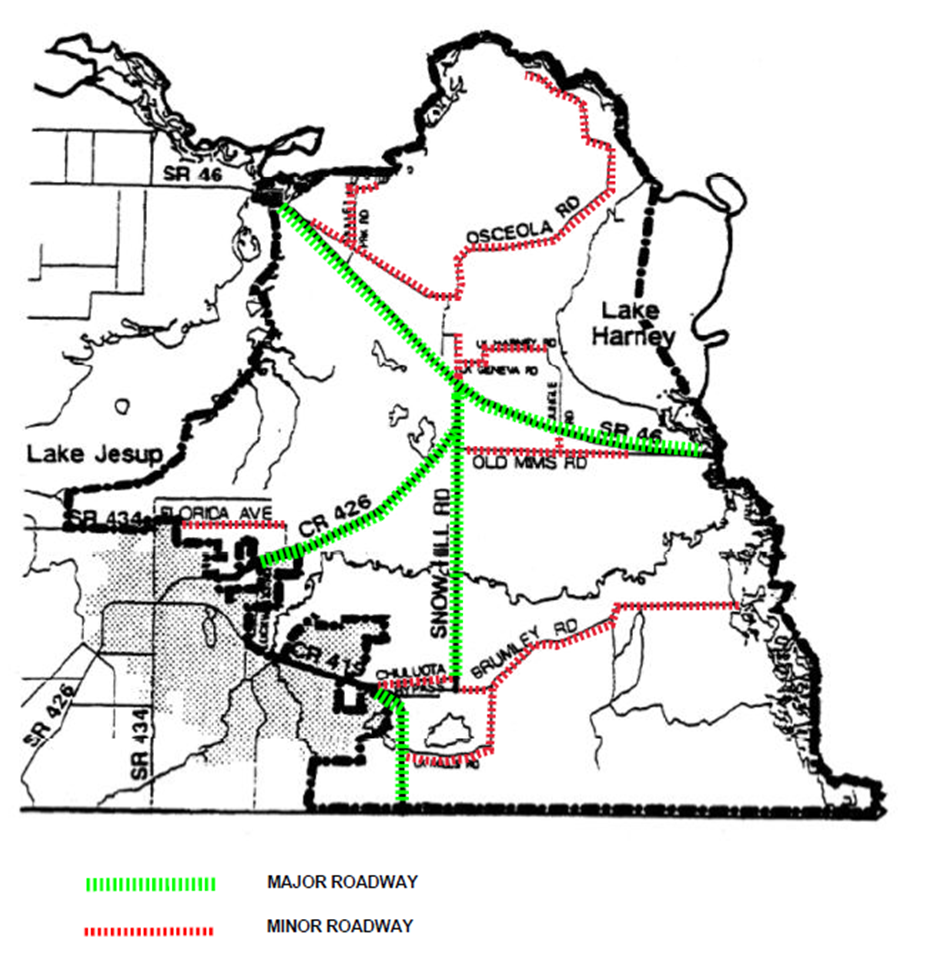
30.10.2.6 Development standards.
(a)
Scenic corridor setbacks. Except for those structures expressly authorized in this Section and except for land designated as Commercial, Suburban Estates, or Low Density Residential on the future land use map, no structure, parking or outdoor storage shall be located:
(1)
Within two hundred (200) feet from the centerline of the right-of-way in scenic corridors along a major road; or
(2)
Within fifty (50) feet from the centerline of the right-of-way in scenic corridors along a minor road.
(3)
Notwithstanding any other provision of this Code, except within the Commercial, Suburban Estates, and Low Density Residential future land use designations, the following structures and uses shall be the only structures and uses permitted within the designated scenic corridor setbacks:
a.
Agricultural buildings in accordance with the standards of this Part.
b.
Signs in accordance with the sign standards of this Part.
c.
Landscaping features required by this Part and other permitted landscape materials.
d.
Fences, gates, mailboxes, and entranceways in accordance with the architectural design standards of this Part.
e.
Access ways or access points in accordance with the access standards of this Part.
f.
Bus stops, bus shelters, signage, and other such improvements related thereto.
g.
Signs, markings, traffic control devices, and such other improvements related to the safe and efficient movement of traffic.
(b)
Signage.
(1)
All signs shall reflect the rural character of Central Florida and incorporate a traditional typeface and format. Examples of appropriate signage are set out in an attachment to this Part. These signs are to be constructed in accordance with the other provisions of this Code unless otherwise specified in this Part.
(2)
The faces of all signs shall be made of natural materials or substances derived from natural materials including, but not limited to, wood, stucco, stone, brick and clay tile.
(3)
No sign shall be internally lighted. Externally illuminated sign lights shall be focused, directed, and so arranged as to prevent glare or direct illumination or traffic hazard from said lights onto residential districts or onto the abutting roadways. No flashing or pulsating lights shall be permitted on any sign.
(4)
Each primary residence with access on a major or minor road shall be permitted one (1) sign of not more than one and one-half (1.5) square feet per dwelling unit.
(5)
Each non-residential use shall be permitted one (1) sign of not more than thirty-six (36) square feet in area and six (6) feet in height.
(6)
One street name or identification sign of not more than one and one-half (1.5) square feet shall be allowed at each permitted access way or access point along major and minor roads.
(7)
Notwithstanding any other provision of this Part, no more than one (1) sign per parcel of land or five (5) acres, whichever is greater in land area, shall be located within the scenic corridor setback along major roads; provided, however, that all signs located within the scenic corridor setback along major roads shall be:
(8)
Ground signs and shall not exceed six (6) feet in height; and
(9)
Landscaped with native species in a manner consistent with the landscape treatment portrayed in an attachment to this Part.
(c)
Fences, gates, mailboxes, and entranceway features.
(1)
All fences, gates, mailboxes, and entranceways developed in conjunction with a non-agricultural use within the scenic corridor setback shall be made of natural materials or substances derived from natural materials including, but not limited to, wood, stucco, stone, brick and clay tile.
(2)
No entranceway feature shall be internally lighted.
(3)
No fence, gate, mailbox, or entranceway feature within the scenic corridor setback shall be greater than four and one-half (4.5) feet in height.
(4)
No more than forty (40) percent of the surface area of any fence within the scenic corridor setback shall be opaque.
(d)
Landscaping and bufferyards.
(1)
All landscaping required in conjunction with the Land Development Code requirements for the scenic corridor setback shall be native plant species in accordance with the landscape list in the Florida Friendly Landscaping Guide to Plant Selection & Landscape Design.
(2)
All non-residential uses shall be separated from residential uses on adjacent properties by one of the following bufferyards:
a.
A bufferyard of two hundred (200) feet between residential and non-residential buildings; or
b.
A bufferyard of one hundred (100) feet between residential and non-residential buildings landscaped with:
i.
One (1) canopy tree per fifty (50) linear feet; and
ii.
Two (2) understory trees per fifty (50) linear feet of common property line; and
iii.
Eight (8) shrubs per fifty (50) linear feet of common property line; or
c.
A bufferyard of fifty (50) feet between residential and non-residential buildings landscaped with:
i.
One (1) canopy tree per twenty-five (25) linear feet of common property line; and
ii.
Two (2) understory trees per twenty-five (25) linear feet of common property line; and
iii.
Eight (8) shrubs per twenty-five (25) linear feet of common property.
(3)
No existing canopy trees shall be removed in the scenic corridor setback unless the clearing is necessary to provide access, the tree is diseased, or to address public safety emergencies.
(4)
No clearing within the scenic corridor setback shall be permitted except in conjunction with a permit issued for development authorized under the provisions of this Part or for public safety requirements.
(e)
Access standards.
(1)
Notwithstanding any other provision of this Part, no access way or access point for rural subdivisions or waivers to plats shall be located within four hundred forty (440) feet of any other driveway or other way of access on the same side of a major road in any scenic corridor unless such denial of access would be contrary to law.
(2)
No access way or access point driveway along a major road in a scenic corridor shall be developed on a parcel of land which has frontage on a public road other than the major road.
(3)
To the maximum extent feasible, driveways along a major or minor road shall curve or wind so as to restrict views of the structure located on the parcel from the public roadway.
(f)
Permitted uses.
(1)
Notwithstanding any other provision of this Code, no development shall be carried out on land within a designated scenic corridor except for land designated as Commercial on the future land use map and except for agricultural uses and structures.
(2)
Open space which is created by clustering shall be subjected to an open space easement limiting the use of the property to open space and/or agricultural purposes in perpetuity. The developer shall provide for the ownership and maintenance of the open space from which development is clustered, unless dedicated to and accepted by a public agency.
(g)
Nonresidential Building Design Standards.
(1)
The development criteria enumerated in this Paragraph shall apply generally to commercial and other nonresidential structures throughout the Scenic Corridor Overlay District. However, the following structures and uses shall be exempt from these provisions:
a.
Residential structures and accessory structures thereto.
b.
Houses of Worship.
c.
Public schools.
d.
Public Utility structures.
e.
Barns and other structures accessory to a bona fide agricultural use.
(2)
Setbacks.
a.
Structures on lots having a Commercial, Suburban Estates, or Low Density Residential future land use designation and fronting on a major or minor road as designated in Sec. 30.10.2.5 shall have a minimum street yard setback of twenty-five (25) feet.
b.
Structures on lots having a Rural-3, Rural-5, Rural-10, or Preservation Managed Lands (PML) future land use designation and fronting on a major or minor road as designated in Section 30.10.2.5 shall have a minimum street yard setback as required under Section 30.10.2.6.
c.
All properties shall meet required side and rear setbacks as set forth in the applicable zoning district.
(3)
Site Furnishings. Benches and bollards shall be made of wood or wood-like materials.
(4)
Exterior Building Materials. Brick, stucco, or wood-type construction will be the standard exterior facade material required for all applicable development and redevelopment. Metal buildings will only be permitted when a primary exterior façade with the appearance of brick, stucco or wood-type construction visible from Major or Minor street is provided.
(5)
Color Scheme.
a.
No building or structure shall exhibit more than three (3) colors.
b.
Fluorescent or neon colors are prohibited.
(6)
Roof Design. All mechanical equipment and appurtenances placed on the roof will be screened so that they are not visible from any public right-of-way.
(7)
Doors. Main entrance doors shall be thirty (30) to eighty (80) percent glass. Glass shall not be required in service doors and emergency exits.
(8)
Awnings. Awning color shall be solid and neutral, and with no more than one color on any given awning. Both awning and flat canopy treatments are permitted provided one or the other is uniformly applied to the entire building. Internally illuminated awnings, stretch awnings on curved aluminum frames, and backlighted awnings with plastic fabric shall be prohibited.
(9)
Signs.
a.
Wall Signs. Wall signs shall be designed as an integral architectural feature of the structure. The maximum area (expressed in square feet) of wall signs for single-occupant buildings or buildings within a cluster shall be calculated by multiplying the building front footage by one and one-half (1.5) feet. Placement of signs on a building shall not obscure or conflict with awnings, canopies, windows, cornices or other similar architectural details.
b.
Window Signs. Window signs shall not occupy more than twenty-five (25) percent of available glass area, and shall not visually obstruct the display or inside of the building. Neon signs are not permitted.
c.
Ground Signs. Ground signs shall be designed to be compatible in appearance with the principal building.
d.
Prohibited Signs. In addition to the signs prohibited in Section 30.10.2.5, the following sign types shall be prohibited:
1.
Blinking lights, changeable message boards and electronic message signs.
2.
Reverse illuminated (receive light from an internal source) plastic signs.
3.
Reader boards and information displays.
4.
Neon signs and changeable copy signs.
5.
Ground signs constructed at an angle with the façade of the associated building.
6.
Pole signs.
7.
Billboards.
Landscaping Adjacent to Street Right-of-Way and Parking Lot Landscaping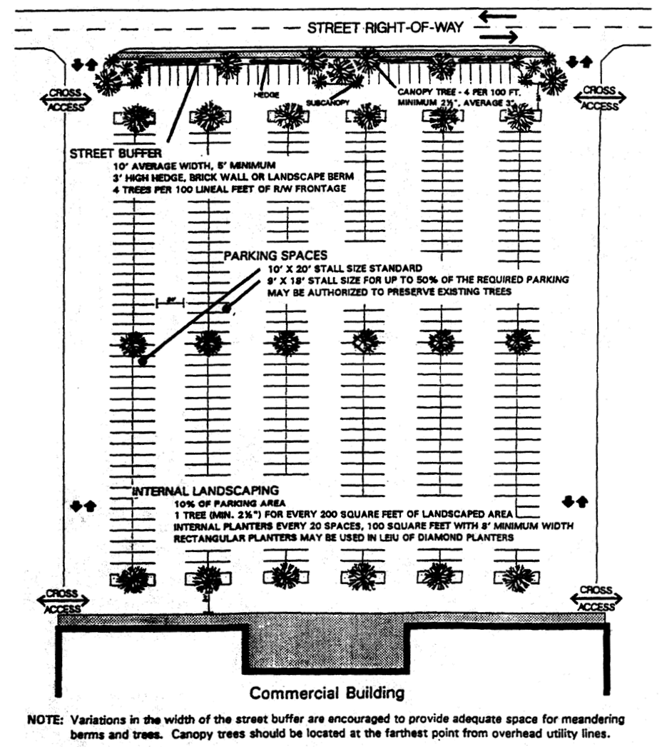
Sign Pictures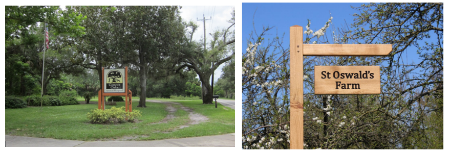
Driveway Pictures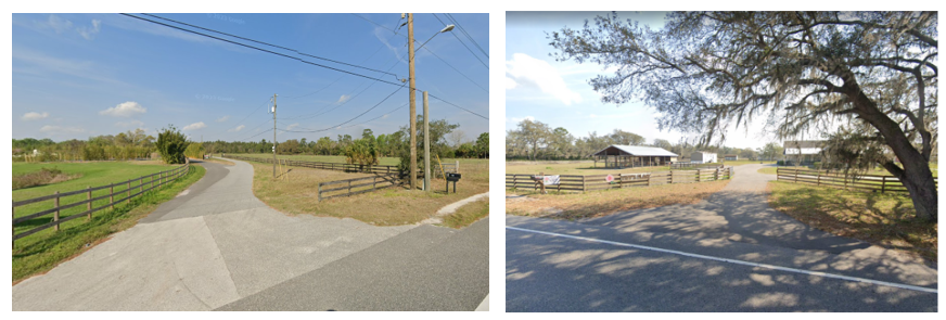
Fence Pictures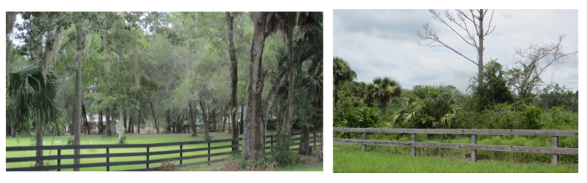
(Ord. No. 2024-02, § 7(Exh. B), 1-9-24).
Sec. 30.10.3. - Lake Mary Boulevard Gateway Corridor Overlay Standards Classification.
30.10.3.1 Creation. In addition to, and supplemental to, all Land Development Code requirements heretofore and hereafter established, there is hereby created an overlay zoning classification known as the "Lake Mary Boulevard Gateway Corridor Overlay Standards Classification." Property within the Lake Mary Boulevard Gateway Corridor listed and described within Section 30.10.3.13 Designated Gateway Corridor, of this Part, shall be subject to all provisions herein.
30.10.3.2 Purpose. The purpose of this Part is to insure that the designated Gateway Corridor is developed in a manner which:
(a)
Insures the roadway is developed into a well landscaped, scenic gateway;
(b)
Provides uniform design standards to establish high quality development;
(c)
Prevents visual pollution caused by unplanned and uncoordinated uses, buildings and structures;
(d)
Maximizes traffic circulation functions from the standpoint of safety, roadway capacity, vehicular and non-vehicular movement;
(e)
Maintains and enhances property values;
(f)
Preserves natural features to the extent practicable; and
(g)
Recognizes and makes allowances for existing uses and buildings.
30.10.3.3 Building setback. The front of any building constructed on a parcel shall be setback a minimum of fifty (50) feet from the right-of-way line; provided, however, a greater setback shall be required if a more restrictive setback is contained within the underlying zoning classification from the adopted right-of-way line.
30.10.3.4 Building height. No building shall be constructed whose roof exceeds thirty-five (35) feet in height.
30.10.3.5 Required corridor buffer and buffer design. A landscape buffer at least fifteen (15) feet in width, which shall be greater if a more restrictive setback is required by the underlying zoning classification, shall be provided abutting the designated roadway right-of-way lines.
(a)
The developer/property owner shall be responsible for the purchase, installation, maintenance and irrigation of all required landscaping.
(b)
The buffer area shall be planted with live oaks, of four (4) inch diameter at breast height (dbh) at planting, along a line ten (10) feet back from the right-of-way line. The trees shall be planted every forty (40) feet and staggered so as to be midway between the live oaks planted in the adjacent right-of-way. A minimum of four (4) sub-canopy trees per one hundred (100) feet of road frontage shall be planted in and abut access points and intersections.
(c)
No existing, dedicated, or reserved public or private right-of-way shall be included in calculation of the buffer width.
(d)
Stormwater retention areas shall not be placed in the buffer area.
(e)
If parking abuts the buffer, a continuous shrub hedge shall be arranged or planted to insure that a height of three (3) feet will be attained within one (1) year of planting so as to screen a minimum of seventy-five (75) percent of the parking area, to that height, as viewed from the right-of-way.
(f)
Existing vegetation shall be used where possible to meet these requirements.
30.10.3.6 Parking areas. Parking lots shall be designed and landscaped according to the following criteria:
(a)
Landscape requirement. A minimum of ten (10) percent of all parking area and entryways shall be landscaped with vegetation listed in the Florida-Friendly Landscape Guide.
(b)
Parking bays. Parking bays shall not be larger than forty (40) spaces.
(c)
Landscape breaks.
(1)
Perimeter landscaped parking breaks shall be a maximum of two hundred (200) square feet in area, planted with one (1) canopy tree and a maximum of twenty (20) spaces apart.
(2)
Internal landscaped breaks shall be a minimum of four hundred (400) square feet planted with one (1) canopy tree, two (2) to three (3) inches dbh, for every landscape break and a minimum of three (3) shrubs for every landscaped break. Internal breaks shall be a maximum of twenty (20) spaces apart.
(3)
Diamond landscaped breaks shall be placed every ten (10) spaces internally, shall be eight (8) feet by eight (8) feet and shall be planted with one (1) canopy tree.
(d)
Preservation. Existing vegetation shall be preserved where possible.
(e)
Lighting. Parking lot lighting shall be designed in accordance with Part 15, Chapter 30 of this Code.
30.10.3.7 Signage. Signs shall be erected or installed according to the following criteria:
(a)
Wall signs. The maximum allowable wall sign area shall be one and one-half (1.5) square feet per one (1) linear foot of building frontage. Total sign area shall be the sum of all sign areas excluding window signs or opening banners. No individual wall sign shall exceed one hundred (100) square feet in size for a building with less than two hundred (200) linear feet of building frontage. For buildings with building frontage exceeding two hundred (200) linear feet, no individual sign shall exceed two hundred (200) square feet in size.
(b)
Ground signs.
(1)
Only one (1) ground sign shall be allowed per parcel with four hundred (400) feet or less road frontage. If a parcel's road frontage exceeds four hundred (400) feet and is less than seven hundred (700) feet then a maximum of two (2) ground signs shall be allowed, but no closer than three hundred (300) feet apart. If a parcel's road frontage exceeds seven hundred (700) feet, then a maximum of three (3) ground signs shall be allowed, but no closer than three hundred (300) feet apart. For the purpose of this Part, a parcel does not have to be a legally subdivided lot.
(2)
Vertical structural supports for ground signs shall be concealed in an enclosed base. The width of such enclosed base shall be equal to at least two-thirds (⅔) the horizontal width of the sign surface. A planter structure shall enclose the foot of the base. The planter shall be between two (2) and three (3) feet in height above the ground, with a minimum length equal to the width of the sign and a minimum width of three (3) feet. The base and planter shall be of brick.
(3)
Any external above ground light source shall be located and hidden within the planter bed. Light sources located outside the planter bed shall be in a burial fixture.
(4)
The maximum height of the entire sign structure shall be fifteen (15) feet above the elevation of the nearest sidewalk.
(5)
The planter setback shall be a minimum of five (5) feet from the right-of-way.
(6)
The maximum allowable ground sign area shall be one and one-half (1.5) square feet per one (1) linear foot of building frontage but shall not exceed one hundred (100) square feet. Ground sign base, sides and top are excluded from the sign area calculation.
(c)
Maximum total sign area. In no case shall the sum of total wall sign square footage plus total ground sign square footage exceed two (2) square feet per one (1) linear foot of building frontage on any given parcel.
(d)
Movement. No ground sign nor its parts shall move, rotate or use flashing lights.
(e)
Illumination. Sign lights shall be focused, directed, and so arranged as to prevent glare or direct illumination or traffic hazard from said lights onto residential districts or onto the abutting roadways. No flashing or pulsating lights shall be permitted on any sign.
(f)
Prohibited signs. Off-premises signs, portable signs, pole signs, and temporary signs except for advertising on or attached to bus shelters.
(g)
Exempted signs. Real estate signs.
(h)
Flags. Flags are permitted as follows: a maximum of one (1) state, one (1) federal and one (1) local/County flag per parcel, each a maximum of thirty-five (35) square feet.
(i)
Opening banners. Opening banners shall be allowed from two (2) weeks prior to opening until one (1) month after opening.
30.10.3.8 Utility lines. All new or relocated utility lines within the designated corridor shall be constructed and installed beneath the surface of the ground unless it is determined otherwise by the Board of County Commissioners in exercising the public's proprietary rights over publicly owned rights-of-way.
30.10.3.9 Walls. All freestanding walls, sound barriers, ground sign enclosures, planters, etc. fronting along the designated roadway or its major intersections shall be of brick construction.
30.10.3.10 Additional zoning variance criteria.
(a)
Landscape buffer width. The width may be reduced to a minimum of ten (10) feet only if the lot is less than two hundred (200) feet deep.
(b)
Ground signs. In order for ground signs along intersecting roadways which are greater than three hundred twenty (320) feet from the corridor roadway centerline to be approved, it must be demonstrated that the sign is not visible from the corridor roadway and that the sign is directed in such a manner as to be predominantly viewed from the intersecting street.
30.10.3.11 Design standard variances. Variances to design standards set forth herein shall be determined in accordance with the procedures and standards set forth in Part 10, Chapter 40, for variance from site plan requirements.
30.10.3.12 Exemptions. All residentially zoned single-family lots are exempted from meeting all standards contained in this Part except for the burial of utility service lines, wall requirements and the building setback requirement.
30.10.3.13 Designated gateway corridor. The designated gateway corridor/roadway subject to the provision of this Part is Lake Mary Boulevard from Markham Woods Road to the Orlando Sanford Airport entrance (that segment of Lake Mary Boulevard beginning at Sanford Avenue and terminating at the Orlando Sanford Airport being designated as "East Lake Mary Boulevard") including all property within three hundred twenty (320) feet of the adopted centerline of Lake Mary Boulevard including intersecting roadways to the same depth. If any part of any parcel abuts the right-of-way line of the designated roadway, the entire parcel shall be subject to this Part as if the parcel were wholly within the stated corridor width.
30.10.3.14 Future Gateway Corridor Study Commissions. Prior to the beginning of the public hearing process to adopt future County Gateway Corridor Ordinances for additional roadway segments, the County and the participating city or cities shall coordinate, insofar as is practicable, their efforts in formulating such ordinances or amendments thereto.
30.10.3.15 General buffering requirements. The provisions of Part 14, Chapter 30 are specifically included among the general Code requirements applicable to properties in the gateway corridor.
(Ord. No. 2024-02, § 7(Exh. B), 1-9-24).
Sec. 30.10.4. - Econlockhatchee River Protection Overlay Standards Classification.
WHEREAS, the Econlockhatchee River Basin is located, in part, in Seminole County, Florida and includes the Big Econlockhatchee River and its tributaries (one of which is the Little Econlockhatchee River); and
WHEREAS, the Econlockhatchee River Basin is graphically depicted in Exhibit "A", which exhibit is attached hereto and incorporated herein as if fully set forth herein verbatim; and
WHEREAS, the property within Seminole County that is located within the Econlockhatchee River Basin involves more than five (5) percent of the total land area of Seminole County; and
WHEREAS, the Econlockhatchee River Basin contains a diverse and unique ecosystem which, at the time of the enactment of this Part, is largely undeveloped; and
WHEREAS, growth and development pressures that are being experienced in the Central Florida area, generally, and in Seminole County, specifically, are likely to be particularly detrimental to the Econlockhatchee River Basin absent effectual regulation; and
WHEREAS, the St. Johns River Water Management District has commissioned a two phase program to develop a Basin-wide Natural Resources Development and Protection Plan for the Econlockhatchee River Basin; and
WHEREAS, Phase I of the Econlockhatchee River Basin Study, dated October, 1990, has been completed and has been utilized in formulating the provisions of this Part; and
WHEREAS, the Econlockhatchee River Basin Task Force has issued final recommendations to local governments based on the results of Phase I of the Econlockhatchee River Basin Study; and
WHEREAS, the Board of County Commissioners of Seminole County, Florida (hereinafter referred to as the "Board" or the "County" depending upon the context; provided, however, that when determinations are to be made by the County under the provisions of this Part said determinations shall be made by the County staff delegated the particular responsibility or function) has found and determined that, for the sake of the health, safety and welfare of the people of Seminole County, special land development regulations to facilitate a balance between private property rights, development and growth and the ecological and aesthetic well-being of the Econlockhatchee River Basin need to be promulgated and enacted in order to prevent public harms that would likely result without the protections afforded by such special land development regulations; and
WHEREAS, if the environmental integrity of the Econlockhatchee River Basin and the surface and groundwater resources it represents can be protected, then the capacity of Seminole County as a whole to sustain and support sound economic growth is enhanced; and
WHEREAS, the Board believes that it is in the best interests of the people of Seminole County to review and consider the incorporation of appropriate recommendations of the Econlockhatchee River Basin Task Force and Study into the Seminole County Comprehensive Plan and the Land Development Code of Seminole County after public input has been solicited and considered and all required public hearings have been held; and
WHEREAS, to implement the recommendations of the Econlockhatchee River Basin Task Force and Study, the Board finds and determines that it is necessary and desirable to adopt the land development regulations as set forth herein which provide for the minimal impact to private property rights while facilitating the protection of the Econlockhatchee River Basin and, further, finds and determines that such land development regulations shall be applied to all development projects within the Econlockhatchee River Basin on a project by project basis as specified herein when those applications are processed through the established development review process and procedures of Seminole County; and
WHEREAS, accordingly, the Board hereby finds, determines and declares that the land development regulations set forth in this Part are critically important to the successful implementation of the Econlockhatchee River Basin Study in order to prevent public harms that would otherwise occur and to address public harms that may have previously occurred and in order to protect and preserve the future well being of this regionally unique and environmentally sensitive area and natural resources.
30.10.4.1 Creation. In addition to, and supplemental to, all Land Development Code requirements and land development regulations heretofore or hereafter established, there is hereby created an overlay zoning classification known as the "Econlockhatchee River Protection Overlay Standards Classification". Property located within the land use regulatory jurisdiction of the County and within the Econlockhatchee River Basin, as hereinafter defined, shall be subject to the provisions and requirements set forth in this Part in addition to all underlying and overlaid zoning classifications assigned to the property by the County.
30.10.4.2 Statement of purpose. The purpose of this Part is to prevent, avoid and deter public harms by protecting the public's historical interests and the future interests of the public in the important and sensitive natural resources of the Econlockhatchee River Basin ecosystem by balancing development and growth and private property rights with the public's rights and the public policy to protect environmental resources in the least intrusive manner feasible under the circumstances. The purpose of this Part is also to establish general policies and guidelines for future development in the Econlockhatchee River Basin in order that the environmental integrity of the basin will be placed in the forefront of all considerations relating to development proposed to occur in the basin. The Board hereby finds and determines that the public has a legitimate and important interest in protecting water quality and hydrology, water quantity, wildlife habitat, aesthetics, open space and historical archaeological resources and desires to implement and reaffirm the provisions of Article II, Section 7 of the Constitution of the State of Florida which provides that "[i]t shall be the policy of the state to conserve and protect its natural resources and scenic beauty. Adequate provision shall be made by law for the abatement of air and water pollution and of excessive and unnecessary noise." The Board hereby finds and determines that the provisions and requirements of this Part are consistent with the provisions of the State Comprehensive Plan (Chapter 187, Florida Statutes) relating to water resources, natural systems and recreational lands, property rights and land use and all other elements of said plan. The Board hereby further finds and determines that the provisions and requirements of this Part are consistent with the regional policy plan adopted by the East Central Florida Regional Planning Council and the Seminole County Comprehensive Plan. The Board also hereby finds and determines that the provisions and requirements of this Part are necessary to prevent public harms and for the protection of the public's health, safety and welfare and, further, for the protection of this unique and important natural resource and ecosystem. All of such findings and determinations are fully supported by the October, 1990 "Econlockhatchee River Basin Natural Resources Development and Protection Plan" adopted by the St. Johns River Water Management District. The Board hereby ratifies and adopts the recitals in the preamble to this Part set forth prior to this Section.
30.10.4.3 Affected area/definitions.
(a)
The area over which this Part shall be applicable shall be that portion of the Econlockhatchee River Basin within the boundaries of Seminole County, Florida. For the purposes of this Part, the "Econlockhatchee River Basin" shall mean and be referred to as those lands within Seminole County which are described in Exhibit "A". The determination as to whether a development project is within the Econlockhatchee River Basin shall be made pursuant to Section 30.10.4.7. All property that is within the Econlockhatchee River Basin, but is not within the "Econlockhatchee River Corridor Protection Zone", as described below, shall be subject to the Basin wide land development regulations set forth herein, but shall not be subject to the provisions of this overlay zoning classification relating to properties located within the Econlockhatchee River Corridor Protection Zone which provisions shall only apply to properties located within said zone. The provisions of this subsection shall not be construed to prohibit the transfer of density credits to properties located outside the Econlockhatchee River Basin when such properties are physically contiguous to property located in the basin, are in common ownership with property located within the basin and together formed a single parcel of record as of the effective date of this Part.
(b)
The "Econlockhatchee River Corridor Protection Zone" is hereby established which includes the following areas:
(1)
The main channels of the Big Econlockhatchee River and its tributaries as graphically depicted on or listed in Exhibit "A";
(2)
All property located within the first one thousand one hundred (1,100) feet landward as measured from the stream's edge of the main channels of the Big Econlockhatchee River and Little Econlockhatchee River;
(3)
All property located within the first five hundred fifty (550) feet landward as measured from the stream's edge of the tributaries of the Big Econlockhatchee River;
(4)
Notwithstanding the above physical descriptions of the Econlockhatchee River Corridor Protection Zone, the Zone shall extend to and contain at least fifty (50) feet of uplands property which is landward of the landward edge of the wetlands abutting the main channels of the Big Econlockhatchee River and its tributaries;
(5)
Provided, however, that only property located within the Econlockhatchee River Basin shall be deemed to be located within the Econlockhatchee River Corridor Protection Zone.
(c)
The term "stream's edge" means the waterward extent of the forested wetlands abutting the Big Econlockhatchee River or its tributaries. In the absence of forested wetlands abutting the Big Econlockhatchee River or its tributaries, the stream's edge means the mean annual surface water elevation of the stream; provided, however, that if hydrologic records upon which the County can rely upon are not available, the landward extent of the herbaceous emergent wetland vegetation growing in the Big Econlockhatchee River or its tributaries shall be considered to be the stream's edge.
(d)
The term "Rare Upland Habitats" means those vegetative communities identified by the County as Scrub, Longleaf Pine - Xeric Oak, Sand Pine Scrub, Xeric Oak and Live Oak Hammock. Those vegetative communities are defined in the Florida Land Use Cover and Forms Classification System which is published by the Florida Department of Transportation and is attached hereto as Exhibit "B" which is incorporated herein by this reference thereto as if fully set forth herein verbatim.
30.10.4.4 Applicability.
(a)
Except as otherwise provided herein, all development within the Econlockhatchee River Basin shall comply with and shall be accomplished in accordance with the requirements of this Part.
(b)
Except as otherwise provided herein, this Part and the provisions of this Part shall apply to all development and applications for development permits (as the term "development" is defined by Section 380.04, Florida Statutes, and the term "development permit" is defined by Section 163.3164(7), Florida Statutes relating to property located within the Econlockhatchee River Basin).
(c)
The provisions of this Part shall not be applicable to the following projects or properties if the below listed approval was issued prior to the effective date of this Part:
(1)
Developments of regional impact that have received a final development order issued pursuant to Section 380.06, Florida Statutes, which development order has not expired and is in good standing;
(2)
Platted lots resulting from approved plats lawfully recorded and approved under the provisions of the Land Development Code of Seminole County and applicable state law; provided, however, that this exemption shall not apply to plats of lots which are five (5) acres in size or greater; and
(3)
Projects that have received an unexpired County approved site plan, an unexpired County approved preliminary subdivision plat or an unexpired waiver to subdivision requirements on or before the effective date of this Part and have lawfully commenced and are proceeding in good faith in the development approval process in accordance with the Land Development Code of Seminole County.
(d)
Existing lawful uses of property, buildings and structures shall not be required to be removed or otherwise modified as a result of the standards or requirements set forth in this Part. The destruction or temporary discontinuation of any such lawful uses, building or structure shall not prohibit the renewed use or reconstruction of the building or structure, but only in its pre-existing form; provided, however, that this provision shall not affect the operation of the Seminole County Comprehensive Plan or of any land development regulation of the County; provided, further, however, that the provisions of Section 30.3.10 shall apply to nonconforming uses. The burden shall be on the property owner to demonstrate that existing land uses, buildings and structures qualify as pre-existing conditions.
(e)
The provisions of this Part shall not operate to deny valid existing rights of property owners to continue the current lawful use of land as set forth above. If the provisions of this Part are believed by a property owner to operate to restrict the valid and lawful existing rights of a property owner, such property owner may apply to the County, in accordance with Section 30.10.4.7, for an exemption from such provisions in order to preserve valid existing rights. It is not the intent of this provision to create new rights in property, but is only to consider existing rights in property which may have vested in a property owner. The fact that a parcel of property is assigned a particular zoning classification or land use designation on the effective date of this Part does not vest any rights in the property owner owning said parcel of property.
30.10.4.5. Land development regulations relating to the entire Econlockhatchee River Basin.
(a)
The land development regulations set forth in this Section shall be applied to all development on a project by project basis utilizing the standards set forth in subsection (b) of this Section for that portion of the project within the Econlockhatchee River Basin.
(b)
The following provisions shall apply to all development activities proposed within the Econlockhatchee River Basin:
(1)
A survey of those species designated as an endangered species, a threatened species or a species of special concern pursuant to, Rules 39-27.003, 39-27.004 and 39-27.005, Florida Administrative Code, shall be required as part of all development applications where there is a reasonable expectation, as determined by the County Natural Resource Officer based upon the range and habitat requirements of these species, that any of said species may utilize any habitat within the boundaries of the property sought to be developed within the Econlockhatchee River Basin. Such surveys shall utilize the most current Wildlife Methodology Guidelines published by the Florida Game and Freshwater Fish Commission. If any endangered species, threatened species or a species of special concern is found to exist on a project site, any proposed development within any of the habitat of the species shall be accomplished only in such a way and utilizing only such techniques which protect the values of the habitat for such species. The developer of the proposed development site shall provide the County with a copy of a valid management plan approved by the appropriate state agency as well as a copy of any and all other permits required for the protection of any endangered species, threatened species or a species of special concern found to exist on the property which management plan, upon approval of the proposed development by the County, shall become part of the conditions of approval for the project which conditions shall be binding upon the developer and property owner and shall run with the land pursuant to a development order, development permit or other instrument of approval issued by the County.
(2)
Where landscaping requirements and conditions are otherwise required as part of a development approval, the development design shall include the use of native plant species and shall minimize removal of vegetation to the greatest extent practical as determined by the County in order to insure that wildlife habitats will be preserved and maintained and to cause landscaped areas to blend into nearby and abutting natural areas. A listing of plants recommended for use for such landscaped areas is attached hereto as Exhibit "C" and incorporated herein by this reference thereto as if fully set forth herein verbatim.
(3)
Sufficient separation, as determined by the County, shall be provided between stormwater management structures and conservation areas (such as, by way of example and not by way of limitation, properties assigned the conservation land use designation pursuant to the provisions of the Seminole County Comprehensive Plan pursuant to the Land Development Code of Seminole County), conservation easements as defined by Section 704.06, Florida Statutes, and similar properties in order to insure that no adverse impact occurs to the hydrologic regime of the conservation areas.
(4)
Surface waters shall be managed to encourage the thriving of native vegetation where the vegetation does not impede water flow in the County's primary drainage system or otherwise cause any other adverse condition as determined by the County.
(5)
Wet detention treatment systems, as defined and provided for in Chapter 40C-42, Florida Administrative Code, and the St. Johns River Water Management District's Applicant's Handbook shall be required for those areas where dry retention/detention is not possible, as determined by the County, due to limited percolation capacity. Design of wet detention treatment systems shall be consistent with the guidelines set forth in Exhibit "D" which are hereby incorporated herein by this reference thereto as if fully set forth herein verbatim. In addition to wet detention systems, the creation of forested or herbaceous wetland areas shall be encouraged and incorporated into all system d"sign'where feasible, as determined by the County, in order to further enhance stormwater treatment while also providing wildlife habitat values.
(6)
Upland buffers from property which is assigned the conservation land use designation pursuant to the Seminole County Comprehensive Plan or the FP-1 pursuant to the Land Development Code of Seminole County or which has been designated a conservation area, conservation easement or similar property which averages fifty (50) feet in width with a minimum of twenty-five (25) feet in width shall be provided. Whenever determined to be feasible by the County, upland buffers shall connect with each other and with larger natural systems. Density or open space credits for upland buffers shall be encouraged and may be awarded in accordance with the terms of this Part. Upland buffers shall be established pursuant to the granting of conservation easements in accordance with Section 704.06, Florida Statutes, and on forms acceptable to the County.
(7)
Peak discharge rates for surface water management systems shall not exceed the pre-development peak discharge rate for the mean annual storm event (twenty-four (24) hour duration, two and three tenths (2.3) year return period, four and four tenths (4.4) inches of rainfall) and the twenty-five (25) year storm event (twenty-four (24) hour duration, eight and six tenths (8.6) inches of rainfall).
(8)
All proposed development within two thousand (2,000) feet of the stream's edge of the Big Econlockhatchee River and its tributaries shall submit, as part of the development application information, a statement from the Florida Division of Historical Resources of the Florida Department of State or qualified archaeological consultant describing the potential for any archaeological or historical resources to occur on the project site. If, in the opinion of the division or the consultant, as the case may be, the project's location or nature is likely to contain such a resource, then a systematic and professional archaeological and historical survey shall be completed by qualified personnel and submitted as part of the development application to the County for review and consideration as part of the material to be considered in determining whether or not to approve the development proposal. If significant archaeological or historical sites are found to exist on the property, said sites shall be preserved or excavated according to current federal and state laws and guidelines relating to such sites prior to construction on the archaeological or historical site or in any area that may reasonably be determined by the County to impact the archaeological or historical site.
(9)
Rare upland habitats shall be preserved in order to maintain the essential characteristics and viability of the rare habitats. When determined to be feasible by the County, property which contains rare upland habitats should be connected to other communities through preservation of land as mitigation for wetland impacts which are authorized by law. Preserved rare upland habitats shall be eligible for the award of density credits in accordance with the terms of this Part.
30.10.4.6 Econlockhatchee River Corridor Protection Zone Land Development Regulations.
(a)
This Section identifies an area within the Econlockhatchee River Basin where more specific land development regulations shall apply. The determination of whether a project lies wholly or partly within this area shall be made in accordance with Section 30.10.4.7.
(b)
Any development within the Econlockhatchee River Corridor Protection Zone including, but not limited to, redevelopment and agricultural and silvicultural activities except for management activities on state or federal lands conducted by or permitted by the state or federal government, which alters or affects wetland dependent wildlife, vegetation, water quantity, water quality or hydrology, groundwater tables, surface water levels or changes the use of property shall be subject to the provisions of this Section to insure that no significant adverse effect occurs upon any of the habitats of any aquatic or wetland-dependent wildlife or any of the habitats of any species designated as an endangered species, a threatened species or a species of special concern pursuant to Rules 39-27.003, 39-27.004 and 39-27.005, Florida Administrative Code; to water quality or hydrology; to water quantity; to the groundwater table; or to surface water levels. The intent of this requirement is to minimize alterations to natural hydrologic patterns and subsequent vegetation changes. The following provisions shall pertain to properties located within the Econlockhatchee River Corridor Protection Zone:
(1)
Development activities shall not be permitted within five hundred fifty (550) feet of the stream's edge of the channels of the Big Econlockhatchee River and the Little Econlockhatchee River except for the creation of wetlands and passive recreation uses, if approved by the County, when the applicant for development approval has clearly and convincingly demonstrated to the County that said activities in these areas will not adversely affect aquatic and wetland dependent wildlife; the habitat of an endangered species, a threatened species or a species of special concern; water quality or hydrology; water quantity; groundwater tables or surface water levels. As to all other property located within the Econlockhatchee River Protection Zone, development shall be permitted consistent with the underlying zoning classification assigned to the property.
(2)
Restoration of natural hydrologic regimes and preservation of upland forested areas shall be encouraged through the award of open space credits or of density credits awarded in accordance with the terms of this Part. The property owner/applicant may also be awarded density credits for mitigation performed or open space donated to a water management district or another governmental entity with the concurrence of the County.
(3)
Forested habitat fragmentation shall be limited. There shall be no additional crossings by road, rail or utility corridors of the lands located in the Econlockhatchee River Corridor Protection Zone unless the following three (3) conditions are concurrently met:
a.
There is no feasible and prudent alternative to the proposed crossing as determined by the County; and
b.
All possible measures to minimize harm to the resources of the Econlockhatchee River Basin will be implemented; and
c.
The crossing supports an activity that is clearly in the public interest as determined by the County. The use of additional crossings co-located with existing crossings shall be presumed to be the least harmful alternative. The expansion of existing crossings shall be presumed to be less harmful to natural resources than the construction of new crossings.
(4)
Encroachment (fill) placed or deposited within the one hundred (100) year floodplain (as adopted by the Federal Emergency Management Agency) of the Big Econlockhatchee River and its tributaries must be consistent with applicable County land development regulations.
(5)
The only authorized type of new stormwater treatment facilities shall be created wetlands or an equivalent design which is acceptable to the County.
(6)
Recreation and nature trails shall not be impervious and vehicular access shall be limited to river crossings and approved access points. Wildlife underpasses which are deemed adequate to the County shall be provided at all new or expanded river crossings. As to preexisting approved crossings relating to roads or utilities, aerial crossings of property located within the Econlockhatchee River Corridor Protection Zone shall be encouraged.
(7)
Only residential development will be permitted except as stated otherwise in this subsection.
30.10.4.7. Review and appeal procedures.
(a)
The Seminole County Natural Resources Officer shall determine the applicability of this Part to property and, if an application for a development permit for a project is submitted, he or she shall determine whether the project is located to any extent within the Econlockhatchee River Basin and whether the project is located to any extent in the Econlockhatchee River Corridor Protection Zone and is, therefore, subject to the provisions of this Part and, thereafter, if the proposed development is in compliance with the provisions of this Part. The natural resources officer shall expeditiously review and respond to the proposals of the property owner/applicant.
(b)
The property owner/applicant shall submit information and documents to the Seminole County Natural Resources Officer for review and consideration that must clearly and convincingly demonstrate that the proposed development or activity is exempt from or meets the intent of the provisions of this Part.
(c)
The standard of review shall be whether the submitted information and documents or the proposed development clearly and convincingly demonstrate that the property is exempt from or the project complies with the provisions of this Part and all applicable laws and whether significant adverse effect occurs with regard to any habitat of any aquatic or wetland-dependent wildlife or any habitat of any species designated as an endangered species, a threatened species or a species of special concern pursuant to Rules 39-27.003, 39-27.004 and 39-27.005, Florida Administrative Code; with regard to water quality or hydrology; with regard to water quantity; with regard to groundwater tables; or with regard to surface water levels in order to minimize alterations to and adverse effects upon natural hydrologic patterns and resulting vegetative changes.
(d)
The following documents and information, where appropriate, shall be submitted by the property owner/applicant for consideration by the natural resources officer as evidence supporting the property owner/applicant's contention that the property should be deemed exempt from the provisions of this Part or to overcome the presumption of significant adverse impact as to proposed projects:
(1)
The name, address and telephone number of the property owner;
(2)
The property appraiser's tax parcel identification number or other identification of the property involved;
(3)
The year in which the property was purchased or acquired by the current property owner;
(4)
A specific and complete description of any alleged lawful and valid existing property right involved including, at a minimum, the date when such alleged right was acquired and any action of the County alleged to have created such right;
(5)
The specific provisions of this Part from which an exemption is sought and the minimum exemption necessary to preserve any vested right;
(6)
A project map utilizing the Florida Land Use, Cover and Forms Classification System;
(7)
A wildlife survey of those species designated as an endangered species, a threatened species or a species of special concern pursuant to Rules 39-27.003, 39-27.004 and 39-27.005, Florida Administrative Code, utilizing the most current Wildlife Methodology Guidelines published by the Florida Game and Freshwater Fish Commission. (This requirement may be waived by the natural resources officer if he or she determines that reliable information exists which clearly and convincingly indicates that such species are not likely to occur on the property);
(8)
A landscaping plan depicting and describing the impacts to predevelopment plant communities and the use of suggested native species;
(9)
As to projects located within two thousand (2,000) feet of the stream's edge of the Big Econlockhatchee River and its tributaries, a statement from the Florida Division of Historical Resources of the Florida Department of State, or a qualified archeological consultant, describing the potential for any archeological or historical resources on the site proposed to be developed shall also be provided;
(10)
A scaled drawing of the property for which the application has been filed indicating the future land use designation of the property assigned by the Seminole County Comprehensive Plan;
(11)
A legal description of the property;
(12)
The current zoning classification assigned to the property under the provisions of the Land Development Code of Seminole County;
(13)
The proposed land use designation;
(14)
The proposed zoning classification;
(15)
A conceptual plan of the proposed use contemplated by the application; and
(16)
Any additional information requested.
(e)
The property owner/applicant may appeal an adverse determination of the Natural Resource Officer's to the Manager of the Development Review Division. The appeal must be received, in writing, by the Manager of the Development Review Division within fifteen (15) calendar days of issuance of the written determination by the Natural Resource Officer.
(f)
The Manager of the Development Review Division shall promptly hold a hearing on the appeal. At least ten (10) days prior written notice of the hearing shall be provided to the property owner/applicant. The Manager of the Development Review Division shall either affirm, reverse or modify the Natural Resource Officer's determination of whether the property is located in the Econlockhatchee River Basin or whether the project is located in the Econlockhatchee River Corridor Protection Zone or whether the project is in compliance with the provisions of this Part or as to any other matter upon which a determination has been rendered pursuant to the terms of this Part.
(g)
The property owner/applicant may appeal an adverse determination of the Manager of the Development Review Division to the Board within fifteen (15) days of issuance of the written determination by the Manager of the Development Review Division. The Board shall hold a hearing on the appeal within sixty (60) days of receipt of the written notice of appeal. At least ten (10) days prior written notice of the hearing shall be provided to the property owner/applicant. At the close of the hearing, the Board shall either uphold, reverse or modify the determination of the Manager of the Development Review Division or may request that further information be provided to consider at a subsequent hearing date.
(h)
The procedures set forth herein are supplementary and shall not relieve a property owner or a developer of property from any other development review processes, procedures or requirements.
(i)
Any property owner owning a parcel of property which was a parcel of record within the Econlockhatchee River Corridor Protection Zone prior to the effective date of this Part and who owns no property to which density credits may be transferred may, notwithstanding the provisions of this Part, receive a development permit authorizing development in accordance with the property's assigned underlying zoning classification and consistent with all laws, rules and regulations affecting said property; provided, however, that each development order or permit relating to such property shall, if necessary, contain conditions imposed by the Natural Resource Officer, which minimize adverse impacts to natural resources.
(j)
Notwithstanding the provisions of Section 20.4, all development permits issued upon lands located within the Econlockhatchee River Basin shall be issued as development orders in accordance with Chapter 20 of the Land Development Code of Seminole County; provided, however, that Section 20.12 relating to appeals shall not be applicable.
30.10.4.8 Density credits.
(a)
In all situations where a transfer of density is authorized pursuant to the terms of this Part; the use of a planned unit development commitment agreement, development order or a development agreement, if the County implements the provisions of the Florida Local Government Development Agreement Act (Section 163.3220, et seq., Florida Statutes), shall be required to implement the usage of said density credits.
(b)
In all situations where a transfer of density is authorized pursuant to the terms of this Part the clustering of development to preserve sensitive environmental features and to further the policies and purposes expressed in this Part shall be considered and addressed in all development orders and permits pertaining to properties to which density credits were transferred.
(c)
In all situations where a transfer of density is authorized pursuant to the terms of this Part the property to which the density has been transferred, when located within the Econlockhatchee River Basin, shall be subject to the following design guidelines and criteria which shall be implemented in the planned unit development agreement, development order or development agreement as required in subsection (a) of this Section:
(1)
As to all development of properties receiving density credits pursuant to this Part, provisions and conditions shall be made a part of all development approvals which maintain the rural character of the Econlockhatchee River Basin and which maximize the compatibility of such developments with adjacent properties;
(2)
As to all properties receiving density credits pursuant to this Part as a result of property being located within the Econlockhatchee River Corridor Property Zone, only those uses permitted by the underlying zoning classification shall be authorized with regard to the development of the portions of said properties utilizing such credits;
(3)
As to all properties receiving density credits pursuant to this Part, all development approvals relating to said properties shall maximize, to the greatest extent authorized by law, open space and habitat preservation through the clustering of land uses;
(4)
As to all properties receiving density credits pursuant to this Part, parcel configurations including, but not limited to, parcel length and depth, shall be evaluated to insure compatibility between parcels and to implement adequate buffering between parcels;
(5)
As to all properties receiving density credits pursuant to this Part, the expressed requirements, goals, policies and objectives set forth in this Part shall be considered in the context of each development proposal;
(6)
When a parcel of property is located both within and without the Econlockhatchee River Basin the most dense part of any development approved as to said property shall, to the maximum extent feasible as determined by the County, be on the portion of the property located outside of the Econlockhatchee River Basin consistent with all land development regulations applicable to said property.
(d)
In cases where density credits are authorized pursuant to the terms of this Part, density and uses may only be transferred from property located on the same side of a water body as the property to which the density credits are to be transferred which is physically contiguous to and in common ownership with the property from which the density was transferred. Density credits may be transferred to parcels outside of the Econlockhatchee River Basin only if such property is physically contiguous to and in common ownership with the property from which the density credit arose.
(e)
The owner of property from which density is transferred pursuant to the terms of this Part shall record a deed or other appropriate instrument of conveyance in a form acceptable to the County in the chain of title relating to the parcel from which density is being transferred prior to the issuance of any development order or permit relating to the property to which density is being transferred. Said deed or instrument shall expressly restrict, by operation of the deed, the use of the property from which density is being transferred in perpetuity to non-development uses in accordance with the provisions of Section 704.06, Florida Statutes, with such restrictions being expressly enforceable by the County.
(f)
Only properties that are parcels of record and in common ownership as of the effective date of this Part shall be eligible to be awarded density credits.
(g)
Density credits for properties affected by the provisions of this Part shall be as follows:
(1)
Property which is located within the Econlockhatchee River Protection Zone, but is located outside the first five hundred fifty (550) feet of the said zone, property which is dedicated for preservation as an upland buffer or as rare upland habitats and property which is donated pursuant to this Part shall receive a maximum credit of one (1) dwelling unit per each unit of acres upon which a detached single-family residence could have been constructed under the terms of the Land Development Code of Seminole County for each unit of density which is forsaken by the property owner under the terms of the zoning classification assigned to the property and parcels assigned a zoning classification other than single-family residential shall receive density credits, as determined by the Development Services Director, based upon the maximum density or intensity which would have been permitted under the zoning classification assigned to the property;
(2)
Properties otherwise located within the Econlockhatchee River Corridor Protection Zone shall receive a density credit of one (1) dwelling unit of density for every unit of density (construction of a detached single-family residence) that the owner could have utilized in accordance with the terms of Section 30.10.4.7(i).
30.10.4.9 Construction. If there is deemed to be any conflict between the provisions of this Part and the Land Development Code of Seminole County including, but not limited to, those provisions relating to the FP-1 classification, then the more stringent provision shall prevail and be applicable to the particular development application under review.
Exhibit A-1 Map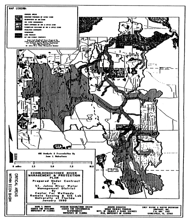
Exhibit "B"
NATURAL AREA LAND COVER CLASSIFICATION
RANGELAND (300)
GRASSLAND (310)
Level III:
311 Grassland/Shrubland.
Prairie grasses occurring along the upland margins of wetland zones, and includes transitional areas between wetlands (e.g., wet prairies and cypress domes/strands) and upland forested lands, and old filed vegetative communities in upland areas, and may include sedges, wax myrtle, gallberry, and other vegetation associated with disturbed areas.
SCRUB and BRUSHLAND (320)
Level III:
321 Palmetto Prairies.
Includes saw palmettos, gallberry, wax myrtle and other shrubs and brush, with saw palmetto being the most prevalent plant cover inter-mixed with a wide variety of other plant species.
323 Scrub.
Scrub vegetation consisting primarily of xeric oak species (e.g., scrub, blue runner), shrubs (e.g., rosemary) and cacti, with a general absence of high canopy tree-type vegetation.
FORESTED UPLANDS (400)
Minimum Criteria: A tree crown areal density (crown closure percentage of 10% or more, and are stocked with trees capable of representing a forested appearance or producing timber or other wood products.
Level III:
411 Pine Flatwoods.
Forested areas dominated by longleaf or slash pine, and mixtures of both pine species, with an understory of saw palmetto, write grass, wax myrtle, fetter bush and gallberry. This category may also include small wetland areas of less than two acres in area.
412 Longleaf Pine - Xeric Oak.
Forested areas dominated by a tree crown closure in longleaf pine (dominant overstory), with bluejack, turkey and post oak being the most prevalent understory trees, and wire grass being the dominant ground cover. This association is often referred to as a Sand Hill vegetative community.
413 Sand Pine Scrub.
Forested areas with dominant overstory tree crown closure consisting of sand pine, with typical understory trees consisting of myrtle oak, chapman's oak and sand live oak. Occurs on excessively well-drained sands often associated with relic dunes and marine sand deposits.
414 Pine-Mesic Oak*.
Forested areas dominated by one or more pine species (e.g., longleaf, slash, loblolly or shortleaf) in strong association with a wide variety of mesic oaks and other hardwood species.
415 Other Coniferous.
Other upland forested areas, including:
- transitional pine flatwoods areas with successional hardwoods in the understory (ten (10) percent pine crown closure or more),
- cedar forests.
HARDWOOD FOREST (420)
Level III:
412 Xeric Oak.
Forested areas dominated by a crown closure of xeric oak species, including turkey oak, bluejack oak, and post oak often found adjacent to or intermixed with Longleaf Pine - Xeric Oak forests. Also referred to as sand hill forests.
422 Other Hardwood.
Forested areas dominated by a crown closure of upland hardwood species other than xeric oaks, including typical species such as live oak, laurel oak, water oak, magnolia, sweet gum, hickory, dogwood and maple. Mesic hardwood communities are included in this category.
423 Mesic Hardwood - Pine*.
Forested areas in which no single species is consistently dominant, but represents a predominantly hardwood forest in which various pine species are major associated communities.
424 Live Oak Hammock*.
Upland forested areas in which Live Oak is either pure or predominant in association with other hardwoods or pines.
MIXED FOREST (430)
Level III:
431 Mixed Forest.
Forested areas consisting of a mixture of upland hardwood and coniferous forest species where neither species dominate the crown closure.
PLANTED FOREST (440)
Level III:
441 Coniferous.
Forested areas created as a result of the artificial planting of coniferous seedling stock or direct seeding methods.
442 Hardwood.
Forested areas created as a result of the artificial planting of hardwood seedling stock or direct seeding methods.
CLEARCUT AREAS (450)
Level III:
451 Clearcut Areas.
Forested areas where commercial timber clearcutting and block planted timber management practices (e.g., land preparation for replanting) are evident and it is expected that the intended future use will not involve a transition to another land use category.
WETLANDS (600)
WETLAND CONIFEROUS FOREST (610)
Level III:
611 Cypress.
Forested wetlands dominated by crown closure in either bald or pond cypress. Principal associated species may include maple, magnolia bay, tupelo gum or pond pine.
612 Pond Pine.
Forested wetlands dominated by a crown closure of pond pine.
613 Cabbage Palm-Mixed*.
A vegetative community consisting primarily of cabbage palms in associated with pine, hardwoods or cypress. Although not strictly a wetlands community, it forms a transition between moist upland and hydric conditions.
WETLAND HARDWOOD FOREST (620)
Level III:
621 Freshwater Hardwood Swamp.
Forested wetlands dominated by one or more hardwood species including gums, hickory, maple, bays tupelo and willow, found in river, creek, lake and pond overflow areas, and sloughs, with cypress often appearing as a secondary species.
622 Bayheads or Bay-gum Wetlands*.
Wetland forested areas consisting purely or predominantly of various types of bay and/or gum trees, often occurring on moist soils resulting from surficial groundwater seepage or shallow surface depressions. Understory vegetation, when present, may include gallberry, wax myrtle and other shrub species.
WETLAND MIXED FOREST (630)
Level III:
631 Mixed Wetland Forest
Forested wetlands containing a mixture of coniferous and hardwood vegetative tree types, where neither tree type is dominant. When more than one-third (⅓) intermixture occurs, the mixed classification will be applied.
WETLAND BEGETATED NONFORESTED
641 Freshwater Marsh.
Wetland marshes which are subjected to permanent or prolonged period of inundation or saturation, and/or exhibit wetland vegetation communities characteristic of this type of hydroperiod, and will consist of one or more of the following plant types: sawgrass, cattail, bulrush, maidencane, pickeralweed, and water lilies.
643 Wet Prairies*.
Wetland depressions which are subjected to periodic inundation and exhibit wetland vegetative communities consisting of various types of grasses, sedges, rushes, shrubs and herbs in varying combinations, and are distinguished from freshwater marshes by having less water and a predominantly grassy or low shrubby appearance.
NOTE: The Level III Land Use and Cover classifications used above are from The Florida Land Use and Cover Classification System: A Technical Report, Florida Division of State Planning, April 1976, with the exception of those classifications followed by an asterisk (*), which have been derived from Florida Land Use, Cover and Forms Classification System, Florida Department of Transportation, September, 1985. The Level III classifications obtained from the FDOT Classification System are intended to supplement the Level III FDSP classifications in terms of providing more precise ecosystem identifications.
Native plants selected from the Florida-Friendly Landscaping Guide Plant List are recommended for landscaping in this Overlay.
Exhibit "C"
WET DETENTION SYSTEMS
•
Systems must be in compliance with Chapter 40C-4 F.A.C., subsection 11.4.3(b) with the following amendments:
•
Within the River Corridor Protection Zone, an off-line system will be utilized.
•
The maximum length to width ratio for detention ponds will be 10:1 with a minimum of 3:1.
(Ord. No. 2024-02, § 7(Exh. B), 1-9-24).
Sec. 30.10.5. - Wekiva River Protection—Seminole Estates Overlay Zoning.
DIVISION 1. GENERALLY
30.10.5.1 Title. This Part shall be known and may be cited as the "Wekiva River Protection-Seminole Estates Overlay Zoning Classification".
30.10.5.2 Creation of Seminole Estates overlay zoning classification. In addition to, and supplemental to, all Land Development Code requirements, land development regulations, and underlying and overlaid zoning classifications heretofore or hereafter established, there is hereby created an overlay zoning classification known as the "Wekiva River Protection—Seminole Estates Overlay Zoning Classification". The Wekiva River Protection—Seminole Estates Overlay Zoning Classification set forth in this Part is applicable to all property located within the land use regulatory jurisdiction of the County and within the Seminole Estates development. For purposes of this Part, "Seminole Estates" shall refer to the development and development plans approved by the Board of County Commissioners by separate resolutions dated September 26, 1978 and January 8, 1980, and the lots existing within that development on June 1, 2000, which is one hundred seven (107) lots, and further depicted in the Future Land Use Element of the Seminole County Comprehensive Plan. For purposes of this Part, the term "lot" shall refer to the one hundred seven (107) individual lots existing within Seminole Estates on June 1, 2000.
30.10.5.3 Statement of purpose. The purpose of the Seminole Estates Overlay Zoning Classification is to discourage the platting or replatting of lots within Seminole Estates if said platting or replatting would increase the number of lots on the property that is the subject of any development application greater than the number of lots existing on June 1, 2000. This Part shall further operate to prohibit the County from issuing development orders and development permits in Seminole Estates if the proposed development order or development permit would increase the number of lots on the property that is the subject of the development order or development permit application greater than the number of lots existing on June 1, 2000. This Part shall be applied and interpreted as to preserve the existing density of Seminole Estates at one (1) permitted dwelling unit per lot and to insure that the total number of lots in Seminole Estates shall not exceed one hundred seven (107).
30.10.5.4 Applicability.
(a)
Except as otherwise provided herein, all development within Seminole Estates shall comply with and shall be accomplished in accordance with the requirements of this Part.
(b)
The provisions of this Part shall not be applicable to projects that have received an unexpired County approved site plan, an unexpired County approved preliminary subdivision plat or an unexpired waiver of subdivision requirements on or before the effective date of this Part and that have lawfully commenced and are proceeding in good faith in the development approval process in accordance with the Land Development Code of Seminole County.
30.10.5.5 Seminole Estates land development regulations.
(a)
Prohibition on Subdivision. Owners of property within Seminole Estates shall not be eligible to subdivide their lot or lots through any process provided in the Land Development Code if approval of the request would increase the number of lots on the property that is the subject of any development application greater than the number of lots existing on June 1, 2000.
(b)
Development Orders and Development Permits. The County shall not approve an application for a development order or development permit if the approval would increase the number of lots on the property that is the subject of the application greater than the number of lots existing on June 1, 2000.
30.10.5.6A Presumption against intensification. Within Seminole Estates, an application for a development order or development permit that may result in an increase in the number of lots on the property that is the subject of the application shall be presumed inconsistent with the Seminole County Comprehensive Plan's objectives, goals and policies relative to the Wekiva River Protection Act and inconsistent with the Wekiva River Protection Act's mandate to maintain the Wekiva River Protection Area's rural character in the aggregate.
DIVISION 2. WEKIVA RIVER PROTECTION AREA ENVIRONMENTAL DESIGN STANDARDS
30.10.5.6B Title and legislative findings. This Part shall be known and may be cited as the "Wekiva River Protection Area Environmental Design Standards".
The following findings are hereby adopted as legislative findings by the Board of County Commissioners:
(a)
The Seminole County Comprehensive Plan provides for the protection and maintenance of the natural landscape within the Wekiva River Protection Area.
(b)
The visual character of the landscape defines the rural landscape and community character of the Wekiva River Protection Area.
(c)
The natural resources within the Wekiva River Protection Area are important resources that contribute to the quality of life in Seminole County.
(d)
Agricultural activities within the Wekiva River Protection Area are important historical, cultural and economic resources that contribute to the quality of life in Seminole County.
30.10.5.7 Purpose and intent. The purpose of this Part is to guide the design and location of development to provide protection of on site habitat, wildlife and wildlife corridors and to insure that the Wekiva River Protection Area is developed in a manner which:
(a)
Provides uniform design standards to establish high quality development that is rural in character; and
(b)
Maintains existing vegetation within the Wekiva River Protection Area of Seminole County; and
(c)
Protects the wetlands systems of the Wekiva River Protection Area of Seminole County; and
(d)
Provides for minimization of disturbance to listed species and their habitats within the Wekiva River Protection Area of Seminole County; and
(e)
Implements, and is consistent with, the Comprehensive Plan of Seminole County.
30.10.5.8 Applicability. All new development or re-development, excluding single family lots existing on the effective date of this Part and except as may be otherwise provided for in this Part, within the Wekiva River Protection Area and outside the East Lake Sylvan Transitional Area/School Site, as depicted in the Future Land Use Element of the Seminole County Comprehensive Plan, including, but not limited to (to the extent permitted by law) development undertaken by agencies of local, regional, state, or federal government, shall be carried out in accordance with the requirements of this Part, in addition to the requirements of any other applicable provisions of the Seminole County Land Development Code.
30.10.5.9 Definitions. As used in this Part, certain words and phrases shall mean the following:
"Upland Buffer" refers to an area averaging fifty (50) feet landward of the wetland and/or flood prone area which at no point is less than twenty-five (25) feet, which shall remain undisturbed by development.
"Greenways" refers to linear lands that provide important corridors or linkages between non-contiguous natural areas.
"Wildlife Corridors" refers to greenways that are known passages of travel for wildlife.
"Karst Features" refers to such features as sinkholes, depressions and stream-to-sink features caused by the dissolution of the rock. Karst features include, but are not limited to, the following: cave, cavern, cavernous porosity, chimney sink, collapsed sinkhole, conduit, cover-collapse sinkhole, cover-subsidence sinkhole, estavelle, exsurgence, grotto, karst window, karstic aquifer, paleokarst, paleosinkhole, pipe, polje, ponor, relict sinkhole, rock-collapse sinkhole, sand boil, seep, sinkhole, solution sinkhole, spring, spring boil, spring pool, subaqueous spring, uvala, vent.
"Open Space" as defined in FLU Policy 15.1 of the Seminole County Comprehensive Plan.
"Sensitive Natural Habitat" as defined in FLU Policy 15.2 of the Seminole County Comprehensive Plan.
"Clearing and Construction Setback" refers to the space between the property line of a lot or parcel and the stated setback distance, in this Part fifty (50) feet, to protect sensitive natural habitat areas, and karst feature from the impacts of development activities.
Any terms not defined herein shall be subject to the definitions of the Land Development Code of Seminole County, Florida.
30.10.5.10 Wekiva River Protection Area Environmental Design Standards.
(a)
Arbor Protection.
(1)
Upon submittal of a site-plan, subdivision application, building permit, or any other application which proposes development within the Wekiva River Protection Area and outside of the East Lake Sylvan Transitional Area/School Site, a tree survey that is compliant with Chapter 60 of the Land Development Code of Seminole County shall be submitted for verification of compliance by the County's Development Review Division Manager or designee. Development shall demonstrate that at least fifty (50) percent of the trees located within the developable areas of a site, including areas subject to residential platting that are not single-family residential lots existing on the effective date of this Part, are preserved on site.
(2)
When fifty (50) percent of the trees cannot be reasonably preserved, a tree replacement ratio shall be implemented that shall require an increasing number of replacement trees based upon the size of a removed tree's caliper, in accordance with Chapter 60 of the Land Development Code of Seminole County.
(3)
Replacement trees shall be native species as listed in Section 60.23 of the Land Development Code of Seminole County and planted on site in common areas and along streets. Replacement trees, at time of planting, shall have a minimum diameter of four (4) inches at one (1) foot above ground level and a height of at least eight (8) feet.
(4)
Single family residential lots with less than fifty (50) percent remaining native vegetation that are platted after the effective date of this Part shall demonstrate at the time of permitting that existing trees and native vegetation shall be maintained to the greatest extent possible.
(b)
Protection of Wetlands and Flood Prone Areas.
(1)
An upland buffer averaging fifty (50) feet but no less than twenty-five (25) feet in width shall be maintained on lands adjoining the conservation land use designation, the FP-1 classification, or properties which have been previously designated as conservation areas or conservation easements.
(2)
Development activity, including the placement or depositing of fill, within wetlands and the one hundred (100) year floodplain (as adopted by FEMA or revealed by the best available data) shall be prohibited.
(3)
If lots are platted into wetlands or associated upland buffers, signage demarking the boundary of the said buffers and wetlands shall be used to deter encroachment. The homeowners association shall be required to adopt covenants which protect such areas from any activity by the residents. Violators shall be subject to standard code enforcement procedures.
(4)
Seminole County shall evaluate and regulate all development within the Wekiva River Protection Area as defined in Section 369.303(9), Florida Statutes, or its successor provision, to ensure consistency with the said Act, the provisions of the Seminole County Comprehensive Plan adopted to conform to said Act and the designated protection zones as required by the Act, including coordination with appropriate agencies as necessary.
(5)
When a proposed development relates to real property located in or near the edge of a designated protection zone, as designated by the Wekiva River Protection Act, the applicant shall submit proof of compliance with all agency regulations applicable to the subject property in conformance with the Act, or proof of exemption thereto. Such proof of compliance or exemption shall be required prior to the issuance of such permits by Seminole County.
(c)
Clustering and the Planned Development (PD). On property having the Suburban Estates land use designation, the use of Planned Development ("PD") zoning may only be permitted if the Development Services Director or designee determines that a greater protection of wetlands, rare upland habitat, greenways, or wildlife corridors can be achieved by clustering. Natural features that may be protected using PD zoning include, but are not limited to, floodprone areas, karst features, most effective recharge areas, or other environmentally sensitive natural habitat. A cluster subdivision must provide a minimum of forty (40) percent open space, including intervening common useable open space, passive or active parks, or conservation land between modules or clusters of homes so that a minimum of sixty (60) percent of the residential lots abut or are located across the street from land held for the common enjoyment of the future residents of the development.
(d)
Protection of Listed Species.
(1)
As a condition for development approval or PD rezoning, applicants shall be required to complete a survey of plants and wildlife including those species designated as endangered, threatened, or species of special concern pursuant to Rules 39-27.003, 39-27.004 and 39-27.005, Florida Administrative Code, utilizing the most current wildlife methodology guidelines published by the Florida Fish and Wildlife Conservation Commission ("FFWCC") and current information from the Florida Natural Areas Inventory.
(2)
Protection of listed species shall be accomplished either through on-site preservation or through relocation within the Wekiva River Protection Area in accordance with a plan acceptable to, and permitted by, the Florida Fish and Wildlife Conservation Commission. Incidental taking of listed species shall not be permitted unless the FFWCC determines that a particular group of animals on the site cannot be relocated or benefited by on-site preservation due to disease. Should such a determination be made by the FFWCC, any incidental taking must be expressly and specifically approved by the County's Natural Resources Officer.
(3)
If a listed species is determined to exist on a site, the following shall apply in order of priority:
a.
The developer/applicant must accomplish development in such a fashion as to avoid the habitat of the listed species; or
b.
The developer/applicant must prove to the County's Natural Resources Officer that it is not possible to avoid the habitat of said species and achieve the approved net density, and then relocate the species on site to equally suitable habitat consistent with guidelines published by the Florida Fish and Wildlife Conservation Commission; or
c.
The developer/applicant must prove to the County's Natural Resources Officer via site analysis that development cannot be accomplished to the approved net density by utilization of on-site relocation of said species, in which case as a final option, only the number of individuals of said species necessary to allow development to occur may be relocated off site. Additional individuals may be relocated off site if it can be demonstrated to the County's Natural Resources Officer that remaining individuals of said species would not constitute or remain part of a viable population. Relocation must take place within the Wekiva River Protection Area with preference given to properties adjacent or close to the donor site.
d.
Wekiva Study Area Environmental Design Standards In addition to the provisions contained in Division 2 (Wekiva River Protection Area Environmental Design Standards) of this Part, development activities must also comply with the provisions contained in Division 3 (Wekiva Study Area Environmental Design Standards) of this Part.
DIVISION 3. WEKIVA STUDY AREA ENVIRONMENTAL DESIGN STANDARDS
30.10.5.11 Title and legislative findings. This Part shall be known and may be cited as the "Wekiva Study Area Environmental Design Standards".
The following findings are hereby adopted as legislative findings by the Board of County Commissioners:
(a)
The Seminole County Comprehensive Plan provides for the protection and maintenance of the natural landscape within the Wekiva Study Area.
(b)
The numerous natural resources, including groundwater resources, within the Wekiva Study Area, are important resources that contribute to the quality of life in Seminole County.
30.10.5.12 Purpose and intent. The purpose of this Part is to guide the design and location of development within the Wekiva Study Area in a manner which:
(a)
Provides uniform design standards to establish high quality development.
(b)
Maintains existing flora and fauna.
(c)
Allows for effective and innovative planning and development activities.
(d)
Protects the natural resources, including, but not limited to, wetlands systems, karst features, sensitive natural habitat, groundwater resources, aquifer recharge areas, springs, and springsheds.
(e)
Provides for minimization of disturbance to listed species and their habitats.
(f)
Implements, and is consistent with, the provisions of the Wekiva Parkway and Protection Act.
(g)
Implements, and is consistent with, the Seminole County Comprehensive Plan.
30.10.5.13 Applicability. All new development or re-development, excluding single family lots existing on the effective date of this Part, except as may be otherwise provided for in this Part, but not limited to (to the extent permitted by law) development undertaken by agencies of local, regional, state, or federal government, shall be carried out in accordance with the requirements of this Part, in addition to the requirements of any other applicable provisions of the Land Development Code of Seminole County.
30.10.5.14. Environmental development standards.
(a)
Karst Features Protection.
(1)
A clearing and construction setback of a minimum of fifty (50) feet from karst features is required. Clearing within the setback to stimulate canopy growth is permitted. Routine maintenance shall be permitted within the fifty (50) foot setback, outside of the natural buffer. Routine maintenance is limited to mowing of grass, and removal of underbrush and dead trees.
(2)
A minimum twenty-five (25) feet, average fifty (50) feet upland buffer, in the aggregate, within the development site, adjacent to karst features is required. Buffers shall remain natural and undisturbed.
(3)
Fertilizers, pesticides, and herbicides shall be U.S. Government approved, and shall not be applied within fifty (50) feet of karst features, or natural water bodies.
(4)
Discharging of untreated water from a development site directly into karst features or natural water bodies shall be prohibited. Karst features, including sinkholes with a direct connection to the aquifer and stream-to-sink features, shall not be utilized as stormwater management facilities. Vegetative swales, bio-retention, or other treatment methods, as approved by the Development Review Manager, may be installed to ensure minimal treatment of discharge into karst features and/or natural water bodies.
(5)
Where an existing lot/parcel of record is too small to accommodate a fifty (50) foot clearing and building setback and/or natural buffer as required in this Part, the allowable use may be established provided that the building and associated paved areas are situated on a development site the greatest distance practicable from the karst features, and further provided that a swale and berm are located between the development and the karst feature. The swale and/or berm shall be designed to direct drainage away from the karst feature, and approved by the Development Review Manager.
(6)
Karst features, and the required natural buffer, shall be placed in a conservation easement pursuant to subsection 30.10.5.14(e).
(7)
An applicant may object to the designation of karst features by providing demonstration through competent expert evaluations of hydrological and/or geotechnical data to the Development Review Manager that the land does not contain karst features as identified in this Part.
(b)
Sensitive Natural Habitat Protection.
(1)
A clearing and building construction setback of a minimum of fifty (50) feet from sensitive natural habitat areas, as defined in this Part, is required.
(2)
Where an existing lot/parcel of record is too small to accommodate a fifty (50) foot clearing and building setback as required in this Part, the allowable use may be established provided that the building and associated paved areas are situated on a development site the greatest distance practicable from the sensitive natural habitat feature, and approved by the Development Review Manager.
(3)
Sensitive natural habitat areas shall be placed in a conservation easement pursuant to subsection 30.10.5.14(e).
(4)
An applicant may object to the designation of sensitive natural habitat by providing demonstration through competent expert evaluation of biological data to the Development Review Manager that the land does not contain sensitive natural habitat as identified in this Part. If the Development Review Manager concurs with the evaluations submitted by the applicant, these provisions shall not apply to the subject land.
(c)
Open Space Protection.
(1)
Open space areas shall be physically connected, whenever practicable, when spread throughout a development site.
(2)
Development shall preserve conservation areas via enforcement of the FP-1 (Floodprone) zoning classifications pursuant to Section 30.12.1.1 of this Code
(3)
Development shall meet the open space ratios and open space credit provisions established in Section 30.14.2.
(4)
Development shall use joint or shared access and stormwater facilities to minimize impervious surfaces, as determined by the Development Review Manager.
(d)
Protection of Most Effective Recharge Areas.
(1)
Development shall comply with the standards for the most effective recharge areas, as defined in the Aquifer Recharge Overlay Zoning Classification of Section 30.10.1. For the purposes of this Part, all properties identified as containing Type "A" Hydrologic Soils Group, as defined by the U.S. Soil Conservation Service, shall be subject to the standards of the Aquifer recharge Overlay Zoning Classification of Section 30.10.1.
(2)
All residential development shall use swales with swale blocks or raised driveway culverts, except when soil, topography, or seasonal high water conditions are inappropriate for infiltration as determined by a County Professional Engineer licensed in the State of Florida.
(3)
Vegetated infiltration areas shall be used to provide stormwater treatment and management on all sites, except when soil, topography, or seasonal high water conditions are inappropriate for infiltration as determined by a County Professional Engineer licensed in the State of Florida.
(4)
Design of the stormwater systems for residential and commercial uses shall use bio-retention areas (below grade vegetated areas) to increase stormwater treatment and reduce stormwater volume. Downspouts for both residential and commercial development shall be directed from the roof to vegetated areas for uptake.
(e)
Conservation Easements. Where easements are required by the County for protection of wetlands, floodprone areas, open space, karst features, or sensitive natural habitat, within this Part, these shall be dedicated to at least one (1) of the following entities:
(1)
St. Johns River Water Management District; or
(2)
The homeowners association; or
(3)
Seminole County.
(f)
Wekiva River Protection Area Environmental Design Standards In addition to the provisions contained in Division 3 (Wekiva Study Area Environmental Design Standards) of this Part, development activities must also comply with the following provisions contained in Division 2 (Wekiva River Protection Area Environmental Design Standards) of this Part:
(1)
Section 30.10.5.9. Definitions.
(2)
Subsection 30.10.5.10(b) (except for (b)(2)), (c), and (d).
(Ord. No. 2024-02, § 7(Exh. B), 1-9-24).
Sec. 30.10.6. - Markham Road, Longwood—Markham Road and Lake Markham Road Scenic Roadway Corridor Overlays.
30.10.6.1 Creation of Scenic Roadway Corridor Overlays for Markham Road, Longwood—Markham Road and Lake Markham Road.
(a)
In addition to, and supplemental to, all Land Development Code requirements heretofore and hereafter established, there is hereby created an overlay zoning classification known as the Markham Road, Longwood—Markham Road and Lake Markham Road Scenic Roadway Corridor Overlay Zoning Classification" (hereafter referred to as "corridor").
(b)
The corridor which is subject to the provisions of this Part consists of Markham Road from its intersection with Orange Boulevard to its western terminus at Longwood—Markham Road, Longwood—Markham Road from Markham Road north to SR 46 and Lake Markham Road from its intersection with Markham Road north to SR 46.
(c)
The provisions of this Part apply to all properties abutting the roads specified in subsection (b) above.
30.10.6.2 Policy constraint on future expansion of Longwood—Markham, Lake Markham and Markham Roads. Longwood—Markham Road, Lake Markham Road, and Markham Road shall be maintained with a maximum of two (2) through lanes; provided, however, that turn lanes and other roadway safety design features may be constructed.
30.10.6.3 Scenic and vegetative requirements for properties located within the corridor. The following standards and requirements shall apply to all new subdivisions which are adjacent to the roads specified in Section 30.10.6.1 of this Part. As to all property within such a subdivision located within forty (40) feet of the edge of the right-of-way of the road:
(a)
No structures, other than driveways and fences (as hereafter specified), shall be constructed within this area.
(b)
No existing canopy trees shall be removed unless approved by the Planning Manager because the removal is necessary to provide access, the tree is diseased or removal is required to address public safety requirements.
(c)
Except as to lots one (1) acre or larger in area, in the absence of a vegetative buffer, a combination of native canopy, sub-canopy, and ground cover species shall be installed to create a forty-foot buffer.
(d)
No clearing of native vegetation shall be permitted except in conjunction with a permit issued to address public safety requirements.
(e)
If utilized, fences shall be of natural materials including, but not limited to, wood, stone, or brick and shall be required to incorporate canopy trees and native vegetation; provided, however, that alternative fencing may be permitted by the Planning Manager if it materially contributes to the rural ambiance of the roadway or if necessary for the protection of wildlife.
(f)
Use of sod within the forty-foot buffer shall be discouraged. Sod shall only be used for erosion control purposes and shall be of a drought tolerant variety.
(Ord. No. 2024-02, § 7(Exh. B), 1-9-24).
Sec. 30.10.7. - Chuluota Nonresidential Design Standards Zoning Overlay.
30.10.7.1 Title. This Part shall be known as the "Chuluota Nonresidential Design Standards Zoning Overlay Ordinance".
30.10.7.2 Legislative findings, history, and intent.
(a)
The findings set forth in the recitals to this Part are hereby adopted as legislative findings.
(b)
The final report titled "Chuluota Nonresidential Design Standards", a copy of which is on file with the clerk of the Board of County Commissioners is hereby adopted as legislative history and as an aid to construing the provisions of this Part; provided, however, that the study does not provide a level of regulation greater than that provided by this Part.
(c)
The purpose and intent of this Part is to establish a design review process and provide the framework necessary to guide new nonresidential development and redevelopment of properties and buildings within the Chuluota nonresidential design district.
(d)
The design standards are intended to protect the rural character traditionally found within the Chuluota area and to provide guidance to County staff and property owners in fulfilling this objective. This Part is intended to designate a design review area, delegate and assign certain authority and establish oversight, review and enforcement procedures.
30.10.7.3 Creation of district. There is hereby created the Chuluota nonresidential design district (hereinafter referred to as the "district"). The district consists of those parcels of land identified in Exhibit A*, a copy of which is attached hereto and incorporated herein by reference. Exhibit A includes a map and a list of parcels, identified by tax folio ID number and approximate street address. The map shows the general outline of the district. In the event of any question regarding inclusion of a particular parcel within the district, the parcel list shall govern over the map.
* Exhibit A is not included herein but is available for public inspection in County offices.
30.10.7.4 Applicability. Except as specifically stated herein, the design standards contained in this Part apply to all nonresidential development located within the district. Nonresidential development is defined as office uses and commercial uses, including all uses permitted in a C-2 zoning district (LDC Section 5.2). Office uses include insurance agents, real estate agents, architects, engineers, medical, dentists, attorneys, accountants, bookkeepers, auditors, and other similar office uses. Not included in the definition of nonresidential development are single-family and multi-family residences, houses of worship, schools, nurseries, kindergartens, public utility structures, hospitals, nursing homes, assisted living facilities, and A-1 uses.
30.10.7.5 Exemptions; conversion of use.
(a)
The following activities are exempt from the provisions of this Part and may occur on the property notwithstanding any prohibition against the extension or enlargement of a nonconforming building or structure that may be set forth in Section 30.10.1(b).
(1)
Additions to, structural alterations of, or expansions of existing buildings, if the estimated construction cost of the addition or expansion is less than fifty (50) percent of the then current value of the existing building (based on best available data, as determined by the Development Services Director, or designee); provided, however, that buildings existing as of the effective date of this Part shall not be required to comply with the provisions of subsections 30.10.7.13(a) through 30.10.7.13(c).
(2)
Routine maintenance; and
(3)
Replacement of like materials.
(b)
A conversion of use shall require site plan review pursuant to Chapter 40, LDC.
30.10.7.6 Permitted uses. Unless in conflict with the provisions of this Part, properties within the district retain all uses provided for by the properties underlying zoning classification.
30.10.7.7 Accessory uses. In addition to the accessory uses permitted by a property's underlying zoning classification, the accessory uses set forth in this Section are permitted in the district provided that the construction of such uses is compatible with the architectural style that this Part may or may not require of the other structures located upon the property. For purposes of this Section, compatibility shall be determined by roof design, colors, materials, finishes, and scale.
(a)
Dumpsters and recyclable drop-off enclosures.
(b)
Accessory buildings and stand-alone canopies or stand-alone shelters. Provided, however, that such accessory buildings, canopies or shelters that are two hundred (200) square feet or greater in size shall be designed to comply with the architectural provisions of this Part while accessory buildings, canopies or shelters that are less than two hundred (200) square feet in size shall are not required to be designed to comply with the architectural provisions of this Part.
30.10.7.8 Approval required. No application for development approval, site plan approval or building permit approval within the district shall be approved prior to the Development Services Director, or his or her designee, making a separate written determination that the project complies with the provisions of this Part. Applicants are encouraged to meet with planning and development staff prior to submitting formal applications in order to discuss the compliance of preliminary concepts or designs with the provisions of this Part.
30.10.7.9 Application; required submittals.
(a)
Applicants for development approval, site plan approval or building permit approval within the district shall, in addition to providing all information required by the Land Development Code, unless waived by the Development Services Director, or designee, include within their application plans package the following information:
(1)
A statement of the general details of the proposed development.
(2)
A property survey.
(3)
A landscape survey (including canopy, scrub masses, grasslands and an overall assessment of natural vegetation cover). The landscape survey shall be in accordance with Section 60.10(b), LDC.
(4)
Certified engineering drawings.
(5)
A complete site plan of the property indicating the locations of all structures and buildings, required yards, required parking, surface drive areas, loading spaces, stacking spaces, landscape areas (both perimeter and interior), dumpsters, exterior mechanical equipment, storm drainage retention areas, and all natural landforms including scrub limits and trees three (3) inches or DBH (diameter at breast height), by species and caliper (both to be removed and to be retained), signs and any other necessary details required for review (scale required: One (1) inch = twenty (20) feet).
(6)
Architectural elevations.
(7)
A clear and detailed description of all proposed construction and installation of signs.
(8)
All elevations of proposed construction (scale required: One and one-eighth (⅛) inches = one (1) foot).
(9)
Wall sections (scale required: three-fourths (¾) inches = one (1) foot).
(10)
Paint colors and locations (including paint chips or samples).
(11)
Photographs of the existing structure (pre-construction) and all adjacent structures.
(12)
Details indicating the following (scale required: one and one-half (1½) inches = one (1) foot):
a.
Windows, shutters and shutter hardware.
b.
Doors, hinges and hardware.
c.
Light fixtures.
d.
Gutters and downspouts.
e.
Exterior surfaces, materials and textures.
f.
Chimneys.
g.
Roofing.
h.
Air conditioning equipment and above ground fuel tanks.
i.
Electric meters and service risers.
j.
Satellite dish antennas.
k.
Exterior porches, landings, stairs, ramps, railings and banisters.
l.
Fences and walls (height, materials and colors).
m.
Walks and drive surface materials.
n.
Patios and decks.
o.
Other miscellaneous ornamentation.
(b)
Once approved, no further submittals of the same documents are required for subsequent development orders unless the applicant proposes substantial deviations from the approved design.
30.10.7.10 Appeal of denial. If the Development Services Director, or his or her designee, determines that an application must be denied for noncompliance with the terms of this Part, then the written denial shall state the conditions, if any, which, if satisfied, would lead to an approval of the application. Notwithstanding any contrary provision of the Land Development Code, an appeal of the Development Services Director, or designee's, written denial shall be heard first by the Board of Adjustment. A denial decision may be appealed to the Board of Adjustment by filing a written appeal, with the appropriate fee, stating the basis for the appeal, with the Development Services Director within fifteen (15) days after the date set forth on the written denial. The decision of the Board of Adjustment may be appealed to the Board of County Commissioners by filing a written notice of appeal, with the appropriate fee, again stating the basis for the appeal, with the Development Services Director within fifteen (15) days after the date of the Board of Adjustment's decision. The Board of County Commissioners' decision shall be de novo.
30.10.7.11 Building size; building placement; height.
(a)
Although these standards do not mandate a particular prototype, cluster designs are encouraged. Concentrating or grouping buildings on the areas of the site best suited for development allows the remaining land to be left undisturbed, thereby preserving the natural setting.
(b)
Each building located upon a parcel shall not exceed five thousand (5,000) square feet of floor area. Smaller buildings are encouraged and may be connected by covered walkways. The maximum permissible FAR is thirty-five one hundredths (0.35). The maximum building height is thirty-five (35) feet.
30.10.7.12 Setbacks. Unless the Development Services Director, or designee, determines that reduced building setbacks will result in the substantial protection of vegetative cover, the minimum building setbacks are as follows:
(a)
Minimum front building setback: Fifty (50) feet from County Road 419. All properties not fronting on County Road 419 shall abide by existing building setback regulations set forth in the applicable zoning classification.
(b)
Minimum rear building setback: Twenty (20) feet.
(c)
Minimum side building setback: Zero (0) feet.
30.10.7.13 Landscaping and retention areas.
(a)
No more than seventy-five (75) percent of existing trees greater than three (3) inches in diameter measured four and one-half (4½) feet from the ground may be removed from the site unless the Development Services Director, or his or her designee, finds that the development of the site would be severely restricted.
(b)
Wet retention ponds shall be designed as amenities within the district. They shall be aesthetically pleasing. All ponds shall be accented with natural form edges and native landscaping.
(c)
Stormwater facilities, where feasible, shall be placed in areas that do not contain existing native vegetation. Shared retention, where feasible, is encouraged to minimize unnecessary consumption of land. Retention areas shall be encouraged to locate in areas not visible from public rights-of-way. Stormwater retention shall not be located in buffer areas adjacent to public streets. Geometric forms such as triangles and rectangles are not allowed unless the Development Review Manager determines that there is no other feasible engineering design available. Retaining walls shall be encouraged, where feasible, to preserve existing native vegetation and must be architecturally compatible with the building materials.
(d)
Selected landscaping shall mimic preferred habitat that may have existed in the pre-development condition. Additionally, no plants on the department of environmental protection prohibited list or the Florida Exotic Pest Plant Councils Category I or II lists may be used.
30.10.7.14 Buffers. Nonresidential developments shall be adequately buffered and well-integrated to the Flagler Trail in terms of walking, bicycle, and equestrian facilities. All buffers shall consist of thickly planted native shrubs and trees of any of the types or species specified in Exhibit B, a copy of which is attached hereto and incorporated herein by this reference.
(a)
County Road 419 Buffer. For those properties abutting County Road 419, a buffer abutting County Road 419 shall be established that has a minimum average width of twenty (20) feet and a minimum width of ten (10) feet. Every effort shall be made to preserve existing preferred habitat within the buffer area. In areas of the buffer that are not densely vegetated, the buffer shall be supplemented with plantings as outlined in Exhibit B of this Part to establish a minimum planting scheme of four (4) canopies per one hundred (100) feet, six (6) understory trees per one hundred (100) feet and a continuous hedge with a minimum height of three (3) feet at planting. Canopy and understory trees may be clustered to accent entrances or other design features of the site.
(b)
Buffer adjacent to Flagler Trail. For those properties abutting the Flagler Trail, a buffer abutting the Flagler Trail shall be established that has a minimum average width of fifteen (15) feet and a minimum width of ten (10) feet. The buffer shall retain native vegetation where the property is adjacent to the trail.
(c)
All other buffers shall be per Part 14, Chapter 30, LDC.
(d)
Vegetation is encouraged where no natural plant communities exist. Landscape requirements stated herein are in addition to those requirements already specified in the Land Development Code. Landscaping shall focus on the protection of natural vegetation and rely on the use of native plant materials.
30.10.7.15 Parking areas. The total amount of required off-street parking shall be determined in accordance with Part 11, Chapter 30 of the Land Development Code. Paved parking, if proposed, shall be provided in accordance with Section 30.10.1.6 of the Land Development Code. Where feasible, parking shall be master planned and located to the rear or side of buildings. Shared property access and cross access easements between adjacent parcels are encouraged. No more than one (1) double-loaded aisle of parking shall be located between the building and the right-of-way. A double-loaded parking aisle shall consist of one (1) driving aisle flanked on each side by rows of parking, accessed by a paved road. Interior and perimeter landscaped areas within aisles shall be dispersed so as to define aisles and limit unbroken rows of parking to a maximum of one hundred (100) feet. Each landscape break shall be a minimum of two hundred (200) square feet in area, exclusive of curbs and/or pavement. Parking lots shall be landscaped extensively, with a focus on the use of native plant materials. Clusters of natural vegetation are encouraged in the center of parking areas. Parking areas shall also be buffered from the CR 419 corridor.
30.10.7.16 Sidewalks. Sidewalks shall be provided on all projects requiring approval under this Part. Sidewalks shall be integrated into natural vegetation and landforms along the CR 419 corridor. Sidewalks shall be designed to meander and take natural forms and curves, however, straight sidewalks may be approved if required due to the nature and characteristics of the particular parcel or for safety purposes. Internal five-foot wide sidewalks shall be permitted to connect different clusters within the nonresidential development. Sidewalks shall connect and extend to the primary entrance of a given building. Continuous or uninterrupted walkways connecting individual buildings within the cluster are encouraged. Walkways shall be constructed of durable and all weather materials. A durable all weather surface shall mean an improved surface of concrete, brick, asphalt, or other permanent dust free surfaces, but shall not include wood chips, mulch, or other materials subject to decay. Sidewalk systems shall also connect to neighboring public spaces or properties, such as open spaces and trails in order to achieve an integrated network within the district. Sidewalk ramps may be required. All sidewalks shall comply with the requirements of the Americans with Disabilities Act. Simple stamped concrete or asphalt paving are the preferred materials for sidewalks.
30.10.7.17 Crosswalks. Where sidewalks cross driveways or parking areas, decorative crosswalks utilizing pavers (or similar material such as stamped concrete or asphalt) and environmental curb/concrete band shall be used to accentuate the crossings. Muted or natural colors specified in Section 30.10.7.25, "Color scheme", shall be the standard for paving finishes. Pedestrian crossing signs may be required.
30.10.7.18 Pedestrian walk lights. If pedestrian walk lights are provided, high-pressure sodium lamps on twelve (12) foot cast-concrete, cast-iron or steel poles shall be the standard for all nonresidential development within the district. Lighting fixtures shall be designed to reduce spill lighting. Walk lights shall be positioned three (3) feet back from the sidewalk and fitted with solar cells for nighttime activation. If provided, pedestrian lights shall be installed in clusters at approximately sixty (60) feet on center along walkways within the development. Down lighting fixtures are standard unless the Development Services Director, or designee, after consultation with the sheriff's office, determines that such fixtures are inadequate to address site specific lighting issues including, but not limited to, safety. Pedestrian lighting shall be turned off no later than 10:00 p.m. and shall remain off until 6:00 a.m. the following morning, unless exempted from this requirement by the Development Services Director, or designee, upon the recommendation of the Seminole County Sheriff's Office based on a consideration of safety to citizens or property. After operating hours, only security lighting shall be utilized on-site.
30.10.7.19 Site furnishings.
(a)
Site furnishings include benches, bicycle racks, trash receptacles, newspaper racks, shopping cart corrals and other similar features. All site furnishings shall be compatible with the architectural style of the project, and, if located within a planned development, consistent with a uniform program established for all properties within the development. Unless the Development Services Director determines that it is unnecessary or impracticable, all site furnishings shall be anchored to the ground. All site furnishings shall use color schemes specified in Section 30.10.7.25.
(b)
All benches, if provided, shall be made of wood or wood-like materials (cypress look and teakwood look are preferred), decorated with simple or rustic detailing and finished with surfaces designed to be durable. Benches shall be installed at locations where pedestrians are likely to gather.
(c)
Wooden or wood-like trash receptacles, of a rectangular section, with simple detailing shall be installed at seating and easement areas near busy routes.
(d)
Bicycle racks constructed of metal and coated with a resistant vinyl finish shall be sited appropriately to complement the trails, recreation facilities and other open spaces where pedestrians are likely to gather. Clusters of natural vegetation shall screen bicycle racks. Reverse U-type racks are preferred.
(e)
Newspaper kiosks, if provided, shall be designed to allow multiple publications. Individual kiosks are not permitted. The location shall be determined during the development review process.
(f)
Bollards, if provided, shall be either cylindrical or of a rectangular section and made from wood or wood type material. Bollards, wherever possible, shall be co-located to function as a hitching post. The height to width ratio shall be four (4) feet to four (4) inches or six (6) inches. The Development Review Manager may require the use.
30.10.7.20 Fences and entrance features.
(a)
Fence and entrance features shall be simple and traditional in their design, and constructed of wood or wood like materials. Only muted or natural colors (refer to Section 30.10.7.25) and materials shall be permitted. Extensive monotonous sections of fences shall be avoided by having breaks, incorporating landscaping and other natural features.
(b)
A four-foot high simple wood or wood-like fence shall be required facing the CR 419 corridor and adjacent to the trail, except as provided in subsection (d)
(c)
In the case of nonresidential property abutting residential property, compliance with Part 14, Chapter 30 shall be required. If a wall is required, it shall be in accordance with the color scheme of the principal structure.
(d)
Nonresidential properties that abut the trail shall install a four-foot high fence where adjacent to the trail. The color scheme of the fence shall be in accordance with the color scheme of the principal structure. The Development Services Director, or designee, may waive the requirement for the fence adjacent to the trail if a natural vegetated buffer exists that is in compliance with the buffer requirements required by this Part.
(e)
The entrances to all properties shall not exceed twenty-four (24) feet in width.
(f)
Entrance features to trails and other public facilities shall be integrated into fences and gateways of the nonresidential clusters within the district.
(g)
The County shall encourage interconnections between properties where appropriate.
30.10.7.21 Service areas. All service areas and mechanical equipment (ground or roof), including, but not limited to, air conditioning condensers, heating units, electric meters, satellite dishes, irrigation pumps, ice machines and dispensers, outdoor vending machines, propane tanks, displays and refilling areas shall be screened so that they are not visible from any public right-of-way. The screen shall consist of a solid wall, facade, parapet or other similar screening material which is architecturally compatible and consistent with the associated building. If landscaping is utilized, then the plantings must be high enough within one (1) year of planting to provide the required screening.
30.10.7.22 Building style. All new nonresidential development shall be harmonious with the pattern, proportions and materials of surrounding rural structures consistent with the provisions of this Part. Buildings shall be either single story, one and one-half (1½) stories, or two (2) stories. Roofs shall be hip or use gables. Flat roofs with a raised parapet are allowed. Generally all buildings shall have a simple frame detailing. All buildings and site features shall be ADA compliant.
30.10.7.23 Design and scale. Full architectural finishing details such as moldings and window trim shall be required on all sides of buildings and accessory structures, regardless of visibility from the CR 419 corridor. Rear sides of buildings shall be neighborhood friendly and facilitate trail and neighborhood pedestrian access as may be appropriate. Large scale big box proportions shall be overcome by providing variations in the roofline and wall planes (extrusions) and through the addition of cupolas, arches, covered walkways, porticos and any other features that may be appropriate to the building or cluster in question.
30.10.7.24 Exterior building materials. All new nonresidential development shall have all exterior surfaces constructed in a manner set forth in this Section. The intent of this Section is to regulate the aesthetic, architectural design of buildings rather than the structural materials used in constructing a building. Brick, stucco, or wood-type construction shall be the standard exterior facade material for all new nonresidential development and redevelopment in the district. Exterior building ma"eria's shall consist of, or accurately resemble, horizontal or vertical "board and batten" wood siding, stucco patterns or brick. Alternative exterior building materials shall include dark red colored brick.
30.10.7.25 Color scheme. Building exteriors shall remain natural (unpainted wood or brick) or be painted in muted, complementary natural colors. Muted, complementary natural colors consist of low intensity colors that predominantly exist in nature. Muted stains and varnish are also allowed. For example, toned down or lower intensity shades such as, but not limited to, green, brown or blue are allowed. No building or structure shall exhibit more than three (3) colors. Wood trim, rafters, eaves, corner trim, window trim, brackets, fences and other supporting components shall also be painted in complimentary natural colors. Standing seam metal roofs shall remain natural and unpainted unless the paint has been factory integrated into the metal roof material. For example, powder-coated metal roofs in muted, complementary natural colors are allowed. Buildings sharing the same frontage in a particular cluster shall have slight variations in their color schemes to avoid monotony. No fluorescent or neon colors are allowed.
30.10.7.26 Roof design and construction.
(a)
Sloped, hip or gable tin roofs shall be allowed. Buildings and structures shall incorporate sloped roofs with a minimum slope of 8:12. All roofs shall be encouraged to display rafter ends. Portions of roofs may be flat to create variety in design. Where flat roofs are integrated into predominantly sloping roof structures, the top shall be finished with a simple raised parapet. The parapet may also function as a building sign. Unusual, undulating roof lines or crenellated/saw-toothed or battlement type parapets are not allowed.
(b)
All roof materials shall be made of metal shingles, corrugated metal sheet, V-crimp metal sheet, standing seam metal sheet, or wood or wood-like shingles.
(c)
All mechanical equipment and appurtenances placed on the roof shall be screened in accordance Section 30.10.7.21, above.
30.10.7.27 Doors.
(a)
Entries recessed from the main facade or covered by a porch are preferred. A central front entry is preferred. Main entrance doors shall be glazed (have glass area). Glazing shall range between thirty (30) percent and eighty (80) percent of the total door area. Door openings shall be proportioned by a minimum of one and one-half (1½) feet of vertical height for every one (1) foot of horizontal width. Applicants shall provide a summary of percentages of openings. Acceptable door materials include wood, painted steel, painted aluminum, and fiberglass. Service doors and emergency exits shall not be required to be glazed. Solid glass doors, unpainted aluminum, unpainted steel or plastic doors are not allowed. Doors shall be neutral and painted or finished in muted or natural colors as set forth in Section 30.10.7.25.
(b)
Doors should be accessible to the street side of the building as well as address the primary parking area, the trail network and other recreational facilities. Doors may be symmetrical or asymmetrical to the facade.
30.10.7.28 Windows.
(a)
False or real windows shall be provided on all elevations in sufficient size and number to complement the proportions of the building. Windows shall have a vertical expression, be located at regular intervals not more than ten (10) feet apart on the facade, be double hung sash two-over-two, two-over-one, three-over-one, four-over-one, six, six-over-one, or eight-over-one. Window openings shall be proportioned by a minimum of one and one-half (1½) feet of vertical height for every one (1) foot of horizontal width. Secondary windows situated on the sides or rear of the building, in a clerestory with lower windows, or in the gables may have a proportion of one (1) foot of vertical height for every one (1) foot of horizontal width, provided that such windows are divided with fixed or false mullions on the exterior.
(b)
Transom windows shall be required on parapet type buildings. Commercial storefronts shall have a transparency (glass area) ranging from forty (40) percent to sixty-five (65) percent of the total ground floor facade area. Calculations of the window door to building face ratios shall be required in the application submittal.
(c)
Windows shall appear to be casement or double-hung. The use of fixed glass and/or false exterior mullions shall be permitted. For windows with shutters, the shutter dimensions shall be appropriately scaled to the window so as to give the appearance of operable shutters. If the shutters are used to create verticality, the shutters shall not be required to provide the appropriate vertical dimension to fully cover the height of the window. Windows shall incorporate a minimum sill and side facing of four (4) inches. Window hoods and lintel facings shall be a minimum of five (5) inches, finished with a simple cornice trim. The acceptable window materials include wood (or wood-like), painted steel, and painted aluminum. Window frames shall be painted in muted or natural colors as set forth in Section 30.10.7.25.
30.10.7.29 Awnings. Awnings, if provided, shall be sensitive to the building height, size, materials and color. Awnings shall be solid, neutral in color and no more than one (1) color shall be permissible on any given awning. Internally illuminated awnings are prohibited. The use of closed shutters, three-sided fabric awnings, spandrel glass, or other appropriate vernacular architectural features shall be permitted to achieve the vertical look. Flat or fixed canopies or entry covers are encouraged on commercial/parapet type buildings. Fabric awnings shall be allowed where the building is designed with adequate wall space to accommodate the awning. Both awning and flat canopy treatments are acceptable as long as they are uniformly applied to the same building. Stretch awnings on curved aluminum frames are not allowed. Back lighted awnings with plastic fabric are prohibited.
30.10.7.30 Handicapped access. All new construction shall comply with accessibility requirements. Ramps, railings and other structural elements required for this purpose shall be designed to reflect the architectural style indicated in the standards and shall be subtly integrated into the building and site design.
30.10.7.31 Signage. In addition to any other requirements in the Land Development Code regarding signs, the following standards shall apply within the district:
(a)
Signs shall be located on the flat, unadorned parts of a facade, including above doors or windows.
(b)
Square or rectangular flush mounted signs are encouraged. Highly ornate signs, such as those with bright colors or extensive detailing, are discouraged.
(c)
Signs shall be designed to not interfere with safe driving sight distance requirements as set forth in the LDC.
(d)
All signs shall be coordinated with the building design in height, size, materials and color, so as to provide a unified appearance.
(e)
Two (2) types of signs, in any combination of wall, window or ground, and otherwise consistent with the terms of this Part and the Land Development Code, shall be allowed per storefront.
(f)
Illuminated signs located within five hundred (500) feet of a residential land use designation or residential zoning classification and which are visible from the residential property shall be turned off no later than 10:00 p.m. and shall remain off until 6:00 a.m. the following morning, unless exempted from this requirement by the Development Services Director, or designee, upon the recommendation of the Seminole County Sheriff's Office based on a consideration of safety to citizens or property. Emergency medical facilities shall be exempt from this requirement.
(g)
One (1) sign wholly independent of any building for support may be allowed per property, provided that the subject of the sign relates to either the identity of the business or the activity carried on in the structure on the same property as the sign. Such a sign shall be referred to herein as a "ground" sign.
(h)
Corner buildings shall be allowed two (2) types of signs, in any combination of wall, window or ground, and otherwise consistent with the terms of this Part and the Land Development Code, per street frontage.
(i)
Signs shall be parallel or perpendicular to the building facade.
(j)
No internally lighted signs (internally lighted means receiving illumination from within the sign), including neon signs, shall be allowed on the exterior of the building. No neon accent lighting of buildings or structures shall be allowed.
(k)
Sign lettering shall meet the following size limitations:
(1)
For storefronts thirty (30) feet or less, the maximum letter height is six (6) inches.
(2)
For storefronts between thirty (30) and sixty (60) feet, the maximum letter height is nine (9) inches.
(3)
For storefronts sixty (60) feet or greater, the maximum letter height is twelve (12) inches.
(l)
Wall signs. The maximum size (expressed in square feet) of wall signs for single-occupant buildings or buildings within a cluster shall be calculated by multiplying the building front footage by one and one-half (1½) feet. Symbols, images, or logos shall also be included in the height and area calculations established. Wall signs shall be designed as an integral architectural feature of the structure. Placement of signs on a building shall not obscure or conflict with awnings, canopies, windows, cornices or other similar architectural details.
(m)
Window signs. Text or an image (logo) applied or hand painted to the inside of the storefront glass is permitted. These signs shall not occupy more than twenty-five (25) percent of available glass area. The sign shall not be a visual obstruction to the display or inside of the building. Neon signs are not allowed on the exterior or immediately behind the storefront window glass. Second story businesses shall be allowed a second story window sign, on an individual case basis. These signs shall not occupy more than twenty-five (25) percent of available window area.
(n)
Ground signs. Ground signs shall be designed in the local vernacular style, consistent with the principal building. Only wood or wood-like panel signs are permitted. Ground signs shall be limited to thirty-six (36) square feet in area and six (6) feet in height. Placement of ground signs shall not obscure vehicular vision or conflict with the predominant rural character and landscape of the district.
(o)
Prohibited signs. The following sign types are prohibited in the district:
(1)
Blinking lights, changeable message boards and electronic message signs.
(2)
Reverse illuminated (receive light from an internal source) plastic signs.
(3)
Reader boards and information displays.
(4)
Neon signs and changeable copy signs. Neon signs and internally lit signs are permitted inside a structure, however, cannot be located within five (5) feet of a window or in such a fashion as to be visible from the exterior of the building.
(5)
Ground signs constructed at an angle with the horizontal plane.
(6)
Pole signs, whether single-faced or double-faced. Pole signs are defined as signs supported by poles, uprights, or braces which are not concealed in an upright base but are permanently placed on or in the ground and are wholly independent of any building for support.
(7)
Billboards, unless permitted by the underlying zoning classification for a particular property on the effective date of this Part.
30.10.7.32 Application fees. The Board of County Commissioners may, by resolution, establish fees to offset the administrative costs of reviewing applications and implementing this Part.
30.10.7.33 Conflicts. The provisions of this Part are in addition to and supplement the other provisions of the Land Development Code. In the event of a conflict between the provisions of this Part and one (1) or more provisions of the Land Development Code, then the provisions of this Part shall govern.
30.10.7.34 Enforcement. Compliance with the standards set forth in this Part shall be the continuing responsibility of the property owners. Failure to comply with this Part shall result in the enforcement of this Part through the procedures set forth in Chapter 53, Seminole County Code, for the violations of the County's codes and regulations. A violation of this Part shall be classified as a Class II violation.
Landscaping materials listed as native plants contained in the Florida-Friendly Landscaping Guide Plant List are permitted in the district.
(Ord. No. 2024-02, § 7(Exh. B), 1-9-24).
Sec. 30.10.8. - Airports.
30.10.8.1 Purpose. The purpose of this Part is to provide airspace protection and adjacent land uses compatible with airport operations; to promote the coordinated use of lands and foster orderly development; to protect the health, safety and welfare of the public; to ensure the economic benefits and capacity of aviation related businesses; and to ensure compliance with all Federal and State aviation laws, rules and regulations.
Additional purposes of this Part are as follows:
(1)
To promote the maximum safety of aircraft using the Airport.
(2)
To promote the maximum safety of persons and property located near the Airport.
(3)
To promote the full utility of the Airport to ensure the welfare and convenience of citizens and visitors.
(4)
To provide limits on the height of structures and objects of natural growth within the 14 CFR Part 77 surface primary, horizontal, conical, approach and transitional, TERPS surfaces, and other imaginary airport airspace surfaces, OEI and TSS to ensure proper and sound development of the areas within these surfaces.
(5)
To discourage new land uses, activities or construction incompatible with existing and planned airport operations or public health, safety and welfare.
(6)
To provide administrative procedures for the efficient and uniform review of land development proposals in the areas surrounding the Airport.
30.10.8.2 Rules of Interpretation.
(a)
Unless the natural construction of the wording indicates otherwise, all words used in the present tense include the future tense; all words in the plural number include the singular number; all words in the singular number include the plural number and all words of the masculine gender include correlative words of the feminine and neuter genders. Any reference herein to a rule, statute, regulation or other legal requirement or form shall also include any modification, amendment, alteration or replacement thereof subsequent to the effective date hereof.
(b)
An area located in more than one of the described airport height zones or airspace surfaces must comply with the most restrictive height limit or surface. In the event a conflict arises between an Airspace Surface and the regulations as set forth in 14 CFR Sections 77.13, 77.15, 77.17, 77.19, 77.21 and 77.23; terminal instrument procedures as contained in FAA Order 8260.3c and Order 8260.58A entitled "United States Standards for Terminal Instrument Procedures" and Federal regulations for turbine powered aircraft as contained in 14 CFR Section 121.189 and any other FAA Advisory Circulars or guidelines relating to airspace, the most restrictive regulation will prevail.
30.10.8.3 Abbreviations.
(a)
For the purpose of this Part, the following abbreviations shall have the following meanings:
(1)
AGL. Above ground level.
(2)
ALP. Airport layout plan.
(3)
AMSL. Above mean sea level.
(4)
CFR. Code of Federal Regulations.
(5)
FAA. Federal Aviation Administration.
(6)
FCC. Federal Communications Commission.
(7)
FDOT. Florida Department of Transportation.
(8)
Navaid. Navigational aids.
(8)
OEI. One Engine Inoperative-Obstacle Identification Surfaces.
(9)
TERPS. Terminal Instrument Procedures.
(10)
TSS. Threshold Siting Surface.
(b)
These abbreviations may be used in the context of administrative rules that may be adopted to implement the provisions of this Part.
30.10.8.4 Zones and Heights Requiring Airport Height Zoning Permit. In order to regulate the height of permanent and temporary structures and objects of natural growth, this Section establishes permitting requirements in certain zones based on height. These zones, and the heights established for each zone, provide for the review by the County of the height of land development proposals over which the County may have jurisdiction to regulate, as well as objects of natural growth. No structure or object of natural growth that would exceed two hundred (200) feet above ground level, any Federal obstruction standards or the height for the zone in which it is located or proposes to be located may be developed, constructed, established, enlarged, substantially altered or repaired, approved for construction, issued a natural resources permit or building permit, or planted, allowed to grow or be replanted, unless the Development Services Director has issued an airport height zoning permit in accordance with this Part. The zones and heights are depicted on the Airport Height Zoning Map.
30.10.8.5 Airport Height Zoning Permit Application Procedure. A request for an airport height zoning permit may be initiated by filing with the Development Services Director a completed application for airport height zoning permit on a form prescribed by the County including a copy of the Form 7460-1 and/or FAA's online OE/AAA website tool, Notice of Proposed Construction or Alteration filed with the FAA, as required pursuant to 14 CFR Sections 77.5, 77.7, 77.9 and 77.11. An FAA airspace review determination resulting from the submittal of a Notice of Proposed Construction or Alteration does not preclude the requirement to obtain an airport height zoning permit from the County. An application for an airport height zoning permit must contain: (i) a site survey, with an FAA accuracy code of 1A, which certifies the site coordinates and elevations with an accuracy of ± 20-feet horizontal and ± 3-feet vertical (all site coordinates must be based on North American Datum of 1983 and National Geodetic Vertical Datum of 1988); (ii) site plans; and (iii) drawings and other data as may be necessary to enable the Development Services Director to determine whether or not the proposal will comply with this Part. A separate application for an airport height zoning permit must be submitted for permanent or temporary derricks, draglines, cranes and other boom-equipped machinery to be used during construction or installation at heights greater than the height of proposed structure. Applications for an airport height zoning permit must be signed by the property owner or an authorized agent of the property owner.
30.10.8.6. Pre-Application Conference Procedure. Prior to submittal of any application for an airport height zoning permit, a prospective applicant shall request a pre-application conference with the Development Services Director. This meeting will include the SAA Airspace Director or his or her designee. The pre-application conference is intended to advise the applicant of the information needed for submittal and the standards and other requirements so that issues can be identified, and costly modifications avoided. Information provided as a result of the conference is for conceptual purposes only, is given solely as a means to assist the applicant and does not take the place of the formal application review process.
30.10.8.7 Review of Airport Height Zoning Permit Application. Before an application for an airport height zoning permit will be considered, the applicant must submit to the Development Services Director a copy of the final airspace review determination by the FAA of the applicant's Notice of Proposed Construction or Alteration. Upon receipt of a completed application and copy of the final determination, the Development Services Director shall forward the application packet to the SAA Airspace Director and to the FDOT Aviation Office, by means of certified mail, return receipt requested, or by means of a delivery service that provides evidence of delivery. FDOT shall have fifteen (15) days to review the application for technical consistency with Chapter 333, Florida Statutes, with said review period running concurrently with the review by the County and the SAA Airspace Director. The SAA Airspace Director shall produce an analysis and recommendation as to consistency with this Part to the Development Services Director. The Development Services Director upon receipt of the application and analysis from the SAA Airspace Director will review the application for consistency with the height limits for the airspace surfaces as set forth in Section 30.10.8.8 below and the guidelines, procedures and criteria set forth in chapter 6, section 3, part 2 of FAA Order 7400.2k, entitled "Procedures for Handling Airspace Matters", as provided in section 3.6 herein. Within a period of twenty-one (21) calendar days from receipt of (i) a completed application, (ii) the analysis of the SAA Airspace Director, and (iii) the final determination by the FAA, the Development Services Director will either approve or disapprove the application. The Development Services Director may consider an application for an airport height zoning permit concurrently with the development plan approval. The provisions of Section 125.022, Florida Statutes, shall govern applications together with the provisions of this Part.
30.10.8.8. Airspace Surfaces. There are hereby created and established certain airspace imaginary surfaces in order to evaluate whether any existing or proposed structure or object of natural growth complies with Federal obstruction standards as contained in 14 CFR Sections 77.13, 77.15, 77.17, 77.19, 77.21 and 77.23 terminal instrument procedures as contained in FAA Order 8260.3C and Order 8260.58A, entitled "United States Standards for Terminal Instrument Procedures" and Federal regulations for turbine powered aircraft as contained in 14 CFR Section 121.189. The airspace surfaces are hereby specified for the most restrictive approach existing or planned for each runway and any planned extension of existing runways and include all of the land lying beneath the airspace surface, as applied to each airport. Except as otherwise provided in this Part, no application for an airport height zoning permit may be approved; no structure may be developed, constructed, established, enlarged, substantially altered or repaired, approved for construction, or issued a natural resources permit or building permit; and no object of natural growth may be planted, allowed to grow or be replanted, in any airspace surface at a height above the height limit established herein for the airspace surface in which the structure or object of natural growth is located or proposed to be located. Such height limits will be computed from mean sea level elevation, unless otherwise specified. The 14 CFR Part 77C (primary, horizontal, conical approach and transitional) airspace surfaces have been analyzed by the Sanford Airport Authority and are illustrated on the maps incorporated herein as Exhibit "A," as may be modified or amended from time to time, and further defined as illustrated in FAA Order 7400.2, entitled "Procedures for Handling Airspace Matters", as applied to the Orlando-Sanford International Airport.
30.10.8.9 Objects Affecting Navigable Airspace. Any existing or proposed structure or object of natural growth that exceeds the standards for identifying and evaluating aeronautical effect as defined in Section 3, Chapter 6, Part 2 of FAA Order 7400.2, entitled "Procedures for Handling Airspace Matters", is presumed to be a hazard to air navigation unless an obstruction evaluation study determines otherwise. Any structure or object of natural growth in violation of the aforementioned standard will be evaluated by the FAA and the SAA Airspace Director to determine if the structure has a substantial adverse effect on navigable airspace affecting airport operations and said evaluations shall be presumed correct absent evidence of gross negligence or malice. The Development Services Director shall consider the determination of the FAA and SAA Airspace Director with this presumption in approving or denying an application for an airport height zoning permit.
30.10.8.10 Supportive Screening Criteria.
(a)
Antenna Installations. Antenna installations used to transmit over navigable airspace may produce a harmful electromagnetic interference with navigation aids or radio communications or aircraft, airport or air traffic control facility. An antenna installation shall comply with the permitting requirements of this Section unless the antenna is to be co-located on an existing structure and:
(1)
The antenna does not increase the height of the existing structure;
(2)
The structure has a current no hazard determination on file with the FAA; and
(3)
The transmission of the antenna has been coordinated and approved by the FCC.
The controlling provisions of Federal law shall prevail over the provisions of any conflicting County land development regulations.
(b)
FAA Navigation Aids. The FAA owns and operates navigation aids at the Airport. These include, but are not limited to, ILS, DME and the automated surface observation system. The FAA provides guidance on the required clear areas around navaids. Any structure or object of natural growth within the vicinity of an FAA navaid must be evaluated by the FAA for interference with the navaid. If the FAA determines that such proposed structure or object of natural growth will adversely affect the utilization of the navaid, such determination by the FAA will be presumed shall be presumed correct absent evidence of gross negligence or malice. The Development Services Director shall take the determination of the FAA with this presumption into account when reviewing the application.
(c)
Landfills. There is a prohibition of new landfills: (i) within ten thousand (10,000) feet from the nearest point of any runway used or planned to be used or (ii) within the lateral limits of the civil airport imaginary surfaces defined in 14 CFR Section 77.19.
30.10.8.11 Criteria for Approval or Disapproval of Airport Height Zoning Permit Application.
(a)
Criteria. In determining whether to issue or deny an Airport Height Zoning Permit, the County shall consider the following:
(1)
The safety of persons on the ground and in the air;
(2)
The safe and efficient use of navigable airspace;
(3)
The nature of the terrain and height of existing structures;
(4)
The effect of the construction or alteration of an obstruction on the state licensing standards for a public-use airport contained in Chapter 330, Florida Statutes, and rules adopted thereunder;
(5)
The character of existing and planned flight operations and developments at public-use airports;
(6)
Federal airways, visual flight rules, flyways and corridors, and instrument approaches as designated by the FAA;
(7)
The effect of the construction or alteration of an obstruction on the minimum descent altitude or the decision height at the affected airport; and
(8)
The cumulative effect on navigable airspace of all existing obstructions and all known proposed obstructions in the area.
(b)
Approval. A permit application for the construction or alteration of an obstruction may not be approved unless the applicant submits documentation showing both compliance with the Federal requirement for notification of proposed construction or alteration and a valid aeronautical study, as defined in 14 CFR Part 77. A permit may not be approved solely on the basis that the FAA determined that such proposed structure or object of natural growth will not exceed Federal obstruction standards and was not an airport hazard, as contained in 14 CFR Part 77, or any other Federal aviation regulation. Upon consideration of the above requirements, as set forth in Section 333.025, Florida Statutes, and if the FAA and the SAA Airspace Director have issued determinations that the proposed structure will not constitute an airspace hazard and the applicant has established by clear and convincing evidence provided to the Development Services Director that the proposed structure or object of natural growth will not exceed the height limits established for the airspace surfaces and other applicable standards, and will not otherwise constitute an airspace hazard, the Development Services Director may approve an application for an airport height zoning permit. In the event of approval, the permit will be issued within fourteen (14) business days. No airport zoning height permit will be issued after the expiration date indicated on the FAA's final determination. Each airport height zoning permit will specify an expiration date as a condition. Development authorized by the permit must commence prior to the permit's expiration date and must continue without interruption in good faith until development is complete; otherwise it shall lapse. After a permit has been issued, no change, modification, alteration or deviation may be made from the terms or conditions of the permit without first obtaining a modification of the permit. A modification may be applied for in the same manner as the original permit.
(c)
Disapproval. The Development Services Director will not approve an application for an airport height zoning permit if the FAA or the SAA Airspace Director has issued a determination that the proposed structure would constitute an airspace hazard, or the Development Services Director has determined that the proposed structure or object of natural growth would exceed the height limits established for the airspace surfaces or otherwise would constitute an airspace hazard. In the event of a denial, a denial development order consistent with the provisions of Section 125.022, Florida Statutes, shall be issued.
(d)
Appeals. Any decision of the Development Services Director disapproving an airport height zoning permit application may be appealed set forth in the provisions of this Part pertaining to appeals from the Administrative Official. For any appeals, a copy of the appeal must be provided to the SAA Airspace Director by sending the copy by certified mail to 1200 Red Cleveland Blvd, Sanford FL 32773. On any appeal, a decision by the Development Services Director based upon the determination of the SAA Airspace Director or the FAA shall be presumed to be correct and requires a finding by the Planning and Zoning Commission on appeal that the determination of the SAA Airspace Director or the FAA is grossly negligent or was created with malice.
30.10.8.12 Abandoned or Deteriorated Uses. Upon petition by the Development Services Director, or upon application by a property owner, the Planning and Zoning Commission may review any existing nonconforming use to determine if it is abandoned or more than eighty (80) percent torn down, destroyed, deteriorated or decayed. Upon declaring an existing nonconforming use abandoned or more than eighty (80) percent torn down, destroyed, deteriorated, or decayed, the Planning and Zoning Commission will hear the matter in accordance with the provisions of this Part.
30.10.8.13 Hazard Marking and Lighting. If a structure or object of natural growth meets the specifications set forth in Advisory Circular 70-7460- 1L, Change 1, or otherwise as recommended by the FAA or the SAA Airspace Director, the Development Services Director shall require, as a condition of approval of an application for an airport height zoning permit, the property owner to install prior to the issuance of a certificate of occupancy, and to operate and maintain, at the property owner's own expense, such marking and/or lighting on the permitted structure as may be necessary to indicate to aircraft pilots the presence of the structure or object of natural growth. Such marking and lighting must conform to the specific standards in FAA Advisory Circular 70-7460-1L, Change 1, entitled "Obstruction Marking and Lighting" and Rule 14-60.009, Florida Administrative Code.
30.10.8.14 Permit Required; Addition to Those Issued by Other Agencies. A permit required by this Part is in addition to any other building, zoning, environmental or occupancy permits required by any other governmental agency or jurisdiction. Pursuant to Section 125.022, Florida Statutes, issuance of a airport height zoning permit by the County does not in any way create or vest any rights on the part of the applicant or property owner to obtain a permit from a State or Federal agency and does not create any liability on the part of the County for issuance of the permit if the applicant or property owner fails to obtain requisite approvals or fulfill the obligations imposed by a state or Federal agency or undertakes actions that result in a violation of state or Federal law. Pursuant to Section 125.022, Florida Statutes, the property owner shall obtain all other applicable State or Federal permits before commencement of development.
30.10.8.15 Nonconforming Uses.
(a)
Existing nonconforming use. Any structure, object of natural growth, or use of land existing on the effective date of this Part, which exceeds any height limit established herein or otherwise fails to comply with any provision of this Part, is hereby declared to be an existing nonconforming use and in violation of this Part.
(b)
Change of existing nonconforming use. It is prohibited and unlawful for an existing nonconforming use to be enlarged, increased in height, expanded, replaced, substantially altered or repaired at a cost which exceeds fifty (50) percent of the value of the existing nonconforming use, rebuilt, or allowed to grow higher or to be replanted, unless the Development Services Director has issued an airport height zoning permit in conformance with this Part.
(c)
Continuance of existing nonconforming use.
(1)
Existing Nonconforming Uses. Except as provided in this Part or any other controlling provisions of law, there is no required removal, lowering, alteration, sound conditioning or other change to or interference with a nonconforming use in existence before the effective date of this Part. The continuation of any existing nonconforming use will be governed by the County airport zoning land development regulations in effect on the date of the creation of the existing nonconforming use, and such other controlling law currently in effect or lawfully enacted.
(2)
Existing Nonconforming Educational Facilities. Except as provided in this Part or any other controlling provisions of law, there is no required removal, alteration, sound conditioning, or other change to or interference with the continued use, modification, or adjacent expansion of any educational facility in existence on or before July 1, 1993, or be construed to prohibit the construction of any new educational facility for which a site has been determined as provided in former Section 235.19, Florida Statutes, as of July 1, 1993.
(3)
Declaration of Abandoned or Deteriorated Existing Nonconforming Use. In the event the Development Services Director and/or the SAA Airspace Director determines that an existing nonconforming use is abandoned or more than eighty (80) percent torn down, destroyed, deteriorated, or decayed, no permit will be issued that would allow such existing nonconforming use to exceed the applicable height limit or otherwise deviate from this Part; and whether application is made for a permit under this Part or not, the Development Services Director may petition the Planning and Zoning Commission, upon due notice to the owner of the real property on which it is located, to compel the property owner to lower, remove, reconstruct, equip, or otherwise alter the abandoned, destroyed, deteriorated, or decayed nonconforming use as may be necessary to conform to the requirements of this Part. Upon receipt of such petition, the Planning and Zoning Commission will conduct a public hearing pursuant to this Part after due notice to the owner. If, after a public hearing, the Planning and Zoning Commission determines the existing nonconforming use to be abandoned, or more than eighty (80) percent torn down, destroyed, deteriorated, or decayed, the Planning and Zoning Commission may compel the owner, at the owner's own expense to lower, remove, reconstruct, equip, or otherwise alter the existing nonconforming use as may be necessary to conform to this Part.
(4)
Failure to Remove Abandoned or Deteriorated Existing Nonconforming Use. If the property owner neglects or refuses to comply with such order within thirty (30) calendar days after notice thereof, the County may proceed to lower, remove, reconstruct, equip, or otherwise alter the structure or use and assess the cost and expense thereof on the structure or the real property whereon it is or was located.
30.10.8.16 Noise.
(a)
Where an airport authority or other governing body operating a public-use airport has conducted a noise study in accordance with 14 CFR Part 150, or where a public-use airport owner has established noise contours pursuant to another public study approved by the Federal Aviation Administration, incompatible uses, as established in the noise study in 14 CFR Part 150, Appendix A or as a part of an alternative Federal Aviation Administration-approved public study, within the noise contours established by any of these studies, shall be prohibited except if such uses are specifically contemplated by such study with appropriate mitigation or similar techniques described in the study.
(b)
Airport Avigation Easement Boundary and Noise Level Contours (DNL). In accordance, with Policy FLU 5.7 and Policy TRA 2.2.12, Seminole County Comprehensive Plan, any new residential development within the Avigation Easement Boundary, as set forth in the Seminole County Comprehensive Plan Exhibit FLU: Orlando Sanford International Airport Avigation Easement Boundary and Noise Level Contours (DNL), will be required to inform potential purchasers of the impact of aircraft overflights and potential noise via an avigation easement recorded in the Public Records of Seminole County, Florida at the expense of the applicant.
30.10.8.17 Administration, Enforcement, Penalties and Remedies.
(a)
The Seminole County Development Services Director shall be responsible for administering and enforcing airport-related land development regulations.
(b)
In the event of a violation of the requirements of this Part or an order, ruling, or permit issued hereunder, the Development Services Director shall request that the code enforcement staff of the County initiate code enforcement actions in accordance with controlling law. Further, if a nonconforming use or structure interfere with the use the Airport, if the property owner neglects or refuses to comply with such order within thirty (30) calendar days after notice thereof, the County may proceed to lower, remove, reconstruct, equip, or otherwise alter the structure or use and assess the cost and expense thereof on the structure or the real property whereon it is or was located. The forgoing sentence is in addition to other code enforcement actions provided under law.
(c)
Each violation of a provision of this Part shall be subject to the penalties authorized by controlling law and the County may exercise any legal remedy available under controlling law to include, but not be limited to, judicial relief. The remedies provided in this Section are cumulative in nature such that seeking civil penalty does not preclude the County from seeking any alternative form of relief including, but not limited to, an order for abatement or injunctive relief.
30.10.8.18 Powers of the Planning and Zoning Commission.
(a)
The Planning and Zoning Commission is vested with and may exercise all the powers permitted by the provisions of Chapter 333, Florida Statutes, and this Part; provided, however, that, in accordance with the provisions of the Land Development Code, matters may be referred to hearing officers when the Board of County Commissioners determines that such action would be prudent and appropriate.
(b)
Without limiting the provisions of Subsection (a), the Planning and Zoning Commission is assigned the following powers and duties:
(1)
To hear and decide appeals from any order, requirement, decision, or determination made by the Development Services Director in the application or enforcement of this Part, subject to the presumptions provided herein.
(2)
To hear and decide petitions to declare an existing nonconforming use abandoned or more than eighty (80) percent torn down, destroyed, deteriorated, or decayed.
30.10.8.19 Appeals.
(a)
Any applicant, property owner, or other lawful participant in such proceeding, who is affected by any decision of the Development Services Director made in the administration of this Part, or any governing body of a political subdivision, which is of the opinion that a decision of the Development Services Director is an improper application of this Part, may appeal to the Planning and Zoning Commission. Such appeals must be filed no later than ten (10) calendar days after the date of notification of the decision appealed from by filing with the Development Services Director a notice of appeal specifying the grounds therefor and by sending a copy of the appeal by certified mail to the SAA Airspace Director at 1200 Red Cleveland Blvd, Sanford FL 32773. The Development Services Director will transmit to the Planning and Zoning Commission copies of the record of the action appealed and ensure that the SAA Airspace Director has a copy as well. An appeal stays all proceedings in furtherance of the action appealed from, unless the Development Services Director certifies to the Planning and Zoning Commission after the notice of appeal has been filed that, by reason of facts stated in the certificate, a stay would result in imminent peril to life and property. In such case, proceedings will not be stayed other than by order by the Planning and Zoning Commission or by a court of competent jurisdiction with notice of any action being provided to the Development Services Director and the SAA Airspace Director, and only upon due cause shown.
(b)
A decision of the Planning and Zoning Commission under this Part may be appealed to the Board of County Commissioners within thirty (30) days of the date of the Planning and Zoning Commission decision.
30.10.8.20 Judicial Review. After appeal to the Board of County Commissioners in accordance with the provisions of the Land Development Code of the County; judicial review of any decision of the Board of County Commissioners, if not reversed, will be in the manner provided by Section 333.11, Florida Statutes, and other controlling law.
30.10.8.21 Implementing Administrative Actions; Administration; Amendment.
(a)
The County Manager, or designee, is hereby authorized and directed to implement the provisions of this Part and to take any and all necessary administrative actions to bring into effect the provisions of this Part including, but not limited to, the promulgation of rules and forms.
(b)
The provisions of this Part will be interpreted, administered, and enforced by the Development Services Director, with input provided by the SAA Airspace Director and other aviation experts. The duties of the Development Services Director shall include that of hearing and deciding all permits and all other matters under this Part except any of the duties or powers herein delegated to the Planning and Zoning Commission. The Development Services Director shall coordinate the administration of this Part with, at a minimum, the SAA Airspace Director, the FAA, the County and the FDOT.
(c)
This Part may be amended in conformance with the interlocal agreement entered by the Sanford Airport Authority and the County, as well as Chapter 333, Florida Statutes; provided, however, that, before advertising a proposed amendment, the County shall provide notice to the other parties of the interlocal agreement, and provide public notice and hold a public hearing as provided by Section 333.05, Florida Statutes, and other controlling law.
Airport Vicinity (10-Mile Buffer Map)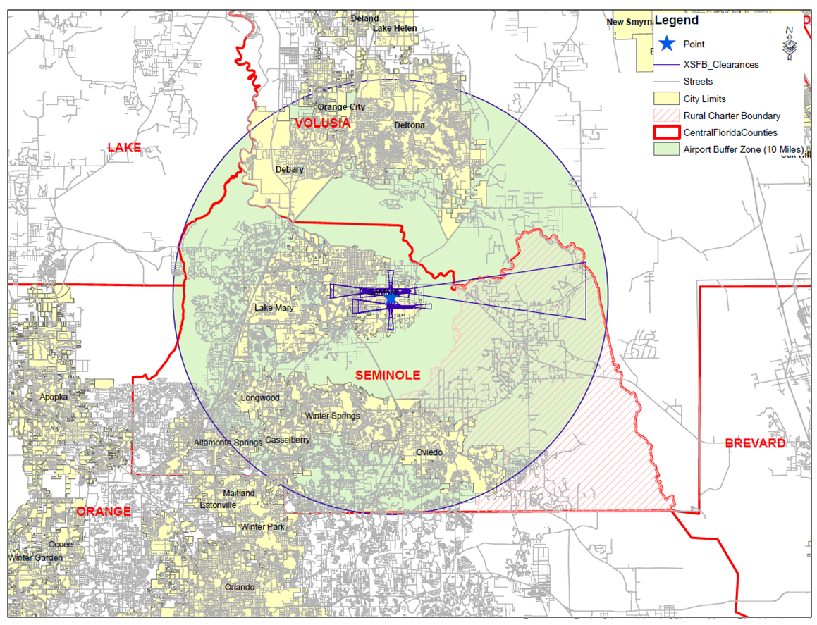
Airport Height Zoning / Current Airspace Surface Maps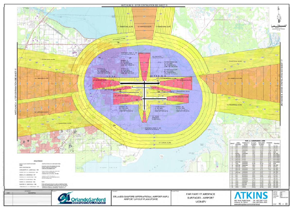
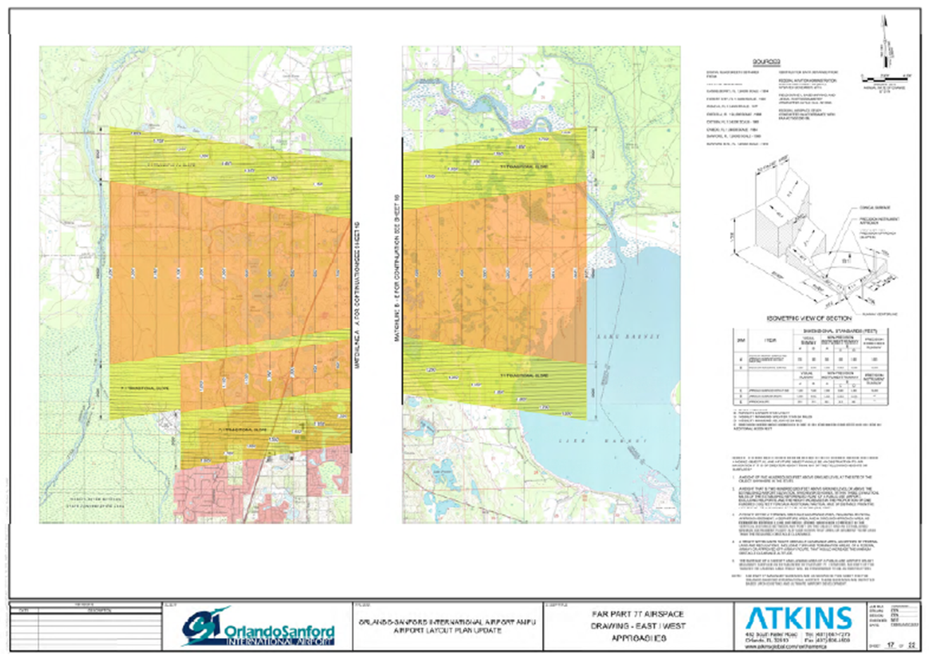
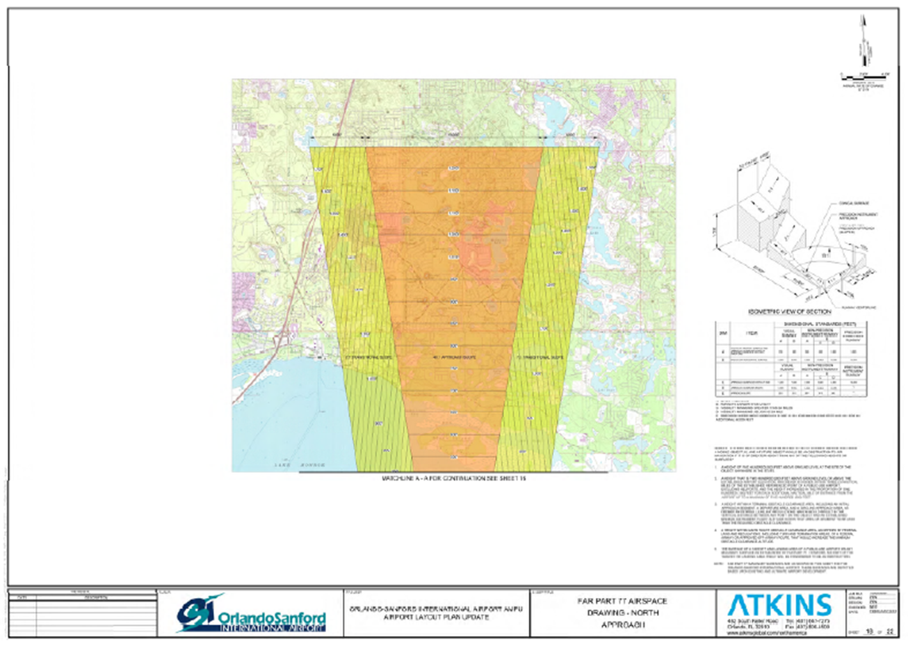
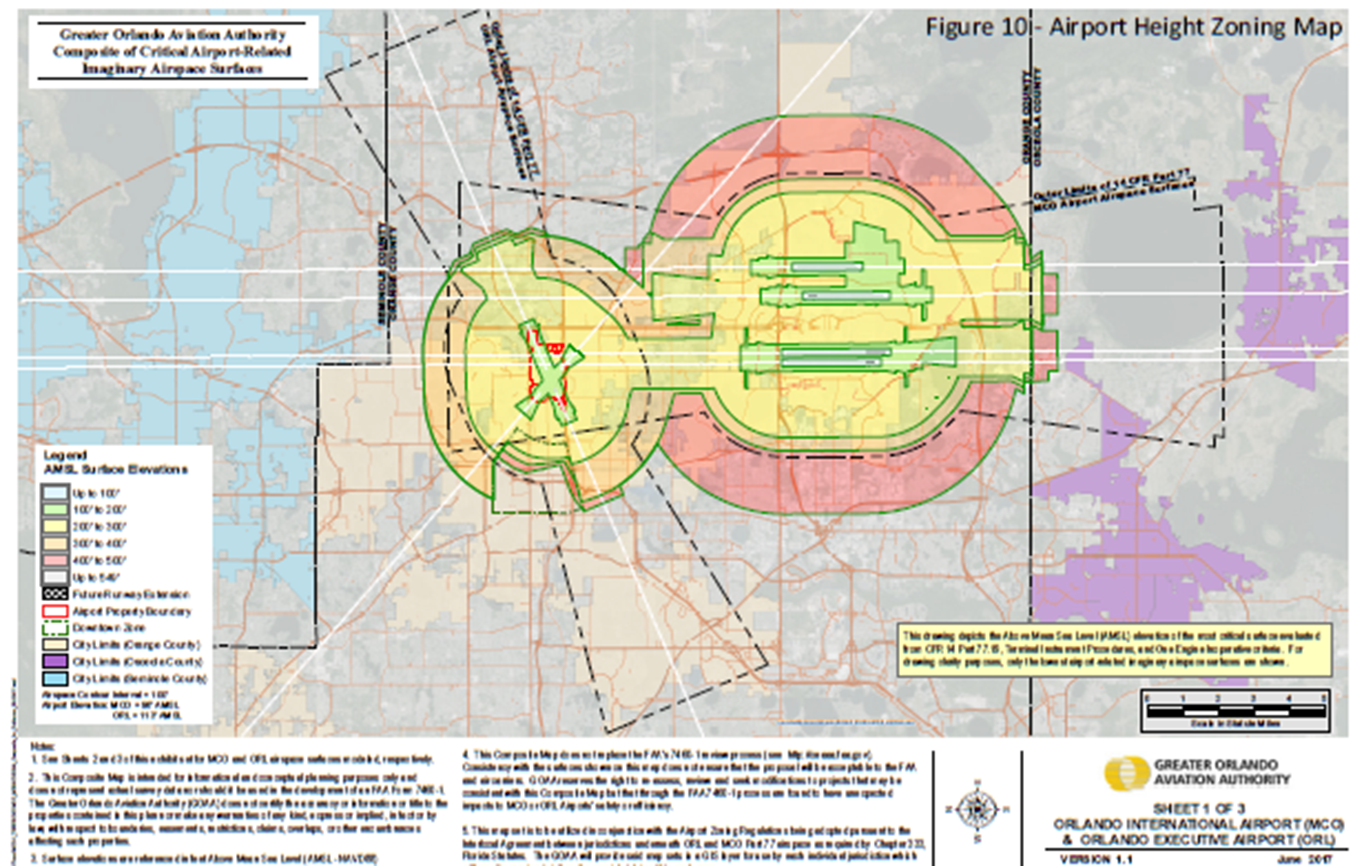
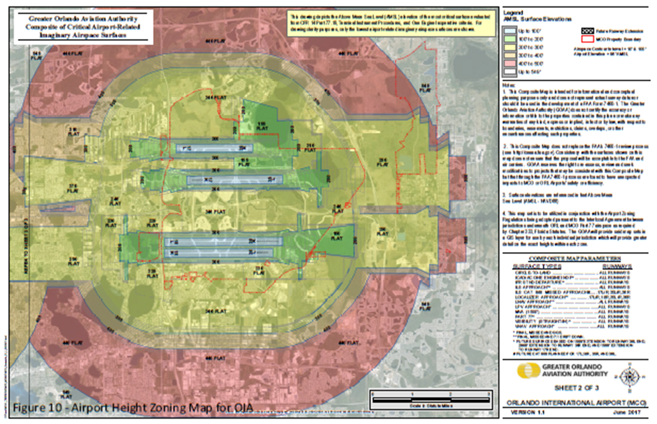
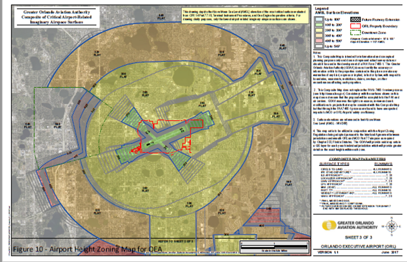
(Ord. No. 2024-02, § 7(Exh. B), 1-9-24; Ord. No. 2024-21, § 4, 7-23-24).
Sec. 30.10.9. - SR 46 Scenic Corridor Overlay District.
30.10.9.1 Title. This Part shall be known and may be cited as the "State Road 46 Scenic Corridor Overlay District Ordinance".
30.10.9.2. Legislative findings. The following findings are hereby adopted as legislative findings by the Board of County Commissioners:
(a)
The Comprehensive Plan of Seminole County provides for the protection and maintenance of the rural landscape and community character of the State Road 46 corridor within the Wekiva River Protection Area.
(b)
The rural landscape and community character of the State Road 46 corridor within the Wekiva River Protection Area is an important resource that contributes to the quality of life of Seminole County.
(c)
Agricultural activities in the State Road 46 corridor within the Wekiva River Protection Area are important historical, cultural and economic resource that contributes to the quality of life of Seminole County.
(d)
The character, location and distribution of uses and structures along major and minor roads in the State Road 46 corridor within the Wekiva River Protection Area defines the visual character of the State Road 46 corridor within the Wekiva River Protection Area.
30.10.9.3 Purpose and intent. The purpose of this Part is to insure that the designated State Road 46 scenic corridor is developed in a manner which:
(a)
Provides uniform design standards to establish high quality development that is rural in character; and
(b)
Maintains existing vegetation along the State Road 46 corridor within the Wekiva River Protection Area of Seminole County; and
(c)
Provides for safe and efficient traffic flow by minimizing individual property curb cuts; and
(d)
Maintains the State Road 46 scenic corridor in accordance with the provisions set forth herein; and
(e)
Preserves the rural entranceway into the State Road 46 corridor within the Wekiva River Protection Area; and
(f)
Implements, and is consistent with, the Comprehensive Plan of Seminole County.
30.10.9.4 Applicability. All new development, excluding single-family lots existing on the effective date of this Part and except as may be otherwise be provided for in this Part, within the scenic corridor established by this Part including, but not limited to (to the extent permitted by law) development undertaken by agencies of local, regional, state, or federal government, shall be carried out in accordance with each and every requirement of this Part, in addition to each and every requirement of any other applicable provisions of the Seminole County Land Development Code.
30.10.9.5 Establishment of scenic corridor. There is hereby established a scenic corridor on State Road 46 from its intersection with Orange Boulevard west to the Seminole—Lake County line. The scenic corridor consists of all property (on each side of the road) lying within three hundred (300) feet of the right-of-way line of State Road 46.
30.10.9.6 Development standards.
(a)
Scenic corridor setbacks.
(1)
Except for those structures expressly authorized in this Section, no structure or outdoor storage shall be located within fifty (50) feet from the right-of-way of State Road 46.
(2)
Notwithstanding any other provision of this Part, the following structures and uses are permitted within the designated scenic corridor setbacks.
a.
Agricultural buildings in existence at the time of adoption of this Part.
b.
Signs in accordance with the sign standards of this Part.
c.
Landscape features required by this Part and other permitted landscape materials.
d.
Fences, gates, mailboxes, bus stops and entranceways in accordance with the architectural design standards of this Part.
e.
Access ways or access points in accordance with the access standards of this Part.
f.
Bus stops, bus shelters, signage and other such improvements related thereto.
g.
Signs, markings, traffic control devices and such other improvements related to the safe and efficient movement of traffic.
h.
Parking outside of the landscape buffer described by this Part.
i.
Utilities.
j.
Retention/detention systems in accordance with the other provisions of this Part.
(b)
Signage.
(1)
All signs within the scenic corridor setback shall reflect the rural character of the Wekiva River protection area and incorporate a traditional typeface, muted colors, and format. Examples of appropriate signage are set out in Section 30.10.2 of the Land Development Code of Seminole County. All signs are to be constructed in accordance with the other provisions of the Land Development Code unless otherwise specified in this Part.
(2)
The faces of all signs within the scenic corridor setback shall be made of natural materials, substances derived from natural materials, or substances designed to mimic natural materials including, but not limited to, wood, stucco, stone, brick and clay tile.
(3)
No sign shall be internally illuminated within the scenic corridor designated by this Part.
(4)
Each primary residence with access on to State Road 46 within the scenic corridor shall be permitted one (1) sign of not more than one and one-half (1½) square feet per dwelling unit.
(5)
Each nonresidential use with frontage on State Road 46 within the scenic corridor setback shall be permitted one (1) ground sign of not more than forty-eight (48) square feet per parcel. Wall signs shall not be internally illuminated.
(6)
Notwithstanding any other provision of this Part, no more than one (1) sign per parcel of land area, shall be located within the State Road 46 rural scenic corridor setback provided, however, that all signs located within the scenic corridor setback shall:
a.
Be ground signs and shall not exceed six (6) feet in height; and
b.
Be landscaped with native species in a manner consistent with the landscape treatment portrayed in the Land Development Code (Section 30.10.2.6(b)(7)).
c.
Illuminated signs shall be turned off no later than 10:00 p.m. and shall remain off until 6:00 a.m. the following morning, unless exempted from this requirement by the Development Services Director upon the recommendation of the Seminole County Sheriff's Office or public safety department based upon a consideration of safety to citizens or property. Emergence medical facilities shall be exempt from this requirement.
(7)
The following signs are prohibited within the SR 46 scenic corridor overlay:
a.
Blinking lights, changeable message boards and electronic message signs.
b.
Reader boards and information displays.
c.
Neon signs and changeable copy signs. Neon signs are also specifically prohibited if located within the structure but visible from the exterior of the structure. No neon accent lighting of buildings or structures shall be allowed.
d.
Construction of new billboards and permanent outdoor advertising signs.
e.
Balloons, banners, pennants, and flags are prohibited; provided, however, that such signage is permitted on a store front for a total of thirty (30) days for grand openings, out only for a time period during two (2) weeks prior to the grand opening to two (2) weeks following the grand opening.
f.
Trailer signage.
(c)
Fences, gates, mailboxes, bus stops and entranceway features.
(1)
All fences, walls, gates, mailboxes, bus stops and entranceways developed in conjunction with a non-agricultural uses within the scenic corridor setback shall be made of natural materials or materials designed to mimic natural materials including, but not limited to, wood, stucco, stone, brick and clay tile.
(2)
No entranceway feature shall be internally illuminated. Light fixtures for external illumination shall be contained in burial vaults or shall be screened with cut-off shields.
(3)
No fence, wall, gate, mailbox or entranceway feature within the scenic corridor setback shall be greater than six (6) feet in height.
(4)
Walls and fences shall meet the design requirements of the Land Development Code of Seminole County and shall be of muted colors. Walls and fences with solid surfaces shall be reviewed by the County's natural resources officer to ensure that accommodation is made for wildlife movements via currently used corridors in the applicable areas.
(d)
Landscape and bufferyards.
(1)
Seventy-five (75) percent of all required trees and shrubs shall be native plant species as set forth in the Land Development Code. Selected landscaping shall re-establish native habitat. Additionally, no plants on the Department of Environmental Protection prohibited list or the Florida Exotic Pest Plant Councils Category I or II lists may be used.
(2)
Within the designated scenic corridor setback there shall be established a landscape buffer of twenty-five (25) feet.
(3)
Only the following may be located within the landscape buffer:
a.
Underground utilities; and
b.
Access, in accordance with the provisions of this Part; and
c.
Retention/detention, provided that placement in the landscape buffer provides more protection for native canopy and understory trees located elsewhere on the site.
d.
One (1) ground sign in accordance with the provisions of Sections 30.10.9.6(b)(5) and 30.10.9.6(b)(6) of this Part.
(4)
No existing canopy trees greater than six (6) inches in diameter shall be removed in the scenic corridor buffer unless approved by the Planning Manager because the clearing is necessary to provide access, the tree is diseased or public safety requirements.
(5)
No clearing within the scenic corridor setback or buffer shall be permitted except in conjunction with a permit issued for development authorized under the provisions of this Part or for public safety requirements. Specimen trees shall be preserved to the maximum extent possible.
(6)
Areas of the State Road 46 scenic corridor buffer, except for existing single-family lots, regardless of size, and except for proposed single-family lots that are a minimum of one (1) acre in area, that do not meet the following standards shall be supplemented to bring them into compliance with these standards:
a.
Four (4) canopy trees per one hundred (100) linear feet; and
b.
Six (6) understory trees per one hundred (100) linear feet (each understory tree shall be a minimum of one and one-half (1½) inches caliper and six (6) feet tall at the time of planting); and
c.
Sixteen (16) shrubs per one hundred (100) linear feet.
d.
Canopy and understory trees may be clustered to accent entrances or other design features of the site.
(7)
To the extent that state law exempts nurseries from certain provisions of this Part, such properties are encouraged to provide a visually attractive buffer along State Road 46 through native landscaping or the placement of stock trees within that portion of said properties adjacent to State Road 46.
(e)
Access standards.
(1)
Unless compliance with this subsection would deprive property of all access to a public road, no access way or access shall be located within four hundred forty (440) feet of any other driveway or other way of access on the same side of a major road in the scenic corridor.
(2)
Only one (1) access point on State Road 46 will be permitted for each lot or parcel of record.
(3)
Notwithstanding subsection (2) above, unless otherwise approved by the Board of County Commissioners there shall be no access point on State Road 46 if the parcel of land has sufficient frontage on a public road other than State Road 46.
(f)
Parking areas and equipment storage areas.
(1)
Parking areas. All paved parking areas shall meet the following standards:
a.
Terminal islands. Each row of parking spaces shall be terminated by a landscaped island to separate parking from adjacent driving aisles. Each landscaped island shall be a minimum of ten-feet wide and twenty-feet deep (exclusive of curbs, paving or gutters).
b.
Interior islands. Internal landscape islands shall be a maximum of ten parking spaces apart. Each landscaped island shall be a minimum of ten-feet wide and twenty-feet deep (exclusive of curbs, paving or gutters).
c.
Spacing between or location of interior or terminal islands may be modified or waived by the Planning Manager in order to save existing trees on-site.
d.
Each landscaped island shall be irrigated. Reclaim water, if available must be used for irrigation. The Planning Manager may permit the use of a temporary above-ground irrigation system in areas where drought tolerant/low water use zone plant material is proposed to be planted for the entire landscaped area. An irrigation plan shall not be required in such circumstance. Also each island shall contain one (1) canopy tree as defined by Section 30.14.16(b) of the Seminole County Land Development Code or two (2) understory trees, each with a minimum caliper of one and one-half (1½) inches and minimum height of six (6) feet at planting.
e.
No impervious surface shall be located inside the drip line of any specimen tree located in a parking area.
(2)
If equipment storage is proposed, it must be in accordance with the appropriate setbacks and design standards contained within this Part and meet all current requirements of the Seminole County Comprehensive Plan and the Land Development Code of Seminole County.
(g)
Location and design of stormwater retention.
(1)
Stormwater facilities, where feasible, shall be placed in areas that do not contain existing native canopy and understory trees. Shared retention, where feasible, is encouraged to minimize unnecessary consumption of land. Location of retention areas in areas not visible from public rights-of-way shall be encouraged. The ponds shall not utilize standard geometric forms such as triangles and rectangles unless the Development Review Manager determines that there is no other feasible engineering design available. Retaining walls are encouraged to minimize surface area impacted except that no more than two-thirds (⅔) of the circumference of a retention pond shall make use of retaining walls and the following slope standards shall apply to all retention areas:
a.
For dry bottom retention the maximum slope shall be 4:1.
b.
For wet bottom retention the maximum slope shall be no steeper than 6:1.
c.
Littoral zones of ponds shall be vegetated with emergent native vegetation to the maximum extent possible provided that maintenance of the pond is not impeded.
(Ord. No. 2024-02, § 7(Exh. B), 1-9-24).
Sec. 30.10.10. - State Road 46 Scenic Corridor Lighting Standards.
30.10.10.1 Title. This Ordinance shall be known and may be cited as the "State Road 46 Scenic Corridor Outdoor Lighting Standards Ordinance".
30.10.10.2 Legislative Findings. The following findings are hereby adopted as legislative findings by the Board of County Commissioners:
(a)
The SCCP provides for the protection and maintenance of the rural landscape and community character of the State Road 46 Corridor within the Wekiva River Protection Area.
(b)
The visual character of the landscape defines the rural landscape and community character of the State Road 46 Corridor within the Wekiva River Protection Area.
(c)
The rural landscape and community character of the State Road 46 Corridor within the Wekiva River Protection Area is an important resource that contributes to the quality of life of Seminole County.
(d)
Agricultural activities in the State Road 46 Corridor within the Wekiva River Protection Area are an important historical, cultural and economic resource that contributes to the quality of life of Seminole County.
(e)
The character, location and distribution of uses and structures along major and minor roadways in the State Road 46 Corridor within the Wekiva River Protection Area defines the visual character of the State Road 46 Corridor within the Wekiva River Protection Area.
(f)
The State Road 46 Corridor within the Wekiva River Protection Area contains valuable habitat and wildlife corridors, linking areas north of State Road 46 with other natural areas to the south.
30.10.10.3 Purpose and intent. The purpose of this Ordinance is to insure that the designated State Road 46 Scenic Corridor Outdoor Lighting Standards are developed in a manner which:
(a)
Provides uniform design standards to establish high quality development that is rural in character; and
(b)
Does not disturb residents, disrupt agricultural uses, repel or disrupt movement patterns of wildlife, or otherwise detract from the Wekiva River area's special status as a wild and scenic resource in Seminole County; and
(c)
Encourages, through the regulation of the types, kinds, construction, installation, and uses of outdoor electrically powered illuminating devices, lighting practices and systems which conserve energy (and enhance nighttime enjoyment of property within the State Road 46 Scenic Corridor) without decreasing safety, utility, security, and productivity; and
(d)
Provides for safety of homes and businesses and other institutions; and
(e)
Maintains the State Road 46 Scenic Corridor in accordance with the provisions set forth herein; and
(f)
Preserves the rural character and ecological integrity of the entranceway into the State Road 46 Corridor within the Wekiva River Protection Area; and
(g)
Implements, and is consistent with, the Comprehensive Plan of Seminole County.
30.10.10.4 Applicability. This Ordinance shall apply to all new development within the State Road 46 Scenic Corridor as defined by adopted Ordinance 2001-27, except single family lots existing on the effective date of this Ordinance and except as may be otherwise provided for in this Ordinance. To the extent permitted by law, the development subject to this Ordinance shall include but not be limited to development undertaken by agencies of local, regional, state, or federal government.
30.10.10.5 Conformance with applicable codes. All outdoor electrically powered illuminating devices shall be installed in conformance with the Land Development Code, the Building Code, the Electrical Code, and the Sign Code of Seminole County as applicable, and under appropriate permit and inspection.
30.10.10.6 Definitions. As used in this Ordinance, certain words and phrases used in this Chapter shall mean the following:
"Filtered" means any outdoor light fixture which has a glass, acrylic, or translucent enclosure of the light source.
"Fully shielded" means outdoor light fixtures shielded or constructed so that no light rays are emitted by the installed fixture at angles above the horizontal plane as certified by a photometric test report.
"Installed" means the attachment, or assembly fixed in place, whether or not connected to a power source, of any outdoor light fixture.
"Lighting" means any form or source of man-made illumination.
"Outdoor light fixture" means outdoor electrically powered illuminating devices, outdoor lighting or reflective surfaces, lamps and similar devices, permanently installed or portable, used for illumination or advertisement. Such devices shall include, but are not limited to, search-, spot-, and floodlights for:
(a)
buildings and structures;
(b)
recreational areas;
(c)
parking lot lighting;
(d)
landscape lighting;
(e)
billboards and other signs (advertising or other);
(f)
street lighting;
(g)
product display area lighting;
(h)
building overhangs and open canopies.
"Partially shielded" means outdoor light fixtures shielded or constructed so that no more than ten (10) percent of the light rays are emitted by the installed fixture at angles above the horizontal plane as certified by a photometric test report.
"Person" means any individual, tenant, lessee, owner, or any commercial entity including, but not limited to, a firm, business, partnership, joint venture or corporation.
30.10.10.7 Approved materials and methods of construction or installation/operation. The provisions of this Ordinance are not intended to prevent the use of any design, material, or method of installation or operation not specifically prescribed herein, provided any such alternate has been approved by the Development Review Manager. The Development Review Manager may approve any such proposed alternate providing he/she finds that it:
(a)
Is the approximate equivalent of the lighting methods specifically authorized by this Ordinance;
(b)
Is otherwise satisfactory and complies with the intent of this Ordinance; or
(c)
Has been designed or approved by a registered professional engineer, and the content and function of the alternate promotes the intent of this Ordinance.
30.10.10.8 Shielding.
(a)
All nonexempt outdoor lighting fixtures shall have shielding as required by Table 1 of this Ordinance.
Table Footnotes:
1
This is the preferred light source to minimize undesirable light emission into the night sky affecting astronomical observations. Fully shielded fixtures are preferred but not required.
2
For the purposes of this Ordinance, quartz lamps shall not be considered an incandescent light source.
3
Warm white and natural lamps are preferred to minimize detrimental effects.
4
Fully shielded and installed metal halide fixtures shall be allowed for applications where the designing engineer deems that color rendering is critical.
30.10.10.9 Filtration. Metal halide fixture lamp types shall be filtered (quartz glass does not meet this requirement).
30.10.10.10 Submission of plans and evidence of compliance with ordinance - Subdivision Plats.
(a)
Submission Contents. The applicant for any permit required by the regulations of Seminole County in connection with proposed work involving outdoor lighting fixtures shall submit (as part of the application for permit) evidence sufficiently complete to enable the plans examiner to readily determine whether compliance with the requirements of this Ordinance will be ensured. This submission shall include, but is not limited to, the following:
(1)
Plans indicating the location of lighting on the premises;
(2)
A description of the illuminating devices, fixtures, lamps, supports, reflectors, and other devices proposed for use on the premises. The description should include, but is not limited to, catalog cuts by manufacturers and drawings (including sections where required);
(3)
Photometric data, such as that furnished by manufacturers, or similar showing the angle of cutoff or light emissions from the proposed lighting.
The applicant may submit additional data to support use of the proposed lighting such as certified reports of relevant tests, provided that these tests shall have been performed and certified by a recognized testing laboratory.
(b)
Subdivision Certification. If any subdivision proposes to have installed street or other common or public area outdoor lighting, the final developer's commitment agreement shall contain a statement certifying that the applicable provisions of this Ordinance will be adhered to.
(c)
Lamp or Fixture Substitution. Should any outdoor light fixture or the type of light source therein be changed after the permit has been issued, a change request must be submitted to the Development Review Manager for his approval, together with adequate information to assure compliance with this Ordinance, which must be received prior to substitution of the light fixture or source.
30.10.10.11 Prohibitions.
(a)
Mercury Vapor Lamps Fixtures and Lamps. The installation of any mercury vapor fixture or lamp for use as outdoor lighting is prohibited.
(b)
Certain Other Fixtures and Lamps. The use of any low pressure sodium, high pressure sodium, metal halide, fluorescent, quartz or incandescent outdoor lighting fixture or lamp the use of which is not allowed by Table 1 is prohibited.
(d)
Laser Source Light. The use of laser source light or any similar high intensity light for outdoor advertising or entertainment, when projected above the horizontal, is prohibited.
(e)
Searchlights. The operation of searchlights for advertising purposes is prohibited.
30.10.10.12 Special uses.
(a)
Recreational Facilities. Any light source permitted by this Ordinance may be used for lighting of outdoor recreational facilities (public or private), such as, but not limited to, football fields, soccer fields, baseball fields, softball fields, tennis courts, horse race tracks or show areas, provided all of the following conditions are met:
(1)
All fixtures used for lighting shall be fully shielded as defined in Section 30.10.10.8, or be designed or provided with sharp cut-off capability, so as to minimize up-light, spill-light, and glare.
(2)
All events, with the exception of special events as defined by the Seminole County Code, shall be scheduled so as to complete all activity before or as near to 10:00 p.m. as practical, but under no circumstances shall any illumination of the playing field, court, or track be permitted after 10:00 p.m. except to conclude a scheduled event that was in progress prior to 9:00 p.m.
(b)
Outdoor Display Lots. Any light source permitted by this Ordinance may be used for lighting of outdoor display lots such as, but not limited to, landscape nurseries provided that such lighting shall be fully shielded as defined in Section 30.10.10.8, or be designed or provided with sharp cut-off capability, so as to minimize up-light, spill-light, or glare.
30.10.10.13 Nonconformance. All other outdoor light fixtures lawfully installed prior to, and operable on, the effective date of this Ordinance are exempt from all requirements of this Ordinance except those regulated in Section 30.10.10.10, Section 30.10.10.12, and in Section 30.10.10.13. There shall be no change in use or lamp type, or any replacement or structural alteration made, without conforming to all applicable requirements of this Ordinance.
30.10.10.14 Appeals. Any person substantially aggrieved by a decision of the Development Review Manager made in administration of this Ordinance has the right and responsibilities of appeal to the Board of Adjustment.
30.10.10.15 Law governing conflicts. Where any applicable provision of Federal, State, County, or City statutes, codes, or laws conflicts with any provision of this Ordinance, the most restrictive shall govern unless otherwise regulated by law.
30.10.10.16 Violation. It shall be a civil infraction for any person to violate any of the provisions of this Ordinance. Each and every day during which the violation continues shall constitute a separate violation.
30.10.10.17 Enforcement and penalty.
(a)
When a violation of this Ordinance is determined, the following penalty shall be imposed:
(1)
A fine of not less than fifty dollars ($50.00) nor more than five hundred dollars ($500.00) per violation. The imposition of a fine under this Ordinance shall not be suspended.
(2)
Any other order deemed necessary in the discretion of the hearing officer, including correction or abatement of the violation.
(b)
Failure of a violator to comply with any order issued in accordance with this Ordinance shall result in an additional fine of not less than fifty dollars ($50.00) nor more than five hundred dollars ($500.00) for each day the defendant fails to comply.
(Ord. No. 2024-02, § 7(Exh. B), 1-9-24).
Sec. 30.10.11. - Creation of State Road 46 Gateway Corridor Overlay Standards Zoning Classification/description of corridor and property affected/applicability.
(a)
Code requirements heretofore and hereafter established, there is hereby created an overlay zoning classification known as the "State Road 46 Gateway Corridor Overlay Standards Zoning Classification".
(b)
The State Road 46 gateway corridor ("corridor" throughout this Part) subject to the provisions of this Part shall encompass the area of State Road 46 lying between the CSX Railroad right-of-way immediately east of the intersection of State Road 46 and Airport Boulevard to North Center Road, which is located approximately eight hundred (800) feet west of the intersection of State Road 46 and Orange Boulevard including all property within three hundred twenty (320) feet of the centerline of State Road 46 throughout such area including intersecting roadways to the same depth.
(c)
The provisions of this Part, except for the provisions relating to burial of utility service lines, wall requirements and building setback requirements shall not apply to parcels assigned a single family residential zoning classification or with an existing residential use.
30.10.11.1 Purpose/application of other Code provisions.
(a)
The purposes of this Part are to insure that the designated State Road 46 gateway corridor is developed in a manner which:
(1)
Ensures the development of the corridor as a well landscaped and scenic gateway.
(2)
Provides uniform design standards to establish high quality development.
(3)
Prevents visual pollution caused by unplanned and uncoordinated uses, buildings and structures.
(4)
Maximizes traffic circulation functions from the standpoint of safety, roadway capacity, vehicular and non-vehicular movement.
(5)
Maintains and enhances property values.
(6)
Preserves natural features to the maximum extent practicable.
(7)
Recognizes and makes allowances for existing uses and buildings.
(b)
Unless otherwise set forth in this Part, the general provisions and procedures of this Code shall apply. General variances shall be determined in accordance with the procedures and provisions of Section 30.3.3 and variances to the design standards of this Part shall be determined in accordance with the procedures and standards set forth in Part 10 of Chapter 40 pertaining to site plan requirements.
30.10.11.2 Building setback. The front of any building constructed on a parcel within the corridor shall be setback a minimum of fifty (50) feet from the right-of-way line; provided, however, that a greater setback shall be required if a more restrictive setback is contained within the underlying zoning classification from the adopted right-of-way line.
30.10.11.3 Building height.
(a)
Except as provided in subsection (b), no building shall be constructed with a roof exceeding thirty-five (35) feet in height.
(b)
Buildings in excess of thirty-five (35) feet in height may be permitted on parcels of property that are part of a planned development and which are assigned the higher intensity planned development land use designation as approved by the Board of County Commissioners.
30.10.11.4 Required corridor landscaped buffer and buffer requirements.
(a)
A landscape buffer at least twenty-five (25) feet in width, which shall be greater if a more restrictive setback is required by the underlying zoning classification, shall be provided abutting the State Road 46 right-of-way line; provided, however, that the buffer width may be reduced to a minimum of fifteen (15) feet if the Planning Manager finds that the parcel is less than two hundred five (205) feet deep.
(b)
The buffer area shall be planted with two (2) rows of trees (seventy-five (75) percent live oaks and twenty-five (25) percent of trees from the list of trees set forth in Section 30.10.11.15(a) which are determined by the Planning Manager to form a canopy along the corridor) with each tree having a minimum three (3) inch diameter measured one (1) foot above the ground at planting. The trees shall be planted every fifty (50) feet and staggered. A minimum of four (4) sub-canopy trees per one hundred (100) feet of road frontage shall be planted in and abut access points and intersections. The first row of canopy trees shall be planted along a line ten (10) feet back from the right-of-way line.
(c)
Existing or dedicated public or private right-of-way and right-of-way that is reserved pursuant to a development order, development permit, site plan, plat, or other land use approval shall not be included in calculation of the buffer width.
(d)
Stormwater retention areas may be placed in the buffer area provided that a landscaped water retention area would result in a water amenity and be consistent with the purposes set forth in Section 30.10.11.1.
(e)
If a parking area abuts the buffer area, a continuous shrub hedge shall be arranged or planted to ensure that a height of three (3) feet will be attained within one (1) year of planting so as to screen a minimum of seventy-five (75) percent of the parking area, to that height, as viewed from the right-of-way.
(f)
Existing vegetation shall be used to the maximum extent practicable as determined by the Planning Manager to meet the requirements of this Section.
(g)
Landscaped areas shall be irrigated and the property owner shall be responsible for the purchase, installation, maintenance, and irrigation of all required landscaping and the purchase, installation, and maintenance of irrigation systems.
30.10.11.5 Parking areas. Parking lots shall be designed and landscaped according to the following criteria:
(a)
A minimum of ten (10) percent of all parking area and entryways shall be landscaped. The following is a list of desirable trees and shrubs:
(b)
Parking bays shall not be larger than forty (40) spaces.
(c)
Perimeter landscaped parking breaks shall be no less than two hundred (200) square feet in area, planted with one (1) canopy tree and a maximum of twenty (20) spaces apart.
(d)
Internal landscaped breaks shall be a minimum of four hundred (400) square feet planted with one (1) canopy tree, two (2) to three (3) inches dbh for every landscape break and a minimum of three (3) shrubs for every landscaped break. Internal breaks shall be a maximum of twenty (20) spaces apart.
(e)
Diamond landscaped breaks shall be placed every ten (10) spaces internally, shall be eight (8) feet by eight (8) feet and shall be planted with one (1) canopy tree.
(f)
Existing vegetation shall be preserved to the maximum extent practicable as determined by the Planning Manager.
(g)
Parking lot lighting shall be designed in accordance with Part 13, Chapter 30 of this Code.
30.10.11.6 Signage.
(a)
All point of sale signs and subdivision signs shall be ground signs in the corridor. Such ground signs shall be erected or installed according to the provisions of subsection 30.13.3(a) and the following criteria, whichever is more restrictive.
(b)
Total wall sign area shall be computed by adding the square footage of all wall sign areas on the building, excluding window signs and opening banners. The maximum permittable wall sign copy area shall not exceed one hundred (100) square feet in size on a building with less than two hundred (200) linear feet of building frontage. For buildings with building frontage exceeding two hundred (200) linear feet, no wall sign shall exceed two hundred (200) square feet in size. For the purposes of this subsection, a parcel need not be a legally subdivided lot if it is permitted to allow a unified use.
(c)
Vertical structural supports for ground signs shall be concealed in an enclosed base. The width of such enclosed base shall be equal to at least two-thirds (⅔) the horizontal width of the sign surface. A planter structure shall enclose the foot of the base. The planter shall be between two (2) feet and three (3) feet in height above the ground, with a minimum length equal to the width of the sign and a minimum width of three (3) feet. The base and planter shall be constructed of brick, or alternate features such as rock, stone and metal structures may be approved if the Planning Manager determined that the alternative would be consistent with the purposes set forth in Section 30.10.11.1. Any external above ground light source shall be located and hidden within the planter bed. Light sources located outside the planter bed shall be in a burial fixture. The maximum height of the entire sign structure shall be fifteen (15) feet above the elevation of the nearest sidewalk. The planter setback shall be a minimum of five (5) feet from the right-of-way.
(d)
The maximum permittable ground sign copy area shall be one hundred (100) square feet. Ground sign base, sides and top shall be excluded from the sign area calculation.
(e)
The total maximum permittable copy area on a parcel for both wall signs and ground signs shall be two (2) square feet for each linear foot of building frontage.
(f)
Pole signs, portable signs, temporary signs, off-premise signs and all other forms of signage are prohibited except that signs on or attached to bus shelters with or without kiosks, real estate signs, political signs, outdoor advertising signs, one (1) construction sign per project, banner signs consistent with Subparagraph 30.1243(2)d, and signs to mitigate impacts of road construction projects shall be permitted. (Note: In the case of Dick Baird, Inc. d/b/a Baird Ray Nissan vs. Seminole County (Eighteenth Judicial Circuit Court, March 6, 1995, Case Number 93-118, certiorari denied, Fifth District Court of Appeal, November 16, 1995) a three judge panel of the Circuit Court ruled that the Land Development Code's limitation of the number of American flags displayed on a parcel was invalid.)
30.10.11.7 Utility lines. All new or relocated utility lines within the corridor shall be constructed and installed beneath the surface of the ground unless it is determined otherwise by the Board of County Commissioners in exercising the public's proprietary rights over publicly owned rights-of-way.
30.10.11.8 Walls.
(a)
All freestanding walls, sound barriers, ground sign enclosures, planters, and similar structures, as determined by the Planning Manager, which front State Road 46 or a major intersection within the corridor, as determined by the Planning Manager, shall be constructed of brick.
(b)
Alternate entrance features such as rock, stone and metal structures may be approved if the Planning Manager determined that the alternative would be consistent with the purposes set forth in Section 30.10.11.1.
(Ord. No. 2024-02, § 7(Exh. B), 1-9-24).
Sec. 30.10.12. - Oxford Place Overlay District.
30.10.12.1 Creation. In addition to, and supplemental to, all Land Development Code requirements heretofore and hereafter established, there is hereby created an overlay zoning classification known as the "Oxford Place Overlay District." Property within the Oxford Place Overlay District listed and described within Section 30.10.12, Designated Overlay District, of this Part, shall be subject to all provisions herein.
30.10.12.2 Definitions. See Chapter 2 of this Code for definitions.
30.10.12.3 Purpose. The purpose of the Overlay District is to ensure that development is consistent with the Oxford Place Future Land Use Overlay District as found under the Mixed Land Use Designation and Overlay Series in the Future Land Use Element of the Comprehensive Plan, and occurs in a manner which:
(a)
Establishes Oxford Road as the main street of the Overlay District;
(b)
Provides for the development of area roadways as Complete Streets;
(c)
Creates a sense of place around a central focal point located at the intersection of Fernwood Boulevard and Oxford Road, comprised of green space, a public hardscape, and a water feature;
(d)
Establishes the relationship between the buildings and the street, supports mixed-use development and allows for a smaller block structure;
(e)
Emphasizes pedestrian and vehicular connectivity to the surrounding neighborhoods and the Kewanee multi-purpose Trail;
(f)
Implements a unified street system and way finding systems to support multimodal transportation options;
(g)
Maximizes multimodal circulation functions from the standpoint of safety, corridor capacity, vehicular and non-vehicular movement; and
(h)
Provides uniform design standards to establish high quality development and pedestrian scale.
Unless otherwise set forth in this Part, the general provisions and procedures of this Land Development Code shall apply.
30.10.12.4 Designated Overlay District. The designated Overlay District subject to the provision of this Part applies to properties in unincorporated Seminole County. The Overlay District is generally bounded by US 17-92 to the west; Lake of the Woods Boulevard, to the south; Fern Park Boulevard to the east; and SR 436 to the north as shown in the Exhibits of the Future Land Use Element of the Comprehensive Plan and titled Oxford Place Overlay District Boundary. Contiguous property may be added to the Overlay District on a case by case basis and will require an amendment to the County Comprehensive Plan.
30.10.12.5 Application review and approval procedure. Applicants shall submit a conceptual plan, including architectural renderings, for review by the Development Review Committee through the Pre-Application process. If deemed consistent with the Oxford Place Future Land Use Overlay District and the provisions of the Oxford Place Overlay District within the Land Development Code, then applicants may apply for Site Plan Approval as addressed in Part 40 of this Land Development Code. Where the performance standards described in the Oxford Place Overlay District conflict with other County standards, the Oxford Place Overlay District standards shall prevail.
30.10.12.6 Density and intensity. In order to create an intense urban setting, the minimum density within the Oxford Place Overlay District is twenty (20) dwelling units per net buildable acre, and the maximum density is fifty (50) dwelling units per net buildable acre. Nonresidential development shall be developed at no greater than a Floor Area Ratio of 1.0.
30.10.12.7 Permitted uses. Land and buildings within the Oxford Place Overlay District shall be used only for the following purposes:
(a)
C-1 (Retail Commercial) Zoning District Permitted Uses except for those uses specifically prohibited in Section 30.10.12.7.9;
(b)
Restaurants without a drive-through (unless otherwise permitted under Section 30.10.12.8 below);
(c)
Cafes;
(d)
Business and professional offices;
(e)
Hotels;
(f)
Medical clinics;
(g)
Veterinary clinics;
(h)
Parking garages as part of a development;
(i)
Multi-family residential, including townhouses, condominiums and apartments, above store flats and accessory uses;
(j)
Personal services;
(k)
Indoor recreation;
(l)
Alcoholic Beverage Establishments including microbreweries and wine bars;
(m)
Drycleaners, drop-off and pickup service only;
(n)
The following Qualified Targeted Industries: Life Sciences (Laboratory and Surgical Instruments and Diagnostic Testing); Infotech (Modeling, Simulation and Training, Optics and Photonics, Digital Media, Software, Electronics); Homeland Security/Defense (Computer Systems Design, Simulation and Training); and Financial/Professional Services, Corporate Headquarters, Securities and Investments, Consulting, including Engineering, Legal, Accounting and similar uses;
(o)
Day care;
(p)
Cinemas;
(q)
Package liquor stores; and
(r)
Building rooftop uses such as restaurants and apartment ancillary uses such as recreation when not adjacent to single family residential use.
30.10.12.8 Special exceptions. The Board of County Commissioners may permit any of the following uses upon making the findings of fact required by Section 30.1.5(a) of this Code:
(a)
Communication towers; and
(b)
Auto-oriented business, such as, but not limited to, convenience stores, gas stations, car washes, businesses, and restaurants with a drive-through are limited to properties adjacent to the SR 436 and US 17-92 corridors.
30.10.12.9 Prohibited uses and non-conforming uses. The following uses are specifically prohibited in the Oxford Place Overlay District:
(a)
New and used car sales;
(b)
Automotive repair or mechanical garages;
(c)
Boat and Recreational Vehicles sales;
(d)
Funeral homes;
(e)
Self-service full service laundromats;
(f)
Appliance stores;
(g)
Outdoor storage, except as allowed under temporary Outdoor Sales or Special Event Permit;
(h)
Outdoor advertising signs (billboards);
(i)
Big Box Retailers (Mega-Store/Super-Store);
(j)
Dry-cleaning plants; and
(k)
Pawn shops.
Non-conforming uses and structures to this Overlay existing at the time of the effective date of this Ordinance may continue and associated structures may be repaired and maintained until such time as the use of the land and structures have been discontinued for a minimum of one hundred eighty (180) days, then any future use shall revert to the uses permitted in the Overlay.
30.10.12.10 Building setback and height standards.
(a)
Building Setback.
(1)
Requirements. To create a pedestrian oriented urban setting, buildings shall meet the following setback requirements:
a.
Multifamily Residential Buildings shall have:
i.
A minimum setback of ten (10) feet from the property line; and in no case shall on-site parking or vehicular access be allowed between the building frontage and the right-of-way.
ii.
No maximum setback from the front property line in order to encourage pedestrian gathering areas such as plazas and parks; but in no case shall on-site parking or vehicular access be allowed between the building frontage and the right-of-way.
b.
Commercial and Office Buildings shall have:
i.
No minimum setback from the property line, but in no case shall on-site parking or vehicular access be allowed between the building frontage and the right-of-way.
ii.
No maximum setback from the property line; and in no case shall on-site parking or vehicular access be allowed between the building frontage and the right-of-way.
c.
Setback area within commercial and mixed-use areas must be used primarily to accommodate pedestrian activity or gathering places, such as outdoor seating and outdoor dining.
d.
The setbacks as found in the underlying zoning designation shall apply to auto-oriented businesses for those properties abutting US Highway 17-92 and SR 436.
(2)
Encroachments. The following features are permitted within the setback area and may encroach up to ten (10) feet into the public right-of-way, with approval from the Public Works Department through right-of-way utilization permits, provided that at least eight (8) feet remains clear for pedestrian circulation, as shown on Figure 1:
a.
Outdoor seating when located in front of the primary building facade;
b.
Awnings (10 feet of vertical clearance required); and
c.
Canopies (10 feet of vertical clearance required).
Figure 1: Encroachments
(3)
Outdoor Seating for a Cafe or Restaurant. Where outdoor seating is provided adjacent to a street, the following requirements shall be met:
a.
A public sidewalk with at least eight (8) feet of clear zone shall be provided, as shown on Figure 2;
b.
Tables shall not encroach into the clear zone; and
c.
There shall be an open and accessible area, not blocked by tables, connecting the sidewalk to the front door.
Figure 2: Outdoor Seating
(b)
Building Height.
(1)
For areas not adjacent to single-family residential development, the primary building façade height shall not exceed one-foot in height for every one foot of horizontal distance equivalent to the width of the adjacent right-of-way, as shown on Figure 3. This is equivalent to a one-to-one (1:1) ratio.
Figure 3: Building Height and Setback Ratio
(2)
For areas adjacent to single-family residential development building height shall not exceed:
a.
Thirty-five (35) feet in height within the first one hundred (100) feet from the single-family residential development;
b.
Fifty-five (55) feet in height from one hundred one (101) feet to two hundred (200) feet from the single-family residential development; and
c.
One hundred (100) feet in height over two hundred (200) feet from single-family residential development.
30.10.12.11 Building design. The portion of Oxford Road from SR 436 to the intersection of Fern Park Boulevard, is designated as a 'main street' that encourages pedestrian activity and first-floor non-residential uses. Multifamily residential uses are encouraged in multi-story buildings with non-residential uses on the first floor. Buildings must be compatible with existing buildings on the parcel and abutting parcels and must include common design elements as follows:
(a)
Building Details. The following components shall be incorporated within all building facades:
(1)
Awnings and Canopies. For commercial and office buildings, awnings and canopies shall be required over all doors, ground-level windows and other transparent elements. The height of the awnings and canopies shall be a minimum of ten (10) feet above the finished sidewalk, and shall be a minimum of four (4) feet in depth. Such elements may encroach into the public right-of-way.
(2)
Arcades (optional). If included, arcades may replace the requirement for awnings and/or canopies. Arcades shall have a minimum depth of ten (10) feet. Arcades shall not encroach into the public right-of-way.
(3)
Cornices. A cornice shall be provided on the side of a building at a minimum of twelve (12) feet above the sidewalk or at a height similar to the cornice on an abutting property.
(4)
Front Entrance. Non-residential buildings shall have a front entrance for pedestrians from the street-side of the building to the building interior. Buildings shall incorporate lighting and changes in mass, surface or finish to emphasize their front entrances.
(5)
Loading Docks. Loading docks and service areas shall not be placed on the buildings primary facade.
(6)
Building Facade. Buildings shall provide a foundation or base, typically from ground to bottom of the lower windowsills, with changes in volume or material. A clear visual division shall be maintained between the ground level floor and upper floors with either a cornice line from twelve (12) feet to sixteen (16) feet at grade, whichever applies to the proposed development. No more than twenty (20) feet of horizontal distance of wall shall be provided without architectural relief for building walls and frontage walls facing the street. All buildings shall utilize at least three (3) of the following design features along all elevations of the building:
a.
Divisions or breaks in materials;
b.
Window bays;
c.
Separate entrances and entry treatments, porticoes;
d.
Variation in roof line;
e.
Awnings;
f.
Recessed entries; and
g.
Covered porch entries.
(b)
Building Frontage. Buildings shall have their principal pedestrian entrances facing the right-of-way; however, the main entry may be adjacent to or near the main vehicle entry driveway. Buildings must comply with the following architectural standards on the frontage exterior:
(1)
Residential and Commercial buildings shall be oriented towards the street, with public entrances directly accessible from the street-level.
(2)
Elevated public entrances shall be discouraged, except for multi-family residential or townhome development. Where site grading is required, the resulting finished floor elevation shall be integrated into the design of the site using appropriate landscaping, building design, or active uses that can be appropriately elevated 1 to 3 steps above the sidewalk grade.
(3)
No steps or railings shall be permitted to encroach within a sidewalk, public right-of-way, or utility easement.
(4)
Corner lots may contain corner building entrances.
(5)
Regularly spaced and similar-shaped windows with a decorative element above each window or trim for each story within a building.
(6)
Buildings should be articulated through a change in architectural detail approximately every twenty (20) linear feet. Blank walls shall not occupy over fifty (50) percent of any building side and shall not exceed twenty (20) linear feet without being interrupted by a window or entry, or other fenestration element.
(c)
Windows and Transparency. The following provisions shall be met for all non-residential buildings:
(1)
The ground floor of all street-facing, park-facing, and plaza-facing structures, and facades facing a residential use, shall have windows covering a minimum of sixty (60) percent and a maximum eighty (80) percent of the ground floor of each storefront's linear frontage, as shown on Figure 4. Mirrored glass, obscured glass, tinted glass, or spandrel glass cannot be used in meeting this requirement unless approved by the Planning Manager for good cause shown. Energy-saving window tinting with a minimum of forty (40) percent light transmittance shall be permitted. Display windows may be used to meet this requirement, but the window glass must be transparent and the display structure(s) shall be convertible to result in regular windows.
Figure 4: Windows and Transparency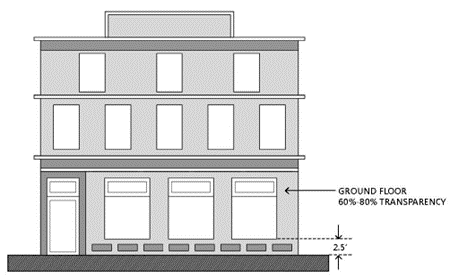
(2)
Opaque materials behind displays that hide the interiors of buildings are prohibited unless the window display volume is filled with changeable display merchandise.
(3)
Display windows shall be lit at night.
(4)
The lower edge of a ground floor window shall be no more than two and one-half (2.5) feet above finished floor level. The upper edge shall be no more than six and one-half (6.5) feet above finished floor level. Reflective glass is prohibited.
(c)
Building Lighting. Exterior lighting shall be directed at the building itself without illuminating other areas of the site, preventing light pollution.
(d)
Massing. Buildings taller than thirty-five (35) feet in height shall display at least one (1) of the following designs for the top of the building: step backs at the top floor, a prominent projecting cornice, or a roof with a form such as a curve, slope, or peak.
30.10.12.12 Block standards and street layout.
(a)
Block Design. The County shall support the subdivision of super blocks into smaller blocks to create walkable development sites. These smaller blocks may contain first-floor non-residential uses to support surrounding residential development and regional demand. New local streets must be designed to the following standards, except that alternate standards may be proposed as part of the development review process and are subject to approval by the County:
(1)
New streets, whether public or private, shall divide the site into blocks. Block lengths shall be between four hundred (400) and eight hundred (800) feet, as shown on Figure 5.
Figure 5: Maximum Block Length
(2)
The maximum block perimeter for new development is two thousand three hundred (2,300) linear feet. Where this measurement cannot be met, a pedestrian connection must be provided through the block to create additional pedestrian connectivity, as shown on Figure 6.
Figure 6: Maximum Block Perimeter
(3)
The number of curb cuts should be limited to reinforce the continuity of the public realm. Ideally, only one curb cut at the mid-point of each block shall be allowed, except where this requirement results in unsafe or inefficient site circulation.
(4)
Curb extensions shall be utilized to protect pedestrians and minimize crossing distances.
(5)
On-street parking is encouraged with construction of new two lane local streets.
(6)
Street trees shall be consistent with the Oxford Road Streetscape Design standards.
(7)
Lighting and signage shall be consistent with the Oxford Road Streetscape Design standards.
(b)
Cross Access Easements. All development shall provide cross-access easements for pedestrians and vehicles to the benefit of adjacent properties.
30.10.12.13 Open space, buffering, and landscaping.
(a)
Open Space.
(1)
Open space shall be provided at a minimum of fifteen (15) percent of the gross project site for each development parcel and in compliance with Section 30.14.2.4 of this Code unless otherwise stated.
(2)
Open space areas shall not contain mechanical units and equipment, storage areas, or other service-related functions.
(3)
For development west of Oxford Road open space areas may include up to seventy-five (75) percent of stormwater retention ponds subject to Section 30.14.2.4(f).
(4)
Open Space within any development site must include continuous walkways linking buildings together and at least two (2) of the following features:
a.
Outdoor patio/cafe seating areas;
b.
Pedestrian plazas/kiosk areas;
c.
Water features with seating areas;
d.
Rain gardens and/or bioswales;
e.
Stormwater planters.
(5)
Open Space areas not containing hardscape, specific amenities, or landscaping shall be sodded.
(b)
Buffering.
(1)
Buffers within the Overlay District shall be required as follows:
a.
On development sites adjacent to the District perimeter boundary not facing US 17-92 and SR 436, buffering shall be provided along the boundary in accordance with Chapter 30 Part 67, except that no such buffer shall have an opacity of less than 0.3 as specified in Section 30.14.5(b)(1).
b.
On development sites adjacent to the District perimeter boundary facing US 17-92 and SR 436 shall provide the following buffering facing said roadways:
i.
Adjacent to overhead utilities:
Five (5) understory trees per one hundred (100) feet of roadway frontage.
Five (5) shrubs per one hundred (100) feet of roadway frontage.
Three (3) foot tall continuous hedge.
ii.
No overhead utilities:
Five (5) canopy trees per one hundred (100) feet of roadway frontage.
Five (5) shrubs per one hundred (100) feet of roadway frontage.
Three (3) foot tall continuous hedge.
c.
On any development site, including parcels internal to the District, buffering may be required by the Board of Adjustment as a condition of approval for a variance or by the Board of County Commissioners for a special exception pursuant to Section 30.3.1.5.
(c)
General Landscaping.
(1)
Landscaping not associated with buffers or parking lots shall be provided within required open space areas, and meet the following criteria:
a.
Required plantings per one thousand (1,000) square feet of building footprint area:
One (1) canopy tree.
Two (2) understory trees.
Seventeen (17) shrubs.
At the applicant's discretion, two (2) understory trees may be substituted for each one (1) required canopy tree.
b.
General landscaping shall be provided on the ground, and/or in tree wells, pots or raised planter boxes, within a specified distance from a building as follows:
c.
All general landscape plantings shall be visible from a public or private street, bicycle path, or pedestrian walkway.
30.10.12.14 Parking.
(a)
Access. A unified access and circulation system that includes coordinated or shared parking areas is required when mixed development is on the same site.
(b)
On-street Parking. On-street public parking contiguous to a development site in the Oxford Place Overlay District may count toward the development's minimum parking requirements.
(c)
Off-street Parking.
1.
The following minimum parking standards shall apply in the Oxford Place Overlay District. Where specific land uses are not mentioned in the Table 1 below, the standards as provided in Section 30.11.3 of this Code will be applicable.
(d)
Surface Parking. Surface parking lots shall be buffered from the street by buildings, landscaping or screen walls, as shown on Figure 7, and include the principles of Crime Prevention Through Environmental Design (CPTED).
Figure 7: Surface Parking Lots
(1)
A minimum of ten (10) percent of all parking area and entryways shall be landscaped. Parking lots shall be designed and landscaped with the tree and shrub species identified in Figure 1 of Part 11 - Off-Street Parking, Loading, and Landscaping Regulations of this Code. To encourage natural surveillance and visibility consistent with CPTED principles, shrubbery must be maintained under thirty (30) inches in height and tree branches must be kept at least six (6) feet above the ground for internal parking areas. Perimeter landscaping may be allowed up to sixty (60) inches in height to screen vehicles.
(2)
Perimeter landscaped parking breaks shall be no less than two hundred (200) square feet in area, planted with one (1) canopy tree and a maximum of twenty (20) spaces apart.
(3)
Internal landscaped breaks shall be a minimum of four hundred (400) square feet planted with one (1) canopy tree, two (2) to three (3) inches diameter breast height (dbh) for every landscape break and a minimum of three (3) shrubs for every landscaped break. Internal breaks shall be a maximum of twenty (20) spaces apart.
(4)
Diamond landscaped breaks shall be placed every ten (10) spaces internally, shall be eight (8) feet by eight (8) feet and shall be planted with one (1) canopy tree.
(5)
Existing vegetation shall be preserved to the maximum extent practicable.
(6)
Parking lot lighting shall be designed in accordance with Part 15 - Outdoor Lighting Requirements of this Code.
(e)
Parking Garages. Structured parking decks and surface parking shall not be located on portions of the site adjacent to residential zoned property. Perimeter landscaping for parking garages shall be the same as for surface parking lots (Section 30.10.12.14.10(c)). However, no perimeter landscaping shall be required for any portion of the parking garage frontage that incorporates other ground floor uses. Parking structures shall comply with the following requirements:
(1)
Parking garages, as shown on Figure 8, shall be designed on the interior of buildings, or finished with materials in such a way that it appears to be a residential or office building from the street. Pedestrian-scaled architectural features, such as openings representing windows, awnings, canopies, etc. are meant to blend in with the surrounding commercial and residential uses.
a.
Parking garages with ground floor non-residential uses are permitted to front the street with direct access from the street.
b.
Direct pedestrian access from parking garages to each adjacent street shall be provided.
Figure 8: Parking Garages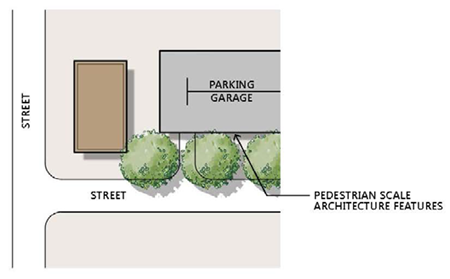
c.
Vehicle entrances to parking structures shall be a maximum of twenty four (24) feet in width and shall be separated from other vehicle access to and from the structure or other parking structures on the same side of the block by a minimum distance of two hundred (200) feet. No vehicle entrances are permitted on Oxford Road.
(f)
Bicycle Parking.
(1)
Two (2) bicycle spaces are required for each ten (10) off-street parking spaces in each development, plus one (1) additional bicycle space for each additional ten (10) off-street parking spaces, up to a maximum of twelve (12) total bicycle spaces for residential uses and a maximum of twenty (20) total bicycle spaces for non-residential uses. Bicycle parking facilities shall be located less than fifty (50) feet from the primary building entrance in a lighted area and visible from the entrance.
(2)
Where applicable, bicycle parking shall be provided within structured parking.
(3)
For non-residential uses, parking may be short term (bicycle racks that are sturdy and well anchored to the ground).
(4)
For residential uses, fifty (50) percent of bicycle parking may be provided by use of bicycle lockers (long term parking).
30.10.12.15 Signage.
(a)
[Existing signs.] Business signs which conform to Part 65 Sign Regulations, SCLDC existing as of the effective date of the Oxford Place Overlay District Ordinance may continue in place and shall not require alternation or removal until such time as the property is redeveloped. Existing signs may be repaired, maintained or replaced in accordance with Part 65 Sign Regulations, SCLDC.
(b)
[New signs.] New signs within the Oxford Place Overlay District shall comply with the following standards:
(1)
Wall (building) Signs.
a.
Wall signs may not be used in conjunction with blade signs;
b.
Commercial uses (retail, office and restaurant): One sign per tenant space; area to be calculated at 0.5 square feet per linear foot of public street frontage with a maximum of thirty (30) square feet;
c.
Second-floor commercial uses may also be permitted one second-floor wall sign per tenant space per public street frontage; area to be calculated at 0.25 square feet per linear foot of second floor frontage along that public street;
d.
Live-work and home occupations: One sign limited to an area of eight (8) square feet maximum.
e.
May encroach a maximum of twelve (12) inches over a sidewalk while maintaining a vertical clearance of eight (8) feet from the finished sidewalk;
f.
Wall signs should not obscure windows, grill work, piers, pilasters, and ornamental features. Typically, wall signs should be centered on horizontal surfaces (i.e., over a storefront opening); and
g.
Wall signs may be internally or externally lit. Cutoff fixtures shall be angled toward the face of the wall sign and shall complement the design of the building through style, material and color.
Figure 9: Wall (Building) Sign Illustrative Examples
(2)
Window Signs.
a.
Window signs may be used in conjunction with other signs;
b.
Limited to thirty (30) percent of the window area; and
c.
The following shall be exempt from this limitation:
i.
Addresses, closed/open signs, hours of operation, credit card logos, real estate signs, and now hiring signs shall be limited to ten (10) percent of the window area.
Figure 10: Window Signs Illustrative Examples
(3)
Blade Signs.
a.
Blade signs may not be used in conjunction with wall signs;
b.
Shall be permitted for all commercial uses only (retail, restaurant, and office);
c.
Maximum four (4) square feet per sign face;
d.
May encroach a maximum of three (3) feet over a public sidewalk/R-O-W; and
e.
Blade signs may be attached to the building or hung under the soffit of an arcade or under a canopy/awning while maintaining a vertical clearance of eight (8) feet from the finished sidewalk.
Figure 11: Blade Signs Illustrative Examples
(4)
Awning Signs.
a.
Awning signs may not be used in conjunction with canopy signs;
b.
The character height shall not exceed two-thirds (⅔) of the height of the face (vertical or near vertical part) of the awning;
c.
When possible, signs shall be horizontally and vertically centered on the face of the awning; and
d.
The sign shall not exceed one square foot per linear foot of canopy face length.
Figure 12: Awning Signs Illustrative Examples
(5)
Canopy Signs.
a.
Canopy signs may not be used in conjunction with awning signs;
b.
The placement of this type of sign shall be limited to the canopy face length;
c.
No sign shall project beyond the perimeter of the canopy; and
d.
The sign shall not exceed one square foot per linear foot of canopy face length.
Figure 13: Canopy Signs Illustrative Examples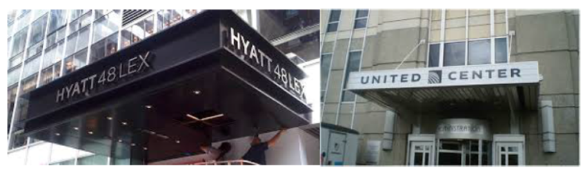
(6)
Menu Board Signs.
a.
One menu board shall be allowed per street address;
b.
Menu boards shall not exceed eight (8) square feet in size and shall be positioned so as to be adjacent to the restaurant or business listed on the board and information on the board shall advertise exclusively the goods and services of the business and be placed in a manner which is clearly visible to pedestrian traffic and in compliance with all Americans with Disabilities Act (ADA) regulations;
c.
Menu boards shall not be placed in the right-of-way;
d.
All standing menu signs shall be removed at the end of each business day; an
e.
All wall menu signs shall be securely anchored to a wall.
Figure 14: Menu Board Signs Illustrative Examples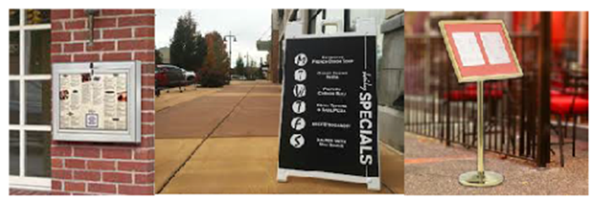
(7)
Wayfinding Signs.
a.
Internal development wayfinding signs may provide location maps, directions, general information and special notices to add liveliness of the development, as shown on Figure 15. The signs shall be designed to match the site architecture and be integrated into the layout of pedestrian circulation areas.
b.
Wayfinding signs may be placed on private property or within public right-of-way with a Right-of-Way Use Permit but shall not block site lines or impede safe American with Disabilities Act (ADA) access.
Figure 15: Wayfinding Signs Illustrative Examples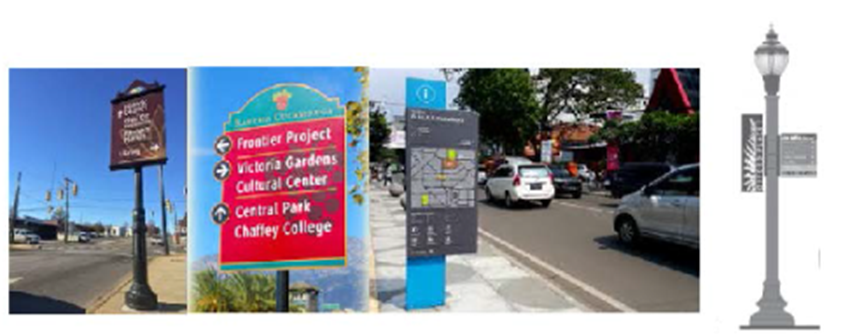
(8)
Gateway Feature Entrance Signs.
a.
Gateway Feature Entrance signs are permitted at the main entrances of Oxford Place at the intersections of:
i.
US Hwy 17-92 and the Fern Park Boulevard Extension;
ii.
US Hwy 17-92 and Fernwood Boulevard; and
iii.
SR 436 and Oxford Road
b.
Gateway Feature Entrance Signs may be placed on private property or within public right-of-way with a Right-of-Way Use Permit.
c.
Gateway Feature Entrance Signs shall not block site lines or impede safe American with Disabilities Act (ADA) access.
Figure 16: Gateway Feature Entrance Signs Illustrative Examples
30.10.12.16 Utilities.
(a)
Utility Lines. All new or relocated utility lines within the overlay district shall be constructed and installed beneath the surface of the ground unless it is determined otherwise by the Board of County Commissioners in exercising the public's proprietary rights over publicly owned rights-of-way.
(Ord. No. 2024-02, § 7(Exh. B), 1-9-24).
Sec. 30.10.13. - Urban Conservation Village Design.
30.10.13.1 Applicability. The provisions of this Part may be applied only to detached single family residential development in the Myrtle Street Special Study Area, as described in the Future Land Use Element of the Seminole County Comprehensive Plan, which are designated as Suburban Estates on the Future Land Use Map. The provisions of this Part shall constitute an optional zoning overlay classification known as the "Urban Conservation Village Design." The provisions of this Part shall govern and control development implemented pursuant to the Urban Conservation Village Design, and in that regard, in the event of a conflict between the provisions of this Part and any other provisions of this Code, the provisions of this Part shall govern. However, any development matters not specifically addressed by this Part shall be governed by the applicable sections of this Code.
30.10.13.2 Purpose. The purpose of Urban Conservation Village Design is to create a flexible and incentive based framework for development of communities harmonious with a rural setting, to preserve the ecological and aesthetic benefits of undeveloped land, and to encourage innovative development techniques. In that regard, an Urban Conservation Village should include cluster development of residential units fronting upon large open spaces and greenways. More specifically, a Conservation Village design should promote the following values:
(a)
Sense of a neighborhood community;
(b)
High quality of life;
(c)
Reduced infrastructure needs and costs;
(d)
Protection, preservation and creation of attractive and easily accessible open spaces, greenways and outdoor recreational activities;
(e)
Protection of floodplains, wetlands and wildlife habitats; and
(f)
Preservation of natural drainage flows.
30.10.13.3 Development restrictions, incentive and flexibility. An Urban Conservation Village development shall have design flexibility within the following technical framework:
(a)
It is the intent of this Part to encourage clustering and other innovative design techniques in order to preserve large open spaces and greenway areas for the benefit of all Village residents. In that regard, lot sizes may be smaller than is commonly accepted; provided however, that such lot size must be sufficient to satisfy the purposes of this Part.
(b)
It is the intent of this Part to encourage clustering and other innovative design techniques in order to preserve large open spaces and greenway areas for the benefit of all Village residents. In that regard, yard setbacks may be smaller and residential structures may be located closer to internal roads than is commonly accepted; provided however, that front, side and rear yard setbacks shall be of sufficient size that the purposes of this Part are satisfied and comply with the following standards:
(1)
Residential structures, excluding privacy fences, must be set at least forty (40) feet back from the center line of Myrtle Street.
(2)
Residential structures must be set at least thirty-five (35) feet back from the right-of-way line of any other rights-of-way external to the development.
(3)
Residential structures must be set at least thirty-five (35) feet back from the boundaries with any external developments.
(c)
A buffer of at least fifteen (15) feet, consisting of natural vegetation and landscape materials as approved in the Greenway Ownership and Management Plan, must be located along all external development boundaries (except for the boundary fronting on Myrtle Street.)
(d)
Each lot shall provide at least four (4) off-street parking spaces. Garage parking spaces may be counted toward this requirement.
(e)
The net density for a Conservation Village shall be calculated on the basis of the net buildable area as defined in Section 2.3, but further excluding Primary Conservation Areas and roads.
(f)
A maximum of two (2) units per net buildable acre if all of the following conditions are met:
(1)
The development is connected to central water and sewer.
(2)
The development incorporates stormwater volume reduction by retaining on-site the difference between pre-development and post-development runoff volume for a 25-year/24-hour storm event with recovery of seventy-five (75) percent of volume within seventy-two (72) hours of the storm event.
(3)
The development integrates stormwater quality treatment through an offline stormwater management system which incorporates sediment for bays equal to one-half (½) of the water quality volume, as required by St. John's River Water Management District, upstream of water quality treatment areas.
(4)
The development implements a Greenway Ownership and Management Plan regarding its primary conservation and greenbelt areas.
(g)
In order to implement the purposes of this Part, the following technical standards are required:
(1)
That fences, pools and other residential structures be located no closer than twenty-five (25) feet from Secondary Conservation Areas.
(2)
That the visual impact of houses on exterior lots be minimized by use of existing vegetation or planting of additional landscaping per the requirements of the approved Greenway Ownership and Management Plan.
(3)
That residential lots be accessed from interior streets unless provision of such access cannot be reasonably provided.
(4)
That at least sixty (60) percent of the residential lots abut, or be located across a street from, greenway land.
(5)
No fences with opacity of greater than fifty (50) percent, nor any walls, nor any berms of over three (3) feet in height shall be allowed within one hundred twenty (120) feet of the Myrtle Street center line.
(6)
That sidewalks be provided on at least one (1) side of all internal streets.
(7)
Street lighting shall be designed such that there is no light spillage of greater than one-half (½) foot candle onto properties adjacent to the Conservation Village or onto conservation areas.
30.10.13.4 Required greenway. The creation of greenways is a primary goal and feature of Urban Conservation Village development. In that regard, a minimum of fifty (50) percent of any Conservation Village development must be preserved under a conservation easement as greenway land. Calculation of this fifty (50) percent requirement shall be subject to the following conditions:
(a)
Greenways shall be designed to:
(1)
Foster an interconnected network of open space and trails, accessible to neighborhood residents, within the Conservation Village and connection to offsite open space.
(2)
Afford convenient access to all Village residents, except so far as such access would damage ecologically sensitive areas or infringe upon active agricultural lands.
(3)
Incorporate and protect the following resources:
a.
Stream channels, floodplains, swales, springs and other lowland areas.
b.
Habitat of endangered, threatened, or species of special concern.
c.
Groundwater recharge areas.
d.
Woodlands, large individual trees of botanic significance, or other vegetation features representing the site's rural past.
e.
Historic structures and sites.
g.
Scenic viewsheds.
h.
Trails which connect internal lots to open space and adjacent properties.
(4)
Lack man-made structures except for historic buildings, approved walls and approved facilities associated with greenway use.
(5)
Utilize at least sixty (60) percent of the required greenway in a single consolidated tract connected to other internal and external greenway tracks which may be of smaller size.
(b)
The greenway requirement shall be calculated based upon the net acreage of the development exclusive of Primary Conservation Areas and water bodies.
(c)
Only lands encumbered by perpetual conservation easements and active agricultural lands may be counted toward the greenway requirement. The terms of a conservation easement shall be flexible to allow for various uses and circumstances, provided that at a minimum, the conservation easement complies with the requirements of Section 704.06, Florida Statutes, as amended, and that the conservation easement include the following encumbrances:
(1)
The easement shall be perpetual in nature and run with the land;
(2)
The easement shall prohibit any development other than that listed in subsection (d) below;
(3)
Except as required for permitted development, permitted landscaping, routine maintenance, removal of invasive species or as specifically provided otherwise, there shall be no removal, destruction, or cutting of trees, shrubs, or other vegetation within the easement area and the land within the easement area shall be allowed to grow in its natural state with supplemental native flora as indicated in the Greenway Ownership and Management Plan;
(4)
There shall be no advertising within the easement area;
(5)
There shall be no dumping of soil, trash, ashes, garbage, waste or other unsightly or offensive material, except as necessary for fertilization;
(6)
There shall be no excavation, dredging or removal of loam, gravel, soil, rock, sand, or other material, except as necessary for agricultural activities, landscaping within the easement area or construction of approved easement amenities and facilities;
(7)
Unless specifically permitted otherwise, there shall be no activities, actions, or uses detrimental or adverse to water conservation, erosion control, soil conservation or fish, wildlife or habitat preservation; and
(8)
The easement may only be released as provided by Section 704.06, Florida Statutes, as amended.
(d)
In addition to maintenance of land in its natural state, the following uses are permitted in the greenway so far as specifically enumerated by the applicable conservation easement:
(1)
Pasture for sport use of horses and equestrian facilities; provided however, that the aggregate greenway is at least twenty-five (25) acres in size and that such facilities utilize less than fifty (50) percent of the greenway;
(2)
Neighborhood recreational uses such as village greens, open-space commons, picnic areas, community gardens, trails and similar low-impact natural uses;
(3)
Neighborhood recreation areas, such as playing fields, playgrounds, bikeways, tennis courts, basketball courts and community pools; provided however, that such uses consume no more than five (5) acres or half of the minimum required greenway (whichever is less.) Further provided that tennis, basketball and pool amenities may not be larger than one (1) acre of the minimum greenway area requirement. Also provided that playing fields and courts shall be located at least fifty (50) feet away from all external boundaries and one hundred forty (140) feet from the centerline of Myrtle Street.
(4)
Stormwater retention areas which are designed and landscaped as an aesthetic asset to the greenway;
(5)
Easements for drainage, access, sewer or water lines; and
(6)
Bona fide agricultural activities.
(e)
Utilities and streets may traverse the greenway as necessary for safe and efficient flow of traffic; provided however, that areas in which above-ground utility structures and streets traverse the greenway may not be counted toward the minimum required greenway land.
(f)
Where the Conservation Village adjoins active recreational public parkland, a greenway buffer shall be provided along the boundary with the parkland. No structures may be constructed within this buffer except as associated with pedestrian trails. Vegetative planting and/or removal of invasive exotic plants may be required within this buffer.
30.10.13.5 Ownership and maintenance of greenway land and common facilities.
(a)
Greenway conservation easements may be dedicated to the following entities:
(1)
A mandatory homeowners association which has authority and responsibility to assess membership fees for the maintenance of greenway and open space areas;
(2)
A non-profit land trust or other conservation organization; or
(3)
Seminole County, provided that the County approves of such dedication and that, unless specifically ordered otherwise, the County maintains no responsibility for the maintenance of any easement property or facilities.
(b)
Regardless of what entity assumes the conservation easement, there may also be established concurrently with the easement a maintenance endowment to fund perpetual care and maintenance of the greenway, other open spaces and their associated facilities.
30.10.13.6 Application process. The application process for the Urban Conservation Village overlay designation shall include approval of a Preliminary Plan, a Final Master Plan and a Developers Commitment Agreement. The requirements for each plan are as follows:
(a)
During the Preliminary Plan approval process the applicant shall provide, in addition to the requirements of Section 35.43 of this Code, the following:
(1)
A series of sketches to indicate the following aspects of the proposed development (to be designed in an overlay fashion such that each subsequent sketch incorporates the information contained in the prior sketch(es), creating a composite sketch of all foregoing information).
a.
A sketch of the site (and to the extent possible, adjacent properties) including all of the following:
i.
Primary and Secondary Conservation Areas;
ii.
Easements, roads and trails located within the site and within two hundred (200) feet of the site;
iii.
Prominent viewsheds; and
iv.
Historically, ecologically or culturally significant sites.
b.
A sketch of proposed greenways and other open space.
c.
A sketch of proposed locations for structures.
(2)
A vertical aerial photograph of the site to a scale of not less than one (1) inch equals four hundred (400) feet.
(3)
An account of the total acreage to be placed under a conservation easement, the acreage available for development, the estimated total number of residential units to be constructed and statement as to whether a density incentive will be sought.
(4)
The Greenway Ownership and Management Plan, which shall detail the following:
a.
What entity(ies) will own the dominant and/or servient estates under the conservation easement(s);
b.
What entity(ies) will assume responsibility for operation and maintenance of the conservation easement areas and associated facilities;
c.
The proposed schedule and estimated cost of operation and maintenance of the conservation easement areas and associated facilities;
d.
The funding source or method for operation and perpetual maintenance of the conservation easement areas and associated facilities; and
e.
The landscape architecture, vegetation to be used, placement of amenities (including but not limited to facilities and infrastructure) and best management practices for soil and water conservation techniques to be implemented within the conservation easement areas.
(b)
The Preliminary Plan shall be reviewed by the Planning and Zoning Board for its recommendation then forwarded to the Board of County Commissioners for approval or denial.
(c)
During the Final Master Plan approval process, the applicant shall provide a Final Master Plan and Developers Commitment Agreement incorporating a finalized proposal for the development, which should, at a minimum include a detailed analysis of all development issues addressed during the Preliminary Master Plan approval process.
(d)
The Final Master Plan and Developers Commitment Agreement shall be approved or denied by the Board of County Commissioners.
(Ord. No. 2024-02, § 7(Exh. B), 1-9-24).