
Slidell City Zoning Code
PART 2
- SCHEDULE OF DISTRICT REGULATIONS ADOPTED
Districts are shown on the official zoning map. Within the districts established by this ordinance the following regulations shall apply:
Section 2.1. - Planned district.
2.101
Persons desiring to use land or erect buildings within a planned district shall first
submit a plan to the city council showing in detail the manner in which the land is
to be used, the location, size, character, and appearance of buildings, and provisions
for off-street parking, service areas, and landscaping. Said plan shall include the
entire area within an individual planned district.
2.102
The council shall submit such a plan to the commission who shall have 45 days in which
to investigate plan and hold hearings. If commission does not report in 45 days, the
council may assume that the commission approves the plan in the manner required in
section 2.103.
2.103
If the commission reports to the council that:
(1)
The plan complies with all regulations of this ordinance;
(2)
The plan provides additional setback at least 20 feet beyond the space required for major street rights-of-way as shown on the major street plan;
(3)
The plan provides protection for adjacent properties as set forth under section 2.201((2)(a) through (2)(f));
(4)
The plan is for at least minimum acreage as set forth in sections 2.8, 2.15, and 2.19;
(5)
The plan meets the area and parking regulations for the type of district requested as set forth in the A-5 district in the case of residential or C-2 district, in the case of a commercial or industrial district.
2.104
Then the council may, after public hearing, approve the plan and building permits
may be issued to carry out the approved plan. Buildings and land may be used only
in accordance with approved plans. Approved plans may be amended by the same procedure
by which they were adopted.
(Ord. No. 1010, 9-14-1976)
Section 2.2. - R—rural district.
2.201
Permitted uses in the R district are as follows:
(1)
Agricultural use; any residential use except apartments which must meet the criteria of (2) below.
(2)
Apartments, commercial, and industrial uses must meet the following criteria:
(a)
Use complies with the requirements of the board of health for disposal of waste and sewage.
(b)
When adjacent to residential property a solid fence or wall six feet in height or plantings not less than three feet in height which will grow and be maintained to six feet or more shall be installed along the lot line, but this requirement shall not apply within 20 feet of a street or along lot lines adjacent and parallel to the street.
(c)
Roadway entrance and exits shall be located for clear sight distance and safety not closer than 40 feet to a street intersection. Parking areas called for in part 4 shall, when occurring in the fronts of buildings, be arranged so that cars do not back into traffic into the street.
(d)
Major drainage channels and culverts shall meet minimum requirements of the city engineer.
(e)
There shall be no more than one use on a lot or lots of record.
(f)
The use must meet the requirements of Appendix B, Part 3.
2.202
Height regulations. There are none in the R district except when abutting residential
areas. Then set back one additional foot from the required yard line for each foot
of height over 45 feet.
2.203
(1)
Yard requirements. Minimum yard requirements in the R district are as follows:
(a)
Front—50 feet
(b)
Side—50 feet
(c)
Rear—50 feet
(d)
No structural components or mechanical equipment may be located within the required front or side setback.
(2)
Lot sizes in the R district are as follows:
(a)
Sixty thousand square feet minimum unless constructed on a smaller lot which was a lot of record existing prior to adoption of this ordinance.
(b)
For a lot of record existing prior to adoption of this ordinance, the minimum lot area requirements are set relative to the number of dwelling units provided per site, as follows:
1.
Single-family dwelling: 6,000 sq. ft.
2.
Duplex or two-family: 7,000 sq. ft.
3.
Three dwelling units: 9,000 sq. ft.
4.
Four dwelling units: 12,000 sq. ft.
5.
5—16 dwelling units: 10,000 sq. ft. + 700 sq. ft. per unit
6.
17—40 dwelling units: 10,000 sq. ft. + 1,000 sq. ft. per unit
7.
40+ dwelling units: 10,000 sq. ft. + 1,300 sq. ft. per unit
(c)
Minimum lot width (frontage) of 200 feet.
2.204
Parking regulations in the R district: see part 4.
2.205
Loading zone required for commercial and industrial uses in the R district: see part
4.
(Ord. No. 1010, 9-14-1976; Ord. No. 4175, Exh. 1, 5-28-2024)
_____
Section 2.3. - Permitted residential uses.
2.301
The following table is a listing of residential uses permitted in zoning districts.
"P" stands for permitted uses, "C" stands for conditional uses, and "—" indicates
that a use is prohibited. Conditional uses must be approved by the Planning and Zoning
Commission and city council in accordance with the standards and procedures set out
in Section 2.2215 of the zoning ordinance.
All multifamily, civic and commercial uses shall conform with required buffering, landscaping and parking regulations per this Code.
(Ord. No. 2466, 8-31-1992; Ord. No. 2478, 11-10-1992; Ord. No. 3759, 1-13-2015; Ord. No. 3923, 1-22-2019; Ord. No. 4162, 4-23-2024; Ord. No. 4175, Exh. 1, 5-28-2024)
_____
Section 2.4. - A-1 suburban district.
2.401
Permitted uses. In A-1 suburban district only the following uses of property shall
be permitted: as listed in section 2.3.
2.402
Prohibited uses in the A-1 district are: All uses not permitted herein and trailers,
except as used for temporary offices for construction purposes.
2.403
Height regulations in the A-1 district are: No building shall exceed 35 feet in height.
2.404
Area regulations for all buildings except accessory use in the A-1 district (also
see part 10, lot of record) are as follows:
(1)
Yard:
(a)
Front yard: Front building lines shall not be less than 50 feet.
(b)
Side yard: There shall be two side yards, one on each side of the building having a minimum width of ten feet each.
(c)
Rear yard: There shall be a rear yard having a depth of not less than 20 percent of the depth of the lot when lot depth is 250 feet or less; the rear yard shall be not less than 50 feet when lot depth is in excess of 250 feet.
(2)
Lot size:
(a)
There shall be a lot width of a minimum of 100 feet at the building line.
(b)
Every lot shall contain an area of not less than 20,000 square feet per family unit.
2.405
Off-street parking regulations for the A-1 district are provided for under part 4.
(Ord. No. 1326, 12-9-1980; Ord. No. 1490, 2-24-1982; Ord. No. 2416, 11-14-1992; Ord. No. 2466, 8-31-1992)
Section 2.5. - A-2 single-family residential.
2.501
Permitted uses. In A-2 residential district only the following uses shall be permitted:
as listed in section 2.3.
2.502
Prohibited uses in the A-2 district are: all uses not permitted herein and trailers,
except as used for temporary offices for construction purposes.
2.503
Height regulations in the A-2 district are: no building shall exceed 35 feet in height.
2.504
Area regulations for all buildings except accessory uses in the A-2 district (also
see part 10, lot of record) are as follows:
(1)
Yard:
(a)
Front yard: Front building lines shall conform to the average building lines in a developed block but in no case shall it be less than 25 feet. On through lots this minimum front yard shall be provided on both streets.
(b)
Side yard: There shall be two side yards, one on each side of the building having a minimum width of ten feet each. However, this regulation shall not be so interpreted as to reduce the buildable width of any lot existing before the adoption of this ordinance to less than 24 feet. On corner lots the necessary reduction shall be on the side yard not abutting the street. See section 1.4.
(c)
Rear yard: There shall be a rear yard having a depth of not less than 20 percent of the depth of the lot; provided, however, that the depth of the required rear yard shall not be less than 25 feet and need not exceed 50 feet.
(2)
Lot size:
(a)
There shall be a lot width of a minimum of 100 feet at the building line.
(b)
Every lot shall contain an area of not less than 12,000 square feet per family unit.
2.505
Off-street parking regulations for the A-2 district are provided for under part 4.
(Ord. No. 1010, 9-14-1976; Ord. No. 1326, 12-9-1980; Ord. No. 1490, 2-24-1982; Ord. No. 2416, 1-14-1992; Ord. No. 2466, 8-31-1992)
Section 2.6. - A-3 multifamily residential.
2.601
Permitted uses in the A-3 district are: as listed in section 2.3.
2.602
Prohibited uses in the A-3 district are: all uses not permitted herein and trailers,
except as used for temporary offices for construction purposes.
2.603
Height regulations in the A-3 district are: No building shall exceed 45 feet in height.
2.604
Area regulations in the A-3 district are as follows:
(1)
Yard:
(a)
Front yard: Front building lines shall conform to the average building lines in a developed block but in no case shall it be less than 20 feet. When there is undeveloped land for a distance of 150 feet on both sides of a proposed building, the minimum building setback line shall be 25 feet from the established street right-of-way lines. On through lots this minimum depth shall be provided on both streets.
(b)
Side yard: There shall be two side yards with a minimum of five feet from any side property line for lots under 100 feet and a minimum of ten feet from any side property line for lots over 100 feet in width.
(c)
Rear yard: The required rear yard shall not be less than 20 feet.
(d)
No structural components or mechanical equipment may be located within the required front or side setback.
(2)
Lot size:
(a)
There shall be a minimum lot width of 75 feet.
(b)
Minimum lot area requirements are set relative to the number of dwelling units provided per site, as follows:
1.
Single-family dwelling: 6,000 sq ft
2.
Duplex or two-family: 7,000 sq ft
3.
Three dwelling units: 9,000 sq ft
4.
Four dwelling units: 12,000 sq ft
5.
5—16 dwelling units: 10,000 sq ft + 700 sq ft per unit
6.
17—40 dwelling units: 10,000 sq ft + 1,000 sq ft per unit
7.
40+ dwelling units: 10,000 sq ft + 1,300 sq ft per unit
2.605
Off-street parking requirements in the A-3 district are as provided for in part 4.
2.606
Design standards. All new construction, additions and substantial improvements must
meet the city's design standards as outlined in Appendix B, Part 3 of the City's Code
of Ordinances.
2.607
Fees. Fees required, see Appendix F, Part 2, Section 2.1.
(Ord. No. 1009, 8-24-1976; Ord. No. 1010, 9-14-1976; Ord. No. 1256, § 2, 3-25-1980; Ord. No. 1326, 12-9-1980; Ord. No. 1363, 2-24-1981; Ord. No. 1381, 4-14-1981; Ord. No. 1490, 2-24-1982; Ord. No. 2466, 8-31-1992; Ord. No. 3211, 9-28-2004; Ord. No. 3518, 1-13-2009; Ord. No. 4154, § 1(Exh. A), 1-23-2024; Ord. No. 4155, § 1(Exh. A), 1-23-2024; Ord. No. 4162, 4-23-2024; Ord. No. 4175, Exh. 1, 5-28-2024)
Section 2.7. - A-4 transitional district.
2.701
Permitted uses in the A-4 district are: as listed in section 2.3.
2.702
Prohibited uses in the A-4 district are: all those not permitted herein and trailers,
except as used for temporary offices for construction purposes.
2.703
Height regulations in the A-4 district are: No building shall exceed 45 feet in height.
2.704
Area regulations in the A-4 district are as follows:
(1)
Yard:
(a)
Front yard: Front building lines shall conform to the average building lines in a developed block but in no case shall it be less than 20 feet. On through lots this minimum depth shall be provided on both streets.
(b)
Side yard: There shall be two side yards with a minimum of five feet from any side property line for lots under 100 feet and a minimum of ten feet from any side property line for lots over 100 feet in width.
(c)
Rear yard: The required rear yard shall not be less than 25 feet.
(d)
No structural components or mechanical equipment may be located within the required front or side setback.
(2)
Lot size:
(a)
There shall be a lot width of a minimum of 75 feet at the building line (see Appendix A, Part 10, Section 10.2).
(b)
Minimum lot area requirements are set relative to the number of dwelling units provided per site, as follows:
1.
Single-family dwelling: 7,500 sq ft
2.
Duplex or two-family: 8,250 sq ft
3.
Three dwelling units: 9,000 sq ft
4.
Four dwelling units: 12,000 sq ft
5.
5—16 dwelling units: 10,000 sq ft + 700 sq ft per unit
6.
17—40 dwelling units: 10,000 sq ft + 1,000 sq ft per unit
7.
40+ dwelling units: 10,000 sq ft + 1,300 sq ft per unit
2.705
Off-street parking requirements in the A-4 district are as provided for in part 4.
2.706
Design standards. All new construction, additions and substantial improvements must
meet the city's design standards as outlined in Appendix B, Part 3 of the City's Code
of Ordinances.
2.707
Fees. Fees required, see Appendix F, Part 2, Section 2.1.
(Ord. No. 1009, 8-24-1976; Ord. No. 1010, 9-14-1976; Ord. No. 1256, § 3, 3-25-1980; Ord. No. 1326, 12-9-1980; Ord. No. 1332, 12-23-1980; Ord. No. 2466, 8-31-1992; Ord. No. 3211, 9-28-2004; Ord. No. 4175, Exh. 1, 5-28-2024)
Section 2.8. - Reserved.
Editor's note— Ord. No. 1635, adopted June 14, 1983, provided that § 2.8, A-5 planned residential district be deleted and reserved.
Section 2.9. - A-6 single-family urban.
2.901
Permitted uses. In A-6 residential district only the following uses of property shall
be permitted: as listed in section 2.3.
2.902
Prohibited uses in the A-6 district are: all uses not permitted herein and trailers,
except as used for temporary offices for construction purposes.
2.903
Height regulations in the A-6 district are: No building shall exceed 35 feet in height.
2.904
Area regulations for all buildings except accessory uses in the A-6 district (also
see part 10, lot of record) are as follows:
(1)
Yard:
(a)
Front yard: Front building lines shall conform to the average building lines in a developed block but in no case shall it be less than 25 feet. On through lots this minimum front yard shall be provided on both streets.
(b)
Side yard: There shall be two side yards with a minimum of five feet from any side property line for lots under 100 feet and a minimum of ten feet from any side property line for lots over 100 feet in width.
(c)
Rear yard: The required rear yard shall not be less than 25 feet.
(d)
No structural components or mechanical equipment may be located within the required front or side setback.
(2)
Lot size:
(a)
There shall be a lot width of a minimum of 70 feet at the building line.
(b)
Every lot shall contain an area of not less than 8,400 square feet per family unit.
2.905
Off-street parking regulations in the A-6 district are provided for under part 4.
For uses other than single-family residential, section 2.201(2)(c) shall apply.
(Ord. No. 1010, 9-14-1976; Ord. No. 1326, 12-9-1980; Ord. No. 1357, 2-10-1981; Ord. No. 1490, 2-24-1982; Ord. No. 1782, 2-12-1985; Ord. No. 2305, 2-13-1990; Ord. No. 2416, 1-14-1992; Ord. No. 2466, 8-31-1992; Ord. No. 4175, Exh. 1, 5-28-2024)
Section 2.10. - A-7 multifamily urban.
2.1001
Permitted uses in the A-7 district shall be: as listed in section 2.3.
2.1002
Prohibited uses in the A-7 district shall be: all uses not permitted herein and trailers,
except as used for temporary offices for construction purposes.
2.1003
Height regulations in the A-7 district are: No building shall exceed 45 feet in height.
2.1004
Area regulations in the A-7 district are as follows:
(1)
Yard:
(a)
Front yard: Front building lines shall conform to the average building lines in a developed block but in no case shall it be less than 20 feet. When there is undeveloped land for a distance of 150 feet on both sides of a proposed building, the minimum building setback line shall be 25 feet from the established street right-of-way lines. On through lots, this minimum depth shall be provided on both streets.
(b)
Side yard: There shall be two side yards with a minimum of five feet from any side property line for lots under 100 feet and a minimum of ten feet from any side property line for lots over 100 feet in width.
(c)
Rear yard: The required rear yard shall not be less than 25 feet.
(d)
No structural components or mechanical equipment may be located within the required front or side setback.
(2)
Lot size:
(a)
There shall be a minimum lot width of 60 feet.
(b)
Minimum lot area requirements are set relative to the number of dwelling units provided per site, as follows:
1.
Single-family dwelling: 7,500 sq ft
2.
Duplex or two-family: 8,250 sq ft
3.
Three dwelling units: 9,000 sq ft
4.
Four dwelling units: 12,000 sq ft
5.
5—16 dwelling units: 10,000 sq ft + 700 sq ft per unit
6.
17—40 dwelling units: 10,000 sq ft + 1,000 sq ft per unit
7.
40+ dwelling units: 10,000 sq ft + 1,300 sq ft per unit
2.1005
Off-street parking requirements as provided for in part 4.
2.1006
Design standards. All new construction, additions and substantial improvements must
meet the city's design standards as outlined in Appendix B, Part 3 of the City's Code
of Ordinances.
2.1007
Fees. Fees required, see Appendix F, Part 2, Section 2.1.
(Ord. No. 1009, 8-24-1976; Ord. No. 1010, 9-14-1976; Ord. No. 1326, 12-9-1980; Ord. No. 2466, 8-31-1992; Ord. No. 3211, 9-28-2004; Ord. No. 4175, Exh. 1, 5-28-2024)
Section 2.11. - A-8 high density urban.
2.1101
Permitted uses in the A-8 district are: as listed in section 2.3.
2.1102
Prohibited uses in the A-8 district are: all uses not permitted herein and trailers,
except as used for temporary offices for construction purposes.
2.1103
Height regulations in the A-8 district are: No building shall exceed 45 feet in height.
2.1104
Area regulations in the A-8 district are as follows:
(1)
Yard:
(a)
Front yard: Front building lines shall conform to the average building lines in a developed block but it shall be at least 20 feet. On through lots this minimum depth shall be provided on both streets. For multi-family developments, a setback reduction to ten (10) feet may be requested if the development can provide public and private sidewalks, and rear parking that is not visible from the street.
(b)
Side yard: There shall be two side yards with a minimum of five feet from any side property line for lots under 100 feet and a minimum of ten feet from any side property line for lots over 100 feet in width.
(c)
Rear yard: The required rear yard shall not be less than 25 feet.
(d)
No structural components or mechanical equipment may be located within the required front or side setback.
(2)
Lot size:
(a)
There shall be a lot width of a minimum of 50 feet at the building line.
(b)
Minimum lot area requirements are set relative to the number of dwelling units provided per site, as follows:
1.
Single-family dwelling: 6,000 sq ft
2.
Duplex or two-family: 7,000 sq ft
3.
Three dwelling units: 9,000 sq ft
4.
Four dwelling units: 12,000 sq ft
5.
5—16 dwelling units: 10,000 sq ft + 700 sq ft per unit
6.
17—40 dwelling units: 10,000 sq ft + 1,000 sq ft per unit
7.
40+ dwelling units: 10,000 sq ft + 1,300 sq ft per unit
2.1105
Off-street parking requirements in the A-8 district shall be as provided for in part
4.
2.1106
Design standards. All new construction, additions and substantial improvements must
meet the city's design standards as outlined in Appendix B, Part 3 of the City's Code
of Ordinances.
2.1107
Fees. Fees required, see Appendix F, Part 2, Section 2.1.
(Ord. No. 815, 7-8-1969; Ord. No. 1009, 8-24-1976; Ord. No. 1010, 9-14-1976; Ord. No. 1326, 12-9-1980; Ord. No. 1490, 2-24-1982; Ord. No. 2466, 8-31-1992; Ord. No. 3211, 9-28-2004; Ord. No. 4175, Exh. 1, 5-28-2024)
Section 2.12. - A-9 apartment district.
2.1201
Permitted uses in the A-9 district are: as listed in section 2.3.
2.1202
Prohibited uses in the A-9 district are: all uses not permitted herein and trailers,
except as used for temporary offices for construction purposes.
2.1203
Height regulations in the A-9 district are: No building shall exceed 45 feet in height.
2.1204
Area regulations:
(1)
Yard:
(a)
Front yard: Front building lines shall conform to the average building lines in a developed block but in no case shall it be less than 25 feet. On through lots this minimum front yard shall be provided on both streets. The exterior walls of the building nearest the property lines shall be considered the front, side and rear yard areas in condominium and other similar apartments with joint ownership or common property.
(b)
Side yard: There shall be two side yards with a minimum of five feet from any side property line for lots under 100 feet and a minimum of ten feet from any side property line for lots over 100 feet in width.
(c)
Rear yard: The required rear yard shall not be less than 25 feet.
(d)
No structural components or mechanical equipment may be located within the required front or side setback.
(2)
Lot size:
(a)
There shall be a minimum lot width of 70 feet.
(b)
Minimum lot area requirements are set relative to the number of dwelling units provided per site, as follows:
1.
Single-family dwelling: 6,000 sq ft
2.
Duplex or two-family: 7,000 sq ft
3.
Three dwelling units: 9,000 sq ft
4.
Four dwelling units: 12,000 sq ft
5.
5—16 dwelling units: 10,000 sq ft + 700 sq ft per unit
6.
17—40 dwelling units: 10,000 sq ft + 1,000 sq ft per unit
7.
40+ dwelling units: 10,000 sq ft + 1,300 sq ft per unit
2.1205
Off-street parking requirements in the A-9 district shall be as provided for in Appendix
A, Part 4.
2.1206
Statement of service for the A-9 district is as follows: There shall be presented
to the commission a written statement from the fire department and utility companies
serving the area ensuring that adequate services are available or can be supplied.
2.1207
Design standards. All new construction, additions and substantial improvements must
meet the city's design standards as outlined in Appendix B, Part 3 of the Code of
Ordinances.
2.1208
Fees. Fees required, see Appendix F, Part 2, Section 2.1.
(Ord. No. 1009, 8-24-1976; Ord. No. 1010, 9-14-1976; Ord. No. 1326, 12-9-1980; Ord. No. 2466, 8-31-1992; Ord. No. 3211, 9-28-2004; Ord. No. 4175, Exh. 1, 5-28-2024)
Section 2.13. - A-9-C apartment-commercial district.
2.1301
Permitted uses in the A-9-C district are: all uses permitted in A-9 and C-2 districts
(except drive-in theaters, barrooms, nightclubs and lounges); apartments; row houses;
office; restaurant; grocery and drugstores; filling stations; barbershops; florists;
beauty shops; meat market; clinic; bank, including drive-in banks; locker plants for
storage of food; appliance shop; sporting goods; hardware; department stores; launderette;
bakery; cleaners; similar retail business or service which is established for the
convenience of neighborhood residents; funeral homes and mortuaries; art and dance
studios.
2.1302
Prohibited uses in the A-9-C district are: all uses not permitted herein and trailers,
except as used for temporary offices for construction purposes and other uses detrimental
due to odor, smoke, dust, gas, excessive glare, noise, vibration. See section 2.1901
for standards.
2.1303
Height regulations in the A-9-C district are: No building shall exceed 45 feet in
height.
2.1304
Area regulations in the A-9-C district are as follows:
(1)
When used as residential, area regulations in the A-9-C district are as follows:
(a)
Front yard: Front building lines shall conform to the average building lines in a developed block but in no case shall it be less than 25 feet. On through lots this minimum front yard shall be provided on both streets. The exterior walls of the building nearest the property lines shall be considered the front, side and rear yard areas in condominium and other similar apartments with joint ownership or common property.
(b)
Side yard: There shall be two side yards with a minimum of five feet from any side property line for lots under 100 feet and a minimum of ten feet from any side property line for lots over 100 feet in width.
(c)
Rear yard: The required rear yard shall not be less than 25 feet.
(d)
No structural components or mechanical equipment may be located within the required front or side setback.
(e)
Lot size:
1.
There shall be a minimum lot width of 70 feet.
2.
Minimum lot area requirements are set relative to the number of dwelling units provided per site, as follows:
i.
Single-family dwelling: 6,000 sq ft
ii.
Duplex or two-family: 7,000 sq ft
iii.
Three dwelling units: 9,000 sq ft
iv.
Four dwelling units: 12,000 sq ft
v.
5—16 dwelling units: 10,000 sq ft + 700 sq ft per unit
vi.
17—40 dwelling units: 10,000 sq ft + 1,000 sq ft per unit
vii.
40+ dwelling units: 10,000 sq ft + 1,300 sq ft per unit
(2)
When used as commercial:
(a)
Yard:
1.
Front yard—No front yard is required except for (2)(a)4. below.
2.
Side yard—No side yard required except for (2)(a)4. below.
3.
Rear yard—No rear yard required except for (2)(a)4. below.
4.
Whenever a commercial district abuts on a residential district which requires front,
aide and rear yards, these requirements shall apply for the commercial district for
the entire block in which the abutment occurs and requirements of Section 2.25 shall also apply.
(b)
Lot size: none required.
(c)
Section 2.25 applies.
2.1305
Off-street parking regulations in the A-9-C district are as follows:
(1)
For each living unit provide parking per Appendix A Part 4 Section 4.2.
(2)
Commercial use as provided under part 4.
2.1306
Loading zone requirements in the A-9-C district for commercial shall be provided as
set forth in part 4.
2.1307
Statement of services for the A-9-C district is as follows: There shall be presented
to the commission a written statement from the fire department and utility companies
serving the area ensuring that adequate services are available or can be supplied.
2.1308
Design standards. All new construction, additions and substantial improvements must
meet the city's design standards as outlined in Appendix B, Part 3 of the Code of
Ordinances.
2.1309
Fees. Fees required, see Appendix F, Part 2, Section 2.1.
(Ord. No. 857, 1-12-1971; Ord. No. 1009, 8-24-1976; Ord. No. 1010, 9-14-1976; Ord. No. 1159, 3-27-1979; Ord. No. 1326, 12-9-1980; Ord. No. 1332, 12-23-1980; Ord. No. 3211, 9-28-2004; Ord. No. 4175, Exh. 1, 5-28-2024)
Section 2.14. - A-10 trailer park district.
2.1401
Permitted uses in the A-10 district are: parking or sale of mobile home-type trailers
and travel trailers and uses permitted in the A-8 district, provided that minimum
A-8 district area and yard regulations are met.
2.1402
Prohibited uses in the A-10 district are: all uses not permitted herein.
2.1403
Height regulations in the A-10 district are: No building shall exceed 45 feet in height.
2.1404
Area regulations in the A-10 district are as follows:
(1)
Yard:
(a)
Front yard: Trailers and structures shall be set back from the front lot lines of the park a minimum distance of 20 feet.
(b)
Side yard: There shall be two side yards, one on each side of the trailer park, having a minimum width of 15 feet.
(c)
Rear yard: There shall be a rear yard having a minimum depth of 15 feet at the rear of the park.
(2)
Lot size:
(a)
Lot: Every trailer park shall contain a basic area for laundry, showers, recreation area, and service facilities of not less than 9,500 square feet. A lot shall have a minimum area of five acres. Where trailer spaces are to be sold as individual lots, they shall conform to the subdivision ordinance, front on a public street, and have a minimum frontage of 50 feet, a minimum area of 5,000 square feet per family and 1,500 square feet for each additional family.
(b)
Trailer spaces shall be a minimum depth of 100 feet and a minimum width of 27 feet at the parking line of each trailer space. There shall be a maximum of ten trailer rental units per acre as an average for the entire trailer park. Trailers shall be parked not less than 15 feet apart in all directions when used as living units, and this shall include exterior storage units or wings.
2.1405
Off-street parking requirements in the A-10 district are: as provided for in part
4; however, there shall be not less than two off-street parking spaces for automobiles
and one trailer space for each designated trailer rental unit. Section 2201(2)(c)
shall apply.
(Ord. No. 1009, 8-24-1976; Ord. No. 1010, 9-14-1976)
Section 2.15. - Planned unit development (PUD).
2.1501
Purpose and intent.
(a)
The purpose of the planned unit development regulations is to encourage and allow more creative and imaginative design for land developments than is possible under district zoning regulations and not circumvent zoning requirements. The planned unit development also provides for more efficient use of the land and shall result in more economical land development, preservation of natural site qualities, better urban amenities, more open space, greater attention to architectural design, increased landscaping and a higher quality project.
(b)
The following objectives shall be obtained through the use of the planned unit development procedure:
(1)
To permit a maximum choice in the types of environment available to the public by allowing a development that would not be possible under the strict application of the other sections of this ordinance.
(2)
To promote a creative approach to the use of land and related physical facilities that results in better design and development, with the inclusion of aesthetic amenities including an increased amount of landscaping.
(3)
To combine and coordinate architectural styles, building forms, and building relationships with a possible mixing of different urban uses in an innovative design.
(4)
To encourage a pattern of development to preserve natural vegetation, topographic and geological features, and environmentally appropriate features.
(5)
To provide for the prevention and/or control of soil erosion, surface flooding, and the preservation of subsurface water.
(6)
To create a method for the permanent preservation of common open space for the continued use and enjoyment of the residents of the development.
(7)
To provide for more usable and suitably located recreation facilities, schools, and other public and private facilities.
(8)
To promote a land use which promotes the public health, safety, comfort, morals, and welfare.
(9)
To create a method for the permanent preservation of architectural and/or historic landmarks.
(c)
The planned unit development is intended to provide for projects incorporating a single type or variety of related uses which are planned and developed as a unit. The planned unit development shall provide amenities not otherwise required by law and shall establish facilities and open space greater than the minimum required by law.
(d)
Such development may consist of conventionally subdivided lots to be sold, unsubdivided single ownership, separate condominium ownership of structures, or other ownership methods and shall provide for development by means of a planned unit development plat which establishes the location and extent of the features of the planned unit development in keeping with the purpose of the planned unit.
(e)
The unique and substantially different character of planned unit developments require their administrative processing as a "special rezoning" in this ordinance. Planned unit developments are more complex and of a different character than other zoning classifications, requiring the establishment herein of specific and additional procedures, standards, and exceptions to govern the recommendations of the zoning commission and the action of the city council.
2.1502
Interpretation.
(a)
The basic provisions and requirements concerning planned unit developments are as follows: The subdivision, development and use of land as an integral unit, combining more than one primary land use which may provide for single-family residential, multiple-family residential, educational, business, commercial, industrial, recreational, park and common open areas, is described as a planned unit development.
(b)
In its establishment and authorization as a special zoning classification, in addition to the foregoing provisions, the following procedures, requirements, restrictions, standards, and conditions contained herein shall be observed:
The planned unit development may be excepted from the provisions of the subdivision regulations and of the zoning ordinance of the City of Slidell to the extent specified in this ordinance and in the final authorization of the planned unit development as specified in an ordinance approved by the city council.
2.1503
Definitions.
(a)
Final PUD plan. A final planned unit development plan is a plan for a special zoning classification on a specific parcel of land that can only be enacted by ordinance of the city council after it has been determined to be in substantial compliance with a previously approved preliminary PUD plan.
(b)
Major changes. Changes which alter the concept or intent of the planned unit development including changes in density, changes in the height of buildings, changes in the bulk of buildings, changes in the design of buildings, changes in the ratio of number of different types of dwelling units, reductions in the amount of open space, reductions in the amount of landscaping, changes in accessory buildings and uses, changes in the proposed use of principal structures, changes in total bedroom counts, changes in road standards and rights-of-way, changes in drainage plans, changes in the amount and use of common areas, reductions in parking spaces, changes in agreements, changes in provisions or covenants, changes in utilities, or any other changes deemed to be major by the city planner, zoning commission, or city council.
(c)
Minor changes. Changes which do not conflict with those changes described as being major changes.
(d)
Planned unit development. A parcel or tract of land having an area of not less than two acres, initially under unified ownership or control, and which is or is intended to be the site for two or more principal uses, or one principal building for two or more principal uses and within which allowable exceptions in the district regulations are specified. A planned unit development (PUD) shall also be known as a planned development.
(e)
Planned unit development plan. All plats, drawings, exhibits, documents, conditions, and regulations approved by the city council by ordinance that regulate the development of a specific site.
(f)
Planned unit development plat. A drawing or map made to a measurable scale upon which is presented a description and definition of the way in which the design requirements of the planned unit development are to be met and intended for recording with the St. Tammany Parish clerk of court.
(g)
Preliminary PUD plan. A planned unit development plan prepared in accordance with this ordinance that when approved by the zoning commission and city council authorizes the applicant to file with the city an application for a final PUD plan.
(h)
Substantial compliance. A final plan shall be deemed to be in substantial compliance with the approved preliminary plan if no major changes are made in the plan except those recommended by the zoning commission and approved by the city council during the preliminary plan stage.
2.1504
Zoning classification. A planned unit development shall be granted as a zoning district
classification in accordance with the procedures and standards of this section and
may depart from the normal procedures, standards, and other requirements of the other
sections of the zoning ordinance and subdivision regulations to the extent provided
in this section 2.15. Applications shall be made on forms provided by the Slidell department of planning
and shall be accompanied by the required plats, documents, and fees. Detailed plans,
drawings, and other information as specified by the ordinance shall be submitted with
the application.
2.1505
Preapplication.
(a)
A preapplication conference shall be held with the department of planning. At such
conference, the applicant shall provide information as to the location of the proposed
planned development, the uses, and approximate area of each use category, a list of
any and all exceptions to the subdivision and zoning ordinances of Slidell, and any
other information necessary to explain clearly the planned development to the city.
The department of planning shall review and consider the proposed plan as to its compatibility
with the comprehensive plan, surrounding zoning and land uses, and the goals and policies
for planning of the City of Slidell, and advise the applicant on the information,
documents, exhibits, drawings, and any limitations on the proposal that should be
included in the application to the city for planned unit development zoning. The department
of planning's review shall not constitute approval of the proposed PUD or any portion
of the PUD, but shall only be considered recommendations for completing a formal application.
The applicant shall request a preapplication conference by a letter addressed to the
director of planning. The applicant shall present such exhibits and written information
as may be necessary to fully acquaint the director of planning with the proposed development
which shall include, but not necessarily be limited to the following.
(b)
Preliminary plat. A drawing of the planned unit development shall be prepared at a scale that provides for a clear understanding of the way in which the property is intended to be developed. The plat shall indicate the concept of the development pattern, general circulation system, open space or park system, and major features of the development. The plat shall include:
(1)
Contour lines for the entire area at one-foot intervals and certification of the elevation of the property above mean sea level (MSL);
(2)
Boundary lines and legal description;
(3)
Easements, general location and purpose;
(4)
Streets on and adjacent to the tract and proposed streets including street type;
(5)
The general location of existing and proposed structures including building types and gross density per acre and an indication of approximate building envelopes;
(6)
The general location and size of all areas to be conveyed, dedicated, or reserved as common open spaces, public parks, recreational areas, school sites, and similar public and semipublic uses;
(7)
The existing and proposed general circulation system including bikeways, off-street parking areas, service areas, loading areas, and major points of access to public rights-of-way; notations of proposed ownership (public or private) shall be included;
(8)
The existing and proposed general pedestrian circulation system, including its interrelationship with the vehicular circulation system, indicating proposed treatments of points of conflicts;
(9)
Zoning and land uses on adjacent properties including properties located on the opposite side of adjacent rights-of-way or servitudes;
(10)
Sufficient information on land areas adjacent to the proposed planned development to indicate their relationships with the proposed development including land use, densities, circulation systems, public facilities, and unique natural features of the landscape;
(11)
Indication of heavily wooded areas and other significant natural areas;
(12)
Areas located within the 100-year flood hazard zone;
(13)
Scenic views and vistas;
(14)
Landscaped areas;
(15)
Utilities. A preliminary engineering study providing information on existing and proposed on-site and off-site sanitary sewer, storm sewer, water, and other utilities, including cable television. The study shall determine the adequacy of existing and proposed improvements to service the development.
(c)
Supporting information. The following information shall accompany the preliminary plat:
(1)
Traffic. A preliminary traffic analysis providing information on the existing road network and future improvements deemed necessary to service the development;
(2)
Structures. Preliminary architectural concepts for the development will be presented to indicate the proposed character of the buildings in the development. The description shall include construction type and proposed building materials and a proposed signage plan;
(3)
Phasing plan. A preliminary development schedule or phasing plan indicating the extent and timing of each phase of the proposed development including the schedule for completion of all public and private improvements including recreation areas and open space. Also, a preliminary timetable of the expected starting and completion dates of each phase;
(4)
Surveys. Current legal plats of survey for all parcels of land included within the preliminary plan with individual legal descriptions for each proposed phase of development; and
(5)
Any additional information which may be required by the director of planning, zoning commission or the city council.
2.1506
Preliminary plan stage.
(a)
Following the preapplication conference, the owner or his legally designated representative shall submit to the city a formal petition for a planned unit development. Such petition shall be on application forms provided by the city and shall be accompanied by not less than 25 copies of the PUD plan and associated preliminary plat information and fees as required by Appendix F. - Fees of this Code.
(b)
In addition to the preliminary plan requirements specified in section 2.1505, the preliminary plan application shall contain the following information:
(1)
Objectives. A statement of planning objectives to be achieved by the planned unit development. This statement should include a description of the character of the proposed development and the rationale behind the assumptions and choices of the developer.
(2)
Character. Explanation of the character of the planned development and the manner in which it has been planned to take advantage of the flexibility of these regulations and referencing the general benefits that will accrue to the public as a result of the planned unit development.
(3)
Ownership. Statement of present and proposed ownership of all land within the project, including present tract designation according to official records in offices of the St. Tammany clerk of court.
(4)
True copies of the recorded deed for the subject property.
(5)
A certification from the St. Tammany Parish tax collector and the City of Slidell director of finance indicating the status of property taxes or special assessments on the subject property.
(c)
Schedule. A development schedule indicating the following shall be given:
(1)
Stages in which project will be built with emphasis on area, density, use, and public facilities such as open space to be developed with each stage. Overall design of each stage shall be shown on the plat and through supporting graphic material.
(2)
Approximate dates for beginning and completion of each stage.
(3)
If different land use types are to be included within the planned unit development, the schedule shall include the mix of uses to be built in each stage.
(4)
Covenants. Proposed agreements, provisions, or covenants which will govern the use, maintenance, and continued protection of the planned unit development and any of its common open space.
(5)
Density. Provide information on the density of residential uses, including the number of dwelling units per acre, the number of dwelling units by type, and the number of bedrooms in each building and dwelling units type. Also, the number of parking spaces per unit shall be indicated.
(6)
Nonresidential use. Provide information on the type and amount of ancillary and nonresidential uses, including the amount of common open space and ratio of parking spaces to gross floor area.
(7)
Commercial uses. Provide information on the type of commercial activities being proposed and the nature of the business operation including business hours, and number of employees.
(8)
Architectural plans. Preliminary architectural plans for all primary buildings shall be submitted in sufficient detail to permit an understanding of the style of the development, the design of the buildings, and the number, size, and type of dwelling units. Also provide floor area of building types and total ground coverage of buildings. Plans shall include specification on the type of construction and building materials to be used.
(9)
Landscape plans. Preliminary plans for plant materials, earth sculpturing, berms, ground cover and aesthetic features shall be submitted.
(10)
Sign plans. Plans showing the location of all proposed building and freestanding advertising, identification and directional signs, and scaled architectural drawings showing the dimensions of the sign and overall height.
(11)
Facilities plans. Preliminary plans or information adequate to indicate that the proposed development can be serviced, shall be submitted for:
I.
Roads, including classification, width of right-of-way, width of pavement, pedestrian walkways and separations, and typical construction details.
II.
Sanitary sewers.
III.
Water supply system.
IV.
Storm drainage.
V.
Plans for other underground systems such as cable television installations.
The plans shall include the location and specifications of all adjacent off-site improvements including drainageways, storm sewers, water and sewer utilities, fire hydrants, and roadways.
(12)
School impact study. Provide information on the student load to be generated by the development and financial impact on the local school districts.
(13)
Public services impact study. Provide information on the taxes to be generated by the proposed project and the cost to the various taxing bodies to provide the necessary services to the project.
(14)
Traffic analysis. Provide information on the adequacy of the local transportation and thoroughfare system to handle anticipated traffic volumes generated by the planned unit development. Also, an analysis shall be made on the adequacy of the internal vehicular circulation pattern for local traffic and for emergency service vehicles and service.
(15)
Identification of procedures that will be used during development to control soil erosion.
(16)
The zoning commission may request additional information to be provided.
(d)
The preliminary plan application shall, except when specific variances are requested, comply with the requirements of the city's subdivision ordinance, drainage ordinances, building codes and other related development codes. No variances shall be granted for required water and sewer improvements, drainage improvements, fire protection requirements, and building code regulations.
Standards. The zoning commission may recommend approval of a preliminary PUD plan if it has determined that all of the following standards have been complied with:
(1)
Comprehensive plan. A planned unit development must conform with the planning objective specified in the comprehensive plan.
(2)
Size and ownership. The site of the planned unit development must be under single ownership and/or unified control and be not less than two acres in area.
(3)
Compatibility. The uses permitted in a planned unit development must be of a type and so located as to exercise no undue detrimental influence upon surrounding properties. In addition, the planned unit development shall not endanger the public health, welfare, or safety, nor shall it substantially diminish or impair property values in the neighborhood in which it is to be located.
(4)
Density. The density of a planned unit development (either in dwelling units—for residential uses, or in floor area—for all other uses) shall generally correspond to the density identified in the comprehensive plan and those densities on adjacent properties. The planned unit development shall reflect that district's character through complimentary building types and architectural design.
(5)
When private streets and common driveways are made a part of the planned unit development or private common open space or recreation facilities are provided, the applicant shall submit as part of the application, the method and arrangement whereby these private facilities shall be operated and maintained. Such arrangements for operating and maintaining private facilities shall be subject to the approval of the city council.
(6)
Space between residential buildings. The minimum horizontal distance between buildings shall be:
I.
Ten feet between single-family detached dwellings.
II.
Five feet between clustered or "zero-lot line" single-family detached dwellings.
III.
Fifteen feet between buildings, other that single-family detached dwellings, of one, two, and 2½ stories in elevation.
IV.
Equal to the height of the taller building in the case of freestanding buildings greater than 2½ stories in elevation.
(7)
Yards. The required yards along the periphery of the planned unit development shall be at least equal in width and depth to that of the adjacent zoning district. Buildings of more than 24 feet in height shall provide a setback from any property line equal to the height of such buildings.
(8)
Design standards. The provisions of the Slidell subdivision ordinance, sewer and water ordinances, drainage ordinances, and building codes shall be complied with.
(9)
Dedications. The PUD shall comply with the public land dedication requirements of the Slidell subdivision ordinance unless specific variances are granted by the city council upon receiving the recommendation of the zoning commission.
(10)
All minimum requirements pertaining to commercial, residential, institutional or other uses established in the planned unit development shall be subject to the requirements of the zoning ordinance except as may be specifically varied in the ordinance granting and establishing the PUD.
(11)
Total planting or landscaped areas shall not be less than that normally required under the zoning ordinance.
(e)
Preliminary plan application. To be placed on the zoning commission's agenda for introduction of a preliminary PUD plan a completed preliminary plan application and fees must be received in the office of the director of planning, not later than 20 days prior to the meeting at which the plan is to be introduced. The preliminary plan application shall be introduced in accordance with sections 8.105 and 8.106 of the zoning ordinance. Upon introduction of the preliminary plan application, the zoning commission shall schedule a public hearing date for consideration of the preliminary PUD plan. The hearing shall be set and published in accordance with sections 8.107 through 8.109 of the zoning ordinance.
(f)
Within 45 days after the close of the public hearing, the zoning commission shall report to the city council its findings and recommendations, including the stipulations of additional conditions and guarantees that such conditions will be complied with when they are deemed necessary for the protection of the public interest. When making their findings, the zoning commission shall address the objectives and standards listed in sections 2.1501(a) and 2.1506(c) and the standards listed in (f) below. If the PUD is to be developed in phases, the preliminary plan for all phases must be approved at one time.
(g)
Findings. The zoning commission shall set forth to the city council the reasons for the recommendation, and said recommendation shall set forth particularly in what respects the proposal would be in the public interest including, but not limited to, findings of fact on the following:
(1)
In what respects the proposed plan is consistent with the stated purpose of the planned unit development regulations.
(2)
The extent to which the proposed plan meets the requirements and standards of the planned unit development regulations.
(3)
The extent to which the proposed plan departs from the zoning and subdivision regulations otherwise applicable to the subject property, including but not limited to the density, dimension, area, bulk, and use, and the reasons why such departures are deemed to be in the public interest.
(4)
The method by which the proposed plan makes adequate provision for public services, provides adequate control over vehicular traffic, provides for and protects designated common open space, and furthers the amenities of light and air, recreation and visual enjoyment.
(5)
The relationship and compatibility of the proposed development to the adjacent properties and neighborhood.
(6)
The desirability of the proposed plan as it regards physical development and the positive impact on the community.
(7)
The conformity with planning objectives of the city.
(h)
Council action. The city council, after receipt of the zoning commission's findings of fact and recommendations, shall deny, approve or approve with modifications and/or conditions the preliminary PUD plan by a vote recorded in the official minutes of their meeting. Approval of the preliminary plan shall vest no rights to the applicant other than to be able to submit a final development plan. If the PUD is to be developed in phases, the council must find all phases of the plan to be in compliance with the PUD ordinance. Individual phases shall not be approved.
2.1507
Final plan stage.
(a)
A property owner who has received preliminary plan approval from the city council for a PUD plan has one year from the date of approval by the council in which to obtain final plan approval by ordinance of the city council. If a PUD plan has not received final plan approval within one year from the date that it received preliminary plan approval from the city council, the preliminary plan shall become null and void.
If a PUD plan is being developed in phases, the owner may seek final plan approval on one phase at a time; however, the first phase of development must be approved by ordinance of the city council within one year from the date the city council approved the preliminary plan. All phases of the PUD as approved by the city council in the preliminary plan shall receive final plan approval by ordinance of the city council within two years from the date the city council granted approval of the preliminary plan unless otherwise specified in a phasing plan which was approved by the city council at the time the preliminary plan was approved.
(b)
Application for final plan approval shall be made on application forms provided by the city and shall be accompanied by not less than 25 copies of the final PUD plan and associated final plat information, fees, and documents as required by Appendix F. - Fees of this Code. The final plan application shall contain the following information:
(1)
Final plat. Final plat drawing prepared in conformance with the approved preliminary plat.
(2)
Final plat of subdivision, where applicable, prepared in accordance with the requirements of the subdivision ordinance.
(3)
Land clearing plan. A land clearing plan drawn at the same scale as the site plan, containing the information described in section 2.25 of the zoning ordinance.
(4)
Landscape plan. A final detailed landscape plan describing planting materials, planting specifications, planting schedule, and tree retention plan. The tree retention plan shall describe those precautions that will be taken both during and after construction to ensure the health of the trees being preserved.
(5)
Final phasing plan or development schedule indicating the completion date of each phase and the schedule for the completion of all public and private improvements in each phase.
(6)
Public facilities. Final detailed construction plans for all public facilities to be improved or constructed and performance bond(s) or other forms of security acceptable to the city in an amount(s) equal to 120 percent of the construction cost.
(7)
Covenants. Final agreements, provisions, restrictions or covenants and including condominium declarations which will govern the use, maintenance and continued protection of the planned unit development. Such documents shall be recorded at the same time as the final planned unit development plat and final plat of subdivision.
(8)
Common open space documents. All common open space shall be either conveyed to a municipal or public corporation, conveyed to a not-for-profit corporation or entity established for the purpose of benefiting the owners and residents of the planned unit development, or retained by the developer with legally binding guarantees, in a form approved by the city's attorney, verifying that the common open space will be permanently preserved as open area. All land conveyed to a not-for-profit corporation or like entity shall be subject to the right of said corporation to impose a legally enforceable lien for maintenance and improvement of the common open space.
(c)
To be placed on the zoning commission's agenda for introduction of a final PUD plan a complete final plan application and fees must be received in the office of the director of planning not later than 20 days prior to the meeting at which the plan is to be introduced. Introduction of the final plan application shall be in accordance with sections 8.105 and 8.106 of the zoning ordinance.
(d)
Upon introduction of the final plat application, the zoning commission shall schedule a public hearing to consider the plan in accordance with sections 8.107 through 8.109 of the zoning ordinance.
(e)
Zoning commission approval. To approve the final plan the zoning commission must first determine that the final plan submittal is in substantial compliance with the approved preliminary plan and in compliance with all regulations for a final PUD plan. Within 30 days after the close of the public hearing, the zoning commission shall report its findings and recommendations, including conditions and guarantees, to the city council for final action.
(f)
City council action. The city council after receipt of the zoning commission's findings of fact and recommendation, shall deny the final plan or adopt an ordinance granting the PUD zoning designation and final PUD plan as filed with all necessary plats, documents, subdivision plats and exhibits and such conditions and modifications to the plan deemed appropriate by the city council to ensure conformance with the principles and regulations of the PUD ordinance and to protect and promote the public health, safety and welfare.
2.1508
Plan implementation and administration.
(a)
After receiving final plan approval, the final plan shall not become valid until the final plat(s) and subdivision plat(s), where applicable, and all approved PUD documents have been recorded with the St. Tammany Parish clerk of court. The cost of recordation shall be borne by the applicant.
(b)
Reversion clause. All construction within an approved phase of the development including public improvements shall be completed within two years from the date the final PUD ordinance or the phase of development was passed by the city council unless otherwise authorized or specified in the approved PUD plan ordinance. The completeness of the development shall be determined by the issuance of certificates of occupancy by the department of permits and the acceptance of all public improvements by resolution of the city council. If after two years from the date the phase of a PUD was finally approved by the city council the phase remains unfinished, the zoning commission and city council shall take necessary action to rezone the property to its previous classification at which time any partially completed improvements shall become nonconforming and subject to part 6 of the zoning ordinance.
2.1509
Preliminary plan amendment.
No major change may be made in the preliminary plan by the applicant after the zoning commission has introduced the plan except those changes recommended by the zoning commission and approved by the city council. If any major changes are made in the plan after the introduction of the plan by the zoning commission, the applicant will be required to begin the preliminary plan application process again by submitting a new preliminary plan application along with required fees and charges.
2.1510
Final plan amendments.
(a)
Major changes proposed in the final plan after its approval by the city council shall require the applicant to seek an amendment to the final PUD plan ordinance by following the preliminary and final plan procedures described in sections 2.1504 through 2.1508. All changes approved by the city council shall be by an ordinance amending the original final PUD plan ordinance which upon its adoption shall be recorded with the St. Tammany Parish clerk of court.
(b)
Minor changes proposed in the final plan after its approval by the city council shall require the applicant to seek an amendment to the final PUD plan unless otherwise specified in the PUD plan ordinance for the development site.
(1)
The following information must be filed with the department of planning to seek an amendment to the final plan:
I.
File with the city an amended final plan application with the fees identified in Appendix F. - Fees of this Code.
II.
Prepare revised plans in sufficient detail to describe the details of the change. All plats and documents submitted as part of the preliminary and final plat process shall be revised to show the proposed amendment.
III.
Provide the city with a narrative that explains fully the nature of the change and the reason for requesting the change.
IV.
Any other information necessary to support the change.
(2)
Upon receiving a completed application for amendment of the final plan, the application shall be processed in accordance with the requirements of section 2.1507(c) through (f).
(3)
The city council after receipt of the zoning commission's findings of fact and recommendation shall deny the amendment to the final plan or adopt an ordinance amending the original PUD ordinance and making the amendment part of the plan. Any conditions or restrictions placed upon the amendment shall also be made a part of the amending ordinance.
2.1511
Penalty clause. As prescribed under section 3.402 of the zoning ordinance.
(Ord. No. 2151, 12-22-1987; Ord. No. 4155, § 1(Exh. A), 1-23-2024; Ord. No. 4162, 4-23-2024)
Section 2.16. - C-2 neighborhood commercial.
2.1601
Permitted uses in the C-2 district are: Any use permitted in A-8 residential district;
office; restaurant; grocery and drugstores; filling stations; barbershops; florists;
beauty shops; meat markets; clinic; bank, including drive-in banks; day care centers
and nurseries; locker plants for storage of food; launderettes; bakery; appliance
shop; sporting goods; hardware; department stores; funeral homes and mortuaries; art
and dance studios; publishing and distribution but not printing, provided that the
space devoted to warehousing does not exceed 8,000 square feet of gross floor area
and is not used for storage of explosive, flammable or hazardous materials; retail
dry cleaning dropoff and pickup stations, dry cleaning shops employing facilities
for the cleaning and pressing of dry goods for retail trade only, and as approved
by the fire marshal. However, multi-family residential uses shall not be permitted.
2.1601A
Conditional uses in the C-2 district are: Trailers as defined by section 9.31e and
in accordance with the procedures and standards of section 2.2215.
2.1602
Prohibited uses in the C-2 district are: All uses not permitted herein; crematory;
multi-family residential; trailers, except as used for temporary offices for construction
purposes; and any uses determined to be detrimental to environment by exceeding standards
established in section 2.1901: Environmental standards.
2.1603
Height regulations in the C-2 district are: No building shall exceed 45 feet in height.
2.1604
Area regulations in the C-2 district are as follows:
(1)
Yard:
(a)
Front yard, 25 feet; side yard, rear yard—None is required except where a lot is used for a dwelling or in part for a dwelling and it shall be the same as for A-8 residential district. See (h) below. When a side yard is provided, said side yard shall not be less than three feet.
(b)
Whenever a C-2 commercial district abuts on a residential district which requires front, side, rear yards, these requirements shall apply for the C-2 district for the side on which the abutment occurs only or 150 feet if no block exists and requirements of section 2.201(2)(b) and (2)(c) shall apply.
(2)
Lot size: Where a lot is used for a dwelling or in part for a dwelling, it shall be the same as district A-8 residential.
(3)
Section 2.2207 shall apply.
(4)
See section 1.4.
2.1605
Off-street parking regulations in the C-2 district are as provided for under part
4.
2.1606
Loading zone requirements in the C-2 district shall be provided as set forth in part
4.
(Ord. No. 894, 12-12-1972; Ord. No. 1009, 8-24-1976; Ord. No. 1010, 9-14-1976; Ord. No. 1326, 12-9-1980; Ord. No. 1332, 12-23-1980; Ord. No. 1357, 2-10-1981; Ord. No. 1410, 6-23-1981; Ord. No. 1857, 8-27-1985; Ord. No. 2014, 9-23-1986; Ord. No. 2240, 2-28-1989; Ord. No. 2266, 6-27-1989; Ord. No. 2504, 5-25-1993; Ord. No. 2856, 12-15-1998; Ord. No. 3357, 11-28-2006; Ord. No. 3964, 11-12-2019)
Section 2.16A. - C-1 Fremaux Avenue Business District.
2.16A01
Purpose and intent: This C-1 district is intended to permit limited commercial activities
with certain development restrictions deemed necessary to preserve the residential
character of the surrounding residential neighborhood.
2.16A02
Boundaries of district: Only properties located within the boundaries of the following
described district shall be eligible for rezoning to the C-1 zoning classification:
That area within the boundaries identified on the official zoning map of the City of Slidell and identified as the "Fremaux Avenue Business Corridor" which includes that area fronting on U.S. Highway 190 from Front Street (Highway 11) east to the W-14 Canal.
If a contiguous portion of a parcel which is located within the district extends beyond the limits of the district, that part may also be rezoned C-1, provided:
(1)
That portion of the parcel outside the district is contiguous to and under the same ownership as that part of the parcel that is within the district and such parcel as a whole has been under single unified ownership since January 27, 1976.
(2)
That portion of the parcel located outside the district is not a lot of record and represents less than 50 percent of the area of the entire parcel. If that portion of the property is a lot of record, then it shall not be eligible for C-1 zoning.
2.16A03
Permitted uses in the C-1 district are any use permitted in the C-2 neighborhood commercial
district except multifamily residential, restaurants, foodstores, seafood shops, filling
stations, locker plants and warehousing.
2.16A03.A
Conditional uses in C-1 district are automotive repair and maintenance, but not
automotive body repair and painting. The following conditions are required:
(1)
No automotive repair bays can face Fremaux Ave-Shortcut Highway or a residential lot.
(2)
All vehicles being repaired or maintained must be stored either inside a building or yard enclosed with eight-foot-tall opaque fences on all sides, so as to completely obscure views of vehicles from adjacent sites and the public right of way.
(3)
Other conditions as set by the City of Slidell City Council.
2.16A04
Prohibited uses in the C-1 district are all uses not permitted herein; crematory;
and trailers, except as used for temporary offices for construction purposes; and
any uses determined to be detrimental to environment by exceeding standards established
in section 2.1901: Environmental standards.
2.16A05
Building setbacks in the C-1 district are as follows:
Front yard. All buildings shall have a minimum front yard setback of 50 feet from the front lot line.
Side yard. A five-foot side yard setback shall be required on each side.
Rear yard. No setback shall be required unless the lot abuts a residentially zoned lot or parcel, then a buffer shall be provided in accordance with section 2.2207.
2.16A06
Height regulations. No building in the C-1 district shall exceed two stories in height.
If a two-story commercial structure is constructed on a lot or parcel that is contiguous
to a residentially zoned property, there shall be no windows or doors constructed
on that side of the second story facing the residential property.
2.16A07
Area regulations in the C-1 district are the same as the C-2 zoning district (section
2.1604).
2.16A08
Off-street parking regulations in the C-1 district are the same as the C-2 zoning
district (section 2.1605). If a lot or parcel is contiguous to a residentially zoned
parcel, no off-street parking spaces or driveways shall be constructed within 25 feet
of the rear or side lot line which is contiguous to the residential property.
2.16A09
Loading zone requirements in the C-1 district are the same as the C-2 zoning district
(section 2.1606). If a lot or parcel is contiguous to a residentially zoned parcel,
no loading areas shall be constructed within 25 feet of the rear or side lot line
which is contiguous to the residential property.
2.16A10
Tree and landscaping requirements in the C-1 district are as follows: All developments
shall be designed in accordance with section 2.25 of the zoning ordinance except that the required ten-foot planting area may be reduced
to five feet.
2.16A11
Design standards. All new buildings, additions to buildings or improvements to buildings
in the C-1 district in existence prior to the adoption of this ordinance shall be
designed and conform with the following design standards:
(a)
All buildings shall be of wood frame or masonry construction.
(b)
No metal fabricated buildings shall be permitted.
(c)
All buildings shall be constructed with a hip, gable, mansard or gambrel roof having a pitch of no less than four inches of rise for each 12 inches of run. Flat roofs are prohibited.
(d)
All buildings shall be sided on all sides with wood siding, wood-appearing siding or face brick.
(e)
False facades are prohibited.
(f)
All signs shall conform with Section 2.23 of this Code.
2.16A12
Planned unit development shall be allowed in the Fremaux Avenue Business District
zoning classifications even though said planned unit development may be less than
two acres in size.
(Ord. No. 2167, 2-23-1988; Ord. No. 3689, 5-28-2013; Ord. No. 3964, 11-12-2019; Ord. No. 4035, § 1, 6-22-2021; Ord. No. 4105, § 1, 11-29-2022; Ord. No. 4154, § 1(Exh. A), 1-23-2024; Ord. No. 4162, 4-23-2024)
Sec. 2.16B. - C-1A Fremaux Avenue/Shortcut Highway district.
2.16B01
Purpose and intent: This district is intended to permit limited commercial activities
with certain development restrictions deemed necessary to preserve the residential
and light commercial character of the surrounding area.
2.16B02
Boundaries of district:
(a)
Boundaries of district and eligibility. Only properties fronting along Highway 190 (Fremaux Avenue/Short Cut Highway) from the W-14 Canal east to the intersection of Highway 190 and Beth Drive shall be eligible for rezoning to the C-1A zoning classification.
(b)
Maximum zoning allowed. Any property located within the boundary of the C-1A district shall have a maximum allowed zoning district of C-1A, subject to the following:
(1)
The maximum zoning allowed shall apply to any petition for a Zoning Map Amendment, including establishing City zoning for annexed property.
(2)
Any property that currently has a more intense zoning district will keep its current zoning district, but may be rezoned to C-1A if the current use changes to a less intense use allowed by the C-1A or if the current use is vacant for more than 12 months.
2.16B03
Permitted uses. Any use permitted in the C-2 Neighborhood Commercial District (as
outlined below) except multifamily residential, launderettes, department stores, seafood
shops, locker plants and warehousing.
Permitted uses: Office, filling stations, barber shops, florists, beauty shops, banks, day care centers and nurseries, bakery, appliance shop, sporting goods, hardware, funeral homes and mortuaries, art and dance studios, retail dry cleaning drop off and pick-up stations, dry cleaning shops employing facilities for the cleaning and pressing of dry goods for retail trade only, and as approved by the fire marshal.
Permitted uses less than 5,000 square feet: Restaurant (no drive-up or drive-through), grocery and drug stores, meat markets (no seafood), clinic, print shops.
2.16B03.A
Conditional uses in C-1A district are automotive repair and maintenance, but not
automotive body repair and painting. The following conditions are required:
(1)
No automotive repair bays can face Fremaux Ave-Shortcut Hwy or a residential lot.
(2)
All vehicles being repaired or maintained must be stored either inside a building or yard enclosed with eight-foot-tall opaque fences on all sides, so as to completely obscure views of vehicles from adjacent sites and the public right of way.
(3)
Other conditions as set by the City of Slidell City Council.
2.16B04
Prohibited uses. Prohibited uses in the C-1A district are all uses not permitted herein;
crematory; trailers, except as used for temporary offices for construction purposes;
and any uses determined to be detrimental to environment by exceeding standards established
in section 2.1901: Environmental standards.
2.16B05
Building setbacks.
Front yard. All buildings shall have a minimum front yard setback of 25 feet from the front lot line.
Side yard. A side yard setback equal to five percent of the width of the lot, or ten feet, whichever is greater, shall be provided on each side of the property.
Rear yard. No setback shall be required unless the lot abuts a residentially zoned lot or parcel, then a buffer zone shall be provided in accordance with section 2.2207.
2.16B06
Height regulations. No building shall exceed 35 feet in height. If a commercial structure
of 35 feet is constructed on a lot or parcel that is contiguous to a residentially
zoned property, there shall be no windows or doors constructed on that side of the
building facing the residential property above ten feet finished floor elevation.
2.16B07
Reserved.
2.16B08
Off-street parking regulations. Off-street parking regulations in the C-1A district
are as provided for under Part 4. Where possible, parking should be provided to the
rear of the primary use with driveway access along a side property line. When parking
is provided in the rear and a lot or parcel is contiguous to a residentially zoned
parcel, the parking can be placed within the 25-foot setback by adding a landscaped
buffer zone in accordance with section 2.2207.
2.16B09
Loading zone requirements. Same as the C-2 zoning district (section 2.1606). If a
lot or parcel is contiguous to a residentially zoned parcel, no loading areas shall
be constructed within five feet of a side lot line or ten feet of a rear lot line
which is contiguous to the residential property.
2.16B10
Tree and landscaping requirements. All developments must be designed in accordance
with section 2.25 of the zoning ordinance except that the required ten-foot planting area may be reduced
to five feet.
2.16B11
Design standards. All new buildings, additions to buildings or improvements to buildings
in existence prior to the adoption of this ordinance shall be designed and conform
with the following design standards:
(1)
All buildings shall be of wood frame, metal frame, or masonry construction, or any combination thereof. Metal fabricated buildings shall be permitted when exterior facades constructed of materials as specified in (3) below.
(2)
All buildings shall be constructed with a hip, gable, mansard or gambrel roof having a pitch of no less than four inches of rise for each 12 inches of run. Flat roofs are prohibited.
(3)
All buildings shall be sided on all sides with wood siding, wood-appearing siding, stucco or face brick, or any combination thereof.
(4)
All signs shall conform with Section 2.23 of this Code.
(Ord. No. 3688, 5-28-2013; Ord. No. 3964, 11-12-2019; Ord. No. 4035, §§ 2, 3, 6-22-2021; Ord. No. 4105, § 2, 11-29-2022; Ord. No. 4154, § 1(Exh. A), 1-23-2024; Ord. No. 4162, 4-23-2024)
Sec. 2.16C. - C-2W—Waterfront mixed use.
2.16C01
Purpose. To create a walkable mixed-use residential and light commercial district
oriented to small shops, eating establishments, cultural arts, and recreational and
waterfront amenities along Bayou Bonfouca from Bayou Pattasat to Pennsylvania Ave.
2.16C02
District boundaries. The Waterfront Mixed Use district includes all lots and parcels
bounded on the west by Bayou Bonfouca, the south by Bayou Pattasat, the east by Front
St. (US Hwy. 11), and on the north by a line running from the intersection of Front
St. and Pennsylvania Ave. west along Pennsylvania Ave. to the drainage canal, then
downstream along the drainage canal to Bayou Bonfouca.
2.16C03
(1) Permitted uses in C-2W district are:
Single-family residential
Multi-family residential, mixed use only
Bed and breakfasts
Personal services
Professional offices, limited to 6,000 square feet per development
Commercial/retail, limited to 6,000 square feet per development
Restaurants, but not drive through
Bars, pubs and taverns
Banquet halls
Mobile food services
Community recreation
Essential community services - Fire, Police, Utilities
Churches
Schools
Accessory dwelling and living units, provided they meet the same setback requirements as a principal structure. Limited to one per residential lot.
(2)
Conditional uses: None
(3)
Prohibited uses.
(a)
Trailers, except as used for temporary offices for construction purposes.
(b)
Mobile homes.
(c)
Any uses not specifically allowed are prohibited.
2.16C04
Area regulations.
(1)
Principal structure.
(a)
Front yard: 25 feet. Stairs, porches, elevated walkways, and ADA ramps, covered but not enclosed, can be constructed up to the property line.
(b)
Side yard.
1.
Residential use: There shall be two side yards with a minimum of five feet from any side property line for lots under 100 feet and a minimum of ten feet from any side property line for lots over 100 feet in width.
2.
Commercial uses: None is required except where a lot is used for a dwelling, in part for a dwelling, or abuts a residential use, and then it shall be the same as provided in 1. above.
3.
Walk-ways, decks, docks and boardwalks, for the purpose of providing pedestrian cross access between properties within this district, may be constructed up to and extending across common property lines with the written consent of each respective property owner.
(c)
Rear yard: Ten feet for the principal structure. Attached accessory structures to include stairs, decks, porches, awnings, canopies, docks, and boathouses can extend up to the ordinary high water mark for Bayou Bonfouca and may extend out into Bayou Bonfouca provided the appropriate state and federal permits and leases are obtained.
(d)
Height: No more than 45 feet above city's design flood elevation.
(e)
No structural components or mechanical equipment may be located within the required front or side setback.
(2)
Accessory structures.
(a)
Front yard: Accessory structures that extend the public pedestrian zone into the property are permitted in the front yard. Front yard accessory structures can be covered and elevated above grade. Front yard accessory structures cannot be enclosed and must conform to city's flood plain regulations. Examples include elevated walkways, outdoor covered seating areas, fountains and statuary, swings, benches and chairs, umbrellas, and other pedestrian amenities.
(b)
Side yard: All parts of an accessory structure must be at least three feet from the side property line.
(c)
Rear yard.
1.
Property abutting Bayou Bonfouca. Accessory structures can be built up to the ordinary high water mark. With the applicable permits and leases from the Federal Government and the State of Louisiana, accessory structures can be built to extend out into Bayou Bonfouca to any distance approved by the applicable federal and state lease/permit.
2.
Property abutting another lot or parcel. Accessory structures must be set back at least five feet from rear property line.
(d)
Height: No more than 16 feet above city's design flood elevation.
(e)
No mechanical equipment may be located within the required front or side setback.
(3)
Lot size:
(a)
For lots used for a single- or two-family development refer to A-6 district lot area requirements, specifically section 2.904.
(b)
Minimum lot area requirements are set relative to the number of dwelling units provided per site, as follows:
1.
Three dwelling units: 9,000 sq ft
2.
Four dwelling units: 12,000 sq ft
3.
5—16 dwelling units: 10,000 sq ft + 700 sq ft per unit
4.
17—40 dwelling units: 10,000 sq ft + 1,000 sq ft per unit
5.
40+ dwelling units: 10,000 sq ft + 1,300 sq ft per unit
(4)
Buffer requirements of section 2.25 shall apply.
2.16C05
Off-street parking regulations in the C-2W district are as provided for under Part
4. Off-Street Automobile Parking and Loading Requirements.
Exceptions: Driveways and parking stalls can be constructed of pervious surfacing material such as "Grasscrete", interlocking pavers, pervious concrete, limestone, gravel, or crushed concrete, provided that design plans meet requirements of the engineering and public operations departments. If loose materials are used for construction of driveways and parking areas, this area must be curbed or bordered in a sufficient manner to avoid the spread of the construction material. Driveway aprons connecting to city streets must be constructed of concrete and meet city standards for driveway access. The design of the parking area shall meet all other requirements to include drainage, landscaping, and parking stall and drive lane dimensions, and connection to the public right-of-way. driveway apron must still meet the city's requirement provided in Part 4.
Property owners can construct and dedicate to the city one on-street parking space on the east side of Bayou Lane in lieu of one required off-street parking space.
2.16C06
Buffer fence. A buffer fence is required between a single-family residential use and
an adjacent multi-family or commercial use with associated landscaping. The buffer
fence must be at least six feet tall, have no gaps that would allow light to pass
through between fence boards, and be maintained by the owner of the property on which
the multi-family or commercial use occupies. The director of planning can approve
alternative fence materials.
2.16C07
Landscaping. Landscaping must meet requirements established in Appendix A, section 2.25 of this Code.
2.16C08
Design standards. All new construction, additions and substantial improvements must
meet the city's design standards as outlined in Part 3 of Appendix B of the city's
Code of Ordinances.
2.16C09
Environmental. In addition to meeting the applicable federal and state environmental
laws and regulations all development and subsequent use must meet the city's environmental
standards per section 2.1901 of the Appendix A; Zoning of the City of Slidell Code
of Ordinances.
2.16C10
Fees. Fees required, see Appendix F, Part 2, Section 2.1.
(Ord. No. 3968, § 1, 12-17-2019; Ord. No. 4162, 4-23-2024; Ord. No. 4175, Exh. 1, 5-28-2024)
Section 2.17. - C-3 central business district.
2.1701
Permitted uses in the C-3 district are: any uses permitted in C-1, C-2, C-4 and A-1
through A-9-C zones, all uses not specifically restricted or prohibited; amusement
enterprises including bowling alleys, skating rinks and pool rooms; auto retail, wholesale,
or repair services; bus and railway station; retail businesses where articles are
sold at retail on the premises; storage; billboards; single family and multi-family
residential; service stations; new and used auto sales; tire sales and service, auto
parts sales; car wash; grocery stores; department stores; dress shops; children's
clothing stores; furniture stores; gift shops; farmers supplies and warehouses; lawn
mower sales and service shops; hardware stores; general merchandise stores; office
equipment sales; housing sales; electrical supply stores; hobby shops; television
and radio repair service shops; taxicab company; dry good stores; ice cream stands;
snack bars; snowball stands; bakeries and pastry shops; distributors of plumbing,
heating and air conditioning supplies; army surplus sales; fish markets, meat markets;
electrical appliance sales stores; lock and key service shops; custom draperies and
carpet sales stores; shoe repair, dance studios; donut and coffee shops; package liquor
stores; fruit markets; sweet shops; trailer sales; cosmetics shops; pizza parlors;
photographic studios; funeral home; music stores; sporting goods stores; hotels and
motels; barrooms, nightclubs and lounges except as provided in subsection 2.2213.
2.1701A
Conditional uses in the C-3 district are: Automobile wrecker service storage yards
shall be entirely enclosed by a six-foot high solid wood fence and conform with all
required landscaping and buffering regulations. Hard surfacing of such storage areas
shall not be required. Animal hospitals, veterinary clinics, pet shops, and animal
kennels.
2.1702
Prohibited uses in the C-3 district are: rooming houses; crematory; trailers, except
for the sale of trailers or used for temporary offices for construction purposes;
and any uses determined to be detrimental to environment by exceeding standards established
in section 2.1901: Environmental standards.
2.1703
Height regulations in the C-3 district are: No building or structure shall exceed
65 feet in height. See section 10.3 for exceptions.
2.1704
Area regulations in the C-3 district are as follows:
(1)
Yard:
(a)
Front yard, side yard, rear yard—None is required except where a lot is used for a dwelling or in part for a dwelling and it shall be same as for the A-8 residential district. See (b) below.
When a side yard is provided, said side yard shall not be less than three feet.
(b)
Whenever a C-3 commercial district abuts on a residential district which requires front, side and rear yards, these requirements shall apply for the C-3 district for the side on which the abutment occurs only and 150 feet if no block exists and requirements of section 2.201(2)(b) and (2)(c) shall apply.
(c)
See section 1.4.
(d)
No structural components or mechanical equipment may be located within the required front or side setback.
(2)
Lot size: Where a lot is used for a dwelling and in part for a dwelling, it shall be the same as district A-8 residential.
(3)
Section 2.2207 shall apply.
2.1705
Off-street parking regulations in the C-3 district are not required.
2.1706
Loading zone requirements in the C-3 district are not required.
2.1707
Design standards. All new construction, additions and substantial improvements must
meet the city's design standards as outlined in Appendix B, Part 3 of the Code of
Ordinances.
2.1708
Fees. Fees required, see Appendix F, Part 2, Section 2.1.
(Ord. No. 815, 7-8-1969; Ord. No. 894, 12-12-1972; Ord. No. 955, 11-12-1974; Ord. No. 1009, 8-24-1976; Ord. No. 1010, 9-14-1976; Ord. No. 1256, § 4, 3-25-1980; Ord. No. 1326, 12-9-1980; Ord. No. 1332, 12-23-1980; Ord. No. 1410, 6-23-1981; Ord. No. 1751, 8-28-1984; Ord. No. 2289, 11-21-1989; Ord. No. 2431, 3-24-1992; Ord. No. 2765, 6-24-1997; Ord. No. 3211, 9-28-2004; Ord. No. 3357, 11-28-2006; Ord. No. 3366, 12-19-2006; Ord. No. 3953, 7-23-2019; Ord. No. 3964, 11-12-2019; Ord. No. 4175, Exh. 1, 5-28-2024)
Section 2.18. - C-4 highway commercial.
2.1801
Permitted uses in the C-4 district are: any use permitted in a C-3 central business
district; gift shops; stores to serve and the drive-in trade; sporting goods stores;
bait shops, boat rentals; eating establishments; warehouses; truck repairs; drive-in
theater; dental laboratories.
Any uses permitted in the C-1, C-2, C-3, and A-1 through A-9-C provided that multi-family uses on developments of 20 acres or more shall be enclosed by a fence with controlled entry and exit via a security gate or guardhouse. In multi-family uses on developments of less than 20 acres, the bottom or ground floor shall be reserved for commercial retail space. Prior to the approval of any multi-family use in the C-4 zone, a market study shall be performed showing the short-term and long-term need for such multi-family housing units. The planning department shall approve the findings of the market study prior to the issuance of final approval.
Fireworks sale and storage, provided they meet the requirements of Section 14.-35 Fireworks, Chapter 14: Fire Prevention and Protection.
2.1801A
Conditional uses in the C-4 district are: those light industrial activities permitted
by section 2.2001(2) and 2.2002 in accordance with the procedures and standards of
section 2.2215. Such activities shall also conform with the following standards:
(1)
All activities shall be conducted in a completely enclosed building having roof and walls.
(2)
All activities shall cease between the hours of 10:00 p.m. and 7:00 a.m.
(3)
All activities shall conform with the requirements and standards of sections 2.2001(4), 2.1901 and all standards applicable to the C-4 highway commercial zoning district.
(4)
If a business ceases to exist or fails to operate for 30 days, the conditional use permit shall become null and void.
2.1801B
Conditional uses in the C-4 district are: miniwarehouses as defined in part 9.38.
Such activities shall conform with the following standards:
(1)
Minimum recommended size: Two acres, 40,000 square feet of rental space.
(2)
Yards:
(a)
Front: Street landscape area must be minimum depth of 20 feet, landscaped in accordance with Section 2.25 of this Code. No access to storage units shall be permitted from the front yard or any yard facing a public right-of-way.
(b)
Side: Five feet each side minimum or ten percent of lot width. If the side yard abuts a residentially zoned property, then the side yard building setback is 25 feet and landscaped in accordance with section 2.2207.
(c)
Rear: 25 feet. When the rear yard abuts a residentially zoned property then the rear ten feet must be landscaped in accordance with section 2.2207.
(3)
Height: No building shall exceed 35 feet in height.
(4)
Driveways:
(a)
All one-way driveways shall provide for one ten-foot parking lane and one 15-foot travel lane. Traffic directions and parking shall be designated by signing or painting.
(b)
All two-way driveways shall provide for one ten-foot parking lane and two 12-foot travel lanes.
(c)
The parking lanes may be eliminated when the driveway does not serve storage cubicles.
(5)
Parking:
(a)
One space for each ten storage cubicles, equally distributed throughout the storage area.
(b)
Two spaces for the manager's quarters, if provided.
(c)
One space for every 25 storage cubicles to be located at the project office for use of prospective clients.
(6)
Lighting: All lights shall be shielded to direct light onto the uses established and away from adjacent property, but it may be of sufficient intensity to discourage vandalism and theft.
(7)
Landscaping: Landscaping must be provided in accordance with section 2.25 of this Code.
(8)
Fencing and screening: Fencing design and placement shall be required as per Section 2.2202 and 2.2203, and 2.2207 through 2.2211. In addition, the entire site shall be completely enclosed by walls, fencing, buildings or landscape screening. All fences shall be a minimum of six feet in height with a maximum of eight feet in height, and shall be constructed and maintained with not less than 90 percent of the surface area impervious to light. No fence shall be constructed in the first twenty-five feet of the required front yard.
2.1801C
Conditional uses: Those activities conducted by methadone centers or clinics as defined
in Part 9 of this Code:
(1)
Shall not be located within 1,000 feet of any school, church, playground, library, park, or synagogue or residentially zoned property. For the purpose of this section, all measurements shall be the straight-line distance from property line to property line;
(2)
Public hearing by the planning and zoning commission and the Slidell City Council before final action is taken.
(3)
All conditions imposed under § 2.2215 must be met.
(4)
If operation of a methadone center or clinic ceases for 30 days, the conditional use permit shall become null and void.
(5)
Show need that it will be serving primarily the citizens of Slidell.
Exception: The provisions this section 2.1801C shall not apply to methadone centers or clinics operated wholly within a public or private hospital.
2.1801D
Conditional uses in C-4 district: Adult businesses as defined in section 9.2. Such
uses shall conform to the following standards:
(1)
The distance between any adult business and any residential district or dwelling shall be a minimum of 1,000 feet measured in a straight line, without regard to intervening structures, from the nearest point of the property line of the residential district or dwelling to the nearest point of the property line of the adult use or the property on which it is situated, if it is one of several business establishments on the property, whichever is greater.
(2)
The distance between any two adult businesses shall be minimum of 1,000 feet measured in a straight line, without regard to intervening structures, from the closest property lines of each adult business.
(3)
The distance between any adult business and any existing school, child care center, church or place of worship, park or recreational area, public library, public building, any establishment licensed to sell alcoholic beverages, museum, or community center shall be a minimum of 1,000 feet measured in a straight line, without regard to intervening structures, from the nearest point of the property line of the adult business to the nearest point of the property line of the school, child care center, church or place of worship, park or recreational area, public library, public building, any establishment licensed to sell alcoholic beverages, museum, or community center.
(4)
The adult business shall comply with City of Slidell Code of Ordinances chapter 4, Alcoholic Beverages and all necessary state and parish licenses and/or permits as required.
(5)
All activities shall cease between the hours of 10:00 p.m. and 7:00 a.m.
(6)
Live entertainment, when expressly authorized and permitted, will only be allowed when it does not adversely affect the surrounding neighborhood because of noise, crowd, and other factors.
(7)
The use of neon or similar lighting technology exposed to the exterior shall be limited to one sign unit which conforms to all other code signage requirements, is directly related to the subject facility, and is not advertisement for products or services provided or sold in the facility.
(8)
The premises on which the adult business is located and the public rights of way within 100 feet of such facility must be maintained in a clean and orderly manner.
(9)
The premises on which an adult theater establishment is located shall operate only as an adult theater and shall not contain or offer any items or services consistent with that of an adult cabaret, adult store, massage parlor, or escort agency. Any of the aforementioned businesses shall constitute a separate adult business and must independently conform to all of the requirements of this section. Massage establishments shall conform to chapter 8, article III of the Slidell Code of Ordinances.
Adult theaters offering viewing of film, photograph material or live performances to audiences smaller in size than five persons per viewing area are expressly prohibited.
(10)
Any business that less than ten percent of its gross income from the sale of materials listed in section 9.2(a) thru 9.2(g) shall be exempt from these regulations.
2.1801E
Conditional uses in the C-4 district are: Animal hospitals, veterinary clinics, pet
shops, and animal kennels.
Crematory is a conditional use. Subject to the following conditions:
(1)
Cremation Retort must be located at least 1,000 feet from residences, schools, day cares, and city parks.
(2)
Any other conditions established by the city council.
(3)
Conditional use applications must comply with process established in section 2.2215: Conditional use permits.
2.1801F
Conditional uses in the C-4 district are: light manufacturing in accordance with the
procedures and standards of subsection 2.2215. These conditional uses shall also be
subject to the following standards:
(1)
All activities shall be conducted in a completely enclosed building having a roof and walls, subject to subsection (7) below; and
(2)
All activities shall conform with the requirements and standards of subsections 2.2001(4), 2.1901, and all standards applicable to the C-4 highway commercial zoning district; and
(3)
Off-street parking as required in subsection 4.225; and
(4)
Off-street loading as required in section 4.3; and
(5)
Off-street loading spaces shall be graded and provided with a durable and dustless hard surface of asphalt, concrete, or other suitable materials capable of withstanding 1,000 pounds per square inch (psi); and
(6)
If a business ceases to exist or fails to operate for 30 days, the conditional use permit shall become null and void.
(7)
Outdoor storage may be permitted subject to the requirements of Appendix A, subsection 2.1901(O) Outdoor Storage Areas.
2.1802
Prohibited uses in the C-4 district are: trailers, except for the sale of trailers,
and as used for temporary offices for construction purposes, and trailers as defined
by section 9.31 and in accordance with the following standards:
(1)
The semitrailer units cannot be parked closer than 100 feet to the property line of the commercially zoned property which abuts property within zones A-1 through A-10.
(2)
Semitrailer units (or cargo units) may be parked upon the premises for special events and cannot encroach into the public right-of-way. Each parking period shall not exceed 30 days and each business shall be permitted no more than three periods per year. The business may combine the three periods into one 90-day period.
(3)
A permit issued by the department of permits shall be charged for each separate period in the amount of $25.00.
and other uses detrimental to a neighborhood because of odor, smoke, dust, gas, excessive glare, light, noise or vibrations. See section 2.1901 for standards.
2.1803
Height regulations [in the C-4 district are]:
(A)
Except as otherwise permitted in the height overlay districts provided by subsection (b) hereof, no building or structure for residential or business purposes shall exceed 45 feet in height above the natural grade of the property at the location of the structure or base flood elevation, whichever is higher.
(B)
Height overlay districts. Height overlay districts are hereby created to permit a maximum structure height of 75 feet. Such districts are delineated and shown on the map attached hereto and made a part hereof.
(1)
If property in the height overlay districts abuts a residential district or use, the planning department may require additional setback of one foot of setback for every foot in height of the building.
(2)
Additional buffering in accordance with section 2.25 may also be required by the planning department to minimize potential negative impacts to adjacent residential areas.
2.1804
Area regulations in the C-4 district are as follows:
(1)
Yard:
(a)
Front yard, 25 feet; side yard, rear yard—None is required except where a lot is used for a dwelling or in part for a dwelling and it shall be the same as for the A-8 residential district. See (b) below. When a side yard is provided, said side yard shall not be less than three feet.
(b)
Whenever a C-4 commercial district abuts on a residential district which requires front, side and rear yards, these requirements shall apply for the C-4 district for the side on which the abutment occurs only or 150 feet if no block exists and requirements of section 2.201(2)(b) and (2)(c) shall apply.
(2)
Lot size: Where a lot is used for a dwelling or in part for a dwelling, it shall be same as district A-8 residential.
(3)
Section 2.2207 shall apply.
(4)
See section 1.4.
2.1805
Off-street parking regulations in the C-4 district are as provided for under part
4.
2.1806
Loading zone requirements in the C-4 district shall be provided as set forth in part
4.
2.1807
Must comply with sections 2.606 through 2.617.
(Ord. No. 894, 12-12-1972; Ord. No. 957, 2-12-1975; Ord. No. 1009, 8-24-1976; Ord. No. 1010, 9-14-1976; Ord. No. 1326, 12-9-1980; Ord. No. 1332, 12-23-1980; Ord. No. 1357, 2-10-1981; Ord. No. 1410, 6-23-1981; Ord. No. 1857, 8-27-1985; Ord. No. 2372, 2-26-1991; Ord. No. 2504, 5-25-1993; Ord. No. 2513, 6-22-1993; Ord. No. 2735, 3-25-1997; Ord. No. 2856, 12-15-1998; Ord. No. 2950, 6-27-2000; Ord. No. 2965, 10-24-2000; Ord. No. 3160, 1-13-2004; Ord. No. 3196, 6-22-2004; Ord. No. 3211, 9-28-2004; Ord. No. 3357, 11-28-2006; Ord. No. 3485, 7-22-2008; Ord. No. 3953, 7-23-2019; Ord. No. 3964, 11-12-2019; Ord. No. 3965, 11-12-2019; Ord. No. 4091, § 1, 7-26-2022; Ord. No. 4154, § 1(Exh. A), 1-23-2024; Ord. No. 4162, 4-23-2024; Ord. No. 4165, 5-14-2024)
Section 2.18A. - C-6 regional shopping center district.
This C-6 district is intended to provide for large shopping centers of 350,000 square feet or more in one or more buildings on 40 or more acres of land. Development within each C-6 district designation is to consist of a variety of retail, office, service, entertainment and recreation uses in building and service areas sharing internal parking and circulation. A shopping center may include peripheral parcels for sale to other commercial users as long as such parcels are identified as part of an integrated master plan for the shopping center.
2.18A01
Permitted and conditional uses.
(1)
Permitted uses. Permitted uses in C-6 are:
(a)
Uses permitted in C-4 highway commercial.
(b)
Shopping malls with a minimum square footage of 200,000.
(2)
Conditional uses. Conditional uses allowed in C-4 highway commercial.
2.18A02
Prohibited uses in the C-6 district are: Any use prohibited in C-4 highway commercial
and dwelling units.
2.18A03
Height regulations in the C-6 district are: No building or structure shall exceed
60 feet in height except as included by ordinance in a Height Overlay District as
provided for in Section 2.1803.
2.18A04
Area regulations in the C-6 district are as follows:
(1)
Yard:
(a)
Front yard, 25 feet; side yard, rear yard—None is required. When a side yard is provided, it shall not be less than three feet.
(b)
The maximum buffer zone required between this C-6 zoning district and any adjacent district is ten feet.
(c)
The maximum setback required between the parking area of this C-6 zoning district and any adjacent district is ten feet.
(2)
Lot size: no requirements.
(3)
Section 2.2207 shall not apply.
(4)
Section 1.4 shall not apply.
2.18A05
Off-street parking regulations in the C-6 district are as provided for under part
4 except:
(a)
Section 4.101 shall apply.
(b)
Section 4.217 shall not apply. For business and professional offices, one space for each 350 square feet of gross floor area.
(c)
Section 4.218 shall not apply. For restaurants, bars, nightclubs, theaters, one space for each 3.5 seats.
(d)
Stall size: The minimum parking stall size shall be eight feet ten inches in width by 18 feet in length.
2.18A06
Loading zone requirements in the C-6 district are as follows: Section 4 shall apply except that only one off-street loading space ten feet by 45 feet is
required for each 100,000 square feet of building area.
2.18A07
Sign regulation in the C-6 district shall be as follows:
(1)
Section 2.23 shall apply except when the development is restricted by a sign regulation covenant accepted by the city at the time of the zoning approval and recorded in the official records of St. Tammany Parish.
2.18A08
Trees and landscaping in the C-6 district: Appendix A, Section 2.25 of this Code shall apply.
2.18A09
Liquor by the drink establishments in the C-6 district: Section 2.2213 shall not apply.
(Ord. No. 1935, 4-22-1986; Ord. No. 2856, 12-15-1998; Ord. No. 3964, 11-12-2019; Ord. No. 4162, 4-23-2024; Ord. No. 4165, Exh. A, 5-14-2024)
Section 2.19. - M-1 planned industrial district.
2.1901
Environmental standards in the M-1 district are as follows:
(A)
Purpose. It is the intent of these regulations to prevent land or structures, including those permitted by right or conditional use, from being used, or occupied in any manner so as to create any dangerous, injurious, noxious or otherwise objectionable fire, explosive, radioactive or other hazardous condition; noise, or vibration; smoke, dust, odor or other form of air pollution; electrical or other disturbance; or other substance, condition or elements in a manner or amount as to adversely affect the surrounding area.
(B)
Other regulations. Compliance with the requirements of this section shall not be interpreted as authorizing any practice or operation which would constitute a violation of any other applicable statute, ordinance, rule or regulation. Where these regulations conflict with other regulations, the more stringent regulation shall apply.
No permits shall be issued for any use, activity or construction, which is subject to Louisiana Coastal Zone Management, Louisiana Wildlife and Fisheries, U.S. Army Corp of Engineers, Department of Environmental Quality (DEQ), and/or U.S. Environmental Protection Agency (EPA) approval, until after a public information hearing, on the proposed activity, has been conducted by the planning commission and all required permits and approvals have been issued by the herein stated federal and state reviewing agencies. The planning commission shall conduct its hearing within 30 days after the submittal of building plans and site plans. Said hearings shall be conducted at their regular monthly meeting. To be exempt from these regulations the owner or applicant of the property shall obtain written verification, from each of the herein listed federal and state agencies, that no permits or approvals are required. This hearing process in no way preempts the regulations and standards of the zoning ordinance or shall prevent the issuance of permits upon having obtained all required federal, state and local approvals. The hearing is to provide a means by which the public can become informed about a project and to present information that may be pertinent to the project. All pertinent environmental facts will be sent to the applicable federal and state agencies. Representative of the proposed business and the homeowners associations representatives involved shall be notified of the public hearing.
(C)
Administration and enforcement. All uses established in all districts shall conform in operation, to the performance standards herein specified.
(1)
The operator of a proposed use which has been determined will not comply with the standards contained in section 2.1901 may file an appeal with the board of adjustment. The board of adjustment in making its decision may require certain engineering and environmental analysis of the proposed operation by an independent consulting firm. The cost of such reviews shall be borne by the applicant.
(2)
Where a determination has been made that an existing use is in violation of the standards contained in section 2.1901, the operator may file an appeal with the board of adjustment. Such appeal shall be made on forms obtained from the department of planning and shall be filed with the department of planning within ten days of receiving a notice of violation from the city ordering all illegal operations to cease or be brought into compliance with the standards of the zoning ordinance. The board of adjustment in making its decision may require certain engineering and environmental analysis of the operation by an independent consulting firm. The cost of such reviews shall be borne by the applicant.
(D)
Noise:
(1)
Definitions. The following words and phrases, when used in this section shall have the meanings respectively ascribed to them:
(a)
A weighted sound level means the sound level in decibels as measured on a sound level meter using the A weighting network. The level so read is designated db(A) or dBA.
(b)
Construction means any site preparation, assembly, erection, substantial repair, alteration, or similar action, including demolition, for public or private rights-of-way, structures, utilities, or similar action.
(c)
Decibels (db) means a unit for measuring the volume of a sound, equal to 20 times the logarithm to the base ten of the ratio of the pressure, which is 20 micropascals 20 micronewtons per square meter.
(d)
Demolition means any dismantling, intentional destruction or removal of structures, utilities, public or private rights-of-way, surfaces or similar property.
(e)
Emergency means any occurrence or set of circumstances involving actual or imminent physical trauma or property damage which demands immediate action.
(f)
Emergency work means any work performed for the purpose of preventing or alleviating the physical trauma or property damage threatened or caused by an emergency.
(g)
Gross vehicle weight rating (GVWR) means the value specified by the manufacturer as the recommended maximum loaded weight of a single motor vehicle. In cases where trailers and tractors are separable, the gross combination weight rating (GCWR), which is the value specified by the manufacturer as the recommended maximum load weight of the combination vehicle, shall be used.
(h)
Impulsive sound means sound of short duration usually less than one second, with an abrupt onset and rapid decay. Examples of sources of impulsive sound include explosions, drop forge impacts, and the discharge of firearms.
(i)
Motor carrier vehicle engaged in interstate commerce apply pursuant to section 18 of the Federal Noise Control Act of 1972 (P.L. 92-574), as amended, pertaining to motor carriers engaged in interstate commerce.
(j)
Motor vehicle means any vehicle which is propelled or drawn on land by motor, such as but not limited to passenger cars, trucks, trucktrailers, semitrailers, campers, go-carts, amphibious crafts on land, dune buggies, or racing vehicles, but not including motorcycles.
(k)
Motorboat means any vessel which operates on water and which is propelled by a motor including, but not limited to, boats, barges, amphibious craft, jet ski, towing devices and hovercraft.
(l)
Motorcycle means an unenclosed motor vehicle having a saddle for the use of the operator and two or more wheels in contact with the ground including, but not limited to, motor scooters and minibikes.
(m)
Muffler or sound dissipative device means a device for abating the sound or escaping gases of an internal-combustion engine.
(n)
Noise means any sound which annoys or disturbs humans or which causes or tends to cause an adverse psychological effect on humans.
(o)
Noise disturbance means any sound which:
(1) Endangers or injures the safety or health of humans or animals; or
(2) Disturbs a reasonable person's normal sensitivities; or
(3) Endangers or injures personal or real property.
(p)
Noise sensitive zone means any area designated for the purpose of ensuring exceptional quiet.
(q)
Person means any individual, association, partnership or corporation, and includes any officer, employee, department, agency or instrumentality of a state or any political subdivision of a state.
(r)
Powered model vehicle means any self-propelled airborne, waterborne or landborne plane, vessel or vehicle which is designed not to carry persons including, but not limited to, any model airplane, boat, car, or rocket.
(s)
Property line means an imaginary line along a ground surface, and its vertical extension which separates the real property owned by one person from that owned by another person, but not including intrabuilding real property divisions.
(t)
Public right-of-way means any street, avenue, boulevard, highway, sidewalk or alley, or similar place which is owned or controlled by a government entity.
(u)
Public space means any real property or structure thereon which is owned or controlled by a governmental entity.
(v)
Pure tone means sound which can be distinctly heard as a single pitch or a set of single pitches and for the purpose of this section a pure tone shall exist if the one-third octave band sound pressure level in the band when the tone exceeds the arithmetic average of the sound pressure levels of the two contiguous one-third octave bands five dB for center frequencies of 500 Hz and above by eight dB for center frequencies between 160 and 400 Hz and by 15 dB for center frequencies less than or equal to 125 Hz.
(w)
Sound means an oscillation in pressure, particle displacement, particle velocity or other physical parameter, in a medium with internal forces that causes compression and rarefaction of the medium. The description of sound may include any characteristic of such sound, including direction, intensity and frequency.
(x)
Sound level means the weighted sound pressure level obtained by the use of a sound level meter and frequency weighting network such as A, B, or C as specified in American National Standards Institute specifications for sound level meters (ANSI SI 4-1971) of the latest approved revisions thereof. If the frequency weighting employed is not indicated, the A weighting shall apply.
(y)
Sound level meter means an instrument which includes a microphone, amplifier, RMS detector, integrator or time averager, output meter, and weighting networks used to measure sound pressure levels.
(z)
Sound pressure means the instantaneous difference between the actual pressure and the average barometric pressure at a given point in space, as produced by sound energy.
(aa)
Sound pressure level means 20 times the logarithm to the base ten of the ratio of the RMS sound pressure to the reference pressure of 20 micropascals (20 × 10.6 N/n2). The sound pressure level is denoted L, or SPL and is expressed in decibels.
(bb)
Terminology means all terminology used in this section, not defined herein, shall be in conformance with applicable publications of the American National Standards Institute (ANSI) or its successor body.
(cc)
Vibration means an oscillatory motion of solid bodies of deterministic or random nature described by displacement, velocity or acceleration with the respect to a given reference point.
(dd)
Weekday means any day Monday through Friday which is not a legal holiday.
(2)
Enforcement.
(a)
Prima facie evidence of violation. Evidence establishing that an activity is causing or has caused the permissible sound level to be exceeded, shall be deemed to be prima facie evidence of a violation of this section. Sound level measurements shall be taken in procedures as outlined in subsection (2)(b).
(b)
Procedure and measurements. Sound level measurements shall be made with a properly calibrated sound level meter using the weighted network in accordance and conformance with noise measurement standards based on the referenced sound pressure, promulgated by the American National Standard Institute and Testing Procedures (ANSI). The sound level measurement shall be taken at the point on the receiving property which is closest to the source of sound on the producing property and where practical not less than five feet above ground level, but in no event less than three feet above ground. A minimum of three readings shall be taken at two-minute intervals. The sound level shall be the average of these readings. In the case of two-family or multifamily dwellings, the sound level shall be measured within an adjacent intrabuilding dwelling. When a noise source can be identified and its noise measured in more than one land use category, the limits of the more restrictive use shall apply at the boundary and within the most restrictive land use category.
(3)
Prohibitions.
(a)
Maximum permissible sound levels by receiving land use. No person shall operate or cause to be operated on private property, any source of sound in such a manner as to create a sound level which exceeds the limits as established in the following table in accordance with the time of day and zoning applicable to the receiving land use category as follows:
SOUND LEVELS BY RECEIVING LAND USE
(b)
Places of public entertainment. In a place of public entertainment, it shall be unlawful for any person to sing or play a musical instrument individually or as a member or participant in any singing or musical instrument group or band with or without a phonograph, tape recording, loudspeaker, sound amplifier or other instrument, machine or device, between 11:00 p.m. and 7:00 a.m. or to make or continue with any loud, unnecessary or unusual noise, including the singing or playing of music which either annoys, disturbs, injures or endangers the comfort, repose, health, peace or safety of others within the City of Slidell. If the sound or noise is plainly audible at a distance of 100 feet of the building, structure or vehicle in which it is located, it shall be prima facie evidence of a violation of this subsection.
(c)
Maximum permissible sound levels by motor vehicles. No person shall operate or cause to operate any motor vehicle on a public street in such a manner that the sound level emitted therefrom exceeds 85 dBA on one measured reading from the curb of the street. The provisions of subsection (2)(b) shall not apply to measurements taken to enforce this section.
(d)
Noise sensitive zones. It shall be unlawful for any person to create any noise which exceeds the sound level of 50 dBA as measured within 20 feet from the exterior wall of a public school between the hours of 7:00 a.m. and 4:00 p.m. on weekdays when school is in session.
(e)
Recreational motorized vehicles operating off public rights-of-way. No person shall operate or cause to operate any recreational motorized vehicle on a public right-of-way or on private property in such a manner that the sound level emitted therefrom exceeds 40 dBA at or across the boundary of any private property receiving the noise. This section shall apply to all recreational motorized vehicles, whether or not fully licensed and registered including, but not limited to, commercial or noncommercial racing vehicles, motorcycles, go-carts, and minibikes.
(E)
Vibration.
(1)
Limits. Any industrial operation or activity which causes at any time and at any point along the nearest adjacent lot line earthborne vibrations in excess of the limits set forth in chart I is prohibited. In addition, any industrial operation or activity which causes at any time and at any point along a residential district boundary line earthborne vibrations in excess of the limits set forth in chart II is prohibited. Vibration shall be expressed as displacement in inches or centimeters, and shall be measured with a system approved by the city engineer.
CHART I
CHART II
(F)
Smoke and particulate matter.
(1)
Changes. Any prohibited use lawfully established prior to the effective date of this ordinance shall be permitted to be altered, or modified, provided that sources of smoke or particulate matter conform to the performance standards established hereinafter. The total emission weight of particulate matter from all sources within the boundaries of the lot shall not exceed the net amount permitted after such alteration or modification.
(2)
Public welfare. In addition to the performance standards specified hereinafter, the emission of smoke or particulate matter in such manner or quantity as to be detrimental to or endanger the public health, safety, comfort, or welfare is declared to be a public nuisance and shall be unlawful.
(3)
Chart. For the purpose of grading the density of smoke, the Ringelmann Chart, published and used by the United States Bureau of Mines, shall be employed. The emission of smoke or particulate matter of a density greater than one on the Ringelmann Chart is prohibited at all times, except as otherwise provided hereinafter.
(4)
Total. The emission, from all sources within any lot area, of particulate matter containing more than ten percent by weight of particles having particle diameter larger than 44 microns is prohibited.
(5)
Dust. Dust and other types of air pollution borne by the wind from such sources as storage areas, yards, roads, and so forth within lot boundaries shall be kept to a minimum by appropriate landscaping, paving, or other acceptable means. Emission of particulate matter from other sources in excess of the weight limitations specified hereinafter for the district in which such use shall be located is prohibited.
(6)
Smoke. The emission of more than ten smoke units per hour per stack is prohibited, including smoke of a density in excess of Ringelmann No. 1. However, once during any six-hour period, each stack may emit up to 20 smoke units, not to exceed Ringelmann No. 1 when blowing soot or cleaning fires. Only during fire-cleaning periods, however, shall smoke measuring of Ringelmann No. 2 be permitted, and then for not more than four minutes per period.
(7)
Limits. The rate of emission of particulate matter from all sources within the boundaries of any lot shall not exceed a net figure of one pound (0.45 kilograms) per acre (0.405 hectare) of lot area during any one hour, after deducting from the gross hourly emission per acre (hectare) the correction factor set forth in the following table:
ALLOWABLE FOR HEIGHT OF EMISSION
(INTERPOLATE FOR INTERMEDIATE
VALUES NOT SHOWN IN TABLE)
(8)
Net rate. Determination of the total net rate of emission of particulate matter within the boundaries of any lot shall be made as follows:
(a)
Hourly rate. Determine the maximum emission in pounds (kilograms) per hour from each source of emission and divide this figure by the number of acres (hectare) of lot area, thereby obtaining the gross hourly rate of emission in pounds per acre (kilograms per hectare).
(b)
Factor. From each gross hourly rate of emission derived in (1) above, deduct the correction factor (interpolating as required) for the height of emission set forth in the table, thereby obtaining the net rate of emission in pounds per acre per hour (kilograms per hectare per hour) from each source of emission.
(c)
Total. Add together the individual net rates of emission derived in (2) above to obtain the total net rate of emission from all sources of emission within the boundaries of the lot. Such total shall not exceed one pound per acre (1.13 kilograms per hectare) of lot area during any one hour.
(G)
Toxic and noxious matter.
(1)
Discharge. No activity or operation shall cause, at any time, the discharge of toxic or noxious matter across lot lines in such concentrations as to be detrimental to or endanger the public health, safety, comfort, or welfare or cause injury or damage to property or business.
(H)
Odorous or hazardous emission.
(1)
Regulation. Any condition or operation which results in the creation of odors or hazardous emission of such intensity and character as to be detrimental to the health and welfare of the public or which interferes unreasonably with the comfort of the public shall be removed, stopped or so modified as to remove such odors or emissions.
(2)
Odor threshold. No continuous, frequent, or repetitive emission of odors or odor-causing substances shall exceed the odor threshold at or beyond the bounding property line of the tract on which the odor emission is initiated. An odor emitted no more than once in any one day for a period not exceeding 15 minutes shall not be deemed as continuous, frequent, or repetitive within the meaning of these regulations.
(3)
Determination of threshold. The odor threshold as herein referred to shall be determined by observation by a person or persons. In any case where the owner or operator of an odor-emitting use or activity may disagree with the enforcing inspector where specific measurement of odor concentration is required, the method and procedures specified by the American Society for Testing and Materials ASTMD 1391-57, entitled "Standard Method for Measuring Odors in Atmosphere," shall be used.
(4)
Backup safeguard system. Any process which may involve the creation of hazardous emissions or noxious odors or which involves the use of hazardous or odorous gases and chemicals shall be provided with both a primary and secondary safeguard system to prevent leakage into the atmosphere.
(I)
Fire and explosive hazards.
(1)
Incombustible solids. The storage, utilization, or manufacture of solid materials or products ranging from incombustible to moderate burning is permitted.
(J)
Glare.
(1)
Glare from operation. No use in any district shall be operated so as to produce direct sky-reflected glare, or direct illumination, across the adjacent property line from a visible source of illumination of such intensity as to create a nuisance, or traffic hazard, or detract from the use or employment of adjacent property.
(2)
Permitted illumination. All permitted exterior lights, including signs, floodlights, parking lot lighting, streetlights, and lighting necessary for the safety and protection of property, shall be made up of a light source and reflector so selected that acting together the light beam is controlled and not directed across any boundary line.
(3)
Residential light standards. With the exception of streetlights, all exterior lighting fixtures within or adjacent to residential districts shall be directed or shaded wherever necessary to prohibit the intensity of light to exceed one-half footcandle as measured at any adjacent residential property line.
(4)
Commercial and industrial light standards. With the exception of streetlights, all exterior lighting fixtures within commercial or industrial districts shall be directed and shaded wherever necessary to prohibit the intensity of light to exceed one footcandle as measured at any adjacent property line.
(a)
Hours of operation. Lighting of parking or loading areas shall, except for emergency or safety lighting, cease at or before the hour of midnight when these areas face a residential district where the distance from the nearest light to the nearest residence is less than 1,000 feet (305.00 meters), except in those instances in which a business establishment is open and business is being conducted after midnight.
(5)
Blinking or intermittent lights. No exterior lights that blink or shine with an intermittent phase are permitted in any district, except as part of Christmas decorations.
(K)
Heat.
(1)
Emissions or transmission. No use or activity in any district shall be so operated that it emits or transmits heat or heated air or water so as to be discernible at or beyond the property line of the lot on which it is located.
(L)
Liquid and solid waste. All discharges shall be in conformance with EPA and DEQ.
(M)
Radioactive materials.
(1)
Emission. No activity shall be permitted which emits dangerous radioactivity beyond enclosed areas or boundary lines of the parcel on which it is located.
(2)
Handling, discharge, and disposal. The handling of radioactive materials, the discharge of such materials into air and water, and the disposal of radioactive wastes shall be in conformance with:
(a)
The applicable regulations of the Nuclear Regulatory Commission; and
(b)
The applicable regulations of instrumentation of the U.S.
Environmental Protection Agency and Louisiana Department of Environmental Quality.
(N)
Electromagnetic radiation.
(1)
Planned or intentional sources. It shall be unlawful to operate or cause to be operated any source of electromagnetic radiation for such purposes as communication, experimentation, entertainment, broadcasting, heating, navigation, therapy, vehicle velocity measurement, whether survey, aircraft detection, topographical survey, personal pleasure of any other use directly or indirectly associated with these purposes which does not comply with the then current regulations of the Federal Communications Commission regarding such sources of electromagnetic radiation.
(a)
Abnormal degradation. Such operation, even when in compliance with the Federal Communications Commission regulations, shall be unlawful if such radiation causes an abnormal degradation in performance of other electromagnetic radiators or electromagnetic receptors of quality and proper design because of proximity, primary field, blanketing, spurious re-radiation, harmonic content, modulation or energy conducted by power or telephone lines.
(b)
Determination. The determination of "abnormal degradation in performance" and "of quality and proper design" shall be made in accordance with good engineering practices as defined in the latest principles and standards of the American Institute of Electrical Engineers, the Institute of Radio Engineers, and Electronic Industrial Association.
(c)
Conflicts in standards. In case of any conflict between the latest standards and principles of the above groups, the following precedence in the interpretation of the standards and principles shall apply:
(i) American Institute of Electrical Engineers;
(ii) Institute of Radio Engineers; and
(iii) Electronic Industries Association.
(2)
Unplanned electromagnetic interference. It shall be unlawful to operate or to cause to be operated any source of electromagnetic interference, the radiation or transmission from which exceeds the maximum values tabulated below:
By Radiation
By Transmission or Conduction
(a)
Method of measurement. For the purpose of determining the level of radiated electromagnetic interference, standard field strength measuring techniques shall be employed. The maximum value of the tabulation shall be considered as having been exceeded if, at any frequency in the section of the spectrum being measured, the measured field strength exceeds the maximum value tabulated for this spectrum section.
(b)
Power and telephone lines. For purposes of determining the level of electromagnetic interference transmitted or conducted by power or telephone lines, a suitable, tunable, peak reading, radio frequency voltmeter shall be used. This instrument shall, by means of appropriate isolation coupling, be alternately connected from line to line and from line to ground during the measurement. The maximum value of the tabulation shall be considered as having been exceeded if, at any frequency in the section of the spectrum being measured, the measured peak voltage exceeds the maximum value tabulated for this spectrum section.
(O)
Outdoor storage areas. All outdoor storage areas shall be entirely enclosed within a continuous fence or wall constructed of solid material that is nontransparent, opaque and cannot be seen through. Said enclosures must be in a uniform height of at least six feet, and any gate in the enclosure shall also be constructed of nontransparent material of at least six feet in height and be kept closed at all times except when ingress and egress is being made to or from the storage space. No materials, equipment, supplies or other form of tangible personal property shall at any time be placed, stored, or kept within the storage space so as to exceed the height of the fence or wall constituting the enclosure, or so as to be visible to persons and members of the public who may walk or travel in motor vehicles adjacent to the enclosure.
2.1902
Buffer zone requirements in the M-1 district are as follows: A minimum ten-foot-wide
landscape buffer zone and a 20-foot building setback must be maintained along all
lot lines adjacent to property zoned and/or developed for uses of a lesser intensity.
The buffer zone must meet all other requirements of section 2.25. Additionally, all shrubs shall be nursery stock of no less than a five gallon container
size at planting.
2.1903
Landscape requirements in the M-1 district are as follows: A 15-foot-wide planting
area must be maintained along all property lines that abut public rights-of-way and
a 25 foot building setback must be maintained from the property lines that abut public
waterway and street rights-of-way. All other requirements of section 2.25 apply.
2.1904
Off-street requirements in the M-1 district: Regulations as provided for under part
4 shall apply.
(Ord. No. 1010, 9-14-1976; Ord. No. 1332, 12-23-1980; Ord. No. 2264, 6-27-1989; Ord. No. 2297, 1-23-1990; Ord. No. 2342, 7-24-1990; Ord. No. 2380, 5-14-1991; Ord. No. 4162, 4-23-2024)
Section 2.20. - M-2 light industrial district.
Purpose. This M-2 district is intended to create an environment that will promote and protect a strong light industry base for the City of Slidell while protecting the environment and preserving an attractive residential life style.
2.2001
Location. This light industrial district shall replace the M-2 light industrial district
as said district existed on the effective date of this ordinance. The use limitations
provided by this ordinance shall extend to any other land annexed by or otherwise
acquired by the city for industrial purposes until a land use plan has been completed
by the city and adopted by the city council after which time such acquired land may
be rezoned in a fashion compatible with such land use plan. Any rezoning proposed
for any Slidell industrially zoned district within 300 feet of a parish boundary shall
be referred to the St. Tammany Parish Department of Development which shall be given
at least 30 days in which to comment in writing on such proposal before any Slidell
rezoning shall take effect.
(1)
Definitions. The following definitions shall apply within the M-2 light industrial district of the City of Slidell:
(a)
Assembly. Assembly shall be the fitting together of manufactured parts in a machine, structure or unit which is complete in and of itself or into components which may be further fitted together and where such assembly takes place within an enclosed building with both walls and roof.
(b)
Retail; retail services or retailing. Retailing shall be the sale of goods or services to the public. Services may include cleaning, maintenance and repair insofar as these services are conducted in accordance with the environmental requirements of section 2.1901 of this ordinance. Storage of goods for retail sale or service shall meet the requirements for storage established for wholesaling.
(c)
Wholesaling. The storage and sale of goods or wastes for the purpose of further sale to a distributor or retail merchant. Wholesaling shall not include final sales to the public which shall be considered retailing. A warehouse provided for wholesale goods storage shall meet requirements for warehouses in the commercially zoned area of the city.
(d)
Research services. Refers to establishments primarily engaged in research of an industrial or scientific nature but shall not include chemical, biological, nuclear or animal research.
(2)
Permitted uses. Assembly, retailing, wholesaling, research services, as defined here in and such uses as are permitted in the C-4 commercial zone shall be permitted in the light industrial zone. No structure or land shall be devoted to any other use than a use permitted hereunder with the exception of those cases where such were lawfully established prior to the effective date of this ordinance. Any permitted use shall conform to the environmental standards and requirements of section 2.1901 of this ordinance.
(3)
Conditional uses.
(a)
Manufacturing.
(b)
Crematory, subject to the following conditions:
1.
Cremation retort must be located at least 1,000 feet from residences, schools, day cares, and city parks.
2.
Any other conditions established by the city council.
3.
Conditional use applications must comply with process established in section 2.2215: Conditional use permits.
(4)
Permit required. In addition to any building permits required, the operator of a proposed use in the M-2 industrial district shall file a written application for a zoning permit. Said application shall also be required for any expansion, enlargement, or change to any existing permits. This permit shall be designed by the department of planning and will require a full description of the use to be undertaken, the method and materials to be used in any assembly, manufacturing, or wholesaling operation in the industrial district effective after the adoption of this ordinance. The use authorized by this permit shall be approved as conforming to the letter and spirit of the zoning ordinance prior to the application to the department of permits for any building permit. There shall be no expansion or modification of any permitted use until a zoning review application for such improvements has been filed with the city and approved by the department of planning and department of permits.
Where there is a question on the part of the department of planning if the proposed use might violate the environmental standards established in section 2.1901, the applicant shall furnish to the director of planning, at the applicant's expense, such engineering or other environmental data that will satisfy the director of planning that the environmental standards will be met. However, such approval of the application by the director of planning shall not relieve the applicant of meeting the requirements of section 2.1901 when the approved use is undertaken. Applicants aggrieved by the decision of the director of planning may file an appeal with the board of adjustment. The board of adjustment in making its decision may require engineering or environmental analysis of the proposed operation by an independent consulting firm or firms. The cost of any such reviews shall be borne by the applicant. Copies of the zoning permit application shall be kept on file at the department of planning and be available for public scrutiny. Misrepresentation, falsification or significant omission on the application shall cause the permit to be null and void.
Complaints that a zoning use is in violation of the permit or environmental standards imposed by section 2.1901 shall in the first instance be investigated by the department of engineering. If the department needs additional engineering or environmental analysis or consultation to make a determination, it shall employ such consultation. In the event the complaint is justified, the plant operator shall be charged the cost of such analysis and consultation and shall immediately cease the operation determined to be in violation.
2.2002
Prohibited uses. The following shall be prohibited in the M-2 district:
(1)
Residential uses.
(2)
Landfills for the disposal of solid wastes, hazardous and/or toxic substances.
(3)
Disposal or storage of hazardous waste.
(4)
Storage of more than 110 gallons of hazardous or toxic materials.
(5)
Wrecking yards and junk yards (including automotive).
(6)
Chemical, paints and fertilizer manufacturing.
(7)
Pyrotechnics, ammunition and explosives.
(a)
Storage or sale of pyrotechnics and explosives.
(8)
Paper and pulp manufacturing.
(9)
Petroleum refining, processing or manufacturing.
(10)
Building and repair of boats in excess of 90 feet in length.
(11)
Asphalt or concrete batching plants.
(12)
Rubber products manufacturing.
(13)
Automotive race tracks and drag strips.
(14)
Abattoirs, dressing of animal or poultry products, tanning and rendering fats and oils.
(15)
Iron or metal working involving foundry, drop hammer or punch press over 20 tons.
(16)
Atomic energy generation.
(17)
Uses of land or structures in any manner that would create dangerous, injurious, noxious or otherwise objectionable fire explosive, radioactive or other hazardous condition, noise or vibration; smoke, dust, odor or other form of air pollution; electrical or other disturbance; or other substance, condition or elements in a manner or amount as to adversely effect the surrounding areas.
(18)
Any use that fails to meet the environmental standards and requirements established in section 2.1901 of this ordinance.
2.2002.1
Environmental standards in the M-2 district are the same as section 2.1901.
2.2003
Height regulations in the M-2 district are as follows: No limit except when a building
abuts on a residential district in which case it shall not exceed the maximum height
permitted in the residential district unless it is set back from all yard lines (abutting
residential areas) by one foot for each foot of additional height in excess of the
height so permitted.
2.2004
Buffer zone requirements in the M-2 district are the same as section 2.1902.
2.2005
Off-street parking regulations in the M-2 district are as provided for under part
4.
2.2006
Loading zone requirements in the M-2 district shall be as provided under part 4.
2.2007
Landscape requirements: Same as section 2.1903.
(Ord. No. 894, 12-12-1972; Ord. No. 1009, 8-24-1976; Ord. No. 1010, 9-14-1976; Ord. No. 1332, 12-23-1980; Ord. No. 1430, 8-25-1981; Ord. No. 2005, 8-26-1986; Ord. No. 2264, 6-27-1989; Ord. No. 2297, 1-23-1990; Ord. No. 2342, 7-24-1990; Ord. No. 2382, 5-14-1991; Ord. No. 3964, 11-12-2019; Ord. No. 4091, § 3, 7-26-2022)
Section 2.21. - O-L open land district.
Purpose: These regulations are designed to protect the open character of the O-L district by prohibiting the establishment of residential, commercial, industrial and uses other than those defined below.
2.2101
Permitted uses in the O-L district are as follows: Recreation center, tennis courts
(hard-surfaced), all purpose/basketball courts (hard-surfaced), parking lot (hard-surfaced),
pavilions, swimming pool (aboveground only with all adjacent deck and walkway areas
paved, and constructed in accordance with all city codes and ordinances).
2.2102
Prohibited uses in the O-L district are all uses not specifically permitted under
section 2.2101.
2.2103
Conditional uses in the O-L district are all uses in support of uses permitted under
section 2.2101. These uses may include support buildings, bleachers, etc. and must
be constructed to meet all city codes and ordinances.
2.2104
Height regulations in the O-L district: No structure shall exceed 35 feet in height.
2.2105
Area regulations for all buildings and accessory uses in the O-L district are as follows:
(1)
Yard:
(a)
Front: 50 feet.
(b)
Side: 50 feet.
(c)
Rear: 50 feet.
(2)
Site size:
(a)
Minimum site area shall be three acres.
2.2106
Off-street parking regulations in the O-L district are provided for under part 4.
2.2107
Landscaping must be provided in accordance section 2.25 of this Code.
(Ord. No. 2746, 5-13-1997; Ord. No. 4162, 4-23-2024)
Editor's note— Prior to the reenactment of § 2.21 by Ord. No. 2746, Ord. No. 2382, adopted May 14, 1991, deleted former § 2.21 in its entirety, which section pertained to the M-3 general industrial district and derived from Ord. No. 1010, adopted Sept. 14, 1976; Ord. No. 1332, adopted Dec. 23, 1980; Ord. No. 1364, adopted Feb. 24, 1981; Ord. No. 2264, adopted June 27, 1989; and Ord. No. 2342, adopted July 24, 1990.
Section 2.21A. - A airport zone.
This A zone has been established to regulate activities on those properties under the jurisdiction of the City of Slidell. This zone shall permit airport uses as well as related support facilities and other uses permitted in the M-2 light industrial zone, provided that such permitted uses are not detrimental or hazardous to the safety of aircraft using the Slidell Airport. All regulations that apply to the M-2 zone shall also apply to the airport zone except where such regulations conflict with FAA regulations.
(Ord. No. 2288, 11-21-1989)
Section 2.22. - Supplementary district regulations.
2.2201
Visibility of intersections in residential districts. On corner lots in any residential
district, nothing shall be erected, placed, planted or allowed to grow in such a manner
as materially to impede vision between a height of 30 inches and ten feet above the
centerline grades of the intersecting streets in a triangle area bounded by the street
right-of-way lines on such corner lots and a side line joining points along right-of-way
lines 35 feet from the intersection right-of-way corner.
2.2202
Fences, walls, and hedges. Notwithstanding other provisions of this ordinance, fences,
walls and hedges may be permitted in any required yard, or along the edge of any yard
provided that no fence, wall or hedge along the sides or front edge of any front yard
shall be over four feet in height with visibility unobstructed above 2½ feet, unless
landscape plans are filed for which permission may be granted by the board of adjustment
when the neighborhood will be improved by such exception and no undue safety hazard
will result. Height measurement shall be measured vertically from ground level in
the adjacent yard.
2.2203
In all commercially zoned districts, fences shall be constructed of wood, iron, vinyl,
aluminum, brick or chain link. Barbed wire, razor-ribbon, corrugated sheet metal,
may not be used. Chain link may not be used between the building or building setback
and a street right-of-way.
2.2204
Land rehabilitation. In all districts where temporary sand or other extraction may
take place, before abandoning all excavations the banks will be graded to a slope
ratio of not less than 1½ foot horizontal to one foot vertical, and seeded to a stand
suitable to reduce erosion. Abandoned borrow pits shall not be left in a condition
to cause a health or safety hazard.
2.2205
Airport hazard height limitations. There are hereby created certain height limitations
over all of the land lying within the flight approach zones, horizontal zones, and
conical zones of any official airport within the jurisdiction of this ordinance. Such
zones are shown on the official zoning map and when in effect over an established
zoning district it is intended that the most restrictive height limits shall apply.
(A)
Definitions:
(1)
Airport means the Slidell Airport and any future official airport which shall be constructed.
(2)
Airport elevation means the established elevation of the highest point on the usable landing areas. (This point is 15 feet mean sea level at the Slidell Airport).
(3)
Airport hazard means any structure, tree, or use of land which obstructs the airspace required for or is otherwise hazardous to the flight of aircraft in landing or taking off at the airport.
(4)
Airport reference point means the point established as the approximate geographic center of the airport landing area and so designated.
(5)
Height for the purpose of determining the height limits set forth on the zoning map, the datum shall be mean sea level elevation unless otherwise specified.
(6)
Landing area means the area of the airport used for the landing, takeoff or taxiing of aircraft.
(7)
Nonconforming use means any structure, tree, or use of land which is lawfully in existence at the time the ordinance is adopted or amended to cause a nonconforming use.
(8)
Noninstrument runway means a runway other than an instrument runway.
(9)
Runway means the paved surface of an airport landing strip.
(10)
Structure means an object constructed or installed by man including, but without limitation, buildings, towers, smokestacks, and overhead transmission lines.
(B)
Airport height zones.
(1)
Instrument approach zone. At such time as an instrument approach is installed at an airport in the parish the instrument approach zone shall extend from each end of the instrument runway at a distance of 200 feet, with a width of 1,000 feet. It shall widen uniformly thereafter for a distance of 50,200 feet with an ultimate width of 16,000 feet. Its centerline shall be the continuation of the centerline of the runway. There were no runways in the parish with instrument approaches in 1965.
(2)
Noninstrument approach zone. A noninstrument approach zone is established at each end of all noninstrument runways for noninstrument landings and takeoffs. The noninstrument runway shall have a width of 250 feet at a distance of 200 feet beyond each end of the runway widening thereafter uniformly to a width of 2,250 feet at a distance of 10,200 feet beyond each end of the runway, its centerline being the continuation of the centerline of the runway.
(3)
Transition zones. Transition zones are hereby established adjacent to each instrument and noninstrument runway and approach zone as indicated on the zoning map. Transition zones symmetrically located on either side of runways have variable widths as shown on the zoning map. Transition zones extend outward from a line 200 feet on either side of the centerline of the noninstrument runway for the length of such runway plus 200 feet on each end and 500 feet on either side of the centerline of the instrument runway, for the length of such runway plus 200 feet at each end and are parallel and level with such runway centerlines. The transition zones along such runways slope upward and outward one foot vertically for each seven feet horizontally to the point where they intersect the surface of the horizontal zone. Further, transition zones are established adjacent to both instrument and noninstrument approach zones for the entire length of the approach zones. These transition zones have variable widths as shown on the zoning map. Such transition zones flare symmetrically with either side of the runway approach zones from the base of such zones and slope upward and outward at the rate of one foot vertically for each seven feet horizontally to the points where they intersect the surfaces of the horizontal and conical zones. Additionally, transition zones are established adjacent to the instrument approach zone where it projects through and beyond the limits of the conical zones, extending a distance of 5,000 feet, measured horizontally from the edge of the instrument approach zones at right angles to the continuation of the centerline of the runway.
(4)
Horizontal zone. A horizontal zone is hereby established as the area within a circle with its center at the airport reference point and having a radius of 5,000 feet. The horizontal zone does not include the instrument and noninstrument approach zones and the transition zones.
(5)
Conical zone. A conical zone is hereby established as the area that commences at the periphery of the horizontal zone and extends outward therefrom a distance of 3,000 feet. The conical zone does not include the instrument approach zones.
(C)
Height limitations. Except as otherwise provided in this ordinance, no structure or tree shall be erected, altered, allowed to grow, or maintained in any zone created by this ordinance to a height limit herein established for such zone. Such height limit actions are hereby established for each of the zones in question as follows:
(1)
Instrument approach zone. One foot in height for each 50 feet in horizontal distance beginning at a point 200 feet from and at the elevation of the end of the instrument runway and extending to a distance of 10,200 feet from the end of the runway; thence one foot in height for each 40 feet in horizontal distance to a point 50,200 feet from the end of the runway.
(2)
Noninstrument approach zones. One foot in height for each 20 feet in horizontal distance beginning at a point 200 feet from and at the elevation of the end of the noninstrument runway and extending to a point 10,200 feet from the end of the runway.
(3)
Transition zones. One foot in height for each seven feet in horizontal distance beginning at any point 250 feet normal to and at the elevation of the centerline of noninstrument runways extending 200 feet beyond each end thereof and 500 feet normal to and at the elevation of the centerline of the instrument runway, extending 200 feet beyond each end thereof, extending to a height of 150 feet above airport elevation. In addition to the foregoing, there are established height limits of one foot vertical height for each seven feet horizontal distance measured from the edges of all approach zones for the entire length of the approach zones and extending upward and outward to the points where they intersect the horizontal or conical surfaces. Further, where the instrument approach zone projects through and beyond the conical zone, a height limit of one foot for each seven feet of horizontal distance shall be maintained beginning at the edge of the instrument approach zone and extending a distance of 5,000 feet from the edge of the instrument approach zone measured normal to the centerline of the runway extended.
(4)
Horizontal zone. One hundred fifty feet above the airport elevation or a height of 168 feet above mean sea level.
(5)
Conical zone. One foot in height for each 20 feet of horizontal distance beginning at the periphery of the horizontal zone, extending to a height of 273 feet mean sea level above the Slidell Airport elevation.
Where an area is covered by more than one height limitation, the more restrictive limitation shall prevail.
Nothing in this ordinance shall be construed as prohibiting the growth, construction or maintenance of any tree or structure to a height up to 45 feet above the surface of the land.
(D)
Use restrictions. Notwithstanding any other provisions of this ordinance, no use may be made of land within any zone established by this ordinance in such a manner as to create electrical interference with radio communication between the airport and aircraft, make it difficult for flyers to distinguish airport lights and other, result in glare in the eyes of flyers using the airport, impair visibility in the vicinity of the airport, or otherwise endanger the landing, taking off, or maneuvering of aircraft.
(E)
Nonconforming uses.
(1)
Regulations not retroactive. The regulations prescribed by this ordinance shall not be construed to require the removal, lowering, or other changes or alterations of any structure or tree not conforming to the regulation as of the effective date of this ordinance or otherwise interfere with the continuance of any nonconforming use. Nothing herein contained shall require any change in the construction, alteration, or intended use of any structure, the construction or alteration of which was begun prior to the effective date of this ordinance and is diligently prosecuted.
(2)
Marking and lighting. Notwithstanding the preceding provision of this section, the owner of any nonconforming structure or tree is hereby required to permit the installation, operation and maintenance thereon of such markers and lights as shall be deemed necessary by the airport authority to indicate to the operators of aircraft in the vicinity of the airport, the presence of such airport hazards. Such markers and lights shall be installed, operated and maintained at the expense of the airport authority.
2.2206
Minimum slab or floor elevation. Notwithstanding other provisions of this ordinance,
except as provided in section 2.301 of this ordinance, the main slab or floor elevation
shall not be less than seven feet above mean sea level in all districts.
2.2207
Landscaping must be provided in accordance section 2.25 of this Code.
2.2208
In the event that there exists on the property in either zone a fence meeting the
landscape buffer area requirements of section 2.25, said fence being within 12 inches of the abutting property lines, no additional
fence will be required to be built if one of the following conditions is met:
(1)
The fence and property on which it is situated are owned by the owner of the higher density property;
(2)
The owner of the higher density property obtains from the owner of the low density property permission to be responsible for the maintenance and necessary repairs of the fence and ensure its continued effectiveness as a buffer in perpetuity. This agreement must be in writing and recorded with the Clerk of Court for the Parish of St. Tammany prior to issuance of a building permit.
Further, if for any reason a property is raised, the owner of said property will at that time be required to provide a buffer zone fence meeting the requirements of section 2.25.
2.2209—2.2212 Reserved.
2.2213
Liquor by the drink establishments prohibited in shopping centers; exception. Lounges,
barrooms and similar establishments selling low- and high-content alcoholic beverages
by the drink to be consumed on the premises are hereby prohibited from locating within
shopping centers. The provisions of this section shall not apply to bonafide restaurants
and cafeterias as defined by section 10-22(3)e of the Slidell Code of Ordinances or to dinner theaters showing legitimate theatrical
stage plays or movies to patrons seated at tables.
2.2214
Home occupation. In all residential districts, any home occupation shall be permitted,
provided that:
(a)
All business activities conducted upon the premises are conducted within the dwelling by a member or members of the immediate family by blood or marriage residing in the dwelling and such business activities are incidental and secondary to the use of the dwelling for dwelling purposes. The dwelling used for the home occupation must be the principal residence of the resident conducting the home occupation, evidenced by voter registration or driver's license registration at that location.
(b)
It is not conducted from a detached or attached accessory structure including garages, carports, porches, or utility sheds or any addition to the dwelling that is not a part of the principal structure or accessible from within the principal structure. Swimming pools may be used to conduct swimming lessons.
(c)
It does not involve or require any alterations to the interior or exterior of the building that would in any way affect the use of the building as a dwelling or make the building appear in any way as anything but a dwelling.
(d)
Not more than 25 percent of the floor area of a story of the dwelling where the activity is to be conducted shall be used for the home occupation.
(e)
There is no display or activity that will indicate from the exterior of the dwelling that it is being used, in whole or in part, for any other use than a dwelling. Nothing shall be done to make the building appear in any way as anything but a dwelling.
(f)
No mechanical equipment or materials used in the operation of the business shall be used or stored on the premises except equipment and materials that are normally found in the home.
(g)
No goods or materials shall be kept on the premises that require receipt or delivery by transportation other than U.S. Postal Service, messenger service, private delivery services in vehicles not exceeding 1½ tons rating, or the passenger automobile of the person conducting the home occupation. No business such as a shop or store shall be conducted upon the premises, that is, there shall be no sales of goods or products upon the premises.
(h)
A home occupation conducted by a professional person shall be only for consultation or instruction.
(i)
Child care services may be provided in a single-family residence for no more than seven children at any one time excluding those residing in the dwelling.
2.2215
Conditional use permits. In order to accomplish the general purpose of these regulations,
there are certain uses which must be recognized in addition to the regular permitted
uses of a district because of unusual characteristics or the service they provide
the public. Because the principle objective of this zoning ordinance is to promote
an orderly arrangement of compatible building and land uses, these conditional uses
require special regulation to achieve a compatibility with existing or planned development.
Often the effect of these uses on the surrounding environment cannot be foreseen and
evaluated until a specific site has been proposed. The conditions controlling the
location and operation of such conditional uses are established by the following provisions
of this ordinance:
(A)
Approval. The Slidell city council with the recommendation of the zoning commission shall have the authority to permit the conditional use of land or structures for uses designated as conditional uses in each zoning district in accordance with the procedures, conditions, and standards in this ordinance.
(B)
Conditions.
(1)
The proposed special use will comply with all applicable regulations in the zoning district in which the property in question is located.
(2)
The zoning commission may attach such conditions to the conditional use as are necessary to assure continuous conformance to all applicable standards and requirements so as to prevent the use from negatively impacting on adjacent land uses and to protect the health, safety, and welfare of the public.
(3)
Failure to observe the conditions of the commission, imposed pursuant to the issuance of the conditional use, shall be deemed to be a violation of these regulations and may be grounds for revocation of the conditional use. Any person found to be in violation of a conditional use permit shall be subject to the penalties prescribed in section 3.402 of the zoning ordinance.
(4)
The zoning commission may approve uses subject to the regulations, and to any additional requirements imposed in the public interest to cover circumstances unique to the selected site including drainage, traffic and environmental analysis of the site and surrounding property by an independent engineering firm to be selected by the city. The cost of such studies shall be borne by the applicant.
(C)
General standards.
(1)
The location and size of the use, the nature and intensity of the operation involved in (or conducted in connection with) the use, the size of the site in relation to the use, and the location of the site with respect to neighboring land uses and to streets giving access to the site shall be such that the use will be in harmony with the land uses in the district in which it is located.
(2)
Time limit requirement for length of permit use.
(3)
Hours of operation for use, buffering and/or landscaping above the minimum ordinance requirements.
(4)
The location, nature and height of structures, walls and fences, and the nature and extent of landscaping on the site shall be such that the use will not hinder or discourage the development and use of adjacent land and structures.
(5)
Parking areas shall be of adequate size for the particular use, properly located and suitably screened from adjoining residential uses, and the ingress and egress drives shall be laid so as to achieve maximum safety.
(6)
Adequate utilities, drainage and other necessary facilities have been or will be provided.
(7)
Environmental safety devices shall be employed as is necessary to ensure the health, safety and welfare of the public.
(D)
Application. A written application verified by the owner of record or authorized agent of said owner of the property involved shall be filed with the department of planning for the attention of the zoning commission upon a form prescribed therefor, which shall contain, or be accompanied by, all required information. The written application shall be in such a form and accompanied by such information as shall be prescribed from time to time by the zoning commission, but shall in any event include the following:
(1)
Identification. The petitioner's name, address, and interest in the petition, and the name, address, and interest of every person, firm, corporation, or governmental agency represented by the petitioner in the petition.
(2)
Legal description. A legal description of the land proposed to be covered by the special use permit.
(3)
Plat of survey. A current legal plat of survey of the property showing the flood zone that the property is located in, all existing structures, easements and rights-of-way.
(4)
Arguments. A statement containing a summary of the circumstances, factors, and arguments that the petitioner offers in support of the proposed special use permit.
(5)
Zoning and use. The present zoning of the property and description of intended use.
(6)
Site plan. A site plan drawn to a scale of not less than one inch to 100 feet or as designated by the director of planning, showing the subject site, the length and location of its boundaries, the location and proposed use of all existing and proposed structures and the proposed use of all areas of the site not enclosed by a building including parking areas, storage areas, maintenance areas, loading areas, and production areas, the site plan shall also indicate the zoning of all land within 300 feet of the subject site.
(7)
Other materials. Such other data or materials as the zoning commission finds necessary to appraise the need for or effect of the special use.
(E)
Public hearing. Upon the department of planning's receipt of a complete application, a public hearing shall be scheduled before the zoning commission.
(1)
Notice of hearing. Notice of a public hearing shall be published in the official journal at least twice prior to the date of the public hearing with one of the publication dates being at least ten days prior to the hearing. This notice shall include a legal description of the property, time, and place of the public hearing, a general description of the property's location and a general description of the proposed use.
(2)
Determination. The zoning commission shall,within 45 days after the close of the public hearing, render its decision. The zoning commission may recommend approval or denial of the special use permit or approval with the addition of special conditions or restrictions deemed necessary to secure the standards found in section 2.2215. Upon rendering its decision the secretary of the commission shall, within seven working days, report the commission's decision and findings to the clerk of the council. Upon receiving the recommendations of the zoning commission, the city council may approve or deny the special use permit request in accordance with the recommendation of the zoning commission or establish its own conditions or restrictions upon the construction, location, and operation of a special use as it deems necessary to secure the required standards found in section 2.2215(C).
(F)
Period of validity. Every special use permit shall become null and void six months after the date it is granted by the city council, unless:
(1)
A certificate of occupancy is obtained pursuant to such special use permit and the special use is actually established within the six-month period; or
(2)
A building permit is obtained pursuant to such special use permits and construction work pursuant to such building permit is actually begun within the six-month period, and the construction work is carried on diligently to completion in accordance with such building permit.
(3)
The city council may extend the time period for an additional six months where such extension is deemed reasonably necessary.
(4)
Abandoned or discontinued. If any special use is abandoned, or is discontinued for a continuous period of one year, the special use permit for such use shall become null and void, and such use may not thereafter be reestablished unless a new special use permit is obtained in accordance with the provisions of this ordinance.
(5)
Transfer of permit. Unless differently conditioned in the requirements of the permit, or unless revoked by the city council, or abandoned, special use permits shall remain valid for a specific special use on a specific piece of property, even though that use or property may change ownership, manager, occupancy, or operator, provided that the special use complies with the requirements and regulations of the special use permit.
(a)
Required acknowledgment. The owner of a parcel of property which is the subject of a special use permit shall supply all successive owners, all managers, occupants, and operators of the special use on the property or the property itself with a copy of the permit authorizing the special use and all related requirements and regulations. Such successive owners, managers, occupants and operators shall forward to the director of planning written acknowledgment that they have read the ordinance and related requirements and regulations and agree to comply herewith.
2.2216
Building materials.
A.
Elevations of front building walls in all commercial zones shall have exterior façade surface material of brick, stone, stucco, glass, wood, fiber-cement siding, vinyl siding, or architectural metal panel as defined in section 9.3a, or any combination thereof if approved by the planning department. Vinyl siding shall compose no more than 25 percent of the total exterior front wall space. Building walls that face a public street or a parking lot of 60 feet in width shall be treated as a front wall. For buildings that have drive-thru service, all elevations shall be treated as front wall elevations.
B.
Side wall elevations shall have an exterior façade surface material of brick, stone, stucco, glass, wood, fiber-cement siding, vinyl siding, or architectural metal panel as defined in section 9.3a, or any combination thereof as approved by the planning department, starting 25 feet back from the front of the building or 25 percent of the length of the side of the building, whichever is greater. The remaining wall area may be composed of 26 gauge or heavier standard metal panels commonly known as R Panels and be screened with a two-tier landscaping area as approved by the planning department.
C.
Rear wall elevations may be composed of 26 gauge or heavier standard metal panels commonly known as R Panels, except as provided for in subsections 2.2216, A and B.
2.2217
Design guidelines for Olde Towne and Fremaux Corridor.
III
Design Guidelines.
1.
Building design elements:
a.
Compatibility with the environment: Buildings shall exhibit the ability to provide protection from rain, sun, and high humidity.
b.
Entrances: Each principal building shall have a clearly defined, inviting, highly visible customer entrance enhanced with distinguishing features such as canopies, galleries, and porticos.
c.
Facades of buildings visible to the public shall maintain the same standard of design as the front facade, including:
i.
Screening of utilities, equipment, and building services.
ii.
Continuation of building design elements such as quality of materials, galleries, cornices, and treatment of openings.
d.
Disruption of horizontal plains with vertical elements are required. This may include significant interruption by change in plain, material, opening, or design element, such as a tower or gable.
e.
Disciplined visible structural vocabulary must be maintained. Arcades, galleries, and roofs shall not appear to levitate in space, but have a visible means of support with columns and/or brackets. No overhangs in excess of 3' allowed without a visible means of support. Rafter tails are encouraged on smaller overhangs.
f.
Consistent design vocabulary for multiple structures on one property will be employed. A unifying element such as material, color, or form should be used for all structures.
g.
No building with an industrial appearance is allowed, such as a pre-engineered metal building with metal siding and devoid of historic context.
h.
Service bays shall be oriented away from the principal street or screened.
i.
Smaller buildings shall reflect the design elements of historic styles, and larger buildings shall be divided into smaller elements in order to incorporate historic design context.
j.
Buildings should maintain classic proportions. For example, smaller columns should be placed closer together for a more vertical proportion, and as the structure becomes more horizontal in scale, the supports (columns) should have additional mass.
k.
Fascias of buildings may not exceed sixteen inches (16") in depth, including gutter; except for fascias used as a unifying design element for multi-tenant buildings, and for placement of signage for multi-tenants. No backlit fascias.
i.
For the purpose of this ordinance, fascia is defined as the horizontal plain just below the roof or coping, and above the wall or supports.
l.
Mansard roofs used in conjunction with canopies, covered walkways and entries shall have a roof-like slope not greater than 12:12 or less than 4:12.
m.
Buildings should have substance; design shall include base, intermediate, and cap. Changes in materials shall have a clear line of demarcation, either by offset, reveal, or border.
n.
Shadows shall be considered as a design element.
2.
Materials: Materials shall be reviewed for compliance with historic context. The following materials have historic context:
a.
Walls: Wood, brick, and cement plaster (stucco).
b.
Roofing: Wood shakes, slate/tile, rigid shingles with ridge tiles, metal (corrugated, V-crimp, and standing seam).
c.
Roofing: Wood shakes, slate/tile, rigid shingles with ridge tiles, metal (corrugated, V-crimp, and standing seam).
3.
Color: Colors shall be reviewed for compliance with historic context.
a.
Facade colors shall be low reflective and subtle. The use of primary, high intensity or metallic color is prohibited outside of the sign face.
b.
Any activity that involves changing color or refreshing color shall be reviewed by the design review committee.
c.
Accurate color drawings with a list of paint numbers and elevations of every building will be required to be submitted prior to any modification.
4.
Canopies:
a.
Free (or semi-free) standing canopies, such as those used as shelters for pump islands, and porte-cocheres, shall be of similar style and materials as the building. Canopies are not considered the principal structure.
b.
Unless site conditions preclude, canopies shall be attached to and made an integral part of the main building.
c.
Canopies shall have columns, beams, and/or brackets of sufficient scale to give a visible means of support.
d.
Clearance under canopies shall not exceed sixteen feet (16'), and cantilevered overhangs shall not exceed fifteen feet (15').
e.
Task lighting shall be utilized to reduce light spillage. Intense general lighting under canopies is not allowed.
f.
Fascias: refer to building design elements.
g.
Disrupt long horizontal plains with vertical elements.
5.
Site features:
a.
Fence or hedge of not less than 30" or more than 48" in height along property lines of each public street (not to interfere with site triangles). Fence shall be wood picket, or wrought iron pickets with masonry columns. Vehicular screening may be waived if a fence is used.
b.
Sidewalks of not less than four feet (4') in width connecting sidewalks in public right-of-way to the building entry.
c.
Sidewalks along the facade with a customer entrance and connecting parking areas and adjacent buildings, in order to minimize pedestrian traffic within vehicular drives and parking areas.
d.
Distinguish internal pedestrian walkways from driving surfaces through the use of special materials.
e.
Screen mechanical equipment, electrical entries, dumpsters, and equipment (not used by the customer) from the public view. Screening may be by fence, landscaping, or building element, such as a parapet.
f.
Automobile and marine sales and displays shall follow the restrictions of parking areas, and the landscaping, signage, and lighting requirements associated with parking lots and circulation. Areas used for storage of vehicles or water-craft to be serviced shall be screened with opaque fencing and/or landscaping.
6.
Signage: No off-premise signs are permitted within the Olde Towne and Fremaux Corridor Districts.
IV
Enforcement.
1.
Architectural review shall be performed by Tulane University, Regional Urban Design Center or alternative successor review body designated by the mayor, which shall make recommendations to the building inspector prior to permits being issued.
2.
Any person aggrieved by a decision of any of the officers, departments, commissions, boards or bureaus that administer the provisions of these land use regulations may appeal to the planning and zoning commission within thirty (30) days after the decision has been rendered.
3.
Wherever current zoning, safety code, or other regulations conflict with the regulatory code of the design guidelines, the existing code shall prevail.
(Ord. No. 820, 11-11-1969; Ord. No. 838, 6-25-1970; Ord. No. 1010, 9-14-1976; Ord. No. 1332, 12-23-1980; Ord. No. 1575, 12-14-1982; Ord. No. 1490, 2-24-1982; Ord. No. 1751, 8-28-1984; Ord. No. 1761, 9-25-1985; Ord. No. 1889, 11-26-1985; Ord. No. 2047, 12-16-1986; Ord. No. 2168, 2-23-1988; Ord. No. 2382, 5-14-1991; Ord. No. 2400, 9-24-1991; Ord. No. 3040, 11-27-2001; Ord. No. 3198, 7-13-2004; Ord. No. 3486, 7-22-2008; Ord. No. 3491, 8-26-2008; Ord. No. 3510, 11-18-2008; Ord. No. 3674, 3-12-2013; Ord. No. 4162, 4-23-2024)
Section 2.23. - Sign regulation.
2.2301
Purpose. The purpose of this section is to promote public health, safety, and welfare through
a comprehensive system of reasonable, effective, consistent, well-maintained, content-neutral,
and nondiscriminatory sign standards and requirements. It is the intent of this section
to regulate the time, place, and manner of sign placement. It is not the intent of
this section to regulate the message that signs convey; to foreclose important and
distinct mediums or expression for political, religious, or personal messages; or
to suggest the City should regulate the content of signs in any manner.
2.2302
Applicability.
(a)
Compliance required. The provisions of this section apply to the placement, erection, and maintenance of signs within the city.
(b)
Permits required. Except as provided in the Section 2.2306, it shall be unlawful for any person to apply, place, erect, alter the original specifications of, or relocate within the City of Slidell, any sign as defined in this ordinance, without first obtaining a sign permit from the department of building safety and permits. All electric signs shall, in addition, be subject to the provisions of the electrical code, and the permit fees required thereunder.
2.2303
Sign permitting procedures.
(a)
Application for sign permits shall be made upon forms provided by the department of building safety and permits, and shall provide and include the following information:
(1)
Name, address, and telephone number of the applicant;
(2)
Location of building or structure, including street address or lot number to which or upon which the sign is to be attached or erected;
(3)
A sketch of the sign placement and position in relation to nearby buildings or structures drawn to scale or clearly showing measured distances;
(4)
Details of proposed sign drawing or advertising structure showing dimensions, plans, specifications, type of construction, and attachment to building or in the ground. Applicant must provide structural plans and details, where applicable, signed by a registered design professional certifying the sign's structure and foundation meet the wind load and deadload requirements of the current adopted edition of the International Building code;
(5)
Name of person, firm, corporation, or association erecting the structure;
(6)
Any electrical permit required and issued for said sign and associated documentation as submitted for approval;
(7)
Application for a free-standing sign shall include plat or survey of the property showing where the sign is proposed to be located; and
(8)
Such other information as the building official or planning director shall require demonstrating full compliance with this and all other laws and ordinances of the city.
(b)
Permit review and issuance. The Department of planning and the department of building safety and permits shall review plans and specifications for signs and the building official or their designee shall issue sign permits. All permits requested for the new construction of commercial buildings must include the signage proposed simultaneously with the building permit application submittal.
(c)
Inspection. The city may inspect signs or other structures regulated by this section for compliance with this Code and to determine whether the sign needs to be removed or repaired. Inspections shall be required prior to the pouring of a footing for a freestanding sign to ensure that the sign meets required setbacks.
(d)
Revocation. All rights and privileges acquired under the provisions of this section or any amendment thereto are revocable at any time by the city council, and all such permits shall contain this provision.
2.2304
Fees. Every applicant, before being granted a permit hereunder, shall pay to the City of
Slidell the permit fee for each such sign regulated within this Code of Ordinances.
Fees must be paid to the Department of Building Safety, Permits & Code Enforcement.
2.2305
Definitions and rules of interpretation. Any classification of signs in this Code which purports to permit speech by reason
of the type of sign, identity of the sign user or otherwise, shall be interpreted
to allow commercial or non-commercial speech on a sign. No part of this section shall
be construed to favor commercial speech over non-commercial speech, or one non-commercial
message over another non-commercial message. To the extent that any provision of this
section is ambiguous, the term shall be interpreted not to regulate speech based on
the content of the message.
_____
The following definitions shall be applicable to the provisions of this ordinance:
| 1. | A-frame or sandwich board sign. Portable, moveable signs capable of standing without support or attachment. The term A-Frame Sign includes sandwich board signs. | 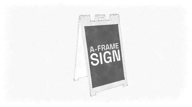 |
| 2. | Attached sign. Any sign attached to the exterior of a building (such as a wall, mansard, parapet, canopy, awning, arcade, or marquee). | |
| 3. | Awning sign or canopy sign. A sign that is mounted on a roofed shelter covering a sidewalk, driveway, or other similar area. | 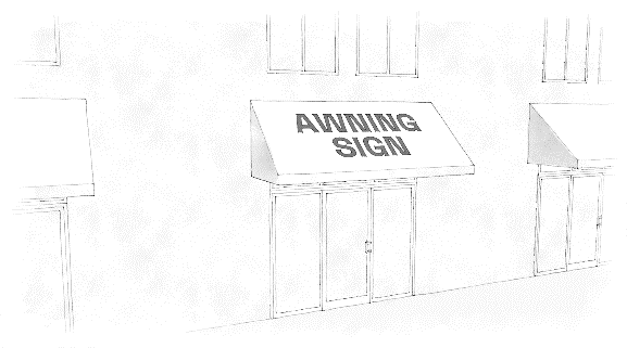 |
| 4. | Balloon. An individual or grouping of inflatable bag devices filled with gas/air, static or kept inflated by mechanical means, and often tied to poles or a horizontal support to serve as an attention-getting device. Includes inflatable air puppets and wind dancers. |  |
| 5. | Banner. A temporary sign consisting of a piece of flexible material such as cloth or plastic sheet attached to one or more supports. | |
| 6. | Beacon. An upward facing light can or a series of light cans that move or rotate, but not including light cans that provide external illumination of a permitted sign. | |
| 7. | Billboard. Any sign with a sign face more than 210 square feet, whether freestanding or affixed to another structure, upon which posters or poster sheets can be mounted or pasted thereon or on which message(s) and/or illustration(s) can be painted or otherwise applied directly thereto. |  |
| 8. | Blade sign. A sign attached to a wall in such a manner that the face of the sign is not parallel to the wall to which it is attached. This type of sign is sometimes referred to as a projecting sign. | 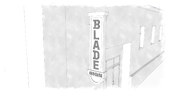 |
| 9. | Changeable copy sign. A sign or portion thereof on which the copy or symbols change either automatically through electrical or electronic means or manually through placement of letters or symbols on a panel mounted in or on a track system. The two types of changeable copy signs are manual changeable copy signs and electronic changeable copy signs which include message center signs (EMCs), digital displays, and Tri-Vision Boards. | |
| 10. | Complex sign. An accessory permanent free-standing sign on the premises of a complex. | |
| 11. | Complex. A premises with one or more buildings composed of two or more occupiable spaces or interrelated parts of a development, which may include one or more parcels. | |
| 12. | Digital display. A display of a sign message that is made up of internally illuminated components that displays an electronic image, which may or may not include text, and is capable of changing the message periodically. Digital displays may include, but are not limited to, television screens, programmable ink, LCD, LED, or plasma displays. | |
| 13. | Drive-through sign. A sign that exceeds two square feet in area that is intended to be read by a walk-up customer or from the interior of a vehicle using drive-up or drive-through service. | |
| 14. | Electronic message center (EMC). A sign that is capable of displaying words, symbols, figures, or images that can be electronically changed by remote or automatic means. | |
| 15. | Electric sign. Any sign containing electric wiring. This does not include signs illuminated by a detached exterior floodlight. | |
| 16. | External illumination. Artificial light located away from the sign, and which lights the sign face. The source of external illumination may or may not be visible to persons viewing the sign from any street, sidewalk, or adjacent property. | |
| 17. | Feather sign also known as feather flag signs. A vertical sign printed on a flexible material that is suspended on a curved pole. | |
| 18. | Flag. The term "flag" shall mean any piece of cloth, or flexible material of any size, color, and design, hoisted on a flag pole permanently affixed to the ground, or displayed via a pole bracket permanently affixed to a building. | |
| 19. | Flashing sign. Any illuminated sign on which the artificial light is not maintained stationary or constant in intensity and color at all times when such sign is in use. For the purpose of this Code, any moving illuminated sign, except digital billboards in compliance with this section, is considered a flashing sign. | |
| 20. | Freestanding sign. A sign that is supported by one (1) or more uprights or braced columns, poles, flat base or stands, or other similar structural components placed on or into the ground and not attached to any building or wall. Freestanding signs may include a changeable copy display. The term freestanding sign may be used to describe a ground mounted (aka monument) sign, pole sign, pylon, complex sign or billboard. | |
| 21. | Frontage. The length of a premises measured along the property line abutting a street right-of-way. | |
| 22. | Ground-mounted or monument sign. A sign that extends from the ground or has support that places the bottom of the sign less than two feet from the ground and not mounted on a pole. | |
| 23. | Halo illumination. A sign using a three-dimensional message or copy that is lit in such a way as to produce a halo effect. The halo effect is also known as back-lit illumination. | |
| 24. | Illuminated sign. Any sign in which an artificial source of light is used to convey or improve the visibility of a message. | |
| 25. | Illumination. A source of any artificial or reflected light, either directly from a source of light incorporated in or indirectly from an artificial source. Types of illumination include, but are not limited to internal, external, and halo. | |
| 26. | Incidental sign. Any sign that is not legible from a distance of more than three feet beyond the lot line of the premises on which such sign is located; and any sign, logo, or decal, that is no greater than two sq. ft. in area. Examples of incidental signs are signs for the purpose of wayfinding, warning, advertisement, or signs directed to pedestrian or vehicle traffic on a site. | |
| 27. | Inoperable vehicle. Any vehicle that cannot operate under its own power or is not currently legal for highway use. This definition is only applicable within this section for the regulation of signs and shall not conflict with the definition of inoperable vehicle in Chapter 16. For the purposes of a sign mounted or stored on a trailer, a trailer shall be considered operable if it is legal for highway use and has wheels. | |
| 28. | Integral sign. Signs for buildings when carved or etched into stone, concrete, or other building material, or made of bronze, aluminum or other permanent material or type of construction and made an integral part of the structure to which they are attached. | |
| 29. | Internal illumination. A light source that is concealed or contained within the sign and becomes visible in the darkness through a translucent surface. Message center signs, digital displays, and signs incorporating neon lighting shall not be considered internal illumination for the purposes of this ordinance. | |
| 30. | Laser lights. A device or series of devices that emit one or more intense beams of light. | |
| 31. | Legal notice. Posted notice of a rule, meeting, event, or action impacting rights, obligations, or duties. | |
| 32. | Luminance. An objective measurement of the brightness of illumination, including illumination emitted by an electronic sign. Luminance is measured in candles per square foot. | |
| 33. | Manual changeable copy sign. A sign or portion thereof on which the copy or symbols are changed manually through placement or drawing of letters or symbols on a sign face. | |
| 34. | Marquee. A constructed canopy with a top surface sloped less than 25 degrees from the horizontal and less than ten feet from the operable openings above or adjacent to the marquee's level. | |
| 35. | Marquee sign. A sign painted on or attached to the vertical side of or erected on the surface of a marquee. | |
| 36. | Mural. An image that is painted directly on an exterior building wall or uses a mosaic method of application. The definition of mural does not include applied vinyl cling wrap or similar techniques. For the purposes of administering these regulations, any portion of a mural that includes text, numbers, or punctuation (any characters on a standard keyboard) shall be regulated as an attached sign and shall be subject to the size limitation of attached signs. | |
| 37. | Neon sign. A sign illuminated by a neon tube, or other visible light-emanating gas tube, that is bent to form letters, symbols, or other graphics. | |
| 38. | Nonconforming sign. A sign that was in existence prior to the adoption of this ordinance which does not conform to the provisions of this Code. | |
| 39. | Pennant. Any piece of cloth or flexible material of any size, color, and design that is attached to a string, rope, filament, or wire. | |
| 40. | Portable sign. A sign which can be carried, towed, hauled, or driven and is primarily designed to be moved rather than be limited to a fixed location regardless of modifications that limit its movability and which is without a permanent foundation or otherwise permanently anchored to a fixed location on a building or the ground. A firmly anchored sign and therefore non-portable sign is any sign attached to a rigid support such as a wood or steel post which is firmly set in the ground and secured in a concrete base. | |
| 41. | Premises. Any lot, parcel, or unplatted tract, or any combination of contiguous lots or unplatted tracts held under single ownership. | |
| 42. | Projected sign. A sign created through the projection of light onto a wall or other surface. | |
| 43. | Public or governmental signs. Any temporary or permanent sign erected by a public official or entity or quasi-public entity at the federal, state, or local government level in the performance of any duty. | |
| 44. | Public warning sign. Any sign that warns the public of possible danger or informs the public of certain restrictions (such as "Beware of the Dog" or "No Trespassing"). | |
| 45. | Roof. The top covering of a building or area designed and constructed to shield the area underneath from the weather. | |
| 46. | Roof line. The term "Roof Line" shall mean the top edge of the roof or top of the parapet, whichever forms the top line of the building silhouette. | |
| 47. | Roof sign. A sign located on or above the roof of any building and extends higher than the roof peak. | |
| 48. | Sign. Sign shall include any symbol, device, image, poster, flag, banner, billboard, or wayfinding sign, whether painted upon, attached to, erected on, or otherwise maintained on any premises containing any words, letters, or parts of letters, figures, numerals, phrases, sentences, logos, emblems, or devices by which information is made known, such as are used to designate an individual, a firm, an association, a corporation, a profession, a business or a commodity or product, which is visible from any public street and is used to attract attention. The term "Sign" shall not include the following: Architectural elements incorporated into the structure or façade of a building; devices, displays, or structures that are visible only from the inside of a building. | |
| 49. | Sign area. The area of the sign face together with any frame or other material forming an integral part of the display or used to differentiate such sign from the background against which it is placed. Any structure, or part of a structure, which departs from standard architectural procedures in an attempt to attract attention to the premises by reason of color scheme, building shape, or unusual architectural features shall be considered part of the sign area and is subject to all pertinent regulations. Those portions of the supports, uprights, base of a sign or area used for street address that do not function as a sign shall not be considered as part of the sign area. | |
| 50. | Sign face. That area of a sign contained in a rectangular polygon enclosing the extreme points or edges of a sign, excluding support structures. For wall signs, the area contained in the smallest rectangular polygon encompassing all individual letters and/or graphics mounted on or painted on a building. | |
| 51. | Snipe sign. A sign which is attached to vegetation of any kind, landscape materials, utility poles, public infrastructure, or fences. | |
| 52. | Streamer. A long, narrow banner, flag, or pennant or series of banners, flags, or pennants. | |
| 53. | Street address sign. An attached sign that displays the numerical address of the building or premises in conformance with Chapter 7, Article IX of the City Code. | |
| 54. | String or strip LED storefront lights. LED lights arranged in a strip, string, or tube commonly used to light storefront windows and creating a bright light. | |
| 55. | Temporary sign. A sign that is intended for short-term display, including, but not limited to a banner, pennant, poster, or advertising display constructed of paper, cloth, canvas, plastic sheet, cardboard, wallboard, plywood, or other like materials and that appears to be intended or is determined by the Planning Department to be displayed for a limited period of time. | |
| 56. | Unsafe sign. Any sign which because of its location, coloring, illumination, or animation interferes with motorist, cyclist, or pedestrian perception of vehicular or pedestrian traffic, intersectional traffic, traffic control devices, or traffic direction signs. Any sign which, because of its construction or state of repair, is likely to fall or blow down or cause possible injuries to passersby or property. | |
| 57. | Vehicular sign. Any sign affixed to an operable or inoperable vehicle. Including any means of conveyance including an RV, a boat, or a golf cart. | |
| 58. | Wall sign. A sign attached parallel to or flat against the exterior wall of a building, display surface, or structure and extends no more than twelve (12) inches from the building. | |
| 59. | Window sign. A sign attached to, adhered to, suspended behind, placed on, or painted upon a window or glass door of a building that is visible from the exterior of the building. | |
_____
2.2306
Signs exempt from specified requirements. Signs that are exempt from specific requirements of this section and the extent of
the exemption and related requirements for the specified type of sign are listed below.
(a)
A-frame or sandwich board sign; no permit is required for one sandwich board sign per public entrance in any commercially zoned district or the Olde Towne Preservation District, subject to the following limitations:
(1)
The maximum area shall not exceed six square feet in area per sign face;
(2)
The sign may only be displayed during business hours; and
(3)
A minimum of four feet of unobstructed public pedestrian access way shall be maintained at all times so the sign does not interfere with or create a safety hazard for pedestrians.
(b)
Holiday light display; light displays may be installed by the city or on private property by property owners within 60 days of a holiday.
(c)
Incidental signs; limited to ten per site. No permit required for any sign that is not legible from a distance of more than three feet beyond the lot line of the premises on which such sign is located; and any sign, logo, or decal, that is no greater than two sq. ft. in area. With the exception of electric signs, signs not visible from public right-of-way or adjacent properties do not require a sign permit but may require a building permit. Electric signs are subject to electric permits and provisions of this Code related to illumination and speakers are also applicable.
(1)
Stickers or engravings placed on equipment or machinery (vending machines, newspaper racks, fuel pumps and vehicles) are incidental signs. The definition of an incidental sign does not include applied vinyl cling wrap or similar techniques that provide complete coverage of the equipment or machinery.
(2)
Snipe signs are not incidental signs.
(d)
Integral signs; limited to two per site. No permits are required for wall signs when cut into any masonry surface or constructed of other incombustible materials and permanently incorporated into a building wall, provided the sign area does not exceed two square feet of sign face.
(e)
Flags; limited to three per site. Any property owner wishing to display more than three flags per site must request conditional use approval by the city council. Total flag area is limited to 210 square feet per lot.
(f)
Legal notices; no permit required.
(g)
Street address numbers; no permit required for property address numbers provided in conformance with Chapter 7 Article IX of the City Code of Ordinances.
(h)
Single temporary signs; no permit required for single temporary signs that comply with the provisions of Section 2.2315.
(i)
Traffic control signs; no permit required for signs in any district complying with the provisions of this code applicable to traffic control devices.
(j)
Vehicle signs; no permit required for vehicle signs that are either:
(1)
Painted on the body of an operable motor vehicle, with a total sign area of not more than 16 square feet per side of the vehicle; or
(2)
Permanently attached to an operable vehicle, with the total area of all attached signs measuring no more than 16 square feet per side of a vehicle and extending no more than 18 inches above or below the part of the body of the vehicle to which they are attached.
(k)
Window sign; no permit required for a sign attached to, suspended behind, or placed or painted upon, the window or glass door of a building that is visible from the exterior of the building and does not permanently change the transparency of the window. Window signs may be internally illuminated or include neon components, provided such signs are located inside of a building. Window signs shall not be counted toward the attached sign area or counted toward the number or area of temporary signs on site.
(l)
Signs placed by or at the direction of a governmental body, governmental agency or public authority in any district. Such signs are authorized within all rights-of-way or other properties controlled by such governmental body, agency, or authority; and at such other locations as a governmental body, governmental agency or public authority may direct.
2.2307
Prohibited signs. The signs listed below are prohibited or limited based on the conditions established
herein.
(a)
Animated sign; any sign with animated parts or changing images except as authorized for electronic message centers (EMCs) pursuant to Section 2.2314.
(b)
Electronic message center; other than those authorized by Section 2.2314.
(c)
Flashing light or beacon; all are prohibited, except as permitted pursuant to Section 2.2315.
(d)
Projected sign; all are prohibited with the exception of temporary projected signs in residential districts as part of a holiday display for a maximum of 30 days.
(e)
Illegal signs; signs that have not received required permits, do not comply with a valid permit, and other signs that fail to comply with the provisions of this section are prohibited. See Section 2.2318.
(f)
Inflatable or balloon sign; all are prohibited, except as permitted pursuant to Section 2.2315.
(g)
Obscene signs; it shall be unlawful for any person to display upon any sign or other advertising structure any obscene matter as defined by Louisiana Revised Statutes Title 14, § 106.
(h)
Portable signs; all portable signs are prohibited with the exception of A frame/sandwich board signs authorized by Section 2.2311.
(i)
Revolving, rotating, twirling or other moving signs or sign parts; all are prohibited when containing or consisting of banners, posters, pennants, ribbons, streamers, strings of light bulbs, spinners, or other similarly moving devices or signs which may move or swing as a result of wind pressure or mechanical means.
(j)
Roof signs; all are prohibited. Attached signs that are on a mansard roof but are below the roof line are not prohibited.
(k)
Signs containing a mirror or reflective or phosphorescent surface; all are prohibited.
(l)
Signs emitting sound, vapor, smoke, odor, particles or visible matter; all are prohibited.
(m)
Signs in fresh water wetland or salt marsh Areas; all are prohibited, except for public or governmental signs.
(n)
Signs in public right-of-way or city-owned property; no sign other than a sign placed by a local, state or federal authority may be placed within public right-of-way or city-owned property, except as authorized by Section 2.2308.
(o)
Signs incorporating any laser light; all are prohibited, except as permitted pursuant to Section 2.2315.
(p)
String or strip LED storefront lights; all are prohibited.
(q)
Signs obstructing egress; no sign shall be erected, relocated, or maintained so as to prevent free ingress to or egress from any door, window, or fire escape. No sign of any kind shall be attached to a standpipe or fire escape.
(r)
Signs or sign structures interfering with traffic; this includes signs that obstruct the view of or may be confused with a traffic control or safety sign, or any official marker erected by city, state, or federal authority. It also includes signs that obstruct or impair driver vision at intersections of streets and/or driveways.
(s)
Feather signs; all are prohibited.
(t)
Snipe signs; this includes but is not limited to signs attached to or painted on natural features, utility poles or fence posts. It shall be unlawful for any person to attach any snipe sign to vegetation of any kind, landscape materials, utility poles, public or governmental signs, or fences.
(u)
Unsafe signs; see Section 2.2318.
(v)
Vehicle sign on any inoperable vehicle or conveyance.
(w)
Vehicle sign on any operable vehicle or conveyance that:
(1)
Is parked or placed within 100 feet of any street and is visible from any street;
(2)
Is parked for more than 48 hours; or
(3)
Occupies a required parking space for more than 48 hours.
2.2308
General sign requirements.
(a)
Placement of signs.
(1)
No person shall construct any sign without the written permission of the owner or other person in lawful possession or control of the property on which such sign is located.
(2)
No person shall erect a sign on public property other than the governmental entity responsible for such property or public utility companies or contractors occupying or working on public property pursuant to government contract or franchise. Any unauthorized sign in the right-of-way may be collected and disposed of immediately by the City.
(3)
Subdivision entrance monument signs may be placed on private property or in public right-of-way in accordance with Section 2.2309 of this code, which also stipulates that any such signs in a right-of-way must be approved by City Council prior to their construction.
(4)
Any detached sign that is 210 square feet or more shall be considered a billboard for regulatory purposes of this code, and as such shall only be allowed along interstate corridors in accordance with Section 2.2313 of this code.
(b)
Wind pressure and dead load requirements. All freestanding signs and sign structures shall be designed to meet wind pressure and deadload requirements in accordance with the International Building Code (IBC). Signs shall be certified by a registered civil or structural engineer as designed in accordance with section IBC requirements.
(c)
Sign illumination. Signs can be illuminated by either exterior or interior lighting subject to the following restrictions:
(1)
Except as otherwise specifically permitted in this section, signs shall not contain any intermittent, moving, blinking, flashing, oscillating, scrolling, or fluttering lights or animated parts; nor shall any device be used that has a changing light intensity, brightness of color, or give such illusion, except as otherwise specifically permitted by this section.
(2)
Except for authorized EMCs, neon, and neon-style LED signs, the light source for any illuminated sign shall not be directly visible from adjacent streets or property as measured at the property line.
(3)
Externally installed exposed neon tubing or LED equivalent style component as part of a sign and/or on the exterior of a building shall only be permitted in the Olde Towne Preservation District when designed and installed in accordance with district standards.
(4)
Backlight silhouetted halo sign letters and graphics shall be permitted, provided the light source is fully concealed from visibility from any right-of-way as measured from the closest right-of-way to the site and sign in question.
(5)
For all signs, the level of illumination emitted or reflected from a sign shall not be of intensity sufficient to constitute a demonstrable hazard to vehicular traffic or pedestrians on any right-of-way or parking lot from which the sign may be viewed. In no event shall a sign face increase nighttime ambient illumination by more than 0.3 foot-candles when measured perpendicular to the digital sign face at a distance of 150 feet using a foot-candle light meter to measure.
(6)
Illuminated signs within or on a property abutting a residential district shall be at least 25 feet from the nearest residential property line.
(7)
If illuminated, sign illumination shall not interfere with the visibility of, or obscure, an official traffic sign, device, or signal.
(8)
If the city receives a complaint about a sign in violation of this requirement regarding sign illumination, the property owner shall be required to submit a manufacturer's or engineer's report with technical details explaining that it complies with the standards in this section within ten calendar days. If such report is not submitted to the city within ten days of notification, the sign must be disabled or removed.
(d)
Required signs. Where a federal, state, or local law requires a property owner to post a sign on the owner's property to warn of a danger or to prohibit access to the property either generally or specifically, the owner must comply with the federal, state, or local law.
(e)
Traffic control devices. Traffic control devices on private or public property must be erected and maintained to comply with the most current edition of the Manual on Uniform Traffic Control Devices (MUTCD).
(f)
Address signs. Each property owner must mark their property using numerals that identify the address of the property in conformance with the Chapter 7 - Article IX of the City's Code of Ordinances.
2.2309
Regulation of signs in residential districts.
(a)
For multi-family complex sites consisting of four or more dwelling units:
(1)
Allowed sign type: Monument sign or attached wall sign
(2)
Maximum number: 1 per site
(3)
Maximum sign area: 16 square feet
(4)
Maximum height: 4 feet
(5)
Additional requirements: Must be set back a minimum of ten feet from a public right-of-way; may be internally or externally illuminated.
(b)
For nonresidential uses permitted in the A-9-C Apartment-Commercial District and Residential Redevelopment District with an active occupational license:
(1)
Allowed sign type: Monument sign or attached wall sign
(2)
Maximum number: 1 per site
(3)
Maximum sign area: 16 square feet
(4)
Maximum height: 4 feet
(5)
Additional requirements: Must be set back a minimum of ten feet from a public right-of-way; may be internally or externally illuminated.
(c)
For any non-residential use not otherwise specified in this table
(1)
Allowed sign type: Wall sign
(2)
Maximum number: 1 per site
(3)
Maximum sign area: 9 square feet
(4)
Maximum height: N/A
(5)
Additional requirements: May be internally or externally illuminated.
(d)
For a planned unit development or major subdivision of record:
(1)
Allowed sign type: Subdivision entrance monument sign on private property or subdivision entrance monument sign on a right-of-way.
(2)
Maximum number: 1 per development or subdivision
(3)
Maximum sign area: 32 square feet
(4)
Maximum height: 3 feet
(5)
Additional requirements:
a.
For subdivision entrance signs on private property: Must be set back a minimum of five feet from a raised curb.
b.
For subdivision entrance signs on a right-of-way: Shall be subject to the conditions of an agreement for use of public right-of-way that has been approved by the city council; must comply with the intersection visibility requirements of Section 2.2201.
(e)
For all uses:
(1)
Allowed sign type: Temporary signs
(2)
Additional requirements: In accordance with Section 2.2315
2.2310
Regulation of signs in commercial (C) and industrial (M) zones.
(a)
Generally.
(1)
Applicability. The regulations in this section apply to all C, A-5, and M zoning districts, except as otherwise modified through the planned district development approval process.
(2)
Electrical service. Any electrical service provided to freestanding signs or ground-mounted/monument signs shall be provided by wiring run underground from either an on-site building or electrical connection.
(3)
Calculation of attached sign area.
a.
For the purposes of this subsection and the calculation of attached sign area, building width shall be measured in a straight line connecting the two corners of the building and running parallel to the applicable public street or parking lot that the building faces (see Exhibit 2.2310-1).
Exhibit 2.2310-1: Measuring Building Width to Calculate Attached Sign Area.
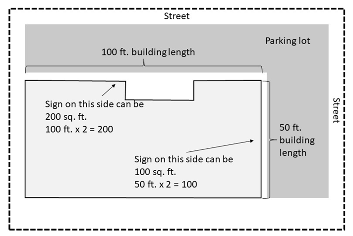
b.
If attached signs are not displayed where such signage is permitted, such signage may be used on the side of the building where signage is not permitted, provided that the sign is not located on the side of a building that abuts a residentially zoned property.
(b)
Signs allowed in commercial and industrial zones except the C-1 and C-1A.
(1)
Allowed sign type: Freestanding sign
a.
Maximum number: 1 per street frontage
b.
Maximum area:
i.
For signs set back five to 20 feet from the right-of-way: One square foot of sign area per linear foot of street frontage on the side where the sign will be located, up to a maximum of 210 square feet of signage.
ii.
For signs set back 20+ feet from the right-of-way and for signs within 100 feet of an interstate or highway: 1.5 square foot of sign area per linear foot of street frontage on the side where the sign will be located, up to a maximum of 210 square feet of signage.
c.
Maximum height: 20 feet; this height may be increased to 60 feet for signs on lots abutting an interstate highway provided that the sign is located within 100 feet of the interstate highway right-of-way.
d.
Additional requirements:
i.
May not be located on any street frontage that faces a residential district.
ii.
Must have a minimum set back of five feet from any property line.
iii.
Must be located a minimum of ten feet from any overhead utility line.
(2)
Allowed sign type: Multi-tenant free-standing complex signs limited to sites with over 450 feet of frontage along a public right-of-way.
a.
Maximum number: 1 sign per each building that is at least 50 feet from another building.
b.
Maximum area: 2 square feet of sign area per linear foot of street frontage on the side where the sign will be located, up to a maximum of 210 square feet of signage.
c.
Maximum height: 20 feet.
d.
Additional requirements: Signs must be at least five feet from the nearest sign.
(3)
Allowed sign type: Marquee signs limited to multi-tenant complexes
a.
Maximum number: 1 per building
b.
Maximum area: Sign area shall be calculated as part of the permitted attached sign area; marquee sign may not exceed 100 square feet per face.
c.
Maximum height: 45 feet from grade or the height of the building the marquee sign is attached to, whichever is lower.
d.
Additional requirements: Sign shall not have more than two faces.
(4)
Allowed sign type: Attached (wall) sign
a.
Maximum number: Up to two per building façade with a public entrance.
b.
Maximum area:
i.
Two times the width in feet of the building wall on which the sign is attached.
ii.
See Section 2.2310(a)(3) for details regarding the calculation of sign area.
c.
Maximum height:
i.
The sign may not extend above the highest point of the roof.
ii.
Attached signage may be placed on a mansard roof, but shall not be above the roof peak.
d.
Additional requirements:
i.
Not permitted on the side of a building that abuts a residentially zoned property.
ii.
The lowest point of signs mounted on the side of a wall, shall not be less than eight feet above grade.
(5)
Allowed sign type: Blade sign
a.
Maximum number: Shall count toward attached sign number limit.
b.
Maximum area: Shall count toward attached sign area limit.
c.
Maximum height: 45 feet from grade or the height of the building the blade sign is attached to, whichever is lower.
d.
Additional requirements:
i.
Must not project more than five feet horizontally from a building.
ii.
Must be no less than eight feet above the sidewalk below the sign.
iii.
Must not project into or over vehicular access drives, property lines, required setback areas, or required landscape planting areas.
(6)
Allowed sign type: Freestanding drive-through signs
a.
Maximum number:
i.
Two per vehicular drive-through lane.
ii.
Drive-through signs do not count toward maximum number of freestanding signs.
b.
Maximum area: 32 square feet per sign.
c.
Maximum height: 15 feet as measured from adjacent grade (the ground) to the top of the sign structure and shall include the sign cabinet.
d.
Additional requirements:
i.
Illuminated signs shall be screened from view from residentially zoned property.
ii.
Speakers shall comply with Section 13-1 of this Code and shall not face a lot that is zoned for residential use.
(c)
Signs allowed in the C-1 and C-1A districts.
(1)
Allowed sign type: Freestanding or monument sign
a.
Maximum number: 1 per street frontage
b.
Maximum area: 40 square feet.
c.
Maximum height: 5 feet.
d.
Additional requirements:
i.
May not be located on any street frontage that faces a residential district.
ii.
Must have a minimum set back of five feet from any property line.
iii.
Must be located a minimum of ten feet from any overhead utility line.
(2)
Allowed sign type: Blade sign
a.
Maximum number: Shall count toward attached sign number limit.
b.
Maximum area: Shall count toward attached sign area limit.
c.
Maximum height: 45 feet from grade or the height of the building the blade sign is attached to, whichever is lower.
d.
Additional requirements:
i.
Must not project more than five feet horizontally from a building and must be no closer than two feet from the edge of sidewalk pavement or access drive.
ii.
Must be no less than eight feet above the sidewalk below the sign.
(3)
Allowed sign type: Attached (wall) sign
a.
Maximum number: Up to two per building façade with a public entrance.
b.
Maximum area:
i.
Two times the width in feet of the building wall on which the sign is attached.
ii.
For multi-tenant buildings, individual tenant sign areas shall not exceed two times the width of the frontage of the tenant's leased space in linear feet.
iii.
See Section 2.2310(a)(3) for details regarding the calculation of sign area.
c.
Maximum height:
i.
The sign may not extend above the highest point of the roof.
ii.
Attached signage may be placed on a mansard roof, but shall not be above the roof peak.
d.
Additional requirements:
i.
Not permitted on the side of a building that abuts a residentially zoned property.
ii.
The lowest point of signs mounted on the side of a wall, shall not be less than eight feet above grade.
2.2311
Regulation of signs and murals in the Olde Towne Preservation District.
(a)
Standards of underlying zoning district apply. Except as otherwise provided in this section, signs in the Olde Towne Preservation District shall comply with the regulations applicable to the underlying zoning district.
(b)
Signs must also conform to the surrounding area character. In addition to complying with the standards and procedures for signs in the underlying zoning district, signs in Olde Towne Preservation District shall be administratively reviewed and shall not require an approved Certificate of Appropriateness (COA) from the Olde Towne Preservation District Commission (OTPDC) in order to be eligible for a permit for construction.
(c)
Prohibited placement. No sign shall be displayed or placed in any manner that will disfigure or conceal any contributing element to the architectural design or detail of any building.
(d)
Illuminated signs. Illuminated signs are permitted in the Olde Towne Preservation District in accordance with the following:
(1)
Concealed lighting is recommended.
(2)
Bulbs may not be exposed.
(3)
Exposed neon or LED equivalent tubing as part of any sign and/or on a building may be permitted when designed and installed in accordance with district standards.
(4)
Lighting should enhance the sign as well as the building on which it is mounted and conform to the criteria in paragraph (c) of this section.
(e)
Electronic message center (EMC) signs. Electronic message center signs or digital display signs are not permitted in the Olde Towne Preservation District. Legally established electronic message center signs in use on or before 12 June 2018 are legal nonconforming signs.
(f)
Sign design standards for the Olde Towne Preservation District.
(1)
Allowed sign type: Murals
a.
Maximum number: 1 per site
b.
Maximum area:
i.
May not extend beyond the edges of a building wall or façade.
ii.
Any portion of a mural that includes text, numbers, or punctuation (any characters on a standard keyboard) shall be regulated as an attached sign and shall be subject to the size limitation of attached signs.
c.
Maximum height: N/A
d.
Additional requirements: Must be reviewed and permitted in accordance with Section 2.2312.
(2)
Allowed sign type: Blade sign
a.
Maximum number: 1 per site
b.
Maximum area: Shall count toward attached sign area limit
c.
Maximum height: N/A
d.
Additional requirements:
i.
Must not project more than five feet from the building.
ii.
Must be no closer than two feet from the edge of sidewalk pavement or access drive.
iii.
Must be no less than eight feet above the sidewalk below the sign.
(3)
Allowed sign type: Attached (wall) sign
a.
Maximum number: One for each exterior entrance; a building on a corner lot that faces two streets may have one attached sign on each street facing side.
b.
Maximum area: Shall follow the maximum area in the underlying zoning district.
c.
Maximum height: Shall follow the underlying zoning district.
(4)
Allowed sign type: Monument sign
a.
Maximum number: 1 per street frontage
b.
Maximum area: 40 square feet
c.
Maximum height: 5 feet
d.
Additional requirements:
i.
May not be located on any street frontage that faces a residential district.
ii.
Must have a minimum set back of five feet from any property line.
2.2312
Regulation of Murals.
(a)
Placement. A mural shall only be allowed on vertical surfaces of permanent construction within a defined property. Murals outside of a non-residential zoning district or the Olde Towne Preservation District are prohibited.
(b)
Area. A mural may not extend beyond the edges of a building wall or façade but may be applied to multiple sides of a building. For the purposes of administering these regulations, any portion of a mural that includes text, numbers, or punctuation (any characters on a standard keyboard) shall be regulated as an attached sign and shall be subject to the size limitation of attached signs.
(c)
Materials. A mural may be applied using paint applied directly to an exterior wall or mosaic material. A mural may not include any sign cabinet components; if such elements are proposed, the subject sign shall be considered an attached sign. Mural materials shall be durable and weather resistant to prevent premature deterioration or other unintended change in appearance. Mural materials must be appropriate to the outdoor location and climate.
(d)
Electrical and lighting requirements. A mural shall not include integrated illumination, electrical, or moving components but may be illuminated by non-integrated light source.
(e)
Review.
(1)
Proposed murals in the Olde Towne Preservation District shall be reviewed by the Olde Towne Preservation District Commission prior to issuance of a certificate of appropriateness.
(2)
Murals in zoning districts outside of the Olde Towne Preservation District shall be subject to a review and permitting process by city council as administered by the planning department.
(3)
In the review of a mural, the Olde Towne Preservation District Commission and the City Council may only consider whether a mural meets the placement, area, materials, and electrical and lighting requirements in (a) through (d) of this section. Review of proposed murals must not consider the content or message conveyed in a mural.
(f)
Application requirements. Applicants proposing a mural must submit the following documents to the Planning Department for review and approval. Incomplete mural permit applications will not be accepted for review:
(1)
A notarized affidavit signed by the property owner granting permission to place the mural on the structure.
(2)
A site plan showing the lot and structural dimensions and indicating the proposed location of the mural.
(3)
A scaled drawing and color photo of the structure showing: the proposed mural's dimensions in linear feet; area in square feet and placement of the mural; and the dimension of the vertical surface(s) upon which the mural is proposed.
(4)
A scaled, colored drawing of the proposed mural.
(5)
Proposed maintenance plan and schedule that indicates who is responsible for maintenance.
(6)
A description of the paint or mosaic media to be used and the surface on which the mural will be applied.
(g)
Maintenance and enforcement.
(1)
Murals must be maintained free of chipping or peeling paint, debris, or damaged elements.
(2)
If a property features a mural that receives a violation for either lack of maintenance or for violation of the design and procedural provisions in this code, the mural must be made to comply with this code within 30 days of notice of violation, otherwise the mural shall be painted over by the City with the property owner responsible for the costs of such action.
2.2313
Regulation of billboards.
(a)
Administration of billboard regulations.
(1)
Any sign exceeding 210 square feet shall be considered a billboard in accordance with the sign definitions in this code.
(2)
Billboards shall be considered an accessory use and are allowed on an undeveloped lot or on a lot with a primary structure.
(3)
All billboards are required to receive a permit prior to their construction and shall be reviewed through the sign and building permit application process.
(4)
Minimum requirements for a billboard application. In addition to above application requirements, applicants for a billboard must also provide evidence of applicable and active LA-DOTD permit(s) in process.
(b)
Limited location along interstate corridors. Billboards may only be located along Interstate corridors and no further than 300 feet from the center line of the interstate roadway, established in compliance with applicable state regulations and the following standards:
(1)
An interstate corridor includes all properties fronting on the interstate or on a LA DOTD designated service road abutting I-10, I-12 and/or I-59.
(2)
Billboards must be a minimum distance of 3,000 feet from any other billboards, measured radially, and billboards must be setback from the interstate or service right-of-way a minimum of 25 feet.
(3)
No billboard shall be constructed, erected, placed, or replaced closer than 300 feet from the nearest residence.
(4)
The minimum ground clearance for the billboard is eight feet.
(5)
Maximum height shall align with state (DOTD) requirements applicable to the site or applicable city zoning district height restriction, whichever is lower.
(c)
Digital display. Digital displays shall comply with all of the following:
(1)
Each message shall have a minimum hold time of eight seconds.
(2)
Transition between messages shall be instantaneous.
(3)
No flashing, animation, scrolling, fading or motion is permitted.
(4)
Digital billboards shall come equipped with a light sensing device that automatically adjusts the brightness in direct correlation with ambient light conditions.
(5)
Digital billboards shall be programmed with a static default message or image so that if a malfunction occurs, the default message shall freeze the display in one position.
(d)
Nonconforming billboards. Existing billboards located in the City but not along an interstate corridor within 300 feet of the center line of the interstate roadway are considered nonconforming signs. Nonconforming billboards may be converted to digital but are required to be dismantled and removed before 31 December 2030.
(e)
Legal nonconforming billboards must comply with the following prior to the 31 December 2030 removal deadline:
(1)
No increase in square footage of existing billboards shall be allowed;
(2)
Billboards prohibited from conversion. Billboards listed in Exhibit 2.2313-1 shall not be converted to a digital display due to the close proximity to the Olde Towne Historic Preservation District, where large electronic message centers are incompatible with district character.
_____
Exhibit 2.2313-1: Billboards Not Allowed to Be Converted to Electronic Message Centers.
_____
2.2314
Regulation of electronic message centers.
(a)
Generally.
(1)
Electronic message centers (EMCs) are increasingly deployed to provide an economic advantage to a business owner able to convey multiple displays. If unregulated, EMCs can create hazards to vehicular traffic and become a nuisance to neighboring properties.
(2)
The provisions of this section do not apply to the conversion of billboards to electronic message centers pursuant to Section 2.2313.
(3)
In no event shall an EMC sign face increase nighttime ambient illumination by more than 0.3 foot-candles when measured perpendicular to the digital sign face at a distance of 150 feet using a foot-candle light meter to measure. The burden of proving compliance with this standard shall be on the property owner and not on the City.
(4)
If the city receives a complaint about a sign in violation of this requirement regarding sign illumination, the property owner shall be required to submit a manufacturer's or engineer's report with technical details explaining that it complies with the standards in this section within ten calendar days. If such report is not submitted to the city within ten days of notification, the sign must be disabled or removed.
(b)
Prohibited. EMCs are prohibited in the Olde Towne Preservation District.
(c)
Commercial districts. Freestanding signs in commercial districts, other than in the Olde Towne Preservation District, may include up to 100 percent of permitted sign face area as an EMC subject to the requirements for number, location, and size required for the district and the following:
(1)
High definition (HD) resolution. EMC displays shall have HD resolution displays that do not pixelate.
(2)
Luminance. EMCs shall have an automatic dimmer that limits the brightness based on ambient light conditions.
(3)
Frequency of message change and transitions. Each display on an EMC shall have a hold time of not less than eight (8) seconds. Transitions shall not include any animation, blinking or flashing and shall not include any blank screens. For EMCs that are divided into multiple frames, not more than one frame may change in any way, other than brightness, more than once per day, unless all frames change concurrently.
(4)
Animation. EMCs shall not include any animation that creates the appearance of motion.
(5)
Default Settings. EMCs shall be programmed with a static default message or image so that if a malfunction occurs, the default message shall freeze the sign in one position.
(d)
Non-conforming sign conversion to EMC prohibited. No EMC shall be installed as part of or in place of any non-conforming sign unless the sign is brought into full compliance with the provisions of this Code.
2.2315
Regulation of temporary signs.
(a)
Generally. Subject to the sign area limitations and the provisions of this section, temporary signs shall:
(1)
Be allowed in any zoning district;
(2)
Not be located within any right-of-way whether public, dedicated or owned in fee simple, or as an easement;
(3)
Not be placed on any utility pole, streetlight, vegetation of any type, or on public property;
(4)
Not be illuminated;
(5)
May not be displayed if they are visibly in disrepair or damaged.
(b)
Temporary sign standards. Temporary signs are subject to the following standards, unless otherwise specified by this section:
(1)
Maximum number. Up to four (4) temporary signs allowed per lot without a permit as long as the total sign area does not exceed the provisions of Section 2.2315.b.3.
(2)
Type of sign. No prohibited sign type is allowed to be utilized as a temporary sign.
(3)
Area. Total allowable area of temporary signs must not exceed 32 square feet.
(4)
Location. Temporary sign installations allowed by this process must adhere to all placement and location requirements in this section and in this code applicable to signs.
(5)
Duration. Temporary signs on display for more than 30 days are subject to removal at the request of city staff. Removal must be completed within 72 hours of notification or a special event temporary sign permit must be obtained.
(c)
Special event temporary signs. Any temporary sign installations in excess of the standards for a regular temporary sign, in quantity or area, must comply with the following:
(1)
Permit process and duration. The Director of Planning may issue a special event temporary sign permit to be valid for a maximum period of 30 days. Applicants for such signs shall file an application with the Planning Department and pay the applicable sign permit fee. A maximum of four such permits are allowed per year per property.
(2)
Total number. The total number of special event temporary signs of all sign types must be shown in their proposed location on a measured site plan for permit consideration. This number may not exceed 10 signs per lot.
(3)
Type of sign. No prohibited sign type is allowed to be utilized as a special event temporary sign.
(4)
Total size. The cumulative area of special event temporary sign installations may not exceed the maximum area as provided for in Appendix A Part 2 Section 2.2310(b)(1)b.
(5)
Location and classification. Special event temporary sign installations allowed by this process must adhere to all placement and location requirements in this section and in this code applicable to signs.
(6)
Permit number must be on sign. Special event temporary signs permitted through this process must have the approved permit number written in permanent ink on at least one side of the sign; a copy of the sign permit affixed to the temporary sign is also acceptable. City staff are hereby authorized to remove any special event temporary sign installations lacking an approved sign permit.
(7)
Signs to which this section does not apply. This section does not apply to mobile signs or vehicle signs.
(d)
Other temporary signs. Other temporary signs listed below are subject to the following limitations:
(1)
Beacons. Beacons are only allowed in C and M zoning districts. In these zones, a revolving beacon or laser light upon the premises may be displayed for a period that shall not exceed five days upon issuance of a sign permit for a special event. Such displays shall be permitted no more than four periods per calendar year. The revolving beacon or laser light shall be securely attached to its transporting vehicle and shall not project into the public right-of-way or obstruct the vision of vehicles or pedestrians who may be entering or exiting the premises. Equipment used to operate equipment shall be subject to the provisions of Section 13-1 of this Code.
(2)
Balloon signs. On a non-residential developed parcel, a balloon may be displayed once per calendar year for up to seven days upon issuance of a sign permit for a special event, provided the balloon shall be securely attached to the ground or building and shall not project into the public right-of-way or obstruct the vision of vehicles or pedestrians who may be entering or exiting the premises. The balloon shall be removed from the premises upon the expiration of the permit.
(3)
Temporary signs installed by the City of Slidell. In the course of governance or service provision, the City may have need to install temporary signs to preserve the health, safety, and welfare of residents and perform traditional government functions. The City may install temporary signs that do not comply with the design or duration requirements of this section.
2.2316
Sign maintenance.
(a)
Generally. All signs shall be maintained in good structural condition. All signs shall be kept neatly painted, excluding galvanized or rust resistant metals. All sign cabinets must be enclosed with a sign face or panel. This panel may be blank but may not be composed of plywood or wood planks.
(b)
Authority to correct or remove. The building official or designee shall inspect and shall have authority to order the painting, repair, alteration, or removal of a sign which constitutes a hazard to safety, health, or public welfare by reason of inadequate maintenance, dilapidation (e.g., faded, torn, damaged, broken, or weathered) or obsolescence. Such removal shall be at the expense of the owner of the sign or the owner of the property upon which the sign is located pursuant to Section 2.2318.
2.2317
Nonconforming signs.
(a)
Any sign lawfully erected prior to the effective date of this ordinance and in compliance with this ordinance, with the exception of billboards as listed in Exhibit 2.2313-1, shall not be required to be removed but may not be enlarged in any dimension.
(b)
Subject to issuance of a sign permit, the face of a non-conforming sign may be replaced with a new sign face equal in size.
2.2318
Removal of unsafe and illegal signs.
(a)
Immediate removal authorized. If the building official or their designee finds that any sign regulated herein is an immediate peril to persons or property or is found to be unsafe or illegal, the building official or their designee shall cause it to be removed summarily and without notice. Removal of such sign shall be at the expense of the lessee and/or owner of the property on which the sign is located.
(b)
Removal by owner. In lieu of (a) (removal of signs by the city), the city may require property owners to remove any signs that are in violation of this Code and such signs must be removed within five calendar days after written notification by the city.
(1)
Unsafe or insecure sign or debris/remnants of a sign;
(2)
Illegal signs; or
(3)
Signs that are a menace to the public.
2.2319
Violations. Any violation of this ordinance shall be subject to the provisions of Chapter 11 Article VII Section 11-808 of the City Code.
2.2320
Severability clause. The sections, paragraphs, sentences, clauses, and phrases of this ordinance are severable,
and if any phrase, clause, sentence, paragraph, or section of this ordinance are declared
unconstitutional or invalid by the judgement of any court of competent jurisdiction,
such unconstitutionality or invalidity shall not affect any of the remaining phrases,
clauses, sentences, paragraphs, and sections of this ordinance.
(Ord. No. 4154, § 1(Exh. A), 1-23-2024; Ord. No. 4199, 10-8-2024; Ord. No. 4242, 7-8-2025)
Editor's note— Ord. No. 4154, § 1(Exh. A), adopted Jan. 23, 2024, amended § 2.23 in its entirety to read as herein set out. Former § 2.23, pertained to similar subject, and derived from Ord. No. 2020, 10-28-1986; Ord. No. 2066, 3-10-1987; Ord. No. 2153, 12-22-1987; Ord. No. 2201, 8-9-1988; Ord. No. 2343, 7-24-1990; Ord. No. 2376, 4-23-1991; Ord. No. 2442, 5-12-1992; Ord. No. 2505, 5-25-1993; Ord. No. 2724, 1-28-1997; Ord. No. 2852, 11-17-1998; Ord. No. 2871, 3-23-1999; Ord. No. 2937, 2-8-2000; Ord. No. 2956, 8-8-2000; Ord. No. 2987, 1-23-2001; Ord. No. 2927, 12-14-99; Ord. No. 3043, 11-27-01; Ord. No. 3080, 7-23-2002; Ord. No. 3123, 4-22-2003; Ord. No. 3211, 9-28-2004; Ord. No. 3240, 1-11-2005; Ord. No. 3550, 10-27-2009; Ord. No. 3768, 4-28-2015.
Section 2.24. - Reserved.
Editor's note— Ord. No. 1490, adopted Feb. 24, 1982, provided for the deletion of § 2.24, Outdoor advertising in area adjacent to the national systems of interstate and defense highways and the federal aid primary system. For applicable provisions, see § 2.23, preceding. Prior to deletion, § 2.24 was derived from Ord. No. 795, adopted July 9, 1968, and Ord. No. 1001, adopted Apr. 27, 1976.
Section 2.25. - Tree preservation, landscape, and public tree management.
A.
Generally.
1.
Purpose. These tree preservation and landscape requirements are intended to:
a.
Beautify the city.
b.
Purify and cool the air by providing shade, absorbing particulates, and producing oxygen.
c.
Reduce flooding by slowing and capturing stormwater runoff and by returning water to the environment through percolation and transpiration.
d.
Improve water quality by filtering out particulates.
e.
Aid in the recharge of groundwater aquifers.
f.
Retain topsoil and reduce soil erosion.
g.
Reduce demand on city drainage infrastructure.
h.
Provide a wildlife habitat where birds and animals can find food, nest, and be protected from predators and the environment.
i.
Provide screening and buffers between low and higher intensity uses by blocking or limiting the adverse impacts of noise, light, and particulates.
2.
Applicability.
a.
All new development or substantial improvements must comply with land clearing, tree preservation, and landscaping requirements in this section.
b.
Trees not approved for removal must comply with tree protective measures in this section.
c.
Stewardship of applicable public areas by the city must be provided in accordance with this section.
3.
Permits, licenses, and certifications.
a.
Permit application. The department of planning reviews and acts on all tree removal, land clearing, and landscaping permits, with the exception that the department may refer proposed alternative landscape plans to the planning commission for review and approval at the discretion of the director of planning.
b.
License and certification requirements.
1)
Tree removal. A Louisiana State Licensed Arborist must apply for tree removal permits.
2)
Land clearing. A Louisiana State Licensed Arborist or General Contractor must apply for land clearing permits.
3)
Landscape plans. Landscape plans must be prepared and stamped by a Louisiana Licensed Landscape Architect in compliance with this section and applicable Louisiana Revised Statutes.
4)
Landscape installation and planting. A Louisiana Licensed Landscape Architect or Louisiana Licensed Horticulturist must supervise all landscape plantings installed per a required landscape plan. Yard work (cutting lawns, edging, and hand-weeding beds) is not regulated by State licensure.
5)
Planting certification. Upon installation, the Louisiana Licensed Architect or Horticulturist who submitted the plan must certify in writing the installed plantings are in accordance with the approved plan.
4.
Fees. Must be provided in accordance with Appendix F of this Code.
5.
Definitions specific to this section.
a.
Branch. An outgrowing shoot, stem, or twig that grows from the main stem or trunk.
b.
Caliper. The diameter measurement of the stem or trunk of plants grown in or obtained from a nursery.
c.
Canopy. The portion of the tree that includes the branches.
d.
Container. A flat, pot, tub, etc., usually made of plastic, wood, ceramic, or metal, used to grow or hold one or more plants and which generally prevents the growth of roots beyond its side walls or bottom.
e.
Critical Root Zone (CRZ). The equidistant extent of the majority of a tree's root system from the tree trunk around a tree trunk in all directions, determined by multiplying the tree DBH (diameter at breast height) in inches by 12 and measured in linear feet at ground level.
f.
Deciduous. Plants that shed all their leaves at the end of the growing season and remain leafless throughout the winter or dormant period.
g.
Diameter Breast Height (DBH). On the tree trunk, measure the circumference outside the bark at 4.5 feet above grade on the uphill side of the tree; divide the circumference by π (pi = 3.14) to get the trunk diameter. Diameter may also be measured by use of a caliper tool.
h.
Evergreen. A plant that has foliage that remains green and functional through more than one growing season.
i.
Hardscape. Non-living, human, or machine-made features or structures that are constructed using durable materials such as concrete, brick, stone, or metal; these features are typically immovable and include elements such as driveways, walkways, patios, pools, retaining walls, fences, and similar structures.
j.
Invasive species. A plant species that is not native to Louisiana and may rapidly dominate the beneficial plants that have evolved in local native habitats. These invaders out-compete native species, are very prolific, are not usually affected by native insects or diseases, and grow very rapidly. Introduction may cause economic or environmental harm.
k.
Landscape area.
1)
Buffer landscape area. That vegetated planting area between a more intense and a less intense use that is intended to shield the less intense use from the adverse effects of light, noise, and particulates created by the more intense use.
2)
Open space landscape area. That vegetated planting area reserved for trees, landscaping, or other vegetative ground cover where structures and hardscape are not permitted; this area in calculation is considered separate and not synonymous with buffer, parking, or street landscape areas.
3)
Parking landscape area. That vegetated planting area within and on the immediate perimeter of private parking lots.
4)
Street landscape area. That vegetated planting area along a property frontage at the boundary between any public right-of-way (ROW) and the private property, not inclusive of the public ROW.
l.
Landscape irrigation contractor. A Louisiana licensed contractor specializing in the construction, installation, connection, repair, maintenance, improvement, or alteration of any portion of a landscape irrigation system, including the required wiring for that system.
m.
Licensed arborist. A professional who recommends or executes tree-surgery type work, including tree removal, pruning, trimming, cabling, fertilization, and cavity work, who is licensed by the State of Louisiana in accordance with Louisiana Revised Statutes. A Utility Arborist License is required for a professional who recommends or executes the removal of trees or portions of trees along any utility easement, servitude, or right-of-way (ROW).
n.
Licensed landscape architect. A professional who prepares landscape design plans, landscape grading and drainage plans, landscape irrigation plans, planting plans, and related landscape construction details and specifications for a fee, who is licensed by the State of Louisiana in accordance with Louisiana Revised Statutes.
o.
Licensed horticulturalist. A professional who recommends and executes measures for interior and exterior beautification through the use of nursery stock or sells, leases, and maintains nursery stock, who is licensed by the State of Louisiana in accordance with Louisiana Revised Statutes. Horticulturalists are not authorized to draw landscape plans for a fee.
p.
Perennial. A plant that lives for more than two years; the foliage of herbaceous perennials may die in fall and winter, but the roots and rhizomes persist. The term is also used to distinguish those plants with little or no woody growth from trees and shrubs.
q.
Planting season. The preferred time of year for the installation of trees and shrubs to ensure the plant's successful establishment and root growth is between October and March. Palm species require warm season planting (May to September) for best results.
r.
Shrub. Generally smaller than a tree; a small-to-medium-sized perennial woody plant. Unlike herbaceous plants, shrubs have persistent woody stems above the ground. Shrubs can be either deciduous or evergreen.
s.
Substantial improvement. Any repair, reconstruction, rehabilitation, alteration, addition or other improvement of a building, structure, or premise, the cost of which equals or exceeds 45 percent of the value of the structure before the improvement or repair is started. If the structure has sustained substantial damage, any repairs are considered substantial improvement regardless of the actual work performed.
t.
Tree. A wood perennial, usually having a single trunk, normally exceeding 10 feet in height at maturity; including the following tree types:
1)
Large tree. Any self-supporting woody plant of a species which normally grows to an overall height greater than 40 feet, usually with one main stem or trunk and many branches; it may also appear to have several stems or trunks.
2)
Heritage tree. Any non-invasive tree with a DBH equal to or greater than 24 inches.
3)
Protected tree. Any non-invasive tree where the DBH is equal to or greater than 12 inches.
4)
Small tree. Any self-supporting woody plant of a species which normally grows to an overall height less than 40 feet, usually with one main stem or trunk and many branches; it may also appear to have several stems or trunks.
u.
Trunk. The stem and main woody axis of a tree, as distinct from, branches, limbs, and roots, which is an important feature in tree identification, and which often differs markedly from the bottom of the trunk to the top, depending on the species.
v.
Vegetative cover. Mixed vegetation within that portion of a property upon which living elements such as trees, shrubs, groundcover, grass, and other plants inhabit; it includes natural or cultivated vegetation that provides greenery, contributes to ecological balance, and enhances the visual appeal of the area.
w.
Woody plant. Vegetation, typically trees and shrubs producing hardened stems and trunks that persist above ground from year to year in their environment.
B.
Land clearing and tree preservation.
1.
Purpose. To preserve existing trees, protect trees during construction, require planting of new or replacement trees, and provide for the remediation of damaged trees.
2.
Applicability.
a.
A tree removal permit is required prior to the removal of any protected or heritage tree as defined in this Section.
b.
A land clearing permit and tree survey are required prior to the removal of five or more trees greater than six inches DBH.
3.
Minimum tree protective measures. Existing trees to be preserved must be shown on all demolition, grading, and site plans.
a.
High-visibility plastic fencing, wooden fencing, or a chain link barricade of at least 48 inches in height must be installed at the edge of the tree CRZ to avoid damage.
b.
Vehicles and materials are not allowed within the tree protection barricade.
c.
This temporary barricade must be maintained throughout the entire period of construction activity.
d.
Trenching within the CRZ of barricaded trees is not permitted. Only boring or air spading is permitted within the critical root zone. No roots two inches or larger can be cut without prior arborist approval and remediation measures enacted.
e.
Sidewalk bridging should be used where possible in instances of tree root conflicts.
4.
Criteria for tree removal. Protected or heritage trees may only be removed for one or more of the following reasons and only after approval by the department of planning:
a.
Dead or dying trees, trees weakened by age, storm, fire or other injury, or trees that must be removed to observe good tree management practices as supported by a written opinion from a Licensed Louisiana Landscape Architect or Arborist.
b.
Trees that pose a safety hazard to pedestrians, vehicular traffic, or buildings as supported by a written opinion from a Licensed Louisiana Landscape Architect or Arborist, or appropriate city staff with the department of engineering or public works.
c.
Groups of five or fewer pine trees regardless of the size or location on the site.
d.
Trees located near an existing or planned building foundation, where the owner/applicant has demonstrated that the project cannot be redesigned to accommodate retention of the tree.
1)
Trees that qualify for removal must be shown on a project site plan, and supported with photographs that establish the relationship of the tree to the existing or proposed structure.
i.
Trees less than 30 feet tall: Must be within 10 feet from the building foundation or 8 feet from a corner of the building foundation.
ii.
Trees between 30 to 60 feet tall: Must be within 15 feet from the building foundation or 12 feet from a corner of the building foundation.
iii.
Trees greater than 70 feet tall: Must be within 20 feet from the building foundation or 15 feet from a corner of the building foundation.
2)
Height refers to the tree height at maturity as listed by the United States Department of Agriculture (USDA) or other forestry service as determined by the planning director, not at planting or current height.
5.
Remediation. Remediation of protected and heritage trees removed per provisions of section 2.25.B.4.a.
a.
Purpose. To retain the city's mature tree canopy, owners/developers must demonstrate their attempt, whenever feasible, to remediate damaged or distressed trees before requesting a permit for their removal. Such evidence must be submitted with the request for removal for consideration by the department of planning.
b.
With permit. Trees removed with a tree removal or land clearing permit will be required to be replaced on a one tree per each 12" DBH removed tree or fractional portion thereof or shall meet the provisions of section 2.25.B.5.e.
c.
Without permit or damaged caused by development activity. If it is determined by the department of planning that the damage or distress to the protected or heritage tree was caused by the property owner, developer, or an entity contracted by them, the owner/developer will be required to plant replacement trees and/or be subject to citation(s) with associated fines.
1)
Trees removed, damaged beyond repair, or killed without a permit will be required to be replaced on a one-inch DBH to one-inch caliper ratio.
2)
Trees may be replaced by one or multiple trees whose total caliper inches equals or exceeds the DBH in inches of the removed tree; replacement trees must meet the minimum plant standards described in this section.
3)
Delay in planting. If approved by the director of planning, the planting of replacement trees can be delayed to the beginning of the next planting season to provide the best opportunity for the planting to take root and survive. In no case will the planting of replacement trees be delayed beyond the next planting season. The developer must provide a performance bond as a guarantee of the tree(s) replacement.
d.
Performance bond for delayed planting. A performance bond, as a guarantee for delayed planting, must be equal to the cost to install and maintain the replacement tree(s) for one year after planting. The planning director shall have the authority to redeem the bond and cause the replacement trees to be planted or to release the bond upon successful completion of the planting based on current bond acceptance and release practices as approved by the city.
e.
Payment in lieu of planting or replacement. When plantings are impractical due to lack of sufficient planting area, presence of utilities or other obstructions, or lack of suitable soil and growth medium to plant a tree, or when a historic or protected tree has been removed illegally, the director of planning can authorize payment in lieu of required plantings to mitigate tree planting requirements.
1)
The amount of the payment is based on the following formula, where Tree Value = COT + COL + COM + COER.
i.
COT = Cost of tree, which includes the cost of purchasing one or more trees such that the caliper inches of the replacement trees equal or exceed the DBH of the tree removed, as affirmed by an estimate or invoice from a nursery showing the cost of the trees.
ii.
COL = Cost of labor, which includes the hourly cost of the licensed arborist or horticulturist and the hourly cost for each laborer times the number of hours to complete the installation. The hourly rate must be based on prevailing wages.
iii.
COM = Cost of material, which includes all materials needed to plant, support, and maintain the tree(s) for one growing season. Materials must be itemized on an estimate, invoice, or sales receipt and be based on prevailing rates.
iv.
COER = Cost of equipment rental, which includes the cost of renting equipment needed for installation and the maintenance of the tree/trees for one growing season. Equipment rental costs must be itemized in a rental contract and be based on prevailing rates.
2)
Such payment will be applied to the city's tree maintenance budget and is separate and distinct from any fine assessed by the director of the department of planning for tree removal without a permit, tree damage beyond repair, or killing of a protected or heritage tree.
f.
Enforcement and penalties for violations. When a protected or heritage tree is killed or removed without a permit, the property owner, developer, and/or an entity contracted by them, will be subject to enforcement procedures and mitigation measures as provided for in this section.
1)
Enforcement. Except as noted otherwise in this section, the director of planning Department and city code enforcement officers are authorized to enforce the regulations of this section.
2)
Violations. Any violation of this section shall be subject to the provisions of chapter 1 section 1-12 of the City Code.
C.
Landscape requirements.
1.
Purpose. To establish planting requirements for street, parking, open space, buffer landscape areas, and alternative landscape plans.
2.
Applicability. Landscape requirements apply to all new construction and substantial improvements for industrial and commercial developments, including multi-family residential, and for one and two-family dwellings.
3.
Landscape plan.
a.
Applicability. Landscape plans are required for industrial, commercial, and multi-family (three units or more) development in the following situations:
1)
New construction;
2)
Substantial improvements; and
3)
Once a property has lost its legal nonconforming status. Refer to Appendix A, Part 6.
b.
Minimum requirements for landscape plan. At a minimum, a landscape plan shall contain, but is not limited to, the following information:
1)
The project address, client, property owner, and contact information for the licensed landscape architect.
2)
Seal of the licensed landscape architect and signature.
3)
The location, quantity, size, and name, both botanical and common, of all proposed plant material including, but not limited to, shade and evergreen trees, shrubs, groundcover, annuals, perennials, and turf.
4)
The location, quantity, size, name, and condition, both botanical and common, of all existing plant materials and trees, and a description of all tree preservation measures.
5)
The location, quantity, size, name, and condition of all plant material and trees in the public right-of-way and indicating plant material and trees to be retained and removed.
6)
The location and dimensions of all existing and proposed structures, property lines, servitudes, parking lots and drives, roadways and rights-of-way, sidewalks, signs, refuse disposal and recycling areas, sidewalks, bicycle paths and parking facilities, fences, electrical equipment, recreational facilities, drainage facilities, and other freestanding structures on the project site.
7)
Additional information relevant to site grading and proposed retaining walls is to be included as applicable.
c.
Review, approval, and appeal. The department of planning shall review and has the authority to approve, require modifications, or reject landscape plans. Appeals of a rejected landscape plan must be made within ten calendar days of the director's decision to the Board of Adjustment per Appendix A Zoning, Part 7.
d.
Inspection. After the permit holder has notified the department of planning that the landscape installation is complete, the department of planning will inspect the work, and either approve or require planting modification. In the latter case, the Department of Planning will notify the permit holder of the deficiencies and what is required for final approval.
e.
Alternative landscape plan. To encourage more creative approaches to landscaping and where existing site configurations preclude strict adherence to these regulations, the Director of Planning may approve alternative landscape plans or refer alternative plan applications to the planning commission for decision-making.
1)
Eligible requests for alternative plans.
i.
Developed lot. When a previously developed lot does not have sufficient space or the configuration of principal and accessory structures improvements preclude strict compliance with landscape regulations.
ii.
Alternative arrangement. An owner/developer of either a developed or undeveloped lot may submit an alternative landscape plan that rearranges or combines required landscape areas to provide a creative or functional landscape.
2)
Ineligible requests for alternative plan approval.
i.
Lack of sufficient space for a new construction project.
ii.
Lack of sufficient space for a developed site when the decision-making of the current property owner created the lack of sufficient space.
iii.
Lack of sufficient space on a developed lot where the existing improvements are to be demolished and the site redeveloped.
4.
Common requirements and exceptions generally applicable to landscape areas.
a.
Planting requirements.
1)
Within all landscape areas unless otherwise specified, trees and shrubs may be planted in clusters with variable spacing.
2)
All landscape areas not planted with trees or shrubs must be planted with a living vegetative covering unless otherwise approved by the director of the department of planning.
3)
When a required landscape area is calculated to be less than 1,000 square feet, the director of the department of planning may approve a proportional percentage reduction of planting requirements consistent with the required landscape area square footage calculations.
4)
No hardscape may be counted towards any landscape area.
5)
No hardscape may be located in any landscaped area other than exceptions provided in this Section.
b.
Camellia requirement. All multi-family, commercial, and industrial new construction or substantial improvements must plant and maintain three (3) camellias for the first five (5) acres or portion thereof of property and a minimum of two (2) additional camellias for every additional acre.
1)
Any genus of the camellia is acceptable.
2)
The camellia can be planted in the open space, parking, or street landscape areas provided that each camellia is in a location visible from the public right-of-way or near a building main entrance.
c.
New planting standards. New plantings must comply with the following standards:
1)
Large trees shall have a minimum height of eight feet and be a minimum of two inches in caliper at the time of planting, as determined in the American Standard for Nursery Stock, ANSI Z60.1-2004, as amended.
2)
Small trees shall have a minimum height of six feet and be a minimum of 1.25 inches in caliper at time of planting, as determined in the American Standard for Nursery Stock, ANSI Z60.1-2004, as amended.
3)
Multi-stem trees, whether canopy or understory, shall have at least three stalks and be a minimum of eight feet in height above ground level at the time of planting.
4)
Large shrubs shall have a container size of at least three gallons, and shall be at least three feet in height at the time of planting, and shall reach the required minimum performance height within four years of installation.
5)
Small shrubs shall have a container size of at least two gallons and shall be at least two feet in height at the time of planting, and shall reach the required minimum performance height within five years of installation.
d.
Measurement. When the required landscaping area calculation results in a fraction, the final calculation shall be rounded up to the nearest whole number once all calculations are complete. Required planting areas do not include curbing; accessory structures, such as light poles; or hardscape such as paving stones, gravel, asphalt, or concrete.
e.
Exceptions.
1)
For developments in zoning districts with zero lot lines, the requirement for landscape areas may be waived by the department of planning.
2)
Sidewalks, bicycle pathways, subsurface utility lines, and overhead utility lines may cross any required landscape area, provided:
i.
Sidewalks and bicycle pathways connect to existing trails, sidewalks, and paths.
ii.
The alignment of underground utility lines does not cross through the critical root zone (or CRZ) of any large or small trees, and the area above the utility line is planted with a living vegetative covering.
iii.
Large trees are not planted underneath overhead utility lines, and the selection of any small trees planted underneath utility lines typically grow no higher than 20 feet at maturity.
iv.
Large trees must not be planted over underground utility lines. If the public utility line runs parallel to the required landscape area, thereby precluding the planting of large trees, the width of the area shall be extended to ensure the landscape area meets the intent of standards established in this section.
5.
Landscape areas. Four landscape areas shall be required in accordance with this Section, including buffer, open space, parking and street landscape areas (see Figure 2.25.1).
6.
Buffer landscape area.
a.
Applicability. A buffer includes both a landscape area and an opaque fence or wall.
1)
A required buffer and the entity responsible for the buffer occurs in the following conditions, whenever the conditions for permitting require a landscape plan:
i.
Between a multi-family development and any existing single-family use.
Figure 2.25.1 - Typical Required Landscape Areas.
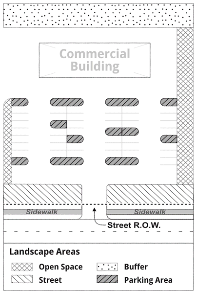
ii.
Between a commercial development and any existing single-family or multi-family use.
iii.
Between an industrial development and any existing single-family or multi-family use or commercial use.
b.
Planting requirement.
1)
Must consist of a minimum of five large trees, five small trees, and 20 shrubs for every 1,000 square feet of landscape area.
2)
All trees and shrubs must be evergreen and dispersed evenly along the shared property boundary to provide continuous screening.
c.
Fence requirement. Must include an opaque fence at least six feet tall to block noise, light, and particulates. The Department of Planning may require a taller fence and sound abatement materials to increase the buffer effect when light, noise, or particulates from the more intense land use are likely to pass over a six-foot fence without hindrance.
d.
Location and dimensions.
1)
The buffer landscape area must extend along the shared property line boundary with the less intense use(s) as identified in this Section.
2)
The width of the buffer landscape area shall be a minimum of ten feet and maximum of 25 feet from the property boundary toward the interior of the property.
7.
Open space landscape area—Industrial, commercial, and multi-family sites.
a.
Planting requirement.
1)
For every 1,000 square feet of landscape area there shall be a minimum of four large trees, five small trees, and 15 shrubs.
b.
Location and dimensions. Open space landscape areas may be:
1)
The project site must retain or provide ten percent of the overall site square footage as open space, in addition to required buffer, parking, and street landscape areas;
2)
Established by creating planting areas along a building façade, between a building and a parking area, or alongside non-buffered property lines; or
3)
Made a part of other required landscape areas, but in no case shall the planting space be counted as both open space landscaping and another required landscape areas;
4)
Elsewhere on the site; or
5)
The minimum size of any planting area shall be 25 square feet.
c.
Exceptions.
1)
The department of planning can approve retention of existing vegetation in lieu of removing and replanting areas, provided that the existing vegetation consists of a mix of non-invasive trees and shrubs and may require additional planting of trees and shrubs to meet the minimum planting requirements.
2)
Stormwater drainage improvements may be counted as open space provided improvements consist of a live vegetative covering and include large or small trees and/or shrubs.
8.
Open space landscape area—One- or two-family sites.
a.
Planting requirement. One large tree in the front or side yard visible from the public right-of-way; however, if an existing protected or heritage tree is retained it will satisfy this requirement.
b.
Location and dimensions. Every residentially zoned lot, parcel, or tract must maintain a total of 20 percent of the lot, parcel, or tract as open space landscape area.
9.
Parking landscape area.
a.
Applicability. Required for new construction and substantial improvement of industrial, commercial, and multifamily properties with ten or more parking spaces. Parking lots shall consist of both endcap planting areas at the end of each parking row and interior island planting areas disbursed throughout the parking lot for maximum shade potential.
b.
Planting requirement. Both endcaps and interior island planting areas shall consist of at least one large tree and five shrubs. Areas not planted with trees or shrubs must be planted with a living vegetative covering.
c.
Location and dimensions.
1)
End cap. The endcap planting area shall consist of a 100 square foot planting area at the end of each row of parking. When two rows of parking abut each other, the 100 square foot endcaps shall be combined into one endcap with a minimum planting area of 200 square feet.
2)
Interior island. The interior island planting area must include a minimum of 200 square feet of planting area for every 12 parking spaces and be dispersed evenly throughout the parking area to provide a consistent shade canopy.
3)
Placement. Trees shall be planted where trunks are a minimum of 30 inches from all curbs, bollards, rear guards, or other permanent parking lot traffic control elements.
d.
Exceptions. The department of planning may approve alternative layouts of the endcap and interior island planting areas to:
1)
Preserve a heritage or protected tree;
2)
Retain a cluster of large and small trees and shrubs;
3)
Accommodate best management practices for stormwater management; or
4)
Achieve a holistic, integrated landscape plan for the site.
10.
Street landscape area.
a.
Planting requirement—Minimum required depth of ten feet. For every 30 linear feet of street frontage (or fraction thereof) a minimum of one large tree, and one small tree must be provided. For every ten linear feet of street frontage (or fraction thereof) one shrub must be provided.
b.
Planting requirement—For required depth 15 feet or greater. For every 30 linear feet of street frontage (or fraction thereof) a minimum of two large trees and two small trees must be provided. For every ten linear feet of street frontage (or fraction thereof), two shrubs must be provided.
c.
Location and dimensions.
1)
Must span the entire property frontage along a property frontage at the boundary between any public right-of-way (ROW) and the private property, not inclusive of the public ROW.
2)
The depth of the street landscape area shall be a minimum of ten feet and maximum of 25 feet from the property boundary toward the interior of the property.
D.
Public tree management.
1.
Purpose. The strategic planting and maintenance of trees, shrubs, and plants on public property is beneficial to the city, its residents, and businesses. Regulations in this section assign responsibility for public tree planting and management and clarify private property owner's limited ability to plant on public property.
2.
Responsibility. The director of the department of parks and recreation is responsible for tree and landscape planting on public property, including:
a.
Cultivation, placement, maintenance, and removal of trees, shrubs, flowers, and other plants.
b.
Protection of trees during city construction projects.
c.
Review and decision-making on private tree planting requests.
d.
Maintenance of tree planting and removal records.
3.
Limited activity permitted on public property. No private entity or person shall take the following actions in a public right-of-way, park, or any other city property without first submitting an application and receiving approval from the Director of Parks and Recreation or Louisiana Department of Transportation and Development (LADOTD), as applicable:
a.
Plant, cut, prune, break, climb, injure, or remove any tree or landscape material.
b.
Cut, disturb, or interfere in any way with the roots of any tree.
c.
Spray with any chemicals, insecticides, or other oils; or whitewash any tree.
d.
Place any wire, rope, sign, poster, barricade, lights, decorations, electric wire, or other fixtures on a tree or within the public right-of-way.
e.
Injure, misuse, or remove any device placed to protect any tree.
f.
Place shells, gravel, or other such material within 24 inches of any tree or impede the free passage of water and air to any tree, shrub, or plant.
4.
Removal. The city retains the authority to remove or cut back an existing tree or vegetation planted in the city right-of-way or park without permission of the adjacent property owner(s), where the city is not liable for compensation for the removal or loss of any tree, shrub, or plant removed.
5.
Enforcement. The department of parks and recreation employees and city code enforcement officers are authorized to enforce the regulations of this section. Enforcement procedures must be in conformance with applicable City Code of Ordinances regulations for citation and adjudication.
(Ord. No. 1086, 9-26-1978; Ord. No. 1574, 12-14-1982; Ord. No. 1731, 7-10-1984; Ord. No. 2144, 11-24-1987; Ord. No. 2171, 3-22-1988; Ord. No. 2390, 7-23-1991; Ord. No. 2472, 10-13-1992; Ord. No. 2495, 4-27-1993; Ord. No. 3805, 3-22-2016; Ord. No. 3966, 11-12-2019; Ord. No. 4155, § 1(Exh. A), 1-23-2024; Ord. No. 4162, 4-23-2024; Ord. No. 4199, 10-8-2024; Ord. No. 4242, 7-8-2025)
Section 2.26. - Residential redevelopment district.
2.2601
Persons desiring to use land or erect buildings according to residential development
district guidelines shall meet the criteria of a residential redevelopment district.
2.2602
Criteria for designation as a residential redevelopment district are as follows:
(1)
Area of land shall be in one parcel and shall contain a minimum of 100 acres.
(2)
Area of land shall have 75 percent of income persons in low and moderate income category as defined by the latest U.S. Census.
(3)
Area of land shall have ten percent of the housing classified as substandard as defined by the latest U.S. Census.
(4)
Area of land shall be 35 percent undeveloped.
2.2603
The proposal for requesting designation as a residential redevelopment district must
be submitted to the planning commission for review as to compliance with criteria
in section 2.2602. The proposal will be processed in accordance with section 8.1,
entitled: Amendments.
2.2604
Permitted uses in the residential redevelopment district are uses permitted in A-6
district, multifamily dwellings, philanthropic uses, lodge halls, and day care centers.
2.2605
Prohibited uses in the residential redevelopment district are all uses not permitted
herein.
2.2606
Height regulations in the residential redevelopment district are: No building shall
exceed 45 feet in height.
2.2607
Regulations for permitted uses in the residential redevelopment district are as follows:
(1)
Yard:
(a)
Front yard: Front building lines shall conform to the average building lines in a developed block but in no case shall it be less than 20 feet. When there is undeveloped land for a distance of 150 feet on both sides of a proposed building, the minimum building setback line shall be 25 feet from the established street right-of-way lines. On through lots, this minimum depth shall be provided on both streets.
(b)
Side yard: There shall be two side yards with a minimum of five feet from any side property line for lots under 100 feet and a minimum of ten feet from any side property line for lots over 100 feet in width.
(c)
Rear yard: The required rear yard shall not be less than 25 feet.
(d)
No structural components or mechanical equipment may be located within the required front or side setback.
(2)
Lot size:
(a)
There shall be lot width of a minimum of 50 feet at the front building line.
(b)
Every lot shall contain an area of not less than 5,000 square feet per a single-family dwelling; two-family dwellings and multifamily dwellings must have 2,750 square feet for each dwelling unit.
(3)
Parking: Off-street parking regulations provided for under part 4.
2.2608
Conditional uses in the residential redevelopment district are: Manufactured housing
shall be limited to a single-family use, shall be permanently installed, and shall
be owner occupied. Renting of manufactured housing shall be prohibited. Only those
persons residing in mobile homes in the residential redevelopment district on August
29, 2005, shall be allowed this conditional use.
2.2609
Regulations for conditional uses for manufactured housing in the residential redevelopment
district are as follows:
(1)
Yard:
(a)
Front yard: Front building lines shall conform to the average building lines in a developed block, but in no case shall it be less than 20 feet.
(b)
Side yard: Ten feet.
(c)
Rear yard: 20 feet.
(2)
Lot size:
(a)
There shall be a lot width of a minimum of 50 feet.
(b)
Every lot shall contain an area of not less than 5,000 square feet per family unit.
(3)
Parking and walkways:
(a)
Two off-street hard surface parking spaces, each nine feet wide by 20 feet in length, or a combination of the two, shall be required for each lot.
(b)
A hard-surfaced walkway, a minimum width of 36 inches, shall be provided from the parking area to the entranceway of the manufactured housing.
(4)
Skirting properly ventilated shall be required around the manufactured housing.
(a)
The following materials are acceptable for skirting.
(1)
Corrugated skirting material designed for use with manufactured housing.
(2)
Solid brickwork, perforated for ventilation and water passage.
(3)
Bricks, painted concrete blocks, redwood or similar fencing material, perforated for ventilation and water passage.
(4)
Lattice work with a minimum of one-inch width by one-quarter inch thick slats with maximum opening between slats of four-square inches.
(5)
Manufactured housing shall be required to have an occupancy permit.
(6)
Manufactured housing shall meet anchoring requirements as per the International Residential Code, Appendix E, with all amendments.
(7)
Manufactured housing shall have been manufactured according to Mobile Homes Construction and Safety Standards Act of 1975 as adopted by the U. S. Congress with all amendments.
(8)
Manufactured housing shall be required to have a solid concrete pad used for the outside air conditioning unit suitable for the size of the unit.
2.2610
Conditional uses: Any use permitted in C-2 neighborhood commercial district except
filling stations and auto repair.
2.2611
Regulations for conditional uses in the residential redevelopment district are: C-2
neighborhood commercial district.
(1)
Yard:
(a)
Front yard: Front building lines shall conform to the average building lines in a developed block but in no case shall it be less than 20 feet. When there is undeveloped land for a distance of 150 feet on both sides of a proposed building, the minimum building setback line shall be 25 feet from the established street right-of-way lines. On through lots, this minimum depth shall be provided on both streets.
(b)
Side yard: Same as for district A-6 side yard.
(c)
Rear yard: Same as for district A-6 rear yard.
(d)
Section 2.201(2)(c) applies.
(2)
Lot size:
(a)
There shall be a lot width of a minimum of 50 feet at the building line.
(b)
The minimum lot size for any commercial use shall contain an area of not less than 5,000 square feet.
(c)
All commercial buildings shall be built to give visual appearance of a residence and utilize standard materials used in residential construction.
(d)
Open space: 25 percent of the commercial lot shall be left in green open space. The space in the rear yard setback will not count toward credit for open space when used for a required buffer.
(e)
Parking for commercial uses off-street parking regulations as provided for under part 4. Parking will not be allowed in the front five feet of the property within five feet of the side property line.
2.2612
Location of residential redevelopment district limited.
(1)
A residential redevelopment district shall be permitted only in that area of land within the city herein described:
(a)
Beginning at the northwest corner of Ninth Street and Daney Street go north along the west right-of-way of Ninth Street 560 feet to a point on the north right-of-way of Brakefield Street, thence go in a westerly direction along the north right-of-way of Brakefield Street to a point of the east right-of-way of Fourth Street continuing this line to a point along the northeast boundary line of Pine Crest Subdivision; thence go along this boundary line in a southeasterly direction approximately 1,300 feet to a point on the west right-of-way of Lincoln Avenue; thence go east approximately 500 feet on a line that is 110 feet off the south right-of-way of Tupelo Street and which parallels Tupelo Street to a point which is 100 feet east from the eastern right-of-way of Washington Street; thence go south approximately 100 feet to a point 110 feet southwest of the southwest right-of-way of Louis Street; thence go approximately 670 feet in a line paralleling Louis Street to a point on the southeast right-of-way on Adams Street; thence go approximately 180 feet northeast to a point on the northeast right-of-way of Louis and Adam Streets; thence go 350 feet southeast in a line continuing from the northeast right-of-way of Louis Street to a point 130 feet from the southern right-of-way of Elder Street; thence go east approximately 100 feet to a point 110 feet west of the western right-of-way of Terrace Avenue; thence go north on a line which parallels Terrace Avenue and is a distance of 110 feet from the west right-of-way of Terrace Avenue to a point which is 110 feet north of the north right-of-way of Ash Street; thence go east to the Slidell city limits which is 110 feet east of the east right-of-way of Terrace Avenue; thence go north along the city limits boundary to a point on the north right-of-way of Daney Street; thence to west along the north right-of-way of Daney Street to the point of beginning.
(Ord. No. 1010, 9-14-1976; Ord. No. 1538, 8-24-1982; Ord. No. 3020, 7-24-2001; Ord. No. 3131, 6-10-2003; Ord. No. 3519, 1-13-2009; Ord. No. 3454, 2-12-2008; Ord. No. 4154, § 1(Exh. A), 1-23-2024; Ord. No. 4175, Exh. 1, 5-28-2024; Ord. No. 4199, 10-8-2024)