
Southaven City Zoning Code
CHAPTER 16
SUBMITTAL REQUIREMENTS5
Note— This chapter is intended to be utilized in conjunction with the design standard manual in the city engineering department.
Sec. 13-16(a).- General procedure.
(a)
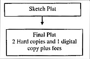
Whenever any subdivision of land is proposed, before any recording of deeds and before any permit for the erection of a structure in such proposed subdivision shall be granted, the owner or his authorized agent shall apply for and secure approval of such proposed subdivision in accordance with the following procedure, which includes two (2) steps for a major subdivision, two (2) steps for a minor subdivision, and two (2) steps for a planned unit development (PUD):
(1)
Major subdivision:
a.
Sketch plat;
b.
Final plat;
(2)
Minor subdivision:
a.
Sketch plat;
b.
Final plat.
(3)
Planned unit development;
a.
Concept plan
b.
Final plat.
(b)
Prior to final approval of any lot in the city which will not be required to have central collection and treatment for sewage, an application must be submitted to the Desoto County health department for notation that septic tanks will be approved and any conditions or limitations for such approval.
(c)
No plat or revised/amended plat subdividing land into lots shall be filed or recorded in the office of the chancery clerk of Desoto County, Mississippi, unless and until approved by the planning commission and governing authority and no lot shall be sold from such plat or revised/amended plat until the plat is filed for record in the office of the chancery clerk of Desoto County, Mississippi.
Sec. 13-16(b). - Major subdivisions.
The subdivider of a major subdivision shall submit a sketch plat and a except where waived by the director of the planning commission, in accordance with the specifications of this chapter. Upon approval of the sketch plat, in accordance with this chapter, the subdivider shall proceed with installation of the minimum improvements as required herein or may submit a final plat for approval by the planning commission in accordance with this chapter.
MAJOR SUBDIVISION PROCEDURE
Sec. 13-16(c). - Minor subdivisions.
Any subdivider of a minor subdivision shall submit to the planning commission two (2) prints of a final plat drawn to scale on eight and one-half-inch by eleven-inch paper containing applicable information as shown in chapter 13-6. If the proposed minor subdivision is not in violation of any existing applicable statutes or regulations, the director of the planning commission may give approval without full consideration by the full planning commission. The recommendation will then be presented to the governing authority for final determination. If the planning commission director disapproves the proposed minor subdivision final plat, the subdivider can appeal to the full planning commission. Minor subdivision plats are not required to be recorded in the plat books by the Desoto County chancery clerk's office; however, approval of such subdivision must be recorded in the minute books of the governing authority, and the street right-of-way, as required in the subdivision design standards contained in subsection 12-71(e), must be conveyed to the city by right-of-way deed.
MINOR SUBDIVISION PROCEDURE

Sec. 13-16(d). - Relation to planned unit development (PUD).
(a)
Any portion of a tract zoned as a PUD district may be submitted for approval as a major subdivision, provided that the PUD district zoning regulations governing the approval of a preliminary site plan are met. In submitting any PUD subdivision for approval, the prior action of the planning commission and the appropriate legislative body in granting the zoning application shall be sufficient sketch plat approval within the meaning of this chapter.
(b)
The basic purpose of PUD is to allow flexibility in the development of planned communities. PUD is intended to facilitate total density control as an alternative to regulation of individual lot size, harmonious development of mixed land uses, creative alternatives to traditional standards for minimum improvements, and development of attractive and functional common areas for recreational and other purposes. Within the general limitations of the comprehensive plan, the intent of this title and the public interest, convenience, safety and welfare, the planning commission may consider this purpose and may waive or modify any requirements of chapters 3 and 4 of this title.
PLANNED UNIT DEVELOPMENT (PUD) PROCEDURE
Sec. 13-16(e). - Sketch plat procedure.
(a)
The purpose of the sketch plat is to provide the subdivider an opportunity to consult early and informally with the planning staff before preparation of a preliminary and/or final plat and submission of a formal application to the planning commission. The intent of this procedure is to assist the subdivider in preparing a plan which will meet the objectives of the comprehensive plan, the requirements of the planning commission and of other public agencies, the improvements and uses of the subdivision and any other potential problems involved in the proposed subdivision.
(b)
The subdivider shall submit to the planning staff a sketch plat showing the boundaries of the proposed subdivision and its relationship to surrounding properties, natural features and the proposed street and lot pattern. This step does not require a formal application or filing fee. Upon receipt of the sketch plat, the planning staff shall review the sketch plat and notify the subdivider through consultation and/or writing that the sketch plat as submitted, or modified, meets the objectives of this title, or does not meet the objectives of this title and the reason therefore.
Sec. 13-16(f) - Final plat application procedure.
Pending the approval of the overall planned unit development design, a developer may proceed with final plat application per the procedure addressed below:
(1)
Two (2) hard copies of final plat, folded to eight and one-half (8½) inches by eleven (11) inches in size, at a scale of one (1) inch equals one hundred (100) feet, and three (3) prints at a scale of one (1) inch equals two hundred (200) feet, of the final plat; one (1) digital copy of the final plat in a PDF, JPEG, TIF, or DWG format, accompanied by an application for supplied by the planning staff, a map showing property zoning and surrounding zoning on eight and one-half (8½) inches by eleven (11) inches, and filing fee to be established by the governing authority by resolution, together with copies of any deed restrictions where such restrictions are too lengthy to be shown on the plat, shall be submitted to the planning staff. Application shall be made no later than the first weekday of the month to allow a detailed review by the technical reviewers and to be heard at the next meeting of the planning commission.
(b)
When the final plat conforms to the approved sketch plat, and the requirements of this chapter have been accomplished, the final plat shall be approved by the planning commission, and the plat thereupon submitted to the governing authority for its review and final determination. When the final plat does not conform to the approved preliminary plat, the planning commission shall submit its recommendations to the governing authority for approval or disapproval of the final plat. The subdivider or his agent must be present at the planning commission meeting scheduled to hear the submitted application unless otherwise advised by the planning staff.
(c)
If the subdivision improvements required in the design standard manual associated with the city engineering department of this title have not already been installed the subdivider must proceed to install the required improvements before the subdivision may be recorded and lots sold. Once the improvements have been installed, a maintenance bond must be provided as described in the design standard manual.
(d)
After approval of the final plat by the governing authority and required improvements are installed, the original plat in Mylar form shall be recorded within one (1) year and, if not filed, such plat shall have no validity and shall not be recorded without concurrence of the planning commission. A Mylar copy of the recorded plat shall be provided to the planning staff for its official records.
(e)
Any land dedicated to the city for park purposes in a subdivision shall be conveyed to the city free and clear of all encumbrances at the same time the plat of subdivision is filed, such deeds to be without restrictions or covenants excepts requirement that the land be used for park purposes without reversion and without references to the subdivision, if any, on which the land is shown. per the zoning requirements of a planned unit development, twenty (20) percent of the development should be designated as park land; if the developer of the property opts to delete park area within the development a fee of five hundred dollars ($500.00) per residential lot will be assessed to the developer at the time of approval and will be required to be paid in full before recording of any plat.
Sec. 13-16(g). - Data for final plat.
(a)
The final plat of two (2) prints and one (1) digital copy shall be at a scale of not more than one hundred (100) feet to one (1) inch from and accurate survey and on one (1) or more sheets whose dimensions shall be eighteen (18) inches by twenty-four (24) inches. If more than two (2) sheets are required, an index sheet of the same dimensions shall be filed showing the entire subdivision on one (1) sheet and the component areas shown on other sheets. The final plat and the accompanying documentation shall show the following:
(1)
The boundary lines of the area being subdivided with accurate distances and angles, showing all relationships of the subdivision to section, township and range;
(2)
The lines of all proposed streets and alleys with their widths and the names of all streets;
(3)
The lines of all adjoining property and the lines of adjoining streets and alleys with their widths and the names of all streets within one hundred (100) feet of the proposed subdivision;
(4)
The accurate outline of any portions of the property intended to be dedicated or granted for public use, with a statement of dedication thereon;
(5)
All lot lines together with an identifications of all lots, which shall be numbered consecutively;
(6)
The location of all building lines and easements provided for public use, services or utilities;
(7)
All dimensions, both linear and angular necessary for locating the boundaries of the subdivision, lots, streets, alleys, easements and other areas for public or private use. Linear dimensions are to be given to the nearest one hundredth (0.01) of a foot;
(8)
The radii, arcs or chords, points of tangency and central angles for curvilinear streets and radii for rounded corners;
(9)
The location of all survey monuments and their descriptions as provided in section 12-99.
(b)
General information. The final plat shall show the following:
(1)
The name of the subdivision, a graphic scale of the plat, a north arrow oriented toward the top of the page, the date, and the name of the owner or owners and subdividers;
(2)
Location sketch map showing relationship of subdivision site to area including township, range, section, and parts of sections;
(3)
The certificate, Mississippi registration number and legal seal of a registered engineer of land surveyor attesting the accuracy or the survey and the correct location of all monuments shown. The following certification of the engineer or surveyor of record for the proposed subdivision shall be included on all final plats: "I hereby certify that all dimensions, angles, bearings, and areas shown on this plat are correct, and that the exterior boundaries and interior lot dimensions comply with minimum state standards of accuracy for surveying";
(4)
Private restrictions and trusteeships and their periods of existence; should these restrictions or trusteeships be of such length as to make their lettering on the plat impracticable and thus necessitate the preparation of a separate instrument, reference to such instrument shall be made on the plat;
(5)
Acknowledgement of the owner or owner of the plat, and restrictions including dedication to public use of all streets, alleys, parks or other open spaces shown thereon and the granting of easements required;
(6)
Proper certificates for owner, notary public, registered engineer or land surveyor, planning commission, board of alderman, and chancery clerk shall be in accordance with the following:
OWNER'S CERTIFICATE
I, ___________, OWNER OR AUTHORIZED REPRESENTATIVE OF THE OWNER OF THE PROPERTY, HEREBY ADOPT THS AS MY PLAN OF SUBDIVISION AND DEDICATE THE RIGHTS-OF-WAY FOR THE ROADS AS SHOWN HEREON TO THE PUBLIC USE FOREVER, AND RESERVE FOR THE PUBLIC UTILITIES THE UTILITY EASEMENTS AS SHWON ON THE PLAT. I CERTIFY THAT I AM THE OWNER IN FEE SIMPLE OF THE PROPERTY AND THAT NO TAXES HAVE BECOME DUE AND PAYABLE. THIS THE ___________ DAY OF ________ 20___.
___________
SIGNATURE OF OWNER OR REPRESENATITIVE
NOTARY'S CERTIFICATE (Individual)
STATE OF MISSISSIPPI
COUNTY OF DESOTO
Personally appeared before me, the undersigned authority in and for said county and state, within named ___________, who acknowledged that he/she signed and delivered the foregoing plat for the purpose therein mentioned. Give under my hand an official seal of office this day of ___________, 20_______
___________
NOTARY PUBLIC
NOTARY'S CERTIFICATE (Corporate)
STATE OF MISSISSIPPI
COUNTY OF DESOTO
Personally appeared before me, the undersigned authority in and for said county and state, the within named ___________, who acknowledged that he/she is ___________ of ________, a corporation, and that for and on behalf of said corporation, and as its act and deed he/she executed the foregoing instrument, after first having been duly authorized by said corporation so to do. Given under my hand and official seal of office this the _______ day of ________, 20_______.
___________
NOTARY PUBLIC
APPROVED BY THE SOUTHAVEN PLANNING COMMISSION ON THIS THE _______ DAY OF ___________, 20_______
___________
CHAIRMAN OF PLANNING COMMISSION
ATTEST:
___________
SECRETARY OF PLANNING COMMISSION
APPROVED BY THE MAYOR AND BOARD OF ALDERMAN OF THE CITY OF SOUTHAVEN ON THIS THE _______ DAY OF ________, 20_______.
___________
MAYOR OF SOUTHAVEN
ATTEST:
___________
CITY CLERK OF SOUTHAVEN
STATE OF MISSISSIPPI
COUNTY OF DESOTO
I HEREBY CERTIFY THAT THE SUBDIVISION PLAT SHOWN HEREON WAS FILED FOR RECORD IN MY OFFICE AT ________O'CLOCK ___M., ON THE ________DAY OF ________, 20_______ AND WAS IMMEDIATELY ENTERED UPON THE PROPER INDEXES AND DULY RECORDED IN PLAT BOOK ________ AT PAGE _______.
___________
CHANCERY COURT
CERTIFICATE OF ENGINEER
THIS IS TO CERTIFY THAT I HAVE DRAWN THIS SUBDIVISION SHOWN HEREON AND THE PLAT OF SAME IS ACCURATELY DRAWN FROM INFORMATION FROM A GROUND SURVEY BY ME OR UNDER MY DIRECT SUPERVISION. ___________
THE PLATTED PROPERTY IS SUBJECT TO THOSE COVENANTS, RESTRICTIONS AND EASEMENTS AS SET FORTH IN DOCUMENT FILED FOR RECORD IN BOOK _______ PAGE _______, AND AS MAY OTHERWISE BE AMENDED FROM TIME TO TIME, IN THE OFFICE OF THE CHANCERY CLERK OF DESOTO COUNTY, MISSISSIPPI, TO WHICH DOCUMENT REFERENCE IS HEREBY MADE. ANY PROPERTY OWNER SHALL BE BOUND BY THE TERMS OF SAID DOCUMENT.
Sec. 13-16(h). - Recording final plat.
After final approval is obtained form the governing authority and all conditions have been satisfied, two (2) Mylars with plain paper separator sheets shall be submitted for recording which shall contain the necessary signatures, certificates and seals as specified in this section along with any agreements, and bonds, if necessary, a recording fee as established by the office of the chancery clerk, and an attorney's certificate of title certifying title to the land subdivided valid as of the date of recording.