
Statesville City Zoning Code
ARTICLE 8
- PUBLIC FACILITIES REQUIREMENTS
Section 8.01 - Generally
A.
Purpose
The purpose of these regulations is to promote development that is served by public infrastructure at sufficient levels of service. Land shall not be approved for development unless and until adequate public facilities exist or provision has been made for the following essential public facilities: water service, wastewater treatment and disposal, stormwater management, electrical service, telecommunications service and transportation facilities. Public facilities shall be provided in a manner that is consistent with the Comprehensive Plan, this Code and other standards adopted by the City.
1.
New development shall provide adequate facilities and services, including required easements, to accommodate demands from proposed development in conformance with the minimum standards established in this Article and other design manuals adopted by the City.
2.
Unconstructed improvements shall be guaranteed prior to the recording of the Final Plat.
3.
New development shall be phased at a pace that will ensure the provision of adequate community facilities and services for proposed and future development.
4.
Each development project shall be designed so that the project is capable of functioning effectively and independently at completion of each phase.
5.
Adequate roadway facilities shall be provided concurrently with new development and shall be designed and constructed in conformance with applicable City standards.
6.
All required facilities shall be inspected and approved by the City prior to issuance of a Building Permit or Certificate of Occupancy, as applicable.
B.
Consistency with Comprehensive Plan Required
Proposed public improvements shall conform to and be properly related to the City of Statesville's Comprehensive Plan and applicable facility and capital improvements plans.
C.
Water
All habitable buildings and buildable lots, exempting residential lots of record as of February 5, 2013, within the City limits and the ETJ, shall be connected to a public water system capable of providing water for health and emergency purposes, including adequate fire protection as required in Section 8.02. Exceptions to this requirement may be approved by the Public Utilities Director for single family residential construction not included in a major or minor subdivision application.
D.
Wastewater
All habitable buildings and buildable lots shall be connected to a public sanitary sewer system. Exceptions to this requirement may be approved by the Public Utilities Director for single family residential construction not included in a major or minor subdivision application.
E.
Stormwater Management
Drainage improvements shall accommodate potential runoff from the entire upstream drainage area and shall be designed to prevent increases in volume or velocity of stormwater to prevent downstream flooding and protect water quality. The City shall require the use of control methods such as retention or detention, and/or the construction of off-site drainage improvements to mitigate the impacts of the proposed development pursuant to Section 8.05.
F.
Streets
Proposed streets shall provide a safe, convenient and functional system for vehicular, pedestrian and bicycle circulation, shall be properly related to the Mobility and Development Plan; and shall be appropriate for the particular traffic characteristics of each proposed development. New development shall contribute to the construction of the transportation facilities needed to meet the demands attributable to the development. Such roadways shall be provided concurrently with new development. The subdivider shall provide the grading of the entire street right-of-way, alley or public place and pave the streets in conformance with Section 8.06. Dedication of rights-of-way and other access easements necessary for needed transportation facilities for current and future phases shall be required of new development.
G.
Utilities
All utilities provided as new installations within a subdivision shall be placed in the right-of-way or in easements. Utilities shall be provided underground in residential subdivisions unless an exception has been granted by the City Council. Utilities or adequate conduits for service lines shall be installed prior to final paving of streets.
H.
Extension and Oversized Facilities
All public improvements and required easements shall be extended through the parcel on which new development is proposed. Streets, water lines, wastewater systems, drainage facilities, electric lines and telecommunications lines shall be constructed through new development to promote the logical extension of public infrastructure to serve future growth. The City may require the applicant for a subdivision to extend offsite improvements to reach the subdivision or to oversize required public facilities to serve anticipated future development as a condition of plat or plan approval. The City shall pay the cost of upsizing a utility line as outlined in Section 23-252(c) of the City Code.
I.
Phasing
The City may require the phasing of development or improvements in order to maintain satisfactory levels of service for existing public services and facilities or for other reasons based upon maintaining the health, safety and general welfare of the City's inhabitants.
J.
Easements and Rights-of-Way
1.
Adequate Easements Required: Except as otherwise provided in this Code, an applicant for a development approval shall ensure that adequate on-site and off-site easements are provided for future roadways, storm water, water, wastewater and other public utilities.
2.
Utility Easements: The property owner shall grant adequate utility easements for all public and private utilities as required by the City Engineer and Director of Electric Utilities. Utility easements shall be shown on the plat and dedicated in conjunction with recordation of the Final Plat.
3.
Easements along Rights-of-Way: Easements of at least ten (10) feet in width shall be dedicated on each side of the right-of-way as determined by the City Engineer to be necessary for City utilities and storm sewers. Unless otherwise authorized or required by the City Engineer, utilities within or adjacent to street rights-of-ways shall be located consistent with the right-of-way widths shown in Table 8-1.
4.
Location of Easements: Except where prohibited by topography, easements shall be located on the centerline of lot lines. All easements for drainage or sewer shall be selectively cleared of undergrowth, trees and other obstructions by the developers prior to final approval. No buildings or structures, except as necessary for utilities, shall be permitted within or on easements.
5.
Adequate Right-of-Way Required: The applicant shall provide adequate on-site rights-of-way for anticipated traffic demands in a manner consistent with this Code, the Mobility and Development Plan and project specific traffic impact analysis (TIA), if applicable. If a TIA shows that a proposed development creates the need for additional off-site right-of-way, the applicant shall be required to provide right-of-way prior to development approval.
6.
Easement for Waterway: Whenever any stream or surface drainage course is located in an area being subdivided, the subdivider shall provide an adequate easement along each side of the stream for the purpose of widening, deepening, sloping, improving, maintaining or protecting the water course, and such easement, which shall include all required stream buffers, shall be dedicated as open space.
K.
Construction and Materials
Except as otherwise provided in this Code, the construction and material specifications of all public improvements shall comply with adopted improvement standards.
L.
Inspections and Acceptance
The City or its authorized agent shall inspect public improvements to ensure that such improvements are constructed to City standards and specifications. City acceptance of required improvements shall be required prior to the issuance of a Certificate of Zoning Compliance as applicable.
M.
Maintenance
The City shall require a one (1) year maintenance guarantee for all public improvements as a condition of accepting such improvement.
(Ord. No. 02-23, exh. A, 1-9-2023; Ord. No. 19-23, 5-1-2023; Ord. No. 01-24, 1-8-2024)
Section 8.02 - Water
A.
Generally
All occupied structures and buildable lots, exempting residential lots of record as of February 5, 2013, within the City limits and the ETJ shall be connected to a publicly owned water system. Exceptions may be granted by the Public Utilities Director for single family residential construction not included in a major or minor subdivision application. Such exceptions must be approved prior to plan approval and all exceptions will be based on the impracticality of location and/or any undue financial hardship imposed by requiring the connection in relation to the value of the property.
Fire hydrants shall also be installed in all subdivisions within the corporate limits and any area receiving City service. The water supply system shall be constructed under the direction and control of the City and shall conform to State and Federal standards. The applicant shall pay all applicable fees as a condition of extension of water service. Prior to receiving approval of a subdivision that will receive City water service, owners of properties located outside the City limits shall enter into an annexation agreement or petition for satellite annexation as a condition of approval.
Individual service connections within single-family residential subdivisions shall be extended from the main to each lot, and clearly marked. Regarding system development fees, inactivity for twenty-four (24) months shall result in expiration of water approval. Developer must reapply unless a specific development agreement states otherwise.
B.
Design Criteria
Design and construction of water improvements shall comply with the Standard of practice set by the Engineering Department and the Services Policy Manual.
C.
Off-Site Improvements
The developer shall provide for on-site and off-site improvements required to adequately serve a proposed development. In no event shall approval be granted to allow occupancy prior to connection to an adequate public water supply.
D.
Extension/Oversizing
Water lines shall be a minimum of eight (8) inches in diameter unless otherwise approved by the City Engineer. The City Council may require that water lines be oversized and be phased in coordination with the pace of new development to ensure the development will be adequately served. The subdivider shall be required to provide water systems with adequate capacity to serve the subdivision. Water systems shall be extended to the boundaries of the subdivision when required to facilitate future extensions of such systems. When oversizing of a water main in excess of the design standards of these regulations is required by the City Council to facilitate system expansion, the City may provide for reimbursement.
E.
Water System Easements
The applicant shall dedicate easements required to accommodate all water system facilities to serve new development, except individual service lines. The City Engineer shall approve the location and dimensions of required easements. Easements shall follow property lines to the greatest extent possible. In no case shall easements be less than twenty (20) feet wide.
(Ord. No. 03-13, 2-4-2013; Ord. No. 13-19, 5-6-2019; Ord. No. 01-24, 1-8-2024)
Section 8.03 - Centralized Wastewater Systems
A.
Generally
All new construction, commercial and residential, within the City limits or the ETJ shall be required to connect to the City's wastewater system. Exceptions may be granted by the Public Utilities Director for single family residential construction not included in a major or minor subdivision application. Such exceptions must be approved prior to plan approval and all exceptions will be based on the impracticality of location and/or any undue financial hardship imposed by requiring the connection in relation to the value of the property.
1.
The applicant shall pay appropriate fees as a condition of connection to the public sanitary sewer system.
2.
Centralized wastewater systems shall be used only for sewage disposal; flow from footing drains, gutters or other extraneous sources shall not be directed to the wastewater system.
3.
Prior to receiving approval of a subdivision that will receive City wastewater service, owners of properties located outside the City limits shall enter into an annexation agreement or petition for satellite annexation as a condition of approval.
4.
Regarding system development fees, inactivity for twenty-four (24) months shall result in expiration of wastewater approval. Developer must reapply unless a specific development agreement states otherwise.
B.
Sewerage Facilities
1.
Connections: Sewer connections shall extend to each lot. All connections between the City sewer system and the subdivision sewer system shall comply with the applicable adopted ordinance of the City pertaining to sewers and all construction of the system shall be subject to the direction and approval of the City Engineer.
2.
Alternate Treatment Systems: In cases where a sanitary sewer is not available or cannot be extended until a connection can be made with the public sewer system, the use of an alternate central treatment facility may be permitted, provided such facilities are approved by the State and in accordance with City standards pertaining to sanitary sewage disposal. The City may require the system to be designed for ultimate connection into the City's system.
3.
Permits for Private Sewage Disposal Systems: All private sewage disposal systems shall be approved by and constructed in accordance with State guidelines under the direction and control of the appropriate County or State authorities.
4.
Facilities Required: All lots shall be individually sewered with the grades and sizes as required by the City Engineer.
C.
Design Criteria
Design and construction of wastewater system improvements shall comply with the Standard of practice set by the Engineering Department and the Services Policy Manual.
D.
Off-Site Improvements
The developer of a parcel shall provide for on-site and off-site improvements required to adequately serve a proposed development. In no event shall approval be granted to allow occupancy prior to connection to an approved wastewater system unless the City Council has approved an interim service plan and has received a performance bond.
E.
Extension/Oversizing
The City Council may require that wastewater systems and lines be over-sized to accommodate future development. The subdivider shall be required to provide wastewater systems with adequate capacity to serve the subdivision. Wastewater systems shall be extended to the boundaries of the subdivision when required to facilitate future extensions of such systems. When oversizing of a sewer main in excess of the design standards of these regulations is required by the City Council for system expansion, the City may provide for the reimbursement.
F.
Wastewater System Easements
The developer shall dedicate adequate easements to accommodate all wastewater system facilities required to serve new development. The City Engineer shall approve the location and dimensions of required easements, but in no instance shall an easement be narrower than twenty (20) feet in width. Easements should follow property lines when possible. Where other utility lines are placed adjacent to the sewer, additional easements shall be required.
(Ord. No. 03-13, 2-4-2013; Ord. No. 13-19, 5-6-2019; Ord. No. 01-24, 1-8-2024)
Section 8.04 - Private (On-Site) Wastewater Systems
A.
Generally
The use of on-site wastewater systems must be authorized by the City Council. Exceptions may be granted by the Public Utilities Director for single family residential construction not included in a major or minor subdivision application. Such exceptions must be approved prior to plan approval and all exceptions will be based on the impracticality of location and/or any undue financial hardship imposed by requiring the connection in relation to the value of the property. The private (on-site) wastewater system must be constructed and maintained per requirements of the Iredell County Department of Environmental Health. The City reserves the right to require connection to the public sanitary sewer system.
B.
Private Wastewater Treatment, Public Nuisance Not Permitted
The location and installation of private wastewater systems shall be such that with reasonable maintenance, the private wastewater system will function in a sanitary manner and will not create a nuisance, health hazard or endanger the safety of any domestic water supply. Any private wastewater treatment system installed, added to, altered, expanded or repaired in violation of this Section and the rules and regulations of the City, County or State is a threat to the health, safety and welfare of the City and is a public nuisance.
C.
Private Waste Treatment, Issuance of Permit
Iredell County shall issue the appropriate permit in compliance with this Section and any rule or regulation adopted pursuant to this Section, and payment of the appropriate fee.
D.
Private Wastewater Treatment Standards
The City may require connection to or the provision for future connection to its centralized wastewater system for any development on lots. All private wastewater disposal systems shall be installed, altered, expanded, repaired or operated according to City, County, and State regulations and the following standards:
1.
Factors Considered: When reviewing an application for an individual wastewater system, consideration shall be given to the size and shape of the lot, number of structures proposed in the development, slope of natural and finished grade, soil type and classification, depth of ground water, proximity of existing or future water supplies and possible expansion of the system. The minimum size of an individual lot shall be one (1) acre.
2.
Community Treatment Design for Developments of More Than One (1) Lot: Where rural lots are clustered to provide open space, a community treatment system may be approved at the discretion of the City Council.
3.
Designed to Receive All Sewage: Wastewater systems shall be designed to adequately receive all sewage from the dwelling. Neither footing nor roof drainage shall enter any part of the system.
4.
Issuance of Rules and Regulations: The City may promulgate reasonable rules and regulations to implement the provisions of this Section.
E.
Alternative Method for Sewage Treatment
If a failing system cannot be reinstalled in compliance with this Section, the City Engineer may require connection to the City's centralized wastewater system. Connection shall be required if the failed system is located within four hundred (400) feet of an existing sewer line with available capacity.
(Ord. No. 01-24, 1-8-2024)
Section 8.05 - Stormwater Management
A.
General Provisions
1.
Authority
The City Council of the City of Statesville, further referred to herein as "the City," is authorized to adopt this section pursuant to North Carolina law, including, but not limited to, Article 14, Section 5 of the Constitution of North Carolina; G.S. § 143-214.7 and rules promulgated by the environmental management commission thereunder; Session Law 2004-163, G.S. §§ 160D-401 and 160D-925.
2.
Findings
It is hereby determined that:
Development and redevelopment alter the hydrologic response of local watersheds and increase stormwater runoff rates and volumes, flooding, soil erosion, stream channel erosion, nonpoint and point source pollution, and sediment transport and deposition, as well as reducing groundwater recharge;
These changes in stormwater runoff contribute to increased quantities of water-borne pollutants and alterations in hydrology that are harmful to public health and safety as well as to the natural environment; and
These effects can be managed and minimized by applying proper design and well-planned controls to manage stormwater runoff from development sites.
Further, the Federal Water Pollution Control Act of 1972 ("Clean Water Act") and Federal Phase II Stormwater Rules promulgated under it, as well as rules of the North Carolina Environmental Management Commission promulgated in response to Federal Phase II requirements, compel certain urbanized areas, including this jurisdiction, to adopt minimum stormwater controls such as those included in this section.
Therefore, the Statesville City Council establishes this set of water quality and quantity regulations to meet the requirements of state and federal law regarding control of stormwater runoff and discharge.
3.
Purpose
a.
General
Development shall be laid out to provide proper drainage of the area being developed, including facilities such as curb and gutter, catch basins, culverts, bridges and natural waterways. Drainage improvements shall accommodate potential runoff from the entire upstream drainage area and shall be designed to reduce or prevent increases in downstream flooding. Stormwater drainage systems shall be separate and independent of any sanitary sewer system whether public or private. The City shall require the use of control methods such as retention or detention, and/or the construction of off-site drainage improvements to mitigate the impacts of the proposed development to achieve these purposes.
The purpose of this section is to protect, maintain and enhance the public health, safety, environment and general welfare by establishing minimum requirements and procedures to control the adverse effects of increased post-development stormwater runoff and nonpoint and point source pollution associated with new development and redevelopment. It has been determined that proper management of construction-related and post-development stormwater runoff will minimize damage to public and private property and infrastructure; safeguard the public health, safety and general welfare; and protect water and aquatic resources.
b.
Specific
The stormwater management requirements seek to meet the general purpose through the following specific objectives and means:
(1)
Establishing decision-making processes for development that protects the integrity of watersheds and preserves the health of water resources;
(2)
Requiring that new development and redevelopment maintain the pre-development hydrologic response in their post-development state as nearly as practicable for the applicable design storms to reduce flooding, streambank erosion, nonpoint and point source pollution and increases in stream temperature, and to maintain the integrity of stream channels and aquatic habitats;
(3)
Establishing minimum post-development stormwater management standards and design criteria for the regulation and control of stormwater runoff quantity and quality;
(4)
Establishing design and review criteria for the construction, function, and use of structural Stormwater Control Measures (SCMs) that may be used to meet the minimum post-development stormwater management standards;
(5)
Encouraging the use of better management and site design practices, such as the use of vegetated conveyances for stormwater and the preservation of greenspace, riparian buffers and other conservation areas to the maximum extent practicable;
(6)
Establishing provisions for the long-term responsibility for and maintenance of structural SCMs and nonstructural stormwater (Best Management Practices) BMPs to ensure that they continue to function as designed, are maintained appropriately, and pose no threat to public safety;
(7)
Establishing administrative procedures for the submission, review, approval and disapproval of stormwater management plans, for the inspection of approved projects, and to assure appropriate long-term maintenance;
(8)
Coordinating site design plans that include open space and natural areas with the City of Statesville Zoning Ordinance and establish riparian buffers;
(9)
Controlling erosion and sedimentation from construction activities;
(10)
Assigning responsibility and processes for approving the creation and maintenance of adequate drainage and flood damage prevention measures.
4.
Definitions
When used in this section, the following words and terms shall have the meaning set forth in this section, unless other provisions of this section specifically indicate otherwise.
Built-upon area (BUA)
That portion of a development project that is covered by impervious or partially impervious surface including, but not limited to, buildings; pavement and gravel areas such as roads, parking lots, and paths; and recreation facilities such as tennis courts. "Built-upon area" does not include a wooden slatted deck, the water area of a swimming pool, or pervious or partially pervious paving material to the extent that the paving material absorbs water or allows water to infiltrate through the paving material.
Department
The North Carolina Department of Environmental Quality.
Design Manual
A single document or manual or collection of documents and manuals referenced by the City containing policy, criteria, and information, including technical specifications and standards, for designing and operating structural SCMs and any conveyances, appurtenances, or other structures to or from the SCM. All references herein to the Design Manual are to the latest published edition or revision.
Larger common plan of development or sale
Any area where multiple, separate and distinct construction or land-disturbing activities will occur under one (1) plan. A plan is any announcement or piece of documentation (including, but not limited to, a sign, public notice or hearing, sales pitch, advertisement, loan application, drawing, permit application, zoning request, or computer design) or physical demarcation (including, but not limited to, boundary signs, lot stakes, or surveyor markings) indicating that construction activities may occur on a specific plot.
n-year, twenty-four-hour storm
A rainfall event with a twenty-four-hour duration, having a total precipitation that is expected to be equaled or exceeded, on average, once in n times during a twelve-month period.
Owner
The legal or beneficial owner of land, including, but not limited to, a mortgagee or vendee in possession, receiver, executor, trustee, or long-term or commercial lessee, or any other person or entity holding proprietary rights in the property or having legal power of management and control of the property. "Owner" shall include long-term commercial tenants; management entities, such as those charged with or engaged in the management of properties for profit; and every person or entity having joint ownership of the property. A secured lender not in possession of the property does not constitute an owner, unless the secured lender is included within the meaning of "owner" under another description in this definition, such as a management entity.
Redevelopment
Any development on previously-developed land. For purposes of Section 8.05 of this ordinance, a rebuilding activity that results in no net increase in built-upon area and provides equal or greater stormwater control than the previous development is exempt from requirements related to redevelopment.
Riparian
Of or pertaining to the landscape interface between an upland area and a flowing surface water body. Riparian areas exhibit their own significance in geography, particularly ecology and hydrology, which are significantly influenced by its relationship with the surface water body.
Sheet Flow
Conveyance of surface water or runoff at a depth significantly less than the width of the flow path on which it flows. Sheet flow is maintained until the flow begins to concentrate into rills or micro-channels. The purpose for sheet flow in regards to this ordinance is that sheet flow maintains a lower energy and higher surface area of contact with the flow path than concentrated flow.
Stormwater Control Measure (SCM)
A physical device designed to trap, settle out, or filter pollutants from stormwater runoff; to alter or reduce stormwater runoff velocity, amount, timing, or other characteristics; to approximate the pre-development hydrology on a developed site; or to achieve any combination of these goals. Structural SCM includes physical practices such as constructed wetlands, vegetative practices, filter strips, grassed swales, and other methods installed or created on real property. "Structural SCM" is synonymous with "structural practice," "stormwater control facility," "stormwater control practice," "stormwater treatment practice," "stormwater management practice," "structural stormwater treatment systems," and similar terms used in this ordinance.
5.
Applicability and Jurisdiction
a.
Applicability
Beginning with and subsequent to the effective date of this ordinance revision, this section shall be applicable to all development and redevelopment, including, but not limited to, site plan applications, subdivision applications, and grading applications, unless exempt pursuant to subsection (b) of this section, Exemptions.
Development or redevelopment that cumulatively disturbs more than one (1) acre, or adds twenty thousand (20,000) square feet or more of impervious cover, and/or is part of a larger common plan of development or sale that cumulatively disturbs more than one (1) acre or adds twenty thousand (20,000) square feet or more of impervious cover shall comply with the provisions of this ordinance and the Standards set forth within this Section 8.05-C, Standards.
Development and redevelopment that disturb less than the stated area threshold are not exempt if such activities are part of a larger common plan of development or sale that exceeds the area threshold, even though multiple, separate or distinct activities take place at different times on different schedules.
For redevelopment, increased stormwater controls shall only be required for the amount of impervious surface being created that exceeds the amount of impervious surface which existed before the redevelopment.
b.
Exemptions
Activities that are exempt from permit requirements of Section 404 of the federal Clean Water Act as specified in 40 CFR 232 (primarily, non-point source agricultural and ongoing farming and forestry activities) are exempt from the provisions of within this Section 8.05 of the Statesville UDO.
c.
No Development or Redevelopment Until Compliance and Permit
No development or redevelopment shall occur except in compliance with the provisions of this ordinance or unless exempted. No development or redevelopment for which a permit is required pursuant to this ordinance shall occur except in compliance with the provisions, conditions, and limitations of the permit.
d.
Map
The provisions of this ordinance shall apply within the areas designated on the map titled City of Statesville Zoning Map, both within the City limits and within the Extra-Territorial Jurisdictional areas. In the event of a dispute, the applicability of this ordinance to a particular area of land or SCM shall be determined by reference to the North Carolina Statutes, the North Carolina Administrative Code, and local zoning and jurisdictional boundary ordinances.
6.
Interpretation.
a.
Meaning and Intent
All provisions, terms, phrases, and expressions contained in this section shall be construed according to the general and specific purposes set forth in Section 8.05, A.3, Purpose. If a different or more specific meaning is given for a term defined elsewhere in the City of Statesville's Code of Ordinances, the meaning and application of the term in this section shall control for purposes of application of this section.
b.
Text Controls in Event of Conflict
In the event of a conflict or inconsistency between the text of this section and any heading, caption, figure, illustration, table, or map, the text shall control.
c.
Authority for Interpretation
The Stormwater Program Manager has authority to determine the interpretation of this section. Any person may request an interpretation by submitting a written request to the Stormwater Program Manager, who shall respond in writing within thirty (30) business days. The Stormwater Program Manager shall keep on file a record of all written interpretations of this section and shall post these on the City's website.
d.
References to Statutes, Regulations, and Documents
Whenever reference is made to a resolution, ordinance, statute, regulation, manual (including the City of Statesville Stormwater Design Manual), or document, it shall be construed as a reference to the most recent edition of such that has been finalized and published with due provision for notice and comment, unless otherwise specifically stated.
e.
Computation of Time
The time in which an act is to be done shall be computed by excluding the first day and including the last day. If a deadline or required date of action falls on a Saturday, Sunday, or holiday observed by the City of Statesville, the deadline or required date of action shall be the next day that is not a Saturday, Sunday or holiday observed by the City of Statesville. References to days are calendar days unless otherwise stated.
f.
Delegation of Authority
Any act authorized by this section to be carried out by the Stormwater Program Manager of the City of Statesville may be carried out by his or her designee.
g.
Usage
(1)
Mandatory and discretionary terms. The words "shall," "must," and "will" are mandatory in nature, establishing an obligation or duty to comply with the particular provision. The words "may" and "should" are permissive in nature.
(2)
Conjunctions. Unless the context clearly indicates the contrary, conjunctions shall be interpreted as follows: The word "and" indicates that all connected items, conditions, provisions and events apply. The word "or" indicates that one (1) or more of the connected items, conditions, provisions or events apply.
(3)
Tense, plurals and gender. Words used in the present tense include the future tense. Words used in the singular number include the plural number and the plural number includes the singular number, unless the context of the particular usage clearly indicates otherwise. Words used in the masculine gender include the feminine gender, and vice versa.
h.
Measurement and Computation
Computation of lot area refers to the amount of horizontal land area contained inside the lot lines of a lot or site based on coordinate geometry of horizontal projection.
7.
Stormwater Design Manual
a.
Reference to Design Manuals
The Stormwater Program Manager shall use the policy, criteria, and information, including technical specifications and standards, in the Design Manual as the basis for decisions about stormwater permits and about the design, implementation and performance of structural SCMs and nonstructural stormwater SCMs.
The Design Manual includes a list of acceptable stormwater treatment practices, including specific design criteria for each stormwater practice. Stormwater treatment practices that are designed, constructed, and maintained in accordance with these design and sizing criteria will be presumed to meet the minimum water quality performance standards of the Phase II laws.
The Design Manual may consist of one (1) or several acceptable manuals or documents determined by the Stormwater Program Manager. The Stormwater Program Manager may add or remove manuals or documents from reference at their discretion in order to meet this section of the Statesville UDO and Phase II laws. As of the effective date of this Section 8.05 revision, Design Manual shall refer to both the City of Statesville Stormwater Design Manual and the North Carolina Department of Environmental Quality Stormwater Design Manual. Links to the documents for the effective Design Manuals will be posted on the City's website.
b.
Relationship of Design Manual to Other Laws and Regulations
If the specifications or guidelines of the Design Manual are more restrictive or apply a higher standard than other laws or regulations, that fact shall not prevent application of the specifications or guidelines in the Design Manual.
c.
Changes to Standards and Specification
If the standards, specifications, guidelines, policies, criteria, or other information in the Design Manual are amended subsequent to the submittal of an application for approval pursuant to this section but prior to approval, the information applicable at the date of the submittal shall control and shall be utilized in reviewing the application and in implementing this section with regard to the application.
d.
Amendments to Design Manuals
The Design Manual may be updated and expanded from time to time, based on advancements in technology and engineering, improved knowledge of local conditions, or local monitoring or maintenance experience. NC DEQ regularly updates portions of their manual and offers a service for notifications of updates. Notices of updates to the City manual will be posted on the City website.
8.
Relationship to Other Laws, Regulations and Private Agreements
a.
Conflict of Laws
This section is not intended to modify or repeal any other ordinance, rule, regulation or other provision of law. The requirements of this section are in addition to the requirements of any other ordinance, rule, regulation or other provision of law. Where any provision of this section imposes restrictions different from those imposed by any other ordinance, rule, regulation or other provision of law, whichever provision is more restrictive or imposes higher protective standards for human or environmental health, safety and welfare shall control.
b.
Private Agreements
This section is not intended to revoke or repeal any easement, covenant, or other private agreement. However, where the regulations of this section are more restrictive or impose higher standards or requirements than such an easement, covenant, or other private agreement, the requirements of this section shall govern. Nothing in this section shall modify or repeal any private covenant or deed restriction, but such covenant or restriction shall not legitimize any failure to comply with this section. In no case shall City of Statesville be obligated to enforce the provisions of any easements, covenants or agreements between private parties.
9.
Severability
If the provisions of any subsection, paragraph, subdivision or clause of this section shall be adjudged invalid by a court of competent jurisdiction, such judgment shall not affect or invalidate the remainder of any subsection, paragraph, subdivision or clause of this section.
10.
Effective Date and Transitional Provisions
a.
Effective Date
This Ordinance shall take effect on July 1, 2019.
b.
Final Approvals, Complete Applications
All development and redevelopment projects for which complete and full applications were submitted and accepted as complete by the City of Statesville prior to the effective date of this section shall be exempt from complying with all provisions of this updated Section 8.05, but shall be subject to the Section 8.05 ordinance provisions in place when the application was submitted. A phased development plan shall be reviewed and approved under the Section 8.05 ordinance provisions in place at the time the plan is submitted and accepted as complete by the City of Statesville if the following provisions apply:
(1)
For the initial or first phase of development, the type and intensity of use for a specific parcel or parcels, including at a minimum, the boundaries of the project and a subdivision plan that has been submitted for TRC approval and accepted as complete.
(2)
For any subsequent phase of development, the submitted plan includes sufficient detail to show that implementation of the updated requirements of this section to that phase of development would require a material change in that phase of the plan.
c.
Violations Continue
Any violation of provisions existing on the effective date of this section shall continue to be a violation under this section and be subject to penalties and enforcement under this section unless the use, development, construction, or other activity complies with the provisions of this section.
B.
Administration and Review
1.
Review and Decision-Making Entities—Stormwater Program Manager
a.
Designation
A Stormwater Program Manager shall be designated by the Statesville City Council to administer and enforce this section.
b.
Powers and Duties
In addition to the powers and duties that may be conferred by other provisions of this section and other laws, the Stormwater Program Manager shall have the following powers and duties under this section:
(1)
To assist in the review and approval, approval with conditions or disapproval plans pursuant to this section.
(2)
To make determinations and render interpretations of this section.
(3)
To establish application requirements and schedules for submittal and review of applications, to review and make recommendations to the Statesville City Council on applications for development or redevelopment approvals.
(4)
To enforce the provisions of this section in accordance with its enforcement provisions.
(5)
To maintain records, maps, forms and other official materials as they relate to the adoption, amendment, enforcement and administration of this section.
(6)
To provide expertise and technical assistance to the Statesville City Council upon request.
(7)
To designate appropriate other person(s) who shall carry out the powers and duties of the Stormwater Program Manager.
(8)
To take any other action necessary to administer the provisions of this section.
2.
Review Procedures
Stormwater management approvals are issued as part of the City of Statesville Planning Department Technical Review Committee processes and procedures.
3.
Applications for Approval
a.
Concept Plan and Consultation Meeting
Before a stormwater management permit application is deemed complete, the developer shall schedule a consultation with the Stormwater Program Manager on a concept plan for the post-construction stormwater management system to be utilized in the proposed development project. This consultation meeting may be done as part of a Planning Department/TRC Pre-Application Conference. The purpose of this meeting is to discuss the post-construction stormwater management measures necessary for the proposed project, as well as to discuss and assess constraints, opportunities and potential approaches to stormwater management designs before formal site design engineering is commenced. Local watershed plans, the Unified Development Ordinance, and other relevant resource protection plans should be consulted in the discussion of the concept plan.
To accomplish this goal, the following information should be included in the concept plan, which should be submitted in advance of the meeting:
(1)
Existing Conditions/Proposed Site Plans
Existing conditions and proposed site layout sketch plans, which illustrate at a minimum: existing and proposed topography; perennial and intermittent streams; mapping of predominant soils from soil surveys (if available); boundaries of existing predominant vegetation; proposed limits of clearing and grading; and location of existing and proposed roads, buildings, parking areas and other impervious surfaces, as well as any known existing utilities on the site. Information requirements for existing conditions are limited to publicly available topography, hydrography, soils, land cover, flood zones, which can be obtained from government websites or observed from aerial photography. Applicant is encouraged to also incorporate other information as may be available from their own records or upon request from NCDOT, adjacent property owners, etc.
(2)
Natural Resources Inventory
A written or graphic inventory of the natural resources at the site and surrounding area as it exists prior to the commencement of the project. This description should include a discussion of soil conditions, forest cover, geologic features, topography, wetlands, and native vegetative areas on the site, as well as the location and boundaries of other natural feature protection and conservation areas such as lakes, ponds, floodplains, stream buffers and other setbacks (e.g., drinking water well setbacks, septic setbacks, etc.)—to the extent this information is publicly available or can be observed from general site reconnaissance. Particular attention should be paid to environmentally sensitive features that provide particular opportunities or constraints for development and stormwater management.
(3)
Stormwater Management System Concept Plan
A written or graphic concept plan of the proposed post-development stormwater management system. Suggested information includes the following: preliminary selection and location of proposed structural stormwater controls and associated access corridors; low-impact design elements; location of existing and proposed conveyance systems such as grass channels, swales, and storm drains; flow paths; location of floodplain/floodway limits; relationship of site to upstream and downstream properties and drainages; and preliminary location of any proposed stream channel modifications, such as bridge or culvert crossings.
b.
Stormwater Management Plan for TRC Approval
The stormwater management plan submitted for TRC approval shall detail how post-development stormwater runoff will be controlled and managed and how the proposed project will meet the standards requirements of the section of the Statesville UDO. Plans should include clear delineations and accounting for all existing and proposed impervious areas, specifying areas to be removed and any additional impervious areas requiring stormwater treatment. All such plans shall be prepared by a qualified registered North Carolina professional engineer and the engineer shall perform services only in their area of competence, and shall verify that the design of all stormwater management facilities and practices meets the submittal requirements for complete applications, that the design and plans are sufficient to comply with applicable standards and ensure compliance with this section of the Statesville UDO and policies found in the Design Manual. Storm drainage easements, to be dedicated to the City of Statesville, shall be shown on the plan sheets and labeled "Public Storm Drainage Easement" for all stormwater pipes and open conveyances which convey runoff from public rights-of-way. It is recommended that plans submitted for TRC approval be developed with coordinate geometry referenced to the NC Grid System, since electronic as-builts will later be required in this format.
Any changes to the plans made subsequent to TRC approval, which affect the storm drainage conveyance and/or any SCMs, must be re-submitted to the City of Statesville for approval of the changes.
c.
As-Built Plans and Final Approval
Upon completion of a project, and before a certificate of occupancy shall be granted and/or installation bonds released, the applicant shall provide certification by the engineer of record that the completed project is in accordance with the approved stormwater management plans and designs, and shall submit actual "as-built" plans for all stormwater management facilities or practices after final construction is completed. Electronic versions of the "as-built" plans shall accompany any hardcopy submittal of plans, with units in feet and based on NC State Plane coordinates.
The plans shall show the final design specifications for all stormwater management facilities and practices and the field location, size, depth, and planted vegetation of all measures, controls, and devices, as installed. The impervious area for the site must be noted on the plans. The designer of the stormwater management measures and plans shall certify, under seal, that the as-built stormwater measures, controls, and devices are in compliance with the approved stormwater management plans and designs and with the requirements of this section. A final inspection and approval by the Stormwater Program Manager shall occur before the release of any performance securities.
d.
Other Permits
No certificate of compliance or occupancy shall be issued by Iredell County without all aspects of this section being met and approval by the Stormwater Program Manager, except where multiple units are served by the stormwater practice or facilities, or where stormwater control measures required by this section are being utilized for erosion control and a bond is in place for their conversion in which case Iredell County will withhold a percentage of permits or certificates of occupancy until as-built plans are submitted and final inspection and approval has occurred.
C.
Standards
1.
General Standards
All development and redevelopment to which this section applies shall comply with the standards of this section.
Stormwater runoff from the development shall be transported from the development by vegetated conveyances to the maximum extent practicable.
2.
Development Standards
This section shall be applicable to all development and redevelopment, pursuant to A.5.a, Applicability, unless exempt pursuant to A.5.b, Exemptions.
Development shall be laid out to provide proper drainage of the area being developed, including facilities such as curb and gutter, catch basins, culverts, bridges and natural waterways. Drainage improvements shall accommodate potential runoff from the entire upstream drainage area and shall be designed to reduce or prevent increases in downstream flooding. Stormwater drainage systems shall be separate and independent of any sanitary sewer system whether public or private. The City shall require the use of control methods such as retention or detention, and/or the construction of off-site drainage improvements to mitigate the impacts of the proposed development to achieve these purposes.
3.
Stormwater Quantity Control Requirements
Stormwater detention or retention facilities shall be designed and constructed to comply with City standards and other applicable regulations and to accommodate the rate of flow from new development, per requirements in the Design Manual. The peak rate of flow from the new development shall not exceed the peak rate of flow that existed prior to the new development for the two-year, twenty-four-hour and ten-year, twenty-four-hour storm events. Design plans and calculations for the stormwater facilities shall be provided as part of the subdivision construction plans and site plan review submission.
4.
Stormwater Quality Control Requirements
a.
Projects shall implement SCMs that comply with each of the following standards:
(1)
SCMs shall control and treat runoff from the first inch of rain. Runoff volume drawdown time shall be in accordance with the Design Manual.
(2)
All structural stormwater treatment systems used to meet these requirements shall be designed to have a minimum of eighty-five percent (85%) average annual removal for Total Suspended Solids (TSS).
(3)
General engineering design criteria for all projects shall be in accordance with 15A NCAC 2H .1008(c), as explained in the Design Manual.
(4)
Built-upon area shall be a minimum of thirty (30) feet landward of all perennial and intermittent surface waters. The thirty-foot buffer distance shall be measured from the top of bank on each side of the perennial and intermittent surface waters. For all perennial and intermittent surface waters, SCMs shall also be located a minimum of thirty (30) feet landward, with the exception that the backslope for an SCM embankment may extend within the thirty-foot buffer area as along as a twelve-foot maintenance corridor is preserved between the toe of slope and the top of bank. A surface water shall be deemed present if the feature is approximately shown on either the most recent version of the soil survey map prepared by the Natural Resources Conservation Service of the United States Department of Agriculture (USDA) or the most recent version of the 1:24,000 scale (7.5 minute) quadrangle topographic maps prepared by the United States Geologic Survey (USGS). An exception to this requirement may be allowed when surface waters are not present in accordance with the provisions of 15A NCAC 2B .0233 (3)(a) or similar site-specific determination made using NC DEQ-approved methodology. Top of bank determination is to be generally consistent with the US Army Corps of Engineers "Ordinary High-Water Mark" used in delineation of jurisdictional waters. In cases of conflicting interpretations by the Stormwater Program Manager and the applicant, the applicant will have the option of providing a jurisdictional determination, including tops of stream banks, from an individual certified by NCDEQ as qualified for Surface Water Identification.
b.
Evaluation According to Contents of Design Manual
All stormwater control measures and stormwater treatment required under this section shall be evaluated by the Stormwater Program Manager according to the policies, criteria, and information, including technical specifications and standards and the specific design criteria for each stormwater practice, in the Design Manual. The Stormwater Program Manager shall determine whether proposed SCMs will be adequate to meet the requirements of this section.
c.
Determination of Adequacy; Presumptions and Alternatives
Stormwater treatment practices that are designed, constructed and maintained in accordance with the criteria and specifications in the Design Manual will be presumed to meet the minimum water quality and quantity performance standards of this section. Whenever an applicant proposes to utilize a practice or practices not designed and constructed in accordance with the criteria and specifications in the Design Manual, the applicant shall have the burden of demonstrating that the practice(s) will satisfy the minimum water quality and quantity performance standards of this section. The Stormwater Program Manager may require the applicant to provide the documentation, calculations, and examples necessary for the Stormwater Program Manager to determine whether such an affirmative showing is made.
5.
Variances
Any person may petition the Board of Adjustment for a variance granting permission to use the person's land in a manner otherwise prohibited by this section. To qualify for a variance, the petitioner shall show all of the following:
a.
Unnecessary hardships would result from strict application of the stormwater requirements.
b.
The hardships result from conditions that are peculiar to the property, such as the location, size, or topography of the property.
c.
The hardships did not result from actions taken by the petitioner.
d.
The requested variance is consistent with the spirit, purpose, and intent of this section; will secure public safety and welfare; and will preserve substantial justice.
The Board of Adjustment may seek input from the City of Statesville Stormwater Advisory Committee for variance requests. The Board of Adjustment may impose reasonable and appropriate conditions and safeguards upon any variance it grants.
D.
Maintenance
1.
General Standards for Maintenance
a.
Function of SCMs as Intended
The owner of each structural SCM installed pursuant to this section shall maintain and operate it so as to preserve and continue its function in controlling stormwater quality and quantity at the degree or amount of function for which the structural SCM was designed.
b.
Annual Maintenance Inspection and Report
The person responsible for maintenance of any structural SCM installed pursuant to this section shall submit to the Stormwater Program Manager an inspection report from a qualified registered North Carolina professional engineer. The inspection report shall contain all of the following:
(1)
The name and address of the land owner;
(2)
The recorded book and page number of the lot of each structural SCM;
(3)
A statement that an inspection was made of all structural SCMs;
(4)
The date the inspection was made;
(5)
A statement that all inspected structural SCMs are performing properly and are in compliance with the terms and conditions of the approved maintenance agreement required by this section; and
(6)
The original signature and seal of the engineer.
2.
All inspection reports shall be on forms supplied by the Stormwater Program Manager. The first report shall be submitted to the Stormwater Program Manager one (1) year following the final approval date of the SCM and each year thereafter on or before the approval anniversary date.
3.
Operation and Maintenance Agreement
a.
In General
Prior to the conveyance or transfer of any lot or building site to be served by a structural SCM pursuant to this ordinance, and prior to issuance of any permit for development or redevelopment requiring a structural SCM pursuant to this ordinance, the applicant or owner of the site shall execute an operation and maintenance agreement that shall be binding on all subsequent owners of the site, portions of the site, and lots or parcels served by the structural SCM. Until the transference of all property, sites, or lots served by the structural SCM, the original owner or applicant shall have primary responsibility for carrying out the provisions of the maintenance agreement.
The operation and maintenance agreement shall require the owner or owners to maintain, repair and, if necessary, reconstruct the structural SCM, and shall state the terms, conditions, and schedule of maintenance for the structural SCM. In addition, it shall grant to the City a right of entry in the event that the Stormwater Program Manager has reason to believe it has become necessary to inspect, monitor, maintain, repair, or reconstruct the structural SCM; however, in no case shall the right of entry, of itself, confer an obligation on the City to assume responsibility for the structural SCM.
The operation and maintenance agreement shall be approved by the Stormwater Program Manager prior to construction plan approval, and it shall be referenced on the final plat and shall be executed by all parties and recorded with the county Register of Deeds upon final plat approval. A copy of the recorded maintenance agreement shall be given to the Stormwater Program Manager within fourteen (14) days following its recordation and before a certificate of occupancy will be issued.
b.
Special Requirement for Homeowners' and Other Associations
For all structural SCMs required pursuant to this ordinance and that are to be or are owned and maintained by a homeowners' association, property owners' association, or similar entity, the required operation and maintenance agreement shall include all of the following provisions:
(1)
Acknowledgment that the association shall continuously operate and maintain the stormwater control and management facilities.
(2)
Establishment of an escrow account, which can be spent solely for sediment removal, structural, biological or vegetative replacement, major repair, or reconstruction of the structural SCMs. If structural SCMs are not performing adequately or as intended or are not properly maintained, the City, in its sole discretion, may remedy the situation, and in such instances, the City shall be fully reimbursed from the escrow account. Escrowed funds may be spent by the association for sediment removal, structural, biological or vegetative replacement, major repair, and reconstruction of the structural SCMs, provided that the City shall first consent to the expenditure.
(3)
Both developer contribution and annual sinking fund deposits shall fund the escrow account. The total sinking fund budget is defined as the amount required for the initial construction cost of the SCMs. Prior to plat recordation or issuance of construction permits, whichever shall first occur, the developer shall pay into the escrow account an amount equal to fifteen (15) per cent of the initial construction cost of the SCMs. Two-thirds (2/3) of the total amount of sinking fund budget shall be deposited into the escrow account within the first five (5) years and the full amount shall be deposited within ten (10) years following initial construction of the structural SCMs. Funds shall be deposited each year into the escrow account. A portion of the annual assessments of the association shall include an allocation into the escrow account. Any funds drawn down from the escrow account shall be replaced in accordance with the schedule of anticipated work used to create the sinking fund budget.
(4)
Requirement that the association is formed and the association bylaws submitted to the City prior to the conveyance or transfer of any lot, unit, or building site.
(5)
Grant to the City a right of entry to inspect, monitor, maintain, repair, and reconstruct structural SCMs.
(6)
Authorization for the City to recover from the association and its members any and all costs the City expends to maintain or repair the structural SCMs or to correct any operational deficiencies. Failure to pay the City all of its expended costs, after forty-five-days written notice, shall constitute a breach of the agreement. In the case of deficiency, the City shall thereafter be entitled to bring an action against the association and its members to pay or foreclose upon the lien hereby authorized by the agreement against the property, or both. Interest, collection costs, and attorney fees shall be added to the recovery.
(7)
A statement that this agreement shall not obligate the City to maintain or repair any structural SCMs, and the City shall not be liable to any person for the condition or operation of structural SCMs.
(8)
A statement that this agreement shall not in any way diminish, limit, or restrict the right of the City to enforce any of its ordinances as authorized by law.
(9)
A provision indemnifying and holding harmless the City for any costs and injuries arising from or related to the structural SCM, unless the City has agreed in writing to assume the maintenance responsibility for the SCM and has accepted dedication of any and all rights necessary to carry out that maintenance.
4.
Inspection Program
Inspections and inspection programs by City of Statesville may be conducted or established on any reasonable basis, including, but not limited to, routine inspections; random inspections; inspections based upon complaints or other notice of possible violations; and joint inspections with other agencies inspecting under environmental or safety laws. Inspections may include, but are not limited to, reviewing maintenance and repair records; sampling discharges, surface water, groundwater, and material or water in SCMs; and evaluating the condition of SCMs.
If the owner or occupant of any property refuses to permit such inspection, the Stormwater Program Manager shall proceed to obtain an administrative search warrant pursuant to G.S. 15-27.2 or its successor. No person shall obstruct, hamper or interfere with the Stormwater Program Manager while carrying out his or her official duties.
5.
Performance Security for Installation and Maintenance
a.
Shall Be Required
The City of Statesville shall require the submittal of a performance security or bond with surety, cash escrow, letter of credit or other acceptable legal arrangement prior to issuance of a permit in order to ensure that the structural SCMs are:
(1)
Installed by the permit holder as required by the approved stormwater management plan; and/or
(2)
Maintained by the owner as required by the operation and maintenance agreement.
b.
Amount
(1)
Installation. The amount of an installation performance security shall be the total estimated construction cost of the SCMs, or conversion cost if the SCM location is first being used for erosion control purposes, approved under the permit, plus fifty percent (50%). Installation performance security is required to remain in effect until the City has inspected and approved all SCMs. Installation performance securities are required to be submitted to the City prior to issuance of any grading or building permits. Installation performance security amounts may be adjusted upon approval of the Stormwater Program Manager based on updated cost estimates for phased projects and/or where SCM construction is substantially complete but part of the contributory drainage area is still under an erosion control permit.
(2)
Maintenance. The amount of a maintenance performance security shall be the present value of an annuity of perpetual duration based on a reasonable estimate of the annual cost of inspection, operation and maintenance of the SCMs approved under the permit, at a discount rate that reflects the jurisdiction's cost of borrowing minus a reasonable estimate of long-term inflation. It shall be provided by the engineer of record and sealed by a registered professional engineer licensed in North Carolina.
c.
Uses of Performance Security
(1)
Forfeiture provisions. The performance security shall contain forfeiture provisions for failure, after proper notice, to complete work within the time specified, or to initiate or maintain any actions which may be required of the applicant or owner in accordance with this section, approvals issued pursuant to this section, or an operation and maintenance agreement established pursuant to this section.
(2)
Default. Upon default of the owner to construct, maintain, repair and, if necessary, reconstruct any structural SCM in accordance with the applicable permit or operation and maintenance agreement, the Stormwater Program Manager shall obtain and use all or any portion of the security to make necessary improvements based on an engineering estimate. Such expenditure of funds shall only be made after requesting the owner to comply with the permit or maintenance agreement. In the event of a default triggering the use of installation performance security, the City of Statesville shall not return any of the unused deposited cash funds or other security, which shall be retained for maintenance.
(3)
Costs in excess of performance security. If the City of Statesville takes action upon such failure by the applicant or owner, the City of Statesville may collect from the applicant or owner the difference between the amount of the reasonable cost of such action and the amount of the security held, in addition to any other penalties or damages due.
(4)
Refund. Within sixty (60) days of the final approval, the installation performance security shall be refunded to the applicant or terminated, except any amount attributable to the cost (plus twenty-five percent[25%]) of landscaping installation and ongoing maintenance associated with the SCMs covered by the security. Any such landscaping shall be inspected one (1) year after installation with replacement for compliance with the approved plans and specifications and, if in compliance, the portion of the financial security attributable to landscaping shall be released.
6.
Notice to Owners
a.
Deed Recordation and Indications on Plat
The applicable operations and maintenance agreement pertaining to every structural SCM shall be referenced on the final plat and shall be recorded with the County Register of Deeds upon final plat approval. If no subdivision plat is recorded for the site, then the operations and maintenance agreement shall be recorded with the County Register of Deeds so as to appear in the chain of title of all subsequent purchasers under generally accepted searching principles.
b.
Signage
Where appropriate in the determination of the Stormwater Program Manager to assure compliance with this section, structural SCMs shall be posted with a conspicuous sign stating who is responsible for required maintenance and annual inspection. The sign shall be maintained so as to remain visible and legible.
7.
Records of Installation and Maintenance Activities
The owner of each structural SCM shall keep records of inspections, maintenance, and repairs for at for the most recent five (5) years and shall submit the same upon reasonable request to the Stormwater Program Manager.
8.
Nuisance
The owner of each structural SCM or nonstructural BMP, shall maintain it so as not to create or result in a nuisance condition, as enumerated in Chapter 13 of the City of Statesville Code of Ordinances.
9.
Maintenance Easement
Every structural SCM installed pursuant to this section shall be made accessible, in accordance with the Design Manual, for adequate maintenance and repair by a maintenance easement. The easement shall be recorded and its terms shall specify who may make use of the easement and for what purposes.
E.
Enforcement and Violations
1.
General
a.
Authority to Enforce
The provisions of this section shall be enforced by the Stormwater Program Manager, his or her designee, or any authorized agent of the City of Statesville. Whenever this section refers to the Stormwater Program Manager, it includes his or her designee as well as any authorized agent of the City of Statesville.
b.
Violation Unlawful
Any failure to comply with an applicable requirement, prohibition, standard, or limitation imposed by this section, or the terms or conditions of any permit or other development or redevelopment approval or authorization granted pursuant to this section, is unlawful and shall constitute a violation of this section.
c.
Each Day a Separate Offense
Each day that a violation continues shall constitute a separate and distinct violation or offense.
d.
Responsible Persons/Entities
Any person who erects, constructs, reconstructs, alters (whether actively or passively), or fails to erect, construct, reconstruct, alter, repair or maintain any structure, SCM, practice, or condition in violation of this section shall be subject to the remedies, penalties, and/or enforcement actions in accordance with this section. Persons subject to the remedies and penalties set forth herein may include any architect, engineer, builder, contractor, developer, agency, or any other person who participates in, assists, directs, creates, causes, or maintains a condition that results in or constitutes a violation of this section, or fails to take appropriate action, so that a violation of this section results or persists; or an owner, any tenant or occupant, or any other person, who has control over, or responsibility for, the use or development of the property on which the violation occurs.
For the purposes of this article, responsible person(s) shall include but not be limited to:
(1)
Person maintaining condition resulting in or constituting violation. An architect, engineer, builder, contractor, developer, agency, or any other person who participates in, assists, directs, creates, causes, or maintains a condition that constitutes a violation of this section, or fails to take appropriate action, so that a violation of this section results or persists.
(2)
Responsibility for land or use of land. The owner of the land on which the violation occurs, any tenant or occupant of the property, any person who is responsible for stormwater controls or practices pursuant to a private agreement or public document, or any person, who has control over, or responsibility for, the use, development or redevelopment of the property.
2.
Remedies and Penalties
a.
The remedies and penalties provided for violations of this section, whether civil or criminal, shall be cumulative and in addition to any other remedy provided by law, and may be exercised in any order.
(1)
Withholding of certificate of occupancy. Iredell County may refuse to issue a certificate of occupancy for the building or other improvements constructed or being constructed on the site and served by the stormwater practices in question until the applicant or other responsible person has taken the remedial measures set forth in the notice of violation or has otherwise addressed the violations described therein.
(2)
Disapproval of subsequent permits and development approvals. As long as a violation of this section continues and remains uncorrected, the Stormwater Program Manager or other authorized agent may withhold, and the City of Statesville Planning Department or Stormwater Program Manager may disapprove, any request for permit or development approval or authorization provided for by this section or any other ordinance contained the City of Statesville Code of Ordinances for the land on which the violation occurs.
(3)
Injunction, abatements, etc. The Stormwater Program Manager, with the written authorization of the City Manager for the City of Statesville, may institute an action in a court of competent jurisdiction for a mandatory or prohibitory injunction, order of abatement or other civil action to correct a violation of this section. Any person violating this section shall be subject to the full range of equitable remedies provided in the General Statutes or at common law.
(4)
Correction as public health nuisance, costs as lien, etc. If the violation is deemed dangerous or prejudicial to the public health or public safety and is within the geographic limits prescribed by G.S. 160A-193, the Stormwater Program Manager, with the written authorization of the City Manager for the City of Statesville may cause the violation to be corrected and the costs to be assessed as a lien against the property.
(5)
Stop work order. The Stormwater Program Manager may issue a stop work order to the person(s) violating this section. The stop work order shall remain in effect until the person has taken the remedial measures set forth in the notice of violation or has otherwise cured the violation or violations described therein. The stop work order may be withdrawn or modified to enable the person to take the necessary remedial measures to cure such violation or violations.
b.
Civil Penalties
Violation of this section may subject the violator to a civil penalty to be recovered in a civil action in the nature of a debt if the violator does not pay the penalty within thirty (30) days after notice of the violation is issued by the Stormwater Program Manager. Civil penalties may be assessed up to the full amount of penalty to which City of Statesville is subject for violations of its Phase II stormwater permit, or if no Phase II stormwater permit exists for the jurisdiction, civil penalties may be assessed up to the full amount allowed by law.
c.
Criminal Penalties
Each violation of this section can be enforced as a misdemeanor pursuant to G.S. 14-4, subject to a maximum fine of five hundred dollars ($500.00). (See Section 8.05 E.1.c.)
3.
Procedures
a.
Initiation/Complaint
Whenever a violation of this section occurs, or is alleged to have occurred, any person may file a written complaint. Such complaint shall state fully the alleged violation and the basis thereof, and shall be filed with the Stormwater Program Manager, who shall record the complaint. The complaint shall be investigated promptly by the Stormwater Program Manager.
b.
Inspection
The Stormwater Program Manager shall have the authority, upon presentation of proper credentials, to enter and inspect any land, building, structure, or premises to ensure compliance with this section.
c.
Notice of Violation and Order to Correct
(1)
When the Stormwater Program Manager finds that any building, structure, or land is in violation of this section, the Stormwater Program Manager shall notify, in writing, the property owner or other person violating this section. The notification shall indicate the nature of the violation, contain the address or other description of the site upon which the violation is occurring, order the necessary action to abate the violation, and give a deadline for correcting the violation. If civil penalties are to be assessed, the notice of violation shall also contain a statement of the civil penalties to be assessed, the time of their accrual, and the time within which they shall be paid or be subject to collection as a debt.
(2)
The Stormwater Program Manager may deliver the notice of violation and correction order personally, by the City of Statesville Police Department, Iredell County Sheriffs Department, by certified or registered mail, return receipt requested, or by any means authorized for the service of documents by Rule 4 of the North Carolina Rules of Civil Procedure.
(3)
If a violation is not corrected within a reasonable period of time, as provided in the notification, the Stormwater Program Manager may take appropriate action under this section to correct and abate the violation and to ensure compliance with this section.
d.
Extension of Time
A person who receives a notice of violation and correction order, or the owner of the land on which the violation occurs, may submit to the Stormwater Program Manager a written request for an extension of time for correction of the violation. On determining that the request includes enough information to show that the violation cannot be corrected within the specified time limit for reasons beyond the control of the person requesting the extension, the Stormwater Program Manager may extend the time limit as is reasonably necessary to allow timely correction of the violation, up to, but not exceeding thirty (30) days. The Stormwater Program Manager may grant multiple thirty-day extensions in addition to the foregoing extension if the violation cannot be corrected within the permitted time due to circumstances beyond the control of the person violating this section. The Stormwater Program Manager may grant an extension only by written notice of extension. The notice of extension shall state the date prior to which correction shall be made, after which the violator shall be subject to the penalties described in the notice of violation and correction order.
e.
Enforcement After Time to Correct
After the time has expired to correct a violation, including any extension(s) if authorized by the Stormwater Program Manager, the Stormwater Program Manager shall determine if the violation is corrected. If the violation is not corrected, the Stormwater Program Manager may act to impose one (1) or more of the remedies and penalties authorized by this section.
f.
Emergency Enforcement
If delay in correcting a violation would seriously threaten the effective enforcement of this section or pose an immediate danger to the public health, safety or welfare, then the Stormwater Program Manager may order the immediate cessation of a violation. Any person so ordered shall cease any violation immediately. The Stormwater Program Manager may seek immediate enforcement, without prior written notice, through any remedy or penalty authorized by this article.
(Ord. No. 13-19, 5-6-2019; Ord. No. 08-21, 3-1-2021)
Section 8.06 - Streets, Sidewalks and Greenway Paths
A.
Streets, Generally
All development shall be provided with safe and adequate access designed to accommodate development at maximum planned densities unless the applicant restricts future subdivision through deed restrictions. Street systems shall be designed and constructed in accordance with this Section.
B.
Street Design
1.
Street Design, Generally: The standards established by this Section shall apply to all public and private streets in the City of Statesville and its ETJ. The City of Statesville's Comprehensive Plan and Mobility and Development Plan shall serve as a guide for the location and scale of future arterial and collector streets.
a.
Roadway Improvements not associated with a Traffic Impact Analysis shall be installed per the City Code, the Unified Development Code, and/or the Mobility and Development Plan on the project side of the road or roads adjacent to the subject property or properties. If the improvements required by the Mobility and Development Plan require a divided cross section, only the Curb and Gutter and Sidewalk are required to be installed. The City Engineer may approve a fee in lieu request per Section 1.05 Exemptions.
b.
Additional right-of-way and pavement shall be required when existing or newly platted lots abut city or state-maintained roads and the city's Mobility and Development Plan indicates improvements to said streets are planned. The owner shall construct at his cost such additional improvements including dedication of necessary right-of-way for widening of pavement areas.
c.
Street and sidewalk design and construction shall be in conformance with the current regulations of the City of Statesville and the North Carolina Department of Transportation. Exceptions to the requirements of this section shall be obtained in writing from the City Engineer and/or NCDOT.
2.
Street Classification: All streets shall be classified as arterial, collector, commercial and industrial or local streets. Any street that is not already classified in the City Road System shall be classified by the City Engineer subject to confirmation by the City Council. In classifying streets, the City shall consider projected traffic demands after twenty (20) years of development.
3.
Street Design Standards: See Detail ST-1 Street Design Standards of the City of Statesville's Street Construction Specifications and Details manual.
4.
Topography and Arrangement:
a.
Alignment: Street grades and alignment shall be related and integrated with the existing topography. However, a combination of steep grades and curves shall be avoided. Local roads shall be curved wherever possible to avoid the appearance of rigid conformity. All streets shall be arranged in order to gain as many building sites as possible at, or above, the grades of the streets.
b.
Conformance to Existing Plans: All streets shall be aligned with the existing and proposed system of thoroughfares and dedicated rights-of-way as established in the Comprehensive Plan, Mobility and Development Plan or adopted technical standards for public improvements.
c.
Related to Land Uses: All thoroughfares shall be properly related to special traffic generators such as industries, business districts, schools, churches, and shopping centers to population densities, and to the pattern of existing and proposed land uses.
d.
Conforming to Topography: Minor or local streets shall be designed to conform as much as possible to the topography to discourage use by through traffic, to permit efficient drainage and utility systems, and to require the minimum number of streets necessary to provide convenient and safe access to property.
e.
Extension: Proposed streets shall be extended to the boundary lines of the tract to be subdivided, unless the City Council finds that the extension is prevented by topography or other physical conditions, or unless, in the opinion of the City Council, such extension is not necessary or desirable for the coordination of the layout of the subdivision with the existing layout or the most advantageous future development of adjacent tracts.
f.
Commercial and Industrial Developments: In commercial and industrial developments, the streets and other accessways shall be planned in connection with the grouping of buildings, location of rail facilities, and the provision of alleys, truck loading and maneuvering areas, and sidewalks and parking areas so as to minimize conflict of movement between the various types of traffic, including pedestrian.
5.
General Street Arrangement:
a.
Adequate Traffic Circulation. Provisions shall be made for adequate traffic circulation. Local and residential streets shall be designed to allow through traffic, but at limited volume and velocities.
b.
Lot Access. Every lot shall have approved access to a public right-of-way approved by the City Council. Multiple driveways shall be reviewed and approved by the City Engineer.
c.
Street Connections. Streets should connect with those already dedicated in adjoining or adjacent subdivisions and provide for future connections to adjoining unsubdivided tracts whenever possible.
d.
Dead End Streets. If the adjacent property is undeveloped and the street must temporarily be a dead-end street, the right-of-way shall be extended to the property line. A temporary cul-de-sac shall be provided on all temporary dead-end streets greater than one hundred fifty (150) feet in length, with the notation on the subdivision plat that the land outside the normal street right-of-way shall revert to abutters whenever the street is continued. Temporary dead-end streets, one hundred fifty (150) feet or less are not required to provide a cul-de-sac and may not have any driveway connections. Permanent dead-end streets, of any length, shall provide a cul-de-sac, in accordance with Appendix A, Section 8.06, Streets, B. Street Design, 6, Cul-de-sac Street." "Hammerheads" may be used in lieu of culs-de-sac if there are topographic, environmental, or property shape constraints that warrant this consideration. Approval for "hammerheads" must be given by City Engineer, Fire Marshall, and Planning Director.
e.
Street Alignment/Jogs: Offset streets shall be avoided where possible. Street jogs with centerline offsets of less than one hundred fifty (150) feet shall not be permitted, except where the intersected street intersection has divided lanes without median breaks. An offset street is illustrated in Figure 8-1.
f.
Intersection of Streets: The angle of intersection between minor streets and major streets shall not vary by more than twenty (20) degrees from a right angle.
g.
Minimum Curb Radius: At the intersection of two (2) local or collector streets, the minimum curb radius shall be a least twenty-five (25) feet.
h.
Cross Slope: The cross slopes of all streets, including intersections, shall not exceed three percent (3%).
Figure 8-1: Offset Street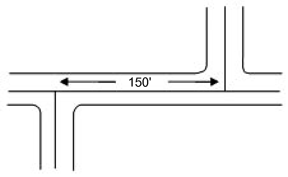
6.
Cul-de-sac and Hammerhead Street(s): See the City of Statesville's Street Construction Specifications and Details manual. "Hammerheads" may be used in lieu of culs-de-sac if there are topographic, environmental, or property shape constraints that warrant this consideration. Approval for "hammerheads" must be given by City Engineer, Fire Marshall, and Planning Director.
7.
Alleys: All alleys must be privately maintained and be provided with a recorded easement or right-of-way. Alleys shall be designed and constructed in accordance with the City of Statesville Street Specifications and Details.
8.
Half Streets: Half streets are prohibited.
9.
Private Streets: All streets shall be public unless approved by the City Engineer and the Planning Director. Private streets constructed to the less stringent private street standards as outlined in the City of Statesville Street Specifications and Details shall not be eligible to be added to the City System of Streets and shall be maintained by a Homeowners association or other responsible private entity approved by the City. In order for a Private Street to be added to the City System of Streets, it shall be improved to at a minimum meet the standards for public streets. Private streets shall be at a minimum constructed in accordance with the City of Statesville Street Specifications and Details.
10.
Secondary Access: Secondary access shall be provided for any residential development creating more than one hundred (100) units, as required by the North Carolina Fire Code, as required by the City of Statesville Fire Marshal's Office, or as required by the City of Statesville Mobility and Development Plan.
Secondary access shall be provided for any non-residential development as required by the North Carolina Fire Code, as required by the City of Statesville Fire Marshal's Office, or as required by the City of Statesville Mobility and Development Plan.
11.
Curbs and Gutters: Curbs and gutters shall be required for any existing or new streets, except where the City Engineer has approved a fee in lieu of request Per Section 1.05, Exemptions. All curbs and gutters shall be constructed per the City of Statesville Street Specifications and Details.
12.
Street Names: Streets in alignment with existing streets shall bear the names of the existing streets. Proposed street names that are in conflict with existing street names shall not be approved.
a.
Street names shall not be similar, duplicate, nor sound similar to the names of existing streets in the City or respective counties. Hyphenating, dividing one (1) word into two (2) words, affixing "Drive" for "Road," etc., other manipulations of an existing street name shall not constitute an acceptable street name. Similar sounding names shall be unacceptable regardless of spelling.
b.
The established residential street numbering system shall be utilized for every residential, commercial or industrial subdivision. (Contact the Iredell County for naming and numbering assistance.)
c.
Every building shall be assigned and shall display a property number. Property numbers shall be so located and of such a size as to be visible from the street. If a mailbox is located at the street, such mailbox shall have the property number affixed thereto with numerals measuring at least three (3) inches in height.
d.
It shall be unlawful for any person to alter, deface or take down any property number placed in accordance with this provision except for repair or replacement of such number.
e.
The continuation of any road or the design and construction of a new road results in the creation of a four-way intersection, the new road or continued road must have the same name the entire duration of the road unless otherwise prohibited by law.
13.
Street Dedication: No road or street shall be accepted by the City unless it meets the design standards established by this Code and all other design standards established by the City. Dedication of half-streets will not be approved.
14.
Street Composition: Pavement composition shall meet applicable City or State standards and specifications.
C.
Street Construction and Materials
See City of Statesville's Street Construction Specification and Details manual, Section 106, Control of Material.
D.
Traffic Control
Traffic control devices shall be provided for new development pursuant to standards adopted by the City and NCDOT, MUTCD Manual.
E.
Access Standards
1.
Purpose: The purpose of regulating the amount and nature of vehicular access points is to balance the need for providing access to individual private properties with the need to preserve an adequate level of capacity on the streets providing access. Vehicular access restrictions may be required to be shown on subdivision plats.
2.
Access to Primary Arterials: Where a residential subdivision borders on or contains an existing or proposed primary arterial, the City may require that access to such streets be limited by one (1) of the following means:
a.
Lots shall back onto the primary arterial and front onto a parallel local street; no access shall be provided from the primary arterial; or
b.
A series of cul-de-sacs, U-shaped streets, or short loops entered from and designed generally at right angles to the primary arterial; or
c.
A marginal access or service road (separated from the primary arterial by a ten (10) foot wide planting strip and having access at suitable points).
3.
Railroads and Limited Access Highways: Railroad rights-of-way and limited access highways, where so located as to affect the subdivision of adjoining lands, shall be treated as follows:
a.
In residential districts, a Type E Buffer Yard shall be provided adjacent to the railroad right-of-way or limited access highway. This strip shall be part of the platted lots and shall be designated on the plat.
b.
In districts zoned for business, commercial or industrial uses, wherever practicable, the nearest street extending parallel or approximately parallel to the railroad right-of-way shall be at a sufficient distance from the railroad right-of-way to ensure suitable depth for commercial or industrial sites.
c.
When streets parallel to the railroad right-of-way intersect a street that crosses the railroad right-of-way at grade, they shall, to the extent practicable, be at a distance of at least one hundred fifty (150) feet from the railroad right-of-way. Such distance shall be determined with due consideration of the minimum distance required for future separation of grades by means of appropriate approach gradients.
4.
Driveway Permits: A driveway permit, issued by the City Engineer, is required prior to the construction of any new access point. When a traffic impact analysis is required, no driveway permit will be issued until the traffic impact analysis process has been completed. Any non-residential change in use resulting in the following will require a new driveway permit:
a.
an increase of greater than fifty (50) peak hour trips, or
b.
a ten percent (10%) increase in average daily trips, or
c.
over ten (10) additional daily vehicle trips made by vehicles exceeding thirty thousand (30,000) pounds in gross vehicle weight.
For the purposes of evaluating driveway permit requests, the boundary of the site is considered to be all contiguous parcels under the same ownership on the date of adoption of this provision.
5.
Driveway Design Standards:
a.
Dimensions: The minimum driveway width shall be thirteen (13) feet for residential and twenty-five (25) feet for non-residential land uses, and the maximum driveway width shall be twenty-four (24) feet for residential and thirty (30) feet for non-residential land uses. The minimum concrete thickness shall be six (6) inches.
b.
Approach: The driveways adjacent to paved roads shall provide a concrete driveway approach from the property line to the roadbed edge unless otherwise approved by the City Engineer.
c.
Multiple-Frontage Lots: When a residential lot has multiple frontages, the driveway(s) shall be located on the street with the lowest functional classification except where the City Engineer determines that commercial traffic would introduce excessive traffic to a local residential street.
6.
Reserved.
7.
Design Objectives: In reviewing an application for a driveway permit for any non-residential or multi-family use, the City Engineer shall determine that the following objectives have been met:
a.
Adequate corner clearance from any adjacent street intersections has been provided to preserve the functional integrity of the intersection, and spacing from adjacent driveways is sufficient to safely minimize conflicts between traffic entering and exiting adjacent driveways;
b.
Adequate stopping sight distance and intersection sight distance are provided;
c.
Auxiliary turn lanes are provided as needed to:
(1)
minimize speed differentials with mainline highway traffic,
(2)
prevent the encroachment of turning vehicles on mainline traffic, and
(3)
prevent the queuing of inbound traffic from impacting mainline traffic.
d.
Sufficient storage distance between the curb line and the first point of conflict for traffic on the site is provided to prevent the backup of traffic onto public streets. This distance shall be adequate to absorb the maximum peak period inbound traffic during the normal weekday;
e.
Appropriate conflict reduction measures have been provided to safely manage inbound and outbound traffic. Median design features and driveway channelization shall be used as appropriate to accomplish conflict reduction;
f.
Access locations have been properly offset from driveways or street intersections located across the roadway in order to limit conflicts within the mainline or median of the street;
g.
The design of the access satisfies standard geometric guidelines for turning radii, driveway slope, angle of entry, design speed and width. The access grade within the public right-of-way shall not exceed three percent (3%). The drainage design of the access should not interfere with the drainage system in the public right-of-way;
h.
The access provides for the safe crossing of pedestrians, the handicapped and bicyclists;
i.
The installation of necessary traffic control devices for the safe and proper operation of the access meet the requirements adopted by the City and in the case of traffic signals, are located so as to allow for proper signal coordination and adequate left turn storage needs at the access and nearby intersections;
j.
No single family or two-family lot smaller than one (1) acre shall be created which is accessed from an arterial street or a major collector street;
k.
These standards are not intended to preclude access to existing lots. Where the City's standards would preclude access to a lot, the Planning Board may vary the access standard.
8.
Substandard Access: Where the access standards or design objectives of this section cannot be met, the City Engineer shall be guided by the following process in determining whether substandard access may be permitted.
a.
The City Engineer shall first determine whether alternate access to another street that meets the standards of the Code.
b.
Where alternate access opportunities are determined not to exist, the City Engineer may grant a reduction in spacing standards of up to twenty percent (20%).
c.
If after considering alternatives under (1) and (2) above, the City Engineer determines that no feasible alternatives exist, a substandard access permit may be granted subject to variance provisions and the following findings:
(1)
Conditions or circumstances exist which limit the strict application of the requirements of this Code, including the lack of a secondary access to another public street, the inability to use joint access, and the lack of engineering or construction solutions that can be applied to mitigate the condition;
(2)
The proposed access will not result in undue delay or congestion or be detrimental to the safety of motoring public using the roadway; and
(3)
The limiting access will create an exceptional and undue hardship on the applicant and that the permit issued will allow a reasonable use of the property.
9.
Acceleration and Deceleration Lanes: For any driveway or street located on an arterial street, except driveways serving one (1) to five (5) single-family residences, acceleration and deceleration lanes shall be provided. The minimum length for deceleration lanes shall be one hundred twenty (120) feet for collector streets or two hundred (200) feet for arterial streets except that either the City Engineer or the State Department of Transportation's district traffic and safety engineer, as applicable, may specify longer or shorter lanes based on grade, distance from an intersection, design speed, etc. The City Engineer shall make recommendations to the district traffic engineer on the need for and design of acceleration lanes on State routes. The City Engineer shall determine the need for and design specifications for acceleration lanes along City streets.
10.
Reserved.
F.
Oversizing Streets
1.
Responsibility: Where a designated street, according the Mobility and Development Plan, runs through the proposed subdivision, the applicant shall be responsible for the construction of such street to a collector street standard.
2.
Reimbursement and Costs: If the designated street exceeds the collector standard, the applicant may be required to construct the designated street subject to reimbursement by the City for the construction cost of the difference between the collector street and arterial street. Should reimbursement funds by the City not be available, the applicant's responsibility for construction shall be limited to a collector standard; however, the design shall be modified to facilitate future expansion of such street. Any required improvements deleted by the City Engineer in order to facilitate the future street expansion shall not relieve the responsibility of the subdivider for such improvements. The cost of such deleted improvements shall be paid to the City. Such monies shall be deposited in a street construction fund such as a transportation improvement fee fund, which may be expended by the City Council for the purpose of construction of arterial and collector streets within the City. Should the subdivider make such payments, he shall be relieved of any obligation for the completion of such deleted improvements.
G.
Other Improvements
1.
Sidewalks.
a.
Sidewalks shall be required in accordance with specifications approved by the city engineer on both sides of all existing and new city or state maintained streets except for existing residential lots, minor subdivisions with three (3) lots or less or where the City Engineer has approved a fee in lieu of request per Section 1.05(C).
b.
Easements: Sidewalk easements shall be a minimum of ten (10) feet in width if adjacent to a public street or land. The minimum width of the sidewalk easement between the rear or side lot lines of a parcel shall be fifteen (15) feet, unless approved otherwise by the City Engineer.
c.
Sidewalks shall be designed accordance with specifications approved by the city engineer and the Americans with Disabilities Act, provided that the City Engineer may approve a different standard for walkways across private property.
d.
In such cases where sidewalks are being installed across existing driveways, such driveways shall be cut, and sidewalks installed in accordance with specifications approved by the city engineer.
2.
Greenway Path Standards:
a.
Greenway paths shall be required in accordance with the Mobility and Development Plan.
b.
Greenway paths shall be designed in accordance with specifications approved by the city engineer and the Americans with Disabilities Act, provided that the City Engineer may approve a different standard for walkways across private property.
c.
Greenway paths shall be located within a dedicated right-of-way or access easement. Page 154
d.
Easements: Greenway path easements shall be a minimum of twenty (20) feet in width.
3.
Street Lighting: Installation of street lights shall be required in accordance with design and specification standards approved by the Director of Electric Utilities. Developers should make early contact with the applicable power company in order for a lighting plan to be developed, approved and installed in a timely manner.
4.
Utilities:
a.
Location: All existing utility facilities throughout the subdivision shall be shown on the preliminary plan and located in compliance with City standards. In addition, all proposed utility facilities, except electric should be shown on the preliminary plan. (Note: Electric Utility facilities are designed and installed by the applicable electric utility.)
b.
Easements: Easements as required by the City Engineer shall be provided for utilities (private and municipal) and such easements shall be at least twelve (12) feet wide. Proper coordination shall be established between the subdivider and the applicable utility companies for the establishment of utility easements established in adjoining properties.
c.
Slopes from the back of curb to the edge of right-of-way shall be no greater than one-quarter (&frax;1;4;) foot to one (1) foot to accommodate utility installation.
5.
Street Trees: Street trees shall be planted unless the Board of Adjustment, upon recommendation of the City Arborist/Line Clearance Supervisor, grants a variance. The variance shall be granted only if there are trees growing along the right-of-way or on the abutting property that, in the opinion of the Board of Adjustment, comply with these regulations.
H.
Traffic Impact Analysis
The purpose of a traffic impact analysis (TIA) is to assess the impact of a proposed development on the existing transportation system. A TIA will (1) ensure that the transportation network has adequate capacity to handle projected transportation demand associated with the project, (2) identify problems with the transportation system, (3) delineate solutions to identified problems, and (4) identify improvements to be incorporated into the proposed development.
1.
TIA Required. Applicants for development authorization in which the proposed development, redevelopment, or change of use is expected to generate two thousand (2,000) or more trips daily shall have prepared by a qualified professional a TIA meeting the guidelines established in this section. In addition to the foregoing, the City Engineer or Planning Director shall have the discretion to require a TIA when there are localized safety or capacity deficiencies or a proposed access is within one thousand (1,000) feet of an interchange or where known problems exist or are anticipated.
2.
Pre-submittal Conference. An applicant for development authorization for any project expected to meet or exceed the TIA threshold specified in Section 1, above, shall schedule a pre-submittal conference with the City. The engineering firm selected to prepare the TIA shall attend this meeting. The purpose of the meeting is to establish the study area, the trip distribution, the traffic counts to be utilized, approved developments in the area, pass-by and internal capture percentages, additional hours of analysis, if required (other than a.m. or p.m. peak), and resolve any other questions specific to the site.
3.
TIA Submission. Three (3) copies of the TIA, if required, shall accompany the application for development authorization. The TIA shall be prepared by a licensed engineer registered to practice in the State of North Carolina who shall have traffic assessment and transportation management experience. At a minimum, the TIA shall include the following:
(a)
Study purpose and objectives.
(b)
Description of the site and study area boundaries including appropriate mapping and rationale for selection of the study area boundaries.
(c)
A summary of existing conditions including, but not limited to, surrounding street and key intersection traffic volumes (daily and peak-hour), turning movements, capacities, safety deficiencies, and funded transportation improvements.
(d)
Anticipated or approved development in the area.
(e)
Trip generation, trip distribution, and discussion of the following:
(1)
Trip generation rates shall be based on trip generation rates contained in the latest edition of Trip Generation published by the Institute of Transportation Engineers (ITE). The applicant shall also provide the ITE code used to identify the development trip generation rate and assumptions used or data collected for any variations from generally accepted ITE rates or equations.
(2)
Pass-by trip factors and assumptions.
(3)
Internal trip assumptions for mixed use developments.
(4)
Trip distribution assumptions.
(f)
Projection of future traffic volumes and assessment of future roadway and intersection operating conditions for the year of the ultimate completion of the project. All projections should specifically document projected background traffic as well as the traffic generated by the proposed development. If the project is to be phased; projections for each phase of the development is required. If the unphased build-out period of the project is greater than nine (9) years, then a minimum of one (1) intermediate and one (1) full build-out projection is required. All projections and assessments should include the following three (3) scenarios:
(1)
No build.
(2)
Maximum possible development under existing use or zoning. Applicant shall conduct assessment of project phasing. The impact of the development of a particular phase is not to be compared with the total possible build-out of the entire project location.
(3)
The development as proposed.
(g)
Analysis of the key elements of the development and evaluation of the impacts of the development on the following:
(1)
Generalized Peak Hour and/or Daily Link Level of Service (LOS) Analysis. Using the peak hour directional volumes and daily traffic volumes forecast and service thresholds, a general evaluation shall be made of the street system for the short term and long-term horizon years. If the project is to be phased; then an assessment of conditions after the completion of each phase of the development is required. Incremental differences attributable to the land use action shall be identified. A map showing generalized levels of service shall be presented for each design year.
(2)
Access Analysis. The design, number, and location of access points to collector and arterial roadways must be fully analyzed. The number of access points shall be kept to a minimum and be designed to be consistent with the type of roadway facility. Access analysis shall include a strip accident, intersection accident analysis and bicycle/pedestrian analysis.
(3)
Intersection Analysis (Signal Warrant Analysis, Phasing Analysis, Intersection Crash Analysis and Progression Analysis). The appropriateness of the development's access locations and type must be established. For full-access locations, a signal warrant analysis based on the Manual on Uniform Traffic Control Devices must be conducted for each design year. Traffic signals specifically warranted by the land use action shall be identified.
(4)
Peak Hour Intersection Level of Service. An AM and PM peak hour intersection level of service analysis shall be conducted for each intersection, based on procedures specified in the most recent release of the Highway Capacity Manual. Levels of service for signalized intersections shall be based on the signal timings developed for the signal progression analysis.
(5)
Turn Lane Storage Requirements. Turn lane storage needs shall be identified for the "warranted" situation, based on projected turning volumes and AASHTO analytic techniques. Appropriate documentation of the calculations must be provided.
(6)
Sight Distance. The identification of sight distance at the development entrances and all internal streets shall be conducted.
(7)
Appropriateness of Acceleration or Deceleration Lanes. All proposed development access points on arterials shall be evaluated to determine the need for acceleration lanes or deceleration lanes, with justification and basis provided for recommendations.
(8)
Pedestrian and Bicycle Analysis. Continuity and adequacy of pedestrian and bike facilities shall be provided to the nearest attraction (exiting or planned) within one-quarter (¼) mile of the development site. Destinations of significance include bus stops, elementary schools, parks, activity centers and major bicycle facilities. Adherence to the Americans with Disabilities Act (ADA) shall be required.
(9)
Public Transportation Analysis. Existing and proposed (if any) public transportation facilities analysis shall be provided.
(10)
Special Analysis/Issues. The City may require specific focused traffic analyses relative to the proposed development.
(h)
Recommendations for site access and transportation improvements or mitigation measures needed to maintain traffic flow to, from, within and adjacent to the proposed development at an acceptable and safe level of service (generally assumed at LOS D or better).
(i)
Data collected for the study shall be made available to the City for evaluation of the study conclusions. The format for date submission as well as format for data to be provided to the City will be determined at a pre-consultation meeting between the applicant and the City. The City shall be granted the right to use, copy and share the TIA results as deemed appropriate by City staff.
(Ord. No. 01-15, 1-12-2015; Ord. No. 48-21, 12-20-2021; Ord. No. 11-23, 4-3-2023; Ord. No. 19-23, 5-1-2023; Ord. No. 30-23, 8-7-2023; Ord. No. 13-25, 1-13-2025)
Editor's note— Ord. No. 19-23, adopted May 1, 2023 amended § 8.06 and in doing so changed the title from "Streets" to "Streets, Sidewalks and Greenway Paths," as set out herein.