
Sutter County Unincorporated
City Zoning Code
City Zoning Code
PART 2
District Specific Regulations
1500-04-010 - Establishment of Zoning Districts
The County is divided into zoning districts as established by this Zoning Code. The districts, symbols, and General Plan land uses implemented by the districts are indicated on Table 1500-04-1.
(Ord. of 6-28-2022)
1500-04-020 - Zoning Map Incorporated
The boundaries of the zoning districts established by this Zoning Code are shown on the Sutter County Zoning Map, maintained by the Planning Division. The Zoning Map, together with all legends, symbols, notations, and other information shown on the map, is incorporated by reference and, along with any amendments adopted hereafter, made part of the Zoning Code.
(Ord. of 6-28-2022)
1500-05-010 - Purpose
A.
Agriculture (AG). The AG District is intended to protect and promote the long-term viability and productivity of Sutter County's agricultural resources, uses and economy. This district provides for parcel sizes to sustain a wide variety of agricultural and farming activities, low intensity rural uses and open space. Agricultural support services and industries that are compatible with adjacent uses and operations are encouraged. The AG District implements the General Plan Agricultural (AG-20, AG-40, and AG-80) and Open Space (OS) land use designations.
B.
Recreation (REC). The REC District is intended to be applied to lands identified as having active or passive recreation, natural, scenic or open space value for use as public or private parks or outdoor recreational facilities. Agriculture is an allowed secondary use. The REC District implements the General Plan Park and Recreation (PR) and Open Space (OS) land use designations.
C.
Public (P). The P District is intended to be applied to lands and facilities that are owned and operated by public agencies including schools, libraries, emergency service facilities, airports, major utilities, corporation yards, and governmental offices and property. Additional public uses, and facilities are provided for in other zoning districts. The P District implements the General Plan Public (P) and Airport (AP) land use designations but may be applied with most of the land use designations.
(Ord. of 6-28-2022)
1500-05-020 - Allowed Use Types
Table 1500-05-1 identifies the allowed use types for Agricultural, Recreation, and Public Districts. Use types are defined in Article 3. Uses not specifically listed may be permitted by the Director pursuant to Section 1500-03-030. For findings relating to flood standards, see Article 25.
(Ord. of 6-28-2022)
1500-05-030 - Supplemental Use Regulations
A.
Visitor Serving Uses. Visitor serving uses in the AG District may be permitted if all of the following findings can be made:
1.
The use will help to directly or indirectly promote agriculture in Sutter County.
2.
The use is compatible with and incidental to agricultural production activities in the area.
3.
The use is compatible with existing adjacent uses in the area.
B.
Special Events. Special events such as weddings, dances, assemblies, picnics, dinners, craft fairs, and similar events are allowed at Agricultural Education and Entertainment; Wineries, Breweries, Distilleries and Mills; and Special Event Facilities use types on parcels of sufficient size to not impact adjoining agricultural operations. These use types require approval of either a Use Permit or Administrative Permit as indicated on Table 1500-05-1. The permit shall specify the frequency of allowed events, hours of operations, maximum number of permitted quests, and any other conditions of approval deemed necessary by the approving authority.
C.
Wayside Stands and Agricultural Stores.
1.
One Wayside Stand or Agricultural Store shall be permitted per parcel.
2.
A Wayside Stand shall not exceed 600 square feet of floor area and may include up 50 square feet of floor area for the sale of prepackaged food and/or drinks. An Agricultural Store shall not exceed 1,500 square feet, and may include food preparation, bakery and area for limited retail sales.
3.
Adequate provision shall be made for off-street parking and safe ingress and egress to the adjacent street.
4.
Parking spaces for Wayside Stands and Agricultural Stores need not be paved or striped but shall be improved in accordance with the surfacing requirements for parking within the AG district.
5.
All structures and off-street parking shall not be located in any required front or side yard setback.
D.
Animal and Equipment Auctions.
1.
The sale/auction shall be held on property owned by one of the participants. Sales/auctions shall not be held on properties currently under a Williamson Act contract.
2.
The actual sale/auction event shall be held for a time period not to exceed three days (72 hours) per event, nor more frequently than three events per year per property. The sale/auction event shall be conducted between the hours of 7:00 am and 10:00 pm.
3.
Items being brought to the property for the sale/auction from off-site participants shall arrive no more than ten calendar days prior to the start of the sale/auction event and shall be removed no later than seven calendar days after the end of the event. The applicant shall indicate the number of participants that will be bringing items to the property for the event.
4.
Sales of any food at the sale/auction shall be subject to approval by the Environmental Health Division.
5.
Signage—On-site signage shall be permitted subject to the existing sign requirements for agricultural zones contained in the Zoning Code. Off-site signage for sale/auction events shall be limited to the provisions contained in Section 1500-21.
E.
Agricultural and General Truck Yards.
1.
Agricultural Truck Yards.
a.
Parking—Driveways, parking, storage, and maneuvering areas for agricultural trucks shall be surfaced with aggregate, paving or other materials which adequately prevent dust from becoming airborne and prevent the tracking of dirt and/or mud onto public roadways. Adequate provision shall be made for safe ingress and egress to the adjacent street.
b.
Screening—Agricultural truck yards may be conditioned to be screened from view from public roadways through walls, chain link fencing with privacy slats, and/or landscaping.
c.
Maintenance—Agricultural truck yard maintenance, repair, and proper handling and disposal of hazardous materials shall comply with the requirements of the Development Services Department, Environmental Health Division.
2.
General Truck Yards, Small.
a.
In addition to other noticing requirements, upon receipt of an application for a new or modified General Truck Yard, Small, notice shall be provided to all property owners of record, within one-half mile of the proposed project property boundaries advising an application has been received, providing a summary of the application and the location where project documents can be reviewed.
b.
Prior to approving a General Truck Yard, Small, a Notice to Approve shall be provided in accordance with Article 23.
c.
General Truck Yards, Small, when proposed in an AG District, shall not be subject to Table 1500-07-3 (Commercial and Employment Design Checklist) unless as otherwise noted in this section.
d.
Lighting shall be provided consistent with Table 1500-07-3 (Commercial and Employment Design Checklist). Light pole and fixture height shall not exceed 25 feet. Truck parking areas shall incorporate motion activated lighting that shall not spill onto adjoining properties. A photometric plan, prepared by an appropriately licensed design professional, shall be submitted demonstrating compliance with this section prior to project approval. The requirement for a photometric plan may be waived by the Director if it is determined the General Truck Yard, Small, is a sufficient distance from adjacent parcels or that, due existing vegetation or structures, site lighting will not spill onto adjacent properties.
e.
Driveways shall be a minimum of 25 feet in width, measured at the public right-of-way, or as determined necessary by the Road Commissioner.
f.
When proposed, access gates shall be setback a minimum of 65 feet from the public right-of-way to allow trucks with trailers to completely exit the roadway.
g.
All maneuvering and parking areas for automobiles, trucks and trailers shall be located onsite and shall be graveled consistent with Article 20. No parking or maneuvering for parking shall occur in a public road right-of-way. Parking and circulation areas shall be maintained and shall not deteriorate to allow mud or dirt to be tracked onto the public right-of-way. At their discretion, the Director may require the installation of wheel washing facilities or other measures deemed necessary to eliminate impacts to the County road system.
h.
1.
When located outside a designated floodplain, permanent bathroom facilities (not portable toilets) shall be established onsite and shall be accessible during hours of operation and shall not be visible from the public right-of-way. Bathroom facilities shall include, at a minimum, a flushing toilet and a handwashing station and shall be serviced, as needed, on a regular basis. Bathrooms shall be provided at a minimum ratio of one restroom per 25 trucks or as otherwise determined by the Director.
2.
When located in a designated floodplain, portable trailer mounted bathroom facilities may be established onsite and shall be accessible during hours of operation and shall not be visible from the public right-of-way. Bathroom facilities shall include, at a minimum, a toilet and handwashing station. Facilities shall be serviced, as needed, on a regular basis. The County may require an operator to document through a contract, or other means deemed sufficient, that bathroom facilities are being properly maintained. Bathrooms shall be provided at a minimum ratio of one restroom per 25 trucks or as otherwise determined by the Director.
i.
The minimum usable sewage disposal area shall be barricaded or have access physically restricted to prevent vehicles from driving or parking over it to the satisfaction of the Development Services Environmental Health Division. This requirement may be eliminated if it is determined that existing agricultural operations or other permitted onsite uses provide sufficient protection for sewage disposal areas.
j.
A drainage plan, prepared consistent with the County Improvement Standards, shall be submitted demonstrating runoff resulting from site development will not adversely impact surrounding property owners or public rights-of-way. This requirement may be waived by the Director if it is determined the project site is of sufficient size to not result in drainage impacts to surrounding property owners or public rights-of-way.
k.
There shall be no outdoor storage of loose materials onsite, including but not limited to, truck parts, tires and/or related items.
l.
General Truck Yards, Small, shall be located a sufficient distance from adjacent properties to screen their location by existing onsite agricultural operations or structures or shall be screened from public rights of way and adjoining parcels by walls, or chain-link fencing with privacy slats, having a minimum privacy rating of 90 percent or greater, and landscaping. All walls, fencing and landscaping shall be continuously maintained, and the Director may require replacement to damaged items.
m.
A minimum of one 55 gallon trash waste receptacle, or equivalent, shall be conveniently located in the truck parking area. The County may allow other means of trash collection and control as appropriate.
n.
Truck engine idling shall occur consistent with State law and compliance with this requirement shall be included as a project condition.
o.
The operation of Transportation refrigeration units shall occur consistent with California Code of Regulations, Title 13, Division 3, Chapter 9, Article 8 commencing at Section 2477 or as amended.
3.
General Truck Yards, Large.
a.
In addition to other noticing requirements, upon receipt of an application for a new or modified General Truck Yard, Large, notice shall be provided to all property owners of record, within one-half mile of the proposed project property boundaries advising an application has been received, providing a summary of the application and the location where project documents can be reviewed.
b.
General Truck Yards, Large, shall comply with the applicable requirements of Table 1500 07-3 (Commercial and Employment Design Checklist).
c.
General truck Yards, Large, may only be established in the Agriculture District when located immediately adjacent to a State Highway or a designated T or S-route (STAA).
d.
Lighting shall be provided consistent with Table 1500-07-3 (Commercial and Employment Design Checklist). Light pole and fixture height shall not exceed 25 feet. Truck parking areas shall incorporate motion activated lighting that shall not spill onto adjoining properties. A photometric plan, prepared by an appropriately licensed design professional, shall be submitted at the time of application demonstrating compliance with this requirement.
e.
Facility access shall incorporate acceleration and deceleration lanes, the criteria for which is determined by completion of a traffic study prepared to recognized engineering standards, including County Improvement Standards that shall also determine any additional needed traffic related improvements. No vehicle shall be permitted to obstruct or back onto a public roadway. Facilities shall be designed so that trucks entering and exiting yards are not required to cross the road center line into opposing traffic. The traffic study shall be submitted at the time application is made to the Development Services Planning Division for the proposed use.
f.
Facilities located along a State Highway shall comply with the California Department of Transportation standards for roads, freeway entrances, sight distance and turning radius.
g.
Driveways shall be a minimum of 40 feet in width measured at the public right-of-way or as deemed necessary by the Road Commissioner. Driveways shall be designed to allow trucks to enter and exit a facility without entering into opposing lanes of traffic.
h.
When proposed, access gates shall be setback a minimum of 65 feet, or a sufficient distance, from the public right-of-way to allow trucks with trailers to completely exit the roadway when gates are closed.
i.
All maneuvering and parking areas for automobiles, trucks and trailers shall be located onsite and shall be paved and maintained consistent with Article 20. No parking or maneuvering for parking shall occur in a public road right-of-way. Wheel stops shall be provided for both automobile and truck parking areas to protect fencing, landscaping, structures and adjacent properties. The County may require operators to re-surface deteriorated asphalt areas and such work shall be completed within 180-days of the County making a request or by a mutually agreed time as approved by the Director. At his or her discretion, the Director may require the installation of wheel washing facilities or other measures necessary to eliminate impacts to the County road system.
j.
1.
When located outside a designated floodplain, permanent bathroom facilities (not portable toilets) shall be established onsite and shall be accessible during hours of operation and shall not be visible from the public right-of-way. Bathroom facilities shall include, at a minimum, a flushing toilet and a handwashing station and shall be serviced, as needed, on a regular basis. Bathrooms shall be provided at a minimum ratio of one restroom per 25 trucks or as otherwise determined by the Director.
2.
When located in a designated floodplain, portable trailer mounted bathroom facilities may be established onsite and shall be accessible during hours of operation and shall not be visible from the public right-of-way. Bathroom facilities shall include, at a minimum, a toilet and handwashing station. Facilities shall be serviced, as needed, on a regular basis. The County may require an operator to document through a contract, or other means deemed sufficient, that bathroom facilities are being properly maintained. Bathrooms shall be provided at a minimum ratio of one restroom per 25 trucks or as otherwise determined by the Director.
k.
The minimum usable sewage disposal area shall be barricaded or have access physically restricted to prevent vehicles from driving or parking over it.
l.
A drainage plan, consistent with the County Improvement Standards, shall be submitted at the time application is made, demonstrating runoff resulting from site development will not adversely impact surrounding property owners, or public rights-of-way. Drainage from parking areas shall utilize best available technology to minimize pollution and shall comply with State law.
m.
Materials including truck parts, tires and related items, shall be contained inside a building, and in accordance with applicable State law. If a General Truck Yard, Large, proposes to conduct onsite repairs, such work shall occur within a building approved for said work. This requirement shall not apply to windshield, wiper, or truck headlight replacement work. A maximum of two inoperable trucks may be kept onsite for rebuilding or parts and shall be contained in a designated area, surfaced with concrete and designed to contain spilled fluids, and shall be located so as not to be visible from a public right-of-way or neighboring properties.
n.
Truck and/or trailer maintenance, repair, and proper handling and disposal of hazardous materials shall comply with the requirements of the Development Services Department and applicable State law.
o.
Facilities shall be screened from public view, roadways and adjoining, non-employment zoned, land through concrete masonry unit walls or chain-link fencing with privacy slats, having a minimum privacy rating of 90 percent or greater, and landscaping. All walls, fencing and landscaping shall be continuously maintained, and the Director may require replacement to damaged items.
p.
Fifty-five gallon trash waste receptacles, or equivalent, shall be provided at a minimum ratio of one receptacle per five trucks and shall be conveniently located in the truck/trailer parking area to facilitate their use. The County may allow other means of trash collection and control as appropriate.
q.
Truck engine idling shall occur consistent with State law and compliance with this requirement shall be included as a project condition.
r.
The operation of Transportation refrigeration units shall occur consistent with California Code of Regulations, Title 13, Division 3, Chapter 9, Article 8 commencing at Section 2477 or as amended.
s.
At the time application is made, a plan shall be submitted demonstrating how undeveloped areas shall be maintained to prevent the creation of dust, erosion and shall not become a health hazard or create a public nuisance.
t.
The County will consider as part of its review, indirect sources of traffic, noise and pollution, such as service trucks and passenger vehicles visiting facilities.
u.
The County will consider requiring permanent onsite landscape setback buffers from existing adjacent residences, to be maintained by the property owner, to the extent feasible, for new or expanded facilities.
F.
Animal Processing and Intensive Animal Operations.
1.
All barns, corrals, feed and manure storage areas, lagoons, processing facilities and structures not used as dwelling units, labor quarters, or administration, shall be located a minimum of one mile from any existing residential district, Rural Community boundary, or city sphere of influence line.
2.
Storage of manure, silage and animal matter shall occur in a manner which minimizes odors and vector nuisances to the greatest extent practicable, based on current industry practices.
3.
Incorporate measures to protect pollutants from entering into creeks, streams, drainage ditches or groundwater supplies.
4.
Incorporate measures to control odor, dust, noise, and waste disposal so as not to constitute a nuisance or a hazard.
G.
Commercial Stables.
1.
Storage of manure, silage and animal matter shall occur in a manner which minimizes odors and vector nuisances to the greatest extent practicable, based on current industry practices.
2.
Incorporate measures to protect pollutants from entering into creeks, streams, drainage ditches or groundwater supplies.
3.
Incorporate measures to control odor, dust, noise, and waste disposal so as not to constitute a nuisance or a hazard.
H.
Resource Protection and Restoration. Lands within the AG District may be used for habitat conservation, protection, restoration and/or mitigation with approval of a conservation easement and/or acquisition, provided such use does not substantially interfere or adversely affect existing or planned agricultural uses or impact County flood control operations. Such activities should be consistent with an adopted Habitat Conservation Plan and/or Natural Communities Conservation Plan.
I.
Sports Clubs.
1.
Shall not be located within a city's Sphere of Influence or Rural Community identified in the General Plan.
2.
Living quarters shall be permitted for hunting season use only. Permanent occupancy of residential unit(s) for property owner(s) and/or caretaker are permitted consistent with the base district and shall not exceed General Plan density.
J.
Agricultural Related Facilities. Within the AG District, all Specialized Education and Training use types and all Warehousing, Wholesaling, and Distribution use types shall be agriculturally related.
K.
Agricultural Employee Housing.
1.
All permanent agricultural employee housing shall be constructed and maintained to conform to the State Department of Housing and Community Development regulations for employee housing.
2.
All manufactured homes used specifically for agricultural employee housing shall be maintained in compliance with the applicable requirements of the Manufactured Housing Act (Health and Safety Code Section 18000, et seq.).
L.
Manufactured Homes in the Agricultural District.
1.
Eligibility. A manufactured home may be used as a permanent residence in the AG district subject to the following eligibility requirements:
a.
The manufactured home is certified under the National Manufactured Housing Construction and Safety Act of 1974.
b.
The density on the parcel on which the manufactured home is located does not exceed that permitted by the General Plan.
c.
The manufactured home is placed upon a permanent or non-permanent foundation approved by the Building Division.
d.
The manufactured home complies with all development standards and other requirements of the AG zoning district.
e.
All necessary permits and approvals have been obtained from Sutter County including the Environmental Health Division.
2.
Performance Standards. A manufactured home within the AG district shall comply with the following performance standards:
a.
Prior to the issuance of any necessary permit(s), the applicant shall acknowledge, by signature, receipt of the performance standards as set forth in this section and agreement to meet such standards.
b.
The area between the bottom of the manufactured home and the ground shall be fully enclosed on all sides with solid, nontransparent skirting that is of similar compatible material to the manufactured home. No storage of materials under the manufactured home is permitted except for appurtenances removed from the manufactured home and permitted to be stored under the manufactured home in accordance with the laws of the State of California.
c.
The manufactured home shall carry a current state license if not located upon a permanent foundation.
d.
The manufactured home shall bear the tag or shield of approval of the California State Department of Housing and Community Development in accordance with the Health and Safety Code.
e.
Standards of this section shall be completed prior to issuance of an occupancy permit for the manufactured home.
M.
Temporary Manufactured Homes for Caretaker Housing (Agricultural and Residential).
1.
Use Permit applications for manufactured homes for caretakers of agricultural property, improvements or equipment shall include a written explanation of the need for the caretaker in sufficient detail to allow the Planning Commission to evaluate the degree of need.
2.
Use Permit applications for manufactured homes for caregivers/family members in need of living assistance shall include a certification from a licensed doctor that a medical condition exists that necessitates the provision of on-site living assistance. Such a certification shall not have been prepared more than 60 days prior to the date of application and shall specify the nature of the condition in terms that will allow the Planning Commission to evaluate the degree of need.
3.
Approval of temporary secondary manufactured homes for caretaker housing (Agricultural and Residential) shall be subject to the following conditions:
a.
The Use Permit shall be issued for a term not to exceed five years, subject to extension, or shall expire at such time as the use or need for which the permit was granted ceases, whichever occurs first. An application for a Use Permit extension shall include a written explanation of the continuing need for the caretaker housing. Upon expiration or cessation of the use, the manufactured home shall be removed from the property within six months.
b.
The manufactured home shall be placed upon a non-permanent conventional manufactured home support system (e.g., soft set, blocking or piers). A manufactured home proposed in a designated floodplain may be elevated with a foundation system on piers that can be unbolted or disconnected to remove the home when needed.
c.
Rental of the manufactured home or manufactured home space is not permitted.
d.
The manufactured home shall be served by an approved on-site sewage disposal system.
4.
A temporary secondary manufactured home for caretaker housing (Agricultural and Residential) shall comply with the following performance standards:
a.
Prior to the issuance of any necessary permit(s), the applicant shall acknowledge, by signature, receipt of the performance standards as set forth in this section and agreement to meet such standards.
b.
The area between the bottom of the manufactured home and the ground shall be fully enclosed on all sides with solid, nontransparent skirting that is of similar compatible material to the manufactured home. No storage of materials under the manufactured home is permitted except for appurtenances removed from the manufactured home and permitted to be stored under the manufactured home in accordance with the laws of the State of California.
c.
The manufactured home shall carry a current state license if not located upon a permanent foundation.
The manufactured home shall bear the tag or shield of approval of the California State Department of Housing and Community Development in accordance with the Health and Safety Code. Standards of this section shall be completed prior to issuance of an occupancy permit for the manufactured home.
N.
Recreational Vehicle—Seasonal Security at Marinas and Boat Launch Facilities. A single recreational vehicle for use to provide seasonal security at existing permitted marinas and boat launch facilities may be permitted annually through a zoning clearance if determined to be consistent with the following performance standards:
1.
A recreational vehicle may be located in a designated floodplain or floodway from April 25 th of a given year and shall be annually removed by October 20 th to be onsite fewer than 180 consecutive days consistent with Section 1780-550 of the Floodplain Management Ordinance.
2.
The recreational vehicle is licensed and ready for highway use per Section 1780-550 of the Floodplain Management Ordinance.
3.
Quick disconnect utility connections to electricity, water, and a wastewater system shall be provided and approved by the Development Services Department. As an alternative to providing a connection to a wastewater system, a contract with an authorized wastewater pumping provider may be submitted demonstrating the recreational vehicle's wastewater tanks will be routinely serviced during the time period authorized by the zoning clearance.
4.
Evidence demonstrating garbage service will be provided shall be submitted to the satisfaction of the Development Services Department.
5.
A minimum of one onsite parking space is provided consistent with Table 1500-20-2 and is surfaced at a minimum consistent with Section 1500-20-080 B. 2.
6.
The recreational vehicle shall comply with the setback requirements of the zone district it is located in.
7.
The area surrounding the recreational vehicle shall be kept free of debris, waste materials, and refuse.
O.
Family Day Care, Large. Large Family Day Care Facilities are subject to the following standards:
1.
Written consent of the property owner is required when the property is leased or rented.
2.
One off-street parking space located outside the front and street side yard setback shall be provided in addition to the number required for the existing use.
3.
The operator shall provide evidence of a valid license to operate issued by the Department of Social Services.
4.
Written approval shall be provided by the Sutter County Environmental Health Division, Sutter County Building Division, and the appropriate fire service agency.
P.
Emergency Shelters. All emergency shelters shall comply with the Development Standards specified for the R-4 District, as well as Section 1500-11 - Cold Weather and Emergency Shelters (Use Specific Regulations).
Q.
Kennels. Kennels shall be kept in a clean and sanitary manner by the daily removal of waste and by the use of spray and disinfectants to prevent the accumulation of flies, the spread of disease, or offensive odor. Animal odors shall not be detectable beyond the property lines of the property where the kennel is located.
R.
Public Facilities. Airports, landing strips, heliports and similar facilities within the P District are limited to public use only. Private facilities are not permitted.
S.
Solar Energy Facilities, Commercial. Commercial solar energy facilities are not allowed within the Sutter Buttes Overlay Zone and/or on prime farmland.
T.
Oil and Gas Extraction and Injection Wells. Exploratory and/or production gas or oil well drilling and injection wells in the AG District meeting the following criteria shall be permitted by issuance of a Zoning Clearance:
1.
Wells shall be located a minimum of 500 feet from any existing residence and not on lands controlled by any State or Federal agency.
2.
The location of the well, access road, pipelines and other appurtenances have been coordinated with the surface rights operator, manager or tenant as well as the owner of the surface rights to the property to be used as a well site.
3.
All drilling equipment except that required for well operation and maintenance shall be removed and the site restored to its original condition within a time period as arranged with the surface owner, but in no event longer than 90 days after completion of the drilling process.
4.
The Director shall be notified of completion or abandonment of the well within ten days of cessation of drilling operations.
5.
The applicant shall comply with all applicable local and State regulations including but not limited to, requirements of the County Environmental Health Program and California Division of Oil and Gas for on-site sanitary facilities and waste disposal, the County Development Services Engineering Division for necessary encroachment permits of driveway connections with the County roads, and the California Division of Oil and Gas for all necessary permits.
Before the issuance of a Zoning Clearance for gas or oil well drilling or an injection well, a Notice of Intent to approve shall be mailed or delivered at least ten days prior to action on the application to the applicant, the property owner, the owners as shown on the most recent secured assessor's roll of property within 400 feet of the property involved in the application, and all other persons who have requested notice in accordance with Section 1500-23-060(B). Such other notice as the County deems appropriate may also be given. All Zoning Clearances shall be processed in accordance with Section 1500-25-030.
Exploratory and/or production gas or oil well drilling and injection wells that do not comply with the above criteria may be permitted by approval of a Use Permit. Oil and Gas Drilling and injection well Zoning Clearances and Use Permits shall be valid for a one year term period. If an approved permit has not been used within one year after permit issuance, it shall become null and void without further action.
U.
Open Space Easement Agreement. Prior to the conversion of land designated for agricultural use to permanent wildlife or other habitat, an Open Space Easement Agreement shall be approved by the Board of Supervisors.
V.
Regional Power Transmission line Projects. Prior to development, a use permit shall be obtained for all regional power transmission line projects and said applications shall comply with the requirements of this section.
1.
Applications. At a minimum, each use permit application for a regional transmission line shall include the following:
a.
A completed application form and filing fee.
b.
A description of a reasonable range of alternatives to the proposed project, including alternatives that use or expand existing rights-of-way.
c.
All application materials (maps, site plans, etc.) necessary to illustrate the proposed location of the proposed facilities and all alternative locations, together with all other materials required for a conditional use permit.
d.
A photo simulation of the proposed project and each alternative from at least six locations along its route in the County. Each location shall include simulated views of project facilities from four directions (north, south, east, and west).
e.
A narrative explanation of the route of the proposed project and each alternative, together with a discussion of any alternative locations and project alternatives considered by the applicant but not formally included for County consideration.
f.
For the proposed project and each alternative, all of the following shall be provided:
i.
Estimated cost, including construction, land acquisition, and other development costs;
ii.
A description of the type of vegetation and soils that will be removed or impacted by construction;
iii.
A map showing the number, types, uses, and distances of buildings, public and private airports, dedicated open space, and parklands located within a 1,000-foot distance of proposed project infrastructure;
iv.
An analysis of the audible noise and lighting impacts of the proposal, together with any other studies reasonably necessary for the County to perform its duties as a lead or responsible agency in connection with the environmental review of the project; and
v.
An analysis of the potential adverse human health effects of the project on those present in residential areas, schools, licensed day-care facilities, playgrounds, and other developed areas in reasonable proximity to the project. The analysis shall use the best available scientific information at the time it is conducted.
2.
Coordination and Documentation. Within 30 days of filing an application for a use permit in connection with a regional transmission line project, the applicant shall provide the County with copies of all applications for state, federal, and other permits and licenses in connection with the proposed project. Promptly following the issuance of any state or federal permits or licenses, biological opinions, records of decision, memoranda of understanding, exemptions, variances, or similar authorizations or approvals related to the proposed project, the applicant shall provide copies of those documents to the County.
3.
Public Outreach. For all regional transmission line projects that traverse a significant portion of the County, and whose impacts are not likely to be isolated to a small geographical area, the Director, or his or her designee, may require the applicant to present the application to interested members of the public at one or more public meetings to be arranged by the applicant. Such meetings shall be in addition to any hearings on the permit application held by the Planning Commission or the Board of Supervisors, and in addition to any meetings of local general plan advisory committees to which the application is referred. The Director, or his/her designee, and the applicant shall, if requested by the Director or his/her designee, develop a mutually acceptable public outreach program that includes such meeting(s) and any similar public outreach efforts to be undertaken by the applicant.
4.
Review Criteria. The purpose of this subdivision is to establish a use permit criterion for major electrical power distribution and transmission projects in the unincorporated area of the County and shall apply to all such projects that require a use permit. A use permit for such projects may only be approved if all of the following findings are made based on substantial evidence in the record:
a.
The proposed project is consistent with any applicable policies in the General Plan and any applicable specific plan(s);
b.
There is a demonstrated need for the proposed project;
c.
To the greatest feasible (as that term is defined in Public Utilities Code § 12808.5) extent, the project utilizes existing infrastructure and rights-of-way or, alternatively, expands existing rights-of-way, in that order of preference;
d.
There are no feasible alternatives that are superior to the proposed project, particularly with respect to individuals present in residential areas, schools, licensed day-care facilities, playgrounds, and other developed areas in reasonable proximity to the project;
e.
To the greatest feasible extent, the proposed project does not have a significant adverse effect on the environment, agriculture, existing land uses and activities, areas with significant scenic qualities, or other relevant considerations of public health, safety, or welfare;
f.
To the greatest feasible extent, the proposed project avoids lands preserved by the County for public park purposes;
g.
To the greatest feasible extent, the proposed project avoids lands preserved by a conservation easement or similar deed restriction for agricultural, habitat, or other purposes. The Board of Supervisors may waive this requirement if the applicant provides documentation that the project does not conflict with the conservation easement or deed restriction, or that the conservation easement or deed restriction will be amended or extinguished prior to implementation of the project. If the conservation easement or deed restriction was provided as mitigation for the impacts of a prior development project, however, it shall only be amended or extinguished if adequate substitute mitigation is provided by the applicant;
h.
The proposed project complies with all laws, regulations, and rules regarding airport safety conditions and similar matters, and would not require a significant change in the operations of a public or private airport in the County, create an undue hazard for aircraft, or substantially hinder aerial spraying operations;
i.
To the greatest feasible extent, operation of the proposed project would not create conditions that unduly reduce or interfere with public or private television, radio, telemetry, or other electromagnetic communication signals; and
j.
The applicant has agreed to conduct all roadwork and other site development work in compliance with all laws, regulations, and rules relating to dust control, air quality, erosion, and sediment control, as well as any permits issued pursuant thereto.
5.
Scope. The requirements of 1500-05-030(V) shall apply to all regional transmission line projects that have not received all required federal, state, and local agency approvals prior to the effective date of this ordinance.
6.
Costs. The project applicant shall reimburse all County costs associated with reviewing an application for a major electrical power transmission and distribution project. In addition, if the County is required to review a proposed transmission corridor zone pursuant to California Government Code section 25334 or other provisions of law, such costs shall also be reimbursed by the project applicant.
(Ord. of 6-28-2022)
1500-05-040 - Development Standards and Exceptions
Table 1500-05-2 identifies the development standards and allowed exceptions to those standards for Agricultural, Recreation, and Public Districts. Allowed use types and associated structures shall comply with the following in addition to any other applicable requirements of this Zoning Code:
NOTES:
1.
Measured from edge of adopted right-of-way. Where right-of-way is not recorded, the setback shall be measured 25 feet from edge of planned right-of-way per the adopted County Design Standards for the roadway as determined by the Director.
2.
Measured from property line.
3.
Measured from the edge of adopted right-of-way for Pease Road where adjacent to Yuba City's incorporated boundaries or adopted sphere of influence, in accordance with the Buttes Vista Neighborhood Plan Settlement Agreement (December 7, 1999).
4.
Measured as the vertical distance from the average level of the highest and lowest point of that portion of the lot covered by the building, to the highest point of the building roof, ridge, or parapet wall. See Article 2 for additional detail.
5.
Property designated Agriculture Rural Community (AG-RC) by the General Plan may be allowed a 2.5-acre minimum parcel size.
(Ord. of 6-28-2022)
1500-06-010 - Purpose
A.
Ranchette (RAN). The RAN District is intended to provide for large lot residential uses and small farms within rural portions of Sutter County outside of the Yuba City and Live Oak spheres of influence. Given potential impacts to agricultural lands and operations, as well as a General Plan Land Use policy, new allocations of this district are not permitted. Undeveloped areas with existing RAN zoning may develop in accordance with the regulations established herein, however, no future allocation of RAN zoning will be permitted. Lot line adjustments between existing Ranchette lots are allowed consistent with existing development standards, however, no further subdivision of existing Ranchette lots is permitted. The RAN District allows 0.1 to 0.3 dwelling units per gross acre (3 to 10-acre parcel size).
B.
Estate Residential (ER). The ER District is intended to provide for large lot single family homes and related uses. This district is to be applied to areas located within existing rural communities, new Rural Planned Communities, and unincorporated areas within the Live Oak sphere of influence and both the existing or possible future Yuba City sphere of influence. To avoid the premature conversion of agricultural lands and inefficient land use patterns, the amount of Estate Residential land use allocated within the County is limited in accordance with the General Plan and Section 1500-06-030(A), Estate Residential Rezoning. The ER District implements the General Plan Estates Residential (ER) land use designation, allowing 0.3 to two dwelling units per gross acre (0.5 to 3-acre parcel size).
C.
Single-Family Residential (R-1). The R-1 District is intended to provide for single-family residential neighborhoods and related uses within suburban and urban areas with adequate services and amenities to support a desirable and stable living environment. The R-1 District implements the General Plan Low Density Residential (LDR) land use designation, allowing two to eight dwelling units per gross acre.
D.
Two-Family Residential (R-2). The R-2 District is intended to provide for a variety of small lot single-family and two family (duplex or halfplex) residential neighborhoods and related uses within suburban and urban areas with adequate services and amenities to support a desirable and stable living environment. The R-2 District implements the General Plan Low Density Residential (LDR) land use designation, allowing two to eight dwelling units per gross acre.
E.
Neighborhood Apartment (R-3). The R-3 District is intended to provide for a variety of medium density attached and detached residential housing types, potential mixed use development, and related uses within suburban and urban areas with adequate services, transportation options, and amenities to support a desirable and stable living environment. The R-3 District implements the General Plan Medium Density Residential (MDR) land use designation, allowing 8.1 to 20 dwelling units per gross acre.
F.
General Apartment (R-4). The R-4 District is intended to provide for a variety of high density multiple-family housing types, potential mixed use development, and related uses within urban areas with high levels of services, amenities, multi-modal access, and proximity to jobs and services to support a desirable and stable living environment. The R-4 District implements the General Plan High Density Residential (HDR) land use designation, allowing 20.1 and above dwelling units per gross acre.
(Ord. of 6-28-2022)
1500-06-020 - Allowed Use Types
Table 1500-06-1 identifies the allowed use types for Residential Districts. Use types are defined in Article 3. Uses not specifically listed may be permitted by the Director pursuant to Section 1500-03-030. For findings relating to flood standards, see Article 25.
(Ord. of 6-28-2022)
1500-06-030 - Supplemental Regulations
A.
Estate Residential Rezoning. Prior to rezoning new ER District lands, the Board of Supervisors shall find consistent with applicable General Plan policies that:
1.
There is a market demand for the use;
2.
Existing ER Districts have been substantially built out;
3.
The use can be adequately served by services and infrastructure available at the time of project approval (either community or individual water and wastewater systems); and
4.
The use is compatible with adjacent and nearby uses.
B.
Wayside Stands. A Wayside Stand is subject to the following conditions:
1.
One Wayside Stand shall be permitted per parcel.
2.
A Wayside Stand shall not exceed 400 square feet of floor area, and may include up 50 square feet of floor area for the sale of prepackaged food and/or drinks.
3.
Adequate provision shall be made for off-street parking and safe ingress and egress to the adjacent street.
4.
Parking spaces for Wayside Stands need not be paved, striped or otherwise improved, but shall be treated to minimize dust and the tracking of mud onto public roadways.
5.
All structures and off-street parking shall not be located in any required front or side yard setback, and shall not obstruct visibility for motorists.
C.
Commercial Stables. Commercial Stables are subject to the following conditions:
1.
Storage or stockpiling of manure, silage and animal matter shall occur in a manner which minimizes odor and vector nuisances to the greatest extent practicable, based on current industry practices.
2.
Measures shall be incorporated to protect pollutants from entering in creeks, streams, drainage ditches or groundwater supplies.
3.
All other feasible measures shall be incorporated to control odor, dust, noise, and waste disposal so as not to constitute a nuisance or a hazard;
Manufactured Homes in Residential Districts
1.
Eligibility. A manufactured home may be used as a permanent residence in any Residential district subject to the following eligibility requirements:
a.
The manufactured home is certified under the National Manufactured Housing Construction and Safety Act of 1974.
b.
The density on the lot on which the manufactured home is located does not exceed that permitted by the General Plan.
c.
The manufactured home is placed upon a permanent foundation approved by the Building Division.
d.
The manufactured home is less than ten years old from the date of manufacture to the date of installation.
e.
The manufactured home complies with all development standards and other requirements of the corresponding Residential zoning district.
f.
All necessary licenses, tags, permits and approvals have been obtained from the State of California and Sutter County.
2.
Performance Standards. A manufactured home within a Residential district shall comply with the following performance standards:
a.
Prior to the issuance of any necessary permit(s), the applicant shall acknowledge, by signature, receipt of the performance standards as set forth in this section and agreement to meet such standards.
b.
The area between the bottom of the manufactured home and the ground shall be fully enclosed on all sides with solid, non-transparent skirting. A solid concrete or masonry perimeter foundation, solid skirting materials similar to the exterior material covering of the structure, or other solid skirting materials customarily found on conventional residential structures shall be used.
c.
The manufactured home shall bear the tag or shield of approval of the California State Department of Housing and Community Development in accordance with the Health and Safety Code.
d.
Standards of this section shall be completed prior to issuance of an occupancy permit for the manufactured home.
E.
Clustered Residential. On lots smaller than the base minimum parcel size, the clustering of residential units in the ER and R-1 Districts may be permitted with approval of a use permit as an alternative to conventional subdivision design in order to facilitate the preservation of environmentally sensitive areas (e.g., wetlands and special-status species habitat), productive agricultural lands, and important cultural and scenic resources; facilitate innovative development concepts; provide increased open space which may include active and passive recreation features; reduce infrastructure requirements by reducing the length of streets and water and sewer lines; and further implement the goals and policies of the General Plan. Clustered residential developments shall include a minimum of 50 percent of the project area preserved in open space. Gross residential density shall be in compliance with the adopted General Plan land use designation for the property. The County may consider allocation of increased residential units to a clustered residential project to encourage the preservations of unique environmental and open space resources.
F.
Truck-Tractor Parking. The parking of one truck-tractor on a lot in the ER, RAN and R-1 Districts is subject to approval of a Use Permit and the following standards:
1.
The truck-tractor shall be owned by the resident of the property who resides in the dwelling.
2.
Only minor truck-tractor maintenance, such as oil/air filter changes, lubrications, detailing, is permitted on the property.
3.
The truck-tractor shall be parked entirely on private property; parking in the public right-of-way, or front yard setback shall not be permitted. The driveway and parking area for the truck-tractor shall be paved or an alternative all weather surface.
4.
The truck-tractor shall not enter the property after 11:00 p.m. and shall not leave the property before 6:00 a.m. on weekdays and 7:00 a.m. on weekends.
5.
The parking of inoperable truck-tractors on-site is prohibited.
6.
An application filed for a Use Permit under this subsection shall include the specific routes to be used, which minimize travel on non-truck routes, a detailed reason/purpose for the request and any hardship that prevent parking the truck-tractor elsewhere.
7.
Trailers for truck-tractors shall not be parked on the property or the street.
G.
Animal Keeping. Animal husbandry including the keeping of animals such as cattle, horses, goats, sheep, hogs, chickens, rabbits, birds, etc. is permitted in the RAN, ER, and where the Agriculture Combining District has been applied. Within the Agriculture Combining District, the keeping of large animals such as cattle, horses and hogs shall be permitted at a density of two such animals per 10,000 square feet of lot area. The area of any lot used for the keeping of large animals shall be located outside those areas utilized for sewage disposal. The keeping of smaller animals is subject to the following standards:
1.
Domestic Pets. In the ER, R-1, R-2, R-3, and R-4 Districts, up to any total combination of four dogs, cats or other similar and common household pets are allowed. No limitation on the number of domestic pets is applied to the RAN District. Except for in the ER and RAN districts, no hoofed animals are permitted in the Residential Districts, except up to two pot bellied pigs are allowed as pets.
2.
Hens and Similar Animals. Up to ten hens (no roosters), rabbits, guinea pigs or similar small animals for home enjoyment or consumption are allowed in the R-1, R-2, R-3, and R-4 districts, subject to item three below.
3.
Maintenance and Operations. All keeping of domestic pets and hens shall comply with all of the following maintenance and operational standards:
a.
Odor and Vector Control—All outdoor animal enclosures, including but not limited to pens, coops, cages and feed areas shall be maintained free from litter, garbage and the accumulation of fecal matter, so as to discourage the proliferation of flies, other disease vectors and offensive odors. Each property shall be maintained in a sanitary manner.
b.
Containment—All animals shall be effectively contained on the property, and shall not be allowed to run free on any parcel in a separate ownership or in a public right-of-way.
H.
Guest Cottages. Guest Cottages are subject to the following standards:
1.
One detached guest cottage is permitted per lot. Both the primary unit and guest cottage shall comply with requirements of the Environmental Health Division for septic systems as those requirements exist at the time of the addition of the guest cottage.
2.
A guest cottage shall maintain the setback and coverage requirements of the zoning district in which it is located.
3.
The design and exterior finish of a guest cottage shall be reasonably similar to and compatible with the existing primary residence in height, form, architectural style, color, exterior materials, and roofing color, pitch, eaves, materials and design.
4.
The floor area of a guest cottage shall not exceed 500 square feet.
I.
Manufactured Home Parks. All manufactured home parks shall meet all of the following requirements:
1.
Manufactured Home Park Area. The minimum site area for a manufactured home park is ten contiguous acres.
2.
Exterior Boundary Treatment.
a.
Setbacks: All structures within a manufactured home park shall be setback a minimum of 20 feet from adjacent property lines and 25 feet from any public street or road right-of-way adjoining the property.
b.
Landscaping. The required setback areas shall be maintained with landscaping.
c.
Walls and Screening. The County may require walls, fencing, landscaping or other elements to provide a buffer for adjacent properties. Walls, fencing and other screening elements shall typically be a minimum of six feet in height. The specific height, location, construction and type of materials for such elements shall be conditioned as part of the Use Permit or Administrative Permit required for Manufactured Home Parks per Table 1500-06-1.
3.
Individual Manufactured Home Space Development Standards.
a.
Space Area. Average of 3,000 square feet, and in no case less than 2,500 square feet.
b.
Minimum Space Setbacks. Minimum setbacks shall be measured from the edge of space lines and internal streets as follows:
i.
Front. Ten feet
ii.
Side, Interior. Five feet
iii.
Side, Corner. Ten feet
iv.
Rear. Five feet
c.
Projections into Setbacks. Eaves, stairways, awnings, hitches, necessary appurtenances for utility services and similar elements may project into any required setback a maximum of two feet.
d.
Separation between Manufactured Homes. No portion of a manufactured home or attached accessory structure shall be closer than ten feet to another manufactured home or attached accessory structure.
e.
Maximum Site Coverage. The manufactured home and accessory structures shall not cover more than 75 percent of the manufactured home space.
f.
Number of Homes per Site. Not more than one single-family manufactured home may be placed on a manufactured home space.
4.
Skirting. The area between the bottom of the manufactured home and the ground shall be fully enclosed on all sides with solid, non-transparent skirting. A solid concrete or masonry perimeter foundation, solid skirting materials similar to the exterior material covering of the structure, or other solid skirting materials customarily found on conventional residential structures shall be used.
5.
Materials. The exterior and roofing of the manufactured home and any associated garage or carport shall be of similar materials customarily used in conventional residential structures.
6.
Roof Overhang. The roof of the manufactured home shall have eave and gable overhangs (measured from the vertical side of the structure) not less than that customarily found on conventional residential structures.
7.
Parking. On-site parking shall be provided as required in Article 20 (Parking and Loading).
8.
Manufactured Home Park Streets.
a.
Required Access. All manufactured home spaces shall have direct access to an internal private street located within the manufactured home park. There shall be no direct access from a manufactured home space to a public street or alley.
b.
Street Width. All internal streets shall be a minimum of 25 feet in width, exclusive of required parking areas.
c.
Paving. All internal streets shall be paved in conformity to County standards.
d.
Curb and Gutter. Installation of curb and gutter may be required if deemed necessary for drainage purposes.
9.
Adjacent Public Streets. Encroachments to public streets shall be in conformity with County Standards. Concrete curbs and gutters may be required adjacent to all public streets or highways.
10.
Utilities. All manufactured home spaces shall be served by water (including fire flow and hydrants), sewer, drainage, and electric services in accordance with the requirements and standards of the County and/or applicable service providers.
11.
Landscaping. All common open space shall be maintained with landscaping.
12.
Common Recreation Areas. Common recreation areas and facilities shall be provided for use by tenants and their invited guests. The size of such areas shall be at least 5,000 square feet, plus 100 square feet for each manufactured home space. Such required space may be divided into several locations, but no single location shall contain less than 1,000 square feet. The recreation areas may contain community club houses, swimming pools, tot lots, picnic areas, barbeque areas, game courts, dog run areas and similar facilities.
13.
Other Common Facilities. Manufactured home parks may include an office, laundry rooms, meeting rooms, screened storage facilities, resident car washing areas and other facilities which are clearly incidental and subordinate to the primary use.
14.
Transient Spaces. Not more than ten percent of the manufactured home spaces in a manufactured home park may be used for transient use. Spaces reserved for transient manufactured homes shall be so designated as part of the Use Permit or Administrative Permit required for Manufactured Home Parks per Table 1500-06-1. The development standards of this section shall fully apply to sites reserved for transient manufactured homes. Manufactured homes may occupy designated transient manufactured home space for a period of not more than 90 days.
15.
State Tag. All manufactured homes shall bear the tag or shield of approval of the California State Department of Housing and Community Development in accordance with the Health and Safety Code.
16.
Conditions of Approval. As part of the Use Permit or Administrative Permit required for Manufactured Home Parks per Table 1500-06-1, the approving authority may prescribe additional conditions of approval when it is determined that such conditions are reasonably necessary to insure the protection of the character of neighboring properties, compatibility with neighboring land uses, and protection of the health, safety, and general welfare of persons living within and adjacent to the manufactured home park.
J.
Family Day Care, Large. Large Family Day Care Facilities are subject to the following standards:
1.
Written consent of the property owner is required when the property is leased or rented.
2.
One off-street parking space located outside the front and street side yard setback shall be provided in addition to the number required for the existing use.
3.
The operator shall provide evidence of a valid license to operate issued by the Department of Social Services.
4.
Written approval shall be provided by the Sutter County Environmental Health Division, Sutter County Building Division, and the appropriate fire service agency.
(Ord. of 6-28-2022)
1500-06-040 - Development Standards
Table 1500-06-2 identifies the development standards and allowed exceptions to those standards for Residential Districts. Allowed use types and associated structures shall comply with the following in addition to any other applicable requirements of this Zoning Code:
NOTES:
1.
Measured at the front property line except for lots located on the turnaround of a cul-de-sac where measured at the front yard setback line.
2.
Measured from edge of adopted right-of-way. Where right-of-way is not recorded, setback shall be measured from edge of right-of-way assuming adopted County Design Standards for functional classification of the roadway and existing centerline of road.
3.
Measured from property line. Does not apply the zero-lot-line or common wall housing types.
4.
Measured from property line.
5.
Measured as the vertical distance from the average level of the highest and lowest point of that portion of the lot covered by the building, to the highest point of the building roof, ridge, or parapet wall. Where the building has been elevated above the defined flood elevation for purposes of providing for flood protection, the building height shall be measured from the lowest habitable floor elevation.
(Ord. of 6-28-2022)
1500-06-050 - Residential Landscaping Design Criteria
The following landscaping criteria shall be required of all residential development unless otherwise determined by the County as not applicable or appropriate based on a particular project's use, scale, location or other distinct circumstance:
A.
R-2, R-3, and R-4 Districts. A minimum of one tree for each 30 feet of street frontage shall be planted within each required front and street side irrigated landscape setback. A variety of tree and plant species shall be incorporated as selected from the Landscape Plant Materials List maintained by the Development Services Department. Not more than 25 percent of any planter or landscaped area may be covered with hard surfaces such as gravel, landscaping rock, artificial turf, decorative concrete or other impervious materials. Bus shelters are excluded from this limitation.
B.
All Residential Districts. Required trees shall be a minimum 15-gallon size at time of planting and planted in accordance with County standards. Trees and shrubs shall be planted so as to minimize impacts to sidewalks or individual driveways and away from leach lines as specified on the Landscape Plant Materials List maintained by the Development Services Department.
C.
Water Efficiency. All applicable development in the County shall comply with the current Model Water Efficient Landscaping Ordinance prepared by the California Department of Water Resources (DWR), as required by the California Water Conservation in Landscaping Act (Government Code Section 65591 et seq.). If conflicts occur between the Model Water Efficient Landscaping Ordinance and this Zoning Code or other County regulations, the more restrictive shall apply.
D.
Completion of Landscape Requirements. All landscaping shall be installed consistent with approved plans and specifications, in a manner designed to promote and maintain healthy plant growth. Landscaping shall be deemed to have satisfied the requirements of this Chapter upon the following:
1.
All of the required landscaping is installed in conformance with the requirements and standards; or
2.
An agreement is on file with the County which may include a financial deposit which guarantees that the required landscaping shall be installed within a reasonable period of time after issuance of a temporary certificate of occupancy. At such time as the landscaping is completed a final certificate of occupancy may be issued.
E.
Maintenance. All plant materials shall be maintained by the property owner in good growing condition and shall be free from physical damage or injury arising from lack of water, chemical damage, insects, and diseases. Plant materials showing such damage shall be replaced with the same or similar species from the Landscape Plant Materials List maintained by the Development Services Department. Planting areas shall be kept free from weeds, debris, and undesirable materials that may be detrimental to safety, drainage or appearance. Any shrubs, trees, or other foliage which, in the opinion of the Director, obscures safe sight distance from driveways and corners shall be trimmed by the property owner to a condition satisfactory to the Director.
(Ord. of 6-28-2022)
1500-06-060 - Multi-family Residential Design Checklist
A.
Intent. The Design Checklist (Table 1500-06-3) specifies the County's requirements for the design of new multi-family residential development projects. The Checklist is not intended to dictate a specific style or look for a particular project, but rather define the general elements of project design appropriate to the type and character of development anticipated within Sutter County. The intent is to ensure consistency and fairness in the design review process; promote high quality and functional design; ensure compatibility between adjacent uses; and create an aesthetically pleasing living environment.
B.
Design Review Required. Approval of a Minor Design Review application for multi-family uses of less than 20 units and a Design Review application for multi-family uses of 20 units or more is required in accordance with Section 1500-25-040. All of the individual design criteria included on Table 1500-06-3 shall be required of projects subject to Design Review approval, unless otherwise determined by the County as not applicable or appropriate based on a particular project's use, scale, location or other distinct circumstance. Additions to existing residences and new or the expansion of existing residential accessory buildings shall not require Design Review.
C.
Sphere of Influence. In addition to Table 1500-06-3, multi-family residential development proposed within a City's Sphere of Influence shall comply with the adopted multi-family design criteria, landscape requirements and development standards of the adjacent City, to the extent determined applicable and appropriate by the County.
D.
Flexibility in Implementation. The Design Checklist is intended to be flexible in its implementation. Alternatives to the Design Checklist may be considered by the Director if it is determined to provide an equivalent design approach. Given the wide range of circumstances and potential design solutions, creativity is encouraged to satisfy the intent of the individual criteria incorporated.
E.
Design Checklist.
(Ord. of 6-28-2022)
1500-07-010 - Purpose
A.
General Commercial (GC). The GC District is intended to provide for a full range of neighborhood, community, highway, and regional retail, as well as office, service, and related uses to serve residents, employees, and visitors. The GC District implements the General Plan Commercial (COM) land use designation.
B.
Commercial Industrial (CM). The CM District is intended to provide for a mix of industrial and commercial uses. This includes uses that are often considered potentially incompatible in primary retail areas due to operational or compatibility characteristics. The type and intensity of CM uses may be limited by the County based upon the availability of infrastructure and services. The CM District implements the General Plan Industrial/Commercial (I/C) land use designation.
C.
Employment Corridor (EC). The EC District is intended to provide for a variety of employment and revenue generating land uses along the Highway 99 corridor north and south of Yuba City, and adjacent to the east side of Highway 70 in East Nicolaus. While the potential exists that public services and infrastructure may be extended to these areas, the type and intensity of development may be limited by the County based upon the availability of such services. The EC District implements the General Plan Employment Corridor (EC) land use designation.
D.
Light Industrial (M-1). The M-1 District is intended to provide for a full range of lower intensity manufacturing, assembly, processing, fabrication, bulk handling of products, storage, warehousing, and other similar uses conducted in a fashion that minimizes visual and operational impacts on adjoining uses. M-1 uses are to be compatible operating in relatively close proximity to residential and commercial uses. The M-1 District implements the General Plan Industrial (IND) land use designation.
E.
General Industrial (M-2). The M-2 District is intended to provide for a variety of intensive manufacturing, assembly, processing, fabrication, bulk handling of products, storage, warehousing, heavy trucking and other similar uses conducted in a manner that may affect surrounding uses. This district should be located away from residential neighborhoods and other potentially sensitive uses. The M-2 District implements the General Plan Industrial (IND) land use designation.
(Ord. of 6-28-2022)
1500-07-020 - Allowed Use Types
Table 1500-07-1 identifies the allowed use types for Commercial and Employment Districts. Use types are defined in Article 3. Uses not specifically listed may be permitted by the Director pursuant to Section 1500-03-030. For findings relating to flood standards, see Article 25.
(Ord. of 6-28-2022)
1500-07-030 - Supplemental Use Regulations
A.
Wayside Stands.
1.
One Wayside Stand shall be permitted per parcel.
2.
A Wayside Stand shall not exceed 400 square feet of floor area and may include up 50 square feet of floor area for the sale of prepackaged food and/or drinks.
3.
Adequate provision shall be made for off-street parking and safe ingress and egress to the adjacent street.
4.
Parking spaces for Wayside Stands shall be paved and striped to County standards.
5.
All structures and off-street parking shall not be located in any required front or side yard setback.
B.
Agricultural and General Truck Yards.
1.
Agricultural Truck Yards.
a.
Parking—Driveways, parking, storage, and maneuvering areas for agricultural trucks shall be surfaced with aggregate, paving or other materials which adequately prevent dust from becoming airborne and prevent the tracking of dirt and/or mud onto public roadways. Adequate provision shall be made for safe ingress and egress to the adjacent street.
b.
Screening—Agricultural truck yards may be conditioned to be screened from view from public roadways through walls, chain link fencing with privacy slats, and/or landscaping.
c.
Maintenance—Agricultural truck yard maintenance, repair, and proper handling and disposal of hazardous materials shall comply with the requirements of the Development Services Department, Environmental Health Division.
2.
General Truck Yards, Small.
a.
In addition to other noticing requirements, upon receipt of an application for a new or modified General Truck Yard, Small, notice shall be provided to all property owners of record, within one-half (1/2) mile of the proposed project property boundaries advising an application has been received, providing a summary of the application and the location where project documents can be reviewed.
b.
Prior to approving a General Truck Yard, Small, a Notice to Approve shall be provided in accordance with Article 23.
c.
General Truck Yards, Small, shall be subject to Table 1500-07-3 (Commercial and Employment Design Checklist) unless as otherwise noted in this section.
d.
Lighting shall be provided consistent with Table 1500-07-3 (Commercial and Employment Design Checklist). Light pole and fixture height shall not exceed 25 feet. Truck parking areas shall incorporate motion activated lighting that shall not spill onto adjoining properties. A photometric plan, prepared by an appropriately licensed design professional, shall be submitted demonstrating compliance with this section prior to project approval. The requirement for a photometric plan may be waived by the Director if it is determined the General Truck Yard, Small, is a sufficient distance from adjacent parcels or that, due existing vegetation or structures, site lighting will not spill onto adjacent properties.
e.
Driveways shall be a minimum of 25 feet in width, measured at the public right-of-way, or as determined necessary by the Road Commissioner.
f.
When proposed, access gates shall be setback a minimum of 65 feet from the public right-of-way to allow trucks with trailers to completely exit the roadway.
g.
All maneuvering and parking areas for automobiles, trucks and trailers shall be located onsite and shall be graveled consistent with Article 20. No parking or maneuvering for parking shall occur in a public road right-of-way. Parking and circulation areas shall be maintained and shall not deteriorate to allow mud or dirt to be tracked onto the public right-of-way. At their discretion, the Director may require the installation of wheel washing facilities or other measures deemed necessary to eliminate impacts to the County road system.
h.
1.
When located outside a designated floodplain, permanent bathroom facilities (not portable toilets) shall be established onsite and shall be accessible during hours of operation and shall not be visible from the public right-of-way. Bathroom facilities shall include, at a minimum, a flushing toilet and a handwashing station and shall be serviced, as needed, on a regular basis. Bathrooms shall be provided at a minimum ratio of one restroom per 25 trucks or as otherwise determined by the Director.
2.
When located in a designated floodplain, portable trailer mounted bathroom facilities may be established onsite and shall be accessible during hours of operation and shall not be visible from the public right-of-way. Bathroom facilities shall include, at a minimum, a toilet and handwashing station. Facilities shall be serviced, as needed, on a regular basis. The County may require an operator to document through a contract, or other means deemed sufficient, that bathroom facilities are being properly maintained. Bathrooms shall be provided at a minimum ratio of one restroom per 25 trucks or as otherwise determined by the Director.
i.
The minimum usable sewage disposal area shall be barricaded or have access physically restricted to prevent vehicles from driving or parking over it to the satisfaction of the Development Services Environmental Health Division. This requirement may be eliminated if it is determined that existing agricultural operations or other permitted onsite uses provide sufficient protection for sewage disposal areas.
j.
A drainage plan, prepared consistent with the County Improvement Standards, shall be submitted demonstrating runoff resulting from site development will not adversely impact surrounding property owners or public rights-of-way. This requirement may be waived by the Director if it is determined the project site is of sufficient size to not result in drainage impacts to surrounding property owners or public rights-of-way.
k.
There shall be no outdoor storage of loose materials onsite, including but not limited to, truck parts, tires and/or related items.
l.
General Truck Yards, Small, shall be located a sufficient distance from adjacent properties to screen their location by existing onsite agricultural operations or structures or shall be screened from public rights of way and adjoining parcels by walls, or chain-link fencing with privacy slats, having a minimum privacy rating of 90 percent or greater, and landscaping. All walls, fencing and landscaping shall be continuously maintained, and the Director may require replacement to damaged items.
m.
A minimum of one 55 gallon trash waste receptacle, or equivalent, shall be conveniently located in the truck parking area. The County may allow other means of trash collection and control as appropriate.
n.
Truck engine idling shall occur consistent with State law and compliance with this requirement shall be included as a project condition.
o.
The operation of Transportation refrigeration units shall occur consistent with California Code of Regulations, Title 13, Division 3, Chapter 9, Article 8 commencing at Section 2477 or as amended.
3.
General Truck Yards, Large.
a.
In addition to other noticing requirements, upon receipt of an application for a new or modified General Truck Yard, Large, notice shall be provided to all property owners of record, within one-half mile of the proposed project property boundaries advising an application has been received, provides a summary of the application and the location where project documents can be reviewed.
b.
General Truck Yards, Large, shall comply with the applicable requirements of Table 1500-07-3 (Commercial and Employment Design Checklist) or as modified in this section.
c.
General truck Yards, Large, may only be established when located immediately adjacent to a State Highway or a designated T or S-route (STAA).
d.
Light pole and fixture height shall not exceed 25 feet. Truck parking areas shall incorporate motion activated lighting that shall not spill onto adjoining properties. A photometric plan, prepared by an appropriately licensed design professional, shall be submitted at the time of application demonstrating compliance with this requirement.
e.
Facility access shall incorporate acceleration and deceleration lanes, the criteria for which is determined by the completion of a traffic study prepared to recognized engineering standards, including County Improvement Standards that shall also determine any additional needed traffic related improvements. No vehicle shall be permitted to obstruct or back onto a public roadway. Facilities shall be designed so that trucks entering and exiting yards do not need to cross the road center line into opposing traffic. The traffic study shall be submitted at the time application is made to the Development Services Planning Division.
f.
Facilities located along a State Highway shall comply with the California Department of Transportation standards for roads, freeway entrances, sight distance and turning radius.
g.
Driveways shall be a minimum of 40 feet in width measured at the public right-of-way or as deemed necessary by the Road Commissioner. Driveways shall be designed to allow trucks to enter and exit a facility without entering into opposing lanes of traffic.
h.
When proposed, access gates shall be setback a minimum of 65 feet, or a sufficient distance, from the public right-of-way to allow trucks with trailers to completely exit the roadway when the gates are closed.
i.
All maneuvering and parking areas for automobiles, trucks and trailers shall be located onsite and shall be paved and maintained consistent with Article 20. No parking or maneuvering for parking shall occur in a public road right-of-way. Wheel stops shall be provided for both automobile and truck parking areas to protect fencing, landscaping, structures and adjacent properties. The County may require operators to re-surface deteriorated asphalt areas and such work shall be completed within 180-days of the County making a request or by a mutually agreed time as approved by the Director. At his or her discretion, the Director may require the installation of wheel washing facilities or other measures necessary to eliminate impacts to the County road system.
j.
1.
When located outside a designated floodplain, permanent bathroom facilities (not portable toilets) shall be established onsite and shall be accessible during hours of operation and shall not be visible from the public right-of-way. Bathroom facilities shall include, at a minimum, a flushing toilet and a handwashing station and shall be serviced, as needed, on a regular basis. Bathrooms shall be provided at a minimum ratio of one restroom per 25 trucks or as otherwise determined by the Director.
2.
When located in a designated floodplain, portable trailer mounted bathroom facilities may be established onsite and shall be accessible during hours of operation and shall not be visible from the public right-of-way. Bathroom facilities shall include, at a minimum, a toilet and handwashing station. Facilities shall be serviced, as needed, on a regular basis. The County may require an operator to document through a contract, or other means deemed sufficient, that bathroom facilities are being properly maintained. Bathrooms shall be provided at a minimum ratio of one restroom per 25 trucks or as otherwise determined by the Director.
k.
The minimum usable sewage disposal area shall be barricaded or have access physically restricted to prevent vehicles from driving or parking over it.
l.
A drainage plan, consistent with the County Improvement Standards, shall be submitted at the time application is made, demonstrating runoff resulting from site development will not adversely impact surrounding property owners, or public rights-of-way. Drainage from parking areas shall utilize best available technology to minimize pollution and shall comply with State law.
m.
Materials including truck parts, tires and related items, shall be contained inside a building, and in accordance with applicable State law. If a General Truck Yard, Large, proposes to conduct onsite repairs, such work shall occur within a building approved for said work. This requirement shall not apply to windshield, wiper, or truck headlight replacement work. A maximum of two inoperable trucks may be kept onsite for rebuilding or parts and shall be contained in a designated area, surfaced with concrete and designed to contain spilled fluids, and shall be located so as not to be visible from a public right-of-way or neighboring properties.
n.
Truck and/or trailer maintenance, repair, and proper handling and disposal of hazardous materials shall comply with the requirements of the Development Services Department and applicable State law.
o.
Facilities shall be screened from public view, roadways and adjoining, non-employment zoned, land through concrete masonry unit walls or chain-link fencing with privacy slats, having a minimum privacy rating of 90 percent or greater, and landscaping. All walls, fencing and landscaping shall be continuously maintained, and the Director may require replacement to damaged items.
p.
Fifty-five gallon trash waste receptacles, or equivalent, shall be provided at a minimum ratio of one receptacle per five trucks and shall be conveniently located in the truck/trailer parking area to facilitate their use. The County may allow other means of trash collection and control as appropriate.
q.
Truck engine idling shall occur consistent with State law and compliance with this requirement shall be included as a project condition.
r.
The operation of Transportation refrigeration units shall occur consistent with California Code of Regulations, Title 13, Division 3, Chapter 9, Article 8 commencing at Section 2477 or as amended.
s.
At the time application is made, a plan shall be submitted demonstrating how undeveloped areas shall be maintained to prevent the creation of dust, erosion and shall not become a health hazard or create a public nuisance.
t.
The County will consider as part of its review, indirect sources of traffic, noise and pollution, such as service trucks and passenger vehicles visiting facilities.
u.
The County will consider requiring permanent onsite landscape setback buffers from existing adjacent residences, to be maintained by the property owner, to the extent feasible, for new or expanded facilities.
C.
Animal Processing.
1.
All barns, corrals, feed and manure storage areas, lagoons, processing facilities and structures not used as dwelling units, labor quarters, or administration, shall be located a minimum of one mile from any existing residential district, Rural Community boundary, or city sphere of influence line.
2.
Storage of manure, silage and animal matter shall occur in a manner which minimizes odors and vector nuisances to the greatest extent practicable, based on current industry practices.
3.
Incorporate measures to protect pollutants from entering into creeks, streams, drainage ditches or groundwater supplies.
4.
Incorporate measures to control odor, dust, noise, and waste disposal so as not to constitute a nuisance or a hazard.
D.
Special Events. Special events such as weddings, dances, assemblies, picnics, dinners, craft fairs, and similar are allowed at Wineries, Breweries and Mills and Special Event Facilities use types on parcels of sufficient size to not impact adjoining agricultural operations. These use types require approval of an Administrative Permit as indicated on Table 1500-07-1. The permit shall specify the frequency of allowed events, hours of operations, maximum number of permitted guests, and any other conditions of approval deemed necessary by the approving authority.
E.
Kennels. Kennels shall be kept in a clean and sanitary manner by the daily removal of waste and by the use of spray and disinfectants to prevent the accumulation of flies, the spread of disease, or offensive odor. Animal odors shall not be detectable beyond the property lines of the property where the kennel is located.
F.
Retail Use Limitation in M-1 and M-2 Districts. Retail uses shall not exceed 15 percent of the total square footage of any lot or building complex within the M-1 and M-2 Districts.
G.
Vehicle Rental, Sales and Leasing; Equipment and Material Storage Yards; and Impound and Towing Yards.
1.
All equipment, materials and inoperable vehicles (those vehicles not capable of being driven on a public road), and equipment under repair because of damage, missing parts, or any other condition that precludes its use, shall be separated and screened from the public right-of-way and/or adjacent properties with a six-foot-tall solid fence. A solid hedge of landscaping may be required to be used in conjunction with the fencing if the surrounding circumstances warrant a higher screen. None of the above items shall be stored, racked, or stacked above the height of the fence. Individual equipment or vehicles which exceed six feet in height shall be stored at a distance from the fence/landscape screen so said equipment or vehicles will not be visible from the public right-of-way.
2.
Sales lots shall be paved, and all vehicles displayed for sale shall be separated from adjacent rights-of-way by an improved landscape area.
H.
Oil and Gas Extraction and Injection Wells. Exploratory and/or production gas or oil well drilling and injection wells meeting the following criteria shall be permitted by issuance of a Zoning Clearance:
1.
Wells shall be located a minimum of 500 feet from any existing residence and not on lands controlled by any State or Federal agency.
2.
The location of the well, access road, pipelines and other appurtenances have been coordinated with the surface rights operator, manager or tenant as well as the owner of the surface rights to the property to be used as a well site.
3.
All drilling equipment except that required for well operation and maintenance shall be removed and the site restored to its original condition within a time period as arranged with the surface owner, but in no event longer than 90 days after completion of the drilling process.
4.
Within ten days of cessation of drilling operations, the Director shall be notified of completion or abandonment of the well.
5.
The applicant shall comply with all applicable local and State regulations including but not limited to, requirements of the County Environmental Health Program and California Division of Oil and Gas for on-site sanitary facilities and waste disposal, the County Development Services Engineering Division for necessary encroachment permits of driveway connections with the County roads, and the California Division of Oil and Gas for all necessary permits.
Before the issuance of a Zoning Clearance for gas or oil well drilling or an injection well, a Notice of Intent to approve shall be mailed or delivered at least ten days prior to action on the application to the applicant, the property owner, the owners as shown on the most recent secured assessor's roll of property within 400 feet of the property involved in the application, and all other persons who have requested notice in accordance with Section 1500-23-060(B). Such other notice as the County deems appropriate may also be given. All Zoning Clearances shall be processed in accordance with Section 1500-25-030.
Oil and Gas Drilling and injection well Zoning Clearances shall be valid for a one-year term period. If an approved permit has not been used within one year after permit issuance, it shall become null and void without further action.
(Ord. of 6-28-2022)
1500-07-040 - Development Standards
Table 1500-07-2 identifies the development standards and allowed exceptions to those standards for Commercial and Employment Districts. Allowed use types and associated structures shall comply with the following in addition to any other applicable requirements of this Zoning Code:
NOTES:
1.
Measured from edge of adopted right-of-way. Where right-of-way is not recorded, the setback shall be measured 25 feet from edge of planned right-of-way per the adopted County Design Standards for the roadway as determined by the Director.
2.
Measured from property line. Does not apply to common wall product types.
3.
Measured from property line.
4.
Measured as the vertical distance from the average level of the highest and lowest point of that portion of the lot covered by the building, to the highest point of the building roof, ridge, or parapet wall. See Article 2 for additional detail.
5.
May not exceed FAR for associated General Plan Land Use designation.
(Ord. of 6-28-2022)
1500-07-050 - Commercial and Employment Design Checklist
A.
Intent. The Design Checklist (Table 1500-07-3) specifies the County's requirements for the design of new development and revitalization and forms the basis for the review of projects within all Commercial and Employment Districts (GC, CM, EC, M-1 and M-2). The Checklist is not intended to dictate a specific style or look for a particular project, but rather define the general elements of project design appropriate to the type and character of development anticipated within Sutter County. The intent is to ensure consistency and fairness in the design review process; promote high quality and functional design; ensure compatibility between adjacent uses; and attract economic growth by creating an aesthetically pleasing living and working environment.
B.
Design Review Required. Approval of a Design Review application is required for all projects located within a Commercial or Employment District, regardless of whether or not a building is proposed (i.e. contractors' yard, truck yard, etc.). The Design Review application shall be reviewed in accordance with Section 1500-25-040. All of the individual design criteria included on Table 1500-07-3 shall be required of projects subject to Design Review approval, unless otherwise determined by the County as not applicable or appropriate based on a particular project's use, scale, location or other distinct circumstance. Additions to existing residences and new or the expansion of existing residential accessory buildings shall not require Design Review.
C.
Supplemental Requirements along Highway 20. Table 1500-07-3 includes supplemental design requirements intended to ensure that new development maintains views of the Sutter Buttes from Highway 20. Given their visual prominence and contribution to the overall image of Sutter County, protecting views of the Buttes is a primary objective of the County. The Highway 20 design requirements are in addition to the other design requirements included in Table 1500-07-3 and are applicable to all projects subject to Design Review within Commercial and Employment Districts along Highway 20 that have the potential to impact views of the Sutter Buttes.
D.
Flexibility in Implementation. The Design Checklist is intended to be flexible in its implementation. Alternatives to the Design Checklist may be considered by the Director if it is determined to provide an equivalent design approach. Given the wide range of circumstances and potential design solutions, creativity is encouraged to satisfy the intent of the individual criteria incorporated.
E.
Design Checklist.
(Ord. of 6-28-2022)
1500-08-010 - Purpose
Overlay and combining districts are added to a base zoning district to supplement regulations or allow for variations to standard provisions in order to address specific issues or concerns such as resource preservation, historic buildings, or unique development opportunities. Allowed uses, development standards and other requirements of the base zoning district still apply, except as otherwise modified by the applicable overlay or combining district. In some cases, a property may have more than one overlay or combining district in addition to its base zoning district. Where the requirements of two or more overlay or combining districts conflict, the Director shall determine the appropriate requirements. Each overlay district shall be shown on the Zoning Map with a hatched pattern imposed over the base districts. Each combining district shall be shown on the Zoning Map following the base zoning district designation.
(Ord. of 6-28-2022)
1500-08-020 - Sutter Buttes Overlay District
A.
Purpose. The Sutter Buttes Overlay District (SB) is intended to preserve the cultural, historic, geologic, and visual values of the Sutter Buttes which contribute to the overall image of Sutter County. Referred to as "the smallest mountain range in the world," the Sutter Buttes rise to over 2,100 feet above sea level and provide the only geographic relief in the otherwise level Sacramento Valley, and are considered by the Maidu people as the spiritual center from which life originated. Structures within the SB Overlay District that are visible from public roads or adjacent residences are subject to specified performance standards addressing siting and design. The SB Overlay District is combined with the AG zoning district and applied to the area defined as the Sutter Buttes.
B.
Applicability. The regulations in this Section apply to the building of any structure within the SB Overlay District for which a building permit is required. Exceptions include:
1.
Expansions, replacements, or modifications to existing agricultural buildings and other existing structures, such as the cross on the north side of Pass Road, provided that such modifications do not increase the existing height of these buildings and other structures.
2.
Expansions, replacements, or modifications to existing residences provided that such modifications do not increase the existing building height of the residence.
3.
Buildings and structures within the FPARC District (Section 1500-09-020).
4.
Ground-mount or roof-mounted solar energy systems.
C.
District Specific Definitions.
1.
Sutter Buttes. For purposes of this section, the "Sutter Buttes" means any point within the area shown on Figure 1500-08-1, Sutter Buttes Sectional District Map, adopted by the Board of Supervisors.
Figure 1500-08-1: Map of Sutter Buttes Overlay District
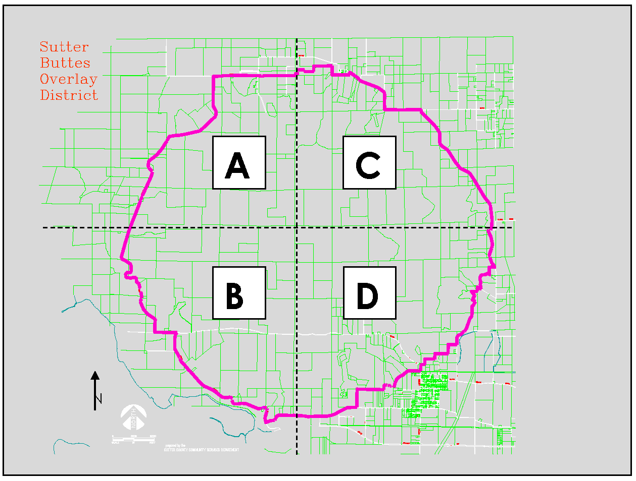
2.
Ridgeline. For the purposes of this section, a ridgeline is the crest of a ridge formed by hillsides, otherwise referred to as the drainage divide.
3.
Hillside. For the purposes of this section, a hillside is any area either between a ridgeline and a valley floor or between ridgelines. The line of demarcation between the valley floor and a hillside is the edge of the alluvial fan.
4.
Valley Floor. For the purposes of this section, the valley floor consists of nearly level to gently sloping areas on alluvial fans.
D.
Performance Standards. The performance standards in this section apply to all structures constructed within the established boundary of the Sutter Buttes as defined in Section 1500-08-020 C above. For areas defined as Ridgelines, the performance standards apply to any portion of a structure which extends above the elevation of the nearest ridgeline as defined by this section. This section does not apply to structures that are not visible from public roads or from adjacent residences.
Site plans shall be to an engineer's scale and shall include in reasonable detail the proposed structure location, topography, existing vegetation, any proposed landscaping, proposed driveway and parking layout, and proposed grading.
E.
Review and Approval Process. A Zoning Clearance shall be obtained prior to the issuance of a building permit for any structure in the Sutter Buttes that is subject to the Sutter Buttes Overlay District regulations. All Zoning Clearance applications shall include visual analysis documentation as required by the Director to determine compliance with the performance standards established in Section 1500-08-020 D. Such documentation shall include photographs, and one of the following: (1) sketches, (2) renderings, or (3) photo simulations. Before the issuance of a Zoning Clearance within the Sutter Buttes Overlay District, a Notice of Intent to approve shall be mailed or delivered at least ten days prior to action on the application to the applicant, the property owner, the owners as shown on the most recent secured assessor's roll of property within 400 feet of the property involved in the application, and all other persons who have requested notice in accordance with Section 1500-23-060(B). Such other notice as the County deems appropriate may also be given. All Zoning Clearances shall be processed in accordance with Section 1500-25-030.
(Ord. of 6-28-2022)
1500-08-030 - Commercial Recreation Overlay District
A.
Purpose. The Commercial Recreation Overlay District (CR) is intended to is provide opportunities for limited intensity river focused commercial and recreational uses along and adjacent to the Sacramento, Feather, and Bear River corridors. All uses are to be compatible with, and minimize impacts upon, adjacent agricultural operations and natural resources. Areas within the river levees are the primary locations for consideration of the CR Overlay District, however, adjacent areas outside the levees may also be considered when determined to be necessary for the proposed use. The CR Overlay District implements the General Plan Commercial Recreation Overlay (CR) land use designation, and may be combined with any base zoning district applied to that land use designation.
B.
Applicability. The regulations in this Section apply to all uses within the CR Overlay District identified in Section 1500-08-030C (Table 1500-08-2).
C.
Allowed Use Types. Table 1500-08-2 identifies the allowed use types for the CR Overlay District. These uses are in addition to those allowed by the base zoning district. Use types are defined in Article 3.
D.
Supplemental Regulations.
1.
Wayside Stands.
a.
One Wayside Stand shall be permitted per parcel.
b.
A Wayside Stand shall not exceed 600 square feet of floor area, and may include up 50 square feet of floor area for the sale of prepackaged food and/or drinks.
c.
Adequate provision shall be made for off-street parking and safe ingress and egress to the adjacent street.
d.
Parking spaces for Wayside Stands need not be paved or striped, but shall be improved in accordance with the surfacing requirements for parking within the AG zone.
e.
All structures and off-street parking shall not be located in any required front or side yard setback.
2.
Commercial Stables.
a.
Storage of manure, silage and animal matter shall occur in a manner which minimizes odors and vector nuisances to the greatest extent practicable, based on current industry practices.
b.
Incorporate measures to protect pollutants from entering into creeks, streams, drainage ditches or groundwater supplies.
c.
Incorporate measures to control odor, dust, noise, and waste disposal so as not to constitute a nuisance or a hazard.
3.
Special Events. Special events such as weddings, dances, assemblies, picnics, dinners, craft fairs, and similar events are allowed at Wineries, Breweries, Distilleries and Mills and at Special Event Facilities use types. These use types require approval of either a Use Permit or Administrative Permit as indicated on Table 1500-08-2. The permit shall specify the frequency of allowed events, hours of operations, maximum number of permitted quests, and any other conditions of approval deemed necessary by the approving authority.
4.
Community Assembly and Cultural Facilities, River Related. Limited to river related, natural history museums or interpretive centers only.
5.
Retail Sales, River Related. Limited to bait and tackle shops, bicycle rental, camping supplies, canoe/kayak outfitters, accessory galleries, general stores, rafting outfitters, specialty shops and other similar uses directly serving river related recreational users.
6.
Vehicle Rentals, River Related. Limited to boat and recreational vehicle rentals only.
E.
Performance Standards. The performance standards in this section apply to all uses within the CR Overlay District identified in Section 1500-08-030 C (Table 1500-08-2) above. The intent is to ensure visual and operational compatibility of the uses and associated development with the character of the surrounding area, in particular adjacent agricultural operations and natural resources:
1.
Significant Effects. Projects shall be determined to have no significant adverse effects, or shall mitigate such effects, upon adjacent agricultural operations, rural uses, and natural resources.
2.
Existing Trees and Resources. Existing trees, vegetation, and other natural resources shall be maintained to the extent feasible.
3.
Floodway. No permanent structures shall be allowed on or within the levee or any designated floodway, unless required flood protection measures have been incorporated into construction.
4.
Flood Protection. Projects shall demonstrate compliance with all flood protection requirements.
5.
River Views and Access. Projects shall be designed to maximize views and public access to the adjacent river corridors and associated resources to the extent feasible.
6.
Building Colors and Design. Building colors, textures, scale, massing, architectural style and materials shall be selected to be compatible with the surrounding environment.
7.
Roof Materials and Colors. Roof materials shall be of non-reflective, fire-retardant material. Roof colors should be of darker tones. Bright colors shall be avoided.
8.
Roads, Parking and Service Areas. New roads, driveways, parking lots, utilities, trash enclosures and service areas shall be sited, screened, and landscaped to reduce visibility from adjacent roadways, properties, and river(s).
9.
Grading. Final grading contours shall generally reflect existing landforms and be compatible with existing grades on adjoining properties.
10.
Native Landscaping. Native and drought tolerant plant materials, including native tree species, shall be incorporated into project landscaping.
11.
Lighting. All exterior lighting, except that designed for temporary emergency use, shall be shielded so as to direct lighting downward, limit spillage and glare onto adjacent properties, and protect the rural night sky.
12.
Services and Infrastructure. Projects shall be determined to have adequate services and infrastructure (either community or individual water and wastewater systems) to support the proposed uses.
F.
Review and Approval Process. A Zoning Clearance, Administrative Permit, or Use Permit shall be obtained for all uses as identified in Section 1500-08-030 C (Table 1500-08-2). In addition, concurrent Design Review shall be required for all uses to ensure high quality design as well as visual and operational compatibility with the surrounding uses and character of the area. All required permit applications shall be accompanied by documentation as required by the Director to determine compliance with the performance standards established in Section 1500-08-030 E. Such documentation shall include analysis of potential impacts to agricultural operations in the project's vicinity, mitigation of environmental impacts, and availability of adequate infrastructure and services to support the proposed uses. All Zoning Clearances, Use Permits and Design Review shall be processed in accordance with Article 25.
(Ord. of 6-28-2022)
1500-08-040 - Agricultural Combining District
A.
Purpose. The Agricultural Combining District (-A) is intended to provide for agricultural related and other additional uses common to lower density residential areas located in the rural portions of Sutter County. The -A Combining District may be applied with the Single-Family Residential (R-1) zoning district.
B.
Applicability. The regulations in this Section apply to all uses within the -A Combining District identified in Section 1500-08-040 C (Table1500-08-3).
C.
Allowed Use Types. Table 1500-08-3 identifies the allowed use types for the -A Combining District. These uses are in addition to those allowed by the base zoning district. Use types are defined in Article 3.
1.
The keeping of animals is subject to all Environmental Health Program requirements, as well as compliance with all of the following maintenance and operational standards:
a.
Odor and Vector Control—All outdoor animal enclosures, including but not limited to pens, coops, cages and feed areas shall be maintained free from litter, garbage and the accumulation of fecal matter, so as to discourage the proliferation of flies, other disease vectors and offensive odors. Each property shall be maintained in a sanitary manner.
b.
Containment—All animals shall be effectively contained on the property, and shall not be allowed to run free on any parcel in a separate ownership or in a public right-of-way.
(Ord. of 6-28-2022)
1500-08-050 - Historic Preservation Combining District
A.
Purpose. The Historic Preservation Combining District (-HP) is intended to implement the Cultural Resource policies of the General Plan; to promote the preservation, rehabilitation, restoration, reconstruction, and protection of historic and cultural resources; to encourage and promote public knowledge, understanding, appreciation of the County's history; to promote appreciation and use of historic resources; to encourage preservation of resources, which may potentially be considered eligible for historic preservation zoning; to promote public awareness of the benefits of preservation; and to encourage public participation in identifying and preserving historic resources, thereby increasing community pride and awareness of the County's cultural and historical heritage.
B.
District Specific Definitions. For the purposes of this section, the following definitions apply:
1.
Historic Building or Structure. A building or structure that is located on property that has been recognized by the Board of Supervisors by being rezoned to the -HP Combining District.
2.
Qualified Historical Property.
a.
A property listed in the National Register of Historic Places or located in a registered historic district, as defined in Section 1.191-2(b) of Title 26 of the Code of Federal Regulations; or
b.
A property listed in any state, city, county, or city and county official register of historical or architecturally significant sites, places, or landmarks.
3.
Qualified Professional. An individual meeting the Secretary of the Interior's Professional Qualifications Standards (36 CFR Part 61 Appendix A) in history, architectural history, and historic architecture or an individual determined by the Director to have the necessary qualifications equivalent to the above standards based on demonstrated experience in history, architectural history, and historic architecture.
C.
Establishment of Historic Preservation Designation. The -HP Combining District may be combined with any other zoning district and can be applied to land to satisfy the purposes of this Section pursuant to approval of a rezoning application. Requests to establish a -HP Combining District designation on a property shall be accomplished by submitting a rezone application to the Planning Division together with the following information:
1.
Property owner(s) proposing to designate a property Historic Preservation but who do not wish to participate in the Mills Act shall submit the following information together with a rezone application to the Planning Division:
a.
A statement of the current and proposed usage of the property or site.
b.
A site plan, drawn to an engineer's scale, showing:
i.
The boundaries of the property; and
ii.
The location of all improvements on the site.
c.
A statement explaining why the property should be designated for historic preservation and how it is intended to preserve the building or site.
d.
Photograph(s) depicting the historic building or structure.
e.
Application shall be accompanied by a fee as established by resolution of the Board of Supervisors.
2.
Following the submittal of an application to rezone property to the -HP Combining District, the proposal shall be forwarded to the Historic Preservation Review Committee for review, consistent with Article 23, to determine if the historic resource is a candidate for the -HP Combining District designation and what character defining features exist on the structure that should be preserved.
3.
Property owner(s) proposing to designate a property -HP Combining District and who propose to participate in the Mills Act shall submit the following information together with a rezone application to the Planning Division:
a.
A statement of the current and proposed usage of the property or site.
b.
A site plan, drawn to an engineer's scale, showing:
i.
The boundaries of the property; and
ii.
The location of all improvements on the site.
c.
A report, prepared by a qualified professional, detailing the cultural, architectural or historical significance of the site to the history of Sutter County. If the subject property is listed in the National Register of Historic Places or listed in any state official register of historical or architecturally significant sites, places or landmarks, information regarding such registration shall be submitted together with the report.
d.
A plan for preservation of the site including a schedule of maintenance work to be conducted. If there is a plan for restoration or rehabilitation, cost estimates and a time-line for the completion of each item of work shall be included. All work must conform to the United States Secretary of the Interior's Standards for Rehabilitation and the State Historical Building Code.
e.
Photograph(s) depicting the historic building or structure.
f.
Application shall be accompanied by a fee as established by resolution of the Board of Supervisors.
4.
In order to qualify for a Mills Act contract, the subject property shall meet the definition of a qualified historical property and shall conform to the County's Mills Act Historic Resource Preservation Rules of Procedure. Property that is rezoned to the -HP Combining District is considered to have met the definition of a qualified historic property.
Rezone applications shall be processed in accordance with Section 1500-25-070.
D.
Disestablishment of a Historic Preservation Combining District.
1.
If the subject property is encumbered by a Mills Act Contract, the property owner shall first either obtain a cancellation of the contract by approval of the Board of Supervisors and pay a penalty fee as required by the Government Code, or shall file a Notice of Non-renewal and the contract shall have expired before an application to rezone the property from the -HP Combining District can be submitted to the Planning Division.
2.
Requests to rezone property from the -HP Combining District designation shall be accomplished by submitting a rezone application to the Planning Division along with the following items:
a.
A statement of the current and proposed usage of the property or site.
b.
A site plan, drawn to an engineer's scale, showing:
i.
The boundaries of the property; and
ii.
The location of all improvements on the site.
c.
A report prepared by a qualified professional, detailing why the site, building or structure is not or is no longer of cultural or historical significance to the history of Sutter County.
d.
Photograph(s) depicting the historic building or structure.
e.
Application shall be accompanied by a fee as established by resolution of the Board of Supervisors.
Rezone application shall be processed in accordance with Section 1500-25-070.
E.
Development Standards.
1.
All uses and development standards which are permitted and applicable in the base district to which the -HP Combining District is applied, including uses which are only allowed by Use Permit, shall be permitted providing it is demonstrated that those uses do not adversely affect the historic or cultural site or building involved.
2.
Towers, spires, chimneys, machinery penthouses, cupolas, water tanks, and similar architectural structures may be built and used to a height not more than 25 feet above the height limit established for the district in which the historic building or structure is located, provided, however, photographs or other documentation, acceptable to the Director, is submitted demonstrating that the architectural feature or structure in question was originally a part of the historic building or structure. The above height limitations shall be subject to laws and regulations of the State and Federal Government.
F.
Historic Preservation Incentive Program. The Board of Supervisors may provide incentives to properties designated -HP Combining District. The incentives shall be identified, and made available through a resolution approved by the Board of Supervisors and modified from time to time as the Board deems appropriate.
G.
Removal and Relocation Permitting Requirements.
1.
A Removal and Relocation permit shall be approved prior to the removal of a historic building or structure on property which is designated -HP Combining District, together with an appropriate environmental document by the Planning Commission.
2.
A property owner shall first rezone the property where the historic building will be relocated to the -HP Combining District, prior to relocating a historic building located on land designated Historic Preservation . In addition, the property owner shall secure all required permits necessary to transport the building on local roads and State Highways.
3.
At the time the County considers rezoning a property to the -HP Combining District for the purposes of relocating a historic building to it, the Board of Supervisors may consider removing the Historic Preservation designation from the property where the historic building will be relocated from. This action may be accomplished by filing a single rezone application to the Planning Division that includes both properties that are to be considered.
H.
Historic Preservation Design Review Requirements.
1.
Applicability. Exterior modifications that require a building permit to a recognized historic building within the - HP Combining District shall be subject to an Administrative Permit design review. Applications for Administrative Permit design reviews shall be accompanied by a fee as established by resolution of the Board of Supervisors.
2.
Administrative Permit Process. Applicants requesting a building permit on property that is designated -HP Combining District shall provide elevation views for all portions of the recognized historic structure that is subject to alteration. The views shall clearly depict all proposed changes to the exterior of the historic building or structure.
Staff shall review the proposed alterations to a historic building or structure against the report prepared by a qualified professional at the time the historic building was rezoned to the -HP Combining District. In addition, the proposed alterations shall be reviewed against the Secretary of the Interior's Standards for the Rehabilitation of Historic buildings. Implementation of the Secretary of the Interior's Standards for the Rehabilitation of historic buildings shall not conflict with the permitted uses specified in the underlying zoning of the property. If architectural features identified as historically significant are proposed to be altered, all proposed changes shall maintain the character defining features as discussed or depicted in the report that has been previously prepared for the historic structure.
If after reviewing a proposal, staff determines that proposed changes to a historic building or structure, located on property that is zoned -HP Combing District, will maintain the character defining features of the historic building or structure, the Director, or their designee, may approve or conditionally approve an Administrative Permit for the proposal.
If after reviewing a proposal, staff determines that proposed changes to a historic building or structure may not maintain the character defining features of the historic building or structure, the proposal shall be forwarded to the Historic Preservation Review Committee for review and determination.
I.
Historic Preservation Review Committee. The Historic Preservation Review Committee shall consist of three persons, appointed by and serve at the pleasure of the Board of Supervisors. In addition, three alternate Committee members shall be appointed by the Board of Supervisors and serve in the absence of a regular Committee member. Committee members shall have knowledge of architecture, historic preservation, history or a combination of knowledge determined by the Board of Supervisors as acceptable for providing recommendations regarding historic preservation issues. A quorum shall consist of three Committee members being present. This Committee is subject to the Brown Act.
1.
Committee Action Regarding Historic Structure Modifications. If a quorum of Committee or alternate Committee members cannot be convened within a two week period from the time a meeting is determined to be necessary, the Director may convene the meeting with those available Committee members. After reviewing the information and receiving input from the Committee members present, the Director shall determine proposed actions the applicant can take in order to maintain the character defining features of a historic structure consistent with the County's historic structure database and may approve or conditionally approve an Administrative Permit for the proposal.
The Committee shall meet as necessary to review and provide determinations to applicants and staff regarding proposed changes to historic structures.
All pertinent information deemed necessary by the Director, or their designee, shall be supplied by the building permit applicant and forwarded to the Committee members by staff for review prior to Committee meetings.
The Committee shall review and discuss with the applicant and staff the issues associated with modifying a recognized historic structure. The Committee shall determine proposed actions the applicant can take in order to maintain the character defining features of a historic structure consistent with the County's historic structure database.
All determinations made by the Committee shall be transmitted to the property owner in writing. Any determination made by the Historic Preservation Review Committee, or the Director shall be subject to appeal to the Board of Supervisors pursuant to Section 1500-23-080.
2.
Committee Action for Application to the Historic Preservation Combining District. Prior to the submittal of an application to rezone property to the -HP Combining District by applicants who do not wish to participate in the Mills Act, the proposal shall first be reviewed by the Historic Preservation Review Committee and a report shall be prepared by the Planning Division based upon the Committee's determinations.
The Committee shall meet as necessary to review and provide determinations detailing why a potential historic building or structure is a candidate for the Historic Preservation Combining District designation and what the character defining features are of the historic building or structure that should be preserved.
A quorum of the Committee shall consist of three members being present and all Committee determinations shall be made by at least two of three Committee members.
Based upon the Committee's determination regarding why a historic resource is a candidate for the -HP Combining District designation and what the character defining features are of the building that should be preserved, Planning Division staff shall prepare a report of this information.
The report shall be transmitted to the property owner in writing within 20 days of the date the Committee makes its determinations. Any determination made by the Historic Preservation Review Committee shall be subject to appeal to the Board of Supervisors pursuant to Section 1500-23-080.
J.
Historic Identification Plaques. Regardless of any other provision of this Section to the contrary, non-illuminated historic identification plaques as approved by the Board of Supervisors are permitted to be installed on structures located on property that have been zoned to have the -HP Combining District. Such plaques shall not exceed two square feet in size.
(Ord. of 6-28-2022)
1500-08-060 - Planned Development Combining District
A.
Purpose. The Planned Development Combining District (-PD) is intended to encourage creative, diverse and efficient approaches to land use and development that are not readily accommodated by base zoning districts. The -PD Combining District enhances flexibility to customize allowed uses and associated development standards to reflect unique site conditions and project development objectives, economic development and housing diversification, efficient provision of infrastructure and services, protection of agricultural and natural resources, compatibility with adjacent uses, and compliance with General Plan policies. The -PD Combining District may implement any General Plan land use designation, and may be combined with any base zoning district.
B.
Applicability. The regulations in this Section apply to all -PD Combining Districts, and may be applied to parcels of any size that are deemed suitable by the Board of Supervisors for proposed development. Adoption of a -PD Combining District shall be accompanied by a Development Plan, and shall be noted on the Zoning Map followed by the ordinance number adopting the district
C.
Allowed Use Types. All use types that are permitted or require conditional approval of a Zoning Clearance, Administrative Permit or Use Permit by the base zoning district(s) may be permitted by a -PD Combining District. In establishing the District, the Board of Supervisors may: delete a permitted or conditionally permitted use type, may designate a conditional use type as permitted, or may require conditional approval for permitted use types.
D.
Development Standards. In order to allow maximum flexibility in designing a project compatible with the purpose of this section, the Board of Supervisors may, in establishing a -PD Combining District, modify the following development standards:
1.
Minimum lot size, depth and width
2.
Minimum setbacks and yards
3.
Maximum lot coverage
4.
Maximum building and structure heights
5.
Maximum wall and fence heights
6.
Minimum landscaping requirements
7.
Minimum off-street parking ratios
8.
Sign standards
9.
Other standards as determined by the Board of Supervisors.
If a development standard is not specifically addressed in the -PD Combining District, it shall be governed by the requirements of the base zoning district.
E.
Development Plan. Adoption of a -PD Combining District shall be processed as a Rezone in accordance with Section 1500-25-070, and shall be accompanied by a Development Plan establishing the zoning requirements for all properties within the proposed District. The Development Plan shall be in addition to other concurrent or future entitlements required for project approval as established in Article 25. The Development Plan shall include:
1.
Purpose. A statement regarding the purpose of the zone, its intended use and design character, how it will meet the purpose of the -PD Combining District (1500-08-060 A), and how it will comply with the General Plan;
2.
Site Conditions. Map(s) and accompanying studies depicting existing topography, existing on-site structures and natural features, mature trees, wetlands, other significant vegetation and drainage patterns, agricultural resources, and adjacent uses.
3.
Allowed Uses. A list of proposed use types, and their location on the property.
4.
Development Standards. A list of development standards for main and accessory buildings, including: setbacks and yards, coverage, density and/or intensity, building and structure height, wall and fence height, landscaping, off-street parking, and signs;
5.
Design Requirements. Graphic and written materials depicting conceptual site layout, architectural, landscaping, screening and other design provisions;
6.
Circulation Plan. A map and narrative of the major circulation features within the site, including vehicular, bicycle, pedestrian, and transit facilities, as applicable;
7.
Infrastructure Plan. A description of the infrastructure necessary to serve all properties within the -PD Combining District. If the area will not be adequately served by existing public infrastructure and facilities or through the adopted countywide impact fee program, the application shall include a public facilities financing plan that identifies the needed public improvements and establishes a plan to pay for and develop the required improvements; and.
8.
Additional Information. Other information deemed necessary by the Director.
The Director may waive any of the information required by this section provided sufficient regulation is specified in the Development Plan to accomplish the purpose set forth in this Section. All proposed entitlements, development, improvements and uses within a -PD Combining District shall comply with the approved Development Plan.
F.
Required Findings. The Board of Supervisors may approve an application for a -PD Combining District rezoning with the accompanying Development Plan considering the recommendations of the Planning Commission and subject to the following findings:
1.
The proposed -PD Combining District and Development Plan are consistent with the goals, policies, and programs of the General Plan and any applicable specific plan.
2.
The size and shape of the proposed -PD Combining District and Development Plan are adequate to accommodate proposed use types.
3.
The proposed -PD Combining District and Development Plan have adequate existing or planned and funded access, infrastructure and utilities to accommodate the proposed use types.
4.
The proposed -PD Combining District and Development Plan will not have a substantial adverse effect on surrounding property and will be compatible with the existing and planned land use character of the surrounding area.
5.
The proposed -PD Combining District and Development Plan carry out the purpose of the Planned Development Combining Zoning District zone by providing for more creative, diverse and efficient approaches to land use and development.
G.
Approval by Ordinance. If the Board of Supervisors approves the establishment of a -PD Combining Zone, it shall do so by adoption of an ordinance including reference to the Development Plan. The ordinance shall also include any other provisions that the Board of Supervisors finds to be necessary to constitute the regulations for use, maintenance, and improvements in the -PD Combining District.
H.
Amendments to Development Plans. Amendments to or adoption of a new Development Plan may be made by the submission of a Development Plan pursuant to this section to the Planning Commission and shall be approved as specified in Article 23. If the proposed amendment is determined to be minor in nature, consistent with the character of the existing Development Plan and not a significant increase in intensity of the use of the site (e.g. expansion of the approved Development Plan with a less than 20 percent increase in floor area or parking demand), the amendment may be reviewed and approved with conditions, or denied by the Director through an Administrative Permit.
I.
Expiration of Development Plan:
1.
If construction of the project or use of the land as approved in the Development Plan, or the amended Development Plan, has not commenced within five years after the adoption of the Development Plan, or as otherwise provided in the Development Plan, the Development Plan shall expire and be null and void without further action of the County. Prior to expiration of a Development Plan, the property owner may request an extension of the initial time period for up to an additional five years. Such an extension may be made at the discretion of the Director, based upon a determination that no substantial changes have occurred since the original approval that would change the basis of the approval or associated project conditions.
Where a use, or a portion of a use, allowed by a Development Plan has been abandoned or discontinued for a period of six months or more, then, without further action of the County, the use, or the portion of the use, which has been abandoned or discontinued shall expire and be null and void. The property owner may request reinstatement of the abandoned or discontinued use which shall be at the discretion of the Director to determine the appropriateness of such reinstatement. The Director may reinstate the use subject to the previously approved standards and conditions or direct the property owner to apply for an amendment to the development plan as provided for in Section 1500-08-060(H).
(Ord. of 6-28-2022)
1500-09-010 - Purpose
The Special Purpose Districts are applied to defined geographic areas of Sutter County where unique regulations have been established to address specific development objectives.
(Ord. of 6-28-2022)
1500-09-020 - Food Processing, Agricultural and Recreation Combining District
A.
Purpose and Intent.
1.
The FPARC District is established to implement the goals and policies of the General Plan Amendment adopted concurrently herewith and is to be applied to those lands within the County of Sutter as described on the map below.
2.
This FPARC District provides an area where food processing and associated industries, together with appurtenant functions thereof, may locate outside the urban centers, and in close proximity to recreation and open space areas in a manner which minimizes adverse environmental impacts and protects and enhances agricultural productivity.
3.
The following use specific regulations as set forth in Articles 10 through 16, inclusive, shall apply in the FPARC District.
B.
Uses Permitted.
1.
Food and fiber processing plants and facilities, including food canneries, dehydrators, hulling operations, cleaning and processing operations, grain elevators, weighing and grading stations, feed processing operations, warehouses and other structures for the storage of agricultural products, seed processing facilities, animal and fiber processing operations, dairy processing operations, apiaries and honey extraction plants, fruit and vegetable processing and packing facilities, and any other or similar activity involving the storage, curing, processing, manufacturing, packaging, handling, packing, secondary reprocessing, conversion, compounding, shipping, and selling of agricultural products or by-products, as well as all facilities appurtenant and incidental thereto.
2.
Facilities for the generation of energy from processing, agricultural, or other wastes and by-products, as well as all appurtenances thereof.
3.
Disposal of liquid or solid wastes or by-products produced in conjunction with the operations permitted by this section. Such disposal may include irrigation of lands with process wastewaters, animal feeding or soil incorporation of process waste or by-products, and other disposal or reclamation processes or techniques.
4.
Publicly-owned parks and recreational areas and appurtenances thereto.
5.
Golf courses and country clubs, privately-operated parks, riding clubs and stables, gun clubs, resorts and recreational facilities.
6.
Structures and facilities appurtenant to recreational facilities.
7.
Private farm buildings, accessory and ancillary recreational buildings and uses.
8.
General farming, including all types of crop and tree farming commercial livestock, animal husbandry (not including a commercial kennel) and similar types of farming.
9.
One-family dwellings and accessory farm buildings of all kinds when occupied or used by the owner, tenant, or persons employed on the premises.
10.
Land leveling contracting, contract harvesting and agricultural services where the occupation is incidental and secondary to the use of the land for farming purposes.
11.
The use, storage, repair and maintenance of tractors, scrapers, land leveling and development equipment devoted primarily to agricultural uses where such activity is carried on in conjunction with a bona fide agricultural operation.
12.
Underground utility installations and above ground utility installations for local service, including communication equipment buildings, except that locations for communication equipment buildings, substations, generation plants, and gas holders must be approved by the Planning Commission prior to construction; the route of any proposed transmission line, other than any communication line, must be discussed in detail with the Planning Commission prior to acquisition.
13.
Gun clubs and accessory structures, including mobilehomes used in conjunction therewith, subject to the securing of a mobilehome permit and other permits required by the Building Inspector and Health Division. Mobilehomes shall also be subject to the Performance Standards and Zoning Clearance required by Section 1500-05-030(L) and Section 1500-25-030 of this Zoning Code.
14.
Nurseries.
15.
Rail and other transportation facilities.
16.
Other such uses as the Planning Commission may deem to be similar and not more obnoxious or detrimental to the public health, safety, and general welfare.
C.
Uses Requiring Use Permits.
1.
The sale, repair, servicing and storage of agricultural machinery, implements and equipment.
2.
The storage or sale of farm supplies of all kinds, including, but not limited to, fertilizers, agricultural minerals and insecticides.
3.
Commercial stock feeding yards, feed lots.
4.
Community auction and sales yards for sale of farm animals, products, implements, supplies and equipment.
5.
The development of natural resources together with the necessary building apparatuses and appurtenances incidental thereto.
6.
Churches, schools, day care centers.
7.
Truck yards, terminals or facilities engaged in the transportation of agricultural products, supplies and equipment including necessary maintenance, storage, repair and servicing of equipment.
8.
Retail, commercial and service establishments including restaurants, sporting goods stores, gasoline stations, and other similar retail and service establishments so long as such uses are necessary to serve the public in the food processing and recreation areas.
9.
Municipal or community wastewater or water treatment plants and facilities.
10.
Construction and material yards (except gravel, rock and cement material yards).
11.
Indoor assembly, processing, fabricating, treatment, manufacturing, repairing or packaging of goods that do not create noise, dust, odor, smoke, bright light, involve the handling of explosives or inflammable materials as a primary use, or otherwise creates offensive conditions at the property line and associated sales of these products.
12.
Outdoor assembly, processing, fabricating, treatment, manufacturing, repairing or packaging of goods that do not create noise, dust, odor, smoke, bright light, involve the handling of explosives or inflammable materials as a primary use, or otherwise creates offensive conditions at the property line and associated sales of these products.
13.
Offices and other ancillary facilities that are part of and clearly subordinate to the principal use as listed herein and located on the same site.
14.
Any permitted use referred to in Section 1500-09-20(B) which does not conform to the Special Restrictions set forth in Sections 1500-09-020(D) and 1500-09-020(E).
D.
Special Restrictions.
1.
Location of Plant Facilities. No plant or processing facility identified under Sections 1500-09-020(B)(1), (2), or 1500-09-020(C)(1), (2), (7), or (9) shall be located on any portions of the FPARC District which are situated north of South Butte Road or south of Highway 20; provided, however, that this restriction shall not prevent wastewater or solid waste disposal facilities, groundwater extraction plants, energy transmission facilities, or other facilities or activities ancillary to those uses from being located in said portions of the District.
2.
Proximity to Residences. No use described and restricted in Section 1500-09-020 D(1) above shall be established closer than 200 feet from any residence.
3.
Minimum Lot Area. One acre.
4.
Maximum Lot Coverage. 50%.
5.
Process Wastewater and Solid Waste. Process wastewater and solid waste disposal shall comply with all Federal, State, and County water discharge, pollution control and health requirements.
6.
Processing Activities. All industrial agricultural processing, and energy generation facilities allowed by the FPARC District shall comply with Federal, State, and local air pollution and public health requirements.
7.
Access. Access shall be provided from the state highway or county roads and shall be subject to the state and local requirements.
8.
Minimum Front Yard. 100 feet.
9.
Minimum Side Yard. 50 feet.
10.
Minimum Rear Yard. 25 feet.
11.
Maximum Building Height. 150 feet
All of the foregoing standards shall be subject to variation or waiver pursuant to conditions established by use permit to be applied for and obtained where any such variation or waiver is desired.
E.
Special Restrictions Upon Open Space and Recreational Area. The following special restrictions shall be applicable to open space and recreational areas which are defined as those lands within the FPARC District situated north of South Butte Road and south of Highway 20:
1.
Structural Coverage. Improvements such as golf course clubhouses, recreational buildings, parking area and impervious surface shall not exceed 5% of the surface area of any recreational and open space parcel.
2.
Use of Area Not Covered by Structures. Area outside the 5% permitted pursuant to subsection 1 above shall not be improved with any structure other than temporary shelters, golf course cart paths, pumps, culverts and drains.
3.
Type of Uses. Uses shall be restricted to open space uses such as golf courses and recreational uses, agricultural uses, and undeveloped open space.
4.
Reclamation and Conservation. Permitted uses shall include disposal through irrigation and other disposal means of process wastewater generated by food processing uses, buffering of food processing uses and other ancillary uses which mitigate, screen or buffer the impacts and incidents of a food processing use.
5.
Maximum Building Height. 45 feet
All of the foregoing standards shall be subject to variation or waiver pursuant to conditions established by use permit to be applied for and obtained where any such variation or waiver is required.
Note: Section III of the Initiative Measure enacted by the voters of Sutter County at the November 2, 1982 general election provides the following:
III Repeal or Amendment
This Ordinance may not be amended or repealed except by a vote of the people; provided, however, that this Ordinance may be amended by the Board of Supervisors to authorize additional uses in the Food Processing, Agriculture, and Recreation Combining District provided for herein, and to make such changes in the General Plan and Zoning Code as may be necessary and appropriate in connection with such authorization of additional uses.
Figure 1500-09-1: FPARC District
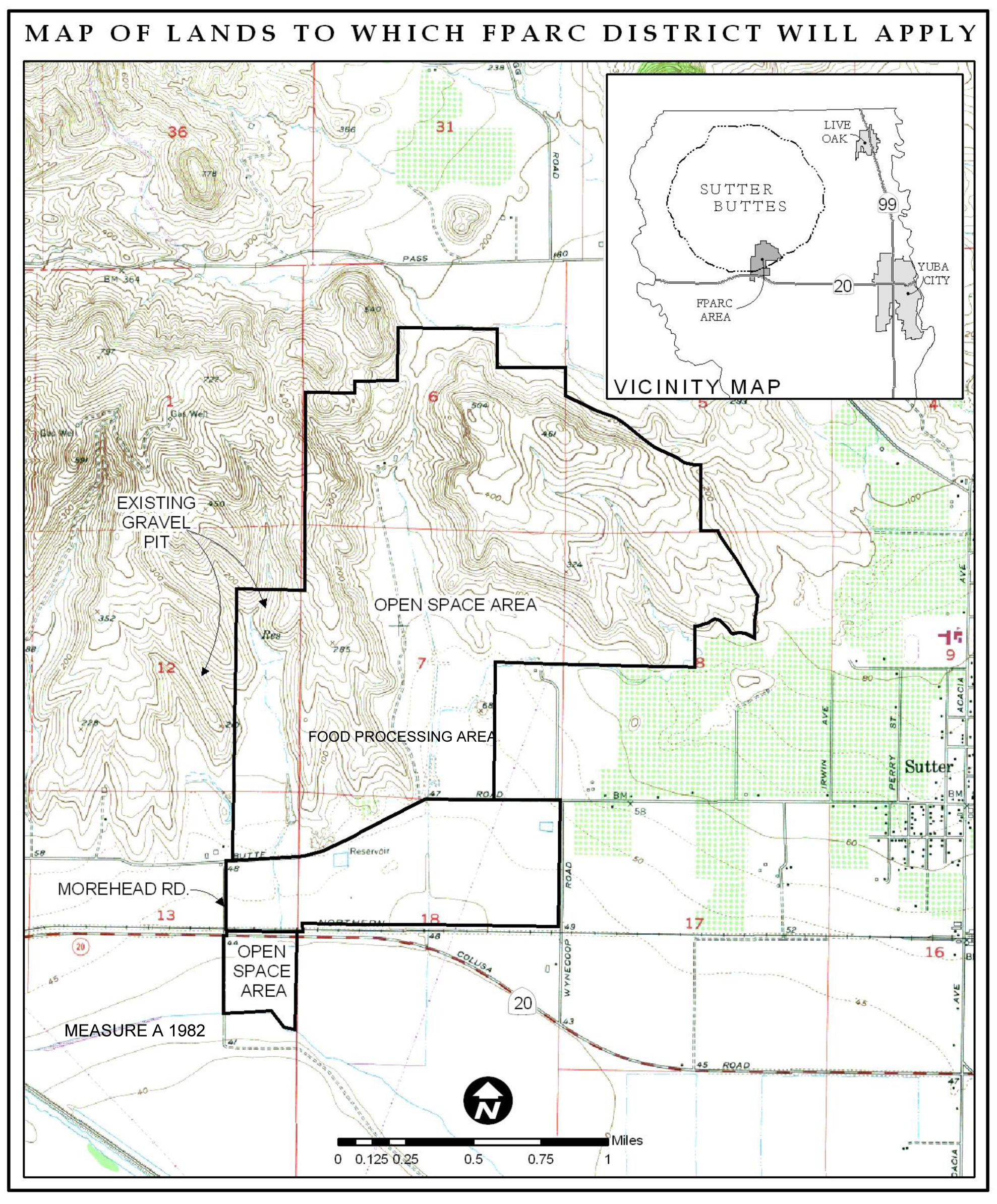
(Ord. of 6-28-2022)
1500-09-030 - Sutter Pointe Specific Plan
A.
Purpose. The Sutter Pointe Specific Plan (SPSP) applies to all uses within the Sutter Pointe Specific Plan area located in the southeastern portion of the County (see Figure 1500-09-2). The Sutter Pointe Specific Plan is intended to guide the creation of a new master planned community with residential, mixed use, commercial, employment, recreation, and open space opportunities guided by the principles of advisory Measure M approved by the residents of Sutter County in 2004. The ultimate plan is for the Sutter Pointe area to be incorporated as a full service city in the future.
B.
Applicability, Allowed Uses, Development Standards, and Review Process. Please refer to the Sutter Pointe Specific Plan Land Use and Development Code (LUDC), a separate stand-alone Zoning Code regulating this plan area.
Figure 1500-09-2: Sutter Pointe Specific Plan Area
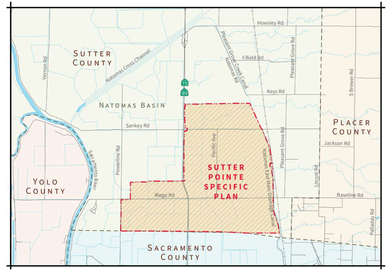
(Ord. of 6-28-2022)