Yreka City Zoning Code
CHAPTER 16
16 - DISTRICTS GENERALLY
Sections:
16.16.010 - Designation.
The districts are established by this title and are designated as follows:
Table 1
(Ord. 775 (part), 2004).
16.16.020 - Zoning District Uses.
The uses for each zoning district are set forth in Chapters 16.18 - 16.42.
(Ord. 775 (part), 2004).
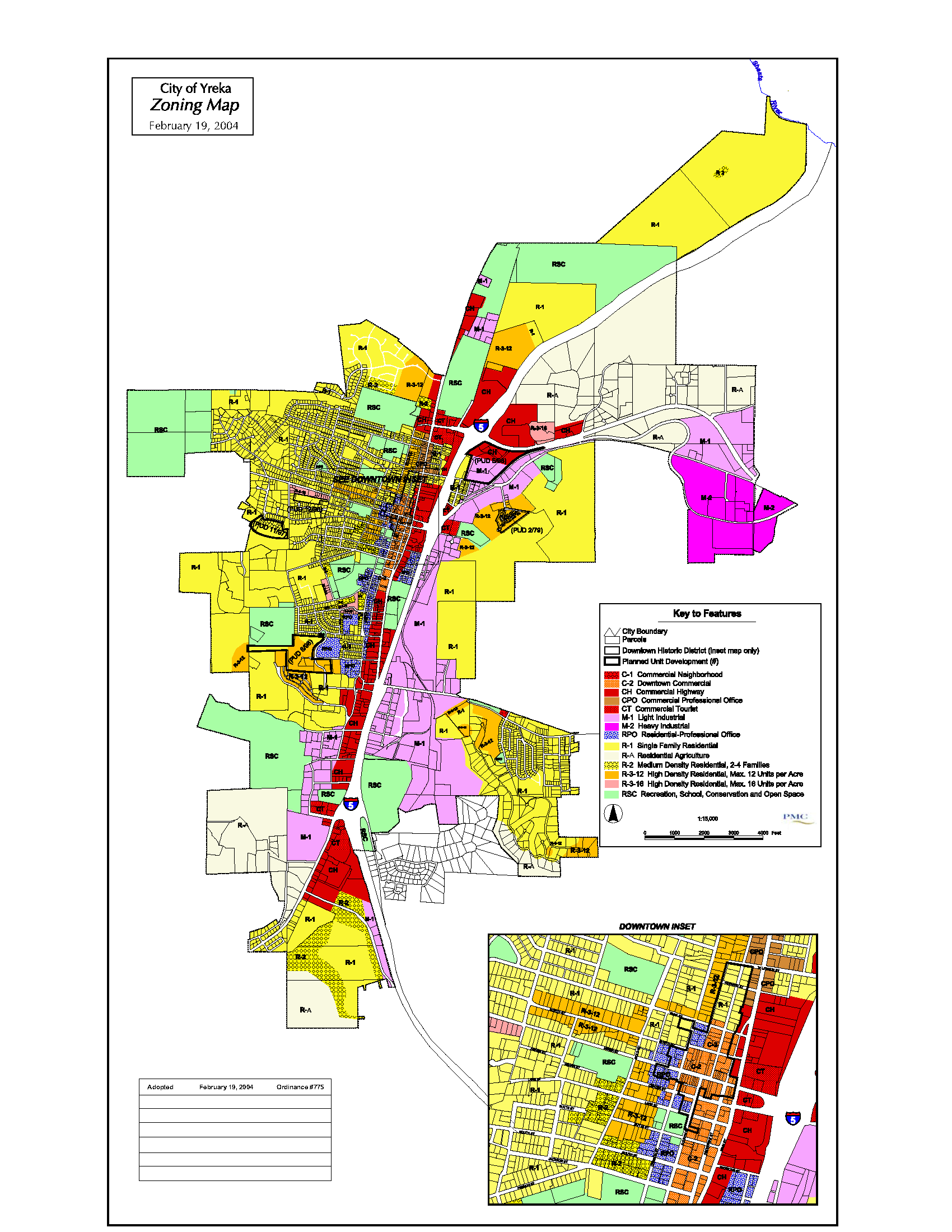
16.16.030 - Boundaries - Map adopted.
The designations, locations an d boundaries of the districts established are delineated upon the map entitled "City of Yreka, California, Zoning Map" dated March 20, 1980, and as amended on February 19, 2004, which map and all notations and information thereon are made a part of this title by reference, which map is on file in the office of the City Clerk.
Where any uncertainly exists as to the correct location of any zoning district boundary shown on the zoning map, it shall be the duty of the Planning Commission to establish the correct location thereof according to the intent of this title.
(Ord. 775 (part), 2004).
16.16.040 - Prezoning of unincorporated territory.
The City may prezone unincorporated territory adjoining the city for the purpose of determining the zoning that will apply to such property in the event of subsequent annexation to the City.
(Ord. 775 (part), 2004).