
Archer Lodge City Zoning Code
ARTICLE 4
- ZONING DISTRICTS.
Sec. 30-4101 - Districts distinguished.
All land within the Town's planning jurisdiction shall be in one or more of the following types of zoning districts:
(a)
All land subject to these standards shall be classified into one of the conventional or planned development zoning districts identified in the Zoning Districts Established Table.
(b)
Land in any conventional or planned development zoning district may also be classified into one or more overlay zoning districts.
(c)
In cases where land is within an overlay zoning district, the standards in the overlay district apply in addition to the standards governing development in the underlying conventional or planned development zoning district.
(d)
Land in the Town's planning jurisdiction shall be classified or reclassified into a conventional, planned development, or overlay zoning district only in accordance with the procedures and requirements set forth in this Article, § 30-3316, Rezoning/Map amendment, or § 30-3314, Planned development, as appropriate.
(Ord. No. AL2021-06-1, § 1, 6-7-2021)
Sec. 30-4102 - Districts established.
The Zoning Districts Established Table listed below sets out the conventional, planned development, and overlay zoning districts established by this Ordinance. All land in the Town's planning jurisdiction shall be included in at least one the available conventional or planned development zoning districts.
(Ord. No. AL2021-06-1, § 1, 6-7-2021)
Sec. 30-4103 - Generally applicable dimensional standards.
(a)
Developments of multiple buildings or structures.
(1)
Developments that include multiple principal buildings as part of a single development, such as a multi-family, shopping center, or campus-style development, shall be subject to a perimeter setback from all boundary lot lines and are exempted from setbacks from lot lines internal to the development.
(2)
Individual principal and accessory buildings and structures within a multi-building development shall be set back from one another in accordance with the building separation standards in the zoning district where located.
(b)
Drainage and utility easements in subdivisions.
(1)
Wherever possible, drainage and public or private utility easements shall be located within required setbacks, be ten feet in width, and be located along all lot lines adjacent to a street right-of-way as well as along interior lot lines.
(2)
Stormwater conveyance features located outside a drainage easement shall be at least 20 feet in width and shall not include a habitable structure.
(c)
Reductions prohibited. Except where otherwise authorized by this Ordinance:
(1)
No lot shall be reduced in area below the minimum area requirements for the district where located.
(2)
Lots created after June 7, 2021, shall meet the minimum dimensional requirements for the district where located.
(d)
Required lot width. All buildable lots established after June 7, 2021 shall maintain the minimum required lot width on a street in accordance with the dimensional requirements for the zoning district where located.
(e)
Required yards.
(1)
The land area between a lot line and the boundary of a required setback is considered as a required yard.
(2)
The location of street (front), side, or rear yards on irregularly shaped lots shall be determined by the Town Planner. Wherever possible, the Town Planner shall interpret these boundaries in ways that minimize nonconformities.
(3)
Except for allowable encroachments, required yards shall not be subject to encroachment by a building, structure, or outdoor use area.
(f)
Setback from streets. No building shall be located closer to any street right-of-way or existing private street pavement edge than the minimum street setback line established by this Ordinance.
(g)
Split zoning. Wherever a single lot is located within two or more different zoning districts, each portion of the lot shall be subject to all the regulations applicable to the zoning district where it is located.
(Ord. No. AL2021-06-1, § 1, 6-7-2021)
Sec. 30-4104 - Allowable encroachments.
The Allowable Encroachments into Setbacks Table listed below sets out the kinds of structures or building features that are permitted to encroach within a required setback, subject to the following:
(a)
Features identified in the table may encroach into a required setback or required yard, but may not cross a lot line into a lot under separate ownership or included as part of a separate development.
(b)
Regardless of the amount of permitted encroachment, features identified in the table shall not:
(1)
Obstruct visibility for motorists, pedestrians, or bicyclists at any street, driveway, accessway, or intersection;
(2)
Obstruct access for vehicles, pedestrians, or bicyclists along streets, sidewalks, trails, or internal circulation routes; and
(3)
Interfere with the function of infrastructure facilities.
(c)
In the event a feature identified in the table encroaches into a right-of-way owned or operated by the Town or NCDOT, an encroachment agreement with the Town or NCDOT, as appropriate, shall be required.
(d)
Structures or building features not listed in the table may only encroach into a required setback following approval of a variance.
(Ord. No. AL2021-06-1, § 1, 6-7-2021)
Sec. 30-4201 - Agricultural-residential district (AR).
| (a) District intent | (b) Typical development | ||
| The AR district is established to accommodate agriculture, agriculturally-related uses, and limited forms residential development at low densities in rural portions of the Town's planning jurisdiction. The district is primarily intended to preserve and protect bona fide farms and resource lands for current or future agricultural use as well as to protect the rural character of the area. It is also intended to ensure that residential development maintains appropriate densities consistent with the suitability of land, availability of public services, accessibility to transportation systems, and that are compatible with surrounding development. The district also accommodates "agri-tourism" as well as service and support uses to the rural community, including day care, educational uses, public safety facilities, parks, and utility features. | 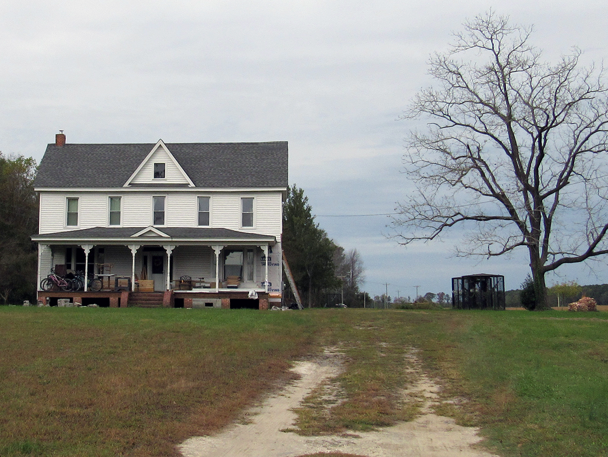 | ||
| (c) Dimensional standards [1] | 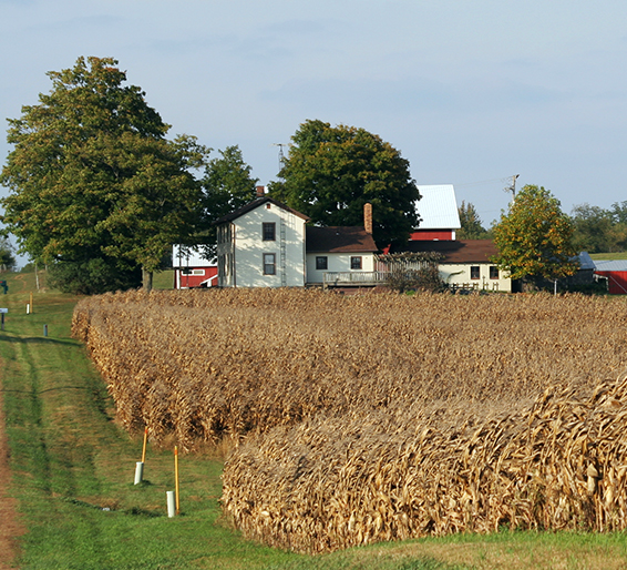 | ||
| Max. Density (units/ac) | 1.0 [2] | ||
| Min. Lot Area (sf) | 43,560 [3] [4] | ||
| Min. Lot Width (lf) | 150 | ||
| Max. % Impervious Surface | 30 [5] | ||
| Min. Street Setback (lf) | |||
| From Arterial/Collector | 70 | ||
| From Local Outside Subdivision | 50 | ||
| From Local Inside Subdivision | 25 [6] | ||
| Min. Access Easement Setback (lf) | 15 | 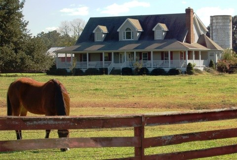 | |
| Min. Side Lot Line Setback (lf) | 10 [7] [8] | ||
| Min. Rear Lot Line Setback (lf) | 10 [7] | ||
| Min. Perimeter Setback (lf) | 25 | ||
| Min. Building Separation (lf) | 10 | ||
| Min. Accessory Structure Setback (lf) | 10 [9] | ||
| Min. Open Space Set-Aside (% of total site size) | 15 [10] | ||
| Max. Building Height | 40 | ||
|
NOTES:
[1] "sf" = square feet; "lf" = linear feet. [2] May increase to 1.5 on lots served by a public water system. [3] Johnston County Public Health may require a larger minimum lot area based on soil conditions. [4] 29,040 sf for lots served by a public water system. [5] Development in a water supply watershed protection overlay district shall be subject to the built-upon limits in § 30-4502, Water Supply Watershed Protection Overlay District. [6] May be reduced to 20 in a subdivision served by a public water system. [7] May be reduced to 5 in a subdivision with lots served by a public water system. [8] One side setback may be reduced to zero if the opposing side setback is double the minimum. [9] Accessory structures shall maintain the same setbacks from streets and easements as principal uses. [10] Not applied to the development of an individual single-family detached dwelling on its own lot, a non-residential use, or a development of two acres in area or less. | |||
(Ord. No. AL2021-06-1, § 1, 6-7-2021; Ord. No. AL2022-08-2 (UDO-TA-3-22), § 1, 8-1-2022)
Sec. 30-4202 - Single-family residential district (SFR-1).
| (a) District intent | (b) Typical development | ||
| The Single-Family Residential 1 (SFR-1) district is established to accommodate low density residential neighborhoods and supporting uses throughout the Town's planning jurisdiction in rural locations. The district is intended to accommodate residential development in ways that will not interfere with agricultural activity or negatively impact the surrounding rural character. The district accommodates single-family detached homes and associated accessory uses. It also allows supporting uses like public safety facilities, and utilities. District regulations discourage uses that interfere with the development of residential dwellings or that are detrimental to the low density residential nature of the district. | 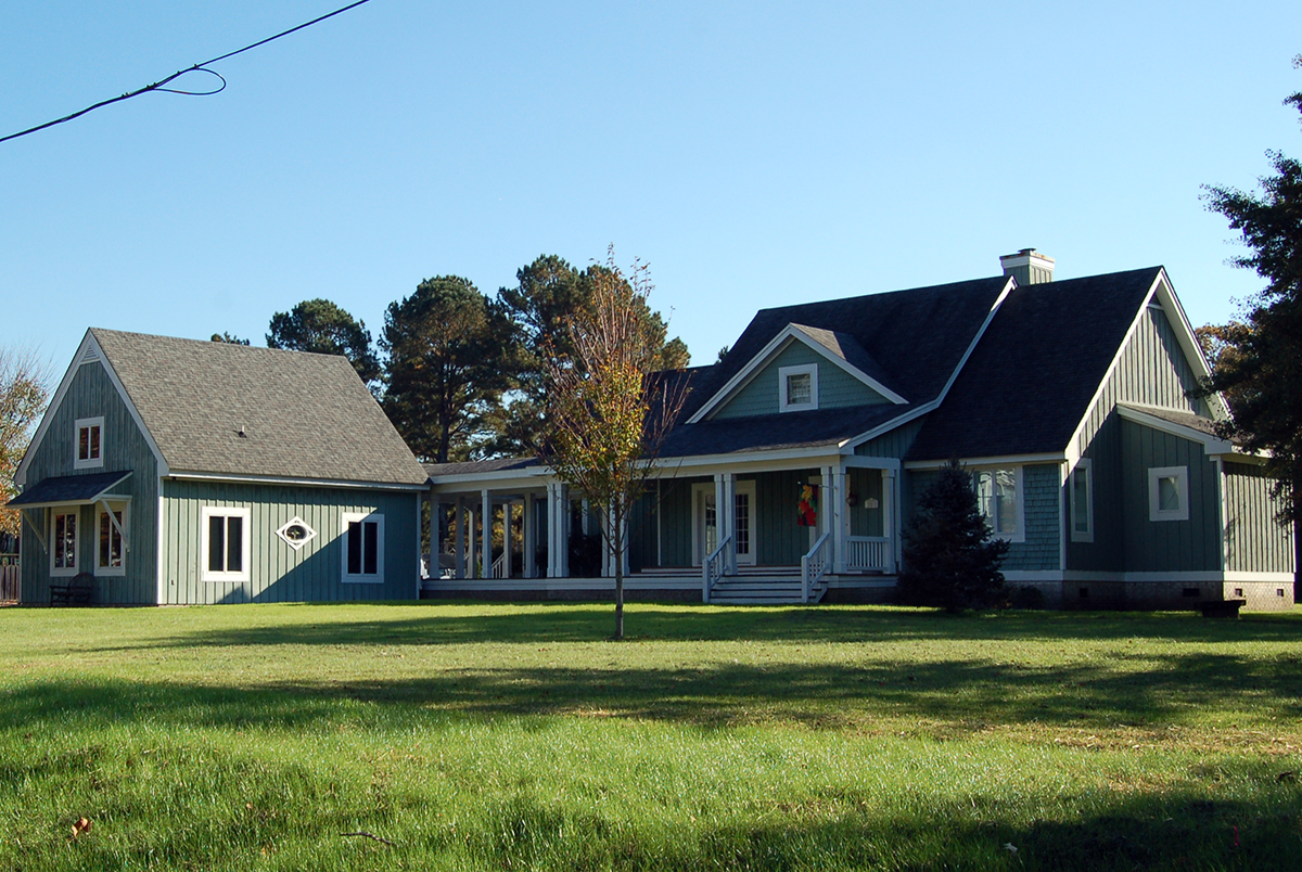 | ||
| (c) Dimensional standards [1] | 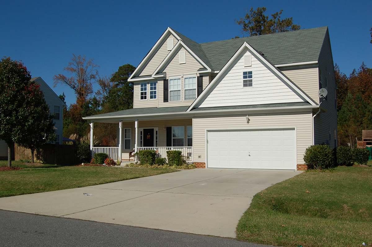 | ||
| Max. Density (units/ac) | 1.0 [2] | ||
| Min. Lot Area (sf) |
43,560
[3] [4] | ||
| Min. Lot Width (lf) | 150 | ||
| Max. % Impervious Surface | 35 [5] | ||
| Min. Street Setback (lf) | |||
| From Arterial/Collector | 70 | ||
| From Local Outside Subdivision | 50 | ||
| From Local Inside Subdivision | 25 [6] | ||
| Min. Access Easement Setback (lf) | 15 | ||
| Min. Side Lot Line Setback (lf) | 10 [7] [8] | 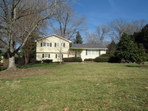 | |
| Min. Rear Lot Line Setback (lf) | 10 [7] | ||
| Min. Perimeter Setback (lf) | 25 | ||
| Min. Building Separation (lf) | 10 | ||
| Min. Accessory Structure Setback (lf) | 10 [9] | ||
| Min. Open Space Set-Aside (% of total site size) | 15 [10] | ||
| Max. Building Height | 40 | ||
|
NOTES:
[1] "sf" = square feet; "lf" = linear feet. [2] May increase to 1.5 on lots served by a public water system. [3] Johnston County Public Health may require a larger minimum lot area based on soil conditions. [4] 29,040 sf for lots served by a public water system. [5] Development in a water supply watershed protection overlay district shall be subject to the built-upon limits in § 30-4502, Water Supply Watershed Protection Overlay District. [6] May be reduced to 20 in a subdivision served by a public water system. [7] May be reduced to 5 in a subdivision with lots served by a public water system. [8] One side setback may be reduced to zero if the opposing side setback is double the minimum. [9] Accessory structures shall maintain the same setbacks from streets and easements as principal uses. [10] Not applied to the development of an individual single-family detached dwelling on its own lot, a non-residential use, or a development of two acres in area or less. | |||
(Ord. No. AL2021-06-1, § 1, 6-7-2021; Ord. No. AL2022-08-2 (UDO-TA-3-22), § 1, 8-1-2022)
Sec. 30-4203 - Single-family residential district (SFR-2).
| (a) District intent | (b) Typical development | ||
| The Single-Family Residential 2 (SFR-2) district is established to accommodate low-to-moderate density residential neighborhoods and supporting uses throughout the Town's planning jurisdiction in suburban locations. The district is intended to accommodate residential development on individual lots and in neighborhood settings. The district accommodates single-family detached homes and associated accessory uses as well as duplex dwellings with the approval of a special use permit. It also allows supporting uses like public safety facilities, parks, educational uses, and utilities. District regulations discourage uses that interfere with the development of residential neighborhoods or that are detrimental to the district's single-family neighborhood character. | 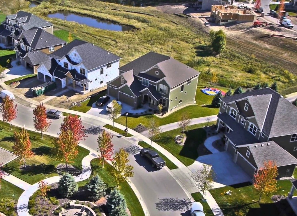 | ||
| (c) Dimensional standards [1] | 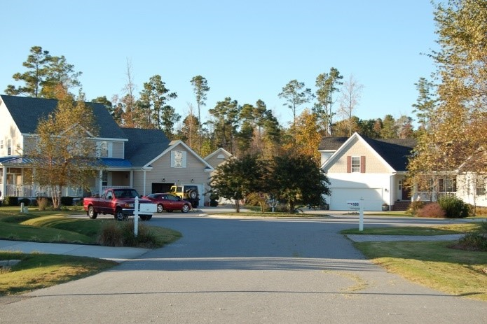 | ||
| Max. Density (units/ac) | 1.5 [2] | ||
| Min. Lot Area (sf) |
29,040
[3] [4] [5] | ||
| Min. Lot Width (lf) | 125 | ||
| Max. % Impervious Surface | 40 [6] | ||
| Min. Street Setback (lf) | |||
| From Arterial/Collector | 70 | ||
| From Local Outside Subdivision | 50 | ||
| From Local Inside Subdivision | 25 [7] | ||
| Min. Access Easement Setback (lf) | 15 | 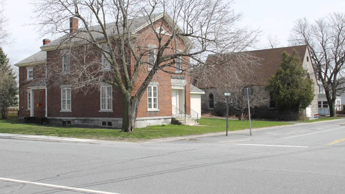 | |
| Min. Side Lot Line Setback (lf) | 10 [8] [9] | ||
| Min. Rear Lot Line Setback (lf) | 10 [8] | ||
| Min. Perimeter Setback (lf) | 20 | ||
| Min. Building Separation (lf) | 10 | ||
| Min. Accessory Structure Setback (lf) | 10 [10] | ||
| Min. Open Space Set-Aside (% of total site size) | 15 [11] | ||
| Max. Building Height | 40 | ||
|
NOTES:
[1] "sf" = square feet; "lf" = linear feet. [2] May increase to 2.0 on lots served by a public water system. [3] Johnston County Public Health may require a larger minimum lot area based on soil conditions. [4] 21,780 sf for lots served by a public water system. [5] Duplexes may only be established on lots of 43,560 sf or larger. [6] Development in a water supply watershed shall be subject to the built-upon limits in Sec. 30-4502. [7] May be reduced to 20 in a subdivision served by a public water system. [8] May be reduced to 5 in a subdivision with lots served by a public water system. [9] One side setback may be reduced to zero if the opposing side setback is double the minimum. [10] Accessory structures shall maintain the same setbacks from streets and easements as principal uses. [11] Not applied to the development of an individual single-family detached dwelling on its own lot, a non-residential use, or a development of two acres in area or less. | |||
(Ord. No. AL2021-06-1, § 1, 6-7-2021; Ord. No. AL2022-08-2 (UDO-TA-3-22), § 1, 8-1-2022)
Sec. 30-4204 - Single-family residential district (SFR-3).
| (a) District intent | (b) Typical development | ||
| The Single-Family Residential 3 (SFR-3) district is established to accommodate a wide range of residential dwelling types at moderate densities. Development patterns consist primarily of residential neighborhoods and supporting uses located in suburban and urban contexts throughout the Town's planning jurisdiction. The district accommodates single-family detached homes and associated accessory uses as well as manufactured homes and duplex dwellings. It also allows supporting uses like public safety facilities, parks, educational uses, and utilities. District regulations discourage uses that interfere with the development of residential neighborhoods or that are detrimental to the district's neighborhood character. |  | ||
| (c) Dimensional standards [1] | 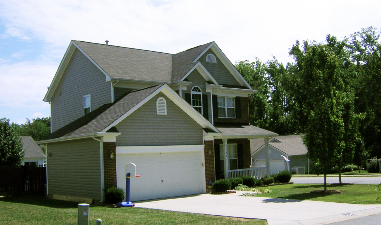 | ||
| Max. Density (units/ac) | 1.75 [2] | ||
| Min. Lot Area (sf) |
24,890
[3] [4] [5] | ||
| Min. Lot Width (lf) | 125 | ||
| Max. % Impervious Surface | 45 [6] | ||
| Min. Street Setback (lf) | |||
| From Arterial/Collector | 70 | ||
| From Local Outside Subdivision | 50 | ||
| From Local Inside Subdivision | 25 [7] | ||
| Min. Access Easement Setback (lf) | 15 | 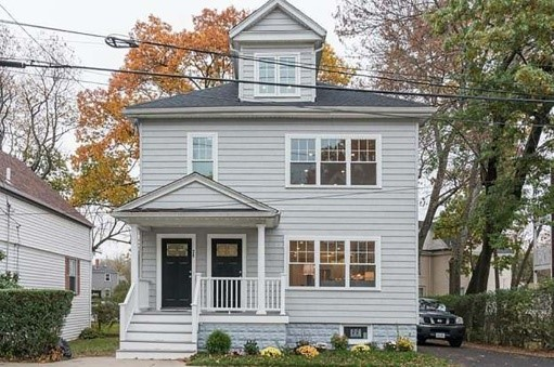 | |
| Min. Side Lot Line Setback (lf) | 10 [8] [9] | ||
| Min. Rear Lot Line Setback (lf) | 10 [8] | ||
| Min. Perimeter Setback (lf) | 20 | ||
| Min. Building Separation (lf) | 10 | ||
| Min. Accessory Structure Setback (lf) | 10 [10] | ||
| Min. Open Space Set-Aside (% of total site size) | 15 [11] | ||
| Max. Building Height | 40 | ||
|
NOTES:
[1] "sf" = square feet; "lf" = linear feet. [2] May increase to 2.0 on lots served by a public water system. [3] Johnston County Public Health may require a larger minimum lot area based on soil conditions. [4] 21,780 sf for lots served by a public water system. [5] Duplexes may only be established on lots of 43,560 sf or larger. [6] Development in a water supply watershed protection overlay district shall be subject to the built-upon limits in § 30-4502, Water Supply Watershed Protection Overlay District. [7] [May be reduced to 20 in a subdivision served by a public water system. [8] May be reduced to 5 in a subdivision with lots served by a public water system. [9] One side setback may be reduced to zero if the opposing side setback is double the minimum. [10] Accessory structures shall maintain the same setbacks from streets and easements as principal uses. [11] Not applied to the development of an individual single-family detached dwelling on its own lot, a non-residential use, or a development of two acres in area or less. | |||
(Ord. No. AL2021-06-1, § 1, 6-7-2021; Ord. No. AL2022-08-2 (UDO-TA-3-22), § 1, 8-1-2022)
Sec. 30-4205 - Residential-manufactured home park district (R-MHP).
| (a) District intent | (b) Typical development | ||
| The Residential Manufactured Home Park (R-MHP) district is established as a means of providing reasonable opportunities for the placement of manufactured dwellings in the Town's planning jurisdiction. The district provides attainable housing opportunities for low and moderate-income residents while at the same time establishing minimum design requirements for manufactured home parks to ensure a minimum level of quality and safety. The standards are intended to protect property values and preserve the character and integrity of individual neighborhoods within the community. In addition to manufactured homes, the district also allows single-family detached residential development and a very limited range of supporting institutional uses. Manufactured home parks shall be served by a public water supply system or community well. As well as a public wastewater system or by individual septic systems. | 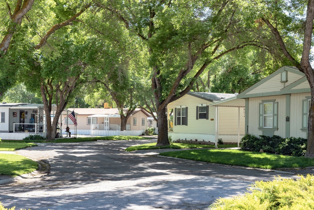 | ||
| (c) Dimensional standards [1] | 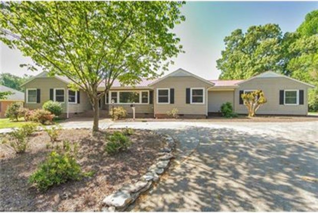 | ||
| Max. Density (units/ac) | 3.0 [2] | ||
| Min. Lot Area (sf) |
14,520
[3] [4] | ||
| Min. Lot Width (lf) | 150 [5] | ||
| Max. % Impervious Surface | 50 [5] [6] | ||
| Min. Street Setback (lf) | |||
| From Arterial/Collector | 60 | ||
| From Local Outside Subdivision | 50 | ||
| From Local Inside Subdivision | 20 | ||
| Min. Access Easement Setback (lf) | 15 | 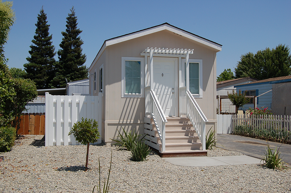 | |
| Min. Side Lot Line Setback (lf) | 10 | ||
| Min. Rear Lot Line Setback (lf) | 10 | ||
| Min. Building Separation (lf) | 20 [7] | ||
| Min. Accessory Structure Setback (lf) | 10 [8] | ||
| Min. Open Space Set-Aside (% of total site size) | 15 [9] | ||
| Max. Building Height | 40 | ||
|
NOTES:
[1] "sf" = square feet; "lf" = linear feet. [2] May increase to 4.0 on lots served by a public sewer system. [3] Johnston County Public Health may require a larger minimum lot area based on soil conditions. [4] 10,890 sf for lots served by a public sewer system. [5] Applied to the entire site size for manufactured home parks. [6] Development in a water supply watershed protection overlay district shall be subject to the built-upon limits in § 30-4502, Water Supply Watershed Protection Overlay District. [7] Applied to dwellings located on manufactured home spaces rather than on individual lots. [8] Accessory structures shall maintain the same setbacks from streets and easements as principal uses. [9] Not applied to the development of an individual manufactured home on its own lot or a development of two acres in area or less. | |||
(Ord. No. AL2021-06-1, § 1, 6-7-2021; Ord. No. AL2022-08-2 (UDO-TA-3-22), § 1, 8-1-2022)
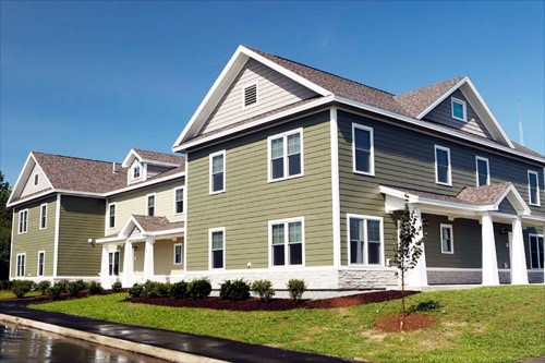
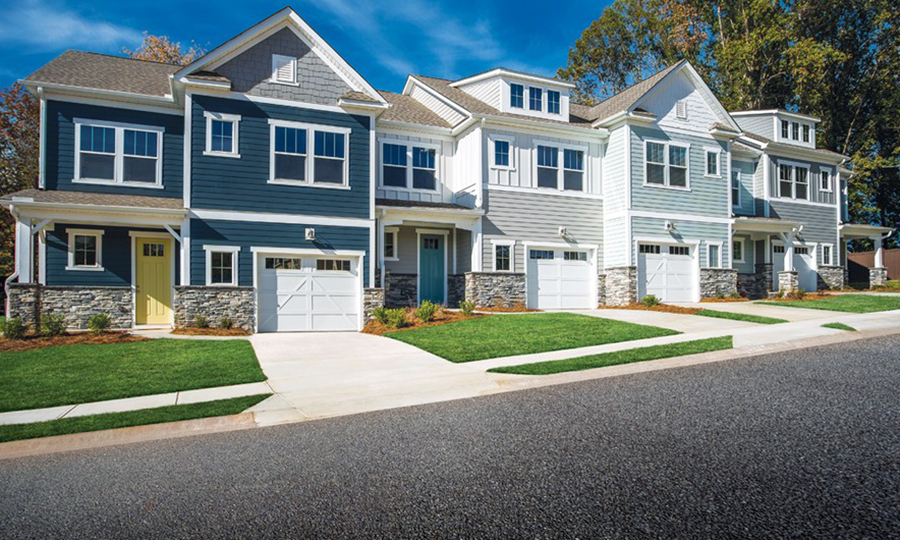
Sec. 30-4206 - Residential multi-family district (RMF).
| (a) District intent | ||||||
| The Residential Multi-Family (RMF) district is established to accommodate a wide range of residential and institutional use types at medium densities. The district allows a wide range of housing types, including single-family detached homes, duplexes, townhouses, and multi-family development (apartments), but manufactured housing is not permitted. The district also allows a wide variety of institutional uses, including community centers, day care, schools, assisted living, churches, parks, and utilities. Lots served by public sewer may have reduced minimum lot sizes. District regulations are intended to support the Town's investment in infrastructure by encouraging the development of compact, vibrant neighborhoods with a variety of house sizes and types that are located in close proximity to complementary institutional uses. Multi-family development is typically denser than its immediate surroundings, and can also serve as an effective transition between single-family detached development and adjacent commercial or employment uses. Buildings in the RMF district tend to have shared site access, shared building access, common site features (like recreation space) owned in common, and centralized service functions. | ||||||
| (b) Typical development | ||||||
 |  | |||||
| (c) Dimensional standards [1] | ||||||
| Requirement | SF Detached | Duplex | Townhouse | Multi-Family | All Other Uses | |
| Max. Density (units/ac) | 3.0 [2] | 2.0 [2] | 4.0 [3] | 5.0 [4] | N/A | |
| Min. Lot Area (sf) [5] | 14,520 [6] | 43,560 [7] | 87,120 [8] | 130,680 [8] | 43,560 | |
| Min. Lot Width (lf) | 125 | 150 | 175 [9] | 200 [9] | 150 | |
| Max. % Impervious Surface [10] | 50 | 50 | 55 [9] | 60 [9] | 40 | |
| Min. Street Setback (lf) | ||||||
| From Arterial/Collector | 70 | 70 | 70 | 70 | 70 | |
| From Local Outside Subdivision | 50 | 50 | 50 | 50 | 50 | |
| From Local Inside Subdivision | 25 [11] | 25 [11] | 25 [11] | 25 [11] | 25 [11] | |
| Min. Access Easement Setback (lf) | 15 | 15 | N/A | N/A | N/A | |
| Min. Side Lot Line Setback (lf) | 10 [12] | 10 [12] | 20 | 20 | 10 | |
| Min. Rear Lot Line Setback (lf) | 10 [12] | 10 [12] | 20 | 20 | 10 | |
| Min. Perimeter Setback (lf) | N/A | N/A | 20 | 20 | 20 | |
| Min. Building Separation (lf) | 10 | 10 | 20 | 20 | 20 | |
| Min. Accessory Structure Setback (lf)[13] | 10 | 10 | 10 | 10 | 10 | |
|
Min. Open Space Set-Aside
(% of total site size)[14] | 15 | 15 | 20 | 20 | N/A | |
| Max. Building Height | 40 | 40 | 40 | 40 | 40 | |
| RMF District Dimensional standards continued [1] | ||||||
|
NOTES (for RMF district dimensional requirements):
[1] "sf" = square feet; "lf" = linear feet. [2] May increase to 3.0 on lots served by a public sewer system. [3] May increase to 5.0 for developments served by a public sewer system. [4] May increase to 6.0 for developments served by a public sewer system. [5] Johnston County Environmental Health may require a larger minimum lot area based on soil conditions. [6] 10,890 sf for lots served by a public sewer system. [7] 21,780 sf per dwelling unit. [8] Minimum development size. [9] Applied to entire development site, not individual lots. [10] Development in a water supply watershed protection overlay district shall be subject to the built-upon limits in § 30-4502, Water Supply Watershed Protection Overlay District. [11] May be reduced to 20 in a subdivision served by a public water system. [12] May be reduced to 5 in a subdivision with lots served by a public water system. [13] Accessory structures shall maintain the same setbacks from streets and easements as principal uses. [14] Not applied to the development of an individual single-family detached dwelling on its own lot, a non-residential use, or a development of two acres in area or less. | ||||||
(Ord. No. AL2021-06-1, § 1, 6-7-2021; Ord. No. AL2022-08-2 (UDO-TA-3-22), § 1, 8-1-2022)
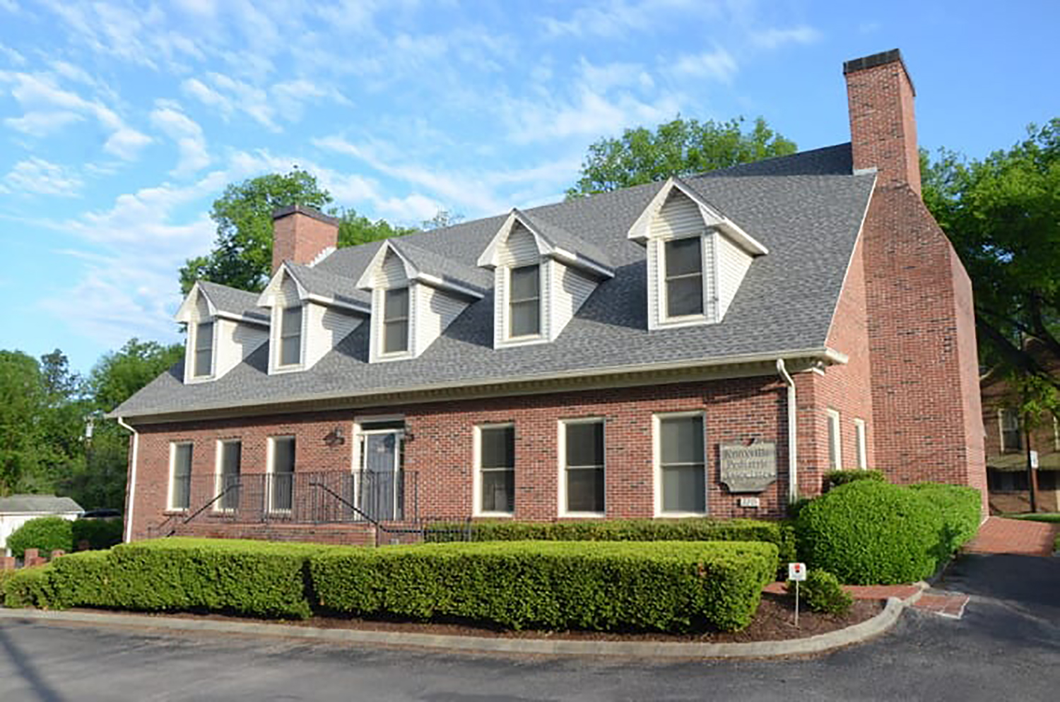
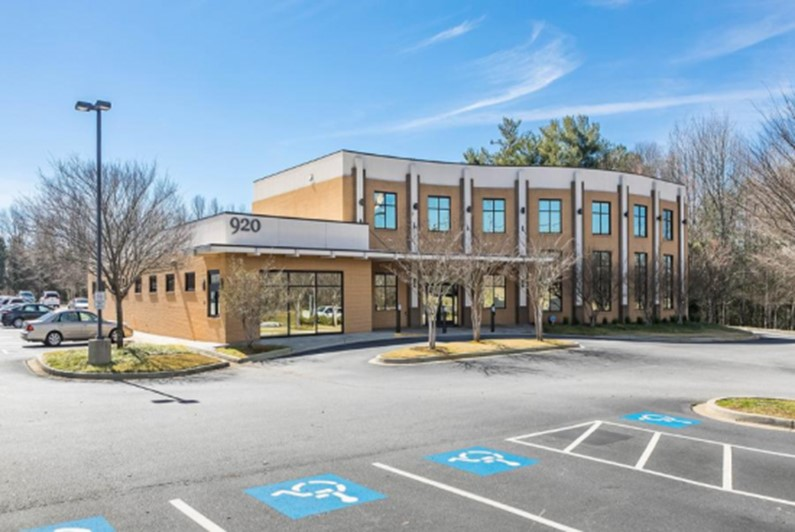
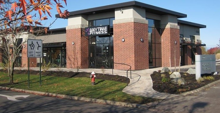
Sec. 30-4301 - Office and institutional district (OI).
| (a) District intent. | ||||
| The Office Institutional (OI) District is established to accommodate office uses, research and development facilities, and multi-family residential uses in high quality single-building and multi-building developments. The district also accommodates the ancillary service uses necessary to support the predominant office development, but is not intended as a retail district. Retail, personal service, and other commercial uses permitted as accessory to an office or institutional use should not occupy more than 10 percent of the floor area and should be configured to minimize visibility from off-site areas. The OI district also serves as a transition area between higher intensity commercial uses and nearby lower density single-family residential neighborhoods. Development in the OI district is subject to design standards to ensure it maintains compatibility with its surroundings. | ||||
| (b) Typical development | ||||
 |  | |||
| (c) Dimensional standards [1] | ||||
| Requirement | Non- Residential Development | Townhouse & Multi-Family | SF Detached & Duplex | |
| Max. Density (units/ac) | N/A | 5.0 [2] | 2.0 [3] | |
| Min. Lot Area (sf) [4] | 40,000 | 130,680 [5] | 43,560 [6] | |
| Min. Lot Width (lf) | 150 [7] | 200 [7] | 150 | |
| Max. % Impervious Surface [8] | 50 | 60 | 50 | |
| Min. Street Setback (lf) | ||||
| From Arterial/Collector | 40 | 40 | 40 | |
| From Local | 20 | 20 | 20 | |
| Min. Access Easement Setback (lf) | N/A | N/A | 15 | |
| Min. Side or Rear Lot Line Setback from a Non-Residential District (lf) | 10 | 10 | 10 | |
| Min. Side or Rear Lot Line Setback from a Residential District (lf) | 20 | 20 | 20 | |
| Min. Perimeter Setback (lf) | 20 | 20 | N/A | |
| Min. Building Separation (lf) | 20 | 20 | 10 | |
|
Min. Open Space Set-Aside
(% of total site size) | N/A | 20 | 15 [9] | |
| Max. Building Height | 40 when abutting a residential district; otherwise 55 | 40 | ||
|
NOTES:
[1] "sf" = square feet; "lf" = linear feet. [2] May increase to 6.0 for developments served by a public water system. [3] May increase to 3.0 on lots served by a public water system. [4] Johnston County Environmental Health may require a larger minimum lot area based on soil conditions. [5] Minimum development size. [6] 14,520 sf for lots served by a public water system. [7] Applied to entire development site, not individual lots. [8] Development in a water supply watershed protection overlay district shall be subject to the built-upon limits in § 30-4502, Water Supply Watershed Protection Overlay District. [9] Not applied to the development of an individual single-family detached dwelling on its own lot or a development of two acres in area or less. | ||||
| (d) Additional OI District Standards | ||||
| [placeholder] | ||||
(Ord. No. AL2021-06-1, § 1, 6-7-2021)
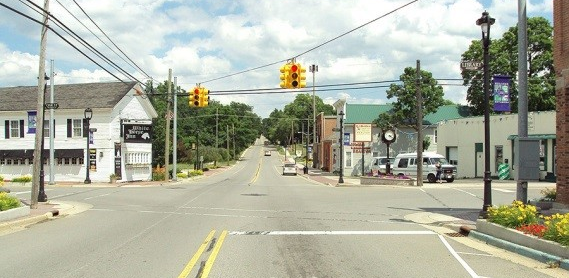
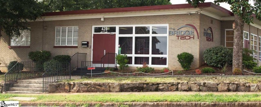
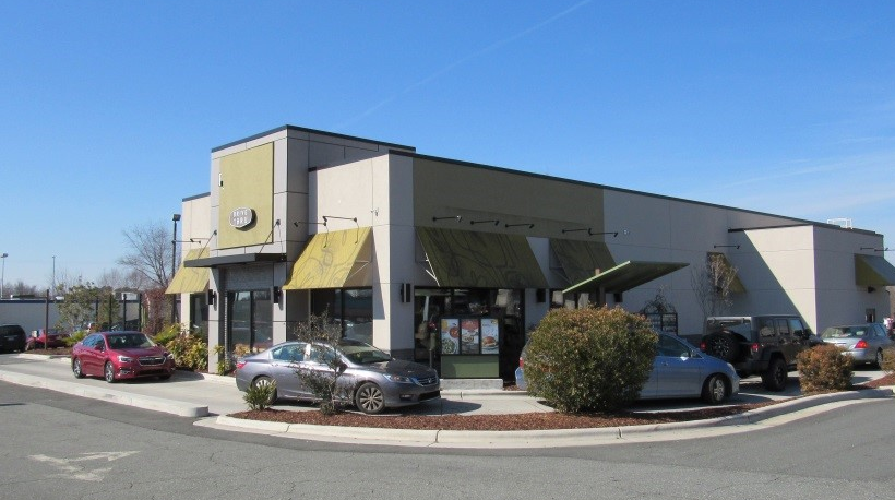
Sec. 30-4302 - Neighborhood business district (NB).
| (a) District intent | |||||
| The Neighborhood Business (NB) district is intended for low intensity, neighborhood-serving commercial development around significant roadway intersections along the edges of neighborhoods. The district allows offices, personal services, and small-scale retail and a variety of institutional uses. As a means of providing additional housing options, the district allows multi-family residential uses on upper floors of non-residential uses. Industrial development and single-use multi-family residential uses are not permitted. New commercial development is built close to the street and subject to commercial design standards to raise the bar for development quality. District regulations discourage uses that are too intense or that draw the majority of their patrons from outside the immediate area. | |||||
| (b) Typical development | |||||
 |  | ||||
 |  | ||||
| (c) Dimensional standards [1] | |||||
| Requirement | Non-Residential Development | Multi-Family (allowed on upper stories only) | SF Detached & Duplex | ||
| Max. Density (units/ac) | N/A | 3.0 | 2.0 [2] | ||
| Min. Lot Area (sf) [3] | 40,000 | N/A | 43,560 [4] | ||
| Min. Lot Width (lf) | 150 [5] | 150 | |||
| Max. % Impervious Surface [6] | 50 | 60 [7] | 50 | ||
| Max. Building Floor Area (sf) | 20,000 | 5,000 [8] | N/A | ||
| Min. Street Setback (lf) | |||||
| From Arterial/Collector | 40 | 40 | |||
| From Local | 30 | 30 | |||
| Min. Access Easement Setback (lf) | N/A | 15 | |||
| Min. Side or Rear Lot Line Setback from a Non-Residential District (lf) | 10 | 10 | |||
| Min. Side or Rear Lot Line Setback from a Residential District (lf) | 20 | 20 | |||
| Min. Perimeter Setback (lf) | 20 | N/A | |||
| Min. Building Separation (lf) | 20 | 10 | |||
|
Min. Open Space Set-Aside
(% of total site size) | N/A | 20 | 15 [9] | ||
| Max. Building Height | 40 | 40 | |||
|
NOTES:
[1] "sf" = square feet; "lf" = linear feet. [2] May increase to 3.0 on lots served by a public water system. [3] Johnston County Public Health may require a larger minimum lot area based on soil conditions. [4] 14,520 sf for lots served by a public water system. [5] Applied to entire development site, not individual lots. [6] Development in a water supply watershed protection overlay district shall be subject to the built-upon limits in § 30-4502, Water Supply Watershed Protection Overlay District. [7] Applied to sites with upper-story multi-family units only. [8] May be added to the maximum floor area for a non-residential use. [9] Not applied to the development of an individual single-family detached dwelling on its own lot or a development of two acres in area or less. | |||||
| (d) Additional NB District standards | |||||
|
All non-residential use types permitted in the NB district shall be subject to the
following standards:
(1) No lot shall include non-residential building more than 20,000 square feet of gross floor area. (2) No more than five employees shall work at the same time in a retail trade use type. (3) Outdoor storage is prohibited. (4) Hours of operation for commercial uses shall be restricted to between 6:00 a.m. and midnight. (5) Drive-through or drive-up facilities are prohibited. (6) Except for street lighting, no exterior lighting shall be located higher than 15 feet above ground or pavement. (7) Off-street parking lots shall be located to the side or rear of buildings. (8) Where possible, access to off-street parking areas shall be via an alley or driveway located to the side or rear of a lot. (9) A maximum of three dwelling units may be provided on the upper levels of a building containing a first-floor non-residential use. | |||||
(Ord. No. AL2021-06-1, § 1, 6-7-2021)
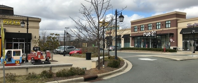
Sec. 30-4303 - Community business district (CB).
| (a) District intent | |||
| The Community Business (CB) district is the primary district intended to serve retail, business, and service uses in the Town's planning jurisdiction and is found along major arterial streets and on lots surrounding the core of Town. Development in the CB district tends to be automobile oriented and comprised of a mix of individual buildings on individual sites and multi-tenant or multi-building developments located near major roadway intersections. In addition to commercial uses, the district also accommodates wholesale sales and a very wide range of institutional uses. Limited forms of residential use are allowed. Uses in the district are subject to standards intended to ensure development is compatible with adjacent residential neighborhoods, ensure that the traffic carrying capacity along the Town's major roadways is not impaired due to unsafe turning movements, and that development is well landscaped and aesthetically pleasing. In order to maintain compatibility with surrounding uses and ensure a high quality of development, all activities, including storage shall be indoors or be fully screened from view from the street or from lands in lower-intensity zoning districts. | |||
| (b) Typical development | |||
 |  | ||
 | |||
| (c) Dimensional standards [1] | |||
| Requirement | Non-Residential Development | Residential Development | |
| Max. Density (units/ac) | N/A | 1.0 [2] | |
| Min. Lot Area (sf) [3] | 43,560 | 43,560 [4] | |
| Min. Lot Width (lf) | 150 | 150 | |
| Max. % Impervious Surface [5] | 50 | 50 | |
| Min. Street Setback (lf) | |||
| From Arterial/Collector | 40 | 40 | |
| From Local | 30 | 30 | |
| Min. Access Easement Setback (lf) | N/A | 15 | |
| Min. Side or Rear Lot Line Setback from a Non-Residential District (lf) | 10 | 10 | |
| Min. Side or Rear Lot Line Setback from a Residential District (lf) | 20 | 20 | |
| Min. Perimeter Setback (lf) | 20 | N/A | |
| Min. Building Separation (lf) | 20 | 10 | |
| Max. Building Height | 40 | 40 | |
|
NOTES:
[1] "sf" = square feet; "lf" = linear feet. [2] May increase to 2.0 on lots served by a public water system. [3] Johnston County Environmental Health may require a larger minimum lot area based on soil conditions. [4] 21,780 sf for lots served by a public water system. [5] Development in a water supply watershed protection overlay district shall be subject to the built-upon limits in § 30-4502, Water Supply Watershed Protection Overlay District. | |||
| (d) Additional CB District standards | |||
| [placeholder] | |||
(Ord. No. AL2021-06-1, § 1, 6-7-2021)
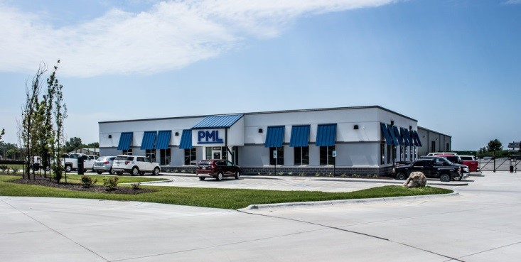
Sec. 30-4304 - Light industrial district (LI).
| (a) District intent | |||
| The Light Industrial district is established to accommodate agricultural and light manufacturing uses, including assembly, fabrication, processing, distribution, storage, and wholesales sale of finished or semi-finished products from previously prepared materials. The district also allows commercial activities intended to serve the primary businesses in the district and their employees. Uses allowed in the district do not require large amounts of land or large building areas for operation nor large yard areas for isolation or protection from adjoining premises or activities. Activities take place almost entirely indoors and result in minimal exterior movement of vehicles, materials, and goods in areas around the district. Buildings are situated so as to have minimal visual impacts, and are well-screened from adjacent lower intensity uses. Heavy industrial uses and uses with significant adverse impacts on adjoining lands, single-family detached homes, and other low-intensity uses are prohibited. | |||
| (b) Typical development | |||
 |  | ||
| (c) Dimensional standards [1] | |||
| Requirement | Industrial and Commercial Uses | All Other Uses | |
| Max. Density (units/ac) | N/A | N/A | |
| Min. Lot Area (sf) [2] | 87,120 | 43,560 | |
| Min. Lot Width (lf) | 200 | 150 | |
| Max. % Impervious Surface [3] | 50 | 50 | |
| Min. Street Setback (lf) | |||
| From Arterial/Collector | 50 | 50 | |
| From Local | 40 | 40 | |
| Min. Access Easement Setback (lf) | N/A | 15 | |
| Min. Side or Rear Lot Line Setback from a Non-Residential District (lf) | 20 | 20 | |
| Min. Side or Rear Lot Line Setback from a Residential District (lf) | 40 | 40 | |
| Min. Perimeter Setback (lf) | 40 | ||
| Min. Building Separation (lf) | 20 | 10 | |
| Max. Building Height | 40 | 40 | |
|
NOTES:
[1] "sf" = square feet; "lf" = linear feet. [2] Johnston County Public Health may require a larger minimum lot area based on soil conditions. [3] Development in a water supply watershed protection overlay district shall be subject to the built-upon limits in § 30-4502, Water Supply Watershed Protection Overlay District. | |||
(Ord. No. AL2021-06-1, § 1, 6-7-2021)
Sec. 30-4401 - Purpose and intent.
The Planned development (PD) district is established and intended to encourage innovative land planning and site design concepts that support a high quality of life and achieve a high quality of development, environmental sensitivity, energy efficiency, and other Town goals by:
(a)
Reducing or diminishing the inflexibility or uniform design that sometimes results from strict application of zoning and development standards designed primarily for individual lots;
(b)
Allowing greater freedom in selecting the means of providing access, open space, and design amenities;
(c)
Allowing greater freedom in providing a well-integrated mix of residential and non-residential land uses in the same development, including a mix of housing types, lot sizes, and densities;
(d)
Creating a system of incentives for redevelopment and infill in order to revitalize established areas;
(e)
Promoting a vibrant public realm by placing increased emphasis on active ground floor uses, pedestrian-oriented building façade design, intensive use of sidewalks, and establishment of public gathering areas;
(f)
Providing for efficient use of land resulting in smaller networks of utilities and streets and thereby lowering development and housing costs; and
(g)
Promoting quality design and environmentally sensitive development that respects surrounding established land use character and respects and takes advantage of a site's natural and man-made features, such as trees, ridgelines, special flood hazard area, and historic features.
(Ord. No. AL2021-06-1, § 1, 6-7-2021)
Sec. 30-4402 - General standards for all planned developments.
(a)
How established. A planned development is established in accordance with the procedures and requirements in § 30-3314, Planned Development.
(b)
Establishment limited.
(1)
A planned development district may not be established on land that is designated as AR or SFR-1 at the time the planned development application is filed.
(2)
Nothing shall limit land that is newly annexed and receiving its first zoning district designation from the Town to be designated as Planned Development provided an application for establishment of the district has been submitted in accordance with this Ordinance.
(c)
Master plan required. All development configured as a PD shall be subject to a master plan submitted and approved as part of the application to establish the district. The master plan shall:
(1)
Include a statement of planning objectives for the district;
(2)
Describe the specific ways in which any modifications to the generally applicable standards in this Ordinance will result in a development of higher quality than would have otherwise resulted if the development was established without any proposed modifications to the standards in this Ordinance;
(3)
Identify the general location of individual development areas, identified by land use(s) and/or development density or intensity;
(4)
Depict the general configuration and relationship of the principal elements of the proposed development, including general building types;
(5)
Identify for the entire district and each development area, the acreage, types and mix of land uses, number of residential units (by use type), non-residential floor area (by use type), residential density, and non-residential intensity;
(6)
Identify the general location, amount, and type (whether designated for active or passive) of open space;
(7)
Identify the location of environmentally sensitive lands, wildlife habitat, and resource protection lands;
(8)
Identify the on-site transportation circulation system, including the general location of all public and private streets, existing or projected transit service, pedestrian and vehicular circulation features, and how they will connect with existing and planned systems;
(9)
Identify the general location of on-site potable water and wastewater facilities, and how they will connect to existing systems;
(10)
Identify the general location of on-site stormwater management facilities, and how they will connect to existing public systems; and
(11)
Identify the general location of all other on-site public facilities serving the development, including but not limited to parks, schools, bus shelters, and facilities for fire protection, police protection, EMS, and solid waste management.
(Ord. No. AL2021-06-1, § 1, 6-7-2021)
Sec. 30-4403 - Compliance with subdivision standards.
Planned developments that include the division of land into two or more lots shall be subject to the subdivision standards in Article 7 Subdivisions, and shall be subject to the requirements of § 30-3312, Major Subdivision, and § 30-3310, Final Plat, prior to the issuance of a building permit.
(Ord. No. AL2021-06-1, § 1, 6-7-2021)
Sec. 30-4404 - Site plan review.
(1)
The planned development master plan may take the form of a generalized concept plan for development that provides a general indication of building and site feature location, or it may be configured to the level of detail associated with site plans and construction drawings depicting exact building placement, location and profile of public infrastructure, and configuration of site features like parking, landscaping, and similar elements.
(2)
In cases where the master plan is more general or conceptual in nature, the development proposed in the planned development designation shall also undergo site plan review in accordance with § 30-3317, Site Plan.
(3)
In cases where the master plan is detailed and meets the minimum requirements for a site plan in the opinion of the Town Council, the applicant shall request, and the Town Council may grant an exemption from subsequent site plan review.
(4)
If a site plan review exemption is granted by the Town Council, the proposed development shall fully comply with the development configuration depicted in the planned development master plan. Failure to comply with the approved master plan configuration shall require an amendment of the planned development application in accordance with this section.
(Ord. No. AL2021-06-1, § 1, 6-7-2021)
Sec. 30-4405 - Densities/intensities.
The densities for residential development and the intensities for non-residential development applicable in each development area of a PD district shall be as established in the master plan, and shall be consistent with adopted policy guidance.
(Ord. No. AL2021-06-1, § 1, 6-7-2021)
Sec. 30-4406 - Dimensional standards.
The dimensional standards applicable in each development area of a PD district shall be as established in the master plan. The master plan shall include at least the following types of dimensional standards:
(a)
Minimum lot area;
(b)
Minimum lot width;
(c)
Minimum and maximum setbacks;
(d)
Maximum lot coverage;
(e)
Maximum building height;
(f)
Maximum individual building size; and
(g)
Minimum setbacks from adjoining residential development or residential zoning districts.
(Ord. No. AL2021-06-1, § 1, 6-7-2021)
Sec. 30-4407 - Development standards.
(a)
All development in a PD district shall comply with the development standards of Article 6: Development Standards, unless modified in accordance with this section.
(b)
In no instance shall a planned development district seek to modify, waive, or reduce any of the standards in § 30-4502, Water Supply Watershed Protection Overlay District.
(c)
In cases where a planned development district is proposed as part of redevelopment of an existing site and the existing site does not comply with the standards of this Ordinance, the development contemplated in the planned development shall not be required to achieve full compliance, but shall not increase the degree to which the development fails to comply with the standards in this Ordinance.
(Ord. No. AL2021-06-1, § 1, 6-7-2021)
Sec. 30-4408 - Consistency with adopted policy guidance.
The PD zoning district designation, the master plan, and the terms and conditions document should be consistent with the Comprehensive Plan, and any other adopted policy guidance.
(Ord. No. AL2021-06-1, § 1, 6-7-2021)
Sec. 30-4409 - Compatibility with surrounding areas.
(a)
Development along the perimeter of a PD district shall be compatible with adjacent existing or proposed development outside the district. Where there are issues of compatibility, the master plan shall provide for transition areas at the edges of the PD district that provide for appropriate buffering and/or ensure a complementary character of uses.
(b)
Determination of complementary character shall be based on densities/intensities, lot size and dimensions, building height, building mass and scale, hours of operation, exterior lighting, siting of service areas, or other aspects identified by the Town Council.
(Ord. No. AL2021-06-1, § 1, 6-7-2021)
Sec. 30-4410 - Development phasing plan.
If development in the PD district is proposed to be phased, the master plan shall include a development phasing plan that identifies the general sequence or phases in which the district is proposed to be developed, including how residential and non-residential development will be timed, how infrastructure (public and private) and open space will be provided and timed, and how development will be coordinated with the Town's capital improvements program.
(Ord. No. AL2021-06-1, § 1, 6-7-2021)
Sec. 30-4411 - Conversion schedule.
(a)
The planned development application may include a conversion schedule that identifies the extent to which one type of residential use may be converted to another type of residential use or one type of non-residential use may be converted to another type of non-residential use (i.e., residential to residential, or non-residential to non-residential). These conversions may occur within development areas and between development areas, as long as they occur within the same development phase, as identified by the approved development phasing plan, and are consistent with established extents of conversion set down in the conversion schedule.
(b)
In the event an applicant seeks to revise the development in accordance with an approved conversion schedule, the applicant shall provide a revised site plan depicting the proposed conversions to the Town Planner for review and approval prior to commencing any conversions.
(Ord. No. AL2021-06-1, § 1, 6-7-2021)
Sec. 30-4412 - On-site public facilities.
(a)
Design and construction. The master plan shall establish the responsibility of the developer/landowner to design and construct or install required and proposed on-site public facilities in compliance with applicable Town, State, and federal regulations.
(b)
Dedication. The master plan shall establish the responsibility of the developer/landowner to dedicate to the public the right-of-way and easements necessary for the construction or installation of required and proposed on-site public facilities in compliance with applicable Town, State, and federal regulations.
(c)
Modifications to street standards. In approving a master plan, the Town Council may approve modifications or reductions of street design standards-including those for right-of-way widths, pavement widths, required materials, provision of public transit amenities, and turning radii, with NCDOT approval, on finding that:
(1)
The master plan provides for adequate separation/integration of vehicular, pedestrian, and bicycle traffic;
(2)
Access for emergency service vehicles is not substantially impaired;
(3)
Adequate parking is provided for the uses proposed; and
(4)
Adequate space for public utilities is provided within the street right-of-way.
(Ord. No. AL2021-06-1, § 1, 6-7-2021)
Sec. 30-4413 - Allowable uses.
(a)
The uses allowed in a PD district are identified in § 30-5207 principal use table, and § 30-5404, Common accessory use table, as allowed subject to a master plan.
(b)
Allowed uses shall be listed in the approved master plan or terms and conditions documents.
(c)
Allowed uses shall be consistent with adopted policy guidance, the purpose of the particular PD district, and subject to any additional use standards in this Ordinance.
(d)
Nothing shall limit an applicant from seeking to modify an otherwise applicable use standard in accordance with these standards.
Sec. 30-4414 - Planned development terms and conditions.
The terms and conditions document shall incorporate by reference or include, but not be limited to:
(a)
Conditions related to approval of the application for the PD zoning district classification;
(b)
The master plan, including any density/intensity standards, dimensional standards, and development standards established in the master plan;
(c)
Conditions related to the approval of the master plan, including any conditions related to the form and design of development shown in the master plan;
(d)
Provisions addressing how transportation, potable water, wastewater, stormwater management, and other infrastructure will be provided to accommodate the proposed development;
(e)
Provisions related to environmental protection and monitoring;
(f)
The range of allowable and accessory uses; and
(g)
Any other provisions the Town Council determines are relevant and necessary to the development of the PD in accordance with applicable standards and regulations.
(Ord. No. AL2021-06-1, § 1, 6-7-2021)
Sec. 30-4415 - Amendments to approved master plan.
Amendments or modifications to a master plan shall only be considered in accordance with the standards in § 30-3314, Planned development.
(Ord. No. AL2021-06-1, § 1, 6-7-2021)
Sec. 30-4501 - Intent.
It is the intent of this Division to provide for various zoning districts which shall overlay the conventional and planned development zoning districts enumerated in this Article, and which shall provide for special review of development within such overlay districts in accordance with the intents, procedures, and standards established for the overlay districts.
Sec. 30-4502 - Water supply watershed protection overlay district (WSWOD).
(a)
Authority. The General Assembly has, in §§ 143-214.5, 160A-174, 160D-801 and, 160D-702 of the North Carolina General Statutes, delegated the responsibility and directed the Town to establish water supply watershed protection programs, to regulate land use and development within water supply watersheds and to adopt regulations designed to promote the public health, safety and general welfare of its citizenry.
(b)
Intent. The Water Supply Watershed Protection Overlay District (WSWOD) is to provide, in designated watershed areas, a higher level of control from activities and situations that could degrade the quality of the water entering the Neuse River, as identified in the State watershed protection management plan.
(c)
Applicability. The provisions of this section shall apply within the area designated as a public water supply watershed by the N.C. Environmental Commission and are defined and established on the map entitled "Water Supply Watershed Protection Overlay District of Archer Lodge, North Carolina," on the Official Zoning Map of the Town. Land use and development within this district that requires an erosion and sedimentation control permit must comply with all the requirements of this Article and the underlying zoning district.
(d)
Exceptions to applicability. The watershed protection requirements of this section shall not apply to:
(1)
Development established prior to December 4, 2009, the first date of adoption of this Ordinance.
(2)
New or existing single-family detached dwelling unit.
(3)
Development that does not require an erosion and sedimentation control permit.
(4)
Existing development, unless it is expanded or replaced, in which case the rules at subsection (f) below apply.
(5)
In addition, the following exceptions also apply:
a.
Nothing contained herein shall repeal, modify, or amend any Federal or State law or regulation, or any ordinance or regulation pertaining thereto except any ordinance which these regulations specifically replace; nor shall any provision of this Ordinance amend, modify, or restrict any provisions of the Code of Ordinances of the Town; however, the adoption of this Ordinance shall and does amend any and all ordinances, resolutions, and regulations in effect in the Town at the time of the adoption of this Ordinance that may be construed to impair or reduce the effectiveness of this Ordinance or to conflict with any of its provisions.
b.
It is not intended that these regulations interfere with any easement, covenants, or other agreements between parties. However, if the provisions of these regulations impose greater restrictions or higher standards for the use of a building or land, then the provisions of these regulations shall control.
(6)
Non-conforming lots. If a nonconforming lot of record is not contiguous to any other lot owned by the same party, then that lot of record shall not be subject to the development restrictions of this Ordinance if it is developed for single-family residential purposes. If a non-conforming lot of record is contiguous to another lot owned by the same party, the lots shall be combined to make a conforming lot or one that is more conforming than each lot individually. Any lot or parcel created as part of any other type of subdivision that is exempt from this Ordinance shall be subject to the land use requirements (including impervious surface requirements) of these rules, except that such a lot or parcel must meet the minimum buffer requirements to the maximum extent practicable.
(e)
Definitions. The terms used in this section are further defined in Article 10: Measurement and Definitions.
(f)
Permits.
(1)
Zoning compliance permit/watershed protection permit.
a.
Except where either (i) a single family residence is constructed on a lot deeded prior to Dec. 4, 2009, or (ii) An erosion and sedimentation control permit is not required, no building or built-upon area shall be erected, moved, enlarged or structurally altered, nor shall any zoning compliance permit be issued nor shall any change in the use of any building or land be made until a the information required by this section has been received by the Town Planner and a watershed protection permit has been issued. No watershed protection permit shall be issued except in conformity with the provisions of this Ordinance. This permit shall be filed with the Town and shall expire at the end of 24 months if not used, or if a building permit is not obtained.
b.
Watershed protection permit applications shall be filed with the Town Planner. The application shall include a completed application form and supporting documentation deemed necessary by the Town.
c.
Prior to issuing a watershed protection permit, the Town Planner may consult with qualified personnel for assistance to determine if the application meets the requirements of this Ordinance.
d.
A zoning compliance permit shall serve as a watershed protection permit for development located within the Water Supply Watershed Protection Overlay (WSWOD). A zoning compliance permit shall not be issued unless the development complies with all applicable requirements in this section. If the zoning compliance permit is denied, the Town Planner shall notify the applicant in writing stating the reasons for denial.
(2)
Building permit required. Except where provided elsewhere in this Article, no building permit required under the State Building Code shall be issued for any activity for which a watershed protection permit is required until a zoning compliance permit has been issued.
(3)
Watershed protection occupancy permit.
a.
Prior to the occupancy or use of a building erected, altered, or moved and/or prior to the change of use of any building or land, the Town Planner shall issue a watershed protection occupancy permit certifying that all requirements of this Article have been met.
b.
A certificate of occupancy shall serve as a watershed protection occupancy permit for development located within the Water Supply Watershed Protection Overlay (WSWOD). A certificate of occupancy shall not be issued unless the development complies with all applicable requirements in this section.
c.
If the watershed protection occupancy permit is denied, the Town Planner shall notify the applicant in writing stating the reasons for denial.
(g)
Occupied lots. This category consists of lots occupied for residential purposes at the time of the adoption of the ordinance from which this Article is derived. These lots may continue to be used, provided that whenever two or more adjoining lots of record, one of which is occupied, are in single ownership at any time after Dec. 4, 2009, and such lots individually or together have less area than the minimum requirements for residential purposes specified in this Article, such lots shall be combined to create lots which meet the minimum size requirements, or which minimize the degree of nonconformity. The undeveloped lot may not be developed unless and until it complies with this Ordinance.
(h)
Industrial use of land. This category consists of existing industrial uses and/or the storage of hazardous or toxic materials where a spill containment plan is not implemented and where such use of the land is not permitted to be established in the watershed area. Such existing uses may be continued except as provided for in subsection (1)(d) below.
(i)
Permitted uses. The following uses are permitted as principal uses in the watershed protection overlay district provided such uses are also permitted in the underlying zoning district and providing that the requirements stated in this section and this zoning and subdivision ordinances.
(1)
Protected area.
a.
Agriculture, subject to the provisions of the Food Security Act of 1985 and the Food, Agricultural, Conservation and Trade Act of 1990.
b.
Silviculture, subject to the provisions of the Forest Practices Guidelines Related to Water Quality (15 NCAC 1I .0101.0209).
c.
Residential development as permitted in the underlying zoning district provided that it meets the standards of the WSWOD.
d.
Nonresidential development as permitted in the underlying zoning district provided that it meets the standards of the WSWOD.
(2)
Density and built-upon (impervious) limits in the protected area.
a.
Where the maximum allowed built-upon area conflicts with another ordinance or standard, the stricter standard, or lower maximum allowed built-upon area applies. For example, where either (i) the Johnston County Stormwater Management Ordinance as adopted by reference by the Town, or (ii) § 30-7203 Lot size standards of this Ordinance shall apply, then lower built-upon area requirements apply.
b.
Single family residential uses shall develop at a maximum of two dwelling units per acre (2 du/ac) or 20,000 square feet per lot, excluding street rights-of-way. In the alternative, the maximum built upon area shall be 24% per individual lot.
c.
All other residential and non-residential development shall not exceed 24 percent built-upon area. For projects without a curb and gutter street system, development shall not exceed 36 percent built-upon area.
d.
Cluster development is allowed on a project-by-project basis provided of all of the following conditions are met:
1.
Overall density shall not exceed 20,000 square feet per lot or a maximum overall density of the entire site of two dwelling units per acre; and
2.
The minimum lot area standard for the zoning district shall not be applied, but in no instance shall an individual lot have more than 24% built-upon area; and
3.
The minimum lot width standard for the zoning district shall not be applied, but the lot shall include sufficient width to accommodate both side setbacks and plus 30 feet between the side setback lines; and
4.
The required setbacks for the zoning district shall continue to apply to each buildable lot; and
5.
Buffers (vegetated setbacks) shall meet the requirements of sub-section (j) below; and
6.
Built-upon areas are designed and located to minimize stormwater runoff impacts to receiving waters, minimize concentrated stormwater flow, maximize the use of sheet flow through vegetated areas and maximize the flow length through vegetated areas; and
7.
Areas of concentrated development shall be located in upland areas and away from surface waters and drainage ways. In determining whether these criteria have been met the approving body shall take into account site-specific factors such as topography, site layout and the protection of water quality; and
8.
The remainder of the tract shall remain in a vegetated or natural state; and
9.
The area in a vegetated state shall be conveyed to a homeowner's association, the Town for preservation as a park or greenway, a conservation organization, or placed in a permanent conservation or farmland preservation easement; and
10.
A maintenance agreement for the vegetated or natural area shall be recorded with the Johnston County Register of Deeds and incorporated into any restrictive covenants for the development; and
11.
Vegetated swales and/or "curb outlet systems" as described in § 30-4502(j), Vegetated setback (buffer), will be provided.
e.
Density averaging. An applicant may average development density on up to two noncontiguous properties for purposes of achieving compliance with the water supply watershed development standards if all of the following circumstances exist:
1.
The properties are within the Archer Lodge Water Supply Watershed Protection Overlay District boundary.
2.
Overall project density meets applicable density or stormwater control requirements of this section.
3.
Vegetated setbacks on both properties meet the minimum requirements in § 30-4502(j), Vegetated setback (landscape buffer area) required.
4.
Built upon areas are designed and located to minimize stormwater runoff impact to the receiving waters, minimize concentrated stormwater flow, maximize the use of sheet flow through vegetated areas, and maximize the flow length through vegetated areas.
5.
Areas of concentrated density development are located in upland areas and, to the maximum extent practicable, away from surface waters and drainage ways.
6.
The property or portions of the properties that are not being developed will remain in a vegetated or natural state and will be managed by a homeowners' association as common area, conveyed to the Town or County as a park or greenway, or placed under a permanent conservation or farmland preservation A metes and bounds description of the areas to remain vegetated and limits on use shall be recorded on the subdivision plat, in homeowners' covenants, and on individual deed and shall be irrevocable.
7.
Development permitted under density averaging shall transport stormwater runoff by vegetated conveyances, to the maximum extent practicable.
8.
A special use permit shall be obtained from the Town Council to ensure that both properties considered together meet these standards and that potential owners have record of how these standards were applied to the properties.
f.
Low-Density Option. The standards in Section (2) are collectively known as the "low density option." No "high density option" is permitted in the protected area.
g.
Calculation of density.
1.
Project density is calculated as the total built upon area divided by the total project area;
2.
A project with "existing development" may calculate project density. in either of the following methods: total built upon area divided by total project area, or (total built-upon area minus existing built-upon area) divided by (total project area minus existing built-upon area).
3.
When there is a net increase of built-upon area, only the area of net increase is subject to the Water Supply Watershed Protection Overlay (WSWOD) District standards.
4.
Where existing development is replaced with a new built-upon area, and there is a net increase of built-upon area, only the area of net increase is subject to the Water Supply Watershed Protection Overlay Standards.
(j)
Vegetated setback (landscaped buffer area) required.
(1)
Vegetated setback (buffer).
a.
Vegetated setbacks or buffers are required along all perennial streams and waterbodies as indicated on either the most recent versions of the U.S. Geological Survey (USGS) 1:24,000 scale (7.5 minute) quadrangle topographic maps, which are incorporated herein by reference and are available online at no cost at http://www.usgs.gov/pubprod; or another map developed by the Town, County, or N.C. DEQ and approved by the Environmental Management Commission.
b.
Where USGS topographic maps do not distinguish between perennial and intermittent streams, an on-site stream determination may be performed by an individual qualified to perform such stream determinations. "Qualified Individual" is defined in § 30-10301, Defined terms.
c.
Width of vegetated setback/buffers. The following minimum widths apply from both banks or sides of any surface waters, including perennial streams, lakes, ponds, reservoirs measured horizontally from the normal pool elevation of impoundments or the top of bank of streams:
1.
Thirty feet for all Low Density Option development; or
2.
Ten feet OR equivalent as determined under 15A NCAC 02B.0622 for agricultural activities.
(2)
Uses of the vegetated setback/buffer. The vegetated setbacks may be cleared or graded but shall be replanted and maintained in grass or other vegetation. No new built-upon area shall be allowed except for the following uses where it is not practical to locate them elsewhere:
a.
Publicly funded linear projects such as roads, greenways, and sidewalks;
b.
Water-dependent structures such as docks; and
c.
Minimal footprint uses such as poles, signs, utility appurtenances and security lights. Built-upon area associated with these uses shall be minimized and the channelization of run-off shall be avoided.
d.
Artificial stream bank and shoreline stabilization is not subject to the requirements of this subsection.
e.
Divisions of property into lots that are exempt from the subdivision requirements in this Ordinance shall implement the requirements of this subsection to the maximum extent practicable considering site-specific factors including technical and cost considerations as well as water-quality protection.
(k)
Additional requirements for low density projects. Low-density projects shall comply with all of the following:
(1)
Vegetated conveyances. Stormwater runoff from any development shall be released to vegetated areas as dispersed flow or transported by vegetated conveyances to the maximum extent practicable. In determining whether this criteria has been met the Town Planner shall take into account site specific factors such as topography and site layout as well as water quality protection. Vegetated conveyances shall be maintained in perpetuity to ensure that they function as designed. Vegetated conveyances meeting the following criteria satisfy the following requirements:
a.
Side slopes shall be no steeper than 3:1 (horizontal-to-vertical) unless it is demonstrated to the Town Planner that the soils and vegetation will remain stable in perpetuity based on engineering calculations and on-site soil investigation; and
b.
The conveyance is designed so that it does not erode during peak flow from the 10-year storm as demonstrated by engineering calculations submitted with the application for a watershed protection permit by a professional engineer licensed by the State of North Carolina.
(2)
Curb outlet systems. Instead of vegetated conveyances, low density projects have the option to use curb and gutter with outlets to convey stormwater to grassed swales or vegetated areas. The requirements for curb outlet systems are as follows:
a.
The curb outlets are located so that the swale or vegetated area can carry the peak flow from the 10-year storm at a non-erosive velocity.
b.
The longitudinal slope of the swale or vegetated area shall not exceed five percent except where not practical due to physical constraints. In these cases, devices to slow the rate of runoff and encourage infiltration to reduce pollutant delivery to surface waters shall be provided.
c.
The swale's cross-section shall be trapezoidal with a minimum bottom width of two feet.
d.
The side slope of the swale or vegetated area shall be no steeped than 3:1 (horizontal-to-vertical).
e.
Low density developments may use treatment swales designed in accordance with 15A N.C. Administrative Code 02H.1061.
(l)
Establishment of the Watershed Review Board. The Board of Adjustment shall serve as the Watershed Review Board as it is required in 15A N.C. Administrative Code 02B.0623 (5) (March 1, 2019).
(1)
Instead of the relying upon the standards in § 30-3321, Variance, the Watershed Review Board shall use the following standards when considering applications for variances from these WSWOD standards:
a.
There are difficulties or hardships that prevent compliance with § 30-4502 Water Supply Watershed Protection Overlay (WSWOD) District; and
b.
The variance is in accordance with the general purposes and intent of § 30-4502(b) Intent; and
c.
If the variance is granted, the proposed development will ensure equal or better protection of the waters of the State than the requirements of this 30-4502, Water Supply Watershed Protection Overlay (WSWOD) District and that the stormwater controls will function in perpetuity.
(2)
Procedural changes to quasi-judicial hearing procedures. In addition to the requirements of § 30-3205(c), Quasi-judicial public hearings, the following procedures will be followed:
a.
Minor watershed variances. A thirty-day comment period shall run following the submission of a completed variance application and before the Watershed Review Board hears the application. The Town Planner shall notify all other local governments having jurisdiction in the watershed and all entities using the water supply for consumption.
b.
Major watershed variances. A decision by the Watershed Review Board to approve a major watershed variance shall be preliminary only. The Town Planner shall within 30 days of the Watershed Review Board's decision, forward a record of the hearing, findings, and conclusions of law to the Environmental Management Commission for review and final decision. The preliminary record of the hearing shall include:
1.
The variance application;
2.
The hearing notices;
3.
The evidence presented;
4.
Motions, offers of proof, objections to evidence, and rulings on them;
5.
Proposed findings and expectations;
6.
The proposed decision, including all conditions proposed to be added to the permit.
c.
If the Environmental Management Commission approves the decision of the Watershed Review Board or approves the decision with conditions, then the Environmental Management Commission shall prepare decision that authorizes the Watershed Review Board to issue a final decision including any conditions added by the Environmental Management Commission.
d.
If the Environmental Management Commission denies the major watershed variance, it shall send the decision to the Watershed Review Board for final action in accord with the Environmental Management Commission's order.
(m)
Additional duties of the Town Planner. The Town Planner shall maintain the following records and furnish a copy to the Water Resources Division upon request:
(1)
A copy of the records of all variance applications heard by Watershed Review Board, including the record of decision; and
(2)
A description of all projects for which the Watershed Review Board has granted a variance; and
(3)
Records of inspections of stormwater control measures.
(n)
Operation and maintenance of stormwater control measures (SCM). When engineered stormwater control measures are required, they shall be operated and maintained according to the provisions of 15A NCAC 02B.0623 (7), as amended, which is incorporated herein by reference as if fully set out herein.
(Ord. No. AL2021-06-1, § 1, 6-7-2021; Ord. No. AL2021-11-1 (UDO-TA-1-21), § 1, 11-15-2021)
Sec. 30-4503 - Amendments to overlay district boundaries.
Amendments to the boundary of an overlay district shall be made consistent with § 30-3316, Rezoning/Map amendment. Requests to expand an existing overlay district boundary shall only be considered where such request abuts, adjoins, or is contiguous to, the established overlay district boundary.
(Ord. No. AL2021-06-1, § 1, 6-7-2021)
Sec. 30-4601 - Generally.
(a)
The paper version of the Official Zoning Map maintained in the offices of the Town of Archer Lodge shall be the final authority as to the status of the current zoning district classification of land in the Town's planning jurisdiction, and shall only be amended in accordance with § 30-4604, Revision.
(b)
The Official Zoning Map designates the location and boundaries of the conventional, overlay, and planned development zoning districts established in this Ordinance.
(c)
The Official Zoning Map shall be maintained in a digital format and paper copies shall be kept on file and are available for public inspection during normal business hours.
(d)
The Town Planner shall maintain paper copies of superseded versions of the Official Zoning Map for historical reference, as appropriate.
(e)
Copies of the Official Zoning Map may be purchased from the Town and paper copies of the map that are certified by the Town Planner in accordance with § 160A-79 of the North Carolina General Statutes shall be admissible in evidence and have the same force of effect as the original map.
(Ord. No. AL2021-06-1, § 1, 6-7-2021)
Sec. 30-4602 - Incorporated by reference.
(a)
The Town Archer Lodge Official Zoning Map, as amended, (hereinafter the "Official Zoning Map") is hereby incorporated by reference herein and made part of this Ordinance.
(b)
The Official Zoning Map shall bear the adoption date of this Ordinance and the signatures of the Town Planner and Town Clerk.
(c)
The Flood Insurance Rate Maps (FIRM) prepared by FEMA and the associated Flood Insurance Study (FIS) are hereby incorporated by reference herein and made part of this Ordinance.
(Ord. No. AL2021-06-1, § 1, 6-7-2021)
Sec. 30-4603 - Determination of boundaries.
When uncertainty exists with respect to the boundaries or districts as shown on the Official Zoning Map, the Board of Adjustment shall determine the boundaries in accordance with the following standards:
(a)
Boundaries shown as approximately following a utility line or a street, alley, railroad, or other public accessway shall be interpreted as following the centerline of the right-of-way or easement for the utility line or accessway.
(b)
If a street, alley, railroad, or utility easement forming the boundary between two separate zoning districts is abandoned or removed from dedication, the district boundaries shall be construed as following the centerline of the abandoned or vacated roadbed or utility easement.
(c)
Boundaries shown as approximately following a lot line shall be interpreted as following the lot line as it existed when the boundary was established. If a subsequent minor adjustment (such as from settlement of a boundary dispute or overlap) results in the lot line moving 10 feet or less, the zoning boundary shall be interpreted as moving with the lot line.
(d)
Boundaries shown as approximately following a river, stream, canal, lake, or other watercourse shall be interpreted as following the centerline of the watercourse as it actually exists, and as moving with that centerline to the extent the watercourse moves as a result of natural processes (flooding, erosion, sedimentation, etc.).
(e)
Boundaries shown parallel to or as extensions of features indicated in this subsection shall be interpreted as such.
(f)
Boundaries shown as following the boundary of the Town corporate limits shall be interpreted as following the boundary of municipal incorporation.
(g)
If the specific location of a depicted boundary cannot be determined from application of the above standards, it shall be determined by using the Official Zoning Map's scale to determine the boundary's distance from other features shown on the map.
(h)
Where the actual location of existing physical or natural features varies from that shown on the Official Zoning Map, or in other circumstances that are not covered by this subsection, the Board of Adjustment shall have the authority to determine the district boundaries.
(i)
In the case of flood hazard overlay district boundaries, the FEMA work maps, if available, shall be used for scaling.
(j)
In cases where boundaries on the Town's Official Zoning Map are based on another official map promulgated by the State or other federal agency and the other State or federal map is amended, the Town's maps shall automatically be amended to remain consistent with the officially promulgated State or federal map.
(Ord. No. AL2021-06-1, § 1, 6-7-2021)
Sec. 30-4604 - Revision.
(a)
Changes made in zoning district boundaries on the Official Zoning Map shall be considered an amendment to this Ordinance and are made in accordance with § 30-3316, Rezoning/Map Amendment, or § 30-3314, Planned Development, as appropriate.
(b)
Changes to the Official Zoning Map approved by the Town Council shall be entered on the Official Zoning Map by the Town Planner promptly after the approval.
(c)
Where the ordinance enacting a zoning district boundary change contains wording explaining or clarifying the location of the new boundary, the Town Planner shall enter the boundary on the Official Zoning Map in accordance with the ordinance wording.
(d)
Upon entering the most recently-approved amendment on the Official Zoning Map, the Town Planner shall also change the date of the map to indicate the date of its latest revision.
(Ord. No. AL2021-06-1, § 1, 6-7-2021)