
Avon City Zoning Code
CHAPTER 2
Zoning Districts
2.1 Establishment Of Districts
In order to classify, regulate and restrict the location of specified uses, and to regulate and limit the height and bulk of buildings for those uses, the Town of Avon, Indiana, is hereby divided into the following districts.
- Residential Districts:
- E-1 Single Family Estate District
- R-1 Single Family Residential District
- R-2 Mixed Residential District
- R-3 Mixed Residential District
- R-4 Multi-Family Residential District
- R-5 Multi-Family Residential District
- Commercial Districts:
- C-1 Neighborhood Commercial District
- C-2 General Commercial District
- C-3 Transitional Office District
- Industrial Districts:
- I-1 Transitional Industrial District
- I-2 General Industrial District
- I-3 Industrial Park District
- Mixed-Use Districts:
- MU-OSR Mixed Use – Open Space, Recreation District
- MU-COR Mixed Use – Commercial, Office, Residential District
- PUD – Planned Unit Development District
- Other Districts:
- AG Agricultural District
- AGO-1 Agricultural Overlay District
- FP Floodplain Overlay District
- INST Institutional District
- RRCO Ronald Reagan Corridor Overlay District
- US 36 Overlay District
2.2 Residential Districts
- Purpose:
- E-1: The E-1 Single Family Estate District is established to provide for the creation of single-family detached residential uses on large estate lots.
- R-1: The R-1 Single Family Residential District is established to provide for the creation of single family detached residential uses on moderate-sized lots.
- R-2: The R-2 Mixed Residential District is established to provide for the creation of a mix of residential uses where appropriate.
- R-3: The R-3 Mixed Residential District is established to provide for the creation of a mix of residential uses, including some multi-unit residential products where the context is deemed appropriate.
- R-4: The R-4 Multi-Family Residential District is established to provide for the creation of the broadest mix of residential uses.
- R-5: The R-5 Multi-Family Residential District is established to provide for the creation of a broad mix of residential uses in a more urban configuration.
- Lot Requirements:
E-1 R-1 R-2 R-3 R-4 R-5 Maximum Density (units/acre) 1.0 1.8 3.0 4.0 10 24 Minimum Lot Size (sf) Single-Family Detached Dwelling 30,000 15,000 12,500 6,000 4,000 4,000 Two-Family Dwelling 1 n/a n/a n/a 4,000 3,000 3,000 Single-Family Attached Dwelling n/a n/a n/a 1,500 1,350 1,350 Multi-Family Dwelling (sf/DU) n/a n/a n/a 1,800 1,500 1,200 Minimum Lot Width Single-Family Detached Dwelling 135' 90' 80' 60' 30' 30' Two-Family Dwelling 1 n/a n/a n/a 20' 15' 15' Single-Family Attached Dwelling n/a n/a n/a 20' 15' 15' Minimum Lot/Street Frontage Single-Family Detached Dwelling 100' 40' 35' 35' 20' 20' Two-Family Dwelling 1 n/a n/a n/a 15' 12' 12' Single-Family Attached Dwelling n/a n/a n/a 15' 12' 12' - Building Placement Requirements:
E-1 R-1 R-2 R-3 R-4 R-5 Minimum Front Setback 30' 25' 25' 20' 20' 20' Minimum Street Side Setback 25' 15' 15' 10' 5' 5' Minimum Side Yard Setback 2 20' 7' 7' 7' 5' 3' Minimum Rear Setback 25' 20' 15' 10' 10' 5' Garage Along Street Setback 35' 25' 20' 20' 20' 10' - Building Requirements:Notes:
E-1 R-1 R-2 R-3 R-4 R-5 Maximum Building Height 40' 35' 35' 40' 40' 45' Maximum Lot Coverage 30% 50% 55% 60% 70% 80% Minimum Ground Floor Area (sf) 3 1 Story Dwelling 2,000 960 900 850 750 650 Dwelling with more than 1 story 1,850 900 850 775 700 600 Multi-Family Dwelling Min. Floor Area/D.U. Efficiency Unit n/a n/a 650 600 550 500 One Bedroom Unit n/a n/a 700 675 650 600 Two Bedroom Unit n/a n/a 900 850 800 700 Three Bedroom Unit n/a n/a 1,100 1050 1,000 800 Each additional bedroom over three n/a n/a 100 100 100 100
1 These standards apply when each unit of a Two-Family Dwelling is on its own lot. When both units of a Two-Family Dwelling are on one lot, the standards for a Single-Family Detached Dwelling apply.
2 The minimum side yard setback between attached units within the same building is 0’.
3 Does not apply to Multi-Family Dwellings. - Parking Requirements: See Article 6.13 Parking – Specific Requirements
- Architectural Requirements: See Article 7.9 Architectural Standards – Residential Districts
2.3 Commercial Districts
- Purpose:
- C-1: The C-1 Neighborhood Commercial District is established to provide for the development of convenience business uses geared to meeting the daily needs of residents living in adjacent residential neighborhoods. This district should be strategically located with access to a minor arterial or major collector.
- C-2: The C-2 General Commercial District is established to provide areas for general business activities geared to meet the needs of a community-wide market area. Activities established in this district are often large-scale uses located along a minor arterial or major collector.
- C-3: The C-3 Transitional Office District is established to provide for the establishment of professional office and service-related activities. This district is intended to serve as a transitional land use between residential uses and more intense commercial development.
- Lot Requirements:
C-1 C-2 C-3 Integrated Center Internal Lot 3 Minimum Lot Size (sf) 10,890 10,890 10,890 10,890 Minimum Lot Width 125' 125' 125' None Maximum Lot Coverage 1 50% 50% 50% None - Building Placement Requirements:
C-1 C-2 C-3 Integrated Center Internal Lot 3 Minimum Front Setback 25' 25' 25' None Minimum Street Side Setback 15' 15' 15' None Minimum Side Yard Setback 10' 10' 10' None Minimum Rear Setback 15' 15' 15' None - Building Requirements:Notes:
C-1 C-2 C-3 Integrated Center Internal Lot 3 Maximum Principal Building Height 35' 60' 60' 2 Maximum Accessory Building Height 18' 20' 20' 2 Minimum Ground Floor Area (sf) 1 Story Building 750 750 750 2 Building with more than 1 story 450 900 900 2
1 Includes accessory buildings and structures.
2 Same as District minimums.
3 These standards only apply to the creation of a lot within an approved integrated commercial center for purposes of creating a lot based upon the walls of an existing structure. - Parking Requirements: See Article 6.13 Parking – Specific Requirements
- Architectural Requirements: See Article 7.10 Architectural Standards – Commercial, Mixed-Use, and Institutional Districts
2.4 Industrial Districts
- Purpose:
- I-1: The I-1 Transitional Industrial District is established to provide for the development of institutional and research-oriented activities. The district will be utilized as a transitional district between commercial development and more intense industrial uses.
- I-2: The I-2 General Industrial District is established to provide for the establishment of manufacturing and wholesale activities which are generally clean, quiet, and free of hazardous or objectionable elements, while allowing major processing and warehousing activities that may require extensive community facilities, access to arterial or major collector thoroughfares, and may have open storage and service areas.
- I-3: The I-3 Industrial Park District is established to provide for the establishment of large-scale industrial uses in a unified and well-planned industrial park setting. The establishments should be located along minor arterial and major collectors.
- Lot Requirements:
I-1 I-2 I-3 Minimum Lot Size (sf) 21,780 21,780 10 acres Minimum Lot Width 100' 125' 240' Maximum Lot Coverage 50% 50% 50% - Building Placement Requirements:
I-1 I-2 I-3 Minimum Front Setback 25' 25' 25' Minimum Street Side Setback 20' 20' 20' Minimum Side Yard Setback 20' 20' 20' Minimum Rear Setback 20' 20' 20' - Building Requirements:
I-1 I-2 I-3 Maximum Principal Building Height 60' 60' 60' Maximum Accessory Building Height 20' 20' 20' Maximum Building Size (sf) 250,000 400,000 None - Parking Requirements: See Article 6.13 Parking – Specific Requirements
- Architectural Requirements: See Article 7.11 Architectural Standards –Industrial Districts
2.5 Mixed-Use Districts
- Purpose:
- MU-OSR: The Mixed-Use Open Space, Recreation district is established to promote active and passive greenspace uses in a manner maintaining the feel and character inherent to the district.
- MU-COR: The Mixed-Use Commercial, Office, Residential district is established to accommodate developments containing a variety of commercial, office, and residential uses.
- PUD: The Planned Unit Development district is established to encourage large-scale, identity-building developments mixing uses, building types, and building arrangements. See Article 8.18 PUD: Purpose.
- Lot Requirements:
MU-OSR MU-COR Maximum Density (units/acre) 1.0 10.0 Minimum Lot Size (sf) Residential Use (sf per dwelling unit) 6,000 1,800 Nonresidential Use No min. No min. Minimum Lot Width Residential Use 50' 30'3 Nonresidential Use No min. No min. Minimum Lot Frontage/Street Frontage 1 Residential Use 40' 20' Nonresidential Use No min. No min. - Building Placement Requirements:
MU-OSR MU-COR Minimum Front Setback Residential Use 20' 10' Nonresidential Use 20' 0' Minimum Street Side Setback Residential Use 10' 7' Nonresidential Use 7' 0' Minimum Side Yard Setback Residential Use 5' 5' Nonresidential Use 5' 0' Minimum Rear Setback Residential Use 20' 10' Nonresidential Use 10' 0' Min. Separation of Primary and Accessory Buildings Residential Use 6' 6' Nonresidential Use 6' 10' Garage Along Street Setback Residential Use 20' 20' Nonresidential Use 0' 0' - Building Requirements:Notes:
MU-OSR MU-COR Maximum Building Height Residential Use 35' 45' Nonresidential Use 50' 40' Maximum Lot Coverage Residential Use 60% 80% Nonresidential Use 80% 80% Minimum Ground Floor Area (sf) 1 Story Dwelling Residential Use 960 700 Nonresidential Use No min. No min. Dwelling with more than 1 story Residential Use 750 400 Nonresidential Use No min. No min. Min. Floor Area per D.U. for Multi-Family Dwellings n/a 2
1 Any lot without street frontage must have an unobstructed access easement at least 25’ wide.
2 450 sf + 150 sf per bedroom
3 15’ for Two-Family Dwelling and Single-Family Attached Dwelling - Parking Requirements: See Article 6.13 Parking – Specific Requirements
- Architectural Requirements: See Article 7.10 Architectural Standards – Commercial, Mixed-Use, and Institutional Districts
2.6 Other Districts
- Purpose:
- AG: The Agriculture District is established to protect and preserve agriculture operations within the Town’s incorporated boundaries. Agriculture land and open area should be protected from the encroachment of urban development away from the Town core in a manner consistent with the Comprehensive Plan.
- INST: The Institutional District is established to promote and maintain the development facilities for institutional uses within the Town of Avon. The development of institutional facilities or the major expansion of existing institutional facilities within the district requires approval of an Institutional Use Master Plan to assure the development of a particular institutional use is compatible with nearby residential neighborhoods.
- Lot Requirements:
AG INST Maximum Density (units/acre) 0.2 n/a Minimum Lot Size (acres) 5 No min. Minimum Lot Width 160' 100' Minimum Lot Frontage/Street Frontage 1 150' 100' - Building Placement Requirements:
AG INST Minimum Front Setback 30' 30' Minimum Street Side Setback 30' 15' Minimum Side Yard Setback 30' 15'2 Minimum Rear Setback 30' 15'2 - Building Requirements:Notes:
AG INST Maximum Building Height Principal Building 40' 45' Accessory Building 60' 30' Maximum Lot Coverage 20% n/a Minimum Ground Floor Area (sf) 1 Story Dwelling 1,200 n/a Dwelling with more than 1 story 900 n/a
1 Unless an alternate standard is specified in an approved Institutional Use Master Plan.
2 Accessory buildings and structures have a 10’ side yard and rear yard setback. - Parking Requirements: See Article 6.13 Parking – Specific Requirements
- Architectural Requirements: See Article 7.10 Architectural Standards – Commercial, Mixed-Use, and Institutional Districts
- Approval of Institutional Use Master Plans:
- The following are deemed approved Institutional Use Master Plans:
- An Institutional Use Master Plan submitted as part of a for zone map change or development plan approval.
- The latest development plan for an institutional use approved by the BZA as part of a special exception grant.
- In the event a legal, non-conforming institutional use has not received one of the approvals listed above, the Institutional Use Master Plan is interpreted as the primary facilities, accessory uses, and physical development of the site existing on the date this Ordinance is adopted.
- Institutional Use Master Plan approvals may be obtained for a total project at one time or in phases.
- Phases may include physical areas of development (i.e., portions of an overall site) or elements of a development (i.e., building elevations, a sign program, landscaping, parking, etc.).
- If phases are physical areas of development, the phases must be depicted on an overall plan for the entire site.
- Institutional Use Master Plan applications may include requests for waivers (see 8.17 Waiver of Development Standards).
- The following are deemed approved Institutional Use Master Plans:
- Applicability:
- New Institutional Uses: Approval of an Institutional Use Master Plan by the Plan Commission is required prior to the development of a new institutional use.
- Major Expansions: An Institutional Use Master Plan must be approved by the Plan Commission prior to any major expansion (i.e., greater than 10,000 square feet or in excess of 20% of gross floor area of existing buildings, or 30% increase in paved surface parking area) or the development of additional real estate at an existing institutional use site.
- Minor Expansions: Minor expansions of existing facilities (i.e., less than 10,000 square feet and less than excess of 20% of gross floor area of existing buildings or less than 30% increase in paved surface parking area) and the addition of accessory uses or temporary uses require only the Administrator's review of an Improvement Location Permit application.
- Amendments: Amendments to Institutional Use Master Plans follow the process outlined in 8.9 Rezones and Amendments.
- After an Institutional Use Master Plan is approved for an institutional use, all development within that use site is subject only to Administrator's review of Improvement Location Permit applications for compliance with this Ordinance, and approved Institutional Use Master Plan for the site, and any waivers, conditions, and commitments of prior approvals for the site.
- Procedures and Filing Requirements:
- Unless filed as part of a petition for Zoning Map change, an Institutional Use Master Plan is filed as a Development Plan (see 8.10 Development Plans).
- Each Institutional Use Master Plan must include:
- General guidelines for the improvement of the site
- The size of the Institutional facility proposed
- The overall layout and design of the site (i.e., location, size and scope of Buildings or Structures, Off-Street Parking Areas and Signs)
- Conceptual Building elevations for major Buildings or Structures
- Proposed site lighting
- Conceptual landscape plans;
- General guidelines for the improvement of the site
- Findings: The Plan Commission may approve a Development Plan as proposed by an Institutional Use Master Plan upon finding:
- The Development Plan complies with all applicable development standards of Institutional Use District;
- The Development Plan complies with all applicable provisions of the subdivision regulations;
- The proposed development is consistent with the Comprehensive Plan;
- The proposed development is appropriate to the site and its surroundings; and,
- The proposed development is consistent with the intent and purpose of this Ordinance.
2.7 Agricultural Overlay District (AGO-1)
- Purpose: The AGO-1 Agricultural Overlay District is intended to protect and preserve, on an interim basis, areas of Hendricks County contiguous to the Town of Avon that are presently agricultural in character and use. The District provides for the continuation of agricultural activities until orderly urban expansion is appropriate for the property.
- Application of the District: The designation of the AGO-1 Agricultural Overlay District occurs in conjunction with a voluntary annexation petition and the designation of an underlying zoning district, as set forth in 2.7 Agricultural Overlay District. The requirements of this overlay district replace the requirements of the underlying zoning district until overlay district is removed from the property.
- Permitted Uses: See 3.2 Permitted Use Table.
- Accessory Uses: Specific accessory uses and structures are permitted in the district:
- the accessory processing, packaging, treating and storage of products produced on the premises.
- one single-family farmhouse.
- accessory agricultural structures.
- home occupations
- Area and Height Regulations for Permitted Uses:
Minimum Lot Size: 15,000 sq. feet Minimum Lot Width: 120 feet Maximum Lot Coverage: 35% Max. Building Height: Principal 40 feet Accessory 20 feet Minimum Front Yard Setbacks: 30 feet Minimum Side Yard Setbacks: 20 feet Minimum Rear Yard Setback: 20 feet - Other Development Controls:
- Off-street parking and loading must be provided according to CHAPTER 6: IMPROVEMENT STANDARDS of this Ordinance.
- The use and placement of signs is subject to the regulations set forth in CHAPTER 6: IMPROVEMENT STANDARDS this Ordinance.
- Fences are subject to the regulations set forth in 5.11 Fence and Wall Standards of this Ordinance.
- Petitions to Amend the Zoning Map to Remove the Overlay District: When a property owner desires to discontinue the agricultural activity, the property owner may apply remove the Overlay District from the Zoning Map. The property owner may also request to change the underlying district. The Town will not change the zoning of the property without the consent of the owner.
2.8 Floodplain Regulations
The flood hazard areas of the Town are subject to periodic inundation resulting in loss of life and property, health and safety hazards, disruption of commerce and governmental services, extraordinary public expenditures for flood protection and relief, and impairment of the tax base, that adversely affect the public health, safety, and general welfare. Additionally, structures that are inadequately elevated, floodproofed, or otherwise protected from flood damage contribute to the flood loss. These regulations are intended to minimize the threat of such damages and to achieve the purposes of this Article.
- Purpose: The purpose of this Article is to promote the public health, safety, and general welfare and to minimize public and private losses due to flood conditions in specific areas by provisions designed to:
- Protect human life and health.
- Minimize expenditure of public money for costly flood control projects.
- Minimize the need for rescue and relief efforts associated with flooding undertaken at public expense.
- Minimize prolonged business interruptions.
- Minimize damage to public facilities and utilities (such as water and gas mains, electric, telephone, and sewer lines, streets, and bridges) located in floodplains.
- Maintain a stable tax base by providing uses of flood prone areas that minimize flood blight.
- Ensure that occupants of special flood hazard assume responsibility for their actions.
- Minimize the impact of development on adjacent properties in and around flood prone areas.
- Ensure the flood storage and conveyance functions of the floodplain are maintained.
- Minimize the impact of development on the natural, beneficial values of the floodplain.
- Prevent floodplain uses that are either hazardous or environmentally incompatible.
- Meet community participation requirements of the National Flood Insurance Program.
- Methods of Reducing Flood Loss: To accomplish its purposes, these regulations include provisions for:
- Restricting or prohibiting uses that are dangerous to health, safety, and property due to water hazards, or that result in damaging increases in flood heights or velocities.
- Requiring uses vulnerable to floods be protected against flood damage at the time of initial construction.
- Controlling the alteration of natural floodplains, stream channels, and natural protective barriers, that accommodate or channel flood waters.
- Controlling filling, grading, dredging, excavating, and other development activities that may increase flood damage.
- Preventing or regulating the construction of flood barriers that divert flood waters or increase flood hazards in other areas.
- Definitions: Unless specifically defined below, words or phrases used in this Article are interpreted with the meanings they have in common usage and to give these regulations the most reasonable application.
Alteration of a Watercourse means a dam, impoundment, channel relocation, change in channel alignment, channelization, or change in cross-sectional area of the channel or the channel capacity, or any other modification that may alter, impede, retard, or change the direction and/or velocity of the flow of water during conditions of the base flood.
Accessory Structure means a structure with a floor area of 400 square feet or less on the same parcel as a principal structure the use of which is incidental to the use of the principal structure. An accessory structure excludes structures used for human habitation.- Accessory structures are considered walled and roofed where the structure includes at least two outside rigid walls and a fully secured roof.
- Examples of accessory structures include detached garages, carports, storage and tool sheds, and small boathouses.
- The following may have uses that are incidental or accessory to the principal structure on a parcel but are generally not considered to be accessory structures by the NFIP:
- Structures in which any portion is used for permanent or temporary human habitation, either whether as a permanent residence or as temporary or seasonal living quarters, such as a detached garage or carriage house that includes an apartment or guest quarters, or a detached guest house on the same parcel as a principal residence.
- Structures used by the public, such as a place of employment or entertainment.
- Development that does not meet the NFIP definition of a structure for floodplain management purposes. Examples include a gazebo, pavilion, picnic shelter, or carport that is open on all sides (roofed but not walled).
Appeal means a request for a review of the Floodplain Administrator’s interpretation of any provision of this Article, a request for a variance, or a challenge of a Board decision.
Area of special flood hazard is the land within a community subject to a 1% or greater chance of being flooded in any given year.
Base flood means the flood having a 1% chance of being equaled or exceeded in any given year. The base flood may also be referred to as the 1% annual chance flood or 100-year flood.
Base Flood Elevation (BFE) means the water surface elevation of the base flood in relation to a specified datum, usually the North American Vertical Datum of 1988.
Basement means that portion of a structure having its floor sub-grade (below ground level) on all sides.
Best Available Flood Layer (BAFL) means floodplain studies and any corresponding floodplain maps prepared or approved by the Indiana Department of Natural Resources that provide base flood elevation information, floodplain limits, or floodway delineations for flood hazards identified by approximate studies on the currently effective FIRM (Zone A) or for waterways where the flood hazard is not identified on available floodplain mapping.
Building. See "Structure."
Community means a political entity that has the authority to adopt and enforce floodplain ordinances for the areas within its jurisdiction.
Critical facility means a facility for which even a slight chance of flooding might be too great. Critical facilities include schools, nursing homes, hospitals, police, fire, and emergency response installations, and installations that produce, use, or store hazardous materials or hazardous waste.
Development means, for floodplain management purposes, any man-made change to improved or unimproved real estate including, but not limited to:- Construction, reconstruction, or placement of a structure or any addition to a structure.
- Installing a manufactured home on a site, preparing a site for a manufactured home, or installing a recreational vehicle on a site for more than 180 days.
- Installing utilities, erection of walls and fences, construction of roads, or similar projects.
- Construction of flood control structures such as levees, dikes, dams, channel improvements, etc.
- Mining, dredging, filling, grading, excavation, or drilling operations.
- Construction and/or reconstruction of boat lifts, docks, piers, and seawalls.
- Construction and/or reconstruction of bridges or culverts.
- Storage of materials.
- Any other activity that might change the direction, height, or velocity of flood or surface waters.
Elevation Certificate means a FEMA form that is routinely reviewed and approved by the White House Office of Management and Budget under the Paperwork Reduction Act, that is encouraged to be used to collect certified elevation information.
Enclosed area (enclosure) is an area of a structure enclosed by walls on all sides.
Enclosure below the lowest floor. See “Lowest floor” and “Enclosed area.”
Existing manufactured home park or subdivision means a manufactured home park or subdivision where the construction of facilities servicing the lots (including, at a minimum, the installation of utilities, the construction of streets, and either final site grading or the pouring of concrete pads) is completed before the effective date of the Town’s first floodplain ordinance.
Expansion to an existing manufactured home park or subdivision means the preparation of additional sites by the construction of facilities servicing the lots (including the installation of utilities, the construction of streets, and either final site grading or the pouring of concrete pads).
FEMA means the Federal Emergency Management Agency.
Fill for floodplain management purposes, means any material deposited or placed that has the effect of raising the level of the ground surface above the natural grade elevation. Fill material includes consolidated material such as concrete and brick and unconsolidated material such as soil, sand, gravel, and stone.
Flood or Flooding means a general and temporary condition of partial or complete inundation of normally dry land areas from:- The overflow of inland or tidal waters.
- The unusual and rapid accumulation or runoff of surface waters from any source.
- Mudslides (i.e., mudflows) that are proximately caused by flooding and are akin to a river of liquid and flowing mud on the surfaces of normally dry land areas, as when earth is carried by a current of water and deposited along the path of the current.
Flood hazard area means areas subject to the 1% annual chance flood. (See “Special Flood Hazard Area”)
Flood Insurance Rate Map (FIRM) means an official map of a community, on which FEMA has delineated both the areas of special flood hazard and the risk premium zones applicable to the community. A FIRM that has been made available digitally is called a Digital Flood Insurance Rate Map (DFIRM).
Flood Insurance Study (FIS) means the official hydraulic and hydrologic report provided by FEMA. The report contains flood profiles, the FIRM, and the water surface elevation of the base flood.
Flood prone area means any land area acknowledged by a community as being susceptible to inundation by water from any source. (See “Floodplain”)
Flood Protection Grade (FPG) is the BFE plus 2 feet at any given location in the SFHA.
Floodplain or flood prone area means any land area susceptible to being inundated by water from any source. (See “Flood”)
Floodplain management means the operation of an overall program of corrective and preventive measures for reducing flood damage and preserving and enhancing, where possible, natural resources in the floodplain, including emergency preparedness plans, flood control works, floodplain management regulations, and open space plans.
Floodplain management regulations means zoning ordinances, subdivision regulations, building codes, health regulations, special purpose ordinances (such as a floodplain ordinance, grading ordinance and erosion control ordinance), and other applications of police power that control development in flood prone areas. The term describes state or local regulations in any combination, that provide standards for the purpose of flood damage prevention and reduction.
Floodproofing (dry floodproofing) is a method of protecting a structure that ensures the structure and its utilities and sanitary facilities, is watertight to the floodproofed design elevation with walls that are substantially impermeable to the passage of water. All structural components of these walls can resist hydrostatic and hydrodynamic flood forces, including the effects of buoyancy and anticipated debris impact forces.
Floodproofing certificate is a form used to certify compliance for non-residential structures as an alternative to elevating structures to or above the FPG.
Floodway is the channel of a river or other watercourse and the adjacent land areas that must be reserved to discharge the base flood without cumulative increasing the water surface elevation more than a designated height.
Freeboard means a factor of safety, usually expressed in feet above the BFE, that is applied for the purposes of floodplain management. It is used to compensate for the many unknown factors that could contribute to flood heights greater than those calculated for the base flood.
Fringe or Flood fringe is the portion of the floodplain lying outside the floodway.
Functionally dependent use means a use that cannot perform its intended purpose unless it is located or carried out near water. The term includes only docking facilities, port facilities that are necessary for the loading and unloading of cargo or passengers, and ship building and ship repair facilities, but does not include long-term storage or related manufacturing facilities.
Hardship (as related to variances of this ordinance) means the exceptional hardship that would result from a failure to grant the requested variance. The Board of Zoning Appeals requires that the variance is exceptional, unusual, and peculiar to the property involved. Mere economic or financial hardship alone is not exceptional. Inconvenience, aesthetic considerations, physical handicaps, personal preferences, or the disapproval of one’s neighbors likewise cannot, as a rule, qualify as an exceptional hardship. All these problems can be resolved through other means without granting a variance, even if the alternative is more expensive or requires the property owner to build elsewhere or put the parcel to a different use than originally intended.
Highest adjacent grade means the highest natural elevation of the ground surface, prior to the start of construction, next to the proposed walls of a structure.
Historic structure means any structure that is:- listed individually in the National Register of Historic Places (a listing maintained by the Department of the Interior) or preliminarily determined by the Secretary of the Interior as meeting the requirements for individual listing on the National Register,
- certified or preliminarily determined by the Secretary of the Interior as contributing to the historical significance of a registered historic district or a district preliminarily determined by the Secretary to qualify as a registered historic district,
- individually listed on a state inventory of historic places in states with historic preservation programs that have been approved by the Secretary of the Interior, or
- individually listed on a local inventory of historic places in communities with historic preservation programs that have been certified by (a) an approved state program as determined by the Secretary of Interior, or (b) directly by the Secretary of Interior in states without approved programs.
IDNR means the Indiana Department of Natural Resources.
International Code Council-Evaluation Service (ICC-ES) Report means a document presenting the findings, conclusions, and recommendations from a particular evaluation. ICC-ES reports provide information about what code requirements or acceptance criteria were used to evaluate a product, and how the product should be identified, installed.
Letter of Final Determination (LFD) means a letter issued by FEMA during the mapping update process that establishes final elevations and provides the new flood map and flood study to the community. The LFD initiates the six-month adoption period. The community must adopt or amend its floodplain management regulations during this sixmonth period unless the community has previously incorporated an automatic adoption clause.
Letter of Map Change (LOMC) is a general term used to refer to the several types of revisions and amendments to FEMA maps that can be accomplished by letter, categorized as:- Conditional Letter of Map Revision (CLOMR) means FEMA’s comment on a proposed project that would, upon construction, result in modification of the SFHA through the placement of fill outside the existing regulatory floodway.
- Conditional Letter of Map Revision Based on Fill (CLOMR-F) means a letter from FEMA stating a proposed structure that will be elevated by fill would not be inundated by the base flood.
- Letter of Map Amendment (LOMA) means an amendment by letter to the currently effective FEMA map establishing that a property or a building is not located in a SFHA through the submittal of property specific elevation data. A LOMA is only issued by FEMA.
- Letter of Map Amendment Out as Shown (LOMA-OAS) means an official determination by FEMA stating the property or building is correctly shown outside the SFHA as shown on an effective NFIP map. Therefore, the mandatory flood insurance requirement does not apply. An out-as-shown determination does not require elevations.
- Letter of Map Revision (LOMR) means an official revision to the currently effective FEMA map. It is issued by FEMA and changes flood zones, delineations, and elevations.
- Letter of Map Revision Based on Fill (LOMR-F) means FEMA’s modification of the SFHA shown on the FIRM based on the placement of fill outside the existing regulatory floodway.
Lowest floor means, for floodplain management purposes, the lowest elevation described among the following:- The lowest floor of a building.
- The basement floor.
- The garage floor if the garage is connected to the building.
- The first floor of a structure elevated on pilings or pillars.
- The floor level of any enclosure, other than a basement, below an elevated structure where the walls of the enclosure provide any resistance to the flow of floodwaters. Designs for meeting the flood opening requirement must: (a) be certified by a registered professional engineer or architect or (b) meet or exceed the following criteria:
- The walls are designed to automatically equalize the hydrostatic flood forces on the walls by allowing for the entry and exit of floodwaters.
- At least two openings are designed and maintained for the entry and exit of floodwater. These openings provide a total net area of at least one square inch for every one square foot of enclosed area. The bottom of all such openings cannot be more than one foot above the exterior grade or the interior grade immediately beneath each opening, whichever is higher. Doorways and windows do not qualify as openings.
- The first floor of a building elevated on pilings or columns in a coastal high hazard area (as that term is defined in 44 CFR 59.1), if it meets the requirements of 44 CFR 60.3.
Manufactured home park or subdivision means a parcel (or contiguous parcels) of land divided into two or more manufactured home lots for rent or sale.
Mitigation means sustained actions taken to reduce or eliminate long-term risk to people and property from hazards and their effects. The purpose of mitigation is to protect people and structures and to minimize the cost of disaster response and recovery.
Natural grade for floodplain management purposes means the elevation of the undisturbed natural surface of the ground. Fill placed prior to the date of the initial identification of the flood hazard on a FEMA map is also considered natural grade.
New construction for floodplain management purposes means any structure for which the “start of construction” commenced on or after the effective date of a floodplain management regulations adopted by the Town and includes any subsequent improvements to such structures.
New manufactured home park or subdivision means a manufactured home park or subdivision where the construction of facilities for servicing the lots (including at a minimum, the installation of utilities, the construction of streets, and either final site grading or the pouring of concrete pads) is completed on or after the effective date of the Town’s first floodplain ordinance.
North American Vertical Datum of 1988 (NAVD 88) as adopted in 1993 is a vertical control datum used as a reference for establishing varying elevations within the floodplain.
Obstruction includes any dam, wall, wharf, embankment, levee, dike, pile, abutment, protection, excavation, canalization, bridge, conduit, culvert, building, wire, fence, rock, gravel, refuse, fill, structure, vegetation, or other material in, along, across or projecting into any watercourse that may alter, impede, retard or change the direction or velocity of the flow of water; or due to its location, its propensity to snare or collect debris carried by the flow of water, or its likelihood of being carried downstream.
One-percent annual chance flood is the flood that has a 1% chance of being equaled or exceeded in any given year. See “Regulatory Flood”.
Physical Map Revision (PMR) is an official republication of a community’s FEMA map to effect changes to Base Flood Elevations, floodplain boundary delineations, regulatory floodways, and planimetric features. These changes typically occur because of structural works or improvements, annexations resulting in additional flood hazard areas, or correction to base flood elevations or SFHAs.
Prefabricated Building is a building that is manufactured and constructed using prefabrication. It consists of factory-made components or units that are transported and assembled on-site to form the complete building.
Principally above ground means that at least 51% of the actual cash value of the structure, less land value, is above ground.
Recreational vehicle means a vehicle that is:- built on a single chassis,
- 400 square feet or less when measured at the largest horizontal projections,
- designed to be self-propelled or permanently towable by a light duty truck, and
- designed primarily for recreational camping, travel, or seasonal use and not intended for use as a permanent dwelling.
Repetitive loss means flood-related damages sustained by a structure on two separate occasions during a 10-year period for which the cost of repairs at the time of each such flood event, on the average, equaled or exceeded 25% of the market value of the structure before the damage occurred.
Riverine means relating to, formed by, or resembling a river (including tributaries), stream, brook, etc.
Special Flood Hazard Area (SFHA), synonymous with “areas of special flood hazard” and floodplain, means those lands within the jurisdiction of the Town subject to a 1% or greater chance of flooding in any given year. Special flood hazard areas are designated by the Federal Emergency Management Agency on Flood Insurance Rate Maps, Flood Insurance Studies as Zones A, AE, A99. The SFHA includes areas that are flood prone and designated from other federal, state, or local sources of data including best available flood layer maps provided by or approved by the Indiana Department of Natural Resources, historical flood information reflecting high water marks, previous flood inundation areas, and flood prone soils associated with a watercourse.
Solid waste disposal facility means any facility involved in the storage or disposal of non-liquid, non-soluble materials ranging from municipal garbage to industrial wastes that contain complex and sometimes hazardous substances. Solid waste also includes sewage sludge, agricultural refuse, demolition wastes, mining wastes, and liquids and gases stored in containers.
Start of construction includes substantial improvement, and means the date the building permit was issued, provided the actual start of construction, repair, reconstruction, or improvement was within 180 days of the permit date. The actual start means either the first placement of permanent construction of a structure on a site, such as the pouring of a slab or footings, the installation of piles, the construction of columns, or any work beyond the stage of excavation; or the placement of a manufactured home on a foundation. Permanent construction does not include: (a) land preparation, such as clearing, grading, and filling, (b) the installation of streets and/or walkways, (c) excavation for a basement, footings, piers, foundations, or the erection of temporary forms, or (d) the installation of accessory buildings, such as garages or sheds not occupied as dwelling units. For a substantial improvement, the actual start of construction means the first alteration of any wall, ceiling, floor, or other structural part of a building, whether or not that alteration affects the external dimensions of the building.
Structure means a walled and roofed building that is principally above ground. The term includes manufactured homes, prefabricated buildings, above-ground gas or liquid storage tanks, and recreational vehicles installed on a site for more than 180 consecutive days.
Substantial damage means damage of any origin sustained by a structure where the cost of restoring the structure to its previous condition would equal or exceed 50% of the market value of the structure before the damage occurred.
Substantial improvement means any reconstruction, rehabilitation, addition, or other improvement of a structure, the cost of which equals or exceeds 50% of the market value of the structure before the "start of construction" of the improvement. This term includes structures that have incurred “repetitive loss” or “substantial damage" regardless of the actual repair work performed. The term does not include improvements of structures to correct existing violations of state or local health, sanitary, or safety code requirements.
Variance is a grant of relief from the requirements of this Article consistent with the variance conditions herein.
Violation means the failure of a structure or other development to be fully compliant with this Article.
Walled and roofed means a building that has two or more exterior rigid walls and a fully secured roof and is affixed to a permanent site.
Watercourse means a lake, river, creek, stream, wash, channel, or other topographic feature on or over which waters flow at least periodically. Watercourse includes specifically designated areas in which substantial flood damage may occur. - General Provisions:
- Applicability: This Article applies to all SFHAs and known flood prone areas within the jurisdiction of the Town, including any areas of special flood hazard annexed by the Town.
- Basis for Establishing Regulatory Flood Data: This section’s protection standard is the regulatory flood. The best available regulatory flood data is listed below.
- The regulatory flood elevation, floodway, and fringe limits for the studied SFHAs within the jurisdiction of the Town, delineated as an “AE Zone” on the Hendricks County, Indiana and Incorporated Areas FIRM dated September 25, 2009 is determined from the 1% annual chance flood profiles in the Flood Insurance Study of Hendricks County, Indiana and Incorporated Areas and the corresponding FIRM dated September 25, 2009 as well as any subsequent updates, amendments, or revisions, prepared by FEMA with the most recent date. Should the floodway limits not be delineated on the FIRM for a studied SFHA designated as an “AE Zone”, the limits of the floodway will be according to the best available flood layer as provided by IDNR.
- The regulatory flood elevation, floodway, and fringe limits for each of the SFHAs within the jurisdiction of the Town, delineated as an "A Zone" on the Hendricks County, Indiana and Incorporated Areas FIRM, dated September 25, 2009, as well as any subsequent updates, amendments, or revisions, prepared by FEMA with the most recent date, must be according to the best available flood layer provided by IDNR, provided the upstream drainage area from the subject site is greater than one square mile. Whenever a party disagrees with the best available flood layer data, the party needs to replace existing data with better data that meets current engineering standards. To be considered, this data must be submitted to IDNR for review and subsequently approved.
- In the absence of a published FEMA map, or absence of identification on a FEMA map, the regulatory flood elevation, floodway, and fringe limits of any watercourse in the community’s known flood prone areas is according to the best data available as provided by IDNR, provided the upstream drainage area from the subject site is greater than one square mile.
- Upon issuance of a Letter of Final Determination (LFD), any more restrictive data in the new (not yet effective) mapping/study is utilized for permitting and construction (development) purposes, replacing all previously effective less restrictive flood hazard data provided by FEMA.
- Establishment of Floodplain Development Permit: A Floodplain Development Permit is required in conformance with the provisions of this Article prior to the commencement of any development activities in areas of special flood hazard.
- Compliance: No structure can be located, extended, converted, or structurally altered within the SFHA without full compliance with the terms of this Article and other applicable regulations. No land or stream within the SFHA can be altered without full compliance with the terms of this Article and other applicable regulations.
- Abrogation and Greater Restrictions: This Article is not intended to repeal, abrogate, or impair any existing easements, covenants, or deed restrictions. However, where this Article and another conflict or overlap, the more stringent restrictions apply.
- Discrepancy between Mapped Floodplain and Actual Ground Elevations:
- In cases where there is a discrepancy between the mapped floodplain (SFHA) on the FIRM and the actual ground elevations, the elevation provided on the profiles governs.
- If the elevation of the site in question is below the base flood elevation, that portion of the site is included in the SFHA and regulated accordingly.
- If the elevation (natural grade) of the site in question is above the base flood elevation, that portion of the site is considered outside the SFHA and the floodplain regulations will not be applied. The property owner should apply for a Letter of Map Amendment.
- Interpretation: In the interpretation and application of this Article all provisions are considered as minimum requirements, construed in favor of the governing body, and deemed neither to limit nor repeal any other powers granted under state statutes.
- Warning and Disclaimer of Liability: The degree of flood protection required by this Article is considered reasonable for regulatory purposes and is based on available information derived from engineering and scientific methods of study. Larger floods can and will occur on rare occasions. Therefore, this Article does not create any liability on the part of the Town, IDNR, or the State of Indiana, for any flood damage that results from reliance on this Article or any administrative decision lawfully made.
- Penalties for Violation: Failure to obtain a Floodplain Development Permit in the SFHA or failure to comply with the requirements of a Floodplain Development Permit or conditions of a variance is deemed a violation of this Article and subject to enforcement.
- A separate offense occurs each day the violation continues to exist.
- The Floodplain Administrator informs the owner that such a violation is considered a willful act to increase flood damages and therefore may cause suspension of a Standard Flood Insurance Policy.
- The Town is not prevented from taking other lawful action to prevent or remedy violations. All enforcement costs, including attorney’s fees, accrue to the persons responsible.
- Administration:
- Designation of Administrator: The Town Council appoints the Administrator to administer and implement the provisions of this section and is referred to as the Floodplain Administrator.
- Permit Procedures: Application for a Floodplain Development Permit is made to the Floodplain Administrator on forms furnished by the Department prior to any development activities and may include plans describing the nature, location, dimensions, and elevations of the area in question; existing or proposed structures, earthen fill, storage of materials or equipment, and drainage facilities.
- At the application stage the following information is required:
- A description of the proposed development.
- Location of the proposed development sufficient to accurately locate property and structures in relation to existing roads and streams.
- A legal description of the property.
- For the reconstruction, rehabilitation, or improvement of an existing structure or an addition to an existing building, a detailed quote and description of the total work to be completed including but not limited to interior work, exterior work, and labor as well as a certified valuation of the existing (pre-improved or pre-damaged) structure;
- A site plan showing existing and proposed improvements and existing and proposed land grades.
- A letter from a licensed professional surveyor or engineering noting that an elevation reference benchmark has been established or confirmed for those projects requiring elevations to be met.
- Verification that connection to either a public sewer system or to an approved on-site septic system is available and approved by the respective regulatory agency for proposed structures to be equipped with a restroom, kitchen or other facilities requiring disposal of wastewater.
- Elevation in NAVD 88 of the top of the lowest floor (including basement) of all proposed structures in Zones A and AE.
- Elevation in NAVD 88 to which any non-residential structure will be floodproofed.
- Plans showing the locations and specifications for flood openings for any proposed structure with enclosed areas below the flood protection grade.
- Plans showing materials to be used below the flood protection grade for any proposed structure are flood resistant.
- Plans showing how any proposed structure will be anchored to resist flotation or collapse.
- Plans showing how any electrical, heating, ventilation, plumbing, air conditioning equipment and other service facilities are designed and/or located. Elevations should be in NAVD 88.
- A description of the extent to which any watercourse will be altered or relocated as a result of proposed development. A hydrologic and hydraulic engineering study is required, and any watercourse changes submitted to IDNR for approval and then to FEMA as a Letter of Map Revision. (See 2.8(E)(3)(h) and 2.8(E)(5) for additional information.)
- Any additional information, as requested by the Floodplain Administrator, that may be necessary to determine the disposition of a proposed development or structure with respect to the requirements of this ordinance.
- At the construction stage the following information is required: Upon establishment of the lowest floor of an elevated structure or structure constructed on fill, it is the duty of the applicant to submit to the Floodplain Administrator an elevation certificate for the building under construction. The Floodplain Administrator reviews the elevation certificate. Any deficiencies detected during the review must be corrected by the applicant before work is allowed to continue. Failure to submit the survey or failure to make required corrections is cause to issue a stop-work order for the project.
- At the completion of construction, the following information is required:
- For any structure requiring certification of elevation, an elevation certificate that depicts the “asbuilt” lowest floor elevation and other applicable elevation data is required to be submitted by the applicant to the Floodplain Administrator. The elevation certificate is prepared and certified by a registered land surveyor.
- For an elevated structure constructed on fill, a fill report is required to be submitted to the Floodplain Administrator to verify the required standards were met, including compaction.
- For a floodproofing measure, a floodproofing certificate is required to be submitted by the applicant to the Floodplain Administrator. The floodproofing certificate is prepared and certified by a registered professional engineer or architect.
- At the application stage the following information is required:
- Duties and Responsibilities of the Floodplain Administrator: The Floodplain Administrator is authorized to enforce the provisions of this Article. The Floodplain Administrator is authorized to render interpretations of this Article consistent with its intent and purpose. Duties and responsibilities of the Floodplain Administrator include:
- Enforce the provisions of this Article.
- Evaluate application for permits to develop in Special Flood Hazard Areas to assure that the permit requirements of this ordinance have been satisfied.
- Interpret floodplain boundaries and provide flood hazard and flood protection elevation information.
- Issue permits to develop in Special Flood Hazard Areas when the provisions of these regulations have been met or refuse to issue the same in the event of noncompliance.
- Advise permittee that additional Federal, State and/or local permits may be required. If specific Federal, State and/or local permits are known, require that copies of such permits be provided and maintained on file with the floodplain development permit.
- Conduct substantial damage determinations to determine whether existing structures, damaged from any source and in Special Flood Hazard Areas identified by FEMA, must meet the development standards of these regulations.
- For applications to improve structures, including alterations, movement, enlargement, replacement, repair, change of occupancy, additions, rehabilitations, renovations, substantial improvements, repairs of substantial damage, and any other improvement of or work on such buildings and structures, the Floodplain Administrator:
- Verifies and documents the market value of the pre-damaged or pre-improved structure,
- Compares the cost to perform the improvement; or the cost to repair a damaged building to its pre-damaged condition; or, the combined costs of improvements and repair, if applicable, to the market value of the pre-damaged or pre-improved structure. The cost of all work must be included in the project costs, including work that might otherwise be considered routine maintenance. Items/activities that must be included in the cost in keeping with guidance published by FEMA to ensure compliance with the NFIP and to avoid any conflict with future flood insurance claims of policyholders within the community,
- Determines and documents whether the proposed work constitutes substantial improvement or repair of substantial damage. The determination requires evaluation of previous permits issued for improvements and repairs as specified in the definition of “substantial improvement’ for proposed work to repair damage caused by flood, the determination requires evaluation of previous permits issued to repair flood-related damage as specified in the definition of substantial damage, and
- Notifies the applicant if it is determined that the work constitutes substantial improvement or repair of substantial damage and that compliance with the applicable general and specific standards in 2.8(F) of this Article are required.
- Notify adjacent communities and the State Floodplain Coordinator prior to any alteration or relocation of a watercourse and submit copies of such notifications to FEMA.
- Ensure that construction authorization has been granted by IDNR for all development projects subject to 2.8(F)(1) (a), (F)(1)(c) and (F)(1)d) of this Article and maintain a record of such authorization (either copy of actual permit/authorization or floodplain analysis/regulatory assessment).
- Verify the upstream drainage area of any proposed development site near any watercourse not identified on a FEMA map to determine if 2.8(E)(3)(i) is applicable.
- Assure that maintenance is provided within the altered or relocated portion of the watercourse so that the floodcarrying capacity is not diminished.
- Verify and record the actual elevation of the lowest floor (including basement) of all new or substantially improved structures, in accordance with 2.8(E)(2).
- Verify and record the actual elevation to which any new or substantially improved structures have been floodproofed in accordance with 2.8(E)(2).
- Make on-site inspections of projects in accordance with 2.8(E)(4).
- Coordinate with insurance adjusters prior to permitting any proposed work to bring any flood-damaged structure covered by a standard flood insurance policy into compliance (either a substantially damaged structure or a repetitive loss structure) to ensure eligibility for ICC funds.
- Ensure that an approved connection to a public sewer system or an approved on-site septic system is planned for any structures (residential or non-residential) to be equipped a restroom, kitchen or other facilities requiring disposal of wastewater.
- Provide information, testimony, or other evidence as needed during variance hearings.
- Serve notices of violations, issue stopwork orders, revoke permits and take corrective actions in accordance with 2.8(E)(4).
- Maintain for public inspection and furnish upon request local permit documents, damaged structure inventories, substantial damage determinations, regulatory flood data, SFHA maps, Letters of Map Change (LOMC), copies of DNR permits, letters of authorization, and floodplain analysis and regulatory assessments (letters of recommendation), federal permit documents, and “as-built” elevation and floodproofing data for all buildings constructed subject to this Article.
- Coordinate map maintenance activities and associated FEMA follow-up in accordance with 2.8(E)(5).
- Utilize and enforce all Letters of Map Change (LOMC) or Physical Map Revisions (PMR) issued by FEMA for the currently effective SFHA maps of the community.
- Request any additional information that may be necessary to determine the disposition of a proposed development or structure with respect to the requirements of this ordinance.
- Administrative Procedures:
- Inspections of Work in Progress: As the work pursuant to a permit progresses, the Floodplain Administrator makes as many inspections of the work as may be necessary to ensure that the work is being done according to the provisions of the local ordinance and terms of the permit. In exercising this power, the Administrator has a right, upon presentation of proper credential, to enter on any premises within the territorial jurisdiction at any reasonable hour for the purposes of inspection or other enforcement action.
- Stop Work Orders:
- Upon notice from the Floodplain Administrator, work on any building, structure or premises done contrary to the provisions of this Article must immediately cease.
- The notice is in writing and given to the owner of the property, or to his agent, or to the person doing the work, and states the conditions under which work may be resumed.
- Revocation of Permits:
- The Floodplain Administrator may revoke a permit or approval, issued under the provisions of this Article, in cases where there has been any false statement or misrepresentation as to the material fact in the application or plans on which the permit or approval was based.
- The Administrator may revoke a permit upon determination by the Floodplain Administrator that the construction, erection, alteration, repair, moving, demolition, installation, or replacement of the structure for which the permit was issued is in violation of, or not in conformity with, the provisions of this Article.
- Floodplain Management Records:
- Regardless of any limitation on the period required for retention of public records, records of actions associated with the administration of this ordinance must be kept on file and maintained under the direction of the Floodplain Administrator in perpetuity. These records include permit applications, plans, certifications, Flood Insurance Rate Maps; Letter of Map Change; records of issuance of permits and denial of permits; determinations of whether proposed work constitutes substantial improvement or repair of substantial damage; required design certifications and documentation of elevations required by this ordinance; notifications to adjacent communities, FEMA, and the state related to alterations of watercourses; assurances that the flood carrying capacity of altered watercourses will be maintained; documentation related to appeals and variances, including justification for issuance or denial; and records of enforcement actions taken pursuant to this ordinance.
- These records are available for public inspection at the Avon Town Hall at 6570 East US Highway 36, Avon, IN 46123.
- Periodic Inspection: Once a project is completed, periodic inspections may be conducted by the Floodplain Administrator to ensure compliance. The Floodplain Administrator has a right, upon presentation of proper credential, to enter on any premises within the territorial jurisdiction of the Department at any reasonable hour for the purposes of inspection or other enforcement action.
- Map Maintenance Activities: To meet NFIP minimum requirements to have flood data reviewed and approved by FEMA, and to ensure that the Town of Avon’s flood maps, studies, and other data identified in 2.8(D)(2) accurately represent flooding conditions so appropriate floodplain management criteria are based on current data, the following map maintenance activities are identified:
- Requirement to Submit New Technical Data:
- For all development proposals that impact floodway delineations or base flood elevations, the community ensures that technical data reflecting such changes be submitted to FEMA within 6 months of the date such information becomes available. These development proposals include:
- Floodway encroachments that increase or decrease base flood elevations or alter floodway boundaries.
- Fill sites to be used for the placement of proposed structures where the applicant desires to remove the site from the Special Flood Hazard Area.
- Alteration of watercourses that result in a relocation or elimination of the Special Flood Hazard Area, including the placement of culverts; and Subdivision or large-scale development proposals requiring the establishment of base flood elevations.
- It is the responsibility of the applicant to have required technical data for a Conditional Letter of Map Revision or Letter of Map Revision and submitted to FEMA. IDNR will review the submittals as part of a partnership with FEMA. The submittal should be mailed to the IDNR at the address provided on the FEMA form (MT-2) or submitted through the online Letter of Map Change website. Submittal and processing fees for these map revisions are the responsibility of the applicant.
- The Floodplain Administrator requires a Conditional Letter of Map Revision prior to the issuance of a floodplain development permit for proposed floodway encroachments that increase the base flood elevation.
- Floodplain development permits issued by the Floodplain Administrator are conditioned upon the applicant obtaining a Letter of Map Revision from FEMA for any development proposal subject to this section.
- For all development proposals that impact floodway delineations or base flood elevations, the community ensures that technical data reflecting such changes be submitted to FEMA within 6 months of the date such information becomes available. These development proposals include:
- Right to Submit New Technical Data: The Floodplain Administrator may request changes to any of the information shown on an effective map that does not impact floodplain or floodway delineations or base flood elevations, such as labeling or planimetric details. Such a submission includes appropriate supporting documentation made in writing by the Town Council and may be submitted to FEMA at any time.
- Annexation/Detachment: Upon occurrence, the Floodplain Administrator notifies FEMA in writing whenever the boundaries of the Town have been modified by annexation or the community has assumed authority over an area, or no longer has authority to adopt and enforce floodplain management regulations for a particular area. In order that the Hendricks County, Indiana, and Incorporated Areas FIRM accurately represent the Town boundaries, include within such notification a copy of a map of the Town suitable for reproduction, clearly showing the new corporate limits or the new area for which the Town has assumed or relinquished floodplain management regulatory authority.
- Requirement to Submit New Technical Data:
- Variance Procedures:
- The BZA hears and decides appeals and requests for variances from requirements of this Article.
- The BZA hears and decides appeals when it is alleged an error in any requirement, decision, or determination is made by the Floodplain Administrator in the administration of this article. Any person aggrieved by the decision of the BZA may appeal the decision to the Hendricks County Circuit Court.
- In considering applications, the BZA considers all technical evaluations, relevant factors, standards specified in other sections of this Ordinance, and;
- The danger of life and property due to flooding or erosion damage.
- The danger that materials may be swept onto other lands to the injury of others.
- The susceptibility of the proposed facility and its contents to flood damage and the effect of such damage on the individual owner.
- The importance of the services provided by the proposed facility to the community.
- The necessity of the facility to a waterfront location, where applicable.
- The compatibility of the proposed use with existing and anticipated development.
- The availability of alternative locations for the proposed use that are not subject to flooding or erosion damage.
- The safety of access to the property in times of flood for ordinary and emergency vehicles.
- The expected height, velocity, duration, rate of rise, and sediment transport of the floodwaters at the site.
- The costs of providing governmental services during and after flood conditions, including maintenance and repair of public utilities and facilities such as sewer, gas, electrical, and water systems, and streets and bridges.
- A written report addressing each of the above factors is submitted with the application for a variance.
- Variances from the provisions of this Article are only be granted when the BZA can make positive findings of fact based on evidence submitted at the hearing for the following:
- A showing of good and sufficient cause.
- A determination that failure to grant the variance results in exceptional hardship.
- A determination that granting the variance does not increase flood heights, increase threats to public safety, add extraordinary public expense, create nuisances, cause fraud or victimization of the public, or conflict with existing laws or ordinances.
- No variance for a residential use within a floodway subject to 2.8(F)(1)(a), 2.8(F)(1)(c), or 2.8(F)(1)(d) of this Article may be granted.
- Any variance granted in a floodway subject to 2.8(F)(1)(a), 2.8(F)(1)(c), or 2.8(F)(1)(d) of this Article requires a permit from IDNR.
- Variances to the Provisions for Flood Hazard Reduction of 2.8(F), are granted only when a new structure is located on a lot 0.5 acres or less in size, contiguous to and surrounded by lots with existing structures constructed below the FPG.
- Variances may be issued for the repair or rehabilitation of “historic structures” upon a determination that the proposed repair or rehabilitation will not preclude the structure’s continued designation as an “historic structure” and the variance is the minimum to preserve the historic character and design of the structure.
- Variances may be issued for new construction, substantial improvements, and other development necessary for the conduct of a functionally dependent use.
- Variances are only be issued upon a determination that the variance is the minimum necessary, considering the flood hazard, to afford relief.
- Upon consideration of the factors listed above and the purposes of this Article, the BZA may attach conditions to the granting of variances as it deems necessary to further the purposes of this ordinance.
- Any applicant to whom a variance is granted is given written notice specifying the difference between the Flood Protection Grade and the elevation to which the lowest floor is to be built and stating that the cost of the flood insurance will be commensurate with the increased risk resulting from the reduced lowest floor elevation.
- The Floodplain Administrator maintains the records of appeal actions and report any variances to FEMA or IDNR upon request.
- Provisions for Flood Hazard Reduction:
- Floodplain Status Standards:
- Floodways (Riverine): Located within SFHAs, established in 2.8(D)(2), are areas designated as floodways. The floodway is an extremely hazardous area due to the velocity of floodwaters, that carry debris, potential projectiles, and has erosion potential. Under the provisions of the Flood Control Act (IC 14-28-1) a permit for construction in a floodway from IDNR is required prior to the issuance of a local building permit for any excavation, deposit, construction, or obstruction activity located in the floodway. This includes land preparation activities such as filling, grading, clearing, and paving undertaken before the actual start of construction of the structure. General licenses and exemptions to the requirements of the Flood Control Act (IC 14-28-1 and 312 IAC 10) may apply to qualified additions/improvements to existing lawful residential structures, rural bridges, logjam removals, wetland restoration, utility line crossings, outfall projects, creek rock removal, and prospecting.
- If the site is in a regulatory floodway as established in 2.8(D)(2), the Floodplain Administrator requires the applicant to forward the application, along with all pertinent plans and specifications, to IDNR and apply for approval for construction in a floodway, provided the activity does not qualify for a general license or exemption (IC 14-28-1 or 312 IAC 10).
- No action can be taken by the Floodplain Administrator until approval has been granted by IDNR for construction in the floodway, or evidence provided by an applicant that the development meets specified criteria to qualify for a general license or exemption to the requirement of the Flood Control Act. The Floodplain Development Permit must meet the provisions contained in this article.
- The Floodplain Development Permit cannot be less restrictive than an approval issued for construction in a floodway issued by IDNR, or the specified criteria used to qualify for a general license or exemption to the Flood Control Act for a specific site/project. However, a community’s more restrictive regulations, if any, take precedence.
- In floodway areas identified on the FIRM, development cannot cause an increase in flood levels during the occurrence of the base flood discharge without first obtaining a Conditional Letter of Map Revision and meeting requirements of 2.8(E)(5)(a). A Conditional Letter of Map Revision cannot be issued for development that would cause an increase in flood levels affecting a structure and such development should not be permitted.
- In floodway areas identified by the IDNR through detailed or approximate studies but not yet identified on the effective FIRM as floodway areas, the total cumulative effect of the proposed development, when combined with all other existing and anticipated development, cannot adversely affect the efficiency of, or unduly restrict the capacity of the floodway. This adverse effect is defined as an increase in the elevation of the regulatory flood of at least 0.15 of a foot as determined by comparing the regulatory flood elevation under the project condition to that under the natural or pre-floodway condition as proven with hydraulic analyses.
- For all projects involving channel modifications or fill (including levees) the Town submits the data and request that the FEMA revise the regulatory flood data per mapping standard regulations found at 44 CFR §65.12.
- Fringe (Riverine): If the site is in the fringe (either identified on the FIRM or identified by IDNR through detailed or approximate studies and not identified on a FIRM), the Floodplain Administrator may issue the local Floodplain Development Permit provided the provisions contained in this Article have been met.
- SFHAs Without Established Base Flood Elevation and/or Floodways/Fringes (Riverine):
- Drainage area upstream of the site is greater than one square mile:
If the site is in an identified floodplain where the limits of the floodway and fringe have not yet been determined, and the drainage area upstream of the site is greater than one square mile, the Floodplain Administrator requires the applicant to forward the application, along with all pertinent plans and specifications, to the IDNR for review and comment.
No action can be taken by the Floodplain Administrator until written approval from the IDNR (approval for construction in a floodway, letter of authorization, or evidence of general license qualification) or a floodplain analysis/regulatory assessment citing the 1% annual chance flood elevation and the recommended Flood Protection Grade has been received from the IDNR.
Once the Floodplain Administrator has received the proper written approval, evidence of general license qualification, or floodplain analysis/ regulatory assessment approving the proposed development from IDNR, a Floodplain Development Permit may be issued, provided the conditions of the Floodplain Development Permit are not less restrictive than the conditions received from IDNR and the provisions contained in this Article have been met. - Drainage area upstream of the site is less than one square mile:
If the site is in an identified floodplain where the limits of the floodway and fringe have not yet been determined and the drainage area upstream of the site is less than one square mile, the Floodplain Administrator requires the applicant to provide an engineering analysis showing the limits of the floodplain and 1% annual chance flood elevation for the site.
Upon receipt, the Floodplain Administrator may issue the local Floodplain Development Permit, provided the provisions contained in this Article have been met.
- Drainage area upstream of the site is greater than one square mile:
- SFHAs Not Identified on a Map:
- If a proposed development site is near a waterway with no SFHA identified on a map, the Floodplain Administrator verifies the drainage area upstream of the site. If the drainage area upstream of the site is verified as being greater than one square mile, the Floodplain Administrator requires the applicant to forward the application, along with all pertinent plans and specifications, to IDNR for review and comment.
- No action can be taken by the Floodplain Administrator until written approval from IDNR (approval for construction in a floodway, letter of authorization, or evidence of general license qualification) or a floodplain analysis/regulatory assessment citing the 1% annual chance flood elevation and the recommended Flood Protection Grade has been received from IDNR.
- Once the Floodplain Administrator has received the proper written approval, evidence of general license qualification, or floodplain analysis/regulatory assessment approving the proposed development from IDNR, a Floodplain Development Permit may be issued, provided the conditions of the Floodplain Development Permit are not less restrictive than the conditions received from the IDNR and the provisions contained in this Article have been met.
- Floodways (Riverine): Located within SFHAs, established in 2.8(D)(2), are areas designated as floodways. The floodway is an extremely hazardous area due to the velocity of floodwaters, that carry debris, potential projectiles, and has erosion potential. Under the provisions of the Flood Control Act (IC 14-28-1) a permit for construction in a floodway from IDNR is required prior to the issuance of a local building permit for any excavation, deposit, construction, or obstruction activity located in the floodway. This includes land preparation activities such as filling, grading, clearing, and paving undertaken before the actual start of construction of the structure. General licenses and exemptions to the requirements of the Flood Control Act (IC 14-28-1 and 312 IAC 10) may apply to qualified additions/improvements to existing lawful residential structures, rural bridges, logjam removals, wetland restoration, utility line crossings, outfall projects, creek rock removal, and prospecting.
- General Standards: In all areas of special flood hazard, the following provisions are required:
- All new construction, reconstruction, or repairs made to a repetitive loss structure, and substantial improvements must be anchored to prevent flotation, collapse, or lateral movement of the structure.
- New construction and substantial improvements must be constructed with materials and utility equipment resistant to flood damage below the FPG.
- New construction and substantial improvements must incorporate methods and practices that minimize flood damage.
- Electrical, heating, ventilation, plumbing, air conditioning equipment, and other service facilities must be located at or above the FPG for residential structures. Electrical, heating, ventilation, plumbing, air conditioning equipment, and other service facilities must be located at or above the FPG or designed so as to prevent water from entering or accumulating within the components below the FPG for non-residential structures. Water and sewer pipes, electrical and telephone lines, submersible pumps, and other waterproofed service facilities may be located below the FPG.
- New and replacement water supply systems must be designed to minimize or eliminate infiltration of floodwaters into the system.
- New and replacement sanitary sewage systems must be designed to minimize or eliminate infiltration of floodwaters into the system.
- On-site waste disposal systems must be located and constructed to avoid impairment to them or contamination from them during flooding.
- Any alteration, repair, reconstruction, or improvements to a structure complying with the provisions of this Article must meet the requirements of “new construction” as contained in this Article.
- Base flood elevation data shall be provided for subdivision proposals and other proposed development (including manufactured home parks and subdivisions), which is greater than the lesser of fifty (50) lots or five (5) acres.”.
- Where an existing or proposed structure or other development is affected by multiple flood zones, by multiple base flood elevations, or both, the development activity must comply with the provisions of this Article applicable to the most restrictive flood zone and the highest base flood elevation affecting any part of the existing or proposed structure; or for other developments, affecting any part of the area of the development.
- Fill projects that do not involve a structure must be protected against erosion and scour during flooding by vegetative cover, riprap, or bulk heading. If vegetative cover is used, the slopes cannot be steeper than 3’ horizontal to 1’ vertical.
- Non-conversion agreements are required for all new or substantially improved elevated structures with an enclosure beneath the elevated floor, accessory structures, and open-sided shelters.
- Construction of new solid waste disposal facilities, hazard waste management facilities, salvage yards, and chemical storage facilities are not permitted in areas of special flood hazard.
- Whenever any portion of the SFHA is authorized for use, the volume of space that will be occupied by the authorized fill or structure below the BFE must be compensated for and balanced by an equivalent volume of excavation taken below the BFE. The excavation volume must be at least equal to the volume of storage lost (replacement ratio of 1 to 1) due to the fill or structure.
- The excavation takes place in the same floodplain on the same property on which the authorized fill or structure is located, provided sufficient space exists. If sufficient space does not exist on the same property, the excavation takes place in the same floodplain no further than 1,000 feet from the site of the authorized fill or structure, provided authorization/permission has been granted by the owners of any property where the excavation is proposed.
- Under certain circumstances, the excavation may be allowed to take place outside of but adjacent to the floodplain provided that the excavated volume will be below the regulatory flood elevation, will be in the same property in which the authorized fill or structure is located, will be accessible to the regulatory floodwater, will not be subject to ponding when not inundated by floodwater, and that it must not be refilled.
- The excavation provides for true storage of floodwater but cannot be subject to ponding when not inundated by floodwater.
- The excavation must be sufficiently stabilized and compacted to remain firm and resist erosion.
- A restrictive covenant stating the approved compensatory cut area (excavation) cannot be altered without approval from the Floodplain Administrator must be executed and recorded in the County Recorder’s Office that runs with the property.
- The fill or structure cannot obstruct a drainage way leading to the floodplain.
- The grading around the excavation must be such that the excavated area is accessible to the regulatory floodwater.
- The fill or structure must be of a material deemed stable enough to remain firm and in place during periods of flooding and must include provisions to protect adjacent property owners against any increased runoff or drainage resulting from its placement. When a structure is placed on fill it must follow additional requirements of 2.8 (F)(4)(d) and 2.8(F)(5)(d).
- Plans depicting the areas to be excavated and filled must be submitted prior to the actual start of construction or any site work; once site work is complete, but before the actual start of construction, the applicant provides to the Floodplain Administrator a certified survey of the excavation and fill sites demonstrating the fill and excavation comply with this article.
- Specific Standards - Building Protection Requirement: In addition to the general standards described in 2.8(F)(2), structures to be located in the SFHA must be protected from flood damage below the FPG. This building protection requirement applies to the following situations:
- Construction or placement of a residential structure.
- Construction or placement of a nonresidential structure.
- Addition or improvement made to an existing structure where the cost of the addition or improvement equals or exceeds 50% of the value of the existing structure (excluding the value of the land). An addition or improvement project that is continuous in scope or time is considered as one project for permitting purposes.
- Reconstruction or repairs made to a damaged structure where the costs of restoring the structure to its before damaged condition equals or exceeds 50% of the market value of the structure (excluding the value of the land) before damage occurred (the costs of any proposed additions or improvements beyond restoring the damaged structure to its before damaged condition must be included in the cost).
- Installing a manufactured home on a new site or a new manufactured home on an existing site, or a travel trailer or recreational vehicle on a site for more than 180 days.
- Reconstruction or repairs made to a repetitive loss structure.
- Addition or improvement made to any existing structure with a previous repair, addition or improvement constructed since the Town’s first floodplain ordinance.
- Specific Standards - Residential Construction:
- New construction or substantial improvement of any residential structures must meet provisions described in 2.8(F)(1) and applicable general standards described in 2.8(F)(2).
- In Zone A and Zone AE, new construction or substantial improvement of any residential structure must have the lowest floor, including basement, at or above the FPG. Should solid foundation perimeter walls be used to elevate a structure, openings sufficient to facilitate the unimpeded movements of floodwaters must be provided in accordance with the standards of 2.8(F)(4)(c). Should fill be used to elevate a structure, the standards of 2.8(F)(4)(d) must be met.
- Fully enclosed areas formed by foundation and other exterior walls below the flood protection grade must meet the following requirement:
- Designed to preclude finished living space and designed to allow for the automatic entry and exit of floodwaters to equalize hydrostatic flood forces on exterior walls. Flood openings must be designed and installed in compliance with criteria set out in FEMA Technical Bulletin 1. Engineered flood openings must be designed and certified by a registered design professional (requires supporting engineering certification or make/model specific ICC-ES Report), or meet the following criteria for non-engineered flood openings:
- Provide a minimum of two openings on different sides of an enclosure. If there are multiple enclosed areas, each is required to meet the requirements for enclosures, including the requirement for flood openings in exterior walls (having a total net area of not less thank one square inch for every one square foot of enclosed area).
- The bottom of all openings must be no more than one foot above the higher of the final interior grade (or floor) and the finished exterior grade immediately under each opening.
- If the floor of the enclosure is below the BFE, the openings must be located wholly below the BFE.
- If the floor of the enclosure is at or above the BFE, but below the FPG, the openings must be located wholly below the FPG.
- Doors and windows do not qualify as openings.
- Openings may be equipped with screens, louvers, valves or other coverings or devices provided they permit the automatic flow of floodwaters in both directions.
- Openings are to be not less than 3 inches in any direction in the plane of the wall. This requirement applies to the hole in the wall, excluding any device that may be inserted such as typical foundation air vent device.
- The floor of such enclosed area must be at or above grade on at least one side.
- Designed to preclude finished living space and designed to allow for the automatic entry and exit of floodwaters to equalize hydrostatic flood forces on exterior walls. Flood openings must be designed and installed in compliance with criteria set out in FEMA Technical Bulletin 1. Engineered flood openings must be designed and certified by a registered design professional (requires supporting engineering certification or make/model specific ICC-ES Report), or meet the following criteria for non-engineered flood openings:
- A residential structure may be constructed on a fill in accordance with the following:
- Fill must be placed in layers no greater than 1 foot deep before compacting to 95% of the maximum density obtainable with either the Standard or Modified Proctor Test method. The results of the test showing compliance must be retained in the permit file.
- Fill must extend 10 feet beyond the foundation of the structure before sloping below the BFE.
- Fill must be protected against erosion and scour during flooding by vegetative cover, riprap, or bulk heading. If vegetative cover is used, the slopes cannot be steeper than 3’ horizontal to 1’ vertical.
- Fill must not adversely affect the flow of surface drainage from or onto neighboring properties.
- Fill must be composed of clean granular or earthen material.
- A residential structure may be constructed using a stem wall foundation (also called chain wall, raised-slab-on-grade, and slab-on-stem-wall-with-fill). Any backfilled stem wall foundation must be backfilled with compacted structural fill, concrete, or gravel that supports the floor slab. No flood openings are required for this type of construction.
- Specific Standards – Non-Residential Construction:
- New construction or substantial improvement of any non-residential structures (excludes accessory structures) must meet provisions described in 2.8(F)(1) and applicable general standards described in 2.8(F)(2).
- In Zone A and Zone AE, new construction, or substantial improvement of any commercial, industrial, or non-residential structure (excludes accessory structures) must either have the lowest floor, including basement and, elevated to or above the FPG or be floodproofed to or above the FPG. Should solid foundation perimeter walls be used to elevate a structure, openings sufficient to facilitate the unimpeded movements of floodwaters must be provided in accordance with the standards of 2.8(F)(5)(c). Should fill be used to elevate a structure, the standards of 2.8(F)(5)(d) must be met.
- Fully enclosed areas formed by foundation and other exterior walls below the flood protection grade must meet the following requirement:
- Designed to preclude finished living space and designed to allow for the automatic entry and exit of floodwaters to equalize hydrostatic flood forces on exterior walls. Flood openings must be designed and installed in compliance with criteria set out in FEMA Technical Bulletin Engineered flood openings must be designed and certified by a registered design professional (requires supporting engineering certification or make/model specific ICC-ES Report), or meet the following criteria for non-engineered flood openings:
- Provide a minimum of two openings on different sides of an enclosure. If more than one enclosed area is present, each must have openings on exterior walls (having a total net area of not less than one square inch for every one square foot of enclosed area).
- The bottom of all openings must be no more than one foot above the higher of the final interior grade (or floor) and the finished exterior grade immediately under each opening.
- Doors and windows do not qualify as openings.
- Openings may be equipped with screens, louvers, valves or other coverings or devices provided they permit the automatic flow of floodwaters in both directions.
- Openings are to be not less than 3 inches in any direction in the plane of the wall. This requirement applies to the hole in the wall, excluding any device that may be inserted such as typical foundation air vent device.
- The floor of such enclosed area must be at or above grade on at least one side.
- The interior portion of such enclosed area cannot be partitioned or finished into separate rooms.
- Designed to preclude finished living space and designed to allow for the automatic entry and exit of floodwaters to equalize hydrostatic flood forces on exterior walls. Flood openings must be designed and installed in compliance with criteria set out in FEMA Technical Bulletin Engineered flood openings must be designed and certified by a registered design professional (requires supporting engineering certification or make/model specific ICC-ES Report), or meet the following criteria for non-engineered flood openings:
- A nonresidential structure may be constructed on a fill in accordance with the following:
- Must be placed in layers no greater than 1 foot deep before compacting to 95% of the maximum density obtainable with either the Standard or Modified Proctor Test method. The results of the test showing compliance must be retained in the permit file.
- Must extend 10 feet beyond the foundation of the structure before sloping below the BFE.
- Must be protected against erosion and scour during flooding by vegetative cover, riprap, or bulk heading. If vegetative cover is used, the slopes cannot be steeper than 3’ horizontal to 1’ vertical.
- Cannot adversely affect the flow of surface drainage from or onto neighboring properties.
- Must be composed of clean granular or earthen material.
- A nonresidential structure may be floodproofed in accordance with the following:
- A Registered Professional Engineer or Architect certifies the structure has been designed so that below the FPG, the structure and attendant utility facilities are watertight and capable of resisting the effects of the regulatory flood. The structure design considers flood velocities, duration, rate of rise, hydrostatic pressures, and impacts from debris or ice. The certification is provided to the Floodplain Administrator.
- Floodproofing measures must be operable without human intervention and without an outside source of electricity.
- A nonresidential structure may be constructed using a stem wall foundation (also called chain wall, raised-slab-on-grade, and slab-on-stem-wall-with-fill). Any backfilled stem wall foundation must be backfilled with compacted structural fill, concrete, or gravel that supports the floor slab. No flood openings are required for this type of construction.
- Specific Standards – Manufactured Homes and Recreational Vehicles:
- These requirements apply to all manufactured homes to be placed on a site in the SFHA:
- The manufactured home must be elevated on a permanent foundation such that the lowest floor must be at or above the FPG and securely anchored to an adequately anchored foundation system to resist flotation, collapse, and lateral movement.
- Fully enclosed areas formed by foundation and other exterior walls below the FPG must be designed to preclude finished living space and designed to allow for the entry and exit of floodwaters to automatically equalize hydrostatic flood forces on exterior walls as required for elevated structures in 2.8(F)(4)(c).
- Flexible skirting and rigid skirting not attached to the frame or foundation of a manufactured home are not required to have openings.
- Recreational vehicles placed on a site in the SFHA must either:
- Be on site for less than 180 days and be fully licensed and ready for use on a public highway (defined as being on its wheels or jacking system, is attached to the site only by quick disconnect type utilities and security devices, and has no permanently attached additions), or
- Meet the requirements for “manufactured homes” as stated earlier in this section.
- These requirements apply to all manufactured homes to be placed on a site in the SFHA:
- Specific Standards – Accessory Structures: Within SFHAs, new construction or placement of an accessory structure must meet the following standards:
- Must have a floor area of 400 square feet or less.
- Use is limited to parking of vehicles and limited storage.
- Cannot be used for human habitation.
- Must be constructed of flood resistant materials.
- Must be constructed and placed on the lot to offer the minimum resistance to the flow of floodwaters.
- Must be firmly anchored to prevent flotation.
- Service facilities such as electrical and heating equipment must be elevated or floodproofed to or above the FPG.
- Must be designed to allow for the entry and exit of floodwaters to automatically equalize hydrostatic flood forces on exterior walls as required for elevated structures in 2.8(F)(5)(b).
- Cannot have subsequent additions or improvements that would preclude the structure from its continued designation as an accessory structure.
- Specific Standards – Free-standing Pavilions, Gazebos, Decks, Carports, and Similar Development: Within SFHAs, new construction or placement of free-standing pavilions, gazebos, decks, carports, and similar development must meet the following standards:
- Must have open sides (having not more than one rigid wall).
- Must be anchored to prevent flotation or lateral movement.
- Must be constructed of flood resistant materials below the FPG.
- Any electrical, heating, plumbing and other service facilities must be located at/above the FPG.
- Cannot have subsequent additions or improvements that would preclude the development from its continued designation as a free-standing pavilion, gazebo, carport, or similar open-sided development.
- Specific Standards – Above Ground Gas or Liquid Storage Tanks: Within SFHAs, all newly placed aboveground gas or liquid storage tanks must meet the requirements for a non-residential structure as required in 2.8(F)(5).
- Standards for Subdivision and Other New Developments:
- All subdivision proposals and all other proposed new development must be consistent with the need to minimize flood damage.
- All subdivision proposals and all other proposed new development must have public utilities and facilities such as sewer, gas, electrical, and water systems located and constructed to minimize flood damage.
- All subdivision proposals and all other proposed new development must have adequate drainage provided to reduce exposure to flood hazards.
- In all areas of special flood hazard where base flood elevation data area not available, the applicant provides a hydrologic and hydraulic engineering analysis that generates base flood elevations for all subdivision or development proposals (including manufactured home parks and subdivisions), which is greater than the lesser of fifty (50) lots or five (5) acres, whichever is less.
- All subdivision proposals must minimize development in the SFHA and/or limit density of development permitted in the SFHA.
- All subdivision proposals must ensure safe access into/out of SFHA for pedestrians and vehicles (especially emergency responders).
- Streets, blocks lots, parks and other public grounds must be located and laid out in such a manner as to preserve and utilize natural streams and channels. Wherever possible the floodplains must be included within parks or other public grounds.
- Standards for Critical Facilities: Construction of new critical facilities must be, to the extent possible, located outside the limits of the SFHA. Construction of new critical facilities is permissible within the SFHA if no feasible alternative site is available. Critical facilities constructed within the SFHA must have the lowest floor elevated to or above the FPG at the site. Floodproofing and sealing measures must be taken to ensure that toxic substances will not be displaced by or released into floodwaters. Access routes elevated at or above the FPG must be provided to all critical facilities to the extent possible.
- Floodplain Status Standards:
2.9 Ronald Reagan Corridor Overlay District
- Purpose: It is the purpose of the Ronald Reagan Corridor Overlay District to promote and protect the public health, safety, comfort, convenience and general welfare by providing for the consistent and coordinated treatment of the properties bordering the Ronald Reagan Parkway in Hendricks County, Indiana. The Plan Commissions, Town Councils, and County Commissioners, in establishing this district, are relying on IC-36-7-4-600 et. seq. and IC 36-7-4-1400 et. seq. This overlay district is intended to serve as a tool for implementing the development policies and guidelines set forth in the Ronald Reagan Corridor Master Plan. The Ronald Reagan parkway is a limited access highway and an important economic development corridor to Avon and Hendricks County. The Ronald Reagan corridor is a premier location and employment center whose viability, quality, and character are important to the community, adjacent residents, employees, business owners and taxing districts. Therefore, it is the further purpose of the Ronald Reagan Corridor Overlay District:
- To preserve the integrity of the road function through access management planning;
- To maximize the opportunity to create high level development through sound land use planning; and,
- To create a premier economic address in Avon and Hendricks County through the development of aesthetic standards that make the corridor appear as a planned 12-mile campus.
- District Boundaries: The boundaries of the Overlay District are hereby established as shown on the Zoning Map for Avon and Hendricks County Indiana. The study area includes the parkway alignment running north and south through Avon, and adjacent properties within approximately 1,000 feet on either side of the proposed parkway centerline.
The Official Zone Maps for Avon, Indiana are officially amended by the adoption of this Ordinance to include the Overlay District per the boundaries set forth.
If a portion of a parcel should fall within this identified boundary, the whole parcel is subject to the master plan and Overlay District standards for the corridor. - Plan Commission Approval: The Plan Commission approves, approves with conditions, or disapproves the development plan for any tract of land in the Overlay District per the provisions of this Ordinance. All lots within the Overlay District require development plan approval. All development plans must adhere to the requirements set forth by the Town.
- Application Procedure: Applications must comply with the standards found in 8.1 Applications of this Ordinance.
- Findings for Approval by the Plan Commission: The Plan Commission may approve a development plan upon finding that:
- The development plan complies with all applicable development standards of the underlying district in which the site is located;
- The development plan complies with all applicable provisions of the subdivision regulations;
- The development plan complies with all applicable provisions of the Overlay District;
- The proposed development is appropriate to the site and its surroundings; and
- The proposed development is consistent with the intent and purpose of this Ordinance and the Ronald Reagan Corridor Master Plan.
- Validity of Approval of the Application by the Plan Commission: An approved development plan petition is valid for 12 months from the date of approval. If an Improvement Location Permit has not been obtained within the 12-month period, the development plan becomes void. The Plan Commission may, for good cause shown, extend this period up to 6 additional months.
- Removal of a District: Nothing in this Ordinance denies the Plan Commission the power to remove an overlay designation from one or more parcels in the proper case by the rezoning process described in the Ordinance. Such removal may be done by rezoning the property to the underlying district classification without the Ronald Reagan Corridor Overlay District and may be subject to such conditions as approved pursuant to this Ordinance.
- Overlay Applicability: This district is created as an overlay district superimposed on base districts by approval of the Town Council. Boundaries of this overlay are shown on the Zoning Map. Overlay development standards supplement the underlying zoning classification and in most cases are more restrictive than those of the underlying zoning classification. When the requirements of the underlying zoning district or a local overlay district and the Overlay District conflict, the more restrictive provision applies.
- Prohibited Uses: The following uses are prohibited within this Overlay District:
- Adult businesses
- Off-premise advertising signs or billboard signs
- Car rental agencies
- Cell towers & wireless communication facilitates
- Commercial car or truck wash as a principal use
- Gas stations
- Incineration for reduction of refuse
- Jail, penal institution or correctional institutions
- Long-term surface parking
- Manufacture of explosives
- Manufactured home sales
- Manufacturing: fertilizers, stockyards, slaughtering, leather curing and tanning
- Mineral extraction
- Mobile homes
- Ordinance products
- Outdoor amusement and entertainment
- Outdoor sales
- Outdoor storage
- Petroleum and petroleum products refining
- Reclaiming process of hazardous materials
- Recreational vehicle sales and leasing
- Refining or manufacturing of asphalt, cement, gypsum, lime, or wood preservation
- Roadside sales stand
- Salvage or junk yard
- Sand and gravel extraction or sales
- Single-family detached dwellings
- Vehicle sales or leasing
- Waste transfer station
- Accessory Buildings and Uses: Accessory buildings and uses permitted in the underlying zoning district are permitted, except any detached accessory building must be architecturally compatible with the associated primary building.
- Remodel, Expansion, or Improvement of Existing Structure or Parcels: If a parcel fronts the Ronald Reagan Parkway and is improved or an existing structure is expanded or remodeled within the Overlay District, then that parcel or structure is subject to the regulations contained in this Ordinance.
- Open Space Requirements:
- Open Space Requirements: All sites must provide at least 15% open space on the lot. The required green space area can be counted towards the open space requirements.
- Use of Open Space: In its review of the development plan, the Plan Commission considers how the location of open space within the development meets the following criteria:
- The protection of unique topographical features such as slopes, streams, and other natural water bodies;
- The protection of wooded areas, individual trees of significant size, wetlands, or other environmentally sensitive features;
- A more efficient use of land, including the reduction of land area disturbed for utility lines and motor vehicular access;
- The minimization of the alteration of natural site features through the design and situation of individual lots, streets and buildings;
- Diversity and originality in lot layout;
- The relationship of the development to the surrounding properties; and
- Implementation of the greenways, pathways and trail recommendations of the Ronald Reagan Corridor Master Plan, and the Town of Avon Comprehensive Plan.
- Standards for Open Space:
- All open space must be accessible by way of a public road, bikeway, sidewalk or footpath. Access through private property or by way of an easement over private property is prohibited.
- Areas dedicated as open space must be a minimum of 30 feet wide in their smallest dimension.
- Areas dedicated as open space must be free of all structures and buildings except for structures directly related to the purpose of the open space such as patio/seating areas, gazebos, pedestrian plaza’s, decks and bridges.
- Bodies of water may have 50% of their total acreage counted as open space.
- Ownership and Maintenance of Open Space: Unless otherwise agreed to by the Town Council, the cost of maintaining land dedicated as open space is the responsibility of the property owner.
- Open Space Plan: An open space plan must accompany the development plan application according to the jurisdictions rules and procedures.
- Landscaping Requirements:
- Plant Selection: The required landscape plan should use the plant material recommended in the landscaping of a property within the Overlay District (see the Town of Avon Landscaping Manual). Evergreen trees planted within this overlay must have a minimum height of 8 feet.
- Green Space Area: A 30 foot green space is required for all property fronting the Ronald Reagan Parkway with plantings per the requirements in the Ronald Reagan Design Guidelines Manual and as detailed below. Incorporating walkways and bikeways into the design is encouraged. However, parking areas, through roads, buildings, accessory structures, etc. cannot be located within this area.
- This green space must be planted with shade trees, ornamental trees, shrubs, ground covers and grass. (See Figure 2-1, Green Space Area Requirements)
- A minimum of 3 shade trees, 2 ornamental or evergreen trees, and 6 shrubs must be provided per 100 linear feet of green space.
- Trees planted within the green space parallel to the Ronald Reagan Parkway contribute to the overall natural character of the corridor. Trees may be placed linearly or clustered in groups, with priority on natural patterns and clusters.
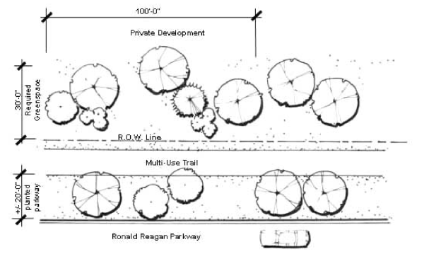 Figure 2-1 Green Space Area Requirements
 - Mounds are required to screen parking lots fronting the Ronald Reagan Parkway. Mounds must be covered with groundcover and planted with a minimum of 3 shade trees, 2 ornamental or evergreen trees, and 6 shrubs per 100 linear feet and must be parallel the Ronald Reagan Parkway as illustrated in Figures 2-2 and 2-3, Mounds. The mound is a maximum of 5 feet above surrounding grade and must have rounded flanks. The mounds and landscape patterns must maintain the natural appearance and character of the corridor.
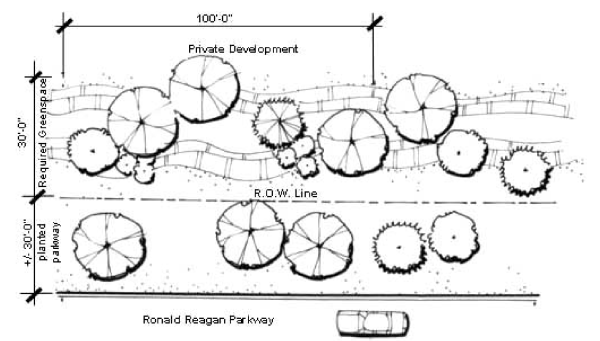 Figure 2-2 Mounds
 Figure 2-3 Mounds
- Parking Lot Landscaping:
Parking Lot Interior Planting: Where parking lots of commercial, office, and industrial uses are in the front or side yards of the building and are visible from the Ronald Reagan Parkway:- The interior of the parking lot must be planted with 10 shade trees and 20 shrubs for every acre of parking.
- A 6-foot-wide perimeter planting area is required along the front and sides of the entire parking lot as shown in Figures 2-4 and 2-5, Parking Lot Planting. The perimeter planting area is required in addition to the greenspace area.
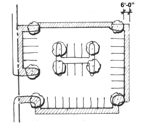 Figure 2-4 Parking Lot Planting
Figure 2-5 Parking Lot Planting - If an earthen mound is used to screen the parking from the Ronald Reagan Parkway, additional perimeter planting is not required on the side containing the earthen mound. The 3 remaining sides must be landscaped according to the provisions set forth below.
- The perimeter planting area must be landscaped with at least 3 shade trees, 2 ornamental or evergreen trees, and 6 shrubs per 100 linear feet.
- Median Landscaping Guidelines: These standards apply to all medians within the Overlay located outside the Ronald Reagan Parkway right-of-way. Medians must be a minimum of 5 feet wide.
- Medians must be landscaped with a mixture of trees, shrubs, perennials, groundcovers, and annuals. The median plantings must maintain the natural appearance and character of the corridor.
- The median must be planted with at least one tree and one shrub per 40 linear feet.
- Paving accents, such as brick or decorative pavers, must be incorporated into the median noses in a manner consistent with the Ronald Reagan Corridor Design Guidelines and Master Plan.
- Parking Standards:
- Direct, articulated pedestrian access is provided from the side street and parking area to the building’s primary entrance.
- Above grade, structured parking facilities must have architectural features on all sides compatible with the principal building.
- Parking lots must be designed to provide coordinated access to parking areas on adjoining parcels within the Overlay. A site circulation plan is required as part of the development plan to illustrate how coordinated access will occur relative to the overall Ronald Reagan corridor.
- Parking areas and drives must be paved with asphalt or concrete. Brick pavers or other decorative pavements may be used as accents in parking area design. Cast-in-place concrete curbs are required.
- Sign Standards:
- A signage plan is included as part of the development plan application.
- In the Overlay, signage must be designed as an integral part of the architectural and landscaping plans. The colors, materials, and style of signage must be architecturally compatible and accentuate the buildings and landscaping on the site. The colors, materials, and lighting of every sign is restrained and harmonious with the building and site to which it principally relates.
- Off premise signs are prohibited in the Ronald Reagan Overlay District Corridor.
- All lettering or logos are prohibited on any awning in the Overlay District.
- The integration of development signage, particularly the sharing of signs to identify multiple businesses, is encouraged within the Overlay. The Plan Commission has the authority to approve integrated center signage if it determines the signage would promote the intent and purposes of the Ronald Reagan Corridor Overlay District. Signage must conform to the character of the corridor as outlined in the Ronald Reagan Corridor Master Plan.
- Every sign must conform to the design regulations as specified in the Ronald Reagan Design Guidelines Manual.
- Identification signs of a prototype design and corporation logos conforms to the criteria for all other signs.
- Integrated Center signs are only permitted by right for unified centers such as business parks, office parks, industrial parks and shopping centers under these provisions. Only one such sign is displayed for each unified center. Integrated Center signs must meet the following requirements:
- A maximum sign area of 60 sf and a maximum height of 6 feet. The sign area may be increased by 10% if all signage on the site is primarily comprised of brick, stone, sculpted metal, or an equivalent substitute. An additional 10% increase is permitted when a uniform and complimentary sign plan is provided for all signage for the site (including wall, tenant, outlot, and integrated center signs). The sign plan must be approved by the Plan Commission during the development plan review process and address colors and materials.
- Unified center signs must resemble the character depicted in Figure 2-6, Unified Center Sign.
 Figure 2-6 Unified Center Sign
- Sign Landscaping: The landscaping plan for any signs must be created, as follows:
- A defined landscaped area must be placed at the base of the sign in a method harmonious with the landscape concept for the whole site. Landscaping should be an attractive and dense cluster equally attractive in the winter and summer. The required landscaped area should be parallel to the face of the sign.
- Formal plantings are required at the base of all secondary gateways (monument) and unified center signs using a minimum 3' wide planting bed along both sides of signs and planted with a mixture of ground cover, shrubs, perennials, and annuals arranged as illustrated in Figure 2-7, Sign Landscaping.
- Secondary gateway signs must contain the Longshadow prairie planter and must be landscaped according to the standards specified in the Ronald Reagan Design Guidelines Manual.
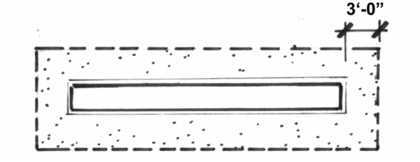 Figure 2-7 Sign Landscaping
- Wayfinding Signage: Wayfinding signage is used to direct vehicular traffic to destinations in and near the Ronald Reagan Corridor. Parkway wayfinding signage must be located within the right-of-way and meet the following criteria:
- Signs are free standing and located near intersections where they provide direction to local destinations for vehicular travelers. The signs cannot interfere with pedestrian accessibility.
- Signs conform to the theme of the Ronald Reagan Corridor Master Plan. See Figure 2-8, Example Wayfinding Signage, as an example of approved signage. Signs comply with the standards specified in the Ronald Reagan Design Guidelines Manual.
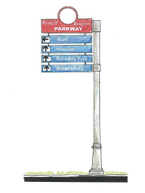 Figure 2-8 Example of Wayfinding Signage
- Gateway Signage Locations: Major gateways are identified as the I-70 interchange, the Rockville Road/US 36 intersection, and the I-74 interchange. Secondary gateways mark entrances to public and private establishments.
- Major Gateway Signage:
- Major gateway signage is located at major gateways along the Ronald Reagan Parkway and incorporates the Ronald Reagan Parkway into its design.
- Major gateway signage is constructed of natural materials consistent with the character of the Corridor as specified Ronald Reagan Corridor Master Plan and according to the standards set forth in the Ronald Reagan Corridor Design Guidelines Manual illustrated in Figure 2-9, Example of Major Gateway.
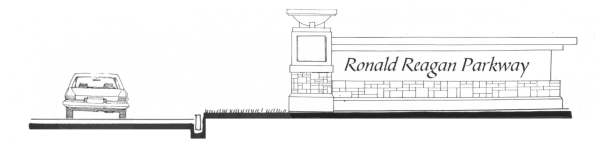 Figure 2-9 Example of Major Gateway
 - Major gateways are of a scale appropriate for vehicular traffic as set forth in the Ronald Reagan Corridor Design Guidelines Manual.
- Major gateways incorporate ornamental plantings, flags, and sculptural elements according to the standards set forth in the Ronald Reagan Corridor Design Guidelines Manual.
- Secondary Gateway Signage:
- Secondary gateway signage is constructed of natural materials consistent with the character of the corridor according to the Ronald Reagan Corridor Design Guidelines Manual as shown in Figure 2-10, Example of Secondary Gateway.
 Figure 2-10 Example of Secondary Gateway
 - Special accent plantings are used to highlight the gateway as a distinct area according to the Ronald Reagan Corridor Design Guidelines Manual.
- The signage is located within the 30 foot green space area and maintains vision clearance standards (see 5.21 Vision Clearance).
- Secondary gateway signage is constructed of natural materials consistent with the character of the corridor according to the Ronald Reagan Corridor Design Guidelines Manual as shown in Figure 2-10, Example of Secondary Gateway.
- Intersection Enhancements:
- Intersection enhancements are made according to the standards specified in the Ronald Reagan Corridor Design Guidelines Manual.
- Pedestrian signals are installed at each intersection with a marked crosswalk.
- Signalized intersections must have marked crosswalks. Marked crosswalks are strongly encouraged at non-signalized intersections.
- Decorative paving and/or tactile surfaces are strongly encouraged at intersections and must comply with all Americans with Disabilities Act standards.
- Intersection enhancements are made according to the standards specified in the Ronald Reagan Corridor Design Guidelines Manual.
- Major Bridge Treatments:
- Bridges must have enhancements including special wall treatments, parkway signage visible from the underpass, corridor lighting, and decorative railings and planters as specified in the Ronald Reagan Corridor Design Guidelines Manual and as illustrated in Figure 2-11, Example of Special Bridge Enhancements.
 Figure 2-11 Example of Special Bridge Enhancements
 - Bridges must be well lit and contain a safe pedestrian passage according to the standards specified in the Ronald Reagan Corridor Design Guidelines Manual.
- Bridges must include a multi-use path at least 12’ in width. For additional multi-use path standards, see Section T and the standards specified in the Ronald Reagan Corridor Design Guidelines Manual.
- Bridges must have enhancements including special wall treatments, parkway signage visible from the underpass, corridor lighting, and decorative railings and planters as specified in the Ronald Reagan Corridor Design Guidelines Manual and as illustrated in Figure 2-11, Example of Special Bridge Enhancements.
- Minor Bridge Treatments:
- The CSX bridge receives minor bridge treatments including corridor lighting consistent with the lighting standards of this Ordinance, decorative railings and planters developed according to the standards specified in the Ronald Reagan Corridor Design Guidelines Manual.
- Bridges must be well lit and contain a safe pedestrian passage according to the standards specified in the Ronald Reagan Design Guidelines Manual.
- Bridges must include a multi-use path at least 12’ in width. For additional multi-use path standards, see Section T and the standards specified in the Ronald Reagan Corridor Design Guidelines Manual.
- Retaining Wall Treatments:
- Retaining walls are utilized at entry drives for public and private establishments.
- Walls that are connected to buildings must all conform to the character of the building.
- Retaining walls that are not connected to buildings must conform to the character of the corridor as established in the Ronald Reagan Corridor Master Plan and Design Guidelines by utilizing limestone and/or sandstone.
- Lighting Standards:
- Lighting patterns must not cause a false image of an aircraft runway. All FAA lighting standards supersede the requirements of this Ordinance within the airport planning area.
- All lighting fixtures, including those on buildings, security lights and architectural lights within the Overlay must be of uniform design and material.
- Parking lot lighting and streetlights must be a uniform height not to exceed 20 feet.
- Lighting standard foundations must not extend more than 4” above the finished grade.
- Lighting styles and designs must be consistent with standards specified in the Ronald Reagan Design Guidelines Manual.
- Access to Individual Tracts:
- Consistent with the Ronald Reagan Corridor Master Plan, the intent of this Overlay is to maximize safety and minimize disruption of traffic flow on the Ronald Reagan Parkway by directing access from abutting properties to existing or planned public streets that intersect with the Parkway.
- The Ronald Reagan Parkway is an access managed highway, and access to individual tracts along this highway must be gained by access roads if access does not exist.
- Direct access to the Ronald Reagan Parkway is only considered where physical limitations and/or traffic impact studies show there is no feasible alternative.
- All median openings and traffic signals, if warranted, must be at least 1/2 mile apart according to intersection space restrictions of the Ronald Reagan Corridor Master Plan.
- Other access points, if approved, will be right in, right out only with no median opening.
- Common entrances shared by several properties and developments are required at the discretion of the Plan Commission.
- Curb cuts are not permitted on the Ronald Reagan Parkway in cases where tracts can be accessed by connection to a primary or secondary arterial street identified in the Thoroughfare Plan, a local street, or an adjoining parking lot.
- In order to preserve the aesthetic benefits provided by the green space area, access roads must be provided at the rear of all tracts, whenever possible.
- Access roads to contiguous tracts must be coordinated to form one main access road serving adjoining developments. These roads should be designed to funnel traffic onto major arterial roads rather than into residential areas and roads that adjoin or near the Overlay.
- Access roads must be designed to align with one another.
- The Plan Commission encourages maximum distances between curb cuts to the Ronald Reagan Parkway.
- Traffic Impact Studies: Traffic Impact Studies are required for proposed developments expected to generate 100 or more new peak direction trips to or from the site. Traffic Impact Studies must meet the requirements of this Ordinance. Specific traffic impact analysis requirements for individual developments must be established with the Administrator with input from the County Engineer.
- Multi-Use Path:
- A multi-use path must be provided on the Ronald Reagan Parkway. The path must be a minimum of 10’ in width and have a minimum 20’ buffer between the path and the roadway unless such a buffer is not feasible due to site constraints.
- The path must be designed and constructed according to the standards specified in the Ronald Reagan Corridor Design Guidelines Manual and as shown in Figure 2-12, Section of Corridor with Multi-Use Path.
 Figure 2-12 Section of Corridor with Multi-Use Path
 - The path must be connected to other planned or existing pathways to maximize opportunities for pedestrian circulation throughout the corridor. Pocket plazas associated with commercial or industrial uses are encouraged to establish links to the multi-use path. Mid-block pedestrian crossings are prohibited.
- Decorative paving and/or tactile surfaces are encouraged at curb ramps and intersections.
- Lighting along the path must be pedestrian in scale and comply with the standards specified in the Ronald Reagan Corridor Design Guidelines Manual. Wherever possible, shade trees must be oriented to provide shade for the trail and pedestrian friendly elements such as water fountains, seating, and rest spots should be incorporated into the pathway.
- A multi-use path must be provided on the Ronald Reagan Parkway. The path must be a minimum of 10’ in width and have a minimum 20’ buffer between the path and the roadway unless such a buffer is not feasible due to site constraints.
- Emergency Access: All emergency access areas and facilities must be shown on the site plan and approved by the Fire Chief.
- Other Requirements:
- Outside Storage of Refuse: Unenclosed storage of refuse (whether in containers) is not permitted on any property within the overlay. Refuse collection and recycling areas must be in the rear of all buildings and not visible by traffic along the Ronald Reagan Corridor. Trash receptacles must be screened on three sides with a minimum 6’ opaque wall consistent in materials with the primary structure or opaque plant materials as shown in Figure 2-13 and Figure 2-14, Screened Refuse Area. Refuse collection containers must be architecturally compatible with the principal building.
 Figure 2-13 Screened Refuse Area
 Figure 2-14 Screened Refuse Area
 - Outdoor Display and Storage: Outdoor display of merchandise is prohibited on any property within the Overlay. Outside storage is prohibited between an established Build-To Line and the right-of-way for the Ronald Reagan Parkway.
- Loading Areas: Loading spaces and overhead doors must be located at the rear or side of a building and screened from view from the Parkway. Loading areas must be screened using masonry walls and plant material as shown in Figure 2-15 and 2-16, Examples of Loading Area.
 Figure 2-15 Example of Loading Area
 Figure 2-16 Example of Loading Area
- Outside Storage of Refuse: Unenclosed storage of refuse (whether in containers) is not permitted on any property within the overlay. Refuse collection and recycling areas must be in the rear of all buildings and not visible by traffic along the Ronald Reagan Corridor. Trash receptacles must be screened on three sides with a minimum 6’ opaque wall consistent in materials with the primary structure or opaque plant materials as shown in Figure 2-13 and Figure 2-14, Screened Refuse Area. Refuse collection containers must be architecturally compatible with the principal building.
2.10 US HWY 36 Overlay Zoning District
- Purpose: The purpose of the US Highway 36 Overlay Zoning District is to promote and protect the public health, safety, comfort, convenience, morals and general welfare by providing consistent and coordinated standards for properties adjacent to or near the US Highway 36 Corridor in Avon, Indiana. The Avon Plan Commission and Town Council, in establishing this zone, are relying on IC 36-7-4-600 et seq. and IC 36-7-4-1400 et seq. The US Highway 36 Overlay Zoning District is intended to serve as a tool for implementing the Comprehensive Plan. The corridor's character, viability, quality and functionality are important to the Town because it is the community's primary east-west thoroughfare, and also a major location for commercial uses that contribute to the local economy, and, as such, carries high numbers of local travelers and visitors. Therefore, a further purpose of the US Highway 36 Overlay Zoning District is to preserve and enhance the aesthetic qualities of properties both adjacent and visible from the corridor through:
- the promotion of coordinated development within the US Highway 36 Overlay District;
- the establishment of high standards for development on properties within the Overlay District, including buildings, signs, landscaping, parking and other site improvements, which permit innovative site design while encouraging efficient land use;
- the establishment of development and use standards that promote the quality, scale, character and type of development consistent with the corridor's high level of importance to the Town;
- to diversify the workforce and provide more opportunities for residents of Avon to work in the Town, specifically high tech, office, and higher education;
- the establishment of access management standards to reduce the number of curb cuts along US HWY 36 and improve traffic flow; and
- to manage growth in undeveloped areas of town so not to increase traffic volume and degrade the level of service of the corridor.
- Boundaries: The boundaries of the US Highway 36 Overlay Zoning District are:
Extending north 1/4 mile from the northern edge of the US Highway 36 right-of-way and extending south to the northern boundary of the railroad, for the entire length of the highway within Avon's corporate limits excluding existing residential dwellings. New residential dwellings must comply with the architectural design standards for residential districts (see Article 7.9). If the residentially used property changes to a non-residential use, that property becomes part of the Overlay District and must conform to the regulations of the US Highway 36 Overlay Zoning District.
The Overlay District is divided into three tiers. Each tier may have different zoning regulations. Tier 1 includes the portion of any lot that is within 260 feet from the edge of US Highway 36 right-of-way or in front of the first east/west access road for the highway, regardless of whether there is actual access from the highway. Tier 2 includes all other properties within the Overlay District that are not determined to be within Tier 1 or Tier 3. Tier 3 includes all property that is 660 feet or more from the edge of the right-of-way of US Highway 36.
It is the intent of this Ordinance to extend this Overlay District to include any properties that are annexed into Avon within the Overlay. If only a portion of a lot or tract falls within the Overlay District, the entire property must be developed using the standards of the Overlay District. - Applicability to Existing Development: Existing development, which was developed legally, is considered legal non-conforming, with respect to the Overlay District standards. In the event of an unavoidable accident which destroys a structure beyond 50% of its value, a legally existing non-conforming structure may be rebuilt as it was. If it is to be larger than the non-conforming structure that was destroyed, the new structure must comply with these Overlay District standards.
Any of the following proposed changes to an existing legally non-conforming structure or site requires the addition or change comply with the Overlay District standards:- If a proposed addition to a structure equals or exceeds 35% of the total existing building gross floor area of that structure; or
- If a proposed change to a parking area would result in an increase of 35% or more parking spaces, or an increase in parking lot area of 35% or more.
- Changes to paint color. Additionally, changes in paint color do not require Plan Commission approval provided the improvement complies with 7.9 – 7.11 Architectural Standards of this Ordinance; or
- The addition of landscaping to a legal nonconforming site, that is not in association with improvements listed in numbers 1 and 2 above. All new landscaping must comply with the approved species as found in 6.1 Landscaping – General Standards of this Ordinance.
Amendments to approved development plans must comply with 8.9 Rezones and Amendments of this Ordinance. - Green Design: All new development and major redevelopment within the US Highway 36 Overlay Zoning District is encouraged, but not required to meet the Leadership in Energy and Environmental Design (LEED®) Green Building Rating System certification requirements.
The Town believes green design makes a positive impact on public health and the environment and also reduces operating costs, enhances building and organizational marketability, potentially increases occupant productivity, and helps create a sustainable community. - Uses: When determining whether a use is allowed in the US Highway 36 Overlay Zoning District, first consult the underlying zoning district. If the use is allowed, then consult the following lists to determine if the use is prohibited in the Overlay or if the use requires a special exception in the Overlay zone. If a use is legally established at the time the Overlay District is enacted, but is no longer permitted according to this section, it is considered legally nonconforming, in compliance with this Ordinance.
The following uses are prohibited in all Tiers:- Adult Businesses
- Auto Services, Heavy
- Telecommunication Towers
- Mining and Extraction (all types)
- Off-Premise Sign
- Cemetery
- Arts, Recreation, Entertainment – Outdoor
- Retail Sales, Service and Repair – Special Handling
- Contractors, Special Trade – Heavy
- Food Preparation and Sales, Commercial
- Manufacturing (all types)
- Composting Facility
- Wholesale Storage (all types)
- Outdoor Storage
- Retail Sales, Service and Repair – Outdoor
- Contractors, Special Trade – General
- Recycling Drop-Off Facilities
- Plant Nursery
- Hotel or Motel
- Auto Services, Light
- Parks and Playgrounds
- Schools (all types)
- Drive-thru facilities
- Vehicle Sales and Leasing
- Car Wash
- Vehicle Service and/or Oil Change
- Auto Parts Sales
- Accessory Buildings and Uses: All accessory uses and buildings permitted in the underlying zoning district are permitted, unless they are otherwise prohibited in this Overlay District. Any attached or detached accessory building must meet all the standards of this Overlay District and be architecturally compatible with the principal buildings with which it is associated, unless the Plan Commission approves alternative architecture. No accessory buildings are permitted unless there is a principal building on the lot or tract.
- Properties with Agricultural Zoning: Properties within the Overlay District which are zoned as Agricultural Overlay District and used according to the standards of that district are considered legally non-conforming upon the adoption of this district. If the agricultural use changes, the property will no longer be considered legally nonconforming. The adoption of this Overlay District should not be construed as a change in zoning.
- Setbacks:
- Minimum Front: The minimum front setback for lots within Tier 1 is 60 feet. Lots within Tiers 2 and 3 must comply with the minimum front setback in the underlying zoning district.
- Maximum Front: The maximum front setback for lots within Tier 1 is 125 feet. There is no maximum front setback for Tier 2 and 3.
- Minimum Side and Rear: The minimum side and rear setbacks must comply with the underlying zoning district, except where adjacent to any residential use or zone, when the minimum is 45 feet.
- Utility Lines: All new on-site utility service lines must be buried underground. If US Highway 36 is widened in the future, the Town requests all overhead utility lines along the highway be buried beneath the ground.
- Parking & Loading:
- Pedestrian Walkways: The Plan Commission approves all pedestrian walkways. Pedestrian walkways should be coordinated with the interior parking lot landscaping. All surface parking areas with more than 200 parking spaces must provide continuous internal pedestrian walkways to connect the parking area with the primary building entrance( s). For all parking areas with more than 50 spaces, there must be at least one internal pedestrian walkway with a minimum width of 5' that connects the internal pedestrian walkway with the public sidewalk or trail. Pedestrian walkways must be distinguished from driving surfaces through the use of durable, low-maintenance surface materials such as pavers, bricks, or scored/stamped concrete or asphalt. Pedestrian walkways should be coordinated with landscape areas whenever possible or the design of the walkways should provide some other form of protection from vehicles.
- Parking in Front: Within Tier 1, the maximum amount of parking allowed in front of a building sis 2 rows. Within Tier 2, only the minimum amount of required parking may be in front of the building. Any extra parking must be located on the side or rear of the building. Within Tier 3 there is no limit on how much of the approved parking may be placed in front of the building. The Plan Commission may approve an alternative parking layout.
- Extra Landscaping Required: In Tier 1 or Tier 2 parking provided above the minimum parking requirement must provide additional landscaping according to 6.7 Landscaping – Parking Lots.
- Handicapped Parking Spaces: Handicapped-parking spaces must comply with state and federal regulations and be located the closest to the entrances. Whenever possible there should be separation between handicap and pick-up spaces.
- Pick-up Spaces: Pick-up spaces must be located no closer to the entrances than handicapped spaces. Each pick-up space may include a sign, not to exceed 2 square feet, which counts as part of a business's total sign area.
- Bicycle Parking: A bicycle parking area may be provided for each building, in an appropriate and accessible location.
- Loading: Loading and unloading areas cannot be oriented to US Highway 36 or any other public street and must be placed behind the building.
- Pedestrian Walkways: The Plan Commission approves all pedestrian walkways. Pedestrian walkways should be coordinated with the interior parking lot landscaping. All surface parking areas with more than 200 parking spaces must provide continuous internal pedestrian walkways to connect the parking area with the primary building entrance( s). For all parking areas with more than 50 spaces, there must be at least one internal pedestrian walkway with a minimum width of 5' that connects the internal pedestrian walkway with the public sidewalk or trail. Pedestrian walkways must be distinguished from driving surfaces through the use of durable, low-maintenance surface materials such as pavers, bricks, or scored/stamped concrete or asphalt. Pedestrian walkways should be coordinated with landscape areas whenever possible or the design of the walkways should provide some other form of protection from vehicles.
- Drive-Throughs: All components of a drive-through, including stacking spaces, menu boards, and pick-up windows must be located within the side or rear yards of a lot. Drive-through components cannot be located within the front yard, or in the case of a corner lot, cannot be located in the front yard that faces US Highway 36.
- Access to Individual Tracts: The purpose of this section is to discourage new curb cuts and to reduce the use of existing curb cuts along U.S. Highway 36. Full access to all tracts from U.S. Highway 36 can only occur at signalized intersections, as depicted in Avon's Thoroughfare Plan. When development occurs where a future business collector is indicated on the Thoroughfare Plan, the developer must construct their portion of the business collector (access road). In lieu of access to U.S. Highway 36, tracts must be accessed via connection to another arterial street, collector street, local street, or access easement through an adjoining parking lot when possible. When other access alternatives are not feasible and adjacent tracts fronting U.S. Highway 36 are undeveloped the Plan Commission may allow right in/right out driveways at a minimum distance of 600 feet from other curb cuts on U.S. Highway 36, in cooperation with the Indiana Department of Transportation. Bicycle and pedestrian circulation to and through the site must be coordinated with vehicular access, landscaping and parking.
- Landscaping:
- Front Yard Landscaping: Each front yard must contain a landscape buffer at least 20' wide planted with a minimum of one shade tree and 10 shrubs per 50 lineal feet of frontage. With the approval of the Plan Commission, public art may be provided in the front yard in lieu of 2 required large deciduous trees.
- Foundation Planting: For buildings up to 50,000 sf, the standard foundation plant requirements apply (see 6.5 – Landscaping – Foundation Plantings). For buildings over 50,000 sf, at least one shade tree, one ornamental tree, and 10 shrubs are required every 75 linear feet of landscape area. Foundation planting areas must be within 18' of the building when a sidewalk is adjacent to the building.
- Interior Parking Lot Landscaping: At least 7% of the interior of a parking area must be devoted to landscaping. In the case of parking exceeding the minimum number of spaces required, 10% of the interior of the extra parking area must be devoted to landscaping.
- Perimeter Parking Lot Landscaping: In addition to the underlying landscape standards, at least 2 shade trees are required for every 70 lineal feet of perimeter parking lot length.
- Signs: Except as noted below, signage within the Overlay follows the standards set in CHAPTER 6: IMPROVEMENT STANDARDS.
- Pylon Signs: Pylon signs are prohibited, except for integrated centers which may have signage according to 6.17 Signage – Specific Requirements of this Ordinance. A pylon sign may not contain a visible metal pole and must be constructed using masonry products.
- Electronic Message Signs: Electronic message signs are prohibited within the Overlay.
- Wall Signs: Wall signs that are part of an integrated center must be consistent within the center, specifically having a complimentary style (e.g., individual channel letters or lighted panel).
- Off-Premise Advertising or Billboard Signs: Off-Premise Advertising or Billboard Signs are prohibited within the Overlay.
- Architectural Design Requirements: The following standards apply to all new or substantially renovated buildings within this Overlay District. All buildings must be designed with respect to the general character of the US Highway 36 Corridor and must consider the design of buildings on abutting lots. Buildings within Tier 1 and Tier 2 must be oriented to face U.S. Highway 36. For corner lots, all other elevations facing a public street must have a front-like façade.
- Public Spaces: In order to contribute to the establishment and enhancement of community and public spaces, each integrated center building 40,000 s.f or larger must provide at least two of the following amenities: patio/seating area, pedestrian plaza with benches, transportation center, window shopping walkway, outdoor playground area, kiosk area, water feature, clock tower, or other deliberately shaped area and/or focal feature or amenity the Plan Commission believes will adequately enhance the community and public spaces. Such areas must have direct access to the public sidewalk network. The features cannot be constructed of materials inferior to the principal materials of the building and landscape.
- Building Materials:
- Masonry: Buildings within Tier 1 must be a minimum of 80% masonry on all sides, excluding windows and doors. Buildings within Tier 2 must be a minimum of 80% masonry, excluding windows and doors, on the side facing US Highway 36 and 50%, excluding windows and doors, on the remaining sides. Buildings within Tier 3 must follow the existing standards of this Ordinance, and must have a minimum of 60% brick, stone, dryvit, or stucco, excluding windows and doors, on the elevation facing a public street and a minimum of 30% masonry, excluding windows and doors, on the remaining sides.
- Prohibited Materials: Concrete block (including split face block), prefabricated steel panels, and vinyl siding are prohibited as exterior finish materials within this Overlay District. In Tier 1 and Tier2, Dryvit and stucco are prohibited except when used as accent materials covering the balance of the wall after the masonry is applied. Coating or painting of a prohibited material does not constitute a permitted material.
- Two Different Materials: A minimum of two different exterior finish materials must be used for building exteriors, including stone, brick, architectural precast (panels or detailing if the surface looks like brick or stone), architectural metal panels, glass, ornamental metal and Dryvit or stucco when not exceeding the maximum wall coverage in 7.9 – 7.11 Architectural Standards. The building(s) must use these materials for all the exterior finish. The building may not be constructed entirely of a metal and glass curtain wall. Where materials are combined horizontally on one façade, the heavier material must be below.
- Color: A minimum of two different colors must be used for building exteriors. Colors should be primarily neutral or earth tones. Neutral colors include beige, ivory, taupe, black, grey, and white. Earth tone colors include colors from the palette of browns, tans, greys, greens, and red. Earth tone colors should be flat or muted. The use of high intensity colors, neon or fluorescent color is prohibited. Building trim and accent areas may feature brighter colors, including primary colors, but neon tubing is not be an acceptable feature for building trim or accent areas. The Plan Commission approves the building's color palette and may approve an alternative color scheme.
- Glazing: Retail buildings must provide glazing on a minimum of 35% of the ground floor front façade. Side elevations must contain a minimum of 10% glazing of the ground floor side facade or in lieu of glazing 2 architectural features. These requirements do not prohibit the use of stained-glass windows for places of worship.
- Building Design:
- Articulation: Building elevations in Tier 1 and Tier 2 greater than 60' in length, measured horizontally, must incorporate wall plane projections or recesses every 40', having a depth of at least 3 feet and a width of at least 20'.
- Architectural Features: Buildings having up to 25,000 s.f within Tier 1 and Tier 2 must have a minimum of 2 architectural features, and buildings 25,000 s.f and larger within Tier 1 and Tier 2 must have a minimum of 3 architectural features. Architectural features are selected from the following:
- Front Façade Features: On the building elevation facing US Highway 36, at least 60% of the horizontal length must have at least one of the following: arcades, display windows, outdoor patios or plazas, entry areas, awnings or other features approved by the Plan Commission.
- Entrance Features: Each principal building on a site must have clearly defined, highly visible entrances featuring at least one of the following:
- Canopies or porticos
- Overhangs
- Recesses and/or projections
- Raised cornice parapets over the door
- Peaked roof forms
- Arches
- Architectural details including tile work and moldings integrated into the building structure and design
- Integral planters or wing walls that incorporate landscaped areas and/or places for sitting
- Other features approved by the Plan Commission
- Roofs: Roofs must include at least two of the following:
- Energy Efficient Rooftop Systems: Roofs may be constructed of an energy efficient material in order to reduce the "heat island" effect.
- Parapet: The average height of a parapet cannot exceed 15% of the height of the supporting wall and at no point can be taller than 1/3 of the height of the supporting wall. Parapets must feature 3-dimensional cornice treatment.
- Overhanging Eaves: Eaves must extend at least 3 feet past the supporting walls.
- Sloping Roof: Sloping roofs must have an average pitch between 4:12 and 12:12.
- Multiple Planes: There must be at least 3 different roof slope planes.
- Fences and Gates: Fences are prohibited within a front yard in Tiers 1 and 2. Chain link and barbed wire fences are prohibited within this Overlay District, except that chain link fencing may be used in Tier 3 if it is not visible from a public street. Gates for fences and all other screening walls must be constructed of metal facing with wood or wood-look PVC slats.
- Mechanical Equipment or Penetrations: All mechanical equipment must be located behind the building. If mechanical equipment is located on a roof, or if there are other roof penetrations, they must be screened from all streets with a parapet wall or other acceptable method.
- Waivers of Standards: The provisions of 7.9 – 7.11 Architectural Standards may be waived according to the terms of 8.16 Waivers of Design Standard.
- Trash and Recycling: Trash collection and recycling areas must be enclosed and screened on all sides, with an opaque wall between 7 feet and 10 feet in height. Within Tier 1, screening walls must be constructed of the same building materials as the principal building. Trash collection and recycling areas must be in the rear of all buildings, unless the Plan Commission approves an alternative location.