Casco Township City Zoning Code
CHAPTER 4
MAPPED DISTRICTS
Sec. 4.01.- Districts established.
In order to more effectively protect and promote the general welfare and accomplish the aims and objectives of the Master Plan, the Township is divided into zoning districts of such number, boundaries, shape, and area that are deemed most suitable to provide for the best development of the community, while protecting the common rights and interests of all through associated regulations and restrictions. For the purposes of this Ordinance, the Township is hereby divided into the following zoning districts:
Sec. 4.02. - Zoning Map.
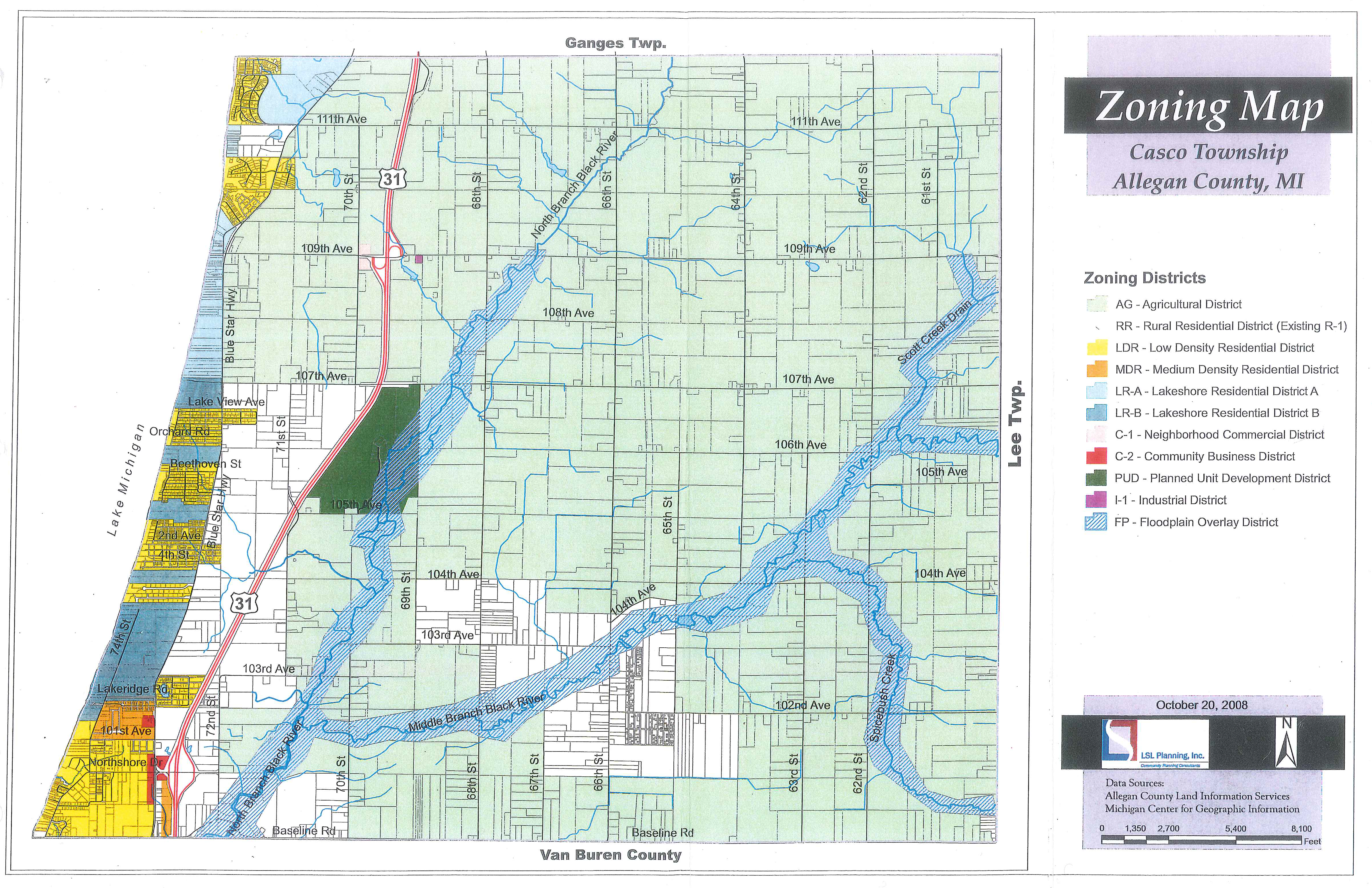
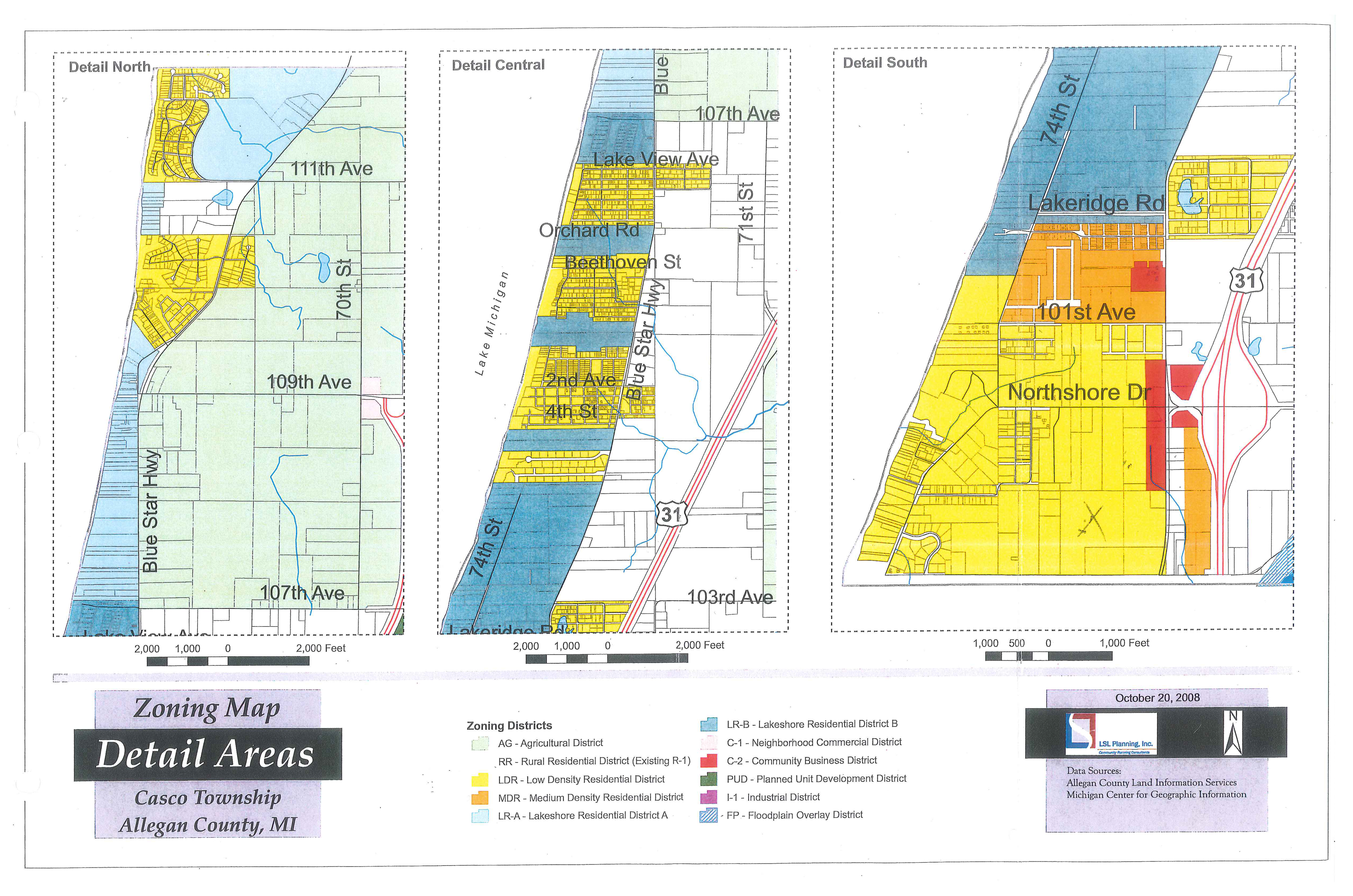
The locations and boundaries of these descriptions are hereby established on a map entitled "Casco Township Zoning Map" which is hereby adopted and declared to be a part of this Ordinance.
A.
Regardless of the existence of copies of the zoning map which may be made or published, the Official Zoning Map shall be located in the office of the Zoning Administrator and shall be the final authority as to the current zoning status in the Township.
B.
A record is to be kept by the Zoning Administrator of all changes made or required to be made to the Official Zoning Map. The Official Zoning Map is to be kept up to date, be distributed to the appropriate officials and be accessible to the general public.
Sec. 4.03. - District boundaries.
Where uncertainty exists as to the boundaries of zoning districts as shown on the Official Zoning Map, the following rules shall apply:
A.
Boundaries indicated as approximately following the centerline of roads, highways, or alleys shall be construed to follow such centerlines.
B.
Boundaries indicated as approximately following platted lot lines shall be construed as following such lot lines.
C.
Boundaries indicated as approximately following Township boundary lines shall be construed as following such Township lines.
D.
Boundaries indicated as approximately following railroad lines shall be construed to be the centerline of the railroad right-of-way.
E.
Boundaries indicated as approximately parallel to the centerlines of roads or highways or alleys shall be construed as being parallel thereto and at such distances there from as indicated on the Official Zoning Map. If no distance is given, such dimension shall be determined by the use of the scale shown on the Official Zoning Map.
F.
Boundaries following the shoreline of stream, lake, or other body of water shall be construed to follow such shoreline, and in the event of change in the shoreline shall be construed as moving with the actual shoreline. Boundaries indicated as approximately following the centerline of streams, rivers, canals, or other bodies of water shall be construed to follow such centerlines.
G.
Where the application of the aforesaid rules leaves a reasonable doubt as to the boundaries between two zoning districts, the Zoning Administrator shall determine the appropriate district boundaries. Appeals of the Zoning Administrator decision may be taken only to the Zoning Board of Appeals.
Sec. 4.04. - Zoning of vacated areas.
Whenever any road, alley or other public right-of-way within the Township is vacated by official governmental action, and when the lands within the boundaries thereof attach to and become a part of lands adjoining such road, alley, or public way, such lands shall automatically and without further governmental action be subjected to the same zoning regulations as are applicable to the adjoining lands.
Sec. 4.05. - Zoning of filled land.
Whenever any fill is placed in any lake or stream, after all required permits are obtained, the land thus created shall automatically and without further governmental action thenceforth acquire and be subjected to the same zoning regulations under this Ordinance for such adjoining lands.
Sec. 4.06. - Zoning district changes.
When zoning district boundaries hereafter become changed, any use made nonconforming by such change may be continued, subject to the provisions of Section 3.28 of this Ordinance.