
Clarksville City Zoning Code
CHAPTER 9
OVERLAY DISTRICTS
9.1 - AIRPORT OVERLAY DISTRICT
1.
General Description. The purpose of this district classification is to regulate and restrict the height of structures and objects of natural growth, and otherwise regulate the use of property, in the vicinity of Outlaw Field by creating airport approach surfaces, primary surfaces, transition surfaces, horizontal surfaces, and conical surfaces and establishing the boundaries thereof. The locations and boundaries of the Airport District surfaces established by this section and bounded and defined on the Airport Zoning Map, which is part of this section and is kept by the Regional Planning Commission Office. This section is adopted pursuant to the authority conferred by Sections 42-6-101 through 42-6-116 of the Tennessee Code Annotated. It is hereby found that an airport obstruction which is determined to be a hazard if it endangers the lives and properties of users of Outlaw Airport and of occupants of land or to property in its vicinity; and also, if the obstruction type, in effect reduces the size of the area available for the landing, taking off and maneuvering of aircraft thus tending to destroy or impair the utility of the airport. Accordingly it is declared:
A.
That the creation or establishment of an airport hazard is a public nuisance and an injury to the region served by Outlaw Airport;
B.
That it is necessary in the interest of the public health, public safety and general welfare that the creation or establishment of airport hazards be prevented; and,
C.
That the prevention of these hazards should be accomplished, to the extent legally possible, by the exercise of police power without compensation. It is further declared that both the prevention of the creation or establishment of airport hazards and the elimination, removal, alteration, mitigation, or marking and lighting of airport hazards are public purposes for which political subdivisions may raise and expend public funds and acquire land or interests therein.
2.
Application of Regulations.
A.
This district shall overlay land within the airport hazard areas shown on the zoning map. The regulations contained in this section shall apply to the land in addition to the regulations in the underlying district for the land. Where there is a conflict between the provisions of this section and those of the underlying zoning district, the zone containing the more restrictive height regulations shall apply.
B.
Except as hereinafter provided in Subsection 9.1.8. of this section, the provisions of this section shall apply to any new and substantial improvement to an existing structure, when such uses and structures are located in an airport hazard area established by this section.
C.
If a structure or a tree is located in more than one (1) of the airport surfaces established by this section, the surface with the more restrictive regulations shall apply to such structure or tree.
3.
Definitions. As used in this section, unless the context otherwise requires:
A.
Airport: Outlaw Field, Clarksville, Tennessee.
B.
Airport elevation: Five hundred fifty (550) feet above mean sea level.
C.
Airport hazard: Any structure, tree or use of land which obstructs the airspace required for or is otherwise hazardous to the flight of aircraft in landing or taking off at the airport.
D.
Nonprecision instrument runway: A runway other than an instrument runway.
E.
Precision instrument runway: A runway equipped or to be equipped with a precision electronic navigation aid or other air navigation facilities suitable to permit the landing of aircraft by an instrument approach under restricted visibility conditions.
F.
Runway: The paved surface of an airport landing strip.
4.
Airport Imaginary Surfaces. The following airport imaginary surfaces are established with relation to the airport and to each runway. The size of each such imaginary surface is based on the type of approach or planned approach for that runway. The slope and dimensions of the approach surface are determined by the most precise approach existing or planned for that runway end. The various surfaces are hereby established and defined as follows:
A.
Horizontal Surface: A horizontal plane one hundred fifty (150) feet above the established runway elevation, the perimeter of which is constructed by swinging arcs of specified radii from the center of each end of the primary surface of each runway and connecting the adjacent arcs by lines tangent to those arcs. The radius of the arc is:
I.
Five thousand (5,000) feet for all runways designated as utility or visual.
II.
Ten thousand (10,000) feet for all other runways.
B.
Conical Surface: A conical surface is hereby established as the area that commences at the periphery of the horizontal surface and extends outward therefrom a distance of five thousand (5,000) feet. The conical surface does not include the approach surface or the transition surface.
C.
Primary surface: A primary surface is hereby established as the surface longitudinally centered on the runway which extends two hundred (200) feet beyond the end of each runway. The width of the primary surface is:
I.
Two hundred fifty (250) feet for utility runways having only visual approaches.
II.
One thousand (1,000) feet for non-precision instrument runways with visibility minimums less than three-fourths (3/4) of a statute mile and for all precision instrument runways.
D.
Approach Surface: An approach surface is hereby established as the surface longitudinally centered on the extended runway centerline and extending outward from each end of the primary surface. The inner edge of the approach surface is the same width as the primary surface and it expands uniformly to a width of:
I.
One thousand two hundred fifty (1,250) feet for utility runways having only visual approaches.
II.
Four thousand (4,000) feet for all non-precision instrument runways other than utility with visibility minimums as low as three-fourths (¾) statute mile.
III.
Sixteen thousand (16,000) feet for precision instrument runways.
IV.
The approach surface extends for a horizontal distance of:
a.
Five thousand (5,000) feet for all utility and visual runways.
b.
Ten thousand (10,000) feet for all non-precision instrument runways other than utility with visibility minimums as low as three-fourths (¾) statute mile.
c.
Fifty thousand (50,000) feet for all precision instrument runways.
E.
Clear Zone Surface: A clear zone surface is hereby established at each end of the primary surface. The clear zone surface overlaps the approach surface and extends for a width of:
I.
Four hundred fifty (450) feet for all utility and visual runways.
II.
One thousand five hundred ten (1,510) feet for all non-precision instrument runways other than utility.
III.
One thousand seven hundred fifty (1,750) feet for all precision instrument runway.
IV.
The clear zone surface extends for a distance of:
a.
One thousand (1,000) feet for all utility and visual runways.
b.
One thousand seven hundred (1,700) feet for all non-precision instrument runways other than utility.
c.
Two thousand five hundred (2,500) feet for all precision instrument runways.
F.
Transition Surface: A transition surface is hereby established adjacent to the approach surface extending outward at right angles to the runway centerline. Transition surfaces for those portions of the precision approach surface which project through the conical surface, extend for a distance of five thousand (5,000) feet measured horizontally from the edge of the approach surface and at right angles to the runway centerline.
5.
Height Limitations. Except as otherwise provided in the section, no structure or tree shall be erected, altered, allowed to grow, or maintained in any surface created by this section to a height in excess of the height limits herein established for such surface. Such height limitations are hereby established for each of the surfaces in questions as follows:
A.
Horizontal Surface: One hundred fifty (150) feet above the airport elevation or at a height seven hundred (700) feet above mean sea level.
B.
Conical Surface: One foot in height for each twenty (20) feet in horizontal distance beginning at the periphery of the horizontal surface extending for a horizontal distance of five thousand (5,000) feet.
C.
Approach Surfaces: The height limitations for the approach surfaces differ according to the runway classification for each approach. The height limitations for the different runways are as follows:
I.
Utility and visual runways: One (1) foot in height for each twenty (20) feet in horizontal distance beginning at the end of the primary surface extending for a distance of five thousand (5,000) feet from the end of the runway.
II.
Non-precision instrument runways (with visibility minimums as low as three-fourths (¾) of a statute mile): One (1) foot in height for each thirty-four (34) feet in horizontal distance beginning at the end of the primary surface extending for a distance of ten thousand (10,000) feet from the end of the runway.
III.
Precision instrument runways: One (1) foot in height for each fifty (50) feet in horizontal distance beginning at the end of the primary surface extending for a distance of ten thousand two hundred (10,200) feet from the end of the runway, thence one (1) foot in height for each forty (40) feet in horizontal distance to a point fifty thousand (50,000) feet from the end of the runway.
D.
Transition Surface: One (1) foot in height for each seven (7) feet in horizontal distance from the sides of the primary surface and from the sides of the approach surfaces. Transition surfaces for those portions of the precision approach surface which project through and beyond the limits of the conical surface, extend for a distance of five thousand (5,000) feet measured horizontally from the edge of the approach surface and at right angles to the runway centerline.
E.
Where an area is covered by more than one (1) height limitation, the more restrictive limitation shall prevail.
6.
Use Restrictions. Notwithstanding any other provisions of this section, no use may be made of land within any surface established by this section in such a manner as to create electrical interference with radio communication between the airport and aircraft, make it difficult for aircraft or make it difficult for flyers to distinguish between airport lights and others, result in glare in the eyes of flyers using the airport, impair visibility in the vicinity of the airport or otherwise endanger the landing, taking off, or maneuvering of aircraft.
A.
Except as otherwise provided in this section, it shall be unlawful to put land located within the airport clear zone surface to any use, whether it be residential, commercial, industrial, recreational, or public services, which involve the concentrations of people. Such prohibited uses shall include but are not limited to the following:
I.
Hospitals.
II.
Hotels.
III.
Institutions of a religious, educational, philanthropic, penal or corrective nature.
IV.
Single-family dwellings.
V.
Multiple dwellings.
VI.
Nursing or convalescent homes.
VII.
Places of public assemblage.
VIII.
Radio or television transmitting stations.
IX.
Theaters.
X.
Schools.
B.
Any use not involving the concentration of people shall be approved, provided that said use is not deemed an airport hazard by the Board of Zoning Appeals and the Federal Aviation Administration.
C.
Nothing contained in the foregoing exceptions shall be construed as permitting or intending to permit any construction, alteration or growth of any structure or tree in the clear zone surface in excess of the height limits set forth in Subsection 5 of this Chapter.
7.
Nonconforming Uses.
A.
Regulations Not Retroactive: The regulations prescribed by this section shall not be construed to require the removal, lowering, or other changes or alterations of any structure or tree not conforming to the regulations as of the effective date of this section, or otherwise interfere with the continuance of any nonconforming use. Nothing herein contained shall require any change in the construction, alteration, or intended use of any structure, the construction, alteration, of which was begun prior to the effective date of this section and is diligently pursued.
B.
Marking and Lighting: Notwithstanding the preceding provision of this chapter, the owner of any nonconforming structure or tree is hereby required to permit the installation, operation and maintenance thereon of such markers and lights as shall be deemed necessary by the airport authority to indicate to the operators of aircraft in the vicinity of the airport, the presence of such airport hazards. Such markers and lights shall be installed, operated, and maintained at the expense of the airport.
8.
Administrative Procedures. Except as specifically provided in Paragraph A, B and C hereunder, no material change shall be made in the use of land and no structure or tree erected, altered, planted or otherwise established in any surface hereby created unless a permit shall have been applied for and granted. Each application for a permit shall indicate the purpose for which the permit is desired, with sufficient particularity to permit it to be determined whether the resulting use, structure or tree would conform to the regulations herein prescribed. If such determination is in the affirmative, the permit shall be granted.
A.
In the area lying within the limits of the horizontal surface and the conical surface, no permit shall be required for any tree or structure less than seventy-five (75) feet of vertical height above the ground, except when because of terrain, land contour or topographic features such tree or structure would extend above the limits prescribed for such surface.
B.
In the area lying within the limits of the approach surfaces but at a horizontal distance of not less than four thousand two hundred (4,200) feet from each end of the runways, no permit shall be required for any tree or structure less than seventy-five (75) feet of vertical height above the ground, except when such tree or structure would extend above the height limits prescribed for such approach surfaces.
C.
In the areas lying within the limits of the transition surfaces beyond the perimeter of the horizontal surface, no permit shall be required for any tree or structure less than seventy-five (75) feet of vertical height above the ground, except when because of terrain, land contour or topographic features such tree or structure would extend above the limits prescribed for such surface.
9.
Variances. Any person desiring to erect or increase the height of any tree or structure or use property, not in accordance with the regulations prescribed in this section may apply to the Board of Zoning Appeals for a variance from such regulations. The application for variance shall be accompanied by a determination from the Federal Aviation Administration as to the effect of the proposal on the operation of air navigational facilities and the safe efficient use of navigable airspace. Such variances shall be allowed where it is duly found that a literal application or enforcement of the regulations will result in unnecessary hardship and relief granted, will not be contrary to the public interest, will not create a hazard to air navigation, will do substantial justice, and will be in accordance with this spirit of this section. Additionally, no application shall be considered by the Board of Zoning Appeals unless a copy of the application has been furnished to the Clarksville-Montgomery County Airport Authority for review and approval.
Nothing contained in any of the foregoing exceptions shall be construed as permitting or intending to permit any construction, alteration or growth of any structure or tree in excess of the height limits established by this section except as set forth in Subsection 5.
9.2 - FLOODWAY OVERLAY DISTRICT
1.
Statutory Authorization. The Legislature of the State of Tennessee has in Sections 13-7-201 through 13-7-210, Tennessee Code Annotated delegated the responsibility to local governmental units to adopt regulations designed to promote the public health, safety, and general welfare of its citizenry.
2.
Findings of Fact. The City of Clarksville, Tennessee, Mayor and its City Council wishes to maintain its eligibility in the National Flood Insurance Program (NFIP) and in order to do so must meet the NFIP regulations found in Title 44 of the Code of Federal Regulations (CFR), Ch. 1, Section 60.3.
A.
Areas of the City of Clarksville, Tennessee are subject to periodic inundation, which could result in loss of life and property, health and safety hazards, disruption of commerce and governmental services, extraordinary public expenditures for flood protection and relief, and impairment of the tax base, all of which adversely affect the public health, safety and general welfare.
B.
Flood losses are caused by the cumulative effect of obstructions in floodplains, causing increases in flood heights and velocities; by uses in flood hazard areas which are vulnerable to floods; or construction which is inadequately elevated, floodproofed, or otherwise unprotected from flood damages.
3.
Statement of Purpose. It is the purpose of this Ordinance to promote the public health, safety and general welfare and to minimize public and private losses due to flood conditions in specific areas. This Ordinance is designed to:
A.
Restrict or prohibit uses which are vulnerable to flooding or erosion hazards, or which result in damaging increases in erosion, flood heights, or velocities;
B.
Require that uses vulnerable to floods, including community facilities, be protected against flood damage at the time of initial construction;
C.
Control the alteration of natural floodplains, stream channels, and natural protective barriers which are involved in the accommodation of floodwaters;
D.
Control filling, grading, dredging and other development which may increase flood damage or erosion;
E.
Prevent or regulate the construction of flood barriers which will unnaturally divert flood waters or which may increase flood hazards to other lands.
4.
Objectives. The objectives of this Ordinance are:
A.
To protect human life, health, safety and property;
B.
To minimize expenditure of public funds for costly flood control projects;
C.
To minimize the need for rescue and relief efforts associated with flooding and generally undertaken at the expense of the general public;
D.
To minimize prolonged business interruptions;
E.
To minimize damage to public facilities and utilities such as water and gas mains, electric, telephone and sewer lines, streets and bridges located in floodprone areas;
F.
To help maintain a stable tax base by providing for the sound use and development of floodprone areas to minimize blight in flood areas;
G.
To ensure that potential homebuyers are notified that property is in a floodprone area;
H.
To maintain eligibility for participation in the NFIP.
5.
Definitions. Unless specifically defined below, words or phrases used in this Ordinance shall be interpreted as to give them the meaning they have in common usage and to give this Ordinance its most reasonable application given its stated purpose and objectives.
A.
Accessory structure means a subordinate structure to the principal structure on the same lot and, for the purpose of this Ordinance, shall conform to the following:
I.
Accessory structures shall only be used for parking of vehicles and storage.
II.
Accessory structures shall be designed to have low flood damage potential.
III.
Accessory structures shall be constructed and placed on the building site so as to offer the minimum resistance to the flow of floodwaters.
IV.
Accessory structures shall be firmly anchored to prevent flotation, collapse, and lateral movement, which otherwise may result in damage to other structures.
V.
Utilities and service facilities such as electrical and heating equipment shall be elevated or otherwise protected from intrusion of floodwaters.
B.
Addition (to an existing building) means any walled and roofed expansion to the perimeter or height of a building.
C.
Appeal means a request for a review of the local enforcement officer's interpretation of any provision of this Ordinance or a request for a variance.
D.
Area of shallow flooding means a designated AO or AH zone on a community's flood insurance rate map (FIRM) with one percent (1%) or greater annual chance of flooding to an average depth of one (1) to three (3) feet where a clearly defined channel does not exist, where the path of flooding is unpredictable and indeterminate; and where velocity flow may be evident. Such flooding is characterized by ponding or sheet flow.
E.
Area of special flood-related erosion hazard is the land within a community which is most likely to be subject to severe flood-related erosion losses. The area may be designated as zone E on the flood hazard boundary map (FHBM). After the detailed evaluation of the special flood-related erosion hazard area in preparation for publication of the FIRM, zone E may be further refined.
F.
Area of special flood hazard. See Special flood hazard area.
G.
Base flood means the flood having a one percent (1%) chance of being equaled or exceeded in any given year. This term is also referred to as the 100-year flood or the one (1)-percent annual chance flood.
H.
Basement means any portion of a building having its floor subgrade (below ground level) on all sides.
I.
Building. See structure.
J.
Development means any man-made change to improved or unimproved real estate, including, but not limited to, buildings or other structures, mining, dredging, filling, grading, paving, excavating, drilling operations, or storage of equipment or materials.
K.
Elevated building means a non-basement building built to have the lowest floor of the lowest enclosed area elevated above the ground level by means of solid foundation perimeter walls with openings sufficient to facilitate the unimpeded movement of floodwater, pilings, columns, piers, or shear walls adequately anchored so as not to impair the structural integrity of the building during a base flood event.
L.
Emergency flood insurance program or emergency program means the program as implemented on an emergency basis in accordance with Section 1336 of the Act. It is intended as a program to provide a first layer amount of insurance on all insurable structures before the effective date of the initial FIRM.
M.
Erosion means the process of the gradual wearing away of land masses. This peril is not per se covered under the program.
N.
Exception means a waiver from the provisions of this Ordinance which relieves the applicant from the requirements of a rule, regulation, order or other determination made or issued pursuant to this Ordinance.
O.
Existing construction means any structure for which the start of construction commenced before the effective date of the initial floodplain management code or Ordinance adopted by the community as a basis for that community's participation in the NFIP.
P.
Existing manufactured home park or subdivision means a manufactured home park or subdivision for which the construction of facilities for servicing the lots on which the manufactured homes are to be affixed (including, at a minimum, the installation of utilities, the construction of streets, final site grading or the pouring of concrete pads) is completed before the effective date of the first floodplain management code or Ordinance adopted by the community as a basis for that community's participation in the NFIP.
Q.
Existing structures. See existing construction.
R.
Expansion to an existing manufactured home park or subdivision means the preparation of additional sites by the construction of facilities for servicing the lots on which the manufactured homes are to be affixed (including the installation of utilities, the construction of streets, and either final site grading or the pouring of concrete pads).
S.
Flood or Flooding.
I.
A general and temporary condition of partial or complete inundation of normally dry land areas from:
a.
The overflow of inland or tidal waters.
b.
The unusual and rapid accumulation or runoff of surface waters from any source.
c.
Mudslides (i.e., mudflows) which are proximately caused by flooding as defined in paragraph (a)(II) of this definition and are akin to a river of liquid and flowing mud on the surfaces of normally dry land areas, as when earth is carried by a current of water and deposited along the path of the current.
II.
The collapse or subsidence of land along the shore of a lake or other body of water as a result of erosion or undermining caused by waves or currents of water exceeding anticipated cyclical levels or suddenly caused by an unusually high water level in a natural body of water, accompanied by a severe storm, or by an unanticipated force of nature, such as flash flood or an abnormal tidal surge, or by some similarly unusual and unforeseeable event which results in flooding as defined in paragraph (a)(I) of this definition
T.
Flood elevation determination means a determination by the Federal Emergency Management Agency (FEMA) of the water surface elevations of the base flood, that is, the flood level that has a one percent (1%) or greater chance of occurrence in any given year.
U.
Flood elevation study means an examination, evaluation and determination of flood hazards and, if appropriate, corresponding water surface elevations, or an examination, evaluation and determination of mudslide (i.e., mudflow) or flood-related erosion hazards.
V.
Flood hazard boundary map (FHBM) means an official map of a community, issued by FEMA, where the boundaries of areas of special flood hazard have been designated as zone A.
W.
Flood insurance rate map (FIRM) means an official map of a community, issued by FEMA, delineating the areas of special flood hazard or the risk premium zones applicable to the community.
X.
Flood insurance study is the official report provided by FEMA, evaluating flood hazards and containing flood profiles and water surface elevation of the base flood.
Y.
Floodplain or floodprone area means any land area susceptible to being inundated by water from any source (see definition of flooding).
Z.
Floodplain management means the operation of an overall program of corrective and preventive measures for reducing flood damage, including, but not limited to emergency preparedness plans, flood control works and floodplain management regulations.
AA.
Flood protection system means those physical structural works for which funds have been authorized, appropriated, and expended and which have been constructed specifically to modify flooding in order to reduce the extent of the area within a community subject to a special flood hazard and the extent of the depths of associated flooding. Such a system typically includes hurricane tidal barriers, dams, reservoirs, levees or dikes. These specialized flood modifying works are those constructed in conformance with sound engineering standards.
BB.
Floodproofing means any combination of structural and nonstructural additions, changes, or adjustments to structures which reduce or eliminate flood damage to real estate or improved real property, water and sanitary facilities and structures and their contents.
CC.
Flood-related erosion means the collapse or subsidence of land along the shore of a lake or other body of water as a result of undermining caused by waves or currents of water exceeding anticipated cyclical levels or suddenly caused by an unusually high water level in a natural body of water, accompanied by a severe storm, or by an unanticipated force of nature, such as a flash flood, or by some similarly unusual and unforeseeable event which results in flooding.
DD.
Flood-related erosion area or Flood-related erosion prone area means a land area adjoining the shore of a lake or other body of water, which due to the composition of the shoreline or bank and high water levels or wind-driven currents, is likely to suffer flood-related erosion damage.
EE.
Flood-related erosion area management means the operation of an overall program of corrective and preventive measures for reducing flood-related erosion damage, including, but not limited to emergency preparedness plans, flood-related erosion control works and floodplain management regulations.
FF.
Floodway means the channel of a river or other watercourse and the adjacent land areas that must be reserved in order to discharge the base flood without cumulatively increasing the water surface elevation more than a designated height.
GG.
Freeboard means a factor of safety usually expressed in feet above a flood level for purposes of floodplain management. Freeboard tends to compensate for the many unknown factors that could contribute to flood heights greater than the height calculated for a selected size flood and floodway conditions, such as wave action, blockage of bridge or culvert openings, and the hydrological effect of urbanization of the watershed.
HH.
Functionally dependent use means a use, which cannot perform its intended purpose unless it is located or carried out in close proximity to water. The term includes only docking facilities, port facilities that are necessary for the loading and unloading of cargo or passengers, and ship building and ship repair facilities, but does not include long-term storage or related manufacturing facilities.
II.
Highest adjacent grade means the highest natural elevation of the ground surface, prior to construction, adjacent to the proposed walls of a structure.
JJ.
Historic structure means any structure that is:
I.
Listed individually in the National Register of Historic Places (a listing maintained by the U.S. Department of Interior) or preliminarily determined by the Secretary of the Interior as meeting the requirements for individual listing on the National Register;
II.
Certified or preliminarily determined by the Secretary of the Interior as contributing to the historical significance of a registered historic district or a district preliminarily determined by the Secretary to qualify as a registered historic district;
III.
Individually listed on the Tennessee inventory of historic places and determined as eligible by states with historic preservation programs which have been approved by the Secretary of the Interior; or
IV.
Individually listed on the City of Clarksville, Tennessee inventory of historic places and determined as eligible by communities with historic preservation programs that have been certified either:
a.
By the approved Tennessee program as determined by the Secretary of the Interior or
b.
Directly by the Secretary of the Interior.
KK.
Levee means a man-made structure, usually an earthen embankment, designed and constructed in accordance with sound engineering practices to contain, control or divert the flow of water so as to provide protection from temporary flooding.
LL.
Levee system means a flood protection system which consists of a levee, or levees, and associated structures, such as closure and drainage devices, which are constructed and operated in accordance with sound engineering practices.
MM.
Lowest floor means the lowest floor of the lowest enclosed area, including a basement. An unfinished or flood resistant enclosure used solely for parking of vehicles, building access or storage in an area other than a basement area is not considered a building's lowest floor; provided, that such enclosure is not built so as to render the structure in violation of the applicable non-elevation design requirements of this Ordinance.
NN.
Manufactured home means a structure, transportable in one (1) or more sections, which is built on a permanent chassis and designed for use with or without a permanent foundation when attached to the required utilities. The term manufactured home does not include a recreational vehicle.
OO.
Manufactured home park or subdivision means a parcel (or contiguous parcels) of land divided into two (2) or more manufactured home lots for rent or sale.
PP.
Map means the flood hazard boundary map (FHBM) or the flood insurance rate map (FIRM) for a community issued by FEMA.
QQ.
Mean sea level means the average height of the sea for all stages of the tide. It is used as a reference for establishing various elevations within the floodplain. For the purposes of this Ordinance, the term is synonymous with the National Geodetic Vertical Datum (NGVD) of 1929, the North American Vertical Datum (NAVD) of 1988, or other datum, to which base flood elevations shown on a community's flood insurance rate map are referenced.
RR.
National Geodetic Vertical Datum (NGVD) means, as corrected in 1929, a vertical control used as a reference for establishing varying elevations within the floodplain.
SS.
New construction means any structure for which the start of construction commenced on or after the effective date of the initial floodplain management Ordinance and includes any subsequent improvements to such structure.
TT.
New manufactured home park or subdivision means a manufactured home park or subdivision for which the construction of facilities for servicing the lots on which the manufactured homes are to be affixed (including at a minimum, the installation of utilities, the construction of streets, and either final site grading or the pouring of concrete pads) is completed on or after the effective date of this Ordinance or the effective date of the initial floodplain management Ordinance and includes any subsequent improvements to such structure.
UU.
North American Vertical Datum (NAVD) means, as corrected in 1988, a vertical control used as a reference for establishing varying elevations within the floodplain.
VV.
100-year flood. See base flood.
WW.
Person includes any individual or group of individuals, corporation, partnership, association, or any other entity, including state and local governments and agencies.
XX.
Reasonably safe from flooding means base flood waters will not inundate the land or damage structures to be removed from the special flood hazard area and that any subsurface waters related to the base flood will not damage existing or proposed structures.
YY.
Recreational vehicle means a vehicle which is:
I.
Built on a single chassis;
II.
Four hundred (400) square feet or less when measured at the largest horizontal projection;
III.
Designed to be self-propelled or permanently towable by a light duty truck;
IV.
Designed primarily not for use as a permanent dwelling but as temporary living quarters for recreational, camping, travel, or seasonal use.
ZZ.
Regulatory floodway means the channel of a river or other watercourse and the adjacent land areas that must be reserved in order to discharge the base flood without cumulatively increasing the water surface elevation more than a designated height.
AAA.
Regulatory flood protection elevation means the base flood elevation plus the freeboard. In special flood hazard areas where base flood elevations (BFEs) have been determined, this elevation shall be the BFE plus two (2) feet. In special flood hazard areas where no BFE has been established, this elevation shall be at least three (3) feet above the highest adjacent grade.
BBB.
Riverine means relating to, formed by, or resembling a river (including tributaries), stream, brook, etc.
CCC.
Special flood hazard area is the land in the floodplain within a community subject to a one percent (1%) or greater chance of flooding in any given year. The area may be designated as zone A on the FHBM. After detailed ratemaking has been completed in preparation for publication of the FIRM, zone A usually is refined into zones A, AO, AH, A1-30, AE or A99.
DDD.
Special hazard area means an area having special flood, mudslide (i.e., mudflow) and/or flood-related erosion hazards, and shown on an FHBM or FIRM as zone A, AO, A1-30, AE, A99, or AH.
EEE.
Start of construction includes substantial improvement, and means the date the building permit was issued, provided the actual start of construction, repair, reconstruction, rehabilitation, addition, placement, or other improvement was within one hundred eighty (180) days of the permit date. The actual start means either the first placement of permanent construction of a structure (including a manufactured home) on a site, such as the pouring of slabs or footings, the installation of piles, the construction of columns, or any work beyond the stage of excavation; and includes the placement of a manufactured home on a foundation. Permanent construction does not include initial land preparation, such as clearing, grading and filling; nor does it include the installation of streets and/or walkways; nor does it include excavation for a basement, footings, piers, or foundations or the erection of temporary forms; nor does it include the installation on the property of accessory buildings, such as garages or sheds, not occupied as dwelling units or not part of the main structure. For a substantial improvement, the actual start of construction means the first alteration of any wall, ceiling, floor, or other structural part of a building, whether or not that alteration affects the external dimensions of the building.
FFF.
State coordinating agency the Tennessee Emergency Management Agency, State NFIP Office, as designated by the Governor of the State of Tennessee at the request of FEMA to assist in the implementation of the NFIP for the state.
GGG.
Structure for purposes of this Ordinance, means a walled and roofed building, including a gas or liquid storage tank that is principally above ground, as well as a manufactured home.
HHH.
Substantial damage means damage of any origin sustained by a structure whereby the cost of restoring the structure to its before damaged condition would equal or exceed fifty percent (50%) of the market value of the structure before the damage occurred.
III.
Substantial improvement means any reconstruction, rehabilitation, addition, alteration or other improvement of a structure in which the cost equals or exceeds fifty percent (50%) of the market value of the structure before the start of construction of the initial improvement. This term includes structures which have incurred substantial damage, regardless of the actual repair work performed. The market value of the structure should be (1) the appraised value of the structure prior to the start of the initial improvement, or (2) in the case of substantial damage, the value of the structure prior to the damage occurring.
The term does not, however, include either: (1) Any project for improvement of a structure to correct existing violations of state or local health, sanitary, or safety code specifications which have been pre-identified by the local code enforcement official and which are the minimum necessary to assure safe living conditions and not solely triggered by an improvement or repair project or; (2) Any alteration of a historic structure, provided that the alteration will not preclude the structure's continued designation as a historic structure.
JJJ.
Substantially improved existing manufactured home parks or subdivisions is where the repair, reconstruction, rehabilitation or improvement of the streets, utilities and pads equals or exceeds fifty percent (50%) of the value of the streets, utilities and pads before the repair, reconstruction or improvement commenced.
KKK.
Variance is a grant of relief from the requirements of this Ordinance.
LLL.
Violation means the failure of a structure or other development to be fully compliant with the community's floodplain management regulations. A structure or other development without the elevation certificate, other certification, or other evidence of compliance required in this Ordinance is presumed to be in violation until such time as that documentation is provided.
MMM.
Water surface elevation means the height, in relation to the National Geodetic Vertical Datum (NGVD) of 1929, the North American Vertical Datum (NAVD) of 1988, or other datum, where specified, of floods of various magnitudes and frequencies in the floodplains of riverine areas.
6.
Application. This Ordinance shall apply to all areas within the incorporated area of the City of Clarksville, Tennessee.
7.
Basis for Establishing the Areas of Special Flood Hazard. The areas of special flood hazard identified on the City of Clarksville, Tennessee, as identified by FEMA, and in its flood insurance study (FIS) dated January 15, 2021 and flood insurance rate map (FIRM), Community 470137, Panel Numbers 47125C0063D, 47125C0088D, 47125C0201D, 47125C0202D, 47125C0204D, 47125C0206D, 47125C0207D, 47125C0208D, 47125C0209D, 47125C0226D, 47125C0227D, 47125C0228D, 47125C0229D, 47125C0235D, 47125C0237D, 47125C0241D, 47125C0242D, 47125C0261D, 47125C0262D, 47125C0263D, 47125C0264D dated March 18, 2008, and 47125C0215E 47125C0216E, 47125C0217E, 47125C0220E, 47125C0236E, 47125C0238E, 47125C0239E, 47125C0243E, 47125C0244E, 47125C0335E, 47125C0351E, 47125C0352E, 47125C0356E, 47125C0357E, 47125C0380E, dated January 15, 2021, along with all supporting technical data, are adopted by reference and declared to be a part of this Ordinance.
8.
Requirement for Development Permit. A development permit shall be required in conformity with this Ordinance prior to the commencement of any development activities.
9.
Compliance. No land, structure or use shall hereafter be located, extended, converted or structurally altered without full compliance with the terms of this Ordinance and other applicable regulations.
10.
Abrogation and Greater Restrictions. This Ordinance is not intended to repeal, abrogate, or impair any existing easements, covenants or deed restrictions. However, where this Ordinance conflicts or overlaps with another regulatory instrument, whichever imposes the more stringent restrictions shall prevail.
11.
Interpretation. In the interpretation and application of this Ordinance, all provisions shall be:
A.
Considered as minimum requirements.
B.
Liberally construed in favor of the governing body and;
C.
Deemed neither to limit nor repeal any other powers granted under Tennessee statutes.
12.
Warning and Disclaimer of Liability. The degree of flood protection required by this Ordinance is considered reasonable for regulatory purposes and is based on scientific and engineering considerations. Larger floods can and will occur on rare occasions. Flood heights may be increased by man-made or natural causes. This Ordinance does not imply that land outside the areas of special flood hazard or uses permitted within such areas will be free from flooding or flood damages. This Ordinance shall not create liability on the part of the City of Clarksville, Tennessee or by any officer or employee thereof for any flood damages that result from reliance on this Ordinance or any administrative decision lawfully made hereunder.
13.
Penalties for Violation. Violation of the provisions of this Ordinance or failure to comply with any of its requirements, including violation of conditions and safeguards established in connection with grants of variance shall constitute a misdemeanor punishable as other misdemeanors as provided by law. Any person who violates this Ordinance or fails to comply with any of its requirements shall, upon adjudication therefore, be fined as prescribed by Tennessee statutes, and in addition, shall pay all costs and expenses involved in the case. Each day such violation continues shall be considered a separate offense. Nothing herein contained shall prevent the City of Clarksville, Tennessee from taking such other lawful actions to prevent or remedy any violation.
14.
Designation of Ordinance Administrator. The Director of Streets and/or his designee is hereby appointed as the Administrator to implement the provisions of this Ordinance.
15.
Permit Procedures. Application for a development permit shall be made to the Administrator on forms furnished by the community prior to any development activities. The development permit may include but is not limited to the following: plans in duplicate drawn to scale and showing the nature, location, dimensions, and elevations of the area in question; existing or proposed structures, earthen fill placement, storage of materials or equipment, and drainage facilities. Specifically, the following information is required:
A.
Application Stage.
I.
Elevation in relation to mean sea level of the proposed lowest floor, including basement, of all buildings where base flood elevations are available, or to certain height above the highest adjacent grade when applicable under this Ordinance.
II.
Elevation in relation to mean sea level to which any non-residential building will be floodproofed where base flood elevations are available, or to certain height above the highest adjacent grade when applicable under this Ordinance.
III.
A FEMA Floodproofing Certificate from a Tennessee registered professional engineer or architect that the proposed non-residential floodproofed building will meet the floodproofing criteria in Sections 17 and 18.
IV.
Description of the extent to which any watercourse will be altered or relocated as a result of proposed development.
V.
A final Finished Construction Elevation Certificate (FEMA Form 086-0-33) is required after construction is completed and prior to Certificate of Compliance/Occupancy issuance. It shall be the duty of t/he permit holder to submit to the Floodplain Administrator a certification of final as-built construction of the elevation of the reference level and all attendant utilities.
VI.
In order to determine if improvements or damage meet the substantial improvement or substantial damage criteria, the applicant shall provide to the Administrator a detailed cost to repair all damages and/or cost of improvements which includes the complete costs associated with all types of work necessary to completely repair or improve a building. These include the costs of all materials, labor, and other items necessary to perform the proposed work. These must be in the form of:
a.
An itemized costs of materials, and labor, or estimates of materials and labor that are prepared by licensed contractors or professional construction cost estimators.
b.
Building valuation tables published by building code organizations and cost-estimating manuals and tools available from professional building cost-estimating services.
c.
A qualified estimate of costs that is prepared by the local official using professional judgement and knowledge of local and regional construction costs.
d.
A detailed cost estimate provided and prepared by the building owner. This must include as much supporting documentation as possible (such as pricing information from lumber companies, plumbing and electrical suppliers, etc.). In addition, the estimate must include the value of labor, including the value of the owner's labor.
B.
Construction Stage. Within AE zones, where base flood elevation data is available, any lowest floor certification made relative to mean sea level shall be prepared by or under the direct supervision of, a Tennessee registered land surveyor and certified by same. The Administrator shall record the elevation of the lowest floor on the development permit. When floodproofing is utilized for a non-residential building, said certification shall be prepared by, or under the direct supervision of, a Tennessee registered professional engineer or architect and certified by same.
Within approximate A zones, where base flood elevation data is not available, the elevation of the lowest floor shall be determined as the measurement of the lowest floor of the building relative to the highest adjacent grade. The Administrator shall record the elevation of the lowest floor on the development permit. When floodproofing is utilized for a non-residential building, said certification shall be prepared by, or under the direct supervision of, a Tennessee registered professional engineer or architect and certified by same.
For all new construction and substantial improvements, the permit holder shall provide to the Administrator an as-built certification of the lowest floor elevation or floodproofing level upon the completion of the lowest floor or floodproofing.
Any work undertaken prior to submission of the certification shall be at the permitholder's risk. The Administrator shall review the above-referenced certification data. Deficiencies detected by such review shall be corrected by the permit holder immediately and prior to further work being allowed to proceed. Failure to submit the certification or failure to make said corrections required hereby, shall be cause to issue a stop-work order for the project.
C.
Finished Construction Stage. For all new construction and substantial improvements, the permit holder shall provide to the Administrator a final Finished Construction Elevation Certificate (FEMA Form 086-0-33). A final Finished Construction Elevation Certificate is required after construction is completed and prior to Certificate of Compliance/Occupancy issuance. It shall be the duty of the permit holder to submit to the Building and Codes Department a certification of final as-built construction of the elevation of the reference level and all attendant utilities. The Administrator will keep the certificate on file in perpetuity.
16.
Duties and Responsibilities of the Administrator shall include, but not be limited to, the following:
A.
Review all development permits to assure that the permit requirements of this Ordinance have been satisfied, and that proposed building sites will be reasonably safe from flooding.
B.
Review proposed development to assure that all necessary permits have been received from those governmental agencies from which approval is required by federal or state law, including Section 404 of the Federal Water Pollution Control Act Amendments of 1972, 33 U.S.C. 1334.
C.
Notify adjacent communities and the Tennessee Emergency Management Agency, State NFIP Office, prior to any alteration or relocation of a watercourse and submit evidence of such notification to FEMA.
D.
For any altered or relocated watercourse, submit engineering data/analysis within six (6) months to FEMA to ensure accuracy of community FIRM's through the Letter of Map Revision process.
E.
Assure that the flood carrying capacity within an altered or relocated portion of any watercourse is maintained.
F.
Record the elevation, in relation to mean sea level or the highest adjacent grade, where applicable, of the lowest floor (including basement) of all new and substantially improved buildings, in accordance with Section 15.
G.
Record the actual elevation, in relation to mean sea level or the highest adjacent grade, where applicable to which the new and substantially improved buildings have been floodproofed, in accordance with Section 15.
H.
When floodproofing is utilized for a nonresidential structure, obtain certification of design criteria from a Tennessee registered professional engineer or architect, in accordance with Section 15.
I.
Where interpretation is needed as to the exact location of boundaries of the areas of special flood hazard (for example, where there appears to be a conflict between a mapped boundary and actual field conditions), make the necessary interpretation. Any person contesting the location of the boundary shall be given a reasonable opportunity to appeal the interpretation as provided in this Ordinance.
J.
When base flood elevation data and floodway data have not been provided by FEMA, obtain, review, and reasonably utilize any base flood elevation and floodway data available from a federal, state, or other sources, including data developed as a result of these regulations, as criteria for requiring that new construction, substantial improvements, or other development in zone A on the City of Clarksville, Tennessee FIRM meet the requirements of this Ordinance.
K.
Maintain all records pertaining to the provisions of this Ordinance in the office of the Administrator and shall be open for public inspection. Permits issued under the provisions of this Ordinance shall be maintained in a separate file or marked for expedited retrieval within combined files.
L.
A final Finished Construction Elevation Certificate (FEMA Form 086-0-33) is required after construction is completed and prior to Certificate of Compliance/Occupancy issuance. It shall be the duty of the permit holder to submit to the floodplain administrator a certification of final as-built construction of the elevation of the reference level and all attendant utilities. Floodplain Administrator shall review the certificate data submitted. Deficiencies detected by such review shall be corrected by the permit holder immediately and prior to Certificate of Compliance/Occupancy issuance. In some instances, another certification may be required to certify corrected as-built construction. Failure to submit the certification or failure to make required corrections shall be cause to withhold the issuance of a Certificate of Compliance/Occupancy. The Finished Construction Elevation Certificate certifier shall provide at least two (2) photographs showing the front and rear of the building taken within ninety (90) days from the date of certification. The photographs must be taken with views confirming the building description and diagram number provided in Section A. To the extent possible, these photographs should show the entire building including foundation. If the building has split-level or multi-level areas, provide at least two (2) additional photographs showing side views of the building. In addition, when applicable, provide a photograph of the foundation showing a representative example of the flood openings or vents. All photographs must be in color and measure at least three inches by three inches (3" × 3"). Digital photographs are acceptable.
17.
Provisions for Flood Hazard Reduction. In all areas of special flood hazard, the following provisions are required:
A.
New construction and substantial improvements shall be anchored to prevent flotation, collapse and lateral movement of the structure;
B.
Manufactured homes shall be installed using methods and practices that minimize flood damage. They must be elevated and anchored to prevent flotation, collapse and lateral movement. Methods of anchoring may include, but are not limited to, use of over-the-top or frame ties to ground anchors. This requirement is in addition to applicable State of Tennessee and local anchoring requirements for resisting wind forces.
C.
New construction and substantial improvements shall be constructed with materials and utility equipment resistant to flood damage;
D.
New construction and substantial improvements shall be constructed by methods and practices that minimize flood damage;
E.
All electrical, heating, ventilation, plumbing, air conditioning equipment, and other service facilities shall be designed and/or located so as to prevent water from entering or accumulating within the components during conditions of flooding;
F.
New and replacement water supply systems shall be designed to minimize or eliminate infiltration of flood waters into the system;
G.
New and replacement sanitary sewage systems shall be designed to minimize or eliminate infiltration of flood waters into the systems and discharges from the systems into flood waters;
H.
On-site waste disposal systems shall be located and constructed to avoid impairment to them or contamination from them during flooding;
I.
Any alteration, repair, reconstruction or improvements to a building that is in compliance with the provisions of this Ordinance, shall meet the requirements of "new construction" as contained in this Ordinance;
J.
Any alteration, repair, reconstruction or improvements to a building that is not in compliance with the provision of this Ordinance, shall be undertaken only if said non-conformity is not further extended or replaced;
K.
All new construction and substantial improvement proposals shall provide copies of all necessary federal and state permits, including Section 404 of the Federal Water Pollution Control Act amendments of 1972, 33 U.S.C. 1334;
L.
All subdivision proposals and other proposed new development proposals shall meet the standards of Section 18;
M.
When proposed new construction and substantial improvements are partially located in an area of special flood hazard, the entire structure shall meet the standards for new construction;
N.
When proposed new construction and substantial improvements are located in multiple flood hazard risk zones or in a flood hazard risk zone with multiple base flood elevations, the entire structure shall meet the standards for the most hazardous flood hazard risk zone and the highest base flood elevation.
18.
Specific Standards. In all areas of special flood hazard, the following provisions, in addition to those set forth in Section 17, are required:
A.
Residential Structures. In AE zones where base flood elevation data is available, new construction and substantial improvement of any residential building (or manufactured home) shall have the lowest floor, including basement, elevated to no lower than two (2) feet above the base flood elevation. Should solid foundation perimeter walls be used to elevate a structure, openings sufficient to facilitate equalization of flood hydrostatic forces on both sides of exterior walls shall be provided in accordance with the standards of this section: "Enclosures".
Within approximate A zones where base flood elevations have not been established and where alternative data is not available, the Administrator shall require the lowest floor of a building to be elevated to a level of at least three (3) feet above the highest adjacent grade (as defined in Section 5). Should solid foundation perimeter walls be used to elevate a structure, openings sufficient to facilitate equalization of flood hydrostatic forces on both sides of exterior walls shall be provided in accordance with the standards of this section: "Enclosures".
B.
Non-Residential Structures. In AE zones, where base flood elevation data is available, new construction and substantial improvement of any commercial, industrial, or non-residential building, shall have the lowest floor, including basement, elevated or floodproofed to no lower than two (2) feet above the level of the base flood elevation. Should solid foundation perimeter walls be used to elevate a structure, openings sufficient to facilitate equalization of flood hydrostatic forces on both sides of exterior walls shall be provided in accordance with the standards of this section: "Enclosures".
In approximate A zones, where base flood elevations have not been established and where alternative data is not available, new construction and substantial improvement of any commercial, industrial, or non-residential building, shall have the lowest floor, including basement, elevated or floodproofed to no lower than three (3) feet above the highest adjacent grade (as defined in Section 5). Should solid foundation perimeter walls be used to elevate a structure, openings sufficient to facilitate equalization of flood hydrostatic forces on both sides of exterior walls shall be provided in accordance with the standards of this section: "Enclosures".
Non-residential buildings located in all A zones may be floodproofed, in lieu of being elevated, provided that all areas of the building below the required elevation are watertight, with walls substantially impermeable to the passage of water, and are built with structural components having the capability of resisting hydrostatic and hydrodynamic loads and the effects of buoyancy. A Tennessee registered professional engineer or architect shall certify that the design and methods of construction are in accordance with accepted standards of practice for meeting the provisions above, and shall provide such certification to the Administrator as set forth in Section 15.
C.
Enclosures. All new construction and substantial improvements that include fully enclosed areas formed by foundation and other exterior walls below the lowest floor that are subject to flooding, shall be designed to preclude finished living space and designed to allow for the entry and exit of flood waters to automatically equalize hydrostatic flood forces on exterior walls.
I.
Designs for complying with this requirement must either be certified by a Tennessee professional engineer or architect or meet or exceed the following minimum criteria.
a.
Provide a minimum of two (2) openings having a total net area of not less than one (1) square inch for every square foot of enclosed area subject to flooding;
b.
The bottom of all openings shall be no higher than one (1) foot above the finished grade;
c.
Openings may be equipped with screens, louvers, valves or other coverings or devices provided they permit the automatic flow of floodwaters in both directions.
II.
The enclosed area shall be the minimum necessary to allow for parking of vehicles, storage or building access.
III.
The interior portion of such enclosed area shall not be finished or partitioned into separate rooms in such a way as to impede the movement of floodwaters and all such partitions shall comply with the provisions of Section 18.
19.
Standards for Manufactured Homes and Recreational Vehicles.
A.
All manufactured homes placed, or substantially improved, on: (1) individual lots or parcels, (2) in expansions to existing manufactured home parks or subdivisions, or (3) in new or substantially improved manufactured home parks or subdivisions, must meet all the requirements of new construction.
B.
All manufactured homes placed or substantially improved in an existing manufactured home park or subdivision must be elevated so that either:
I.
In AE zones, with base flood elevations, the lowest floor of the manufactured home is elevated on a permanent foundation to no lower than two (2) feet above the level of the base flood elevation or
II.
In approximate A zones, without base flood elevations, the manufactured home chassis is elevated and supported by reinforced piers (or other foundation elements of at least equivalent strength) that are at least three (3) feet in height above the highest adjacent grade (as defined in Section 5).
C.
Any manufactured home, which has incurred "substantial damage" as the result of a flood, must meet the standards of Sections 17 and 18.
D.
All manufactured homes must be securely anchored to an adequately anchored foundation system to resist flotation, collapse and lateral movement.
E.
All recreational vehicles placed in an identified special flood hazard area must either:
I.
Be on the site for fewer than one hundred eighty (180) consecutive days;
II.
Be fully licensed and ready for highway use (a recreational vehicle is ready for highway use if it is licensed, on its wheels or jacking system, attached to the site only by quick disconnect type utilities and security devices, and has no permanently attached structures or additions), or;
III.
The recreational vehicle must meet all the requirements for new construction.
20.
Standards for Subdivisions and Other Proposed New Development Proposals. Subdivisions and other proposed new developments, including manufactured home parks, shall be reviewed to determine whether such proposals will be reasonably safe from flooding.
A.
All subdivision and other proposed new development proposals shall be consistent with the need to minimize flood damage.
B.
All subdivision and other proposed new development proposals shall have public utilities and facilities such as sewer, gas, electrical and water systems located and constructed to minimize or eliminate flood damage.
C.
All subdivision and other proposed new development proposals shall have adequate drainage provided to reduce exposure to flood hazards.
D.
In all approximate A zones require that all new subdivision proposals and other proposed developments (including proposals for manufactured home parks and subdivisions) greater than fifty (50) lots or five (5) acres, whichever is the lesser, include within such proposals base flood elevation data (See Section 22).
21.
Standards for Special Flood Hazard Areas with Established Base Flood Elevations Designated and With Floodways Designated. Located within the special flood hazard areas established in Section 7, are areas designated as floodways. A floodway may be an extremely hazardous area due to the velocity of floodwaters, debris or erosion potential. In addition, the area must remain free of encroachment in order to allow for the discharge of the base flood without increased flood heights and velocities. Therefore, the following provisions shall apply:
A.
Encroachments are prohibited, including fill, new construction, substantial improvements or other development within the adopted regulatory floodway. Development may be permitted however, provided it is demonstrated through hydrologic and hydraulic analyses performed in accordance with standard engineering practice that the encroachment shall not result in any increase in flood levels or floodway widths during a base flood discharge. A registered professional engineer must provide supporting technical data and certification thereof;
B.
A community may permit encroachments within the adopted regulatory floodway that would result in an increase in base flood elevations, provided that the applicant first applies for a conditional letter of map revision (CLOMR) and floodway revision, fulfills the requirements for such revisions as established under the provisions of § 65.12, and receives the approval of FEMA;
C.
ONLY if Section 21 Subsections A and B are satisfied, then any new construction or substantial improvement shall comply with all other applicable flood hazard reduction provisions of Sections 17 and 18
22.
Standards for Areas of Special Flood Hazard Zones AE with Established Base Flood Elevations but Without Floodways Designated. Located within the special flood hazard areas established in Section 7, where streams exist with base flood data provided but where no floodways have been designated (zones AE), the following provisions apply:
A.
Require until a regulatory floodway is designated, that no new construction, substantial, or other development, including fill shall be permitted within zone AE on the community's FIRM, unless it is demonstrated through hydrologic and hydraulic analyses performed that the cumulative effect of the proposed development, when combined with all other existing and anticipated development, will not increase the water surface elevation of the base flood more than one (1) foot at any point within the community.
B.
A community may permit encroachments within zones AE on the community's FIRM, that would result in an increase in the water surface elevation of the base flood, provided that the applicant first applies for a conditional letter of map revision (CLOMR) and floodway revision, fulfills the requirements for such revisions as established under the provisions of § 65.12, and receives the approval of FEMA;
C.
ONLY if Section 22 Subsections A and B are satisfied, then any new construction or substantial improvement shall comply with all other applicable flood hazard reduction provisions of Sections 17 and 18.
23.
Standards for Streams without Established Base Flood Elevations and Floodways (A Zones). Located within the special flood hazard areas established in Section 7, where streams exist, but no base flood data has been provided and where a floodway has not been delineated, the following provisions shall apply:
A.
The Administrator shall obtain, review, and reasonably utilize any base flood elevation and floodway data available from any federal, state, or other sources, including data developed as a result of these regulations (see 2 below), as criteria for requiring that new construction, substantial improvements, or other development in approximate A zones meet the requirements of Sections 17 and 18.
B.
Require that all new subdivision proposals and other proposed developments (including proposals for manufactured home parks and subdivisions) greater than fifty (50) lots or five (5) acres, whichever is the lesser, include within such proposals base flood elevation data.
C.
Within approximate A zones, where base flood elevations have not been established and where such data is not available from other sources, require the lowest floor of a building to be elevated or floodproofed to a level of at least three (3) feet above the highest adjacent grade (as defined in Section 5). All applicable data including elevations or floodproofing certifications shall be recorded as set forth in Section 15. Openings sufficient to facilitate automatic equalization of hydrostatic flood forces on exterior walls shall be provided in accordance with the standards of Section 18.
D.
Within approximate A zones, where base flood elevations have not been established and where such data is not available from other sources, no encroachments, including structures or fill material, shall be located within an area equal to the width of the stream or twenty (20) feet, whichever is greater, measured from the top of the stream bank, unless certification by a Tennessee registered professional engineer is provided demonstrating that the cumulative effect of the proposed development, when combined with all other existing and anticipated development, will not increase the water surface elevation of the base flood more than one (1) foot at any point within the City of Clarksville, Tennessee. The engineering certification should be supported by technical data that conforms to standard hydraulic engineering principles.
E.
New construction and substantial improvements of buildings, where permitted, shall comply with all applicable flood hazard reduction provisions of Sections 17 and 18 Within approximate A zones, require that those subsections of Section 18 dealing with the alteration or relocation of a watercourse, assuring watercourse carrying capacities are maintained and manufactured homes provisions are complied with as required.
24.
Standards for Areas of Shallow Flooding (Zone AO). Located within the special flood hazard areas established in Section 7 are areas designated as shallow flooding areas. These areas have special flood hazards associated with base flood depths of one (1) to three (3) feet where a clearly defined channel does not exist and where the path of flooding is unpredictable and indeterminate. In addition to Sections 17 and 18, all new construction and substantial improvements shall meet the following requirements:
A.
The lowest floor (including basement) shall be elevated at least as high as the depth number specified on the flood insurance rate map (FIRM), in feet, plus a freeboard of one (1) foot above the highest adjacent grade; or at least three (3) feet above the highest adjacent grade, if no depth number is specified.
B.
Non-residential structures may, in lieu of elevation, be floodproofed to the same level as required in Subsection 24.A so that the structure, together with attendant utility and sanitary facilities, below that level shall be watertight with walls substantially impermeable to the passage of water and with structural components having the capability of resisting hydrostatic and hydrodynamic loads and effects of buoyancy. Certification is required in accordance with Subsection 13.A.III and Subsection 18.B.
C.
Adequate drainage paths shall be provided around structures on slopes, to guide floodwaters around and away from proposed structures.
25.
Standards For Areas of Shallow Flooding (Zone AH). Located within the special flood hazard areas established in Section 7 are areas designated as shallow flooding areas. These areas are subject to inundation by 1-percent-annual-chance shallow flooding (usually areas of ponding) where average depths are one (1) to three (3) feet. Base flood elevations are derived from detailed hydraulic analyses are shown in this zone. In addition to meeting the requirements of Sections 17 and 18, all new construction and substantial improvements shall meet the following requirements:
A.
Adequate drainage paths shall be provided around structures on slopes, to guide floodwaters around and away from proposed structures.
26.
Standards For Areas Protected by Flood Protection System (A-99 Zones). Located within the areas of special flood hazard established in Section 7, are areas of the 100-year floodplain protected by a flood protection system but where base flood elevations have not been determined. Within these areas (A-99 zones), all provisions of Sections 11 through 26 shall apply.
27.
Standards for Unmapped Streams. Located within the City of Clarksville, Tennessee, are unmapped streams where areas of special flood hazard are neither indicated nor identified. Adjacent to such streams, the following provisions shall apply:
A.
No encroachments including fill material or other development including structures shall be located within an area of at least equal to twice the width of the stream, measured from the top of each stream bank, unless certification by a Tennessee registered professional engineer is provided demonstrating that the cumulative effect of the proposed development, when combined with all other existing and anticipated development, will not increase the water surface elevation of the base flood more than one (1) foot at any point within the locality.
B.
When a new flood hazard risk zone, and base flood elevation and floodway data is available, new construction and substantial improvements shall meet the standards established in accordance with Sections 11 through 26.
C.
ONLY if Subsection 9.2.2, provisions (A) through (B) are satisfied, then any new construction or substantial improvement shall comply with all other applicable flood hazard reduction provisions of
28.
Variance Procedures.
A.
Authority. The City of Clarksville, Tennessee Board of Zoning Appeals and/or Stormwater Board of Appeals shall hear and decide appeals and requests for variances from the requirements of this Ordinance.
B.
Procedures. Meetings of the Board of Zoning Appeals shall be held at such times, as the Board shall determine. All meetings of the Board of Zoning Appeals shall be open to the public. The Board of Zoning Appeals shall adopt rules of procedure and shall keep records of applications and actions thereof, which shall be a public record. Compensation of the members of the Board of Zoning Appeals shall be set by the Clarksville City Council.
C.
An appeal to the Board of Zoning Appeals may be taken by any person, firm or corporation aggrieved or by any governmental officer, department, or bureau affected by any decision of the Administrator based in whole or in part upon the provisions of this Ordinance. Such appeal shall be taken by filing with the Board of Zoning Appeals a notice of appeal, specifying the grounds thereof. In all cases where an appeal is made by a property owner or other interested party, a fee of two hundred and fifty-five dollars ($255.00) for the cost of publishing a notice of such hearings shall be paid by the appellant. The Administrator shall transmit to the Board of Zoning Appeals all papers constituting the record upon which the appeal action was taken. The Board of Zoning Appeals shall fix a reasonable time for the hearing of the appeal, give public notice thereof, as well as due notice to parties in interest and decide the same within a reasonable time which shall not be more than thirty (30) days from the date of the hearing. At the hearing, any person or party may appear and be heard in person or by agent or by attorney.
D.
The Board of Zoning Appeals shall have the following powers:
I.
Administrative review. To hear and decide appeals where it is alleged by the applicant that there is error in any order, requirement, permit, decision, determination, or refusal made by the Administrator or other administrative official in carrying out or enforcement of any provisions of this Ordinance.
II.
Variance procedures. In the case of a request for a variance the following shall apply:
a.
The City of Clarksville, Tennessee Board of Zoning Appeals shall hear and decide appeals and requests for variances from the requirements of this Ordinance.
b.
Variances may be issued for the repair or rehabilitation of historic structures as defined, herein, upon a determination that the proposed repair or rehabilitation will not preclude the structure's continued designation as a historic structure and the variance is the minimum necessary deviation from the requirements of this Ordinance to preserve the historic character and design of the structure.
c.
In passing upon such applications, the Board of Zoning Appeals shall consider all technical evaluations, all relevant factors, all standards specified in other sections of this Ordinance, and:
i.
The danger that materials may be swept onto other property to the injury of others;
ii.
The danger to life and property due to flooding or erosion;
iii.
The susceptibility of the proposed facility and its contents to flood damage;
iv.
The importance of the services provided by the proposed facility to the community;
v.
The necessity of the facility to a waterfront location, in the case of a functionally dependent use;
vi.
The availability of alternative locations, not subject to flooding or erosion damage, for the proposed use;
vii.
The relationship of the proposed use to the comprehensive plan and floodplain management program for that area;
viii.
The safety of access to the property in times of flood for ordinary and emergency vehicles;
ix.
The expected heights, velocity, duration, rate of rise and sediment transport of the flood waters and the effects of wave action, if applicable, expected at the site;
x.
The costs of providing governmental services during and after flood conditions including maintenance and repair of public utilities and facilities such as sewer, gas, electrical, water systems, and streets and bridges.
d.
Upon consideration of the factors listed above, and the purposes of this Ordinance, the Board of Zoning Appeals may attach such conditions to the granting of variances, as it deems necessary to effectuate the purposes of this Ordinance.
e.
Variances shall not be issued within any designated floodway if any increase in flood levels during the base flood discharge would result.
29.
Conditions for Variances
A.
Variances shall be issued upon a determination that the variance is the minimum relief necessary, considering the flood hazard and the factors listed in Section 28. Variances shall only be issued upon: a showing of good and sufficient cause, a determination that failure to grant the variance would result in exceptional hardship; or a determination that the granting of a variance will not result in increased flood heights, additional threats to public safety, extraordinary public expense, create nuisance, cause fraud on or victimization of the public, or conflict with existing local laws or Ordinances.
B.
Any applicant to whom a variance is granted shall be given written notice that the issuance of a variance to construct a structure below the base flood elevation will result in increased premium rates for flood insurance (as high as $25.00 for $100.00) coverage, and that such construction below the base flood elevation increases risks to life and property.
C.
The Administrator shall maintain the records of all appeal actions and report any variances to FEMA upon request.
30.
Legal Status Provisions
A.
In case of conflict between this Ordinance or any part thereof, and the whole or part of any existing or future Ordinance of the City of Clarksville, Tennessee, the most restrictive shall in all cases apply.
B.
Severability. If any section, clause, provision, or portion of this Ordinance shall be held to be invalid or unconstitutional by any court of competent jurisdiction, such holding shall not affect any other section, clause, provision, or portion of this Ordinance, which is not of itself invalid or unconstitutional.
C.
Effective date. This Ordinance shall become effective on January 15, 2021, in accordance with the Charter of the City of Clarksville, Tennessee, and the public welfare demanding it.
(Ord. No. 48-2020-21, (Att. A), 1-15-2021)
9.3 - HISTORIC OVERLAY DISTRICT
1.
General Description and Purposes. The historic district provisions are established in order that appropriate measures may be taken to ensure preservation of structures of historic and/or cultural value to the City of Clarksville, Tennessee, pursuant to the authority contained in Section 13-7-402, of the Tennessee Code Annotated. The general intent includes, among others, the following specific purposes:
A.
To preserve and protect the historic and/or architectural value of buildings or other structures;
B.
To protect the historic buildings or other structures from encroachment of surrounding uses which diminish or lessen their significance;
C.
To regulate exterior design, arrangement, texture, and materials proposed to be used within the historic district to ensure compatibility;
D.
To create an aesthetic appearance which complements the historic buildings or other structures;
E.
To stabilize and improve property values;
F.
To foster civic beauty;
G.
To strengthen the local economy;
H.
To promote the use of historic districts for the education, pleasure, and welfare of the present and future citizens of Clarksville and Montgomery County.
2.
Creation of Historic Districts. Upon the creation of an historic district, the boundaries shall be shown on the zoning map or on special overlays thereto which are made a part of this section and may be viewed upon request at the office of the Regional Planning Commission. No structure shall be constructed, altered, repaired, moved, or demolished in any historic district unless the action complies with the requirements set forth in this section.
3.
Creation of a Regional Historic Zoning Commission. A Regional Historic Zoning Commission is hereby created for the City of Clarksville, Tennessee, and it shall consist of seven (7) members who shall have been bona fide residents of the area of jurisdiction of Montgomery County for not less than three (3) years immediately prior to appointment and who shall continue to be so eligible as long as they serve. The Commission shall be made up of the following:
A.
A representative of a local patriotic or historical organization;
B.
An architect, if available;
C.
One (1) representative of the City Council;
D.
One (1) representative of the County Commission;
E.
One (1) representative of the Regional Planning Commission;
F.
The remaining members shall be appointed from the general public.
4.
Appeals from Decision of the Regional Historic Zoning Commission. Anyone who may be aggrieved by any final order or judgment of the Historic Zoning Commission may have such order or judgment reviewed by the courts by procedure of statutory certiorari as provided for in Tennessee Code Annotated § 27, Chapter 8 (Acts 1982, Ch. 814 and 1; 1987, Ch. 40 and 6).
5.
Appointment to the Regional Historic Zoning Commission.
A.
The mayor of the City of Clarksville shall appoint the representative of the local patriotic or historical organization, the member of the City Council, and one (1) member from the general public, all subject to confirmation by the City Council.
B.
The Mayor of Montgomery County shall appoint the architect, the member of the Board of County Commissioners, and one (1) member from the general public, all subject to confirmation by the County Commission.
C.
The Regional Planning Commission shall nominate the member of that Commission and that member shall be confirmed by both legislative bodies of the City and County.
6.
Term of Appointment, Removal, and Vacancies. The members of the Regional Historic Zoning Commission shall serve for five-year terms, except that the members appointed initially shall be appointed for staggered terms so that the terms of at least one (1) member, but not more than two (2) members shall expire each year. The term of the member nominated from the Regional Planning Commission shall be concurrent with the term on the Regional Planning Commission, and the term of members from the local legislative bodies shall be concurrent with the terms on the local legislative body. All members shall serve without compensation and may be removed from membership by the appointing authority for just causes. Any member being so removed shall be provided, upon request, a public hearing on the removal decision before the City Council and County Commission. Vacancies on the Regional Historic Zoning Commission shall be filled for the unexpired term of those members whose position has become vacant in the manner herein provided for the appointment of such member. Vacancies shall be filled within a period of sixty (60) days following their occurrence. The Commission may adopt rules and regulations consistent with the provisions of this section.
7.
Election of Officers, Rules and Meetings. The Regional Historic Zoning Commission shall elect from its members its own chairman and other officers deemed appropriate to carry out its purpose. The Commission shall adopt rules of order for conducting meetings and establish regular meeting dates.
8.
Conflict of Interest. Any member of the Regional Historic Commission who shall have a direct or indirect interest in any property which is the subject matter of, or affected by, a decision of said commission shall be disqualified from participating in the discussion, decision, or proceedings of the Regional Historic Zoning Commission in connection therewith.
9.
Powers and Duties of the Regional Historic Zoning Commission. The Regional Historic Zoning Commission may submit and it shall review applications for amendments to this section designating historic sites or buildings for special historic districts. A historic district or zone shall be defined as a geographically definable area which possesses a significant concentration, linkage or continuity of sites, buildings, structures or objects which are united by past events or aesthetically by plan or physical development, and which meets one (1) or more of the following criteria:
A.
That it is associated with an event which has made a significant contribution to local, state, or national history;
B.
That it includes structures associated with the lives of persons significant in local state or national history;
C.
That it contains structures or groups of structures which embody the distinctive characteristics of a type, period, or method of construction, or that represent the work of a master, or that possess high artistic values, or that represent a significant and distinguishable entity whose components may lack individual distinction;
D.
That it has yielded or may be likely to yield archaeological information important in history or prehistory;
E.
That it is listed in the National Register of Historic Places; (Acts 1982 (Adj. S.), Ch. 814, 1.); or
F.
That it addresses the cost of acquisition by city and/or county governments, restoration, maintenance and repair, as applicable.
10.
Additional Powers and Duties of the Historic Zoning Commission.
A.
It shall be the duty of the Regional Historic Zoning Commission to make the following determination with respect to historic districts:
I.
Appropriateness of altering or demolishing any building or structure within the historic district. The Commission may require interior and exterior photographs, architectural measured drawings of the exterior, or other notations of architectural features to be used for historical documentation as a condition of any permission to demolish a building or structure.
II.
Appropriateness of exterior architectural features including signs and other exterior fixtures of any new buildings and structures to be constructed within the historic district.
III.
Appropriateness of front yards, side yards, rear yards, off-street parking spaces, location of entrance drives into the property, sidewalks along the public right-of-way, which might affect the character of any building or structure within the historic district.
IV.
The general exterior design, arrangement, texture, material, color of the building or other structure in question and the relation of such factors to similar features of buildings in the immediate surroundings. However, the Regional Historic Zoning Commission shall not consider interior arrangement or design, nor shall it make any requirements except for the purpose of preventing extensions incongruous to the historic aspects of the surroundings.
B.
It shall also be the responsibility of the Commission to review all proposed nominations to the National Register of Historic Places for properties within the jurisdiction of Montgomery County. A report of the commission's recommendations in this regard will then be forwarded to the Tennessee Historical Commission/State Historic Preservation Office.
C.
The Commission shall also have the authority to conduct surveys of local historical and cultural resources and will maintain a list of districts and individual properties that have been designated historic pursuant to local legislation.
D.
The Commission shall also have the authority to establish reasonable fees in regard to applications for certificates of appropriateness.
11.
Right of Entry Upon Land. The Commission, its members and employees, in the performance of its work, may enter upon any land within its jurisdiction and make examinations and surveys and place or remove public notices as required by this section, but there shall be no right of entry into any building without the consent of the owner.
12.
Liability of Regional Historic Zoning Commission Members. Any Regional Historic Zoning Commission member acting within the powers granted by this section is relieved from all personal liability for any damage and shall be held harmless by the City and County governments. Any suit brought against any member of the Commission shall be defended by a legal representative furnished by the City of Clarksville or Montgomery County, until the final termination of the procedure.
13.
Submittal of Building Permit to the Historic Zoning Commission. The City Building Official and the County Building Commissioner shall not issue any permit for the construction, reconstruction, alteration, or extension of building or other structure within any historic zone district, nor shall any other agency issue a permit for the demolition or removal of any building or other structure within said district without first submitting the application for such permit together with all exterior plans, elevations, and other information necessary to determine the appropriateness of the features to be passed upon by the Regional Historic Zoning Commission. In the case of applications for demolition, no plans or other information shall be required to be submitted by the applicant.
14.
Meetings on Application. Regular meeting dates and time, and the deadline for each regular meeting, shall be established by the Regional Planning Commission Office, or within ten (10) days after notification by the City Building Official or the County Building Commissioner of the filing of an application relating to a historic district or a nomination to the National Register.
15.
Approval by the Regional Historic Zoning Commission. Upon approval of any application, the historic zoning commission shall forthwith transmit a report to the City Building Official or the County Building Commissioner stating the basis upon which such approval was made, and cause a certificate of appropriateness to be issued to the applicant. Upon failure of the Historical Zoning Commission to take final action within thirty (30) days after receipt of the application, the case shall be deemed approved, except when mutual agreement has been made for an extension of the time limit. When a certificate of appropriateness has been issued, a copy thereof shall be transmitted to the City Building Official or the County Building Commissioner who shall, from time to time, inspect the construction or alteration of the exterior approved by such certificate, and report to the Regional Historic Zoning Commission any work not in accordance with such certificate before issuing a certificate of zoning compliance.
16.
Disapproval by the Regional Historic Zoning Commission. In the case of disapproval of any application, the Regional Historic Zoning Commission shall state the reasons therefore in a written statement to the applicant, in terms of design, arrangement, texture, color, material, and the like of the property involved. Notice of such disapproval and a copy of the written statement of reasons therefore shall also be transmitted to the City Building Official or the County Building Commissioner.
17.
Approval of Removal or Demolition. In the event an application for removal or demolition or redevelopment of a building or other structure within an historic district is submitted or such demolition is required, the governmental agency receiving such request or initiating such action shall transmit a copy thereof to the Regional Historic Zoning Commission, and said Commission shall have a period of one hundred twenty (120) days from the date the application was filed to acquire such property. Upon failure of the Regional Historic Zoning Commission to take final action within one hundred twenty (120) days after the filing of the application, the case shall be deemed approved, except when mutual agreement has been made for an extension of the time limit.
18.
[Reserved Per Ordinance 64-2019-2020]
19.
Public Comment. All meetings of the commission shall adhere to the Tennessee Open Meetings Act (TCA sec. 8-44-101, et seq.) Further, the Commission will provide opportunity for public comment during the press of the commission's review of the National Register nominations as well as its consideration of local zoning applications.
20.
Further Reporting. The Commission shall send all annual reports of its activities to the Tennessee Historical Commission/State Historic Preservation Office.
(Ord. No. 64-2019-20, § 1, 5-7-2020; Ord. No. 4-2021-22, 9-2-2021)
9.4 - MADISON STREET AND CONNECTOR CORRIDOR OVERLAY URBAN DESIGN DISTRICT
9.4.1 PURPOSE
Purpose
The purpose of the Madison Street and Connector Corridor Overlay Urban Design District is to coordinate the physical improvements that will be made to this important corridor by both public and private entities.
The overlay zoning district is placed "over" the base zoning in an area in order to modify the base zoning's regulatory standards. The overlay district alters such standards as building placement, size and height, parking and access, landscaping and buffering, and signage, but does not determine the use of the property. The use is governed by the underlying base zoning.
How to Use This Section
Government officials, property owners, developers, design consultants and other stakeholders will use this section to prepare improvement plans that are consistent with the Madison Street and Connector Corridor Overlay Urban Design District and Design Standards and Guidelines, are prepared by Gresham Smith and Partners, and incorporated by reference herein. The standards and guidelines apply to all residential and nonresidential new construction and improvements in the area that require building and sign permits and that make modifications to the exterior appearance of buildings, landscaping and parking. Pictures 9.1 and 9.2 delineate the area within the Madison Street and Connector Corridor Urban Design Overlay District.
Scope of Review
Design review shall apply to all sides of a building. Any discernable changes will require approval from the Design Review Board (* indicates Administrative rather than Board function):
a.
Demolition of Contributing Structures
b.
Proposed New Construction/Exterior Remodeling/Modifications
c.
Relocation of Buildings
d.
Exterior Repair or Repainting*
e.
Window Changes In-Kind*
f.
Landscaping meeting the minimum requirements of Chapter 7 of the Zoning Ordinance*
g.
Signage and Awnings*
h.
Sidewalk Changes or Improvements on private property
i.
Exterior Lighting Changes or Improvements
j.
Parking Lot Construction, Changes or Improvements that modify parking locations, number of parking spaces or circulation patterns
The functions above marked with an asterisk (*) are considered administrative in nature, and may be approved at the Staff Level if all objective standards are met. However, the staff will forward the application for action by the full Design Review Board for review and approval if there is a question about meeting the standards or if the applicant is requesting a variance from the standards.
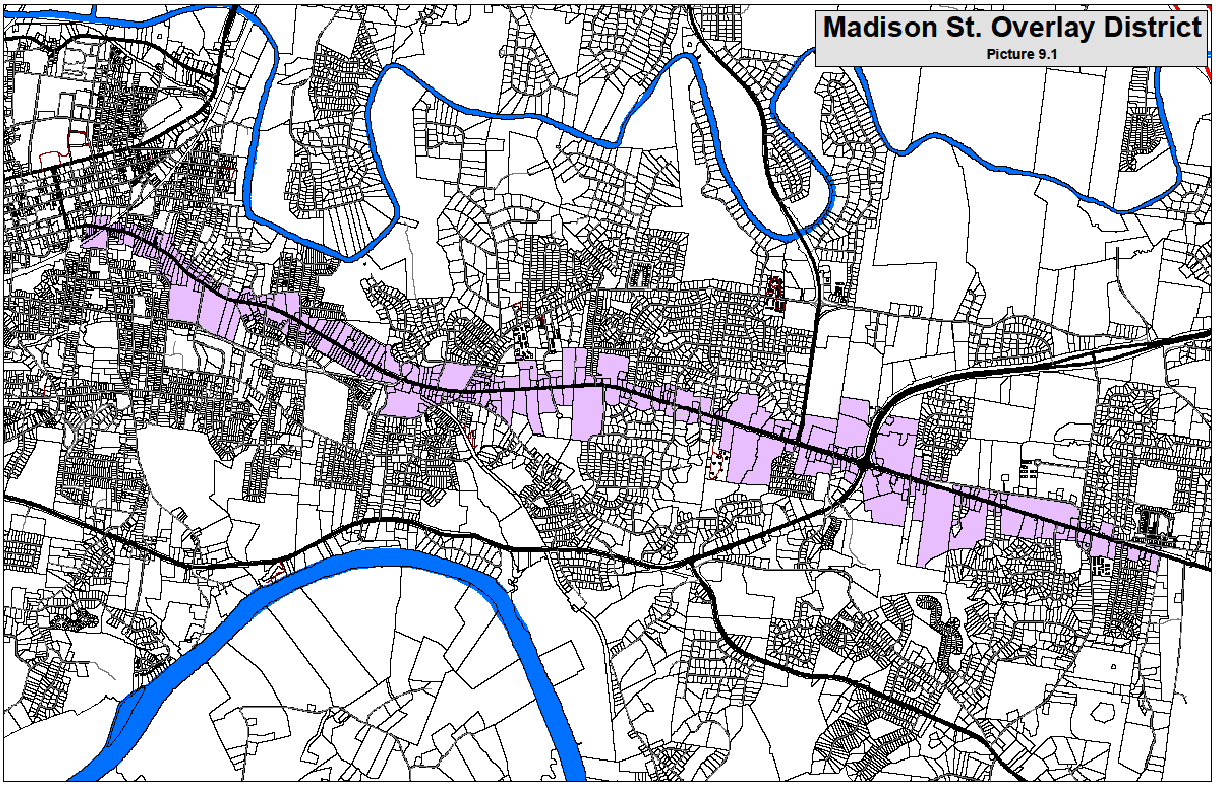
Picture 9.1
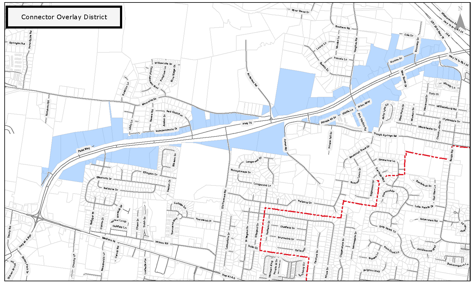
Picture 9.2
(Ord. No. 27-2024-25, 12-5-2024)
9.4.2 DESIGN STANDARDS AND GUIDELINES
Subsection, 9.4.2. "Design Standards and Guidelines", organizes the overlay standards and guidelines into six (6) sections: Building Standards, Architectural Treatment, Parking and Access, Signs, Landscape Screening and Buffers, and Streetscapes.
DESIGN STANDARDS AND GUIDELINES
A.
UDO Boundary Map
The Madison Street and Connector Corridor Urban Design Overlay District has been divided into seven (7) distinct subdistricts based on the desired development character in the corridor (Pictures 9.3 and 9.4). Where appropriate, specific design standards have been for each Subdistrict. The Subdistricts are described below.
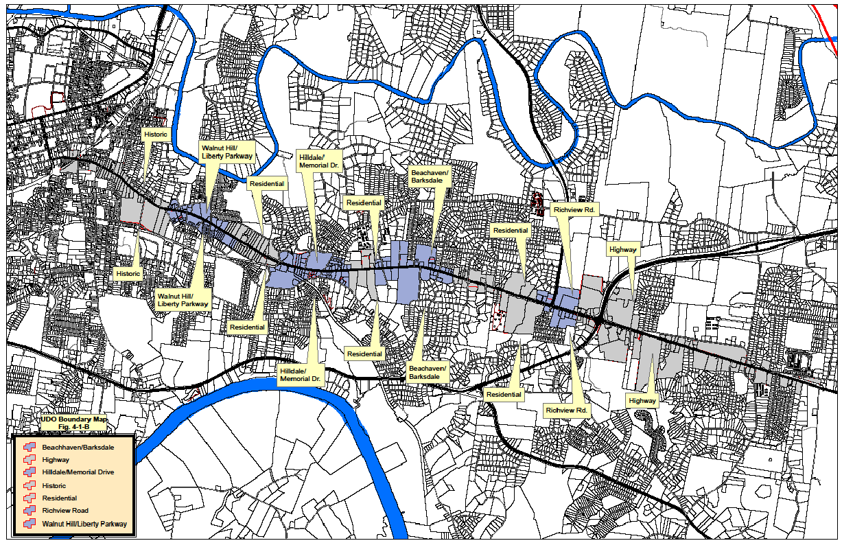
Picture 9.3
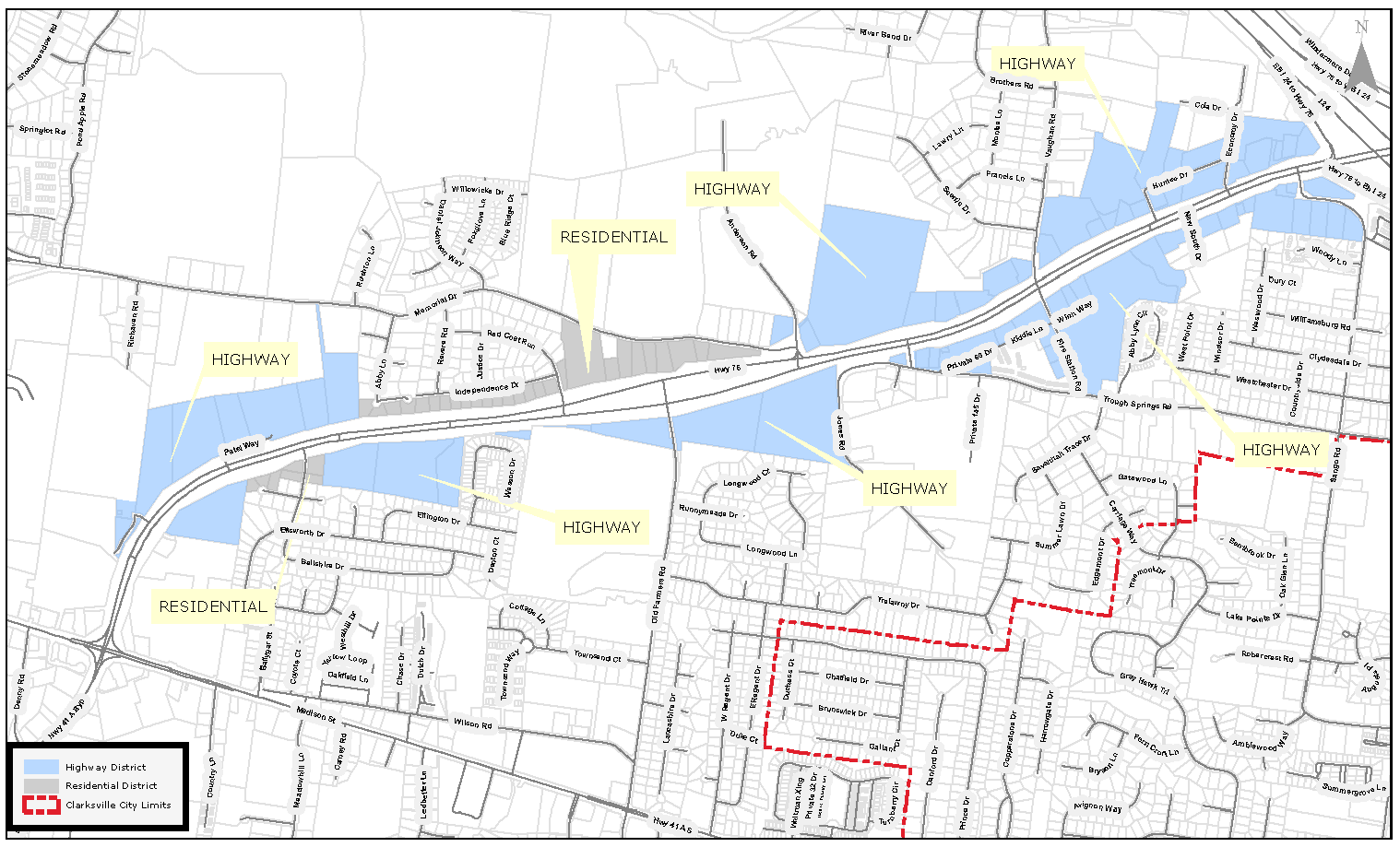
Picture 9.4
Centers
Centers are intended to be the focal point of redevelopment in the corridor. They focus on the creation of walkable places. Center subdistricts within the Madison Street and Connector Corridor Overlay Urban Design District include:
• Walnut Hill/Liberty Parkway
• Hilldale/Memorial Drive
• Beachaven/Barksdale Elementary
• Richview Road
Transitions
Transition Subdistricts are located between the Centers. They are intended to reinforce the underlying base zoning building standards. They include:
• Historic
• Residential
• Highway
B.
Building Standards
The Building Standards vary by Subdistrict in the Madison Street and Connector Corridor Overlay Urban Design District (Table 9.1).
Goals
• Guide the placement, size, arrangement and articulation of buildings on the Madison Street and Connector Corridor Overlay Urban Design District.
• Encourage a walkable, pedestrian-friendly environment within each of the Center Subdistricts that is devoid of large, unoccupied spaces.
• Create a sense of enclosure so that drivers realize they are entering a unique place.
C.
Architectural Treatment Design Standards and Guidelines
The Architectural Treatment Design Standards and Guidelines apply to all Subdistricts in the Madison Street and Connector Corridor Overlay Urban Design District.
Goals
• Encourage high-quality buildings that are well designed, visually interesting, and compatible with their surroundings.
• Support active and pedestrian-oriented public spaces throughout the corridor.
Standards and Guidelines
1.1 Facades
1.1.1 Provide entrances that are distinct and visible from the street.
1.1.2 Blank walls facing streets shall be prohibited.
1.1.3 Window and door openings shall have a vertical orientation and vertical alignment between floors.
1.1.4 The street frontage of the ground floor of all structures shall have built-out space (e.g., retail, residential, office space).
1.1.5 All commercial buildings shall have a discernible base and cap which are clearly defined by horizontal elements along the bottom and top of the building. Variations in materials and colors can help achieve this standard.
1.2 Massing
1.2.1 The maximum length of an uninterrupted facade plane shall be thirty (30) feet. Building wall offsets, projections and recesses up to four (4) feet, and/or pilasters shall be used to break up the mass of a single building into bays.
1.2.2 Variations in solid and void within walls are encouraged to provide interest along building edges. Changes in color, material and wall height are also encouraged.
1.2.3 The first floor of residential buildings is encouraged to be above the level of the sidewalk to increase privacy.
1.3 Materials
1.3.1 Encourage the use of simple and durable materials, especially at street level.
1.3.2 Minimize the number of building materials to three (3), with one (1) serving as the dominant cladding.
1.3.3 Appropriate exterior wall materials are:
- Brick
- Natural or artificial stone
- Concrete: finish should be architectural level
- Metal panels: individual or systems
- Glass curtain wall systems
1.3.4 Appropriate materials for limited accents are:
- Metal (galvanized, painted or ornamental)
- Concrete (pre-cast or unfinished exposed concrete)
- Wood
- Fiber cement siding
- Tile
- CMU (ground or split face only)
- Exterior insulation and finish system
1.3.5 Inappropriate materials are:
- Applied stone
- Vinyl or aluminum siding
- Mirrored or tinted glass (on ground floor)
- Galvanized metal as veneer
1.4 Colors
1.4.1 Minimize the number of building exterior colors to three (3).
1.4.2 Subtle neutral colors are encouraged.
1.4.3 Bright, intense or fluorescent colors are prohibited.
1.5 Roofs
1.5.1 Provide straight forward, simple roof forms free of "sculptural" or sign-like visual qualities.
1.5.2 Flat roofs with parapet walls are encouraged.
1.5.3 False mansard roofs are prohibited.
1.6 Awnings and Canopies
1.6.1 Canvas or other durable material is preferred.
1.6.2 Plastic, fabric or other material that is glossy in nature is not permitted.
1.6.3 Internally illuminated canopies are not allowed.
1.6.4 Minimum of eight (8) feet clearance is required.
1.6.5 No awning shall exceed twenty-five (25) feet in length.
D.
Parking and Access Design Standards and Guidelines
The Parking and Access Design Standards and Guidelines apply to all Subdistricts in the Madison Street and Connector Corridor Overlay Urban Design District.
Goals
• Encourage cooperation among local businesses to promote and develop shared parking and access.
• Eliminate barriers separating commercial properties in favor of pedestrian walkways between parking lots and adjacent businesses.
Standards and Guidelines
1.1 Surface Parking
1.1.1 Surface parking shall be located to the side or rear of buildings and screened from streets and sidewalks, except in the Richview Road Subdistrict.
1.1.2 Surface parking located to the side of a building shall be limited to one (1) double loaded aisle.
1.1.3 Lighting for all parking areas shall be appropriate in function and scale for both the pedestrian and vehicular traffic.
1.1.4 The lighting style shall be ornamental and/or consistent with the surrounding architecture.
1.1.5 'Box' or 'cobra' style lighting is prohibited.
1.1.6 All illumination should be shielded from adjacent properties.
1.1.7 Provide perimeter landscaping and interior landscaping of surface parking lots per City of Clarksville Landscape Ordinance.
1.2 Structured Parking
1.2.1 The ground floor of any parking structure shall have built-out space (e.g., retail, residential, office space) provided for a minimum of seventy-five percent (75%) of the street frontage.
1.2.2 Wherever parking structures are permitted to front streets, walls must utilize materials, colors, and a pattern of openings consistent with surrounding buildings.
1.2.3 Any built-out space provided on the ground level of a parking structure fronting a public street shall have direct access to the street and sidewalk.
1.2.4 Parking structures built as a principal use must be of flat floor plate construction with a minimum floor to floor height of twelve (12) feet.
E.
Sign Design Standards and Guidelines
The Sign Design Standards and Guidelines apply to all Subdistricts in the Madison Street and Connector Corridor Overlay Urban Design District.
Goals
• Encourage a more uniform and aesthetically pleasing appearance on Madison Street.
• Provide signage that is complementary and well-integrated for pedestrians in a walkable environment, while also legible to vehicular traffic.
• Commercial signage shall be designed primarily for the purpose of identifying a business rather than serving as advertising.
Standards and Guidelines
1.1 General
1.1.1 Signs may not be erected or altered without obtaining a Certificate of Appropriateness from the Design Review Board.
1.1.2 All signage applicants shall be required to develop and submit for review an overall signage program that exhibits a coordinated uniform theme of design elements.
1.2 Prohibited Signs
1.2.1 Animated, flashing, chasing, running or sequential signs are not permitted.
1.2.2 All portable signs, including parked vehicles with signs expressly for advertising, are not permitted.
1.2.3 Pole banners and streamers are not permitted.
1.2.4 Refer to the Chapter 8, Sign Regulations for additional regulations.
1.3 Design and Materials
1.3.1 Simple overall shapes are preferred over complex geometries.
1.3.2 Signs shall be professionally designed and constructed using high-quality materials.
1.3.3 Well designed, hand-painted signs are permitted.
1.3.4 Sign colors should be compatible with the colors of the building façade.
1.3 5 A dull or matte finish is encouraged to reduce glare and enhance legibility.
1.3.6 Signs shall not obscure key architectural elements, doors or windows.
1.3.7 Marquee type signs for announcements of activities taking place at the location are prohibited (exceptions: churches, schools and institutional uses).
1.3.8 Signs for multiple businesses shall be of similar material and design.
1.3.9 Channel letter signs shall have metal frames and plastic faces, or in the case of reverse channel letter signs, metal faces and frames and plastic backs.
1.4 Lighting
1.4.1 Lighted signs shall be spotlighted, externally lit, or back-lit with a diffused light source.
1.4.2 Spotlighting should completely shield all light sources; light should be contained primarily within the sign frame.
1.4.3 Backlighting should illuminate only the letters, characters or graphics on the sign, but not its background.
1.4.4 Neon signs are discouraged, including open face channel letter signs.
1.4.5 Light emitting diode (LED) signs are prohibited.
1.4.6 Pulsating, flashing, running or rotating lights are not permitted, other than signs depicting time, temperature and gasoline prices.
1.4.7 Illuminated plastic box signs are not permitted.
1.5 Permitted Signs: Awning and Canopy Signs
1.5.1 Copy limited to valance or vertical face of awning or canopy shall be no greater than fifty percent (50%) of height or twelve (12) inches, whichever is less.
1.5.2 Copy limited to fifty percent (50%) of horizontal width of awning.
1.5.3 Awnings without valances may have copy not exceeding thirty percent (30%) of area.
1.6 Permitted Signs: Free-Standing Signs
1.6.1 Only one (1) free-standing sign per parcel or platted lot shall be permitted, unless the parcel is a corner lot in which case two (2) shall be allowed.
1.6.2 Free-standing signs shall be supported on a solid base such as a pylon or two (2) column sign designed to complement the architecture of the building or complex to which it pertains.
1.6.3 A landscaped base or architecturally detailed plinth is required.
1.6.4 The height limit for a free-standing sign shall be twenty (20) feet measured from average grade of parcel.
1.6.5 Maximum sign area shall be fifty (50) square feet. For buildings with four (4) or more tenants, City staff and the Design Review Board may allow a maximum of one hundred (100) square feet.
1.6.6 Letter height shall not exceed twelve (12) inches.
1.6.8 The C-4 Highway Interchange sign exemptions found in Section 8.5.3 shall be permitted within the design district.
1.7 Permitted Signs: Monument Signs
1.7.1 Monument signs shall not exceed thirty (30) square feet in area, excluding the support structure, and may not be more than three and one-half (3 ½) in height within fifteen (15) feet of a driveway or street or five (5) feet in height otherwise.
1.8 Permitted Signs: Wall Signs
1.8.1 All signage affixed to buildings shall conform to Section 8.8 of this Ordinance, relative to signs in the Central Business District, except for properties with building front setbacks one hundred (100) feet or greater. For such properties, wall sign size shall not exceed eighty percent (80%) of the width of the front façade and letter height shall not exceed thirty-six (36) inches. Exceptions may be granted by the Design Review Board based on building elevation, proportions and design.
1.8.2 Wall signs shall not extend above an eave line or parapet.
1.9 Permitted Signs: Window Signs
1.9.1 Window signs shall not cover more than fifteen percent (15%) of the window area with letters not to exceed ten (10) inches in height.
2.1 Flags and Flagpoles
TABLE 9.2: FLAG AND FLAG POLE DESIGN GUIDELINES
2.1.1 Flags shall be limited to constitutional flags only (City, County, State and Federal).
2.1.2 The total number of flagpoles per parcel or platted lot shall be limited to one (1).
2.2 Temporary Signage
2.2.1 Real Estate signs shall be allowed as long as the property is being actively marketed for sale or lease and limited to one (1) per parcel or platted lot. Overall sign area is limited to thirty-two (32) square feet.
2.2.3 Construction signs are permitted during construction activity only. Overall sign area is limited to thirty-two (32) square feet.
F.
Landscape, Buffering and Screening Requirements
The Landscape, Buffering and Screening Requirements of Chapter 7 of this Ordinance shall apply to all Subdistricts in the Madison Street and Connector Corridor Overlay Urban Design District.
Goals
• Develop public spaces that are pedestrian friendly, environmentally responsible and aesthetically pleasing.
Standards and Guidelines
1.1 Parking: Perimeter Screening
1.1.1 Provide perimeter landscaping of vehicular use areas per requirements of Chapter 7 of this Ordinance.
1.1.2 Exterior planting areas should be designed to allow stormwater to collect and percolate.
1.2 Parking: Interior Planting
1.2.1 Provide interior landscaping of vehicular use areas per requirements of Chapter 7 of this Ordinance.
1.2.2 Interior planting areas should be designed to allow stormwater to collect and percolate.
1.3 Zone District Boundaries: Buffers
1.3.1 The base zoning district landscape buffer standards shall apply, except as follows:
- The landscape buffer standards shall be waived along internal base zoning district boundaries within the Center Sub-Districts.
- The landscape buffer standards shall be waived along base zoning district boundaries that coincide with the Center Sub-Districts whenever (1) the abutting base zoning district outside of the Center Sub-Districts is a nonresidential district, or (2) the base zoning district boundary is in a public street.
G.
Streetscape Design Standards and Guidelines
The Streetscape Design Standards and Guidelines shall apply to all Subdistricts in the Madison Street and Connector Corridor Overlay Urban Design District.
Goals
• Develop a distinct identity and street character for the corridor.
Standards and Guidelines
1.1 General
1.1.1 This section relates primarily to standards and guidelines for the reconstruction of public streets by government or private developers along the corridor.
1.1.2 A specific and unique design theme is encouraged for landscaping, street furniture and lighting for each Center Subdistrict along the corridor.
1.1.3 Minimum roadside (planting strip and sidewalk) width in residential areas is eight (8) feet and in commercial areas is ten (10) feet.
1.2
Sidewalks
1.2.1 New building construction is required to provide sidewalks along Madison Street consistent with the guidelines described below.
1.2.2 Sidewalks adjacent to ground level retail space should have a width of six (6) to eight (8) feet with a planting strip or eight (8) to ten (10) feet without a planting strip.
1.2.3 Appearance of sidewalk (scoring pattern or special paving) should be maintained across driveway and alley access points.
1.2.4 The provision of pedestrian crossings should be given the highest priority in the Walnut Hill/Liberty Parkway, Hilldale/Memorial Drive, and Beachaven/Barksdale Sub-Districts.
1.2.5 Provide marked crosswalks at all signalized intersections for all legs of the intersection.
1.2.6 The use of crosswalk materials that are significantly different in color, texture and design is encouraged.
1.2.7 At unsignalized or uncontrolled crossings, in areas such as school zones or where there is a substantial pedestrian presence, special emphasis markings should be used to increase visibility.
1.3 Landscaping
1.3.1 Tree species and planting techniques should be selected to create a unified image for the street.
1.3.2 Planting strips between curb or edge of pavement and sidewalks should be a minimum of three (3) feet in residential areas and four (4) feet in commercial areas.
1.3.3. Street trees should be planted in continuous planting strips between the curb and sidewalk spaced twenty-five (25) feet on center along Madison and intersecting streets. On internal streets, street trees should be planted in discrete tree and planting openings, or in wells with grates in especially constrained contexts.
1.3.4 Planting strips and openings should be designed to allow stormwater to collect and percolate.
1.3.5 At transit stops, planting strips should be discontinued and a clearance four (4) feet wide provided from the curb for wheelchair access.
1.4 Street Furniture
1.4.1 Select the type, design, and materials of street furniture to reflect the desired character and identity of the corridor.
1.4.2 Street furniture, such as benches, bicycle racks, kiosks and trash receptacles are appropriate in the Walnut Hill/Liberty Parkway, Hilldale/Memorial Drive and Beachaven/Barksdale Sub-Districts.
1.4.3 Priority locations for street furniture include transit stops, major building entries, mixed use locations, and parks.
1.4.4 Newspaper boxes also contribute to the convenience and pedestrian feel of a street, but should be organized to avoid visual clutter.
1.5 Lighting
1.5.1 Street lighting should be pedestrian scale, decorative and provided in all Center Sub-Districts. It should increase in scale at intersections.
1.5.2 The lighting should be selected in conjunction with the street furniture.
H.
Project Approval Process
To ensure consistency with these standards and guidelines, the Common Design Review Board (acting as the Design Review Board for the Madison Street and Connector Corridor Overlay Urban Design District) and the Clarksville-Montgomery Regional Planning Commission staff will review all projects in the urban design overlay district that require demolition, building and sign permits and that make modifications to the exterior appearance of buildings, landscaping and parking. Existing nonconforming structures, unforeseen physical conditions and subsequent architectural programmatic constraints may warrant exceptions to the guidelines. In such cases, the Design Review Board and planning staff will review alternative design solutions as they relate to the intent of the standards and guidelines and accept alternatives that present the best urban design solution. Where a single use or purpose spans more than one (1) sub-district, the Design Review Board and planning staff will explore with the developer alternative solutions that achieve the design intent of the standards and guidelines. The Clarksville-Montgomery County Regional Planning Commission will review site plans as required by Chapter 5.10 of this Zoning Ordinance.
1.1 General Directions
1.1.1 The authority of the Design Review Board to uphold the Madison Street and Connector Corridor Overlay Urban Design District is limited to the standards and guidelines contained in this Ordinance.
1.1.2 Any approval by the Design Review Board is contingent on zoning and building permits issued by the Building and Codes Department and cannot be interpreted as taking precedence over the building code or zoning ordinance.
1.1.3 Other ordinances or parts thereof which are inconsistent with or are in conflict with the specific provisions of this Ordinance are expressly superseded by this Ordinance and are to be controlled by the provisions of this Ordinance.
1.1.4 Existing base district standards that are not varied by provisions set forth in this Ordinance shall apply within the Madison Street and Connector Corridor Overlay Urban Design District.
1.2 Step One/Application
1.2.1 The first step in undertaking a project in the Madison Street and Connector Corridor Overlay Urban Design District is to contact and request an application from the Regional Planning Commission.
1.2.2 Planning Commission staff will provide the applicant with the published guidelines and standards (this document and any future amendments) for projects within the various sub-districts of the Madison Street and Connector Corridor Overlay Urban Design District. It is recommended that the applicant become familiar with the guidelines and standards prior to planning the project and before the development of any working drawings.
1.2.3 The applicant must submit one (1) set of the following documents signed by the applicant that will be retained by the Planning Commission:
• Copies of the proposed site plan (to an engineering scale) showing all site improvements such as buildings, walls, walks, parking, signs, plant materials, and lighting.
• Completed color exterior elevations (⅛" = 1' architectural scale minimum).
• Exterior painting schedule (Color name/brand).
• Samples of exterior materials including brick, stone, metals, glass, and roofing.
• Detailed scale drawings of awnings, canopies and signs, indicating proposed colors.
• Color photographs of all sides of the existing exterior for remodeling, rehabilitation, or demolition. For new demolition, remodeling, and construction, photographs shall show contiguous properties.
1.3 Step Two/Design Review Board
1.3.1 The applicant shall appear before the Design Review Board at a regularly scheduled meeting to present the application.
1.3.2 Should the application indicate alterations, remodeling, or repairs that are not governed by this Ordinance, the Design Review Board may exempt the application from the provisions of the urban design overlay district.
1.4 Step Three/Approval or Redirection
1.4.1 After a careful review of the presentation, the Design Review Board will act to approve, conditionally approve or disapprove the application. The Building and Codes Department will then review the approved project for zoning and codes compliance when the drawings and specifications are competed and submitted to the department.
1.4.2 If the project is disapproved, the Design Review Board and Planning Commission staff will strive to assist the applicant by providing guidance and redirection of the project. It will then be necessary to present the project to the Board at another regularly scheduled meeting. A building permit shall not be issued until such time as the proposed project receives final approval from the Design Review Board.
1.5 Appeals Process
1.5.1 The Planning Commission shall hear and decide appeals from any order, requirement, decision or determination made by the Design Review Board or Planning Commission staff where it is alleged by the applicant in writing that Design Review Board or Planning Commission staff is in error or acted arbitrarily. Such appeal shall be made within sixty (60) calendar days of said order, requirement, decision or determination.
(Ord. No. 27-2024-25, 12-5-2024)
9.5 - DOWNTOWN URBAN DESIGN OVERLAY DISTRICT
9.5.1 GENERAL DESCRIPTION AND PURPOSE
1.
Purpose. The purpose of the Downtown Urban Design Overlay District is to enhance the quality, image, and economic vitality of Downtown Clarksville. Accordingly, to that ends, the Overlay District imposes urban design guidelines to coordinate the physical improvements that will be made to this important geographic area by private entities.
2.
Overlay District Relation To Base Zoning. This overlay zoning district is placed "over" the base zoning in an area in order to modify the base zoning's regulatory standards. The overlay district alters such standards as building placement, size and height, parking and access, and landscaping and buffering, but does not determine the use of the property. The use of property (both land and structures) is governed by the underlying base zoning.
3.
Scope of Review. Government officials, property owners, developers, design consultants and other stakeholders will use this section to prepare improvement plans that are consistent with the Downtown Design Standards and Guidelines. The standards and guidelines apply to private nonresidential and multiple-family residential (excluding single-family and duplex structures) new construction, exterior remodeling or repainting; window and awning changes or improvements; signing changes and improvements; sidewalk changes and improvements; exterior lighting changes and improvements; and landscaping and parking lot construction, changes and improvements. Nothing in this section shall be construed to prevent the ordinary maintenance and repair of any exterior elements of any building or structure; nor shall anything in this section be construed to prevent the construction, reconstruction, alteration or demolition of any such elements, which authorized City officials shall certify as required for public safety.
9.5.2 DOWNTOWN OVERLAY DISTRICT GEOGRAPHIC BOUNDARIES
1.
Designation of Boundaries. The geographic boundaries of the Downtown Overlay District shall coincide with those of the Central Business Improvement District (CBID) as set forth in Code of the City of Clarksville Title 12, Chapter 9, Section 12-902 "Boundaries", but exclude those geographic areas within the Historic District Overlay.
2.
Modification of Boundaries. Any modifications of the boundaries of the Downtown Overlay District by the City Council or other Department of City of Clarksville will involve referral to the Regional Planning Commission for public hearing, public notice and recommendation to the City Council to amendment this Zoning Ordinance.
9.5.3 DOWNTOWN URBAN DESIGN STANDARDS AND GUIDELINES
1.
Source of Guidelines. The urban design review standards and guidelines to be used by the Common Design Review Board for determining the appropriateness of physical improvements within the Downtown Overlay District shall be those adopted into or by reference into this section.
A.
Districts and Sub-Districts and Use of Guidelines
1.
These guidelines will be used by property owners, developers, architects, builders, business owners, public officials, and interested citizens when considering rehabilitation or new construction in the Downtown Overlay District involving private non-residential and multiple-family residential (excluding single-family and duplex structures). They will be informational only in the case of publically owned lands and structures, and in geographic areas also designated as Local Historic District Overlays (where design review by the Historic Zoning Commission encompasses all private uses including single-family and duplex structures). The guidelines will also be consulted (but are not binding on the public entities) with respect to proposed infrastructure and streetscape improvement projects. While the base land use zoning districts continue to govern land use, these guidelines will supersede other provisions of this zoning ordinance only when more stringent and geographically specific standards are set forth on design and physical planning issues relative to massing, landscaping, parking, and signage. The appropriate City departments will review all new projects in the Downtown Overlay District that require building permits to ensure consistency with these guidelines. The word "shall" indicates those design standards that are mandated; whereas, terms such as "should", "encouraged", and "discouraged" indicate design principles which are more flexible and advisory in nature.
2.
These guidelines are intended to preserve and enhance the special character of the Downtown Overlay District by encouraging rehabilitation and new construction that is sensitive to the existing urban form and historic character. The guidelines recognize that no single architectural style predominates, and the guidelines allow for creativity in the design of individual buildings. However, there are certain established urban design and architectural principles shared by most properties within the district that give it a cohesive character and strong sense of place.
3.
These guidelines address both architectural design and urban design. Architectural design is addressed in terms of building type. Building types include:
a.
Commercial/mixed-use.
b.
Single-family residential.
c.
Townhouses.
d.
Multi-family apartments.
e.
Institutional.
4.
Not all building types are permitted in all areas of the Downtown Overlay District. The map on page 3 is color-coded and keyed to a corresponding chart to note permitted building types in specific areas of the Downtown Overlay District. The following guidelines that relate to architectural design apply to the particular building type, regardless of location. If exceptions exist in any given area, they will be noted in the guidelines. Land use is determined by the underlying land use zoning districts, and should not be confused with building type.
5.
Additionally, the guidelines address specific urban design regulations to include:
a.
Building height.
b.
Setback.
c.
Massing.
d.
Driveways.
e.
Sidewalks.
6.
These urban design specifications can vary based on the building type and/or location. The guidelines clearly explain where or on what building type these requirements apply. Graphics are included as necessary to help convey the design guidelines.
7.
Design review shall apply to all sides of a building. Any discernable changes will require approval from the Design Review Board (* indicates Administrative rather than Board function):
a.
Demolition of Contributing Structures
b.
Proposed New Construction/Exterior Remodeling/Modifications
c.
Relocation of Buildings
d.
Exterior Repair or Repainting*
e.
Window Changes In-Kind*
f.
Landscaping meeting the minimum requirements of Chapter 7 of the Zoning Ordinance*
g.
Signage and Awnings*
h.
Sidewalk Changes or Improvements on private property
i.
Exterior Lighting Changes or Improvements
j.
Parking Lot Construction, Changes or Improvements that modify parking locations, number of parking spaces or circulation patterns
The functions above marked with an asterisk (*) are considered administrative in nature, and may be approved at the Staff Level if all objective standards are met. However, the staff will forward the application for action by the full Design Review Board for review and approval if there is a question about meeting the standards or if the applicant is requesting a variance from the standards.
District Map
Map & Chart Intent
It is the intent of this map and chart to illustrate the building types that, in general, tend to predominate within each of the delineated districts. However, it is important to understand that there are many exceptions to the rule. For example, the very northeast corner of the Central Commercial district features a few older single-family houses, yet the chart reflects Single Family Residential building types as not being a predominant building type within that district. Consequently, the determination of whether a particular building type is appropriate for a particular property as new infill development should be made based upon the predominate older existing building types on the block face under consideration. Also, this map and chart are unrelated to land uses, but instead address building types.
C-Central Commercial
RD-Riverside Drive
R-Residential
H1-Downton Historic
DH-Dog Hill
EH-Emerald Hill
APSU (exempt from review)
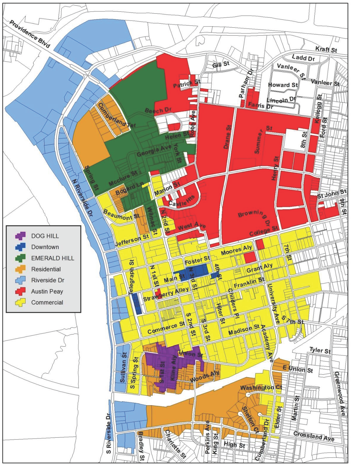
Note: *These are local Historic District Overlays governed by Section 9.3 of this Zoning Ordinance.
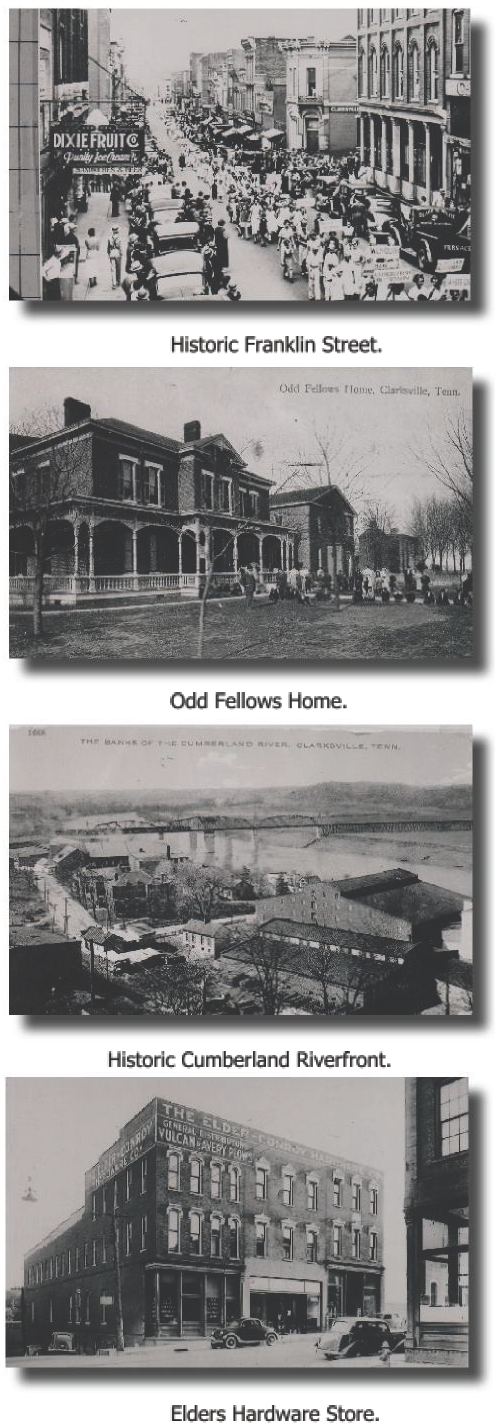
B.
Building Forms, Style & Character
1.
Founding: The Downtown Overlay District is composed of buildings reflecting a variety of uses, styles, materials, and several periods of development. The district consists primarily of one- to three-story, masonry commercial buildings and one- and two-story, frame residences. Its physical development began at the time of Clarksville's incorporation in 1785. Helping to define the boundaries of the district are a number of natural and man-made features, some of which historically served as logical margins to the downtown area. These include the Cumberland and Red Rivers, turnpikes, and rail lines.
2.
Name Sake: With a population of one hundred thirty-two thousand, nine hundred twenty-nine (132,929) according to the 2010 census data, Clarksville currently stands as the fifth largest city in the state of Tennessee. Clarksville is a city rich in history and tradition dating back to its founding in 1785. The city is named for General George Rogers Clark, frontier fighter and Revolutionary War hero, brother of William Clark of the Lewis and Clark Expedition.
3.
19thCentury History: Coming into the 19th century, Clarksville grew at a rapid pace. In 1820, steamboats began to navigate the Cumberland River, bringing hardware, coffee, sugar, fabric, and glass. The boats also exported flour, tobacco, cotton, and corn to ports like New Orleans and Pittsburgh along the Ohio and Mississippi Rivers. Trade via land also grew as four (4) main dirt roads were established; two (2) to Nashville, one (1) crossing the Red River via ferry called the Kentucky Road, and Russellville Road. By 1819 the newly-established town had twenty-two (22) stores, including a bakery and silversmith. In 1829, the first bridge connecting Clarksville to New Providence was built over the Red River. Nine (9) years later, the Clarksville-Hopkinsville Turnpike was built. Railroad service came to the town on October 1, 1859, in the form of the Memphis, Clarksville and Louisville Railroad.
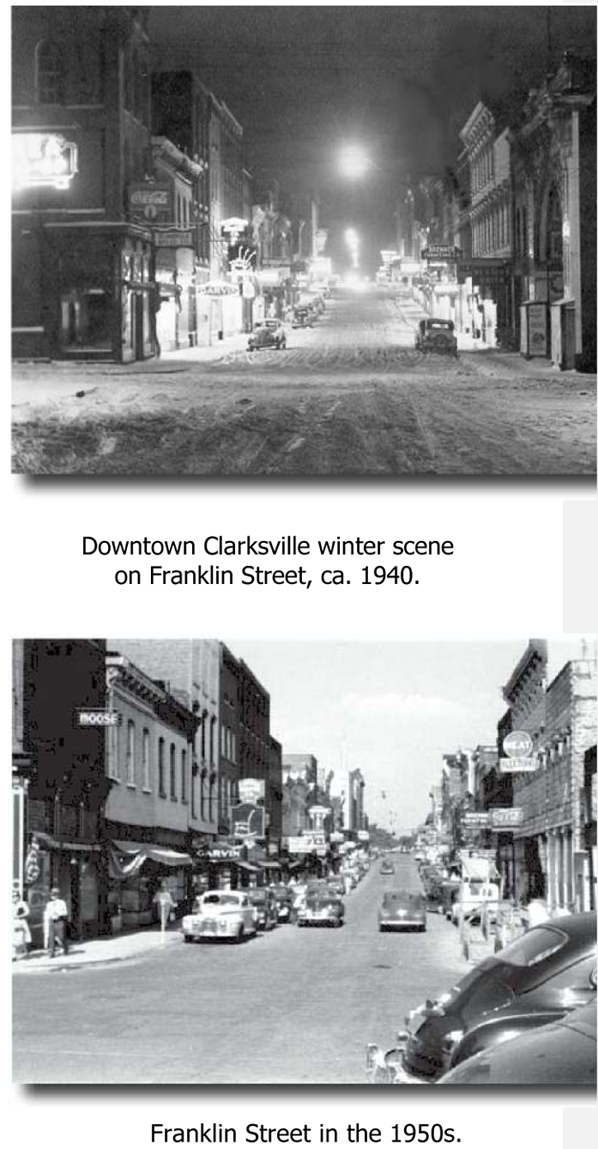
Civil War: During the Civil War, Clarksville was first fortified by the Confederacy, which built Fort Sevier (also known as Fort Defiance) on a prominent hill north of downtown. In February of 1862, Fort Sevier and the city were surrendered to federal forces and it remained in Union hands during most of the rest of the conflict. Clarksville slowly recovered its prosperity after the war when it became a center of the tobacco industry with a thriving riverboat and rail traffic. This prosperity was illustrated by dozens of brick warehouses and commercial buildings built along the Cumberland River and adjacent to the courthouse on the hill above. To the north and south of downtown prosperous merchants built dwellings on what became known as Emerald Hill and Dog Hill. A fire in 1878 destroyed much of downtown, but it was soon rebuilt with new brick commercial buildings and a new courthouse. By the early 20th century, Clarksville was a regional commercial center boasting numerous industries such as flour mills and cigar factories.
4.
20th Century History: The largest change to the city came in 1942, as construction of Camp Campbell (now known as Fort Campbell) began. The new army base was built ten (10) miles northwest of the city. It gave an immediate boost to the population and economy of Clarksville, and is capable of holding thirty thousand (30,000) troops.
Tornado of 1999: On the morning of January 22, 1999, the downtown area of Clarksville was devastated by an F3 tornado, damaging many buildings including the county courthouse. Clarksville has since recovered, and has rebuilt much of the damage as a reflection of the city's resilience. Clarksville is presently the home of Austin Peay State University, the Leaf-Chronicle newspaper, and neighbor to the Fort Campbell, Kentucky, United States Army post.
5.
Today's Surviving Architecture: There are a number of architectural styles and building traditions in the district. The most prevalent is wood frame vernacular; however, there are excellent examples of high style architecture. The architecture of the late Victorian period was characterized by flamboyant use of decoration, irregular form, multiple roof types, and a variety of materials and colors. Commercial buildings favored the Italianate style in particular and included the use of cast iron. In general, the period witnessed a flowering of a variety of materials, methods of construction, and architectural styles and types. Around the turn of the twentieth century, flamboyant Revival styles yielded to Classically-influenced architecture both commercial and residential structures.
6.
Architectural Glossary: Commercial Buildings.
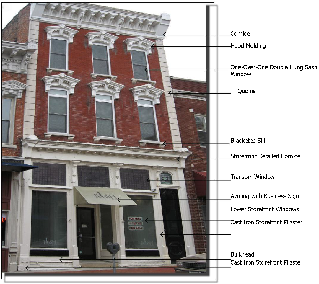
Commercial Building
7.
Commercial Architecture Styles
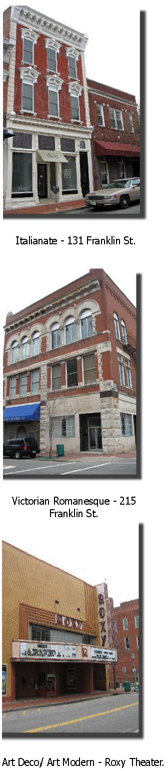
a.
The Italianate style (1870-1890) derives from the country villas of Italy, though the style was popular in U.S. commercial, as well as residential, architecture of the mid to late nineteenth century. As applied to commercial building, the Italianate style's characteristic decorative features include window hood moldings, elongated windows, string courses, large eave brackets, corbelled brick work, bracketed parapets, and cast iron pilasters. A good example is at 131 Franklin Street.
b.
The Victorian Romanesque style (1880-1900) was popular at the same time as the Italianate style for downtown commercial buildings. These two styles share a number of similarities but the Victorian Romanesque style is distinguished by its large arches on window and door openings. These buildings often feature exteriors with a mixture of brick, stone and other materials such as sheet metal and terra cotta. The multi-story building at 215-217 Franklin Street is a notable example of this style in the downtown area.
c.
Around the turn of the twentieth century, there was a renewed interest in Classical architecture. The buildings of the 1893 World's Columbian Exposition held in Chicago influenced the rise of the Colonial Revival style (1895-1930), which favored classical ideals of order and balance. Such sensibilities were in stark contrast to the flamboyance and asymmetry that characterized Victorian styles. The Colonial Revival style was popular for commercial, residential, and religious architecture. It often features full-height porticos and classical columns on the primary facades. The style is also characterized by a centered entrance and symmetry. In downtown Clarksville, the Colonial Revival style is exemplified in the old City Hall Building.
d.
In the early 20th century there was also the interest in the Art Deco/Art Moderne styles (1920-1950). These styles originated in Europe and were used in a variety of downtown commercial buildings. Storefronts were often updated in these years with sleek tinted glass in the Art Moderne or Deco styles. Theaters were also popular for these styles, and the notable Roxy Theater built in 1947 features vertical and horizontal banding as well as structural glass blocks indicative of this style.
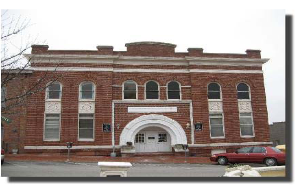
Art/Dec/Art Moderne - Roxy Theater
Colonial Revival with Romanesque influence - City Hall, which is characterized by a symmetrical facade with a central entrance of a Romanesque arch.
8.
Architectural Glossary: Residential Buildings
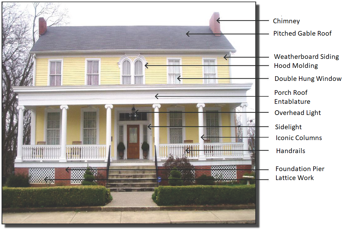
9.
Residential Architecture Styles
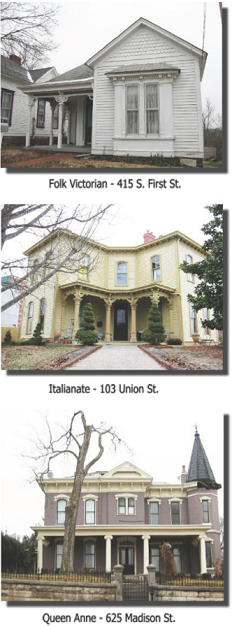
a.
The streetscape of a residential district also has a unity that is in part influenced by common traits. While neighboring houses may have very different architectural styles and building dates, there is an overall conformity to setback, height, orientation to the street, massing, and other characteristics that relate the buildings to their sites. Even modest vernacular building forms will blend harmoniously with dwellings which express a high style of architecture when these site characteristics are upheld.
b.
The Frame Vernacular or Folk Victorian style (1870-1910) is a modest version of more elaborate late nineteenth century styles. These frame dwellings are modest in scale and decoration, but may contain spindle-work porch details or milled wood posts. They are, to some extent, defined by their forms. The forms include gabled ell, front gable, and the pyramidal square with a hip roof. Typically, they are one or one-and-one-half-stories in height.
c.
The Italianate style (1870-1890) derives from the country villas of Italy. The nineteenth-century landscape designer Andrew Jackson Downing believed that beautiful homes promoted morality, which he found embodied in these rural dwellings. The Italianate style that he promoted in his pattern books featured such embellishments as window hood moldings, string courses, large eave brackets, cupolas, and corbelled brick work. This picturesque ideal was meant to uplift standards in architecture and social mores and inspire new home ownership. The style may feature characteristic towers or cupolas as focal points of their designs. They also have low-pitched roofs and elongated windows, eave brackets, and bay windows.
d.
The emergence of the Queen Anne style (1880-1905) coincided with the rise of balloon framing and mass production of wood ornamental features. These developments allowed for extravagant architectural designs with asymmetrical floor plans and irregular roof planes. These houses often feature porches that wrap around from the main façade to a side elevation. More exuberant examples may also have a corner tower, highly detailed spindling, oriole or stained glass windows, roof cresting, wood shingle siding, corbelled brick chimneys with chimney pots, and irregular roof planes. Queen Anne style houses are often painted in rich, contrasting color schemes. Its popularity through the state expanded rapidly, as rail lines transported the mass-produced millwork and other stylistic elements.
e.
By the end of the nineteenth century, American architects began to look towards the country's own architectural roots.
f.
The Colonial Revival style (1895-1955) reflects the nation's embrace of its colonial past. The style is characterized by simplicity, symmetry, and unadorned order, as a movement away from asymmetrical, highly embellished styles of the Victorian era. Colonial Revival dwellings typically have rectangular plans and symmetrical facades. The roof may be gabled or hipped. Windows are multi-paned double sashes. Doorways may contain sidelights, fanlights, pediments, and columns or pilasters. The details are classically inspired, and entry porticos are common.
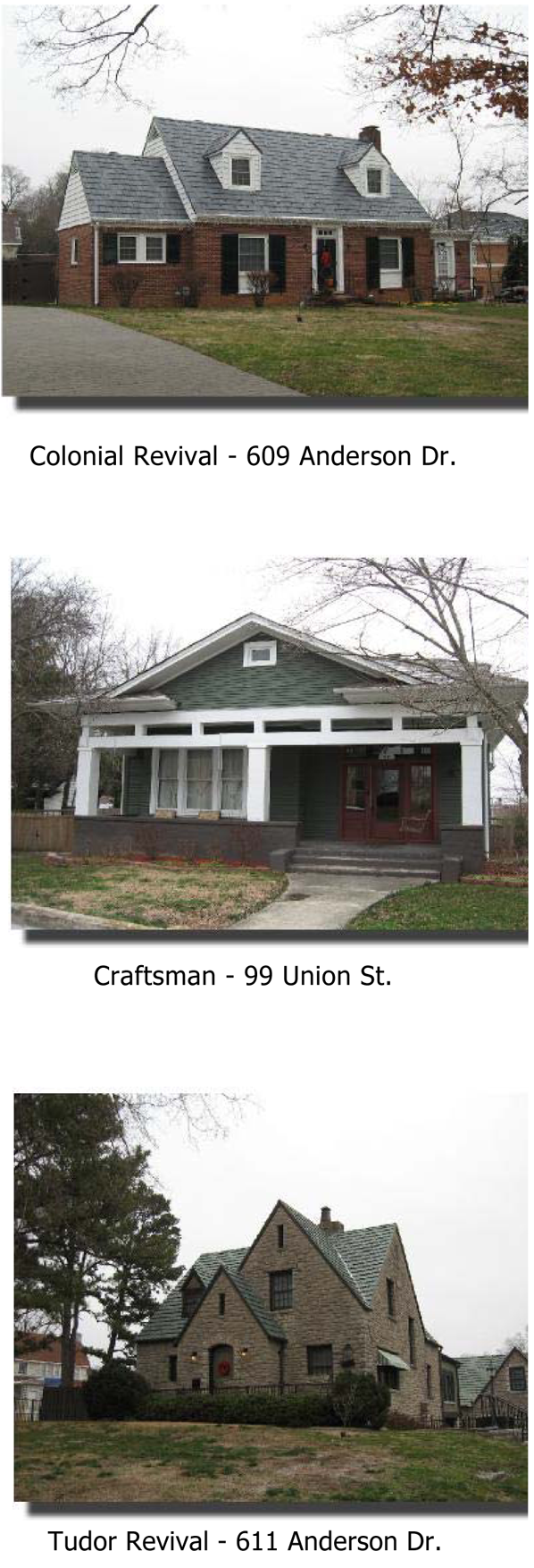
g.
The Craftsman/Bungalow style (1905-1930) represents a movement away from mass-produced architectural design of the balloon-frame period. The Bungalow plan has roots in British India during the eighteenth and nineteenth centuries. The house type melded with Japanese building techniques exhibited at late nineteenth-century American expositions. Craftsman bungalow buildings typically have low-pitched gabled roofs with a wide eave overhang, exposed rafters, decorative beams or braces, full- or partial-width porches, and tapered posts on brick piers. Designers often used the Craftsman style for bungalows, which were generally one-and-one-half story houses with large porches and open interior floor plans. The Bungalow first emerged as a house type in American residential architecture in California and quickly spread across the country as a popular design choice for small houses. While the bungalow can take the form of a modest gable-front example, elaborate bungalow design can include a multi-plane roof shape, known as an Airplane bungalow, and can feature extensive Craftsman detail on the interior.
h.
The Tudor Revival style (1910-1940) is based loosely on Medieval architecture. Peaking in popularity during the 1920s, the style was fashionable for single-family dwellings as well as small apartment buildings. The plans often feature cross gable, high-pitched roofs. Exteriors can be of stone, stucco with false half-timbering, brick veneer, or weatherboard siding. A Tudor Revival dwelling may feature a gable-front projecting bay with an arched entrance, an exterior, façade wall chimney, and even an entrance tower. Windows may be double-hung wood sash or multi-light styles. The Tudor Revival style was used almost solely on residential architecture.
10.
Twentieth-Century Commercial Buildings of Riverside Drive
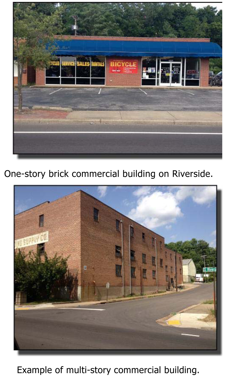
a.
Riverside Drive was created in the mid-20th century as a four-lane artery along the Cumberland River. At that time, many of the existing buildings were removed for the construction of the highway, though a few remain. While warehouses historically dominated the riverfront, commercial structures are the predominant building type today.
b.
The development of Riverside Drive was intended to increase vehicular access through the downtown and to stimulate new commercial development. The buildings that have since been constructed here are primarily one- to three-story buildings constructed from the 1950s to present. These buildings are generally rectangular by design, of brick or concrete construction and are functional in form with minimal detailing. Generally, the area was oriented for automobile traffic rather than pedestrians, with most of the buildings recessed from the street with paved parking in front. Along the highway are numerous examples of retail "chain" designs used across the country by restaurants and other businesses.
c.
Recent plans have proposed re-designing this strip commercial corridor into an urban boulevard that is pedestrian-friendly, and has buildings that relate more strongly with the street. This plan would be achieved with a median, buildings closer to the street, specialty pavers, side and rear parking lots, minimized signage and curb cuts, street trees, and more landscaping. These features would promote a unified streetscape more in keeping with the balance of the downtown core. Future development should consider the character of relationship to existing riverfront development. This can include non-commercial buildings, especially housing.
d.
The goal of these sub-district guidelines is to provide for regulated development that promotes a safe, attractive, unified streetscape that recognizes the value of the adjacent Historic Downtown and related neighborhoods, the river and developing Riverwalk Park system, and promotes a mix of future development to include retail, housing, entertainment and recreation in a district of increasing value and aesthetic appeal.
C.
General Design Principles
1.
Overview: These guidelines have been developed for specific application in the Downtown Overlay District to provide detailed assistance to building owners and the Design Review Board. These guidelines are used for the review of improvements to buildings in National Historic Districts and on the National Register outside the local Historic District Overlays, and may be consulted for design review within the local Historic District Overlays. The guidelines are based on The Secretary of the Interior's Standards for Rehabilitation, a document created in 1977 and revised in 1990.
2.
Secretary of the Interior's Standards for Rehabilitation: The Department of the Interior describes the standards as ten (10) basic principles created to help preserve the individual quality of a historic building and its site, while allowing for its evolution through reasonable changes to meet new needs. The Secretary of the Interior uses the Standards when reviewing projects involving federal funding or requiring federal licenses or permits. The Design Review Board uses principles of the Secretary's Standards on a local level as the basis for reviewing historic building rehabilitation and new infill construction. The Secretary of the Interior's Standards for Rehabilitation are:
a.
A property shall be used for its historic purpose or be placed in a new use that requires minimal change to the defining characteristics of the building and its site and environment.
b.
The historic character of a property shall be retained and preserved. The removal of historic materials or alteration of features and spaces that characterize a property shall be avoided.
c.
Each property shall be recognized as a physical record of its time, place, and use. Changes that create a false sense of historical development, such as adding conjectural features or architectural elements from other buildings, shall not be undertaken.
d.
Most properties change over time; those changes that have acquired significance in their own right shall be retained and preserved.
e.
Distinctive features, finishes, and construction techniques or examples of craftsmanship that characterize a property shall be preserved.
f.
Deteriorated historic features shall be repaired rather than replaced. Where the severity of deterioration requires replacement of a distinctive feature, the new feature shall match the old in design, color, texture, and other visual qualities and, where possible, materials. Replacement of missing features shall be substantiated by documentary, physical, or pictorial evidence.
g.
Chemical or physical treatments, such as sandblasting, that cause damage to historic materials shall not be used. The surface cleaning of structures, if appropriate, shall be undertaken using the gentlest means possible.
h.
Significant archaeological resources affected by a project shall be protected and preserved. If such resources must be disturbed, mitigation measures shall be undertaken.
i.
New additions, exterior alterations, or related new construction shall not destroy historic materials that characterize the property. The new work shall be differentiated from the old and shall be compatible with the massing, size, scale, and architectural features to protect the historic integrity of the property and its environment.
j.
New additions and adjacent or related new construction shall be undertaken in such a manner that if removed in the future, the essential form and integrity of the historic property and its environment would be unimpaired.
D.
Design Guidelines for Existing Commercial and Mixed-Use Buildings
These guidelines are targeted for design standards that preserve the existing historic character and include a wide variety of building types. Development should consider the relationship to surrounding structures currently found in the immediate area. Examples of commercial and mixed-use buildings are illustrated below.
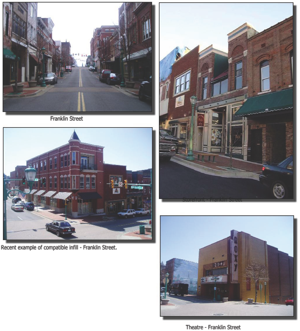
1.
Storefronts
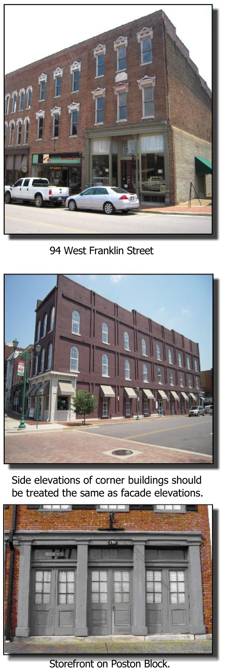
a.
Storefronts are often the most visible feature of historic commercial buildings. Maintain storefront components, including display windows, bulkheads, transoms, doors, cornices, pillars and pilasters, with proper care and treatment. Do not cover or conceal these historic storefront components with modern materials. If historic storefronts or their components are missing, replace them so that they replicate the historic storefront. Match replacement components to the original in size, material, texture, and detail. Use historical photographic evidence to help determine the design and style of missing components.
b.
Display windows and bulkheads are essential elements of traditional storefronts and contribute significantly to a commercial property's historic character and appearance. If at all possible, it is better to repair rather than replace original features. If original display windows or bulkheads are missing or deteriorated beyond repair, they may be replaced with new ones to match the original. If the original is unknown, select replacement windows are traditionally scaled with large glass lights and with as few structural divisions as possible to maintain the traditional transparent storefront look. If the original bulkhead material is unknown, replacement may be of wood, brick, metal, or other material that is appropriate with the façade. When historical photographic evidence is not available, comparable buildings should be considered as models for design.
c.
Balconies are acceptable features on infill building design. They are not, however, appropriate additions to historic buildings. The only exception is when there is evidence that a balcony has been removed. Evidence can be in the form of historic photographs, ghost traces of a balcony attachment to the façade exterior, or building design, such as an exterior door on an upper floor.
2.
Entrances
a.
New entrance openings shall not be added to historic storefronts. If an additional entrance is required by code, it shall be placed in the rear or on the side of the building. If it is not possible to place the opening in the rear or side, the new opening must be of the same design as the existing historic openings.
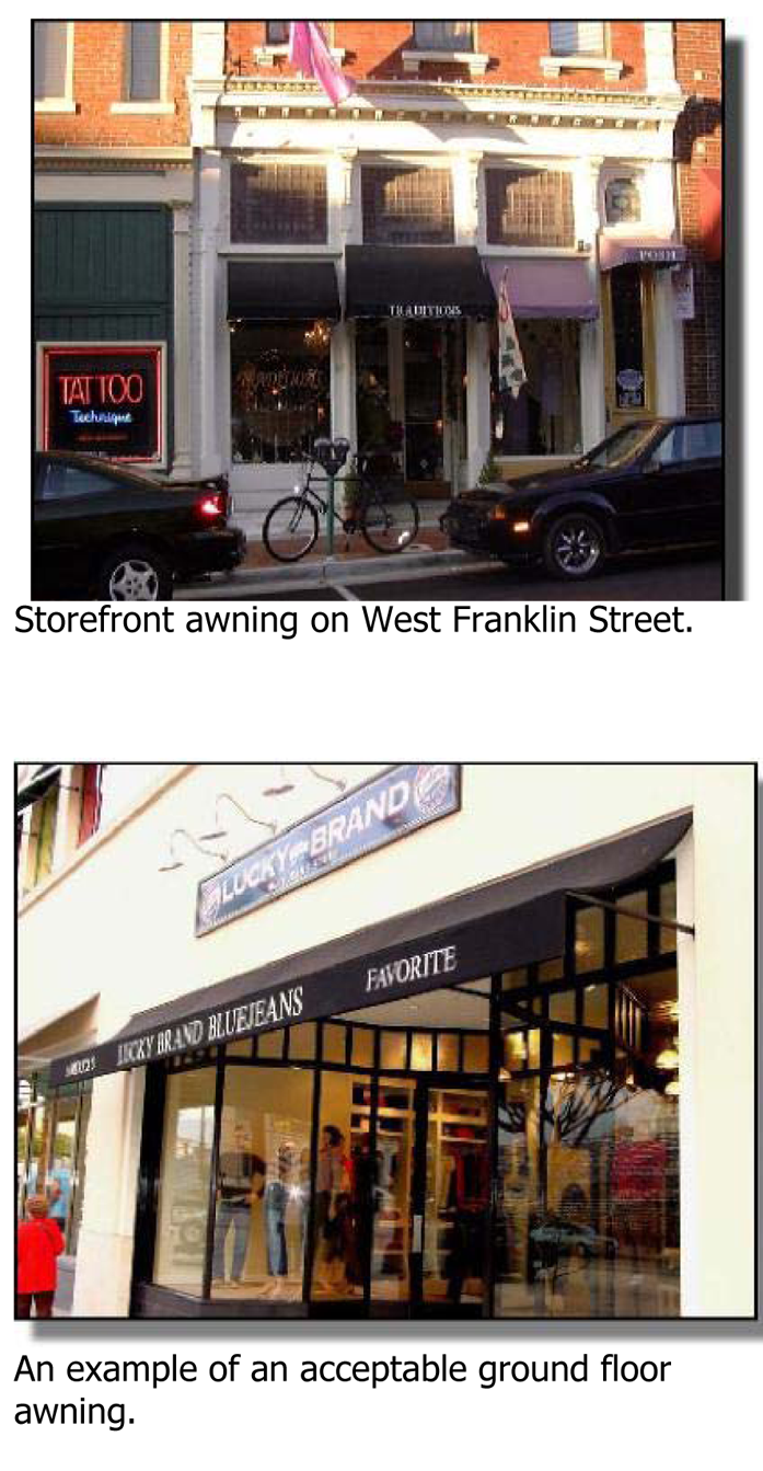
b.
Existing doors shall be retained. If the design is known, new doors shall match the original in design and materials. If not, the missing door shall be replaced with a new door in a design and materials to match the character and style of the building as much as possible. Traditional designs such as single-light glass and wood doors are encouraged.
3.
Transoms: Transoms shall be maintained with historic materials. Where missing or damaged transoms are being replaced, the original design shall be replicated based upon physical or pictorial evidence. If neither exists, use similar historic buildings from the same period as examples.
4.
Awnings and Canopies: While awnings and canopies have a similar purpose in providing cover, they differ in design. An awning is made of fabric (usually canvas) and mounted on a framework extending from the facade. A canopy is a rigid wooden or metal plane that is parallel or somewhat parallel to the ground and perpendicular to the facade. It can be supported by a series of chains or rods (approximately forty-five (45) degree angle) extending from the facade just above it. Guidelines for awnings and canopies are the same for historic and new commercial/mixed use buildings.
a.
Awnings: Awnings may be used on storefronts as well as upper levels. Shed awnings shall be used for rectangular openings, and arched awnings shall be used for arched openings. Continuous rows of awnings along the same building shall generally be restricted to the same type awning and application with consistent color.
b.
Canopies: Canopies function only at the ground-floor level. Canopies that are sloped must be open on the ends and shall have no greater than a forty-five (45) degree angle (preferably less). Faux shingled Colonial-type canopies are not allowed. Canopies are relatively permanent, while awnings should be designed at least to appear to be retractable, though do not have to be. Conforming existing awnings and canopies shall be maintained or restored where they occurred. New awnings and canopies can be added to historic buildings for functional purposes. Either may be appropriate provided it complements a building's architectural style and does not irreparably conceal significant architectural features. Awnings or canopies shall be positioned individually within major structural bays of the building and designed to fit the opening in which they occur. New canopies and awnings shall maintain a clear height of seven (7) feet above the sidewalk, shall not extend more than six (6) feet over the sidewalk. Columns are not allowed on sidewalks. Canvas or other durable material is preferred, but plastic, fabric or other material which is glossy in nature is not permitted. Awnings or canopies may not be internally lit to function as signs. However, signage graphics and text are permitted on awnings as set forth in Subsection J.
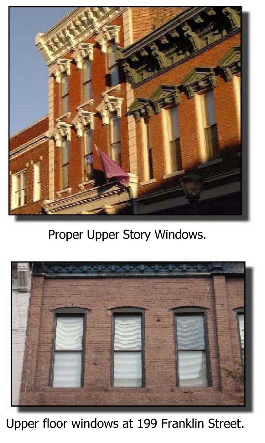
5.
Storefront Windows: Existing historic display windows shall not be reduced, covered, or altered. Missing or damaged windows shall be replaced with windows that match the originals in location, design, and materials. If the original design is unknown, the replacement windows shall maintain the original scale, shall be largely glass with wood or aluminum mullions, and shall have as few subdivisions as practical to maintain the traditional display window appearance. The glass shall be clear or lightly tinted, and decorative glass or glass block shall not be used. On the interior, should the ceiling height be lower than the display window or transom, the ceiling space shall be recessed away from the interior side of the glass.
6.
Upper Windows: Upper windows shall be maintained with the original size, materials, detailing, and number and arrangement of lights. If the design of the window is unknown, the window type and detailing shall be that of the architectural style or period of the building. Wood mullions with a painted finish or aluminum mullions with a white painted or bronze anodized finish shall be used.
7.
Shutters: Shutters shall not be added to upper floor windows unless physical or pictorial evidence can be provided that they existed. Shutters shall be of a size and scale that fit the window and shall appear functional. Also, shutter design should be appropriate to the era of the building.
8.
Storm Windows: Excluding local and national historic districts and structures, storm windows may be added to upper floor windows. They shall be full sash or sash proportionate with minimum mullions.
9.
Cornices: Existing cornices shall be maintained or restored and shall not be concealed or obscured. Replacement of missing or damaged cornices shall be based on historic physical or pictorial evidence using materials and details which match the existing building. If historic evidence is not available, use similar historic buildings from the same period as examples.
10.
Architectural Features: Architectural features shall be maintained or restored. Examples of these features such as columns, pilaster, brick detailing, lintels and window hoods are shown here. Replacement of missing or damaged features shall be based upon original materials, design, and detail. Excluding local and national historic districts and structures, alternative materials may be used if they look identical to the original and do not have maintenance issues that would cause them to not look like the original material over time. Decorative features shall not be added where none existed originally.
11.
Building Relocation: Historic buildings within the downtown area should be relocated only under the following circumstances:
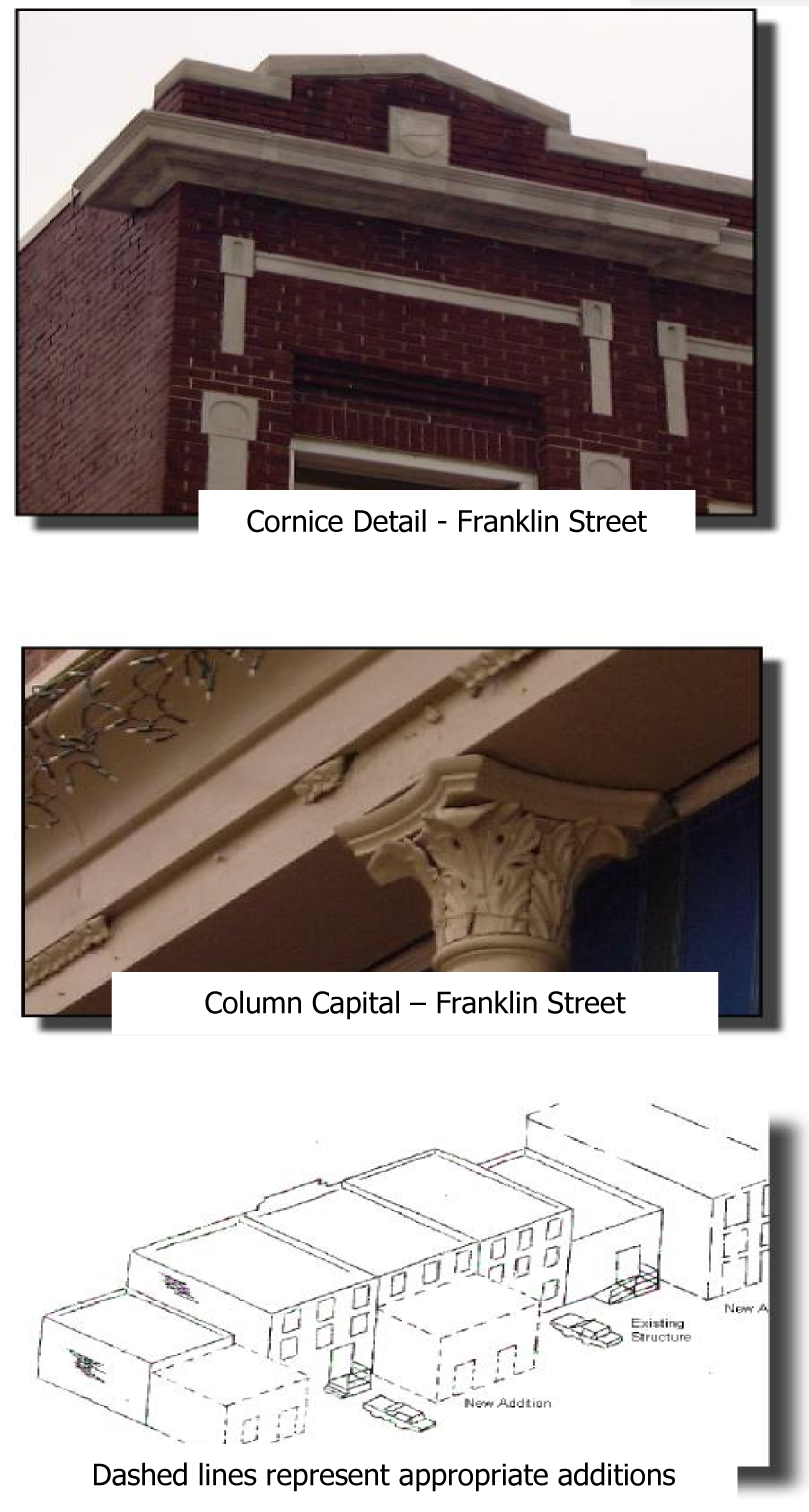
• If the only alternative is demolition,
• If the loss of a historic building is not required to create space for the relocation,
• If the building to be relocated will be architecturally compatible with the adjacent buildings in height, scale, massing, materials, design, and setback.
12.
New Additions: Additions shall be compatible in design and complementary to the existing structure. Additions must be visually subordinate to the main building. They shall have a lower roof, a compatible design, similar proportions and rhythm of openings, and shall be secondary in importance to the existing building. Additions should have exterior materials which are comparable to the original structure. These materials should also help differentiate between the original and the new. The use of sustainable materials such as cementitious siding should be considered for new additions. Additions should be placed at rear facades or adjacent to existing structures in a scale and proportion similar to the existing buildings. Rear additions should be smaller and lower than, or be of similar size to the existing structure. Side additions must be set back slightly from the main building. Additions similar in size should have a distinct break from the original structure.
E.
Design Guidelines for Existing Residential Buildings
1.
Residential Overview: These guidelines are for use outside the local Historic District Overlays for only townhouse and multiple-family structures because single-family homes and duplexes are excluded from design review outside the local Historic District Overlays, but may be consulted for guidance for improvement review within the local Historic District Overlays. While not all residential neighborhoods are necessarily historically significant, some, such as Emerald Hill and Dog Hill, are historic. The residential character of these areas should be preserved and maintained. Examples of buildings in this area are illustrated below.
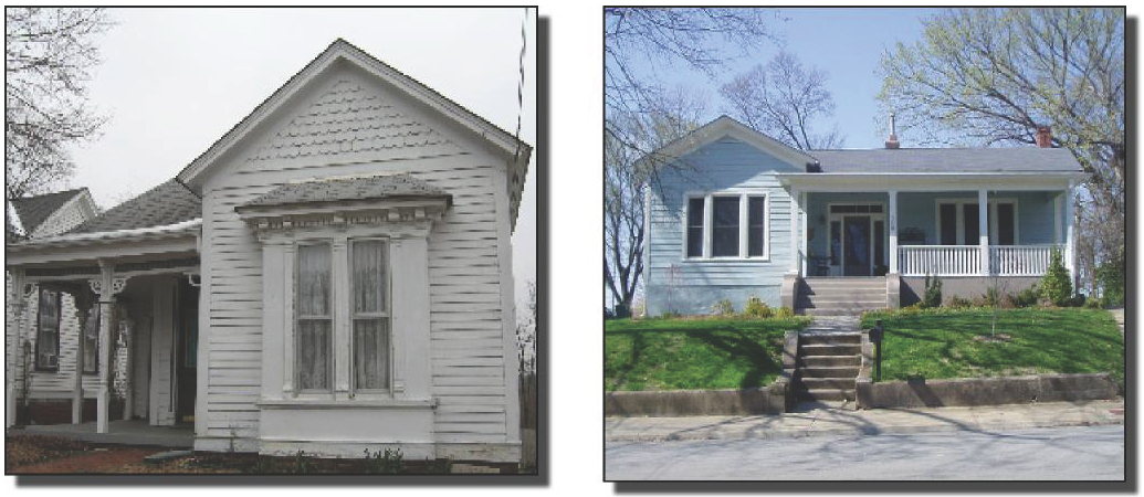
2.
Foundations: Do not cover or conceal historically visible foundations. Follow the guidelines for masonry to maintain or repair foundations. If infill is desired for pier foundations, the installation of lattice sections between the piers is appropriate. Solid fill is not encouraged.
3.
Siding: Wood siding is an important character defining feature of a building and preservation of original siding is recommended. Wood siding original to a building should be repaired rather than replaced. Original wood siding should be replaced only where necessary. Repair of original wood siding should be with wood siding to match the original. On a rear elevation, a non-wood siding may be acceptable if done in whole part, not in small pieces or sections.
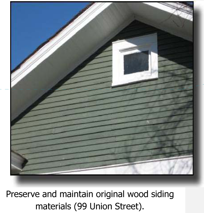
Non-original siding alternatives:
• Cementitious siding that matches the dimensions, non-grained texture, and color of the original wood
• Do not allow replacement siding to cover or conceal original architectural details
• Removal of asbestos, aluminum, and vinyl siding and restoration of the original wood siding is recommended
• Do not cover venting on a façade
• Match new siding width to the existing
4.
Porches:
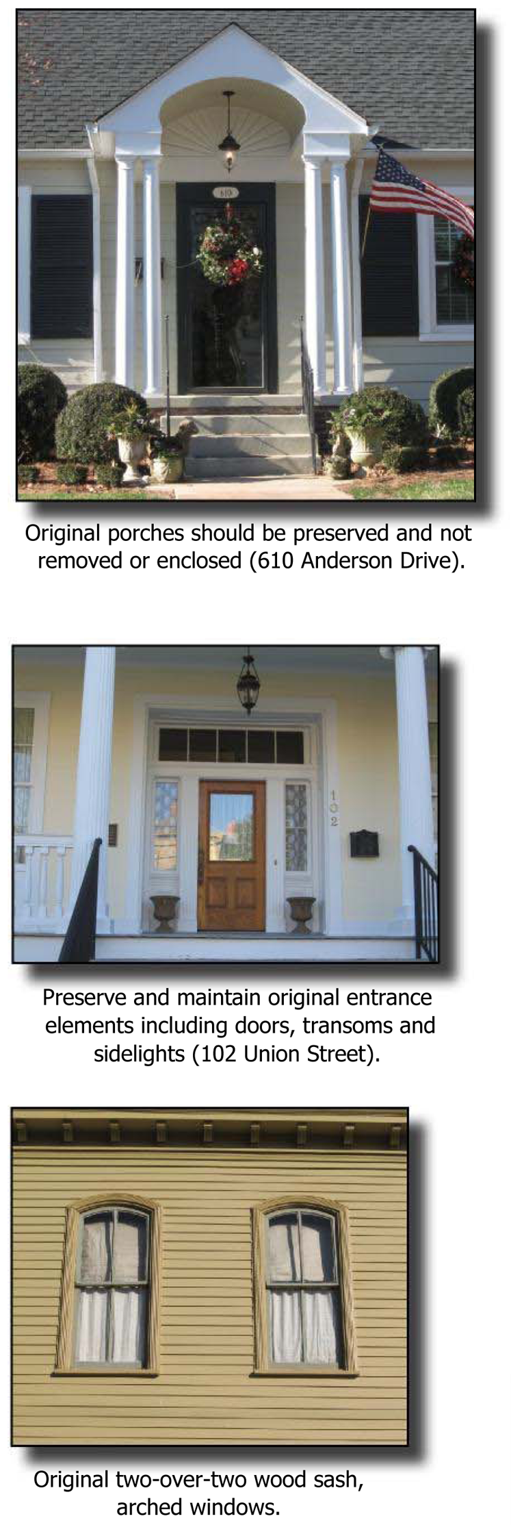
a.
Original porch elements such as columns, railings, valances, balusters and eave decoration should be preserved and maintained. If these features are deteriorated, they should be repaired with like materials and styles as closely as possible. If repair is not possible, they should be replaced with materials to match the original or with the most appropriate and sustainable material.
b.
Appropriate porch step materials include reconstructed wooden steps for wood porches and concrete steps for concrete porches. Brick is not a traditional material for porch steps and is not recommended. Porches on front facades should not be enclosed, as this type of addition alters the character of the façade. If screening is permitted, follow the recommendation below (see 11).
5.
Entrances: Original doors and door elements such as sidelights and transoms should be preserved and maintained. The removal of original doors is not appropriate. If storm doors are added, they should be full-view design to allow the original door to be visible.
6.
Windows: Original wood or metal windows should be preserved and maintained. Replacement windows should be with materials and forms to match the original as closely as possible. The installation of anodized aluminum or baked enamel aluminum windows is appropriate if they match the original light configuration, color and profile of the original windows. The installation of vinyl windows is discouraged as well as the use of snap-in mullions. Many brands of vinyl windows do not successfully imitate wood windows in their dimensions and profile, and may also discolor due to ultra-violet rays.
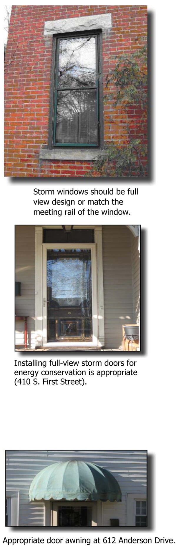
7.
Security Doors and Windows: The installation of security doors and windows is appropriate within some parameters. Statistically, intruders primarily enter through rear or side doors or windows which are not visible from the street. The installation of security doors and window bars on these facades may be appropriate. Although less appropriate on main facades, security doors may be installed if they are full view design or have minimal structural framing which allow the viewing of the historic door behind it. Ornate security doors with extensive grillwork or decorative detailing are not appropriate for entrances on the primary facade. Bars on windows may be placed on side or rear elevations, but never on facades.
8.
Storm Windows and Doors: The installation of storm windows and doors can help in lowering energy costs and are appropriate for older dwellings. Storm windows should be full-view design or have the central meeting rail (the horizontal element where the top and bottom panes meet) at the same location as the historic window behind it. Storm doors should be of full-view design. Windows and doors of dark anodized aluminum or baked enamel are preferred to those of "raw" or shiny aluminum.
9.
Awnings: Canvas awnings for windows and porches were common features of buildings in the early 20th century. With the widespread use of air conditioning after World War II, the use of awnings declined. In recent years, the use of awnings has increased because they are attractive and save energy costs. Canvas and similar material awnings are appropriate for many of Clarksville's dwellings.
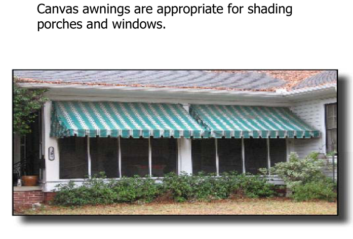
10.
Architectural Features: Original architectural features should be preserved and retained. These may include design elements such as wood shingles, eave verge-board and trim, window cornices, and eave brackets. If these features are deteriorated they should be repaired with like materials as closely as possible. If repair is not possible, they should be replaced with materials to match the original or with the most appropriate and sustainable material.
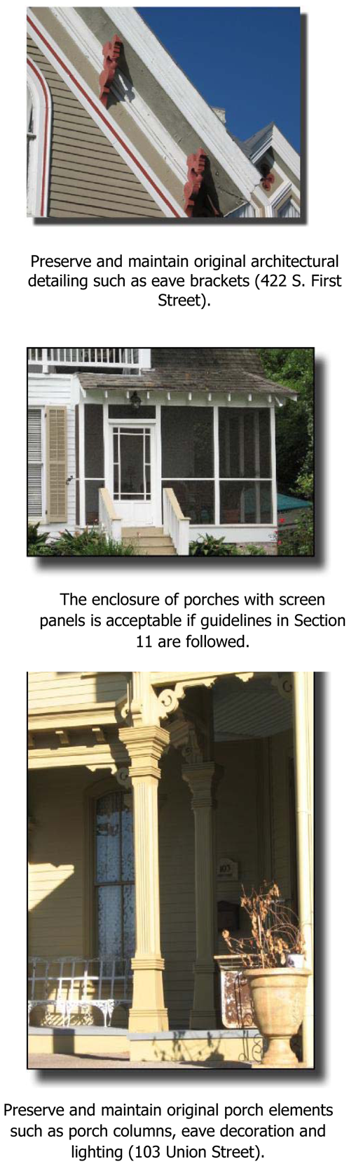
11.
Screens: While screening in porches is discouraged, this action is permitted and should follow certain guidelines so as to not compromise the architectural integrity of the façade. Visibility of architectural features such as porch columns and any decorative work is essential. Screen panels for porches and screen doors for entrances are appropriate if the structural framework is kept to a minimum to retain the open appearance of the porch and the visibility of the original door behind the screen door.
12.
Lighting: Many dwellings retain original exterior light fixtures at the porch ceiling or adjacent to the main entrance. Distinctive tinted globes and the "box" shaped fixtures for Craftsman/ Bungalows are part of a building's character and should be preserved and maintained. If the original light fixtures are missing, light fixtures with simple designs and detailing are preferred to large, ornate colonial or "Williamsburg" style fixtures. Avoid lighting styles that are inconsistent with the architectural style. Many companies now provide light fixtures based upon historic designs and the addition of these types of period fixtures is appropriate and encouraged.
13.
Mechanical Systems: Modern air conditioning and heating units often require condensers and other units to be placed on the exterior. These units are typically located adjacent to, or within a few feet of, the building. Heating and cooling units should be placed at rear or sides of buildings not visible from the street. The placement of these units at the front of buildings is not appropriate and should be avoided. Screening of these units through shrubbery, fencing, or lattice panels is highly recommended.
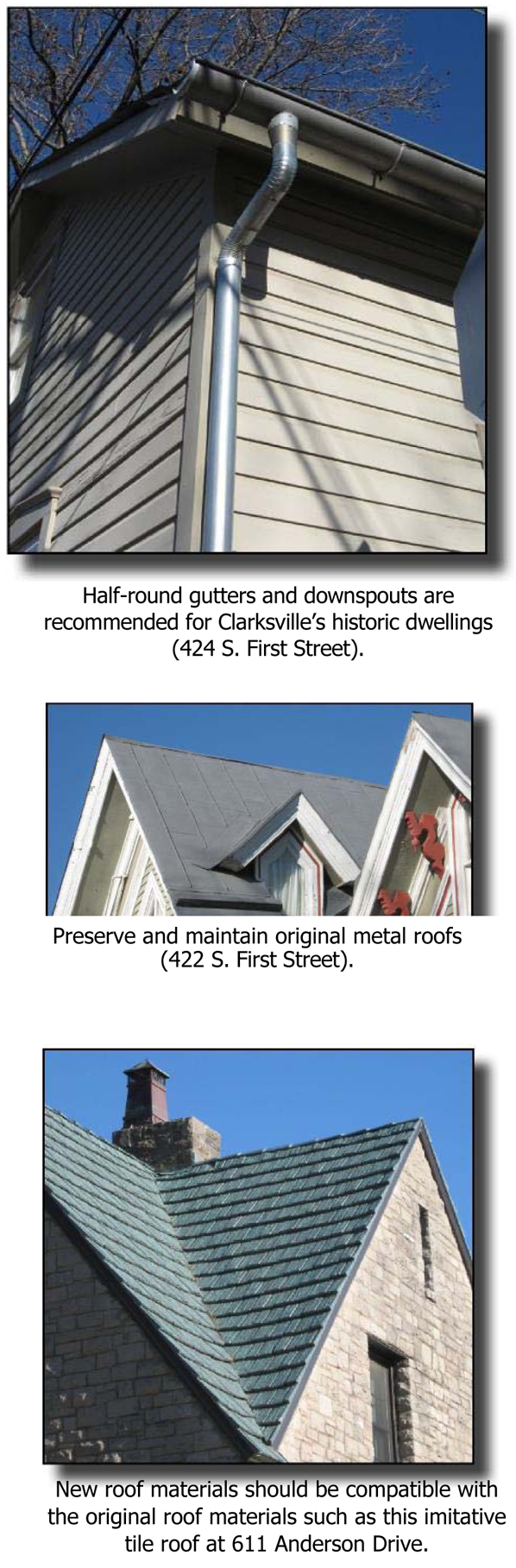
14.
Gutters and Downspouts: Retain existing boxed or built-in gutters. Repair deteriorated or damaged boxed or built-in gutters if possible, rather than replacing them with new gutters. If new gutters are needed, the most appropriate design for hanging gutters is half round. Ogee gutters (that taper outward and are flat on the bottom and back), however, are also appropriate on buildings dating from or influenced by designs from the 1940s or later. Locate downspouts away from architectural features and on the least public building elevation.
15.
Roofs
a.
Original roof designs should not be changed or altered on the primary and readily visible side elevations through the addition of new dormers or raised roof lines. Original materials such as metal, clay tile and slate should be preserved and maintained. If these features are deteriorated, they should be repaired with like materials as closely as possible. If repair is not possible, they should be replaced with materials to match the original or with the most appropriate and sustainable material. Synthetic materials can be acceptable if they accurately depict such roof materials, such as slate or clay tile. If new metal roofs are added they should match the original in crimping and spacing. New roof penetrations (pipes, vents) should be located on slopes of the roof that are not in view from the street.
b.
The addition of skylights can make the use of upper floor space or attic space more practical. The installation of skylights is appropriate as long as they are placed on rear roof lines, behind gables or dormers, or otherwise not visible from the street. Skylights which are flush with the roofline or lay flat are more appropriate than those with convex or "bubble" designs.
c.
Solar energy collectors or panels are available which can be either freestanding or attached directly to the building. Solar collectors are appropriate as long as freestanding panels are sited in rear yards and the roof panels are on rear facades or side facades not visible from the street.
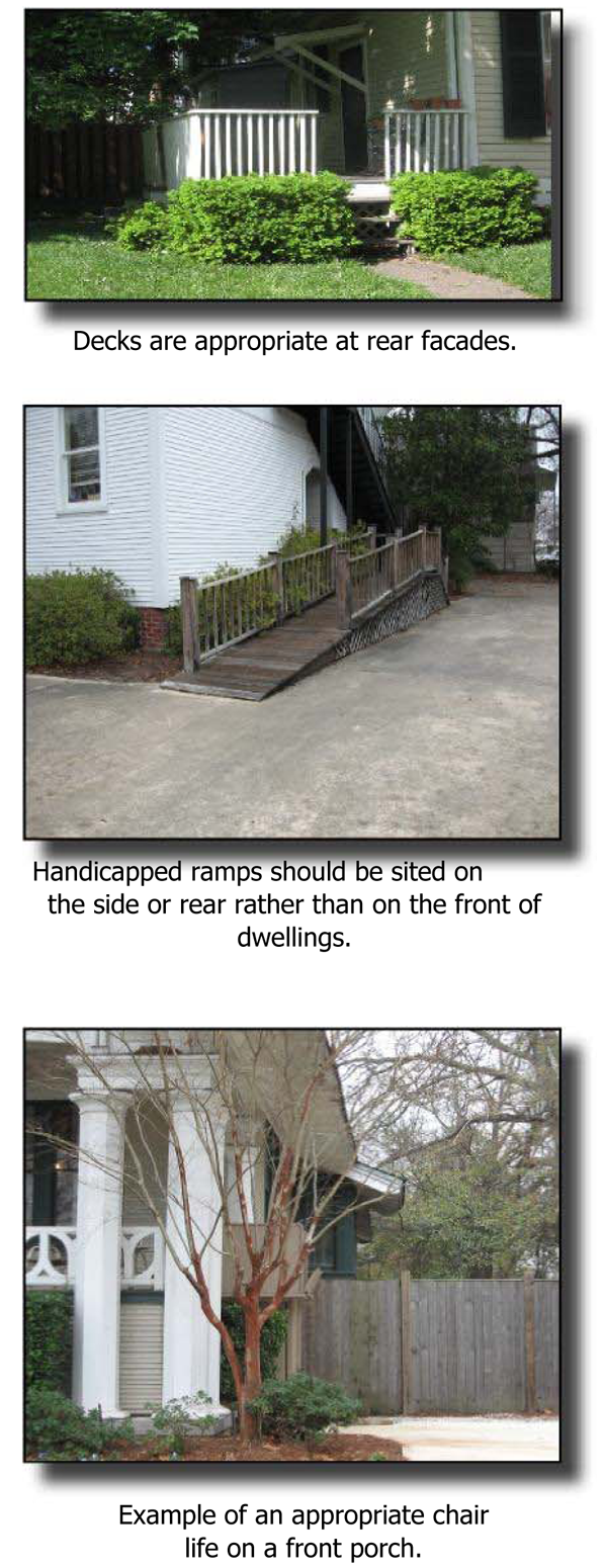
16.
Decks: Outdoor wood decks are popular additions and can usually work well with older buildings. As in the case of adding rooms, wood decks should be only built at the rear of buildings. Decks may be added to side elevations; however, their design will be reviewed. A review is required of a rear deck that is not visible from the street. A deck should not take visual priority away from the building; it should not extend beyond the sides of the building's walls. Its design should be simple with simple, square posts of three (3) to four (4) feet in height, spindles spaced three (3) to four (4) inches apart, and with a flat top railing.
17.
Handicap Ramps
a.
Handicapped ramps, also known as accessible ramps, are sometimes needed to provide access for those with disabilities. Handicapped ramps are best at the rear or sides of buildings so as not to be visible from the street. Ramps of wood construction are most appropriate for Clarksville's historic residential areas, and the railings should be with simple designs or match the original porch railing in design and detailing. If the ramp must be on the building front, it should be architecturally compatible with the building and/or screened with landscaping.
b.
For properties which have high visitation such as physician offices, consider the installation of a chair lift on a side or rear elevation.
F.
Design Guidelines for New Commercial and Mixed-Use Buildings
1.
New Building Approach
a.
New commercial building design shall reflect the period of its construction and shall not attempt a reproduction of a historic style unless it is reproducing a documented previously-existing building. It shall be compatible with the existing adjacent building, given the adjacent building is historic or exemplifies appropriate infill design in scale, setback, height, width, materials, massing, and rhythm and proportion of openings.
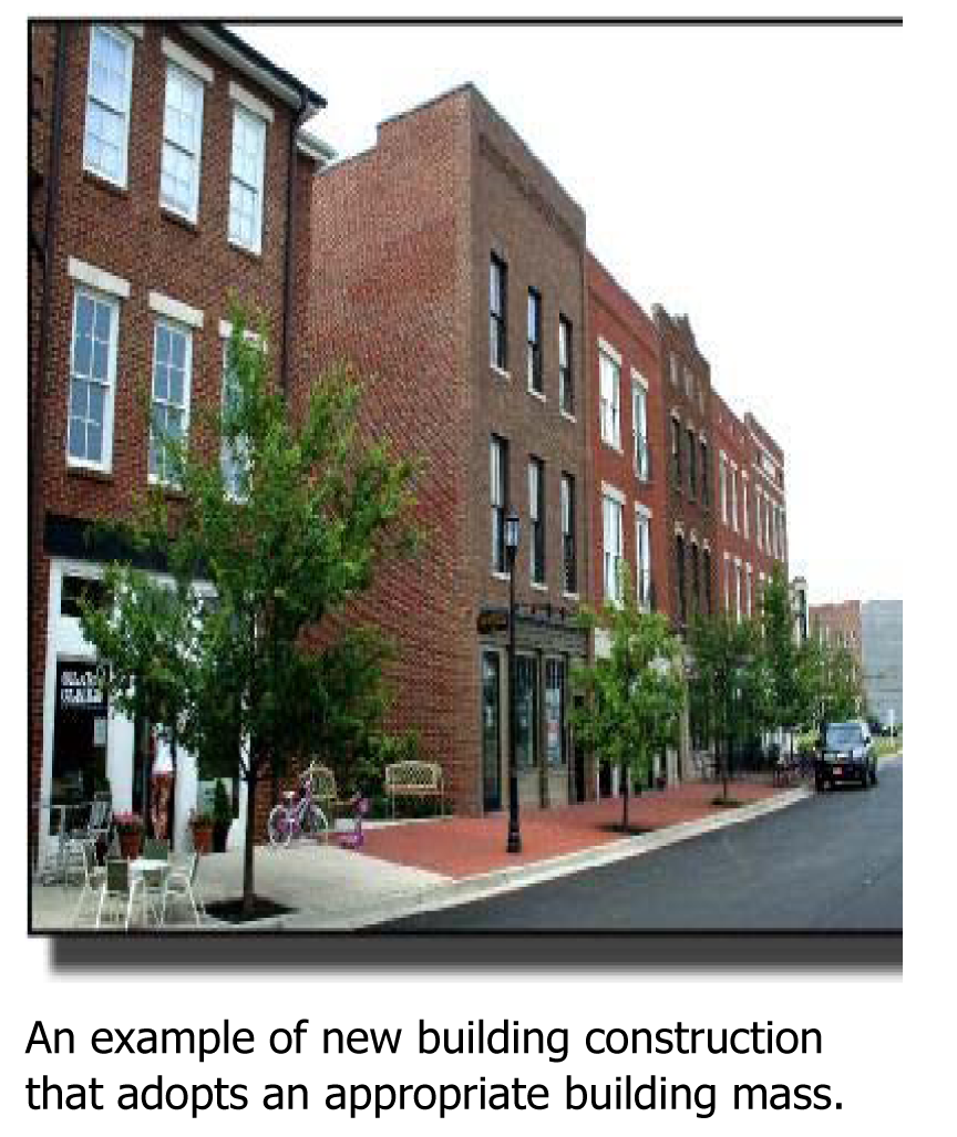
b.
While warehouses historically dominated the riverfront, commercial structures are the predominant building type along Riverside Drive today. The area has evolved into a strip commercial corridor, but needs to be transformed into an urban boulevard, including a median with landscaping and/or specialty pavers, street trees, sidewalks, fewer and narrower curb cuts, buildings closer to the street, and off-street parking to the rear or side of the buildings. These features would promote a unified streetscape more in keeping with the balance of the downtown core. Future development should consider the character of and relationship to existing riverfront development. This can include non-commercial buildings, especially housing (townhouses and other multiple-family structures). While the Riverside Drive Corridor should not be as urban as areas such as Franklin Street, it should be much less suburban than its current condition.
2.
Height: Currently, building heights are from one- to five-story in the downtown core. Residential neighborhoods in the district have one- and two-story single-family dwellings. Townhouses and apartments are two- and three-story. The height of new buildings in the historic commercial district will vary from street to street and shall consider the height of adjacent buildings, as well as the entire block face and those of the block face on the opposite side of the street. Taller buildings may be appropriate at key intersections. Based on existing development, the figure on the following page is advisory only for building heights because the height restrictions of the underlying zoning district apply unless varied by the Board of Zoning Appeal. For reasons of financial viability and to encourage greater property values per acre Downtown, building heights greater than the advisory height may be necessary outside of the local and national historic districts. The height of any new structure should not block the view shed of the cupola of the Old Historic Court House, the upper floor of the new City Hall and the spires of churches on the National Register of Historic Places. Consideration should also be given to avoiding the obstruction of views of the Cumberland River from structures on the bluff.
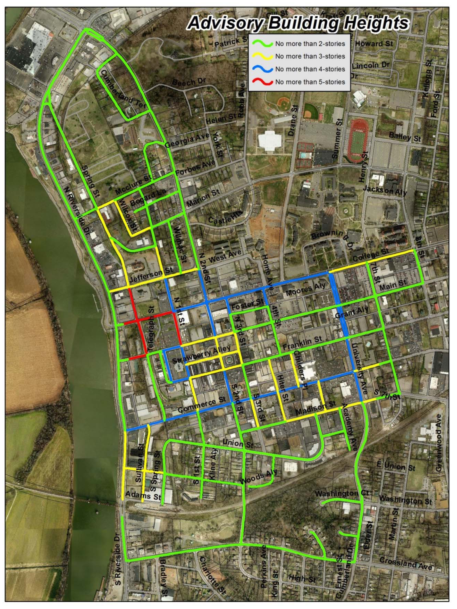
3.
Massing
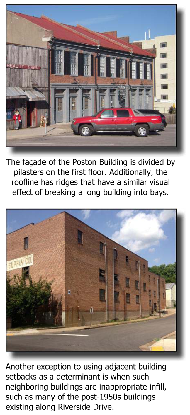
a.
No uninterrupted front façade plane shall extend more than thirty (30) feet. Pilasters, variations in the roof line or parapet wall, or building wall recesses shall be used to break up the mass of a single building into distinct bays no wider than thirty (30) feet. Variations in materials and colors can also help achieve this massing standard. The length of the street wall for all buildings shall be at least seventy-five percent (75%) of the lot frontage along downtown blocks.
b.
A minimum of fifty percent (50%) of the building wall shall be built to the building setback line. Taller buildings shall be carefully designed with a narrow profile towards Riverside Drive to maintain views of the river from the downtown core.
4.
Building Setback Lines: Buildings shall be located in a manner compatible with the existing structures; incompatible or inappropriate adjacent buildings shall not be used as a contextual reference point.
a.
Central Commercial Sub-District. The front yard setback should be based on the predominant setback of existing structures on the blockface or across the street. If adjacent buildings are zero lot line, then the front facade shall be zero lot line with the street right-of-way line.
b.
Riverside Drive Sub-District: The front yard setback along Riverside Drive should not be less than twenty (20) feet to accommodate public utility easements and landscaping outside the street right-of-way, should encourage off-street parking to be located to the rear and side of structures, and should enable the building pad to be raised above the one percent (1%) storm elevation. In addition, building massing will provide guidance on desirable building setbacks.
c.
An exception to setback guidelines would occur where outdoor seating/dining is planned into the design. In this case, the building's façade wall may be located behind the adjacent setback line between twenty (20) to thirty (30) feet if a low and/or pierced brick wall delineates the patio area and constitutes the setback line. The wall shall be between two and one-half (2½) and three and one-half (3½) feet in height. If decorative ironwork is included atop the wall, the entire structure shall not exceed three and one-half (3½) feet in total height.
5.
Roofs
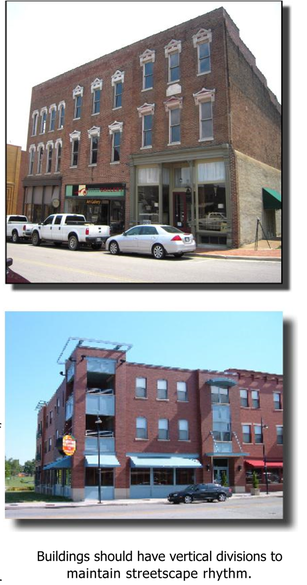
a.
Roof forms should be appropriate to the building's architecture and surrounding context. Most flat roofs in the downtown area are not readily visible from the street. Parapet walls along the façade roofline are used to conceal the roof, as well as any mechanical systems located on rooftops. This is an appropriate design for new buildings. However, there is historical precedence for a gable roof on commercial buildings, as seen on the Poston Building from the 1840s. A gable roof design may be appropriate on a new commercial building provided it is adjacent to a commercial building with a gable roof or dominates the blockface. Metal roofs should have crimping and spacing to be consistent with historic metal roofs. Corrugated metal roofs are not an appropriate material in place of standing-seam metal roofs.
b.
Parapet walls should be used on flat roofs for buildings in the Riverside Drive Sub-District, as well. Buildings there should have simple roof forms free of "sculptural or sign-like visual qualities.
6.
Facades
a.
In order for infill buildings to blend into the existing streetscape, their design should complement that of historic buildings. To achieve the desired results, new buildings should incorporate design elements of historic facades. A new building should have a street-level storefront consisting of a primary entrance and large, clear display windows. A transom can be included over the entrance, and display windows can rest on bulkheads, as in traditional commercial design. There should be a distinct transition between the storefront and upper façade, which can be achieved by use of decorative means such as corbelled brick. The following points are also essential to appropriate infill design:
b.
Facade Articulation: Building facades shall emphasize clearly articulated main entrances using awnings, canopies, columns, pilasters and recessed entrances. Provide entrances that are distinct and visible from the street. Avoid long expanses of uninterrupted storefronts. Divide with architectural elements.
c.
Doors and Windows: Infill buildings shall have their primary entrance on the primary facade fronting the street. Window and door openings should have a vertical orientation and alignment. Upper floor windows also need to be vertically oriented in proportions close to those of existing.
d.
Glazing: A minimum of sixty-five percent (65%) of the front facade's ground floor shall be glazed (consisting of glass in the form of doors and/ or windows). The ground floor is considered the area between grade and the first floor's ceiling. Glass anywhere on the front façade may not be reflective or heavily tinted.
e.
Side and Rear Facades: Rear and side facades do not need to be designed to the extent of primary facades. However, side and rear facades within and adjacent to local Historic District Overlays and the National Historic Districts and Structures are subject to review as well as other new structures visible from the public right-of-way.
7.
Materials
a.
Materials and their texture should be appropriate for the building's architecture and surrounding context. Exterior insulation finish systems and metal panels shall be considered for use only by careful review by the Design Review Board. Vinyl and aluminum siding are not appropriate in any sub-district.
b.
The primary exterior wall materials should be brick and natural or artificial stone, split-faced concrete masonry, smooth surface stucco, historically correct painted wood siding or painted cement composite sidings. Additionally, cementitious siding and Exterior Insulation Finishing System (EIFS) are acceptable; however, the latter is not encouraged due to concerns about its longevity. Brick shall not be painted unless it is extremely mismatched or so deteriorated that it cannot resist moisture penetration. If painting is necessary, the natural color of the brick shall be used. Stone shall not be painted.
c.
Wall materials that are discouraged:
• Unfinished or rough natural wood siding
• Aluminum or other large sheet painted metal
• Heavy textured stucco
(Note: Many of the above materials may be used as accents or trim in small amounts)
d.
The following wall materials are discouraged in the Downtown Overlay District, however, may be given special consideration by board approval only. Use of these materials:
• Must be consistent with the architectural style or character of the building and adjacent structures.
• Shall not provide a false sense of historic development.
• Reflect the period of the building's construction.
• Be compatible with adjacent historic materials.
• Not accelerate the deterioration of adjacent historic materials.
• Match the appearance of adjacent historic materials.
These special consideration materials are:
• Plywood
• Vinyl siding
• Wood shakes
• Plastic or fiberglass
• Asphalt shingles
• Reflective, opaque or mirrored glass
• Unfinished concrete
• Illuminated plastic elements
• Unsurfaced or unpainted precision face concrete blocks (on street or public fencing facades)
8.
Colors
a.
Colors shall be complimentary to the dominant neutral building material colors such as dark red or red brown for brick and buff, taupe or gray for natural stone. Softer muted hues with gray or white added to the basic color shall be used to highlight architectural features such as window frames, sills, cornices, and details.
b.
Avoid large areas of intense bright or very dark colors. Medium or subtle colors are encouraged. Fluorescent or "day-bright" colors are prohibited. Minimize the number of colors on an exterior to three (3) except where accent colors may reflect a particular historic character.
9.
Awnings and Canopies: Guidelines for awnings and canopies are the same for infill buildings as for historic buildings. Please see these guidelines in Section D.4.
10.
Balconies: On infill buildings, balconies shall be metal or wood. If balconies have supporting columns, they should not impede pedestrian traffic. If covered, the roofs shall follow the standards for canopies. Permanent screens are prohibited, but roll-down screens and wood (or simulated wood) shutters are acceptable.
11.
Retractable Storefront Windows: Façade windows that retract for an open-air design may be acceptable in some areas of downtown. Hinged bi-fold windows open laterally and are the best option visually as they least detract from the building design. The use of full-glass garage-style doors may also be appropriate.
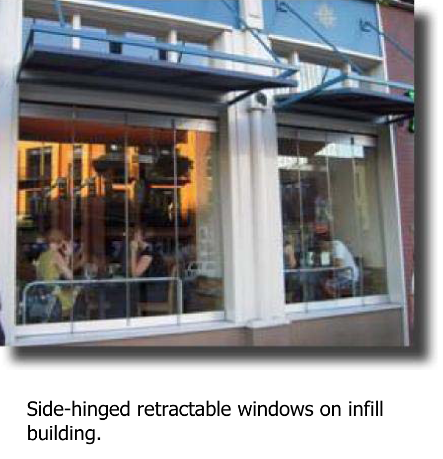
G.
Design Guidelines for New Institutional Buildings
1.
General Approach: Institutional buildings include a broad range of structures that are publicly or privately developed for governmental, religious, educational, and similar purposes. They include churches, schools, post offices, and municipal buildings. Institutional buildings are geographic landmarks in the sense that they are readily identifiable, and their designs clearly express their function. Therefore, unlike other types of development, it is understood that an institutional building should accentuate its design differences from other downtown buildings, in order to underscore its significance. For this reason the standards for institutional design are minimal relative to other building types. Nevertheless, these guidelines will be used to review the design of private buildings, and may be consulted in the case of publically owned lands and structures.
2.
Height: The height of an institutional building should be comparable to that of commercial/mixed use buildings on the same block or street. Height varies through the Downtown Overlay District according to building type and location. See suggestions for maximum height in Section F. The vertical architectural elements which are not habitable, such as spires, steeples and cupolas, shall not count toward height measurements. The height restrictions of the underlying zoning district shall govern.
3.
Width: The maximum width for new institutional buildings shall not exceed two hundred (200) feet. The examples of an exception to this limit are conference centers and similar large-footprint buildings. These may exceed the width if the facade massing can be visually broken up.
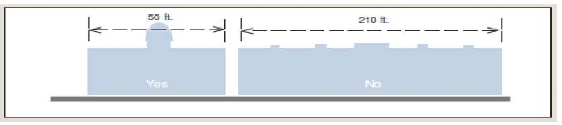
4.
Setback: There are no building setback requirements for new institutional buildings, although no parking shall exist within the front yard. Also, where appropriate, a generous setback is encouraged as a means of lending the building prominence and underscoring its significance.

5.
Roofs: In the case of institutional buildings with flat or only slightly sloped roofs, a parapet wall shall serve as the front facade to mask the roof. Mechanical systems placed on the roof top shall be screened or obscured from public streets by either a parapet wall or by its location. Decorative, vertically-oriented architectural features, such as steeples and cupolas, are encouraged.
6.
Ground Floor Façade Massing: The ground-floor level of a primary facade plane shall not exceed a width of fifty (50) feet without an interruption. Ground-floor façades shall be broken into a series of vertical bays using any of the following elements: wall off-sets of at least four (4) inches in depth, pilasters (engaged pillars) with a minimum depth of four (4) inches, columns/posts, projecting bays, and porches. These means of achieving massing may be accompanied by other approaches such as material changes, roofline changes and front steps.
7.
Front Façades and Entrances: A building's primary façade and its entrance shall front onto the building's associated street. For corner lots, the front façade and primary entrance shall face the "primary" street rather than the side street. The design of the primary entrance should be most prominent, clearly indicating it as the main point of entry. Its design may be echoed at secondary entrances, on a lesser scale or with lesser degree decorative embellishment, to identify them as subordinate.
8.
Glazing: Glass on any facade fronting a street may not be reflective or heavily tinted, but colored glass in the form of leaded "stained glass" is permitted.
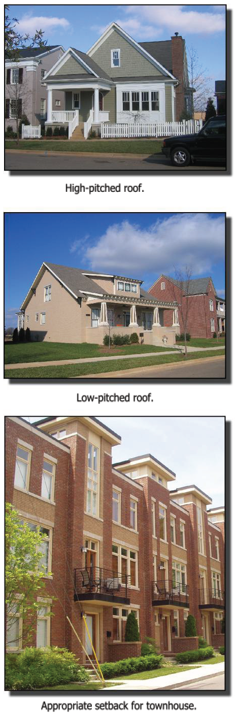
H.
New Residential Buildings: These guidelines are advisory only for single-family and duplex structures outside of the local Historic District Overlays, and may be consulted (but are informational only) for the review of new residential housing of all types within the local Historic District Overlays.
1.
Height: The building height of a single-family dwelling shall not exceed two (2) stories and twenty-five (25) feet to the eave line. Multifamily apartment buildings can vary in height between one (1) and four (4) stories depending on their location, as depicted on the map in Section F. The height restrictions of the underlying zoning district shall govern provided the building height does not exceed the predominant building height of existing structures on the blockface and across the street.
2.
Setbacks: All residential dwellings shall have a setback equal to or greater than that of the adjacent buildings' setbacks, given that the adjacent buildings represent compatible models.
a.
In residential neighborhoods of the Downtown Overlay District, front yard setbacks need to be within five (5) feet of the average of the block face. (Consult Chapter 4 for setback standards and Section 4.1.1 for setback exceptions in this zoning ordinance.) An exception from the front setback standards is permitted for a front courtyard design in which at least one-third (⅓) of the building's frontage adheres to the required setback. The courtyard depth shall not exceed fifty (50) feet as measured from the public right-of-way line and no parking is permitted within the courtyard area. Street side yard setbacks can vary and should be an average of existing examples on the block face. (Street side yard setbacks follow the same standards as front yard setbacks in this zoning ordinance.)
3.
Roofs: For single-family dwellings, pitched roofs with a slope between 6:12 and 12:12 are required excluding porch roofs. Roofing materials shall include slate, heavy textured asphalt shingles, wood shakes, or standing seam metal compatible with the construction period of the area. Roof penetrations (pipes, vents) should be located on slopes of the roof that are not in view from the street. Synthetic materials that accurately depict materials such as slate and wood shakes may be permitted if they are appropriate to the style of the house. Single-family attached and detached houses shall have sloped roofs. Townhouses and apartment buildings can have either sloped or flat roofs with a parapet wall.
4.
Façades: In order for infill buildings to blend into the existing streetscape, their design should complement that of historic buildings. To achieve the desired results, new buildings should incorporate design elements of historic facades. Facades shall reflect the residential building types in the area. For all new single-family dwellings, porches shall be a minimum depth of six (6) feet and extend across a minimum of sixty percent (60%) of the front façade. The following points are also essential to appropriate infill design:
a.
Façade Articulation: Building façades shall emphasize clearly articulated main entrances that are distinct and visible from the street. This applies to apartment buildings as well. In the case of courtyard apartments, the ends of the buildings face the street and would not need to meet this requirement. However, their front facades (the ends) would need to meet the requirement for build-to range for front setbacks.
b.
Doors and Windows: Infill buildings shall have their primary entrance on the primary facade fronting the street. Window and door openings should have a vertical orientation and alignment.
c.
Glazing: Glass anywhere on the front façade may not be reflective or heavily tinted.
d.
Side and Rear Facades: Side and rear facades do not need to be designed to the extent of primary facades. However, side and rear elevations are reviewed when within or adjacent to local Historic District Overlays, the National Register Historic Districts and Structures, and all other new multiple-family (townhouses and apartments) residential visible from the public way.
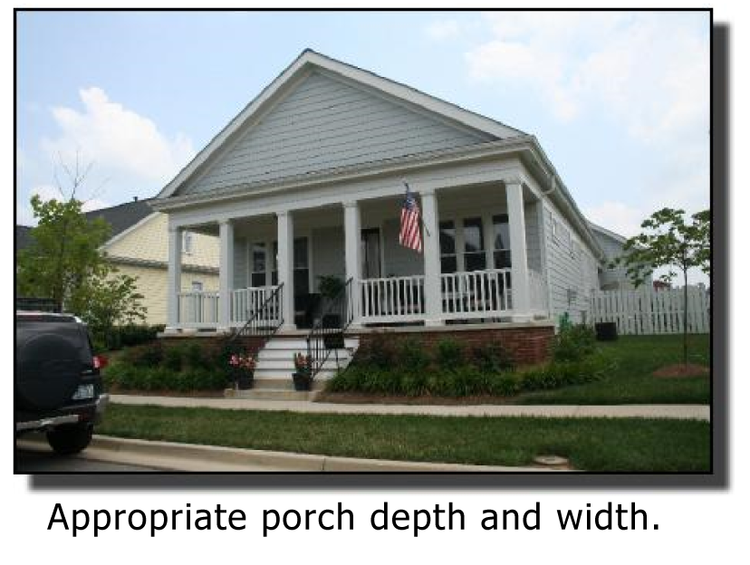
5.
Raised Foundations: Buildings shall have a foundation height (measured from finished grade to finished first floor) of at least twenty-four (24) inches. Foundation materials should be of poured concrete, stone, brick or split faced concrete masonry unit (CMU).
6.
Door and Window Design
a.
The building's primary entrance shall face the associated street.
b.
All windows shall have a vertical orientation. However, individual vertically oriented windows may be "ganged" to collectively have a horizontal orientation. Door and window mullions shall be true divided lights or simulated divided lights on both sides of the glass.
c.
Shutters, if provided, shall be sized to fit the window and appear to be operable.
7.
Materials
a.
Appropriate materials shall include:
• Brick (foundations and siding)
• Weatherboard or wood shingle siding (not on townhouse or apartments in the downtown core)
• Stone (foundations)
• Lattice panels (foundations)
• Cast stone (siding and foundations)
• Split-face concrete masonry unit (foundations)
b.
Additionally, cementitious siding and Exterior Insulation Finishing System (EIFS) are acceptable for siding; however, the latter is not encouraged due to concerns about its longevity.
8.
Garages and Accessory Buildings
a.
Garages for new single-family residential construction shall be detached in the local Historic District Overlays, the National Register Historic Districts and Structures, and abutting such historic properties. Garages may be attached to the rear of residential structures not in or adjacent to historic structures. Garages and other accessory buildings shall occur in the rear of a lot, and shall meet the minimum side and rear yard requirements unless a variance is approved by the Board of Zoning Appeals.
b.
Multi-vehicle garages visible from the street shall have one (1) bay door per vehicle.
c.
Parking garages are addressed in Section I.7.
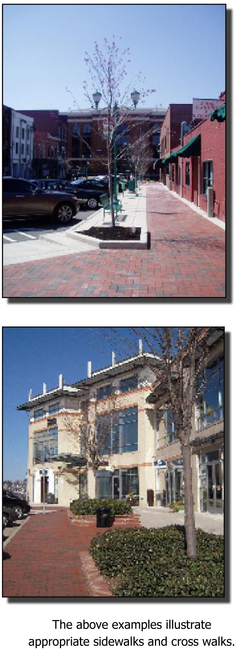
I.
Streetscape and Site Planning
1.
Streetscape and Site Planning: Clarksville has undertaken several projects involving streetscapes and other improvements to the downtown area. Future work planned for downtown should be in accordance with the following guidelines. However, these streetscape guidelines are not mandatory for any public entity.
2.
Sidewalks
a.
The repair, construction, or modification of sidewalks within the District will require a Certificate of Appropriateness and a building permit from the City of Clarksville. Sidewalks along street rights-of-way shall be well maintained and provided where not already present.
b.
Design: Continuous formed curb and gutter shall be used on both sides of the public streets. Walkways should be raised above the street level and curbed, but should have depressed curbs at intersections for ADA accessibility. Accessibility for wheelchairs should be at least a minimum of thirty-six (36) inches in width. In the Riverside Drive Subdistrict, the sidewalk should be a minimum of six (6) feet wide or maintain the existing building face. In residential areas, the sidewalks should be a minimum of four (4) feet wide; for multiple-family developments, wider sidewalk widths may be required. In the Central Commercial Subdistrict, sidewalks should be at least six (6) feet in width and wider sidewalks may be appropriate to match predominant sidewalk widths in the immediate area. Sidewalks shall be expanded at street corners to include "bulb-outs," which protect parked end vehicles and decrease the distance for pedestrians to cross the street.
c.
Materials: Sidewalks along Commerce Street from Third Street to Second Street, Franklin Street from Third Street to Public Square, Strawberry Alley/Legion Street from Third Street to First Street, First Street from Franklin to Main Street, Second Street from Commerce Street to Main Street, and Third Street from Commerce Street to Main Street, and the Public Square should contain brick elements with concrete curb and gutter.
d.
Other sidewalks are recommended to be of a combination of brick pavers, brick pavers with concrete bands, or broom finish concrete paving with brick bands. Pedestrian street crossings should be clearly delineated with paving materials that stand out from the street surface.
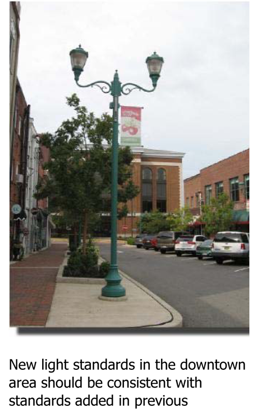
3.
Lighting
a.
New light standards should be consistent with those introduced into the downtown area during recent streetscape improvements. Metal halide lighting is preferred and should be used in locations where it complements the lighting design. The use of LED and high-pressure sodium lights may also be appropriate. In particular, all parking lot lighting shall have low cut-off fixtures which do not throw lighting on adjacent properties. 'Box' or 'cobra' style lighting is prohibited.
b.
Pedestrian lighting in residential areas shall use lamp-post fixtures fourteen (14) feet in height. Fixtures shall use high-pressure sodium luminaire lighting. The street lighting for major streets shall be standard fixtures from the utility company painted to be compatible with pedestrian street lighting.
4.
Street Trees: Street trees shall be used along the street rights-of-way to create a sense of place. Trees shall be Willow Oaks and Littleleaf Lindens, "Village Green" Zelkovas or other approved species compatible with the existing landscaping.
5.
Street Furniture: Street furniture shall include benches, trash receptacles, bollards, planters, bicycle racks and kiosks. Benches and trash receptacles are appropriate in carefully selected locations. Newspaper boxes also contribute to the convenience of an area, but should be grouped to avoid visual clutter. The color of street furniture shall blend harmoniously into the streetscape.
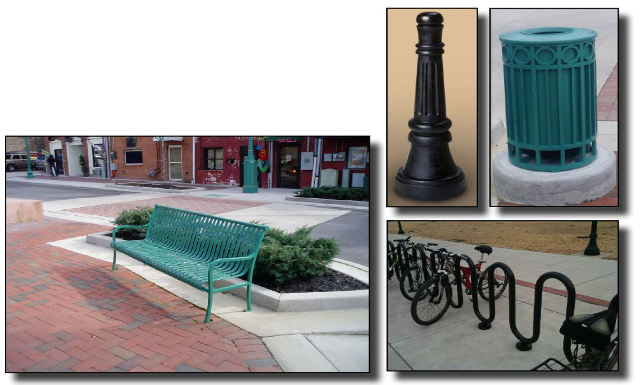
6.
Parking and Egress
a.
Parking shall be provided in accordance with the requirements of the zoning ordinance. Shared parking facilities are encouraged. Parking lots should be sited on rear or side elevations, and screened with appropriate fencing or landscaping. Surface parking located on the side elevation of building shall be limited to one (1) double loaded aisle. The layout and screening of lots should minimize direct views of parked vehicles from streets and sidewalks, and should provide a reasonable amount of shade.
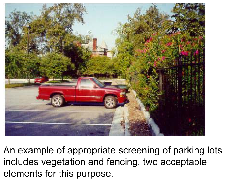
b.
Parking lots shall be screened from the streets by landscaping or a wall a minimum of three (3) feet in height. Evergreen hedges and walls shall be used. Screening should be compatible with the style, materials, and colors of the principal building on the same lot. The parking areas for the car dealerships shall use street trees and planting strips along the street frontage to improve the quality of the streetscape and the image of the downtown. On residential streets, parking shall be to the rear of the primary dwelling. Front parking pads are not permitted in residential areas. On-street parking is acceptable throughout the downtown and residential areas, but parking lots and structures are not permitted in front of the primary building. Side parking lots between buildings may be permitted with screening. Neither parking structures nor spaces shall be located in front of the primary building.
7.
Parking Structures: Parking structure entrances and exits should be located on side streets if available. Walls fronting streets shall utilize materials, colors, and a pattern of openings consistent with surrounding buildings. Commercial business space shall be placed along the ground floor of new parking structures to maximize activity along the street frontage, and shall have direct access to the street and sidewalk. This is not a requirement on non-retail streets. A minimum of seventy-five percent (75%) of that commercial space wall area shall be transparent. Louvers and other open screening devices shall be used on upper level openings to hide the automobiles, screen garage lighting, and allow the garages to blend with the urban design fabric.
8.
Fences
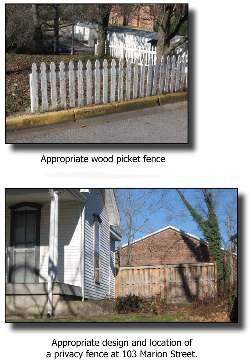
a.
Wood fences were widely used in Clarksville to separate lots and outline front yards, but are no longer appropriate in the front yards of properties in the H-1 local Historic District Overlays. Cast iron, brick, stone, and wire fences were also used. In recent decades, chain link fences have been popular, but are no longer appropriate. Historic (pre-1960) fences should be preserved and maintained.
b.
Appropriate front yard fences:
• Historic wrought iron fences or black, steel fences that replicate wrought iron, not to exceed three and one-half (3½) feet in height
• Historic stone walls
• Wood picket fences, not to exceed three and one-half (3½) feet in height.
c.
Appropriate side yard (not along a street):
• Wood picket fences
• Wood privacy fences, not to exceed six (6) feet in height
• No chain link or wire fence is appropriate.
d.
Appropriate rear yards:
• Privacy fences
• Chain link and wire fences are prohibited
• Landscape screening.
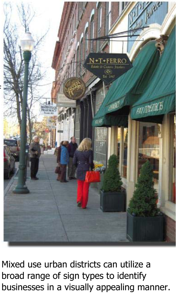
J.
Sign Standards
1.
General Principles: The following principles are broad concepts that are addressed below with more specific standards.
a.
Signs may NOT be erected or altered without obtaining a permit from the Clarksville Building and Codes Department. Signs meeting the objective standards of Chapter 8 may be approved at the Staff Level without going to the Design Review Board; however, within the H-1 local Historic District Overlays, a Certificate of Appropriateness will require Historic Zoning Commission approval.
b.
Commercial signage shall be designed primarily for the purpose of identifying a business rather than serving as advertising.
c.
Signage should balance the need for businesses to be identified with the objective of avoiding visual clutter.
d.
Signage should not visually obscure significant architectural elements of a building (windows, opening trim, architectural detailing, etc.).
e.
In the case of wall-mounted signs, channel letter signs are preferred over cabinet signs.
f.
Sign materials should reflect a high level of quality and a historic character by utilizing traditional, non-synthetic materials (wood, metal, etc.). Material exceptions may be granted in the Riverside Drive Sub-District on a case-by-case basis.
g.
Refer to Chapter 8 of this Ordinance for additional sign regulations. In particular, Section 8.2 of this Ordinance establishes sign regulations applicable to all land use zoning districts and all zoning overlay districts. When more stringent sign regulations are established below, they shall prevail for the Downtown Overlay District.
2.
Sign Standards: Within the Downtown Overlay District and including the local Historic Overlays encompassed therein, the following sign standards shall apply:
a.
For land uses in the Residential Zoning Districts, the residential Planned Unit Development (PUD) District and residential uses in the CBD and C-2 Districts, the sign provisions of Section 8.3 "Residential Districts" shall apply.
b.
For land uses in the Office, Commercial, Industrial and Mixed Land Use District (MLUD) Districts, the sign provisions of Section 8.8 "Central Business District" and Section 8.9 "Downtown Sidewalk Signs" shall apply.
2.
Precedence of Regional Historic Zoning Commission Review Guidelines. The Review Guidelines adopted by the Regional Historic Zoning Commission and this Ordinance for locally designated historic districts within the Downtown Boundaries shall take precedence within the H-1 Historic District Overlay, in the event of a conflict between the two (2) sets of guidelines.
9.5.4 PROJECT APPROVAL PROCESS
1.
Overview. To ensure consistency with the Downtown Urban Design Standards and Guidelines, the Common Design Review Board and the Clarksville-Montgomery Regional Planning Commission staff will review all private projects in the Downtown Urban Design Overlay District that require demolition and building permits and that make modifications to the exterior appearance of buildings, signing, landscaping and parking. Existing nonconforming structures, unforeseen physical conditions and subsequent architectural programmatic constraints may warrant exceptions to the guidelines. In such cases, the Common Design Review Board and planning staff will review alternative design solutions as they relate to the intent of the standards and guidelines, and will accept alternatives that present the best urban design solution. Where a single use or structure spans more than one (1) sub-district (i.e., Central Commercial District, River District, Residential or Historic), the Common Design Review Board and planning staff will explore with the developer alternative solutions that achieve the design intent of the standards and guidelines. The Clarksville-Montgomery County Regional Planning Commission will continue to review site plans as required by Chapter 5.10 "Site Plan Requirements" and landscape plans as required by Chapter 7 "Landscape, Buffering and Screening Requirements" of this Zoning Ordinance.
2.
General Directions:
A.
The authority of the Common Design Review Board to uphold the Downtown Urban Design Overlay guidelines is limited to the standards and guidelines referenced in Subsection 9.5.3.1 of this Ordinance.
B.
Any approval by the Common Design Review Board is contingent on zoning and building permits issued by the Building and Codes Department, and cannot be interpreted as taking precedence over the building code or zoning ordinance except where the zoning standards set forth in the Downtown Overlay Standards and Guidelines are more stringent than other Sections of this Ordinance.
C.
Other ordinances or parts thereof which are inconsistent with or are in conflict with the specific provisions of this Ordinance are expressly superseded by this Ordinance and are to be controlled by the provisions of this Ordinance.
D.
Existing base zoning district standards that are not varied by this section as set forth in this Ordinance shall apply within the Downtown Urban Design Overlay.
3.
Step One/Application
A.
The first step in undertaking a project in the Downtown Urban Design Overlay is to contact and request an application from the Regional Planning Commission.
B.
Regional Planning Commission staff will provide the applicant with the published guidelines and standards (this document and any future amendments) for projects within the various sub-districts of the Downtown Urban Design Overlay. It is recommended that the applicant become familiar with the guidelines and standards prior to planning the project and before the development of any working drawings.
C.
The applicant must submit one (1) set of the following documents signed by the applicant that will be retained by the Planning Commission:
I.
Copies of the proposed site plan (to an engineering scale) showing all site improvements such as buildings, walls, walks, parking, signs, plant materials, and lighting.
II.
Completed color exterior elevations (⅛" = 1' architectural scale minimum).
III.
Exterior painting schedule (Color name/brand).
IV.
Samples of exterior materials including brick, stone, metals, glass, roofing.
V.
Detailed scale drawings of awnings and canopies, indicating proposed colors.
VI.
Color photographs of all sides of the existing exterior for remodeling, rehabilitation, or demolition. For demolition, remodeling, and new construction, photographs shall show contiguous properties.
4.
Step Two/Common Design Review Board
A.
Should the application indicate alterations, remodeling, or repairs that are not governed by this Ordinance, the Common Design Review Board may exempt the application from the provisions of this urban design overlay district.
5.
Step Three/Approval or Redirection
A.
After a careful review of the presentation, the Common Design Review Board will act to approve, conditionally approve or disapprove the application. The Clarksville Building and Codes Department will then review the approved project for zoning and codes compliance when the drawings and specifications are competed and submitted to the department.
B.
If the project is disapproved, the Common Design Review Board and Planning Commission staff will strive to assist the applicant by providing guidance and redirection of the project. It will then be necessary to present the project to the Board at another regularly scheduled meeting. A building permit shall not be issued until such time as the proposed project receives final approval from the Common Design Review Board.
C.
Under extreme circumstances, the Common Design Review Board shall have the right to approve projects which do not absolutely meet the guidelines, but that follow the intent and spirit of the urban design guidelines.
D.
Upon project approval, the project must be executed as presented and approved. Any substantial departure from the plans as presented will require another review by the Common Design Review Board.
9.5.5 APPEALS PROCESS
A.
The Planning Commission shall hear and decide appeals from any order, requirement, decision or determination made by the Common Design Review Board or Planning Commission staff where it is alleged by the applicant in writing that Common Design Review Board or Planning Commission staff is in error or acted arbitrarily. Such appeal shall be made within sixty (60) calendar days of said order, requirement, decision or determination.
(Ord. No. 4-2021-22, 9-2-2021)

