
Colleyville City Zoning Code
CHAPTER 8
- PLAT REVIEW PROCEDURES
Sec 8.100 - Purpose of this chapter.
The purpose of this Chapter is to establish regulations which describe the process for the review and approval of subdivision plats, but more specifically to:
A.
Provide for the safe, orderly, and healthful development of the area within the city and within the area surrounding the city and to promote the health, safety, and general welfare of the community;
B.
Encourage the orderly development of the city through appropriate growth management techniques assuring the timing and sequencing of development, promoting in-fill development in existing neighborhoods and nonresidential areas with adequate public facilities, to assure proper urban form and open space separation of urban areas;
C.
Encourage appropriate protection to environmentally sensitive areas;
D.
Ensure that public facilities and services are available; and
E.
Establish procedures for the review and approval of subdivision plats.
Sec 8.105 - Authorization for adoption of this chapter.
The regulations contained in this Chapter have been adopted under the authority of the following:
A.
Chapter 212, Municipal Regulation of Subdivisions and Property Development of the Texas Local Government Code, which authorizes a municipality to adopt rules governing plats and subdivisions of land within the municipality's jurisdiction.
B.
Chapter 51, General Powers of Municipalities of the Texas Local Government Code, which authorizes a municipality to adopt ordinances, rules, or police regulations that are for the good government, peace, or the trade and commerce of the municipality.
C.
The Home Rule Charter of the City of Colleyville, which authorizes the City Council to exercise all powers granted to municipalities by the Constitution and laws of the State of Texas.
Sec 8.110 - Variances and appeals.
Any person seeking approval of a development as required by this Land Development Code may request a variance from a requirement contained in this Chapter, or appeal a decision of an Administrative Official by submitting a request using the procedures described in Chapter 1, General Provisions of this Land Development Code.
Sec 8.115 - Definitions.
Definitions applicable to this Chapter may be found in Chapter 2, Definitions of this Land Development Code.
Sec 8.120 - Plat approval required.
It shall be unlawful for a person, firm or corporation owning a tract of land located within the corporate limits of the City of Colleyville, Texas, or extraterritorial jurisdiction, to hereafter divide the same tract of land into two or more parts, to lay out a subdivision, to lay out a building lot, or to lay out a street, alley, square, park, or other parts of the tract intended to be dedicated to public use, or for the use of purchasers or owners of lots fronting on or adjacent to the streets, alleys, squares, parks, or other parts for purpose of development without having a plat of the subdivision prepared and approved in accordance with this Chapter. A division of a tract includes a division regardless of whether it is made by using a metes and bounds description in a deed of conveyance or in a contract for a deed, by using a contract of sale or other executory contract to convey, or by using any other method for purpose of development. A division of land under these regulations does not include a division of land into parts greater than five acres, where each part has access and no public improvement is being dedicated. The provisions of this Chapter shall apply to any development which is intended as a single lot, tract or parcel where a primary structure will be located. Furthermore, the following shall be applicable to all subdivisions of land:
A.
It shall be the policy of the City of Colleyville to consider the subdivision of land and the subsequent development of the subdivided land as subject to the control of the City pursuant to the Colleyville Comprehensive Plan for the orderly, planned, efficient, and economical development of the City.
B.
The City has no obligation to extend water or sewer service to any lot, tract or parcel or land sold or created in violation of this Chapter.
C.
All plats and subdivisions shall conform to the rules and regulations set forth herein.
D.
This Chapter is not intended to repeal, abrogate, or impair any existing plans or ordinances. However, where the provisions of this Chapter and other ordinances or plans conflict or overlap, the most restrictive provisions thereof shall apply.
E.
The provisions contained in this Chapter, shall be considered as the minimum requirements for review and approval of a subdivision plat.
Sec 8.125 - Plat required for building permit.
No building permit shall be approved for any lot, tract or parcel of land unless and until a plat has been approved in accordance with this Land Development Code, except as provided as follows:
A.
Residential Structures. A building permit for an addition to, or renovation of, an existing residential structure may be issued on an un-platted lot, provided the expansion does not exceed twenty-five (25) percent of the square footage of the existing structure and the value of such proposed construction, including the cumulative value of any proposed and all previously permitted building permits on the primary structure, does not exceed fifty (50) percent of the value of the existing structure, excluding the value of the land, as shown on the most current tax roll. Building permits as used herein do not include electrical, plumbing or similar non-construction activities.
B.
Nonresidential Structures. A building permit for an addition to, or renovation of, an existing nonresidential structure may be issued on an un-platted lot, provided the value of such proposed construction, including the cumulative value of any proposed and all previously permitted building permits on the primary structure, does not exceed fifty (50) percent of the value of the existing structure, excluding the value of the land, as shown on the most current tax roll. Building permits as used herein do not include electrical, plumbing or similar non-construction activities.
C.
Platting Exemption for Certain Accessory Buildings. A building permit for an accessory structure may be issued on an un-platted lot in the Agricultural District.
D.
Public Facilities Available. No building permit for a primary building will be issued until all public facilities have been installed and have been approved and accepted by the City or provision, acceptable to the City, has been made by the developer for such public facilities.
Sec 8.130 - Approval authority over subdivision plats.
A.
Approval of Plats Required. The approving body for all subdivision plats shall be in accordance with the following table:
* The Planning and Zoning Commission and City Council shall have the authority to approve a Minor Plat and an Amending Plat which has not been approved by City Staff.
B.
Preliminary, Final or Combination Preliminary/Final Plat Approval by the Planning and Zoning Commission and City Council. The Planning and Zoning Commission shall approve or disapprove a Preliminary, Final or Combination Preliminary/Final Plat. In addition to the requirement of approval by the Planning and Zoning Commission, the City Council shall also be required to approve these plats. In the event of any discrepancy between a plat as approved by the Planning and Zoning Commission and the City Council, the plat approved by the City Council shall prevail.
C.
Replat Approval by the Planning and Zoning Commission and City Council. The Planning and Zoning Commission shall approve or disapprove a Replat. In addition to the requirement of approval by the Planning and Zoning Commission, the City Council shall also be required to approve replats. In the event of any discrepancy between a plat as approved by the Planning and Zoning Commission and the City Council, the plat approved by the City Council shall prevail.
D.
Minor Plat Approval by Staff. The Community Development Director shall be authorized to approve a Minor Plat, as defined by this Land Development Code provided said plat conforms to the requirements and specifications of this Land Development Code, without the additional approval of the Planning and Zoning Commission and City Council. If the application includes a request for a waiver or modification of a platting regulation, the Planning and Zoning Commission shall approve or disapprove the request. In addition to the requirement of approval by the Planning and Zoning Commission, the City Council shall also be required to approve the request. In the event of any discrepancy between a plat as approved by the Planning and Zoning Commission and the City Council, the plat approved by the City Council shall prevail. The Community Development Director may not disapprove a Minor Plat, but shall refer any Minor Plat which he/she refuses to approve to the Planning and Zoning Commission within thirty (30) days after the date the plat is filed.
E.
Amending Plat Approval by Staff. The Community Development Director shall be authorized to approve an Amending Plat as defined by the Local Government Code, provided said plat conforms to the requirements and specifications of this Land Development Code. If the application includes a request for a waiver from the subdivision requirements, the Planning and Zoning Commission shall approve or disapprove the request. In addition to the requirement of approval by the Planning and Zoning Commission, the City Council shall also be required to approve the request. In the event of any discrepancy between a plat as approved by the Planning and Zoning Commission and the City Council, the plat approved by the City Council shall prevail. The Community Development Director may not disapprove an Amending Plat, but shall refer any Amending Plat which he/she refuses to approve to the Planning and Zoning Commission within thirty (30) days after the date the plat is filed.
Sec 8.135 - Procedure for approval of subdivisions.
A.
Time Period for Taking Action. The approving body shall approve or disapprove a subdivision application within thirty (30) days after the date the subdivision application is filed as provided in this Chapter. A subdivision application is considered approved if the approving body fails to act on a plat within the prescribed period. Provided however, that the subdivider may request a deferral of action on the subdivision application, thereby waiving the thirty-day time period for action by the approving body, provided said request is submitted in writing.
B.
Additional Time Period for City Council Approval. Where City Council action is required or requested on a subdivision application as provided in this Chapter, the action shall be taken no later than thirty (30) days after the date the subdivision application was considered by the Planning and Zoning Commission. A subdivision is considered approved if the City Council fails to act on a plat within the prescribed period. Provided however, that the subdivider may request a deferral of action on the subdivision application, thereby waiving the thirty-day time period for action by the City Council, provided said request is submitted in writing.
C.
Certificate of Compliance. In cases where the City fails to act on a subdivision application within the thirty-day time period, the Community Development Director, upon written request, shall issue a certificate of compliance stating the date the subdivision was filed and that the City failed to act on the subdivision application within the specified time.
D.
Authorization to Sign Plats. The approval of a plat by the approving body, shall constitute authority for the, Community Development Director or, the Chairman and Secretary of the Planning and Zoning Commission and/or the Mayor and City Secretary, to execute said plat, and shall constitute approval for recording in the County Clerk's Office of Tarrant County.
E.
Modification of Conditions. Where the approving body finds that extraordinary hardships or practical difficulties may result from strict compliance with these regulations or the purposes of these regulations may be served to a greater extent by an alternative proposal, it may approve modifications of conditions to these platting regulations so that substantial justice may be done and the public interest secured. Such a finding by the City shall not have the effect of nullifying the intent and purpose of these platting regulations.
F.
Completeness Determination. Every subdivision plat application shall be subject to a determination of completeness by the Administrative Official as provided for in this Section.
1.
No later than the tenth business day from the date the application is received, the Administrative Official shall make a written determination that all documents required by the Land Development Code for a subdivision plat submittal have been received.
2.
The applicant shall be provided written notice of any deficient documents no later than ten (10) business days from the date the application is received. The determination shall specify the documents or other information needed to complete the application and shall state the date the application will expire if the documents or other information are not provided. For purposes of this Section, the applicant shall be deemed to have been notified if the City has mailed a copy of the determination as provided herein.
3.
The processing of an application by any City official or employee prior to the time the application is determined to be complete shall not be binding on the City as the official acceptance of the application for filing,
4.
A determination of completeness by the Administrative Official shall not constitute a determination of compliance with the substantive requirements of the Land Development Code.
G.
Expiration of Application. If a subdivision plat application is not completed on or before the 45th day after the application is received by the Administrative Official for processing, the application will be deemed to have expired. Thereafter, a new subdivision plat application must be submitted, including payment of the applicable application fee. The City shall retain any fee paid for reviewing the original application for completeness.
H.
Incompleteness as Grounds for Denial. No subdivision plat application shall be scheduled for action by an approving body unless it is determined that the application is complete and all required items, studies and documents have been submitted to and received by the City, unless the applicant has provided a written request for a waiver or modification of said requirement. An incomplete subdivision application shall be grounds for denial or revocation of the application. No vesting right shall accrue from the filing of an application that has expired pursuant to this Section, or from the filing of a complete application that is subsequently denied.
I.
Official Plat Submittal Date. The date from which the statutory period requiring approval or disapproval of a subdivision plat application shall commence on the date the Administrative Official responsible for processing subdivision plat applications has determined the application to be complete and marked said date on the application and has scheduled said application for action by the approving body.
J.
Development Review Committee. The City Manager shall designate a Development Review Committee (DRC) which shall be an advisory committee to the City Council and Planning and Zoning Commission and have responsibility for providing comments and recommendations on subdivision applications. In addition, the Development Review Committee shall submit comments and recommendations on vacation of public rights-of-way or easements and site plan reviews required by this Code. The Administrative Official responsible for subdivision review shall coordinate the actions of the Development Review Committee.
K.
DRC Review. Copies of subdivision plat applications shall be distributed to the Development Review Committee (DRC) members for technical review. The DRC shall provide written comments and recommendations on the proposed development to the Administrative Official.
The Administrative Official responsible for subdivision review shall compile a report of the written comments received from the DRC and provide a copy of said report to the subdivider within five (5) working days following the day of receipt of all staff comments. The subdivider shall submit revised copies of the subdivision application, which incorporates and fully satisfies the comments of the DRC or provide written response as to why such modification is not proposed.
L.
Consistency with Master Plans. No subdivision plat shall be approved which is not consistent with the Colleyville Master Plan, the Parks Development Plan, and trail systems plans of the City.
M.
Compliance with Zoning. No subdivision plat shall be approved that is not consistent with the existing zoning regulations applicable to the property being platted, unless a rezoning application is pending that will provide consistency with the proposed development.
N.
Public Facilities. No subdivision application shall be approved by the City unless the Director of Public Works has reviewed the construction plans for the proposed public improvements and has determined that the public facilities will be adequate to support and service the area of the proposed subdivision. To expedite the review process, the Director of Public Works may accept a written offer by the developer as satisfactory evidence that public improvement requirements of the Land Development Code will be satisfied. The Director of Public Works may require the applicant to submit sufficient information and data to demonstrate that the existing public facilities are adequate to serve the proposed subdivision. Public facilities and services to be examined for adequacy shall include drainage facilities, roads, sewage, and water systems. Public facilities shall be designed and constructed in accordance with the requirements contained in this Land Development Code. Said proposed public improvements shall conform to and be properly related to the Colleyville Master Plan and all applicable capital improvement plans, including, but not limited to, the following:
1.
Master Thoroughfare Plan: All subdivisions shall be designed to coordinate with the right-of-way widths and street patterns shown on the Master Thoroughfare Plan.
2.
Water System: All lots shall be served by a public water system capable of providing water for health and emergency purposes, including adequate fire protection. Proposed water system improvements shall be consistent with the Master Water System Plan.
3.
Wastewater Collection System: All lots shall be served by an approved means of wastewater collection and treatment. Proposed sewer system improvements shall be consistent with the Master Wastewater Collection System Plan.
4.
Stormwater Management: The Director of Public Works may require the use of control methods such as retention or detention, and/or the construction of offsite drainage improvements to mitigate the impacts of the proposed developments. Any proposed drainage system improvements shall be consistent with the Master Stormwater Management Plan.
O.
Records Maintenance. The Administrative Official responsible for subdivision review shall maintain a record of each application submitted under this Chapter, and the action taken on the application.
P.
Dedication Offers. All streets, drainage ways, parks, and other rights-of-way or public easements shown within a subdivision plat and intended for public use shall be offered for dedication as part of the approval of a plat. Upon approval of the subdivision application by the City, the offers shall be deemed dedicated and available for acceptance by the City in accordance with the requirements of this Section.
1.
Whenever a subdivision proposes the dedication of land for public use and the City finds that such land is not required or is not suitable for public use, the approving body shall either deny the subdivision application or require the rearrangement of lots to include such land.
2.
The approval of a subdivision plat by the City is not considered an acceptance of any dedication and does not impose on the City any duty regarding the maintenance or improvement of any dedicated parts until the City Council makes an actual appropriation of the dedicated parts by entry, use, or improvement.
3.
Disapproval of a plat shall be deemed a refusal by the City to accept the offered dedications shown thereon.
Q.
Nuisance Ordinances and Outstanding Liens. No subdivision plat shall be placed on the agenda for action by an approving body in which the Code Enforcement Officer has issued notice to the owner of the property being subdivided that the property being considered for development is in violation of a public nuisance ordinance of the City of Colleyville and the violation has not been abated prior to the subdivision application date. No subdivision plat shall be placed on the agenda for action by an approving body that has an outstanding delinquent lien payable to the City of Colleyville.
R.
Frontage on Public Access Required. Every lot shall have frontage on a public street right-of-way. Said frontage shall not be less than eighty percent (80%) of the minimum required lot width established for the zoning district. In nonresidential areas, access to a lot with a public access easement that is acceptable by the City as meeting the minimum requirements to provide public ingress and egress and for adequate emergency vehicle access may be allowed in lieu of a public street right-of-way.
S.
Plats Straddling or Adjacent to Municipal Boundaries. Where access to a proposed subdivision is required across land in an adjacent city, the Administrative Official shall coordinate the review of the plat with the adjacent city and the approving body shall require written approval from the adjacent city.
T.
Official City Map. The Administrative Official responsible for subdivision review shall maintain an Official City Map, which shall indicate all subdivisions, lots and street rights-of-way. Subdivision plats hereafter approved shall be placed on the Official Map in a timely order and include the names of all streets and street suffix classifications. Where street name inconsistencies exist, from one subdivision to another, the Administrative Official shall place on the Official City Map the generally accepted street name, its proper spelling, and suffix classification. The Administrative Official responsible for subdivision review shall assign street address ranges for each block and coordinate these with the Office of the Fire Marshal and other emergency service providers.
U.
Enforcement of Chapter. In addition to any other remedy provided by law, the City and its officers shall have the right to enjoin any violation of this Chapter by injunction issued by a court of competent jurisdiction.
Sec 8.140 - Preliminary plats.
A.
Preliminary Plat Classification. Submittal of a Preliminary Plat is the first of a two-step process for approval of a subdivision plat. The Preliminary Plat procedure shall be used when the property proposed for development is not platted as defined in this Chapter, does not qualify as a minor plat, and will be platted in more than one phase. The purpose of the Preliminary Plat procedure is to allow a subdivider to submit an abbreviated subdivision proposal for approval to determine the feasibility of developing a parcel of land before proceeding to the final platting process where the development will involve more than one phase of construction.
B.
Platting all Land in Common Ownership. The Preliminary Plat shall include all contiguous holdings of the owner, including land in "common ownership" as defined in this Chapter, with an indication of the portion which is proposed for subdivision.
C.
Preliminary Plat Phasing. The Preliminary Plat shall clearly indicate the parcels of land to be included in the phasing. Subsequently, Final Plats shall generally comply with the phasing lines indicated on the Preliminary Plat. Significant departure from the phase lines indicated on the Preliminary Plat shall require an amendment to the Preliminary Plat prior to further final platting of property.
D.
Effect of Approval. Upon approval of the Preliminary Plat, a copy of the approved Preliminary Plat shall be signed by the Administrative Official and kept for public record. Said approved Preliminary Plat shall reflect any and all revisions to the original submitted Preliminary Plat as was directed by the Planning and Zoning Commission and/or City Council which were made a condition of approval. Approval of the Preliminary Plat shall not constitute final acceptance or approval of the subdivision nor shall the approval of the Preliminary Plat confer any vesting rights in the arrangement of lots, streets and other features on the Final Plat. Approval of the Preliminary Plat shall constitute authority to proceed with the Final Plat process as described in this Chapter.
E.
Expiration of Approval. Approval of a Preliminary Plat shall expire after twelve (12) months from the date of approval, unless a Final Plat is submitted for all or part of the area that has received Preliminary Plat approval. The approving body may approve a time extension upon written request from the developer or may waive the twelve-month termination period when the Final Plat is determined to be consistent with the approved Preliminary Plat and no additional standards have been adopted by the City.
F.
Re-submittal of Preliminary Plat. When a Preliminary Plat is disapproved, the subdivider, at any time thereafter, may submit a new design for approval, following the same procedures as required for the original application, including the payment of application fees.
G.
Preliminary Plat Exhibits. The subdivider shall file an application for approval of a Preliminary Plat with the Administrative Official responsible for subdivision review, which shall contain the following exhibits to be considered complete:
1.
Preliminary Plat Application: The application shall be on forms furnished by the Administrative Official. If the applicant is not the official owner of record, written authorization from the property owner is required.
2.
Preliminary Plat Drawing: The plat drawing shall contain the information listed in Section 8.180, Required Plat Information, where applicable.
3.
Preliminary Drainage Information: The subdivider shall submit a Preliminary Drainage Analysis to determine the need for drainage facilities, unless the Director of Public Works has determined that a Preliminary Drainage Analysis is not necessary at time of platting. The Preliminary Drainage Analysis shall be prepared in accordance with the drainage analysis requirements contained in Chapter 14, Engineering Design Standards of this Land Development Code.
4.
Preliminary Utility Plan: The subdivider shall submit preliminary construction drawings which shall indicate the general location and approximate sizes of all existing and proposed public utilities, unless the Director of Public Works has determined that no public utility improvements are necessary. The size of all proposed water and sewer lines shall be determined using the design criteria contained in Chapter 14, Engineering Design Standards of this Land Development Code.
5.
Preliminary Topographic/Grading Plan: The subdivider shall submit a plan showing the existing topography of the property proposed for development in contours of not less than two (2) feet, together with any proposed grade elevations, if different from existing elevations.
6.
Tree Survey: Where a subdivision plat indicates a proposed public street, the subdivider shall submit a tree survey or an aerial photograph indicating the general coverage of trees.
7.
Nuisance Compliance Certification: The Code Enforcement Officer shall provide certification indicating the status of the property regarding public nuisances and outstanding liens payable to the City of Colleyville.
8.
Fees: The applicant shall pay the applicable plat application fee when the application is submitted to the Administrative Official.
H.
Grading Site Prior to Final Approval. Following Preliminary Plat approval, the developer may apply for an earthwork permit and upon approval of said permit may commence construction to the grades and elevations required by the Preliminary Plat.
Sec 8.145 - Final plats.
A.
Final Plat Classification. Approval of a Final Plat is the second step in the process for approval of a subdivision plat. The Final Plat procedure shall be used when the property proposed for development has been previously approved as a Preliminary Plat, was not submitted as a Combination Preliminary/Final Plat and conforms to the requirements of this Chapter. The purpose of the Final Plat procedure is to allow a subdivider to submit for approval all the documents necessary to fully develop the subdivision.
B.
Final Plat Prerequisites. Unless exempt from the requirements of Preliminary Plat approval, no Final Plat shall be placed on the agenda for action by the approving body until a Preliminary Plat of a subdivision has been previously approved in accordance with this Chapter. Upon approval of a Preliminary Plat, a subdivider may file an application for approval of a Final Plat. The Final Plat shall conform to the Preliminary Plat as approved and incorporate any and all changes, modifications, corrections and conditions imposed by the prior approval. A Final Plat will not be presented to the approving body for consideration, which fails to incorporate the recommendations of the Preliminary Plat approval.
C.
Final Plat Exhibits. The subdivider shall file an application for approval of a Final Plat with the Administrative Official responsible for subdivision review, which shall contain the following exhibits to be considered complete:
1.
Final Plat Application: The application shall be on forms furnished by the Administrative Official responsible for subdivision review. If the applicant is not the official owner of record, written authorization from the property owner is required.
2.
Final Plat Drawing: The plat drawing shall contain the information contained in Section 8.180 Required Plat Information of this Land Development Code.
3.
Drainage Information: The subdivider shall submit a Preliminary Drainage Analysis or a Drainage Study. When drainage facilities and related improvements are required, the applicant shall submit a Drainage Study with supporting documentation which shall conform to the technical specifications contained in Chapter 14, Engineering Design Standards of this Land Development Code.
4.
Construction Drawings: When the proposed development requires the construction of public improvements, the applicant shall submit construction plans with the Final Plat. The construction drawings shall conform to the technical specifications contained in Chapter 14, Engineering Design Standards of this Land Development Code and shall be prepared and sealed by a Registered Professional Engineer, licensed to practice in the State of Texas.
5.
Preliminary Topographic/Grading Plan: The subdivider shall submit a plan showing the existing topography of the property proposed for development in contours of not less than two (2) feet, together with any proposed grade elevations, if different from existing elevations.
6.
Tree Survey: Where a subdivision plat indicates a proposed public street, the subdivider shall submit a tree survey or an aerial photograph indicating the general coverage of trees. These documents are not necessary if they have been submitted with the Preliminary Plat.
7.
Nuisance Compliance Certification: The Code Enforcement Officer shall provide certification indicating the status of the property regarding public nuisances and outstanding liens payable to the City of Colleyville.
8.
Fees: The applicant shall pay the applicable plat application fee when the application is submitted to the Administrative Official.
Sec 8.150 - Combination preliminary/final plat.
A.
Combination Preliminary/Final Plat Classification. Approval of a Combination Preliminary/Final Plat may occur when a plat is submitted that involves more than four lots and will include a new street but will not be phased but, instead, will be developed in a single phase. The purpose of the Combination Preliminary/Final Plat procedure is to allow a subdivider to submit for approval all the documents necessary to fully develop the subdivision in a single application.
B.
Combination Preliminary/Final Plat Exhibits. The subdivider shall file an application for approval of a Combination Preliminary/Final Plat with the Administrative Official responsible for subdivision review, which shall contain the following exhibits to be considered complete:
1.
Combination Preliminary/Final Plat Application: The application shall be on forms furnished by the Administrative Official responsible for subdivision review. If the applicant is not the official owner of record, written authorization from the property owner is required.
2.
Plat Drawing: The plat drawing shall contain the information contained in Section 8.180, Required Plat Information of this Land Development Code.
3.
Drainage Information: The subdivider shall submit a Preliminary Drainage Analysis or a Drainage Study. When drainage facilities and related improvements are required, the applicant shall submit a Drainage Study with supporting documentation which shall conform to the technical specifications contained in Chapter 14, Engineering Design Standards of this Land Development Code.
4.
Construction Drawings: When the proposed development requires the construction of public improvements, the applicant shall submit construction plans with the Combination Preliminary/Final Plat. The construction drawings shall conform to the technical specifications contained in Chapter 14, Engineering Design Standards of this Land Development Code and shall be prepared and sealed by a Registered Professional Engineer, licensed to practice in the State of Texas.
5.
Preliminary Topographic/Grading Plan: The subdivider shall submit a plan showing the existing topography of the property proposed for development in contours of not less than two (2) feet, together with any proposed grade elevations, if different from existing elevations.
6.
Tree Survey: Where a subdivision plat indicates a proposed public street, the subdivider shall submit a tree survey or an aerial photograph indicating the general coverage of trees.
7.
Nuisance Compliance Certification: The Code Enforcement Officer shall provide certification indicating the status of the property regarding public nuisances and outstanding liens payable to the City of Colleyville.
8.
Fees: The applicant shall pay the applicable plat application fee when the application is submitted to the Administrative Official. The fee for a Combination Preliminary/Final Plat shall be the same as the fee for a Final Plat.
Sec 8.155 - Minor plats.
A.
Minor Plats. A Minor Plat submittal shall be used when the property proposed for development is not platted, contains four (4) or fewer lots and will not create a new street. A Minor Plat is intended to allow a subdivider to combine the Preliminary and Final Plat procedures and thereby expedite the review and approval of a small subdivision where no new public street is created. Where applicable, the Minor Plat submittal shall contain the same exhibits as a Final Plat submittal.
B.
Minor Plat Exhibits. The subdivider shall file an application for approval of a Minor Plat with the Administrative Official responsible for subdivision review, which shall contain the following exhibits to be considered complete:
1.
Minor Plat Application: The application shall be on forms furnished by the Administrative Official responsible for subdivision review. If the applicant is not the official owner of record, written authorization from the property owner is required.
2.
Plat Drawing: The plat drawing shall contain the information contained in Section 8.180, Required Plat Information of this Land Development Code.
3.
Drainage Information: The subdivider shall submit a Preliminary Drainage Analysis or a Drainage Study. When drainage facilities and related improvements are required, the applicant shall submit a Drainage Study with supporting documentation which shall conform to the technical specifications contained in Chapter 14, Engineering Design Standards of this Land Development Code.
4.
Construction Drawings: When the proposed development requires the construction of public improvements, the applicant shall submit construction plans with the Minor Plat. The construction drawings shall conform to the technical specifications contained in Chapter 14, Engineering Design Standards of this Land Development Code and shall be prepared and sealed by a Registered Professional Engineer, licensed to practice in the State of Texas.
5.
Preliminary Topographic/Grading Plan: The subdivider shall submit a plan showing the existing topography of the property proposed for development in contours of not less than two (2) feet, together with any proposed grade elevations, if different from existing elevations.
6.
Tree Survey: Where a subdivision plat indicates a proposed public street, the subdivider shall submit a tree survey or an aerial photograph indicating the general coverage of trees.
7.
Nuisance Compliance Certification: The Code Enforcement Officer shall provide certification indicating the status of the property regarding public nuisances and outstanding liens payable to the City of Colleyville.
8.
Fees: The applicant shall pay the applicable plat application fee when the application is submitted to the Administrative Official.
Sec 8.160 - Replats.
A.
Replats. A Replat submittal shall be used when a previously platted property is proposed for redevelopment. A Replat may include an additional parcel of un-platted property when the size of the un-platted portion does not dictate the submittal of a Preliminary Plat. The Administrative Official responsible for subdivision review shall review each Replat application and determine whether or the not the size of the un-platted portion of the proposed development warrants the submittal of a Preliminary Plat. Where applicable, the Replat submittal shall contain the same exhibits as a Final Plat submittal.
B.
Additional Criteria for Replats. The following additional criteria for approval shall apply in the re-subdivision of an existing plat, without vacating the immediate previous plat:
1.
A public hearing shall be required on the Replat at which interested parties and citizens have an opportunity to be heard.
2.
If any of the proposed area to be re-subdivided or re-platted, within the immediate preceding five years, was limited by any interim or permanent zoning classification to residential use for not more than two residential units per lot, or if any lot in the immediate previous subdivision was limited by deed restriction to residential use for not more than two residential units per lot, notice of the public hearing shall be given in advance in the following manner:
a.
Publication at least 15 days before the date of the hearing in a newspaper of general circulation in the City.
b.
A written notice of the public hearing shall be forwarded no less than fifteen (15) days prior to the day of the hearing to the owners (as the ownership appears on the last approved ad valorem tax roll) of all lots in the immediate preceding plat that are within 200 feet of the lots to be re-platted. The notice may be served by depositing it properly addressed and postage paid, in the United States post office.
3.
If the proposed replat requires a waiver of a requirement and is protested in accordance with this section, the proposed replat must receive, in order to be approved, the affirmative vote of at least three-fourths of the members present of the Planning and Zoning Commission and/or City Council. For a legal protest, written instruments signed by the owners of at least 20 percent of the area of the lots or land immediately adjoining the area covered by the proposed replat and extending 200 feet from that area, but within the original subdivision, must be filed with the Planning and Zoning Commission and City Council prior to the closing of the public hearing. In computing the percentage of land area, the area of streets and alleys shall be included.
C.
[Conditional compliance.] Compliance with paragraphs (a) and (b) is not required for approval of a replat or a portion of a prior plat if the area to be re-platted was designated or reserved for other than single or duplex family residential use by notation on the last legally recorded plat or in the legally recorded restrictions applicable to the plat.
D.
Replat Exhibits. The subdivider shall file an application for approval of a replat with the Administrative Official responsible for subdivision review, which shall contain the following exhibits to be considered complete:
1.
Replat Application: The application shall be on forms furnished by the Administrative Official responsible for subdivision review. If the applicant is not the official owner of record, written authorization from the property owner is required.
2.
Plat Drawing: The plat drawing shall contain the information contained in Section 8.180, Required Plat Information of this Land Development Code.
3.
Drainage Information: The subdivider shall submit a Preliminary Drainage Analysis or a Drainage Study. When drainage facilities and related improvements are required, the applicant shall submit a Drainage Study with supporting documentation which shall conform to the technical specifications contained in Chapter 14, Engineering Design Standards of this Land Development Code.
4.
Construction Drawings: When the proposed development requires the construction of public improvements, the applicant shall submit construction plans with the Minor Plat. The construction drawings shall conform to the technical specifications contained in Chapter 14, Engineering Design Standards of this Land Development Code and shall be prepared and sealed by a Registered Professional Engineer, licensed to practice in the State of Texas.
5.
Preliminary Topographic/Grading Plan: The subdivider shall submit a plan showing the existing topography of the property proposed for development in contours of not less than two (2) feet, together with any proposed grade elevations, if different from existing elevations.
6.
Tree Survey: Where a subdivision plat indicates a proposed public street, the subdivider shall submit a tree survey or an aerial photograph indicating the general coverage of trees.
7.
Nuisance Compliance Certification: The Code Enforcement Officer shall provide certification indicating the status of the property regarding public nuisances and outstanding liens payable to the City of Colleyville.
7.
Fees: The applicant shall pay the applicable plat application fee when the application is submitted to the Administrative Official.
Sec 8.165 - Amending plats.
A.
Amending Plat Classification. The Amending Plat procedure shall be used when making a minor change to an existing subdivision. These changes must not be substantive, nor create any new lots. Notice, public hearing, and the approval of other lot owners is not required for the approval of an Amending Plat.
B.
Amending Plat Procedures. The City is authorized to approve an Amending Plat which is signed by the property owners, and which is for one (1) or more of the purposes set forth in this Section, and such approval shall not require notice, hearing or approval of other lot owners. Amending Plats in accordance with the provisions of this Section shall be approved if the sole purpose of the Amending Plat is to:
1.
Correct an error in any course or distance shown on the prior plat;
2.
Add any course or distance that was omitted on the prior plat;
3.
Correct an error in the description of the real property shown on the prior plat;
4.
Indicate monuments set after death, disability or retirement from practice of the surveyor charged with the responsibilities for setting monuments;
5.
Show the proper location or character of any monument which has been changed in location or character or which originally was shown at the wrong location or incorrectly as to its character on the prior plat;
6.
Correct any other type of scrivener or clerical error or omission as previously approved by the City; such errors and omissions may include, but are not limited to, numbers, acreage, street names and identification of adjacent recorded plats;
7.
Correct an error in courses and distances of lot lines between two adjacent lots where both lot owners join in the application for plat amendment, and neither lot is abolished; provided that such amendment does not attempt to remove recorded covenants or restrictions and does not have a material adverse effect on the property rights of the other owners in the plat;
8.
Relocate a lot line in order to cure an inadvertent encroachment of a building or improvement on a lot line or on an easement;
9.
Relocate one or more lot lines between one or more adjacent lots where the owner or owners of all such lots join in the application for the plat amendment, provided that such amendment does not:
a.
Attempt to remove recorded covenants or restrictions; or
b.
Increase the number of lots; or
c.
Remove or otherwise abandon any easement or right-of-way.
10.
To make necessary changes to the preceding plat to create six or fewer lots in the subdivision or part of the subdivision covered by the preceding plat if;
a.
The changes do not affect applicable zoning and other regulations of the municipality;
b.
The changes do not attempt to amend or remove any covenants or restrictions; and
c.
The area covered by the changes is located in an area that the municipal planning commission or other appropriate governing body of the municipality has approved, after a public hearing, as a residential improvement area; or
11.
To replat one or more lots fronting on an existing street if:
a.
The owners of those lots join in the application for amending the plat;
b.
The amendment does not attempt to remove recorded covenants or restrictions;
c.
The amendment does not create or require creation of a new street or make necessary the extension of municipal facilities.
C.
Amending Plat Exhibits. The subdivider shall file an application for approval of an Amending Plat with the Administrative Official responsible for subdivision review, which shall contain the following exhibits to be considered complete:
1.
Amending Plat Application: The application shall be on forms furnished by the Administrative Official responsible for subdivision review. If the applicant is not the official owner of record, written authorization from the property owner is required.
2.
Amending Plat Drawing: The plat drawing plat contain the information contained in Section 8.180, Required Plat Information of this Land Development Code, where applicable.
3.
Drainage Information: As determined by the Director of Public Works, the developer shall submit a Preliminary Drainage Analysis or a Drainage Study. When drainage facilities and related improvements are required, the applicant shall submit a Drainage Study with supporting documentation which shall conform to the technical specifications contained in Chapter 14 - Engineering Design Standards of this Land Development Code.
4.
Construction Drawings: When the proposed development requires the construction of public improvements, the applicant shall submit construction plans with the plat. The construction drawings shall conform to the technical specifications contained in Chapter 14, Engineering Design Standards of this Land Development Code and shall be prepared and sealed by a Registered Professional Engineer, licensed to practice in the State of Texas.
5.
Preliminary Topographic/Grading Plan: As determined by the Director of Public Works, the subdivider shall submit a plan showing the existing topography of the property proposed for development in contours of not less than two (2) feet, together with any proposed grade elevations, if different from existing elevations.
6.
Nuisance Compliance Certification: The Code Enforcement Officer shall provide certification indicating the status of the property regarding public nuisances.
7.
Fees: The applicant shall pay the applicable plat application fee when the application is submitted to the Administrative Official.
Sec 8.170 - Official plat recording.
A.
Required Filing Documents. No subdivision plat shall be filed of record with the Tarrant County Clerk's Office unless the following are complete:
1.
The plat has been drawn on mylar reproducible film or other permanent material, contains all required signatures, including the signature of the Planning and Zoning Commission Chairman, and/or the Mayor, or City staff, as applicable; and
2.
All applicable fees have been received.
B.
Construction Prior to Official Filing. No construction of public improvements shall be allowed and no permits for building construction shall be approved until the subdivision plat has been filed of record with the Tarrant County Clerk's Office.
C.
Maximum Approval Period. The approval of a subdivision plat shall expire one-hundred and eighty (180) days from the date of approval by the approving body, unless the subdivision plat has been filed of record with as provided in this Section.
D.
Re-approval Required. No subdivision plat shall be filed of record with the Tarrant County Clerk's Office where the approval time period has expired, unless the approving body has approved a re-submittal of the plat application and payment of plat application fee.
Sec 8.175 - Vacation of plats.
A plat may be vacated by the owners of the land covered by the plat at any time before a lot in the plat is sold. If lots have been sold, the plat or any part of the plat may be vacated upon the application of all the owners of lots in the plat and with the approval of the City obtained in the manner prescribed by this chapter.
Sec 8.180 - Required plat information.
The applicant requesting subdivision plat approval shall submit the required number of copies of a plat drawing as determined by the Administrative Official and which complies with this Section.
1.
All plat drawings shall contain the following information where applicable:
a.
Owner/Subdivider: The names and addresses of the subdivider and the current owner of record.
b.
Surveyor Name: The name, address and telephone number of the surveyor responsible for the plat which shall contain the seal of a Texas Registered Professional Land Surveyor.
c.
Subdivision Name: If the land to be platted is situated within or adjacent to an existing subdivision, that plat may take the name of the existing subdivision, subject to the approval of the City. The name of the proposed subdivision shall be clearly shown with large letters and shall not be a duplication of any existing subdivision name, whether by spelling or pronunciation, or similar to any other subdivision within the City. The plat drawing shall indicate whether the plat is a Preliminary Plat, Final Plat, Replat, or Amending Plat.
d.
Location Map: A location map showing the tract by reference to streets or highways.
e.
Date: The date the plat was prepared.
f.
Scale and North Arrow: The plat shall be prepared at a numerical scale no greater than one (1) inch equals one hundred (100) feet unless approved by the Administrative Official responsible for subdivision review. A graphic scale symbol shall be placed on the drawing with a north arrow indicating the approximate true north.
g.
Subdivision Boundary Lines: The subdivision boundary lines shall be shown in heavy lines so as to provide a differentiation with the internal features of the area being proposed for platting. The location and dimensions of all boundary lines of the property shall be expressed to the nearest hundredth foot.
h.
Metes and Bounds Description: A written metes and bounds description of the property shall be shown on the plat and be capable of reproducing such lines upon the ground with a closure error of less than 1:25,000. The legal description shall include reference to an original survey, subdivision corner, or the Texas Coordinate System of 1983, North Central Zone. The legal description shall include the acreage of the total area of the proposed subdivision and be consistent with the subdivision boundary. The legal description shall contain information to show the last instrument conveying title to each parcel of property involved in the proposed subdivision, giving grantor, grantee, date, and land records reference.
i.
Adjacent Properties: All property lines, streets and easements on lands immediately adjacent to and contiguous with the perimeter of the proposed subdivision and extending one hundred (100) feet shall be shown with the names of the owners as shown on the most current Tax Assessor's files; if the adjacent properties are platted, the names of adjoining subdivisions and the names of adjoining streets are to be shown.
j.
Street Rights-of-Way: The width of all public street rights-of-way shall be shown on the plat. The general location and width shall be consistent with the Master Thoroughfare Plan. Dimensions shall be shown for all curves. The distance from the centerline of any existing roadway of a boundary street to the proposed subdivision shall be shown to determine the adequacy of right-of-way along the route and to determine if additional right-of-way is necessary to accommodate the proposed street.
k.
Permanent Structures: The location and general outline of any existing permanent structures with sufficient dimensions to determine building line encroachments. Any permanent structures which encroach any building set-back lines that will remain after completion of the development shall be shown on the drawing with appropriate dimensions.
l.
Building Set-back Lines: Front building set-back lines shall be indicated by dashed lines on all lots in accordance with the requirements of the applicable zoning district. Side yard building set-back lines shall be indicated by dashed lines on the side yards of lots with side street frontage. Additional building set-back may be required by the City. Existing building set-back lines on adjacent properties shall be shown, where applicable.
m.
City Limit Lines: The general location of the city limit boundaries of the City of Colleyville and any adjacent city shall be shown on the plat and referenced per city maps, only.
n.
Easements: The location and dimension of all existing or proposed easements shall be shown on the plat drawing indicating whether such easement is for any specific purpose. General easements for the use of public utilities of not less than seven and one-half (7.5') feet in width shall be provided along each side of all rear property lines. If necessary for the extension of water or sewer mains, storm drainage or other utilities, easements of greater width shall be required along lot lines or across large lots. In all cases, easements shall connect with easements already established on adjoining properties or extend to connect with a public right-of-way. No lot shall be shown with an easement which prevents proper development and full utilization of the lot as a suitable building site for the intended zoning district.
o.
Lot and Block Numbering: All lots and blocks shall be consecutively numbered, or lettered in alphabetical order. The blocks in subdivisions bearing the same name shall be numbered or lettered consecutively through the several sections or phases. Lettering for blocks shall be larger and bolder than lot numbers or circled to make identification clear. Any lot or block which is planned as an 'out-parcel' shall be numbered and designated on the plat with notation regarding any development restrictions.
p.
Sheet Size: Map sheets shall be of such size as are acceptable for filing in the Tarrant County Clerk's Office, and shall not exceed twenty-four by thirty-six (24" × 36") inches, but may be eighteen by twenty-four (18" × 24") inches, with a binding margin of not less than one and one-half inches on the left side of the sheets. Sheets shall be numbered in sequence if more than one (1) sheet is used and an index sheet provided with match lines.
q.
Plat Notes and Conditions: When appropriate, the plat shall contain a listing of any Plat Notes and Plat Conditions in a readily identifiable location with each note numbered consecutively.
r.
Public Use Areas: The location and dimensions of all property proposed to be set aside for public use or common reservation shall be shown on the plat drawing, with designation of the purpose thereof, and conditions, if any, of the dedication or reservation.
s.
Street Names: All street names shall be shown on the plat. New street names shall be sufficiently different in sound and in spelling from other street names in the city to avoid confusion. The continuation of an existing street shall bear the same name.
t.
Phasing of Plats: For Preliminary plats, the plat drawing shall indicate any phasing of the proposed subdivision. Thereafter, plats of subsequent phases shall conform to the approved overall layout and phasing, unless a revised Preliminary Plat is submitted and approved in accordance with this Chapter. However, a subsequent reduction of a phase may be considered provided that it conforms to the original street arrangement.
u.
Lot Dimensions: The approximate dimensions of all lots shall be shown on a Preliminary Plat and the exact dimension shown on all other plats with accuracy to one-hundredth's of one foot. The dimensions shall be sufficient to verify compliance with the minimum requirements of the applicable zoning district.
v.
Floodplain Features: The location of the 100-year flood limits, if applicable, shall be shown on the plat and contained within a drainage easement. If the subdivision, or a portion thereof, is located in the 100 year flood-prone area, the developer will be required to comply with the Flood Damage Prevention Ordinance.
w.
Irregular Side Lot Lines: Side lot lines which are not perpendicular to the street right-of-way shall be indicated with bearing and distance.
x.
Lot Areas: The area for each lot expressed in square feet shall be shown on the plat.
y.
Survey Notes: The Final Plat shall be accompanied by one (1) set of surveyor's closure notes for the boundary of the subdivision. The notes shall be referenced in the same manner as the plat.
z.
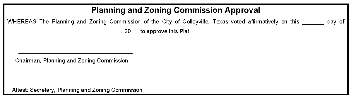
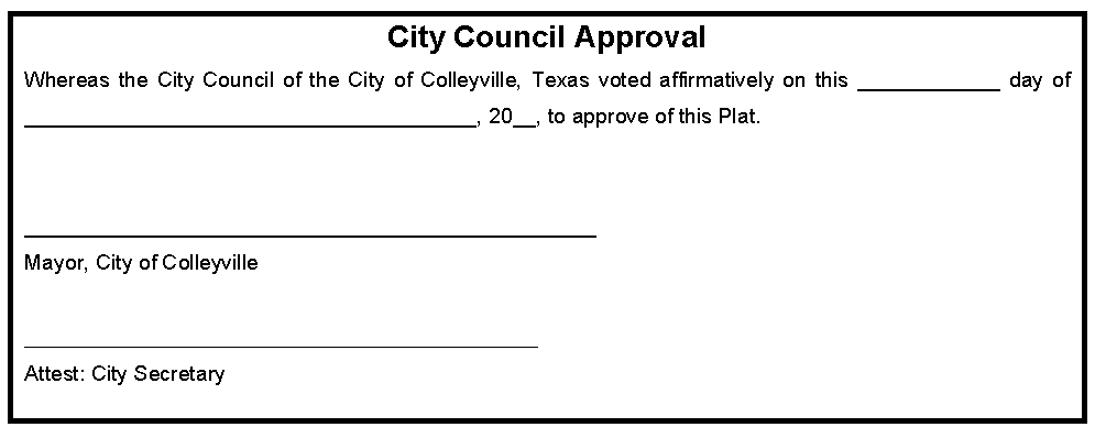
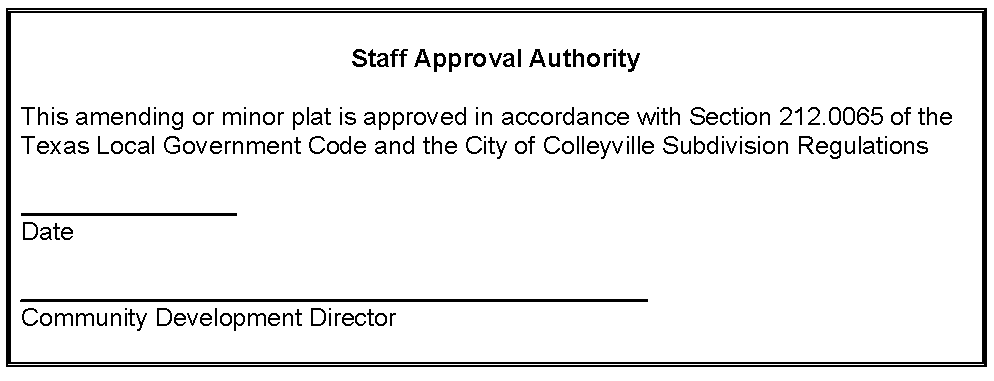
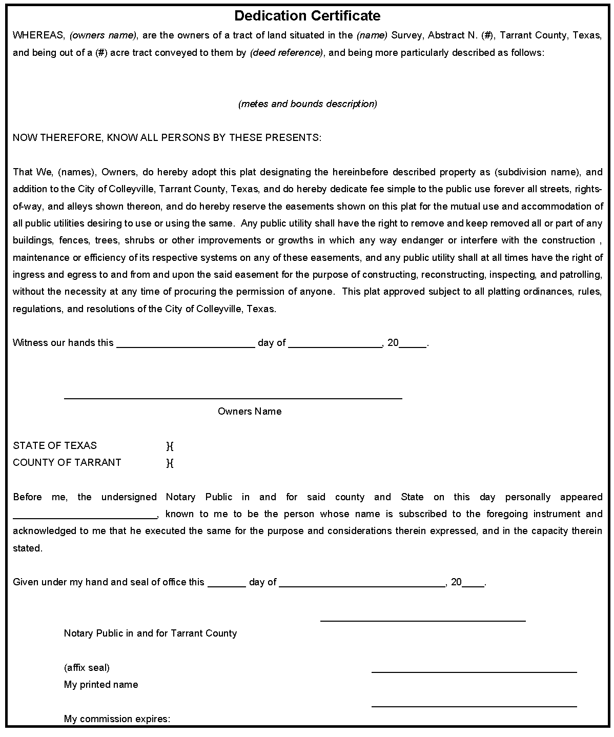
Certification Blocks: All plats shall contain the appropriate certification blocks which shall be similar to those shown.

Sec 8.185 - Easement and right-of-way encroachments.
No building permit shall be issued for any structure that encroaches into or over a public drainage and/or utility easement or public right-of-way, unless an easement encroachment and joint use agreement has been approved in accordance with the procedures contained in this Section.
1.
The applicant must submit a written application on forms furnished by the City, together with the appropriate filing fee, stating the reason for the proposed encroachment. Said application must contain the signature of the property owner or legal agent of the property owner where the encroachment is proposed or of the property that is adjacent to the right-of-way where the encroachment and joint use is proposed.
2.
The applicant must provide a metes and bounds description indicating the exact location of the encroachment and a plot plan showing the nature of the improvements proposed within the encroachment area.
3.
The application must include written documentation signed by all public utility companies, including the City of Colleyville Public Works Department, indicating their consent to the encroachment and joint use of the easement or right-of-way. All public utility companies must approve the encroachment request before any consideration is given by the City of Colleyville.
4.
No notification of adjacent properties is required unless the City Manager, or designated official, determines that the encroachment or joint use has a direct impact on the adjacent properties.
5.
An application requesting an easement encroachment may be approved by the City Manager or other designated official. Applications requesting a right-of-way encroachment require approval by the City Council.
6.
Upon approval of the request, documents shall be filed in the Tarrant County Deed Records.
7.
The application fee shall be set by separate ordinance approved by the City Council.
(Ord. No. O-01-1280, 8-8-01)
Sec 8.190 - Amendments to this chapter.
Editor's note— Beginning with Supp. No. 20, this table is no longer being maintained. See Land Development Code Comparative Table at the end of this Appendix.