
Glenwood Springs City Zoning Code
ARTICLE 070
040 - DEVELOPMENT STANDARDS
070.040.010 - Purpose.
This article includes standards that regulate the physical layout and design of development within Glenwood Springs to ensure the protection of the health, welfare, safety, and quality of life. These standards address the physical relationship between development and adjacent properties, public streets, neighborhoods, and the natural environment, in order to implement the comprehensive plan vision for a more attractive, efficient, and livable community.
(Ord. No. 19-2018, § 2(Exh. A), 8-2-2018)
070.040.020 - Sensitive Area Protection.
(a)
General Provisions.
(1)
Purpose. This Section 070.040.020 is intended to protect and enhance the natural features that contribute significantly to Glenwood Springs's quality and character, including but not limited to the varying topography and hillsides, floodplains, wetlands, viewsheds, and other significant features. This Section also is intended to ensure that land subject to natural hazards such as flooding, falling rock, landslides, mud flows, or snowslides is not approved for development without appropriate consideration by the City of potential conditions and safeguards to help protect life, health, and property.
(2)
Applicability. This Section shall apply to any proposed development that requires one (1) or more of the following:
a.
Any development permit required by Section 070.060.050, Development Permits, including:
1.
Site/Architectural Plan Review (Subsection 070.060.050(a));
2.
Master Plan (Subsection 070.060.050(b));
3.
Final Plans (Subsection 070.060.050(c));
4.
Location and Extent Review (Subsection 070.060.050(d));
5.
Special Use Permit (Subsection 070.060.050(e)); and/or
6.
Right-of-Way Encroachment License (Subsection 070.060.050(f)).
b.
A variance required by Subsection 070.060.070(a), Variance;
c.
A permit for excavation and/or grading, as required by the Engineering Standards;
d.
A building permit for construction of a new building or structure; or
e.
A building permit for addition, alteration, or repair of an existing building or structure, the value of which exceeds fifty (50) percent of the assessed value of the building or structure.
(3)
Additional Submittal Requirements.
a.
In order to evaluate and ensure compliance with the standards in this Section, the Director may require existing conditions reports and other technical reports and plans, as set forth in the Administrative Manual, that identify slopes, soil conditions, floodplains, geologic hazards, and other sensitive features present on the site, and that recommend steps to mitigate any hazards in order to comply with this Code.
b.
Such reports shall be prepared to standards adopted by the City Engineer. Best practices to mitigate such hazards recommended in such reports shall be required. Geotechnical and geologic reports shall be prepared by a licensed professional engineer.
(4)
Limits of Disturbance.
a.
Establishment of Limits of Disturbance. Except for properties in the Downtown Core, for every development subject to this Section the applicant shall establish "limits of disturbance" that indicate the specific area(s) of a site within which construction and development activity shall be contained. The limits of disturbance shall be shown on the site/architectural plan.
b.
Criteria for Establishing Limits of Disturbance. In establishing limits of disturbance, the following criteria and standards shall be considered and applied, as well as applicable requirements from the City's Engineering Standards:
1.
Minimize visual impacts from the development, including but not limited to screening from adjacent and downhill properties, ridgeline area protection, and protection of scenic views;
2.
Erosion prevention and control, including but not limited to protection of steep slopes and natural drainage channels;
3.
Fire prevention and safety, including but not limited to location of trees and vegetation near structures;
4.
Preservation of significant trees or vegetation;
5.
Conservation of water including but not limited to preservation of existing native vegetation, reduction in amounts of irrigated areas, and similar considerations;
6.
Wildlife habitat protection, including but not limited to preservation of critical wildlife habitat and identified migration corridors and routes;
7.
Stream corridor and wetland protection and buffering; and
8.
Preservation of the maximum amount of the site's natural topography, tree cover, and vegetation.
c.
Maximum Limits of Disturbance.
1.
Single-Family Detached Residential Uses. For single-family detached residential uses subject to the requirements of Subsection 070.040.020(b), Hillside Development, the limits of disturbance for an individual single-family detached residential use and any accessory structure shall not exceed fifty (50) percent of the total gross area of the underlying lot or lots, or twenty thousand (20,000) square feet, whichever is less. For most single-family residential development, limits of disturbance will cover the area(s) needed to provide the building sites for the principal structure and any major accessory structure(s), plus the area(s) necessary to provide an access driveway and necessary septic systems, utilities, services, and drainage facilities.
2.
All Other Developments. For all other types of development, including planned unit developments, the limits of disturbance, including parking areas and accessory buildings and structures, shall be determined on a case-by-case basis, as determined by setback, common open space, landscaping, and other requirements of this Code.
3.
On-Site Wastewater Treatment Systems. For all types of development, leach fields constructed in connection with an on-site sewer system shall not be counted toward the maximum limits of disturbance provided the leach field is revegetated with native vegetation in accord with state onsite wastewater treatment regulations.
d.
Location of Limits of Disturbance.
1.
Zero Lot Lines. Where appropriate to preserve or to protect steep slopes or other natural features, a structure may be located on a lot in such a manner that one (1) or both of the side facades of a structure rest directly on a lot line. This provision shall not be interpreted to exempt a structure from any applicable building and fire code provisions or requirements.
2.
Contiguity. Limits of disturbance necessary to accommodate proposed development may be non-contiguous in order to best meet the criteria and standards set forth in this Section.
3.
Clustering. Clustering of building pads and parking areas within a building site is strongly encouraged and may be required to minimize the size of the limits of disturbance and to maintain the maximum amount of open space in the development.
e.
Modification of Limits of Disturbance. The Director has discretion to administratively increase the limits of disturbance by a maximum of twenty (20) percent where applicable, provided one (1) of the following criteria is met:
1.
The modification is designed to yield:
i.
More effective preservation of existing mature trees, vegetation, riparian areas, rock outcrops, or other significant natural features of the site;
ii.
Less visual impact on the property or on the surrounding area; or
iii.
Better protection of wildlife habitat; or,
2.
Strict application of the standard(s) would render a site undevelopable.
(5)
Clustering. Clustering of development in sensitive areas is strongly encouraged and may be required to meet the requirements of this Section. (Figure 040-1)
a.
When Allowed. Minimum lot size may be reduced through clustering of development if the applicable decision-making body finds that:
1.
The clustering proposal, compared with a more traditional site development plan, better attains the policies and objectives of this Article, such as providing more open space, preserving existing trees and vegetation coverage, and preserving sensitive environmental areas such as stream corridors, slide areas, wetlands, and steep slopes;
2.
The clustering proposal will have no significant adverse impact on adjacent properties or development, or the applicant has agreed to adopt appropriate mitigation measures such as landscaping, screening, illumination standards, and other design features as recommended by the Director to buffer and protect adjacent properties from the proposed clustered development;
3.
The architecture, height, building materials, building colors, and other design features of the development are compatible with adjacent properties or development and blend with the surrounding natural landscape; and
4.
The clustering proposal meets all other applicable requirements set forth in this Article or in other applicable ordinances or regulations.
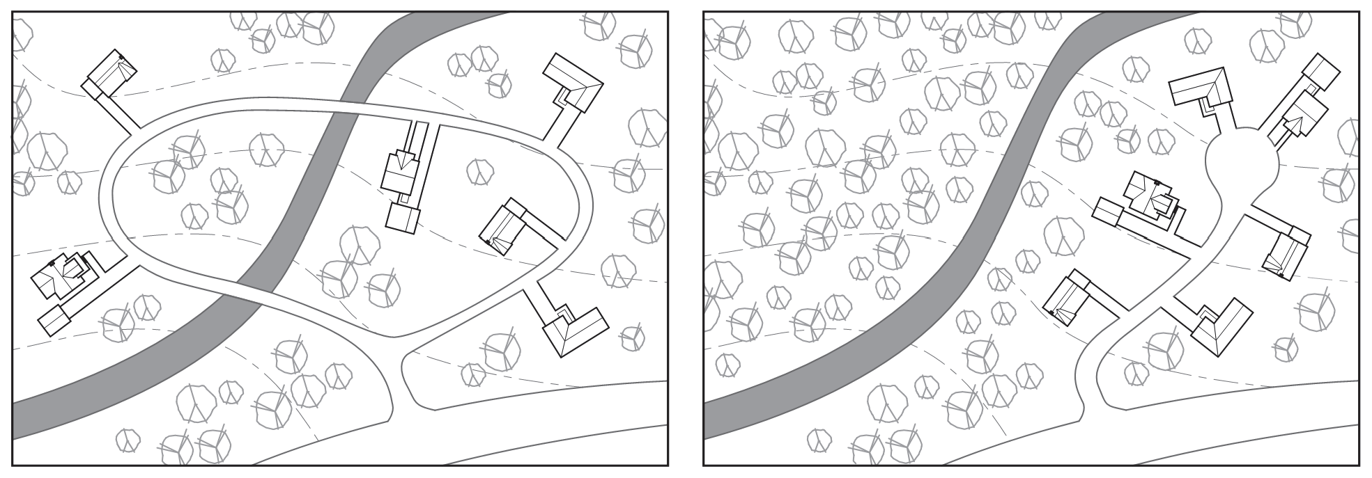
Figure 040-1: Clustering
b.
Minimum Lot Size Reduction. Minimum lot sizes required for the underlying zoning district in Article 070.020: Zoning Districts, may be reduced by up to twenty-five (25) percent for lots within cluster developments that satisfy the above standards.
c.
Pre-Application Conference Required. Any applicant proposing to reduce minimum lot sizes through clustering shall be required to attend a pre-application conference pursuant to Subsection 070.060.030(b), Pre-Application Conference, prior to submitting a development application.
(6)
Interpretation. The provisions of this Section 070.040.020 shall be deemed to be minimum requirements. Nothing in this Section shall impair the obligations of or interfere with private agreements in excess of the minimum requirements. Where this Section imposes a restriction different from that imposed by other applicable provisions of law, contract, or deed, the more restrictive provision shall control.
(7)
Disclaimer of Liability. This Section 070.040.020 is intended to provide some degree of protection to life, safety, and property. It is based on scientific and engineering considerations that are continually being developed and proven. Compliance with this Section cannot ensure freedom from risk to life, safety, or property. This Section shall not create liability on the part of the City or any officer or employee of the City for any damage that may result from reliance on this Section or any administrative decision lawfully made pursuant to this Code.
(b)
Hillside Development.
(1)
Purpose. The purpose of this Subsection is to:
a.
Minimize the negative environmental and visual effects of mass cut-and-fill of large pads and excessive terracing through retention of the natural topography of the hillsides;
b.
Prevent soil erosion and landslides;
c.
Provide safe circulation of vehicular and pedestrian traffic to and within hillside areas and to provide access for emergency vehicles necessary to serve the hillside areas;
d.
Preserve visually significant slope banks, ridge lines, rock outcroppings, native plant materials, natural hydrology, and other areas of visual significance;
e.
Encourage innovative architectural, landscaping, circulation, and site design that serve to preserve the significant natural resources and visual character of the City;
f.
Protect the public from natural hazards caused by unstable slopes and soils, debris flow, erosion and other geologic hazards of hillside development; and
g.
Minimize the threat and subsequent damage of wildfire through safe building practices.
(2)
Applicability. This Subsection shall apply to any of the application types listed in Subsection 070.040.020(a)(2), Applicability (Sensitive Area Protection), that meet any of the following criteria:
a.
Hillside Preservation District. Any proposed development in the Hillside Preservation district; see Section 070.020.170.
b.
Slopes. Any proposed development on a lot with average slopes in excess of twenty (20) percent within the limits of disturbance area.
c.
Areas of Geologic Hazard. Any proposed development in Areas of Geologic Hazard, which consists of the Hazard Avoidance Districts and Hazard Mitigation Districts as defined in Subsection 070.040.020(c)(2)b., Establishment of Geological Hazards Districts.
(3)
Lot and Density/Intensity Requirements.
a.
Minimum Lot Size. All development subject to this Subsection shall comply with the minimum lot size and lot width standards required in the underlying zone district and with other development standards in this Article 070.040: Development Standards.
b.
Allowed Density/Intensity.
1.
Residential Development. The maximum number of residential units permitted within areas subject to the Hillside Development standards shall be pursuant to Table 040.1 below. In addition, a detached accessory dwelling unit may be allowed so long as the limits of disturbance does not exceed fifty (50) percent of the total gross area of the underlying lot or lots, or twenty thousand (20,000) square feet, whichever is less.
2.
Nonresidential Development. The maximum amount of nonresidential gross square footage permitted within areas subject to the Hillside Development standards shall be the square footage allowed by the zoning district. Nonresidential buildings are prohibited on slopes greater than twenty (20) percent; however, open decks and support structures for existing buildings may be constructed.
3.
Calculating Density/Intensity. For the purposes of calculating density/intensity, only the average slope within the proposed area within the limits of disturbance of a specific lot or parcel shall be considered.
c.
Prohibition of Development on Steep Slopes. No development, including clearing, excavation, and grading, shall be allowed where the average slope within the limits of disturbance is greater than thirty (30) percent. Structures shall be set back from ascending or descending slopes greater than thirty (30) percent in accordance with the requirements of the current adopted building code.
d.
Consolidation of Substandard Lots.
1.
General Rule: Consolidation Required. Two (2) or more lots or parcels subject to these Hillside Development standards shall be considered to be a single, undivided lot or parcel for the purposes of this Code, if all the following factors apply:
i.
The lots or parcels are contiguous;
ii.
The lots or parcels are in single and common ownership and are of record on the effective date of this Code;
iii.
No structures are located on the lots or parcels;
iv.
All or part of the lots or parcels do not meet the minimum lot area or lot width requirements set forth in the base zoning district; and
v.
Such lots have not been improved with individual and separate connections to municipal water or sewer systems.
No portion of such lots or parcels subject to this consolidation provision shall be used or sold in a manner that renders compliance with the lot width and lot area requirements set forth in this Subsection less feasible.
2.
Exception. Notwithstanding the general rule for consolidation set forth in c. above, if a lot or parcel that would otherwise be subject to the general consolidation rule meets the minimum lot area or lot width requirements set forth in the underlying zone district, then consolidation shall not be required.
e.
Slope Calculations.
1.
Slope shall be calculated as the vertical rise in feet measured over a horizontal distance, expressed as a percentage. Slope calculations shall not include areas outside the limits of disturbance.
2.
The applicant shall indicate on a site/architectural plan the limits of proposed development and disturbance and shall include the calculation of the average slope of that area.
(4)
Site Development Standards.
a.
Building Envelope and Site Design Generally. Building envelopes and setbacks shall be determined on the basis of natural landforms, vegetation, and underlying geology. The designation of the limits of disturbance, which shall include all structures and access areas, shall be designed to avoid and minimize disturbance to sensitive areas and geologic and natural vegetative features. Natural vegetation, rock outcroppings, and significant landforms shall be retained to the maximum extent practicable. Flexibility and creativity are encouraged in designing development around existing features.
b.
Protection from Potential Hazards. All proposed development shall be designed to protect the public from the potential hazards of drainage, debris flow, rock fall, fire, and erosion. Projects shall be designed with existing features in order to minimize disturbance to, and therefore mitigation of, surficial hillside geology.
c.
Access Roads. New roads shall comply with the street standards in Section 070.040.070, Access and Circulation. Such access shall be approved by the Fire Department and the City Engineer.
d.
Fire Hazard Mitigation.
1.
Brush and vegetated areas shall be cleared and maintained according to the Fire Department.
2.
New vegetation shall be fire- and drought-resistant species.
3.
Roofs, overhangs, and exposed balconies shall be fire-rated according to the adopted Fire Code.
4.
Water supply, fire breaks, and access shall be approved by the Fire Department.
5.
Buildings shall be sited so that fire hazard clearing zones will not affect mature vegetation.
e.
Viewshed Protection. Proposed development shall retain the essential visual qualities of the site so that views from public open space areas, rights-of-way, and other public places will not be negatively impacted. In designing a proposed development, applicants shall adhere to the following principles:
1.
Following construction, off-site views of retaining walls, structures, parking areas, and landscaping on the development site shall be minimized.
2.
The disturbance areas shall be reclaimed as soon as possible after construction ends.
f.
Geology, Soils, and Grading. Development shall be designed to reduce the potential for soil erosion and slope degradation during and after construction. In addition to meeting the standards of Subsection 070.040.020(a)(5), Clustering, the following standards shall apply:
1.
A grading permit shall be required for disturbance in excess of one thousand (1,000) square feet. Grading plans shall be submitted and reviewed according to the City's Engineering Standards.
2.
Structures shall be designed to step down with the existing topography. To the maximum extent feasible, building designs that require extensive cut and fills shall not be allowed.
3.
Except for driveways, cut-and-fill slopes shall be entirely contained within a lot (i.e., natural grade at the lot lines shall be maintained).
4.
Sharp angles shall be rounded off, in a natural manner, at the top and ends of cut and fill slopes (within approximately five (5) feet of the sharp angle) unless steep angles are a natural character of the site. Where this would damage tree root systems, the amount of rounding off may be reduced and shrubs used instead to hide the transition.
5.
The subdivider and/or property owner shall maintain in perpetuity and repair (or supply a program for preventative maintenance) of manufactured slope areas, erosion control devices, retaining walls, drainage structures and fire prevention measures as specified in an approved development.
6.
Trees and vegetation shall be maintained to provide slope stability and prevent visual scarring wherever possible. When this requirement conflicts with fire hazard mitigation such as defensible space, appropriate mitigation shall be provided as determined by the Fire Department and the Director. A revegetation landscape plan is required for disturbed site areas.
7.
Final contours and slopes shall reflect existing landforms to the maximum extent practicable.
8.
The grade of a lot shall not be raised or lowered more than four (4) feet at any point for construction of any structure or improvement, except:
i.
The site's original grade may be raised or lowered a maximum of six (6) feet if retaining walls are used to reduce the steepness of man-made slopes, provided that the retaining walls comply with the requirements set forth in this Subsection.
ii.
Grade changes or retaining walls up to six (6) feet may be allowed if necessary to construct a driveway from the street to a garage or parking area,
iii.
For the purposes of this Subsection, basements and buildings set into a slope are not considered to lower the natural grade within their footprint.
g.
Retaining Walls and Fencing.
1.
Generally, a retaining wall shall be no higher than six (6) feet, except that a wall varied in height to accommodate a variable slope shall have an average height no greater than four (4) feet and a maximum height no greater than eight (8) feet in any sixty-foot length. A higher wall is permitted:
i.
Where used internally at the split between one- and two-story portions of a building; and
ii.
Where substantially hidden from public view at the rear of a building, where it may not exceed the eave height of the building.
2.
Visible retaining walls and fencing shall be designed to maintain human scale and reduce the visual impact of cut lines on the hillside through the use of indigenous materials, terracing and aligning construction with the natural topography.
3.
Indigenous materials and/or earth-toned concrete shall be used, and terraced to match existing terrain.
4.
Terraced walls and retaining structures should incorporate landscaping, if approved by the City Engineer.
5.
Retaining walls and fencing shall comply with all standards in Subsection 070.040.050(f)(3), Retaining Wall Standards.
h.
Water Supply. Water supply and pressure shall be adequate to serve both residential and emergency services pursuant to the adopted Fire Code.
i.
Drainage.
1.
Natural drainage courses shall not be disturbed by construction activity, and natural runoff shall be maintained unless approved by the City Engineer.
2.
A drainage plan prepared by a licensed professional engineer shall be submitted in accordance with the City's Engineering Standards.
(5)
Building Design Standards.
a.
Structure Design Generally. Building massing and roof lines shall be designed to blend with the natural terrain. When possible, the massing of the structure shall be broken up using the slope and terrain to vary the exterior dimensions.
b.
Ground Plane.
1.
Buildings that firmly meet the ground convey an appearance of greater permanence and are strongly encouraged.
2.
To the maximum extent feasible, placing buildings on piers such that exterior walls do not continue down to the ground shall be prohibited because of aesthetic and energy efficiency concerns. This requirement shall not apply in areas of waterways and areas of special flood hazard.
c.
Building Mass and Scale.
1.
To the maximum extent feasible, building design shall incorporate changes in the planes of walls and changes in the slope and height of roof lines to add variety, create visual interest, and minimize scale.
2.
Building mass and wall lines shall be broken up to conform to existing slope and avoid unbroken expanses of building mass and walls that can intrude into the natural setting and dominate a site.
d.
Building Colors.
1.
Colors that enhance the natural colors of the building materials shall be used in developing an overall color scheme. Predominant tones on exterior walls shall tend toward neutral colors such as warm earthy hues, dark green of forests, greys and grey-brown of the mountains, the tan of grasses, and similar colors. Bright, harshly contrasting color combinations shall be avoided.
2.
Exterior building, roofing, and exposed rooftop mechanical equipment shall be warm or dark earth-toned colors with low reflectivity.
3.
Color and intensity of color proposed for all exterior building and roofing materials, including exposed rooftop mechanical systems such as HVAC equipment, roof vents, air handling/exchange units, shall be subject to approval by the Planning and Zoning Commission and/or City Council, as applicable.
4.
Exterior building and roofing colors shall not include white, off-white, high-intensity primary colors, and/or fluorescent colors.
e.
Building Materials.
1.
Primary building materials shall be selected for their ability to withstand Glenwood Springs' variable mountain climate. Materials with demonstrated durability include, but are not limited to:
i.
Brick;
ii.
Stone;
iii.
Cementitous siding products;
iv.
Log construction;
v.
Cast concrete; or
vi.
Other comparable materials as approved by the Director.
2.
Exterior Insulation and Finish Systems (EIFS) shall not be utilized in high-traffic areas, such as at primary building entrances, where it may be easily damaged.
f.
Parking Areas.
1.
Parking lots and detached garages accessory to residential uses shall be located so that they can be screened to blend into the natural environment and will not require backing onto an arterial or collector street.
2.
To the maximum extent feasible, parking lots and detached garages accessory to residential uses shall be located where they can be screened so they do not dominate the streetscape. Parking facilities shall be designed to follow the existing topography and to provide adequate snow storage areas.
(c)
Development in Areas of Geologic Hazard.
(1)
Purpose. The purpose of this Subsection 070.040.020(c) is to promote the public health, safety, and general welfare and to minimize public and private losses due to geologic conditions in specific areas by regulations designed to:
a.
Protect human life, safety and property;
b.
Minimize damage to public facilities and utilities;
c.
Minimize the need for relief and clean-up operations due to geologic events with their accompanying public and private costs;
d.
Minimize the need for expensive mitigation measures to protect public and private property; and
e.
Alert property owners and potential buyers of geologic hazards existing in certain areas so that they may protect their own property and avoid endangering the property of others.
(2)
General Provisions.
a.
Types of Geologic Hazards. As used in this Subsection, the term "geologic hazard" shall include the following hazards, as defined in Colorado Geological Survey Open File Report 78-10 ("C.G.S. 78-10"):
1.
"Corrosive soils" are potentially corrosive to concrete and steel.
2.
"Debris flow hazard" means severe and moderate debris flow hazard.
i.
"Severe debris flow hazard" poses possible serious damage to structures and risk to life, and mitigation is necessary.
ii.
"Moderate debris flow hazard" poses possible minor damage to structures and risk to life. Mitigation is recommended and may be required and major cleanup is probable.
3.
"Landslide hazard" is shown in areas of identified landslide features. Slides are mostly older features but have potential for reactivation.
4.
"Rockfall hazard criteria" includes an identifiable source area for rocks and the presence of fallen rocks with intermediate diameters of two (2) feet or more.
5.
"Slope instability" denotes areas of past and current mass wasting processes.
b.
Establishment of Geological Hazards Districts. There are hereby created within the City the following Geologic Hazards Districts:
1.
Hazard Avoidance District. This district includes undeveloped parcels with the potential or presence of severe debris flow, and/or rockfall. The district also includes developed parcels with the potential or presence of severe geologic hazards where additional development will significantly increase the risk of damage from the hazard or significantly increase the cost to the community of mitigating the hazard.
2.
Hazard Mitigation District. This district includes parcels with severe geologic hazards where significant development already exists and where additional development will not significantly increase the risk of damage from the hazard nor significantly increase the cost to the community of mitigating the hazard. It also includes areas with the potential or presence of moderate debris flow, and/or rockfall hazards.
c.
Geologic Hazards District Map. The locations and boundaries of the Geologic Hazards Districts established by this Subsection shall be those established by the official report entitled "Geologic Hazards of the Glenwood Springs Metropolitan Area" as released by the C.G.S. 78-10. The geologic hazards maps that accompany C.G.S. 78-10 are hereby adopted as the "official geologic hazards maps" and shall be maintained along with accompanying sensitive area reports by the Office of the City Engineer. These maps shall serve as official reference in case of dispute regarding the location of hazards, and the City Engineer's interpretation of these maps shall be final. The maps shall be interpreted by the City Engineer as follows:
1.
Hazard Avoidance Districts.
i.
Undeveloped parcels lying entirely or partly in any area identified as a severe hazard zone on the Map of Debris Flow Fan Deposits and Hazards and/or the General Geologic Hazards Map.
ii.
Developed parcels identified as lying entirely or partly in any area identified as a severe hazard zone on the aforesaid maps where the City Engineer has determined that additional development will increase the risk of damage from the hazards and/or significantly increase the cost to the community of mitigating the hazards.
2.
Hazard Mitigation Districts.
i.
Parcels lying entirely or partly in any area identified as a moderate hazard zone on the Map of Debris Flow Fan Deposits and Hazards and/or the General Geologic Hazards Map.
ii.
Developed parcels identified as lying entirely or partly in any area identified as a severe hazard zone on the aforementioned maps where the City Engineer has determined that additional development will not increase the risk of damage from the hazard and/or will not significantly increase the cost to the community of mitigating the hazard.
d.
Annexation of Land Within an Area of Geologic Hazard. Upon annexation of any land within an area of geologic hazard, as determined on the official geologic hazards maps, such land shall be added to the appropriate geologic hazards district, and all provisions of this Subsection shall apply.
(3)
Geologic Hazards District Standards.
a.
Hazard Avoidance Districts. No improvement, building, structure, excavation, dumping, or backfill shall be placed, built, undertaken or approved in a Hazard Avoidance District except for fences, geologic stabilization structures, or paths for nonmotorized use unless, before application for a development permit or, if no development permit is required, for a grading or building permit, the applicant demonstrates to the City Engineer and the Director by clear and convincing evidence that one (1) of the following conditions is met:
1.
The land to be affected does not lie within an area of severe debris flow, rockfall hazard, or a drainage basin contributing to any such hazard, as shown on the official geologic hazards maps, and the proposal is in conformance with the purposes of this Subsection.
2.
The severe hazard does not exist on the subject site in the proposal and is in conformance with the purposes of this Subsection. Such a determination shall require detailed analysis of the area by a qualified geologist and an engineering geology report, which report may be submitted by the City to the Colorado Geologic Survey for review. For purposes of this provision, the area" means the site of the proposed development as well as adjacent land and upslope drainage basins as necessary to compare the area analysis with the official geologic hazards maps. Upon submittal of this report by the applicant, application may be made for a development, grading, or building permit, but such a permit shall not be issued until the City Engineer and the Director have determined that the conditions of this Paragraph are met.
3.
The proposed development meets all of the following conditions:
i.
It will include no human habitation;
ii.
It will not require City water, wastewater, streets or other public service;
iii.
It will not increase the hazard to other public or private property; and
iv.
It is consistent with the intent and purposes of this Article.
4.
The subject site lies within an area with rockfall hazard but not debris flow and not within a drainage basin contributing to any such hazard as shown on the official geologic hazards maps. In the case of such a determination by the City Engineer, a mitigation plan shall be required before issuance of a development, grading or building permit. The mitigation plan shall be produced and certified by a qualified engineer and shall demonstrate to the City Engineer and the Director by clear and convincing evidence that rockfall damage will be prevented by a catchment wall or other means.
b.
Hazard Mitigation Districts.
1.
Applicability. All new structures and additions or improvements subject to this Subsection and proposed in a hazard mitigation district shall be subject to the requirements of Subsection 070.040.020(c)(3)b.2., Standards, unless before application for a development permit, or, if no development permit is required, for excavation or building permit, the applicant demonstrates to the City Engineer and the Director by clear and convincing evidence that one (1) of the following conditions is met:
i.
The land to be affected does not lie within an area of severe or moderate debris flow, rockfall hazard, or a damage basin contributing to any such hazard as shown on the official geologic hazards maps.
ii.
The severe or moderate hazards as specified in C.G.S. 78-10 do not exist on the subject site and the proposal is in conformance with the purposes of this Subsection. Such a determination shall require detailed analysis of the area by a qualified geologist in an engineering geology report, which report may be submitted by the City to the Colorado Geological Survey for review. For purposes of this provision, "the area" means the site of the proposed development, as well as the adjacent land and upslope drainage basin as necessary to compare the area analysis with the official geologic hazard maps. Upon submittal of this report by the applicant, application may be made for a development, excavation, or building permit, but such permit shall not be issued until the City Engineer and the Director have determined that the conditions of this Subparagraph are met.
2.
Standards.
i.
In areas with moderate or severe debris flow hazard as shown on the official geologic hazards maps, before issuance of a development permit or, if no development permit is required, an excavation or building permit, the applicant shall demonstrate to the City Engineer and the Director by clear and convincing evidence that any structure or grading change that may divert debris flow or floodwaters from the subject property will not increase hazards to other public or private properties. Such a determination shall require an engineering geology report produced and certified by a qualified engineer.
ii.
Before issuance of a building permit, the applicant shall demonstrate to the City Engineer and the Building Official by clear and convincing evidence that all applicable requirements in the City's Engineering Standards are met.
(4)
Public Improvements in Areas of Geologic Hazard. Public improvements, including but not limited to streets, water, wastewater, and electrical services, will not be extended into the Hazard Avoidance District, except where:
a.
An area or a proposed development meets one (1) of the conditions of Subsection 070.040.020(c)(3)a., Hazard Avoidance Districts; or
b.
The public good is better served by the extension which shall be in compliance with the City goals and policies. Such determination shall be made by the City Council upon a recommendation from the Planning Commission.
(d)
Development in Waterways and Areas of Special Flood Hazard.
(1)
Findings of Fact.
a.
The flood hazard areas of the City are subject to periodic inundation which can result in loss of life and property, health and safety hazards, disruption of commerce and governmental services, extraordinary public expenditures for flood protection and relief, of which adversely affect the public health, safety and general welfare of the public.
b.
These flood losses are created by the cumulative effect of obstructions in floodplains which cause an increase in flood heights and velocities, and by the occupancy of flood hazard areas by uses vulnerable to floods and hazardous to other lands because they are inadequately elevated, flood-proofed, or otherwise protected from flood damage.
(2)
Statement of Purpose. It is the purpose of this Subsection 070.040.020(d) to promote the public health, safety, and general welfare, and to minimize public and private losses due to flood conditions to specific areas by provisions designed to:
a.
Protect human life and health;
b.
Minimize expenditure of public money for costly flood control projects;
c.
Minimize the need for rescue and relief efforts associated with flooding and generally undertaken at the expense of the general public;
d.
Minimize prolonged business interruptions;
e.
Minimize damage to critical facilities, infrastructure and other public facilities such as water, sewer and gas mains, electric and communication stations, and streets and bridges located in floodplains;
f.
Help maintain a stable tax base by providing for the sound use and development of flood-prone areas in such a manner so as to minimize future flood blight areas; and
g.
Ensure that potential buyers are notified that property is located in a flood hazard area.
(3)
Methods of Reducing Flood Losses. In order to accomplish its purposes, this Subsection uses the following methods:
a.
Restrict or prohibit uses that are dangerous to health, safety or property in times of flood, or cause excessive increases in flood heights or velocities;
b.
Require that uses vulnerable to floods, including facilities which serve such uses, be protected against flood damage at the time of initial construction;
c.
Control the alteration of natural floodplains, stream channels and natural protective barriers, which are involved in the accommodation of flood waters;
d.
Control filling, grading, dredging and other development which may increase flood damage; and
e.
Prevent or regulate the construction of flood barriers which will unnaturally divert floodwaters or which may increase flood hazards to other lands.
(4)
Lands to Which this Subsection Applies. This Subsection shall apply to all areas of Special Flood Hazard Areas and areas removed from the floodplain by the issuance of a FEMA Letter of Map Revision Based on Fill (LOMR-F) within the jurisdiction of the City.
(5)
Basis for Establishing Areas of Special Flood Hazard. The special flood hazard areas identified by the Federal Emergency Management Agency in a scientific and engineering report entitled, "The Flood Insurance Study for the City of Glenwood Springs," dated October 15, 1985, with an accompanying Flood Insurance Rate Map (FIRM) and/or Flood Boundary-Floodway Maps (FIRM and/or FBFM) and any revisions thereto are hereby adopted by reference and declared to be a part of this Title. The Special Flood Hazard Areas identified by the FIS and attendant mapping are the minimum area of applicability of this Subsection and may be supplemented by studies designated and approved by the City. The Floodplain Administrator shall keep a copy of the Flood Insurance Study (FIS), DFIRMs, FIRMs and/or FBFMs on file and are available for public inspection.
(6)
Establishment of Floodplain Development Permit. A floodplain development permit shall be required to ensure conformance with the provisions of this Subsection.
(7)
Compliance. No structure or land shall hereafter be located, altered or have its use changed within the Special Flood Hazard Area without full compliance with the terms of this Subsection and other applicable regulations. Nothing herein shall prevent the City from taking such lawful action as is necessary to prevent or remedy any violation. These regulations meet the minimum requirements as set forth by the Colorado Water Conservation Board and the National Flood Insurance Program.
(8)
Abrogation and Greater Restrictions. This Subsection is not intended to repeal, abrogate or impair any existing easements, covenants or deed restrictions. However, where this Subsection and another provision of this Code, easement, covenant or deed restriction conflict or overlap, whichever imposes the more stringent restrictions shall prevail.
(9)
Interpretation. In the interpretation and application of this Subsection, all provisions shall be:
a.
Considered as minimum requirements;
b.
Liberally construed in favor of the governing body; and
c.
Deemed neither to limit nor repeal any other powers granted under state statutes.
(10)
Warning and Disclaimer of Liability. The degree of flood protection required by this Subsection is considered reasonable for regulatory purposes and is based on scientific and engineering considerations. On rare occasions, greater floods can and will occur and flood heights may be increased by manmade or natural causes. This Subsection does not imply that land outside the areas of special flood hazard or uses permitted within such areas will be free from flooding or flood damages. This Subsection shall not create liability on the part of the City, any official or employee thereof, for any flood damages that result from reliance on this Subsection or any administrative decision lawfully made thereunder.
(11)
Designation of the Floodplain Administrator. The City Engineer is hereby appointed as Floodplain Administrator to administer, implement and enforce the provisions of this Subsection and other appropriate sections of 44 CFR (National Flood Insurance Program Regulations) pertaining to floodplain management.
(12)
Duties and Responsibilities of Floodplain Administrator. Duties of the Floodplain Administrator shall include, but not be limited to the following:
a.
Maintain and hold open for public inspection all records pertaining to the provisions of this Subsection, including the actual elevation (in relation to mean sea level) of the lowest floor (including basement) of all new or substantially improved structures and any floodproofing certificate required by Subsection 070.040.020(d)(13).
b.
Review, approve, or deny all applications for floodplain development permits required by adoption of this Subsection.
c.
Review floodplain development permit applications to determine whether a proposed building site, including the placement of manufactured homes, will be reasonably safe from flooding.
d.
Review permits for proposed development to ensure that all necessary permits have been obtained from those federal, state or local governmental agencies (including Section 404 of the Federal Water Pollution Control Act Amendments of 1972, 33 U.S.C. 1334) from which prior approval is required.
e.
Inspect all development at appropriate times during the period of construction to ensure compliance with all provisions of this Subsection, including proper elevation of the structure.
f.
Where interpretation is needed as to the exact location of the boundaries of the Special Flood Hazard Area (for example, where there appears to be a conflict between a mapped boundary and actual field conditions) the Floodplain Administrator shall make the necessary interpretation.
g.
When Base Flood Elevation data has not been provided in accordance with Section 070.090.060, the Floodplain Administrator shall obtain, review and reasonably utilize any Base Flood Elevation data and Floodway data available from a federal, state or other source, in order to administer the provisions of this Subsection.
h.
For waterways with Base Flood Elevations for which a regulatory Floodway has not been designated, no new construction, substantial improvements or other development (including fill) shall be permitted within Zones A1—30 and AE on the City's FIRM, unless it is demonstrated that the cumulative effect of the proposed development, when combined with all other existing and anticipated development, will not increase the water surface elevation of the base flood more than one-half (½) foot at any point within the City.
i.
Under the provisions of 44 CFR Chapter 1, Section 65.12, of the National Flood Insurance Program regulations, the City may approve certain development in Zones A1—30, AE, AH, on the City's FIRM which increases the water surface elevation of the base flood by more than one-half (½) foot, provided that the City first applies for a conditional FIRM revision through FEMA (Conditional Letter of Map Revision), fulfills the requirements for such revisions as established under the provisions of Section 65.12, and receives FEMA approval.
j.
Notify, in riverline situations, adjacent communities and the State Coordinating Agency which is the Colorado Water Conservation Board, prior to any alteration or relocation of a watercourse, and submit evidence of such notification to FEMA.
k.
Ensure that the flood carrying capacity within the altered or relocated portion of any watercourse is maintained.
(13)
Permit Procedures.
a.
Application. Application for a Floodplain Development Permit shall be presented to the Floodplain Administrator on forms furnished by him/her and may include, but not be limited to, plans in duplicate drawn to scale showing the location, dimensions and elevations of proposed landscape alterations; existing or proposed structures, including the placement of manufactured homes and the location of the foregoing in relation to Special Flood Hazard Area. Additionally, the following information is required:
1.
Elevation (in relation to mean sea level) of the lowest floor (including basement) of all new and substantially improved structures;
2.
Elevation in relation to mean sea level to which any nonresidential structure shall be floodproofed;
3.
A certificate from a registered Colorado Professional Engineer or architect that the nonresidential floodproofed structure shall meet the floodproofing criteria in Subsection 070.040.020(d)(16)b.;
4.
Description of the extent to which any watercourse or natural drainage will be altered or relocated as a result of proposed development; and
5.
Maintain a record of all such information in accordance with Subsection 070.040.020(d)(12).
b.
Approval Criteria. Approval or denial of a floodplain development permit by the Floodplain Administrator shall be based on all of the provisions of this Subsection and the following relevant factors:
1.
The danger to life and property due to flooding or erosion damage;
2.
The susceptibility of the proposed facility and its contents to flood damage and the effect of such damage on the individual owner;
3.
The danger that materials may be swept onto other lands to the injury of others;
4.
The compatibility of the proposed use with existing and anticipated development;
5.
The safety of access to the property in times of flood for ordinary and emergency vehicles;
6.
The costs of providing governmental services during and after flood conditions including maintenance and repair of streets and bridges, and public utilities and facilities such as sewer, gas, electrical and water systems;
7.
The expected heights, velocity, duration, rate of rise and sediment transport of the flood waters and the effects of wave action, if applicable, expected at the site;
8.
The necessity to the facility of a waterfront location, where applicable;
9.
The availability of alternative locations, not subject to flooding or erosion damage, for the proposed use; and
10.
The relationship of the proposed use to the comprehensive plan for that area.
(14)
Variance Procedure.
a.
The Planning and Zoning Commission ("Commission") shall hear and render judgment on requests for variances from the requirements of this Subsection.
b.
The Commission shall hear and render judgment on an appeal only when it is alleged there is an error in any requirement, decision, or determination made by the Floodplain Administrator in the enforcement or administration of this Subsection. Such appeals shall be subject to the procedures set forth in Subsection 070.060.070(c).
c.
Any person or persons aggrieved by the decision of the Commission may appeal such decision in the courts of competent jurisdiction upon completing the administrative procedures set forth in Subsection 070.060.070(c).
d.
The Floodplain Administrator shall maintain a record of all actions involving an appeal and shall report variances to the Federal Emergency Management Agency upon request.
e.
Variances may be issued for the reconstruction, rehabilitation, or restoration of structures listed on the National Register of Historic Places or the State Inventory of Historic Places without regard to the procedures set forth in the remainder of this Subsection.
f.
Variances may be issued for new construction and substantial improvements to be erected on a lot of one-half (½) acre or less in size contiguous to and surrounded by lots with existing structures constructed below the base flood level, provided that the requirements of Subsection 070.040.020(d)(13) have been fully considered. As the lot size increases beyond the one-half (½) acre, the technical justifications required for issuing the variance increases.
g.
Upon consideration of the factors noted above and the intent of this Subsection, the Commission may attach such conditions to the granting of variances as it deems necessary to further the purpose and objectives of this Subsection as stated in Subsection 070.040.020(d)(2), Statement of Purpose.
h.
Variances shall not be issued within any designated floodway if any increase in flood levels during the base flood discharge would result.
i.
Variances may be issued for the repair or rehabilitation of historic structures upon a determination that the proposed repair or rehabilitation will not preclude the structure's continued designation as a historic structure and the variance is the minimum necessary to preserve the historic character and design of the structure.
j.
Prerequisites for granting variances:
1.
Variances shall only be issued upon a determination that the variance is the minimum necessary, considering the flood hazard, to afford relief.
2.
Variances shall only be issued upon:
i.
A showing of good and sufficient cause;
ii.
A determination that failure to grant the variance would result in exceptional hardship to the applicant; and
iii.
A determination that the granting of a variance will not result in increased flood heights, additional threats to public safety or extraordinary public expense, create nuisances, cause fraud on or victimization of the public or conflict with this Code or the City goals, policies and plans.
k.
Any applicant to whom a variance is granted shall be given written notice that the structure will be permitted to be built with a lowest floor elevation below the Base Flood Elevation and that the cost of flood insurance will be commensurate with the increased risk resulting from the reduced lowest floor elevation.
l.
Variances may be issued for new constructions and substantial improvements and for other development necessary for the conduct of a functionally dependent use provided that:
1.
The criteria outlined in Subsections 070.040.020(d)(14)a.—i. are met; and
2.
The structure or other development is protected by methods that minimize flood damages during the base flood and create no additional threats to public safety.
(15)
General Standards. In all areas of special flood hazards, the following standards are required:
a.
All new construction or substantial improvements shall be designed (or modified) and adequately anchored to prevent flotation, collapse or lateral movement of the structure resulting from hydrostatic and hydrodynamic loads, including the effects of buoyancy;
b.
All new construction or substantial improvements shall be constructed by methods and practices that minimize flood damage;
c.
All new construction or substantial improvements shall be constructed with materials resistant to flood damage;
d.
All new construction or substantial improvements shall be constructed with electrical, heating, ventilation, plumbing, and air conditioning equipment and other service facilities that are designed and/or located so as to prevent water from entering or accumulating within the components during conditions of flooding;
e.
All manufactured homes shall be installed using methods and practices which minimize flood damage. For purposes of this requirement, manufactured homes must be elevated and anchored to resist flotation, collapse or lateral movement. Methods of anchoring may include, but are not limited to, use of over-the-top or frame ties to ground anchors. This requirement is in addition to applicable state and local anchoring requirements for resisting wind forces.
f.
All new and replacement water supply systems shall be designed to minimize or eliminate infiltration of floodwaters into the system;
g.
New and replacement sanitary sewage systems shall be designed to minimize or eliminate infiltration of floodwaters into the systems and discharge from the systems into floodwaters; and
h.
On-site waste disposal systems shall be located to avoid impairment to them or contamination from them during flooding.
(16)
Specific Standards. In all Special Flood Hazard areas where Base Flood Elevation data has been provided as set forth in Subsection 070.040.020(d)(5), Subsection 070.040.020(d)(12)g., and/or Subsection 070.040.020(d)(21), the following provisions are required:
a.
Residential Construction. New construction and substantial improvement of any residential structure shall have the lowest floor (including basement), electrical, heating, ventilation, plumbing and air conditioning equipment and other service facilities (including ductwork), elevated to one (1) foot above the Base Flood Elevation. Upon completion of the structure, the elevation of the lowest floor, including basement, shall be certified by a registered Colorado Professional Engineer, architect or land surveyor. Such certification shall be submitted to the Floodplain Administrator.
b.
Nonresidential Construction.
1.
With the exception of Critical Facilities outlined in 070.040.020(d)(22), new construction and substantial improvement of any commercial, industrial or other nonresidential structure shall either have the lowest floor (including basement), electrical, heating, ventilation, plumbing, and air conditioning equipment and other service facilities (including ductwork), elevated to one (1) foot above the Base Flood Elevation; or, together with attendant utility and sanitary facilities, shall: be designed so that at one (1) foot above the Base Flood Elevation the structure is watertight with walls substantially impermeable to the passage of water and with structural components having the capability of resisting hydrostatic and hydrodynamic loads and effects of buoyancy.
2.
A registered Colorado Professional Engineer or architect shall develop and/or review structural design, specifications, and plans for the construction, and shall certify that the design and methods of construction are in accordance with accepted standards of practice as outlined in this Subsection. Such certifications shall be maintained by the Floodplain Administrator, as set forth in Subsection 070.040.020(d)(13).
c.
Enclosures.
1.
New construction and substantial improvements, with fully enclosed areas below the lowest floor that are usable solely for parking of vehicles, building access, or storage in an area other than a basement and which are subject to flooding shall be designed to automatically equalize hydrostatic flood forces on exterior walls by allowing for the entry and exit of floodwaters.
2.
Designs for meeting this requirement must either be certified by a registered Colorado Professional Engineer or architect or meet or exceed the following minimum criteria:
i.
A minimum of two (2) openings having a total net area of not less than one (1) square inch for every square foot of enclosed area subject to flooding shall be provided.
ii.
The bottom of all openings shall be no higher than one (1) foot above grade.
iii.
Openings may be equipped with screens, louvers, valves or other coverings or devices provided that they permit the automatic entry and exit of floodwaters.
d.
Manufactured Homes.
1.
All manufactured homes that are placed or substantially improved within Zones A1—30, AH and AE on the City's FIRM on sites: (1) outside of a manufactured home park or subdivision; (2) in a new manufactured home park or subdivision; (3) in an expansion to an existing manufactured home park or subdivision; or (4) in an existing manufactured home park or subdivision on which a manufactured home has incurred substantial damage as the result of a flood, be elevated on a permanent foundation such that the lowest floor of the manufactured home, electrical, heating, ventilation, plumbing and air conditioning equipment and other service facilities (including ductwork) are elevated to one (1) foot above the Base Flood Elevation and be securely anchored to an adequately anchored foundation system to resist flotation, collapse and lateral movement.
2.
All manufactured homes placed or substantially improved on sites in existing manufactured home parks or subdivision within Zones A1—30, AH and AE on the City's FIRM that are not subject to the provisions of the previous paragraph shall be elevated so that either: (1) the lowest floor of the manufactured home, electrical, heating, ventilation, plumbing, and air conditioning equipment and other service facilities (including ductwork), are one (1) foot above the Base Flood Elevation; or (2) the manufactured home chassis is supported by reinforced piers or other foundation elements of at least equivalent strength that are no less than thirty-six (36) inches in height above grade and shall be securely anchored to an adequately anchored foundation system to resist flotation, collapse and lateral movement.
e.
Recreational Vehicles.
1.
All recreational vehicles placed on sites within Zones A1—30, AH, and AE on the City's FIRM sites either: (1) be on the site for fewer than one hundred eighty (180) consecutive days; (2) be fully licensed and ready for highway use; or (3) meet the permit requirements of Subsection 070.040.020(d)(13), and the elevation and anchoring requirements for "manufactured homes" in Paragraph d. above.
2.
A recreational vehicle is ready for highway use if it is on its wheels or jacking system, is attached to the site only by quick disconnect type utilities and security devices, and has no permanently attached additions.
f.
Prior Approved Activities. Any activity for which a floodplain development permit was issued by the City or a CLOMR was issued by FEMA prior to the effective date of this Subsection may be completed according to the standards in place at the time of the permit or CLOMR issuance and will not be considered in violation of this Subsection if it meets such standards.
(17)
Standards for Areas of Shallow Flooding (AO/AH Zones). Located within the Special Flood Hazard Area established in Subsection 070.040.020(d)(5), are areas designated as shallow flooding. These areas have special flood hazards associated with base flood depths of one (1) to three (3) feet where a clearly defined channel does not exist and where the path of flooding is unpredictable and where velocity flow may be evident. Such flooding is characterized by ponding or sheet flow; therefore, the following provisions apply:
a.
Residential Construction. All new construction and substantial improvements of residential structures must have the lowest floor (including basement), electrical, heating, ventilation, plumbing, and air conditioning equipment and other service facilities (including ductwork), elevated above the highest adjacent grade at least one (1) foot above the depth number specified in feet on the City's FIRM (at least three (3) feet if no depth number is specified). Upon completion of the structure, the elevation of the lowest floor, including basement, shall be certified by a registered Colorado Professional Engineer, architect, or land surveyor. Such certification shall be submitted to the Floodplain Administrator.
b.
Nonresidential Construction.
1.
With the exception of Critical Facilities, outlined in Subsection 070.040.020(d)(22), all new construction and Substantial Improvements of non-residential structures, must have the lowest floor (including basement), electrical, heating, ventilation, plumbing, and air conditioning equipment and other service facilities (including ductwork), elevated above the highest adjacent grade at least one (1) foot above the depth number specified in feet on the City's FIRM (at least three (3) feet if no depth number is specified), or together with attendant utility and sanitary facilities, be designed so that the structure is watertight to at least one (1) foot above the base flood level with walls substantially impermeable to the passage of water and with structural components having the capability of resisting hydrostatic and hydrodynamic loads of effects of buoyancy. A registered Colorado Professional Engineer or architect shall submit a certification to the Floodplain Administrator that the standards of this Subsection, as proposed in Subsection 070.040.020(d)(13), are satisfied.
2.
Within Zones AH or AO, adequate drainage paths around structures on slopes are required to guide flood waters around and away from proposed structures.
(18)
Floodways. Floodways are administrative limits and tools used to regulate existing and future floodplain development. The State of Colorado has adopted Floodway standards that are more stringent than the FEMA minimum standard (see definition of Floodway in Subsection 070.040.020(d)(25)). Located within Special Flood Hazard Areas established in Subsection 070.040.020(d)(5) are areas designated as Floodways. Since the Floodway is an extremely hazardous area due to the velocity of floodwaters which carry debris, potential projectiles and erosion potential, the following provisions apply:
a.
Encroachments are prohibited, including fill, new construction, substantial improvements and other development within the adopted regulatory Floodway unless it has been demonstrated through hydrologic and hydraulic analysis performed by a licensed Colorado Professional Engineer and in accordance with standard engineering practice that the proposed encroachment would not result in any increase (requires a No-Rise Certification) in flood levels within the City during the occurrence of the base flood discharge.
b.
If Paragraph a. above is satisfied, all new construction and substantial improvements shall comply with all applicable flood hazard reduction provisions of Subsections 070.040.020(d)(15) through 070.040.020(d)(22).
c.
Under the provisions of 44 CFR Chapter 1, Section 65.12 of the National Flood Insurance Regulations, the City may permit encroachments within the adopted regulatory floodway that would result in an increase in Base Flood Elevations, provided that the City first applies for a CLOMR and floodway revision through FEMA.
(19)
Alteration of a Watercourse. For all proposed developments that alter a watercourse within a Special Flood Hazard Area, the following standards apply:
a.
Channelization and flow diversion projects shall appropriately consider issues of sediment transport, erosion, deposition, and channel migration and properly mitigate potential problems through the project as well as upstream and downstream of any improvement activity. A detailed analysis of sediment transport and overall channel stability should be considered, when appropriate, to assist in determining the most appropriate design.
b.
Channelization and flow diversion projects shall evaluate the residual one-hundred-year floodplain.
c.
Any channelization or other stream alteration activity proposed by a project proponent must be evaluated for its impact on the regulatory floodplain and be in compliance with all applicable federal, state and local floodplain rules, regulations and ordinances.
d.
Any stream alteration activity shall be designed and sealed by a registered Colorado Professional Engineer or Certified Professional Hydrologist.
e.
All activities within the regulatory floodplain shall meet all applicable federal, state and City floodplain requirements and regulations.
f.
Within the Regulatory Floodway, stream alteration activities shall not be constructed unless the project proponent demonstrates through a Floodway analysis and report, sealed by a registered Colorado Professional Engineer, that there is not more than a 0.00 foot rise in the proposed conditions compared to existing conditions Floodway resulting from the project, otherwise known as a No-Rise Certification, unless the City first applies for a CLOMR and Floodway revision in accordance with Subsections 070.040.020(d)(15) through 070.040.020(d)(22).
g.
Maintenance shall be required for any altered or relocated portions of watercourses so that the flood-carrying capacity is not diminished.
(20)
Properties Removed from the Floodplain by Fill. A floodplain development permit shall not be issued for the construction of a new structure or addition to an existing structure on a property removed from the floodplain by the issuance of a FEMA Letter of Map Revision Based on Fill (LOMR-F), unless such new structure or addition complies with the following:
a.
Residential Construction. The lowest floor (including basement), electrical, heating, ventilation, plumbing, and air conditioning equipment and other service facilities (including ductwork), must be elevated to one (1) foot above the Base Flood Elevation that existed prior to the placement of fill.
b.
Nonresidential Construction. The lowest floor (including basement), electrical, ventilation, plumbing, and air conditioning equipment and other service facilities (including ductwork), must be elevated to one (1) foot above the Base Flood Elevation that existed prior to the placement of fill, or together with attendant utility and sanitary facilities be designed so that the structure or addition is watertight to at least one (1) foot above the base flood level that existed prior to the placement of fill with walls substantially impermeable to the passage of water and with structural components having the capability of resisting hydrostatic and hydrodynamic loads of effects of buoyancy.
(21)
Standards for Subdivision Proposals.
a.
All subdivision proposals including the placement of manufactured home parks and subdivisions shall be reasonably safe from flooding. If a subdivision or other development proposal is in a flood-prone area, the proposal shall minimize flood damage.
b.
All proposals for the development of subdivisions including the placement of manufactured home parks and subdivisions shall meet floodplain development permit requirements of Subsection 070.040.020(d)(6), Subsection 070.040.020(d)(13), and the provisions of Subsections 070.040.020(d)(15) through 070.040.020(d)(22).
c.
Base Flood Elevation data shall be generated for subdivision proposals and other proposed development including the placement of manufactured home parks and subdivisions which is greater than fifty (50) lots or five (5) acres, whichever is lesser, if not otherwise provided pursuant to Subsection 070.040.020(d)(5) or Subsection 070.040.020(d)(12).
d.
All subdivision proposals including the placement of manufactured home parks and subdivisions shall have adequate drainage provided to reduce exposure to flood hazards.
e.
All subdivision proposals including the placement of manufactured home parks and subdivisions shall have public utilities and facilities such as sewer, gas, electrical, and water systems located and constructed to minimize or eliminate flood damage.
(22)
Standards for Critical Facilities. A Critical Facility is a structure or related infrastructure, but not the land on which it is situated, as specified in Rule 6 of the Rules and Regulations for Regulatory Floodplains in Colorado, that if flooded may result in significant hazards to public health and safety or interrupt essential services and operations for the City at any time before, during and after a flood.
a.
Classification of Critical Facilities.
1.
It is the responsibility of the City to identify and confirm that specific structures meet the following criteria: Critical Facilities are classified under the following categories: (a) essential services (b) hazardous materials (c) at-risk populations, and (d) vital to restoring normal Services.
2.
Essential services facilities include public safety, emergency response, emergency medical, designated emergency shelters, communications, public utility plant facilities, and transportation lifelines. These facilities consist of:
i.
Public safety (police stations, fire and rescue stations, emergency vehicle and equipment storage, and emergency operation centers);
ii.
Emergency medical (hospitals, ambulance service centers, urgent care centers having emergency treatment functions, and non-ambulatory surgical structures but excluding clinics, doctor's offices, and non-urgent care medical structures that do not provide these functions;
iii.
Designated emergency shelters;
iv.
Communications (main hubs for telephone, broadcasting equipment for cable systems, satellite dish systems, cellular systems, television, radio, and other emergency warning systems, but excluding towers, poles, lines, cables and conduits);
v.
Public utility plant facilities for generation and distribution (hubs, treatment plants, substations and pumping stations for water, power and gas, but not including towers, poles, power lines, buried pipelines, transmission lines, distribution lines, and service lines); and
vi.
Air transportation lifelines (airports [municipal and larger], helicopter pads and structures serving emergency functions, and associated infrastructure [aviation control towers, air traffic control centers, and emergency equipment aircraft hangars]).
vii.
Specific exemptions to this category include wastewater treatment plants (WWTP), non-potable water treatment and distribution systems, and hydroelectric power generating plants and related appurtenance.
viii.
Public utility plant facilities may be exempted if it can be demonstrated to the satisfaction of the City that the facility is an element of a redundant system for which service will not be interrupted during a flood. At a minimum, it shall be demonstrated that redundant facilities are available (either owned by the same utility or available through an intergovernmental agreement or other contract) and connected, the alternative facilities are either located outside of the one-hundred-year floodplain or are compliant with the provisions of this Subsection, and an operations plan is in effect that states how redundant systems will provide service to the affected area in the event of a flood. Evidence of ongoing redundancy shall be provided to the City on an as-needed basis upon request.
3.
Hazardous materials facilities include facilities that produce or store highly volatile, flammable, explosive, toxins and/or water-reactive materials. These facilities may include:
i.
Chemical and pharmaceutical plants (chemical plants, pharmaceutical manufacturing);
ii.
Laboratories containing highly volatile, flammable, explosive, toxins and/or water-reactive materials;
iii.
Refineries;
iv.
Hazardous waste storage and disposal sites; and
v.
Above ground gasoline or propane storage or sales centers.
vi.
Facilities shall be determined to be Critical Facilities if they produce or store materials in excess of threshold limits. If the owner of a facility is required by the Occupational Safety and Health Administration (OSHA) to keep a Material Safety Data Sheet (MSDS) on file for any chemicals stored or used in the workplace, AND the chemical(s) is stored in quantities equal to or greater than the Threshold Planning Quantity (TPQ) for that chemical, then that facility shall be considered to be a Critical Facility. The TPQ for these chemicals is: either five hundred (500) pounds or the TPQ listed (whichever is lower) for the three hundred fifty-six (356) chemicals listed under 40 C.F.R. § 302 (2010), also known as Extremely Hazardous Substances (EHS); or ten thousand (10,000) pounds for any other chemical. This threshold is consistent with the requirements for reportable chemicals established by the Colorado Department of Health and Environment. OSHA requirements for MSDS can be found in 29 C.F.R. § 1910 (2010). The Environmental Protection Agency (EPA) regulation "Designation, Reportable Quantities, and Notification" 40 C.F.R. § 302 (2010) and OSHA regulation "Occupational Safety and Health Standards", 29 C.F.R. § 1910 (2010) are incorporated herein by reference and include the regulations in existence at the time of the promulgation of this Subsection, but exclude later amendments to or editions of the regulations. Specific exemptions to this category include:
a.
Finished consumer products within retail centers and households containing hazardous materials intended for household use, and agricultural products intended for agricultural use.
b.
Buildings and other structures containing hazardous materials for which it can be demonstrated to the satisfaction of the local authority having jurisdiction by hazard assessment and certification by a qualified professional (as determined by the local jurisdiction having land use authority) that a release of the subject hazardous material does not pose a major threat to the public.
c.
Pharmaceutical sales, use, storage, and distribution centers that do not manufacture pharmaceutical products.
d.
These exemptions shall not apply to building or other structures that also function as Critical Facilities under another category outlined in this Subsection.
vii.
At-risk population facilities include medical care, congregate care, and schools. These facilities consist of:
a.
Elder care (nursing homes);
b.
Congregate care serving twelve (12) or more individuals (day care and assisted living);
c.
Public and private school (pre-schools, K—12 schools), before-school and after-school care serving twelve (12) or more children.
viii.
Facilities vital to restoring normal services including government operations. These facilities consist of:
a.
Essential government operations (public records, courts, jails, building permitting and inspection services, City administration and management, maintenance and equipment centers);
b.
Essential structures for public colleges and universities (dormitories, offices, and classrooms only).
c.
These facilities may be exempted if it is demonstrated to the City that the facility is an element of a redundant system for which service will not be interrupted during a flood. At a minimum, it shall be demonstrated that redundant facilities are available (either owned by the same entity or available through an intergovernmental agreement or other contract), the alternative facilities are either located outside of the one-hundred-year floodplain or are compliant with this Subsection, and an operations plan is in effect that states how redundant facilities will provide service to the affected area in the event of a flood. Evidence of ongoing redundancy shall be provided to the City on an as-needed basis upon request.
b.
Protection for Critical Facilities. All new and substantially improved Critical Facilities and new additions to Critical Facilities located within the Special Flood Hazard Area shall be regulated to a higher standard than structures not determined to be Critical Facilities. For the purposes of this Subsection, protection shall include one (1) of the following:
1.
Location outside the Special Flood Hazard Area; or
2.
Elevation of the lowest floor or floodproofing of the structure, together with attendant utility and sanitary facilities, to at least two (2) feet above the Base Flood Elevation.
c.
Ingress and Egress for New Critical Facilities. New Critical Facilities shall, when practicable as determined by the City, have continuous non-inundated access (ingress and egress for evacuation and emergency services) during a one-hundred-year flood event.
(23)
Amendments. Any amendments of this Subsection or the maps or studies incorporated herein shall be subject to and governed by the provisions of Subsection 070.040.020(d)(5).
(24)
Conservation of Waterways. It is the purpose of this subsection to conserve and promote the health of the City's riparian ecosystems, water quality, and protect human drinking water by maintaining a functional natural buffer adjacent to waterways.
a.
Applicability. All new improvements, buildings, additions, structures, excavations, grading, dumping, clearing of native vegetation, or backfill shall be subject to the requirements of Section 070.040.020(d)(24). A permit, engineering or other study would not be required to be in compliance with Section 070.040.020(d)(24)b, if any of the following conditions are met. This would not exempt the following activities from permits or engineering studies required by other parts of the Municipal Code:
1.
The removal of native vegetation existing on or before September 17, 2020, not to exceed twenty (20) percent of the setback area defined below, to allow a property owner private access to and personal enjoyment of the waterway. This shall not be interpreted to allow for permanent structures of any kind within said area.
2.
The construction of bridges, public utilities, public paths for non-motorized use, public open space areas and boat ramps, wildfire mitigation activities, irrigation structures, flood control and erosion protection devices that do not result in a material increase in water quality degradation, stream bank erosion, or a reduction in the function and quality of a riparian area or wetland.
3.
Removal of vegetation listed on the Garfield County noxious weed list, Chinese Elm, or Siberian Elm in compliance with applicable regulations or removal of dead vegetation. The type, kind and amount of replacement vegetation shall be at the discretion of the property owner provided it includes native riparian plant species and is sufficient to limit and prevent erosion at the riverbank.
4.
The property owner demonstrates one (1) or more of the following:
i.
The area on or before September 17, 2020 did not contain significant riparian plant species or functions;
ii.
The area on or before September 17, 2020 was impacted by previous earth disturbing activities; and/or
iii.
Any improvement (including but not limited to the pruning of vegetation, construction of access path or steps, hot springs pools) does not result in a material increase in water quality degradation, stream bank erosion, or a reduction in the function and quality of a riparian area or wetland.
b.
Standards.
1.
No improvement, building, structure, excavation, grading, dumping, clearing of native vegetation, or backfill shall be placed, built, undertaken or approved within thirty-five (35) feet of the ordinary high-water mark (as defined by the U.S. Army Corp of Engineers), measured horizontally, of any river or live perennial stream.
2.
No chemical treatments, including but not limited to fertilizers, pesticides, and/or herbicides, are permitted within said thirty-five-foot setback area.
(25)
Definitions Related to Floodplain Regulations. Unless specifically defined below, words or phrases used in this Subsection shall be interpreted so as to give them the meaning they have in common usage and to give this Subsection the most reasonable application.
a.
One-Hundred-Year Flood. A flood having a recurrence interval that has a one (1) percent chance of being equaled or exceeded during any given year (one (1) percent annual chance of flood). The term "one (1) percent chance flood" is synonymous with the term "one-hundred-year flood." The term does not imply that the flood will necessarily happen once every one hundred (100) years.
b.
One-hundred-Year Floodplain. The area of land susceptible to being inundated as a result of the occurrence of a one-hundred-year flood.
c.
Five-Hundred-Year Flood. A flood having a recurrence interval that has a 0.2 percent chance of being equaled or exceeded during any given year (0.2 percent chance annual of flood). The term does not imply that the flood will necessarily happen once every five hundred (500) years.
d.
Five-Hundred-Year Floodplain. The area of land susceptible to being inundated as a result of the occurrence of a five-hundred-year flood.
e.
Addition. Any activity that expands the enclosed footprint or increases the square footage of an existing structure.
f.
Alluvial Fan Flooding. A fan-shaped sediment deposit formed by a stream that flows from a steep mountain valley or gorge onto a plain or the junction of a tributary stream with the main stream. Alluvial fans contain active stream channels and boulder bars, and recently abandoned channels. Alluvial fans are predominantly formed by alluvial deposits and are modified by infrequent sheet flood, channel avulsions and other stream processes.
g.
Area of Shallow Flooding. A designated Zone AO or AH on a Community's Flood Insurance Rate Map (FIRM) with a one (1) percent chance or greater annual chance of flooding to an average depth of one (1) to three (3) feet where a clearly defined channel does not exist; where the path of flooding is unpredictable, and where velocity flow may be evident. Such flooding is characterized by ponding or sheet flow.
h.
Base Flood Elevation (BFE). The elevation shown on a FEMA Flood Insurance Rate Map for Zones AE, AH, A1—A30, AR AR/A, AR/AE, AR/A1—A30, AR/AH, AR/AO, V1—V30, and VE that indicates the water surface elevation resulting from a flood that has a one (1) percent chance of equaling or exceeding that level in any given year.
i.
Basement. Any area of a building having its floor sub-grade (below ground level) on all sides.
j.
Channel. The physical confine of stream or waterway consisting of a bed and stream banks, existing in a variety of geometries.
k.
Channelization. The artificial creation, enlargement, or realignment of a stream channel.
l.
Code of Federal Regulations (CFR). The codification of the general and permanent rules published in the Federal Register by the executive departments and agencies of the Federal Government. It is divided into fifty (50) titles that represent broad areas subject to Federal regulation.
m.
Community. Any political subdivision in the state of Colorado that has authority to adopt and enforce floodplain management regulations through zoning, including but not limited to, cities, towns, unincorporated areas in the counties, Indian tribes, and drainage and flood control districts.
n.
Conditional Letter of Map Revision (CLOMR). FEMA's comment on a proposed project, which does not revise an effective floodplain map that would, upon construction, affect the hydrologic or hydraulic characteristics of a flooding source and thus result in the modification of the existing regulatory floodplain.
o.
Critical Facility. A structure or related infrastructure but not the land on which it is situated, as specified in Section 070.090.210, that if flooded may result in significant hazards to public health and safety or interrupt essential services and operations for the City at any time before, during and after a flood.
p.
Development. Any manmade change in improved or unimproved real estate, including but not limited to buildings or other structures, mining, dredging, filling, grading, paving, excavation, or drilling operations or storage of equipment or materials.
q.
DFIRM Database (usually spreadsheets containing data and analyses that accompany DFIRMs). The FEMA Mapping Specifications and Guidelines outline requirements for the development and maintenance of DFIRM databases.
r.
Digital Flood Insurance Rate Map (DFIRM). The FEMA digital floodplain map. These digital maps serve as "regulatory floodplain maps" for insurance and floodplain management purposes.
s.
Elevated Building. A non-basement building (i) built, in the case of a building in Zones A1—30, AE, A, A99, AO, AH, B, C, X and D, to have the top of the elevated floor above the ground level by means of pilings, columns (posts and piers) or shear walls parallel to the flow of the water, and (ii) adequately anchored so as not to impair the structural integrity of the building during a flood of up to the magnitude of the base flood. In the case of Zones A1—30, AE, A, A99, AO, AH, B, C, X, and D, "elevated building" also includes a building elevated by means of fill or solid foundation perimeter walls with openings sufficient to facilitate the unimpeded movement of flood waters.
t.
Existing Manufactured Home Park or Subdivision. A manufactured home park or subdivision for which the construction of facilities for servicing the lots on which the manufactured homes are to be affixed (including, at a minimum, the installation of utilities, the construction of streets and either final site grading or the pouring of concrete pads) is completed before the effective date of the Floodplain Management Regulations adopted by the City.
u.
Expansion to Existing Manufactured Home Park or Subdivision. The preparation of additional sites by the construction of facilities for servicing the lots on which the manufactured homes are to be affixed (including the installation of utilities, the construction of streets and either final site grading or the pouring of concrete pads).
v.
Federal Register. The official daily publication for Rules, proposed Rules, and notices of Federal agencies and organizations, as well as executive orders and other presidential documents.
w.
FEMA. The Federal Emergency Management Agency, the agency responsible for administering the National Flood Insurance Program.
x.
Flood or Flooding. A general and temporary condition of partial or complete inundation of normally dry land areas from:
1.
The overflow of water from channels and reservoir spillways;
2.
The unusual and rapid accumulation or runoff of surface waters from any source; or
3.
Mudslides or mudflows that occur from excess surface water that is combined with mud or other debris that is sufficiently fluid so as to flow over the surface of normally dry land areas (such as earth carried by a current of water and deposited along the path of the current).
y.
Flood Insurance Rate Map (FIRM). An official map of a Community, on which the Federal Emergency Management Agency has delineated both the Special Flood Hazard Areas and the risk premium zones applicable to the Community.
z.
Flood Insurance Study (FIS). The official report provided by the Federal Emergency Management Agency. The report contains the Flood Insurance Rate Map as well as flood profiles for studied flooding sources that can be used to determine Base Flood Elevations for some areas.
aa.
Floodplain or Flood-Prone Area. Any land area susceptible to being inundated as the result of a flood, including the area of land over which floodwater would flow from the spillway of a reservoir.
bb.
Floodplain Administrator. The City Engineer, who is the City official designated to administer and enforce the floodplain management regulations.
cc.
Floodplain Development Permit. A permit required before construction or development begins within any Special Flood Hazard Area (SFHA). If FEMA has not defined the SFHA within the City, the City shall require permits for all proposed construction or other development in the City including the placement of manufactured homes so that it may determine whether such construction or other development is proposed within flood-prone areas. Permits are required to ensure that proposed development projects meet the requirements of the NFIP and this Subsection.
dd.
Floodplain Management. The operation of an overall program of corrective and preventive measures for reducing flood damage, including but not limited to emergency preparedness plans, flood control works and floodplain management regulations.
ee.
Floodplain Management Regulations. Zoning ordinances, subdivision regulations, building codes, health regulations, special purpose ordinances (such as a floodplain ordinance, grading ordinance and erosion control ordinance) and other applications of police power. The term describes such state or local regulations, in any combination thereof, which provide standards for the purpose of flood damage prevention and reduction.
ff.
Flood Control Structure. A physical structure designed and built expressly or partially for the purpose of reducing, redirecting or guiding flood flows along a particular waterway. These specialized flood modifying works are those constructed in conformance with sound engineering standards.
gg.
Floodproofing. Any combination of structural and/or non-structural additions, changes or adjustments to structures which reduce or eliminate flood damage to real estate or improved real property, water and sanitary facilities, structures and their contents.
hh.
Floodway (Regulatory Floodway). The channel of a river or other watercourse and the adjacent land areas that must be reserved in order to discharge the base flood without cumulatively increasing the water surface elevation more than a designated height. The Colorado statewide standard for the designated height to be used for all newly studied reaches shall be one-half (½) foot (six (6) inches). Letters of Map Revision to existing floodway delineations may continue to use the floodway criteria in place at the time of the existing floodway delineation.
ii.
Freeboard. The vertical distance in feet above a predicted water surface elevation intended to provide a margin of safety to compensate for unknown factors that could contribute to flood heights greater than the height calculated for a selected size flood such as debris blockage of bridge openings and the increased runoff due to urbanization of the watershed.
jj.
Functionally Dependent Use. A use which cannot perform its intended purpose unless it is located or carried out in close proximity to water. The term includes only docking facilities, port facilities that are necessary for the loading and unloading of cargo or passengers, and ship building and ship repair facilities, but does not include long-term storage or related manufacturing facilities.
kk.
Highest Adjacent Grade. The highest natural elevation of the ground surface prior to construction next to the proposed walls of a structure.
ll.
Historic Structure. Any structure that is:
1.
Listed individually in the National Register of Historic Places (a listing maintained by the Department of Interior) or preliminarily determined by the Secretary of the Interior as meeting the requirements for individual listing on the National Register;
2.
Certified or preliminarily determined by the Secretary of the Interior as contributing to the historical significance of a registered historic district or a district preliminarily determined by the Secretary of the Interior to qualify as a registered historic district;
3.
Individually listed on the state inventory of historic places in states with historic preservation programs which have been approved by the Secretary of Interior; or
4.
Individually listed on a local inventory of historic places in communities with historic preservation programs that have been certified either:
i.
By an approved state program as determined by the Secretary of the Interior; or
ii.
Directly by the Secretary of the Interior in states without approved programs.
mm.
Letter of Map Revision (LOMR). FEMA's official revision of an effective Flood Insurance Rate Map (FIRM) or Flood Boundary and Floodway Map (FBFM), or both. LOMRs are generally based on the implementation of physical measures that affect the hydrologic or hydraulic characteristics of a flooding source and thus result in the modification of the existing regulatory floodway, the effective Base Flood Elevations (BFEs) or the Special Flood Hazard Area (SFHA).
nn.
Letter of Map Revision Based on Fill (LOMR-F). FEMA's modification of the Special Flood Hazard Area (SFHA) shown on the Flood Insurance Rate Map (FIRM) based on the placement of fill outside the existing regulatory floodway.
oo.
Levee. A manmade embankment, usually earthen, designed and constructed in accordance with sound engineering practices to contain, control, or divert the flow of water so as to provide protection from temporary flooding. For a levee structure to be reflected on the FEMA FIRMs as providing flood protection, the levee structure must meet the requirements set forth in 44 CFR 65.10.
pp.
Levee System. A flood protection system which consists of a levee, or levees, and associated structures, such as closure and drainage devices, which are constructed and operated in accordance with sound engineering practices.
qq.
Lowest Floor. The lowest floor of the lowest enclosed area (including basement). Any floor used for living purposes which includes working, storage, sleeping, cooking and eating, or recreation or any combination thereof. This includes any floor that could be converted to such a use such as a basement or crawl space. The lowest floor is a determinate for the flood insurance premium for a building, home or business. An unfinished or flood-resistant enclosure, usable solely for parking of vehicles, building access or storage, in an area other than a basement area, is not considered a building's lowest floor, provided that such enclosure is not built so as to render the structure in violation of the applicable non-elevation design requirements of Section 60.3 of the National Flood Insurance Program regulations.
rr.
Manufactured Home. A structure, transportable in one (1) or more sections, which is built on a permanent chassis and is designed for use with or without a permanent foundation when connected to the required utilities. The term manufactured home does not include a recreational vehicle.
ss.
Manufactured Home Park or Subdivision. A parcel (or contiguous parcels) of land divided into two (2) or more manufactured home lots for rent or sale.
tt.
Mean Sea Level. For purposes of the National Flood Insurance Program, the North American Vertical Datum (NAVD) of 1988 or other datum, to which Base Flood Elevations shown on a Community's Flood Insurance Rate Map are referenced.
uu.
Material Safety Data Sheets (MSDS). A form with data regarding the properties of a particular substance. An important component of product stewardship and workplace safety, it is intended to provide workers and emergency personnel with procedures for handling or working with that substance in a safe manner, and includes information such as physical data (melting point, boiling point, flash point, etc.), toxicity, health effects, first aid, reactivity, storage, disposal, protective equipment, and spill-handling procedures.
vv.
National Flood Insurance Program (NFIP). FEMA's program of flood insurance coverage and floodplain management administered in conjunction with the Robert T. Stafford Relief and Emergency Assistance Act. The NFIP has applicable Federal regulations promulgated in Title 44 of the Code of Federal Regulations. The U.S. Congress established the NFIP in 1968 with the passage of the National Flood Insurance Act of 1968.
ww.
New Manufactured Home Park or Subdivision. A manufactured home park or subdivision for which the construction of facilities for servicing the lots on which the manufactured homes are to be affixed (including, at a minimum, the installation of utilities, the construction of streets, and either final site grading or the pouring of concrete pads) is completed on or after the effective date of Flood Plain Management Regulations adopted by the City.
xx.
No-Rise Certification. A record of the results of an engineering analysis conducted to determine whether a project will increase flood heights in a floodway. A No-Rise Certification must be supported by technical data and signed by a registered Colorado Professional Engineer. The supporting technical data should be based on the standard step-backwater computer model used to develop the one-hundred-year floodway show on the Flood Insurance Rate Map (FIRM) or Flood Boundary and Floodway Map (FBFM).
yy.
Physical Map Revision (PMR). FEMA's action whereby one (1) or more map panels are physically revised and republished. A PMR is used to change flood risk zones, floodplain and/or floodway delineations, flood elevations, and/or planimetric features.
zz.
Recreational Vehicle. A vehicle which is: (a) built on a single chassis; (b) four hundred (400) square feet or less when measured at the largest horizontal projections; (c) designed to be self-propelled or permanently towable by a light duty truck; and (d) designed primarily not for use as a permanent dwelling but as temporary living quarters for recreational, camping, travel or seasonal use.
aaa.
Special Flood Hazard Area. The land in the floodplain within a Community subject to a one (1) percent or greater chance of flooding in any given year, i.e., the one-hundred-year floodplain.
bbb.
Start of Construction. The date the building permit was issued, including substantial improvements, provided that the actual start of construction, repair, reconstruction, rehabilitation, addition, placement or other improvement was within one hundred eighty (180) days of the permit date. The actual start means the first placement of permanent construction of a structure on a site, such as the pouring of slab or footings, installation of piles, construction of columns or any work beyond the stage of excavation or the placement of a manufactured home on a foundation. Permanent construction does not include land preparation, such as clearing, grading and filling; nor does it include the installation of streets and/or walkways; nor does it include excavation for a basement, footings, piers or foundations or the erection of temporary forms; nor does it include the installation on the property of accessory buildings, such as garages or sheds not occupied as dwelling units or not part of the main structure. For a substantial improvement, the actual start of construction means the first alteration of any wall, ceiling, floor or other structural part of a building, whether or not that alteration affects the external dimensions of the building.
ccc.
Structure. A walled and roofed building including a gas or liquid storage tank, which is principally above ground as well as a manufactured home.
ddd.
Substantial Damage. Damage of any origin sustained by a structure whereby the cost of restoring the structure to its before-damaged condition would equal or exceed fifty (50) percent of the market value of the structure just prior to when the damage occurred.
eee.
Substantial Improvement. Any reconstruction, rehabilitation, addition or other improvement of a structure, the cost of which equals or exceeds fifty (50) percent of the market value of the structure before the start of construction of the improvement. The value of the structure shall be determined by the local jurisdiction having land use authority in the area of interest. This includes structures which have incurred substantial damage regardless of the actual repair work performed. The term does not however, include either:
1.
Any project for improvement of a structure to correct existing violations of state or local health, sanitary or safety code specifications which have been identified by the local code enforcement official and which are the minimum necessary conditions; or
2.
Any alteration of an historic structure provided that the alteration will not preclude the structure's continued designation as a historic structure.
fff.
Threshold Planning Quantity (TPQ). A quantity designated for each chemical on the list of extremely hazardous substances that triggers notification by facilities to the State that such facilities are subject to emergency planning requirements.
ggg.
Variance. A grant of relief from the requirements of this Subsection when specific enforcement would result in unnecessary hardship. A variance, therefore, permits construction or development in a manner that would otherwise be prohibited by this Subsection. (For full requirements see Section 60.6 of the National Flood Insurance Program regulations.)
hhh.
Violation. The failure of a structure or other development to be fully compliant with the City's floodplain management regulations. A structure or other development without the elevation certificate, other certifications, or other evidence of compliance with Section 60.3(b)(5), (c)(4), (c)(10), (d)(3), (e)(2), (e)(4) or (e)(5) of the National Flood Insurance Program regulations is presumed to be in violation until such time as that documentation is provided.
iii.
Water Surface Elevation. The height, in relation to the North American Vertical Datum (NAVD) of 1988 (or other datum, where specified), of floods of various magnitudes and frequencies in the floodplains of coastal or riverine areas.
(Ord. No. 19-2018, § 2(Exh. A), 8-2-2018; Ord. No. 15-2020, § 2(Exh. A), 7-2-2020; Ord. No. 21-2020, § 3, 9-17-2020; Ord. No. 3-2021, § 2(Exh. A), 5-20-2021)
070.040.030 - Site Development and Improvement Standards.
(a)
Purpose. This Section is intended to ensure that, for all subdivision and for every development requiring a development permit, the developer shall:
(1)
Provide, pay for, and install or cause to be installed, where needed: water distribution systems, storm drain structures, wastewater lines, pumps and appurtenant devices, curbs and gutters, street base course material and wearing course material, bridges, electrical transformers, street lights, underground communications systems and wiring, gas distribution systems, fire hydrants, fire alarms and other fire-control devices, street signs and traffic-control devices;
(2)
Preserve or replace trees, shrubs, ground cover and other vegetation, and structures;
(3)
Stabilize soil and prevent erosion and culverts or other devices to enclose open ditches and inhibit access to them by children;
(4)
Reserve and dedicate to the City lands or easements where needed by the nature of the development for public purposes, including, but not limited to: utility easements and easements for drainage purposes, pedestrian easements, parkland or fees in lieu of such dedications;
(5)
Delay or phase development if necessary to ensure that the City can provide necessary municipal services and facilities; and
(6)
Ensure the completion of installation of curbs, gutters, street paving, and other improvements and to ensure that dedications are made.
(b)
Applicability.
(1)
General. Unless exempted in Paragraph (2) below, this Section shall be applicable to:
a.
All subdivision of land within the City that results in the partitioning, dividing, combining, or altering of any lot, parcel, or tract of land, including subdivisions created by an exercise of the power of eminent domain by an agency of the state or the City; and
b.
All development requiring a development permit.
(2)
Exemptions. The standards of this Section shall not apply to:
a.
Creation or realignment of an easement; and
b.
Adjustment of the boundary line or the transfer of land between two (2) adjacent property owners that does not result in the creation of any additional parcels.
(c)
Engineering and Construction Plans.
(1)
Registered Engineer. It shall be the responsibility of the developer to have an engineer registered in the State of Colorado prepare a complete set of engineering plans in accordance with all applicable City codes for the construction of all required improvements. Such plans shall be in conformance with the approved preliminary plat and/or development permit.
(2)
City Engineer Approval. All plans and supporting engineering reports for improvements required by this Section shall be reviewed and approved by the City Engineer. All improvements shall be in accordance with the approved preliminary plat and/or development permit and all City standards, policies, and requirements.
(d)
Nonconforming Design, Improvements, and Dedications.
(1)
General Rule: Conformity Required. Except as otherwise provided in this Code, any development that is not in conformance with the requirements of this Section for design, improvements, or dedications shall be made to conform with such requirements before being issued a development permit or a building permit for construction of a new building.
(2)
Exception Regarding Streets.
a.
Where a development borders an existing nonconforming street, street layout and design requirements may be waived by the City Engineer for development proposals where no new streets will be designed or constructed, provided that such waiver is not detrimental to public safety or to the intent and purpose of this Code. Any such waiver shall be expressly stated in the conditions of the development permit.
b.
Development on a lot bordering a street that does not meet minimum right-of-way width may be allowed where vehicular access to the lot is available from other than the nonconforming street.
c.
Where the only vehicular access to a lot is a street that does not meet the minimum right-of-way width, a dedication shall be required that will increase the street right-of-way width by one-half (½) the deficient amount.
(e)
Site Development and Improvement Standards.
(1)
Drainage Plan. Every development plan shall include a drainage plan that meets the requirements of the City's Engineering Standards.
(2)
Fee in Lieu of Stormwater Management.
a.
Prior to the issuance of the building permit or a change in use of the property, the developer of a property may submit an application to the Director and City Engineer for payment of fee in lieu of onsite stormwater management requirements in the City's Engineering Standards.
b.
The fee in lieu shall be established by resolution of the City Council in an amount that is calculated to approximate the cost of obtaining, developing, and maintaining a public stormwater system.
c.
All fees in lieu paid pursuant to this Subsection shall be deposited in a separate fund, which fund may be used to undertake future projects to accommodate stormwater management. These fees may not be used for the general expenses of the City.
(3)
Erosion and Sediment Control, Slope Stabilization, and Revegetation Plan. Every development plan shall include an erosion and sediment control plan that meets the requirements of the City's Engineering Standards.
(4)
Lot and Block Design.
a.
Lot Size and Access.
1.
Each lot in a development shall be designed to provide an adequate, accessible building site for a structure devoted to the intended use of the land.
2.
Lot sizes shall be in conformance with applicable zone district regulations or Planned Unit Development regulations. Where individual water or sewage systems are proposed for each lot, lot sizes shall be in conformance with standards of the Colorado Department of Public Health and Environment.
b.
Solar Access. Lots and blocks shall be designed to afford the maximum solar access to each building site.
1.
Lot Orientation.
i.
All residential development is strongly encouraged to consider siting to maximize solar access for individual units as well as for parking areas and internal streets.
ii.
To the maximum extent feasible, a minimum of fifty (50) percent of the single-family lots in a subdivision shall:
a.
Have a north-south dimension of ninety (90) feet or more; and
b.
Have a front lot line that is oriented within thirty (30) degrees of a true east-west axis.
2.
Lots Adjacent to Railroad Right-of-Way. If any part of a residential development borders an active railroad right-of-way, lots adjacent to such right-of-way shall either have a minimum depth of one hundred fifty (150) feet or be provided with a landscaped fifty-foot buffer strip adjacent to the railway or a parallel street adjacent to the railway. No dwelling unit shall be located within fifty (50) feet of the active railroad right-of-way.
(5)
Uniform Street Standards. Design and improvement of streets shall comply with the City's Engineering Standards.
(6)
Water Distribution. The water main distribution system of a development shall be designed to connect with the City water system, to be compatible with the existing system and to make water available to each lot in the proposed development. Fire hydrants shall be located to ensure protection to each lot based on utilization of existing City firefighting equipment and shall be approved by the Fire Chief.
(7)
Wastewater Collection.
a.
Where the City wastewater collection system is within four hundred (400) feet of an existing wastewater main collection system, the wastewater collection system shall connect with the City system and provide service to each lot in the proposed development. Design of the system shall be the responsibility of the developer. The system shall be designed as required in the City's Engineering Standards and is subject to the approval of the City Engineer.
b.
When the City wastewater collection system is not within four hundred (400) feet of an existing wastewater main collection system, the developer shall be responsible for installation of a wastewater collection system for the development. Such system shall meet all federal, state, and local laws and regulations concerning design and installation of the system.
(8)
Underground Utilities.
a.
All wires, cables or other equipment for the distribution of electric energy and telecommunication signals, with the exception of transformers, meters, junction boxes, and like equipment, shall be placed underground where practicable.
b.
Where subdivisions or developments are approved along or with crossing existing overhead power and communications facilities, energy and telecommunications may be obtained from these existing facilities. The connections to these facilities shall be placed underground unless otherwise approved by the Public Works Department due to economic, engineering, or aesthetic reasons.
c.
Utility easements and rights-of-way shall be provided in the subdivision or development meeting the requirements of City systems for the installation and maintenance of energy distribution, telecommunication facilities, water, wastewater, and storm drainage facilities.
(f)
Assurance and Acceptance of Public Improvements.
(1)
Assurance for Completion of Public Improvements.
a.
The development permit shall set forth the plan, method, and parties responsible for the installation of all required public improvements and shall make reasonable provision for the completion of said improvements in accordance with design and time specifications.
b.
Except when sufficient security has been posted in accordance with f. below, the improvements required by the Engineering Standards shall be installed by the developer or his/her successor and shall be approved by the City Engineer prior to the issuance of a building permit for the construction of any building in the development.
c.
The City, at its sole discretion, shall determine when such improvements shall be constructed in the event the developer or his/her successor posts security for such improvements.
d.
The developer, or his/her successor, shall be responsible for posting sufficient security in accordance with f. below for the improvements required by the Engineering Standards prior to the issuance of a building permit for the construction of any building in the development. Under no circumstances shall these improvements be installed without the prior written approval from the City, which approval shall be contingent upon the developer submitting a sufficient maintenance plan which shall include provisions for adequate irrigation and fertilization techniques to ensure sustenance of such improvements. In the event such improvements require replacement, at the sole discretion of the City, prior to the issuance of a certificate of occupancy, the developer, or his/her successor shall be required to make or fund such replacements. The City, at its sole discretion, shall determine when such improvements shall be constructed in the event the developer, or his/her successor, posts security for such improvements.
e.
The applicant shall be responsible for the cost of all public improvements in the development unless otherwise provided in this Code.
f.
In cases where strict application of the requirements of b. above and d. above would place undue hardship on the applicant for a building permit, he/she may provide security approved by the City Attorney and by the City Manager to cover the cost of completion of the required improvements and the maintenance of any incomplete street sections which might be involved. This security shall be to ensure to the City that the improvements are installed in the event that the applicant fails to install them as agreed. As improvements are completed, the applicant may apply to the City Manager for release of all or part of the security, which release shall also be approved by the City Engineer and the City Attorney.
g.
The developer or his/her successor shall retain, at his/her sole expense, a licensed professional engineer for appropriate on-site construction inspections to ensure that all improvements as set forth in b. above and d above are installed as required, pursuant to City standards and specifications. The engineer shall certify, in writing, to the City Engineer that the improvements were installed in compliance with the approved development plan or subdivision agreement pursuant to City standards and specifications, and as-built drawings, prepared in accordance with the Engineering Standards, shall be provided prior to issuance of a certificate of occupancy.
(2)
Acceptance by City of Public Improvements. All public improvements including streets, alleys, water mains, and wastewater mains as specified in the development permit, shall be guaranteed for two (2) years from the date of the City's acceptance. Until such improvements have been accepted by the City, the applicant shall be responsible for maintenance thereof. A bond or other security, in an amount determined by the City Manager to cover the cost of maintenance of improvements before acceptance, shall be posted by the applicant before the City accepts any public improvements. Acceptance of public improvements shall be requested by the applicant of the City Manager and shall be granted only after the City Approves the certification required in Subsection 070.040.030(f)(1)g. above.
(g)
Dedications and Impact Fees.
(1)
General Requirements. Dedication of land and easements shall be made by means of a subdivision plat or deed. Dedications shall be made to fulfill the foregoing requirements for utility easements, drainage easements, pedestrian easements, streets, and alleys. In addition, land shall be dedicated to the City to be used for parks and recreation, in accordance with the provisions of Subsection 070.040.030(g)(2) below.
(2)
Parkland Dedication. For every residential development, the City shall require the dedication of certain sites for parks and recreation use in accordance with the provisions of this Subsection.
a.
Description.
1.
Dedicated park land may include floodplain lands, national and state historical or natural features, and proposed public areas set aside in state, regional, county or City comprehensive plans. Land dedicated shall not include sites for technical, private or public schools or public agencies; sites for service organizations that are not open to the general public; and sites unsuitable for public use due to steep slopes, rock formations, adverse topography, utility easements, or other features that may be harmful to health and safety.
2.
A minimum of eighty (80) percent of park land dedicated shall have a slope of not greater than twenty (20) percent and shall lend itself to utilization for public recreation purposes including, but not limited to, the following: play fields, tennis courts, picnic sites, trails, and boating areas.
3.
Wherever a development proposal includes any part of a bikeway, hiking trail, pedestrian path or skiing trail designated on the City's trail system as identified in the City's Rivertrail Master Plan, the developer shall dedicate a public easement in compliance with the plan. This land may be included as part of the required parkland dedication.
b.
Amount. Park land shall be dedicated in the ratio of 0.007 acres per resident or seven (7) acres per one thousand (1,000) residents of the proposed development, to be computed as follows:
1.
3.5 residents per single-family dwelling unit;
2.
3.0 residents per two-family dwelling unit; and
3.
2.5 residents per multi-family dwelling unit.
4.
1.25 residents per accessory dwelling unit (ADU).
c.
Applicability.
1.
Pre-Existing Development and Redevelopment. Except where there is an increase in intensity of use from a prior approval, the City Council shall waive all parkland dedication requirements where previous arrangements have been made and approved at the time of annexation, subdivision, or development of the same property. In the event that there is an increase in intensity of use, an applicant shall only be required to dedicate additional lands based on the ratio of the existing approved intensity of use or development to the proposed new use or development.
2.
New Development.
i.
The provisions of this Subsection shall apply to all new residential development, including the residential component of mixed-use development.
ii.
Where mixed-use development (commercial/industrial/institutional and residential use) is proposed, the parkland dedication requirement shall be calculated based on the adopted residential per-acre value.
d.
Partial Waiver of Dedication Requirements.
1.
Private Recreation Facilities. The total acreage required to dedicated park lands may be reduced by up to fifty (50) percent in exchange for provision of private recreation facilities in the development if the Planning Commission finds all of the following:
i.
The private recreation facilities offered will fulfill a major portion of the recreational demands of the residents of the proposed development;
ii.
The private recreation facilities will be completed at the same time as or prior to the housing facilities in the development;
iii.
The private recreation facilities will be maintained as such for a minimum period of ten (10) years; and
iv.
Adequate provisions are made so that Paragraphs ii. and iii. above are ensured.
2.
Partial Waiver. The Planning Commission may recommend, and the City Council may authorize, a partial waiver of the parkland dedication requirements. The City Council may authorize a partial waiver of parkland dedication requirements of up to twenty-five (25) percent of the calculated requirements, subject to the finding that one (1) or more of the following community goals can be satisfied:
i.
The application can provide deeded access by easement or fee title to public lands, river corridors, or other public facilities.
ii.
The application proposes public on-site recreational and/or active and passive open space amenities that exceed the minimum requirements as required by this Code.
iii.
The application proposes to construct improvements to the City's trail system as identified in the Rivertrail Master Plan, or other applicable plans, goals or policies and is consistent with the design standards contained therein.
iv.
The perpetual protection of private lands with important view corridors, natural habitat or river bank via the conveyance of a conservation easement as provided for by state statute.
v.
The contribution of improvements to an existing City park or recreation facilities, on a dollar-for-dollar basis.
vi.
The contribution to off-site greenway and streetscape improvements, on a dollar-for-dollar basis.
e.
Fees in Lieu of Dedication.
1.
Applicability.
i.
In the event parkland is not needed within the area of development due to the size of the development or due to the close proximity of other parkland to the development, the City Council may require the applicant to pay the City a fee in lieu of land dedications or to transfer other property owned by the applicant to the City for use as parkland.
ii.
The amount of a cash payment required shall be based on the number of acres of parkland dedication that otherwise would be required, less any reductions for private recreation facilities as provided above.
2.
Fee In Lieu Calculation.
i.
A fee in lieu of parkland dedication shall be determined by an appraisal provided and paid for by the applicant to determine the property's value. All appraisals shall be no more than six (6) months old and shall be prepared by a qualified appraiser;
ii.
A contract purchase price on the subject property may be substituted at the determination of the City Council; or
iii.
Based on a per-acre value for residential land in an amount to be adopted by the City Council by ordinance.
3.
Payment.
i.
If the City Council determines to accept other property not within the development instead of or as a partial payment toward the cash payment required hereunder, the value of the other property shall be its market value, as determined by a qualified appraiser selected jointly by the City and the applicant. The cost of such appraiser shall be paid by the applicant.
ii.
Payment in lieu of land dedication shall be required as a condition of the development permit and made prior to issuance of a building permit.
iii.
Such payment shall be placed in a recreation fund to be established and maintained by the City for the acquisition and improvement of land for parks, playgrounds, and recreation areas in the City that may benefit the residents of the City in general, as well as those of the proposed subdivision.
(3)
Fisherman's Easement.
a.
When a development or subdivision fronts on a river or creek within the City, a public fisherman's easement may be requested and may be included as a portion of the required parkland dedication. A fisherman's easement shall typically consist of a ten-foot wide corridor centered on the normal high water line of the river. A wider easement may be requested where topography warrants.
b.
The City Council and/or the Planning Commission shall consider input from the Parks and Recreation Commission and the River Commission in reviewing parkland dedications for riverfront properties.
c.
The City or a property owner may request that a habitat protection easement substitute for a fisherman's easement where the riparian or adjacent habitat is sensitive and may be damaged by human intervention. Any request shall be accompanied by a report prepared by a qualified biologist or ecologist documenting the negative impacts of human encroachment. The report shall also address maintenance, monitoring, and stewardship of the easement. The City Council and/or Planning Commission shall render a decision based on a goal of protecting habitat. Parkland credit shall be given for the habitat protection easement.
(4)
School Land Dedication.
a.
Applicability. To help offset the financial impact of new residential development on the school district serving the residents of the City, any new residential or mixed-use development within the City shall dedicate land or make payments in lieu of such land dedication in accordance with the provisions of this Subsection.
b.
Amount Required.
1.
The standard for school land dedication shall be LAND AREA PROVIDED PER STUDENT × STUDENTS GENERATED PER DWELLING UNIT = LAND TO BE DEDICATED.
2.
The land dedication requirement shall be one thousand seven hundred seventy-six (1,776) square feet of land per potential student.
3.
The number of students generated per type of dwelling unit shall be based on the following table:
c.
Fee in Lieu of Dedication. If it is determined that there is no appropriate land for school use available in a development, a fee in lieu of dedication may be made by multiplying the amount of land to be dedicated by the fair market value of land in the development or based on a per-acre value in amount to be established by the City Council by resolution and set forth in the City's fee schedule, whichever is less.
1.
The City shall determine the value of lands in the City annually for the calculation of in-lieu-of payments. Such determination may require appraisals of land costs within a proposed development. The value of lands shall be established on a per-acre basis and converted to a per-square-foot basis for the purpose of in-lieu-of payment calculations.
2.
Fee in lieu of land dedication shall be required as a condition of the development permit and made prior to issuance of a building permit.
d.
Acceptance of Dedication or Fee.
1.
The City reserves the right to waive or vary the dedication requirements in this Subsection when a development provides affordable housing.
2.
The City shall consult the District in determining whether dedicated land is appropriate for school purposes and whether a fee in lieu of dedication is required. Such determination shall be the sole decision of the City and the District.
3.
Within thirty (30) days following receipt of each fee in-lieu-of land dedication for schools, the City shall pay the fee directly to the District. The District shall use the fees for the purchase of land or the construction of new facilities within the Glenwood Springs attendance area.
(5)
Fire and Emergency Services Impact Fee. In order to help offset the financial impacts of new development on the residents of the City, all new development shall pay a fire and emergency services impact fee as provided for in this Subsection.
a.
Purpose. The purpose of this Subsection is to:
1.
Provide a rational system for identifying and mitigating growth-related costs associated with growth and development and the expansion of emergency services and facilities made necessary by land development activities, a growing population and economic activity levels;
2.
Ensure that the impact fees established by this Subsection are based on, and do not exceed, the cost of providing additional capital improvements necessitated by new development; and
3.
Regulate the use and development of land to ensure that new development bears a roughly proportionate share of the cost of capital expenditures necessary to provide adequate emergency services within the City.
b.
Applicability. Any new residential or commercial construction within the City that requires a building permit shall be required to pay an emergency services impact fee in the manner and amount set forth in this Subsection.
c.
Time for Payment of Impact Fee. Payment of the emergency services impact fee shall be made to the Fire Department prior to issuance of a building permit. No building permit shall be issued until proof of payment of the emergency services impact fee is provided to the Building Department. Nothing herein shall prevent the prepayment of all or a portion of applicable emergency services impact fees at the time of development or subdivision approval.
d.
User of Impact Fees.
1.
All impact fees collected pursuant to this Subsection shall be used for capital improvements as defined in Subsection (a)(2) above.
2.
The City may enter into an intergovernmental agreement with the applicable emergency service providers regarding the method of collection and administration of the impact fee program.
e.
Calculation of Emergency Services Impact Fee and Credit for Improvements.
1.
The emergency services impact fee shall be calculated as follows, and the amount of the fee shall be set by City Council resolution. One (1) EQR is the equivalent of one (1) single-family residential unit.
i.
Residential Classifications.
ii.
Commercial Classifications.
2.
Upon approval by the City, the City shall calculate the amount of any credit that may be granted to any developer for the amounts due or to become due for capital improvements installed, purchased, and paid for by such developer when such capital improvements offset the need or amount of the impact fee that would otherwise be required.
f.
Unpaid Impact Fees. The City reserves the right to withhold or revoke any permits, certificates or other such approvals for which the payment of impact fees is delinquent.
(6)
Public Art. New developments subject to the Common Open Space requirements within Section 070.040.040 shall provide public art through on-site artwork, cash in lieu or a combination as set forth in Section 090.080.040(c). However, square footages for housing units that are deed restricted to be affordable to households earning no more than one hundred (100) percent AMI shall be exempted from this requirement.
(Ord. No. 19-2018, § 2(Exh. A), 8-2-2018; Ord. No. 07-2022, § 3(Exh. A), 3-3-2022; Ord. No. 15-2022, § 2(Exh. A), 5-5-2022; Ord. No. 1-2024, § 2(Exh. A), 1-4-2024)
070.040.040 - Common Open Space.
(a)
Purpose. Common open spaces are set aside for the use and enjoyment of a development's residents, employees, or users. Common open space serves numerous purposes, including preservation of natural areas and resources, ensuring greater resident access to open areas and recreation, reducing the heat island effect, enhancing stormwater quality, and providing public health benefits. Goals and requirements for common open space complement this Code's requirements for dedicated parkland, and serve similar purposes.
(b)
Applicability.
(1)
General. Unless new development is expressly exempted in accordance with Subsection (2) below, the standards in this Section shall apply to all new development subject to:
a.
Planned Development Rezoning (Subsection 070.060.040(b));
b.
Special Use Permit (Subsection 070.060.050(e));
c.
Major Subdivision Preliminary Plat Approval (Subsection 070.060.060(b));
d.
Minor Subdivision Plat Approval (Subsection 070.060.060(a));
e.
Major Site/Architectural Plan Approval (Subsection 070.060.050(a)(5));
f.
Minor Site/Architectural Plan Approval (Subsection 070.060.050(a)(4));
g.
Administrative Site/Architectural Plan Approval (Subsection 070.060.050(a)(3); or
h.
Multi-family development of three (3) to four (4) units exempted from Administrative Site/Architectural Plan Approval (Subsection 070.060.050(a)(2).
(2)
Exemptions. The following development is exempt from the standards of this Section:
a.
Properties located in the M2 zoning district;
b.
Condominiumization or subdivision of existing residential and nonresidential units; and
c.
Development of a single-family detached or duplex dwelling on an existing lot.
(c)
Required Common Open Space Area.
(1)
Required Total Common Open Space Area. A development shall provide the minimum area of common open space identified in Table 040.3, based on the development's base zoning district and use classification.
The total amount of land set aside as common open space shall not be less than the applicable percentage in the above table, unless the City Council makes an individualized finding that supports an alternate requirement. Any such alternate requirement shall be reasonably related to the impacts upon the City's parks and recreation system and infrastructure that will be generated by the residents and users of the subject development.
(2)
Allowable Common Open Space Areas. The features and areas identified in Table 040.4 shall be credited towards compliance with the common open space requirements of this Section. They are listed generally in order of priority.
| Table 040.4: Allowable Common Open Space Areas | ||
|---|---|---|
|
Area Counted as
Common Open Space | Description | Design and Maintenance Requirements |
| Natural Resource and Hazard Areas | ||
 | Natural water features (including lakes, ponds, rivers, streams, rivers, wetlands, drainageways), riparian buffers, flood hazard areas, existing tree canopy and specimen trees, steep slopes, and important wildlife habitat areas, including such areas used for required public recreation area |
• Preservation of any existing natural resource and hazard areas shall have highest
priority for locating open space.
• Maintenance is limited to the minimum removal and avoidance of hazards, nuisances, or unhealthy conditions. • See sensitive area protection standards (Subsection 070.040.020). |
| Active Recreational Areas | ||
 | Land occupied by areas and facilities used for active recreational purposes, such as pools, playgrounds, tennis courts, jogging trails, ball fields, and clubhouses, including required public recreation area |
• Land shall be compact and contiguous unless used to link or continue an existing
or planned open space resource.
• Areas shall have at least one (1) direct access to a building or to a street, bikeway, or walkway accessible to the public or the development's occupants and users. |
| Stormwater Management Devices | ||
 | Up to seventy-five (75) percent of land area occupied by stormwater management devices (including retention and detention ponds and other bioretention devices), when such features are treated as an open space site amenity | To qualify, stormwater management devices shall support passive recreation uses by providing access and pedestrian elements such as paths and benches. |
| Formal Plantings and Gardens | ||
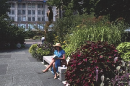 | Formally planned and regularly maintained open areas that provide passive recreation opportunities, including arranged plantings, gardens, gazebos, and similar structures, as well as roof gardens |
• Formal plantings and gardens shall have at least one (1) direct access to a building,
or to street, bikeway, or walkway accessible to the public or the development's occupants
and users.
• Such features shall be oriented to surrounding development. |
| Squares, Forecourts, Plazas, Courtyards, and Outdoor Dining Areas | ||
 | Squares, forecourts, plazas, courtyards, and outdoor dining areas that provide gathering places or active and passive recreational opportunities |
• Squares, forecourts, plazas, courtyards, and outdoor dining areas shall be at least
two hundred (200) square feet, but no more than one (1) acre, in area.
• Such features shall have at least one (1) direct access to a principal building, or to a street, bikeway, or walkway accessible to the public or the development's occupants and users. • Surrounding principal buildings shall be oriented toward the square, forecourt, plaza, or outdoor dining area where possible. |
| Required Buffer and Landscape Areas | ||
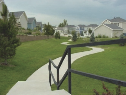 | All areas occupied by required buffers and landscaping, except interior parking lot landscaping and planting strips between the sidewalk and street. Buffers required within front setbacks or along public rights-of-way to screen parking (Subsection 070.040.060(h)(6)c.3.i.) shall count as common open space. | See landscaping standards (Subsection 070.040.050). |
(3)
Areas Not Allowable as Required Common Open Space. The following areas shall not be counted towards required common open space:
a.
Areas containing drainage and geologic hazard improvements;
b.
Private yards not subject to an open space or conservation easement;
c.
Street rights-of-way or private access easements, including sidewalks located within those rights-of-way or easements;
d.
Open parking areas and driveways;
e.
Land covered by structures, unless designated for active recreational uses;
f.
Decks, porches, patios, and balconies reserved for individual dwelling units;
g.
Designated outdoor storage areas; and
h.
Stormwater ponds not located and designed as a site amenity (for example, with low fencing, vegetative landscaping, gentle slopes, fountain or other visible water circulation device, and pedestrian access or seating).
With the exception of trails, spaces with any dimension of less than fifteen (15) feet shall not count toward satisfying the common open space requirement.
(4)
Design Standards for Common Open Space. Areas used as a required common open space shall meet the following design standards:
a.
Design Generally. The design, siting, grades, and solar access of the proposed common open space shall be such that the space is amenable to active and passive recreation; shall relate to the overall design of the site; and shall not be determined solely by those areas left over after the selection of the location for the building, parking areas, utilities, and other necessary site improvements. In addition, the design and siting of common open space located in commercial areas should minimize negative impacts of surrounding commercial activity or traffic on the enjoyment of the space by the residents as much as is feasible.
b.
Location. To the maximum extent practicable, required common open space shall be located and configured to include, protect, or enhance as many of the allowable types of common open space shown in Table 040.4 as possible, with a priority generally reflecting the order in which the types are listed in the table.
1.
Required common open space shall be located to be readily accessible and useable by occupants and users of the development. Where possible, a portion of the open space should provide focal points for the development through prominent placement or easy visual access from streets.
2.
The common open space shall be directly accessible to all residential units, to the maximum extent practicable. For example, clustering units around a common open space provides greater accessibility to each residential unit and is preferable to locating the open space at the end of a row of units where it is less accessible to many of the units. (Figure 040-2)
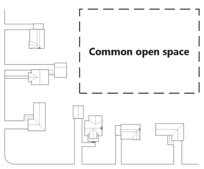
Figure 040-2: Common Open Space
3.
If the development site is adjacent to existing or planned parks, greenways, or other public open space, required common open space shall, to the maximum extent practicable, be located to adjoin, extend, and enlarge the park, greenway, or other public open space.
4.
If the development contains, or adjoins an existing or planned transit station, required common open space shall, to the maximum extent practicable, adjoin the transit station site or be integrated with the transit station or other open space adjoining the transit station in accordance with any City-adopted plans for the transit station area. Such required common open space shall be furnished with at least three (3) of the following types of community amenities:
i.
Benches or seating areas;
ii.
Raised landscape planters;
iii.
Shade structures;
iv.
Public art (e.g., sculptures, murals, water elements, carvings, frescos, mosaics, mobiles);
v.
A courtyard;
vi.
Decorative shelters for transit riders (as approved by the Director); or
vii.
Similar community amenities approved by the Director.
c.
Configuration.
1.
Required common open space areas shall be compact and contiguous unless a different configuration is needed to continue an existing trail or accommodate preservation of natural features.
2.
With the exception of trails, common open space shall be consolidated into one (1) large space where possible and shall not be fractured into small sizes and irregular shapes that do not function well for recreation.
d.
Setbacks and Easements. Setbacks and easements generally shall not count toward satisfying the common open space requirement; however, the Director shall have the authority to waive this requirement upon finding that the setback or easement area is consistent with the intent and design requirements of this Section and has sufficient solar access and landscaping to be amenable to recreation.
e.
Connections to Public Trails, Parks, and Other Recreation Areas. Applicants are encouraged to use common open space to connect to public trails and public parks and recreation areas wherever possible. For example, connections to the River Trail, nearby parks, publicly owned open spaces, or connections that make short cuts from the end of a cul-de-sac to a neighboring through street with a sidewalk are desirable. If not dedicated to the public, these connections shall qualify as common open space, subject to the approval of the Director.
(5)
Development Within Required Common Open Space Areas. Development within required common open space areas shall be limited to that appropriate to the purposes of the type(s) of common open space (see Table 040.4).
(6)
Ownership, Management, and Maintenance of Common Open Space.
a.
Required common open space area shall be managed and maintained as permanent open space through one (1) or more of the following options:
1.
Open space may be held in common ownership by the owner(s) of the development, who will be responsible for managing and maintaining the land for its intended open space purposes.
2.
Open space areas may be conveyed to a property owners' or homeowners' association that holds the land in common ownership and will be responsible for managing and maintaining the land for its intended open space purposes.
3.
Open space areas may be conveyed to a third-party beneficiary such as an environmental or civic organization that is organized for, capable of, and willing to accept responsibility for managing and maintaining the land for its intended open space purposes.
b.
Easements may be established on those parts of individually owned lots including open space areas that require the areas to be managed consistent with their intended open space purposes and prohibit any inconsistent future development. Any options involving private ownership of required common open space area shall include association by-laws, deed restrictions, covenants, or other legal instruments that ensure continued use of the land for its intended open space purposes and provide for the continued and effective management, operation, and maintenance of the land and facilities. Such instruments shall be approved by the City as sufficient to comply with this standard before or conjunction with approval of any subdivision plat for the development, or any permit approval (if no subdivision approval is required).
c.
Responsibility for managing and maintaining common open space areas lies with the owner of the land comprising the areas. Failure to maintain common open space areas in accordance with the approved development shall be a violation of this Code. Identification of who bears responsibility for managing and maintaining common open space areas shall be shown on any recorded subdivision plat for the development or any approved development permit (if no subdivision approval is required).
(7)
Alternative Options for Meeting Common Open Space Requirements.
a.
Off-Site Provision.
1.
In lieu of providing required common open space area on a development site in accordance with Subsection 070.040.040(c), the developer may, with the approval of the City Council in accordance with the criteria in Paragraph 3. below, provide all or some of required common open space on land outside the development site. No development application proposing off-site provision of required common open space shall be approved unless and until the City Council approves such proposal (even where the application would normally be decided by City staff or another board).
2.
Where off-site provision of required common open space is proposed, the application shall include a map showing the location, boundaries, and topography of the site, as well as any additional information necessary to ascertain the site's suitability as common open space.
3.
Any approved off-site common open space shall be shown as reserved or dedicated open space on a plat of the property containing the common open space. The City Council's decision on whether to approve off-site provision of required common open space shall be based on the following criteria:
i.
Whether the proposed off-site common open space would meet the design standards for required common open space in Subsection 070.040.040(c)(4);
ii.
Whether the proposed off-site common open space is located sufficiently close to the development site to meet the open space needs of the occupants and users of the development; and
iii.
Whether the proposed off-site common open space would contribute more to meeting the open space needs of the occupants and users of the development than on-site provision of the common open space or the City's use of in-lieu payments to acquire and develop parks, greenways, and other open space areas in the vicinity of the development.
b.
Fee in Lieu of Providing Required Common Open Space.
1.
In lieu of providing required common open space area on a development site in accordance with Subsection 070.040.040(c), the developer may, with the approval of the City Council (for PUD, Major Subdivision Preliminary Plat, Major Site/Architectural Plan, or Special Use) or Director (for Minor Subdivision Plat or Minor Site/Architectural Plan), make a payment to the City in lieu of providing all or a portion of the required common open space or public recreation area.
2.
The amount of such in-lieu payment shall be the product of the number of acres of required common open space area, as appropriate, that is proposed and approved for the in-lieu payment option multiplied by the pre-development fair market value per acre of land making up the development site. The development application shall include an appraisal or other documentation acceptable to the City as showing the development site's predevelopment fair market value.
3.
If the City disagrees with the pre-development fair market value submitted by the applicant, such value shall be determined by a special appraisal committee made up of one (1) professional appraiser appointed by the applicant, one (1) professional appraiser appointed by the City Manager, and one (1) professional appraiser appointed by the initial two (2) committee members. The committee shall view the site, hear the contentions of both the applicant and the City, reach a conclusion by majority vote, and submit a written certification of its conclusion to the applicant and City Manager within thirty (30) days after the final member of the committee is appointed. The costs of the committee shall be borne by the applicant.
4.
The developer shall make the in-lieu fee payment before recordation of any subdivision plat for the development or issuance of any development permit for the development (if no subdivision approval is required)—provided, however, that the payments may be phased in accordance with an approved phasing plan for the development.
5.
The City shall deposit any in-lieu fee into a special fund that shall be used only for the acquisition or development of parks, greenways, and other open space areas that will serve occupants and users of the development. Such areas may also serve other developments in the immediate area.
6.
The decision on whether to approve a fee in lieu of providing required common open space shall be based on the following criteria:
i.
The extent to which the size, shape, topography, geology, soils, and public accessibility of the development site makes it impractical to provide required common open space that complies with Subsection 070.040.040(c)(4), Design Standards for Common Open Space;
ii.
Whether the in-lieu payment option provides the additional design flexibility needed to accommodate allowable higher-intensity development in the downtown, or allowable higher-intensity development on substantially constrained sites elsewhere in the City; and
iii.
Whether the City's use of an in-lieu payment would better meet the open space and recreational needs of occupants and users of the development than on-site provision, or any proposed off-site provision, of the required common open space.
(Ord. No. 19-2018, § 2(Exh. A), 8-2-2018; Ord. No. 3-2019, § 2(Exh. A), 1-31-2019; Ord. No. 18-2021, § 2(Exh. A), 1-6-2022; Ord. No. 13-2024, § 2(Exh. A), 8-1-2024)
070.040.050 - Landscaping, Screening, and Fencing.
(a)
Purpose. The purpose of this Section is to ensure that landscaping, screening, and fencing is provided to:
(1)
Protect and enhance the visual appeal of Glenwood Springs;
(2)
Contribute to high-quality development;
(3)
Improve air quality;
(4)
Buffer potentially incompatible neighboring land uses;
(5)
Mitigate the environmental and visual impacts of surface parking areas;
(6)
Protect residential and commercial property values; and
(7)
Extend water supply and water infrastructure by enhancing efficiency and eliminating outdoor water waste.
(b)
Applicability.
(1)
New Development and Redevelopment. These standards shall apply to all new development or redevelopment unless otherwise exempted by Paragraph (2).
(2)
Exemptions.
a.
Single- and two-family residential uses except Subsection 070.040.050(c)(3), Water Efficient Landscape Standards, 070.040,050(d), Streetscape Requirements, Subsection 070.040.050(f)(2), Fence Standards, and Subsection 070.040.050(f)(3), Retaining Wall Standards.
b.
Mixed-use or nonresidential uses on a lot that is less than five thousand (5,000) square feet shall be exempt from this Section.
c.
Expansion of existing structures or uses by less than twenty-five (25) percent gross floor area provided that any existing compliant landscaping remains unaltered.
(c)
General Landscaping Standards.
(1)
Minimum Landscaped Site Area.
a.
The minimum percentage of site area required to be landscaped is established for each zoning district in Section 070.020.020, Summary of Dimensional Standards.
b.
Except for areas with native vegetation cover, any part of a site not used for building coverage, parking areas, driveways, sidewalks, or other site improvements shall be landscaped.
(2)
Type and Amount of Plant Material.
a.
Trees and other plant material shall be provided according to Table 040.5: Minimum Plant Material and Standards.
b.
Existing landscaping may be used to satisfy the landscaping requirements, except that preservation of existing trees shall comply with Subsection 070.040.050(c)(4).
c.
Artificial trees, shrubs, turf, or plants shall not be used to satisfy any of the requirements of this Section.
d.
Where fractional number results, the number of trees, shrubs, or perennials shall be rounded to the next highest whole number.
(3)
Water Efficient Landscape Standards: The following standards shall apply to all required landscape areas:
a.
Soil Amendment.
i.
Soil amendments for turf, shrubs, perennials and annuals shall be sandy loam to a depth of 6" containing at least five (5) percent organic matter by volume.
ii.
Soil amendments for trees shall be sandy loam to a depth of thirty-six (36) inches containing one to three (1-3) precent organic matter by volume. In locations with existing good soils, soil shall be turned three times the dimension of the root ball.
b.
Mulch. Mulch shall be applied at a minimum depth of four (4) inches with modifications as appropriate for installed plant material. Mulch shall be renewed as needed. Mulch material may be organic material including, but not limited to: wood, bark nuggets, nut shells, grass clippings, straw, compost and chopped leaves; or inorganic material including gravel, stone, pea gravel, pebbles.
c.
Plant Selection and Grouping. Plant materials shall be selected for water efficiency, drought tolerance, use of native or climate adaptive species and their relationship to the Glenwood Springs regional ecology as well geologic and topographical conditions.
i.
Plants shall be selected from the water efficient plant list as shown in Parks and Recreation Department's Glenwood Springs Landscaping Species Guide.
ii.
Hydrozones required. Plants shall be grouped together by soil suitability and by water use in distinct hydrozones (very low, low, moderate and high) to increase irrigation efficiency. Plants from the same water use zone shall be grouped together on the same irrigation zones. Water use zones shall be consistent with the water smart plant list as shown in Parks and Recreation Department's Glenwood Springs Landscaping Species Guide as adopted by City Council and amended from time to time. Other Colorado water smart plant lists may be approved for use and reference by the Director.
iii.
The landscape design shall promote and preserve native and climate adaptive species and natural areas. Native species shall account for seventy-five (75) percent of provided plants and these must be drought tolerant species.
d.
The total amount of high-water use zones on a property shall not exceed fifty (50) percent of the total landscaped area. Turf grass areas designated and approved as functional turf, landscape areas dedicated to gardens and food production, and trees in tree grates, shall be excluded from the total landscaped area under this requirement.
e.
The use of high irrigation plantings shall be limited to high use areas with high visibility or functional needs.
f.
Plants from a high-water use zone shall not be planted on slopes or berms at a 4:1 slope or greater.
g.
Turf.
i.
Very high- and high-water use turf grass is prohibited.
h.
The developer of a property may submit an application to the Director requesting consideration for a waiver for functional turf that is very-high or high-water use turf grass that provides a recreational benefit to the community and meets the functional turf definition. Waiver applications must demonstrate that the turf substantially complies with the functional turf definition as indicated by:
i.
Activity type.
ii.
Activity-appropriate dimensions.
iii.
Number of persons served and frequency of use.
iv.
Location in proximity to similar turf areas.
v.
Public access and proximity to roadways.
vi.
Presence of facilities and/or other recreational amenities.
vii.
Irrigation efficiency.
(4)
Location of Required Plant Material.
a.
Required trees, shrubs, and perennials shall be planted in required setbacks, parking areas, and along building foundations.
b.
When planted in required setback areas or along building foundations, trees may be either uniformly spaced or placed in irregular groupings.
c.
Landscaping or other obstructions within a sight distance triangle shall comply with the height restrictions in Subsection 070.020.200(c)(5), Sight Distance Triangle Requirement.
d.
Trees shall be planted at least four (4) feet away from overhanging vehicles. (Figure 040-3)

Figure 040-3: Vehicle Overhang
(5)
Credits for Tree Preservation.
a.
Amount of Tree Preservation Credit.
1.
The number of trees preserved can be credited toward the total number of trees required for the development to meet the landscaping requirements of this Section. Credit shall be applied on a one-for-one basis, unless the Director approves an alternate ratio to encourage tree preservation.
2.
The Director shall determine whether or not credit shall be granted for existing trees.
3.
Tree species that are not acceptable to receive credit under this standard include, but are not exclusive of Siberian and Chinese Elm, Russian Olive, Tamarisk, and other species that are listed on the Garfield County Vegetation Management Department's most current noxious weed list.
b.
Procedure for Evaluating Existing Trees.
1.
Existing trees intended for preservation shall be evaluated by a licensed arborist prior to submitting and application for development, or prior to issuance of a grading or building permit. The arborist's written evaluation shall include an assessment of the likelihood of the survivability of the trees based on proximity to any grading activity on the site and recommendations for tree preservation during grading and construction activities.
2.
Based on the licensed arborist's evaluation, the development may receive credit for existing trees provided that all of the following criteria are met:
i.
The trees are each a minimum of four-inch caliper in size;
ii.
Any grading, digging, and/or site preparation activities shall not be permitted within the drip line (Figure 040-4) of the trees intended for preservation; and

Figure 040-4: Drip Line
iii.
Trees intended for preservation shall be shown on the landscape plan with caliper size and drip line noted.
(d)
Streetscape Requirements.
(1)
Minimum Streetscape Elements. Streetscape elements shall be provided according to Table 040.6: Minimum Streetscape Requirements.
(2)
Location of Street Trees.
a.
Unless otherwise permitted in this Section, street trees shall be located within the designated planting strip.
b.
Where no planting strip is present or where utilities prevent trees from being planted in the designated planting strip, trees may be planted on the development parcel, in an area ranging from three (3) to seven (7) feet behind the property line nearest to the public right-of-way.
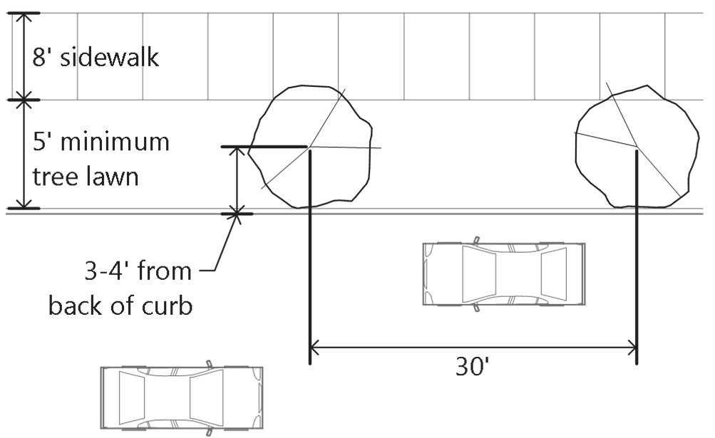
Figure 040-5: Location of Street Trees
(e)
Parking Area Landscaping. See Subsection 070.040.060(h)(6), Parking Area Landscaping.
(f)
Screening, Fences, and Walls.
(1)
Screening Standards.
a.
Credits Toward Required Landscaping. Any landscaping provided to meet screening standards will be credited towards the overall landscaping requirements enumerated in this Section.
b.
Screening Loading and Outdoor Storage Areas. Loading and outdoor storage areas shall be screened from view of public rights-of-way and from adjacent residential land uses or districts using any one (1) or a combination of fences, walls, berms, or landscaping that is at least six (6) feet in height and provides a permanent, opaque, year-round screen.
c.
Screening Refuse Containers.
1.
Enclosures Required. Refuse containers shall be located within an enclosure.
2.
Location. Refuse container enclosures shall be located at the rear of the property to the extent practicable and shall be sited to allow for easy vehicular access such that access does not require backing movements onto public rights-of-way, with the exception of alleys.
3.
Design and Materials. Refuse container enclosures shall be of sufficient height to screen containers, but shall not exceed six (6) feet in height unless screening a refuse container taller than six (6) feet. Such enclosures shall be visually compatible with materials used on the primary building. In no case shall enclosures consist of chain link or corrugated metal. Refuse containers shall comply with the provisions set forth in Article 100.010.060 of the Municipal Code. (Figure 040-6)
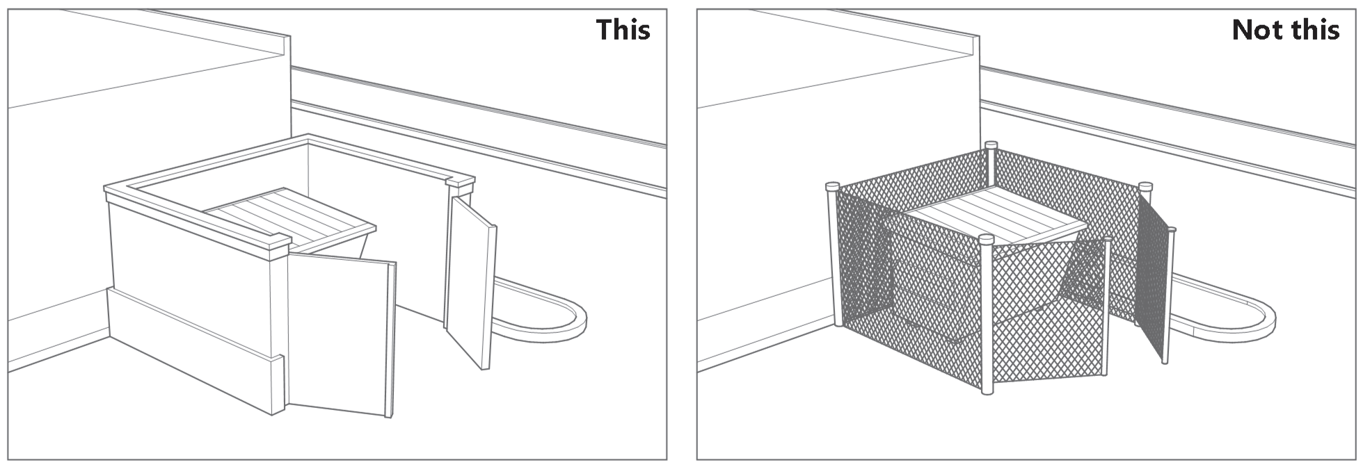
Figure 040-6: Refuse Container Enclosures
4.
Landscaping. Landscaping shall be used to soften the appearance of the enclosure where such enclosure is located within a side yard or can be viewed from public rights-of-way.
d.
Screening Mechanical and Utility Equipment. All mechanical and utility equipment including but not limited to air-conditioning, heating and soft water tanks, television antennas, satellite dishes, security apparatus, transformers, and electric and gas meters shall be integrated into the building design, screened from public view or enclosed in a suitable accessory structure, pursuant to the following standards:
1.
Location.
i.
Ground-mounted mechanical and utility equipment shall be located outside of sight distance triangles in order to avoid obscuring vision at intersections.
ii.
To the extent practicable, ground mounted mechanical and utility equipment shall be located out of view of public rights-of-way, customer entrances, and other public areas.
2.
Design.
i.
Materials. Materials used for screening purposes shall be wood or masonry. The use of split face concrete block is prohibited unless otherwise approved by the Director through the alternative compliance procedure.
ii.
Ground-Mounted Equipment. Ground-mounted mechanical and utility equipment located within view of customer entrances or public rights-of-way shall be integrated into the overall site design, the architectural design of the building, and screened from public view using one (1) or a combination of the following: (Figure 040-7)
a.
Decorative wall, fence, or enclosure that is constructed of materials that are compatible with the overall architectural design of the development and of a height that is not less than the height of the equipment to be screened; or
b.
Landscaping that is of sufficient height at maturity and of opacity to effectively soften and screen the equipment, and that is integrated into the overall landscaping plan.
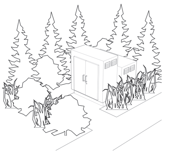
Figure 040-7: Screening Ground-Mounted Equipment
iii.
Fire Hydrants.
a.
Ensure that plants and other screening mechanisms do not block access to a fire hydrant.
b.
Setbacks shall be maintained to each side of all fire hydrants as required in the Engineering Standards.
iv.
Roof-Mounted Equipment.
a.
Roof-mounted equipment shall be an integral part of the building's overall architectural design and shall be screened from view to the extent practicable from public rights-of-way, residential land uses, public parking areas, and/or adjacent properties using parapet walls or other means of screening. When reviewing the type and amount of screening, the Director shall consider the following:
1.
The proximity of the development to surrounding residential land uses and the visual impact that roof-mounted equipment may have upon those surrounding residential land uses.
2.
The number and size of roof-mounted equipment. The greater the number and/or size, the more screening may be warranted.
b.
Roof-mounted equipment shall be neutral earth toned colors that have a matte finish and that are compatible with the primary building façade. In no case shall rooftop mechanical equipment be galvanized, shiny, white, off-white, or other light colors that can be observed from a distance.
(2)
Fence Standards.
a.
Location and Design.
1.
Fences other than those used for screening pursuant to Subsection 070.040.050(f)(1), and that are constructed within the front yard setback, along corner side lot lines, or are adjacent to a public right-of-way, shall be at least sixty (60) percent transparent.
2.
Fences located in a required front yard setback shall be no more than four (4) feet in height.
3.
Fences located in a required side or rear yard setback shall be no more than six (6) feet in height.
4.
Fences shall conform to maximum height requirements when located within a sight distance triangle, as defined in Subsection 070.020.200(c)(5), Sight Distance Triangle Requirement.
b.
Fencing Materials.
1.
Fencing material shall be compatible with the overall site design, the primary building, and landscaping. Acceptable materials include but are not exclusive of the following:
i.
Natural stone;
ii.
Brick;
iii.
Stucco;
iv.
Wood;
v.
Decorative concrete block;
vi.
Metal, as in wrought iron;
vii.
Wooden picket fences for residential applications provided the pickets or vertical slats are not more than four (4) inches apart on center; and
viii.
Chain link provided that the chain link is vinyl coated green, brown, or black, used in conjunction with tightly spaced plant material that provides a dense screen between the fence and the adjacent public right-of-way, and is not otherwise prohibited below.
2.
The following fencing materials are prohibited:
i.
Except in the I1 and I2 zoning districts, chain link fencing when located in the front yard or in a side yard that is adjacent to and visible from a public right-of-way;
ii.
Corrugated or ribbed metal;
iii.
Corrugated plastic;
iv.
Plastic and vinyl; and
v.
Barbed wire.
c.
Fencing Color.
1.
Fencing shall be low reflective, and earth-toned in color.
2.
Fences constructed of metal, wrought iron, or similar material may be black.
3.
Galvanized, shiny, white, off-white, or other light colors that can be observed from a distance are prohibited except that white or off-white wooden picket fences shall be permitted for residential applications.
(3)
Retaining Wall Standards.
a.
Location and Design.
1.
Retaining walls shall be designed in accordance with applicable building codes, Engineering Standards, and applicable standards in Section 070.040.020, Sensitive Area Protection.
2.
Retaining walls shall not exceed six (6) feet in height, as measured from natural grade to the top of the wall, except for the exceptions to accommodate varying slopes as provided in Subsection 070.040.020(b)(4)g., Retaining Walls and Fencing, or when terracing is provided pursuant to Subsection 070.040.050(f)(3)b., Terracing Required.
3.
Retaining walls that are over four (4) feet in height shall be designed by a State of Colorado licensed structural engineer.
4.
Retaining walls that are over thirty (30) feet in length shall incorporate the following elements to minimize the overall mass of the wall:
i.
Recessions and/or projections that have a minimum wall plane change of twenty-four (24) inches and have the effect of casting shadows. (Figure 040-8)
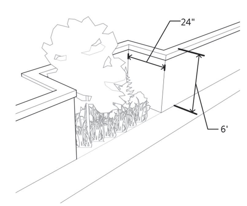
Figure 040-8: Retaining Wall Design
ii.
Landscaping at a minimum shall include trees, shrubs, ornamental grasses and/or and perennials and be of sufficient quantity to add visual interest and to minimize the impact of the structure as viewed from neighboring properties or the public right-of-way. The Director may approve alternative designs to soften retaining walls to reduce the amount of water behind such walls provided the intent of this Section is met. Alternative designs shall be processed according to Subsection 070.040.050(g)(2).
5.
Retaining walls shall be designed such that the structure conforms to the existing natural terrain.
6.
Retaining walls shall conform to maximum height requirements when located within a sight distance triangle.
b.
Terracing Required. The Director may allow retaining walls that exceed six (6) feet in height if they are terraced to minimize visual impacts on residents, neighboring properties, and the public realm by: (Figure 040-9)
1.
Limiting terracing to three (3) tiers;
2.
Providing a minimum terrace width of four (4) feet between any two (2) six-foot retaining walls with a maximum slope of 3:1 to create pockets for landscaping. The Director may approve reduced terrace depths where site constraints limit the amount of space available to accommodate the minimum required width;
3.
Access points, such as stairs, shall be incorporated into the retaining wall for the purposes of maintaining landscaping; and
4.
Permanently landscaping or re-vegetating terraces created between retaining walls to screen walls and provide visual interest unless soil conditions are determined by a licensed engineer to be unsuitable due to geologic hazards.
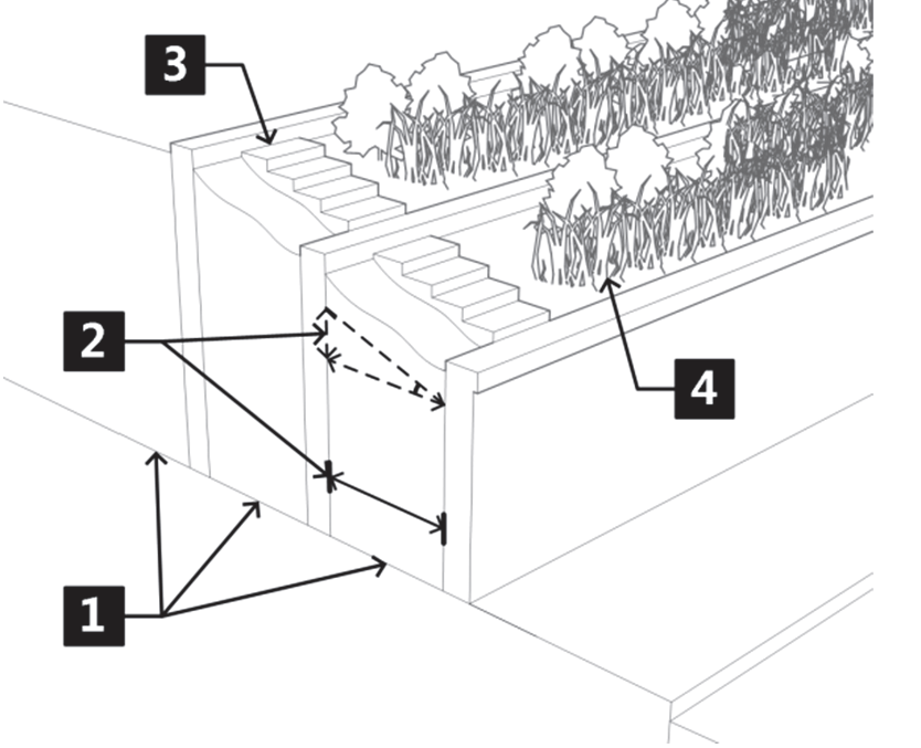
Figure 040-9: Retainign Wall Terracing
Annotations correspond with paragraph numbers in the preceding text.
c.
Materials and Color.
1.
Retaining walls shall be compatible with the overall site design, the primary building, and landscaping and shall coordinate with rock formations or exposed soil from surrounding hillsides.
2.
Retaining walls shall be constructed of the following materials:
i.
Natural stone;
ii.
Concrete keystone blocks with integral earth-toned color; or
iii.
Another material that meets the intent of this standard as determined by the Director.
3.
When located adjacent to a public right-of-way or when visible from adjacent commercial or residential land uses, the use of railroad ties and timber is prohibited.
d.
Landscape Buffer as an Alternative.
1.
Where terracing or other mitigation measures are not feasible due to site size or other constraints, a densely landscaped buffer shall be provided as an alternative on the downhill side of the wall.
2.
Appropriate spacing of vegetation and landscaping shall be determined by the Director, dependent upon the species selected; however, spacing shall be such that trees will form a dense screen within five (5) years of planting.
3.
The Director may approve alternative landscape buffer configurations and plantings where insufficient space exists to meet the above landscape buffer standards.
4.
The Director may waive the above standards for alternative landscape buffers if retaining walls will not be visible from neighboring sites, the interior of the proposed structure, and the primary street frontage; and the applicant can demonstrate that views of the retaining wall will be fully screened by the primary structure or a free-standing parking garage structure.
(g)
Landscaping Evaluation Procedure.
(1)
Landscape Plan.
a.
All development shall provide a landscape plan generated from a qualified landscape architect, demonstrating compliance with the standards in this Section provided in a form established by the Director. Single-family and duplex landscape plans do not require a certified landscape architect.
b.
Review and evaluation of the landscape plan shall be pursuant to the specific application procedure pursuant to Article 070.060: Administration and Procedures.
(2)
Alternative Compliance.
a.
For developments with severely hydrocompactive soils, especially those present around building foundations, the Director may approve landscaping and related irrigation design alternatives that meet the overall intent of this Section but that address the special characteristics of these soil types. The Director may require a statement from a licensed geotechnical engineer that specifically addresses the hydrocompactive soil issue as it relates to compliance with the requirements in this Subsection for the City to consider an alternative landscaping design.
b.
For developments where other exceptional physical limitations of either existing building location or site dimensions result in impractical or impossible application of this Section, then the Director may approve landscaping, screening, fencing, and wall alternatives that meet the intent of this Section.
(h)
Installation and Maintenance.
(1)
Timing of Installation. The developer shall install all landscape improvements including operable irrigation systems prior to receiving a Certificate of Occupancy. This requirement may be modified by the Director if security is provided and the developer identifies an alternative timeframe for landscaping and/or irrigation system installation. The amount of security shall be based on itemized cost estimates of all landscaping and irrigation system improvements, as well as related labor costs. Itemizations shall be generated from a qualified landscape architect, irrigation system specialist, and/or a local or regional landscaping nursery or garden center.
(2)
Irrigation System Design.
a.
Irrigation systems shall be professionally designed by a landscape architect or irrigation specialist.
b.
When available, raw water shall be utilized for irrigation. Irrigation systems shall be designed to prevent water from spraying on impervious surfaces adjacent to landscape areas, shall utilize drip irrigation where appropriate to minimize run-off from sprinklers.
c.
A soil moisture sensing device or other irrigation management system shall be required for irrigation systems in turf areas.
d.
The landscape plan shall indicate the nature, location, and specifications of the irrigation system which shall be used. Separate irrigation circuits should be specified for different zones on the landscape plan. The landscape plan shall have sufficient detail to show that adequate irrigation will be provided to all required landscape areas and plant materials.
e.
The irrigation system shall be designed to correlate to the organization of plants into zones with similar watering requirements.
f.
Low-volume, drip, or subsurface irrigation systems shall be used in the following conditions:
i.
In landscaped areas where any one (1) dimension is less than six (6) feet in width and surrounded by impervious surfaces;
ii.
In all non-turf grass areas.
g.
Leaks, runoff, overspray prohibited. Irrigation systems shall be designed to prevent water waste, overwatering and overspray, and drainage of water onto any paved or unplanted surface.
h.
Penalty assessment fines. A person who violates any rule, regulation or order issued pursuant to this section shall be subject to the penalty assessment fines outlined below. Penalty assessment fines shall be determined within a one-year period measured from the date of any prior violation of this section. Notwithstanding any penalty provision of this Code or any fines adopted pursuant to this Code to the contrary, the penalty for any offense that also constitutes a violation of similar state law shall not exceed the penalty provided for by the applicable provisions in the Colorado Revised Statutes.
i.
First offense: Fifty dollar ($50.00) fine.
ii.
Second offense: One hundred dollar ($100.00) fine.
iii.
Third offense: Two hundred fifty dollar ($250.00) fine.
iv.
Subsequent offense: The Municipal Court may impose such fines and penalties as it is authorized pursuant to Municipal Code Section 010.020.080.
(3)
Maintenance. The owner of the property and his/her successors, heirs, and assigns, are responsible for the proper maintenance of the landscaped area, screening, fencing, and parking lot subject to the approved landscape plan. All landscape and parking areas shall be maintained free of trash. Landscaping shall be continuously maintained, including all necessary watering, weeding, pruning, and pest control.
(4)
Protection of Existing Vegetation.
a.
No existing live trees with a caliper size of fourteen (14) inches or greater may be removed without approval of the Director and Parks and Recreation Director.
b.
Planting strips or areas, walkways, fences, hedges, or walls shall be protected from vehicles and maintenance equipment by curbs, bollards, wheel stops, or other means.
(5)
Replacement of Dead or Diseased Plant Material. Replacement of dead or diseased plant material shall be of equivalent species or material, as specified in the approved Landscape Plan. Replacement shall occur at the time of removal or, if necessary, the next planting season. In any event, replacement shall occur within one (1) year from the time of removal.
(6)
Maintenance of Trees in Public Right-of-Way. Trees located within the public right-of-way or on public property shall be maintained in accordance with Section 090.050.030 of the Municipal Code.
(Ord. No. 19-2018, § 2(Exh. A), 8-2-2018; Ord. No. 3-2019, § 2(Exh. A), 1-31-2019; Ord. No. 15-2020, § 2(Exh. A), 7-2-2020; Ord. No. 3-2021, § 2(Exh. A), 5-20-2021; Ord. No. 31-2022, § 2(Exh. A), 1-5-2023; Ord. No. 9-2023, § 2, 10-26-2023; Ord. No. 6-2025, § 2(Exh. A), 3-6-2025)
070.040.060 - Off-Street Parking and Loading.
(a)
Purpose. The purpose of this Section 070.040.060 is to ensure that safe and convenient parking areas are provided to:
(1)
Respond to transportation and access demands of various land uses throughout the City;
(2)
Avoid and mitigate traffic congestion;
(3)
Avoid and mitigate the adverse visual impact of large concentrations of exposed parking and of separate garage or carport structures;
(4)
Reduce stormwater runoff, reduce heat island effect from large expanses of pavement, and improve water quality;
(5)
Provide necessary access for service and emergency vehicles; and
(6)
Provide for safe and convenient interaction between vehicles and pedestrians.
(b)
Applicability.
(1)
New Development. Unless otherwise exempted by Subsection 070.040.060(b)(2), the standards in this Section shall apply to all development and land uses established after the effective date of this Code.
(2)
Exemptions from Parking Requirements. The following shall be exempt from the parking standards in Subsections 070.040.060(c) and 070.040.060(d), but shall comply with parking area design standards if parking is provided:
a.
Properties within the boundaries of the Glenwood Springs General Improvement District No. 1980, or as amended;
b.
Nonresidential uses in any zoning district on properties containing less than five thousand (5,000) square feet of lot area; or
c.
Expansions of existing structures or uses by less than twenty-five (25) percent gross floor area provided that any existing off-street parking remains unaltered.
(3)
Fee in Lieu of Off-Street Parking.
a.
Prior to the issuance of the building permit or a change in use of the property, the developer of a property may submit an application to the Director for payment of fee in lieu of off-street parking requirements. The submitted application shall be presented by the Director to City Council for a determination as to whether sufficient public parking to serve the proposed structure or use exists, or can be made available to serve the structure or use. This determination shall be at the sole discretion of the City Council, who may approve or disapprove the application.
b.
The fee in lieu shall be established by resolution of the City Council in an amount that is calculated to approximate the cost of obtaining, developing, and maintaining a public parking space.
c.
All fees in lieu paid pursuant to this Subsection shall be deposited in a separate fund, which fund may be used to undertake future projects to accommodate parking demand. These fees may not be used for the general expenses of the City.
(4)
Change in Use. Unless otherwise stated, off-street parking and loading shall be provided for any change of use that would result in a requirement for more parking or loading spaces than the existing use as defined in this Section. An applicant may pay a fee in lieu of providing required off-street parking pursuant to Subsection 070.040.060(b)(3), Fee in Lieu of Off-Street Parking.
(5)
Parking as an Accessory Use. Parking is allowed in all zoning districts as an accessory use except that parking lots as a principal use shall only be allowed with approval of a special use permit and limited to zoning districts pursuant to Table 030.1: Table of Allowed Uses.
(c)
Calculation of Off-Street Parking and Loading Requirements.
(1)
Area Measurements.
a.
All parking and loading requirements that are based on square footage shall be calculated on the basis of the floor areas of the subject use.
b.
Structured parking within a building shall not be counted in the computation of gross floor area as it pertains to the required parking spaces.
c.
For the purpose of calculating maximum parking spaces, the following shall not be counted in such calculation:
1.
Accessible parking;
2.
On-street parking;
3.
Structured parking; or
4.
Vanpool and carpool parking.
(2)
Fractions. When the calculation of off-street parking spaces results in a fraction, the required parking shall be rounded to the next highest whole number.
(3)
Off-Street Parking and Loading for Multiple Uses. Lots containing more than one (1) activity or uses shall provide off-street parking and loading in an amount equal to the total of the requirements for all subject activities or uses, unless the Director approves a parking alternative pursuant to Subsection 070.040.060(e).
(4)
Off-Street Parking and Loading for Unlisted Uses. For uses not expressly listed in Table 030.1: Table of Allowed Uses, the Director is authorized to:
a.
Apply the off-street parking and loading requirements specified in Table 03.1 for the listed use most similar to the proposed use based on public parking demand, nature of the use, number of employees, and any other factors deemed appropriate by the Director; or
b.
Establish the off-street parking and loading requirements based on local or national best practices or by reference to standards or resources such as the Institute of Traffic Engineers, Urban Land Institute, the International Council of Shopping Centers, the American Association of State Highway and Transportation Officials, the American Planning Association; or
c.
Establish the off-street parking and loading requirements based on a parking and loading demand study prepared by the applicant according to Subsection 070.040.060(c)(5).
(5)
Discretionary Requirements Based on Demand Study. Uses in Table 030.1: Table of Allowed Uses, that reference this Paragraph have varied parking and loading demands, making it difficult to specify a single standard for off-street parking or loading requirements. With an application for a use that is subject to this Paragraph, the Director shall apply the off-street parking and loading standards on the basis of a demand study prepared by the applicant. Such study shall estimate the parking and loading demand based on recommendations of the Institute of Traffic Engineers, Urban Land Institute, the International Council of Shopping Centers, the American Association of State Highway and Transportation Officials, the American Planning Association, or other acceptable source of parking demand data for uses and/or combinations of uses of comparable activities, scale, bulk, area, and location.
(d)
Number of Off-Street Parking Spaces Required.
(1)
Minimum Number of Off-Street Parking Spaces Required. The number of off-street parking spaces required shall be pursuant to the corresponding use type in Table 030.1: Table of Allowed Uses.
(2)
Accessible Parking. The number and design of accessible parking spaces shall be pursuant to the International Building Code as adopted in the Municipal Code and the American Disabilities Act, as amended.
(3)
Maximum Parking Spaces Allowed. In nonresidential and mixed-use districts, uses shall not provide off-street parking spaces in an amount more than one hundred twenty-five (125) percent of the minimum parking spaces required pursuant to Table 030.1: Table of Allowed Uses, unless:
a.
The use is "automotive sales or leasing" or "transit terminal or station;"
b.
The applicant submits a parking demand study to the Director pursuant to Subsection 070.040.060(c)(5);
c.
The proposed development has unique or unusual characteristics such as high sales volume per floor area or low parking turnover, that create a demand exceeding the maximum ratio and that typically does not apply to comparable uses, with authorization from the Director; and
d.
Additional landscaping is provided in an amount equal to the percentage above the maximum parking ratio allowed.
(e)
Parking Alternatives. The developer of a property may submit an application to the Director requesting consideration of alternatives to the off-street parking spaces required by Table 030.1: Table of Allowed Uses, pursuant to the following standards:
(1)
Cumulative Maximum Reduction for Parking Alternatives. The maximum reduction of required off-street parking spaces by any single parking alternative or combination of parking alternatives in this Section shall be thirty (30) percent except as allowed for in Section 070.020.180 Downtown Commercial Overlay District.
(2)
Shared or Off-Site Parking.
a.
The Director may approve reduced parking requirements for mixed-use and shared facilities, or off-site parking, if the applicant demonstrates that the peak parking demands for such uses and facilities occur at different times either daily or seasonally.
b.
To be eligible for such reduction, the applicant shall prepare a demand study pursuant to Subsection 070.040.060(c)(5).
c.
For shared parking for mixed-use buildings and/or developments, the total parking provided shall not be less than the required parking for the residential use.
d.
Shared parking facilities shall be located within fiev hundred (500) feet (measured along a legal pedestrian route) of the entrance to each building for which the shared parking is provided.
e.
Shared and/or off-site parking areas shall be located on a site with the same or more intensive zoning district than required for the principal uses served by the parking area.
f.
No off-site parking areas shall be located in a residential zoning district.
g.
Accessible parking (ADA parking) shall not be permitted off-site.
h.
Shared parking areas or facilities shall require a shared parking agreement to be recorded prior to issuance of a building permit for new development or a certificate of occupancy for existing buildings. If such agreement is revoked by any party, then the required off-street parking spaces shall be provided pursuant to this Code.
(3)
Structured Parking. The Director may approve reduced off-street parking requirements up to twenty (20) percent for developments providing structured parking.
(4)
On-Street Parking. The Director may approve reduced off-street parking requirements on a one-to-one basis for on-street parking spaces adjacent to a proposed development. When considering the use of on-street parking, the Director shall consider existing on-street parking demands in the vicinity of the proposed development. The on-street parking spaces shall be available for public use. Elimination of on-street parking for any reason may result in a requirement for the applicant to provide additional off-street parking to comply with this Code.
(5)
Tandem Parking. Tandem parking is allowed for any residential parking area, and for vehicle sales and leasing uses. The Director may also approve tandem parking for employee parking areas for nonresidential uses requiring fewer than ten (10) parking spaces pursuant to Table 030.1: Table of Allowed Uses.
(6)
Compact Vehicle Parking.
a.
Up to twenty (20) percent of the total number of required parking spaces may be used for compact vehicle parking, provided that the total number of required off-street parking spaces is provided on site.
b.
In the case where one (1) or more other parking alternatives in this Section have been approved by the Director, compact vehicle parking may be provided for up to ten (10) percent of the required off-street parking spaces.
c.
Spaces designated as compact vehicle parking shall be identified as such by means of a permanent sign.
(7)
Proximity to Transit. The Director may approve reduced parking requirements up to twenty (20) percent for development located within seven hundred fifty (750) feet of an active transit stop.
(8)
Bus Passes, Carpool, Car Share, or Telecommuting Program. The Director may approve reduced parking requirements up to twenty (20) percent for businesses offering reimbursed transit passes or that have an active carpool, vanpool, car share parking, and/or telecommuter program in place.
(9)
Bicycle Parking Beyond Required. The Director may approve reduced parking requirements for applicants providing bicycle parking at a higher rate than required by Subsection 070.040.060(f). Such reduction may be approved at a ratio of up to one (1) off-street vehicle space reduction per five (5) short-term bicycle spaces provided beyond the minimum required, and up to one (1) off-street vehicle space reduction per three (3) long-term bicycle spaces provided.
(f)
Bicycle Parking.
(1)
Applicability.
a.
Unless exempted by b. below, all multifamily and nonresidential development shall provide bicycle parking according to this Subsection.
b.
Automobile dealerships, fleet services, and any use classified as "industrial" pursuant to Table 030.1: Table of Allowed Uses, shall not be subject to these bicycle parking requirements.
(2)
Number of Bicycle Parking Spaces Required.
(3)
Location of Bicycle Parking Spaces.
a.
Short-Term Users. Bicycle parking for short-term users, intended for use by customers or clients for a period of two (2) hours or less, shall be located within fifty (50) feet of the principal building entrance.
b.
Long-Term Users. All other bicycle parking shall be located on site, in a well-lit area, and shall be within view of employee offices and building entrances unless such parking is provided inside the building in which case the bicycle parking is not required to be within view of employee offices and building entrances.
c.
Multiple Building Developments. For developments with multiple buildings, bicycle parking shall be distributed evenly among principal buildings.
(4)
Design of Bicycle Parking Spaces.
a.
Bicycle parking areas shall not be used for any other purposes.
b.
Bicycle parking spaces shall be installed using standard bicycle racks that are effective for storage and are permanently anchored to a hard surface.
c.
Bicycle parking spaces shall maintain an access aisle of at least five (5) feet and clear of all obstructions.
d.
Adequate lighting shall be provided for the bicycle parking area for security.
e.
Bicycle rack structure and placement shall be designed to:
1.
Enable the entire frame of the bicycle and one (1) or both wheels to be secured (not just one (1) wheel);
2.
Keep the frame of the bicycle upright while parked;
3.
Be positioned to allow both front-in and back-in bicycle parking.
(g)
Loading Requirements.
(1)
Number and Size of Loading Berths Required. Uses requiring shipping and receiving of materials or goods that do not have access to an adjacent alley shall provide off-street loading according to the following standards:
(2)
Location of Loading Areas.
a.
Except for properties in the I1 and I2 zoning districts, loading areas shall not be located in the front yard.
b.
Loading areas shall be separated from pedestrian areas.
(h)
Parking and Loading Area Use and Design.
(1)
Use of Parking and Loading Areas. Except for single- and two-family dwellings, no required off-street parking or loading space shall be used for any purpose other than the parking of vehicles. Off-street parking spaces provided in excess of the number required may be used for any legal purpose within the respective zoning district. If a mandatory required off-street parking space is converted to another use or can no longer be used for off-street parking, it shall be deemed a violation of this Code.
(2)
Location of Parking and Loading Areas.
a.
Proximity to Structure and/or Use. For multifamily dwellings and nonresidential uses, off-street parking spaces shall be located within five hundred (500) feet of the development parcel, as measured by pedestrian access from the building entrance or use. Off-site parking may be approved by the Director subject to the requirements in Subsection 070.040.060(e)(2).
b.
Location on a Site. Parking areas shall be located on a site pursuant to the site design standards in Subsections 070.040.080(d)(3) and 070.040.090(d)(3).
(3)
Parking Area Layout.
a.
Parking Stall and Aisle Design. Parking areas shall be designed according to the Engineering Standards.
(4)
Parking and Loading Area Surfacing. All parking and loading areas shall be paved with an impervious surface such as concrete or asphalt unless otherwise approved by the City Engineer. Permanent surfacing shall be installed prior to receiving a certificate of occupancy unless otherwise approved by the Director.
(5)
Snow Storage Areas. Snow storage shall be provided on site for all unenclosed parking, circulation, loading, sidewalk and other paved areas, and shall conform to the following:
a.
Unless otherwise prohibited by this Code, snow may be stored in landscape areas and parking areas provided that accumulated snow does not restrict access and circulation and is not stored in a manner to obscure sight lines at driveways, sidewalks, or other access points to public or private rights-of-way or fire lanes.
b.
No minimum amount of additional snow storage area is required; however, applicants shall designate on site/architectural plans those paved areas that may be used for snow storage when necessary. Up to ten (10) percent of the required off-street parking spaces and one hundred (100) percent of those parking spaces in excess of those required under this Section may be used as snow storage.
c.
Parking areas shall be designed to adequately provide for snow storage and removal.
d.
Public rights-of-way shall not be used for snow storage.
e.
Snow storage shall not be within thirty (30) feet of the high water mark of a live stream or river or within ten (10) feet of the top of a river or stream bank which slope is steeper than three (3) horizontal to one (1) vertical (3:1), unless it is discharged into a filtration system approved by the City Engineer.
f.
Snowmelt runoff shall be addressed in accordance with the City's Stormwater Drainage and Erosion Control standards pursuant to the City's Engineering Standards.
g.
A program for off-site snow removal may be approved by the Director following written request by the applicant.
(6)
Parking Area Landscaping.
a.
Amount Required.
1.
Parking area landscaping shall be provided according to Table 040.9: Parking Area Landscaping Requirements.
2.
Interior parking lot landscaping shall count toward overall site landscaping required by Section 070.040.050, Landscaping, Screening, and Fencing, but shall not be counted to satisfy minimum common open space requirements pursuant to Section 070.040.040, Common Open Space.
1 Structured parking is exempt from Table 040.10: Parking Area Landscaping Requirements.
b.
Planting Materials.
1.
Trees and other planting materials in parking areas shall comply with the size and species requirements in Table 040.5: Minimum Plant Material and Standards.
2.
To the extent possible, sod alternatives such as xeric ground cover plants including native grasses, ornamental ground covers, buffalo grass and fescue shall be used in place of sod. Sod shall not be utilized in the following conditions:
i.
On slopes steeper than 3:1 rise over run ratio; or
ii.
Within interior and terminus parking lot landscape islands.
c.
Parking Area Landscaping Design.
1.
Breaking up Parking Spaces into Blocks. Parking area interior landscaping shall be distributed to physically break up blocks of parking spaces through the use of one (1) or a combination of landscape islands, bioswales, continuous landscape strips, or alternative method that achieves the result of shading parking areas as required in Table 040.9: Parking Area Landscaping Requirements, except that vehicle spaces that are designated as display or storage for automobile sales dealerships or automobile rental agencies or other fleet services, and other uses as determined by the Director, shall be allowed to have vehicle spaces in a tandem arrangement provided the minimum interior landscape requirements and all other applicable Code requirements are met.
2.
Tree Characteristics.
i.
A minimum of seventy-five (75) percent of the trees selected for planting within parking lot landscaped islands shall be one (1) or more variety of trees having widely branching growth habit and that reach a mature height of at least thirty (30) feet. No tree shall be used that is prohibited in the administrative manual.
3.
Screening Parking Areas and Drive Aisles.
i.
Within Front Setback Areas or Along Public Rights-of-Way.
a.
Where parking areas, including drive aisles are located in front yard setback areas, or border public rights-of-way, a densely landscaped buffer shall be provided that is:
1.
Located between the parking area and the adjacent public right-of-way it is intended to screen; and
2.
A minimum of six (6) feet wide and protected by a masonry, concrete, or other nonporous curb that is a minimum of six (6) inches in height; and
3.
Of a continuous length that is at least equal to the length of the adjacent parking area or drive aisle it is intended to screen; and
4.
Landscaped with a combination of trees, shrubs, and/or perennials.
b.
Alternative parking area buffer width may be allowed by the Director for properties in the Downtown Core where parking areas may be better screened using low walls (three (3) to four (4) feet) instead of a six-foot-wide buffer.
ii.
Within Side or Rear Setback Areas Adjacent to a Residential Use or District. Where parking areas and/or drive aisles are located in required side or rear setback areas, and is adjacent to a residential land use or zoning district, the development shall provide a physical and visual buffer that includes one (1) or more of the following:
a.
A continuous, raised border that is located between the parking area and/or drive aisle and the property line bordering the residential land use or zoning district, that is densely landscaped with trees, shrubs, and/or perennials, and that is a minimum of six (6) feet wide and protected by a masonry, concrete, or other nonporous curb that is a minimum of six (6) inches in height;
b.
An earthen berm that is landscaped with trees, shrubs and/or perennials and that is at least ten (10) feet wide and of sufficient height to screen the parking area and/or drive aisle from view of bordering residential land uses or districts;
c.
A hedge that is not less than three and one-half (3½) feet or more than six (6) feet in height at maturity and is of sufficient opacity to screen the parking area and/or drive aisle from view of bordering residential land uses or districts;
d.
A fence that is not less than three and one-half (3½) feet or more than six (6) feet in height and is of sufficient opacity to screen the parking area and/or drive aisle from view of bordering residential land uses or districts;
e.
Any combination of the treatments a through d above that meet the intent of this Section as determined by the Director.
4.
Pedestrian Circulation. Walkways and sidewalks within parking areas shall comply with the standards in Subsection 070.040.070(f), Pedestrian Circulation.
(7)
Parking Area Lighting. Parking area lighting shall be provided pursuant to Section 070.040.100, Exterior Lighting.
(8)
Parking Structures. The visual impacts of a parking structure shall be minimized through compliance with the following standards:
a.
Vehicles in a parking structure shall be screened to minimize visibility from the street.
b.
Parking structures shall be located in the rear of lots when feasible, reserving the street frontage for commercial uses.
c.
Parking structures shall blend in with the traditional architectural characteristics of buildings in the surrounding area.
1.
The façade of the structure shall be brick, stone, or other masonry material compatible with adjacent structures.
2.
If the parking structure is set back ten (10) feet or less from a public right-of-way, the façade shall be designed to match the height of existing structures.
3.
Horizontal and vertical elements shall be aligned with those of adjacent buildings.
d.
Parking structures shall provide adequate space for active uses at the sidewalk. This shall be accomplished by either locating parking below grade, with commercial space above, or by lining the face of the garage with a row of commercial uses.
e.
Vehicular entrances shall be located to minimize vehicle/pedestrian conflicts.
1.
Automobile entrances shall be located on secondary streets or alleys, to the maximum extent feasible.
2.
Pedestrian entrances shall be designed to be welcoming and easily identifiable.
f.
Parking structures shall be designed to utilize topography.
1.
On narrow sites, structures shall consider using a lower deck with no internal ramp to avoid cut and fill.
2.
Parking structures shall be terraced into hillsides to minimize site disturbance.
g.
Parking structures shall be designed so that quick access exists and clear, separated pedestrian routes are provided to the outside. Signage shall be provided that clearly identifies pedestrian routes both inside and outside the parking structure.
h.
Where visible from a public right-of-way, structured parking shall be screened or wrapped on upper floors with architectural details and materials to screen vehicles. Screening methods may include but are not exclusive of:
1.
Architectural screens or panels;
2.
Landscape plantings;
3.
Art wall surfaces;
4.
Articulation; or
5.
Textured glass.
(i)
Administration of Parking and Loading Requirements.
(1)
Development of new parking areas or the expansion of existing parking areas shall be submitted on a parking plan (included with a site/architectural plan) and reviewed pursuant to the applicable procedures in Article 070.060: Administration and Procedures.
(2)
Construction of or modification to any required parking area shall comply with this Code and shall require plans approved by the Director.
(Ord. No. 19-2018, § 2(Exh. A), 8-2-2018; Ord. No. 3-2019, § 2(Exh. A), 1-31-2019; Ord. No. 15-2019, § 2, 4-4-2019; Ord. No. 16-2019, § 2(Exh. A), 9-5-2019; Ord. No. 15-2020, § 2(Exh. A), 7-2-2020; Ord. No. 3-2021, § 2(Exh. A), 5-20-2021; Ord. No. 9-2023, § 2(Exh. A), 10-26-2023; Ord. No. 15-2023, § 2(Exh. A), 10-5-2023)
070.040.070 - Access and Circulation.
(a)
Purpose. The purpose of this Section is to support the creation of a highly connected transportation system within the City in order to:
(1)
Provide choices for drivers, bicyclists, and pedestrians;
(2)
Increase effectiveness of local service delivery and reduce emergency service times;
(3)
Connect neighborhoods to each other and to local destinations such as employment, schools, parks, and shopping centers;
(4)
Reduce vehicle miles of travel and travel times;
(5)
Improve air quality;
(6)
Mitigate the traffic impacts of new development; and
(7)
Avoid the creation of large, isolated tracts without routes for through traffic or pedestrian and bicycle connections.
(b)
Applicability. Except as otherwise provided in this Section, the standards in this Section apply to all new development.
(c)
Multimodal Transportation System. Generally, access and circulation systems associated with any development shall provide for multiple travel modes (vehicular, transit, bicycle, and pedestrian), as appropriate to the development's size, character, and relationship to existing and planned community transportation systems. Vehicular, transit, bicycle, and pedestrian access and circulation systems shall be coordinated and integrated as necessary to offer the development's occupants and visitors improved transportation choices while enhancing safe and efficient mobility throughout the development and the community.
(d)
Developer Responsibility for Access and Circulation Improvements.
(1)
On-Site Circulation.
a.
If a street is proposed within a development site, the developer shall provide roadway, bikeway, sidewalk, and other access and circulation improvements in accordance with the standards in this Section and the City's Engineering Standards, and shall dedicate any required rights-of-way or easements as determined necessary by the City.
b.
If a development site includes the proposed corridor of a street designated on an adopted plan, the development shall incorporate a provision of the street into the design of the development, and shall dedicate right-of-way that meets the right-of-way width standards for the street, as determined by the City. If a transportation impact analysis shows that the development itself is expected to generate sufficient traffic to warrant design of the street as a major or minor thoroughfare, as defined in the City's Engineering Standards, the developer shall be responsible for constructing the street (including any bikeway, sidewalk, and other associated access and circulation improvements) in accordance with this Section's standards for a major or minor thoroughfare, as appropriate; otherwise, the developer shall be responsible for constructing the street (including any bikeway, sidewalk, and other associated access and circulation improvements) to meet at least those standards required for a collector street.
(2)
Off-Site Circulation. If a development site fronts on and obtains vehicular access from an existing street, the developer shall be required to dedicate additional right-of-way along the street frontage or in the vicinity of the development and to provide roadway, bikeway, sidewalk, and other access and circulation improvements within the street right-of-way that are reasonably necessary to ensure the safe, convenient, efficient, and orderly accommodation of vehicular and pedestrian traffic demands and impacts generated by the proposed development. Such improvements may include, but are not limited to, turn lanes, deceleration and acceleration lanes, widening or paving of substandard roadways, medians, bikeways, sidewalks, sidewalk ramps and crossings, street lights, bus shelters, and the relocation or improvement of utility lines and facilities needed to accommodate street improvements. The extent of required dedications and improvements related to the abutting street shall be as required by the traffic impact analysis for vehicular access. For pedestrian access and bicycle circulation, the dedications and improvements shall be roughly proportional to the traffic demands and impacts generated to and along that street by the proposed development.
(e)
Streets, Alleys, and Vehicular Circulation.
(1)
Uniform Street Standards. All streets and related improvements shall be constructed in accordance with the standards in the City's Engineering Standards.
(2)
Layout and Design.
a.
The street pattern shall be designed to afford safe and convenient access to all lots.
b.
The street pattern shall have a logical relationship to topography.
c.
Streets shall be aligned to afford maximum solar access to each building site.
d.
Where a proposed development borders a major or minor arterial, street intersections with the arterial street shall be at intervals of one-quarter (¼) mile or greater.
(3)
Circulation Plan.
a.
Applications for Subdivision Preliminary Plat Approval (Subsection 070.060.060(b)), Major Site/Architectural Plan Approval (Subsection 070.060.050(a)(5)), or Minor Site/Architectural Plan Approval (Subsection 070.060.050(a)(4)), shall include a circulation plan that addresses street connectivity, emergency and service vehicle access, parking movements, accommodation of loading operations, turning radii, traffic calming measures where future "cut-through" traffic is likely, and similar issues.
b.
The Director and/or the City Engineer may waive the requirement for a circulation plan upon determining that a proposed development is expected to have no impact on circulation or proposes no change in existing circulation patterns. This provision shall not be construed to exempt development that includes additional parking, driveways, or substantial modifications to the existing pedestrian network.
(4)
Public Street Connectivity.
a.
Purpose. Street and block patterns should include a clear hierarchy of well-connected streets that distribute traffic over multiple streets and avoids traffic congestion on principal routes. Within each development, the access and circulation system should accommodate the safe, efficient, and convenient movement of vehicles, bicycles, and pedestrians through the development, and provide ample opportunities for linking adjacent neighborhoods, properties, and land uses. Local neighborhood street systems are intended to provide multiple direct connections to and between local destinations such as parks, schools, and shopping. These connections should knit separate developments together, rather than forming barriers between them.
b.
Standards.
1.
The vehicular access and circulation for a development shall incorporate the continuation and connection of public streets and associated rights-of-way that have been extended or connected to the boundary of the development site from existing or approved abutting developments.
2.
The vehicular access and circulation for a development shall provide for the extension or connection of proposed internal public street roadways and associated rights-of-way to those boundaries of the development site whenever such extensions or connections are or may be necessary to ensure that the development site or the abutting property will have:
i.
At least two (2) vehicular access points to and from an external through street system, plus one (1) additional vehicular access point for each additional two thousand (2,000) vehicles per day, or fraction thereof, expected to be generated by the proposed development or by the maximum allowable development of the abutting property;
ii.
Convenient and efficient access by vehicles needed to provide police, fire, and emergency services; and
iii.
Convenient and efficient access by vehicles needed to provide other public services.
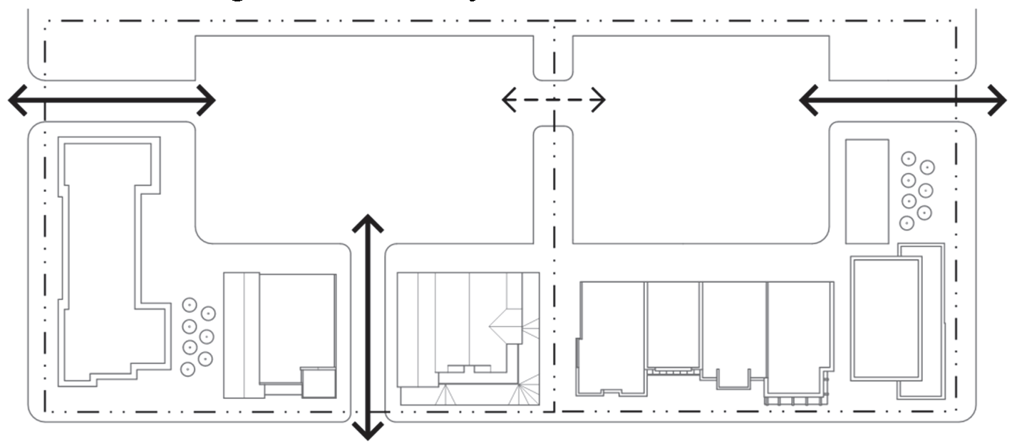
Figure 040-10: Parking Lot Connectivity
3.
Unobstructed, direct, and convenient access for vehicles to and from a public street shall be provided for all off-street parking spaces. Access from any parking area to a public street shall be designed according to the Engineering Standards.
4.
Roadway extensions and connections to abutting properties shall be spaced at intervals along each principal boundary direction (north, south, east, west) that do not exceed the maximum block length established by City standards.
5.
An extension or connection of a public street roadway and right-of-way to an abutting property shall also include the extension or connection of associated bikeways or sidewalks.
6.
The Director and/or the City Engineer may require the provision of a temporary turnaround at the end of a roadway extension on determining that the turnaround is needed to facilitate traffic flow or accommodate emergency vehicles pending the roadway's connection to other roadways.
7.
The Director and/or the City Engineer may waive or modify the requirements or standards for extension or connection of a public roadway from or to abutting property on determining that such extension is impractical or undesirable because it would:
i.
Require crossing a significant physical barrier or environmentally sensitive area (e.g., railroads, watercourses, floodplains, wetlands, steep slopes);
ii.
Require the extension or connection of a proposed internal public street to an abutting property with existing development whose design makes it unlikely that the street will ever be part of a network of public streets (for example, the abutting existing development has no public streets, or there are no "stubbed-out" street rights-of-way or open corridors between the proposed development site and public streets in the abutting development to accommodate a current or future extension or connection);
iii.
Require the extension or connection of a proposed internal public street to an abutting property owned by a government or public utility to which vehicular access is restricted, or other property to which vehicular access is restricted by a conservation easement; or
iv.
Require the extension or connection of a proposed internal public street to an abutting property that is developed or zoned for a use whose level and type of generated traffic would be incompatible with the proposed development—provided, however, that residential, institutional, and commercial uses shall generally be deemed compatible.
c.
Cross Access between Abutting Development. To facilitate vehicular access between abutting developments, encourage shared parking, and minimize access points along streets, new single-family townhouse, multifamily, nonresidential, and mixed-use development shall comply with the following standards:
1.
The internal vehicular circulation system shall be designed to allow for vehicular cross-access between the development's common vehicle use areas and common vehicle use areas in an abutting single-family townhouse, multifamily, nonresidential, or mixed-use development, or to the boundary of abutting vacant land zoned to allow single-family townhouse, multifamily, nonresidential or mixed-use development.
2.
Required vehicular cross access between the abutting lots shall be provided through the use of a service street (if the lots front on a major thoroughfare right-of-way), a single two-way driveway or drive aisle, or two (2) one-way driveways or aisles that are sufficiently wide to accommodate traffic by automobiles, service vehicles, loading vehicles, and emergency vehicles.
3.
The Director, in conjunction with the City Engineer, may waive or modify the requirement for vehicular cross access on determining that such cross access is impractical or undesirable because it would require crossing a significant physical barrier or environmentally sensitive area (for example, railroad, watercourse, floodplain, wetlands, steep slopes), or would create unsafe conditions or impeded the application of other design requirements in this Code.
4.
Easements allowing cross access to and from properties served by a vehicular cross-access, along with agreements defining maintenance responsibilities of property owners, shall be recorded with the County Clerk and Recorder's Office before issuance of a Building Permit for the development.
d.
Culs-de-Sac and Dead-End Streets Discouraged. Permanent culs-de-sac and dead-end streets shall generally be used only when topography, the presence of natural features, and/or vehicular safety factors make a vehicular connection impractical. Such culs-de-sac and dead-end streets shall comply with the City's Engineering Standards.
(5)
Driveways and Access.
a.
General.
1.
Every lot shall have access that is sufficient to afford a reasonable means of ingress and egress for emergency vehicles, as well as for those needing access to the property in its intended use.
2.
All driveway entrances and other openings onto streets shall be constructed so that:
i.
Vehicles may safely enter and exit from the lot in question;
ii.
Interference with the free and convenient flow of traffic in abutting or surrounding streets is minimized; and
iii.
Joint driveways are desirable whenever possible in order to minimize the number of access points to streets and access easements.
b.
Residential. In addition to the above general requirements, all residential development shall be subject to the following:
1.
There shall be no direct driveway access (ingress or egress) from any single-family residential lots to any arterial street or highway unless no other legal access alternative is available.
2.
Multi-family development sites greater than five (5) acres shall include a minimum of two (2) through-access drives. An exception may be made where a site is landlocked by existing development or other physical constraints, or where existing natural features on the site require the use of protective measures that would otherwise make a second access drive infeasible.
c.
Nonresidential. In addition to the above general requirements, all nonresidential development shall be subject to the following:
1.
All non-residential buildings, structures, and parking and loading areas shall be physically separated from all non-arterial or collector streets by vertical curbs and other suitable barriers and landscaping to prevent unchanneled motor vehicle access. Each property shall not have more than two (2) access ways to any one (1) street unless approved by the City Engineer.
2.
Each access shall comply with the City's Engineering Standards.
d.
Access onto State Highways. As provided by C.R.S. § 43-2-147, as amended, any development requiring access onto a state highway shall obtain a permit for such access from the Colorado Department of Transportation before the issuance of a development permit by the City. Any development with the potential to increase volume on a state highway by twenty (20) percent or more may also be referred to the Colorado Department of Transportation for comment, at the discretion of the City Engineer or Director.
(f)
Pedestrian Circulation.
(1)
Sidewalks Required.
a.
Where Required.
1.
Sidewalks shall be provided by the developer to allow convenient pedestrian access through or across the development and joining with pedestrian ways of adjacent properties.
2.
Sidewalks shall be installed on both sides of all arterials, collector streets, and local streets (including loop streets and culs-de-sac), and within and along the frontage of all new development and redevelopment, excluding those redevelopments with building elevation changes that involve fifty (50) percent or less of the exterior walls of a roofed building within a two-year period, commencing upon the issuance of the building or other required permit, structural additions of less than five hundred (500) square feet on a single lot, and/or building elevation changes that are for the purpose of minor cosmetic maintenance.
b.
Fee in Lieu of Sidewalks. Where the existing right-of-way adjacent to a development is substandard or insufficient for providing a sidewalk according to the City Engineer, or where there is a discontinuity of the sidewalk system, the developer may, with approval by the City Engineer or Director, pay a fee in lieu of providing all or a portion of the required sidewalk. The amount of such in-lieu payment shall be set by City Council resolution. All fees paid pursuant to this section shall be deposited in a separate fund, which fund may be used to undertake future projects to accommodate pedestrian improvements. These fees may not be used for the general expenses of the City.
c.
Exemption. Sidewalks are not required on local streets in districts where the minimum lot size is one (1) acre or greater or in steep-slope areas where sidewalks on one (1) side of the street may be approved to reduce excessive slope disturbance, adverse impacts on natural resources, and potential soil erosion and draining problems according to the Director and/or the City Engineer, and on a limited list of local streets maintained in the Engineering Standards where the City has determined that one (1) or no sidewalk shall be installed.
d.
Design and Materials.
1.
Sidewalks shall conform to the City's Engineering Standards.
2.
Sidewalks shall be at least eight (8) feet wide in nonresidential and mixed-use zoning districts, and five (5) feet wide in residential zoning districts.
3.
Sidewalks shall be separated from the back edge of curb pursuant to the streetscape standards in Subsection 070.040.050(d).
4.
Alternative paving materials within residential developments may be approved by the Director and/or City Engineer.
(2)
On-Site Pedestrian Connections.
a.
All commercial, industrial, and multi-family development shall provide a network of safe, reasonably direct and convenient on-site pedestrian walkways with a minimum width of five (5) feet to and between the following areas:
1.
Entrances to each commercial and multi-family building on the site (including pad site buildings), parking areas, and open spaces;
2.
Public sidewalks or walkways on adjacent properties that extend to the boundaries shared with the subject development; and
3.
Adjacent public transit station areas, transit stops and shelters, public parks, greenways, schools, community centers, and shopping areas.
b.
On-site pedestrian walkways and crosswalks to motorists and pedestrians shall be identified through the use of one (1) or more of the following methods:
1.
Changing paving material, patterns, or paving color (does not include the painting of the paving material);
2.
Changing paving height;
3.
Decorative bollards;
4.
Raised median walkways with landscaped buffers;
5.
Stamped or stained concrete; and/or
6.
Distinct lighting.
c.
At least one (1) walkway within the development shall provide a direct link between the primary customer entrance and the sidewalk adjacent to the principal public right-of-way. Additional walkways may be required for developments on sites larger than two (2) acres.
d.
Walkways shall meet minimum requirements under the Americans with Disability Act: Standards for Accessible Design.
e.
For the comfort and convenience of pedestrians and customers, when designing walkways internal to the development, the City encourages the inclusion of landscaping treatments such as benches, trash receptacles, shade trees and/or other vegetative cover. A landscaped walkway will count towards general site landscaping requirements set forth in Section 070.040.050, Landscaping, Screening, and Fencing.
(g)
Bicycle Circulation.
(1)
Required Bicycle Access.
a.
All new development, except individual lot development of a single-family detached or two-family dwelling, shall be served by an internal bicycle circulation system (including shared roadway lanes, widened outside roadway lanes, bike lanes, shoulders, and/or separate bike paths) that permits safe, convenient, efficient, and orderly movement of bicyclists among the following origin and destination points within the development:
1.
Bicycle parking facilities or areas near the primary entrance(s) of principal buildings (or the buildable area of lots, for subdivisions), as well as any adjacent transit station areas, transit stops and shelters, public parks, greenways, schools, community centers, and shopping areas;
2.
Any designated or planned bus stops and shelters; and
3.
Recreation facilities and other common use area and amenities.
b.
The development's internal bicycle circulation system shall also permit safe, convenient, efficient, and orderly movement of vehicles between the development's internal origin and destination points and adjacent parts of an existing or planned external, community-wide bicycle circulation system, as well as any adjacent transit stations, bus stops and shelters, public parks, trails, greenways, schools, community centers, and shopping areas.
c.
Sidewalks shall not be used to satisfy the bicycle circulation requirement.
(2)
Bike Lanes Required.
a.
All new development except individual lot development of a single-family detached or two-family dwelling (including subdivisions for such dwellings) shall provide bike lanes within the development site and along the frontage of the development site with an existing street where bikes lanes are called for by the comprehensive plan or other City-adopted plans addressing transportation (unless an existing bike lane meeting City standards is already in place). The Director and/or the City Engineer may allow alternatives to this requirement where compliance is impractical.
b.
Required bike lanes shall be provided within the right-of-way of the street unless the City Engineer determines that location within the right-of-way is not practicable or preferable—in which case, alternatives may be allowed by the Director and/or the City Engineer.
c.
Bike lanes shall conform to the Engineering Standards.
(Ord. No. 19-2018, § 2(Exh. A), 8-2-2018; Ord. No. 16-2019, § 2(Exh. A), 9-5-2019; Ord. No. 2-2020, § 2, 2-11-2020; Ord. No. 3-2021, § 2(Exh. A), 5-20-2021)
070.040.080 - Residential Site and Building Design.
(a)
Purpose. This Section is intended to:
(1)
Promote high-quality residential development and construction;
(2)
Protect the character of Glenwood Springs' established residential neighborhoods;
(3)
Promote new residential developments that are distinctive, have character, and relate and connect to established neighborhoods;
(4)
Encourage a variety of housing choices at varying affordability levels for Glenwood Springs residents;
(5)
Provide variety and visual interest in the exterior design of residential buildings;
(6)
Protect and enhance property values; and
(7)
Enhance the residential streetscape and diminish the prominence of garages and parking areas.
(b)
Applicability.
(1)
General.
a.
This Section shall apply to:
1.
Development, addition, or renovation, of any structure that will contain only residential uses, including single-family detached dwellings, two-family dwellings, single-family townhouse dwellings, and multi-family dwellings;
2.
An addition or renovation to an existing structure that will contain a residential use where the total gross floor area of the proposed addition is twenty (20) percent or more than that of the total gross floor area of the existing structure before addition or renovation; and
3.
Structures that are exclusively residential and are included as part of a multi-building mixed-use development.
b.
In cases where building modifications are subject to these standards, only the modification shall be subject to compliance with this Section. For purposes of this standard, "modifications" shall not include routine maintenance and repair of a building, changes to signage, or general repairs to a surface parking area, changes to landscaping, or other features on the parcel. The Director shall determine if a modification shall be subject to these standards.
c.
All standards in this Section 070.040.080 that apply to "multi-family" shall apply to multi-family dwellings and single-family townhouse dwellings.
(2)
Exceptions. This Section shall not apply to the following:
a.
Development of any structure that will contain a mix of nonresidential and residential uses (which are subject instead to Section 070.040.090, Nonresidential and Mixed-Use Site and Building Design), including live-work dwellings;
b.
An addition or renovation project, where the total gross floor area of the proposed addition is less than twenty (20) percent of the total gross floor area of the existing structure before addition or renovation except for Subsections 070.040.080(d(3), Surface Parking Configuration Locations, 070.040.080(d)(4), Refuse Containers, 070.040.080(e)(5), Four-sided Design, [and] 070.040.080(e)(6), Building Materials;
c.
Properties subject to the Hillside Development standards (Standards in Subsection 070.040.020(b), Hillside Development);
d.
Subdivision or condominiumization of existing structures;
e.
Properties subject to the Glenwood Meadows Annexation and Development Agreement except for Subsection 070.040.080(e)(3), Variety of Housing Types, for un-entitled residential projects as of the adoption of this Code; or
f.
Accessory dwelling units (which are subject to the standards in Subsection 070.030.040(d)(1), Accessory Dwelling Units).
(3)
Planned Unit Developments.
a.
Development of a residential structure within any new Planned Unit Development established after the effective date of this Code shall be subject to this Section 070.040.080, unless alternative residential site and building design standards are adopted as part of the PUD approval that, in the determination of the Director, are at least equal to the standards set forth in this Section.
b.
Development of a residential structure within an existing Planned Unit Development established prior to the effective date of this Code is exempt from this Section 070.040.080.
(c)
Administration.
(1)
Alternative Equivalent Compliance.
a.
Purpose and Scope. To encourage creative and unique design, "alternative equivalent compliance" allows development to occur in a manner that meets the intent of this Section, yet through an alternative design that does not strictly adhere to the Section's standards. This is not a general waiver of regulations. Rather, this authorizes a site-specific plan that is equal to or better than the strict application of the standard.
b.
Applicability. The alternative equivalent compliance procedure is available only for the standards in Subsection 070.040.080(e), Residential Building Design and Character, and Subsection 070.040.080(e)(10), Supplemental Architectural Design Standards: Downtown Core.
c.
Alternative Equivalent Compliance Meeting Required. An applicant proposing alternative equivalent compliance shall request and attend an alternative equivalent compliance meeting prior to submitting application materials for the applicable permit(s), to determine the preliminary response from the Director. Based on the response, the application shall include sufficient explanation and justification, in both written and graphic form, for the requested alternative compliance. The Director may require that the applicant provide additional drawings and/or material samples in order to better understand the need for the proposed alternative.
d.
Decision-Making Responsibility. Final approval of any proposed alternative compliance shall be the responsibility of the decision-making body responsible for deciding upon the application. Administratively approved projects proposing alternative compliance shall receive written approval of the alternative compliance from the Director.
e.
Criteria. Alternative equivalent compliance may be approved if the applicant demonstrates that following criteria have been met by the proposed alternative:
1.
Achieves the intent of the subject standard to the same or better degree than the subject standard;
2.
Advances the goals and policies of this Code to the same or better degree than the subject standard;
3.
Results in benefits to the community that are equivalent to or exceed benefits associated with the subject standard; and
4.
Imposes no greater impacts on adjacent properties than would occur through compliance with the specific requirements of this Code.
f.
Effect of Approval. Alternative equivalent compliance shall apply only to the specific site for which it is requested and shall not establish a precedent for approval of other requests.
(2)
Site/Architectural Plan Review Process.
a.
Review for compliance with these standards shall occur at the time of site/architectural plan review. Where site/architectural plan review is not required, review for compliance with these standards shall occur prior to issuance of a building permit.
b.
Interpretations as to applicability or design requirements contained within this Section shall be the responsibility of the Director. Appeals of the Director's interpretations shall be heard according to the process set forth in Subsection 070.060.070(c), Appeals.
(d)
Residential Site Design Standards.
(1)
General Intent. These residential site design standards are generally intended to:
a.
Encourage the use of creative site planning and design techniques that complement Glenwood Springs' unique topographic features;
b.
Protect the established character of the City's residential neighborhoods while allowing for the natural evolution of the City's neighborhoods through renovations, infill, and redevelopment;
c.
Reinforce and continue to allow the variation in streetscape character found in Glenwood Springs' neighborhoods;
d.
Protect the privacy and solar access of neighboring residents in areas where infill and redevelopment and higher-density development are likely to occur over time;
e.
Promote a more compact and pedestrian-friendly pattern of residential development, especially in mixed-use areas and along travel corridors that have traditionally been occupied by auto-oriented commercial development; and
f.
Reduce the visual impacts of surface parking on the City's street frontages.
(2)
Dimensional Standards.
a.
Front Yard Setbacks. For all residential development, front yard setbacks are based on the applicable zoning district and are set forth in Article 070.020: Zoning Districts.
b.
Side Yard Setbacks.
1.
For all residential development, side yard setbacks for primary structures are based on the applicable zoning district and are set forth in Article 070.020: Zoning Districts.
2.
Side yard setbacks for garages and other buildings accessory to residential uses shall be a minimum of five (5) feet, provided the garage does not exceed one (1) story in height. A zero-foot side setback may be used to accommodate a common garage that is shared across a side lot line. Garages that exceed one (1) story in height shall comply with the setback applicable to primary structures.
c.
Rear Yard Setbacks.
1.
For all residential development, rear yard setbacks are based on the applicable zoning district and are set forth in Article 070.020: Zoning Districts.
2.
An accessory structure may be located in a required rear yard setback, provided that not more than forty (40) percent of the rear yard setback area is covered. Such building shall observe a minimum ten-foot setback from the rear lot line when such line abuts an alley, or a seven and one-half-foot setback where there is no alley.
d.
Lot Coverage.
1.
Maximum Lot Coverage. For infill residential development, maximum lot coverage shall be fifty (50) percent of the total lot area, or twenty-five (25) percent above the existing lot coverage, whichever is less. For vacant lots, maximum lot coverage shall be fifty (50) percent of the total lot area.
Figure 040-11: Maximum Lot Coverage Example Calculations
2.
Lot Coverage in Sensitive Areas. In areas subject to Section 070.040.020, Sensitive Area Protection, lot coverage may be further limited by the establishment of limits of disturbance as required by Subsection 070.040.020(a)(4), Limits of Disturbance.
(3)
Surface Parking Configuration and Location.
a.
Generally.
1.
For all residential development, off-street parking within the front yard setback (not including parking within a driveway) is prohibited.
2.
For multi-building developments, surface parking lots shall be internalized in building groupings and located away from street frontages.
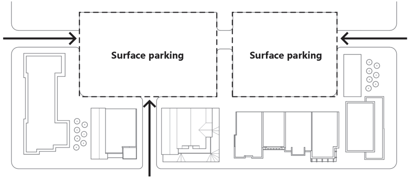
Figure 040-12: Surface Parking in Multi-Building Developments
3.
No parking space shall be located closer than five (5) feet from a window or door of a habitable structure.
b.
Additional Standards in the Downtown Core.
1.
Established parallel or diagonal parking configurations along downtown residential streets, along with associated tree lawns, shall be maintained in new developments to help buffer automobile traffic and provide a safe environment for pedestrians on the sidewalk.
2.
Off-street parking areas that do not connect to an alley are prohibited within residential neighborhoods, in order to minimize disruption to the single-family character of the neighborhood.
i.
If providing off-street parking is unavoidable for multi-family residential located in a residential neighborhood, it shall be located behind or to the side of the building.
ii.
New curb cuts and off-street parking and driveways located in front yard setbacks compromise the residential character of the street frontage and are prohibited.
3.
Front-loading garages are inconsistent with the historic character of downtown residential neighborhoods and are prohibited. New garages shall be set back from the primary structure and accessed from an alley.
(4)
Refuse Containers.
a.
General. Refuse containers shall comply with Article 100.010 of the Municipal Code.
b.
Design and Materials: Multi-family. Dumpsters and refuse containers shall be located within the footprint of a building, or shall meet the following standards:
1.
Dumpsters and refuse containers shall be located on a non-porous surface and within a four-sided, opaque enclosure that completely screens the dumpster or container and accumulated trash.
2.
Enclosures shall be a maximum of six (6) feet in height and shall have gated access for the collection of waste materials.
3.
Dumpster and refuse container enclosures shall incorporate compatible materials, colors, and architectural details that are compatible with the primary associated residential buildings.
4.
The use of chain-link fencing as screening is prohibited.
c.
Location: Multi-family. Enclosures shall be located to minimize visual and impacts and odors on the primary street frontage and neighboring residents to the maximum extent feasible.
(e)
Residential Building Design and Character.
(1)
General Intent. These residential building design standards are generally intended to:
a.
Promote context-sensitive infill and redevelopment that complements, rather than detracts, from the City's small-town character;
b.
Avoid repetitive patterns of residential development;
c.
Reinforce the diversity of architectural styles that exists within Glenwood Springs;
d.
Increase the predictability of infill and redevelopment requirements and resulting development for residents and the development community;
e.
Maximize the quality, value, and longevity of Glenwood Springs' neighborhoods through the use of durable materials that will minimize maintenance costs and improve the overall appearance of the development;
f.
Ensure that the massing and height of infill and redevelopment are compatible with neighboring residential development; and
g.
Reduce the visual impacts of street-oriented garages and promote a more pedestrian-friendly environment in Glenwood Springs' residential neighborhoods.
(2)
Building Orientation.
a.
Single-Family and Duplex Residential.
1.
The orientation of the primary entrance and façade of single-family and duplex residential dwellings shall be consistent with the established pattern along the block face.
2.
No single-family residential structure shall be sited diagonally or otherwise skewed on the lot.
b.
Multi-Family Residential.
1.
All units with frontage along the primary street shall have an entrance that faces the street. Multi-family buildings located with multiple street frontages, as would be typical on a corner lot or with larger developments on corner lots, shall provide entrances to units along each street frontage.
2.
To the maximum extent feasible, the primary entrance and façade of individual buildings within a multi-family development shall be oriented towards:
i.
Primary, internal or perimeter streets; or
ii.
Common open space, such as interior courtyards, parks, or on-site natural areas or features with a clearly defined and easily accessible pedestrian circulation system. (Figure 040-13)
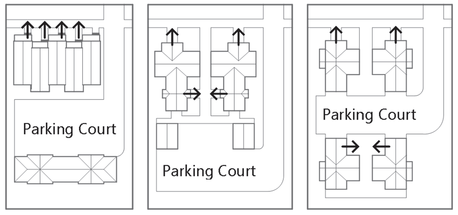
Figure 040-13: Building Orientation: Multi-Family
(3)
Variety of Housing Types.
a.
Development projects including twenty-five (25) or more units shall incorporate a minimum of two (2) housing types. Development projects with forty (40) or more units shall incorporate a minimum of three (3) housing types. Development projects with eighty (80) or more units shall incorporate a minimum of four (4) housing types. Each type must represent a minimum of twenty-five (25) percent of the total dwelling units provided unless otherwise indicated in the category below. Where a fractional number results, the number shall round up at 0.5 or higher. The following housing types may be used to satisfy these standards:
1.
Detached singly-family dwellings;
2.
Accessory dwelling units;
3.
Two-family dwellings;
4.
Single-family townhouse dwellings; or
5.
Multi-family dwellings other than two-family or townhouse dwellings.
6.
Live-work units.
7.
Inclusion of three (3) different bedroom count configurations. Each bedroom type shall be a minimum of ten (10) percent of the total dwelling units.
8.
One hundred (100) percent of units deed restricted for resident occupancy. Resident occupancy is defined in Glenwood Springs Community Housing Guidelines as adopted by City Council.
9.
Thirty-five (35) percent of the total number of units deed restricted to an average of one hundred (100) percent area median income.
b.
Inclusionary Zoning. Developments required to provide deed restricted units in compliance with Subsection 070.045, Community and Workforce Housing, may count those units to meet the housing type percentages. Housing type units are also applicable for incentives identified in Subsection 070.045.080, Incentives for Residential Developments.
c.
Exceptions. Projects with twenty-five (25) to forty (40) units where one hundred (100) percent of the units are restricted at or below one hundred (100) percent area median income shall be exempt from Subparagraph (3)a. Projects with more than forty (40) units where one hundred (100) percent of the units are restricted at or below one hundred (100) percent area median income shall only be required to provide two (2) housing types.
d.
Fee in-Lieu of Providing Housing Variety.
1.
In lieu of providing the required housing variety in accordance with Subsection 070.040.080(e)(3), the developer may, with the approval of the City Council make a payment to the City in lieu of providing all or a portion of the required housing variety types.
2.
The amount of such in-lieu payment shall be set by City Council resolution.
3.
The City shall deposit any in-lieu fee into a special fund that shall be used only for the acquisition or development of affordable, or workforce housing, including buy-down acquisitions of market-rate units. These fees shall not be used for the general expenses of the City.
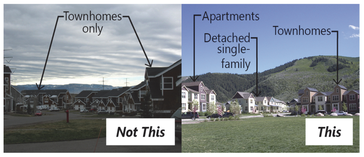
Figure 040-14: Variety of Housing Types
(4)
Architectural Variety. A continuous row of identical homes or multi-family buildings along a block is prohibited. Individual structures shall be differentiated through distinctions in the architectural features required in Subsection (5)c. below in combination with requirements for varied garage orientation in Subsection (9) below, Garages. (Figure 040-15) This provision is not intended to prohibit a row of attached townhouses, provided that each individual unit is architecturally distinguished from adjacent units through distinctions in the architectural features required in Subsection (5)c. below.
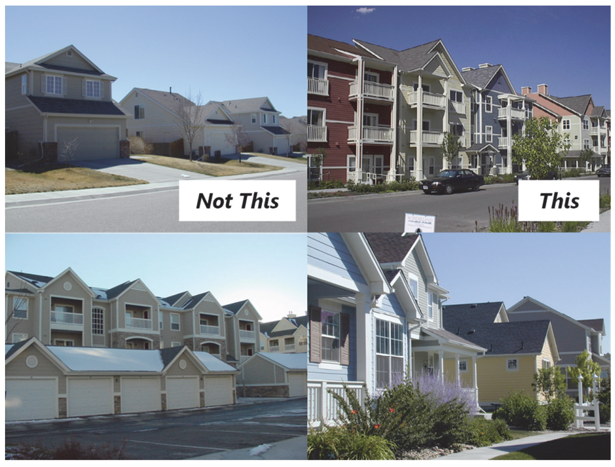
Figure 040-15: Architectural Variety
(5)
Four-Sided Design.
a.
Although the front facade of a building is expected to be the primary focal point in terms of level of architectural character and features, all sides of a residential building shall incorporate architectural detailing that complements the front facade and provides visual interest. Blank walls void of architectural detailing are prohibited except where required by the fire code. (Figure 040-16)
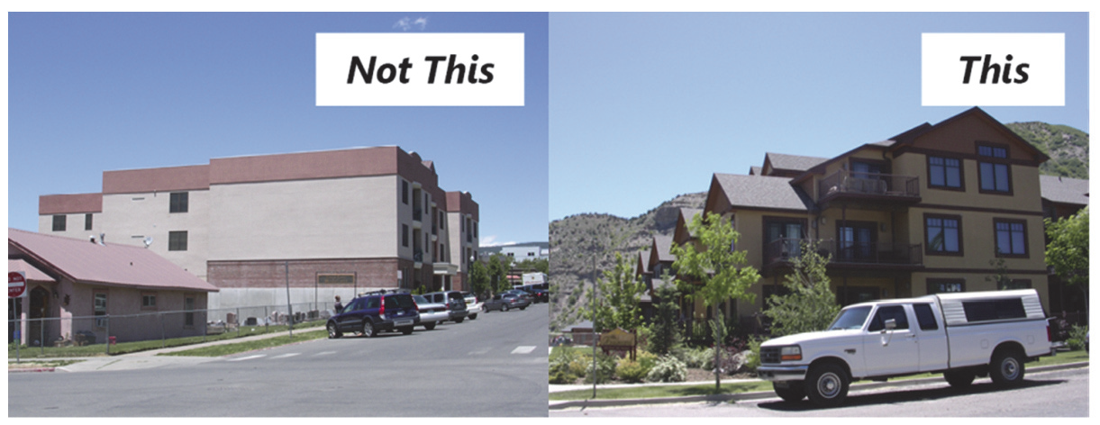
Figure 040-16: Four-Sided Design
b.
For the purposes of satisfying this standard, a minimum number of the architectural features listed below shall be incorporated into the overall design on each side of the building.
1.
For each single-family residential structure, a minimum of three (3) different architectural features; and
2.
For each multi-family residential structure, a minimum of five (5) different architectural features.
c.
Architectural features appropriate for achieving the standard in Paragraph b. above may include:
1.
Covered porches;
2.
Balconies,
3.
Prominent entry features;
4.
Windows;
5.
Door openings,
6.
Distinct variations in color (not a slight variation of a similar hue, such as beige or pastel);
7.
Variations in materials;
8.
Variations in building height;
9.
Variation in roof form;
10.
Dormers;
11.
Projected or recessed building walls; or
12.
Another architectural feature as approved by the Director.
(6)
Building Materials.
a.
Primary Materials.
1.
Primary building materials shall be selected for their ability to withstand Glenwood Springs' variable mountain climate. Materials with demonstrated durability include, but are not limited to:
i.
Brick;
ii.
Stone;
iii.
Cementitous siding products;
iv.
Wood and log construction;
v.
Cast concrete; or
vi.
Other comparable materials as approved by the Director.
2.
Exterior Insulation and Finish Systems (EIFS) shall not be utilized in high-traffic areas, such as at primary building entrances, where it may be easily damaged.
b.
Accent Materials. The creative use of accent building materials to provide variety and visual interest is encouraged.
(7)
Building Colors (Multi-Family Only).
a.
The predominant exterior colors on multi-family buildings shall be earth tones to minimize the visual impact of these buildings.
b.
Darker accent colors shall be utilized on garage door surfaces to minimize their visual prominence.
c.
White or other highly reflective colors are prohibited.
d.
The use of bright or highly reflective metal finishes shall be limited to accent materials.
(8)
Transitions to Existing Residential. Any new residential structure that will be located adjacent to an existing residential dwelling or residential zoning district shall comply with the standards in this Subsection, in addition to complying with all other general residential design standards above.
a.
Minimization of Use Impacts. New residential development shall be designed to minimize impacts on existing homes and the privacy of residents to the maximum extent feasible by:
1.
Locating off-street surface parking lots, loading, and service areas away from a shared property line and screening them from neighboring residences;
2.
Locating sources of audible noise (e.g., heating and air conditioning units) away from building facades that face lower intensity uses;
3.
Placing windows on the new development so as to maintain privacy by avoiding direct lines of sight into neighboring homes; and
4.
Orienting porches, balconies, and other outdoor living spaces away from neighboring homes.
b.
Height Transitions. A new building with a height that exceeds that of an adjacent existing dwelling by one (1) story or more shall provide a transition using at least three (3) of the following techniques: (Figure 040-17)
1.
"Stepping down" building height and mass along the shared property line to meet the height of the existing neighboring home along a minimum of fifty (50) percent of the new building's length. The "stepped-down" portion of the new building shall be a minimum of ten (10) feet in width and depth. This option is available only where the existing residential building is located along the property line adjacent to the new building;
2.
Providing variations in the side building wall and/or roof form so that new structures have a comparable scale as neighboring homes along the shared property line;
3.
Utilizing a roof pitch and overhang similar to that of the neighboring structures; and
4.
Utilizing dormers and sloping roofs to accommodate upper stories.
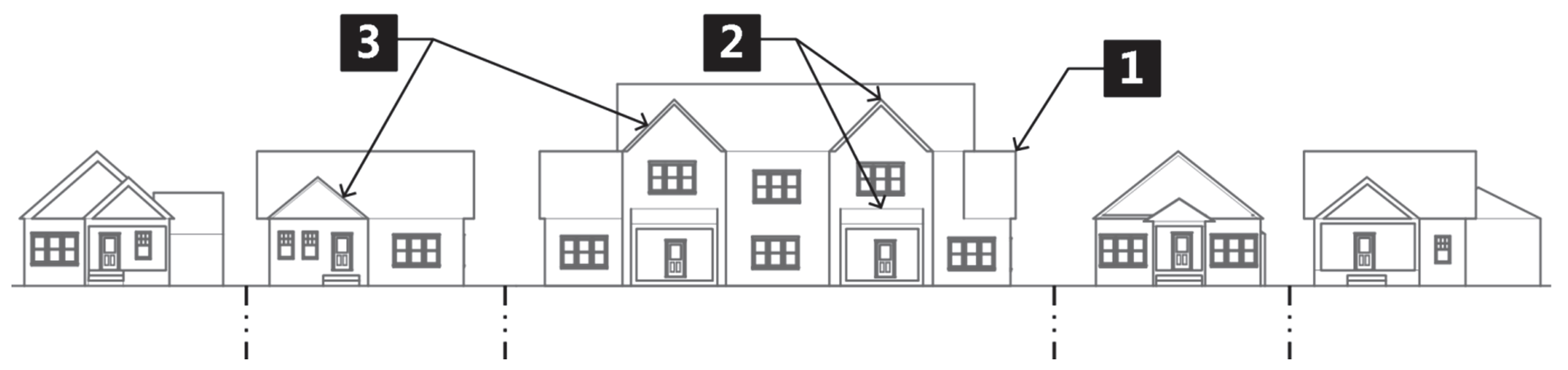
Figure 040-17: Height Transitions
c.
Massing and Form: (Multi-Family Only). Multi-family development located on a block face where more than seventy-five (75) percent of existing homes are single family shall employ one (1) or more of the following techniques to help reduce the overall bulk and mass of individual buildings and help maintain a lower-intensity residential character along the street frontage: (Figure 040-18)
1.
Breaking up the mass of the multi-family building by stepping back the façade (minimum two (2) feet deep and one (1) foot feet wide) for every thirty (30) feet of building frontage, so that the building appears from the street to be separate homes;
2.
Organizing units around a central courtyard that maintains the impression of the traditional side yard setback between units along the street frontage; or
3.
Designing the multi-family building so that the massing, arrangement of architectural elements, and use of exterior materials gives the appearance of a large single-family home.
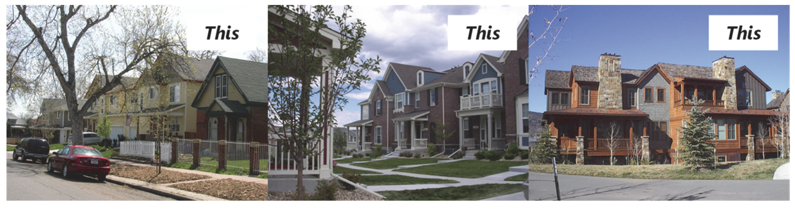
Figure 040-18: Massing and Form (Multi-Family Only)
(9)
Garages, Storage and Accessory Structures.
a.
Alley-oriented Garages. Where an alley exists, new garages serving new residential development shall be located at the rear of the lot and accessed from the alley.
b.
Street-oriented Garages.
1.
For single-family residential dwellings, street-oriented garages shall not comprise more than fifty (50) percent of the front width of the front façade.
2.
For all residential development, garages that protrude towards the street in front of the primary façade of the structure are prohibited. All street-oriented garages shall be either: (Figure 040-19)
i.
Recessed a minimum of ten (10) feet behind the front façade of the dwelling portion of the structure (including side-oriented garages) or a front porch or porte-cochere that is a minimum of five (5) feet deep by eight (8) feet long, or
ii.
Recessed a minimum of two (2) feet beneath a second floor bay or balcony that extends the length of the garage door(s), roof overhang, or decorative roof element.
3.
Where attached garages are provided for multi-family dwellings, landscaped islands or peninsulas shall be provided between every two (2) units' garage doors unless the soils or geotechnical report does not permit landscaping near the foundation. Such islands or peninsulas shall have minimum dimensions of four (4) feet wide by ten (10) feet in length.
4.
Other garage configurations may be warranted by site constraints, such as topographic features and/or access limitations, and may be administratively approved as determined by the Director.
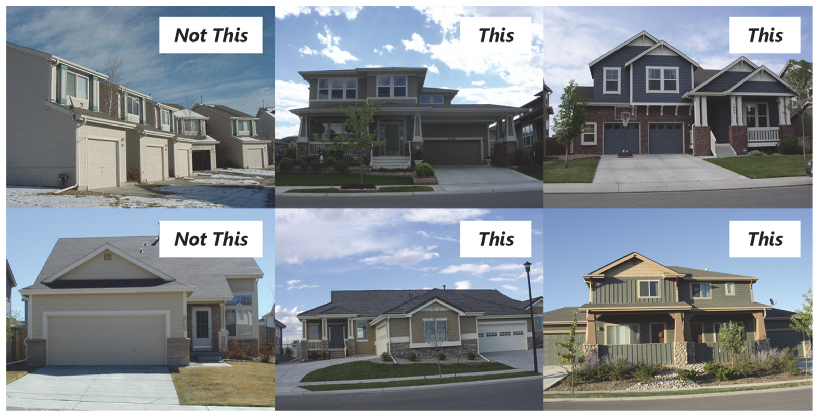
Figure 040-19: Street-Oriented Garages
c.
Additional Garage Standards for Multi-Family.
1.
Garage Variety and Location.
i.
Residential developments with five (5) or more units shall incorporate a variety of garage configurations (e.g., street-oriented, side-loaded, alley-loaded, tandem) to minimize the visual impact resulting from long, uninterrupted rows of garages.
ii.
For multi-building developments, garage entries shall be internalized in building groupings and located away from street frontages or accessed using an alley.
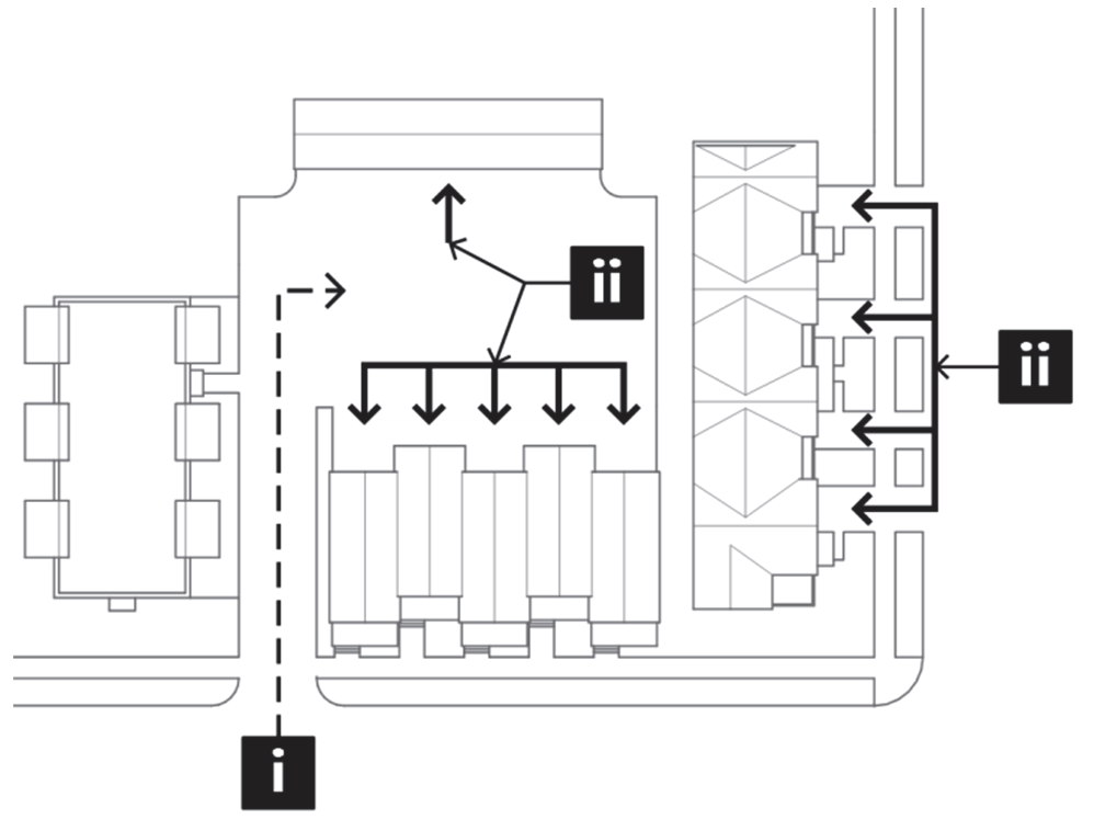
Figure 040-20: Garage Variety
and Orientation
2.
Tuck-Under Garages. Tuck-under garages for multi-family residential buildings shall be recessed a minimum of one (1) foot beneath a second floor bay or balcony that extends the length of the garage door(s).
3.
Free-standing Garage Structures. Free-standing garage structures that have four (4) or more two-car garage bays and/or exceed ninety (90) feet in length shall incorporate one (1) or more of the following to break up their appearance and increase their functionality: (Figure 040-21)
i.
Dwelling units above designated garage spaces;
ii.
Storage facilities above designated garage spaces; or
iii.
A 'green' or living roof on sites with varied topography, where:
a.
Free-standing garage structures may be "tucked" into or are adjacent to a slope; or
b.
Where roof surfaces are clearly visible from residences or a public right-of-way above.
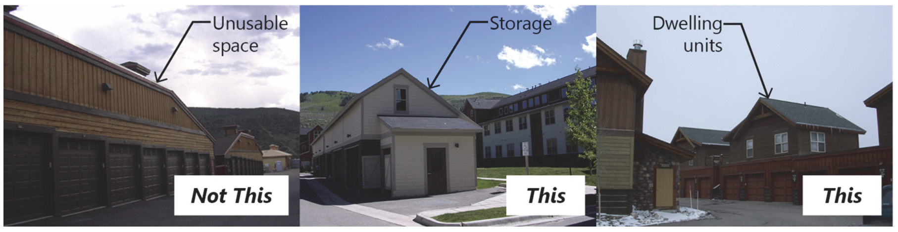
Figure 040-21: Free-Standing Garage Structures - Multi-Family
d.
Other Accessory Buildings. For multi-family development, free-standing garages and other accessory structures (including but not limited to grouped mailboxes, storage and maintenance facilities, recreational facilities, picnic shelters, and gazebos) shall incorporate materials, scale, colors, architectural details, and roof slopes that are compatible with the primary multi-family buildings, except that flat and shed roofs are prohibited.
e.
Storage Space. Multi-family developments shall provide a minimum of one (1) cubic foot of enclosed storage space per three (3) square feet gross floor area per unit. Storage may be provided through one (1) or more of the following:
1.
Increased garage dimensions that allow for storage in front of parked vehicles;
2.
Storage units incorporated above detached garage structures or within the multi-family building;
3.
Storage closets within units, not including bedroom closets, kitchen cabinets, and food storage areas; or
4.
Detached storage buildings or sheds.
(10)
Supplemental Architectural Design Standards: Downtown Core. In addition to complying with the above standards that are generally applicable to all residential development, development of any residential structure in the Downtown Core shall comply with the following standards. For the purposes of evaluating the surrounding neighborhood context for these standards, consideration shall be given to predominant characteristics of existing structures along the same block face of the subject application. Where any standards in this Subsection conflict with the standards generally applicable to all residential development, the standards in this Subsection shall control.
a.
Building Height, Scale, Massing, and Form. New structures and additions shall be simple rectangular forms similar to those found historically. A similarity of building forms contributes to the visual continuity of downtown residential neighborhoods. New structures shall maintain a similar lot coverage and width of existing homes along the same block face to respect the traditional single-family scale of downtown neighborhoods.
b.
Building Additions.
1.
Additions shall be distinguishable from the original building through subtle changes in material or construction techniques.
2.
Additions shall appear visually subordinate to the original building.
3.
When additions taller than the main building are necessary, they shall be set back from the front façade.
c.
Architectural Details.
1.
Projects shall incorporate architectural details compatible with the existing historic buildings in the surrounding neighborhoods.
2.
All elevations on new buildings shall be articulated with windows, insets and other architectural details compatible with the character of surrounding development.
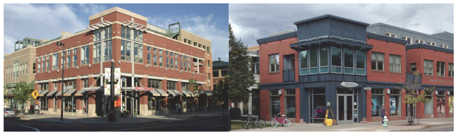
Figure 040-22: Architectural Details
3.
Solid walls without windows on any side of a structure are prohibited, except where required by the fire code.
4.
Multi-family dwellings in the Downtown Core shall have the appearance of being a single-family dwelling, with similar structural proportions, window spacing, and decorative elements. Building fronts of new multi-family developments shall include articulations such as bays, insets and porches traditionally found on historic homes in the Downtown Core. For purposes of this Section, "historic homes" includes individual landmarks, contributing properties to designated historic districts, and properties that are eligible for listing in the National Register of Historic Places.
5.
Roof forms shall appear similar to those seen traditionally in downtown neighborhoods (Figure 040-23).
i.
Sloping roofs such as shed, gabled, and hipped roofs with a minimum roof pitch of 6:12 are appropriate roof forms.
ii.
Flat or mansard rooflines as a primary roof form detract from the neighborhood's visual continuity and shall not be used. The Director may consider exceptions for proposed new structures that will replicate historic styles such as Art Deco or Moderne, which have flat roofs.
Figure 040-23: Roof Forms
d.
Building Materials.
1.
Exterior wall finishes for new buildings shall utilize building materials similar in scale, texture, and finish to those found on historic homes within the Downtown Core. New materials of similar scale, texture, and finish are also appropriate.
2.
Horizontal clapboard siding or brick is appropriate for use in residential infill projects.
3.
The use of decorative shingles shall be limited to use on dormers or in gables.
e.
Color.
1.
White, off-white, fluorescent, metallic, or other high-intensity colors are prohibited.
2.
The use of bright or highly reflective metal finishes shall be limited to accent materials.
(Ord. No. 19-2018, § 2(Exh. A), 8-2-2018; Ord. No. 8-2020, § 2(Exh. A), 5-7-2020; Ord. No. 15-2020, § 2(Exh. A), 7-2-2020; Ord. No. 3-2021, § 2(Exh. A), 5-20-2021; Ord. No. 10-2023, § 2(Exh. A), 7-6-2023)
070.040.090 - Nonresidential and Mixed-Use Site and Building Design.
(a)
Purpose. This Section is intended to promote high-quality building design and is intended to:
(1)
Protect and enhance the visual interest, character, and quality of nonresidential and mixed-use areas;
(2)
Ensure compatibility between residential neighborhoods and adjacent commercial and mixed-use areas;
(3)
Mitigate negative impacts created by the scale and bulk of large buildings;
(4)
Promote an environment that is friendly toward multiple modes of transportation and accommodates varying ages and abilities; and
(5)
Protect and enhance property values and encourage further investment and reinvestment.
(b)
Applicability.
(1)
General Applicability. This Section shall apply to the following:
a.
Development of any structure that will contain a nonresidential use or a mix of nonresidential and residential uses; and
b.
An addition or renovation to an existing structure that will contain a nonresidential use where the total gross floor area of the proposed addition is twenty (20) percent or more than that of the total gross floor area of the existing structure before addition or renovation. In cases where modifications are subject to these standards, only the modification shall be subject to compliance with this Section. For purposes of this standard, "modifications" shall not include routine maintenance and repair of a building, changes to signage, or general repairs to a surface parking area, changes to landscaping, or other features on the parcel. The Director shall determine if a modification shall be subject to these standards.
(2)
Exemptions. This Section shall not apply to the following:
a.
An addition or renovation project to an existing structure that will contain a nonresidential use where the total gross floor area of the proposed addition is less than twenty (20) percent of the total gross floor area of the existing structure before addition or renovation; and
b.
Properties subject to the Glenwood Meadows Annexation and Development Agreement.
(3)
Special Review Uses. All nonresidential special review uses located within the zone districts enumerated in Article 070.030: Use Regulations, shall comply with this Section 070.040.090, in addition to any special review use performance standards of the applicable zone district, and the general special review approval criteria in Subsection 070.060.050(e)(3)e.2.
(4)
Planned Unit Developments.
a.
Development of a nonresidential or mixed-use structure within any new Planned Unit Development established after the effective date of this Code shall be subject to this Section, unless alternative nonresidential/mixed-use site and building design standards are adopted as part of the PUD approval that, in the determination of the Director, are at least equal to the standards set forth in this Section.
b.
Development of a residential structure within an existing Planned Unit Development established prior to the effective date of this Code is exempt from this Section.
(c)
Administration.
(1)
Site/Architectural Plan Review Process.
a.
Review for compliance with these standards shall occur at the time of site/architectural plan review. Where site/architectural plan review is not required, review for compliance with these standards shall occur prior to issuance of a building permit.
b.
Interpretations as to applicability or design requirements contained within this Section shall be the responsibility of the Director. Appeals of the Director's interpretations shall be heard according to the process set forth in Subsection 070.060.070(c), Appeals.
(2)
Alternative Equivalent Compliance.
a.
Purpose and Scope. To encourage creative and unique design, "alternative equivalent compliance" allows development to occur in a manner that meets the intent of this Section, yet through an alternative design that does not strictly adhere to the Section's standards. This is not a general waiver of regulations. Rather, this authorizes a site-specific plan that is equal to or better than the strict application of the standard.
b.
Applicability. The alternative equivalent compliance procedure is available only for the standards in Section 070.040.090, Nonresidential and Mixed-Use Site and Building Design.
c.
Alternative Equivalent Compliance Meeting Required. An applicant proposing alternative equivalent compliance shall request and attend an alternative equivalent compliance meeting prior to submitting application materials for the applicable permit(s), to determine the preliminary response from the Director. Based on the response, the application shall include sufficient explanation and justification, in both written and graphic form, for the requested alternative compliance. The Director may require that the applicant provide additional drawings and/or material samples in order to better understand the need for the proposed alternative.
d.
Decision-Making Responsibility. Final approval of any proposed alternative compliance shall be the responsibility of the decision-making body responsible for deciding upon the application. Administratively approved projects proposing alternative compliance shall receive written approval of the alternative compliance from the Director.
e.
Criteria. Alternative equivalent compliance may be approved if the applicant demonstrates that following criteria have been met by the proposed alternative:
1.
Achieves the intent of the subject standard to the same or better degree than the subject standard;
2.
Advances the goals and policies of this Code to the same or better degree than the subject standard;
3.
Results in benefits to the community that are equivalent to or exceed benefits associated with the subject standard; and
4.
Imposes no greater impacts on adjacent properties than would occur through compliance with the specific requirements of this Code.
f.
Effect of Approval. Alternative equivalent compliance shall apply only to the specific site for which it is requested and shall not establish a precedent for approval of other requests.
(d)
Nonresidential and Mixed-Use Site Design Standards.
(1)
General Intent. The general intent of these site design standards is to:
a.
Ensure development relates to the physical characteristics of the site;
b.
Ensure building scale, orientation, and design relates to the surrounding uses and streets, and creates a cohesive visual identity and an attractive street scene;
c.
Ensure site design for efficient pedestrian, bicycle, transit, and vehicular circulation patterns, and create a high-quality pedestrian environment;
d.
Promote design environments built to "human scale," which means that buildings and objects are designed in size and shape to be optimized for pedestrian use;
e.
Ensure delivery, trash, and loading facilities are located so as not to impede regular vehicular and pedestrian circulation and access routes; and
f.
Ensure safe and efficient access between buildings and parking areas.
(2)
Building Organization and Location.
a.
Building Orientation. Buildings shall be sited parallel to public rights-of-way, to the maximum extent practicable.
b.
Climatic Conditions. Local climatic conditions shall be considered when designing the orientation of new buildings. For example, north-facing facades are especially susceptible to winter snow and ice accumulation, and entries may require special treatment. Snow shed from roofs and snowpiling zones along streets shall be considered in arranging building elements on the site. Adequate solar access shall be considered when planning outdoor spaces, with shade and relief from glare provided by landscaping and overhead structures.
c.
Primary Entrance.
1.
The primary entrances to a building shall be clearly identified.
2.
Buildings shall be oriented so that the principal building entrance faces the principal street or the street providing main access to the site.
3.
Where there are multiple buildings on a development parcel, at least one (1) building shall be oriented with an entrance facing the principal street or the street providing main access to the site.
4.
A corner site may orient its primary entry towards the corner for emphasis.
d.
Corner Lots.
1.
Scale and Massing. Structures shall relate to the scale and massing of the buildings on each of the respective streets.
2.
Building Entries. When a structure is located on a corner lot, prominent entries shall be designed for both façades along the street edge or a single prominent entry shall be turned forty-five (45) degrees to face the corner. The primary entrance shall not be oriented to an interior court.
3.
Courtyards. When designing interior courtyards for buildings on corner lots, a minimal amount of street frontage shall be utilized. Courtyards shall not extend across the entire front of the property. Instead, a building shall be located flush with the property line on the street side.
4.
Focal Points.
i.
To visually and physically anchor street intersections, buildings located on corner lots shall provide a focal point within a box formed from lines extending thirty (30) feet away from intersecting property lines. The focal point shall include one (1) or more of the following elements:
a.
A primary building. In the case where a primary building includes drive-in and/or drive-through lanes, or gasoline pumping bays, the bays and/or queuing lanes shall not be located within the focal point.
b.
Decorative architectural wall that is between thirty (30) and thirty-six (36) inches tall and complies with any other sight distance triangle restrictions in Subsection 070.020.200(c)(5), Sight Distance Triangle Requirement.
c.
An architectural feature that is a minimum of the height of the building and a maximum of the height restriction for the zoning district (for example, a clock tower, spire, or other decorative roof form). These architectural features shall not contain signs or logos in any form.
d.
Public art or sculpture within a landscaped area.
e.
Fountains or other water feature within a landscaped area.
f.
Public plaza or open space with landscaping, a low decorative wall to visually and physically separate the space from nearby traffic lanes, and other pedestrian-oriented amenities such as benches. The low decorative wall shall match or complement the building exterior in materials and colors.
ii.
Signs may be located within this focal point area provided that they are incorporated with another focal point element enumerated above. Signs shall comply with Section 070.040.110, Signs.
iii.
For all focal point options, the sufficiency of proposed pedestrian-oriented amenities and landscaping shall be determined by the Director. All such features shall meet all applicable requirements of this Code, including but not limited to the general landscaping, building materials and color, and signage standards.
iv.
The Alternative Equivalent Compliance process in Subsection 070.040.090(c)(2) may be used to consider alternatives from this requirement where strict compliance would result in unsafe or inadequate access, where the lot has less than fifty (50) linear feet of frontage, and/or where the site has unique topographical characteristics that make it infeasible to locate at least one (1) of the listed focal point elements. (Figure 040-24)
Figure 040-24: Focal Points
(3)
Surface Parking Configuration and Location.
a.
In the mixed-use and other nonresidential districts, except in the Downtown Core, no more than thirty (30) percent of the total number of off-street parking spaces provided shall be located between the principal building and the front property line.
b.
No parking space shall be located closer than five (5) feet from a window or door of a habitable structure.
c.
No portion of a parking space, loading space, or maneuvering area shall be provided in any required landscape area, sidewalk, or other pedestrian or bicycle path.
d.
Surface parking shall not be located in a focal point area.
(4)
Parking Structures. The visual impacts of a parking structure shall be minimized through compliance with the standards in Subsection 070.040.060(h)(8), Parking Structures.
(5)
Refuse Containers.
a.
General. Refuse containers shall comply with Article 100.010 of the Municipal Code.
b.
Design and Materials. Dumpsters and refuse containers shall be located within the footprint of a building, or shall meet the following standards:
1.
Dumpsters and refuse containers shall be located on a non-porous surface and within a four-sided, opaque enclosure that completely screens the dumpster or container and accumulated trash.
2.
Enclosures shall be a maximum of six (6) feet in height and shall have gated access for the collection of waste materials.
3.
Dumpster and refuse container enclosures shall incorporate compatible materials, colors, and architectural details that are compatible with the primary associated residential buildings.
4.
The use of chain-link fencing as screening is prohibited.
c.
Location. Enclosures shall be located to minimize visual and impacts and odors on the primary street frontage and neighboring properties and uses to the maximum extent feasible.
(6)
Supplemental Site Design Standards: Downtown Core. Development of any nonresidential or mixed-use structure in the Downtown Core shall comply with the general site layout and building design standards set forth above, plus the standards of this Subsection.
a.
Building Edge to Sidewalk. A minimum of seventy-five (75) percent of the building edge shall be located adjacent to the sidewalk edge (e.g., zero setback). (Figure 040-25)
Figure 040-25: Zero Setback
b.
Building Entrances. The building entrance shall appear similar in scale and character to those used historically, both in the location of the building entrance and also in how the entrance area is distinguished from the rest of building by materials, size, projections or recessions, and other techniques.
(e)
Nonresidential and Mixed-Use Building Design Standards.
(1)
General Intent.
a.
The general intent of these building design standards is to encourage creative design that:
1.
Preserves Glenwood Springs' small-town atmosphere;
2.
Enhances the visual and physical qualities of Glenwood Springs;
3.
Considers how the building relates to the site, neighboring properties, and the community;
4.
Provides strong pedestrian orientation by visually connecting the building's interior with the public exterior;
5.
Creates prominent, well-proportioned customer entrances;
6.
Uses high quality, long lasting materials with a proven ability to withstand Glenwood Springs' environment;
7.
Promote building designs and construction practices that are sustainable and adaptable to multiple uses for extended building lifecycles; and
8.
Incorporates a palette of colors that adds visual interest to the development parcel and that is compatible with the surrounding natural environment.
b.
The general intent of these building design standards is to discourage:
1.
Buildings that are out of scale or have little physical or visual connection to the street, neighboring properties, or the community;
2.
Building elements, materials, and colors that are out of character with the community, that are inherently associated with brand identification, or that are designed to function as signs;
3.
Minimal or no physical pedestrian connections between the building and public street; and/or
4.
Large expanses of blank, flat wall surfaces.
(2)
Building Elevations.
a.
Horizontal and Vertical Articulation Required. No building elevation, regardless of exterior wall plane setback or the location of interior walls, shall exceed thirty (30) feet in length without incorporating at least three (3) of the following elements:
1.
Projections, recessions, or reveals such as, but not limited to, columns, pilasters, cornices, and bays, and having a change of wall plane that is a minimum of twenty-four (24) inches in depth and that has the effect of casting shadows;
2.
Glazed windows and doors, if used to comply with this standard shall comprise not less than thirty (30) percent of the elevation of which they are a part. See also Subsection 070.040.090(e)(3), Windows, Doors, and Customer Entrances, for additional requirements;
3.
Change in texture and/or masonry pattern;
4.
Change in building, parapet, or roofline height. If used to comply with this standard, the minimum change in roofline shall be two (2) feet; and/or
5.
Awnings, canopies, or marquees extending at least four (4) feet beyond the building face.
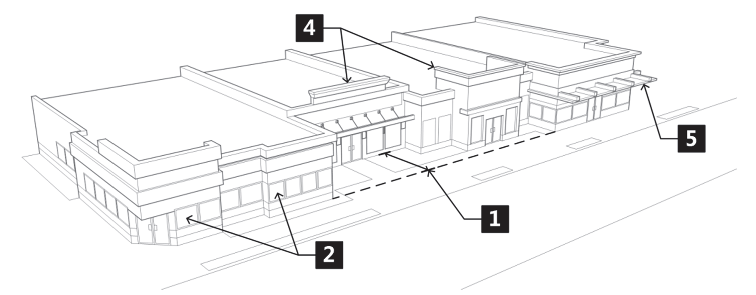
Figure 040-26: Horizontal and Vertical Articulation
Annotations correspond with paragraph numbers in the preceding text.
b.
Alternative Designs. An equivalent design that provides pedestrian interest by dividing the façade into horizontal and vertical planes and is in proportion to the height and width of the entire building may be approved through the Alternative Equivalent Compliance process. However, design elements used to fulfill this standard shall not consist solely of color variations.
c.
Building Design as Signage. Building elevations and/or elements used to comply with these standards shall not function as signs. The incorporation of certain design elements that are unique or symbolic of a particular business shall be unobtrusive and secondary to the overall architectural design.
d.
Building Elevations Facing Public Rights-of-Way. Building elevations that face public rights-of-way, parking lots, or adjacent residential land uses shall include glazed windows and doors as one (1) of the required elements enumerated in Paragraph a. above. See also Subsection 070.040.090(e)(3), Windows, Doors, and Customer Entrances, for additional requirements.
e.
False Windows and Doors. Building elevations not adjacent to residential land uses, public rights-of-way, or parking lots, or that do not have a customer entrance, may use false windows and/or doors to fulfill the requirement in Paragraph a. above. The windows and/or doors, whether functional, false, or a combination of functional and false windows and/or doors, shall make up a minimum of thirty (30) percent of the elevation of which they are a part and shall have a minimum six-inch change of wall plane from the primary wall in order to provide shadow or sense of depth.
(3)
Windows, Doors, and Customer Entrances.
a.
In order to create a sense of transparency and to visually connect the building's interior with the public exterior, primary and secondary customer entrances shall be clearly defined, highly visible and feature a minimum of two (2) of the following treatments:
1.
Recessions and/or projections with a minimum change in wall plane of twenty-four (24) inches;
2.
Display windows that are located immediately adjacent to the customer entrance and that are in proportion to the overall façade of which they are a part;
3.
Canopies, porticos, overhangs, awnings, or marquees with a minimum projection of four (4) feet and of a width that at minimum spans the customer entrance;
4.
Raised, corniced parapets located over the customer entrance with a minimum projection of four (4) feet and that span at least the width of the customer entrance door; or
5.
Outdoor patios with customer seating and landscaping that at a minimum includes perennials, shrub plantings, and/or ornamental trees. Landscaping provided to meet this standard shall be credited towards the general minimum landscaping requirements as set forth in Section 070.040.050, Landscaping, Screening, and Fencing.
b.
To preserve views and to provide a clear sense of connection into and out of the building, window and door glazing shall be transparent or have a low-reflectivity. Mirror-like windows are prohibited.
(4)
Roofs.
a.
To reduce the visual impact of roof mass, no roofline along any building elevation shall exceed fifty (50) feet in length without a visual variation that incorporates:
1.
Projections, recessions, dormers that alter the vertical or horizontal plane of the roof by at least two (2) feet; or
2.
Change in roof height of at least two (2) feet; or
3.
Another architectural feature approved through the Alternative Equivalent Compliance process.
b.
Mansard roofs, or roofs having a mansard-like appearance, are prohibited.
c.
Flat roofs shall be concealed by parapets that are in proportion to the overall building design and that are generally of sufficient height to conceal rooftop mechanical systems that are in view from public rights-of-way, residential land uses, public parking areas, and/or adjacent properties. Parapets shall not exceed the maximum building height as established in Article 070.020: Zoning Districts, except where allowed by Subsection 070.020.200(d)(2), Exceptions to Height Requirements.
(5)
Building Materials.
a.
Primary Exterior Wall Materials. Building materials shall be high-quality and long-lasting and shall have a proven ability to withstand Glenwood Springs' intense sunlight and temperature extremes. The primary exterior building wall material, consisting of at least seventy (70) percent of the elevation to which it is applied, shall be one (1) or more of the following:
1.
Brick;
2.
Natural and cultured stone;
3.
Wood;
4.
Stucco, including synthetic stucco;
5.
Metal, excluding metal with exposed rivets, seams or fasteners, ribs and batons; or
6.
Concrete, excluding smooth-faced gray concrete block, painted concrete block and pre-cast ribbed concrete panels.
7.
Another material that meets the intent of this standard if approved through the Alternative Equivalent Compliance process.
b.
Accent Exterior Wall Materials. Exterior building walls shall consist of one (1) or more of the following materials provided that the sum total of the materials enumerated below comprise no more than thirty (30) percent of the elevation to which it is applied:
1.
Smooth-faced gray concrete block, painted concrete block, or pre-cast ribbed concrete panels. However, when used in combination with the allowance above for concrete as a primary exterior wall material, the concrete in its entirety may not exceed seventy (70) percent of the elevation to which it is applied.
2.
Metal with exposed seams, rivets or fasteners, ribs and batons. However, when used in combination with the allowance above for metal as a primary exterior wall material, the metal in its entirety may not exceed seventy (70) percent of the elevation to which it is applied.
3.
Glass, when used as a curtain wall or when designed to span multiple floors.
c.
Exterior Wall Materials Generally.
1.
All sides of the building shall be constructed using materials that are compatible with, or of equal or greater quality, as those used on elevations with customer entrances, facing public rights-of-way, or surface parking areas.
2.
Highly reflective building materials shall not be used.
d.
Roofing Materials.
1.
Acceptable roofing material includes the following:
i.
Rubber membrane or EPDM (ethylene propylene diene monomer).
ii.
Built up or modified bitumen roofing systems.
iii.
Asphalt shingles.
iv.
Metal, standing seam.
v.
Clay tile.
vi.
Another material approved through the Alternative Equivalent Compliance process.
2.
Roofing materials shall not include corrugated metal panels.
(6)
Building and Roofing Colors.
a.
Color and intensity of color proposed for all exterior building and roofing materials, including exposed rooftop mechanical systems such as HVAC equipment, roof vents, air handling/exchange units, shall be warm or dark earth-toned colors with low reflectivity.
b.
Exterior building and roofing colors shall not include white, off-white, high-intensity primary colors, and/or fluorescent colors.
(7)
Variety of Housing Types (Mixed-Use Only).
a.
Development projects including twenty-five (25) or more residential units within a mixed-use development shall incorporate a minimum of two (2) housing types. Development projects with forty (40) or more units shall incorporate a minimum of three (3) housing types. Development projects with eighty (80) or more units shall incorporate a minimum of four (4) housing types. Each type must represent a minimum of twenty-five (25) percent of the total dwelling units provided unless otherwise indicated in the category below. Where a fractional number results the number shall round up at 0.5 or higher. The following housing types may be used to satisfy these standards:
1.
Detached single-family dwellings;
2.
Two-family dwellings;
3.
Single-family townhouse dwellings; or
4.
Multi-family dwellings other than two-family or townhouse dwellings;
5.
Live-work units;
6.
Inclusion of three (3) different bedroom count configurations. Each bedroom type shall be a minimum of ten (10) percent of the total dwelling units;
7.
One hundred (100) percent of units deed restricted for resident occupancy. Resident occupancy is defined in Glenwood Springs Community Housing Guidelines as adopted by City Council; or
8.
Thirty-five (35) percent of the total number of units deed restricted to an average of one hundred (100) percent area median income.
b.
Inclusionary Zoning. Developments required to provide deed restricted units in compliance with Subsection 070.045, Community and Workforce Housing, may count those units to meet the housing type percentages. Housing-type units are also applicable for incentives identified in Subsection 070.045.080, Incentives for Residential Developments.
c.
Exceptions. Projects with twenty-five (25) to forty (40) units where one hundred (100) percent of the units are restricted at or below one hundred (100) percent area median income shall be exempt from Subsection (3)a. Projects with more than forty (40) units where one hundred (100) percent of the units are restricted at or below one hundred (100) percent area median income shall only be required to provide two (2) housing types.
d.
Fee-in-Lieu of Providing Housing Variety.
1.
In lieu of providing the required housing variety in accordance with Subsection 070.040.080(e)(3), the developer may, with the approval of the City Council make a payment to the City in lieu of providing all or a portion of the required housing variety types.
2.
The amount of such in-lieu payment shall be set by City Council resolution.
3.
The City shall deposit any in-lieu fee into a special fund that shall be used only for the acquisition or development of affordable, or workforce housing, including buy-down acquisitions of market-rate units. These fees shall not be used for the general expenses of the City.
(8)
Supplemental Building Design Standards: Downtown Core. Setbacks, orientation, and heights of new buildings in the Downtown Core shall be similar to those found on the same block face and shall comply with the following additional standards:
a.
Building Scale and Massing.
1.
Building scale and massing shall respect the scale and massing of existing buildings along the block face.
2.
The height of new buildings shall vary as follows:
i.
Variation shall be used in building roof and parapet heights to add visual interest and reduce boxy or monolithic building masses.
ii.
Upper floors of a large building mass shall be stepped back from the street or an adjacent residential zone to reduce looming effect.
iii.
Step back distances and proportions shall be varied to avoid monotonous, uniform, tiered "wedding cake" appearance.
3.
Featureless backs of buildings shall not be located adjacent to the Roaring Fork or Colorado River. To encourage active uses in this area, all design standards applicable to street frontage structures shall also be applicable to the back of a building in this area.
b.
Building Height.
1.
Floor heights in new buildings shall be similar to those of existing historic buildings in the downtown commercial core. (Figure 040-27)
i.
The level of the first floor shall be at or near grade level at the entrance.
ii.
The first floor shall appear to be a full floor in height.
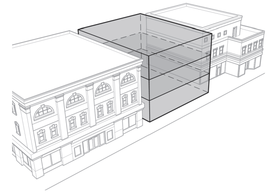
Figure 040-27: Building Floor Heights
2.
Structures directly adjacent to residential buildings shall "step-down" in height on the abutting edge to match the height of the adjacent structure.
c.
Roof Design.
1.
The alignment of horizontal elements along the block face, including parapets and cornices, shall be maintained along the entire façade to provide a continuous visual line along the block.
i.
This alignment occurs most successfully when buildings are similar in height.
ii.
Window sills and moldings are examples of other building elements that shall be aligned.
2.
The primary roof form shall appear to be flat, as traditionally found on the City's downtown commercial structures. A parapet shall conceal roofs.
3.
Roof design shall be consistent with those of historic buildings in the commercial Downtown Core.
4.
Roofs are encouraged to be activated with decks or vegetation. Roof decks are appropriate to take advantage of views. Green roofs, or "living roofs," are appropriate to bring visual interest to highly visible roofs, as well as contribute to sustainability principles.
5.
Roofs shall be designed to manage snowfall, using methods that appropriately prevent injuries from snow or ice falling from buildings.
6.
Monolithic roof design is not appropriate. See also requirements under Building Articulation.
d.
Building Articulation.
1.
Vertical and horizontal articulation techniques shall be used to establish a sense of scale in the design of a larger building. Articulation techniques include, but are not limited to:
i.
Wall offsets;
ii.
Step backs;
iii.
Base, middle, and cap design; and
iv.
Variation in material (Figure 040-28).
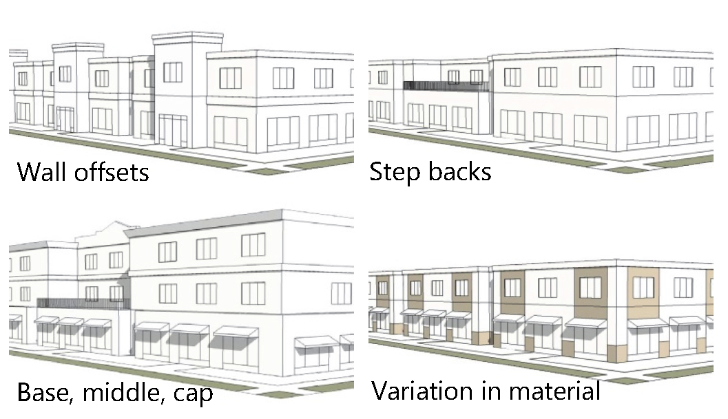
Figure 040-28: Building Articulation Techniques
2.
Vertical articulation shall be used to express traditional façade widths were a new larger building is adjacent to existing, smaller-scale buildings.
3.
To minimize apparent mass, new buildings shall be divided into bays through projections and/or recesses (minimum two (2) feet deep and one (1) foot wide) at a minimum of every twenty-five (25) feet in order to be compatible with the character of historic building frontages. Civic structures may vary in front width and shall be reviewed on an individual basis for compatibility.
4.
Buildings shall have a clearly articulated architectural distinction between the street level and upper floors, expressed through detailing, changes in materials, and fenestration. One (1) or more belt courses shall be used to help distinguish between floors.
e.
Floor Distinctions. Buildings shall have a clearly articulated architectural distinction between the street level and upper floors, expressed through detailing, changes in materials, and fenestration. One (1) or more belt courses shall be used to help distinguish between floors.
f.
Commercial-Oriented Building Design.
1.
The ground-level street frontage of every nonresidential and mixed-use building in the Downtown Core shall be primarily dedicated to commercial uses.
2.
New commercial storefront buildings shall incorporate the following character-defining elements: (Figure 040-29)
i.
Display windows: The main portion of glass on the storefront.
ii.
Glass transom: The upper portion of the display, separated from the main display window by a frame.
iii.
Kickplate: Found beneath the display window. Sometimes called a bulk-head panel.
iv.
Upper-story windows: Windows located above the street level. These usually have a vertical orientation, and appear to be less transparent than the large expanse of glass in the storefront below.
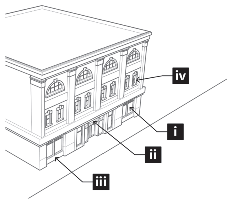
Figure 040-29: Commercial-Oriented Building Design
Annotations correspond with paragraph numbers in the preceding text.
g.
Windows and Transparency.
1.
Windows shall be located and spaced to express the rhythm and visual continuity found in historic buildings in the Downtown Core.
i.
Horizontal spacing shall be consistent between windows on a floor.
ii.
Windows shall be vertically aligned on upper and lower floors.
2.
The size and proportion of windows shall be in the range of heights and width as found in historic buildings in the Downtown Core.
3.
The first floor of the primary façade shall be sixty-five (65) to eighty (80) percent transparent glass.
4.
Windows shall be designed windows to create depth and shadow on a façade.
i.
Upper floors shall be perceived as being more opaque than the lower floor.
ii.
Highly reflective or darkly tinted glass is prohibited.
h.
Building Entry.
1.
The primary building entrance shall be recessed; doors that are flush with the sidewalk are prohibited.
2.
Doors shall be made of at least forty (40) percent glass.
3.
Accent colors shall be used on the door(s) to encourage pedestrian activity.
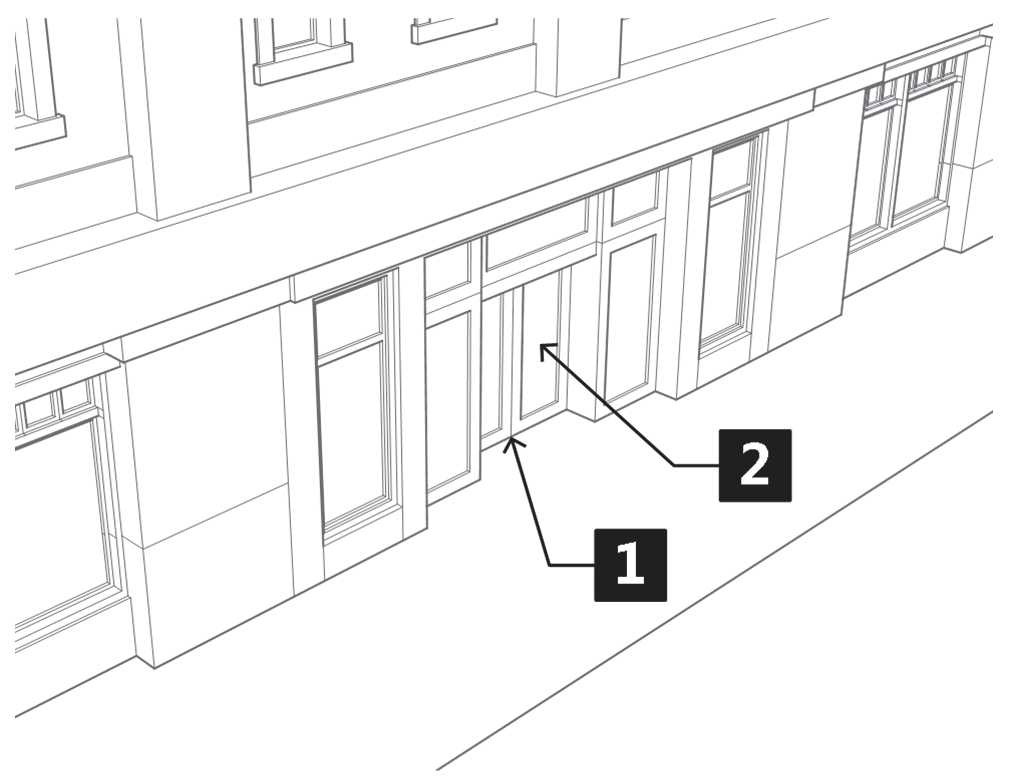
Figure 040-30: Commercial-Oriented Building Design
Annotations correspond with paragraph numbers in the preceding text.
i.
Awnings, Canopies, and Marquees.
1.
Awnings and canopies shall be canvas with a matte finish. Awnings with high gloss finishes are prohibited. Marquees may by constructed in metal but shall be painted or shall have a matte finish.
2.
Rigid frame awnings and canopies may be used, but shall stop at the top section and shall not be included in the valance.
3.
Illuminated, plastic awnings and canopies are prohibited.
4.
Awning and canopy colors shall be compatible with the overall color scheme of the façade. Solid colors or subtle striped patterns shall be used.
5.
Awnings and canopies for rectangular openings shall be simple shed shapes. Rounded or bull-nose awnings and canopies shall only be allowed over arched openings.
6.
Marquees shall be located only over the primary public entrance into a building.
7.
Awnings, canopies, or marquees that span continuously across more than one (1) structural bay or storefront shall not be allowed.
8.
Poles or posts supporting awnings, canopies, or marquees shall not be allowed.
9.
Awnings, canopies, or marquees shall not project more than five (5) feet from the building façade to which they are attached.
10.
Awnings, canopies, or marquees shall maintain an eight-foot height clearance above a public sidewalk, or other publically owned space. Additional height clearance may be required if an awning, canopy, or marquee is located over a public right-of-way, including an alley way.
j.
Building Materials and Colors.
1.
Primary materials shall be similar in character to those used traditionally on downtown commercial structures by complying with the following standards:
i.
Brick and masonry, known for their durability, were traditionally found on historic commercial structures in downtown. New materials shall demonstrate similar durability and compatibility. The use of split face concrete block is prohibited, but may be approved through the Alternative Equivalent Compliance procedure.
ii.
Diagonal wood siding shall not be used.
iii.
Cinder block is acceptable for interior walls, but shall not be used as an exposed material on building façades facing streets, alleys, or undeveloped lots.
2.
Accent materials shall be similar to those used historically. Wood was traditionally used for trim elements on commercial storefronts while stone, painted metal, terra cotta, ceramic tile, and rounded plaster were used in detailing.
(Ord. No. 19-2018, § 2(Exh. A), 8-2-2018; Ord. No. 3-2021, § 2(Exh. A), 5-20-2021; Ord. No. 9-2023, § 2, 10-26-2023; Ord. No. 10-2023, § 2(Exh. A), 7-6-2023)
070.040.100 - Exterior Lighting.
(a)
Purpose. The purpose of this Section is to provide for exterior lighting that enhances safety, preserves the City's nighttime character, and improves the ability to view the nighttime sky from within the City. This Section is intended to decrease light pollution, increase energy efficiency, and promote high quality lighting design as it relates to the built environment. The lighting regulations are also intended to:
(1)
Ensure that parking areas, public gathering places, and other public places have adequate outdoor illumination;
(2)
Ensure that light levels are uniform to enhance night vision and security;
(3)
Minimize adverse impacts on public safety and neighborhood enjoyment due to excessive glare;
(4)
Minimize spillover of light onto adjacent or nearby properties; and
(5)
Minimize the effects of skyglow.
(b)
Applicability.
(1)
General. All exterior lighting devices shall be installed in conformance with this Section 070.040.100, the building code, the electrical code, and other applicable City codes under appropriate permit and inspection.
(2)
Exemptions. The following types of exterior lighting are exempt from the requirements of this Section 070.040.100, provided they shall not create glare to motorists or result in light trespass onto adjacent properties:
a.
Holiday lighting;
b.
Twinkle lighting located on trees, bushes, or landscape features in the commercial zone district;
c.
Bistro lighting located in a commercial zone district; and
d.
Special events that have been issued a temporary use permit.
(c)
Lighting Districts Established. The City is divided into the following three (3) lighting districts within which specific standards and limitations are indicated throughout this Section:
(1)
Lighting District 1. The standards for this lighting district shall apply to the CO, M1, M3, I1, I2, and IN zoning districts.
(2)
Lighting District 2. The standards for this lighting district shall apply to the RH, RT, M2, and RE zoning districts.
(3)
Lighting District 3. The standards for this lighting district shall apply to the RR, RL, RM1, RM2, and HP zoning districts.
(d)
Demonstration of Compliance.
(1)
Lighting Plan Required. Unless expressly exempt from the lighting plan requirement in Paragraph (2), all new multifamily, mixed-use, or nonresidential developments shall provide a lighting plan with the applicable land use application and/or building permit.
(2)
Exempt from Lighting Plan Requirement. Properties in Lighting District 3 are exempt from the lighting plan requirement, provided:
a.
No more than one (1) freestanding lighting fixture (not attached to a building or structure) shall be installed; and
b.
Installed lighting meets the remaining standards of this Section.
(e)
Prohibited Lighting Types. The following types of exterior lighting are prohibited unless allowed elsewhere in this Code:
(1)
Unshielded lights, lamps, or floodlights that produce glare and light trespass in excess of that allowed in Table 040.10;
(2)
Lights affixed to the top of a roof, except where required by building code;
(3)
Lights that flash, move, revolve, blink, flicker, vary in intensity, change color, or use intermittent electrical pulsation, except for holiday lighting pursuant to Subsection 070.040.100(b)(2)a;
(4)
Mercury vapor and low-pressure sodium lighting;
(5)
Linear lighting as defined in Article 070.070: Rules of Construction and Definitions; and
(6)
Upward directed lighting that allows spillage into the sky.
(f)
General Lighting Requirements for All Lighting Districts.
(1)
On-Site Lighting Level. Maximum on-site illumination, including spillage from doorways, signs, and windows, shall not exceed ten (10) foot-candles, unless otherwise allowed in this Code.
(2)
Light Trespass.
a.
Maximum Allowed. The maximum measured light levels shall not exceed those provided in Table 040.10:
b.
Measurement.
1.
Methodology.
i.
Light trespass shall be measured at grade level unless otherwise noted. Two (2) measurements shall be taken: one (1) at any point along the property line (point A), and one (1) taken ten (10) feet (measured perpendicular to property line) onto the property being trespassed (point B). Where grade changes or obstructions prohibit measurements at the same grade level, measurements shall be taken on the same horizontal plane.
ii.
Lighting measurements shall be taken under normal conditions. Measurements to determine compliance shall not be taken when conditions are present that will influence the outcome of measurements including snow, snowpack, rain, fog, or other influences.
2.
Cumulative Light Readings. Light sources from a property shall be measured as cumulative of all sources on the subject property, except for internally illuminated signs.
3.
Transitions between Lighting Districts.
i.
Where properties in District 1 are separated by City streets in District 2, the trespass levels shown in Table 040.10 may be exceeded on streets in the M2 zoning district only. Where M2 zoning is across the street from other zoning or lighting districts, the levels in Table 040.10 shall apply at the center line of the street.
ii.
The maximum light level for light trespass in any lighting district that borders a different lighting district shall be the lower of the two (2), along that border only. Where separated by a public street or right-of-way, the levels shall apply at the center line of the street adjacent to the light source.
(3)
Lighting Controls.
a.
Extinguish Lighting at Night. All exterior lighting, except lighting specifically exempted in Subsection 070.040.100(b)(2), Exemptions, and security lighting as provided for in Subsection 070.040.100(f)(5) below shall be extinguished one (1) hour after close of business, or 10:00 p.m., whichever is later.
b.
Motion Sensors. Motion sensors may be used where the sensor is triggered by activity within the property lines and shall only be used with incandescent, fluorescent, LED lighting, or halogen lamps.
c.
Timer/Photocell Combinations. Timer/Photocell combinations that activate the light source at dusk and turn off lighting at a specific time may be used at front entries for nonresidential uses.
(4)
Surface Parking Area Lighting.
a.
Fixtures. All lighting for surface parking lots and upper uncovered decks of parking structures shall be full cut-off fixtures.
b.
Standards. Parking area lighting shall comply with the standards in Table 040.11: Parking Area Lighting Standards:
1.
Parking Area Lighting in Lighting District 3. Parking area lighting shall be prohibited except for public or quasi-public facilities requiring exterior parking lot illumination. Such facilities shall comply with the parking area lighting standards for district 2 as indicated in Table 040.11: Parking Area Lighting Standards.
2.
Parking Areas Bordering Districts 2 and 3. Where a parking lot is located on a property in district 1 and shares a common lot line with a property located in districts 2 or 3, parking area lighting shall comply with specifications for light levels and pole heights for district 2 as indicated in Table 040.11: Parking Area Lighting Standards.
(5)
Security Lighting.
a.
Applicability. Security lighting shall be allowed in all lighting districts. The need for security lighting shall be demonstrated as part of any development permit application package.
b.
Standards.
1.
Examples of Appropriate Security Lighting Techniques.
i.
Recessed lights under a canopy.
ii.
Full cut-off fixtures on parking lot poles.
iii.
Fully shielded wall packs or other fixtures.
iv.
Floodlights that are down-directed, fully shielded, and are controlled by motion sensors.
2.
Fixtures.
i.
Security lighting fixtures shall be fully shielded and directed only to the designated area.
ii.
Security lighting shall not be directed above a horizontal plane through the top of the lighting fixture.
iii.
Security lighting fixtures shall include shields that prevent the light source from being visible from adjacent properties and roadways to the maximum extent practicable.
3.
Light Levels.
i.
Security lighting may illuminate ingresses and egresses of buildings up to a level eight (8) feet above grade or the bottom of doorways, windows, or entries, whichever is greater.
ii.
Security lighting on a parcel in district 1 that shares a common lot line with a parcel located in districts 2 or 3 shall comply with specifications for light levels and maximum mounting heights as noted in district 2.
iii.
Security lighting for entrances, stairways and loading docks shall not exceed five (5) foot-candles at the designated area illuminated. Parking lot lighting used for after-hours security shall not exceed three (3) foot-candles at the designated area illuminated.
(6)
Building Façade Lighting.
a.
Applicability.
1.
Lighting District 1. In lighting district 1, building façades may be illuminated if the illumination is part of the overall design of the building, adds to the visual quality of the surrounding neighborhood, and does not produce glare or illumination of nearby streets or properties. Building façades that face districts 2 and 3 that do not have a primary public entrance shall not be illuminated.
2.
Lighting Districts 2 and 3. In lighting districts 2 and 3 building façades and roofs shall not be illuminated except for those structures having exceptional symbolic or historic significance in the community or buildings in the M2 zoning district pursuant to Paragraph 3. below. Existing lighting on structures that are listed in the National Register of Historic Places are exempt from this Subsection.
3.
Building Lighting in the Downtown Core. In the Downtown Core, lighting shall be used as it was used historically in the area as follows:
i.
Low-scale, decorative lighting may be used to accent architectural details or building entries.
ii.
Lights shall not be focused upward to light the façade or used to dominate a façade or the street.
b.
Standards. A design for the illumination of a building shall be submitted with the lighting plan as part of the applicable development application and shall comply with the following:
1.
Lighting fixtures shall be carefully located, directed, and shielded so that light is directed only onto the building façade.
2.
Lighting fixtures shall not be directed towards streets or roads, other properties, or the sky.
(7)
Lighting of Walkways and Common Areas. Lighting for walkways, parks, and other common areas shall be illuminated to a minimum of two-tenths ( 2/10 ) of a foot-candle and a maximum of three (3) foot-candles. Such lighting shall be down-directed. Such lighting shall be included with the lighting plan submitted with an applicable development permit application.
(8)
Canopy Lighting for Automotive Fuel Sales and Service Station. Canopies shall be illuminated so that the minimum horizontal illuminance at grade level is at least five (5) foot-candles. The maximum horizontal illuminance under canopies shall be twenty-five (25) foot-candles.
a.
Light fixtures mounted on canopies shall be installed so that the lens cover is recessed or flush with the bottom surface (ceiling) of the canopy or the fixture.
b.
Lights shall not be mounted on the top or sides of the canopy. The sides (fascias) of the canopy shall not be illuminated for any purpose, with the exception of internally illuminated signage which shall comply with Subsection 070.040.110(g)(4)c., Internally Illuminated Signs.
(9)
Lighting of Outdoor Recreation and Entertainment Facilities.
a.
Hours of Operation. Exterior lighting of recreation or entertainment event facilities shall be turned off no later than one (1) hour after the end of the event.
b.
Illumination Standards. Where outdoor recreation and/or entertainment areas are to be illuminated, lighting fixtures shall be mounted and directed no higher than sixty-two (62) degrees up from vertical so that no direct illumination extends off the site.
(10)
Street Lighting.
a.
Applicability.
1.
Street lighting associated with a development application submitted pursuant to Article 070.060: Administration and Procedures, shall be provided by the applicant or developer and approved by the Electric Department Superintendent or the Director of the Public Works Department before installation.
2.
Street lights on private streets are required to be part of an overall lighting plan that is subject to the approval of the Electric Department Superintendent or the Director of the Public Works Department. If the Superintendent or Director determines that the expertise of a professional lighting consultant/engineer is required to determine compliance with this Subsection, the City shall have the option of hiring a professional lighting consultant, selected by the City, funded by the applicant or developer.
b.
Standards.
1.
IES Guidelines.
i.
Street lighting shall conform to the guidelines as published by the Illuminating Engineering Society (IES), provided that lighting levels do not exceed levels specified in the guidelines by more than two-tenths ( 2/10 ) of a foot-candle.
ii.
Uniformity ratios shall not exceed that suggested by the IES guidelines.
iii.
The lighting plan submitted with the applicable development permit shall include a street lighting plan that demonstrates compliance with IES standards for fixtures to be used; the type and wattage of lamps (bulbs); the proposed mounting heights; and spacing.
iv.
All street lighting fixtures shall be full cut-off fixtures.
v.
Bistro lighting shall not be allowed as street lighting for purposes of this Subsection.
2.
Mounting Height. Mounting heights shall not exceed sixteen (16) feet for fixtures that do not protrude over streets and thirty (30) feet for fixtures that do protrude over the street.
3.
Location.
i.
Street lights shall be located in the public right-of-way, except for street lights provided along private streets.
ii.
Streets with a sidewalk along only one (1) side of the street shall have street lights located on the same side of the street with the sidewalk.
(11)
Installation and Maintenance.
a.
Compliance with Building Code and other Applicable Codes. Exterior lighting fixtures shall comply with the building code and other applicable codes as adopted by the City.
b.
Maintenance. Exterior lighting shall be maintained in good structural condition at all times.
c.
Electrical Service Underground. New electrical service required for exterior lighting shall be located underground unless the fixtures are directly mounted on utility poles.
(g)
Supplemental Lighting Standards—District 1. The following supplemental standards shall apply to Lighting District 1:
(1)
Fixtures.
a.
Shielding. Fixtures shall be full cut-off.
b.
Decorative Fixtures. Low-wattage landscape lighting, bollards, and other hidden light sources that create hidden effects may be allowed as background lighting and in certain applications pursuant to Subsection 070.040.100(f)(7).
(2)
Height. Exterior lighting shall not exceed a maximum height of twelve (12) feet unless such lighting is:
a.
Street lighting provided by the City and/or a public entity;
b.
Used for parking and vehicle circulation areas, outdoor sales/display areas, security, or other types of lighting addressed elsewhere in this Section;
c.
Building-mounted lighting directed downward at a sign or building façade; or
d.
Fully shielded lighting on above-grade decks or balconies.
(h)
Supplemental Lighting Standards—Districts 2 and 3. The following supplemental standards shall apply to Lighting Districts 2 and 3:
(1)
Fixture Shielding.
a.
Freestanding fixtures shall be full cut-off.
b.
Floodlight fixtures and lamps shall be focused on the task, fully shielded, down-directed, and screened from adjacent properties to prevent glare and trespass pursuant to Table 040.10. Floodlight intensity shall not exceed two thousand (2,000) lumens per bulb and shall not exceed four thousand (4,000) lumens per fixture, with a maximum of two (2) bulbs per fixture.
c.
All other exterior fixtures shall be fully shielded or shall comply with the following:
1.
A fixture that allows light to escape above the horizontal (ninety (90) degrees from vertical) shall have frosted lenses or lamps and the total light output shall not exceed five hundred five (505) lumens.
2.
A fixture that does not allow light to escape above the horizontal shall have frosted lenses or lamps and the total light output shall not exceed seven hundred fifty (750) lumens.
(2)
Height. Freestanding exterior lighting shall not exceed twelve (12) feet in height. Parking lot lighting shall comply with Subsection 070.040.100(f)(4).
(3)
Common Area Entrances. Photocells may be used at entrances to common areas on multifamily residential properties.
(Ord. No. 19-2018, § 2(Exh. A), 8-2-2018; Ord. No. 3-2019, § 2(Exh. A), 1-31-2019; Ord. No. 3-2021, § 2(Exh. A), 5-20-2021)
070.040.110 - Signs.
(a)
Purpose.
(1)
The City Council recognizes that signs are necessary means of visual communication for the public convenience and that uses and activities have the right to identify themselves by using signs that are accessory and incidental to the use on the property where the signs are located.
(2)
The purpose of this Section is to:
a.
Minimize incompatibility between signs and their surroundings;
b.
Recognize distinct geographic districts within the City that possess unique characteristics of physical location, building design, land use patterns, and pedestrian and vehicle circulation;
c.
Provide for signs within reasonable limitations, consistent with the goals and objectives of the community, to retain the special character and economic advantages that rest largely on the quality of the community's appearance;
d.
Protect the public from hazardous conditions by prohibiting signs that are structurally unsafe or obscure, distract the vision of motorists, or compete or conflict with necessary traffic signs and warning signals;
e.
Eliminate hazards caused by the size and placement of signs and reduce the possibility of injuries to those coming near or under signs;
f.
Promote the health, safety and public welfare of the City, its residents and its visitors;
g.
Regulate signs in accordance with the City's policies and with the U.S. and Colorado Constitutions; and
h.
Protect the right to free speech by the display of messages on signs through content-neutral regulations.
(b)
Applicability.
(1)
All signs and support structures shall conform to the requirements of this Section and all other applicable provisions of this Code.
(2)
No sign shall be displayed, installed, constructed, altered, moved, or improved within the City limits until the City has issued a permit, unless the sign or sign activity is designated as not requiring a permit pursuant to Subsection 070.040.110(d).
(3)
All face changes, except those identified in Subsection 070.040.110(d)(1), require a permit.
(4)
Developments and/or properties with approved sign plans shall not be subject to these standards, except that the procedures for obtaining a sign permit shall apply.
(c)
Savings and Severability.
(1)
Signs containing noncommercial speech are permitted anywhere that advertising or business signs are permitted, subject to the same regulations applicable to such signs.
(2)
If any clause, subsection, or other part of the application of this Section shall be held by any court of competent jurisdiction to be unconstitutional or invalid, it is the intent of the City that such clause, subsection, or other part of the application of this Section shall be considered eliminated and not affecting the validity of the remaining clauses, sections, or applications remaining in full force and effect.
(d)
Signs Not Requiring a Sign Permit.
(1)
Sign Activities Not Requiring a Permit. The following sign activities shall not require a permit:
a.
The ordinary preventative maintenance of a lawfully existing sign that does not involve a change of placement, size, lighting, or height.
b.
The repainting of a lawfully existing sign.
c.
The changing of copy on marquees, reader boards, and similar changeable copy signs on permitted or existing legal nonconforming signs.
(2)
Balloons. Inflatable balloons shall not require a sign permit. Replica and/or synthetic balloons shall be considered a temporary sign and shall comply with the number, size, and location standards in Subsection 070.040.110(f)(4).
(3)
Development Site Signs. Development site signs shall be allowed without a sign permit subject to the following:
a.
Number Allowed. One (1) sign along each lot line frontage on a street, not to exceed a total of two (2) signs per frontage.
b.
Size. Development site signs shall not exceed thirty-two (32) square feet per sign.
c.
Location and Design. Development site signs:
1.
Shall not be located within ten (10) feet of any lot line unless attached to a development site barrier or fence; and
2.
Shall not be illuminated.
d.
Duration. Development site signs may be erected and maintained for a period not to exceed thirty (30) days prior to commencement of development activities and shall be removed within fourteen (14) days of termination of development activities.
(4)
Directional Signs. Directional signs shall be allowed without a sign permit pursuant to the following:
a.
Shall not exceed four (4) signs per property, plus one (1) sign per entryway from a public right-of-way;
b.
Shall not exceed four (4) square feet of sign area per face; and
c.
Shall not exceed forty-two (42) inches in height.
(5)
Feather Flags. Feather flags shall be allowed without a sign permit pursuant to the following:
a.
Shall not be located in the public right-of-way;
b.
Shall not be located in a sight distance triangle; and
c.
Shall be limited to three (3) per street frontage per property.
(6)
Flags. Flags, not including feather flags, shall be allowed without a sign permit pursuant to the following:
a.
Flags shall be affixed to a flagpole or affixed to a building;
b.
The height of all flagpoles shall not exceed the allowed building height in the applicable zoning district; and
c.
Flags shall not exceed forty (40) square feet.
(7)
Gas Pump and External Vending Machine Signs. Signs on gas pump islands and external vending machines shall be allowed without a sign permit provided the total signage on each gas pump island or external vending machine does not exceed sixteen (16) square feet.
(8)
Historic Designation Signs. Signs placed on an historic building identifying the structure as a local, state, or federal historic landmark shall be allowed without a sign permit pursuant to the following:
a.
Shall be affixed to the wall of the historic building or property; and
b.
Shall not exceed six (6) square feet.
(9)
Historic Signs. Any sign designated as an historic landmark by the City Council shall be allowed without a sign permit pursuant to the following:
a.
General.
1.
Any sign designated as an historic landmark by the City Council pursuant to Article 070.050: Historic Preservation, shall be exempt from the nonconforming signs and dimensional standards of this Subsection.
2.
Historic signs will be debited against the total allowable signage for the building or use unless it is a ghost sign that does not pertain to the business or building upon which it exists.
b.
Historic Landmark Criteria. Alterations to signs that are designated historic landmarks shall be reviewed for compliance with the criteria in Subsection 070.050.040(f).
c.
Ghost Signs. Historic signs may include ghost signs.
d.
Attributes. An historic sign may be restored to its original condition and location with the exception of animation and flashing components, which are prohibited.
(10)
Holiday Decorations. Holiday decorations shall be allowed without a sign permit provided such decorations comply with Section 070.040.100, Exterior Lighting.
(11)
Home Occupation Signs. Home occupation signs shall be allowed without a sign permit but shall not exceed one (1) sign per property and shall not exceed a maximum sign area of six (6) square feet.
(12)
Incidental Vehicle Signs. Signs placed on or affixed to vehicles or trailers where the sign is incidental to the primary use of the vehicle or trailer shall be allowed without a sign permit provided they are not placed on or affixed to vehicles or trailers that are parked on a public right-of-way, public property, or private property so as to be visible from a public right-of-way.
(13)
Information Signs. Informational signs guiding persons to facilities intended to serve the public, provided as a courtesy to the public, and/or signs providing instruction to persons using a facility or property shall be allowed without a sign permit provided such signs do not exceed three (3) square feet.
(14)
Integral Signs. Any inscription carved into stone or similar material that is integral to a building, such as those commonly found on cornerstones, stamped into sidewalks, or identified by plaques or tablets, shall be allowed without a sign permit pursuant to the following:
a.
Shall not exceed four (4) square feet; and
b.
Shall not exceed six (6) feet in height.
(15)
Interior Signs. Signs located entirely within the interior of a building shall be allowed without a sign permit pursuant to the following:
a.
Shall not cover more than thirty (30) percent or eight (8) square feet, whichever is greater, of any window panel;
b.
Shall not be permanently affixed to any window surface; and
c.
Shall not contain flashing lights visible from a public street.
(16)
Nonvisible Signs. Signs that are not visible beyond the boundaries of the lot or parcel upon which they are located and/or from any public right-of-way shall be allowed without a sign permit. The Director shall determine whether such sign is visible from a public right-of-way.
(17)
Public Signs. Signs required or installed by or on behalf of the local and/or state government, or signs erected or required by other government agencies, utilities, or special districts, including address signs, signs for traffic, schools, safety, railroad crossing, wayfinding, historic interpretation signs, civic and special events, seasonal banners, public notices, and other official and legal notices, are exempt from the standards and permit requirements specified in this Section. Public signs shall be consistent with design standards in this Section to the extent practicable, and shall not include any signs prohibited pursuant to Subsection 070.040.110(e).
(18)
Temporary Off-Premises Directional Signs. Temporary off-premises directional signs shall be allowed without a permit pursuant to the following:
a.
Shall not exceed twenty-four (24) square feet of total temporary off-premises directional signage on any property;
b.
Shall not exceed a height of forty-two (42) inches;
c.
May be located within the public right-of-way provided such signs:
1.
Are not displayed for more than one (1) week before an event or more than one (1) week after an event;
2.
Are located within a planting strip when such planting strip exists;
3.
Do not obstruct any portion of a sidewalk or walkway;
4.
Are not located within a sight distance triangle; and
5.
Are not located in a median, roundabout, or any travel lane of any street or thoroughfare.
(19)
Wind Signs. Wind signs shall be allowed without a sign permit provided they are not animated or otherwise powered by any source other than the wind.
(20)
Window Signs. Signs displayed in or upon a window. Such displays shall not contain flashing lights visible from a public street.
(21)
Yard Signs.
a.
Yard signs are allowed without a sign permit pursuant to the following:
1.
In Residential Zoning Districts.
i.
Shall not exceed more than four (4) signs per property at any one (1) time;
ii.
Shall not exceed twenty-four (24) square feet total yard signage on any property;
iii.
Shall not exceed a height of forty-two (42) inches;
iv.
Shall not be located in the public right-of-way;
v.
Shall be located at least five (5) feet from any property line; and
vi.
Shall not be displayed for a period of more than ninety (90) days per calendar year.
2.
In All Other Zoning Districts.
i.
Shall not exceed more than four (4) signs per property at any one (1) time;
ii.
Shall not exceed twenty-four (24) square feet total yard signage on any property;
iii.
Shall not exceed a height of six (6) feet, or forty-two (42) inches if placed within a sight distance triangle;
iv.
Shall not be located in the public right-of-way; and
v.
Shall not be displayed for a period of more than ninety (90) days per calendar year.
(e)
Prohibited Signs. The following signs are expressly prohibited within all districts unless otherwise stated in this Section:
(1)
Distracting or Unsafe Signs. Any sign that:
a.
Is structurally unsafe or constitutes a hazard to safety or health by reason of inadequate maintenance or dilapidation;
b.
Is capable of causing electrical shocks to persons likely to come into contact with it;
c.
In any way obstructs the view of, or may be confused with an official traffic sign, signal or device or any other official government regulatory or informational sign;
d.
Uses any words, phrases, symbols, or characters implying the existence of danger or the need for stopping or maneuvering of a motor vehicle or creates, in any other way, an unsafe distraction for vehicle operators, bicyclists, or pedestrians, except as provided in Subsection 070.040.110(d)(2), Balloons.
e.
Obstructs the view of vehicle operators, bicyclists, or pedestrians entering a public roadway from any parking area, service drive, public driveway, alley, or other thoroughfare;
f.
Is located or painted on trees, rocks, retaining walls, fences, light poles, utility poles, or natural features, except where required by law or allowed by this Code;
g.
Causes any direct glare into or upon any public right-of-way, adjacent lot, or building other than the building to which the sign may be accessory;
h.
Create optical illusion of movement by means of a design that presents a pattern capable of reversible perspective, giving the illusion of motion or changing of copy; or
i.
Obstructs any window or door opening used as a means of egress, prevents free passage from one (1) part of a roof to any other part, interferes with an opening required for legal ventilation, or is attached to or obstructs any standpipe, stairway, ladder, fire escape, or fire hydrant.
(2)
Abandoned Signs or Sign Structures. Any sign or sign structure on a property that is vacant, unoccupied, or where the use has been discontinued for a period of three (3) months or more, or any sign or sign structure that pertains to an event or purpose that no longer applies, shall be deemed abandoned.
(3)
Animated or Moving Signs. Signs with visible moving, revolving, or rotating parts (including "air dancer" or "tube man" signs); or visible mechanical movement of any description or other apparent visible movement achieved by electronic or mechanical means, including automatic electronically controlled copy changes, except for holiday decorations pursuant to Subsection 070.040.110(d)(10), time-temperature-date signs, and rotating cylinder signs.
(4)
Banners and Inflatable Signs. Except as temporary signs pursuant to Subsection 070.040.110(f).
(5)
Beacons and Search Lights. Other than for emergency purposes or by permission of the Director.
(6)
Electronic Message Signs. Except freestanding electronic signs as authorized in Table 040.12.
(7)
Flashing Signs. Signs with lights or illuminations that flash, move, rotate, scintillate, blink, flicker, vary in intensity, vary in color or use intermittent electrical pulsations, with the exception of holiday decorations pursuant to Subsection 070.040.110(d)(10).
(8)
Obscene or Illegal Activity Signs. Signs containing statements, words, or pictures of an obscene, indecent, or immoral character, such as will offend public morals or decency or that includes messages of illegal activity in accordance with state or local laws.
(9)
Off-Premises Signs. Except for temporary off-premises directional signs pursuant to Subsection 070.040.110(d)(17) or otherwise approved through an off-premises sign permit pursuant to Subsection 070.040.110(k)(2).
(10)
Portable Signs. Portable signs, except as authorized in Table 040.13: Summary of Permanent Sign Standards.
(11)
Signs in Public Right-Of-Way. Any sign placed on any curb, sidewalk, post, pole, hydrant, bridge, tree, or other surface located on, over, or across any public street, right-of-way, property, or thoroughfare, shall be prohibited unless authorized by the City Council or the City Manager. Authorized signs in the public right-of-way shall comply with Subsection 070.040.110(g)(5).
(12)
Signs on Parked Vehicles. Signs placed on or affixed to vehicles and/or trailers that are parked on a public right-of-way, or parked on a private property so as to be visible from a public right-of-way.
(13)
Signs with Auditory Messages. Signs with auditory messages except those related to public safety or otherwise allowed in Subsection 070.040.110(d) or Subsection 070.040.110(h)(4).
(14)
Signs with Projected Copy. Such as motion pictures, film slides, holographs, or other similar images.
(15)
Unlawful Signs. Any sign unlawfully erected or maintained.
(f)
Temporary Sign Standards. Temporary signs may be allowed pursuant to the following:
(1)
Applicability.
a.
These standards apply to non-permanent signs and other signs with limited duration unless otherwise stated in this Section.
b.
These standards shall not apply to temporary public signs.
(2)
Generally.
a.
Temporary signs shall not be displayed for more than forty-five (45) days prior to the start of an event or more than fifteen (15) days after the conclusion of an event;
b.
Temporary signs shall be limited to three (3) times per calendar year per property for single-tenant properties and three (3) times per calendar year per tenant for multi-tenant properties.
(3)
Banners.
a.
Number and Size.
1.
Only one (1) temporary banner is allowed per use.
2.
Temporary banners shall not exceed thirty-six (36) square feet.
b.
Location.
1.
Temporary banners may be attached or freestanding. When freestanding, temporary banners shall be located at least ten (10) feet from any property line.
2.
Temporary banners shall not be located above the roofline of any building.
3.
Temporary banners shall not exceed forty-two (42) inches in height when located within a sight distance triangle.
(4)
Inflatable Signs.
a.
Number and Size.
1.
Only one (1) inflatable sign is allowed per property.
2.
Inflatable signs shall not exceed two hundred (200) square feet.
3.
Inflatable signs shall not exceed twenty (20) feet in height.
b.
Location.
1.
Inflatable signs may be attached or freestanding, but shall be located at least ten (10) feet from any property line.
2.
Inflatable signs shall not be located above the roof line of any building.
(g)
General Sign Regulations.
(1)
Sign Area Measurement.
a.
Single-Faced Signs. Sign area shall be determined by calculating the area inside the outer limits of a sign. The sign area includes the area of the smallest geometric figures having eight (8) or fewer segments that encompass the face of the sign, including copy, border, and nonstructural trim.
Figure 040-31: Sign Area Measurement
b.
Double-Faced Signs. Signs other than wall signs may be back-to-back with two (2) sign faces, and each face may have an area not to exceed the maximum stated for each respective sign type.
c.
Three-Dimensional Signs. Three-dimensional figures shall be calculated on the largest possible silhouette cross-section encompassed by the smallest plane geometric figure having eight (8) or fewer segments. (Figure 040-32)
Figure 040-32: Three-Dimensional Sign Area
(2)
Sign Height Measurement. Sign height shall be determined by calculating the vertical distance between the lowest elevation of the ground abutting the sign and level of the highest point of the sign.
(3)
Materials and Safety.
a.
Materials.
1.
Permanent signs shall be constructed of durable materials and installed to comply with applicable City codes. Permanent signs shall not be made of paper, cloth, canvas (except for awning/canopy/marquee signs), cardboard, wallboard, or other similar nondurable materials.
2.
No sign shall be erected or painted upon utility poles, light poles, retaining walls, fences, rocks, trees, or natural features except where expressly allowed by this Code.
b.
Overhangs. The lowest point of a sign that extends over an area intended for pedestrian use shall be at least eight (8) feet above the finished grade below it. The lowest point of a sign that extends over an area intended for vehicular use shall be at least fourteen (14) feet above the finished grade below it.
c.
Sight Distance Triangles. No sign shall obstruct the view in any direction at the intersection of a street or with an alley or driveway.
(4)
Illumination.
a.
Generally. Illuminated signs are allowed pursuant to the following:
1.
Illumination sources are shielded so as not to shine onto surrounding areas.
2.
Illumination on the surface of an illuminated sign, measured at the brightest point ten (10) feet from the surface of the sign, shall not exceed five (5) foot-candles.
3.
No illumination source shall create a traffic hazard or distraction to operators of motor vehicles on public streets.
4.
Illuminated signs shall be prohibited in residential zoning districts.
5.
Any illuminated sign visible from and located within three hundred (300) feet of any lot in a residential zoning district shall be turned off no later than 10:00 p.m., or one (1) hour after the close of business, whichever is later.
6.
Pole signs adjacent to Highways 6 and 82 shall not illuminate any sign face directed away from Highways 6 and 82.
b.
Externally Illuminated Signs. To the maximum extent practicable, fixtures used to illuminate signs shall be top-mounted and directed downward onto the sign surface and the light source shall not be directly visible from adjacent properties or the public right-of-way.
c.
Internally Illuminated Signs.
1.
For internally illuminated signs, dark background colors with light lettering shall be used.
2.
For internally illuminated awning/canopy/marquee signs, such illumination shall not exceed five (5) foot-candles when measured six (6) inches from the awning/canopy/marquee.
3.
Internally illuminated awning/canopy/marquee signs shall be prohibited in the Downtown Core.
d.
Electronic Message Signs. Illumination of electronic message signs shall comply with Subsection 070.040.110(h)(3)b., Electronic Message Signs.
(5)
Projection Within or Above Public Right-of-Way. Any sign projecting within or above the public right-of-way shall obtain a right-of-way encroachment license pursuant to Subsection 070.060.050(f)(3).
(h)
Specific Sign Type Standards.
(1)
Signs for Secondary Entrances or Entrances on an Alley.
a.
Buildings or businesses with a secondary public entrance on an alley or public walkway shall be allowed an additional attached sign at such secondary entrance at a rate of one-fifth (⅕) of a square foot of sign area per linear foot of building frontage. The allowance for such secondary signs is per building, not per tenant.
b.
Buildings that front and have sole access on an alley shall be allowed a total sign area equal to that allowed for a similar sign on a building frontage pursuant to Table 04.13.
(2)
Attached Signs.
a.
Wall Signs. Wall signs are allowed as indicated in Table 040.12: Summary of Permanent Sign Standards. Wall signs shall comply with the following additional standards:
1.
Shall be designed to be consistent and compatible with the building to which the signs are attached, including proportional scale and compatible design, materials, and color.
2.
Shall be located on the side of a building that abuts a street, parking area, or other area open to the general public and that has a public entrance to the building.
b.
Projecting Signs. Projecting signs are allowed as indicated in Table 040.12: Summary of Permanent Sign Standards. Signs projecting over public property shall not project more than five (5) feet from the face of the building.
c.
Roof Signs. Roof signs are allowed as indicated in Table 040.12: Summary of Permanent Sign Standards.
d.
Awning/Canopy/Marquee Signs. Awning, canopy, and marquee signs are allowed as indicated in Table 040.12: Summary of Permanent Sign Standards. Signs displayed on canopies, awnings, and marquees that are located more than twelve (12) inches away from the building façade shall comply with the following additional standards:
1.
Signs shall not project above or below the face of the canopy, awning, or marquee, except for suspended signs and individual letters or other content on top of a marquee sign.
2.
Sign content shall not project more than twelve (12) inches from a canopy or marquee that such sign is attached to.
3.
Signs on awnings shall not project beyond the surface of the awning.
e.
Suspended Signs. Suspended signs are allowed as indicated in Table 040.12: Summary of Permanent Sign Standards. Suspended signs hanging from the underside of an awning, canopy, or marquee shall not extend beyond the edge of such structure.
f.
Changeable Copy Signs. Changeable copy signs are allowed as indicated in Table 040.12: Summary of Permanent Sign Standards. Changeable copy signs that project from the façade of the building by more than fifteen (15) inches shall be considered projecting signs and shall comply with the standards for such in Table 040.12: Summary of Permanent Sign Standards, and Subsection 070.040.110(h)(2)b.
(3)
Freestanding Signs.
a.
Freestanding Signs, Generally. Freestanding signs, except portable signs, are allowed as indicated in Table 040.12: Summary of Permanent Sign Standards. Freestanding signs shall comply with the following additional standards:
1.
Shall be designed to be consistent and compatible with the building to which the signs are attached, including proportional scale and compatible design, materials, and color.
2.
Shall be placed within a landscaped area equal in size to the area of the sign face or shall be located within an improved area clearly oriented toward pedestrians such as a seating, dining, or landscaped entry area.
b.
Monument Signs. Monument signs are allowed as indicated in Table 040.12: Summary of Permanent Sign Standards. The monument sign base on which the sign is attached shall not exceed fifty (50) percent of total sign area.
c.
Pole Signs.
1.
Pole signs are allowed as indicated in Table 040.12: Summary of Permanent Sign Standards. Sign copy on a pole sign shall be contained within a single border; except that one (1) accessory reader board within a sign border may be separate provided the reader board contains less than fifty (50) percent of the allowable sign area. The bottom of the sign area shall be no less than eight (8) feet above the average elevation of the ground, except within the sight triangle.
2.
Pole signs shall incorporate a single pole as support.
3.
Pole signs shall be placed within a landscaped area equal in size to the area of the sign face or, with the approval of the Director, shall be located within an improved area clearly oriented toward pedestrians such as a seating, dining, or landscaped entry area. For purposes of this Subsection only, landscaped area shall mean an area designed, constructed, and maintained to include natural materials such as live plant materials and wood, stone, or earth.
d.
Portable Signs. Portable signs are allowed as indicated in Table 040.12: Summary of Permanent Sign Standards.
(4)
Drive-Through Facility Signs. Drive-through signs are allowed as indicated in Table 040.13: Summary of Permanent Sign Standards. Drive-through facility signs shall:
a.
Be limited to one (1) face per sign; and
b.
Shall be of a similar design using similar colors and materials as other freestanding signs associated with the use.
(i)
Summary of Permanent Sign Standards.
(1)
Applicability. This Subsection establishes the allowed permanent sign types. Permanent signs shall also comply with other standards within this Section, and other applicable federal, state, and local standards.
(2)
Summary of Permanent Sign Standards Table.
a.
Signs shall only be allowed in the areas designated in Table 040.12: Summary of Permanent Sign Standards.
b.
Sign districts identified in Table 040.12 are described in Subsection 070.040.110(j).
c.
All signs shall comply with Subsection 070.020.200(c)(5), Sight Distance Triangle Requirement.
(3)
Nonresidential Uses in Residential Zone Districts. Except for nonresidential uses in the RT-Residential Transitional zoning district, nonresidential uses shall be allowed signage subject to the requirements of a. through d. below. Home occupation signs shall not be considered nonresidential uses for purposes of this Subsection.
a.
Number, Maximum. One (1) attached or one (1) freestanding sign shall be allowed.
b.
Sign Area, Maximum. Ten (10) square feet.
c.
Sign Height, Maximum. Forty-two (42) inches.
d.
Sign Location. Detached signs shall observe a minimum five-foot setback from any property line.
(j)
Sign District Standards.
(1)
Purpose and Intent. This Subsection recognizes seven (7) geographic districts within the City with unique characteristics based on physical location, building design, pedestrian and vehicle circulation, and land uses. The intent of this Subsection and district identification is to ensure the appropriate number and design of signs that are compatible with the characteristics of each sign district.
(2)
Sign Districts.
a.
Downtown—South.
1.
Location. This district includes property located between the Colorado River (on the north) and Fourteenth Street (on the south) along Grand Avenue and, to a lesser degree, between the Roaring Fork River (on the west) and Blake Street (on the east) within the Original Town Site.
2.
Building Types. The predominant building type in this district consists of single- and multi-tenant occupancy, historic storefront-type buildings abutting directly on the sidewalks of Grand, Colorado and Cooper Avenues and Seventh, Eighth and Ninth Streets. Buildings, often multi-tenant, on single lots of twenty-five-foot width are typical. Building heights vary from one (1) to three (3) stories.
3.
Land Use. Street-level use is dominated by hospitality retail and eating and drinking establishments. Professional services and residential uses occupy upper floors. This district also includes buildings occupied by government administrative offices and services. Primary user orientation is to the pedestrian with secondary orientation to vehicular traffic.
4.
Other Characteristics. Vehicle speeds throughout this district are less than twenty-five (25) miles per hour.
b.
Downtown—North.
1.
Location. This district includes property located along Sixth Street from the east side of Laurel Street and the Laurel roundabout to its eastern terminus. The district is accessible from I-70 interchange 116; however, visibility from I-70 is limited. Portions of this district are the community's first point of contact for most visitors.
2.
Building Types. The district is dominated by the historic Hotel Colorado and Hot Springs Pool. The district also includes a mix of single- and multi-story buildings of varying building heights.
3.
Land Use. Street-level uses are primarily tourist-oriented retail and restaurants. Primary user orientation is to the pedestrian with a secondary orientation to vehicular traffic.
4.
Other Characteristics. Vehicle speeds throughout this district generally are less than twenty-five (25) miles per hour. To the north of the Sixth Street commercial area is one (1) of the City's oldest residential neighborhoods.
c.
Midtown.
1.
Location. This district includes property located along and accessible from Grand Avenue between Fourteenth Street and Twenty-Third Street.
2.
Building Types. Single-tenant, local retail buildings predominate in this district, with secondary multi-tenant, strip or two-story office buildings. Valley View Hospital, a multi-story, multi-building complex, is two (2) blocks east of Grand Avenue.
3.
Land Use. In addition to the hospital and other health care-related services, this district also contains a mix of hospitality and restaurants, and regional and local retail uses. Primary user orientation is to vehicular and transit traffic with limited pedestrian attention.
4.
Other Characteristics. Vehicle speeds throughout this district are twenty-five (25) to thirty-five (35) miles per hour.
d.
West Sixth Street.
1.
Location. This district includes property located along and accessible from Sixth Street, west of Laurel Street and the Laurel roundabout, to Devereux Road. Although this district is immediately accessible from Interstate 70 interchange 116, visibility from I-70 is limited. The eastern portion of this district is often the community's first point of contact for visitors.
2.
Building Types. The district includes a mix of single- and multistory buildings with single- and multi-tenant occupancy. Building heights range from one (1) to three (3) stories.
3.
Land Use. Primary street-level uses are auto-oriented tourist businesses including restaurants and a concentration of hotels and motels. Primary user orientation is vehicular traffic, with secondary pedestrian and transit users.
4.
Other Characteristics. Vehicle speeds throughout the district are less than twenty-five (25) miles per hour.
e.
Highway 82—South.
1.
Location. This district includes property located south of Twenty-Third Street along the Highway 82 corridor.
2.
Building Types. The character of development is predominantly single-story, single-tenant buildings, with some strip development. It is dominated by the Roaring Fork Market Place, a large multi-tenant, single-story retail development. Buildings in this district are generally single-story.
3.
Land Use. This district contains a mix of local and regional retail uses, with limited hospitality uses. Primary user orientation is to vehicular and transit traffic, with very limited pedestrian attention.
4.
Other Characteristics. Vehicle speeds of thirty-five (35) to forty-five (45) miles per hour and a proliferation of curb cuts contribute to the auto-oriented nature of businesses within this district.
f.
Highway 6—West.
1.
Location. This district includes commercially zoned property located north of the railroad right-of-way, west of Devereux Road. The district is immediately accessible from I-70 interchange 114; visibility from I-70 is very high.
2.
Building Types. The character of development in this district is primarily single-story, single-tenant uses, with some multi-tenant buildings, strip retail, auto dealerships, gasoline stations, fast food establishments, and single-and two-story motels.
3.
Land Use. Primary uses are regional retail and hospitality. Orientation is to vehicular and transit traffic, with limited pedestrian attention.
4.
Other Characteristics. Vehicle speeds throughout this district should be less than 40 miles per hour on Highway 6 and less than sixty-five (65) miles per hour on Interstate 70. Commercial uses are very visible from adjacent residential neighborhoods to the north. Length of strip development contributes to lack of definition within district.
g.
Red Mountain.
1.
Location. This district includes property located south of the railroad right-of-way, generally west of the Devereux Road bridge. The district is accessible from I-70 interchange 114. Visibility from I-70 is high.
2.
Building Types. The character of development in this district is primarily single-story, single-tenant uses, strip retail, and multi-story hotels. This district is dominated by the Glenwood Meadows shopping area.
3.
Land Use. Orientation primarily is to vehicular traffic. Primary uses are retail, light industrial, and hospitality. The district includes the City's community center and a regional bus service maintenance facility and park-and-ride.
4.
Other Characteristics. The district is highly visible from West Glenwood and from the Oasis Creek and Highlands neighborhoods. Vehicle speeds throughout this district vary from twenty-five (25) to forty-five (45) miles per hour to sixty-five (65) miles per hour on Interstate 70.
(3)
Additional Standards in the Downtown Core.
a.
General.
1.
Signs shall be less prominent than the overall building composition; and
2.
Signs shall be in character with the material, color, and detail of the historic context of downtown Glenwood.
b.
Materials.
1.
Highly reflective materials shall not be used; and
2.
Unpainted wood and other unfinished materials shall not be used.
c.
Illumination.
1.
Internally-illuminated signs including freestanding electronic message signs are prohibited;
2.
Awnings and canopies shall not be illuminated;
3.
Non-flashing neon signs shall be allowed; and
4.
Marquees may be illuminated provided the lights are fully shielded and directed downwards.
d.
Portable Sign Standards.
1.
Number. Ground-floor tenants without street frontage are allowed one (1) sign, pending compliance with the requirements of this Subsection.
2.
Location.
i.
Portable signs shall be located not more than four (4) feet from the building face; and
ii.
Portable signs may be located on the public sidewalk in areas where the sidewalk width is eight (8) feet wide or greater.
3.
Design.
i.
Portable signs shall be constructed of materials that present a finished appearance. Portable signs shall have a designed, finished edge of solid wood or metal. Signs shall not be constructed of rough-cut plywood; plastic signs are not allowed.
ii.
Sign frames shall be painted or stained wood, metal with a matte finish; plastic frames are prohibited.
iii.
Portable sign bases shall be properly weighted, with the weight elements incorporated into the overall design of the sign. Use of improvised measures such as concrete blocks and sandbags to secure signs is prohibited.
iv.
Portable signs including frames shall not be white or neon-colored. Black or other dark colors are preferred.
(k)
Sign Review and Approval Procedures.
(1)
Standard Sign Permit.
a.
Applicability. A standard sign permit shall be required pursuant to Subsection 070.040.110(b).
b.
Procedure. The Director shall evaluate sign permit applications and issue standard sign permits on a form designated by the Director.
(2)
Off-Premises Sign Permit.
a.
Applicability. This Subsection shall apply to all off-premises signs except for temporary off-premises directional signs.
b.
Procedure. Off-premises sign permits shall require a public hearing before the Planning Commission. The Planning Commission shall review and approve, approve with conditions, or deny the off-premises sign permit in accordance with the following approval criteria:
1.
The off-premises sign will not harm the public or impair the intent or purposes of the Municipal Code or the City's goals or policies; and
2.
A significant hardship will result without such off-premises sign.
c.
Additional Standards.
1.
The off-premises sign shall comply with the applicable size, height, placement, and number of signs permitted on the property where the off-premises sign is to be located. The off-premises sign size shall be counted against the sign size and type allowed on the property on which it is displayed.
2.
If the off-premises sign is proposed in the public right-of-way, such sign shall require compliance with Subsection 070.060.050(f), Right-of-Way Encroachment License.
(3)
Master Sign Plan.
a.
Applicability. A master sign plan shall be required for multi-tenant buildings and commercial developments containing more than one (1) building.
b.
Procedure.
1.
Applicants shall submit a master sign plan to the Director for approval upon application for a sign permit. If the master sign plan meets all the conditions of this Subsection, then it may be approved by the Director.
2.
A master sign plan shall be approved prior to the issuance of a building permit for all new buildings, additions, or renovations and prior to the issuance of any sign permit for an individual business. The master sign plan shall run with a multi-use building property and not with individual tenants.
(l)
Sign Installation and Maintenance.
(1)
Compliance to Building Code and other Applicable Codes. Signs and sign structures shall comply with the building code and other applicable codes as adopted by the City.
(2)
Maintenance.
a.
Signs shall be maintained in good structural condition at all times.
b.
The Director shall inspect and may order the painting, repair, alteration, or removal of a sign that constitutes a hazard to safety, health, or public welfare because of inadequate maintenance, dilapidation, or disrepair under the notice to repair or remove procedure in Paragraph c. below.
c.
The Director shall notify the sign owner or property owner by certified mail of the duty to alter or remove and that such person has thirty (30) days from the date of the notice, or such longer period as the Director finds is reasonably necessary, to complete such alteration or removal.
(m)
Nonconforming Signs.
(1)
Continuation of Nonconforming Signs. Any existing individual sign that exceeds the maximum area or height limitations of this Code by no more than ten (10) percent shall be considered a conforming sign. At the time such sign is replaced, altered, or renovated, it shall comply with all requirements of this Code.
(2)
Termination of Nonconforming Signs.
a.
The right to maintain a nonconforming sign terminates immediately upon any of the following:
1.
Abandonment of a sign, including sign copy and/or logos and graphics, for a continuous period of ninety (90) days;
2.
Any further violation of this Code;
3.
Destruction or damage of the sign to the extent that the cost of restoration to its condition before the occurrence exceeds fifty (50) percent of the total cost of reconstructing the entire sign; or
4.
Determination by the Director and Building Official that the sign is an immediate hazard to the public health, safety, and welfare because of disrepair, unsafe mounting, imminent dislodging, or other safety factors.
b.
Any party wishing to appeal a determination concerning the termination of a nonconforming sign or request a variance from the requirements of this Subsection may appeal the determination to the Director and may appeal the Director's decision to the Planning Commission.
(Ord. No. 19-2018, § 2(Exh. A), 8-2-2018; Ord. No. 3-2019, § 2(Exh. A), 1-31-2019; Ord. No. 16-2019, § 2(Exh. A), 9-5-2019; Ord. No. 15-2020, § 2(Exh. A), 7-2-2020; Ord. No. 3-2021, § 2(Exh. A), 5-20-2021; Ord. No. 28-2022, § 2(Exh. A) 12-1-2022; Ord. No. 9-2023, § 2, 10-26-2023)