
Hillsborough County Unincorporated
City Zoning Code
City Zoning Code
ARTICLE III
SPECIAL DISTRICTS
PART 3.05.00 - WELLHEAD AND SURFACE WATER RESOURCE PROTECTION[1]
Editor's note— Ord. No. 04-27, § 2, adopted June 10, 2004, amended Part 3.05.00, in its entirety, to read as herein set out in §§ 3.05.01—3.05.11. Prior to inclusion of said ordinance, Part 3.05.00 pertained to wellhead protection. See also the Table of Amendments.
PART 3.06.00 - FLOOD DAMAGE CONTROL REGULATIONS[2]
Editor's note— Ord. No. 21-24, § 2(Exh. A), adopted June 16, 2021, effective June 22, 2021, amended Part 3.06.00 in its entirety to read as herein set out. Former Part 3.06.00, §§ 3.06.01—3.06.03, pertained to similar subject matter, and derived from Ord. No. 00-21, § 2, adopted May 18, 2000; Ord. No. 00-38, § 2, adopted Nov. 2, 2000; Ord. No. 05-22, § 2, adopted Nov. 17, 2005; and Ord. No. 08-15, § 2, adopted June 12, 2008, effective Oct. 1, 2008.
PART 3.17.00 - RUSKIN TOWN CENTER DEVELOPMENT REGULATIONS[3]
Editor's note— It should be noted that § 4 of Ord. No. 06-34, adopted November 2, 2006, provides for an effective date of February 1, 2007.
PART 3.18.00 - THONOTOSASSA MAIN STREET OVERLAY DISTRICT[4]
Editor's note— It should be noted that § 4 of Ord. No. 06-34, adopted November 2, 2006, provides for an effective date of February 1, 2007.
Sec. 3.00.01.- [Fire Rescue and Law Enforcement Facilities Design Exemptions from Special Districts Building Design Standards]
The applicability of the development standards from this Part shall be as regulated by each Special District contained herein. However, building/architectural design standards shall not apply to Fire Rescue facilities and law enforcement facilities. The Administrator may approve changes in the required zoning setback, building height, parking location or other development requirements to the minimum extent necessary to accommodate the requirements needed to develop these facilities.
(Ord. No. 24-16, § 2(Exh. A), 6-6-24, eff. 6-13-24)
Sec. 3.01.01.- Generally
A.
Intent
It is the intent of the Land Development Code to permit creation of Special Public Interest (SPI) districts in accordance with the procedures of 10.03.00 in the following circumstances:
1.
In general, areas officially designated as having special and substantial public interest in protection of existing or proposed character, or of principal views of, from, or through the areas;
2.
Surrounding individual buildings or sites where there are special and substantial public interest in protecting such buildings and their visual environment; or
3.
In other cases where special and substantial public interests require modification of otherwise applicable zoning regulations, or repeal and replacement of such regulations, for the accomplishment of the special public purposes for which the special public district is established.
B.
Relationship To Comprehensive Plan
It is further intended that such districts and the regulations adopted for them shall be in accord with, and promote the purposes set out in, the Comprehensive Plan and other officially adopted plans of the County in accordance with it, and shall encourage land use and development in substantial accord with the physical design objectives set out therein.
Sec. 3.01.02. - SB-Show Business Overlay District
A.
Purpose
This is an overlay district that is used to broaden the range of locations where show business uses may locate, while concentrating such uses near each other. The purpose of classifying land and water areas within this overlay district is to provide the opportunity for accommodation of the special needs of business and residential uses related to circus, carnival, and other show business activities; to provide opportunity for the special housing patterns needed by these business persons, within a context of suitable regulations to protect health, safety, and welfare; and to encourage grouping of those land uses having specific interrelationships with the show business activity.
B.
Location
The Show Business Overlay District may be considered provided one of the following criteria has been met:
1.
The site is contiguous to the side yard of an existing RSB zoning, SB Overlay or PD zoning which permits show business uses.
2.
The site is directly across a right-of-way from an existing RSB zoning, SB Overlay or PD zoning which permits show business uses.
3.
The site is contiguous to the side or rear yard of an existing commercial or industrial zoning district and RSB zoning, SB overlay or PD zoning which permits show business uses exists within 200 feet of the subject site.
4.
The site is on a block (measured within 400 feet of the subject site along each side of the adjacent roadway) where 50 percent of the frontage or acreage is existing RSB zoning, SB Overlay or PD zoning which permits show business uses.
5.
The site is otherwise part of a grouping and concentration of show business zonings and/or SB overlays.
6.
Show business uses that are a nonconforming use of the host parcel's zoning, including such uses certified as legally nonconforming, shall not be considered when reviewing the location of proposed SB overlays.
C.
Special Standards
Group Living Facilities and the repair, construction and open storage of show business sets, signs, equipment and vehicles, shall be permitted subject to the following standards:
1.
All Group Living Facilities shall meet the following requirements:
a.
Recreational vehicles shall be at least ten feet apart and 30 feet from any property boundary.
b.
Group Living Facilities shall meet all local health regulations for drinking water and sewage disposal.
c.
Group Living Facilities shall have a minimum street frontage of 50 feet.
d.
All Group Living Facilities shall provide internal roadways a minimum of 20 feet in width and shall be paved with a dust free surface such as asphalt, gravel, or crushed shell.
e.
Group Living Facilities shall be limited in density as follows. Density calculations shall include all single-family dwellings on the property.
2.
All show business sets, signs, and equipment shall be owned or leased by the residents of the property and be accessory to the residential use of the property by show business personnel.
3.
All show business sets, signs, and equipment (including vehicles) shall meet the accessory structure regulations found in 6.11.04 except the accessory show business structure shall meet the required side yards of the R-SB district and be a minimum of five feet from the rear yard property line.
D.
Permitted Uses and Development Standards for Properties Zoned RSB (Not Overlay)
Permitted uses of property zoned RSB without an underlying zoning district shall be limited to a detached single-family dwelling (conventional or manufactured), group living facility and the repair, construction and open storage of show business sets, equipment and vehicles. In addition to the above Special Standards, such property shall be subject to the following development requirements: minimum lot area, 7,000 square feet (utilities permitting); minimum lot width, 70 feet; minimum front yard, 25 feet; minimum side yard, ten feet; minimum rear yard, 25 feet; maximum lot coverage, 40 percent; and maximum building height, 30 feet, with an additional setback of two feet required for every foot of building height above 20 feet.
(Ord. No. 00-21, § 2, 5-18-00; Ord. No. 02-13, § 2, 8-1-02; Ord. No. 13-11, § 2(Exh. A)(Item A)(13-0290), 4-17-13)
Sec. 3.01.03. - SPI-RVR: Recreational Vehicle (and Private Pleasure Craft) Residential Overlay District
A.
Generally
It is the intent of the Recreational Vehicle (and Private Pleasure Craft) Residential Overlay District to allow either more stringent or more lenient parking or storage restrictions for recreational vehicles and private pleasure crafts on residential lots in permitted residential districts. The SPI-RVR Overlay District is intended to provide a subdivision or neighborhood of five or more acres the opportunity for additional regulations beyond what is specified below.
B.
Petition For Creation Of District
The neighborhood or subdivision of at least five acres that petitions for the overlay district shall file a petition with the Administrator which shall include the following:
1.
A map and legal description of the area seeking the overlay district.
2.
A petition signed by at least 51 percent of the property owners of the bounded area seeking the overlay district along with a signed affidavit verifying the signatures of the property owners in the bounded area. Choose paragraphs 3 or 4 below:
3.
The petition shall reflect one or more of the following options for greater restrictions:
a.
No recreational vehicles or private pleasure crafts shall be parked or stored on a residential lot (except in an enclosed structure).
b.
Recreational vehicles or private pleasure crafts of any size shall only be parked or stored to the rear of the front building line.
c.
Recreational vehicles or private pleasure crafts shall only be parked or stored in the rear yard.
d.
Recreational vehicles or private pleasure crafts greater than 20 feet in length are prohibited to be parked or stored anywhere on a residential lot.
e.
Recreational vehicles or private pleasure crafts greater than 25 feet in length are prohibited to be parked or stored anywhere on a residential lot.
f.
All recreational vehicles or private pleasure crafts over ten feet in length shall be parked or stored only in the rear yard and shall be set back ten feet from the side and rear property lines.
4.
The petition shall reflect one or more of the following options for a more lenient restriction:
a.
On lots less than one acre, two recreational vehicles, private pleasure crafts or a combination thereof, may be parked or stored on a residential lot outside of an enclosed structure.
b.
(A) recreational vehicle(s) or private pleasure craft(s) may be parked or stored anywhere on a residential lot as long as the vehicle is five feet from any side or front property line(s).
c.
(A) recreational vehicle(s) or private pleasure craft(s) may be parked or stored anywhere on a residential lot as long as the vehicle is five feet from any front property line(s).
d.
(A) recreational vehicle(s) or private pleasure craft(s) greater than 20 feet in length may be parked or stored in the front yard driveway or parallel parking area as long as the vehicle is ten feet or more from the front and side property lines.
C.
Procedure
1.
A Special Public Interest (SPI-RVR) district shall be heard and processed in the same manner as a rezoning petition. (See Part 10.03.00.)
2.
A processing fee as set by the Board of County Commissioners for review of the petition.
Sec. 3.01.04. - SPI-UC: University Community Districts
A.
Purpose
1.
It is the intent of the University Community Districts to recognize, preserve, and enhance the many unique contributions that the University of South Florida makes to the economic, social, cultural, medical, educational, and aesthetic well-being of Hillsborough County, the State of Florida, and the nation. As a renowned institution of higher education, research and service, the University of South Florida enriches the lives of residents of Hillsborough County and the State of Florida, provides myriad services to the community, attracts scholars of great repute, prepares students for service to mankind, expands the boundaries of human knowledge, and supports and attracts substantial private investment activity to its environs. The University Community District is designed to foster the University of South Florida's continued development amid an appropriate setting, while providing for appropriate controls for the development of compatible private development activities supportive of the University functions.
2.
It is further the intent of the University Community District to recognize the special community of medical research and treatment facilities that have become associated with the University of South Florida and to encourage that community's growth, development, and protection from inappropriate intrusions. Said SPI-UC District shall be further divided into three subareas: UC-1, UC-2, and UC-3.
B.
Accessory Use Requirements
1.
Accessory Uses shall be subordinate to the permitted use and shall be designed to primarily serve the occupants and visitors of the structure within which it is located.
2.
All accessory uses shall be located wholly within a structure containing a permitted use, except child care centers and adult care facilities as indicated in Paragraph 5 below.
3.
Not more than one exterior entrance shall be permitted to serve the accessory use, except for free-standing child care centers and adult care facilities.
4.
Signage shall be limited to a single three-foot square sign on or adjacent to the entrance of the accessory use. The limitations and provisions of Article VII shall also apply to this section.
5.
Accessory uses shall not individually occupy more than 20 percent of the floor area of the total permitted use and all accessory uses in the structure shall not collectively account for more than 30 percent of the total floor area with the exception of child care centers and adult care facilities which may occupy a free-standing building if said building is located on property occupied by a Permitted, or Special Use and is designed to serve said use.
(Ord. No. 04-47, § 2, 11-9-04; Ord. No. 05-10, § 2, 6-16-05, eff. 10-1-05)
Sec. 3.01.05. - SPI-AP: Airport Districts
A.
Purpose
1.
The purpose of designating land and water areas in these districts is to promote the public health, safety, and general welfare by limiting the type, the arrangement, and intensity of uses in an effort to minimize the adverse effects of aircraft operations such as potential aircraft crash hazards, aircraft noise and vibration emissions, and related effects on uses, structures, and occupants of areas likely to be affected by airports and aircraft operations. The regulations of this district are supplemented by the regulations of the Hillsborough County Aviation Authority and are intended to enable the airport to operate effectively and safely and in accordance with the provisions of the Comprehensive Plan.
2.
It is further the intent of this district to identify six subareas, AP-1, AP-2, AP-3, AP-4, AP-5, and AP-V, and to regulate the intensity of development within such zones by limiting the use, bulk, floor area, scale, and size of developments and, where appropriate, by limiting population densities within such zones.
B.
Accessory Use Requirements
1.
All accessory uses shall be located wholly within a structure containing a permitted use.
2.
Not more than one exterior entrance shall be permitted to serve the accessory use.
3.
Identification signage shall be limited to a single three-foot square sign on or adjacent to the entrance of the accessory use. The sign text shall be limited to the name of the business.
4.
Accessory uses shall not individually occupy more than 20 percent of the floor area of the total permitted use and all accessory uses in the structure shall not collectively account for more than 30 percent of the total floor area.
Sec. 3.01.06. - SPI-NDM: North Dale Mabry Overlay District
A.
Generally
The intent of the North Dale Mabry Overlay District is to plan for future growth along North Dale Mabry Highway in an area located north of Van Dyke Road and south of the Pasco County line. This Overlay District prohibits the expansion of the strip commercial development pattern and preserves the integrity of the transportation system by identifying appropriate locations for activity centers to service the surrounding residential communities. The primary objectives are to provide a comprehensive pedestrian system and a quality view from Dale Mabry Highway along with the maintenance of this highway as a smoothly functioning arterial highway. The plan calls for the development to provide a parallel access highway system to increase capacity and control turning movements. The second element is a parkway 40 feet in width along the outside of the access road in which the pedestrian link will be provided.
B.
Use Permitted
Uses permitted shall be those of the underlying residential zoning, except that commercial uses may be located in activity centers as shown in the North Dale Mabry Corridor Plan adopted by resolution R89-0319 and shown in Figure 3.1. Office development may also be permitted provided it meets the locational criteria and conforms to the Land Use Element of the Comprehensive Plan.
C.
Activity Centers
Activity centers permit any of the uses in the underlying commercial zoning. Activity centers shall provide a comprehensive pedestrian system which shall include the 40-foot parkway buffer in either of the two forms shown and a linkage to the shopping areas and any office areas. The development shall use one of the four forms described in paragraphs 1 to 4 and Figures 3.2 through 3.5 below.
1.
Integral mall with direct pedestrian linkage to the parkway and to residential areas.
2.
Commercial and office complexes built to the average build line, where the pedestrian walk in the parkway buffer is increased in width to eight feet and located on the property line to provide direct access to stores or offices. Pedestrian breaks which permit access from the parkway to the opposite side of the buildings shall be no more than 200 feet apart along the stores or offices.
3.
Commercial and office complexes with interior spaces and pedestrian connections to the parkway for each development or every 720 feet, whichever is greater.
4.
Conventional commercial and office center with a pedestrian walkway in front, and pedestrian connections to the parkway for each development or every 600 feet, whichever is greater.
5.
Neighborhood Activity Center - In addition to the requirements of Section 3.01.0.C development shall be in accordance with the following.
Special Requirements/Provisions:
a.
Permitted uses shall be CN uses as provided in Section 2.02.02 of this Code excluding sexually oriented businesses, convenience stores with or without gasoline sales and fast food restaurants with drive through. Uses may be further restricted subject to zoning conditions.
b.
The Neighborhood Activity Center shall not exceed 17.5 acres in total land area.
c.
Development within the Neighborhood Activity Center shall not exceed a total of 110,000 square feet.
d.
Development shall be in accordance with the non-residential standards of the Lutz Community Plan.
e.
There shall be no vehicular access from the Neighborhood Activity Center, or any development occurring therein, onto Arbor Drive or Merry Lane. External access from the Neighborhood Activity Center shall be taken solely from the existing access points on North Dale Mabry Highway frontage road.
f.
No commercial building shall be closer than 50 feet to the existing edge of pavement on Merry Lane or Arbor Drive.
g.
All development within the Neighborhood Activity Center shall require Planned Development zoning. The special requirements/provisions for the Neighborhood Activity Center shall not be varied as part of the Planned Development zoning.
D.
Office Development Outside Activity Centers
Any office development outside the activity centers shall have appropriate zoning and meet the requirements for neighborhood commercial development in the Comprehensive Plan.
1.
The office complexes shall be built to a build line that places 50 percent of the buildings on the build line and shall provide for pedestrian amenities and convenient pedestrian access from the parkway buffer to all buildings, as shown in Figure 3.6.
2.
Fifteen percent of the required parking and all parking over that minimum required by the Ordinance shall be comprised of permeable paving.
3.
Open space requirements can be found in the Table of Dimensional Requirements.
E.
Other Commercial Development
In residential developments having a minimum of 500 dwelling units, an internal commercial area may be provided if:
1.
The area is internal to the development at least one full block or 300 feet, whichever is more into the development.
2.
The commercial center is connected to an internal pedestrian system.
3.
The underlying zoning for the commercial is Commercial Neighborhood (C-N).
SPI-NDM Overlay District Activity Centers
Figure 3.2, Integral Mall with Reverse Frontage
Figure 3.3, Pedestrian Connections
Figure 3.4, Pedestrian Connections
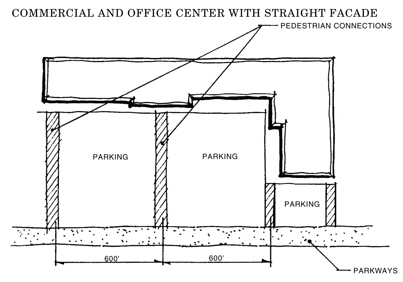
Figure 3.5, Commercial and Office Center with Straight Façade
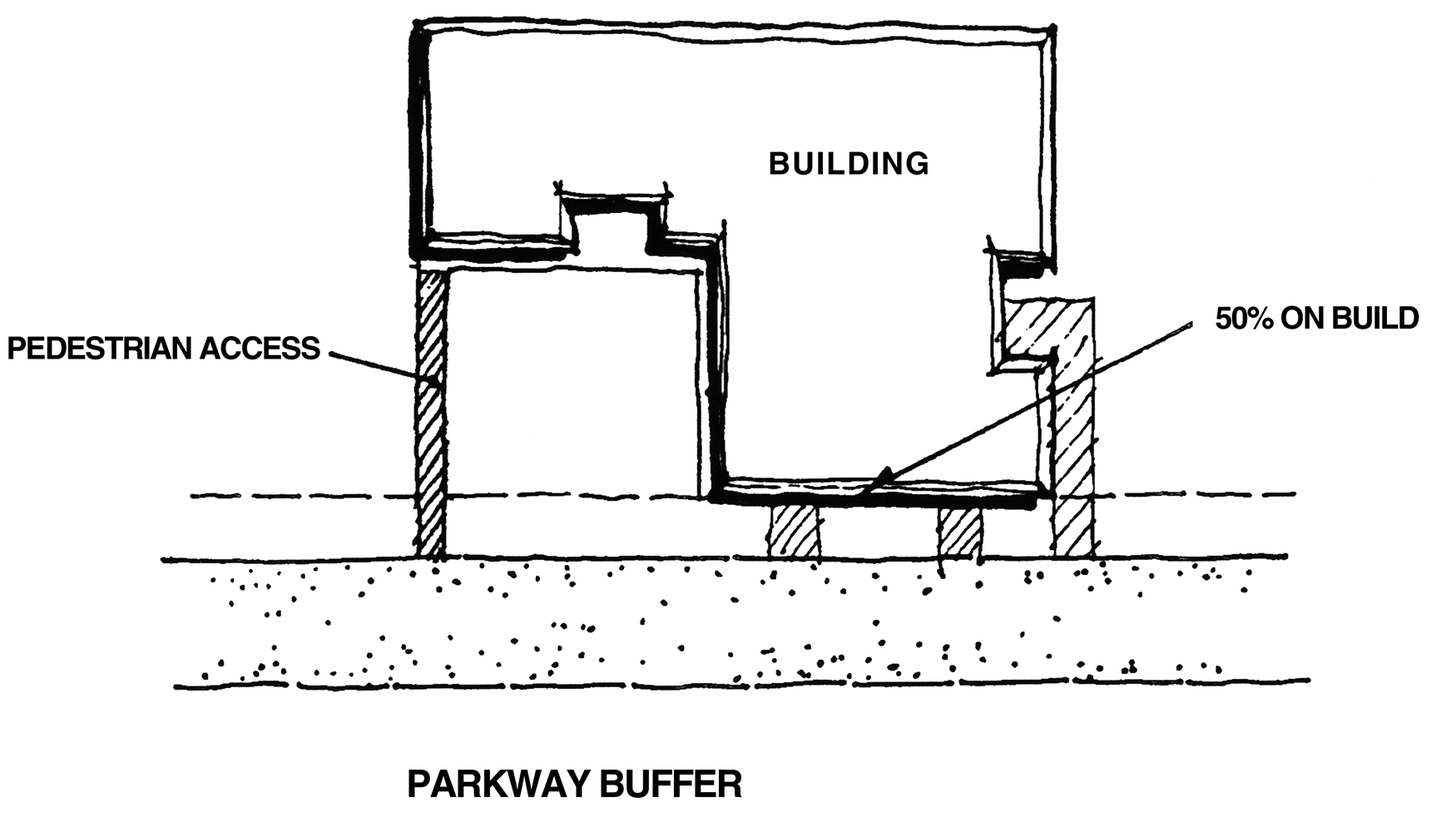
Figure 3.6, Commercial and Office Center with Irregular Façade
F.
Parkway Buffer Area
The parkway buffer is a linear buffer area paralleling and fronting the highway system which is required of all developments fronting onto the corridor transportation network, including North Dale Mabry Highway, frontage roads, or interchange ramps. The parkway buffer shall consist of the following:
1.
Be a minimum of 40 feet in width. Landscaping retention/detention areas, recreation, and bike/pedestrian ways may be included with the parkway buffer.
2.
The retention of existing trees and understory or ground cover beneath the trees within the buffer shall be required, except where its removal for the pedestrian trail is required and where it is essential to cross the buffer with utility lines. Detention is permitted only subject to the standards in 3 below.
3.
Detention or retention areas maybe located in the buffer only where it is located on the inner 25 feet, (the land furthest from Dale Mabry Highway) provided the detention does not cover more than 25 percent of the buffer, and where it shall be located so as to minimize the cutting of any existing trees. There shall be a one to one replacement requirement for any trees cut which shall abe planted on the fringes of the detention or retention facility, or in the case of cypress at appropriate depths within the basin.
4.
A six-foot wide paved bike/pedestrian way shall be provided along the frontage of all development within the parkway buffer, except where a larger pedestrian is otherwise specifically required herein. The alignment of the bike/pedestrian way shall be flexible to accommodate individual site designs. Bike/pedestrian ways shall be required to link adjoining properties as well as the internal circulation system of the project proposed.
5.
Landscaping shall be required within the parkway buffer. All parking areas and other vehicular use areas shall be screened from view with a landscaped hedge a minimum 24 inches in height.
G.
Master Landscaping Plan
There shall be two street tree planning schemes as described below:
1.
Activity Center Planting shall be installed in all activity centers where natural forest conditions are not retained. The length of an activity center's parkway buffer shall determine the amount of landscaping required. For every 40 linear feet of parkway buffer where forests are not being retained, one tree a minimum caliper of two and one-half inches and ten feet in height shall be provided. In addition to the tree plantings, shrubbery or ground cover a minimum of 24 inches in height at time of planting shall be required. For every 40 linear feet of parkway buffer there shall be a minimum of five shrub plantings. See Figure 3.2.
2.
Parkway Street Tree Planting shall be required in all parkways outside the activity centers were natural forest vegetation is not retained. The length of the parkway buffer shall determine the number of tree plantings. For every 40 linear feet of parkway buffer where forest are not being retained, two trees a minimum caliper of two and one-half inches and ten feet in height shall be provided. For example, a parkway buffer of 120 feet in length shall provide a minimum of six trees. See Figure 3.3.
H.
Non-motorized Circulation System
All developments within the NDMC Overlay District shall provide a non-motorized circulation system that connects with adjoining developments as well as other uses internal to a proposed development. The non-motorized circulation system shall be comprised of the following two major components:
1.
A Pedestrian Circulation System shall be provided internal to all planned developments, linking various uses. The pedestrian circulation system shall connect to the external parkway system.
2.
A Bikeway Circulation System shall be provided internal to all planned developments linking various uses and shall be connected to the external parkway system.
(Ord. No. 08-29, § 2, eff. 2-1-09)
Sec. 3.01.07. - SPI-HC: Historic and Cultural Conservation Districts
A.
Intent
1.
The architectural, cultural, archaeological, and historic artifacts of Hillsborough County are important community resources which enrich the lives of citizens and visitors alike, provide expanded economic opportunity, and present opportunities to stabilize and enhance property values. Therefore, it is declared that structures, buildings, and sites important to the understanding of the history of Hillsborough County possess special public interests and should be conserved and protected by designating them and their environs as Special Public Interest Historic and Cultural Conservation Districts.
2.
Within zoning districts now existing or hereafter created, it is intended to permit creation of SPI-HC, Special Public Interest Historic and Cultural Conservation districts, in general areas having concentrations of structures of substantial historic, architectural or cultural significance, or for individual structures and premises designated as having such significance.
3.
Prior to acquiring an SPI-HC zoning, the subject site shall have been designated a Landmark through the Landmark Designation process, described in Part 3.03.00.
B.
Purposes of Regulations Relating to SPI-HC Districts
Regulations relating to SPI-HC districts are intended:
1.
To protect against destruction of such areas, structures, or features or encroachment of structures, uses, or features likely to have adverse effects on their historic, architectural, or cultural character;
2.
To encourage uses such as a bed and breakfast, antique shop, book store, cafe, etc., in the case of residential uses which will lead to their continuance, conservation, and improvement in a manner appropriate to the preservation of the cultural, architectural, and historical heritage of the County;
3.
To prevent developments in the visual environs of such areas or structures which would detract from their character; and
4.
To assure that new or altered structures and uses within such districts and their environs will preserve and enhance the special character of the districts.
5.
To discourage unnecessary destruction of buildings, structures, and sites of special cultural, architectural, and historic importance.
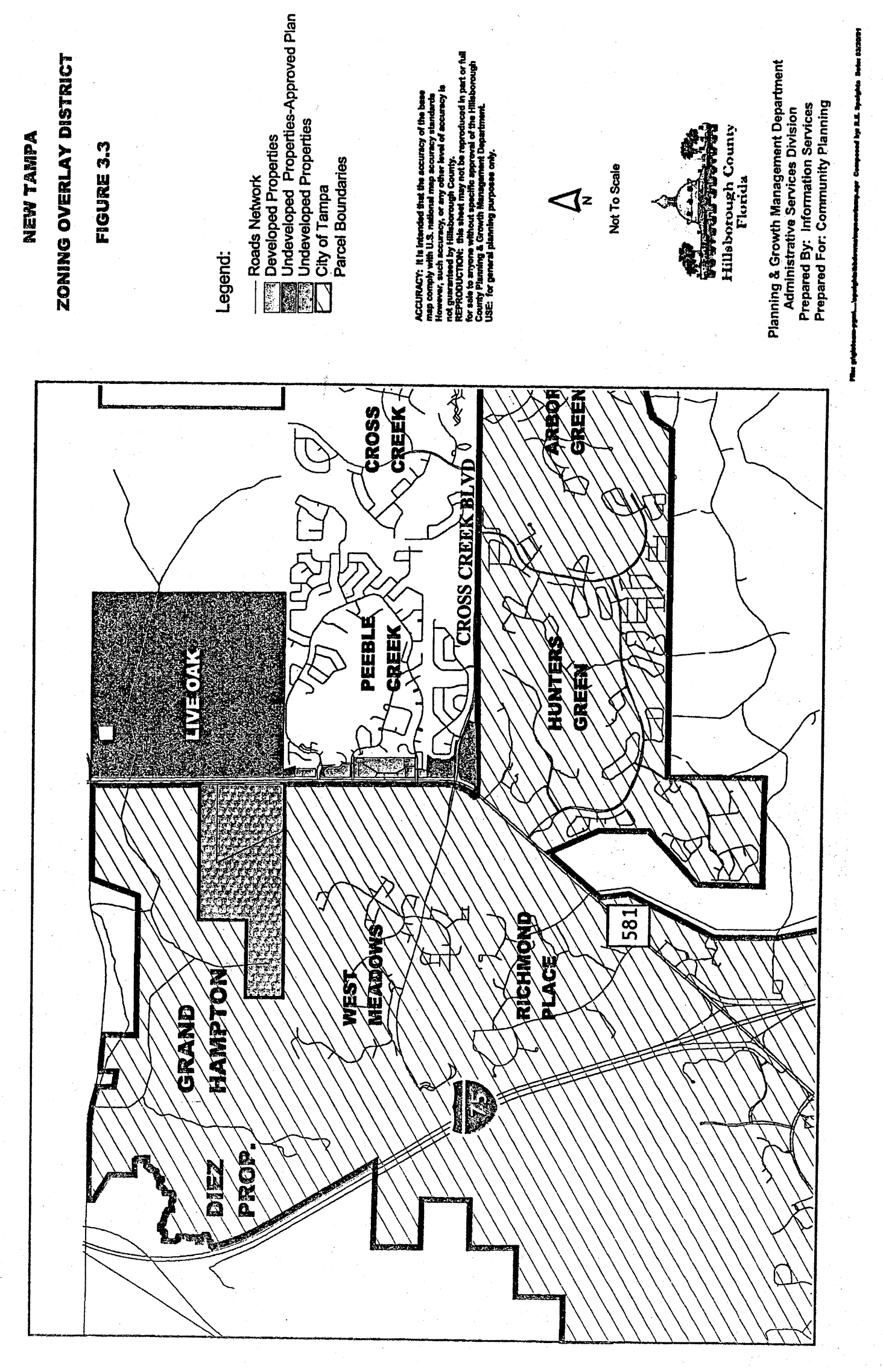
Sec. 3.01.08. - SPI-NT: New Tampa Commercial Overlay District.
A.
Generally
The New Tampa Overlay District is an area which contains commercial and multi-family development and dedicated community and open space; which spans over numerous planned communities, within the City of Tampa and the unincorporated Hillsborough County (see figure 3.1). The purpose of the New Tampa Commercial Overlay District is to provide consistency in the unincorporated Hillsborough County regulations with the City of Tampa Code, Chapter 27, Article 20, Section 27-462 (New Tampa Commercial Overlay District Development Standards). The standards were developed by the City of Tampa to preserve existing patterns of development in areas characterized by a distinct grouping of commercial and residential land uses, the destruction of which would disrupt the historical scale, spatial pattern and character of an area. In addition, the commercial overlay district designation allows for the development of specific design guidelines for future growth in the area, thereby enhancing the unique qualities of the district. Furthermore, the commercial overlay district is intended to provide a framework for cooperative integration of residential and commercial business uses in the district, stabilize and improve property values and foster civic pride. The boundaries of the overlay district shall be those properties within unincorporated Hillsborough County along Bruce B. Downs Boulevard between Bearss Avenue/Skipper Road and Pasco County line, as shown on figures 3.2 and 3.3.
B.
Applicability
All new commercial and multi-family developments are subject to these regulations.
C.
General building design standards:
1.
Drive-through window services shall be positioned to the side or rear of the principal structures they serve. Additionally, eating establishments shall meet the requirements set for drive-through service as described in Article VI.
2.
The entrance to all service bays for automotive repair and service businesses shall be located on the side and/or rear of the structure(s). Additionally, automotive repair and service businesses shall meet the design standards for gas stations and service stations as required in Article VI.
3.
Chain link fences other than vinyl-clad, and unpainted or unfinished block fences or walls are prohibited. All sides and elevations of buildings, walls, or block fences visible at ground level from a public right-of-way or an adjacent parcel shall be architecturally finished (i.e. brick, stucco, or textured concrete masonry units). Additionally, fencing shall conform to the requirements of Article VI.
4.
Doors, windows, or other architectural features shall be used to break large wall planes into smaller components. No more than thirty (30) percent of consecutive façade that is oriented to and visible at ground level from public right-of-way may remain unembellished.
5.
The use of cobra head lighting is prohibited in public use areas adjacent to the building(s) (i.e. entryways, courtyards, parking lots, etc.).
6.
All open storage areas, mechanical, and rooftop equipment, as defined in Article VI, shall be screened with one hundred (100) percent opaque materials. Said materials shall be similar to those used on the nearest façade of the principal structure.
7.
For properties with multiple tenants and/or multiple structures, on-site pedestrian circulation shall be provided between tenants and/or structures through the use of a sidewalk, or other suitable pedestrian connection, not less than five (5) feet wide, and where applicable, shall align with and connect to that of adjacent and continuous properties.
8.
Retention ponds smaller than five acres and visible at ground level from public right-of-way or an adjacent parcel shall be landscaped and/or shall contain special site features, such as fountains and reflecting pools. Existing natural vegetation may be used in lieu of new planting(s).
9.
Illuminated tubing (e.g. neon) which outlines a building, fence, or other similar structure or part thereof, measuring more than 20 linear feet, or enclosing any area greater than 20 square feet is prohibited.
D.
Landscape buffers and screening
1.
A landscape buffer with an average width of 15 feet, and a minimum width of ten feet, shall be provided along the boundary of all vehicular use areas (vua s) abutting public right-of-way. Said buffer shall contain a minimum 18-inch high earthen berm and shall be landscaped. Berm and landscape combination shall be 80 percent opaque, and be a minimum of four feet in height at time of planting, and all times thereafter. Height shall be measured at finished grade of the vehicular use area. A berm shall not be required within the visibility triangle areas for any driveways or pedestrian walkways.
2.
All portions of each site, which are not devoted to buildings, sidewalks, paving or special landscape features, shall be grassed; but the use of native plant species and xeriscaping shall be encouraged. However, no more than 30 percent of the required landscape area may be grassed, the balance shall be landscaped in shrub and ground covers. All yard grass planted shall be Hybrid Bermuda, or St. Augustine. However, Bahia grass may be used or planted in retention/detention areas, drainage areas, and wetland setback and mitigation areas.
3.
All shade trees used to satisfy landscaping requirements shall be a minimum four-inch caliper. Section 6.06.03.A.5 shall apply when overhead power lines exist within the required vegetative planting areas.
4.
Reserved
E.
General sign standards
All signs shall comply with the limitations and provisions of Article VII of this Code. Additionally, the following limitations and provisions shall apply to signage for all uses, excluding emergency public services/uses. The following provisions are intended to establish a coordinated graphic program while allowing the creation of unique and informative signs. These guidelines are not intended to prohibit the design of unusual signs that may enhance the character of the building, or reflect the nature of the business.
1.
Exposed neon tubing on monument signs is prohibited.
2.
All permanent detached signs shall be monument signs.
3.
Monument signs shall not exceed a maximum height of 11 feet. The base of all monument signs shall touch the ground, and continue to the top of the sign without any openings. All monument signs shall be finished in a material(s) consistent with the materials used on the building they serve.
4.
If a multiple occupancy parcel is entitled to more than one monument sign then all allowable monument signs may be combined into a single monument sign not to exceed 210 square feet per sign face, or a maximum of 420 square feet for a double faced sign. Such monument signs are limited to a maximum of 20 feet in height.
5.
The aggregate surface area of all shapes, letters, numbers, symbols or illustrations shall not exceed 25 percent of the awning or canopy sign surface. Only awnings and canopies constructed of opaque material may be illuminated.
6.
The maximum allowable display area for each wall or mansard sign, as required by Article VII, or 150 square feet, whichever is less.
7.
One (1) double-faced on-premises sign or two single-faced on-premises signs may be located at each entrance to a platted subdivision or multi-family residential development. The two single faced signs shall be located on opposite sides of the entrance drive. Interior illumination (i.e. Backlighting) of such residential signs is prohibited.
8.
In addition to those signs prohibited in Article VII, roof signs, banners and inflatable signs (tethered or free floating) are prohibited.
F.
Utilities
All utility transmission lines, including, but not limited to those, required for electrical services, telephone, telegraph, CATV and street lighting shall be installed underground.
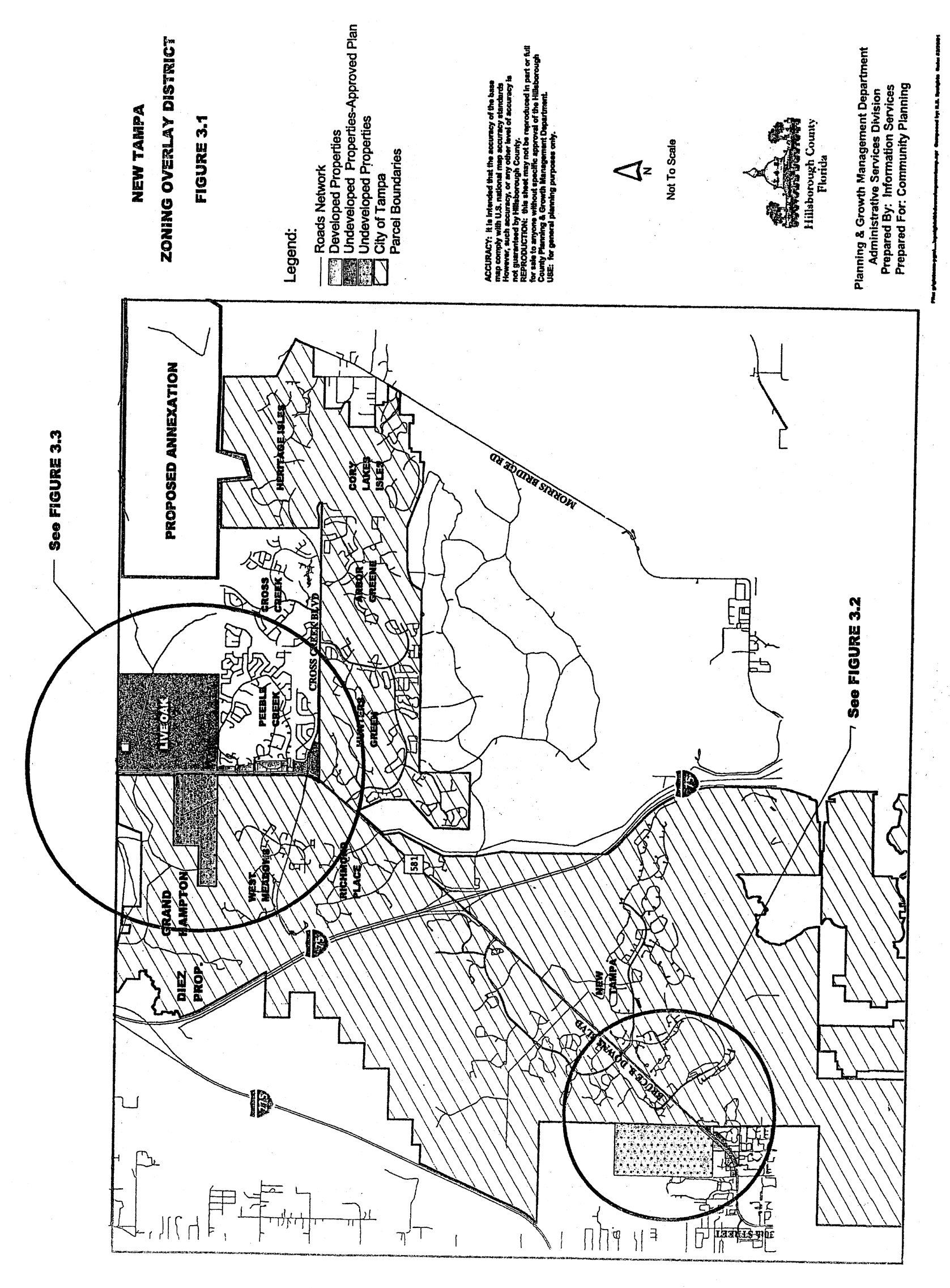
Figure 3.1
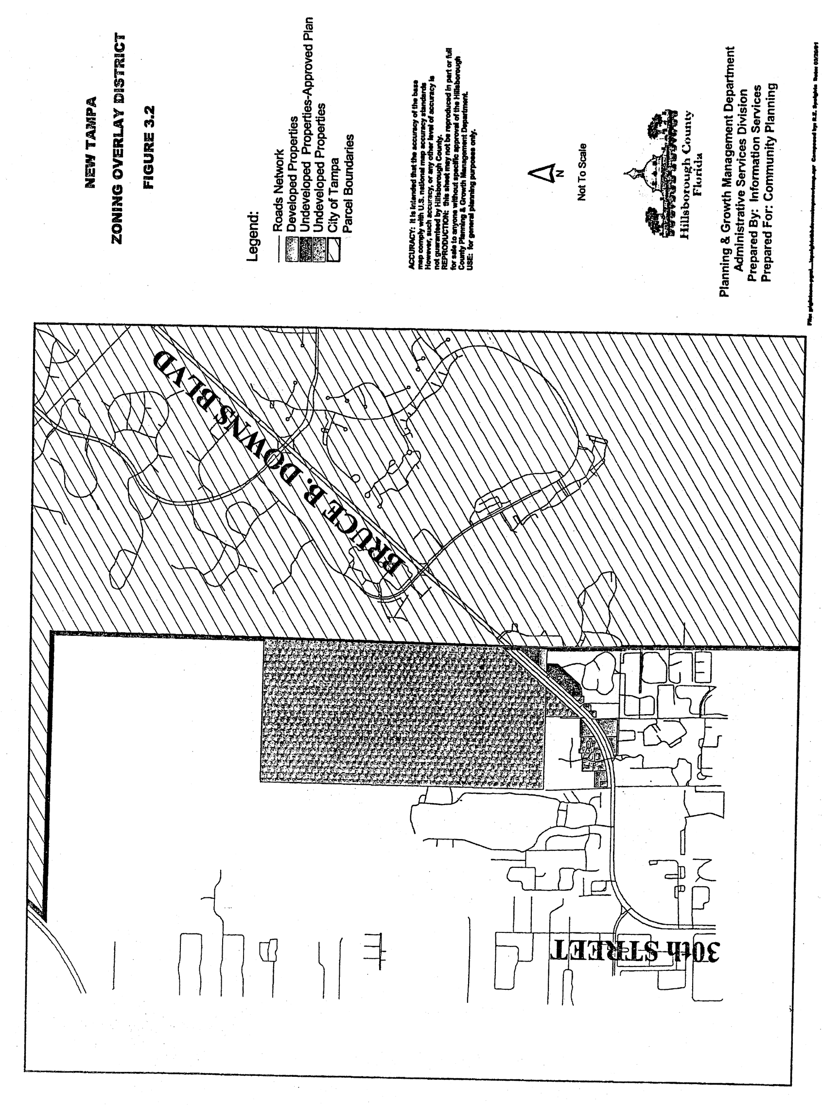
Figure 3.2
(Ord. No. 01-26, § 2, 9-12-01; Ord. No. 04-47, § 2, 11-9-04; Ord. No. 05-10, § 2, eff. 10-5-05; Ord. No. 08-29, § 2, eff. 2-1-09)
Sec. 3.01.09. - SPI-SCCSC: Sun City Center Senior Citizen Overlay District
A.
Generally
The purpose of the Sun City Center Senior Citizen Overlay District (SPI-SCCSC) is to restrict occupancy of a dwelling unit within the boundaries of the Overlay on the basis of age. The Overlay district is consistent with the Housing for Older Persons Act of 1995, which exempts housing for older persons from provisions of the Fair Housing Act. The Housing for Older Persons Act of 1995 allows housing intended and operated for persons 55 years of age or older to be exempt from the Fair Housing Act's prohibition of discrimination on the basis of familial status, provided that, in addition to other requirements, at least 80 percent of the occupied units are occupied by at least one person who is 55 years of age or older.
The Sun City Center Senior Citizen Overlay District will foster and preserve the health, safety, comfort, welfare and support systems developed to benefit senior citizens in this age restricted self-contained community. The Overlay provides for the efficient preservation, protection, and enhancement of the values and amenities, specific rights, and privileges provided in an age restricted senior citizen community.
B.
Applicability
All residential development on parcels located within the geographic area defined by Figure 3.4 shall be subject to the SPI-SCCSC regulations. In the event there exists a conflict between occupancy requirements contained in deed restrictions and/or covenants and the residency requirements contained herein, the occupancy requirements contained in deed restrictions and/or covenants shall prevail. The provisions of the overlay are not applicable to non-residential development. Additionally, these regulations shall not be applicable to persons in occupancy prior to the effective date of this Section. Nonconforming status may only be granted to persons in occupancy prior to the effective date of this ordinance. Said nonconforming status shall terminate upon the abandonment of the dwelling in which the person or persons not meeting the age restrictions of subsection C. resided prior to the effective date of this ordinance.
C.
Regulations
1.
The SPI-SCCSC district is an overlay zone that shall be combined with residentially zoned and/or developed parcels located within the designated overlay district (Figure 3.4).
2.
The regulations of the underlying zoning districts within the overlay district shall remain in effect.
3.
Each dwelling unit within the overlay shall have as an occupant at least one person not less than 55 years of age and no person 18 years of age or under shall reside in the dwelling for a period of time exceeding 30 calendar days per year.
4.
All Senior Citizen occupancy requirements for State, Federal, and local exemptions to fair housing regulations, as amended, must be met and maintained or the overlay will become void. It shall be the responsibility of the Sun City Center Community Association, its designees or its successors to ensure that accurate records of occupancy requirements have been met and maintained.
D.
Variance for Underage Occupancy
Unless otherwise provided for in existing deed restrictions and/or covenant, persons not meeting the age restrictions of subsection C. above may apply for a variance. Variances shall be considered pursuant to the procedures of Part 10.02.00 and the requirements of Part 11.04.00 of this Code, with the exception that the requirements of subsection 11.04.02.A.2 shall not apply.
1.
Findings Required
All findings of fact shall be made in the indicated order by the Land Use Hearing Officer, who is not empowered to grant a variance without an affirmative finding of fact on one of the criteria below. Each finding of fact shall be supported by substantial evidence in the record.
2.
Variances shall be considered for exceptional or unusual family situations and shall be valid for a period of two years. Exceptional or unusual family situations shall include but not be limited to instances where an underage spouse or cohabiting adult family member wishes to continue occupying a dwelling unit within the boundaries of the overlay or it is necessary for a person 18 years of age or younger to reside in a dwelling unit within the boundaries of the overlay in excess of 30 calendar days in a year after one of the following events:
a.
The death of the resident meeting the age requirement; or
b.
The long term medical relocation of the resident meeting the age requirement; or
c.
An emergency situation involving the immediate family of a household meeting the age restrictions of subsection C. above requires that a person 18 years of age or younger maintain residence in a dwelling unit within the boundaries of the overlay for a period in excess of 30 calendar days.
It shall be the responsibility of the applicant to provide evidence of exceptional or unusual family situations and to provide proof that the requested variance is in compliance with all applicable residency requirements for State, Federal, and local exemptions to fair housing regulations
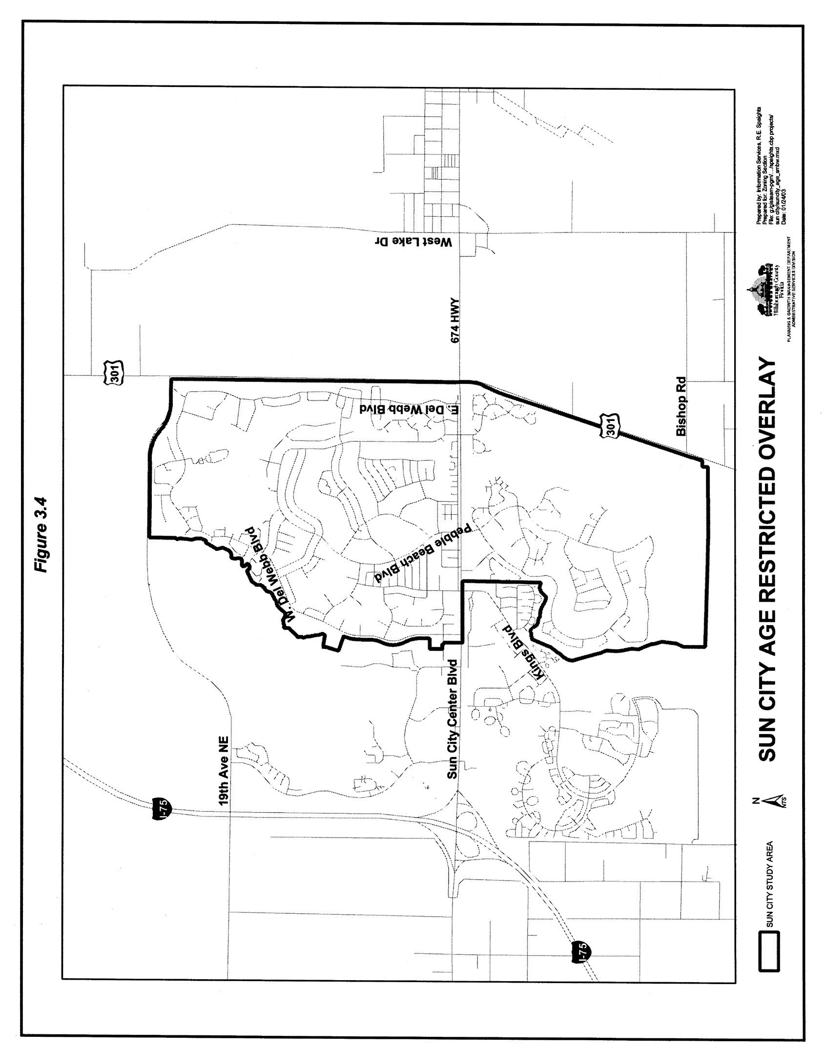
Sun City Age Restricted Overlay District
(Ord. No. 03-9, § 2, 6-5-03)
Sec. 3.02.01.- Generally
A.
Intent
It is the intent of the Land Development Code to provide the regulatory provisions to implement the Future Land Use Element, Interstate 75 Development. The Interstate-75 Corridor is viewed by the Comprehensive Plan and by these zoning regulations as a unique area where separate zoning requirements may be appropriate. It is the further intent of this district to facilitate the identification and designation of a Regional Activity Center in the I-75 Corridor, specifically and exclusively in the RMU-35 Land Use Category.
B.
Goal and Objectives
The goal of this district is to help create, along the I-75 Corridor, an urban environment that displays the highest quality private and public sector development. The objectives are:
1.
To encourage urban level intensity mixed use development and mixed use patterns of development within I-75 mixed use categories.
2.
To promote opportunities high quality private and public development within urban level categories by developing and implementing encouragement programs, and design sensitive regulations.
3.
To promote opportunities for all segments of the population regardless of age, sex, race and income, to live and work in the I-75 Corridor.
4.
To provide flexibility in the development review process.
5.
To increase the use of mass transit.
6.
To provide an efficient road network.
7.
To ensure adequate and timely public facilities and services.
8.
To ensure that water quality and quantity, environmentally sensitive areas and wildlife habitats are protected from degradation by development and that naturally vegetated areas and other types of open space areas are provided to complement development.
9.
To provide additional environmental protection to designated rivers and creeks as a means of enhancing the uniqueness of the I-75 Corridor.
10.
To promote intense concentrated growth in areas that have adequate infrastructure concurrent with development to support that growth, reducing fragmented and sprawl-type development patterns and protecting critical regional facilities.
11.
To further the intent of the Interstate Planned Development district each specific district is permitted maximum densities and intensities in accordance with the 2015 Future Land Use Map, and the Future of Hillsborough Urban Land Use Classifications in the current Future Land Use Element of the Hillsborough County Comprehensive Plan.
(Ord. No. 00-21, § 2, 5-18-00; Ord. No. 01-30, § 2, 11-15-01; Ord. No. 08-15, § 2, 6-12-08, eff. 10-1-08)
Sec. 3.02.02. - Establishment of IPD Zoning Districts
A.
Boundaries of the I-75 Corridor
The boundaries of the I-75 Corridor (i.e., the areas in which Interstate 75 Planned Development (IPD) districts can be requested or applied) shall correspond with the following Categories of the Comprehensive Plan.
Interstate Planned Development (IPD-1) = CMU-12
Interstate Planned Development (IPD-2) = UMU-20
Interstate Planned Development (IPD-3) = RMU-35
B.
Requests For Rezoning Within Corridor
1.
Requests for amendment to the existing zoning in the I-75 Corridor may be requests for the IPD District. The approval of new PD rezonings within the I-75 Corridor may be conditioned to the greatest degree practicable with the provisions of this Part.
2.
The requirements for right-of-way as shown in Figures 3.27 through 3.31 shall apply to PD zonings in the I-75 Corridor, except where modified by the Board of County Commissioners.
C.
Relationship of IPD Regulation to Other Code Provisions; Modification Based on Equal Satisfaction of Public Purposes
1.
Unless specifically stated herein, or in the approval conditions of an IPD district, the general zoning requirements found elsewhere in the Land Development Code shall apply to development in the IPD districts.
2.
Where actions, designs or solutions proposed by the applicant are not literally in accord with applicable IPD or general zoning regulations, but the Board of County Commissioners makes a written finding, in the particular case, that the public purposes are satisfied to an equivalent or greater degree, the Board of County Commissioners may make specific modification of the regulations in the particular case. However, where floor area and similar ratios, as well as maximum permitted densities, have been established by these regulations, the Board of County Commissioners shall not act in a particular case to modify such ratios or maximums.
D.
Methods for Establishment of IPD Districts
Interstate-75 Planned Development (IPD) Districts may be established by amending the Official Zoning Atlas and related amendatory action; changing the designation of a tract, parcel, lot or lots, from the existing classification to one of the IPD districts, in accordance with the development standards and review criteria contained herein. Amendments shall be initiated, reviewed and decided in accordance with 5.03.03.
(Ord. No. 00-21, § 2, 5-18-00; Ord. No. 08-15, § 2, 6-12-08, eff. 10-1-08)
Sec. 3.02.03. - IPD Districts General Review Criteria
A.
Physical Characteristics of the Site
The tract shall be suitable, or it shall be possible to make the tract suitable for development in the manner proposed without hazard to persons or property, on or off the tract, outside of the floodway, free from the probability of erosion, subsidence or slipping of the soil or other dangers. Conditions of soil, ground water level, drainage and topography shall all be appropriate to both type and pattern of use intended.
B.
Accessibility
IPD districts shall be designed to meet existing federal, state and local regulations for buildings, structures and other amenities to provide accessibility on-site. Developers of IPD districts shall incorporate accessibility provisions in all aspects of development including but not limited to structural designs, recreational areas, sidewalks, housing and transportation systems.
C.
Orientation for Unified Planning
If appropriate to the form of planned development, lands to be included in an IPD district may be divided by streets, alleys, rights-of-way or easements, but shall be so located, dimensioned and arranged as to permit unified planning and development and to meet all requirements in connection therewith, as well as to provide necessary protection against adverse relationships between uses in the district and uses in surrounding areas.
D.
Compatibility
IPD districts shall be located and designed so as to minimize the negative effects of external impacts resulting from factors such as traffic, noise, or lights. Project control shall be accomplished through such techniques as buffering and screening, height limitations, and density or intensity limitations and other standards contained herein.
E.
Transitions
IPD districts shall be responsive to the character of the area. When located in an area where land use types and/or intensities or densities vary, IPD districts shall be designed in such a manner as to provide for gradual changes in intensity and/or density where appropriate.
F.
Relation to Public Utilities, Facilities, and Services
1.
IPD districts shall be so located in relation to transportation systems, wastewater systems, emergency services, water lines, stormwater systems, and other utilities systems and installations such that the changes in manner, form, character, location, degree, scale, or timing of such systems required to serve the new IPD district will not result in higher net public cost or unprogrammed incursion of public cost. The applicant shall also have the option to make provisions, acceptable to the County, for off-setting any added cost or non-programmed commitment of public funds made necessary by such development.
2.
Such districts shall be so located with respect to necessary public facilities (as for example, schools, parks, and playgrounds in the case of planned development housing districts) as to have access to such facilities in the same degree as would development permitted under existing zoning and shall be so located, designed, and scaled to have available such public services equivalent to development as permitted under standard development controls.
3.
The applicant shall have the option of providing private facilities, utilities, and services, approved by appropriate public agencies, as substituting on at least an equivalent basis for inadequate public facilities, utilities, and services required by the proposed IPD district. In addition, the applicant shall make appropriate arrangements for the satisfactory continuing operation of such facilities, utilities, and services not dedicated to and accepted by the public, permanently or until similar public facilities, utilities or services are available and used.
4.
IPD development districts shall be subject to the terms of all applicable development standards relating to the provision of public services. Determinations concerning the adequacy and efficiency of the provision of the described public facilities shall be based upon standards adopted by the Board of County Commissioners of Hillsborough County.
G.
Internal/External Relationships
1.
Access.
a.
Principal vehicular access points shall be designed to encourage smooth traffic flow with controlled turning movements and minimum hazards to vehicular or pedestrian traffic. Merging and turnout lanes or traffic dividers and extra width of the approach street shall be required where existing or anticipated traffic flows indicate need.
b.
Vehicular access to streets or portions of streets from off-street parking and service areas shall be so combined, limited, located, designed and controlled as to channel traffic from and to such areas conveniently, safely, and in a manner which minimizes traffic friction and excessive interruptions.
2.
Streets, Drives, Parking and Service Areas
Streets, drives, parking and service areas shall provide safe and convenient access to all buildings and general facilities. Streets shall be designed to discourage outside traffic from traversing the development on minor streets, and shall not occupy more land than is required to provide access as indicated, nor create unnecessary fragmentation of the development into small blocks. Commercial and office uses shall be grouped in relation to parking areas such that after visitors arriving by automobile enter the walkway system, establishments can be visited conveniently with a minimum of internal automotive movements. Facilities and access routes for deliveries, servicing and maintenance shall be so located and arranged as to prevent interference with pedestrian traffic within the district. Loading zones where customers pick up goods shall be located and arranged as to prevent interference with pedestrian movement.
3.
Pedestrian Systems
a.
The site plan shall provide for safe, efficient, convenient and harmonious groupings of structures, uses, facilities, and open spaces in a manner facilitating pedestrian movement between major origins and destinations within and adjacent to the district with minimal conflicts with vehicular traffic.
b.
Pedestrian systems through buildings shall be related to a network of exterior open spaces reserved for pedestrian use and enjoyment. Interior and exterior pedestrian ways shall be scaled for anticipated traffic and form a convenient pattern connecting major concentrations of uses within the district, and shall connect to principal access points within and outside the IPD districts.
4.
Natural Features, Conservation and Preservation Areas
IPD districts shall be designed to preserve the natural features of the land such as existing trees and natural topography as much as possible. Conservation and Preservation Areas shall be maintained as required by local, state and federal regulations.
(Ord. No. 04-46, § 2, 11-4-04)
Sec. 3.02.04. - Specific Review Criteria
A.
Locational Criteria
1.
Residential. Residential developments are permitted anywhere in IPD 1, 2 and 3 districts.
2.
Commercial. Commercial development shall meet at least one of the following locational requirements.
a.
Commercial development shall be permitted anywhere in the IPD-3 district.
b.
Commercial development in IPD-1 or IPD-2 districts shall be:
(1)
Approved as part of a mixed use development, or
(2)
Located at arterial and collector road intersections as defined and allowed for in the I-75 Corridor Long Range Transportation Plan, or
(3)
Infill development within existing strip commercial areas.
3.
Office. The intensity, size, scale and height of office development shall reflect the characteristics of the intersection at which it is located. The most intense and tallest office developments would be located at rail transit stations, and the less intense office developments would be located at other intersections shown on the current MPO Long Range Transportation Cost Affordable Plan Map in effect at the time of the application for development approval. In addition, office development shall meet at least one of the following locational requirements.
a.
Office development shall be permitted anywhere in the IPD-3 district.
b.
Office development in the IPD-2 district shall be:
(1)
Approved as part of a mixed use development, or
(2)
Located as defined and allowed for in the I-75 Corridor Plan, or
(3)
Allowed as infill development within areas that are developed with non-residential uses.
c.
Office development in the IPD-1 district shall be:
(1)
Approved as part of a mixed use development, or
(2)
Located at arterial and collector intersections as defined and allowed for in the I-75 Corridor Plan, or
(3)
Allowed as infill development within areas that are developed with non-residential uses.
4.
Industrial. Industrial development shall meet the following locational criteria:
a.
Unless specifically approved by the Board of County Commissioners, development shall not take access through local residential streets.
b.
Development shall be discouraged next to existing residential development except when the industrial use is part of a mixed use development containing residential uses or is part of a mixed use development which provides a transition of uses away from the existing residential development.
5.
Mixed Use Developments. All requirements and criteria found in the single use districts shall apply to mixed use developments.
B.
Open Space: IPD-1 and IPD-2 Districts.
1.
The site shall be landscaped so that 40 percent of the open space will be covered by tree canopy within ten years. The Plant Unit Alternatives found in 3.02.04 K shall be used to determine the area of canopy coverage in all UL districts. The projected ten year area for canopy coverage for each Plant Unit Alternative is listed below:
Alternative No. 1 = 3,000 square feet
Alternative No. 2 = 2,000 square feet
Alternative No. 3 = 2,000 square feet
2.
Section 3.02.04 K highlights examples of plant materials that can be used for the landscaping of open space. An exception to this rule may be cases where native vegetation is to be left undisturbed as part of the open space requirement. In this case, the present vegetation may be credited toward the 40 percent canopy requirement.
C.
Street Furniture: IPD-1 and IPD-2 Districts.
1.
Street furniture shall be provided in all IPD-1 and IPD-2 districts except for residential developments of less than 14 dwelling units per acre. A plan shall be submitted at the time of preliminary plat/site development plan or, construction plan where the preliminary process is waived, review showing the type of street furniture to be provided. Wherever, a theme or similarity in street furniture has been coordinated and established within an area, the adjacent developments are encouraged to expand that same theme, especially along the project's frontage, in order to provide that link of consistency and uniformity needed to create and expand the urban village concept.
2.
In residential developments of 14 dwelling units per acre or more, street furniture plans shall contain, at a minimum, pedestrian walk lighting, waste bins, and seating facilities for every 400 feet of walk. The provision of street furniture is encouraged in residential developments of less than 14 dwelling units per acre. Pedestrian areas shall be lighted within the permitted range of illumination along the pedestrian area as indicated in Section 3.02.04 U. Commercial and office areas shall comply with the Commercial and Office Center design requirements of 3.02.04 J. In office and industrial areas, the street furniture shall create outdoor areas conducive to the enjoyment of employees during lunch or other breaks. Major pedestrian corridors in residential areas which are shown as connecting to other developments on the non-motorizing circulation plan maps, shall be provided with seating areas, lighting and waste bins, at such a spacing or placement as to provide a secure pedestrian environment and places to rest and/or enjoy a view.
D.
Open Space: IPD-3 District.
1.
IPD-3 district developments shall contain a minimum of 20 percent open space. Such open space areas may be 100 percent paved or developments may have a mix of paved and pervious areas. Intensive use of the open areas is permitted to achieve the objective of true urban spaces. These areas may be at normal grade or may be raised or lowered.
2.
In general, retention areas contained with concrete retaining walls do not count as open space. However, when such facilities serve as both a water feature and retention basin, and where decks, walks, plazas, and other pedestrian areas adjoining such water feature-retention facilities are used for retail, restaurants, pedestrian plazas or walks, or other useful outdoor functions, the water feature-retention facility may be counted toward the open space requirement.
3.
The trees planted in pervious areas shall be designed to reach a 60 percent coverage within ten years after installation. In paved areas, planters and trees shall be required, but their placement shall be flexible. The site plan shall be reviewed to determine shading characteristics of the open space and may include in addition to the proposed trees, awnings, canopies, trellises, and buildings to produce outdoor spaces that are comfortable throughout the year.
4.
The design of urban spaces shall create a pedestrian precinct where pedestrians may gain access to the various uses, and where these spaces may be used by customers, employees, and the public for walking between uses and general enjoyment. The size and shape, the direction of movements, and sequence of special experiences in these areas is important to the development of a viable pedestrian precinct.
5.
In evaluating the quality of urban spaces in the IPD-3 districts, the Administrator's staff shall review the D/H (Depth to Height) ratio of the various spaces and the variation in the spaces. Urban spaces should have D/H values between .5 and 5.0. Small D/H values are very enclosing and either should be used as connectors between larger spaces (pedestrian precincts) or be given very careful review as to their ability to function as comfortable pedestrian precincts. Narrow spaces with low D/H ratios and little room for planting may have fewer trees and more decorative plantings; conversely, wider spaces will require plantings to provide adequate shading. In general, the amount of planting is expected to increase with the D/H ratio of the space.
E.
Street Furniture: IPD-3 District
All IPD-3 districts shall have street furniture. The only optional items are water features, fountains, and sculptures. See 3.02.05 on Public Art. Street furniture is required to provide a high quality pedestrian experience in open spaces; it shall be integrated into the architectural and site design of the area, and provide interesting seating areas as well as walking spaces.
F.
Parking Lot Landscaping
The following parking lot landscaped buffer area requirements shall be provided by all developments in the urban level districts. The Landscaping Regulations of this Code shall be followed except:
1.
The buffers along streets for parking shall be eliminated and the following street buffers shall be substituted. The street buffers shall constitute the minimum setback for parking. All dimensions for street setbacks or buffers shall be taken from the closest right-of-way line to the closest exterior wall of the structure nearest the edge of paving.
2.
Figures 3.7 and 3.8 show the legal depictions of setback distances and vertical screening dimensions outlined above. Figures 3.7 and 3.8 also show examples of the acceptable alternatives that may be used in order to meet the vertical screening requirement. A single alternative or a combination of alternatives may be used. Landscaping is required within all buffer areas, however the placement shall be flexible provided that the vertical screening requirement is met. All planted areas within the buffer areas shall be credited toward the canopy coverage requirement indicated in 3.02.04 B.
G.
Setbacks and Designs for Parking Garages
This section shall set forth the setbacks and design for parking garages. Developments approved in the IPD-3 district shall have lesser setbacks than those approved in the IPD-1 and IPD-2 districts.
1.
Where the height of the parking garage exceeds 30 feet in the IPD-1 and IPD-2 districts, and 50 feet in the IPD-3 district, the structures shall be setback an additional foot for every foot in height over 30 and 50 feet respectively.
2.
In an effort to encourage high quality design, a developer may be exempted from the additional 1:1 setback requirement as stated above. An exemption may be granted by demonstrating that the parking garage is designed as an integral component of the overall site, architecturally finished on all sides and reflecting the use of materials displayed by the main structure(s). In addition, the developer must demonstrate, through a drawing, landscape treatment that exceeds the minimum requirements. The Administrator shall review parking garage drawings and make a recommendation on the setback exemption at the time of rezoning.
3.
Figures 3.9 and 3.10 show the legal depictions of the setback distances and vertical screening dimensions as indicated. Figures 3.9 and 3.10 show the acceptable alternatives that may be used in order to meet the vertical screening requirement. A single alternative or a combination of alternatives may be used. Landscaping is required within all buffer areas, however the placement shall be flexible provided that the vertical screening requirement is met. All planted areas within the buffer areas shall be credited toward the canopy coverage requirement indicated in 3.02.04 B.
H.
Street Buffer and Setbacks for Buildings
1.
This section shall set forth the setbacks for buildings as indicated previously for parking lots. Developments approved in the IPD-3 district shall have lesser setbacks than those approved in the IPD-1 and IPD-2 districts. However, where the developer can demonstrate that a proposed project in the IPD-2 district is truly an urban development, the developer may then apply the more urban setbacks of the IPD-3 district to the proposed project. The criteria used in reviewing a true urban development shall be a development containing mixed uses, areas for the gathering of people with attractors, activities, items of visual interest, seating areas and other urban elements such as pedestrian amenities, works of art, and increased landscaping.
2.
The setbacks for buildings in the IPD-3 district shall vary depending on whether the use takes access at grade in front, takes access from an elevated pedestrian walk, or takes access perpendicular to the street or on the opposite side of the building from the street in question.
3.
Figure 3.11 shows setbacks for IPD-1 and IPD-2 districts, and Figures 3.12 and 3.13 are intended to be legal depictions in regard to the setback distances and vertical screening dimensions as indicated. The illustrations show the acceptable alternatives that may be used in order to meet the vertical screening requirement. A single alternative or a combination of alternatives may be used. Landscaping is required within all buffer areas, however the placement shall be flexible provided that the vertical screening requirement is met. All planted areas within the buffer areas shall be credited toward the canopy coverage requirement indicated in 3.02.04 B.
I.
Landscaping of Littoral Zones of Detention Ponds
All IPD districts shall provide landscaping for the littoral zone of stormwater detention ponds. The appropriate plant types for landscaping and side slopes shall be based on guidelines found in the Southwest Florida Water Management District's (SWFWMD) Permit Information Manual. Detention ponds which are used as a water feature, and contain littoral zone landscaping, may be included in open space calculations. The area calculated to be included as open space shall be landward of the design high-water elevation.
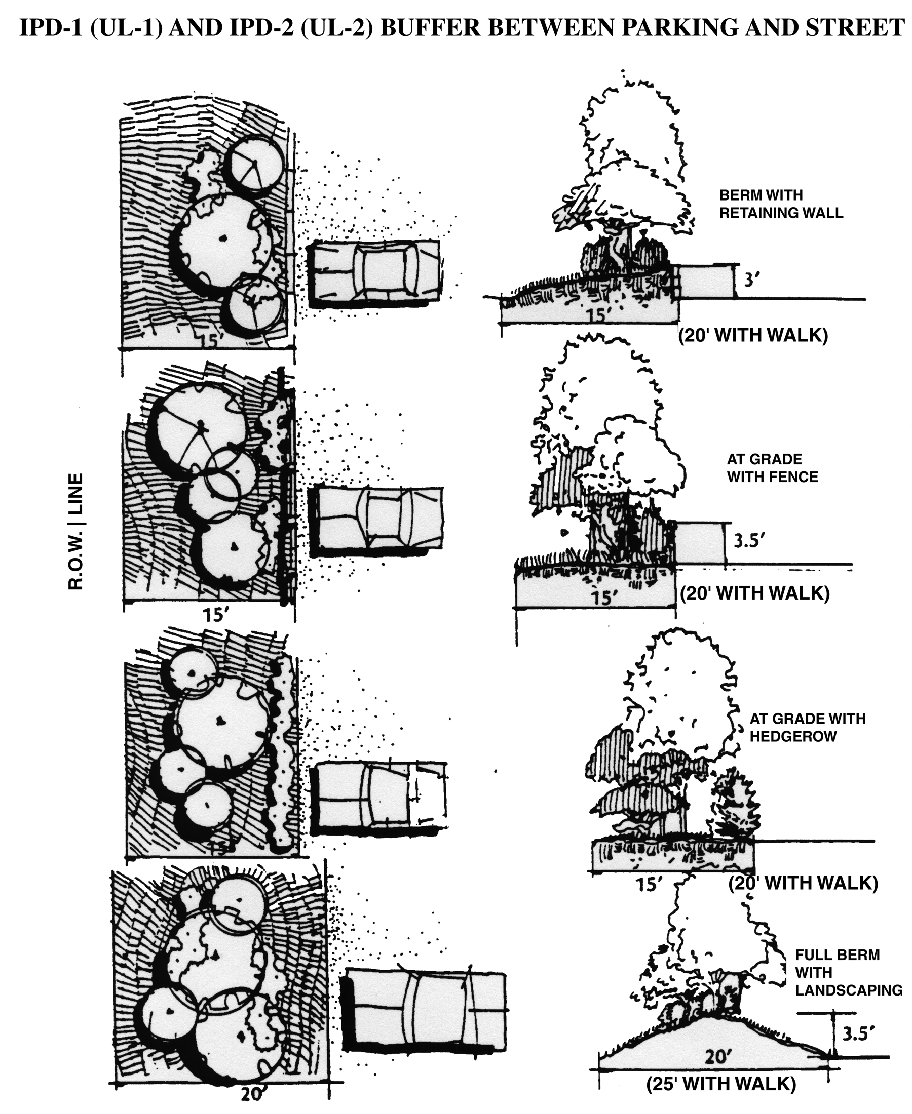
Figure 3.7, IPD-1 (UL-1) and IPD-2 (UL-2) Buffer between Parking and Street
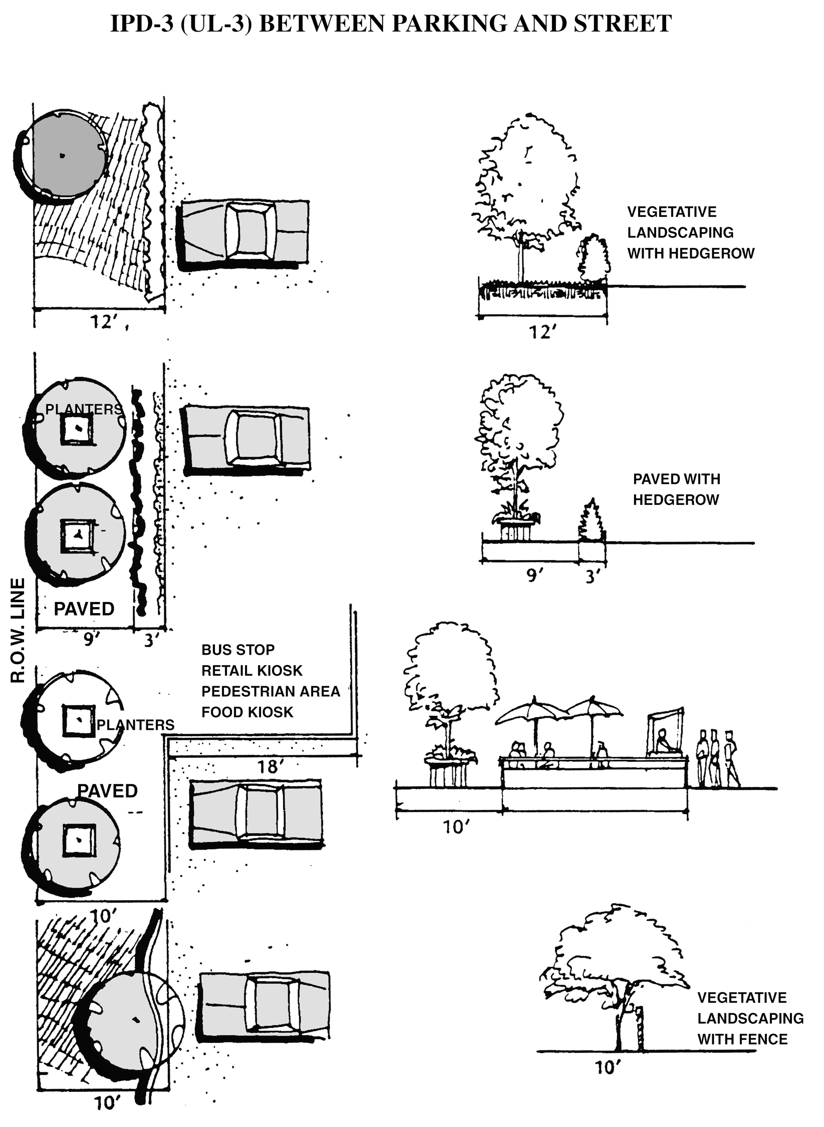
Figure 3.8, IPD-3 (UL-3) Buffer between Parking and Street
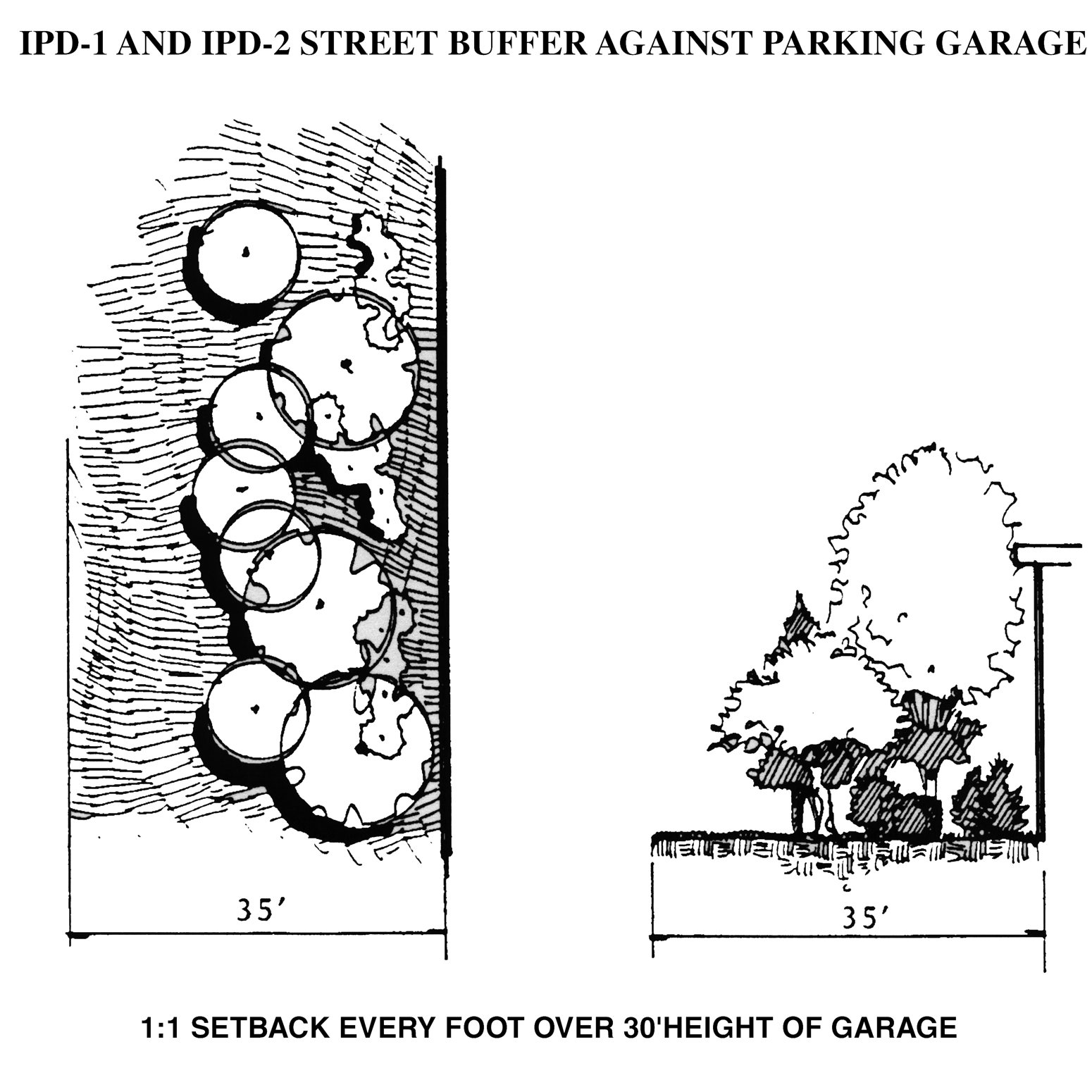
Figure 3.9, IPD-1 (UL-1) and IPD-2 (UL-2) Street Buffer against Parking Garage
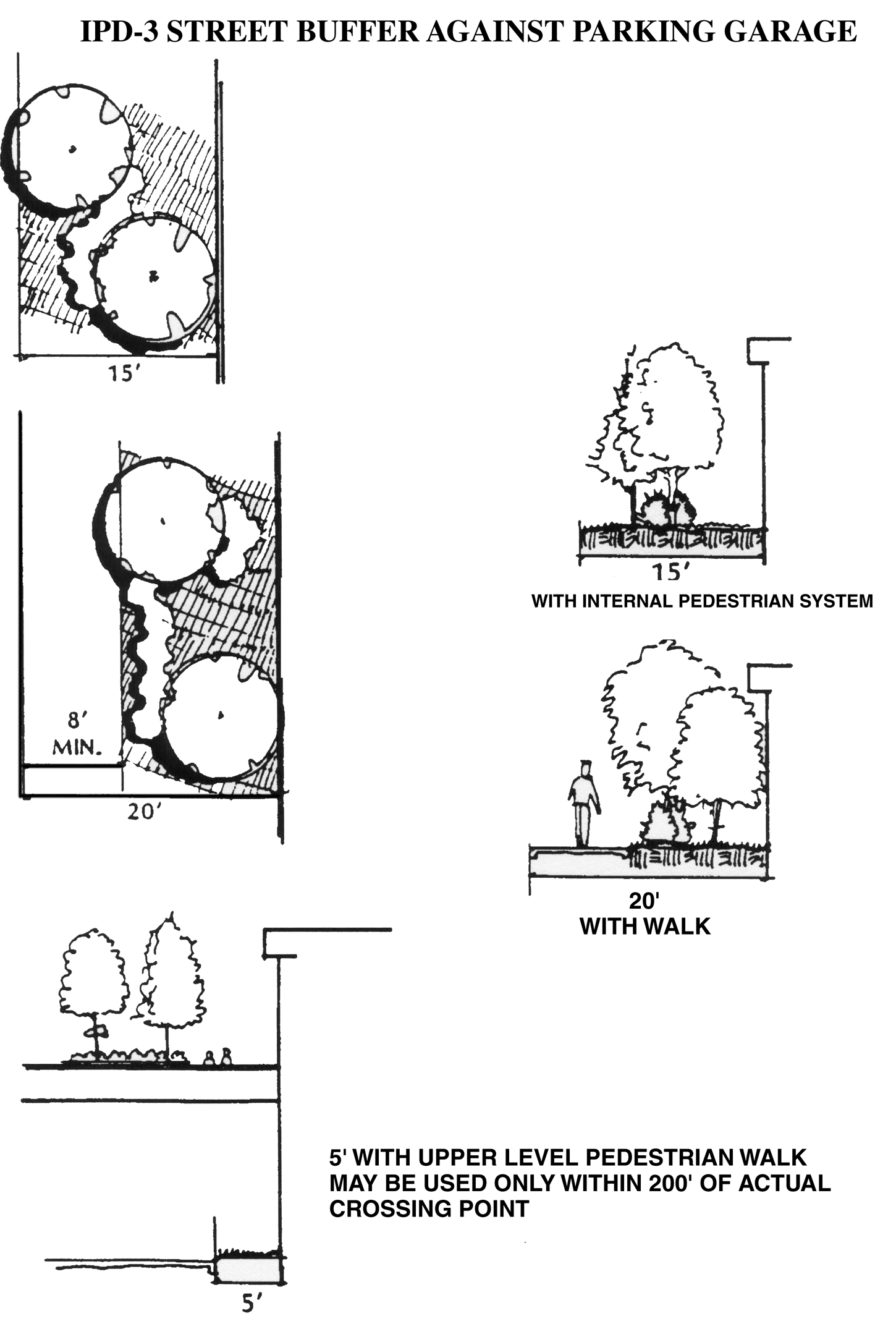
Figure 3.10, IPD-3 (UL-3) Street Buffer against Parking Garage
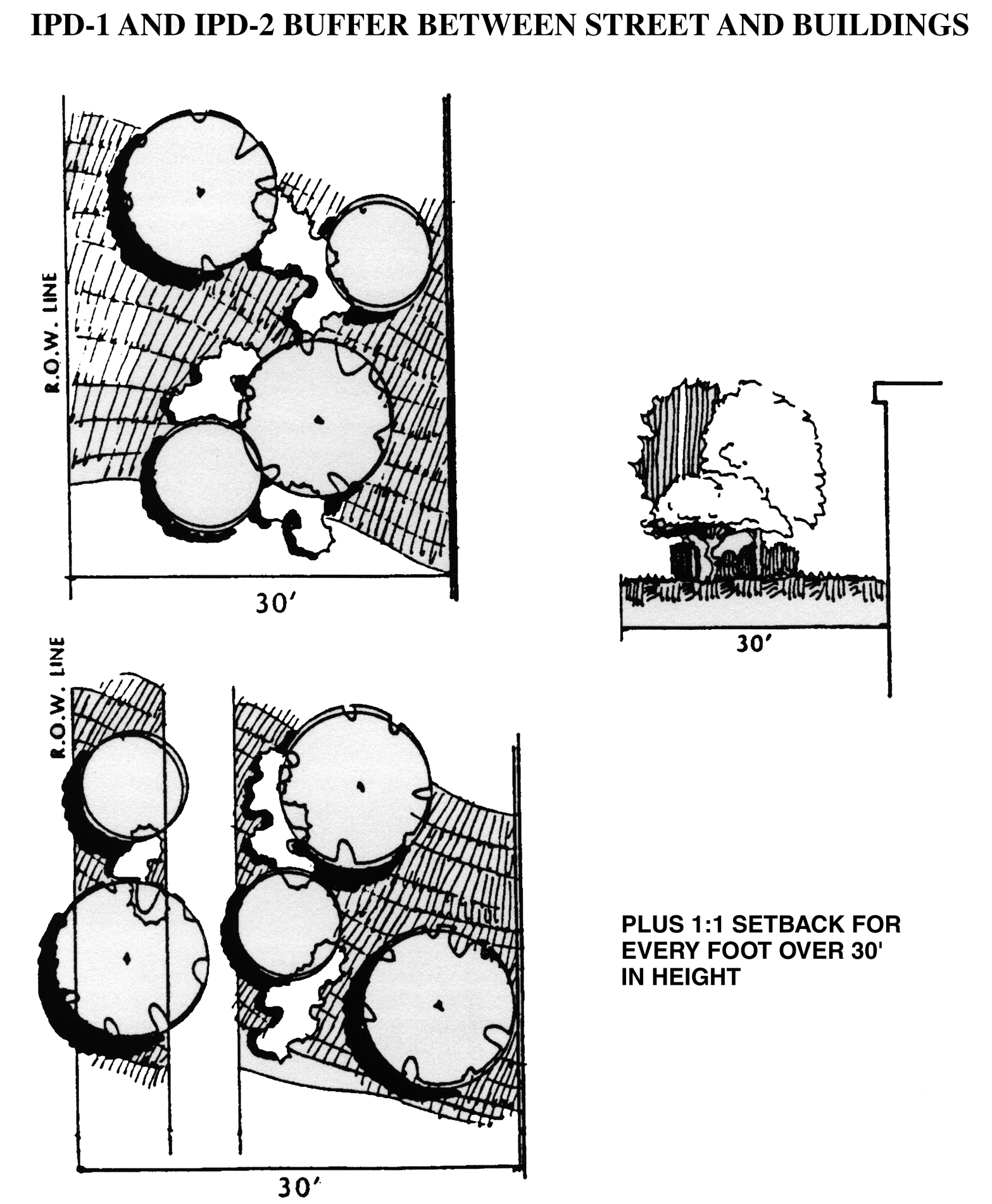
Figure 3.11, IPD-1 (UL-1) and IPD-2 (UL-2) Buffer between Street and Buildings
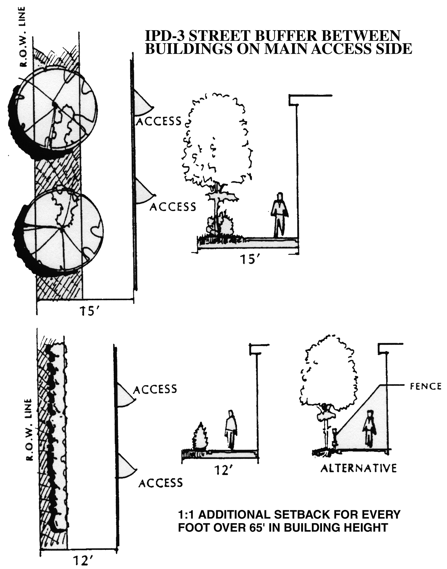
Figure 3.12, IPD-3 (UL-3) Street Buffer between Buildings on Main Access Side
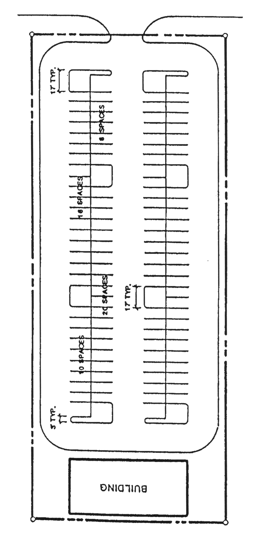
Figure 3.13, IPD-3 (UL-3) Street Buffer between Buildings Building Access to Rear
or Side
J.
Commercial and Office Center Designs
1.
Mall-type Centers.
This is the preferred method of center design. In such centers, the pedestrian areas are totally separated from the automobile areas by the stores, offices or other land uses. This provides an internal pedestrian system in which motor vehicles are not permitted with access to the stores or offices primarily from the internal pedestrian system. The internal pedestrian system has definite entry points where people enter from the parking and other auto-dominated areas. The internal pedestrian system may be open to the air or fully or partially enclosed and shall equal at least ten percent of the gross floor area of the center. See Figure 3.14.
2.
Reverse Frontage Centers.
This is the second of the preferred types of arrangements of center design. It is intended to create a pedestrian-oriented streetscape and buildings that have similar architectural treatment on all four sides. The stores and offices are placed close to the street with the parking areas to the rear; in contrast to the conventional arrangement which places the buildings to the rear of the property furthest from the street. In this design type, signage can be smaller since it will be much closer to the roads. See Figure 3.15.
3.
Conventional Centers.
This is the least preferred type of arrangement of center design. The stores or offices are primarily oriented toward the street or street intersection, with parking between the street(s) and the buildings and the center's internal pedestrian system equaling less than ten percent of the center's gross floor area. See Figure 3.16.
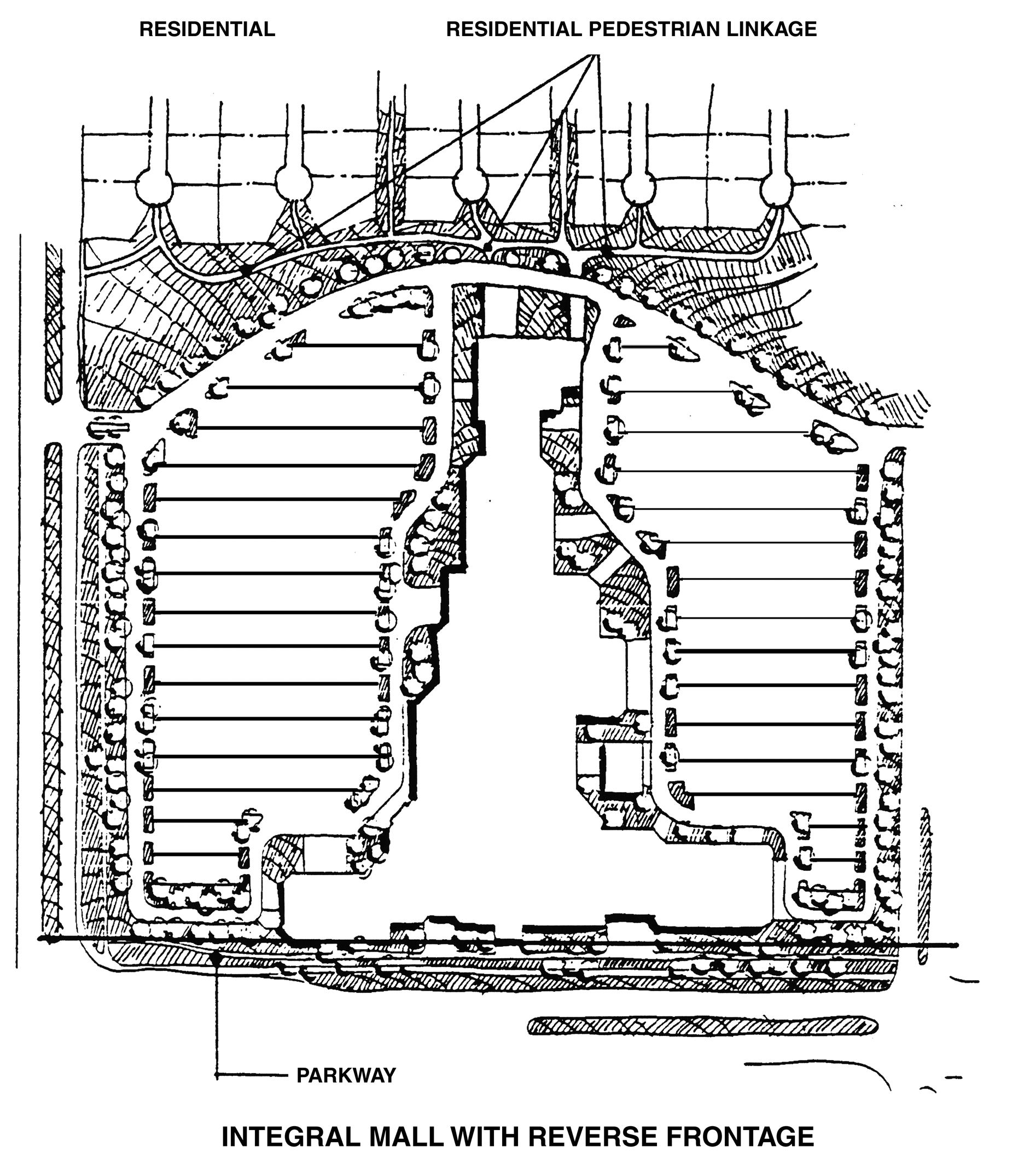
Figure 3.14, Integral Mall with Reverse Frontage
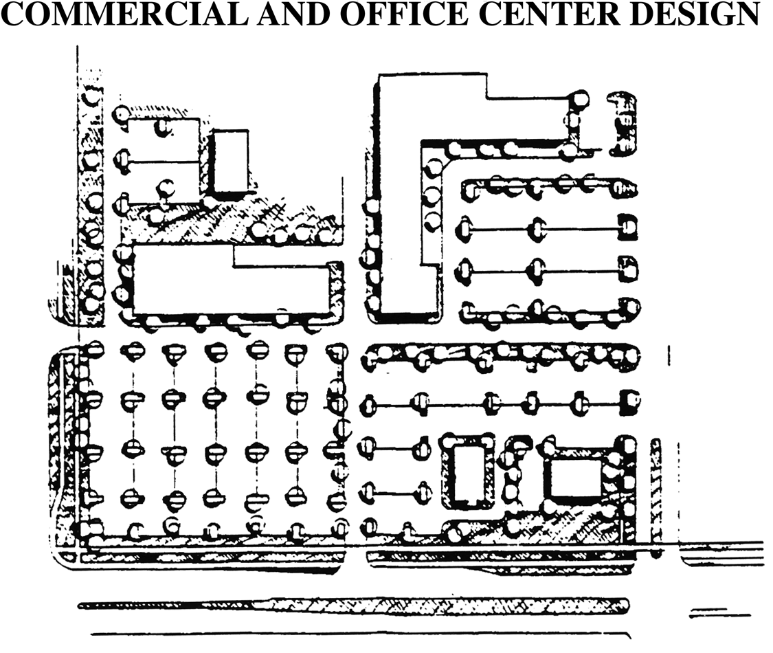
Figure 3.15, Commercial and Office Center Design
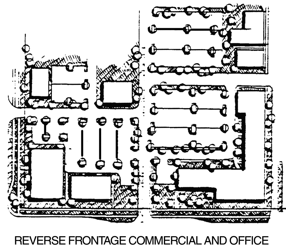
Figure 3.16, Reverse Frontage Commercial and Office
4.
Center Standards.
a.
Mall-type Centers and Reverse Frontage Centers.
(1)
Parking lots shall be landscaped in accordance with the Landscaping Regulations of this Code.
(2)
The minimum sidewalk width shall be eight feet. A total of 200 square feet of planting area containing two trees and other landscape plants shall be provided for every 80 feet of building frontage measured along the curb line. Street furniture that is of an appropriate size and configuration for the site shall be required and approved during the site plan review process. See Figure 3.17.
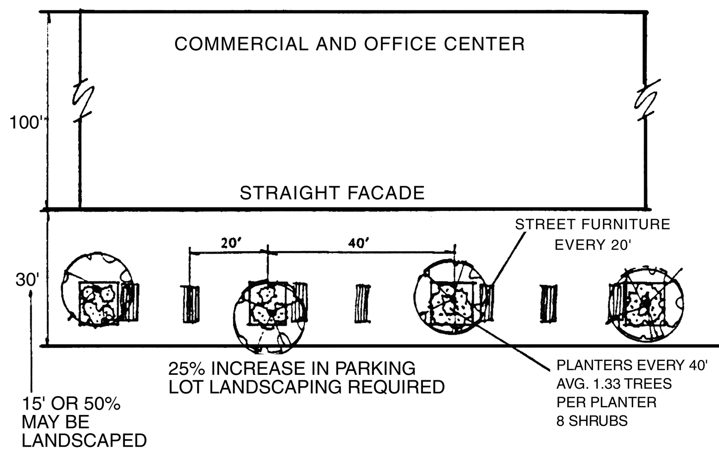
Figure 3.17, Commercial and Office Center
b.
Where the conventional center design is permitted in IPD districts, the following design and landscaping elements shall be provided:
(1)
The parking lot landscaping, including island areas and plant material, shall be increased by 25 percent above the normal parking lot landscaping requirements of the Landscaping Regulations of this Code.
(2)
Directly in front of the center structure(s), a 30-foot wide walkway shall be required. An eight feet by eight feet planting island, containing one tree and eight shrubs shall be located every 40 feet, or part thereof, along the store frontage measured along the front curb line. Two benches and one trash container shall also be located at 40-foot intervals and shall be in harmony with the overall design of the retail center. In order to accommodate more creative design techniques within the 30-foot walkway area, the pavement or sidewalk may be reduced to 15 feet provided that the remaining area is landscaped and irrigated in accordance with these regulations. In no event shall the overall walkway area be less than 30 feet in width. See Figure 3.18.
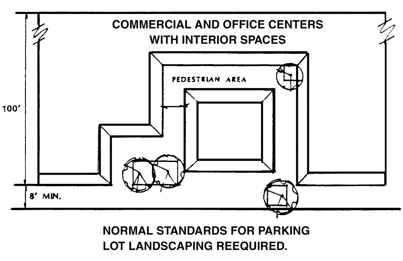
Figure 3.18, Normal Standards for Parking Lot Landscaping Required
K.
Buffering and Screening.
In order to reduce the impact of a particular land use on adjacent uses which are of a different character, density or intensity, buffers and screening shall be required in accordance with the following:
1.
The required buffer distance between the proposed land uses and the boundaries of the adjacent parcels is set out in the Buffer Matrix below. If the land next to the proposed development is vacant, the buffer required shall be determined by the existing zoning on the adjacent vacant parcel. If the adjacent parcel is vacant but is zoned for a more intensive zoning district, no buffer area shall be required of the less intensive use. The relative degree of intensity shall be determined as indicated in 6.06.05. The grouping of the zoning districts shall be as indicated in the Buffer Matrix below. The conversion of the zoning districts and the use group lists shall be as indicated in 6.06.05.
2.
The use of a landscaped hedge, berm, wall and/or screen may be determined by the developer as long as the degree of protection afforded to the adjacent use is not reduced. This applies to all bufferyards.
3.
Plant units are used to determine the varying width and planting of the bufferyards. The concentration of plant units increases or decreases as the width of the bufferyard decreases or increases. The Buffer Matrix below depicts the three alternative plant units from which developers may choose to construct their buffers. Figure 3.19 below shows the concentration of plant units required based on the width of the bufferyard. For the more intensive bufferyards, visual screening may be required. Section 6.06.03.A.5 shall apply when overhead power lines exist within the required vegetative planting areas.
4.
For example, if a developer were required to provide an F bufferyard along 400 feet of property line, the developer would have several choices. The developer could choose to provide a 15-foot wide bufferyard, thereby being required to provide three and one-half plant units for every 100 lineal feet of bufferyard or a total of 14 plant units and visual screening. The plant units used are also chosen by the developer. The developer can choose to provide 14 canopy trees, 28 understory trees, and 42 shrubs (Plant Unit Alternative 1 multiplied by 14). If the developer chooses to provide a 40-foot wide bufferyard, then a total of 12 plant units would be required, but no visual screening.
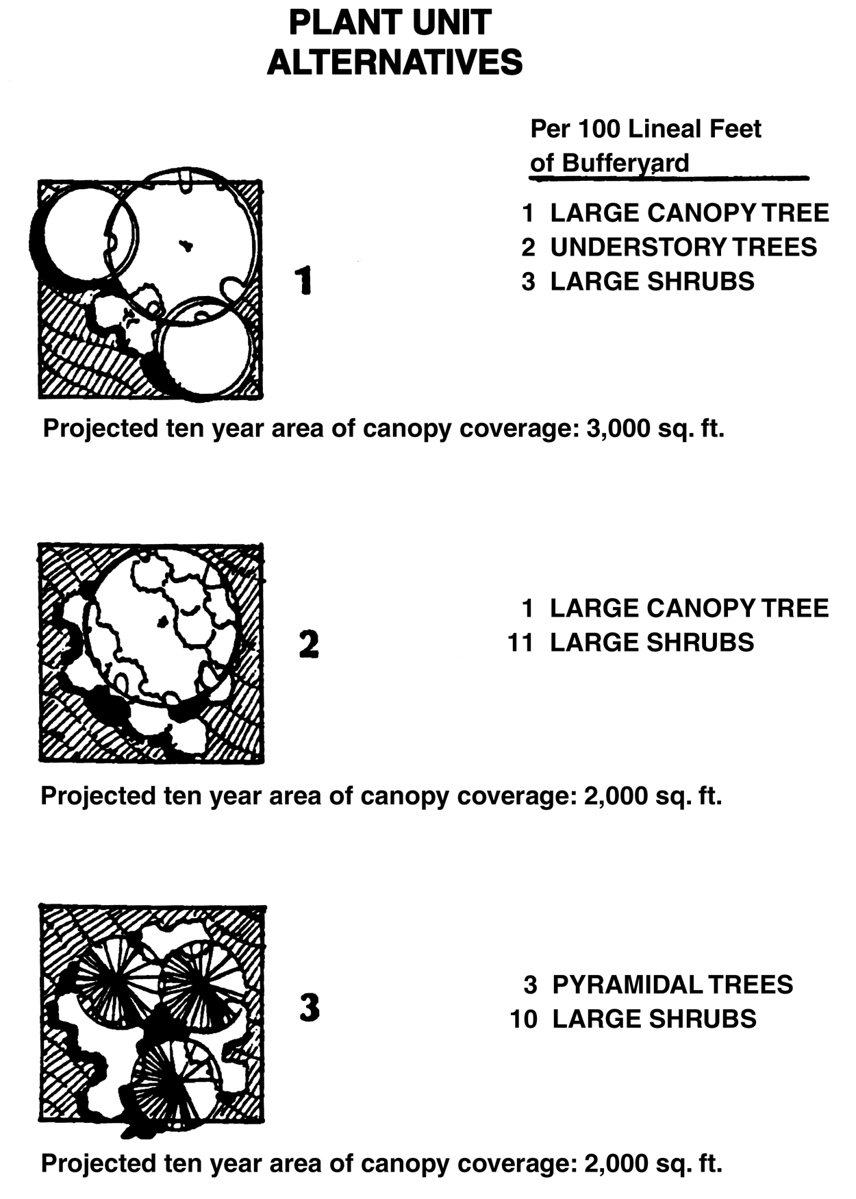
Figure 3.19, Plant Unit Alternatives
L.
Plant Materials
The following list of plant materials shall be used as a guideline to define the plant unit alternatives. Although the list may be expanded, it is intended to provide guidance in selecting predominately hardy Florida native species. Exempted trees, as listed in the Hillsborough County land alteration and landscaping requirements of this Land Development Code, shall not be considered as a plant unit alternative. Conversely, the retention of existing native vegetation shall be maximized within the proposed bufferyards. Credit shall be given for tree preservation within the proposed bufferyards.
1.
Large Trees. 8'—10' in height at time of planting. Large trees shall reach a height of at least 40 feet at maturity. The growth habit shall be described by the following categories:
a.
Large Canopy. Shall provide the maximum canopy potential by displaying a spreading growth habit.
b.
Pyramidal Canopy. Provides less canopy area than large canopy trees. The growth habitat shall be a conical configuration.
2.
Understory Trees. 6'—8' in height at time of planting. Understory trees shall reach a height of at least twenty (20) feet at maturity.
3.
Large Shrubs. 4'—6' in height at time of planting. Large shrubs shall reach a height of at least eight feet at maturity.
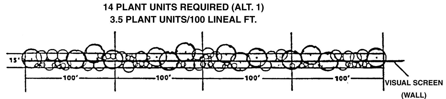
Figure 3.20, Bufferyand Example
M.
Protection of Residential Development.
Buffering and screening requirements protect residential development from adverse impacts by the more intensive urban development permitted in the IPD districts. Two types of buffers shall be used in IPD districts which abut existing residential development. The first buffer shall be a building height slope/setback which provides for additional setback protection from immediate visual, noise, dirt, and other impacts associated with different or more intensive uses. A second type of buffer shall be an intensity buffer that protects against impacts of proposed uses in the IPD districts by reducing their intensity.
N.
Intensity Buffers
The following intensity buffers shall be required in addition to the bufferyards detailed in Section 3.02.04 K.
1.
Building Height Slope/Setback Regulations.
The heights of proposed buildings adjoining residential structures shall be limited and tied to the width of the building setbacks.
a.
Next to Pre-I-75 Corridor Residential Development.
(1)
For every foot the proposed building height exceeds twenty (20) feet, an additional five feet of setback from the inside of the bufferyard shall be provided. The maximum building setback shall not exceed 500 feet. The first ten percent of the setback shall be kept in landscaped area and shall not be used for to parking or loading. The remainder of the setback may include parking and loading areas. (See Figure 3.21)
(2)
Where proposed developments are separated from neighboring residential property by an existing road (or a right-of-way), the 1:5 allowable building height line shall begin at the right-of-way centerline. (See Figure 3.22)
b.
Next to Post-I-75 Corridor Residential Development.
(1)
For every foot the proposed building height exceeds 20 feet, an additional two feet of setback from the inside of the bufferyard shall be provided. The maximum building setback shall not exceed 500 feet. The first ten percent of the setback shall be kept in landscaped area and shall not be used for parking or loading. The remainder of the setback may include parking and loading areas.
(2)
The 1:5 slope/setback shall be applied from pre-I-75 residential development only and shall not apply from residential development approved after the adoption of the I-75 Development section of the Comprehensive Plan, and from vacant residential or agriculturally zoned lands.
(3)
Where proposed developments are directly abutting a residential lot consisting of one acre or more, and the residential structure is placed at least 100 lineal feet from the existing residential property boundary, the 1:5 allowable building height line shall begin at the closest building wall of the residential structure. (See Figure 3.20)
(4)
As an alternative to strict compliance with the 1:5 slope/setback stated above, the developer may demonstrate through a cross-section drawing, that existing or increased screening will block views of the proposed building from adjoining residential structures. In this case, the developer may decrease the setbacks as shown in Figure 3.21.
(5)
In addition, in pre-I-75 Corridor residential areas that are in obvious transition, the developer may demonstrate, through prior changes in zoning, that the development trend for the pre-I-75 Corridor residential area is away from residential development. In this case, the slope/setback and the following intensity feathering may be reduced or deleted by the Administrator.
2.
Intensity Feathering.
a.
To protect pre-I-75 Corridor residential development that is basically suburban in nature from urban forms of development permitted in the three IPD districts, a feathering of the densities shall be required. See Figure 3.22. These densities shall be altered by two factors: (1) the distance between the proposed development and existing residential structures, and (2) the density of the existing residential structures. For the purposes of defining the intensity limits, a "ring" shall extend out 350 feet from existing residential development when the adjacent existing residential development is less than six dwelling units per acre in density. The feathering of intensity shall not apply to residential developments consisting of six units per acre or greater.
b.
Intensities for all proposed uses within the ring shall be limited to a maximum FAR of .30. Where a street exists as the border between the two uses, then the depth of the intensity ring shall be reduced by half the width of the right-of-way.
O.
Protection of Visibility at Intersections
Protection of visibility for vehicles, cyclists and pedestrians shall be as generally provided in 6.04.03 F.
P.
Access
1.
Access to Collector Roads.
If property fronts on both a collector and an arterial street as defined under the Hillsborough County Functional Classification System, primary access shall be from the collector. If the need to create a new collector between two existing collectors on an arterial roadway can be demonstrated (i.e. in order to maintain traffic flow at peak hour Level of Service D on arterials and Level of Service C on specific State arterials), then a new collector shall be permitted in accordance with the Interstate-75 Corridor Plan and (2) below.
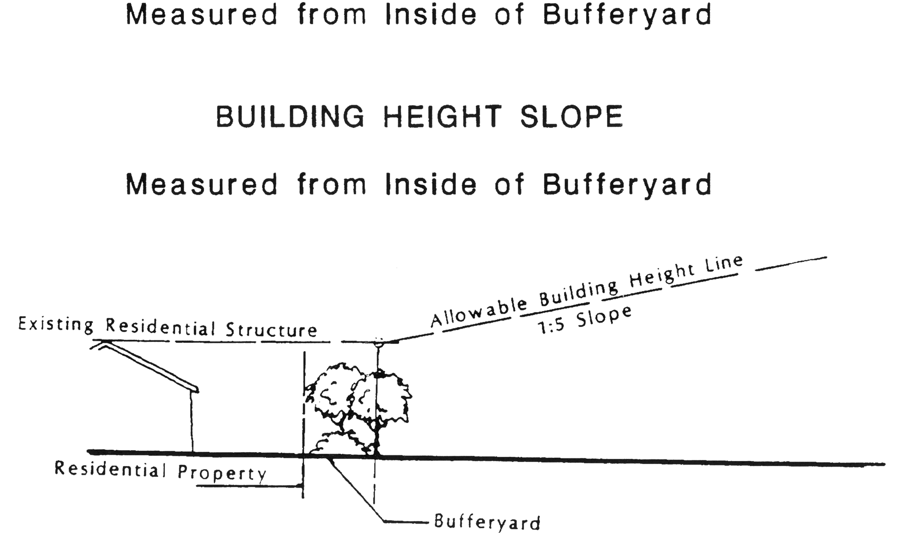
Figure 3.21, Building Height Slope
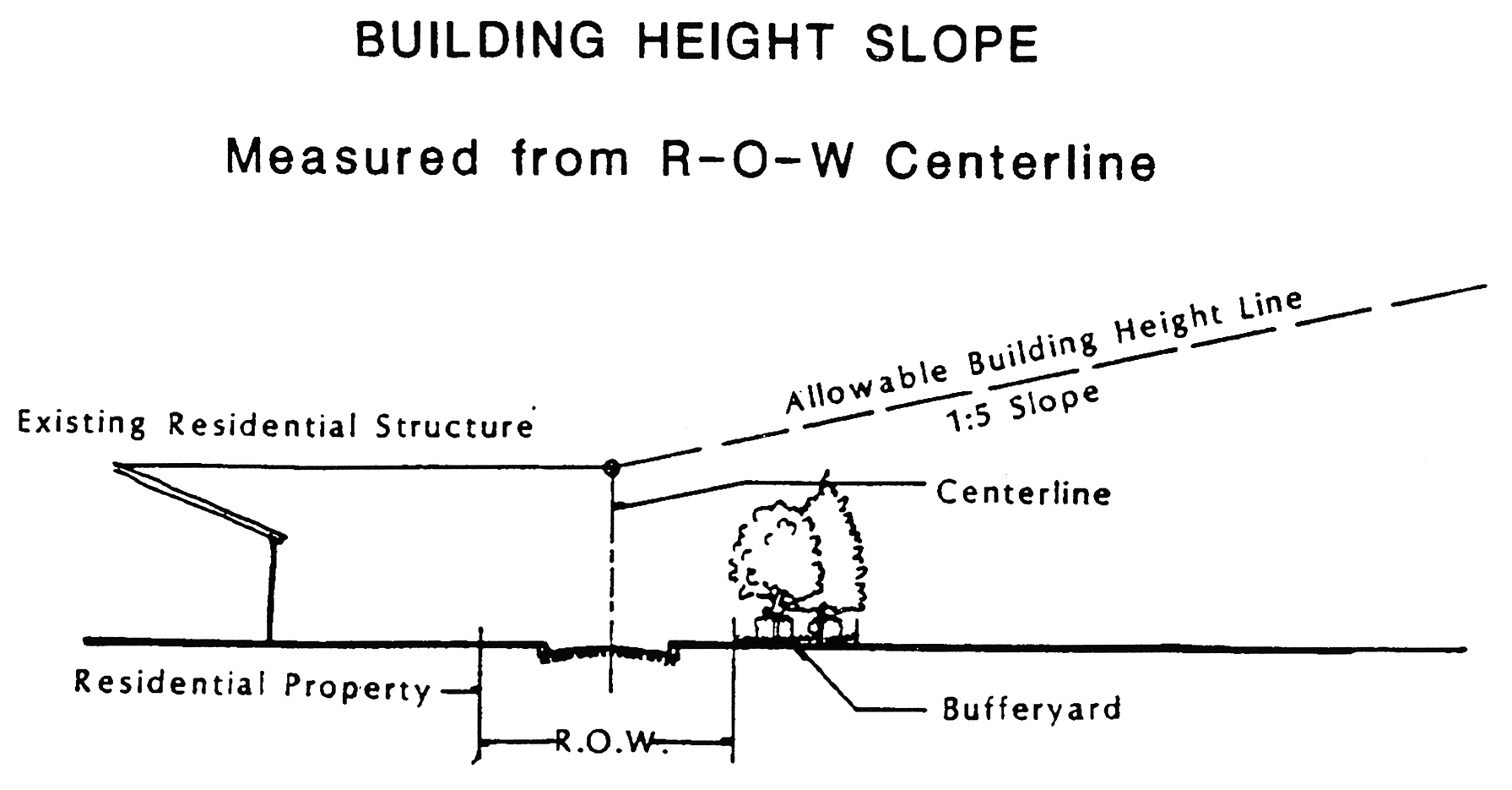
Figure 3.22, Building Height Slope
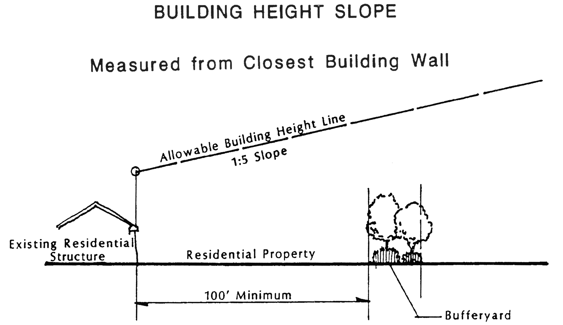
Figure 3.23, Building Height Slope
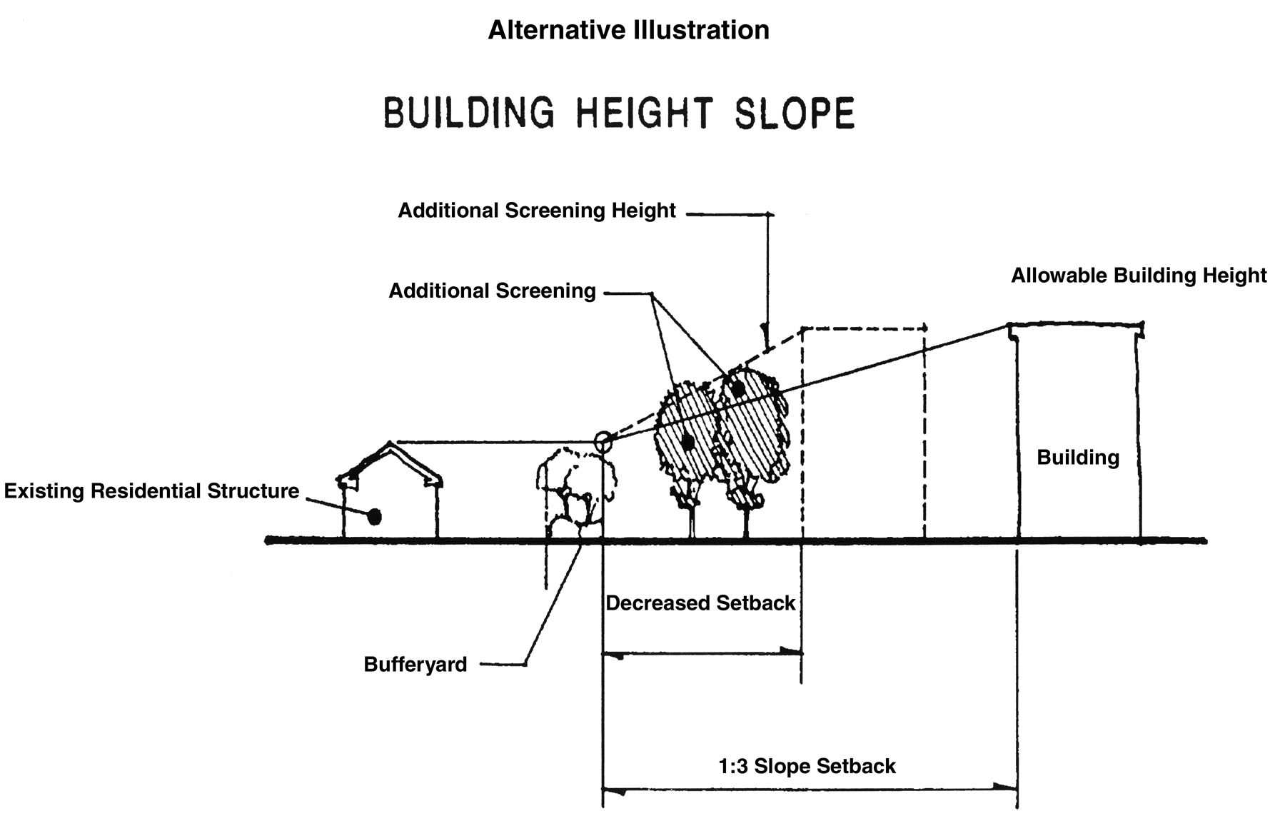
Figure 3.24, Building Height Slope
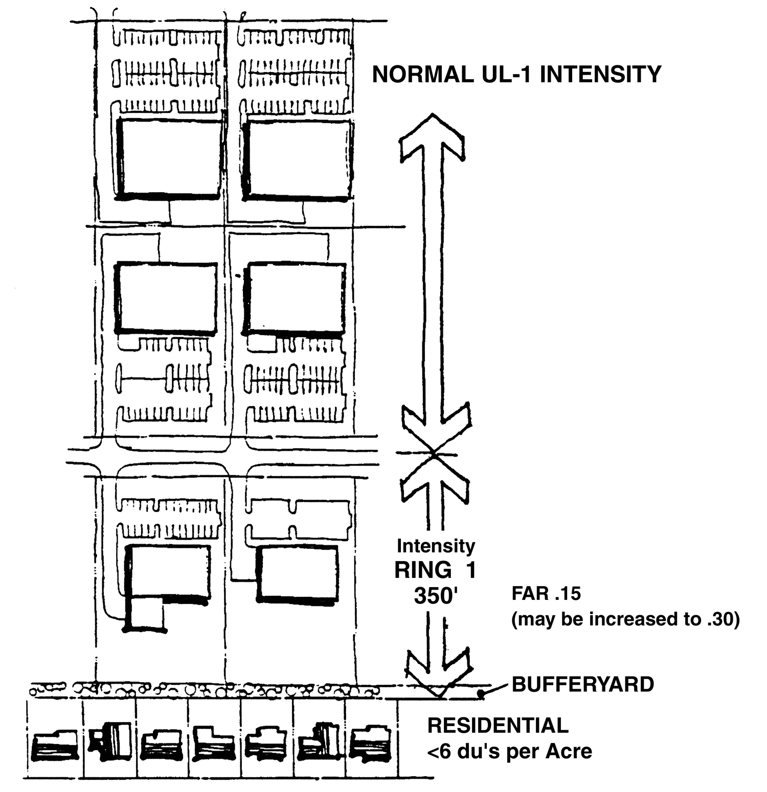
Figure 3.25, Feathering Illustration
2.
Collector Spacing.
The minimum spacing between direct access collector roads, as defined under I-75 Corridor Plan, is as follows unless otherwise approved by County Engineering Staff and/or FDOT:
3.
Temporary Access.
a.
The County and/or the FDOT may permit a temporary access to an arterial street, as defined under the I-75 Corridor Plan, for a developing property that does not meet the criteria in 1 and 2 above when the property has no other access. All properties issued a temporary access shall comply with the Internal Access Roads standards below.
b.
The temporary access shall exist only as long as the property remains without other access options. As soon as a permanent access can be established in accordance with the requirements of this Code, or as soon as a better temporary access can be obtained, the County and/or the FDOT shall require the temporary access to be closed. The County and/or FDOT shall not be held liable for any damages sought by businesses who claim undue hardship from temporary access closure. The closure of the temporary access and the planting of the area in accordance with the land alteration and landscaping requirements of this Land Development Code shall be the responsibility of the landowner. If the landowner fails to begin work on the closure within 60 days of written notification by certified mail, or otherwise fails to proceed to complete the closure, the County may enter upon the property and accomplish this task, and lien the property to recover all direct and administrative costs of such work. A statement authorizing this shall be contained on the final plans for the development.
4.
Internal Access Roads.
a.
Developments fronting on a collector or an arterial street, as defined by the I-75 Corridor Plan, shall participate in developing an internal access road system serving the entire block in an effort to discourage curb cuts and intersections with local streets on planned arterial roadways and also to restrict direct access to arterial roadways from development projects when access can be provided through a collector facility. The County in cooperation with the FDOT, where appropriate, shall develop plans designating the method of internal access for all property between the developer and any public roadway. The County shall send copies of the plan to all affected landowners to inform them of the plan. Any landowner may request a hearing on the plan if they have objections. The approval of all developments shall be contingent upon the internal access roads being built as shown on the approved plan as they provide access to adjoining properties.
b.
Three types of internal access roads shall be permitted: frontage roads, reverse frontage roads, and collector roads. These types of internal access roads may be used alone or in combination with each other. See Figure 3.26.
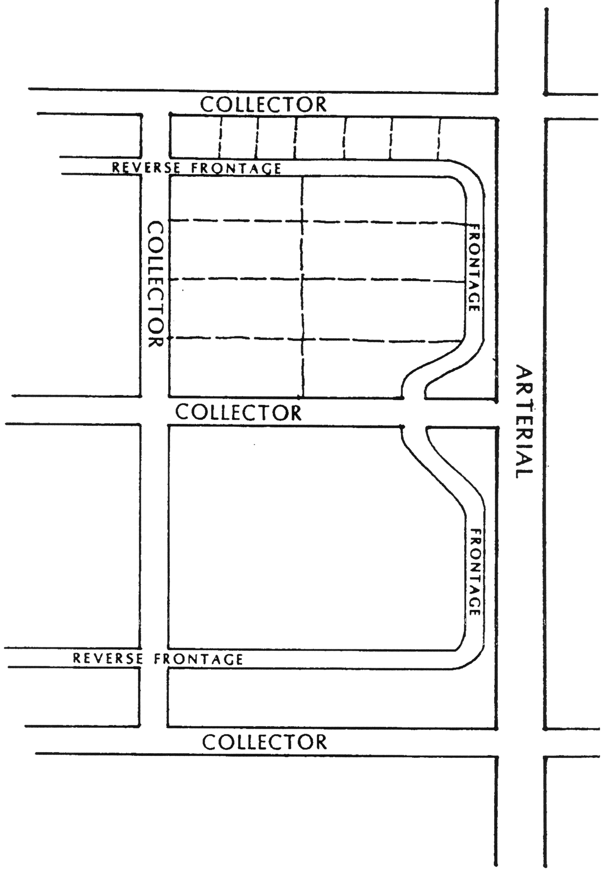
Figure 3.26, Internal Access Roads
5.
Right Turn Movements.
All right turn only intersections shall be restricted to right turn in and right turn out movements. No median breaks shall be permitted at these intersections. Further, each right turn in/right turn out intersection shall provide an appropriate stacking lane and acceleration/deceleration lanes. The exact length of the stacking lane and any other geometric requirements shall be determined by County Engineering and/or FDOT staff after an Engineering Study is completed by the developer.
Q.
Relation to Major Transportation Facilities
1.
Long Range Transportation Plan.
Because of the size and intensity of the Urban Level Categories in the Interstate-75 Corridor, the County shall undertake to develop an Interstate-75 Corridor Plan to be included in the Transportation Element of the Hillsborough County Comprehensive Plan. The Corridor Plan shall demonstrate an adequate arterial and collector support system for the Interstate-75 Corridor. Until this Plan is completed, the current MPO Long Range Transportation Needs Assessment Map in effect at the time of application for development approval, shall be used as guidelines for designating arterial and collector roadways.
2.
Rights-of-way and Cross-sections.
a.
All roads designated as arterials on the County's Interstate-75 Corridor Long Range Transportation Plan shall require rights-of-way capable of supporting the installation of a six-lane roadway with median. Right-of-way requirements shall be consistent with the adopted long range transportation plan and cross-sections shall comply with the standards of the Engineering Services Section and/or the FDOT. It should be noted that once the I-75 Corridor Long Range Transportation Plan is adopted, the cross-sections shown in Figures 3.27 to 3.31 may need to be revised to reflect the cross-section needs of the plan.
b.
Each development adjacent to a roadway(s) classified as an arterial or collector shall either dedicate the appropriate right-of-way as indicated in Tables 4 through 8 or set back all development activity from the portion of the site which will be needed for future right-of-way.
c.
The following cross sections are provided as a guide to implement the I-75 Corridor Comprehensive Plan policies and may be modified subject to the provisions of 3.02.02 C.
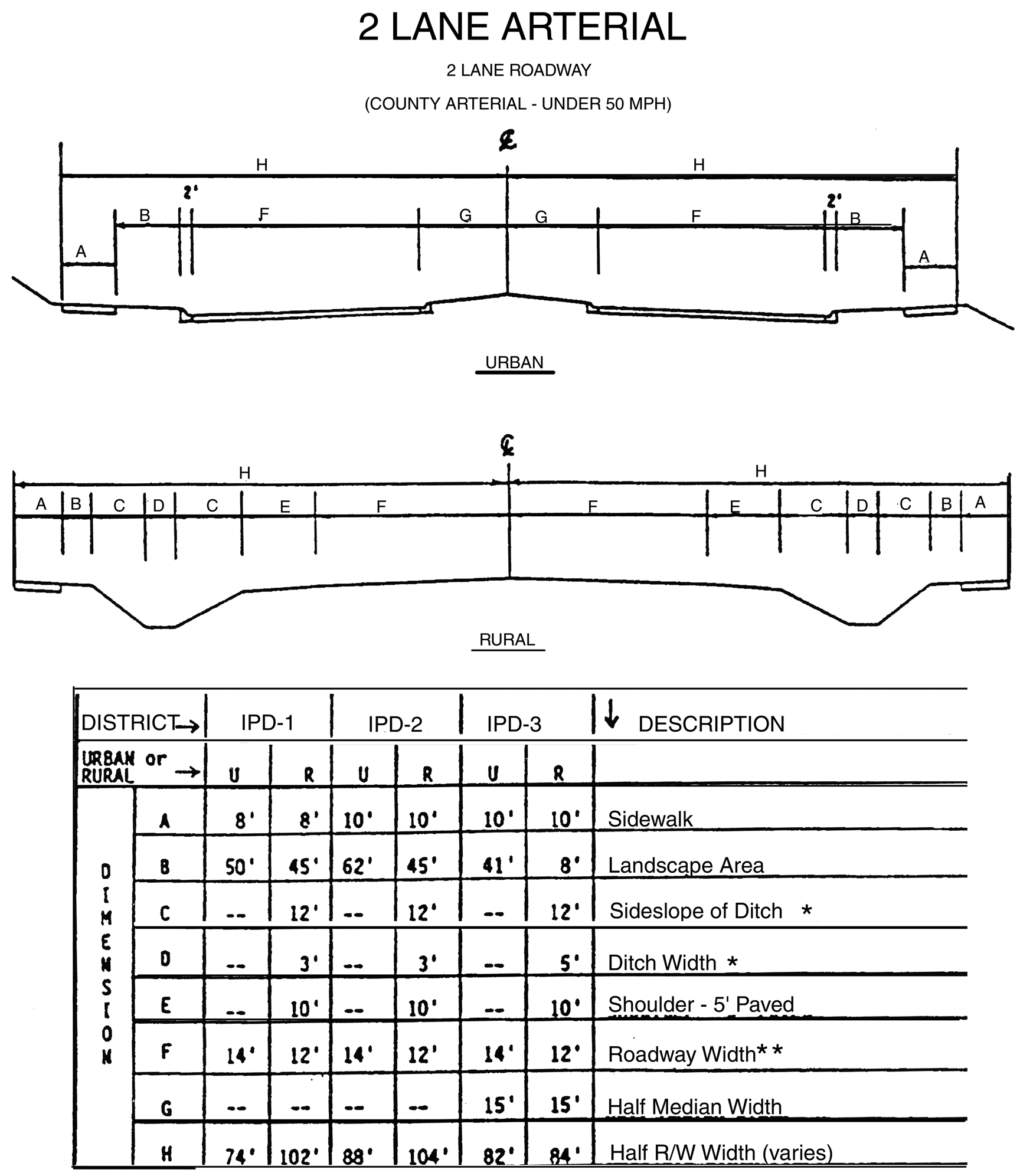
Figure 3.27, X Sections (2 Lane Arterial)
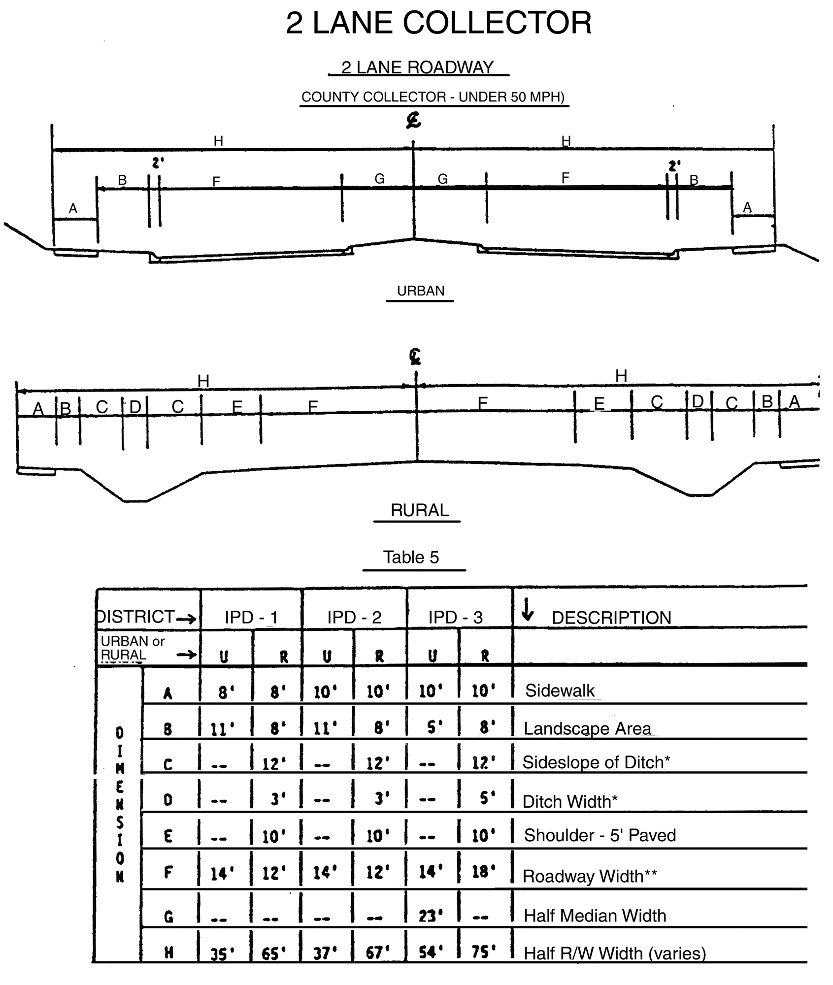
Figure 3.28, X Sections (2 Lane Collector)
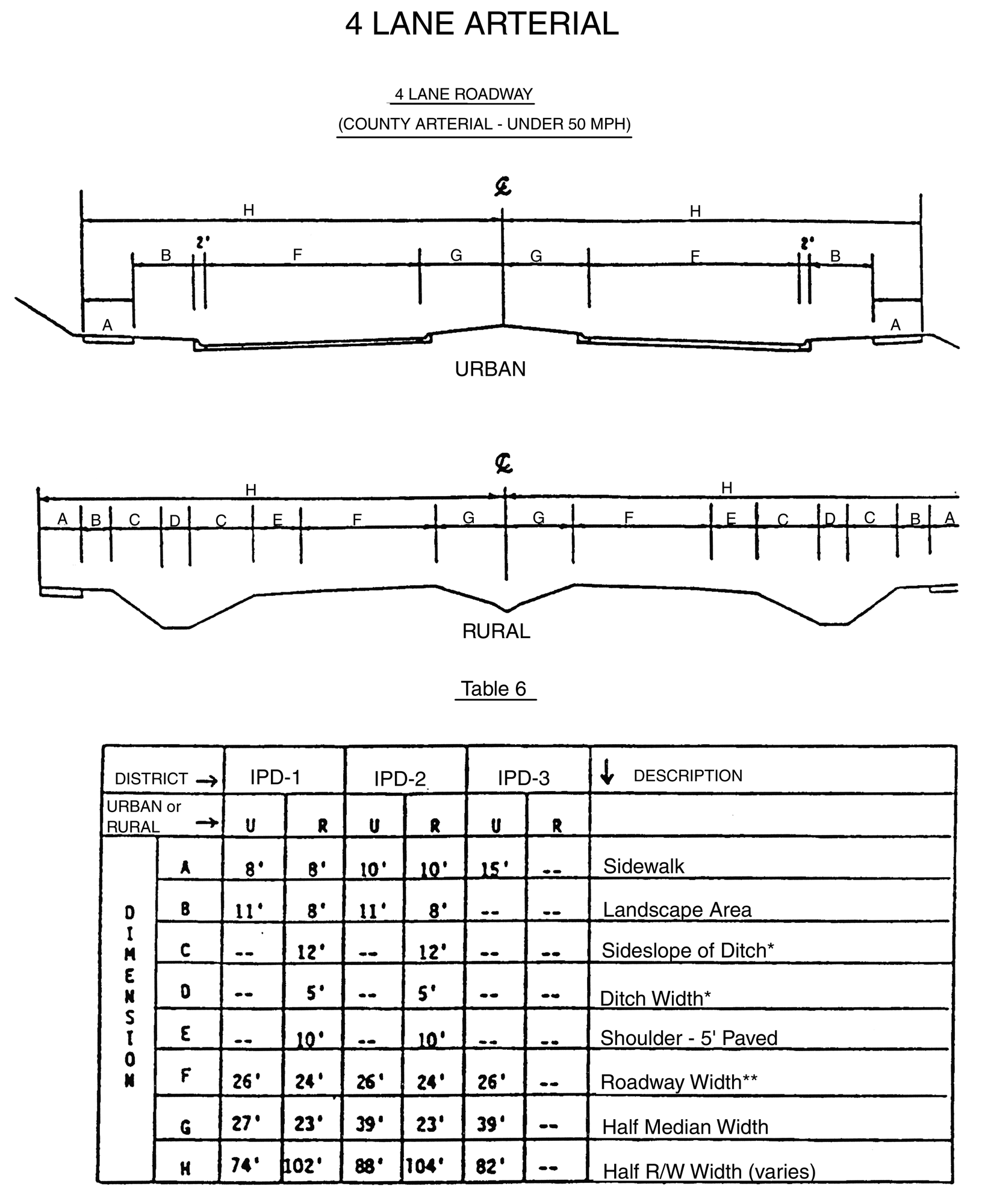
Figure 3.29, X Sections (4 Lane Arterial)
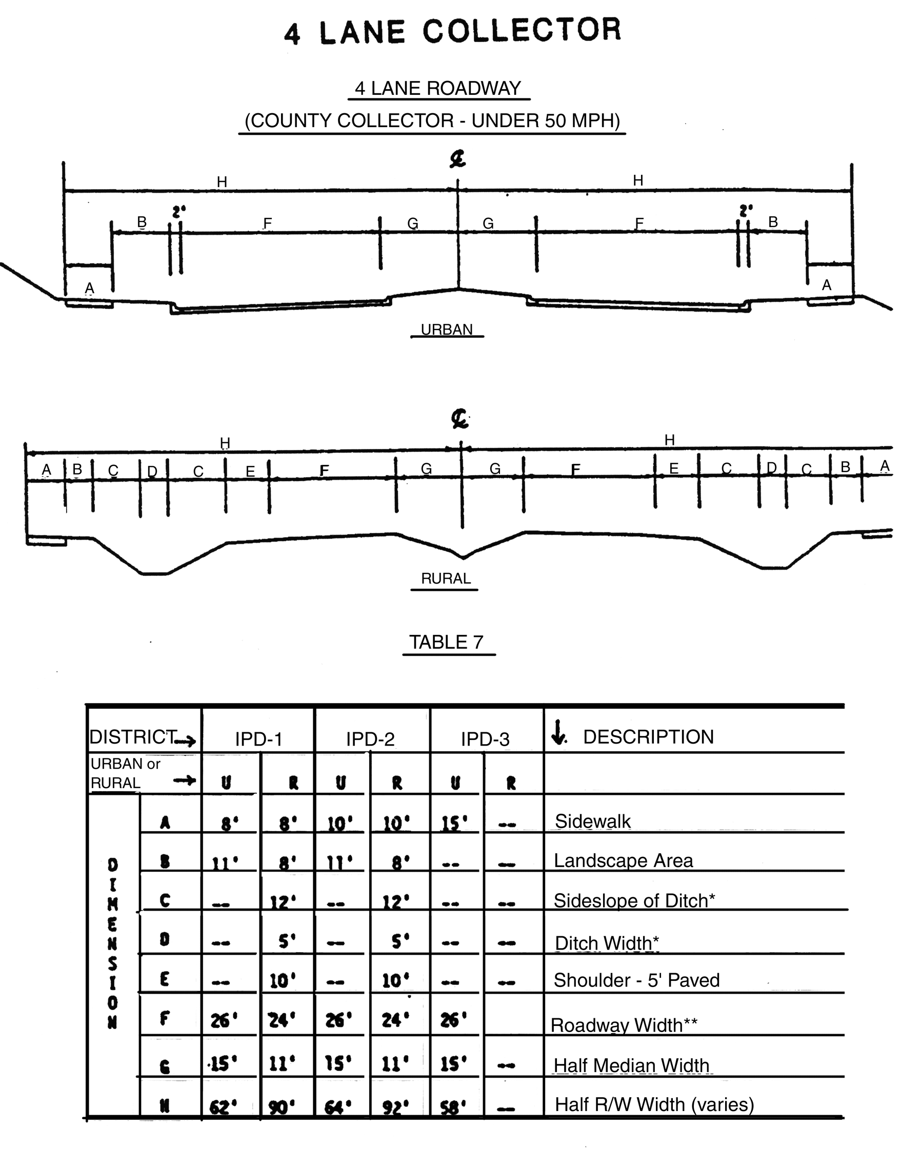
Figure 3.30, X sections (4 Lane Collector)
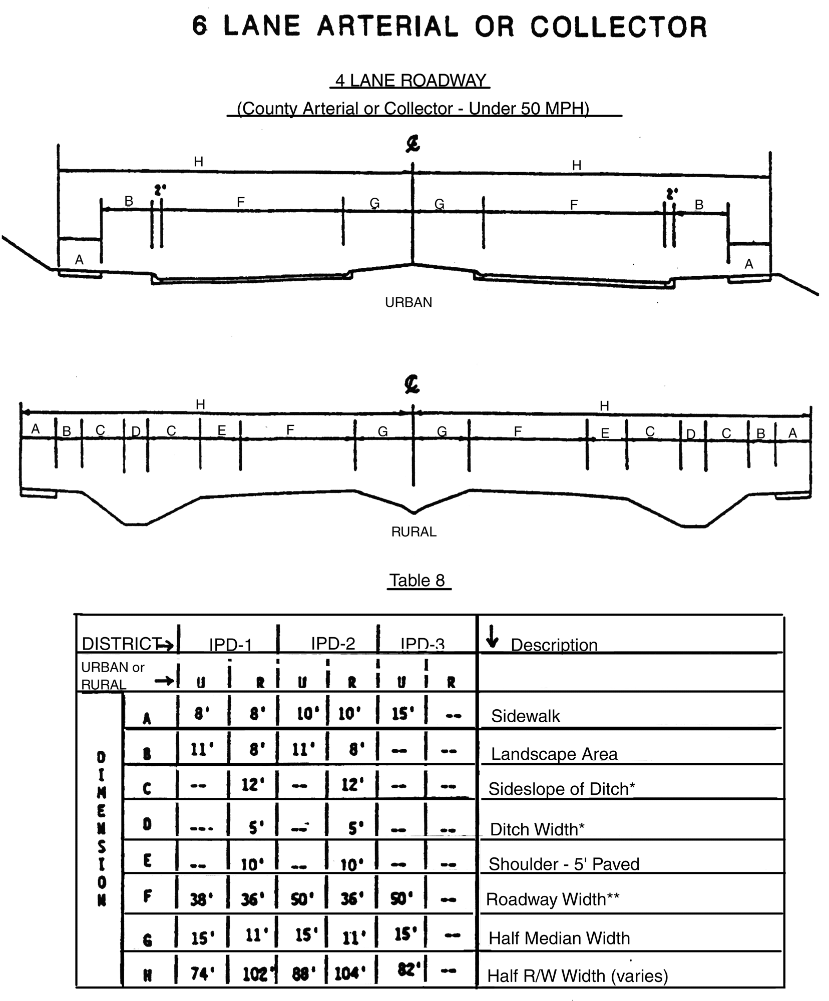
Figure 3.31, X sections (6 Lane Arterial or Collector)
R.
Transportation Standards: Roadway Capacity Analysis
1.
The purpose of the transportation analysis shall be to demonstrate that sufficient roadway capacity exists on roadways impacted by the development to support the remaining unconstructed portion of the development without violating the level of service standards presented herein. The analysis shall include traffic from existing developments and developments under construction which impact the same roadways.
2.
No IPD development shall be permitted that would result in a reduction of the impacted road network's level of service (LOS) below the LOS standard. The LOS standard for all roadways in the I-75 Corridor shall be as stated in the update of the Traffic Circulation Element of the Comprehensive Plan for Hillsborough County. Therefore, all IPD developments generating over 100 vehicle trips per day, shall be required to submit a road capacity analysis pursuant to the above criteria. The LOS approved in the Comprehensive Plan shall be the standard applied in this Article.
3.
The above criteria may not apply if it is determined pursuant to the procedures set forth in Div. 1.8 that a particular project has "vested rights" with respect to transportation. In addition, those phases of Developments of Regional Impact specifically approved prior to the February 14, 1989 shall not be subject to the transportation analysis and service level requirements contained herein. Development of those phases of these projects shall proceed in accordance with the transportation mitigation conditions contained in the development order.
4.
IPD district road capacity analyses shall determine the amount of development to be permitted based on available roadway network capacity and the necessitated roadway improvements to mitigate the development's impact. Additional increments of development may be approved concurrent with roadway improvements sufficient to provide the necessary capacity.
5.
Prior to the issuance of building permits (if more than two years following zoning approval or if more than two years since the last transportation analysis was submitted) the developer shall provide a transportation analysis which presents the anticipated transportation impacts from the development or portion of the development under consideration. Building permits shall be issued only if it is shown that sufficient roadway network capacity to serve the project is available, or shall be provided by the developer. The developer shall indicate on each detailed site plan the date of the last transportation analysis submitted along with verification that there is sufficient roadway network capacity to serve this portion of his development.
S.
Nonmotorized Circulation System
1.
IPD Nonmotorized Circulation System.
All IPD Districts shall provide an on-site Non-motorized Circulation System that shall connect the following major components of the development:
a.
Pedestrian Facilities
b.
On-site Structures and Uses
c.
Bicycle Trails
d.
Internal and External Road Systems
e.
Abutting Properties
f.
Transit Facilities
2.
On-site Pedestrian Facilities Required by IPD Districts.
a.
All IPD districts shall have on-site pedestrian trails and/or sidewalks which connect on-site structures and uses with the street sidewalks along the internal and external roads as described in 3.02.04 P.
b.
For IPD-2 and IPD-3 districts, a grade separated pedestrian crossing system shall be required at the locations determined in the Pedestrian Circulation Plan. The Pedestrian Circulation Plan shall be developed upon completion of the I-75 Corridor Long Range Transportation Plan. The Pedestrian Circulation Plan will establish locational and warrant criteria and the funding mechanisms for grade separated pedestrian crossings.
3.
On-site Bicycle Facilities Required by IPD Districts.
a.
All IPD-1 districts shall have off-street bicycle trails linked with pedestrian trails and sidewalks. Where infeasible due to the size and type of the project, the required sidewalk and on-road bicycle facility will assure continuity of the bicycle trail with abutting properties.
b.
All IPD-2 districts that adjoin an IPD-1 district or an IPD-2 district project that have incorporated a bicycle trail, shall incorporate a bicycle trail into its on-site Non-motorized Circulation System. All other IPD-2 district developments shall have the option of providing off-street bicycle trails.
c.
Off-street bicycle trails are not appropriate, in the IPD-3 district. On-street bicycle accessibility will be required in transportation requirements per 3.02.04 P.
4.
Bicycle Parking Areas.
a.
All IPD districts shall provide bicycle parking areas that shall be accessible to on-site bicycle trails and facilities, and on-site structures and uses. Developments with multiple structures and uses shall provide bicycle parking in close proximity to all of the specific use areas. Bicycle parking spaces shall be provided based on a ratio of one bicycle parking space per each twenty required motor vehicle parking spaces. The provision of bicycle parking spaces shall reduce the number of required vehicle parking spaces pursuant to 6.03.00. If the percentage required is less than two bicycle parking spaces, a minimum of two bicycle parking spaces shall be provided. Residential developments shall only be required to provide bicycle parking areas in conjunction with on-site common use and recreational areas such as clubhouses, parks and pool areas.
b.
Bicycle Parking Areas, when not paved, may be included as part of the required open space.
5.
Employee Showers.
To encourage walking and bicycling as commuting modes in IPD districts, it is recommended that shower facilities for both sexes be provided for all developments with 50 employees or greater.
T.
Mass Transit.
The following criteria and standards for rail and bus transit shall be incorporated into the detailed site plans for all IPD district developments.
1.
Rail Transit.
a.
Rail transit facilities shall be built by Hillsborough Area Regional Transit Authority (HART) or the appropriate designated agency. The provision of rail and bus facilities at stations may be in conjunction with developers or property receiving a node designation and shall ensure full pedestrian access to the transit station. All developments on bus routes shall make provision for either a bus stop or ensure the best possible pedestrian access to the transit station.
b.
Once a rail transit station location is identified, the County shall designate it as a transit node. At the time of designation, the County Administrator or other appropriate agency shall designate the pedestrian connector routes providing access to the transit station and shall encourage higher intensity uses to locate in close proximity to the transit station. The following criteria shall be used by staff to designate the pedestrian routes:
(1)
Pedestrian routes shall be generally radial from the rail transit station and shall provide for the shortest route that can be achieved given a generally rectangular road and property base.
(2)
A bus stop shall be in a readily available position for use by pedestrians and rail transit users.
2.
Bus Transit.
a.
Bus routes shall be established by HART but may not be present when development first begins in an area. All developments on bus routes shall make provision for either a transit stop or ensure the best possible pedestrian access to a transit stop. All residential developments containing more than 200 dwelling units, and all non-residential developments having more than 200,000 square feet shall make provisions for a transit stop as part of their application for an IPD district. The County and HART will determine the timing for installation of the transit stop at the rezoning stage. Such facilities when built in accordance with the provisions of this Section, shall be counted as a part of the project's total open space.
b.
During detailed site plan review, the County shall seek a recommendation from HART in approving the location of a transit stop. The following criteria shall be used in reviewing the transit stop location.
(1)
The transit stop shall be in a high activity area and well-lighted.
(2)
Stops should be located on collector and arterial roads near the center of population of residential or employment areas. In retail areas, locations near the anchor tenants are preferred. An access easement agreement shall be provided to HART, when a transit stop provided on private property requires access across private property.
c.
All transit stop facilities shall be designed to insure the safe movement of pedestrians and the handicapped.
d.
Minor transit stops shall be designed as follows unless otherwise determined by the County and HART:
(1)
Each stop shall have the following components: shelter, seating, landscaping, lighting, phone, information, water fountain, and waste containers.
(2)
Shelters shall meet HART design standards. Stops with more than one bus likely at a time, or service more than four times per hour shall provide additional shelters as requested by HART.
(3)
Shelter design may be coordinated with the surrounding development or the separate shelter may be eliminated where the architecture provides for similarly protected space that is suitable for waiting out of inclement weather throughout the transit service period as approved by the County and HART.
(4)
Seating shall be provided both within the shelter and with suitable street furniture outside the shelter in areas that are at least partially shaded. At no time shall the street furniture contain commercial messages.
(5)
Landscaping shall be provided in the form of planters or other appropriate landscaping devices and shall include shaded seating areas.
(6)
Access and internal road geometrics within a development which provides a bus stop shall accommodate a 12.5-foot wide by 40-foot long advance design coach.
(7)
A phone booth, routing and use information displays shall be provided in the development to assist the user in getting to destinations easily.
(8)
Pedestrian paths shall be designed to move the transit users to their final destinations through pedestrian walks or precincts that are well lighted and aesthetically pleasing.
(9)
Where transit stops are located adjacent to arterial and collector roadways, the developer shall provide bus pullout bay, designed in accordance with the design standards of the County, HART and FDOT, where appropriate.
(10)
Figure 3.32 provides an example of a minor transit stop design.
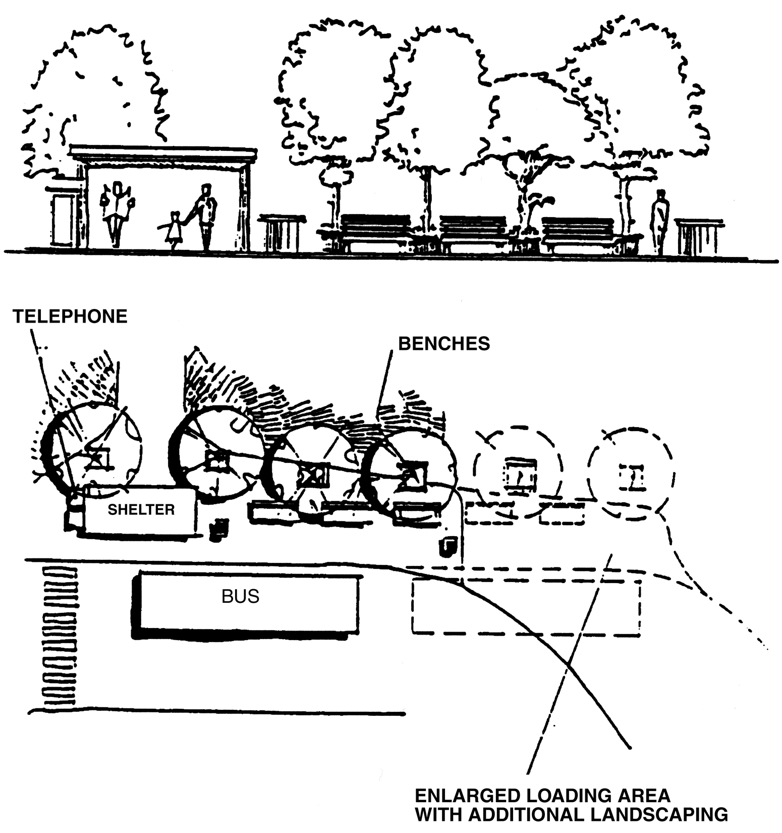
Figure 3.32, Minor Transit Stop Design
e.
Residential developments in the IPD-1 and IPD-2 districts of more than 2,000 units shall propose to dedicate a Park-n-Ride facility site as part of their application for an IPD. During detailed site plan review, the County and HART shall determine the need for such facility and shall approve, if appropriate, the location and timing of the Park-n-Ride facility site. The construction of the Park-n-Ride facility will be done by HART or as negotiated with the developer at the time of rezoning.
f.
All commercial (retail) development having more than 750,000 square feet and mixed use developments containing over 500,000 square feet of commercial space (retail) shall propose a major transit stop as part of their application for an IPD development. Major transit stops shall be designed as follows unless otherwise determined by the County and the Hillsborough Area Regional Transit Authority. (See Figure 3.33)
(1)
All standards for minor transit stops as designated in 3.02.04 T.
(2)
The major transit stop shall be provided adjacent to a main entrance in the case of a retail mall or near an anchor tenant in other cases.
(3)
Developers shall provide separate bus loading/unloading areas segregated from automobile traffic. This loading/unloading area shall be designed to accommodate a minimum of three buses, the actual number to be agreed upon by the developer and HART prior to the time of detailed site plan approval with all disputes to be settled by the County.
(4)
A bus staging area where buses stop to load and unload passengers shall be provided on site, the location of which shall be agreed upon by the developer and HART prior to the time of detailed site plan approval, with all disputes to be settled by the County.
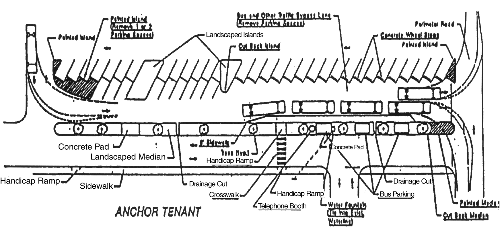
Figure 3.33, Major Transit Stop Design
U.
Outdoor Lighting
1.
Outdoor lighting shall be provided in all developments that do not require street lights. Outdoor lighting shall be located so as to illuminate the project as necessary to provide safe passage within the development but the source of the light, such as the bulb or filament, of outdoor lighting fixtures shall not be directly visible from property outside the zoning lot on which it is located.
2.
An exterior lighting plan shall be required for all exterior lights provided in an IPD district. The exterior lighting plan will demonstrate that overflow lighting does not extend beyond the property line and that a safe environment is created. All developments shall provide sufficient illumination for pedestrians and motorists to perform their normal activity within the development. Lighting shall be provided is a manner that does not pose a nuisance or unnecessary glare to motorists and pedestrians or to adjacent properties. The lighting provided within developments shall meet the requirements and recommendations of the most current standards as adopted by the Illuminating Engineering Society.
V.
Underground Utilities
Electrical distribution with the exception of circuit feeder or larger lines and telephone service lines shall be placed underground in all IPD Districts that are in an area served by underground utilities and whenever possible in other areas.
W.
Off-Street Motor Vehicle Parking and Loading Requirements
1.
Off-street motor vehicle parking and loading shall be as required by 6.03.00. Off-street motor vehicle parking and loading shall be provided such that location and design is appropriate to the needs of occupants and users of the district and protection of adjacent property from adverse effects. No space designated as a required off-street parking space for the general public shall be used as an off-street loading space or maneuvering room for vehicles being loaded or unloaded.
2.
If loading, waste storage facilities, or other facilities are located on the side of the building facing residential development, then these areas shall be fully enclosed to protect adjoining residents from having to look at the mechanical portions of the nonresidential development. See Figure 3.34. The actual dimensions of the space should be adequate to handle all required loading areas and waste storage. The minimum size shown is adequate for trucks of less than 18 feet and County garbage trucks. The County may require evidence on the maximum size of delivery trucks.
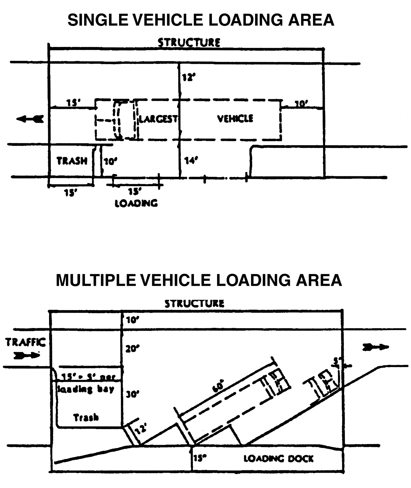
Figure 3.34, Loading illustration
X.
Exterior Storage Yards
Exterior storage yards may be located between new buildings and residential areas only if they are enclosed with a masonry wall or berm wall of at least six feet in height, and the materials stored shall not exceed a height or storage height of more than six feet. The walls shall be landscaped in accordance with this Section, in addition to any other landscaping requirements of this Land Development Code.
Y.
Riverine Corridor Overlay (RCO) Restrictions.
1.
For any land within 50 feet landward of the EPC wetland jurisdictional line where this line runs parallel to the center line of rivers and creeks designated Riverine Corridor Overlay (RCO) District, or within 100 feet of the mean and ordinary water line of such rivers and creeks, whichever is greater, the existing natural plant community vegetation including understory vegetation shall be retained, except for removal of vegetation which is necessary for:
a.
Access to and immediately around proposed structures or other improvements,
b.
Limited construction of sidewalks, paths, or trails (impervious surfaces not to exceed ten percent of the area),
c.
Picnic facilities, boardwalks, or other structures for passive recreation requiring minimal disturbance of the vegetation,
d.
Utility transmission lines if no public easement is required or if the easement is of such a size and location as to have a minimal impact on the vegetation,
e.
Construction of improvements within a road right-of-way,
f.
Construction of stormwater conveyances or outfall facilities.
2.
If it is demonstrated that no beneficial use of the property is possible without removing the natural plant community vegetation for activities other than those allowed above, the developer shall mitigate the adverse impacts to wildlife habitat, native vegetation, and natural stormwater filtration systems by preservation of another area containing a natural plant community or communities, preferably on-site and in proximity to the riverine system. This would be in addition to any other requirement for preservation of environmentally sensitive areas or provision of open space.
3.
If the above mitigation strategy is not feasible, then the developer shall choose one of the following alternatives:
a.
An increase in the percentage of required on-site native plant landscaping specified in this Land Development Code for land alteration and landscaping minimally equal to the percentage of natural plant community vegetation to be removed to obtain beneficial use of the parcel. Preferably, the additional native plant landscaping should be planted in proximity to the riverine system; or,
b.
A contribution to an established land conservation program in Hillsborough County, in accordance with the program's qualifying criteria.
c.
Fencing shall be prohibited within the 50-foot setback of the EPC jurisdictional line of rivers and creeks in designated RCO districts or within 100 feet of the mean and ordinary high water line of such rivers and creeks, whichever is more restrictive.
(Ord. No. 01-30, § 2, 11-15-01; Ord. No. 08-29, § 2, eff. 2-1-09; Ord. No. 14-3, § 2(Exh. A), (Item IV-A), (13-0719), 1-30-14, eff. 2-6-14)
Sec. 3.02.05. - Optional Incentives
A.
Generally
The Comprehensive Plan identifies several site design standards which should be encouraged in the I-75 Corridor in order to help create an urban environment that displays the highest quality private and public sector development. In order to encourage the inclusion of these elements in site designs, the developer shall be able to relax development standards required elsewhere in this section, as follows.
B.
Mixed Uses
1.
If the developer of a mixed use project can demonstrate a minimum 25 percent internal trip capture rate during the peak hour, then the development shall receive an additional ten percent trip bonus towards the impact of the project on adjacent roadways. This ten percent trip bonus shall be applied to the total number of trips generated by the development.
2.
A mixed use project containing a minimum of three uses which includes a commercial use, shall be permitted a five percent reduction in the number of required parking spaces.
3.
A development meeting the criteria as a mixed use project shall receive a reduction of three percent in the overall open space requirements. If the mixed use includes residential development, then the overall open space requirement may be reduced by six percent.
C.
Trip Reduction Plan (TRP)
1.
Developers of projects in the IPD districts that are projected to have more than 50 employees may select to implement a Trip Reduction Plan (TRP) as part of the IPD application. The TRP shall reduce peak hour trip rates by 20 percent and therefore should be encouraged in areas with limited available roadway capacity. The intent of the TRP program is to protect the capacity and integrity of Interstate-75 as a high volume traffic corridor, and to protect and maintain an adequate functioning arterial and collector support system by reducing automobile trips in the peak hour.
2.
A development which selects to be governed by the requirements of a TRP may use the reduced peak hour trip generation in the traffic analysis required in 3.02.04 R 1. If selected, a TRP shall be submitted as part of the IPD application.
3.
The TRP shall address the following:
a.
The number of employees per project or parcel (assuming one peak hour trip per employee).
b.
Methods to be implemented to achieve a 20 percent reduction in employee peak hour trip rate. One or several of the following may be chosen by the developer:
(1)
Preferred parking for ride-sharing/car-pooling.
(2)
Ride-sharing/van-pooling programs.
(3)
Staggered work hours programs.
(4)
Transit use incentives (paid or reduced cost transit tickets).
(5)
Wage incentives.
(6)
Limited employee parking areas.
(7)
Other approved programs.
c.
A report completed by the landowner or employer to monitor the success of the TRP in reducing employee peak hour trips shall be submitted to the County Administrator on an annual basis. The first report shall be due one year from the date of issuance of the Certificates of Occupancy. The annual TRP report shall include the following elements:
(1)
The results of an employee survey which identifies all of the following:
(a)
The number of employees per peak hour shifts.
(b)
The city and zip code of each employee's residence.
(c)
The commute mode of each employee.
(d)
The maximum number of employees on each shift.
(e)
The typical time at which each employee arrives and leaves the workplace.
(f)
A calculation of peak hour employee trip reduction.
(2)
The designation of a TRP Coordinator who will be responsible for: collecting, organizing, and monitoring data; coordinating facilities between the County and the employer; and assisting in the development and maintenance of a successful TRP.
d.
Failure to comply with the desired peak hour reduction of employee trips could result in one or more of the following:
(1)
Reduced FAR for the unbuilt portion of the development.
(2)
Implementation of parking space maximums on future phases of the project.
(3)
Designation/relocation of employee parking to a less convenient area.
(4)
The landowner may be cited for zoning violation.
e.
Sale of all or part of an IPD District
(1)
If a landowner intends to eventually release control of all or part of an IPD district, purchasers shall be required to abide by the IPD's TRP. The purchaser may submit to the County, for its review, an alternative TRP for his portion of the site. The revised TRP may be approved by the County if the purchaser can demonstrate that the goals of the original TRP are still met. The developer may be held responsible for the performance of the TRP until the last building permit for the performance of the IPD district is issued. Once the developer, or successors in title, have completed the IPD district, all landowners shall either develop their own TRPs that shall hold them responsible for their share of the IPD district's original TRP, and submit it to the County for approval, or form an association that abides by the original TRP for the entire development.
(2)
An association may develop a new TRP for the development, but the new TRP must be submitted to the County for approval. The new TRP may alter the required trip generation reduction for individual developments in the IPD district, as long as the original, total trip generation commitment remains in effect. Landowners and associations that choose to develop their own TRP shall be subject to the same regulations and enforcement actions as developers pursuant to this section.
f.
Procedure for Notification and Enforcement.
(1)
Notification.
(a)
When the County determines that an IPD district or a landowner is in non-compliance with its TRP, based on the annual traffic report or any other information available to the County, it shall notify the developer or landowner, by certified mail, within 15 days, that the development or use is in violation of its TRP.
(b)
If a landowner has received notice of violation, the development or landowner shall be required to meet with the County Administrator as set forth in 3.02.05 C 3 f within 30 days.
(2)
Probation.
(a)
From the date of receipt of notification of violation from the County, the development shall be placed on probation and shall be given three months in which to bring itself into compliance with its approved TRP.
(b)
A traffic report shall be submitted to the County by the end of each month of the probation period. See Section 3.02.05 C 3 c.
(i)
If the traffic report determines the development has achieved compliance, and the County approves the determination, then the development shall be released from probation, but shall be required to submit additional traffic reports at the end of each six month period for two years after release from probation in order for the County to ascertain that the TRP is still working.
(ii)
During the probation period, no building permits shall be issued which will increase the peak hour trip generation beyond what would have been allowed with the TRP.
(iii)
If either the traffic report or the County determines the development is still in non-compliance with its TRP, then the developer or landowner shall be notified, by certified mail, within 15 days of the determination, and shall be required to meet with the County Administrator to rectify the situation.
(3)
The landowner shall meet with County Administrator's staff within 30 days of receipt of the violation determination.
(a)
The landowner shall propose a remedial action and monitoring program to be agreed upon by County staff.
(b)
An enforcement program and time frame correcting the noncompliance shall also be determined by County staff. If staff and the landowner cannot reach an agreed remedy or if the property cannot be brought into compliance at the time of the next monitoring report, then a staff recommendation shall be forwarded to the Code Enforcement Board for enforcement proceedings.
D.
Child Day Care Centers
Child day care centers shall be provided in accordance with 2.03.03. In order to qualify for the incentives listed below, the child day care center shall provide supervision and care for more than twenty (20) children.
1.
Child day care center space set aside in any development shall not be included in any FAR calculation determining density or intensity of a development. In effect, the developer receives a density bonus equivalent to the size of the child day care center.
2.
If the applicant can demonstrate to the Administrator that parking associated with the employment generating activity will reduce the number of parking spaces required to serve the child care center, then the developer shall be allowed a reduction of the specifically identified number of required parking spaces.
3.
The developer shall receive the benefit of an internal capture rate to reduce the trip generation rate for the entire development if he can demonstrate that trips associated with the child care center are existing employee-related trips.
4.
In addition, the developer may include the play area for the child care center as part of the open space requirement.
E.
Public Art
1.
Public Art is defined and regulated by the County's Art in Public Places Ordinance. The definitions and requirements of that Ordinance, including the amount or value of the art required to qualify, shall apply to this Section.
2.
If the developer provides public art in an open internal area of a structure, such as an atrium in an office building, the open space area that the art piece occupies shall not be included in the overall FAR for the development.
3.
If the developer provides public art outdoors, then the open space requirements for the parcel on which the art work is located shall be reduced by ten percent.
Sec. 3.02.06. - Maximum Density and Intensity for IPD Districts and Required Open Space
See 6.01.01 for the maximum density and intensity standards and the Table below for the minimum required open space standards.
Sec. 3.02.07. - Rezonings and Development Orders Expressly Conditioned Upon Application of I-75 Standards
A.
Application of Special Condition
Several projects will have been rezoned or will have received final development approval in anticipation of and prior to the effective date of the I-75 Corridor Performance Standards. Express conditions placed upon these rezonings or incorporated into development orders require developers to comply with I-75 Standards in the development of any portions of these projects where application for detailed site plan certification or final plat approval occurs after the new standards are formally adopted. If any other conditions conflict with these new I-75 Standards, the new Standards shall be deemed to apply.
B.
Waiver of Special Condition
This express condition, approved by each of the applicants, also provides for an administrative process, including a public hearing before the Board of County Commissioners, in which a developer must show that significant impairment or significant alteration of the design or character of the project would result from certain of the applicable I-75 Standards. Any developer who wishes to initiate this administrative process shall file an application under the Procedures for Amendment to Zoning Atlas (Rezoning) at 10.03.00. The developer's application shall include an alternative mitigative strategy as a waiver from the strict requirements of those specific performance Standards which the Applicant claims would cause the significant impairment or significant alteration.
Sec. 3.03.01.- Generally
A.
Purpose
1.
The purpose of these historic preservation regulations is to establish procedures, as set forth in the Florida Certified Local Government Program, for the protection of the Historic and Archaeological Resources of Unincorporated Hillsborough County. These regulations are to be read in accordance with and as specified in the provisions of the Florida Certified Local Governmental Guidelines. It is the express intention that these regulations implement the Florida Certified Local Governmental Guidelines. These procedures shall provide for the establishment of an historic preservation review commission to be known as the Historic Resources Review Board (HRRB); the designation of Landmarked Historic and Archaeological Resources, Landmark Sites, and Historic Districts; the maintenance of the Historic Resources Inventory; and the regulation of designated properties. These procedures shall comply with the Florida Certified Local Government Guidelines.
2.
The architectural, archaeological, cultural, and historic artifacts of Hillsborough County are important community resources which enrich the lives of citizens and visitors alike, provide expanded economic opportunity, and present opportunities to stabilize and enhance property values. The structures, interiors, buildings, and archaeological resources important to the understanding of the history and archaeological prehistory of Hillsborough County possess special public interest and should be conserved and protected by designating them and their environs as Landmarked Historic and Archaeological Resources, Landmark Sites, and Historic Districts, hereafter referred to collectively as "Landmarks." These regulations, the purpose of which is to preserve, promote, and improve the Landmarks of Hillsborough County, benefit the educational, cultural, economic, and general welfare of the public.
3.
Hillsborough County has played an important role in the development of Florida, and this history is shown today through its Historic and Archaeological Resources. These Landmarks represent the historical and archaeological activities of the community
B.
Intent
It is the intent of these regulations to:
1.
Protect against the destruction of, encroachment upon, or addition of features likely to have Adverse Effects on the historic, architectural, archaeological, or cultural character of the Landmark.
2.
Preserve the historic and prehistoric cultural and archeological integrity and ancient appearance of Landmarks, wherever located and within any and all Historic Districts established.
3.
Encourage uses which will lead to their continuance, conservation and improvement in a manner appropriate to the preservation of the cultural, archaeological, architectural and historical heritage of the County.
4.
Prevent developments in the visual environs of such areas or structures which would detract from their character.
5.
Assure that new or altered structures and uses will preserve and enhance the special character of the Landmark.
6.
Discourage unnecessary destruction of buildings, structures and sites of special cultural, architectural, archaeological, and historical importance.
7.
Foster such planning as to encourage the continued use and preservation of historic property.
C.
Regulatory Framework
These regulations accomplish historic preservation through a three-step process. First, the regulations establish an HRRB made up of professionals and experts in the field of architecture, anthropology/archaeology, history and other fields related to historic preservation. Second, the regulations provide for a process whereby the Board of County Commissioners will designate the Historic and Archaeological Resources of the County as Landmarks using the recommendations of the HRRB. Third, the regulations establish guidelines for the treatment of Landmarks, especially involving exterior alterations and demolition of buildings and structures and the subsurface disturbance of archaeological resources. The HRRB may issue Certificates of Appropriateness (COAs) for changes to Landmarks.
D.
Historic and Archaeological Resource and Landmark Inventory
1.
The County shall develop and maintain a listing of its Landmarks and Historic and Archaeological Resources considered eligible for Landmark designation. This list, referred to as the Historic Resources Inventory, shall be periodically updated and shall contain, but not be limited to, all Hillsborough County designated Landmarks. The HRRB shall notify affected property owners of its intent to add Historic and Archaeological Resources to the Historic Resources Inventory.
2.
When applications for development permits, development orders or other development approvals affect properties listed in or properties abutting those listed in the Historic Resources Inventory the County department receiving the application shall provide the HRRB written notification within five working days of receiving application for permits which do not require a public hearing and 15 working days after the deadline for filing of application for permits which require a public hearing The County Administrator shall request, obtain, and consider testimony from the HRRB. The HRRB shall give consideration to the views, if any, of interested persons.
3.
The HRRB shall review each application at its next regularly scheduled meeting provided that the HRRB receives notification of the application at least ten days prior to that meeting. If the HRRB does not receive notification of the application at least ten days prior to the next regularly scheduled meeting, the HRRB will review the application at the following month's regularly scheduled meeting. Should the HRRB fail to act on an application within the above referenced time frame, it shall be deemed that the HRRB has no comment regarding the application. The applicant, or its representative, may attend the meeting at which the application shall be reviewed.
4.
The HRRB shall prepare a list of routine alterations, including Minor Work, which may receive administrative review from the HRRB staff, provided that the alteration complies with the guidelines of the HRRB. In reviewing projects which may affect properties listed in or properties abutting those listed in the Historic Resources Inventory, the HRRB shall apply the following criteria to determine whether or not the project will have either no effect or an Adverse Effect on the Landmark and/or Historic and Archaeological Resources:
a.
A project has no effect on a Landmark and/or Historic or Archaeological Resource when the project proposes to preserve and protect those characteristics of the property that qualified, or may qualify, the property for Landmark designation. For the purpose of determining effect, alteration of features of the property's location, setting, or use may be relevant depending on a property's significant characteristics and should be considered.
b.
A project is considered to have an Adverse Effect when the effect on a Landmark and/or Historic or Archaeological Resource may diminish the integrity of the property's location, design, setting, materials, workmanship or associated historic use. Adverse Effects on historic or prehistoric cultural and archaeological properties and resources include, but are not limited to:
• Physical destruction, damage, or alteration of all or part of the property;
• Isolation of the property from or alteration of the character of the property's setting when that character contributes to the property's qualification for the Landmark designation;
• Introduction of visual, audible, or atmospheric elements that are out of character with the property or alter its setting.
(Ord. No. 00-21, § 2, 5-18-00; Ord. No. 03-9, § 2, 6-5-03; Ord. No. 07-18, § 2, 7-19-07, eff. 10-1-07)
Sec. 3.03.02. - Emergency Actions
A.
Request for Emergency Action
The HRRB may request the BOCC to take emergency action to review a threat to a Landmark or a Historic or Archaeological Resource including demolition permits on subject property which has not yet been designated as a Landmark but which appears to be eligible for such designation. This action must be taken within 21 working days of notification to the HRRB by the department receiving the application or at the next regularly scheduled meeting of the BOCC. The department receiving an application concerning an Historic or Archaeological Resource, Landmark, or potential historic property shall provide written notification to the HRRB within five working days of the receipt of the application for permits which do not require a public hearing.
1.
Written information shall be submitted along with and in support of the request to the BOCC that irreparable harm will be done to the Historic or Archaeological Resource if demolition, alteration or construction is allowed to occur thereon.
2.
The BOCC shall notify the HRRB, the applicant for the permit, and the owner of the property in writing of the date, time, and place of the public hearing on the request. All construction activity requiring building permits or the processing of permit applications relating to the property shall be held in abeyance until action is completed with regard to the threatened property.
B.
Review And Determination by BOCC
1.
At the public hearing the HRRB shall present a report to the BOCC discussing the architectural, historical and archaeological significance of the threatened property, evaluating it under the criteria set forth for Landmark designations in 3.03.03 E. The BOCC shall also hear testimony from the owner, the applicant and all other interested persons.
2.
At the close of the testimony, the BOCC shall determine whether all of the following findings of fact have been established:
a.
There is a real and present danger to the threatened property as evidenced by the owner's or applicant's proposal.
b.
Based upon the best available data, the threatened property appears eligible for Landmark designation. The fact that the property has not been designated as a County Landmark or listed in the National Register of Historic Places shall not in itself be grounds for approval of the proposed work or development request.
c.
During consideration of the Landmark designation, the applicant and the owner are not denied all reasonable use of the property.
3.
If in the judgement of the BOCC all of the findings of fact have not been established, the BOCC shall not initiate the Landmark designation procedures for the threatened property. If in the judgement of the BOCC all of the findings of fact have been established, the Board of County Commissioners shall initiate the Landmark designation procedures for the threatened property. Should sufficient information be available, the BOCC may designate as a Landmark the threatened property at this public hearing, or it may request further information and set a date for a final Landmark designation hearing to be held within 90 days.
4.
The HRRB and BOCC shall make every effort to complete the Landmark designation process in a most timely fashion. In every other respect, the Landmark designation shall follow the same procedures as a regular designation.
(Ord. No. 03-9, § 2, 6-5-03; Ord. No. 07-18, § 2, 7-19-07, eff. 10-1-07)
Sec. 3.03.03. - Landmark Designation
A.
Initiation
1.
The HRRB and its staff shall identify and receive recommendations for potential Landmarks from the general public, historic preservationists, and other interested parties.
2.
The HRRB shall review each potential Landmark, in light of the criteria for Landmark designations contained in D. below, and determine whether or not to initiate the designation process.
3.
The HRRB shall, upon its decision to initiate the designation process, direct staff to prepare a written report and analysis of the proposed Landmark under the criteria contained in D. below and any other standards the HRRB may deem necessary. The report shall also include a legal description of the property to be designated and a description of the contributing resources to be designated.
B.
Review and recommendation by the HRRB
1.
The HRRB shall hold a public hearing on each proposed Landmark designation within 60 days of the date to the HRRB's decision to initiate the designation process. Notice shall be given pursuant to the notice requirements contained in F. below, including notification to the property owner.
2.
The HRRB shall review each potential Landmark in light of the criteria for Landmark designations contained in D. below, and public testimony and evidence presented at the public hearing, and make a recommendation to the Board of County Commissioners to approve, disapprove, or modify the proposed Landmark designation.
3.
The HRRB shall prepare a written Landmark designation report for each Landmark designation. The report shall include the testimony given at the public hearing, an architectural or archaeological description, a statement of significance including a brief history, and the criteria by which the Landmark is considered worthy of designation. A site plan and photographs shall be included in the report. When available, floor plans of the building should be included. The report shall contain sufficient specific information about the property to serve as a guide for the evaluation of any future proposed changes to the property.
4.
The HRRB shall forward its recommendation and the Landmark Designation Report to the Hillsborough County City-County Planning Commission for review of the proposed Landmark designation as it relates to the Comprehensive Plan. The Planning Commission shall forward their comments to the HRRB and BOCC within 30 days.
5.
The HRRB shall forward the Planning Commission recommendation and the HRRB recommendation to the BOCC within 30 days of the close of the HRRB public hearing.
C.
Review and Determination by the Board of County Commissioners
1.
The BOCC shall hold a public meeting on the proposed designation within 60 days of receipt of the HRRB recommendation. Notice shall be given pursuant to the requirements of F. below, including notification to the property owner. The BOCC shall review the proposed Landmark designation in light of the criteria contained in D below, the HRRB recommendation and the Planning Commission comments, and shall approve, modify or disapprove of the proposed Landmark designation at the public meeting.
2.
The HRRB shall notify the property owner of the designation of the Landmark.
3.
The Landmark designation shall be recorded in the official record books of Hillsborough County, with the registry of deeds and noted on the Official Zoning Atlas of Hillsborough County.
4.
Landmark designation by the BOCC shall be subject to the procedures and regulations of the HRRB in addition to the other provisions of the Land Development Code and other regulations of Hillsborough County.
5.
Within three (3) days of the oral decision by the BOCC to designate a Landmark, the property owner may appeal the BOCC decision to the Circuit Court of Hillsborough County. The nature of the appeal shall be by writ of certiorari.
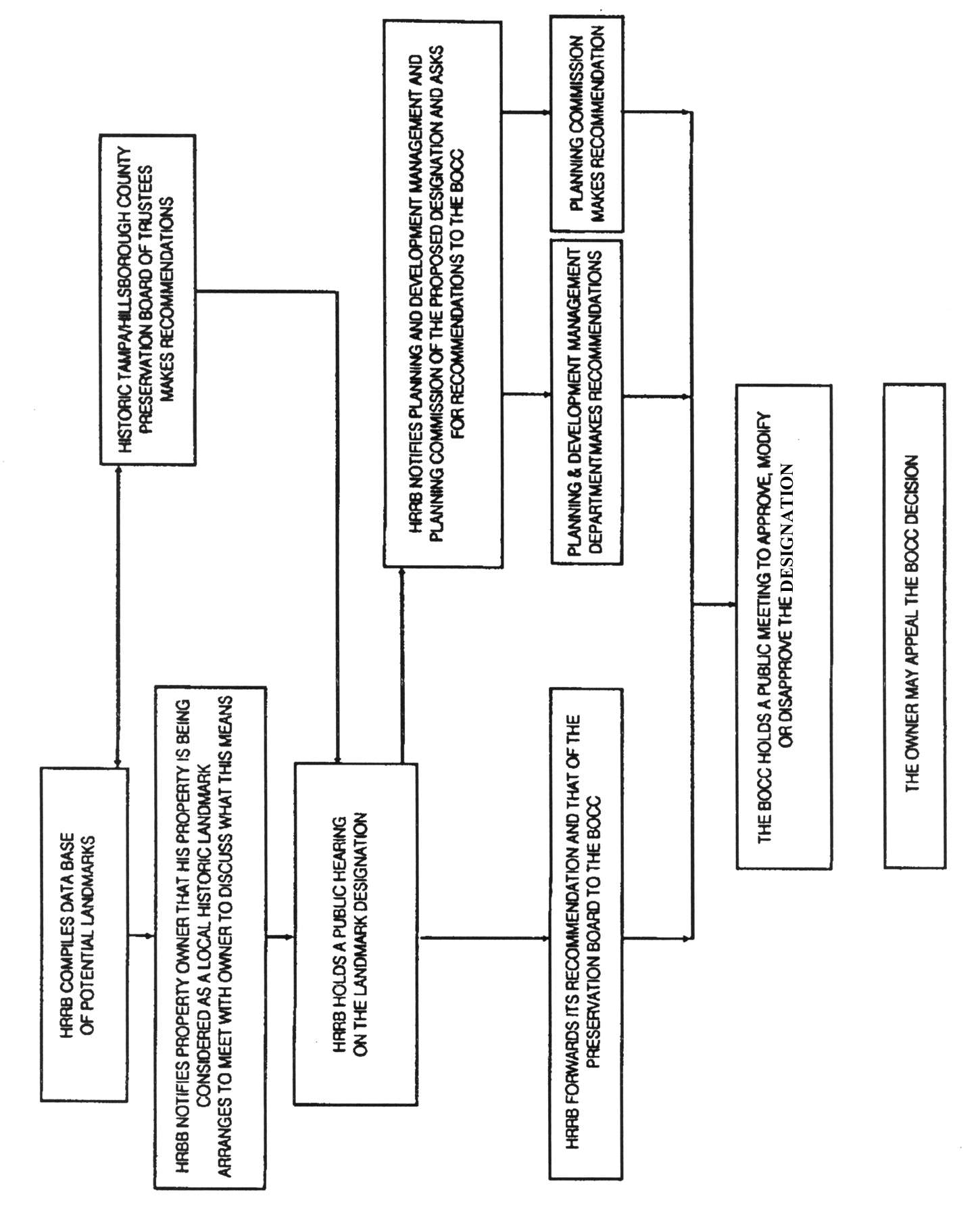
Figure 3.35, Landmark Designation Process
D.
Criteria for Landmark Designation
A Landmark shall have achieved significance within the time period established by the National Register of Historic Places, which is 50 years old or older (An exception to the 50 year rule may be made if the resource is of Exceptional Importance or if it contributes to a district that is eligible for listing in the National Register of Historic Places) and shall qualify for designation when it meets one or more of the following criteria. It:
1.
Is associated in a significant way with the life of a person important in the past.
2.
Is the site of an historic event with significant effect upon the community, state, or nation.
3.
Exemplifies the historical, cultural, political, economic, or social trends of the community, state or nation.
4.
Embodies those distinguishing characteristics of an architectural style, period or method of construction.
5.
Is the work of an architect or builder whose work has influenced the development of the community, state or nation.
6.
Contains elements of design, detail, materials or craftsmanship of outstanding quality or represents a significant innovation or adaptation to the Florida environment or constructed of materials not now used.
7.
Has value as a building that is recognized for the quality of its architecture and that retains sufficient features showing its architectural significance.
8.
Has yielded, or is likely to yield, archaeological information important in prehistory or history.
9.
Is a geographically definable area or neighborhood united by culture, architectural styles or physical development, which has historic or cultural significance in the community.
10.
Because of its prominence or spatial location, contrasts of siting, age or scale is an easily identifiable visual feature of the community and contributes to the distinctive quality or identity of the community.
11.
Is where veterans of America's wars are buried and where public tribute may be paid in their memory.
Each designation of a building, structure, district, object, archaeological resource, or parcel of land as a Landmark shall be accompanied by the designation of a Landmark Site.
E.
Effects of Designation as a Landmark
1.
Upon designation of a Landmark by the Board of County Commissioners, that property becomes eligible for the Historic and Cultural Conservation Districts (SPI-HC) zoning category should the owner so desire (see Sec. 3.01.07).
2.
Upon designation of a Landmark by the Board of County Commissioners, that property may become eligible for consideration for economic incentives.
3.
Upon designation of a Landmark by the Board of County Commissioners, the HRRB, with the owner, may prepare a plan for the long-term preservation of the Landmark.
4.
Upon designation of a Landmark by the Board of County Commissioners, that property shall be subject to regulation by the HRRB. A COA issued by the HRRB shall be required prior to any exterior alteration of the Landmark, if it is a building or structure, and prior to any subsurface excavation, trenching, or digging in cases of Landmarked Archaeological Resource.
5.
Upon designation of a Landmark by the Board of County Commissioners, Hillsborough County and all public utility and transportation entities shall be required to obtain a COA prior to initiating any changes in the character of street paving, sidewalks, trees, utility installations, lighting, walls, interior partitions or walls, fences, structures and buildings on property, easements or streets, included within or adjacent to the designated Landmark.
6.
Upon designation of a Landmark by the Board of County Commissioners, that property may become eligible for development rights transfer for historic sites.
F.
Notice
Upon establishment of a public hearing date, notice of the public hearing shall be given:
1.
By the County Administrator posting a sign(s) no later than 15 calendar days prior to the public hearing date in a conspicuous place upon the property which is the subject of the application; and
2.
By the Administrator causing the publication of a notice one time at least 15 calendar days prior to the public hearing date in a newspaper of general circulation in Hillsborough County; and
3.
By proof of mailing receipt to all owners of property, as reflected on the current year's tax roll, and, where common property lies within the required notice distance, to all condominium and owners' associations, lying within 500 feet in every direction when the subject parcel is within the Agricultural and Residential-1 Categories of the Comprehensive Plan, and 300 feet in every direction when the parcel is within any of the remaining Plan categories. If a subject parcel contains more than one land use designation, the greatest applicable notice distance shall apply. Said notice by mail is the responsibility of the applicant and shall be mailed no later than 15 calendar days prior to the public hearing date; and
4.
By proof of mailing to all duly registered neighborhood organizations whose boundaries lie within one mile of the subject site. Said notice by mail is the responsibility of the applicant and shall be mailed no later than 15 calendar days prior to the public hearing date.
(Ord. No. 00-21, § 2, 5-18-00; Ord. No. 03-9, § 2, 6-5-03; Ord. No. 07-18, § 2, 7-19-07, eff. 10-1-07)
Sec. 3.03.04. - Certificate of Appropriateness
A.
General Requirements
1.
A COA from the HRRB shall be required before a person may undertake the following work on, or alteration to, a Landmark, whether or not a building permit is required for such work:
a.
Exterior alteration, including murals.
b.
Alteration of an archaeological resource.
c.
Relocation.
d.
New construction.
e.
Demolition.
f.
Permanent landscaping.
2.
A COA shall not be required for the painting of historic materials which were originally painted. A COA shall be required when an applicant proposes to paint an historic material which has not previously been painted (i.e., brick or stone) and for color selection for a new structure on a Landmark Site or an addition to a Landmark. In this case, the color should be compatible with that of the historic structure or Landmark.
3.
A COA may contain the HRRB's recommendations for work on, or alteration to, a Landmark. Recommended work or alteration shall be clearly designated as "recommended." Performance of recommended work or alteration is not required as a condition of the issuance of the COA.
4.
A COA may be required if any development activity results in a discovery of historical or archaeological artifacts on the project site.
B.
Initiation of Certificates of Appropriateness Review Procedures
1.
The County Administrator or other applicable County departments shall refer to the HRRB any person applying for a permit or development order which will affect a designated Landmark. Application shall be made directly to the HRRB for a COA.
2.
To be placed on the HRRB's current month's agenda, application must be filed no less than ten calendar days before the regularly scheduled HRRB meeting. If the application is not filed at least ten days prior to the next regularly scheduled meeting, the HRRB will review the application at the following month's regularly scheduled meeting.
C.
Administrative Review and Determination for Minor Work
The HRRB shall prepare a list of routine alterations which may receive administrative approval from the HRRB staff without a public meeting, provided that the alteration complies with the guidelines of the HRRB. Such approvals shall include but not be limited to:
1.
Minor Work by replacement of damaged or deteriorated materials in like kind including:
a.
Roofing
b.
Siding
c.
Windows
d.
Railings
2.
Restoration by replacing non-historic elements with reproduction elements matching or approximating the original materials.
3.
Emergency repair or replacement of water, sewer, or necessary underground utilities on, or in the immediate vicinity of a Landmarked Archaeological Resource.
D.
HRRB Review
1.
Prior to formal COA application, a tentative COA proposal may be brought before the HRRB for comments.
2.
For new construction, conceptual plans shall be reviewed and approved prior to the preparation of construction drawings, which shall also be reviewed and approved before a COA is issued.
3.
An application for a COA for archaeological disturbance shall be accompanied by full plans and specifications indicating areas of work that might affect the surface and subsurface of the archaeological site.
4.
The County Administrator shall post a notice on the property at a location visible to the public seven calendar days prior to the meeting.
5.
The applicant, or its representative, shall attend the meeting at which the application shall be reviewed. Failure to attend shall invalidate the application.
E.
HRRB Determination
1.
The HRRB shall take action at a public meeting on each application for a COA.
2.
COA's approved by HRRB staff shall be reviewed and formally approved by the HRRB.
3.
For COAs which do not meet the criteria for HRRB staff approval, the following action shall occur:
a.
The HRRB shall make a decision on each application at its next regularly scheduled meeting provided the application has been made at least ten days prior to that meeting and seven-day proper public notice has been posted by the County Administrator.
b.
The HRRB may:
• approve the COA application as presented;
• approve the COA application with conditions (the HRRB shall provide the applicant with a list of the conditions); or
• deny the COA application.
c.
For demolition, relocation or new construction, the HRRB may extend the decision for an additional 30 days, or with the mutual consent of the HRRB and the applicant, for an additional specified period of time.
d.
The HRRB decision shall be an oral vote, recorded in the minutes of the meeting and confirmed in writing to the applicant by the HRRB staff. Reasons for the decision shall be given. The HRRB may suggest modifications with review by HRRB staff.
e.
Should the HRRB fail to act on an application within the above referenced time frame, the application shall be deemed approved.
f.
Applicants shall be given notice of the public meeting at which their application will be heard.
4.
The issuance of a COA shall not relieve the applicant from obtaining other development permits, orders, and approvals required by Hillsborough County. A building permit or other development permit, order, or approval shall be invalid if it is obtained without the COA required for the proposed work.
F.
Limitations on New Application
If the HRRB determines that a COA shall not be issued for a proposed alteration, relocation or new construction, a new application affecting the same property may be submitted during the 12 months after the disapproval only if a substantial change, as determined by HRRB staff, is made in the plans for the proposed work. The new application shall address the issues discussed by the HRRB as its reasons for rejecting the application.
G.
Appeal
An appeal from a decision of the HRRB on a COA may be taken to the Land Use Hearing Officer pursuant to 10.05.01
(Ord. No. 99-26, § 2, 11-18-99; Ord. No. 00-21, § 2, 5-18-00; Ord. No. 03-9, § 2, 6-5-03; Ord. No. 07-18, § 2, 7-19-07, eff. 10-1-07)
Sec. 3.03.05. - Review Criteria for Certificates of Appropriateness: Alteration and New Construction
A.
Generally
In making a decision on an application for a COA involving a designated Landmark, the HRRB shall use the guidelines it has adopted, The Secretary of the Interior's Standards, and consider the following:
1.
The effect of the proposed work on the Landmark property.
2.
The relationship between the proposed work and other buildings, structures or objects on the Landmark Site or other related Landmark Sites.
3.
The historic and architectural significance, architectural style, design, arrangement, texture, materials.
4.
Through the use of the guidelines, a successful rehabilitation might involve repair or replacement of original materials or the introduction of new elements. The work should relate properly to the original components of the building and surroundings.
5.
The effect of the proposed work on the historical integrity and ancient appearance of the Landmark property.
B.
Interiors
The HRRB shall not have review authority over alterations to the interiors of a building or structure, but may study such plans as they relate to the exterior.
C.
Landscaping
The HRRB shall consider the effect of the proposed work on the established or historic landscaping on the Landmark Site.
D.
New Construction
When an applicant wishes to undertake new construction on a Landmark Site, the HRRB shall consider the compatibility of the new construction with the existing character of the Landmark or Landmark Site. New construction shall be compatible in:
1.
Scale: height and width
2.
Setback
3.
Orientation and site coverage
4.
Alignment, rhythm and spacing of structures
5.
Form and detail
6.
Materials
7.
Façade proportions and window patterns
8.
Entrances and porch projections
9.
Roof forms
10.
Horizontal, vertical or non-directional emphasis
11.
Paint and stain colors
12.
Impact on established historic landscape
E.
Archaeological Resources
When making a decision on an archaeological resource, the HRRB shall consider methods to avoid, reduce or mitigate Adverse Effects on the archaeological features, while taking into account the current needs of the owner.
(Ord. No. 07-18, § 2, 7-19-07, eff. 10-1-07)
Sec. 3.03.06. - Review Criteria For Certificates Of Appropriateness: Demolition Of Landmarks Or Buildings And Structures On Landmark Sites
A.
Evidence On The Need For Demolition
When an applicant wishes to demolish a Landmark, the applicant shall have the responsibility of proving that the demolition is necessary and shall present adequate evidence on the need for the demolition. The HRRB shall take into account the situation and resources of the applicant in terms of the requirements for information provided by the applicant and in the case of economic hardship of an owner-occupied residential building, will provide assistance in compiling the necessary data, should the owner so desire. Nothing shall preclude an applicant from presenting more information as he sees fit to make his case.
B.
Alternatives To Demolition
1.
The applicant shall explore alternatives to demolition (such as relocation or renovation) and shall demonstrate said explorations to the HRRB. These shall include alternative approaches to the land use, relocation of the Landmark, and incorporation of the Landmark into the proposed redevelopment.
2.
The HRRB may negotiate with the applicant to see if an alternative to demolition can be found.
3.
The HRRB may ask interested individuals and organizations for assistance in seeking an alternative to demolition.
C.
Reasonable Beneficial Use
1.
The HRRB shall study the question of economic hardship for the applicant and shall determine whether the Landmark can be put to reasonable beneficial use without the approval of the demolition application. These determinations shall be in addition to the other factors examined by the HRRB in the demolition request.
2.
In the case of an income producing property, the HRRB shall also determine whether the applicant can obtain a reasonable return from the existing property.
3.
If economic hardship or the lack of a reasonable return is not proved, the HRRB shall deny the demolition application.
D.
Information Provided By The Applicant
In order to make an informed decision about a demolition, the HRRB must be provided the following information by the applicant. In the case where economic hardship or reasonable economic use is not at issue, the financial documentation is not required. Most of the financial information required is available through the tax records, or the applicant's income tax returns, mortgage agreement and property deed.
1.
A written cost estimate of the proposed demolition including removal and all associated costs to meet site condition requirements of this Code.
2.
A written report from a licensed engineer or architect experienced in rehabilitation as to structural soundness and the suitability for rehabilitation. In the case of an owner occupied single-family residential structure, an inspection report from the County Code Enforcement Officer may be substituted for the engineer's or architect's report, should the owner wish.
3.
Assessed value of the property according to the two most recent assessments.
4.
An estimate from a real estate professional experienced in rehabilitation as to the economic feasibility of rehabilitation or reuse of the structure on the property.
5.
The amount paid for the property, date of purchase or acquisition, the party from whom it was acquired, description of relationship between the owner/applicant and the person from whom the property was acquired, and any terms of financing between buyer and seller.
6.
If the property is income producing, the annual gross income from the property for the previous two years; and depreciation deduction, and cash flow before and after debt service, if any, during the same period.
7.
Remaining balance on any mortgage or other financing secured by the property and annual debt service, if any, for the previous two years.
8.
All appraisals obtained within the previous two years by the owner or applicant in connection with the purchase, financing, or ownership of the property.
9.
Any listing of the property for sale or rent, price asked and offers received, if any, within the previous two years.
10.
For income producing properties, maintenance and operating expenses for the previous two years.
11.
Real estate taxes for the previous two years.
12.
Form of ownership or operation of the property, i.e. sole proprietorship, for-profit or not-for-profit corporation, limited partnership, joint venture or other method.
13.
Any other information which would assist the HRRB in making a determination as to whether the property does yield or may yield a reasonable return to the owners, e.g., pro forma financial analysis.
E.
Information Provided By The HRRB
1.
The HRRB shall determine whether the building or structure contributes to the Landmark and whether the building or structure continues to have its Landmark significance. The HRRB may decide that a building or structure on a Landmark Site may be demolished because it does not contribute to the Historic District or Landmark. Such a decision shall be based on its evaluation of the architectural and historical importance of the structure as described in 3.03.03 E.
2.
The HRRB may also make its own study of the points requested by the applicant in order to obtain additional information for its decision.
3.
Funds shall be provided within the regular budget of the HRRB to provide for the investigation of the merits of the demolition request.
4.
The HRRB staff shall determine whether the application is complete based on these points and the rules adopted by the HRRB.
5.
Any designated Landmark slated for demolition and having gone through the review process shall be offered for donation first to a private non-profit or governmental body, then to any private party for relocation on a new site. Only if no new owner or site is available, should a designated Landmark be demolished. A relocated Landmark shall retain its Landmark designation status.
(Ord. No. 07-18, § 2, 7-19-07, eff. 10-1-07)
Sec. 3.03.07. - Adoption Of Guidelines
A.
Landmarks
The HRRB shall adopt illustrated guidelines to assist the HRRB in its assessment of the suitability of work involving Landmarks. These guidelines shall include the Secretary of Interior's Standards for Rehabilitation and Guidelines for Rehabilitating Historic Buildings.
B.
Archaeological Resources
The HRRB shall adopt guidelines for work involving archaeological resources based on principles in the Treatment of Archaeological Properties prepared by the Advisory Council on Historic Preservation. The HRRB shall adopt procedures that it will recommend to owners outlining steps to be taken for the protection of archaeological resources listed in the Historic Resources Inventory and for when archaeological resources are discovered during the development of a site. The HRRB shall also adopt procedures for the permanent protection of archaeological resources.
C.
Notification Of Property Owners
The HRRB shall notify affected property owners of its intent to adopt guidelines for their building or area and shall request comments from owners and interested persons. The HRRB shall hold a public hearing to hear comments on the proposed guidelines. The HRRB shall periodically review at a public meeting, the guidelines it has adopted and shall give notice to the owners affected. This review shall be held at intervals no greater than five years.
(Ord. No. 07-18, § 2, 7-19-07, eff. 10-1-07)
Sec. 3.03.08. - Maintenance and Repair of Designated Properties
A.
Generally
1.
The owner and the tenant of a Landmark shall keep in good repair:
a.
All the exterior portions of such buildings and structures.
b.
All interior portions thereof which, if not so maintained, may cause deterioration, damage or lead to a state of disrepair of the landmark.
2.
The purpose of this requirement is to prevent a person from instigating the demolition of his building or structure through neglect and permitting damage to it by weather or vandalism.
3.
No provision of this section shall be interpreted to require an owner or tenant to undertake an alteration or to restore his building to its original appearance.
4.
In the case of designated archaeological resources, the owners and tenants shall be responsible for the protection and preservation of the archaeological remains on the property. At the time of designation the HRRB shall work with the property owner to establish a plan for the protection of the Archaeological Resource which meets the needs of the resource and the property owner.
5.
The HRRB may meet with owners of Landmarks which are in poor repair to discuss ways to improve the condition of the property. The HRRB may request the Building Department to take action to require correction of defects threatening the preservation of the landmark.
6.
The HRRB may meet with owners of designated archaeological resources when there is an action or effect which threatens the remains in order to develop an effective plan to protect said remains. The HRRB may request Code Enforcement to take action to require correction of defects threatening the preservation of the site or artifacts.
B.
Emergency Conditions
When the Housing and Community Code Enforcement Department determines that there are emergency conditions affecting a Landmark which are dangerous to life, health or adjacent property, the Department may order the correction of these conditions without the approval of the HRRB. The Department shall notify the staff of the HRRB prior to the action being taken. When the emergency conditions do not require demolition, the Department shall make every effort to carry out the intent of this division and to use the guidelines of the HRRB when remedying the emergency conditions.
(Ord. No. 07-18, § 2, 7-19-07, eff. 10-1-07)
Sec. 3.04.01.- New Development
A.
All new buildings, structures, uses and substantial expansions of existing uses within the CHHA, other than government owned or leased facilities, shall be approved through a planned unit development rezoning process for the following:
1.
Commercial or industrial development on more than five acres of land; and,
2.
Residential subdivision exceeding ten lots
B.
For those developments within the CHHA and the I-75 Corridor, the more restrictive requirements shall apply.
C.
All new development within a designated Coastal Barrier Resource System area will not be eligible for Federal flood insurance pursuant to the Coastal Barrier Improvement Act of 1990 (Public Law 101-591).
(Ord. No. 00-21, § 2, 5-18-00)
Sec. 3.04.02. - Septic Tanks
A.
General Prohibition
The use of septic tanks for new development shall be prohibited in the Coastal High Hazard Area.
B.
Exceptions
Exceptions to this requirement may be granted to relieve or prevent excessive hardship only in cases where all of the following criteria are met:
1.
No reasonable alternative exists for the treatment of sewage, and
2.
Discharge from the septic tank will not adversely affect public health and will not degrade surface or ground water, and
3.
Where the Health Department determines that soil conditions, water table elevation and setback provisions are adequate to meet state requirements.
Sec. 3.04.03. - Redevelopment
A.
Non-Public Structures
If any non-public structure or infrastructure within the coastal area is damaged in excess of 50 percent of its most recent assessed value, the structure or infrastructures if rebuilt, shall be rebuilt to meet or exceed all current requirements, including those enacted since the construction of the structure or infrastructure; unless otherwise excepted in the Future of Hillsborough Comprehensive Plan.
B.
Public Structures
If any public structure or infrastructure within the coastal area is damaged in excess of 50 percent of its most recent assessed value, and if the Public Infrastructure Decision Making Matrix (when adopted) permits development, then the structure or infrastructure shall be rebuilt to meet or exceed all current requirements, including those enacted since the construction of the structure or infrastructure.
C.
Substantially improved structures within a designated Coastal Barrier Resource System are not eligible for Federal flood insurance pursuant to the Coastal Barrier Improvement Act of 1990 (Public Law 101-591).
(Ord. No. 00-21, § 2, 5-18-00)
Sec. 3.05.01.- Purpose
A.
The purpose of this Part is to ensure the protection of the quality of existing and future public potable water supplies in Hillsborough County, Florida, through the establishment of Wellhead Resource Protection Areas (WRPA) around public potable water supply wells, Surface Water Resource Protection Areas (SWRPA) around surface water bodies that are upstream of a potable water supply system, and Potable Water Wellfield Protection Areas (PWWPA) around potable water wellfields, and the setback prohibition or regulation of specific activities and facilities in these areas.
B.
The Hillsborough County Board of County Commissioners hereby declares that in order to ensure an adequate and safe future supply of potable water that certain land uses and associated activities, which are deemed by the County to be potential sources of degradation of the drinking water quality in Hillsborough County, may be regulated or prohibited within defined areas. This Part sets forth regulations and prohibitions deemed necessary by the Hillsborough County Board of County Commissioners to ensure protection of the present and future public potable water supply wells, surface water supply sources and potable water wellfields.
C.
After adoption of this Ordinance by the Board of County Commissioners, the County Administrator will establish administrative procedures for facilities to comply with the requirements of this Part. These procedures will establish priorities for compliance and compliance timeframes. Priorities will be based on known groundwater threats to the resource, proposed new prohibited activities and known surface water threats to the resource.
D.
Notwithstanding the vesting (Section 11.02.00) and non-conforming use (Section 11.03.00) provisions of the Land Development Code, all Prohibited and Restricted Activities are required to comply with the requirements of this Part.
(Ord. No. 04-27, § 2, 6-10-04)
Sec. 3.05.02. - Wellhead Resource Protection Area Map, Surface Water Resource Protection Area Map and Potable Water Wellfield Protection Area Map
A Wellhead Resource Protection Area Map consists of the delineation of wellhead resource protection areas. A Surface Water Resource Protection Area Map consists of the delineation of surface water protection areas. A Potable Water Wellfield Protection Area Map consists of the delineation of potable water wellfield protection areas.
A.
Designation of Wellhead Resource Protection Areas
Zones around public potable water supply wells or Aquifer Storage and Recovery Wells that meet the criteria of a public potable water supply well are designated as Wellhead Resource Protection Areas (WRPA) to protect the quality of existing and future potable water resources. The Wellhead Resource Protection Areas for unincorporated Hillsborough County are designated on the Hillsborough County Wellhead Resource Protection Area Map in two zones: Zone 1 - Potable Water Protection Impact Zone and Zone 2 - Public Potable Water Supply Well Protection Zone.
B.
Designation of Surface Water Resource Protection Areas
Lands located adjacent to or near surface water bodies that are upstream of potable water supply systems are designated as Surface Water Resource Protection Areas (SWRPA) to protect downstream water quality from threats of certain types of land use activities and surface water discharges. SWRPA zones which include the land area of surface water bodies and watercourses are designated on the Surface Water Resource Protection Area map.
C.
Designation of Potable Water Wellfield Protection Areas
Potable water wellfields shall have a Potable Water Wellfield Protection Area (PWWPA) of a 500 foot radial setback from a potable water well. The potable water wellfield protection area shall be established for potable water wells to be consistent with State statutes and administrative regulations.
D.
Interpretation of Wellhead Resource Protection Area, Surface Water Resource Protection Area and Potable Water Wellfield Protection Area Designations
To determine the location of properties and facilities within the resource protection areas delineated on the Hillsborough County Wellhead Resource Protection Area Map, the Surface Water Resource Protection Area Map, and the Potable Water Wellfield Protection Area Map, the following general rules shall apply:
1.
Map boundaries.
Provisions of this regulation shall apply for that portion of a parcel of land which lies within a WRPA, a SWRPA or a PWWPA, to the extent of the boundary delimitation shown on the Hillsborough County Wellhead Resource Area Protection Map, the Surface Water Resource Protection Area Map or the Potable Water Wellfield Protection Area Map.
2.
Changes to map boundaries.
Wellhead Resource Protection Area, Surface Water Resource Protection Area and Potable Water Wellfield Protection Area designations may be changed by the Board of County Commissioners, on the basis of defined criteria, including but not limited to changes in the technical knowledge concerning the aquifers or surface waters of Hillsborough County, changes in pumping rates for public potable water supply wells in wellfields, wellfield reconfiguration, the addition of new public potable water supply wells to a wellfield, the addition of new surface water withdrawals for public supply, the addition of potable water wellfields, changes to the Tampa Bay Water Master Water Plan, the establishment of Minimum Aquifer Levels and Minimum Flows and Levels or approval of additional wellfields or surface water withdrawals.
(Ord. No. 04-27, § 2, 6-10-04)
Sec. 3.05.03. - Prohibited Activities In The Wellhead Resource Protection Areas and Surface Water Resource Protection Areas
A.
Prohibited Activities In WRPA Zone 1
Property that is located in both a WRPA Zone 1 and a SWRPA is subject to both 3.05.03.A and 3.05.03.B.
Property that is located in both a WRPA Zone 1 and a PWWPA is subject to both 3.05.03.A and 3.05.05.
1.
New sanitary landfills, including new phosphogypsum piles, and any other disposal of a solid waste as permitted under Chapter 62-701.020, F.A.C.
2.
New industrial land use designations.
3.
New Interim wastewater treatment plants, unless Advanced Wastewater Treatment (AWT) standards and other regulatory requirements for Community Wastewater Treatment Plants are met.
4.
New concentrated animal feeding operations as defined in Chapter 62-670.200, F.A.C.
5.
New dairy farm storage and treatment facilities, high intensity areas and land application areas as defined in Chapter 62-670.200, F.A.C.
6.
Discharge of stormwater into depressions with direct or demonstrated hydrologic connection to the Floridan Aquifer.
7.
Any new land applications of sludge and septage.
8.
New underground storage facilities shall be prohibited within a distance of 1,000 feet from a public potable water supply well.
B.
Prohibited Activities In WRPA Zone 2 and/or SWRPA
Property that is located in both a WRPA Zone 2 or a SWRPA and a PWWPA is subject to both 3.05.03 B and 3.05.05.
1.
The use, handling, production, disposal, and storage of Regulated Substances associated with nonresidential activities is prohibited in the WRPAs and SWRPAs, except as provided under this Part.
2.
No installation shall discharge into groundwater, either directly or indirectly, any contaminant that causes a violation in the water quality standards and criteria for the receiving groundwater as established in Chapter 62-520, F.A.C.
3.
Discharges through natural or manmade conduits, such as wells and sinkholes, that allow direct contact with class G-1 and class G-2 groundwater are prohibited, except for projects designed to recharge aquifers with surface water of comparable quality, or projects designed to transfer water across or between aquifers of comparable quality for the purpose of storage or conservation, or residential stormwater discharging through wet retention/detention ponds.
4.
Industrial stormwater discharges to retention/detention ponds are prohibited.
5.
Discharge of stormwater into depressions with direct or demonstrated hydrologic connection to the Floridan aquifer system is prohibited.
6.
There will be no new land use activities which are classified under the definition of Heavy Industrial.
7.
Heavy Manufacturing is prohibited.
8.
Construction and operation of new solid waste disposal facility as defined by Chapter 62-701.200 F.A.C. shall be prohibited. Operation of all existing sanitary landfills including new phosphogypsum piles, and any other disposal of a solid waste as permitted under Chapter 62-701, F.A.C. will be terminated within one year and a permanent leachate monitoring system installed to monitor movement of leachate.
9.
Junkyards are prohibited.
10.
Industrial septic tank disposal systems are prohibited.
11.
New underground storage tank systems and aboveground storage tank systems, are prohibited within a WRPA Zone 2 or a SWRPA.
12.
Any new land applications of domestic wastewater residuals, sludge, septage and domestic septage are prohibited.
13.
New Interim wastewater treatment plants are prohibited, unless Advanced Wastewater Treatment (AWT) standards and other regulatory requirements for Community Wastewater Treatment Plants are met.
14.
Industrial Wastewater Treatment Plants are prohibited.
15.
New concentrated animal feeding operations as defined in Chapter 62-670.200, F.A.C. are prohibited.
16.
New dairy farm aboveground or underground storage facilities and wastewater treatment plant, high intensity areas and land application areas as defined in Chapter 62-670.200, F.A.C. are prohibited.
17.
New mining operations permitted under Chapters 62-671, -672, and -673, F.A.C. are prohibited.
18.
Land application of industrial waste water and industrial reuse water is prohibited.
19.
Human cemeteries are prohibited.
20.
Land Excavations are prohibited. Notwithstanding, land excavations for the purpose of agriculture irrigation that receive authorization, including permits and exemptions, through the Southwest Florida Water Management District (SWFWMD) or Florida Department of Environmental Protection (FDEP) under Environmental Resource Permit or Water Use Permit rules, may be allowed subject to the requirements of Sections 6.11.54 or 6.11.117 of this Code.
21.
Reclaimed Aquifer Storage and Recovery (ASR) wells are prohibited.
22.
New Class I and Class III underground injection control wells, as regulated in Chapter 62-528, F.A.C., are prohibited.
23.
New Class V underground injection control wells, as regulated in Chapter 62-528, F.A.C., are prohibited except as provided below:
1.
Thermal exchange process wells (closed-loop without additives) for use at single family residences; and
2.
Aquifer storage and recovery systems wells, where the injected fluid meets the applicable drinking water quality standards in Chapter 62-550, F.A.C.
24.
New hazardous waste treatment, storage, disposal, and transfer facilities requiring permits under Chapter 62-730, F.A.C., are prohibited.
25.
New aboveground and underground tankage of hazardous wastes regulated under Chapter 62-730, F.A.C., is prohibited.
C.
Existing Prohibited Activities
All prohibited activities identified in 3.05.03 A and B existing on the effective date of this regulation within a WRPA or SWRPA shall obtain an Operating and/or Closure Permit under Section 3.05.08.
D.
Expansion or Modification of an Existing Prohibited Activity
Any expansion or modification of, or any other improvement made to an existing prohibited activity or facility identified in Section 3.05.03 A and B above which will extend the useful life of the activity or facility, or increase the intensity or productivity of the activity or facility beyond that existing on the effective date of this regulation, shall require a Prohibited Use Operating Permit under Section 3.05.07. The Board of County Commissioners must make a finding of an overriding public interest being served by the expansion of the prohibited activity in order for the Prohibited Use Operating Permit to be approved.
E.
Permitting for New Prohibited Activities
1.
In situations where a new Prohibited Activity will serve an overriding public interest or a compelling public purpose by being located within a WRPA or SWRPA, a Prohibited Use Operating Permit under Section 3.05.07 may be sought. The Board of County Commissioners must make a finding of an overriding public interest being served by the prohibited use in order for the Prohibited Use Operating Permit to be approved. An applicant must meet the provisions of Section 3.05.07 Prohibited Use Operating Permits of this Part.
2.
A Closure Permit is required under Section 3.05.03 for Prohibited Activities.
(Ord. No. 04-27, § 2, 6-10-04; Ord. No. 11-19, § 2(Item V-B)(11-0604), 11-3-11, eff. 2-1-12)
Sec. 3.05.04. - Restricted Activities in the Wellhead Resource Protection Areas and Surface Water Resource Protection Areas
A.
Restricted Activities in WRPA Zone 1
Property that is located in both a WRPA Zone 1 and a SWRPA is subject to both 3.05.04.A and 3.05.04.B.
Property that is located in both a WRPA Zone 1 and a PWWPA is subject to both 3.05.04.A and 3.05.05.
The following activities are restricted in the Wellhead Resource Protection Areas Zone 1, shall require an Operating Permit, and may require a Closure Permit from the County:
1.
Sludges.
Existing sludge spreading activities in a WRPA must be permitted by and meet the requirements of State and Local environmental permitting agencies and this Part. Renewal of an Operating Permit and Special Use Permit under this Part shall not be granted.
2.
Septages.
Existing septage spreading activities in a WRPA must be permitted by and meet the requirements of State and Local environmental permitting agencies and this Part. Renewal of an Operating Permit and Special Use Permit under this Part shall not be granted.
3.
Regulated substances.
Any new facility that uses, handles, stores, or generates a Regulated Substance in an amount equal to or greater than the Final Reportable Quantity (RQ) must be permitted by and meet the requirements of State and Local environmental permitting agencies and this Part.
B.
Restricted Activities In WRPA Zone 2 and/or SWRPA
Property that is located in both a WRPA Zone 2 or a SWRPA and a PWWPA is subject to both 3.05.04 B and 3.05.05.
The following activities are restricted in the Wellhead Resource Protection Areas Zone 2 and Surface Water Resource Protection Areas, shall require an Operating Permit, and may require a Closure Permit from the County. In order to be approved by the County, the applicant shall demonstrate the use of Best Available Technology (BAT) and/or Best Management Practices (BMP) for the particular activity:
1.
Domestic Wastewater Treatment Plants
2.
Animal Production Unit/Type 1 or Type 2
3.
Construction and Demolition Debris
4.
Dry Cleaner/Small or General
5.
Dry Cleaning Plants
6.
Outdoor Firing Ranges
7.
Manufacturing Processing and Assembly (not to include activities that are considered to be Heavy Manufacturing or Minor Industry)
8.
Furniture Finishing and Repair
9.
Utility Refueling Facilities and Sulfuric Acid Tanks
10.
Golf Courses
11.
New generators of hazardous waste, as regulated under Chapter 62-730, F.A.C., which excludes household hazardous waste as defined in 40 C.F.R. Part 261.4(b)(1) (1994), hereby incorporated and adopted by reference, shall comply with the secondary containment requirements of 40 C.F.R. Part 264 Subpart I (1994), hereby incorporated and adopted by reference.
C.
Existing Restricted Activities
Existing activities identified in 3.05.04 A. and B. are restricted in the Wellhead Resource Protection Areas and Surface Water Resource Protection Areas, and shall require an Operating Permit, and may require a Closure Permit from the County, unless qualifying as a General Exemption in Section 3.05.06 In order to be approved by the County, the applicant shall demonstrate the use of Best Available Technology (BAT) and/or Best Management Practices (BMP) for the particular activity.
(Ord. No. 04-27, § 2, 6-10-04)
Sec. 3.05.05 - Potable Water Wellfield Protection Measures
Per Chapter 62-521 F.A.C., the area located within a 500 foot radial setback from a potable water well is designated by the Florida Department of Environmental Protection as a wellhead protection area. These wellhead protection areas are designated Potable Water Wellfield Protection Areas (PWWPA) in Hillsborough County. Facilities located in a PWWPA are subject to the restrictions and prohibitions found in Chapter 62-521.400 F.A.C., as amended. Chapter 62-521 F.A.C. requires compliance with location of certain land uses. Operating and Closure Permits are required and shall comply with requirements of Section 3.05.08 of this Part.
(Ord. No. 04-27, § 2, 6-10-04)
Sec. 3.05.06. - General Exemptions
The following legally existing activities and facilities are deemed by the County to be generally exempt from the requirements of this Part. These general exemptions shall not be construed or otherwise interpreted to exempt those activities or facilities prohibited or permitted in this Part. General Exemption for a particular activity or facility shall not automatically expire so long as the activity or facility meets the criteria of this Part. However, a General Exemption for a particular activity or facility shall be subject to revision or revocation as provided in this Part.
A.
General Exemption for Continuous Transit
The transportation of any Regulated Substance through a WRPA or SWRPA or PWWPA shall be exempt from the provisions of this Part provided that the transporting motor vehicle is in continuous transit. The transport of any Regulated Substance through existing permanent pipelines shall also be exempt provided that the currently authorized use or uses are not changed.
B.
General Exemption for Vehicular Fuel and Lubricant Use
The use of any petroleum product solely as a fuel in a vehicle's fuel tank or as a lubricant in a vehicle shall exempt the vehicle from the provisions of this Part.
C.
General Exemption for the Use of Nitrates Contained in Fertilizers
The use of fertilizers containing nitrates shall be generally exempt from this Part. However, BMP's specified in FDEP's publication Best Management Practices for Agrichemical Handling and Farm Equipment Maintenance shall be utilized for the storage and loading of fertilizers and BMP's contained within the University of Florida's Institute of Food and Agricultural Sciences crop-specific publications shall be utilized for the application of fertilizers. BMP's shall include those which are generally recognized and accepted by IFAS, DACS, FDEP or USDA.
D.
General Exemption for Janitorial Uses
The use of Regulated Substances for the maintenance and cleaning of residential, commercial and office buildings is generally exempt from the provisions of this Part.
E.
General Exemption for Construction Activities
The activities of constructing, repairing or maintaining any facility or improvement on land within a WRPA or SWRPA or PWWPA shall be generally exempt from the provisions of this Part provided that all contractors, subcontractors, laborers, material men and their employees or agents, when using, handling, storing, producing, transporting or disposing of Regulated Substances use applicable Best Management Practices.
F.
General Exemption for Laboratory or Instrument Use
Professional laboratories shall not be required to obtain an Operating Permit for the handling, storage, use, generation, transport of disposal of Regulated Substances, if and only if, these substances are stored, generated, transported, handled, used or disposed of in the normal course of business of the laboratory.
G.
General Exemption for Retail Sales Activity
Retail sales establishments which store and handle, for resale, Regulated Substances in the substance's original and unopened containers shall not be required to obtain an Operating Permit, when using, handling, storing, producing, transporting or disposing of Regulated Substances, use applicable Best Management Practices, and are generally exempt from the provisions of this Part.
H.
General Exemption for Application of Pesticides, Herbicides, Fungicides, and Rodenticides
The application of those Regulated Substances used as pesticides, herbicides, fungicides, and rodenticides in recreation, agriculture, pest control, and aquatic weed control activities shall be exempt from the provisions of this Part provided that:
1.
Application of the substance is in strict conformity with the use requirements as set forth in the EPA registry for that substance and as indicated on the containers in which the substances are sold.
2.
The application is in strict conformity with the requirements as set forth in Chapter 482 and 487 Florida Statutes, and the Florida Administrative Code.
3.
The application of any of the pesticides, herbicides, fungicides, and rodenticides shall be highlighted in the records of the certified operator supervising its use. The certified operator shall provide specific notification in writing to the applicators under his or her supervision that they are working at a site located in a potable water Wellhead Resource Protection Area or Surface Water Resource Protection Area or Potable Water Wellfield Protection Area for which particular care is required. Record shall be kept of the date and amount of those substances applied at each location and said records shall be available for inspection by the County.
4.
There is no permanent storage of the pesticides, herbicides, fungicides and rodenticides.
I.
General Exemption for Office Uses
Office uses, except for the storage, handling or use of Regulated Substances as provided for in this Part, shall be generally exempt from the provisions of this Part.
J.
General Exemption for Residential Uses
Residential uses shall be generally exempt from this Part. However, a minimum lot size of one acre of upland is required for the use of a septic system in WRPA Zone 1 and/or WRPA Zone 2.
K.
General Exemption for Utilities
Utilities are generally exempt from the prohibitions of this Part. However, if a utility has a refueling facility or sulfuric acid tanks located within a WRPA Zone 2 or a SWRPA, an Operating Permit shall be obtained pursuant to Section 3.05.08.
(Ord. No. 04-27, § 2, 6-10-04)
Sec. 3.05.07. - Prohibited Use Operating Permits
A.
Generally
In situations where a Prohibited Activity will serve an overriding public interest or a compelling public purpose by being located within a WRPA or SWRPA, a Prohibited Use Operating Permit may be sought. The Board of County Commissioners must make a finding of overriding public interest in order for the Prohibited Use Operating Permit to be approved. The applicant must demonstrate that special or unusual circumstances and adequate technology exist to isolate the facility or activity from the potable water supply.
In granting the Prohibited Use Operating Permit, the County may prescribe any additional appropriate conditions and safeguards which are necessary to protect the WRPA or the SWRPA. Prohibited Use Operating Permit conditions can include, but are not limited to:
1.
Submittal of existing monitoring reports to the County.
2.
Required actions to prevent an illegal discharge.
3.
Establishing a permit renewal and inspection cycle more frequent than otherwise required.
4.
A requirement for monitoring of groundwater or surface water quality.
5.
Actions which are conditions of approval of the permit which must be maintained in compliance for the permit to be in effect
6.
Surety, bond, escrow, letter of credit, or other common form of financial assurance.
B.
Duration
A Prohibited Use Operating Permit for a particular activity or facility shall remain valid for a five-year period provided the permitee is in compliance with the terms and conditions of the permit and there is no change in the activity or use of the property. A Prohibited Use Operating Permit for a particular activity or facility shall expire automatically five years after issuance, unless revised, revoked or extended as provided in this Part. An applicant must apply for an Extension and obtain approval before the expiration of the permit. Permits may be extended more than once.
C.
Conditions and Safeguards
In granting the Prohibited Use Operating Permit, additional conditions and safeguards may be prescribed which are deemed necessary to protect the existing impacted well(s), future identified well(s) or future potable surface water supply resources. The applicant for a Prohibited Use Operating Permit shall demonstrate by the preponderance of competent substantial evidence of:
1.
Overriding public interest.
The Board of County Commissioners must make a determination that there is an overriding public interest or a compelling public purpose being served by allowing a prohibited use to locate or expand in a WRPA or a SWRPA.
2.
Unique hardship.
Unique circumstances exist which are peculiar to the particular non-residential activity or facility and which are different than any other prohibited or permitted non-residential activity or facility; and
3.
Best Available Technology.
Best Available Technology exists which will isolate the activity or facility from contaminating the existing or future potable water supply resources; and
4.
Hydrogeologic data and analysis.
Site-specific hydrogeologic data and analysis establish that the activity or facility will not elevate water quality parameters above the limits set forth in Chapters 62-302, 62-520, 62-522 and 62-550 Florida Administrative Code at the point of discharge, and
5.
Best Management Practices.
Utilization of Best Management Practices shall be required.
D.
Application to the County.
Activities claiming Prohibited Use Operating Permit with best available technology to isolate the facility or activity from the potable water supply facility and protect the potable water supply wellfield must submit:
1.
A Prohibited Use Operating Permit application claiming special or unusual circumstances and adequate protection technology.
2.
Such application shall contain a statement by the applicant detailing the circumstances which the applicant feels would entitle him to an exemption pursuant to this section.
3.
Information must be provided that proves that an overriding public interest is being served by the prohibited use.
E.
Review of Prohibited Use Operating Permit Applications
Applications will be reviewed for:
1.
An overriding public interest being served by the prohibited use.
2.
Impacts of the activity on public potable water supply wells and public potable water supply systems or surface waters.
3.
Results of the required Inspection Report showing any determinable violation of the code requirements.
4.
A determination that there is or is not a proposed activity or facility which requires permit conditions.
5.
Determination of proposed use of Best Available Technology.
6.
Determination of unique hardship.
7.
Determination of proposed Best Management Practices.
8.
In order to authorize any Prohibited Use Operating Permit, the Wellhead Hearing Master shall consider the following criteria:
a.
Special conditions: That special conditions and circumstances exist which are peculiar to the land, structure, or building involved, including the nature of and to what extent these special conditions and circumstances may exist as direct results from actions by the applicant.
b.
No special privilege: That granting the Prohibited Use Operating Permit requested will not confer on the applicant any special privilege that is denied by this Article to other similar lands, buildings, or structures in the WRPA or SWRPA.
c.
Unnecessary hardship: That literal interpretation of the provisions of this Article would deprive the applicant of rights commonly enjoyed by other properties under the terms of this Article.
d.
Prohibited Use Operating Permit is necessary: That the Prohibited Use Operating Permit granted is the minimum variance that will make possible the reasonable use of the land, building, or structure.
e.
Purpose and intent compliance: That the grant of the Prohibited Use Operating Permit will be in harmony with the general intent, purpose, and spirit of this Article, and with the comprehensive plan adopted pursuant to state law.
f.
No detriment to public welfare: That such Prohibited Use Operating Permit will not be injurious to the area involved or otherwise detrimental to the public welfare.
g.
Establishing conditions or safeguards: That in granting any Prohibited Use Operating Permit, the Wellhead Hearing Master may prescribe appropriate conditions and safeguards to ensure proper compliance with the general spirit, purpose, and intent of this Article. Noncompliance with such conditions and safeguards, when made a part of the terms under which the Prohibited Use Operating Permit is granted, shall be deemed a violation of this Article.
h.
Expiration: All Prohibited Use Operating Permits granted by the County shall be deemed to automatically expire in the event a structure or use of land which is the subject of the Prohibited Use Operating Permit has been discontinued.
F.
Revocation Or Revision of Prohibited Use Operating Permits
1.
Any permit issued under the provisions of the Code shall not become vested in the permittee. The Administrator will revoke any permit by first issuing a written notice of intent to revoke by certified mail, return receipt requested, or hand delivery, if he finds that the permit holder:
a.
Has failed or refused to comply with any of the provisions of the Code, including but not limited to permit conditions and bond requirements.
b.
Has submitted false or inaccurate information in his application.
c.
Has failed to submit operational reports or other information required by this Article.
d.
Has refused lawful inspection.
e.
Is subject to revocation.
2.
The Administrator may revise any permit by first issuing a written notice of intent to revise, sent by certified mail, return receipt requested, or hand delivery.
3.
Within 30 days of any spill of a Regulated Substance in the WRPA or SWRPA the County shall consider revocation or revision of the permit or revise the bond amount. In consideration of whether to revoke or revise the permit, the Administrator may consider the intentional nature or degree of negligence, if any, associated with the spill, and the extent to which containment or cleanup is possible, the nature, number and frequency of previous spills by the permittee, and the potential degree of harm to the surface water, groundwater or surrounding wells due to such spill.
4.
For any revocation or revision by the County of a Prohibited Use Operating Permit as provided under the terms of the Code, the Administrator shall issue a notice of intent to revoke or revise which shall contain the intent to revoke or revise the Operating Permit.
5.
The written notice of intent to revoke or revise shall contain the following information:
a.
The name and address of the permittee, if any, and property owner, if different.
b.
A description of the facility which is the subject of the proposed revocation or revision.
c.
Location of the spill, if any.
d.
Concise explanation and specific reasons for the proposed revocation or revision.
e.
A statement that "Failure to file a petition within 30 days after the date upon which permittee receives written notice by certified or registered letter to the lessor and landowner of the intent to revoke or revise shall render the proposed revocation or revision final and in full force and effect."
6.
Failure of the permittee to file a petition shall render the proposed revocation or revision final and in full force and effect.
7.
Nothing in this section shall preclude or be deemed a condition precedent to the County seeking a temporary or permanent injunction.
G.
Inspection
1.
Inspection Upon Application for Permit
Facilities and properties applying for a Prohibited Use Operating Permit are subject to onsite inspection of the physical buildings and property by a County inspector before any permit is issued.
2.
Inspection for Violations of County Code
Facilities and properties which are covered under Part 3.05.00 of the Land Development Code may be inspected for compliance with the Code provisions.
H.
Hearing Before Wellhead Hearing Master
1.
Findings and Recommendations
a.
The Wellhead Hearing Master shall file his recommendation and submit the record of the hearing to the Clerk of the Board of County Commissioners within 15 days of the close of the hearing.
b.
The Clerk of the Board of County Commissioners shall, within three working days from the date that the Wellhead Hearing Master's recommendation and the record of the hearing are filed, deliver a copy of the recommendation to the applicant, and the Administrator.
c.
The recommendation of the Wellhead Hearing Master shall include:
1.
Summary of evidence presented.
2.
Findings of fact.
3.
Conclusions of law.
4.
A finding of compliance or a finding of all points of noncompliance with this Code and the Comprehensive Plan.
5.
A recommendation to either approve or deny the application with reasons therefore specified, including any recommended conditions.
d.
No application shall be recommended for approval by the Wellhead Hearing Master unless it is found that the application is in compliance with this Code and the Comprehensive Plan.
2.
Record of Hearing Before the Wellhead Hearing Master
The record of the hearing before the Wellhead Hearing Master, which shall be submitted to the Clerk of the Board of County Commissioners, shall consist of:
a.
The application and accompanying documents.
b.
Staff reports and recommendations.
c.
All exhibits and documentary evidence.
d.
The summary, findings, conclusions, and recommendation of the Wellhead Hearing Master.
e.
The tape recording of testimony at the hearing.
f.
Verbatim transcript of the proceedings.
I.
Consideration by the Board of County Commissioners
1.
Notice Date for Board of County Commissioners' Consideration
a.
Any person wishing to receive notice of the date when the Board of County Commissioners will consider an application may supply the Clerk of the Board of County Commissioners with their name, address, and a stamped self-addressed envelope for that purpose.
b.
A date and time at which the Board of County Commissioners will consider an application shall be established no later than 15 days from the conclusion of the public hearing before the Wellhead Hearing Master. The Administrator shall arrange for the setting of said date and shall ensure that the Clerk of the Board of County Commissioners is advised at least 30 days in advance of said date.
c.
Upon notification of the date and time at which the Board of County Commissioners will consider an application for final decision, the Clerk of the Board of County Commissioners shall give notice of same by proof of mailing receipt, to the applicant and to all owners of property who were notified for the public hearing before the Wellhead Hearing Master as required by 3.05.07.I.6. Other parties of record and all persons who supplied the Clerk with their names, addresses, and a stamped self-addressed envelope for the purpose of receiving notice shall also receive notice. Such notice shall be mailed at least 20 days prior to the date set.
2.
Evidence Before the Board of County Commissioners
a.
The record before the Board of County Commissioners upon consideration of an application shall be the complete record of the hearing before the Wellhead Hearing Master, including his recommendation. Except in those instances where the application is part of the review and application for development approval pursuant to Chapter 380.06, Florida Statues, the Board after reviewing the record and recommendations, shall consider additional evidence only as considered in 2.B below.
b.
Additional evidence may be allowed pursuant to the provisions of this Subsection, if:
1.
Through the exercise of due diligence it could not have been discovered in time to present same to the Wellhead Hearing Master; and/or
2.
The witness could not appear at the public hearing for good reason beyond his control.
c.
Within seven calendar days after the date of filing of the Wellhead Hearing Master's recommendation, the individual seeking to introduce the additional evidence described in 2 above, shall file with the Clerk of the Board a written request including:
1.
The additional evidence, and
2.
The reasons why the evidence could not through the exercise of due diligence have been discovered in time to present same to the Wellhead Hearing Master; and/or
3.
The reasons why the witness could not appear.
d.
The request shall be filed on forms available from the Administrator. A copy of said request shall be maintained by the Administrator and maintained in a master file available to the public and the Board.
e.
The additional evidence, if documentary, shall be attached to the request. If testimonial in nature, a summary of the testimony shall be provided.
f.
The Board shall consider the request for presentation of additional evidence and responses thereto at the public meeting on the Wellhead Hearing Master's recommendation. Staff of the Office of County Attorney shall review the additional evidence request in regard to whether or not the request meets the criteria stated in 2. above and whether or not the additional evidence is duplicative of material already in the record before the Wellhead Hearing Master. Staff of the County Attorney's Office shall report its findings at the meeting before the Board. The Board shall remand the proceeding to the Wellhead Hearing Master for the purpose of consideration of the additional evidence if he finds all the following:
1.
The additional evidence could not through the exercise of due diligence have been discovered in time to present same to the Wellhead Hearing Master, or the witness could not appear at the public hearing for good reason beyond his control.
2.
That the additional evidence is not duplicative of material already in the record before the Wellhead Hearing Master.
3.
The evidence is relevant to the issues raised by the petition at issue.
g.
If the Board finds that the additional evidence is not admissible based upon the criteria contained herein, then the Board shall deny the request and proceed to consider the petition. The Board of County Commissioners shall specifically state on the record why a request has been denied. Once a request is denied, the material presented shall not be considered by the Board in its deliberations.
h.
If the Board finds that the additional evidence is admissible and therefore elects to remand the proceedings to the Wellhead Hearing Master, then the Board shall establish a date for said hearing. The remanded proceedings shall be conducted in accordance with the terms of this Code applicable to proceedings before the Wellhead Hearing Master, except that said proceeding does not have to be renoticed. At the conclusion of the remanded proceedings, the Wellhead Hearing Master shall file an amended recommendation which has considered the introduction of the additional evidence. The Clerk of the Board shall renotice all parties of record of the new set time and date at which the Board will consider an application for a final decision.
i.
If the applicant elects to waive any objection to the additional evidence, the Board of County Commissioners may proceed to consider the petition without remand.
3.
Proceedings Before the Board of County Commissioners
a.
The participants before the Board of County Commissioners shall be the applicant, County agencies and Parties of Record. The order of appearance and time allotments shall be as follows, provided that for good cause shown, the Board may grant additional time. Testimony shall be limited to matters directly related to the record of the proceedings before the Wellhead Hearing Master.
b.
The presentation shall be as follows:
1.
Applicant and witnesses; proposal: 15 minutes, plus an additional 15 minutes if requested by the applicant.
2.
Administrator, summary of the application, County staff and department findings: five minutes.
3.
Proponents; argument for the application: 15 minutes.
4.
Opponents; argument against the application: 15 minutes.
5.
Staff, amended recommendations, if any: five minutes.
6.
Applicant; rebuttal and summation: five minutes.
c.
The Board of County Commissioners may continue the hearing upon a finding that said continuance is necessary to a complete review of the Wellhead Hearing Master's recommendation. Said continuance shall be to a date and time certain.
d.
The Board of County Commissioners reserves the right to remand an application to the Wellhead Hearing Master when additional review is needed. If the Board elects to remand an application to the Wellhead Hearing Master, the Board shall establish a date and time for said hearing, which shall not exceed 45 days from the date of the Board hearing.
4.
Party of Record
A party of record is:
a.
A person who was present at the hearing before the Wellhead Hearing Master and presented either oral testimony or documentary evidence.
b.
A person who was notified of the hearing before the Wellhead Hearing Master by proof of mail pursuant to the terms of this Section.
5.
Consideration and Final Decision of the Board of County Commissioners
The Board of County Commissioners shall consider the record of hearing before the Wellhead Hearing Master, and any testimony or additional evidence received pursuant to the terms contained herein, and shall approve or deny the application subject to such conditions as may be necessary and appropriate.
6.
Notice
a.
Notice of review by the Wellhead Hearing Master of applications for Prohibited Use Operating Permits shall be provided by the applicant by proof of mailing receipt, to all owners of property within 500 feet of the perimeter of the boundary of the proposed activity. Public rights-of-way less than 1,000 feet in width as measured at the site shall be excluded in calculating notification distances. When a water body less than 1,000 feet in width intervenes in the required notice distance and extends beyond the notice distance, only the property owners adjacent to the water body will receive the extended notice. However, when a water body intervenes, but does not extend beyond notice distance, the water body shall not be recognized for the purpose of notice. The names, addresses and tax folio numbers of all such owners shall be obtained by reference to the latest ad valorem tax records. In addition, notice shall be provided in the same manner to all duly registered neighborhood organizations lying within one mile of the boundary of the proposed activity. Said notice by mail is the responsibility of the applicant and shall be mailed no later than 20 calendar days after filing of the application. Said notice shall be mailed again by the applicant by proof of mailing receipt, upon establishment of the Wellhead Hearing Master's date and Board of County Commissioners meeting date. The notice shall indicate both dates the application will be considered on, in addition to the requirements of 3.05.07.I.6.D, and shall be mailed no later than 15 calendar days prior to the Wellhead Hearing Master's hearing. In the event the date of the hearing is changed, a new notice shall be sent by the applicant. Further notice shall be given by the Administrator by posting a sign in a conspicuous place on the property which is the subject of the proposed activity at least 15 calendar days prior to the Wellhead Hearing Master's hearing date.
b.
Where an application to amend a DRI Development Order is brought to the Board of County Commissioners directly, as authorized in 10.03.00, notice shall be provided by the applicant proof of mailing receipt, to all owners of property within 500 feet of the perimeter of the proposed activity which is the subject of the amendment, excluding public rights-of-way less than 1,000 feet in width. When a water body less than 1,000 feet in width intervenes in the required notice distance and extends beyond the notice distance, only the property owners adjacent to the water body will receive the extended notice. However, when a water body intervenes, but does not extend beyond notice distance, the water body shall not be recognized for the purpose of notice.
c.
Notice of review by the Wellhead Hearing Master, as well as notice of final consideration by the Board of County Commissioners of the recommendations of the Wellhead Hearing Master, shall be provided in accordance with 10.03.00 of this Code, and the requirements of Chapter 380, Florida Statutes.
d.
For purposes of paragraphs A and B above, mailed notices shall contain the following information:
1.
Date, time and location of the hearing;
2.
A description of the request;
3.
A legal description of the property;
4.
Location of the property;
5.
Instructions for obtaining further information regarding the request; and
6.
The applicant's name.
(Ord. No. 04-27, § 2, 6-10-04; Ord. No. 06-34, § 2(Exh. A), 11-2-06)
Editor's note— It should be noted that § 4 of Ord. No. 06-34, adopted November 2, 2006, provides for an effective date of February 1, 2007.
Sec. 3.05.08. - Operating and Closure Permits
A.
Generally
Permits for Existing Prohibited Activities in Section 3.05.03 C, Restricted Activities identified in Section 3.05.04 and Restrictions and Prohibitions in Section 3.05.05 are considered Administrative Permits under Section 10.01.00 of the Land Development Code and are issued in accordance with the adopted Development Review Procedures Manual (DRPM).
B.
Conditions and Safeguards
The Operating Permit conditions shall ensure compliance with all the prohibitions, restrictions, and requirements as set forth in this Part. Such conditions may include, but are not limited to, monitoring wells, outfall discharge monitoring points, periodic water quality analysis and discharge monitoring reports, and compliance schedules. Such conditions may also include requirements in a Closure Permit to reduce the risk in the interim of contamination of the groundwaters, taking into account cost, likely effectiveness and degree of risk to surface water and ground water quality.
Operating Permits may have approval conditions attached which reflect actions or conditions necessary for operation or continuance or closure of the activity.
Operating Permit conditions can include, but are not limited to:
1.
Submittal of existing monitoring reports to the County.
2.
Required actions to prevent an illegal discharge.
3.
Establishing a permit renewal and inspection cycle more frequent than otherwise required.
4.
A requirement for monitoring of groundwater or surface water quality.
5.
Actions which are conditions of approval of the permit which must be maintained in compliance for the permit to be in effect.
6.
Best Management Practices as requirement for the permit
7.
Surety, bond, escrow, letter of credit, or other common form of financial assurance.
C.
Requirements for issuance of other permits.
No site plan approval, building permit, or certificate of occupancy for any activity shall be issued by the County that would allow development or construction that is contrary to the restrictions and provisions provided in this Part. Permits issued in violation of this Part confirm no right or privilege on the grantee.
D.
Issuance of Permit
1.
An application which satisfies the requirements of this Part shall be approved and an Operating Permit or Closure Permit issued. The County may deny a permit based on repeated violations of this Part.
2.
All of the facilities owned and/or operated by one person, when these structures and activities are located on contiguous parcels of property, even where there are intervening public or private roads, may be covered under one permit.
3.
Applications will be reviewed for:
a.
Impacts of the activity on public potable water supply wells, public potable water supply systems, surface water and potable water wellfields.
b.
Results of the required Inspection Report showing any determinable violation of the code requirements.
c.
A determination that there is or is not an activity or facility present which requires permit conditions to correct a violation of the requirements of the code.
E.
Duration
An Operating Permit shall remain valid for a five-year period provided the permittee is in compliance with the terms and conditions of the permit and there has been no change in activity or use of the property. An Operating Permit shall expire automatically five years after issuance, unless revised, revoked or extended as provided in this Part. An applicant must apply for and obtain approval of an Extension before expiration of the permit. Permits may be extended more than once.
F.
Inspections
The County shall have the right to make inspections of facilities at reasonable times to determine compliance with this Part. Facilities and properties applying for an Operating Permit are subject to on-site inspection of the physical buildings and property by a County inspector before any permit is issued. Facilities and properties which are covered under Part 3.05.00 may be inspected for compliance with the Code provisions.
(Ord. No. 04-27, § 2, 6-10-04)
Sec. 3.05.09. - Extensions
A.
Generally
An Extension must be obtained for Prohibited Use Operating Permits, for Operating Permits, and for Closure Permits before the expiration of the permit.
B.
Duration
Extensions are for five year periods provided the permittee is in compliance with the terms and conditions of the permit and there is no change in the activity or use of the property.
C.
Conditions
In granting the Extension, additional conditions and safeguards may be prescribed which are deemed necessary to protect the existing impacted well(s), future identified well(s), future potable surface water supply resources or potable water wellfields.
D.
Review of Extension Applications
The applicant must submit an application for an extension and make an appointment for an inspection of the physical buildings and property by a County inspector. If the inspection shows that the use or activity has changed since the issuance of the Permit, a new Permit must be applied for and approval obtained. An extension will be granted if the inspection or application materials show no change in the activities or use on the property.
E.
Inspections
The County shall have the right to make inspections of facilities at reasonable times to determine compliance with this Part.
(Ord. No. 04-27, § 2, 6-10-04)
Sec. 3.05.10. - Permitting Appeals
A person or applicant may appeal permitting actions and permits denied by the County.
A.
Appeal of Administrative Permits
Administrative permits under section 3.05.08 D. which are denied may be appealed to a Wellhead Hearing Master under the procedures in the Land Development Code and the Development Review Procedures Manual.
(Ord. No. 04-27, § 2, 6-10-04)
Sec. 3.05.11. - Protection of Future Wellfield and Surface Water Sources
The prohibitions and restrictions set forth in this Part and in regulations promulgated pursuant hereto shall apply to any sites officially designated by the Board of County Commissioners as future wellfields. Such prohibitions and restrictions shall become effective upon approval by the Board of County Commissioners of the WRPA or PWWPA maps for the designated future wellfield source.
The prohibitions and restrictions set forth in this Part and in regulations promulgated pursuant hereto shall apply to any sites officially designated by the Board of County Commissioners as future surface water protection areas, as revised and amended through FEMA map changes which designate the boundary of a 100 year floodplain as approved by the BOCC. Such prohibitions and restrictions shall become effective upon approval by the Board of County Commissioners of the SWRPA maps for the designated future surface water source.
(Ord. No. 04-27, § 2, 6-10-04)
Sec. 3.05.12. - Biennial Review and Update of Wellhead Resource and Surface Water Resource Protection
The County shall maintain its source water protection program known as the Wellhead Resource and Surface Water Resource Protection Program through a biennial review and update of the policies, official maps, and best available data and undertake changes to the Land Development Code as are necessary to protect source waters.
(Ord. No. 07-18, § 2, 7-19-07, eff. 10-1-07)
Sec. 3.06.01.- General Provisions
A.
Title. These regulations shall be known as the Flood Damage Control Regulations of Hillsborough County, hereinafter referred to as "this Part."
B.
Scope. The provisions of this Part shall apply to all development that is wholly within or partially within any flood hazard area, including but not limited to the subdivision of land; filling, grading, and other site improvements; construction, alteration, remodeling, enlargement, improvement, replacement, repair, relocation or demolition of buildings, structures, and facilities that are exempt from the Florida Building Code; placement of recreational vehicles; and any other development. Where specified, a provision of this Part shall apply to the 0.2 percent annual chance (500-year) floodplain and to land adjacent to mapped flood hazard areas that is lower than three (3) feet above the nearest base flood elevation.
C.
Findings of fact. Flood hazard areas of unincorporated Hillsborough County are subject to periodic inundation which may result in loss of life and property, pose health and safety hazards, cause disruption of commerce and governmental services, necessitate extraordinary public expenditures for flood protection and relief, and result in impairment of the tax base, all of which adversely affect the public health, safety, and general welfare. These flood losses are caused by the cumulative effect of obstructions in floodplains causing increases in flood heights and velocities, and by the occupancy in flood hazard areas by uses vulnerable to floods or hazardous to other lands that are inadequately elevated, floodproofed, or otherwise unprotected from flood damages.
D.
Intent. The purposes of this Part and the flood load and flood resistant construction requirements of the Florida Building Code are to establish minimum requirements to safeguard the public health, safety, and general welfare and to minimize public and private losses due to flooding through regulation of development in flood hazard areas to:
1.
Minimize unnecessary disruption of commerce, access and public service during times of flooding;
2.
Review development proposals to determine whether they will be reasonably safe from flooding;
3.
Require the use of appropriate construction practices in order to prevent or minimize future flood damage;
4.
Manage filling, grading, dredging, mining, paving, excavation, drilling operations, storage of equipment or materials, and other development which may increase flood damage or erosion potential;
5.
Manage the alteration of flood hazard areas, watercourses, and shorelines to minimize the impact of development on the natural and beneficial functions of the floodplain;
6.
Minimize damage to public and private facilities and utilities;
7.
Help maintain a stable tax base by providing for the sound use and development of flood hazard areas;
8.
Minimize the need for future expenditure of public funds for flood control projects and response to and recovery from flood events;
9.
Minimize the need for rescue and relief efforts associated with flooding and generally undertaken at the expense of the general public; and
10.
Meet the requirements of the National Flood Insurance Program for community participation as set forth in the Title 44 Code of Federal Regulations, Section 59.22.
E.
Coordination with the Hillsborough County Construction Code and the Florida Building Code. This Part is intended to be administered and enforced in conjunction with Hillsborough County Construction Code and the Florida Building Code. Where cited, the Florida Building Code shall refer to the Hillsborough County Construction Code and the Florida Building Code. Where cited, ASCE 24 refers to the edition of the standard that is referenced by the Florida Building Code.
F.
Compliance. No development shall hereafter be located, extended, modified, or otherwise altered without full compliance with requirements of this Chapter and other applicable laws and regulations. Failure to comply with said requirements shall be cited as an alleged violation of this code.
G.
Warning. The degree of flood protection required by this Part and the Florida Building Code, as amended by this community, is considered the minimum reasonable for regulatory purposes and is based on scientific and engineering considerations. Larger floods can and will occur. Flood heights may be increased by man-made or natural causes. This Part does not imply that land outside of mapped special flood hazard areas, or that uses permitted within such flood hazard areas, will be free from flooding or flood damage. The flood hazard areas and base flood elevations contained in the Flood Insurance Study and shown on Flood Insurance Rate Maps and the requirements of Title 44 Code of Federal Regulations, Sections 59 and 60 may be revised by the Federal Emergency Management Agency, requiring this community to revise these regulations to remain eligible for participation in the National Flood Insurance Program. No guaranty of vested use, existing use, or future use is implied or expressed by compliance with this Part.
H.
Disclaimer of Liability. This Part shall not create liability on the part of Board of County Commissioners of Hillsborough County or by any officer or employee thereof for any flood damage that results from reliance on this Part or any administrative decision lawfully made thereunder.
(Ord. No. 21-24, § 2(Exh. A), 6-16-21, eff. 6-22-21)
Sec. 3.06.02. - Applicability
A.
General. Where there is a conflict between a general requirement and a specific requirement, the specific requirement shall be applicable.
B.
Areas to which this Part applies. This Part shall apply to all flood hazard areas within Hillsborough County, as established in 3.06.02.C. Where specified, a provision of this Part shall apply to the 0.2 percent annual chance (500-year) floodplain and to land adjacent to mapped flood hazard areas that is lower than three (3) feet above the nearest base flood elevation.
C.
Basis for establishing flood hazard areas. The Flood Insurance Study for Hillsborough County, Florida and Incorporated Areas dated September 27, 2013, and all subsequent amendments and revisions, and the accompanying Flood Insurance Rate Maps (FIRM), and all subsequent amendments and revisions to such maps, are adopted by reference as a part of this Part and shall serve as the minimum basis for establishing flood hazard areas. Flood hazard areas include areas identified by current floodplain studies and maps of the Hillsborough County Stormwater Management Master Plan, which are adopted by reference as a part of this Part. Studies and maps that establish flood hazard areas are on file at the County Center, Public Works Department, Stormwater Section, 601 East Kennedy Boulevard, Tampa, Florida 33602 and online at ftp://ftp.hillsboroughcounty.org/pwe/pub/masterplan%20update/.
D.
Submission of additional data to establish flood hazard areas. To establish flood hazard areas and base flood elevations, pursuant to 3.06.05 the County may require submission of additional data. Where field surveyed topography prepared by a Florida licensed professional surveyor or mapper, or where digital topography accepted by the community, indicates that ground elevations:
1.
Are below the closest applicable base flood elevation, even in areas not delineated as a special flood hazard area on a FIRM, the area shall be considered as flood hazard area and subject to the requirements of this Part and, as applicable, the requirements of the Florida Building Code.
2.
Are above the closest applicable base flood elevation, the area shall be regulated as special flood hazard area unless the applicant obtains a Letter of Map Change that removes the area from the special flood hazard area.
E.
Other laws. The provisions of this Part shall not be deemed to nullify any provisions of local, state or federal law.
F.
Abrogation and greater restrictions. This Part is not intended to repeal or abrogate any existing ordinances including but not limited to land development regulations, zoning ordinances, stormwater management regulations, or the Florida Building Code. In the event of a conflict between this Part and any other ordinance, the more restrictive shall govern. This Part shall not impair any deed restriction, covenant or easement, but any land that is subject to such interests shall also be governed by this Part.
G.
Interpretation. Nothing in this Part is intended to place Hillsborough County in violation with the standards of the National Flood Insurance Program. In the interpretation and application of this Part, all provisions shall be:
1.
Considered as minimum requirements;
2.
Liberally construed in favor of the governing body; and
3.
Deemed neither to limit nor repeal any other powers granted under state statutes.
(Ord. No. 21-24, § 2(Exh. A), 6-16-21, eff. 6-22-21)
Sec. 3.06.03. - Duties and Powers of the County
A.
Designation of Responsibilities. The County Administrator shall designate the Floodplain Administrator or other appropriate units or offices of the County (hereinafter "the County") to administer and enforce this Part.
B.
General duties and powers. The County is authorized and directed to administer and enforce the provisions of this Part. Pertinent offices of the County shall consult to render interpretations of this Part, consistent with the intent and purpose of those regulations and may establish policies and procedures in order to clarify the application of those provisions. In rendering interpretations, the County may refer to guidance publications issued by FEMA. Such interpretations, policies, and procedures shall not have the effect of waiving requirements specifically provided in this Part, without the granting of a variance pursuant to 3.06.07.
C.
Applications and permits. The County shall:
1.
Review applications and plans to determine whether proposed new development will be located in flood hazard areas;
2.
Review applications for modification of any existing development in flood hazard areas for compliance with the requirements of this Part;
3.
Review applications to determine whether proposed development will be reasonably safe from flooding;
4.
Issue floodplain development permits or approvals for development other than buildings and structures that are subject to the Florida Building Code, including buildings, structures and facilities exempt from the Florida Building Code, when compliance with this Part, is demonstrated, or disapprove the same in the event of noncompliance; and
5.
Review requests submitted to the Building Official that seek approval to modify the strict application of the flood load and flood resistant construction requirements of the Florida Building Code to determine whether such requests require the granting of a variance pursuant to Section 9.03.03.
D.
Inspections. The County shall make the required inspections as specified in 3.06.06 for development that is not subject to the Florida Building Code, including buildings, structures and facilities exempt from the Florida Building Code.
E.
Other duties of the County. The County shall have other duties, including but not limited to:
1.
Establish procedures for administering and documenting determinations of substantial improvement and substantial damage made pursuant to the Florida Building Code;
2.
Notify adjacent communities and the Florida Division of Emergency Management prior to any alteration or relocation of a watercourse, and submit copies of such notifications to the Federal Emergency Management Agency;
3.
Require applicants who submit hydrologic and hydraulic engineering analyses to support permit applications to submit to FEMA the data and information necessary to maintain the Flood Insurance Rate Maps if the analyses propose to change base flood elevations, flood hazard area boundaries, or floodway designations; such submissions shall be made within 6 months of such data becoming available;
4.
Review required design certifications and documentation of elevations specified by this Part, and the Florida Building Code to determine that such certifications and documentations are complete; and
5.
Advise applicants for new buildings and structures, including substantial improvements, which are located in any unit of the Coastal Barrier Resources System established by the Coastal Barrier Resources Act (Pub. L. 97-348) and the Coastal Barrier Improvement Act of 1990 (Pub. L. 101-591) that federal flood insurance is not available on such construction; areas subject to this limitation are identified on Flood Insurance Rate Maps as "Coastal Barrier Resource System Areas" and "Otherwise Protected Areas."
6.
Notify the Federal Emergency Management Agency when the corporate boundaries of Hillsborough County are modified.
F.
Floodplain management records. Regardless of any limitation on the period required for retention of public records, the County shall maintain and permanently keep and make available for public inspection all records that are necessary for the administration of this Part, and the flood resistant construction requirements of the Florida Building Code, including Flood Insurance Rate Maps; Letters of Map Change; records of issuance of permits and denial of permits; determinations of whether proposed work constitutes substantial improvement or repair of substantial damage; required design certifications and documentation of elevations specified by the Florida Building Code and this Part; notifications to adjacent communities, FEMA, and the state related to alterations of watercourses; assurances that the flood carrying capacity of altered watercourses will be maintained; documentation related to appeals and variances, including justification for issuance or denial; and records of enforcement actions taken pursuant to this Part, and the flood resistant construction requirements of the Florida Building Code. These records shall be available for public inspection at the Hillsborough County Building Services Division, 601 E. Kennedy Boulevard, Tampa, FL 33602.
(Ord. No. 21-24, § 2(Exh. A), 6-16-21, eff. 6-22-21)
Sec. 3.06.04. - Permits
A.
Permits required. Any owner or owner's authorized agent (hereinafter "applicant") who intends to undertake any development activity within the scope of this Part, including buildings, structures and facilities exempt from the Florida Building Code, which is wholly within or partially within any flood hazard area shall first make application to the County, and the Building Official if applicable, and shall obtain the required permit(s) and approval(s). No such permit or approval shall be issued until compliance with the requirements of this Part and all other applicable codes and regulations has been satisfied.
B.
Floodplain development permits or approvals. Floodplain development permits or approvals shall be issued pursuant to this Part for any development activities not subject to the requirements of the Florida Building Code, including buildings, structures and facilities exempt from the Florida Building Code. Depending on the nature and extent of proposed development that includes a building or structure, the County may determine that a floodplain development permit or approval is required in addition to a building permit.
C.
Buildings, structures and facilities exempt from the Florida Building Code. Pursuant to the requirements of federal regulation for participation in the National Flood Insurance Program (44 C.F.R. Sections 59 and 60), floodplain development permits or approvals shall be required for the buildings, structures and facilities that are exempt from the Florida Building Code and any further exemptions provided by law, which are subject to the requirements of this Part.
D.
Application for a permit or approval. To obtain a floodplain development permit or approval the applicant shall first file an application in writing on a form furnished by the community. The information provided shall:
1.
Identify and describe the development to be covered by the permit or approval.
2.
Describe the land on which the proposed development is to be conducted by legal description, street address or similar description that will readily identify and definitively locate the site.
3.
Indicate the use and occupancy for which the proposed development is intended.
4.
Be accompanied by a site plan or construction documents as specified in 3.06.05.
5.
State the valuation of the proposed work.
6.
Be signed by the applicant or the applicant's authorized agent.
7.
Give such other data and information as required by the County.
E.
Validity of permit or approval. The issuance of a floodplain development permit or approval pursuant to this Part shall not be construed to be a permit for, or approval of, any violation of this Part, the Florida Building Codes, or any other ordinance of this community. The issuance of permits based on submitted applications, construction documents, and information shall not prevent the County from requiring the correction of errors and omissions.
F.
Expiration. A floodplain development permit or approval shall become invalid unless the work authorized by such permit is commenced within 180 days after its issuance, or if the work authorized is suspended or abandoned for a period of 180 days after the work commences. Extensions for periods of not more than 180 days each shall be requested in writing and justifiable cause shall be demonstrated.
G.
Suspension or revocation. The County is authorized to suspend or revoke a floodplain development permit or approval if the permit was issued in error, on the basis of incorrect, inaccurate or incomplete information, or in violation of this Part or any other ordinance, regulation or requirement of this community.
H.
Other permits required. Floodplain development permits and building permits shall include a condition that all other applicable state or federal permits be obtained before commencement of the permitted development, including but not limited to the following:
1.
The Southwest Florida Water Management District; section 373.036, F.S.
2.
Florida Department of Health for onsite sewage treatment and disposal systems; section 381.0065, F.S. and Chapter 64E-6, F.A.C.
3.
Florida Department of Environmental Protection for activities subject to the Joint Coastal Permit; section 161.055, F.S.
4.
Florida Department of Environmental Protection for activities that affect wetlands and alter surface water flows, in conjunction with the U.S. Army Corps of Engineers; Section 404 of the Clean Water Act.
5.
Federal permits and approvals.
(Ord. No. 21-24, § 2(Exh. A), 6-16-21, eff. 6-22-21)
Sec. 3.06.05. - Site Plans and Construction Documents
A.
Information for development in flood hazard areas. The site plan or construction documents for any development subject to the requirements of this Part shall be drawn to scale and shall include, as applicable to the proposed development:
1.
Delineation of flood hazard areas, floodway boundaries and flood zone(s), base flood elevation(s), and ground elevations if necessary for review of the proposed development.
2.
Flood hazard area boundaries and flood elevations specified in current floodplain studies and maps of the Hillsborough County Stormwater Management Master Plan; where these studies and maps show flood hazard areas outside of special flood hazard areas shown on FIRMs or flood elevations that are higher than base flood elevations in FIS and FIRMs, the flood hazard areas and flood elevations specified in the current floodplain studies and maps shall be shown and used for design of buildings and structures.
3.
Where base flood elevations or floodway data are not included on the FIRM or in the Flood Insurance Study, they shall be established in accordance with 3.06.05.B.2 or .3.
4.
Where the parcel on which the proposed development will take place will have more than 50 lots or is larger than 5 acres and the base flood elevations are not included on the FIRM or in the Flood Insurance Study, such elevations shall be established in accordance with 3.06.05.B.1.
5.
Location of the proposed activity and proposed structures, and locations of existing buildings and structures; in coastal high hazard areas and Coastal A Zone, new buildings shall be located landward of the reach of mean high tide.
6.
Location, extent, amount, and proposed final grades of any filling, grading, or excavation.
7.
Where the placement of fill is proposed, the amount, type, and source of fill material; compaction specifications; a description of the intended purpose of the fill areas; and evidence that the proposed fill areas are the minimum necessary to achieve the intended purpose. Where required by the Stormwater Technical Manual, the location of compensation storage shall be shown on the site plans.
8.
Location, extent, amount, and proposed final grades of any filling, grading, and excavation.
9.
Extent of any proposed alteration of sand dunes or mangrove stands, provided such alteration is approved by the Florida Department of Environmental Protection.
10.
Existing and proposed alignment of any proposed alteration of a watercourse.
The County is authorized to waive the submission of site plans, construction documents, and other data that are required by this Part but that are not required to be prepared by a registered design professional if it is found that the nature of the proposed development is such that the review of such submissions is not necessary to ascertain compliance with this Part.
B.
Information in flood hazard areas without base flood elevations (approximate Zone A). Where flood hazard areas are delineated on the FIRM and base flood elevation data have not been provided, the County shall:
1.
Require the applicant to include base flood elevation data prepared by the Engineer of Record in accordance with currently accepted engineering practices; or
2.
Obtain, review, and provide to applicants base flood elevation and floodway data available from a federal or state agency or other source or require the applicant to obtain and use base flood elevation and floodway data available from a federal or state agency or other source; or
3.
Provide the applicant the required flood elevation and floodway data, which may be included in the current floodplain studies and maps of the Hillsborough County Stormwater Management Master Plan.
4.
Where the base flood elevation data are to be used to support a Letter of Map Change from FEMA, advise the applicant that the analyses shall be prepared by a Florida licensed engineer in a format required by FEMA, and that it shall be the responsibility of the applicant to satisfy the submittal requirements and pay the processing fees.
C.
Additional analyses and certifications. As applicable to the location and nature of the proposed development activity, and in addition to the requirements of this section, the applicant shall have the following analyses signed and sealed by a Florida licensed engineer for submission with the site plan and construction documents:
1.
For development activities proposed to be located in a floodway, including mounded septic systems and docks, a floodway encroachment analysis (also referred to as a "No Rise Impact Analysis") that demonstrates that the encroachment of the proposed development will not cause any increase in base flood elevations; where the applicant proposes to undertake development activities that do increase base flood elevations, the applicant shall submit such analysis to FEMA as specified in 3.06.05.D; shall notify all property owners affected by the proposed changes; and shall submit the Conditional Letter of Map Revision, if issued by FEMA, with the site plan and construction documents.
2.
For development activities proposed to be located in a riverine flood hazard area for which base flood elevations are included in the Flood Insurance Study or on the FIRM and floodways have not been designated, hydrologic and hydraulic analyses that demonstrate that the cumulative effect of the proposed development, when combined with all other existing and anticipated flood hazard area encroachments, will not increase the base flood elevation more than one (1) foot at any point within the community. This requirement does not apply in isolated flood hazard areas not connected to a riverine flood hazard area or in flood hazard areas identified as Zone AO or Zone AH.
3.
For alteration of a watercourse, an engineering analysis prepared in accordance with standard engineering practices which demonstrates that the flood-carrying capacity of the altered or relocated portion of the watercourse will not be decreased, and certification that the altered watercourse shall be maintained in a manner which preserves the channel's flood-carrying capacity; the applicant shall submit the analysis to FEMA as specified in 3.06.05.D.
4.
For activities that propose to alter sand dunes or mangrove stands in coastal high hazard areas (Zone V) and Coastal A Zone, an engineering analysis that demonstrates that the proposed alteration will not increase the potential for flood damage.
5.
For development that may obstruct waves and water flow, an engineering analysis, including background data, calculations, and assumptions, that demonstrates no adverse impacts associated ramping of floodwater, deflection of floodwater, or erosion damage to any building or structure on the same site or nearby developments. The analyses, shall be performed in conformance with standards identified in the U.S. Army Corps of Engineers' Shore Protection Manual and FEMA Coastal Construction Manual.
D.
Changes to flood hazard areas. When additional hydrologic, hydraulic or other engineering data, studies, and additional analyses showing flood hazard boundaries, flood zones, or elevations that differ from the Flood Insurance Study or FIRMs are submitted to support an application, the applicant shall seek a Letter of Map Change from FEMA to change the base flood elevations, change floodway boundaries, or change boundaries of flood hazard areas shown on FIRMs. The analyses shall be prepared by a Florida licensed engineer in a format required by FEMA. Submittal requirements and processing fees shall be the responsibility of the applicant.
(Ord. No. 21-24, § 2(Exh. A), 6-16-21, eff. 6-22-21)
Sec. 3.06.06. - Inspections
A.
General. Development for which a floodplain development permit or approval is required shall be subject to inspection.
B.
Development other than buildings and structures. The County shall inspect all development to determine compliance with the requirements of this Part and the conditions of issued floodplain development permits or approvals.
C.
Buildings, structures and facilities exempt from the Florida Building Code. The County shall inspect buildings, structures and facilities exempt from the Florida Building Code to determine compliance with the requirements of this Part and the conditions of issued floodplain development permits or approvals.
D.
Buildings, structures and facilities exempt from the Florida Building Code, lowest floor inspection. Upon placement of the lowest floor, including basement, and prior to further vertical construction, the owner of a building, structure or facility exempt from the Florida Building Code, or the owner's authorized agent, shall submit to the County the required elevation of the lowest floor, the certification of elevation of the lowest floor prepared and sealed by a Florida licensed professional surveyor and mapper.
E.
Buildings, structures and facilities exempt from the Florida Building Code, final inspection. As part of the final inspection, the owner or owner's authorized agent shall submit to the County a final certification of elevation of the lowest floor or final documentation of the height of the lowest floor above the highest adjacent grade; such certifications and documentations shall be prepared as specified in 3.06.06.D.
F.
Manufactured homes. The County shall inspect manufactured homes that are installed or replaced in flood hazard areas to determine compliance with the requirements of this Part and the conditions of the issued permit. Upon placement of a manufactured home, certification of the elevation of the lowest floor shall be submitted to the County.
(Ord. No. 21-24, § 2(Exh. A), 6-16-21, eff. 6-22-21)
Sec. 3.06.07. - Variances and Appeals
The Flood Control Board shall hear and decide on requests for appeals and requests for variances from the strict application of this Part. Pursuant to section 553.73(5), F.S., the Flood Control Board shall hear and decide on requests for appeals and requests for variances from the strict application of the flood resistant construction requirements of the Florida Building Code.
(Ord. No. 21-24, § 2(Exh. A), 6-16-21, eff. 6-22-21)
Sec. 3.06.08. - Violations
A.
Violations. Any development that is not within the scope of the Florida Building Code but that is regulated by this Part that is performed without an issued permit, that is in conflict with an issued permit, or that does not fully comply with this Part, shall be deemed a violation of this Part.
B.
Authority. For development that is not within the scope of the Florida Building Code but that is regulated by this Part and that is determined to be a violation, the County is authorized to serve enforcement notices of violation or stop work orders to owners of the property involved, to the owner's agent, or to the person or persons performing the work.
C.
Unlawful continuance. Any person who shall continue any work after having been served with a enforcement notice of violation or a stop work order, except such work as that person is directed to perform to remove or remedy a violation or unsafe condition, shall be subject to penalties as prescribed by this Code or other codes of Hillsborough County.
(Ord. No. 21-24, § 2(Exh. A), 6-16-21, eff. 6-22-21)
Sec. 3.06.09. - Buildings and Structures
A.
Design and construction of buildings, structures and facilities exempt from the Florida Building Code. Pursuant to 3.06.04.C, buildings, structures, and facilities that are exempt from the Florida Building Code, including substantial improvement or repair of substantial damage of such buildings, structures and facilities, shall be designed and constructed in accordance with the flood load and flood resistant construction requirements of ASCE 24. Structures exempt from the Florida Building Code that are not walled and roofed buildings shall comply with the requirements of 3.06.13.
B.
Critical facilities. New critical facilities shall, to the extent feasible, be located outside of the special flood hazard area, outside of the 0.2 percent annual chance (500-year) floodplain, and on land that is higher than three (3) feet above the nearest base flood elevation. If documentation is provided that feasible sites that satisfy the objectives of a proposed critical facility are not available outside of the special flood hazard area, outside of the 500-year floodplain, and on land that is higher than three (3) feet above the nearest base flood elevation:
1.
The critical facility shall be elevated or protected to or above the nearest base flood elevation plus three (3) feet or the 500-year flood elevation, whichever is higher.
2.
The critical facility shall have access routes that are elevated to or above the 500-year flood elevation.
(Ord. No. 21-24, § 2(Exh. A), 6-16-21, eff. 6-22-21)
Sec. 3.06.10. - Subdivisions and Manufactured Home Parks
A.
Minimum requirements. Subdivision proposals, including proposals for new manufactured home parks and subdivisions, shall be reviewed to determine that:
1.
Comply with all pertinent provisions in the Subdivision Regulations and all other applicable development regulations;
2.
Such proposals are consistent with the need to minimize flood damage and will be reasonably safe from flooding;
3.
All public utilities and facilities such as sewer, gas, electric, communications, and water systems are located and constructed to minimize or eliminate flood damage; and
4.
Adequate drainage is provided to reduce exposure to flood hazards; drainage shall be pursuant to an approved plan or as otherwise approved by the County Engineer; in Zones AH and AO, adequate drainage paths shall be provided to guide floodwaters around and away from proposed structures.
5.
Where fill will be placed for the purpose of elevating buildings to the elevation required by the Florida Building Code, the plans shall show the final fill elevation at proposed building footprints is at or above the required elevation.
6.
In new manufactured home parks and subdivisions, and expansions of existing manufactured home parks and subdivisions, adequate access for installers shall be provided to each home site.
B.
Subdivision plats. Where any portion of proposed subdivisions, including new manufactured home parks and subdivisions, lies within a flood hazard area, the following shall be required:
1.
Delineation of flood hazard areas, floodway boundaries and flood zones, and design flood elevations, as appropriate, shall be shown on preliminary plats;
2.
Where the subdivision has more than 50 lots or is larger than 5 acres and base flood elevations are not included on the FIRM, the base flood elevations determined in accordance with 3.06.05.B.1;
3.
For each lot identified on the lot-grading plans, the minimum required structure elevation (lowest floor or bottom of the lowest horizontal structural member of the lowest floor); and
4.
Compliance with the site improvement and utilities requirements of 3.06.11.
C.
Existing manufactured home parks and subdivisions. Where existing manufactured home parks and subdivisions are proposed to be improved, including improvements to streets, utilities, and pads, and where the cost of such improvements equals or exceeds fifty percent (50%) of the market value of the manufactured home park or subdivision including permanent buildings, but excluding manufactured home units, the improvements shall comply with this Code. In such improved manufactured home parks and subdivisions, manufactured homes that are placed, replaced, or substantially improved shall be in accordance with Hillsborough County Construction Code Section 302.4.
(Ord. No. 21-24, § 2(Exh. A), 6-16-21, eff. 6-22-21)
Sec. 3.06.11. - Site Improvements, Utilities and Limitations
A.
Minimum requirements. All proposed new development shall be reviewed to determine that:
1.
Such proposals are consistent with the need to minimize flood damage and will be reasonably safe from flooding;
2.
All public utilities and facilities such as sewer, gas, electric, communications, and water systems are located and constructed to minimize or eliminate flood damage; and
3.
Adequate drainage is provided to reduce exposure to flood hazards; in Zones AH and AO, adequate drainage paths shall be provided to guide floodwaters around and away from proposed structures; in other flood hazard areas, drainage paths shall be provided to guide floodwater around and away from buildings and shall be conducted pursuant to an approved plan or as otherwise approved by the County Engineer.
4.
Compensating storage (compensation storage/volume) is provided in accordance with the Stormwater Technical Manual. The County Engineer may not waive the requirement for compensating storage unless the applicant demonstrates the development or fill will not increase the base flood elevation on adjacent properties or obtains a Letter of Map Change.
B.
Limitations on sites in floodways. No development, including but not limited to site improvements, and land disturbing activity involving fill or regrading, shall be authorized in the floodway unless the floodway encroachment analysis required in 3.06.05.C.1 demonstrates that the proposed development or land disturbing activity will not result in any increase in the base flood elevations.
C.
Limitations on placement of fill. Subject to the limitations of this Part, fill shall be designed to be stable under conditions of flooding including rapid rise and rapid drawdown of floodwaters, prolonged inundation, and protection against flood-related erosion and scour. In addition to these requirements, if intended to support buildings and structures (Zone A only), fill shall comply with the requirements of the Florida Building Code.
D.
Obstructions in coastal high hazard areas (Zone V) and Coastal A Zones. In coastal high hazard areas and Coastal A Zones, development that may obstruct wave and water, including structures and fill (other than nonstructural fill placed in compliance with 3.06.15.I, shall be permitted only if the engineering analysis required by 3.06.05.C.5 demonstrates that the proposed obstruction will not cause adverse impacts associated ramping of floodwater, deflection of floodwater, or erosion damage to any building or structure on the same site or nearby developments. If analyses demonstrate adverse impacts and such impacts are proposed to be mitigated, the applicant shall request a variance. Requests for variances shall include site plans and other documentation shall clearly identify the areas and structures impacted and the proposed mitigation.
E.
Alteration of sand dunes and mangrove stands in coastal high hazard areas (Zone V) and Coastal A Zones. In coastal high hazard areas and Coastal A Zones, alteration of sand dunes and mangrove stands shall be permitted only if such alteration is approved by the Florida Department of Environmental Protection and only if the engineering analysis required by 3.06.05.C.4 demonstrates that the proposed alteration will not increase the potential for flood damage. Construction or restoration of dunes under or around elevated buildings and structures shall comply with 3.06.13.F.3.
(Ord. No. 21-24, § 2(Exh. A), 6-16-21, eff. 6-22-21)
Sec. 3.06.12. - Recreational Vehicles, Park Trailers, and Temporary Construction Offices
A.
Temporary placement. Recreational vehicles, park trailers, and temporary construction offices placed temporarily in flood hazard areas shall:
1.
Be on the site for fewer than 180 consecutive days; and
2.
Be fully licensed and ready for highway use, which means the recreational vehicle, or park model, or temporary construction offices is on wheels or jacking system, is attached to the site only by quick-disconnect type utilities and security devices, and has no permanent attachments such as additions, rooms, stairs, decks and porches; and
3.
Shall, if located in coastal high hazard areas (Zone V) and Coastal A Zones, be removed at the time an evacuation order is issued.
B.
Permanent placement. Recreational vehicles, park trailers, and temporary construction offices that do not meet the limitations in 3.06.12.A for temporary placement shall meet the requirements of the Hillsborough County Construction Code for manufactured homes.
(Ord. No. 21-24, § 2(Exh. A), 6-16-21, eff. 6-22-21)
Sec. 3.06.13. - Other Development
A.
General requirements for other development. All development, including man-made changes to improved or unimproved real estate for which specific provisions are not specified in this Part or the Florida Building Code, shall:
1.
Be located and constructed to minimize flood damage;
2.
Meet the limitations of 3.06.11.B if located in a floodway;
3.
Be anchored to prevent flotation, collapse or lateral movement resulting from hydrostatic loads, including the effects of buoyancy, during conditions of the design flood;
4.
Be constructed of flood damage-resistant materials; and
5.
Have mechanical, plumbing, and electrical systems above the design flood elevation or meet the requirements of ASCE 24, except that minimum electric service required to address life safety and electric code requirements is permitted below the design flood elevation provided it conforms to the provisions of the electrical part of building code for wet locations.
B.
Fences in floodways. Fences in floodways that have the potential to block the passage of floodwaters, such as stockade fences and wire mesh fences, shall meet the limitations of 3.06.11.B.
C.
Retaining walls, sidewalks and driveways in floodways. Retaining walls and sidewalks and driveways that involve the placement of fill in floodways shall meet the limitations of 3.06.11.B.
D.
Roads and watercourse crossings in floodways. Roads and watercourse crossings, including roads, bridges, culverts, low-water crossings and similar means for vehicles or pedestrians to travel from one side of a watercourse to the other side, that encroach into floodways shall meet the limitations of 3.06.11.B. Alteration of a watercourse that is part of a road or watercourse crossing shall meet the requirements of 3.06.05.C.3.
E.
Other development in coastal high hazard areas (Zone V) and Coastal A Zones. In coastal high hazard areas and Coastal A Zones, development activities other than buildings and structures shall be permitted only if also authorized by the appropriate federal, state or local authority; if located outside the footprint of, and not structurally attached to, buildings and structures; and if analyses prepared by qualified registered design professionals demonstrate no harmful diversion of floodwaters or wave runup and wave reflection that would increase damage to adjacent buildings and structures. Such other development activities include but are not limited to:
1.
Bulkheads, seawalls, retaining walls, revetments, rip-rap, and similar erosion control structures;
2.
Solid fences and privacy walls, and fences prone to trapping debris, unless designed and constructed to fail under flood conditions less than the design flood or otherwise function to avoid obstruction of floodwaters; and
3.
On-site sewage treatment and disposal systems defined in 64E-6.002, F.A.C., as filled systems or mound systems. System components shall not be attached directly to building foundations.
F.
Nonstructural fill in coastal high hazard areas (Zone V) and Coastal A Zones. In coastal high hazard areas and Coastal A Zones:
1.
Minor grading and the placement of minor quantities of nonstructural fill that does not change the ground elevation by more than three (3) inches shall be permitted for landscaping and for drainage purposes under and around buildings.
2.
Nonstructural fill with finished slopes that are steeper than one unit vertical to five units horizontal shall be permitted only if an analysis prepared by a qualified registered design professional demonstrates no harmful diversion of floodwaters or wave runup and wave reflection that would increase damage to adjacent buildings and structures. Placement of fill that would result in an increase in base flood elevation may be permitted, provided the applicant first applies for and is granted a variance.
3.
Where authorized by the Florida Department of Environmental Protection or applicable local approval, sand dune construction and restoration of sand dunes under or around elevated buildings are permitted without additional engineering analysis or certification of the diversion of floodwater or wave runup and wave reflection if the scale and location of the dune work is consistent with local beach-dune morphology and the vertical clearance is maintained between the top of the sand dune and the lowest horizontal structural member of the building.
(Ord. No. 21-24, § 2(Exh. A), 6-16-21, eff. 6-22-21)
Sec. 3.07.01.- Purpose
The purpose of this Part is to ensure the protection of new potable water wells susceptible to impacts from high seasonal demand in the area delineated by Southwest Florida Water Management District (District) rule as the Dover Community Area (Dover Area).
(Ord. No. 02-13, § 2, 8-1-02)
Sec. 3.07.02. - Construction Standards
A.
In the Dover Area, well casings shall extend to a specific minimum depth pursuant to Rule 40D-3.600, Florida Administrative Code.
B.
Well pump intakes on new potable wells not requiring a District Water Use Permit in the Dover Area shall be placed within the bottom five feet of the well casing. Low-pressure cutoff switches or load-sensing devices shall be installed in conjunction with all such well pumps.
(Ord. No. 02-13, § 2, 8-1-02)
Sec. 3.08.01.- Purpose
The purpose of this Part is to implement goals, objectives and policies of the Comprehensive Plan related to the development of the Keystone-Odessa Community Plan.
(Ord. No. 02-13, § 2, 8-1-02)
Sec. 3.08.02. - Applicability
These standards shall apply to all development, which occurs outside the Urban Service Area where the proposed development is within the area subject to the Keystone-Odessa Community Plan. However, these provisions shall not apply to previously approved planned developments, previously approved subdivisions, or any project with unexpired preliminary site development approval.
(Ord. No. 02-13, § 2, 8-1-02)
Sec. 3.08.03. - Procedures
All projects subdivided in accordance with Section 3.08.05 below shall be reviewed pursuant to Section 10.01.00.
(Ord. No. 02-13, § 2, 8-1-02)
Sec. 3.08.04. - Uses and Density
1.
Authorized uses shall be consistent with the appropriate zoning district standards established in Article II.
2.
In order to provide design flexibility, a proposed single-family subdivision may utilize reduced lot sizes and widths as provided in Section 3.08.05 below.
3.
Notwithstanding other provisions of the Comprehensive Plan or this Code, no transfer of development rights into the area or density credits for wetlands shall be permitted.
(Ord. No. 02-13, § 2, 8-1-02)
Sec. 3.08.05. - Single-Family Lots and Subdivisions
1.
Subdivisions of property totaling 20 acres or more in size and zoned AM, A, AR, AS-0.4, ASC-1 or AS-1 shall utilize a variety of access measures for individual lots, including direct frontage on roadways, easements and/or private driveway extensions (flag lots). At least 30 percent of the lots accessed by internal project roadways shall not front roadways and shall be accessed by easements and/or private driveway extensions in a manner consistent with the requirements of this Code.
2.
In order to achieve the preservation of meaningful open space, clustering of single-family lots shall be permitted in accordance with the Conservation Subdivision requirements of this Code.
3.
Perimeter lots that are located, either whole or in part, less than 50 feet from existing external roadways with a Local classification shall be accessed from said roadways by individual driveways. Additionally, the homes on the lots shall face the roadways.
4.
Lots less than two acres in size shall be limited to a maximum lot coverage of 30 percent, regardless of zoning.
(Ord. No. 02-13, § 2, 8-1-02; Ord. No. 10-9, § 2, Item D(10-0173), 5-27-10, eff. 10-1-10)
Sec. 3.08.06. - Design
A.
Nonresidential and Accessory Buildings
1.
All nonresidential buildings, excluding agricultural structures, churches and schools shall be limited to two stories in height and shall individually have no more than 7,500 square feet of gross floor space. If more than one principal building occupies a parcel, disparate setbacks and orientations shall be required. Adjacent buildings shall have a front setback differential of at least ten feet or a front orientation differential of at least 90 degrees. All principal buildings shall be connected by walkways covered with metal or shake-style shingle roofs or fabric awnings. Additionally, within the Community Activity Center Overlay District (as shown in Figure 3.35.2), the walkways may be covered with continuous arbors or trellises supporting evergreen vines, such as Confederate Jasmine, Coral Honeysuckle or Beach Elder, sufficient to create a substantial vegetative canopy within two years of planting. Said vines shall be in three-gallon containers or larger at the time of planting.
2.
All nonresidential buildings, excluding agricultural structures, churches, schools and buildings accessory to residential uses, shall have metal or shake-style shingle roofs with a minimum pitch of four to 12 and a maximum pitch of eight to 12. Mansard roofs shall not be utilized.
3.
All nonresidential buildings, excluding agricultural structures, churches, schools and buildings accessory to residential uses, shall be externally clad with brick, stone, wood slats or vinyl slat-style siding. Stucco cladding shall not be utilized.
4.
All nonresidential buildings, excluding agricultural structures, churches, schools and buildings accessory to residential uses, shall incorporate the design features shown in Table 3-08.1 below. For the Roofs and Windows architectural elements, at least one of the specified design features shall be utilized on all elevations facing roadways and/or parking areas, unless otherwise specified. Additionally, all windows shall have mullions. For the Façades architectural element, at least two of the specified design features shall be utilized on all elevations facing roadways and/or parking areas, unless otherwise specified. Within the Community Activity Center Overlay District, the design features that are utilized shall include a covered porch on the functional front of each building. The porch shall have a minimum width equal to 50 percent of the width of the building front and a minimum depth of eight feet. The porch shall not be screened or otherwise enclosed. Additionally, doors facing street rights-of-way or parking areas shall be enhanced with architectural treatments such as, but not limited to, recessed doorways, arches, transoms, sidelights or porticos consistent with the style of the structure.
Table 3-08.1
1 At least one design feature shall be utilized for every 50 feet of roof length along roadways and/or parking areas.
2 At least 60 percent of the horizontal length of each façade along roadways and/or parking areas shall be comprised of windows, shutters, transoms, awnings, porches, doors, recessed entryways, arcades, porticos and/or pilasters. Horizontal banding and other predominately horizontal elements shall not contribute towards satisfaction of this requirement.
5.
Within the Community Activity Center Overlay District, all nonresidential buildings, excluding agricultural structures, churches, schools and buildings accessory to residential uses, shall have a maximum height of 35 feet.
6.
Within the Community Activity Center Overlay District, commercial, office, cultural and institutional developments, excluding churches and schools, shall comply with the following requirements:
a.
At least 20 percent of the open space required by the project's zoning shall be utilized for a common courtyard or green. The courtyard or green shall be designed to serve as a focal area for the project and shall be connected to the principal building entrances by defined pathways The area devoted to the courtyard or green shall be improved with a durable surface or sod and shall be framed by permanent seating fixtures at a minimum rate of three feet of seat length per 1,000 square feet of developed floor space in the project. Additionally, the courtyard or green shall include a prominent central amenity such as a gazebo, water fountain, topiary or work of sculpture with a minimum height of eight feet. Impermeable area within the courtyard or green shall contribute toward the project's open space requirement; however, adequate storm water retention/detention shall be provided for the impermeable area. The courtyard or green with required improvements shall be installed prior to the issuance of any Certificate of Occupancy for the project.
b.
Open storm water retention/detention areas shall have side slopes of 4:1 or shallower. The option of utilizing steeper slopes with security fencing, as otherwise provided in this Code shall not be permitted.
B.
Fences and Walls
1.
Fences and walls in agricultural and residential districts shall comply with Article VI ofthis Code. However, all fences and walls in residential developments that are constructed, owned and/or maintained by the developer, homeowners association or similar entity shall be limited to the following designs and materials, except where otherwise required by Section 3.08.08:
a.
Split rail, three-board, four-board, horse wire with single board, or other natural wood fencing, with a minimum spacing of four feet between posts and 12 inches between horizontal members.
b.
Masonry columns with spanning members comprised of metal, wood or other similar materials. The base below the spanning members shall be a maximum of two feet in height above ground level. Columns shall be a maximum of three feet in width and shall be spaced at least four feet apart. The base and columns shall be encased in brick or stone and the spanning members shall have a maximum opacity of 50 percent.
c.
Green or black chain link fencing. Attachment of slats or other nonvegetative screening to the fence shall be prohibited.
d.
Notwithstanding the provisions above, if a fence or wall is located along a Designated Scenic Roadway, the setback, buffering and screening of the fence or wall shall be regulated by Article VI of this Code.
2.
Fences and walls in commercial and office districts shall comply with the provisions of Article VI of this Code. However, design and materials shall be limited to the following, except as otherwise required by Section 3.08.08:
a.
Split rail, three-board, four-board, horse wire with single board, or other natural wood fencing, with a minimum spacing of four feet between posts and 12 inches between spanning members.
b.
Masonry columns with spanning members comprised of metal, wood or other similar materials. The base below the spanning members shall be a maximum of two feet in height above ground level. Columns shall be a maximum of three feet in width and shall be spaced at least four feet apart. The base and columns shall be encased in brick or stone and the spanning members shall have a maximum opacity of 50 percent.
c.
Green or black chain link fencing. Attachment of slats or other nonvegetative screening to the fence shall be prohibited.
3.
Fences and walls erected or approved in accordance with Article VI of this Code prior to the adoption of these regulations shall be granted legal nonconforming status, if applicable, and may be maintained, repaired or replaced, but shall not be expanded, altered, changed or relocated in such a manner as to increase the degree of nonconformity.
C.
Signs
All signs shall comply with the limitations and provisions of Article VII of this Code. Additionally, the following limitations and provisions shall apply to signage for all uses, excluding emergency public services/uses:
1.
All permanent detached signs shall be monument signs.
2.
All monument and wall signs shall be externally illuminated only. Monument signs up to four feet in height shall be set back a minimum of 15 feet from the adjacent right-of-way. A maximum height of 15 feet shall be permitted, provided the monument sign is set back one additional foot for each foot of sign height over four feet.
3.
The use of plastic display panels or neon lights on all ground and wall signs shall be prohibited.
4.
Within the Community Activity Center Overlay District, the following requirements shall also apply to all signs for all uses, excluding emergency public service uses:
a.
All monument signs shall be constructed of materials similar to the structure(s) they serve and the signs shall not utilize plastic display panels. Monument signs shall be allowed .50-square-foot of aggregate display area for each linear foot of public street frontage along the street the sign faces or 50 square feet of aggregate display area, whichever is less, and no single sign face shall exceed 25 square feet of aggregate sign area. If a single- or multiple-occupancy parcel is entitled to more than one monument sign, then all allowable monument signs may be combined into a single monument sign with a maximum of 100 square feet of aggregate sign area, but no single face shall exceed 50 square feet of aggregate sign area.
b.
Wall signs shall be allowed .75-square-feet of aggregate display area for each linear foot of building frontage facing a public street or parking lot, up to a maximum of 120 square feet of aggregate sign area. Each establishment shall be entitled to a minimum sign area of 15 square feet. The signs shall not utilize plastic display panels.
c.
The following forms of sign illumination shall be permitted: 1) exposed bulbs, lamps or luminous tubes on the surface of the sign; 2) exterior lights directed at the sign; and 3) backlighting of completely opaque sign elements which silhouettes the elements against an illuminated surface. However, such illumination shall be extinguished at close of business or operations. Internally illuminated signs which emit light through translucent or transparent material shall be prohibited.
(Ord. No. 02-13, § 2, 8-1-02; Ord. No. 04-27, § 2, 6-10-04; Ord. No. 04-47, § 2, 11-9-04; Ord. No. 05-10, § 2, 6-16-05, eff. 10-1-05)
Sec. 3.08.07. - Transportation
1.
Internal roadways in residential subdivisions zoned AM, A, AR, AS-0.4, AS-1 or ASC-1 shall utilize a rural design in accordance with the Transportation Technical Manual, except that sidewalks shall be provided only when the roadway is identified as having hazardous walking conditions for elementary students in accordance with F.S. 1006.23. Additionally, sidewalks shall not be provided external to subdivisions except as follows:
a.
Where the School Board has identified to Hillsborough County that hazardous walking conditions exist within a two-mile radius of an elementary school in accordance with F.S. 1006.23, a pedestrian walkway system designed in accordance with the Transportation Technical Manual shall be provided.
b.
Where the community, as represented at annual public workshops to discuss the County's annual sidewalk retrofit program, is in favor of selected sidewalk retrofit projects as prioritized by the County's Sidewalk Master Plan, a pedestrian walkway designed in accordance with the Transportation Technical Manual shall be provided.
c.
Where an incomplete concrete sidewalk system exists along a roadway, infill construction to complete the system may occur utilizing concrete construction standards. The determination of infill status shall be made by the County Engineer.
2.
Developers shall provide sufficient right-of-way for internal and external roadways to accommodate future sidewalks.
3.
Public and private road rights-of-way may contain preserved or planted vegetation, including trees, provided that the preserved or planted vegetation is in accordance with the landscaping standards of the Transportation Technical Manual.
(Ord. No. 02-13, § 2, 8-1-02; Ord. No. 09-53, Item W, 6-11-09, eff. 10-1-09)
Sec. 3.08.08. - Buffering and Screening
1.
Buffering and screening shall be provided in accordance with Article VI of this Code, except that in lieu of Screening Standard A, fences or walls conforming with the requirements of Section 3.08.06.B. above shall be provided. Additionally, where buffering of a residential development against excessive traffic noise is required under Section 6.06.06.C.6, screening shall be limited to the berm/planting option.
a.
Notwithstanding, within the Community Activity Center Overlay District where perimeter buffering is required next to publicly owned parcels under Section 6.06.06 of this Code, Class A and Class B screening provided within the buffer area shall be limited to the berm/planting option only.
2.
Within the Community Activity Center Overlay District, a buffer area with a minimum width of 30 feet shall be provided along Gunn Highway and North Mobley Road. Within the buffer area, the developer shall install landscaped berms, fences and, if applicable, pedestrian pathways.
a.
The berms shall have an undulating height of one to three feet in height and a side slope of 3:1 or shallower. The berms shall have irregularly spaced interruptions and the berm segments shall have a total length of at least 40 percent, and no more than 80 percent, of the parcel's road frontage.
b.
The landscaping shall be installed on and around the berms at the following rate for every 30 feet of parcel road frontage: one shade tree, such as laurel, live oak or southern magnolia; three understory trees, such as cypress, wax myrtle or swamp maple; five evergreen shrubs or perennial grasses; and 15 ground cover plants or perennial flowering shrubs. The shade trees shall have a minimum height of ten feet and minimum caliper of two and one-half inches at the time of installation. Alternatively, three Sabal Palms or three Slash Pines with a minimum height often feet (clear trunk measurement for palms) may be planted in lieu of one shade tree. The understory trees shall have a minimum container size of 30 gallons at time of planting, the evergreen shrubs and perennial grasses shall have a minimum container size of three gallons and the ground cover plants and perennial flowering shrubs shall have a minimum container size of one gallon. The balance of the buffer area shall be grassed. Existing trees within the buffer area meeting these specifications shall contribute to the landscaping requirement. Section 6.06.03.A.5 shall apply when overhead power lines exist within the required vegetative planting areas.
c.
The fencing shall be installed along the exterior boundary of the buffer area in intermittent segments. The spacing of the fence segments shall be at the discretion of the developer, provided the gaps between the segments are uniform and the total length of the fence segments is no less than 30 percent and no more than 60 percent of the length of the parcel's road frontage. The fence segments shall strictly conform with the design and materials shown in Figure 3.35.1. On parcels with roadway frontage 100 feet or less in length, Segment A shall be utilized. On parcels with roadway frontage greater than 100 feet in length, Segment B shall be utilized, although Segment A may be employed to the minimum degree necessary to accommodate parcel driveways or to provide uniform spacing with existing fence segments that meet these requirements on adjacent parcels (See Figure 3.35.1).
d.
If no sidewalk exists in the public right-of-way adjacent to the buffer area and the developer is not required to install a sidewalk, the developer shall instead install a pedestrian pathway within the buffer. The pathway shall be made of asphalt, pigmented concrete, brick pavers or other permanent durable surface and shall have a minimum width of five feet. The pathway shall be placed interior to the fence required above and shall meander through the buffer along the entire length of the parcel's road frontage. Additionally, one permanent bench and one permanent trash receptacle shall be installed for every 200 feet, or portion thereof, of pathway length on all roadway frontages. In all cases at least one bench and trash receptacle shall be installed on each roadway frontage. The pathway and amenities shall be owned and maintained by the developer or property owner.
e.
Ground signs shall be permitted in the buffer area adjacent to project driveways only.
Figure 3.35.1 Fence Design
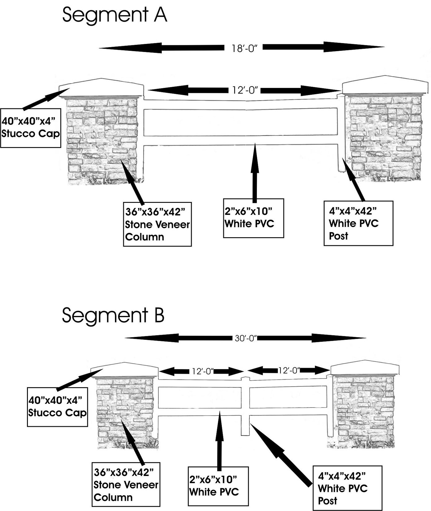
Fence Design
(Ord. No. 02-13, § 2, 8-1-02; Ord. No. 04-27, § 2, 6-10-04; Ord. No. 08-29, § 2, eff. 2-1-09)
Sec. 3.08.09. - Parking for Nonresidential Uses
The provision of parking shall comply with Article VI of this Code and the following:
1.
In developments required to provide ten or less parking spaces, the parking spaces, unless otherwise required by State and Federal regulations, may be surfaced in lieu of pavement with alternative materials, such as gravel, acceptable to Hillsborough County. In developments required to provide not less than 11 and no more than 30 parking spaces, up to 50 percent of the spaces may be surfaced with alternative materials acceptable to Hillsborough County.
2.
Except as provided herein, parking shall not be located between the principal buildings/use and street rights-of-way. Notwithstanding, the following shall be permitted for projects outside of the Community Activity Center Overlay District:
a.
Pumps and fueling stations for gasoline service stations, and
b.
Not more than one row of angled parking spaces adjoining the principal building.
3.
Within the Community Activity Center Overlay District, parking requirements for uses which must provide five parking spaces per 1,000 square feet of floor space under Part 6.05.00 of this Code shall be reduced by 20 percent. Additionally, at least 20 percent of provided parking spaces shall be surfaced with pervious materials, such as gravel or sodded grass, acceptable to Hillsborough County. Said spaces shall be located at the perimeter of parking areas the greatest distance from the primary entrances of the building(s) they serve. Parking areas shall be landscaped in accordance with Part 6.06.00 of this Code, except that a shade tree island shall be required per eight parking spaces and a landscaped divider median shall be required between all rows of abutting parking spaces.
(Ord. No. 02-13, § 2, 8-1-02; Ord. No. 04-27, § 2, 6-10-04)
Sec. 3.08.10. - Lighting
Lighting shall be in accordance with Part 6.10.00 of this Code and the following provisions:
A.
Illumination of the vertical planes of gas station canopies and other similar structures shall be prohibited.
B.
All poles or standards, other than those made of wood, used to support nonexempt outdoor lighting fixtures shall be anodized or otherwise coated to minimize glare from the light source.
C.
Outdoor Display and Parking Lots
Maximum height for lighting of outdoor parking and display lots such as, but not limited to, automobile sales or rental, recreational vehicle sales or building material sales, shall be 20 feet.
D.
Within the Community Activity Center Overlay District, outdoor pole lights within all nonresidential projects shall have a maximum height of 18 feet. Additionally, exterior lighting, including temporary or special events lighting, shall not blink, flash or oscillate. All exterior lighting shall be extinguished no later than one hour after the close of business, except for wall mounted security lights and parking lot pole lights located nearest to buildings.
(Ord. No. 02-13, § 2, 8-1-02; Ord. No. 04-27, § 2, 6-10-04)
Sec. 3.08.11. - Tree Preservation
In addition to the vegetative protection requirements of Part 4.01.00, Natural Resources, of this Code, Historic Trees shall be provided the highest emphasis of protection within the boundaries of a proposed development within the Community Activity Center Overlay District. Historic Tees are defined as native trees represented by the species of oak, maple, elm, sweet gum, hickory, and magnolia that measure 24 inches DBH and greater with a rating condition of good or better in accordance to the Tree Condition Evaluation Form referenced as Exhibit 4.1.6.1.4 of the Development Review Manual.
At the time of plan submittal, the Developer shall submit an assessment of the existing Historic Trees within the proposed development area and initiate the procedures described below for processing any request to remove one or more Historic Trees. Development around Historic Trees shall not be permitted within the canopy drip line of the Historic Trees unless special design techniques are administered as identified in the Natural Resource Section of the LDC. If development around a Historic Tree is determined by the County to cause the loss of the Historic Tree, then the developer shall replace the tree as provided for herein. A determination by the County that a Historic Tree has been removed illicitly or has been effectively removed through negligence shall require replacement with a monetary value in accordance to the International Society of Arboriculture Shade Tree Formula as provided in Section 11.06.05, Enforcement, of this Code.
Where a Historic Tree is encountered in the development process and the developer desires to remove the same, the developer shall demonstrate to the satisfaction of the County that removal of a Historic Tree is adequately replaced, as hereinafter described. Upon submission of a request to remove a Historic Tree, and such supporting information as may be reasonably required for the same, the County will render a decision that (1) removal is permitted as submitted, (2) removal is permitted with additional conditions, or (3) removal is denied, within the timeframe outlined in the Site and Subdivision Review process.
In all events, the removal of a Historic Tree shall be replaced based upon the total DBH of the main trunk of the tree removed, which shall be replaced on a two for one basis. The replacement of a Historic Tree shall be with a tree species of like type. The minimum replacement tree size shall be of the size defined in the LDC. Replacement trees shall be planted to the fullest extent practical on the property from where the Historic Tree existed. Offsite planting locations shall be permitted only within the Community Activity Center Overlay District. Contributions to the LDC's Restoration Fund may also occur. However, any contribution shall be earmarked and oriented for disbursement to provide native vegetation plantings strictly within the Community Activity Center Overlay District.
Figure 3.35.2
Community Activity Center Overlay
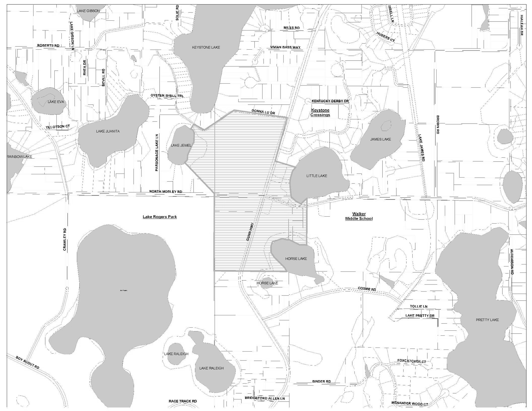
(Ord. No. 04-27, § 2, 6-10-04)
Sec. 3.09.01.- Purpose
The purpose of this Part is to implement goals, objectives and policies of the Comprehensive Plan related to the development of the Lutz Community Plan.
(Ord. No. 02-13, § 2, 8-1-02)
Sec. 3.09.02. - Applicability
These standards shall apply to all development that occurs outside the Urban Service Area where the proposed development is within the area subject to the Lutz Community Plan. However, these provisions shall not apply to previously approved planned developments, previously approved subdivisions, or any project with unexpired preliminary site development approval.
(Ord. No. 02-13, § 2, 8-1-02)
Sec. 3.09.03. - Procedures
All projects subdivided in accordance with Section 3.09.05 below shall be reviewed pursuant to Section 10.01.00.
(Ord. No. 02-13, § 2, 8-1-02)
Sec. 3.09.04. - Uses
Authorized uses outside of the Lutz Downtown Center Zoning District shall be consistent with the appropriate zoning district standards established in Article II. Uses within the Lutz Downtown Center Zoning District shall be regulated by Section 3.09.11 of this Code.
(Ord. No. 02-13, § 2, 8-1-02; Ord. No. 06-18, § 2, 8-1-06)
Sec. 3.09.05. - Single-Family Lots and Subdivisions
1.
In order to preserve on-site environmentally sensitive resources and provide additional open space, clustering of lots within single-family subdivisions of properties totaling 30 acres or more in size shall be permitted in accordance with the Conservation Subdivision requirements of this Code.
2.
Subdivisions of property zoned AM, A, AR, AS-0.4, AS-1 or ASC-1 totaling 20 acres or more in size and not subdivided in accordance with Section 3.09.05. 1 above shall utilize a variety of access measures for individual lots, including direct frontage on roadways, easements and/or private driveway extensions (flag lots). At least 30 percent of the lots accessed by internal project roadways shall not front roadways and shall be accessed by easements and/or private driveway extensions in a manner consistent with the requirements of this Code.
3.
Perimeter lots that are located, either whole or in part, less than 50 feet from existing external roadways with a Local classification shall be accessed from said roadways by individual driveways. Additionally, the homes on the lots shall face the roadways.
(Ord. No. 02-13, § 2, 8-1-02; Ord. No. 10-9, § 2, Item D(10-0173), 5-27-10, eff. 10-1-10)
Sec. 3.09.06. - Design
A.
Nonresidential Buildings
1.
All nonresidential buildings, excluding agricultural structures, churches and schools, and those buildings located within the Lutz Downtown Center Zoning District shall be limited to two stories in height and shall individually have no more than 20,000 square feet of gross floor space. Nonresidential buildings within the Lutz Downtown Center Zoning District shall be regulated by Section 3.09.11 of this Code.
2.
The roof of all nonresidential buildings, excluding agricultural structures, churches, schools and buildings accessory to residential uses, shall have a minimum pitch of three to 12 and a maximum pitch of eight to 12.
3.
All nonresidential buildings, excluding agricultural structures, churches, schools and buildings accessory to residential uses, shall be externally clad with brick, stone, stucco, wood slats or vinyl slat-style siding. Unsurfaced cement or block shall not be utilized. Paint shall not constitute a surface for the purpose of this regulation.
4.
All nonresidential buildings, excluding agricultural structures, churches, schools and buildings accessory to residential uses, shall incorporate the design features shown in Table 3-09.1 below. For each architectural element listed, at least one of the specified design features shall be utilized on all elevations facing roadways and/or parking areas, unless otherwise specified.
Table 3-09.1
1 At least one design feature shall be utilized for every 50 feet of roof length along roadways and/or parking areas.
2 At least 60 percent of the horizontal length of each façade along roadways and/or parking areas shall be comprised of windows, shutters, transoms, awnings, porches, doors, recessed entryways, arcades, porticos and/or pilasters. Horizontal banding and other predominately horizontal elements shall not contribute towards satisfaction of this requirement.
B.
Fences and Walls
1.
Fences and walls in agricultural and residential districts shall comply with Article VI of this Code. However, all fences and walls in residential developments that are constructed, owned and/or maintained by the developer or a homeowners association or similar entity shall be limited to the following designs and materials, except where otherwise required by Section 3.09.08.
a.
Split rail, three-board, four-board, horse wire with single board, or other natural wood fencing, with a minimum spacing of four feet between posts and 12 inches between spanning members.
b.
Masonry columns with spanning members comprised of metal, wood or other similar materials. The base below the spanning members shall be a maximum of two feet in height above ground level. Columns shall be a maximum of three feet in width and shall be spaced at least four feet apart. The base and columns shall be encased in brick or stone and the spanning members shall have a maximum opacity of 50 percent.
c.
Green or black chain link fencing. Attachment of slats or other nonvegetative screening to the fence shall be prohibited.
d.
Notwithstanding the provisions above, if a fence or wall is located along a Designated Scenic Roadway, the setback, buffering and screening of the fence or wall shall be regulated by Article VI of this Code.
2.
Fences and walls in commercial and office districts shall comply with the provisions of Article VI of this Code. However, design and materials shall be limited to the following, except as otherwise required by Section 3.09.08:
a.
Split rail, three-board, four-board, horse wire with single board, or other natural wood fencing, with a minimum spacing of four feet between posts and 12 inches between spanning members.
b.
Masonry columns with spanning members comprised of metal, wood or other similar materials. The base below the spanning members shall be a maximum of two feet in height above ground level and there shall be a minimum spacing of four feet between columns. The base and columns shall be encased in brick or stone and the spanning members shall have a maximum opacity of 50 percent.
c.
Green or black chain link fencing. Attachment of slats or other nonvegetative screening to the fence shall be prohibited.
3.
Fences and walls erected or approved in accordance with Article VI of this Code prior to the adoption of these Rural Development Standards shall be granted legal nonconforming status, if applicable, and may be maintained, repaired or replaced, but shall not be expanded, altered, changed or relocated in such a manner as to increase the degree of nonconformity.
C.
Signs
All signs shall comply with the limitations and provisions of Article VII of this Code. Additionally, the following limitations and provisions shall apply to all uses, excluding emergency public services/uses.
1.
All permanent detached signs shall be monument signs.
2.
All monument and wall signs shall be externally illuminated only. Monument signs up to four feet in height shall be set back a minimum of 15 feet from the adjacent right-of-way. A maximum height of 15 feet shall be permitted, provided the monument sign is set back one additional foot for each foot of sign height over four feet.
3.
The use of plastic display panels or neon lights on all ground and wall signs shall be prohibited.
4.
Signs within the Lutz Downtown Center Zoning District shall be regulated by Section 3.09.11 of this Code.
(Ord. No. 02-13, § 2, 8-1-02; Ord. No. 05-10, § 2, 6-16-05, eff. 10-1-05; Ord. No. 06-18, § 2, 8-1-06)
Sec. 3.09.07. - Transportation
1.
Internal roadways in residential subdivisions zoned AM, A, AR, AS-0.4, AS-1 or ASC-1 shall utilize a rural design in accordance with the Transportation Technical Manual, except that sidewalks shall be provided only when the roadway is identified as having hazardous walking conditions for elementary students in accordance with F.S. 1006.23. Additionally, sidewalks shall not be provided external to subdivisions except as follows:
a.
Along Collector and Arterial roadways, a pedestrian walkway system designed in accordance with the Transportation Technical Manual shall be provided.
b.
Where the School Board has identified to Hillsborough County that hazardous walking conditions exist within a two-mile radius of an elementary school in accordance with F.S. 1006.23, a pedestrian walkway system designed in accordance with the Transportation Technical Manual shall be provided.
c.
Where the community, as represented at annual public workshops to discuss the County's annual sidewalk retrofit program, is in favor of selected sidewalk retrofit projects as prioritized by the County's Sidewalk Master Plan, a pedestrian walkway designed in accordance with the Transportation Technical Manual shall be provided.
d.
Where an incomplete concrete sidewalk system exists along a roadway, infill construction to complete the system may occur utilizing concrete construction standards. The determination of infill status shall be made by the County Engineer.
2.
Developers shall provide sufficient right-of-way for internal and external roadways to accommodate future sidewalks.
3.
Public and private road rights-of-way may contain preserved or planted vegetation, including trees, provided that the preserved or planted vegetation is in accordance with the landscaping standards of the Transportation Technical Manual.
(Ord. No. 02-13, § 2, 8-1-02; Ord. No. 09-53, Item W, 6-11-09, eff. 10-1-09)
Sec. 3.09.08. - Buffering and Screening
1.
Buffering and screening shall be provided in accordance with Article VI of this Code, except that in lieu of Screening Standard A, fences or walls conforming with the requirements of Section 3.09.06.B. above shall be provided. Additionally, where buffering of a residential development against excessive traffic noise is required under Section 6.06.06.C.6, screening shall be limited to the berm/planting option.
2.
Buffering and screening within the Lutz Downtown Center Zoning District shall be regulated by Section 3.09.11 of this Code.
(Ord. No. 02-13, § 2, 8-1-02; Ord. No. 03-9, § 2, 6-5-03; Ord. No. 06-18, § 2, 8-1-06)
Sec. 3.09.09. - Parking for Office and Commercial Uses
The provision of parking shall comply with Article VI of this Code and the following:
1.
In developments required to provide ten or less parking spaces, the parking spaces, unless otherwise required by State and Federal regulations, may be surfaced in lieu of pavement with alternative materials, such as gravel, acceptable to Hillsborough County. In developments required to provide not less than 11 and no more than 30 parking spaces, up to 50 percent of the spaces may be surfaced with alternative materials acceptable to Hillsborough County.
2.
Except as provided herein, parking shall not be located between the principal buildings/use and street rights-of-way. The following shall be permitted:
a.
Pumps and fueling stations for gasoline service stations, and
b.
Not more than one row of angled parking spaces adjoining the Principal Building.
3.
The provision of parking within the Lutz Downtown Center Zoning District shall be regulated by Section 3.09.11 of this Code.
(Ord. No. 02-13, § 2, 8-1-02; Ord. No. 06-18, § 2, 8-1-06)
Sec. 3.09.10. - Lighting
Lighting shall be in accordance with Park 6.10.00 of this Code and the following provisions:
A.
Illumination of the vertical planes of gas station canopies and other similar structures shall be prohibited.
B.
All poles or standards, other than those made of wood, used to support nonexempt outdoor lighting fixtures shall be anodized or otherwise coated to minimize glare from the light source.
(Ord. No. 02-13, § 2, 8-1-02; Ord. No. 03-9, § 2, 6-5-03; Ord. No. 04-27, § 2, 6-10-04)
Sec. 3.09.11. - Lutz Downtown Center Zoning District.
A.
Generally
The intent of the Lutz Downtown Center Zoning District (LDCZD) is to plan for an activity center that encourages a mixture of residential and lower intensity professional office, personal service and specialty retail uses in an area containing existing residential uses and buildings. Adoption of the LDCZD will assist in implementing the Comprehensive Plan.
B.
Affected Properties
1.
The use of the Lutz Downtown Center Zoning District shall be restricted to properties located in Figure 3.36.
C.
Permitted Uses
1.
Uses permitted in the Lutz Downtown Center Zoning District shall be limited to the following:
a.
Professional services,
b.
Florist/card shop,
c.
Beauty/barber shop,
d.
Locksmith;
e.
Watch, clock and jewelry sales and service,
f.
Photography studio,
g.
Tailor/seamstress,
h.
Art gallery/studio,
i.
Antiques shops (indoor sales),
j.
Educational materials sales (books, art supplies, music supplies, and similar educational materials),
k.
Newsstand,
l.
Novelty/souvenir shop,
m.
Single-family conventional residential,
n.
Bicycle repair service,
o.
Computer repair service,
p.
Shoe repair service, and
q.
Uses allowed in the RSC-6 zoning district.
2.
Retail uses shall be restricted to only those specified above.
3.
Health services and health practitioners are prohibited.
D.
Development Standards
1.
If a site is newly developed for non-residential uses or if an existing structure is expanded for non-residential uses, all B-PO zoning district requirements shall apply, with the following exceptions:
a.
The maximum height requirement shall be 35 feet.
b.
Maximum square footage per building shall be 6,000 square feet.
2.
It is the intent of the district to allow for the continued use of residential uses as well as the conversion of existing dwelling units, in whole or in part, to non-residential uses allowed within the zoning district. Area, height, bulk and placement regulations for residential uses shall be those of the RSC-6 residential zoning district. If a property owner desires to convert an existing dwelling unit with no expansion to a use permitted by 3.09.11.C, the following conditions shall apply:
a.
Area, height, bulk, and placement regulations of the RSC-6 residential zoning district shall apply.
b.
Parking space requirements for allowable nonresidential uses may be reduced to 50 percent of the requirement for the proposed use as listed in Part 6.05.00 of this Code. Turf block material may be used in lieu of pavement if approved by applicable agencies.
c.
Disabled parking spaces shall be provided pursuant to Part 6.05.02.J. of this Code.
d.
Parking spaces located in garages may be counted toward the parking requirement.
e.
Use of existing septic systems shall be regulated by Part 4.02.04 of this Code and Hillsborough County Ordinance 00-4, Utilities Connection Regulation, and any future amendments to this ordinance.
f.
Screening meeting the standards of Section 6.06.06.C.3 ("A" screening) of this Code shall be required along boundaries abutting adjacent properties containing active residential uses or residentially zoned properties.
g.
Dwelling units converted to non-residential uses shall conform to all applicable building code requirements.
3.
Whenever a mixture of residential and nonresidential uses is proposed in a single structure, the following additional standards shall apply:
a.
Non-residential uses may utilize all or part of the building/dwelling unit on a site. Mixed uses (residential and non-residential) shall not be freestanding (the residential and non-residential uses shall be contained within the same building/dwelling unit).
b.
No residential or non-residential uses shall be conducted in any accessory building.
c.
A maximum lot size of one acre shall apply.
d.
The maximum square feet of non-residential uses permitted on site shall be linked to the existing footprint of the residence.
e.
The appearance of the building/dwelling unit shall be clearly residential in nature. No commercial display windows or storefront type of building shall be permitted. No outside display, storage, or use of land is permitted.
E.
Specific Standards for Non-Residential Uses
1.
Hours of operation shall be limited from 6:00 A.M. to 9:00 P.M.
2.
No activities associated with the operations of a business, other than grounds maintenance, shall be permitted in required yards adjacent to residential uses or residentially zoned lots.
3.
Outside lighting shall be restricted to motion-activated security lighting. Full-Cutoff Light fixtures shall be used and shall project a maximum of 0.20 foot candles at the zoning lot line.
4.
For any new construction, no customer entrances shall be permitted onto yards abutting residential lots. For any new construction, buildings shall be oriented toward the roadway.
5.
Yards abutting residential lots shall be screened according to Section 6.06.06.C.3 ("A" screening).
6.
Dumpsters shall be fully enclosed according to Section 6.06.06.C.3 ("A" screening).
F.
Roadway Aesthetics
1.
All trees not located within the existing or future right-of-way and recognized as a protected species under the provisions of this Code with a diameter at breast height (DBH) of five inches or greater shall be preserved within 25 feet of property boundaries abutting rights-of-way. Trees within this area classified to be a hazard as determined by a Certified Arborist, a Registered Consulting Arborist or other qualified plantsman are not required for preservation. Appropriate permitting as specified in Section 4.01.03 of this Code, however, shall be required. The administrator shall have the discretion to approve the removal of trees that conflict with the development of vehicular access and disabled parking.
2.
Signage shall be as provided in this Code except as follows.
a.
Pole signs shall be prohibited. Ground signs shall be limited to Monument Signs. Billboards, pennants and banners shall be prohibited.
b.
Only one wall sign shall be permitted on the front façade of the building. The wall sign should not project outward from the wall to which it is attached more than six inches.
c.
Signs shall be made of natural wood material, painted wood, or synthetic material with a natural wood appearance. No plywood, wallboard, particle board, or similar materials shall be used for signage.
Figure 3.36
(Ord. No. 06-18, § 2, 8-1-06)
Sec. 3.10.01.- Purpose
The purpose of this Part is to implement the goals, objectives and policies of the Comprehensive Plan expressed in the Citrus Park Village Plan element of the Northwest Area Community Plan.
(Ord. No. 03-36, § 2, 11-12-03)
Sec. 3.10.02. - Applicability
The provisions of this Part shall apply to all properties zoned CPV (Citrus Park Village).
(Ord. No. 03-36, § 2, 11-12-03)
Sec. 3.10.03. - Zoning Approval
Rezonings to the CPV district shall be subject to approval of the Board of County Commissioners in accordance with Part 10.03 of this Code.
(Ord. No. 03-36, § 2, 11-12-03)
Sec. 3.10.04. - Development Approval
Except as provided herein, all new development on properties zoned CPV shall comply with the requirements of this Part. Site development permits shall be subject to administrative staff approval in accordance with Part 10.01 of this Code.
(Ord. No. 03-36, § 2, 11-12-03)
Sec. 3.10.05. - General Exemptions
A.
Lawful uses, lots, structures, characteristics of land and densities in existence at the time of rezoning to CPV shall not be required to be removed or modified to conform with the requirements of this Part, except as may be required by other provisions of this Code.
B.
Projects with unexpired building permits, unexpired preliminary site development approval or unexpired construction plan approval at the time of rezoning to CPV shall be exempt from all requirements of this Part. Projects with unexpired preliminary plat approval at the time of rezoning to CPV shall be exempt from the block pattern, street connectivity and lot dimension requirements of this Part.
C.
Expansions of legally permitted single-family and two-family dwellings in existence at the time of rezoning to CPV, including the addition of new accessory structures and accessory dwellings, shall be exempt from the requirements of Section 3.10.12 of this Part and, if applicable, build-to lines or maximum setbacks. In such cases, the build-to line or maximum setback shall be treated as a minimum setback.
D.
Expansions of existing multi-family and non-residential structures up to a cumulative total of 30 percent of the legally permitted floor space in existence at the time of rezoning to CPV shall be exempt from the requirements of Sections 3.10.13 and 3.10.14 of this Part and, if applicable, build-to lines or maximum setbacks. In such cases, the build-to line or maximum setback shall be treated as a minimum setback. Additionally, existing parking areas and storm water facilities located in front of structures may be enlarged to accommodate the additional floor space. Where structures are expanded beyond 30 percent of existing floor space, all requirements of this Part shall apply to the area of expansion. Additionally, the existing structure shall be brought into compliance with the architectural requirements of Sections 3.10.13 and 3.10.14 of this Part, excluding minimum foundation height.
E.
Conversions of existing structures from residential to non-residential uses shall be exempt from the requirements of Section 3.10.14 of this Part, provided the floor space of the structure is not increased. Additionally, parking areas may be located at the front or side of structures if there is insufficient space at the rear. Conversions which increase the floor space shall be subject to Paragraph D above.
F.
Where further permitted by the zoning subdistrict descriptions in Section 3.10.15 of this Part, development allowed under PD (Planned Development) districts within the boundaries of Citrus Park Village at the time of rezoning to CPV shall be exempt from all provisions of this Part. Future changes or modifications to said development entitlements, and approval of new PD rezonings within the boundaries of Citrus Park Village, may be conditioned to conform to the greatest degree practicable with the provisions of this Part, subject to approval by the Board of County Commissioners in accordance with Part 5.03.00 of this Code.
G.
Public schools shall be exempt from all provisions of this Part, except for the area, height, bulk and setback requirements in Section 3.10.15.
H.
Except as specified above, these exemptions shall not be construed to permit new development, building or repair activity that is contrary to other requirements of this Code, including but not limited to the nonconformity provisions of Part 11.03.00.
(Ord. No. 03-36, § 2, 11-12-03)
Sec. 3.10.06. - General Development Requirements
The following requirements shall apply to all new development in Citrus Park Village.
(Ord. No. 03-36, § 2, 11-12-03)
Sec. 3.10.06.01. - Block Pattern
New development shall occur in a block pattern. Each block shall be rectangular in shape and framed by public streets on at least three sides. The maximum length of any block face shall be 650 feet. Variances to these requirements may be allowed in accordance with Part 11.04.00 of this Code only to the minimum degree necessary to accommodate irregular parcel boundaries, natural features or existing development patterns on adjacent properties.
(Ord. No. 03-36, § 2, 11-12-03)
Sec. 3.10.06.02. - Street Connectivity
New streets shall follow a grid pattern and connect with existing streets and rights-of-way to provide multiple through routes for vehicles and pedestrians. Additionally, paved street stubouts shall be provided to all vehicular cross-access points required in adjacent planned development (PD) districts and to other adjacent properties where feasible to accommodate future potential street connections.
New streets within a project shall achieve a connectivity ratio of not less than 2.0. For purposes of this regulation, "connectivity ratio" is the number of street links divided by the number of nodes. A "link" is each portion of a street defined by a node at both ends or at one end. A "node" is the intersection of two (2) or more streets, a street corner, a cul-de-sac head or a dead-end. Notwithstanding, connections with existing streets and paved stubouts to adjacent properties to accommodate future street connections shall not be considered nodes. Additionally, alleys and their connections shall not be included in the connectivity ratio calculation.
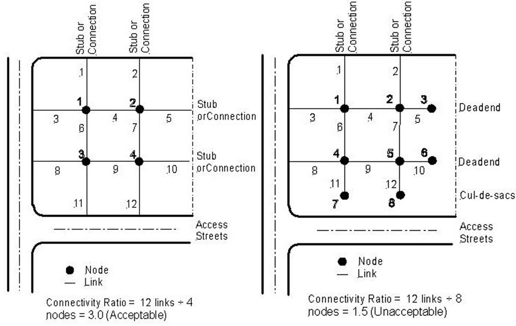
Connectivity Ratio
(Ord. No. 03-36, § 2, 11-12-03)
Sec. 3.10.06.03. - Street Design
New streets and improvements of existing streets, excluding regulated roadways as defined in the Hillsborough County Comprehensive Plan, shall conform to the design standards established in this Part and the Transportation Technical Manual cross sections and design criteria for Traditional Neighborhood Developments, henceforth identified as TND Street Standards, which are hereby incorporated by this reference. Development shall comply with standards for roadway access in the Transportation Technical Manual.
TND Street Standards, including, but not limited to, traffic calming, lane width reductions, removal of travel lanes for on-street parking, etc., shall not be applied to any regulated roadways as defined in the Comprehensive Plan where such treatments will reduce the system capacity and resulting level of service of the existing conditions through and around the proposed TND. Any development impacting a regulated road (including those utilizing TND street standards), shall meet the adopted level of service standards as defined in Section 4.02 of this Code. In some cases this may necessitate adding capacity on other existing roadways or by constructing new roadways that provide a bypass for moving vehicles around the TND. The construction of additional connections to the adjacent local road network may also provide additional capacity to compensate for the reduction in capacity that may result from the application of TND Street Standards to a regulated roadway.
The developer is responsible for the traffic capacity-LOS studies being performed during the planning stages of development. The studies shall be performed in accordance with criteria established by the County. The developer may use available County data and shall meet with the County to discuss criteria and shall submit the studies to the County for Approval. If LOS models are developed by the County, they will either be made available to the developer or the County will, at the expense of the developer, perform the studies with input from the developer.
(Ord. No. 03-36, § 2, 11-12-03)
Sec. 3.10.06.04. - Street Vacations
Existing street rights-of-way shall not be vacated where such action decreases through-route opportunities for vehicular traffic.
(Ord. No. 03-36, § 2, 11-12-03)
Sec. 3.10.06.05. - Parking
All new streets shall provide on-street parking. Off-street parking for all uses shall be provided in accordance with Part 6.05.00 of this Code, except that the minimum number of off-street parking spaces required for a proposed use shall be reduced by the number of on-street parking spaces adjacent to the use. Spaces that are adjacent to more than one use shall contribute to the parking requirements of the use with the greatest frontage on the space. Joint use of off-street parking spaces shall be permitted in accordance with the requirements of this Code.
(Ord. No. 03-36, § 2, 11-12-03; Ord. No. 16-13, § 2(Exh. A), 6-16-16, eff. 7-30-16)
Editor's note— Ord. No. 16-13, § 2(Exh. A), adopted June 16, 2016, effective July 30, 2016, repealed § 3.01.06.05 and renumbered §§ 3.10.06.06—3.10.06.13 as 3.10.06.05—3.10.06.12 as set out herein. The former § 3.10.06.05 pertained to transportation concurrency and derived from Ord. No. 03-36, § 2, adopted Nov. 12, 2003.
Sec. 3.10.06.06. - Traffic Calming
Traffic calming measures shall be permitted in accordance with Section 5.08.09.E of this Code.
At such time the west end of Alvina Street is connected to another street, traffic control devices shall be installed at the new intersection to prohibit or discourage through traffic on Alvina Street.
(Ord. No. 03-36, § 2, 11-12-03; Ord. No. 16-13, § 2(Exh. A), 6-16-16, eff. 7-30-16)
Note— See the editor's note to § 3.10.06.05.
Sec. 3.10.06.07. - Building Orientation
The front of all principal buildings shall face an improved street right-of-way and shall not be separated from the right-of-way by another building, storm water facility or common parking area or driveway serving more than one dwelling unit. On parcels with multiple street frontages, buildings shall front the street with the higher functional classification or block face with relatively greater length to the maximum extent possible before facing other streets. Variances to these frontage requirements may be approved in accordance with Part 11.04.00 of this Code only for projects with unusual site constraints which restrict the number and/or shape of blocks which may be created. In such cases, however, the developer shall be required to create the maximum number of blocks possible to provide the greatest amount of street frontage for the proposed principal structures. Accessory buildings are not required to face a street right-of-way, but they shall be placed to the side or rear of the principal building they serve.
(Ord. No. 03-36, § 2, 11-12-03; Ord. No. 16-13, § 2(Exh. A), 6-16-16, eff. 7-30-16)
Note— See the editor's note to § 3.10.06.05.
Sec. 3.10.06.08. - Build-To Line, Maximum Setback
In yards with required build-to lines, the entire length of each building façade containing enclosed floor space shall be placed on the build-to line or, on parcels with curved or irregular build-to lines, the chord of the build-to line. Doorways and minor architectural features, such as transoms, sidelights and porticos, recessed into the façade shall be permitted. A maximum of one foot of relief from the build line shall be permitted for architectural features such as cornices and expression lines.
To accommodate signs, a maximum of one foot of relief from the build to line shall be permitted along the entire length of the façade.
In yards with maximum building setbacks, the entire length of each building façade containing enclosed floor space shall be placed within the allowed setback. Doorways and minor architectural features, such as transoms, sidelights and porticos, recessed into the façade shall be permitted.
(Ord. No. 03-36, § 2, 11-12-03; Ord. No. 04-47, § 2, 11-9-04; Ord. No. 16-13, § 2(Exh. A), 6-16-16, eff. 7-30-16)
Note— See the editor's note to § 3.10.06.05.
Sec. 3.10.06.9. - Accessory Uses
All accessory uses, including but not limited to parking and storm water facilities, shall be located to the rear of the principal structure(s) on a parcel.
(Ord. No. 03-36, § 2, 11-12-03; Ord. No. 16-13, § 2(Exh. A), 6-16-16, eff. 7-30-16)
Note— See the editor's note to § 3.10.06.05.
Sec. 3.10.06.10. - Utility Lines
All utility lines shall be installed underground.
(Ord. No. 03-36, § 2, 11-12-03; Ord. No. 16-13, § 2(Exh. A), 6-16-16, eff. 7-30-16)
Note— See the editor's note to § 3.10.06.05.
Sec. 3.10.06.11. - Sidewalks
Sidewalks shall be provided along all streets. All sidewalks shall be constructed as urban sections and, notwithstanding other provisions of this Code, open drainage ditches in the right-of-way shall be piped or relocated at developer expense where necessary to provide sidewalks in the right-of-way.
(Ord. No. 03-36, § 2, 11-12-03; Ord. No. 16-13, § 2(Exh. A), 6-16-16, eff. 7-30-16)
Note— See the editor's note to § 3.10.06.05.
Sec. 3.10.06.12. - Vertically Integrated Uses
Projects with vertically integrated residential and non-residential uses shall have sufficient site area to conform with the maximum density and intensity limits of the district in which the project is located, as if the site were separately apportioned for each use. For example, if a district permits a maximum nonresidential floor area ratio of 0.25 and maximum residential density of 24 dwelling units an acre, a vertically integrated project with 20,000 square feet of commercial floor space on the first story and 18 residential apartments on the second story would require a minimum site area of 2.58 acres, of which 1.83 acres is demanded by the commercial floor space and .75 acre is demanded by the dwelling units (no on-site conservation/preservation areas presumed).
(Ord. No. 03-36, § 2, 11-12-03; Ord. No. 16-13, § 2(Exh. A), 6-16-16, eff. 7-30-16)
Note— See the editor's note to § 3.10.06.05.
Sec. 3.10.07. - Fences
Fences and walls shall conform with the provisions of Part 6.07.00 of this Code. Additionally, fences and walls in non-residential projects, and fences and walls in residential projects that are constructed, owned and/or maintained by the developer, homeowners association or similar entity, shall conform with the following requirements and provisions.
A.
Fences and walls, other than those in single-family subdivisions, shall be consistent with the architectural style of the buildings on the same parcel. Notwithstanding, chain link fences shall be permitted on all parcels subject to the requirements in Paragraph C below.
B.
Wood fences shall be picket or rail style with a maximum height of four feet and maximum opacity of 50 percent. Said fences shall be constructed of pressurized wood and shall be painted. Wood fences that do not conform with these requirements shall not be permitted in any yard.
C.
Chain link fences shall be clad in green, brown or black vinyl and all sections shall have top rails. Additionally, evergreen vines, such as Confederate Jasmine, Coral Honeysuckle or Beach Elder, shall be planted along the entire length of the fence, excluding gates, no more than six feet apart on centers. Said plants shall be in three gallon containers, at a minimum, at time of planting. Chain link fences shall not be permitted in front yards, including front yards functioning as side yards. Chain link fences shall be permitted in front yards functioning as rear yards where such fences are separated from the road right-of-way by parking areas, trees or other site features that obscure or distance the fence from public view.
D.
Masonry walls shall be architecturally finished on all sides. Paint shall not constitute an architectural finish.
(Ord. No. 03-36, § 2, 11-12-03)
Sec. 3.10.08. - Signs
All signs shall conform to the limitations and provisions of Article VII of this Code. Additionally, the following limitations and provisions shall apply to signage for all uses, excluding emergency public services/uses. Sight distances and roadside clear zones shall be provided for all signs in compliance with criteria included in the Transportation Technical Manual.
A.
All permanent detached signs shall be monument signs.
B.
All monument signs shall be a maximum of 15 feet in height, have materials similar to the structure(s) they serve and shall not utilize plastic cabinet panels. Monument signs in Subdistrict A shall be allowed .50-square-foot of aggregate display area for each linear foot of public street frontage along the street the sign faces or 50 square feet of aggregate display area, whichever is less, and no single sign face shall exceed 25 square feet of aggregate sign area. If a single- or multiple-occupancy parcel is entitled to more than one monument sign, then all allowable monument signs may be combined into a single monument sign with a maximum of 100 square feet of aggregate sign area, but no single face shall exceed 50 square feet of aggregate sign area. Monument signs shall not be permitted between buildings and road rights-of-way where such placement requires a variance from the minimum setback requirements of Article VII.
C.
The following forms of sign illumination shall be permitted: 1) exposed bulbs, lamps or luminous tubes on the surface of the sign; 2) exterior lights directed at the sign; and 3) backlighting of completely opaque sign elements which silhouettes the elements against an illuminated surface. Internally illuminated signs which emit light through translucent or transparent material shall be prohibited.
D.
[Reserved.]
E.
Awning signs shall not exceed two square feet in size on any awning.
F.
Mansard signs shall be prohibited.
G.
Wall signs shall be allowed .75-square-foot of aggregate display area for each linear foot of building frontage facing a public street, parking lot or Upper Tampa Bay Trail corridor, up to a maximum of 120 square feet of aggregate sign area. Each establishment shall be entitled to a minimum sign area of 15 square feet. Wall signs shall not utilize plastic cabinet panels.
H.
Wall signs and projecting signs shall not obscure building cornices.
I.
Projecting signs shall be perpendicular to the wall surface and shall have a maximum width of one foot.
J.
Signs shall not be permitted on awnings, canopies, balconies or other building elements that may be allowed to project over public rights-of-way by other provisions of this Part.
K.
Window signs shall not be permitted above the first story.
(Ord. No. 03-36, § 2, 11-12-03; Ord. No. 04-47, § 2, 11-9-04; Ord. No. 05-10, § 2, 6-16-05, eff. 10-1-05)
Sec. 3.10.09. - Lighting
A.
Outdoor pole lighting shall be provided for all streets and off-street parking areas, excluding driveways serving individual dwellings. The pole lights shall utilize post top fixtures closely similar in design to the Salem model offered by Tampa Electric Company (illustrated). The pole lights shall have a maximum height of 20 feet. The poles shall be anodized or otherwise coated to minimize glare from the light source.
Outdoor Light Pole
B.
Illumination of the vertical plane of gas station canopies and similar structures shall be prohibited. Lights illuminating the area beneath or around the canopy shall be fully shielded.
(Ord. No. 03-36, § 2, 11-12-03)
Sec. 3.10.10. - Buffering and Screening
A.
Buffering and screening shall comply with the requirements of this Code, except that the option of utilizing solid wood fences for screening shall not be allowed and screening requirements shall be met by utilizing other permitted options. Additionally, primary screening required by Section 6.06.06 of this Code shall not be provided between adjacent principal uses in Subdistrict A-1 or between adjacent uses that are commonly developed in all other subdistricts. In all cases, however, buffering requirements shall be met, and open storage areas, solid waste storage facilities and mechanical equipment shall be screened as required by said section.
1.
Notwithstanding the above, principal use buffering and screening mandated along the Upper Tampa Bay Trail by Section 6.06.06 of this Code shall not be required.
B.
Buffering and screening requirements for structures with vertically integrated mixed uses shall be based on the most intense use in the structure.
C.
Off-street vehicular use areas shall be buffered and screened in accordance with Section 6.06.03 of this Code, except that required trees in perimeter buffers shall have a minimum height of 10 feet and minimum caliper of three inches at time of planting and shall be installed no more than 30 feet apart on centers.
(Ord. No. 03-36, § 2, 11-12-03)
Sec. 3.10.11. - Tree Preservation
In addition to the vegetative protection requirements of Part 4.01.00, Natural Resources, of this Code, Historic Trees shall be provided the highest emphasis of protection within the boundaries of a proposed development within the Citrus Park Village zoning district. Historic Tees are defined as native trees represented by the species of oak, maple, elm, sweet gum, hickory, and magnolia that measure 24" DBH and greater with a rating condition of good or better in accordance to the Tree Condition Evaluation Form referenced as Exhibit 4.1.6.1.4 of the Development Review Manual.
At the time of plan submittal, the Developer shall submit an assessment of the existing Historic Trees within the proposed development area and initiate the procedures described below for processing any request to remove one or more Historic Trees. Development around Historic Trees shall not be permitted within the canopy drip line of the Historic Trees unless special design techniques are administered as identified in the Natural Resource Section of the LDC. If development around a Historic Tree is determined by the County to cause the loss of the Historic Tree, then the developer shall replace the tree as provided for herein. A determination by the County that a Historic Tree has been removed illicitly or has been effectively removed through negligence shall require replacement with a monetary value in accordance to the International Society of Arboriculture Shade Tree Formula as provided in Section 11.06.05, Enforcement, of this Code.
Where a Historic Tree is encountered in the development process and the developer desires to remove the same, the developer shall demonstrate to the satisfaction of the County that removal of a Historic Tree is adequately replaced, as hereinafter described. Upon submission of a request to remove a Historic Tree, and such supporting information as may be reasonably required for the same, the County will render a decision that (1) removal is permitted as submitted, (2) removal is permitted with additional conditions, or (3) removal is denied, within the timeframe outlined in the Site and Subdivision Review process.
In all events, the removal of a Historic Tree shall be replaced based upon the total DBH of the main trunk of the tree removed, which shall be replaced on a two for one basis. The replacement of a Historic Tree shall be with a tree species of like type. The minimum replacement tree size shall be of the size defined in the LDC. Replacement trees shall be planted to the fullest extent practical on the property from where the Historic Tree existed. Offsite planting locations shall be permitted only within the Citrus Park Village Zoning District. Contributions to the LDC's Restoration Fund may also occur, however, any contribution shall be earmarked and oriented for disbursement to provide native vegetation plantings strictly within the Citrus Park Village Zoning District.
(Ord. No. 03-36, § 2, 11-12-03)
Sec. 3.10.12. - Single-Family and Two-Family Building Requirements
All detached conventional single-family dwellings and attached two-family dwellings, and their accessory structures, shall comply with the following requirements. Manufactured mobile homes shall not be permitted in any district.
A.
Foundation: Finished elevation of the first floor of each principal dwelling shall be elevated a minimum of 18 inches above grade at the front of the house. Minimum flood plain elevations shall also be met. Exposed foundation walls and piers shall be clad in brick, stucco or stone.
B.
Stoops and Porches: Each principal dwelling shall have a front stoop and/or front porch. The stoop landing shall be a minimum of four feet in width and three feet in depth. The porch shall be a minimum of eight feet in width and six feet in depth. The porch shall be covered with a solid roof but shall not be screened or otherwise enclosed. Railings, if provided, shall be consistent with the architectural style of the structure.
C.
Entryways: The front entryway to each principal dwelling shall be defined with architectural enhancements such as, but not limited to, recessed doors, arches, transoms, sidelights or porticos consistent with the architectural style of the structure.
D.
Exterior Cladding: All exterior surfaces shall be architecturally finished. If lap siding is used, lap exposure shall be no less than four inches and no more than eight inches. Paint shall not constitute an architectural finish.
E.
Columns: If columns are provided, they shall be consistent with the architectural style of the structure.
F.
Façades: All structures on a lot shall be architecturally uniform. Façades shall be scaled proportionately on all sides of each structure. Architectural elements shall be applied in a universal and consistent manner on all sides. At least 60 percent of the area of the front façade shall be comprised of windows, window treatments, shutters, transoms, awnings, porches, doors, doorway treatments, recessed entryways, porticos, pilasters or other similar architectural enhancements. This minimum percentage shall not apply to one-story, non-residential accessory structures located behind the principal dwelling.
G.
Garages: A garage is required for each dwelling unit. Garages designed to hold three or more cars shall have at least two separate doors. The entry face of a garage accessed through a front yard, including a front yard functioning as a side yard, shall be set back a minimum of 20 feet from the property line from which it is accessed. Additionally, garages shall be placed at least five feet further from the street than the front plane of the principal building, excluding covered porch if present. Except as otherwise regulated by this Part, setbacks for detached garages shall comply with the accessory structure requirements of this Code. Carports, other than drive-through porte cocheres, shall be prohibited.
H.
Porte Cocheres: Drive-through porte cocheres shall meet principal structure setbacks and shall extend no closer to the street than the front plane of the principal building, excluding covered porch if present.
I.
Ceiling Heights: Minimum ceiling height shall be nine feet on all stories.
J.
Windows: Windows shall be provided on all sides of each structure at a minimum rate of one window per 20 feet of exterior wall length or fraction thereof. This requirement shall be met per individual story on each wall. The bottom edge of window headers shall be at least eight feet above the finished floor. Windows larger than four square feet in size shall have muntins consistent with the architectural style of the structure. All windows shall have casings or trim consistent with the architectural style of the structure. Glass blocks shall not contribute to the minimum window requirement. This requirement shall not apply to one-story, non-residential accessory structures located behind the principal dwelling.
K.
Shutters: Decorative shutters, if provided, shall be made of wood, metal or copolymer material and shall not be scored into the stucco.
L.
Roofs: Pitched roofs shall have a minimum pitch of 4/12. Finish roof materials shall be consistent with the architectural style of the structure. Rolled roofing and built-up roofing are prohibited unless concealed from view by parapets.
M.
Fascias: If provided, fascia boards shall have a minimum vertical dimension of six inches and maximum vertical dimension of eight inches.
N.
Accessory structures: Accessory structures with less than 150 square feet of ground coverage shall be exempt from these architectural requirements.
(Ord. No. 03-36, § 2, 11-12-03)
Sec. 3.10.13. - Multi-Family Building Requirements
All multi-family dwellings and their accessory structures shall comply with the following requirements.
A.
Foundation: Finished elevation of the first floor of each dwelling unit shall be elevated a minimum of 18 inches above grade at the front of the structure. Minimum flood plain elevations shall also be met. Exposed foundation walls and piers shall be clad in brick, stucco or stone.
B.
Stoops and Porches: Each dwelling unit with a front door on the first story shall have a front stoop and/or front porch. The stoop landing shall be a minimum of four feet in width and three feet in depth. The porch shall be a minimum of eight feet in width and six feet in depth. The porch shall be covered with a solid roof but shall not be screened or otherwise enclosed. Railings, if provided, shall be consistent with the architectural style of the structure.
C.
Entryways: Front entryways to dwelling units shall be defined with architectural enhancements such as, but not limited to, recessed doors, arches, transoms, sidelights or porticos consistent with the architectural style of the structure.
D.
Exterior Cladding: All exterior surfaces shall be architecturally finished. If lap siding is used, lap exposure shall be no less than four inches and no more than eight inches. Paint shall not constitute an architectural finish.
E.
Columns: If columns are provided, they shall be consistent with the architectural style of the structure.
F.
Façades: All structures in a project shall be architecturally uniform. Façades shall be scaled proportionately on all sides of each structure. Architectural elements shall be applied in a universal and consistent manner on all sides. At least 60 percent of the front façade and rear façade, and 40 percent of each side façade, shall be comprised of windows, window treatments, shutters, transoms, awnings, porches, doors, doorway treatments, recessed entryways, porticos, pilasters or similar architectural enhancements. These minimum percentages shall not apply to one-story, non-residential accessory structures located behind the principal structure.
G.
Parking Facilities: Detached garages and surface parking areas shall be located at the rear of structures. Common driveways shall be located at the rear or side of structures and shall not cross a front yard functioning as a front yard unless no other access to the parcel is available, but in no case shall the driveway be placed between the side of a structure and a street right-of-way. The entry faces of attached individual garages accessed through a front yard, including a front yard functioning as a side yard, shall be set back a minimum of 20 feet from the property line from which they are accessed. Additionally, attached garages shall be placed at least five feet further from the street than the front plane of the principal building, excluding covered porch if present.
H.
Ceiling Heights: Minimum ceiling height shall be nine feet on all stories.
I.
Windows: Windows shall be provided on all sides of each structure at a minimum rate of one window per 20 feet of exterior wall length or fraction thereof for each dwelling unit. This requirement shall be met per individual story on each wall. The bottom edge of window headers shall be at least eight feet above the finished floor. Windows larger than four square feet in size shall have muntins consistent with the architectural style of the structure. All windows shall have casings or trim consistent with the architectural style of the structure. Glass blocks shall not contribute to the minimum window requirement. This requirement shall not apply to one-story, non-residential accessory structures located behind the principal structure.
J.
Shutters: Decorative shutters, if provided, shall be made of wood, metal or copolymer material and shall not be scored into the stucco.
K.
Roofs: Pitched roofs shall have a minimum pitch of 4/12. Finish roof materials shall be consistent with the architectural style of the structure. Rolled roofing and built-up roofing are prohibited unless concealed from view by parapets.
L.
Fascias: If fascias are provided, they shall have a minimum vertical dimension of six inches and maximum vertical dimension of eight inches.
M.
Accessory structures: Minor accessory structures such as dumpster enclosures, mail kiosks, recycling collection bins, etc., shall not be bound to each and every architectural requirement listed above but shall have architectural detailing consistent with the style of the principal structures they serve.
N.
Solid Waste Collection: Where row houses abut an alley right-of-way less than 20 feet in width, a dumpster shall be provided on at least one end of the alley for centralized waste collection.
(Ord. No. 03-36, § 2, 11-12-03)
Sec. 3.10.14. - Non-Residential and Mixed-Use Building Requirements
Except as provided herein, all structures permitted non-residential uses, either in whole or in part, shall comply with the following requirements. In structures permitted a mixture of residential and non-residential uses, the entire first story shall be devoted to non-residential uses only, except that entrances to upper story residential uses shall also be allowed. Metal buildings are prohibited. Non-residential structures accessory to residential uses shall be subject to the requirements of Sections 3.10.12 and 3.10.13 of this Part.
Agricultural structures, public service facilities and existing public recreation facilities, including expansions of said existing facilities, shall be exempt from the requirements of this Section. Additionally, church facilities with up to 10,000 square feet of total floor space for all structures shall be exempt from these requirements, although manufactured structures that do not conform to these requirements are prohibited. All building activity in excess of 10,000 square feet of total floor space shall be subject to these requirements. In the event a church facility with less than 10,000 square feet of total floor space is employed by uses other than a church, any expansion of the facility shall be subject to these requirements, irrespective of other provisions of this Part.
A.
Façades: Façades shall be scaled proportionately on all sides of the structure. Architectural elements shall be applied in a universal and consistent manner on all sides. Decorative shutters, if provided, shall be made of wood, metal or copolymer material and shall not be scored into stucco.
1.
Except for storefronts as regulated below, at least 20 percent of the area of each first story wall on the front and sides of the structure shall be comprised of windows. Windows and/or doorways shall be spaced no more than 20 feet apart. Windows shall be defined with shutters, raised exterior casings/trims, awnings, decorative pediments or similar treatments. Doorways shall be defined with arches, raised exterior casings/trim, sidelights or similar treatments. In addition to the window space required above, at least 20 percent of the wall area shall be comprised of window treatments, doors, doorway treatments, transoms, structural canopies, balconies, architectural expressions such as porticos and pilasters, or other similar enhancements. Such expressions or enhancements shall have a minimum projection or recess of two inches from the wall surface.
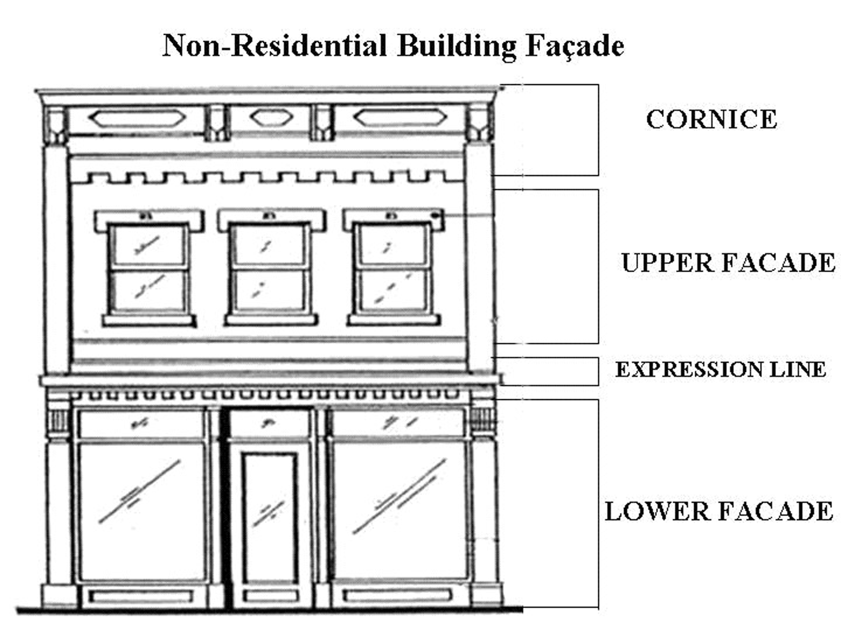
Non-Residential Building Façade
2.
Except for storefronts as regulated below, at least 40 percent of the area of each first story wall on the rear of the structure shall be comprised of windows, window treatments, doors, doorway treatments, transoms, structural canopies, balconies, architectural expressions such as porticos and pilasters, or other similar enhancements. Windows shall not be required. Such expressions or enhancements shall have a minimum projection of two inches from the wall surface. Notwithstanding, first story rear walls not separated from street rights-of-way by another building, parking area, driveway, storm water facility or landscaped green space with a minimum depth of 20 feet shall comply with the requirements of Paragraph A. 1 above, including the provision of windows. Additionally, first story rear walls with a height greater than 20 feet shall comply with the requirements of Paragraph A.1 above, including the provision of windows, regardless of proximity to street rights-of-way.
3.
On multi-story buildings, at least 20 percent of the total area of each upper story wall (above the first story) shall be comprised of windows. Windows and/or balcony doorways shall be spaced no more than 30 feet apart. Windows shall be defined with shutters, raised exterior casings/trim, awnings, decorative pediments or similar treatments, and windows greater than four square feet in size shall have muntins consistent with the style of the structure. Doorways shall be defined with arches, raised exterior casings/trim, sidelights or similar treatments. In addition to the window space required above, at least 20 percent of the wall area shall be comprised of window treatments, transoms, structural canopies, balconies, doors, doorway treatments, architectural expressions such as porticos and pilasters, or other similar enhancements. Such expressions and enhancements shall have a minimum projection or recess of two inches from the wall surface. These requirements shall be met per individual story on each wall. Exterior stairways, if provided, shall be consistent with the architectural style of the structure.
B.
Storefronts: Structures permitted retail uses shall conform with the following requirements on each first floor wall with street frontage.
1.
Not less than 60 percent of the wall area shall be comprised of transparent glass in windows and/or public doors. Wall sections without windows or public doors shall not exceed 15 feet in length.
2.
Window panes shall be individually framed. Non-anodized aluminum frames are prohibited.
3.
Storefronts shall remain unshuttered during non-business hours, except that interior security gates or fencing with a maximum opacity of 50 percent may be utilized. Exterior security gates or fencing are prohibited.
4.
All street-level uses fronting a public street shall have individual entrances with direct access to the sidewalk, regardless of any other entrances which may be provided. Where a wall exceeds 50 feet in length along a street frontage, the distance between public entrances along the wall shall not exceed 50 feet. Entrances to uses at street corners with frontages on two streets shall be oriented to face either the corner or the street with the higher functional classification, provided the wall without an entrance does not exceed 50 feet in length. Otherwise, entrances shall be provided on both walls. Doors shall either be framed or recessed at least one foot into the face of the building. Non-anodized aluminum frames are prohibited.
C.
Exterior Cladding: All exterior surfaces shall be architecturally finished. If lap siding is used, lap exposure shall be no less than four inches and no more than eight inches. Paint shall not constitute an architectural finish.
D.
Expression Line: On buildings with more than one floor, the transition from the first floor to the upper façade shall be delineated on all sides of the structure by a horizontal architectural feature with a minimum projection or recess of two inches from the wall surface. Alternatively, canopies and/or balconies may be utilized in lieu of an expression line. Expression lines and canopies shall contribute toward the first story requirements of Paragraphs A.1-3, above, and balconies shall contribute to the upper floor requirements, unless the design of the structure clearly dictates otherwise.
E.
Awnings: If provided, awnings shall be consistent with the architectural style of the structure. Awnings covering upper floor windows shall conform to the size of the individual windows and shall not span the spaces between windows. Awnings which project over the public right-of-way shall extend no further than four feet from back of curb and shall not be supported by columns, piers or other structures within the public right-of-way. Development and/or building permits allowing awnings projecting over the public right-of-way shall not be approved unless an easement has been granted by Hillsborough County allowing such structures. However, nothing in this Part shall require Hillsborough County to grant such an easement.
F.
Structural Canopies and Balconies: If provided, structural canopies and balconies shall be consistent with the architectural style of the structure. Balconies may be roofed or framed but shall not be screened or otherwise enclosed. Canopies and balconies which project over the public right-of-way shall extend no further than four feet from back of curb and shall not be supported by columns, piers or other structures within the public right-of-way. Development and/or building permits allowing canopies and/or balconies projecting over the public right-of-way shall not be approved unless an easement has been granted by Hillsborough County allowing such structures. However, nothing in this Part shall require Hillsborough County to grant such an easement.
G.
Roofs: Pitched roofs shall have a minimum pitch of 4/12. Finish roof materials shall be consistent with the architectural style of the structure. Rolled roofing and built-up roofing are prohibited unless concealed from view by parapets. Pitched roofs shall incorporate at least one of the following features: dormers, steeples, cupolas and/or intersecting roof lines. At least one of these features shall be provided per elevation for every 50 feet of roof length along roadways and parking areas.
H.
Cornices: On flat-roofed buildings, the entire roof line shall be defined by architectural trim or embellishment with a minimum vertical dimension of 12 inches and a minimum projection of two inches from the surface of the wall. Alternatively, a false pitched roof front may be provided in lieu of a cornice.
I.
Lighting: Exterior light fixtures shall be consistent with the architectural style of the structure. High intensity flood lights and lights directed at public rights-of-way are not permitted.
J.
Courtyards: Where courtyards are screened from public sidewalks by a fence, wall, vegetation, or combination thereof, the screening shall have a maximum opacity of 50 percent above a height of four feet.
K.
Residential Floors: In mixed-use structures, all floors devoted to residential use shall conform with the following requirements in addition to those listed above.
1.
Ceilings shall have a minimum height of nine feet.
2.
At least one window shall be provided on each exterior façade of each dwelling unit. The bottom edge of the window headers shall be at least eight feet above the finished floor. Windows larger than four square feet in size shall have muntins consistent with the architectural style of the structure. All windows shall have raised exterior casings consistent with the architectural style of the structure.
L.
Parking and Loading Areas: Surface parking areas, loading docks and garage doors shall be located at the rear of structures and, on corner lots, shall be no closer to any side street right-of-way than the structure. Driveways shall be located at the rear or side of structures and shall not cross a front yard functioning as a front yard unless no other access to the parcel is available, but in no case shall the driveway be placed between the side of a structure and a street right-of-way. Wall sections utilized for loading docks shall not be subject to the façade requirements of Paragraph A above and shall be excluded from compliance calculations for remaining sections of the same wall. Loading docks which face residential property within 100 feet shall be screened from such areas by a masonry wall with a minimum height of 8 feet erected next to the loading dock. Alternatively, loading docks may be located at the side of structures along interior lot lines to reduce impacts on nearby residential properties, subject to approval of the Administrator. Notwithstanding, garage doors and driveways for emergency public use facilities such as fire stations may be located on any side of the structure.
M.
Parking Structures: If provided, all walls of a parking structure, including the rear wall, shall conform with the façade requirements in Paragraphs A.1 and A.3 above, except that wall openings may be provided in lieu of windows. Additionally, parking structures shall conform with the following requirements.
1.
Except for pedestrian and vehicle entries/exits, the first story shall be developed with enclosed commercial or civic floor space to a minimum building depth of 30 feet along the entire length of each side of the structure facing a street, unless separated from the street by another building, parking lot and/or landscaped open space with a minimum depth of 30 feet.
2.
Direct pedestrian access from the parking levels of the structure to each street it faces shall be provided, except where separated from the street by another building or parking lot.
3.
Vehicle entries/exits to the structure shall not exceed 48 feet in width and shall be separated from other vehicle entries/exits to the structure on the same side of the block by a minimum distance of 150 feet.
N.
Build-To Lines, Maximum Setbacks: In yards with a mandatory build-to line or maximum building setback, up to 90 percent of the building frontage may be developed with a paved courtyard, arcade or gallery devoted to public/patron use and meeting the build-to line or maximum setback. In such cases, the building façade containing enclosed floor space shall be no more than 20 feet from the right-of-way line and the façade shall comply with all design requirements that would otherwise apply.
O.
Vehicle Fueling/Service Facilities: Vehicle fueling pumps and service bay doors shall be located at the rear of structures. On corner lots, the front of the principal structure shall face the street with the higher functional classification or the side of the block with greater relative length, and fueling pumps shall be placed no closer to any side street right-of-way than the structure. Fuel island canopy height shall not exceed the height of the principal structure on the site.
P.
Drive-Through Service Facilities: Drive-through order windows/boxes and pickup windows shall be located at the rear or side of structures and shall meet the requirements for drive-through service facilities in Part VI of this Code. If located at the side of the structure, the drive-through facilities shall not be placed on a side facing a street right-of-way.
Q.
Accessory Structures: Minor accessory structures such as dumpster enclosures shall not be bound to each and every architectural requirement listed above but shall have architectural detailing consistent with the style of the principal structures they serve.
(Ord. No. 03-36, § 2, 11-12-03)
Sec. 3.10.15. - Zoning Districts
Subject to compliance with other requirements of this Code, new development shall conform with the following use, density, intensity, lot size, lot width, yard, building placement, building height and impervious surface requirements, together with related special requirements and provisions where applicable, in accordance with a parcel's subdistrict designation on the Citrus Park Village Subdistrict Map.
Notwithstanding the minimum lot size permitted in each subdistrict, residential development shall be allowed only to the extent it can be demonstrated in a plat or site development plan that the project as a whole does not exceed the gross density permitted by the subdistrict.
Multi-family buildings where each dwelling unit is on a separate deeded lot shall be permitted in accordance with the requirements of Section 6.01.03.E of this Code. However, in no case shall an individual lot for a single dwelling unit be less than 20 feet in width.
Density and intensity credits for on-site environmentally sensitive lands shall be granted provided all development requirements of this Code are satisfied. In such cases, the credits shall be calculated in the manner prescribed by the Comprehensive Plan, although the calculations shall be based on the property's zoning rather than its Comprehensive Plan designation. The transfer of development rights from properties outside Citrus Park Village to enhance entitlements on properties within Citrus Park Village is prohibited.
(Ord. No. 03-36, § 2, 11-12-03)
Sec. 3.10.15.01. - Subdistrict A-1
Special Requirements/Provisions:
A.
Buildings with non-residential uses may front the Upper Tampa Bay Trail corridor in lieu of a street.
B.
Notwithstanding the yard requirements above, non-residential and mixed-use building walls facing the Upper Tampa Bay Trail, and not separated from the trail corridor by parking areas or drainage facilities, shall be placed on a 5-foot build-to line from the trail corridor. The walls shall comply with the building requirements of this Part for a storefront and the area between the buildings and trail corridor shall be paved or otherwise improved with a hard surface for pedestrian use.
C.
Uses along the Upper Tampa Bay Trail may provide direct access to the trail corridor for pedestrians, bicyclists and other users, subject to review and approval by the Hillsborough County Real Estate Department in consultation with the Parks, Recreation and Conservation Department.
D.
Where the width of the Gunn Highway and Ehrlich Road right-of-way is insufficient to allow a 10-foot-wide sidewalk per the proposed Citrus Park Village cross section, the build-to line along said frontage shall be established at a depth sufficient to allow construction of a 10-foot-wide sidewalk and an easement shall be dedicated to Hillsborough County for the area between the building and right-of-way line.
(Ord. No. 03-36, § 2, 11-12-03; Ord. No. 04-46, § 2, 11-4-04)
Sec. 3.10.15.02. - Subdistrict A-2
Special Requirements/Provisions:
A.
C-N retail uses shall be permitted only within the westernmost 50 feet of the subdistrict along the Upper Tampa Bay Trail. Additionally, buildings containing such uses shall occupy no more than 50 percent of a development parcel's frontage on the trail corridor. This ratio shall be determined by comparing the total length of all building walls facing the trail corridor, including walls separated from the corridor by parking areas or other improvements, to the length of the development parcel boundary that abuts the trail corridor. Variances to any of these requirements shall not be allowed.
B.
Buildings containing C-N retail uses may front the trail corridor in lieu of a street. Additionally, parking may be located on the side and/or rear of such buildings. Unless separated from the trail corridor by parking areas or drainage facilities, the building walls facing the trail shall be placed on a 5-foot build-to line from the trail corridor, notwithstanding the yard requirements above. The walls shall comply with the building requirements of this Part for a storefront and the area between the buildings and the trail corridor shall be paved or otherwise improved with a hard surface for pedestrian use.
C.
To limit vehicular crossings of the Upper Tampa Bay Trail, the subdistrict shall have no more than four street and/or driveway connections, including the Alema Street extension, to Gunn Highway. All trail crossings shall be subject to approval of the Hillsborough County Real Estate Department in consultation with the Parks, Recreation and Conservation Department.
D.
Uses along the Upper Tampa Bay Trail may provide direct access to the trail corridor for pedestrians, bicyclists and other users, subject to review and approval by the Hillsborough County Real Estate Department in consultation with the Parks, Recreation and Conservation Department.
(Ord. No. 03-36, § 2, 11-12-03; Ord. No. 04-46, § 2, 11-4-04)
Sec. 3.10.15.03. - Subdistrict A-3
Special Requirements/Provisions:
A.
Buildings with non-residential uses may front the Upper Tampa Bay Trail corridor in lieu of a street.
B.
Notwithstanding the yard requirements above, nonresidential building walls facing the Upper Tampa Bay Trail, and not separated from the trail corridor by parking areas or drainage facilities, shall be placed on a 5-foot build-to line from the trail corridor. The walls shall comply with the building requirements of this Part for a storefront and the area between the buildings and trail corridor shall be paved or otherwise improved with a hard surface for pedestrian use.
C.
Uses along the Upper Tampa Bay Trail may provide direct access to the trail corridor for pedestrians, bicyclists and other users, subject to review and approval by the Hillsborough County Real Estate Department in consultation with the Parks, Recreation and Conservation Department.
(Ord. No. 03-36, § 2, 11-12-03; Ord. No. 04-46, § 2, 11-4-04)
Sec. 3.10.15.04. - Subdistrict A-4
Special Requirements/Provisions:
A.
Non-residential and mixed-use development shall be confined to the northeast area of the subdistrict within 315 feet of the east boundary and within 330 feet of the north boundary. The developed area shall be bound by public streets on the south and west sides. Buildings shall front Gunn Highway and at least one of the internal streets bounding the developed area.
(Ord. No. 03-36, § 2, 11-12-03; Ord. No. 04-46, § 2, 11-4-04)
Sec. 3.10.15.05. - Subdistrict A-5
Special Requirements/Provisions:
A.
Buildings with non-residential uses may front the Upper Tampa Bay Trail corridor in lieu of a street.
B.
Notwithstanding the yard requirements above, non-residential and mixed-use building walls facing the Upper Tampa Bay Trail, and not separated from the trail corridor by parking areas or drainage facilities, shall be placed on a 5-foot build-to line from the trail corridor. The walls shall comply with the building requirements of this Part as if the trail were a street and the area between the buildings and trail corridor shall be paved or otherwise improved with a hard surface for pedestrian use.
C.
Uses along the Upper Tampa Bay Trail may provide direct access to the trail for pedestrians, bicyclists and other users, subject to review and approval by the Hillsborough County Real Estate Department in consultation with the Parks, Recreation and Conservation Department.
D.
Vehicular access from Alvina Street shall be limited to individual driveways serving residential garages. All other vehicular access from Alvina shall be prohibited.
(Ord. No. 03-36, § 2, 11-12-03; Ord. No. 04-46, § 2, 11-4-04)
Sec. 3.10.15.06. - Subdistrict A-6
Special Requirements/Provisions:
A.
Building frontage shall be required on both Gunn Highway and the Upper Tampa Bay Trail corridor for each development parcel. Notwithstanding the yard requirements above, building walls facing the trail shall be placed on a 5-foot build-to line from the trail corridor. The walls shall comply with the building requirements of this Part for a storefront and the area between the buildings and trail corridor shall be paved or otherwise improved with a hard surface for pedestrian use.
B.
Due to the restricted depth of the district and building frontage requirements on both Gunn Highway and the Upper Tampa Bay Trail, parking areas may be located on the side and/or rear of buildings. Side parking areas shall be located no closer to the Gunn Highway right-of-way than the nearest principal building on the site. Rear parking areas shall be separated from both Gunn Highway and the Upper Tampa Bay Trial by buildings.
C.
Uses along the Upper Tampa Bay Trail may provide direct access to the trail for pedestrians, bicyclists and other users, subject to review and approval by the Hillsborough County Real Estate Department in consultation with the Parks, Recreation and Conservation Department.
D.
To limit vehicular crossings of the Upper Tampa Bay Trail, a maximum of four street and/or driveway connections, including the Alema Street extension, shall be provided across the subdistrict from Gunn Highway to Subdistrict A-2.
(Ord. No. 03-36, § 2, 11-12-03)
Sec. 3.10.15.07. - Subdistrict B-1
Special Requirements/Provisions:
A.
A minimum of 50 percent of development in each project shall be devoted to residential use. For purposes of computing the relative amounts of residential and non-residential development within a project, one dwelling unit shall equal 1,500 square feet of non-residential floor space. Certificates of occupancy for non-residential floor space shall not be issued until certificates of occupancy for an equivalent amount of dwelling units within the same project have been issued. The developer shall bear the burden of documenting to the satisfaction of Hillsborough County the amount of residential and non-residential development within a project for which certificates of occupancy have been issued.
B.
Retail uses shall be vertically integrated with office and/or residential uses in the same structure and the retail uses shall be limited to the first story.
C.
Structures with retail uses shall be located along the general perimeter of the subdistrict. Notwithstanding, all structures located wholly or partly within the easternmost 330 feet of the subdistrict shall be limited to office and residential uses. The office uses shall be vertically integrated with residential uses in the same structure and the office uses shall be limited to the first story. However, structures along the south boundary of the subdistrict nearest PD 01-0075 may be occupied entirely by office uses provided the structures are part of a project which meets the requirements of Paragraph A above.
(Ord. No. 03-36, § 2, 11-12-03; Ord. No. 04-46, § 2, 11-4-04)
Sec. 3.10.15.08. - Subdistrict B-2
Development shall be in accordance with PD 98-0641, as may be changed or modified pursuant to Part 5.03.00 of this Code.
(Ord. No. 03-36, § 2, 11-12-03)
Sec. 3.10.15.09. - Subdistrict B-3
Development shall be in accordance with PD 97-0110, as may be changed or modified pursuant to Part 5.03.00 of this Code.
(Ord. No. 03-36, § 2, 11-12-03)
Sec. 3.10.15.10. - Subdistrict B-4
Special Requirements/Provisions:
A.
A minimum of 50 percent of development in each project shall be devoted to residential use. For purposes of computing the relative amounts of residential and non-residential development with a project, one dwelling unit shall equal 1,500 square feet of non-residential floor space. Certificates of occupancy for non-residential floor space shall not be issued until certificates of occupancy for an equivalent amount of dwelling units within the same project have been issued. The developer shall bear the burden of documenting to the satisfaction of Hillsborough County the amount of residential and non-residential development within a project for which certificates of occupancy have been issued.
B.
Office uses shall be vertically integrated with residential uses in the same structure and the office uses shall be limited to the first story.
(Ord. No. 03-36, § 2, 11-12-03; Ord. No. 04-46, § 2, 11-4-04)
Sec. 3.10.15.11. - Subdistrict B-5
Development shall be in accordance with PD 90-0196, as may be changed or modified pursuant to Part 5.03.00 of this Code.
(Ord. No. 03-36, § 2, 11-12-03)
Sec. 3.10.15.12. - Subdistrict C
Development shall be in accordance with PD 96-252, as may be changed or modified pursuant to part 5.03.00 of this Code.
(Ord. No. 03-36, § 2, 11-12-03)
Sec. 3.10.15.13. - Subdistrict D-1
Special Requirements/Provisions:
A.
Buildings with non-residential uses may front the Upper Tampa Bay Trail corridor in lieu of a street.
B.
Notwithstanding the yard requirements above, non-residential and mixed-use building walls facing the Upper Tampa Bay Trail, and not separated from the trail corridor by parking areas or drainage facilities, shall be placed on a 5-foot build-to line from the trail corridor. The walls shall comply with the building requirements of this Part as if the trail were a street and the area between the buildings and trail corridor shall be paved or otherwise improved with a hard surface for pedestrian use.
C.
Uses along the Upper Tampa Bay Trail may provide direct access to the trail corridor for pedestrians, bicyclists and other users, subject to review and approval by the Hillsborough County Real Estate Department in consultation with the Parks, Recreation and Conservation Department.
(Ord. No. 03-36, § 2, 11-12-03; Ord. No. 04-46, § 2, 11-4-04)
Sec. 3.10.15.14. - Subdistrict D-2
Special Requirements/Provisions:
A.
Non-residential uses shall be limited to one-story buildings unless vertically integrated with residential uses in the same structure, in which case the non-residential uses shall be limited to the first story of the integrated structure.
B.
Buildings with non-residential uses may front the Upper Tampa Bay Trail corridor in lieu of a street.
C.
Notwithstanding the yard requirements above, non-residential and mixed-use building walls facing the Upper Tampa Bay Trail, and not separated from the trail corridor by parking areas or drainage facilities, shall be placed on a 5-foot build-to line from the trail corridor. The walls shall comply with the building requirements of this Part for a storefront and the area between the buildings and trail corridor shall be paved or otherwise improved with a hard surface for pedestrian use.
D.
Uses along the Upper Tampa Bay Trail may provide direct access to the trail for pedestrians, bicyclists and other users, subject to review and approval by the Hillsborough County Real Estate Department in consultation with the Parks, Recreation and Conservation Department.
(Ord. No. 03-36, § 2, 11-12-03; Ord. No. 04-46, § 2, 11-4-04)
Sec. 3.10.15.15. - Subdistrict D-3
Development shall be in accordance with PD 99-1222, as may be changed or modified pursuant to Part 5.03.00 of this Code.
(Ord. No. 03-36, § 2, 11-12-03)
Sec. 3.10.15.16. - Subdistrict D-4
Development shall be in accordance with PD 99-0862, as may be changed or modified pursuant to Part 5.03.00 of this Code.
(Ord. No. 03-36, § 2, 11-12-03)
Sec. 3.10.15.17. - Subdistrict E-1
(Ord. No. 03-36, § 2, 11-12-03)
Sec. 3.10.15.18. - Subdistrict E-2
Development shall be in accordance with PD 89-0208, as may be changed or modified pursuant to Part 5.03.00 of this Code.
(Ord. No. 03-36, § 2, 11-12-03)
Sec. 3.10.15.19. - Subdistrict F-1
Special Requirements/Provisions:
A.
The developer may provide common access to the Upper Tampa Bay Trail corridor for pedestrians, bicyclists and other users, subject to review and approval by the Hillsborough County Real Estate Department in consultation with the Parks, Recreation and Conservation Department.
(Ord. No. 03-36, § 2, 11-12-03)
Sec. 3.10.15.20. - Subdistrict F-2
Development shall be in accordance with PD 99-1070, as may be changed or modified pursuant to Part 5.03.00 of this Code.
(Ord. No. 03-36, § 2, 11-12-03)
Sec. 3.10.15.21. - Subdistrict F-3
Special Requirements/Provisions:
A.
Neighborhood recreation facilities shall be owned by a homeowner's association or similar entity and shall be utilized only by residents of the district and their guests.
(Ord. No. 03-36, § 2, 11-12-03)
Sec. 3.10.15.22. - Subdistrict G-1
Development shall be in accordance with PD 86-0189, as may be changed or modified pursuant to Part 5.03.00 of this Code.
(Ord. No. 03-36, § 2, 11-12-03)
Sec. 3.10.15.23. - Subdistrict G-2
(Ord. No. 03-36, § 2, 11-12-03)
Sec. 3.10.15.24. - Subdistrict G-3
Development shall be in accordance with PD 87-066, as may be changed or modified pursuant to Part 5.03.00 of this Code.
(Ord. No. 03-36, § 2, 11-12-03; Ord. No. 04-46, § 2, 11-4-04)
Sec. 3.10.15.25. - Subdistrict G-4
Special Requirements/Provisions:
A.
A minimum of 50 percent of development in each project shall be devoted to residential use. For purposes of computing the relative amounts of residential and non-residential development within a project, one dwelling unit shall equal 1,500 square feet of non-residential floor space. Certificates of occupancy for non-residential floor space shall not be issued until certificates of occupancy for an equivalent amount of dwelling units within the same project have been issued. The developer shall bear the burden of documenting to the satisfaction of Hillsborough County the amount of residential and non-residential development within a project for which certificates of occupancy have been issued.
B.
Notwithstanding the development requirements above, plant nurseries shall be subject to area, height, bulk and placement regulations of the AS-1 district in accordance with Section 6.01.01 of this Code.
(Ord. No. 03-36, § 2, 11-12-03; Ord. No. 04-46, § 2, 11-4-04)
Sec. 3.10.15.26. - Subdistrict G-5
Development shall be in accordance with PD 98-1542, as may be changed or modified pursuant to Part 5.03.00 of this Code.
(Ord. No. 03-36, § 2, 11-12-03)
Sec. 3.10.15.27. - Subdistricts G-6, G-7, G-8
Special Requirements/Provisions:
A.
Due to the restricted depth of the subdistricts G-6 and G-7, parking areas may be located to the side and/or rear of buildings in those subdistricts.
(Ord. No. 03-36, § 2, 11-12-03)
Sec. 3.10.15.28. - Subdistrict H-1
Development shall be in accordance with PD 99-1318, as may be changed or modified pursuant to Part 5.03.00 of this Code.
(Ord. No. 03-36, § 2, 11-12-03)
Sec. 3.10.15.29. - Subdistrict H-2
(Ord. No. 03-36, § 2, 11-12-03; Ord. No. 04-46, § 2, 11-4-04)
Sec. 3.10.15.30 - Subdistrict I-1
(Ord. No. 03-36, § 2, 11-12-03; Ord. No. 04-46, § 2, 11-4-04)
Sec. 3.10.15.31. - Subdistrict I-2
Development shall be in accordance with PD 83-0282, as may be changed or modified pursuant to Part 5.03.00 of this Code.
(Ord. No. 03-36, § 2, 11-12-03)
Sec. 3.10.15.32. - Subdistrict I-3
(Ord. No. 03-36, § 2, 11-12-03)
Sec. 3.10.15.33. - Subdistrict I-4
Development shall be in accordance with PD 85-0379, as may be changed or modified pursuant to Part 5.03.00 of this Code.
(Ord. No. 03-36, § 2, 11-12-03)
Sec. 3.10.15.34. - Subdistricts U-1, U-3
(Ord. No. 03-36, § 2, 11-12-03)
Sec. 3.10.15.35. - Subdistrict U-2
Development shall be in accordance with PD 88-0119, as may be changed or modified pursuant to Part 5.03.00 of this Code.
(Ord. No. 03-36, § 2, 11-12-03)
Sec. 3.10.15.36. - Subdistrict U-4
Development shall be in accordance with PD 04-0402, as may be changed or modified pursuant to Part 5.03.00 of this Code.
(Ord. No. 03-36, § 2, 11-12-03; Ord. No. 04-46, § 2, 11-4-04)
Sec. 3.10.15.37. - Subdistricts P-1, P-2.
(Ord. No. 03-36, § 2, 11-12-03; Ord. No. 04-46, § 2, 11-4-04)
Sec. 3.10.15.38. - Subdistrict P-3
Development shall be in accordance with PD 90-0018, as may be changed or modified pursuant to Part 5.03.00 of this Code.
(Ord. No. 03-36, § 2, 11-12-03; Ord. No. 04-46, § 2, 11-4-04)
CITRUS PARK VILLAGE SUBDISTRICT MAP
(For illustration purposes only. Official Zoning Atlas shall be regulatory)
Citrus Park Village Subdistrict Map
(Ord. No. 03-36, § 2, 11-12-03; Ord. No. 04-46, § 2, 11-4-04)
Sec. 3.11.01.- Generally
The intent of the Restricted Business Professional Office (R-BPO) Overlay district is to plan for the transition from residential to business and professional office uses in areas containing existing residential uses and buildings which typically front on highways where the impact of the roads is to degrade the residential living environment and where there is a desire to convert in either whole, or in part, the residential buildings to office uses.
(Ord. No. 03-36, § 2, 11-12-03; Ord. No. 04-46, § 2, 11-4-04)
Sec. 3.11.02. - Affected Properties
1.
The use of the R-BPO district shall initially be restricted to properties located along Lithia Pinecrest Road between State Road 60 and Lumsden Road that are located in residential, office residential, or agricultural zoning districts. Other geographic areas will be eligible for the R-BPO district only after the Planning and Growth Management Department has prepared a report evaluating its experiences with the use of the R-BPO district in the Lithia Pinecrest Road area and the Board of County Commissioners has approved extending the use of the district to other areas.
2.
The Board of County Commissioners shall have the discretion to rezone properties to R-BPO in eligible geographic areas containing existing residential uses and buildings which typically front on highways where the impact of the roads is to degrade the residential living environment and where there is a desire to convert in either whole, or in part, the residential buildings to office uses. In order to qualify for consideration by the Board for rezoning to the R-BPO overlay, properties shall conform to the following criteria:
a.
Consist of several contiguous properties zoned to allow residential, office residential or agricultural land uses.
b.
Be located on a segment (as defined in the "Annual Roadway Level of Service Report") of a collector or arterial roadway with a Level of Service rating of "D," "E," or "F," or be located on a segment of a collector or arterial roadway that was formerly at a Level of Service rating of "D," "E," or "F" and has been expanded to achieve a level of service of "C" or above.
c.
Be the subject of a County initiated study that finds that the R-BPO Overlay district is appropriate based on unique findings or specific circumstances identified by the Administrator or the Board of County Commissioners.
(Ord. No. 03-36, § 2, 11-12-03; Ord. No. 04-46, § 2, 11-4-04)
Sec. 3.11.03. - Use Permitted
Uses permitted in the R-BPO overlay district shall be those allowed in the Business-Professional Office (B-PO) zoning district except that residential development existing at the time R-BPO is adopted shall be allowed and alcoholic beverage sales, adult uses, laundry services, day labor employment services, ambulance services, and funeral homes shall be prohibited.
(Ord. No. 03-36, § 2, 11-12-03)
Sec. 3.11.04. - Development Standards
1.
If a site rezoned to R-BPO is redeveloped or if an existing structure is expanded, all B-PO requirements shall apply, with the following exceptions:
a.
The maximum height requirement shall be 35 feet.
b.
Maximum square footage per building shall be 6,000 square feet.
2.
It is the intent of the R-BPO Overlay district to allow for the conversion of existing dwelling units to non-residential uses allowed within the B-PO zoning district. If a property owner desires to convert an existing dwelling unit to a permitted use, the following conditions shall apply:
a.
The area, height, bulk, and placement regulations of the previous residential, Office Residential, or agricultural zoning district shall apply.
b.
The parking space requirement shall be two conventional spaces per 1,000 square feet of building space for the following uses:
Blueprint
Business Services
Mail and Package Services
Employment Services
Government Services
Mail Order Office
Photography Studio
Printing Services
Professional Office
Professional Services
Travel Agencies
c.
All uses not listed in Section 3.11.04.2.b above shall be required to meet the parking requirement of Part 6.05.02.E of the Hillsborough County Land Development Code.
d.
Disabled parking spaces shall be provided pursuant to Part 6.05.02.J of the Hillsborough County Land Development Code.
e.
Parking spaces located in garages may be counted toward the parking requirement.
f.
Use of existing septic systems shall be regulated by Part 4.02.04 of the Hillsborough County Land Development Code and Hillsborough County Ordinance 00-4, Utilities Connection Regulation, and any Future amendments to this ordinance.
g.
Screening meeting the standards of Section 6.06.06.C.3 ("A" screening) of the Hillsborough County Land Development Code shall be required along boundaries abutting adjacent properties containing active residential uses or residentially zoned properties.
h.
Dwelling units converted to non-residential uses shall conform to all applicable building code requirements.
(Ord. No. 03-36, § 2, 11-12-03; Ord. No. 04-46, § 2, 11-4-04)
Sec. 3.11.05. - Specific Overlay Standards for Non-Residential Uses
1.
Hours of operation shall be limited to 6:00 A.M. to 9:00 P.M. Certain Community Uses (defined in Section 6.11.11.E.4.a as churches and synagogues, schools, child care centers, public libraries, community recreational facilities, and parks) shall be exempt from hours of operation requirements.
2.
No activities associated with the operations of a business, other than grounds maintenance, shall be permitted in required yards adjacent to residential uses or residentially zoned lots.
3.
Outside lighting shall be restricted to motion-activated security lighting. Full-Cutoff Light fixtures shall be used and shall project a maximum of 0.20 foot candles at the zoning lot line.
4.
In any new construction, no customer entrances shall be permitted onto yards abutting residential lots.
5.
Yards abutting residential lots shall be screened according to Section 6.06.06.C.3 ("A" screening).
6.
Dumpsters shall be fully enclosed according to Section 6.06.06.C.3 ("A" screening).
(Ord. No. 03-36, § 2, 11-12-03)
Sec. 3.11.06. - Roadway Aesthetics
1.
All trees not located within the existing or future right-of-way and recognized as a protected species under the provisions of the Land Development Code with a diameter at breast height (DBH) of five inches or greater shall be preserved within 25 feet of property boundaries abutting rights-of-way. Trees within this area classified to be a hazard as determined by a Certified Arborist, a Registered Consulting Arborist or other qualified plantsman are not required for preservation. Appropriate permitting as specified in Section 4.01.03 of this Code, however, shall be required. The administrator shall have the discretion to approve the removal of trees that conflict with the development of vehicular access and disabled parking.
2.
Signage shall be as provided in this Code except as follows. Pole signs shall be prohibited. One ground sign per legal lot shall be permitted. Each sign shall have a maximum of 50 square feet per face, with a maximum aggregate total of 100 square feet, and shall be a maximum six feet in height and twenty feet in length. The signs shall use external illumination only. Wall signs shall be permitted in accordance with the Land Development Code, except they shall use external illumination only.
(Ord. No. 03-36, § 2, 11-12-03; Ord. No. 04-46, § 2, 11-4-04)
Sec. 3.12.01.- Purpose
The purpose of the Brandon Main Street zoning districts and design standards are to implement the Hillsborough County Comprehensive Plan's Brandon Main Street Community Plan.
(Ord. No. 03-36, § 2, 11-12-03)
Sec. 3.12.02. - Applicability
A.
Except as provided herein, these standards shall apply to all development that occurs within the Brandon Main Street Community Plan Area on properties zoned BMS. These provisions shall not apply to PD 99-1151 and PD 01-0052, as amended at the time of the effective date of this Part, as well as projects with unexpired building permits, unexpired preliminary site development approval or unexpired construction plan approval at the time of rezoning to BMS. Projects with unexpired preliminary plat approval at the time of rezoning to BMS shall be exempt from the block pattern and street connectivity requirements of this Part. Existing lawful uses, lots, structures, characteristics of land and densities shall not be required to be removed or otherwise modified as a result of the standards or requirements set forth in this Part.
In addition to the standards provided herein, development within the Brandon Main Street zoning districts shall be required to meet all other applicable sections of the Land Development Code. Where any provision of the Brandon Main Street zoning regulations is in conflict with any other standards or regulations of the Land Development Code, the Brandon Main Street regulations shall prevail.
Nothing herein is intended to dictate the geographic or temporal sequencing of development of either the block pattern or individual uses within blocks, provided that the regulations of this Part are met or adequate provision, as described in the Development Procedures Review Manual, is established assuring compliance with the regulations below.
B.
Expansions of legally permitted single-family and two-family dwellings in existence at the time of the effective date of this Part, including the addition of new accessory structures and accessory dwellings, shall be exempt from all but the setback and height requirements of this Part.
C.
Expansions of existing multi-family and non-residential structures up to a cumulative total of 30 percent of the legally permitted floor space in existence at the time of the effective date of this Part shall be exempt from all but the setback, height, density and FAR requirements contained herein. Where structures are expanded beyond 30 percent of existing floor space, all requirements of this Part shall apply to the area of expansion. Any increase of more than 30 percent in the amount of outside land area devoted to sales, storage, displays, demonstrations or parking is considered to be a major change to the existing use and shall require the area of expansion to comply with the provisions of this Part. Conversions of existing structures from residential to non-residential uses shall be exempt from the requirements of this Part, provided the floor space of the structure is not increased by more than 30 percent.
(Ord. No. 03-36, § 2, 11-12-03; Ord. No. 04-46, § 2, 11-4-04)
Sec. 3.12.03. - Regulatory Structure
Brandon Main Street Regulations
The Brandon Main Street Plan is implemented through specific design standards which reinforce a traditional form of development and four zoning districts: Town Center I and II Districts, Neighborhood Services District, and Gateway District. Development activity shall be regulated through these standards and shall be required to comply with the comprehensive definition of permitted development included herein that regulates use, density, intensity, and form by requiring development to occur within one of four different development block types:
A.
Retail/Office Development Block
B.
Multi-Family (Apartment/Condominium) Development Block
C.
Civic Development Block
D.
Attached, Detached, Accessory Residential Development Block
Permitted block types are described within a single-use prototype for illustrative purposes. Development applications for specific sites are required to assemble structures into mixed-use blocks or partial blocks, as appropriate, for the site. Blocks may be developed as partial blocks, with each partial block designed as a separate block type. Such partial blocks shall be clearly separated by a shared alley, service drive or pedestrian way a minimum of 25 feet in width. Additionally, the Retail/Office and Multi-Family Development Blocks may be developed as a combined Development Block With Structured Parking, provided no single "A" Street block face contains less than 60 percent building frontage devoted to one development block type. In such instances, the building frontage of the entire "A" Street block face shall be a minimum of 75 percent. Where single block faces contain more than one development block type, the block types shall be separated by a service drive, a parking access drive or pedestrian way a minimum of 25 feet in width. Each site plan shall be required to identify how the proposed development including buildings and structures are assembled within a context that conforms to the design standards for the block or partial block within which the building occurs.
(Ord. No. 03-36, § 2, 11-12-03; Ord. No. 04-46, § 2, 11-4-04)
Sec. 3.12.04. - Block Standards
A.
General Development Block Standards
1.
Block Size
a.
For non-residential, mixed use, civic and multi-family development, block length shall be a maximum of 900 feet including alleys that may bisect the block, and block width shall be a maximum of 500 feet including alleys that may bisect the block. The block dimensions shall be measured from the street right of way to street right of way.
b.
For attached and detached residential uses block length shall be a maximum of 800 feet including alleys that may bisect the block and block width shall be a maximum of 400 feet including alleys that may bisect the block. The block dimensions shall be measured from the street right of way to street right of way.
c.
Blocks composed entirely of a park, green or square shall have no maximum length or width requirements.
2.
Designation of "A" Streets and "B" Streets
All newly constructed streets, excluding alleys, shall be designated as an "A" Street or a "B" Street.
a.
The following existing streets have an "A" Street designation in their entirety and shall not be redesignated as "B" Streets: Brandon Main Street (Lakewood/Providence connector and its future extension to Pauls Drive), Pauls Drive, and Oakfield Drive. Extensions of said roads shall have an "A" Street designation. Lakewood Drive is designated as a "B" Street.
b.
The lineal footage of "B" Streets shall not exceed 35 percent of the total linear length of all new streets constructed in the Brandon Main Street Community Plan Area.
c.
"B" Streets may be designated by individual block faces; however, no block face shall be split by "A" Street and "B" Street designations.
3.
Parking, Access and Site Design
a.
Off-street parking (surface parking lots).
1.
Except as provided herein, off-street surface parking lots must be located behind "A" Street frontage buildings and shall not front on any "A" Street but may front "B" Streets. Notwithstanding the above, off-street surface parking lots are not required to be located behind "A" Street building frontages provided the surface parking lot is set back a minimum of 100 feet from abutting "A" Streets. For development parcels less than five acres in size in the Neighborhood Services and Gateway Districts, off-street surface parking lots shall generally be located at the rear or side of buildings and shall not front along more than 40 percent of a parcel's total "A" Street frontage. Notwithstanding the above, on development parcels in the Neighborhood Services and Gateway Districts parking may front a parcel's total "A" Street frontage, provided the development parcel has frontage on two streets and the parcel is less than five acres in size.
2.
A maximum of 2 vehicular access/curb cuts to parking lots are allowed along "A" Street block faces, subject to Access Management regulations.
3.
Surface parking lots shall not comprise more than 75% of any one block.
b.
Parking Garages. The Retail/Office and Multi-Family Development Blocks (or a combination thereof as described in Section 3.12.03) are permitted to be constructed with structured parking as provided in the standards herein and either represented by the Development Block With Structured Parking prototype or as provided below. Except as permitted below, structured parking decks shall be located behind "A" Street frontage buildings with vehicular access restricted to "B" Streets. Perimeter landscaping for parking garages shall be the same as for surface parking lots. However, no perimeter landscaping shall be required for any portion of the parking garage frontage that incorporates other ground floor uses. Interior landscaping requirements for surface parking lots shall be met on parking garages by providing hanging baskets, landscape planters and/or flower boxes around the exterior of the first 3 levels of the parking garage structure, such that the amount of landscaping shall be approximately equal to that required for interior landscaping for a surface parking lot of equal capacity.
c.
Parking structures in the Retail/Office Development Block shall not be required to be located behind "A" Street frontage buildings and may provide vehicular access to "A" Streets if the following requirements are satisfied:
1.
Direct pedestrian access from parking garages to each adjacent street shall be provided.
2.
Except for vehicle entrances as described below, the ground floor of parking structures in the Retail/Office Development Blocks shall be developed with enclosed commercial, office or civic floor space to a minimum building depth of 24 feet along the entire length of the structure on each adjacent street, unless separated from the street by another building, parking lot and/or landscaped open space with a minimum depth of 30 feet.
3.
Vehicle entrances to parking structures shall be a maximum of 48 feet in width.
d.
Screening of trash, recycling receptacles, loading docks, service areas, and mechanical equipment.
1.
Trash, recycling receptacles, loading docks, service areas, and other similar areas must be located in parking areas or in a location that is not visible from "A" Street frontages, and must be screened to minimize sound to and visibility from residences and to preclude visibility from adjacent streets. Service areas shall be screened by a masonry wall and landscape buffer. The wall shall be a minimum of six (6) feet in height using architectural design, materials and colors that are consistent with those of the primary structure. The landscape buffer shall be a minimum of five (5) feet in width and contain evergreen plants a minimum of three (3) feet in height spaced not more than 4 feet apart.
2.
Mechanical equipment at ground level shall be placed on the parking lot side of the building away from view from adjacent "A" Street frontage and shall be screened from view of any street by fencing, vegetations, or by being incorporated into a building.
3.
All rooftop mechanical equipment shall be integrated into the overall mass of a building by screening it behind parapets or by recessing it into roof structure.
4.
Solid waste storage areas. A solid waste refuse facility shall be screened on three (3) sides by a six-foot high masonry wall if it is located within the building setback area or located in areas visible to customers or from a public right-of-way.
e.
Fences and Walls. Fences and walls shall be constructed of masonry, wood, vinyl or cast iron/metal. Fences and walls located in required front yards shall be a maximum of 4 feet in height and fences located in required rear yards and side yards shall be a maximum of 6 feet in height. The location of all fences and walls shall be regulated by Article VI of this Code. Notwithstanding the above, chain link fencing is regulated as follows:
1.
Permitted in Residential required rear yard and required side yard locations along "B" streets only.
2.
Chain link fencing is prohibited on all required front yard areas.
f.
Compatibility. Similar building types shall generally face across streets (e.g., detached residential shall face detached residential, attached residential shall face attached residential and nonresidential shall face nonresidential). Dissimilar building types, when adjacent in the Town Center I and Town Center II districts, shall abut at rear and/or side lot lines separated by a street, shared alley, service/parking drive or pedestrian way a minimum of 25 feet in width. Buffering and Screening as described in Article VI shall not be required.
g.
Form. Buildings shall form a consistent, distinct edge, spatially delineating the public street through maximum building setbacks that vary by no more than five feet from those of the adjacent building.
h.
Building Orientation. A building's primary orientation shall be toward the street rather than the parking areas. The primary building entrances shall be visible and directly accessible from a public street. For the Retail/Office Development Block, building massing such as tower elements shall be used to emphasize the location of building entries.
i.
Public Entrance. Buildings that are open to the public shall have an entrance for pedestrians from the street to the building interior. This entrance shall be a distinctive and prominent element of the architectural design, and shall be open to the public during business hours. Buildings shall incorporate lighting and changes in mass, surface or finish to emphasize the entrance(s).
j.
Building Façade. Blank walls shall not occupy over 50 percent of a street-facing frontage and shall not exceed 20 linear feet without being interrupted by a window or entry. No more than 20 feet of horizontal distance of wall shall be provided without architectural relief for building walls and frontage walls facing the street. Buildings shall provide a foundation or base that extends from the ground to the bottom of the lower windowsills that is distinguished from the building face by a change in volume or material. A clear visual division shall be maintained between the ground level floor and upper floors, which may include changes in volume or materials or other architectural detailing such as a belt course or cornice. The top of any building shall contain a distinctive finish consisting of a cornice or other architectural termination. Ground floor retail uses that are located in non-residential or mixed use structures and that are located on a corner parcel and have two "A" Street frontages shall contain storefront display windows covering a minimum of 40% and a maximum 80% of a storefront's linear frontage. Blank walls shall not occupy over 50% of a street-facing frontage and shall not exceed 20 linear feet without being interrupted by a window or entry.
k.
Utilities. All utility lines shall be located underground.
B.
Standards for Retail/Office, Multi-Family, and Civic Development Blocks
1.
Descriptions.
a.
The Retail/Office Development Block is designed to accommodate a range of retail, office and mixed-use building types including "anchor" retail, "liner" retail, and "main street" retail buildings.
b.
The Multi-Family Development Block is designed to accommodate a range of multi-family building types including apartment buildings, condominiums, community residential homes, and nursing and extended care facilities.
c.
The Civic Development Block is designed to accommodate civic and public uses in a visually prominent manner adjacent to a public open space.
2.
Site Design and Lot Layout
a.
Building Frontage.
1.
Retail/Office and Multi-Family Development Blocks: Except as provided in Section 3.12.04.A.3.a.1, building frontages shall occupy no less than 75 percent of a project's "A" Street frontage. Building frontages on parcels less than five acres in size in the Neighborhood Services and Gateway Districts shall occupy no less than 40 percent of the development parcel's "A" Street frontage. Environmentally sensitive areas shall be excluded from a parcel's street frontage dimension.
2.
Civic Development Blocks: Building frontages shall occupy no less than 75 percent of a project's "A" Street frontage, except as provided in 3.12.04.3 below. Environmentally sensitive areas shall be excluded from a parcel's street frontage dimension.
b.
Setbacks.
1.
Retail/Office Development Blocks: Except as provided below, building setbacks along "A" Street frontages shall be a minimum of zero feet to a maximum of ten feet, except where paved courtyards, arcades or galleries are provided. In such cases, building setbacks shall be a maximum of 30 feet. Building setbacks along "B" streets shall be a minimum of zero feet to a maximum of 30 feet. Setbacks for yards abutting streets not in the Brandon Main Street Community Plan Area shall be a minimum of 30 feet.
2.
Multi-Family and Civic Development Blocks: Except as provided below, building setbacks along "A" Street frontages shall be a minimum of zero feet to a maximum of 15 feet, except where paved courtyards, arcades or galleries are provided. In such cases, building setbacks shall be a maximum of 30 feet. Building setbacks along "B" streets shall be a minimum of zero feet to a maximum of 30 feet. Setbacks for yards abutting streets not in the Brandon Main Street Community Plan Area shall be a minimum of 30 feet.
3.
On parcels containing environmentally sensitive areas and/or areas identified as having the potential for sinkhole activity, the building setbacks shall be the minimum possible to avoid said areas. In instances where an area has been identified that has potential sinkhole activity, the area shall be developed as open space containing amenities such as benches, paved walkways, fountains and landscaping.
c.
Development Block Specific Standards
1.
Retail/Office Development Block
a.
"Main Street" Retail. The Main Street Retail building type permits multi-story, mixed-use buildings with retail and office uses on the ground floor and office and/or residential uses above.
b.
"Liner" Retail. The Liner Retail building type permits single-story retail, office and civic uses along "A" Street frontages
c.
"Anchor" Retail. The Anchor Retail building type permits grocery stores and larger format retail within the retail/office development block. The maximum size of an "anchor" retail use is 45,000 square feet. At least one building entrance shall face a public street and shall be articulated with additional height and massing.
d.
Transparency. All street-facing, park-facing and plaza-facing non-residential and mixed-use structures shall have windows covering a minimum of 40 percent and a maximum 80 percent of the ground floor of each storefront's linear frontage. Mirrored glass, obscured glass and glass block cannot be used in meeting this requirement. Display windows may be used to meet this requirement, but must be transparent and shall not be painted or obscured by opaque panels.
e.
Shelter. Buildings shall incorporate arcades, alcoves, porticos or awnings.
f.
Setback Encroachment. Structural canopies, awnings and balconies may be constructed over sidewalks in the public right-of-way provided an easement agreement is approved by and dedicated to Hillsborough County to guarantee public use of sidewalks. In such cases, the structural canopy, awning or balcony which projects over the public right-of-way shall extend no further than four feet from back of curb and shall not be supported by columns, piers or other structures within the public right-of-way. Development and/or building permits allowing the canopy, awning or balcony to project over the public right-of-way shall not be approved unless an easement has been granted by Hillsborough County for such structures. However, nothing in this Part shall require Hillsborough County to grant such an easement.
2.
Multi-Family Development Block.
All multifamily structures as defined in this Part within the Multi-Family Development Block shall comply with the applicable requirements of Section 3.12.04.A. and Section 3.12.04.B above.
3.
Civic Development Block.
Public space. Civic or public buildings shall front on a public space such as a square or plaza. The size of this public space shall at a minimum be equal in square footage to the footprint of the adjacent civic building(s). This public space must be framed by building frontage and have at least two sides of "A" Street frontage.
C.
Standards for Attached, Detached and Accessory Residential Development Block
The Attached, Detached and Accessory Residential development block is designed to accommodate a range of residential building types including conventional single-family dwellings, duplexes, triplexes, quadplexes and townhomes as well as accessory residential units.
1.
Site Design & Lot Layout
a.
Access. All residential development on lots that are less than 50 feet in width shall be served by rear alleys. Each alley shall connect with streets at both ends.
b.
Setbacks 1 .
Retail/Office Development Block
Development Block with Structural Parking Option
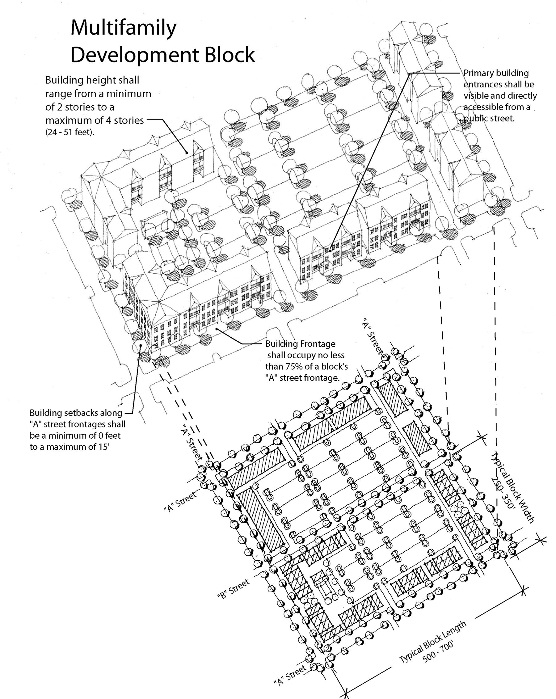
Multifamily Development Block
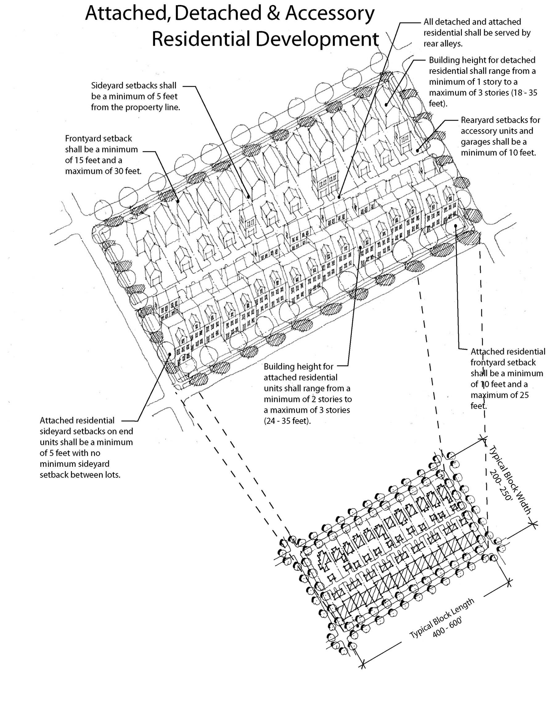
Attached, Detached and Accessory Residential Development
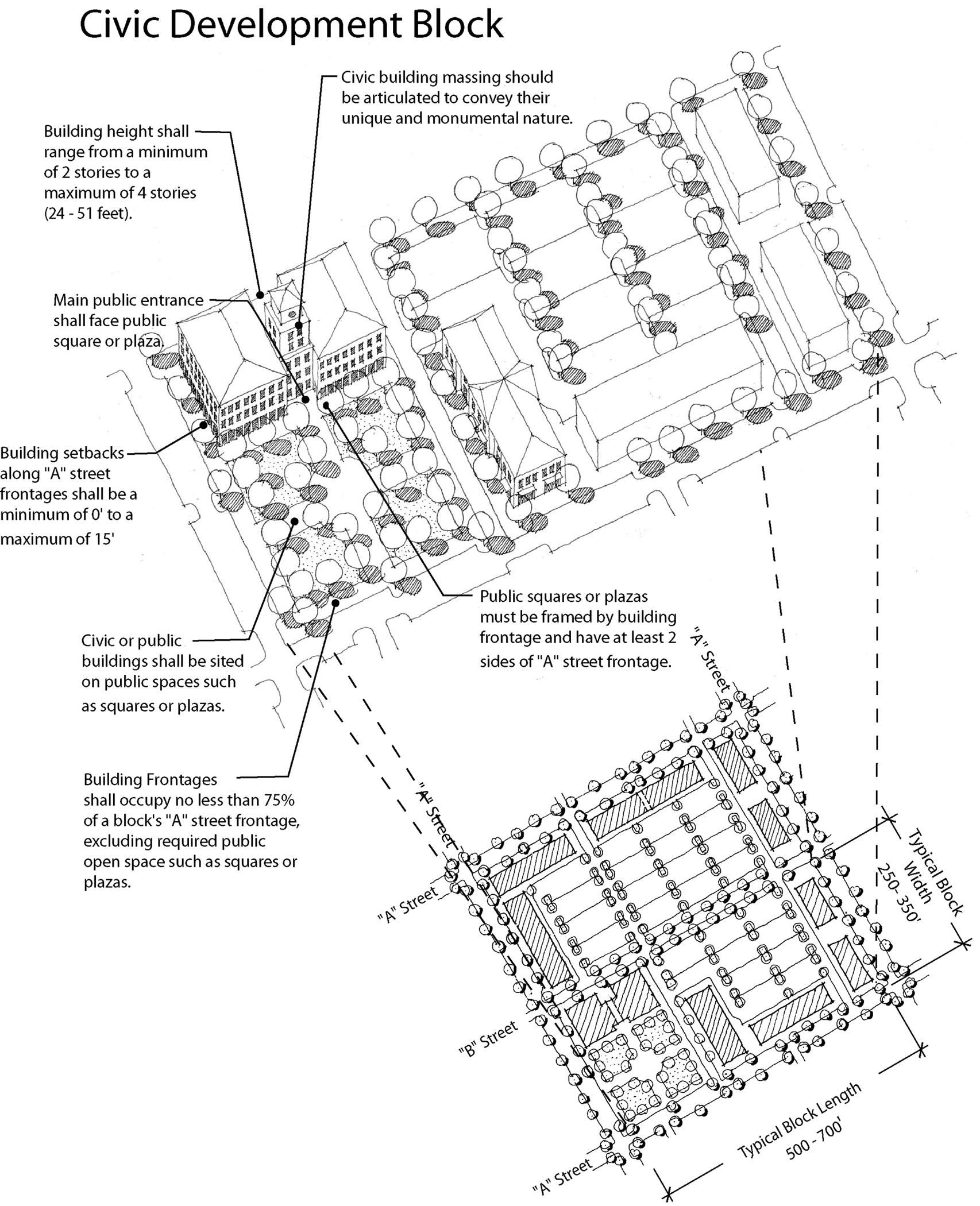
Civic Development Block
(Ord. No. 03-36, § 2, 11-12-03; Ord. No. 04-27, § 2, 6-10-04; Ord. No. 04-46, § 2, 11-4-04)
Sec. 3.12.05. - Town Center I District (BMS TC1)
A.
General District Requirements
1.
Residential Density.
Minimum Density: 5 dwelling units per acre
Maximum Density: 20 dwelling units per acre
2.
Non-Residential FAR.
Minimum FAR: 0.3
Maximum FAR: 1.0
3.
Height.
a.
Retail/Office Development Blocks. Building height shall range from a minimum of 20 feet (including parapet walls) for single-story buildings to a maximum height of 60 feet for buildings with surface parking. Additional building height shall be permitted, up to 75 feet (6 stories), when:
1.
The building includes a mixture of retail uses and either office or residential uses; and
2.
Ground floor uses are restricted to retail and office only; and
3.
Parking requirements are fulfilled through a structured parking facility.
b.
Multi-Family and Civic Development Blocks. Building height for multi-family and civic structures shall range from a minimum of 24 feet (2 stories) to a maximum height of 60 feet (4 stories).
c.
Attached, Detached and Accessory Residential Development Blocks
1.
Detached Units. Building height for detached units shall range from a minimum of 18 feet (1 story) to a maximum of 50 feet (3 stories).
2.
Attached Units. Building height for attached units shall range from a minimum of 24 feet (2 stories) to a maximum of 50 feet (3 stories).
3.
Accessory Dwellings and Structures. Building height for attached units shall be a maximum of 30 feet (2 stories).
4.
Mix of Uses. The Town Center I District requires a mix of land uses. Development shall, at a minimum, meet the following:
a.
Retail. A minimum of 10 percent of the total land area shall be developed as non-residential uses. Additionally, a minimum of 12 percent and a maximum of 50 percent of the total non-residential (including retail and office) floor space shall be constructed for retail uses.
b.
Residential. A minimum of 40 percent of the total buildable land area shall be developed as residential use.
5.
Community Common Areas. A minimum of 12 percent of the district's total land area shall be usable community common areas and open space accessible to the public. Two types of community common areas, as described below, are required. All community common areas shall be owned and maintained by the property owner, property owner associations, homeowners associations or similar entities.
a.
A minimum of 5 percent of the total land area shall be provided in the form of Greens, Squares and Plazas.
b.
A community park a minimum of one contiguous acre in size shall be provided within the district. Community parks shall include, at minimum, one shelter and walking paths/trails. Parks may also include open play areas, gymnasiums, ballfields and sports complexes consistent with the "Design Standards for Neighborhood Parks" published by the Hillsborough County Parks, Recreation and Conservation Department.
B.
Permitted Uses
1.
Allowable uses shall be the uses permitted in the CG zoning district, conventional single-family dwellings, duplexes, triplexes, quadplexes, townhomes, accessory residential units, accessory structures and multi-family (apartments and condominiums) residential with the following additional uses and requirements:
a.
Permitted uses: Housing for older persons and natural preserve.
b.
Conditional uses: Home occupations; nursing, convalescent and extended care facilities; portable temporary storage units; private skateboard ramps.
2.
The following uses shall be permitted on "B" streets only: Canopies and gasoline pump islands as accessory uses; convenience store with gas pumps; domestic motor vehicle sales and rental; dry cleaners, general; full service car washes; funeral homes and mortuaries; furniture/home furnishings; furniture refinishing, repair and upholstery; gasoline sales and service; gun sales; hardware store; laundries; motorized vehicle repair (minor and neighborhood); printing services; radio and TV sales; restaurants with drive-up facilities; service station; sign painting; temporary labor pool; and vehicle parts sales.
(Ord. No. 03-36, § 2, 11-12-03; Ord. No. 04-46, § 2, 11-4-04)
Sec. 3.12.06. - Town Center II District (BMS TC2)
A.
General District Requirements
1.
Residential Density.
Minimum Density: 5 dwelling units per acre
Maximum Density: 20 dwelling units per acre
2.
Non-Residential FAR.
Minimum FAR: 0.3
Maximum FAR: 1.0
3.
Height
a.
Retail/Office, Multi-Family and Civic Development Blocks. Building height shall range from a minimum of 20 feet (including parapet walls) for single-story buildings to a maximum height of 60 feet.
b.
Attached, Detached and Accessory Residential Development Blocks
1.
Detached Units. Building height for detached units shall range from a minimum of 18 feet (1 story) to a maximum of 50 feet (3 stories).
2.
Attached Units. Building height for attached units shall range from a minimum of 24 feet (2 stories) to a maximum of 50 feet (3 stories).
3.
Accessory Dwellings and Structures. Building height for attached units shall be a maximum of 30 feet (2 stories).
B.
Permitted Uses
1.
Allowable uses shall be the uses permitted in the CG zoning district, conventional single-family dwellings, duplexes, triplexes, quadplexes, townhomes, accessory residential units, accessory structures and multi-family (apartments and condominiums) residential with the following additional uses and requirements:
a.
Permitted uses: Home occupations; housing for older persons, nursing, convalescent and extended care facilities and natural preserve.
b.
Conditional uses: portable temporary storage units; private skateboard ramps.
2.
The following uses shall be permitted on "B" streets only: Canopies and gasoline pump islands as accessory uses; convenience store with gas pumps; domestic motor vehicle sales and rental; dry cleaners, general; full service car washes; funeral homes and mortuaries; furniture/home furnishings; furniture refinishing, repair and upholstery; gasoline sales and service; gun sales; hardware store; laundries; motorized vehicle repair (minor and neighborhood); printing services; radio and TV sales; restaurants with drive-up facilities; service station; sign painting; temporary labor pool; and vehicle parts sales.
C.
The Town Center Prototype shown below is a development model that illustrates a typical assemblage of permitted structure types within permitted block types and details the specific design standards for each structure type within the context of a block. The "prototypical" block is not intended to be used to regulate development and therefore does not address specific or individual conditions of each site.
(Ord. No. 03-36, § 2, 11-12-03)
Sec. 3.12.07. - Neighborhood Services District (BMS NS)
A.
General District Requirements
1.
Residential Density.
Minimum density: 5 dwelling units per acre
Maximum Density: 15 dwelling units per acre
2.
Non-Residential FAR.
Maximum: 0.5
3.
Height
a.
Retail/Office Development Blocks. Building height shall be a maximum height of 40 feet (2 stories).
b.
Multi-Family and Civic Development Blocks. Building height shall range from a minimum of 35 feet (including parapet walls) for two-story buildings to a maximum height of 60 feet.
c.
Attached, Detached and Accessory Residential Development Blocks
1.
Detached Units. Building height for detached units shall range from a minimum of 18 feet (1 story) to a maximum of 50 feet (3 stories).
2.
Attached Units. Building height for attached units shall range from a minimum of 24 feet (2 stories) to a maximum of 50 feet (3 stories).
3.
Accessory Dwellings and Structures. Building height for attached units shall be a maximum of 30 feet (2 stories)
B.
Permitted Uses
The Neighborhood Services District's allowable uses shall be the uses permitted in the BPO and RMC-6 Districts with the following additional uses and requirements:
1.
Permitted Uses: Apparel and shoe store; bank/credit union; book/stationary store, new and used; drug stores; dry cleaners, small; florist shop; food product stores: bakery, candies & nuts, dairy, delicatessens, meat seafood and produce; vocational schools; medical and dental laboratories; optician/optical supplies; photography studio; restaurants (without drive-up facilities); travel agencies; watch, clock, jewelry repair; and barber, beauty shop.
2.
Conditional Uses: Convenience store with or without gas pumps.
3.
"Main Street" retail. Retail uses are limited to no more than 10,000 square feet per building/structure.
C.
Neighborhood Services Prototype: Organization of Blocks
The Neighborhood Services Prototype shown below is a development model that illustrates the intended redevelopment pattern within the Neighborhood Services District based on the application of the Brandon Main Street Block Development Standards.
In addition to the Development Block Design Standards, the following standards shall apply in the Neighborhood Services District.
1.
Blocks. Where the scale of redevelopment does not allow for the development of complete blocks (i.e. development parcels less than five acres in size) parking, service drives and alleys shall be designed to allow for future connections to adjacent parcels.
2.
Except as provided in 3.12.04.A.3.a.1, all existing streets shall be considered as "A" Streets and shall abide by building frontage requirements specified in Section 3.12.04.B.2.a.
(Ord. No. 03-36, § 2, 11-12-03; Ord. No. 04-46, § 2, 11-4-04)
Sec. 3.12.08. - Gateway District (BMS GW)
A.
General District Requirements
1.
Residential Density.
Maximum Density: 20 dwelling units per acre
2.
Non-Residential FAR.
Maximum: 1.0
3.
Height
a.
Retail/Office Development Blocks. Building height shall be a maximum height of 50 feet (3 stories).
b.
Multi-Family and Civic Development Blocks. Building height shall range from a minimum of 35 feet (including parapet walls) for two-story buildings to a maximum height of 60 feet.
B.
Permitted Uses. The Gateway District's allowable uses shall be the uses permitted in the CI zoning district and multi-family (apartments and condominiums) residential.
C.
Gateway Prototype
The Gateway Prototype shown below is a development model that illustrates the intended redevelopment pattern within the Gateway District based on the application of the Brandon Main Street Block Development Standards.
D.
Gateway General Redevelopment Standards
In addition to the development block design standards, the following standards shall apply in the Gateway District.
1.
Blocks. Where the scale of redevelopment does not allow for the re-development of complete blocks, parking, service drives and alleys shall be designed to allow for future connections to adjacent parcels.
2.
Except as provided in 3.12.04.A.3.a.1, all existing streets shall be considered as "A" Streets and shall abide by building frontage requirements specified in Section 3.12.04.B.2.a. Brandon Boulevard/SR 60 shall not be considered as an "A" Street.
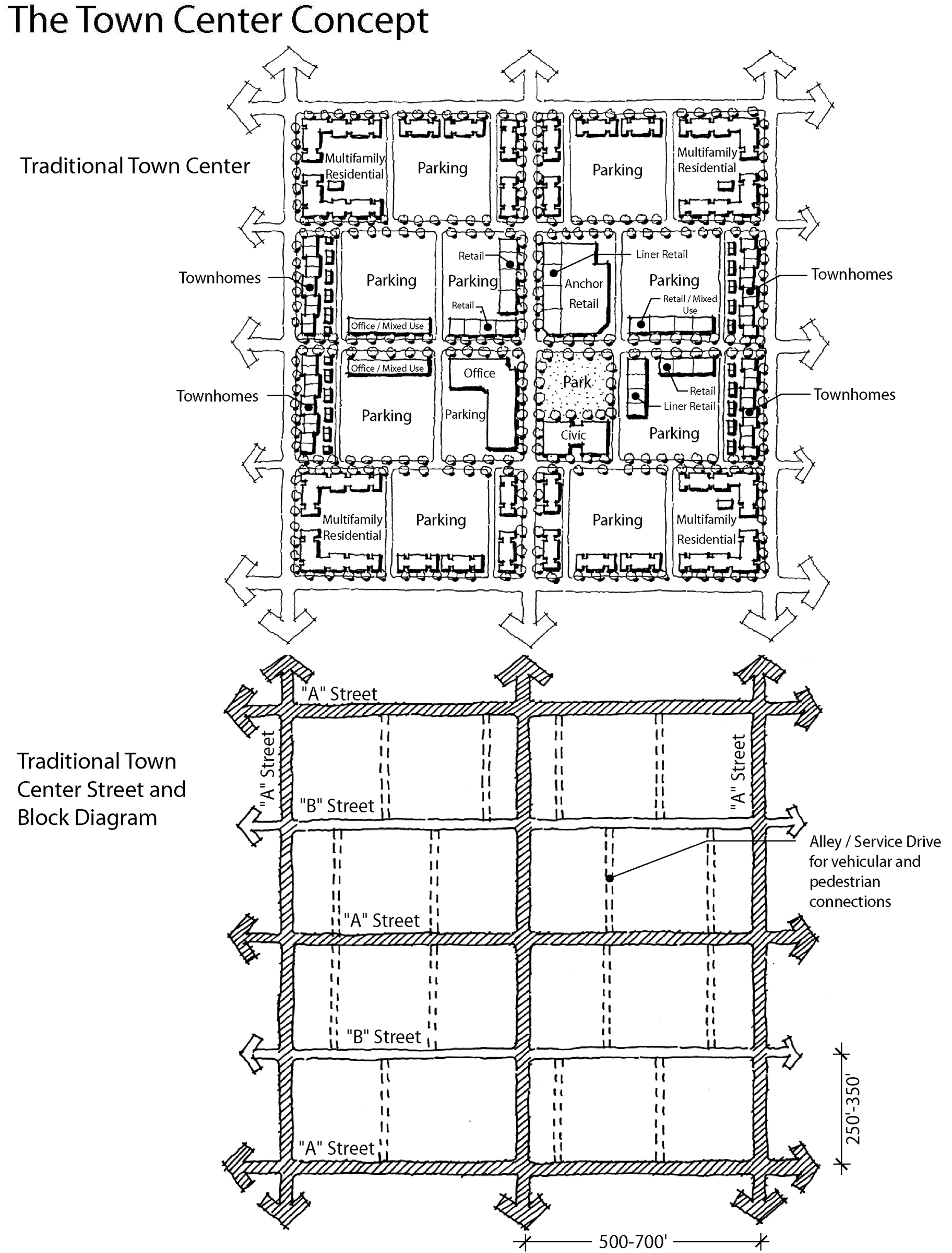
The Town Center Concept
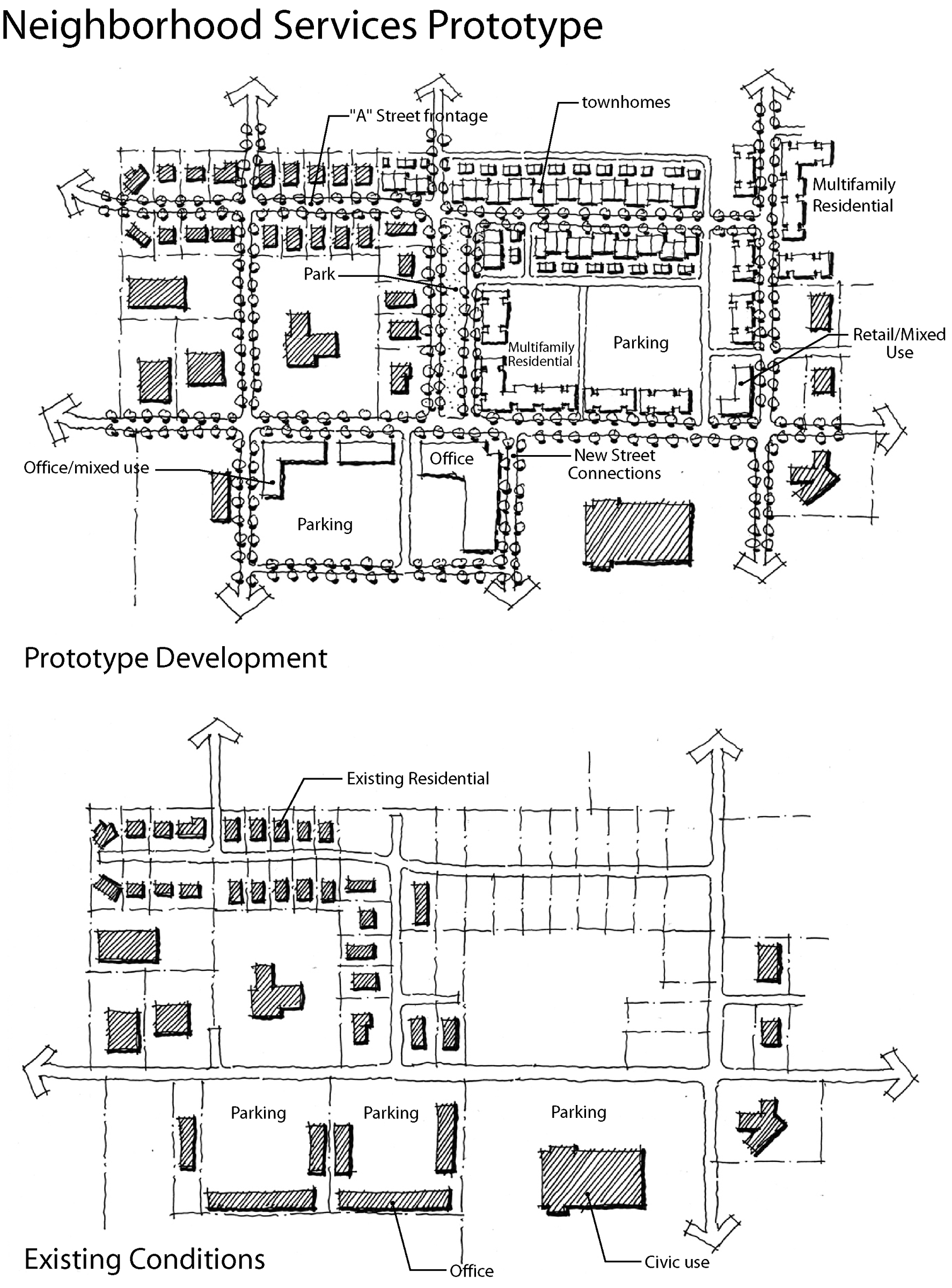
Neighborhood Services Prototype
(Ord. No. 03-36, § 2, 11-12-03; Ord. No. 04-46, § 2, 11-4-04)
Sec. 3.12.09. - Street Design Standards
A.
Street Network Connectivity
1.
Town Center I District and Town Center II District
The street network within the Town Center I District and Town Center II District shall maintain a minimum "connectivity ratio". For the purposes of this Section, "connectivity ratio" is the number of street links divided by the number of nodes. The connectivity ratio shall be performed on the street network separately within the Town Center I District and the Town Center II District. When possible, the street network shall connect to Oakfield Drive, Pauls Drive, Westwood Drive, Debra Lynne Drive, Brandon Parkway, Morrison Road, Brandon Main Street (Lakewood/Providence connector and its future extension) and Lakewood Drive. The required connectivity ratio for the Town Center I District is 1.6, and the required connectivity ratio for the Town Center II District is 1.6.
Calculation of Connectivity Ratio
• Nodes are any point of intersection of two or more roads. Connections with existing streets, alleys, and stub outs to adjacent properties to accommodate future street connections shall not be considered nodes.
• Links are the segments of road connecting nodes. Alleys shall not be considered links.
• Connectivity ratio is calculated as follows: links/nodes=connectivity ratio
Conventional Network
2.
Gateway District and Neighborhood Services District
Redevelopment investments within the Gateway District and Neighborhood Services districts will increase the connectivity of the street and multi-use trail network, by connecting to adjacent stub outs.
B.
TND Street Standards for New and Reconstructed Streets
The newly constructed or reconstructed streets within the Brandon Main Street Community Plan Boundary shall be public streets and conform to the typical section design standards established in the Transportation Technical Manual cross-sections for "Traditional Neighborhood Developments" (hereby "TND Street Standards"), unless otherwise specified herein. The TND Street Standards may be modified, subject to review and approval by the County Engineer, to allow angled parking on Brandon Main Street between Pauls Drive and Lakewood Drive. If angled parking is proposed, a detailed traffic analysis shall be provided by the developer to determine if auxiliary lanes or other traffic control devices are warranted. If warranted by the traffic analysis, the improvements shall be provided by the developer. Additionally, mid-block bulb-outs and a transition zone between the parking spaces and travel lane shall be provided. The travel lane/transition zone interface shall be clearly demarcated.
Design and construction of the street network and the streets is limited by the following:
1.
Within the Brandon Main Street Community Plan Boundary, the sum of Type 1 Boulevard and Type 2 Boulevard shall be limited to 3.0 new linear miles.
2.
Sidewalks and other pedestrian walkways shall meet the following minimum design standards:
a.
When pedestrian crossings are provided at midblock locations, raised crosswalks [or other traffic-calming measure(s) identified in Table 1] shall be located at all points where the pedestrian crossing traverses the lane of vehicle travel. When pedestrian crossings are provided at intersection locations, the requirements in Section 3.12.09.F (Intersection Design) and Section 3.12.09.G (Traffic Calming) shall be followed.
b.
Sidewalks shall be physically separated from on-site vehicle lanes and parking spaces by landscaping, berms, barriers, grade separations, or other means to protect pedestrians from vehicular traffic.
C.
TND Street Standards for Existing Streets
Improvements to existing streets that do not require reconstruction of the street shall be designed to further the intent and design for new and reconstructed streets, as described above (TND Street Standards for New and Reconstructed Streets). Redevelopment of parcels on existing streets must comply with all requirements of Section B above as they pertain to standards on the development side of the street. Newly constructed sidewalks shall connect with the existing sidewalks of all adjacent parcels.
D.
Street Standards for Promotion of Transit Design guidelines for mixed-use areas contained in HARTline's Transit Friendly Planning and Design Handbook shall be followed except where guidelines conflict with regulations in this subsection.
1.
Street Network: To increase the efficiency of transit service within the Brandon Main Street area, the street network shall allow bus transit service directly to the center of Town Center I.
2.
Development Size Thresholds: When a development is constructed adjacent to a bus stop location, the developer is responsible for providing transit friendly designs and amenities as described in Section 6.02.17.C of this Code and HARTline's Transit Friendly Planning and Design Handbook. Regardless of development size, park-and-ride lots are prohibited in the Brandon Main Street area. When required by Section 6.02.17.C of this Code, bus bays, separate bus loading/unloading areas segregated from automobile traffic, and bus staging areas shall not be located on "A" Streets. Direct pedestrian and bicycle connections between bus stops and building entrances and development amenities are required at all bus stop locations regardless of development size.
E.
Right-of-Way Landscaping and Street Lighting
The TND Street Standards denote appropriate locations for street trees and other landscaping. Within these tree zones or landscaping areas, trees of minimum 3.5″ caliper shall be planted 40-60 feet on center. Street trees shall at minimum have 12 foot overall height and 5 foot minimum clear trunk, and shall be of canopy type. Landscaping design shall be in accordance with the Transportation Technical Manual for Subdivisions and Site Development Projects. Section 6.06.03.A.5 shall apply when overhead power lines exist within the required vegetative planting areas.
Section 6.06.03 of this Code regulates Off-Street Vehicular Use Areas. All walkways constructed within parking lots shall be raised to a standard sidewalk height. Where walkways cross driving aisles, they shall be clearly marked with striping or constructed with a contrasting paving material. All "A" and "B" streets shall be lit through decorative street lamps that are appropriate for surrounding architecture and conform to Hillsborough County standards. Streetlights shall be between 15 feet and 24 feet in height. Silver cobra-headed and shoe-box type fixtures shall be prohibited.
F.
Intersection Design
In addition to other requirements, the following design features are required as applicable:
1.
Dedicated left-turn lanes:
a.
Within the Gateway, Town Center I, Town Center II Districts, dedicated left-turn lanes shall be provided at all intersections on "A" Streets. No left turns lanes are permitted on the Local Urban Lanes-TND street type
b.
On street types with medians (Type 1 Boulevards, Type 2 Boulevards, and Avenues), the median shall be narrowed to allow the left-turn lane without disrupting on-street parking and bulb-outs.
c.
On street types without medians and with on-street parking (Main Streets and Local Urban Streets), on-street parking shall cease a safe distance from the intersection, and travel lanes shall shift to allow for a dedicated left-turn lane.
2.
Double left-turn lanes shall be prohibited.
3.
Bulb-outs. Bulb-outs are required at intersections of street types that have on-street parking and medians (Type 1 Boulevards and Avenues), and encouraged where possible on other street types. At a safe distance from the intersection, on-street parking shall cease and the curb shall be extended to the travel lane.
4.
Medians. On street types with medians, a 12-foot median at intersections after a left-turn lane has been provided is permitted. Construction and landscaping of these medians shall provide a mid-intersection pedestrian refuge.
5.
Roundabouts. Roundabouts may be installed in all districts. Roundabout design shall comply with state and federal design guidelines such as the Federal Highway Administration's Roundabouts: An Informational Guide.
G.
Traffic Calming
The following provisions describe and establish standards for permitted traffic calming. The descriptions set forth herein. The traffic calming measures in Table 1 are further described in the documents entitled Residential Traffic Control Handbook (published by the Hillsborough County Engineering and Construction Services Department, Rev. April 18, 2001), and R. Ewing, Traffic Calming: State of the Practice (Institute of Transportation Engineers and the Federal Highway Administration, 1999), which document is hereby incorporated by this reference. An asterisk (*) means that the device is permitted, while a blank cell means that the device is not permitted.
Table 1: Traffic Calming Devices
| Traffic Calming Measures |
Boulevard Type 1
|
Boulevard Type 2
|
Avenue
|
Main Street
|
Urban Street
|
Urban Lane
|
Retrofit
| |
|---|---|---|---|---|---|---|---|---|
 |
Mid-Block Bulb-Outs
Mid-block bulb-outs reduce the width of the roadway for a mid-block section. They shorten crossing distances for pedestrians and draw attention to pedestrians via raised peninsulas. Bulb-outs can be built within the marked on-street parking area or on residential roadways over 20 feet in width. | • | • | • | • | • | ||
 |
Restriping
Street can be restriped to create lanes that are a maximum of 10 to 11 feet wide. The excess space can be used to create bike lanes or marked on-street parking on one or both sides. Bicycle lanes shall be 5 feet wide minimum, and on-street parking shall be 7 feet wide minimum. The parking can be staggered to create a weaving path on the roadway, further informing drivers that caution should be used in the neighborhood. | • | • | |||||
 |
Gateways
Gateways appear to narrow the street, and also serve as highly visible entryways into neighborhoods. Gateway features can also double as transit waiting areas. | • | • | • | • | • | • | • |
 |
Chicanes
A chicane changes the physical characteristics of a roadway section from an existing straight alignment to a series of horizontal curves. Trees can be planted in the slow point to restrict the driver's vision down the street, creating the feeling of a "closed" street. | • | • | |||||
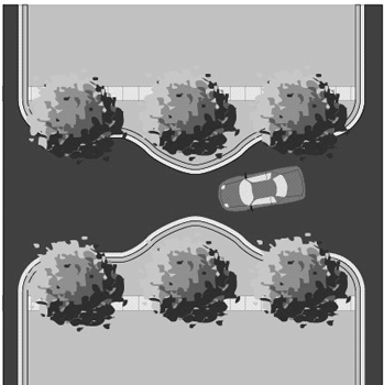 |
Mid-Block Yield Point
The mid-block single-lane yield point reduces the street width to a single lane for a short section at some point between intersections. A variety of designs are possible for the remaining single lane of traffic: centered on the existing street, offset to one side, or aligned in a curve from one side of the street to the other. | • | • | • | ||||
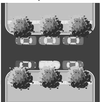 |
Unmarked On-Street Parking
Allowing on-street parking on streets without designated on-street parking areas will create a series of single-lane yield points wherever parked cars are present. This "informal" single-lane yield point occurs when the street width is narrow enough to prevent simultaneous passing of two moving vehicles past a parked vehicle. For streets up to 30 feet in width, allowing parking on both sides of the street is necessary to create a yield point. | • | • | |||||
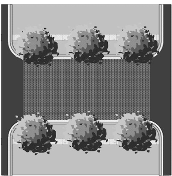 |
Textured Pavement
Textured pavement such as brick streets is also an effective traffic calming measure. The advantages of a brick street area that it is aesthetically pleasing and it calms traffic better as it ages as the surface wears out. Installation costs are higher than those for asphalt roadways, but long-term maintenance costs are lower. However, textured pavement can be loud. | • | • | • | • | • | • | • |
 |
Raised Intersections
Raised intersections slow cars down throughout an entire intersection, providing an extra level of safety for pedestrians crossing an intersection. This improvement may be most appropriate for commercial areas where both vehicular and pedestrian traffic volumes are high. Textured pavement can also be part of this improvement. | • | • | • | • | • |
(Ord. No. 03-36, § 2, 11-12-03; Ord. No. 08-29, § 2, eff. 2-1-09)
Sec. 3.12.10 - Parking Standards
Except as otherwise provided by this Section, parking requirements for all uses shall be in accordance with the Parking Standards of this Code (Part 6.05.00). Except as otherwise provided by this Section, landscaping requirements for off-street vehicular use areas shall be in accordance with the Landscaping and Buffering Requirements of this Code (Section 6.06.03).
A.
Required Off-Street Parking for the Town Center I, Town Center II, and Neighborhood Services Districts
1.
Required vehicular and bicycle parking provided through surface parking lots shall be on the development site or within 500 feet of the development site that the parking is required to serve.
2.
The required automobile parking requirements of Section 6.05.02(E) of this Code may be reduced by 50 percent for any use within the Brandon Main Street area. For surface parking lots, the minimum required parking is the maximum allowed, except as provided below. Public and private parking garages with two or more levels do not have a maximum number of parking spaces allowed.
3.
The required number of bicycle parking spaces for select uses is listed in Table 2. Bicycle parking shall be designed as required in Section 6.05.02(P) of this Code.
Table 2: Minimum Required Bicycle Parking Spaces
B.
Vehicular Parking Requirement Reduction Methods for the Town Center I, Town Center II, and Neighborhood Services Districts
Vehicular parking requirements shall be reduced as follows:
On-Street Parking Credit. On-street parking spaces shall be deducted from the required number of off-street parking spaces for the adjacent use. When an extended parcel line splits an on-street parking space, that space shall be deducted from the parking requirements of the parcel that fronts the majority of the on-street parking space.
C.
Vehicular Parking Requirement Expansion Methods for the Town Center I, Town Center II, and Neighborhood Services Districts
More than the required number of vehicular parking spaces in surface lots, up to 150 percent of the spaces required in this subsection, may be allowed if the development provides the following:
1.
One hundred percent (100%) of trees required by Section 6.06.03 of this Code must be canopy shade trees, with minimum 3.5" caliper, 12 foot overall height, and 5-foot minimum clear trunk; and
2.
Pedestrian walkways. Expanded divider medians that contain clearly delineated walkways that connect all adjacent sidewalks to all building entrances and outdoor amenities. The width of the divider median shall be at least 15 feet measured inside of curb to inside of curb. At least one tree for each 40 linear feet (or part thereof) of divider median shall be planted in the median with trees located along the median to maximize shading of the sidewalk and parking area. The remainder of the divider median shall be landscaped; and the landscaping material may include grass, ground cover, mulch, shrubs, trees or other landscaping treatment, excluding sand or pavement. One hundred percent (100%) of trees within the expanded divider median must be canopy shade trees, with minimum 3.5" caliper, 12 foot overall height, and 5 foot minimum clear trunk. Landscaping irrigation and proper installation and maintenance is required. When this alternative is chosen, the minimum width of the terminal islands shall be six feet, measured inside of curb.
(Ord. No. 03-36, § 2, 11-12-03)
Sec. 3.12.11. - Adequacy of Public Facilities
The applicant shall comply with Part 4.02.00 of this Code (Adequate Public Facilities).
(Ord. No. 03-36, § 2, 11-12-03; Ord. No. 16-13, § 2(Exh. A), 6-16-16, eff. 7-30-16)
Sec. 3.12.12. - Sign Standards
A.
Generally
All signs shall conform to the limitations and provisions of Article VII of this Code. Additionally, the following limitations and provisions shall apply to signage for all uses, excluding emergency public services/uses.
B.
General Requirements
1.
Signage within the Brandon Main Street Area shall be constructed utilizing materials similar to those of the building(s) served. In additional to the materials used within the building, acceptable materials also include wood and painted metal. Plastic and similar synthetic materials are not permitted.
2.
Signs shall contain colors similar to those of the buildings they serve. No sign shall be composed of more than three colors.
C.
Detached on-site signs
Detached on-site signs include both pole signs and monument signs.
1.
General Standards
a.
Letter height shall be a minimum of nine inches and a maximum of 24 inches.
b.
Signs shall be located perpendicular to the street.
c.
All pole signs shall be constructed with a decorative base/skirt under the sign consistent with the architecture of the building to create the appearance of a ground-mounted monument sign.
2.
Pole Signs
a.
The maximum height of the entire sign shall be 15 feet above the elevation of the nearest sidewalk.
b.
Signs shall be set back a minimum of ten feet from the public right-of-way, 30 feet from the intersection of right-of-way lines and shall meet any additional setback required in Article VII of this Code. Additionally, sight distance and roadside clear zones must be in accordance with the criteria of the Hillsborough County Transportation Technical Manual.
3.
Monument Signs
a.
The maximum height shall be ten feet above the ground plane.
b.
Signs shall be set back a minimum of ten feet from the public right-of-way, 30 feet from the intersection of right-of-way lines and shall meet any additional setback required in Article VII of this Code. Additionally, sight distance and roadside clear zones must be in accordance with the criteria of the Hillsborough County Transportation Technical Manual.
D.
Awning Signs
1.
The width of the sign shall not exceed the width of the canopy, awning or marquee.
2.
Vertical clearance of the sign from the sidewalk shall be eight feet minimum.
3.
Signs shall not be permitted on awnings, canopies, balconies or other building elements that may be allowed to project over public rights-of-way by other provisions of this Part.
E.
Miscellaneous signs
1.
Window Signs
a.
Permanent window sign displays shall be limited to no more than 20 percent of the window area.
b.
Casement windows are permitted to have seasonal signs that are changed out on a regular basis provided there is a changeable product display located within the casement window.
2.
Projecting Signs
a.
Signs shall be located above ground-floor level doors and windows but below the roofline or second-floor level to promote a pedestrian environment.
b.
Signs are limited to no more than one projecting sign per business.
c.
Signs shall project no more than four feet from the building face and must be located outside of the public right-of-way.
d.
Sign shall have a minimum six-inch clearance from the building face.
e.
Signs shall be perpendicular from the building
f.
The maximum sign area permitted is four square feet.
F.
Sign Lighting
1.
Ground-mounted up-lights shall not exceed 150 watts per sign face and shall shield light from aiming toward motorists and neighboring properties. Fixtures shall be hidden from view by sign foundation landscaping.
2.
Back-lit individually cut letters are required in monument sign illumination.
3.
Same-source lighting is required for signs and parking area lighting.
4.
Inter lit tenant signs attached to buildings shall only illuminate name and type of business and not entire sign face.
(Ord. No. 03-36, § 2, 11-12-03; Ord. No. 04-47, § 2, 11-9-04; Ord. No. 05-10, § 2, 6-16-05, eff. 10-1-05)
Sec. 3.13.01.- Purpose
The purpose of this Part is to provide for University Community Area (UCA) zoning districts and design standards. The zoning districts and design standards implement the vision, principles and strategies of the Hillsborough County Comprehensive Plan's University Community Area Master Plan.
(Ord. No. 04-27, § 2, 6-10-04)
Sec. 3.13.02. - Applicability
A.
Except as provided herein, these standards shall apply to all development that occurs within the University Community Area on properties zoned UCA. These provisions shall not apply to public schools and projects with unexpired building permits, unexpired preliminary site development approval or unexpired construction plan approval at the time of rezoning to UCA. Additionally, Tax Folio 36474.0000 as configured on November 12, 2004 shall not be subject to the setback, parking location, minimum building height and street frontage requirements contained herein until such time that redevelopment of the property occurs. Existing lawful uses, lots, structures, characteristics of land and densities shall not be required to be removed or otherwise modified as a result of the standards or requirements set forth in this Part.
In addition to the standards provided herein, development within the University Community Area zoning districts shall be required to meet all other applicable sections of the Land Development Code. Where any provision of the University Community Area design standards is in conflict with any other standards or regulations of the Land Development Code, the University Community Area standards shall prevail.
B.
Expansions of legally permitted single-family and two-family dwellings in existence at the time of the effective date of this Part shall be subject to the height, bulk and placement regulations provided herein but shall be exempt from all other requirements below.
C.
Expansions of existing multi-family and non-residential structures up to a cumulative total of 30 percent of the legally permitted floor space in existence at the time of the effective date of this Part shall be exempt from the requirements contained herein. Where structures are expanded beyond 30 percent of existing floor space, all requirements of this Part shall apply to the area of expansion. Conversions of existing structures from residential to non-residential uses shall be exempt from the requirements of this Part, provided the floor space of the structure is not increased by more than 30 percent.
(Ord. No. 04-27, § 2, 6-10-04; Ord. No. 05-10, § 2, 6-16-05, eff. 10-1-05)
Sec. 3.13.03. - General Development Standards
A.
Designation of Streets
All streets within the University Community Area shall be classified as Main Streets or Neighborhood Streets (Local Urban Lanes and Local Urban Streets). Main Streets include 22nd Street and 131st Avenue. All other streets shall be classified as Neighborhood Streets.
B.
Street Design
New streets and reconstruction of existing streets, excluding regulated roadways as defined in the Hillsborough County Comprehensive Plan, shall conform to the design standards established in the Transportation Technical Manual cross sections for Traditional Neighborhood Developments (TND Typical Sections). Traffic calming measures shall be permitted in accordance with Section 5.08.09.E of this Code.
C.
Parking, Access and Site Design
Except as otherwise provided by this Section, parking requirements for all uses shall be in accordance with the Parking Standards of Article VI. Landscaping requirements for off-street vehicular use areas shall be in accordance with the Landscaping and Buffering Requirements of this Code.
1.
Required Off-Street Parking
a.
Required parking provided through surface parking lots shall be on the development site or within 500 feet of the development site that the parking is required to serve.
b.
The minimum parking requirements in Article VI of this Code for non-residential uses is the maximum allowed Additionally, the non-residential parking requirements may be reduced by 50 percent
c.
On-Street Parking Credit. On-street parking spaces shall be deducted from the required number of off-street parking spaces for the adjacent use. When an extended parcel line splits an on-street parking space, that space shall be deducted from the parking requirements of the parcel that fronts the majority of the on-street parking space.
2.
Off-street parking (surface parking lots).
a.
In projects located on Main Streets with Main Street or Neighborhood Office zoning designations, off-street surface parking lots shall be located behind the front façade of Main Street frontage buildings.
b.
Except as provided below, in projects located only on Neighborhood Streets with a Neighborhood Office zoning designation, off-street surface parking lots shall be located behind the front façade of Neighborhood Street frontage buildings.
c.
Notwithstanding the above, surface parking lots may be located adjacent to a Neighborhood Street in projects with frontage along Main Streets and Neighborhood Streets.
d.
Surface parking lots may be located adjacent to one Neighborhood Street in projects with frontage along two Neighborhood Streets. However, no surface parking lot shall front a Neighborhood Street containing property on the opposite side of the street zoned for residential and residential support uses only. Additionally, on corner lots, surface parking may be located adjacent to two Neighborhood Streets.
3.
Parking Garages. Except for vehicle entrances, the ground floor shall be developed with enclosed commercial, office or civic floor space to a minimum building depth of 30 feet along the entire length of the structure on each adjacent street, unless separated from the street by another building, parking lot and/or landscaped open space with a minimum depth of 30 feet.
D.
Screening of trash and recycling receptacles, loading docks, service areas, and other similar areas.
1.
Trash, recycling receptacles, loading docks, service areas, and other similar areas must be located in parking areas or in a location that is not visible from Main Street or Neighborhood Street frontages, and must be screened to minimize sound and visibility from residences and to preclude visibility from adjacent streets. Service areas shall be screened by a masonry wall and landscape buffer. The wall shall be a minimum of six feet in height using architectural design, materials and colors that are consistent with those of the primary structure. The landscape buffer shall be a minimum of five feet in width and contain evergreen plants a minimum of three feet in height spaced not more than four feet apart.
2.
Mechanical equipment at ground level shall be placed on the parking lot side of the building away from view from adjacent Main Street and Neighborhood Street frontage and shall be screened from view of any street by fencing, vegetations, or by being incorporated into a building.
3.
All rooftop mechanical equipment shall be integrated into the overall mass of a building by screening it behind parapets or by recessing it into roof structure.
4.
Solid waste storage areas. A solid waste refuse facility shall be screened on 3 sides by a six-foot high masonry wall if it is located within the building setback area or located in areas visible to customers or from a public right-of-way.
5.
Fences and Walls. Fences and walls shall be constructed of masonry, wood, vinyl or cast iron/metal. The location of all fences and walls shall be in accordance with Article VI of this Code.
E.
Building Orientation. A building's primary orientation shall be toward the street rather than the parking areas. The primary building entrances shall be visible and directly accessible from a public street.
F.
Public Entrance. Buildings that are open to the public shall have an entrance for pedestrians from the street to the building interior. This entrance shall be a distinctive and prominent element of the architectural design, and shall be open to the public during business hours. Buildings shall incorporate lighting and changes in mass, surface or finish to emphasize the entrance(s).
G.
Utilities. All utility lines shall be located underground.
(Ord. No. 04-27, § 2, 6-10-04)
Sec. 3.13.04. - Standards for Non-Residential, Mixed Use and Multi-Family Development
A.
Building frontages shall occupy no less than 60 percent of a project's street frontage. Notwithstanding the above, projects with frontages along Main Streets and Neighborhood streets shall not have minimum building frontages along Neighborhood Streets.
B.
Front yard building setbacks along all street frontages shall be a minimum of ten feet to a maximum of 20 feet. Notwithstanding the above, the front yard setback for a detached single-family dwelling on Tax Folio 36478.0000 shall be a maximum of 50 feet. Rear yard setbacks shall be a minimum of ten feet and side yard building setbacks shall be a minimum of five feet. Accessory structures shall be subject to the applicable requirements of Article VI.
C.
Building height shall be a maximum of 50 feet
D.
Building Design
1.
Building Façade. Blank walls shall not occupy over 50 percent of a street-facing frontage and shall not exceed 20 linear feet without being interrupted by a window or entry. No more than 20 feet of horizontal distance of wall shall be provided without architectural relief for building walls and frontage walls facing the street. Buildings shall provide a foundation or base that extends from the ground to the bottom of the lower windowsills that is distinguished from the building face by a change in volume or material. A clear visual division shall be maintained between the ground level floor and upper floors, which may include changes in volume or materials or other architectural detailing such as a belt course or cornice. With the exception of detached single-family dwellings and buildings accessory to such dwellings, the top of any building shall contain a distinctive finish consisting of a cornice or other architectural termination. Ground floor retail uses that are located in non-residential or mixed use structures and that are located on a corner parcel and have two street frontages shall contain storefront display windows covering a minimum of 40 percent and a maximum 80 percent of a storefront's linear frontage. Blank walls shall not occupy over 50 percent of a street-facing frontage and shall not exceed 20 linear feet without being interrupted by a window or entry.
2.
Transparency. All street-facing non-residential and mixed-use structures shall have windows covering a minimum of 40 percent and a maximum 80 percent of the ground floor of each storefront's linear frontage. Mirrored glass, obscured glass and glass block cannot be used in meeting this requirement. Display windows may be used to meet this requirement, but must be transparent and shall not be painted or obscured by opaque panels.
3.
Shelter. Buildings shall incorporate arcades, alcoves, porticos or awnings.
4.
Garages. Street-facing ground floor parking, including individual unit garages, is not permitted on the first floor of a multi-family structure on a Main Street. Parking shall occur within parking garages or within surface lots that do not front on a Main Street. Individual unit garages attached to principal structures fronting Neighborhood Streets shall be set back a minimum of five feet from the street-facing façade and a minimum of 20 feet from the street right-of-way.
(Ord. No. 04-27, § 2, 6-10-04; Ord. No. 05-10, § 2, 6-16-05, eff. 10-1-05)
Sec. 3.13.05. - Sign Standards
A.
Generally
All signs shall conform to the limitations and provisions of Article VII of this Code. Additionally, the following limitations and provisions shall apply to signage for all uses, excluding emergency public services/uses.
B.
General Requirements
1.
Signage within the University Community Area shall be constructed utilizing materials similar to those of the building(s) served. In additional to the materials used within the building, acceptable materials also include wood and painted metal. Plastic and similar synthetic materials are not permitted.
2.
Signs shall contain colors similar to those of the buildings they serve.
3.
All permanent detached signs shall be monument signs.
C.
Detached on-site signs
1.
General Standards
a.
Letter height shall be a minimum of nine inches and a maximum of 24 inches.
2.
Monument Signs
a.
The maximum height shall be eight feet above the ground plane.
b.
Signs shall be set back a minimum of ten feet from the public right-of-way, 30 feet from the intersection of right-of-way lines and shall meet any additional setback required in Article VII of this Code. Additionally, sight distance and roadside clear zones must be in accordance with the criteria of the Hillsborough County Transportation Technical Manual.
D.
Awning Signs
1.
The width of the sign shall not exceed the width of the canopy, awning or marquee.
2.
Signs shall not be permitted on awnings, canopies, balconies or other building elements that may be allowed to project over public rights-of-way by other provisions of this Part.
E.
Miscellaneous signs
1.
Window Signs
a.
[Reserved.]
b.
Permanent window sign displays shall be limited to no more than 20 percent of the window area.
c.
Casement windows are permitted to have seasonal signs that are changed out on a regular basis provided there is a changeable product display located within the casement window.
2.
Projecting Signs
a.
Signs shall be located above ground-floor level doors and windows but below the roofline or second-floor level to promote a pedestrian environment.
b.
Signs are limited to no more than one projecting sign per business.
c.
Signs shall project no more than four feet from the building face and must be located outside of the public right-of-way.
d.
Sign shall have a minimum six-inch clearance from the building face.
F.
Sign Lighting
1.
Ground-mounted up-lights shall not exceed 150 watts per sign face and shall shield light from aiming toward motorists and neighboring properties. Fixtures shall be hidden from view by sign foundation landscaping.
2.
Back-lit individually cut letters are required in monument sign illumination.
3.
Inter-lit tenant signs attached to buildings shall only illuminate name and type of business and not entire sign face.
(Ord. No. 04-27, § 2, 6-10-04; Ord. No. 04-47, § 2, 11-9-04; Ord. No. 05-10, § 2, 6-16-05, eff. 10-1-05)
Sec. 3.13.06. - Main Street District (UCA-MS)
All development shall be in accordance with the Standards for Non-Residential, Mixed Use and Multi-Family as described above and as appropriate. Additionally, all structures located along 22nd Street shall be a minimum of two stories in height.
Permitted Uses: CG and RMC-20 uses as defined in Section 2.02.02 of this Code. Notwithstanding the above, single-family detached and two-family attached dwellings shall be prohibited.
Maximum Density: 20 dwelling units per acre.
Maximum Intensity: 0.75 FAR.
(Ord. No. 04-27, § 2, 6-10-04)
Sec. 3.13.07. - Neighborhood Office District (UCA-NHO)
All development shall be in accordance with the Standards for Non-Residential, Mixed Use and Multi-Family as described above and as appropriate. Additionally, all structures located along 22nd Street shall be a minimum of two stories in height.
Permitted Uses: BPO and RMC-20 uses as defined in Section 2.02.02 of this Code. Additionally, CG uses as defined in Section 2.02.02 of this Code shall be permitted in projects with Main Street frontage. The permitted uses on Tax Folio 36474.0000 as configured on November 12, 2004 shall also include those approved for PD-C 92-237. Notwithstanding the above, single-family detached and two-family attached dwellings shall be prohibited, with the exception that one single-family detached dwelling shall be permitted on Tax Folio 36478.0000 as configured on November 12, 2004.
Maximum Density: 20 dwelling units per acre.
Maximum Intensity: 0.75 FAR.
(Ord. No. 04-27, § 2, 6-10-04; Ord. No. 05-10, § 2, 6-16-05, eff. 10-1-05)
Sec. 3.14.01.- Generally
It is the intent of this overlay district to improve the appearance of new and existing development along State Road 60 between Interstate 75 and Dover Road by enhancing landscaping, building and sign requirements. Two distinct sectors will be created in this overlay district: an Urban Sector between Lakewood Drive and Kingsway Road, flanked on both ends by Suburban Sectors. The Urban Sector regulations will provide for the placement of new buildings near the highway, while the Suburban Sector regulations will require a broad landscaped buffer along the highway.
(Ord. No. 04-27, § 2, 6-10-04)
Sec. 3.14.02. - Applicability
The provisions of this Part shall apply to all new development on parcels in any zoning district, including PD districts, within the Overlay District as shown in Figure 3.53 herein, as well as any other parcel that is aggregated for development with a parcel shown in Figure 3.53 or has off-street access to State Road 60 through a parcel shown in Figure 3.53. Additionally, these provisions shall become effective upon the expansion and/or improvement of existing structures on such parcels in any zoning district, including PD districts, as required herein. If there is any conflict between the provisions of this Part and the underlying zoning district or other general provisions of this Code, the provision imposing the greater restriction or requirement shall prevail, except that in all cases the front building setbacks prescribed by this Part shall prevail when in effect. In the event the provisions of this Part conflict with the conditions of approval and/or certified site plan of a PD district, the provisions of this Part shall, to the extent they impose a greater restriction or requirement or implement a prescribed front building setback, supercede the conditions and/or site plan, although the developer may seek a modification of the PD district to seek relief from these provisions to the minimum degree necessary to maintain the existing development entitlements of the PD district. In such case the developer shall apply for the modification in accordance with the requirements of this Code, however, the application fee shall be waived provided the proposed modification seeks only those changes necessary to maintain the existing development entitlements of the PD district while implementing the provisions of this Part to the greatest extent feasible. If the proposed modification seeks other changes that are not necessary to implement the provisions of this Part or maintain the existing development entitlements of the PD district, the developer shall pay all application fees.
Notwithstanding, the requirements of this Part shall not apply to projects with unexpired building permits, unexpired preliminary site development approval or unexpired construction plan approval at the effective date of this Part, nor to properties designated Historic Landmark sites under Part 3.03.00 of this Code, nor to churches or schools, nor to properties zoned BMS (Brandon Main Street), nor to Developments of Regional Impact with approved master sign plans.
(Ord. No. 04-27, § 2, 6-10-04)
Sec. 3.14.03. - Permitted Uses
Uses shall be regulated by the underlying zoning district of the development parcel as provided in this Code.
(Ord. No. 04-27, § 2, 6-10-04)
Sec. 3.14.04. - General Development Standards
Except as otherwise provided by this Part, development shall conform with the area, height, bulk and placement standards of the underlying zoning district of the development parcel and all other requirements of this Code.
(Ord. No. 04-27, § 2, 6-10-04; Ord. No. 05-10, § 2, 6-16-05, eff. 10-1-05)
Sec. 3.14.05. - Urban Sector
The following requirements shall apply to all building activity within the Urban Sector of the Overlay District, subject to the applicability provisions in Section 3.14.02 above. All signs shall comply with the limitations and provisions of Article VII of this Code. Additionally, the following limitations and provisions shall apply to ground signs for all uses, excluding emergency public services/uses.
1.
For projects where existing buildings are improved, expanded and/or replaced, and the value of such work, including interior renovations but excluding improvements to water and wastewater facilities and the repair or like-kind replacement of roofs, exceeds 25 percent but not more than 50 percent of the assessed value of all buildings on the parcel at the time, or the value of the improvements, expansions and/or replacement buildings in combination with the value of other such work performed within the previous 24 months, but not before the effective date of this Part, exceeds 25 percent but not more than 50 percent of the assessed value of all buildings on the parcel at the beginning of said time period, the following requirements shall apply to the entire parcel:
a.
If the above criteria are met, existing on-premises pole signs and revolving signs along State Road 60 shall be removed and new pole signs and revolving signs shall be prohibited. Monument signs shall be limited to a maximum height of 15 feet regardless of roadway classification and, notwithstanding other requirements of this Code, a minimum setback of ten feet from the highway right-of-way shall be permitted provided the sign does not obstruct motorist visibility. The display portion of the sign structure shall be supported by a single pier or pillar with a minimum diameter or horizontal dimension of 24 inches or, alternatively, by two piers or pillars, each with a minimum diameter or horizontal dimension of 12 inches. The sign structure shall have materials and architectural details consistent with the principal building it serves. Additionally, the sign shall have a decorative base with a minimum height of two feet and a minimum length not less than 80 percent of the maximum length of the display face. Landscaping comprised of evergreen plants may be installed in lieu of the decorative base, provided the landscaping meets the same dimensional requirements and has a minimum opacity of 75 percent at time of planting. Existing on-premises monument signs shall be brought into conformance with these requirements or shall be removed. Variances to allow the continued use of existing on-site pole signs or revolving signs, or the installation of new pole signs or revolving signs, shall be prohibited.
b.
Off-street vehicular use areas, including existing facilities, along State Road 60 shall be buffered and landscaped in accordance with the requirements of Part 6.06.00 of this Code, except that required landscaping in the buffer shall consist of the following: a row of shade trees with a minimum caliper of four inches and minimum height of 14 feet at the time of planting and spaced on 30-foot centers, along with a continuous hedge of shrubs and ground cover with a minimum height of 18 inches and minimum opacity of 75 percent at time of planting and a maximum height of 36 inches within two years. At the discretion of the developer, palms may be planted in lieu of shade trees at the rate of one date palm (Phoenix dactylifera) or a cluster of three sabal palms (Sabal palmetto) for one shade tree. The palms shall have a minimum height of ten feet (clear trunk measurement) at time of planting. The remainder of the buffer area shall be sodded. If provision of the buffer reduces the number of parking spaces below that mandated by this Code, new spaces shall be provided to meet parking requirements. Section 6.06.03.A.5 shall apply when overhead power lines exist within the required vegetative planting areas.
(1)
Notwithstanding, in cases where the provision of a landscaped buffer along State Road 60 will reduce the number of existing parking spaces below that mandated by this Code, and there is insufficient area on the development parcel to replace the required spaces that are lost, a masonry screening wall with a minimum opacity of 75 percent may be provided in lieu of the landscaped buffer. In such cases the wall shall have a minimum height of three feet and maximum height of four feet and shall be architecturally finished on all sides. Paint shall not constitute an architectural finish.
2.
For projects where existing buildings are improved, expanded and/or replaced, and the value of such work, including interior renovations but excluding improvements to water and wastewater facilities and the repair or like-kind replacement of roofs, exceeds 50 percent but not more than 75 percent of the assessed value of all buildings on the parcel at the time, or the value of the improvements, expansions and/or replacement buildings in combination with the value of other such work performed within the previous 24 months, but not before the effective date of this Part, exceeds 50 percent but not more than 75 percent of the assessed value of all buildings on the parcel at the beginning of said time period, the requirements of Sections 3.14.05.1.a and 3.14.05.1.b above, together with the following requirement, shall apply to the entire parcel:
a.
All off-street vehicular use areas, including existing facilities, shall be buffered and landscaped internally and along all perimeters, other than State Road 60, in accordance with the requirements of Part 6.06.00 of this Code, except that required shade trees shall have a minimum caliper of four inches and minimum height of 14 feet at time of planting.
3.
For projects where existing buildings are improved, expanded or replaced, and the value of such work, including interior renovations but excluding improvements to water and wastewater facilities and the repair or like-kind replacement of roofs, exceeds 75 percent of the assessed value of all buildings on the parcel at the time, or the value of the improvements, expansions and/or replacement buildings in combination with the value of other such work performed within the previous 24 months, but not before the effective date of this Part, exceeds 75 percent of the assessed value of all buildings on the parcel at the beginning of said time period, the requirements of Section 3.14.05.1.a above, together with the following requirements, shall apply to the entire parcel:
a.
Irrespective of the parcel's underlying zoning district, the required front yard setback shall be a minimum of ten feet and maximum of 20 feet and the entire length of each building façade facing a street shall be placed within the prescribed front yard setback area. No vehicle driveways, drive-through service lanes or parking areas shall be placed between the building and State Road 60. Landscaping vegetation shall be installed in the area between the buildings and State Road 60 right-of-way line at the following rate for every 30 feet of building length: one date palm (Phoenix dactylifera) or two sabal palms (Sabal palmetto), ten evergreen shrubs or perennial grasses, and 20 ground cover plants or perennial flowering shrubs. At the time of planting the palms shall have a minimum height of ten feet (clear trunk measurement), the evergreen shrubs and perennial grasses shall have a minimum container size of three gallons, and the ground cover plants and perennial flowering shrubs shall have a minimum container size of one gallon. The vegetation may be clustered at the discretion of the developer and improvement of the area with decorative hardscaping, such as colored and/or textured pavement, permanent planters, and outdoor furniture shall be allowed. All existing principal buildings on the parcel shall be brought into conformance with these requirements regardless of whether improvements are made to all the buildings.
b.
Except as provided herein, principal buildings that are permitted non-residential uses, either in whole or in part, shall comply with the following requirements. All existing principal buildings on the parcel shall be brought into conformance with these requirements regardless of whether improvements are made to all the buildings.
(1)
Façades: Façades shall be scaled proportionately on all sides of the structure. Architectural elements shall be applied in a universal and consistent manner on all sides. Façades facing State Road 60 shall have a minimum of 20 percent transparent window area and at least one doorway to accommodate pedestrian access from the public sidewalk.
(2)
Exterior Cladding: All exterior surfaces shall be architecturally finished with stucco, wood, brick, stone or similar materials. Paint shall not constitute an architectural finish.
(3)
Expression Line: On buildings with more than one floor, the transition from the first floor to the upper façade shall be delineated on all sides of the structure visible from State Road 60 with a horizontal architectural feature. Such expression lines shall have a minimum projection or recess of two inches from the wall surface. Alternatively, canopies and/or balconies may be utilized in lieu of an expression line.
(4)
Roofs: Pitched roofs shall have a minimum pitch of 4/12. Finish roof materials shall be consistent with the architectural style of the structure. Rolled roofing and built-up roofing are prohibited unless concealed from view by parapets. Pitched roofs shall incorporate at least one of the following features: dormers, steeples, cupolas and/or intersecting roof lines. At least one of these features shall be provided per elevation for every 50 feet of roof length along State Road 60 and parking areas.
(5)
Cornices: On flat-roofed buildings, the entire roof line shall be defined by architectural trim or embellishment with a minimum vertical dimension of 12 inches and a minimum projection of two inches from the surface of the wall. Alternatively, a false pitched roof front may be provided in lieu of a cornice.
(6)
These requirements shall not replace or obviate other more stringent architectural standards that may be required by this Code, such as those found in Section 6.11.106 for Large Scale Retail Development, or by the conditions of a PD district. However, in all cases the minimum window fenestration and pedestrian access requirements in Section 3.14.05.3.b(1) above shall be met.
c.
Irrespective of the parcel's underlying zoning district, the maximum permitted building height shall be 50 feet.
d.
Parking and loading areas shall be located at the rear of structures and on corner lots shall be no closer to the side street right-of-way than the structures they serve. Parking shall not be located at the front or side of structures. Existing parking spaces which do not meet these requirements shall be removed and, if necessary to meet the minimum number of spaces mandated by this Code, replaced with new spaces which meet the location requirements. All off-street vehicular use areas, including existing facilities, shall be buffered and landscaped in accordance with the requirements of Part 6.06.00 of this Code, except that required shade trees shall have a minimum caliper of four inches and minimum height of 14 feet at the time of planting.
e.
Storm water retention/detention ponds with slopes steeper than 4-to-1 shall be located to the rear of all principal buildings on the parcel. Existing ponds which do not meet this requirement shall be relocated.
4.
For projects where new buildings are placed on a vacant parcel, the requirements of Section 3.14.05.3 above shall apply to the entire parcel. For projects where new buildings are placed on a parcel occupied by existing buildings, and the new buildings do not replace any existing buildings, the requirements of Section 3.14.05.3 above shall apply only to the new buildings, the portion of the parcel where the development activity occurs and to existing parking areas that may be utilized to meet minimum parking requirements for the new buildings.
(Ord. No. 04-27, § 2, 6-10-04; Ord. No. 04-47, § 2, 11-9-04; Ord. No. 05-10, § 2, 6-16-05, eff. 10-1-05; Ord. No. 08-29, § 2, eff. 2-1-09)
Sec. 3.14.06. - Suburban Sector
The following requirements shall apply to all building activity within the Suburban Sector of the Overlay District, subject to the applicability provisions in Section 3.14.02 above. All signs shall comply with the limitations and provisions of Article VII of this Code. Additionally, the following limitations and provisions shall apply to ground signs for all uses, excluding emergency public services/uses.
1.
For projects where existing buildings are improved, expanded and/or replaced, and the value of such work, including interior renovations but excluding improvements to water and wastewater facilities and the repair or like-kind replacement of roofs, exceeds 25 percent but not more than 50 percent of the assessed value of all buildings on the parcel at the time, or the value of the improvements, expansions and/or replacement buildings, in combination with the value of other such work performed within the previous 24 months, but not before the effective date of this Part, exceeds 25 percent but not more than 50 percent of the assessed value of the buildings on the parcel at the beginning of said time period, the following requirements shall apply to the entire parcel:
a.
If the above criteria are met, existing on-premises pole signs and revolving signs along State Road 60 shall be removed and new pole signs and revolving signs shall be prohibited. Monument signs shall be limited to a maximum height of 15 feet regardless of roadway classification and, notwithstanding other requirements of this Code, a minimum setback of ten feet from the highway right-of-way shall be permitted provided the sign does not obstruct motorist visibility. The display portion of the sign structure shall be supported by a single pier or pillar with a minimum diameter or horizontal dimension of 24 inches or, alternatively, by two piers or pillars, each with a minimum diameter or horizontal dimension of 12 inches. The sign structure shall have materials and architectural enhancements consistent with the principal building it serves. Additionally, the sign shall have a decorative base with a minimum height of two feet and a minimum length not less than 80 percent of the maximum length of the display face. Landscaping comprised of evergreen plants may be installed in lieu of the decorative base, provided the landscaping meets the same dimensional requirements and has a minimum opacity of 75 percent at time of planting. Existing on-premises monument signs shall be brought into conformance with these requirements or shall be removed. Variances to allow the continued use of existing on-site pole signs or revolving signs, or the installation of new pole signs or revolving signs, shall be prohibited.
b.
Off-street vehicular use areas, including existing facilities, along State Road 60 shall be buffered and landscaped in accordance with the requirements of Part 6.06.00 of this Code.
2.
For projects where existing buildings are improved, expanded and/or replaced, and the value of such work, including interior renovations but excluding improvements to water and wastewater facilities and the repair or like-kind replacement of roofs, exceeds 50 percent of the assessed value of all buildings on the parcel at the time, or the value of the improvements, expansions and/or replacement buildings in combination with the value of other such work performed within the previous 24 months, but not before the effective date of this Part, exceeds 50 percent of the assessed value of all the buildings on the parcel at the beginning of said time period, the requirements of Section 3.14.06.1.a above, together with the following requirements, shall apply to the entire parcel:
a.
For projects west of Lakewood Drive, a buffer area with a minimum width of 20 feet shall be provided along the entire length of the parcel's frontage on State Road 60. For projects east of Kingsway Road, a buffer area with a minimum width of 30 feet shall be provided along the entire length of the parcel's frontage on State Road 60. In either case the developer shall install landscaping within the interior 15 feet of the buffer area at the following rate for every 30 feet of highway frontage: one shade tree, two understory trees, eight evergreen shrubs or perennial grasses, and 20 ground cover plants or perennial flowering shrubs. The shade trees shall have a minimum height of 12 feet and minimum caliper of three inches at the time of installation. Alternatively, three sabal palms (Sabal palmetto) or one date palm (Phoenix dactylifera) with a minimum height of ten feet (clear trunk measurement) may be planted in lieu of one shade tree. The understory trees shall have a minimum container size of 30 gallons at the time of planting, the evergreen shrubs and perennial grasses shall have a minimum container size of three gallons and the ground cover plants and perennial flowering shrubs shall have a minimum container size of one gallon. The vegetation may be clustered at the discretion of the developer, provided the total length of the clusters is at least 75 percent of the parcel's highway frontage. The balance of the buffer area shall be sodded. Project driveways and monument signs shall be permitted within the buffer area. In cases where provision of the buffer area will reduce the number of existing parking spaces below that mandated by this Code, the space shall be replaced elsewhere on the parcel to the extent necessary to meet minimum parking requirements. Section 6.06.03.A.5 shall apply when overhead power lines exist within the required vegetative planting areas.
b.
All off-street vehicular use areas, including existing facilities, shall be buffered and landscaped internally and along all perimeters, other than State Road 60, in accordance with the requirements of Part 6.06.00 of this Code, except that required shade trees shall have a minimum caliper of three inches and minimum height of ten feet at the time of planting.
c.
All buildings, including existing structures, shall be architecturally finished on all sides. Paint shall not constitute an architectural finish. This requirement shall not replace or obviate other more stringent architectural standards that may be required by this Code, such as those found in Section 6.11.106 for Large Scale Retail Development.
d.
Storm water retention/detention ponds with slopes steeper than 4-to-1 shall be located to the rear of all principal buildings on the development parcel. Existing ponds which do not meet this requirement shall be relocated.
3.
For projects where new buildings are placed on a vacant parcel, the requirements of Section 3.14.06.2 above shall apply to the entire parcel. For projects where new buildings are placed on a parcel occupied by existing buildings, and the new buildings do not replace any existing buildings, the requirements of Section 3.14.06.2 above shall apply only to the new buildings, the portion of the parcel where the development activity occurs and to existing parking areas that may be utilized to meet minimum parking requirements for the new buildings.
(Ord. No. 04-27, § 2, 6-10-04; Ord. No. 04-47, § 2, 11-9-04; Ord. No. 05-10, § 2, 6-16-05, eff. 10-1-05; Ord. No. 08-29, § 2, eff. 2-1-09)
Sec. 3.14.07. - Signs
A.
Structural Alteration and/or Replacement.
Notwithstanding the applicability provisions of this Part, structural alteration and/or replacement of existing on-site free-standing signs along State Road 60 on parcels within the Overlay District as shown in Figure 3.53 herein, as well as on any other parcel that is aggregated for development with a parcel shown in Figure 3.53 or has off-street access to State Road 60 through a parcel shown in Figure 3.53, shall not be permitted, regardless of whether any building activity is occurring on the parcel at the time, except that such signs may be removed and replaced with monument signs conforming with the requirements of this Part.
B.
Nonconforming Signs.
Notwithstanding the applicability provisions of this Part and regardless of whether any building activity is occurring on the parcel at the time, nonconforming signs may be removed and replaced with monument signs conforming with the requirements of this Part, and those illegal nonconforming signs as identified in Sec.7.02.03.A which should have been removed or modified under prior law shall only be removed and replaced with monument signs conforming with the requirements of this Part, and variance requests to allow the continued use of any existing nonconforming monument sign shall be considered pursuant to the sign standards of this Part.
C.
Replacement of Advertising Copy or Panels.
Replacement of advertising copy or panels on such signs that do not involve structural alterations shall be allowed if otherwise permitted by this Code.
D.
Pole Signs and/or Revolving Signs.
Notwithstanding the applicability provisions of this part, variances to allow the continued use of existing on-site pole signs and revolving signs, or the installation of new pole signs or revolving signs, shall be prohibited.
Figure 3.53: State Road 60 Overlay District
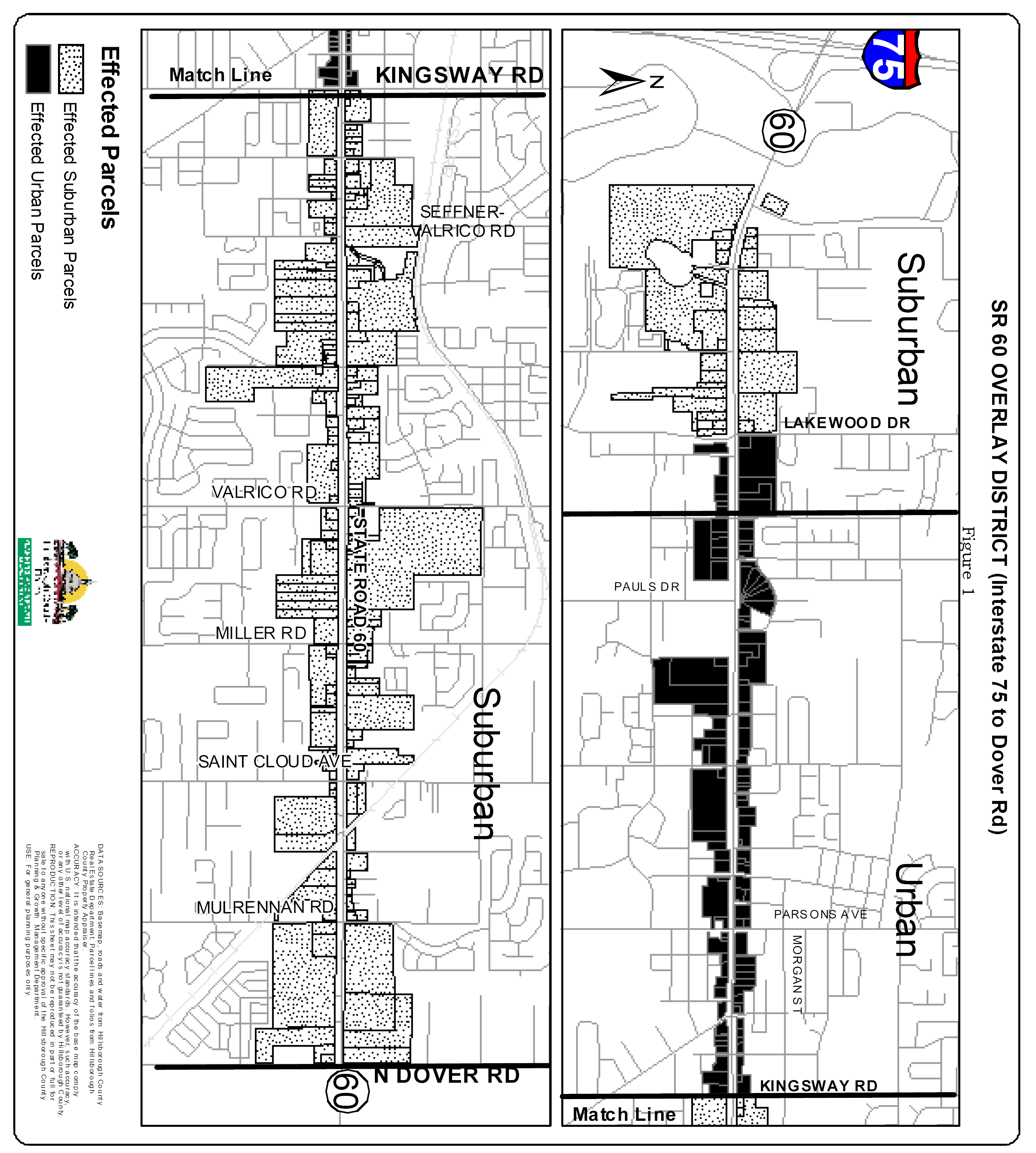
(Ord. No. 04-27, § 2, 6-10-04; Ord. No. 04-47, § 2, 11-9-04; Ord. No. 05-10, § 2, 6-16-05, eff. 10-1-05; Ord. No. 09-53, Item S, 6-11-09, eff. 10-1-09)
Sec. 3.15.01 - Generally
The Hillsborough Avenue Overlay District is an area generally characterized by older, strip commercial development with minimal site design requirements. The intent of the Hillsborough Avenue Overlay District is to improve the appearance of new and existing development along Hillsborough Avenue from the Veteran's Expressway to Rocky Creek by enhancing landscaping, building and sign requirements, and requiring an urban form of development with the placement of new buildings near the highway.
(Ord. No. 04-46, § 2, 11-4-04)
Sec. 3.15.02 - Applicability
The provisions of this Part shall apply to all new development on parcels in any zoning district, including PD districts, within the Overlay District as shown in Figure 1 herein, as well as any other parcel that is aggregated for development with a parcel shown in Figure 1. Additionally, these provisions shall become effective upon the expansion and/or improvement of existing structures on such parcels in any zoning district, including PD districts, as required herein. If there is any conflict between the provisions of this Part and the underlying zoning district or other general provisions of this Code, the provision imposing the greater restriction or requirement shall prevail. Notwithstanding the above, all front yard setbacks shall be as required by this Part. In the event the provisions of this Part conflict with the conditions of approval and/or certified site plan of a PD district, the provisions of this Part shall, to the extent they impose a greater restriction or requirement or implement a prescribed front building setback, supercede the conditions and/or site plan, although the developer may seek a modification of the PD district to seek relief from these provisions to the minimum degree necessary to maintain the existing development entitlements of the PD district. In such case the developer shall apply for the modification in accordance with the requirements of this Code, however, the application fee shall be waived provided the proposed modification seeks only those changes necessary to maintain the existing development entitlements of the PD district while implementing the provisions of this Part to the greatest extent feasible. If the proposed modification seeks other changes that are not necessary to implement the provisions of this Part or maintain the existing development entitlements of the PD district, the developer shall pay all application fees.
Notwithstanding, the requirements of this Part shall not apply to projects with unexpired building permits, unexpired preliminary site development approval or unexpired construction plan approval at the effective date of this Part, nor to churches or schools, nor to Developments of Regional Impact with approved master sign plans.
Hillsborough Avenue Overlay District
(Ord. No. 04-46, § 2, 11-4-04)
Sec. 3.15.03 - Permitted Uses
Uses shall be regulated by the underlying zoning district of the development parcel as provided in this Code.
(Ord. No. 04-46, § 2, 11-4-04)
Sec. 3.15.04 - General Development Standards
Except as otherwise provided by this Part, development shall conform with the area, height, bulk and placement standards of the underlying zoning district of the development parcel and all other requirements of this Code.
(Ord. No. 04-46, § 2, 11-4-04)
Sec. 3.15.05 - Specific Development Standards
The following requirements shall apply to all building activity, subject to the applicability provisions in Section 3.15.02 above. All signs shall conform to the provisions of Article VII of this Code. Additionally, the following limitations shall apply to signage for all uses, excluding emergency public services uses.
A.
The time periods in which renovations occur and the value of such work in relation to the assessed values of all buildings on the parcel at the time of improvements shall be as provided in Table 3.15-1. A renovation is any structural alteration, expansion, enlargement or remodeling conducted within any two-year period. Like-kind repair of building components shall not constitute a renovation. Renovations meeting the criteria of Column A in Table 3.15-1 shall be subject to the requirements of Section 3.15.05.A.1, 3.15.05.A.2 and 3.15.05.A.3. Renovations meeting the criteria of Column B in Table 3.15-1 shall be subject to the requirements of 3.15.05.A.1, 3.15.05.A.2, 3.15.05.A.3 and 3.15.05.A.4.
Repairs to or reconstruction of buildings damaged or destroyed by an Act of God shall be exempt from the requirements of this Part. Additionally, the value of improvements required by this Part shall not be included in the value of renovations. In the event renovations occur within more than one of the time periods specified, the more restrictive percentage of assessed value of all buildings on the parcel shall apply.
Table 3.15-1
1.
If the above criteria are met, existing on-premises pole signs and revolving signs along Hillsborough Avenue shall be removed and new pole signs and revolving signs shall be prohibited. Monument signs shall be limited to a maximum height of 15 feet regardless of roadway classification and, notwithstanding other requirements of this Code, a minimum setback of ten feet from the highway right-or-way shall be permitted provided the sign does not obstruct motorist visibility. The display portion of the sign structure shall be supported by a single pier or pillar with a minimum diameter or horizontal dimension of 24 inches or, alternatively, by two piers or pillars, each with a minimum diameter or horizontal dimension of 12 inches. The sign structures shall have materials and architectural enhancements consistent with the principal buildings it serves. Additionally, the sign shall have a decorative base with a minimum height of two feet and a minimum length not less than 80 percent of the maximum length of the display face. Landscaping comprised of evergreen plants may be installed in lieu of the decorative base, provided the landscaping meets the same dimensional requirements and has a minimum opacity of 75 percent at time of planting. Existing on-premises monument signs shall be brought into conformance with these requirements or shall be removed. Variances to allow the continued use of existing on-site pole signs or revolving signs, or the installation of new pole signs or revolving signs, shall be prohibited.
2.
Off-street vehicular use areas, including existing facilities, along Hillsborough Avenue shall be buffered and landscaped in accordance with the requirements of Part 6.06.00 of this Code, except that required landscaping in the buffer shall consist of the following: a row of shade trees with a minimum caliper of four inches and minimum height of 14 feet at the time of planting and spaced on 30-foot centers, along with a continuous hedge of shrubs and ground cover with a minimum height of 18 inches and minimum opacity of 75 percent at time of planting and a maximum height of 36 inches within two years. At the discretion of the developer, palms may be planted in lieu of shade trees at the rate of one date palm (Phoenix dactylifera) or a cluster of three sabal palms (Sabal palmetto) for one shade tree. The palms shall have a minimum height of ten feet (clear trunk measurement) at time of planting. The remainder of the buffer area shall be covered with sod. If provision of the buffer reduces the number of parking spaces below that mandated by this Code, new spaces shall be provided to meet parking requirements.
3.
In cases where the provision of a landscaped buffer along Hillsborough Avenue will reduce the number of existing parking spaces below that mandated by this Code, and there is insufficient area on the development parcel to replace the required spaces that are lost, a masonry screening wall with a minimum opacity of 75 percent may be provided in lieu of the landscaped buffer. In such cases the wall shall have a minimum height of three feet and maximum height of four feet and shall be architecturally finished on all sides. Paint shall not constitute an architectural finish.
4.
On parcels meeting the criteria of Column B in Table 3.15-1, all off-street vehicular use areas, including existing facilities, shall be buffered and landscaped internally and along all perimeters, other than Hillsborough Avenue, in accordance with the requirements of Part 6.06.00 of this Code, except that required shade trees shall have a minimum caliper of four inches and minimum height of 14 feet at time of planting.
B.
For projects where new buildings are placed on a vacant parcel, or where new buildings replace all existing buildings on a parcel, the requirements of Section 3.15.05.A.1 above, together with the following requirements, shall apply to the entire parcel. For projects where new buildings are placed on a parcel occupied by existing buildings and the new buildings do not replace any of the existing buildings, or replace only some of the existing buildings, the requirements of Section 3.15.05.A.1 above, together with the following requirements, shall apply only to the new buildings, the portion of the parcel where the development activity occurs and to existing parking areas that may be utilized to meet minimum parking requirements for the new buildings:
1.
Irrespective of the parcel's underlying zoning district, the required front yard setback shall be a minimum of ten feet and maximum of 20 feet and the entire length of each building façade facing a street shall be placed within the prescribed front yard setback area. Vehicle driveways and drive-through service lanes may be placed between the building and Hillsborough Avenue if the provision for cross access with the adjacent parcel containing a similar use is established. Landscaping vegetation shall be installed in the area between the buildings and Hillsborough Avenue right-of-way line at the following rate for every 30 feet of building length: one date palm (Phoenix dactylifera) or two sabal palms (Sabal palmetto), ten evergreen shrubs or perennial grasses, and 20 ground cover plants or perennial flowering shrubs. At the time of planting the palms shall have a minimum height of ten feet (clear trunk measurement), the evergreen shrubs and perennial grasses shall have a minimum container size of three gallons, and the ground cover plants and perennial flowering shrubs shall have a minimum container size of one gallon. The vegetation may be clustered at the discretion of the developer and improvement of the area with decorative hardscaping, such as colored and/or textured pavement, permanent planters, and outdoor furniture shall be allowed.
2.
Except as provided herein, principal buildings that are permitted non-residential uses, either in whole or in part, shall comply with the following requirements.
a.
Façades: Façades shall be scaled proportionately on all sides of the structure. Architectural elements shall be applied in a universal and consistent manner on all sides. Façades facing Hillsborough Avenue shall have a minimum of 20 percent transparent window area and, if no drive aisle is located between the building and Hillsborough Avenue, at least one doorway to accommodate pedestrian access from the public sidewalk.
b.
Exterior Cladding: All exterior surfaces shall be architecturally finished with stucco, wood, brick, stone or similar materials. Paint shall not constitute an architectural finish.
c.
Expression Line: On buildings with more than one floor, the transition from the first floor to the upper façade shall be delineated on all sides of the structure visible from Hillsborough Avenue with a horizontal architectural feature. Such expression lines shall have a minimum projection or recess of two inches from the wall surface. Alternatively, canopies and/or balconies may be utilized in lieu of an expression line.
d.
Roofs: Pitched roofs shall have a minimum pitch of 4/12. Finish roof materials shall be consistent with the architectural style of the structure. Rolled roofing and built-up roofing are prohibited unless concealed from view by parapets. Pitched roofs shall incorporate at least one of the following features: dormers, steeples, cupolas and/or intersecting roof lines. At least one of these features shall be provided per elevation for every 50 feet of roof length along Hillsborough Avenue and parking areas.
e.
Cornices: On flat-roofed buildings, the entire roof line shall be defined by architectural trim or embellishment with a minimum vertical dimension of 12 inches and a minimum projection of two inches from the surface of the wall. Alternatively, a false pitched roof front may be provided in lieu of a cornice.
f.
These requirements shall not replace or obviate other more stringent architectural standards that may be required by this Code, such as those found in Section 6.11.106 for Large Scale Retail Development, or by the conditions of a PD district. However, in all cases the minimum window fenestration and pedestrian access requirements in Section 3.15.05.B.2.a above shall be met.
3.
Irrespective of the parcel's underlying zoning district, the maximum permitted building height shall be 50 feet.
4.
Parking and loading areas shall be located at the rear of structures and/or to the side of structures, provided said areas are behind the front façade of Hillsborough Avenue frontage buildings. On corner lots, parking areas shall be no closer to the side street right-of-way than the structures they serve. Parking shall not be located at the front of structures. Existing parking spaces which do not meet these requirements shall be removed and, if necessary to meet the minimum number of spaces mandated by this Code, replaced with new spaces which meet the location requirements. All off-street vehicular use areas, including existing facilities, shall be buffered and landscaped in accordance with the requirements of Part 6.06.00 of this Code, except that required shade trees shall have a minimum caliper of four inches and minimum height of 14 feet at the time of planting.
5.
Storm water retention/detention ponds with slopes steeper than 4-to-1 shall be located to the rear of all principal buildings on the parcel. Existing ponds which do not meet this requirement shall be relocated.
(Ord. No. 04-46, § 2, 11-4-04; Ord. No. 05-22, § 2, 11-17-05)
Sec. 3.15.06 - Signs
A.
Structural Alteration and/or Replacement.
Notwithstanding the provisions of Section 3.15.02 and Section 3.15.05, structural alteration and/or replacement of existing on-site free-standing signs along Hillsborough Avenue on parcels within the Overlay District as shown in Figure 1 herein, as well as on any other parcel that is aggregated for development with a parcel shown in Figure 1, shall not be permitted, regardless of whether any building activity is occurring on the parcel at the time, except that such signs may be removed and replaced with monument signs conforming with the requirements of this Part.
B.
Nonconforming Signs.
Notwithstanding the applicability provisions of this Part and regardless of whether any building activity is occurring on the parcel at the time, nonconforming signs may be removed and replaced with monuments signs conforming with the requirements of this Part, and those illegal nonconforming signs as identified in 7.02.03 which should have been removed or modified under prior law shall only be removed and replaced with monument signs conforming with the requirements of this Part, and variance requests to allow the continued use of any existing nonconforming monument sign shall be considered pursuant to the sign standards of this Part.
C.
Replacement of Advertising Copy or Panels.
Replacement of advertising copy or panels on such signs that do not involve structural alterations shall be allowed if otherwise permitted by this Code.
D.
Pole Signs and /or Revolving Signs.
Notwithstanding the applicability provisions of this part, variances to allow the continued use of existing on-site pole signs or revolving signs, or the installation of new pole signs or revolving signs, shall be prohibited.
(Ord. No. 04-46, § 2, 11-4-04; Ord. No. 09-53, Item S, 6-11-09, eff. 10-1-09)
Sec. 3.16.01.- Generally
The intent of the Restrictive Rezoning District is to allow for the amending of certain standard zoning districts at the request or concurrence of the applicant. The Administrator or the Land Use Hearing Officer may recommend, and the Board of County Commissioners may approve such amendment with conditions applicable only to the property involved in the change, provided that such conditions confer upon the applicant or subject property no privilege otherwise denied by these articles to other lands, structures or buildings in the same district.
(Ord. No. 05-21, § 2, 11-17-05)
Sec. 3.16.02. - Applicability
Rezonings to the following districts as they appear in Section 2.01.01 of this Code may be approved with conditions as provided by this Part.
AM Agricultural Mining
A Agriculture
AR Agricultural Rural
AS-0.4 Agricultural, Single-Family Estate
AS-1 Agricultural, Single-Family
ASC-1 Agricultural, Single-Family Conventional
AI Agricultural Industrial
RSC-2 Residential, Single-Family Conventional
RSC-3 Residential, Single-Family Conventional
RSC-4 Residential, Single-Family Conventional
RSC-6 Residential, Single-Family Conventional
RSC-9 Residential, Single-Family Conventional
RSC-10 Residential, Single-Family Conventional
MH Residential, Single-Family Mobile Home Overlay
RDC-6 Residential, Duplex Conventional
RDC-12 Residential, Duplex Conventional
RMC-6 Residential, Multi-Family Conventional
RMC-9 Residential, Multi-Family Conventional
RMC-12 Residential, Multi-Family Conventional
RMC-16 Residential, Multi-Family Conventional
RMC-20 Residential, Multi-Family Conventional
BPO Business, Professional Office
OR Office Residential
CN Commercial, Neighborhood
CG Commercial, General
CI Commercial, Intensive
M Manufacturing
(Ord. No. 05-21, § 2, 11-17-05; Ord. No. 09-53, Item L, 6-11-09, eff. 10-1-09)
Sec. 3.16.03. - Restrictions
Conditions amending the standards of the zoning districts identified in this Part or the general development requirements of this Code may include one (1) or more of the following, but in no case shall the conditions allow a less restrictive standard or impose a lesser requirement:
1.
Use restrictions greater than those otherwise specified for the particular district.
2.
Density restrictions greater than those otherwise specified for the particular district.
3.
Setbacks greater than those otherwise specified for the particular district, including setbacks from lakes and major arterials.
4.
Height limits more restrictive than otherwise permitted in the particular district.
5.
Minimum lot areas or minimum widths greater than otherwise specified for the particular district.
6.
Maximum floor area less than otherwise specified for structures in the particular district.
7.
Open space requirements greater than otherwise required for property in the particular district.
8.
Parking, loading, driveway or traffic requirements more restrictive than otherwise required for the particular district.
9.
Fencing or screening requirements greater than otherwise required for the particular district.
10.
Signs, and their height, type and size.
11.
Hours of operation.
12.
Restrictions on all other matters which the Board of County Commissioners may regulate under the authority of this Section.
Upon approval of such restrictive rezonings, the Administrator shall enter the applicable conditions, or reference thereto, on the Official Zoning Atlas of the County in a manner sufficient to constitute notice to all interested persons. Conditions shall run with the land, without regard to transfer of ownership or other interests, and may be removed or modified only upon amendment to the District by the Board of County Commissioners. Changes which meet the thresholds described in Part 5.03.00 of this Code for a major modification to a planned development shall be requested in accordance with the procedures found in Part 10.03.00 of this Code. All other changes shall be heard in the form of a Personal Appearance. Variances to district standards or general development requirements not addressed by condition(s) of the rezoning shall be requested as provided in Part 11.04.00 of this Code.
(Ord. No. 05-21, § 2, 11-17-05)
Sec. 3.17.01.- Purpose
The purpose of this Part is to provide for The Ruskin Town Center (RTC) zoning districts and design standards. The zoning district and design standards implement the vision, principles and strategies of the Hillsborough County Comprehensive Plan's Ruskin Community Plan.
The intent of the Ruskin Town Center Zoning District (RTCZD) is to revitalize Ruskin's business center along U.S. 41, enhance the appearance of Ruskin's historic business district, and establish a mixed-use, walkable and pedestrian friendly Town Center. All development shall be in accordance with the Standards for Non-Residential, Mixed Use and Multi-Family as described in this Part and as appropriate.
(Ord. No. 06-34, § 2, 11-2-06)
Sec. 3.17.02. - Applicability
A.
Except as provided herein, these standards shall apply to all development within the area subject to the Ruskin Town Center Zoning District (RTCZD). However, these provisions shall not apply to public schools and previously approved planned developments, previously approved subdivisions, and projects with unexpired building permits, unexpired preliminary site development approval or unexpired construction plan approval at the time of rezoning to Ruskin Town Center Zoning District (RTCZD). Existing lawful uses, lots, structures, characteristics of land and densities shall not be required to be removed or otherwise modified as a result of the standards or requirements set forth in this Part.
In addition to the standards provided herein, development within the Ruskin Town Center Zoning District (RTCZD) shall be required to meet all other applicable sections of the Land Development Code. Where any provision of the Ruskin Town Center Zoning District (RTCZD) regulations is in conflict with any other standards or regulations of the Land Development Code, the Ruskin Development Regulations shall prevail.
(Ord. No. 06-34, § 2, 11-2-06)
Sec. 3.17.03. - General Development Standards
A.
Designation of Streets
All streets within the Ruskin Town Center Zoning District shall be classified as Main Streets or Ruskin Town Center Streets. Main Streets include Shell Point Road, and U.S. 41. All other streets shall be classified as Ruskin Town Center Streets - as shown on Figure 1—Ruskin Town Center.
B.
Street Design
New streets and reconstruction of existing streets, excluding regulated roadways as defined in the Hillsborough County Comprehensive Plan, shall conform to the design standards established by this section for the cross section of Ruskin Town Center Streets as shown in Figure 2. Traffic calming measures shall be permitted in accordance with Section 5.08.09.E of this Code.
C.
Parking, Access and Site Design
Except as otherwise provided by this Section, parking requirements for all uses shall be in accordance with the Parking Standards of Article VI. Landscaping requirements for off-street vehicular use areas shall be in accordance with the landscaping and buffering requirements of this Code.
1.
Required Off-Street Parking
a.
Required parking provided through surface parking lots shall be on the development site or within 500 feet of the development site that the parking is required to serve.
b.
The minimum parking requirements in Article VI of this Code for non-residential uses is the maximum allowed. Additionally, the non-residential parking requirements may be reduced by 50 percent.
c.
On-Street Parking Credit. On-street parking spaces shall be deducted from the required number of off-street parking spaces for the adjacent use. When an extended parcel line splits an on-street parking space, that space shall be deducted from the parking requirements of the parcel that fronts the majority of the on-street parking space.
2.
Off-street parking (surface parking lots).
a.
In projects located on Main Streets with off-street surface parking lots, parking shall be located behind the front façade of Main Street frontage buildings.
b.
Except as provided below, in projects located only on Ruskin Town Center Streets with off-street surface parking lots, parking shall be located behind the front façade of Ruskin Town Center Street frontage buildings.
c.
Notwithstanding the above, surface parking lots may be located adjacent to Ruskin Town Center Streets in projects with frontage along Main Streets and Ruskin Town Center Streets.
d.
Surface parking lots may be located adjacent to one Ruskin Town Center Street in projects with frontage along two Ruskin Town Center Streets. However, no surface parking lot shall front Ruskin Town Center Street containing property on the opposite side of the street zoned for residential and residential support uses only. Additionally, on corner lots, surface parking may be located adjacent to two Ruskin Town Center Streets.
3.
Parking Garages. Except for vehicle entrances, the ground floor shall be developed with enclosed commercial, office or civic floor space to a minimum building depth of 30 feet along the entire length of the structure on each adjacent street, unless separated from the street by another building, parking lot and/or landscaped open space with a minimum depth of 30 feet.
D.
Screening of trash and recycling receptacles, loading docks, service areas, and other similar areas.
1.
Trash, recycling receptacles, loading docks, service areas, and other similar areas must be located in parking areas or in a location that is not visible from Main Street or Ruskin Town Center Street frontages, and must be screened to minimize sound and visibility from residences and to preclude visibility from adjacent streets. Service areas shall be screened by a masonry wall and landscape buffer. The wall shall be a minimum of six feet in height using architectural design, materials and colors that are consistent with those of the primary structure. The landscape buffer shall be a minimum of five feet in width and contain evergreen plants a minimum of three feet in height spaced not more than four feet apart.
2.
Mechanical equipment shall be placed on the parking lot side of the building away from view from adjacent Main Street and Ruskin Town Center Street frontage and shall be screened from view of any street by fencing, vegetations, or by being incorporated into a building.
3.
All rooftop mechanical equipment shall be integrated into the overall mass of a building by screening it behind parapets or by recessing it into roof structure.
4.
Solid waste storage areas. A solid waste refuse facility shall be screened on three sides by a six-foot high masonry wall if it is located within the building setback area or located in areas visible to customers or from a public right-of-way.
5.
Fences and Walls. Fences and walls shall be constructed of masonry, vinyl or cast iron/metal. The location of all fences and walls shall be in accordance with Article VI of this Code.
E.
Building Orientation. A building's primary orientation shall be toward the street rather than the parking areas. The primary building entrances shall be visible and directly accessible from a public street.
F.
Public Entrance. Buildings that are open to the public shall have an entrance for pedestrians from the street to the building interior. This entrance shall be a distinctive and prominent element of the architectural design, and shall be open to the public during business hours. Buildings shall incorporate lighting and changes in mass, surface or finish to emphasize the entrance(s).
G.
Utilities. All utility lines shall be located underground.
(Ord. No. 06-34, § 2, 11-2-06)
Sec. 3.17.04. - Standards for Non-Residential, Mixed Use and Multi-Family Development
A.
Building frontages shall occupy no less than 60 percent of a project's street frontage. Notwithstanding the above, projects with frontages along Main Streets and Ruskin Town Center Streets shall not have minimum building frontage requirements along Ruskin Town Center Streets.
B.
Front yard building setbacks along all street frontages shall be a minimum of ten feet to a maximum of 20 feet. Rear yard setbacks shall be a minimum of ten feet, and side yard setbacks shall be a minimum of five feet.
C.
Building height shall be a maximum of 50 feet.
D.
Building Design
1.
Building Façade. Blank walls shall not occupy over 50 percent of a street-facing frontage and shall not exceed 20 linear feet without being interrupted by a window or entry. No more than 20 feet of horizontal distance of wall shall be provided without architectural relief for building walls and frontage walls facing the street. Buildings shall provide a foundation or base that extends from the ground to the bottom of the lower windowsills that is distinguished from the building face by a change in volume or material. Building façade must be architecturally finished to grade. A clear visual division shall be maintained between the ground level floor and upper floors, which may include changes in volume or materials or other architectural detailing such as a belt course or cornice. The top of any building shall contain a distinctive finish consisting of a cornice or other architectural termination. Ground floor retail uses that are located in non-residential or mixed use structures and that are located on a corner parcel and have two street frontages shall contain storefront display windows covering a minimum of 40 percent and a maximum 80 percent of a storefront's linear frontage.
2.
Transparency. All street-facing non-residential and mixed-use structures shall have windows covering a minimum of 40 percent and a maximum 80 percent of the ground floor of each storefront's linear frontage. Mirrored glass, obscured glass and glass block cannot be used in meeting this requirement. Display windows may be used to meet this requirement, but must be transparent and shall not be painted or obscured by opaque panels.
3.
Shelter. Buildings shall incorporate arcades, alcoves, porticos or awnings.
4.
Garages. Street-facing ground floor parking, including individual unit garages, is not permitted on the first floor of a multi-family structure on a Main Street. Parking shall occur within parking garages or within surface lots that do not front on a Main Street. Individual unit garages attached to principal structures fronting Ruskin Town Center Streets shall be setback a minimum of five feet from the street-facing façade and a minimum of 20 feet from the street right-of-way.
(Ord. No. 06-34, § 2, 11-2-06)
Sec. 3.17.05. - Sign Standards
A.
Generally
Signs shall conform to the limitations and provisions of Article VII of this Code. Additionally, the following limitations and provisions shall apply to signage for all uses excluding emergency public services/uses.
B.
General Requirements
1.
Signage within the Ruskin Town Center Zoning Districts (RTCZD) shall be constructed utilizing materials similar to those of the buildings served. Acceptable materials may include wood and painted metal. Plastic and similar synthetic materials are permitted if designed to replicate the appearance of wood and painted metal signs.
2.
Pole signs shall be prohibited.
C.
Ground signs
1.
General Standards
a.
Letter height shall be a minimum of nine inches and a maximum of 24 inches.
2.
Monument Signs
a.
The maximum height shall be eight feet above the ground plane.
b.
Signs shall be set back a minimum of ten feet from the public right-of-way, 30 feet from the intersection of right-of-way lines and shall meet any additional setback required in Article VII of this Code. Additionally, sight distance and roadside clear zones must be in accordance with the criteria of the Hillsborough County Transportation Technical Manual.
D.
Awning Signs:
The width of the sign shall not exceed the width of the canopy, awning or marquee.
E.
Miscellaneous signs
1.
Window Signs: Permanent window sign displays shall be limited to no more than 20 percent of the window area.
2.
Projecting Signs
a.
Signs shall be located above ground-floor level doors and windows but below the roofline or second-floor level to promote a pedestrian environment.
b.
Signs are limited to no more than one projecting sign per business.
c.
Signs shall project no more than four feet from the building face and must be located outside of the public right-of-way.
d.
Sign shall have a minimum six-inch clearance from the building face.
F.
Sign Lighting
1.
Ground-mounted up-lights shall not exceed 150 watts per sign face and shall shield light from aiming toward motorists and neighboring properties. Fixtures shall be hidden from view by sign landscaping.
2.
Internally lighted tenant signs attached to buildings shall only illuminate lettering and not entire sign face.
(Ord. No. 06-34, § 2, 11-2-06)
Sec. 3.17.06. - Zoning Districts
New development in Ruskin Town Center Zoning District with a parcel's designation as shown on Map located in Figure 1 shall conform with the following use, density, intensity, and Standards for Non Residential, Mixed Use and Multi-Family as described above and provisions of this Code. Additionally, all structures located along Shell Point Road and U.S. 41 shall be a minimum of two stories in height.
(Ord. No. 06-34, § 2, 11-2-06)
Sec. 3.17.07. - Ruskin Town Center (RTC-1)
Permitted Uses: CG and RMC-20 uses as defined in Section 2.02.02 of this Code; mixed use developments, multi-family residential and commercial uses. Commercial general retail uses shall be permitted in projects in accordance with special requirements listed below.
Maximum Density: 20 dwelling units per acre.
Maximum Intensity: 0.75 FAR.
The permitted uses on Tax Folio 55675.0000 as configured on May 8, 2007 shall include major repair of motorcycles, scooters and lawn mowers in addition to the permitted uses listed above.
The permitted uses of Tax Folios 55215.0000, 55217.0000, 55217.1000, 55752.0000 and 55759.0000 as configured on June 11, 2009, and on Tax Folios 55801.0000 and 55802.0000 as configured on October 5, 2011, shall include, in addition to the permitted uses listed above, an indoor/outdoor community market subject to the following requirements:
a.
Sales shall be limited to fresh vegetables and fruits, plants, cut flowers, cider, jams, jellies, relishes, honey, spices, sauces, syrups, canned goods, baked goods, fresh meat and seafood, eggs, dairy products, prepared foods for immediate consumption, aquaculture products and aquarium accessories, artisan crafts, and original or limited-edition works of art. Sales of other items, including but not limited to used merchandise, shall be prohibited.
b.
Indoor sales activities within fully enclosed buildings shall be permitted seven days a week.
c.
Outdoor sales activities shall be permitted only on Friday, Saturday, Sunday and holidays recognized by Hillsborough County. Vendor shelters shall be limited to tents, fabric canopies, umbrellas and wheeled vehicles. A minimum setback of 10 feet from all property lines shall be required. All vendor shelters and vehicles shall be removed from the property on days when sales are not permitted.
(Ord. No. 06-34, § 2, 11-2-06; Ord. No. 07-25, § 2, 11-1-07, eff. 2-1-08; Ord. No. 09-53, Item Y, 6-11-09, eff. 10-1-09; Ord. No. 11-24, § 2(Item A)(12-0011), 12-5-11, eff. 2-1-12)
Sec. 3.17.08. - Ruskin Town Center (RTC-2)
Permitted Uses: BPO, CN and RMC-12 uses as defined in Section 2.02.02 of this Code; mixed use developments, business professional office and multi-family residential.
Maximum Density: 12 dwelling units per acre.
Maximum Intensity: 0.50 FAR.
(Ord. No. 06-34, § 2, 11-2-06)
Sec. 3.17.09. - Prohibited Uses
Notwithstanding the above, the following uses shall be prohibited in both, RTC-1 and RTC-2, districts:
a.
Single Family Detached Housing Type
b.
Duplex Housing Type
c.
Wireless Communication Facilities
d.
Radio and Television Transmitting Facilities
e.
Lawn Care/Landscaping
f.
Lumber/Other Building Materials
g.
Motor Vehicle Repairs (Minor or Major)
h.
Motor Vehicle Sales, Rentals, and Auctions—All Types
i.
Recreational Vehicle Sales and Rentals
j.
Private Pleasure Craft Sales and Rentals
k.
Rental leasing, Light Equipment and Farm Equipment
l.
Wholesale Distribution
m.
Labor Pools—All Types
n.
Mini-Warehouses
o.
Tattoo Parlors/Shops
p.
Pawnshop
q.
Convenience Stores with Fuel Pumps
r.
Motor Vehicle Fuel Sales and Services
(Ord. No. 06-34, § 2, 11-2-06)

Ruskin Town Center
(Ord. No. 06-34, § 2(Exh. A), 11-2-06)

Ruskin Town Center Streets Typical Section
(Ord. No. 06-34, § 2(Exh. A), 11-2-06)
Sec. 3.18.01 - Purpose
The purpose of this Part is to provide for the Thonotosassa Main Street Overlay District and design standards. The overlay district and design standards implement the vision, principles and strategies of the Hillsborough County Comprehensive Plan's Thonotosassa Main Street Plan. The intent of the Thonotosassa Main Street Overlay District is to improve the appearance of Thonotosassa's Main Street by enhancing landscaping, building and sign requirements, and requiring a rural form of development with the placement of new non-residential buildings along Main Street.
(Ord. No. 06-34, § 2, 11-2-06)
Sec. 3.18.02 - Applicability
A.
Except as provided herein, these standards shall apply to all development that occurs on properties zoned and/or used for any purpose other than single-family or two-family residential, agricultural, or Planned Development districts exclusively containing such uses, within the Overlay District as shown in Figure 1 herein, as well as any other parcel that is combined for development fronting on Main Street as shown in Figure 1. These provisions shall not apply to public schools and projects with unexpired building permits, unexpired preliminary site development approval or unexpired construction plan approval at the time of adoption of the overlay district. Existing lawful uses, lots, structures, characteristics of land and densities shall not be required to be removed or otherwise modified as a result of the standards or requirements set forth in this Part.
In addition to the standards provided herein, development within the Thonotosassa Main Street Overlay District shall be required to meet all other applicable sections of the Land Development Code. Where any provision of the Thonotosassa Main Street Overlay District's design standards are in conflict with any other standards or regulations of the Land Development Code, the Thonotosassa Main Street Overlay District standards shall prevail.
B.
Expansions of existing non-residential structures up to a cumulative total of 30 percent of the legally permitted floor space in existence at the time of the effective date of this Part shall be exempt from the requirements contained herein. Where structures are expanded beyond 30 percent of existing floor space, all requirements of this Part shall apply to the area of expansion. Conversions of existing structures from residential to non-residential uses shall be exempt from the requirements of this Part, provided the floor space of the structure is not increased by more than 30 percent.
(Ord. No. 06-34, § 2, 11-2-06)
Sec. 3.18.03 - Permitted Uses
Uses shall be regulated by the underlying zoning district of the development parcel as provided in this Code.
(Ord. No. 06-34, § 2, 11-2-06)
Sec. 3.18.04 - General Development Standards
Except as otherwise provided by this Part, development shall conform to the area, height, bulk and placement standards of the underlying zoning district of the development parcel and all other requirements of this Code.
(Ord. No. 06-34, § 2, 11-2-06)
Sec. 3.18.05 - Specific Development Standards
The following requirements shall apply to all non-residential building activity within the Thonotosassa Main Street Overlay District, subject to the applicability provisions in Section 3.18.02 above.
A.
Building Design
1.
Irrespective of the parcel's underlying zoning district, the maximum permitted building height shall not exceed two stories.
2.
A building's primary orientation shall be toward Main Street rather than the parking areas. The primary building entrances shall be visible and directly accessible from Main Street.
3.
Building elevations shall incorporate openings, textures, recesses and projections along the building face. Elevations fronting Main Street without such features shall not exceed 20 feet in length.
4.
Windows and doors used along the Main Street elevation shall not occupy less than 25 percent of the front façade area.
B.
Building Materials
1.
Building exterior surface finishes shall be clad with wood, composite siding, brick, stucco or similar materials.
2.
Building exterior surface finishes shall not be clad with corrugated metal or painted unfinished block.
C.
Porches
1.
Building façades facing Main Street shall include porches, covered walkways, archways, pergolas and/or porticos.
2.
Porches, covered walkways, archways, pergolas and porticos shall incorporate columns, balusters and/or balustrades.
D.
Roofs
1.
Roof lines shall be pitched or hip with a minimum slope of four to 12 and maximum of eight to 12. Materials shall be consistent with the architectural style of the structure.
2.
Roofing materials shall include metal (standing seam/batten seam), shingles or tile.
3.
Dormers and other architectural elements shall be used on roof planes.
4.
Formed aluminum roofing/corrugated metal roofs shall be prohibited.
E.
Service Area Screening
1.
Trash, recycling receptacles, loading docks, service areas, and other similar areas shall be located in parking areas or in a location that is not visible from. Main Street. Such facilities shall be screened from view of any street by fencing, vegetation, or by being incorporated into the building to minimize sound and visibility from residences and to preclude visibility from adjacent streets.
2.
Mechanical equipment at ground level shall be placed on the parking lot side of the building away from view from the Main Street and shall be screened from view of any street by fencing, vegetation, or by being incorporated into the building.
3.
All rooftop mechanical equipment shall be integrated into the overall mass of a building by screening it behind parapets or by recessing it into roof structure.
4.
All new construction shall be served by underground wiring systems.
F.
Lighting
1.
Except as provided below, all exterior lighting shall be in accordance with the requirements of Part 6.10.00 of this Code.
2.
Light poles and fixtures shall be decorative and have a consistent appearance. Wood poles shall be prohibited.
3.
Lighting posts and/or lamppost lights may include banner arms; however, all banners displayed must comply with Article VII of this Code.
4.
Light poles shall have a maximum height of 20 feet.
G.
Landscaping
1.
Parking and the front setback areas shall be buffered and landscaped in accordance with the requirements of Part 6.06.00 of this Code, except that required shade trees shall have a minimum caliper of four inches and minimum height of 14 feet at the time of planting.
2.
A combination of ground covering, shrubs and trees shall be used to create a composition of varying materials, heights and textures.
3.
Landscaping materials shall be native species.
H.
Parking and Loading Areas
1.
Parking and loading areas shall be located to the side and rear of the principal building's façade, provided said areas are behind the front façade of Main Street frontage buildings.
2.
On corner lots, parking areas shall be no closer to the side street right-of-way than the structures they serve.
3.
Bicycle racks must be provided and be readily accessible to the Main Street sidewalk.
I.
Walls and Fences
1.
Chain link and wood stockade fences shall be prohibited.
2.
Walls and fences shall be no greater than five feet in height and be constructed of non-opaque materials such as split rail or wrought iron.
3.
Walls shall be painted/finished.
(Ord. No. 06-34, § 2, 11-2-06)
Sec. 3.18.06. - Signs
Signs shall conform to the limitations and provisions of Article VII of this Code. Additionally, the following limitations and provisions shall apply.
A.
Signage within the Thonotosassa Main Street Overlay District must be compatible with the architecture of the building, including colors and materials. Acceptable materials include wood and painted metal. Plastic and similar synthetic materials are permitted if designed to replicate the appearance of wood and painted metal signs.
B.
Pole signs shall be prohibited.
C.
Monument Signs
1.
Monument signs are limited to 15 feet in height.
2.
Ground-mounted up-lights shall not exceed 150 watts per sign face and shall shield light from aiming toward motorists and neighboring properties. Fixtures shall be hidden from view by landscaping.
3.
The following forms of sign illumination shall not be permitted: a) exposed bulbs, lamps or luminous tubes on the surface of the sign; b) internally lit signs; and c) backlighting of completely opaque sign elements which silhouettes the elements against an illuminated surface.
(Ord. No. 06-34, § 2, 11-2-06; Ord. No. 07-25, § 2, 11-1-07, eff. 2-1-08)
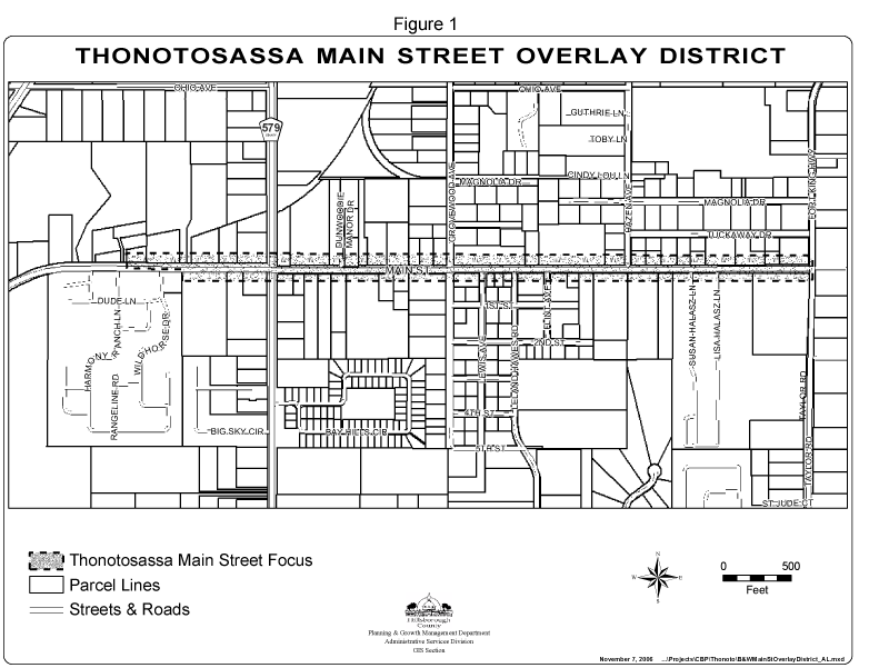
Thonotosassa Main Street Overlay District
(Ord. No. 06-34, § 2(Exh. A), 11-2-06)
Sec. 3.19.01.- Purpose
The purpose of this Part is to provide for the Riverview Downtown District (RDD) zoning districts and design standards. The zoning districts and design standards implement the vision, principles and strategies of the Riverview Community Plan, as found in the Future of Hillsborough Comprehensive Plan for Unincorporated Hillsborough County.
The intent of the RDD regulations is to provide design standards that will revitalize Riverview's business center along US Highway 301 and establish a mixed use, walkable, and pedestrian friendly downtown district while protecting the character of the adjacent residential neighborhoods.
(Ord. No. 09-53, Item T, 6-11-09, eff. 10-1-09)
Sec. 3.19.02. - Applicability
A.
Except as provided herein, these standards shall apply to all development on parcels within the area subject to the RDD zoning districts. The RDD zoning districts are as shown in Figure 1.
1.
However, these provisions shall not apply to single-family detached residential projects, public schools, projects with unexpired building permits, unexpired preliminary site development approval, or unexpired construction plan approval at the time the effective date of this Part. Existing lawful uses, lots, structures, characteristics of land and densities shall not be required to be removed or otherwise modified as a result of the standards or requirements set forth in this Part.
2.
In addition to the standards provided herein, development within the RDD zoning districts shall be required to meet all other applicable sections of the Land Development Code. Where any provision of the RDD Development Regulations is in conflict with any other standards or regulations of the Land Development Code, the RDD Development Regulations shall prevail. Section 6.01.01 of this Code, Schedule of District Area, Height, Bulk, And Placement Regulations, shall not apply.
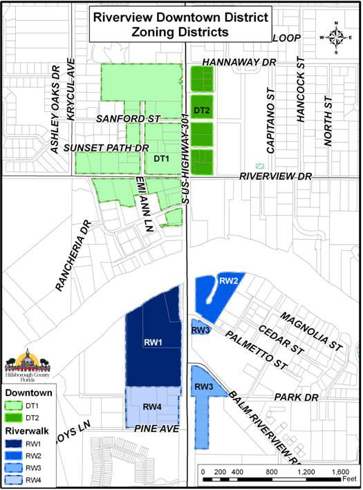
Figure 1.
B.
The following requirements shall apply to all building activity within the RDD zoning districts, subject to the applicability provisions in Section 3.19.02.A above. The applicant shall be responsible for providing the necessary information to determine the applicable sections of this Part, as listed below and in Table 1. All new signs shall comply with the limitations and provisions of Article VII of this Code and with Section 3.19.05 of this Part.
1.
For all projects requiring building permits where structures are expanded to between 25 and 50 percent of existing legally permitted square footage within the parcel, the landscaping and signage requirements of this Part shall apply.
2.
For all projects requiring building permits where structures are expanded to beyond 50 percent of existing legally permitted square footage within the parcel, the landscaping, screening, signage, and building design requirements of this Part shall apply.
3.
For all projects where new structures are constructed on a vacant parcel or where existing buildings are replaced by new structures, the entire requirements of this Part shall apply to the entire project and parcel(s).
4.
For all projects where new buildings are placed on a parcel occupied by existing buildings, the landscaping, screening, signage, shall apply to the entire project and parcels(s), and the Standards for Development shall apply to the new construction.
5.
Projects increasing the outside area devoted to sales, storage, displays, demonstrations, or parking by more than 50 percent and requiring a building permit shall be considered a major change and shall require compliance with the landscaping and signage requirements of this Part.
Table 1.
(Ord. No. 09-53, Item T, 6-11-09, eff. 10-1-09)
Sec. 3.19.03. - General Development Standards
Except as otherwise provided by this Part, development shall conform to all other requirements of this Code. The applicant shall be responsible for providing the necessary information to determine compliance with the applicable sections of this Part.
A.
Street Design
1.
Newly constructed or reconstructed streets, excluding US Highway 301, within the RDD zoning and overlay districts shall be public streets and conform to the typical section design standards established in the Hillsborough County Transportation Technical Manual cross-sections for "Traditional Neighborhood Developments" (hereby "TND Street Standards"), unless otherwise specified herein.
2.
Sidewalks and other pedestrian walkways, excluding those on regulated roadways as defined in the Comprehensive Plan for Unincorporated Hillsborough County, shall meet the following minimum design standards:
a.
When pedestrian crossings are provided at midblock locations, raised crosswalks or other traffic-calming measure(s) shall be located at all points where the pedestrian crossing traverses the lane of vehicle travel.
b.
Sidewalks shall be physically separated from on-site vehicle lanes and parking spaces by landscaping, berms, barriers, grade separations, or other means to protect pedestrians from vehicular traffic.
3.
Improvements to existing streets, excluding regulated roadways as defined in the Comprehensive Plan for Unincorporated Hillsborough County, that do not require reconstruction of the street shall be designed to further the intent and design for new and reconstructed streets, as described above. Redevelopment of parcels on existing streets must comply with all requirements listed above as they pertain to standards on the development side of the street. Newly constructed sidewalks shall connect with the existing sidewalks of all adjacent parcels.
B.
Parking and Access
Except as otherwise provided by this Section, parking requirements for all uses shall be in accordance with the Parking Standards of Part 6.05.00. Landscaping requirements for off-street vehicular use areas shall be in accordance with the landscaping and buffering requirements of this Code.
1.
Required Off-Street Parking
a.
Required parking provided through surface parking lots shall be on the development site or within 500 feet of the development site that the parking is required to serve.
b.
The minimum parking requirements in Part 6.05.00 of this Code for non-residential uses is the maximum allowed. Additionally, the non-residential parking requirements may be reduced by 50 percent.
c.
On-Street Parking Credit. On-street parking spaces shall be deducted from the required number of off-street parking spaces for the adjacent use. When an extended parcel line splits an on-street parking space, that space shall be deducted from the parking requirements of the parcel that fronts the majority of the on-street parking space.
d.
Bicycle Parking Credit. If bicycle parking facilities are provided within the project, the Administrator may approve up to five percent reduction of all required vehicle parking spaces, or one vehicle parking space, whichever is greater, at the rate of four bicycle spaces per one vehicle parking space. Bicycle parking must meet the design standards of Section 6.05.02 of this Code.
e.
Bus Shelter Parking Credit. If the project provides a sheltered transit stop within the RDD zoning and overlay districts, the Administrator may approve up to five percent reduction of all required vehicle parking spaces, or one vehicle parking space, whichever is greater. Sheltered transit stops must meet the standards of the Hillsborough Area Regional Transit Authority. Pedestrian access from the transit stop to the sidewalk in the public right-of-way shall be provided.
2.
Off-Street Parking (surface parking lots)
a.
In projects with off-street surface parking, parking shall be located behind the line of the primary building façade.
b.
Notwithstanding the above, surface parking lots may be located adjacent to one street in projects with frontage along two or more streets, except at the intersection of US Highway 301 and Riverview Drive.
3.
Parking Garages
a.
Except for vehicle entrances, the ground floor shall be developed with enclosed commercial, office or civic floor space to a minimum building depth of 30 feet along the entire length of the structure on each adjacent street, unless separated from the street by another building, parking lot and/or landscaped open space with a minimum depth of 30 feet.
b.
Direct pedestrian access in the form of pedestrian entrances and walkways from parking garages to each adjacent street shall be provided.
4.
Connectivity
a.
Parking, service drives, and alleys shall be designed to allow for future connections to adjacent parcels and to allow all development along US Highway 301 to be accessible from a street with an intersection at US Highway 301.
b.
Direct pedestrian access in the form of pedestrian entrances, sidewalks, crosswalks, and other walkways from public sidewalks to building entrances and between parcels shall be provided.
C.
Screening
1.
Trash, recycling receptacles, loading docks, service areas, and other similar areas must be located in parking areas or in a location that is not visible from the street frontages, and must be screened to minimize sound and visibility from residences and to preclude visibility from adjacent streets. These areas shall be screened by a solid wall and landscape buffer. The wall shall be a minimum of six feet in height using architectural design, materials and colors that are consistent with those of the primary structure. The landscape buffer shall be a minimum of five feet in width and contain evergreen plants a minimum of three feet in height at the time of planting and spaced not more than four feet apart.
2.
Mechanical equipment shall be placed behind the line of the primary building façade and shall be screened from view of any street by fencing, vegetations, or by being incorporated into a building.
3.
All rooftop mechanical equipment shall be integrated into the overall mass of a building by screening it behind parapets or by recessing it into roof structure.
4.
Fences and walls shall be constructed of masonry, vinyl, or cast or wrought iron/metal. Chain link fences shall be coated with green or black vinyl. The location of all fences and walls shall be in accordance with Section 6.07.00 of this Code.
5.
Landscaping, irrigation, and buffering, including off-street vehicular use areas, and street trees shall be in accordance with Section 6.06.00 of this Code. Buffering and screening between development on parcels within the RDD zoning districts and dissimilar uses on parcels outside of the RDD zoning districts shall be in accordance with Section 6.06.06. Buffering and screening as described in Section 6.06.06 shall not be required between dissimilar uses within the RDD zoning and overlay districts. A landscaped perimeter buffer, as described in Section 6.06.04 of this Code, shall not be required along property boundaries when the boundary occurs in an off-street vehicular use area that is shared with an adjacent property.
D.
Utilities. All utility lines for newly constructed structures shall be located underground.
E.
Storm water. Storm water retention/detention ponds with slopes steeper than 4-to-1 shall be located to the rear of all principal buildings on the parcel. Chain link fencing around storm water ponds shall be coated with green or black vinyl.
F.
River Access. For projects with frontage along the Alafia River, public access in the form of parks, boardwalks, linear parks, or plazas must be provided. Developments are encouraged to provide dedicated public right-of-way from the projects' point of legal street access to the open space adjacent the river.
(Ord. No. 09-53, Item T, 6-11-09, eff. 10-1-09)
Sec. 3.19.04. - Standards for Development
The applicant shall be responsible for providing the necessary information to determine compliance with the applicable sections of this Part.
A.
Designation of Streets
1.
"A" Street access is intended for building types and uses that promote pedestrian activity, and that benefit from pedestrian and/or transit access. "B" Street access is intended primarily for automobile or truck access.
2.
The following existing streets within the RDD zoning and overlay districts have an "A" Street designation in their entirety and shall not be redesignated as "B" Streets: US Highway 301, Riverview Drive, Commerce Street, and Balm-Riverview Road.
3.
All newly constructed streets, excluding alleys, shall be designated as an "A" Street or a "B" Street. "A" Streets and "B" Streets must be designated as such on all site and construction plans.
B.
Building Orientation
A building's primary orientation shall be toward the "A" Street, and it shall not be toward a "B" Street or the parking areas. The primary building entrance(s) shall be visible and directly accessible from a public street. This entrance(s) shall be a distinctive and prominent element of the architectural design. Buildings shall incorporate lighting and changes in mass, surface or finish to emphasize the entrance(s).
C.
Building Setbacks
1.
Building setbacks along "A" Street frontages shall be a minimum of 5 feet to a maximum of 20 feet. Where paved courtyards, arcades, or galleries are provided, building setbacks along street frontages shall be a maximum of 30 feet. When the building frontage requirement is met along the "A" Street, additional buildings within the project may be located at a greater setback. A 10-foot maximum variation in setback along the street frontage is allowed within each project. On parcels containing natural resources protected by Part 4.01.00 of this Code, the building setbacks shall be the minimum possible to avoid said areas.
a.
There are no specified setbacks along "B" Streets.
2.
The minimum required building setbacks for parcels located within the RDD and adjacent to parcels within the RDD shall be five feet from the side property boundary and ten feet from the rear property boundary.
3.
The minimum required building setback for parcels located within the RDD and adjacent to parcels outside of the RDD zoning district shall be determined by use and in accordance with the requirements of Section 6.06.06.
D.
Building Frontage
Buildings must occupy a minimum of 60% of a parcel's street frontage along "A" Streets. Plazas, parks, and patios along the "A" Street frontage may count toward building frontage requirements. Natural resources protected by Part 4.01.00 of this Code shall be excluded from a parcel's street frontage dimension.
E.
Building Design
1.
All street-facing, park-facing, plaza-facing, and patio-facing building façades shall have windows covering a minimum of 40 percent of the ground floor façade of the storefronts linear footage. Windows shall be at least four feet tall.
2.
Street facing façades shall not exceed 20-linear feet without being interrupted by a window or entryway.
3.
The building façade must be architecturally finished to grade. Buildings shall provide an exterior finish along all façades that extends from the ground to the bottom of the lower windowsills that is distinguished from the building face by changes in material, wall plane projections and/or recesses. An exterior architectural horizontal feature, such as a belt course, shall define the transition between the first and upper floors. Parapets terminated with a cornice shall be required for flat roofs.
4.
Buildings shall incorporate arcades, alcoves, porticos or awnings along street-facing, park-facing, plaza-facing, and patio-facing building façades. These features may contribute toward up to half of the required window coverage along the ground floor façades.
5.
New parking shall occur within parking garages or within surface lots that are setback behind the building line. First-story or ground floor individual unit garages shall not be permitted to face an "A" Street.
(Ord. No. 09-53, Item T, 6-11-09, eff. 10-1-09)
Sec. 3.19.05. - Sign Standards
Signs within the RDD Zoning Districts shall conform to the limitations and provisions of Article VII of this Code and must be constructed of materials similar to those of the buildings served. Additionally, the following limitations and provisions shall apply.
A.
Structural Alteration and/or Replacement.
Notwithstanding the applicability provisions of this Part, structural alteration and/or replacement of existing signs that do not conform to the requirements of this Part on parcels within the Overlay District as shown in Figure 1. herein, as well as on any other parcel that is aggregated for development with a parcel shown in Figure 1, shall not be permitted, regardless of whether any building activity is occurring on the parcel at the time, except that such signs may be removed and replaced with signs conforming with the requirements of this Part.
B.
Nonconforming Signs.
Notwithstanding the applicability provisions of this Part and regardless of whether any building activity is occurring on the parcel at the time, nonconforming signs may be removed and replaced with signs conforming with the requirements of this Part, and those illegal nonconforming signs as identified in Sec. 7.02.03.A which should have been removed or modified under prior law shall only be removed and replaced with signs conforming with the requirements of this Part. Variance requests to allow the continued use of existing nonconforming monument signs shall be considered pursuant to the sign standards of this Part.
C.
Replacement of Advertising Copy or Panels.
Replacement of advertising copy or panels on such signs that do not involve structural alterations shall be allowed if otherwise permitted by this Code.
D.
Pole Signs, Animated Signs and Changeable Copy signs and Revolving Signs.
Use of Pole Signs, Ground Signs extended from the ground, Animated Signs, Changeable Copy signs and Revolving Sings shall be prohibited; exceptions may be made for emergency public services/uses. Variances to allow the continued use of existing on-site pole signs, ground signs extended from the ground, or revolving signs, or the installation of new pole signs or revolving signs, shall be prohibited.
E.
Sign Lighting.
Sign lighting fixtures shall be hidden from view by landscaping. All other sign lighting shall conform to the limitations and provisions of Section 6.10.00 of this Code.
(Ord. No. 09-53, Item T, 6-11-09, eff. 10-1-09)
Sec. 3.19.06. - Riverview Downtown District - Downtown One (RDD-DT1)
Permitted Uses: CG and RMC-12 uses as defined in Section 2.02.02 of this Code and mixed-use development projects (those with two or more use types), including vertically-integrated residential and non-residential uses.
Maximum Density: 12 dwelling units per acre. On parcels adjacent to existing agricultural and single-family detached uses outside of the RDD zoning districts, the parcel's overall maximum density shall be calculated at the maximum permitted; however, a maximum of 6 dwelling units per acre shall be allowed within 75 feet of the single-family detached uses.
Maximum Intensity: 0.5 FAR. On parcels adjacent to existing single-family detached uses outside of the RDD zoning districts, the parcel's overall maximum intensity shall be calculated at the maximum permitted; however a maximum of 0.25 FAR shall be allowed for commercial use and a maximum of 0.35 FAR shall be allowed for mixed use within 75 feet of the single-family detached uses.
Maximum Height: 60 feet except on parcels adjacent to existing single-family detached uses outside of the RDD zoning districts, where a maximum height of 40 feet shall be allowed within 75 feet of the single-family detached uses.
Minimum Lot Size: 3,500 square feet
Minimum Lot Width: 35 feet
Maximum Building Coverage: 50 percent
Maximum Building Coverage and Maximum Impervious Surface requirements shall be as permitted by the storm water and natural resource requirements of Parts 4.01.00 and 4.02.00 of this Code and the Stormwater Management Technical Manual.
(Ord. No. 09-53, Item T, 6-11-09, eff. 10-1-09)
Sec. 3.19.07. - Riverview Downtown District - Downtown Two (RDD-DT2)
Permitted Uses: CG and RMC-20 uses as defined in Section 2.02.02 of this Code and mixed-use development projects (those with two or more use types), including vertically-integrated residential and non-residential uses. Retail use is limited to 0.35 FAR of the project's total square footage. All square footage that exceeds 0.35 FAR must be for office or residential use, not solely for retail use.
Maximum Density: 20 dwelling units per acre.
Maximum Intensity: 0.75 FAR
Maximum Height: 60 feet
Minimum Lot Size: 3,500 square feet
Minimum Lot Width: 35 feet
Maximum Building Coverage and Maximum Impervious Surface requirements shall be as permitted by the storm water and natural resource requirements of Parts 4.01.00 and 4.02.00 of this Code and the Stormwater Management Technical Manual.
(Ord. No. 09-53, Item T, 6-11-09, eff. 10-1-09)
Sec. 3.19.08. - Riverview Downtown District - Riverwalk One (RDD-RW1)
Permitted Uses: CG and RMC-12 uses as defined in Section 2.02.02 of this Code and mixed-use development projects (those with two or more use types), including vertically-integrated residential and non-residential uses.
Maximum Density: 12 dwelling units per acre. On parcels adjacent to existing agricultural and single-family detached uses outside of the RDD zoning districts, the parcel's overall maximum density shall be calculated at the maximum permitted; however, a maximum of 6 dwelling units per acre shall be allowed within 75 feet of the single-family detached uses.
Maximum Intensity: 0.5 FAR. On parcels adjacent to existing single-family detached uses outside of the RDD zoning districts, the parcel's overall maximum intensity shall be calculated at the maximum permitted; however a maximum of 0.25 FAR shall be allowed for commercial use and a maximum of 0.35 FAR shall be allowed for mixed use within 75 feet of the single-family detached uses.
Maximum Height: 60 feet except on parcels adjacent to existing single-family detached uses outside of the RDD zoning districts, where a maximum height of 40 feet shall be allowed within 75 feet of the single-family detached uses.
Minimum Lot Size: 3,500 square feet
Minimum Lot Width: 35 feet
Maximum Building Coverage and Maximum Impervious Surface requirements shall be as permitted by the storm water and natural resource requirements of Parts 4.01.00 and 4.02.00 of this code and the Stormwater Management Technical Manual.
For projects with frontage along the Alafia River, public access in the form of parks, boardwalks, linear parks, or plazas must be provided. Developments are encouraged to provide dedicated public right-of-way from the projects' point of legal street access to the open space adjacent the river.
(Ord. No. 09-53, Item T, 6-11-09, eff. 10-1-09)
Sec. 3.19.09. - Riverview Downtown District - Riverwalk Two (RDD-RW2)
Permitted Uses: CG, BPO, and RMC-9 uses as defined in Section 2.02.02 of this Code and mixed-use development projects (those with two or more use types), including vertically-integrated residential and non-residential uses. Retail use is limited to 0.35 FAR of the project's total square footage. All square footage that exceeds 0.35 FAR must be for office, residential use, or mixed-use, not solely for retail use.
Maximum Density: 9 dwelling units per acre.
Maximum Intensity: 0.5 FAR
Maximum Height: 60 feet except on parcels adjacent to existing single-family detached uses outside of the RDD zoning districts, where a maximum height of 40 feet shall be allowed within 75 feet of the single-family detached uses.
Minimum Lot Size: 4,500 square feet
Minimum Lot Width: 45 feet
Maximum Building Coverage and Maximum Impervious Surface requirements shall be as permitted by the storm water and natural resource requirements of Parts 4.01.00 and 4.02.00 of this code and the Stormwater Management Technical Manual.
For projects with frontage along the Alafia River, public access in the form of parks, boardwalks, linear parks, or plazas must be provided. Developments are encouraged to provide dedicated public right-of-way from the projects' point of legal street access to the open space adjacent the river.
(Ord. No. 09-53, Item T, 6-11-09, eff. 10-1-09)
Sec. 3.19.10. - Riverview Downtown District - Riverwalk Three (RDD-RW3)
Permitted Uses: CG, BPO, and RMC-6 uses as defined in Section 2.02.02 of this Code and mixed-use development projects (those with two or more use types), including vertically-integrated residential and non-residential uses.
Maximum Density: 6 dwelling units per acre.
Maximum Intensity: 0.25 FAR
Maximum Height: 40 feet
Minimum Lot Size: 5,000 square feet
Minimum Lot Width: 45 feet
Maximum Building Coverage and Maximum Impervious Surface requirements shall be as permitted by the storm water and natural resource requirements of Parts 4.01.00 and 4.02.00 of this façadecode and the Stormwater Management Technical Manual.
(Ord. No. 09-53, Item T, 6-11-09, eff. 10-1-09)
Sec. 3.19.11. - Riverview Downtown District - Riverwalk Four (RDD-RW4)
Permitted Uses: CG, CN, BPO, and RMC-6 uses as defined in Section 2.02.02 of this Code and mixed-use development projects (those with two or more use types), including vertically-integrated residential and non-residential uses.
Maximum Density: 6 dwelling units per acre.
Maximum Intensity: 0.25 FAR for commercial use, and 0.35 FAR for mixed use.
Maximum Height: 40 feet
Minimum Lot Size: 5,000 square feet
Minimum Lot Width: 45 feet
Maximum Building Coverage and Maximum Impervious Surface requirements shall be as permitted by the storm water and natural resource requirements of Parts 4.01.00 and 4.02.00 of this Code and the Stormwater Management Technical Manual.
(Ord. No. 09-53, Item T, 6-11-09, eff. 10-1-09)
Sec. 3.20.01 - Purpose
The purpose of this Part is to establish for the Riverview Downtown (RD) Uptown Overlay District. The overlay district and its design standards implement the vision, principles and strategies of the Riverview Community Plan, as found in the Future of Hillsborough Comprehensive Plan for Unincorporated Hillsborough County.
The intent of the RD Uptown Overlay District is to improve the appearance of Riverview's business center along US Highway 301 and establish a mixed use, walkable, and pedestrian friendly downtown district. These regulations do not provide any expansion of density, intensity, or permitted use. All development shall be in accordance with the standards for development as described in this Part and as appropriate.
(Ord. No. 09-53, Item T, 6-11-09, eff. 10-1-09)
Sec. 3.20.02. - Applicability
A.
Except as provided herein, these standards shall apply to all development on parcels within and any other parcels aggregated for development with a parcel within the area subject to the RD Uptown Overlay District. The RD Uptown Overlay District is as shown in Figure 1.
1.
However, these provisions shall not apply to single-family detached residential projects, public schools, projects with unexpired building permits, unexpired preliminary site development approval, or unexpired construction plan approval at the time the effective date of this Part. Existing lawful uses, lots, structures, characteristics of land and densities shall not be required to be removed or otherwise modified as a result of the standards or requirements set forth in this Part.
2.
In addition to the standards provided herein, development within the RD Uptown Overlay District shall be required to meet all other applicable sections of the Land Development Code. Where any provision of the RD Uptown Overlay District regulations is in conflict with any other standards or regulations of the Land Development Code, the RD Uptown Overlay District regulations shall prevail.
3.
In the event the provisions of this Part conflict with the conditions of approval and/or certified site plan of a PD district, the provisions of this Part shall, to the extent they impose a greater restriction or requirement or implement a prescribed front building setback, supersede the conditions and/or site plan, although the developer may seek a modification of the PD district to seek relief from these provisions to the minimum degree necessary to maintain the existing development entitlements of the PD district. In such case the developer shall apply for the modification in accordance with the requirements of this Code, however, the application fee shall be waived provided the proposed modification seeks only those changes necessary to maintain the existing development entitlements of the PD district while implementing the provisions of this Part to the greatest extent feasible. If the proposed modification seeks other changes that are not necessary to implement the provisions of this Part or maintain the existing development entitlements of the PD district, the developer shall pay all application fees.
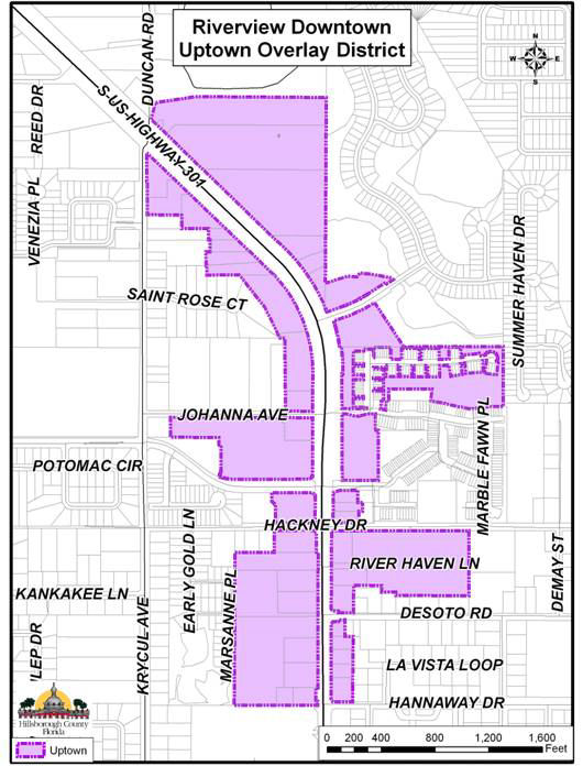
Figure 1.
B.
The following requirements shall apply to all building activity within the Uptown Overlay District, subject to the applicability provisions in Section 3.20.02.A above. The applicant shall be responsible for providing the necessary information to determine the applicable sections of this Part, as listed below and in Table 1. All new signs shall comply with the limitations and provisions of Article VII of this Code and with Section 3.20.06 of this Part.
1.
For all projects requiring building permits where structures are expanded to between 25 and 50 percent of existing legally permitted square footage within the parcel, the landscaping and signage requirements of this Part shall apply.
2.
For all projects requiring building permits where structures are expanded to beyond 50 percent of existing legally permitted square footage within the parcel, the landscaping, screening, signage, and building design requirements of this Part shall apply.
3.
For all projects where new structures are constructed on a vacant parcel or where a primary structure is replaced by a new structure, the entire requirements of this Part shall apply to the entire project and parcel(s).
4.
For all projects where new buildings are placed on a parcel occupied by existing buildings, the landscaping, screening, and signage requirements, shall apply to the entire project and parcels(s), and the Standards for Development shall apply to the new construction.
5.
Projects increasing the outside area devoted to sales, storage, displays, demonstrations, or parking by more than 50 percent and requiring a building permit shall be considered a major change and shall be required to comply with the landscaping and signage requirements of this Part.
Table 1.
(Ord. No. 09-53, Item T, 6-11-09, eff. 10-1-09)
Sec. 3.20.03. - Permitted Uses
Uses shall be regulated by the underlying zoning district of the development parcel as provided in this Code.
(Ord. No. 09-53, Item T, 6-11-09, eff. 10-1-09)
Sec. 3.20.04. - General Development Standards
Except as otherwise provided by this Part, development shall conform to the area, height, bulk and placement standards of the underlying zoning district of the development parcel and all other requirements of this Code. The applicant shall be responsible for providing the necessary information to determine compliance with the applicable sections of this Part.
A.
Parking and Access
Except as otherwise provided by this Section, parking requirements for all uses shall be in accordance with the Parking Standards of Section 6.05.00. Landscaping requirements for off-street vehicular use areas shall be in accordance with the landscaping and buffering requirements of this Code.
1.
Required Off-Street Parking
a.
Required parking provided through surface parking lots shall be on the development site or within 500 feet of the development site that the parking is required to serve.
b.
The parking requirements in Section 6.05.00 of this Code for non-residential uses may be reduced by 50 percent.
c.
On-Street Parking Credit. On-street parking spaces shall be deducted from the required number of off-street parking spaces for the adjacent use. When an extended parcel line splits an on-street parking space, that space shall be deducted from the parking requirements of the parcel that fronts the majority of the on-street parking space.
d.
Bicycle Parking Credit. If bicycle parking facilities are provided within the project, the Administrator may approve up to five percent reduction of all required vehicle parking spaces, or one vehicle parking space, whichever is greater. Bicycle parking must meet the design standards of Section 6.05.02 of this Code.
2.
Off-Street Parking (surface parking lots)
a.
In projects with off-street surface parking, parking shall be located behind the line of the building façade fronting US Highway 301.
b.
Notwithstanding the above, surface parking lots may be located adjacent to a street other than US Highway 301 in projects with frontage along two or more streets.
3.
Parking Garages
a.
Except for vehicle entrances, the ground floor shall be developed with enclosed commercial, office or civic floor space to a minimum building depth of 30 feet along the entire length of the structure on each adjacent street, unless separated from the street by another building, parking lot and/or landscaped open space with a minimum depth of 30 feet.
b.
Direct pedestrian access in the form of pedestrian entrances and walkways from parking garages to each adjacent street shall be provided.
4.
Connectivity
a.
Parking, service drives, and alleys shall be designed to allow for future connections to adjacent parcels and to allow all development along US Highway 301 to be accessible from a street with a intersection at US Highway 301.
b.
Direct pedestrian access in the form of pedestrian entrances, sidewalks, crosswalks, and other walkways from public sidewalks to building entrances and between parcels shall be provided.
B.
Screening
1.
Trash, recycling receptacles, loading docks, service areas, and other similar areas must be located in parking areas or in a location that is not visible from the street frontages, and must be screened to minimize sound and visibility from residences and to preclude visibility from adjacent streets. Service areas shall be screened by a masonry wall and landscape buffer. The wall shall be a minimum of six feet in height using architectural design, materials and colors that are consistent with those of the primary structure. The landscape buffer shall be a minimum of five feet in width and contain evergreen plants a minimum of three feet in height at the time of planting and spaced not more than four feet apart.
2.
Mechanical equipment shall be placed behind the line of the primary building façade and shall be screened from view of any street by fencing, vegetations, or by being incorporated into a building.
3.
All rooftop mechanical equipment shall be integrated into the overall mass of a building by screening it behind parapets or by recessing it into roof structure.
4.
Fences and walls shall be constructed of masonry, vinyl or cast iron/metal. The location of all fences and walls shall be in accordance with Part 6.07.00 of this Code.
5.
Landscaping, irrigation, and buffering, including off-street vehicular use areas, street trees, and buffering and screening between incompatible land uses, shall be in accordance with Part 6.06.00 of this Code, except as provided for in Section 03.20.04.B.4 above.
6.
Perimeter buffer along ROW. On any parcel of land providing an off-street vehicular use area, where such area is not entirely screened from an abutting right-of-way by an intervening building or other structure, a landscaped buffer a minimum of eight feet in width shall be provided between the off-street vehicular use area and the right-of-way, unless the buffer or screening requirements of Part 6.06.06 are more stringent, in which case the more stringent requirements shall apply.
C.
Utilities
All utility lines for newly constructed structures shall be located underground.
D.
Storm Water
Storm water retention/detention ponds with slopes steeper than 4-to-1 shall be located to the rear of all principal buildings on the parcel. Chain link fencing around storm water ponds shall be prohibited.
(Ord. No. 09-53, Item T, 6-11-09, eff. 10-1-09)
Sec. 3.20.05. - Standards for Development
The applicant shall be responsible for providing the necessary information to determine compliance with the applicable sections of this Part.
A.
Building Frontage
Buildings must occupy a minimum of 60% of a parcel's street frontage along US Highway 301. Plazas, parks, and patios along the US Highway 301 street frontage may count toward building frontage requirements. Natural resources protected by Part 4.01.00 of this Code shall be excluded from a parcel's street frontage dimension.
B.
Building Setbacks
1.
Building setbacks along US Highway 301 frontage shall be a minimum of 10 feet to a maximum of 20 feet. Where paved courtyards, arcades, or galleries are provided, building setbacks along street frontages shall be a maximum of 30 feet. When the building frontage requirement is met along US Highway 301, additional buildings within the project may be located at a greater setback. A 10-foot maximum variation in setback along the street frontage is allowed within each project. On parcels containing natural resources protected by Part 4.01.00 of this Code, the building setbacks shall be the minimum possible to avoid said areas.
2.
Side and rear yard setbacks shall be in accordance with the buffering requirements in Section 6.06.06, by use.
C.
Building Orientation
A building's primary orientation and façade shall be toward US Highway 301 rather than the parking areas. The primary building entrance(s) shall be visible and directly accessible from US Highway 301. This entrance(s) shall be a distinctive and prominent element of the architectural design. Buildings shall incorporate lighting and changes in mass, surface or finish to emphasize the entrance(s).
D.
Building Design
1.
Blank walls shall not occupy over 50 percent of a street-facing frontage and shall not exceed 20 linear feet without being interrupted by a window or entry. No more than 20 feet of horizontal distance of wall shall be provided without architectural relief for building walls and frontage walls facing the street.
2.
The building façade must be architecturally finished to grade.
3.
Buildings are encouraged to incorporate arcades, alcoves, porticos or awnings along street-facing, park-facing, plaza-facing, and patio-facing building façades. These features may be counted toward the architectural relief requirement of Section 3.20.05.D.1, above.
4.
New parking shall occur within parking garages or within surface lots that are located behind the line of the building façade facing US Highway 301. First-story or ground floor individual unit garages for multi-family or mixed-use structures shall not be permitted to face US Highway 301.
(Ord. No. 09-53, Item T, 6-11-09, eff. 10-1-09)
Sec. 3.20.06. - Sign Standards
Signs within the RD Uptown Overlay as illustrated in Figure 1, herein, shall conform to the limitations and provisions of Article VII of this Code and must be constructed of materials similar to those of the buildings served. Additionally, the following limitations and provisions shall apply.
A.
Structural Alteration and/or Replacement.
Notwithstanding the applicability provisions of this Part, structural alteration and/or replacement of existing signs that do not conform to the requirements of this Part on parcels within the Overlay District as shown in Figure 1. herein, as well as on any other parcel that is aggregated for development with a parcel shown in Figure 1, shall not be permitted, regardless of whether any building activity is occurring on the parcel at the time, except that such signs may be removed and replaced with signs conforming with the requirements of this Part.
B.
Nonconforming Signs.
Notwithstanding the applicability provisions of this Part and regardless of whether any building activity is occurring on the parcel at the time, nonconforming signs may be removed and replaced with signs conforming with the requirements of this Part, and those illegal nonconforming signs as identified in Section 7.02.03.A which should have been removed or modified under prior law shall only be removed and replaced with signs conforming with the requirements of this Part. Variance requests to allow the continued use of existing nonconforming monument signs shall be considered pursuant to the sign standards of this Part.
C.
Replacement of Advertising Copy or Panels.
Replacement of advertising copy or panels on such signs that do not involve structural alterations shall be allowed if otherwise permitted by this Code.
D.
Pole Signs, Animated Signs and Changeable Copy signs and Revolving Signs.
Use of Pole Signs, Ground Signs extended from the ground, Animated Signs, Changeable Copy signs and Revolving Sings shall be prohibited; exceptions may be made for emergency public services/uses. Variances to allow the continued use of existing on-site pole signs, ground signs extended from the ground, or revolving signs, or the installation of new pole signs or revolving signs, shall be prohibited.
E.
Sign Lighting.
Sign lighting fixtures shall be hidden from view by landscaping. All other sign lighting shall conform to the limitations and provisions of Part 6.10.00 of this Code.
(Ord. No. 09-53, Item T, 6-11-09, eff. 10-1-09)
Sec. 3.21.01.- Purpose and Intent
The purpose of the Resort Dwelling Overlay District (RDOD) is to permit the use of single-family, two-family, or multi-family dwelling units as resort dwellings in specific areas of the County that have been designated as appropriate for a mixture of permanent residential and resort rentals. It is the intent of this Part to provide design standards that will preserve the residential character of the area while minimizing the impact of resort uses on permanent residents.
(Ord. No. 09-53, Item O, 6-11-09, eff. 10-1-09)
Sec. 3.21.02. - Applicability
A rezoning request in accordance with Part 10.03.00 of the Land Development Code shall be required. When a property is designated RDOD, the zoning designation of the property shall be annotated with "RDOD" after the zoning district.
A.
The use of the Resort Dwelling Overlay District shall be restricted to properties that are consistent with one or more of the following:
1.
The property is located within 500 feet of Tampa Bay;
2.
The property abuts the Hillsborough River, the Alafia River, or the Little Manatee River; or
3.
The property is located within 500 feet of a state or county regional park containing a minimum of 30 acres, a regional recreational use, or a golf club.
(Ord. No. 09-53, Item O, 6-11-09, eff. 10-1-09)
Sec. 3.21.03. - Permitted Principal and Accessory Uses
Within the RDOD, permitted uses are controlled by the underlying zoning district of the property. Single-family conventional, two-family, and multi-family dwelling units as may be permissible in the underlying zoning district may be utilized for resort dwellings subject to the standards contained herein. Maximum density permitted within the RDOD shall be in accordance with the underlying zoning designation and the future land use category of the subject property.
(Ord. No. 09-53, Item O, 6-11-09, eff. 10-1-09)
Sec. 3.21.04. - Specific Development Standards
In addition to all requirements of the underlying zoning district, the following standards shall apply to all resort dwelling units located within the Resort Dwelling Unit Overlay District.
A.
The project shall contain a minimum of 20 contiguous acres. Individual lots within the project may be subdivided consistent with the minimum lot requirements of the underlying zoning district and any other requirements of this Code provided the overall RDOD contains a minimum of 20 contiguous acres.
B.
The owner of the resort dwelling(s) shall have a valid and current Department of Business and Professional Regulation license under Chapter 509, Florida Statutes.
1.
A copy of the license shall be displayed on the exterior of the dwelling in a place accessible to the public and shall include the name, address, and telephone number of a local contact person responsible for operating the property who is available 24 hours a day seven days a week.
C.
The dwelling unit shall not be an affordable housing unit per deed restriction or restrictive covenant.
D.
A resort dwelling shall not occupy an accessory structure or accessory dwelling.
E.
Resort dwellings shall comply with all building and fire safety codes including, but not limited to, accessibility for the disabled as outlined in Chapter 11 of the Florida Building Code, for public lodging establishments as required by State and County law.
F.
The exterior of the dwelling unit shall retain a residential appearance. Signs shall comply with the standards for signs within residential zoning districts as found within Part 7.03.00 of this Code. Additionally, the following limitations and provisions shall apply:
1.
All signs shall be permitted external illumination only and the use of plastic display panels or neon lights shall be prohibited.
G.
Maximum occupancy of the resort dwelling unit shall be one (1) family as defined in Part 12.01.00 of this Code.
H.
The number of required off-street parking spaces shall be consistent with Section 6.05.00 based upon the type of dwelling developed on the property. No additional parking spaces shall be required for resort dwellings.
(Ord. No. 09-53, Item O, 6-11-09, eff. 10-1-09)
Sec. 3.22.01.- Purpose
The purpose of this section is to provide for evaluation of rezonings for residential uses for consistency with the character of the neighborhood areas identified in the Ruskin Community Plan.
(Ord. No. 14-18, § 2(Exh. A)(Item IV-C)(14-0474), 6-12-14, eff. 6-19-14)
Sec. 3.22.02. - Applicability
All rezoning, major and minor modification to planned development zonings applications for residential use for property located in the area and with a Future Land Use Map designation described by Figure 1: Ruskin Neighborhood Area Map shall be evaluated for consistency with the character of the respective neighborhood area. In applications where only a portion of a planned development zoning is proposed for major and/or minor modification, this Part shall only be applicable to the portion of the project subject to the modification.
(Ord. No. 14-18, § 2(Exh. A)(Item IV-C)(14-0474), 6-12-14, eff. 6-19-14)
Sec. 3.22.03. - Residential Character Evaluation
A.
The Ruskin Community Plan identifies four distinct neighborhood areas, each having a defined character as described below:
Area 1: The Old Ruskin neighborhood west of downtown will feature lower density single family housing in keeping with the traditional character of the area.
Area 2: This area east of downtown and west of the I-75 employment center will accommodate a variety of housing types including multifamily and entry level housing.
Area 3: This area south of College Avenue will accommodate a more suburban style and type of residential development with safeguards for the redevelopment of property along the Little Manatee River.
Area 4: This area southeast of I-75 will retain its rural and agricultural character and provide for enhanced interaction and access to the publicly owned lands adjacent to the Little Manatee River.
B.
Lot sizes and uses for projects that meet the guidelines in Figure 2: Neighborhood Character Review Guidelines are presumed to be consistent with the character identified by the Ruskin Community Plan for the corresponding neighborhood areas as described in this Section.
C.
If a proposed application is inconsistent with the Neighborhood Character Review Guidelines, the application shall be reviewed as a Planned Development (PD) district. The application shall include a justification statement with the application submittal with sufficient data and analysis to demonstrate compliance with the review standards herein.
The applicant shall be required to demonstrate that the project furthers the intent of the Ruskin Community Plan, is innovative, creative and not simply a deviation from the Neighborhood Character Review Guidelines for the purposes of maximizing entitlements. The application shall demonstrate that deviation from the Neighborhood Character Review Guidelines will allow flexibility in design that in turn will be used to further the intent of the Neighborhood Character Review Guidelines and the Vision, Goals and Strategies of the Ruskin Community Plan as a whole, to an equivalent or greater degree than would otherwise be achieved by compliance with applicable policies, codes and technical manuals at minimum levels.
Figure 1: Ruskin Neighborhood Area Map
Area 1 and land that is designated Residential-4 on the Future Land Use Map.
Area 2 and land that is designated Residential-6 on the Future Land Use Map.
Area 3 and land that is designated Residential-4 on the Future Land Use Map.
Area 4 and land that is designated Agriculture/Rural, Residential-1, Residential-2,
and Residential-4 on the Future Land Use Map.
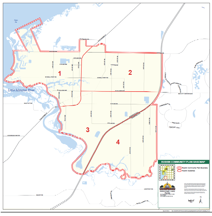
Figure 2: Neighborhood Character Review Guidelines
* These guidelines apply to single family detached development only.
(Ord. No. 14-18, § 2(Exh. A)(Item IV-C)(14-0474), 6-12-14, eff. 6-19-14)
Sec. 3.23.01.- Purpose
The purpose of this Part is to establish standards for the Wimauma Downtown (WD) Overlay District. The overlay district and its design standards implement the vision, principles, and strategies of the Wimauma Community Plan, as found in the Future of Hillsborough Comprehensive Plan.
The intent of these regulations is to improve and encourage the vitality and development of Wimauma's center and Main Street along State Road 674, and establish a mixed use, walkable, and pedestrian friendly downtown district with small town character. All development shall be in accordance with the standards for development as described in this Part and as appropriate.
(Ord. No. 21-40, § 2(Exh. A), 10-14-21, eff. 10-14-21)
Sec. 3.23.02. - Applicability
A.
General
1.
Except as provided herein, these standards shall apply to all new development on parcels within and to all development aggregated with development within the WD Overlay District area as of October 14, 2021. The WD Overlay District is as shown in Figure 1.
2.
These provisions shall not apply to public schools and previously approved planned developments except as provided in subsection (A)(4) below, previously approved subdivisions, projects with unexpired building permits, unexpired preliminary site development approval, or unexpired construction plan approval as of October 14, 2021.
3.
In addition to the standards provided herein, development within the WD Overlay District shall be required to meet all other applicable sections of the Land Development Code. Where any provision of these regulations conflict with any other standards or regulations of the Land Development Code, these regulations shall prevail.
4.
Minor and major modifications to pre-existing Planned Developments within the applicable area shall be evaluated for consistency with these regulations and shall comply to the greatest extent possible. In applications where only a portion of the pre-existing Planned Development is proposed for minor or major modification, these regulations shall only apply to the portion of the project subject to the modification.
B.
Residential Development
1.
New Single-Family and Two-Family may develop utilizing the applicable Wimauma Downtown Overlay standards or a standard zoning district. If developed utilizing the applicable Wimauma Downtown Overlay standards, a Planned Development rezoning will be required. If developing under a standard zoning district, the standard zoning district's development standards shall be utilized.
2.
The use of the Wimauma Downtown Overlay regulations for Single-Family Manufactured/Mobile Home dwellings shall not be permitted. Single-Family Manufactured/Mobile Home dwellings shall be governed by the underlying zoning district.
3.
The new development of Single-Family Attached dwellings (townhouses) and Multi-Family dwellings shall be developed utilizing the applicable Wimauma Downtown Overlay standards. The selected Lot Type for the new development shall be governed by the use and Wimauma Downtown Overlay district permissibility (Table 5-1).
4.
Existing legally established, conforming Single-Family Attached dwellings (townhouses) and Multi-Family dwellings shall be replaced, renovated or enlarged in accordance with Part 11.03.00 of this Land Development Code.
5.
Mobile Home and Recreational Vehicle Parks in existence at the time of the adoption of this overlay are not subject to these provisions. New Mobile Home and Recreational Vehicle Parks proposed after the adoption of this overlay are permitted under a Planned Development rezoning in all districts of the Wimauma Downtown Overlay except the Wimauma Main Street Core District. The Wimauma Downtown Overlay requirements shall not apply to existing or new Mobile Home and Recreational Vehicle Parks.
C.
Non-Residential Development
The following requirements shall apply to all non-residential and mixed use uses, as permitted by the underlying zoning district within the Wimauma Downtown Overlay District, subject to the applicability provisions in Section 3.23.02.A.2 above. These requirements shall not apply to manufacturing/industrial uses. The applicant shall be responsible for providing the necessary information to determine the applicable sections of this Part, as listed below and in Table 5-1. All new signs for permitted uses not excluded per Section 3.23.02.A shall comply with the limitations and provisions of Article VII of this Code and with Section 3.23.14 of this Part.
1.
For all projects requiring building permits where structures are expanded to between 25 and 50 percent of existing legally permitted square footage within the parcel, the landscaping and signage requirements of this Part shall apply.
2.
For all projects requiring building permits where structures are expanded to beyond 50 percent of existing legally permitted square footage within the parcel, the landscaping, screening, signage, and building design requirements of this Part shall apply.
3.
For all projects where new structures are constructed on a vacant parcel or where a primary structure is replaced by a new structure, the entire requirements of this Part shall apply to the entire project and parcel(s). The selected Lot Type for the new development shall be governed by the use and Wimauma Downtown Overlay district permissibility (Table 5-1).
4.
For all projects where new buildings are placed on a parcel occupied by existing buildings, the landscaping, screening, and signage requirements of this Part shall apply to the entire project and parcels(s), and the Wimauma Downtown Overlay Standards in Section 3.23.06 shall apply to the new construction.
5.
Projects increasing the outside area devoted to sales, storage, displays, demonstrations, or parking by more than 50 percent and requiring a building permit shall be considered a major change and shall be required to comply with the landscaping and signage requirements of this Part.
D.
Industrial/Manufacturing Development
1.
For any industrial/manufactured use currently not permitted by the underlying zoning, the site shall be located within a Wimauma Downtown Overlay District which envisions an industrial/manufacturing use as described in the Wimauma Village Plan and require a Planned District rezoning.
2.
For any current or future industrial/manufactured use currently permitted by the underlying zoning, the site shall be developed in accordance with the underlying zoning district and Land Development Code standards and shall not be subject to these regulations.
E.
Non-compliance with these Wimauma Downtown Overlay regulations is discouraged.
(Ord. No. 21-40, § 2(Exh. A), 10-14-21, eff. 10-14-21)
Sec. 3.23.03. - Permitted Uses
Uses shall be regulated by the underlying zoning of the development parcel as provided in this Code.
(Ord. No. 21-40, § 2(Exh. A), 10-14-21, eff. 10-14-21)
Sec. 3.23.04. - Wimauma Downtown Overlay Districts
A.
Wimauma Downtown Overlay Districts
Wimauma Downtown Overlay Districts are envisioned to provide a mix of residential and non-residential uses, which will utilize currently permitted uses and potentially permit other uses. To permit uses not currently permitted by the underlying zoning, but described in the Wimauma Village Community Plan, rezoning approval, and possibly Future Land Use category amendment approval, will be required. Districts within the Wimauma Downtown Overlay include the following:
•
Main Street Core
•
Downtown Center
•
Government District
•
Downtown Residential
•
Wimauma Downtown West
•
Wimauma Downtown East (WVR-2)
B.
The context for each Wimauma Downtown Overlay District can be found in the Wimauma Village Community Plan in the Livable Communities Element.
C.
Commercial locational criteria, as stated within the Comprehensive Plan, do not apply to non-residential-uses located within the "Wimauma Downtown Main Street Core" and "Wimauma Downtown East" Districts as shown on Figure 1.
D.
Any development within the Wimauma Downtown East District to allow uses not currently permitted per the underlying zoning shall require a Planned Development.
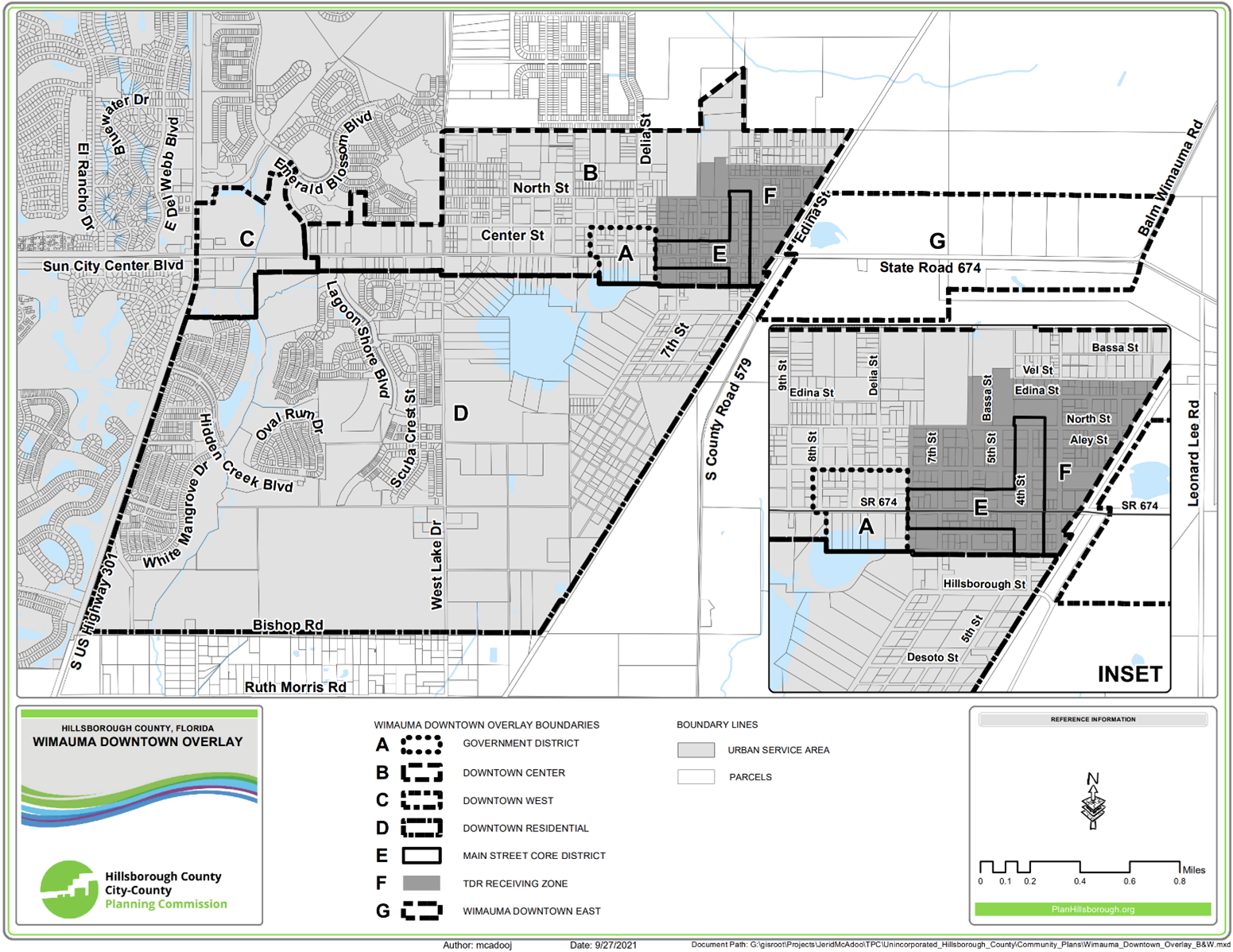
Figure 1: Wimauma Downtown Overlay Plan
(Ord. No. 21-40, § 2(Exh. A), 10-14-21, eff. 10-14-21)
Sec. 3.23.05. - Permitted Lot Types and Uses in the Wimauma Downtown Overlay Districts
The following Lot Types in Table 5-1 shall be utilized for the permitted use. An applicant may propose different lot types as part of a Planned Development rezoning process. In such cases, lot types shall meet or exceed the intent of the Wimauma Downtown Overlay district.
Table 5-1
(Ord. No. 21-40, § 2(Exh. A), 10-14-21, eff. 10-14-21)
Sec. 3.23.06. - Wimauma Downtown Overlay Standards
A.
Table 5-2 provides the development standards for permitted Lot Types. Yard orientations shall be per Land Development Code Section 6.01.03.C.
B.
For development located on 4th Street or CR 674 within the Main Street Core, Government and Downtown Center Districts, any development standard found within Section 3.23.07 which are in conflict with Table 5-2 shall utilize those standards found within Section 3.23.07.
Table 5-2
Table 5-2 Notes:
(1) Sideyard House Lot Types permit a zero foot setback on one side of the lot only. A zero foot sideyard setback shall not be adjacent to another side yard setback of 0 feet. A minimum 10 foot setback on the other side shall be provided.
(2) Rowhouses shall contain at least 3 attached dwelling units on separately deeded lots (single-family attached).
(3) Attached garages and all building attachments, such as but not including covered porches, colonnades, awnings, porticos and balconies shall contribute to the minimum/maximum building frontage percentage. The maximum depth of building attachments shall be 12 feet. These building attachments shall meet the minimum/maximum front yard setbacks found in the table above unless otherwise specified in Section 3.23.06.C., Garages and Parking Locations, below.
(4) An additional setback of 2 feet for every 1 foot over 20 feet of building height shall be required where non-residential uses are adjacent to a single-family or multi-family use. An additional setback of 2 feet for every 1 foot over 20 feet of building height shall be required where multi-family uses are adjacent to a single-family use.
(5) These minimum setbacks shall not preclude compliance with required buffer width. Buffers shall be required where non-residential uses are adjacent to a single-family or multi-family use. Buffers shall be required where multi-family uses are adjacent to a single-family use. Where the setbacks found in this Table conflict with any required buffer width per Land Development Code Section 6.06.06 or elsewhere in these regulations, the minimum buffer width shall prevail.
(6) The building's primary orientation shall be toward the street rather than the parking areas.
Cottage House Lots shall require a porch along a minimum of 70% of the façade. The porch shall be used in the building frontage percentage calculation.
(7) Different minimum and/or maximum front and rear setbacks for residences and/or attached or detached garages may be required depending on the lot's access. See below (Garages and Parking).
C.
Garages and Parking Locations
1.
The following shall apply to parking for residential and non-residential uses:
a.
Parking in Retail/Office Lot Types, Civic Lot Types and Mixed Use Lot Types shall occur to the rear and/or side of the primary building. Parking between the primary building and front setback shall not be permitted.
b.
Cottage and Standard Lot Types with lot sizes at or greater than 5,000 square feet and at or greater than 50 feet in width may be accessed from the front or rear utilizing attached or detached garages. Notwithstanding Table 3.24.01, when using front access with an attached garage, the minimum setback for the garage shall be at least 20 feet and the remaining portion of the façade shall be setback no less than 15 feet from the front property line.
i.
Notwithstanding Table 3.24.01, when using front access with a detached garage, the detached garage shall be located completely behind the home in accordance with Accessory Structure setbacks and the residential structure shall not be setback less than 15 feet from the front property line.
ii.
Notwithstanding Table 3.24.01, when using rear access with an attached or detached garage, the rear yard setback shall be determined at the time of rezoning to ensure pedestrian safety relative to the rear lot boundary (Alley or publicly accessible street).
c.
Sideyard Lot Types (despite the size or width), and Cottage and Standard Lot Types Lots sizes less than 5,000 square feet in size and having a lot width of less than 50 feet shall utilize rear access only.
Notwithstanding Table 3.24.01, when using rear access with an attached or detached garage, the rear yard setback shall be determined at the time of rezoning to ensure pedestrian safety relative to the rear lot boundary (Alley or publicly accessible street).
d.
Residential parking for Live/Work units, if not provided in part or completely by surface parking or on-street parking, shall utilize attached rear loading garages accessed via an Alley or publicly accessible street, or detached garages (located in accordance with Accessory Structure setbacks) accessed via an Alley or publicly accessible street. Notwithstanding the proposed width for a Lot/Work Lot, front loaded attached or front-loading detached garages shall not be permitted. Notwithstanding Table 3.24.01, when using rear access with an attached or detached garage, the rear yard setback shall be determined at the time of rezoning to ensure pedestrian safety relative to the rear lot boundary (Alley or publicly accessible street).
e.
Off-street parking for Apartment House Lots shall be located behind or to the side of the main structures.
f.
Off-street parking for Courtyard Apartment Lots shall be located behind or to the side of the main structures located furthest from the street.
g.
Rowhouse Lots shall provide parking as follows:
i.
Attached, rear loading garages shall be accessed via an Alley or publicly accessible street located behind the building, or via a driveway located to the side of the rowhouse units. Notwithstanding Table 3.24.01, the rear yard setback shall be determined at the time of rezoning to ensure pedestrian safety relative to the rear lot boundary (Alley or publicly accessible street).
ii.
Detached rear loading garages (located in accordance with Accessory Structure setbacks) shall be accessed via an Alley or publicly accessible street located behind the unit, or a driveway located to the side of the rowhouse building. Notwithstanding Table 3.24.01, the rear yard setback of the detached garage shall be determined at the time of rezoning to ensure pedestrian safety relative to the rear lot boundary (Alley or publicly accessible street).
iii.
Surface parking lots for rowhouse buildings shall be located behind or to the side of the rowhouse building.
2.
The use of carports for any lot size and lot width shall not be permitted.
D.
Accessory Structures
Accessory Structures shall comply with the following:
1.
All accessory structures providing no vehicle access and not including an Accessory Dwelling Unit being served by a driveway shall be placed completely behind the residential home and placed no closer than 3 feet to any side or rear property line, unless otherwise stated herein.
2.
All accessory structures shall be limited in height to a maximum of 15 feet in height/2 stories.
3.
Accessory structures utilized for vehicle storage and front access shall be placed completely behind the residential home and placed no closer than 3 feet to any side or rear property line. Should at any time the Accessory Structure be requested, at the time zoning or zoning modification, to not be located completely behind the home, the detached garage shall be placed no closer than 20 feet from the front yard and the residential structure shall not be setback less than 15 feet from the front property line.
4.
Accessory structures utilized for vehicle storage and rear access shall be placed no closer than 3 feet from the side property line. The rear yard setback shall be determined at the time of rezoning to ensure pedestrian safety relative to the rear lot boundary (Alley or publicly accessible street).
E.
Accessory Dwelling Units
1.
Accessory dwellings are permitted only on Cottage, Sideyard and Standard House Lot Types and shall be permitted irrespective of parcel size limitations within Section 6.11.02.A.
2.
Land Development Code Section 6.11.02.C. shall apply.
3.
Notwithstanding Section 6.11.02, a two- or three-story primary home shall be permitted to construct an accessory dwellings located above an accessory structure.
4.
Accessory Dwelling Units shall meet the Accessory Structure setbacks within Section 3.23.06.D., above.
5.
When an Accessory Dwelling Units without a garage is served by a rear driveway, the rear yard setback of the primary structure and Accessory Dwelling Unit shall be determined at the time of rezoning to ensure pedestrian safety relative to the rear lot boundary (Alley or publicly accessible street).
6.
When a one-story accessory dwelling is constructed as a stand-alone structure or included as a part of a larger multi-use accessory structure, the above-accessory structure setbacks shall be complied with.
7.
The primary home shall be owner-occupied.
F.
Civic Uses
The following shall apply to Civic Lot Type development:
1.
Civic Uses shall include Government/Public Service facilities, churches/synagogues, and Flexible Market Space.
2.
No stormwater ponds or drive aisles shall be permitted in front of a Civic Use building.
G.
Live/Work Units
The following shall apply to Live/Work Lot Type development:
1.
A Live/Work unit shall consist of one residential dwelling a non-residential use, as permitted per the Land Development Code.
2.
Live/Work units shall be regulated by density and non-residential square footage shall not be subject to any Floor Area Ratio maximum.
3.
Live/Work units shall be occupied by the primary operator of the Live/Work unit's non-residential use.
4.
If a two-story unit is used, permitted non-residential uses shall occur within the entirety of the first floor of the unit. The residential use shall occur within the entirety of the second floor of the unit.
5.
If a three-story unit is used, permitted non-residential uses shall occur within the entirety of the first floor only. The second and third floors may be utilized for residential use.
6.
Resident parking shall be provided as provided in these regulations.
7.
Notwithstanding Land Development Code Section 6.05.02.E., customer/employee parking shall be provided at a parking standard of 1.5 spaces per each Live/Work unit. For the purposes of this regulation, employee parking is to accommodate employees of the Live/Work unit's non-residential use who are not the primary operators and who do not live within the Live/Work unit.
8.
The use of compact parking shall be limited to a maximum of 20% of the total required customer/employee parking.
9.
Customer/Employee disabled parking shall be provided in accordance with Land Development Code Section 6.05.02.J. (Disabled Parking).
10.
Should surface parking be utilized for some or all resident parking and for some or all customer/employee parking, each space shall be delineated with markings to designated individual parking spaces for residents and for customers/employees. All surface parking shall be located to the rear or side of the Live/Work units.
11.
Alternatively, on-street parking to accommodate some or all customer/employee parking may be provided and shall be located directly in front of the live/work units. Such spaces shall be designated for Live/Work customer parking only. In such cases these streets must be privately owned and maintained with a public access easement.
H.
Mixed-Use
The following shall apply to Mixed-Use Lot Type development:
1.
Uses within a Mixed-Use Lot Type shall be combination of two or more of the following uses: office, retail, government/public service facility or multi-family residential. Each use shall consist of at least 30% of the overall building square footage.
2.
Buildings, even when including multi-family residential, shall be subject to Floor Area Ratio maximums only.
3.
Buildings shall be considered a non-residential use and buffering and screening in accordance with LDC Section 6.06.06 shall be provided.
4.
An additional setback of 2 feet for every 1 foot over 20 feet in height shall be provided when adjacent to a Cottage, Sideyard or Standard House Lot Type.
I.
Buffering and Screening Between Uses
1.
Retail/Office, Mixed-Use and Civic Lot Types shall be considered a non-residential use. Any fencing used for screening treatment shall be in accordance with the Downtown Overlay requirements.
2.
Apartment House/Building, Courtyard Apartment Live/Work Lot Types and Rowhouse Lot Types shall be considered a multi-family use. Any fencing used for screening treatment shall be in accordance with the Downtown Overlay requirements.
3.
Cottage, Sideyard and Standard House Lot Types shall be considered a single-family use.
(Ord. No. 21-40, § 2(Exh. A), 10-14-21, eff. 10-14-21)
Sec. 3.23.07. - Building Design Standards along 4th Street and State Road 674 within the Main Street Core District, Government District, and Downtown Center
A.
Should any requirements listed in Table 5-2 or elsewhere conflict with the requirements outlined in this Section, this Section's requirements shall prevail. Building and Street Frontage Buildings must occupy a minimum of 70% of a parcel's street frontage along Main Street (4th Street) and State Road 674 between State Road 579 and Maggie Street, except when driveways to rear parking access may be impeded by the minimum requirement.
B.
Main Street Building Setbacks for 4th Street and State Road 674
Notwithstanding Table 5-1, the maximum front yard setback shall be 20 feet.
C.
Floor Area Ratio (F.A.R.)
The maximum permitted intensity (F.A.R.) shall be per the underlying zoning district.
D.
Building Orientation
A building's primary orientation and façade shall be toward State Road 674, Main Street (4th Street), or other Downtown Center streets rather than the parking areas. The primary building pedestrian entrance(s) shall be visible and directly connected with the sidewalk or multi-purpose pathway within the street on which building is fronting via a minimum 5-foot wide direct sidewalk connection. Entrance(s) shall be a distinctive and prominent element of the architectural design. Buildings shall incorporate lighting and changes in mass, surface or finish material, or balcony, porch or awning to emphasize the entrance(s).
E.
Building Design
1.
Façades for Non-Residential, Live/Work and Mixed-Use Buildings.
a.
Blank walls shall not occupy over 50 percent of a street-facing frontage and shall not exceed 20 linear feet without being interrupted by a window or entry. No more than 20 feet of horizontal distance of wall shall be provided without architectural relief for building walls and frontage walls facing the street.
b.
The building façade must be architecturally finished to grade.
c.
Buildings are required to incorporate porch-like character including porticos or awnings along street-facing, park-facing, plaza-facing, and patio-facing building façades. These features may be counted toward the architectural relief.
d.
Each building on is required to have an awning, balcony, colonnade, or arcade facing the street. The same requirement applies to Retail Building Lots except that a porch may be substituted. All of these features must be in the front setback. These features may count toward the 70% street frontage. When providing a required awning, balcony, colonnade, arcade, or porch, the following design requirements apply:
i.
Awnings over first-floor doors or windows must have a depth of at least 6 feet. Back-lit, high-gloss, or plasticized fabrics are prohibited.
ii.
Balconies must have a depth of at least 5 feet and a clear height below of at least 10 feet from the sidewalk. Balconies may have roofs but must be open and not air-conditioned.
iii.
Colonnades and arcades must have a clear width from column to building face of at least 8 feet and a clear height of at least 10 feet above the sidewalk.
iv.
Porches must be at least 8 feet deep and 16 feet wide. Porches typically have roofs but must be open and not air-conditioned.
F.
Mixed-Use Building Lots, Retail/Office Building Lots, Live/Work Building Lots, and Civic Building Lots
1.
Each building on a Mixed-Use Building Lot, a Retail/Office Building Lot, a Live/Work Building Lot, or a Civic Building Lot must have an entrance facing a street or public open space.
2.
For Mixed-Use Building Lots and Retail/Office Building Lots, a portion of the building frontage may be set back up to an additional 20 feet beyond the maximum front yard depth if this space is constructed as a courtyard or entryway that is open to the sidewalk. This portion may be up to 25% of the actual building frontage and may not be used for parking.
3.
On all Mixed-Use Building Lots and Retail/Office Building Lots, building walls that face streets are required to have between 15% and 75% of their area in transparent windows. In addition, each retail storefront must comply with the following:
a.
The ground floor must have transparent storefront windows covering no less than 75% of the wall area in order to provide clear views of merchandise in stores and to provide natural surveillance of exterior street spaces.
b.
Doors allowing public access to streets must be provided at intervals of at least 75 feet to maximize street activity, to provide pedestrians with frequent opportunities to enter and exit buildings, and to minimize any expanses of inactive wall. To be considered transparent, window and door glass, whether integrally tinted or with applied film, must transmit at least 50% of visible daylight. These requirements do not apply to walls that face alleys or lanes.
G.
Specific building standards for drive-through development
1.
Drive-through window services, including pneumatic devices, other associated mechanical equipment, and any structural canopies related to drive-through service, shall not be located between the front building façade and Main Street (4th Street) or State Road 674.
2.
The entrance to all vehicle service bays shall not be oriented directly towards of Main Street (4th Street). All vehicle repair and service shall take place within a fully enclosed area of the building in which such use is located.
H.
New parking shall occur within parking garages or within surface lots that are located behind the line of the building façade.
I.
First-story or ground floor individual unit garage access for multi-family or mixed-use structures shall not be permitted to face Main Street or State Road 674.
(Ord. No. 21-40, § 2(Exh. A), 10-14-21, eff. 10-14-21)
Sec. 3.23.08. - Street Network Design
Development must provide an interconnected network of publicly accessible streets, alleys or lanes, and other public passageways by continuing the block pattern and filling in gaps in the pattern.
A.
Development must accommodate the grid-like pattern in Wimauma Downtown as represented in the Plan.
1.
Sidewalks and street trees shall be provided in accordance with the Land Development Code and/or as otherwise required in these regulations.
2.
Downtown streets must form an orthogonal grid and are required to intersect at ninety-degree angles.
3.
All streets must be publicly dedicated and conveyed to the County or otherwise publicly accessible.
4.
Cul-de-sacs are not permitted.
5.
Development shall provide connection(s) to the Cross County Greenway Trail-Wimauma adjacent to Downtown where possible.
B.
New streets shall:
1.
Be permitted to utilize only urban roadway sections as shown within the Transportation Technical Manual.
2.
Follow a grid pattern and connect with existing streets and rights-of-way to provide multiple through routes for vehicles and pedestrians.
C.
Existing street rights-of-way shall not be vacated where such action decreases through-route opportunities for vehicular traffic.
D.
Paved stub-outs shall be provided to accommodate future street connections when adjacent to vacant land or land which could be redeveloped for residential.
E.
Existing roadways should transition to urban Typical Sections to the greatest extent possible.
1.
Should a change in street section between an existing development in an adjacent community and in the subject community be proposed, it shall be evaluated at the time of rezoning to determine the appropriate section or transition per Development Services Department Transportation Section review.
F.
Alleys. Notwithstanding anything in the LDC to the contrary, Alleys when utilized may be publicly maintained or, if private, shall be publicly accessible. Additionally:
1.
Alley rights-of-way shall be a minimum of 20 feet in width for one-way alleys and a minimum of 26 feet in width for two-way alleyways;
2.
Both ends of an Alley shall connect with a roadway if the alley accommodates only one-way traffic or the alley accommodate two-way traffic but is longer than 150 feet;
3.
Alleys shall only provide a secondary means of access to abutting residential property and is not intended for general vehicular traffic circulation (i.e. each use accessed via an alleyway must have primary frontage onto a roadway or Pedestrian Thoroughfare); and
4.
Use of Alleys for commercial traffic may be considered through the waiver process at the time of initial zoning or subsequent zoning modification.
G.
Exceptions to these requirements may be permitted where such modification furthers the intent of the CP and Community Plan.
(Ord. No. 21-40, § 2(Exh. A), 10-14-21, eff. 10-14-21)
Sec. 3.23.09. - Substandard Roadways
A.
Terminology
For purposes of this section, the term "Transportation Technical Manual" (TTM) shall mean the latest edition of the Hillsborough County Transportation Technical Manual for Subdivision and Site Development Projects.
B.
General Requirement
1.
Developments with vehicular access to an existing substandard public or private roadway may be required to make improvements to the public and private roadway network.
2.
For the purposes of this section, a public or private roadway shall be considered substandard if one or more of the following Essential Elements are not met:
a.
Lane Widths, i.e. width of the travel lane and any auxiliary lanes serving the site shall be in accordance with the minimum TTM width requirements;
b.
Presence of Curb, i.e. whether an urban roadway section has the required curbing per the TTM;
c.
Presence of Stabilized Shoulders, i.e. whether a rural roadway section has the minimum required shoulders per the TTM;
d.
Elements of Roadside Safety, i.e. whether clear zone and/or clear recovery standards are met or otherwise mitigated;
e.
Presence of Bicycle Facilities, i.e. whether a rural roadway section has the minimum width for bicycle facilities (5-foot wide paved shoulders), or whether an urban roadway section has the minimum width for bicycle lanes (7-foot wide buffered bicycle lanes), as required per the TTM. Multi-purpose trails may be considered to satisfy this minimum Essential Element. Two-way cycle tracks (separated from the travel lanes via raised curbing) may be considered through the Design Exception process;
f.
Ability to Accommodate Sidewalk Facilities, i.e. whether a roadway has the ability to accommodate pedestrian facilities (e.g. a sidewalk or multi-purpose pathway) within the roadway corridor, in minimum widths consistent with required TTM standards. Multi-purpose trails may be considered to satisfy this minimum Essential Element.
3.
For the purposes of this section, a public or private roadway shall not be considered substandard if the roadway complies with the Essential Elements listed above, but does not comply with a Non-Essential Element of the Typical Section. Examples of non-essential elements include, but are not limited to, width of the right-of-way, ditch slopes, width of existing sidewalk facilities, type of bicycle facilities (i.e. traditional bicycle lane vs. buffered bicycle lane), type of curb, etc.
C.
Scope of Required Improvements
1.
Where a development constructs a vehicular access to a substandard public or private roadway, the developer may be required to improve the public and private roadway network, such that a path of travel exists between each project driveway and a public roadway complying with all Essential Elements. Generally, this shall mean that the public and private roadway network will be improved between each driveway and the nearest roadway meeting minimum Essential Element standards; however, nothing herein shall be construed to prevent a developer from improving a longer stretch of roadway if they prefer to do so.
2.
Gated or otherwise restricted vehicular connections providing access solely for emergency vehicles shall not trigger the substandard roadway requirement.
3.
Where improvements are required, the developer shall improve the roadway to current County standards for the applicable Typical Section, as found within the TTM or otherwise required herein, unless otherwise approved in accordance with the Section 6.04.02.B. Administrative Variance process or TTM Design Exception process as outlined in the TTM.
4.
Where sufficient right-of-way exists to allow a developer to improve the substandard public or private roadway network, the developer shall comply with all Essential Elements listed within Section 3.24.06.B, above. Additionally, the following Additional Element shall apply:
Location of Required Sidewalk Facilities, i.e. when a sidewalk is required consistent with Section 6.02.08 or 6.03.02 of this Code, such sidewalk shall be physically located in accordance with the applicable TTM Typical Section, to the greatest extent possible.
5.
Where insufficient right-of-way exists or there are additional constraints (e.g. lack of stormwater facilities to accommodate required drainage), Section 6.04.02.B. Administrative Variances or TTM Design Exceptions may be considered provided:
a.
The Administrative Variance and Design Exception are processed concurrently with a Planned Development zoning application or Planned Development zoning modification; and
b.
Where insufficient right-of-way exists along a project's public or private roadway frontages, the developer shall provide sufficient right-of-way along such frontage(s) where necessary.
c.
For the purposes of this section, nothing herein shall be construed as requiring a developer to construct sidewalk improvements not otherwise required pursuant to Sections 6.02.08 or 6.03.02 of this Code. However, to the extent that the developer proffers construction of additional pedestrian facilities, such facilities shall be located consistent with the applicable Typical Section, except as otherwise described herein.
d.
The County Engineer shall be authorized to grant TTM Design Exceptions to existing and proposed roadways at the time of plat/site/construction plan review for a development, provided such Design Exception only authorizes a deviation to a Non-Essential Element.
e.
Notwithstanding the above, a sidewalk shall not be considered substandard or non-compliant if an existing or future sidewalk facility does not comply with locational requirements, provided such deviation is the minimum necessary to avoid a utility pole, landscape feature, or other obstruction within the right-of-way.
D.
Exceptions
1.
Notwithstanding anything herein to the contrary, Section 6.04.02.B. Administrative Variances and TTM Design Exceptions causing non-compliance with an Essential Element may be considered (regardless of whether there is sufficient right-of-way) where:
a.
The County Engineer makes an explicit finding that such Administrative Variance or Design Exception is necessary to protect or otherwise furthers the public health, safety and welfare and the BOCC makes an explicit finding that such Administrative Variance or Design Exception meets Vision Zero goals or is otherwise appropriate;
b.
A multi-purpose trail is proposed in lieu of required sidewalks and bicycle facilities; or
c.
A Design Exception is necessary to transition the design of an existing roadway corridor.
E.
Timing of Required Improvements
A substandard roadway shall be improved prior to or concurrent with the phase of development which takes access to the substandard roadway.
(Ord. No. 21-40, § 2(Exh. A), 10-14-21, eff. 10-14-21)
Sec. 3.23.10. - Mobility, Parking, and Access for Main Street Core, Downtown Center, Downtown Residential, Government District, Wimauma Downtown West, and Wimauma Downtown East
Except as otherwise provided by this Section, parking requirements for all uses shall be in accordance with the Parking Standards of Section 6.05.00 and Access Management Standards of Section 6.04.00. Landscaping requirements for off-street vehicular use areas shall be in accordance with the landscaping and buffering requirements of this Part.
A.
Required Off-Street Parking
1.
The minimum parking requirements in Section 6.05.00 of this Code for non-residential uses may be reduced by up to 50 percent when 2 bicycle parking spaces shall be provided for every 1 vehicle parking space reduced. When provided, these bicycle parking spaces shall meet the requirements within Section 6.05.02.P.
2.
On-Street Parking Credit. Notwithstanding other sections of the Code, on-street parking spaces shall be deducted from the required number of off-street parking spaces for the adjacent use. When an extended parcel line splits an on-street parking space, that space shall be deducted from the parking requirements of the parcel that fronts the majority of the on-street parking space.
B.
Parking Garages
1.
Except for vehicle entrances, the ground floor shall be developed with enclosed commercial, office or civic floor space to a minimum building depth of 30 feet along the entire length of the structure on each adjacent street, unless separated from the street by another building, parking lot and/or landscaped open space with a minimum depth of 30 feet. The Overlay District shall permit the parking garage's required enclosed commercial, office and civic uses. Should such required enclosed uses not be permitted, a parking garage shall not be permitted.
2.
Direct pedestrian access in the form of pedestrian entrances and walkways from parking garages to each adjacent street shall be provided.
3.
Parking Garages are encouraged in the Downtown Center, Government District, and Wimauma Downtown East.
C.
Connectivity
In addition to any requirements within Section 6.02.01, all developments shall:
1.
Provide parking, service drives, and alleys to allow for future connections to adjacent parcels and to allow all development along State Road 674 to be accessible from a street with an intersection at State Road 674.
2.
Direct pedestrian access in the form of pedestrian entrances, sidewalks, crosswalks, and other walkways from public sidewalks to building entrances and between parcels shall be provided.
D.
Utilities
1.
Where possible, all utility lines for newly constructed structures shall be located underground.
2.
Utility poles and other utility infrastructure shall not obstruct Main Street sidewalks and pedestrian areas within the public realm throughout Wimauma Downtown.
E.
Storm Water
1.
Storm water retention/detention ponds with slopes steeper than 4-to-1 shall be located to the rear of all principal buildings on the parcel and not within any buffer. Chain link fencing around storm water ponds shall be prohibited, unless otherwise required by Hillsborough County.
2.
Low Impact Design for stormwater management and runoff are encouraged to enhance the rural character and small town feel of Wimauma.
F.
Joint Use Facilities and Shared Parking is Permitted in the Wimauma Downtown Overlay per Land Development Code Section 6.05.02.B.
(Ord. No. 21-40, § 2(Exh. A), 10-14-21, eff. 10-14-21)
Sec. 3.23.11. - Screening for Main Street Core, Downtown Center, Downtown Residential, Government District, Wimauma Downtown East, and Wimauma Downtown West
A.
Trash, recycling receptacles, loading docks, service areas, and other similar areas must be located in parking areas or in a location that is not visible from the street frontages, and must be screened to minimize sound and visibility from residences and to preclude visibility from adjacent streets. Service areas shall be screened by a masonry wall and landscape buffer. The wall shall be a minimum of six feet in height using architectural design, materials and colors that are consistent with those of the primary structure. The landscape buffer shall be a minimum of five feet in width and contain evergreen plants a minimum of three feet in height at the time of planting and spaced not more than four feet apart.
B.
Mechanical equipment shall be placed behind the line of the primary building façade and shall be screened from view of any street by fencing, vegetations, or by being incorporated into a building.
C.
All rooftop mechanical equipment shall be integrated into the overall mass of a building by screening it behind parapets or by recessing it into roof structure.
D.
Fences and walls shall be constructed of masonry, vinyl, wood, or cast iron/metal. The location and height of all fences and walls shall be in accordance with Part 6.07.00 of this Code throughout the overlay.
(Ord. No. 21-40, § 2(Exh. A), 10-14-21, eff. 10-14-21)
Sec. 3.23.12. - Sign Standards
Signs within the WD Overlay as illustrated in Figure 1, herein, shall conform to the limitations and provisions of Article VII of this Code. Additionally, the following limitations and provisions shall apply.
A.
Signs must be constructed of materials similar to those of the buildings served.
B.
Pole Signs, Animated Signs and Changeable Copy signs and Revolving Signs
Use of Pole Signs, Ground Signs extended from the ground, Animated Signs, Changeable Copy signs and Revolving Sings shall be prohibited; exceptions may be made for emergency public services/uses. Variances to allow the continued use of existing on-site pole signs, ground signs extended from the ground, or revolving signs, or the installation of new pole, signs or revolving signs, shall be prohibited.
C.
Sign Lighting
Sign lighting fixtures shall be hidden from view by landscaping. All other sign lighting shall conform to the limitations and provisions of Part 6.10.00 of this Code.
(Ord. No. 21-40, § 2(Exh. A), 10-14-21, eff. 10-14-21)
Sec. 3.23.13. - Other Buffering and Landscaping
Unless otherwise required in these regulations, compliance with Land Development Code Sections 6.06.04 and 6.06.05 shall be required.
(Ord. No. 21-40, § 2(Exh. A), 10-14-21, eff. 10-14-21)
Sec. 3.23.14. - Transfer of Development Rights (TDR) Receiving Zone
A.
TDRs may allow for the transfer of up to two dwelling units per gross acre (DU/GA) densities between any two separately owned or commonly held properties, whether or not they are contiguous to each other, subject to certain restrictions as outlined below.
1.
A designated sending area shall be the limits of the Wimauma Village Residential-2 category.
2.
The designated receiving areas shall be inside the Urban Service Area portion of the Wimauma Village Plan (Wimauma Downtown TDR Receiving Zone), or other identified areas within the Urban Service Area as identified in the Comprehensive Plan and other sections.
3.
TDRs shall occur at the following rates:
a.
To support housing growth in the Wimauma Downtown and preserve rural areas within the WVR-2, the exchange ratio for transfer of dwelling units into the Wimauma Downtown TDR Receiving Zone will be 2 DU/GA to 4 DU/GA, a ratio of 1:2 from the WVR-2 category to the Wimauma Downtown TDR Receiving Zone.
b.
No property shall be left with less development rights than there are existing dwellings on said properties, nor less than 1 dwelling unit development for any parcel which would otherwise be eligible for to construct a dwelling unit. This shall not apply to parcels which are wholly covered by an irrevocable conservation easement or deed restriction approved by Hillsborough County in accordance with section 5, below.
B.
TDR tracking shall be in the form of a conservation easement consistent with Section 704.06, Florida Statutes, to be granted by the owner of the sending parcel and accepted by the Board of County Commissioners and recorded in the official public records prior to preliminary plat approval for the receiving area.
C.
To support the Wimauma Main Street Core and economic development, stacking of TDR and Affordable Housing Density Bonuses will be allowed and encouraged in the Wimauma Downtown Receiving Zone. Stacking of TDR shall not be permitted in WVR-2 to WVR-2 transfers.
Stacking Calculation Example:
1 acre parcel with a Future Land Use of Residential-6, within the Wimauma TDR receiving zone, with no wetlands may be considered for up to 6 dwelling units. Applying for an Affordable Housing Density Bonus will increase the Residential 6 to the next highest category (Residential 9). The TDR receiving parcel may now be considered for as many as 9 dwelling units. The TDR sending parcel with a Future Land Use of WVR-2 may transfer density at a ratio of 2 DU/GA to 4 DUGA. The receiving of dwelling units shall not exceed 4 DU/GA within the Wimauma TDR receiving zone. Therefore, the total number of dwelling units that may be considered on a 1 acre parcel as described above is 9 + 4 = 13 dwelling units. Alternatively, the same parcel in this example may be considered for 10 dwelling units if not utilizing the AHDB. Any density considered above the Future Land Use Category shall be by a Planned Development.
(Ord. No. 21-40, § 2(Exh. A), 10-14-21, eff. 10-14-21)
Sec. 3.23.15. - Affordable Housing Density Bonus
To encourage a broad range of family sizes and incomes Affordable Housing is encouraged and may be used in conjunction with TDR credits resulting in a stacking of density bonuses. These regulations are in addition to those stated in Section 6.11.07.
A.
Affordable housing must be made available on approximately the same schedule as the balance of housing in each phase of a project; affordable housing may not be deferred until the final phases.
1.
A specific schedule for the types, location, and phasing of construction of affordable housing must be proposed with each application.
B.
Affordable housing must be sold or rented only to qualified households as defined by Hillsborough County.
1.
60% of the required affordable housing must be affordable to families earning below 50% of the County's Area Median Income (AMI). 40% of the required affordable housing must be affordable to families earning 50% to 80% of the County's AMI.
C.
The bedroom mix of affordable housing units must be proportional to the bedroom mix of the market rate units.
D.
"Floating" units are preferred in lieu of designating specific units within multi-family development, and Town House/Rowhouse developments.
(Ord. No. 21-40, § 2(Exh. A), 10-14-21, eff. 10-14-21)
Sec. 3.24.01.- Purpose
The purpose of this Part is to establish development standards for residential developments seeking to develop at gross densities greater than 1 unit per 5 acres within the Wimauma Village Residential Neighborhood which consists of property in the Rural Service Area of the WVR-2 Future Land Use Category (as shown in Figure 2-1). Individual projects will be, referred to as a Wimauma Village Neighborhood in these regulations. The intent of these regulations is to ensure connectivity with Wimauma's Downtown areas and establish a residential district with a sustainable growth pattern.
Compliance with these regulations shall be reviewed through a Planned Development rezoning and shall clearly demonstrate compliance with the following regulations.
(Ord. No. 21-40, § 2(Exh. A), 10-14-21, eff. 10-14-21)
Sec. 3.24.02. - Applicability
A.
The standards within this section shall apply to development outside the Urban Service Area within the WVR-2 Future Land Use Category provided herein as the Wimauma Village Residential Neighborhood shown in Figure 3.24.01.
B.
Except as provided herein, these standards shall apply to all new residential development exceeding a gross residential density more than 1 unit per 5 acres and to all development aggregated with development within the Wimauma Village Residential Neighborhood Area. The proposed development shall be a minimum 5 acres in size.
C.
These provisions shall not apply to public schools and previously approved planned developments as of October 14, 2021, previously approved subdivisions, projects with unexpired building permits, unexpired preliminary site development approval, or unexpired construction plan approval.
D.
Minor and major modifications to pre-existing Planned Developments which approved a density above 1 unit per 5 acres and/or Wimauma Village Residential Neighborhoods within the applicable area shall be evaluated by County staff for compliance with these regulations.
E.
In addition to the standards provided herein, development of a Wimauma Village Neighborhood shall be required to meet all other applicable sections of the Land Development Code. Where any provision of these regulations conflict with any other standards or regulations of the Land Development Code, these regulations shall prevail.
F.
Non-compliance with these Wimauma Village Residential Neighborhood regulations is discouraged and may be required to be reviewed during the rezoning process.
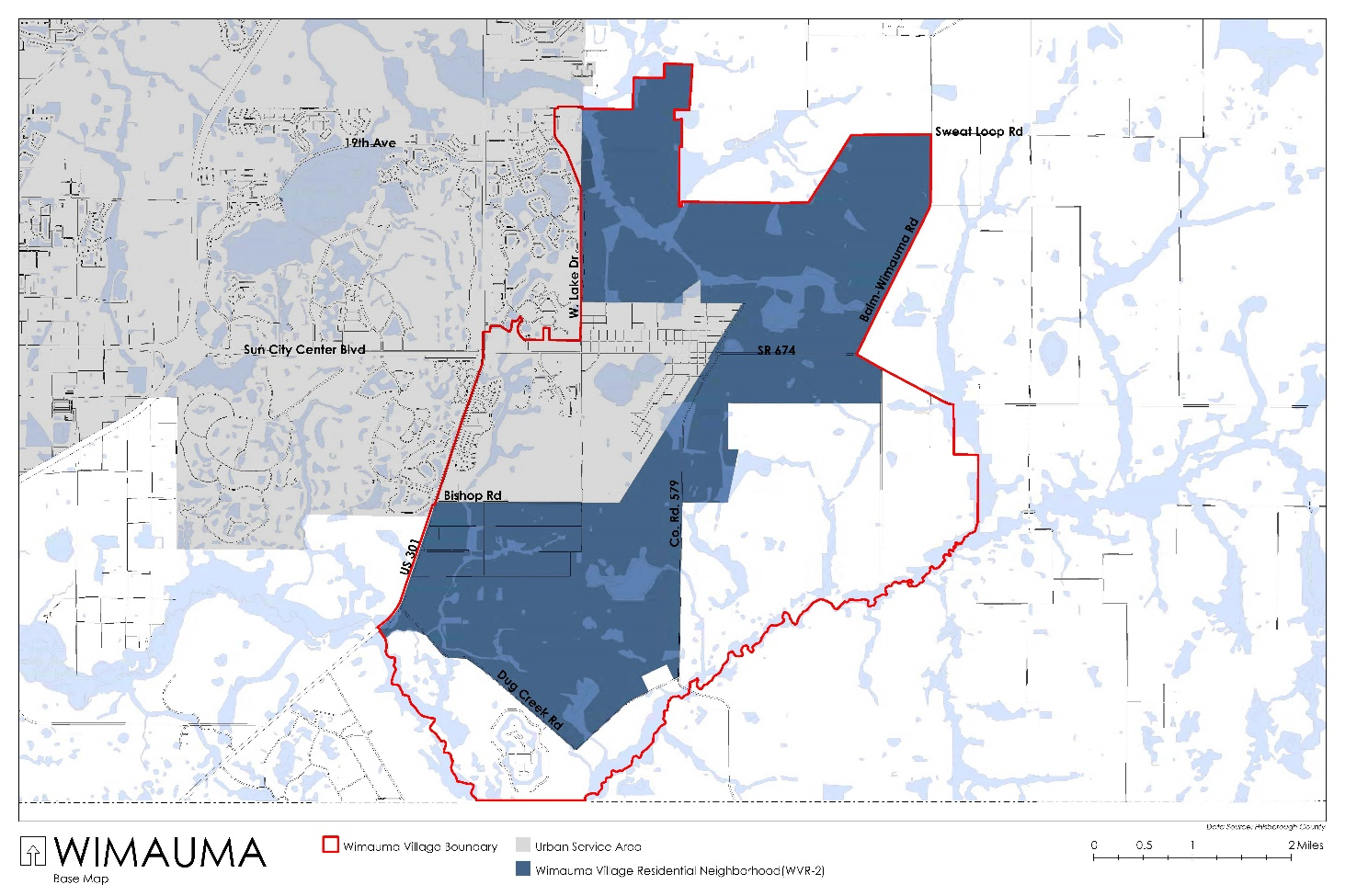
Figure 3.24.01
(Ord. No. 21-40, § 2(Exh. A), 10-14-21, eff. 10-14-21)
Sec. 3.24.03. - General Development Standards
A.
Open Space
1.
Projects shall designate at least 40% of the gross site acreage for Open Space, which is to be contiguous or internally located.
a.
A minimum of 30% of the Open Space shall be contiguous. Contiguous Open Space shall not be located within a Neighborhood Center. Contiguous is a type of open space not separated from other open space by improved areas, such as but not limited to, vehicular roadways, residential development, and stormwater ponds.
b.
A minimum of 10% of the Open Space shall be internally located in the residential areas of the Wimauma Village Neighborhood. Internal open space located in a Neighborhood Center shall not contribute to this 10% minimum. Restored or preserved native habitat and environmentally significant or sensitive land shall not contribute to this 10% minimum. Internal open space is not required to be contiguous to other internal open space areas.
2.
The minimum Open Space acreage shall not be removed from gross density calculations, except as noted when part of a Community Benefit.
3.
The rezoning site plan shall identify the locations and acreages of the contiguous and the internally located Open Space areas.
4.
Where possible, habitat corridors should be preserved through the Open Space on one project site adjacent to Open Space on another project site.
5.
Areas of the site that shall be considered contiguous or internally located Open Space shall be as follow:
•
Recreational Use, Passive, as defined by the Land Development Code. Such uses can be stand-alone or adjacent and/or around a natural lake, man-made lake or stormwater pond for public use. When such Recreational Use, Passive areas are adjacent and/or around a natural lake, man-made lake or stormwater pond, only the acreage of the of the Recreational Use, Passive use (such as a walking, hiking or bike trail for example), and not the water body, shall be included in this acreage.
•
Conservation areas, preservation areas and mitigation areas (per Comprehensive Plan policy). These shall not be considered as internal open space.
•
Community Gardens, as defined by the Land Development Code.
•
Community Gathering Places, as defined by the Land Development Code, and when not an HOA-only area. Community Gathering Places shall be improved with landscaping, walkways, and benches. Fountains, gazebos and/or similar amenities are encouraged.
•
Neighborhood Greens, defined as a common open space located at the intersection of streets and bounded by streets on all sides. Such areas are to be provide paved walks, lawns, trees, benches, and ornamental structures such as fountains.
•
Agricultural, Passive uses as defined by the Land Development Code.
•
Restored or preserved native habitat and environmentally significant or sensitive land including wetlands and forestry. These shall not be considered as internal open space.
•
ELAPP Lands: A 250-foot-wide buffer with no required screening shall be required where the Neighborhood boundary line is directly adjacent to ELAPP-acquired property or separated from ELAPP-acquired property by a roadway of 50 feet or less in right-of-way width ("shared boundary"). The intent of the buffer is to provide for compatibility between new development and ELAPP-acquired property and provide adequate space to: 1) safely conduct necessary land management activities (e.g. prescribed burns) on ELAPP-acquired property; 2) protect the adjacent Neighborhood from potential wildfire and limit smoke impacts from prescribed burns; and 3) reduce the potential for activities that would be incompatible with the appropriate maintenance of ELAPP-acquired property including, but not limited to, illegal dumping and unauthorized access from the adjacent Neighborhood. The buffer width may be reduced in certain segments based on a recommendation from the Conservation and Environmental Lands Management Department that a reduced buffer would be adequate to ensure compatibility; however, under no circumstance shall the width of the buffer at any one point be less than 100 feet from the shared boundary. Recommended deviations from the standard 250-foot-wide buffer shall be supported by ecological, safety, and other on-site factors.
6.
The following shall not count towards the Open Space minimum acreage requirement:
•
Residential yards.
•
Public or private golf courses.
•
HOA-only amenity areas (pools, clubhouse, recreation center).
•
Portions of a Stormwater Management facility not providing Recreational Use, Passive amenities as demonstrated above.
•
Portions of naturally occurring and manmade lakes not providing Recreational Use, Passive amenities as demonstrated above.
•
Private community uses; and
•
Neighborhood Greens containing Civic Lot Type buildings.
B.
Landscaping, Buffering and Screening
1.
Wimauma Village Neighborhoods shall adhere to Land Development Sections, 6.06.04, 6.06.05 and 6.06.06, unless otherwise stated.
2.
ELAPP Lands: A 250-foot-wide buffer with no required screening shall be required where the Neighborhood boundary line is directly adjacent to ELAPP-acquired property or separated from ELAPP-acquired property by a roadway of 50 feet or less in right-of-way width ("shared boundary"). The intent of the buffer is to provide for compatibility between new development and ELAPP-acquired property and provide adequate space to: 1) safely conduct necessary land management activities (e.g. prescribed burns) on ELAPP-acquired property; 2) protect the adjacent Neighborhood from potential wildfire and limit smoke impacts from prescribed burns; and 3) reduce the potential for activities that would be incompatible with the appropriate maintenance of ELAPP-acquired property including, but not limited to, illegal dumping and unauthorized access from the adjacent Neighborhood. The buffer width may be reduced in certain segments based on a recommendation from the Conservation and Environmental Lands Management Department that a reduced buffer would be adequate to ensure compatibility; however, under no circumstance shall the width of the buffer at any one point be less than 100 feet from the shared boundary. Recommended deviations from the standard 250-foot wide buffer shall be supported by ecological, safety, and other on-site factors.
3.
Buffering and Screening Between Uses:
a.
Civic Uses shall be considered a non-residential use and buffering and screening in accordance with LDC Section 6.06.06 shall be provided.
b.
Live/Work Units, Apartment House/Building, Courtyard Apartment and Rowhouse uses shall be considered a multi-family use and buffering and screening in accordance with LDC Section 6.06.06 shall be provided.
C.
Neighborhood Centers
1.
For developments of 100 acres or more, Neighborhoods shall be designed so that at least 50 percent of the housing units are within a quarter mile radius measured via straight line measurement from the perimeter of a Neighborhood Center. Multiple Neighborhood Centers may be provided within a single development. For developments under 100 acres in size, a Neighborhood Center may be provided, but is not required.
2.
The acreage of the Neighborhood Center shall be at least 1.5% of the gross acreage of the project. This acreage shall be included in density calculations. Neighborhood Center acreage above the minimum 1.5% shall not be included in density calculations.
3.
Neighborhood Centers shall be located inside of the Wimauma Village Neighborhood or along the boundary of the Wimauma Village Neighborhood.
4.
Neighborhood Centers shall include one or more of the following: parks (public and/or private, to be maintained by HOA if private) government/public service uses, public or private schools, flexible market space, community gardens, churches/synagogues, daycares, Community Residential Homes (Type B and Type C), and live/work units.
a.
Public schools shall be permitted to be located within or external to a Neighborhood Center and shall be subject to the review in accordance with the interlocal agreement between Hillsborough County and the Hillsborough County School Board. Private and charter schools shall comply with Land Development Code Sections 6.11.88 (Schools) and 6.03.13 (Private and Charter Schools Vehicle Circulation, Queuing and Parking). For a public and/or private school to be located within a Neighborhood Center and contribute to the minimum size requirement, development in the required block form shall be demonstrated to provide to create a compact, pedestrian-oriented development.
b.
Community Residential Homes (Type B or C) shall be subject to Land Development Code Section 6.11.28. If not expressly approved at the time of rezoning, such uses shall require a Special Use Permit. For a Community Residential Home (Type B or C) to contribute to the minimum Neighborhood Center size requirement, development in the required block form shall be demonstrated to provide a compact, pedestrian-oriented development.
c.
Live/Work when located within the Neighborhood Center shall comply with the following requirements:
i.
Live/Work units may be the single use of a Neighborhood Center block, or one of multiple uses in a Neighborhood Center block when located within the required Neighborhood Center acreage.
ii.
The acreage utilized for Live/Work units shall contribute to the minimum Neighborhood Center acreage requirement.
iii.
Each Live/Work unit shall also be included in density calculations. In no case shall a Live/Work unit provide more than one residential dwelling component.
iv.
Live/Work units shall be occupied by the primary operator of the Live/Work unit's non-residential use.
v.
If a one-story unit is used, permitted non-residential uses shall occur within at least 50% of the overall unit's square footage. The residential use shall occupy the remainder of the unit.
vi.
If a two-story unit is used, permitted non-residential uses shall occur within the entirety of the first floor of the unit. The residential use shall occur within the entirety of the second floor of the unit.
vii.
If a three-story unit is used, permitted non-residential uses shall occur within the entirety of the first floor only. The second and third floors may be utilized for residential use.
viii.
The Live/Work Lot Type per Table 3.24.01 shall be utilized, unless otherwise stated. When located in a Neighborhood Center, no additional setback due to height is required.
ix.
For the purposes of buffering and screening, the live/work unit shall be considered a multi-family use.
x.
Resident parking shall be provided as provided in these regulations.
xi.
Notwithstanding Land Development Code Section 6.05.02.E., customer/employee parking shall be provided at a parking standard of 1.5 spaces per each Live/Work unit. For the purposes of this regulation, employee parking is to accommodate employees of the Live/Work unit's non-residential use who are not the primary operators and who do not live within the Live/Work unit.
a)
The use of compact parking shall be limited to a maximum of 20% of the total required customer/employee parking.
b)
Customer/Employee disabled parking shall be provided in accordance with Land Development Code Section 6.05.02.J. (Disabled Parking).
xii.
Should surface parking be utilized for some or all resident parking and for some or all customer/employee parking, each space shall be delineated with markings to designated individual parking spaces for residents and for customers/employees. All surface parking shall be located to the rear or side of the Live/Work units.
xiii.
Alternatively, on-street parking to accommodate some or all customer/employee parking may be provided and shall be located directly in front of the live/work units. Such spaces shall be designated for Live/Work customer parking only.
d.
Daycare uses shall comply with Land Development Code Section 6.11.24 (Child Care Center).
5.
Neighborhood Center Parking
Parking in Neighborhood Centers shall be located to side and/or rear of the primary building. With the exception of on-street parking, no parking in front of the building shall be permitted.
D.
Live/Work Units Located Within a Quarter Mile of a Neighborhood Center
Live/Work when located within a quarter mile of a Neighborhood Center shall comply with the following requirements:
1.
Live/Work units may be the single use of a Residential block or located within the same block of as Civic Use Lot, Apartment House Lots, Courtyard House Lots and/or Rowhouse Lots. Live/Work units may not be located within the same block as a Cottage House Lot, Sideyard House Lot, Standard House Lot.
2.
The acreage utilized for Live/Work units shall not contribute to the minimum Neighborhood Center acreage requirement.
3.
Each Live/Work unit shall be included in density calculations. In no case shall a Live/Work unit provide more than one residential dwelling component.
4.
Live/Work units shall be occupied by the primary operator of the Live/Work unit's non-residential use.
5.
If a one-story unit is used, permitted non-residential uses shall occur within at least 50% of the overall unit's square footage. The residential use shall occupy the remainder of the unit.
6.
If a two-story unit is used, permitted non-residential uses shall occur within the entirety of the first floor of the unit. The residential use shall occur within the entirety of the second floor of the unit.
7.
If a three-story unit is used, permitted non-residential uses shall occur within the entirety of the first floor only. The second and third floors may be utilized for residential use.
8.
The Live/Work Lot Type per Table 3.24.01 shall be utilized.
9.
Resident parking shall be provided as provided in these regulations.
10.
Notwithstanding Land Development Code Section 6.05.02.E., customer/employee parking shall be provided at a parking standard of 1.5 spaces per each Live/Work unit. For the purposes of this regulation, employee parking is to accommodate employees of the Live/Work unit's non-residential use who are not the primary operators and who do not live within the Live/Work unit.
a.
The use of compact parking shall be limited to a maximum of 20% of the total required customer/employee parking.
b.
Customer/Employee disabled parking shall be provided in accordance with Land Development Code Section 6.05.02.J. (Disabled Parking).
11.
Should surface parking be utilized for some or all resident parking and for some or all customer/employee parking, each space shall be delineated with markings to designated individual parking spaces for residents and for customers/employees. All surface parking shall be located to the rear or side of the Live/Work units.
12.
Alternatively, on-street parking to accommodate some or all customer/employee parking may be provided and shall be located directly in front of the live/work units. Such spaces shall be designated for Live/Work customer parking only.
E.
Projects shall provide Community Benefits as provided in Section 3.24.10.
1.
Should a project previously approved for more than 1 unit per 5 acres located within the Wimauma Village Residential Neighborhood Area that has received a Construction Plan prior to approval of this Section as of October 14, 2021, be enlarged by density or acreage, the additional density or acreage of the area being added shall determine the number of community benefits to be provided.
2.
Should a project previously approved for more than 1 unit per 5 acres located within the Wimauma Village Residential Neighborhood Area that has not received Construction Plan approval as of October 14, 2021, be enlarged via adding acreage through a new planned development, the acreage of the entire area shall determine the number of community benefits to be provided.
(Ord. No. 21-40, § 2(Exh. A), 10-14-21, eff. 10-14-21)
Sec. 3.24.04. - Wimauma Village Neighborhood Blocks
A.
All development within the Wimauma Village Neighborhood shall be developed in a block pattern. Contiguous open space areas are precluded.
1.
The Wimauma Village Neighborhood, which includes the Neighborhood Center, shall be developed in a block pattern. The following criteria shall be met:
a.
Each Neighborhood Center block shall have a maximum block perimeter of 2,400 feet.
b.
Each Residential block shall have a maximum block perimeter of 1,240 feet.
2.
All lands designated as the Neighborhood Center(s) shall be located within a block.
3.
Block faces shall be formed by a roadway, Pedestrian Thoroughfare and/or Multi-Use Trail. For the purposes of these regulations, Pedestrian Thoroughfare shall be a minimum of 25 feet in width and consist of a minimum 8-foot wide publicly accessible sidewalk.
4.
At least one block face shall be formed by a roadway.
5.
When a Pedestrian Thoroughfare is constructed, landscaped areas shall be provided on both sides of the sidewalk. The surface of the sidewalk shall consist of pavers or other similar materials. Amenities such as benches, planters, and/or ornamental or shade trees shall be provided within the Pedestrian Thoroughfares.
a.
Use of a Pedestrian Thoroughfare as a block face shall be subject to staff review and approval at the time of plat/site/construction plan review. Staff review shall be based on land use context, abutting property ownership, anticipated traffic volumes, and other vehicular and pedestrian safety considerations.
b.
Adjustments to these requirements (due to environmental features, existing roadways, utilities, existing easements, etc.) and/or to propose a modified form that meets or exceeds the intent of these regulations can be requested and will be evaluated at the time of initial rezoning or subsequent zoning modification.
6.
All uses constructed within the Neighborhood Center must be located within a fully constructed and compliant block.
7.
All transportation facilities providing connectivity or constituting a required block face shall be maintained by a public or otherwise located within a public access easement; and
8.
Notwithstanding anything in the Code to the contrary, vehicular access shall only be permitted where consistent with Section 6.04.07 and 6.04.03.I. unless otherwise approved through the 6.04.02.B. administrative variance process.
(Ord. No. 21-40, § 2(Exh. A), 10-14-21, eff. 10-14-21)
Sec. 3.24.05. - Mobility and Street Network
A.
Connectivity
1.
Neighborhoods are to be connected externally and interconnected internally to provide connections between residential, open space and Neighborhood Center uses. The following shall apply:
a.
Where a Neighborhood Center abuts an external project boundary, the PD site plan shall identify locations where future connectivity (i.e. stubouts), as established by the block patterns, is anticipated to be extended into and continued by adjacent properties that are undeveloped or otherwise will redevelop, except where otherwise precluded by environmentally sensitive areas that cannot otherwise be mitigated. Alternatively, an approved PD shall provide sufficient flexibility on the PD site plan and within the zoning conditions to allow for future connection into the facilities by others within a designated area corresponding the potential location of future required access, without further modification to the PD or consultation of the underlying landowner. Such connections shall be subject to compliance with Section 6.04 of the LDC.
b.
The Neighborhoods shall include through roadways at least every 1,320 feet. Where possible, through roads should be planned to run adjacent to Neighborhood Centers.
2.
Gates and Emergency Access.
a.
Vehicular, pedestrian and Multi-Use Trail Access into and through the Neighborhood shall not be restricted by gates or other security measures, that would inhibit vehicular or pedestrian connectivity and accessibility by the general public, including guardhouses and gatehouses. This regulation does not prohibit entry features for Neighborhoods if they do not restrict vehicular or pedestrian access by the general public, nor shall it be construed to require the County to accept entry features within County owned rights-of-way.
b.
Gates shall only be permitted where necessary for required emergency access facilities and shall meet the requirements of Section 6.02.01.H. and/or Section 6.03.01.D., as applicable.
B.
Other Transportation Requirements
Roads internal to the site shall meet Hillsborough County Transportation Technical Manual (TTM) standards to the greatest extent possible.
1.
Roadway facilities providing access to new development are required to bring substandard roadways up to County standards pursuant to Section 5.04.04 of this Code.
2.
Public and private road rights-of-way may contain preserved or planted vegetation, including trees, provided that the preserved or planted vegetation is in accordance with the landscaping standards of the Transportation Technical Manual and Development Review Procedures Manual.
a.
Alleys. Notwithstanding anything in the LDC to the contrary, Alleys when utilized may be publicly maintained or, if private, shall be publicly accessible. Additionally:
i.
Alley rights-of-way shall be a minimum of 20 feet in width for one-way alleys and a minimum of 26 feet in width for two-way alleyways; Both ends of an Alley shall connect with a roadway if the alley accommodates only one-way traffic or the alley accommodate two-way traffic but is longer than 150 feet;
ii.
Alleys shall only provide a secondary means of access to abutting residential property and is not intended for general vehicular traffic circulation (i.e. each use accessed via an alleyway must have primary frontage onto a roadway or Pedestrian Thoroughfare); and
iii.
Use of Alleys for commercial traffic may be considered through the waiver process at the time of initial zoning or subsequent zoning modification.
(Ord. No. 21-40, § 2(Exh. A), 10-14-21, eff. 10-14-21)
Sec. 3.24.06. - Substandard Roadways
A.
Terminology
For purposes of this section, the term "Transportation Technical Manual" (TTM) shall mean the latest edition of the Hillsborough County Transportation Technical Manual for Subdivision and Site Development Projects.
B.
General Requirement
1.
Developments with vehicular access to an existing substandard public or private roadway may be required to make improvements to the public and private roadway network.
2.
For the purposes of this section, a public or private roadway shall be considered substandard if one or more of the following Essential Elements are not met:
a.
Lane Widths, i.e. width of the travel lane and any auxiliary lanes serving the site shall be in accordance with the minimum TTM width requirements;
b.
Presence of Curb, i.e. whether an urban roadway section has the required curbing per the TTM;
c.
Presence of Stabilized Shoulders, i.e. whether a rural roadway section has the minimum required shoulders per the TTM;
d.
Elements of Roadside Safety, i.e. whether clear zone and/or clear recovery standards are met or otherwise mitigated;
e.
Presence of Bicycle Facilities, i.e. whether a rural roadway section has the minimum width for bicycle facilities (5-foot wide paved shoulders), or whether an urban roadway section has the minimum width for bicycle lanes (7-foot wide buffered bicycle lanes), as required per the TTM. Multi-purpose trails may be considered to satisfy this minimum Essential Element. Two-way cycle tracks (separated from the travel lanes via raised curbing) may be considered through the Design Exception process.
f.
Ability to Accommodate Sidewalk Facilities, i.e. whether a roadway has the ability to accommodate pedestrian facilities (e.g. a sidewalk or multi-purpose pathway) within the roadway corridor, in minimum widths consistent with required TTM standards. Multi-purpose trails may be considered to satisfy this minimum Essential Element.
3.
For the purposes of this section, a public or private roadway shall not be considered substandard if the roadway complies with the Essential Elements listed above, but does not comply with a Non-Essential Element of the Typical Section. Examples of non-essential elements include, but are not limited to, width of the right-of-way, ditch slopes, width of existing sidewalk facilities, type of bicycle facilities (i.e. traditional bicycle lane vs. buffered bicycle lane), type of curb, etc.
C.
Scope of Required Improvements
1.
Where a development constructs a vehicular access to a substandard public or private roadway, the developer may be required to improve the public and private roadway network, such that a path of travel exists between each project driveway and a public roadway complying with all Essential Elements. Generally, this shall mean that the public and private roadway network will be improved between each driveway and the nearest roadway meeting minimum Essential Element standards; however, nothing herein shall be construed to prevent a developer from improving a longer stretch of roadway if they prefer to do so.
2.
Gated or otherwise restricted vehicular connections providing access solely for emergency vehicles shall not trigger the substandard roadway requirement.
3.
Where improvements are required, the developer shall improve the roadway to current County standards for the applicable Typical Section, as found within the TTM or otherwise required herein, unless otherwise approved in accordance with the Section 6.04.02.B. Administrative Variance process or TTM Design Exception process as outlined in the TTM.
4.
Where sufficient right-of-way exists to allow a developer to improve the substandard public or private roadway network, the developer shall comply with all Essential Elements listed within Section 3.24.06.B, above. Additionally, the following Additional Element shall apply:
Location of Required Sidewalk Facilities, i.e. when a sidewalk is required consistent with Section 6.02.08 or 6.03.02 of this Code, such sidewalk shall be physically located in accordance with the applicable TTM Typical Section, to the greatest extent possible.
5.
Where insufficient right-of-way exists or there are additional constraints (e.g. lack of stormwater facilities to accommodate required drainage), Section 6.04.02.B. Administrative Variances or TTM Design Exceptions may be considered provided:
a.
The Administrative Variance and Design Exception are processed concurrently with a Planned Development zoning application or Planned Development zoning modification; and
b.
Where insufficient right-of-way exists along a project's public or private roadway frontages, the developer shall provide sufficient right-of-way along such frontage(s) where necessary.
c.
For the purposes of this section, nothing herein shall be construed as requiring a developer to construct sidewalk improvements not otherwise required pursuant to Sections 6.02.08 or 6.03.02 of this Code. However, to the extent that the developer proffers construction of additional pedestrian facilities, such facilities shall be located consistent with the applicable Typical Section, except as otherwise described herein.
d.
The County Engineer shall be authorized to grant TTM Design Exceptions to existing and proposed roadways at the time of plat/site/construction plan review for a development, provided such Design Exception only authorizes a deviation to a Non-Essential Element.
e.
Notwithstanding the above, a sidewalk shall not be considered substandard or non-compliant if an existing or future sidewalk facility does not comply with locational requirements, provided such deviation is the minimum necessary to avoid a utility pole, landscape feature, or other obstruction within the right-of-way.
D.
Exceptions
1.
Notwithstanding anything herein to the contrary, Section 6.04.02.B. Administrative Variances and TTM Design Exceptions causing non-compliance with an Essential Element may be considered (regardless of whether there is sufficient right-of-way) where:
a.
The County Engineer makes an explicit finding that such Administrative Variance or Design Exception is necessary to protect or otherwise furthers the public health, safety and welfare and the BOCC makes an explicit finding that such Administrative Variance or Design Exception meets Vision Zero goals or is otherwise appropriate;
b.
A multi-purpose trail is proposed in lieu of required sidewalks and bicycle facilities; or
c.
A Design Exception is necessary to transition the design of an existing roadway corridor.
E.
Timing of Required Improvements
A substandard roadway shall be improved prior to or concurrent with the phase of development which takes access to the substandard roadway.
(Ord. No. 21-40, § 2(Exh. A), 10-14-21, eff. 10-14-21)
Sec. 3.24.07. - Permitted Lot and Building Form Types in the Wimauma Village Neighborhood
A.
Permitted Lot Types in the Wimauma Village Neighborhood Include:
Apartment House Lot
Courtyard Apartment Lot
Rowhouse or Town House Lot (to contain at least 3 attached units)
Cottage House Lot
Sideyard House Lot
Standard House Lot
Civic Building Lot
Live/Work Lot
B.
Lot Type minimums shall be provided in compliance with the following:
1.
Wimauma Village Neighborhoods of 100 acres or greater in size shall provide at least six (6) different Lot Types.
a.
A Civic Lot Type may be counted as one of the six different Lot Types.
b.
A Standard House Lot may be counted as two different Lot Types, which shall account for a maximum of 50% of the total proposed units. To allow a Standard House Lot Type to be counted for two of the six different Lot Types, the two Standard Lot Types shall vary at least 20% from each other in lot size and width.
c.
For all other Lot Types, multiple lot sizes, widths, or development standards proposals of the same Lot Type shall only count as one of the six required Lot Types, unless otherwise stated.
2.
Wimauma Village Neighborhoods of less than 100 acres, shall provide at least four (4) different Lot Types.
a.
A Civic Lot Type may be counted as one of the four different Lot Types.
b.
For all Lot and Building Form types, multiple lot sizes, widths, or development standards proposals of the same Lot and Building Form type shall only count as one of the four required Lot and Building Form types, unless otherwise stated.
3.
Each Lot Type must be provided at a minimum of 10 percent and a maximum of 40 percent, unless otherwise specified. These percentages do not apply to Civic Building Lots.
4.
Notwithstanding the above, for Live/Work Lot Types to be counted as one of the six or four Lot Types, despite its location within the Neighborhood Center or within a ¼ mile of the Neighborhood Center, the Live/Work Lot Type shall account for at least 2 percent of the total number of proposed lots, or four units, whichever is greater.
C.
The location of each Lot Type shall be provided on the general rezoning site plan.
D.
Differing Lot Types should to the greatest extent practicable be placed back-to-back on a single block to provide harmonious transitions between Lot Types. Lot Types should be selected to provide buildings of like scale and massing on opposite sides of the streets.
E.
Community Residential Homes (Type B and C)
1.
These uses shall utilize the Apartment House or Courtyard Apartment Lot Types.
2.
These uses shall comply with all other standards applicable to an Apartment House or Courtyard Apartment Lot Type use (such as, but limited to, parking location, buffering and screening, and height/setback provisions).
F.
Civic Uses
1.
Civic Uses shall include Government/Public Service facilities, public or private schools, daycare, churches/synagogues and Flexible Market Space. Civic Use may be located within a Neighborhood Green which is not included in the Open Space minimum acreage.
2.
Civic use locations shall be identified on the general rezoning site plan.
3.
When located within a Neighborhood Center, Civic uses shall be developed in accordance with the Neighborhood Center Block perimeter maximum. When located outside of a Neighborhood Center, Civic uses shall be developed in accordance with the Residential block perimeter maximum.
4.
Civic Use buildings shall face an improved street right-of-way or Cross County Greenway Trail-Wimauma as defined in the Wimauma Community Plan in the Livable Communities Element of the Future of Hillsborough Comprehensive Plan.
5.
Should permitted Civic Use building be located in a Neighborhood Green, building placement shall be as illustrated below.
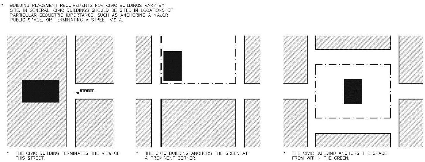
Illustrative Graphic Only
(Ord. No. 21-40, § 2(Exh. A), 10-14-21, eff. 10-14-21)
Sec. 3.24.08. - Development Standards for Permitted Lot and Building Form Types
1. Corner lots must meet front yard requirements on both streets.
2. Sideyard houses permit a zero foot setback on one side of the lot only. A zero foot sideyard setback shall not be adjacent to another sideyard setback of 0 feet. A minimum 10 foot setback on the other side shall be provided.
3. Rowhouses shall contain at least 3 attached lots.
4. Lot types permitting a 0-foot rear and/or side yard setback shall not preclude compliance with Land Development Code Section 6.06.06 (Buffering/Screening) if required. Should there be a conflict between Table 3.24.01 and Land Development Code Section 6.06.06, Land Development Code Section 6.06.06 shall prevail.
5. The building's primary orientation shall be toward the street rather than the parking areas. The primary pedestrian building entrances shall be visible and directly accessible from a street.
6. Live/Work Lot Types are permitted only in a Neighborhood Center or within a ¼ mile of a Neighborhood Center.
7. Cottage House Lot Types shall require a porch along a minimum of 70% of the façade. The porch shall contribute to the minimum/maximum building frontage percentage calculation.
8. An additional setback of 2 feet for every 1 foot over 20 feet in height shall be provided to the required rear and side setbacks/buffers when adjacent to a cottage house lot, sideyard house lot, or standard house lot. This additional setback requirement shall not be required when adjacent to civic lots, live/work lots, apartment house lots, courtyard lots and rowhouse lots.
9. Any attached garage shall contribute to the Building Frontage requirements.
10. Minimum and/or maximum front and rear setbacks for the residence and/or garage may be required depending on the lot's access. See below (Garages and Parking).
11. The rear yard setback for an attached or detached garage may differ from this table.
A.
Garages and Parking
1.
Attached garages shall contribute to the minimum/maximum building frontage percentage. Cottage and Standard Lot Types with lot sizes at or greater than 5,000 square feet and at or greater than 50 feet in width may be accessed from the front or rear utilizing attached or detached garages.
a.
Notwithstanding Table 3.24.01, when using front access with an attached garage, the minimum setback for the garage shall be at least 20 feet and the remaining portion of the façade shall be setback no less than 15 feet from the front property line.
b.
Notwithstanding Table 3.24.01, when using front access with a detached garage, the detached garage shall be located completely behind the home in accordance with Accessory Structure setbacks and the residential structure shall not be setback less than 15 feet from the front property line.
c.
Notwithstanding Table 3.24.01, when using rear access with an attached or detached garage, the rear yard setback shall be determined at the time of rezoning to ensure pedestrian safety relative to the rear lot boundary (Alley or public street).
2.
Sideyard Lot Types (despite the size or width), and Cottage and Standard Lot Types Lots sizes less than 5,000 square feet in size and having a lot width of less than 50 feet shall utilize rear access only.
a.
Notwithstanding Table 3.24.01, when using rear access with an attached or detached garage, the rear yard setback shall be determined at the time of rezoning to ensure pedestrian safety relative to the rear lot boundary (Alley or public street).
3.
Residential parking for Live/Work units, if not provided in part or completely by surface parking or on-street parking, shall utilize attached rear loading garages accessed via an Alley, or detached garages (located in accordance with Accessory Structure setbacks) accessed via an Alley. Notwithstanding the proposed width for a Lot/Work Lot, front loaded attached or front loading detached garages shall not be permitted. Notwithstanding Table 3.24.01, when using rear access with an attached or detached garage, the rear yard setback shall be determined at the time of rezoning to ensure pedestrian safety relative to the rear lot boundary (Alley or public street).
4.
Rowhouse Lots shall provide parking as follows:
a.
Attached, rear loading garages shall be accessed via an Alley located behind the unit, or via a driveway located to the side of the rowhouse units. Notwithstanding Table 3.24.01, the rear yard setback shall be determined at the time of rezoning to ensure pedestrian safety relative to the rear lot boundary (Alley or public street).
b.
Detached rear loading garages (located in accordance with Accessory Structure setbacks) shall be accessed via an Alley located behind the unit, or a driveway located to the side of the rowhouse units. Notwithstanding Table 3.24.01, the rear yard setback of the detached garage shall be determined at the time of rezoning to ensure pedestrian safety relative to the rear lot boundary (Alley or public street).
c.
Surface parking lots for rowhouse units shall be located behind or to the side of the rowhouse units.
5.
Off-street parking for Apartment House Lots shall be located behind or to the side of the main structures.
6.
Off-street parking for Courtyard Apartment Lots shall be located behind or to the side of the main structures located furthest from the street.
7.
Off-street parking for Civic Use Lots shall be located behind or to the side of the main structures.
8.
The use of carports for any lot size and lot width shall not be permitted.
B.
Accessory Structures
Accessory Structures shall comply with the following:
1.
All accessory structures shall be placed completely behind the residential home and placed no closer than 3 feet to any side or rear property line, unless otherwise stated.
2.
All accessory structures shall be limited in height to a maximum of 15 feet in height/2 stories.
3.
Accessory structures utilized for vehicle storage and front access shall be placed completely behind the residential home and placed no closer than 3 feet to any side or rear property line. Should at any time the Accessory Structure be requested, at the time zoning or zoning modification, to not be located completely behind the home, the detached garage shall be placed no closer than 20 feet from the front yard and the residential structure shall not be setback less than 15 feet from the front property line.
4.
Accessory structures utilized for vehicle storage and rear access shall be placed no closer than 3 feet from the side property line. The rear yard setback shall be determined at the time of rezoning to ensure pedestrian safety relative to the rear lot boundary (Alley or public street).
C.
Accessory Dwelling Units
1.
Despite the size of the parcel, accessory dwellings on Rowhouse, Cottage, Sideyard and Standard House Lot Types are permitted.
2.
The living area square footage for the accessory dwelling, when compared to the living area square footage of the primary structure, shall be 50% or less in comparison.
3.
Notwithstanding a two- or three-story primary home, accessory dwellings shall be permitted to be located above an accessory structure.
4.
When an accessory dwelling is a stand-alone structure, the above-accessory structure setbacks shall be provided.
5.
When an accessory dwelling serves as the second floor of an accessory structure providing front access for the parcel, the building as whole shall meet the accessory structure requirements noted above.
6.
When an accessory dwelling serves as the second floor of an accessory structure providing rear access for the parcel, the rear yard setbacks shall be determined at the time of rezoning to ensure pedestrian safety relative to the lot boundary (Alley or street).
7.
The primary home shall be owner-occupied.
8.
Accessory dwellings are not permitted on Live/Work, Apartment House or Courtyard House Lot Types.
(Ord. No. 21-40, § 2(Exh. A), 10-14-21, eff. 10-14-21)
Sec. 3.24.09. - Community Benefits Requirements
Community benefits and services shall support the needs of the community within the WVR-2 and the Wimauma Community Plan area consistent with the Comprehensive Plan and Section 3.24.04 of this Part.
A.
To encourage public benefits, projects may receive a density increase above 1 unit per 5 gross acres (unless otherwise specified by existing zoning) up to a total of 2 units per gross acre.
B.
New development shall include community benefit requirements to provide services to residents, which can be supported on-site or off-site per Table 3.24.03.
C.
Community Benefits that demonstrate meeting the requirements in the Community Benefits Table twice or by 100% or more may count the benefit two times, as approved by the Board of County Commissioners.
D.
Selected Community Benefit Options must be identified on the general Site Plan at the time of rezoning.
Table 3.24.03
* The community benefit shall require that at least 50% of required on-site or off-site square footage shall receive a Certificate of Occupancy prior to the final plat approval of more than 75% of the residential units. 100% of the required on-site or off-site square footage shall receive a Certificate of Occupancy prior to the final plat approval of more than 90% of the residential units.
** Compliance with these community benefits shall be demonstrated on the general site plan of the rezoning application.
*** These community benefits shall require written agreement/acceptance by the receiving entity of the dedicated land to provide assurances at the time of rezoning the benefit will be provided. Additionally, documentation of the conveyance of that land to the receiving entity is required prior to final plat approval.
**** Benefit may be used more than once if offering multiple benefits satisfying or furthering multiple Community goals.
(Ord. No. 21-40, § 2(Exh. A), 10-14-21, eff. 10-14-21)
Sec. 3.24.10. - Transfer of Development Rights (TDRs)
A.
Allow for the transfer of up to two dwelling units per gross acre (DU/GA) densities between any two separately owned or commonly held properties, whether or not they are contiguous to each other, subject to certain restrictions as outlined below.
1.
A designated sending area shall be the limits of the Wimauma Village Residential-2 Future Land Use (FLU) category (Rural Service Area).
2.
The designated receiving areas shall be:
a.
Areas within the WVR-2 FLU category (Rural Service Area) and not within Wimauma Village Downtown Overlay.
b.
Areas within the Wimauma Downtown TDR Receiving Zone of the Wimauma Village Downtown Overlay, or other identified areas within the Urban Service Area as identified in the Comprehensive Plan and other sections.
3.
TDRs shall occur at the following rates:
a.
Properties within the WVR-2 FLU category may transfer density to properties within the WVR-2 FLU category (Rural Service Area) and not located within the Wimauma Village Downtown Overlay at a 1:1 ratio, not to exceed 4 DU/GA on the receiving parcel. These TDRs are a no net density increase to the rural service area and are transferred at a density of one to one, from and to WVR-2 properties.
b.
Properties within the WVR-2 FLU category may transfer density to properties within the Wimauma Downtown TDR Receiving Zone of the Wimauma Village Downtown Overlay, or other identified areas within the USA as identified in the Comprehensive Plan, at a ratio of 1:2 (2 DU/GA to 4 DU/GA).
c.
No property shall be left with less development rights than there are existing dwellings on said properties, nor less than 1 dwelling unit development for any parcel which would otherwise be eligible for to construct a dwelling unit. This shall not apply to parcels which are wholly covered by an irrevocable conservation easement or deed restriction approved by Hillsborough County in accordance with section B, below.
B.
TDR tracking shall be in the form of a conservation easement consistent with Section 704.06, Florida Statutes, to be granted by the owner of the sending parcel and accepted by the Board of County Commissioners and recorded in the official public records prior to preliminary plat approval for the receiving area.
C.
To support the Wimauma Main Street Core and economic development, stacking of TDR and Affordable Housing Density Bonuses will be allowed and encouraged in the Wimauma Downtown Receiving Zone. Stacking of TDR shall not be permitted in WVR-2 to WVR-2 transfers.
Stacking Calculation Example:
1 acre parcel with a Future Land Use of Residential-6, within the Wimauma TDR receiving zone, with no wetlands may be considered for up to 6 dwelling units. Applying for an Affordable Housing Density Bonus will increase the Residential 6 to the next highest category (Residential 9). The TDR receiving parcel may now be considered for as many as 9 dwelling units. The TDR sending parcel with a Future Land Use of WVR-2 may transfer density at a ratio of 2 DU/GA to 4 DUGA. The receiving of dwelling units shall not exceed 4 DU/GA within the Wimauma TDR receiving zone. Therefore, the total number of dwelling units that may be considered on a 1 acre parcel as described above is 9 + 4 = 13 dwelling units. Alternatively, the same parcel in this example may be considered for 10 dwelling units if not utilizing the AHDB. Any density considered above the Future Land Use Category shall be by a Planned Development.
(Ord. No. 21-40, § 2(Exh. A), 10-14-21, eff. 10-14-21)
Sec. 3.25.01.- Purpose and Intent
The purpose of this Part is to provide for the Lithia/Southeast County Overlay District and building design standards. The intent of this overlay district is to preserve the rural character and to improve the appearance of new and existing non-residential development within Lithia. The area subject to this overlay is located from the southeastern boundary of the Fishhawk community running east to the Polk County line, then south to the Manatee County line encompassing the areas of Lithia, Fort Lonesome, east CR 672, east SR 674, the Alafia River State Recreation Area, and the C.W. Bill Young Reservoir as depicted on the map below (the LSC Overlay District). The LSC Overlay District establishes standards for the design of certain non-residential uses.
Figure 1: Lithia/Southeast County Area Map
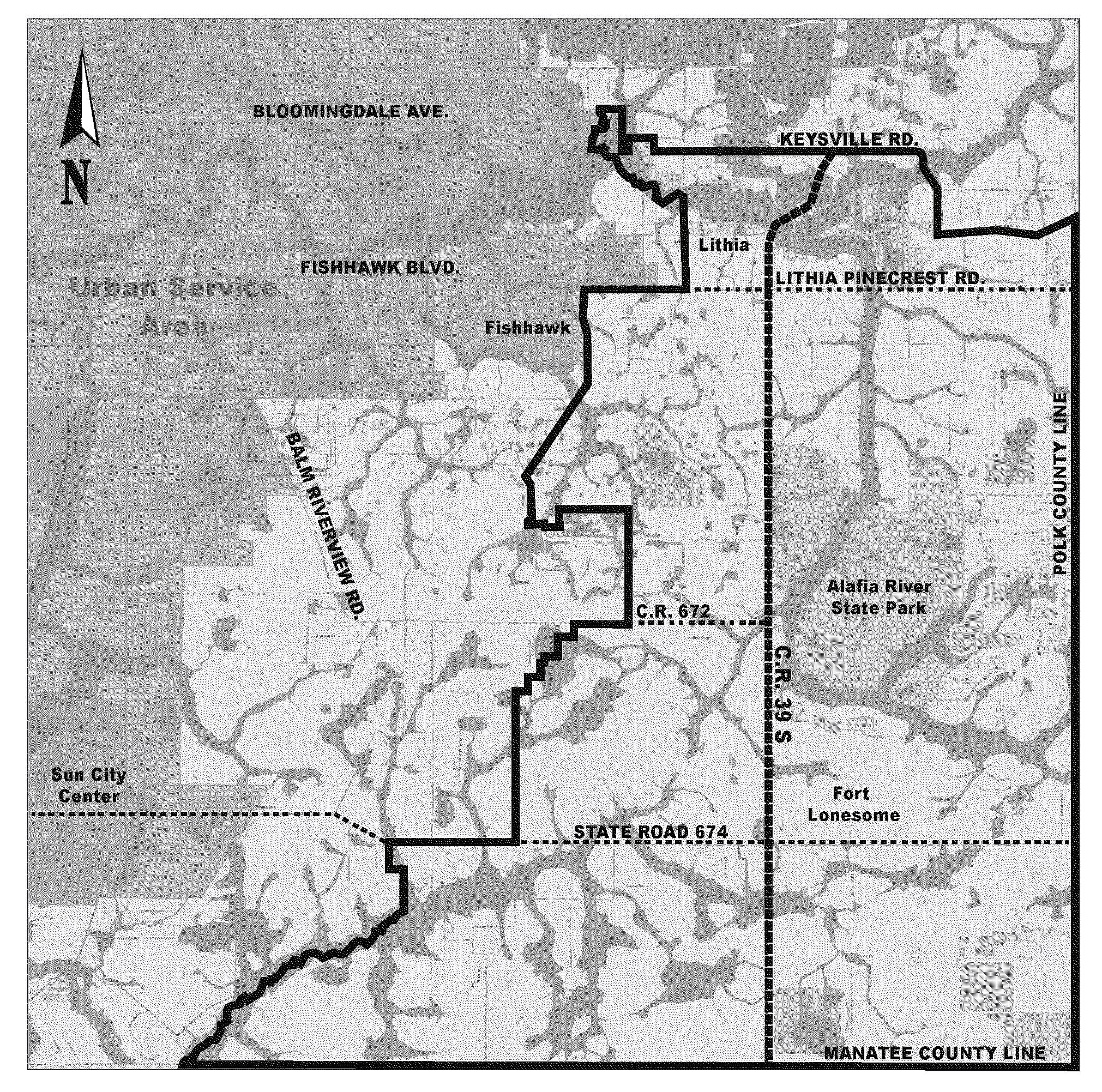
In order to preserve the rural character and heritage of this area, and to improve the appearance of new non-residential development within this overlay, architectural styles are being provided to be utilized in the design of new pro jects. Nothing in this Part, however, shall be construed to impose building floor plan design restrictions, but rather provide flexibility to use a variety of building design styles. Different styles including Florida Cracker, Greek Revival and Italianate are identified within this Part. The Neoclassical style would allow any combination of architectural features from all other styles resulting in a variety of housing and building designs.
(Ord. No. 22-13, § 2(Exh. A), 6-9-22, eff. 6-15-22)
Sec. 3.25.02. - Applicability
Except as provided herein, this Part shall apply to development of new non-residential development within the LSC Overlay District.
1.
These standards do not apply to agricultural uses, public schools, churches/synagogues, phosphate mining uses except for permanent office buildings, projects with unexpired building permits, unexpired preliminary site development approval, or unexpired construction plan approval at the time the effective date of this Part. Legal nonconformities and existing lawful uses, lots, structures, characteristics of land and densities shall not be required to be removed or otherwise modified as a result of the standards or requirements set forth in this Part.
2.
New planned development zoning districts and modifications to existing planned development districts for non-residential uses shall be subject to the requirements of this Part.
3.
When an existing building to which this Part applies is improved and/or expanded and the value of such work, including interior renovations, exceeds 50 percent of the assessed value of the building, or the value of the improvements and/or expansions to such building in combination with the value of other such work performed within the previous 24 months, but not before the effective date of this Part, exceeds 50 percent of the assessed value of the building, the requirements of this Part shall apply, with the exception of the parking location requirements found in Section 3.25.06.
The value of improvements to water and wastewater facilities and/or the repair or like-kind replacement of roofs shall not be included from valuation of any work performed.
Improvements and/or expansions that do not meet the 50 percent threshold of this Section shall not be subject to the requirements of this Part.
(Ord. No. 22-13, § 2(Exh. A), 6-9-22, eff. 6-15-22)
Sec. 3.25.03. - General Development Standards
Except as otherwise provided by this Part, development shall conform to the area, height, bulk and placement standards of the underlying zoning district of the development parcel and all other requirements of this Code.
(Ord. No. 22-13, § 2(Exh. A), 6-9-22, eff. 6-15-22)
Sec. 3.25.04. - Fences, Landscaping, Buffering, and Natural Resources Standards
1.
Fences
a.
Solid fences, more than 60 percent opaque, between two properties is not permitted unless no part of fence is placed closer to the front property line than the face of the principal structure. Fences placed closer to the front property line than the face of the principal structure shall not be more than 60 percent opaque above the height of four feet. Landscaping may be used to provide screening between properties.
b.
Chain link fencing is prohibited unless all of the fencing links are coated with a material, such as vinyl. Bare metal chain link fencing is prohibited.
2.
Landscaping, buffering and screening
a.
Resource-efficient Florida native plant species suited to Hillsborough County's hardiness zones shall be required for landscaping, excluding turfgrass. These resource efficient plants must be selected from Florida's Best Native Landscape Plants: 200 Readily Available Species for Homeowners and Professionals, ISBN 0-8130-2644-X, for USDA Hardiness zones 9a and 9b, or as approved by the administrator. The retention of any such resource-efficient Florida native plant species present on the site is encouraged and may be recognized as part of meeting applicable landscaping requirements.
b.
Hillsborough County Extension office may offer consultation on Florida Friendly landscaping program and plant selection.
c.
Except as otherwise required by this Part, buffering and screening shall be provided in accordance with Section 6.06.06.
d.
In landscaped areas, tree plantings shall be staggered and clustered in natural arrangements rather than in long, straight formal arrangements.
e.
Parcels located along roads designated as Scenic Roadways shall be subject to the Land Development Code Section 6.06.03.I.
3.
Natural Resources
a.
A 150-foot buffer shall be provided around water bodies designated as Outstanding Florida Waters by the Florida Department of Environmental Protection.
b.
Required stormwater and open space areas shall be located within or adjacent to buffers to the greatest extent possible to enhance the buffer's capacity to serve as a visual separation and promote scenic natural views. It is recognized that the placement of required stormwater facilities is dependent upon the physical characteristics of the site and the natural features such as wetlands on-site. The aesthetic contouring of stormwater retention ponds, in conjunction with other landscape features, is encouraged.
c.
A 100-foot buffer shall be provided around wetlands or uplands being inhabited by Imperiled Species as defined by Florida Fish and Wildlife Conservation Commission.
(Ord. No. 22-13, § 2(Exh. A), 6-9-22, eff. 6-15-22)
Sec. 3.25.05. - Signs
All signs shall comply with the limitations and provisions of Article VII of this Code; however, all permanent detached signs shall be monument signs. The sign structure shall have materials and architectural details consistent with the principal building it serves.
(Ord. No. 22-13, § 2(Exh. A), 6-9-22, eff. 6-15-22)
Sec. 3.25.06. - Parking
Parking shall not be located between the principal buildings/use and street rights-of-way.
(Ord. No. 22-13, § 2(Exh. A), 6-9-22, eff. 6-15-22)
Sec. 3.25.07. - Architectural Design Features
New non-residential structures shall include the following architectural features from Table 3.25-1. The developer may choose from the features listed below or select one of the architectural styles found in Table 3.25-2. [5]
Prior to building permit submittal, building elevations shall be submitted in accordance with Sections 4.1.4.1.2.2 and 4.1.5.1.1 of the Development Review Procedures Manual at the time of Site Development review to include the elevations of the buildings for review.
(Ord. No. 22-13, § 2(Exh. A), 6-9-22, eff. 6-15-22)
Table 3.25-2
Architectural Styles
GREEK REVIVAL This is an architectural style that embodies agricultural living within this region, and is representative of commercial and church architecture as well. This style resembles ancient Greek temples. It is characterized by the use of columns in the Classical orders (Tuscan, Doric, Ionic, Corinthian or Composite) with an entablature. |
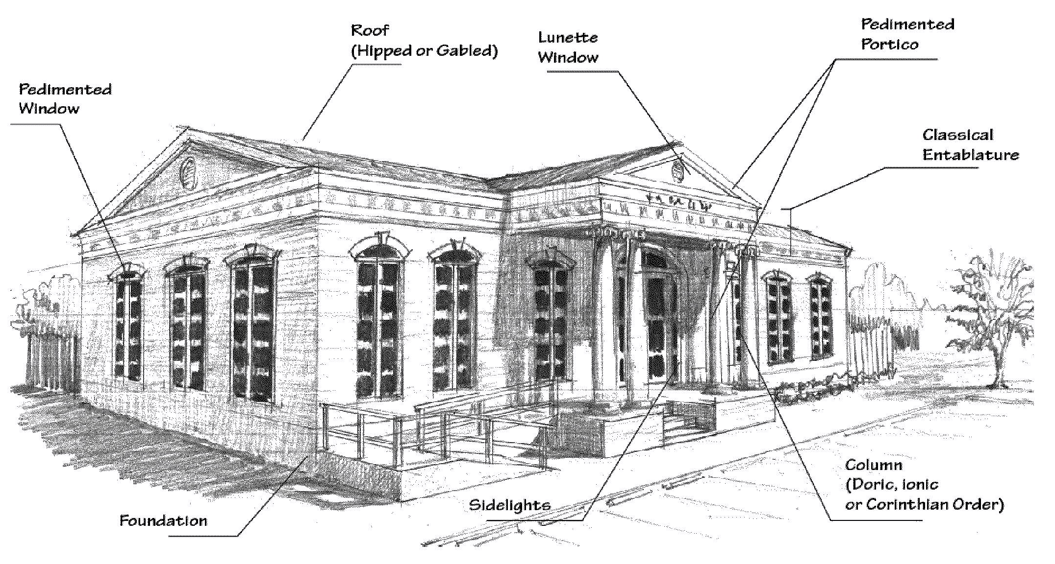 |
| Design Features: • A pedimented portico with columns that encompass at least one-third of the front facade. • Entablature and cornices ornamented in the style of the columns in either the Doric, Ionic, or Corinthian order. (See Figure 2) • The roof of the pediment with a pitch no greater than 4:12. • The columns or pilasters of the Tuscan, Doric, Ionic, Corinthian or Composite order. (See Figure 2) • Acceptable roofing is a metal panel 5-seam roof, a metal shake roof, or a 5-tab twenty-five (25) year or greater dimensional shingle roof. • The overall design of the structure is encouraged to follow Palladian architecture principles. • The pediment may be ornamented with a pediment window. • The pedimented portico may be part of the main roof structure, or may protrude from a main roof that is a gabled roof, a hipped roof, or a rotunda. • Use of Lintels for windows and doors is encouraged. • Side Lights and transom on the doors. • Entrance may [be] off to the side. • The pedimented portico may consist of a porte-cochere. |
GENERAL STORE The general store style is characteristic of historical rural communities in the region. This style is characterized by the use of a prominent parapet and front porch. This style is representative of the rural living and character of the area, and typically consists of design elements from the vernacular architectural style. |
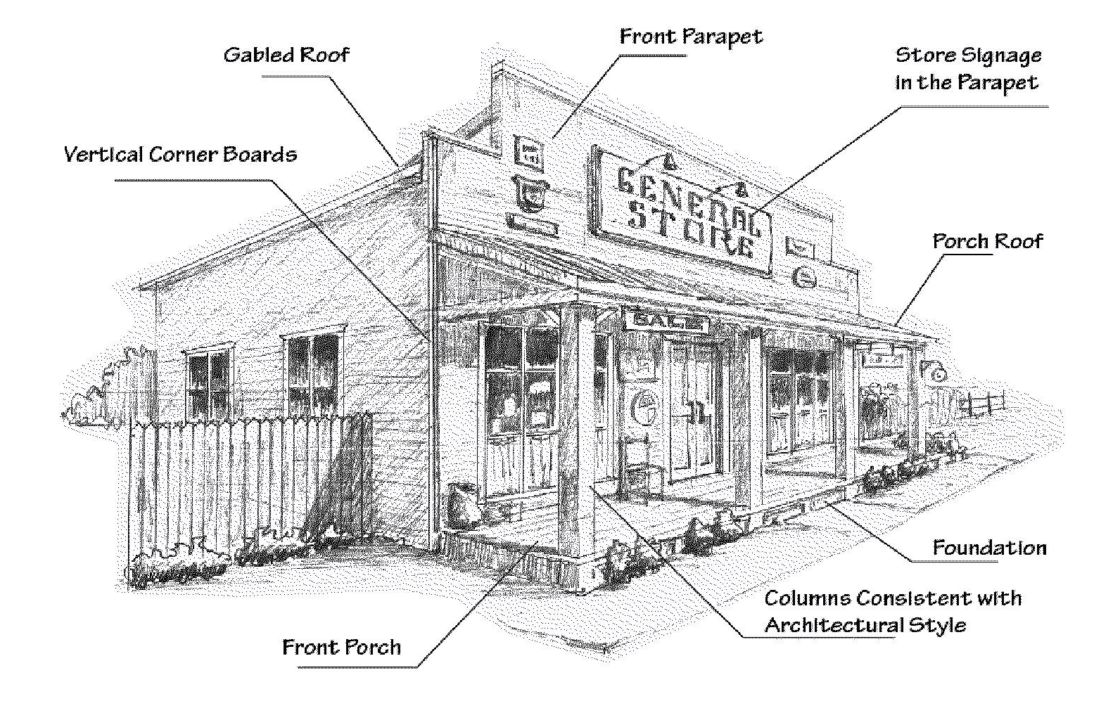 |
| Design Features: • The structure has a parapet on the front facade that matches or complements the exterior wall. • The structure is built in accordance with a simple symmetric shape. • The foundation of the structure with a minimum of eight (8) inches above grade. • The porch has a minimum of 60 inches in depth. • Acceptable roofing is a metal panel 5-seam roof, a metal shake roof, a 5-tab twenty-five (25) year or greater dimensional shingle roof, or a manufactured equivalent of a wood shake roof is acceptable. Roof hipped or gabled with a pitch no greater than 9:12. • A minimum of a twelve (12) inch overhang for the roof structure. (Multiple roof lines that create a gable and valley, or hip and valley roof system, except in the case of dormers and/or cupolas, are discouraged.) • Acceptable materials for the exterior walls are stained wood panels or manufactured brick or materials of the appearance of brick, wood or wood panels; fiber cement siding; wood or vinyl siding. • Predominant exterior color applied to all sides of the structure. • Vertical corner boards. • The structure may have a front porch. • The parapet may be ornamented with the store sign and other signage signifying the types of products sold, the name brands of products sold, and/or historically significant messages of the region provided such signage is consistent with Article VII of this Code. • The porch roof may be of a lower pitch than the main roof. • Window shutters, if provided, shall be consistent with the building style. • Hand rails wrapping the porch. • Exposed outlookers on the eaves. • The foundation can be decorated with an accent. |
BARN This is an architectural style characterized by the design and the use of materials typically found in agricultural barns. This style promotes the rural setting and lifestyle of the region. |
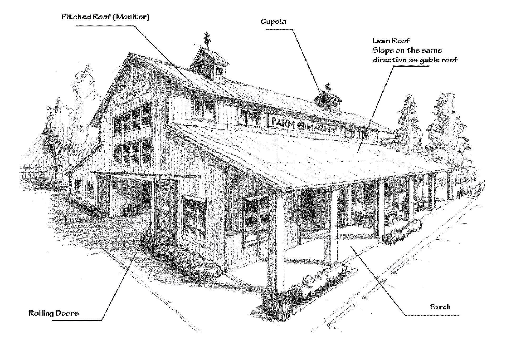 |
| Design Features: • The barn is of a square or rectangular shape. • A pitched roof of the following types: — Gable roof — Gambrel roof — Raised monitor roof system with a gable roof encompassing the center span of the barn with lean to roofs on each side that are of a lower elevation and slope in the same directions as the gable roof. • Porches are allowed on any facade of the barn. • The porch roof may be of a different pitch than the main roof structure. • Acceptable materials for the exterior walls are metal panels, wood siding, fiber concrete siding, or vinyl siding. • Acceptable roof materials are shingles of any kind or metal panels. • Barn roofs may be ornamented with copula(s). • Barn doors or rolling doors are strongly encouraged. Doors of other kinds are discouraged. |
ITALIANATE This is an architectural style that represents agricultural living within this region. The Italianate style was modeled after the medieval farmhouses of the Italian countryside, therefore, this style fitted naturally to their rustic environments. |
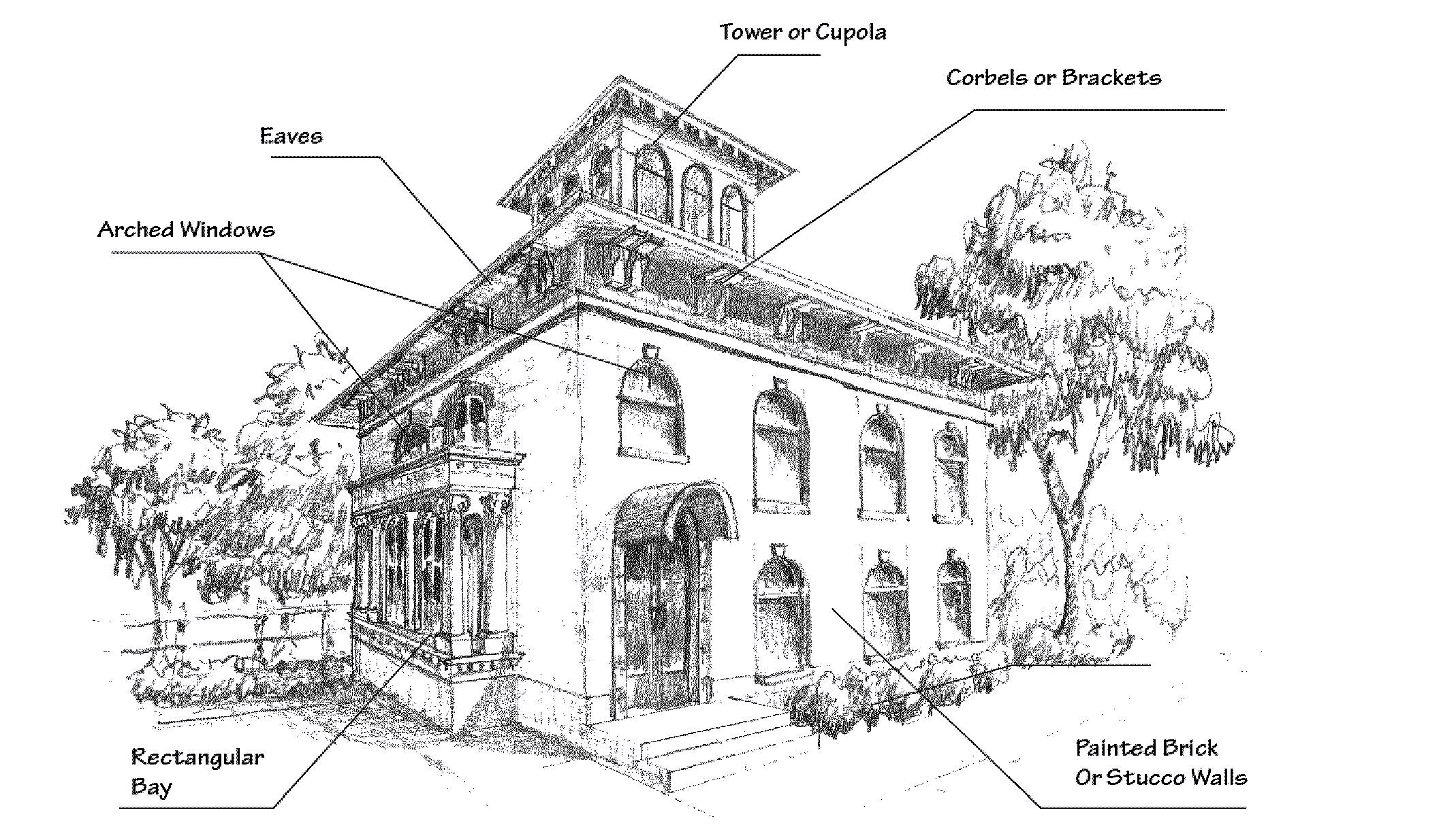 |
| Design Features: • If pitched roofs are provided, they may be hipped with a maximum pitch of 5:12. • Eaves ornamented with corbels or brackets. • Windows arched or pedimented with ornamented architraves or archivolts. • If a Cupola is provided, its roof may be hipped with a maximum pitch of 5:12. • Portico and/or balcony railings containing Renaissance balustrading. • Columns and cornices consistent with the Classical Orders (Figure 2). • May contain a tower, provided that a Palladian style is maintained. • If ornamented with cupola(s), it shall match or complement the main roof structure. • May provide paired windows. • Use of Bay Windows (Rectangular or Arched) is permitted. • Brick and Painted walls are encouraged. • Columns can be paired. |
NEOCLASSICAL This style is characterized by grandeur of scale, simplicity of geometric forms, Greek or Roman detail, use of columns, and a preference for blank walls. This style allows flexibility to use a multitude of classical orders or elements from the Greek or roman style. |
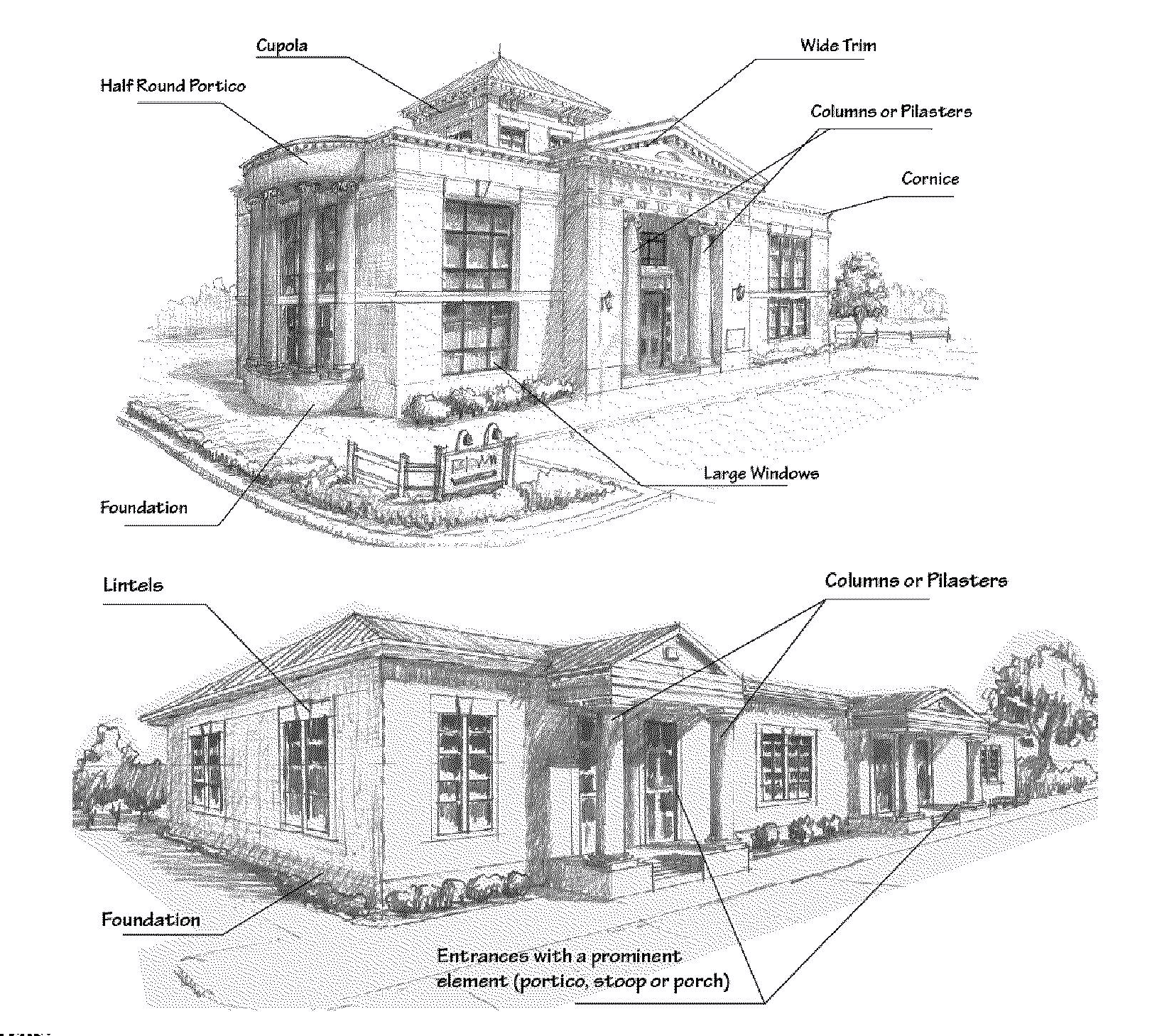 |
| Design Features: • Building design includes elements consistent with these architectural styles, provided that the overall structure is of Palladian style: Vernacular, Greek revival, Italianate. • Acceptable roofing is a metal panel 5-seam roof, a metal shake roof, or a 5-tab twenty-five (25) year or greater dimensional shingle roof. • For multi-tenant buildings, entrances are defined with a distinctive and prominent element of the architectural design consisting of a portico, stoop or porch. Parapet roofs can be utilized to meet this requirement. • The overall design of the structure is encouraged to follow Palladian architecture principles. • A structure may borrow from a multitude of neoclassical styles. • Pilasters of a neoclassical design may be used on the front facade of the structure in lieu of a portico with columns. • Neoclassical columns of various shapes and designs that do not meet the strict definition of the Classical Orders may be used. • Portico roofs are not required to be pedimented. • The portico may be half round shaped. • The roof of the portico may be part of the main roof line, even if the main roof line is not pedimented. • Use of a wide trim at the roofline is permitted. • Doors may include side lights and transoms. • 2/2 double hung windows are encouraged. • Use of Lintels for windows and doors is also encouraged. • The pedimented portico may consist of a porte-cochere. |
FLORIDA VERNACULAR This is a traditional architectural style historically found in the rural areas of Florida. This style generally includes front porches, shutters and wood finishes, elements originally developed in response to Florida's climate and available materials. |
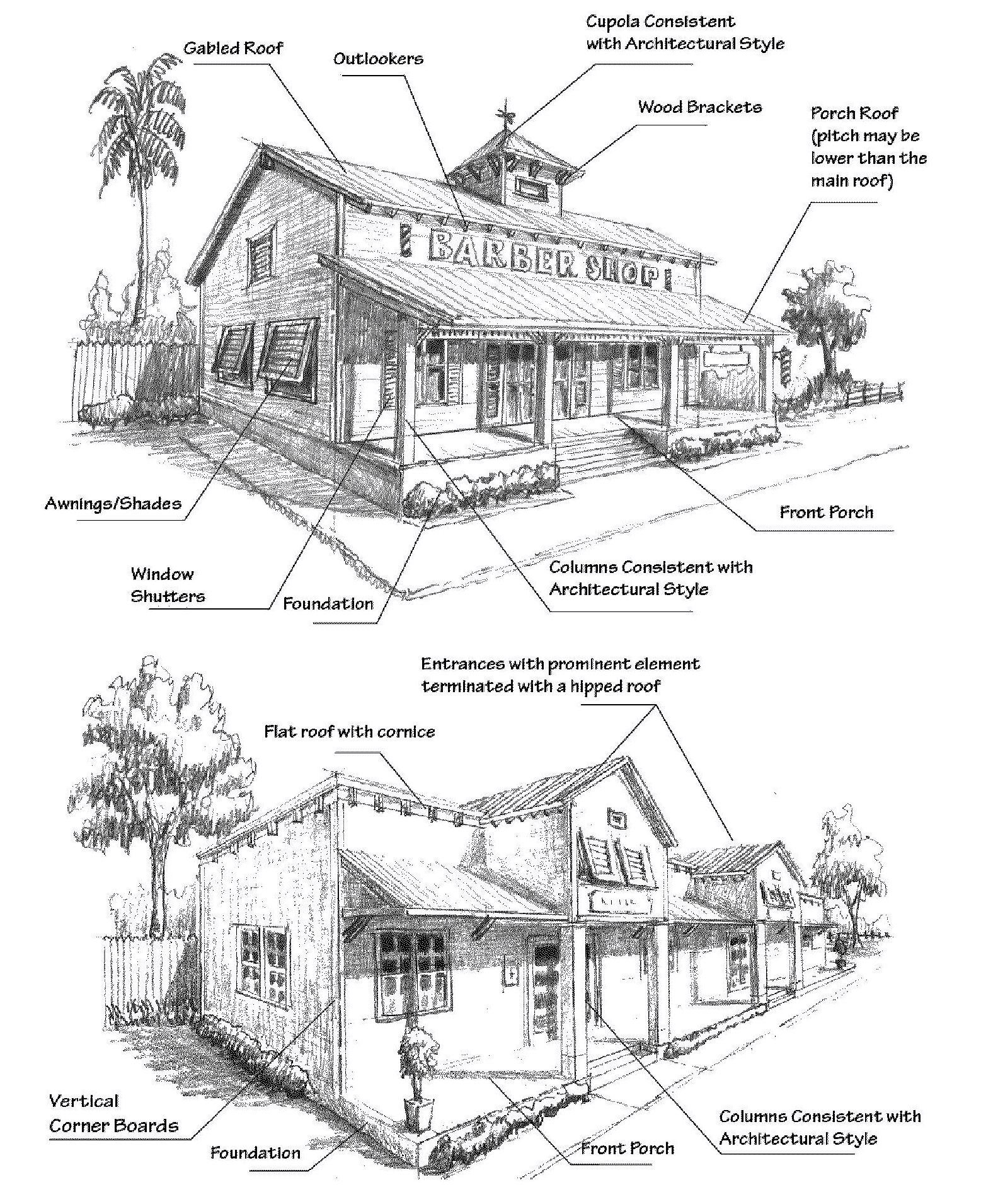 |
| Design Features: • The building front facade generally proportional. • If a flat roof is provided, a cornice at least 12 inches in height and consistent with the design of the building is used. • Multitenant buildings entrances have a distinctive and prominent element of the architectural design terminated with a hipped roof. • The structure has a front porch that encompasses an area greater than 50 percent of the front facade. • Acceptable roofing is a metal panel 5-seam roof, a metal shake roof, a 5-tab twenty-five (25) year or greater dimensional shingle roof, or a manufactured equivalent of a wood shake roof is acceptable. A minimum of a twelve (12) inch overhang for any roof structure. • Acceptable materials for the exterior walls are stained wood panels or manufactured brick or materials of the appearance of brick, wood or wood panels; fiber cement siding; wood or vinyl siding. • Predominant exterior color applied to all sides of the structure. • Vertical corner boards. • Porch may wrap around to include the sides and/or rear of the structure. |
Columns Designs and Proportions
If Greek Revival or Neoclassical Styles are chosen, columns and/or pilasters shall conform to the design and proportions of Figure 2 below. The height and diameter of the column shall follow a ratio depending on its style. For instance, the Tuscan order has a 1:7 ratio, where one equals the column width and seven is the height (a column 10 feet high will need to be 1' 5" in width at its base). Columns shall have a base, a capital, and an entablature.
Figure 2. Classical Orders for Columns and Their Proportions
(Ord. No. 22-13, § 2(Exh. A), 6-9-22, eff. 6-15-22)
The graphics shown on Tables 3.25-2 is intended for representation of the overall design of the structure as a reference only. These are conceptual drawings to be used as guidelines for each architectural style.