
Hillsborough County Unincorporated
City Zoning Code
City Zoning Code
ARTICLE IV
NATURAL RESOURCES AND ADEQUATE PUBLIC FACILITIES
PART 4.00.00 - GENERALLY
The decision by the owner as to whether and how to develop a parcel of land, and the decision by Hillsborough County to approve or disapprove proposed development, may depend on the impact that the proposed development will have on natural resources and public facilities. This Article establishes standards and procedures by which these impacts are determined, and by which Hillsborough County will approve or disapprove the development in light of such impacts.
Sec. 4.01.01. - Short Title
This Part shall be known and may be cited as the "Hillsborough County Natural Resources Regulations."
Sec. 4.01.02. - Generally
A.
Purpose
The purpose of the Natural Resources Regulations is to set forth regulations regarding land alteration, the protection of soil and water, the protection of trees and other vegetation, and the protection of environmentally sensitive areas, in order to maintain the quality of life in Hillsborough County and protect the health, safety, welfare and general well being of the citizens of Hillsborough County.
B.
Intent
It is intended that the implementation of these regulations accomplish the following objectives:
1.
Promote soil conservation by minimizing and controlling alterations of the natural terrain, and thereby reduce sedimentation and air and surface water pollution resulting from soil erosion.
2.
Maximize the retention of trees, a valuable natural resource of the community.
3.
Create an aesthetically pleasing and functional living environment to protect and enhance property values by conserving trees and other vegetation.
4.
Protect environmentally sensitive areas from activities which would alter their ecological integrity, balance or character.
5.
Ensure that the activities associated with excavating and the resulting excavation itself do not adversely impact the quantity or quality of surface water or groundwater.
6.
Ensure that the hauling of excavated material does not adversely impact public roads or bridges or public health, safety or welfare.
7.
Protect surface water flow by controlling filling activities and changes in drainage patterns.
8.
Ensure compliance with Chapter 163, Florida Statutes, and the Future of Hillsborough Comprehensive Plan.
Sec. 4.01.03. - Natural Resources Permit
A.
When Required
Except as specifically exempted herein, it shall be unlawful for any person, firm or corporation, either individually or through an agent to cause land alteration within the unincorporated areas of Hillsborough County without having obtained a Natural Resources Permit from the Administrator, or to allow a condition which is the result of unauthorized land alteration activity to remain unremedied. The property owner at the time a violation is discovered may be held responsible for remedying said violation pursuant to Section 11.06.00 of the Code.
B.
Effect of Permit
Issuance of a Natural Resources Permit by the Administrator, or exemption from the requirement thereof, does not abrogate any legal requirement to comply with the regulations of any other governmental agency, local, state or federal, which may have jurisdiction over the proposed activity upon the land.
C.
Exceptions to Requirement of Permit
No permit under this section is required for:
1.
The removal of dead or naturally fallen vegetation, except within an environmentally sensitive area.
2.
The limited removal of understory vegetation necessary to obtain clear visibility between two points for the purpose of performing field survey work, provided the removal will not create a cleared swath wider than three feet.
3.
The removal of vegetation that is endangering public health, safety or welfare, and, after consultation with Administrator, it is determined by Administrator that there is no other remedy provided in this Code.
4.
The removal of exempted trees, as defined in this Code.
5.
The removal of vegetation planted on the premises of a plant or tree farm and grown for the purpose of selling to the general public in the ordinary course of business.
6.
The transplanting of understory vegetation, including any tree with a DBH of less than five inches, for use as landscaping material within the site or off the site, provided the understory vegetation is not transplanted from an environmentally sensitive area.
7.
Land alteration activities within new, approved utility rights-of-way or easements necessary to supply gas, water, sewer, telephone, cable television, or electrical service with one exception, provided these activities do not adversely impact an environmentally sensitive area. The exception to this exemption is any land alteration activity within a new electrical transmission corridor greater than 100 feet in width. Pursuant to the definition of land alteration, activities undertaken to maintain existing utility rights-of-way or easements are not regulated by these land alteration regulations.
8.
Land alteration activities necessary to install a sprinkler system, septic tank, septic tank drainfield, utility line or swimming pool; or minor filling for topsoil or foundation fill; provided these activities do not involve tree removal or are not undertaken within an environmentally sensitive area. (NOTE: Swimming pools, septic tanks and septic tank drainfields are prohibited within setbacks associated with wetlands and natural water bodies pursuant to 4.01.07.
9.
Land alteration activities on residentially zoned land for single-family or two-family residential use where the principal structure allowed pursuant to the zoning regulations has been previously permitted and constructed, provided:
a.
The activities do not impede or divert the flow of surface water entering or leaving the lot or parcel in a manner that adversely impacts offsite property; or
b.
The activities do not adversely impact an environmentally sensitive area; or
c.
The activities do not involve the removal of any tree having a DBH of 12 inches or greater or adversely impact the health of such trees.
10.
Land alteration activities which are normal and necessary to conduct bona fide agricultural operations, as determined by the Administrator, where those operations are on land in a zoning category which allows agricultural use, provided:
a.
The activities do not impede or divert the flow of surface water entering or leaving the land in a manner that adversely impacts offsite property; or
b.
The activities do not adversely impact an environmentally sensitive area; or
c.
Not more than 500 cubic yards of material are removed off-site.
d.
The activities conform to the standards specified in Section 4.01.05.E of this Code.
11.
Land alteration activities regulated by the Phosphate Mining Regulations. While no Natural Resources Permit is required, land alteration activities regulated by the Phosphate Mining Regulations shall be in compliance with certain standards and guidelines contained in the Natural Resources Regulations as specifically provided in the Phosphate Mining Regulations.
12.
Land alteration activities regulated by the Land Excavation Regulations. While no Natural Resources Permit is required, land alteration activities regulated by the Land Excavation Regulations shall be in compliance with certain standards and guidelines contained in the Natural Resources Regulations as specifically provided in the Land Excavation Regulations.
13.
Land alteration activities regulated by the Hillsborough County Solid Waste Ordinance.
14.
Land alteration activities required by an administrative or judicial order for the correction of landfill violations or closure of a landfill pursuant to Chapter 17 of the Florida Administrative Code or Chapter 1-7, Rules of the EPC.
15.
Hillsborough County land alteration activities within public rights-of-way, easements or parcels necessary to construct public works facilities are required to comply with the intent of the Natural Resources Regulations; and the Administrator shall review these activities to ensure such compliance. However, Hillsborough County shall not be required to submit an application, pay a review fee, or obtain a Natural Resources Permit. Any request for variance or waiver regarding such activities shall be heard directly by the Land Use Hearing Officer.
16.
In the interest of public safety, health and general welfare during or following high winds, storms, hurricanes, tornadoes, floods, freezes, fires or other manmade or natural disasters, the Administrator, upon finding that a waiver is necessary and defining geographically the area of the emergency, may suspend the Natural Resources Regulations for a period of up to 30 days in the affected area.
17.
The trimming and removal of trees for runways, taxiways, aprons, runway protection zones and approaches, air traffic control towers, and aircraft navigational aids when federal law, Florida state law or local airport zoning regulations require trimming or removal of trees for public safety purposes. Additionally, no tree replacement in accordance to Sections 4.01.06.A.7 and .8 or contribution to the Restoration Fund in accordance with Section 4.01.15 shall be required for this permit exception; however any trimming or removal of trees under this subsection on land that is not owned or operated by a public aviation authority shall require compliance by the aviation authority with tree replacement requirements specified in Sections 4.01.06.A.7 and .8 to the extent allowed under the height regulations contained in federal law, Florida state law or local zoning regulations. Where height regulations prevent such replacement of trees, no contribution to the Restoration Fund shall be required under Section 4.01.15.
D.
Certain Activities Exempt From Provisions Pertaining to Uplands Providing Significant and Essential Wildlife Habitat
1.
The terms of 4.01.08 through 4.01.13, pertaining to Uplands Providing Significant and Essential Wildlife Habitat, shall not apply to the following activities:
a.
Land alteration activities necessary to make the improvements shown on Site Development Plans and Subdivision Construction Plans approved prior to May 1, 1992; or
b.
Land alteration activities necessary to develop a minor commercial project which does not require approval under the Site Development Regulations; or
c.
Land alteration activities on land subdivided pursuant to the Subdivision Regulations for a subdivision that does not require improvement facilities; or
d.
Land alteration activities necessary to construct a single family or two family residence.
2.
Development specifically vested against land development regulations adopted to implement the Comprehensive Plan pursuant to a valid, unexpired Vested Rights Special Use Permit shall not be required to comply with 4.01.08 through 4.01.13, pertaining to Uplands Providing Significant and Essential Wildlife Habitat. The County shall determine the extent to which development rights have been vested in each case, based on the Order issued by the Vested Rights Hearing Officer.
3.
Development specifically approved in a final, unexpired DRI Development Order which was adopted prior to the adoption of the Future of Hillsborough Comprehensive Plan is exempt from the provisions of 4.01.08 through 4.01.13, Uplands Providing Significant and Essential Wildlife Habitat. Further, any amendment to such DRI Development Order which does not increase the impact of authorized development within upland habitat areas sought to be protected by the provisions of 4.01.08 through 4.01.13 shall also be exempt from such provisions. Any amendment to such DRI Development Order which does increase the impact of authorized development within upland habitat areas sought to be protected by the provisions of 4.01.08 through 4.01.13 shall be addressed in the manner provided in that Section. Except as to applications subject to a Hearing Master recommendation pursuant to Part 9.02, the County Attorney's Office shall make a recommendation to the Board of County Commissioners as to the extent of vesting in each case.
4.
These regulations shall not apply to those land alteration activities that are necessary to make the improvements shown on the CU Detailed Site Plans, Preliminary Plats, Commercial Site Plans and Commercial Landscaping Plans submitted to the Administrator for review prior to November 15, 1985. These activities shall be reviewed for compliance with Ordinance 74-13, as amended, and 77-1, as amended. Those land alteration activities associated with construction of the principal and ancillary structures on individual lots in a subdivision are activities separate from those described above and shall be required to comply with these regulations, except those activities associated with construction of the principal structures on residential subdivision lots which prior to November 15, 1985 were assessed fees pursuant to Ordinance 74-13.
5.
The terms of 4.01.08 through 4.01.13 pertaining to upland significant wildlife habitat shall not apply to those land alteration activities which are normal and necessary to conduct bona fide agricultural operations where those operations are on land designated AR, A, or AM, once 8,500 acres of upland significant wildlife habitat on lands designated AR, A, or AM on the Future Land Use Map are permanently protected.
6.
With exceptions, the terms of 4.01.08 through 4.01.13 pertaining to upland significant wildlife habitat shall not apply to any land alteration activities once 22,000 acres of upland significant wildlife habitat are permanently protected. The exceptions are as follows:
a.
The terms of 4.01.09 C 3, 4 and 5 pertaining to roads shall continue to apply; and
b.
The terms of 4.01.08 through 4.01.13 shall continue to apply to land alteration activities necessary to construct public utilities.
E.
Inventory
The Administrator shall maintain an inventory and record of lands meeting the requirements prescribed in 4.01.03 D 5 and 6. To be credited toward the prescribed targets, such lands shall have been permanently protected on or after March 4, 1992. The Administrator shall certify that the prescribed targets have been met.
(Ord. No. 03-9, § 2, 6-5-03; Ord. No. 05-10, § 2, 6-16-05, eff. 10-1-05; Ord. No. 09-62, Item D, 10-26-09, eff. 2-1-2010)
Sec. 4.01.04. - Review Criteria
A.
Generally
The following factors shall be considered in evaluating an application and formulating recommendations:
1.
The effect that the proposed land alteration activity will have on soil and water resources, trees and other vegetation, and environmentally sensitive areas.
2.
The effect that the proposed land alteration activity will have on the expected future viability of the trees and other vegetation to be retained or relocated within the area to be developed.
3.
The effect that excavating or the resulting excavation will have on the quality of groundwater.
4.
The effect that excavating or the resulting excavation will have on the water levels of surface water and groundwater.
5.
The effect that hauling excavated material will have on public roads and bridges and on public health, safety and welfare.
6.
The necessity for compliance with other regulations, such as zoning, building, subdivision, engineering, drainage, and environmental regulations.
B.
Specific Standards and Guidelines
In addition to the general review criteria in this section, the specific standards and guidelines in the following sections shall be met.
Sec. 4.01.05. - Soil and Water
A.
Minimization of Impact
1.
Proposed improvements shall be designed and located to minimize land alteration activities which would unnecessarily remove the existing vegetation or alter the topography of the natural land surface.
2.
Adequate protection measures, such as hay bales, baffles, sodding and sandbagging, shall be provided as necessary to minimize erosion and downstream sedimentation caused by surface water runoff on exposed land surfaces.
B.
Surface Water Discharges
1.
The turbidity of surface water discharged off-site or into any wetland or natural body of water on-site shall not violate the water quality standard for turbidity as stated in the Rules of the EPC. Turbid water in violation of this standard shall be treated prior to discharge off-site or into any wetland or natural body of water on-site by using sediment control measures such as settling basins, berms, interceptor ditches, silt screens and other sediment traps. Whenever sediment control measures are necessary, they shall be installed prior to initial clearing and grading operations and maintained throughout the land alteration activity as a condition of granting the permit.
2.
Surface water runoff shall be discharged only within the drainage area that normally receives this runoff, unless otherwise approved.
C.
Excavation
1.
Excavating activities shall not adversely impact the quality of groundwater on surrounding property. Applicants must ensure the proposed excavating activities meet the standards of the EPC and other applicable agencies.
2.
Excavating activities shall not adversely impact water levels of either surface water or groundwater on surrounding property. The Administrator may set limits on water level declines at the property line, may require the installation of appropriate monitoring/observation wells, and may require the submittal of monitoring reports regarding water level fluctuation.
D.
Exposed Soils
Exposed soils shall be vegetated upon completion of land alteration activities. Areas may be sodded, plugged, sprigged, seeded or covered with other vegetation as desired. In areas where erosion is likely, such as slopes greater than 5:1 or areas of erosion prone soils, the Administrator may determine that sodding is required. Where erosion is found to be occurring, sodding shall be required. In areas where grass seed is used, nurse grass seed (e.g. rye, millet) shall also be sown for immediate effect.
E.
Placement of Fill
1.
Fill shall not be placed in wetlands, natural water bodies, natural water courses, or their floodplains up to and including the 100-year floodplain, manmade channels, or any natural or manmade stormwater storage area unless approved otherwise by appropriate regulatory agencies.
2.
No filling with clean fill or any other material shall be permitted on any site located within a five-mile radius from the perimeter of the Hillsborough Heights Landfill, except as exempted under 4.01.03 or for grading or filling (with soil only) necessary to construct an approved single-family or two-family residence or construct an approved subdivision or site development project, or topsoiling to establish vegetative cover.
3.
Filling activities using shell, stone, concrete and/or reinforced concrete rubble shall require the upper two feet of the filling activity to consist of soil, only.
4.
Filling activities using mulch shall be restricted as follows:
a.
Mulch shall not be placed in any natural or artificial body of water;
b.
Mulch shall not be placed in an open sinkhole or dewatered pit; and
c.
Mulch shall not be placed in any area prone to frequent or periodic flooding.
(Ord. No. 09-62, Item D, 10-26-09, eff. 2-1-2010)
Sec. 4.01.06. - Trees and Other Vegetation
A.
Design Standards
1.
The developer shall design and locate proposed improvements to minimize the removal of native vegetation and all trees having a DBH of five inches or greater. However, it is not the intent of this provision to preclude the reasonable use of a lot or parcel of land consistent with the requirements of the this Code.
2.
The developer shall preserve all trees having a DBH of five inches or greater and native vegetation as described below. This provision shall apply except in cases where removal is necessary to allow access to and immediately around proposed structures or other improvements, to allow development of recreational open space requiring cleared areas, to remove unhealthy or damaged vegetation, to install a utility or solar energy equipment that could not otherwise be installed, or to comply with other regulations of Hillsborough County.
3.
The developer shall preserve all trees identified as a grand oak unless authorized for removal by the Administrator. This provision shall not apply for a grand oak located in road site distances, recovery and maintenance areas as shown in the Transportation Technical Manual unless the County Engineer, otherwise, renders a determination that a grand oak may be preserved in these areas.
4.
For any land to be developed which contains a natural plant community, a minimum of 50 percent of the total pervious open space of a proposed development project (excluding any area to be used for a stormwater retention or detention basin or stormwater conveyance) shall retain the native vegetation of the plant community, including understory vegetation. If the area of existing natural plant community is less than 50 percent of this total pervious open space, then all of the native vegetation shall be retained. At the time construction of the principal structure allowed pursuant to this Code, the native vegetation retention requirement shall not apply to an individual lot to be developed for single-family or two-family residential use.
5.
Where a golf course is to be developed on land containing a natural plant community, the golf course shall be designed to maximize the preservation of the native vegetation of the community by incorporating portions of this vegetation, including understory vegetation, into the golf course where possible. Preservation can be accomplished by using narrower fairways, retaining the native vegetation within the outer rough areas, and using this vegetation to buffer and screen between parallel fairways.
6.
Removal of native trees having a DBH of five inches or greater within 100 feet of the Hillsborough River, Alafia River, or Little Manatee River shall be prohibited, except when reasonable property use is not possible without removal or in cases of overriding public interest. The 100 feet shall be measured from the jurisdictional line established by the EPC for wetlands or natural water bodies.
7.
The developer shall be required to replace 50 percent of the total DBH of any tree having a DBH of 24 inches or greater or any clump of trees, as defined in this Code, that is to be removed from the site. Irreparably unhealthy or damaged trees, as determined by the Administrator, shall not require replacement. If the tree removed is a species which either has undesirable growth habits or is susceptible to freeze damage, as determined by the Administrator, replacement shall not be required. A grand oak, however, shall be replaced as indicated below if authorized for removal by the Administrator.
This replacement requirement, however, shall not apply when the Administrator has determined that Section 4.01.14.A.4.b of this Code is applicable. Replacement of a grand oak for these situations shall not exceed 20 percent of the DBH trunk diameter unless a lesser amount is appropriate as determined by the Administrator.
8.
Where possible, replacement trees, as defined in this Code, shall be planted on the same property for which the Natural Resources Permit is granted. Each replacement tree shall be a species that is suited to the environment in which it will be planted. The use of native species shall be encouraged.
9.
The recommended transplanting techniques described in Tree and Shrub Transplanting Manual, International Society of Arboriculture, shall be used as a guideline in determining if a tree can be feasibly transplanted.
10.
Land alteration and construction activities shall be approved within the dripline of a tree to be retained on the site provided design techniques are used that minimize damage to the root system of the tree (e.g., retaining walls, tree wells, root aeration devices, pervious pavers, pervious concrete, green space, as appropriate). Where it is not practical for underground utility lines to be routed around the dripline, tunneling shall be employed to route the lines through this area.
11.
In the urban and suburban land use categories where a natural plant community exists along the Little Manatee River, clearing and filling of native vegetation shall be prohibited within 50 feet of the wetland jurisdictional line established by the EPC or within 100 feet of the mean and ordinary high water line, whichever is greater, except when reasonable property use is not possible.
12.
For lands along rivers and creeks in I-75 Planned Development zoning districts (IPD-1, IPD-2, IPD-3) of the I-75 Corridor, see 3.02.04 Y.
13.
The American National Standards Institute (ANSI) A 300 Pruning Standards, referenced as Section 4.1.6.1.8 (Natural Resources) of the Development Review Manual are the standards to be utilized for all tree pruning activities. Failure to comply with the ANSI A 300 Pruning Standards may result in prosecution under this Code for effective tree removal unless a land alteration permit authorizing the removal has been obtained.
14.
Pruning of a grand oak, with the exception of minor pruning, is prohibited unless conducted in accordance with the ANSI A 300 Pruning Standards as performed by an Arborist certified by the International Society of Arboriculture (ISA) or a Registered Consulting Arborist with the American Society of Consulting Arborists (ASCA). A notarized affidavit affirming an ISA Certified Arborist or an ASCA Registered Consulting Arborist will conduct or onsite supervise the pruning shall be submitted to the County prior to the pruning of a grand oak. An ISA Certified Arborist or an ASCA Registered Consulting Arborist contracted by a property owner to prune a grand oak shall assume full responsibility for all pruning activities determined in noncompliance with standards specified within the Land Development Code.
B.
Construction Standards
1.
No attachments other than flagging or similar material identifying protected trees shall be attached to trees designated to remain on the site.
2.
It shall be unlawful to undertake the following activities within the dripline of a tree remaining on the site, unless otherwise approved by the Administrator: remove vegetation, except by hand, or place soil deposits, debris, solvents, construction material, machinery or other equipment of any kind, or undertake any other land alteration or construction activity which would cause the tree to die within a period of two years.
3.
The compaction, filling or removal of soil or the use of concrete, asphalt or other paving material shall be prohibited within the dripline of a tree that is to remain on the site, unless otherwise approved by the Administrator.
4.
All tree roots existing within approved improvement areas and originating from a protected tree shall be severed clean at the boundary of the area to be preserved around the tree.
5.
Trimming of protected trees shall be undertaken in accordance with the American National Standards Institute (ANSI) A 300 Pruning Standards.
C.
Credit
1.
Healthy, transplantable trees, which otherwise would be destroyed to construct improvements, shall be credited as replacement trees if the transplanting method is approved by the Administrator.
2.
Where a minimum number of trees is required to meet the Landscaping Regulations, credit shall be given for the retention of existing trees as specified in 6.07.02.
3.
Existing trees less than five inches DBH in size to be retained on the site after development shall be credited toward any required replacement trees, provided the existing trees are a minimum of one inch DBH, Florida Grade #1 or better quality, and protected from any land alteration and construction activities which would cause the health of the trees to decline.
D.
Tree Donation
1.
When a permit is issued for tree removal, the Administrator may, with the owner's permission, arrange for the relocation the tree at the County's expense to County-owned property for replanting, either for permanent use at the new location, or for future use on other property owned by Hillsborough County.
2.
If the Administrator does not elect to have any such tree relocated, the Administrator may give any city within Hillsborough County the right to acquire the tree at the city's expense for relocation within the city's incorporated area for public use.
3.
Relocation shall be accomplished within 15 working days of permit issuance, unless it is necessary to root prune the tree to assure its survival, in which case relocation shall be accomplished within a suitable time frame agreed to by all parties.
E.
Removal of Invasive Plant Species
1.
The invasive plant species listed below shall be removed during the development process:
Schinus terebinthifolius (Brazilian Pepper Tree)
Melaleuca quinquenervia (Cajaput or Melaleuca)
Casuarina spp. (Australian Pine)
2.
Removal of these species from developable uplands, and all buffers and setback areas landward of required erosion control devices, if any through hand, mechanical and/or chemical means, from a site development or subdivision project shall be completed prior to issuance of the Certificate of Occupancy or acceptance of Improvement Facilities, respectively, as specified in the Natural Resources Permit. Removal shall only be required for the portion of the project described in the Natural Resources Permit. However, removal is not required on a subdivision lot(s) when the lot(s) will not be altered, with the exception of utilities installation, during the construction of Improvement Facilities. Removal shall occur at the time of building construction.
3.
When conservation or preservation areas exist within the project boundaries and contain a significant amount of the above listed invasive plant species, as determined by the County and the EPC, the County Administrator shall allow the developer to reduce the required conservation/preservation area setback up to 50 percent, or reduce the tree replacement requirement as defined in 4.01.06 A six up to 50 percent, provided the developer removes the invasive plant species from the conservation/preservation area. Pools, as specifically approved, may be constructed up to five feet from a conservation area and up to 15 feet from a preservation area.
4.
As determined by the Administrator, through consultation with the appropriate regulatory agencies, removal may not be required if such removal procedures would cause adverse impacts to the environment. Adverse impacts may include disturbance of listed plant or animal species, degradation of any natural plant communities or promotion of soil erosion by wind or water.
(Ord. No. 97-18, § 2, 12-18-97; Ord. No. 01-26, § 2, 9-12-01; Ord. No. 03-9, § 2, 6-5-03; Ord. No. 04-27, § 2, 6-10-04)
Sec. 4.01.07. - Environmentally Sensitive Areas—Wetlands and Natural Water Bodies
A.
Activities Prohibited, Allowed
1.
Land alteration activity which destroys, reduces, impairs or otherwise adversely impacts a wetland or natural body of water shall be prohibited unless specifically approved by the Environmental Protection Commission of Hillsborough County (EPC), in accordance with EPC Rule Chapter 1-11, or, in the case of seawalls, such other regulatory agencies as are empowered by law to authorize such activities.
2.
Land alteration activity which destroys, reduces, impairs or otherwise adversely impacts a wetland within 500 feet of the Hillsborough River, Alafia River, or Little Manatee River shall be prohibited, regardless of any other regulatory agency authorization. The 500 feet shall be measured from the jurisdictional line established by the Environmental Protection Commission of Hillsborough County (EPC) for wetlands and natural waterbodies.
3.
Wetlands and natural water bodies to be protected from development shall be designated Conservation Area or Preservation Area, as appropriate, on all development plans and plats. (See definition of environmentally sensitive areas.)
B.
Setbacks
1.
Setbacks shall be required from those Conservation and Preservation Areas listed as wetlands or natural water bodies in the definition of environmentally sensitive areas. Setbacks shall be a minimum of 30 feet for Conservation Areas and a minimum of 50 feet for Preservation Areas. Wider setbacks may be required by the Environmental Protection Commission of Hillsborough County (EPC) depending on the environmental sensitivity of the area and the intensity of the development proposed adjacent to the area. For example, a wider setback may be required for a large excavation proposed adjacent to a wetland in order to prevent dewatering of the wetland. Narrower setbacks may be allowed to preserve trees within the portion of the parcel to be developed, if specifically approved by the Administrator and the Environmental Protection Commission of Hillsborough County (EPC).
2.
Notwithstanding Section 4.01.07 B.1., no setback shall be required landward of a seawall which is constructed pursuant to the approval of appropriate regulatory agencies (see definition of seawall), with the exception of a seawall permitted along a lake. Pursuant to the description of a lake, as defined by this Code, setbacks shall be required in accordance with Section 4.01.07.B.1.
3.
Removal of native vegetation within a required setback is discouraged and may be restricted or prohibited by the Environmental Protection Commission of Hillsborough County (EPC) to protect the wetland or water body. The Environmental Protection Commission of Hillsborough County (EPC) may require that all or a portion of the vegetation within a setback be retained to provide natural filtration of surface water runoff or to prevent soil erosion and downstream sedimentation. For example, the retention of the vegetation along the bank of an incised stream or river may be required.
4.
No filling, excavating or placement of permanent structures or other impervious surfaces shall be allowed within a required setback except for the installation of a sprinkler system, utility line, or landscaping; or except as specifically approved for the construction of a road essential for access, wetland recreation access no greater than 20 feet wide, construction of a stormwater retention or detention basin or other stormwater-related structure including fences that do not impede the flow of water based on elevation or design of the fence, construction of a boardwalk or other stilted structure, grade finishing to provide a gradual slope between the setback line and the environmentally sensitive area, the limited use of semi-pervious paving material, construction of a retaining wall, recreational trail, or golf cart path; or except as specifically approved for construction of a swimming pool and pool screen enclosure, provided there is no encroachment within 15 feet of a Conservation Area and 25 feet of a Preservation Area.
5.
In the event that a wetland is impacted and reduced as authorized by the Environmental Protection Commission of Hillsborough County (EPC) or other agency with jurisdiction to do so, and a new wetland line is established, the setbacks required by this Section shall apply unless the new wetland line will not have any untreated stormwater flowing to it due to stormwater attenuation, new topography or improvements such as a retaining wall, in which case a setback will not be required only at the portion of the line established as a result of the approved impact.
(Ord. No. 04-27, § 2, 6-10-04; Ord. No. 24-16, § 2(Exh. A), 6-6-24, eff. 6-13-24)
Sec. 4.01.08. - Environmentally Sensitive Areas—-Uplands Providing Significant and Essential Wildlife Habitat; General Provisions
A.
Sections 4.01.08 through 4.01.13 provide standards and guidelines for the protection of upland significant wildlife habitat, generally, as well as upland habitat for endangered and threatened species and species of special concern, (i.e., upland essential wildlife habitat).
B.
Onsite preservation shall be considered the most desirable alternative to protect upland habitat and plant and wildlife species. However, in some cases as specified in these regulations and determined by the Administrator in cooperation with the Florida Game and Freshwater Fish Commission and, when appropriate, the U.S. Fish and Wildlife Service, the protection of upland wildlife habitat or upland habitat for endangered or threatened species or species of special concern will be best accomplished through offsite preservation.
C.
Natural upland areas within a proposed development project shall count toward meeting the requirements for onsite preservation only when such natural areas meet the applicable onsite preservation criteria.
D.
When multiple offsite preservation acreage requirements are applicable to the same onsite habitat, only the requirement for the largest amount of preservation acreage for that habitat shall apply.
E.
Nothing in these sections shall limit the ability of the Administrator to address other resource issues in the upland portions of a proposed development project for which standards are contained in this Code.
Sec. 4.01.09. - Environmentally Sensitive Areas—Upland Significant Wildlife Habitat
A.
In Hillsborough County, most of the original upland wildlife habitat has been replaced with urban, suburban or agricultural development. The remaining upland habitat is comprised of xeric and mesic natural plant communities which are either uncommon, scarce, occur in very restricted geographic areas, or have few high quality sites remaining. Protection of those xeric and mesic habitats which constitute significant wildlife habitat is necessary to retain habitat diversity and wildlife corridors and to maintain healthy and diverse populations of wildlife.
B.
Identification of Upland Significant Wildlife Habitat
1.
Uplands which potentially constitute significant wildlife habitat are those natural plant communities listed as xeric or mesic habitats in this section and mapped on the County's Geographical Information System as significant wildlife habitat.
2.
Xeric habitats are:
Sandhill
Sand Pine Scrub
Xeric Oak Scrub
Scrubby Flatwoods
Xeric Hammock
3.
Mesic habitats are:
Dry Prairie
Pine Flatwoods
Mesic Hammock
4.
If the Administrator demonstrates that an unmapped area meets the significant wildlife habitat definition and size/width criteria as described in the Significant Wildlife Habitat Guidelines of the Development Review Procedures Manual, Section 4.1.6 the Administrator shall notify affected property owners of the public hearing at which the Board shall consider amending the GIS map to designate the area as land which potentially constitutes significant wildlife habitat.
5.
Determination of the existence, type, and extent of any upland significant wildlife habitat shall be made by the Administrator by conducting an evaluation upon request or upon submission of an application for a Natural Resources Permit. This determination shall be refutable upon a showing of clear and convincing evidence to the contrary.
C.
Protection of Upland Significant Wildlife Habitat
1.
The developer shall protect xeric and mesic habitats which constitute significant wildlife habitat. Protection of xeric habitat shall consist of preservation of all xeric habitat acreage existing on the property, up to and including fifty (50) percent of the upland area onsite. Preservation of mesic habitat shall consist of preservation of all mesic habitat acreage existing on the property, up to and including twenty-five (25) percent of the upland area onsite. However, in no case shall the preservation requirement exceed fifty (50) percent of the upland area onsite. If the application of the provisions of this paragraph would prevent the construction, operation, or maintenance of a utility corridor, the preservation requirements of this paragraph shall be adjusted the minimum amount necessary to accommodate such activities, provided such activities are designed and conducted in a manner to minimize their adverse impacts to significant wildlife habitat.
2.
Preservation of significant wildlife habitat shall be required where necessary to prevent fragmentation of a wildlife corridor. Significant Wildlife Habitat Guidelines, as set forth in the Development Review Procedures Manual, Section 4.1.6 shall be used as a guide for identifying wildlife corridors. The factors to consider when determining minimum corridor widths described in the Development Review Procedures Manual, shall be used as a basis for determining the area of significant wildlife habitat to preserve to prevent fragmentation of a wildlife corridor.
3.
New road rights-of-way shall be routed to avoid traversing significant wildlife habitat, unless there is no feasible and prudent alternative and the roadway design incorporates design features for the safe passage of wildlife, as described in 5., below.
4.
Improvements to existing roads (i.e., road reconstruction or widening) within significant wildlife habitat shall incorporate design features for the safe passage of wildlife, as described in 5., below.
5.
Design features for the safe passage of wildlife shall be appropriate for the wildlife species expected to utilize the crossing and shall be designed in accordance with the recommendations of the Florida Game and Freshwater Fish Commission.
6.
Xeric and mesic habitats to be preserved shall meet the onsite preservation provisions of 4.01.12.
7.
Onsite preservation shall be required only when sufficient management capabilities exist to maintain or restore the habitat to a high quality natural plant community or communities, in accordance with the Habitat Management Guidelines set forth in the Development Review Procedures Manual. The Administrator's determination of the feasibility of onsite management shall be refutable upon a showing of clear and convincing evidence to the contrary.
8.
When the amount of significant wildlife habitat to be preserved onsite cannot be sufficiently managed, protection shall consist of preservation offsite of habitat acreage equal to the amount of habitat that would have been preserved onsite according to 1., above, and shall meet the offsite preservation provisions of 4.01.13.
(Ord. No. 01-26, § 2, 9-12-01)
Sec. 4.01.10. - Environmentally Sensitive Areas—Upland Essential Wildlife Habitat
A.
Intent and General Provision
1.
This section provides standards and guidelines for the protection of upland habitat for populations of endangered and threatened species and species of special concern in Hillsborough County. It is intended that implementation of the provisions in this Section preserve upland essential wildlife habitat based on the listed species' habitat needs, in order to maintain viable populations of the listed species.
2.
New road rights-of-way shall be routed to avoid traversing essential wildlife habitat, unless there is no feasible and prudent alternative and the roadway design incorporates design features for the safe passage of wildlife. Design features for wildlife crossings shall be appropriate for the wildlife species expected to utilize the crossing and shall be designed in accordance with the recommendations of the Florida Game and Freshwater Fish Commission.
B.
Listed Animal Species
1.
When a listed animal species' essential habitat occurs onsite, the developer shall protect the habitat by locating and designing proposed improvements to ensure no adverse impact to a viable population, nesting pair, or nesting colony which would prevent such population, nesting pair, or nesting colony from being maintained onsite, based on the Listed Species Guidelines in the Development Review Procedures Manual, Section 4.1.6. However, it is not the intent of this provision to preclude the reasonable use of a lot or parcel consistent with this Code.
2.
The Administrator shall presume that a listed animal species' essential habitat occurs onsite whenever a listed animal species has been previously documented onsite; or, upon evaluation of the property, the Administrator determines that the land by itself, or in combination with offsite lands, meets the minimum habitat needs for a viable population of a listed animal species, as specified in the Listed Species Guidelines in the Development Review Procedures Manual; or, upon conducting an onsite inspection of the property, the Administrator observes evidence of a listed animal species on the property. This presumption shall be refutable upon a showing of clear and convincing evidence to the contrary.
3.
Protection of a listed animal species' essential habitat shall consist of onsite preservation of the habitat, based on the listed animal species' habitat needs as specified in the Listed Species Guidelines in the Development Review Procedures Manual, and shall meet the onsite preservation provisions of 4.01.12.
4.
Onsite preservation shall be required when the site is supporting by itself, or in combination with offsite lands, a viable population, nesting pair, or nesting colony of a listed animal species and sufficient management capabilities exist to manage the habitat to maintain the viable population, nesting pair, or nesting colony of the listed animal species. The Administrator's determination of a viable population of a listed animal species and the feasibility of onsite management of the listed species essential habitat shall be refutable upon a showing of clear and convincing evidence to the contrary.
5.
When the amount of essential wildlife habitat to be preserved onsite cannot be sufficiently managed, protection shall consist of preservation offsite and shall meet the offsite preservation provisions of 4.01.13.
6.
The listed animal species covered by these provisions are listed in the Listed Species Guidelines in the Development Review Procedures Manual.
C.
Listed Plant Species
1.
When a listed plant species' essential habitat occurs onsite, the developer shall protect the habitat of the listed plant species by locating and designing proposed improvements to maintain the plants onsite, based on the Listed Species Guidelines set forth in the Development Review Procedures Manual. However, it is not the intent of this provision to preclude the reasonable use of a lot or parcel consistent with this Code.
2.
The Administrator shall presume that a listed plant species' essential habitat occurs onsite whenever a listed plant species has been previously documented onsite; or, upon conducting an onsite inspection, the Administrator observes a listed plant species on the property. This presumption shall be refutable upon a showing of clear and convincing evidence to the contrary.
3.
Protection of a listed plant species' essential habitat shall consist of onsite preservation of the plants, based on the listed plant species' habitat needs set forth in the Listed Species Guidelines in the Development Review Procedures Manual, and shall meet the onsite preservation provisions of 4.01.12.
4.
Onsite preservation shall be required when sufficient management capabilities exist to maintain the plants onsite. The Administrator's determination of the feasibility of onsite management shall be refutable upon a showing of clear and convincing evidence to the contrary.
5.
When the amount of essential wildlife habitat to be preserved onsite cannot be sufficiently managed, protection shall consist of preservation offsite, and shall meet the offsite preservation provisions of 4.01.13.
6.
The listed plant species covered by these provisions are listed in the Listed Species Guidelines in the Development Review Procedures Manual.
(Ord. No. 01-26, § 2, 9-12-01)
Sec. 4.01.11. - Natural Preserves
A.
Land owned by the public or by a private, non-profit conservation organization and held for natural preservation purposes shall be protected from any adjacent development that would adversely impact the lands or interfere with the stated habitat management and conservation use objectives of that property, including prescribed burning.
B.
For development proposed adjacent to a publicly owned natural preserve, compatibility shall be ensured through a project compatibility plan, reviewed and approved by the agency managing the publicly owned lands and required as a condition of granting a Natural Resources Permit. The project compatibility plan shall be proposed by the developer and approved by the managing agency during the development review process. The preparation of a project compatibility plan should be a cooperative effort between the agency managing the publicly owned land and the developer of the adjacent property.
C.
For development proposed adjacent to a private, nonprofit natural preserve, compatibility shall be ensured through a project compatibility plan, reviewed and approved by the Administrator and required as a condition of granting the Natural Resources Permit. In its review of the project compatibility plan, the Administrator shall consider the recommendations of the private, non-profit conservation organization holding title to the land. The project compatibility plan shall be proposed by the developer and approved during the development review process. The preparation of a project compatibility plan should be a cooperative effort between the nonprofit conservation organization holding title to the natural preserve and the developer of the adjacent property.
Sec. 4.01.12. - Onsite Preservation
A.
Site Selection
Where alternative onsite preservation sites exist within a development, the site or sites selected for onsite preservation shall be the best suited to likely maintain a viable population or natural plant community(ies). The selection shall be based upon the following:
1.
Protectability and manageability of the site;
2.
The size and shape of the site. Emphasis should be on not creating enclaves of development or areas fragmented by development; and, as specified in the Significant Wildlife Habitat Guidelines and Listed Species Guidelines set forth in the Development Review Manual, on providing, where appropriate, adequate buffers from the secondary impacts of development and adequate wildlife corridors.
3.
The contiguity of the site with significant or essential wildlife habitat offsite;
4.
The existing species population sizes at the site;
5.
The life history requirements of the species involved;
6.
The proximity and accessibility of the site to other populations of the same species; and
7.
The compatibility of preservation of the site with adjacent land uses.
B.
Preservation Methods
1.
Onsite preservation, including the establishment of any required buffers, shall be accomplished through the designation of the preserved areas as Conservation Area or Preservation Area, as appropriate, on all development plans and plats. (See definition of environmentally sensitive areas.)
2.
Additionally, the applicant shall submit, or request the Administrator to assist in the preparation of, a management plan for the area to be preserved. The management plan shall ensure the continued, adequate and appropriate management of the site and the continued protection of the site from adverse impacts, including the secondary impacts of development, in accordance with the Habitat Management Guidelines or Listed Species Guidelines in the Development Review Manual. The management plan shall designate management responsibility. At the option of the landowner, habitat management shall be the landowner's responsibility or the responsibility of Hillsborough County, or of any other land conservation agency or organization that accepts the responsibility in lieu Hillsborough County. The management plan shall be reviewed and approved prior to the issuance of a Natural Resources Permit.
3.
A landowner may request that Hillsborough County accept a transfer of title (by sale or donation) for the preserved area or a dedication of a conservation easement over the preserved area provided that any conservation easement offered by the landowner meets the requirements of Section 704.06, F.S.
Sec. 4.01.13. - Offsite Preservation
The offsite preservation requirement may be fulfilled either directly by preserving land offsite or indirectly by contributing to an offsite preservation land bank, as provided below.
A.
In-kind Preservation
1.
Offsite significant wildlife habitat preservation sites, pursuant to the requirements of 4.01.09, shall be the same type of habitat (i.e, xeric or mesic) or land which can be restored to the same type of habitat as the natural plant community being adversely impacted onsite by development.
2.
Offsite preservation sites for listed species shall be biologically manageable and appropriate habitat for the wildlife or plant species requiring protection or land which can be restored to such habitat. An offsite preservation site shall be acre-for-acre compensation for the essential wildlife habitat being adversely impacted onsite by development.
B.
Site Selection
1.
The location of offsite preservation sites shall be within Hillsborough County.
2.
Offsite preservation sites shall meet all appropriate acquisition, preservation, restoration, habitat suitability, manageability, size, and other provisions of this Section (4.01.13). Such lands may be (1) selected from a list of approved land bank sites, (2) sites composed of additions of land to existing publicly managed areas held for conservation purposes, such as State or County parks or preserves, or (3) other suitable sites recommended for preservation or restoration by a State or local governmental land conservation agency. Alternatively, the developer may propose another site within an ecosystem or river basin in proximity to the habitat being adversely impacted onsite by development. The alternative site shall be subject to review and approval pursuant to the criteria in this Section (4.01.13).
3.
In determining whether the selection of a particular offsite preservation site is appropriate, the Administrator shall consider the overall habitat suitability or restoration suitability, if applicable; the life history requirements of any species being protected; the protectability of the site; the manageability of the site; the size of the site; and recommendations concerning the site from the Florida Game and Freshwater Fish Commission and other appropriate agencies.
4.
When the offsite preservation requirements apply to a listed species' essential habitat, priority shall be given to selecting a site which can be restored to support the listed species.
C.
Preservation Methods
1.
Offsite preservation sites shall be for the purpose of restoring (if applicable), preserving, and maintaining natural areas in perpetuity.
2.
The developer shall meet the offsite preservation acreage requirement through one of the following methods:
a.
Land Acquisition. The developer may acquire and transfer fee simple title of an appropriate offsite preservation site to a land conservation governmental agency or private, non-profit land conservation organization; or
b.
Contribution to an Offsite Preservation Land Bank. The developer may contribute to an offsite preservation land bank based upon the land bank's actual cost of acquiring in-kind preservation lands, plus cost of restoration, if any, plus estimated total cost of management during the life of the land bank, divided by applicable acreage, multiplied by the carrying costs; or
c.
Conservation Easement. The developer may acquire through fee simple purchase an appropriate offsite preservation site and establish a conservation easement in favor of the Hillsborough County or other land conservation governmental agency or private, non-profit land conservation organization in accordance with the requirements of Section 704.06, F.S. When a developer chooses this option, a management plan shall be developed in cooperation with the landowner which stipulates the limitations on the use of the land and identifies the habitat management activities and assignments of responsibility.
D.
Timing
The Natural Resources Permit shall specify the acreage and location of the offsite preservation site, the cost and timing of any monetary contributions or offsite acquisitions, the ownership and party responsible for management of the offsite preservation site, the location of any onsite development, including land alteration and construction activities; and shall contain a requirement that any significant or essential wildlife habitat on the project site, for which offsite preservation is being provided, shall not be disturbed or adversely impacted prior to meeting the offsite preservation requirements.
Sec. 4.01.14. - Procedures
A.
Generally
A Natural Resource Permit shall be applied for and reviewed pursuant to the Procedure for Issuance of Development Permits at Section 10.01.00, subject to the following:
1.
For any parcel containing a wetland or natural body of water, no permit shall be issued until the application has also been reviewed and approved by the EPC. The Administrator shall transmit a copy of an application to the EPC for review when the Administrator determines upon receipt of a complete application and with the aid of the Hillsborough County Soil Survey and an aerial photograph that a wetland or natural body of water potentially exists on the site for which a permit is requested or immediately adjacent to the site.
2.
To review an application, the Administrator and, when appropriate, the EPC, shall conduct on-site inspections, except in cases where adequate information is available to preclude an onsite inspection.
3.
Where trees are located within the area where land alteration and construction activities are proposed, the rights-of-way or centerlines of proposed roads, the corners of proposed buildings, and the locations of proposed stormwater retention or detention basins, man-made lakes, areas that require fill, and other improvements shall be rough staked upon submittal of the application and prior to any on-site inspection. If, upon inspection, roads, buildings, fill areas, and other improvements have not been identified, the review shall be suspended until these preparations have been completed.
4.
Upon review of the complete application and recommendation by the Administrator and, when appropriate, the staff of the EPC, the Administrator shall approve, approve with conditions, or deny a Natural Resources Permit based upon whether the proposal is in compliance with the Natural Resources Regulations and is necessary for one or more of the following reasons:
a.
To remove unhealthy or damaged vegetation.
b.
To remove vegetation causing damage to public or private property and for which there is no other remedy.
c.
To remove vegetation interfering with the installation or function of solar energy equipment.
d.
To remove vegetation resulting from a previous site disturbance and creating an unsightly or undesirable condition.
e.
To transplant any tree with a DBH of five inches or greater which can feasibly be transplanted.
f.
To construct improvements consistent with proper development or proper physical use of a lot or parcel pursuant to the requirements of this Code.
g.
For access to a lot or parcel or construction equipment access to and immediately around proposed structures or other improvements.
h.
For essential grade changes or essential surface water drainage or utility installations.
i.
To comply with other ordinances, regulations, or codes of Hillsborough County.
j.
For the welfare of the general public for reasons other than those set forth above.
5.
In the event the Natural Resources Permit is denied, the Administrator, upon making such determination, shall notify the applicant in writing stating specifically the reasons for denial.
6.
The Natural Resources Permit shall not be issued until protective barriers have been erected around all trees to be retained within the area where land alteration or construction activities are to occur and, where required, around other vegetation to be preserved. Protective barriers shall remain in place until land alteration and construction activities are completed, or until commencement of grade finishing and sodding.
7.
The Building Permit, if required, shall not be issued until the Administrator has issued a Natural Resources Permit, if required.
8.
A Natural Resources Permit issued for a subdivision project shall limit land alteration activities to approved fill areas, road rights-of-way, and drainage and utility easements and rights-of-way, unless otherwise authorized. A separate Natural Resources Permit shall be required to undertake land alteration activity on individual subdivision lots containing trees or other vegetation, except on those lots for which a Master Subdivision Landscaping Permit has been issued.
9.
If appropriate, the following requirements shall be addressed through permit conditions:
a.
Hauling of excavated material shall not adversely impact public roads and bridges located along the haul route. The Administrator shall require the owner of the land from which material is to be excavated to construct a paved exit/entry apron at the point of access to a public road if such an apron is needed to protect the road from damage.
b.
Trucks hauling excavated material on a public road shall be covered and their tailgates securely latched to minimize dust. The owner of the land from which material is being excavated shall maintain in a satisfactory condition any dirt road segment of the designated haul route.
c.
The Administrator shall impose reasonable restrictions on the hours and days of hauling operations when such restrictions are necessary to protect the public health, safety and welfare.
B.
Submittals
The application for a Natural Resources Permit shall contain information as prescribed in the Development Review Procedures Manual, Section 4.1.6.
C.
Permit Compliance
1.
A copy of the Natural Resources Permit shall be posted onsite during land alteration activities.
2.
The Administrator may conduct periodic inspections of the site to determine compliance with the Natural Resources Permit.
3.
No Certificate of Occupancy, if required, shall be issued until the Administrator has determined upon final inspection that the land alteration activity was undertaken according to the approved plan and the Natural Resources Permit, if required. The Administrator's final inspection may be replaced by the self certification process set forth in the Development Review Procedures Manual Section 4.1.6.
The Administrator will conduct periodic audits of self certification documents and inspections. Any contractor or engineer found certifying a residential lot not worthy of certification will have his privilege to self certify revoked for one year. It is the responsibility of the contractor or engineer providing the certification to correct any deficiencies.
4.
Any tree planted in accordance with these regulations shall be replaced by the current property owner if the tree dies any time within two years after planting. DBH inch-for-inch replacement shall be provided.
D.
Permit Duration and Extension
A Natural Resources Permit shall be effective for a period of two years after issuance unless otherwise specified on the permit. A two-year permit extension may be granted by the Administrator within 30 days after receipt of a written request indicating why an extension is necessary and upon the Administrator's review of the project's work schedule, progress and compliance with the Natural Resources Regulations. Any permit not used within the prescribed time limit shall become void and future work shall require a new application.
(Ord. No. 01-26, § 2, 9-12-01; Ord. No. 14-34, § 2(Exh. A), Item B-2a(14-0864), 10-23-14, eff. 10-29-14)
Sec. 4.01.15. - Restoration Fund
A.
Purpose
The purpose of the Restoration Fund is to provide an alternative to the onsite restoration of trees or other vegetation which have been removed from a site. Funds received through the Restoration Fund shall be utilized for acquiring, planting, protecting, and maintaining trees and other vegetation for public purposes within Hillsborough County. Trees and other vegetation acquired shall be suitable to the site conditions, freeze tolerant, and representative of the surrounding plant ecology. Monies contributed may be used to establish matching fund programs. The Administrator shall coordinate the collection and disbursement of funds in accordance with the provisions of this section.
B.
Source of Funds
Restoration Fund monies may consist of the following:
1.
All monies collected pursuant to the penalties outlined in Section 11.06.05.
2.
All monies contributed in lieu of or as part of any requirement to replace trees.
3.
All monies accruing as interest to the Restoration Fund, unless otherwise restricted by specific terms and conditions identified by a particular grant, gift, or other instrument of contribution.
Sec. 4.01.16. - River Protection
This section of the Land Development Code contains regulations which provide for the protection of river resources and shall be known as the River Corridor Policy Overlay of the Land Development Code. Unless specified otherwise, these regulations apply to the Hillsborough River, the Alafia River, the Palm River and the Little Manatee River. The code language intends to maintain or improve the quality of water in its rivers where water quality does not meet or exceed state water quality standards for its designated use, preserve natural shorelines and reverse the trend toward hardened shores and channelization, enforce shoreline construction controls as provided by the Tampa Port Authority and state statute to address shoreline conservation, control boat traffic, reduce the nuisances associated with boat traffic, and improve compliance with water safety laws, follow established standards for development in the river corridors, preserve, enhance and restore wildlife habitats and archaeological resources, and minimize urban encroachment along the rivers by encouraging the establishment of a "green" river corridor through protection of the river banks and associated native vegetation. The regulations shall maintain water quality, and improve water quality where it does not meet or exceed State water quality standards for its designated use, thereby protecting and improving habitat for marine life, protect terrestrial and marine wildlife and their habitats, preserve and restore natural vegetation, and wildlife habitats and preserve archaeological resources, preserve the natural shoreline and prevent further channelization, recognize and maintain this unique water resource which provides economic and recreational opportunities as well as vital wildlife habitat, support maintaining and improving water quality in each appropriate water classification found in the rivers, or improving water quality where it does not meet or exceed state water quality standards for its designated use, minimize urban encroachment upon the river bank by encouraging the establishment of a "green" river corridor. River corridor preservation can best be achieved through protection of the natural shoreline, and associated wetlands and uplands and to preserve wildlife habitats and archaeological resources. These regulations apply along rivers and primary tributaries.
A.
Protection of the Shoreline
1.
Shoreline Monitoring and Protection. County staff, in the course of their regular duties, shall monitor riverine shoreline conditions. Illegal and unsafe conditions observed shall be reported to enforcement agencies. Examples include unsafe structures such as derelict docks, non-permitted water-oriented construction, dumping of trash and debris and cases of wildlife harassment.
2.
Public Property. The use of public riverfront property shall preserve the riverbank where it exists in a natural state and shall protect associated natural resources. Public riverfront property includes parks, boat ramps, lands acquired under the Environmental Lands Protection Program (ELAPP) and public properties for which the County has an ownership interest. This may be carried out by management plans for public properties and through shoreline and riverbank sensitive criteria and standards for boat ramps and docks.
3.
Conservation Easements. The County may use conservation easements, pursuant to Florida Statutes 704.06, along rivers and primary tributaries in the county to protect the integrity of shoreline and natural habitat. This applies to the rivers and their primary tributaries. The County should use this process as a method of preservation and protection.
4.
Boatramps. Where river shoreline exists in a natural state, all new boat ramps shall be designed to preserve the integrity of the shoreline to the maximum extent possible through permitting processes which includes review by the Tampa Port Authority.
5.
Docks. The County will comply with shoreline construction and placement standards for ramps, docks, seawalls, and other marine construction, in accordance with existing applicable laws, rules and policies, including review by the Tampa Port Authority.
6.
Water Dependent Uses. Water-dependent uses such as docks, boathouses, boatlifts and boardwalks shall constitute the only private over-the-water structures allowed on rivers. Structures that are clearly in the public interest, such as bridges, shall also be allowed.
B.
Navigation
1.
Hours of Operation. Operation of air boat/air powered craft and all terrain vehicles and other non-conventional recreational vehicles on and along river corridors shall be regulated by law enforcement agencies.
It is rebutably presumptive that the use of ATVs, airboats and other non-conventional recreational vehicles (such as personal watercraft) within wetlands, natural preserves, mapped areas of significant wildlife habitat and essential wildlife habitat occurring within the 100-year flood plain is damaging to the environmental resources and shall be prohibited.
2.
Speed Zones. The County, after securing required state and federal permits, may establish and post boating restricted areas in the vicinity of boat launching or landing facilities available for use by the general boating public, lock structures, or in areas where boating accident reports, boating citations, vessel traffic studies, or other creditable data demonstrate a high risk of collision, or where any significant vessel walk would be likely to endanger life, limb, vessel traffic safety, or maritime property, or areas subject to unsafe levels of vessel traffic congestion or hazardous water levels or currents, or containing other navigational hazards.
C.
Stormwater
1.
Stormwater Outfalls. The developer of any project along a river shall provide stormwater management systems that filter out pollutants before the stormwater enters the rivers, in accordance with Florida Department of Environmental Protection and Southwest Florida Water Management District rules, including the exemption provisions of these rules. New drainage outfalls along rivers shall be designed with stormwater treatment facilities rather than discharging stormwater directly into the rivers. Where environmentally feasible, the stormwater discharge from detention ponds shall flow into rivers through vegetated swales.
2.
Solid Waste Landfills and Hazardous Material Facilities. Solid waste landfills and hazardous material facilities in unincorporated Hillsborough County shall be sited and managed such that they will not adversely affect the rivers and primary tributaries by not being allowed within the 100-year flood plain.
D.
Recreational Uses
1.
Habitat. Recreation facilities in the Little Manatee River corridor shall be designed to minimize impacts upon essential and significant wildlife habitat. This is to be achieved by encouraging passive recreation river corridor uses, such as hiking, picnicking, nature study, photography, fishing, and canoeing.
E.
Natural Resources
1.
Fish and Wildlife Resources. The County shall consult with the Florida Fish and Wildlife Conservation Commission through the zoning process and site development and subdivision permitting processes for comments on preventing or mitigating probable impacts upon fish and wildlife resources for the rivers.
2.
Manatee Areas. The County may adopt an ordinance establishing manatee protection areas where manatees are frequently sighted and the best available scientific information supports the conclusion that manatees inhabit such waters periodically. Upon a finding that manatees are frequently sighted, that manatees can be generally assumed to inhabit the area periodically or continuously, and that the restrictions imposed are justified and necessary for the protection of manatees or their habitat, the Florida Fish and Wildlife Conservation Commission shall approve such ordinance, after which the County shall secure required state and federal permits and post the boating restricted area.
F.
Utilities
1.
Sewage Discharges. Discharges of raw sewage to the rivers and primary tributaries shall be prohibited.
2.
Septic Tanks and Drainfields. Septic tanks and drainfield installation shall be prohibited within 200 feet of the shoreline of the rivers and their primary tributaries, except in such cases where the 200-foot criterion cannot be met because of lot size. In such cases, placement and construction of such facilities shall be in accordance with State law and shall prevent adverse impact to water quality. (Cross referenced with Section 6.01.06.6.)
3.
Power Lines. The construction of new overhead utilities shall be prohibited within 250 feet of the shoreline of the rivers, unless underground placement is clearly demonstrated to be environmentally or technically unsound. The construction of transmission lines for electric power is permitted in existing, approved corridors.
G.
Heritage
1.
Archaeological Sites. Archaeological sites along the rivers shall be evaluated during the zoning permitting and site and subdivision permitting process in terms of national or state criteria for significance to determine if they are eligible for listing on the National Register of Historic Places. If they are so eligible, then they shall be either preserved or excavated prior to development of the area containing the archaeological site.
(Ord. No. 05-22, § 2, 11-17-05; Ord. No. 07-18, § 2, 7-19-07, eff. 10-1-07)
Sec. 4.02.01. - General Provisions
A.
This Division shall be known and may be cited as the "Hillsborough County Adequate Public Facilities Regulations."
B.
The standards and requirements of the adequate public facilities regulations for potable water, sanitary sewer, solid waste, and stormwater management are necessary for the health, safety and welfare of the citizens of Hillsborough County and the protection of the environment and natural resources of Hillsborough County.
C.
The standards and requirements of the adequate public facilities regulations for parks are necessary for the health, safety, welfare and enjoyment of the citizens of Hillsborough County.
D.
The standards and requirements of the adequate public facilities regulations for school facilities are necessary to facilitate coordination of planning for the location and development of public educational facilities to serve the children of Hillsborough County.
E.
The purpose of the adequate public facilities regulations is to implement the goals, objectives, policies and level of service standards in the Hillsborough Comprehensive Plan; to ensure that necessary public facilities and services be available concurrent with the impacts of development; to ensure that development orders and permits be issued in a manner which will not result in a reduction of the level of service below the adopted level of service standards in the Hillsborough Comprehensive Plan; to ensure the accurate review of proposed development by the limitation of the effectiveness of a certification of public facility availability to two years unless additional assurances are provided in the form of a local government development agreement or a development of regional impact development order or development is commenced and is continuing in good faith; to adhere to and implement the schedule of capital improvements in the Hillsborough Comprehensive Plan and other capital improvements as necessary to maintain the level of service standards in these adequate public facilities regulations; to adopt reasonable land development regulations in furtherance of the public benefit while at the same time ensuring that property owners have a reasonable, beneficial, and economic use of property and that no property rights be taken.
(Ord. No. 08-10, § 2(Exh. A), 7-10-08; Ord. No. 16-13, § 2(Exh. A), 6-16-16, eff. 7-30-16)
Sec. 4.02.02. - Required Determinations for Potable Water, Sanitary Sewer, Solid Waste, Stormwater, Parks and Schools
A.
Potable Water Facilities.
For the purpose of issuing Development Orders, the level of service standard for potable water treatment facilities shall be that level set in the Hillsborough Comprehensive Plan. For purposes of this Article, the terms "Urban Service Area" and "Rural Area" shall be construed as defined and delineated by the Future of Hillsborough Comprehensive Plan: Future Land Use Element at the time of application for any development approval under this Article.
1.
For the purposes of this Section, any parcels of record as of July 26, 1989 identified by a single tax folio number that are split by the Urban Service Area (USA) line shall be considered within the USA in its entirety if one or more of the following criteria are met:
a.
The parcel is part of a platted subdivision of record as of July 26, 1989 with 50 percent or more of the lots within the USA;
b.
The Parcel is 100 acres or greater in size with at least 50 percent of the parcel within the USA. For parcels less than 100 acres, at least 25 percent of the parcel is within the USA; and/or
c.
The portion of the property that is outside the USA is water or conservation area.
If none of these criteria are met, the property will be considered to be part of the Rural Area.
2.
Within the "Urban Service Area" the adopted potable water "level of service" for all development shall include the following:
a.
Connection to a public-owned and operated potable water facility or system; and
b.
The availability of adequate potable water to supply the demand created by the development.
Connection to individual water supply wells and/or privately-owned potable water faculties or systems shall not be construed to constitute adequate potable water facilities for development within the "Urban Service Area" except as may be otherwise permitted by this Code.
3.
Within the "Rural Area" as defined and delineated by the Future Land Use Element of the Future of Hillsborough Comprehensive Plan, the adopted potable water "level of service" for all development shall include the following:
a.
An individual private well meeting the requirements of the Health Department; or
b.
Connection to a public or private water distribution system otherwise meeting the requirements of this Code and the "Public Utility Connections Regulations" (Ordinance 92-11 as amended).
1.
Connection to Existing Utility Lines in Rural Area.
Connection to an existing utility line in the Rural Area may be considered on a limited basis. The intent is to allow properties adjacent to existing water infrastructure to connect. These properties may be subdivided and served by water; any new infrastructure shall not be designed or constructed to allow for an expansion or extension of utility service beyond the property adjacent to the existing infrastructure. Within the boundaries of the Keystone-Odessa Community Plan, existing line connections shall be limited to one meter for one property and no subdivision shall be served by an existing line connection. Otherwise, connections shall be permitted subject to the following:
a.
Limited to an existing line connection as defined by this Code.
b.
Existing line connections shall only be allowed where the County's line is located in a road right-of-way or easement adjacent to the property requesting service and no line extension is required.
c.
The new utility infrastructure shall be sized only to serve the new development and shall be the minimum size per the technical standards.
d.
The connection must be made to existing adjacent lines. Connections to these lines shall not require any improvements to the County's existing infrastructure.
e.
Connections to Limited Access Transmission Mains are prohibited.
2.
In the Rural Service Area, all connections or extensions of water lines shall meet the following, as a minimum:
a.
New and existing development requesting water services shall be responsible for infrastructure and services. Any such connection and extension of lines shall be at the expense of the party requesting service. An alternative funding approach may be allowable when services are needed to address a public health hazard or adverse environmental condition outlined in [Subsections] 4.02.02.A.3.b.3.d and e.
b.
Any extension or connection shall not be considered a justification for increases in densities or intensities through the Future Land Use Map amendment process. The allowance of potable water shall also not be used as a basis for a rezoning to allow uses or lot sizes that require public utility connections but would be incompatible with the surrounding development pattern or inconsistent with other Rural Area or Livable Communities Element Community Plan policies.
c.
Any connection and/or extension of lines must meet Hillsborough County technical requirements. Extensions and connections may not exceed utility plant capacity or individual line capacity.
d.
Lines shall be sized to provide the service intended and not sized to support future developments, unless approved under the exceptions process outlined in Subsection 4.02.02.A.3.b.3.g. In some cases, oversizing will be required by the County when operational improvements are necessary. Details regarding County oversizing requirements and reimbursements shall be implemented in the County Code of Ordinances; and
e.
The only jurisdiction permitted to extend lines into the Rural Area shall be Hillsborough County, unless provided for in a pre-existing service area agreement or to serve a public health issue or adverse environmental condition as identified in Subsection 4.02.02.A.3.b.3.a.
Such connections shall be subject to approval by Hillsborough County Water Department. Any exceptions to the above limitations shall be subject to review and approval by the Board of County Commissioners.
3.
Extension of Utility Lines into the Rural Area.
Notwithstanding the above, the extension of utility lines into the Rural Area shall be permitted:
a.
As an option in order to provide service to existing development where there is a documented health hazard or environmental condition that can best be addressed by replacing private utility service with public utility service. Such extensions shall be subject to review and approval by the Hillsborough County Water Department. Approval of such infrastructure extensions shall be supported by an affirmative recommendation of the Hillsborough County Health Department, Environmental Protection Commission, Florida Department of Environmental Protection, United States Environmental Protection Agency or other public agency involved in regulation of potable water supply, sanitary wastewater treatment and disposal or public health activities.
b.
Serve a planned village (RP-2 or WVR-2), or Planned Environmental Community ½ as described in the Unincorporated Hillsborough County Comprehensive Plan.
c.
Serve a project that has established vested rights for the use of or a requirement to use public utilities.
d.
Prevent septic tank clustering in areas prone to flooding. In order to qualify for this extension, a parcel shall meet all of the following criteria:
1.
Located within ¼ mile of the Urban Service Area.
2.
20 acres or larger in size.
3.
Designated a Future Land Use category 1 du/acre or greater density; and
4.
Located within the A or AE flood zone.
5.
Not located within the boundaries of the Keystone-Odessa Community Plan.
e.
Provide for the extension of centralized potable water infrastructure to serve Hillsborough County Public Schools operated by the Hillsborough County School Board, so long as the service lines are designed to solely accommodate the service demands of the school, consistent with the Interlocal Agreement for School Facilities Planning and Siting and School Concurrency; and
f.
Be located within Wellhead Resource Protection Areas or Tampa Bay Water Wellfield Mitigation Areas. In order to qualify for this extension, a property/project shall meet all of the following criteria:
1.
Be the subject of an approved Planned Development zoning.
2.
Have a minimum lot size of ½ acre in the final development.
3.
Located within 1,000 feet of the Urban Service Area boundary.
4.
Not located within the boundaries of the Keystone-Odessa Community Plan.
5.
Maximum residential density shall not exceed 80 percent of the maximum density permitted under the Comprehensive Plan for properties where wetlands comprise less than 25 percent of the property, and maximum density shall not exceed 90 percent of the maximum density permitted under the Comprehensive Plan for properties with at least 25 percent wetlands onsite (using wetland density calculations); and
6.
Utilization of this provision could result in clustered development, achieving a greater amount of common open space in a project than projects using wells/septic systems. Such open space shall be identified on the zoning site plan as permanent conservation either through platting or other mechanism approved by Hillsborough County.
g.
Exceptions to the extension criteria set forth above and by the Hillsborough County Comprehensive Plan may be considered in limited cases of Overriding Public Interest and subject to review and approval by the Board of County Commissioners in accordance with the Land Development Code Part 10.06.00 and shall be subject to the factors outlined below and per Policy 4.3.5 of the Comprehensive Plan:
1.
Consistency with the other adopted Goals, Objectives and Policies in the Comprehensive Plan;
2.
Line/plant capacity impact, and technical feasibility. The proposed exception shall not be permitted if it causes either plant or line capacity to be exceeded;
3.
The degree to which the project or activity would positively or adversely affect the public health, safety, and welfare or the property of others; and/or
4.
The degree to which the project or activity would create demonstrable environmental, social, transportation, or other benefits for the public at large.
5.
Exceptions are not available for land located within the boundaries of the Keystone-Odessa Community Plan.
Exceptions to the sizing requirements outlined in Subsection 4.02.02.A.3.b.2.b may be considered in situations where multiple developments would meet the criteria outlined by the Comprehensive Plan Policy 4.3.3 or in limited cases of coordinated development timing and a need for additional capacity. These exceptions must be approved by the BOCC and require evaluation of the Comprehensive Plan Policies 4.3.5(A).1 and 2. Exceptions are not eligible for oversizing reimbursement by Hillsborough County.
B.
Required Determinations Potable Water Facilities.
1.
Potable water facilities to be provided by the County, sufficient to provide capacity necessary to ensure the adopted level of service will be maintained after the impact of the proposed Development occurs, must be available prior to the time required by the Hillsborough Comprehensive Plan.
2.
If potable water facilities, including package systems, water distribution systems and oversized facilities, to be provided by the applicant are not available prior to the time required by the Hillsborough Comprehensive Plan, any Development Order shall be conditioned as provided in subsection 3 below.
3.
Development Orders may be issued subject to the provision of potable water facilities by the applicant at the applicant's own expense provided that:
a.
The issuance of any Building Permit or other final local Development Order is conditioned upon the completion of such facilities prior to the time required by the Hillsborough Comprehensive Plan; or
b.
Prior to the issuance of a Building Permit or other Final Development Order the County and the applicant enter into an enforceable Development Agreement.
C.
Sanitary Sewerage Facilities.
For the purpose of issuing Development Orders, the level of service standard for sanitary sewerage treatment facilities shall be that set in the Hillsborough Comprehensive Plan. For purposes of this Article, the terms "Urban Service Area" and "Rural Area" shall be construed as defined and delineated by the Future of Hillsborough Comprehensive Plan: Future Land Use Element at the time of application for any development approval under this Article.
1.
For the purposes of this Section, any parcels of record as of July 26, 1989 identified by a single tax folio number that are split by the Urban Service Area (USA) line shall be considered within the USA in its entirety if one or more of the following criteria are met:
a.
The parcel is part of a platted subdivision of record as of July 26, 1989 with 50 percent or more of the lots within the USA;
b.
The parcel is 100 acres or greater in size with at least 50 percent of the parcel within the USA. For parcels less than 100 acres, at least 25 percent of the parcel is within the USA; and/or
c.
The portion of the property that is outside the USA is water or conservation area.
If none of these criteria are met, the property will be considered to be part of the Rural Area.
2.
Within the "Urban Service Area," the adopted sanitary sewer "level of service" for all development shall include the following:
a.
Connection to a publicly-owned and operated wastewater facility or system; and
b.
The availability of adequate plant capacity to supply the demand created by the development.
Connection to individual sewage disposal faculty and/or privately-owned wastewater collection and disposal facilities or systems shall not be construed to constitute adequate sanitary sewer water faculties for development within the "Urban Service Area" except as may be otherwise permitted by this Code.
3.
Within the "Rural Area" as defined and delineated by the Future Land Use Element of the Future of Hillsborough Comprehensive Plan, the adopted sanitary sewer "level of service" for all development shall include the following:
a.
An individual sewage disposal facility meeting the requirements of the Health Department; or
b.
Connection to a public or private wastewater collection and disposal system otherwise meeting the requirements of this Code and the Public Utility Connections Regulations (Ordinance 92-11 as amended).
1.
Connection to Existing Utility Lines in Rural Area.
Connection to an existing utility line in the Rural Area may be considered on a limited basis. The intent is to allow properties adjacent to existing wastewater infrastructure to connect. These properties may be subdivided and served by water; any new infrastructure shall not be designed or constructed to allow for an expansion or extension of utility service beyond the property adjacent to the existing infrastructure. Within the boundaries of the Keystone-Odessa Community Plan, existing line connections shall be limited to one meter for one property and no subdivision shall be served by an existing line connection. Otherwise, connections shall be permitted subject to the following:
a.
Limited to an existing line connection as defined by this Code.
b.
Existing line connections shall only be allowed where the County's line is located in a road right-of-way or easement adjacent to the property requesting service and no line extension is required.
c.
The new utility infrastructure shall be sized only to serve the new development and shall be the minimum size per the technical standards.
d.
The connection must be made to existing adjacent lines. Connections to these lines shall not require any improvements to the County's existing infrastructure.
e.
Connections to Limited Access Transmission Mains are prohibited.
2.
In the Rural Area, all connections or extensions of wastewater lines shall meet the following, as a minimum:
a.
New and existing development requesting wastewater services shall be responsible for infrastructure and services. Any such connection and extension of lines shall be at the expense of the party requesting service. An alternative funding approach may be allowable when services are needed to address a public health hazard or adverse environmental condition outlined in Subsections 4.02.02.C.3.b.3.d and e;
b.
Any extension or connection shall not be considered a justification for increases in densities or intensities through the Future Land Use Map amendment process. The allowance of potable water shall also not be used as a basis for a rezoning to allow uses or lot sizes that require public utility connections but would be incompatible with the surrounding development pattern or inconsistent with other Rural Area or Livable Communities Element Community Plan policies;
c.
Any connection and/or extension of lines must meet Hillsborough County technical requirements. Extensions and connections may not exceed utility plant capacity or individual line capacity;
d.
Lines shall be sized to provide the service intended and not sized to support future developments, unless approved under the exceptions process outlined in Subsection 4.02.02.C.3.b.3.g. In some cases, oversizing will be required by the County when operational improvements are necessary. Details regarding County oversizing requirements and reimbursements shall be implemented in the County Code of Ordinances; and
e.
The only jurisdiction permitted to extend lines into the Rural Area shall be Hillsborough County, unless provided for in a pre-existing service area agreement or to serve a public health issue or adverse environmental condition as identified in Subsection 4.02.02.C.3.b.3.a.
Such connections shall be subject to approval by Hillsborough County Water Department. Any exceptions to the above limitations shall be subject to review and approval by the Board of County Commissioners.
3.
Extension of Utility Lines into the Rural Area.
Notwithstanding the above, the extension of utility lines into the Rural Area shall be permitted:
a.
As an option in order to provide service to existing development where there is a documented health hazard or environmental condition that can best be addressed by replacing private utility service with public utility service. Such extensions shall be subject to review and approval by the Hillsborough County Water Department.
Approval of such infrastructure extensions shall be supported by an affirmative recommendation of the Hillsborough County Health Department, Environmental Protection Commission, Florida Department of Environmental Protection, United States Environmental Protection Agency or other public agency involved in regulation of potable water supply, sanitary wastewater treatment and disposal or public health activities.
b.
Serve a planned village (RP-2 or WVR-2), or Planned Environmental Community ½ as described in the Unincorporated Hillsborough County Comprehensive Plan.
c.
Serve a project that has established vested rights for the use of or a requirement to use public utilities.
d.
Prevent septic tank clustering in areas prone to flooding. In order to qualify for this extension, a parcel shall meet all of the following criteria:
1.
Located within ¼ mile of the Urban Service Area;
2.
20 acres or larger in size;
3.
Designated a Future Land Use category 1 du/acre or greater density; and
4.
Located within the A or AE flood zone.
5.
Not located within the boundaries of the Keystone-Odessa Community Plan.
e.
Provide for the extension of centralized wastewater infrastructure to serve Hillsborough County Public Schools operated by the Hillsborough County School Board, so long as the service lines are designed to solely accommodate the service demands of the school, consistent with the Interlocal Agreement for School Facilities Planning and Siting and School Concurrency; and
f.
Be located within Wellhead Resource Protection Areas or Tampa Bay Water Wellfield Mitigation Areas. In order to qualify for this extension, a property/project shall meet all of the following criteria:
1.
Be the subject of an approved Planned Development zoning;
2.
Have a minimum lot size of ½ acre in the final development;
3.
Located within 1,000 feet of the Urban Service Area boundary;
4.
Not located within the boundaries of the Keystone-Odessa Community Plan.
5.
Maximum residential density shall not exceed 80 percent of the maximum density permitted under the Comprehensive Plan for properties where wetlands comprise less than 25 percent of the property, and maximum density shall not exceed 90 percent of the maximum density permitted under the Comprehensive Plan for properties with at least 25 percent wetlands onsite (using wetland density calculations); and
6.
Utilization of this provision could result in clustered development, achieving a greater amount of common open space in a project than projects using wells/septic systems. Such open space shall be identified on the zoning site plan as permanent conservation either through platting or other mechanism approved by Hillsborough County.
g.
Exceptions to the extension criteria set forth above and by the Hillsborough County Comprehensive Plan may be considered in limited cases of Overriding Public Interest and subject to review and approval by the Board of County Commissioners in accordance with the Land Development Code Part 10.06.00 and shall be subject to the factors outlined below per Policy 4.3.5 of the Comprehensive Plan:
1.
Consistency with the other adopted Goals, Objectives and Policies in the Comprehensive Plan;
2.
Line/plant capacity impact, and technical feasibility. The proposed exception shall not be permitted if it causes either plant or line capacity to be exceeded;
3.
The degree to which the project or activity would positively or adversely affect the public health, safety, and welfare or the property of others; and/or
4.
The degree to which the project or activity would create demonstrable environmental, social, transportation, or other benefits for the public at large.
5.
Exceptions are not available for land located within the boundaries of the Keystone-Odessa Community Plan.
Exceptions to the sizing requirements outlined in Subsection 4.02.02.C.3.b.2.b may be considered in situations where multiple developments would meet the criteria outlined by the Comprehensive Plan Policy 4.3.3 or in limited cases of coordinated development timing and a need for additional capacity. These exceptions must be approved by the BOCC and require evaluation of the Comprehensive Plan Policies 4.3.5(A).1 and 2. Exceptions are not eligible for oversizing reimbursement by Hillsborough County.
D.
Required Determinations Sanitary Sewerage Facilities.
1.
Sanitary sewerage facilities to be provided by the County, sufficient to provide capacity necessary to ensure the adopted level of service will be maintained after the impact of the proposed Development occurs, must be available prior to the time required by the Hillsborough Comprehensive Plan.
2.
If sanitary sewerage facilities, including package systems, septic tanks, wastewater disposal systems, and oversized facilities, to be provided by the applicant are not available, prior to the time required by the Hillsborough Comprehensive Plan, any Development Order shall be conditioned as provided in subsection 3 below.
3.
Development Orders may be issued subject to the provision of sanitary sewerage facilities by the applicant at the applicant's own expense provided that:
a.
The Building Permit or other final local Development Order is conditioned upon the completion of such facilities prior to the time required by the Hillsborough Comprehensive Plan; or
b.
Prior to the issuance of a Building Permit or other Final Development Order the County and the applicant enter into an enforceable Development Agreement.
E.
Solid Waste Facilities.
For the purpose of issuing Development Orders, the level of service standard for solid waste facilities shall be that level set in the Hillsborough Comprehensive Plan.
F.
Required Determinations Solid Waste Facilities.
Solid waste facilities, sufficient to provide capacity necessary to ensure the adopted level of service will be maintained after the impact of the proposed Development occurs, must be available prior to the time required by the Hillsborough Comprehensive Plan.
G.
Stormwater Management Facilities.
For the purpose of issuing Development Orders, the level of service standard for stormwater management facilities shall be that level set in the Hillsborough Comprehensive Plan.
H.
Required Determinations Stormwater Management Facilities.
1.
The stormwater management facilities to be provided by the County sufficient to provide capacity necessary to ensure the adopted level of service will be maintained after the impact of the proposed Development occurs, must be available prior to the time required by the Hillsborough Comprehensive Plan.
2.
At a minimum, available shall mean, the facilities are in the County Capital Improvements Element for the period set in the Hillsborough Comprehensive Plan and that it is reasonably anticipated that the necessary improvements will be available prior to the time required by the Hillsborough Comprehensive Plan.
3.
Stormwater management facilities to be provided by the applicant shall be sufficient to accommodate all of the impacts of the proposed Development. If stormwater management facilities to be provided by the applicant are not available, any Development Order shall be conditioned as provided in subsection 4 below.
4.
Development Orders may be issued subject to the provision of stormwater management facilities by the applicant at the applicant's own expense provided that:
a.
The issuance of any Building Permit or other final local Development Order is conditioned upon the completion of such facilities prior to the time required by the Hillsborough Comprehensive Plan; or
b.
Prior to the issuance of a Building Permit or other Final Development Order the County and the applicant enter into an enforceable Development Agreement.
I.
Parks. For the purpose of issuing Development Orders, the level of service standard for parks (land only) shall be as listed in the Hillsborough Comprehensive Plan. These standards shall be applicable for residential projects only.
J.
Required Determinations Parks.
1.
For the purpose of issuing Development Orders, park land to be provided by the County, sufficient to provide capacity necessary to ensure the adopted level of service will be maintained after the impact of the proposed Development occurs must be available prior to the time required by the Hillsborough Comprehensive Plan.
2.
At a minimum, available shall mean the park land shall be in the County Capital Improvements Element for the period set in the Hillsborough Comprehensive Plan, and that it is reasonably anticipated that park land acquisition will occur prior to the time required by the Hillsborough Comprehensive Plan.
3.
Park land to be provided by the applicant shall be sufficient to accommodate all of the impacts of the proposed Development. If the park lands to be provided by the applicant are not available, any Development Order shall be conditioned as provided in subsection 4 below.
4.
Development Orders may be issued subject to the provision of park land by the applicant at the applicant's own expense provided that:
a.
The issuance of any Building Permit or other final local Development Order is conditioned upon the dedication of such park lands prior to the time required by the Hillsborough Comprehensive Plan; or
b.
Prior to the issuance of a Building Permit or other Final Development Order the County and the applicant enter into an enforceable Development Agreement.
K.
Public School Facilities. For the purpose of issuing Development Orders, the level of service standards applicable to public school facilities shall be as set forth in the Hillsborough County Comprehensive Plan Capital Improvements Element and the Interlocal Agreement for School Facilities Planning, Siting, and Concurrency (Interlocal Agreement) and shall be applied consistently by the County and the School Board district-wide to all schools of the same type.
(Ord. No. 97-18, § 2, 12-18-97; Ord. No. 98-43, § 2, 7-17-98; Ord. No. 99-25, § 2, 11-18-99; Ord. No. 01-30, § 2, 11-15-01; Ord. No. 06-18, § 2, 8-1-06; Ord. No. 08-10, § 2(Exh. A), 7-10-08; Ord. No. 08-15, § 2, 6-12-08, eff. 10-1-08; Ord. No. 09-62, Item H, 10-26-09, eff. 2-1-10; Ord. No. 15-32, § 2(Exh. A) (15-1268), 12-8-15, eff. 12-14-15; Ord. No. 16-13, § 2(Exh. A), 6-16-16, eff. 7-30-16; Ord. No. 24-17, § 2(Exh. A), 8-8-24, eff. 8-13-24)
Editor's note— Ord. No. 16-13, § 2(Exh. A), adopted June 16, 2016, effective July 30, 2016, repealed § 4.02.02 and renumbered §§ 4.02.03—4.02.06 as 4.02.02—4.02.05 as set out herein. The former § 4.02.02 pertained to adequate public facilities standards/transportation level of service (LOS) standard and derived from Ord. No. 01-30, § 2, adopted Nov. 15, 2001; and Ord. No. 08-10, § 2(Exh. A), adopted July 10, 2008.
Sec. 4.02.03. - Development Orders Subject to Mandatory Determination and Those Exempt from Obtaining a Certification of Capacity
A.
Mandatory Determination
The following Development Order Applications are subject to a mandatory determination of capacity:
1.
A Platted Subdivision Review.
2.
A Preliminary Site Development Review or site construction plan review.
3.
A Certified Parcel involving the subdivision of a lot of record or parent parcel into two lots.
4.
A Development Order, or an amendment to an existing Development Order, other than a zoning or rezoning, which could reasonably be expected to result in additional impacts to public facilities.
5.
A Building Permit which can reasonably be expected to result in additional impacts to public facilities provided a mandatory determination of capacity was not previously provided for a subdivision plat, a site plan, a Certified Parcel or a Development Order.
B.
Exemptions
The following Development Orders are exempt from obtaining a Certificate of Capacity:
1.
A Development Order for a proposed development with a valid, unexpired vested rights special use permit with vested development rights for purposes of concurrency. These proposed developments shall submit an application to allow tracking of the proposed capacities.
2.
A Development Order relating to a Development of Regional Impact or approved phase thereof, with a Development of Regional Impact Development Order issued prior to February 1, 1990, where such Development of Regional Impact Development Order is based upon, or requires, a detailed analysis of public facility impacts of the Development of Regional Impact, or approved phase thereof; or
3.
A Development Order for redevelopment of a property where the redevelopment is for a use which is substantially the same with regard to the density, intensity, location, and other aspects of the proposed redevelopment and which could not reasonably be expected to result in additional impacts to public facilities; or
4.
Development Orders exempted from the provisions of these Adequate Public Facilities regulations by the terms of local government Development Agreement entered into pursuant the Chapter 163, Florida Statutes.
5.
A Building Permit for a single or two family dwelling on a Parent Parcel or Lot of Record established in accordance with this Code.
6.
Bona fide agricultural uses and facilities as defined by this Code on Parent Parcels or Lots of Record established by this Code on a lot of five acres in size or greater.
C.
Exceptions
Within the Urban Service Area the following concurrency exceptions for potable water and wastewater disposal may be granted by the County Administrator:
1.
A Parent Parcel or Lot of Record established under this Code may be subdivided to create up to two additional lots provided that the County Administrator finds and determines that:
a.
All resulting parcels comply with the zoning and other provisions of this Code; and
b.
The permitted intensity of development shall not exceed one Equivalent Residential Connection on each lot or a cumulative intensity of development of three Equivalent Residential Connections; and
c.
The cost to provide public water or wastewater service to the resulting parcels exceeds the cost defined by the technical manual feasibility criteria.
2.
A Parent Parcel or Lot of Record established under this Code may be subdivided without limitation to the number of lots provided the County Administrator finds and determines that:
a.
All resulting lots are zoned as an Agricultural District under this Code; and
b.
All resulting lots are ten acres or larger.
3.
Non-residential and non-agricultural development as defined by this Code may be granted a concurrency exception provided the County Administrator finds and determines that:
a.
All resulting parcels comply with the zoning and other provisions of this Code; and
b.
The permitted intensity of development shall not exceed three Equivalent Residential Connections; and
c.
The cost to provide public or wastewater service to the resulting parcels exceeds the cost defined by the technical manual feasibility criteria.
D.
Monitoring and Programming
1.
The County Administrator shall complete an Annual Report on Public Facilities. The Annual Report on Public Utilities shall determine the existing conditions of all public facilities addressed by the adequate public facilities regulations, determine and summarize the available capacity of these pubic facilities based on the LOS, and forecast the capacity of existing and planned capital improvements identified in the Six-Year Capital Improvement Schedule. The forecasts shall be based on the most recently updated schedule of capital improvements for each public facility. The Annual Report on Public Facilities shall contain recommendations for revisions, if necessary, to the capital improvements in the Six-Year Capital Improvement Schedule in the Capital Improvements Element.
The findings of the Annual Update and Inventory Report on Public Facilities shall form the basis for proposed amendments to the Capital Improvements Element.
Based upon analysis of the Annual Report on Public Facilities, the County Administrator shall propose any necessary amendments to the Capital Improvements Element.
(Ord. No. 99-25, § 2, 11-18-99; Ord. No. 14-3, § 2(Exh. A), (Item IV-A), (13-0719), 1-30-14, eff. 2-6-14; Ord. No. 16-13, § 2(Exh. A), 6-16-16, eff. 7-30-16; Ord. No. 20-17, § 2(Exh. A), 9-24-20, eff. 10-2-20; Ord. No. 25-43, § 2(Exh. A), 8-12-25, eff. 8-13-25)
Note— See the editor's note to § 4.02.02.
Sec. 4.02.04. - Submittal Requirements and Review Procedures
A.
Mandatory Determination
1.
Application. An application for a mandatory determination of capacity shall be submitted concurrently with either a Preliminary Plat, Preliminary Site Development Plan, or site construction plan submittal and shall contain the information required by the Development Review Procedures Manual, Sections 4.1.4 and 4.1.5. A determination of capacity shall only apply to those specific land uses, densities and intensities as described in the application.
B.
Review and Determination
Applications shall be reviewed as provided in the Development Review Procedures Manual.
C.
Duration of Capacity Reservation Approval
1.
Upon determination that capacity exists to meet concurrency requirements in all elements applicable to the proposed development, a Concurrency Certificate of Capacity shall be issued at the time of Preliminary Site Development Plan Approval, Subdivision Preliminary Plat, or construction plan approval. If Preliminary Site or Plat approval is obtained, the certificate shall be good for a period of six months or until construction plan approval is obtained, whichever is sooner. If construction plan approval is not obtained within the allowed period, the Certificate will expire and a new determination of capacity will be required at the time of construction plan review. If Preliminary Site or Plat approval is obtained and a construction plan has been submitted, but not approved, Hillsborough County may consider a three-month extension of the Certificate of Capacity.
2.
The Certificate of Capacity is good for a two-year period upon construction plan approval.
3
At issuance of the Certificate of Occupancy the Certificate of Capacity becomes permanent, except school concurrency for single-family platted subdivisions.
4.
School Concurrency Certificate of Capacity shall become permanent upon Subdivision Final Plat approval.
5.
A Certificate of Capacity shall run with the land.
D.
Extension of Certificate of Capacity
1.
The two-year Certificate of Capacity may be extended, concurrent with extension of the proposed development's construction plan approval in two-year increments if a request is made to the Administrator at least 30 days prior to the termination of the original approval.
2.
The extension shall be for the original site use and configuration only. Approval for extension will not be granted if the project is not in compliance with all current requirements.
3.
The holder of a Certificate of Capacity may cancel the Certificate at any time. That development's reserved capacity will then be returned to the system for use by other developments.
E.
Appeals
The Administrator's decision may be appealed to a Land Use Hearing Officer in accordance with the requirements of 10.05.01.
F.
Capacity Reservation
Upon issuance of the certificate of capacity from a mandatory determination, capacity is reserved for the proposed development. This reserved capacity shall be used in subsequent determinations of capacity for other developments.
(Ord. No. 01-26, § 2, 9-12-01; Ord. No. 07-25, § 2, 11-1-07, eff. 2-1-08; Ord. No. 08-10, § 2(Exh. A), 7-10-08; Ord. No. 14-3, § 2(Exh. A), (Item IV-A), (13-0719), 1-30-14, eff. 2-6-14; Ord. No. 16-13, § 2(Exh. A), 6-16-16, eff. 7-30-16)
Note— See the editor's note to § 4.02.02.
Sec. 4.02.05. - Optional Determination
A.
Application
1.
An application for an optional determination may be made at any time.
2.
The application shall contain all information as required under Mandatory Determination.
B.
Review and Determination
1.
The reviewing entities and time frame shall be the same as those required under Mandatory Determination.
2.
A determination that capacity is adequate does not convey the right to reserve the capacity needed for the proposed development. Capacity is only reserved under a mandatory review.
(Ord. No. 16-13, § 2(Exh. A), 6-16-16, eff. 7-30-16)
Note— See the editor's note to § 4.02.02.
Sec. 4.02.07. - Reserved
Editor's note— Ord. No. 16-13, § 2, Exhibit A, adopted June 16, 2016, effective July 30, 2016, repealed § 4.02.07, which pertained to the transportation proportionate fair share program and derived from Ord. No. 06-35, § 2(Exh. A), adopted Nov. 2, 2006; and Ord. No. 08-10, § 2(Exh. A), adopted July 10, 2008.
Sec. 4.02.08. - Public School Facilities
A.
School Concurrency Service Areas
1.
School Concurrency Service Areas (CSAs) shall be used to determine if adequate school capacity is available based on the adopted level of service standards.
2.
The School Concurrency Service Areas (CSAs) for the County, as provided for in the Public School Facilities Element of the Comprehensive Plan (PSFE) and the Interlocal Agreement, shall be coterminous with the school attendance zones for elementary, middle and high schools as shown on Figures 2, 3 and 4 incorporated in the data and analysis of the PSFE. For special schools, i.e., schools without attendance boundaries, magnets and some career high schools, and charter schools, the concurrency service area shall be district-wide.
B.
Process for School Concurrency Implementation
1.
The County shall manage the timing of residential subdivision approvals and site development plan approvals to ensure adequate school capacity is available consistent with adopted level of service standards for public school concurrency.
2.
The issuance of Subdivision Final Plat approval and Site Development Construction Plan approval for residential development shall be subject to the availability of adequate school capacity required by this Part, the PSFE, the Capital Improvements Element and Section 163.3180(13)(e) F.S.
C.
Applicability Standards
1.
School concurrency applies only to residential development or a phase of residential development requiring a subdivision plat approval, site development plan approval, or its functional equivalent approved after the effective date of the PSFE.
2.
The following residential development shall be considered exempt from the school concurrency requirements;
a.
Single family lots of record having received Subdivision Final Plat approval prior to the effective date of the PSFE, or single family subdivision plats actively being reviewed as of the effective date of the PSFE that have received Subdivision Preliminary Plat approval and/or Subdivision Construction Plan approval and there is no lapse in the development approval status.
b.
Multi-family residential development having received Site Development Construction Plan approval prior to the effective date of the PSFE, or multi-family site development plans actively being reviewed as of the effective date of the PSFE that have received Preliminary Site Development Plan approval and/or Site Development Construction Plan approval and there is no lapse in the development approval status.
c.
Amendments to residential development approvals, which were previously approved prior to the effective date of the PSFE, and which do not increase the number of students generated by the development based on the student generation rates for each school type.
d.
Age restricted 55-plus developments that are subject to deed restrictions prohibiting the permanent occupancy of a resident under the age of 55. Such deed restrictions must be recorded and must be irrevocable for a period of at least 30 years.
e.
Group jails, prisons, hospitals, bed and breakfast, motels and hotels, temporary emergency shelters for the homeless, adult halfway houses, firehouse dorms, college dorms exclusive of married student housing, and religious non-youth facilities.
f.
Development that does not generate at least one full student at the elementary school level, utilizing the applicable student multipliers in effect at the time of submittal.
D.
Capacity Determination Standards
1.
The School Board shall conduct a concurrency review that includes findings and recommendations of whether there is adequate school capacity to accommodate the proposed development for each type of school within the affected CSA consistent with the adopted LOS standard.
a.
Adequate school capacity is the circumstance where there is sufficient school capacity, based on adopted LOS standards, to accommodate the demand created by a proposed development.
b.
The School Board's findings and recommendations shall address whether adequate capacity exists for each level of school, based on the level of service standards, or if adequate capacity does not exist, whether appropriate mitigation can be accepted.
c.
If mitigation can be accepted, the School Board's findings shall identify the accepted form of mitigation that is consistent with the policies set forth herein.
The County will issue a concurrency determination based on the School Board's written findings and recommendations.
2.
The School Board shall determine whether there is adequate capacity to accommodate a proposed development based on the level of service standards according to the procedures established in the Interlocal Agreement.
E.
Availability Standard
1.
The County shall approve for purposes of school concurrency a subdivision plat or site development plan for residential development when:
a.
The School Board's findings indicate adequate school facilities will be in place or under actual construction within three years after the issuance of the subdivision plat or site development plan for each level of school, OR
b.
Adequate school facilities are available in a contiguous CSA and the impacts of development shall be shifted to that CSA provided that impacts may not be shifted if the adjacent school's enrollment plus capacity reserved through school concurrency agreements/certificates is 95 percent or greater of Florida Inventory of School House (FISH) capacity. Capacity improvements within the first three years of the School District's Work Plan as described in the PSFE must also be included when determining the actual capacity of a school. Where more than one concurrency service area is available to accommodate student impacts, the School Board shall evaluate how the impacts of that development shall be shifted. Measures to maximize capacity including modifications to concurrency service areas in lieu of shifting development impacts can be considered. CSAs which are not adjacent to each other in any physical location but are separated by a major water body (e.g. Tampa Bay, Hillsborough Bay) are not considered to be "adjacent" or "contiguous" for the purpose of "shifting" the impacts of new development pursuant to the PSFE and the Interlocal Agreement, OR
c.
The developer executes a legally binding commitment to provide mitigation proportionate to the demand for public school facilities to be created by the actual development of the property subject to the Subdivision Final Plat or Site Development Plan, OR
d.
The applicant, the School Board and the County enter into a legally binding Development Agreement authorized by Sections 163.3220-163.3243 Florida Statutes, as approved by the School District.
2.
In evaluating a subdivision plat or site development plan for concurrency, programmed improvements in years 1-3 of the School District Five Year Facilities Plan as adopted in the Capital Improvements Element (CIE) shall be considered available capacity for the project and factored into the level of service analysis provided that the School District has identified a suitable site (pursuant to the terms of the Interlocal Agreement) to construct the project and that the programmed improvement will be in place or under actual construction within three years after the issuance of the subdivision plat or site development plan. Any relevant programmed improvements for which a suitable site has not been identified by the School District (pursuant to the terms of the Interlocal Agreement) or will not be in place or under construction within the first three years of the five-year schedule of improvements shall not be considered available capacity for the project unless funding for the improvement is assured through School Board funding to accelerate the project, through proportionate share mitigation, or some other means of assuring adequate capacity will be available within three years.
F.
Proportionate Share Mitigation
1.
Mitigation shall be allowed for those developments that cannot meet the adopted level of service standards. Mitigation options shall include options listed below for which the School District assumes operational responsibility through incorporation into the adopted CIE and which will maintain adopted level of service standards. Mitigation proposals shall be acceptable to the School Board.
a.
The donation, construction, or funding of school facilities sufficient to offset the demand for public school facilities created by the proposed development;
b.
The creation of mitigation banking within designated areas based on the construction of a public school facility in exchange for the right to sell capacity credits. Capacity credits shall be sold only to developments within the same CSA or an adjacent CSA;
c.
Establishment of a Charter School with facilities constructed in accordance with the State Requirements for Educational Facilities (SREF) and consistent with the School District's Prototype Educational Specifications in use at the time of construction; and
d.
Establishment of an Educational Benefit District.
2.
Mitigation shall be directed toward a permanent capacity improvement identified in the School Board's CIE, which satisfies the deficiencies created by the proposed development consistent with the adopted level of service standards. Relocatable classrooms will not be accepted as mitigation. In no event shall an improvement be smaller in size than a single classroom. Type 2 Modular Units shall not be considered relocatables for the purpose of proportionate share mitigation.
3.
Mitigation shall be directed to projects on the School Board's CIE that the School Board agrees will satisfy the demand created by that development approval, and shall be assured by a legally binding development agreement between the School Board, the County, and the applicant which shall be executed prior to the County's issuance of the Subdivision Final Plat or the Site Development Construction Plan approval. If the School Board agrees to the mitigation, the School Board must commit in the agreement to placing the improvement required for mitigation in its next scheduled update to the CIE.
4.
The applicant's total proportionate share mitigation obligation to resolve a capacity deficiency shall be determined pursuant to the procedures established in the PSFE and Interlocal Agreement as follows:
Multiply the number of deficient student stations needed to serve the development by the State average costs per student station at the time of construction (as adopted in Ch. 1013.64 FS) for each school type. The State average cost per student station includes school facility construction costs contract costs, legal and administrative costs, fees of architects and engineers, furniture and equipment and site improvement costs. It does not include the cost of land purchase or lease, extraordinary site preparation costs, hurricane hardening of structures and off-site infrastructure costs that are typically borne by the School District, that may be necessary to serve the school. Costs for these items shall be included as part of the proportionate share calculations as appropriate. Pursuant to Section 163.3180(13)(e)(2), F.S., the applicant's proportionate-share mitigation obligation shall be credited toward any other impact or exaction fee imposed by local ordinance for the same need, on a dollar-for-dollar basis, at fair market value.
Summary of the Concurrency Evaluation and Proportionate Share Mitigation
At the time of initial adoption of the PSFE, the student generation rates are those found in the Comprehensive Impact Fee Study dated June 2004 prepared for Hillsborough County by Duncan Associates in association with Dr. James C. Nicholas. The student generation rates will be periodically reviewed and updated by the School District as provided in the Interlocal Agreement.
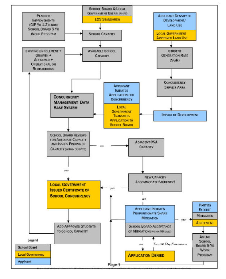
(Ord. No. 08-10, § 2(Exh. A), 7-10-08)