
Kenner City Zoning Code
ARTICLE VI
Zoning
Section 6.01 - General procedures
The following requirements are common to many of the following procedures, and apply to all applications submitted under this ordinance. Additional details may be included in the specific procedure.
(a)
Zoning Verification: Before submitting an application for any procedure in this ordinance or for a building permit, the applicant shall submit a "Zoning Verification Request Form" with the Department of Planning and Zoning.
(b)
Pre-Application Conference:
(1)
Optional - Before submitting an application for review, an applicant may schedule a pre-application conference with the Planning and Zoning Director or a designee to discuss the procedures, standards, and regulations required for approval. A pre-application conference is optional, except for the procedures listed below.
(2)
Mandatory - Before submitting an application for the following types of review, an applicant must schedule a pre-application conference with the Planning and Zoning Director or a designee to discuss the procedures, standards, and regulations required for approval in accordance with this ordinance and other applicable City codes.
a.
Formal applications to amend the Pattern for Progress comprehensive plan
b.
Any amendments to the Unified Development Code
c.
Zoning Map changes
d.
Planned Unit Development applications
e.
Conditional Use applications
(c)
Neighborhood Early Notice Conference: Following a mandatory pre-application conference, the applicant must provide notice and present the project to the neighborhood association board where the project will be located, or, if no such neighborhood board exists, to the City Council District office representing the area where the project is to be located. If an application does not require a mandatory pre-application conference, it does not require a Neighborhood Early Notice Conference.
(1)
The applicant, when required, must request in writing a public community meeting with the affected neighborhood to disclose the details, plans, and proposals of the request or project seeking approval.
(2)
Upon written notice to the community, a community meeting must take place within 45 days of the written request, or the community or neighborhood will lose its right to a public meeting.
(3)
The applicants must prepare a report accompanying the formal application, delineating concerns raised at the neighborhood meetings as well as any actions taken to assuage or mitigate these concerns.
(4)
As part of the application, following the community meeting, the applicant shall submit to the Director of the Department of Planning and Zoning a letter verifying the time, place, and location of the meeting and the issues and concerns discussed at that meeting.
(d)
Application:
(1)
Initiation - The owner(s) of the property in question, or the authorized agents of the owner(s), may initiate and file an application for approval from the City of Kenner.
(2)
Application Forms - Applications, containing all information requested on the application and any additional information required by a designee of the City of Kenner, must be submitted on forms and in such numbers as required by this ordinance. All applications must be complete and sufficient for processing before they will be reviewed.
(3)
Fees - As per Section 14.01 of this ordinance, no applications shall be reviewed, and no permit, certificate, or variance shall be issued unless or until such costs, charges, fees, or expenses have been paid in full. When an application is submitted on behalf of the City of Kenner, no fees shall be required.
(4)
Complete Applications - An application is complete when it contains all the information necessary to decide whether the development as proposed will comply with all of the requirements of this Ordinance. Details for each application are included in the specific procedure Section of this Ordinance. The presumption is that all of the information required in the application forms is necessary to satisfy the requirements of this Ordinance. However, it is recognized that each application is unique, and more or less information may be required according to the needs of the particular case. The applicant may rely on the determination of the Planning and Zoning Director as to whether more or less information may be submitted.
(5)
Concurrent Applications - Applications may be filed by the same applicant and reviewed concurrently, at the option of the applicant.
a.
Any application that also requires a variance shall not be eligible for final approval until the variance has been granted.
b.
Applications submitted concurrently are subject to approval of all other related applications; denial or disapproval of any concurrently submitted application shall stop consideration of any related applications until the denied or disapproved application is resolved.
c.
No more than one (1) applicant shall submit a land use or zoning application for an identical request. Applications will be accepted only on a first-come first-served basis.
(6)
Modification of Application - An application may be modified at the applicant's request following the approval of the Planning and Zoning Director or his designee before the request is advertised in the official journal for Planning and Zoning meetings. Any modification after the request has been advertised shall require a new hearing.
Section 6.02 - Notice provisions
(a)
Published Notice for Planning and Zoning Commission Hearings: For all land use and zoning applications and requests appearing before the City of Kenner Planning and Zoning Commission, a notice setting forth the date, time, place and purpose of the public hearing, the name of the applicant, and identification of the subject property must be published once a week for three (3) consecutive weeks in the official journal of the City of Kenner. At least twenty (20) days shall lapse between the first publication and the date of hearing.
(b)
Notice by Mail: In addition to notice by publication, at least ten days prior to the public hearing, a good faith attempt to notify all property owners of record within a 250-foot radius of the property under consideration shall be made by the sending of an official notice by certified mail of the date, time, and place of the public hearing and the subject matter of the applicable regulations and restrictions. No other mandatory types of notice shall be required; however, the City of Kenner Planning and Zoning Commission, by rule may provide for additional discretionary forms of notice.
(c)
Notification Following Decision: Within ten (10) calendar days of the effective date of the City Council's ordinance reflecting action on any application for which notice is required under this section, written notification of such action shall be mailed to the applicant by the Director of planning, stating the action taken and including all conditions imposed and items established for satisfaction of such conditions, if any.
(d)
Notice of Termination of Approval: Prior to the City Council's review of whether an approved land use or zoning application should be terminated, personal notice of the termination proceeding shall be given to the applicant and other interested parties in the manner provided herein.
(e)
Costs of Notice: All actual costs incurred by the City in preparing and publishing the notice required by this Article shall be paid by the applicant prior to publication or mailing of such notice according to a schedule of fees established by the City Council.
(f)
Validity of Defective Notice:
(1)
No action on a land use or zoning application shall be declared invalid by reason of any defect in:
a.
The publication of the notice of the purpose or subject matter and the time and place of the hearing if the published notice gives reasonable notification of its purpose, subject matter, substance or intent; or
b.
The mailing of notice to property owners as described in Section 6.02 (b).
(2)
Any defect in or failure to strictly adhere to the discretionary forms of notification or a form of notice not required by state law shall not form a basis for declaring invalid any ordinance or City Council action on any zoning matter.
(3)
No denial by the City Council of any application requiring notice shall be declared invalid by reason of any defect in any form of public notice, if the applicant has received notice of the time, date, and place of the hearing.
Section 6.03 - Procedures and approvals
(a)
Zoning Compliance:
(1)
Purpose: The purpose of a zoning verification is to promote compliance with this Ordinance by establishing a procedure for the City to verify the zoning classification of a specific lot, parcel, or tract of land prior to development or establishment of a use on said, lot, parcel, or tract.
(2)
Authority: Prior to the issuance of a building permit or occupational license, the Director of the Department of Inspections and Code Enforcement must review the zoning verifications in accordance with the provisions of this section.
(3)
Applicability: No structure or land may be used or occupied, in whole or in part, for any purpose, until a zoning verification has been issued stating that the use, structure, and site improvements comply with the provisions of this Ordinance. A zoning verification must be issued prior to issuance of a building permit or an occupational license. A zoning verification is needed only for the first permit or license issued for the building or site. For example, new construction that requires both a building permit and an occupancy permit only requires a zoning verification for the building permit.
(4)
Process:
a.
Prior to the issuance of a building permit or an occupational license by the Department of Inspections and Code Enforcement, a zoning verification of the use of the subject property shall be performed.
b.
When a zoning verification is issued in conjunction with a building permit, occupancy permit or business license, no separate application is required.
c.
An applicant may request a zoning verification. The applicant must submit an application containing the following material, unless waived by the Department of Inspections and Code Enforcement:
i.
A completed application containing the applicant's name(s), address, and interest in the subject property.
ii.
The name and address of the owner of the subject property, if different from the applicant, and the owner's signed consent to the filing of the application.
iii.
The proposed use or uses of the subject property and a brief description of the construction, reconstruction, remodeling, or alteration requiring the issuance of a zoning verification.
iv.
Such other and further information or documentation as the Director of the Department of Inspections and Code Enforcement may deem necessary or appropriate for a full and proper consideration and deposition of the particular application.
(5)
Expiration: A verification of zoning compliance expires after six (6) months if a building permit application has not been filed.
(b)
Site Plan Review:
(1)
Types of Site Plan Reviews: Site plan reviews are classified as either Administrative or General.
(2)
Purpose and Applicability:
a.
Site Plan Review is to assist the City's zoning enforcement officials in determining whether the purpose of Administrative specific standards of this ordinance and, if applicable, other laws and regulations have been complied with. Upon a determination of compliance, requested permits and licenses may be issued to the applicant. Administrative site plan review is a prerequisite to the issuance of new construction building permits.
b.
The purpose of General Site Plan Review is to assist the Planning Department and the Planning and Zoning Commission in determining the merits of an application that requires final action by the City Council. General site plan review is conducted by the Department of Planning. It entails a public hearing process that requires a recommendation by the Planning and Zoning Commission and final action by the City Council.
(3)
Administrative Site Plan Review: Any development not governed by a Special Ordinance shall initially submit a request for Administrative Site Plan Review with the Department of Inspections and Code Enforcement.
(4)
General Site Plan Review: The following types of applications require General Site Plan Review:
a.
Application for a Planned Unit Development (PUD)
b.
Application for a Conditional Use in any district
c.
Application for a rezoning of land and property
d.
Application to amend the Comprehensive Plan of the City of Kenner
e.
Application for a major resubdivision of land
f.
Any other land use application for which the Planning and Zoning Commission reviews and the City Council is authorized to act on
(5)
Application and Fees:
a.
All applications for general site plan review shall be filed in writing with the Planning and Zoning Director (See Section 16.01, review Criteria Fees.)
b.
A pre-application conference is required for general site plan review.
(6)
Submittal Requirements for Site Plans: In addition to any other information required to be submitted by zoning district regulations for site plans, site plans should be prepared at a scale of not more than fifty (50) feet to one (1) inch and should contain the following information.
a.
The name of the individual or firm preparing the plan.
b.
Sheets or pages numbered.
c.
Date and any revision dates.
d.
The north point, scale, and date.
e.
The boundaries of the property involved, the general location of all existing easements, sector lines, and property lines, existing streets, buildings, or waterways, and other significant physical features in or adjoining the project.
f.
The approximate location and sizes of sanitary and storm sewers, water mains, culverts, and other underground utilities and structures in or near the project.
g.
The general location and character of construction of any proposed streets, alleys, driveways, curb cuts, entrances and exits, vehicular use and off-street parking areas, loading areas (including numbers of parking and loading spaces), outdoor lighting systems, storm drainage and sanitary facilities.
h.
Calculations for off-street parking requirements.
i.
The approximate height of all proposed buildings and structures, accessory and main or major excavations in relation to heights of buildings and structures on adjoining property. The location should be drawn to scale, but full dimensioning is not required.
j.
Preliminary plans and elevation of the building(s) as may be deemed necessary.
k.
General location, height, and material of all dumpsters, fences, walls, screen planting and landscaping.
l.
General location, character, size and height, and orientation of proposed signs.
m.
A tabulation of the total gross area in square feet or acres of the project site and the floor area in square feet of any building(s) in the proposed development.
n.
Landscaping and design information necessary to meet the requirements of design review, where applicable.
o.
Such other information as may be required by the Planning and Zoning Department in order to meet standards in the zoning district in which the use is to be located.
(7)
Waiver of submittal requirements: The Director of Planning and Zoning may waive submittal requirements for site plans where the information is not necessary under the circumstances to determine the nature of the development or whether the development meets relevant approval criteria.
(8)
General Site Plan Review - Process:
a.
Review by the Planning Department:
i.
The Planning Department will review the site plan and other submittals and make a report to the Planning and Zoning Commission.
ii.
The Planning Department may refer the site plan to other affected or interested agencies for review and comment.
b.
Public Hearing and Recommendation by the Planning and Zoning Commission: Whenever the Planning and Zoning Commission is required by this ordinance to make a recommendation to the City Council concerning a land use or zoning application, the Commission shall make such recommendation after it has conducted a public hearing.
c.
Review and Action by City Council:
i.
Public hearing by City Council: Whenever the City Council is required by this ordinance to decide upon an application, the Council shall conduct a public hearing in accordance with its rules. The public hearing shall be held within the time period established by these regulations.
ii.
Decision by the City Council: If the City Council is the final decision-making authority for an application, it shall decide whether to approve, approve subject to modification, or deny the proposal at a public meeting. The City Council shall not take official action upon any application requiring a recommendation of the Planning and Zoning Commission, until the report of the Planning Department has been received; provided, however, that if the report has not been filed within forty-five (45) days following the date of the public hearing, the City Council may then take official action on the application without the report from the Planning Department.
iii.
The City Council shall render its decision on a General Site Plan Review application within one hundred twenty (120) days from the filling of a petition for relief by the applicant, unless otherwise expressly provided in these zoning regulations.
iv.
If the City Council has not approved the request within one hundred twenty (120) days, it shall be considered to fail.
v.
Review Criteria: The City Council shall consider the following criteria in approving or denying a land use or zoning application:
1)
The proposed development is consistent with the pertinent elements of the City of Kenner Comprehensive Plan and any other adopted plans;
2)
The proposed development meets the requirements of this Ordinance;
3)
The proposed development will reinforce the existing or planned character of the neighborhood and the City.
4)
The site plan demonstrates:
a)
Compliance with any prior approvals;
b)
Site design and development intensity appropriate and tailored for the unique natural characteristics of the site;
c)
Adequate, safe and convenient arrangement of access, pedestrian circulation, bicycle facilities, roadways, driveways and off-street parking, stacking and loading spaces;
d)
Connectivity to surrounding neighborhoods and the City as a whole;
e)
Adequate design of grades, paving, drainage and treatment of turf to handle stormwater, and;
f)
Adequate access for disabled residents through the provision of special parking spaces, accessible routes between parking areas and buildings, passenger loading zones and access to other facilities.
g)
Any adverse impacts on adjacent properties have been minimized or mitigated.
h)
The request satisfies conditions of any other City departments pertinent to the review process.
(c)
Building Permit: No building permit shall be issued for a development requiring a site plan until the site plan has been approved.
(d)
Dedication and Improvements: For development of property requiring a site plan under this Ordinance, the applicant must dedicate any additional right-of-way necessary to the width required by the City of Kenner for streets adjoining the property, install curbs and gutters and pave all streets adjoining the property, and install sidewalks and street trees based on the standards set forth in this and all other City Codes and Ordinances.
The applicant shall bear the costs of installation of any on-site or off-site improvements required by this Ordinance, including provisions for stormwater management, paving, and utilities.
(e)
Modification of Approved Site Plan: The Planning Department Director is authorized to approve minor modifications to an approved site plan. All modifications not listed as minor below shall be considered major by the body that approved the original site plan. The following modifications shall be considered minor:
(1)
Up to ten percent (10%) increase or any decrease in gross floor area of a single building;
(2)
Up to a ten percent (10%) reduction or any increase in the approved setbacks from exterior property lines;
(3)
Relocation of parking areas, internal streets, or structures where such relocation occurs more than one hundred feet (100') for exterior property lines.
(4)
Appeals of City Council Decisions: Within fifteen (15) calendar days of a final decision on Site Plan Review of the City Council, any person aggrieved by the decision of the City Council may appeal that decision to the 24th judicial district court for the Parish of Jefferson. An appeal of a final decision of the City Council shall not affect a stay of such decision, unless specifically authorized by the City Council or ordered by the court.
(5)
Expiration: A site plan expires after twelve (12) months where a building permit application has not been filed for all or part of said development. Applicants may file for one (1) six (6) month extension of the site plan approval in writing with the Planning and Zoning Director subject to administrative approval.
(f)
Planned Unit Developments (PUD's): Purpose of provisions: Planned unit developments are of such substantially different character that specific and additional standards and exceptions are hereby set out to govern the recommendations of the Planning and Zoning Commission and the action of the City Council. In the case of a planned unit development, the Planning and Zoning Commission, after holding a public hearing, may recommend and the City Council may authorize that there be in part of the area of such development and for the duration of such development, specified uses not permitted by the use regulations of the district in which said development is located, provided the Planning and Zoning Commission shall find:
(1)
That the uses proposed are consistent with the City of Kenner's Comprehensive Plan.
(2)
That the uses permitted by such exception are reasonable or desirable and are appropriate with respect to the private purpose of the development.
(3)
That the uses permitted by such exception are not of such a nature or so located as to exercise a detrimental influence on the surrounding neighborhood.
(4)
Providing the above conditions are met, the City Council shall have the power to grant exceptions to the following:
a.
Yard requirements
b.
Lot area
c.
Use requirements
(5)
Limitations: The provisions of this section are applicable in all districts providing the lot area of the property in question has the following minimum area:
a.
In R-1, R-1A and RR-1 Districts: Ten (10) contiguous acres
b.
All other districts except the R-1, R-1A and RR-1 Districts: Two (2) contiguous acres
c.
In calculating the minimum area for a planned unit development, the measurement shall not include the area of any previously dedicated streets or alleys.
d.
Adult book/video stores and truck stops with video poker machines are not permitted uses under the provisions of this section.
(6)
Conditions to be met by planned unit developments:
a.
District regulations: Every building erected and maintained under the provisions of this section shall comply with all of the regulations established by this ordinance for the district in which the building group is located except the regulation requiring a separate building site to be provided and maintained for each principal structure.
b.
Site plan and improvements: A site plan for a building development shall include the requirements listed with Section 6.03 (b)(6).
c.
Formation of incorporate nonprofit association (when applicable and/or when required by the City Council as part of a PUD). When the formation of an incorporate nonprofit association is part of a PUD the developer shall:
i.
Create an incorporate nonprofit automatic homes association, which assures exterior maintenance of each unit and the common areas.
ii.
Record covenants which automatically make every lot owner an association member, give the owner the right to use the common property, and establish his/her voting rights in the association and his obligation to pay its assessments.
d.
Variations and exceptions: Whenever the tract to be subdivided is of such unusual size or shape or is surrounded by such development of unusual conditions that the strict application of the requirements contained in these regulations would result in real difficulties and substantial hardships or injustices, the Council may vary or modify such requirements, so that the subdivider is allowed to develop his property in a reasonable manner, but so that, at the same time, the public welfare and interest of the City are protected and the general intent and spirit of these regulations are preserved.
(7)
Procedure on planned unit developments.
a.
Application for approval: An application for approval of a planned unit development shall be filed with the planning department and shall contain the following:
i.
Interest and ownership: The applicant's name, address and interest in the application, and the name, address, and interest of every person, firm or corporation represented by the applicant in the application; the concurrence of the owner or owners of the entire land area included in the special plan and all encumbrances of such land; and sufficient evidence to establish that the applicants are all the owners and encumbrances of the designated land area, intend actually to develop the designated area, and have the means and ability to do so.
ii.
Survey: The survey shall be performed and stamped by a licensed surveyor or engineer, and be no less than five (5) years old, and reflect existing site conditions.
iii.
Site Plan for building development: The site plan shall contain any other site information as may be necessary to describe completely the proposed improvements.
iv.
Building Elevation Plan: The building elevation plan shall illustrate the exterior architectural features of the building(s) including roof design, pitch, and height.
v.
Landscape Plan: Illustration of the landscape plan shall be consistent with Article IX. Landscaping Regulations; Section 9.04 (c). Content of Landscape Plan.
b.
General examination: Upon receipt of an acceptable application for approval of a planned unit development, properly and completely made out as listed herein, the planning department shall examine the application and make such investigation as is necessary. Within sixty (60) days of the receipt of an application, the planning department shall transmit the application together with its report to the Planning and Zoning Commission. The planning department may also transmit a copy of the application to any department or agency, which might be affected by the approval of the application, and such department or agency may transmit its report and recommendation to the Planning and Zoning Commission.
c.
Compliance with state laws: Planned unit developments must comply with any applicable state laws
d.
Review by Planning and Zoning Commission: The Planning and Zoning Commission shall hold a public hearing concerning the planned unit development in accordance with the provisions of this ordinance and shall review each application and shall approve or disapprove the site plan; approval may establish conditions and limitations, which may include a performance bond. The Planning and Zoning Commission shall then, within sixty (60) days render a recommendation to the City Council of approval, approval with conditions, or denial.
e.
Presentation of planned unit development to the City Council: Upon action taken by the Planning and Zoning Commission, the plan shall be presented to the City Council for final action. Action by yea and nay vote shall be taken within ninety (90) days [after] being submitted to the City Council. If the Council fails to vote within the ninety (90) day period, the time for Council action on the PUD will have prescribed and the PUD application will have failed. The one (1) year limitation period for reapplication, as provided for herein, shall be in effect from the prescription date.
f.
Registration of planned unit development: Upon approval of a planned unit development, a copy of such plan shall be registered among the records of the planning department and shall thereafter be binding upon the applicants, their heirs, successors, and assigns; shall limit and control the issuance and validity of permits and certificates, and shall restrict and limit the use and operation of all land and structures within the area designated in such planned unit development and approval thereof; provided, however, that the department of planning may, upon a showing of land use necessity thereof, permit minor changes in the location of structures and site improvements if such minor changes will not change the character or use of the development, increase the gross floor area, intensity of use, or ground coverage, reduce the total building site area, the space between buildings, or the ratio of off-street parking area and off-street loading area to gross floor area, or gross floor area, or otherwise cause the planned unit development to fail to meet the conditions specified herein.
g.
Amendment or withdrawal of planned unit development: Pursuant to the same procedure and subject to the same limitations and requirements by which the planned unit development was approved and registered, any planned unit development may be amended or withdrawn, either partially or completely, if all land and structures remaining under such planned unit development comply with all the conditions and limitations of the planned unit development and all land and structures withdrawn from such planned unit development comply with all regulations established by this ordinance and unrelated to the planned unit development.
h.
Fees: Before any action shall be taken, fees must be paid in accordance to section 16.01, Fee Schedule.
i.
One-year limitation: When a planned unit development application is filed with the planning department, and has been finally acted on by the City Council in accordance with the above outlined procedure, the Planning and Zoning Commission and the City Council shall not be petitioned to consider the identical planned unit development, for the same property, within a period of one calendar year from the date of the City Council's final action on said planned unit development.
(g)
Conditional Use Permits:
(1)
Nature of conditional use: A "conditional use" is a land use which, because of its unique nature or impact on the public's health, safety and/or welfare, is compatible with the permitted uses in a given zoning district and in nearby areas only upon a determination that the external effects of the use, in relation to the existing and planned uses of adjoining property, can be mitigated through the imposition of standards and conditions. This Article sets forth the standards used to evaluate proposed conditional uses and the procedures for approving conditional use permit applications.
(2)
Permit required: No conditional use shall be established and no building permit shall be issued for any use designated as a conditional use within a zoning district until a conditional use permit is issued in accordance with the provisions of this Article. An application for a conditional use permit shall be accompanied by a site plan prepared in the manner described in Site Plan Review Section 6.03(b). The site plan shall illustrate the proposed use to be established, its relationship to adjoining properties and how it meets the approval standards set forth in Section 6.03(g)(6).
(3)
Status of Conditionally Permitted Uses: The following general rules apply to all conditional uses:
a.
The designation of a use in a zoning district as a conditional use does not constitute an authorization or assurance that such use will be approved.
b.
Approval of a conditional use permit shall authorize only the particular use for which the permit is issued.
c.
No use authorized by a conditional use permit shall be enlarged, extended, or relocated, nor may the number of dwelling units be increased, unless an application is made for approval of a new conditional use permit in accordance with the procedures set forth in this section.
d.
Development of the use shall not be carried out until the applicant has secured all the permits and approvals required by the ordinances of the City of Kenner, including but not limited to these zoning regulations and the City Code, and all permits, if any, required by regional, state or federal agencies.
(4)
Application for Conditional Use Permit: When an application for a conditional use permit is made, the application shall be submitted by the property owner or by the property owner's designated representative to the Director of Planning and Zoning. The application shall be accompanied by a site plan prepared in accordance with the requirements of this Ordinance for Site Plan Review.
a.
Subdivision approval: If the proposed use requires a division of land, an application for subdivision approval shall be submitted in conjunction either with the application for a conditional use permit or include the subdivision request in the ordinance for conditional use approval. Approval of the conditional use permit shall not become effective until final approval of the subdivision application provided, that if the land is to be divided in phases, the approval of the conditional use permit shall take effect upon final approval of the phase of the subdivision containing the property on which the conditional use is to be located.
(5)
Procedures for Conditional Use Permits:
a.
Planning and Zoning Commission Recommendation: Upon receipt of the report from the Director of Planning, the Planning and Zoning Commission shall conduct a public hearing in order to formulate its recommendations to the City Council on the conditional use permit application. Following the public hearing, the Commission shall recommend approval, approval subject to modification, or denial of the proposal to the City Council in accordance with these regulations. If the appropriateness of the use cannot be assured at the location, the Commission shall recommend denial of the application as being incompatible with existing uses or uses permitted by right in the district and any other areas that would be materially affected by the use.
b.
City Council Action: The City Council shall be the final decision-maker on applications for conditional use permits. Following a public hearing and in consideration of the Planning and Zoning Commission's recommendations, the City Council shall approve, modify, or deny the proposal for a conditional use permit in accordance with these regulations. If the appropriateness of the use cannot be assured at the location, and in areas of the City reasonably anticipated to be affected by the use, the application for a conditional use permit shall be denied as being incompatible with existing uses or uses permitted by right in the district and in other significantly affected areas.
(6)
Standards and Review Criteria: When considering applications for a conditional use permit, the Planning and Zoning Commission in making its recommendation and the City Council in rendering its decision on the application shall, on the basis of the site plan and other information submitted, evaluate the impact of the conditional use on, and the compatibility of the use with, surrounding properties and neighborhoods to ensure the appropriateness of the use at a particular location. The Commission and the City Council shall specifically consider the following factors:
a.
The proposed use is consistent with the general purpose and intent of the applicable zoning district regulations, the regulations of other districts which are reasonably anticipated to be significantly affected by the use, and any other plan, program, map or ordinance adopted, or under consideration pursuant to official notice, by the City of Kenner;
b.
The proposed use meets all standards specifically applicable to the use.
c.
The proposed use is compatible with and preserves the character and integrity of adjacent development and neighborhoods and, as required by the particular circumstances, includes improvements or modifications either on-site or within the public rights-of-way to mitigate development-related adverse impacts, including but not limited to:
i.
Adequate ingress and egress to property and proposed structures thereon with particular reference to vehicular and pedestrian safety and convenience, and access in case of emergency;
ii.
Off-street parking and loading areas;
iii.
Refuse and service areas;
iv.
Utilities with reference to location, availability, and compatibility;
v.
Landscaping, screening and buffering, features to minimize visual impacts, and/or setbacks from adjacent uses;
vi.
Control of signs, if any, and proposed exterior lighting with reference to glare, traffic safety, economic effect, and compatibility and harmony with properties in the district;
vii.
Required yards and open space;
viii.
Height and bulk of structures;
ix.
Hours of operation; and
x.
Roadway adjustments, traffic control devices or mechanisms, and access restrictions to control traffic flow or divert traffic as may be needed to reduce or eliminate development-generated traffic on neighborhood streets.
d.
The proposed use is not materially detrimental to the public health, safety, convenience, and welfare, and will not result in material damage or prejudice to other property in the vicinity.
e.
The proposed use at the proposed location shall not be designed, constructed or operated in a manner as to so dominate the immediate vicinity to the extent that the use would be incompatible with or injurious to the use and enjoyment of neighboring property, or otherwise would significantly diminish or impair property values within the vicinity. In determining whether the proposed conditional use would so dominate the immediate vicinity, consideration shall be given to:
i.
The location, nature and height of buildings, structures, walls and fences on the site;
ii.
The nature and extent of screening to be employed on the site.
f.
The benefits to be derived by the City of Kenner from the proposed use at the proposed location outweigh the loss of, or damage to, any homes, businesses, natural resources, public revenue, historic or cultural landmarks or sites, wildlife habitats, parks, or natural, scenic, or historic features of significance, and outweigh the personal and economic costs of any disruption to the lives, businesses and property of individuals affected by the proposed use.
g.
Adequate nuisance prevention or control measures have been or shall be implemented and maintained to prevent or appropriately mitigate offensive odors, fumes, smoke, air pollution, dust, noise, vibration, visual blight, liquid or solid wastes, biohazards, heat, glare, storm and/or floodwater runoff and other adverse effects associated with the proposed use at the proposed location.
h.
The proposed use at the proposed location is consistent with prior plans, Pattern for Progress comprehensive plan, master plans and projections of the applicant, if any, upon which the City of Kenner has based planning or zoning decisions or, where inconsistencies exist, any such inconsistency is outweighed by the benefits to the community associated with the proposed use.
i.
The proposed conditional use will comply with any additional standards imposed on it by an ordinance authorizing such use.
j.
The proposed conditional use will minimize disruption to existing neighborhoods, will minimize the adverse impact on existing community services, and will complement in the least intrusive manner possible the needs of the City, region and the state, and
k.
All reasonable alternative sites and all reasonable means for meeting the projected need or demand for the proposed building, structure, development, use or activity which may be less costly or less intrusive to existing communities have been considered and rejected by the applicant for clearly disclosed reasons, and that all reasonable means for minimizing adverse impacts of the proposed use have been considered and incorporated into the proposal.
(7)
Conditions and Approval: In approving the application, the Planning and Zoning Commission may recommend and the City Council shall impose such conditions as are reasonably necessary to assure compliance with these standards and the purpose and intent of this section, in accordance with the procedures in these regulations.
a.
Any conditions imposed shall be set forth in the ordinance approving the conditional use and shall be incorporated into or noted on the site plan for final approval.
b.
The Director of Planning or his/her agent shall verify that the plan incorporates all conditions set forth in the ordinance authorizing the conditional use, and shall sign the plan to indicate final approval.
c.
The applicant shall have the signed site plan recorded in the public property records of Jefferson Parish no later than thirty (30) days following the date of final approval, or the ordinance approving the conditional use shall be deemed null.
d.
The department of planning and zoning shall maintain a record of such approved conditional uses and the site plans and conditions attached thereto, and forward copies thereof to the Department of Inspections and Code Enforcement.
e.
Record and notification of conditions. The Director of Planning shall include a copy of the conditions attached to approval of the special ordinance with the record of the decision filed with the clerk of the City Council. The applicant shall be notified of any conditions imposed on the application in the manner provided in this ordinance.
(8)
Prohibition on waivers and variances: The foregoing standards of development shall not be subject to waivers or variances that otherwise could be granted under the provision in this ordinance for the Board of Zoning Adjustments, nor may conditions imposed by the City Council subsequently be waived or varied by the board. In conformity with the authority of the City Council to authorize conditional uses, the Council may waive or modify specific standards otherwise made applicable to the use by this ordinance, to secure the general objectives of this section, provided, however, that the Council shall not waive or modify any approval factor set forth in subsection (1) of this section.
(9)
Expiration and Extension:
a.
Application for Permit: Upon approval by the City Council, a building permit to initiate new construction shall be applied for within six (6) months from the date of the adoption of the conditional use ordinance; otherwise, the approved conditional ordinance shall be null and void.
b.
Termination for Failure to Commence Development: If substantial construction has not commenced within twelve (12) months from the date of permit, the permit shall be terminated for a failure to commence development. The Director of Inspections and Code Enforcement shall determine if the amount of construction is determined to be substantial.
c.
Extension Procedures: Unless otherwise prohibited by law or this ordinance, the Director of planning may extend the time for expiration of an approved conditional use permit, for a period not to exceed six (6) months upon a showing of good cause by the applicant, if request for extension is made in writing within the original period of validity. An extension for a period in excess of six (6) months shall be granted only by the City Council, but not for a period to exceed six (6) additional months. A determination by the City Council on whether to extend such approval shall be made in accordance with procedures set forth in this ordinance for the original approval for which extension is requested.
(10)
Amendment to an Approved Conditional Use Permit:
a.
No proposed or existing building, premise, or land use authorized as a conditional use may be established, enlarged, modified, structurally altered, or otherwise changed from that approved in the conditional use permit, unless such amendment is authorized in accordance with the standards and procedures set forth in this section, and the conditional use permit and approved site plan are amended accordingly.
b.
Administrative Approval to Site Plan Changes - In order to provide a more practical, reasonable and expeditious method of correction errors, omissions, oversights, or for making changes, alterations or adjustments to approved applications, the Director of Planning and Zoning or the City Council, as the case may be, may make the following types of amendments to site plans for approved conditional use permits upon written request by the property owner holding the approved application:
i.
The Director of Planning and Zoning may approve minor revisions to the terms of approval of any application, when the Planning and Zoning Commission or the City Council is not considering such matter for amendment or revision. Minor revisions that may be authorized are those that appear necessary in light of technical considerations.
ii.
Additionally, the Director of Planning, upon recommendation of the Department of Public Works or Department of Inspections and Code Enforcement and Inspections, where applicable, may approve the following amendments or revisions:
(1)
Increases, decreases, or rearrangements of off-street parking spaces in any section or sections or in the overall plan provided the off-street parking requirements of the district in which the development is located are complied with.
(2)
Increases or decreases of the ground floor area or total floor area of structures in any section or sections provided that the total requirements of the district in which the development is located are met.
(3)
Increases or decreases of the height of any individual structure provided that any proposed increase does not exceed by more than twenty (20) percent the approved height of said individual structure, and provided further that no increase in height greater than eight (8) feet shall be allowed by the Director of Planning.
(4)
A rearrangement of streets or driveways, where such is found to be consistent with previous approvals, improves traffic circulation or otherwise improves the plan.
c.
City Council Approval to Site Plan Changes: The City Council may approve the following major amendments or revisions:
iii.
Increases or decreases in the number of structures or dwelling units permitted in any sections provided the total number of such units of the approved overall plan is not increased.
iv.
Increases or decreases of the height of any individual structure beyond an eight (8) foot increase provided that any proposed increase does not exceed by more than twenty (20) percent the approved height of any individual structure.
v.
Shifts or adjustments in the location of buildings or structures when such would improve the overall plan.
vi.
Such additional changes, adjustments, or alterations to elements of the site plan, such as walks, pools, fencing, signs, lighting, landscaping, or other elements, as may be necessary or desirable to improve the quality of the approved plan or to provide for consistency with such other changes as may be authorized under this section.
d.
The applicant shall attach to his written application a map or maps, which will delineate any corrections or changes, requested, and any other pertinent data proper for the understanding of the matter, in sufficient numbers for all departments or agencies reviewing the request.
e.
After receiving the recommendations of all required agencies and departments, the Director of Planning and Zoning, upon determination that such amendment or revision is not inconsistent with the original approval and will not adversely affect the remaining parts of the proposal and adjoining and abutting property, may approve or recommend for approval, to the City Council for such change.
f.
If approved by the Director of Planning and Zoning, or the City Council, as the case may be, a revised plan indicating the corrections, changes, alterations or adjustments shall be filed with the Director, the clerk of the City Council, and the Department of Inspections and Code Enforcement, and recorded in the public property records of the clerk of court of Jefferson Parish no later than thirty (30) days following date of approval of the plans as evidenced by their stamped approval by the Director, or said approval shall be deemed null.
g.
If the holder of an approved application wishes to make a revision to the approval other than that authorized in Section 6.03(g)(10), approval is required of the original final decision-maker in accordance with the procedures established for the original approval of the application.
(11)
Appeals: Within fifteen (15) calendar days of a final decision of the City Council, any person aggrieved by the decision of the City Council may appeal that decision to the 24th Judicial District Court for the Parish of Jefferson. An appeal of a final decision of the City Council shall not affect a stay of such decision, unless specifically authorized by the City Council or ordered by the court.
(h)
Amendments to Zoning Ordinance:
(1)
Purpose: The purpose of this section is to establish the rules and procedures for amending the City of Kenner's Unified Development Code (UDC) and Official Zoning Map.
(2)
Types of Amendments or Changes: The City of Kenner's Unified Development Code (UDC) consists of two parts: the written document containing zoning regulations and procedures as well as other parts of the text of the UDC and the "Official Zoning Map of the City of Kenner."
a.
Text Change or Amendment - is a revision to a zoning regulation or a specific Article or section of the text of the UDC.
b.
Map Change or Amendment - also known as a rezoning, is an amendment that changes the particular zoning district designation of a specific piece of property or properties.
(3)
Initiation of Change: The City Council may from time to time, amend, supplement, or change the regulations, restrictions, or boundaries herein or subsequently established. Such amendments may be initiated:
a.
By action of the City Council by introduction of an ordinance or by adoption of a motion; or,
b.
On petition by property owners, by filing with the City Council through the City of Kenner Planning and Zoning Commission, a petition in writing which conforms with the standards and requirements of the City Planning and Zoning Commission, provided that such petition is duly signed and acknowledged by the owners or authorized agents of not less than seventy-five (75) per cent of the area of the land in which a change of classification is requested.
c.
Where property is jointly owned, all co-owners of the property, or their authorized agents, must sign the application for the property to be included in the seventy-five percent (75%) area requirements.
(4)
Procedure: No text or map amendment shall become effective until:
a.
Neighborhood Early Notice Conference has been held by the applicant, as per Section 6.01 (c) of this ordinance.
b.
Submittal of Application - All applications must be filed with the Director of the City of Kenner Planning Department in accordance with the requirements of this Ordinance and reviewed for completeness by the Director.
c.
Rezoning or text amendments initiated by the City Council require a complete application, but are exempt from fees.
d.
There shall have been a public hearing held in relation thereto before the City of Kenner Planning and Zoning Commission, at which time interested citizens and parties shall have had an opportunity to be fully heard. Notice of the proposed change shall comply with public notice requirements in Section 6.02.
e.
After the public hearing as provided above, the City of Kenner Planning and Zoning Commission shall have submitted the zoning report and recommendation upon the proposal or proposed change to the City Council. The report shall be filed with the City Council within thirty (30) days after the date of the public hearing.
f.
A final yea and nay vote shall be taken on the proposal by the City Council within ninety (90) days from the receipt by the City Council of the report and recommendation of the City of Kenner Planning and Zoning Commission. If the Council fails to vote within this ninety (90) day period, the time for Council action on the proposal will have prescribed and the existing zoning is unchanged. The two (2) year limitation period as provided for in Section 9 of this Article shall be in effect from the prescription date.
g.
The provisions of this section do not apply in cases where there is a proposal to enact an entire new ordinance to change the text as a whole, or to change all the official zoning maps of the City, or both, in which event the procedure set out in Revised Statutes, 33.4721 through 33.4730 (Act 240 of legislature of Louisiana, 1926) shall be followed.
(5)
Approval Standards: The Planning and Zoning Commission recommendation and the City Council decision on any zoning text or map amendment are matters of legislative discretion. In making their recommendation and decision, the Planning and Zoning Commission and the City Council must consider the following standards:
a.
The proposed amendment is compatible with the City of Kenner's Comprehensive Plan and Future Land Use Map.
b.
The proposed amendment is compatible with existing land use and zoning of nearby property.
c.
The proposed amendment promotes the public health, safety, and welfare of the City.
d.
The proposed map amendment is a more suitable zoning classification for the property than the current classification, and allows for feasibility of developing the property in question for one (1) or more of the uses permitted under the existing zoning classification.
e.
The proposed amendment is compatible with the intent and general regulations of this Ordinance.
f.
The proposed amendment corrects an error or omission, adds clarification to existing requirements, or reflects a change in policy.
g.
The proposed amendment benefits the citizens of the City as a whole.
h.
The proposed amendment provides a more workable way to achieve the intent and purposes of this ordinance and the Master Plan.
i.
The proposed amendment does not create a significant number of nonconformities.
j.
The proposed map amendment is compatible with the trend of development, if any, in the general area of the property in question.
k.
Does not constitute a spot zone, as defined herein.
(6)
Appeals: An aggrieved party may appeal a City Council decision on a zoning map or text amendment to Jefferson Parish Civil District Court within thirty (30) days following City Council action.
(7)
Fees: Before any action shall be taken as provided in this section, the party or parties proposing or recommending a change in the zoning ordinances, either text change or map change, shall deposit with the City clerk the following:
a.
One hundred dollars ($100.00) for each text change not involving acreage.
b.
Two hundred dollars ($200.00) for all land or portion thereof for which a change of classification or permitted use is proposed or recommended up to one acre and an additional fifty dollars ($50.00) per acre for all over one acre.
c.
These fees are to cover the appropriate cost of this procedure, and under no condition shall such sum or any part thereof be refunded for failure of such changes to be adopted by the City Council. The maximum fee required for acreage or a portion thereof shall not exceed five thousand dollars ($5,000.00), for which a change of classification or permitted use is proposed or recommended, to cover the approximate cost of this procedure.
(8)
Validity: If any section, subsection, paragraph, sentence, clause, or phrase of this ordinance shall for any reason be held unconstitutional by any court of competent jurisdiction, such decision shall not affect the validity of the remaining portions of this ordinance, which shall continue in full force and effect.
(9)
Two-year limitation: Whenever a petition is filed requesting or proposing a change in or amendment to the Unified Development Code, and said petition has been finally acted on by the City Council in accordance with the above-outlined procedure, then the City Council shall not consider any further petition requesting or proposing the same change or amendment for the same property within a period of two (2) calendar years from the date of the City Council's final action on said petition.
Section 6.04 - Zoning districts - General
(a)
Purpose: The zoning regulations and districts as herein set forth have been made in accordance with the City of Kenner comprehensive plan for the purpose of promoting the public health, safety, morals, conveniences, order, prosperity, resilience, and general welfare of the community.
(b)
Establishment of Districts: In order to classify, regulate and restrict the location and use of land, buildings, and structures for trade, industry, residence, and other purposes; to regulate and restrict the height and size of buildings hereafter erected or structurally altered, the area of yards, courts and other open spaces and the density of population, all in the incorporated area of the City of Kenner, Parish of Jefferson, Louisiana.
(c)
Boundaries of Districts: The boundaries of the various districts are identified on the "Official Zoning Map, City of Kenner, Parish of Jefferson, Louisiana." The official zoning map of Kenner shall be kept on file and maintained in the Department of Planning and Zoning for the City of Kenner. The official zoning map of Kenner is hereby made a part of this ordinance and shall form a part of this ordinance as if all the matter and information set forth thereon were fully described and copied herein.
(d)
Interpretation of District Boundaries: The following rules shall be used whenever any uncertainty exists as to boundaries of any district:
(1)
Where boundaries are indicated as following street and alley lines, lot and other boundary lines, watercourses and other natural topographic features, such lines shall be construed to be such boundaries.
(2)
In unsubdivided property or tracts, where a district boundary divides a lot, the location of such boundaries, unless indicated by dimensions, shall be determined by use of the scale appearing on such maps.
(3)
In case any further uncertainty exists, the Director of planning shall determine the location of boundaries.
(4)
Where boundaries are so indicated that they are approximately parallel to the centerline of streets or to the centerline of alleys or the centerline of highways, such boundaries shall be construed as being parallel thereto and at such distance therefrom as indicated by dimension or scale shown on said maps.
(e)
Regulations of Areas Under Water: All areas within corporate limits of the City of Kenner, which are under water and not shown as included within any district, shall be subject to all the regulations of the district adjacent to the area under water. If the area under water adjoins two (2) or more districts, the boundaries of each district shall be construed to extend into the area under water in a straight line until they intersect.
(f)
Classification of Annexed Territory: All territory, which may be, hereafter, annexed to the City of Kenner, Louisiana, shall be automatically classified as temporary R-1 Single-Family Residential District until otherwise changed by ordinance after public hearings.
Section 6.05 - Single-Family Residential Districts (R-1, R-1A, RR-1)
(a)
R-1 - Single-Family Residential District:
Purpose: This district shall provide for low-density residential development with relatively spacious open areas and to permit accessory uses and such nonresidential uses that are compatible with residential surroundings. The district is located to protect existing developments unique of this character.
(b)
R-1A - Single-Family Residential District:
Purpose: This district shall provide for single-family development on medium-size lots, together with such accessory uses and nonresidential uses that are compatible with residential surroundings. The district is located to include developments of this unique character.
(c)
RR-1 - Single-Family Residential District:
Purpose: This district shall provide for single-family residential development on smaller lots, together with such accessory uses and nonresidential uses that are compatible with residential surroundings. The district is located to include existing developments of this character and contains vacant land considered appropriate for such development in the future.
(d)
Permitted Uses: A building or land shall be used only for the following purposes:
(1)
Dwelling, Single-family.
(2)
Churches, rectories, parish homes, temples and synagogues, or dwellings used for worship by organized religious sects as defined by the Internal Revenue Service, provided that such churches, temples, synagogues, etc., shall be located on a lot of at least twenty thousand (20,000) square feet in area; except in RR-1 zoned areas having only legally substandard lot sizes less than five thousand (5,000) square feet in area within one hundred fifty (150) feet of a church, temple, synagogue, etc., of such lot, the lot size for such church, temple, synagogue, etc., shall be at least fourteen thousand (14,000) square feet in area.
(3)
Public Facilities.
(4)
Parks and Playgrounds.
(5)
Public or Private Schools having a curriculum the same as that ordinarily given in public schools, including kindergarten, provided elementary schools including kindergartens are located on a site having a minimum area of two (2) acres, and provided junior or senior high schools are located on a site having a minimum area of five (5) acres, and provided further that the following requirements shall be observed: Appropriate setbacks shall be provided for all structures (exclusive of play equipment) of not less than fifty (50) feet where the side yard line or rear yard line abuts a residential district and not less than twenty-five (25) feet from all lot lines abutting streets, canals, or open public spaces.
(6)
Private gardens and nurseries for the propagation and cultivation of plants only when said plants, flowers, and produce are not offered for sale.
(7)
Home Occupation (subject to the supplementary regulations in Article XII).
(8)
Monopoles/Antennas (subject to the supplementary regulations in Article XII).
(9)
Accessory Use - Accessory buildings and uses, which are customarily incidental to any of the above uses when located on the same lot and not involved in the conduct of a business.
(e)
Conditional Uses: The following uses may be permitted but shall comply with the provisions and procedures of Section 6.03(g), Conditional Use Permits, of this ordinance:
(1)
Day Care Center, adult or Day Care Center, child. Providing that:
a.
Center is located on a site having a minimum area of one acre.
b.
There shall be a building or structure within which a minimum of thirty-five (35) square feet per child (based on total enrollment) of useable, available play or instruction space shall be provided.
c.
There shall be a minimum of seventy-five (75) square feet per child, (based on total enrollment) of useable available outdoor play or instruction area on the lot or property, providing that no portion of such play or instruction area shall be located within the required front yard of the lot or property.
d.
Outdoor play or instruction area shall be enclosed by a fence no less than four (4) feet, nor more than six (6) feet in height.
e.
Additionally, a wood, metal, or masonry fence shall be provided along any rear or side property line adjoining any residentially zoned property not used for a similar purpose. Any such fence shall be designed to be at least five (5) feet in height and eighty (80) percent or more opaque when viewed horizontally.
f.
There shall be provided a minimum of three (3) off-street parking spaces, or one off-street parking space for each three hundred fifty (350) square feet of indoor play or instruction space, whichever is the greater.
g.
Hard-surfaced paved area shall be provided off-street for buses and/or motor vehicles bringing and picking up children. This may be in the required front yard. That the regulatory department be empowered to enforce all provisions of state law R.S. 46:1401 as amended, which is made a part of this ordinance prior to issuance of a permit and thereafter. The Planning and Zoning Commission will hold public hearings per section 6.03 (f)(7)(d) and make recommendation to the City Council, and all property owners within one hundred (100) feet fronting on both sides of the street of the premises affected shall be notified by certified mail calling the attention of the public hearing for this purpose.
(2)
Club, Lodges, Fraternities, and Community Centers:
a.
Clubs when approved by an ordinance by the City Council, when they are satisfied that granting approval will not seriously affect any adjoining property or the general welfare and further that the Planning and Zoning Commission hold a public hearing to make a recommendation to the City Council and that all property owners within one hundred (100) feet fronting on both sides of the street of such locations shall be notified by certified mail calling the attention of the public hearing for this purpose.
(3)
Private recreational uses:
a.
Private recreational uses such as tennis courts, swimming pools, golf courses, operated exclusively for private use of the occupants of the premises and not for commercial purposes.
b.
Private recreational uses such as tennis courts, swimming pools, golf courses, and other similar activities operated exclusively for the use of private membership clubs or organizations and their guests and not for commercial purposes, when approved by an ordinance by the City Council, when they are satisfied that granting approval will not seriously affect any adjoining property or the general welfare and further that the Planning and Zoning Commission hold public hearings and make recommendations to the City Council and that all property owners within one hundred (100) feet fronting on both sides of the street of such locations shall be notified by certified mail calling the attention of the public hearing for this purpose.
c.
No such use, structure or accessory use to be located closer than fifty (50) feet to any adjoining property line unless such property line fronts a public street or drainage canal with rights-of-way not less than twenty-five (25) feet, in which instance the required setback need not exceed twenty-five (25) feet.
d.
That all such facilities must be located on a site having a minimum area of one acre.
(4)
Camping and recreational equipment may be parked or stored on private property subject to the following conditions:
a.
At no time shall such parked or stored camping and recreational equipment be occupied or used for living, sleeping, housekeeping purposes, storage or any other use other than that which the manufacturer primarily intended the usage for.
b.
If said camping and recreational equipment is parked or stored longer than three (3) days, the owner thereof shall register the same with the office of regulatory inspections, giving a full description of the camping and recreational equipment, the address where it is being parked or stored, and the period during which it is contemplated to be parked or stored.
c.
If the camping and recreational equipment is parked or stored outside of a garage, it shall be parked or stored to the rear of the front building line of the lot. It shall not be parked in the required front yard area.
d.
Notwithstanding the provisions of sub-paragraph c, camping and recreational equipment may be parked anywhere on the premises for loading or unloading purposes.
(f)
Site Development Regulations:
(1)
Maximum Height:
a.
No building shall exceed thirty-five (35) feet in height.
b.
Front Yard: There shall be a front yard having a depth of not less than twenty (20) feet. On through lots, the required front yard shall be provided on both streets.
c.
Side Yard:
i.
There shall be two (2) side yards having a combined width of not less than twenty (20) percent of the width of the lot; provided that in no case shall either side yard be less than five (5) feet and provided further that the combined width of two (2) side yards need not exceed twelve (12) feet.
ii.
On corner lots, the side yard on the side of the lot abutting the side street shall not be less than ten (10) feet unless otherwise provided herein.
d.
Rear Yard: There shall be a rear yard having a depth of not less than twenty (20) percent of the depth of the lot, provided, however, that the depth of such rear yard shall not be less than fifteen (15) feet and need not exceed twenty-five (25) feet.
(2)
Lot Area:
a.
R-1: Every lot shall contain an area of not less than six thousand six hundred (6,600) square feet with a minimum width of sixty (60) feet and a minimum depth of one hundred (100) feet, unless otherwise provided herein.
b.
R-1A: Every lot shall contain an area of not less than six thousand (6,000) square feet with a minimum width of fifty (50) feet and a minimum depth of one hundred (100) feet, unless otherwise provided herein.
c.
RR-1: Every lot shall contain an area of not less than five thousand (5,000) square feet with a minimum width of fifty (50) feet and a minimum depth of one hundred (100) feet, unless otherwise provided herein.
(3)
Off-Street Parking and Loading Requirements: The off-street parking and loading requirements shall be as provided in Article VII, Off-street Parking and Loading Regulations, of this ordinance.
Section 6.06 - Residential Planned Unit Development District (R1-P)
(a)
Purpose: This district shall provide controlled areas where development may occur different from existing development due to various physical conditions.
(b)
Permitted uses: A building or land shall be used for the following purposes:
(1)
Any use which is permitted "as-of-right" in the R-1, Single-family, zoning district.
(2)
Development, which relates to the physical condition of the area or provides an acceptable deviation from surrounding existing development, after a submittal of a planned unit development (PUD) per Section 6.03 (c) of this ordinance, has been approved by the City Council. There shall be no minimum requirement concerning the lot area of the property in question, as per Section 6.03 (d) of this ordinance, when submitting a planned unit development in this zoning district.
(3)
Accessory signs as allowed in R-1, R-1A, and RR-1 Districts subject to the regulations in Article XI of this ordinance, or signs approved as part of a planned unit development.
(c)
Height regulation: No building or structure shall exceed the maximum height allowed by the R-1, Single-family, zoning district, unless action by the City Council approves said height as part of a planned unit development.
(d)
Area regulations: Any use allowed shall be governed by all area requirements of the district in which said proposal would normally be governed, or as approved by the City Council as part of a planned unit development.
(e)
Off-street parking and loading requirements: The off-street parking and loading requirements shall be as provided in Article VII, or as approved by the City Council as part of a planned unit development.
Section 6.07 - Two-Family Residential District (R-2)
(a)
Purpose: This district shall provide for two-family dwellings and to permit accessory uses and such nonresidential uses that are compatible with residential surroundings.
(b)
Permitted Uses: A building or land shall be used only for the following purposes:
(1)
Any use permitted in the R-1,R-1A, and RR-1 zoning districts.
(2)
Two-family dwellings.
(3)
Townhouses (subject to supplemental regulation in Article XII, Section 12.07).
(4)
Private recreational uses operated exclusively for private members and their guests and not for commercial purposes.
(5)
Places of worship - minimum 12,000 SF lot.
(6)
Accessory buildings and uses, which are customarily incidental to any of the above uses when located on the same lot and not involved in the conduct of a business.
(c)
Conditional Uses: The following uses may be permitted but shall comply with the provisions and procedures of Section 6.03, Procedures, and Approvals, (g) Conditional Use, of this ordinance.
(1)
Day Care Center, adult.
(2)
Day Care Center, child: Childcare centers as listed herein at 6.05 (e)(1), with all provisions except minimum area of site shall be twelve thousand (12,000) square feet.
(3)
Clubs, Lodges, Fraternities, and Community Centers.
(4)
Assisted Living Facility.
(d)
Site Development Regulations:
(1)
Height Regulations: No building shall exceed thirty-five (35) feet unless otherwise provided herein.
(2)
Front Yard:
a.
There shall be a front yard having a depth of not less than twenty (20) feet.
b.
On through lots, the required front yard shall be provided on both streets.
(3)
Side Yard:
a.
There shall be two (2) side yards, one (1) on each side of the building, having a combined width of not less than twenty (20) percent of the width of the lot, provided that in no case shall either side yard be less than five (5) feet and provided further that the combined width on the two (2) side yards need not exceed fifteen (15) feet.
b.
On corner lots, the side yard on the side of the lot abutting the side street shall not be less than ten (10) feet.
(4)
Rear Yard: There shall be a rear yard having a depth of not less than twenty (20) percent of the depth of the lot, provided, however, that the depth of such rear yard shall not be less than fifteen (15) feet and need not exceed twenty-five (25) feet.
(5)
Lot Area:
a.
Every lot area shall contain an area of not less than six thousand (6,000) square feet with a minimum width of fifty (50) feet and a minimum depth of one hundred (100) feet, unless otherwise provided herein.
b.
The minimum required lot area per family shall be three thousand (3,000) square feet unless otherwise provided herein.
(6)
Off-Street Parking:
a.
The off-street parking and loading requirements shall be as provided in Article VII - Off-Street Parking and Loading Regulations, of this ordinance.
b.
All parking areas and/or drives, which abut a single-family residential district or a single-family dwelling, shall provide and maintain a six (6) foot high fence of solid wood, brick, or a combination thereof.
Section 6.08 - Three-and Four-Family Residential District (R-3)
(a)
Purpose: This district is to provide areas of medium density residential uses normally located in areas near public and commercial services and between commercial and low-density residential areas. Accessory uses and such nonresidential uses that are compatible with residential surroundings shall also be permitted.
(b)
Permitted uses: A building or land shall be used only for the following purposes:
(1)
Any use permitted in an R-2 District.
(2)
Three- and four-family dwellings.
(3)
Townhouses (subject to supplemental regulation in Article XII of this ordinance).
(4)
Professional offices for lawyers, engineers, architects, accountants, real estate agents and insurance agents.
(5)
Monopoles, aerials, antennas, masts, and communication equipment shelters subject to the requirements and restrictions found in Article 12.15 Telecommunications Towers.
(6)
Accessory buildings and uses customarily incidental to any of the above uses when located on the same lot and not involved in the conduct of a business.
(7)
Accessory signs as permitted in R-1, R-1A and RR-1 Districts and nonilluminated accessory signs at professional offices not to exceed eight (8) square feet total. Accessory signs shall be limited in height to eight (8) feet above ground.
(8)
Short-term rentals.
(c)
Conditional Uses: The following uses may be permitted but shall comply with the provisions and procedures of Section 6.03, Procedures, and Approvals, (g) Conditional Use Permits, of this ordinance.
(1)
Hospice
(2)
Assisted living
(3)
Clubs, Lodges, Fraternities, and Community Centers
(d)
Site Development Regulations:
(1)
Height regulations: No building shall exceed thirty-five (35) feet in height unless otherwise provided herein.
(2)
Area regulations:
a.
Front yard:
i.
There shall be a front yard having a depth of not less than twenty (20) feet.
ii.
On through lots, the required front yard shall be provided on both streets.
b.
Side yard:
i.
There shall be two (2) side yards, one (1) on each side of the building, having a combined width of not less than twenty (20) percent of the width of the lot, provided that in no case shall either side yard be less than five (5) feet and provided further that the combined width of the two (2) side yards need not exceed fifteen (15) feet unless otherwise provided herein.
ii.
On corner lots, the side yard on the side of the lot abutting the side street shall not be less than ten (10) feet unless otherwise provided herein.
c.
Rear yard: There shall be a rear yard having a depth of not less than twenty (20) percent of the lot, provided however, that the depth of such rear yard shall not be less than fifteen (15) feet and need not exceed twenty-five (25) feet.
(3)
Lot area:
a.
Every lot shall contain an area not less than that specified below with a minimum width of fifty (50) feet and a minimum depth of one hundred (100) feet unless otherwise provided herein.
b.
Lots occupied by three-family dwellings shall contain an area of not less than six thousand (6,000) square feet or not less than two thousand (2,000) square feet per unit unless otherwise provided herein.
c.
Lots occupied by four-family dwellings shall contain an area of not less than seven thousand (7,000) square feet or not less than one thousand seven hundred fifty (1,750) square feet per unit unless otherwise provided herein.
(4)
Off-street parking requirements:
a.
The off-street parking requirements shall be as provided in Article VII.
b.
All parking areas and/or drives, which abut a single-family residential district or a single-family residence, shall be separated with a six-foot-high fence of solid wood or masonry from the said single-family district or single-family residences, unless otherwise provided herein. Such fence shall be maintained.
(Ord. No. 11,653, § 2, 11-7-19)
Section 6.09 - Multi-Family Residential District (R-Mf)
(a)
Purpose: To provide areas of medium density residential uses normally located in areas near public and commercial services and between commercial and low-density residential areas. Accessory uses and such nonresidential uses that are compatible with residential surroundings shall also be permitted.
(b)
Permitted uses:
(1)
Any use permitted in the R-2 Zoning District
(2)
Three- and four-family dwellings
(3)
Townhouses (subject to supplemental regulation in Article XII of this ordinance).
(4)
Accessory buildings and uses, which are customarily incidental to any of the above uses when located on the same lot and not involved in the conduct of a business.
(5)
Short-term rentals.
(c)
Conditional Uses: The following uses may be permitted but shall comply with the provisions and procedures of Section 6.03, Procedures, and Approvals, (g) Conditional Use Permits, of this ordinance.
(1)
Day Care Center, adult
(2)
Day Care Center, child
(3)
Club, Lodges, Fraternities Community Center
(4)
Hospice
(5)
Assisted living
(d)
Site Development Regulations:
(1)
Height Regulations: No building shall exceed sixty (60) feet unless otherwise provided herein.
(2)
Front Yard:
a.
There shall be a front yard having a depth of not less than twenty (20) feet.
b.
On through lots the required front yard shall be provided on both streets.
(3)
Side yard:
a.
For buildings not exceeding thirty-five (35) feet in height, there shall be two (2) side yards, one (1) on each side of the building, having a combined width of not less than twenty (20) percent of the width of the lot, provided that in no case shall either side yard be less than five (5) feet and provided further that the combined width on the two (2) side yards need not exceed fifteen (15) feet.
b.
For buildings exceeding thirty-five (35) feet in height, the width of each required side yard shall be increased by three (3) inches for each foot of building height in excess of thirty-five (35) feet.
c.
On corner lots where the building is not in excess of thirty-five (35) feet in height, the side yard on the side of the lot abutting the side street shall not be less than ten (10) feet. Where the building exceeds thirty-five (35) feet in height, the street side yard shall be increased by three (3) inches for every one foot of vertical height over thirty-five (35) feet.
(4)
Lot Area:
a.
Lots occupied by single-family dwellings shall contain an area of not less than five thousand (5,000) square feet.
b.
Lots occupied by two-family dwellings shall contain an area of not less than three thousand (3,000) square feet per family.
c.
Lots occupied by three-family dwellings shall contain an area of not less than two thousand (2,000) square feet per family.
d.
Lots occupied by four-family dwellings shall contain an area of not less than one thousand seven hundred fifty (1,750) square feet per family.
e.
Lots occupied by five-family dwellings shall contain an area of not less than one thousand six hundred (1,600) square feet per family.
f.
Lots occupied by multiple-family dwellings shall contain an area as follows:
i.
6 through 12 apartments - 1,500 square feet per family
ii.
Thirteen (13) through twenty (20) apartments - 1,400 square feet per family
iii.
Twenty (20) or more apartments - 1,300 square feet per family
g.
Minimum lot dimensions of fifty (50) feet width and one hundred (100) feet depth shall apply to items (a.) through (f.) above.
(5)
Off-Street Parking:
a.
The off-street parking and loading requirements shall be as provided in Article VII Off-Street Parking and Loading Regulations, of this ordinance.
b.
All parking areas and/or drives, which abut a single-family residential district or a single-family residence, shall be separated with a six-foot-high fence of solid wood or masonry from the said single-family district or single-family residences, unless otherwise provided herein. Such fence shall be maintained.
(Ord. No. 11,653, § 3, 11-7-19)
Section 6.10 - Commercial Districts (C-1, C-2)
(a)
Neighborhood Commercial District (C-1):
(1)
Purpose: The district shall provide retail shopping and personal service uses, either as a unit or in individual parcels, to serve the needs of a relatively small area, primarily nearby low-density residential neighborhoods. The district regulations are such as to encourage compatibility with the residential surroundings. It is not the intent of this district to provide for any residential uses.
(2)
Permitted Uses:
a.
Retail Goods Establishment
b.
Financial Institutions
c.
Personal Services Establishment
d.
Restaurant (except drive-thru and drive -in restaurants)
e.
Day Care Center, Child - Childcare centers as listed in section 6.05 (e)(1) with all provisions except minimum area of site shall be twelve thousand (12,000) square feet.
f.
Clinics under five thousand (5,000) square feet
g.
Hospice
h.
Laundromats
i.
Dry cleaning establishments
j.
Monopoles, aerials, antennas, masts, and communication equipment shelters subject to the requirements and restrictions found in Article XII, Supplementary Use and Performance Standards.
k.
Semiprivate athletic clubs
l.
Veterinary clinic, small animal (no kennel)
m.
Business/Professional Offices
n.
Private and semiprivate clubs
o.
Trade Services Establishment
p.
Social Services
q.
Accessory buildings and uses customarily incidental to the above uses. Any building used primarily for any of the above permitted uses may use no more than twenty-five (25) percent of the floor area for storage purposes incidental to each operation.
r.
Short-term rentals.
(3)
Conditional Uses in C-1:
a.
Service Station/Convenience Store
b.
Places of Worship:
i.
Churches, temples, synagogues and other places of worship by organized religious sects which have a tax-exempt status granted by the United States Internal Revenue Service, provided such uses are located no less than three hundred (300) feet from any existing barroom, nightclub, liquor store, lounge, and exotic dance land use, as measured in a straight line from the nearest point of the property line of the place of worship to the nearest point of the property line of the adult licensed premises, and in accordance with Article VI, Section 6.03 (g) Conditional Use Permits.
ii.
Residential uses, private school, recreational development, and licensed adult care that are not normally associated with worship are prohibited. Where a place of worship and/or the adult licensed establishment are part of a multi-use development, the minimum distance requirement shall be a straight-line measurement from the nearest point of the main entrance of the place of worship to the nearest point of the main entrance of the adult licensed establishment.
iii.
The minimum lot area when combined or incorporated in a building of mixed use shall be consistent with the minimum lot area of the C-1, Neighborhood Commercial District. The minimum lot area for freestanding places of worship shall be no less than ten thousand (10,000) square feet.
[c.]
Existing nonconforming single-family dwelling, two-family dwelling, three-family dwelling, and four-family dwelling may be enlarged, expanded, or altered, provided the following criteria are met:
i.
The property owner must verify written documentation that the residential structure existed prior to December 4, 1978, or a change in zoning classification occurred after the structure was constructed.
ii.
The applicant shall submit a notarized affidavit indicating the property has not been vacant for more than six (6) months.
iii.
The applicant shall submit records from utility companies indicating usage for the past twelve (12) months for all meters on the property.
[d.]
Theater
[e.]
Assisted Living
[(4)]
Site Development Regulations:
a.
Height: No building or structure shall exceed forty-five (45) feet in height unless otherwise provided herein.
b.
Area Regulations:
i.
Front yard:
1)
There shall be a front yard having a depth of twenty (20) feet providing, however, that where structures located within fifty (50) feet on both sides of the propose use have observed a front yard line of less than twenty (20) feet, then the proposed use may be located in line with the most rearward of the two (2) adjacent structures, but not less than ten (10) feet.
2)
On through lots, the required front yard shall be provided on both streets.
ii.
Side yard:
1)
No side yard is required except on the side of a lot abutting a residential district, in which case there shall be a side yard of not less than five (5) feet. Where a side yard is provided but not required, such side yard shall not be less than three (3) feet.
2)
On corner lots, the side yard on the side of the lot abutting the side street shall not be less than ten (10) feet.
iii.
Rear yard: A rear yard is not required except where a lot abuts a residential district, in which case there shall be a rear yard of not less than twenty (20) feet in depth. Where a rear yard is provided but not required, such rear yard shall not be less than three (3) feet in depth.
c.
Lot area: Every lot shall contain an area of not less than five thousand (5,000) square feet with a minimum width of fifty (50) feet and a minimum depth of one hundred (100) feet unless otherwise provided herein.
d.
Off-Street Parking: The off-street parking and loading requirements shall be as provided in Article VII, Off-street Parking and Loading Regulations, of this ordinance.
(b)
General Commercial (C-2):
(1)
Purpose: This district shall provide for the retailing of goods and the furnishing of major services on a larger scale than the Neighborhood Commercial District. These districts are generally located along major streets and at the intersections of major streets and should expand in depth rather than strip-like extensions along major streets. It is not the intent of this district to provide for any residential uses.
(2)
Permitted Uses:
a.
Any use permitted in a C-1 Neighborhood Commercial District
b.
Reception Halls
c.
Pool Halls
d.
Recreation Facility, Commercial
e.
Recreation Facility, Public
f.
Automobile, motorcycle, boat and trailer sales, new, used, and rentals (see Article XII, Section 12.11 Special Regulations for Automobile Sales Establishments: New, Used, and Rental)
g.
Bars, nightclubs, and similar establishments: Such uses shall be located a minimum of three hundred (300) feet from any residential zoned district, church, school, public library, nursery, day care center or recreational facilities as measured from the closest boundary line of the residential zoned district or the closest property line of the church, school, public library, nursery, day care center, recreational facility or premises licensed as a barroom, nightclub, liquor store, lounge or establishment offering or featuring exotic dancers or dancing
h.
Check Cashing Establishment
i.
Funeral homes, mortuaries and undertaking establishments
j.
Gas Station Minimart
k.
Gas Station, Limited-Service
l.
Hospice
m.
Hotels and motels
n.
Veterinary clinic, small animal clinic (no open kennels are permitted on the premises).
o.
Nurseries and garden centers
p.
Educational Facility, vocational
q.
Theaters
r.
Pet Day Care Center
s.
Drive-Thru Establishments
t.
Children's Amusement Place
u.
Tattoo Parlor
v.
Bingo Halls, provided the following criteria are met to the satisfaction and approval of the head of the regulatory section of the public works department:
i.
The bingo hall is not located within one thousand (1,000) feet of another bingo hall.
ii.
The bingo hall will not have the propensity to downgrade the immediate neighborhood.
iii.
The bingo hall will not produce any demonstrable noise.
iv.
The bingo hall will not generate significant vehicular or pedestrian traffic.
v.
The bingo hall is not in close proximity to any residential district more restrictive than RM.
vi.
The bingo hall is not in contravention of any other regulations governing its location and operation.
w.
Accessory buildings, such as warehouses and other uses customarily pertinent to the above uses when located on the same lot and provided that Articles or materials are not stored in an open area outside the buildings unless the area is enclosed within a solid fence of such height to adequately screen the area from public view.
x.
Short-term rentals.
(3)
Conditional Uses:
a.
Car Washes
b.
Automobile Repair, Minor
c.
Assisted Living
d.
Places Of Worship
i.
Churches, temples, synagogues and other places of worship by organized religious sects which have a tax-exempt status granted by the United States Internal Revenue Service, provided such uses are located no less than three hundred (300) feet from any existing barroom, nightclub, liquor store, lounge, and exotic dance land use, as measured in a straight line from the nearest point of the property line of the place of worship to the nearest point of the
ii.
Residential uses, private school, recreational development, and licensed adult care that are not normally associated with worship are prohibited. Where a place of worship and/or the adult licensed establishment are part of a multi-use development the minimum distance requirement shall be a straight-line measurement from the nearest point of the main entrance of the place of worship to the nearest point of the main entrance of the adult licensed establishment. The minimum lot area when combined or incorporated in a building of mixed use shall be consistent with the minimum lot area of the C-2, General Commercial District. The minimum lot area for freestanding places of worship shall be no less than ten thousand (10,000) square feet.
e.
Amusement places
f.
Hospital (PUD process) may be permitted but shall comply with the provisions and procedures of Section 6.03 (f) of this ordinance.
g.
Pawnshop:
i.
Upon review and approval in accordance with 6.03 (g) Conditional Use Permits Procedures, subject to, but not limited to the following requirements:
ii.
No pawnshop use may be located closer than three hundred (300) feet from any parcel used or zoned for residential use. In addition, no pawnshop use may be located closer than one thousand (1,000) feet from any other pawnshop use. Distances shall be calculated in a straight air-line measurement from the closest point of the lots upon which the structures are located without regard to intervening obstacles.
iii.
In cases where an establishment occupies a multi-unit building, the distance separation criteria shall be measured from the main entrance of the use.
iv.
A maximum of one (1) pawnshop is allowed within any single commercial center.
v.
At least fifty (50) percent of the public space in the store shall be dedicated to the display of items for sale.
vi.
No outdoor display, sales, or storage of any merchandise shall be permitted.
vii.
Sale or display of firearms is prohibited.
h.
Retail Goods Establishment: Stores or shops, except adult book/video stores, for the conduct of a retail business exceeding twenty-five thousand (25,000) square feet of floor area may be approved by the City Council when they are satisfied that such an increase will not impact the intent of the district. Such stores or shops conducting retail business may also conduct wholesale operations, provided that such wholesale operations do not constitute more than twenty-five (25) percent of their annual gross revenues.
i.
Existing nonconforming single-family dwelling, two-family dwelling, three-family dwelling, and four-family dwelling may be enlarged, expanded, or altered, provided the following criteria are met:
i.
The property owner must verify written documentation that the residential structure existed prior to December 4, 1978, or a change in zoning classification occurred after the structure was constructed.
ii.
The applicant shall submit a notarized affidavit indicating the property has not been vacant for more than six (6) months.
iii.
The applicant shall submit records from utility companies indicating usage for the past twelve (12) months for all meters on the property.
j.
Food Truck Park: Upon review and approval following 6.03(g) Conditional Use Permits Procedures, subject to, but not limited to the following requirements:
i.
The food truck park is located on a site having a minimum area of twenty thousand (20,000) square feet.
ii.
The number of food truck vendor spaces is limited to one (1) vendor space per one thousand (1,000) square feet of lot space with a maximum of twenty (20) and a minimum of five (5).
iii.
Off-street parking shall be provided at a ratio of one (1) space for every one hundred fifty (150) square feet of the total park area, excluding areas used for parking and landscaping.
iv.
All food preparations shall occur inside the food truck. No grills, fryers, smokers, boiling equipment, etc. shall be used outside the food truck.
v.
All food truck parks must contain permanent restrooms and hand-washing facilities.
vi.
No vehicle drive-through services shall be permitted within a food truck park.
vii.
To ensure the safety of staff and patrons, individual electrical generators shall be prohibited. All electrical services necessary to serve a food truck shall be provided through permanent on-site connections. Aerial electrical line extensions shall be prohibited.
viii.
Individual electric service outlets with connection boxes shall be installed at each space through approved underground utility line extensions.
(4)
Site Development Regulations:
a.
Height: No building or structure shall exceed sixty-five (65) feet in height, except where structures abut a residential district or structure the height limitation shall be fifty (50) feet.
b.
Area Regulations:
i.
Front yard:
1)
There shall be a front yard having a depth of twenty (20) feet providing, however, that where structures located within fifty (50) feet on both sides of the proposed use have observed a front yard line of less than twenty (20) feet, then the proposed use may be located in line with the most rearward of the two (2) adjacent structures, but not less than ten (10) feet.
2)
On through lots the required front yard shall be provided on both streets.
ii.
Side yard:
1)
No side yard is required except on the side of a lot abutting a residential district or structure, in which case there shall be a side yard of not less than fifteen (15) feet; only ten (10) feet is required along any distance of the side yard property line behind which there is no main building and no property line facing the main building. Where a side yard is provided, but not required, such side yard shall not be less than three (3) feet.
2)
On corner lots, the side yard on the side of the lot abutting the side street shall not be less than ten (10) feet.
iii.
Rear yard: A rear yard is not required except where a lot abuts a residential district or structure, in which case there shall be a rear yard of not less than thirty (30) feet in depth. Where a rear yard is provided but not required, such rear yard shall not be less than three (3) feet in depth.
c.
Lot area: Every lot shall contain an area of not less than five thousand (5,000) square feet with a minimum width of fifty (50) feet and a minimum depth of one hundred (100) feet, unless otherwise provided herein.
d.
Off-Street Parking: The off-street parking and loading requirements shall be as provided in Article VII Off-Street Parking and Loading Regulations, of this ordinance.
(Ord. No. 11,653, §§ 4, 5, 11-7-19; Ord. No. 12,558, § 2, 6-6-24)
Section 6.11 - Industrial Districts (S-I, L-I, H-I, A-HI)
(a)
Special Industrial District (S-I):
(1)
Purpose: The district shall provide sufficient space in appropriate locations for certain types of business and manufacturing relatively free from offense, in modern landscaped buildings and to make available more attractive locations for these businesses and industries. This district provides a transition area between associated land uses. Residential uses are excluded, except for overnight facilities for watchman and/or caretaker employed on the premises.
(2)
Special requirements: The uses permitted in this district shall be subject to the following special requirements:
a.
All uses except horticultural nurseries shall be conducted within a completely enclosed building. Where storage is incidental to the approved occupancy of the building, all products and materials used or stored shall be in a completely enclosed building or enclosed by a solid wood or masonry wall, or screening fence, not less than six (6) feet in height. Storage of all materials and equipment shall not exceed the height of the wall.
b.
Storage of cars and trucks used in connection with the permitted trade or business is permitted only within the walled or screened area but not including storage of heavy equipment, such as road building or excavating equipment used in the business permitted on the premises.
c.
No storage of materials or products shall be permitted in the required front yard.
(3)
Permitted Uses:
a.
Any use permitted in the C-2, General Commercial Zoning District. These uses are not permitted in the more intense L-I and H-I districts.
b.
Mini Storage.
c.
Catering and delicatessen business.
d.
Semiprivate athletic clubs.
e.
Automobile, motorcycle, boat and trailer sales, new and used, need not be enclosed and corresponding enclosed service and repair facilities, having no opening other than fixed windows within one hundred (100) feet of a residential district, provided further that no parts or waste material shall be stored outside the building, provided further that damaged automobiles and/or other vehicles awaiting repair must be stored in an area enclosed with a solid wood or masonry fence, minimum six (6) feet high to adequately screen the area from public view, and provided further that all vehicles on a used car lot must be in operating condition at all times. Subject to the requirements and restrictions found in Article XII, Supplementary Uses and Regulations.
f.
Monopoles, aerials, antennas, transmission towers, masts, and communication equipment shelters subject to the requirements and restrictions found in Article XII, Supplementary Use and Performance Standards.
g.
Automotive Repair, Major, provided all repair operations, mechanical and body, are conducted in a building, having no openings other than fixed windows within one hundred (100) feet of a residential district and provided further that no parts or waste material shall be stored outside the building, provided further that damaged automobiles and/or other vehicles awaiting repair must be stored in an area enclosed with a solid wood or masonry fence, minimum six (6) feet high, to adequately screen the area from public view, including any type motor or motorcycle repair. Passenger vehicle and small service vehicles only. Truck repair for trucks over one ton is prohibited.
h.
Garages, parking, shall be enclosed.
i.
Garages, storage, shall be enclosed.
j.
Nurseries and flower gardening.
k.
Bakery, wholesale or retail.
l.
Arena and auditorium.
m.
Contractors' office, shops, and storage yard. The office and shops must be in a completely enclosed building and any vehicles, articles or materials, which are stored in an open area outside the building, must be enclosed within a solid wood or masonry fence of such height, six (6) feet minimum, to adequately screen the area from public view.
n.
Wholesale houses and distributors.
o.
Warehouses.
p.
Broadcast Studio.
q.
Taxi cab company.
r.
Research and Development.
s.
Accessory uses and similar uses, accessory buildings and uses customarily pertinent to the above uses when located on the same lot and provided that articles or materials are not stored in an open area outside the building, unless the area is enclosed with a solid fence of such height to adequately screen the area from public view.
(4)
Conditional Uses: (In accordance with Article VI, Section 6.03 (g))
a.
Bars
b.
Stables, riding academies
c.
Kennels
d.
Cemeteries
e.
Motion Picture/Production Studio
f.
Indoor Gun Range
(5)
Site Development Regulations:
a.
Height Regulations - No building or structure shall exceed seventy-five (75) feet in height.
b.
Area Regulations:
i.
Front yard:
1)
There shall be a front yard having a depth of twenty (20) feet providing, however, that where structures located within fifty (50) feet on both sides of the proposed use have observed a front yard line of less than twenty (20) feet, then the proposed use may be located in line with the most rearward of the two (2) adjacent structures, but not less than ten (10) feet.
2)
On through lots the required front yard shall be provided on both streets.
ii.
Side yard:
1)
No side yard is required except on the side of a lot abutting a residential district, in which case there shall be a side yard of not less than ten (10) feet. Where a side yard is provided, but not required, such side yard shall not be less than three (3) feet.
2)
On corner lots, the side yard on the side of the lot abutting the side street shall not be less than ten (10) feet.
iii.
Rear yard: A rear yard is not required except where a lot abuts a residential district in which case there shall be a rear yard of not less than twenty (20) feet in depth. Where a rear yard is provided but not required, such rear yard shall not be less than three (3) feet in depth.
c.
Lot area: The lot area shall be a minimum of five thousand (5,000) square feet with a minimum width of fifty (50) feet and a minimum depth of one hundred (100) feet.
(b)
Light Industrial District (L-I):
(1)
Purpose: The district shall provide for a wide variety of light manufacturing, fabricating, processing and other uses appropriately located near major streets or railroads for access and to control operations of industrial uses under such conditions to make them compatible with nearby commercial or residential districts. Residential uses are excluded, except for overnight facilities for watchman and/or caretaker employed on the premises.
(2)
Permitted Uses:
a.
Any use permitted in a S-I Special Industrial District, with the exception of C-2 uses
b.
Food processing, minor
c.
Light Manufacturing
d.
Building material yard (including lumber)
e.
Fabrication and Assembly
f.
Carpet cleaning
g.
Cleaning and pressing plant
h.
Monopoles, aerials, antennas, transmission towers, masts, and communication equipment shelters subject to the requirements and restrictions found in Article XII, Supplementary Use and Performance Standards
i.
Produce warehouse
j.
Sheet metal shop
k.
Truck and truck trailer repair
l.
Truck stop: A truck stop facility shall not be located within five hundred (500) feet of any residence, residential district, other truck stop, public playground, or a building used exclusively as a church, synagogue, public library, school, or any property listed on the National Historic Registry. The measurement of this distance shall be a straight line from the nearest point of the property line of the residence, residential district, other truck stop, and property on the National Historic Registry, public playground, church, synagogue, public library, or school.
m.
Livery stables and riding academies
n.
Motion picture studio
o.
Sign fabrication and painting shop
p.
Outdoor Storage Yards
q.
Heavy Sales, Rental and Service
r.
Cemeteries
s.
Kennel
t.
Accessory uses and similar uses, accessory buildings and uses customarily pertinent to the above uses when located on the same lot and provided that Articles or materials are not stored in an open area outside the building unless the area is enclosed with a solid fence of such height to adequately screen the area from public view.
(3)
Conditional Uses: (In accordance with Article VI, Section 6.03 (g))
a.
Adult Uses only when located a minimum of one thousand (1,000) feet from any residence, church, school, nursery, day care center, or recreational facility or other adult book/video store, or massage parlor, as measured from the closest property lines.
b.
Ornamental iron fabrication, welding shop (enclosed and not over five thousand (5,000) square feet
(4)
Site Development Regulations:
a.
Height regulations: No building or structure shall exceed one hundred (100) feet in height.
b.
Area regulations
i.
Front yard:
1)
There shall be a front yard having a depth of twenty (20) feet, providing however, that where structures located within fifty (50) feet on both sides of the proposed use have observed a front yard line of less than twenty (20) feet, then the proposed use may be located in line with the most rearward of the two (2) adjacent structures.
2)
On through lots, the required front yard shall be provided on both streets.
ii.
Side yard:
1)
No side yard is required except on the side of a lot abutting a residential district, in which case there shall be a side yard of not less than ten (10) feet. Where a side yard is provided, but not required, such side yard shall not be less than three (3) feet.
2)
On corner lots, the side yard on the side of the lot abutting the side street shall not be less than ten (10) feet.
iii.
Rear yard: No rear yard is required except where a lot abuts a residential district in which case there shall be a rear yard of not less than twenty (20) feet in depth. Where a rear yard is provided but not required, such rear yard shall not be less than three (3) feet in depth.
c.
Lot area: The lot area shall be a minimum of five thousand (5,000) square feet with a minimum width of fifty (50) feet and a minimum depth of one hundred (100) feet.
(c)
Heavy Industrial District (H-I):
(1)
Purpose: The district shall provide for industrial operations of all types except that certain potentially hazardous or obnoxious industries are prohibited. Residential uses are excluded, except for overnight facilities for watchman and/or caretaker employed on the premises.
(2)
Permitted Uses:
a.
Any use permitted in L-I Light Industrial District except for C-2 uses
b.
Barge terminals
c.
Manufacturing, heavy
d.
Blacksmith
e.
Monopoles, aerials, antennas, transmission towers, masts, and communication equipment shelters subject to the requirements and restrictions found in Article XII, Supplementary Use and Performance Standards
f.
Railway yards and other appurtenances
g.
Welding shop
h.
Wharf
(3)
Conditional Uses: (In accordance with Article VI, Section 6.03 (g))
a.
Adult Uses
b.
Junk, wrecker and salvage yards—with minimum six (6) foot high wood or masonry fence to screen view of outdoor storage and work areas
c.
Hazardous and Obnoxious Uses: In accordance with Article VIII of this ordinance.
(4)
Site Development Regulations:
a.
Height Regulations: No building or structure shall exceed one hundred (100) feet in height.
b.
Area Regulations:
i.
Front Yard:
1)
There shall be a front yard having a depth of thirty (30) feet.
2)
On through lots, the front yard shall be provided on both streets.
ii.
Side Yard:
1)
No side yard is required except on the side of a lot abutting a residence, commercial building, residential district, or commercial district, in which case there shall be a side yard of not less than ten (10) feet. Where a side yard is provided, but not required, such side yard shall not be less than three (3) feet.
2)
On corner lots, the side yard on the side of the lot abutting the side street shall not be less than ten (10) feet.
iii.
Rear Yard: No rear yard is required except where a lot abuts a residence, commercial building, residential district, or commercial district, in which case there shall be a rear yard of not less than twenty (20) feet in depth. Where a rear yard is provided but not required, such rear yard shall not be less than three (3) feet in depth.
c.
Lot Area:
i.
The lot area shall be a minimum of five thousand (5,000) square feet with a minimum width of fifty (50) feet and a minimum depth of one hundred (100) feet.
ii.
Hazardous - Obnoxious Uses - The more restrictive area regulations outlined in Article VIII shall apply to hazardous obnoxious uses as listed therein.
d.
Off-Street Parking and Loading Regulations: The off-street parking and loading requirements shall be as provided in Article VII of this ordinance.
(d)
Airport Heavy Industrial District (A-HI):
(1)
Purpose: This district shall provide for airports, airfields, airstrips, aviation-related facilities and compatible industrial operations of all types. The Council finds and declares that aviation-related uses and other uses compatible with such uses normally require compliance with certain conditions to ensure compatibility with other land uses in the district and in the City as a whole. Therefore, except as otherwise expressly stated, all uses in this district other than legal nonconforming uses are permitted only conditionally, as provided herein. Residential uses are expressly prohibited, except for airport hotel facilities and overnight facilities on the premises for employed public safety personnel, watchmen, and/or caretakers.
(2)
Permitted and Conditional Uses: A building or land shall be used only for the following purposes:
a.
Any use permitted in L-I Light Industrial District.
b.
The following uses can be permitted in the AH-I Aviation Heavy Industrial District if expressly approved by a conditional use ordinance, but are prohibited unless and until specifically authorized pursuant to such an ordinance of the Council of the City of Kenner adopted in accordance with Article VI, Section 6.03 (g) Conditional Use Permits. Any use appropriate to or constituting part of an airport and/or the following facilities and services when developed, maintained, and/or operated as components of an airport:
i.
Airport terminals
ii.
Restaurants, catering services, and/or other food service establishments
iii.
Lounges, bars, and/or other beverage service establishments.
iv.
Vehicle rental
v.
Hotels
vi.
Parking lots and garages
vii.
Airport fences
viii.
Interior airport roads
ix.
Warehouses
x.
Airport fire prevention, suppression, and training facilities
xi.
Airport administration and security offices
xii.
Taxiways, or any extension thereof
xiii.
Airfields, or any extension thereof
xiv.
Runways, or any extension thereof
xv.
Aviation aprons, or any extension thereof
xvi.
Airstrips, or any extension thereof
xvii.
Rail terminals
xviii.
Connections or intersections of the exits and/or entrances of garages and/or parking lots and/or of airport interior roads with City roads, streets, and/or other City public ways
xix.
Tramways
xx.
Intermodal transportation facilities
xxi.
Air cargo facilities
xxii.
Hangars
xxiii.
Heliports
xxiv.
Helistops
xxv.
Aviation services
xxvi.
Railroads, railway yards and other related appurtenances
xxvii.
Fuel gas storage, if the use is developed in accordance with, and complies fully with, Article VIII of this ordinance regarding Hazardous and Obnoxious Uses
xxviii.
Fuel gas distribution stations, if the use is developed in accordance with, and complies fully with, Article VIII of this ordinance regarding Hazardous and Obnoxious Uses
xxix.
Gasoline storage and distribution, if the use is developed in accordance with, and complies fully with, Article VIII of this ordinance regarding Hazardous and Obnoxious Uses
xxx.
Any utilities, roadways, lighting, signage, drainage and/or fuel facilities intended to or designed to serve or be an accessory to any other new use listed or described in Article VIII of this ordinance
xxxi.
Electrical power plants, light and power substations, and other public utilities, drainage, sewage, waterworks, sewerage treatment plants and similar facilities
xxxii.
Use, or designation or preparation for use, of any area of an airport for emergency purposes that may have the potential to affect the health, welfare, and safety of persons inside and/or outside the perimeter of an airport. Red label chemicals and products as defined by O.S.H.A. production and storage, if the use is developed in accordance with, and complies fully with Article VIII regarding Hazardous and Obnoxious Uses
xxxiii.
Any other similar use which would be objectionable or obnoxious because of danger from radiation and/or explosion or because of the emission or creation of smoke, dust, fumes, odors, gas, noise vibration or similar conditions, if the use is developed in accordance with, and complies fully with Article VIII regarding Hazardous and Obnoxious Uses
xxxiv.
Any other use which may by ordinance be specially authorized as a hazardous and obnoxious use in an H-I Heavy Industrial District, provided that such hazardous and obnoxious use may be authorized as a conditional use only if it meets the criteria set forth in Article VIII of this ordinance
xxxv.
Metal works and machine shops
xxxvi.
Cold storage warehouses
xxxvii.
Pumping stations
xxxviii.
Relay stations
xxxix.
Produce warehouses and other warehouses if their use is related to air transportation
xl.
Welding shops
xli.
Major roadway construction
xlii.
Any use which is permitted in an H-I Heavy Industrial District
(3)
Site Development Regulations:
a.
Height Regulations: No building or structure shall exceed one hundred (100) feet in height.
b.
Area Regulations: Notwithstanding any other provision to the contrary, except as otherwise provided in this Article, no area regulations, no setback regulations, no yard regulations, no prohibitions on building more than one structure on a lot, and no prohibitions on building a structure on more than one lot shall apply to any land, parcel or lot in an AH-I Aviation Heavy Industrial District, except that on any lot or parcel of land in an AH-I Aviation Heavy Industrial District that fronts on and/or is bounded by any public way or that shares a boundary with property not located in an AH-I Aviation Heavy Industrial District, no structure shall be constructed, placed, or extended except in compliance with the setback requirements applicable in the H-I Heavy Industrial District. Notwithstanding the foregoing, the Council, within its sound discretion may, by ordinance approving a conditional use, require (a) greater setback than that required by the H-I District regulations, and/or (b) subdivision or resubdivision as a condition precedent to the effectiveness of a conditional use permit.
c.
Signs: Shall be in accordance with Article XI - General Sign Regulations.
d.
Public Safety Hazard as Basis for Permit: Notwithstanding any other provision of this ordinance to the contrary, construction, placement, expansion, modification, and/or establishment of a structure and/or use may be authorized by the Director of Code Enforcement and Inspections with the prior written approval of the Mayor of the City of Kenner, if an applicant for a permit proves to the reasonable satisfaction of said Director that said work and/or use is needed on an emergency basis to reduce or eliminate a "public safety hazard". As used in this section, a "public safety hazard", shall mean the existence of a condition or circumstances that are certified by the Federal Aviation Administration or by another federal or state regulatory agency acting in the area of its responsibility to constitute a condition or circumstances that pose a risk of loss of life and/or serious and substantial injury to persons and/or property. In order for such a condition and/or circumstances to constitute a "public safety hazard", the risk presented must be so imminent that the harm may result before the adoption of a conditional use ordinance can be considered by the Council and/or before such an ordinance could become effective. Conditions which may under particular circumstances qualify as a "public safety hazard" include, but are not limited to, conditions related to the imminent risk of explosion, fire, hurricanes and/or other serious storms, war, riot, and/or hazard to aircraft that are using structures that are either duly-authorized by a conditional use ordinance or are authorized to be used under the law applicable to legal nonconforming uses. The provisions of this subsection shall not apply to new construction, expansion and/or conversion of runways, taxiways, or other facilities used for the landing, takeoff, or ground movement of aircraft.
e.
Pre-Existing Structures: Notwithstanding any other provision of this ordinance to the contrary, nothing in this ordinance shall prevent, nor shall anything in this ordinance require obtaining the adoption of a conditional use ordinance as a prerequisite for, any changes of physical features and/or any changes of use within a structure that was in existence on the effective date of the ordinance by which this Article was adopted or that came into existence after that date pursuant to the authorization granted by a conditional use ordinance if, and only if, said work and/or use is established, developed, maintained and/or operated as a component part or accessory of a legal nonconforming use and/or of a duly-authorized conditional use and if, and only if, said work and/or use does not alter the footprint, increase the square footage, and/or increase the height of the structural elements of such a pre-existing structure.
f.
Right of Access: Each and every conditional use ordinance adopted pursuant to the provisions of this Article shall be adopted and the conditional use authority thereby shall be granted subject to the condition supplied by operation of this subsection, that the property owner shall at all times ensure, subject to the reasonable privacy expectations of natural persons and/or artificial persons, that the Kenner police and fire departments and its other public safety officers and inspectors have the same right or privilege of access to any premises affected by such a conditional use ordinance, and to adjoining premises owned or operated by the same person or entity, public or private, as they normally have to other public and/or private premises in Kenner that are being put to uses permitted or conditionally permitted in a heavy industrial, commercial and/or AH-I district including, but not limited to hotels and other kinds of businesses. In particular, but without limitation of the generality of the foregoing provisions of this subsection, Kenner police, fire and safety personnel on a mission within the scope of their public duties shall upon request be granted access, subject to the reasonable privacy expectations hereinabove described, to all areas of the New Orleans International Airport that are either open to the public or restricted but controlled by a public body, including but not limited to the airfield, except that such access to areas of restricted access may be temporarily denied by the Director of aviation or his representative when, and only during a limited time when, such access would pose an unreasonable risk of harm to the Kenner police, fire and/or safety personnel and/or to others for reasons related to aviation operations.
g.
Supplementary Standards: In addition to complying with the regulations of this Article, all uses of property within me AH-I Aviation Heavy Industrial District shall comply with all applicable and enforceable FAA regulations. In the event of any conflict between the provisions of this ordinance and FAA regulations, the provisions of this ordinance shall prevail, except to the extent that federal law may require otherwise.
(Ord. No. 12,343, §§ 1, 2, 8-18-23)
Section 6.12 - Recreation District (RD)
(a)
Purpose: This district shall provide space and facilities for both active and passive recreational purposes for the citizens of Kenner and visitors. It is also to provide open space and undeveloped areas to preserve environmentally sensitive areas and for water management and drainage retention purposes.
(b)
Permitted Uses: No building shall be converted or erected for dwelling quarters; provided, however, dwelling quarters may be established in connection with any use permitted under this Article for watchmen and caretakers employed upon the premises. Any building or premises may be used for any other purpose not in conflict with any ordinance of the City of Kenner, Louisiana.
(1)
Arenas and auditorium
(2)
Baseball field
(3)
Enclosed or open stadium
(4)
Fairgrounds
(5)
Football field
(6)
Golf course
(7)
Livery stable
(8)
Marina
(9)
Public swimming pool
(10)
Racetrack
(11)
Mobile homes, trailers, campers, and any similar type of portable structure or vehicle is allowed in connection with a recreational use only during the season or specific event when said vehicle or structure is first registered with the office of regulatory inspections and proper connections to all utilities including sewerage have been inspected by applicable agencies. Upon completion of said event or season, all such vehicles or structures must be removed within ten (10) days thereof.
(12)
Monopoles, aerials, antennas, transmission towers, masts, and communication equipment shelters subject to the requirements and restrictions found in Article XII, Supplementary Use and Performance Standards.
(13)
Any accessory uses and buildings incidental to any of the above uses.
(c)
Permitted Signs:
(1)
Illuminated or nonilluminated identification signs or structures pertaining to the permitted uses in the district, maximum area at each major entrance of the area to be one hundred (100) square feet.
(2)
Building identification signs not to exceed sixty-four (64) square feet and directional signs not to exceed twenty (20) square feet per building and per use.
(3)
Score boards, maximum area to be one hundred fifty (150) square feet
(4)
Signs in this district as listed above but larger in area and higher than thirty-five (35) feet above ground shall be approved by the City Council.
(d)
Site Development Regulations:
(1)
Height Regulations: No building shall exceed one hundred (100) feet in height, except that any building in a RD Recreational District which adjoins or abuts on a residential district, shall not exceed forty-five (45) feet in height unless it is set back from all lot lines one foot for each foot of additional height above forty-five (45) feet; and provided further than the height of buildings, structures, poles, towers, trees and other airport hazards located in airport runway approach zones, as shown on the zoning maps of Kenner, Louisiana, shall not exceed a height established by a line beginning at the end of the runway and in alignment with the runway and extending outward and upward at a ratio of one foot vertical distance to forty (40) feet horizontal distance. In case of approaches to east-west runway, the ratio is 1:50.
(2)
Area Regulations: Buildings hereafter constructed for uses permitted in this district shall be located so as to comply with the following minimum requirements:
a.
Minimum required depth of front yard shall be thirty (30) feet.
b.
Minimum required depth of rear yard shall be thirty (30) feet.
c.
Minimum required depth of each side yard which fronts on a railroad siding or waterway shall be twenty (20) feet.
(3)
Parking regulations: The parking regulations shall be as provided in Article VII - Off-Street Parking and Loading Regulations.
Section 6.13 - Rivertown Historic District (RHD)
(a)
Purpose and Intent: To maintain and improve the urban environment and economic viability, while helping to preserve and control the physical historic appearance and quality of construction within the District.
(b)
Boundaries of the Rivertown Historic District: The following area of the City of Kenner is hereby designated as the "Rivertown Historical District", to-wit: Williams Boulevard extending from Airline Drive (North) to the Mississippi River (South), and the area bounded by Kenner Avenue (North), Mississippi River (South), Webster Street (East), and Oxley Street (West), as shown in Figure VI-1. The "Commercial Core" of the RHD, identified by the solid yellow boundary line in Figure VI-1, represents the largest concentration of nonresidential historic buildings in the District.
Figure VI-1: Rivertown Historic District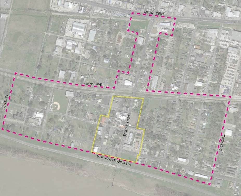
(c)
Permitted Uses:
(1)
Pursuant to Section 6.10 (a)(2) - C-1 Neighborhood Commercial District, uses 'a' through 'q';
(2)
Single-family Residential
(3)
Pursuant to Section 6.03.G, Conditional Use Permits
a.
Places of Worship
b.
Reception Halls
c.
Clubs, Lodges, and Social Centers
d.
Recreation Facility
e.
Nurseries and garden centers
f.
Pet Day Care Center
g.
Multi-family Residential Uses
h.
Mixed Use Developments
Previously used single-family detached dwellings may be retrofitted to accommodate neighborhood commercial permitted uses in the Rivertown Historic District provided the following criteria are met:
a.
The proposed use complies with all applicable land use and zoning regulations;
b.
That the proposal use is harmonious with neighborhood commercial land use;
c.
No use shall be approved that will cause excessive noise, smoke, fumes, obnoxious odors, vibrations, traffic or other nuisances to the adjoining properties;
d.
That the commercial use not exceed twenty (20) per cent of the gross floor area;
e.
That only persons living on the premises operate such a commercial use.
New and existing buildings may incorporate a mixture of residential and commercial uses provided all applicable land use and zoning regulations are met. S-I, L-I, H-I, and AH-I industrial uses are prohibited.
(d)
Height Regulations: No building or structure shall exceed forty-five (45) feet in height.
(e)
Area Regulations:
(1)
No area and setback regulations are required to be followed by buildings or structures located within the Commercial Core of the Rivertown Historic District.
(2)
Buildings or structures located within the Rivertown Historic District but outside of the Commercial Core are required to follow the area and setback regulations of the district in which said buildings or structures are normally permitted or with the area and setback regulations approved by the City Council as part of a planned unit development unless otherwise provided in this ordinance.
(f)
Intent of Rivertown Historic District Design Guidelines:
(1)
The RHD design guidelines represent an effort to review the architectural style and substance, as well as the urban spatial impact of any new construction or renovation within the Rivertown Historic District.
(2)
The implementation of the design guidelines will allow the Historic District Design Commission to make design, siting, and landscaping recommendations that must be met before the permitting process is initiated.
(3)
While different zones, as identified in Figure VI-1, within the RHD accommodate different dominant uses, such as commercial development along Williams Blvd. and residential development elsewhere, the Design Guidelines bring these areas together through a common approach to quality design while respecting any land use, zoning, and other City regulations which are already in place. Each existing or proposed development site will be considered on equal terms and with impartial judgment from the Historic District Design Commission.
(g)
Historic Architecture of the Rivertown Historic District:
(1)
Design Guidelines for the RHD are based on the architectural context and history of Rivertown, in addition to the existing urban design features that allow a "small-town" feel with the advantage of a number of amenities located in a small, walkable, downtown area.
(2)
Historical models that exist within the district include the following architectural styles. The residential "Ranch" and "Bungalow" styles are not appropriate within the Commercial Core.
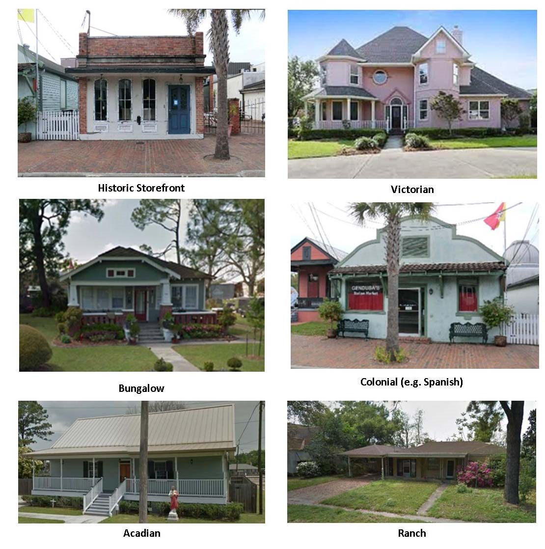
(h)
Scope of Rivertown Historic District Design Guidelines: The design guidelines and review will encourage gateway recognition for the Rivertown Historic District, and will ensure and allow for renovation and development consistent with the noted and desired existing characteristics of the District.
(1)
The established guidelines and review will:
a.
Address the architectural style and urban impact of any new development or alterations to existing buildings within the jurisdiction of the Design Guidelines;
b.
Address material choices and colors;
c.
Consider the contextual urban and architectural environment of each project;
d.
Address site features and signage;
e.
Consider non-Design Guidelines regulations, such as parking requirements, in order to assist the property owner in moving through the permitting process.
(2)
Guidelines and Review will not:
a.
Advise regarding traffic issues, but will consider non-Design Guideline regulations as stated above;
b.
Provide a blueprint for project design;
c.
Provide comprehensive design services.
(i)
Jurisdiction of Rivertown Historic District Design Guidelines: The design guidelines shall be applicable to the areas of the RHD as described and shown in Section (b) and Figure VI-1. The "commercial core" area of the RHD is identified for which select guidelines herein are tailored to preserve the visual character of Kenner's most historic section of the District.
(j)
Application Submittal Process:
(1)
Historic District Design Review: Before the commencement of any work in the erection of any new building or in the alteration or addition to, or painting or repainting or demolishing of any existing building, any portion of which is to front on any public street or alley in the Rivertown Historic District, application by the owner or owner representative for a permit therefore shall be made to the Historic District Design Commission.
The purpose of historic district design review is not to add an additional step to the permit process, but to assist the designer within the design and documentation process. The review body, or its agent, will be available to the designer to answer questions related to the design guidelines and the permit process. The review body will not design the project (or portion of the project), but will assist the designer to work within the intent of the Design Guidelines, and to rule on circumstances which make total compliance impractical, either because of site considerations or user design criteria.
(2)
Review Process:
a.
Project applicant shall submit documentation seeking a permit from the City of Kenner.
i.
For clarity of review, all proposals brought before the committee must fully represent the architectural character and urban space to be created. As such, the following drawings must be submitted:
1)
Elevations of all sides of any proposed building, including color and material indications
2)
Site plan, showing building access and interface with the public domain (sidewalk/street)
3)
Landscaping plan, including existing and planned additions
4)
Floor plan for each building level
5)
Roof plan
b.
Initial review by City of Kenner Planning Department.
c.
If submitted materials are satisfactory, they will be submitted to the Historic District Design Commission.
d.
The Commission will be called to session to vote on the merits of the applicant's project.
e.
On the day of review with the applicant present, the Commission will vote to approve or provide guidance on changes necessary for Commission approval.
f.
If changes are necessary, the applicant may return to the Commission for a second hearing.
g.
Upon approval of the Historic District Design Commission, and if such application and plans are determined to conform also to all other regulations, ordinances and laws of the City, the Director of the Department of Inspections and Code Enforcement shall issue promptly a permit for such work and indicate on such permit the extent and nature of the work to be performed thereunder.
(k)
Design Guidelines:
(1)
Building Design Elements:
a.
Buildings should maintain classic proportions. Smaller columns should be placed closer together for a more vertical proportion, and as the structure becomes more horizontal in scale, the supports (columns) should have additional mass.
i.
Fascias of buildings may not exceed sixteen inches (16") in depth, including gutter; except for fascias used as a unifying design element for multi-tenant buildings, and for placement of signage for multi-tenants. No backlit fascias.
ii.
Traditional fascia's should remain minimal (8"-12"), if a gutter is not used.
b.
Compatibility with the environment. Buildings shall exhibit the ability to provide protection from rain, sun, and high humidity.
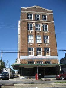
Commercial: Traditional rigid awning provides cover from weather and protection from
the sun; additional windows above still allow natural light to enter the first floor
area
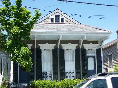
Residential: Brackets support porch roof overhang; high ceilings and tall windows
allow for the movement of air and light; shutters can protect from weather and solar
gain
c.
Entrances: each principal building shall have a clearly defined, inviting, highly visible customer entrance enhanced with distinguishing features (e.g. canopies, galleries, porticos, material plane changes).
d.
All façades of buildings visible to the public shall maintain the same standard of design as the front façade, including:
i.
Screening of utilities, equipment, and building services.
ii.
Continuation of building design elements such as quality of materials, galleries, cornices, and treatment of openings.
e.
Disruption of horizontal planes with vertical elements is required at least every 30 ft. of uninterrupted plane. This may include interruption by change in plane, material, opening, or more significant design element such as a tower or gable.
i.
Shadows shall be considered as a design element.
ii.
Smaller buildings shall reflect the design elements of historic styles, and larger buildings shall be divided into smaller elements in order to incorporate historic design context.
iii.
It is incumbent on the designer to utilize historic context in the building design. Remember that the building should recognize the environment, and show respect for the surrounding area. For larger buildings, the most expedient way of achieving historic context is to break the façade into smaller elements, putting more emphasis on the entry with balancing sub-elements.
f.
Disciplined visible structural vocabulary must be maintained. Arcades, galleries, and roofs shall not appear to levitate in space, but have a visible means of support with columns and/or brackets. No overhangs in excess of 3' allowed without a visible means of support. Rafter tails are encouraged on smaller overhangs.
g.
Consistent design vocabulary for multiple structures on one property will be employed. A unifying element such as material, color, or form should be used for all structures.
h.
No building with an industrial appearance is allowed, such as a pre-engineered metal building with metal siding, devoid of historic context.
i.
Mansard roofs shall have a roof-like slope not greater than 12:12 or less than 4:12.
j.
Buildings should have substance; design shall include base, intermediate, and cap. Changes in materials shall have a clear line of demarcation, either by offset, reveal, or border.
(2)
Materials: Materials shall be reviewed for compliance with historic context. The following materials have historic context:
a.
Walls: Wood, Brick, Hardiboard Siding, and Cement Plaster (stucco). Outside of the "Commercial Core Zone," Premium Vinyl may be used (virgin vinyl with no reground material, chalk, or other additives).
b.
Roofing: Wood shakes, Slate/tile, Rigid Shingles with Ridge Tiles, Asphalt Shingles, Metal (Corrugated, V-crimp, and Standing Seam).
(3)
Color: Colors shall be reviewed for compliance with historic context.
a.
Façade colors shall be low reflective and subtle. The use of primary, high intensity or metallic color is prohibited outside of the sign face.
b.
Any activity that involves changing color shall be reviewed by the Historic District Design Commission.
c.
Accurate color samples coordinated with elevations of every building will be required to be submitted prior to any modification.
d.
Though not ultimately limited to the colors below, applicants are encouraged to begin with the Sherwin Williams "Vieux Carré Exterior Colors" collection. The Sherwin Williams "American Heritage Collection" and Benjamin Moore's "Historical Colors" offer more variety, and may be used, subject to the final approval of the Commission.
i.
Vieux Carré Exterior Colors
ii.
Benjamin Moore's Historic Colors: http://www.benjaminmoore.com/en-us/for-architects-and-designers/color-gallery#&ce_vm=2&ce_col=HC
iii.
Sherwin Williams' American Heritage Collection: http://www.ci.spencer.nc.us/vertical/sites/%7BB85238E8-43CC-4172-AB03-A2E1A50D5927%7D/uploads/SherwinWilliams-AmericanHeritageCollectionBrochure.pdf
(4)
Canopies:
a.
Free (or semi-free) standing canopies, such as those used as porte-cocheres, shall be of similar style and materials as the building.
b.
Unless site conditions preclude, canopies shall be attached to and made an integral part of the main building.
c.
Canopies shall have columns, beams, and/or brackets of sufficient scale to give a visible means of support.
d.
Clearance under canopies shall not exceed sixteen feet (16'), and cantilevered overhangs shall not exceed fifteen feet (15').
(5)
Site Features:
a.
Fence or hedge of not less than 30" or more than 48" in height along property lines of each public street is required in the Commercial Core, and encouraged elsewhere. Fence shall be wood picket, or wrought iron pickets with masonry columns.
i.
The use of low fencing along the street lines helps define the public from the private, gives a scale to the sidewalks, and provides a screen for parking and services. The use of a hedge along the property line is acceptable in lieu of a fence.
b.
Sidewalks of not less than four feet (4') in width connecting sidewalks in public right-of-way to the building entry is required for commercial properties.
i.
This requirement is necessary for alternative access. In the event that sidewalks or bike paths have not yet been installed, the project should still provide walks to their proposed locations.
c.
Sidewalks along commercial façades that feature a customer entrance connect parking areas and minimize pedestrian traffic within vehicular drives and parking areas.
i.
This requirement is consistent with the American with Disabilities Act, and may be required under the Life Safety Code, in certain conditions.
d.
Distinguish internal pedestrian walkways from driving surfaces through the use of special materials in commercial parking lots.
i.
This requirement is also consistent with the Americans with Disabilities Act. Care should be taken not to use heavy textures on walkways, which could prove hazardous with small wheels on strollers, and wheelchairs.
e.
Screen mechanical equipment, electrical entries, dumpsters, and equipment from the public view. Screening may be by fence, landscaping, or building element, such as a parapet.
i.
Whenever possible, vending machines, ice machines, and restrooms shall be located in the main building.
f.
Areas used for storage of vehicles or water-craft shall be screened with opaque fencing and/or landscaping.
(6)
Signage:
a.
General prohibition of miscellaneous signs: The display of signs of a miscellaneous character visible from the public streets, highways and alleys within the historic district of the City; except as otherwise provided in this section, and according to the rules and regulations herein provided for, is prohibited.
b.
Signs to be displayed in certain places: No sign shall be displayed from the parapet or roofs of any building in the historical district.
c.
Signs must conform to character of section: In addition to the prohibitions contained in this section, approval of the display of a sign in the historical district of the City shall be granted by the commission only when such signs and the plans therefor, so far as they relate to the appearance, color, size, position, method of attachment, texture of materials and design, conform to the quaint and distinctive character of the historical district or do not injuriously affect it or impair the value of the community of those buildings having architectural or historical worth.
d.
What signs may advertise: No sign of any character shall be displayed in the historical district unless such sign advertises a bona fide business conducted in or on the premises and, if it does do so, not exceeding fifty (50) per cent of the area of such sign may be used to advertise products or commodities actually sold on the premises.
e.
Signs no longer complying as to advertisements to be taken down: Any sign displayed which no longer advertises a bona fide business conducted upon the premises shall, upon notification by the Historic District Design Commission or its agent (who is hereby specifically authorized to so proceed) be taken down, removed or obliterated within five (5) days after such notification and failure to so comply on the part of the owner, occupant, agent or person having the beneficial use of any building or premises upon which such sign may be found shall subject such person to the penalty provided in section 6.13 (k)(12), General Penalty; Continuing Violations.
f.
Only one sign per shop, etc.: One sign only shall be allowed to each store, shop, or bona fide place of business, and this sign shall be no larger than the maximum stipulated in this Article, regardless of the amount of front footage.
g.
Concealment of architectural features: No sign shall be displayed from any building, balcony, gallery, canopy, shed, roof, door, or window, or placed in any manner whatsoever to disfigure or conceal any architectural feature or detail of any building.
h.
Surface area of signs: The surface area of any sign shall be in direct proportion to the amount of front footage of each ownership and shall be as follows:
i.
For single-faced signs, attached flat against the wall and including painted wall signs there shall be allowed thirty (30) square inches of sign surface area to each foot of lot frontage.
ii.
For double-faced signs, suspended by brackets or arms perpendicularly from the wall of a building there shall be allowed sixty (60) square inches of sign surface to each running foot of lot frontage. The area of such a double-faced sign shall be taken to mean the sum of the areas of each face.
iii.
In no case shall the area of any one single-faced or painted wall sign exceed eight (8) square feet, the maximum allowable for such a sign.
iv.
In no case shall the area of any one single-faced or painted wall sign be less than two (2) square feet, unless by special permission of the Historic District Design Commission.
v.
In no case shall the area of any one double-faced sign exceed a total for both of sixteen (16) square feet, the maximum allowable size for such sign.
vi.
In no case shall the area of any one double-faced sign be less than four (4) square feet unless by special permission of the Historic District Design Commission.
vii.
In the case where two (2) or more businesses are conducted on the premises of single ownership having a front footage of twenty-five (25) feet or less, the allowable sign area shall be increased by one and one-half (1½) times.
i.
Regulation of signs generally: In the case of illuminated signs, where space must be provided between two (2) parallel faces for the installation of lighting fixtures, these faces shall not be farther apart than eighteen (18) inches and such lighting fixtures and all light sources shall be a steady light concealed; (a) behind standard opal glass or other substance of equal or small light transmission factor; (b) by hoods; or (c) by any acceptable method of indirect lighting approved by the Historic District Design Commission.
j.
Building code applicable to signs: All signs under this section shall be further governed by the existing regulations of the building code of the City, which are not in conflict with this section.
k.
Application for signs to be submitted to commission: All applications for permits to display signs within the historic district of the City shall be submitted to the building inspector for approval before a permit therefor may be issued in conformity with section 6.13 (j), Application Submittal Process.
l.
Form of application to display signs and accompanying drawings: Application for a permit to display signs in the historical district of the City shall be made to the commission upon forms furnished by the commission. Such an application shall also be accompanied by sketches and drawings in triplicate showing details of construction and foundation when required by the building code of the City and shall delineate the size, shape, design, coloring, lighting and position in relation to the building from or upon which it shall be displayed.
m.
Violating signs, etc. to be removed: Any sign or exterior illumination of walls, exteriors, roofs, or appurtenances of buildings displayed after the effective date of this section and contrary to the provisions of this section are prohibited.
(7)
Private Floodlights Prohibited: The public sidewalks, places and alleys, exteriors, roofs, outer walls and fences of buildings and other constructions and signs visible from any public street, place or position in the Kenner Historical District shall not be illuminated by privately-controlled floodlights or other illumination except as permitted by this Article.
(8)
Overhang Balconies: No overhanging balconies or galleries of wrought or cast iron may be removed, but other new or additional balconies may be erected if: (a) supported by brackets or iron columns; (b) at least nine (9) feet above the level of the sidewalk; and (c) conform to the quaint and distinctive architecture of the Kenner Historical District. The permits for all such new construction or any renovation shall be subject to the requirements of this Article.
(9)
Removal Of Sheds and Marquees: There shall be no restrictions against the removal of sheds supported by wooden columns and such sheds, as well as any marquees, may not be repaired when in dangerous condition, but must be removed. However, any changes may be made only after first securing a written order or permit required by this Article and may be executed only in accordance therewith.
(10)
Stopping Work Commenced Without Permit: The Director of the Department of Inspections and Code Enforcement shall promptly stop any work attempted to be done without or contrary to a permit issued under this Article and shall promptly prosecute any person responsible for such a violation of this Article or engaged in such violation. Any officer or authorized agent of the commission shall exercise concurrent or independent powers with the building inspector in prosecuting violations of this Article and stopping work attempt to be done without or contrary to the permits required by this Article.
(11)
Provisions of Article Prevail In Case of Conflict: The provisions of this Article shall govern and take precedence over any other provisions of any ordinances or codes of the City of Kenner.
(12)
General Penalty; Continuing Violations: Whenever in this Article any act is prohibited or is made or declared to be unlawful or an offense or whenever in this Article the doing of any act is declared to be unlawful, when no specific penalty is provided therefor, the violation of any such provision of this Article shall be punished by a fine not exceeding one hundred dollars ($100.00) and by imprisonment for not more than ninety (90) days or both such fine and imprisonment. A provision for the revocation or refusal of a permit or other provision not imposing a fine or imprisonment shall not be deemed a provision for a specific penalty within the meaning of the foregoing sentence. Each day that any violation of any safety ordinance or regulation contained in this Article shall continue, shall constitute a separate offense.
(Ord. No. 12,405, § 16, 11-2-23)
Section 6.14 - Laketown District (LD)
(a)
Purpose and Intent: To create an environment that promotes and enhances the public's use and enjoyment of Lake Pontchartrain and its shore in a way that preserves and/or recreates traditional lakeshore uses and provides an economic benefit to the City. It is the intent of this district designation to separate it from any other zoning classification and to locate uses, which allow and actually encourage accessibility to the water and accommodate a number of diverse uses as well as maintain and enhance the educational, cultural, and economic welfare of the public of the City.
(b)
Permitted Uses: A building or land shall be used only for the following purposes:
(1)
Marinas, public or private, providing open slips, boat houses, docks, warehouses, fuel docks, pump-out stations and/or related uses
(2)
Boat sales
(3)
Boat repair facilities and yards
(4)
Boat storage, including dry storage sheds
(5)
Restaurants except drive-in restaurants
(6)
Bars, nightclubs, lounges, and liquor stores, without distance restrictions regarding other barrooms, nightclubs, and recreation facilities.
(7)
Garages, parking
(8)
Fuel docks
(9)
Theaters
(10)
Hotels
(11)
Financial institutions
(12)
Personal services establishments (Barbershops, beauty parlors, etc.)
(13)
Retail commercial; those exceeding 25,000 square feet of gross floor area shall require City Council approval as per section 6.03(f), Planned Unit Developments.
(14)
Offices, professional and business
(15)
Semi-private athletic clubs
(16)
Parks, playgrounds and similar recreational uses
(17)
Yacht clubs
(18)
Boat launches, public and private
(19)
Multifamily dwellings, including condominiums
(c)
Site Development Regulations:
(1)
Height Requirements: No building or structure hereafter constructed shall exceed sixty-five (65) feet in height, unless otherwise approved by the City Council.
(2)
Area Regulations: Buildings hereafter constructed for uses permitted in this district shall be located so as to comply with the following minimum requirements:
a.
Lot Area—Every lot shall contain an area of not less than twenty thousand (20,000) square feet.
b.
Lot Width—a minimum width of fifty (50) feet
c.
Lot Depth—a minimum depth of one hundred (100) feet unless otherwise provided herewith
d.
Where either a minimum lot depth or lot width is provided the other lot dimension must be of adequate size to produce a lot area of twenty thousand (20,000) square feet
(3)
Yard and Setbacks:
a.
Front Yard: Minimum shall be thirty (30) feet
b.
Rear Yard: Minimum shall be thirty (30) feet
c.
Side Yards: Minimum required depth of each side yard which fronts on a railroad siding or waterway shall be thirty (30) feet
(4)
Off-Street Parking and Loading Requirements: As set forth in Article VII of this ordinance.
(5)
Sign Requirements: As set forth in Article XI of this ordinance.
(6)
Landscaping Requirements: As set forth in Article IX of this ordinance
Section 6.15 - Mixed Use District (MU)
(a)
Purpose: The provisions of this district shall establish and define the uses of land and the character of the improvements and structures allowed on the land in a manner that allows a balanced mix of uses in a pedestrian-friendly environment.
The following are key concepts that should be acknowledged through development practices within this district:
(1)
Residential uses in conjunction with nonresidential activities, preferably located above retail and office establishments
(2)
All types of residential uses, including single-family homes, townhouses, and loft-style multiple family units
(3)
Central green spaces
(4)
Traffic flows that enable people to move freely without the use of an automobile by emphasizing the pedestrian
(5)
Outside spaces, such as small parks, courtyards, outdoor seating areas; and
(6)
Building design standards to ensure aesthetic, functional and material quality
(b)
Mixed-use development types: The adopted plan shall identify the appropriate mixed-use type for the Mixed Use (MU) districts. These types may include the following:
(1)
Live/work unit: A type of mixed-use development that combines work and living quarters in the same building that has been designed or structurally modified to accommodate joint residential occupancy and work activity by a single household. A live/work unit consists of the following:
a.
Living/sleeping area, kitchen, and sanitary facilities in conformance with the local and state Building Code; and
b.
Adequate working space accessible from the living area, reserved for, and regularly used by, one or more of the persons residing in the space.
(2)
Commercial/residential unit: A type of vertical mixed-use development where nonresidential and residential uses are located in the same building and where the dwelling units are typically located on the upper levels and the nonresidential uses are located on the lower levels. Persons residing in the residential component do not necessarily work in or own any portion of the nonresidential component. This product type may also be designed so that nonresidential and residential uses are located adjacent to one another on the same or adjoining lots of the same development site and in separate buildings.
(c)
Permitted Uses:
Table VI-1: Permitted Uses
(d)
Lot size and Maximum Allowable Density and Intensity: This district is intended to promote mix-use neighborhoods that provide a variety of residential, commercial, office, and recreational options. Within the Mixed Use district, there are no minimum lot size requirements.
Residential density and nonresidential intensity shall be calculated by multiplying the following density and intensity factors by the gross area of the Master Plan:
(1)
Residential density shall not exceed 20 units per gross acre.
(2)
Nonresidential intensity shall be not less than a floor area ratio of 0.5 and shall not exceed a floor area ratio of 1.5.
(3)
For mixed-use developments, floor area ratio may not exceed 2.0.
(e)
Maximum building height:
(1)
No building, or part thereof, shall be erected or altered in the Mixed Use (MU) district such that it exceeds five (5) stories, including the ground level. Mezzanines and lofts shall be considered a story.
(2)
Freestanding structures, such as monopoles and antennas shall have a maximum height of seventy-two (72) feet. Structures, which are within 150 feet of a single-family residential district boundary, shall have a maximum height of thirty-five (35) feet. Structures that are between 150 feet and 300 feet from a single-family residential district boundary shall have a maximum height of fifty-two (52) feet.
(f)
Yard areas/building setbacks: All required yard areas shall be clear of all structures and shall be landscaped and maintained in accordance with the landscaping provisions of Article IX Landscape Regulations of the UDC.
(1)
Front Yard: Every building within the Mixed Use (MU) district shall have a minimum front setback of ten (10) feet and a maximum setback of twenty (20) feet from the property line adjacent to the public street right-of-way.
(2)
Side yard: Every building within the Mixed Use (MU) district shall have a minimum side yard setback of ten (10) feet from adjacent property lines.
(3)
Rear yard: Every building within the Mixed Use (MU) district shall have a minimum rear yard setback of ten (10) feet from the adjacent property line, provided however, a minimum twenty (20) foot rear yard setback is required from the property line adjacent to a public street right-of-way.
(4)
Adjacent to R-1, R-1A and RR-1, single-family zoned property. Every building within the MU district built on property adjacent to single-family zoned property shall have a minimum setback of one (1) foot in distance from the adjacent single-family zoned property line for every two (2) feet of building height.
(5)
Adjacent to R-2, two-family zoned property. Every building within the MU district built on the property adjacent to a two-family zoned property shall have a minimum setback of one (1) foot in distance from the adjacent two-family zoned property line for every four (4) feet of building height.
(g)
Open space and landscaping:
(1)
Minimum open space: A minimum of ten (10) percent of the net area of the MIXED USE (MU) master plan shall be open space.
(2)
Calculation of open space: The following shall be counted as open space:
a.
Plazas
b.
Sidewalks that are a minimum of 6 feet wide
c.
Turf and landscape areas
d.
Fountains, benches, and similar landscape features
e.
Covered arcades
f.
Gazebos
(3)
Landscaping of open space area: Open space shall be planted and maintained in accordance with Article IX, Landscape Regulations of the UDC.
(4)
The Mixed Use (MU) district master plan shall contribute to the establishment or enhancement of community and public spaces by providing space(s) that include, but are not limited to the following: patio seating area, pedestrian plaza with benches, covered/shaded playground area, water feature, clock tower or similar focal feature or amenity. Any such area shall have direct access to the sidewalk network and be placed in a visible location that is convenient for use as a gathering area.
(5)
Urban recreational experience:
a.
At least 5 percent of the net area of the master plan shall be designed to provide both an active and passive family-friendly urban leisure and recreational experience, including, but not limited to: street furniture; shade; grass; informal seating and climbing opportunities such as stairs, fountains or planters that have capped sides that are not more than 2 feet in height; sculptures that provide seating opportunities; plazas, interactive water features, drinking fountains, and changes in elevation.
b.
At least 40 percent of the area described in paragraph 'a.' above, shall be provided in locations that are proximate to a primary street.
(h)
Site design and performance standards:
(1)
Limitation on retail floor area:
a.
The maximum gross floor area for any individual retail establishment shall not exceed 15,000 square feet.
b.
The three (3) individual retail establishments with the largest floor areas shall not have a combined gross floor area of more than 30,000 square feet, collectively.
(2)
Limitation on ground floor residential area:
a.
In the aggregate for the entire MU district, no more than 70 percent of the ground floor area shall be used for residential dwellings (including townhomes); and
b.
Dwelling units shall not be located on the ground floor of mixed-use buildings.
(3)
Townhomes:
a.
Townhomes shall be designed and developed such that no more than two (2) adjacent townhomes are substantially alike in terms of façade, materials, color, or roof.
b.
Townhomes shall be developed in groups of no less than three (3) and no more than eight (8) units that are attached by common walls.
(i)
Design of Pedestrian, Bicycle, and Vehicular Facilities: All designs regarding mobility within a MU district shall prioritize the safety of all users, with particular focus given to the more vulnerable users - pedestrians, disabled people, and cyclists - rather than speed of access. Safety is of the utmost priority and takes precedence over vehicular access.
(1)
Design of pedestrian and bicycle connections: The following requirements shall be met:
a.
Covered pedestrian access shall be provided between parking structures and the front of the principal adjacent buildings that they are intended to serve.
b.
Sidewalks shall be provided alongside all public streets in order to maintain a safe and consistent pedestrian environment.
c.
If there is insufficient right-of-way to accommodate the minimum sidewalk and buffer widths, new developments shall either dedicate public rights-of-way or provide easements for bicycles and pedestrians to the extent necessary to provide the required widths.
d.
Pedestrian access points outside of the public rights-of-way to adjacent lots shall be provided to facilitate pedestrian circulation between developments.
e.
All on-site pedestrian walkways located in vehicle use areas shall be distinguished from driving surfaces to enhance pedestrian safety and comfort.
(2)
Design of structured parking: Structured parking shall be designed and configured so that parking structures are not a material part of the physical character of the district, as follows:
a.
Structured parking shall not have vehicular access points on any primary street within the MU district;
b.
Structured parking should not be designed with more than one dead-end aisle; and
c.
Structured parking shall be screened as follows:
i.
Intervening buildings or "wraps" composed of permitted uses other than parking shall screen ground-level views of parking structures from primary streets within the MU district and from public streets outside of the MU district. In addition or in the alternative, permitted uses other than parking may be located in the ground level of parking structures to disguise their use as parking.
ii.
Any sides of a parking structure that are exposed to secondary, residential, or service streets shall be designed so that use of the structure for parking is not obvious except at points of ingress and egress.
(3)
Location and design of off-street surface parking lots:
a.
Surface parking spaces shall be located to the rear and sides of buildings wherever feasible. No off-street surface parking lots shall be located between the front façade of any building(s) and the primary adjacent street.
b.
Surface parking lots and maneuvering areas shall not be located between a primary building's entrance and an abutting minor arterial or collector street, except where the applicant has demonstrated that no other alternative is available.
c.
Surface parking lots and maneuvering areas located to the side of a building cannot occupy more than 50 percent of a site's frontage onto a minor arterial or collector street.
d.
Wherever possible, parking lots and maneuvering areas on corner lots should not be located adjacent to intersections.
e.
Provide smaller, more dispersed surface parking lots instead of one large parking area.
(j)
Building design standards:
(1)
These building design standards are intended to:
a.
Strengthen Kenner's physical character and help buildings to better function in Kenner's environment;
b.
Create buildings with appropriate human scale;
c.
Ensure that buildings contribute to the creation of a pedestrian-friendly environment through the provision of glazing, shading, and shelter at the pedestrian level;
d.
Lessen the impact of branded architecture that does not speak to the City's physical character and conditions; and
e.
Increase the quality, adaptability, and sustainability in Kenner's building stock.
(2)
Glazing on building façades: Glazing provides interest for the pedestrian, connects the building exterior and interior, puts eyes on the street, promotes reusability, and provides a human-scale element on building façades. Projects subject to this section shall meet the following minimum glazing requirements, but glazing shall not be limited to the areas discussed:
a.
On the façade facing the principal street:
i)
At least 40 percent of the wall area that is between two and ten feet above grade shall consist of glazing (Figure VI-2); and
ii)
The second floor must provide a minimum of 25 percent glazing between three and eight feet, as measured from that story's finished floor level.
Figure VI-2: Facade Measurements
b.
On all other publicly visible façades, at least 25 percent of the wall area between two and ten feet above grade must consist of glazing. This requirement shall not apply if the building code prohibits windows on such façades.
c.
If a single-story building has a façade taller than 20 feet, the façade area above 15 feet is subject to the same window requirement as the second floor requirement in subsection ii.
d.
Any façade that is built up to an interior mid-block property line is not required to have glazing on that façade if no prohibitions and no contractual or legal impediments exist that would prevent a building being constructed on the adjacent property up to the wall of the façade.
e.
Metal clad siding is prohibited.
(3)
Primary entrance design: Primary entrance design shall consist of at least three of the following design elements at the primary entrance (none of which can be trademarked design features), so that the primary entrance is architecturally prominent and clearly visible from the abutting street:
a)
Architectural details such as arches, friezes, tile work, murals, or moldings.
b)
Integral planters or wing walls that incorporate landscape or seating.
c)
Enhanced exterior light fixtures such as wall sconces, light coves with concealed light sources, ground-mounted accent lights, or decorative pedestal lights.
d)
Prominent three-dimensional features, such as belfries, chimneys, clock towers, domes, spires, steeples, towers, or turrets.
e)
A repeating pattern of pilasters projecting from the façade wall by a minimum of eight inches or architectural or decorative columns.
(4)
Roof design: The roof design shall consist of at least one of the following design elements, none of which can be trademarked design features:
a.
Parapets with horizontal tops having height changes of at least one foot occurring horizontally no less than every 100 feet.
ii)
Parapets that do not have horizontal tops must have pitched or rounded tops with a pattern that repeats or varies no less than every 100 feet.
iii)
All parapets must have detailing such as cornices, moldings, trim, or variations in brick coursing.
b.
Sloping roofs with at least two of the following design elements:
i)
Slope of at least 5:12.
ii)
Two or more slope planes.
iii)
Overhanging eaves extending at least three feet beyond the supporting wall.
(5)
Sustainable roof: A "sustainable roof" is roofing that has one of the following:
a.
For a minimum of 75 percent of the total roof surface, a Solar Reflectance Index (SRI) of 78 or higher for a roof with a slope of 2:12 or less, or 29 or higher for a roof with a slope greater than 2:12; or
b.
For a minimum of 50 percent of the total roof surface, a vegetated roof;
c.
For a minimum of 50 percent of the total roof surface, rainwater collection system or grey water system such as a cistern, for reuse of water or delayed release to help reduce pressure on the municipal stormwater system; or
d.
For a minimum of 75 percent of the total roof surface, a combination of a vegetated roof with rainwater collection system and SRI-compliant roof meeting the SRI standards in subsection 'a.' above.
Figure VI-3: Sustainable Roof
(k)
Lighting standards:
(1)
Submission of plans and evidence of compliance with Sec. 12.13, Exterior Lighting:
a.
All site plan applications shall include a description of all lighting fixtures not affixed to buildings, both proposed and those that will remain on the site after completion of the project. For new fixtures, the description may include, but is not limited to, catalog cuts and illustrations by manufacturers (including sections where required), that demonstrate compliance with the standards of this subchapter. For lighting fixtures affixed to buildings, such information shall be provided as part of the building permit application.
b.
Lighting fixtures not affixed to buildings shall not exceed a height of thirty (30) feet in height.
(2)
Fully shielded and full cut-off light fixtures required: The following outdoor lighting applications shall be illuminated by fixtures that are both fully- shielded and full cut-off:
a.
Interior street system and pedestrian lighting;
b.
Parking lots;
c.
Pathways;
d.
Recreational areas; and
e.
Building overhangs and open canopies.
(3)
Lighting of building façades: Buildings and structures shall be illuminated by fixtures that are both fully shielded and full cut-off. Building façade lighting may only be used to highlight specific architectural features such as principal entrances and towers.
(4)
Directional luminaries: Directional luminaries may be used to illuminate signs and flagpoles. Such luminaries shall be installed and aimed so that they illuminate only the specific object or area and do not shine directly onto neighboring properties, roadways, or distribute excessive light skyward.
(5)
Lamp or fixture substitution: Should any outdoor light fixture or the type of light source therein be changed after site plan or building plan approval has been granted, a change request must be submitted to the Director of Planning for approval, together with adequate information to assure compliance with this subchapter, which must be received prior to substitution.
(l)
Compatibility standards: The following standards are intended to ensure compatibility of uses in the Traditional Neighborhood District.
(1)
Restriction on activities: Commercial uses within a mixed-use development project containing residences shall be designed and operated, with hours of operation limited, so that residents are not exposed to offensive noise, including noise from traffic, trash collection, routine deliveries, or late night activity. Deliveries from heavy trucks at the project site between 8:00 p.m. and 6:00 a.m. should be expressly prohibited.
(2)
Noise and ground borne vibrations: All residential and commercial development within the Mixed Use (MU) district is subject to the City's regulation of unnecessary noise in accordance with Section 7-166, Article IX of the Kenner Code of Ordinances. Residential uses should be oriented away from odor-generating structures and loading docks used by heavy trucks.
(3)
Lighting: Outdoor lighting associated with commercial uses should not adversely impact adjacent residential uses, but should provide sufficient illumination for use, access, and security. Such lighting should not blink, flash, or oscillate.
(4)
Windows: Residential building windows abutting commercial uses should not directly face windows of these adjacent properties unless privacy tinting, architectural elements, structures, landscaping, or other features provide adequate screening and privacy protection.
(5)
Security: Residential units should be designed to ensure the security of residents through the provision of secured entrances and exits that are separate from the non-residential uses on the same site. Residential units should be directly accessible to parking areas. Non-residential and residential uses should not have common entrance hallways or common balconies. These separations should be shown on the development plan and the separations should be permanently maintained.
(Ord. No. 11,653, § 6, 11-7-19)
Section 6.16 - Batture District (BD)
[(a)]
Description: This district is composed of lands that lie outside the protective levees between the crest of the Mississippi levee and the water level of the Mississippi River. Land uses permitted in this district are limited to temporary development consistent with traditional development in these areas and will be under conditions that will reduce the possibility of flooding due to abnormal high water in the Mississippi River.
[(b)]
Permitted uses:
(1)
Barge mooring and holding facilities
(2)
Boat houses and boat docks for recreational purposes
(3)
Clubs, private or service
(4)
Farming, including the usual farm buildings and structures, and animal raising, trapping and fishing
(5)
Golf courses and golf practice ranges.
(6)
Community centers and buildings used exclusively by the federal, state or local government for public purposes except correctional institutions or mental hospitals
(7)
Nature or natural parks
(8)
Private and public parks or playgrounds
(9)
Private gardens, truck gardens, greenhouses, and nurseries for the propagation and cultivation of plants, only when such plants, flowers, and produce are not offered for sale.
(10)
Public buildings and institutions of a religious eleemosynary, philanthropic, or similar natures
(11)
Public and private forests, parks, parkways, wildlife reservations or similar conservation projects
(12)
Government structures and land
(13)
Public utility structures. See Article XII, Supplementary Use and Performance Standards.
(14)
Riding stables and kennels when located on a tract of at least ten (10) acres and having no structure, pen, or corral housing animals closer than two hundred (200) feet to a property line.
(15)
Accessory buildings and uses customarily incidental to any of the above uses.
(16)
Boat or ship repair are not permitted unless such repair constitutes an emergency. There shall be no storage or overnight parking of any vehicles on the property.
[(c)]
Site Development Regulations:
(1)
Height regulations: No building shall exceed thirty-five (35) feet in height.
(2)
Yard regulations: No front, side or rear yard is required
(3)
Lot Area: No minimum lot area is required
[(d)]
Sign regulations:
(1)
Number: One (1) on-premises sign shall be permitted.
(2)
Sign area: The sign shall have a maximum area of twelve (12) square feet.
(3)
Prohibited signs: The following signs shall be prohibited:
a.
Flashing signs and signs with animated and scintillating lights.
b.
Electronic variable message signs.
c.
Off-premises signs.
[(e)]
Off-street parking Requirements:
Shall be provided as set forth in Article VII, Off-Street Parking and Loading Regulations.
Section 6.17 - Laketown Gaming District (LGD)
(a)
Purpose and Intent: To create an environment that allows land-based casino gaming in the City of Kenner in a way that provides economic benefits and respects surrounding land uses.
(b)
Permitted Uses: A building or land shall be used only for the following purposes:
(1)
A land-based casino gaming establishment as defined by Louisiana State Statute. Prior to any permit being issued for construction of a land-based casino, site and elevation plans for the proposed land-based casino must be presented to the Kenner City Council for a public preview.
(2)
Reception halls.
(3)
Retail commercial.
(4)
Personal services establishments (barbershops, beauty parlors, spas, etc.).
(5)
Multi-family dwellings including condominiums.
(6)
Garages, parking.
(7)
Offices, professional and business.
(8)
Hotels and motels.
(9)
Recreation facility, commercial.
(10)
Recreation facility, public.
(11)
Accessory buildings, such as warehouses and other uses customarily pertinent to the above uses when located on the same lot and provided that articles or materials are not stored in an open area outside the buildings unless the area is enclosed within a solid fence of such height to adequately screen the area from public view.
(c)
Maximum Square Footage of Buildings in the Laketown Gaming District:
(1)
No building or structure constructed for uses permitted in this district shall exceed twenty-five thousand (25,000) square feet in gross floor area, unless otherwise approved by the City Council per section 6.03(g), Conditional Use Permits.
(d)
Site Development Regulations:
(1)
Height Requirements: No building or structure hereafter constructed shall exceed sixty-five (65) feet in height, unless otherwise approved by the City Council per section 6.03(g), Conditional Use Permits.
(2)
Area Regulations: Any building hereafter constructed for uses permitted in this district shall be located so as to comply with the following minimum requirements:
a.
Lot Area: Every lot shall contain an area of not less than twenty thousand (20,000) square feet.
b.
Lot Width: A minimum width of one hundred (100) feet.
c.
Lot Depth: A minimum depth of two hundred (200) feet unless otherwise provided herewith.
d.
Where either a minimum lot depth or lot width is not provided, the other lot dimension must be of adequate size to produce a lot area of twenty thousand (20,000) square feet.
(3)
Yard and Setbacks:
a.
Front Yard: Minimum shall be fifty (50) feet.
b.
Rear Yard: Minimum shall be fifty (50) feet; except where a lot housing a building with casino gaming activities abuts a residentially zoned or used property, there shall be a minimum rear yard of one hundred (100) feet for the portion of the rear yard that abuts a residentially zoned or used property.
c.
Side Yards: Minimum required depth of each side yard shall be thirty (30) feet; except where a lot housing a building with casino gaming activities abuts a residentially zoned or used property, in which case there shall be a minimum side yard of one hundred (100) feet.
d.
Any building or structure that abuts a residentially zoned or used lot, shall construct an eight-foot high solid wood or masonry fence along the property line or lines abutting that residentially zoned or used lot.
(4)
Off-Street Parking and Loading Requirements: As set forth in Article VII of this ordinance.
(5)
Sign Requirements: As set forth in Article XI of this ordinance.
(6)
Landscaping Requirements: As set forth in Article IX of this ordinance.
(7)
Stormwater Management Requirements: As set forth in Article X of this ordinance.
(8)
Exterior Lighting Requirements: As set forth in Article XII Section 13 of this ordinance.
(Ord. No. 11,933, § 1, 10-29-21)
Section 6.18 - Laketown Improvement District (LID)
Purpose and Intent: The Laketown Improvement District (LID) provides a main thoroughfare and commercial business corridor to the Laketown District (LD) with a mix of retail, service, and office activities and nonresidential land uses along Williams Boulevard. Regulations and standards intend to improve and encourage the urban environment and economic viability of development and construction within the Laketown Improvement District (LID) by helping to control the physical appearance and quality of the Williams Boulevard commercial business corridor of the Laketown Improvement District (LID). As an improvement district, the LID intends to establish district uses, density, and intensity with standards for façade design and signs that promote compatibility and an appealing built environment through the following objectives:
(1)
Builds an aesthetic streetscape that supports transportation among land uses within the LID and between the LID and LD.
(2)
Supports development in the LID and LD with the following elements:
a.
Buildings that engage the street through materials, store signage and lighting.
b.
Signage visible to motorists that encourages wayfinding and exploration and is not obtrusively large.
c.
Commercial building designs that provide a quality streetscape.
Boundaries of the Laketown Improvement District (LID): The following area of the City of Kenner is designated as the "Laketown Improvement District," to-wit: Williams Boulevard extending from Interstate 10 (South) to Lake Pontchartrain (North). The Commercial Core of the LID are the signs, lots, and businesses fronting on Williams Boulevard, specifically including lots and businesses located on the corner of Williams Boulevard and any cross streets, as identified by the solid yellow boundary line in Figure VI-A-1.
Figure VI-A-1
Permitted Uses: Those current land uses permitted in the zoning districts within the boundaries of the LID will continue to be permitted, along with current land uses permitted by special ordinances; however, existing signs within the boundaries of the LID will be governed by this section.
Signs: The following sign regulations shall apply only to properties within the boundaries of the LID.
Variances: No variances are permitted to the sign and façade regulations in Section 6.17 Laketown Improvement District (LID).
(a)
Generally.
(1)
The general sign regulations of Article XI of the UDC shall apply for any standards that are not provided in this section. These sign regulations shall not apply to signs within the public rights-of-way or to signs owned by governmental entities located on public property.
(2)
Sign placement. No sign shall be placed upon a balcony, roof, door, or window, an accessory building, or placed in any manner that conceals any window, door, balcony, awning, or cornice of a building.
(3)
Sign illumination. Signs may be illuminated internally or externally in accordance with the following:
a.
A sign shall not be illuminated both internally and externally.
b.
All signs may be illuminated externally, but only the following signs may be illuminated internally:
1.
Monument;
2.
Wall;
3.
Projecting;
4.
Hanging; or
5.
Window sign.
c.
Illumination of the sign face shall not exceed fifty (50) lumens per square foot.
d.
Flashing, blinking, or scintillating lights are prohibited to illuminate signs or frame windows.
(b)
Building name sign. One (1) sign containing the name of a building shall be allowed subject to the following:
(1)
May be built into or attached to the wall of the building and/or may be a part of the detached monument sign.
(2)
Shall not exceed eight (8) square feet in area.
(3)
The sign containing the building name shall not be included in the maximum allowable sign area.
(c)
Detached signs. The following detached signs shall be allowed in the LID, as summarized in the Table below. Pole-type detached signs are prohibited.
(1)
Monument sign. One (1) monument sign is allowed at one half (0.5) square feet per linear foot of site frontage or fifty (50) square feet, whichever is less at a maximum height of eight (8) from the lowest adjacent grade.
(2)
Directional signs. Directional signs are allowed subject to the following limitations:
a.
Four (4) square feet in area each; and
b.
Four (4) feet in height for detached directional signs.
c.
The area of the directional signs shall not be included in the maximum allowable detached signage.
(3)
Menu board sign. Menu boards shall be allowed subject to the following:
a.
The area of the menu board(s) shall not be included in the maximum allowable detached sign area.
b.
Menu Board, Portable. One single portable menu board sign measuring four (4) square feet or less may be placed in the front setback.
c.
Menu Board, Drive-through. Drive-through food services may have one (1) menu board per drive-through lane, and each menu board shall not:
1.
Exceed forty-eight (48) square feet in area and eight (8) feet in height;
2.
Be located within the first twenty (20) feet of the front of the development site;
3.
Contain EVMs for advertising purposes.
Table: Detached Signs - LID
(d)
Attached signs. The following attached signs shall be allowed in the LID, as summarized in the Table below.
(1)
Flat or projecting.
a.
Flat or projecting. Each tenant space having a direct entry to a sidewalk or exterior walkway at ground level may have one (1) flat or projecting sign(s) for each one (1) and three (3) square feet per linear foot of building frontage or three hundred (300) square feet, whichever is less, as provided in the Table below, and in accordance with the following:
1.
Projecting signs shall not extend more than eighteen (18) inches from the building façade. Any projecting sign that is located in whole or in part in the public right-of-way must be approved by the City Council.
2.
On corner lots or corner units, one (1) additional flat or projecting sign is permitted for each street-facing building façade.
3.
When the main entrance of the building is located on a building corner, the permitted sign area shall be measured along the building face associated with the business address.
b.
Hanging. Instead of a projecting sign, one (1) hanging sign shall be allowed subject to the following:
1.
Hanging signs shall be limited in area to four (4) square feet and shall not be included in maximum allowable sign area.
2.
Hanging signs shall provide a minimum clearance of seven (7) feet between the sidewalk and the bottom of the sign.
c.
Awning.
1.
Awning sign area shall not exceed twenty (20) square feet per awning.
2.
The area of the awning sign shall be included in the maximum allowable attached sign area.
d.
Window.
1.
One (1) window sign shall be allowed per business.
2.
The window sign shall occupy no more than ten (10) percent of the area of the window.
3.
The area of window sign shall be included in the maximum allowable attached sign area.
e.
Building directory.
1.
For buildings with tenant spaces lacking direct entry from a sidewalk or exterior walkway at ground level, a single building directory sign not larger than four (4) square feet in area may be attached to a wall within eight (8) feet of the building's primary entry.
2.
The area of the building directory sign shall not be included in the maximum allowable attached sign area.
Table: Attached Signs - LID
(e)
Prohibited signs. The following signs are prohibited in the LID:
(1)
Pole-type detached signs.
(2)
Animated signs.
(3)
Projector signs.
(3)
Electronic variable message signs.
(4)
Off-premises signs and billboards.
(5)
Posters, banners, placards and similar types of signage.
(6)
All other sign types not specifically allowed in the LID.
(Ord. No. 12,571, § 1, 6-21-24)
Editor's note— Ord. No. 12,571, § 1, adopted June 21, 2024, set out provisions intended for use as § 6.17. Inasmuch as there were already provisions so designated, said section has been codified herein as § 6.18 at the discretion of the editor.
Section 6.18-(A) - Amortization of nonconforming signs within the Laketown Improvement District.
The following regulations and amortization provisions shall apply to the properties within the Commercial Core of the LID along the portion of Williams Blvd. between Interstate 10 and Lake Pontchartrain:
(1)
Findings and purpose:
a.
The City Council finds that nonconforming signs that do not conform with the provisions of the LID, as applicable, threaten the public health, safety and welfare because they:
1.
Create traffic safety hazards;
2.
Create pedestrian safety hazards;
3.
Decrease property values;
4.
Increase the potential for blight; and/or
5.
Discourage reinvestment in residential and nonresidential property within or around the LID.
b.
The purposes of this section are to:
1.
Recognize that the eventual elimination of existing signs that are not in conformity with the provisions of this section is as important as is the prohibition of new signs that would violate these regulations.
2.
Establish a fair and equitable process for the elimination of nonconforming signs that will facilitate implementation of the LID.
(2)
Immediate removal of certain signs. The following nonconforming signs shall be removed immediately:
a.
Any sign not established as a legal nonconforming sign prior to the adoption of these regulations;
b.
Any sign erected or maintained upon any city highway, right-of-way, servitude, street, public building or city property without approval from the City Council authorizing such sign;
c.
Any sign now or hereafter existing which no longer advertises a bona fide business conducted, or a product sold, on the premises where such sign is located.
(3)
Limits on nonconforming signs.
a.
Change of business or use. Any nonconforming sign advertising, identifying, or pertaining to a business on the premises on which it is located shall be removed upon any change in the business name or change in the use advertised by the sign.
b.
A nonconforming sign may not be:
1.
Changed to another nonconforming sign;
2.
Structurally altered to extend its useful life;
3.
Expanded in height, width, depth or weight;
4.
Reestablished after a business is discontinued for sixty (60) days;
5.
Reestablished after damage or destruction of more than fifty (50) percent of its value, as determined by the code enforcement director or chief building official.
c.
No new sign shall be approved for a site, structure, building or use that contains nonconforming signs unless such nonconforming signs are removed or modified to conform with the provisions of this title.
d.
Nothing in this section shall be interpreted to exclude routine maintenance, repair, or renovation which does not extend, increase, or enlarge the nonconforming sign.
e.
No sign permit shall be issued for any structures, building expansions or new building construction on a site which contains nonconforming signs, unless all signs on the site are brought into conformance with this title. This does not include interior alterations which do not substantially change the character or intensity of the site.
(4)
Amortization. Legally nonconforming signs erected prior to the effective date of this ordinance may continue to be maintained until December 31, 2029. Thereafter, unless such signs conform to the provisions of this article, they shall be removed. Signs that are nonconforming due to exceeding the permitted height, width or area by ten (10) percent or less shall not be subject to removal under this section. Billboards erected in compliance with municipal regulations at the time of erection are not subject to amortization.
(5)
Determination of sign conformance. A determination of sign conformance shall be provided by the department of inspection and code enforcement.
(6)
Removal. Nonconforming signs that require removal under the regulations in this section shall be taken down, or removed by the owner, agent or person having the beneficial use of the building or structure upon which such sign may be found within sixty (60) days after written notification from the department of inspection and code enforcement and, upon failure to comply with such notice or file an appeal within the time specified in such order, the department of inspection and code enforcement is authorized to cause removal of such sign and collect the cost, therefore, in accordance with Chapter 9½, Health, Section 9½-7 of the Kenner Code of Ordinances.
(Ord. No. 12,571, § 1, 6-21-24)
Editor's note— Ord. No. 12,571, § 1, adopted June 21, 2024, set out provisions intended for use as § 6.17-(A). Inasmuch as there were already provisions so designated, said section has been codified herein as § 6.18-(A) at the discretion of the editor.