
Laramie City Zoning Code
CHAPTER 15
08 - ZONING DISTRICTS
Sections:
15.08.000 - Districts established; zoning map.
This chapter establishes the zoning districts and contains statements of purpose and district-specific regulations for each of the districts. Chapter 15.10, Use Regulations, and chapter 15.12, Dimensional Standards, identify the uses allowed within the districts and the dimensional standards applying to development in the districts, respectively.
A.
Zoning Districts Established. The following zoning districts are established:
B.
Relationship to Overlay Districts. All lands within the city shall be designated as one of the base zoning districts listed in Sections 15.08.010 through 15.08.030 and [Section] 15.080.050. In addition, some lands may be designated as one or more of the overlay districts listed in Section 15.08.040. Where the property is designated as an overlay district as well as a base zoning district, the regulations governing development in the overlay district shall apply in addition to the regulations governing development in the underlying base district. In the event of an express conflict between the two sets of standards, the standards for the overlay district shall control.
C.
Zoning Map.
1.
In General.
a.
The boundaries and zoning classifications of districts established are as shown on a map entitled, "Zoning District Map of the City of Laramie, Wyoming," dated the 18th of November 1963, that maps all notations, references, data, and other information shown thereon are by reference made a part of this chapter. Procedures for amending the Zoning Map are in subsection 15.06.060.B., rezonings.
b.
In the event of uncertainty in the exact boundaries of any of the districts as shown on the zoning map, the planning commission, upon written application or upon its own motion, shall recommend the location of such boundaries to the city council, and the city council shall make the final determination.
2.
Boundaries—Availability.
a.
District boundary lines are section lines, lot lines, the centerlines of highways, streets, alleys, railroad rights-of-way, or such lines extended, municipal corporate lines, natural boundary lines (such as streams), or other lines drawn to scale on the zoning district map.
b.
The official zoning district map shall be kept up to date by the city, and copies of the map shall be available for public use.
D.
Relationship to Development Standards. Unless otherwise noted in the zone district, all development shall comply with the applicable provisions of Chapter 15.14, Development Standards.
(Ord. No. 1578, § 2(att. A), 3-2-2010; Ord. No. 1814, § 10, 11-1-2022)
15.08.010 - Agricultural district.
A.
Agricultural (AG) district.
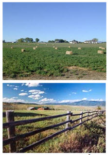
Figure 15.08-1: Images of typical development in the AG district.
1.
Purpose. The AG district is intended to provide for the continued use of land for predominately agricultural and agriculturally related purposes and preserve undeveloped areas until they can feasibly be developed at urban standards and with adequate public safeguards of health, safety, and welfare.
(Ord. No. 1578, § 2(att. A), 3-2-2010)
15.08.020 - Residential districts.
A.
General Purposes of all Residential Districts. The residential zoning districts contained in this section are intended to:
1.
Provide appropriately located areas for residential development that are consistent with the comprehensive plan and with standards for public health, safety, and general welfare;
2.
Allow for a variety of housing types that meet the diverse economic and social needs of residents;
3.
Protect the scale and character of existing residential neighborhoods and community character;
4.
Discourage any use that would create traffic congestion on neighborhood streets other than the normal traffic that serves the residents of the district; and
5.
Discourage any use that, because of its character or size, would create additional requirements and costs for public services that are in excess of such requirements and costs if the district were developed solely for the intended type of residential uses.
B.
Rural Residential (RR) District.
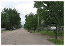
Figure 15.08-2: Images of typical development in the RR district.
1.
Purpose. The RR zoning district is intended to promote and encourage a suitable environment for residential development on large lots at a low rate of urban population density. It is the intent of this district to encourage the construction of and the continued use of the land for single-family dwellings and to prohibit commercial, office, and industrial use, or any other use that would substantially interfere with development or continuation of single-family dwellings or any use not performing a neighborhood function.
C.
Limited Single-Family Residential (LR) District.
1.
Purpose. The LR district is intended to promote the construction of and the continued use of the land for single-family dwellings on medium-size lots with a greater density of land use allowed than in the RR district. The district prohibits commercial and industrial use or any other use that would substantially interfere with the development or continuation of single-family dwellings in this district.
D.
Single-Family Residential (R1) District.
1.
Purpose. The R1 district is intended to promote the construction of and the continued use of the land for single-family dwellings on medium-size lots with a greater density of land use allowed than in the LR district. The district prohibits commercial and industrial use or any other use that would substantially interfere with the development or continuation of single-family dwellings in this district.
E.
Limited Multifamily (R2) District.
1.
Purpose. The R2 district is intended to promote the construction of and the continued use of the land for single-family dwellings on medium-size lots with a greater density of land use allowed than in the R1 district. In addition to single-family homes, two-family homes (duplexes), townhomes, and multifamily residential buildings not exceeding four units are allowed. The district prohibits commercial and industrial use or any other use that would substantially interfere with the development or continuation of residential uses in this district.
2.
District-Specific Standards.
a.
Multifamily and Single-Family Attached Dwellings (Including Townhomes). Multifamily and single-family attached dwellings, including townhomes, shall not exceed four dwelling units.
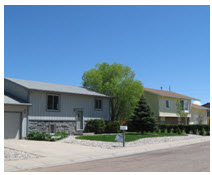
Figure 15.08-3: Images of typical development in the R1 district.
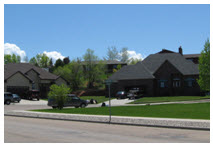
Figure 15.08-4: Images of typical development in the LR district.
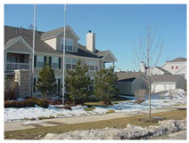
Figure 15.08-5: Images of typical multifamily development in the R2 district.
F.
Limited Multifamily with Independent Manufactured Homes (R2M) District.
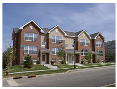
Figure 15.08-6: Images of typical townhome development in the R2M district.
1.
Purpose. The R2M district is intended to promote the construction of and the continued use of the land for single-family dwellings on small-size lots with a greater density of land use allowed than in the R2 district. In addition to single-family homes, two-family homes (duplexes), townhomes, HUD manufactured homes, and multifamily residential buildings not exceeding four units are allowed. The district prohibits commercial and industrial use or any other use that would substantially interfere with the development or continuation of residential uses in this district.
2.
District-Specific Standards.
a.
Multifamily Dwellings. Multiple-family dwellings shall not exceed four dwelling units per building.
G.
Multifamily (R3) District.
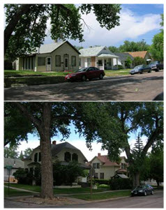
Figure 15.08-7: Images of typical single-family residential development in the R3 district.
1.
Purpose. The R3 district is intended to promote the construction of and the continued use of the land for single-family dwellings on medium-size lots with a greater density of land use allowed than in the R2 district. In addition to single-family homes, two-family homes (duplexes), townhomes, and multifamily residential buildings are allowed. The district provides for commercial uses that may compliment the neighborhood and other uses that would not substantially interfere with the development or continuation of residential uses in this district.
2.
District-Specific Standards.
a.
No Outside Storage Allowed. All nonresidential uses shall be prohibited from having any outside storage, including but not limited to offices or studios of agencies, businesses, brokerages, consultants, contract administrators, firms, or individuals providing services in areas such as, but not limited to, accounting, advertising or public relations, architecture, art or design, engineering, finance or investment, health care or health sciences, insurance, law, mental health, natural or physical sciences, secretarial or stenographic, or surveying.
b.
Non-Residential Uses. Nonresidential uses shall be allowed as a conditional use in buildings that are pedestrian-oriented, compatible with the surrounding neighborhood, and provide services primarily to neighborhood residents. Such uses shall be subject to the following:
(1)
Nuisances. Nuisance problems shall be avoided by providing that:
(a)
Uses operate primarily within an enclosed building;
(b)
Traffic hazards are minimized;
(c)
Lights are directed away from adjoining residential areas;
(d)
Off-street parking and loading areas are available as deemed necessary by the city manager's office, considering the site, proposed use, and neighborhood; and
(e)
No dust, smoke, fumes, gas, noxious odor, excessive noise, or other atmospheric effluent shall be disseminated beyond the boundaries of any use.
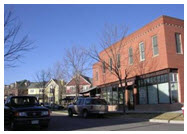
Figure 15.08-8: Example of a pedestrian-oriented and compatible nonresidential development in the
R3 zone district.
(Ord. No. 1578, § 2(att. A), 3-2-2010; Ord. No. 1728, § 16, 4-18-2017)
15.08.030 - Nonresidential districts.
A.
General Purposes of all Nonresidential Districts. The nonresidential zoning districts contained in this section generally are intended to:
1.
Provide appropriately located areas for retail, service, office, and industrial uses consistent with the comprehensive plan;
2.
Strengthen the city's economic base and provide employment opportunities close to home for residents of the city and surrounding communities; and
3.
Minimize any negative impact of non-residential development on adjacent residential districts.
B.
Neighborhood Business (NB) District.
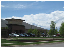
Figure 15.08-11: Image of development in the NB district.
1.
Purpose. The NB district is designed to protect established residential neighborhoods and to provide for retail and service establishments that supply commodities or perform services to meet the daily needs of the adjacent residential neighborhood. The development standards of this district are established to promote the integration of these areas into the adjacent residential neighborhood so that residential property values will be preserved and potential conflicts minimized.
2.
District-Specific Standards.
a.
Restrictions on Use. Uses shall be subject to the following restrictions and limitations to preserve and enhance desirable neighborhood qualities.
(i)
Multiple Uses. Any number of permitted uses may be allowed on a single lot/development pad provided all buildings/structures are approved and all property development standards are met. The specific use of some lots/development pads or buildings may be limited based on access, parking limitations, or potential impacts to adjacent residential uses.
(ii)
Development Pads. Sites may be developed with development pads platted as lots.
(iii)
Condominiums and Townhomes. Condominiums, multi-family and townhomes are permitted and may be developed on lots or in a development.
(iv)
Storage Uses. Storage shall be limited to accessory storage of commodities sold at retail on the premises. All storage shall be completely enclosed within a building unless otherwise approved by the city manager's office.
(v)
Walls Between Use Districts. A six-foot high solid masonry wall shall be constructed and maintained on all property lines which abut a residential use or zone district unless the NB property is separated from the residential use or zone district by a public road. Walls may be required to be set back from streets and alleys so as not to obstruct views.
(vi)
Hours of Operation. No business shall be open to the public between the hours of eleven p.m. and six a.m.
(vii)
Uses in Buildings. All uses shall be operated within an enclosed building. Limited seasonal outdoor displays and sales may be permitted pursuant to Section 15.10.020.
b.
Property Development Standards. The following property development standards shall apply to all land and buildings in the NB district.
(i)
Area and Minimum Lot Size. The minimum lot/development pad size shall be three thousand six hundred square feet.
(ii)
Setbacks. Setbacks shall be established by Chapter 15.12, Dimensional Standards. Generally, setbacks from the street shall be minimized, but should be adequate to provide for the required landscaping. Setbacks may be varied throughout the site. Proposed setback lines shall be shown on the site plan. All buildings shall meet the following setback requirements.
(1)
Setback From Residential Zone District. All commercial buildings shall be setback a minimum of twenty feet from any residential zone district line.
(2)
Utility Easements. Utility easements, when located in the front landscape strip, shall be in addition to the minimum required landscape area and setback unless the utility agrees to allow the placement of the landscape materials (i.e., trees and shrubs) required by subsection 15.08.030.B.2.f. within the utility easement.
(3)
Projections Over Sidewalks. Awnings, colonnades, and similar architectural features may extend five feet over a sidewalk, provided they do not block pedestrian access. All projection over a sidewalk shall provide a minimum of seven feet of vertical clearance.
(iii)
Development Standards. The provisions of Chapter 15.14 Development Standards shall apply to development in an NB district unless changed by the standards included in this section.
(iv)
Restrictions on Upper Floor Residential Use. Residential uses are allowed on upper floors above commercial or entertainment uses on the ground floor subject to the setbacks and height limitations stipulated in this code. In addition, the following standards shall apply:
(1)
Minimum lot area per unit, two thousand square feet.
(2)
Private open space (patio or balcony) per unit, sixty square feet. Balconies shall not directly overlook residential uses.
(3)
Parking areas for upper floor residential uses shall be accessed from the same driveway as the commercial parking area.
c.
Building Design. All buildings designed for or intended to be occupied by a non-residential use shall meet the following requirements:
(i)
Building Height. No building shall exceed thirty-five feet in height. Where building heights exceed thirty feet, the building height of at least fifty percent of the building area on the lot shall not exceed eighteen feet for flat-roofed buildings and twenty-four feet for buildings with pitched roofs. Where residential units have been incorporated into the development plan, the city manager's office may allow up to eighty percent of the building area to exceed eighteen feet in height.
C.
Limited Business (B1) District.
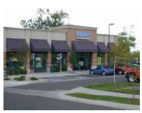
Figure 15.08-12: Image of typical development in the B1 district.
1.
Purpose. The B1 district is intended for retail and office uses. The district includes retail centers that provide shopping service to surrounding neighborhoods and the community. Commercial uses that would not be compatible with surrounding residential areas are prohibited or subject to special restrictions. This district is intended to accommodate commercial development on a smaller scale than that in the B2 district with a more narrow range of allowed uses.
a.
Mini Storage Facilities. Mini storage facilities that are architecturally compatible with the surrounding development shall be allowed by conditional use permit. The decision-making authority shall consider and determine the architectural compatibility of the proposed mini storage facility. If a facility abuts a residentially zoned property or residential development, the mini storage structure shall have a sloped roof, relief features, exterior materials, and colors consistent with nearby residential construction.
D.
Business (B2) District.
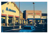
Figure 15.08-13: Image of typical development in the B2 district.
1.
Purpose. The B2 district is intended for retail and office uses. The district includes retail centers that provide shopping service to surrounding neighborhoods and the community. This district is intended to accommodate commercial development on a larger scale than that in the B1 district with a wider range of allowed uses.
E.
Downtown Commercial (DC) District.
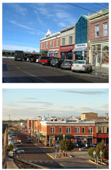
Figure 15.08-14: Images of Downtown Laramie.
1.
Purpose. The purpose of the DC district is to preserve, enhance, and promote Laramie's
historic downtown area as a nucleus of community activity. Additionally, the district
is designed to allow for a wide variety of retail, entertainment, finance, and office
uses, as well as a mix of uses including multifamily, while maintaining the historic
character and scale of the area.
The DC district standards require compliance with the Design Guidelines for Historic
Downtown Laramie ("design guidelines") where the design guidelines apply. Copies of
the design guidelines are available from the community development department or the
city's website. In the event of a conflict between the design guidelines and these
district-specific standards, the design guidelines shall take precedence. The design
guidelines for historic downtown Laramie and the process to apply them are hereby
incorporated by reference.
In areas of the DC district outside the boundaries where the design guidelines for
historic downtown Laramie apply, the design standards in this section apply. In many
cases, these standards require new development and redevelopment to be similar in
scale and character to those of other uses and structures nearby, rather than setting
a single standard for the entire DC area.
2.
District-Specific Standards.
a.
Permitted Uses. Permitted and conditional uses for the DC district are those set forth in table 15.10-1.
b.
Dimensional Standards. Dimensional requirements for lots and structures in the DC district are set forth in table 15.12-3, except as supplemented below.
(i)
Front Setbacks and Build-To Lines. The front setback of each primary structure in the DC district shall meet the front setback requirements of the Design Guidelines in the areas where they apply. In areas where the Design Guidelines do not apply, the front setback of the primary structure shall be one of the following, as applicable. The minimum setbacks shown in table 15.12-3 do not apply in the DC district.
(1)
If the entire width of the front façade of either of the adjacent buildings is built to the front property line, then the entire width of the front façade of the proposed building shall also be built to the front property line. (See Figure 15.08-15.)
(2)
If part of the width of the front façade of either of the adjacent buildings is built to the front property line, then at least fifty percent of the width of the front façade of the proposed building shall also be built to the front property line. (See Figure 15.08-16.)
(3)
If no part of the front façade of either of the adjacent buildings is built to the front property line, then the front façade of the proposed building shall be built no more than five feet further from the front property line than the front façade of the adjacent building nearest the street. (See Figure 15.08-17.)
(4)
When the requirements of subsections (1), (2), or (3) above are applied to a building on a corner lot, they shall only require comparison with the front façade of the adjacent building facing the same street as the proposed building (not adjacent buildings that face different streets).
(5)
If only one of the adjacent lots on the same block face is occupied with a primary structure, the requirements of subsections (1), (2), (3), and (4) above shall only require comparison with the one adjacent lot that is occupied with a primary structure. If neither of the adjacent lots facing the same block face is occupied with a primary structure, then the requirements of subsections (1), (2), (3), and (4) above shall require comparison with the nearest building located on the same block face and facing the same street.
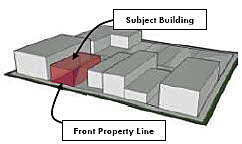
Figure 15.08-15: When the entire width of the front façade of either of the adjacent buildings is
built to the front property line, the entire width of the proposed building shall
also be built to the front property line.
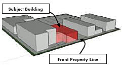
Figure 15.08-16: If part of the width of the front façade of either of the adjacent buildings is built
to the front property line, then at least fifty percent of the width of the proposed
building shall also be built to the front property line.
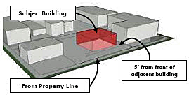
Figure 15.08-17: If not part of the front façade of either of the adjacent buildings is built to the
property line, then the front façade of the proposed building shall not be further
than five feet from the front property line than the adjacent building nearest to
the street.
(6)
All new construction shall have a minimum footprint of eighty percent of the lot square footage. A patio may constitute twenty percent of the required footprint. All stories above the ground floor shall have a minimum sixty percent of the lot footprint. (Ord. No. 1787, § 6, 3-2-2021)
(ii)
Maximum and Minimum Building Heights. Within the DC district, the maximum and minimum height of new primary structures shall meet the following standards:
(1)
The minimum height of a structure within the DC Zoning District shall be thirty feet.
(2)
The maximum height of a structure within the DC Zoning District shall be seventy feet. (Ord. No. 1787, § 4, 3-2-2021)
c.
Development Standards. The following development standards shall supplement those contained in Chapter 15.14, Development Standards, within the DC district. Wherever possible, development in the DC district shall comply with both the standards in Chapter 15.14 and the standards in this section; however, in the event of a direct conflict between the provisions of Chapter 15.14 and the standards in this section, the standards in this section shall govern.
(i)
Landscaping and Screening. The landscaping and screening standards in Section 15.14.050 shall apply in the DC district, except as set forth below.
(1)
Landscaping.
(a)
Site Perimeter Landscaping. Site perimeter landscaping along side or rear lot lines shall only be required when the lot lines occur between a residential and a nonresidential use of property. If the primary structure on either side of the lot line contains a mixed-use (i.e., a mix of residential and nonresidential uses) no site perimeter landscaping shall be required. Where site perimeter landscaping is required, the applicant may choose to substitute for any planting requirement an opaque fence or wall constructed of one of the primary materials used on the façade of the primary structure. If the applicant chooses to provide planted materials for any required site perimeter landscaping on a side or rear lot line, the required width of any planting area shall be reduced to four feet.
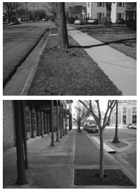
Figure 15.08-20: Street trees within planting strips (left image) or in tree pits (right image) help
to create a pedestrian-friendly environment.
(b)
Building Perimeter Landscaping. Building perimeter landscaping shall not be required along the foundations of any primary structure.
(c)
Landscaping Within the Right-of-Way. Landscaping may be installed within the "furnishings zone" as defined in the design guidelines in addition to the pedestrian amenities set forth below. However, where a sidewalk and planting strip exist on adjacent property, the new sidewalk and planting strip shall match the adjacent sidewalk and planting strip in configuration and alignment unless the city manager's office determines that, for the convenience of the public, a new configuration and alignment are preferable.
(2)
Parking Lot Landscaping and Screening. Any boundary of a surface parking lot that abuts a public street or alley, or that abuts a lot used for detached residential dwellings, shall be landscaped according to this subsection.
(a)
For corner-lot buildings with rear-yard parking, the boundary between the parking lot and the street-facing side property line shall be landscaped or screened adjacent to the right-of-way according to one of the following options:
i.
A minimum four-foot-wide planting strip containing a low, continuous hedge a minimum of thirty inches tall at installation consisting of a double row of evergreen shrubs planted a minimum of three feet on-center in a triangular pattern; or
ii.
A minimum two-foot-wide planting strip containing an ornamental metal fence or masonry wall, with a minimum height of three and one-half feet and a maximum height of four feet, combined with a single row of evergreen shrubs planted a minimum of three feet on-center.
(b)
For all other parking lot boundaries, the boundary shall be landscaped or screened according to one of the following options:
i.
A minimum two-foot-wide planting strip containing a single row of shrubs planted a minimum of three feet on-center combined with a minimum three-foot high ornamental metal fence or masonry wall of materials compatible with the primary structure. In the place of shrubs, deciduous shade trees may be planted a minimum of twenty feet on-center along the common boundary line; or
ii.
A minimum four-foot-wide planting strip containing a low, continuous hedge a minimum of thirty inches tall at installation consisting of a double row of evergreen shrubs planted a minimum of three feet on-center in a triangular pattern.
(c)
As applicable, landscaping materials shall be planted on the side of the fence/wall closest to the street, alley, or residential property.
(d)
In addition to the landscaping standards stated in this subsection, see subsection 15.14.050.G. Off-Street Parking Lot Landscaping, for applicable interior and perimeter parking-lot landscape requirements.
i.
Parking lots containing fewer than fifteen spaces shall be exempt from requirements to provide interior landscaping.
ii.
Parking lots containing fewer than fifteen spaces need not provide site perimeter landscaping along side or rear lot lines except where the parking lot is adjacent to a residential land use as set forth below in this subsection. Where site perimeter landscaping is required, the applicant may choose to substitute for any planting requirement a masonry wall constructed of material compatible with the primary materials used on the façade of the primary structure. If the applicant chooses to provide planted materials for any required site perimeter landscaping on a side or rear lot line, the required width of any planting area shall be reduced to four feet.
(ii)
Trash and Disposal Enclosures.
(1)
Buildings located within the Downtown Commercial (DC) zoning district may be exempted from the trash enclosure requirements outlined in UDC section 15.14.050.1.2.c, per the City Manager or the City Manager's designee, if all the following property conditions are met:
(a)
The property uses the alley for storage and pickup of trash receptacles;
(b)
The building has zero lot line setbacks on all sides or if space limitations are such that a trash enclosure is not feasible;
(c)
Dumpsters are constructed of metal;
(d)
Dumpster placement is adjacent to a noncombustible siding material (i.e. masonry, metal, etc.);
(e)
Meets requirements of the IFC for Combustible Waste Material.
(iii)
Parking and Loading.
(1)
Commercial development within the DC district boundaries shall be exempt from the off-street parking standards of Section 15.14.040.
(2)
For residential development within the DC district, the minimum off-street parking requirements of table 15.14.040-3 shall be reduced to seventy-five percent of the amount required in other zone districts.
(3)
All multi-family residential development shall be exempted from the parking requirements found in Table 15.14.040-3 - Off Street Parking Requirements, if the total parking required does not exceed ten parking spaces, excluding required ADA parking spaces. All multi-family residential development shall be required to adhere to Table 15.14.040-2 - Multi-Family Accessible Parking if on- site parking is provided.
(4)
No off-street loading or parking area shall be located closer to the street frontage than the front façade of the principal structure. (Ord. No. 1787, § 8, 3-2-2021)
(iv)
Transportation, Mobility, and Connectivity. The transportation, mobility and connectivity provisions of Section 15.14.060 shall apply in the DC district unless compliance is inconsistent with any provision of this subsection 15.08.030.E, in which case the provisions of subsection 15.08.030.E. shall govern.
(v)
Parks and Open Spac.e. Development in the DC district shall be exempt from the standards of Section 15.14.070 to dedicate public open space (or to make cash-in-lieu payments). In lieu of such requirements, the development shall provide one of the following, at the applicant's option:
(1)
The applicant shall make a payment to a city tree fund in an amount equal to fifty percent of the cash-in-lieu payment that would otherwise be required if the open space land dedication requirements of Section 15.14.070 were applied to the property;
(2)
The applicant shall make a payment to a fund created to purchase and maintain street furniture or plazas with pedestrian seating areas in the downtown area, in an amount equal to fifty percent of the cash-in-lieu payment that would otherwise be required if the open space land dedication requirements of Section 15.14.070 were applied to the property;
(3)
The applicant shall provide street trees spaced at twenty-five feet as follows:
(a)
In the area defined as the downtown district in the design guidelines for historic Laramie, within tree pits with a minimum surface area of at least twenty-five square feet. Tree pits shall include irrigation systems and shall include structural soils or screened backfill to ensure appropriate root growth and drainage; or
(b)
In the area outside of the defined downtown district in the Design Guidelines for Historic Laramie, within planting strips of at least 5 feet in width. The trunks of street trees within planting strips shall be a minimum of two and one-half feet from the street curb when planted.
(1)
The applicant shall provide pedestrian amenities as set forth in table 15.08.0-3.
(a)
Acceptable Pedestrian Amenities. Acceptable pedestrian amenities include:
i.
A public outdoor seating plaza adjacent to or visible and accessible from the street, with a minimum useable area of three hundred square feet.
ii.
Sidewalk planters between sidewalk and building.
iii.
Public art including but not limited to sculptures, fountains, clocks, or murals with a value equal to or greater than one percent of construction value of the structure.
(vi)
Building Design Standards. All development shall comply with the provisions of the Design Guidelines for Historic Downtown Laramie regarding building and site design in the areas where the design guidelines apply. In areas where the design guidelines do not apply, each principal building with non-residential principal use or mixed uses (i.e., a mix of residential and non-residential shall comply with the following standards, unless the applicant chooses to voluntarily submit to the design guidelines and the related review and approval process.
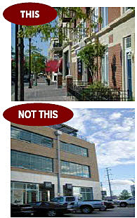
Figure 15.08-21: Buildings should provide wall plane and roof articulation.
(vii)
Façades and Articulation. Each multi-family residential principal structure shall meet the standards of subsections (2) and (3) below. Each non-residential principal structure or mixed-use principal structure (i.e. containing both residential and non-residential uses) shall meet at least two of the three standards in subsections (1) through (3) below, with the choice of those standards to be at the option of the owner:
(1)
Transparency. A minimum of ten percent of each façade area that faces a street must be composed of transparent materials. At least on-half of this amount must be provided so that the lowest edge of the transparent materials is no higher than four feet above the street level.
(2)
Wall Plane Articulation. Each façade greater than fifty feet in length abutting a street, measured horizontally, must incorporate architectural features such as wall plane projections, recesses, or other building material treatments and textures that visually interrupt the wall plane. No uninterrupted length of any façade must exceed fifty horizontal feet.
(3)
Roof Articulation. Where sloping roofs are used, at least one projecting gable, hip feature, or other break in the horizontal line of the roof ridgeline (as viewed from the street frontage must be incorporated for each fifty lineal feet of roof. Where flat roofs are used, the design or height of the parapet must include at least one change in setback or height of at least three feet along each fifty lineal feet of façade. (Ord. No. 1787, § 7, 3-2-2021)
(viii)
Entryway Design and Location. Each principal building must have clearly defined, highly visible main entrances for occupants and/or customers with features designed to emphasize the importance of the entrance, which must include at least one of the following features, with the choice of the features to be at the option of the owner:
(1)
A canopy or portico;
(2)
A roof overhang;
(3)
A horizontal recess or projection;
(4)
An arcade or arch;
(5)
Architectural moldings integrated into the building design; or
(6)
An architectural feature used to emphasize the entryway of another building in the DC district. (Ord. No. 1787, § 7, 3-2-2021)
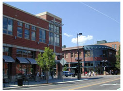
Figure 15.08-22: Primary building entrances must be clearly distinguished and provide an inviting
entrance for pedestrians.
(ix)
Pedestrian-Oriented Design Features.
(1)
Multifamily Residential Buildings. Each multifamily dwelling development containing more than fifty dwelling units, whether developed in a single or multiple phases, and whether in a single or multiple principal buildings, must be designed so that all principal entrances of principal buildings shall have direct access to a sidewalk, walkway, path, or pathway that leads to a public street.
(2)
Non-residential and Mixed Use Buildings. Each principal structure containing non-residential or mixed uses must be designed so that ground-floor façades that face public streets include arcades, display windows, entry areas, awnings, or similar features designed to attract or protect pedestrians along no less than sixty percent of their horizontal length. In addition, all principal entrances of principal buildings not facing an alley must have direct access (i.e., access without having to cross a public street) to a sidewalk, walkway, path, or pathway that leads to a public street. (Ord. No. 1787, § 7, 3-2-2021)
(x)
Fences and Walls. The fence and wall provisions of Section 15.14.100 shall apply in the DC district unless compliance is inconsistent with any provision of this subsection 15.08.030.E., in which case the provisions of subsection 15.08.030.E. shall govern. (Ord. No. 1787, § 7, 3-2-2021)
(xi)
Lighting. The lighting provisions of Section 15.14.110 shall apply in the DC district unless compliance is inconsistent with any provision of this subsection 15.08.020.D., in which case the provisions of subsection 15.08.020.D. shall govern. (Ord. No. 1787, § 7, 3-2-2021)
(xii)
[Signs.] The standards of Section 15.14.120 shall apply in the DC district, except that the standards for signs are modified as follows:
(1)
The combined area of all wall signs attached to any façade of a building shall not exceed ten percent of the façade area of the building (including doors and windows).
(2)
Roof signs are not permitted, and wall signs shall not extend beyond the top edge of any façade of the building.
(3)
Projecting signs shall not project over public property more than one-half the distance from the building to the curb, and not project into a public parking lot. A sign shall not project over the street line. Projecting signs shall fit within the architectural features of the building and be a minimum of eight feet above the ground.
(4)
Projecting signs shall not exceed thirty square feet per building face.
(5)
Corner projecting signs are encouraged and shall not exceed forty-five square feet per face.
(6)
Sandwich signs or street signs should have one characteristic that mimics existing signage for the business or represents the business' operations.
(7)
Sandwich signs or street signs should be no more than twenty-four inches wide and forty-eight inches tall.
(8)
No sandwich or street sign should block the pedestrian walking corridor.
(9)
Window signs shall consist of lettering applied to the interior of display windows.
(10)
Window signs shall have a minimum of opaque background, shall not fill up more than twenty percent of the window area on each facade of the building exterior, and shall have letters up to eight inches high.
(11)
All freestanding signs shall be monument signs (i.e., the lower edge of the sign is attached to a foundation with no visible air space in between the lower edge of the sign face and the foundation) constructed of materials that are similar to or are compatible in quality and appearance with the primary materials used on primary buildings on the site. The addition of skirting between the lower edge of the sign face and the foundation of a pole sign, in order to avoid visible air space between the two, is prohibited.
(12)
The maximum height of a monument sign shall be six feet above grade, and the maximum sign face of a monument sign shall be twenty-four square feet. If the monument sign is oriented approximately perpendicular to the street frontage, or if it is located diagonally on a corner lot in order two be seen from two streets, it may contain a sign face of up to twenty-four square feet on each of its two sign faces. Maximum sign areas shall apply to each lot or parcel, and not per street frontage or per user.
(13)
Pole or pedestal signs are prohibited.
(14)
Electronic message centers (EMCs) shall be prohibited.
(15)
Commercial outdoor temporary signs and banners are prohibited except those permitted per LMC Section 15.14.120.C.4, temporary signs. (Ord. No. 1787, § 7, 3-2-2021)
(xiii)
Alternative Energy. The solar rights provisions in subsection 15.14.030.A. shall not apply in the DC district. The wind energy provisions of subsection 15.14.030.B. shall apply in the DC district. (Ord. No. 1787, § 7, 3-2-2021)
(xiv)
Wireless Communication Towers. The wireless communication tower provisions of Section 15.14.130 shall apply in the DC district unless compliance is inconsistent with any provision of this subsection 15.08.020.E., in which case the provisions of subsection 15.08.020.E. shall govern. (Ord. No. 1787, § 7, 3-2-2021)
(xv)
Patio Design and Materials.
(1)
For all new construction, a patio is a portion of the ground floor area ratio (FAR) that is a maximum of twenty percent of the eighty percent required under LMC Section 15.08.030.E.2.b.(i)(6) that is outside the footprint of a building and still is accessible to the users of that building.
(2)
If a patio is located abutting a right-of-way, the portion that abuts the right-of-way shall be fenced or restricted from access to the public other than by an ADA accessible opening.
(3)
The fence or wall must be designed so that it is transparent above four feet or limits its height to four feet.
(4)
All fences and walls must be constructed out of one of the following approved materials:
a.
Wrought Iron.
b.
Brick.
c.
Tile.
d.
Similar material to that of the building it's connected to.
e.
Decorative Fencing or other material (as approved by the city manager's office). (Ord. No. 1787, § 7, 3-2-2021)
F.
General Commercial (C2) District.
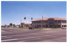
Figure 15.08-23: Image of typical development in the C2 zone district.
1.
Purpose. The C2 district is intended for the conduct of personal and business services and the general retail business of the community. Traffic generated by the uses will be primarily passenger vehicles and only those trucks and commercial vehicles required for stocking and delivery of retail goods. The C2 district is intended to be applied primarily to areas of high traffic volume and along areas with access to high-volume streets.
G.
Limited Manufacturing (LM) District.
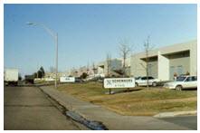
Figure 15.08-24: Image of typical development in the LM zone district.
1.
Purpose. The LM district is intended for manufacturing and assembly plants and warehousing that is conducted so the noise, odor, dust, and glare of each operation is completely confined within an enclosed building. These manufacturing uses may require direct access to rail, air, or street transportation facilities. Retail uses in this district should be subordinate to the light manufacturing use.
a.
Limitations on Retail Sales. Floor area of any structure within the LM district dedicated to retail sales under this section shall not exceed ten percent of the total floor area of the structure in which the retail sales are to take place. No additional off-street parking will be required for the allowable ten percent of floor area used for retail sales.
H.
Industrial Park (IP) District.
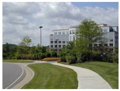
Figure 15.08-25: Image of typical development in the IP zone district.
1.
Purpose. The IP district is intended to provide for operation of offices and light industrial facilities completely contained within a building in a park-like atmosphere. Retail uses in this district should be subordinate to the industrial park use.
2.
District-Specific Standards.
a.
Permitted Uses—Buildings. The entire business operation of an allowed use per table 15.10-1 shall be conducted within a building or an enclosed and landscaped yard, or both.
b.
Retail Sales—Restricted. No retail sales are permitted except:
(i)
Any commodity manufactured, processed, or fabricated on the premises;
(ii)
Any commodity warehoused on the premises but only to the extent that the total floor area devoted to retail sales of all such warehouse commodities shall not exceed twenty-five percent of the gross floor area of the warehouse; and
(iii)
Equipment, supplies, and materials (except explosives) designed especially for use in agriculture, mining, industry, business, transportation, and for building industry and other construction industry uses.
I.
Limited Industrial (I1) District.
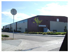
Figure 15.08-25: Image of typical development in the I-1 zone district.
1.
Purpose. The I1 district is intended to provide for light manufacturing, warehousing, processing, service, storage, wholesale, distribution operations, and research and development uses with all operations contained within an enclosed building.
J.
Industrial (I2) District.
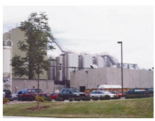
Figure 15.08-26: Image of typical development in the I-2 zone district.
1.
Purpose. The I2 district is intended to provide for industrial development that has some any or all of the following: (a) potentially noxious impacts, (b) very heavy truck traffic for supplies, storage, or shipping, or (c) outdoor storage and operations. Examples include heavy manufacturing, storage, major freight terminals, waste and salvage, large dairy operations, distribution centers, processing, and other related uses. Because of the objectionable influences that may be created in this district, a buffer or additional setback strip and other site design requirements are necessary around this district to protect other zoning districts, except the I1 Light Industrial district.
2.
District-Specific Standards.
a.
Mitigation of Impacts. All uses shall be subject to the following standards:
(i)
Excessive amounts of dust, fumes, odors, smoke, vapor, noise, lights, and vibrations shall be confined within the I2 district (questions concerning the interpretation of "excessive amounts" shall be decided by the city manager's office based on the intent and purposes of this section); and
K.
O District.
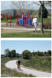
Figure 15.08-27: Image of typical development in the O zone district.
1.
Purpose. The O district is intended for low-impact non-residential and civic uses on large lots. Lands designated as O may be done in conformity with the comprehensive plan for the city to protect lands from premature development and to properly guide growth of the areas surrounding the city that are important for future urban development of the city. The O district is designed to function as a holding zone for future planning and development of agricultural lands without preference for any specific urban use.
L.
Technology and Office (TO) District.
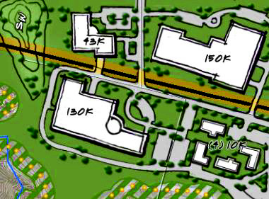
Figure 15.080.030.L-1. Proposed development style within the TO district.
1.
Purpose. The TO district is designed to provide for the development of a mix of office, research and production and technology uses with the emphasis on office, research uses and technology. The uses are to be grouped in a campus or park-like setting and should generally be performed or carried out primarily within a completely enclosed building. The district is further intended to promote perimeter landscaping for large-scale development and increased setbacks from sensitive development areas. The development standards of this district are established to promote the integration of these areas into the surrounding areas and preserve viewsheds from open space and trail corridors shown in the comprehensive plan.
2.
District-Specific Standards.
a.
Permissible Uses. Permitted and conditional uses for the TO district are those set forth in Table 15.10-1.
b.
Dimensional Standards. Dimensional requirements for lots and structures in the TO district are set forth in Table 15.12-3, except as supplemented below.
(i)
Maximum and Minimum Building Heights. The height of all structures in the TO district shall not exceed forty-five feet or as indicated in subsection 15.08.000.L.2.(ii) below.
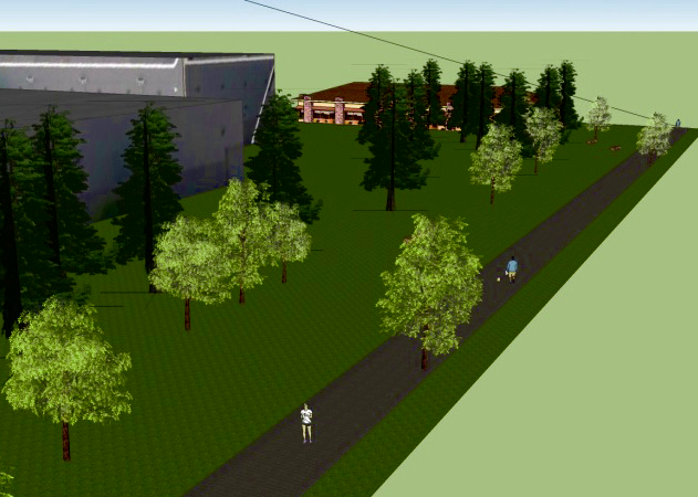
Figure 15.080.030.L-2a. Building heights shall not exceed one foot in height for every four feet of distance
from a proposed or existing trail.
(ii)
Height Restrictions from Trail Corridors. Building heights shall not exceed one foot in height for every four feet of distance from a proposed or existing trail as shown in the comprehensive plan. In instances where the trail has not been constructed, the city manager's office shall make a determination of its future location. Relief may be granted by the planning commission if the planning commission finds that the proposed development does not interfere with viewsheds, that adequate screening is provided, alternative mitigation measures have been proposed to mitigate visual impacts and the developer provides a visual simulations of the proposed development and its relationship to a trail corridor.
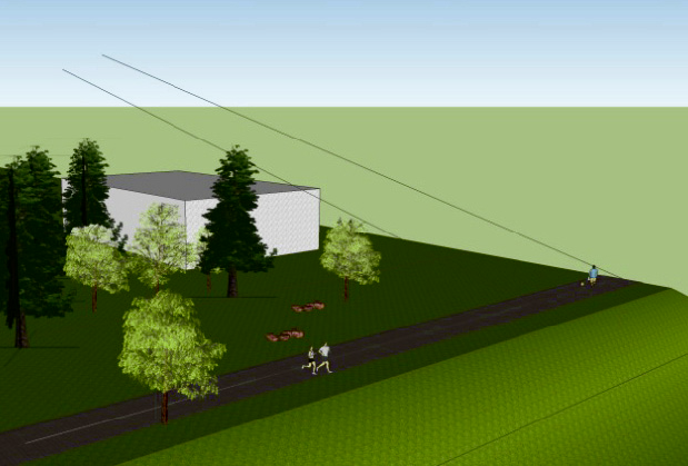
Figure 15.080.030.L-2b. Building heights shall not exceed one foot in height for every four feet of distance
from a proposed or existing trail. The above image shows that a twenty-foot-tall building
would be required to be set back eighty feet from a trail centerline and thirty-five
feet from a one-hundred-foot-wide open space corridor.
c.
Development Standards. The following development standards shall supplement those contained in chapter 15.14, Development Standards, within the TO district. Wherever possible, development in the TO district shall comply with both the standards in Chapter 15.14 and the standards in this section; however, in the event of a direct conflict between the provisions of Chapter 15.14 and the standards in this section, the standards in this section shall govern.
d.
Landscaping and Screening. The landscaping and screening standards in Section 15.14.050 shall apply in the TO district, except as set forth below.
(i)
Landscape Material Standards. The landscape material standards of subsection 15.14.050.D. shall apply.
(ii)
Street Frontage Landscaping. The area along any property line that abuts a public street right-of-way shall be landscaped using one of the following four landscape options that the developer may choose:
(1)
Option 1: Install a twenty-foot-wide landscape area along the street right-of-way. The landscape area may vary in width, but must average twenty feet in width. Within the landscape area, one tree shall be planted per forty linear feet of frontage. Drive areas shall be counted as zero feet in width.
Figure 15.080.030.L-3. Option 1 right-of-way bufferyard.
(2)
Option 2: Install a ten-foot-wide landscape area along the street right-of-way. The landscape area may vary in width, but must average ten feet in width. Within the landscape area, two trees shall be planted per forty linear feet of frontage. Drive areas shall be counted as zero feet in width.
(3)
Option 3: Install a landscaped berm with five-foot minimum average height. The berm shall have a slope of no greater than one foot of rise for every four feet of run. Within the landscape area, one tree shall be planted per sixty linear feet of frontage. Drive areas shall be counted as zero feet in width.
(4)
Option 4: Install a five-foot-wide landscape area along the street right-of-way. The landscape area may vary in width, but must average five feet in width. Within the landscape area, one tree shall be planted per forty linear feet of frontage. A thirty-inch high decorative wall shall be located between any parking area and the street frontage. Drive areas shall be counted as zero feet in width.
(iii)
Site Perimeter Landscaping. The exterior boundaries of the development site that do not abut a public street right-of-way shall have a five-foot minimum bufferyard width with one tree per eighty linear feet of lot line; except all development on lots adjacent to a trail corridor, as shown in the comprehensive plan, shall have a fifteen-foot minimum bufferyard width with one tree per twenty-five linear feet.
(iv)
Parking Lot Landscaping and Screening. Any boundary of a surface parking lot that abuts a public street or alley, or that abuts a lot used for detached residential dwellings, shall be landscaped according to this subsection.
(a)
For all developments with front yard parking, the boundary between the parking lot and the street-facing property line shall be landscaped or screened adjacent to the right-of-way according to one of the following options:
i.
A minimum fifteen-foot-wide planting strip with one tree per forty linear feet of lot line; or
ii.
A minimum ten-foot-wide planting strip containing an ornamental metal fence or masonry wall constructed subject to the regulations of Section 15.14.100 of this chapter, with a minimum height of three and one-half feet and a maximum height of four feet, combined with a single row of evergreen shrubs planted a minimum of three feet on-center and one tree per one hundred feet of lot line.
(b)
For all other parking lot boundaries, no additional screening other than the site perimeter landscaping indicated in subsection 15.08.000.L.5. above shall be required.
(c)
The interior parking-lot landscape requirements subsection 15.14.050.G., Off-Street Parking Lot Landscaping, shall be required for parking spaces containing more than fifteen spaces.
e.
Driveways and Access. All driveways and access ways shall comply with the access requirements contained in subsection 15.14.060.E.4., Driveways and Access.
f.
Parking and Loading Requirements and Location. Development within the TO district boundaries shall be shall be required to provide off-street parking pursuant to Section 15.14.040, Parking.
g.
Transportation, Mobility, and Connectivity. The transportation, mobility and connectivity provisions of Section 15.14.060 shall apply in the TO district unless compliance is inconsistent with any provision of this subsection 15.08.030.E., in which case the provisions of subsection 15.08.030.E. shall govern.
h.
Building Design Standards.
(i)
Design Standards. All development shall comply with the design standards of Section 15.14.090, Commercial and Industrial Design Standards; however, the provisions of subsection 15.14.090.D.5. shall not apply to developments where the principal building footprint is greater than two hundred fifty thousand square feet.
(ii)
Use of Reflective Glass. Mirrored or highly reflective glass shall not cover more than twenty percent of a building surface unless an applicant submits information demonstrating to the satisfaction of the city manager's office that use of such glass would not significantly increase glare visible from adjacent streets, properties or pose a hazard for moving vehicles.
i.
Lighting. The lighting provisions of Section 15.14.110 shall apply in the TO district; however, lights for parking lots and buildings shall be so oriented and shielded that they do not shine directly onto an abutting property or undeveloped portions of the subject property. Exterior spot lighting or other illumination shall be so installed as to eliminate any nuisance to adjoining residential districts or other properties, or to traffic on public rights-of-way. Light levels at the property line should not exceed 0.2 footcandles at the interior inside edge of any landscaped bufferyard associated with the subject development and 0.0 footcandles at the property line as demonstrated on the photometric layout of the site.
j.
Signs. The standards of Section 15.14.120 shall apply in the TO district, except that the standards for signs are modified as follows:
(i)
All freestanding signs shall be monument signs constructed of materials that are similar to or are compatible in quality and appearance with the primary materials used on primary buildings on the site. The addition of skirting between the lower edge of the sign face and the foundation of a pole sign, in order to avoid visible air space between the two, is prohibited.
(ii)
One subdivision identification sign per development entrance shall be permitted. Each sign shall not exceed two hundred fifty square feet in sign display area and shall not exceed twenty feet in sign height. Subdivision identification signs shall be set back at least five feet from any property line, unless designed and constructed as part of an entranceway architectural feature, such as a gate, decorative wall, archway, or similar element. Subdivision identification signs shall be approved by the city manager's office. Sign placement shall not obstruct any clear vision area.
k.
Alternative Energy. The solar rights provisions in subsection 15.14.030.A. shall apply in the TO district. The wind energy provisions of subsection 15.14.030.B. shall apply in the TO district.
l.
Wireless Communication Towers. The wireless communication tower provisions of Section 15.14.130 shall apply in the TO district.
(Ord. No. 1578, § 2(att. A), 3-2-2010; Ord. No. 1622, §§ 2, 3, 7-31-2012; Ord. No. 1637, § 1(Att. A), 2-5-2013; Ord. No. 1671, § 21, 11-18-2014; Ord. No. 1728, §§ 10, 16, 4-18-2017; Ord. No. 1781, §§ 5, 7, 8, 9-1-2020; Ord. No. 1830, § 3, 10-17-2023, Ord. No. 1842, § 1, 1-3-2024; Ord. No. 1861, §§ 1—3, 3-4-2025; Ord. No. 1872, § 2, 10-7-2025)
15.08.040 - Overlay districts.
The standards in this section supplement, but do not replace, provisions in other chapters of this code addressing permitted uses, dimensional standards, or development standards. Wherever possible, the code shall be interpreted so that both the standards of other chapters of this code and the provisions of this section can be met. In case of an inconsistency between any other provision of this code and the provisions of this section, the provisions of this section shall govern.
A.
Aquifer Protection (APO) Overlay.
1.
Legislative Findings. More than half of the City of Laramie's municipal water supply and all of the drinking water supplied to Albany County's rural residences comes from wells and springs in the Casper Aquifer. The delineated recharge area of the Casper Aquifer Protection Area (CAPA) encompasses approximately seventy-two square miles that lie east of the city of Laramie and extends to the crest of the Laramie Range. The north and south boundaries are approximately five and six miles north and south, respectively of Laramie's city limits. Approximately four hundred fifty Albany county residents and four city of Laramie municipal wellfields draw water from the Casper Aquifer in this area. The vast majority of the CAPA is the recharge area for the Casper Aquifer, and consequently, the Casper Aquifer is vulnerable to contamination from land uses in the protection area. Exposure of the Casper Aquifer in the delineated area results in increased vulnerability to contamination from land uses. In addition to the general vulnerability of the Casper Aquifer in the area where aquifer materials are exposed at the surface, there are specific features that enhance the vulnerability of the aquifer to contamination.
a.
Recharge into the Casper Aquifer system occurs rapidly as snowmelt and runoff infiltrates into porous sandstones and fractures that occur in drainages and on the land surface.
b.
There is continuous residential and commercial development pressure east of Laramie where the Casper Aquifer is recharged. Development in this area increases the risk of contamination in two ways:
(i)
New Contamination Sources. Homes and businesses are new sources of potential contamination to the aquifer (volatile organic compounds from fuels and solvents, nutrient fertilizers and pesticides from lawn care, nitrates and pathogens from septic leachate).
(ii)
New Contamination Pathways. New wells and excavations which weaken the integrity of the confining layer may provide a direct conduit to the Casper Aquifer or reduce the hydraulic barrier provided by the Satanka Shale that overlies the Casper Aquifer.
c.
An unknown quantity of hazardous substances is transported along Interstate 80 (1-80) and 1-80 transects the Casper Aquifer recharge area, increasing the risk to the aquifer based on the possibility of a spill of these hazardous substances.
d.
There is the potential for the rapid transport of contaminants in the saturated zone due to a steep hydraulic gradient and enhanced aquifer permeability from fractures, joints, and dissolution features.
e.
The recharge area of the Casper Aquifer is in close physical proximity to withdrawal points for Albany County and City of Laramie residents. The Laramie City Council adopts this ordinance because the Casper Aquifer provides a critical component of the existing and future drinking water supply for City residents - especially in drought conditions. The importance of the groundwater supply component was demonstrated in the summer of 2002 when the Laramie River supply was reduced significantly due to drought and the city had to rely almost exclusively on groundwater. These regulations are further supported by the adoption of the Casper Aquifer Protection Plan Update in 2023 by the City of Laramie and Albany County.
2.
Purpose and Intent. Inappropriate development over the Casper Aquifer can deteriorate the quality of the drinking water through the intentional or unintentional release of contaminants which is harmful to the health, safety, and welfare of residents. Therefore, the purpose and intent of this ordinance is to protect the high quality source water in the Casper Aquifer and to decrease the risk of contamination to the Casper Aquifer.
3.
Definitions. For the purpose of this Aquifer Protection Overlay Zone ordinance, the following words and terms shall have the meanings specified herein. Words that are not defined in this section shall be defined by the Laramie Municipal Code and then the common usage of the word.
a.
"Aquifer" means a formation, group of formations, or part of a formation that contains sufficient saturated permeable material to yield sufficient, economical quantities of water to wells, springs, and drain tunnels.
b.
"City" means City of Laramie, Wyoming.
c.
"City Council" means the City Council of the City of Laramie, Wyoming.
d.
"Commercial" means an activity or use involving the sale/provision of goods or services and is not residential in nature
e.
"Commission" means the Planning Commission of the City of Laramie, Wyoming.
f.
"County" means Albany County, Wyoming.
g.
"Development" means the preliminary and final platting of land, construction, reconstruction, conversion, structural alteration, relocation, enlargement of any structure, or project requiring site plan review; any mine, excavation, landfill; and/or any change in use, or alteration or extension of the use of land; excluded from this definition are additions to single family residences that do not increase the amount of wastewater effluent, above the capacity of the permitted small wastewater system (effluent amount determined by number of bedrooms), residential accessory buildings, construction of a single-family home on an existing lot that will be attached to a municipal or centralized sewer collection line, or construction that does not require a building permit, or construction that requires a building permit which is wholly interior, involves no use change and is not a pre-existing nonconforming use.
h.
"Development Department" means the Community Development Department of the City of Laramie, Wyoming.
i.
"Hazardous Material" means any: (1) Any hazardous substance as defined in 40 CFR § 302.4 (2022) and listed therein at Table 302.4 and any hazardous waste as defined in 40 CFR § 261.3 (2022), but not including any later amendments or editions of the CFR sections. (2) Any pesticides as defined in W.S. § 35-7-354(d) which are stored, sold, distributed, requiring notification of usage, or used in a manner that is unpermitted by the Wyoming Environmental Pesticide Control Act of 1973, W.S. §§ 35-7-350 to -372, or rule promulgated thereunder by the Wyoming Department of Agriculture; or (3) Any oil or petroleum, but not including natural gas or propane used for heating structures or other common residential uses.
j.
"Home occupation" means a business, profession, occupation or trade conducted for personal gain or support of the residential occupation and conducted within a residential building or accessory structure to a residential use.
k.
"Overlay District" means a district that is superimposed over one or more zoning districts or parts of districts and imposes specified requirements that are in addition to those otherwise applicable for the underlying zone.
l.
"Person" means and includes any individual, entity or association of individuals or entities of any kind, and includes without limitation, any developer, homeowner's association, group, partnership, limited partnership, corporation, joint venture, joint enterprise, trade association, regulatory government body including the city or any other legal entity.
m.
"Potential contaminant" means any substance which may enter the Casper Aquifer and decrease water quality due to its introduction into the Casper Aquifer. Some examples include storm water, petroleum products, medical wastes, pesticides, and sewage effluent.
n.
"Vulnerable feature" means any physical attribute that enhances the potential for rapid infiltration and aquifer contamination, including but not limited to, faults, fractures, folds, evidence of conduit flow, existing and future production, test, and monitoring wells, springs, bore holes, perennial drainage, intermittent drainage or ephemeral drainage or locations where groundwater is less than seventy feet from the surface
o.
"Wastewater Facility" As defined by W.S. § 35-11-103(c)(ix), any sewerage system, disposal system or treatment works having simple hydrologic and engineering needs which is intended for wastes originating from a single residential unit serving no more than four families or which distributes two thousand gallons or less of domestic sewage per day.
4.
Aquifer Protection Overlay Zone Established and Applicability.
a.
An aquifer protection overlay zone (APO zone) has been established within the incorporated City of Laramie, Wyoming and unincorporated area of Albany County. This chapter is effective inside the City of Laramie corporate limits, and as delineated in the Casper Aquifer Protection Plan Update(CAPP) and as adopted by the City Council on November 21, 2023 and Enrolled Ordinance 1833. Copies of the illustrations that accompany the CAPP shall be kept in appropriate City offices. All property within Zones 1, 2, and 3 are zoned APO by default. The Map located in subsection 15.08.060.A. illustrates the boundaries of the Aquifer Protection Overlay District in relation to the City.
b.
Where the boundary line of the APO zone divides a lot or other parcel of land, the requirements established by this ordinance shall apply only to the portion of the lot or parcel that is located within the APO zone.
c.
The establishment of the APO zone and the use of the APO zoned properties in accordance with this ordinance do not relieve any Person from liability provided by law for contamination of the Casper Aquifer. This ordinance does not supersede or modify the requirements of any federal law, state law, or local regulation that has more stringent requirements.
d.
Where the bounds of the identified CAPA, as delineated, are in doubt or in dispute, any landowner aggrieved by such delineation may file for a rezoning. Upon receipt of a rezoning application, further action on development plans related to the area in question shall be suspended, and a Wyoming Licensed Professional Geologist, engaged at the landowner's expense, shall prepare a report determining the proper location and extent of the Casper Aquifer and recharge area relative to the property. Based upon the findings the Planning Commission and City Council may consider the rezoning. Only if the rezoning is approved by ordinance of the City Council may the zoning boundary be adjusted.
e.
Applications filed and accepted after the effective date of this ordinance shall meet the requirements of this ordinance.
f.
Where this ordinance is less strict or where this ordinance is silent as to a particular issue, developments shall conform to the requirements of the underlying zoning district(s) in which the developments are located.
5.
Groundwater Monitoring Program Implementation. The City of Laramie, in cooperation with Albany County, shall implement the groundwater monitoring program as recommended in the Casper Aquifer Protection Plan Update and Groundwater Monitoring Network Program.
6.
Prohibited Uses.
a.
Within the APO zone, the underlying zoning classification shall control all aspects of the property's zoning except that no property may be used for any uses prohibited in sections 15.08.040.A(6)(b) and 15.08.040.A(6)(c) below or otherwise prohibited or limited by operation of this ordinance.
b.
Zone 1 is delineated as a 100-foot radius from the municipal wells, municipal water production facilities, and any historic springs associated with the municipal wells and shall include any expansion of Zone 1 hereafter. No other uses shall be approved in Zone 1 of the APO except natural and undeveloped open space. The existing wellfields include Spur, Turner, Pope, and Soldier. The historic springs protected in Zone 1 are City Springs, Pope Springs, and Soldier Springs. Any future municipal wells shall be included under this section.
c.
Each prohibited use listed in the left column of the Table 15.08.040.A, Prohibited Uses below is prohibited in the APO Zones 2 and 3. The Table of Prohibited Uses cannot and does not include all possible proposed land uses in the APO. Therefore, the city may review all developments for compliance with this ordinance.
7.
Vulnerable Features that require a Setback.
a.
Vulnerable features that require a setback in the Casper Aquifer are:
(i)
Any physical attribute that enhances the potential for rapid infiltration and aquifer contamination, including, folds, faults, fractures, springs, or other evidence of conduit flow, bore holes, or locations where groundwater is less than seventy feet from the surface.
(ii)
Perennial, intermittent, and ephemeral drainages.
(iii)
Existing and future production, test and monitoring wells and/or springs of any kind completed in the Casper Aquifer providing a direct conduit to the aquifer, including any uncapped, unsealed, improperly sealed, and abandoned or orphaned well.
b.
No development shall be approved within the APO until the applicant demonstrates to the city that there is no portion of a vulnerable feature within one hundred feet of any point of the proposed development. At a minimum, the certification must include a signed and stamped site-specific investigation, as described in subsection 15.08.040.A.8 of this ordinance, by a Wyoming licensed professional engineer or licensed professional geologist.
8.
Site-specific Investigation for All Proposed Developments.
a.
A site-specific investigation shall be performed for all developments proposed within the APO Zones 2 and 3. The investigation shall be conducted by a professional engineer or professional geologist who is, licensed within the state of Wyoming, has the required skills in the areas of groundwater evaluation, geologic formation analysis, and the science of contaminant transport.
b.
The purpose of the site-specific investigation is to identify, as a minimum, the impacts, if any, of the proposed development(s) on the Casper Aquifer.
c.
The site-specific investigation shall describe, to the extent possible given the existing data and site-plan information, the existing conditions, all proposed activities, and all proposed management techniques, including any measures necessary to mitigate risks.
d.
The site-specific investigation shall consist of:
(i)
A document and literature search to determine the presence of mapped faults, folds, fractures, other evidence of conduit flow and vulnerable features on the subject property. This research will include at a minimum a review of the CAPP and available topographic, geologic, and hydrogeologic maps and reports as needed.
(ii)
A site narrative that includes historical information on previous land use, contaminant releases or any known contamination of any part of the property, existing or abandoned wells, underground storage tanks, and septic systems as well as any other improvements or information relevant to the potential for aquifer contamination of the site or proposed use.
(iii)
A site plan showing the proposed use, development and zoning of the property relative to identified vulnerable features. The site plan will include existing and proposed topographic contours or show the proposed development on the most recent U.S. Geological Survey 7.5' Topographic Quadrangle map. The site plan will indicate site conditions for a distance of at least two hundred feet beyond any proposed development in all directions. The Site Plan shall show existing and proposed structures, proposed small wastewater systems and or wastewater facility as applicable, parking areas, retention or detention ponds, water wells, driveways, landscaping areas, setbacks, surface and subsurface drainage facilities, potential contaminant storage locations and methods of storage, above ground storage tanks, best management practices, utilities, roads, stormwater management, and a vicinity map. Where necessary, specific construction details shall be provided to assure adequacy to accepted design standards. If any vulnerable features are found on the property to be developed, then the site plan must show any proposed facilities, as applicable, with a minimum one hundred foot setback from those vulnerable features identified.
(iv)
Identification of potential contaminants and amounts stored, generated or handled on the subject property.
(v)
A field inspection shall be conducted to verify the presence or absence of vulnerable features as defined in Laramie Municipal Code 15.08.040.A.7.a that were not previously identified through the document search. This investigation will also consider any other geologic, hydrologic, hydrogeologic, or geotechnical conditions that could potentially compromise water quality beneath the subject property. A summary of the field inspection shall include a written report, maps identifying the vulnerable features, and the distance and direction of the nearest well and vulnerable features that could potentially impact water quality within the Casper Aquifer.
(vi)
A map showing the area and types of soils, marshes, perennial drainages, intermittent drainages, ephemeral drainages, creeks, and other bodies of water on the subject property. A geologic map(s) will be provided to show the surface distribution/location of alluvium and to depict the types of exposed bedrock, faults, folds, fractures, and other evidence of conduit flow on the subject property that were identified either from existing reports or from the onsite investigation. The map must also include the locations of all existing and abandoned wells and any other vulnerable features identified near the proposed development.
(vii)
Where the 100-year flood plain mapping is unavailable, the professional geologist and/or engineer will calculate the one hundred year flood plain for the drainage. The flood plain mapping will be provided on a site map with a scale not to exceed one inch equals two hundred feet.
(viii)
An evaluation of the proposed or existing water supply and sewage system that includes the potential for contamination impacts of the systems to the Casper Aquifer and its recharge area and the adequacy of the systems, as applicable. Within the APOZ, the evaluation of the wastewater system will consider the potential impacts of effluent on any member of the Casper Formation. Items such as floor drains and plumbing schematics and the locations of potential contaminants, waste storage, and liquid transfer area locations shall be provided. To the extent not prohibited by Table 15.08.040.A a list will be provided of potential contaminants and amounts stored, generated or handled on the subject property.
(ix)
The depth to groundwater will be determined and presented. Water level(s) in a well on the subject property are preferable for determining depth to groundwater. Water levels from wells on adjoining properties may be used if a well has not been drilled on the subject property. If a well is not available for obtaining water levels, then maps depicting the potentiometric surface of the Casper Aquifer at the subject property may be used. No new wells shall be drilled for the purpose of determining the potentiometric surface.
(x)
A surface water risk assessment and mitigation plan for any impacts caused by storm water runoff, retention and/or detention basins on the city water supply and the Casper Aquifer.
(xi)
A maintenance plan and agreement for any retention and/or detention basins and associated improvements will be required. Such plan and agreements shall be recorded in the Albany County Clerk's Office.
(xii)
A groundwater risk assessment and mitigation plan to respond to any evidence of contamination or vulnerability which is the result of the development. Such plan shall not limit the liability of any Person for impacts to the Casper Aquifer.
(xiii)
Demonstration of compliance with all applicable City standards.
9.
Conditions of Approval for Development in the Aquifer Protection Overlay Zone.
a.
No development shall be permitted in the APO zone unless the effects of such development meet the following criteria.
(i)
The proposed type of development and area in which the development is proposed meets the standards of this ordinance.
(ii)
No vulnerable feature, as defined in subsection 15.08.040.A.7.a, exists within one hundred feet of the proposed development.
(iii)
A site-specific investigation and report of the findings, as defined in subsection 15.08.040.A.8 has been performed for the property and a written report, including maps, of the site-specific investigation has been submitted to the City.
(iv)
A Wyoming licensed professional engineer (the city engineer or other licensed professional engineer) or Wyoming licensed professional geologist who, by experience and/or by training has the required skills in the areas of groundwater evaluation, geologic formation analysis, and the science of contaminant transport, other than the professional that performed the site-specific investigation, must review the site-specific investigation and verify that the proposed development meets the requirements of this ordinance. If review of the site-specific investigation is conducted by anyone other than the city engineer, the city may be reimbursed for the cost of the review.
In review of the site-specific investigation, the qualified professional will assess and determine whether the site and development plans meet the overall objectives of the Casper Aquifer Protection Plan and this ordinance.
b.
The city may attach conditions of approval to ensure the protection of the groundwater quality, including, but not limited to, further evaluation, reasonable technical improvements, monitoring or other mitigation measures. All conditions of approval shall be reviewed and evaluated by the professional engineer or licensed professional geologist who reviews the site-specific investigation to ensure that the condition(s) of approval are of sound scientific and technical reasoning.
10.
Design Standards for On-Site Wastewater Treatment System/Septic Systems.
a.
No new septic systems shall be permitted within the APO zone. All wastewater shall use the City of Laramie's wastewater/sewer system.
b.
Removal of septic systems located within the APO zone must be in accordance with plans and specifications prepared by and certified by a professional engineer skilled in the science of wastewater disposal and licensed to practice in the State of Wyoming. This ordinance does not grant the right to install a septic system or on-site wastewater treatment system and/or facility otherwise forbidden by city regulations.
c.
Each existing septic system located withing the City of Laramie and within the APO shall be removed within two years of the adoption of this ordinance.
d.
Upon Annexation, any property with an existing septic system shall connect to City of Laramie wastewater/sewer system prior to occupancy of any building or the establishment of any use on the property.
11.
Connection to Municipal or District Sewage Collection Lines.
a.
For properties within the APO zone no private on-site wastewater treatment system and/or facility may be used after the earlier of:
(i)
One year after installation of a municipal sewer collection line in a right-of-way or easement that is contiguous to the property on which the system is located; or
(ii)
One year after the inclusion of the property containing the on-site system in a district connected to the City of Laramie's wastewater treatment system or another wastewater treatment facility and if the sewage collection line is in a right-of-way or easement that is contiguous to the property.
12.
Pre-Existing Nonconforming Uses. Pre-existing nonconforming uses within the APO zone are subject to the terms of this ordinance and to other general ordinance provisions on pre-existing nonconforming uses.
a.
A pre-existing nonconforming use is a use prohibited by this regulation but which is in place upon property included in the APO zone as of the date the property was included in the APO zone. That date may be the effective date of this ordinance or the date a use becomes nonconforming because of an amendment to this ordinance. Septic systems and other on-site wastewater treatment systems are controlled by this ordinance and are not subject to these provisions on pre-existing nonconforming uses.
b.
Pre-existing nonconforming uses may continue in the same location they were in when they became nonconforming uses, but shall not be enlarged, extended, constructed, reconstructed, moved, or structurally altered except in changing the use of the structure to a use permitted in the district in which it is located. Any non conforming use or structure which is damaged by less than fifty percent of its replacement value may be allowed by the department to continue or be reconstructed. Any nonconforming use or structure damaged by more than fifty percent of its replacement value may continue or be reconstructed if approved by the City Council. If a non conforming use or structure is allowed to continue or be reconstructed it shall be in the same location, size, and scope, provided that after repairs are complete, the best available control technology shall be in place to prevent contact between hazardous materials and the surface of the ground or groundwater.
c.
Every pre-existing nonconforming use shall:
(i)
Store hazardous material in an enclosed structure or under a roof which eliminates storm water entry to the containment area;
(ii)
Provide floors within a structure where hazardous material is stored, coated to protect the surface of the floor from deterioration due to spillage of any such material. A structure which may be used for storage or transfer of hazardous material shall be protected from storm water run-on and ground water intrusion;
(iii)
Store hazardous material within an enclosed impermeable containment area which is capable of containing at least the volume of the largest container of such hazardous material present in the area or one hundred ten percent of the total volume of all such containers in the area, whichever is larger, without overflow of released hazardous material from the containment area;
(iv)
Store hazardous material in a manner that will prevent the contact of chemicals with any materials so as to create a hazard of fire, explosion or generation of toxic substances;
(v)
Store hazardous materials only in containers that have been certified by a state or federal agency or the American Society of Testing Materials as suitable for the transport or storage of the material;
(vi)
Store all hazardous material in an area secured against entry by the public, except items offered for retail sale in their original unopened containers;
(vii)
Not use, maintain or install floor drains, dry wells or other infiltration devices or appurtenances which allow the release of wastewater to the ground water; and
(viii)
Not discharge any substance or material to the ground in the APO zone unless the discharge is permitted by law.
d.
These requirements are intended to supplement, and not to supersede, any other applicable requirements of federal, state or local law.
13.
Proper Registration and City Permitting of Wells and Plugging and Abandonment of Unused Wells. All wells, including but not limited to groundwater production wells, test wells and monitoring wells, that are no longer in use by the owner must be properly plugged and abandoned in accordance with Chapter 26, Section 11 of the Wyoming Department of Environmental Quality Rules and Regulations. All wells within the corporate limits of the City of Laramie shall be registered or permitted by the City Manager in accordance with Laramie Municipal Code 13.04.360.
14.
Exception From one hundred feet Setback from Vulnerable Features for Infrastructure. The construction of sewer and water lines that are attached to either a centralized wastewater or water system or the City of Laramie's Wastewater or Water system, may be installed within the APO in order to protect water quality. Sewer lines shall be engineered in such a way as to limit the possibility of an undetected leak; this may include double walled pipes and regular pressure testing or other engineering techniques and leak detection systems that reduce the possibility of undetected leaks. Exceptions also include other general utilities used specifically to serve local developments such as electric lines, gas lines for heating, cable television, and telephone lines. Roads may also be excepted if appropriate stormwater drainage and management is included.
15.
Existing Law on Aquifer Contamination Unaffected. The establishment of the APO zone, and the use of APO-zoned properties in accord with this ordinance, does not relieve any Person from liability provided by law for contamination of the Casper Aquifer. This ordinance does not supersede or modify the requirements of any federal, state or local law which makes stricter requirements.
16.
Severability. The provisions of this ordinance are severable. If any provision is declared to be invalid or unenforceable by any court of competent jurisdiction, those provisions not so declared shall remain in effect.
B.
Turner Tract (TTO) Overlay.

Figure 15.08-28: Image of typical design features in the Turner Tract Overlay district.
1.
Purpose. The city has implemented the Turner Tract Overlay district in order to promote high-quality, attractive development along an important and highly visible corridor. Specifically, this section is intended to:
(i)
Enhance and protect development in the described area;
(ii)
Facilitate adequate provisions for transportation, water, sewerage, parks, and other public requirements; and
(iii)
Encourage compatible uses within the overlay district established and in its neighborhood.
The city council has given reasonable consideration to, among other things, the character
of the district and its peculiar suitability for particular uses. This section's intent
is advanced by provisions designed to encourage development in line with the Turner
Tract Area Plan (TTAP) adopted as a planning document by the city council.
2.
Location. The TTO zoning district is bounded by the west line of Section 2, T. 15 N., R. 73 W., 6th p.m. on the west, Garfield Street west of the centerline of Boulder Drive and Grand Avenue east of the centerline of Boulder Drive on the north, Vista Drive on the east, and the corporate limits of the city of Laramie on the south. The overlay zone may be expanded from time-to-time as the corporate limits are changed, provided the city council expressly includes any annexed property within the Turner Tract Overlay zone district. Map 15.08.060-2 located in subsection 15.08.060.B. illustrates the boundaries of the Turner Tract Overlay district.
3.
District-Specific Standards.
a.
Applicability.
(i)
This section applies to all new development within the area described in subsection 15.08.040.B.2. above on lands within the city limits.
(ii)
Where a tract is protected by recorded restrictive zoning, covenants, deed restrictions that are at least as strict as the provisions of this section, this section does not substitute for the stricter requirements of the zoning, covenants or deed restrictions.
b.
Chapter 15.14, Development Standards, and the standards of this chapter are applicable to development in the TTO.
c.
Business and Commercial Uses. To accomplish the general intent of this section, business uses within the TTO district are intended to complement residential uses to facilitate a live-work environment.
(i)
Permitted and Restricted Uses. This section shall apply when the underlying zoning district is B1, NB, LM, or O. Potential buyers of land for commercial purposes should review the aquifer protection overlay zone ordinance to assure themselves that the proposed development will meet the requirements of that ordinance.
(1)
Permitted Uses. All uses allowed in the underlying zoning district are permitted except as specifically prohibited in subsection 15.06.040.B.3.c.(2) below.
(2)
Prohibited Uses. The following uses are prohibited in the TTO zoning district:
(a)
Airports, landing strips, and heliports;
(b)
Animal hospitals and kennels;
(c)
Auction houses and yards;
(d)
Automobile repair shop;
(e)
Automobile sales and rental;
(f)
Campgrounds;
(g)
Freestanding wireless communications towers or antennas;
(h)
Private golf courses and private driving ranges;
(i)
Outdoor commercial recreation or entertainment;
(j)
Sexually oriented businesses;
(k)
Racing facilities;
(l)
Dry cleaners;
(m)
Extraction and disposal uses;
(n)
Heavy industrial uses, including those defined in Chapter 15.24, Definitions, of this code, and whether listed therein as permitted uses or not;
(o)
Waste and salvage uses;
(p)
Injection wells;
(q)
Wells that penetrate the Casper formation to any degree;
(r)
Fueling center;
(s)
Car wash;
(t)
Heavy manufacturing or processing uses, including those defined in Chapter 15.24, Definitions, of this code;
(u)
Heavy retail and heavy services, as defined in Chapter 15.24, Definitions, of this code; and
(v)
Liquor stores, Drive-in.
C.
Planned Unit Development (PUD) Overlay.
1.
Purpose. The city has implemented the Planned Unit Development (PUD) Overlay district to provide for the growing demand for housing of all types and designs and for necessary supportive commercial facilities conveniently located to such housing, to create functional and attractive development, to minimize adverse impacts, and to ensure that projects will be assets to the community. It is the purpose of this section to:
a.
Promote and permit flexibility that will encourage innovative and imaginative approaches in land development and renewal which will result in a more efficient, aesthetic, desirable, and economic use of land while maintaining density and intensity of use consistent with the applicable adopted plans, regulations, and policies of the city;
b.
Promote development within the city that can be conveniently, efficiently, and economically served by existing municipal utilities and services or by their logical extension;
c.
Promote design flexibility including placement of buildings, use of open space, pedestrian and vehicular circulation systems to and through the site, and off-street parking areas in a manner that will best utilize potential on-site characteristics such as topography, geology, geography, size, and proximity;
d.
Provide for the preservation of historic or natural features where they are shown to be in the public interest, including but not limited to such features as: drainageways, floodplains, aquifers, existing topography or rock outcroppings, unique areas of vegetation, and historic landmarks or structures;
e.
Provide for compatibility with the area surrounding the project site;
f.
Provide for usable and suitably located open space such as, but not limited to, bicycle paths, playground areas, courtyards, tennis courts, swimming pools, planned gardens, outdoor seating areas, outdoor picnic areas, and similar active or passive open space;
g.
Minimize adverse environmental impacts of development; and
h.
Improve the design, quality, and character of new development.
2.
District-Specific Standards. A planned unit development shall be consistent with the statement of purpose for planned unit development and the following criteria:
a.
Minimum Acreage. The minimum acreage for a planned unit development site is five acres, except that it may be reduced to two acres if department determines that a smaller site size will encourage development in conformance with the comprehensive plan. Other properties eligible for minimum PUD size reduction to two acres shall be located in the following specified areas:
(i)
The Downtown Commercial district; and
(ii)
Infill development areas.
b.
Density.
(i)
The maximum density shall be based on the applicable base zoning designation as follows:
(ii)
The maximum gross density of the PUD shall be based on the zone in which it is located. Actual gross density shall be computed by dividing the total acreage of the planned unit development by the number of dwelling units. The density for portions of the PUD may exceed the maximum gross density for the underlying zone as long as the maximum gross density for the entire PUD does not exceed the maximum gross density allowed in that zone. The net density of a particular phase of the PUD shall be computed by dividing the acreage of the phase by the number of dwelling units. The total acreage shall be that area contained in the planned development application and include all proposed streets, common areas, public parks, dwelling sites, and similar areas within the proposed development. When such computation ends with more than 0.5 of a dwelling unit, the maximum density will be increased to the next whole number.
(iii)
Density bonuses may be awarded as set forth in subsection 15.08.040.C.2.g.
c.
Common Areas. Before final PUD approval, the developer shall specify the manner of holding title to common areas or facilities of joint use. Such areas and facilities shall be retained in title by the developers of the planned unit development or deeded to an organization composed of all owners in the development. The method used by the developer shall be subject to approval by the city attorney. Common areas may be offered for dedication to the city. The city council may accept the offer of any or all portions of the common areas being offered pursuant to subsection 15.080.040.C.2.h(ii)(2) and may approve a development agreement which specifies terms and conditions for accepting the common areas. Common areas may be offered for dedication to the city. The city council may accept the offer of any or all portions of the common areas being offered pursuant to subsection 15.080.040.C.2.h(ii)(2) and may approve a development agreement which specifies terms and conditions for accepting the common areas.
d.
Standards. Planned unit developments shall meet the use and development standards in this section and all use and development standards and requirements in this code, including Chapter 15.10, Use Regulations, Chapter 15.12, Dimensional Standards, Chapter 15.14, Development Standards and Chapter 15.16, Improvements. If the standards and requirements of this section conflict with the requirements of other earlier enacted sections of this code, the provisions of this section shall apply.
e.
Permitted Uses. Except as otherwise permitted or restricted, all uses permitted in the RR, LR, R1, R2, R2M and R3 districts are permitted in a PUD. In instances where there are different base zone districts within the boundaries of the PUD, the uses allowed for all base zone districts may be allowed in the PUD.
f.
Commercial and Office Uses. Commercial and Office development shall be deemed to include commercial buildings and uses and associated parking, required yard areas, and all other areas accessory to such commercial or office usage. Commercial and office uses shall be allowed within a planned unit development with underlying RR, LR, R1, R2, R2M and R3 zone provided that all of the following criteria shall be met:
(i)
The developer demonstrates to the satisfaction of city council that any commercial or office use proposed for the PUD will not change, injure, or destroy, temporarily or permanently, the predominantly residential character of the PUD or have a significant adverse impact on surrounding residential property;
(ii)
The gross acreage of the PUD shall be at least five acres in size;
(iii)
The commercial or office uses within a PUD Overlay district shall not exceed ten percent of the preliminary PUD area; and
(iv)
Commercial uses shall comply with the development standards of LMC Section 15.14.090.
g.
Density Bonuses. Subject to the limitation in subsection (iv) below, a residential density bonus shall be given to developments zoned Planned Unit Development Overlay district as follows:
(i)
If the developer commits to the provision of low income housing units, per HUD Section 8 guidelines (eighty percent of median county income), by assurances approved by the city attorney, a bonus equivalent to the percentage of the total number of dwelling units for low income housing shall be granted;
(ii)
If the developer commits to the provision of handicapped accessible housing as defined by American National Standards Institute (ANSI) Section A117.1, by assurances approved by the city attorney, a bonus equivalent to the percentage of the total number of dwelling units for handicapped accessible housing shall be granted;
(iii)
If the developer installs automatic fire extinguishing systems in each dwelling unit a bonus of fifteen percent of the total number of dwelling units shall be granted;
(iv)
If the developer provides additional open space, public or private, over and above the minimum required, a bonus equivalent to the additional percentage provided above the minimum shall be granted;
(v)
A bonus of five percent for every fifty acres included in the development shall be granted; or
(vi)
The total density bonus given by the city shall not exceed fifteen percent of the maximum total density as calculated per Table 15.08-1 for the development.
h.
Development Standards. Development within the PUD Overlay district shall conform to the following standards:
(i)
Minimum Lot Standards. Minimum lot area, lot width, and setback requirements of underlying districts shall not apply in the PUD. Minimum lot areas, lot widths, and setback requirements shall be defined in the preliminary development handbook and preliminary site plan.
(ii)
Open Space.
(1)
A minimum of twenty percent of the total land area shall be retained as usable open space. Open space shall meet the requirements of subsection 15.14.070.B.4. Character of Land to be Dedicated.
(2)
The city may accept or refuse for any reason the dedication of land or any interest therein for public use and maintenance.
(3)
Detention ponds shall not count towards minimum required open space unless otherwise specifically approved as part of a PUD by the city council.
(iii)
Open Space Maintenance and Guarantee.
(1)
Concurrent with final PUD approval, the developer shall establish an entity for the ownership and maintenance of recreation areas and common open spaces where such are to be retained in private ownership. The developer shall submit to the city attorney a contract providing for the permanent care and maintenance of open spaces, recreational areas and communally owned facilities and parking lots. The final development plan shall not be accepted until the agreement required by this subsection is approved as to legal form and effect. If the common open space is deeded to a homeowners' association, the developer shall file the proposed documents governing the association. Such documents shall meet the following requirements:
(a)
The homeowners' association shall be established before any lots or residences are sold;
(b)
Membership in the association shall be mandatory for each residence owner;
(c)
Open space restrictions shall be permanent and not for a period of time;
(d)
The homeowners' association shall be made responsible for liability insurance, taxes, and maintenance of recreational and other facilities;
(e)
The association shall have the power to levy assessments that can become a lien on individual premises for the purpose of paying the cost of operating and maintaining common facilities; and
(f)
The governing board of any such association shall consist of at least five members who shall be owners of property in the PUD Overlay district.
(2)
If the entity established to own and maintain the common open space and recreation areas or any successor entity shall at any time fail to fulfill any obligation imposed on such entity as a condition of approval of the planned unit development, the city may give written notice to the entity or to the residents and owners of the planned unit development or both, setting forth the manner in which the entity has failed to fulfill its obligation. The notice shall include a demand that such deficiencies be cured within the time specified within the notice. If such deficiencies are not cured within the specified time, the city, in order to preserve the taxable values of the properties within the planned unit development and to prevent the common open space and recreation areas from becoming a public nuisance, may enter upon the common open space and recreation areas and maintain the same and perform the other duties of the entity until the entity shall again resume its obligations. All costs incurred by the city in carrying out the obligations of the entity shall be assessed against the properties within the Planned Unit Development Overlay district and shall become a tax lien on the properties;
(3)
Open space shown on the approved final PUD plan shall not be used for the construction of any structures not in conformance with the PUD Overlay district.
(iv)
Access.
(1)
PUDs shall comply with the transportation, mobility and connectivity standards of LMC Section 15.14.060, Transportation, Mobility and Connectivity; and
(2)
Each PUD greater than fifteen acres shall have at least two direct accesses to a collector or arterial street as designated on the major street and highway plan. No individual residential building lot shall be created that has direct access to a collector or arterial street. Each individual residential lot must have access to a street, public or private, that has been constructed to the public street standards of the city.
(v)
Sidewalks. Sidewalks built to city specifications shall be required along both sides of all streets, public or private.
(vi)
Building Requirements.
(1)
The maximum building height shall be the same as for the zone district in which the PUD is located, except that a greater height may be approved if surrounding open space within the PUD, building setbacks, and other design features are used to avoid any adverse impact due to the greater height; and
(2)
The front of a dwelling structure shall not face upon the rear of another, unless approved by the city council as part of the PUD Overlay district.
(vii)
Landscaping.
(1)
The landscape plan shall be prepared by a certified landscape architect and shall identify existing and proposed trees, shrubs, and ground covers; natural features such as rock outcroppings; and other landscaping elements. Landscaping shall conform to the landscaping standards of Section 15.14.050, Landscaping.
(viii)
Signs.
(1)
Signs within the residential portion of a planned unit development shall be permitted as follows:
(a)
One ground sign that identifies the development is allowed at each entrance to the development provided such sign does not exceed twenty-four square feet in area.
(b)
Development identification signs shall follow a design theme that is related and complementary to other elements of the overall site design, as determined by the city manager's office.
(2)
Signs within the commercial portion of the planned unit development shall be permitted at a location, size, and height that is determined by the city manager's office to be appropriate in relation to the residential character of the development.
(ix)
Off-Street Parking.
(1)
Off-street parking shall be provided for residential dwellings in accordance with the requirements of Section 15.14.040 of this code unless the reduced street standards for a PUD are used for the development in which case the one-family dwelling off-street parking requirements shall be:
(a)
One to three bedroom: Two spaces.
(b)
Four to five bedroom: Three spaces.
(2)
Off-street parking spaces for all commercial uses and all nonresidential uses of an educational, cultural, recreational, or religious nature shall be the same as set forth for such uses in Section 15.14.040 of this code, unless a reduction is approved by the city as part of the plan.
i.
Deviations from PUD Overlay Requirements. No PUD may request a variance from the standards of 15.08.040.C from the Board of Adjustment. Any deviations from the PUD standards of 15.08.040.C shall be specifically requested by the applicant and the applicant shall demonstrate why the standard is necessary and equivalent to the prescribed standard of this Chapter and/or Laramie Municipal Code. All deviations shall be specifically approved by Council as part of the Rezoning Ordinance. No deviations from subsections 15.08.040.C.2.e and f, permitted uses and commercial and office uses shall be permitted.
D.
Gateway Overlay (GO).
1.
Intent. The provisions of the Gateway Overlay district are intended to enhance the image of Laramie by increasing the visual appearance of development as viewed from important routes entering the city. It does not restrict any permitted or conditional uses along such routes, but includes different dimensional and development standards to increase the attractiveness of new buildings and their sites as viewed from motor vehicles traveling at the legal speed limit.
2.
[Applicability.] The provisions of this section apply to all property and lots located completely or partially within two hundred feet of the exterior edge of the gateway corridor right-of-way boundary, along with the entirety of any lots that have frontage along or take primary or secondary access from the gateway corridor. Developments that meet any of these criteria are required to apply the Gateway development standards to the entire project regardless of the location of some of the property outside of the Gateway boundaries. These standards shall not apply to single-family, two- and three-unit residential development(s).
3.
Location. The Gateway Overlay district is described as follows in subsections [a] through [g] below:
a.
East Grand. Grand Avenue from the east city limits to Boulder Drive. The approximate location of this district is illustrated in Map 15.08.060-3 located in subsection 15.08.060.C.
b.
South 287. Third Street from the south city limits to Interstate 80. The approximate location of this district is illustrated in Map in Map 15.08.060-4 located in subsection 15.08.060.C.
c.
Curtis Street. Curtis Street from the westernmost city limits to Railroad Street, excluding the Interstate 80 Interchange right-of-way. The approximate location of this district is illustrated in Map 15.08.060-5 located in subsection 15.08.060.C.
d.
North 287. Third Street from the north city limits to Curtis Street. The approximate location of this district is illustrated in Map 15.08.060-5 located in subsection 15.08.060.C.
e.
Snowy Range Road Bridge. Snowy Range Road from Interstate 80 to the eastern most boundary of the Simple-5 subdivision, excluding the Interstate 80 Interchange right-of-way. The approximate location of this district is illustrated in Map 15.08.060-6 located in subsection 15.08.060.C.
f.
Highway 130. Snowy Range Road from the west city limits to Welsh Lane. The approximate location of this district is illustrated in Map 15.08.060-7 located in subsection 15.08.060.C.
g.
Highway 230. Jackson Street from the west city limits to Snowy Range Road. The approximate location of this district is illustrated in Map 15.08.060-8 located in subsection 15.08.060.C.
4.
District Specific Standards.
a.
Permitted Uses. All uses allowed in the underlying zoning district are permitted.
b.
Dimensional Standards. Dimensional requirements for lots and structures in the Gateway Overlay district are set forth in table 15.12-4.
c.
Development Standards.
(i)
Landscaping and Screening. The landscaping and screening standards in Section 15.14.050 shall apply in the Gateway Overlay district, except that (a) the number of required shrubs in street frontage landscaping shall be increased by fifty percent; (b) certain developments will need to provide increased buffers as described in Subsection 15.08.040.E(3)(ii)(2), below.
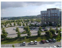
Figure 15.08-31: This example shows a parking lot with landscaped areas separating parking groups.
(ii)
Parking and Loading. The parking and loading requirements in Section 15.14.040 shall apply in the Gateway Overlay district.
(1)
Parking Lots for Buildings Larger Than Fifteen Thousand Square Feet.
(a)
Parking lots shall be set back a minimum of thirty feet from public rights-of-way.
(b)
To the maximum extent practicable, parking shall be distributed between the front, side, and rear of the building(s). Not more than sixty percent of the required parking shall be located between the primary entry and adjacent street. The front of the building with the primary entry shall face the public street on which it is located.
(2)
Parking Lots for Buildings Smaller than Fifteen Thousand Square Feet. Parking lots in the front of buildings smaller than fifteen thousand square feet GFA shall be limited to one double-loaded bay. The remainder of the required off-street parking shall be located on the side or in the rear of the building.
(3)
Parking Groups. The total number of required parking spaces shall be divided into smaller groups of parking, with no more than forty parking spaces per parking group. (See Figure 15.08-31)
(a)
Parking groups shall be separated from each other by a landscaped area no less than ten feet wide.
(b)
Each parking group shall be separated from principal buildings and any street or drive by a landscaped buffer area. The landscape area shall have a minimum width of thirty feet when adjacent to public streets and ten feet when adjacent to internal drives.
(iii)
Building Design Standards. The building design standards in Section 15.14.090 shall apply in the Gateway Overlay district except as follows. In the case of a conflict between the provisions of this subsection (iv) and any provision of Section 15.14.090, the provisions of this subsection (iv) shall govern.
(1)
Entryway Design and Location. Each principal building must have clearly defined, highly visible main entrances for occupants and/or customers and secondary entrances that provide access to side and rear parking. Main entrances shall be designed with features that emphasize the importance of the entrance, which must include at least two of the following options, with the choice of the features to be at the option of the owner:
(a)
A canopy or portico;
(b)
A roof overhang;
(c)
A horizontal recess or projection;
(d)
An arcade or arch;
(e)
A peaked roof form;
(f)
An outside patio;
(g)
A display window;
(h)
Architectural tilework or moldings integrated into the building design;
(i)
Integrated planters or wing walls that incorporate landscaped areas or seating areas; or
(j)
Another architectural feature not found on the remainder of that building façade.
(iv)
Fences and Walls. The fence and wall provisions of Section 15.14.100 shall apply in the Gateway Overlay district, except that no wall or fence of any type may be constructed to enclose any area between the front façade of the primary structure and the street frontage.
(v)
[Signs.] Unless located within the I-80 Corridor Overlay district, as defined in subsection 15.14.120.E.2.a of this title, all signs permitted shall be monument signs (i.e., the lower edge of the sign is attached to a foundation with no visible air space in between the lower edge of the sign face and the foundation) following the effective date of this ordinance. Monument signs shall be constructed of materials similar to or which are compatible in quality and appearance with the primary materials used on primary buildings on the site. The addition of skirting between the lower edge of the sign face and the foundation of a pole sign, in order to avoid visible air space between the two, is not permitted. Monument signs shall not exceed ten feet in height above street grade. The maximum sign face of a monument sign shall be eighty square feet. If the monument sign is oriented approximately perpendicular to the street frontage, or if it is located diagonally on a corner lot in order to be seen from two streets, it may contain a sign face of up to eighty square feet on each of its two sign faces. Maximum sign areas shall apply to each lot or parcel, and not per street frontage or per user.
Figure 15.08-34: All freestanding signs shall be monument style in the Gateway Overlay district.
E.
Residential Overlay for Business Districts (ROB).
1.
Intent. Permitted uses in the B1 (Limited Business), B2 (Business), C2 (Commercial) and DC (Downtown Commercial) districts do not include residential uses. However, in recognition that residential and business uses can be compatible in specific locations and under specific criteria, an overlay district to allow this coexistence in B1, B2, C2 and DC districts is hereby established. The Residential Overlay for Business (ROB) district's intent is both to allow current development of this type to continue in particular situations and to allow limited new development as deemed appropriate.
The Residential Overlay for Business (ROB) district is designed for zoning-map adoption primarily upon request by property owners who wish to perpetuate or create the mixed-use circumstances for which it is intended. The city may also initiate ROB zoning for these reasons as situations may warrant from time to time.
Developmental standards for the ROB district are intended essentially to be a blending of the underlying B1, B2, C2 or DC standards with those in the city's highest-intensity residential base zoning district - namely, R3 (Multiple-Family). This intent reflects the fact that development impacts in these districts are relatively similar in scale, and that in much of the city, R3 is geographically the closest residential district to most B1, B2, C2 and DC districts.
2.
Location. The ROB overlay zone district shall be as illustrated on Maps 15.08.060-9, 15.08.060-10, 15.08.060-11, and 15.08.060-12, located in subsection 15.08.060.C. The overlay zone district may be expanded from time-to-time.
3.
Applicability. The Residential Overlay for Business (ROB) district shall be available for application to areas with B1 (Limited Business), B2 (Business), C2 (Commercial) or DC (Downtown Commercial) district zoning. Any ordinance that rezones ROB-overlaid property to a base zoning district other than B1, B2, C2 or DC shall have the effect of terminating the ROB overlay zoning for that property. Any property newly zoned to the B1, B2, C2 or DC district shall be eligible for ROB zoning upon specific request, provided all appropriate criteria are found to be satisfactory in the course of rezoning.
4.
District Specific Standards.
a.
Non-Residential Properties—Generally. Except as otherwise specified in this section, properties zoned ROB whose existing or proposed principal use is non-residential shall retain all underlying permitted uses, conditional uses (duly approved), dimensional standards, and development standards as the underlying B1, B2, C2 or DC district.
b.
Residential Properties—B1, B2 or C2 District with ROB Overlay. Except as otherwise specified in this section, properties zoned B1, B2, or C2 with ROB Overlay whose existing or proposed principal use is residential shall be subject to the R3 (Multiple-Family) regulations concerning permitted uses, conditional uses (duly approved), dimensional standards, and development standards.
c.
Residential Properties—DC District with ROB Overlay. Except as otherwise specified in this section, properties zoned DC with ROB Overlay whose existing or proposed principal use is residential shall be subject to the following standards:
(i)
Permitted Uses: All uses permitted in the R3 district or the DC district;
(ii)
Conditional Uses: All duly approved conditional uses in either the DC or R3 districts;
(iii)
Dimensional Standards: Dimensional standards in either the DC or R3 district, whichever standard may be less restrictive for a given property;
(iv)
Development Standards: Development Standards in either the DC or R3 district, whichever standard may be less restrictive for a given property.
d.
Properties with Both Residential and Non-Residential Uses. A property zoned ROB may be used for residential and non-residential uses at the same time, provided that the following shall apply:
(i)
Permitted Uses: All permitted uses in the underlying business zoning district (B1,B2, C2 or DC) or in the R3 district shall be permitted;
(ii)
Conditional Uses: All conditional uses in the underlying business zoning district (B1, B2, C2 or DC) or in the R3 district shall be permitted, provided the conditional use is duly approved as required in this title;
(iii)
Dimensional Standards: The dimensional standards for the R3 district as specified in Chapter 15.12 shall apply; provided, however, that in the case of a property zoned DC with ROB Overlay, the dimensional standards for either DC district or R3 district shall apply, whichever standard may be less restrictive for a given property;
(iv)
Development Standards: The development standards for the underlying business zoning district (B1, B2, C2 or DC) shall apply; provided, however, that in the case of a property zoned DC with ROB Overlay, the development standards for either DC district or R3 district shall apply, whichever standard may be less restrictive for a given property;
(v)
Conflicts in Permitted vs. Conditional Uses: For any ROB-zoned property on which both residential and non-residential uses exist or are proposed, and for which the uses in (i) and (ii) are allowed under different procedures - e.g., a use is permitted in B1, but is a conditional use in R3 - such use shall be reviewed and approved as a conditional use.
(vi)
Proportional Allocation of Developmental Standards: For those development standards for which it is feasible and logical to allocate standards to each individual use on the property, such standards shall be applied proportionally. For example, required parking (15.14.040) may be allocated within the same parking area based on the residential (e.g., per bedroom) and non-residential (e.g., per gross floor area) standards. In cases in which the developmental standard cannot be allocated proportionally, the less restrictive standard shall control.
(Ord. No. 1578, § 2(att. A), 3-2-2010; Ord. No. 1596, §§ 28—37, 5-3-2011; Ord. No. 1622, § 22, 7-31-2012; Ord. No. 1625, § 9, 9-4-2012; Ord. No. 1644, § 5(Att. B), 6-18-2013; Ord. No. 1657, § 1(Att. A), 4-1-2014; Ord. No. 1671, § 21, 11-18-2014; Ord. No. 1679, § 1, 3-17-2015; Ord. No. 1684, § 1, 6-23-2015; Ord. No. 1714, § 1, 7-5-2016; Ord. No. 1728, § 11, 16, 4-18-2017; Ord. No. 1744, §§ 18, 19, 3-6-2018; Ord. No. 1766, § 1, 8-6-2019; Ord. No. 1830, §§ 4—6, 10-17-2023; Ord. No. 1863, § 1, 3-18-2025)
15.08.050 - Aviation influence area (AIA).
A.
Purpose and Intent. This section is intended to minimize exposure of residential and other land uses to aircraft noise, to minimize the risks to public safety, to minimize hazards to aviation users and those employed or residing in proximity to public aviation facilities, and to promote sound land use planning and zoning practices on lands influenced by aviation operations. In consideration of the hazards to aircraft of uncontrolled land use in proximity to public aviation facilities, and in consideration of the noise, fumes, and other negative impacts of low-flying aircraft, and furthermore, in consideration that these influences and impacts vary in accordance with the proximity to runways, this section establishes a hierarchy of restrictions and zone districts dependent upon location of the land in relation to the aviation facility. In accordance with the potential hazards, these zone districts impose the strictest restrictions on land located closest to the aviation facility, and are less restrictive farther from the facility.
B.
Applicability. This section shall apply to all land within the city and unincorporated portions of Albany County located within the designated aviation influence area and any specific zone district surrounding public aviation facilities and heliports regulated by the Federal Aviation Administration. If a portion of a lot, parcel, or tract lies within the AIA, or one of the zone districts described herein, these restrictions upon uses and structures apply to that portion of the lot, parcel, or tract located within the zone district. For ease of enforcement, restriction area boundaries shall be drawn to the nearest quarter section of land lying outside the AIA. These areas are particularly described on the official zone district map, as amended, and are filed at the office of the city clerk.
This section applies to the excavation for, erection of, and construction of new buildings or structures, and to the use of land. It also applies to the reconstruction, remodeling, or change of use of a building or structure; movement or relocation of a building or structure to a new site or location; and to the addition or expansion of an existing building or structure.
C.
Exceptions. This section does not apply to lawfully constructed buildings, structures, and uses of land in existence on the effective date of the ordinance codified in this section. The nonconforming provisions of chapter 15.22, Nonconformities, shall apply except as noted hereafter in this section.
D.
Relationship to Other Ordinances. The AIA establishes a series of zone districts that identify permitted and conditional uses on lands located near an aviation facility. The zone districts further establish design and performance standards for the use of lands within an airport influence area.
The aviation influence area and the associated zone districts shall be administered as a supplemental regulation on zoned land, including planned unit developments, when the land is located in proximity to public airports or heliports. Where land lies within one or more overlay zone districts, all land use restrictions associated with the underlying zone are in full force and effect, and the AIA overlay districts impose additional restrictions on those of the underlying zone. In the case of overlapping or conflicting requirements, the most restrictive provisions shall apply.
E.
Establishment of Aviation Influence Area Zone Districts. The following zone districts are established to regulate lands within the aviation influence area:
1.
Aviation zone district;
2.
Airport enterprise zone district;
3.
Noise overlay zone district; and
4.
Height overlay zone district.
F.
District-Specific Standards.
1.
Boundaries. This section restricts the uses allowed on lands containing aviation facilities, and the uses of land surrounding aviation facilities. The boundaries of each are determined as cited below:
a.
Aviation Zone (AV). The boundaries of the aviation zone shall, at a minimum, encompass runways, clear zones, aprons, aviation related structures including terminals and hangars, and other aviation-related services and support facilities as depicted on the approved airport layout plan (or airport master plan). The size of the area may vary according to the type of aviation facility. The city council establishes the official boundary of the aviation zone at the time the aviation facility is zoned. Changes in the size of the aviation zone are reviewed through the rezoning process in subsection 15.06.060.B. of this code.
b.
Airport Enterprise Zone (AE). The boundaries of any airport enterprise zone shall be established by the city council. Changes in the size of the airport enterprise zone are reviewed through rezoning process in subsection 15.06.060.B. of this code. Generally, an airport enterprise zone shall be located adjacent to an aviation facility.
c.
AIA Overlay Districts. The limit of the AIA overlay districts is the AIA boundary. This boundary shall at a minimum encompass the limits of the aviation zone and the noise and height overlays described herein, but may be larger in order to fulfill the purpose and intent of this section. The boundary of the AIA overlay zone districts shall be determined as outlined below after a hearing concerning the rezoning held for the establishment of zoning for the aviation facility by the city council. Changes in the size of the AIA overlay zone districts are reviewed through the rezoning process in subsection 15.06.060.B. of this code.
d.
Noise Overlay District. This area includes all land heavily impacted by the noise created by low-flying aircraft. The geographic extent of the noise overlay for each aviation facility affecting the city will be drawn to the nearest quarter-section of land lying outside the noise overlay. The extent of this area shall be based upon a determination of the city manager's office or board of directors of the aviation facility, where due to the predominant flight patterns residents and workers are likely to be disturbed by the noise associated with aircraft. At a minimum, the noise overlay zone district shall contain all areas within the sixty Ldn contour based upon the measurements of sound computed by the methods contained in Title 14 of the Code of Federal Regulations, Subchapter I, Federal Aviation Regulations (F.A.R., hereafter) Part 150, "Airport Noise Compatibility Planning." These computations shall be based upon the fleet mix that forms the "worst case scenario" for the type and volume of aircraft activity proposed at full build-out of the facility. The district boundaries may exceed those established using Part 150.
(i)
Height Overlay Zone District. This area includes all land where the height of structures or natural features may obstruct or otherwise influence aviation activities. The extent of this area is determined by applying the standards and criteria listed in Title 14 of the Code of Federal Regulations, Subchapter E, F.A.R. Part 77 entitled "Objects Affecting Navigable Airspace". The geographic extent of the height overlay for each aviation facility affecting the city will be drawn to the nearest quarter section of land lying outside the height overlay zone district.
2.
Compliance. No structure or land within the boundaries of the AIA shall hereafter be constructed, located, extended, converted in use, or altered without full compliance with the terms of this section and other applicable regulations. Administration and enforcement of these provisions shall proceed in accordance with the provisions of this section and Wyoming Statutes.
3.
Severability. If any of the provisions of this section or the application thereof to any person, entity, or circumstances is held invalid, such invalidity shall not affect other provisions for applications of the section.
4.
Permitted Uses - AV and AE Zone Districts. Table 15.08-4 lists the uses allowed within the AV and AE zoning districts. Approval of a use listed in Table 15.08-4, and compliance with the applicable use-specific standards for that use, authorizes that use only.
Explanation of Table Abbreviations:
(i)
Permitted By-Right Uses. "P" in a cell indicates that the use is permitted by right in the respective zoning district. Permitted uses are subject to all other applicable regulations of this code, including the use-specific standards in this chapter and the requirements of Chapter 15.14, Development Standards.
(ii)
Prohibited Uses. Development or use of a property for any other use not specifically allowed in table 15.08-1 and approved under the appropriate process is prohibited. Additionally, a blank cell indicates that the use is prohibited in the respective overlay zoning district
5.
Aviation Zone (AV) District. This area is devoted to those nonresidential land uses most directly associated with aviation operations. Allowed uses must adhere to the performance standards listed below. Adherence to these standards will be determined by the city manager. This determination will be based upon a description of the uses of the land, and of any proposed buildings or structures. The aviation facility manager shall approve all proposed uses within an aviation zone district.
a.
General Requirements. The following requirements are applied in conjunction with the noise and height overlay restrictions itemized in this section, as well as those requirements specified by the Federal Aviation Administration.
(i)
Fencing. A perimeter fence at least sixty inches in height shall be erected to surround the aviation zone or aviation facility, whichever is smaller.
(ii)
Roads. No new road or trail may be closer than two thousand seven hundred feet from the end of any runway as projected from the end of the runway if extended in a straight line except those necessary for aviation facility operations.
(iii)
Interference. Uses may not interfere with airport operations, nor interfere with aerial approaches.
b.
Restrictions on Uses.
(i)
Accessory Outside Storage of Non-Hazardous Materials. Accessory outside storage of non-hazardous materials shall not exceed ten percent of the building area.
c.
Performance Standards. Aviation related manufacturing and distribution uses that meet the following performance standards as determined by the city manager shall be allowed in the AV zone district, provided:
(i)
The activity does not involve the generation or storage of animal, vegetable, or other wastes that attract insects, rodents, or birds, or otherwise creates a hazard to aircraft operations;
(ii)
The activity does not emit smoke, fly ash, dust, vapor, gases, or other forms of air pollution that would interfere with the safe operation of aircraft, or that may conflict with present or planned operations of the airport;
(iii)
The activity does not involve water impoundments, solid waste disposal, or other uses which attract birds or other animal species that may present a hazard to aircraft operations;
(iv)
The activity does not emit glaring light or employ highly reflective surfaces that interfere with a pilot's ability to locate runways or landing pads;
(v)
The activity does not create electronic interference with communications among aviators and ground control personnel; and
(vi)
Accessory storage is enclosed and concealed by a minimum six-foot-high closed fence that prevents views of the interior. Screen fencing shall be maintained in an attractive condition. Fencing material shall be approved in advance by the city manager so as to be attractive to the area. Accessory outside storage shall not exceed the height of the fence, except for operable vehicles, trailers, and other equipment designed to be towed or lifted as a single component.
d.
Other Uses Permitted. Other nonresidential uses may be permitted as determined by the city manager that directly depend and associate with aviation operations.
e.
Excluded Uses. All uses not specifically permitted or determined by the city manager or to be permitted are excluded from the aviation zone district.
f.
Off-Street Parking. The provisions of Section 15.14.040 shall apply.
g.
Signs. The provisions of Section 15.14.120 shall apply.
h.
Landscaping. The provisions of Section 15.14.050 shall apply.
1.
Exceptions:
a.
Site perimeter requirements for lots and parcels in the DC District shall be required pursuant to subsection 15.08.030.E.2.C, Development Standards.
b.
Site perimeter requirements may be reduced up to one hundred percent for projects on lots and parcels allowing setbacks less than the required site perimeter yard width through the Alternative Equivalent Compliance requirements of subsection 5.06.060.K. Reductions shall only apply to lots and parcels where the primary building setback is less than the specific required perimeter landscaping width as shown in Table 15.14.050.A. Reductions shall only apply to specific required site perimeter areas between the property line and proposed principal building. A zero side setback requirement shall not be construed to allow a reduced rear yard setback.
As part of alternative equivalent compliance review, the city may consider landscaping in the adjacent public right-of-way as a substitution for some or all of the required onsite street frontage landscaping, where in the opinion of the city manager's office the proposed public right-of-way landscaping meets the intent of this chapter. Any property owner requesting to landscape the public right-of-way as an alternative shall be required to maintain the landscaping into perpetuity unless the landscaped area is accepted for maintenance by the city. In addition to substituting for street frontage landscaping, public right-of-way landscaping may be substituted for other required landscaping If approved by the city manager's office. This may include the landscaping of public right-of-way or public lands within the city on a separate unrelated site in some cases where in the opinion of the city manager's office the public landscaping proposed will have significantly greater community benefit.
For all uses located within the AV zoning district, landscaping requirements shall follow the requirements outlined below. No perimeter landscaping is required that would be subject to 15.14.050.F - Site Perimeter landscaping, and Table 15.14.050-2: Applicability of Site Perimeter Landscaping.
(i)
Ten landscaping units shall be required for each one thousand square feel of development area, including the building, parking or any other area necessary for the operation of the development proposed and as depicted in the Site Plan Application.
(ii)
All units shall be awarded based upon Table 15.14.050-4: Landscaped Units Awarded, and all other standards set forth in 15.14.050, Landscaping and Screening Standards shall be required.
(iii)
All required landscaping shall be planted on the proposed property, or on property owned by the same individual or individuals as the AV Zoned property and shall be within the AV or AE Zoning District.
6.
Airport Enterprise Zone (AE) District. The airport enterprise (AE) zone district is
established to provide lands for and encourage the development of well-planned and
designed technological-industrial parks which would accommodate certain light industrial,
technological, professional offices, and other similar activities that require support
by an airport facility for shipping, education, communication, research or other reasons.
Because of the type of operation and high development standards employed, these parks
may be adjacent to residential districts, provided that they are provided with access
to arterial or collector streets and shall not be materially detrimental to the health,
safety, and welfare of such residential districts. This zone is also intended to accommodate
certain commercial activities such as commercial parking lots, automobile rental facilities,
hotels, and restaurants that support air and business travelers.
The boundaries of any airport enterprise zone shall be established by the city council.
Changes in the size of the airport enterprise zone are reviewed through the rezoning
process in subsection 15.06.060.B. of this code. Generally, an airport enterprise
zone shall be located adjacent to an aviation facility.
a.
Performance Standards. Aviation-related manufacturing and distribution uses that meet the following performance standards as determined by the city manager shall be allowed in the AE zone district, provided:
(i)
The activity does not involve the generation or storage of animal, vegetable, or other wastes that attract insects, rodents, or birds or otherwise create a hazard to aircraft operations;
(ii)
The activity does not emit smoke, fly ash, dust, vapor, gases, or other forms of air pollution that would interfere with the safe operation of aircraft or that may conflict with present or planned operations of the airport;
(iii)
The activity does not involve water impoundments, solid waste disposal, or other uses which attract birds or other animal species that may present a hazard to aircraft operations;
(iv)
The activity does not emit glaring light or employ highly reflective surfaces that interfere with a pilot's ability to locate runways or landing pads; and
(v)
The activity does not create electronic interference with communications among aviators and ground control personnel.
b.
Accessory Storage Screening. Accessory storage shall be enclosed and concealed by a six-foot-high closed fence that prevents views of the interior. Screen fencing shall be maintained in an attractive condition. Fencing material shall be approved in advance by the city manager so as to be attractive to the area. Accessory outside storage shall not exceed the height of the fence, except for operable vehicles, trailers and other equipment designed to be towed or lifted as a single component.
c.
Other Uses Permitted. Other nonresidential uses may be permitted as determined by the city manager that directly depend and associate with aviation operations.
d.
Existing Residential and Commercial Uses. Expansion of existing residential or commercial buildings and structures, or erection of accessory buildings associated with existing residential or commercial buildings and structures are permitted uses. This provision shall apply only to existing uses and/or buildings and structures as of the effective date of properties being zoned aviation enterprise (AE).
e.
Excluded Uses. All uses not specifically permitted or determined by the city manager to be permitted are excluded from the airport enterprise (AE) zone district.
f.
General Requirements. The following requirements are applied in conjunction with the noise and height overlay restrictions itemized in this section, as well as those requirements specified by the Federal Aviation Administration.
(i)
Roads. No new road or trail may be closer than two thousand seven hundred feet from the end of any runway as projected from the end of the runway if extended in a straight line.
(ii)
Interference. Uses may not interfere with airport operations or with aerial approaches.
g.
General Performance. Within any airport enterprise zone district, no use shall be permitted, the nature or manner of operation of which shall be determined by the city manager, to be unduly hazardous or injurious to other properties in the vicinity or to the general public welfare by reason of the emission of odor, dust, smoke, noise, vibration, electrical, or other disturbance. The determination of the city manager shall be in the form of findings of fact and conclusions of law.
h.
Conditions of Use. Processes and equipment employed and goods processed shall be limited to those that have limited emissions consisting of odor, dust, smoke, cinders, gas, fumes, vibrations, refuse matter, water carried waste, or other emissions such that such emission will not interfere with aviation facility operations.
i.
Access. All uses shall have access to an arterial or collector street that may be through the interior street network of the park. In no case shall any access be permitted onto local residential streets.
j.
Off-Street Parking. The provisions of Section 15.14.040 of this code shall apply.
k.
Signs. The provisions of Section 15.14.120 of this code shall apply.
l.
Landscaping. The provisions of Section 15.14.050 of this code shall apply.
7.
Noise Overlay (NO) Zone District. Areas included within the noise overlay are subjected to noise levels of such duration and frequency that they constitute a nuisance to residential and associated uses. In light of the associated hazards the following restrictions apply:
a.
Development Restrictions. Residential uses that are allowed in accordance with a formally approved building permit effective at the time of commencing construction may be allowed if the use conforms with the performance standards listed below.
(i)
Institutions and areas of public assembly are prohibited. Examples of these uses include, but are not limited to: schools, hospitals, rest or nursing homes, child care centers, churches, and outdoor amphitheaters.
(ii)
Permitted office, commercial, nonresidential structures, including hotels and motels, and industrial uses may be allowed if constructed in conformance with the performance standards listed below.
(iii)
Height restrictions as outlined in the height overlay district shall apply to lands within the noise overlay district.
(iv)
All provisions associated with the underlying zone shall be in full force and effect.
(v)
A signed "Aircraft Activity Covenant with Disclosure" must be filed prior to issuance of a building permit in favor of the aviation facility.
b.
Performance Standards for Residential, Commercial, and Industrial Structures. Adherence to these standards will be determined by the city manager, and this determination will be based upon a description of the uses on the land, and of any proposed buildings or structures as submitted by the applicant. Information received from the aviation facility manager of the affected aviation facility also may be utilized in this determination.
(i)
Those residential uses allowed in accordance with the provisions cited herein must incorporate noise level reduction measures sufficient to achieve an interior noise level of forty-five dB on the A-weighted scale when located within the boundaries of the sixty Ldn contour.
(ii)
The portions of the commercial or industrial structures devoted to office uses, or occupied by members of the public must incorporate noise level reduction measures sufficient to achieve an interior noise level of forty-five dB on the A-weighted scale when located within the boundaries of the sixty Ldn contour. The noise reduction measures cited above are described in Chapter 35 of the Appendix of the Uniform Building Code, and as adopted by the city. Assurance that these measures have been incorporated into the structure is illustrated by submission of noise reduction plans certified by a registered professional engineer at the time of application for a building permit, and implemented prior to issuance of a certificate of occupancy.
(iii)
Uses must not produce steam, smoke, or otherwise pose a hazard to aviators.
(iv)
Uses must not emit glaring light or employ highly reflective surfaces that may impair the visibility of aviators, nor shall-the use create interference with the electronic communication among aviators and ground control.
(v)
Uses must lack the potential of attracting birds and other wildlife species that may pose a hazard to flight operations.
8.
Height Overlay (HO). This area is characterized by frequent overflights by aircraft flying low to the ground upon an approach to landing, upon take-off, or operating in a traffic pattern at an aviation facility. Not only do the hazards of noise, particulates, and odors exist as in the entire airport influence area, but the location of natural and manmade objects may create severe hazards to aviation and must be regulated accordingly.
a.
Development Restrictions.
(i)
Applicants requesting rezonings, conditional uses, temporary uses, site plans, and building permits must complete an FAA aeronautical study on obstruction to determine the existence of a hazard to air navigation unless all buildings are restricted to less than fifty in height. If no hazard is determined, the proposed development may proceed, pending compliance with other city requirements. If a hazard to air navigation is found to exist by the FAA, then:
(1)
The applicant is encouraged to alter the proposal so that the project does not present a hazard to air navigation;
(2)
If alternative designs or locations which do not pose a compelling reason exist to allow this use, structure, or building within the height overlay zone district, the city will prepare findings of fact, to be entered in the application record by the appropriate official, citing the reasons why the use is compatible with the intent of the height overlay zone district. The aviation facility manager shall be notified of the action. Factors to consider in these findings include the importance of services provided by the proposed facility to the community, and the compatibility of the proposed use with the airport layout plan, and the comprehensive plan.
(ii)
Applicants for development proposals will be required to fully document site elevations in relation to the F.A.R. Part 77 height restrictions. Documentation of site elevations shall consist of a topographic map of the site showing contours for every five feet of elevation change to illustrate the elevation above mean sea level; the location and height of any proposed buildings or structures, as well as natural features that impinge upon the Part 77 surfaces and the elevation of the aviation facility affecting the applicant's property.
(iii)
Signed and recorded aviation easements will be required prior to issuance of a building permit in favor of the aviation facility.
(iv)
Landowners may be required to install, operate, and maintain, at the owner's expense, such markers and lights that may be necessary to indicate to flyers the presence of a hazard that affects the aviation facility. This marking and lighting requirement may also extend to objects of natural growth (trees, primarily) on site. All markers shall meet FAA requirements.
(v)
Applications for zone changes, conditional uses, temporary and special uses, site plans, and building permit will-be forwarded to the aviation facility manager of the pertinent aviation facility for review and comment concerning the impact of the proposal on aviation operations unless all proposed buildings are less than 50 feet in height.
(vi)
All provisions associated with the underlying zone shall be in full force and effect.
G.
Transitional Zones—Permitted Structures. In the area lying within the limits of the transition zones beyond the perimeter of the horizontal zone, no permit shall be required for any tree or structure less than seventy-five feet of vertical height above the ground except when such tree or structure, because of terrain, land contour or topographic features would extend above the height limit prescribed for such transition zones.
H.
Modifying Existing Structures. Nothing contained in any of the foregoing exceptions shall be construed as permitting or intending to permit any construction, alteration, or growth of any structure or tree in excess of any of the height limits established by this section except as set forth in Section 15.26, enforcement.
I.
Existing Uses. No permit shall be granted that would allow the establishment or creation of an airport hazard or permit a nonconforming use, structure, or tree to be made or become higher, or become a greater hazard to air navigation, than it was on the effective date of the ordinance codified in this section or any amendments thereto or than it is when the application for a permit is made. Except as indicated, all applications for such a permit shall be granted.
J.
Nonconforming Uses and Structures Abandoned or Destroyed. Whenever the airport board determines that a nonconforming structure or tree has been abandoned or more than eighty percent torn down, physically deteriorated, or decayed, no permit shall be granted that would allow such structure or tree to exceed the applicable height limit or otherwise deviate from the zoning regulations.
K.
Variances. Any person desiring to erect or increase the height of any structure, or permit the growth of any tree, or use his property not in accordance with the regulations prescribed in this section, may apply to the airport board for a variance from such regulations. Such variances shall be allowed where it is duly found that a literal application or enforcement of the regulations would result in practical difficulty or unnecessary hardship and the relief granted would not be contrary to the public interest but will do substantial justice and be in accordance with the spirit of this division.
L.
Hazard Marking. Any permit or variance granted may, if such action is deemed advisable to effectuate the purpose of this section and be reasonable in the circumstances, be so conditioned as to require the owner of the structure or tree in question to permit the airport board at its own expense, to install, operate, and maintain thereon such markers and lights as may be necessary to indicate to flyers the presence of an airport hazard.
M.
Prohibited Uses. Notwithstanding any other provisions of this section, no use may be made of land within any zone established by this section in such a manner as to create electrical interference with radio communication between the airport and aircraft, make it difficult for flyers to distinguish between airport lights and others, result in glare in the eyes of flyers using the airport, impair visibility in the vicinity of the airport, or otherwise endanger the landing, taking off, or maneuvering of aircraft.
N.
Regulations Not Retroactive. The regulations prescribed by this section shall not be construed to require the removal, lowering, or other changes or alteration of any structure or tree not conforming to the regulations as of the effective date of the ordinance codified in this section, or otherwise interfere with the continuance of any nonconforming use. Nothing contained in this section shall require any change in the construction, alteration, or intended use of any structure, the construction or alteration of which was begun prior to the effective date of the ordinance codified in this section, and is diligently prosecuted.
O.
Marking and Lighting. Notwithstanding subsection 14 above, the owner of any nonconforming structure or tree is required to permit the installation, operation, and maintenance thereon of such markers and lights as shall be deemed necessary by the airport board to indicate to the operators of aircraft in the vicinity of the airport, the presence of such airport hazards. Such markers and lights shall be installed, operated, and maintained at the expense of the airport board.
(Ord. No. 1578, § 2(att. A), 3-2-2010; Ord. No. 1671, § 21, 11-18-2014; Ord. No. 1727, § 1(Att. A), 2-7-2017; Ord. No. 1728, § 12, 16, 4-18-2017)
15.08.060 - Overlay district maps.
A.
Aquifer Protection Overlay (APO) District Map.
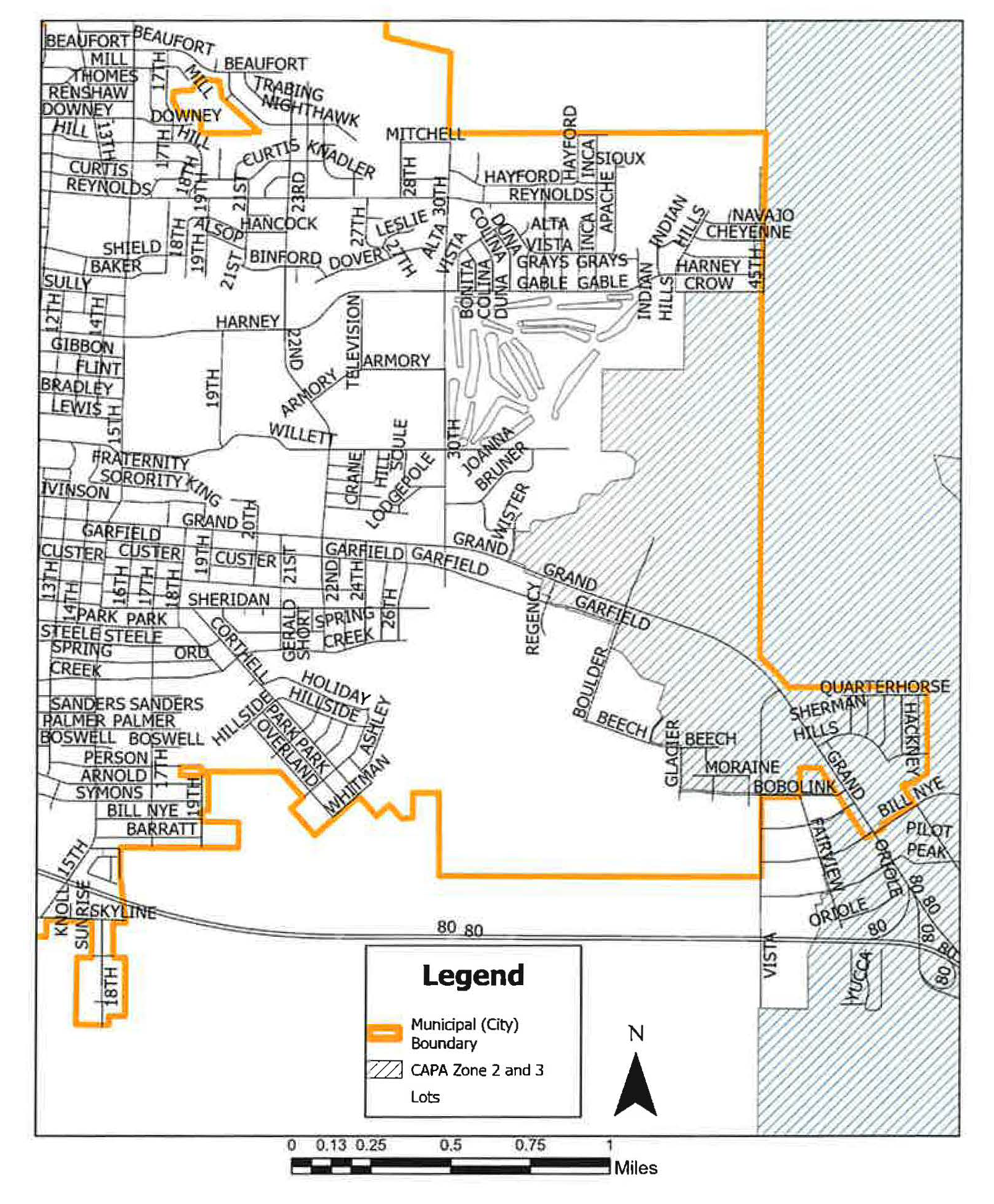
Map 15.08.060-1. Aquifer Protection Overlay District Boundaries
B.
Turner Tract Overlay (TTO) District Map.
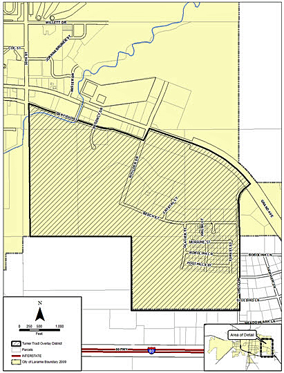
Map 15.08.060-2. Turner Tract Overlay District Boundaries
C.
Gateway Overlay (GO) District Maps.
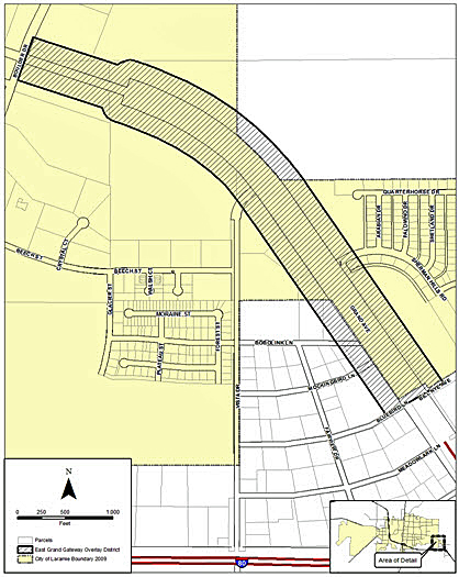
Map 15.08.060-3. Gateway Overlay District Boundary (East Grand)
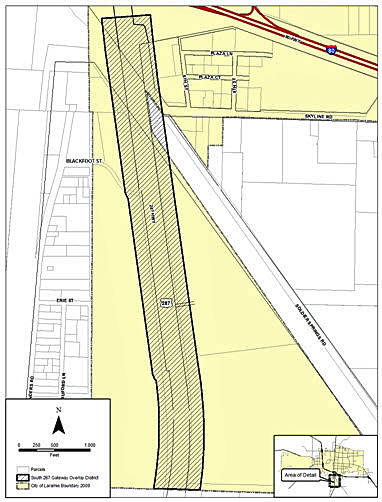
Map 15.08.060-4. South 287 Overlay District Boundary
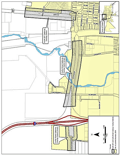
Map 15.08.060-5. Gateway Overlay District Boundaries (Curtis Street and North 287)
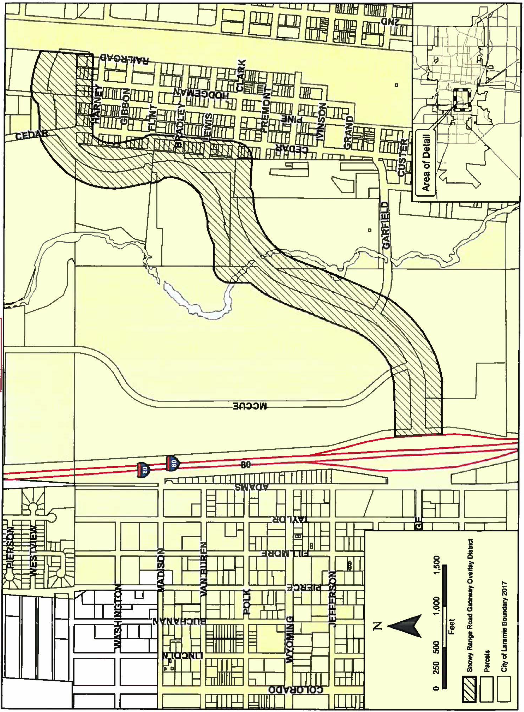
Map 15.08.060-6. Gateway Overlay District Boundary (Snowy Range Road).
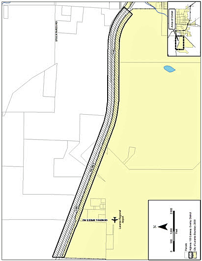
Map 15.08.060-7. Gateway Overlay District Boundary (Highway 130)
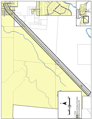
Map 15.08.060-8. Gateway Overlay District Boundary ( Highway 230)
D.
Residential Overlay for Business Overlay (ROB) District Maps.
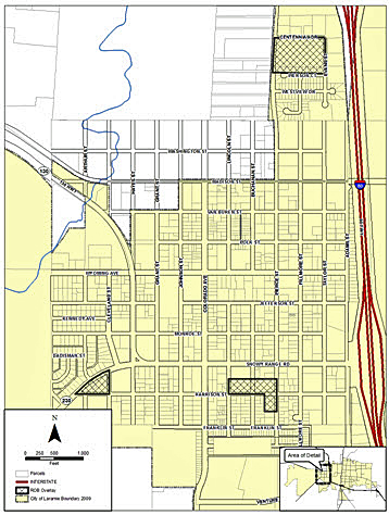
Map 15.08.060-9. Residential Overlay for Business Overlay District—West Laramie
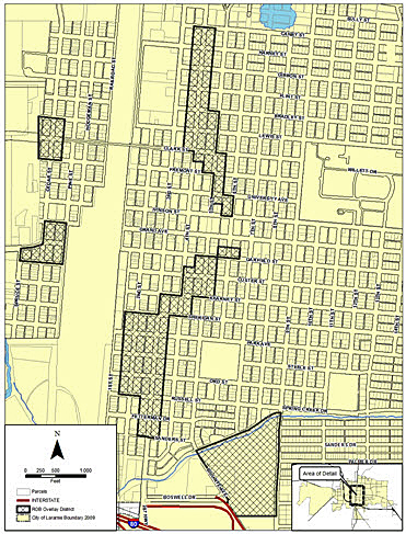
Map 15.08.060-10. Residential Overlay for Business Overlay District—Westside Neighborhood
and Downtown
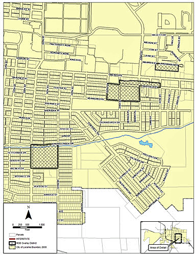
Map 15.08.060-11. Residential Overlay for Business Overlay District—Midtown Laramie
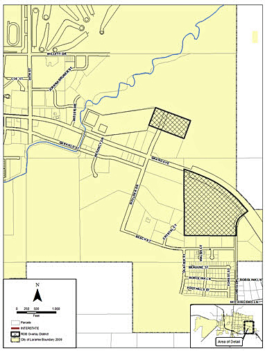
Map 15.08.060-12. Residential Overlay for Business Overlay District—East Laramie
(Ord. No. 1578, § 2(att. A), 3-2-2010; Ord. No. 1657, § 2(Att. B), 4-1-2014; Ord. No. 1766, § 2, 8-6-2019; Ord. No. 1863, § 1, 3-18-2025)