
New Ulm City Zoning Code
CHAPTER 7
SPECIAL PURPOSE ZONING DISTRICTS
7.1 GENERAL PURPOSE
The special purpose zoning districts established in this Chapter are intended to:
- Respond to the unique characteristics of land and/or land use within certain parts of the City;
- Permit the expansion of specialized land uses and protect them from the adverse effects of incompatible uses;
- Allow for the preservation of land for future urban expansion;
- Allow different land uses in one structure or in one area of the community with appropriate standards;
- Allow for the preservation, use or reuse of historic structures;
- Allow for the existence of unique land uses which do not readily fit into any other zoning district;
- Provide locations for institutions and businesses that benefit the City as a whole; and
- Accommodate properties that display distinctive qualities.
7.2 A-OS AGRICULTURAL-OPEN SPACE DISTRICT
The purpose of the A-OS, Agriculture-Open Space District, is to provide areas that will: 1) be retained in agricultural use in advance of the need for these lands for urban purposes; 2) prevent scattered non-agricultural uses from developing improperly; 3) secure economy in governmental expenditures for public utilities and services; 4) prevent inappropriate development in flood hazard areas of the Minnesota and Cottonwood Rivers; and 5) provide locations for public and semi-public uses.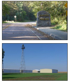
Typical A-OS Buildings
| TABLE 7-1: A-OS DEVELOPMENT STANDARDS | |
| All Uses | |
| Minimum Combined Lot Area | 10 Acres |
| Minimum Lot Width | 300’ |
| Minimum Lot Depth | 300’ |
| Required Yard Setbacks | |
| – Front | 30’ |
| – Front Across the Street from a Residential District | 50’ |
| – Interior Side | 30’ |
| – Interior Side Abutting a Residential District | 50’ |
| – Street Side | 30’ |
| – Rear | 30’ |
| – Rear Yard Abutting a Residential District | 50’ |
| Building Standards | |
| – Maximum Height | 35' |
| Maximum Building Coverage | 10% |
*See Table 7-8 For other Development Standards to consult.
7.3 INS-E INSTITUTIONAL-EDUCATION DISTRICT
The purpose of the INS-E, Institutional-Education District, is to provide areas for educational institutions, to accommodate its unique physical development needs within their own property boundaries, and to allow it to function in a manner compatible with surrounding land uses and the community as a whole.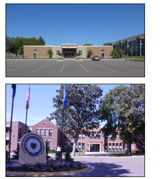
Typical INS-E Buildings
| TABLE 7-2: INS-E DEVELOPMENT STANDARDS | ||
| All Uses | ||
| Parcel Size | 2 Acres-10 Acres | 10 Acres or Larger |
| Minimum Lot Width | 190' | 300’ |
| Minimum Lot Depth | 440' | – |
| Minimum Combined Lot Area | 2 Acres | 10 Acres |
| Required Yard Setbacks | ||
| – Front | 30’ | 35' |
| – Interior Side | 15' | 35' |
| – Street Side | 30’ | 35' |
| – Rear | 15' | 35' |
| Building Standards | ||
| – Maximum Height | 35' | 35'/65' |
| Maximum Building Coverage | 50% | 50% |
* See Table 7-8 For other Development Standards to consult.
7.4 INS-M INSTITUTIONAL-MEDICAL DISTRICT
The purpose of the INS-M, Institutional-Medical District, is to provide an area for the special needs and impacts of a multi-functional hospital and medical campus while functioning in a manner compatible with surrounding land uses and the community as a whole.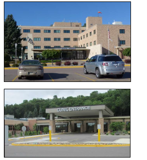
Typical INS-M Buildings
| TABLE 7-3: INS-M DEVELOPMENT STANDARDS | ||
| All Uses | ||
| Parcel Size | 2 Acres – 10 Acres | 10 Acres or Larger |
| Minimum Lot Width | 190' | 300’ |
| Minimum Lot Depth | 440' | – |
| Minimum Combined Lot Area | 2 Acres | 10 Acres |
| Required Yard Setbacks | ||
| – Front | 30’ | 35' |
| – Front Across the Street from a Residential District | 50’ | 50’ |
| – Interior Side | 15' | 35' |
| – Interior Side Abutting a Residential District | 50’ | 50’ |
| – Street Side | 30’ | 35' |
| – Rear | 15' | 35' |
| – Rear Abutting a Residential District | 50’ | 50’ |
| Building Standards | ||
| – Maximum Height | 35' | 35'/65' |
| Maximum Building Coverage | 50% | 50% |
* See Table 7-8 For other Development Standards to consult.
7.5 INS-O INSTITUTIONAL-OTHER DISTRICT
The purpose of the INS-O, Institutional-Other District, is to provide areas for major public and institutional uses of a governmental, educational, cultural, recreational, public service or healthcare nature that serve the entire community while functioning in a manner compatible with surrounding land uses and the community as a whole.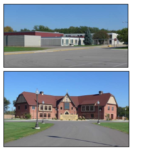
Typical INS-O Buildings
| TABLE 7-4: INS-O DEVELOPMENT STANDARDS | |
| All Uses | |
| Minimum Lot Area | 2.8 Acres |
| Minimum Lot Width | 300’ |
| Minimum Lot Depth | 250’ |
| Required Yard Setbacks | |
| – Front | 30’ |
| – Interior Side | 10’ |
| – Street Side | 30’ |
| – Rear | 10’ |
| Building Standards | |
| – Maximum Height | 45' |
| Maximum Building Coverage | 50% |
* See Table 7-8 For other Development Standards to consult.
7.6 CM COMMERCIAL MANUFACTURING DISTRICT
The purpose of the CM, Commercial Manufacturing District, is to provide areas for unique properties having three (3) or more of the following features: 1) multiple land uses under one ownership; 2) tourist-oriented attractions; 3) structures of historic significance; 4) having a regional attraction; and 5) located in a natural setting.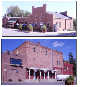
Typical CM Buildings
| TABLE 7-5: CM DEVELOPMENT STANDARDS | |
| All Uses | |
| Minimum Lot Area | 9 Acres |
| Minimum Lot Width | 300’ |
| Minimum Lot Depth | – |
| Required Yard Setbacks | |
| – Front | 30’ |
| – Front Across the Street from a Residential District | 50’ |
| – Interior Side | 15’ |
| – Interior Side Abutting a Residential District | 50' |
| – Street Side | 30' |
| – Rear | 35' |
| – Rear Abutting a Residential District | 50' |
| Building Standards | |
| – Maximum Height | 45' |
| Maximum Building Coverage | 50% |
* See Table 7-8 For other Development Standards to consult.
7.7 MU-E MIXED USE-EMERSON DISTRICT
The purpose of the MU-E, Mixed Use-Emerson District, is to provide a compatible mix of residential, office, institutional or other land uses to best utilize the development potential of the property given the natural environment and existing adjacent land uses.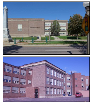
Typical MU Buildings
| TABLE 7-6: MU-E DEVELOPMENT STANDARDS | |
| All Uses | |
| Minimum Lot Area | 20,000 square feet |
| Minimum Lot Area per Dwelling Unit | 1,400 square feet |
| Minimum Lot Width | 125’ |
| Minimum Lot Depth | – |
| Required Yard Setbacks | |
| – Front | 30’ |
| – Interior Side | 0’1 / 15' |
| – Street Side | 30’ |
| – Rear | 30’ |
| Building Standards | |
| – Maximum Height | 50' |
| Maximum Building Coverage | 40% |
* See Table 7-8 For other Development Standards to consult.
1 - The New Ulm City Council, at its January 6, 2015 meeting, approved a zero foot (0’) side yard setback variance between Lot 1 and Lot 2, Block 1, State Street Theater Subdivision.
7.8 MU-T MIXED USE TURNER DISTRICT
The purpose of the MU-T, Mixed Use-Turner District, is to provide a compatible mix of commercial, office, institutional or other land uses to best utilize the development potential of the property or structure given the natural environment and existing adjacent land uses.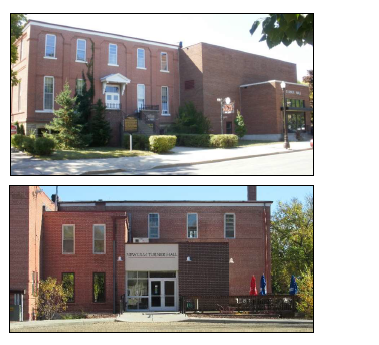
| TABLE 7-7: MU-T DEVELOPMENT STANDARDS | |
| All Uses | |
| Minimum Lot Area | 30,000 square feet |
| Minimum Lot Width | 125’ |
| Minimum Lot Depth | – |
| Required Yard Setbacks | |
| – Front | 30’ |
| – Interior Side | 10’ |
| – Street Side | 30’ |
| – Rear | 30’ |
| Building Standards | |
| – Maximum Height | 36' |
| Maximum Building Coverage | 40% |
* See Table 7-8 For other Development Standards to consult.
7.9 PLANNED UNIT DEVELOPMENT
- Purpose. This Section describes the procedures to be followed when requesting the establishment of a Planned Unit Development (PUD) zoning district.
- Definition.
Planned Unit Development: A type of development which may incorporate a variety of land uses planned and developed as a unit. The planned unit development is distinguished from the traditional subdivision process of development in that zoning standards such as density, setbacks, height limits, and minimum lot sizes may be altered by negotiation and agreement between the developer and the municipality. - Intent.
- A PUD zoning district may deviate from the definitive and precise requirements of established zoning districts if the particular areas to be developed can offer greater value to the community and can preserve the community’s health, safety and welfare than if those same areas were to be developed as a single purpose district.
- This process is intended to:
- Encourage a creative approach to the use of land that results in better development and design than might otherwise be accomplished under the strict application of the base zoning district standards of this Ordinance.
- Provide for integrated or mixed-use areas that permit a combination of residential, commercial, industrial or institutional uses, within a comprehensive site design concept.
- Provide for the efficient use of land to facilitate a more effective arrangement of land uses, buildings, vehicle or pedestrian circulation systems and utilities;
- Provide for the development of unique land areas and sites that would not be possible under the strict application of this Ordinance;
- Encourage the preservation and enhancement of historic and natural resources that significantly contribute to the character of the City;
- Provide for the elimination of blighted structures or incompatible uses through redevelopment or rehabilitation;
- Facilitate implementation of the Comprehensive Plan;
- Provide for more usable and suitably located open space and recreation areas than might otherwise be provided under the application of this Ordinance;
- Encourage the use of design, landscape or architectural features to create a pleasing environment or other special development features; and
- Encourage construction of a variety of housing types which complement the City’s housing inventory.
- When reviewing requests for approval of a PUD, the City shall consider whether one or more of the objectives listed above are served or achieved.
- General Provisions.
- Official Zoning Map Designation. A proposal for a PUD shall require the property in question to be rezoned to PUD. The PUD district is a separate zoning district designated on the zoning map following the City Council’s approval of a PUD General Development Plan (GDP).
- Approved Documents for PUD Establishment. The establishment of a PUD project will require the following approvals:
- Rezoning of the property by ordinance to PUD as described in Section 2.4(B).
- Rezoning of the property will be effective upon City Council adoption of the PUD GDP for the project.
- A PUD GDP as described in this Section. A Development Agreement as described in this Section shall be part of the PUD GDP.
- Final Plat as described in the City Code, Chapter 10, Subdivision Regulations.
- Relationship to Other Regulations. A PUD shall be subject to all applicable standards, procedures and regulations of this Ordinance.
- Coordination with Subdivision Regulations. All land proposed for a PUD shall be platted or replatted into one or more lots, in compliance with the applicable requirements of the City Code, Chapter 10, Subdivision Regulations.
- Permitted Locations for PUD Rezoning. A rezoning to PUD may be requested in any zoning district.
- Minimum PUD Size. There is no standard minimum size requirement for any PUD. However, the size of the proposed development shall be such that this form of development is logical and adheres to the overall purposes of this Ordinance.
- Permitted Uses Within a PUD. Any combination of land uses may be permitted within the PUD District upon approval by the City Council of the PUD GDP. The GDP shall identify all proposed land uses, and those uses shall become permitted uses with the acceptance of the PUD GDP.
- General Standards.
- A PUD may be approved only if it satisfies all of the following standards:
- The PUD is under common ownership and/or unified control. If there are two (2) or more owners, the application for the PUD must be filed by all such owners.
- The PUD must be compatible with the purpose and intent of the City Code and the City’s Comprehensive Plan.
- The design of a PUD shall take into account the relationship of the site to the surrounding areas. The perimeter of the PUD shall be so designed as to minimize undesirable impacts of the PUD on adjacent properties and, conversely, to minimize the undesirable impact of adjacent land use and development characteristics on the PUD.
- The PUD will not create an excessive burden on existing parks, schools, streets, and other public facilities and utilities which serve or are proposed to serve the area.
- The PUD must not adversely affect the natural environment of the community and site. Natural features must be preserved and protected to the greatest extent practical.
- The PUD must be accessible to public streets that are adequate to carry the traffic that will be generated by the proposed development. Internal traffic circulation shall be subject to the approval of the City Council.
- The construction and maintenance of all utilities, roadways, parking facilities and other site improvements must be in accordance with the requirements of the City Code and other regulations of the City.
- Off-street parking and loading space shall be provided as required within Chapter 10 of this Ordinance.
- The location, shape, size and character of the common open space must be suitable for the planned development.
- Common open space shall be either held in common ownership by all owners in the PUD or dedicated for public use with approval of the City Council. never possible, common open space shall be linked to the open space areas of adjoining developments.
- The PUD shall provide for architectural diversity by way of varied building types and exterior building design.
- The applicant for the PUD will provide evidence that financing is available and in an amount which is sufficient to ensure completion of the PUD. To evidence this finding, a written statement of financial feasibility, which is acceptable to the City, shall be submitted by the applicant.
- Prior to the issuance of a Building Permit for uses within the PUD, the applicant shall execute a Development Agreement with the City. The agreement shall reference all PUD plans, specific permitted uses, allowable densities, development phasing, required improvements, completion dates for improvements, all required development fees, escrows and warranties, and any other information deemed necessary by the City.
- The burden of justification for any PUD project is the exclusive responsibility of the applicant. The applicant is responsible for providing the information and data required in this Chapter. In addition, as the PUD is intended to be an innovative approach, the applicant must provide any other data or information required by City staff, the Planning Commission or the City Council to assist in the decision-making process.
- See Table 7-8 For other Development Standards to consult.
- A PUD may be approved only if it satisfies all of the following standards:
- Public Benefits and Amenities.
- A PUD may not be approved unless the Planning Commission and City Council determine that the PUD provides a substantial public benefit to the City. Design characteristics and amenities that would qualify for this determination include, but are not limited to, the following:
- Landscaping, buffering or screening within or around the perimeter of the PUD over and above the minimum required by this Ordinance.
- Reduced development footprint and impervious surfaces to the extent possible to reduce initial infrastructure costs, and long-term maintenance and operational costs.
- Community amenities including plazas, malls, formal gardens, places to congregate, outdoor seating, public art, and pedestrian and transit facilities.
- Preservation of environmental features.
- Preservation of historic features.
- Provide high quality park, open space and trail opportunities that are available to the public and meet or exceed the expectations established in the Comprehensive Plan.
- Provide a convenient and efficient transportation system to service the daily needs of residents including necessary right of way for this system.
- Foster an inclusive community by providing a complementary mix of lifecycle housing including affordable housing units.
- Promote aesthetic design which fosters a sense of place within the neighborhood and is attractive and inviting from surrounding properties.
- Maximize the use of ecologically-based approaches to stormwater management, restore or enhance on-site ecological systems, and protect off-site ecological systems.
- The provision of underground or enclosed parking, and additional landscaping and screening of parking lots and structures over and above the minimum required by this Ordinance.
- Provide accessible dwelling units with features beyond what is required by the American with Disabilities Act (ADA) or any other applicable codes.
- A PUD may not be approved unless the Planning Commission and City Council determine that the PUD provides a substantial public benefit to the City. Design characteristics and amenities that would qualify for this determination include, but are not limited to, the following:
- Exceptions to City Development Standards.
- The City may grant the PUD exceptions to the regulations found in this Ordinance and Chapter 10, Subdivision Regulations of the City Code. Such exceptions shall only be granted, however, when it is clearly warranted to achieve the objectives identified in Section 7.9 and public benefits identified in this Section. Nothing in this Chapter, however, shall be construed to provide a property owner any right to compel the City to grant such exceptions. Potential development exceptions include the following:
- A mixture of land uses, building types and densities within a comprehensive site design concept.
- Mixed residential uses allowing both unit types and densities to be varied within the project. Density may be clustered for the purpose of retaining the remainder of the site as common open space.
- Mixed commercial, industrial, residential or institutional land uses with the integration of other compatible land uses within the project.
- Required setbacks, yard areas, lot sizes, minimum house sizes, other performance standards and other bulk regulations.
- The consolidation of areas for recreation, and reductions in street lengths, street widths and other utility related expenses.
- Off-street parking and loading, landscaping and screening, and signs.
- A mixture of land uses, building types and densities within a comprehensive site design concept.
- Exceptions to the City’s zoning regulations may be granted if the City Council finds that such exceptions:
- Enhance the overall merit of the PUD.
- Promote the objectives of both the City and the development.
- Enhance the quality of the design of the structures and the site plan.
- Enable the development to offer environmental and pedestrian amenities.
- Will not cause such an adverse impact on neighboring properties so as to outweigh the benefits of the development.
- Are compatible with the land use policies of the Comprehensive Plan.
- Provide a public benefit to the City, as described in Section 7.9.
- The City may grant the PUD exceptions to the regulations found in this Ordinance and Chapter 10, Subdivision Regulations of the City Code. Such exceptions shall only be granted, however, when it is clearly warranted to achieve the objectives identified in Section 7.9 and public benefits identified in this Section. Nothing in this Chapter, however, shall be construed to provide a property owner any right to compel the City to grant such exceptions. Potential development exceptions include the following:
- Approval Standards.
- The approved General Development Plan of the PUD will establish the permitted uses within the development that are desirable in achieving the objectives of the PUD. However, there must be clear evidence that:
- Such uses are desirable and appropriate with respect to the primary purpose of the development.
- Such uses are not of such a nature, or so located, as to exercise a detrimental influence on the development or use of the surrounding neighborhood.
- The approved General Development Plan of the PUD will establish the permitted uses within the development that are desirable in achieving the objectives of the PUD. However, there must be clear evidence that:
- Phasing of Development. It is recognized that certain PUD projects may involve construction over an extended period of time. As a result, development of the project may be phased. Each complete phase may be processed separately.
- General Development Plan (GDP).
- Purpose. The PUD GDP is intended to illustrate the intent and general nature of the proposed PUD and to establish the requirements and standards that will apply to the project. This document will serve as a complete, public record of the PUD and the manner in which it is to be developed. It shall incorporate all prior approved plans and plats as well as all approved modifications.
- Initiation of Proceedings. The request for PUD GDP approval shall be initiated by application of the property owner or other person having authority to file an application pursuant to Section 2.3(B), Authority to File Applications.
- Application. The application for a PUD GDP shall be in accordance with Section 2.3, General Review Procedures and Requirements, and also include the information identified in Section 7.9 to be considered complete.
- Submittal Schedule. The GDP must be submitted to the Community Development Department at least thirty (30) days prior to the Planning Commission’s regularly scheduled meeting date.
- Submittal Requirements.
- Required submittal materials for the PUD GDP, unless waived by the Community Development Department, shall include the following:
- Narrative Statement. A written narrative of the proposed development project providing, at a minimum, the information listed below:
- A summary description of the proposed project.
- A description of the anticipated market demand for the development.
- A listing of the following site data: proposed name of the development; address; calculation of gross land area in acres and square feet he entire site and each parcel; current legal description(s); and the number of proposed lots.
- A narrative describing the public benefits of the proposed PUD.
- Calculation of the proposed density of the project and the potential density under standard zoning regulations.
- Development schedule showing the time and sequence of proposed development.
- A statement presenting the applicant’s justifications for approval of the PUD and how the identified objectives of this Section are being satisfied.
- Evidence that financing is available and in an amount which is sufficient to ensure completion of the PUD. To evidence this finding, a written statement of financial feasibility, which is acceptable to the City, shall be submitted by the applicant.
- Site Plan. A Site Plan and associated information illustrating the nature and type of proposed development indicating, at a minimum, the information listed below:
- Topographic data of the site and the surrounding land area within one hundred (100) feet.
- Existing zoning district(s) including land within one hundred (100) feet of the project parcel.
- Location and type of land uses to be developed.
- Layout of proposed lots and proposed uses. Denote areas planned for public dedication and/or open space.
- Location of existing and proposed streets and alleys within and immediately adjacent to the project parcel.
- Location and size of utility systems that will serve the property.
- Any additional information that the applicant feels may help explain the proposed PUD.
- Any other information as directed by the Community Development Department.
- Narrative Statement. A written narrative of the proposed development project providing, at a minimum, the information listed below:
- Required submittal materials for the PUD GDP, unless waived by the Community Development Department, shall include the following:
- Review of PUD GPD.
- Community Development Department. Upon receiving a complete PUD GDP, the Community Development Department shall review the documentation and prepare a staff report on its contents. The report shall be forwarded to the appropriate commissions as determined by the Community Development Department.
- Other Appropriate Commissions. Other commissions receiving the report shall review the request and make a recommendation to the City Council.
- Planning Commission.
- The Planning Commission shall hold a public hearing on the complete PUD GDP. Notice of the public hearing shall be provided as outlined in Section 2.3(K). Following the hearing, the Planning Commission shall adopt findings of fact and recommendations using each of the review criteria outlined in Section 7.9 (L) and any specific criteria outlined for the specific use in Section 9.2.
- The Planning Commission shall either:
- Recommend approval or denial of the GDP and submit its recommendation to the City Council.
- Advise the applicant in writing of any recommended changes, additions or corrections to the GDP. The applicant may then submit a revised GDP for Planning Commission review. The Planning Commission will then recommend approval or denial of the GDP and submit its recommendation to the City Council.
- City Council.
- Upon receiving the recommendation of the Planning Commission and any other commissions, the City Council may hold a public hearing on the PUD GDP if deemed necessary. The City Council shall then consider the request using the review criteria outlined in Section 7.9 and act on the request. The decision on the application shall be supported by findings of fact.
- Review Criteria.
- The Planning Commission’s recommendation to the City Council and the City Council’s action of approval or denial must set forth in what respects the PUD is or is not in the public interest including, but not limited to, findings of fact on the following:
- Adequate property control is established and provided to protect the individual owner’s rights and property values and to define legal responsibilities for maintenance and upkeep.
- The project site is adaptable to the PUD GDP.
- The proposed PUD is not detrimental to nor does it endanger the public health, safety, comfort or general welfare of the community.
- The interior circulation plan and access from and onto public rights-of-way does not create congestion or dangers and is adequate for the safety of the project residents and general public.
- A sufficient amount of usable open space is provided.
- The arrangement of buildings, structures and accessory uses does not unreasonably disturb the privacy, use and enjoyment of surrounding property owners or reduce the value of adjacent properties.
- The architectural design of the project is compatible with the surrounding area.
- There is adequate provision for off street parking and loading, pedestrian access, walks, lighting, landscaping and other necessary facilities.
- The project will not place a burden on existing municipal infrastructure, including utility and drainage systems.
- The PUD GDP schedule ensures a logical development of the site, protecting the interests of project residents and the general public.
- The PUD is in reasonable compliance with the intent and purpose of this Chapter and the adopted Comprehensive Plan.
- Established Conditions of Approval. The Planning Commission and City Council may establish any reasonable conditions of approval that are deemed necessary to mitigate adverse impacts associated with the PUD, to protect neighboring properties, and to achieve the objectives identified within this Chapter and elsewhere in this Ordinance. The Developer and the City will enter into a PUD Development Agreement specifying terms of the project.
- The Planning Commission’s recommendation to the City Council and the City Council’s action of approval or denial must set forth in what respects the PUD is or is not in the public interest including, but not limited to, findings of fact on the following:
- Deadline Requirements.
- An applicant shall be notified if a PUD application is determined to be incomplete. This notice shall include a description of the missing information or materials. The applicant shall have 30 days to submit the requested information. Failure to do so will result in the application being considered null and void, and without force or effect.
- An application shall be considered complete if the Community Development Department has not notified the applicant within 15 days from the date of submittal of any deficiencies in the application.
- If construction has not been started within two (2) years from the date of approval of a PUD GDP, or if construction has been commenced but the work has been abandoned for a period of one year or more, and if no extension of time has been granted by the City Council, the authorization granted for the PUD project shall terminate, and all permits and approvals issued pursuant to such authorization shall be null and void.
- In the event that a PUD is allowed to expire, the zoning of the property shall revert back to the previous zoning district through a rezoning ordinance adopted by the City Council.
- All requests for a time extension shall be submitted in writing at least thirty (30) days prior to expiration of the approval and shall state facts showing a good faith effort to proceed with the project.
- PUD Amendments Through Construction.
- The City shall withhold approval of any final plat, site plan or Building Permit required for a PUD if the proposal is inconsistent with the PUD GDP as approved, except as provided below:
- Minor Revisions. Minor changes, such as the location, placement and height of structures may be authorized by the Community Development Department if required by engineering or other circumstances not foreseen at the time the PUD GDP was approved, and provided the changes conform to the review criteria found in Section 7.9.
- Major Revisions. Changes in use, any rearrangement of lots, blocks and building tracts, changes in the provision of common open spaces, and all other changes shall require approval of a revised PUD GDP, in accordance with the procedures established in Section 7.9.
- The City shall withhold approval of any final plat, site plan or Building Permit required for a PUD if the proposal is inconsistent with the PUD GDP as approved, except as provided below:
- Administration.
- In general, the following rules shall apply to all PUDs:
- Rules and Regulations.
- No requirement outlined in the PUD process shall restrict the City Council from acting on an application if necessary to meet state mandated time deadlines.
- Plan Certification.
- The City may require that PUD plans be certified at the time of submittal and/or upon completion of construction.
- Preconstruction.
- No Building Permit shall be granted for any building on land for which a PUD GDP is in the process of review unless the proposed building is allowed under the existing zoning and will not impact, influence or interfere with the proposed PUD plan.
- In the event that development standards were submitted and approved as part of the PUD GDP, such standards shall be made binding upon all future developers of the property in a manner acceptable to the City.
- Effect on Conveyed Property.
- In the event any interest in the real property in the approved PUD Development Agreement is transferred in total, or in part, the persons receiving the transfer shall be bound by the provisions of the approved PUD GDP and PUD Development Agreement constituting a part thereof; provided, however, that nothing herein shall be construed to create nonconforming lots, building sites, buildings or uses by virtue of any such conveyance of a lot, building site, building or part of the development created pursuant to and in conformance with the approved PUD.
- Recording of Documents.
- Following approval, the PUD GDP and PUD Development Agreement shall be filed with the Brown County Recorder’s Office to serve as notice that the property is being developed under the terms and conditions agreed to by the applicant and the City.
- Control of PUD Following Completion.
- In General.
- After a Certificate of Occupancy has been issued, no changes shall be made in the use or configuration of any buildings or structures within the PUD, except as permitted below. All other modifications shall require approval of a revised PUD GDP in accordance with the procedures specified in Section 7.9.
- Permitted Amendments.
- The Community Development Department may authorize minor extensions, alterations or modifications to existing buildings or structures if they are consistent with the purpose and intent of the PUD GDP. No change authorized by this Section may increase the size of any building or structure by more than ten (10) percent.
- In General.
- Violations.
- Any violation of the conditions established with the approval of the PUD shall be handled in accordance with the enforcement provisions specified in Chapter 12.
- Any violation of the conditions established with the approval of the PUD shall be handled in accordance with the enforcement provisions specified in Chapter 12.
- Rules and Regulations.
- In general, the following rules shall apply to all PUDs:
7.10 STANDARDS APPLICABLE TO ALL SPECIAL PURPOSE ZONING DISTRICTS
- Zero Side Lot Line Development. Appropriate Special Purpose lots may be subdivided along the common wall in a “zero lot line” arrangement, provided:
- The combined area of the base lot and individual unit lots contains the required amount of lot area per unit as prescribed elsewhere in this Ordinance;
- Unit lots shall meet all required setbacks from the boundaries of the base lot;
- Any shared wall facing on a zero-side lot line is a structural wall capable of providing protection from fire, noise and visual encroachment.
- Common Interest Community. Special Purpose lots of multiple-ownership structures may be divided for the purpose of common interest community ownership provided that the principal structure containing the units shall meet the setback distances of the applicable zoning district.
- Maximum Height.
- The height limitations of principal structures located in Special Purpose zoning districts may be increased by Conditional Use Permit subject to the general Conditional Use Permit review criteria listed in Section 2.(D). Additionally, the Planning Commission and City Council, shall consider, but not be limited to, the following factors when determining the maximum height:
- The building shall be at least 200 feet from any parcel that is zoned residential or has an occupied institutional building including but not limited to schools, places of public assembly, and public buildings.
- The building shall not cast a shadow on residential structures between the hours of 9:00 a.m. and 3:00 p.m.
- The building or structure shall match the scale and character of surrounding uses.
- The building shall preserve of views of landmark buildings, significant open spaces or water bodies.
- The maximum height of all principal structures located in a Special Purpose zoning district shall be as specified within each Special Purpose zoning district. Parapets not exceeding three (3) feet in height shall be exempt from such limitations.
- The height limitations of principal structures located in Special Purpose zoning districts may be increased by Conditional Use Permit subject to the general Conditional Use Permit review criteria listed in Section 2.(D). Additionally, the Planning Commission and City Council, shall consider, but not be limited to, the following factors when determining the maximum height:
- Building Design and Construction.
- In General. All buildings and structures shall meet applicable Minnesota Building Code requirements. Additionally, the following standards are established to encourage architectural creativity and diversity, to create a lessened visual impact upon surrounding land uses, and to establish uniformity in acceptable exterior construction materials for development.
- All building masonry must be designed with an architectural finish. The primary building materials being limited to the following:
- Modular masonry materials such as brick, block and stone.
- Precast concrete or aggregate panels.
- Stucco and stucco-like materials.
- Glass.
- Prefinished metal architectural panels, subject to the provisions indicated below:
- Exposed, untextured, uncolored, unaugmented concrete building types are expressly prohibited in a Special Purpose zoning district.
- All subsequent additions and outbuildings constructed after the erection of an original building or buildings shall be constructed of materials comparable to those used in the original construction and shall be designed in a manner conforming to the original architectural design and general appearance.
7.11 OTHER REGULATIONS ALL SPECIAL PURPOSE ZONING DISTRICTS
| TABLE 7-8: DEVELOPMENT STANDARDS | |
| Other Regulations to Consult (not all inclusive) |
|
| Footnoted | 1 Zero Lot Line Setback |
7.12 USES BY SPECIAL PURPOSE ZONING DISTRICT
TABLE 7-9: USES BY SPECIAL PURPOSE DISTRICT | ||||||||
Use Types "P" = Permitted "C" = Conditionally Permitted "I" = Interim Permitted * | Base Zoning Districts | Additional Requirements | ||||||
AOS | INS-E | INS-M | INS-O | CM | MU-E | MU-T | ||
Agricultural Uses | ||||||||
Agriculture | P | P | P | P | P | |||
Agricultural Sales | P | C | C | |||||
Community Garden | P | P | P | P | ||||
Wildlife and Game Refuge | P | P | P | P | P | |||
Residential Uses | ||||||||
- Single Family Dwelling, Detached (one unit) | P | |||||||
- Multiple Family Dwelling (nine or more units per acre) | P | |||||||
Public & Institutional Uses | ||||||||
Active Park Facilities (public) | P | P | P | P | P | P | P | |
Active Park Facilities (private) | C | P | P | C | P | P | P | |
Cemetery/Memorial Garden | C | C | ||||||
Clinics/Medical Services | C | P | ||||||
Club | P | |||||||
Communications Facility | C | C | C | C | ||||
Convent or Monastery | C | |||||||
Event Center | P | P | ||||||
Essential Services | P | P | P | P | P | P | P | |
Hospital | P | |||||||
Nursing/Convalescent Home | P | C | ||||||
Passenger Terminal | C | P | P | P | ||||
Passive Parks/Open Space | P | P | P | P | P | P | P | |
Place of Public Assembly | P | P | P | P | P | P | P | |
Public Building or Uses | C | C | C | C | C | |||
Public Utility Building or Structure | C | C | C | C | P | C | ||
Schools, (PreK-12) | P | P | C | |||||
Schools, (Higher Education) | P | P | C | C | ||||
Utilities (Major) | C | C | C | C | C | |||
Commercial Uses | ||||||||
Ambulance Services | C | |||||||
Bar, Liquor Establishment | P | P | ||||||
Child Care Center | C | C | C | C | C | |||
Country Club | P | |||||||
Entertainment/Recreation, Indoor Commercial | P | P | P | |||||
Entertainment/Recreation, Outdoor Commercial | C | P | P | |||||
General Retail Sales/Services | P | |||||||
Landscaping/Nursery Business | P | |||||||
Office | P | P | P | P | P | P | ||
Performing, Visual, Exercise, Vocational or Martial Arts School | P | |||||||
Restaurant | P | C | P | P | ||||
Sports/Health Facility | P | |||||||
Industrial Uses | ||||||||
Airport | P | |||||||
Brewery | P | |||||||
Extraction of Materials | I | |||||||
Grain Elevator & Storage | I | |||||||
Grain Milling/Distillation | P | |||||||
Greenhouse, Wholesale | C | |||||||
Land Reclamation | C | C | C | C | C | C | C | |
Print Shop | P | |||||||
Wholesaling, Warehousing & Distribution | P | |||||||
* “I” = Interim Permitted
The Community Development Department may, in its discretion, recommend to the applicant, the Planning Commission and City Council that any use designated in the Table as “C”= Conditionally Permitted be instead considered as an Interim Permitted Use.