
Orlando City Zoning Code
PART 2
- DISTRICT REGULATIONS
Sec. 58.200.- General Requirements.
No building, structure, land or water shall be used or occupied and no building, structure or part thereof shall be erected, constructed, reconstructed, located, moved or structurally altered except in conformity with the regulations specified in Figure 1, Table of Zoning District Regulations, Figure 2, Table of Allowable Uses in Zoning Districts, Figure 3, Land Use Intensity Table, and any other applicable regulations of this Code.
Determinations in Cases of Uncertainty. In the event of uncertainty or where there is not a particular land use category listed anywhere in this Chapter that corresponds with a use in question, then the use in the Chapter having the most similar characteristics, as determined by the Zoning Official, to the use in question shall apply. In making such determinations, the U.S. Office of Management and Budget's Standard Industrial Classification Manual shall be used as the primary reference. Where a use in question has characteristics similar to more than one particular use or land use category listed in this Code, then the most similar listing shall govern. Where a development consists of uses in more than one land use category, all such uses must be allowable in the zoning district.
Where there is doubt concerning the interpretation of this Code, the decision of the Zoning Official shall prevail, subject to appeal as provided for in this Code.
(Ord. of 9-16-1991, Doc. #25094; Ord. of 5-20-1996, Doc. #29361)
Sec. 58.201. - Conformance With Zoning Regulations Required.
No building or structure shall be erected or altered in any manner contrary to the provisions of this Code and no building or structure shall:
(a)
Exceed height or bulk.
(b)
Provide a greater number of dwelling units.
(c)
Provide less lot area per dwelling unit, exceed allowable intensity or occupy a smaller lot.
(d)
Occupy a greater percentage of the building site.
(e)
Provide narrower or smaller yards, courts or other open spaces.
(f)
Decrease space required between buildings or structures or portions of buildings and structures.
(g)
Violate any other provision of this Code.
Multiple Use of Required Open Space. No part of a required yard or other required open space or required off-street parking or off-street loading space provided in connection with a building, structure or use shall be included as meeting the requirements for any other building, structure or use except where specific provisions are established in this Chapter.
(Ord. of 9-16-1991, Doc. #25094; Ord. of 5-20-1996, Doc. #29361)
Sec. 58.202. - Exemptions.
The following structures and uses shall be exempt from the use regulations of this Code. This exemption does not preclude regulation of the construction of such facilities where specifically set forth in this Code.
Utility Installations. Wires, cables, conduits, vaults, laterals, pipes, mains, valves, or other similar equipment for the distribution to consumers of telephone or other communications, electricity, gas or water, or the collection of sewage or storm water operated or maintained by a governmental entity or a public utility including customary meter pedestals, telephone pedestals, distribution transformers, and temporary utility facilities required during building construction, whether any such installation is located underground or aboveground. This exemption shall not include any substation located on or above the surface of the ground, which shall be regulated by the provisions of Chapter 58, Part 1, Zoning District and Use Regulations and utility structures larger than 36 in. by 17 in. and 36 in. high which are not exempt; and
Railroad Facilities. Railroad tracks, signals, bridges and similar facilities and equipment located on a railroad right-of-way and maintenance and repair work on such facilities and equipment. This exemption shall not include any switching yard, storage or repair building or other facilities and equipment regulated by the provisions of Chapter 58, Part 1, Zoning District and Use Regulations.
(Ord. of 9-16-1991, Doc. #25094; Ord. of 7-26-1993, Doc. #26769; Ord. of 5-20-1996, Doc. #29361)
Sec. 58.203. - Height Limit Exceptions.
Chimneys, water, fire, communication and radio and television transmitting and receiving equipment, church spires, domes, cupolas, stage towers and scenery lofts, cooling towers, elevator bulkheads, smokestacks, flag poles, parapet walls and similar structures and their necessary mechanical appurtenances may be erected above the height limits herein established; however, the heights of these structures or appurtenances thereto shall not exceed the height limitations prescribed by the Orlando-Orange County Airport Zoning Board.
(Ord. of 9-16-1991, Doc. #25094)
Sec. 58.204. - Airport Zoning Height Regulations.
The Airport Zoning Regulations apply to all land within the City of Orlando, with the exception of the property owned by the Greater Orlando Aviation Authority and operated as a public use general aviation or commercial service airport. The Authority is required by Federal Aviation Administration regulations to protect the airspace surfaces being regulated herein and therefore City review is not necessary.
(Ord. of 9-16-1991, Doc. #25094; Ord. No. 2017-48, § 3, 8-8-2017, Doc. #1708081202)
Sec. 58.205. - Minimum Floor Area Ratio Requirements.
Existing buildings on building sites which do not meet the minimum Floor Area Ratio (FAR) requirements of the district in which they are located shall be deemed to be conforming but underdeveloped. Any expansion or enlargement which is less than the amount needed to meet the minimum FAR requirements, shall be permitted and considered to be consistent with the intent and purpose of the minimum floor area ratio requirements of the district.
Any improvement on vacant land shall comply with the minimum FAR requirements for the district in which it is located.
Wetland areas shall be used in the calculation of the maximum density/intensities of the building site in which they are located based on the zoning district standards. The wetland areas shall not be used to calculate the minimum density/intensity.
(Ord. of 9-16-1991, Doc. #25094; Ord. of 7-26-1993, Doc. #26769; Ord. of 5-20-1996, Doc. #29361)
Sec. 58.206. - Minimum Density Requirements.
Existing building or development sites which do not meet the minimum residential density requirements of the district in which they are located shall be deemed to be conforming but underdeveloped. Any expansion or enlargement which increases the density on the building or development site, but is less than the amount needed to meet minimum density requirements shall be permitted and considered to be consistent with the intent and purpose of the minimum density requirements of the district. Any residential improvement on vacant land shall comply with the minimum density requirements for the district in which it is located.
(Ord. of 9-16-1991, Doc. #25094; Ord. of 5-20-1996, Doc. #29361)
Sec. 58.207. - Minimum Mixed Density/Floor Area Ratio Requirements.
In zoning districts where mixed residential/non-residential developments are permitted or required and where minimum density and minimum floor area ratio requirements (F.A.R.) exist, a mixed residential/non-residential development that meets the density or F.A.R. requirement, but not both, shall be permitted and considered to be consistent with the intent and purpose of the minimum density and floor area requirements of the district. For mixed residential and non-residential developments the respective densities and F.A.R. may be calculated separately as a percentage of the development requirement then considered as a sum of the percentage, which shall equal 100%.
(Ord. of 9-16-1991, Doc. #25094; Ord. of 5-20-1996, Doc. #29361)
Sec. 58.208. - Exemption of Certain Conference/Meeting Center/Ballroom Space from Floor Area Ratio Calculations in the Downtown Orlando Community Redevelopment Area (East of Parramore Avenue).
Consistent with GMP Future Land Use Policy 5.3.2., and in order to increase hotel and visitor activity in the Downtown Community Redevelopment Area (specifically that portion located east of Parramore Avenue), and that will support new retail and restaurants consistent with the Marketplace (Retail & Services) component of DT Outlook (2015 Update to the Downtown Orlando Community Redevelopment Area Plan), mixed use projects which contain a significant conference/meeting center/ballroom component shall be eligible for a development incentive that exempts such space from commercial floor area ratio calculations. In order to be considered "significant", the space must be at least 20,000 square feet in size, leasable to the public, and have at least one room capable of hosting a minimum of 500 people.
(Ord. No. 2020-41, §2, 9-21-2020, Doc. #2009211201)
Sec. 58.210.- General Requirements.
In order to carry out the purposes and provisions of this Ordinance, the following zoning districts are hereby established:
(a)
R-1, R-1A, R-1AA, and R-1N One Family Residential Districts.
(b)
R-2A and R-2B Residential Districts.
(c)
R-3A, R-3B, R-3C and R-3D Development Districts.
(d)
MXD-1 and MXD-2 Mixed Residential Office Districts.
(e)
MU 1 and MU 2 Mixed Use Districts.
(f)
O-1, O-2 and O-3 Office and Residential Districts.
(g)
I-P Industrial Park District.
(h)
I-G General Industrial District.
(i)
I-C Industrial-Commercial District.
(j)
-P- Public Use District.
(k)
-H- Holding District.
(l)
-C- Conservation District.
(m)
AC-1, AC-2, AC-3, and AC-N Activity Center Districts.
(n)
AC-3A Downtown Metropolitan Activity Center District.
(o)
PD Planned Development District.
(p)
AN Airport Noise Overlay District.
(q)
AR Appearance Review Overlay District.
(r)
HP Historic Preservation Overlay District.
(s)
RP Resource Protection Overlay District.
(t)
SP Specially Planned Area Overlay District.
(u)
t Traditional City Overlay District.
(v)
UR Urban Reserve District.
(Ord. of 9-16-1991, Doc. #25094; Ord. of 5-20-1996, Doc. #29361; Ord. of 1-27-2003, Doc. #030127712)
Sec. 58.211. - Establishment of Official Zoning Map.
The City of Orlando shall be divided into zones, or districts, as shown on the Official Zoning Map or as described in this Code. The Official Zoning Map, together with all explanatory matter thereon, shall be a part of this Ordinance and is incorporated into this Ordinance by this reference. The Map shall be composed of a series of sheets or maps, properly identified as such, shall be kept on file in the offices of the Planning and Development Department and shall be the official record of the zoning status of areas within the City.
(Ord. of 9-16-1991, Doc. #25094)
Sec. 58.212. - Interpretation of Zoning District Boundaries.
In cases of uncertainty as to the location of zoning district boundaries on the Official Zoning Map, the following rules of interpretation shall apply:
Center Lines as Boundaries. Where district boundaries appear to follow center lines of streets, alleys, easements, railroads, bodies of water and the like, they shall be construed as following such center lines.
Property Lines and the Like as Boundaries. Where district boundaries appear to follow street, lot, property or similar lines, they shall be construed as following such lines.
Boundaries in or Adjacent to Bodies of Water. Where district boundaries appear to follow shorelines of bodies of water, they shall be construed as following the normal high water elevation or boundary. In case of change in shorelines or course or extent of water, the boundaries shall be construed as moving with the change.
Dimensions. Where dimensions are not otherwise indicated on or by the Official Zoning Map, the scale of the map shall govern.
Variation of Actual Location from Mapped Location. Where physical or cultural features existing on the ground are at variance with those shown on or by the Official Zoning Atlas, the actual location shall govern.
Action in Case of Uncertainty. Where the rules above fail to clarify the status of land in a particular case, the Planning Official shall interpret in such a manner as to carry out the intent and purpose of this Ordinance.
Action where Zoning District Lines Split Property Under Common Ownership. Where zoning district boundaries split property under common ownership as of the effective date of this ordinance, the Zoning Official is authorized to adjust the zoning district boundaries on the Official Zoning Map in such a manner as to carry out the intent and purposes of this Ordinance.
(Ord. of 9-16-1991, Doc. #25094)
Sec. 58.213. - Zoning Changes Consistent with Growth Management Plan Future Land Use Map.
At the request of a property owner, as evidenced by submittal of a complete rezoning application, the Zoning Official shall be authorized to amend the Official Zoning Map by ordinance where all of the following conditions exist:
(a)
The requested zoning is consistent with the Growth Management Plan (GMP) Future Land Use Map;
(b)
Documentation exists showing that the GMP Future Land Use Map designation for the property is correct; and
(c)
The requested zoning district classification is the only zoning district that would be consistent with the GMP Future Land Use Map designation for the property in question, or, in the case of a split-zoned property, the requested zoning district is consistent with the GMP Future Land Use Map and is the same as the zoning on the remainder of the property.
(Ord. of 5-23-1983, Doc. #17766; Ord. of 9-16-1991, Doc. #25094; Ord. of 5-20-1996, Doc. #29361)
Secs. 58.214—58.219. - Reserved.
2C. R-1, R-1N, R-1A, R-1AA ONE FAMILY RESIDENTIAL DISTRICTS
Sec. 58.220.- Relationship to the Growth Management Plan.
The R-1, R-1N, R-1A and R-1AA districts implement the Growth Management Plan (GMP) Urban Design Goal 1, Objective 1.1 and Policy 1.1.1, to protect and enhance the positive design elements of the Traditional City; Future Land Use Policy 1.1.1, to protect viable and stable neighborhoods from uses not in keeping with their established character and use; Future Land Use Objective 2.3 and Policy 2.3.1, to provide standards for residential uses located outside activity centers and mixed use corridors; Housing Objective 1.1, to preserve, upgrade and extend the life of the existing housing stock; Housing Policy 1.3.1, to provide and retain residential land uses at varying densities and locations; and Housing Objective 1.6, to accommodate Orlando's projected growth in single family units. These districts implement the Residential-Low Intensity category of the Future Land Use Map Series.
(Ord. of 5-23-1983, Doc. #17766; Ord. of 9-16-1991, Doc. #25094; Ord. of 7-26-1993, Doc. #26769)
Sec. 58.221. - Purpose of the Districts.
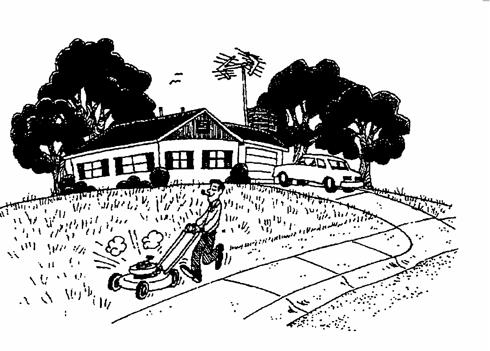
The R-1, R-1N, R-1A and R-1AA districts are intended to conserve the general character of established one family neighborhoods, and to provide for new areas of low and moderate density one family development.
(Ord. of 5-23-1983, Doc. #17766; Ord. of 9-16-1991, Doc. #25094)
Sec. 58.222. - Rezones and Zoning Map Applications.
The R-1, R-1N, R-1A and R-1AA districts may be applied to established neighborhoods of predominantly one family character, and to any land for which new one family development or redevelopment is specifically desired.
(Ord. of 5-23-1983, Doc. #17766; Ord. of 9-16-1991, Doc. #25094)
Sec. 58.230.- Relationship to the Growth Management Plan.
The R-2A and R-2B districts implement GMP Urban Design Goal 1, Objective 1.1 and Policy 1.1.1, to protect and enhance the positive design elements of the Traditional City; Future Land Use Policy 1.3.2, to encourage a concentrated urban form in order to efficiently accommodate Orlando's projected resident population; Future Land Use Policy 1.1.1, to protect viable and stable neighborhoods from uses not in keeping with their established character and use; Future Land Use Policy 1.1.2, to preserve and enhance the existing land use pattern in the Traditional City; Future Land Use Objective 2.3 and Policy 2.3.1, to provide standards for residential uses located outside activity centers and mixed use corridors; Housing Objective 1.1, to preserve, upgrade and extend the life of the existing housing stock; and Housing Policy 1.3.1, to provide and retain residential land uses at varying densities. The R-2A district implements the Residential-Low Intensity category of the Future Land Use Map Series. The R-2B district implements the Residential-Medium Intensity category.
(Ord. of 9-16-1991, Doc. #25094; Ord. of 7-26-1993, Doc. #26769)
Sec. 58.231. - Purpose of the Districts.
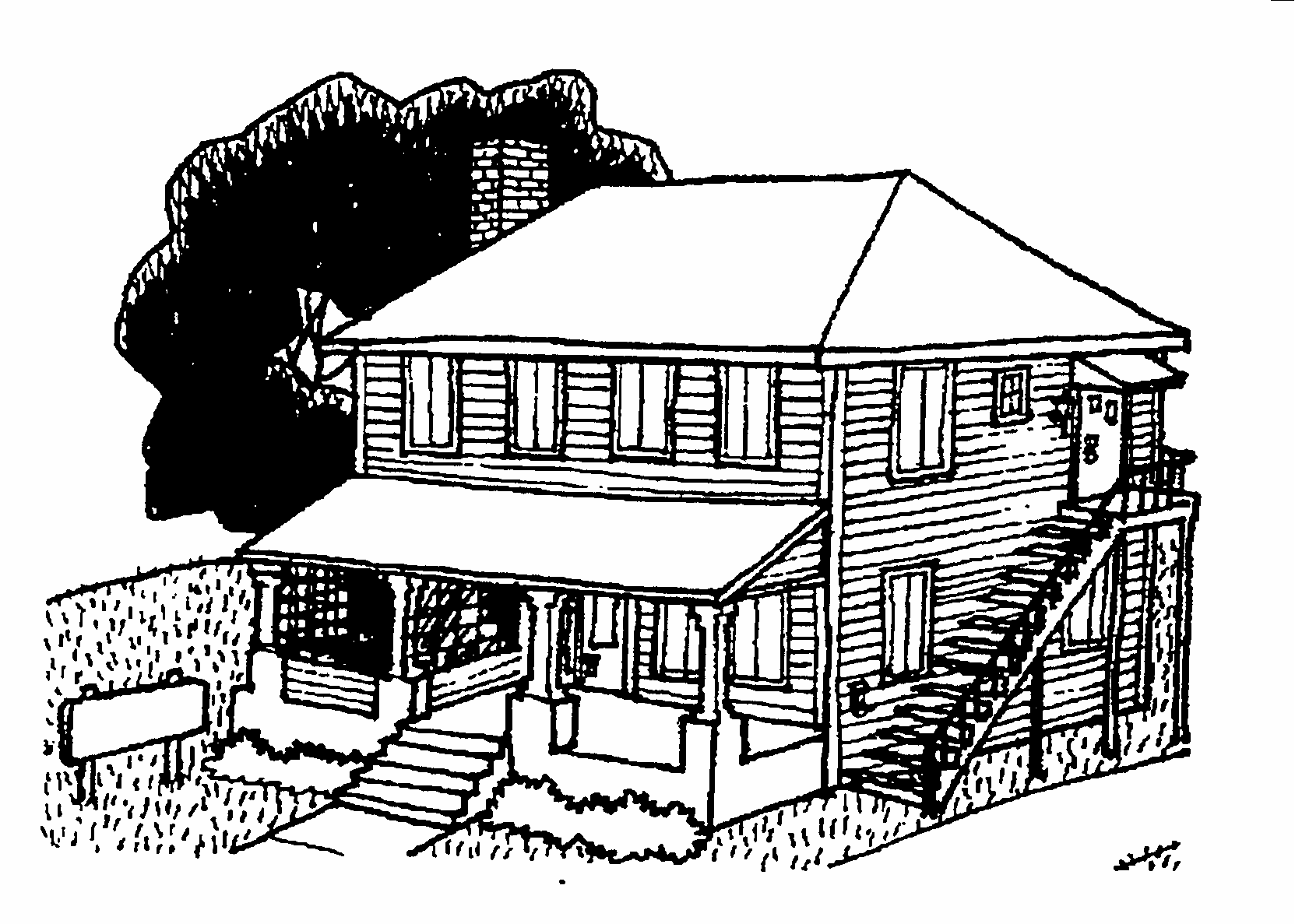
R-2A 1—2 Family District. The R-2A district is intended to conserve the general character of established neighborhoods which have developed over time as a mixture of single family homes, duplexes and houses with garage apartments and accessory apartments. New development in this district is encouraged to maintain the prevailing bulk, height, setbacks and general design of the surrounding neighborhood.
R-2B 1—5 Family District. The R-2B district is intended to conserve the general character of established neighborhoods which have developed over time as a mixture of single family homes, duplexes, small apartment buildings of 3—5 units, garage apartments and accessory apartments. New development in this district is encouraged to maintain the prevailing bulk, height, setbacks and general design of the surrounding neighborhood.
(Ord. of 9-16-1991, Doc. #25094)
Sec. 58.232. - Rezones and Zoning Map Applications.
The R-2A and R-2B districts may be applied to established developed neighborhoods having the general character described in Section 58.231 above. Because the districts are not intended for newly developing areas, new R-2A and R-2B districts may be established only by initiation of the City Council or Municipal Planning Board, or through application by petition of property owners representing at least one-third of all the parcels under consideration. However, additional lands may be added to an existing district in accordance with the procedures set forth in Chapter 65, Part 2I.
(Ord. of 9-16-1991, Doc. #25094; Ord. of 4-20-1992, Doc. #25633; Ord. of 7-26-1993, Doc. #26769; Ord. of 5-20-1996, Doc. #29361)
Sec. 58.240.- Relationship to the Growth Management Plan.
The R-3A, R-3B, R-3C and R-3D districts implement GMP Future Land Use Objective 1.1, to accommodate Orlando's projected residential population; Future Land Use Policy 1.3.2, to encourage a concentrated urban form in order to efficiently accommodate Orlando's projected resident population; Future Land Use Objective 2.3 and Policy 2.3.1, to provide standards for residential uses located outside activity centers and mixed use corridors; Housing Policy 1.3.1, to provide and retain residential land uses at varying densities and locations; Housing Objective 1.6, to accommodate Orlando's projected growth in multifamily units; and Housing Policy 1.6.3, to implement higher densities, smaller lots, and innovative design. The R-3A district implements the Residential-Low Intensity category of the Future Land Use Map Series. The R-3B and R-3C districts implement the Residential-Medium Intensity category. The R-3D district implements the Residential-High Intensity category.
(Ord. of 9-16-1991, Doc. #25094; Ord. of 7-26-1993, Doc. #26769)
Sec. 58.241. - Purpose of the Districts.
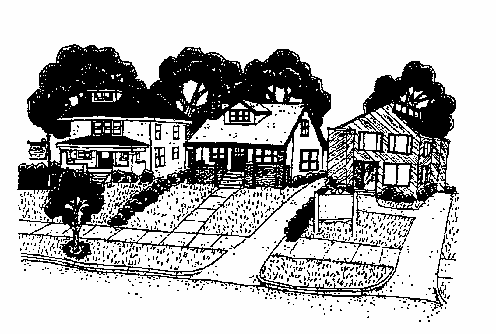
R-3A Low Intensity Development District. The R-3A district is intended to provide for flexibility in building and site design in locations where residential development or redevelopment is desired at a moderate intensity.
R-3B and R-3C Medium Intensity Development Districts. The R-3B and R-3C districts are intended to provide for flexibility in building and site design in locations where residential development or redevelopment is desired at a medium intensity.
R-3D High Intensity Development District. The R-3D district is intended to provide for flexibility in building and site design in locations where residential development or redevelopment is desired at a high intensity, and to allow a fringe of declining intensity adjacent to Activity Center districts.
(Ord. of 9-16-1991, Doc. #25094; Ord. of 7-26-1993, Doc. #26769)
Sec. 58.242. - Rezones and Zoning Map Applications.
The R-3A, R-3B and R-3C districts may be applied to any land for which new residential development or redevelopment is specifically desired. The R-3D district may also be applied to such lands, especially adjacent to Activity Center districts.
(Ord. of 9-16-1991, Doc. #25094)
Secs. 58.243—58.249. - Reserved.
2F. MXD-1 MIXED RESIDENTIAL-OFFICE DISTRICT
Sec. 58.250.- Relationship to the Growth Management Plan.
The MXD-1 district implements GMP Urban Design Goal 1, Objective 1.1 and Policy 1.1.1, to protect and enhance the positive design elements of the Traditional City; Future Land Use Objective 2.4, to encourage development to achieve a mixture of land uses; Land Use Policy S.14.6 and Downtown Policy 2.3.12, to permit residential and mixed office-residential development at a size, scale and character similar to nearby residences; and Housing Objective 1.1, to preserve, upgrade and extend the life of the existing housing stock. The MXD-1 district implements the Residential-Medium Intensity category of the Future Land Use Map Series.
(Ord. of 5-23-1983, Doc. #17766; Ord. of 9-16-1991, Doc. #25094)
Sec. 58.251. - Purpose of the District.
The MXD-1 district is intended to provide opportunities for flexible use of properties in transitional areas at the edges of residential neighborhoods, while ensuring that the established residential character of these areas is preserved. This district is also intended to encourage the adaptive re-use of existing structures, and to ensure that new structures are compatible in scale and design with their surroundings.
It is further intended that the appearance review standards of the MXD-1 district will encourage enhancement of community appearance, provide the necessary standards and criteria for review in accordance with accepted architectural principles, strengthen the economy of the City by stabilizing and improving property values and encourage new construction and development that will be harmonious with the existing adjacent residential neighborhoods and structures.
(Ord. of 5-23-1983, Doc. #17766; Ord. of 9-16-1991, Doc. #25094)
Sec. 58.252. - Rezones and Zoning Map Applications.
The MXD-1 district may be applied to land which abuts a non-residential zoning district, in order to provide a gradual decrease in intensity of use along a continuous block face between the non-residential district and an adjacent residential area. This district may also be applied to other lands where a flexible use of properties is desirable, including land abutting arterials and collector streets of four (4) lanes or more.
However, no MXD-1 district shall be approved which would create an intrusion onto a residential block face which may be adjacent to a non-residential district. In considering any application for rezoning to this district, the Municipal Planning Board and City Council shall ensure that the established character of the adjacent residential area is protected. A distance of not over 150 feet from the non-residential district boundary is a guideline for the transitional area within which the MXD-1 district may be appropriate.
(Ord. of 5-23-1983, Doc. #17766; Ord. of 9-16-1991, Doc. #25094; Ord. of 5-20-1996, Doc. #29361)
Sec. 58.253. - General Standards.
Location and Amount of Office Floor Area. Offices may not occupy more than 50% of the gross floor area of any building site nor more than the first story (whichever is less). Office and residential uses may both be located on the first story. Office and residential uses may be located in separate buildings on the same building site, or on separate building sites bound by a remote housing encumbrance instrument in accordance with Section 58.1115.
(Ord. of 5-23-1983, Doc. #17766; Ord. of 9-16-1991, Doc. #25094; Ord. of 4-20-1992, Doc. #25633)
Secs. 58.254—58.259. - Reserved.

2G. MXD-2 MIXED RESIDENTIAL-OFFICE DISTRICT
Sec. 58.260.- Relationship to the Growth Management Plan.
The MXD-2 district implements GMP Urban design Goal 1, Objective 1.1 and Policy 1.1.1, to protect and enhance the positive design elements of the Traditional City; Future Land Use Policy 1.3.2, to encourage a concentrated urban form in order to efficiently accommodate Orlando's projected resident population; Future Land Use Objectives 2.2 and 2.3, to provide standards for high intensity mixed use corridors and uses located outside activity centers and mixed use corridors; Future Land Use Objective 2.4, to encourage development to achieve a mixture of land uses and an intensity at or near the maximum permitted; Future Land Use Policy 2.4.3, to encourage secondary uses in addition to the principal uses of development sites; and Housing Policy 1.3.1, to provide and retain residential land uses at varying densities and locations. The MXD-2 district implements the Residential-High Intensity and Mixed Use Corridor-High Intensity categories of the Future Land Use Map Series.
(Ord. of 5-23-1983, Doc. #17766; Ord. of 9-16-1991, Doc. #25094; Ord. of 7-26-1993, Doc. #26769)
Sec. 58.261. - Purpose of the District.
The MXD-2 district is intended to provide for areas of high density and high-rise residential development and mixed residential-office development, in close proximity to shopping, employment and public facilities.
It is further intended that the appearance review standards of the MXD-2 district will encourage enhancement of community appearance, provide the necessary standards and criteria for review in accordance with accepted architectural principles, strengthen the economy of the City by stabilizing and improving property values, and encourage new construction and development that will be harmonious with existing adjacent residential neighborhoods and structures.
(Ord. of 9-16-1991, Doc. #25094)
Sec. 58.262. - Rezones and Zoning Map Applications.
The MXD-2 district may be applied to any land appropriately designated by the City's adopted Growth Management Plan, where residential-office mixed development of such land is specifically desired.
(Ord. of 9-26-1983, Doc. #18084; Ord. of 9-16-1991, Doc. #25094)
Secs. 58.263—58.269. - Reserved.
2H. MU-1 and MU-2 MIXED USE DISTRICTS
Sec. 58.270.- Relationship to the Growth Management Plan.
The MU-1 and MU-2 districts implement GMP Future Land Use Objective 2.2 and Policies 2.2.1, 2.2.2, 2.2.3 and 2.2.4, to provide standards for medium and high intensity mixed use corridors; Future Land Use Objective 2.4 and Policies 2.4.1, 2.4.2 and 2.4.3, to encourage development to achieve a mixture of land uses and an intensity at or near to the maximum permitted by the Future Land Use Map Series so that public services and facilities can most efficiently be provided; Urban Design Goal 1, Objective 1.1 and Policy 1.1.1, to protect and enhance the positive design elements of the traditional City; Urban Design Objective 2.2 and Policy 2.2.1, to provide land development standards for mixed use corridors outside the Traditional City; Urban Design Objective 4.1 and Policy 4.1.1, to apply performance standards to mixed use corridors inside the Traditional City; and Mass Transit Policy 1.2.5, to encourage increased land use densities along high intensity mixed use corridors. The MU-1 district implements the Mixed Use Corridor-Medium Intensity category of the Future Land Use Map Series. The MU-2 district implements the Mixed Use Corridor-High Intensity category.
(Ord. of 9-16-1991, Doc. #25094; Ord. of 7-26-1993, Doc. #26769)
Sec. 58.271. - Purpose of the District.
MU-1 Medium Intensity Mixed Use Corridor District. The MU-1 district is intended to provide for areas of mixed residential and office uses extending along and oriented to arterial and four (4) lane collectors, at intensities compatible with adjacent neighborhoods. Commercial, public, recreational & institutional uses and conservation uses are also consistent in these areas as part of mixed use development or when otherwise subject to appropriate limitations, conditions and safeguards. A mixture of land uses is specifically encouraged. This district is intended for locations where mass transit service is available or programmed.
MU-2 High Intensity Mixed Use Corridor District. The MU-2 district is intended to provide for concentrated areas of mixed residential and office uses at high intensities extending along and oriented to arterials, recognizing the character of the thoroughfare along with it is located. Commercial, public, recreational and institutional uses and conservation uses are also consistent in these areas as part of mixed use development or when otherwise subject to appropriate limitations, conditions and safeguards. A mixture of land uses is specifically encouraged. This district is intended for locations where intermediate and high levels of mass transit service are available or are programmed.
(Ord. of 9-16-1991, Doc. #25094; Ord. of 7-26-1993, Doc. #26769)
Sec. 58.272. - Rezones and Zoning Map Applications.
The MU-1 may be applied to any land located within an area designated by the City's adopted Growth Management Plan as a medium intensity mixed use corridor. The MU-2 may be applied to any land located within an area designated as a high intensity mixed use corridor.
(Ord. of 9-16-1991, Doc. #25094)
Secs. 58.273—58.279. - Reserved.
2I. O-1, O-2 and O-3 OFFICE AND RESIDENTIAL DISTRICTS
Sec. 58.280.- Relationship to the Growth Management Plan.
The O-1, O-2 and O-3 districts implement GMP Urban Design Goal 1, Objective 1.1 and Policy 1.1.1, to protect and enhance the positive design elements of the Traditional City; Future Land Use Objective 2.3 and Policy 2.3.1, to provide standards for office uses located outside activity centers and mixed use corridors. The O-1 district also implements Urban Design Objective 1.2 and Policy 1.2.1, to relate the appearance and scale of low intensity offices to existing surrounding development. The O-3 district also implements GMP Future Land Use Policy 2.3.2, to provide appropriate transitions between the Downtown Activity Center and surrounding areas. The O-1 district implements the Office-Low Intensity category of the Future Land Use Map Series. The O-2 district implements the Office-Medium Intensity category. The O-3 district implements the Office-High Intensity category.
(Ord. of 9-16-1991, Doc. #25094)
Sec. 58.281. - Purpose of the Districts.
The O-1, O-2 and O-3 districts are intended to provide for flexibility in building and site design in locations where development or redevelopment of offices or a mixture of offices and housing is desired. The O-2 and O-3 districts are also intended to allow a fringe of declining intensity adjacent to activity centers. The O-1 district is intended to encourage offices of a scale and design compatible with surrounding residential neighborhoods. The O-3 district is only appropriate adjacent to the Downtown Metropolitan Activity Center.
(Ord. of 9-16-1991, Doc. #25094)
Sec. 58.282. - Rezones and Zoning Map Applications.
The O-1 and O-2 districts may be applied to any land for which new development or redevelopment of offices or a mixture of offices and housing is specifically desired, and especially adjacent to Activity Center districts. The O-1 and O-2 districts should not be applied to existing neighborhoods having an established 1—2 family or 1—5 family character. The O-3 district may be applied to any land adjacent to the AC-3A and AC-3 districts.
(Ord. of 9-16-1991, Doc. #25094; Ord. of 7-26-1993, Doc. #26769)
Secs. 58.283—58.289. - Reserved.
2J. I-P INDUSTRIAL PARK DISTRICT
Sec. 58.290.- Relationship to the Growth Management Plan.
The I-P district implements GMP Future Land Use Goal 2, to promote a wide variety of employment alternatives both inside and outside of activity centers; Future Land Use Objective 2.3 and Policy 2.3.1, to provide standards for industrial uses located outside activity centers and mixed use corridors. The I-P district implements the Industrial category of the Future Land Use Map Series.
(Ord. of 9-16-1991, Doc. #25094)
Sec. 58.291. - Purpose of the District.
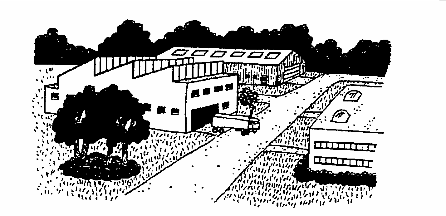
The I-P district is intended to provide high standards of design, land use intensity and open space, to promote industrial development and related business service uses. In light of Orlando's service-oriented economy, a development in the I-P district may be comprised almost wholly of these related business service uses, however, the I-P district is not intended for retail or personal service uses serving non-commercial customers. I-P district standards are intended to encourage industrial locations served by adequate public facilities and services and to protect to the greatest extent possible adjacent residential and commercial areas.
(Ord. of 9-16-1991, Doc. #25094)
Sec. 58.292. - Rezones and Zoning Map Applications.
The I-P district may be applied to areas suitable for industrial development which conform to the following standards:
Access to Thoroughfares. Each I-P district shall be located on an arterial or four lane collector designated in Chapter 61, Part 2B, or shall have access to an arterial or four lane collector via a public street without passing through or alongside any residential district.
Traffic Hazards. No I-P district shall be so located as to direct traffic into adjacent residential districts, or where traffic congestion would be likely to affect residential districts.
(Ord. of 9-16-1991, Doc. #25094)
Sec. 58.293. - Additional District Requirements.
Reduction in Rear Yard Setbacks. Rear yard setbacks may be reduced to zero when the property line coincides with a railroad siding; however, no trackage shall be located within 300 feet of any residential district.
(Ord. of 9-16-1991, Doc. #25094)
Secs. 58.294—58.299. - Reserved.
2K. I-G GENERAL INDUSTRIAL DISTRICT
Sec. 58.300.- Relationship to the Growth Management Plan.
The I-G district implements GMP Future Land Use Goal 2, to promote a wide variety of employment alternatives both inside and outside of activity centers; Future Land Use Objective 2.3 and Policy 2.3.1, to provide standards for industrial uses located outside activity centers and mixed use corridors. The I-G district implements the Industrial category of the Future Land Use Map Series.
(Ord. of 9-16-1991, Doc. #25094)
Sec. 58.301. - Purpose of the District.
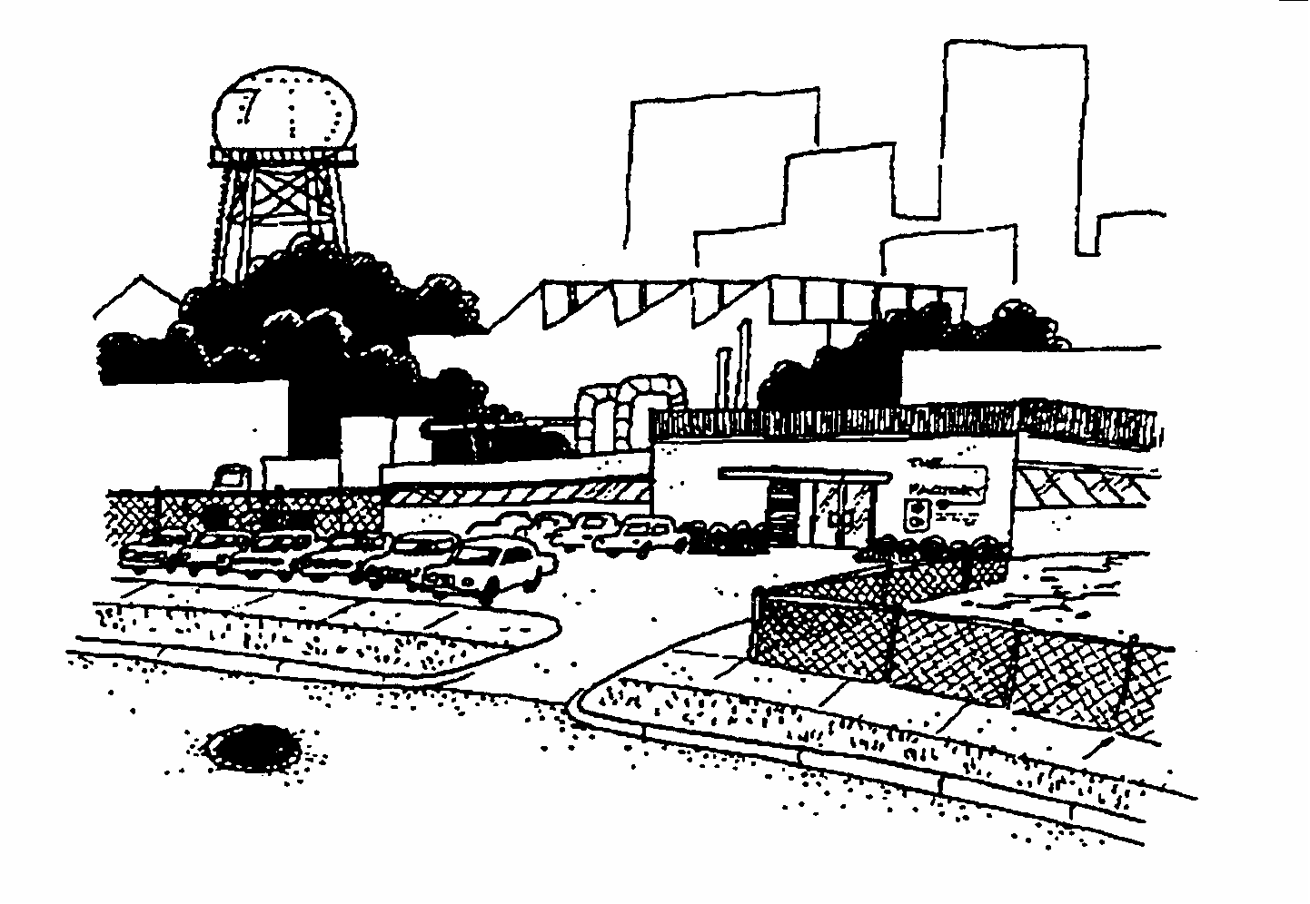
The I-G district is intended primarily to provide for the beneficial use of existing industrial properties, while encouraging upgraded development standards for such properties where they are located adjacent to residential areas. The district is also intended for areas where a range of general and heavy industrial uses may be desirable.
(Ord. of 9-16-1991, Doc. #25094; Ord. of 5-20-1996, Doc. #29361)
Sec. 58.302. - Rezones and Zoning Map Applications.
The I-G district may be applied to areas distant from established or planned residential areas, where the City Council finds that nuisances will clearly be minimized and traffic will be directed away from residential areas. In addition, the following standards shall apply:
Access to Thoroughfares. Each I-G district shall be located on an arterial or four lane collector street designated in Chapter 61, Part 2B, or shall have access to a four lane collector via a public street without passing through or alongside any residential zoning district.
Traffic Hazards. No I-G district shall be so located as to direct traffic into adjacent residential zoning districts, or where traffic congestion would be likely to affect residential districts.
(Ord. of 9-16-1991, Doc. #25094; Ord. of 5-20-1996, Doc. #29361)
Sec. 58.303. - Additional District Requirements.
Reductions in Yard Setbacks. Rear yard and side yard setbacks may be reduced to zero when the property line coincides with a railroad siding; however, no trackage shall be located within 300 feet of any residential area.
(Ord. of 9-16-1991, Doc. #25094; Ord. of 5-20-1996, Doc. #29361)
Secs. 58.304—58.309. - Reserved.

2L. C CONSERVATION DISTRICT
Sec. 58.310.- Relationship to the Growth Management Plan.
The -C- Conservation District implements GMP Land Use Policies 1.1.6 and 2.3.1 to provide standards for land use categories located outside of activity centers and mixed use corridors. This district implements Conservation Goal 1, to protect the natural environment and the functioning of natural systems; Objective 1.6 to establish means of protecting environmentally sensitive lands, including regulation; and Policy 1.4.5 to regulate development in order to minimize impairment of the function of vital natural systems.
(Ord. of 9-16-1991, Doc. #25094)
Sec. 58.311. - Purpose of the District.
The -C- Conservation District is established for the purpose of identification, protection, preservation and the beneficial use of environmentally sensitive lands. It is intended that this district shall not be a holding category for land, but rather, a terminal category to insure that the present and future residents of the City of Orlando shall be able to enjoy the benefits of the natural environment.
The provisions of this district are intended to conserve passive parks, recreational areas, open space, flood plains, and unique environmental features. Also, this district shall act to protect the natural resources of the City of Orlando, environmentally sensitive lands along stream and lake shores, and areas subject to erosion. Finally, the district shall restrict the development of lands upon which a more intensive development would be environmentally detrimental to adjacent or nearby lands.
(Ord. of 9-16-1991, Doc. #25094)
Sec. 58.312. - Rezones and Map Applications.
The -C- Conservation district may be applied to any land or water areas deemed appropriate by the City and areas designated by a development order or other governmental action for the purpose of conserving or protecting natural resources or environmental quality. Rezoning to the -C- Conservation District shall only take place by initiation of the Municipal Planning Board, City Council, or the individual property owner.
(Ord. of 9-16-1991, Doc. #25094)
Sec. 58.313. - Additional Requirements.
Properties containing a wetlands, upland buffer or other environmentally sensitive area and designated for conservation use shall be shown on the face of a Master Plan, development order or development agreement, preliminary long-form plat, or final plat. Conservation easements shall be required. The designation of the -C- Conservation district on individual properties shall be consistent with the requirements of all County, State and Federal permits, where applicable.
(Ord. of 9-16-1991, Doc. #25094; Ord. of 4-20-1992, Doc. #25633)
Sec. 58.320.- Relationship to the Growth Management Plan.
The P district implements GMP Urban Design Objectives 1.5 and 9.2 and Policies 1.5.1 and 9.2.1, to review the placement and appearance of public benefit uses to ensure compatibility with their surroundings; Future Land Use Objective 1.1, to coordinate future growth with the availability of facilities and services; and Housing Objective 1.4 and Policy 1.4.1, to plan the placement of public facilities so as to minimize demolition of housing and related relocation of residents.
(Ord. of 9-16-1991, Doc. #25094)
Sec. 58.321. - Purpose of the District.
The -P- district is intended to provide for the use of lands owned by any public body for Public Benefit uses, and to eliminate confusion on the Official Zoning Map as to the use and status of these lands.
(Ord. of 9-16-1991, Doc. #25094)
Sec. 58.322. - Rezones and Zoning Map Applications.
Because the use of land in the -P- district is limited entirely to Public Benefit uses, the district shall be applied only to properties owned by public bodies. Rezoning to the -P- district shall only take place by initiation of the City. A public body considering disposition of a property zoned -P- should take into consideration the need to rezone the property if it is sold or donated to a private entity.
(Ord. of 9-16-1991, Doc. #25094; Ord. No. 2025-12, § 3, 4-7-2025, Doc. #25040712a)
Sec. 58.323. - Development Standards.
Development by a public body may have unique characteristics not typically found on other types of sites, such as a football stadium, water treatment plant, or transit station. Therefore, each development proposal must be evaluated according to its unique characteristics. A public body may submit an application for a Conditional Use (per Ch. 65 Part 2D) to address the following:
•
Development standards shown in Figures 1A. LDC, 1B. LDC, and 1C. LDC.
•
Allowable use shown in Figures 2A. LDC and 2B. LDC.
•
Parking requirements per Sec. 61.322.
•
Other requirements included in the Land Development Code as applicable.
Interior renovations, improvements consistent with an approved Master Plan or Planned Development, uses that meet the definition of "light public benefit use" and other minor site improvements are permitted and not subject to Conditional Use review.
In cases of uncertainty, the public body may submit a request for the Planning Official determination to identify if a Conditional Use Permit is required.
(Ord. No. 2025-12, § 3, 4-7-2025, Doc. #25040712a)
Sec. 58.330.- Relationship to the Growth Management Plan.
The H district implements GMP Future Land Use Objective 1.1 and Policy 1.1.4, to coordinate future growth with appropriate topography and soil conditions, and to allow for the efficient, orderly and economic provision of urban services and facilities; and Future Land Use Policy 1.1.1, to encourage a concentrated urban form in order to efficiently accommodate Orlando's projected resident population.
(Ord. of 9-16-1991, Doc. #25094)
Sec. 58.331. - Purpose of the District.
The -H- district is intended to provide for the proper timing and phasing of growth within the metropolitan area, by allowing limited beneficial use of lands for which future development is intended, but which should be held in a primarily undeveloped state for an interim period of time.
(Ord. of 9-16-1991, Doc. #25094)
Sec. 58.332. - Rezones and Zoning Map Applications.
The -H- Holding district may be applied to any lands which the City Council finds should be held in a primarily undeveloped state for an interim period of time, pending future development. The district may also be applied to lands which should be preserved primarily for agricultural or open space use for an indefinite period of time. The -H- district may be classified as a Residential, Office, Commercial or Industrial zoning district. Where property is zoned or rezoned to -H- subsequent to the effective date of this section, such classification shall be made during the zoning or rezoning process. The classification shall be based upon and consistent with the Growth Management Plan land use designation for the property. Where the land use designation would permit zoning districts from two (2) or more zoning district classification categories, the classification shall be based on the zoning classification(s) of adjacent land and the ultimate use and zoning classification of the property.
Where property is zoned -H- as of the effective date of this section, the property owner may seek a Planning Official's Determination to establish the zoning district classification for the property. The classification shall be based on the criteria set forth above and shall be processed in accordance with the procedures set out in Chapter 65.
(Ord. of 9-16-1991, Doc. #25094; Ord. of 5-20-1996, Doc. #29361)
Sec. 58.340.- Relationship to the Growth Management Plan.
The AC-N, AC-1, AC-2 and AC-3 districts implement GMP Future Land Use Objective 2.1 and Policies 2.1.1, 2.1.2, 2.1.3 and 2.1.4, to provide standards for activity centers; Future Land Use Objective 2.4 and Policies 2.4.1, 2.4.2 and 2.4.3, to encourage development to achieve a mixture of land uses and an intensity at or near to the maximum permitted by the Future Land Use Map Series so that public services and facilities can most efficiently be provided; Transportation Objective 1.2 and Policy 1.2.2, to serve metropolitan and urban activity centers with internal public transit and pedestrian systems; Urban Design Objective 2.2 and Policy 2.2.1, to provide land development standards for activity centers outside the Traditional City; and Urban Design Objectives 1.1, 3.1 and Policies 1.1.1, 3.1.1 and 3.1.2, to promote the positive design elements of the Traditional City in Activity Centers. The AC-N district implements the Neighborhood Activity Center category of the Future Land Use Map Series. The AC-1 district implements the Community Activity Center category, the AC-2 district implements the Urban Activity Center category and the AC-3 district implements the Metropolitan Activity Center category.
(Ord. of 9-16-1991, Doc. #25094; Ord. No. 2022-23, § 2, 4-25-2022, Doc. #2204251203)
Sec. 58.341. - Purpose of Activity Center Districts.
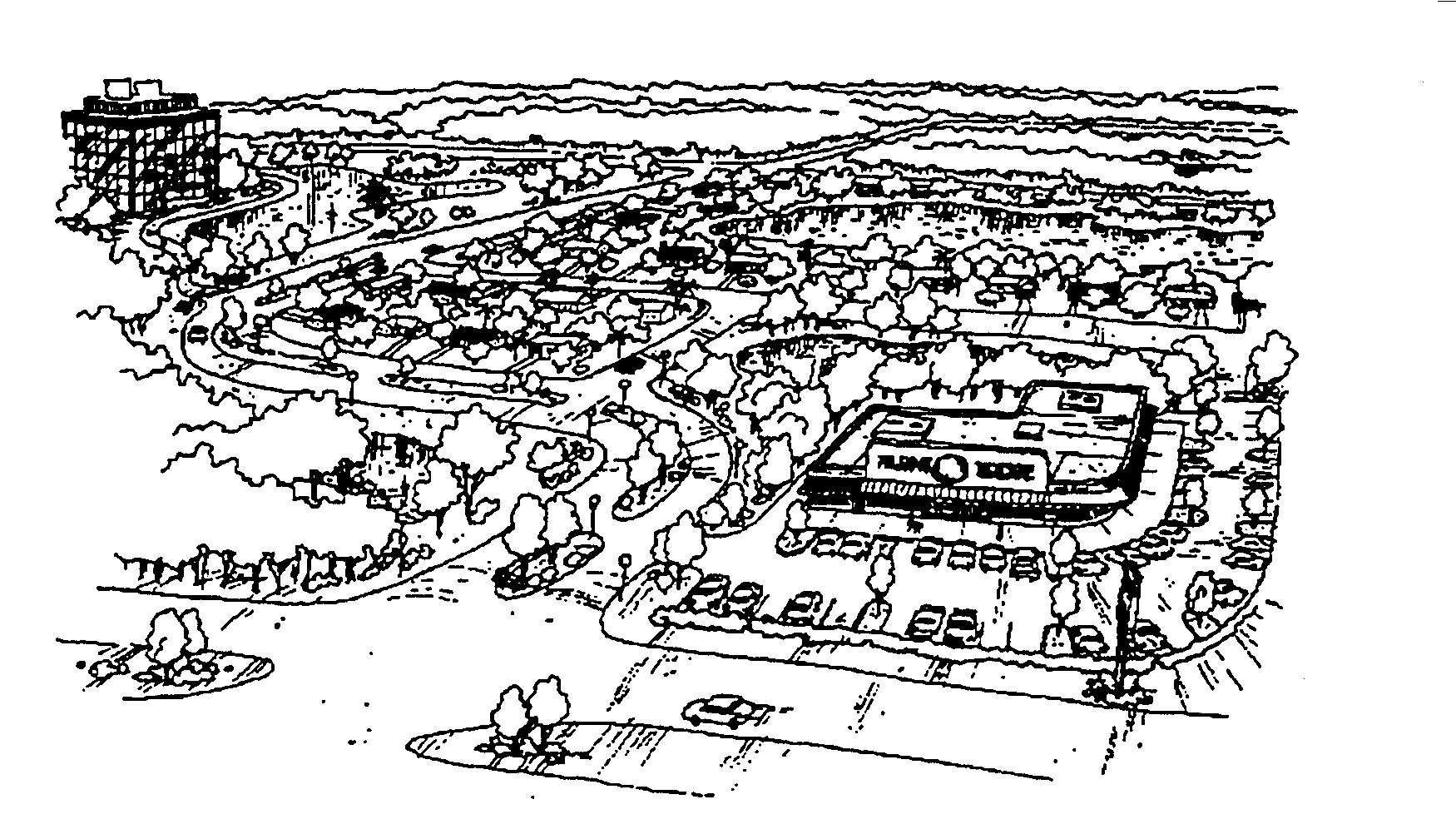
AC-N Neighborhood Activity Center District. The AC-N district is intended to provide for concentrated areas of neighborhood-serving commercial, office, residential, recreational and cultural facilities, at intensities compatible with surrounding neighborhoods. Although some Neighborhood Activity Centers may be composed of a single type of use, a mixture of land uses is specifically encouraged. These activity centers are intended for locations where arterials and collectors are available, providing convenient access to the surrounding neighborhood.
AC-1 Community Activity Center District. The AC-1 district is intended to provide for concentrated areas of community-serving commercial, office, residential, recreational and cultural facilities, at higher intensities than in surrounding neighborhoods. Although some Community Activity Centers may be composed of a single type of use, a mixture of land uses is specifically encouraged. These activity centers are intended for locations where a combination of arterials and four lane collectors and mass transit service are available, providing access to other activity centers and surrounding neighborhoods.
AC-2 Urban Activity Center District. The AC-2 district is intended to provide for concentrated areas of residential, commercial, office, industrial, recreational and cultural facilities serving major subregions of the Orlando urban area, and at intensities significantly higher than in surrounding neighborhoods. Although some Urban Activity Centers may be composed of a single type of use, a mixture of land uses is specifically encouraged. These activity centers are intended for locations where arterials and four lane collectors and mass transit service are available, providing access between metropolitan subregions and complementing the primary arterial transportation system.
AC-3 Metropolitan Activity Center District. The AC-3 district is intended to provide for large concentrated areas of residential, commercial, office, industrial, recreational and cultural facilities at a scale which serves the entire metropolitan area, and at the highest intensities to be found anywhere outside of Downtown Orlando. A mixture of land uses is specifically intended—Metropolitan Activity Centers composed of a single type of use shall be strongly discouraged. These activity centers are intended for locations where arterials and four lane collectors and mass transit service are available, providing access to other metropolitan areas.
(Ord. of 9-16-1991, Doc. #25094; Ord. of 4-20-1992, Doc. #25633; Ord. of 7-26-1993, Doc. #26769)
Sec. 58.342. - Rezones and Zoning Map Applications.
The standards and considerations required below are designed to ensure that each new Activity Center district will be economically viable, adequately served by public facilities and services when fully developed to its maximum size and intensity, and that potential disruptions to the surrounding community will be minimized. New Activity Center districts should not be established in locations which will not support their maximum intended intensity.
All applications for Activity Center zoning shall be accompanied by a Master Plan application in accordance with the requirements of Chapter 65, Part 2H. In the event that the Master Plan shall be denied by the reviewing authority, the application for rezoning shall also be deemed to be denied. Where the City initiates a rezoning to Activity Center, a Master Plan shall be required prior to issuance of a building permit for new construction or substantial redevelopment.
In addition to the requirements of Chapter 65, Part 2H, no new Activity Center district shall be established on the Official Zoning Map unless the following conditions exist or are planned at the proposed district location, or will be included in the proposed development:
Economic or Service Potential. Prior to the establishment of any new Activity Center district, an economic or service analysis of the proposed activity center shall be prepared by the applicant, covering a time frame from the initial phases of the center through its growth to maximum size and intensity, and including consideration of the following:
(a)
the trade or service area to be covered by the activity center;
(b)
the general types and locations of uses to be included;
(c)
site characteristics likely to influence the growth and development of the activity center;
(d)
community and regional population growth trends;
(e)
community and regional economic growth trends, including the buying power or service needs of the area; and proximity to other activity centers, and the economic or service relationship of the proposed activity center to adjacent centers.
Minimum Land Availability. New Activity Center districts should not be established in locations which will not support their maximum intended intensity. To ensure that the purposes of Activity Center districts will be achieved, no new AC-N, AC-1, AC-2, or AC-3 district shall be established unless sufficient land is available in the area for development or redevelopment to compose a district of at least 50% of the maximum permitted district size.
Minimum and maximum district sizes are as follows:
Minimum Community Disruption. New Activity Center districts should not be established at locations where the existing community fabric will be disrupted, and shall not include established stable residential areas. Traffic generated by activity centers shall not unduly increase projected trip volumes on adjacent residential streets or require widening or reclassification of such streets to thoroughfares. Except as provided in Section 61.303, off-street parking for activity centers shall not be located in or take access from residential areas.
GMP Guidelines. New Activity Center districts shall be so designed and located as to be consistent with the guidelines for Activity Centers set forth in the adopted Growth Management Plan.
Other Considerations. The Municipal Planning Board and City Council shall also consider the following matters:
(a)
Whether and the extent to which the establishment of an activity center in the proposed location would stress public services such as police, fire, education, solid waste disposal, drainage, etc.
(b)
Whether and the extent to which the establishment of an activity center would adversely affect the natural environment, and particularly those factors regulated by Chapter 63.
(c)
Accessibility of the proposed location to mass transit facilities, including local service, limited stop and express service, and service between activity centers.
(Ord. of 9-16-1991, Doc. #25094; Ord. of 7-26-1993, Doc. #26769; Ord. of 5-20-1996, Doc. #29361)
Secs. 58.343—58.349. - Reserved.

2P. AC-3A DOWNTOWN METROPOLITAN ACTIVITY CORE CENTER DISTRICT
Sec. 58.350.- Relationship to the Growth Management Plan.
The AC-3A Downtown Metropolitan Activity Core district is intended to facilitate the implementation of the following development and design goals and objectives of the Downtown Element of the Growth Management Plan:
(a)
Goal 1, to make Downtown Orlando a true regional hub for commerce, government, tourism, education, culture and retail trade by accommodating 11.4 million square feet of office, commercial, industrial and institutional uses by the year 2010.
(b)
Objective 1.2, in an effort to create an active street life within Downtown Orlando, special attention shall be afforded to strengthening the retail trade sector within the City Center portion of the AC-3A district, creating special intensity bonuses for commercial development within mixed use projects, requiring parking structures to accommodate active uses on the ground floor, and creating a Retail Development Fund.
(c)
Objective 1.6, to establish programs to provide for a net increase of 1000 housing units within Downtown by the year 2010. This may be accomplished through the policies of the Housing Element and by establishing linkage programs for use within the City Center or other linear core subdistricts.
(d)
Goal 2, to create a linear core with compact nodes within the AC-3A district, to direct growth to the most appropriate locations, while protecting adjacent residential neighborhoods, and also to encourage a varied skyline. In addition, areas of unique cultural and tourist interest shall be provided and enhanced, along with the adequate provision of public infrastructure to support growth in Downtown Orlando. Support subdistricts outside of the linear core shall accommodate a variety of uses but at lower intensities and densities as provided for in the Future Land Use Element and Land Use Map series.
(e)
Goal 3, to create Florida's Premiere Downtown by conserving historic and architectural resources, enhancing the street-level pedestrian environment using established streetscape guidelines, providing parks and public spaces through the development of a Downtown Open Space Trust Fund, installing public art, improving development design review and recognizing cultural and ethnic diversity.
(f)
Goal 4, to implement a high capacity intermodel transportation system which maximizes accessibility to and within Downtown Orlando to further the land use and commerce objectives of this major metropolitan activity center, while at the same time protecting Downtown's historic sites and structures, as well as its unique natural features, in order to enhance the identity of Downtown as an active, vital pedestrian-friendly environment.
The linear core subdistricts shown on Figure DT-4, of the Growth Management Plan, of which the AC-3A district is primarily composed, are designed to accommodate high intensity development. The support subdistricts, as identified in the Downtown Element of the Growth Management Plan, contain zoning districts with lower intensities and densities. Both the linear core and support subdistricts are essential for a vital downtown.
(Ord. of 9-16-1991, Doc. #25094; Ord. of 7-26-1993, Doc. #26769; Ord. of 5-20-1996, Doc. #29361)
Sec. 58.351. - Purpose of the District.
The AC-3A Zoning District provides guidelines for development which strengthen Downtown as the economic, governmental and cultural hub of the Central Florida region. It provides for concentrated residential, commercial, office, light manufacturing and processing, recreational and cultural facilities. The District serves the entire metropolitan area, and at the highest intensities available within the region. Pedestrian-oriented streets lined with stores, service businesses, entertainment businesses and restaurants are essential facets of a vibrant and diversified Downtown. The policies and requirements of the Downtown Activity Center are intended to create and strengthen this character by ensuring that guidelines are provided for new development to be compatible with existing development in use as well as design.
(Ord. of 9-16-1991, Doc. #25094; Ord. of 7-26-1993, Doc. #26769)
Sec. 58.352. - Rezones and Zoning Map Applications.
The AC-3A district may be applied on the Official Zoning Map only in areas adjacent to the existing AC-3A district and in accordance with the policies of the adopted Growth Management Plan.
(Ord. of 9-16-1991, Doc. #25094)
Sec. 58.353. - Additional District Requirements.
See Figures 1 and 2 for Zoning District and Use Regulations. See Chapter 62, Part 5, for Special Design Standards in the AC-3A District.
(Ord. of 9-16-1991, Doc. #25094)
Secs. 58.354—58.359. - Reserved.
2Q. PD PLANNED DEVELOPMENT DISTRICT
Sec. 58.360.- Relationship to the Growth Management Plan.
The PD district implements GMP Urban Design Goals 1 and 3, to protect and enhance the Traditional City and incorporate positive design elements into new development; Future Land Use Goal 1, to achieve a superior urban form and promote quality infill development; Future Land Use Objective 1.1 and Policies 1.1.1, 1.1.2 and 1.1.5, to coordinate future growth with the appropriate topography, soil conditions and available facilities and services, encourage redevelopment of blighted areas and ensure resource protection; Future Land Use Goal 2, to promote a wide variety of residential and employment alternatives both inside and outside activity centers and achieve the highest standards of quality in the urban environment; Future Land Use Objective 2.4 and Policy 2.4.1, to achieve a mixture of land uses and intensity at or near the maximum permitted by the Future Land Use Map Series; Housing Objective 1.3 and Policies 1.3.1 and 1.3.2, to promote infill housing development and provide residential land uses at varying densities and locations; and Future Land Use Policy 2.4.4, to encourage Planned Development which may include secondary uses.
(Ord. of 9-16-1991, Doc. #25094)
Sec. 58.361. - Purpose of the District.
The PD District is intended to provide a process for the evaluation of unique, individually planned developments which are not otherwise permitted in the zoning districts established by this Chapter. The PD District is to be a voluntary process commenced by an applicant for such zoning designation. The standards and procedures of this district are intended to promote flexibility of design and permit planned diversification and integration of uses and structures, while at the same time retaining in the City Council the absolute authority to establish such limitations and regulations as it deems necessary to protect the public health, safety and general welfare. In so doing, the PD district is designed to:
(a)
Promote more efficient and economic uses of land, including bypassed lands;
(b)
Encourage a more compatible and harmonious development of contiguous lands;
(c)
Promote home ownership opportunities for all residents of the community;
(d)
Provide flexibility to meet changing needs, technologies, economics, and consumer preferences;
(e)
Be totally controllable based on the needs of the City, in terms of the impact on the proposed site and surrounding neighborhoods;
(f)
Encourage uses of land which reduce transportation needs and which conserve energy and natural resources;
(g)
Preserve to the greatest extent possible, and utilize in a harmonious fashion, existing landscape features and amenities;
(h)
Provide for more usable and suitably located recreational facilities, open spaces and scenic areas, either commonly owned or publicly-owned, than would otherwise be provided under conventional land development procedures;
(i)
Lower development and building costs by permitting smaller networks of utilities and streets and the use of more economical building types and shared facilities;
(j)
Accomplish more desirable living and working environments than would be possible through the strict application of minimum requirements of the City's other zoning and subdivision regulations;
(k)
Permit the combining and coordinating of architectural styles, building forms, and building relationships within a planned development;
(l)
Provide an environment of stable character compatible with surrounding developments; and
(m)
Permit specific limitations and requirements in excess of those included in other zoning districts, based on the unique characteristics of the individual site, where necessary to the public health, safety, or welfare, or for the protection or preservation of lands either internal or external to the planned development.
(Ord. of 9-16-1991, Doc. #25094; Ord. of 5-20-1996, Doc. #29361)
Sec. 58.362. - Rezones and Zoning Map Applications.
The PD district is designed to allow an applicant to submit a proposal for consideration, for any uses or any mixture of uses, and to allow the City Council to approve any proposal which it determines to be in the best interest of the public health, safety, and welfare, along with any conditions or requirements or limitations thereon which the City Council deems advisable. Rezoning to the PD district shall be an entirely voluntary procedure to be pursued only at the option of the applicant, and the City shall not itself initiate such rezoning on privately-owned property nor designate specific privately-owned lands for planned development in its adopted Growth Management Plan. The approval of planned development rezoning rests with the City Council. However, no rezoning or Development Plan may be approved unless the following minimum conditions are met:
Minimum Development Site Size. 10,000 sq. ft.
Perimeter Setbacks. Minimum setbacks at the perimeter of the development shall be equal to those of the abutting zoning district(s), except where City Council finds that alternate minimum perimeter setbacks would be appropriate. Conditions under which alternate minimum perimeter setbacks may be considered include, but are not limited to, the following:
(a)
The minimum PD perimeter setback required by this section would be greater than the setback required under the original zoning;
(b)
Property in the abutting zoning district is located across a major roadway from the PD, and therefore, a reduced setback would have little or no impact on the character of the adjacent property;
(c)
The minimum PD perimeter setback required by this section would be greater than the setbacks for the majority of the existing structures on the same blockface.
GMP Consistency. The development shall be consistent with the Orlando Growth Management Plan, unless a corresponding amendment to the GMP is also adopted.
After a site has been rezoned to the PD district, and after more than fifty percent (50%) of the land in the PD has been developed, amendments to the PD for the developed portions of the property may only be initiated by:
(a)
The property owner, for an amendment to the PD applicable to only a single lot or building site; or
(b)
Petition by the owners of more than fifty percent (50%) of the developed property in the PD district for an amendment to the PD applicable to all of the developed portions of the PC; or
(c)
City Council, where necessary to preserve the health, safety and welfare of the property owners in the Planned Development.
(Ord. of 9-16-1991, Doc. #25094; Ord. of 4-26-1999, § 1, Doc. #32042)
Sec. 58.363. - Unified Control.
The applicant shall furnish the City with sufficient evidence to the satisfaction of the City Attorney that the applicant is in the complete, unified and otherwise-unencumbered control of the entire area of the proposed planned development, whether the applicant be an individual, partnership, corporation, other entity, group or agency. The applicant shall provide the City all necessary documents and information that may be required by the City Attorney to assure the City that the development project may be lawfully completed according to the plans sought to be approved. No application shall be considered until the requirements of this section have been fully complied with.
(Ord. of 9-16-1991, Doc. #25094)
Sec. 58.364. - Phasing.
The City Council may permit or require the phasing or staging of the proposed development. When provisions for phasing are included in the Development Plan, each phase of development must be so planned and so related to previous development, surrounding properties, and the available public facilities and services that a failure to proceed with subsequent phases of development will have no adverse impact on the completed phase(s) or surrounding properties.
(Ord. of 9-16-1991, Doc. #25094)
Sec. 58.365. - Development Time Limits.
The City Council shall establish reasonable periods of time for the completion of:
(a)
the total proposed development;
(b)
any development phase(s);
(c)
any dedicated public facilities which are a part of the development; and
(d)
facilities planned for common areas.
Any such time limits may be extended by the Municipal Planning Board for reasonable periods upon the petition of an applicant for an amendment to the Development Plan and based upon good cause, as determined by the Municipal Planning Board, provided that any such extension of time shall not automatically extend the normal expiration date of a building permit, site plan approval, or other development order. If time limits contained in the approved Development Plan are not complied with and not extended for good cause, the City Council may rezone the property or any part of it or amend the approved Development Plan so as to best protect adjoining properties and the public health, safety or welfare.
(Ord. of 9-16-1991, Doc. #25094)
Sec. 58.366. - Bonds.
The City Council may include in the Development Plan requirements for bonds (or appropriate alternatives) conditioned upon the satisfactory and timely completion of facilities in the Development Plan, for the benefit of purchasers from the applicant, when the development time limits and phasing schedule do not preclude the sale of individual units prior to the completion of such facilities. In the event that a requirement for bonds or appropriate alternatives is not provided for in the Development Plan, then the requirements for such bonds required in the City Code shall be complied with.
(Ord. of 9-16-1991, Doc. #25094)
Sec. 58.367. - Applicability of other ordinances.
All building codes, housing codes, and other land development regulations of the City of Orlando are applicable to the PD district, except to the extent that they conflict with a specific provision of the planned development ordinance. In particular, planned developments that permit density and/or intensity above the base maximum standard for the applicable underlying (or default) zoning district must meet the standards for approval of a density or intensity bonus as provided at Part 6, Chapter 58 of this Code. Analogous land use regulations applying to the various areas of the development shall be as determined by the City Council as part of the approved development plan or, if not determined therein, by the appropriate approving authority during the site plan approval process set forth in Part 2E, Chapter 65 of this Code, giving due regard to the purpose of each such regulation and the similarity of each area of the planned development to other zoning districts, in terms of permitted uses and development standards.
(Ord. of 9-16-1991, Doc. #25094; Ord. No. 2015-30, § 4, 7-13-2015, Doc. #1507131204)
Sec. 58.368. - Variances Do Not Apply to Planned Development.
Because the specific development standards of the PD district are contained in the approved Development Plan for each planned development, and because the Development Plan normally takes into account those matters which might otherwise be the subject of variance review by the Board of Zoning Adjustment, modifications to approved Development Plans by variance or Modification of Standards shall be prohibited unless otherwise specifically provided for in a specific Planned Development Ordinance. Unless specifically provided for in a specific Planned Development Ordinance, all such variances or substantial modifications shall follow the amendment procedures for Development Plans as set forth in Chapter 65, Part 2E. Non-substantial modifications, per Section 65.303, shall be permitted.
(Ord. of 9-16-1991, Doc. #25094; Ord. of 5-20-1996, Doc. #29361)
Sec. 58.369. - Status of Previously Approved PD Plans.
Any active or completed Planned Development project approved prior to the adoption of this ordinance shall continue to be governed by the approved PD plan and any agreements, terms and conditions to which the approval may be subject, as long as the project continues to be actively under development. Any time limitations to which the approved PD Plan may be subject shall also continue to apply. However, whenever any application is made to substantially modify the approved PD Plan or to undertake a new development on part or all of the property, the application shall be made under the terms and procedures of the PD district.
(Ord. of 9-16-1991, Doc. #25094)
Sec. 58.370.- Relationship to the Growth Management Plan.
The AN Aircraft Noise Overlay District implements GMP Transportation Element Objective 1.19 to facilitate proper land use planning and prohibit incompatible land uses in the areas surrounding the Orlando International Airport (OIA) and the Orlando Executive Airport (OEA). GMP Future Land Use Element Policy 2.4.11 also specifies that the City and Greater Orlando Aviation Authority shall work cooperatively to implement the Aircraft Noise and Land Use Control Map concept, which utilizes the AN Overlay district.
(Ord. of 9-16-1991, Doc. #25094; Ord. of 5-20-1996, Doc. #29361; Ord. of 8-23-1999, § 7, Doc. #32283)
Sec. 58.371. - Purpose of the District.
The purpose of the Aircraft Noise Overlay District is to protect the health, safety, and welfare of persons and property in the vicinity of the OIA and OEA. Aircraft noise may be considered annoying, objectionable, or unhealthy to residents in the community surrounding the airports. The AN Overlay district is intended to reduce noise and safety hazards associated with aircraft operations, to preserve the operational stability of the airports, and assist in the implementation of policies and recommendations found in the City's Growth Management Plan and in appropriate FAA sponsored Part 150 Studies.
The requirements found in the AN Overlay District are intended to supplement all other zoning districts in which land may be classified, and the various Chapters of the City Code which might impact on aviation and land development, including, but not limited to, safety, fire, building, and health codes. However, to the extent that any provision of this Part conflicts with another code or ordinance, the provisions of this Part shall govern and control.
FIGURE 7A. AIRCRAFT NOISE/LAND USE CONTROL ZONE MAP
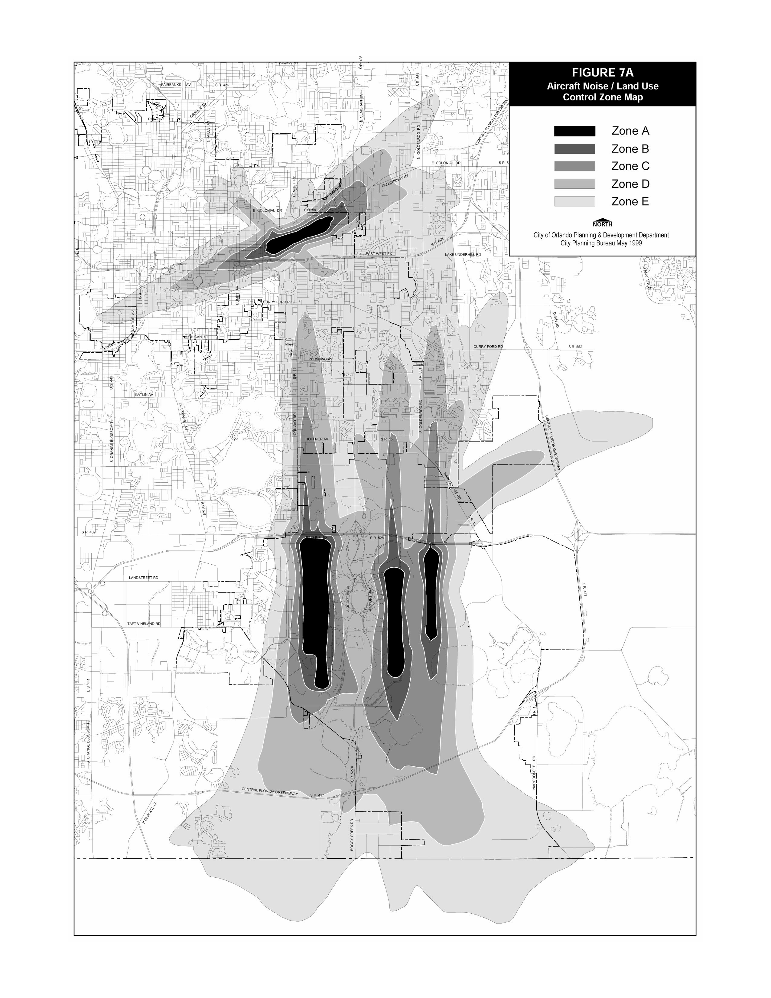
FIGURE 7A. AIRCRAFT NOISE/LAND USE CONTROL ZONE MAP
(Ord. of 9-16-1991, Doc. #25094; Ord. of 5-20-1996, Doc. #29361; Ord. of 8-23-1999, § 9, Doc. #32283)
Sec. 58.372. - Establishment of Aircraft Noise/Land Use Control Zones.
Aircraft Noise/Land Use Control Zones - Five separate Aircraft Noise/Land Use Control Zones shall be established as shown on the Aircraft Noise/Land Use Control Zone Map (Figure 7A). The Aircraft Noise/Land Use Control Zones are based on a projection of future noise environments arising from aircraft flight operations at the OIA and OEA, as such environments were defined by FAR Part 150 Studies.
A composite contour was developed to establish the aircraft noise overlay zones. This was accomplished based on land use controls for two noise metrics (DNL and dBA Aircraft Noise Metric). The DNL metric is a day-night sound level used to present cumulative/average long term aircraft noise exposure. The dBA Aircraft Noise Metric is a single event maximum sound level measure used to describe peak noise levels of representative aircraft flyovers as related to speech interference.
Zone A - 75 and greater DNL contour
Zone B - 70 to 75 DNL contour
Zone C - 65 to 70 DNL contour
Zone D - The composite limits of the 60 DNL contour and the 80 dBA Aircraft Noise Metric contour to the 65 DNL contour.
Zone E - The composite of the limits of the 55 DNL and the 75 dBA Aircraft Noise Metric contour to the composite limits of the 60 DNL contour and the 80 dBA Aircraft Noise Metric contour.
The boundaries of the AN Overlay district shall be construed as the outer boundary of Zone E, and may be altered by initiation of the City Council or Municipal Planning Board whenever there is a finding that noise impacts have changed, via a FAA Part 150 Study.
Determination of Boundaries. In determining the location of noise zone boundaries on the Aircraft Noise/Land Use Control Zone Map, the following standards shall apply:
1.
For platted lots less than one (1) acre in size, where an Aircraft Noise/Land Use Control Zone boundary line enters or crosses said platted parcel, the land use restriction and sound level reduction standards associated with the more stringent Aircraft Noise/Land Use Control Zone shall apply.
2.
For platted and unplatted properties greater than 1 acre in size, where an Aircraft Noise/Land Use Control Zone boundary line enters or crosses the parcel, the regulations associated with more than one zone may apply. The City shall utilize the Aircraft Noise/Land Use Control Zone Map over-layed onto a ⅛th section line map to determine the applicable Aircraft Noise/Land Use Control Zone. The City, in consultation with the Greater Orlando Aviation Authority, shall determine the applicable line of demarcation. If conflicts arise, the City's determination may be appealed to the Municipal Planning Board and City Council.
(Ord. of 9-16-1991, Doc. #25094; Ord. of 8-23-1999, § 11, Doc. #32283)
Secs. 58.373—58.379. - Reserved.
Editor's note— Ord. of 8-23-1999, § 12, repealed § 58.373, relative to additional district requirements. Said section was derived from Ord. of 9-16-1991, Doc. #25094.
Sec. 58.380.- Land Use Restrictions.
Applicability of Overlay Zone Controls. Aircraft noise/land use control zone regulations shall not apply to existing residential and non-residential development, noise compatible land uses such as commercial, industrial, and office uses and/or vacant land zoned for such use, or vacant properties zoned for residential use prior to the adoption of this ordinance (unless a proposed modification of the residential zoning would reduce existing noise/land use compatibility).
The regulations prescribed by this Part shall not be construed to require the sound conditioning or other changes or alteration of any pre-existing structure not conforming to this Part as of the effective date of this revision or to otherwise interfere with the continuance of any pre-existing nonconforming use. Nothing in this Part shall require any such change in the construction or alteration of a structure which was begun prior to the effective date of this part and is diligently pursued.
(Ord. of 9-16-1991, Doc. #25094; Ord. of 8-23-1999, § 13, Doc. #32283)
Sec. 58.381. - Sound Level Requirements for Structures and Buildings.
The following chart (Figure 7B) summarizes the aircraft noise/land use controls associated with the noise overlay zones:
FIGURE 7B. AIRCRAFT NOISE LAND USE CONTROLS
Residential Uses.
Consistent with Future Land Use Element Policy 2.4.11, the following controls shall apply to all residential uses including: single family, multifamily, mobile homes, and hotel/motel/timeshare uses.
1.
Single Family, Multi-Family, and Mobile Home uses prohibited in Zones A and B, except where prior approvals/ agreements grant such use. Hotel/Motel/Timeshare uses are permitted in Zones A and B with appropriate controls as specified above.
2.
While Single Family and Multifamily residential uses are permitted in Zone C, they are discouraged. Mobile Homes are specifically prohibited in Zone C. For Single Family uses in Zone C, a 35 SLR shall be applied. For Multifamily uses, a 30 SLR shall be applied.
Non-Residential Uses.
Consistent with Future Land Use Element Policy 2.4.11, the following controls shall apply to all sensitive non-residential land use types, consisting of: hospital/clinic/nursing home, childcare, school uses. These regulations shall not be applied to commercial, industrial and/or office uses.
1.
Hospital/Clinic/Nursing Homes, Childcare, and School Uses prohibited in Zones A and B, except for aviation related training/educational facilities.
2.
Childcare facilities in Zone C shall only be permitted as accessory uses. Stand-alone childcare facilities shall be prohibited. Existing childcare facilities shall be permitted to expand so long as new structures meet the SLR standards shown above.
3.
Elementary, Middle and High School facilities, whether public or private, shall be prohibited in Zone C. Other school facilities shall be reviewed as a Conditional Use, in which the SLR reduction specified above and additional land use compatibility measures may be applied.
SLR - Sound Level Reduction in Decibels (db); can be achieved through insulation, high grade windows, etc.
(Ord. of 9-16-1991, Doc. #25094; Ord. of 8-23-1999, § 14, Doc. #32283)
Sec. 58.382. - Sound Level Reduction (SLR) Design Requirements.
General Requirements. The SLR requirements found in Section 58.381 may be achieved by any suitable combination of building design, choice of building materials and execution of construction details in accordance with established architectural and acoustical principles. The SLR requirements shall apply to all occupied rooms having one or more exterior walls or ceilings, when furnished in accordance with the intended final usage of the room.
No new building or structure for which an SLR of 25, 30, or 35 is required by Section 58.381 may be constructed unless and until a building permit therefore has been issued by the City. No such permit shall be issued unless and until conformance with the requirements contained in Section 58.381 is indicated by plans and specifications for the building or structure.
The City may require, prior to granting final approval of the finished building construction, at the expense of the owner, a field test by a Qualified Acoustical Consultant to verify the sound level reduction (SLR) of the building. In lieu of field testing, the City may accept, at the owner's expense, a certification of design criteria by a Qualified Acoustical Consultant, verifying the sound level reduction (SLR) of the building.
Verification Testing Procedures/SLR Design Information. Sound level reductions shall be determined for at least four aircraft fly-over events by a typical air carrier-sized jet aircraft for each room tested. The resulting value assigned to the room shall be the average value of the individual fly-over events. Using the noise signal generated by an individual aircraft fly-over event, outside and inside noise levels may be measured simultaneously. The noise levels measured outside and inside the room being tested may be observed directly by simultaneously reading the maximum noise levels on two sound level meters; or the outside and inside fly-over event may be recorded on magnetic tape, and the required noise level reduction determined by analysis of the recorded signals. In either case, the two measuring systems used for outside and inside noise measurement must satisfy the requirements for a Type II Sound Level Meter according to ANSI S1.4-197. The two systems shall be calibrated prior to and following the fly-over events so that they indicate the same level within one decibel for the same noise, using suitable calibration procedures as specified by the manufacturer. For calculations undertaken for purposes of meeting the requirements of this Part, the City, owner, or qualified acoustical consultant may use the assumed outside spectrum shown in Figure 7C.
FIGURE 7C. OCTAVE BAND NOISE SPECTRUM
This spectrum may be used to make calculations for determining how the standards of this Part are to be met. Such calculations shall take into account the area and sound transmission loss characteristics of exposed room surfaces, and the amount of sound absorption in the room.
In residential structures, the assumed ratio of sound absorption to floor area for each room is as follows (making an allowance of at least two decibels for sound leaks and flanking sound transmission paths):
Inside Noise Levels. In residential structures, inside noise levels shall be measured with a single microphone, four feet above the floor, near the center of the room. For other structures, inside noise levels shall be measured with a single microphone, five feet above the floor, either near the center of the room, or inside the room eight feet from the exterior wall most directly exposed to the aircraft noise, whichever distance from the most directly exposed wall is less.
For residential structures, it shall generally be sufficient to conduct tests in two rooms. One of the rooms to be tested shall be the bedroom most directly exposed to aircraft noise. The other room to be tested shall be either the living room, dining room, or family room, whichever is most directly exposed to the aircraft noise. The Building Official shall have sole authority in determining the number of rooms and the particular rooms to be tested.
For structures where a number of rooms receive nearly equal exposure to aircraft noise, tests need only be conducted in two of the near identical rooms. For structures in which several rooms are to be evaluated, tests need only be conducted for those rooms whose exterior walls are most directly exposed to the noise source. If noise level reduction requirements are met for these rooms, the tests need not be repeated for rooms of similar construction which are not directly exposed to fly-over events.
Adjustments for Unfurnished Rooms. When the sound level reduction is measured in an unfurnished or partially furnished room an adjusted sound level reduction shall be computed by adding ten times the logarithm and the base ten of the ratio of the floor area of the room to the sound absorption in the unfurnished or partially furnished room but in any event, such correction shall not exceed two decibels. The adjusted noise level reduction value shall be used in determining compliance with the SLR requirements. If the noise level reduction is measured in a furnished room no adjustment in the noise level reduction may be made.
Outside Noise Levels. The outside noise level shall be measured in an unobstructed location near the center of the wall most directly exposed to the aircraft noise source, approximately five feet above the level of the floor of the room being tested and eight feet from the wall.
(Ord. of 9-16-1991, Doc. #25094; Ord. of 8-23-1999, § 15, Doc. #32283; Ord. No. 2010-47, § 6, 10-18-2010, Doc. #1010181112)
Sec. 58.383. - Public Notification of Potential Noise Impacts.
Public disclosure of aircraft noise impacts shall be made to all future purchasers, mortgagees, occupiers and users of residential property located in all of the Aircraft Noise/Land Use Control Zones shown on the Aircraft Noise/Land Use Control Zone map, consistent with Figure 7A. Public notification shall consist of the following:
1.
Public notice of the existence of maps depicting noise impacted areas shall be published by the Greater Orlando Aviation Authority at least three (3) times in a newspaper of general circulation in Orange County, as provided in Public Law 96-193; and
2.
Aircraft Noise/Land Use Control Zone Maps depicting noise impacted areas shall be available for public inspection at the Planning and Development Department, the Orlando Public Library and other public places; and
3.
The Greater Orlando Aviation Authority shall ensure that Aircraft Noise information is publicized and available to the public and other interested parties such as local realtors/brokers/title companies and professional organizations; and
4.
The City shall attach a zoning suffix of AN-Aircraft Noise Overlay District to all areas where residential and/or sensitive non-residential uses are allowed within Aircraft Noise/Land Use Control Zones A through E; and
5.
Residential plats recorded within Noise Zones C, D, and E shall note the potential for objectionable aircraft noise on the plat. Specifically, the plat shall note the following in a minimum 12 point type: "The properties delineated on this plat are subject to aircraft noise that may be objectionable." This requirement shall be made a condition of approval for all residential subdivisions approved by the City of Orlando.
(Ord. of 8-23-1999, § 16, Doc. #32283)
Sec. 58.384. - Avigation Easement and Waiver of Claims.
An avigation easement and/or waiver of claim, consistent with Section 58.381, shall be required as a condition of development approval for certain lot-splits, short form and long form subdivisions in Aircraft Noise Zones A, B, C, and D. The avigation easement and/or waiver of claim shall be executed between the applicant and the Greater Orlando Aviation Authority and delivered to the Planning and Development Department before a building permit may be issued for a building or structure located, or to be located, within Aircraft Noise Zones A, B, C, or D.
The Board of Zoning Adjustment or Municipal Planning Board may require the execution and delivery of an avigation easement and/or waiver of claim as a condition of granting variances for nonconforming construction or land uses within any of the Aircraft Noise Zones. The land use controls, avigation easement, waiver of claim, and sound level reduction requirements specified in this Part shall be consistent with agreements reached between the property owner and the Greater Orlando Aviation Authority established prior to the effective date of this ordinance revision. Adoption of this ordinance shall in no way invalidate or modify such recorded avigation easements, or noise damage waivers of claim.
(Ord. of 8-23-1999, § 17, Doc. #32283)
Sec. 58.390.- Relationship to the Growth Management Plan.
The AR Overlay district assists in the implementation of GMP Urban Design Goal 1 and Objectives 1.1—1.4, to establish urban design standards which protect and enhance the positive design elements of the Traditional City, and in particular to adopt appearance and design standards for low intensity office uses; and Housing Goal 1 and Objective 1.1, to provide a suitable living environment for present and future residents, and to upgrade and extend the life of the existing housing stock.
(Ord. of 9-16-1991, Doc. #25094)
Sec. 58.391. - Purpose of the District.
The purpose of the Appearance Review Overlay District is to encourage both public and private participation in the enhancement of community appearance and provide the necessary standards and criteria for review in accordance with accepted architectural principles. Furthermore, it is the purpose of this district to strengthen the economy of the City by stabilizing and improving property values in AR areas, and to encourage new construction and redevelopment that will be harmonious with existing structures and architectural styles.
It is further intended that the Appearance Review Overlay District shall operate in conjunction with any other zoning district in which land may be classified, and that such lands may be used as permitted by such other districts except as may be qualified by the requirements of the AR Overlay District as set forth below.
The AR Overlay District shall not be used in conjunction with the HP Overlay District. It is also intended that where appearance review is desirable in connection with an SP Overlay District, the standards and procedures of the AR Overlay District should be referenced in the text of the Special Plan rather than applying the AR Overlay District on the Zoning Map in conjunction with the SP Overlay District.
(Ord. of 9-16-1991, Doc. #25094; Ord. of 5-20-1996, Doc. #29361)
Sec. 58.392. - Establishment of AR Appearance Review Overlay Districts.
Citizen Initiative. Before the initiation of a Zoning Map Amendment to establish an AR Overlay District, a petition shall be presented to the City containing the names of not less than 15% of the property owners within the proposed district, requesting preparation of studies and research concerning the appropriateness of establishing an AR District, and requesting that a public hearing be held to consider the matter.
Preparation of Report. Before the initiation of a Zoning Map Amendment to establish an AR Overlay District, the Planning and Development Department shall conduct studies and research in order to produce a District Report to the Municipal Planning Board. This report shall identify the significance of the exteriors of buildings, structures, features, sites, objects and surroundings of the proposed district, and the unique features within the district which should be conserved or enhanced. The District Report shall recommend either approval or denial of the proposed AR District, and if approval is recommended, shall state the reasons for designating the area as an AR District and recommendations concerning the area(s) to be included in the proposed AR District.
Municipal Planning Board Review. The Municipal Planning Board shall hold a public hearing with due public notice, which shall include a written notice to the last known address of the owners and occupants of all properties to be included in the proposed AR Overlay District. Based on the District Report, the requirements of this Chapter and the recommendations of the staff, the Board shall prepare recommendation for the consideration of the City Council.
City Council Review and Approval. The City Council shall hold a public hearing with due public notice, to consider the proposed AR Overlay District. When approved by the City Council, the AR District shall be established by ordinance and shown on the Official Zoning Map as an Overlay Zoning District. The District Report shall be approved by resolution of the City Council.
(Ord. of 9-16-1991, Doc. #25094)
Secs. 58.393—58.399. - Reserved.
2U. HP HISTORIC PRESERVATION OVERLAY DISTRICT
Sec. 58.400.- Relationship to the Growth Management Plan.
The HP Overlay District implements GMP Historic Preservation Goal 1, to preserve and protect historic resources of local historic or cultural interest; Historic Preservation Objective 1.2 and Policy 1.2.1, to include historic district demolition standards in the LDC; and Historic Preservation Objectives 1.3 and 1.4, to include standards and guidelines for Certificates of Appropriateness in the LDC.
(Ord. of 9-16-1991, Doc. #25094)
Sec. 58.401. - Purpose of the District.
The purpose of the HP Overlay district is to promote the educational, cultural, and economic welfare of the City by preserving and protecting historic structures, sites, monuments, streets, areas and neighborhoods which serve as visible reminders of the history and cultural heritage of the City, state or nation. Furthermore, it is the purpose of this district to strengthen the economy of the City by stabilizing and improving property values in historic areas, and to encourage new construction and development that will be harmonious with existing historic structures and areas.
It is further intended that the HP Overlay district shall operate in conjunction with any other zoning district in which land may be classified, and that such lands may be used as permitted by such other districts except as may be qualified by the requirements of the HP Overlay district as set forth below.
(Ord. of 9-16-1991, Doc. #25094; Ord. of 5-20-1996, Doc. #29361)
Sec. 58.402. - Establishment of Historic Districts.
Citizen Initiative. Before the initiation of a Zoning Map amendment to establish an HP Overlay District, a petition shall be presented to the Historic Preservation Board containing the signatures of not less than fifteen percent (15%) of the property owners within the proposed district, requesting that a public hearing be held to consider the matter.
Comprehensive Survey. Before the establishment of an historic district, the Historic Preservation Officer or his designee shall conduct a comprehensive survey to record and document the historic and architectural significance of the exteriors of buildings, structures, features, sites, or objects in an area. A summary of the survey research and findings shall be compiled. A statement of architectural and of the survey research and findings shall be compiled. A statement of architectural and historic significance shall be prepared. A final survey report shall be submitted to the Historic Preservation Board.
Historic District Criteria. The Historic Preservation Board shall use the following criteria in making its recommendations for historic district designation:
(a)
The concentration of buildings at least 50 years old;
(b)
Exemplification of the cultural, economic, social, educational, or historic heritage of the City of Orlando;
(c)
Embodiment of distinguishing characteristics of architectural styles, elements of architectural design, detail, materials, or craftsmanship;
(d)
Recognition as an area eligible for preservation according to local, state, or national historical/architectural surveys;
(e)
Embodiment of vernacular building forms and styles representative of Central Florida architecture;
(f)
Development of an original settlement or planned development or neighborhood.
The proposed historic district shall at a minimum meet criteria (a) through (d).
Preparation of Report. The Historic Preservation Officer shall make a District Report on the area proposed as an historic district. The District Report shall recommend either approval or denial of the proposed HP Overlay District, and if approval is recommended, shall state the reasons for designating the area as an HP Overlay District. The District Report shall contain a summary of the comprehensive survey; an historic and architectural statement of significance; the criteria used to determine historic district eligibility; a statement of consistency with the Growth Management Plan; and the recommendations concerning the area to be included in the proposed historic district.
Historic Preservation Board Review. The Historic Preservation Board shall hold a public hearing thereon after due notice, which shall include a written notice to the last known address of the owners of all properties to be included in such district. The Board shall review the proposed historic district area to:
(a)
determine if the area qualifies as an historic district; and
(b)
recommend boundaries of the district if the area so qualifies.
After said public hearing, the Historic Preservation Officer shall prepare a report to the Municipal Planning Board. The report shall state the reasons for designating the area as an HP Overlay District and state whether the proposed District is consistent with the Growth Management Plan and the Area Plans.
Municipal Planning Board Review. The Municipal Planning Board shall hold a public hearing, with due public notice to the owners of all properties to be included in such district, to review the area to be included in the proposed HP Overlay District for consistency with the Growth Management Plan. The Municipal Planning Board shall not review proposed historic district boundaries. Based on the recommendations of the Historic Preservation Board, the recommendations of the Historic Preservation Officer, and the review of the Municipal Planning Board for consistency with the Growth Management Plan, the Municipal Planning Board shall prepare recommendations for the consideration of City Council.
Transmittal of Report. Based on the District Report, the requirements of this Chapter, and the recommendations of the Historic Preservation Board and Historic Preservation staff, the Historic Preservation Officer shall submit a final report with recommendations for the consideration of the City Council within thirty (30) days following the action of the Municipal Planning Board. Copies of the adopted report shall be transmitted to the Division of Historical Resources, Bureau of Historic Preservation, Department of State of the State of Florida.
City Council Review and Approval. City Council shall apply the Historic District criteria set out in this Section in designating a historic district. Historic districts, when approved by City Council, shall be established by ordinance and shown on the Official Zoning Map as overlay districts.
(Ord. of 9-16-1991, Doc. #25094; Ord. of 7-26-1993, Doc. #26769; Ord. of 5-20-1996, Doc. #29361)
Secs. 58.403—58.409. - Reserved.
2V. MA MAJOR ATTRACTION OVERLAY DISTRICT
Sec. 58.410.- Relationship to the Growth Management Plan.
The MA Overlay district implements GMP Downtown Objective 1.1 and Policy 1.1.7, to maintain Downtown Orlando's position as a regional economic hub and strengthen its role in the international market; Downtown Objective 2.2 and Policy 2.2.3, to provide standards for areas of unique activity; Downtown Goal 3, to conserve historic and architectural resources, enhance the street-level pedestrian environment and improve development design review.
(Ord. of 9-16-1991, Doc. #25094)
Sec. 58.411. - Purpose of the District.
The MA Overlay District is designed to allow major tourist oriented entertainment facilities, which serve an international market, increased flexibility with regard to uses, development standards, and signage necessary to effectively implement the policies of the Growth Management Plan. This district shall be utilized to achieve an overall design and aesthetic consistency based upon a unified design theme characteristic of major entertainment complexes. Furthermore, it is the purpose of this district to strengthen the economy of the City by preserving viable major entertainment facilities based upon the unique requirements of such facilities. Such facilities provide major employment and economic opportunities and compete in an international market requiring a broad mix of activities and the ability to maintain visibility to the tourist population.
It is further intended that the MA Overlay District shall operate in conjunction with any other zoning district in which land may be classified, and that such lands may be used as permitted by such other districts except as may be allowed or qualified by the requirements of the MA Overlay District as set forth below.
(Ord. of 9-16-1991, Doc. #25094)
Sec. 58.412. - Zoning Map Application.
Major Attraction Overlay Districts, when approved by City Council, shall be established by ordinance following recommendation by the Municipal Planning Board. Recommendations by the Municipal Planning Board shall be based upon examination of data and information provided by the applicant to ensure that the facility meets the minimum criteria required for establishment of the district.
(Ord. of 9-16-1991, Doc. #25094)
Sec. 58.413. - Minimum Criteria.
For each MA Overlay District the facility shall possess the following minimum criteria:
(a)
Be considered an entertainment or lodging complex by the State of Florida;
(b)
A minimum of 750,000 visitors annually pay admission fees to the entertainment or lodging complex or component facilities within the complex;
(c)
The complex shall provide meeting facilities for at least 250 persons;
(d)
The complex shall contain at least one restaurant having at least 4,000 square feet of service area which is equipped to serve 150 persons full-course meals at one time;
(e)
The complex shall be under a unified ownership, a unified management structure, or a single, approved, master plan; and
(f)
The complex shall be located within the AC-3A (Downtown Activity Center District) or an AC-3 Metropolitan Activity Center District.
(Ord. of 9-16-1991, Doc. #25094; Ord. of 7-26-1993, Doc. #26769)
Sec. 58.414. - District Standards.
The base zoning district standards and uses shall apply except as may be expanded or contracted herein.
Site Development Standards for MA Overlay Districts Less Than Ten Acres.
(a)
Yard Setbacks. Where a complex fronts more than one street, each street shall be considered to be a front yard for setback purposes.
(b)
Perimeter Landscaping. Wherever a parking garage or other structure abuts a lot line with no setback, perimeter landscaping shall not be required. Perimeter landscaping shall not be required for any portion of any parking garage frontage which incorporates ground floor active uses other than parking.
Site Development Standards for MA Overlay Districts Greater Than Ten Acres. Where a MA Overlay District is greater than 10 acres in area, Master Plan Review shall be required and site development standards which exceed or are different than those established by the underlying zoning district may be established as part of the Master Plan Review, where necessary to ensure that the major attraction is compatible with the surrounding area.
(Ord. of 9-16-1991, Doc. #25094; Ord. of 7-26-1993, Doc. #26769)
Secs. 58.415—58.419. - Reserved.

2W. RP RESOURCE PROTECTION OVERLAY DISTRICT
Sec. 58.420.- Relationship to the Growth Management Plan.
The RP Overlay District assists in the implementation of all of the Conservation objectives and policies of the Growth Management Plan, and in particular Conservation Goal 1 and Policy 1.6.5, to effectively regulate development activity in areas identified as natural hazard or natural resource areas, and to designate such areas as potential conservation areas.
(Ord. of 9-16-1991, Doc. #25094)
Sec. 58.421. - Purpose of the District.
The intent of the RP Overlay District is to provide information to property owners, City officials and the general public by identifying the approximate locations of major environmental features which may restrict or otherwise affect the development of land. The RP Overlay District is intended to be informational only, since regulations to protect environmentally sensitive areas such as surface water bodies, groundwater recharge areas, floodplains, and wetlands are set forth elsewhere in this Code. The requirements found in the environmental protection section of this Code, Conservation (C) District and in the City's OUSWMM manual dealing with floodplains, stormwater management and lakes, govern all such environmentally sensitive areas. Therefore, the RP Overlay District contains no standards of its own. The reader is referred to Chapter 58, Part 2L, Conservation District; Chapter 63, Parts 2C, 2D, 2H and 2I and to the OUSWMM manual for the appropriate regulations.
(Ord. of 9-16-1991, Doc. #25094; Ord. of 7-26-1993, Doc. #26769)
Sec. 58.422. - Rezones and Zoning Map Applications.
The general locations of major environmental features shall be shown on the Zoning Map in the RP Overlay District by means of dashed lines, shading, words and/or other identifying markings. The types of features shown in the RP Overlay District include:
(a)
Floodways (see Chapter 63, Part 2C).
(b)
Surface Water Bodies & Wetlands (see Chapter 63, Part 2I), including:
1.
Freshwater marshes.
2.
Wet prairies.
3.
Cypress bayheads, domes and strands.
4.
Hydric hammocks.
5.
Wetland hardwood swamps.
6.
Lakes.
(c)
Other environmentally sensitive area.
The boundaries of the RP Overlay District may be altered administratively upon a rezoning ordinance or submission by the property owner of an approved WMD, DER, and/or ACOE permit.
(Ord. of 9-16-1991, Doc. #25094; Ord. of 7-26-1993, Doc. #26769; Ord. of 5-20-1996, Doc. #29361)
Sec. 58.430.- Relationship to the Growth Management Plan.
The SP Overlay District implements Objectives 1.3, 1.4, 2.1, and 4.1 of the Growth Management Plan's Urban Design Element, as well as Objective 1.1 of the Growth Management Plan's Future Land Use Element, by providing a mechanism for creating urban design plans, guidelines, and standards to protect the established character of existing neighborhoods and allow for the efficient and orderly growth of newly urbanizing areas.
(Ord. of 9-16-1991, Doc. #25094; Ord. Of 5-5-2003, § 1, Doc. #030505704)
Sec. 58.431. - Purpose of the District.
The SP Overlay District is intended to be a mechanism for creating urban design plans, guidelines, and standards in a coordinated manner to help achieve the goals, objectives, and policies of the Growth Management Plan. The SP Overlay District is also intended to provide opportunities for public participation in the process of planning for the enhancement of specifically defined areas.
It is further intended that the SP Overlay District shall operate in conjunction with any other zoning district in which land may be classified, and that such lands may be used as permitted by such other districts except as may be qualified by the requirements of the SP Overlay District as set forth below.
(Ord. of 9-16-1991, Doc. #25094; Ord. Of 5-5-2003, § 2, Doc. #030505704)
Sec. 58.432. - Rezones and Zoning Map Applications.
The SP Overlay District may be designated only for areas that the City Council determines shall be developed in a coordinated manner to help achieve the goals, objectives, and policies of the Growth Management Plan. Initiation and review of an application for an SP Overlay designation shall be in accordance with Chapter 65 of this Code.
Adoption of the Special Plan. For each SP Overlay District, the City Council shall adopt, as an amendment to this Code a special plan for the area, which may include provisions relating to:
(a)
The location and characteristics of streets and other rights-of-way, sidewalks, utilities, parkways, trees, landscaping, and signage.
(b)
The dimensions and grading of building sites and the dimensions and siting of structures.
(c)
The location, type, and characteristics of allowable uses and development.
(d)
Any other factor deemed relevant to the privacy, safety, preservation, protection, or welfare of lands within or surrounding the designated area.
After the adoption of a special plan, it shall operate in conjunction with the underlying zoning district regulations for the area. No development permit shall be approved except in conformance with the special plan.
Amendment of a Special Plan. Any property owner within an SP District may apply for an amendment to the adopted special plan. The amendment shall be subject to the review requirements contained in Chapter 65. The City Council may amend the special plan from time to time in accordance with the same standards and procedure as for the original plan.
(Ord. of 9-16-1991, Doc. #25094; Ord. of 4-20-1992, Doc. #25633; Ord. Of 5-5-2003, § 3, Doc. #030505704)
Sec. 58.440.- Relationship to the Growth Management Plan.
The t Overlay District assists in the implementation of the GMP Urban Design Objective 1.1, Policy 1.1.1 and Objective 1.2, Policy 1.2.1, which require regulation the design, scale and appearance of development within the Traditional City.
(Ord. of 9-16-1991, Doc. #25094)
Sec. 58.441. - Purpose of the District.
The t Overlay District is intended to establish urban design standards to perpetuate the positive design elements and the residential and commercial development patterns found within the Traditional City. The traditional City shall be defined by recognizable geographic boundaries of subdivisions platted prior to World War II in which there is a concentration of the positive design elements as defined in Urban Design Goal 1.
It is further intended that the t Overlay District shall operate in conjunction with any other zoning district in which land may be classified, and that such lands may be used as permitted by such other districts except as may be qualified by the requirements of the t Overlay District as set forth below.
(Ord. of 9-16-1991, Doc. #25094)
Sec. 58.442. - Rezones and Zoning Map Applications.
The t Overlay District may be applied to an established developed residential or commercial area having the general character described in Section 58.441 above. Traditional City boundaries shall be expanded only by initiation of the City Council or Municipal Planning Board.
(Ord. of 9-16-1991, Doc. #25094; Ord. of 4-20-1992, Doc. #25633)
Sec. 58.450.- Relationship to the Growth Management Plan.
The Urban Reserve District implements GMP Future Land Use Objective 1.1 and Policies 1.1.3 and 1.1.4 to allow for the orderly and efficient growth of newer urbanizing areas, and to allow for the timely and efficient provision of urban services and facilities.
(Ord. of 9-16-1991, Doc. #25094; Ord. of 3-20-1995, Doc. #28341)
Sec. 58.451. - Purpose of the District.
The purpose of the Urban Reserve district is to provide for the proper timing and phasing of growth within the City Planning Area, by allowing limited beneficial use of lands for which development is intended, but which should be held in a primarily undeveloped state for an interim period of time. The Urban Reserve district differs from the Holding district in that the "interim period of time" of the UR district is designed to be of a longer term. The UR district is designed primarily for those properties which are not currently needed to accommodate the demand for urban-zoned land, properties with poor accessibility, and properties which cannot currently be served in an economical or efficient manner.
(Ord. of 9-16-1991, Doc. #25094; Ord. of 3-20-1995, Doc. #28341)
Sec. 58.452. - Rezones and Zoning Map Applications.
The -UR- Urban Reserve district may be applied to any lands for which the City Council finds that urban land uses may be appropriate in the future, but which cannot be provided with urban services in an economical manner at the present time. The district may also be applied to lands which should be preserved primarily for agricultural or open space use for an indefinite period of time. Allowable uses include Residential, Public, Agriculture, and Conservation. The UR district may only be applied to those properties designated Urban Reserve on the City's Future Land Use Map Series or for those properties for which a GMP amendment application is being processed to change the Future Land Use designation to Urban Reserve. Properties classified with the UR district will be held in reserve for future development until such time as adequate infrastructure is made available to serve the site, and market conditions clearly indicate the need for additional urban land.
(Ord. of 9-16-1991, Doc. #25094; Ord. of 3-20-1995, Doc. #28341)
Sec. 58.460.- Relationship to the Growth Management Plan.
The ASD-1 and ASD-2 Districts implement GMP Future Land Use Goal 4, and associated objectives and policies, which guide development in the Southeast Orlando Sector Plan area.
(Ord. of 5-10-1999, § 2, Doc. #32070)
Sec. 58.461. - Purpose of the District.
The ASD-1 and ASD-2 Districts are intended to be the primary employment locations within the Southeast Orlando Sector Plan area. The districts have been divided into two distinct types or levels of intensity. ASD-2 or High Intensity; and ASD -1 or Medium Intensity.
The ASD-2 district allows a wide range of land uses at a high level of intensity which support the continued growth of the Orlando International Airport including heavy manufacturing, automobile and truck rental, hotel, and ancillary support retail. Residential uses are strictly prohibited in the ASD-2 because of aircraft noise and land use incompatibility.
The ASD-1 district also allows a wide range of land uses, but specifically does not allow heavy manufacturing. While conventional community shopping centers (grocery stores, strip centers) are not allowed within either district, big box retail is considered an appropriate use in both districts. Residential uses are not allowed by right in the ASD-1 district; instead, they may be allowed as a component of a PD (Planned Development) within the Airport Support District-Medium Intensity or Urban Village future land use designations.
(Ord. of 5-10-1999, § 2, Doc. #32070)
Sec. 58.462. - Rezones and Zoning Map Applications.
The ASD-1 and ASD-2 Districts may be applied on the Official Zoning Map within the Southeast Orlando Sector Plan area, and in accordance with the goals, objectives and policies of the adopted Growth Management Plan.
(Ord. of 5-10-1999, § 2, Doc. #32070)
Sec. 58.463. - Additional District Requirements.
Future Land Use Goal 4 and associated objectives and policies shall apply. Within certain density and intensity thresholds, Traditional Design standards shall apply within the ASD-1 district. See Chapter 68, Southeast Orlando Sector Plan Development Guidelines and Standards, for land use and design standards in the ASD-1 district.
(Ord. of 5-10-1999, § 2, Doc. #32070)
Sec. 58.470.- Relationship to the Growth Management Plan.
The TC/UTC District implements GMP Future Land Use Goal 4, and associated objectives and policies, which guide development in the Southeast Orlando Sector Plan area.
(Ord. of 5-10-1999, § 3, Doc. #32070)
Sec. 58.471. - Purpose of the District.
The TC/UTC District acts as the primary destination within the Southeast Orlando Sector Plan area for living, working, shopping and entertainment. The fine grain mix of uses within the TC/UTC district, the urban fabric of streets and blocks, and the architectural character of individual buildings shall be the most intensive of all uses in the Southeast Plan area.
(Ord. of 5-10-1999, § 3, Doc. #32070)
Sec. 58.472. - Rezones and Zoning Map Applications.
The TC/UTC district may be applied on the Official Zoning Map within the Southeast Orlando Sector Plan area, and in accordance with the goals, objectives and policies of the adopted Growth Management Plan.
(Ord. of 5-10-1999, § 3, Doc. #32070)
Sec. 58.473. - Additional District Requirements.
Consistent with Future Land Use Goal 4 and associated objectives and policies, Traditional Design standards shall apply in this district. See Chapter 68, Southeast Orlando Sector Plan Development Guidelines and Standards, for land use and design standards in the TC/UTC district.
(Ord. of 5-10-1999, § 3, Doc. #32070)
Sec. 58.480.- Relationship to the Growth Management Plan.
The VC/UTC District implements GMP Future Land Use Goal 4, and associated objectives and policies, which guide development in the Southeast Orlando Sector Plan area.
(Ord. of 5-10-1999, § 4, Doc. #32070)
Sec. 58.481. - Purpose of the District.
The VC/UTC District acts as an important destination within the Southeast Orlando Sector Plan for Residential Neighborhoods, providing a variety of shops, services, restaurants, and civic facilities that serve the needs of the surrounding neighborhoods. The VC/UTC district shall also contain a significant amount of medium to high intensity residential development. The VC/UTC district is intended to be more pedestrian, bicycle and transit friendly than the more auto-oriented VC district.
(Ord. of 5-10-1999, § 4, Doc. #32070)
Sec. 58.482. - Rezones and Zoning Map Applications.
The VC/UTC district may be applied on the Official Zoning Map within the Southeast Orlando Sector Plan area, and in accordance with the goals, objectives and policies of the adopted Growth Management Plan.
(Ord. of 5-10-1999, § 4, Doc. #32070)
Sec. 58.483. - Additional District Requirements.
Consistent with Future Land Use Goal 4 and associated objectives and policies, Traditional Design standards shall apply in this district. See Chapter 68, Southeast Orlando Sector Plan Development Guidelines and Standards, for land use and design standards in the VC/UTC district.
(Ord. of 5-10-1999, § 4, Doc. #32070)
Sec. 58.490.- Relationship to the Growth Management Plan.
The VC District implements GMP Future Land Use Goal 4, and associated objectives and policies, which guide development in the Southeast Orlando Sector Plan area.
(Ord. of 5-10-1999, § 5, Doc. #32070)
Sec. 58.491. - Purpose of the District.
The VC District acts as an important destination within the Southeast Orlando Sector Plan for Residential Neighborhoods, providing a variety of shops, services, restaurants, and civic facilities that serve the needs of the surrounding neighborhoods. The VC district is required to contain a significant amount of medium to high intensity residential development. The VC district is generally more auto-oriented than the VC/UTC district.
(Ord. of 5-10-1999, § 5, Doc. #32070)
Sec. 58.492. - Rezones and Zoning Map Applications.
The VC district may be applied on the Official Zoning Map within the Southeast Orlando Sector Plan area, and in accordance with the goals, objectives and policies of the adopted Growth Management Plan.
(Ord. of 5-10-1999, § 5, Doc. #32070)
Sec. 58.493. - Additional District Requirements.
Future Land Use Goal 4 and associated objectives and policies shall apply. Within certain density and intensity thresholds, Traditional Design standards shall apply within the VC district. See Chapter 68, Southeast Orlando Sector Plan Development Guidelines and Standards, for land use and design standards in the VC district.
(Ord. of 5-10-1999, § 5, Doc. #32070)
Sec. 58.494.- Relationship to the Growth Management Plan.
The NC District implements GMP Future Land Use Goal 4, and associated objectives and policies, which guide development in the Southeast Orlando Sector Plan area.
(Ord. of 5-10-1999, § 6, Doc. #32070)
Sec. 58.495. - Purpose of the District.
The NC District, within the Southeast Orlando Sector Plan area, provides gathering places for people and walkable destinations for neighborhood focused and/or civic activities. Medium density housing in the NC district should surround the core commercial area and be integrated with its design.
(Ord. of 5-10-1999, § 6, Doc. #32070)
Sec. 58.496. - Rezones and Zoning Map Applications.
The NC district may be applied on the Official Zoning Map within the Southeast Orlando Sector Plan area, and in accordance with the goals, objectives and policies of the adopted Growth Management Plan.
(Ord. of 5-10-1999, § 6, Doc. #32070)
Sec. 58.497. - Additional District Requirements.
Consistent with Future Land Use Goal 4 and associated objectives and policies, Traditional Design standards shall apply in this district. See Chapter 68, Southeast Orlando Sector Plan Development Guidelines and Standards, for land use and design standards in the NC district.
(Ord. of 5-10-1999, § 6, Doc. #32070)
Sec. 58.498.- Relationship to the Growth Management Plan.
The RN District implements GMP Future Land Use Goal 4, and associated objectives and policies, which guide development in the Southeast Orlando Sector Plan area.
(Ord. of 5-10-1999, § 7, Doc. #32070)
Sec. 58.499. - Purpose of the District.
The majority of housing in the Southeast Orlando Sector Plan area will be located within RN districts. These low to medium density areas will be scaled to the needs of pedestrians, with local destinations, such as VC/UTC, VC, NC and Residential Centers, schools and community parks, all within comfortable walking distance.
(Ord. of 5-10-1999, § 7, Doc. #32070)
Sec. 58.499.1. - Rezones and Zoning Map Applications.
The RN district may be applied on the Official Zoning Map within the Southeast Orlando Sector Plan area, and in accordance with the goals, objectives and policies of the adopted Growth Management Plan.
(Ord. of 5-10-1999, § 7, Doc. #32070)
Sec. 58.499.2. - Additional District Requirements.
Future Land Use Goal 4 and associated objectives and policies shall apply. Within certain density and intensity thresholds, Traditional Design standards shall apply within the RN district. See Chapter 68, Southeast Orlando Sector Plan Development Guidelines and Standards, for land use and design standards in the RN district.
(Ord. of 5-10-1999, § 7, Doc. #32070)
Sec. 58.499.4.- Relationship to the Growth Management Plan.
The I-C district implements GMP Future Land Use Goal 2, to promote a wide variety of employment alternatives both inside and outside of activity centers, and Future Land Use Objective 2.3 and Policy 2.3.1, to provide standards for industrial uses located outside activity centers and mixed use corridors. The I-C district implements the Industrial category of the Future Land Use Map Series.
(Ord. of 1-27-2003, Doc. #030127712)
Sec. 58.499.5. - Purpose of the District.
The I-C district is intended to provide for the beneficial use of intensive commercial and light-industrial properties located along and oriented to arterial and four-lane collector streets, to accommodate many of the commercial and light-industrial uses located on property zoned C-2, C-3 or Industrial in Orange County prior to annexation, and to accommodate uses that cannot be effectively integrated into pedestrian-oriented mixed-use centers due to the size, bulk, weight or type of products or services offered. The I-C district is intended to encourage redevelopment to higher standards of design and to improve compatibility with adjacent residential properties.
(Ord. of 1-27-2003, Doc. #030127712)
Sec. 58.499.6. - Rezones and Zoning Map Applications.
The I-C district may be applied to areas suitable for intensive commercial and light industrial development which conform to the following standards:
Access to Thoroughfares. Each property in an I-C district shall have access to a thoroughfare as follows: (1) Frontage on at least one arterial or four-lane collector street designated in Chapter 61, Part 2B; or (2) Access to at least one arterial or four-lane collector street via a public street that does not pass through or alongside any residential zoning district.
Traffic Hazards. No I-C district shall direct traffic into adjacent residential zoning districts or generate traffic congestion that affects residential zoning districts.
(Ord. of 1-27-2003, Doc. #030127712)
Sec. 58.499.7. - Additional District Requirements.
Reductions in Yard Setbacks. Rear yard and side yard setbacks may be reduced to zero when the setback is measured from a property line that coincides with a railroad siding; however, no trackage shall be located within 300 feet of any residential area.
(Ord. of 1-27-2003, Doc. #030127712)
Sec. 58.499.8 - Relationship to the Growth Management Plan.
The W Overlay District implements GMP Conservation Element, Objective 1.7 and Policies 1.7.8 and 1.7.9, which establish the need to protect environmentally sensitive lands, including those within the Wekiva Study Area, as defined in the Wekiva Parkway and Protection Act.
(Ord. of 10-16-2006, § 1, Doc. #0610161006)
Sec. 58.499.9. - Purpose of the District.
The W Overlay District is intended to promote a pattern of development that preserves open space and protects the most effective recharge areas, karst features and sensitive natural habitats within the Wekiva Study Area, while recognizing property rights and accommodating both rural and urban land use patterns.
(Ord. of 10-16-2006, § 1, Doc. #0610161006)
Sec. 58.499.10. - Rezones and Zoning Map Applications.
The boundaries of the W Overlay District shall be consistent with the W Overlay future land use designation, as provided in GMP Conservation Element, Figure C-3. Amendments to the W Overlay District boundary and regulations may only be initiated by the Municipal Planning Board or City Council.
(Ord. of 10-16-2006, § 1, Doc. #0610161006)
Sec. 58.499.11. - District Standards.
In addition to all other requirements of this Code, the standards of this Section shall apply to development sites comprising 5 acres or more.
(a)
Open Space Ratio. Development sites that include a residential component shall conform to the following standards:
1.
Where 20 percent or more of the gross land area is vacant or undeveloped, the minimum ratio of open space shall be 20 percent of the gross land area. No variance to the minimum ratio shall be permitted.
2.
Where less than 20 percent of the gross land area is vacant or undeveloped, the minimum ratio of open space shall be 20 percent of the gross land area, except where special conditions and circumstances justify a lower ratio. Any variance to the minimum ratio shall be subject to the standards and procedures for a Board of Zoning Adjustment Variance as provided in Chapter 58, Part 2J.
(b)
Open Space Standards. Open space required under this Section shall conform to the following standards:
1.
Location. Open space shall be located in a manner that will:
a.
Minimize impervious surface on property within the Resource Protection Overlay designation;
b.
Protect sensitive natural habitats;
c.
Connect new open space to existing or proposed open space on adjacent properties; and
d.
Create the largest contiguous open space feasible.
2.
Permitted Development. Open space may include:
a.
Natural water bodies;
b.
Wetlands and wetland buffers;
c.
Protected wildlife corridors;
d.
Passive parks; and
e.
Stormwater retention areas, not to exceed 50 percent of the total open space required.
3.
Prohibited Development. Open space may not include:
a.
Required building setback areas, privately owned yards on single family lots, street rights-of-way, parking lots, active recreation areas, and golf courses;
b.
Impervious surfaces, except for sidewalks and pedestrian or bicycle paths shown on an approved Development Plan.
4.
Recording. The boundaries of required open space areas shall be clearly delineated on a subdivision plat and shall remain protected and undeveloped in perpetuity through the use of conservation easements or plat restrictions.
5.
Reserved.
(c)
Stormwater Retention. Stormwater retention areas shall be:
1.
Designed as natural amenities;
2.
Landscaped with native vegetation;
3.
Located outside protected wetland buffer areas; and
4.
Consistent with the best practices presented in Protecting Florida's Springs Manual - Land Use Planning Strategies and Best Management Practices (November 2002), as it may be amended from time to time.
(d)
Golf Courses. All golf course siting, design, construction, and management shall be consistent with the best practices presented in Protecting Florida's Springs Manual - Land Use Planning Strategies and Best Management Practices (November 2002), as it may be amended from time to time.
(e)
Impervious Surface Ratio. No increase shall be allowed to the Impervious Surface Ratio (ISR) for the applicable zoning district, nor shall any increase be allowed through the adoption of PD zoning.
(f)
Density and Intensity Bonuses. No density or intensity bonus shall be allowed on property within the Resource Protection Overlay District.
(g)
Density Transfer. Development may be transferred within a development site from property inside a Resource Protection Overlay area to property outside a Resource Protection area, provided, however, the total net density or intensity of development outside the Resource Protection Area shall not increase by more than 40 percent.
(h)
Groundwater Recharge. New development shall, at a minimum, maintain surface and groundwater flow rates and volumes at pre-development levels, or enhance recharge so that the natural function of groundwater recharge areas is maintained or improved.
(Ord. of 10-16-2006, § 1, Doc. #0610161006; Ord. No. 2016-68, § 1(Exh. A), 11-14-2016, Doc. #1611141201)
Sec. 58.499.12. - Environmental Assessment.
In addition to all other requirements of this Code, the standards of this Section shall apply to development sites comprising 5 acres or more.
(a)
Applicability. An Environmental Assessment shall be submitted in conjunction with the following:
1.
Applications requiring a public hearing before the Municipal Planning Board.
2.
Applications for subdivision review and approval by the Technical Review Committee.
3.
Applications for building permit review and approval for construction of a principle structure, substantial improvements, and substantial enlargements.
(b)
General Requirements. The following information shall be included in the Environmental Assessment:
1.
An analysis of soils, by a qualified professional, to determine the location of most effective recharge areas.
2.
An analysis of the site, by a licensed professional geologist, to determine the location and nature of sinkholes and other karst features of the property.
3.
An analysis of the site, by a qualified biologist, to identify flora and fauna, state and federal listed species, and vegetative habitat types including but not limited to wetlands and sensitive natural habitat defined as Longleaf Pine, Sand Hill, Sand Pine and Xeric Oak Scrub.
4.
A summary, by a qualified professional, of the overall site to determine priorities for locating pervious and impervious surfaces, stormwater areas, and open space areas.
(Ord. of 10-16-2006, § 1, Doc. #0610161006)
Sec. 58.499.13.- Relationship to the Growth Management Plan.
The Parramore Heritage Overlay District implements GMP Future Land Use Element, Subarea Policy S.6.9, by prohibiting the establishment, of certain social service uses within the district and providing standards for their expansion or relocation.
In addition, the Parramore Heritage Overlay District implements GMP Future Land Use Element, Subarea Policy S.6.14, by providing development standards which encourage a compact urban form, enhance economic vitality, and promote housing and income diversity within the Parramore community.
Finally, the Parramore Heritage Overlay District implements GMP Housing Element Goal 5 and Objective 5.1 to promote infill housing development by supporting alternative development standards where necessary and feasible. The District also implements Housing Objective 5.10 and Policy 5.10.1 to support efforts to make Parramore a mixed income, economically diversified neighborhood; as well as Housing Policy 5.10.5 to encourage design standards that promote image improvement opportunities in the neighborhood.
(Ord. No. 2010-3, § 1, 5-24-2010, Doc. #1005241102; Ord. No. 2017-24, § 1, 6-5-2017, Doc. #1706051202; Ord. No. 2022-38, § 1, 7-18-2022, Doc. # 2207181202)
Sec. 58.499.14. - Purpose of the District.
The purpose of the Parramore Heritage Overlay District is to promote the stability and prosperity of the Parramore Heritage neighborhood by reducing the over-concentration of social service uses within the district.
In addition, the District is intended to provide flexible development standards for non-conforming one and two family residential properties, particularly those properties that have substandard lot or parcel configurations. Specifically, these standards and processes shall apply only to non-conforming lots of record, or lots being re-platted to match a plat that was recorded prior to 1959, and which were vacant prior to March 1, 2017.
Flexibility in development standard(s) for non-conforming one or two family residential properties must be coupled with appropriate urban design principles in order to implement the Parramore Comprehensive Neighborhood Plan and the Traditional City concept. However, all proposed residential development must comply with the density and intensity standards associated with the individual property's Future Land Use designation and Zoning classification.
(Ord. No. 2010-3, § 1, 5-24-2010, Doc. #1005241102; Ord. No. 2017-24, § 1, 6-5-2017, Doc. #1706051202)
Sec. 58.499.15. - District Use Standards.
(a)
In addition to the uses prohibited in the applicable underlying zoning district, the following uses may not be established within the Parramore Heritage Overlay District:
1.
Emergency shelter; and
2.
Treatment and recovery facility; and
3.
Residential care facility; and
4.
Social service use.
(b)
The uses listed in section (a) may not expand or relocate unless the following criteria are met as applicable:
1.
The use was lawfully established on the subject property on or before May 24, 2010, as demonstrated by property ownership records, business tax receipts, utility bills, public tax records (such as for a 501(3)(c) organization), annual reports, or other relevant records.
2.
If expanding, the expansion area must be within the subject property. Expansions are defined as any construction project that increases client capacity for overnight uses or building square footage by more than 10 percent. Changes to increase the amount of parking, landscaping, buffers, stormwater facilities including associated lighting or fencing, or other onsite infrastructure shall not be considered an expansion and shall not be limited to the original subject property. A renovation or increase in the building square footage and/or client capacity is not an expansion if the building square footage or client capacity is increased by 10 percent or less.
3.
If relocating, the new property must be within 300 feet of the previous one (as measured from property line to property line in a straight path), and the acreage of the new property must be not more than 150% of the size of the previous one.
4.
If applicable, the social service provider participates in the Homeless Management Information System operated by the Homeless Services Network of Central Florida, or a functionally equivalent successor system.
(c)
Any expansion or relocation of a use listed above shall require a conditional use permit in accordance with the standards provided by Chapter 65, Part 2D, City Code. In review of the application, the Municipal Planning Board and City Council shall consider the standards of review applicable to all conditional use permits and the following factors:
1.
The extent to which the use is compatible with surrounding uses.
2.
The extent to which activity takes place outdoors or on adjacent streets and sidewalks.
3.
Hours of operation.
4.
Proximity to transit.
(d)
For the purposes of this part, a social service use is any use that exists to advance human welfare by solely or primarily providing healthcare, food, clothing, or human services to individuals onsite for no fee or a below market rate fee, the use is nonprofit in nature, and the use receives the majority of its funding from donations, grants, or government programs. Schools, libraries, community centers, parks, civic clubs, and religious institutions are not included within the meaning of social service use.
(e)
Uses protected by the state or federal Fair Housing Acts, the Americans with Disabilities Act, the Rehabilitation Act, or other state and federal laws, are not included within the meaning of any of the uses prohibited under this part.
(f)
In addition to the Permitted and Conditional Uses identified in Chapter 58, Figure 2A.LDC and Figure 2B.LDC, the following uses are permitted as conditional uses for existing buildings or structures on any property zoned I-G within the Parramore Heritage Overlay District, so long as, the new use is located within a building or structure that was lawfully established on the property on or before April 1, 2024, as demonstrated by property ownership records, business tax receipts, utility bills, annual reports, or other relevant records:
1.
Personal Service
2.
Indoor Recreation - Intensive
3.
Light Retail
4.
Restaurant
(g)
A Conditional Use Permit is required for all uses listed in section (f) above, except that the requirement to obtain a Conditional Use Permit is waived when the following criterial are met and a Planning Official Determination is obtained:
1.
The use is not open between the hours of 10:00 p.m. and 7:00 a.m.; and
2.
The sale of alcoholic beverages and the type of State Alcoholic Beverage License issued, if any, is limited to the sale of beer and wine only.
(Ord. No. 2010-3, § 1, 5-24-2010, Doc. #1005241102; Ord. No. 2017-24, § 1, 6-5-2017, Doc. #1706051202; Ord. No. 2022-38, § 1, 7-18-2022, Doc. # 2207181202; Ord. No. 2024-9, § 1, 6-10-2024, Doc. #2406101202)
Editor's note— Ord. No. 2017-24, § 1, adopted June 5, 2017 amended the title of § 58.499.15 to read as herein set out. Formerly said section was entitled district standards.
Sec. 58.499.16. - Modification of Standards in the PH Overlay District.
When, in the judgment of the Zoning Official, reasonable development of a non-conforming one or two family residential building site justifies such action, principal building setbacks may be relaxed on individual lots within the PH Overlay District over and above the 20% numerical standard specified in Section 65.302(b)1. However, all one and two family residential infill lots must meet the minimum standards shown below. The front, side, and street side yard setbacks shall be measured from the face of the structure to the property line or, if present, the city services easement.
Front yard setback: 15 ft.; 20 ft. for a garage
Side yard setback: 5 ft.
Street side yard setback: 5 ft.; 20 ft. for a garage
Rear yard setback: 15 ft.
The maximum ISR for individual non-conforming one or two family residential lots within the PH Overlay District may also be modified by the Zoning Official with concurrence by the City Engineer, but shall not exceed 10% of the established district standard (For example, a non-conforming R-1 lot would typically be limited to 0.55 ISR, but this provision would allow up to a 0.6 ISR. Similarly, an R-2B lot would typically be limited to 0.60 ISR, but this provision would allow up to a 0.66 ISR).
Front and Street Side Yard Parking. Section 61.302(f)(2) states that the impervious surface area within the front and street side yard setbacks in residential areas shall not exceed 0.40. Within the PH Overlay District, this standard may be modified by the Zoning Official but shall not exceed 20% of the established district standard, or 0.48.
In all other respects, the procedures for Modification of Development Standards specified in Chapter 65, Part 2F, Sections 65.300 through 65.311, as well as the appeal procedures specified in Chapter 65, Part 2G, Sections 65.320 through 65.322, shall apply.
This section supersedes the provisions of Sections 58.986 and 58.1152(e) regarding the Modification of Development Standards process on non-conforming one or two family residential lots within the PH Overlay District. However, the remaining provisions of Sections 58.984 and 58.985 regarding mechanical equipment, and Section 58.1152 pertaining to non-conforming residential lots, shall remain in full force and effect unless otherwise amended by this part.
(Ord. No. 2017-24, § 1, 6-5-2017, Doc. #1706051202)
Sec. 58.499.17. - Appearance Review Standards and Guidelines.
Residential development on both conforming and non-conforming lots within the PH Overlay District must undergo Appearance Review. The Zoning District and the Use Regulations of Figures 1 and 2 of this Chapter, the Traditional City Design Standards specified in Chapter 62, Part 6, and the Specific Standards described in Chapter 65, Part 2F, Section 65.310, shall apply.
In addition to the standards specified above, the following architectural elements shall be considered during Appearance Review:
a.
Exterior Finishes: Exposed concrete block is prohibited unless otherwise approved during appearance review.
b.
Front Porch: Porches shall be accessed directly from a public street or pedestrian easement and must be visible from the street. Front porches shall have a minimum depth of six (6) feet and comprise a minimum of 30% of the width of the building's primary front facade (not including the garage) or ten (10) feet, whichever is larger. Porches for duplexes may be shared. Posts and balustrades that match the style of the primary structure are encouraged.
c.
Windows: All windows must have sills and trim that match the style of the primary structure.
d.
Mechanical Equipment. The provisions of Section 58.984—Mechanical Equipment Used in Single Family, Duplex and Townhome Development shall be utilized with the following exception of the rear yard, where such mechanical equipment shall be located not less than ten (10) feet from the rear lot line. The alternative standards specified in Section 58.985 may be utilized.
(Ord. No. 2017-24, § 1, 6-5-2017, Doc. #1706051202; Ord. No. 2018-44, § 3, 9-4-2018, Doc. #1809041202)
Sec. 58.499.18. - Application Fee Waivers.
In order to encourage infill development within the PH Overlay District, application fees for Modification of Standards on non-conforming one and two family residential lots of record, or lots being re-platted to match a plat that was recorded prior to 1959, shall be waived.
(Ord. No. 2017-24, § 1, 6-5-2017, Doc. #1706051202)
Figure 7D. Parramore Heritage Area Boundary
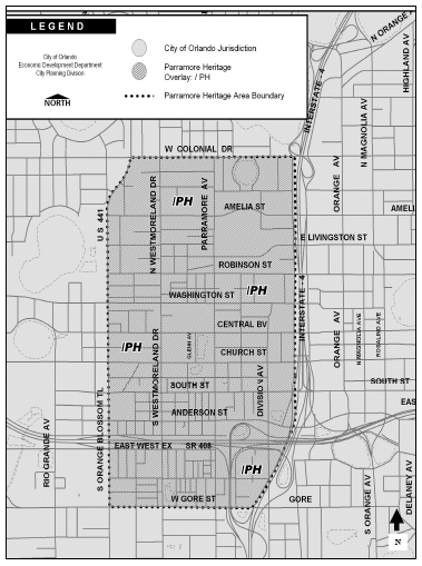
(Ord. No. 2010-3, § 2, 5-24-2010, Doc. #1005241102; Ord. No. 2018-44, § 3, 9-4-2018, Doc. #1809041202)