
Oxford City Zoning Code
ARTICLE 2
0. - ZONING DISTRICTS ESTABLISHED
Sec. 2.1. - Establishment of zoning districts.
Zoning districts are established by the ordinance to serve different purposes as outlined in the Vision 2037 City of Oxford Comprehensive Plan. Each zoning district serves a different purpose and imposes its own set of requirements and restrictions on the use of land and structures in addition to the general requirements and restrictions imposed on all land or uses within Oxford. There are three types of zoning districts: Base, special, and overlay.
Sec. 2.2. - Types of zoning districts.
2.2.1.
Base districts. These are the standard zoning districts established for specific land use types as outlined in the Vision 2037 City of Oxford Comprehensive Plan. A base district may be layered with an overlay district.
2.2.2.
Special districts. Special districts are established to provide for the highly planned districts requiring customized provisions or districts to achieve a specialized purpose not otherwise provided for in overlay districts.
2.2.3.
Overlay districts. Overlay districts are established to provide for certain additional requirements, to permit uses not otherwise permitted in the underlying base district, to prohibit uses allowed in the underlying base district, or to establish special development requirements for uses permitted in the base district. Where overlay districts exist and there is a conflict between the requirements or uses specified between the overlay and the underlying district, the standards of the overlay district shall prevail. Otherwise, the standards of the underlying district shall also be in effect for any area additionally zoned for an overlay district.
Sec. 2.3. - Zoning district boundaries.
District boundary lines shall, to the greatest possible extent, follow lot lines, the center line of streets, alleys, or highways or such lines extended, railway right-of-way lines, the municipal corporation lines as they exist at the time of enactment of this ordinance, or natural boundary lines such as streams. Questions concerning the exact location of any district boundary shall be decided by the director of planning and are appealable to the planning commission.
Sec. 2.4. - City of Oxford Zoning Map.
The districts described above and the boundaries of such districts are shown upon the zoning map of the City of Oxford, which map together with all information shown thereon, is hereby made a part of this ordinance. A true and correct copy of the zoning map properly attested shall be on file in the office of the city clerk.
Sec. 2.5. - Annexation.
Any land annexed into the City of Oxford shall be initially zoned as annexed. If no zoning category has been applied by Lafayette County, the annexed land shall be zoned agriculture (AG) until amended in accordance with the Future Development Map of Vision 2037.
Sec. 2.6. - Zoning districts described.
The following subsections present a detailed description of each zoning district. For a comprehensive listing of all uses permitted within a zoning district refer to the Table of Uses in section 3.3:
Table 2.1 Zoning Districts
2.6.1.
AG—Agricultural.
| Purpose and Description | Allowed Structure Types | |
|---|---|---|
| The agricultural district is intended to implement the Natural and Rural Place Types of Vision 2037. It is primarily used for agriculture, silviculture and very low density residential uses. The district is typically developed with agricultural and estate residential as the primary uses, complemented by very limited, low intensity commercial uses. The district accommodates crop production, forestry resources, open space, scenic vistas, and wildlife habitat. It may also protect rural floodplains from inappropriate development and it may help to preserve critical prime farmland. | 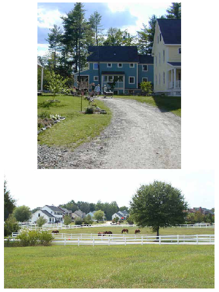 |
All types of single-family detached residential structures.
Agricultural structures such as barns or equipment sheds. Structures customarily accessory to residential uses such as garages, carports, gazebos, porches, and tool sheds. Structures associated with an approved non-residential or home occupation use including signage. |
Notes:
1
Street frontage is not required for residential and agricultural uses, and for up to two dwellings, provided a dedicated easement of not less than 18 feet in width providing access to a public street has been recorded for the lot.
2
Yard requirements shall not apply to pasture, cropland, forests and structures accessory to a farm or silviculture operation not used for the congregating or containment of animals or the storage or repair of equipment.
3
See exceptions to height limitations in section 3.2.
2.6.2.
RCN—Rural center.
| Purpose and Description | Allowed Structure Types | |
|---|---|---|
| The rural center district is intended to implement the Rural Center Place Type of Vision 2037. Rural centers provide necessary services for the surrounding rural community and for compatible rural residential development. Rural centers are areas generally located at existing or proposed defined intersections and contain commercial, mixed use, residential, and institutional land uses. Rural centers serve rural areas with relative brief access times. Rural centers are generally small, not exceeding the four corners of an intersection of prominent rural roads though some may be larger. | 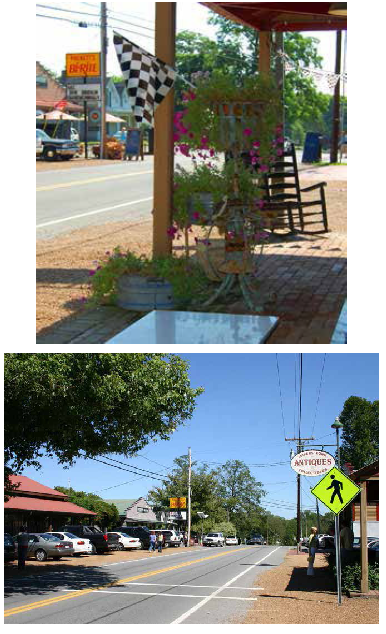 |
Commercial.
Office structures. Single-family detached. Institutional. |
Notes:
1
Yard requirements shall not apply to pasture, cropland, forests, and structures accessory to a farm or silviculture operation not used for the congregating or containment of animals or the storage or repair of equipment.
2
See exceptions to height limitations in section 3.2.
2.6.3.
ER—Estate residential.
| Purpose and Description | Allowed Structure Types | |
|---|---|---|
| The estate residential district is intended to implement the Suburban Single-Family Place Type of Vision 2037. These neighborhoods are designed to transition from the least dense natural and rural environment to the denser urban environment. Suburban neighborhoods strive to strategically incorporate natural features into site design. Existing landscapes may be preserved to define curvilinear streets and common areas associated with civic and institutional uses. Ideally, landscapes, rather than buildings, are designed to frame the development. | 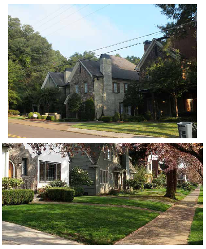 |
All types of single-family detached residential structures.
Agricultural structures such as barns and equipment sheds. Structures customarily accessory to residential uses such as garages, carports, gazebos, porches, and tool sheds. |
Notes:
1
Yard requirements shall not apply to pasture, cropland, forests and structures accessory to a farm or silviculture operation not used for the congregating or containment of animals or the storage or repair of equipment.
2
See exceptions to height limitations in section 3.2.
3
See section 3.2.10.
2.6.3.1.
Traditional estate residential (TER). The TER Overlay shall consist of certain neighborhoods and subdivisions established before 2015 (indicated on the zoning map) in which the following uses, otherwise allowed in the estate residential district by special exception, are not allowed:
a.
Zero lot line, patio dwellings.
b.
Assisted living facilities, care centers.
c.
Convalescent, rest, and nursing homes.
d.
Life care communities.
2.6.4.
SR—Suburban residential.
| Purpose and Description | Allowed Structure Types | |
|---|---|---|
| The suburban residential district is intended to implement the Suburban Single-Family Place Type of Vision 2037. Although they allow slightly more density than estate residential, these neighborhoods continue the transition from natural and rural environments to the denser urban environment. Suburban neighborhoods strive to strategically incorporate natural features into site design. Existing landscapes may be preserved to define curvilinear streets and common areas associated with civic and institutional uses. Ideally, landscapes, rather than buildings, are designed to frame the development. | 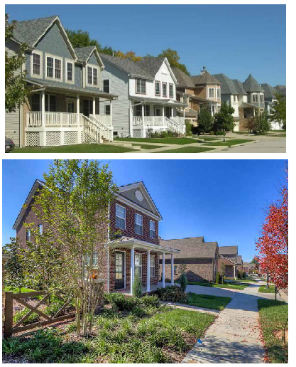 |
Single-family detached residential structures.
Structures customarily accessory to residential uses such as garages, carports, gazebos, porches, and tool sheds. |
Notes:
1
See exceptions to height limitations in section 3.2.
2
See section 3.2.6
2.6.4.1.
Traditional suburban residential. The Traditional Suburban Residential Overlay shall consist of certain neighborhoods and subdivisions (indicated on the zoning map) in which the following use, otherwise allowed in the suburban residential district by special exception, is not allowed: Zero lot line, patio dwellings. The standard lot size shall be no less than 7,500 square feet. Dwelling unit density, maximum: 5.8 dwellings per acre.
2.6.5.
NR—Neighborhood residential.
| Purpose and Description | Allowed Structure Types | ||
|---|---|---|---|
|
The neighborhood residential district is intended to implement the residential portion
of the Traditional Neighborhood Place Type of Vision 2037. These neighborhoods are
designed to contain a mix of housing types including detached and attached, but excluding
higher intensity multi-family.
These neighborhoods include formal parks and open spaces within a 10-minute walk from any dwelling. | 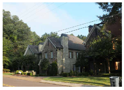 |
Detached and attached residential structures.
Limited use of lower intensity multi-family structures. Structures customarily accessory to residential uses such as garages, carports, gazebos, porches, and tool sheds. | |
Notes:
1
See exceptions to height limitations in section 3.2.
2
Three stories by special exception.
3
Up to 75 percent by special exception.
4
Up to 100 percent by special exception when workforce or affordable housing is proposed.
5
Zero percent by special exception when workforce or affordable housing is proposed.
6
See section 3.2.10.
2.6.5.1.
Traditional neighborhood residential. The district shall consist of certain older areas of Oxford (indicated on the zoning map) in which the following uses, otherwise allowed in the neighborhood residential district, are allowed only by special exception: Townhomes, attached triplexes and quadplexes. In addition:
a.
In a subdivision, the standard lot size shall be no less than 7,500 square feet for detached, 15,000 square feet for duplex, 22,500 square feet for a triplex and 30,000 square feet for a quadplex.
b.
All attached dwellings will require a special exception approval if more than 25 percent are proposed to be three-bedroom units, or if any are proposed to be four-bedroom units.
c.
Unless otherwise approved by a special exception, a development of more than one structure in NR shall require a minimum of 50 percent detached units, and a development of more than four structures shall require a minimum of 25 percent of detached units.
d.
Dwelling unit density, maximum: 5.8 dwellings per acre.
2.6.6.
SMF suburban multi-family.
| Purpose and Description | Allowed Structure Types | |
|---|---|---|
| The suburban multi-family district is intended to implement the Suburban Multi-Family Place Type of Vision 2037. The suburban multi-family place type typically follows one of two types. The most prevalent model is the multi-family garden style structure/community. This housing type is typically two to three stories in height, usually without elevators, often has an exterior entry for each unit, and includes integral parking, amenities, and open space. | 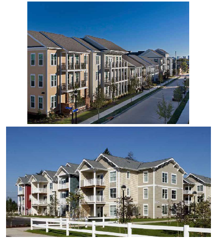 |
Multi-family residential.
Single-family attached residential structures. Limited single-family detached residential. Institutional. Assembly. Limited nonresidential uses. |
Notes:
1
See exceptions to height limitations in section 3.2. Also, a multi-family structure that is age restricted for use by seniors (55+) may propose a height of up to four stories by special exception.
2
Parking shall be primarily placed to the side and rear of a building.
3
Residential Density Bonus is available for mixed-use developments may be found in Section 3.5.5.6 Dwellings - Multi-Family.
2.6.7.
TNB—Traditional neighborhood business.
| Purpose and Description | Allowed Structure Types | |
|---|---|---|
| The traditional neighborhood business district is intended to implement the neighborhood center portion of the Traditional Neighborhood Place Type of Vision 2037. | 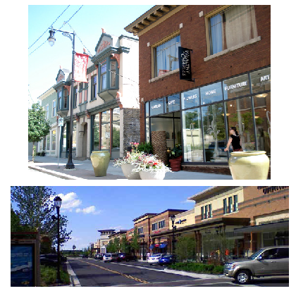 |
Mixed-use.
Residential upper floors (primarily). Commercial/office. Institutional. Assembly. |
| Dimensional Standards | Lot, Street and Use Patterns | |
|---|---|---|
| Lot size, minimum | No requirement | A TNB development pattern provides for commercial development at an urban neighborhood scale. The pattern includes shorter, geometrically symmetrical blocks, dense street connections and a variety of uses. Ideally, the TNB is anchored by a central public space. Associated street types include avenue, main street and local; and may include a parkway or boulevard. |
| Dwelling unit density, maximum 1 | As limited by floor area ratio, not to exceed 39 bedrooms per acre. | |
| Density, maximum | 2.5 FAR (floor area ratio) | |
| Impervious coverage, maximum | 80% | |
| Street frontage, minimum | 40 feet | |
| Lot width at the front yard build-to line, minimum | No requirement | |
| Front yard build-to line, minimum/maxiumum (with on street parking) | 0 feet/25 feet | |
| Front Yard Build-To Line, minimum/maximum (without on-street parking, with front yard parking or on-street parking) | 0 feet/58 feet | 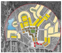 |
| Side yard setback line | 10 feet on one side of a primary structure | |
| Rear yard setback line, minimum | 25 feet unless it abuts residential uses in ER or SR; then 50 feet. | |
| Structure height 2, 3 | Up to 40 feet, minimum 2 and maximum of 3 stories. 3 | |
| Open space, minimum | 10 percent | |
| Uses | See Table of Uses article 3 | |
| Parking 4 | See articles 3, 4, and 5 | |
| Landscaping | See article 5 | |
| Site plan and subdivision review | See article 9 | |
Notes:
1
Residential Density Bonus is available for mixed-use developments may be found in Section 3.5.5.6 Dwellings - Multi-Family.
2
See exceptions to height limitations in section 3.2. Also, a multi-family structure that is age restricted for use by seniors (55+) may propose a height of up to four stories by special exception.
3
Building of one story by special exception (A second story shall consist of a minimum of 51 percent of the building footprint as functional space). Up to four stories by special exception (50 feet), unless adjoining existing development in an ER or SR, limited by allowed FAR. Average height not to exceed 40 feet.
4
Parking shall be primarily placed to the side and rear of the building, or under the building; may request limited parking in front of building.
5
Accessory structures are subject to the five feet property line separation. See section 3.11.1.
2.6.7.1.
Legacy Traditional Neighborhood Business (LTNB). The LTNB Overlay shall consist of certain areas (indicated on the zoning map) in which the following uses, otherwise allowed in the Traditional Neighborhood Business District, are not allowed: Restaurants with drive-thru facilities and vehicle repair or maintenance businesses, and service stations that adjoin SR or ER. Restaurants that serve alcoholic beverages and liquor stores may be requested by Special Exception.
2.6.8
SCO—Suburban corridor.
| Purpose and Description | Allowed Structure Types | |
|---|---|---|
| The suburban corridor district is intended to implement the Suburban Corridor Place Type of Vision 2037. Suburban corridors link suburban neighborhoods to suburban centers and have a distinct character and function in the neighborhoods versus in the centers. Residential and mixed use suburban corridors are intended to allow traffic to move efficiently while also safely accommodating pedestrians and cyclists. The corridor are framed by buildings and streetscape. In suburban neighborhoods and between suburban centers, the corridor should generally be framed by open space, preserving existing vegetation and land forms. | 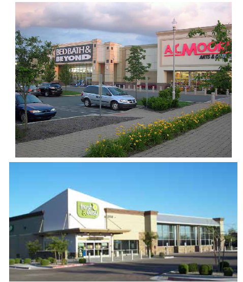 |
Commercial.
Office structures. Mixed-use structures with residential on upper floors. Multi-family residential. Attached single-family. Assembly. Institutional. |
Notes:
1
See exceptions to height limitations in section 3.2. May request five stories by special exception (up to 60 feet), unless the structure adjoins residential uses in ER or SR. Density limited by FAR. Average height may not exceed 48 feet.
2
Structures on properties west of Anderson Road and with frontage on West Jackson Avenue; or on parcels located within 3,000 feet of the east right-of-way of MS Hwy 7 and 3,800 feet from the north right-of-way of Sisk Avenue, and 2,400 feet from the south right-of-way of Sisk Avenue; or adjacent to the right-of-way of MS HWY 6 may be up to 65 feet but not more than five stories in height. Structures beyond these limits may request five stories (up to 65 feet in height) by special exception unless the structure adjoins residential uses in ER or SR.
3
Residential Density Bonus is available for mixed-use developments may be found in Section 3.5.5.6 Dwellings - Multi-Family.
4
Up to 150 feet by special exception.
5
Accessory structures are subject to the five feet property line separation. See section 3.11.1.
2.6.9.
SCN—Suburban center.
| Purpose and Description | Allowed Structure Types | |
|---|---|---|
| The suburban center district is intended to implement the Suburban Corridor Place Type of Vision 2037. Suburban Centers are generally the location for large commercial uses with a more regional draw. Uses are often low-rise retail, and mid-rise office and lodging. Suburban Centers cater more to automobile users; however, buildings should be arranged to create a street wall to make walking and cycling between buildings safer and more enjoyable. | 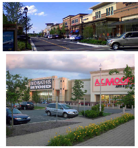 |
Mixed-use structures with residential on upper floors.
Commercial/office. Institutional. Assembly. Multi-family residential. Single-family attached residential. |
Notes:
1
See exceptions to height limitations in section 3.21. A 100-foot buffer will be required for properties that adjoin SR or ER development.
2
Structures on properties west of Anderson Road and with frontage on West Jackson Avenue; or on parcels located within 3,000 feet of the east right-of-way of MS HWY 7 and 3,800 feet from the north right-of-way of Sisk Avenue, and 2,400 feet from the south right-of-way of Sisk Avenue; or adjacent to the right-of-way of MS HWY 6 may be up to 65 feet but not more than five stories in height. Structures beyond these limits may request five stories (up to 65 feet in height) by special exception unless the structure adjoins residential uses in ER or SR.
3
Residential Density Bonus is available for mixed-use developments may be found in Section 3.5.5.6 Dwellings - Multi-Family.
4
Up to 150 feet by special exception.
5
Accessory structures are subject to the five feet property line separation. See section 3.11.1.
2.6.10.
UCO—Urban corridor.
| Purpose and Description | Allowed Structure Types | |
|---|---|---|
| The urban corridor district is intended to implement the Urban Corridor Place Type of Vision 2037. They serve as major transportation arteries, linking neighborhoods to the urban core. They are usually served by transit and include a mix of commercial, mixed-use, light industrial uses, and multi-unit housing. These are also preferred locations for "big box" retailers. | 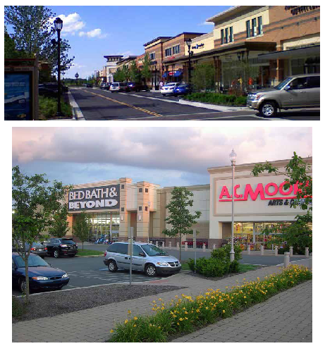 |
Mixed-use structures with residential on upper floors.
Commercial/office. Secondary land uses. Institutional. Assembly. Single-family attached residential. Multi-family residential. |
Notes:
1
See exceptions to height limitations in section 3.21.
2
Structures on properties zoned UCO on parcels located adjacent to the right-of-way of MS HWY 7 or MS HWY 6 may be up to 65 feet. A 100-foot buffer will be required for properties that adjoin SR or ER development. May request six stories by special exception (70 feet), unless the structure adjoins residential uses in ER or SR. Density limited by FAR.
3
Upper floor residential permitted by right, first floor residential by special exception. No more than 25 percent of units may be four bedrooms and no more than 50 percent may be one bedroom or smaller units.
4
Accessory structures are subject to the five feet property line separation. See section 3.11.1.
2.6.11.
UCN—Urban center.
| Purpose and Description | Allowed Structure Types | |
|---|---|---|
| The urban center district is intended to implement the Urban Center Place Type of Vision 2037. Urban centers have a traditional commercial identity but on a pedestrian scale with a strong sense of the immediate neighborhood. The intent is to provide for the shopping and service needs of the immediate neighborhood and as such, should be readily accessible by pedestrians and vehicles and should feature good access to transit. Urban centers are intended to provide the community with a mix of retail, service and business needs on a medium to large scale. | 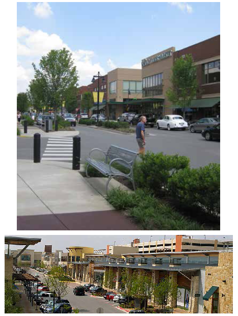 |
Mixed-use structures with residential on upper floors.
Commercial/office. Residential on upper floors. Institutional and assembly. |
Notes:
1
See exceptions to height limitation in section 3.21. May request six stories by special exception (70 feet), unless the structure adjoins residential uses in ER or SR, limited by FAR.
2
Structures on properties zoned UCN on parcels located adjacent to the right-of-way of MS HWY 7 or MS HWY 6 may be up to 65 feet. A 100-foot buffer will be required for properties that adjoin SR or ER development.
3
Upper floor residential permitted by right, first floor residential by special exception. No more than 25 percent of units may be four bedrooms and no more than 50 percent may be one bedroom or smaller units.
4
Accessory structures are subject to the five feet property line separation. See section 3.11.1.
2.6.12.
HUCN—Historic urban center.
| Purpose and Description | Allowed Structure Types | |
|---|---|---|
| The historic urban center is intended to implement the Urban Core Place Type of Vision 2037. The urban core is the traditional heart of the Oxford community and embodies the community symbolically, culturally, and historically associated with the early development of Oxford. This core, which includes the Courthouse Square and surrounding areas, is pedestrian oriented and within easy walking distance to serve the surrounding neighborhoods. | 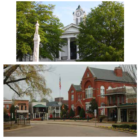 |
Mixed-use with residential on upper floors.
Commercial/office. Institutional. Assembly. Entertainment. |
Notes:
1
See exceptions to height limitations in section 3.2.
2
New commercial buildings and structures facing the Lafayette County Courthouse may not exceed two stories; any existing building that should be destroyed shall be allowed to rebuild to its current height.
3
Upper floor residential permitted by right, first floor residential by special exception. In structures existing as of July 2017, dwelling units do not require dedicated parking.
4
On-site parking shall not be required for any allowed use where on-street or nearby public parking exists.
2.6.13.
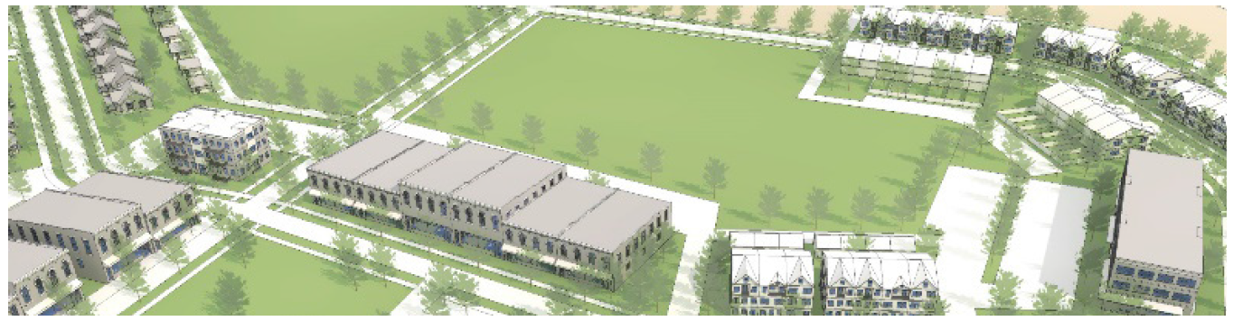
TND—Traditional neighborhood development.
| Purpose and Description | Allowed Structure Types | |
|---|---|---|
| The traditional neighborhood development district implements the Traditional Neighborhood Place Type of Vision 2037. A TND is compact and pedestrian friendly containing a mix of land uses with a defined center, middle and edge in an urban village type setting. A TND form may be applied as a new planned neighborhood, or to extend existing compact patterns. | 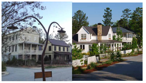 |
Mixed-use Community Center.
All forms of residential. Institutional. Assembly. |
Notes:
1
To allow for incremental development of a TND, which may include the participation of several property owners over an extended period of time, a partial TND of less than the minimum number of acres may be considered for approval, so long as the project shows an integrated design for at least the minimum size and includes segments of each required type.
2.6.13.1.
General access and layout.
a.
Streets. If a proposed TND development is located adjacent to a local, collector or higher-classification street, and the street is not designed to conform to the standards of an "avenue" or "main street" street type, the following criteria shall apply:
•
The internal streets providing access to the TND are to be aligned perpendicular to the local, collector or higher order street.
•
The buildings or structures that take access from the internal streets are to face the internal streets and not the collector or higher-order streets. However, wall transparency (windows and doors) are to be provided on both streets.
•
A continuous system of sidewalks are to connect the neighborhood core with streets and lanes that provide access to dwelling units.
b.
Variable block lengths. Blocks are to have an average length not exceeding 400 feet, with no block exceeding 800 feet in length. No block face should have a length greater than 400 feet without a dedicated alley or pathway providing through access to the opposite side of the block.
2.6.13.2.
Lot arrangement. All lots are to include frontage abutting a street, park or plaza (a public square, marketplace, or similar open space in city or town). A substantial percentage of the dwelling units are to be located within a five-minute walk (1,320 feet) from the perimeter of a plaza or park as noted below:
a.
For a proposed TND less than 80 acres in size, at least 90 percent.
b.
For a proposed TND of 80 to 90 acres in size, at least 70 percent.
c.
For a proposed TND of 90 to 100 acres in size, at least 50 percent.
2.6.13.3.
Neighborhood structural element standards.
a.
Core area.
i.
Parks, plazas and open spaces are to be sited to provide community focal points and public gathering places.
ii.
The focal area must have a minimum area of 30,000 square feet. The neighborhood core may face or surround the plaza or square.
b.
Transition area. The generally residential area, which may have limited commercial uses, but is primarily a mix of residential types, located between the core and edge areas.
c.
Edge area. A greenbelt (a substantial area of woods, parks, or open land surrounding a community on which building is restricted) shall be sited that will provide a clear edge to the community, open space for community residents, and natural areas for stormwater management.
d.
Common areas may include, but are not limited to, roads, sidewalks, stormwarter management facilities, playgrounds, club houses and other amenities, parks, green spaces, and conservation land.
2.6.13.4.
Unit density and intensity standards. The requested densities, in terms of floor area ratios (FAR) and number of units per gross residential acre and total number of dwelling units, are to be established in the traditional neighborhood master plan and are to comply with the density parameters set out in Table 1.
TND Table 1 — Density and Area Allocation Standards
(1)
One story by special exception.
(2)
Four stories by special exception.
(3)
Three stories by special exception.
(4)
Single store footprint limited to 25,000 square feet, greater by special exception.
(5)
Single-family attached dwellings are a single structures containing two to four dwelling units. A minimum mix of 15 percent of either unit type is required.
(6)
Not more that 25 percent are permitted as four bedroom units.
(7)
Accessory dwelling units allowed by special exception meeting the standard of section 3.5.6.
(8)
First floor residential by special exception.
2.6.13.5.
Prominent sites and vistas.
a.
Prominent sites are reserved for the following building types:
i.
Civic buildings, such as but not limited to, government offices, libraries, museums, schools, or churches;
ii.
Hotels; or office buildings;
b.
Buildings located on a prominent site shall be at least two stories high. A "prominent site" may include a location along a main street, or the termination of a vista running from a main street, boulevard, or avenue and its intersection with an equal or lower- order street.
2.6.13.6.
Frontage and siting standards.
a.
Location of uses. The location of uses are to be governed by street frontage as shown in Table 3. Street type design is set out in the comprehensive plan.
b.
Building lines. The setback for principal buildings are to be as established in Table 2. Setbacks for accessory structures or accessory dwellings must comply with that for accessory uses and structures in section 3.11.1.
c.
Frontage and setback requirements do not apply to parks and open space. In order to allow for setback variations for unique uses, such as anchor retail tenants or auditoriums, the maximum frontage requirements along a street segment are to be computed as an average.
TND Table 2 — Setback for Principal Buildings
(-)
= not applicable.
(1)
If no parking allowed.
2.6.13.7.
Building design.
a.
Building designs are to reflect a demonstrated relationship to historic architecture in the Oxford Historic Districts and the character precedents in Vision 2037.
b.
The principal entrance of all buildings must open to a street (excluding outbuildings).
c.
Building orientation. All principal buildings are to be oriented to parks and open space or to a street. Loading areas must not be oriented to a street. Buildings that abut both a street and parks or open space are to be oriented to both features.
d.
Front porches. Front porches are to be provided on at least 50 percent of all dwelling units within the single-family land-use allocation. Porches are to be constructed of masonry or wood materials. Architectural metal may be used if it is consistent with the exterior or roofing materials of the primary building. The seating area must have a minimum width of nine feet and a minimum depth of six feet.
2.6.13.8.
Mixed use buildings.
a.
Retail and service uses may designate the entire building area above the ground floor or the second floor for residential use.
b.
The submitted floor plans must identify the use of each room.
c.
Abutting uses. Uses may abut at side or rear lot lines, or face across streets or parks. This applies regardless of whether they are in the same or a different land-use category.
d.
No single building floor plate (first floor size) may exceed 25,000 square feet unless authorized by a special exception.
2.6.13.9.
Landscaping and screening.
a.
In order to provide a continuous pedestrian transition for residential neighborhoods and commercial areas, retail, service, or civic land uses are not to be separated from multifamily or single-family land uses within the TND by berms or buffers unless a trail or sidewalk is established that provides a direct connection between the uses.
b.
A plan for the landscaping, buffering, and tree mitigation elements must be provided as described in section 2.6.13.13.c.
c.
Adherence to the streetscape and parking lot landscaping standards found in article 5 is required for a TND.
2.6.13.10.
Parking.
a.
Adequate parking is to be provided to service all site uses. In order to achieve the intent of the TND district, minimum parking space requirements are to serve as a guide to establishing appropriate levels of parking, but are not intended to be strictly applied. The applicant shall demonstrate adequate parking.
b.
The maximum number of parking spaces for non-residential uses in a mixed-use structure shall be no more than 80 percent of the standard requirement, and the minimum number of spaces shall be no less than 60 percent of the standard requirement in article 3. Residential uses shall meet or exceed the standard requirement.
c.
Parking lots are to be located at the rear of principal buildings or in mid-block locations. A landscape island a minimum of nine feet wide and totaling 360 square feet must be provided for every ten spaces.
d.
Parking lots and parking garages must not abut street intersections or civic use lots.
e.
Parking lots must not be located adjacent to parks or open space.
f.
Parking lots must not occupy lots that terminate a street vista.
g.
Parking lots are to be located in the interior of a block or shall take access from an alley.
2.6.13.11.
Property owners association.
a.
A plan for a traditional neighborhood district must be accompanied by provisions for a property owners' association (or associations governing different areas) including the following:
i.
Projected date of organization.
ii.
Organizational structure, including structure of planned timeline for transfer of control from the developer to the association.
iii.
Diagram of areas to [be] held in common.
iv.
Initial estimated fees for the proper functioning of the property owners' association.
v.
Plan for collective shared maintenance of common areas including stormwater management facilities.
b.
Before building permits are issued for any building in an approved traditional neighborhood, official organization of the applicable property owners association must have occurred.
TND Table 3 — Traditional Neighborhood Development Use Location
x = The use or building type is permitted. A dash ("—") means that the use or building type is not permitted.
2.6.13.12.
Zoning approval process.
a.
A traditional neighborhood development may be established upon application through the requirements and procedures for rezoning land and shall require submittal of a master regulating plan and overall landscaping plan as described below.
b.
Approval of a rezoning to traditional neighborhood development and its regulating plan will be valid for two years before construction must begin. The ordinance enacting any such rezoning shall contain a condition stating that the district shall revert to its prior underlying zoning if construction has not begun within two years after the date of approval.
2.6.13.13.
Master regulating plan requirements. Application for a traditional neighborhood is to be accompanied by a master regulating plan developed in accordance with the intent, principles and standards of the district. The master regulating plan elements at a minimum, the following:
a.
A topographic survey and stormwater management plan.
b.
The layout and location and hierarchy of streets and public open spaces and parking areas. This should include the proposed location of all designated prominent sites and vistas.
c.
Layout and location of residential, commercial, mixed-use and civic building lots.
d.
Plan data and statistics to include densities (DU/acre) or intensity (FAR), buildings by type, setbacks, and other explanatory information.
e.
A list of uses by neighborhood section.
f.
A master sign plan.
g.
A series of architectural renderings which convey the overall character of the development.
h.
Architectural design regulating covenants for all site elements and buildings.
i.
An open space plan indicating proposed improvements thereon and the conditions at the project edges.
j.
A proposed staging plan for the three primary required areas: Core, transition and edge.
k.
A stormwater management plan that shows integration of stormwater management facilities in to the overall project design.
l.
An overall landscaping plan for the entire development which must include:
i.
Tree survey plan with tree inventory counts. Should include identification of the location of vegetation to be preserved including the species, and size range of existing trees to be preserved, and a clearing plan for any areas where tree removal is proposed. Full tree mitigation is required.
ii.
Scaled drawing of the site, with north arrow, indicating areas for preservation, location and spacing of new trees and shrubs proposed for use; and existing and proposed one foot contours to ten feet beyond the site.
iii.
Construction details and/or cross-sections sufficient to explain specific site conditions and solutions. Possible conditions include berms, retaining walls, screen walls, fences, tree wells to preserve existing trees, or culverts to maintain natural drainage patterns.
iv.
A plant list of all proposed landscape materials including trees, shrubs, and grasses. Showing (for trees) caliper sizes, root type (bare root, balled and burlapped, container size), height of material, botanical and common name.
v.
Planting and staking details to ensure proper installation and establishment of proposed plant materials. To include type and amount of mulch, ground cover and grasses. Should include irrigation plan, if appropriate, or water outlets.
vi.
Proposed location of light poles, refuse container enclosures, walls, fences, protective curbing, mechanical equipment, and other hard landscaping materials.
vii.
A landscape maintenance plan including a statement that all diseased, damaged, or dead material shall be replaced in accordance with the landscape ordinance.
m.
A phasing plan for the entire development along with projected implementation schedule, to include triggers for initiating subsequent phases.
2.6.13.14.
Administrative process.
a.
Approval of development within the phases designated in the approved master regulating plan will follow the processes for site plan and/or preliminary and final plat approvals as appropriate.
b.
Conflict with other provisions. Where the provisions of the traditional neighborhood district conflict with other ordinance provisions, the provisions of this district shall apply with the exception of any health or safety regulations which must be met.
c.
Waivers from standards. The planning director may authorize minor waivers from the strict application of certain standards of this district, up to ten percent. Standards appropriate for such waivers are limited to setbacks, height, frontage, land uses, and land allocation percentages. Requests exceeding ten percent, or appeals from a decision of the planning director, will require approval under standard variance procedures. And requests for change in use type are limited to uses that are closely similar in character and nature to originally established use types. Requests deemed by the planning director to exceed that standard will require a modification of the master regulating plan.
d.
Modifications to a TND regulating plan. From time to time, it may be necessary or desired to modify elements of the approved regulating plan for a TND. Such elements may include: the geographic areas of the core, transition, and edge areas; the phasing plan for development; the stormwater management drainage plan; the layout, location, and hierarchy of streets, public open spaces, and parking areas; the plan for improvements to open space areas; the layout and location of residential, commercial, mixed-uses, and civic building lots; proposals for intended densities and intensities, proposed uses in each neighborhood section; the master signage plan; architectural renderings to convey the overall character of the development; and architectural design regulating covenants for all site elements and buildings. The procedure for changes beyond those authorized for waivers in [section] 2.6.13.14 above shall be:
i.
For modifications that the planning director determines to be more technical than substantial, the planning director will make a recommendation regarding the request to the mayor and board of aldermen, who will determine whether to grant the modification.
ii.
For modifications that the planning director determines to be substantial, the planning commission, with a recommendation from the planning director, will make a recommendation regarding the request to the mayor and board of aldermen; who will determine whether to grant the modification.
2.6.14.
IND—Industrial.
| Purpose and Description | Allowed Structure Types | |
|---|---|---|
| The industrial district is intended to implement the Special Districts Place Type of Vision 2037 as it relates to industrial activity. The district exhibits different forms based upon the use and intensity. | 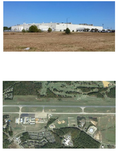 |
Industrial.
Limited commercial. |
Notes:
1
When abutting any other district, minimum side or rear yard of 50 feet shall be provided.
2
See exceptions to height limitations in section 3.2.
2.6.15.
INST—Institutional.
| Purpose and Description | Allowed Structure Types | |
|---|---|---|
| The institutional district is intended to implement the Special Districts Place Type of Vision 2037 as it relates to community institutions such as schools, government buildings, parks, medical institutions, or other uses related to civic, assembly, recreation, or social activities. This Districts exhibits different forms based upon the use and intensity intended. | 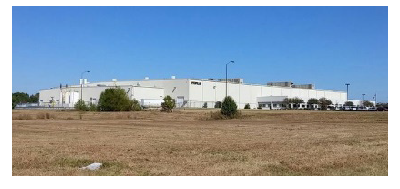 |
Civic and government buildings.
Schools. Assembly buildings. Special function buildings and facilities related to the district's purpose. |
Notes:
1
When abutting any other district, minimum side or rear yard of 50 feet shall be provided.
2
See exceptions to height limitations in section 3.2.
2.6.15.1.
Institutional—Medical Center.
a.
The purpose of a medical center institutional district is to create an environment conducive to medical practices and operations. The intent is for concentrations of medical facilities and related uses to be in a "campus" setting that will better accommodate the needs of the medical profession and those served by it. The district is intended to provide compatible and related activities as noted below. No use permitted in this district shall be incompatible or detrimental of the intended character of such district or to the surrounding neighborhood.
b.
Uses permitted shall include, but are not limited to: Hospitals, public health centers, nurse training facilities, community college medical training programs, extended care and nursing care, mental health facilities, medical and other professional offices and similar professions at which no products, except those normally associated with such noted uses are sold; hotels, restaurants (with no drive-through facilities), nursing homes, assisted living/residential care facilities, residential housing for the aged or mentally disabled, and day care facilities, fitness or physical rehabilitation centers, retail and service businesses directly related to the professional offices permitted. The planning director shall determine if a proposed use is appropriate.
c.
Uses permitted shall be reviewed as special uses if they are 25,000 square feet or less; and as special exceptions if they are larger than 25,000 square feet. In addition, a religious assembly use or public facilities shall require approval by special exception. Uses shall meet all standards of this ordinance and any additional standards for the use in sections 3.4 to 3.11.
d.
Area and setback regulations. There are not lot width or area requirements; lot coverage shall not exceed 90 percent of the lot area; the minimum required landscaped green space shall be ten percent of the lot area; no building shall exceed 40 feet in height other than hotels which may not exceed 65 feet in height; and hospitals which shall not exceed 80 feet in height. No property shall have more than two street access points other than a hospital.
e.
Signage. In this district signage shall be approved based on a comprehensive signage plan submitted for review and approval by the planning commission. As new development occurs in this district, or change are needed the plan will be amended and submitted to the planning director for review and approval. All lighted signs must be internally illuminated.
i.
Ground mounted identification signs on the road entrances to a hospital are permitted. An encroachment agreement from the city must be obtained from the city engineer prior to approval by the building official. One face of the sign shall not exceed 25 square feet, and in no case shall the total sign area excedd 50 square feet.
ii.
Other allowable signage in this district shall include: On-site ground signs, directional signs, wall mounted signs, canopy mounted signs, and temporary signs.
f.
Parking, tree mitigation, and landscaping requirements shall be as established in article 4, article 5, and article 6 of this ordinance.
2.6.15.2.
Institutional—Educational. Development standards for educational institutional uses shall follow the standards established in article 3.
2.6.15.3.
Institutional—Government. Development standards for government institutional uses shall follow the standards established in article 3.
2.6.15.4.
Institutional—Public parks and open space. Development standards for public parks and open spaces shall follow the standards established in article 3.
2.6.16.
PUD—Planned unit development.
| Purpose and Description | Allowed Structure Types | |
|---|---|---|
| The planned unit development district is intended to implement one aspect of the Special Districts Place Type of Vision 2037. The planned unit development district is designed to provide for the development of well-designed communities that provide multiple use types. A PUD is a tract of land initially under single ownership, planned and developed as an integrated unit in a single development operation or a programmed series according to an approved master plan. |
Mixed-use.
Commercial/office. Institutional. Assembly. Multi-family residential. Single-family attached or attached residential. | |
 | ||
Notes:
1
See exceptions to height limitations in section 3.2.
2.6.16.1.
Master plan required. A detailed master plan indicating the type of PUD proposed that consists of maps, illustrations and narrative of the proposed planned unit development district shall be submitted to the site plan review committee for study and approval. The decision of the site plan review committee shall be considered as a recommendation to the Oxford Planning Commission. The board of aldermen, based on the recommendation of the Oxford Planning Commission shall make a final decision regarding the application for planned unit development.
2.6.16.2.
Minimum master plan standards. The master plan must provide for and conform entirely to the following standards:
a.
Demonstration that specific PUD sub-districts are intended to be developed as unique, innovative, or with standards greater than set forth in this ordinance and with multiple use types.
b.
The PUD district standards shall indicate the land use, development standards, and other applicable specifications of the proposed development, which, upon approval, shall govern the PUD. If the PUD district standards do not address specific land use, development standard or other specification of this ordinance, the standard of the underlying zoning district shall apply.
c.
In order to encourage ingenuity, imagination, and high quality design, regulations for residential areas will not specify minimum lot area per dwelling unit but will limit density in residential areas to nine dwellings per acre in attached or detached dwellings or 16 dwellings per acre in multi-family areas, allowing the clustering of dwellings to provide maximum open space.
d.
Uses permitted in the PUD may be any use that is found in the use table, subject to the approval of the planning commission. Proposed uses shall be listed in the master plan.
e.
Street widths and improvements thereof, as well as off street parking facilities must conform to street type standards.
f.
Provisions for water supply, sanitary sewers, stormwater management, electric service and connections shall be made per requirements of the City of Oxford and the State of Mississippi.
g.
Provision for the management of required open space and amenities shall be included in the master plan.
h.
Other special improvements may be required if they are deemed reasonable and essential, and may require that appropriate deed restrictions to be filed and recorded enforceable by the city for 25 years with an option to renew.
i.
The developer shall submit sketches of the plan for the entire project showing the relationship of uses, street patterns, open space and the general character of the proposed development, including a schematic rendering illustrating the character of a typical segment of the development.
j.
A phasing plan for the sequencing of the development shall be provided.
k.
Provision for over arching property owners association and, where pertinent, individual property owners associations for different phases including the following:
i.
Projected date of organization.
ii.
Organizational structure, including structure of planned timeline for transfer of control from the developer to the association.
iii.
Diagram of areas to be held in common.
iv.
Initial estimated fees for the proper functioning of the property owners' association.
v.
Plan for collective shared maintenance of common areas including stormwater detention facilities.
vi.
Before building permits are issued for any building in an approved PUD official organization of the applicable property owners association must have occurred.
2.6.16.3.
The master plan site plan shall conform to the applicable parameters in Table 2.6 and to the technical site plan standards in the appendix of this ordinance.
2.6.16.4.
The master plan of a planned unit development shall become the zoning designation for a subject tract and shall be developed in conformance with the plan. The PUD shall be designated on the official zoning map with a reference to its approved master plan by case number.
2.6.16.5.
Preexisting planned unit developments. Within pre-existing planned unit developments (PUDs), regulations for the underlying zoning districts apply where approved PUD documents are silent. Changes to underlying zoning districts apply within PUDs to the extent the underlying zoning applies. And should any properties be removed from a PUD, if authorized by the PUD covenants, they will revert to the underlying zoning district.
a.
Grand Oaks PUD. This planned unit development (PUD) was first considered in 1993, and later expanded in 1997. This PUD includes a mix of residential uses types, a commercial area, and a country club with golf course. A substantial modification to the PUD was approved by the board of aldermen in October of 2005; and it was annexed into the City of Oxford in 2006. The PUD later split into two sections, Phase 1 and Phase 2 in 2012; which are controlled by different developers, but operating under the same development plan. The underlying zoning established for this PUD reflects the intended uses on the approved PUD plats.
i.
Grand Oaks PUD Phase One. Most of this phase has been built. There are a few areas of residential development remaining, but the only area with substantial remaining undeveloped land is an area designated for commercial uses along the east side of Highway 7 between Grand Oaks Boulevard and Industrial Park Drive.
ii.
Grand Oaks PUD Phase Two. There are substantial areas of still undeveloped property in this Phase, designated for residential uses. There are central governing covenants, and a single development entity managing remaining development. In 2015 it was realized that underlying zoning had not been established for the annexed areas, and that was applied; reflecting uses intended in the remaining sections. The last adjustment to the PUD plat was in 2016, which changed the PUD 2 Site Data Sheet to reflect the latest changes to the Parcels and still reflects a total of 2,112 permitted dwelling units.
b.
Blackberry Hills PUD. This planned unit development was first approved as a PUD in October of 2005 and annexed into the City of Oxford in 2006. What has been development so far is primarily a residential development, although portions are intended for mixed use development. The portions along Molly Barr Road and adjoining areas to the north have been substantially developed with a mix of attached and detached dwellings in cottage and townhouse styles. The portions further to the southwest remain substantially undeveloped. The underlying zoning established for this PUD reflects the intended uses on the approved PUD Plat for a mix of residential types and commercial mixed use areas.
c.
Oxford Commons PUD. This planned unit development was first approved as a PUD in 2005 and annexed into the City of Oxford in 2006. Several modifications to the mix of unit types and uses mix have been made over time. The PUD also changed ownership since it was formed and currently has several property owners and remaining undeveloped commercial and residential areas.
i.
Additionally, three areas of property adjoin the PUD and are treated as extensions of the Oxford Commons Development although they are not in the PUD boundary. These are the "Heights" subdivision (due south of Tract M), being built as a subdivision of single-family lots; the "Preserve" subdivision (due north of the western end of Tract G), being built as a subdivision of single-family lots; and The Summit, adjacent to the northwest side of the PUD which is planned to be a commercial area.
ii.
The last adjustment to the PUD Plan was in April of 2019 when a revision of the PUD Plat was approved which adjusted the allotment between the tracts for commercial footage and number of dwelling units. The underlying zoning for this PUD reflects the stated intent for land uses in the PUD as established in the 2015 approval. This includes no more than 1,462 dwelling units (at various densities), and no more than 1,285,000 square feet of commercial uses on 560 acres. Building design standards will reflect the standards of those zoning districts.
2.6.16.6—2.6.16.8.
Reserved.
2.6.16.9.
Modifications to a PUD. From time to time, it may be necessary or desired by the developer or the city to modify elements of an approved plan for a PUD. Such elements may include: the geographic areas of the various tracts allotted to different uses, the uses allowed in the various tracts, the overall density allotted to the PUD and its various tracts, the density distribution of lots within tracts, the stormwater management plan; the layout, location, and hierarchy of streets, public open spaces, and parking areas; the playout and location of residential, commercial, institutional, mixed-use lots; and proposals for intended densities and intensities, proposed uses in each tract. The procedure for changes to these elements shall be:
a.
For modifications that the planning director determines to be more technical than substantial, the planning director will make a recommendation regarding the request to the mayor and board of aldermen, who will determine whether to grant the modification.
b.
For modifications that the planning director determines to be substantial, the planning director will make a recommendation to the planning commission; and the planning commission will make a recommendation to the mayor and board of aldermen who will determine whether to grant the modification.
Table 2.6 Parameters of Planned Unit Developments
2.6.17.
HP—Historic preservation overlay district.
| Purpose and Description | Allowed Structure Types | |
|---|---|---|
| The historic preservation overlay district is intended to implement the preservation policies of Vision 2037 and Oxford's historic districts. Oxford's historic neighborhoods are a character-defining facet of the community. Not only are they important to the community's image, but they are a critical component of Oxford's high quality of life. All land within the historic preservation overlay district shall be governed by the provision of Chapter 54 of the Municipal Code of Ordinances. The maps of the adopted historic preservation districts are maintained by the planning department. | 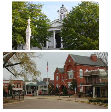 | While uses are determined by underlying zoning, buildings are determined by the historic overlay. |
Notes:
1
50 feet from any adjoining residential district, or abutting a street on a corner lot.
2
See exceptions to height limitations in section 3.2.
2.6.18.
NCO—Neighborhood conservation overlay district.
| Purpose and Description | Allowed Structure Types | |
|---|---|---|
| The neighborhood conservation overlay district is intended to achieve the preservation and infill policies of Vision 2037. Neighborhood conservation development should be compatible with the surrounding development in terms of height, scale, massing, siting, and setbacks. In general, they will be found in older neighborhoods, outside historic districts and near the transitional edges of abutting traditional neighborhood and urban center and urban corridor placetypes. See 2.6.18.1 for extended purpose statement. | 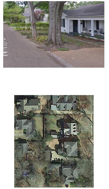 | While uses are determined by underlying zoning, buildings are determined by the historic overlay. |
Notes:
1
50 feet from any adjoining residential district, or abutting a street on a corner lot.
2
See exceptions to height limitations in section 3.2.
2.6.18.1.
The City of Oxford has distinctive older neighborhoods and commercial areas which contribute significantly to the overall character and identity of the community and are worthy of a level of added protection beyond standard zoning regulations. Some are within designated historic districts while others, even without historic, architectural, or cultural significance, contribute to the context of the city and give their neighborhoods a sense of place. Therefore the purpose of the neighborhood conservation overlay district in these older residential neighborhoods and their adjoining commercial areas is to address the following goals:
a.
To protect and strengthen desirable and distinctive physical features, design characteristics, and the unique identity, charm and flavor of Oxford's older neighborhoods;
b.
To protect and enhance the livability of the city, strengthening civic pride;
c.
To promote new compatible development and prevent blighting influences and reduce conflict caused by insensitive and incompatible development;
d.
To promote and retain affordable housing; and
e.
To encourage development design that builds connectivity to adjacent developments and the surrounding community and makes a positive contribution to Oxford's evolving cityscape.
2.6.18.2.
Old Town Oxford Neighborhood Conservation Overlay District. The Old Town Oxford District was created in 2006 within the land development code. The district was amended by the City in 2014 and 2015. The district encompasses boundaries as designated on the City of Oxford Zoning Map, adopted 2004, as subsequently amended. The boundaries of this district are expanded in the adoption of this revised land development code in 2017. See design standards for this district in section 5.8.
2.6.19.
HAO—Housing accelerator overlay district.
| Purpose and Description | Allowed Structure Types | |
|---|---|---|
| The Housing Accelerator Overlay District is intended to assist with the creation of more single-family homes in Oxford. | 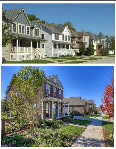 |
Single-family detached residential structures
Structures customarily accessory to residential uses such as garages, carports, gazebos, porches, and tool sheds |
NOTES:
1
[Three] (3) Stories by Special Exception
A property located in the HAO may opt out of the requirements and fully comply with
the underlying zoning requirements.
2.6.19.1.
Applicability. The Housing Accelerator Overlay District approved as part of the zoning change creating the Overlay District shall include design standards for new subdivisions proposed within the areas with this designation. No building permits shall be issued for new construction or an alteration or addition to a structure in the Housing Accelerator Overlay District without the submission and approval of design plans and the issuance of a certificate of zoning compliance by the Director of Planning. All new developments are subject to a review by the Site Plan Review Committee for compliance with all other codes.
A property located in the Housing Accelerator Overlay District may opt out of the requirements and fully comply with the underlying zoning district requirements.
2.6.19.2.
Design standards.
a.
Unit type/mix.
i.
The intent of this overlay is to encourage the development of single-family homes on individual lots.
ii.
One-bedroom and efficiency units are not allowed.
iii.
A Special Exception is required for more than 25% four-bedroom units.
b.
Architecture.
i.
Architecture for homes in a development shall vary, and similar designs should not be adjacent to each other.
ii.
Buildings shall be oriented towards the street providing access. Homes on corner lots shall provide architectural front features towards both streets.
iii.
Unless specifically authorized by the Director of Planning, all homes in the Housing Accelerator Overlay shall have a front porch that is at least 50%—100% the width of the proposed structure. Covered porches are preferred.
iv.
Building materials shall be consistent with those that are authorized in Section 5 of the Land Development Code.
c.
Parking.
i.
Rear loaded homes with parking behind the home that is accessed from an alley is preferred.
ii.
At least two parking spaces per lot are required.
iii.
Guest parking may be provided with on-street parking, but they should allow ample room for emergency management vehicles and shall not block driveways.
d.
Road & pedestrian infrastructure.
i.
Roads allowed in the Housing Accelerator Overlay District are the Local Street, Neighborhood Street, Suburban Local Street, and Alleys. The Director of Planning may authorize an alternate road type if it is determined necessary.
ii.
Rear loading alleys that are privately owned and maintained are preferred for access to parking, and for rubbish collection.
iii.
A sidewalk shall be provided on at least one side of the street throughout the development. Multi-Use pathways are preferred throughout the site that provide connectivity to all multi-functional greenspaces.
iv.
Due to the size of the lots, and right of way, planned utility corridors with easements may be determined necessary by the City Engineer.
e.
Landscaping.
i.
Landscaping for a development shall be consistent with the requirements in Section 5 of the Land Development Code.
ii.
A development in the Housing Accelerator Overlay District shall provide 15% Green Space.
f.
Common amenity areas.
i.
A Common Amenity Area is defined as a shared area within a development that may be used by all residents for cultural, social, or recreational activities.
ii.
Common Amenity Areas should be appropriate to the size of a development, at the discretion of the Director of Planning.
iii.
The intent of the Housing Accelerator Overlay is to encourage housing for single families; therefore, the Common Amenity Areas shall include but are not limited to walking trails, park space, playground equipment, pavilion, grilling areas, multi-purpose fields, dog park, etc.
iv.
Stormwater detention facilities may incorporate a walking trail, but the trail should connect to other facilities, and this element shall not satisfy the Common Amenity Area requirements.
2.6.20.
SED—Sex entertainment district.
(Ord. No. 2018-11, 7-17-2018; Ord. No. 2021-1, § 1, 2-2-2021; Ord. No. 2021-4, § I, 5-18-2021; Ord. No. 2021-14, § I, 10-5-2021; Ord. No. 2018-18, § I, 9-18-2018; Ord. No. 2018-21, § I, 10-16-2018; Ord. No. 2018-26, § I, 12-18-2018; Ord. No. 2020-11, § I, 8-18-2020; Ord. No. 2022-5, § I, 5-17-2022; Ord. No. 2024-9, § I, 7-2-2024)