
Oxford City Zoning Code
ARTICLE 4
0. - INFRASTRUCTURE AND MOBILITY STANDARDS
Sec. 4.1. - Streets generally.
Street patterns shall be based upon the following general design criteria:
4.1.1.
Provide for adequate vehicular access to all properties within the development.
4.1.2.
Provide street or road connections to adjacent properties to ensure adequate traffic circulation within the general area.
4.1.3.
Provide a local residential street system which disperses traffic to multiple points, encourages traffic calming, and provides adequate access for fire, police and other emergency vehicles.
4.1.4.
Provide a sufficient number of collector roads adequately sized to accommodate the present and future traffic demands of an area.
4.1.5.
Provide streets and roads in accordance with the future transportation and circulation plan of the comprehensive plan.
4.1.6.
Balances the competing needs of pedestrian, bicycles, and vehicular traffic through integrated access management.
Sec. 4.2. - Classification of streets.
4.2.1.
Streets shall be classified by both function and type. Street functional classification shall refer to a streets capacity to accommodate vehicular traffic. A street type shall refer to its specific design to accommodate both its function and the adjacent zoning district it serves.
4.2.2.
Streets are functionally classified in one of three categories—Arterials, collectors, and locals. See specific standards in Table 4.2, and definitions in article 10.
4.2.3.
Classification types. Streets, public or private are further classified according to the following street types established below, derived from Vision 2037 Comprehensive Plan:
a.
Local street — Rural local or collector.
b.
Parkway — Level 1 (rural arterial).
c.
Parkway — Level 2 (rural arterial).
d.
Neighborhood street (city local or collector).
e.
Suburban street 1 (city local).
f.
Suburban street 2 (city collector).
g.
City avenue 1 (city collector or arterial).
h.
City avenue 2 (city collector or arterial).
i.
Main street 1 (city collector or arterial).
j.
Main street 2 (city collector or arterial).
k.
Alley.
4.2.4.
Functional classification of street types. The street types established above are functionally classified according to the classifications set out in Table 4.1 — Functional Classification of Street Types.
Table 4.1 — Functional Classification of Street Types
Sec. 4.3. - General access and circulation requirements.
4.3.1.
Developments shall provide sufficient public road access to accommodate the ultimate traffic volume anticipated, and to enable safe and convenient service by police, fire, and other emergency vehicles.
4.3.2.
Adjacent properties. Street stubs into adjacent properties may be required to provide the potential for greater interconnectivity and ensure adequate future circulation. (See section 4.5.9.2 for temporary dead end street standards.)
4.3.3.
Reserve strips. Strips of land preventing access to the right-of-way at the terminus of, or adjacent to, existing or proposed roads shall not be permitted unless approved by the planning commission.
Sec. 4.4. - Emergency access roads.
4.4.1.
Any residential development with 80 or more homes, and more than 250 bedrooms shall have at least two separate emergency access roads.
4.4.2.
An emergency access road shall be at least 24 feet wide with all-weather surfacing designed and maintained to support the imposed loads of fire and emergency apparatus and shall have a vertical clearance of at least 13.6 feet. If a structure on that access road is greater than 30 feet in height, the road shall be a minimum of 26 feet wide to accommodate aerial fire apparatus.
4.4.2.1.
No parking is permitted on minimum width emergency access roads. A road or street intended for public ingress into or egress from a development can serve as an emergency access road so long as it complies with the requirements of this section.
4.4.2.2.
A boulevard with a median may not be considered as two separate emergency access roads.
4.4.2.3.
It is preferred that emergency access road entrances shall be separated by a minimum of 150 feet, although a shorter distance may be considered if recommended and approved by the Oxford Fire Department and Emergency Management Agency.
4.4.2.4.
Gates shall not be allowed on any primary or secondary access road, but if a third road is proposed for emergency ingress/egress only, it could be gated with a recommendation of approval from the Oxford Fire Department and Emergency Management Agency; provided that the gate meets the requirement of the land development code.
(Ord. No. 2018-11, 7-17-2018)
Sec. 4.5. - Conventional street design standards.
4.5.1.
Right-of-way width. The minimum widths of street and road rights-of-way and pavement widths, measured perpendicularly from lot line to lot line, shall be as shown on such plan and not be less than indicated in Table 4.2.
4.5.2.
Variation in right-of-way. Any request for variation in right-of-way or street width requirements shall be requested in writing for recommendation by the city engineer before consideration by the planning commission.
4.5.3.
Right-of-way dedication.
4.5.3.1.
Arterial roads. Those roads designated in the comprehensive plan shall either be dedicated, or a permanent reservation shall be provided, and front building setbacks shall be shown on the final plat as measured from the proposed right-of-way.
4.5.3.2.
Collector streets. Dedication for collector streets shall be made in accordance with in accordance with Table 4.2. A dedication variance may be granted for developments with frontage on existing collector streets if it is determined that a variance would not adversely affect current or future traffic movement and either:
a.
The collector road is existing and fully developed on both sides of the road such that additional dedication and widening is not feasible and, the collector road dedication is not at an intersection with a minor or principal arterial, or another collector road which may require additional right-of-way for turn lanes or other traffic control measures;
b.
The collector street is not likely, in the foreseeable future, to serve enough traffic volume to justify requiring additional dedication.
4.5.3.3.
Local streets. Dedication for local streets shall be in accordance with Table 4.2. Additional dedication for existing local streets may be grated a variance under the criterial outlined in Table 4.2.
4.5.3.4.
Partial street dedications. Partial dedications may be permitted only in those instances where it is necessary for the proper development of the property and is in the public interest to locate a public street on a common property line. Sufficient right-of-way shall be provided for at least 24 feet of pavement, in addition to curb, gutter and sidewalk when required by the provisions of these regulations.
4.5.4.
Access limitations.
4.5.4.1.
Access shall be provided to all lots from dedicated public streets unless otherwise prohibited or modified below:
a.
Access limitation. Where a subdivision abuts an existing or proposed arterial, double frontage lots with no access to the arterial, lots with rear service drives, common access drives, or other treatment may be required.
b.
Residential driveways. Driveways should not be permitted on arterials. Where this requirement cannot be met, shared or common driveways may be required. All driveways shall be designed to provide egress in a forward motion and must be constructed of concrete or bituminous material.
c.
Ingress-egress easements. Ingress/egress easements shall be shown graphically on the preliminary plan, and on the final plat accompanied by a statement describing the responsibility for maintenance.
Table 4.2 — Conventional Street Design Standards
d.
Restricted access. All access shall be graphically indicated on the preliminary plan and final plat or site plan unless otherwise directed by the city engineer.
4.5.5.
Curb cuts.
4.5.5.1.
The number, location and design of curb cuts shall be subject to approval by the City Engineer at the time of site plan review. For new development, a common development which includes more than one lot shall be treated as one lot for the purposes of determining the location of curb cuts. Split ownership, planning in phases, construction in stages, and/or multiple building permits for a project shall not prevent it from being considered a common development.
4.5.5.2.
Curb cuts shall be located and designed to provide safe and convenient ingress and egress to the site, and designed in accordance with City of Oxford standards and the latest edition of the MDOT manual for constructing driveways.
4.5.5.3.
Multiple commercial and industrial curb cuts for driveways within a subdivision on an arterial street are discouraged.
4.5.5.4.
Shared curb cuts and internal access between adjacent similar developments is encouraged.
4.5.5.5.
Curb cuts, except where shared, shall be located a minimum of ten feet from a parcel or lot line.
4.5.5.6.
No curb cut shall be closer than 20 feet from the point of curvature of a corner radius.
4.5.5.7.
Curb cuts (other than driveways in a single-family residential development) shall be located directly opposite one another or separated by a minimum of 150 feet and shall align with median cuts whenever feasible.
4.5.5.8.
Curb cuts in commercial or multi-family developments are limited to one per 300 feet of street frontage. The distance between curb cuts in detached or attached residential developments are at the discretion of the city engineer.
4.5.5.9.
Variations from these standards shall be permitted at the discretion of the planning commission (on the advice of the city engineer) where the variation would enhance the safety, efficiency of travel and operation of the roadway. Examples can include the use of joint driveways, cross easements, service drives and alignment of median openings with existing access connections.
4.5.5.10.
Refer to [section] 4.9.5 for additional direction regarding curb cuts for driveways.
4.5.6.
Intersections.
4.5.6.1.
Spacing. Intersections on the same side of a street shall be spaced a minimum of 300 feet apart for arterial and collector streets, and 150 feet for local streets, measured from centerline to centerline.
4.5.6.2.
Angle. Streets shall be laid out so as to intersect as nearly as possible at right angles. A proposed intersection of two new streets at an angle of less than 75 degrees shall not be acceptable. Not more than two streets shall intersect at any one point unless specifically approved by the planning commission upon recommendation of the city engineer.
4.5.6.3.
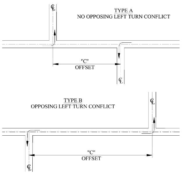
Centerlines. The centerlines of two streets intersecting the same road on opposite sides shall be offset as shown and illustrated above and noted in Table 4.2. Offset dimension "C" between intersections is categorized by the type of streets involved. If the two legs creating the offset are different types of streets, the shorter of the offset dimensions "C" shall apply.
4.5.7.
Radii. Minimum radii of intersections of property lines at arterial and major street intersections shall be rounded with a radius of 25 feet. An increased radius shall be required when the angle of intersection is less than 90 degrees or when the intersection involves an arterial or major street. Property line radii at street intersections involving arterial or collector streets shall be not less than 35 feet. The city engineer shall determine the appropriate corner radii and make recommendation to the planning commission.
4.5.8.
Curves.
4.5.8.1.
Horizontal. The minimum centerline radius permitted for each street classification is shown in Table 4.2.
4.5.8.2.
Vertical. Every change in street grade shall be connected by a vertical curve designed to afford a minimum sight distance of 200 feet as measured from a driver's eyes, which are assumed to be four and one-half feet above the pavement surface, to an object four inches high on the pavement. Vertical curves shall be of standard parabolic design.
4.5.9.
Turnarounds (cul-de-sac).
4.5.9.1.
The minimum radii for all public streets and roads on the turnaround end of the cul-de-sac shall be 50 feet for right-of-way and 40 feet for the paving surface.
4.5.9.2.
Temporary dead-end streets. Streets that are allowed to be temporary cul-de-sacs that are not intended to be opened for 12 or more months, must be constructed with a turnaround having an outside roadway diameter of at least 80 feet, and a street property line diameter of at least 100 feet. When the road is extended, the developer will be responsible for removing the turnaround and sodding the residual land to return to the pertinent property owner. While the road is closed it shall be posted with a sign stating that the road will be extended in the future and open to through traffic.
4.5.9.3.
Permanent dead-end streets. No permanent dead-end streets shall be allowed that will serve fewer than eight dwellings or more than 16 dwellings. Such streets shall be no longer than 800 feet in length, and shall be provided at the closed end with a turnaround having an outside roadway diameter of at least 80 feet, and a street property line diameter of at least 100 feet.
4.5.10.
Sight distance. The minimum sight distance for the various street and road types are shown in Table 4.2. Stopping sight distance is measured in feet in accordance with the AASHTO publication A Policy on Geometric Design of Highways and Streets, as amended.
4.5.11.
Grades. All streets shall have a minimum topographic gradient of 0.5 percent. Grades on arterial streets shall not exceed ten percent. Grades on all other streets shall not exceed 12 percent. The maximum allowed gradient within 100 feet of intersecting centerlines shall be a maximum of five percent.
4.5.12.
Tangents and center radii.
4.5.12.1.
Minimum centerline tangents. Permitted minimums on approach to intersections are shown in Table 4.2.
4.5.12.2.
Tangents between curves. Between curves there shall be a centerline tangent not less than 300 feet in length on arterials, and 100 feet on all collector streets. No tangent is required on minor, loop, or cul-de-sac streets.
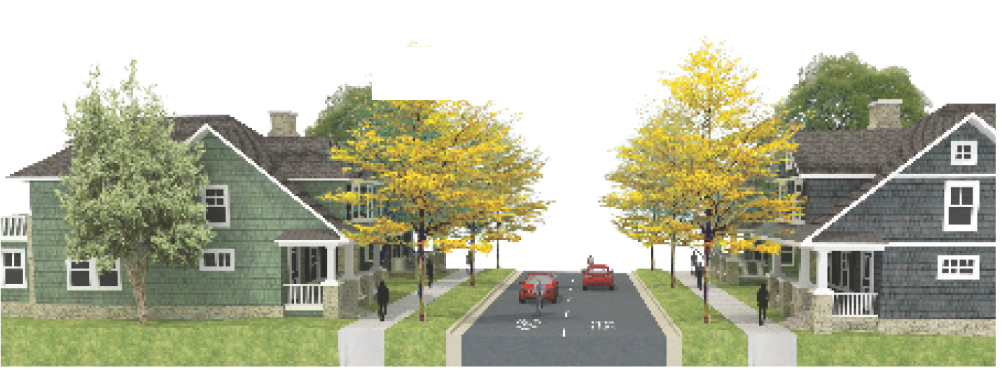
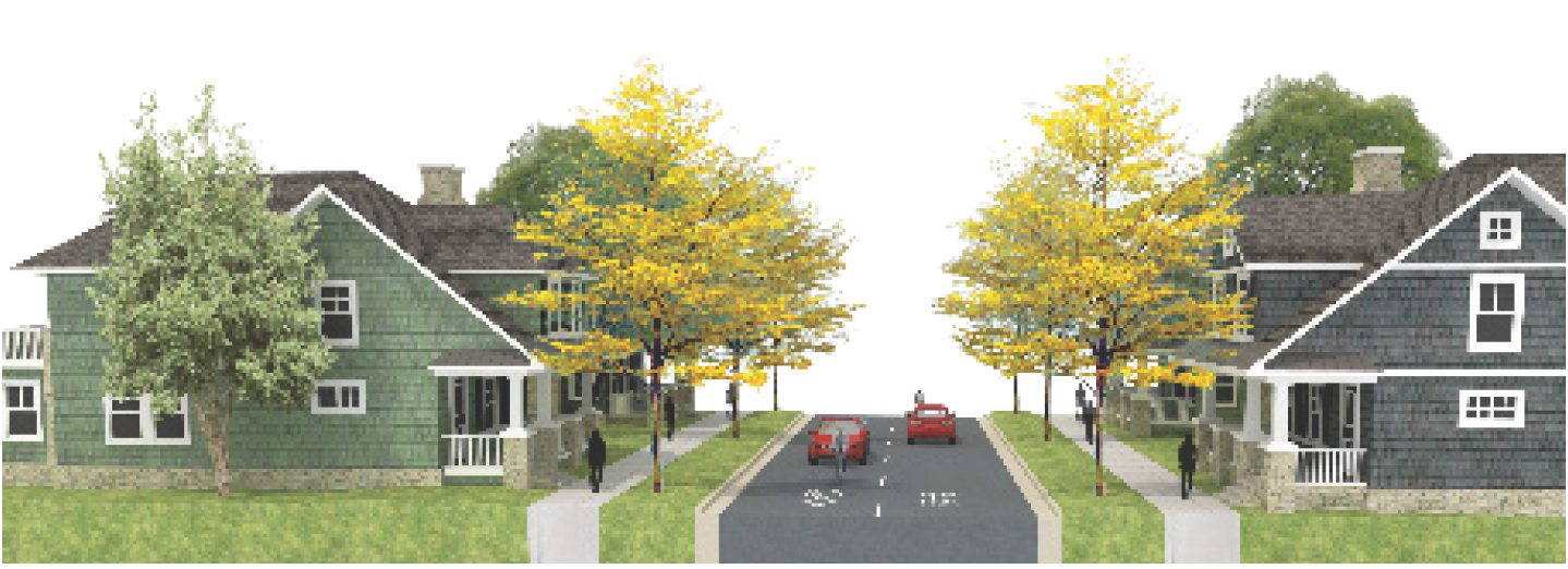
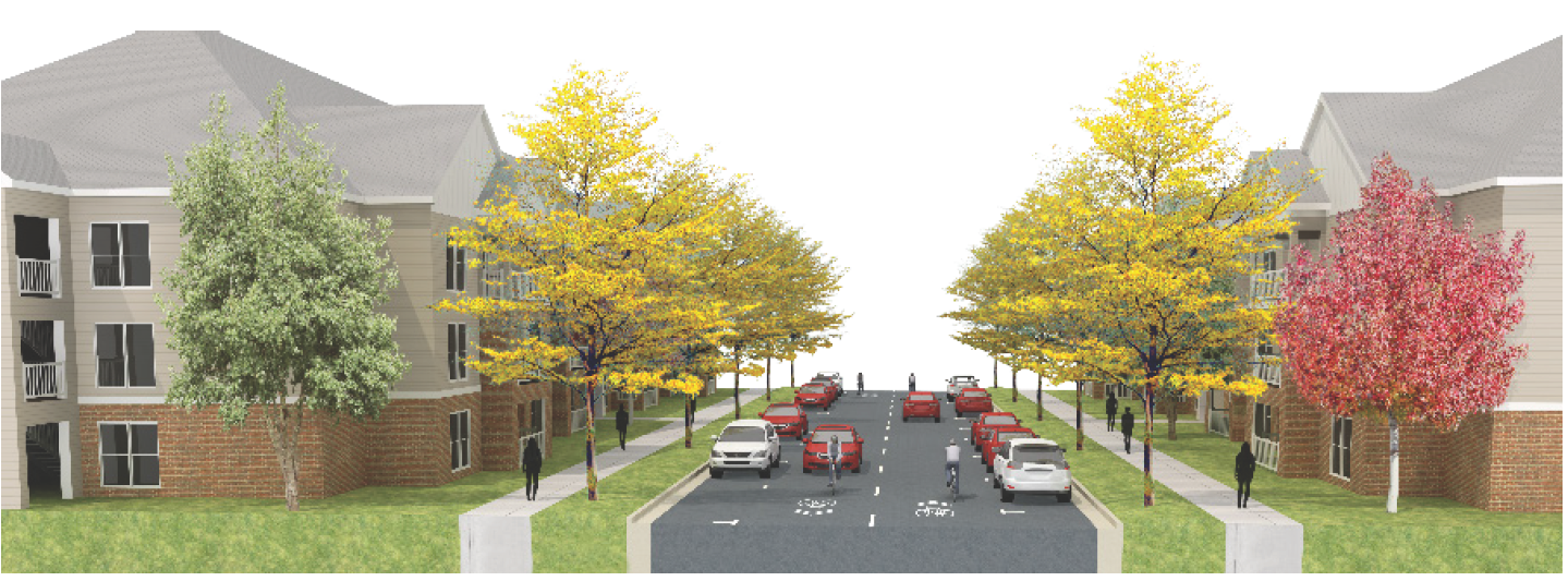
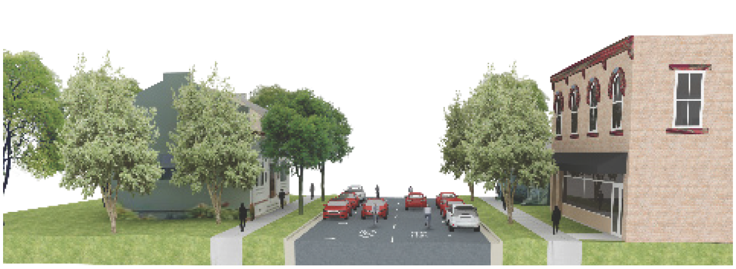
Sec. 4.6. - Application of street type cross sections.
4.6.1.
Application of street types.
4.6.1.1.
Proposed new development and redevelopment designs shall appropriately incorporate established street types in development designs.
4.6.1.2.
New streets and streets proposed for improvement shall be established according to the zoning district in which they are located as stated in Table 4.3 — Street Types by Zoning District projected function and anticipated traffic volumes.
4.6.2.
Street type design parameters. Specific design elements for each street type are reflected in the following tables and illustrations. The travel lane width refers to the distance between the stripe and excludes curb and gutter and any required shoulder (typically one foot to two feet) on roadways without curb and gutter or when bike lanes are not present adjacent to the travel lane. In the absence of stripe, the travel lane shall be measured from the center of the roadway to the nearest edge of the gutter pan.
Table 4.3 — Street Types by Zoning District
Note: Indicated street types for zoning districts may be proposed, but the city engineer has final authority to approve which type will be authorized.
4.6.2.1.
Local street—Rural local or collector.
 | ||
| Design Parameters | ||
| A | Number of Lanes | 2 lanes |
| B | Parking | No |
| C | Pedestrian Facilities | No — Shared use path option |
| D | Bicycle Facilities | No — Shared use path option |
| E | Drainage | Open swale; bioswales |
| F | Median | No |
| G | Streetscape | Natural; informal |
| H | Shoulders | Reinforced turf shoulder/swale |
| I | Lighting | Street lights optional |
| Design Specifications | ||
| A | A. Number of Lanes | Minimum 10'/maximum 12' |
| E | E. Drainage | Reinforced turf shoulder/swale — Minimum 4'/maximum 8' |
| C |
C. Pedestrian facilities/
D. Bicycle facilities | Reinforced turf shoulder/swale — Minimum 4'/maximum 8' |
| Intended maximum design speed | 45 MPH (maximum) | |
| ROW | Minimum 52'/maximum 64' | |
4.6.2.2.
Parkway—Level 1 (rural arterial).
 | ||
| Design Parameters | ||
| A | Number of Lanes | 2, 3 (center turn lane option) |
| B | Parking | No |
| C | Pedestrian Facilities | Yes |
| D | Bicycle Facilities | Yes |
| E | Drainage | Open swale (option bioswales) |
| F | Median | Optional |
| G | Streetscape | Street trees |
| H | Furnishings | Reinforced turf shoulder/swale |
| I | Lighting | Street lights optional |
| J | Furnishings | Benches/shelters if transit service |
| Design specifications | ||
| A | Number of Lanes | Travel lane width — 11' to 12' |
| D | Bicycle Facilities | Bike lane — 8' feet |
| F | Median | (Optional for 2 lane) 12' — 16' |
| H | Shoulders | Verge/swale — 10' to 30' |
| C | Pedestrian Facilities/D. Bicycle Facilities | Shared use path — 10' to 12' |
| Intended Maximum Design Speed | 45 MPH | |
| ROW | Minimum 62'/maximum 152' | |
4.6.2.3.
Parkway—Level 2 (rural arterial).
 | ||
| Design Parameters | ||
| A | Number of Lanes | 4 |
| B | Parking | No |
| C | Pedestrian Facilities | Yes |
| D | Bicycle Facilities | Yes |
| E | Drainage | Open swale (option bioswale or curb and gutter) |
| F | Median | Yes |
| G | Streetscape | Street trees in median and verge |
| H | Shoulders | Reinforced turf shoulder/swale or curb/gutter |
| I | Lighting | Optional |
| Design Specifications | ||
| A | Number of Lanes | Travel lane width — 22' — 24' |
| D | Bicycle Facilities | Bike lane — 6' (curb/gutter)/8' (swale) |
| F | Median | Median width — 6' |
| G | Streetscape | Verge 4' |
| H | Shoulders | Swale 10' — 30'/2' (curb/gutter) |
| C | Pedestrian Facilities/D. Bicycle Facilities | Shared use path 10' — 12' |
| Intended Maximum Design Speed | 45 MPH(rural); 35 MPH (urban) | |
| ROW | Minimum 116'/maximum 176' | |
4.6.2.4.
Neighborhood street (city local or collector).
 | ||
| Design Parameters | ||
| A | Number of Lanes | 2 |
| B | Parking | Optional (parallel or alternate side yield) |
| C | Pedestrian Facilities | Yes |
| D | Bicycle Facilities | Sharrows |
| E | Drainage | Curb and Gutter |
| F | Median | No |
| G | Streetscape | Street trees where possible |
| I | Lighting | Optional |
| Design Specifications | ||
| A | Number of Lanes | Travel lane width — 10'/12'—13' with two way yield |
| B | Parking | Parking — 7' for parallel |
| C | Pedestrian Facilities | Sidewalk — 5' |
| E | Drainage | Curb and Gutter — 2' |
| G | Streetscape | Verge — 5' |
| Intended Maximum Design Speed | Intended speed of road design — 20mph | |
| Maximum/Minimum ROW | ROW Minimum 44'/maximum 58' | |
4.6.2.5.
Suburban local street 1 (city local).
 | ||
| Design Parameters | ||
| A | Number of Lanes | 2 |
| B | Parking | Parallel optional |
| C | Pedestrian Facilities | Yes |
| D | Bicycle Facilities | Sharrows |
| E | Drainage | Curb and Gutter |
| F | Median | No |
| G | Streetscape | Street trees in verge |
| I | Lighting | Streetlights |
| Design Specifications | ||
| A | Number of Lanes | Travel lane width — 10' — 12' |
| B | Parking | Parallel Option 7' per side |
| C | Pedestrian Facilities | Sidewalk — 5' |
| G | Streetscape | Verge — 5' |
| H | Shoulders | Curb and gutter — 2' |
| Intended Maximum Design Speed | 35 MPH | |
| ROW | Minimum 44'/maximum 62' | |
4.6.2.6.
Suburban collector street.
 | ||
| Design Parameters | ||
| A | Number of Lanes | 2 |
| B | Parking | Parallel |
| C | Pedestrian Facilities | Sidewalks |
| D | Bicycle Facilities | Sharrows |
| E | Drainage | Curb and gutter |
| F | Median | No |
| G | Streetscape | Street trees in verge |
| I | Lighting | Streetlights |
| J | Furnishings | Benches/shelters if transit service |
| Design Specifications | ||
| A | Number of Lanes | Travel lane width — 10' — 12' |
| B | Parking | Parallel Option 7' per side |
| C | Pedestrian Facilities | Sidewalk — 5' per side |
| G | Streetscape | Verge — 5' |
| H | Shoulders | Curb and gutter — 2' |
| Intended Maximum Design Speed | 20 MPH (maximum) | |
| Maximum/Minimum | Minimum 44'/maximum 62' | |
4.6.2.7.
City avenue 1 (city collector or arterial).
 | ||
| Design Parameters | ||
| A | Number of Lanes | 2, 3 (center turn), or 4 |
| B | Parking | Optional parallel |
| C | Pedestrian Facilities | Yes |
| D | Bicycle Facilities | Sharrow or protected bike lane |
| E | Drainage | Curb and gutter |
| F | Median | Optional for 2 lane, spot medians optional for 3 lane, median required for 4 lane |
| G | Streetscape | Street trees in verge or tree wells, and in median |
| I | Lighting | Street lights |
| J | Furnishings | Benches/shelters if transit service |
| Design Specifications | ||
| A | Number of Lanes | Travel lane width 10' — 11' per lane |
| B | Parking | Parking (on street parallel) 7' — 8' |
| C | Pedestrian Facilities | Sidewalk — 6' — 8' |
| D | Bicycle Facilities | Bike lane — 6' |
| D | Bicycle Facilities | Optional protected bike lane |
| F | Median | 5' — 5.5' |
| G | Streetscape | Verge — 5' |
| H | Shoulders | Curb and gutter — 2' per curb |
| Intended Maximum Design Speed | Intended design speed — 25 mph 2 lane, 35 mph 4 lane | |
| ROW | Minimum 46'/maximum 117' | |
4.6.2.8.
City avenue 2 (city collector or arterial).
 | ||
| Design Parameters | ||
| A | Number of Lanes | 2, 3, or 5 (w/o median), 4 (with median) |
| B | Parking | Optional parallel |
| C | Pedestrian Facilities | Yes |
| D | Bicycle Facilities | Sharrows or protected bike lane |
| E | Drainage | Curb and gutter |
| F | Median | Optional for 2 lane, spot medians optional for 3 lane, median required for 4 lane |
| G | Streetscape | Street trees in verge or tree wells, and in median |
| I | Lighting | Streetlights |
| J | Furnishings | Benches/shelters if transit service |
| Design Specifications | ||
| A | Number of Lanes | Travel lane width: 10' to 11' per lane |
| B | Parking | Parking (on street parallel): 7' — 8' |
| C | Pedestrian Facilities | Sidewalk: 16' — 20' if with tree wells |
| D | Bicycle Facilities | Bike lane: 6' — 8' |
| D | Bicycle Facilities | Optional protected bike lane: 8' — 10' (one way) |
| E | Drainage | Curb and gutter: 2' per curb |
| F | Median | From: 5' — 5.5' |
| G | Streetscape | Verge: 5' |
| Intended Maximum Design Speed | Intended design speed: 25 mph 2 lane, 35 mph 4 lane | |
| ROW | Minimum 74'/maximum 135' | |
;adv7q;4.6.2.9.
Main street 1 (city collector or arterial).
 | ||
| Design Parameters | ||
| A | Number of Lanes | 2 to 3 |
| B | Parking | Yes — parallel or angled |
| C | Pedestrian Facilities | Yes |
| D | Bicycle Facilities | Sharrows |
| E | Drainage | Curb and Gutter |
| F | Median | No |
| G | Streetscape | Trees wells within sidewalk |
| I | Lighting | Streetlights |
| J | Furnishings | Benches/shelters if transit service |
| Design Specifications | ||
| A | Number of Lanes | 11'—12' |
| B | Parking | Parallel: 8'—9'/angled: 20' |
| C | Pedestrian Facilities | 12'—16' |
| E | Drainage | 10'—30' (preferred) 4' minimum |
| G | Streetscape | 10' Minimum — 12' preferred |
| Intended Maximum Design Speed | Intended speed of road design: 20 mph | |
| ROW | Minimum 71'/maximum 112' | |
;adv=q;4.6.2.10.
Main street 2 (city collector or arterial).
 | ||
| Design Parameters | ||
| A | Number of Lanes | 2 to 3 |
| B | Parking | Yes — parallel or angled (optional back-in) |
| C | Pedestrian Facilities | Yes |
| D | Bicycle Facilities | Sharrows |
| E | Drainage | Curb and gutter |
| F | Median | No |
| G | Streetscape | Trees wells within sidewalk |
| I | Lighting | Streetlights |
| J | Furnishings | Transit shelters, street seating, bike racks |
| Design Specifications | ||
| A | Number of Lanes | Travel lane width: 10' — 13' per lane |
| B | Parking | Parallel: 8' — 9'/angled: 20' |
| C | Pedestrian Facilities | Sidewalk: 16' — 20' |
| E | Drainage | Curb and gutter: 2' per curb |
| G | Streetscape | Tree wells (4' square) within sidewalk |
| Intended Maximum Design Speed | Intended speed of road design: 20mph | |
| ROW | Minimum 90'/maximum 123' | |
4.6.2.11.
Boulevard (city arterial).
 | ||
| Design Parameters | ||
| A | Number of Lanes | 4 to 7 (4 through + center turn + access lanes) |
| B | Parking | Parallel only on access lanes |
| C | Pedestrian Facilities | Yes |
| D | Bicycle Facilities | Shared |
| E | Drainage | Curb and Gutter |
| F | Median | Yes |
| G | Streetscape | Street trees in medians, tree wells within walkways |
| I | Lighting | Streetlights |
| J | Furnishings | Transit shelters, street seating, bike racks |
| Design Specifications | ||
| A | Number of Lanes | Travel lane width: 10' — 13' per lane |
| B | Parking | Parallel on access lanes: 8' |
| C | Pedestrian Facilities | Sidewalk: 16' — 20' |
| E | Drainage | Curb and Gutter: 2' per curb |
| F | Median | Medians between through and access lanes: 12' — 16' |
| G | Streetscape | Tree wells (4' square) within sidewalk, street trees in medians |
| Intended Maximum Design Speed | Intended speed of road design: 35mph | |
| ROW | Minimum 124'/maximum 172' | |
4.6.2.12.
Main street with parallel parking.
 | ||
| Design Parameters | ||
| A | Number of Lanes | 2 |
| B | Parking | Yes; Parallel or angled (back-in angled preferred) |
| C | Pedestrian Facilities | Yes |
| D | Bicycle Facilities | Sharrows; shared lane |
| E | Drainage | Closed (curb + gutter); permeable parking (optional) |
| F | Median | No |
| G | Streetscape | Formal; tree wells in hardscape walkway |
| I | Lighting | Pedestrian scale |
| J | Furnishings | Bike racks/street furniture; public art |
| Design Specifications | ||
| A | Travel Lane Width | 10'-13' |
| B | Parking | 8' (parallel); 20' (angled includes gutter pan) |
| Intended Maximum Design Speed | 20 MPH | |
| Maximum/Minimum ROW | 82'/68' (alternative ROW determined based on options noted in design parameters.) | |
4.6.2.13.
Main street with angled parking.
 | ||
| Design Parameters | ||
| Number of Lanes | 2 | |
| Parking | Yes; Parallel or angled (back-in angled preferred) | |
| Pedestrian Facilities | Yes | |
| Bicycle Facilities | Sharrows; shared lane | |
| Drainage | Closed (curb + gutter); permeable parking (optional) | |
| Median | No | |
| Streetscape | Formal; tree wells in hardscape walkway | |
| Furnishings | Bike racks/street furniture; public art | |
| Lighting | Pedestrian scale | |
| Design Specifications | ||
| A | Travel Lane Width | 10'—13' |
| B | Parking | 8' (parallel); 20' (angled includes gutter pan) |
| E | Sidewalk | 16' (minimum); 20' (preferred); 4' tree wells |
| Intended Maximum Design Speed | 20 MPH | |
| Maximum/Minimum ROW | 123'/90' (alternative ROW determined based on options noted in design parameters.) | |
Sec. 4.7. - Easements.
4.7.1.
Easements across lots or centered on rear or side lot lines shall be provided for utilities where necessary and shall be at least five feet wide for side lot lines and 15 feet wide for rear lot lines.
4.7.2.
The city engineer shall determine if a drainage easement shall be provided whenever any stream or important surface drainage course is located in an area that is being subdivided. If the city engineer determines that a drainage easement is warranted, the subdivider shall provide an adequate easement area along each side of the stream for the purpose of widening, deepening, sloping, improving, or protecting the stream or drainage course. The city engineer shall determine the adequacy of the drainage easement.
4.7.3.
Easements for City of Oxford water or sewer shall meet the minimum essential widths required for each utility type according to the City of Oxford specifications. Additional easement width may be required for utilities located at depths [of] ten feet or more.
Sec. 4.8. - Required infrastructure improvements.
4.8.1.
Cost of improvements. The total cost of all improvements required by this article shall be borne by the developer. These costs shall include the cost of all improvements within the development, and may include all or a portion of the cost of improvements outside the development which are necessary to serve the development, as determined by the mayor and board of aldermen.
4.8.1.1.
Warranties.
a.
A warranty bond or certified check shall be posted by the developer which is available to the City of Oxford, for an amount of not less than 15 percent of the total estimated construction cost as approved by the city engineer.
b.
Each developer shall warrant and guarantee to the city all materials and workmanship to be free from defects for a period of one year from the date of acceptance of any improvements by the mayor and board of aldermen.
c.
Any work performed by the City of Oxford on facilities guaranteed by the warranty bond or certified check during the warranty period shall be charged to the developer and billed by the City of Oxford Public Works Department. Any arrears shall be sufficient cause for the City of Oxford to notify the developer and call the developer's warranty bond or certified check to use for completion of required facilities.
d.
Should the mayor and board of aldermen find that extraordinary hardship may result from strict compliance with these regulations, they may consider the regulations to the minimum amount that will allow substantial justice to be done and the public interest secured.
4.8.2.
Water mains. In order to insure adequate water pressure in new subdivisions and in order to provide ample water for fire protection no water main shall be less than eight inches, or a size required by the city engineer. Fire hydrants shall not be less than six inches and shall comply with the city's engineering specifications, and shall not be located more than 1,000 feet apart nor more than 500 feet from any lot in a subdivision, or as required by the Life Safety Code.
4.8.3.
Sanitary sewage disposal.
4.8.3.1.
Every subdivision within the city shall be connected to a public sewer main or shall be provided with a complete sewerage system which will adequately and safely serve the area platted, as approved by the Mississippi Department of Environmental Quality and the city engineer.
4.8.3.2.
To insure adequate service with a minimum of maintenance, no sewer main shall be less than eight inches in diameter or as required by the city engineer.
4.8.4.
Roadway improvements.
4.8.4.1.
The developer shall install a minimum of six inches of three-fourths inch crushed limestone for a base and a minimum of three and one-half inches of hot bituminous pavement or as approved by the city engineer. Streets shall be constructed with concrete curb and gutter and base shall extend a minimum of one foot beyond the back of the curb and gutter. Materials and installation shall be in accordance with the Mississippi Standard Specifications for State Aid Road and Bridge Construction (latest edition). Additional structure thickness may be required based on the road type, anticipate use, or within the radius of a cul-de-sac.
4.8.4.2.
The hot bituminous pavement shall be installed by a minimum of two lifts. The first lift shall be two inches of hot bituminous pavement. The final lift of hot bituminous pavement surface course shall not be installed until the earlier of three years from acceptance of all other required improvements by the City of Oxford or until all construction in the development is complete including, but not limited to, sidewalks, buildings, driveways and residences.
4.8.4.3.
A performance bond available to the City of Oxford shall be posted for the final lift of hot bituminous pavement surface course upon acceptance of all other required improvements by the City of Oxford and compliance with release of the performance bond as specified in section 4.8.1. The performance bond posted for the final lift of hot bituminous pavement surface course shall be for an amount as approved by the city engineer. The date of the placement of the final lift of hot bituminous pavement surface course shall be submitted to and approved by the city engineer.
4.8.4.4.
The installation of curb and gutter along all streets to be constructed and dedicated to the City of Oxford is required. In certain instances involving development of single-family residential subdivisions with lots having an average width in excess of 100 feet and an average lot area of one-half acre or more, the Oxford Planning Commission may, upon the recommendation of the city engineer, waive the installation of curb and gutter within the development; provided, however, that the planning commission and the city engineer shall take into consideration the topographic and drainage features of the land to be subdivided prior to making such determination.
4.8.5.
Storm drainage.
4.8.5.1.
All new developments or existing developments that increases the impermeable surface area and/or otherwise disturb existing site conditions must meet the requirements set forth in the city's stormwater management ordinance.
4.8.5.2.
Storm drainage shall be comprised of a minor (active) and major (passive) components. These components function to remove excess runoff produced by precipitation and convey it off-site and/or to a stormwater management facility with minimum inconvenience, life hazard, and property damage. The minor drainage component includes the following facilities: Curb and gutter area of the street, roadside ditches, inlets, storm sewers, culverts, channels, or other conveyance designed to convey the runoff from the 25-year storm. The major component comes into operation once the minor component's capacity is exceeded. The major drainage component facilities may consist of excess capacity in storm sewers, culverts, streets, property line drainage swales, and other natural and lined channels. The capacity of the major component shall have capacity to convey the 100-year storm to a stormwater management facility associated with the development.
4.8.5.3.
Where deemed necessary by the city engineer, other drainage facilities, culverts, and bridges will be required. Before any additional facilities are required, the city engineer shall take into consideration the particular drainage conditions and drainage needs of the area and of the street or streets involved. Storm drainage systems shall comply with "Mississippi Standard Specifications for State Aid Road and Bridge Construction" and the city's stormwater management ordinance.
4.8.5.4.
Where an area's stormwater management facility cannot connect to an existing storm drainage facility capable of carrying the additional stormwater, such area shall not be subdivided until access to such storm drainage facilities are available, or drainage easements to cross the intervening properties have been obtained and filed with chancery clerk.
4.8.6.
Sidewalks.
4.8.6.1.
Sidewalks (or alternative walkways where authorized) are required for new development in all zoning districts and shall be provided along all through public streets serving more than five homes (usually on both sides of the street; at the discretion of the city engineer in AG and ER) within the street right-of-way or adjoining public easement on the entire frontage, and connect or join existing sidewalks on adjacent properties. For new or infill development, new sidewalks shall connect to the existing sidewalk. Shared use paths may alternatively be used where authorized.
4.8.6.2.
Minimum sidewalk width is five feet. Additional width may be required. Where sidewalk obstructions are unavoidable a continuous four-foot-wide path around the obstruction shall be provide upon a field review and approval by the city engineer.
4.8.6.3.
Sidewalks shall be ADA compliant and ramps shall be constructed at street corners. Sidewalks shall not be required to cross driveways if the driveway already provides an ADA compliant connection.
4.8.6.4.
Sidewalks shall be constructed at the right-of-way line and at least five feet behind the curb to allow for landscaping and street trees when feasible.
4.8.6.5.
Sidewalks shall be concrete or another approved surface. Asphalt sidewalks are prohibited without approval of the city engineer. Sidewalks must be constructed of concrete mix with a strength of 3,500 pounds per square inch, a minimum of four inches thick, shall slope one-quarter-inch per foot in width, and shall have saw cuts installed every five feet and expansion joints installed every 20 feet.
4.8.6.6.
Crosswalks shall be provided to connect external pedestrian circulation to a site and safely convey pedestrians to the site destination; and shall be striped in conformance with the latest edition of the Manual on Uniform Traffic Control Devices. The layout of the crosswalk shall be in the ladder style and shall be a minimum of ten feet wide, regardless of the sidewalk or crossing width.
4.8.6.7.
Alternative pedestrian systems may be provided in lieu of public sidewalks upon recommendation of the pathways commission and upon approval by of the planning commission or board of aldermen. Alternative systems shall link all lots with activity areas such as open spaces or parking areas, shall be paved, and shall provide for the ownership and maintenance of such systems.
4.8.7.
Utilities.
4.8.7.1.
Underground electric utilities and street lighting within subdivisions located inside the corporate limits, and served by the Oxford Electric Department, shall be installed by the Oxford Electric Department at the expense of the subdivision developer in accordance with policies in effect at the time of preliminary subdivision plat approval.
4.8.7.2.
Underground electric utilities and street lighting in subdivisions located inside the corporate limits, but served by Northeast Mississippi Electric Power Association, shall have underground electric utilities and street lighting installed at the expense of the subdivision developer. The type and location of street lighting shall be shown on the preliminary plans.
4.8.8.
Monuments. Monuments shall be placed at all block and lot corners, or at intermediate points as shall be required by the city engineer. All blocks and lot corners shall be marked by an iron pipe meeting the minimum standard of practice required by the Mississippi Board of Licensure for surveys.
4.8.9.
Street name signs. Street name signs shall be installed at all street intersections in accordance with city standards, cost borne by the developer.
4.8.10.
Erosion control. Erosion control along roadways shall be in accordance with The Oxford Erosion Control Ordinance.
4.8.11.
Qualifications of contractors. All contractors or subcontractors installing required improvements (water or sewer lines, storm drains or streets) to be dedicated to the city shall have a certificate of responsibility issued by the state board of public contractors in the event such water line, sewer line, storm drain or street costs in excess of $50,000.00. Name of the contractor, scope of work, certificate of responsibility number (if applicable), and contact information for the contractor shall be submitted prior to installation of required improvements. If requested, the value of the required improvements must be supplied to verify the need for a certificate of responsibility number.
Sec. 4.9. - Parking and loading requirements.
4.9.1.
General provisions. In all districts, off-street parking facilities for the storage or parking of motor vehicles for use of occupants, employees and patrons of the buildings hereafter erected, altered or extended after the effective date of this ordinance, shall be provided (as noted below and in articles 3 and 5) and maintained as described below:
4.9.1.1.
In determining the number of parking spaces required, if the calculation results in fractional parts, the number of spaces required shall be the nearest whole number. Whenever a use is increased in floor area, additional parking spaces shall be provided in the amounts specified for that use, if the total parking space is inadequate to serve the increased floor area. Unless specifically authorized by the planning director or planning commission, no use may exceed the minimum parking standards by more than 25 percent.
a.
In the instance of a phased development, a phased parking plan may be proposed by special exception in conjunction with a site plan. A phased parking plan does not exempt future phases of development from compliance with parking minimum and maximum requirements.
4.9.1.2.
Parking pavement. Except as noted below all parking spaces, drives and aisles shall be surfaced with a bituminous concrete or other paving material, but not to include any type of gravel or loose rocks.
4.9.1.3.
In the agricultural, rural center, estate residential, and suburban residential districts all parking spaces, drives and isles shall be surfaced with a bituminous concrete or other paving material based on the following formula:
a.
Three percent or less slope. Minimum of 50 feet shall be paved in that portion of the drive adjoining the right-of-way.
b.
A 3.1 to five percent slope. Minimum of 75 feet shall be paved in that portion of the drive adjoining the right-of-way.
c.
Greater than five percent slope. Minimum of 100 feet shall be paved in that portion of the drive adjoining the right-of-way.
d.
After three documented instances by city staff of gravel washing from a site onto the right-of-way, however, an additional 50 feet of the parking spaces, drives and isles shall be surfaced with a bituminous concrete or other paving material.
4.9.1.4.
Parking space size.
a.
In all residential districts the minimum parking space size allowed is eight feet six inches wide and 18 feet long.
b.
In all other districts the minimum parking space size allowed is nine feet wide and 18 feet long.
c.
Compact car spaces shall be allowed in all districts. Compact car spaces cannot exceed ten percent of the total number of spaces. The minimum size allowed for compact car spaces shall be eight feet wide and 16 feet long.
4.9.1.5.
Disabled persons parking. Parking shall be provided as required by the Americans with Disabilities Act (ADA), and in compliance with Oxford City Ordinance No. 2015-18.
4.9.2.
Parking reduction.
4.9.2.1.
The director may authorize up to a 25 percent reduction in the total number of parking spaces required when parking requirements cause the potential demolition of a historic structure or environmental features such as tree stands or streams, or in the instance of non-residential uses in a mixed-use structure. Such waiver may be issued at the request of the applicant after determination that reduction will not unreasonably increase parking congestion. The applicant shall not disturb the features for which the reduction is granted.
4.9.2.2.
Applicant submitted parking data. The director may accept a lower number of parking spaces than required in this article based upon a phased development plan or applicant-submitted parking data such as a shared parking analysis or appropriate standards from The Institute of Transportation Engineers (ITE) or other credible sources.
4.9.3.
Off-street automobile parking and storage. Off-street automobile parking or storage space shall be provided as required below or in section 3.4 for all included uses. Required parking for uses not specifically named shall be determined by the use most similar that is listed in the ordinance at the discretion of the director of planning. If space is not available on the property where the use is located, it may be provided as established in section 4.8.4.
4.9.3.1.
Any vehicle parking space in a district primarily intended for commercial or industrial uses shall be used for parking for authorized uses on the site only. Any other use (other than in an emergency), such as requiring payment for parking shall be considered a separate commercial use in violation of the provisions of this ordinance.
4.9.3.2.
No building or structure of any kind shall be erected in any designated off-street parking space except a building garage containing parking spaces equal to the requirements of this ordinance.
4.9.3.3.
Impervious coverage. Off-street parking in the estate residential, suburban residential, neighborhood residential, or multi-family residential districts shall not exceed a coverage of 40 percent of the area located within the required front yard.
4.9.4.
Alternative parking arrangements and shared parking.
4.9.4.1.
Off-site parking, other than handicapped spaces, may be provided within 500 feet of a use upon approval of the director of planning under the following guidelines:
a.
The required distance is measured from the property line to the property line of the nearest point of the off-street parking facility to be used.
b.
The parking spaces shall have vehicular access to a street or alley and be equal in area to at least the minimum requirements for the specific use unless a reduction is granted where the use is located on a street where on-street parking or parking facilities are available.
c.
All off-street parking requirements are met for each activity per time of day.
4.9.4.2.
Off-street parking facilities for commercial, industrial, public, or semipublic uses shall be provided on the same lot or premises as the building or use for which they are required unless such spaces are provided collectively by two or more buildings or uses on adjacent lots in a single parking area located within the boundaries of those adjacent lots; or an alternative location is approved by the planning commission.
4.9.4.3.
Shared parking. Any shared parking analysis shall follow the guidelines provided in the Urban Land Institute's "Shared Parking" publication, a copy of which is on file in the office of the director of planning. Any off-site or shared parking shall require the recording of a perpetual easement prior to occupancy.
4.9.4.4.
Combined parking spaces. The required parking spaces for any number of separate uses may be combined in one lot but the required space assigned to one use may not be assigned to another use at the same time, except that the parking space required for uses whose peak attendance will be at night or on Sunday may be assigned to a use which will be closed at nights or on Sundays.
4.9.5.
Driveways.
4.9.5.1.
Driveways providing access to off-street parking spaces shall be wide enough to permit easy movement of vehicles into and out of the parking spaces.
4.9.5.2.
Driveways and curb cuts serving residential uses shall not exceed 20 feet in width, the minimum width shall be at the discretion of the planning director.
4.9.5.3.
The city engineer prior to construction shall approve driveways or curb cuts for commercial, industrial, public, or other uses.
4.9.5.4.
To the greatest possible extent, all parking lots shall be designed so that vehicles do not need to back into the roadway to exit the parking lot.
4.9.5.5.
Lots with easements. Lots using an easement and shared driveway shall meet the standards of [section] 9.1.11.7.
4.9.5.6.
Curb cuts for driveways shall meet all applicable standards of [section] 4.5.5.
4.9.5.7.
Semi-circular driveways, or other multi-point access driveways, will not be permitted on residential lots with less than 100 feet of street frontage unless determined by the city engineer to be acceptable after considering the lot width and depth, sight distance, grade, or other pertinent factors. When permitted, the width of each access point is limited to no more than ten feet.
4.9.6.
Off-street loading and unloading spaces. Every building or structure used for business, trade or industry shall provide as indicated herein for the loading and unloading of vehicles. Such space shall have access to a public street or alley.
4.9.6.1.
Retail business. Minimum of one space of 500 square feet for each 10,000 square feet of floor area, up to a maximum of five spaces.
4.9.6.2.
Wholesaling, industry, truck terminal. Minimum of one space of 500 square feet for each 20,000 square feet of gross floor area.
4.9.6.3.
No signs shall be displayed in any such vehicle standing space except signs to direct the orderly use of such space.
4.9.6.4.
Loading areas must not interfere with the safe movement of vehicles and pedestrians and must be separated from and not interfere with required parking.
(Ord. No. 2021-1, § 1, 2-2-2021; Ord. No. 2021-4, § I, 5-18-2021)